Maps and Makers (PDF - 4.14MB) - Canberra 100
Maps and Makers (PDF - 4.14MB) - Canberra 100
Maps and Makers (PDF - 4.14MB) - Canberra 100

You also want an ePaper? Increase the reach of your titles
YUMPU automatically turns print PDFs into web optimized ePapers that Google loves.
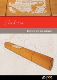
<strong>Canberra</strong><br />
<strong>Maps</strong> <strong>and</strong> <strong>Makers</strong>
<strong>Canberra</strong> <strong>Maps</strong> <strong>and</strong> <strong>Makers</strong><br />
Copyright © Greg Wood, 2009<br />
The ACT Government has permanent, royalty-free licence to use, reproduce <strong>and</strong> disseminate information in all series booklets for its<br />
Centenary of <strong>Canberra</strong> projects.<br />
w ISBN 978-0-9807394-1-1<br />
w GPO Box 158, <strong>Canberra</strong> ACT 2601<br />
w Tel: 13 22 81<br />
w www.canberra<strong>100</strong>.com.au<br />
Printed by Goanna Print<br />
Printed on Mega Recycled: 50% post consumer waste & 50% FSC Certified Fibre.<br />
Designed by Mariana Rollgejser<br />
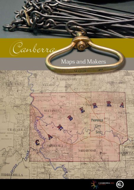
Cover images: A surveyor’s chain, with 66 one-foot links, typical of the technology used at the time of Federation (top), image<br />
courtesy of the National Capital Authority; <strong>Canberra</strong> map produced by Arthur L Lloyd <strong>and</strong> Walter Liberty Vernon in August/September<br />
1906 (bottom), image courtesy of National Archives of Australia. See pp.23-24 in this booklet.
<strong>Canberra</strong><br />
<strong>Maps</strong> <strong>and</strong> <strong>Makers</strong><br />
Greg Wood<br />
A publication of the Chief Minister’s Department, ACT Government – to commemorate the Centenary of <strong>Canberra</strong>, 1913–2013
<strong>Canberra</strong> <strong>Maps</strong> <strong>and</strong> <strong>Makers</strong> 4<br />
A selection of the renderings that comprised the entry (#29 of 137) by Walter Burley Griffin <strong>and</strong> Marion Mahony Griffin<br />
in the 1911-12 international competition to design Australia’s new capital city. Griffin biographer Alasdair McGregor<br />
describes the renderings as ‘a beguilingly simple suite of drawings … a tour de force of graphic art …’<br />
National Archives of Australia
5<br />
<strong>Canberra</strong> <strong>Maps</strong> <strong>and</strong> <strong>Makers</strong><br />
These days we take it for granted that <strong>Canberra</strong> is Australia’s capital. Could it ever have been<br />
otherwise? Could the city ever have been built somewhere else, to other than Walter Burley<br />
Griffin’s elegant design?<br />
In fact, each of these steps, that in hindsight seems irresistible <strong>and</strong> obvious, was only decided<br />
after prolonged debate, the outcome of which was for so long uncertain. This booklet<br />
recounts the ‘Battle of the Sites’ <strong>and</strong> considers the decisions that shaped the location of the<br />
capital. It does so through the use of key maps, drawn over a century ago, which help to<br />
explain the considerations <strong>and</strong> introduce some of the impressive personalities who influenced<br />
the outcome.
<strong>Canberra</strong> <strong>Maps</strong> <strong>and</strong> <strong>Makers</strong> 6<br />
A National Capital<br />
Australia finally federated in 1901, the six<br />
separate colonies becoming States of one<br />
Australian nation, the culmination of a decade<br />
of subtle <strong>and</strong> complex negotiations over a<br />
constitution to determine the way the new<br />
Commonwealth would be governed. When the<br />
outcome was put to the vote it was close run:<br />
New South Wales unenthusiastic, initially at<br />
least; Queensl<strong>and</strong> confused; Western Australia<br />
tardy to commit. The residents of one New<br />
South Wales country town, Queanbeyan, voted<br />
against Federation by 770 to 623.<br />
Just where to locate the national capital was one<br />
question the negotiators approached with the<br />
utmost caution. No individual State was keen<br />
to see another’s capital become the national<br />
capital – for example, New South Wales did not<br />
want Melbourne to have that role, nor would<br />
the Victorians countenance Sydney. Parochial<br />
pride was a factor, as was the fear that another<br />
State’s concerns could excessively influence<br />
<strong>and</strong> preoccupy the national agenda. More<br />
tellingly, for this proud young nation the<br />
national capital would be a statement: of its<br />
newfound unity, aspirations, capacities <strong>and</strong>,<br />
in time, its achievements. At a practical level,<br />
the capital would be the meeting place for the<br />
Commonwealth Parliament <strong>and</strong> the site of the<br />
seat of government.<br />
Initially, the draft Australian Constitution left it<br />
to the Federal Parliament, once elected, to decide<br />
the capital’s location. However, in 1899, late<br />
in the negotiations, the relevant provision was<br />
amended with the aim of enticing the less than<br />
enthusiastic New South Wales voters to support<br />
Federation. Under the revised formula, Section<br />
125 of the Constitution, the national capital was<br />
to be in New South Wales but no closer than <strong>100</strong><br />
miles to Sydney, <strong>and</strong> within a Federal Territory<br />
of not less than <strong>100</strong> square miles. Until the site<br />
was selected, <strong>and</strong> the capital built, the Parliament<br />
would meet in Melbourne. Some in New South<br />
Wales suspected that the cunning Victorians<br />
intended to make permanent that temporary<br />
arrangement. To thwart such a possibility, soon<br />
after the deal was finalised <strong>and</strong> even before the<br />
Commonwealth had actually come into being,<br />
New South Wales appointed Alex<strong>and</strong>er Oliver, the<br />
President of the New South Wales L<strong>and</strong> Appeal<br />
Court, to begin a search for suitable sites. Besides<br />
the constitutional requirements of Section 125,<br />
when weighing the alternatives, Oliver had to<br />
consider both practicalities <strong>and</strong> aesthetics.<br />
National Library of Australia<br />
One of the National Library of Australia’s genuine ‘treasures’: the album of<br />
photographs by Edmund Thomas Luke which so beautifully captures the spirit,<br />
excitement <strong>and</strong>, above all, the personality of the Commonwealth Senators as they<br />
toured a number of possible capital sites in New South Wales in February 1902.
7<br />
<strong>Canberra</strong> <strong>Maps</strong> <strong>and</strong> <strong>Makers</strong><br />
Why <strong>Maps</strong>?<br />
A great deal of information about national capital site selection is only available from the<br />
maps drawn at the time, mainly because maps are the easiest way to show the location of<br />
a town, the distance between two places, the course of a river, or the direction of a road<br />
or a railway. Similarly, it is natural to use a map if you need to show a border (between<br />
countries or states) to define sovereignty or to indicate l<strong>and</strong> ownership.<br />
Underst<strong>and</strong>ing most maps does not require special expertise. However, maps do require<br />
a thoughtful <strong>and</strong> sceptical eye. Sometimes they depict exactly what’s there; surveyors <strong>and</strong><br />
cartographers as professionals are committed to precision. However, sometimes maps<br />
convey an idea, something the mapmaker would like to see happen. <strong>Maps</strong> can be drawn<br />
to inform, advertise, persuade <strong>and</strong> change the way we think, even to deceive.<br />
Questions arise. What was the person who drew the map wanting to tell us <strong>and</strong> why?<br />
Who commissioned the map, who drew it, based on what information, who signed it,<br />
who saw it, when <strong>and</strong> why?<br />
To provide a more detached <strong>and</strong> informed basis for national capital site decisions in<br />
Australia, two Royal Commissions were established, one by the New South Wales<br />
Government, one by the Commonwealth. Besides the Royal Commissioners themselves,<br />
each Commission relied on the advice of numerous experts – architects, surveyors,<br />
engineers, meteorologists, cartographers <strong>and</strong> geologists – many illustrating their analysis<br />
through cartography.<br />
There can be thous<strong>and</strong>s of copies of a particular map, a street directory for example.<br />
Another map may be unique, tucked away in a library or archive, only one copy<br />
existing, or at least existing in a particular form, maybe with h<strong>and</strong>-drawn changes<br />
to an earlier printed version of that map. Certainly that is the case with some of the<br />
maps included here. Normal practice was to print <strong>and</strong> publish the maps <strong>and</strong> expert<br />
studies that were relevant to national capital site selection; the Commonwealth <strong>and</strong><br />
the New South Wales Parliaments routinely did so. However, sometimes maps <strong>and</strong><br />
plans were briefly displayed, then pigeon-holed, possibly because of disagreement<br />
between governments, possibly because they were costly to print. Left in manuscript,<br />
discounted <strong>and</strong> dismissed, they were quickly lost to sight <strong>and</strong> overlooked. Historically<br />
important, some of the maps that tell the <strong>Canberra</strong> story are very rare indeed, long-lost<br />
treasure: <strong>Maps</strong> 5, 6 <strong>and</strong> 7 (pp. 19–23) fall into that category. Equally, it is of concern<br />
for <strong>Canberra</strong>’s compelling story that much of the cartographic record seems to have<br />
been lost.<br />
Usually, maps are the work of experts. One risk is that by concentrating on them we<br />
overlook the part played by the talented politicians of the era, the press <strong>and</strong> the public.<br />
All contributed significantly to the capital selection question, with ideas as well as<br />
influence <strong>and</strong> ultimately, in the case of the politicians, by their actual decisions.
<strong>Canberra</strong> <strong>Maps</strong> <strong>and</strong> <strong>Makers</strong> 8<br />
What Shaped the Site<br />
Decision?<br />
When it came to practicalities, Australia at the<br />
time of Federation was a different place to the<br />
one we know today. While most Australians<br />
lived in the State capitals or in large towns,<br />
the economy was still heavily rural-reliant,<br />
recovering from a banking crisis <strong>and</strong> an<br />
economic depression. New South Wales, yet<br />
again, was experiencing severe drought.<br />
It was still a horse <strong>and</strong> buggy era, though cars<br />
were starting to appear. The New South Wales<br />
road system was rudimentary, with driving<br />
difficult <strong>and</strong> often hazardous. Rail <strong>and</strong> sea<br />
transport were the main ways of moving people<br />
<strong>and</strong> goods over a long distance. However, the<br />
efficiency of rail transport was compromised<br />
by each State’s obstinate decision to operate its<br />
respective rail system on a different rail-gauge;<br />
both passengers <strong>and</strong> freight alike needed to be<br />
unloaded <strong>and</strong> re-loaded at a State border. And<br />
of course there were no aircraft: the Wright<br />
brothers’ first flight would take place in the<br />
United States two years hence, in 1903.<br />
Notwithst<strong>and</strong>ing the improving rail <strong>and</strong> road<br />
networks, each town relied heavily on local<br />
suppliers for its fresh farm produce, milk,<br />
meat <strong>and</strong> vegetables, <strong>and</strong> for hay, firewood <strong>and</strong><br />
building materials. The new capital would need<br />
to do likewise.<br />
Only limited mechanical equipment was available<br />
for construction activity which depended on<br />
muscles, both of man <strong>and</strong> beast, plus explosives.<br />
There were no bulldozers or similar heavy earth<br />
moving equipment. ‘Traction engines’, to haul<br />
heavy loads, were starting to be used but they did<br />
great damage to the roads.<br />
Electricity was mainly being used in factories,<br />
for tramways, <strong>and</strong> for some domestic <strong>and</strong> civic<br />
lighting but certainly not for the myriad number<br />
of uses we put it to today. It was only twenty<br />
years since Thomas Edison had developed a<br />
practical electric light globe. The transmission<br />
of electricity over long distances was not<br />
technically feasible (though it was a gleam in<br />
the engineer’s eye), so electrical power had to be<br />
generated near the consumer.<br />
As he began his search, Alex<strong>and</strong>er Oliver asked<br />
an expert panel to describe the features they saw<br />
as essential for the city site. They responded, in<br />
language that seems rather old fashioned today:<br />
From an architectural, sanitary, <strong>and</strong><br />
engineering point of view, the ... ideal site<br />
... should be a stretch of gently undulating<br />
country, the slopes of which [are] of sufficient<br />
fall for drainage purposes, <strong>and</strong> admitting of<br />
the construction of streets of easy grade. [It<br />
should be] contiguous to a river, out of the<br />
reach of floods <strong>and</strong> free from fogs. [It should<br />
have] ... gently rising ground, containing a few<br />
depressions readily convertible into small lakes,<br />
<strong>and</strong> the site itself surrounded by comm<strong>and</strong>ing<br />
hills – preferably in the form of an amphitheatre,<br />
or rather semi amphitheatre ... <strong>and</strong> present the<br />
artistic features essential for the development of<br />
a really beautiful city.<br />
The site should be within easy distance of an<br />
ample water supply, admitting of the creation<br />
<strong>and</strong> maintenance of the artificial lakes which<br />
should constitute a leading feature of its<br />
public gardens ... In order that the sanitary<br />
conditions may be satisfactory, it is important<br />
that the subsoil should not be clay. ... It would<br />
be advantageous for the city to have a north<br />
easterly aspect, <strong>and</strong> ... be well sheltered. 1<br />
Parliamentary <strong>and</strong> public discussion generated<br />
other requirements. Obviously the capital<br />
had to be readily accessible, particularly by<br />
rail. Many felt it was desirable that it have a<br />
cool climate. It needed productive farm l<strong>and</strong><br />
to supply food, plus local stone <strong>and</strong> timber<br />
for building. A significant concern at the time<br />
was for the capital to be safe from armed<br />
attack, particularly from naval bombardment.<br />
With an eye on the taxpayer’s wallet, it was<br />
desirable that the site be located on relatively<br />
inexpensive l<strong>and</strong>; the more crown l<strong>and</strong> the<br />
better because that would not require payment<br />
to existing l<strong>and</strong>owners.<br />
The need to ensure adequate water supplies<br />
trumped all other practical considerations. First,<br />
the future capital would require plentiful, pure<br />
water for day-to-day domestic <strong>and</strong> civic use,<br />
for households, gardens, parks, <strong>and</strong> so on. The<br />
second requirement was for ‘ornamental water’.
9<br />
<strong>Canberra</strong> <strong>Maps</strong> <strong>and</strong> <strong>Makers</strong><br />
National Library of Australia<br />
We usually associate the idea of <strong>Canberra</strong>’s<br />
ornamental lake with Walter Burley Griffin but,<br />
as the experts’ report shows, for many it was<br />
a given. The third consideration was water<br />
for power generation, a desirable though not<br />
essential attribute as there were other ways of<br />
generating electricity <strong>and</strong> the city’s electricity<br />
requirements were expected to increase steadily.<br />
If water was to be used for power generation,<br />
the limitations on transmitting electricity<br />
meant the source had to be close to the city.<br />
There was a trade-off between these different<br />
requirements. For example, the more water<br />
used for power generation, the less could be<br />
available for domestic <strong>and</strong> ornamental purposes<br />
<strong>and</strong> vice versa. The quality <strong>and</strong> quantity of any<br />
water leaving the capital was also crucial. It<br />
was essential that sewerage <strong>and</strong> stormwater<br />
drainage not contaminate an inl<strong>and</strong> running<br />
river nor deplete, or pollute, the water supplies<br />
of communities downstream from the new city.<br />
On top of all these considerations, the site had<br />
to be scenically attractive, <strong>and</strong> allow Australians<br />
to build a beautiful capital that they could<br />
showcase to the world.<br />
Alex<strong>and</strong>er Oliver’s final report<br />
on the 45 sites proposed<br />
(before Federation) as the<br />
Australian capital in 1899.<br />
Of these, Oliver personally<br />
inspected 23, <strong>and</strong> held public<br />
enquiries in 14.<br />
Commissioner Oliver’s<br />
Enquiry<br />
Numerous New South Wales communities<br />
responded to Commissioner Oliver’s call for<br />
expressions of interest. They formed local<br />
committees, collected data, produced pamphlets,<br />
made exaggerated <strong>and</strong> implausible claims,<br />
lobbied, cajoled, advertised, enticed. Each<br />
claimed their town or thereabouts was heavensent<br />
to become the capital. Their site was<br />
superior, readily accessible, had productive,<br />
fertile l<strong>and</strong>, pure, plentiful water supplies<br />
<strong>and</strong> abundant building materials. Their site,<br />
uniquely, would deliver rich commercial<br />
pickings for Sydney. They wheeled out their<br />
senior citizens as visible proof that their town’s<br />
climate was invigorating, its clean water <strong>and</strong><br />
healthy environment conducive to longevity.
<strong>Canberra</strong> <strong>Maps</strong> <strong>and</strong> <strong>Makers</strong> 10<br />
Oliver’s ‘A’: One Hundred<br />
Miles to Sydney (Map 1)<br />
Oliver whittled down the contenders <strong>and</strong><br />
conducted public hearings on twenty-three<br />
sites, his final report analysing fourteen in detail.<br />
Quite a few were eliminated by the requirement<br />
that the capital could be no<br />
closer than one hundred<br />
miles to Sydney. Some<br />
excluded by this<br />
provision are shown<br />
on this map that<br />
accompanied his report. 2 Not that the matter<br />
was totally straightforward. Exactly what did<br />
the wording mean? Did you measure one<br />
hundred miles from the centre of Sydney or<br />
from the outskirts; to the centre of the capital<br />
city site or to the border of the surrounding<br />
federal territory? Was the distance defined<br />
by a compass arc or by the distance along a<br />
winding highway? Some possibilities were in<br />
or out depending on the basis of measurement.<br />
Section 125 seemed straightforward until you<br />
uncovered its many ambiguities.<br />
Within the one hundred-mile limit, <strong>and</strong> out<br />
of the running, were Newcastle, Wollongong,<br />
Parramatta <strong>and</strong> Windsor. Other towns spoken<br />
of as possibilities, but excluded by Section 125,<br />
were Moss Vale, Marulan <strong>and</strong> Rylstone. Bathurst<br />
<strong>and</strong> Goulburn were border-line, frustratingly<br />
complicating their chances.<br />
Oliver’s ‘A’ map: One Hundred Miles to Sydney<br />
National Library of Australia
11<br />
<strong>Canberra</strong> <strong>Maps</strong> <strong>and</strong> <strong>Makers</strong><br />
Oliver’s ‘R’: a Federal Territory of One Hundred or One<br />
Thous<strong>and</strong> Square Miles? (Map 2)<br />
Oliver’s report was also the first to wrestle<br />
with the other constitutional requirement,<br />
the one saying that the capital territory<br />
had to be within a Federal Territory with a<br />
minimum area of one hundred square miles.<br />
Would a larger area, even one thous<strong>and</strong><br />
square miles for argument’s sake, make<br />
more sense?<br />
Oliver’s ‘R’ map<br />
National Library of Australia
<strong>Canberra</strong> <strong>Maps</strong> <strong>and</strong> <strong>Makers</strong> 12<br />
National Library of Australia<br />
Oliver’s ‘Queanbeyan’ federal capital site
13<br />
<strong>Canberra</strong> <strong>Maps</strong> <strong>and</strong> <strong>Makers</strong><br />
Oliver thought so. His reason was that if the<br />
l<strong>and</strong> in it was leased, a larger territory would<br />
provide the Commonwealth with a source<br />
of income to fund the capital. He illustrated<br />
the effect of a larger territory in other maps<br />
that accompanied his 1900 report, this one<br />
specifically in relation to a possible capital site<br />
around Yass. The larger territory he proposed<br />
covered places like Gundaroo, Sutton, Lake<br />
George <strong>and</strong>, in fact, all of what has since become<br />
the ACT north of the Molonglo River. 3<br />
A year later, when the Commonwealth<br />
Parliament convened, leading lights like the<br />
controversial King O’Malley took the rationale<br />
for a one thous<strong>and</strong> square mile federal territory<br />
one step further. Like Oliver, O’Malley had<br />
the view that a larger territory would ensure<br />
that the increase in l<strong>and</strong> values, generated<br />
by building the capital, was captured for the<br />
Australian public rather than by those who<br />
held l<strong>and</strong> near the capital. In addition, a larger<br />
area would dampen l<strong>and</strong> speculation in the<br />
surrounding region, the judgement being that<br />
the nearest l<strong>and</strong> outside federal control would<br />
be further away from the capital, making it less<br />
commercially useful <strong>and</strong> valuable.<br />
A few years later the surveyor, Charles<br />
Scrivener, after whom Scrivener Dam is named,<br />
was among those arguing that the Federal<br />
Territory had to be large enough to ensure the<br />
Commonwealth controlled the catchments<br />
of the rivers that flowed through it, <strong>and</strong><br />
particularly those that provided its supply of<br />
drinking water. Sovereignty over the catchments<br />
meant the Commonwealth alone could make<br />
decisions on water supplies without needing to<br />
consult the State government (see also <strong>Maps</strong> 5,<br />
9, <strong>and</strong> 10 on pages 19, 26 <strong>and</strong> 27).<br />
Oliver’s ‘Queanbeyan’<br />
Federal Capital Site (Map 3)<br />
In 1900, in the course of his enquiry, Oliver<br />
inspected a site then called ‘Queanbeyan’, but<br />
which encompassed much of what we today call<br />
‘<strong>Canberra</strong>’. He was not impressed, despite the<br />
best endeavours of local Queanbeyan enthusiasts<br />
such as the famous surveyor-turned-wheatbreeder,<br />
William Farrer, newspaper editor <strong>and</strong><br />
one time parliamentarian, John Gale, <strong>and</strong> large<br />
l<strong>and</strong>holders like Frederick Campbell.
<strong>Canberra</strong> <strong>Maps</strong> <strong>and</strong> <strong>Makers</strong> 14<br />
Oliver’s depiction of the Federal Territory<br />
<strong>and</strong> city site at ‘Queanbeyan’ is shown in this<br />
map, published with his 1900 report. 4 This is<br />
<strong>Canberra</strong>’s cartographic ‘birth certificate’. Oliver<br />
proposed a Federal Territory shaped rather like a<br />
frying pan (outlined in red) which covers one<br />
hundred square miles. It includes many familiar<br />
place names: Tuggeranong, Narrabundah,<br />
Wanniassa, Jerrabomberra, Tharwa, Yarralumla,<br />
Mt Taylor, Mt Ainslie <strong>and</strong> Black Mountain. Close<br />
by, just outside the territory suggested, are<br />
places called <strong>Canberra</strong>, Pialligo, Weetangera,<br />
Googong <strong>and</strong> Burra. The proposed city site is<br />
the blue square, straddling the Molonglo River,<br />
roughly where the suburbs of Reid/Campbell<br />
<strong>and</strong> Barton/Kingston are now.<br />
The site Oliver ultimately favoured was the<br />
southern New South Wales town of Bombala.<br />
This would be accessed from a federal port at<br />
Eden where, for example, an Australian Navy<br />
(when there was one) would be based. Oliver<br />
also gave high marks to the Yass site because<br />
it was conveniently near the Melbourne-to-<br />
Sydney railway line <strong>and</strong> hence more readily<br />
accessible for federal parliamentarians. He also<br />
liked Orange (Canobolas) mainly because of<br />
the high-quality agricultural l<strong>and</strong> surrounding<br />
it <strong>and</strong> its food-growing potential. Come 1901<br />
<strong>and</strong> Federation, Oliver’s thoughtful report<br />
was pigeon-holed. The new Commonwealth<br />
Parliament was not going to be bossed around<br />
by New South Wales appointees, <strong>and</strong> it would<br />
reach its own conclusions, thank you very much.<br />
The Battle of the Sites<br />
Oliver’s enquiry was the initial skirmish in the<br />
‘Battle of the Sites’, which began in earnest<br />
once the first Commonwealth Parliament was<br />
elected. That contest continued for nearly ten<br />
years with many skirmishes: leading federal<br />
parliamentarians often publicly disagreed; the<br />
New South Wales Government was regularly<br />
at odds with the Commonwealth; <strong>and</strong> many<br />
aspiring communities had their pennyworth<br />
as did the press, royal commissioners <strong>and</strong> all<br />
manner of experts. It was an entertaining, if<br />
somewhat debilitating spectacle.<br />
The Commonwealth Parliament met first in<br />
Melbourne on 9 May 1901. The next ten<br />
years saw nine Prime Ministerships <strong>and</strong> five<br />
different Prime Ministers. Differences between<br />
protectionists <strong>and</strong> free traders were the<br />
delineating political divide, initially at least, <strong>and</strong><br />
a decision on the location of the national capital<br />
was a low priority on the first Parliament’s<br />
agenda. 5 Like the Commonwealth Parliament,<br />
the Federal bureaucracy was in its infancy, with<br />
only a few score working in the diverse Home<br />
Affairs portfolio, the Department responsible for<br />
bringing the national capital into existence. In<br />
the early 1900s the Commonwealth drew on<br />
State government expertise; when it came to<br />
site selection, which by definition was going to<br />
be somewhere within New South Wales, they<br />
heavily relied on New South Wales experts.<br />
The most entertaining battles were between<br />
some of the Commonwealth Parliament’s<br />
stalwarts, who were keeping a close eye on their<br />
constituents’ interests. Former New South Wales<br />
Premier, future Prime Minister Sir George Reid,<br />
favoured sites around Orange <strong>and</strong> Lyndhurst<br />
which, by coincidence, just happened to be<br />
in his electorate. Another former New South<br />
Wales Premier, Sir William Lyne, represented<br />
the electorate of Hume, in southern New South<br />
Wales, which ran alongside the Murray River<br />
<strong>and</strong> encompassed possibilities like Tumut <strong>and</strong><br />
Albury. Hardly detached, he regarded their<br />
claims as undeniable. As a capital contender,<br />
Albury had a creditable pedigree; decades earlier,<br />
the ‘Father of Federation’, Sir Henry Parkes,<br />
had proposed it, seeing the town as a symbolic<br />
statement of collaboration <strong>and</strong> compromise<br />
between New South Wales <strong>and</strong> Victoria.<br />
Another able <strong>and</strong> influential cabinet minister<br />
was Austin Chapman, whose electorate, Eden<br />
Monaro, extended from Queanbeyan south to<br />
the Victorian border, east to the coast. Chapman,<br />
whose career in Federal Parliament lasted<br />
twenty-four years, was variously Postmaster-<br />
General <strong>and</strong> Minister for Defence. He first<br />
championed Bombala, later switching his<br />
support to Dalgety. The site we now know<br />
as <strong>Canberra</strong> straddled his electorate <strong>and</strong> the<br />
adjacent electorate of Werriwa. With Chapman’s
15<br />
<strong>Canberra</strong> <strong>Maps</strong> <strong>and</strong> <strong>Makers</strong><br />
efforts directed elsewhere, <strong>Canberra</strong> had his<br />
lukewarm endorsement at best. <strong>Canberra</strong>’s<br />
ultimate emergence as the capital site is all<br />
the more surprising, given the absence of a<br />
heavyweight local representative championing<br />
it in Parliament, <strong>and</strong> its earlier rejection by<br />
Alex<strong>and</strong>er Oliver.<br />
Sir John Forrest’s views carried weight, as did Sir<br />
John himself. He too graced the Home Affairs<br />
portfolio. In addition to being the first-ever<br />
Premier of Western Australia, his CV included<br />
being a noted explorer in Western Australia <strong>and</strong><br />
that colony’s Surveyor-General. These credentials<br />
bolstered his authority. Forrest emerged as a<br />
strong supporter of Dalgety.<br />
Reid, Lyne (Lyneham), Chapman <strong>and</strong> Forrest all<br />
have <strong>Canberra</strong> suburbs named in their honour.<br />
Parliamentary Tours 1902<br />
In 1902, when they finally got around to<br />
considering the question of the capital, the Senate<br />
<strong>and</strong> House of Representatives organised two<br />
separate site inspection tours. Publicly, the press<br />
referred to them as a ‘picnic’. In reality they can’t<br />
have been: bumping for hundreds of miles, weeks<br />
on end, in horse-drawn drays, on dirt roads, must<br />
have been bruising, literally. Each community<br />
they visited was imprudently keen to promote its<br />
claims, often regaling the visitors with accounts<br />
of the extraordinary longevity achieved by local<br />
residents. In one town, Bombala, this prompted<br />
King O’Malley to say that he understood that to<br />
get a cemetery going in the town they had to<br />
import dead men from Sydney.<br />
Kirkpatrick Enquiry<br />
Deflated, exhausted <strong>and</strong> confused by the<br />
weeks of bone-jarring travel, <strong>and</strong> by the<br />
seemingly strong claims of many contenders,<br />
the Commonwealth Parliament commissioned<br />
another Royal Commission to seek more<br />
information <strong>and</strong> data. John Kirkpatrick, a<br />
Sydney architect, <strong>and</strong> three colleagues were<br />
asked to assess eight prospects: Albury, Armidale,<br />
Bathurst, Bombala, Lake George, Lyndhurst,<br />
Orange <strong>and</strong> Tumut. ‘Queanbeyan’ was not<br />
among those listed, Lake George the nearest site<br />
to <strong>Canberra</strong>.<br />
Lake George<br />
The idea that Lake George could provide a<br />
suitable capital site would puzzle those driving<br />
past the dry lakebed today. In fact it was dry for<br />
the first few years of the 1900s, but perhaps the<br />
visionary 1901 illustration by Charles Coulter<br />
(Robert) Charles Coulter’s<br />
Europeanised vision of<br />
an Australian capital city<br />
at Lake George, near<br />
<strong>Canberra</strong>, 1901. Since<br />
the 1820s, Lake George<br />
has regularly been, <strong>and</strong> is<br />
today, bone dry.<br />
National Library of Australia
<strong>Canberra</strong> <strong>Maps</strong> <strong>and</strong> <strong>Makers</strong> 16<br />
of a magnificent fairy tale city around the lake<br />
influenced thinking. Whatever the inspiration,<br />
quite a few designs were developed to<br />
promote a Lake George site. Most included an<br />
embankment to constrain the lake as such, the<br />
level of which was then sustained by water fed<br />
through a tunnel from a dam on the Molonglo<br />
River. In some proposals, if the Molonglo<br />
supply proved insufficient, the Queanbeyan,<br />
even the Shoalhaven <strong>and</strong> Murrumbidgee Rivers<br />
would be dammed <strong>and</strong> their water piped to Lake<br />
George. It was a disruptive <strong>and</strong> expensive idea.<br />
Other variations, including one by a New South<br />
Wales surveyor, G H Sheaffe, would have linked<br />
the capital city at Lake George with Jervis Bay<br />
by railway. Kirkpatrick’s version had a foreshore<br />
capital city near Bungendore. More informative<br />
than the various maps is Charles Coulter’s ideas<br />
for a Lake George capital. 6<br />
Kirkpatrick’s Conclusions<br />
Kirkpatrick’s report cautiously avoided saying<br />
any one individual site had overwhelmingly<br />
compelling claims. 7 Rather, he tiptoed through<br />
the political mine-field, rating the different<br />
possibilities against a set of criteria, his<br />
assessment implying that Albury had the best<br />
qualifications. As it happened, Albury was in<br />
the electorate of Sir William Lyne who, as Home<br />
Affairs Minister, had commissioned him to<br />
tackle the task.<br />
Oliver’s favoured site, Bombala, received the<br />
lowest ranking. This provoked Oliver to respond<br />
with a dismissive counter report including<br />
the comment that, in Kirkpatrick’s view, even<br />
Lake George with its ‘horizon of salt ooze <strong>and</strong><br />
cheerless aspect’ received a higher ranking<br />
than Bombala. 8 Oliver then began another<br />
self-initiated tour of inspection, determined to<br />
come up with the ideal site. In failing health,<br />
travelling until six weeks before his death, he<br />
continued his quest as if haunted.<br />
Albury, however, won over few New South<br />
Welsh parliamentarians, Lyne excepted. Taking<br />
a parochial approach they feared that a border<br />
location, closer to Melbourne than Sydney,<br />
would see the commercial spoils of capital<br />
construction gravitating south, meaning New<br />
South Wales would lose the benefits of having<br />
the capital within the State. When the Federal<br />
Parliament first voted in October 1903, the<br />
Senate voted for Bombala <strong>and</strong> the House<br />
of Representatives for Tumut. Parliament<br />
adjourned, the question unresolved.<br />
Charles Scrivener <strong>and</strong><br />
Dalgety (Map 4)<br />
Belatedly a ninth site, Dalgety, was added to the<br />
coterie that Kirkpatrick was asked to judge. The<br />
town was in southern New South Wales, on the<br />
Snowy River <strong>and</strong> on the edge of the Australian<br />
Alps. Although Kirkpatrick reported without<br />
enthusiasm, the site attracted a growing b<strong>and</strong><br />
of supporters, among them Prime Minister<br />
Alfred Deakin, Home Affairs Minister Sir John<br />
Forrest <strong>and</strong> Colonel Percy Owen. Owen had<br />
recently become the first Director-General of<br />
Works in the Home Affairs Department <strong>and</strong> he<br />
would be heavily involved for the next twentyfive<br />
years, first in site selection <strong>and</strong> later in<br />
building <strong>Canberra</strong>.<br />
In April 1904, three months after he took<br />
up his position, Owen accompanied Deakin,<br />
Forrest <strong>and</strong> Chapman on a tour of Dalgety <strong>and</strong><br />
other southern Monaro sites. Two surveyors,<br />
Charles Scrivener <strong>and</strong> A H Chesterman, had<br />
been seconded from the New South Wales<br />
Government to provide assessments of them,<br />
additional to Kirkpatrick’s advice. Scrivener had<br />
formed a strong view in favour of Dalgety.<br />
Like Scrivener, Owen was impressed primarily<br />
because the Snowy offered an exceptional<br />
supply of clean water for domestic use. Owen,<br />
an engineer, wrote that:<br />
... in the Snowy River [New South Wales]<br />
is possessed of a most valuable asset ... the<br />
value of water power for generating electricity<br />
<strong>and</strong> the transmission of power by electricity is<br />
well-known at the present day. The probability<br />
of development during the next <strong>100</strong> years is<br />
impossible to foretell. However, it may safely<br />
be said that the existence of such a power in<br />
the vicinity of a city <strong>and</strong> Territory would be an<br />
advantage of the utmost importance ... 9
17<br />
<strong>Canberra</strong> <strong>Maps</strong> <strong>and</strong> <strong>Makers</strong><br />
Commonwealth Parliamentary Paper<br />
Charles<br />
Scrivener’s map<br />
of alternative<br />
federal territories<br />
surrounding a<br />
national capital at<br />
Dalgety<br />
National Library of Australia<br />
However, aesthetically Dalgety left a lot to be<br />
desired. Owen noted that ‘...the immediate<br />
surrounds of Dalgety are dreary in the extreme<br />
excepting the river scenery’. 10<br />
Joseph Carruthers<br />
In Charles Scrivener’s view, the<br />
Commonwealth Territory at<br />
Dalgety should extend over<br />
the river catchments. His<br />
alternative territory designs<br />
are illustrated in this map. 11<br />
Rather provocatively, he<br />
included one that would have<br />
given the Commonwealth a<br />
territory that encompassed<br />
the whole catchment of the<br />
Snowy <strong>and</strong> Eucumbene Rivers,<br />
reaching as far as Mt Kosciuszko,<br />
some 1550 square miles in total.<br />
Scrivener did so knowing an<br />
adverse reaction from his everyday<br />
employer, the New South Wales<br />
State Government, was guaranteed.<br />
In August 1904, when another<br />
vote was taken, both the House<br />
of Representatives <strong>and</strong> the<br />
Senate supported Dalgety. The<br />
Premier of New South Wales,<br />
Sir Joseph Carruthers, reacted<br />
vehemently. Dalgety was<br />
too close to Melbourne, too<br />
far from Sydney. If coupled<br />
with a Federal port at Eden<br />
(the intent), it would draw<br />
maritime commerce away<br />
from Sydney. Also, Dalgety<br />
would require the State<br />
Government to make heavy<br />
outlays on new, probably<br />
unprofitable railways. A<br />
final overriding concern<br />
was the Commonwealth’s<br />
intention to secure 900<br />
square miles for the Federal<br />
Territory, vastly more than<br />
the one hundred square miles<br />
minimum mentioned in the<br />
Constitution. Carruthers dug<br />
in his heels. Strident <strong>and</strong><br />
passionate correspondence<br />
between the State <strong>and</strong><br />
Commonwealth Governments flew back <strong>and</strong><br />
forth. The net effect was a st<strong>and</strong>-off. In practice,<br />
if not in law, New South Wales support for the<br />
site of the seat of government was essential <strong>and</strong> it<br />
was not going to be forthcoming while Dalgety<br />
was the proposal <strong>and</strong> Carruthers the Premier.<br />
As an olive branch, New South Wales then<br />
offered three alternatives to Dalgety: Yass,<br />
Tumut <strong>and</strong> Lyndhurst. The Commonwealth<br />
rejected all three. At this point the otherwise<br />
excellent histories become vague. Somehow,<br />
mysteriously, over the next two years <strong>Canberra</strong><br />
emerges from nowhere.<br />
Who gave <strong>Canberra</strong> a second chance? Some<br />
long overlooked maps <strong>and</strong> reports indicate<br />
what happened, slightly at the risk of overcompensating<br />
for past omissions.
<strong>Canberra</strong> <strong>Maps</strong> <strong>and</strong> <strong>Makers</strong> 18<br />
Early 1906, on instructions from Premier<br />
Carruthers, the New South Wales Government<br />
again began to trawl for sites that better suited<br />
it – sites that were closer to Sydney, near to the<br />
existing railways, in well-watered country <strong>and</strong><br />
distant from competing ports. The search was<br />
concentrated on the country between Gundagai<br />
<strong>and</strong> Goulburn. There is no evidence suggesting<br />
that New South Wales Cabinet ministers<br />
advocated specific possibilities. Certainly<br />
Carruthers himself had none in mind. His<br />
unpublished autobiography records him living in<br />
Goulburn for part of his childhood, holidaying<br />
near Lake George <strong>and</strong> Lake Bathurst. 12 However,<br />
he is quoted in the press in 1907 as saying that<br />
‘I have never visited <strong>Canberra</strong> <strong>and</strong> therefore<br />
do not know it <strong>and</strong> am not able to speak from<br />
personal knowledge’. 13 His successor as Premier,<br />
Charles Wade, embraced <strong>Canberra</strong> but after, not<br />
before, it was clearly in contention.<br />
It was left to the experts – architects, engineers<br />
<strong>and</strong> surveyors – working within the New South<br />
Wales Government to come up with<br />
suggestions. Those most closely<br />
involved were: Arthur Lloyd,<br />
Chief Surveyor of the Public<br />
Works Department; Walter<br />
Liberty Vernon, the highly<br />
regarded New South Wales<br />
Government Architect;<br />
William Hutchinson, a<br />
railway engineer; <strong>and</strong><br />
Leslie (L A B ) Wade. Wade<br />
was arguably the leading<br />
expert on water supply, water<br />
conservation, irrigation <strong>and</strong><br />
sewerage schemes working within<br />
the New South Wales Public Works<br />
Department.<br />
As mentioned earlier, water supplies were the<br />
make or break issue. As a relatively young<br />
man Wade had designed <strong>and</strong> built the Cataract<br />
Dam, then the largest concrete dam in the<br />
southern hemisphere <strong>and</strong> the major source<br />
of Sydney’s water supply. He had also been<br />
constructing Sydney’s sewer system. His dream<br />
was to develop the Murrumbidgee Irrigation<br />
Area, a project for which the Burrinjuck Dam<br />
was the crucial ingredient. That project<br />
alone would have ensured he was familiar<br />
with the Murrumbidgee’s catchment <strong>and</strong><br />
with southern New South Wales. Wade<br />
also happened to be the brother of the man<br />
shortly to become New South Wales Premier,<br />
Charles Wade. Together, these experts<br />
authored a third, post-Oliver, post-Kirkpatrick<br />
spate of site analyses, reports, pamphlets,<br />
maps <strong>and</strong> charts.<br />
Initially at least <strong>Canberra</strong>’s re-emergence<br />
as a serious possibility had nothing to do<br />
with the Commonwealth Government.<br />
Between the rejection of Dalgety in 1905<br />
<strong>and</strong> the vote in the Federal Parliament late<br />
in 1908 that decided the capital should be<br />
at ‘Yass- <strong>Canberra</strong>’, not one report, analysis<br />
or other paper was commissioned by the<br />
Commonwealth. An indication of the way<br />
the Commonwealth kept its distance comes<br />
late in 1906. The relevant Minister, Lyttleton<br />
Groom, sent a note to Prime Minister<br />
Deakin suggesting that the<br />
Commonwealth initiate<br />
its own analysis of the<br />
<strong>Canberra</strong> site which was<br />
then starting to attract<br />
interest. A month<br />
elapsed before the<br />
minute was returned<br />
with a notation saying:<br />
‘papers returned by<br />
the (Prime Minister’s)<br />
direction. The matter<br />
will doubtless be further<br />
considered at a later<br />
date.’ 14 Prime Minister Alfred<br />
Deakin was still out of sorts with<br />
the New South Wales Government over<br />
Dalgety, <strong>and</strong> he was not going to imply that<br />
the Commonwealth was ready to canvass<br />
<strong>Canberra</strong>, or any other alternative. The one<br />
paper published by the Commonwealth<br />
was penned by Acting Prime Minister Sir<br />
John Forrest personally: in 1907, Forrest<br />
undertook a comparison between Dalgety<br />
<strong>and</strong> <strong>Canberra</strong>, finding firmly in favour of<br />
Dalgety. 15<br />
Walter Vernon<br />
National Archives of Australia
19<br />
<strong>Canberra</strong> <strong>Maps</strong> <strong>and</strong> <strong>Makers</strong><br />
National Archives of Australia<br />
Arthur Lloyd’s fourteen<br />
potential capital sites nearer<br />
to Sydney than Dalgety<br />
Surveyor Lloyd’s Fourteen<br />
Suggestions (Map 5)<br />
Initially the New South Wales experts – Wade<br />
specifically – reassessed the Lake George site.<br />
Lake George was again dry in 1906, as it had<br />
been on four previous recorded occasions. Wade<br />
investigated, expressed reservations, but did not<br />
eliminate it entirely.<br />
Then a wide-ranging survey of the country<br />
from Gundagai to Goulburn was undertaken by<br />
Chief Surveyor of the Public Works Department,<br />
Arthur Lloyd. A map signed by Lloyd, dated<br />
28 March 1906, records fourteen possible sites<br />
he surveyed, albeit briefly. 16 The map gives<br />
credence to a comment of Charles Scrivener’s<br />
that capital sites ‘are as thick as fallen leaves in<br />
autumn’. Those fourteen sites were then further<br />
assessed either by Vernon or Wade.<br />
Lloyd’s map gives prominence to a site that they<br />
called Mahkoolma, near Burrinjuck Dam, but<br />
his accompanying report makes clear that he<br />
personally favours city sites ‘J & K’. They coincide<br />
with today’s Belconnen <strong>and</strong> central <strong>Canberra</strong>:<br />
Site ‘J’, is an ‘extensive area of fairly rolling,<br />
undulating country. Good elevation, fair soil,<br />
excellent drainage. The views surrounding this<br />
site are extensive <strong>and</strong> beautiful.’<br />
Site ‘K’, has ‘extensive rolling, undulating<br />
country, well adapted for building upon.<br />
Extensive views, fair soil, good elevation <strong>and</strong><br />
drainage. Exposed, probably bleak in winter.<br />
This country forms part of the original Federal<br />
City Site proposed for Queanbeyan’. 17<br />
It was Vernon, the Government Architect, who<br />
strongly favoured Makhoolma. He prepared<br />
an elaborate pamphlet with Art Nouveau<br />
cover <strong>and</strong> h<strong>and</strong>-painted Charles Coulter<br />
illustrations to promote its case; the original is<br />
now in the National Library. The Makhoolma<br />
site was named after a derelict property in<br />
the area, <strong>and</strong> was adjacent to the proposed<br />
Burrinjuck Dam. Even when the dam’s primary<br />
purpose, irrigation, depleted the water level,<br />
an ‘ornamental vista’ was to be assured by<br />
increasing dam capacity. Wade too seems to<br />
have favoured Mahkoolma, perhaps predictably:<br />
it would have been a further reason justifying<br />
his Burrinjuck Dam plans. 18
<strong>Canberra</strong> <strong>Maps</strong> <strong>and</strong> <strong>Makers</strong> 20<br />
Did Leslie Wade Name<br />
<strong>Canberra</strong>? (Map 6)<br />
Two more maps, signed by Wade <strong>and</strong> dated<br />
4 April 1906, a week after Lloyd’s map, show<br />
another stage in the thinking. They narrow the<br />
focus from the fourteen Lloyd sites to three.<br />
While it is not stated, adequacy of water supply<br />
almost certainly was the factor deciding which<br />
to keep <strong>and</strong> which to cut. Significantly, Wade<br />
highlights Lloyd’s K site <strong>and</strong> gives it the name of<br />
a New South Wales county ‘parish’, christening<br />
it ‘<strong>Canberra</strong>’. This map is the first official<br />
(which is to say governmental) document of<br />
any genre known to attach that particular name,<br />
‘<strong>Canberra</strong>,’ to the proposed national capital site.<br />
If there are others, they have yet to emerge out<br />
of the depths of the archives. 19<br />
It is not that the name ‘<strong>Canberra</strong>’ was not<br />
included on other maps previously; for many<br />
years it had been. ‘<strong>Canberra</strong>’ is constantly found<br />
on parish maps <strong>and</strong> was the name attached to the<br />
local church. In the eyes of local residents the<br />
place was almost, but not quite, a village. From<br />
the innumerable available options (<strong>and</strong> there<br />
were innumerable options), this document shows<br />
that someone, probably Wade, decided to call this<br />
proposed capital site ‘<strong>Canberra</strong>’. The name sticks<br />
until it is ultimately endorsed in 1913, when the<br />
Governor-General’s wife, Lady Denman, formally<br />
announces it as the capital’s name.<br />
Carruthers forwarded these various reports <strong>and</strong><br />
maps to Prime Minister Alfred Deakin on 30 May<br />
1906. The Government printed the report texts<br />
but not the accompanying maps. Overall, at this<br />
stage, the New South Wales Government favoured<br />
Mahkoolma, but ultimately it was up to federal<br />
Members <strong>and</strong> Senators to decide for themselves.<br />
Parliamentary Visit of<br />
August 1906: the Tide<br />
Turns<br />
New South Wales invited federal<br />
parliamentarians to visit these <strong>and</strong> other sites,<br />
including Dalgety, at New South Wales expense.<br />
Thirty-three Commonwealth parliamentarians<br />
agreed to do so. The visits took place over two<br />
weekends in August 1906, with special trains<br />
laid on from Melbourne. The first trip was to<br />
inspect Mahkoolma <strong>and</strong> <strong>Canberra</strong>, the second<br />
Lake George <strong>and</strong> Dalgety.<br />
The Daily Telegraph, of 13 August 1906, makes<br />
clear what happened:<br />
Great events from little causes spring <strong>and</strong> the<br />
fact that a group of ten or twelve men were<br />
hard at work on Saturday morning on a muddy<br />
bush road, not far from Yass, in getting a trap<br />
out of the bog into which it had sunk to the<br />
axles, may have, in its way, an influence upon<br />
the destinies of Australia. For these men were<br />
Federal politicians, a section of the party of<br />
33 members who left Melbourne on Friday
21<br />
<strong>Canberra</strong> <strong>Maps</strong> <strong>and</strong> <strong>Makers</strong><br />
Leslie Wade’s h<strong>and</strong>-drawn map,<br />
the first to call a capital site<br />
‘<strong>Canberra</strong>’<br />
National Archives of Australia<br />
night to visit certain territories in New South<br />
Wales proposed for the Federal capital, <strong>and</strong> it<br />
was in the course of their journey to the new<br />
site, Mahkoolma, about 16 miles southwest of<br />
Bowning, the station just below Yass, on the<br />
main Southern Railway, that the members had<br />
their back blocks adventure. Some of them<br />
nearly fell into the Couradigibee [sic] Road,<br />
which is quite unformed, under rain, hilly, <strong>and</strong><br />
in places like a morass from the recent rains.<br />
Hence, they reached Mahkoolma flustered,<br />
two hours late, <strong>and</strong> in a frame of mind which<br />
would not have encouraged them to a judicial<br />
inspection of the Territory. In fact, the majority<br />
of them had barely time to do much more than<br />
to eat their luncheon, look across the sloping<br />
plateau towards the enveloping range of timber<br />
covered hills, or at the dense array of dead trees<br />
which gave the rising ground behind them such<br />
a desperate appearance, examine certain plans<br />
prepared by the Works Department, <strong>and</strong> hunt<br />
for their rugs, to begin the return journey, in<br />
order that they might overcome the terrors of<br />
the Couradigibee Road before darkness set in.<br />
Had they climbed some of the hills, as Mr J C<br />
Watson <strong>and</strong> Mr Webster did, they would have<br />
obtained a much more extensive view, <strong>and</strong>, no<br />
doubt, returned with different impressions ...
<strong>Canberra</strong> <strong>Maps</strong> <strong>and</strong> <strong>Makers</strong> 22<br />
National Archives of Australia<br />
Two days later, the mood<br />
changed. This time the<br />
Telegraph recorded that:<br />
In a district of fine<br />
l<strong>and</strong>scapes, <strong>Canberra</strong><br />
is one of the most<br />
picturesque of spots, <strong>and</strong><br />
presented a charming<br />
spectacle this morning<br />
under the sun from an<br />
uncluttered sky. It was<br />
a clear, frosty morning,<br />
such as can be enjoyed at<br />
these high altitudes, where<br />
a deep breath of the air is<br />
like a draft of champagne.<br />
<strong>Canberra</strong>, which lies<br />
below Mount Ainslie …’<br />
And on it goes.<br />
National Archives of Australia<br />
Watson’s 15 August 1906 letter to<br />
Carruthers (incorrectly dated 1905),<br />
written the day after he visited<br />
<strong>Canberra</strong><br />
One Federal member<br />
impressed by <strong>Canberra</strong><br />
was J C Watson, the first<br />
Labor Prime Minister<br />
of Australia. It was<br />
during his brief tenure<br />
in 1904 that legislation<br />
confirming Dalgety as<br />
the seat of government<br />
was passed which, as<br />
it was the sole legislative achievement of his<br />
ministry, might have caused him to be somewhat<br />
proprietorial. Not so. The day after this visit,<br />
15 August 1906, Watson wrote a ‘confidential’<br />
letter to New South Wales Premier Carruthers.<br />
His letter begins:<br />
National Library of Australia<br />
We saw the <strong>Canberra</strong> site, near<br />
Queanbeyan, on Monday,<br />
<strong>and</strong> a lot of the supporters of<br />
Dalgety were considerably<br />
shaken in their allegiance.<br />
The only point on which there<br />
was any doubt expressed was<br />
as to water supply. … I hope<br />
you will get an engineer to<br />
submit an urgent report after<br />
further inspection. 20 JC ‘Chris’ Watson
23<br />
<strong>Canberra</strong> <strong>Maps</strong> <strong>and</strong> <strong>Makers</strong><br />
Lloyd/Vernon map, with its<br />
strong hint that <strong>Canberra</strong><br />
had a plentiful water supply<br />
In response, Carruthers arranged for the second<br />
weekend trip to visit <strong>Canberra</strong> rather than to<br />
Lake George. Watson, personally convinced,<br />
became the leading advocate of <strong>Canberra</strong> in the<br />
House of Representatives, constantly working<br />
behind the scenes, pulling strings, advancing<br />
its claims. For example, he later encouraged<br />
Queanbeyan community enthusiasts like John<br />
Gale to counter Forrest’s 1907 paper favouring<br />
Dalgety, something Gale did very effectively in<br />
a pamphlet entitled <strong>Canberra</strong> or Dalgety Which?<br />
No individual can validly claim to be the ‘Father<br />
of <strong>Canberra</strong>’, but if anyone comes close, it is<br />
Watson. He was certainly the ‘godfather of<br />
<strong>Canberra</strong>’.<br />
Again, as Watson had suggested, Leslie Wade <strong>and</strong><br />
some of his colleagues were despatched to start<br />
assessing the <strong>Canberra</strong> site’s water supplies.<br />
Lloyd <strong>and</strong> Vernon<br />
Advertise <strong>Canberra</strong>:<br />
September 1906 (Map 7)<br />
With interest stimulated, <strong>and</strong> responding to<br />
Watson’s August 1906 suggestion, the New<br />
South Wales Government, again using its<br />
in‐house expertise, started proving the feasibility<br />
of the <strong>Canberra</strong> site. Making this case, however,<br />
was challenging as the influential Bulletin<br />
magazine, possibly not without proprietary<br />
self-interest, ran a vigorous campaign in favour<br />
of Dalgety <strong>and</strong> the Snowy, disparaging <strong>Canberra</strong><br />
<strong>and</strong> the Cotter.<br />
A Vernon/Lloyd map was prepared immediately<br />
after the August 1906 parliamentary visit to<br />
depict the <strong>Canberra</strong> site. Put politely, it is<br />
an exercise in cartographic ‘spin’. Besides<br />
highlighting the proposed site by colouring it
<strong>Canberra</strong> <strong>Maps</strong> <strong>and</strong> <strong>Makers</strong> 24<br />
a pretty pink, it implies<br />
there are bountiful water<br />
supplies by colouring<br />
the Cotter, Molonglo <strong>and</strong><br />
Murrumbidgee Rivers<br />
in clear blue. In fact, the<br />
<strong>Canberra</strong> region west of the<br />
Murrumbidgee was largely<br />
unknown. Certainly the<br />
Cotter had not been expertly<br />
surveyed or accurately<br />
mapped. While the main<br />
features of the map are h<strong>and</strong>coloured,<br />
on the printed base<br />
map underneath the Cotter<br />
is represented by dotted<br />
lines, its precise course then<br />
unknown. Similarly, there<br />
was no hard data available as<br />
to the flows of the Molonglo,<br />
Queanbeyan, Cotter <strong>and</strong><br />
Gudgenby Rivers, the latter<br />
two the most likely sources of<br />
drinking water. 22<br />
NSW Legislative Assembly Papers<br />
Leslie Wade, with his<br />
colleague Stephen Weedon,<br />
made an initial assessment of<br />
water availability shortly after<br />
the 1906 parliamentary visit.<br />
With respect to the choice<br />
between the Gudgenby <strong>and</strong><br />
the Cotter, Wade noted:<br />
Of the two I prefer the Cotter. The catchment<br />
area is rugged <strong>and</strong> uninhabited; the flow has<br />
not been known to fail in the dry seasons; the<br />
water carries a minimum quantity of silt in<br />
suspension … The area of the catchment above<br />
the proposed point of storage is 110 square miles<br />
but, owing to the roughness <strong>and</strong> inaccessibility<br />
of the mountain ranges bordering the catchment<br />
no records of rain or snow fall have been<br />
taken … Taking the catchment area with the<br />
character of the catchment, I am satisfied that<br />
the Cotter River will supply all requirements<br />
of a federal capital city, up to a quarter of a<br />
million inhabitants ... <strong>and</strong> ... this area presents<br />
possibilities as to a national park <strong>and</strong> the stream<br />
is especially suited to trout. 23<br />
De Burgh Checks<br />
<strong>Canberra</strong>’s Water Supplies<br />
(Map 8)<br />
The previous three maps were left in manuscript<br />
<strong>and</strong> never published, casualties of the dispute<br />
between the Commonwealth <strong>and</strong> New South<br />
Wales over Dalgety. Finally, a <strong>Canberra</strong> map<br />
was published. The original, albeit somewhat<br />
damaged, is in the National Library. The printed<br />
version is dated 17 March 1908 <strong>and</strong> signed by<br />
Ernest de Burgh, a New South Wales Engineer<br />
(who worked with Leslie Wade) <strong>and</strong> by W Hanna,<br />
who was then Undersecretary of the New South<br />
Wales Public Works Department. It incorporates<br />
the work of Oliver, Lloyd, Hutchison (a New<br />
South Wales Railways engineer) <strong>and</strong> Davis, who<br />
inspected sites near Yass. 24<br />
Ernest de Burgh’s<br />
map, the first actually<br />
published with a capital<br />
site called ‘<strong>Canberra</strong>’
25<br />
<strong>Canberra</strong> <strong>Maps</strong> <strong>and</strong> <strong>Makers</strong><br />
National Library of Australia<br />
National Library of Australia<br />
This map incorporates Lloyd’s more easterly<br />
site, exp<strong>and</strong>s the <strong>Canberra</strong> site from its original<br />
configuration, <strong>and</strong> implies a Federal Territory<br />
could be enlarged to incorporate the Cotter<br />
catchment. Also included is the catchment of<br />
the Goodradigbee River, the most likely source<br />
of drinking water if a site near Yass were to be<br />
chosen, still a possibility. The map indicates<br />
alternative sites on the Cotter for<br />
dams, depending on whether<br />
the supply was pumped or<br />
supplied by gravitation<br />
(that is, allowed to<br />
flow down from a<br />
dam located well<br />
above the city).<br />
Also included is<br />
a possible site<br />
for a dam on the<br />
Murrumbidgee<br />
River to create an<br />
ornamental lake.<br />
One implication of this<br />
map is that the New South<br />
Wales Government had decided to<br />
ab<strong>and</strong>on its past insistence on a one hundred<br />
square mile territory, <strong>and</strong> acknowledge the<br />
possibility of federal control of the water<br />
catchment, a strongly stated preference of<br />
Scrivener regarding Dalgety. Like his brother<br />
Leslie Wade, Charles Wade, now Premier, had<br />
become a strong supporter of the <strong>Canberra</strong> site.<br />
Hugh Mahon<br />
The pace then quickened. In October 1908,<br />
the House of Representatives, <strong>and</strong><br />
subsequently the Senate,<br />
voted in favour of a<br />
national capital site<br />
in the Yass-<strong>Canberra</strong><br />
region, knowing that<br />
almost certainly this<br />
meant <strong>Canberra</strong>.<br />
At this point, at<br />
Commonwealth<br />
insistence, Charles<br />
Scrivener, who<br />
had undertaken the<br />
assessment of Dalgety<br />
for the Commonwealth,<br />
Charles Scrivener<br />
again became involved to provide a ‘second<br />
opinion’ on the assessment already undertaken<br />
by his New South Wales colleagues. Arthur<br />
Lloyd had hoped to be given the task, <strong>and</strong> the<br />
New South Wales Government proposed him for<br />
it, but the Commonwealth wanted one of their<br />
own <strong>and</strong> held Scrivener in high regard.<br />
The celebrated instructions given by yet<br />
another Home Affairs Minister, Hugh Mahon, to<br />
Scrivener were that:<br />
... the Surveyor will bear in mind that the<br />
Federal Capital should be a beautiful city,<br />
occupying a comm<strong>and</strong>ing position, with<br />
extensive views, <strong>and</strong> embracing distinctive<br />
features which will lend themselves to the<br />
evolution of a design worthy of the object,<br />
not only for the present, but for all time,<br />
consequently the potentialities of the site will<br />
dem<strong>and</strong> most careful consideration from a<br />
scenic st<strong>and</strong>point, with a view to securing<br />
picturesqueness, <strong>and</strong> also with the object of<br />
beautification <strong>and</strong> expansion.<br />
When it came to water supply, the instruction,<br />
with which Scrivener would have been in total<br />
agreement, was that a Federal Capital Territory<br />
should ‘... include the catchment of the water<br />
supply for the capital. Such water supply must<br />
be of sufficient magnitude to place the question<br />
of volume at all seasons <strong>and</strong> purity beyond<br />
doubt’. Scrivener assessed six sites in the Yass-<br />
<strong>Canberra</strong> region: Mahkoolma, Yass, Gundaroo,<br />
Hall, Lake George <strong>and</strong> <strong>Canberra</strong>. He wrote that<br />
‘of the sites in the Yass-<strong>Canberra</strong> area <strong>Canberra</strong><br />
was the best’. By implication, he thought there<br />
were better sites elsewhere, presumably Dalgety.
<strong>Canberra</strong> <strong>Maps</strong> <strong>and</strong> <strong>Makers</strong> 26<br />
Charles Scrivener’s<br />
Suggestions: a Federal<br />
Capital Territory for<br />
<strong>Canberra</strong> (Map 9)<br />
In concept, Scrivener’s<br />
proposals for <strong>Canberra</strong> echo<br />
the ideas he earlier advocated<br />
for Dalgety. He argued that<br />
all the river catchments<br />
affecting the city site should<br />
be under Commonwealth<br />
Government control.<br />
His suggested Federal<br />
Territory was the<br />
shape of an extracted<br />
wisdom tooth, with the<br />
Cotter, Molonglo <strong>and</strong><br />
Queanbeyan catchments<br />
under Commonwealth<br />
Government control,<br />
together with the town<br />
of Queanbeyan.<br />
It seems that the earliest<br />
surviving depiction of<br />
Scrivener’s proposals<br />
is a map that was<br />
published in the<br />
Sydney Morning Herald<br />
on 13 March 1909.<br />
The copy of that<br />
newspaper extract<br />
is in the New South<br />
Wales State Archives,<br />
covered with red<br />
markings that<br />
highlight the areas<br />
of crown l<strong>and</strong> that<br />
New South Wales,<br />
expecting the capital to be in the Yass-<strong>Canberra</strong><br />
region, had agreed to exclude from possible<br />
‘alienation’ (that is, not allowing any more<br />
crown l<strong>and</strong> to pass into private h<strong>and</strong>s). New<br />
South Wales officials on that copy suggest<br />
they did not anticipate that Scrivener would<br />
recommend the river catchments be within the<br />
Federal Territory. 25<br />
A second report by Scrivener, further<br />
analysing the site at <strong>Canberra</strong>, was completed<br />
in late May 1909. Its conclusions were<br />
less clear‐cut, implying he had doubts that<br />
<strong>Canberra</strong>’s water supply was sufficiently<br />
abundant <strong>and</strong> cheap. An Advisory Board<br />
considered the two Scrivener reports <strong>and</strong>,<br />
overriding these doubts, recommended<br />
<strong>Canberra</strong> as the national capital site.<br />
The oldest known map<br />
showing Charles Scrivener’s<br />
recommendation for the<br />
shape of a Federal Capital<br />
Territory (Sydney Morning<br />
Herald, 13 March 1909)
27<br />
<strong>Canberra</strong> <strong>Maps</strong> <strong>and</strong> <strong>Makers</strong><br />
National Library of Australia<br />
Prime Minister Alfred Deakin<br />
<strong>and</strong> New South Wales<br />
Premier Charles Wade finally<br />
agreed on the shape of the<br />
Federal Capital Territory,<br />
reproduced with great<br />
attention to detail in this<br />
1929 map<br />
New South Wales <strong>and</strong> the<br />
Commonwealth Agree at<br />
Last ... (Map 10)<br />
The next step was for the two<br />
Governments to negotiate: what<br />
territory was New South Wales prepared<br />
to transfer to the Commonwealth in<br />
response to Scrivener’s ambit claim?<br />
The negotiated outcome is available<br />
from any map today. The New South<br />
Wales Government opposed the<br />
inclusion of the town of Queanbeyan,<br />
<strong>and</strong> the Queanbeyan <strong>and</strong> Molonglo<br />
River catchments within the Federal<br />
Territory. However, with those caveats,<br />
Premier Charles Wade’s government,<br />
unlike that of his predecessor, went to<br />
great lengths to reach an agreement.<br />
The deal gave the Federal Government<br />
control of the Cotter, Gudgenby, Naas<br />
<strong>and</strong> Paddy’s River catchments, plus an<br />
extra hundred square miles thrown in<br />
for good measure, simply so that noone<br />
in the Federal Parliament could<br />
make an issue of the fact that the<br />
Federal Territory was less than 900<br />
square miles, the figure mentioned<br />
in the Commonwealth legislation<br />
agreeing to a ‘Yass-<strong>Canberra</strong>’ region<br />
site. The Commonwealth also<br />
secured riparian (water) rights, but<br />
not sovereignty, over the Queanbeyan<br />
<strong>and</strong> Molonglo Rivers. New South Wales<br />
undertook to ensure that the catchments of<br />
these rivers, seen mainly as a source of water<br />
for an ornamental lake at the city site, were not<br />
polluted. 26<br />
Another provision gave the Commonwealth the<br />
right to generate <strong>and</strong> transmit electrical power<br />
to <strong>Canberra</strong> from anywhere in New South<br />
Wales. Commonwealth officials, Percy Owen<br />
in particular, had not lost sight of the Snowy<br />
River’s potential for electricity generation, <strong>and</strong><br />
hoped that, one day, long-distance electrical<br />
transmission may just be technically possible.<br />
It is worth noting that this provision was the<br />
origin of Commonwealth involvement in the<br />
Snowy Mountains Hydro-Electric Scheme.
<strong>Canberra</strong> <strong>Maps</strong> <strong>and</strong> <strong>Makers</strong> 28<br />
... Or Do They?<br />
The months ticked by. Another Commonwealth<br />
Government came to power, with yet another<br />
Home Affairs Minister, this time the irrepressible,<br />
opinionated King O’Malley. Inexplicably, the<br />
Commonwealth delayed assuming sovereignty<br />
over the agreed Federal Territory.<br />
In part, the delay reflected the need to pass<br />
legislation to ensure the Commonwealth<br />
could legally administer the Territory, once it<br />
took control. More importantly, in the way of<br />
incoming governments, O’Malley thought his<br />
predecessors had botched the negotiations with<br />
New South Wales. Specifically, he still wanted<br />
the Molonglo <strong>and</strong> Queanbeyan Rivers, plus the<br />
town of Queanbeyan, within Federal Territory.<br />
Late in December 1910 a meeting took place<br />
between the New South Wales Premier, James<br />
McGowen, King O’Malley, Billy Hughes <strong>and</strong><br />
others. The Commonwealth account, never<br />
denied, was that an agreement was reached<br />
that met the Commonwealth’s request. New<br />
South Wales agreed to legislate to transfer<br />
sovereignty over the Molonglo <strong>and</strong> the<br />
Queanbeyan catchments <strong>and</strong> Queanbeyan<br />
to the Commonwealth, but only after the<br />
‘second proclamation’ was issued. (This was<br />
the legal provision that would transfer the<br />
Federal Territory, as Deakin had negotiated it,<br />
to Commonwealth control). This occurred on<br />
1 January 1911. However, New South Wales’<br />
promised quid pro quo did not emerge: the<br />
New South Wales Government soon indicated<br />
it would not. Once the Federal Territory was<br />
in existence, an irreversible development,<br />
New South Wales had the whip h<strong>and</strong>.<br />
Heated correspondence went back <strong>and</strong> forth for<br />
years. It is not clear when it ended. But the ACT<br />
today retains the shape that Deakin <strong>and</strong> Charles<br />
Wade first negotiated.<br />
Charles Scrivener <strong>and</strong><br />
<strong>Canberra</strong>’s Contours: 1908,<br />
1910 (Map 11) <strong>and</strong> 1914<br />
Charles Scrivener, together with a team of<br />
surveyors, resumed surveying the Federal<br />
Territory before the Commonwealth took legal<br />
control. Together, they produced a large number<br />
of maps in this period. Over a five-year span,<br />
Scrivener prepared at least three major contour<br />
maps of the <strong>Canberra</strong> city site, of ever increasing<br />
detail <strong>and</strong> size.<br />
National Library of Australia<br />
Detail of Charles Scrivener’s<br />
contour map of the<br />
<strong>Canberra</strong> site,1910. This map<br />
was the template on which<br />
competitors in the 1911–12<br />
international capital design<br />
competition drew their<br />
entries.
29<br />
<strong>Canberra</strong> <strong>Maps</strong> <strong>and</strong> <strong>Makers</strong><br />
The first, dated 9 June 1909, was included with<br />
the papers Scrivener submitted to Parliament<br />
with his analysis of the proposed <strong>Canberra</strong><br />
capital site. Other documents submitted at the<br />
same time included his proposals for the Federal<br />
Capital Territory, for a Commonwealth railway<br />
linking <strong>Canberra</strong> to Jervis Bay, <strong>and</strong> another<br />
map explaining who currently owned l<strong>and</strong> in<br />
the Federal Capital Territory, l<strong>and</strong> that needed<br />
to be acquired to allow the city to be built <strong>and</strong><br />
the Commonwealth to introduce its proposed<br />
leasehold system.<br />
Scrivener’s 1909 contour map is odd in one<br />
respect: it is drawn slightly askew, north being<br />
approximately 30 degree to the vertical. It is<br />
not obvious why. Doing so allowed him to<br />
include a longer north-west to south-east axis<br />
<strong>and</strong> accommodate another possible city site,<br />
one he personally liked, called ‘Mugga Mugga’,<br />
south east of that actually chosen. Concern<br />
about <strong>Canberra</strong>’s exposure to high winds<br />
in winter permeated Scrivener’s reports <strong>and</strong><br />
recommendations <strong>and</strong> his personal site preference<br />
reappeared in the so-called Departmental Plan<br />
of 1913, an alternative to Walter Burley Griffin’s<br />
design. But that’s another story.<br />
Scrivener’s second contour map was produced<br />
in 1910. This one was circulated to the entrants<br />
in the national capital city design competition,<br />
which Walter Burley Griffin ultimately won.<br />
Contestants were required to draw their city<br />
designs on it.<br />
Instinctively one assumes that a contour map<br />
must be a factual document, give <strong>and</strong> take the<br />
odd hillock. Yes <strong>and</strong> no. Scrivener wanted to<br />
ensure that the competition entrants considered<br />
a clean slate <strong>and</strong> so he excluded from this map<br />
(<strong>and</strong> hence from the awareness of contestants)<br />
all the existing structures other than St John’s<br />
Church <strong>and</strong> the adjacent cemetery. In doing<br />
so, he was implicitly saying that no existing<br />
buildings, homesteads, shearing sheds, cottages<br />
<strong>and</strong> roads were of sufficient significance that<br />
they should complicate the contestants’ thinking<br />
<strong>and</strong> the capital’s design. They were erased,<br />
initially cartographically, later physically, <strong>and</strong><br />
with them much of this region’s earliest heritage.<br />
In addition, however, Scrivener included<br />
a number of his personal ideas to guide<br />
competitors. 27<br />
He included a proposed railway line linking<br />
Queanbeyan <strong>and</strong> <strong>Canberra</strong> to Yass. He also<br />
annotated the countryside, roughly where the<br />
suburb of Reid is today, as being suitable for<br />
orchards, implying this was the desirable l<strong>and</strong><br />
usage. If a contestant had taken account of<br />
this annotation he may have ended up placing<br />
the city further north or south. This map,<br />
apparently neutral, was in fact influencing<br />
contestants both by exclusion <strong>and</strong> by inclusion.<br />
Scrivener’s survey team also started to:<br />
delineate the Federal Territory/New South<br />
Wales boundaries on the ground; establish l<strong>and</strong><br />
ownership; survey railway lines to Yass, to Jervis<br />
Bay, <strong>and</strong> to connect <strong>Canberra</strong> to the existing<br />
Goulburn-Cooma railway at Bungendore; survey<br />
roads; <strong>and</strong> map the Cotter River for possible<br />
dam sites. The team later produced a third, yet<br />
larger, contour plan of <strong>Canberra</strong> dated 1914,<br />
which like military maps produced around<br />
the same time included the existing buildings,<br />
structures <strong>and</strong> roads in considerable detail.<br />
At which point building the capital city at<br />
<strong>Canberra</strong>, to Walter Burley Griffin’s prize<br />
winning design, should have been underway in<br />
earnest. It wasn’t, but that’s yet another story.<br />
The Emerging Capital<br />
It took a decade before the Battle of the Sites<br />
ground to finality, uncertainty lingering still<br />
longer. Far from being preordained, <strong>Canberra</strong><br />
was only chosen as the site for the national<br />
capital after numerous alternatives had been first<br />
considered. The cartographic record underlines<br />
the critical role played by the New South Wales<br />
Government, <strong>and</strong> individual officials working<br />
for it, in the choice of <strong>Canberra</strong>.<br />
Ultimately this complex, contested process saw<br />
the selection of a site on which Australians were<br />
able to proudly construct their capital city, a city<br />
that does much to fulfil the highest aspirations<br />
of those first involved. <strong>Canberra</strong>, today, is a<br />
beautiful city, in a natural, uniquely Australian<br />
setting, embracing distinctive features, with a<br />
design worthy not only of the present but of all<br />
time. It has proven to be a worthy home for the<br />
Australian Parliament, a place where Australians<br />
readily choose to reflect both the heart <strong>and</strong> the<br />
achievements of our people.
<strong>Canberra</strong> <strong>Maps</strong> <strong>and</strong> <strong>Makers</strong> 30<br />
Endnotes<br />
With three exceptions – <strong>Maps</strong> 5, 6 <strong>and</strong> 7 – the maps listed<br />
below accompanied either Commonwealth or New South<br />
Wales Parliamentary Papers of which numerous copies<br />
were printed. Copies are therefore to be found in many<br />
collections.<br />
These particular listings draw on the holdings of the<br />
National Library of Australia (NLA) <strong>and</strong> the National<br />
Archives of Australia (NAA). Most of the maps held by the<br />
NLA are included in their online digital listing <strong>and</strong> can be<br />
viewed over the internet.<br />
1 Alex<strong>and</strong>er Oliver, Report of the Commissioner on Sites for<br />
the Seat of Government of the Commonwealth of Australia,<br />
William Applegate Gullick, Government Printer, Sydney,<br />
1900, p.28.<br />
2 Map 1: Plan Showing <strong>100</strong> Mile Radial Limit from City<br />
of Sydney “A”, published by the (NSW) Department<br />
of L<strong>and</strong>s, Sydney 1900, to accompany Commissioner<br />
Oliver’s Report, NLA Bib ID 500280.<br />
3 Map 2: Yass Territory. Approximate Area of Suggested<br />
Extension to Federal Territory, NLA Bib ID 2023486.<br />
4 Map 3: Sketch Map Showing Proposed Federal Territory<br />
<strong>and</strong> Capital Site at Queanbeyan, NLA Bib ID 2022797.<br />
5 Protectionists <strong>and</strong> free traders held close to equal<br />
numbers in the first Commonwealth Parliament, the<br />
Labor Party holding the balance of power. Labor, with<br />
the support of Alfred Deakin’s Protectionists, briefly<br />
assumed office in 1904, only to lose it after five months<br />
in the constantly shifting <strong>and</strong> reconfiguring three-way<br />
split. Politics evolved into a more stable, two-party<br />
system from 1909, with the basic divide becoming<br />
Conservative/Liberal on one side, Labor on the other.<br />
6 Charles Coulter, An Ideal Federal City, Lake George,<br />
Pictures Collection, NLA, Bib ID 1499474.<br />
7 Royal Commission on the Seat of Government for<br />
the Federal Capital Commonwealth of Australia,<br />
Commonwealth of Australia, 1903 (Kirkpatrick Report).<br />
8 Alex<strong>and</strong>er Oliver, A Short Review of the Contents of the<br />
Report of the Commonwealth Commissioners on Sites for<br />
the Seat of Government of the Commonwealth, William<br />
Applegate Gullick, Government Printer, Sydney, 1903.<br />
9 Federal Capital: Proposed Sites, Observations <strong>and</strong> Interim<br />
Report, by Lieut-Colonel P. T. Owen, Commonwealth<br />
Parliamentary Papers (CPP), 25 May 1904, p.2.<br />
10 ibid, p.3.<br />
11 Map 4: accompanied Federal Capital Site, Report Of<br />
Mr District Surveyor Scrivener On Areas Near Dalgety<br />
together with Plans, CPP, 15 December 1905.<br />
12 J. H. Carruthers, unpublished autobiography. Copy<br />
held in the Manuscript Collection, NLA.<br />
13 Sydney Morning Herald, 11 July 1907.<br />
14 NAA, Series A<strong>100</strong> Control 1908/9793.<br />
15 Federal Capital: Proposed Sites, Minute by the Right Hon<br />
Sir John Forrest, CPP, 10 July 1907.<br />
16 Map 5: A. L. Lloyd. Three copies only of this h<strong>and</strong>coloured<br />
map are known, two in the NAA, one in the<br />
House of Representatives Archives. A h<strong>and</strong>-written<br />
annotation by Lloyd reads: ‘To accompany my report<br />
of 28 March 1906.’ See reference: NAA Series A<strong>100</strong><br />
Control 1908/9793.<br />
17 Federal Capital Sites: Reports Respecting proposed Sites<br />
at Mahkoolma, <strong>Canberra</strong> <strong>and</strong> other sites in the Yass Lake<br />
George District, CPP, 15 June 1906.<br />
18 Vernon’s personal copy of this brochure on Mahkoolma<br />
is in the Manuscript Collection, NLA. Coulter’s slightly<br />
differing copy is held by the NAA.<br />
19 Map 6: as for Lloyd, Map 5. H<strong>and</strong>-coloured map.<br />
‘Plan Showing Crown L<strong>and</strong>s in Connection with<br />
Proposed Federal Capital Sites’, signed L. A. B. Wade.<br />
One copy is dated 4 April 1906.<br />
20 NSW State Archives, Premier’s Department Special<br />
Bundle 4/6257.<br />
21 John Gale, The Federal Capital, Dalgety or <strong>Canberra</strong>:<br />
Which? 1907, NLA Bib ID <strong>100</strong>2700.<br />
22 Map 7: Vernon/ Lloyd: <strong>Canberra</strong>: ‘... to Accompany our<br />
Report Dated 10 September 1906’, NAA references as<br />
for Map 5 above.<br />
23 Wade & Weedon, ‘Federal Capital: Proposed Site at<br />
<strong>Canberra</strong>. Report of Water Supply ...’, CPP 11 July<br />
1907 (Wade’s comments are from his report, dated 10<br />
September 1906).<br />
24 Map 8: De Burgh/ Hanna, ‘Plan showing a capital site<br />
at <strong>Canberra</strong>’, NSWLA, 28 October 1908. The map itself<br />
is dated 17 March 1908.<br />
25 Map 9: Sydney Morning Herald, 13 March 1909. See<br />
also NSW Archives: Premier’s Department, Special<br />
Bundle 4/6258.<br />
26 Map 10: Any st<strong>and</strong>ard map of the ACT suffices. This<br />
one was published in 1929.<br />
27 Map 11: Detail from Charles Scrivener/Felix<br />
Broinowski’s 1910 contour map of <strong>Canberra</strong>: ‘Map of<br />
the Contour Survey of the Site of the Proposed Federal<br />
Capital of Australia’ (Sheet 2), NLA, Bib ID 20022797.
31<br />
<strong>Canberra</strong> <strong>Maps</strong> <strong>and</strong> <strong>Makers</strong><br />
Acknowledgements<br />
The three authors of these booklets wish to acknowledge the generosity <strong>and</strong> commitment of the<br />
Centenary of <strong>Canberra</strong> team within the Chief Minister’s Department, ACT Government. Each of<br />
the members of this energetic team contributed in ways that were appreciated by all authors, but<br />
special mention should be made of Shirley McDonough, who was always on h<strong>and</strong> to address any<br />
special requests made of her with efficiency <strong>and</strong> cheerfulness, from start to finish of the project.<br />
We would also like to acknowledge a number of institutions for making their collections available.<br />
The visual quality of the five booklets is primarily due to the rich resources of the National Library<br />
of Australia (NLA). Extensive use was made by the authors of material from the Pictures Branch of<br />
the NLA (Linda Groom, Sylvia Carr <strong>and</strong> staff), the <strong>Maps</strong> (Martin Woods <strong>and</strong> staff) <strong>and</strong> Newspapers<br />
sections in:<br />
w The Community That Was (pp.1,3,4-5,6,7,8,11,12,14,15,17,18,19,20,21,22 <strong>and</strong> 27);<br />
w <strong>Maps</strong> <strong>and</strong> <strong>Makers</strong> (pp.3,6,9,10,11,12-13,15,18,22,25,27 <strong>and</strong> 28);<br />
w Crystal Palace to Golden Trowels (pp.1,3,5,6,9,10,11,12,14,17,22,26,27 <strong>and</strong> 28);<br />
w<br />
Those Other Americans (pp.3,5,6,9,10,11,13,14,15,16,17,19,20,25,26,27 <strong>and</strong> 28); <strong>and</strong><br />
w Think of it! Dream of it! (pp.1,3,4,4-5,6,7,8,9,10,11,12,13,14,16,17,18-19, 20, 21, 22, 23,<br />
28, 29 <strong>and</strong> 32-3).<br />
We also acknowledge the following material from other institutions: from the National Archives<br />
of Australia (<strong>Maps</strong> <strong>and</strong> <strong>Makers</strong>, pp.4-5,18-19,20-21,22 <strong>and</strong> 23; Crystal Palace to Golden Trowels,<br />
p.4 <strong>and</strong> Those Other Americans,p.6); from the Avery Architectural <strong>and</strong> Fine Arts Library, Columbia<br />
University (Crystal Palace to Golden Trowels, pp.18-19,20 <strong>and</strong> 21; Those Other Americans, p.24);<br />
from Parliament House/Art Services (The Community That Was, p.1; <strong>and</strong> Think of it! Dream of it!<br />
pp.30 <strong>and</strong> 31); from the <strong>Canberra</strong> <strong>and</strong> District Historical Society (The Community That Was,<br />
pp.13,23 <strong>and</strong> 28); from the National Capital Authority (<strong>Maps</strong> <strong>and</strong> <strong>Makers</strong> – surveyors’ chain on<br />
the cover); <strong>and</strong> from Prosper Australia (the Henry George photograph on pp.4 <strong>and</strong> 12).<br />
We were also grateful to receive permission from the following individuals to use images from<br />
their private collections: Betsy Dunn (two paintings of H M Roll<strong>and</strong>); Patrick Barnes (building on<br />
178 Collins Street, Melbourne); Wes <strong>and</strong> Liz Kilby (photograph of ‘L<strong>and</strong>’s End’) <strong>and</strong> Rev. Brian<br />
Maher (two images used in The Community That Was, pp.25 <strong>and</strong> 26).<br />
Finally, we would like to personally thank our graphic designer, Mariana Rollgejser, who committed<br />
herself to this project in a manner which went well beyond her professional responsibilities.<br />
Mariana was wonderful throughout: creative, imaginative <strong>and</strong> endlessly patient. This was a team<br />
effort, <strong>and</strong> she was an invaluable member.
<strong>Canberra</strong><br />
<strong>Maps</strong> <strong>and</strong> <strong>Makers</strong><br />
About the author…<br />
Greg Wood<br />
Greg Wood is a former senior public<br />
servant, international trade negotiator <strong>and</strong><br />
diplomat. Building on a long-st<strong>and</strong>ing<br />
interest he has been researching <strong>Canberra</strong><br />
history, concentrating on primary<br />
sources, the original documents, files <strong>and</strong><br />
cartography generated by the site-selection<br />
debates <strong>and</strong> the early development of the<br />
national capital at <strong>Canberra</strong>. He has been<br />
publishing his findings in journal articles,<br />
delivered the Sir John Butters Oration to<br />
the <strong>Canberra</strong> Branch of the Institution of<br />
Engineers <strong>and</strong> was the curator of Far Sited:<br />
the <strong>Maps</strong> that Made <strong>Canberra</strong>, an exhibition<br />
at the National Library of Australia which<br />
opened in September 2009.<br />
Other publications in this series<br />
<strong>Canberra</strong><br />
<strong>Canberra</strong><br />
The Community That Was<br />
Crystal Palace to Golden Trowels<br />
<strong>Canberra</strong><br />
<strong>Canberra</strong><br />
Think of it Dream of it <br />
In six snapshots<br />
Those Other Americans<br />
Contact us …<br />
Centenary of <strong>Canberra</strong> Unit<br />
ACT Chief Minister’s Department<br />
n GPO Box 158, <strong>Canberra</strong> ACT 2601<br />
n t 13 22 81<br />
n e canberra<strong>100</strong>@act.gov.au<br />
n w www.canberra<strong>100</strong>.com.au