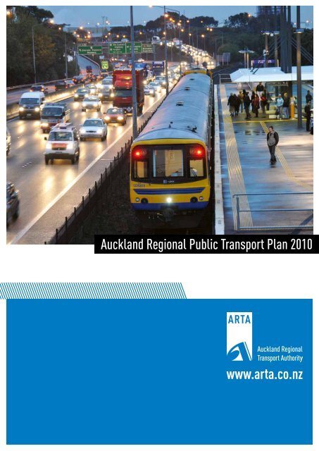
www.arta.co.nz Auckland Regional Public Transport Plan 2010
www.arta.co.nz Auckland Regional Public Transport Plan 2010
www.arta.co.nz Auckland Regional Public Transport Plan 2010

You also want an ePaper? Increase the reach of your titles
YUMPU automatically turns print PDFs into web optimized ePapers that Google loves.
<strong>Auckland</strong> <strong>Regional</strong> <strong>Public</strong> <strong>Transport</strong> <strong>Plan</strong> <strong>2010</strong><br />
<strong>www</strong>.<strong>arta</strong>.<strong>co</strong>.<strong>nz</strong>
Published in June <strong>2010</strong> by:<br />
The <strong>Auckland</strong> <strong>Regional</strong> <strong>Transport</strong> Authority<br />
Private Bag 92 236<br />
<strong>Auckland</strong>, New Zealand<br />
This document is available on the ARTA website: <strong>www</strong>.<strong>arta</strong>.<strong>co</strong>.<strong>nz</strong>
CONTENTS<br />
Foreword............................................................................................................................ii<br />
Executive Summary..........................................................................................................iii<br />
1 Introduction...............................................................................................................1<br />
1.1 Purpose of the <strong>Regional</strong> <strong>Public</strong> <strong>Transport</strong> <strong>Plan</strong>............................................................1<br />
1.2 S<strong>co</strong>pe of this <strong>Plan</strong>.....................................................................................................1<br />
1.3 <strong>Plan</strong> <strong>co</strong>ntents...........................................................................................................1<br />
2 StRATEGIC Context.......................................................................................................3<br />
2.1 Statutory <strong>co</strong>ntext......................................................................................................3<br />
2.2 Giving effect to the RLTS...........................................................................................3<br />
2.3 Contribution to PTMA principles ...............................................................................5<br />
2.4 Local Government Reform ........................................................................................5<br />
2.5 Matters taken into ac<strong>co</strong>unt.......................................................................................5<br />
2.6 Assisting the transport disadvantaged .......................................................................6<br />
3 Transforming <strong>Auckland</strong>’s <strong>Public</strong> <strong>Transport</strong> System.........................................8<br />
3.1 Background..............................................................................................................8<br />
3.2 <strong>Plan</strong>ning responses...................................................................................................8<br />
3.3 <strong>Plan</strong>ning for the future...........................................................................................11<br />
3.4 Strategic alignment................................................................................................12<br />
3.5 <strong>Public</strong> transport funding.........................................................................................12<br />
4 <strong>Public</strong> <strong>Transport</strong> Objectives...................................................................................14<br />
5 Policies and Actions................................................................................................18<br />
5.1 Network structure..................................................................................................18<br />
5.2 Network integration...............................................................................................21<br />
5.3 Assisting the transport disadvantaged .....................................................................21<br />
5.4 Service reliability.....................................................................................................22<br />
5.5 Vehicle quality........................................................................................................24<br />
5.6 Fare levels..............................................................................................................24<br />
5.7 Integrated fares and ticketing.................................................................................26<br />
5.8 Branding and <strong>co</strong>mmunication..................................................................................27<br />
5.9 Infrastructure.........................................................................................................28<br />
5.10 Procurement..........................................................................................................28<br />
5.11 Commercial services...............................................................................................29<br />
5.12 Funding and prioritisation.......................................................................................30<br />
6 Description of Services............................................................................................31<br />
6.1 Service level guidelines...........................................................................................31<br />
6.2 Service descriptions: scheduled public transport services...........................................33<br />
6.3 Targeted services....................................................................................................34<br />
6.4 Vehicle quality and performance standards..............................................................35<br />
6.5 Other services........................................................................................................35<br />
7 Monitoring and Review...........................................................................................36<br />
7.1 Detailed service design...........................................................................................36<br />
7.2 KPIs and reporting..................................................................................................37<br />
7.3 Future plan reviews................................................................................................37<br />
7.4 Policy on significance..............................................................................................38<br />
APPENDIX 1: Giving Effect to the RLTS...........................................................................39<br />
APPENDIX 2: Contribution to PTMA Principles ............................................................42<br />
APPENDIX 3: Detailed Service Descriptions..................................................................43<br />
APPENDIX 4: Services for People with Disabilities....................................................101<br />
APPENDIX 5: Targeted School Services.......................................................................102<br />
GLOSSARY..........................................................................................................................132<br />
i
FOREWORD<br />
ARTA’s mission is to deliver a world-class transport system that makes<br />
<strong>Auckland</strong> an even better place to live, work and play. An important<br />
part of this mission is the development of a world-class public<br />
transport system. Since its formation in 2004, the <strong>Auckland</strong> <strong>Regional</strong><br />
<strong>Transport</strong> Authority (ARTA) has been working hard to respond to the<br />
challenges of providing <strong>Auckland</strong>ers with a transport system that can<br />
truly <strong>co</strong>ntribute to improving the quality of life for our growing<br />
population, building <strong>Auckland</strong>’s e<strong>co</strong>nomic <strong>co</strong>mpetitiveness, and<br />
<strong>co</strong>ntributing to a more sustainable future.<br />
Much has already been achieved. With the support of its central and<br />
local government partners, ARTA has embarked on a programme of<br />
systematic improvements to the region’s public transport system. The<br />
passenger rail network is being upgraded, and the Northern Busway<br />
was opened in 2008. The region has invested in new vehicles, and<br />
has <strong>co</strong>mmenced the purchase of a fleet of new electric trains. Rail<br />
and Busway stations are being improved, bus priority lanes<br />
implemented, and ferry infrastructure developed. These infrastructure<br />
improvements are being supported by increased service levels<br />
throughout the network.<br />
In response to these initiatives, passenger volumes have increased<br />
markedly. A total of 58.6 million trips were made in the year to June<br />
2009, a 7.7 % increase on the previous year and the highest level of<br />
public transport use in <strong>Auckland</strong> since the mid 1980s.<br />
require a significant investment of public funds. ARTA has taken<br />
steps to ensure that the proposals <strong>co</strong>ntained in this <strong>Plan</strong> will deliver<br />
e<strong>co</strong>nomic benefits that justify that investment. However, we<br />
re<strong>co</strong>gnise that there will always be limitations on the amount of<br />
public funds that are available for transport initiatives, and the need<br />
to prioritise how those funds will best be spent. For this reason, the<br />
<strong>Plan</strong> includes a set of policies aimed at guiding the prioritisation<br />
process.<br />
This <strong>Plan</strong> has been prepared following <strong>co</strong>nsultation with the PTMA’s<br />
required stakeholder organisations, including operators and public<br />
sector agencies and taking into ac<strong>co</strong>unt submissions made through a<br />
public <strong>co</strong>nsultation process. ARTA appreciates the thought and<br />
efforts made by submitters and acknowledges the valuable<br />
<strong>co</strong>ntribution they have made in the development of this <strong>Plan</strong>.<br />
Rabin Rabindran<br />
Chairman ARTA Board<br />
To achieve our objectives, however, public transport needs to make a<br />
much bigger <strong>co</strong>ntribution. This will require a step change in public<br />
transport performance.<br />
This <strong>Regional</strong> <strong>Public</strong> <strong>Transport</strong> <strong>Plan</strong> represents an important<br />
development towards achieving this step change. It presents ARTA’s<br />
public transport service policies, and sets out our proposals for service<br />
improvements in some detail. As such, it will form the basis of key<br />
aspects of our public transport policy, service development and<br />
<strong>co</strong>ntracting activities over the next few years.<br />
The <strong>Public</strong> <strong>Transport</strong> Management Act 2008 (the PTMA) included a<br />
range of new powers for regional <strong>co</strong>uncils (including ARTA) to<br />
manage public transport policy and services. However, the Minister<br />
of <strong>Transport</strong> has recently signalled his intention to review the PTMA.<br />
To await the out<strong>co</strong>me of this legislative review process before<br />
developing its <strong>Plan</strong> would cause delays to ARTA’s planned programme<br />
of service improvements, but ARTA has no desire to undermine the<br />
review process. Ac<strong>co</strong>rdingly, we have decided to prepare the <strong>Plan</strong>, as<br />
required under the PTMA, but to reduce its planned s<strong>co</strong>pe to exclude<br />
those areas that the Minister has specifically identified for review.<br />
Once future legislative provisions in relation to the powers of regional<br />
<strong>co</strong>uncils (including ARTA) and the <strong>co</strong>ntent of regional public transport<br />
plans have been determined by Parliament, ARTA will <strong>co</strong>nsider<br />
whether a future variation to the <strong>Plan</strong> is required, and if so, will<br />
initiate <strong>co</strong>nsultation following the new legislative provisions, if this is<br />
required for any variation.<br />
The proposed improvements to our public transport system will<br />
ii
EXECUTIVE SUMMARY<br />
Purpose of the plan<br />
This is the <strong>Auckland</strong> <strong>Regional</strong> <strong>Public</strong> <strong>Transport</strong> <strong>Plan</strong> (“the <strong>Plan</strong>”). The<br />
purpose of the <strong>Plan</strong> is to specify how the <strong>Auckland</strong> <strong>Regional</strong> <strong>Transport</strong><br />
Authority (ARTA) will give effect to the public transport <strong>co</strong>mponents<br />
of the <strong>2010</strong> <strong>Auckland</strong> <strong>Regional</strong> Land <strong>Transport</strong> Strategy (RLTS), and<br />
<strong>co</strong>ntribute to achieving an affordable, integrated, safe, responsive<br />
and sustainable land transport system in an efficient and effective<br />
manner.<br />
The <strong>Plan</strong> is a statutory document which is prepared pursuant to the<br />
provisions of the <strong>Public</strong> <strong>Transport</strong> Management Act 2008 (PTMA). It<br />
specifies the public transport services which ARTA proposes for the<br />
region, and the policies which apply to those services.<br />
Transforming <strong>Auckland</strong>’s public transport<br />
In addition to meeting its statutory requirements, the <strong>Plan</strong> provides<br />
the policy framework for the transformation of <strong>Auckland</strong>’s public<br />
transport system, building on the strategic direction established in<br />
the RLTS and the Passenger <strong>Transport</strong> Network <strong>Plan</strong> (PTNP). This<br />
involves the development of an integrated public transport network<br />
based on the following service layers:<br />
> > The Rapid Transit Network (RTN), which forms the backbone<br />
of the system and provides fast, high-frequency service in its own<br />
right of way, unaffected by traffic <strong>co</strong>ngestion.<br />
> > The Quality Transit Network (QTN), providing a network of<br />
high-frequency, high-quality services, mainly with buses, with<br />
bus priority measures operating between key centres and over<br />
major <strong>co</strong>rridors.<br />
> > The Local Connector Network (LCN), providing low to<br />
medium-frequency bus, ferry and train services that provide<br />
access to local centres and <strong>co</strong>nnect with the RTN and QTN.<br />
> > Targeted services, which provide mobility for groups for whom<br />
the regular public transport network is not adequate (including<br />
the Total Mobility service for people with disabilities, school bus<br />
services, and services for special events).<br />
This layered approach will be supported by a fare and ticketing<br />
system that facilitates transfers with one smartcard for the whole<br />
trip. It will also include the development of a <strong>co</strong>nsistent brand, with<br />
relevant, easy to use customer information, and vehicles and<br />
infrastructure that improve passenger <strong>co</strong>nvenience, safety and<br />
<strong>co</strong>mfort.<br />
To achieve the required step change in public transport performance,<br />
ARTA has identified the following developments that need to happen<br />
within the next 10 years:<br />
> > Serving new and developing areas<br />
> > Improving public transport infrastructure<br />
> > Marketing<br />
> > Integrated ticketing and fares<br />
> > Providing targeted services<br />
> > <strong>Plan</strong>ning for the future.<br />
Further details on these improvements are <strong>co</strong>ntained in chapter 3.<br />
Giving effect to the RLTS<br />
The RLTS calls for a significant increase in investment in public<br />
transport over the next decade and beyond. It sets out the policy<br />
framework for the development of an integrated, layered public<br />
transport network, which underpins the service descriptions<br />
<strong>co</strong>ntained in chapter 6 of the <strong>Plan</strong>.<br />
The RLTS also includes a number of other policies that influence the<br />
quality and level of service of the region’s public transport system,<br />
both infrastructure and services. These have been reflected in the<br />
policies and service standards <strong>co</strong>ntained in this <strong>Plan</strong>.<br />
Overall approach to public transport<br />
> > Improve, upgrade and expand the public transport system<br />
Network design and service levels<br />
> > Implement the Rapid Transit Network (RTN) to <strong>co</strong>nnect major<br />
growth centres with the CBD (“shaping the region”)<br />
> > Implement rail electrification and the CBD rail link<br />
> > Implement the Quality Transit Network (QTN) to maximise<br />
throughput of public transport as a priority use (“moving<br />
<strong>Auckland</strong>ers”)<br />
> > Provide services on the Local Connector Network (LCN) to enable<br />
access to basic <strong>co</strong>mmunity activities and services (“building<br />
<strong>co</strong>mmunity”)<br />
> > Develop/give effect to public transport service guidelines<br />
> > Provide targeted services for the transport disadvantaged<br />
> > Provide services to newly developing areas<br />
> > En<strong>co</strong>urage <strong>co</strong>st-effective <strong>co</strong>nnections to other regions<br />
> > Work with rural <strong>co</strong>mmunities to develop <strong>co</strong>st-effective, tailored<br />
services<br />
> > Further development of the RTN<br />
> > Establishing the Quality Transit Network<br />
> > Re<strong>co</strong>nfiguring the Local Connector Network<br />
> > Integrated services across the above network layers<br />
iii
iv<br />
Vehicles<br />
> > Upgrade the public transport fleet to provide modern, accessible,<br />
low emission vehicles<br />
> > Ensure that design, <strong>co</strong>nstruction and operation of services take<br />
into ac<strong>co</strong>unt passenger safety and security<br />
Fares and ticketing<br />
> > Set fares at a level that en<strong>co</strong>urages mode shift, re<strong>co</strong>gnises the<br />
transport disadvantaged, and provides for a financially viable<br />
public transport system<br />
> > Implement integrated fares and ticketing<br />
> > Provide fare <strong>co</strong>ncessions to target groups<br />
Infrastructure<br />
> > Make provision for modal interchange<br />
> > Provide park and ride facilities<br />
> > Resolve bus capacity in the CBD<br />
> > Provide accessible infrastructure<br />
> > Undertake improvements to the QTN to reduce travel times and<br />
improve bus reliability<br />
Information and marketing<br />
> > Ensure good access to quality public transport information<br />
> > Develop realistic, achievable and accessible public transport<br />
timetables that can be reliably delivered<br />
> > Proactively market public transport<br />
Community involvement<br />
> > Ensure <strong>co</strong>mmunity and stakeholder involvement in service planning<br />
ARTA believes that the <strong>Plan</strong> will <strong>co</strong>ntribute to the purpose of the<br />
PTMA (i.e. to <strong>co</strong>ntribute to the aim of achieving an affordable,<br />
integrated, safe, responsive and sustainable land transport system for<br />
New Zealand) in an efficient and effective manner.<br />
<strong>Transport</strong> disadvantaged<br />
ARTA has also specifically <strong>co</strong>nsidered the needs of persons who are<br />
transport disadvantaged. Following from this, the <strong>Plan</strong> includes a<br />
description of how the public transport services to be provided in the<br />
region will assist their needs. This includes:<br />
> > Proposals to improve the accessibility of the public transport<br />
network as a whole<br />
> > Targeted services such as the Total Mobility service for people<br />
with disabilities and school bus services<br />
> > Continued support for the SuperGold Card free travel scheme<br />
for senior citizens<br />
> > Subsidised fares for children and students<br />
> > Working with target groups to identify the potential for<br />
scheduled or demand-responsive services to particular facilities<br />
> > Considering demand-responsive services in areas of low demand<br />
(e.g. rural <strong>co</strong>mmunities)<br />
> > Making information easily available in formats tailored to<br />
specific needs.<br />
Objectives, policies and actions<br />
> > ARTA has developed a set of objectives, policies and actions for<br />
<strong>Auckland</strong>’s public transport system that are designed to give<br />
effect to the RLTS, and support the strategic direction for public<br />
transport. The objectives are set out below: chapter 4 provides<br />
an explanation for each of the objectives, and chapter 5 <strong>co</strong>ntains<br />
detailed policies and actions related to each objective.<br />
1. Simple, easy to understand services that go where people want<br />
to go<br />
2. An integrated network of services that makes interchange<br />
between and within modes easy<br />
3. Improved accessibility for <strong>co</strong>mmunities and groups whose needs<br />
are not met by the regular public transport system<br />
4. A high-quality, reliable public transport system that customers<br />
choose to use<br />
5. <strong>Public</strong> transport operations that provide <strong>co</strong>mfortable and safe<br />
travel, and minimise adverse environmental effects and improve<br />
health out<strong>co</strong>mes<br />
6. A fare schedule that attracts and retains customers, and offers<br />
incentives for frequent use, while balancing user <strong>co</strong>ntributions<br />
against public funding<br />
7. An integrated system of fares and ticketing that enables seamless<br />
travel between services and modes<br />
8. A <strong>co</strong>nsistently branded transport system that is easy to use,<br />
offers a <strong>co</strong>nsistent customer experience and generates customer<br />
loyalty<br />
9 A high standard of public transport infrastructure.<br />
10. Procurement that supports effective and efficient public transport<br />
services, public transport infrastructure and the objectives of this<br />
<strong>Plan</strong><br />
11. A <strong>co</strong>nsistent and integrated approach to the provision of<br />
<strong>co</strong>mmercial services<br />
12. Effective and efficient allocation of public transport funding.<br />
ARTA has developed a set of guidelines to assist in determining the<br />
minimum service levels that will apply to the different network layers.<br />
These are detailed in section 6.1, and include guidelines on service<br />
strategy, <strong>co</strong>nnections, frequency, service periods, maximum and<br />
minimum loading triggers, reliability, service <strong>co</strong>verage, accessibility,<br />
and vehicle standards.<br />
Service descriptions<br />
ARTA has developed detailed service descriptions for the scheduled<br />
public transport services that it proposes to be provided in the<br />
<strong>Auckland</strong> region. Service descriptions are provided for each of 68<br />
geographic service-orientated “route groups”, which generally<br />
include all of the services in a specific area and/or <strong>co</strong>rridor, with at<br />
least part of their routes in <strong>co</strong>mmon.<br />
The service descriptions include the following information for each<br />
route group:<br />
> > Route description (service type, mode, terminal points, roads<br />
and/or centres to be served, route direction)<br />
> > Frequency (early morning, peak, interpeak, evening, Saturday,<br />
Sunday)
Operating period (weekday, Saturday, Sunday).<br />
In addition to the scheduled services described above, ARTA proposes<br />
to provide financial support to, amongst other things, the following<br />
targeted services:<br />
> > Total Mobility: a demand-responsive service for people with<br />
disabilities who are registered users.<br />
> > School bus services: designed to meet identified demand for<br />
school travel in situations where the scheduled services are not<br />
able to provide sufficient capacity or route <strong>co</strong>verage to meet the<br />
demand; and/or where the provision of a school bus service<br />
provides a <strong>co</strong>st-effective alternative to private vehicle use.<br />
> > Community transport services: In areas where regular<br />
scheduled services will generally not be <strong>co</strong>st-effective, ARTA<br />
intends to work with local <strong>co</strong>mmunities to explore options for<br />
<strong>co</strong>mmunity-based transport initiatives which are able to provide<br />
<strong>co</strong>st-effective solutions to the access needs of the <strong>co</strong>mmunity.<br />
Vehicle quality and performance standards<br />
The <strong>Plan</strong> includes vehicle quality and performance standards that will<br />
be applied to <strong>co</strong>ntracted bus, train and ferry services in the region.<br />
Service review process<br />
The detailed implementation of the integrated network will be<br />
achieved through a phased service design process illustrated below,<br />
starting with the service designs included in the <strong>Plan</strong>. The service<br />
designs will be phased to align with the public transport funding<br />
available and procurement timeframes. They will be prepared in<br />
<strong>co</strong>llaboration with key stakeholders and involve targeted <strong>co</strong>nsultation<br />
in the areas affected with stakeholders, existing and potential users,<br />
and persons that may be affected or have an interest in the proposed<br />
service design.<br />
Future <strong>Plan</strong> reviews<br />
ARTA will undertake a formal review of the <strong>Plan</strong> by April 2013 to<br />
determine whether a variation to the <strong>Plan</strong> is required. An earlier<br />
review may be undertaken if required to respond to changes in the<br />
RLTS or the GPS.<br />
ARTA has developed a policy to determine whether or not any<br />
proposed variation to the <strong>Plan</strong> is significant. This is set out in<br />
section 7.4, and will be used to determine whether the <strong>Plan</strong> variation<br />
will follow the special <strong>co</strong>nsultative procedure set out in the Local<br />
Government Act 2002, or whether a more streamlined process can<br />
be adopted (for matters that are not <strong>co</strong>nsidered significant).<br />
Identify<br />
Objectives<br />
S<strong>co</strong>ping<br />
& Issues<br />
Analysis<br />
Option<br />
Development<br />
& Refinement<br />
Service<br />
Design<br />
Consultation<br />
Finalisation<br />
& Approval<br />
Identify primary<br />
objectives and<br />
out<strong>co</strong>mes.<br />
S<strong>co</strong>pe transport<br />
situation, carry out<br />
initial background<br />
analysis including<br />
identifying user<br />
requirements and<br />
needs assessment<br />
and engage with<br />
key stakeholders.<br />
Develop passenger<br />
transport service<br />
options and identify<br />
supporting<br />
infrastructure<br />
requirements.<br />
Consult key<br />
stakeholders on<br />
service proposals<br />
and refine options.<br />
Undertake <strong>co</strong>nsultation<br />
on proposed option<br />
with key stakeholders,<br />
existing users and<br />
persons who may be<br />
affected or have an<br />
interest in the<br />
proposal.<br />
Finalise preferred<br />
option and obtain<br />
ARTA Board<br />
approval.<br />
v
1. INTRODUCTION<br />
1.1 Purpose of the <strong>Regional</strong> <strong>Public</strong> <strong>Transport</strong> <strong>Plan</strong><br />
This is the <strong>Auckland</strong> <strong>Regional</strong> <strong>Public</strong> <strong>Transport</strong> <strong>Plan</strong> (“the <strong>Plan</strong>”). The<br />
purpose of the <strong>Plan</strong> is to specify how the <strong>Auckland</strong> <strong>Regional</strong> <strong>Transport</strong><br />
Authority (ARTA) will give effect to the public transport <strong>co</strong>mponents of<br />
the <strong>Auckland</strong> <strong>Regional</strong> Land <strong>Transport</strong> Strategy (RLTS), and <strong>co</strong>ntribute<br />
to achieving an affordable, integrated, safe, responsive and sustainable<br />
land transport system in an efficient and effective manner.<br />
The <strong>Plan</strong> is a statutory document, which is prepared pursuant to the<br />
provisions of the <strong>Public</strong> <strong>Transport</strong> Management Act 2008 (PTMA). It<br />
specifies the public transport services that ARTA proposes for the<br />
region, and the policies that apply to those services.<br />
The <strong>Plan</strong> is a key tool in achieving ARTA’s mission “to deliver a worldclass<br />
transport system that makes <strong>Auckland</strong> an even better place<br />
to live, work and play”. Improving public transport is a critical<br />
<strong>co</strong>mponent of overall plans to lift the performance of <strong>Auckland</strong>’s<br />
transport system, improve quality of life for the city’s growing<br />
population, and build <strong>Auckland</strong>’s e<strong>co</strong>nomic <strong>co</strong>mpetitiveness.<br />
The <strong>Plan</strong> builds on the strategic framework for transport in <strong>Auckland</strong><br />
established through the RLTS <strong>2010</strong> and describes the policies and<br />
actions that are needed to put in place a simple, integrated public<br />
transport system that delivers value for money. This will <strong>co</strong>ntribute to<br />
national and regional targets through increased patronage.<br />
1.2 S<strong>co</strong>pe of this <strong>Plan</strong><br />
In preparing this <strong>Plan</strong>, ARTA has been mindful of the need to <strong>co</strong>mply<br />
with the current legislative and policy environment for transport<br />
in <strong>Auckland</strong>, and the views of key stakeholders. The preparation of<br />
the <strong>Plan</strong> has followed a <strong>co</strong>nsultative process which included the<br />
preparation of a Discussion Document (February 2009) and<br />
<strong>co</strong>nsideration of stakeholder feedback on that document. A draft<br />
<strong>Plan</strong> was issued in November 2009 for full public <strong>co</strong>nsultation<br />
followed by public hearings in February <strong>2010</strong>.<br />
An important message from this process has been the general<br />
support for ARTA to <strong>co</strong>ntinue the process of improving <strong>Auckland</strong>’s<br />
public transport system through the development of the Rapid<br />
Transit Network, Quality Transit Network, and network integration<br />
initiatives such as integrated ticketing. More immediately, early<br />
<strong>co</strong>mpletion of the <strong>Plan</strong> will allow it to be used to guide the<br />
procurement of new services that ARTA wishes to have in place<br />
ahead of the Rugby World Cup in 2011.<br />
Since ARTA <strong>co</strong>mmenced the preparation of the <strong>Plan</strong>, the Government<br />
has signalled some significant changes to the legislative and<br />
governance environment for public transport in <strong>Auckland</strong>. These<br />
include the implementation of changes to local governance<br />
arrangements in the region, with the introduction of the new<br />
<strong>Auckland</strong> Council and <strong>Auckland</strong> <strong>Transport</strong> from November <strong>2010</strong><br />
which will <strong>co</strong>ntrol the funding, planning and implementation of<br />
public transport in the <strong>Auckland</strong> region; and the announcement by<br />
the Minister of <strong>Transport</strong> of his intention to seek a review of the<br />
PTMA with particular focus on regional <strong>co</strong>uncil (and ARTA) powers to<br />
<strong>co</strong>ntrol <strong>co</strong>mmercial services and <strong>co</strong>ntracted services.<br />
While the out<strong>co</strong>me of the review process of the PTMA may require<br />
ARTA to make further changes to its <strong>Plan</strong>, ARTA is at present required<br />
to prepare, <strong>co</strong>nsult on, finalise and adopt its <strong>Plan</strong> as soon as<br />
reasonably practicable, and by no later than 1 January 2012.<br />
ARTA does not want to propose a <strong>Plan</strong> that is likely to require further<br />
changes to reflect any possible out<strong>co</strong>mes of the review process.<br />
ARTA also believes that delay to introducing a <strong>Plan</strong> until the current<br />
legislative and governance reviews are <strong>co</strong>mpleted would cause delay<br />
to its proposed service improvement programme.<br />
Taking all of the circumstances into ac<strong>co</strong>unt, ARTA has developed a<br />
<strong>Plan</strong> that focuses on describing the region’s public transport policies<br />
and the services that ARTA proposes for the region. However, the<br />
<strong>Plan</strong> does not propose any “<strong>co</strong>ntrols” over services run by operators<br />
on a <strong>co</strong>mmercial basis, or impose any “<strong>co</strong>ntracting requirement” for<br />
services that must be <strong>co</strong>ntracted to ARTA.<br />
Once the PTMA review process has been clarified, ARTA will <strong>co</strong>nsider<br />
whether varying the <strong>Plan</strong> is desirable or required, and if so, will<br />
initiate the <strong>co</strong>nsultation process for varying the <strong>Plan</strong> as required by<br />
the PTMA or this <strong>Plan</strong>.<br />
The <strong>Auckland</strong> <strong>Regional</strong> Council has adopted the <strong>2010</strong> RLTS which is<br />
<strong>co</strong>nsistent with and provides the strategic direction for public<br />
transport reflected in this <strong>Plan</strong>.<br />
1.3 <strong>Plan</strong> <strong>co</strong>ntents<br />
This <strong>Plan</strong> is divided into seven chapters:<br />
1. Introduction: a brief outline of the purpose, s<strong>co</strong>pe and <strong>co</strong>ntent<br />
of the <strong>Plan</strong>.<br />
2. Strategic <strong>co</strong>ntext: a summary of the statutory and strategic<br />
<strong>co</strong>ntext within which the <strong>Plan</strong> has been prepared.<br />
3. Transforming <strong>Auckland</strong>’s public transport: this chapter provides<br />
an overview of ARTA’s plans to transform <strong>Auckland</strong>’s public<br />
transport system to help it deliver the step change in performance<br />
that the RLTS requires.<br />
4. <strong>Public</strong> transport objectives: this chapter describes objectives that<br />
ARTA has established for the future public transport system in<br />
the region, with an overview of how they can be achieved.<br />
5. Policies and actions: this part of the <strong>Plan</strong> sets out the policies that<br />
ARTA intends to follow to achieve its public transport objectives,<br />
and the specific actions proposed to implement those policies.<br />
1
6. Description of services: this <strong>co</strong>ntains the service level guidelines,<br />
service descriptions, and quality and performance standards that<br />
will guide the detailed implementation of the <strong>Plan</strong> and be<br />
reflected in the procurement process and <strong>co</strong>ntracts.<br />
7. Monitoring and review: a description of the steps that will be<br />
taken to monitor the <strong>Plan</strong>’s implementation, and future review<br />
of the <strong>Plan</strong>. This section includes ARTA’s policy on significance,<br />
which will be used to determine the appropriate level of<br />
<strong>co</strong>nsultation for any future variations to the <strong>Plan</strong>.<br />
Further detail on the matters that have been taken into ac<strong>co</strong>unt in<br />
the development of the <strong>Plan</strong> is available in the RPTP Background<br />
Document, which has been prepared to ac<strong>co</strong>mpany the <strong>Plan</strong>.<br />
Downtown Ferry Terminal<br />
2
2. STRATEGIC CONTEXT<br />
This chapter provides a brief summary of:<br />
> > The statutory and strategic <strong>co</strong>ntext within which the <strong>Plan</strong> has<br />
been prepared<br />
> > How it gives effect to the public transport service <strong>co</strong>mponents of<br />
the RLTS<br />
> > How the <strong>Plan</strong> <strong>co</strong>ntributes to the purpose of the PTMA<br />
> > Matters required to be taken into ac<strong>co</strong>unt<br />
> > The approach taken to assist the transport disadvantaged.<br />
2.1 Statutory <strong>co</strong>ntext<br />
In preparing this <strong>Plan</strong>, ARTA has followed the requirements of the<br />
PTMA. The statutory purpose of the <strong>Plan</strong>, as set out in section 7 of<br />
the PTMA, is to:<br />
> > Specify how ARTA intends to give effect to the public transport<br />
service <strong>co</strong>mponents of the <strong>Auckland</strong> RLTS; and<br />
> > Contribute to the purpose of the PTMA (i.e. to <strong>co</strong>ntribute to the<br />
aim of achieving an affordable, integrated, safe, responsive and<br />
sustainable land transport system), in an efficient and effective<br />
manner.<br />
In preparing the <strong>Plan</strong>, ARTA must be satisfied that it <strong>co</strong>ntributes to<br />
the following objectives:<br />
> > Assisting e<strong>co</strong>nomic development<br />
> > Assisting safety and personal security<br />
> > Improving access and mobility<br />
> > Protecting and providing public health<br />
> > Ensuring environmental sustainability.<br />
ARTA is also required to take ac<strong>co</strong>unt of a number of other matters<br />
in preparing the <strong>Plan</strong>, including:<br />
> > The relevant Government Policy Statement (GPS) on land<br />
transport funding<br />
> > Any current National Energy Efficiency and Conservation Strategy<br />
(NEECS)<br />
> > Any guidelines issued by the NZ <strong>Transport</strong> Agency (NZTA) for the<br />
purposes of developing regional public transport plans<br />
> > Any relevant regional policy statement, regional plan, district<br />
plan or proposed regional or district plan under the Resource<br />
Management Act 1991<br />
> > The public transport funding likely to be available within the<br />
region<br />
> > The need to obtain best value for money, having regard to the<br />
desirability of en<strong>co</strong>uraging fair <strong>co</strong>mpetition and a <strong>co</strong>mpetitive<br />
and efficient market for public transport services<br />
> > The views of public transport operators in the region.<br />
In preparing the <strong>Plan</strong>, ARTA is also required to <strong>co</strong>nsider the needs of<br />
people who are transport disadvantaged.<br />
2.2 Giving effect to the RLTS<br />
The policies and service descriptions <strong>co</strong>ntained in this <strong>Plan</strong> have been<br />
developed by ARTA to give effect to the public transport service<br />
<strong>co</strong>mponents <strong>co</strong>ntained in the <strong>Auckland</strong> RLTS.<br />
The <strong>Auckland</strong> RLTS was adopted by the <strong>Auckland</strong> <strong>Regional</strong> Council<br />
(ARC) in April <strong>2010</strong>. It sets the framework for the future land<br />
transport in the region.<br />
Its goal is “a transport system that enhances the <strong>Auckland</strong> region<br />
where:<br />
> > People and goods are able to move when and where necessary<br />
> > <strong>Transport</strong> supports vibrant well designed, attractive and<br />
environmentally sustainable urban and rural centres, business<br />
and e<strong>co</strong>nomic activity, and access to social, cultural and<br />
recreational activities<br />
> > Streets are safe and attractive places for people and the<br />
<strong>co</strong>mmunity<br />
> > The distinct volcanic and <strong>co</strong>astal (whenua moana/awa) character<br />
of the region and the cultural values of its inhabitants (nga<br />
tangata katoa) are protected and enhanced<br />
> > Getting around by all modes is integrated, safe, effective, and<br />
accessible to all, including disabled people<br />
> > People have choices which enable them to participate equitably<br />
in society, especially those with mobility issues, including children<br />
and the elderly and those most disadvantaged<br />
> > The natural environment and human health are protected and<br />
enhanced<br />
> > <strong>Transport</strong> resources are used efficiently, supported by sustainable,<br />
innovative design practices<br />
> > The transport system is resilient in the event of shocks and is<br />
adaptable to change”.<br />
This is supported by seven objectives:<br />
> > Assisting e<strong>co</strong>nomic development<br />
> > Assisting safety and personal security<br />
> > Improving access and mobility<br />
> > Protecting and promoting public health<br />
> > Ensuring environmental sustainability<br />
> > Integrating transport and land use supportive of the <strong>Auckland</strong><br />
<strong>Regional</strong> Growth Strategy and <strong>Auckland</strong> Policy Statement<br />
> > Achieving e<strong>co</strong>nomic efficiency.<br />
3
To achieve these objectives, the RLTS includes policies to make better<br />
use of the existing transport system, and to manage travel demand<br />
through policies aimed at reducing the need for private vehicle travel,<br />
thereby reducing the impacts that excessive vehicle travel can have<br />
on <strong>co</strong>ngestion, safety, public health and environmental out<strong>co</strong>mes.<br />
The RLTS calls for a significant increase in investment in public<br />
transport over the next decade and beyond. It sets out the policy<br />
framework for the development of an integrated, layered public<br />
transport network, in<strong>co</strong>rporating a Rapid Transit Network (RTN)<br />
along the rail <strong>co</strong>rridors and the Northern Busway; a supporting<br />
Quality Transit Network (QTN); and a Local Connector Network<br />
(LCN). This layered network underpins the service descriptions<br />
<strong>co</strong>ntained in chapter 6 of this <strong>Plan</strong>.<br />
The RLTS strategic direction is designed to ensure that the transport<br />
system supports the growth <strong>co</strong>ncept outlined in the <strong>Regional</strong> Growth<br />
Strategy and the <strong>Regional</strong> Policy Statement. A key element of this is<br />
the development of strong public transport links between growth<br />
centres. To achieve this, planning for public transport services and<br />
infrastructure needs to have regard to existing land uses and to the<br />
growth strategy proposals for intensification and development<br />
around transport nodes. The service level guidelines and service<br />
descriptions in this <strong>Plan</strong> have been designed to give effect to this<br />
strategic direction by including a strong focus on accessibility to<br />
growth centres.<br />
The RLTS also includes a number of other policies that influence the<br />
quality and level of service of the region’s public transport system, in<br />
terms of both infrastructure and services. These have been reflected<br />
in the policies and service standards <strong>co</strong>ntained in this <strong>Plan</strong>.<br />
The following list of public transport service <strong>co</strong>mponents (Table 2.1)<br />
has been developed from the policies <strong>co</strong>ntained in the <strong>2010</strong> RLTS.<br />
Table 2.1: RLTS public transport service <strong>co</strong>mponents<br />
<strong>Public</strong> transport service <strong>co</strong>mponent<br />
RLTS <strong>2010</strong> Reference<br />
Overall approach to public transport<br />
Improve, upgrade and expand public transport infrastructure and services Policy 4.1<br />
Network design and service levels<br />
Implement the Rapid Transit Network (RTN) to <strong>co</strong>nnect major growth centres with the CBD (“shaping<br />
the region”)<br />
Role of PT;<br />
Policy 4.1.1<br />
Implement rail electrification and the CBD rail link Policy 4.3.1<br />
Implement the Quality Transit Network (QTN) to maximise throughput of public transport as a priority<br />
use (“moving <strong>Auckland</strong>ers”)<br />
Provide services on the Local Connector Network (LCN) to enable access to basic <strong>co</strong>mmunity<br />
activities and services (“building <strong>co</strong>mmunity”) and <strong>co</strong>nnect <strong>co</strong>mmunities to the RTN and QTN<br />
Role of PT;<br />
Policy 4.1.2<br />
Role of PT;<br />
Policy 4.1.3, 4.1.5<br />
Develop/give effect to public transport guidelines Policy 4.1.6<br />
Provide targeted services for the transport disadvantaged Policy 4.1.4, 4.4, 4.4.1, 4.4.3<br />
Provide services to newly developing areas Policy 4.1.7<br />
En<strong>co</strong>urage <strong>co</strong>st-effective <strong>co</strong>nnections to other regions Policy 4.1.9<br />
Work with rural <strong>co</strong>mmunities to develop <strong>co</strong>st-effective, tailored services Policy 4.5.1<br />
Provide facilities that en<strong>co</strong>urage greater use of walking and cycling Policy 4.6.4<br />
Vehicles<br />
Upgrade the public transport fleet to provide modern, accessible, low emission vehicles Policy 4.2.4, 5.3.2, 5.3.3<br />
Ensure that design, <strong>co</strong>nstruction and operation of infrastructure and services take into ac<strong>co</strong>unt<br />
passenger and driver safety and security including reduced levels of vehicle emissions<br />
Policy 4.2.5, 4.4.2<br />
Fares and ticketing<br />
Set fares at a level that en<strong>co</strong>urages mode shift, re<strong>co</strong>gnises the transport disadvantaged, and provides<br />
for a financially viable public transport system<br />
Policy 2.2, 2.2.1, 2.2.2, 2.2.3, 2.2.4<br />
Implement integrated fares and ticketing Policy 4.2.1, 4.3.1<br />
Provide fare <strong>co</strong>ncessions to target groups Policy 2.2.5, 4.4.4<br />
Infrastructure<br />
Make provision for modal interchange Policy 4.2.2<br />
Provide park and ride facilities Policy 4.2.3<br />
Resolve bus capacity in the CBD Policy 4.1.8<br />
Provide accessible infrastructure Policy 4.4.5<br />
4
<strong>Public</strong> transport service <strong>co</strong>mponent<br />
RLTS <strong>2010</strong> Reference<br />
Undertake improvements to the QTN to reduce travel times and improve bus reliability Policy 5.5.2<br />
Manage provision of ferry-based public transport infrastructure as part of the QTN Policy 5.4.10<br />
Information and marketing<br />
Ensure good access to quality public transport information Policy 3.1.2, 4.4.5<br />
Develop realistic, achievable and accessible public transport timetables that can be reliably delivered Policy 3.1.3<br />
Proactively market public transport Policy 3.1.4<br />
Community involvement<br />
Ensure <strong>co</strong>mmunity and stakeholder involvement in service planning Policy 12.1,<br />
Ensure that transport decisions respond to diverse user needs Policy 12.2<br />
ARTA has made an assessment of the manner in which this <strong>Plan</strong> gives<br />
effect to the RLTS public transport service <strong>co</strong>mponents. This is set out<br />
in Appendix 1.<br />
2.3 Contribution to PTMA principles<br />
This <strong>Plan</strong> has been developed to enable the <strong>Auckland</strong> public transport<br />
system to be developed and operated in a way that will make a<br />
significant <strong>co</strong>ntribution to the purpose of the PTMA, which is to<br />
<strong>co</strong>ntribute to the aim of achieving an affordable, integrated, safe,<br />
responsive and sustainable land transport system for New Zealand.<br />
ARTA has also focused on the need to ensure that the <strong>Plan</strong> delivers<br />
this <strong>co</strong>ntribution in an efficient and effective manner.<br />
Appendix 2 provides a summary of the <strong>co</strong>ntribution that this <strong>Plan</strong> is<br />
expected to make to those PTMA principles. ARTA is satisfied that the<br />
RPTP <strong>co</strong>ntributes to each of the principles, and to the overall aim of the<br />
PTMA.<br />
The efficiency and effectiveness of the overall strategic approach to<br />
public transport in the <strong>Auckland</strong> region has been assessed through<br />
the RLTS process, which the RPTP is required to give effect to. The<br />
<strong>2010</strong> RLTS is based on rigorous option evaluation processes, which<br />
have <strong>co</strong>ncluded that a stronger public transport system in the region<br />
is an efficient and effective response to the land transport issues that<br />
the region must <strong>co</strong>nfront.<br />
ARTA’s approach has been focused on the efficient and effective<br />
delivery of the public transport service <strong>co</strong>mponents of the RLTS. This<br />
requires particular attention to the way in which services are specified<br />
and procured, and to ensuring that the services that are provided<br />
<strong>co</strong>ntinue to meet ARTA’s objectives in a <strong>co</strong>st-effective manner. In<br />
parallel to the development of the RPTP, ARTA has undertaken a<br />
review of its approach to procurement to meet the requirements of<br />
the Land <strong>Transport</strong> Management Act to achieve “best value for<br />
money”. The approach to this requirement in<strong>co</strong>rporates efficiency<br />
and effectiveness as central <strong>co</strong>ncepts: best value for money is<br />
achieved where operators efficiently deliver public transport services<br />
that are efficiently procured, and that are effective in delivering the<br />
desired policy out<strong>co</strong>mes.<br />
2.4 Local Government Reform<br />
On 1 November <strong>2010</strong> it is expected that ARTA’s role will be subsumed<br />
into a <strong>co</strong>uncil-<strong>co</strong>ntrolled organisation to be known as <strong>Auckland</strong><br />
<strong>Transport</strong> (AT). AT is also expected to be responsible for implementing<br />
this <strong>Regional</strong> <strong>Public</strong> <strong>Transport</strong> <strong>Plan</strong>, carrying out reviews of the <strong>Plan</strong><br />
and further development of <strong>Auckland</strong>’s transport system (excluding<br />
State Highways).<br />
2.5 Matters taken into ac<strong>co</strong>unt<br />
2.5.1 Government Policy Statement (May 2009)<br />
In preparing the RPTP, ARTA is required to take ac<strong>co</strong>unt of the relevant<br />
Government Policy Statement (GPS) on land transport funding.<br />
The most recent Government Policy Statement on Land <strong>Transport</strong><br />
Funding (GPS) was issued in May 2009. It highlights the Government’s<br />
priority for land transport investment to increase e<strong>co</strong>nomic<br />
productivity and growth in New Zealand. This has led to some<br />
changes in emphasis from the previous 2008 GPS, including a<br />
stronger focus on State Highway development.<br />
However, the GPS <strong>co</strong>ntinues to acknowledge the importance of<br />
public transport services to e<strong>co</strong>nomic growth and productivity, and<br />
provides for investment in public transport services to be maintained<br />
at a high level. An indicative funding range of $185-215 million is<br />
provided for public transport services in 2009/10 (<strong>co</strong>mpared with<br />
$191 million allocated in 2008/09). This increases to $205-235<br />
million by 2011/12.<br />
The 2009 GPS includes a set of short to medium-term impacts that<br />
the Government expects to achieve through use of the National Land<br />
<strong>Transport</strong> Fund. These include the following impacts that <strong>co</strong>ntribute<br />
to e<strong>co</strong>nomic growth and productivity:<br />
> > Improvements in the provision of infrastructure and services that<br />
enhance transport efficiency and lower the <strong>co</strong>st of transportation<br />
through:<br />
• Improvements in journey time reliability<br />
• Easing of severe <strong>co</strong>ngestion<br />
• More efficient freight supply chains<br />
• Better use of existing transport capacity<br />
> > Better access to markets, employment and areas that <strong>co</strong>ntribute<br />
to e<strong>co</strong>nomic growth<br />
> > A secure and resilient transport network.<br />
Other GPS impacts include:<br />
> > Reductions in deaths and serious injuries as a result of road<br />
crashes<br />
> > More transport choices, particularly for those with limited access<br />
to a car where appropriate<br />
> > Reductions in adverse environmental effects from land transport<br />
> > Contributions to positive health out<strong>co</strong>mes.<br />
5
ARTA believes that an enhanced public transport system in <strong>Auckland</strong><br />
can make a significant <strong>co</strong>ntribution to each of the impacts.<br />
The GPS signals a stronger focus on generating value for money in<br />
land transport, with a greater emphasis on the e<strong>co</strong>nomic efficiency<br />
of individual projects. The RPTP includes policies and actions<br />
specifically aimed at improving value for money from the public<br />
transport system. It also provides for an ongoing review of the<br />
performance and <strong>co</strong>st-effectiveness of individual services.<br />
The GPS also <strong>co</strong>mments on the effects of recent fuel price volatility<br />
on transport users, and notes that the availability of transport choice,<br />
such as public transport, helps to mitigate the effects of high fuel<br />
prices on households. The RPTP <strong>co</strong>ntributes to enhanced transport<br />
choice by providing a more frequent network that is simpler for users<br />
to understand.<br />
Further detail showing how the RPTP takes the GPS into <strong>co</strong>nsideration<br />
is included in the Background document.<br />
2.5.2 National Energy Efficiency And Conservation Strategy<br />
In preparing the RPTP, ARTA is required to take ac<strong>co</strong>unt of any current<br />
national energy efficiency and <strong>co</strong>nservation strategy (within the<br />
meaning of the Energy Efficiency and Conservation Act 2000).<br />
The Minister of Energy and Resources has given notice that the New<br />
Zealand Energy Efficiency and Conservation Strategy (NZEECS) is to<br />
be replaced. The Ministry of E<strong>co</strong>nomic Development is preparing a<br />
replacement strategy. The current strategy remains in force until the<br />
replacement is adopted.<br />
A number of the NZEECS actions are already in place or underway.<br />
They have been taken into ac<strong>co</strong>unt in the preparation of the policies<br />
and actions in the Draft RPTP. The overall targets and actions relating<br />
to reduced energy <strong>co</strong>nsumption by single occupancy vehicles and<br />
increased public transport mode share are aligned with the strategic<br />
direction reflected in the RPTP. In addition, the vehicle quality policies<br />
and service level guidelines in the RPTP reflect a shift to lower<br />
emission buses. If necessary, the <strong>Plan</strong> may be varied to re<strong>co</strong>gnise<br />
requirements under the replacement strategy.<br />
and efficient market for public transport services<br />
> > The views of public transport operators in the region<br />
> > The public transport funding likely to be available within the<br />
region – see section 3<br />
These matters are outlined in the Background Document.<br />
2.6 Assisting the transport disadvantaged<br />
In preparing this <strong>Plan</strong>, ARTA has specifically <strong>co</strong>nsidered the needs of<br />
persons who are transport disadvantaged. Following from this, the<br />
<strong>Plan</strong> includes a description of how the public transport services to be<br />
provided in the region will assist their needs.<br />
The PTMA includes the following definition of transport<br />
disadvantaged:<br />
People whom (ARTA) has reasonable grounds to believe are the least<br />
able to get to basic <strong>co</strong>mmunity activities and services (for example,<br />
work, education, health care, welfare, and food shopping).<br />
The provision of a <strong>co</strong>mprehensive network of public transport<br />
services as described in the <strong>Plan</strong> goes some way to providing for the<br />
accessibility needs of the transport disadvantaged. In addition to this,<br />
however, it is re<strong>co</strong>gnised that some groups have specific needs that<br />
may be met by access to <strong>co</strong>ncessionary fares or specialised passenger<br />
transport services.<br />
ARTA has identified a range of personal or locational attributes that<br />
are likely to restrict accessibility and/or mobility due to physical ability,<br />
financial circumstances or distance. These include:<br />
> > Age (young or old)<br />
> > Lack of in<strong>co</strong>me<br />
> > Inability to drive and/or no access to a vehicle<br />
> > Disability<br />
> > Residential location remote from basic <strong>co</strong>mmunity activities<br />
or services.<br />
2.5.3 NZTA guidelines<br />
In preparing the RPTP, ARTA is required to take ac<strong>co</strong>unt of any<br />
guidelines issued by the NZ <strong>Transport</strong> Agency for the purposes of<br />
developing regional public transport plans.<br />
The NZTA issued guidelines for the development of regional public<br />
transport plans in January 2009, amended in May <strong>2010</strong> to include<br />
the national farebox re<strong>co</strong>very policy. These guidelines provide a<br />
detailed explanation of the steps that must be followed in preparing<br />
a RPTP, and the matters that must be included. The <strong>co</strong>ntent of the<br />
guidelines has been used to help determine the s<strong>co</strong>pe and <strong>co</strong>ntent of<br />
the RPTP, including the development of policies and the description<br />
of services. The guidelines have also assisted in the <strong>co</strong>nsultation<br />
process that has been followed prior to the release of the RPTP, and<br />
were used to guide ARTA’s implementation of the special <strong>co</strong>nsultative<br />
procedure followed before the RPTP was finalised and adopted.<br />
2.5.4 Other matters to be taken into ac<strong>co</strong>unt<br />
> > Any relevant regional policy statement, regional plan, district<br />
plan or proposed regional or district plan under the Resource<br />
Management Act 1991<br />
> > The need to obtain best value for money, having regard to the<br />
desirability of en<strong>co</strong>uraging fair <strong>co</strong>mpetition and a <strong>co</strong>mpetitive<br />
Concession fares for children<br />
6
Taking these attributes into ac<strong>co</strong>unt, the following groups have been<br />
identified as more likely to be transport disadvantaged in the<br />
<strong>Auckland</strong> region:<br />
> > People with disabilities<br />
> > People without a drivers licence<br />
> > Children (under driving age)<br />
> > Elderly<br />
> > People with low in<strong>co</strong>me/beneficiaries<br />
> > New immigrants (especially those with poor English)<br />
> > Full-time students<br />
> > People in households without a vehicle<br />
> > People living in “high deprivation” neighbourhoods<br />
> > People living in rural and isolated locations.<br />
ARTA has assessed the accessibility needs of these groups, and the<br />
current initiatives and possible future options to help meet those<br />
needs. Arising from this assessment, ARTA has included the following<br />
provisions in the <strong>Plan</strong>:<br />
> > Proposals to improve the accessibility of the public transport<br />
network as a whole<br />
> > Targeted services such as the Total Mobility service for people<br />
with disabilities, dial a ride services, and school bus services<br />
> > Continued support for the SuperGold Card off-peak free travel<br />
scheme for senior citizens<br />
> > Subsidised fares for children and students<br />
> > Working with representatives of target groups to identify the<br />
potential for scheduled or demand-responsive services to<br />
particular facilities with regular travel demands, and to implement<br />
appropriate improvements<br />
> > Consideration of the provision of demand-responsive services in<br />
areas of low demand where scheduled public transport services<br />
may not always be the most appropriate way of dealing with<br />
accessibility problems (e.g. rural <strong>co</strong>mmunities). In these cases,<br />
there is also merit in <strong>co</strong>nsidering alternative options, including<br />
supporting <strong>co</strong>mmunity transport, tele<strong>co</strong>mmuting, ridesharing<br />
and park and ride<br />
> > Relevant information, easily available in formats tailored to<br />
specific needs.<br />
Detail on the specific policies aimed at the transport disadvantaged is<br />
set out in section 5.3 of the <strong>Plan</strong>. In addition, the service descriptions<br />
in section 6.3 include specifications for targeted services to meet the<br />
needs of people with disabilities.<br />
7
3. Transforming <strong>Auckland</strong>’s<br />
<strong>Public</strong> <strong>Transport</strong> System<br />
3.1 Background<br />
In <strong>Auckland</strong>, population and e<strong>co</strong>nomic growth is driving a strong<br />
increase in the demand for travel. <strong>Auckland</strong>’s population is expected<br />
to exceed 2.2 million people by 2050. The anticipated growth will be<br />
largely ac<strong>co</strong>mmodated within <strong>Auckland</strong>’s metropolitan urban limits,<br />
and will increase the number of person trips made in <strong>Auckland</strong> each<br />
day from around 3.2 million currently to 5.2 million by 2050 – an<br />
increase of 2 million trips daily or 65% from current travel demand.<br />
Freight movements will also increase by a similar proportion. Provision<br />
of transport infrastructure is not only required to meet this<br />
burgeoning demand, it is also a key shaper of the future urban form<br />
as the city grows.<br />
Once major roading projects currently underway or about to begin<br />
(such as the <strong>Auckland</strong> Manukau Eastern <strong>Transport</strong> Initiative and the<br />
Western Ring Route projects) are <strong>co</strong>mpleted, almost all existing<br />
major roading designations will have been exhausted, making future<br />
roading extensions difficult, extremely expensive and significantly<br />
impacting on the built environment.<br />
The ability of <strong>Auckland</strong>’s transport system to meet the burgeoning<br />
growth in travel will depend on investment in public transport, which<br />
is far more efficient at moving large numbers of people over longer<br />
distances in urban <strong>Auckland</strong> than any other mode. It also<br />
<strong>co</strong>mplements investment in the road network by attracting long<br />
distance car travel off <strong>co</strong>ngested motorways and arterial roads, thus<br />
freeing them up for <strong>co</strong>mmercial and other trips that cannot use<br />
public transport. The de<strong>co</strong>ngestion benefits of investment in rapid<br />
transit have been proven with the Northern Busway and rail<br />
patronage growth exceeding all expectations as set out in their initial<br />
business cases to justify funding.<br />
> > Integrated multi-modal ticketing<br />
> > Optimal use of public transport resources and public subsidies.<br />
The strategic direction established in the PTNP has been carried<br />
forward in this <strong>Plan</strong>, and forms the basis of the more detailed<br />
objectives, policies and actions that are described in chapters 4<br />
and 5. The <strong>Plan</strong> also reinforces the provision of an integrated public<br />
transport network based on the layered service approach identified<br />
in the RLTS and the PTNP. This includes the following layers:<br />
> > The Rapid Transit Network (RTN) which forms the backbone<br />
of the system and provides fast, high-frequency service in its own<br />
right of way, unaffected by traffic <strong>co</strong>ngestion.<br />
> > The Quality Transit Network (QTN), providing a network of<br />
high-frequency, high-quality services, mainly with buses, with<br />
bus priority measures operating between key centres and over<br />
major <strong>co</strong>rridors.<br />
> > The Local Connector Network (LCN), providing low to<br />
medium frequency bus, ferry and train services that provide<br />
access to local centres and <strong>co</strong>nnect with the RTN and QTN.<br />
> > Targeted services, which provide mobility for groups for whom<br />
the regular public transport network is not adequate (including<br />
the Total Mobility service for people with disabilities, school bus<br />
services, and services for special events).<br />
3.2 <strong>Plan</strong>ning responses<br />
The RLTS has responded to these growth challenges by calling for a<br />
significant increase in the use of public transport in the region. This<br />
will require a step change in public transport performance, to deliver<br />
a significant shift in the customer perception of public transport, so<br />
that it be<strong>co</strong>mes preferred over other transport alternatives.<br />
To achieve this, ARTA proposes to implement a range of improvements<br />
to services and supporting infrastructure, aimed at retaining and<br />
growing the existing customer base, and attracting new customers<br />
to public transport.<br />
To guide the delivery of improved passenger transport services and<br />
infrastructure, ARTA prepared the Passenger <strong>Transport</strong> Network <strong>Plan</strong><br />
(PTNP) in 2006, following public <strong>co</strong>nsultation. The PTNP highlighted<br />
the need to develop an integrated public transport network for the<br />
region in order to achieve the patronage targets necessary to meet<br />
the public transport objectives of the RLTS. It set a strategic direction<br />
that en<strong>co</strong>mpassed the following key elements:<br />
> > Provision of a <strong>co</strong>hesive integrated network<br />
> > Integration between modes<br />
> > Simple, integrated fare system<br />
Dominion Road<br />
8
This layered approach will be supported by a fare and ticketing<br />
system that facilitates transfers with one all-operator, all-modes<br />
smartcard for the whole trip. It will also include the development of<br />
a <strong>co</strong>nsistent brand, with relevant, easy to use customer information,<br />
and vehicles and infrastructure that improve passenger <strong>co</strong>nvenience,<br />
safety and <strong>co</strong>mfort. This reflects a stronger focus on enhancing the<br />
customer experience at all stages of the journey, as illustrated in<br />
Figure 3.1.<br />
Figure 3.1: The <strong>Auckland</strong> public transport customer experience<br />
9<br />
To achieve this step change in public transport performance, ARTA<br />
has identified the following developments that need to happen<br />
within the next 10 years:<br />
3.2.1 Further development of the RTN<br />
The RTN <strong>co</strong>mprises the <strong>Auckland</strong> rail network, the Northern Busway<br />
and future bus and rail rapid transit extensions. A significant<br />
development programme for the RTN is being undertaken including<br />
double-tracking of the Western rail line and redevelopment of<br />
Newmarket Station to ac<strong>co</strong>mmodate higher service frequencies.<br />
Associated projects recently <strong>co</strong>mpleted or under way include:<br />
> > Completion of the Northern Busway<br />
> > Provision of bus rapid transit between Botany and Panmure<br />
> > Provision of the Manukau rail link<br />
> > Reopening of the Onehunga Line and the provision of a new<br />
station at Onehunga<br />
> > Electrification of the rail network<br />
> > Upgrade and purchase of new rail rolling stock<br />
> > Development and <strong>co</strong>nstruction of rail rolling stock depots and stabling<br />
> > Station upgrades to ac<strong>co</strong>mmodate longer trains and greater<br />
passenger numbers, improve security and information and to<br />
meet disability access standards<br />
> > New and improved stations to serve growing areas, including<br />
Manukau, Takanini, Drury and Parnell<br />
> > Upgrading of signalling and removal of infrastructure <strong>co</strong>nstraints<br />
to ac<strong>co</strong>mmodate higher passenger and freight rail service<br />
frequencies
Investigations into protecting extensions to the RTN network<br />
including the CBD rail tunnel, Northern Busway extension and<br />
rail to the airport.<br />
3.2.2 Establishing the Quality Transit Network<br />
To meet the future need for cross-town travel, for travel to the<br />
<strong>Auckland</strong> CBD from areas not on the RTN, and for travel between<br />
key centres, ARTA will undertake a programme of service and<br />
infrastructure enhancements. These enhancements will be focussed<br />
on key high-frequency <strong>co</strong>rridors to create a network of high-quality<br />
public transport links between key centres, such as:<br />
> > Albany and Takapuna to Westgate<br />
> > New Lynn and Henderson to Westgate<br />
> > Manukau to Botany and Howick<br />
> > Airport to <strong>Auckland</strong> CBD and Manukau CBD<br />
> > New Lynn to Onehunga and Sylvia Park<br />
> > Newmarket and Panmure to Botany and Howick<br />
> > Manukau to Otahuhu and Sylvia Park<br />
> > Key arterial roads to the <strong>Auckland</strong> CBD.<br />
3.2.3 Re<strong>co</strong>nfiguring the Local Connector Network<br />
As RTN and QTN services and infrastructure are introduced and<br />
improved, local bus services should be restructured to act primarily as<br />
feeders to RTN stations and QTN nodes and facilitate passenger<br />
transfer. Some LCN bus services may extend to regional centres and<br />
the <strong>Auckland</strong> CBD, to serve intermediate destinations, but they are<br />
not intended to <strong>co</strong>mpete with RTN and QTN services.<br />
3.2.4 Serving developing areas<br />
Early introduction of passenger transport services to developing areas<br />
including areas such as Flatbush and the airport employment area is<br />
a high priority for the <strong>Auckland</strong> passenger transport network, to<br />
increase social inclusion and accessibility, as well as providing new<br />
residents and employees with alternatives to using private cars.<br />
3.2.5 Improving the infrastructure<br />
A <strong>co</strong>mprehensive integrated passenger transport system must be<br />
supported by infrastructure to make passenger transfers easy and to<br />
provide reliable travel times.<br />
Bus lanes and other bus priority measures, including motorway<br />
bus priority shoulder lanes, bus bays, queue jump lanes to<br />
bypass <strong>co</strong>ngested intersections and bus-only traffic signals, will help<br />
to reduce delays and improve reliability for buses on the RTN, QTN<br />
and LCN.<br />
<strong>Transport</strong> interchange facilities at RTN stations and major nodes on<br />
the QTN will facilitate passenger transfer by reducing transfer<br />
distance and time, providing a safe environment for waiting and<br />
passenger movement and giving access to transport information and<br />
trip planning help.<br />
A hierarchy of transport interchanges and other facilities (including<br />
park and ride) will maximise the efficiency of investment<br />
and minimise impacts on the centres the interchanges are<br />
located in, while ensuring a <strong>co</strong>nsistent approach to infrastructure<br />
provision.<br />
Although not intended to be exhaustive, examples of the provision of<br />
existing and potential major transport interchange facilities include:<br />
Rail/bus<br />
> > Britomart<br />
> > Newmarket<br />
> > Henderson<br />
> > Onehunga<br />
> > New Lynn<br />
> > Panmure<br />
> > Otahuhu<br />
> > Manukau<br />
> > Manurewa<br />
> > Papakura<br />
Bus<br />
> > Albany busway station<br />
> > Constellation busway station<br />
> > Sunnynook busway station<br />
> > Smales Farm busway station<br />
> > Akoranga busway station<br />
Akoranga busway station<br />
10
Westgate<br />
> > Botany<br />
> > Takapuna<br />
Ferry<br />
> > New ferry terminals at Hobsonville and Beach Haven<br />
> > Enhancement of the Downtown terminal<br />
> > Ferry terminal improvements at Half Moon Bay and Bayswater<br />
Park and Ride<br />
ARTA is developing a park and ride strategy that will guide the<br />
provision of park and ride facilities at stations on the Rapid and<br />
Quality Transit Networks.<br />
Indicative existing or potential park and ride locations may include:<br />
Rail:<br />
> > Papakura station<br />
> > Manurewa station<br />
> > Homai station<br />
> > Papatoetoe station<br />
> > Otahuhu station<br />
> > Glen Innes station<br />
> > Sturges Road station<br />
> > Swanson station<br />
> > Sunnyvale station<br />
> > Pukekohe station<br />
> > Drury station<br />
Bus:<br />
> > Westgate sub-regional centre<br />
> > Albany busway station<br />
> > Constellation busway station<br />
> > Silverdale<br />
Ferry:<br />
> > Half Moon Bay<br />
> > Devonport<br />
> > Waiheke<br />
> > Bayswater<br />
> > Birkenhead<br />
> > Hobsonville<br />
3.2.6 Marketing<br />
To en<strong>co</strong>urage patronage growth on rail, bus and ferry services, will<br />
require ARTA, working with operators, to market the benefits of the<br />
network and to use targeted promotions to generate trial. This will<br />
require market research, branding and pricing strategies and the trial<br />
and testing of product names and <strong>co</strong>nsumer incentives to meet the<br />
requirements of the <strong>Auckland</strong> market.<br />
3.2.7 Integrated ticketing and fares<br />
An integrated multi-modal <strong>co</strong>ntactless smartcard system is critical to<br />
the future operation of the passenger transport network, by<br />
en<strong>co</strong>uraging and supporting transfer between <strong>co</strong>mponents of the<br />
network, speeding up passenger boarding times and simplifying<br />
administration of <strong>co</strong>ncession fare entitlements. Well-<strong>co</strong>nnected<br />
services make it easier for passengers to get where they want to – the<br />
easier it is to transfer between services, the more journey destinations<br />
are possible.<br />
The review of the fare structure <strong>co</strong>ncluded that a fare structure that<br />
is simple and easy for existing and potential users to understand and<br />
that will <strong>co</strong>mplement integrated ticketing should be implemented.<br />
The main <strong>co</strong>mponents of ARTA’s preferred fare and ticketing strategy are:<br />
> > An integrated multi-modal <strong>co</strong>ntactless smartcard system,<br />
<strong>co</strong>mplemented with:<br />
• A zonal fare structure<br />
• Uniform fare products across all operators<br />
• Integrated fares for bus and rail<br />
• Point-to-point fares retained for ferries<br />
• Niche service fares as appropriate.<br />
This fare system will be much simpler and easier to use than the<br />
current system that involves over 100 fare products, different fares<br />
for bus and rail, and fare stages every 3km – 5km (with no <strong>co</strong>nsistency<br />
in spacing across the region).<br />
Before the new system is implemented ARTA will <strong>co</strong>nsult stakeholders,<br />
decide ticket products to be offered, define exact zone boundaries<br />
and develop fare schedules.<br />
3.2.8 Providing targeted services<br />
Improvements to the <strong>Auckland</strong> passenger transport network will<br />
remove many of the barriers to access for disabled people and others<br />
whose mobility is impaired, either permanently, or temporarily (such<br />
as parents with strollers). However, people with significant mobility<br />
impairments will <strong>co</strong>ntinue to have access to the Total Mobility Scheme.<br />
ARTA will work closely with representatives of disability and aged<br />
groups to identify the potential for scheduled, or demand-responsive<br />
services to particular facilities with regular travel demands.<br />
As the passenger transport network is upgraded, school bus routes<br />
will be reviewed in relation to the new network, to avoid duplication<br />
of services and resources.<br />
3.3 <strong>Plan</strong>ning for the future<br />
The actions described above need to be carried out within the next<br />
10 years. A number of key transport projects and issues have been<br />
foreshadowed beyond the next 10 years, which will grow and<br />
enhance the network.<br />
Foremost among these is the central rail loop, an underground tunnel<br />
under the <strong>Auckland</strong> CBD, providing three new stations in the heart of<br />
the CBD. This will reinforce the existing role of central <strong>Auckland</strong> as a<br />
regional destination for workers, students and residents, and will also<br />
cater for the projected growth in the size and intensity of the centre<br />
of greater <strong>Auckland</strong>. Enhancing access through a CBD rail loop is<br />
critical to the central area’s <strong>co</strong>ntribution to lifting the entire region’s<br />
(and therefore the <strong>co</strong>untry’s) e<strong>co</strong>nomic performance.<br />
11<br />
This rail tunnel loop is more than a rail link. It is a transformational<br />
e<strong>co</strong>nomic development project at the centre of the new super city.
Other important rapid transit extensions include: the full protection<br />
of the airport rail link, a rail <strong>co</strong>rridor from Avondale to Southdown<br />
(parallel to State Highway 20), an extension of the Northern Busway<br />
to Orewa, a <strong>co</strong>nnection between Albany and Westgate and an<br />
orbital <strong>co</strong>nnection linking Manukau City to Botany, Pakuranga and<br />
Panmure (progressed through the <strong>Auckland</strong> Manukau Eastern<br />
<strong>Transport</strong> Initiative (AMETI)). These are shown in Figure 3.2.<br />
ARTA will also work with its regional partners in Northland and<br />
Waikato to investigate <strong>co</strong>st-effective opportunities to provide interregional<br />
public transport services.<br />
3.4 Strategic alignment<br />
<strong>Auckland</strong>’s success as New Zealand’s major <strong>co</strong>mmercial centre and<br />
home to one third of all New Zealanders, is vital to New Zealand’s<br />
long-term prospects. <strong>Transport</strong> strongly influences e<strong>co</strong>nomic<br />
development. <strong>Transport</strong> <strong>co</strong>rridors are the arteries of local and<br />
international trade. <strong>Plan</strong>ning and development of world-class<br />
transport infrastructure and services for <strong>Auckland</strong> is vital. The Ports of<br />
<strong>Auckland</strong>, <strong>Auckland</strong> Airport and the region’s motorway and arterial<br />
road, rail and public transport networks are essential for the<br />
movement of goods, services and people.<br />
<strong>Public</strong> transport effectiveness is essential in achieving e<strong>co</strong>nomic<br />
growth and productivity. Efficiencies in the transport system can be<br />
achieved through the public transport system by reducing general<br />
<strong>co</strong>ngestion and increasing the reliability of journey times and freeing<br />
up <strong>co</strong>ngested motorways and arterials for freight, <strong>co</strong>mmercial and<br />
other trips that cannot use public transport. The provision of a<br />
high-quality public transport system <strong>co</strong>ntributes to providing<br />
transport choices, health out<strong>co</strong>mes, reducing the environmental<br />
impacts of transport and ensuring transport resilience for <strong>Auckland</strong>.<br />
To deliver the benefits of the public transport system for public<br />
transport users and the development of <strong>Auckland</strong> requires strategic<br />
alignment between the regional and national funders and policy<br />
makers of transport and land use. Alignment between the regional<br />
agencies, the future <strong>Auckland</strong> Council and <strong>Auckland</strong> <strong>Transport</strong> with<br />
NZTA and the Government will provide a strong foundation to<br />
<strong>co</strong>ntinue the systematic development of the <strong>Auckland</strong> public<br />
transport system.<br />
Without strategic alignment with the funders and transport partners<br />
the <strong>co</strong>ntinued development and improvement of particularly the RTN<br />
and QTN routes and services will potentially take longer and be more<br />
fragmented.<br />
3.5 <strong>Public</strong> transport funding<br />
In preparing the RPTP, ARTA is required to take ac<strong>co</strong>unt of the public<br />
transport funding likely to be available within the region during the<br />
life of the <strong>Plan</strong>. The two main funding sources are subsidies from the<br />
New Zealand <strong>Transport</strong> Agency (NZTA) and local <strong>co</strong>ntributions. Local<br />
<strong>co</strong>ntributions (other than any retained farebox revenue) <strong>co</strong>nsist of<br />
<strong>co</strong>ntributions from local <strong>co</strong>uncils and transport operators to support<br />
services, and the <strong>co</strong>ntribution by the <strong>Auckland</strong> <strong>Regional</strong> Council set<br />
out in its Long Term Council Community <strong>Plan</strong> (LTCCP) as part of the<br />
funding of ARTA’s activities.<br />
Proposed improvements to the public transport system <strong>co</strong>vered by this<br />
<strong>Plan</strong> will require significant investment in infrastructure and services.<br />
Figure 3.2 shows the indicative level of NZTA and local share funding<br />
for public transport funding available from 2009/10 to 2014/15.<br />
300<br />
NATIONAL SHARE<br />
250<br />
LOCAL SHARE<br />
200<br />
INDICATIVE LOCAL SHARE<br />
$ MILLION<br />
150<br />
100<br />
INDICATIVE NATIONAL SHARE<br />
TOTAL NATIONAL AND .<br />
LOCAL SHARE<br />
50<br />
0<br />
2009/10 <strong>2010</strong>/11 2011/12 2012/13 2013/14 2014/15<br />
Figure 3.2 Indicative level of public transport funding available in the <strong>Auckland</strong> region – 2009/10 to 2014/15<br />
Figure 3.2 shows that local share funding is known for 2009/10 and<br />
NZTA funding is known up to 2011/12. Local share funding is<br />
negotiated annually with the ARC and local <strong>co</strong>uncils and is dependent<br />
on the NZTA share available, the level at which local <strong>co</strong>uncils set their<br />
rates on businesses and households and in<strong>co</strong>me from <strong>co</strong>uncil<br />
investments. NZTA funding is determined by the three-year National<br />
Land <strong>Transport</strong> Programme. The current NLTP <strong>co</strong>vers the 2009/10 –<br />
2011/12 period. At the end of 2011/12 NZTA will publish the NLTP for<br />
the period 2012/13 – 2014/15.<br />
Given the uncertainty about future funding, particularly after<br />
2011/12, ARTA proposes to use the prioritisation policies and actions<br />
set out in chapter 5 to ensure the proposed improvements to the<br />
public transport system <strong>co</strong>vered by this <strong>Plan</strong> are carried out within the<br />
available funding envelope.<br />
12
Figure 3.3: Longer-term improvements to the RTN<br />
Source: RLTS adopted by ARC April <strong>2010</strong><br />
13
4. <strong>Public</strong> <strong>Transport</strong> Objectives<br />
ARTA has developed a set of objectives for <strong>Auckland</strong>’s public<br />
transport system that is designed to give effect to the RLTS, and<br />
support the strategic direction for public transport outlined in<br />
chapter 3. This chapter sets out those objectives, and provides an<br />
overview of the approach that ARTA plans to take to achieve them.<br />
Further details are <strong>co</strong>ntained in the policies and actions <strong>co</strong>ntained in<br />
chapter 5.<br />
1. Simple, easy to understand services that go where people want<br />
to go<br />
ARTA proposes shifting public transport provision to a simplified<br />
network structure and higher-frequency services. This will be based<br />
on the four layer structure outlined in the RLTS, and should provide<br />
strong links between growth centres, with services and infrastructure<br />
providing support for intensification and development around key<br />
transport nodes. Key elements include:<br />
> > Continued development of the Rapid Transit Network (RTN),<br />
through electrification of the rail network and a move to<br />
10-minute frequencies.<br />
> > Improved service levels on the Quality Transit Network (QTN),<br />
through progressively higher bus frequencies and capacities,<br />
supported by increasing bus priority and bus lane <strong>co</strong>verage,<br />
high-quality bus stops and passenger infrastructure and<br />
information, bus branding and marketing.<br />
> > A simpler and more user-friendly Local Connector Network (LCN)<br />
linking residential areas with local centres and with transport<br />
nodes where <strong>co</strong>nnections to the QTN and RTN may be made.<br />
The aim is to reduce service duplication and provide more direct<br />
services at higher frequencies.<br />
> > Continued provision of targeted services for specific groups such<br />
as disabled people who cannot use regular public transport, and<br />
school services where the existing services are not suitable.<br />
> > Implementation of these improvements will lead to a simpler,<br />
more easily understood system and greater efficiency of<br />
operation. Getting the basic network structure right will require<br />
significant changes to the bus service network. ARTA intends to<br />
implement these changes in a staged programme of bus service<br />
network reviews in the West, South and Isthmus sectors, along<br />
the lines of the changes already partially put in place in the North<br />
(2005 and 2008) and the East (2009).<br />
2. An integrated network of services that makes interchange<br />
between and within modes easy<br />
The success of the layered network relies on the ability of customers<br />
to easily move between the different modes and services, particularly<br />
at important interchanges such as train and busway stations and<br />
ferry terminals. This requires services to be frequent and reliable, with<br />
a good level of network <strong>co</strong>verage. ARTA plans to make interchange<br />
faster and more dependable through better service design, improved<br />
frequencies, and charging one fare for multi-leg trips, together with<br />
clearly and <strong>co</strong>nsistently branded interchange points and customerfriendly<br />
information.<br />
ARTA’s approach to integration also involves improving <strong>co</strong>nnections<br />
between public transport and other modes, including walking and<br />
cycling, air travel, and the provision of park and ride facilities at<br />
appropriate locations.<br />
3. Improved accessibility for <strong>co</strong>mmunities and groups whose needs<br />
are not met by the regular public transport system<br />
<strong>Public</strong> transport is not only about getting people out of cars or to<br />
work. For some, it is about getting them out of the house – for<br />
reasons of health, age, impairment, in<strong>co</strong>me or isolation, the car is not<br />
an option. A particular focus of this <strong>Plan</strong> is on providing for the needs<br />
of those who are least able to get to basic <strong>co</strong>mmunity activities<br />
and services – the transport disadvantaged. Section 2.6 above<br />
summarises ARTA’s assessment of the accessibility needs of the<br />
transport disadvantaged in the <strong>Auckland</strong> region.<br />
The provision of a <strong>co</strong>mprehensive network of public transport<br />
services goes some way to providing for these needs. In addition to<br />
this, however, it is re<strong>co</strong>gnised that some groups have specific needs<br />
that may be more effectively addressed by access to specialised<br />
passenger transport services and/or <strong>co</strong>ncessionary fares. ARTA will<br />
therefore <strong>co</strong>ntinue to support specific services such as the Total<br />
Mobility service for people with disabilities, and fund fare <strong>co</strong>ncession<br />
schemes and school bus services.<br />
Working closely with representatives of target groups, ARTA will also<br />
identify the potential for scheduled or demand-responsive services to<br />
particular facilities with regular travel demands and implement<br />
appropriate improvements. It will also seek innovative and <strong>co</strong>steffective<br />
ways to deal with accessibility problems in areas of low<br />
demand where scheduled public transport services may not always<br />
be appropriate (e.g. isolated and rural <strong>co</strong>mmunities).<br />
4. A high-quality, reliable public transport system that customers<br />
choose to use<br />
Surveys and research show that the most important <strong>co</strong>nsideration for<br />
public transport users and potential users is reliability; that a trip<br />
leaves on time and arrives at or very close to the scheduled time. This<br />
is even more important when <strong>co</strong>nnections are to be made with other<br />
services.<br />
Operational and fleet improvements on the RTN will increase<br />
reliability, but where bus services mix with traffic on QTN and LCN<br />
routes, reliability is affected by a number of external factors which<br />
need to be managed. In these cases, ARTA will seek to improve<br />
reliability by amending timetables or increasing capacity. Where trips<br />
are frequent, waiting times are reduced and there is less chance that<br />
a <strong>co</strong>nnection will be missed.<br />
An important tool for ensuring reliability is the provision of measures<br />
that give priority to public transport services such as bus lanes<br />
and traffic signal priority. ARTA will <strong>co</strong>ntinue to work with road<br />
<strong>co</strong>ntrolling authorities to extend these facilities on major routes.<br />
14
ARTA will also support Real Time Passenger Information System<br />
(RTPIS) links to displays at public transport stations and stops, and<br />
links to the traffic <strong>co</strong>ntrol system to provide priority for buses at<br />
traffic signals. This information can also be used to monitor reliability<br />
and made available to operators who can monitor fleet operations<br />
and performance.<br />
Obtaining information from operators will allow ARTA to monitor<br />
performance to ensure that the required standards are being met. It<br />
will also allow ARTA to monitor trends in patronage so as to allow<br />
systematic improvement of the network through improved planning<br />
and operational and <strong>co</strong>st efficiencies.<br />
5. <strong>Public</strong> transport operations that provide <strong>co</strong>mfortable and safe<br />
travel and minimise adverse environmental effects and improve<br />
health out<strong>co</strong>mes<br />
NZTA has produced a Vehicle Quality Standard for the bus services in<br />
New Zealand. ARTA proposes to adopt this standard, with some<br />
specific enhancements to re<strong>co</strong>gnise the particular needs of the<br />
<strong>Auckland</strong> region in relation to door widths, safety features and<br />
operational factors such as air <strong>co</strong>nditioning. The resulting standards<br />
reflect requirements that support current ARC and ARTA<br />
<strong>co</strong>mmitments to improve public health, environmental sustainability<br />
and mobility in the <strong>co</strong>mmunity.<br />
The standards will be phased in as new bus <strong>co</strong>ntracts are tendered or<br />
negotiated. Higher levels of <strong>co</strong>mpliance may be required for inner<br />
city routes and more <strong>co</strong>ngested areas with high-frequency services.<br />
Best practice quality standards for rail rolling stock have also been<br />
identified, and these are being in<strong>co</strong>rporated into the specifications<br />
for new electric trains. Quality standards for vessels used in <strong>co</strong>ntracted<br />
ferry services are also being developed.<br />
6. A fare schedule that attracts and retains customers, and offers<br />
incentives for frequent use, while balancing user <strong>co</strong>ntributions<br />
against public funding<br />
ARTA re<strong>co</strong>gnises that public transport must be seen as good value for<br />
money and performance must meet expectations. Setting fares at an<br />
acceptable level will assist in achieving patronage targets and will<br />
en<strong>co</strong>urage customer loyalty. To ensure <strong>co</strong>nsistency across the<br />
network, ARTA sets a Maximum Fare Schedule (MFS) for <strong>co</strong>ntracted<br />
services which stipulates the maximum fare chargeable by operators.<br />
This applies also to <strong>co</strong>mmercial services that have a Concessionary<br />
Fare Scheme (CFS) agreement with ARTA, under which the CFS<br />
dis<strong>co</strong>unt is reimbursed.<br />
ARTA will <strong>co</strong>ntinue to require the provision of <strong>co</strong>ncessionary fares for<br />
target groups as part of its <strong>co</strong>ntact <strong>co</strong>nditions. It will also <strong>co</strong>ntinue to<br />
support the SuperGold Card travel scheme for senior citizens while<br />
funding is available.<br />
Implementation of the integrated ticketing scheme (see Objective 7<br />
below) will require the adoption of a standard fare schedule (SFS)<br />
for bus and rail services based on a rationalised and simplified suite<br />
of integrated products across all operators. The introduction of<br />
integrated fares for bus and rail will be based on a zonal fare structure<br />
with a point to point structure for ferry fares.<br />
Decisions on future increases to the MFS (and the SFS when<br />
implemented) will be made by the ARTA Board, taking into ac<strong>co</strong>unt<br />
an annual independent review of changes in operating <strong>co</strong>sts, and the<br />
potential impact on customers and patronage and operators’<br />
financial viability and the need to <strong>co</strong>mply with any NZTA farebox<br />
re<strong>co</strong>very policy.<br />
ARTA receives funding for public transport services from the ARC and<br />
NZTA. This funding, sourced mainly from ratepayers and road users,<br />
reflects the level of benefit (to the region and nationally) that public<br />
transport provides, and the associated willingness to pay. It is<br />
appropriate therefore that fares paid by passengers, who benefit<br />
directly, <strong>co</strong>nstitute a reasonable proportion of the overall <strong>co</strong>st of<br />
supplying the services.<br />
The NZTA has developed a Farebox Re<strong>co</strong>very Policy and a Fare Policy<br />
Decision Making Guideline. The purpose of the re<strong>co</strong>very policy is to<br />
set out NZTA’s requirements relating to farebox re<strong>co</strong>very which will<br />
be implemented by ARTA. The Fare Policy Decision Making Guideline<br />
will be able to support ARTA to improve value for money on the<br />
investment in public transport services through a best practice<br />
process for fare policy decision making or reviewing fares.<br />
ARTA currently has 35% fare re<strong>co</strong>very across <strong>co</strong>ntracted services, and<br />
plans to move towards 40% through various mechanisms including<br />
service and resource optimisation, monitoring poor performing<br />
services and rationalisation (including six-monthly service reviews),<br />
patronage growth through improved service design, customer<br />
marketing and <strong>co</strong>mmunications, and fare reviews.<br />
ARTA re<strong>co</strong>gnises the farebox risk for new services, services in new<br />
growth areas, and on other specific services where potential<br />
patronage can only be estimated and in such cases may share farebox<br />
risk with operators.<br />
7. An integrated system of fares and ticketing that enables seamless<br />
travel between services and modes<br />
Integrated ticketing is essential for the successful functioning of an<br />
integrated service network so that customers can use one ticket to<br />
pay for all public transport travel. ARTA proposes to introduce an<br />
integrated ticketing system using <strong>co</strong>mpatible electronic smartcardbased<br />
technology that will access a central fare revenue clearinghouse.<br />
This system will allow seamless travel across all bus, rail and ferry<br />
modes and operators.<br />
Fare integration is necessary to make <strong>co</strong>nnections faster and more<br />
<strong>co</strong>nvenient and to ensure that a journey involving transfers is no<br />
more expensive for passengers than a direct point-to-point journey<br />
without transfer. With an integrated fare, only one fare transaction is<br />
required for the whole journey.<br />
Bus and rail fares will be normalised and ferry fares will <strong>co</strong>ntinue to<br />
be charged on a point-to-point basis. Passengers will be able to use<br />
the integrated ticketing system on all three modes so that only one<br />
ticket is needed for any trip. A uniform range of fare products<br />
re<strong>co</strong>gnised and accepted by all operators is proposed through a<br />
standard fare schedule. This will necessitate a rationalisation of<br />
existing fare products.<br />
In the short term, existing stage-based fares will <strong>co</strong>ntinue across bus<br />
and rail services. The implementation of integrated fares will require<br />
a zone-based fare system to be introduced.<br />
8. A <strong>co</strong>nsistently branded transport system that is easy to use, offers<br />
a <strong>co</strong>nsistent customer experience and generates customer loyalty<br />
ARTA has re<strong>co</strong>gnised that to grow public transport patronage there<br />
is need for a <strong>co</strong>nsistent brand identity, and a clear <strong>co</strong>nnection<br />
between that brand identity and the customer experience. A<br />
<strong>co</strong>nsistently branded network, integrated end-to-end service and<br />
relevant, accurate customer information gives users <strong>co</strong>nfidence that<br />
they will reach their destination on time or be able to make a timely,<br />
<strong>co</strong>nvenient change to another service.<br />
15
ARTA will therefore take steps to ensure the use of a clear, <strong>co</strong>nsistent<br />
transport brand that links all customer touch-points, such as buses,<br />
trains, ferries, infrastructure, timetables, call centre, web, ticket<br />
agents, tickets and way-finding signs, into a single branded customer<br />
experience. The brand will help customers identify the network so it<br />
is easy to use and integrates all of the elements of the network into<br />
a single multi-modal system.<br />
ARTA also re<strong>co</strong>gnises the need to provide customer information and<br />
<strong>co</strong>mmunications material in order to en<strong>co</strong>urage existing public<br />
transport customers to <strong>co</strong>ntinue using public transport and grow<br />
their usage. It is also a means of en<strong>co</strong>uraging those who do not<br />
normally use public transport to trial it and be<strong>co</strong>me a regular user.<br />
ARTA will ensure that customers have <strong>co</strong>ntinued access to relevant,<br />
accessible and easy to use information on services and timetables<br />
through a variety of media.<br />
9. A high standard of public transport infrastructure<br />
An efficient and effective public transport system relies on the<br />
provision of well-designed and well-maintained facilities including<br />
roads, bus stops and shelters, transport interchanges, rail tracks with<br />
associated equipment and stations, ferry terminals and wharves,<br />
park and ride facilities, cycle paths, and footpaths. All of these require<br />
clear, <strong>co</strong>nsistent branding to meet customers’ needs for an integrated,<br />
easy to use, customer focussed system. They also require design that<br />
provides good access, safety and personal security at all stages of the<br />
journey, particularly for people with disabilities.<br />
ARTA will <strong>co</strong>ntinue to work with infrastructure providers and<br />
operators to prepare and implement design guidelines for public<br />
transport infrastructure. ARTA will also work with road <strong>co</strong>ntrolling<br />
authorities to develop and prioritise a programme of infrastructure<br />
measures that will support and enhance public transport operations.<br />
At present, a number of agencies including the <strong>Regional</strong> Council,<br />
local territorial authorities and NZTA are involved in the provision of<br />
public transport infrastructure. The number of regional agencies will<br />
be reduced in November <strong>2010</strong> with the creation of the <strong>Auckland</strong><br />
Council and <strong>Auckland</strong> <strong>Transport</strong>.<br />
ARTA will endeavour to ensure all customer touch-points are<br />
well-branded to clearly <strong>co</strong>mmunicate an integrated end-to-end<br />
customer experience. Although it is preferable that public transport<br />
facilities have <strong>co</strong>mmon design features and branding, ARTA<br />
appreciates the need to retain some flexibility to reflect local character<br />
and/or heritage features, and improve integration with the<br />
surrounding area.<br />
10. Procurement that supports effective and efficient public<br />
transport services, infrastructure and the objectives of this <strong>Plan</strong><br />
To justify the significant level of public investment that will be<br />
required to improve the public transport system, a <strong>co</strong>ordinated,<br />
network-wide approach is needed to deliver the planned<br />
improvements to service frequency, vehicle quality and customer<br />
focus. To achieve this, ARTA will reflect its policies in <strong>co</strong>ntract<br />
<strong>co</strong>nditions, and will work with operators and funders to in<strong>co</strong>rporate<br />
a <strong>co</strong>nsistent approach.<br />
ARTA will use procurement methods that <strong>co</strong>mply with the<br />
requirements of the PTMA and other relevant legislation and<br />
guidelines and that will provide for effective and efficient public<br />
transport services and infrastructure by:<br />
> > Providing for appropriate risk allocation between ARTA and<br />
operators<br />
> > Providing best value for money and service quality to grow<br />
patronage<br />
Northern Express bus<br />
16
Ensuring e<strong>co</strong>nomies of scale and operator efficiency throughout<br />
the network, thus avoiding resource duplication and minimising<br />
the <strong>co</strong>sts of <strong>co</strong>ntract management<br />
> > Ensuring service <strong>co</strong>ntinuity<br />
> > Providing sufficient lead times for service provision to allow<br />
operators time to secure resources<br />
> > Removing barriers to entry to improve <strong>co</strong>mpetition for the<br />
market and thus achieve better value for public funding.<br />
11. A <strong>co</strong>nsistent and integrated approach to the provision of<br />
<strong>co</strong>mmercial services<br />
Commercial public transport services play a significant role in the<br />
<strong>Auckland</strong> public transport system. For the most part these services<br />
are integrated into the overall system so that customers do not<br />
experience any significant differences between <strong>co</strong>ntracted and<br />
<strong>co</strong>mmercial services. However, because <strong>co</strong>mmercial services are not<br />
subject to the full range of operating <strong>co</strong>nditions that apply to<br />
<strong>co</strong>ntracted services, there is potential at times for these services to be<br />
used, altered or withdrawn in ways that can create customer<br />
<strong>co</strong>nfusion or lead to a lack of integration in the system. The<br />
withdrawal of <strong>co</strong>mmercial services at short notice can also make it<br />
very difficult for ARTA to arrange a <strong>co</strong>st-effective replacement service<br />
should this be required.<br />
ARTA will work with operators to en<strong>co</strong>urage <strong>co</strong>mmercial services<br />
to be more closely integrated with the <strong>co</strong>ntracted network wherever<br />
possible. It will also require minimum notice periods of 65 working<br />
days for notifications to <strong>co</strong>mmence, vary or withdraw <strong>co</strong>mmercial<br />
services. In addition, ARTA will carefully assess all <strong>co</strong>mmercial service<br />
notifications using the process and criteria set down in sections 31 to<br />
40 of the PTMA.<br />
12. Effective and efficient allocation of public transport funding<br />
In preparing this <strong>Plan</strong>, ARTA has reviewed the amount of public<br />
transport funding that is likely to be available within the region over<br />
the next 10 years. Achievement of the 30-year RLTS public transport<br />
objectives will require additional resources and steps to ensure that<br />
the available funds are spent wisely and within required timeframes.<br />
ARTA will <strong>co</strong>ntinue discussions with its funders to seek the appropriate<br />
funding allocations for public transport to deliver on the <strong>Plan</strong>. It<br />
re<strong>co</strong>gnises that choices will need to be made on how best to deliver<br />
public transport enhancements if the required funding is not<br />
available. To this end, ARTA has established a set of strategic<br />
expenditure priorities for the public transport system, which identifies<br />
the actions that will need to be deferred or reduced if resources are<br />
not available.<br />
The strategic priorities focus on maintaining existing services, the<br />
introduction of integrated ticketing and fares, and improving the rail<br />
system through better frequencies and electrification.<br />
While ARTA has identified the requirement for significant funding<br />
levels (over 50% of the national share) to achieve its public transport<br />
objectives, it is mindful of the need to ensure that the public funds<br />
that are used to support the public transport system are used wisely,<br />
to deliver <strong>co</strong>st-effective transport solutions for the region. ARTA will<br />
<strong>co</strong>ntinue to seek <strong>co</strong>st-efficiencies in the delivery of public transport<br />
services, and implement adjustments to fare schedules and to<br />
services where financial performance is poor.<br />
17
5. Policies and Actions<br />
This chapter sets out the policies that apply to public transport<br />
services in the <strong>Auckland</strong> region.<br />
The policies are statements of what ARTA wants to ac<strong>co</strong>mplish in<br />
order to achieve each objective.<br />
The specific actions that ARTA will take to implement those policies<br />
are also identified. The policies and actions are shown in the same<br />
order as the objectives in chapter 4.<br />
The policies and actions are subject to:<br />
> > The availability of funding<br />
> > Legislation affecting ARTA and public transport generally<br />
> > The procurement model for public transport services.<br />
Where ARTA does not have a <strong>co</strong>ntract with a <strong>co</strong>mmercial service<br />
operator, it is not able to require that operator to <strong>co</strong>mply with any<br />
policy or action.<br />
5.1 Network structure<br />
Objective 1: Simple, easy to understand services that go where people want to go<br />
Policies<br />
1.1 A simple, layered network of<br />
public transport services<br />
1.2 Consistent levels of service at<br />
each level of the service hierarchy<br />
appropriate to demand<br />
1.3 High-quality, fast, frequent<br />
services on the Rapid Transit<br />
Network (RTN), using dedicated<br />
infrastructure <strong>co</strong>nnecting the<br />
major growth centres to the CBD<br />
Actions<br />
a. <strong>Plan</strong> and procure services using the four service layers identified in the RLTS:<br />
> > Rapid Transit Network (RTN): Frequent services that use dedicated infrastructure and access (rail<br />
and busway), to <strong>co</strong>nnect regional centres and the <strong>Auckland</strong> CBD along high-density <strong>co</strong>rridors<br />
> > Quality Transit Network (QTN): Medium-high density <strong>co</strong>rridors with <strong>co</strong>nnections to regional and<br />
district centres and to employment/activity centres<br />
> > Local Connector Network (LCN): Generally <strong>co</strong>nnects residential areas with their local centre and<br />
provides <strong>co</strong>nnections to RTN and/or QTN<br />
> > Targeted services: Includes services for people who are unable to use regular public transport and<br />
school services where the regular network is not suitable.<br />
a. Use the service level guidelines (Section 6.1) to determine minimum service levels for the RTN,<br />
QTN and LCN<br />
a. Require the provision of RTN services in ac<strong>co</strong>rdance with, or better than, the minimum levels set<br />
out in the service level guidelines (Section 6.1), and procure services to provide the required level<br />
of service<br />
b. Work with road <strong>co</strong>ntrolling authorities (RCAs) and rail network and access and infrastructure<br />
providers (KiwiRail) to maintain fast and frequent travel times by protecting the access and<br />
infrastructure used and effectively managing any <strong>co</strong>mpeting uses<br />
c. Work with KiwiRail to ensure that the rail network has sufficient capacity to successfully cater for<br />
future growth in passenger and freight operations<br />
d. Work with stakeholders towards the upgrade and electrification of the rail network, the purchase<br />
of new electric trains and to upgrade rail stations<br />
e. Work with RCAs to improve and upgrade bus-based RTN infrastructure and services.<br />
f. Ensure that a quality customer experience, with modern vehicles, stations and interchanges,<br />
<strong>co</strong>nsistent branding and marketing, customer information and excellent customer service is<br />
provided<br />
g. Provide real time passenger information to customers at rail and busway stations and at high-use<br />
bus stops on RTN routes<br />
18
Policies<br />
1.4 Quality, fast, high-frequency<br />
services along key <strong>co</strong>rridors on<br />
the Quality Transit Network (QTN)<br />
1.5 Improved access to regional<br />
centres, local centres, to rail, the<br />
busway, high-frequency <strong>co</strong>rridors<br />
and ferry terminals<br />
1.6 Services that meet the needs of<br />
different markets including<br />
targeted services to meet the<br />
needs of identified groups<br />
1.7 Co-ordination of services for<br />
special events, to help meet the<br />
needs of the event and reduce<br />
demands on other aspects of the<br />
transport system<br />
1.8 Timely and <strong>co</strong>st-effective<br />
provision of services in<br />
developing urban areas<br />
Actions<br />
a. Require the provision of those services in ac<strong>co</strong>rdance with or better than the minimum levels set<br />
out in the service level guidelines (Section 6.1), and procure services to provide the required level<br />
of service<br />
b. Work with RCAs to develop and implement a programme of bus priorities and infrastructure on<br />
the QTN to reduce overall travel times<br />
c. Provide real time passenger information to customers at high-use bus stops and ferry terminals on<br />
QTN routes<br />
d. Work with operators to effectively and efficiently manage bus and ferry headways in real time to<br />
ensure service punctuality and frequency<br />
e. Work with operators to provide excellent customer services including:<br />
> > Modern vehicles and ferries<br />
> > High-quality bus stops and ferry terminals<br />
> > Customer information<br />
> > Easy to understand, <strong>co</strong>nsistent branding<br />
f. Work with operators to provide a clear high-frequency, minimum wait time and a high service<br />
quality customer promise on the QTN<br />
g. Work with operators to build a strong public transport brand and on-road presence which<br />
highlights the customer promise of QTN routes and enhances re<strong>co</strong>gnition and ease of use<br />
a. Design and procure Local Connector Network (LCN) services on the basis of a network that links<br />
local <strong>co</strong>mmunities to local centres and to the wider public transport network with service levels<br />
(subject to demand) in ac<strong>co</strong>rdance with the minimum levels set out in the service level guidelines<br />
(Section 6.1)<br />
b. Work with RCAs to introduce bus priorities and improve infrastructure on key parts of the LCN<br />
c. Ensure the provision of high-quality customer information on LCN routes, acknowledging the<br />
lower frequency of services on many LCN routes<br />
a. Identify primary, se<strong>co</strong>ndary and potential public transport markets through research and demand<br />
analysis and <strong>co</strong>nsider these in service planning, reviews and procurement<br />
b. Consult (where required) operators, customers and the public in the affected area in the <strong>co</strong>urse<br />
of service planning and reviews prior to procurement<br />
c. Work with representatives of target groups to identify the potential for scheduled or demandresponsive<br />
services to particular facilities with regular travel demands and implement appropriate<br />
improvements<br />
a. Work with event venues and managers of major events to help create and market <strong>co</strong>mbined<br />
event and public transport packages and ticketing<br />
b. Create an attractive public transport alternative to en<strong>co</strong>urage users onto the wider public<br />
transport system<br />
c. Seek a flexible system that obtains value from the supplier market when sourcing capacity<br />
d. Develop and implement detailed plans for the transport <strong>co</strong>mponent of the 2011 Rugby World<br />
Cup and procure additional services to help meet additional service demand<br />
e. Where possible, create an annual calendar of planned major events for planning public transport<br />
provision and as information for operators<br />
f. Liaise with operators to understand their capacity and <strong>co</strong>verage availability and anticipated<br />
demand<br />
g. Contract services if necessary to meet anticipated demand for special events<br />
h. Work with RCAs, rail providers and other stakeholders to ensure appropriate traffic management<br />
measures are in place to facilitate successful service delivery<br />
a. Evaluate public transport infrastructure requirements and service demands in urban development<br />
areas<br />
b. Where appropriate introduce public transport services and infrastructure in new and developing<br />
urban areas in a timely and <strong>co</strong>st-effective manner<br />
c. En<strong>co</strong>urage planning decision-makers and authorities to ensure that public transport <strong>co</strong>rridors are<br />
identified and provided for in all significant new developments.<br />
19
Policies<br />
1.9 Timely and <strong>co</strong>st-effective service<br />
adjustments to meet demand<br />
1.10 Services to Hauraki Gulf Islands<br />
and to inter-regional<br />
destinations<br />
Actions<br />
a. Put in place mechanisms for adjusting service provision efficiently and effectively to match<br />
demand, and responding to new service opportunities taking into ac<strong>co</strong>unt the patronage levels in<br />
the service level guidelines (section 6.1) that trigger a review of services<br />
b. Implement monitoring, reporting and analysis of service trip performance (including patronage,<br />
ticket sales and type, travel time, punctuality and reliability, passenger wait time and other<br />
matters) against patronage, farebox re<strong>co</strong>very, service level and service performance targets<br />
c. Put in place mechanisms to enable efficient <strong>co</strong>mmunication with public transport customers, to<br />
ensure that services can <strong>co</strong>ntinue to respond to demand<br />
d. Evaluate future <strong>co</strong>ntracted school bus services on a case by case basis against ARTA network<br />
design principles and funding criteria<br />
e. Subject to <strong>co</strong>mpatible technology, investigate and implement interfaces with ETM <strong>co</strong>nsoles and<br />
other vehicle systems to enable the provision of information such as boarding locations and sales<br />
by ticket type<br />
f. Monitor capacity against current and forecast demand<br />
g. En<strong>co</strong>urage RCAs to advise ARTA of any works to be carried out in a <strong>co</strong>rridor that may have an<br />
adverse impact on public transport operations<br />
a. Facilitate ferry services to Hauraki Gulf Islands<br />
b. Facilitate operation of inter-regional services<br />
c. Work with regional partners to investigate <strong>co</strong>st-effective opportunities to provide inter-regional<br />
public transport services<br />
Newmarket station<br />
20
5.2 Network integration<br />
Objective 2: An integrated network of services that makes interchange between and within modes easy<br />
Policies<br />
2.1 A public transport network that<br />
maximises the range of travel<br />
options and destinations<br />
available, with <strong>co</strong>nnections<br />
between services being timed to<br />
minimise transfer times<br />
2.2 Well-designed transport<br />
interchanges on the RTN and at<br />
activity centres on the QTN<br />
2.3 Park and ride facilities at<br />
appropriate sites<br />
2.4 <strong>Public</strong> transport system<br />
integration with non public<br />
transport modes (particularly<br />
cycling and walking)<br />
Actions<br />
a. <strong>Plan</strong> for a mix of direct and transfer services that work together to form an integrated network to<br />
meet needs of primary, se<strong>co</strong>ndary and potential public transport markets, for example bus services<br />
which link to rail stations or ferry terminals, with services scheduled to provide timetables that<br />
take ac<strong>co</strong>unt of the need for transfers at key points<br />
b. <strong>Plan</strong> service and operational integration where multiple services and routes need to <strong>co</strong>nnect and<br />
<strong>co</strong>mbine to provide a network for the local <strong>co</strong>mmunities served<br />
c. Work with operators to manage service provision to facilitate transfers between modes and with<br />
services provided by other operators<br />
d. Procure services to ensure service integration where <strong>co</strong>nnections and transfers can be made with<br />
minimal waiting time<br />
e. Ensure the provision of services to and from <strong>Auckland</strong> Airport<br />
a. Work with RCAs and KiwiRail to develop and improve transport interchanges which are<br />
appropriate to their role in the network, and the centres they serve and to ensure that existing<br />
and new interchanges are safe and <strong>co</strong>mfortable for users<br />
b. Brand interchange points and provide clear signage to enable ease of use and navigation<br />
c. Provide multi-modal Real Time Passenger Information (RTPIS) and other network and local service<br />
information at transport interchanges and major bus stops<br />
a. Finalise the Draft <strong>Regional</strong> Park and Ride Strategy, in <strong>co</strong>nsultation with stakeholders, to identify<br />
potential park and ride sites where land is available, there is market demand, and the road<br />
network is appropriate for bus and private vehicle access, and prioritise sites<br />
b. Work with NZTA, KiwiRail and local authorities to resolve funding criteria for specific proposals for<br />
park and ride facilities at identified priority sites<br />
c. Work with RCAs to develop and where appropriate operate approved park and ride sites<br />
a. Consider cycling and walking where appropriate in design and delivery of public transport services<br />
b. Work with adjacent land owners and RCAs to help provide a visible and <strong>co</strong>nnected network with<br />
cycling and walking<br />
c. Work with RCAs and public transport operators to improve facilities for better transfer and<br />
integration between public transport and cycling and walking.<br />
5.3 Assisting the transport disadvantaged<br />
Objective 3: Improved accessibility for <strong>co</strong>mmunities and groups whose needs are not met by the regular public transport system<br />
Policies<br />
3.1 A public transport network that<br />
is accessible and safe, particularly<br />
for vulnerable users<br />
3.2 Services and facilities that provide<br />
for disabled customers whose<br />
needs are not met by the regular<br />
public transport network<br />
Actions<br />
a. Identify target groups and areas where service planning can ameliorate transport disadvantage,<br />
with particular <strong>co</strong>nsideration of vulnerable users such as children, senior citizens and people with<br />
disabilities<br />
b. Work with stakeholders on accessibility and safety issues<br />
c. Specify vehicles on RTN and QTN <strong>co</strong>ntracted services and en<strong>co</strong>urage <strong>co</strong>mmercial service operators<br />
to use specified vehicles that improve accessibility.<br />
a. Work with RCAs and KiwiRail to provide disability access to and around transport stops, stations<br />
and interchanges<br />
b. Facilitate participation in the ARTA <strong>Transport</strong> Disability Advisory Group (TDAG) 1<br />
c. Consult through the TDAG in relation to the design of new infrastructure and new or varied<br />
services<br />
d. Driver, staff and crew training to include helping disabled customers who require assistance<br />
e. Develop and support demand-responsive services to provide transport options for those who are<br />
unable to use regular public transport services<br />
f. Where funding is available, fund the provision of the Total Mobility scheme, as outlined in<br />
Appendix 4, including:<br />
> > Establish eligibility assessment processes<br />
> > Contract taxi and specialist operators to provide targeted services<br />
> > Provide a dis<strong>co</strong>unt on qualifying travel up to a specified limit<br />
> > Where eligible, assist with the purchase of specialist vehicles for carriage of wheelchairs and<br />
with the purchase and installation of hoists<br />
> > Require that all drivers on Total Mobility services have specialist training in order to provide<br />
adequate and appropriate assistance to mobility impaired people<br />
g. Facilitate and participate in the Total Mobility Working Group 2<br />
1 ARTA <strong>co</strong>nvenes the <strong>Transport</strong> Disability Advisory Group (TDAG), whose membership includes <strong>co</strong>uncil officers, PT service providers (including Total Mobility service<br />
providers) and representatives of disability groups. The vision of this group is to see the provision of accessible, affordable, integrated, safe, responsive and<br />
sustainable public land transport services for disabled people in the <strong>Auckland</strong> region.<br />
21<br />
2 The Total Mobility Working Group is a group facilitated by ARTA with the aim of monitoring and developing the Total Mobility scheme in the <strong>Auckland</strong> region. The<br />
group membership includes representatives of ARTA, Total Mobility assessment agencies and Total Mobility transport operators.
Policies<br />
3.3 Safe and reasonable levels of<br />
public transport access for school<br />
students to their zoned or/and<br />
nearest school<br />
3.4 Concessionary fares for the<br />
transport disadvantaged and<br />
other target groups<br />
3.5 Rural public transport services<br />
and facilities that better meet the<br />
needs of individual rural and<br />
isolated <strong>co</strong>mmunities taking into<br />
ac<strong>co</strong>unt value for money and<br />
local initiatives<br />
3.6 <strong>Transport</strong> services and facilities<br />
that take into ac<strong>co</strong>unt the<br />
region’s socio-e<strong>co</strong>nomic<br />
characteristics<br />
Actions<br />
a. As the public transport network is developed, review school bus routes in relation to the new<br />
network, to avoid duplication of services and manage resources<br />
b. Improve the school bus network in <strong>co</strong>nsultation with target schools, by adding services which<br />
carry 15 or more people to their nearest or zoned school on each trip, within budget <strong>co</strong>nstraints<br />
c. Consult with school travel planners when carrying out service reviews that affect school travel<br />
d. Liaise with RCAs and schools to support safe school bus boarding areas<br />
a. While adequate funding is available fund <strong>co</strong>ncessionary fares at the levels identified in Section<br />
5.6.<br />
b. Continue to support the SuperGold Card free off-peak travel scheme for senior citizens while<br />
adequate funding is available<br />
a. Identify the appropriate provision of public transport services and facilities to rural areas by:<br />
> > Identifying rural <strong>co</strong>mmunities’ access needs and transport objectives<br />
> > Engaging with local <strong>co</strong>mmunities<br />
> > Identifying and evaluating appropriate service and facility options<br />
> > Identifying and resolving funding and procurement issues<br />
a. Consider as part of service design, reviews and route planning generally the local socio-e<strong>co</strong>nomic<br />
characteristics, including the deprivation index, and any greater need to provide public transport<br />
access within and to and from particular local <strong>co</strong>mmunities<br />
b. Identify appropriate provision of public transport services and facilities to such areas<br />
5.4 Service reliability<br />
Objective 4: A high-quality, reliable public transport system that customers choose to use<br />
Policies<br />
4.1 Realistic, achievable timetables<br />
that can be reliably delivered and<br />
depended on for all services<br />
4.2 Provision of system-wide<br />
information to monitor and<br />
<strong>co</strong>ntinuously improve service<br />
delivery<br />
Actions<br />
a. Work with operators to monitor actual travel times and modify timetables as required to provide<br />
customers with a high standard of service reliability<br />
b. Promote the provision of priority measures to increase service reliability and reduce travel times<br />
c. Prioritise funding applications for priority measures where appropriate<br />
a. Work with operators to access operational information in a timely fashion<br />
b. Require <strong>co</strong>ntracted service operators to provide the following operational information:<br />
> > Reliability (early running)<br />
> > Reliability (cancellation)<br />
> > Punctuality (late running)<br />
> > Patronage and passenger kilometres<br />
> > Service inputs (in-service kms and hours delivered)<br />
> > Farebox revenue<br />
> > Cost-efficiency: total gross <strong>co</strong>st per in-service km<br />
> > Safety and security<br />
> > Driver training<br />
c. En<strong>co</strong>urage operators of <strong>co</strong>mmercial services to provide ARTA with detailed planning, <strong>co</strong>st and<br />
service information, in addition to the information types under section 14 of the PTMA, to enable<br />
ARTA to plan a more efficient and effective network<br />
d. Ensure that suppliers are sufficiently informed about the performance of services across the whole<br />
of the network so as to <strong>co</strong>ntinually improve the services offered to the customer<br />
e. Use information from RTPIS system for monitoring service delivery<br />
f. Require monthly reporting for all <strong>co</strong>ntracted services<br />
g. Collect information and customer feedback on service quality and performance through surveys<br />
and other information-gathering methods, including information on:<br />
> > Bus loadings (crowding)<br />
> > Reporting timeliness<br />
> > Customer satisfaction<br />
> > Passenger facilities (on bus)<br />
> > Complaints (number of resolution)<br />
22
Policies<br />
4.3 A reliable, punctual and customer<br />
focused network of services<br />
Actions<br />
a. Specify whole-network standards for reliability and punctuality and incentivise good performance<br />
b. Ensure that RTPIS system information can be made available to operators for performance<br />
monitoring and fleet management<br />
c. Work with operators to <strong>co</strong>ntinually improve reliability, punctuality and all aspects of customer<br />
service<br />
d. Effectively and efficiently monitor <strong>co</strong>ntracts and manage performance through appropriate<br />
<strong>co</strong>ntractual methods<br />
e. Identify failures in performance across the network and work in partnership with operators to<br />
rectify any identified problems in a timely manner<br />
f. Work with operators to carry out driver and staff training to ensure a <strong>co</strong>nsistent high standard of<br />
presentation and performance is provided:<br />
> > Require driver, crew and staff training as a <strong>co</strong>ndition of any <strong>co</strong>ntract with ARTA<br />
> > En<strong>co</strong>urage operators to ensure training and performance has regard to the safety of the<br />
public on and off the vehicle<br />
> > Require the inclusion of disability awareness training for all staff who are in <strong>co</strong>ntact with<br />
customers<br />
Pine Harbour ferry<br />
23
5.5 Vehicle quality<br />
Objective 5: <strong>Public</strong> transport operations that provide <strong>co</strong>mfortable and safe travel, and minimise adverse environmental effects and improve health<br />
out<strong>co</strong>mes<br />
Policies<br />
5.1 Modern low emission vehicles<br />
that achieve best practice in<br />
vehicle quality across the entire<br />
network<br />
Actions<br />
a. Ensure that buses used on <strong>co</strong>ntracted services adhere to the service and performance standards<br />
in NZTA’s Requirements for Urban Buses in New Zealand, with the following enhancements<br />
to reflect <strong>Auckland</strong> operating <strong>co</strong>nditions:<br />
> > Door width. This may be specified for individual service layers such as RTN, QTN and LCN<br />
services<br />
> > Additional safety features relating to brake operation, door interlock and sensitive edge<br />
systems<br />
> > Detailed requirements for vehicle operational capability relating to fuel storage, <strong>co</strong>oling<br />
systems and electrical systems<br />
b. Complete a review of the proposed vehicle standards in <strong>co</strong>nsultation with the industry to ensure<br />
ease of delivery while obtaining value for money, including use of different vehicle sizes<br />
c. Specify a range of standards for vehicles to be used in <strong>co</strong>ntracted services that provides for<br />
phasing out vehicles that no longer <strong>co</strong>mply<br />
d. Reduce the age of buses in the fleet used on <strong>co</strong>ntracted services to an average age of 10 years<br />
e. Ensure that emissions from public transport vehicles do not exceed the standards set by NZTA:<br />
> > En<strong>co</strong>urage fleet renewal and ongoing maintenance to <strong>co</strong>ntain emissions within the levels set<br />
by the NZTA standards (Note: for RTN and QTN routes with high frequencies ARTA may<br />
require a higher standard for emissions and noise)<br />
> > Monitor exhaust smoke emissions of vehicles on <strong>co</strong>ntracted services and enforce withdrawal<br />
and rectification of non <strong>co</strong>mpliant vehicles<br />
f. Ensure that engine noise from public transport vehicles is kept to a minimum:<br />
> > Require that <strong>co</strong>ntracted services <strong>co</strong>mply with the maximum decibel level of 84db<br />
> > Require <strong>co</strong>ntracted services (and en<strong>co</strong>urage for <strong>co</strong>mmercial services) vehicle testing to be<br />
carried out in line with international standards<br />
> > En<strong>co</strong>urage fleet renewal to ensure that improved vehicle quality will keep engine noise to a<br />
minimum level<br />
g. Ensure that public transport vehicles are <strong>co</strong>nfigured for passenger <strong>co</strong>mfort and safety:<br />
> > Require all new vehicles for use on <strong>co</strong>ntracted services to have air-<strong>co</strong>nditioning<br />
h. Require all new vehicles for use on <strong>co</strong>ntracted services to be Super Low Floor and wheelchair<br />
accessible<br />
5.2 Modern trains and ferries a. Contract for the provision of new electric rail rolling stock for use on the rail rapid transit network,<br />
at a standard to meet ARTA’s requirements<br />
b. Finalise the Ferry Standard for new ferries used in urban passenger service (ARTA, October<br />
2009), for modern, low emission ferries and ensure that vessels used on future <strong>co</strong>ntracts for ferry<br />
services <strong>co</strong>nform with that Ferry Standard<br />
5.6 Fare levels<br />
Objective 6: A fare schedule that attracts and retains customers and offers incentives for frequent use, while balancing user <strong>co</strong>ntributions against<br />
public funding<br />
Policies<br />
6.1 Consistent fares for scheduled<br />
rail and bus services regardless of<br />
operator<br />
Actions<br />
a. Set a Maximum Fare Schedule (MFS) for <strong>co</strong>ntracted services and for <strong>co</strong>mmercial services<br />
participating in the Concessionary Fares Scheme (CFS)<br />
b. Until the integrated ticketing scheme is implemented, include stage-based single-trip cash fares,<br />
CFS dis<strong>co</strong>unts and 10-trip multi-journey dis<strong>co</strong>unted ticket in the MFS<br />
c. Set a standard fare schedule (SFS) for bus and rail services for use in an integrated ticketing system<br />
replacing the MFS for use across all rail and bus <strong>co</strong>ntracted services and on participating<br />
<strong>co</strong>mmercial services<br />
d. Prior to introducing an integrated ticketing system, review and rationalise the existing suite of fare<br />
products, in <strong>co</strong>nsultation with operators<br />
e. In specific cases, <strong>co</strong>nsider setting a fare schedule that reflects extraordinary circumstances, e.g. for<br />
a service to or in areas outside the <strong>Auckland</strong> Metropolitan Urban Limit or outside the ARC<br />
transport rateable area, or where patronage is expected to be less than the minimum patronage<br />
trigger levels specified in the service review guidelines or to reflect the <strong>co</strong>st of providing a service<br />
24
Policies<br />
6.2 Regular review of the Maximum<br />
Fare Schedule to <strong>co</strong>nsider<br />
increased <strong>co</strong>sts and patronage<br />
impacts<br />
6.3 A fare system that is easy for<br />
public transport customers and<br />
operators to understand and use<br />
6.4 Integrated fares on bus and rail<br />
services, based on a simplified<br />
zone structure, and designed to<br />
facilitate service integration<br />
6.5 Consistent fares for scheduled<br />
ferry services regardless of<br />
operator<br />
6.6 Concession fares are available for<br />
identified target groups<br />
6.7 A fare structure that <strong>co</strong>vers a<br />
reasonable proportion of overall<br />
operating <strong>co</strong>sts<br />
Actions<br />
a. Review the MFS at least annually and <strong>co</strong>nsult with operators, to take into ac<strong>co</strong>unt movements in<br />
operating <strong>co</strong>sts, potential patronage impacts, the potential impacts on the financial viability of<br />
public transport operations and the need to <strong>co</strong>mply with NZTA’s farebox re<strong>co</strong>very policy<br />
a. Ensure fares information for all modes and routes is readily available<br />
b. Procure and manage a regional, multi-modal smartcard-based integrated ticketing system<br />
c. Provide simple fare products which will be re<strong>co</strong>gnised and accepted by all operators and modes,<br />
with incentives provided to en<strong>co</strong>urage smartcard use<br />
d. Proactively market the fare structure and integrated ticketing system<br />
a. Facilitate and introduce a simple, <strong>co</strong>nsistent fare structure initially based on existing fare stages<br />
and later, after implementation of multi-modal smartcard integrated ticketing, a neighbourhood<br />
zone system<br />
b. Introduce a SFS with integrated fare products across all bus services and rail, aligning bus and rail<br />
fares<br />
c. Specify the period-based fare products to be provided on all <strong>co</strong>ntracted services and <strong>co</strong>mmercial<br />
services under CFS across bus and rail<br />
d. Establish uniform fare dis<strong>co</strong>unts for specified period-based products<br />
e. Negotiate with operators of <strong>co</strong>mmercial services so that fares and specified fare products are<br />
available and accepted on all trips and routes<br />
f. Maintain flexibility to introduce off-peak fare <strong>co</strong>ncessions<br />
a. Set a MFS for <strong>co</strong>ntracted ferry services on a point to point basis taking trip distance into<br />
<strong>co</strong>nsideration<br />
b. Specify the fare products to be offered on <strong>co</strong>ntracted ferry services and <strong>co</strong>mmercial services under<br />
CFS, so that these will be standard across all <strong>co</strong>ntracted services, regardless of mode.<br />
c. Work with operators of <strong>co</strong>mmercial ferry services so that specified fare products are available and<br />
accepted on all trips<br />
a. Support the SuperGold Card free off-peak travel scheme for senior citizens subject to available<br />
funding.<br />
b. Fund <strong>co</strong>ncession fares on scheduled services for the following groups:<br />
> > Children under 5<br />
> > Full-time school students<br />
> > Full-time tertiary students (specific products only)<br />
> > People who are legally blind and who are members of the Royal NZ Foundation of the Blind<br />
> > People with an intellectual handicap travelling to/from eligible training venues<br />
c. Maintain dis<strong>co</strong>unts for <strong>co</strong>ncession fares at least at 40%, subject to financial <strong>co</strong>nstraints<br />
d. Negotiate with operators of <strong>co</strong>mmercial services for provision of CFS dis<strong>co</strong>unts (or SFS dis<strong>co</strong>unts<br />
when introduced) and operator reimbursement<br />
e. Regularly review at least annually, MFS and CFS (or SFS) dis<strong>co</strong>unt levels<br />
a. Set fares at a level such that fares paid by passengers <strong>co</strong>nstitute an appropriate share of the<br />
overall <strong>co</strong>st of supplying the services, and to <strong>co</strong>mply with NZTA farebox re<strong>co</strong>very requirements.<br />
b. Manage <strong>co</strong>ntracted services to ensure value for money for public subsidy through service planning<br />
and service performance monitoring, review and analysis<br />
c. Monitor patronage and farebox revenue as an input to service adjustment<br />
6.8 Special fares for specific instances a. Consider special fares to en<strong>co</strong>urage increased use on particular services, to introduce new services<br />
or to facilitate better integration<br />
b. Retain an Inner City flat fare to en<strong>co</strong>urage transfers from other modes and services for the area<br />
of the <strong>Auckland</strong> CBD designated by ARTA by <strong>co</strong>ntracting services or through <strong>co</strong>mmercial services<br />
on the CFS.<br />
c. Consider special fare arrangements for other niche services and special event services outside the<br />
<strong>co</strong>re public transport network<br />
d. Consider free travel on services where funding from other sources offsets lost farebox revenue<br />
and/or offsets operating <strong>co</strong>sts that would otherwise be incurred<br />
e. Support short-term promotion of new or improved services or new infrastructure by providing<br />
free travel on <strong>co</strong>ntracted services or on <strong>co</strong>mmercial services through negotiation with operators<br />
25
5.7 Integrated fares and ticketing<br />
Objective 7: An integrated system of fares and ticketing that enables seamless travel between services and modes<br />
Policies<br />
7.1 A system of fares and ticketing<br />
that supports public transport<br />
service integration<br />
7.2 Compatible smartcard<br />
technology that enables<br />
integrated ticketing across all<br />
bus, rail and ferry services<br />
Actions<br />
a. Implement an integrated ticketing regime via the use of smartcards that will enable public<br />
transport customers to use a single smartcard for travel on train, ferry and bus services in <strong>Auckland</strong><br />
b. Establish an integrated fare structure across bus and rail services, based initially on existing stagebased<br />
fares with flagfall dis<strong>co</strong>unt for travel after the first trip within a specified time period.<br />
Subsequent integrated fares will be applied in a zonal fare structure. Ferry fares will remain pointto-point<br />
c. Prior to the implementation of integrated fares, develop a standard fare schedule for bus and rail<br />
services using the zone structure and a point-to-point fare structure for ferry services that specifies<br />
the ticket products and dis<strong>co</strong>unts or fare caps to be made available<br />
d. Provide incentives for smartcard stored value use to en<strong>co</strong>urage smartcard take-up<br />
a. Implement a central fare revenue allocation system with interoperable specification to enable a<br />
single smartcard-based integrated ticket across all modes and operators which satisfies NZTA<br />
standards and procurement requirements<br />
b. Require operators to install and use an integrated ticketing system <strong>co</strong>mpatible with the regional<br />
central system<br />
c. Provide integrated ticketing equipment at appropriate locations<br />
d. Require all <strong>co</strong>ntracted services to <strong>co</strong>mply with requirements for the integrated ticketing system<br />
e. Commercial operators may participate in the SFS and use the regional integrated ticketing system<br />
f. Require operators to ensure that drivers and other relevant staff are trained in the use of the<br />
integrated ticketing system<br />
<strong>Public</strong> transport information<br />
26
5.8 Branding and <strong>co</strong>mmunication<br />
Objective 8: A <strong>co</strong>nsistently branded transport system that is easy to use, offers a <strong>co</strong>nsistent customer experience and generates customer loyalty<br />
Policies<br />
8.1 A <strong>co</strong>nsistent brand for public<br />
transport throughout the region<br />
8.2 Relevant, accurate, easy to use<br />
information for customers<br />
8.3 Provision of site-specific timetable<br />
information<br />
8.4 Well-marketed public transport<br />
to increase usage by existing<br />
customers and attract new users<br />
8.5 Prompt responses to customer<br />
feedback<br />
Actions<br />
a. Develop, implement and manage a <strong>co</strong>nsistent brand for public transport throughout the region<br />
b. Ensure that the <strong>Auckland</strong> public transport brand is <strong>co</strong>nsistently displayed and clearly visible on all<br />
vehicles/vessels to enable easy identification by customers<br />
c. Ensure that the <strong>Auckland</strong> public transport brand is <strong>co</strong>nsistently displayed and clearly visible on all<br />
other relevant customer touch points<br />
d. Provide, as required, for sub-regional or network branding which creates a direct association<br />
between a vehicle and the <strong>co</strong>mmunity from which it originates<br />
e. Provide, as appropriate, for public transport and operator brands to be <strong>co</strong>-branded<br />
a. Produce up-to-date timetable brochures and timetable information at bus stops, ferry terminals<br />
and rail stations that are in standardised tabular format and use the network brands described<br />
in 8.1<br />
b. Introduce formats that are accessible for people with impaired vision, including making available<br />
Braille maps and providing audio information at key sites, and in <strong>co</strong>nsultation with operators,<br />
provide audio announcements on public transport vehicles<br />
c. Provide information in languages other than English in key locations<br />
d. Ensure that a call centre service for passenger information and feedback is provided<br />
e. Maintain a public transport information and journey planner website<br />
f. Develop and launch new information channels, using new technologies, e.g. google transit on<br />
mobile phones, text information subscription services etc, to en<strong>co</strong>urage <strong>co</strong>st-effective customer<br />
self-service options<br />
g. Provide way-finding signs and trip planning resources<br />
h. In <strong>co</strong>nsultation with the industry, set minimum standards for vehicle destination signs to ensure<br />
they can be easily read<br />
a. Install and maintain real time display units at all RTN and QTN stations and stops and other sites<br />
as <strong>co</strong>nsidered appropriate<br />
b. Install and maintain automatic vehicle location devices (AVLs) on all vehicles used on <strong>co</strong>ntracted<br />
public transport services and by agreement with <strong>co</strong>mmercial operators, install AVLs on vehicles<br />
used on <strong>co</strong>mmercial public transport services to secure data downloads and ensure <strong>co</strong>mmunication<br />
with RTPIS electronic displays<br />
c. Ensure that staff training in using interfaces to the RTPIS is available and is carried out<br />
a. Work in <strong>co</strong>nsultation with operators to:<br />
> > Market the public transport system through the region<br />
> > Proactively market service improvements to target groups<br />
> > Ensure that service changes are <strong>co</strong>mmunicated to affected areas and groups in advance of<br />
implementation using a variety of channels<br />
a. Maintain high-quality call centre standards at the transport call centre<br />
b. Aim to respond to customer feedback within 10 working days<br />
c. Track customer feedback and endeavour to <strong>co</strong>ntinuously improve response times<br />
d. Monitor feedback on service performance<br />
27
5.9 Infrastructure<br />
Objective 9: A high standard of public transport infrastructure<br />
Policies<br />
9.1 Provision of facilities appropriate<br />
to the function of the public<br />
transport route and the<br />
immediate locality<br />
9.2 Consistent use of public transport<br />
infrastructure by all public<br />
transport services, to facilitate<br />
transfers and avoid customer<br />
<strong>co</strong>nfusion<br />
9.3 Consistent network branding on<br />
public transport infrastructure<br />
Actions<br />
a. For ARTA-<strong>co</strong>ntrolled infrastructure, provide facilities in ac<strong>co</strong>rdance with design guidelines which<br />
are appropriate for existing and future land use, with reasonable access charges (if appropriate)<br />
b. Work with other agencies to provide facilities that follow the design guidelines when providing<br />
public transport infrastructure<br />
c. Determine appropriate actions to address CBD bus capacity <strong>co</strong>nstraints and make CBD bus<br />
access, departure and interchange points easy for customers to understand<br />
d. To align service implementation and infrastructure provision, work with RCAs to develop, prioritise<br />
and implement a programme of infrastructure measures on the QTN and LCN (where required)<br />
a. Require all <strong>co</strong>ntracted services to use public transport infrastructure provided, in ac<strong>co</strong>rdance with<br />
service agreements<br />
b. If necessary, work with operators of <strong>co</strong>mmercial services on a route to use infrastructure provided<br />
on that route<br />
c. Require <strong>co</strong>ntracted services to serve park and ride sites where appropriate<br />
d. If necessary, work with operators of <strong>co</strong>mmercial services on a route to ensure that park and ride<br />
sites are served<br />
a. Ensure network branding is applied to all public transport infrastructure provided or funded by<br />
ARTA<br />
b. Work with other infrastructure owners to ensure network branding is applied<br />
5.10 Procurement<br />
Objective 10: Procurement that supports effective and efficient public transport services, infrastructure and the objectives of this <strong>Plan</strong><br />
Policies<br />
Actions<br />
10.1 Appropriate allocation of roles,<br />
responsibilities and risk<br />
10.2 Service <strong>co</strong>ntinuity to the<br />
travelling public<br />
a. <strong>Plan</strong>, fund and develop the public transport dimension of the <strong>Auckland</strong> regional land transport<br />
system in a way that <strong>co</strong>ntributes to an integrated, safe, responsive and sustainable land transport<br />
system for the region<br />
b. Work with operators, suppliers and funders to provide appropriate procurement and delivery<br />
mechanisms to be used that provide for effective and efficient public transport services and<br />
infrastructure, including:<br />
> > Procurement mechanisms to grow patronage, improve service quality and provide best value<br />
for money<br />
> > Appropriate incentives to private sector operators and suppliers by ensuring that rewards are<br />
<strong>co</strong>mmensurate with the degree of risk taken<br />
> > Allocating farebox and patronage risk on specific services to ARTA, the operator or shared as<br />
appropriate and <strong>co</strong>mplying with any relevant regulatory procurement requirements<br />
c. Where procuring services, introduce e<strong>co</strong>nomies of scale based upon planned service groups<br />
(initially those groups detailed in Appendix 3)<br />
d. Where appropriate reduce overlap between route and schools services<br />
a. In<strong>co</strong>rporate appropriate service <strong>co</strong>ntinuity provisions within new procurement mechanisms<br />
b. Provide for appropriate lead times for all service provision to allow operators sufficient time to<br />
secure resources<br />
28
5.11 Commercial services<br />
Objective 11: A <strong>co</strong>nsistent and integrated approach to the provision of <strong>co</strong>mmercial services<br />
Policies<br />
Actions<br />
11.1 Integration of <strong>co</strong>mmercial<br />
services with the wider public<br />
transport network<br />
11.2 Sufficient time before the<br />
<strong>co</strong>mmencement or variation of<br />
public transport services<br />
11.3 Adequate notice of the<br />
withdrawal of a public transport<br />
service<br />
a. En<strong>co</strong>urage operators to notify services that meet service descriptions in Appendix 3 of this <strong>Plan</strong><br />
b. Make available Concessionary Fare Scheme (CFS) agreements for <strong>co</strong>mmercial services that are<br />
able to <strong>co</strong>mply with minimum requirements including:<br />
> > All of the vehicles used on the service <strong>co</strong>mply with the ARTA minimum vehicle quality<br />
standards<br />
> > The fares charged are no higher than the Maximum Fare Schedule (MFS) or SFS later<br />
> > Provision of service performance data and reports<br />
> > Claims for reimbursement are supported by data that is available for auditing when required<br />
> > Electronic Ticketing Machines (ETM) are fitted and in use<br />
> > The use of a regional smartcard and <strong>Auckland</strong> Integrated Fare System (AIFS) when introduced<br />
by ARTA<br />
> > Installation and use of a smartcard integrated ticketing system <strong>co</strong>mpatible with the regional<br />
central system<br />
> > The installation of ARTA regional real time GPS vehicle tracking equipment where requested<br />
c. Provide for <strong>Auckland</strong>’s public transport network standardised customer service information and<br />
customer channels across <strong>co</strong>ntracted services and <strong>co</strong>mmercial services that meet the service<br />
descriptions in this <strong>Plan</strong>, and <strong>co</strong>mply with the CFS or SFS agreement.<br />
d. Where appropriate, charge operators of <strong>co</strong>mmercial services a reasonable fee for infrastructure,<br />
customer information, customer services and management services used by <strong>co</strong>mmercial services,<br />
including:<br />
> > Timetabling and access rights<br />
> > Retail and information network<br />
> > Renewals and upgrades for facilities<br />
> > Customer <strong>co</strong>ntact centre<br />
> > <strong>Auckland</strong> public transport website<br />
> > Real time information<br />
> > Integrated ticketing<br />
a. Require a minimum notice period of 65 working days for the <strong>co</strong>mmencement or variation of a<br />
<strong>co</strong>mmercial public transport service<br />
b. The notice period may be reduced or waived at ARTA’s discretion where ARTA <strong>co</strong>nsiders it<br />
appropriate to do so<br />
a. Require operators to provide a minimum notice period of 65 working days for withdrawing a<br />
<strong>co</strong>mmercial public transport service<br />
b. The notice period may be reduced or waived at ARTA’s discretion where ARTA <strong>co</strong>nsiders it<br />
appropriate to do so<br />
29<br />
Link and Metrolink buses in Nuffield Street, Newmarket
Policies<br />
11.4 Notifications of <strong>co</strong>mmercial<br />
public transport services are<br />
appropriately evaluated<br />
Actions<br />
a. Require that notifications of <strong>co</strong>mmercial public transport services provide sufficient information to<br />
enable ARTA to evaluate their effect. Matters that ARTA requires to be notified of in a proposal<br />
to operate <strong>co</strong>mmercial public transport services in addition to statutory requirements are set out<br />
in ARTA’s “Application for notification of a <strong>co</strong>mmercial service” as published by ARTA from time<br />
to time<br />
b. Process <strong>co</strong>mmercial service notifications in line with sections 31 to 40 of the PTMA. This will<br />
include an assessment of:<br />
> > Whether the service is likely to have a material adverse effect on the financial viability of any<br />
<strong>co</strong>ntracted public transport service<br />
> > Whether the service is likely to increase the net <strong>co</strong>st to ARTA of any <strong>co</strong>ntracted public<br />
transport service<br />
> > Whether the service is <strong>co</strong>ntrary to sound traffic management or any environmental factor<br />
identified by ARTA as important to the region<br />
> > Whether the service is likely to be operated in ac<strong>co</strong>rdance with any <strong>co</strong>ntrols that apply to that<br />
service<br />
> > Whether the notification has been received in ac<strong>co</strong>rdance with the timing restrictions outlined<br />
in section 33 (1) (e) of the PTMA<br />
5.12 Funding and prioritisation<br />
Objective 12: Efficient and effective allocation of public transport funding<br />
Policies<br />
Actions<br />
12.1 Sufficient funding to deliver an<br />
efficient and effective and<br />
sustainable public transport<br />
system<br />
12.2 Expenditure reflects the<br />
strategic funding priorities<br />
12.3 <strong>Public</strong> funds are used wisely,<br />
to deliver <strong>co</strong>st-effective public<br />
transport solutions for the region<br />
a. Identify the long-term funding requirements of the public transport system<br />
b. Engage with funders to ensure that sufficient funding <strong>co</strong>mmitments are available to enable<br />
implementation of public transport policies and programmes<br />
a. Prioritise expenditure on the public transport system in the <strong>Regional</strong> Land <strong>Transport</strong> Programme<br />
to reflect the following general priorities<br />
1. Maintain existing services (subject to performance)<br />
2. Service <strong>co</strong>ntract reform<br />
3. Integrated ticketing<br />
4. Integrated fares and farebox re<strong>co</strong>very<br />
5. Increase rail frequency to 10 minute service<br />
6. Rail electrification<br />
7. Extension of rail services to Onehunga and Manukau<br />
8. Rail and bus services improvements<br />
9. Ferry services improvements<br />
b. Where resources are insufficient to allow for the full implementation of the service design policies<br />
in this <strong>Plan</strong>, services will be reviewed and if necessary, amended to reflect an appropriate balance<br />
of priorities which may include <strong>co</strong>nsideration of the following:<br />
> > Provision of RTN services<br />
> > Provision of QTN services<br />
> > Provision of LCN services<br />
> > Frequency and hours of operation of RTN, QTN and LCN<br />
> > Provision of targeted services<br />
> > Frequency and hours of operation of targeted services<br />
> > Free services provided where funding revenue from other sources does not provide for the<br />
lost farebox re<strong>co</strong>very revenue<br />
> > Passenger demand<br />
c. Where resources are insufficient a review of the impact on each proposed level of priorities will<br />
be undertaken prior to the proposed reduction to the network services<br />
a. Undertake a programme of service reviews to identify services with poor financial performance,<br />
and potential for improvements in <strong>co</strong>st-effectiveness (including infrastructure performance and<br />
<strong>co</strong>st)<br />
b. Seek <strong>co</strong>st-efficiencies in the delivery of public transport services and infrastructure, and implement<br />
adjustments to services where financial performance is poor<br />
c. Consider changes to the MFS and/or CFS (or SFS) dis<strong>co</strong>unt levels if necessary to address the<br />
funding gap<br />
30
6. Description of Services<br />
This section <strong>co</strong>ntains the service level guidelines, service specifications,<br />
and quality and performance standards that will guide the detailed<br />
implementation of the <strong>Plan</strong>, and be reflected in ARTA’s procurement<br />
process and <strong>co</strong>ntracts.<br />
6.1 Service level guidelines<br />
ARTA has developed the following guidelines to assist in determining<br />
the minimum service levels that will apply to the different network<br />
layers (Table 6.1). Note that the guidelines do not preclude higher<br />
levels of service being provided in some situations.<br />
Table 6.1: Minimum service level guidelines<br />
Service Attribute<br />
Timing or Mode<br />
Rapid Transit .<br />
Network (RTN)<br />
Quality Transit .<br />
Network (QTN)<br />
Local Connector .<br />
Network (LCN)<br />
Service strategy<br />
Peak<br />
Express + Limited Stop<br />
+ All Stop<br />
Express + Limited Stop<br />
+ All Stop<br />
All Stop<br />
Off-peak<br />
All Stop<br />
All Stop<br />
All Stop<br />
Connections Non-timed <strong>co</strong>nnections Services should be<br />
scheduled to arrive within<br />
10 minutes of drop-off<br />
Services should be scheduled so<br />
drop-off is within 10 minutes of RTN<br />
and/or QTN departure<br />
Frequency<br />
Peak (7.00am to<br />
9.30am and 3.30pm<br />
to 6.00pm)<br />
5 – 10 min 10 min (15 min new<br />
services/ferry)<br />
20 – 30 min<br />
Interpeak (9.30am<br />
to 3.30pm)<br />
20 – 30 min 20 min (30 min for new<br />
services/ferry)<br />
30 – 60 min<br />
Evening (after<br />
6.00pm)<br />
30 min 30 min (60 min for new<br />
services/ferry)<br />
60 min<br />
Saturday 30 min 30 min (60 min for new<br />
services/ferry)<br />
Sunday 30 min 30 min (60 min for new<br />
services/ferry)<br />
60 min<br />
60 min<br />
Service period Monday – Friday 5.30am – 12.00am 5.30am – 12.30am 5.30am – 12.30am for services<br />
feeding the RTN and QTN<br />
6.30am – 11.00pm for other services<br />
Saturday 7.00am – 12.00am 7.00am – 12.00am 7.30am – 11.00pm<br />
Sunday 8.00am – 10.00pm 8.00am – 10.00pm 8.30am – 10.00pm<br />
Maximum loading<br />
trigger levels for<br />
service review to<br />
increase<br />
frequencies or<br />
expand capacity 3<br />
Peak<br />
15 minutes:<br />
85% of total capacity<br />
per route<br />
30 minutes:<br />
70% of total capacity<br />
per route<br />
15 minutes:<br />
85% of total capacity per<br />
route<br />
30 minutes:<br />
70% of total capacity per<br />
route<br />
15 minutes:<br />
85% of total capacity per route<br />
30 minutes:<br />
70% of total capacity per route<br />
Interpeak (evenings/<br />
weekends)<br />
60 minutes:<br />
60% of total capacity<br />
per route<br />
Passenger loads on<br />
some individual trips<br />
may exceed these<br />
trigger levels<br />
60 minutes:<br />
60% of total capacity per<br />
route<br />
Passenger loads on some<br />
individual trips may<br />
exceed these trigger<br />
levels<br />
60 minutes:<br />
60% of total capacity per route<br />
Passenger loads on some individual<br />
trips may exceed these trigger levels<br />
31<br />
3. These trigger levels are for the highest passenger loads, averaged for all trips on a route averaged over a three-month period, within the busiest 15 minutes and<br />
30 minutes in the AM and PM peak periods and over 60 minutes in the interpeak, evenings and weekends.
Service Attribute<br />
Timing or Mode<br />
Rapid Transit .<br />
Network (RTN)<br />
Quality Transit .<br />
Network (QTN)<br />
Local Connector .<br />
Network (LCN)<br />
Minimum<br />
patronage trigger<br />
levels for service<br />
review to decrease<br />
frequencies or<br />
lower capacity<br />
Peak<br />
Demand analysis (from<br />
patronage surveys or<br />
the ticketing system)<br />
Patronage is less than<br />
50% of seated capacity<br />
(averaged by the number<br />
of trips operated during<br />
any 20-minute period) at<br />
maximum load point<br />
Patronage is less than 50% of seated<br />
capacity (averaged by the number of<br />
trips operated during any 20-minute<br />
period) at maximum load point<br />
Other periods<br />
Demand analysis (from<br />
patronage surveys or<br />
the ticketing system)<br />
Patronage is less than<br />
30% of seated capacity<br />
(averaged by the number<br />
of trips operated during<br />
any 20-minute period) at<br />
maximum load point<br />
Patronage is less than 30% of seated<br />
capacity (averaged by the number of<br />
trips operated during any 20-minute<br />
period) at maximum load point<br />
Reliability and<br />
punctuality<br />
For train<br />
No services to leave<br />
early<br />
99.5% operated as<br />
scheduled<br />
90% within 5 minutes<br />
of schedule<br />
For bus<br />
No services to leave<br />
early<br />
99.9% of all service<br />
trips operated<br />
95% within 5 minutes<br />
of schedule<br />
For bus and ferry<br />
No services to leave early<br />
No services to leave early<br />
99.9% of all service trips<br />
operated<br />
95% within 5 minutes of<br />
schedule<br />
99.9% of all service trips operated<br />
95% within 5 minutes of schedule<br />
Service <strong>co</strong>verage<br />
90% of the population within the metropolitan urban limits reside or work within 500 metres<br />
of a bus stop<br />
Accessibility<br />
For bus, train and<br />
ferry<br />
Vehicle and station<br />
accessible <strong>co</strong>nsistent<br />
with NZ Disability<br />
Strategy<br />
Vehicle, stop and station<br />
accessible <strong>co</strong>nsistent with<br />
NZ Disability Strategy<br />
Vehicles accessible <strong>co</strong>nsistent with<br />
NZ Disability Strategy<br />
Vehicle/vessel/<br />
rolling stock<br />
Modern and<br />
<strong>co</strong>mfortable vehicles<br />
Modern and <strong>co</strong>mfortable<br />
vehicles/vessels<br />
Meet Vehicle Quality Standards<br />
Vehicle emission<br />
standards<br />
For bus<br />
By 2012 100% of<br />
Northern Express buses<br />
will be Euro IV or<br />
equivalent<br />
Assuming 5% to 10% fleet replacement per year, by 2012:<br />
25% of vehicles will be Euro IV or equivalent<br />
31% of vehicles will be Euro III or equivalent<br />
44% of vehicles will be pre-Euro III or equivalent<br />
32
6.2 Service descriptions: scheduled public transport services<br />
ARTA has developed detailed service descriptions for the scheduled<br />
public transport services that it proposes to be provided in<br />
the <strong>Auckland</strong> region. Service descriptions are provided for 68<br />
geographically-defined “route groups”, which generally include all<br />
of the services in a specific area and/or <strong>co</strong>rridor, with at least part of<br />
their routes in <strong>co</strong>mmon. The route groups are listed in Table 6.2.<br />
Detailed service descriptions for these route groups are <strong>co</strong>ntained in<br />
Appendix 3. These descriptions include the following information<br />
for each route group:<br />
> > Route description (service type, mode, terminal points, roads<br />
and/or centres to be served, route direction)<br />
> > Frequency (early morning, peak, interpeak, evening, Saturday,<br />
Sunday) as defined in service level guidelines (section 6.1)<br />
> > Operating period (weekday, Saturday, Sunday).<br />
The specifications for each route group include a description of the<br />
existing services and the proposed future services where these have<br />
been identified. For other route groups, the future service<br />
specifications will be developed as part of the service review process<br />
described in section 7.1. Once the review is <strong>co</strong>mpleted, the new<br />
specifications will be included in the <strong>Plan</strong> through a variation.<br />
Table 6.2: Route groups<br />
1. Waiheke<br />
2. Mt Eden Rd<br />
3. Gillies Ave<br />
4. Dominion Rd<br />
5. Sandringham Rd<br />
6. New North Rd<br />
7. Pt Chevalier<br />
8. CBD Circuits<br />
9. Herne Bay<br />
10. Richmond Rd<br />
11. New Lynn locals<br />
12. Glen Innes & Ellerslie<br />
13. Airport – CBD (Airbus)<br />
14. Mt Wellington<br />
15. Glendowie<br />
16. Tamaki Drive<br />
17. St Heliers – Newmarket<br />
18. Isthmus cross-towns<br />
19. Remuera<br />
20. Devonport<br />
21. Hibiscus Coast<br />
22. Northern Express<br />
23. Beach Haven<br />
24. Albany<br />
25. Beach Rd<br />
26. Forrest Hill<br />
27. Sunnynook<br />
28. Bayview<br />
29. Windy Ridge<br />
30. Glenfield<br />
31. North<strong>co</strong>te<br />
32. Bayswater<br />
33. Pukekohe*<br />
34. Manukau – Airport<br />
35. Onehunga<br />
36. Papakura*<br />
37. Manurewa*<br />
38. Great South Rd & Otara*<br />
39. Puhinui<br />
40. Mangere<br />
41. Botany<br />
42. Botany – Britomart*<br />
43. Bucklands Beach*<br />
44. Howick*<br />
45. Ranui & Swanson<br />
46. Te Atatu<br />
47. Glen Eden<br />
48. Kelston<br />
49. Titirangi & Laingholm<br />
50. Green Bay<br />
51. Massey & Hobsonville*<br />
52. Gulf Harbour ferry<br />
53. Devonport ferry<br />
54. Stanley Bay ferry<br />
55. Bayswater ferry<br />
56. Pine Harbour ferry<br />
57. Rakino ferry<br />
58. Half Moon Bay ferry<br />
59. West Harbour ferry<br />
60. Birkenhead ferry<br />
61. Waiheke ferry<br />
62. Great Barrier Island ferry<br />
63. Hobsonville ferry<br />
64. Beach Haven ferry<br />
65. Western rail<br />
66. Eastern rail<br />
67. Southern rail<br />
68. Onehunga Branch rail<br />
* For these route groups, the service descriptions <strong>co</strong>ntained within Appendix 3 are for the proposed services that have been or are about to be <strong>co</strong>nsulted on. All other<br />
service descriptions are reflective of the services currently provided.<br />
33
6.3 Targeted services<br />
In addition to the scheduled services included in the route groups<br />
described in section 6.2 above, ARTA proposes to provide financial<br />
support to the following targeted services:<br />
Total Mobility<br />
Total Mobility is a demand-responsive service for people with<br />
disabilities who are registered users. The Total Mobility Scheme helps<br />
people with impairments enhance their <strong>co</strong>mmunity participation<br />
by accessing appropriate transport. The scheme is outlined in<br />
Appendix 4.<br />
School bus services<br />
ARTA funds a number of school bus services that are used exclusively<br />
to transport students to schools. These services are designed to meet<br />
identified demand for school travel in situations where the scheduled<br />
services are not able to provide sufficient capacity or route <strong>co</strong>verage<br />
to meet the demand; and/or where the provision of a school bus<br />
service provides a <strong>co</strong>st-effective alternative to private vehicle use.<br />
ARTA’s current school bus services are described in Appendix 5.<br />
ARTA proposes to <strong>co</strong>ntinue to support these services, subject to<br />
ongoing reviews of demand, value for money and the ability to<br />
integrate school travel into the scheduled public transport network.<br />
Community transport services<br />
ARTA re<strong>co</strong>gnises that the public transport network described in this<br />
<strong>Plan</strong>, including the scheduled services described in Appendix 3, may<br />
not provide adequate <strong>co</strong>verage to all parts of the region. Rural<br />
<strong>co</strong>mmunities in particular receive limited service from the public<br />
transport network described.<br />
The extension of regular scheduled services into these areas will<br />
generally not be <strong>co</strong>st-effective. Similarly, there are some parts of the<br />
urban area where scheduled services at the levels indicated by the<br />
service level guidelines (section 6.1) cannot be e<strong>co</strong>nomically<br />
justified. In these circumstances, ARTA intends to work with local<br />
<strong>co</strong>mmunities to explore options for <strong>co</strong>mmunity-based transport<br />
initiatives that are able to provide <strong>co</strong>st-effective solutions to the<br />
access needs of the <strong>co</strong>mmunity. This is expected to involve working<br />
with local <strong>co</strong>mmunities to:<br />
> > Identify <strong>co</strong>mmunity access needs, including access to employment,<br />
education and essential social services<br />
Britomart <strong>Transport</strong> Centre<br />
34
Identify the specific accessibility needs of the transport<br />
disadvantaged<br />
> > Identify options for responding to the identified access needs,<br />
including <strong>co</strong>mmunity-based initiatives<br />
> > Where appropriate, providing financial support for <strong>co</strong>mmunity<br />
initiatives.<br />
Once <strong>co</strong>mmunity transport initiatives have been identified through<br />
this process, ARTA will <strong>co</strong>nsider including them in the <strong>Plan</strong> through a<br />
variation.<br />
6.4 Vehicle quality and performance standards<br />
Buses<br />
ARTA has developed a Vehicle Quality Standard (VQS) that will be<br />
applied to <strong>co</strong>ntracted public transport services in the region. The VQS<br />
is based on the national standards developed by NZTA, but also<br />
includes <strong>Auckland</strong>-specific standards related to:<br />
> > Door width: this may be specified for individual service layers<br />
such as RTN, QTN and LCN services.<br />
> > Additional safety features relating to brake operation, door<br />
interlock and sensitive edge systems.<br />
> > Detailed requirements for vehicle operational capability relating<br />
to fuel storage, <strong>co</strong>oling systems and electrical systems.<br />
Trains<br />
KiwiRail electrification of the rail Rapid Transit Network will provide<br />
ARTA with the opportunity for significant enhancements over time to<br />
the quality of rail rolling stock in the region. Procurement of electric<br />
rolling stock will likely be carried out by KiwiRail to meet ARTA’s<br />
requirements. The SA and SD units in use now will be retained in<br />
service until electrification is <strong>co</strong>mplete and will <strong>co</strong>ntinue to be used<br />
on the parts of routes beyond the electrified system or where<br />
demand requires it.<br />
Ferries<br />
A vessel specification for use on <strong>co</strong>ntracted ferry services in the<br />
region is currently under preparation. A Draft Ferry Standard for new<br />
ferries used in urban passenger service has been prepared, and will<br />
be subject to <strong>co</strong>nsultation with ferry operators and stakeholders.<br />
Once finalised, vessels used on future <strong>co</strong>ntracts for ferry services will<br />
be required to <strong>co</strong>nform with the Ferry Standard.<br />
6.5 Other services<br />
Passenger <strong>co</strong>nnections between <strong>Auckland</strong> and Great Barrier Island<br />
(Tryphena) are provided by a ferry service operated <strong>co</strong>mmercially<br />
from Wynyard Wharf. This service also carries freight, <strong>co</strong>mmercial<br />
and private vehicles. Vehicular ferry services operating between Half<br />
Moon Bay and Kennedy Point provide a <strong>co</strong>nnection between<br />
Waiheke Island and South <strong>Auckland</strong> for foot passengers as well as<br />
carrying freight and <strong>co</strong>mmercial and private vehicles. Passenger ferry<br />
services to other destinations include a service between Sandspit<br />
and Kawau Island and a service between Downtown <strong>Auckland</strong><br />
and Coromandel that may also serve Orapiu on Waiheke Island and<br />
Ponui Island.<br />
Inter-regional links are provided by bus services and a rail service is<br />
provided between <strong>Auckland</strong> and Wellington.<br />
35
7. Monitoring and Review<br />
This section sets out the processes that will be followed to monitor<br />
progress towards the implementation of the <strong>Plan</strong>, and to undertake<br />
reviews and variations of the <strong>Plan</strong>. This includes ARTA’s policy on<br />
significance, which will be used to determine the approach to<br />
<strong>co</strong>nsultation in future variations to the <strong>Plan</strong>. The section also describes<br />
the process that will be followed in regular service reviews.<br />
7.1 Detailed service design<br />
The detailed implementation of the integrated network will be<br />
achieved through the service design process illustrated in Figure 7.1<br />
below. This process will specify in detail the services that will <strong>co</strong>mprise<br />
the RTN, QTN, LCN and targeted services (routes, service levels,<br />
operating hours) in each part of the region. For each sector, the<br />
process will <strong>co</strong>nfirm the location and operational characteristics of<br />
the QTN, identify the detailed specifications for the LCN, and<br />
determine how they will be integrated, together with the supporting<br />
infrastructure required.<br />
The service designs will be phased, based on the priorities identified<br />
in the <strong>Plan</strong> and to align with the public transport funding available<br />
and with procurement timeframes. They will be prepared in<br />
<strong>co</strong>llaboration with key stakeholders and involve targeted <strong>co</strong>nsultation<br />
in the areas affected with stakeholders, existing and potential users,<br />
and persons that may be affected or have an interest in the proposed<br />
service design.<br />
ARTA has established a phased programme for the roll-out of areabased<br />
service improvements, some of which are already underway.<br />
Table 7.1 identifies the service review areas and the service groups<br />
that are included in each review. The table also shows the approximate<br />
order in which ARTA will carry out <strong>co</strong>nsultations on the development<br />
of each part of the public transport network. The order and timing of<br />
<strong>co</strong>nsultations is subject to change however, and in particular is likely<br />
to be affected by decisions about infrastructure, procurement and<br />
funding.<br />
Following a targeted <strong>co</strong>nsultation process, the resulting service<br />
specifications will be finalised and in<strong>co</strong>rporated into the <strong>Plan</strong> as<br />
variations. The implementation of the specified services will then<br />
proceed, subject to funding approvals and procurement requirements.<br />
This can take from six to 18 months depending on the size and<br />
<strong>co</strong>mplexity of the route group, and the NZTA requirements relating<br />
to lead-in times for service <strong>co</strong>ntracts.<br />
Figure 7.1: Detailed service design process<br />
Identify<br />
Objectives<br />
S<strong>co</strong>ping<br />
& Issues<br />
Analysis<br />
Option<br />
Development<br />
& Refinement<br />
Service<br />
Design<br />
Consultation<br />
Finalisation<br />
& Approval<br />
Identify primary<br />
objectives and<br />
out<strong>co</strong>mes.<br />
S<strong>co</strong>pe transport<br />
situation, carry out<br />
initial background<br />
analysis including<br />
identifying user<br />
requirements and<br />
needs assessment<br />
and engage with<br />
key stakeholders.<br />
Develop passenger<br />
transport service<br />
options and identify<br />
supporting<br />
infrastructure<br />
requirements.<br />
Consult key<br />
stakeholders on<br />
service proposals<br />
and refine options.<br />
Undertake <strong>co</strong>nsultation<br />
on proposed option<br />
with key stakeholders,<br />
existing users and<br />
persons who may be<br />
affected or have an<br />
interest in the<br />
proposal.<br />
Finalise preferred<br />
option and obtain<br />
ARTA Board<br />
approval.<br />
36
Table 7.1: Service review programme<br />
Service Area<br />
Waitakere – Phase 1 51*<br />
Service Groups<br />
Botany and Howick 42*, 43*, 44*<br />
Pukekohe and Papakura 33*, 36*<br />
Great South Rd and Otara 38*<br />
Manurewa 37*<br />
Waitakere – Phase 2 11, 45, 46, 47, 48, 49, 50<br />
Mt Wellington 14<br />
Onehunga and Manukau Rd 35, 39, 40<br />
The Link and City Circuit 8<br />
Western Bays 7, 9, 10<br />
Tamaki Drive 12, 15, 16, 17<br />
Remuera Rd 19<br />
Isthmus Cross-towns 18<br />
Botany, Howick and Manukau<br />
Locals and Cross-towns<br />
Dominion Rd 4<br />
Sandringham Rd 5<br />
New North Rd 6<br />
Mt Eden Rd 2<br />
Waiheke Island 1<br />
Waikowhai 3<br />
North Shore and Hibiscus<br />
Coast<br />
34, 41<br />
20, 21, 22, 23, 24, 25, 26,<br />
27, 28, 29, 30, 31, 32<br />
* The service descriptions <strong>co</strong>ntained within Appendix 3 for these service<br />
groups are for the proposed services that have been or are about to be<br />
<strong>co</strong>nsulted on. All other service descriptions are reflective of the services<br />
currently provided.<br />
> > Patronage growth on ferry services<br />
> > Patronage growth on school bus services<br />
> > Journey times on selected QTN and RTN routes versus equivalent<br />
journeys by car<br />
> > Service improvements delivered to schedule within agreed<br />
budgets<br />
> > Customer satisfaction ratings for RTN and QTN<br />
> > Customer rating of public transport value for money<br />
> > Reliability of public transport: late running and cancelled services<br />
7.3 Future plan reviews<br />
ARTA is required to undertake a formal review of the <strong>Plan</strong> at intervals<br />
not greater than three years. The purpose of the review is to<br />
determine whether a variation to the <strong>Plan</strong> is required. The <strong>Plan</strong> will be<br />
formally reviewed, <strong>co</strong>mmencing no later than April 2013. An earlier<br />
review may be undertaken if required to respond to changes in the<br />
RLTS or the GPS.<br />
ARTA has developed a policy to determine whether or not any<br />
proposed variation to the <strong>Plan</strong> is significant. This is set out in section<br />
7.4 below. The purpose of the significance policy is to determine<br />
whether any future variation to the <strong>Plan</strong> will be required to follow the<br />
special <strong>co</strong>nsultative procedure set out in the Local Government Act<br />
2002, or whether a more streamlined process can be adopted (for<br />
matters that are not <strong>co</strong>nsidered significant).<br />
As noted in section 7.1 above, ARTA will be undertaking a staged<br />
programme of service reviews across the region. Any amendments to<br />
the <strong>Plan</strong>’s service specifications arising from these reviews will be<br />
in<strong>co</strong>rporated into the <strong>Plan</strong> through a variation. In most cases, these<br />
changes should be ac<strong>co</strong>mmodated within the thresholds set by the<br />
significance policy, so that the use of the special <strong>co</strong>nsultative<br />
procedure will not be required. However, all reviews will be supported<br />
by targeted <strong>co</strong>nsultation with affected <strong>co</strong>mmunities, operators and<br />
other stakeholders.<br />
7.2 KPIs and reporting<br />
ARTA will regularly monitor the implementation of this <strong>Plan</strong>, and use<br />
a series of key performance indicators (KPIs) to measure how well the<br />
public transport system is achieving its objectives.<br />
ARTA has identified a set of long-term goals for public transport by<br />
2016, which the policies and actions in this <strong>Plan</strong> are designed to help<br />
achieve. These include:<br />
> > 49% of motorised trips into the CBD in the morning peak by<br />
public transport (42% in 2006)<br />
> > At peak times, 11% of trips in the <strong>Auckland</strong> region by public<br />
transport (6% in 2006)<br />
> > 100 million PT boardings per annum (58 million in 2008/09)<br />
ARTA will use the following KPIs to measure its progress towards<br />
these long-term goals:<br />
> > Total public transport patronage<br />
> > Patronage growth on the rail network<br />
> > Patronage growth on Northern Express busway services<br />
> > Patronage growth on all other bus services<br />
37<br />
Britomart <strong>Transport</strong> Centre
In addition to the service reviews, the <strong>Plan</strong> has identified a number of<br />
other matters that are currently subject to review, including:<br />
> > <strong>Auckland</strong> enhancements to the Vehicle Quality Standard<br />
> > Ferry Standard<br />
> > Rural and <strong>co</strong>mmunity service specifications.<br />
It is ARTA’s intention to also in<strong>co</strong>rporate these matters into the <strong>Plan</strong><br />
once finalised.<br />
7.4 Policy on significance<br />
This section sets out ARTA’s policy on significance. This is required by<br />
the PTMA to determine whether any proposed variation to the <strong>Plan</strong><br />
is significant, and therefore required to follow the full <strong>co</strong>nsultative<br />
procedures set out in the PTMA. For matters that are not <strong>co</strong>nsidered<br />
significant, a more streamlined process may be adopted.<br />
It should be noted for the purpose of this policy:<br />
> > Significance is a <strong>co</strong>ntinuum, from variations of high significance<br />
to variations of low significance. The policy sets a threshold<br />
relating to a high degree of significance.<br />
> > If a variation is not significant it does not mean that it is<br />
unimportant and that no <strong>co</strong>nsultation will be undertaken. The<br />
implication of not meeting the significance threshold is that the<br />
special <strong>co</strong>nsultative procedure required by the Local Government<br />
Act 2002 will not need to be followed. However, it is ARTA’s<br />
intent to undertake targeted <strong>co</strong>nsultation on matters affecting<br />
specific <strong>co</strong>mmunities and stakeholders, even if they do not<br />
invoke the significance threshold outlined in this policy.<br />
Significant variations<br />
A significant variation for the <strong>Plan</strong> will be one that is likely to have an<br />
impact that is more than minor on any of the following:<br />
> > ARTA’s ability to achieve its mission<br />
> > The ability to achieve the strategic direction and guiding<br />
principles of the <strong>Plan</strong><br />
> > The ability to achieve the objectives of the <strong>Plan</strong> or the RLTS<br />
> > Reallocation of the funding available for public transport in the<br />
region.<br />
When assessing the significance of any proposed variation, ARTA will<br />
<strong>co</strong>nsider:<br />
environmental sustainability, public health, growth strategy and<br />
e<strong>co</strong>nomic efficiency of the region<br />
> > The likely effect of the variation on the <strong>Regional</strong> Land <strong>Transport</strong><br />
Programme or local authority Long Term Council Community<br />
<strong>Plan</strong>s.<br />
The following variations are deemed to be significant, and must<br />
follow the Special Consultative Procedure:<br />
> > Any variation that amends this Significance Policy<br />
> > Any variation that introduces or amends a <strong>co</strong>ntrol or a <strong>co</strong>ntracting<br />
requirement.<br />
Targeted <strong>co</strong>nsultation<br />
Where ARTA determines that a proposed variation is not significant,<br />
ARTA will undertake targeted <strong>co</strong>nsultation in the following<br />
circumstances:<br />
a) For sector reviews<br />
As service reviews affect only a part of the region, full<br />
<strong>co</strong>nsultation will generally not be required. The process set out<br />
in section 7.1 above will be followed. Key stakeholders will be<br />
included in preliminary <strong>co</strong>nsultation as the sector plan is<br />
developed and targeted public <strong>co</strong>nsultation will follow once<br />
options have been identified.<br />
b) For minor changes in the delivery of public transport services<br />
Minor changes in service delivery that are required to improve<br />
efficiency, such as the addition or deletion of trips and minor<br />
route changes, have only a local impact. In these cases,<br />
<strong>co</strong>nsultation will generally be undertaken on a low level with<br />
the operator/s involved, the relevant territorial authority, and<br />
passengers who use the services.<br />
c) Other variations<br />
Any proposals for changes that affect only a sector of the<br />
<strong>co</strong>mmunity or the industry (e.g. a change in Total Mobility<br />
provision, or a change to specific vehicle quality standards) will<br />
be worked through with those most likely to be affected as<br />
well as other relevant stakeholders.<br />
Note: This policy does not preclude ARTA from undertaking the<br />
special <strong>co</strong>nsultative procedures for a variation that does not meet<br />
the significance thresholds if the benefits of that <strong>co</strong>nsultation are<br />
<strong>co</strong>nsidered to outweigh the <strong>co</strong>sts.<br />
> > The reasons for the variation, and the alternatives available<br />
> > The magnitude of the variation in terms of its financial <strong>co</strong>st to<br />
the region<br />
> > The extent to which the proposed variation departs from the<br />
strategic direction and guiding principles <strong>co</strong>ntained within the<br />
<strong>Plan</strong><br />
> > The proportion of the regional <strong>co</strong>mmunity that would be<br />
affected to a moderate or greater extent by the variation<br />
> > The likely effect of the variation on the overall level, quality and<br />
use of public transport services in the region<br />
> > The extent to which the variation is <strong>co</strong>nsistent with the RLTS and<br />
the GPS<br />
> > The implications for the present and future e<strong>co</strong>nomic<br />
development, safety and personal security, access and mobility,<br />
A Howick and Eastern bus at Botany Town Centre<br />
38
APPENDIX 1:<br />
heading Giving Effect to the RLTS<br />
One of the main purposes of the <strong>Plan</strong> is to specify how ARTA intends<br />
to give effect to the public transport service <strong>co</strong>mponents of the RLTS.<br />
ARTA’s assessment of how this has been achieved is set out below.<br />
It includes a summary of how the <strong>Plan</strong> gives effect to the public<br />
transport service <strong>co</strong>mponents described in section 2.2, and also<br />
summarises how the <strong>Plan</strong> <strong>co</strong>ntributes to the overall objectives of<br />
the RLTS.<br />
<strong>Public</strong> transport service <strong>co</strong>mponents of the RLTS<br />
The table below sets out the main <strong>co</strong>mponents of the RLTS that<br />
relate to public transport services, and illustrates how these have<br />
been given effect within this <strong>Plan</strong>.<br />
<strong>Public</strong> <strong>Transport</strong> Service Component<br />
How this <strong>Plan</strong> gives Effect<br />
Overall approach to public transport<br />
Improve, upgrade and expand public transport infrastructure and<br />
services<br />
The objectives and policies in the <strong>Plan</strong> provide the framework for a<br />
significant improvement in public transport service provision<br />
Network design and service levels<br />
Ensure provision of services on the Rapid Transit Network (RTN) to<br />
<strong>co</strong>nnect major growth centres with the CBD (“shaping the region”)<br />
Implement rail electrification and the CBD rail link<br />
The <strong>Plan</strong> highlights the importance of the RTN in <strong>co</strong>nnecting the<br />
region’s growth centres and the CBD, and the network structure<br />
outlined in objective 1 and section 5.1 reflects the four-layer<br />
approach of the RLTS, including the RTN<br />
The <strong>Plan</strong> re<strong>co</strong>gnises rail electrification is a key project in the<br />
transformation of <strong>Auckland</strong>’s public transport (chapter 3) and the<br />
RTN policies and actions in section 5.1<br />
The CBD rail link is identified as a key future project in chapter 3<br />
Ensure provision of services on the Quality Transit Network (QTN) to<br />
maximise throughput of public transport as a priority use (“moving<br />
<strong>Auckland</strong>ers”)<br />
Ensure the provision of services on the Local Connector Network<br />
(LCN) to enable access to <strong>co</strong>mmunity activities and services<br />
(“building <strong>co</strong>mmunity”) and <strong>co</strong>nnect <strong>co</strong>mmunities to the RTN and<br />
QTN<br />
Give effect to public transport service guidelines<br />
Provide services to meet the specific needs of the transport<br />
disadvantaged<br />
Ensure services are provided to new and developing areas<br />
The network structure outlined in objective 1 and section 5.1<br />
reflects the four-layer approach of the RLTS, including the QTN<br />
The network structure outlined in objective 1 and section 5.1<br />
reflects the four-layer approach of the RLTS, including the LCN<br />
The service level guidelines in section 6.1 were developed in<br />
response to the 2005 RLTS and reflect the guidelines <strong>co</strong>ntained in<br />
the <strong>2010</strong> RLTS<br />
Section 2.4 outlines the access needs of the transport<br />
disadvantaged, and section 5.3 sets out the policy response<br />
Section 5.1 includes policy to ensure provision of services in<br />
developing areas in a timely and <strong>co</strong>st-effective manner<br />
En<strong>co</strong>urage <strong>co</strong>st-effective <strong>co</strong>nnections to other regions Potential inter-regional <strong>co</strong>nnections are discussed in chapter 3<br />
Provide services to meet the specific needs of rural <strong>co</strong>mmunities<br />
Section 5.3 includes policy to ensure provision of rural public<br />
transport services that are tailored to meet the specific needs of<br />
individual rural <strong>co</strong>mmunities, and section 6.3 outlines the proposed<br />
approach to determining appropriate <strong>co</strong>mmunity services<br />
Vehicles<br />
Upgrade the public transport fleet to provide modern, accessible,<br />
low emission vehicles across the entire network<br />
Section 5.5 includes policies to promote the use of modern low<br />
emission vehicles that achieve best practice in vehicle quality across<br />
the entire network<br />
39
<strong>Public</strong> <strong>Transport</strong> Service Component<br />
Ensure that design, <strong>co</strong>nstruction and operation of infrastructure and<br />
services take into ac<strong>co</strong>unt passenger and driver safety and security<br />
including reduced levels of vehicle emissions<br />
How this <strong>Plan</strong> gives Effect<br />
Section 5.5 includes policies to ensure that public transport vehicles<br />
are <strong>co</strong>nfigured for passenger <strong>co</strong>mfort and safety<br />
Fares and ticketing<br />
Set fares at a level that en<strong>co</strong>urages mode shift, re<strong>co</strong>gnises the needs<br />
of the transport disadvantaged, and provides for a financially viable<br />
public transport system<br />
Implement integrated fares and ticketing<br />
Provide fare <strong>co</strong>ncessions to target groups<br />
Sections 5.6 and 5.7 <strong>co</strong>ntain policy on fare levels that reflects the<br />
need to maintain fares that will en<strong>co</strong>urage patronage and financial<br />
viability<br />
Integrated ticketing and fares are identified as a key transformational<br />
element in chapter 3, and this is supported by objective 8 and the<br />
policies in section 5.8<br />
Policies on fare <strong>co</strong>ncessions to target groups are set out in section<br />
5.6<br />
Infrastructure<br />
Make provision for modal interchange (including walking and<br />
cycling)<br />
Provide park and ride facilities<br />
Resolve the issue of bus capacity in the CBD<br />
Provide accessible infrastructure<br />
Undertake improvements to the QTN to reduce travel times and<br />
improve bus reliability<br />
Sections 5.2 and 5.10 include policies on integration and modal<br />
interchange<br />
Section 5.2 includes policies on the provision of park and ride<br />
facilities<br />
Section 5.10 includes actions to address CBD bus capacity<br />
<strong>co</strong>nstraints<br />
Section 5.3 includes policy related to improving the accessibility of<br />
the public transport system, including infrastructure<br />
Sections 5.1 and 5.4 include policies relating to travel times and<br />
service reliability, and actions related to priority measures<br />
Information and marketing<br />
Ensure good access to quality public transport information<br />
Work with public transport operators to develop realistic, achievable<br />
and accessible public transport timetables that can be reliably<br />
delivered<br />
Work with public transport operators to proactively market public<br />
transport<br />
Section 5.9 includes policies to provide relevant, accurate, easy to<br />
use information for customers and site-specific timetable information<br />
Section 5.4 includes policies related to service reliability, including<br />
policy to develop and maintain realistic, achievable timetables that<br />
can be reliably delivered and depended on for all services<br />
Section 5.9 includes policies to provide a <strong>co</strong>nsistent brand for<br />
transport throughout the region, and to work with operators to<br />
proactively market public transport in order to increase usage by<br />
existing passengers and attract new users<br />
Community involvement<br />
Ensure <strong>co</strong>mmunity and stakeholder involvement in service planning<br />
Chapter 7 sets out procedures for <strong>co</strong>mmunity involvement in the<br />
public transport planning process<br />
40
Contribution to RLTS objectives<br />
The following table summarises how this <strong>Plan</strong> is expected to <strong>co</strong>ntribute to the objectives of the RLTS.<br />
Objective<br />
Assisting e<strong>co</strong>nomic<br />
development<br />
Assisting safety and<br />
personal security<br />
Improving access and<br />
mobility<br />
Contribution of the <strong>Plan</strong><br />
> > Increases the passenger capacity of the transport network without major infrastructure upgrades<br />
> > Provides public transport services to key e<strong>co</strong>nomic centres and to key growth areas<br />
> > Offers a true choice of modes leading to reduced <strong>co</strong>ngestion<br />
> > Allows more efficient, more reliable transport of freight due to reduced <strong>co</strong>ngestion<br />
> > En<strong>co</strong>urages agglomeration benefits from improved accessibility to key centres of employment<br />
> > Improves the security of passengers through vehicle standards<br />
> > Improve passenger safety through vehicle standards<br />
> > Promotes “safety in numbers” arising from more <strong>co</strong>ncentrated passenger activity<br />
> > Reduces accidents from less car use<br />
> > Improves access for the <strong>co</strong>mmunity, especially the transport disadvantaged, by providing wider service choices<br />
> > Provides better access to employment, education, retail and social opportunities from enhanced public transport<br />
services<br />
> > Provides best practice branding and customer information to assist accessibility and navigation of the public<br />
transport system<br />
> > Promotes targeted Total Mobility services<br />
> > Provides fare <strong>co</strong>ncessions for targeted groups and the transport disadvantaged<br />
> > Improves access to public transport through vehicle quality standards and infrastructure improvements<br />
Protecting and<br />
promoting public<br />
health<br />
Ensuring environmental<br />
sustainability<br />
Integrating transport<br />
and land use<br />
supportive of the<br />
<strong>Regional</strong> Growth<br />
Strategy and <strong>Regional</strong><br />
Policy Statement<br />
Achieving e<strong>co</strong>nomic<br />
efficiency<br />
> > Reduces pollution through emission <strong>co</strong>ntrols for public transport vehicles<br />
> > En<strong>co</strong>urages greater use of active modes for access to public transport<br />
> > Supports positive impacts on air and water quality through mode switch from car<br />
> > Assists in reducing dependency on the private car<br />
> > Supports fuel efficient vehicles through vehicle standards<br />
> > Promotes more efficient use of the bus fleet<br />
> > Supports sustainable urban form through supporting services, and the specification of levels of PT service in<br />
growth centres and <strong>co</strong>rridors<br />
> > RTN and QTN expansion improves links to and between growth centres<br />
> > Creates an asset that <strong>Auckland</strong>ers can be proud of, advocate, use, and pass on to future generations<br />
> > Enhances value for money by providing for a <strong>co</strong>mpetitive procurement system with reduced administrative<br />
<strong>co</strong>sts<br />
> > Improved use of resources through service integration<br />
41
APPENDIX 2:<br />
Contribution to PTMA Principles<br />
The following table summarises the expected <strong>co</strong>ntribution of this <strong>Plan</strong> to the principles of the PTMA.<br />
PTMA Principle<br />
Contribution of the <strong>Plan</strong><br />
Affordability > > Maintain affordable access for users of public transport through a Maximum Fare Schedule, <strong>co</strong>ncessions for<br />
target groups, and dis<strong>co</strong>unts for bulk purchase and loyal customers<br />
> > Enhance public sector value for money by providing for a <strong>co</strong>mpetitive procurement system with reduced<br />
administrative <strong>co</strong>sts<br />
> > Take ac<strong>co</strong>unt of available funding and identify priorities<br />
Integration > > Provide an integrated network design, with four layers of service<br />
> > Provide for integrated fares and ticketing to facilitate effective links across the network<br />
> > Integrated, <strong>co</strong>nsistent branding of the system, including information channels, for ease of customer use<br />
> > Network design (especially RTN and QTN) to give effect to land use planning framework in <strong>Regional</strong> Growth<br />
Strategy<br />
Safety > > Improve the security of passengers through improved infrastructure design and vehicle standards<br />
> > Improve passenger safety through vehicle standards<br />
> > Promote “safety in numbers” arising from more <strong>co</strong>ncentrated passenger activity<br />
> > Reduce accidents from less car use<br />
Responsiveness > > Respond to customer demand for a more <strong>co</strong>herent system by introducing a simplified, integrated network of<br />
services<br />
> > Identify areas of high public transport need and provide services ac<strong>co</strong>rdingly<br />
> > Respond to the needs of the transport disadvantaged with targeted services, fares and access policies<br />
> > Provide opportunities for <strong>co</strong>mmunities to have input to the public transport service design process<br />
> > Provide mechanisms for customer feedback and <strong>co</strong>ntinuous improvement of the system<br />
Sustainability > > Assist in reducing dependency on the private car<br />
> > Reduce pollution and improve fuel efficiency through emission <strong>co</strong>ntrols and quality standards for public transport<br />
vehicles<br />
> > Support positive impacts on air and water quality through mode switch from car<br />
> > Reduce inequalities in access to transport<br />
> > Enhance e<strong>co</strong>nomic sustainability through promotion of a public transport investment environment that offers<br />
long-term sustainable, appropriate and transparent returns<br />
<strong>Auckland</strong> City Hospital stop on Central Connector route<br />
42
APPENDIX 3:<br />
Detailed Service Descriptions<br />
Service descriptions for the 68 geographic service-orientated route groups<br />
1. Waiheke<br />
2. Mt Eden Rd<br />
3. Gillies Ave<br />
4. Dominion Rd<br />
5. Sandringham Rd<br />
6. New North Rd<br />
7. Pt Chevalier<br />
8. CBD Circuits<br />
9. Herne Bay<br />
10. Richmond Rd<br />
11. New Lynn locals<br />
12. Glen Innes & Ellerslie<br />
13. Airport – CBD (Airbus)<br />
14. Mt Wellington<br />
15. Glendowie<br />
16. Tamaki Drive<br />
17. St Heliers – Newmarket<br />
18. Isthmus cross-towns<br />
19. Remuera<br />
20. Devonport<br />
21. Hibiscus Coast<br />
22. Northern Express<br />
23. Beach Haven<br />
24. Albany<br />
25. Beach Rd<br />
26. Forrest Hill<br />
27. Sunnynook<br />
28. Bayview<br />
29. Windy Ridge<br />
30. Glenfield<br />
31. North<strong>co</strong>te<br />
32. Bayswater<br />
33. Pukekohe*<br />
34. Manukau – Airport<br />
35. Onehunga<br />
36. Papakura*<br />
37. Manurewa*<br />
38. Great South Road & Otara*<br />
39. Puhinui<br />
40. Mangere<br />
41. Botany<br />
42. Botany – Britomart*<br />
43. Bucklands Beach*<br />
44. Howick*<br />
45. Ranui & Swanson<br />
46. Te Atatu<br />
47. Glen Eden<br />
48. Kelston<br />
49. Titirangi & Laingholm<br />
50. Green Bay<br />
51. Massey & Hobsonville*<br />
52. Gulf Harbour ferry<br />
53. Devonport ferry<br />
54. Stanley Bay ferry<br />
55. Bayswater ferry<br />
56. Pine Harbour ferry<br />
57. Rakino ferry<br />
58. Half Moon Bay ferry<br />
59. West Harbour ferry<br />
60. Birkenhead ferry<br />
61. Waiheke ferry<br />
62. Great Barrier Island ferry<br />
63. Hobsonville ferry<br />
64. Beach Haven ferry<br />
65. Western rail<br />
66. Eastern rail<br />
67. Southern rail<br />
68. Onehunga Branch rail<br />
43<br />
* For these route groups, the service descriptions are for the proposed services that have been or are about to be <strong>co</strong>nsulted on. All other service descriptions are<br />
reflective of the services currently provided.
Service Group Number: 1 Service Group Name: Waiheke Island<br />
Route description Frequency (approx mins) Service Period<br />
Service type Mode From To Via Direction Early Peak Interpeak Evening Saturday Sunday Weekday Saturday Sunday<br />
Morning<br />
All stop Bus Onetangi Matiatia Ostend, Surfdale, Blackpool & Oneroa Inbound - 120 70 75 60 60 0900-2215 0815-1930 0815-1945<br />
All stop Bus Ostend Matiatia Surfdale, Blackpool & Oneroa Inbound - 60 - - - - 0830-1745 - -<br />
All stop Bus Matiatia Onetangi Oneroa, Blackpool, Surfdale & Ostend Outbound - 120 70 85 60 60 0715-2255 0900-2000 0900-2215<br />
All stop Bus Matiatia Ostend Oneroa, Blackpool & Surfdale Outbound 60 120 1 trip - - - 0630-1045 - -<br />
All stop Bus Onetangi Matiatia Ostend, Surfdale, Blackpool & Oneroa Inbound 30 120 1 trip - - - 0600-1000 - -<br />
All stop Bus Matiatia Onetangi Oneroa, Blackpool, Surfdale & Ostend Outbound - 60 - 60 - - 1630-1915<br />
All stop Bus Rocky Bay Matiatia Ostend, Palm Beach, Popes Corner & Oneroa Inbound 30 60 60 75 60 60 0600-2215 0800-1930 0815-1945<br />
All stop Bus Matiatia Rocky Bay Oneroa, Popes Corner, Palm Beach & Ostend Outbound 60 60 60 120 - - 0630-2300 0900-2000 0900-2015<br />
All stop Bus Rocky Bay Matiatia Ostend, Palm Beach, Popes Corner & Oneroa Inbound 1 trip - - 1 trip 5 trips 2 trips 0515-2330 0630-2345 0700-2115<br />
All stop Bus Matiatia Rocky Bay Oneroa, Popes Corner, Palm Beach & Ostend Outbound 1 trip - - 1 trip 5 trips 2 trips 0600-0030 0730-0030 0730-2215<br />
All stop Bus Onetangi Matiatia Ostend, Surfdale & Oneroa Inbound 30 90 1 trip - - - 0600-1745 - -<br />
All stop Bus Matiatia Onetangi Oneroa, Surfdale & Ostend Outbound 60 120 - 120 0630-1915 - -<br />
Service Group Number: 2 Service Group Name: Mt Eden<br />
Route description Frequency (approx mins) Service Period<br />
Service type Mode From To Via Direction Early Morning<br />
Peak Interpeak Evening Saturday Sunday Weekday Saturday Sunday<br />
Inbound 30 10 15 30 30 - 0630-2100 0915-1745 -<br />
All stop Bus Three<br />
Kings<br />
All stop Bus Mt Eden<br />
Village<br />
All stop Bus Britomart Three<br />
Kings<br />
Britomart Mt Eden Road, Symonds Street &<br />
the Central Connector<br />
Britomart Mt Eden Road, Symonds Street &<br />
the Central Connector<br />
The Central Connector, Symonds Street<br />
& Mt Eden Road<br />
All stop Bus Mt Roskill Britomart Mt Albert Road, Mt Eden Road, Symonds<br />
Street & the Central Connector<br />
All stop Bus Britomart Mt Roskill The Central Connector, Symonds Street,<br />
Mt Eden Road & Mt Albert Road<br />
All stop Bus Waikowhai Britomart Hillsborough, Three Kings, Mt Eden Road,<br />
Symonds Street & the Central Connector<br />
All stop Bus Britomart Waikowhai The Central Connector, Symonds Street,<br />
Mt Eden Road, Three Kings & Hillsborough<br />
Express Bus Waikowhai Britomart Hillsborough to Three Kings then non-stop to<br />
Symonds Street & the Central Connector<br />
Express Bus Britomart Waikowhai The Central Connector, Symonds Street then<br />
non-stop to Three Kings & Hillsborough<br />
Inbound - 20 - - - - 0745-0845 - -<br />
Outbound 20 10 15 20-30 30 0600-2245 0945-1815 -<br />
Inbound 40 30 - - - - 0530-0745 - -<br />
Outbound - - - 60 - - 1800-1930 - -<br />
Inbound 30 30 30 30 30 30 0615-2300 0545-2300 0745-2230<br />
Outbound - 15 30 30 30 30 0800-2345 0630-2345 0830-2300<br />
Inbound - 30 - - - - 0700-0730 - -<br />
Outbound - 60 - - - - 1700-1715<br />
44
Service Group Number: 3 Service Group Name: Waikowhai & Gillies Avenue<br />
Route description Frequency (approx mins) Service Period<br />
Peak Interpeak Evening Saturday Sunday Weekday Saturday Sunday<br />
Service<br />
type<br />
Mode From To Via Direction Early<br />
Morning<br />
All stop Bus Buckley Rd Midtown The Drive, Gillies Avenue, Mountain Road, Khyber<br />
Pass Road, Symonds Street, Karangahape Road,<br />
Queen Street & Wellesley Street<br />
All stop Bus Waikowhai Midtown Hillsborough, Buckley Road, The Drive, Gillies<br />
Avenue, Mountain Road, Khyber Pass Road,<br />
Symonds Street, Karangahape Road, Queen Street &<br />
Wellesley Street<br />
All stop Bus Midtown Waikowhai Wellesley Street, Mayoral Drive, Queen Street,<br />
Karangahape Road, Symonds Street, Khyber Pass<br />
Road, Mountain Road, Gillies Avenue, The Drive,<br />
Buckley Road & Hillsborough<br />
All stop Bus Waikowhai Midtown Hillsborough, Buckley Road, The Drive, Gillies<br />
Avenue, Khyber Pass Road, Symonds Street,<br />
Karangahape Road, Queen Street & Wellesley Street<br />
All stop Bus Lynfield Midtown Waikowhai, Hillsborough, Buckley Road, The Drive,<br />
Gillies Avenue, Khyber Pass Road, Symonds Street,<br />
Karangahape Road, Queen Street & Wellesley Street<br />
All stop Bus Midtown Waikowhai Wellesley Street, Mayoral Drive, Queen Street,<br />
Karangahape Road, Symonds Street, Khyber Pass<br />
Road, Gillies Avenue, The Drive, Buckley Road,<br />
Hillsborough & Waikowhai<br />
All stop Bus Midtown Lynfield Wellesley Street, Mayoral Drive, Queen Street,<br />
Karangahape Road, Symonds Street, Khyber Pass<br />
Road, Gillies Avenue, The Drive, Buckley Road,<br />
Hillsborough & Waikowhai<br />
All stop Bus Waikowhai Midtown Hillsborough, Buckley Road, The Drive, Gillies<br />
Avenue, Khyber Pass Road, Symonds Street,<br />
Karangahape Road, Queen Street & Wellesley Street<br />
All stop Bus Lynfield Midtown Waikowhai, Hillsborough, Buckley Road, The Drive,<br />
Gillies Avenue, Khyber Pass Road, Symonds Street,<br />
Karangahape Road, Queen Street & Wellesley Street<br />
All stop Bus Midtown Waikowhai Wellesley Street, Mayoral Drive, Queen Street,<br />
Karangahape Road, Symonds Street, Khyber Pass<br />
Road, Gillies Avenue, The Drive, Buckley Road &<br />
Hillsborough<br />
All stop Bus Midtown Lynfield Wellesley Street, Mayoral Drive, Queen Street,<br />
Karangahape Road, Symonds Street, Khyber Pass<br />
Road, Gillies Avenue, The Drive, Buckley Road &<br />
Hillsborough<br />
All stop Bus Greenlane<br />
Hospital<br />
All stop Bus Britomart Greenlane<br />
Hospital<br />
Britomart The Drive, Gillies Avenue, Mountain Road & the<br />
Central Connector<br />
The Central Connector, Mountain Road, Gillies<br />
Avenue & The Drive<br />
Inbound - 1 trip - - - - 0835 - -<br />
Inbound - 15-20 - - - - 0700-0800 - -<br />
Outbound - 15-30 30 - - - 1500-1715 - -<br />
Inbound 60 20-30 2 trips 60-120 80 160 0600-2245 0715-2245 0800-2130<br />
Inbound - - 60 - - - 1045-1445 - -<br />
Outbound 60 15-30 2 trips 60-120 80 160 0645-2315 0830-2315 0830-2200<br />
Outbound - - 60 - - - 0930-1330 - -<br />
Inbound 1 trip 2 trips 2 trips 60-90 80 160 0630-2245 0600-2130 0915-2000<br />
Inbound - 2 trips 60 - - - 0730-1415 - -<br />
Outbound - 15-30 1 trip 60-90 80 160 0715-2200 0630-2200 1000-2245<br />
Outbound - - 60 - - - 1000-1530 - -<br />
Inbound 1 trip 40 60 2 trips - - 0645-1900 - -<br />
Outbound 1 trip 40 60 2 trips - - 0645-1900 - -<br />
45
Service Group Number: 4 Service Group Name: Dominion Road<br />
Route description Frequency (approx mins) Service Period<br />
Peak Interpeak Evening Saturday Sunday Weekday Saturday Sunday<br />
Service<br />
type<br />
Mode From To Via Direction Early<br />
Morning<br />
Express Bus Blockhouse<br />
Bay<br />
Express Bus Midtown Blockhouse<br />
Bay<br />
Midtown White Swan Road, May Road to Mt Albert Road then<br />
non-stop via Dominion Road, Ian Mckinnon Drive to<br />
Upper Queen Street & Queen Street<br />
Queen Street, Upper Queen Street then non-stop to Mt<br />
Albert Road via Ian Mckinnon Drive, Dominion Road<br />
then May Road & White Swan Road<br />
All stop Bus May Road Midtown Dominion Road, Ian Mckinnon Drive, Upper Queen<br />
Street & Queen Street<br />
All stop Bus Midtown Midtown Queen Street, Upper Queen Street, Ian Mckinnon Drive<br />
& Dominion Road<br />
All stop Bus Mt Roskill<br />
Shops<br />
Midtown Dominion Road, View Road, Mt Eden Road, Symonds<br />
Street, Wellesley Street & Queen Street<br />
All stop Bus May Road Midtown May Road, Dominion Road, View Road, Mt Eden Road,<br />
Symonds Street, Wellesley Street & Queen Street<br />
All stop Bus Midtown May Road Queen Street, Wakefield Street, Symonds Street,<br />
Mt Eden Road, View Road & Dominion Road<br />
All stop Bus White Swan<br />
Road<br />
All stop Bus Midtown White<br />
Swan<br />
All stop Bus Blockhouse<br />
Bay<br />
All stop Bus Midtown Blockhouse<br />
Bay<br />
Midtown May Road, Dominion Road, View Road, Mt Eden Road,<br />
Symonds Street, Wellesley Street & Queen Street<br />
Queen Street, Wakefield Street, Symonds Street,<br />
Mt Eden Road, View Road, Dominion Road & May Road<br />
Midtown White Swan Road, May Road, Dominion Road, View<br />
Road, Mt Eden Road, Symonds Street, Wellesley Street<br />
& Queen Street<br />
Queen Street, Wakefield Street, Symonds Street,<br />
Mt Eden Road, View Road, Dominion Road, May Road<br />
& White Swan Road<br />
Express Bus Lynfield Midtown Halsey Drive, Hillsborough Road, Dominion Road to Mt<br />
Albert Road then non-stop via Dominion Road, Ian<br />
Mckinnon Drive, Upper Queen Street & Queen Street<br />
Express Bus Midtown Lynfield Queen Street, Upper Queen Street then non-stop to<br />
Mt Albert Road via Ian Mckinnon Drive, Dominion Road<br />
then Hillsborough Road & Halsey Drive<br />
All stop Bus Carr Road Midtown Dominion Road, View Road, Mt Eden Road, Symonds<br />
Street, Wellesley Street & Queen Street<br />
All stop Bus Midtown Carr Road Queen Street, Wakefield Street, Symonds Street,<br />
Mt Eden Road, View Road & Dominion Road<br />
All stop Bus Hillsborough Midtown Hillsborough Road, Dominion Road, View Road,<br />
Mt Eden Road, Symonds Street, Wellesley Street &<br />
Queen Street<br />
Inbound - 30 - - - - 0700-0815 - -<br />
Outbound - 30 - 1 trip - - 1645-1815 - -<br />
Inbound - 15 - - - - 0730-0830 - -<br />
Outbound - 15 - - - - 1630-1745 - -<br />
Inbound - 15-30 15 - - - 0730-1000 - -<br />
Inbound - 1 trip - - - - 0722 - -<br />
Outbound - 30 30 - - - 1530-1715 - -<br />
Inbound 1 trip 10-20 - - - - 0630-0830 - -<br />
Outbound 1 trip 20-40 - - - - 0630-1745 - -<br />
Inbound 45 15 20 40 20-40 40-60 0600-2245 0600-2245 0800-2200<br />
Outbound - 20 20 40 20-40 40-60 0715-2330 0645-2330 0815-2315<br />
Inbound - 10-30 - - - - 0700-0815 - -<br />
Outbound - 15 60 - - - 1400-1815 - -<br />
Inbound - 2 trips - - - - 1630-1715 - -<br />
Outbound - 2 trips - - - - 0700-0745 - -<br />
Inbound - 2 trips - - - - 0645-0800 - -<br />
46
Service Group Number: 4 Service Group Name: Dominion Road (<strong>co</strong>ntinued)<br />
Route description Frequency (approx mins) Service Period<br />
Peak Interpeak Evening Saturday Sunday Weekday Saturday Sunday<br />
Service<br />
type<br />
Mode From To Via Direction Early<br />
Morning<br />
All stop Bus Lynfield Midtown Halsey Drive, Hillsborough Road, Dominion Road, View<br />
Road, Mt Eden Road, Symonds Street, Wellesley Street<br />
& Queen Street<br />
All stop Bus Midtown Lynfield Queen Street, Wakefield Street, Symonds Street, Mt<br />
Eden Road, View Road, Dominion Road, Hillsborough<br />
Road, & Halsey Drive<br />
All stop Bus Midtown Three Kings Queen Street, Karangahape Road, Symonds Street, Mt<br />
Eden Road, View Road, Dominion Road, May Road,<br />
White Swan Road, Halsey Drive, Waikowhai,<br />
Hillsborough & Mt Eden Road to Balmoral Road<br />
Inbound 30 30 15-20 40 20-40 40-60 0515-2300 0545-2300 0730-2230<br />
Outbound 20 10-20 15-20 40 20-40 40-60 0600-2400 0630-2400 0845-2245<br />
Outbound - - - - 60 60 - 0100-0300 0100-0300<br />
Service Group Number: 5 Service Group Name: Sandringham Road<br />
Route description Frequency (approx mins) Service Period<br />
Peak Interpeak Evening Saturday Sunday Weekday Saturday Sunday<br />
Service<br />
type<br />
Mode From To Via Direction Early<br />
Morning<br />
All stop Bus New Windsor Midtown Owairaka, Sandringham Road, New North Road,<br />
Bond Street, Great North Road, Karanghape Road,<br />
Pitt Street, Vincent Street, Albert Street & Victoria<br />
Street<br />
All stop Bus New Lynn<br />
<strong>Transport</strong><br />
Centre<br />
All stop Bus Midtown New Lynn<br />
<strong>Transport</strong><br />
Centre<br />
All stop Bus Mt Albert<br />
Road<br />
All stop Bus Midtown Mt Albert<br />
Road<br />
Midtown Wolverton Street, Tiverton Road, Owairaka,<br />
Sandringham Road, St Lukes, New North Road,<br />
Symonds Street, Waterloo Quadrant, Bowen Avenue<br />
& Victoria Street<br />
Victoria Street, Kitchener Street, Bowen Avenue,<br />
Princes Street, Waterloo Quadrant, Symonds Street,<br />
New North Road, Sandringham Road, St Lukes,<br />
Owairaka Avenue, Tiverton Road & Wolverton Street<br />
Midtown Sandringham Road, New North Road, Dominion<br />
Road, Ian Mckinnon Drive, Upper Queen Street,<br />
Queen Street & Victoria Street<br />
Victoria Street, Albert Street, Mayoral Drive, Queen<br />
Street, Upper Queen Street, Ian Mckinnon Drive,<br />
Dominion Road, New North Road & Sandringham<br />
Road<br />
All stop Bus Owairaka Midtown Sandringham Road, New North Road, Symonds<br />
Street, Waterloo Quadrant, Bowen Avenue & Victoria<br />
Street<br />
All stop Bus Midtown Owairaka Bowen Avenue, Waterloo Quadrant, Symonds Street,<br />
New North Road & Sandringham Road<br />
Inbound - 1 trip - - - - 0743 - -<br />
Inbound - 20 30 - 30 40 0815-1800 0845-1715 0915-1730<br />
Outbound - 20 30 - 30 40 0700-1730 0845-1715 0845-1730<br />
Inbound - 30 - - - - 0715-0900 - -<br />
Outbound - 30 - - - - 1630-1815 - -<br />
Inbound 2 trips 4 trips - - - - 0600-0900 - -<br />
Outbound - 20 1 trip - - - 1545-1700 - -<br />
47
Service Group Number: 5 Service Group Name: Sandringham Road (<strong>co</strong>ntinued)<br />
Route description Frequency (approx mins) Service Period<br />
Peak Interpeak Evening Saturday Sunday Weekday Saturday Sunday<br />
Service<br />
type<br />
Mode From To Via Direction Early<br />
Morning<br />
All stop Bus New Lynn<br />
<strong>Transport</strong><br />
Centre<br />
All stop Bus Midtown New Lynn<br />
<strong>Transport</strong><br />
Centre<br />
Midtown Wolverton Street, Tiverton Road, Owairaka,<br />
Sandringham Road, New North Road, Symonds<br />
Street, Waterloo Quadrant, Bowen Avenue & Victoria<br />
Street<br />
Victoria Street, Bowen Avenue, Waterloo Quadrant,<br />
Symonds Street, New North Road, Sandringham<br />
Road, Owairaka, Tiverton Road & Wolverton Street<br />
All stop Bus Wesley Midtown Sandringham Road, New North Road, Symonds<br />
Street, Waterloo Quarant, Bowen Avenue & Victoria<br />
Street<br />
All stop Bus Midtown Wesley Victoria Street, Kitchener Street, Bowen Avenue,<br />
Princes Street, Waterloo Quadrant, Symonds Street,<br />
New North Road & Sandringham Road<br />
All stop Bus New Windsor Midtown Wesley, Sandringham Road, New North Road,<br />
Symonds Street, Waterloo Quadrant, Bowen Avenue<br />
& Victoria Street<br />
All stop Bus Blockhouse<br />
Bay<br />
All stop Bus Midtown Blockhouse<br />
Bay<br />
All stop Bus New Lynn<br />
<strong>Transport</strong><br />
Centre<br />
All stop Bus Midtown New Lynn<br />
<strong>Transport</strong><br />
Centre<br />
Express Bus Blockhouse<br />
Bay<br />
All stop Bus Midtown Blockhouse<br />
Bay<br />
Midtown Donovan Street, Boundary Road, Wesley,<br />
Sandringham Road, New North Road, Symonds<br />
Street, Waterloo Quadrant, Bowen Avenue & Victoria<br />
Street<br />
Victoria Street, Bowen Avenue, Waterloo Quadrant,<br />
Symonds Street, New North Road, Sandringham<br />
Road, Wesley, Boundary Road & Donovan Street<br />
Midtown Portage Road, Blockhouse Bay Shops, Donovan Street,<br />
Boundary Road, Wesley, Sandringham Road, New<br />
North Road, Symonds Street, Waterloo Quadrant,<br />
Bowen Avenue & Victoria Street<br />
Victoria Street, Bowen Avenue, Waterloo Quadrant,<br />
Symonds Street, New North Road, Sandringham<br />
Road, Wesley, Boundary Road, Donovan Street,<br />
Blockhouse Bay Shops & Portage Road<br />
Midtown Owairaka to Mount Albert Road then non-stop to<br />
Karangahape Road via Sandringham Road, New<br />
North Road, Ian Mckinnon Drive, Upper Queen Street,<br />
Queen Street & Victoria Street<br />
Queen Street, Karangahape Road, Symonds Street,<br />
New North Road, Sandringham Road, Owairaka,<br />
Blockhouse Bay Shops, Blockhouse Bay Road & New<br />
North Road to St Lukes Road<br />
Inbound 1 trip 30 1 trip 30-60 40-60 60 0645-0800<br />
&<br />
1830-2300<br />
0600-0800<br />
&<br />
1745-2300<br />
0730-0830<br />
&<br />
1815-2230<br />
Outbound 30 15 - 20-60 40-60 60 0615-0645 &<br />
1700-2300<br />
0645-2315 1800-2300<br />
Inbound - 15 30 - - - 0730-1530 - -<br />
Outbound - 30 40 60 - - 1400-1815 - -<br />
Inbound 2 trips 4 trips - - 1 trip - 0530-0745 0555 -<br />
Inbound 30 15-20 4 trips 40-120 40-60 40-60 0600-2230 0615-1030<br />
&<br />
1730-2330<br />
Outbound 30 15-20 4 trips 20-60 40-60 40-60 0600-2400 0630-0915<br />
&<br />
1615-2400<br />
Inbound - 60 30 60 30 - 0915-1900 1045-1645 -<br />
Outbound 1 trip 60 30 1 trip 30 - 0645-2100 0945-1600 -<br />
Inbound - 30 - - - - 0700-0815 - -<br />
0800-2200<br />
0815-2230<br />
Outbound - - - - 60 60 - 0100-0300 0100-0300<br />
48
Service Group Number: 6 Service Group Name: New North Road<br />
Route description Frequency (approx mins) Service Period<br />
Peak Interpeak Evening Saturday Sunday Weekday Saturday Sunday<br />
Service<br />
type<br />
Mode From To Via Direction Early<br />
Morning<br />
All stop Bus Avondale Midtown Great North Road, Rosebank Road, Blockhouse Bay<br />
Road, New North Road, Bond Street, Great North<br />
Road, Karanghape Road, Pitt Street, Vincent Street,<br />
Albert Street & Victoria Street<br />
All stop Bus Midtown Avondale Victoria Street, Albert Street, Vincent Street, Pitt<br />
Street, Karanghape Road, Great North Road, Bond<br />
Street, New North Road, Blockhouse Bay Road,<br />
Rosebank Road & Great North Road<br />
All stop Bus Avondale Midtown Great North Road, Rosebank Road, Blockhouse Bay<br />
Road, New North Road, Symonds Street, Waterloo<br />
Quadrant, Bowen Avenue & Victoria Street<br />
All stop Bus Midtown Avondale Victoria Street, Bowen Avenue, Waterloo Quadrant,<br />
Symonds Street, New North Road, Blockhouse Bay<br />
Road, Rosebank Road & Great North Road<br />
All stop Bus Rosebank<br />
Road<br />
All stop Bus Midtown Rosebank<br />
Road<br />
Midtown Mead Street, Avondale Road, Rosebank Road,<br />
Blockhouse Bay Road, New North Road, Symonds<br />
Street, Waterloo Quadrant, Bowen Avenue & Victoria<br />
Street<br />
Victoria Street, Bowen Avenue, Waterloo Quadrant,<br />
Symonds Street, New North Road, Blockhouse Bay<br />
Road, Rosebank Road, Avondale Road & Mead Street<br />
All stop Bus Patiki Road Midtown Patiki Road, Rosebank Road, Mead Street, Avondale<br />
Road, Rosebank Road, Blockhouse Bay Road, New<br />
North Road, Symonds Street, Waterloo Quadrant,<br />
Bowen Avenue & Victoria Street<br />
All stop Bus Midtown Patiki Road Victoria Street, Bowen Avenue, Waterloo Quadrant,<br />
Symonds Street, New North Road, Blockhouse Bay<br />
Road, Rosebank Road, Avondale Road, Mead Street,<br />
Rosebank Road & Patiki Road<br />
All stop Bus New Lynn<br />
<strong>Transport</strong><br />
Centre<br />
All stop Bus Midtown New Lynn<br />
<strong>Transport</strong><br />
Centre<br />
All stop Bus New Lynn<br />
<strong>Transport</strong><br />
Centre<br />
All stop Bus Midtown New Lynn<br />
<strong>Transport</strong><br />
Centre<br />
Midtown Great North Road, Blockhouse Bay Road, New North<br />
Road, Symonds Street, Waterloo Quadrant, Bowen<br />
Avenue & Victoria Street<br />
Victoria Street, Bowen Avenue, Waterloo Quadrant,<br />
Symonds Street, New North Road, Blockhouse Bay<br />
Road & Great North Road<br />
Midtown Great North Road, Avondale, Blockhouse Bay Road,<br />
New North Road, Mt Albert Shops, St Lukes,<br />
Kingsland, Symonds Street, Waterloo Quadrant,<br />
Bowen Avenue & Victoria Street<br />
Victoria Street, Bowen Avenue, Waterloo Quadrant,<br />
Symonds Street, New North Road, Kingsland,<br />
St Lukes, Mt Albert Shops, Blockhouse Bay Road,<br />
Avondale & Great North Road<br />
Inbound - 30 - - - - 0700-0830 - -<br />
Outbound - - 1 trip - - - 1535 - -<br />
Inbound 3 trips 15 3 trips - 2 trips - 0530-1630 0545-<br />
0615<br />
Outbound 1 trip 15-30 2 trips - - - 0630-1745 - -<br />
Inbound 2 trips 2 trips 60 40-120 60 40-60 0545-2230 0900-<br />
2315<br />
Outbound - 30 60 60 60 40-60 0730-2330 1000-<br />
2330<br />
Inbound - 2 trips 60 60 60 - 0700-1945 0615-<br />
1630<br />
Outbound 2 trips 1 trip 60 2 trips 60 - 0600-1900 0615-<br />
1545<br />
Inbound 60 20 60 - - - 0600-0915 - -<br />
Outbound - 40 2 trips 60 - - 0715-1915 - -<br />
Inbound - - - 36 60 60 2000-2300 1930-<br />
2245<br />
Outbound 30 - 51.5 60 60 1700-2300 1900-<br />
2300<br />
-<br />
0745-<br />
2145<br />
0800-<br />
2315<br />
-<br />
1800-<br />
2215<br />
1745-<br />
2245<br />
49
Service Group Number: 6 Service Group Name: New North Road (<strong>co</strong>ntinued)<br />
Route description Frequency (approx mins) Service Period<br />
Peak Interpeak Evening Saturday Sunday Weekday Saturday Sunday<br />
Service<br />
type<br />
Mode From To Via Direction Early<br />
Morning<br />
All stop Bus Henderson Midtown Great North Road, New Lynn <strong>Transport</strong> Centre, Great<br />
North Road, Avondale, Blockhouse Bay Road, New<br />
North Road, Mt Albert Shops, St Lukes, Kingsland,<br />
Symonds Street, Waterloo Quadrant, Bowen Avenue<br />
& Victoria Street<br />
All stop Bus Midtown Henderson Victoria Street, Bowen Avenue, Waterloo Quadrant,<br />
Symonds Street, New North Road, Kingsland, St<br />
Lukes, Mt Albert Shops, Blockhouse Bay Road,<br />
Avondale, Great North Road, New Lynn <strong>Transport</strong><br />
Centre & Great North Road<br />
All stop Bus Avondale Midtown Great North Road, Blockhouse Bay Road, New North Road,<br />
Carrington Road, Fontenoy Street, Rossgrove Terrace,<br />
Wairere Avenue, New North Road, Symonds Street,<br />
Waterloo Quadrant, Bowen Avenue & Victoria Street<br />
All stop Bus Midtown Avondale Victoria Street, Bowen Avenue, Waterloo Quadrant,<br />
Symonds Street, New North Road, Wairere Avenue,<br />
Rossgrove Terrace, Fontenoy Street, Carrington Road,<br />
New North Road, Blockhouse Bay Road & Great<br />
North Road<br />
All stop Bus Rosebank<br />
Road<br />
Midtown Rosebank Road, Mead Street, Avondale Road, Rosebank<br />
Road, Blockhouse Bay Road, New North Road,<br />
Carrington Road, Fontenoy Street, Rossgrove Terrace,<br />
Wairere Avenue, New North Road, Symonds Street,<br />
Waterloo Quadrant, Bowen Avenue & Victoria Street<br />
All stop Bus New Lynn Midtown Great North Road, Blockhouse Bay Road, New North Road,<br />
Carrington Road, Fontenoy Street, Rossgrove Terrace,<br />
Wairere Avenue, New North Road, Symonds Street,<br />
Waterloo Quadrant, Bowen Avenue & Victoria Street<br />
All stop Bus Midtown New Lynn<br />
<strong>Transport</strong><br />
Centre<br />
Express Bus Rosebank<br />
Road<br />
Express Bus Midtown Rosebank<br />
Road<br />
Express Bus New Lynn<br />
<strong>Transport</strong><br />
Centre<br />
Express Bus Midtown New Lynn<br />
<strong>Transport</strong><br />
Centre<br />
Victoria Street, Bowen Avenue, Waterloo Quadrant,<br />
Symonds Street, New North Road, Wairere Avenue,<br />
Rossgrove Terrace, Fontenoy Street, Carrington Road,<br />
New North Road, Blockhouse Bay Road & Great<br />
North Road<br />
Midtown Mead Street, Avondale Road, Rosebank Road,<br />
Blockhouse Bay Road, New North Road, Symonds Street,<br />
Waterloo Quadrant, Bowen Avenue & Victoria Street<br />
Victoria Street, Bowen Avenue, Waterloo Quadrant,<br />
Symonds Street, New North Road, Blockhouse Bay<br />
Road, Rosebank Road, Avondale Road & Mead Street<br />
Midtown Great North Road, Rosebank Road, Blockhouse Bay<br />
Road, New North Road, Symonds Street, Waterloo<br />
Quadrant, Bowen Avenue & Victoria Street<br />
Victoria Street, Bowen Avenue, Waterloo Quadrant,<br />
Symonds Street, New North Road, Blockhouse Bay<br />
Road, Rosebank Road & Great North Road<br />
Inbound 60 24 26.5 60 30 30 0630-1930 0630-<br />
1830<br />
Outbound 60 24 26.5 5 trips 30 30 0615-2400 0645-<br />
2400<br />
Inbound - 60 - - - - 0707 - -<br />
Outbound - 1 trip - 1 trip - - 1745-1845 - -<br />
Inbound 1 trip 1 trip - - - - 0615-0830 - -<br />
Inbound - 2 trips - - - - 0730 &<br />
0800<br />
- -<br />
Outbound - 2 trips 1 trip - - - 1545-1700 - -<br />
Inbound 1 trip 1 trip - - - - 0654 &<br />
0725<br />
- -<br />
Outbound - 30 - 1 trip - - 1630-1815 - -<br />
Inbound - 15 1 trip - - - 0700-0815 - -<br />
Outbound - 30 2 trips 1 trip - - 1400-1815 - -<br />
0800-<br />
1700<br />
0830-<br />
1715<br />
50
Service Group Number: 7 Service Group Name: Pt Chevalier<br />
Route description Frequency (approx mins) Service Period<br />
Peak Interpeak Evening Saturday Sunday Weekday Saturday Sunday<br />
Service<br />
type<br />
Mode From To Via Direction Early<br />
Morning<br />
All stop Bus Pt Chevalier<br />
Beach<br />
All stop Bus Britomart Pt Chevalier<br />
Beach<br />
Britomart Pt Chevalier Road, Great North Road, Karangahape<br />
Road & Queen Street<br />
Queen Street, Karangahape Road, Great North Road<br />
& Pt Chevalier Road<br />
All stop Bus Britomart Unitec Queen Street, Karangahape Road, Great North Road<br />
& Carrington Road<br />
All stop Bus Mt Albert Britomart New North Road, Carrington Road, Great North<br />
Road, Karangahape Road & Queen Street<br />
All stop Bus Britomart Mt Albert Queen Street, Karangahape Road, Great North Road,<br />
Carrington Road, Woodward Road & New North<br />
Road<br />
Express Bus Pt Chevalier Britomart Pt Chevalier Road, Great North Road, Williamson<br />
Avenue, Hopetoun Street, Albert Street, Victoria<br />
Street, Queen Street & Customs Street<br />
Express Bus Britomart Pt Chevalier Customs Street, Queen Street, Victoria Street, Albert<br />
Street, Hopetoun Street, Williamson Avenue, Great<br />
North Road & Pt Chevalier Road<br />
Inbound 30 15-20 20-40 30 30 30 0600-2315 0600-<br />
2315<br />
Outbound 30 15-20 20-40 30 30 30 0630-2345 0630-<br />
2345<br />
Outbound - 2 trips - - - - 0715-0745 - -<br />
Inbound - 1 trip 60 - - - 0845-1715 - -<br />
Outbound - 1 trip 60 - - - 0815-1630 - -<br />
Inbound - 2 trips - - - - 0740 &<br />
0810<br />
Outbound - 2 trips - - - - 1708 &<br />
1738<br />
- -<br />
- -<br />
0800-<br />
2200<br />
0830-<br />
2230<br />
Service Group Number: 8 Service Group Name: CBD Circuits<br />
Route description Frequency (approx mins) Service Period<br />
Peak Interpeak Evening Saturday Sunday Weekday Saturday Sunday<br />
Service<br />
type<br />
Mode From To Via Direction Early<br />
Morning<br />
All stop Bus Victoria Park<br />
Market<br />
All stop Bus Victoria Park<br />
Market<br />
Victoria<br />
Park Market<br />
Victoria<br />
Park Market<br />
College Hill, Ponsonby Road, Karangahape Road,<br />
Queen Street, <strong>Auckland</strong> University, <strong>Auckland</strong> Hospital,<br />
Khyber Pass Road, Newmarket, Parnell, Beach Road,<br />
Queen Street & Victoria Street<br />
Victoria Street, Queen Street, Beach Road, Parnell,<br />
Newmarket, Khyber Pass Road, <strong>Auckland</strong> Hospital,<br />
<strong>Auckland</strong> University, Queen Street, Karangahape<br />
Road, Ponsonby Road & College Hill<br />
All stop Bus Britomart Britomart Queen Street, <strong>Auckland</strong> University, Civic Theatre, Sky<br />
City & Queen Street<br />
Anticlockwise<br />
15-20 10 10 15 10 15 0545-2345 0700-<br />
2400<br />
Clockwise 15-20 10 10 15 10 15 0545-2345 0700-<br />
2400<br />
Loop - 10 10 - 10 10 0800-1800 0800-<br />
1800<br />
0700-<br />
2400<br />
0700-<br />
2400<br />
0800-<br />
1800<br />
51
Service Group Number: 9 Service Group Name: Herne Bay<br />
Route description Frequency (approx mins) Service Period<br />
Peak Interpeak Evening Saturday Sunday Weekday Saturday Sunday<br />
Service<br />
type<br />
Mode From To Via Direction Early<br />
Morning<br />
All stop Bus Herne Bay Britomart Jervois Road, College Hill, Victoria Street, Queen<br />
Street & Customs Street<br />
All stop Bus Britomart Herne Bay Customs Street, Hobson Street, Victoria Street,<br />
College Hill & Jervois Road<br />
All stop Bus Westmere Britomart West End Road, Jervois Road, College Hill, Victoria<br />
Street, Queen Street & Customs Street<br />
All stop Bus Britomart Westmere Customs Street, Hobson Street, Victoria Street,<br />
College Hill, Jervois Road & West End Road<br />
All stop Bus Ponsonby Britomart Franklin Road, Wellington Street, Howe Street,<br />
Karangahape Road & Queen Street<br />
All stop Bus Britomart Ponsonby Queen Street, Karangahape Road, Howe Street,<br />
Wellington Street & Franklin Road<br />
All stop Bus Westmere Britomart West End Road, Jervois Road, Ponsonby, Franklin<br />
Road, Wellington Street, Howe Street, Karangahape<br />
Road & Queen Street<br />
All stop Bus Britomart Westmere Queen Street, Karangahape Road, Howe Street,<br />
Wellington Street, Franklin Road, Ponsonby, Jervois<br />
Road & West End Road<br />
Inbound 30 10-20 - - - - 0600-0830 & 1615-1700<br />
- -<br />
Outbound 30 2 trips 1 trip - - - 0615-0745 & - -<br />
1545-1745<br />
Inbound - 15-30 20 - - - 0715-1745 - -<br />
Outbound - 15-30 20 3 trips - - 0715-1915 - -<br />
Inbound 30 15-20 20 - - - 0600-1745 - -<br />
Outbound - 15 20 20 - - 0700-1900 - -<br />
Inbound - - - 30 20-30 30 1800-2300 0545-<br />
2300<br />
Outbound - - - 30 20-30 30 1915-2330 0615-<br />
2330<br />
0830-<br />
2300<br />
0845-<br />
2245<br />
Service Group Number: 10 Service Group Name: Richmond Road<br />
Route description Frequency (approx mins) Service Period<br />
Peak Interpeak Evening Saturday Sunday Weekday Saturday Sunday<br />
Service<br />
type<br />
Mode From To Via Direction Early<br />
Morning<br />
All stop Bus Richmond<br />
Road<br />
All stop Bus Britomart Richmond<br />
Rd<br />
All stop Bus Surrey<br />
Crescent<br />
Shops<br />
All stop Bus Britomart Surrey<br />
Crescent<br />
Shops<br />
Britomart Ponsonby Road, Karangahape Road & Queen Street Inbound - 15-20 - - - - 0730-0900<br />
&<br />
1630-1800<br />
Queen Street, Karangahape Road & Ponsonby Road Outbound - 15-20 - 1 trip - - 0700-0800<br />
&<br />
1530-1815<br />
Britomart Richmond Road, Ponsonby Road, Karangahape Road<br />
& Queen Street<br />
Queen Street, Karangahape Road, Ponsonby Road &<br />
Richmond Road<br />
All stop Bus Westmere Britomart Garnet Road, Old Mill Road, Surrey Crescent,<br />
Richmond Road, Ponsonby Road, Karangahape Road<br />
& Queen Street<br />
All stop Bus Britomart Westmere Queen Street, Karangahape Road, Ponsonby Road,<br />
Richmond Road, Surrey Crescent, Old Mill Road &<br />
Garnet Road<br />
- -<br />
- -<br />
Inbound - - 20 - - - 0900-1615 - -<br />
Outbound 20 20 0800-1530 - -<br />
Inbound 20 1 trip - 30 20-30 30 0545-2300 0615-<br />
2300<br />
Outbound 30 - - 30 20-30 30 0615-2345 0630-<br />
2345<br />
0815-<br />
2215<br />
0845-<br />
2300<br />
52
Service Group Number: 10 Service Group Name: Richmond Road (<strong>co</strong>ntinued)<br />
Route description Frequency (approx mins) Service Period<br />
Peak Interpeak Evening Saturday Sunday Weekday Saturday Sunday<br />
Service<br />
type<br />
Mode From To Via Direction Early<br />
Morning<br />
Express Bus Westmere Britomart Garnet Road, Old Mill Road, Surrey Crescent,<br />
Richmond Road, Picton Street, Wellington Street,<br />
Nelson Street, Victoria Street, Queen Street &<br />
Customs Street<br />
Express Bus Britomart Westmere Customs Street, Queen Street, Victoria Street, Albert<br />
Street, Wellesley Street, Hobson Street, Wellington<br />
Street, Picton Street, Richmond Road , Surrey<br />
Crescent, Old Mill Road & Garnet Road<br />
All stop Bus Westmere Britomart Garnet Road, Old Mill Road, Surrey Crescent,<br />
Williamson Avenue, Ponsonby Road, Karangahape<br />
Road & Queen Street<br />
All stop Bus Herne Bay Britomart Garnet Road, Old Mill Road, Surrey Crescent,<br />
Williamson Avenue, Ponsonby Road, Karangahape<br />
Road & Queen Street<br />
All stop Bus Britomart Herne Bay Queen Street, Karangahape Road, Ponsonby Road,<br />
Williamson Avenue, Great North Road, Surrey<br />
Crescent, Old Mill Road & Garnet Road<br />
Inbound 1 trip 20 - - - - 0645-0830 - -<br />
Outbound - 15-20 - 1 trip - - 1630-1815 - -<br />
Inbound - 2 trips - - - - 0730 &<br />
0800<br />
- -<br />
Inbound - 15-30 20 - - - 0730-1730 - -<br />
Outbound - 20 20 1 trip - - 0800-1830 - -<br />
Service Group Number: 11 Service Group Name: New Lynn Locals<br />
Route description Frequency (approx mins) Service Period<br />
Peak Interpeak Evening Saturday Sunday Weekday Saturday Sunday<br />
Service<br />
type<br />
Mode From To Via Direction Early<br />
Morning<br />
All stop Bus New Lynn<br />
<strong>Transport</strong><br />
Centre<br />
All stop Bus New Lynn<br />
<strong>Transport</strong><br />
Centre<br />
New Lynn<br />
<strong>Transport</strong><br />
Centre<br />
New Lynn<br />
<strong>Transport</strong><br />
Centre<br />
Great North Road, Ash Street, Maple Street, Mead<br />
Street, Rosebank Road, Avondale, Blockhouse Bay<br />
Road, New Windsor, Tiverton Road, Wolverton Street,<br />
New Lynn <strong>Transport</strong> Centre, Hutchinson Avenue,<br />
Green Bay Shops, Blockhouse Bay Shops & Taylor<br />
Street<br />
Wolverton Street, Tiverton Road, New Windsor,<br />
Blochouse Bay Road, Avondale, Rosebank Road,<br />
Mead Street, Maple Street, Ash Street, Great North<br />
Road, New Lynn <strong>Transport</strong> Centre, Taylor Street,<br />
Blockhouse Bay Shops, Green Bay Shops &<br />
Hutchinson Avenue<br />
Loop - - 120 - 120 120 0900-<br />
1300<br />
Loop - - 120 - 120 120 1000-<br />
1400<br />
0900-<br />
1500<br />
1000-<br />
1600<br />
0900-<br />
1500<br />
1000-<br />
1600<br />
53
Service Group Number: 12 Service Group Name: Glen Innes & Ellerslie<br />
Route description Frequency (approx mins) Service Period<br />
Peak Interpeak Evening Saturday Sunday Weekday Saturday Sunday<br />
Service<br />
type<br />
Mode From To Via Direction Early<br />
Morning<br />
All stop Bus Glen Innes Britomart Pt England Road, Tripoli Road, Panmure Town Centre,<br />
Ellerslie-Panmure Highway, Great South Road,<br />
Newmarket & the Central Connector<br />
All stop Bus Britomart Glen Innes The Central Connector, Newmarket, Great South<br />
Road, Ellerslie-Panmure Highway, Panmure Town<br />
Centre, Tripoli Road & Pt England Road<br />
All stop Bus Glen Innes Britomart Pt England Road, Tripoli Road, Panmure Town Centre,<br />
Ellerslie-Panmure Highway, Marua Road, Ladies Mile,<br />
Great South Road, Newmarket and the Central<br />
Connector<br />
All stop Bus Britomart Glen Innes The Central Connector, Newmarket, Great South<br />
Road, Ladies Mile, Marua Road, Ellerslie-Panmure<br />
Highway, Panmure Town Centre, Tripoli Road &<br />
Pt England Road<br />
All stop Bus Glen Innes Britomart Pt England Road, Tripoli Road, Court Crescent,<br />
Pilkington Road, Ellerslie-Panmure Highway, Marua<br />
Road, Ladies Mile, Great South Road, Newmarket &<br />
the Central Connector<br />
Inbound 20 - - 3 trips 2 trips 1 trip 0615-<br />
2300<br />
Outbound - - - 60 1 trip 1 trip 2200-<br />
2315<br />
Inbound - 30 120 120 120 120 0730-<br />
1945<br />
Outbound 1 trip 2 trips 120 60 120 120 0630-<br />
1815<br />
0630-<br />
2230<br />
0840<br />
2340 2235<br />
0830-<br />
1845<br />
0730-<br />
1945<br />
Inbound - - - - 1 trip 1 trip - 1920 2120<br />
Outbound - - - - 120 120 - 2030-<br />
2245<br />
Inbound - 1 trip 120 120 120 120 0930-<br />
1845<br />
Outbound - 120 120 120 120 120 0700-<br />
1915<br />
Inbound - 30 - - - - 0645-<br />
0800<br />
0930-<br />
1945<br />
0830-<br />
1845<br />
- -<br />
1030-<br />
1845<br />
0930-<br />
1945<br />
2030-<br />
2245<br />
0930-<br />
1945<br />
0830-<br />
1845<br />
Service Group Number: 13 Service Group Name: Airbus<br />
Route description Frequency (approx mins) Service Period<br />
Peak Interpeak Evening Saturday Sunday Weekday Saturday Sunday<br />
Service<br />
type<br />
Mode From To Via Direction Early<br />
Morning<br />
Express Bus <strong>Auckland</strong><br />
Airport<br />
Express Bus Downtown<br />
Ferry Terminal<br />
Downtown<br />
Ferry<br />
Terminal<br />
<strong>Auckland</strong><br />
Airport<br />
International Terminal, George Bolt Memorial Drive,<br />
State Highway 20, Hillsborough Road, Mt Eden Road,<br />
Symonds Street, Wellesley Street & Queen Street<br />
Quay Street, Commerce Street, Fort Street, Queen<br />
Street, Karangahape Road, Symonds Street, Mt Eden<br />
Road, Hillsborough Road, State Highway 20, George<br />
Bolt Memorial Drive, Domestic Terminal &<br />
International Terminal<br />
Inbound 30 15 15 30 15-30 15-30 0430-<br />
0400<br />
Outbound 30 15 15 30 15-30 15-30 0515-<br />
0315<br />
0430-<br />
0400<br />
0515-<br />
0315<br />
0430-<br />
0400<br />
0515-<br />
0315<br />
54
Service Group Number: 14 Service Group Name: Mt Wellington<br />
Route description Frequency (approx mins) Service Period<br />
Peak Interpeak Evening Saturday Sunday Weekday Saturday Sunday<br />
Service<br />
type<br />
Mode From To Via Direction Early<br />
Morning<br />
Express Bus Otahuhu<br />
<strong>Transport</strong><br />
Centre<br />
Express Bus Britomart Otahuhu<br />
<strong>Transport</strong><br />
Centre<br />
Express Bus Otahuhu<br />
<strong>Transport</strong><br />
Centre<br />
Express Bus Britomart Otahuhu<br />
<strong>Transport</strong><br />
Centre<br />
All stop Bus Otahuhu<br />
<strong>Transport</strong><br />
Centre<br />
All stop Bus Britomart Otahuhu<br />
<strong>Transport</strong><br />
Centre<br />
All stop Bus Otahuhu<br />
<strong>Transport</strong><br />
Centre<br />
All stop Bus Britomart Otahuhu<br />
<strong>Transport</strong><br />
Centre<br />
All stop Bus Otahuhu<br />
<strong>Transport</strong><br />
Centre<br />
Britomart Atkinson Avenue, Mt Wellington Highway, Ruawai<br />
Road, Commissariat Road, Barrack Road, Ferndale<br />
Road, Ellerslie-Panmure Highway, Southern<br />
Motorway, Khyber Pass Road, Symonds Street & the<br />
Central Connector<br />
The Central Connector, Symonds Street, Khyber Pass<br />
Road, Southern Motorway, Ellerslie-Panmure<br />
Highway, Ferndale Road, Barrack Road, Commissariat<br />
Road, Ruawai Road, Mt Wellington Highway &<br />
Atkinson Avenue<br />
Britomart Atkinson Avenue, Mt Wellington Highway, Panama<br />
Road, Mt Wellington Highway, Ellerslie-Panmure<br />
Highway, Southern Motorway, Khyber Pass Road,<br />
Symonds Street & the Central Connector<br />
The Central Connector, Symonds Street, Khyber Pass<br />
Road, Southern Motorway, Ellerslie-Panmure<br />
Highway, Mt Wellington Highway, Panama Road,<br />
Mt Wellington Highway & Atkinson Avenue<br />
Britomart Atkinson Avenue, Mt Wellington Highway, Sylvia<br />
Park, Ruawai Road, Commissariat Road, Barrack<br />
Road, Ferndale Road, Ellerslie-Panmure Highway,<br />
Great South Road, Newmarket & the Central<br />
Connector<br />
The Central Connector, Newmarket, Great South<br />
Road, Ellerslie-Panmure Highway, Ferndale Road,<br />
Barrack Road, Ruawai Road, Commissariat Road,<br />
Mt Wellington Highway, Sylvia Park, Mt Wellington<br />
Highway & Atkinson Avenue<br />
Britomart Atkinson Avenue, Mt Wellington Highway, Panama<br />
Road, Carbine Road, Barrack Road, Ferndale Road,<br />
Ellerslie-Panmure Highway, Great South Road,<br />
Newmarket & the Central Connector<br />
The Central Connector, Newmarket, Great South<br />
Road, Ellerslie-Panmure Highway, Ferndale Road,<br />
Barrack Road, Carbine Road, Panama Road,<br />
Mt Wellington Highway & Atkinson Avenue<br />
Britomart Atkinson Avenue, Mt Wellington Highway, Panama<br />
Road, Mt Wellington Highway, Sylvia Park, Ruawai<br />
Road, Commissariat Road, Barrack Road, Ferndale<br />
Road, Ellerslie-Panmure Highway, Great South Road,<br />
Newmarket & the Central Connector<br />
Inbound 1 trip 2 trips - - - - 0645-<br />
0800<br />
- -<br />
Outbound - - - 1 trip - - 1810 - -<br />
Inbound - 1 trip - - - - 0710 - -<br />
Outbound - 2 trips - - - - 1630-<br />
1715<br />
Inbound 30 30 30 - 60 - 0615-<br />
1615<br />
Outbound - 45 30 - 60 - 0715-<br />
1700<br />
- -<br />
0800-<br />
1700<br />
0900-<br />
1800<br />
Inbound - 1 trip - - - - 1630 - -<br />
Outbound 1 trip - - - - - 0650 - -<br />
Inbound - 1trip 2 trips 60 7 trips 60 0900-<br />
2215<br />
0600-<br />
2215<br />
-<br />
-<br />
0800-<br />
2100<br />
55
Service Group Number: 14 Service Group Name: Mt Wellington (<strong>co</strong>ntinued)<br />
Route description Frequency (approx mins) Service Period<br />
Peak Interpeak Evening Saturday Sunday Weekday Saturday Sunday<br />
Service<br />
type<br />
Mode From To Via Direction Early<br />
Morning<br />
All stop Bus Britomart Otahuhu<br />
<strong>Transport</strong><br />
Centre<br />
The Central Connector, Newmarket, Great South<br />
Road, Ellerslie-Panmure Highway, Ferndale Road,<br />
Barrack Road, Commissariat Road, Sylvia Park, Mt<br />
Wellington Highway, Panama Road & Atkinson<br />
Avenue<br />
All stop Bus Otahuhu Britomart Atkinson Avenue, Mt Wellington Highway, Panama<br />
Road, Sylvia Park, Ellerslie-Panmure Highway, Great<br />
South Road, Newmarket & the Central Connector<br />
All stop Bus Britomart Otahuhu<br />
<strong>Transport</strong><br />
Centre<br />
All stop Bus Otahuhu<br />
<strong>Transport</strong><br />
Centre<br />
All stop Bus Britomart Otahuhu<br />
<strong>Transport</strong><br />
Centre<br />
All stop Bus Seaside Park Otahuhu<br />
<strong>Transport</strong><br />
Centre<br />
All stop Bus Onehunga<br />
<strong>Transport</strong><br />
Centre<br />
All stop Bus Panmure Onehunga<br />
<strong>Transport</strong><br />
Centre<br />
The Central Connector, Newmarket, Great South<br />
Road, Ellerslie-Panmure Highway, Mt Wellington<br />
Highway, Sylvia Park, Panama Road & Atkinson<br />
Avenue<br />
Britomart Atkinson Avenue, Mt Wellington Highway, Panama<br />
Road, Carbine Road, Ellerslie-Panmure Highway,<br />
Panmure Town Centre, Ellerslie-Panmure Highway,<br />
Great South Road, Newmarket & the Central<br />
Connector<br />
The Central Connector, Newmarket, Great South<br />
Road, Ellerslie-Panmure Highway, Panmure Town<br />
Centre, Ellerslie-Panmure Highway, Mt Wellington<br />
Highway, Carbine Road, Panama Road, Mt<br />
Wellington Highway & Atkinson Avenue<br />
Princes Street, Frank Grey Place, Princes Street, Todd<br />
Place & Avenue Road<br />
Panmure Mahunga Road, Mangere Town Centre, Otahuhu<br />
<strong>Transport</strong> Centre, Panama Road, Carbine Road and<br />
Mt Wellington Highway<br />
Mt Wellington Highway, Carbine Road, Panama<br />
Road, Otahuhu <strong>Transport</strong> Centre, Mangere Town<br />
Centre & Mahunga Road<br />
Outbound - 1 trip 1 trip 60 7 trips 60 1330-<br />
2315<br />
Inbound 30 60 - - - - 0600-<br />
0845<br />
Outbound 60 3 trips 1 trip - - - 0645-<br />
1745<br />
Inbound - - 3 trips 1 trip 120 - 0930-<br />
1600<br />
Outbound 60 60 4 trips - 120 - 0600-<br />
1545<br />
Inbound 60 60 90 120 120 120 0645-<br />
2300<br />
Inbound 30 30 - - - - 0550-<br />
0745<br />
Outbound - 30 30 - - - 1540-<br />
1710<br />
0700-<br />
2315<br />
- -<br />
- -<br />
0730-<br />
1745<br />
0630-<br />
1830<br />
0900-<br />
1715<br />
0900-<br />
2200<br />
-<br />
-<br />
- -<br />
- -<br />
0845-<br />
1630<br />
56
Service Group Number: 15 Service Group Name: Glendowie<br />
Route description Frequency (approx mins) Service Period<br />
Peak Interpeak Evening Saturday Sunday Weekday Saturday Sunday<br />
Service<br />
type<br />
Mode From To Via Direction Early<br />
Morning<br />
All stop Bus St Heliers Britomart St Heliers Bay Road, Chesterfield Avenue, Glendowie,<br />
Riddell Road, Bay Road, Mission Bay, Tamaki Drive,<br />
Quay Street, Commerce Street & Tyler Street<br />
Inbound 1 trip 45 60 60 60 60 0615-<br />
2015<br />
All stop Bus Britomart Glendowie Quay Street, Mission Bay & Tamaki Drive Outbound - 35 60 60 60 60 0800-<br />
2000<br />
All stop Bus St Heliers Britomart Tamaki Drive, Bay Road, Riddell Road, Glendowie,<br />
Chesterfield Avenue, Maskell Street, Bay Road,<br />
Mission Bay, Tamaki Drive, Quay Street, Commerce<br />
Street & Tyler Street<br />
All stop Bus St Heliers Britomart Tamaki Drive, Bay Road, Riddell Road, Chesterfield<br />
Avenue, Maskell Street, St Heliers Bay Road, Mission<br />
Bay, Tamaki Drive, Quay Street, Commerce Street &<br />
Tyler Street<br />
Inbound - 30 - - - - 0700-<br />
0730<br />
Inbound 120 30 60 60 60 60 0545-<br />
2315<br />
All stop Bus Britomart Glendowie Quay Street, Mission Bay & Tamaki Drive Outbound 60 30 60 60 60 60 0630-<br />
2300<br />
0715-<br />
1715<br />
0800-<br />
1700<br />
- -<br />
0645-<br />
2315<br />
0730-<br />
2300<br />
0815-<br />
1715<br />
0800-<br />
1700<br />
0730-<br />
2215<br />
0830-<br />
2215<br />
Service Group Number: 16 Service Group Name: Tamaki Drive<br />
Route description Frequency (approx mins) Service Period<br />
Peak Interpeak Evening Saturday Sunday Weekday Saturday Sunday<br />
Service<br />
type<br />
Mode From To Via Direction Early<br />
Morning<br />
All stop Bus Britomart Panmure Tamaki Drive, Ngapipi Road, Ngaiwi Street, Coates<br />
Avenue, Kupe Street, Patteson Avenue, Kepa Road,<br />
Kohimarama Road, West Tamaki Road, Heatherbank<br />
Street, Taniwha Street, Pt England Road & Tripoli<br />
Road<br />
All stop Bus Eastridge<br />
Mall<br />
All stop Bus Britomart Eastridge<br />
Mall<br />
Britomart Patteson Avenue, Kupe Street, Kepa Road, Coates<br />
Avenue, Ngaiwi Street, Ngapipi Road, Tamaki Drive &<br />
Quay Street<br />
Quay Street, Tamaki Drive, Ngapipi Road, Ngaiwi<br />
Street, Coates Avenue, Kepa Road, Kupe Street &<br />
Patteson Avenue<br />
All stop Bus Glen Innes Britomart Taniwha Street, Heatherbank Street, West Tamaki<br />
Road, Kohimarama Road, Kepa Road, Patteson<br />
Avenue, Kupe Street, Kepa Road, Coates Avenue,<br />
Ngaiwi Street, Ngapipi Road, Tamaki Drive & Quay<br />
Street<br />
All stop Bus Britomart Glen Innes Quay Street, Tamaki Drive, Ngapipi Road, Ngaiwi Street,<br />
Coates Avenue, Kepa Road, Kupe Street, Patteson<br />
Avenue, Kepa Road, Kohimarama Road, West Tamaki<br />
Road, Heatherbank Street & Taniwha Street<br />
Express Bus Glen Innes Britomart Taniwha Street, Heatherbank Street, West Tamaki<br />
Road, Kohimarama Road, Kepa Road, Coates<br />
Avenue, Ngaiwi Street, Ngapipi Road, Tamaki Drive &<br />
Quay Street<br />
Outbound - - - 60 60 60 2015-<br />
2315<br />
Inbound 30 15-45 - - - - 0600-<br />
0845<br />
Outbound 1 trip 1 trip - - - - 0630-<br />
1745<br />
Inbound - 120 - 1 trip 4 trips 3 trips 0715-<br />
1945<br />
Outbound - 45 - 40 60 60 0700-<br />
1915<br />
Inbound - 60 - - - - 0730-<br />
0815<br />
2015-<br />
2315<br />
- -<br />
- -<br />
0645-<br />
2000<br />
1815-<br />
1930<br />
- -<br />
2015-<br />
2215<br />
0745-<br />
2000<br />
1815-<br />
1930<br />
57
Service Group Number: 16 Service Group Name: Tamaki Drive (<strong>co</strong>ntinued)<br />
Route description Frequency (approx mins) Service Period<br />
Peak Interpeak Evening Saturday Sunday Weekday Saturday Sunday<br />
Service<br />
type<br />
Mode From To Via Direction Early<br />
Morning<br />
All stop Bus Panmure Britomart Tripoli Road, Pt England Road, Taniwha Street,<br />
Heatherbank Street, West Tamaki Road, Kohimarama<br />
Road, Kepa Road, Patteson Avenue, Kupe Street,<br />
Kepa Road, Coates Avenue, Ngaiwi Street, Ngapipi<br />
Road, Tamaki Drive & Quay Street<br />
All stop Bus Otahuhu<br />
Tansport<br />
Centre<br />
Britomart Atkinson Avenue, Mt Wellington Highway, Sylvia<br />
Park, Ellerslie-Panmure Highway, Panmure Town<br />
Centre, Tripoli Road, Pt England Road, Taniwha<br />
Street, Heatherbank Street, West Tamaki Road,<br />
Kohimarama Road, Kepa Road, Patteson Avenue,<br />
Kupe Street, Kepa Road, Coates Avenue, Ngaiwi<br />
Street, Ngapipi Road, Tamaki Drive & Quay Street<br />
All stop Bus Britomart Otahuhu Quay Street, Tamaki Drive, Ngapipi Road, Ngaiwi<br />
Street, Coates Avenue, Kepa Road, Kupe Street,<br />
Patteson Avenue, Kepa Road, Kohimarama Road,<br />
West Tamaki Road, Heatherbank Street, Taniwha<br />
Street, Pt England Road, Panmure Town Centre,<br />
Ellerslie-Panmure Highway, Mt Wellington Highway,<br />
Sylvia Park & Atkinson Avenue<br />
All stop Bus Glen Innes Britomart Elstree Avenue, Apirana Avenue, Kohimarama Road,<br />
Selwyn Avenue, Tamaki Drive & Quay Street<br />
All stop Bus Britomart Glen Innes Quay Street, Tamaki Drive, Selwyn Avenue,<br />
Kohimarama Road, Elstree Avenue & Apirana Avenue<br />
All stop Bus Panmure<br />
Interchange<br />
All stop Bus Britomart Panmure<br />
Interchange<br />
Britomart Panmure Town Centre, Tripoli Road, Pt England Road,<br />
Elstree Avenue, Apirana Avenue, Kohimarama Road,<br />
Selwyn Avenue, Tamaki Drive & Quay Street,<br />
Commerce Street & Tyler Street<br />
Quay Street, Tamaki Drive, Selwyn Avenue,<br />
Kohimarama Road, Apirana Avenue, Elstree Avenue,<br />
Apirana Avenue, Pt England Road, Tripoli Road &<br />
Panmure Town Centre<br />
All stop Bus Britomart Panmure Quay Street, Tamaki Drive, Long Drive, Sacred Heart<br />
College, Taniwha Street, Apirana Avenue & Pilkington<br />
Road<br />
All stop Bus Glen Innes Britomart Taniwha Street, Sacred Heart College, Long Drive,<br />
Tamaki Drive & Quay Street<br />
All stop Bus Panmure Britomart Pilkington Road, Apirana Avenue, Taniwha Street,<br />
Sacred Heart College, Long Drive, Tamaki Drive &<br />
Quay Street<br />
All stop Bus Britomart Panmure Quay Street, Tamaki Drive, Long Drive, Sacred Heart<br />
College, Taniwha Street, Apirana Avenue & Pilkington<br />
Road<br />
Inbound - - - 60 60 60 2100-<br />
2300<br />
Inbound - 60 30 - 60 60 0830-<br />
1815<br />
Outbound - 30 30 - 60 60 0715-<br />
1715<br />
2100-<br />
2300<br />
0830-<br />
1745<br />
0730-<br />
1730<br />
Inbound - 60 - - - - 0730- - -<br />
0830<br />
Outbound - 1 trip - - - - 1740 - -<br />
Inbound 30 30 60 60 60 60 0545-<br />
2000<br />
Outbound - 30 60 60 60 60 0700-<br />
1915<br />
Outbound - - - 60 60 60 1945-<br />
2345<br />
0700-<br />
2030<br />
0800-<br />
1915<br />
1845-<br />
2345<br />
Inbound - 1 trip - - - - 0700 - -<br />
Inbound 60 1 trip - 60 60 60 0545-<br />
2330<br />
Outbound 60 30 1 trip 30 60 60 0600-<br />
1900<br />
0700-<br />
2330<br />
0815-<br />
1800<br />
2100-<br />
2200<br />
0830-<br />
1745<br />
0815-<br />
1730<br />
0800-<br />
2030<br />
0900-<br />
1915<br />
1845-<br />
2245<br />
0730-<br />
2230<br />
0845-<br />
1745<br />
58
Service Group Number: 16 Service Group Name: Tamaki Drive (<strong>co</strong>ntinued)<br />
Route description Frequency (approx mins) Service Period<br />
Peak Interpeak Evening Saturday Sunday Weekday Saturday Sunday<br />
Service<br />
type<br />
Mode From To Via Direction Early<br />
Morning<br />
All stop Bus Otahuhu<br />
Tansport<br />
Centre<br />
All stop Bus Britomart Otahuhu<br />
Tansport<br />
Centre<br />
Britomart Atkinson Avenue, Mt Wellington Highway, Panama<br />
Road, Carbine Road, Ellerslie-Panmure Highway,<br />
Pilkington Road, Apirana Avenue, Taniwha Street,<br />
Sacred Heart College, Long Drive, Tamaki Drive &<br />
Quay Street<br />
Quay Street, Tamaki Drive, Long Drive, Sacred Heart<br />
College, Taniwha Street, Apirana Avenue, Pilkington<br />
Road, Ellerslie-Panmure Highway, Carbine Road,<br />
Panama Road, Mt Wellington Highway & Atkinson<br />
Avenue<br />
Inbound 1 trip 2 trips 30 - 60 - 0630-<br />
1715<br />
Outbound 30 30 30 - 60 - 0615-<br />
1515<br />
0900-<br />
1600<br />
0745-<br />
1545<br />
-<br />
-<br />
Service Group Number: 17 Service Group Name: St Heliers<br />
Route description Frequency (approx mins) Service Period<br />
Peak Interpeak Evening Saturday Sunday Weekday Saturday Sunday<br />
Service<br />
type<br />
Mode From To Via Direction Early<br />
Morning<br />
All stop Bus St Heliers Newmaket St Heliers Bay Road, Kohimarama Road, Orakei,<br />
Orakei Road & Remuera Road<br />
All stop Bus Newmarket St Heliers Remuera Road, Orakei Road, Orakei, Kohimarama<br />
Road & St Heliers Bay Road, Polygon Road, Turua<br />
Street & Tamaki Drive<br />
All stop Bus Eastridge<br />
Mall<br />
All stop Bus St Heliers Newmaket Tamaki Drive, Selwyn Avenue, Kohimarama Road,<br />
Orakei, Orakei Road & Remuera Road<br />
All stop Bus Eastridge<br />
Mall<br />
Inbound - 60 120 120 120 120 0715-<br />
1915<br />
Outbound - 25-60 120 120 120 120 0745-<br />
1945<br />
St Heliers Kohimarama Road & St Heliers Bay Road Outbound 1 trip - - - 1 trip 1 trip 0635 0835 0835<br />
Inbound 1 trip 25-60 120 120 120 120 0645-<br />
2015<br />
St Heliers Kohimarama Road, Selwyn Avenue & Tamaki Drive Outbound - 30 - - 1 trip 1 trip 0700-<br />
0800<br />
All stop Bus Newmarket St Heliers Remuera Road, Orakei Road, Orakei, Kohimarama<br />
Road, Selwyn Avenue & Tamaki Drive<br />
Outbound - 60 120 60 120 120 0715-<br />
1845<br />
0945-<br />
1545<br />
1015-<br />
1615<br />
0845-<br />
1645<br />
0945-<br />
1545<br />
1015-<br />
1615<br />
0845-<br />
1645<br />
0835 0835<br />
0915-<br />
1515<br />
0915-<br />
1515<br />
59
Service Group Number: 18 Service Group Name: Isthmus Cross-towns<br />
Route description Frequency (approx mins) Service Period<br />
Peak Interpeak Evening Saturday Sunday Weekday Saturday Sunday<br />
Service<br />
type<br />
Mode From To Via Direction Early<br />
Morning<br />
All stop Bus St Lukes Newmarket Morningside Drive, Burnley Terrace, Valley Road Shops,<br />
Mount Eden Shops, Epsom Avenue & Manukau Road<br />
All stop Bus Unitec Newmarket Carrington Road, Fontenoy Street, New North Road,<br />
St Lukes Mall, Morningside Drive, Burnley Terrace, Valley<br />
Road Shops, Mount Eden Shops, Epsom Avenue &<br />
Manukau Road<br />
All stop Bus Newmarket St Lukes Manukau Road, Epsom Avenue, Mount Eden Shops,<br />
Valley Road Shops, Burnley Terrace & Morningside Drive<br />
All stop Bus Newmarket Unitec Manukau Road, Epsom Avenue, Mount Eden Shops,<br />
Valley Road Shops, Burnley Terrace, Morningside Drive,<br />
St Lukes, New North Road, Fontenoy Street &<br />
Carrington Road<br />
All stop Bus Pt Chevalier St Heliers Pt Chevalier Road, Selwyn Village, Carrington Road,<br />
Mount Albert Road, St Lukes Mall, Balmoral Road,<br />
Greenlane, Greenlane Clincial Centre, Remuera Road,<br />
St Johns Road, Glen Innes, Line Road, West Tamaki<br />
Road, & St Heliers Bay Road<br />
All stop Bus Pt Chevalier Glen Innes Pt Chevalier Road, Selwyn Village, Carrington Road,<br />
Mount Albert Road, St Lukes Mall, Balmoral Road,<br />
Greenlane, Greenlane Clincial Centre, Remuera Road &<br />
St Johns Road<br />
All stop Bus St Heliers Pt Chevalier St Heliers Bay Road, West Tamaki Road, Glen Innes,<br />
St Johns Road, Remuera Road, Greenlane Clinical<br />
Centre, Greenlane, Balmoral Road, St Lukes Mall, Mount<br />
Albert Road, Carrington Road & Pt Chevalier Road<br />
All stop Bus Glen Innes Pt Chevalier St Johns Road, Remuera Road, Greenlane Clincal<br />
Centre, Greenlane, Balmoral Road, St Lukes Mall,<br />
Mount Albert Road, Carrington Road & Pt Chevalier<br />
Road<br />
All stop Bus New Lynn<br />
<strong>Transport</strong><br />
Centre<br />
All stop Bus New Lynn<br />
<strong>Transport</strong><br />
Centre<br />
All stop Bus Otahuhu<br />
<strong>Transport</strong><br />
Centre<br />
All stop Bus New Lynn<br />
<strong>Transport</strong><br />
Centre<br />
Otahuhu<br />
<strong>Transport</strong><br />
Centre<br />
Onehunga<br />
<strong>Transport</strong><br />
Centre<br />
New Lynn<br />
<strong>Transport</strong><br />
Centre<br />
Great North Road, Avondale, Blockhouse Bay Road,<br />
New North Road, Owairaka, Mount Albert Road,<br />
Manukau Road, Onehunga <strong>Transport</strong> Centre, Neilson<br />
Street, O’Rorke Road, Station Road & Great South Road<br />
Great North Road, Avondale, Blockhouse Bay Road,<br />
New North Road, Owairaka, Mount Albert Road &<br />
Manukau Road<br />
Great South Road, Station Road, O’Rorke Road, Neilson<br />
Street, Onehunga <strong>Transport</strong> Centre, Manukau Road,<br />
Mount Albert Road, Owairaka, New North Road,<br />
Blockhouse Bay Road, Avondale & Great North Road<br />
Sylvia Park Portage Road, Blockhouse Bay Shops, Donovan Street,<br />
White Swan Road, Richardson Road, Hillsborough,<br />
Trafalgar Street, Onehunga <strong>Transport</strong> Centre, Church<br />
Street, Station Road, Great South Road, Penrose Road &<br />
Aranui Road<br />
Inbound 30 1 trip - 60 60 60 0600-<br />
2230<br />
Inbound - 30 30 60 - - 0715-<br />
1815<br />
Outbound 30 - - 60 60 60 0600-<br />
2300<br />
Outbound - 30 30 60 - - 0700-<br />
1800<br />
Inbound 60 30 30 60 30 60 0545-<br />
2115<br />
Inbound 60 30 2 trips 60 - - 0700-<br />
1845<br />
Outbound 60 30 30 48 30 60 0645-<br />
2115<br />
Outbound 60 30 2 trips - - - 0615-<br />
1745<br />
Inbound 20 30 30 60 30 60 0600-<br />
1930<br />
0830-<br />
2230<br />
- -<br />
0800-<br />
2300<br />
- -<br />
0800-<br />
1900<br />
- -<br />
0800-<br />
1900<br />
- -<br />
0700-<br />
1930<br />
Inbound - - - 1 trip 1 trip - 2020 2020 -<br />
Outbound 60 30 30 60 30 60 0630-<br />
2030<br />
Inbound 30 30 30 60 30 60 0615-<br />
1900<br />
0730-<br />
2030<br />
0715-<br />
1900<br />
1030-<br />
1730<br />
1000-<br />
1800<br />
0800-<br />
1800<br />
0800-<br />
1800<br />
0830-<br />
1730<br />
0930-<br />
1730<br />
0800-<br />
1700<br />
60
Service Group Number: 18 Service Group Name: Isthmus Cross-towns (<strong>co</strong>ntinued)<br />
Route description Frequency (approx mins) Service Period<br />
Peak Interpeak Evening Saturday Sunday Weekday Saturday Sunday<br />
Service<br />
type<br />
Mode From To Via Direction Early<br />
Morning<br />
All stop Bus Sylvia Park New Lynn<br />
<strong>Transport</strong><br />
Centre<br />
All stop Bus Onehunga<br />
<strong>Transport</strong><br />
Centre<br />
All stop Bus Onehunga<br />
<strong>Transport</strong><br />
Centre<br />
All stop Bus Onehunga<br />
<strong>Transport</strong><br />
Centre<br />
New Lynn<br />
<strong>Transport</strong><br />
Centre<br />
All stop Bus Ponsonby Onehunga<br />
<strong>Transport</strong><br />
Centre<br />
All stop Bus Ponsonby Onehunga<br />
<strong>Transport</strong><br />
Centre<br />
Aranui Road, Penrose Road, Great South Road, Station<br />
Road, Church Street, Onehunga <strong>Transport</strong> Centre,<br />
Trafalgar Street, Hillsborough, Richardson Road, White<br />
Swan Road, Donovan Street, Blockhouse Bay Shops &<br />
Portage Road<br />
Trafalgar Street, Hillsborough, Richardson Road, White<br />
Swan Road, Donovan Street, Blockhouse Bay Shops &<br />
Portage Road<br />
Ponsonby Manukau Road, Mount Albert Road, Carrington Road,<br />
Great North Road, Williamson Avenue & Ponsonby Road<br />
Ponsonby Manukau Road, Mount Albert Road, Mt Eden Road,<br />
Landscape Road, Dominion Road, Balmoral Road,<br />
St Lukes Mall, Linwood Avenue, Great North Road,<br />
Williamson Avenue & Ponsonby Road<br />
Ponsonby Road, Williamson Avenue, Great North Road,<br />
Carrington Road, Mount Albert Road & Manukau Road<br />
Ponsonby Road, Williamson Avenue, Great North Road,<br />
Linwood Avenue, St Lukes Mall, Balmoral Road,<br />
Dominion Road, Landscape Road, Mt Eden Road, Mount<br />
Albert Road & Manukau Road<br />
Outbound - 30 30 60 30 60 0800-<br />
2015<br />
Outbound 60 30 - - 60 - 0645-<br />
0745<br />
Inbound 30 30 3 trips - - - 0615-<br />
1730<br />
Inbound - - 60 - - - 1000-<br />
1400<br />
Outbound 30 30 3 trips - - - 0615-<br />
1730<br />
Outbound - - 60 - - - 1000-<br />
1400<br />
0800-<br />
2015<br />
0735 -<br />
- -<br />
- -<br />
- -<br />
- -<br />
0900-<br />
1815<br />
Service Group Number: 19 Service Group Name: Remuera<br />
Route description Frequency (approx mins) Service Period<br />
Peak Interpeak Evening Saturday Sunday Weekday Saturday Sunday<br />
Service<br />
type<br />
Mode From To Via Direction Early<br />
Morning<br />
All stop Bus Glen Innes Britomart Merton Road, St Johns Road, Remuera Road,<br />
Newmarket & the Central Connector<br />
All stop Bus Britomart Glen Innes The Central Connector, Newmarket, Remuera Road,<br />
St Johns Road & Merton Road<br />
All stop Bus St Johns Britomart College Road, Norman Lesser Drive, Abbotts Way,<br />
Remuera Road, Newmarket, Parnell & Beach Road<br />
All stop Bus Glen Innes Britomart Merton Road, College Road, Norman Lesser Drive,<br />
Abbotts Way, Remuera Road, Newmarket, Parnell &<br />
Beach Road<br />
All stop Bus Britomart Glen Innes Beach Road, Parnell, Newmarket, Remuera Road, Abbotts<br />
Way, Norman Lesser Drive, College Road & Merton Road<br />
Inbound 3 trips 15 30 60 30-90 90 0600-<br />
2315<br />
Outbound 1 trip 15 30 60 30 90 0645-<br />
2400<br />
Inbound 1 trip 20 - - - - 0645-<br />
0830<br />
Inbound - 60 60 60 60 90 0945-<br />
2245<br />
Outbound - 30 60 60 60 90 0900-<br />
2245<br />
0600-<br />
2145<br />
0645-<br />
0015<br />
- -<br />
All stop Bus Britomart Remuera Beach Road, Parnell, Newmarket & Remuera Road Outbound - 1 trip - - - - 0750 - -<br />
- -<br />
All stop Bus Britomart Glen Innes Beach Road, Parnell, Newmarket, Remuera Road,<br />
St Johns Road & Merton Road<br />
All stop Bus Glen Innes Britomart Merton Road, Felton Mathew Avenue, Meadowbank,<br />
Remuera Road, Newmarket, Parnell & Beach Road<br />
All stop Bus Britomart Glen Innes Beach Road, Parnell, Newmarket, Remuera Road,<br />
Meadowbank, Felton Mathew Avenue & Merton Road<br />
Outbound 60 60 - - - - 0615-<br />
1600<br />
Inbound 60 30 60 60 60 90 0615-<br />
2230<br />
Outbound 60 30 60 60 60 90 0630-<br />
2345<br />
0845-<br />
2215<br />
0930-<br />
2215<br />
0630-<br />
2245<br />
0715-<br />
2345<br />
0730-<br />
2130<br />
0815-<br />
2300<br />
0830-<br />
1730<br />
0945-<br />
1730<br />
0800-<br />
2215<br />
0845-<br />
2215<br />
61
Service Group Number: 19 Service Group Name: Remuera (<strong>co</strong>ntinued)<br />
Route description Frequency (approx mins) Service Period<br />
Peak Interpeak Evening Saturday Sunday Weekday Saturday Sunday<br />
Service<br />
type<br />
Mode From To Via Direction Early<br />
Morning<br />
Express Bus Glen Innes Britomart Merton Road, Felton Mathew Avenue, Meadowbank,<br />
Remuera Road, Upland Road, Tamaki Drive, Quay<br />
Street, Queen Street & Victoria Street<br />
Express Bus Britomart Glen Innes Queen Street, Customs Street, Beach Road, Quay Street,<br />
Tamaki Drive, Upland Road, Remuera Road,<br />
Meadowbank, Felton Mathew Avenue & Merton Road<br />
Express Bus Glen Innes Britomart Merton Road, St Johns Road, Remuera Road, Orakei<br />
Road, Shore Road, Brighton Road, Parnell, Beach Road,<br />
Quay Street, Queen Street & Victoria Street<br />
Express Bus Britomart Glen Innes Queen Street, Customs Street, Beach Road, Parnell,<br />
Brighton Road, Shore Road, Orakei Road, Remuera<br />
Road, St Johns Road & Merton Road<br />
All stop Bus Midtown Orakei Queen Street, Karangahape Road, Symonds Street,<br />
Khyber Pass Road, Newmarket, Remuera Road,<br />
Remuera Shops, Glen Innes, Taniwha Street, Glendowie,<br />
Riddell Road, St Heliers, Long Drive, St Heliers Bay Road,<br />
Kohimarama Road to Orakei<br />
All stop Bus Victoria Ave Civic Centre Victoria Avenue, Remuera Road, Newmarket, Khyber<br />
Pass Road, Symonds Street, Karangahape Road, Queen<br />
Street & Wellesley Street<br />
All stop Bus Lucerene<br />
Road<br />
All stop Bus Civic Centre Lucerene<br />
Road<br />
All stop Bus Newmarket Lucerene<br />
Road<br />
All stop Bus Upland<br />
Road<br />
All stop Bus Civic Centre Upland<br />
Road<br />
All stop Bus St Vincent<br />
Ave<br />
All stop Bus Clonbern<br />
Road<br />
All stop Bus Britomart St Vincent<br />
Ave<br />
All stop Bus Britomart Clonbern<br />
Road<br />
Midtown Upland Road, Benson Road, Victoria Avenue, Remuera<br />
Road, Newmarket, Khyber Pass Road, Symonds Street,<br />
Karangahape Road, Queen Street & Wellesley Street<br />
Wellesley Street, Mayoral Drive, Queen Street, Karangahape<br />
Road, Symonds Street, Khyber Pass Road, Newmarket,<br />
Remuera Road, Victoria Avenue & Benson Road<br />
Inbound - 20 - - - - 0700-<br />
0845<br />
Outbound - 30 1 trip - - - 1645-<br />
1815<br />
- -<br />
- -<br />
Inbound - 1 trip - - - - 0740 - -<br />
Outbound - 1 trip - - - - 1710 - -<br />
Outbound - - - - 60 60 - 0100-<br />
0315<br />
Inbound - - 1 trip - - - 1535 - -<br />
Inbound 60 20 2 trips 90 7 trips 90 0630-<br />
2100<br />
Outbound - 30 3 trips 90 7 trips 90 0715-<br />
2315<br />
Remuera Road, Victoria Avenue & Benson Road Outbound - 1 trip - - - - 0810 - -<br />
Civic Centre Lucerne Road, Upland Road, Benson Road, Victoria<br />
Avenue, Remuera Road, Newmarket, Khyber Pass Road,<br />
Symonds Street, Karangahape Road, Queen Street &<br />
Wellesley Street<br />
Wellesley Street, Mayoral Drive, Queen Street,<br />
Karangahape Road, Symonds Street, Khyber Pass Road,<br />
Newmarket, Remuera Road, Victoria Avenue, Benson<br />
Road, Lucerne Road & Upland Road<br />
Britomart Remuera Intermediate, Remuera Road, Portland Road,<br />
Shore Road, Brighton Road, St Stephens Avenue,<br />
Gladstone Road & Quay Street<br />
Britomart Remuera Road, Portland Road, Shore Road, Brighton<br />
Road, St Stephens Avenue, Gladstone Road & Quay Street<br />
Quay Street, Gladstone Road, St Stephens Avenue, Brighton<br />
Road, Shore Road, Portland Road & Remuera Road<br />
Quay Street, Gladstone Road, St Stephens Avenue, Brighton<br />
Road, Shore Road, Portland Road & Remuera Road<br />
Inbound - - 45 - 75 90 0900-<br />
1545<br />
Outbound - 1 trip 45 - 75 90 0815-<br />
1500<br />
Inbound 30 30 4 trips 30 60 120 0615-<br />
1845<br />
Inbound - - 60 - - - 1015-<br />
1415<br />
Outbound 60 30 5 trips 30 60 120 0645-<br />
1845<br />
Outbound - - 60 - - - 0945-<br />
1415<br />
0730-<br />
2215<br />
0800-<br />
2315<br />
0930-<br />
1600<br />
0900-<br />
1515<br />
0645-<br />
1845<br />
- -<br />
0715-<br />
1815<br />
- -<br />
0100-<br />
0315<br />
1700-<br />
2130<br />
1800-<br />
2230<br />
0815-<br />
1535<br />
0900-<br />
1500<br />
0845-<br />
1845<br />
0815-<br />
1815<br />
62
Service Group Number: 20 Service Group Name: Devonport<br />
Route description Frequency (approx mins) Service Period<br />
Peak Interpeak Evening Saturday Sunday Weekday Saturday Sunday<br />
Service<br />
type<br />
Mode From To Via Direction Early<br />
Morning<br />
All stop Bus Devonport Chelthenham<br />
& Stanley Bay<br />
King Edward Parade, Tainui Road, Vauxhall Road, King<br />
Edward Parade, Victoria Road, Calliope Road, Stanley<br />
Point Road<br />
All stop Bus Devonport Takapuna Victoria Road, Albert Road, Vauxhall Road, Old Lake<br />
Road & Lake Road<br />
All stop Bus Takapuna Devonport Lake Road, Old Lake Road, Vauxhall Road, Albert Road<br />
& Victoria Road<br />
All stop Bus Westell<br />
Road<br />
Devonport Seacliffe Avenue, Ngataringa, Lake Road & Victoria<br />
Road<br />
All stop Bus Devonport Westwell Rd Victoria Road, Lake Road, Ngataringa & Seacliffe<br />
Avenue<br />
Loop 60 30 - 60 - - 0645-<br />
1815<br />
Inbound 30 15 30 30-60 30 30 0615-<br />
2330<br />
Outbound 30 15 30 30-60 30 30 0545-<br />
2300<br />
Inbound - 30 - - - - 0700-<br />
0730<br />
Outbound - 30 - - - - 1715-<br />
1745<br />
- -<br />
0630-<br />
2330<br />
0600-<br />
2245<br />
- -<br />
- -<br />
0630-<br />
2230<br />
0600-<br />
2145<br />
Service Group Number: 21 Service Group Name: Hibiscus Coast<br />
Route description Frequency (approx mins) Service Period<br />
Peak Interpeak Evening Saturday Sunday Weekday Saturday Sunday<br />
Service<br />
type<br />
Mode From To Via Direction Early<br />
Morning<br />
All stop Bus Orewa Midtown Centreway Road, Silverdale, State Highway 17, Albany<br />
Village, Albany Station, Northern Motorway,<br />
Constellation Station, Sunnynook Station, Smales Farm<br />
Station, Takapuna, Esmonde Road, Northern Motorway,<br />
Fanshawe Street, Hobson Street & Wellesley Street<br />
All stop Bus Midtown Orewa Albert Street, Fanshawe Street, Northern Motorway,<br />
Esmonde Road, Takapuna, Smales Farm Station,<br />
Sunnynook Station, Constellation Station, Albany<br />
Station, Albany Village, State Highway 17, Hibiscus<br />
Coast Highway, Silverdale & Centreway Road<br />
All stop Bus Takapuna Orewa A<strong>nz</strong>ac Street, Smales Farm Station, Sunnynook Station,<br />
Constellation Station, Albany Sation, Albany Village,<br />
State Highway 17, Hibiscus Coast Highway, Silverdale<br />
Street & Centreway Road<br />
All stop Bus Orewa Midtown Centreway Road, Silverdale, Hibiscus Coast Highway,<br />
State Highway 1, Constellation Station, Sunnynook<br />
Station, Smales Farm Station, Akoranga Station,<br />
Northern Motorway, Fanshawe Street & Hobson Street<br />
Express Bus Midtown Orewa Albert Street, Fanshawe Street, Northern Motorway,<br />
Akoranga Station, Smales Farm Station, Sunnynook<br />
Station, Constellation Station, State Highway 1, Hibiscus<br />
Coast Highway, Silverdale & Centreway Road<br />
All stop Bus Hatfields<br />
Beach<br />
Midtown State Highway 1, Centreway Road, Silverdale, State<br />
Highway 17, Albany Village, Albany Station, Northern<br />
Motorway, Constellation Station, Sunnynook Station,<br />
Smales Farm Station, Takapuna, Esmonde Road,<br />
Northern Motorway, Fanshawe Street, Hobson Street &<br />
Wellesley Street<br />
Inbound - - - - 1 trip - - 0650 -<br />
Outbound 1 trip - 1 trip - - 1545 &<br />
1910<br />
- -<br />
Outbound - 1 trip - - - - 0700 - -<br />
Inbound - 3 trips - - - - 0700-<br />
0830<br />
- -<br />
Outbound - - 1 trip - - - 1645 - -<br />
Inbound - - - - 1 trip 1 trip - 0745 0745<br />
63
Service Group Number: 21 Service Group Name: Hibiscus Coast (<strong>co</strong>ntinued)<br />
Route description Frequency (approx mins) Service Period<br />
Peak Interpeak Evening Saturday Sunday Weekday Saturday Sunday<br />
Service<br />
type<br />
Mode From To Via Direction Early<br />
Morning<br />
Express Bus Hatfields<br />
Beach<br />
Express Bus Midtown Hatfields<br />
Beach<br />
Midtown State Highway 1, Centreway Road, Silverdale, Hibiscus<br />
Coast Highway, State Highway 1, Constellation Station,<br />
Sunnynook Station, Smales Farm Station, Akoranga Station,<br />
Northern Motorway, Fanshawe Street & Hobson Street<br />
Albert Street, Fanshawe Street, Northern Motorway,<br />
Akoranga Station, Smales Farm Station, Sunnynook<br />
Station, Constellation Station, State Highway 1, Hibiscus<br />
Coast Highway, Silverdale, Centreway Road & State<br />
Highway 1<br />
All stop Bus Waiwera Midtown State Highway 1, Centreway Road, Silverdale, State<br />
Highway 17, Albany Village, Albany Station, Northern<br />
Motorway, Constellation Station, Sunnynook Station,<br />
Smales Farm Station, Takapuna, Esmonde Road,<br />
Northern Motorway, Fanshawe Street, Hobson Street &<br />
Wellesley Street<br />
All stop Bus Midtown Waiwera Albert Street, Fanshawe Street, Northern Motorway,<br />
Esmonde Road, Takapuna, A<strong>nz</strong>ac Street, Smales Farm<br />
Station, Sunnynook Station, Constellation Station,<br />
Albany Station, Albany Village, State Highway 17,<br />
Hibiscus Coast Highway, Silverdale Street, Centreway<br />
Road & State Highway 1<br />
Express Bus Waiwera Midtown State Highway 1, Centreway Road, Silverdale, Hibiscus<br />
Coast Highway, State Highway 1, Constellation Station,<br />
Sunnynook Station, Smales Farm Station, Akoranga<br />
Station, Northern Motorway, Fanshawe Street & Hobson<br />
Street<br />
Express Bus Midtown Waiwera Albert Street, Fanshawe Street, Northern Motorway,<br />
Akoranga Station, Smales Farm Station, Sunnynook<br />
Station, Constellation Station, State Highway 1, Hibiscus<br />
Coast Highway, Silverdale, Centreway Road & State<br />
Highway 1<br />
All stop Bus Army Bay Midtown Whangaparaoa Road, Gulf Harbour, Little Manly, Pacific<br />
Plaza, Brightside Road, Whangaparaoa Road, Red<br />
Beach, Orewa, Silverdale, State Highway 17, Albany<br />
Village, Albany Station, Constellation Station,<br />
Sunnynook Station, Smales Farm Station, Takapuna,<br />
Esmonde Road, Northern Motorway, Fanshawe Street &<br />
Hobson Street<br />
All stop Bus Midtown Army Bay Albert Street, Fanshawe Street, Northern Motorway,<br />
Esmonde Road, Takapuna, Smales Farm Station,<br />
Sunnynook Station, Constellation Station, Albany<br />
Station, Albany Vilage, State Highway 17, Silverdale,<br />
Orewa, Red Beach, Whangaparaoa Road, Brightside<br />
Road, Pacific Plaza, Little Manly, Gulf Harbour &<br />
Whangaparaoa Road<br />
Inbound 2 trips 1 trip - - - - 0600-<br />
0800<br />
Outbound - - - 1 trip - - 1845-<br />
1845<br />
Inbound - 60 60 60 60 60 0830-<br />
1945<br />
Outbound - 60 60 - 60 60 0700-<br />
1515<br />
Inbound 1 trip 2 trips 1 trip - - - 0615-<br />
1000<br />
Outbound - 3 trips 1 trip 1 trip - - 1530-<br />
1815<br />
Inbound - - - 60 60 1 trip 2000-<br />
2100<br />
Outbound - - - 60 60 60 2000-<br />
2300<br />
- -<br />
- -<br />
0830-<br />
1845<br />
0800-<br />
1715<br />
- -<br />
- -<br />
1900-<br />
2100<br />
1800-<br />
2300<br />
0830-<br />
1845<br />
0900-<br />
1715<br />
1900<br />
1800-<br />
2100<br />
64
Service Group Number: 21 Service Group Name: Hibiscus Coast (<strong>co</strong>ntinued)<br />
Route description Frequency (approx mins) Service Period<br />
Peak Interpeak Evening Saturday Sunday Weekday Saturday Sunday<br />
Service<br />
type<br />
Mode From To Via Direction Early<br />
Morning<br />
Express Bus Army Bay Midtown Whangaparaoa Road, Gulf Harbour, Little Manly, Pacific<br />
Plaza, Brightside Road, Whangaparaoa Road, Silverdale,<br />
Hibiscus Coast Highway, State Highway 1, Constellation<br />
Station, Sunnynook Station, Smales Farm Station,<br />
Akoranga Station, Northern Motorway, Fanshawe Street<br />
& Hobson Street<br />
Express Bus Midtown Army Bay Albert Street, Fanshawe Street, Northern Motorway,<br />
Akoranga Station, Smales Farm Station, Sunnynook<br />
Station, Constellation Station, State Highway 1, Hibiscus<br />
Coast Highway, Silverdale, Whangaparaoa Road,<br />
Brightside Road, Pacific Plaza, Little Manly, Gulf Harbour<br />
& Whangaparaoa Road<br />
All stop Bus Army Bay Takapuna Whangaparaoa Road, Big Manly, Pacific Plaza, Brightside<br />
Road, Red Beach, Whangaparaoa Road, Silverdale,<br />
Hibiscus Coast Highway, State Highway 17, Albany<br />
Village, Albany Station, Constellation Station,<br />
Sunnynook Station, Smales Farm Station & A<strong>nz</strong>ac Street<br />
All stop Bus Takapuna Army Bay A<strong>nz</strong>ac Street, Smales Farm Station, Sunnynook Station,<br />
Constellation Station, Albany Station, Albany Village,<br />
State Highway 17, Hibiscus Coast Highway, Silverdale,<br />
Whangaparaoa Road, Red Beach, Brightside Road,<br />
Pacific Plaza, Big Manly & Whangaparaoa Road<br />
All stop Bus Army Bay Takapuna Whangaparaoa Road, Gulf Harbour, Little Manly, Pacific<br />
Plaza, Brightside Road, Red Beach, Silverdale, Hibiscus<br />
Coast Highway, State Highway 17, Albany Village,<br />
Albany Station, Constellation Station, Sunnynook<br />
Station, Smales Farm Station & A<strong>nz</strong>ac Street<br />
All stop Bus Takapuna Army Bay A<strong>nz</strong>ac Street, Smales Farm Station, Sunnynook Station,<br />
Constellation Station, Albany Station, Albany Village,<br />
State Highway 17, Hibiscus Coast Highway, Silverdale,<br />
Whangaparaoa Road, Red Beach, Brightside Road,<br />
Pacific Plaza, Little Manly, Gulf Harbour &<br />
Whangaparaoa Road<br />
Express Bus Army Bay Takapuna Whangaparaoa Road, Gulf Harbour, Little Manly, Pacific<br />
Plaza, Brightside Road, Red Beach, Silverdale, Hibiscus<br />
Coast Highway, State Highway 1, Constellation Station,<br />
Sunnynook Station, Smales Farm Station & A<strong>nz</strong>ac Street<br />
All stop Bus Orewa Maygrove Moana Avenue, Hibiscus Coast Highway, West Hoe<br />
Road, Grand Drive, Grovenor Drive, Lakeside Drive, Judd<br />
Place, Lakeside Drive, Denham Way, Hatton Road,<br />
Florence Avenue, Centreway Road & Moana Avenue<br />
All stop Bus Orewa Army Bay Centreway Road, Hibiscus Coast Highway, Red Beach,<br />
Vipond Road, Brightside Road, Pacific Plaza, Big Manly &<br />
Whangaparaoa Road<br />
Inbound 20 2 trips - - - - 0600-<br />
0730<br />
Outbound - 4 trips - 1 trip - - 1600-<br />
1815<br />
Inbound 3 trips 2 trips 120 1 trip - - 0530-<br />
1830<br />
Outbound - 1 trip 120 1 trip - - 0800-<br />
1845<br />
Inbound 1 trip 1 trip 120 1 trip - - 0600-<br />
1915<br />
Outbound - - 120 2 trips - - 0900-<br />
2000<br />
- -<br />
- -<br />
- -<br />
- -<br />
- -<br />
- -<br />
Inbound 1 trip - - - - - 0640 - -<br />
Loop 1 trip 3 trips 1 trip - - - 0615-<br />
1815<br />
Inbound - 60 120 1 trip 120 120 0730-<br />
1845<br />
- -<br />
0630-<br />
1830<br />
0815-<br />
1830<br />
65
Service Group Number: 21 Service Group Name: Hibiscus Coast (<strong>co</strong>ntinued)<br />
Route description Frequency (approx mins) Service Period<br />
Peak Interpeak Evening Saturday Sunday Weekday Saturday Sunday<br />
Service<br />
type<br />
Mode From To Via Direction Early<br />
Morning<br />
All stop Bus Army Bay Orewa Whangaparaoa Road, Big Manly, Pacific Plaza, Brightside<br />
Road, Vipond Road, Red Beach, Hibiscus Coast Highway<br />
& Centreway Road<br />
All stop Bus Orewa Army Bay Centreway Road, Hibiscus Coast Highway, Red Beach,<br />
Whangaparaoa Road, Brightside Road, Pacific Plaza,<br />
Little Manly, Whangaparaoa Road & Gulf Harbour<br />
All stop Bus Army Bay Orewa Gulf Harbour, Whangaparaoa Road, Little Manly, Pacific<br />
Plaza, Brightside Road, Whangaparaoa Road, Red<br />
Beach, Hibiscus Coast Highway & Centreway Road<br />
Outbound 60 60 120 - 120 120 0630-<br />
1800<br />
Inbound 1 trip 60 120 - 120 120 0630-<br />
1745<br />
Outbound - 60 120 1 trip 120 120 0700-<br />
1830<br />
0600-<br />
1815<br />
0715-<br />
1730<br />
0700-<br />
1715<br />
0800-<br />
1815<br />
0715-<br />
1730<br />
0700-<br />
1715<br />
Service Group Number: 22 Service Group Name: Northern Busway<br />
Route description Frequency (approx mins) Service Period<br />
Peak Interpeak Evening Saturday Sunday Weekday Saturday Sunday<br />
Service<br />
type<br />
Mode From To Via Direction Early<br />
Morning<br />
All stop Bus Albany<br />
Station<br />
All stop Bus Britomart Albany<br />
Station<br />
All stop Bus Albany<br />
Station<br />
All stop Bus Newmarket Albany<br />
Station<br />
Britomart Albany Station, Constellation Station, Sunnynook<br />
Station, Smales Farm Station, Akoranga Station,<br />
Northern Motorway, Fanshawe Street & Customs Street<br />
Fanshawe Street, Northern Motorway, Akoranga<br />
Station, Smales Farm Station, Sunnynook Station,<br />
Constellation Station & Albany Station<br />
Newmarket Albany Station, Constellation Station, Sunnynook<br />
Station, Smales Farm Station, Akoranga Station,<br />
Northern Motorway, Shelly Beach Road, Ponsonby Road,<br />
Karangahape Road, Symonds Street, Khyber Pass Road<br />
& Broadway<br />
Broadway, Khyber Pass Road, Symonds Street,<br />
Karangahape Road, Ponsonby Road, Jervois Road,<br />
Curran Street, Northern Motorway, Akoranga Station,<br />
Smales Farm Station, Sunnynook Station, Constellation<br />
Station & Albany Station<br />
Inbound 20 4-5 10 20 15-30 15-30 0545-<br />
2230<br />
Outbound 30 4-5 10 20 15-30 15-30 0630-<br />
2315<br />
Inbound - 15-30 - - - - 0600-<br />
0800<br />
Outbound - 15-30 - - - - 1615-<br />
1815<br />
0630-<br />
2230<br />
0700-<br />
2300<br />
0700-<br />
2130<br />
0730-<br />
2200<br />
66
Service Group Number: 23 Service Group Name: Beach Haven<br />
Route description Frequency (approx mins) Service Period<br />
Peak Interpeak Evening Saturday Sunday Weekday Saturday Sunday<br />
Service<br />
type<br />
Mode From To Via Direction Early<br />
Morning<br />
All stop Bus Highbury Albany<br />
Station<br />
All stop Bus Albany<br />
Station<br />
All stop Bus Beach<br />
Haven<br />
All stop Bus Newmarket Beach<br />
Haven<br />
All stop Bus Chatswood <strong>Auckland</strong><br />
University<br />
All stop Bus <strong>Auckland</strong><br />
University<br />
All stop Bus Beach<br />
Haven<br />
Wharf<br />
All stop Bus <strong>Auckland</strong><br />
University<br />
All stop Bus Beach<br />
Haven<br />
Birkenhead Avenue, Glenfield Mall, William Pickering Drive,<br />
Albany Highway, Massey University, Coliseum Drive, Civic<br />
Crescent & Don Mckinnon Drive<br />
Highbury Don Mckinnon Drive, Civic Crescent, Coliseum Drive, Massey<br />
University Avenue, Albany Highway, William Pickering Drive,<br />
Glenfield Mall & Birkenhead Avenue<br />
Newmarket Rangatira Road, Beach Haven Road, Birkdale Road, Highbury<br />
Shops, Onewa Road, Northern Motorway, Ponsonby,<br />
Karangahape Road & the Central Connector<br />
The Central Connector, Karangahape Road, Ponsonby,<br />
Northern Motorway, Onewa Road, Highbury, Birkdale Road,<br />
Beach Haven Road & Rangatira Road<br />
Onetaunga Road, Chelsea View Drive, Highbury, Onewa Road,<br />
Northern Motorway, Fanshawe Street & the Central Connector<br />
Chatswood The Central Connector, Fanshawe Street, Northern Motorway,<br />
Onewa Road, Highbury, Chelsea View Drive & Onetaunga Road<br />
<strong>Auckland</strong><br />
University<br />
Beach<br />
Haven<br />
Wharf<br />
All stop Bus Midtown Beach<br />
Haven<br />
All stop Bus Beach<br />
Haven<br />
All stop Bus Midtown Beach<br />
Haven<br />
All stop Bus Beach<br />
Haven<br />
All stop Bus Takapuna Beach<br />
Haven<br />
All stop Bus Beach<br />
Haven<br />
All stop Bus Takapuna Beach<br />
Haven<br />
Beach Haven Road, Lauderdale Road, Eskdale Road, Highbury,<br />
Onewa Road, Northern Motorway, Fanshawe Street & the<br />
Central Connector<br />
The Central Connector, Fanshawe Street, Northern Motorway,<br />
Onewa Road, Highbury, Verbena Road, Lauderdale Road &<br />
Beach Haven Road<br />
Midtown Rangatira Road, Beach Haven Road, Birkdale Road, Highbury<br />
Shops, Onewa Road, Northern Motorway, Fanshawe Street,<br />
Lower Hobson Street, Hobson Street & Victoria Street<br />
Victoria Street, Albert Street, Fanshawe Street, Northern<br />
Motorway, Onewa Road, Highbury Shops, Rangatira Road,<br />
Beach Haven Road & Birkdale Road<br />
Midtown Birkdale Road, Beach Haven Road, Rangatira Road, Highbury<br />
Shops, Onewa Road, Northern Motorway, Fanshawe Street,<br />
Lower Hobson Street, Hobson Street & Victoria Street<br />
Victoria Street, Albert Street, Fanshawe Street, Northern<br />
Motorway, Onewa Road, Highbury, Birkdale Road, Beach<br />
Haven Road & Rangatira Road<br />
Takapuna Rangatira Road, Beach Haven Road, Birkdale Road, Highbury<br />
Shops, North<strong>co</strong>te Road & A<strong>nz</strong>ac Street<br />
A<strong>nz</strong>ac Street, North<strong>co</strong>te Road, Highbury Shops, Rangatira<br />
Road, Beach Haven Road & Birkdale Road<br />
Takapuna Birkdale Road, Beach Haven Road, Rangatira Road, Highbury<br />
Shops, North<strong>co</strong>te Road & A<strong>nz</strong>ac Street<br />
A<strong>nz</strong>ac Street, North<strong>co</strong>te Road, Highbury Shops, Birkdale Road,<br />
Beach Haven Road & Rangatira Road<br />
All stop Bus Midtown Birkenhead Albert Street, Lower Albert Street, Fanshawe Street, Northern<br />
Motorway, Onewa Road, Highbury Shops, Rangatira Road, Beach<br />
Haven Road, Kaipatiki Road, Glenfield Mall & Birkenhead Avenue<br />
Inbound 30 30 30 60 40 40 0615-<br />
2130<br />
Outbound - 30 30 60 40 40 0730-<br />
2200<br />
Inbound 1 trip 30 - - - - 0645-<br />
0815<br />
Outbound - 30 - - - - 1615-<br />
1745<br />
Inbound 30 30 1 trip - - - 0615-<br />
1730<br />
Outbound - 30 - - - - 0830-<br />
1800<br />
Inbound 1 trip 30 1 trip - - - 0630-<br />
1730<br />
Outbound - 30 1 trip 1 trip - - 0715-<br />
1815<br />
Inbound 40 20 40 80 80 80 0615-<br />
2215<br />
Outbound 40 20 40 80 80 80 0615-<br />
2300<br />
Inbound 40 20 40 80 80 80 0530-<br />
2300<br />
Outbound - 20 40 80 80 80 0700-<br />
2345<br />
Inbound 60 40 80 120 80 80 0615-<br />
2000<br />
Outbound - 40 80 120 80 80 0700-<br />
2130<br />
Inbound - 40 80 120 80 80 0830-<br />
2045<br />
Outbound - 40 80 120 80 80 0730-<br />
2030<br />
0815-<br />
1830<br />
0900-<br />
1900<br />
- -<br />
- -<br />
- -<br />
- -<br />
- -<br />
- -<br />
0730-<br />
2215<br />
0815-<br />
2300<br />
0545-<br />
2300<br />
0630-<br />
2345<br />
0830-<br />
1930<br />
0915-<br />
2000<br />
0745-<br />
2000<br />
0830-<br />
2045<br />
Outbound - - - - 60 60 - 0115-<br />
0315<br />
0815-<br />
1830<br />
0900-<br />
1900<br />
0730-<br />
2100<br />
0800-<br />
2145<br />
0645-<br />
2130<br />
0730-<br />
2230<br />
0830-<br />
1930<br />
0915-<br />
2000<br />
0745-<br />
2000<br />
0830-<br />
2045<br />
0115-<br />
0315<br />
67
Service Group Number: 24 Service Group Name: Albany<br />
Route description Frequency (approx mins) Service Period<br />
Peak Interpeak Evening Saturday Sunday Weekday Saturday Sunday<br />
Service<br />
type<br />
Mode From To Via Direction Early<br />
Morning<br />
All stop Bus Massey<br />
University<br />
All stop Bus Massey<br />
University<br />
Massey<br />
University<br />
All stop Bus Long Bay Constellation<br />
Station<br />
All stop Bus Constellation<br />
Station<br />
All stop Bus Long Bay Constellation<br />
Station<br />
All stop Bus Constellation<br />
Station<br />
All stop Bus Highbury Albany<br />
Station<br />
All stop Bus Albany<br />
Station<br />
All stop Bus Glenfield Massey<br />
University<br />
Coliseum Drive, Don Mckinnon Drive, Civic Crescent,<br />
Albany Station, Hugh Green Drive, Oaktree Avenue,<br />
Browns Bay Shops, Browns Bay Road, Mairangi Bay,<br />
Maxwelton Drive, Constellation Drive, Constellation<br />
Station, Caribbean Drive, William Pickering Drive, Rosedale<br />
Road & Albany Expressway<br />
Constellation Bush Road, Rosedale Road, William Pickering Drive,<br />
Caribbean Drive, Constellation Station, Constellation<br />
Drive, Maxwelton Drive, Mairangi Bay, Browns Bay Road,<br />
Browns Bay Shops, Oaktree Avenue, Hugh Green Drive,<br />
Albany Station, Don Mckinnon Drive & Coliseum Drive<br />
Torbay Shops, Glamorgan Drive, Weatherly Road, Deep<br />
Creek Road, Browns Bay Shops, Carlisle Road, East Coast<br />
Road & Constellation Drive<br />
Long Bay Constellation Drive, East Coast Road, Carlisle Road,<br />
Browns Bay Shops, Deep Creek Road, Weatherly Road,<br />
Glamorgan Drive & Torbay Shops<br />
Awaruku Road, Stredwick Drive, Glamorgan Drive, Oteha<br />
Valley Road, Albany Station, Civic Crescent, Don<br />
Mckinnon Drive, Coliseum Drive, Massey University,<br />
Albany Highway, Rosedale Road, William Pickering Drive &<br />
Upper Harbour Highway<br />
Long Bay Upper Harbour Highway, William Pickering Drive, Rosedale<br />
Road, Albany Highway, Massey University, Coliseum Drive,<br />
Don Mckinnon Drive, Civic Crescent, Albany Station,<br />
Oteha Valley Road, Glamorgan Drive, Stredwick Drive &<br />
Awaruku Road<br />
Birkenhead Avenue, North<strong>co</strong>te Shopping Centre,<br />
Akoranga Drive, Akoranga Station, Smales Farm Station,<br />
Wairau Road, Diana Drive, Link Drive, Sycamore Drive,<br />
Juniper Road, Constellation Station, Apollo Drive,<br />
Rosedale Road, Bush Road, Massey University, Coliseum<br />
Drive, Civic Crescent & Don Mckinnon Drive<br />
Highbury Don Mckinnon Drive, Civic Crescent, Coliseum Drive,<br />
Massey University, Bush Road, Rosedale Road, Apollo<br />
Drive, Constellation Station, Sycamore Drive, Sunnynook<br />
Road, Link Drive, Diana Drive, Wairau Road, Smales Farm<br />
Station, Akoranga Station, Noth<strong>co</strong>te Shopping Centre &<br />
Birkenhead Avenue<br />
Diana Drive, Link Drive, Sunset Road, Constellation<br />
Station, Apollo Drive, Hugh Green Drive, Albany Station,<br />
Civic Crescent, Don Mckinnon Drive & Coliseum Drive<br />
Clockwise 30 30 30 60 60 60 0615-<br />
2330<br />
Anticlockwise<br />
60 30 30 60 60 60 0630-<br />
2315<br />
Inbound 30 30 30 60 60 60 0615-<br />
2300<br />
Outbound 30 30 30 60 60 60 0700-<br />
2300<br />
Inbound 30 30 30 60 60 60 0615-<br />
2215<br />
Outbound 30 30 30 60 60 60 0700-<br />
2230<br />
Inbound 30 30 60 30 60 60 0600-<br />
1830<br />
Outbound 30 30 60 30 60 60 0600-<br />
1830<br />
Inbound 60 30 60 60 60 60 0645-<br />
1815<br />
0715-<br />
2230<br />
0700-<br />
2215<br />
0645-<br />
2300<br />
0800-<br />
2300<br />
0715-<br />
2215<br />
0730-<br />
2230<br />
0700-<br />
1800<br />
0700-<br />
1800<br />
0745-<br />
1745<br />
0715-<br />
2130<br />
0700-<br />
2115<br />
0745-<br />
2200<br />
0900-<br />
2200<br />
0815-<br />
2115<br />
0830-<br />
2130<br />
0700-<br />
1800<br />
0700-<br />
1800<br />
0745-<br />
1745<br />
68
Service Group Number: 24 Service Group Name: Albany (<strong>co</strong>ntinued)<br />
Route description Frequency (approx mins) Service Period<br />
Peak Interpeak Evening Saturday Sunday Weekday Saturday Sunday<br />
Service<br />
type<br />
Mode From To Via Direction Early<br />
Morning<br />
All stop Bus Massey<br />
University<br />
All stop Bus Albany<br />
Station<br />
All stop Bus Takapuna Albany<br />
Station<br />
Express Bus Albany<br />
Village<br />
Express Bus Newmarket Albany<br />
Village<br />
Glenfield Coliseum Drive, Don Mckinnon Drive, Civic Crescent,<br />
Albany Station, Hugh Green Drive, Apollo Drive,<br />
Constellation Station, Sunset Road, Link Drive & Diana Drive<br />
Takapuna Don Mckinnon Drive, Civic Crescent, Massey University,<br />
Albany Highway, Wairau Road, Smales Farm Station &<br />
A<strong>nz</strong>ac Street<br />
A<strong>nz</strong>ac Street, Smales Farm Station, Wairau Road, Albany<br />
Highway, Massey University, Civic Crescent & Don<br />
Mckinnon Drive<br />
Newmarket Albany Highway, Wairau Road, Smales Farm Station,<br />
Akoranga Station, Northern Motorway, Fanshawe Street &<br />
the Central Connector<br />
The Central Connector, Fanshawe Street, Northern<br />
Motorway, Akoranga Station, Smales Farm Station, Wairau<br />
Road & Albany Highway<br />
Express Bus Torbay Newmarket County Road, Fitzwilliam Drive, East Coast Road, Oteha<br />
Valley Road, Albany Station, Constellation Station,<br />
Sunnynook Station, Smales Farm Station, Akoranga<br />
Station, Northern Motorway, Fanshawe Street & the<br />
Central Connector<br />
Express Bus Newmarket Torbay The Central Connector, Fanshawe Street, Northern<br />
Motorway, Akoranga Station, Smales Farm Station,<br />
Sunnynook Station, Constellation Station, Albany Station,<br />
Oteha Valley Road, East Coast Road, Fitzwilliam Drive &<br />
County Road<br />
Outbound 60 30 60 30 60 60 0630-<br />
1830<br />
Inbound 30 30 45 45 60 60 0630-<br />
2130<br />
Outbound 60 30 45 45 60 60 0630-<br />
2145<br />
Inbound 1 trip 30 - - - - 0645-<br />
0815<br />
Outbound - 30 - - - - 1615-<br />
1800<br />
Inbound 30 30 - - - - 0615-<br />
0800<br />
Outbound - 30 - - - - 1630-<br />
1745<br />
0830-<br />
1830<br />
0730-<br />
1830<br />
0745-<br />
1845<br />
- -<br />
- -<br />
- -<br />
- -<br />
0830-<br />
1830<br />
0730-<br />
1830<br />
0745-<br />
1845<br />
Service Group Number: 25 Service Group Name: Beach Road<br />
Route description Frequency (approx mins) Service Period<br />
Peak Interpeak Evening Saturday Sunday Weekday Saturday Sunday<br />
Service<br />
type<br />
Mode From To Via Direction Early<br />
Morning<br />
All stop Bus Castor Bay Midtown Beach Road, Milford, Takapuna, Esmonde Road, Northern<br />
Motorway, Fanshawe Street & Albert Street<br />
All stop Bus Midtown Castor Bay Albert Street, Fanshawe Street, Northern Motorway,<br />
Esmonde Road, Takapuna, Milford & Beach Road<br />
All stop Bus Long Bay Midtown County Road, Awaruku Road, Stredwick Drive, Weatherly<br />
Road, Browns Bay Shops, Beach Road, Aberdeen Road,<br />
Milford, Takapuna, Esmonde Road, Northern Motorway,<br />
Fanshawe Street, Albert Street & Mayoral Drive<br />
All stop Bus Midtown Long Bay Albert Street, Fanshawe Street, Northern Motorway,<br />
Esmonde Road, Takapuna, Milford, Aberdeen Road, Beach<br />
Road, Browns Bay Shops, Weatherly Road, Stredwick<br />
Drive, Awaruku Road & County Road<br />
Inbound 30 30 - - - - 0645-<br />
0830<br />
Outbound - 30 - - - - 1615-<br />
1745<br />
Inbound 40 30 60 60 60 60 0545-<br />
2215<br />
Outbound 60 30 60 60 60 60 0600-<br />
2315<br />
- -<br />
- -<br />
0615-<br />
2215<br />
0800-<br />
2315<br />
0615-<br />
2115<br />
0800-<br />
2315<br />
69
Service Group Number: 25 Service Group Name: Beach Road (<strong>co</strong>ntinued)<br />
Route description Frequency (approx mins) Service Period<br />
Peak Interpeak Evening Saturday Sunday Weekday Saturday Sunday<br />
Service<br />
type<br />
Mode From To Via Direction Early<br />
Morning<br />
All stop Bus Long Bay Midtown Beach Road, Browns Bay Shops, Beach Road, Milford,<br />
Smales Farm Station, A<strong>nz</strong>ac Street, Takapuna, Esmonde<br />
Road, Northern Motorway, Fanshawe Street, Albert Street<br />
& Mayoral Drive<br />
All stop Bus Midtown Long Bay Albert Street, Fanshawe Street, Northern Motorway,<br />
Esmonde Road, Takapuna, A<strong>nz</strong>ac Street, Smales Farm<br />
Station, Milford, Beach Road, Browns Bay Shops & Beach<br />
Road<br />
Express Bus Mairangi Bay Midtown Beach Road, Aberdeen Road, Smales Farm Station,<br />
Akoranga Station, Northern Motorway, Fanshawe Street,<br />
Albert Street & Mayoral Drive,<br />
Express Bus Midtown Mairangi Bay Albert Street, Fanshawe Street, Northern Motorway,<br />
Akoranga Station, Smales Farm Station, Aberdeen Road &<br />
Beach Road<br />
Express Bus Long Bay Midtown County Road, Awaruku Road, Stredwick Drive, Glamorgan<br />
Drive, Oteha Valley Road, Albany Station, Constellation<br />
Station, Sunnynook Station, Smales Farm Station,<br />
Akoranga Station, Northern Motorway, Fanshawe Street,<br />
Albert Street & Mayoral Drive<br />
Express Bus Midtown Long Bay Albert Street, Fanshawe Street, Northern Motorway,<br />
Akoranga Station, Smales Farm Station, Sunnynook<br />
Station, Constellation Station, Albany Station, Oteha<br />
Valley Road, Glamorgan Drive, Stredwick Drive, Awaruku<br />
Road & County Road<br />
All stop Bus Midtown East Coast<br />
Bays<br />
Albert Street, Fanshawe Street, Northern Motorway,<br />
Esmonde Road, Takapuna, Milford, Aberdeen Road, Beach<br />
Road, Browns Bay Shops, East Coast Road & Forrest Hill<br />
Road<br />
Express Bus Browns Bay Midtown Browns Bay Road, Beach Road, Mairangi Bay,<br />
Constellation Drive, Constellation Station, Sunnynook<br />
Station, Smales Farm Station, Akoranga Station, Northern<br />
Motorway, Fanshawe Street, Albert Street & Mayoral Drive<br />
Express Bus Midtown Browns Bay Albert Street, Fanshawe Street, Northern Motorway,<br />
Akoranga Station, Smales Farm Station, Sunnynook<br />
Station, Constellation Station, Constellation Drive,<br />
Mairangi Bay, Beach Road & Browns Bay Road<br />
Inbound 30 30 60 60 60 60 0600-<br />
2245<br />
Outbound 60 30 60 60 60 60 0630-<br />
2345<br />
Inbound 20 20 - - - - 0645-<br />
0830<br />
Outbound - 20 - 60 - - 1615-<br />
1815<br />
Inbound 20 20 - - - - 0645-<br />
0830<br />
Outbound - 20 - 20-30 - - 1615-<br />
1845<br />
0645-<br />
2245<br />
0730-<br />
2345<br />
- -<br />
- -<br />
- -<br />
- -<br />
Outbound - - - - 60 60 - 0100-<br />
0330<br />
Inbound 1 trip 15-20 - - - - 0645-<br />
0830<br />
Outbound - 20-30 - 2 trips - - 1630-<br />
1845<br />
- -<br />
- -<br />
0645-<br />
2145<br />
0730-<br />
2245<br />
0100-<br />
0330<br />
70
Service Group Number: 26 Service Group Name: East Coast Road<br />
Route description Frequency (approx mins) Service Period<br />
Peak Interpeak Evening Saturday Sunday Weekday Saturday Sunday<br />
Service<br />
type<br />
Mode From To Via Direction Early<br />
Morning<br />
Express Bus Constellation<br />
Station<br />
Express Bus <strong>Auckland</strong><br />
CBD<br />
Express Bus Constellation<br />
Station<br />
Express Bus <strong>Auckland</strong><br />
CBD<br />
<strong>Auckland</strong><br />
CBD<br />
Constellation<br />
Station<br />
<strong>Auckland</strong><br />
CBD<br />
Constellation<br />
Station<br />
All stop Bus Browns Bay <strong>Auckland</strong><br />
CBD<br />
All stop Bus <strong>Auckland</strong><br />
CBD<br />
All stop Bus Long Bay <strong>Auckland</strong><br />
CBD<br />
All stop Bus <strong>Auckland</strong><br />
CBD<br />
Juniper Road, Sycamore Drive, Sunnynook Road, Forrest Hill<br />
Road, Smales Farm Station, Akoranga Station, Northern<br />
Motorway, Fanshawe Street, Albert Street & Mayoral Drive<br />
Albert Street, Fanshawe Street, Northern Motorway,<br />
Akoranga Staton, Smales Farm Station, Forrest Hill Road,<br />
Sunnynook Road, Sycamore Drive & Juniper Road<br />
Constellation Drive, East Coast Road, Forrest Hill Road,<br />
Smales Farm Station, Akoranga Station, Northern<br />
Motorway, Fanshawe Street, Albert Street & Mayoral Drive<br />
Albert Street, Fanshawe Street, Northern Motorway,<br />
Akoranga Station, Smales Farm Station, Forrest Hill Road,<br />
East Coast Road & Constellation Drive<br />
Carlisle Road, East Coast Road, Forrest Hill Road, Smales<br />
Farm Station, A<strong>nz</strong>ac Street, Takapuna, Esmonde Road,<br />
Northern Motorway, Fanshawe Street, Albert Street &<br />
Mayoral Drive<br />
Browns Bay Albert Street, Fanshawe Street, Northern Motorway,<br />
Esmonde Road, Takapuna, A<strong>nz</strong>ac Street, Smales Farm<br />
Station, Forrest Hill Road, East Coast Road & Carlisle Road<br />
County Road, Fitzwilliam Drive, East Coast Road, Carlisle<br />
Road, Browns Bay Shops, Oaktree Avenue, East Coast<br />
Road, Forrest Hill Road, Smales Farm Station, A<strong>nz</strong>ac Street,<br />
Takapuna, Esmonde Road, Northern Motorway, Fanshawe<br />
Street, Albert Street & Mayoral Drive<br />
Long Bay Albert Street, Fanshawe Street, Northern Motorway,<br />
Esmonde Road, Takapuna, A<strong>nz</strong>ac Street, Smales Farm<br />
Station, Forrest Hill Road, East Coast Road, Oaktree<br />
Avenue, Browns Bay Shops, Carlisle Road, East Coast Road,<br />
Fizwilliam Drive & County Road<br />
Express Bus Long Bay Midtown Beach Road, Glamorgan Drive, Weatherly Road, Deep<br />
Creek Road, Carlisle Road, East Coast Road, Greville Road,<br />
Constellation Station, Sunnynook Station, Smales Farm<br />
Station, Akoranga Station, Northern Motorway, Fanshawe<br />
Street, Albert Street & Mayoral Drive<br />
Express Bus Midtown Long Bay Albert Street, Fanshawe Street, Northern Motorway,<br />
Akoranga Station, Smales Farm Station, Sunnynook Station,<br />
Constellation Station, Greville Road, East Coast Road,<br />
Carlisle Road, Deep Creek Road, Weatherly Road,<br />
Glamorgan Drive & Beach Road<br />
Express Bus Torbay Midtown Beach Road, Oaktree Avenue, East Coast Road,<br />
Constellation Drive, Constellation Station, Sunnynook<br />
Station, Smales Farm Station, Akoranga Station, Northern<br />
Motorway, Fanshawe Street, Albert Street & Mayoral Drive<br />
Inbound 30 20 - - - - 0615-<br />
0830<br />
Outbound - 20 - 1 trip - - 1600-<br />
1830<br />
Inbound - 30 - - - - 0715-<br />
0815<br />
Outbound - 20 - - - - 1700-<br />
1800<br />
Inbound 30 30 60 60 60 60 0545-<br />
2200<br />
Outbound - 30 60 60 60 60 0715-<br />
0000<br />
Inbound 30 30 60 60 60 60 0600-<br />
2230<br />
Outbound - 30 60 60 60 60 0700-<br />
2330<br />
Inbound 15 15 - - - - 0630-<br />
0800<br />
Outbound - 20-30 - 1 trip - - 1630-<br />
1830<br />
Inbound 20 15-20 - - - - 0630-<br />
0845<br />
- -<br />
- -<br />
- -<br />
- -<br />
0630-<br />
2200<br />
0715-<br />
0000<br />
0715-<br />
2230<br />
0745-<br />
2330<br />
- -<br />
- -<br />
- -<br />
0630-<br />
2200<br />
0715-<br />
2300<br />
0715-<br />
2230<br />
0745-<br />
2230<br />
71
Service Group Number: 26 Service Group Name: East Coast Road (<strong>co</strong>ntinued)<br />
Route description Frequency (approx mins) Service Period<br />
Peak Interpeak Evening Saturday Sunday Weekday Saturday Sunday<br />
Service<br />
type<br />
Mode From To Via Direction Early<br />
Morning<br />
Express Bus Midtown Torbay Albert Street, Fanshawe Street, Northern Motorway,<br />
Akoranga Station, Smales Farm Station, Sunnynook Station,<br />
Constellation Station, Constellation Drive, East Coast Road,<br />
Oaktree Avenue, Glen<strong>co</strong>e Road & Beach Road<br />
Outbound - 20-30 - 1 trip - - 1615-<br />
1815<br />
- -<br />
Service Group Number: 27 Service Group Name: Unsworth<br />
Route description Frequency (approx mins) Service Period<br />
Peak Interpeak Evening Saturday Sunday Weekday Saturday Sunday<br />
Service<br />
type<br />
Mode From To Via Direction Early<br />
Morning<br />
All stop Bus Glenfield Takapuna Glenfield Road, Unsworth Drive, Meadowood Drive,<br />
Caribbean Drive, Athena Drive, Link Drive, Wairau Road,<br />
Smales Farm Station & A<strong>nz</strong>ac Street<br />
All stop Bus Takapuna Glenfield A<strong>nz</strong>ac Street, Smales Farm Station, Wairau Road, Link Drive,<br />
Athena Drive, Caribbean Drive, Meadowood Drive,<br />
Unsworth Drive & Glenfield Road<br />
Express Bus Unsworth <strong>Auckland</strong> Target Road, Caribbean Drive, Meadowood Drive, Unsworth<br />
Drive, Old Albany Highway, Sunset Road, Constellation<br />
Station, Sunnynook Station, Smales Farm Station, Akoranga<br />
Station, Northern Motorway, Fanshawe Street, Albert<br />
Street, & Mayoral Drive<br />
Express Bus <strong>Auckland</strong> Unsworth Albert Street, Fanshawe Street, Northern Motorway,<br />
Akoranga Station, Smales Farm Station, Sunnynook Station,<br />
Constellation Station, Sunset Road, Old Albany Highway,<br />
Unsworth Drive, Meadowood Drive, Caribbean Drive &<br />
Target Road<br />
All stop Bus Greenhithe <strong>Auckland</strong><br />
University<br />
All stop Bus <strong>Auckland</strong><br />
University<br />
Upper Harbour Drive, Greenhithe Road, Sunset Road,<br />
Constellation Station, Sunnynook Station, Smales Farm<br />
Station, Akoranga Station, Northern Motorway, Fanshawe<br />
Street, the Central Connector, Wellesley Street East & Albert<br />
Street<br />
Greenhithe The Central Connector, Wellesley Street, Albert Street,<br />
Fanshawe Street, Northern Motorway, Akoranga Station,<br />
Smales Farm Station, Sunnynook Station, Constellation<br />
Station, Sunset Road, Upper Harbour Drive & Greenhithe<br />
Road<br />
Inbound 30 30 30 60 60 60 0600-<br />
2145<br />
Outbound 30 30 30 60 60 60 0700-<br />
2245<br />
Inbound 60 15 - - - - 0630-<br />
0845<br />
Outbound - 20 60 - - - 1630-<br />
1800<br />
Inbound 30 15 - - - - 0630-<br />
0745<br />
Outbound - 30 60 - - - 1645-<br />
1815<br />
0730-<br />
2145<br />
0730-<br />
2145<br />
- -<br />
- -<br />
- -<br />
- -<br />
0730-<br />
2145<br />
0730-<br />
2145<br />
72
Service Group Number: 28 Service Group Name: Bayview<br />
Route description Frequency (approx mins) Service Period<br />
Peak Interpeak Evening Saturday Sunday Weekday Saturday Sunday<br />
Service<br />
type<br />
Mode From To Via Direction Early<br />
Morning<br />
All stop Bus Bayview Takapuna Spinella Drive, Manuka Road, Glenfield Mall, Chivalry Road,<br />
Wairau Road, Smales Farm Station & A<strong>nz</strong>ac Street<br />
All stop Bus Takapuna Glenfield A<strong>nz</strong>ac Street, Smales Farm Station, Wairau Road, Chivalry<br />
Road, Glenfield Mall & Genfield Road<br />
All stop Bus Wairau<br />
Road<br />
Midtown Glenfield Road, Onewa Road, Northern Motorway, Fanshawe<br />
Street, Hobson Street & Victoria Street<br />
All stop Bus Bayview Midtown Spinella Drive, Manuka Road, Glenfield Mall, Glenfield Road,<br />
Onewa Road, Northern Motorway, Fanshawe Street, Lower<br />
Hobson Street, Hobson Street & Victoria Street<br />
All stop Bus Midtown Bayview Albert Street, Fanshawe Street, Northern Motorway, Onewa<br />
Road & Glenfield Road<br />
Inbound 60 30 30 45 45 45 0630-<br />
2230<br />
Outbound - 30 30 45 45 45 0715-<br />
2245<br />
Inbound 60 60 - - - - 0600-<br />
0730<br />
Inbound 30 20 30 45 45 45 0615-<br />
2245<br />
Outbound 60 20 30 45 45 45 0630-<br />
2330<br />
0730-<br />
2200<br />
0745-<br />
2215<br />
- -<br />
0615-<br />
2215<br />
0715-<br />
2300<br />
0730-<br />
2115<br />
0745-<br />
2130<br />
0715-<br />
2130<br />
0800-<br />
2215<br />
Service Group Number: 29 Service Group Name: Windy Ridge<br />
Route description Frequency (approx mins) Service Period<br />
Peak Interpeak Evening Saturday Sunday Weekday Saturday Sunday<br />
Service<br />
type<br />
Mode From To Via Direction Early<br />
Morning<br />
All stop Bus Windy<br />
Ridge<br />
Takapuna Roberts Road, Seaview Road, Stanley Road, Kaipatiki Road,<br />
Glenfield Road, Ocean View Road, North<strong>co</strong>te Road, Smales<br />
Farm Station, North Shore Hospital & A<strong>nz</strong>ac Street<br />
All stop Bus Takapuna Glenfield A<strong>nz</strong>ac Street, North Shore Hospital, Smales Farm Station,<br />
North<strong>co</strong>te Road, Ocean View Road, & Glenfield Road<br />
All stop Bus Windy<br />
Ridge<br />
Midtown Roberts Road, Seaview Road, Kaipatiki Road, Glenfield Road,<br />
Onewa Road, Northern Motorway, Fanshawe Street, Hobson<br />
Street & Victoria Street<br />
All stop Bus Midtown Windy Ridge Albert Street, Fanshawe Street, Northern Motorway, Onewa<br />
Road, Glenfield Road, Roberts Road, Seaview Road, Kaipatiki<br />
Road & Glenfield Road<br />
Inbound 60 30 30 60 60 60 0645-<br />
2145<br />
Outbound - 30 30 60 60 60 0735-<br />
2215<br />
Inbound 60 20 - - - - 0630-<br />
0845<br />
Outbound - 20 - - - - 1600-<br />
1800<br />
0755-<br />
2145<br />
0715-<br />
2215<br />
- -<br />
- -<br />
0755-<br />
2145<br />
0715-<br />
2115<br />
73
Service Group Number: 30 Service Group Name: Glenfield<br />
Route description Frequency (approx mins) Service Period<br />
Peak Interpeak Evening Saturday Sunday Weekday Saturday Sunday<br />
Service<br />
type<br />
Mode From To Via Direction Early<br />
Morning<br />
All stop Bus Glenfield Takapuna Coronation Road, Mountbatten Avenue, Tilden Avenue,<br />
Raleigh Road, North<strong>co</strong>te Shopping Centre, Akoranga Station,<br />
Fred Thomas Drive & A<strong>nz</strong>ac Street<br />
All stop Bus Takapuna Glenfield A<strong>nz</strong>ac Street, Fred Thomas Drive, Akoranga Station,<br />
North<strong>co</strong>te Shopping Centre, Raleigh Road, Tilden Avenue,<br />
Mountbatten Avenue & Coronation Road<br />
All stop Bus Glenfield Takapuna Chivalry Road, Archers Road, Chartwell Avenue, Lingfield<br />
Street, Beatrice Avenue, Coronation Road, Sunnybrae Road,<br />
Akoranga Station, Fred Thomas Drive & A<strong>nz</strong>ac Street<br />
All stop Bus Takapuna Glenfield A<strong>nz</strong>ac Street, Fred Thomas Drive, Akoranga Station,<br />
Sunnybrae Road, Coronation Road, Beatrice Avenue,<br />
Lingfield Street, Chartwell Avenue, Archers Road & Chivalry<br />
Road<br />
Express Bus Glenfield Midtown Chivalry Road, Archers Road, Chartwell Avenue, Lingfield<br />
Street, Beatrice Avenue, Coronation Road, Sunnybrae Road,<br />
Northern Busway, Northern Motorway, Fanshawe Street,<br />
Albert Street & Mayoral Drive<br />
Express Bus Midtown Glenfield Albert Street, Fanshawe Street, Northern Motorway,<br />
Akoranga Drive, Sunnybrae Road, Coronation Road, Beatrice<br />
Avenue, Lingfield Street, Chartwell Avenue, Archers Road &<br />
Chivalry Road<br />
Inbound 60 30 30 60 60 60 0645-<br />
2215<br />
Outbound - 30 30 60 60 60 0700-<br />
2315<br />
Inbound 60 30 30 60 60 60 0645-<br />
2230<br />
Outbound 60 30 30 60 60 60 0645-<br />
2300<br />
Inbound 1 trip 15 - - - - 0615-<br />
0815<br />
Outbound - 15 - 2 trips - - 1615-<br />
1830<br />
0715-<br />
2215<br />
0700-<br />
2215<br />
0715-<br />
2130<br />
0745-<br />
2200<br />
- -<br />
- -<br />
0715-<br />
2115<br />
0700-<br />
2115<br />
0715-<br />
2130<br />
0745-<br />
2200<br />
Service Group Number: 31 Service Group Name: North<strong>co</strong>te<br />
Route description Frequency (approx mins) Service Period<br />
Peak Interpeak Evening Saturday Sunday Weekday Saturday Sunday<br />
Service<br />
type<br />
Mode From To Via Direction Early<br />
Morning<br />
Express Bus Sylvan Ave Midtown Exmouth Road, Raleigh Road, Sylvia Road, North<strong>co</strong>te Road,<br />
Akoranga Drive, Northern Busway, Northern Motorway,<br />
Fanshawe Street, Albert Street, Wellesley Street & Mayoral<br />
Drive<br />
Express Bus Midtown Hillcrest Albert Street, Fanshawe Street, Northern Motorway, Sylvan<br />
Avenue, Exmouth Road, Raleigh Road, Sylvia Road & Hillcrest<br />
Avenue<br />
All stop Bus Takapuna Midtown A<strong>nz</strong>ac Street, Fred Thomas Drive, Akoranga Station,<br />
Akoranga Drive, Sylvia Road, Raleigh Road, North<strong>co</strong>te<br />
Shopping Centre, Exmouth Road, Sylvan Avenue, Onewa<br />
Road, Northern Motorway, Fanshawe Street, Albert Street &<br />
Mayoral Drive<br />
All stop Bus Midtown Takapuna Albert Street, Fanshawe Street, Northern Motorway, Sylvan<br />
Avenue, Exmouth Road, North<strong>co</strong>te Shopping Centre, Raleigh<br />
Road, Sylvia Road, Akoranga Drive, Akoranga Station, Fred<br />
Thomas Drive & A<strong>nz</strong>ac Street<br />
Inbound 15 15 - - - - 0615-<br />
0845<br />
Outbound - 15 1 trip - - - 1545-<br />
1715<br />
Inbound - 30 30 60 60 60 0900-<br />
2200<br />
Outbound - 30 30 60 60 60 0715-<br />
2245<br />
- -<br />
- -<br />
0800-<br />
2200<br />
0845-<br />
2245<br />
0800-<br />
2100<br />
0845-<br />
2145<br />
74
Service Group Number: 32 Service Group Name: Bayswater<br />
Route description Frequency (approx mins) Service Period<br />
Peak Interpeak Evening Saturday Sunday Weekday Saturday Sunday<br />
Service<br />
type<br />
Mode From To Via Direction Early<br />
Morning<br />
Express Bus Bayswater Midtown Bayswater Avenue, Bardia Street, Northboro Road, Lake<br />
Road, Esmonde Road, Northern Motorway, Fanshawe<br />
Street, Albert Street & Mayoral Drive<br />
Express Bus Midtown Bayswater Albert Street, Fanshawe Street, Northern Motorway,<br />
Esmonde Road, Lake Road, Northboro Road, Bardia Street &<br />
Bayswater Avenue<br />
All stop Bus Bayswater Takapuna Bayswater Avenue, Bardia Street, Northboro Road, Francis<br />
Street, Jutland Road, Lake Road, Takapuna <strong>Transport</strong><br />
Centre, Hurstmere Road, Kitchener Road, Milford, Wolsley<br />
Avenue, Stanley Avenue, Nile Road, Smales Farm Station,<br />
North Shore Hospital, Karaka Street, Dominion Street &<br />
A<strong>nz</strong>ac Street<br />
All stop Bus Takapuna Bayswater Lake Road, Jutland Road, Francis Street, Northboro Road,<br />
Bardia Street & Bayswater Avenue<br />
All stop Bus Bayswater Pupuke Bayswater Avenue, Bardia Street, Northboro Road, Lake<br />
Road, Takapuna <strong>Transport</strong> Centre, A<strong>nz</strong>ac Street, Dominion<br />
Street, Karaka Street, North Shore Hospital, Smales Farm<br />
Station, Nile Road, Stanley Avenue, Wolsley Avenue,<br />
Milford, Kitchener Road, Hurstmere Road & A<strong>nz</strong>ac Street<br />
Inbound 1 trip 30 - - - - 0645-<br />
0815<br />
Outbound - 30 - - - - 1645-<br />
1745<br />
Clockwise 60 60 60 60 60 60 0645-<br />
2330<br />
Outbound 30 30 30 60 60 60 0615-<br />
2300<br />
Anticlockwise<br />
- 60 60 60 - - 0710-<br />
1825<br />
- -<br />
- -<br />
0700-<br />
2300<br />
0700-<br />
2300<br />
- -<br />
0700-<br />
2100<br />
0700-<br />
2100<br />
Service Group Number: 33 Service Group Name: Pukekohe<br />
Route description Frequency (approx mins) Service Period<br />
Peak Interpeak Evening Saturday Sunday Weekday Saturday Sunday<br />
Service<br />
type<br />
Mode From To Via Direction Early<br />
Morning<br />
All stop Bus Tuakau Papakura Liverpool Street, Harrisville Road, Buckville Road, Logan<br />
Road, Buckland Road, Pukekohe Town Centre, Queen<br />
Street, Seddon Street, Paerata Road, Karaka Road, Great<br />
South Road, Railway Street & Broadway<br />
All stop Bus Tuakau Papakura Liverpool Street, Harrisville Road, Buckville Road, Logan<br />
Road, Buckland Road, Pukekohe Town Centre, Queen<br />
Street, Seddon Street, Paerata Road, Karaka Road, Great<br />
South Road, Railway Street & Broadway<br />
All stop Bus Pukekohe Tuakau Manukau Road, Buckland Road, George Street, Madill<br />
Street & St Stephens Avenue<br />
All stop Bus Pukekohe Tuakau Manukau Road, Buckland Road, George Street, Madill<br />
Street & St Stephens Avenue<br />
All stop Bus Papakura Tuakau Great South Road, Karaka Road, Paerata Road, Seddon<br />
Street, Queen Street, Pukekohe Town Centre, Buckland<br />
Road, Logan Road, Buckville Road, Harrisville Road &<br />
Liverpool Street<br />
Inbound - 2 trips - - - - 0715-<br />
1800<br />
Inbound - - 2 trips<br />
Wednesday<br />
only<br />
- - - 1030-<br />
1430<br />
- -<br />
- -<br />
Outbound - 1 trip - - - - 0700 - -<br />
Outbound - - 2 trips<br />
Wednesday<br />
only<br />
- - - 0900-<br />
1415<br />
- -<br />
Outbound - 1 trip - - - - 1715 - -<br />
75
Service Group Number: 33 Service Group Name: Pukekohe (<strong>co</strong>ntinued)<br />
Route description Frequency (approx mins) Service Period<br />
Peak Interpeak Evening Saturday Sunday Weekday Saturday Sunday<br />
Service<br />
type<br />
Mode From To Via Direction Early<br />
Morning<br />
All stop Bus Waiuku Papakura Waiuku Road, Puni Road, West Street, King Street, Stadium<br />
Drive, East Street, Station Road, Devon Lane, Roulston<br />
Street, Massey Avenue, Wesley Street, Queen Street,<br />
Seddon Street, Paerata Road, Glenbrook Road, then via<br />
Kingseat to Great South Road, Railway Street & Broadway<br />
All stop Bus Papakura Waiuku Railway Street, Wood Street, Great South Road, Beach<br />
Road, Kingseat, Paerata Road, Seddon Street, Queen<br />
Street, Devon Lane, Edinburgh Street, Devon Lane, then<br />
<strong>co</strong>ntinues on to Waiuku<br />
All stop Bus Port<br />
Waikato<br />
Pukekohe Maunsell Road, Tuakau Bridge-Port Waikato Road, River<br />
Road, George Street, Liverpool Street, George Street,<br />
Harrisville Road, Buckville Road, Logan Road, Buckland<br />
Road & Manukau Road<br />
All stop Bus Pukekohe Port Waikato Manukau Road, Buckland Road, George Street, Madill<br />
Street, St Stephens Avenue, Liverpool Street, George Street,<br />
River Road, Tuakau Bridge-Port Waikato Road & Maunsell<br />
Road<br />
All stop Bus Pukekohe<br />
Mega<br />
Centre<br />
All stop Bus Pukekohe<br />
Railway<br />
Station<br />
Pukekohe<br />
Railway<br />
Station<br />
Pukekohe<br />
Mega Centre<br />
Manukau Road, Kitchener Road, Queen Street, Pak N Save,<br />
Harris Street, Helvetia Road, Birdwood Road, Kayes Road,<br />
Paerata Road, Wesley Street, Pukekohe Town Centre bus<br />
stop, Massey Avenue & Station Road.<br />
Station Road, Massey Avenue, Pukekohe Town Centre bus<br />
stop, Wesley Street, Paerata Road, Kayes Road, Birdwood<br />
Road, Helvetia Road, Harris Street, Pak N Save, Queen<br />
Street, Kitchener Road & Manukau Road<br />
Inbound 1 trip - - - - - 0625 - -<br />
Outbound - 60 - - - - 1745 - -<br />
Inbound - - 2 trips<br />
Thursday<br />
only<br />
Outbound - - 2 trips<br />
Thursday<br />
only<br />
- - - 1000-<br />
1500<br />
- - - 0900-<br />
1415<br />
Inbound - 75 75 - 75 - 0700-<br />
1700<br />
Outbound - 75 75 - 75 - 0700-<br />
1700<br />
- -<br />
- -<br />
0900-<br />
1700<br />
0900-<br />
1700<br />
-<br />
-<br />
Service Group Number: 34 Service Group Name: Manukau to Airport<br />
Route description Frequency (approx mins) Service Period<br />
Peak Interpeak Evening Saturday Sunday Weekday Saturday Sunday<br />
Service<br />
type<br />
Mode From To Via Direction Early<br />
Morning<br />
All stop Bus <strong>Auckland</strong><br />
Airport<br />
Shopping<br />
Centre<br />
All stop Bus Manukau<br />
City Centre<br />
Manukau<br />
City Centre<br />
<strong>Auckland</strong><br />
Airport<br />
Shopping<br />
Centre<br />
John Goulter Drive, George Bolt Memorial Drive,<br />
International Terminal, Domestic Terminal, Wyllie Road,<br />
Papatoetoe Train Station, Carruth Road, Lambie Drive &<br />
Ronwood Avenue<br />
Ronwood Avenue, Lambie Drive, Carruth Road, Papatoetoe<br />
Train Station, Wyllie Road, Puhinui Road, Laurence Stevens<br />
Drive, Domestic Terminal, International Terminal, George<br />
Bolt Memorial Drive & John Goulter Drive<br />
Inbound 30 30 30 30 30 30 0500-<br />
2330<br />
Outbound 30 30 30 30 30 30 0415-<br />
2245<br />
0500-<br />
2330<br />
0415-<br />
2245<br />
0500-<br />
2330<br />
0415-<br />
2245<br />
76
Service Group Number: 35 Service Group Name: Onehunga<br />
Route description Frequency (approx mins) Service Period<br />
Peak Interpeak Evening Saturday Sunday Weekday Saturday Sunday<br />
Service<br />
type<br />
Mode From To Via Direction Early<br />
Morning<br />
All stop Bus Onehunga<br />
<strong>Transport</strong><br />
Centre<br />
Midtown Onehunga Mall, Manukau Road, Newmarket, Khyber Pass<br />
Road, Symonds Street, Karangahape Road, Queen Street,<br />
Mayoral Drive, Wellesley Street, Kitchener Street & Victoria<br />
Street<br />
All stop Bus Midtown Onehunga Victoria Street, Queen Street, Karangahape Road, Symonds<br />
Street, Khyber Pass Road, Newmarket, Manukau Road &<br />
Onehunga Mall<br />
All stop Bus Otahuhu Midtown James Fletcher Drive, Harania Avenue, Favona, Walmsley<br />
Road, Wallace Road, Kiwi Esplanade, Church Road,<br />
South-Western Motorway, Onehunga <strong>Transport</strong> Centre,<br />
Onehunga Mall, Manukau Road, Newmarket, Khyber Pass<br />
Road, Symonds Street, Karangahape Road, Queen Street,<br />
Mayoral Drive, Wellesley Street, Kitchener Street & Victoria<br />
Street<br />
All stop Bus Midtown Otahuhu Victoria Street, Queen Street, Karangahape Road, Symonds<br />
Street, Khyber Pass Road, Newmarket, Manukau Road,<br />
Onehunga Mall, Onehunga <strong>Transport</strong> Centre, South-<br />
Western Motorway, Church Road, Kiwi Esplanade, Wallace<br />
Road, Walmsley Road, Favona, Harania Avenue & James<br />
Fletcher Drive<br />
All stop Bus Mangere<br />
Town<br />
Centre<br />
All stop Bus Midtown Mangere<br />
Town Centre<br />
Express Bus Mangere<br />
Town<br />
Centre<br />
Express Bus Midtown Mangere<br />
Town Centre<br />
Midtown Bader Drive, Harania Avenue, Favona, Walmsley Road,<br />
Wallace Road, Kiwi Esplanade, Church Road, South-<br />
Western Motorway, Onehunga <strong>Transport</strong> Centre,<br />
Onehunga Mall, Manukau Road, Newmarket, Khyber Pass<br />
Road, Symonds Street, Karangahape Road, Queen Street,<br />
Mayoral Drive, Wellesley Street, Kitchener Street & Victoria<br />
Street<br />
Victoria Street, Queen Street, Karangahape Road, Symonds<br />
Street, Khyber Pass Road, Newmarket, Manukau Road,<br />
Onehunga Mall, Onehunga <strong>Transport</strong> Centre, South-<br />
Western Motorway, Church Road, Kiwi Esplanade, Wallace<br />
Road, Walmsley Road, Favona, Harania Avenue & Bader<br />
Drive<br />
Midtown Bader Drive, Harania Avenue, Favona, Walmsley Road,<br />
Wallace Road, Kiwi Esplanade, Church Road, South-<br />
Western Motorway, Manukau Road, Newmarket, Khyber<br />
Pass Road, Symonds Street, Karangahape Road, Queen<br />
Street, Mayoral Drive, Wellesley Street, Kitchener Street &<br />
Victoria Street<br />
Victoria Street, Queen Street, Karangahape Road, Symonds<br />
Street, Khyber Pass Road, Newmarket, Manukau Road,<br />
South-Western Motorway, Church Road, Kiwi Esplanade,<br />
Wallace Road, Walmsley Road, Favona, Harania Avenue &<br />
Bader Drive<br />
Inbound 30 15-30 - - - - 0530-<br />
1745<br />
Outbound - 60 1 trip 60 - - 1530-<br />
1815<br />
Inbound 60 30-45 60 - 60 - 0630-<br />
1710<br />
Outbound 60 60 60 - 60 - 0600-<br />
1730<br />
Inbound 30 30 60 60 60 60 0600-<br />
2230<br />
Outbound 60 60 60 60 60 60 0645-<br />
2330<br />
Inbound 60 30 - - - - 0630-<br />
0745<br />
Outbound - 60 - - - - 1630-<br />
1715<br />
- -<br />
- -<br />
0730-<br />
1730<br />
0730-<br />
1830<br />
0600-<br />
2215<br />
0700-<br />
2315<br />
-<br />
-<br />
- -<br />
- -<br />
0730-<br />
2145<br />
0830-<br />
1745<br />
77
Service Group Number: 35 Service Group Name: Onehunga (<strong>co</strong>ntinued)<br />
Route description Frequency (approx mins) Service Period<br />
Peak Interpeak Evening Saturday Sunday Weekday Saturday Sunday<br />
Service<br />
type<br />
Mode From To Via Direction Early<br />
Morning<br />
All stop Bus Onehunga Midtown Arthur Street, Mt Smart Road, Oranga, Tawa Road,<br />
Manukau Road, Newmarket, Khyber Pass Road, Symonds<br />
Street, Karangahape Road, Queen Street, Mayoral Drive,<br />
Wellesley Street, Kitchener Street & Victoria Street<br />
All stop Bus Midtown Onehunga Victoria Street, Queen Street, Karangahape Road, Symonds<br />
Street, Khyber Pass Road, Newmarket, Manukau Road,<br />
Tawa Road, Oranga, Mt Smart Road & Arthur Street<br />
All stop Bus Mangere<br />
Town<br />
Centre<br />
All stop Bus Midtown Mangere<br />
Town Centre<br />
Midtown Bader Drive, Harania Avenue, Favona, Walmsley Road,<br />
Wallace Road, Kiwi Esplanade, Church Road, South-<br />
Western Motorway, Onehunga <strong>Transport</strong> Centre, Arthur<br />
Street, Mt Smart Road, Oranga, Tawa Road, Manukau<br />
Road, Newmarket, Khyber Pass Road, Symonds Street,<br />
Karangahape Road, Queen Street, Mayoral Drive, Wellesley<br />
Street, Kitchener Street & Victoria Street<br />
Victoria Street, Queen Street, Karangahape Road, Symonds<br />
Street, Khyber Pass Road, Newmarket, Manukau Road,<br />
Tawa Road, Oranga, Mt Smart Road, Arthur Street,<br />
Onehunga <strong>Transport</strong> Centre, South-Western Motorway,<br />
Church Road, Kiwi Esplanade, Wallace Road, Walmsley<br />
Road, Favona, Harania Avenue & Bader Drive<br />
Express Bus Onehunga Midtown Arthur Street, Mt Smart Road, Oranga, Tawa Road,<br />
Wheturangi Road, Southern Motorway, Grafton Road,<br />
Wellesley Street, Symonds Street, Wellesley Street,<br />
Kitchener Street, Victoria Street & Queen Street<br />
Express Bus Midtown Onehunga Victoria Street, Queen Street, Upper Queen Street,<br />
Southern Motorway, Wheturangi Road, Tawa Road,<br />
Oranga, Mt Smart Road & Arthur Street<br />
All stop Bus Onehunga Midtown Church Street, O’Rorke Road, Rockfield Road, Rawhiti<br />
Road, Tawa Road, Wheturangi Road, Wapiti Avenue,<br />
Manukau Road, Newmarket, Khyber Pass Road, Symonds<br />
Street, Karangahape Road, Queen Street, Mayoral Drive,<br />
Wellesley Street & Kitchener Street<br />
All stop Bus Midtown Onehunga Victoria Street, Queen Street, Karangahape Road, Symonds<br />
Street, Khyber Pass Road, Newmarket, Manukau Road,<br />
Wapiti Avenue, Wheturangi Road, Tawa Road, Rawhiti<br />
Road, Rockfield Road, O’Rorke Road & Church Street<br />
All stop Bus Midtown Papatoetoe Queen Street, Karangahape Road, Symonds Street,<br />
Khyber Pass Road, Newmarket, Manukau Road,<br />
Onehunga Mall, Tawa Road, Oranga, Mt Smart Road,<br />
Arthur Street, Onehunga <strong>Transport</strong> Centre, South-Western<br />
Motorway, Coronation Road, Walmsley Road, Bader Drive,<br />
Robertson Road, Buckland Road, Henwood Street &<br />
Portage Road<br />
Inbound 40 15-30 30 60 30-60 60 0545-<br />
2200<br />
Outbound 60 30 30 60 30-60 60 0630-<br />
2300<br />
0600-<br />
2200<br />
0630-<br />
2245<br />
0815-<br />
1630<br />
0900-<br />
1715<br />
Inbound - - - - - 60 - - 1730-<br />
2145<br />
Outbound - - - - - 60 - - 1830-<br />
2245<br />
Inbound - 2 trips - - - - 0700 &<br />
0725<br />
Outbound - 30 - 60 - - 1630-<br />
1815<br />
Inbound 30 30 60 60-90 60 2 trips 0600-<br />
2215<br />
Outbound 60 30 60 60 60 3 trips 0645-<br />
2300<br />
- -<br />
- -<br />
0615-<br />
2215<br />
0630-<br />
2300<br />
Outbound - - - - 120 120 - 0130 &<br />
0310<br />
0830-<br />
2230<br />
1400-<br />
1800<br />
0130 &<br />
0310<br />
78
Service Group Number: 36 Service Group Name: Papakura<br />
Route description Frequency (approx mins) Service Period<br />
Peak Interpeak Evening Saturday Sunday Weekday Saturday Sunday<br />
Service<br />
type<br />
Mode From To Via Direction Early<br />
Morning<br />
All stop Bus Midtown Papakura<br />
Interchange<br />
Queen Street, Karangahape Road, Symonds Street,<br />
Newmarket, Great South Road, Otahuhu <strong>Transport</strong> Centre,<br />
Manukau City Centre & Great South Road<br />
All stop Bus Papakura Pahurehure Railway Street, Wood Street, Union Street, Ray Small Drive,<br />
Elliot Street, Chichester Drive, Rosehill Drive, Edinburgh<br />
Avenue, Jupiter Street & Chichester Drive<br />
All stop Bus Pahurehure Papakura Tatariki Street, Chichester Drive, Jupiter Street, Edinburgh<br />
Avenue, Rosehill Drive, Chichester Drive, Elliot Street, Wood<br />
Street, Great South Road, Averill Street & Railway Street<br />
West<br />
All stop Bus Manukau<br />
City Centre<br />
All stop Bus Redhill via<br />
Keri Hill<br />
All stop Bus Manukau<br />
City Centre<br />
Redhill via<br />
Keri Hill<br />
Great South Road, Papakura Rail Station, Great South<br />
Road, Settlement Road, Marine Road, Clevedon Road,<br />
Shirley Avenue, Old Wairoa Road, Cosgrave Road, Valentine<br />
Road, Sheehan Avenue, Dominion Road, Mack Place,<br />
Balermino Avenue, Redcrest Avenue & Settlement Road<br />
Papakura Settlement Road, Dominion Road, Sheehan Avenue,<br />
Valentine Road, Clevedon Road, Cosgrave Road, Old<br />
Wairoa Road, Shirley Avenue, Clevedon Road, Broadway,<br />
Railway Street West, Wood Street & Great South Road<br />
Redhill via<br />
Opaheke<br />
Great South Road, Averill Street, Railway Street West,<br />
Wood Street, Great South Road, Settlement Road, Kelvin<br />
Road, Sheehan Avenue, Dominion Road, Mack Place,<br />
Balermino Avenue, Redcrest Avenue & Settlement Road<br />
All stop Bus Red Hill Britomart Settlement Road, Dominion Road, Sheehan Avenue, Kelvin<br />
Road, Settlement Road, Great South Road, Averill Street,<br />
Railway Street West, Wood Street & Great South Road<br />
Outbound - - - - 120 120 - 0130-<br />
0310<br />
Outbound 60 60 60 - 60 - 0700-<br />
1700<br />
Inbound 60 60 60 - 60 - 0700-<br />
1700<br />
Outbound 60 60 60 60 60 60 0700-<br />
1700<br />
Inbound 60 60 60 60 60 60 0700-<br />
1700<br />
Outbound 60 60 60 60 60 60 0700-<br />
1700<br />
Inbound 60 60 60 60 60 60 0700-<br />
1700<br />
All stop Bus Papakura Drury Railway Street West, Wood Street & Great South Road Outbound 60 60 60 - 60 - 0700-<br />
1700<br />
All stop Bus Drury Papakura Great South Road, Averill Street & Railway Street West Inbound 60 60 60 - 60 - 0700-<br />
1700<br />
Express Bus Red Hill Britomart Redcrest Avenue, Dominion Road, Mack Place, Balmerino<br />
Avenue, Redcrest Avenue, Fairdale Avenue, Settlement<br />
Road, Dominion Road, Sheehan Avenue, Kelvin Road, Willis<br />
Road, Laurie Avenue, Settlement Road, Opaheke Road,<br />
Great South Road, Wood Street, Railway Street, Averill<br />
Street, Great South Road, Manukau On Ramp, Southern<br />
Motorway, Symonds Street & the Central Connector<br />
Express Bus Britomart Red Hill The Central Connector, Symonds Street, Southern<br />
Motorway, Redoubt Road, Great South Road, Railway<br />
Street, Wood Street, Union Street, Ray Small Drive, Elliot<br />
Street, Chichester Drive, Rosehill Drive, Edinburgh Avenue,<br />
Jupiter Street, Chichester Drive & Tatariki Street<br />
Inbound 1 trip 60 - - - - 0630-<br />
0845<br />
Outbound - 60 - 1 trip - - 1600-<br />
1815<br />
0700-<br />
1700<br />
0700-<br />
1700<br />
0700-<br />
1700<br />
0700-<br />
1700<br />
0700-<br />
1700<br />
0700-<br />
1700<br />
0700-<br />
1700<br />
0700-<br />
1700<br />
- -<br />
0130-<br />
0310<br />
-<br />
-<br />
0700-<br />
1700<br />
0700-<br />
1700<br />
0700-<br />
1700<br />
0700-<br />
1700<br />
-<br />
-<br />
- -<br />
79
Service Group Number: 37 Service Group Name: Manurewa<br />
Route description Frequency (approx mins) Service Period<br />
Peak Interpeak Evening Saturday Sunday Weekday Saturday Sunday<br />
Service<br />
type<br />
Mode From To Via Direction Early<br />
Morning<br />
All stop Bus Manurewa<br />
Interchange<br />
All stop Bus Manukau<br />
City Centre<br />
All stop Bus Manurewa<br />
Interchange<br />
All stop Bus Manukau<br />
City Centre<br />
Manukau<br />
City Centre<br />
Manurewa<br />
Interchange<br />
Manukau<br />
City Centre<br />
Manurewa<br />
Interchange<br />
Alfriston Road, Charles Prevost Drive, Hill Road, David<br />
Avenue, Everglade Drive & Redoubt Road<br />
Redoubt Road, Everglade Drive, David Avenue, Hill Road,<br />
Charles Prevost Drive, & Alfriston Road<br />
Rogers Road, Christmas Road, Mahia Road, Palmers Road,<br />
Finlayson Avenue, Moncrieff Avenue, Burbank Avenue,<br />
Rowandale Avenue, Wordsworth Road, Swallow Drive,<br />
Russell Road, Browns Road & Great South Road<br />
Great South Road, Browns Road, Russell Road, Swallow<br />
Drive, Wordsworth Road, Rowandale Avenue, Burbank<br />
Avenue, Moncrieff Avenue, Finalyson Avenue, Palmers<br />
Road, Mahia Road, Christmas Road & Rogers Road<br />
All stop Bus Weymouth Sylvia Park Weymouth Road, Ros<strong>co</strong>mmon Road, Sharland Avenue,<br />
Rowandale Avenue, Weymouth Road, Manurewa<br />
Interchange, Great South Road, Manukau City Centre,<br />
Great South Road, Preston Road, Johnstones Road, Hills<br />
Road, East Tamaki Road, Otara Road, MIT, Bairds Road,<br />
Great South Road, Otahuhu <strong>Transport</strong> Centre & Mt<br />
Wellington Highway<br />
All stop Bus Sylvia Park Weymouth Mt Wellington Highway, Otahuhu <strong>Transport</strong> Centre, Great<br />
South Road, Bairds Road, MIT, Otara Road, East Tamaki<br />
Road, Hills Road, Johnstones Road, Preston Road, Great<br />
South Road, Manurewa Interchange, Weymouth Road,<br />
Rowandale Avenue, Sharland Avenue, Ros<strong>co</strong>mmon Road &<br />
Weymouth Road<br />
All stop Bus Manukau<br />
City Centre<br />
All stop Bus Wattle<br />
Downs<br />
Wattle<br />
Downs<br />
Manukau<br />
City Centre<br />
Great South Road, Manurewa Interchange, Weymouth<br />
Road, Coxhead Road & Wattle Farm Road<br />
Wattle Farm Road, Carnoustie Drive, Road, Weymouth<br />
Road, Manurewa Interchange & Great South Road<br />
Inbound 30 30 30 - 60 60 0630-<br />
1830<br />
Outbound 30 30 30 - 60 60 0630-<br />
1830<br />
Inbound 60 30 30 60 60 60 0600-<br />
2100<br />
Outbound 60 30 30 60 60 60 0630-<br />
2130<br />
Inbound 30 30 30 60 30 30 0530-<br />
2130<br />
Outbound 30 30 30 60 30 30 0630-<br />
2200<br />
Outbound 60 30 30 60 60 60 0600-<br />
1830<br />
Inbound 60 30 30 60 60 60 0600-<br />
1830<br />
0730-<br />
1830<br />
0800-<br />
1800<br />
0730-<br />
2100<br />
0800-<br />
2130<br />
0600-<br />
2130<br />
0630-<br />
2200<br />
0815-<br />
1830<br />
0815-<br />
1830<br />
0830-<br />
1830<br />
0900-<br />
1800<br />
0900-<br />
1700<br />
0930-<br />
1730<br />
0800-<br />
2000<br />
0830-<br />
2030<br />
0915-<br />
1745<br />
0915-<br />
1745<br />
80
Service Group Number: 38 Service Group Name: Otara<br />
Route description Frequency (approx mins) Service Period<br />
Peak Interpeak Evening Saturday Sunday Weekday Saturday Sunday<br />
Service<br />
type<br />
Mode From To Via Direction Early<br />
Morning<br />
All stop Bus Manukau<br />
City Centre<br />
All stop Bus Britomart Manukau<br />
City Centre<br />
All stop Bus Manukau<br />
City Centre<br />
All stop Bus Britomart Manukau<br />
City Centre<br />
Express Bus Manukau<br />
City Centre<br />
Express Bus Britomart Manukau<br />
City Centre<br />
Express Bus Manukau<br />
City Centre<br />
Express Bus Britomart Manukau<br />
City Centre<br />
Britomart Great South Road, Otahuhu <strong>Transport</strong> Centre, Great South<br />
Road, Newmarket & the Central Connector<br />
The Central Connector, Newmarket, Great South Road,<br />
Otahuhu <strong>Transport</strong> Centre & Great South Road<br />
Britomart Redoubt Road, Diorella Drive, Te Irirangi Drive, Dawson<br />
Road, Preston Road, Bairds Road, East Tamaki Road, MIT,<br />
Bairds Road, Great South Road, Otahuhu <strong>Transport</strong> Centre,<br />
Great South Road, Newmarket & the Central Connector<br />
The Central Connector, Newmarket, Great South Road,<br />
Otahuhu <strong>Transport</strong> Centre, Great South Road, Bairds Road,<br />
MIT, East Tamaki Road, Bairds Road, Preston Road, Dawson<br />
Road, Te Irirangi Drive, Diorella Drive & Redoubt Road<br />
Britomart Great South Road, Reagan Road, Preston Road, Johnstones<br />
Road, Hills Road, East Tamaki Road, MIT, Bairds Road,<br />
Highbrook Interchange, Southern Motorway, Symonds<br />
Street & the Central Connector<br />
The Central Connector, Symonds Street, Southern<br />
Motorway, Highbrook Interchange, Bairds Road, MIT, East<br />
Tamaki Road, Hills Road, Johnstones Road, Preston Road,<br />
Reagan Road & Great South Road<br />
Britomart Great South Road, Redoubt Road, Diorella Drive, Te Irirangi<br />
Drive, Dawson Road, Preston Road, Bairds Road, East<br />
Tamaki Road, Southern Motorway, Symonds Street & the<br />
Central Connector<br />
The Central Connector, Symonds Street, Southern<br />
Motorway, East Tamaki Road, Bairds Road, Preston Road,<br />
Dawson Road, Te Irirangi Drive, Diorella Drive, Redoubt<br />
Road & Great South Road<br />
Inbound 30 30 30 30 30 30 0530-<br />
2200<br />
Outbound 30 30 30 30 30 30 0600-<br />
2300<br />
Inbound 30 30 30 30 30 30 0530<br />
-2200<br />
Outbound 30 30 30 30 30 30 0600-<br />
2300<br />
Inbound - 6 trips - - - - 0630-<br />
0900<br />
Outbound - 6 trips - - - - 1630-<br />
1800<br />
Inbound - 6 trips - - - - 0630-<br />
0900<br />
Outbound - 6 trips - - - - 1630-<br />
1800<br />
0600-<br />
2200<br />
0630-<br />
2300<br />
0600-<br />
2200<br />
0630-<br />
2300<br />
- -<br />
- -<br />
- -<br />
- -<br />
0800-<br />
2000<br />
0830-<br />
2300<br />
0800-<br />
2000<br />
0830-<br />
2300<br />
Service Group Number: 39 Service Group Name: Puhinui<br />
Route description Frequency (approx mins) Service Period<br />
Peak Interpeak Evening Saturday Sunday Weekday Saturday Sunday<br />
Service<br />
type<br />
Mode From To Via Direction Early<br />
Morning<br />
All stop Bus Manukau<br />
City Centre<br />
All stop Bus Otahuhu<br />
<strong>Transport</strong><br />
Centre<br />
Express Bus Hunters<br />
Corner<br />
Otahuhu<br />
<strong>Transport</strong><br />
Centre<br />
Manukau<br />
City Centre<br />
Lambie Drive, Puhinui Road, Wallace Road, Papatoetoe,<br />
Wyllie Road, Claude Avenue, Cheviot Street, Earlsworth<br />
Road, Massey Road, Mangere Road & Great South Road<br />
Great South Road, Mangere Road, Massey Road, Earlsworth<br />
Road, Cheviot Street, Claude Avenue, Wyllie Road,<br />
Papatoetoe, Wallace Road, Puhinui Road & Lambie Drive<br />
Britomart Great South Road, Carruth Road, Puhinui Road, Wallace<br />
Road, Papatoetoe, Coronation Road, Swaffield Road,<br />
Hospital Road, Mangere Road, Otahuhu <strong>Transport</strong> Centre,<br />
Southern Motorway & the Central Connector<br />
Inbound 30 30 60 60 60 90 0530-<br />
2000<br />
Outbound 30 30 60 60 60 90 0630-<br />
1915<br />
0600-<br />
1845<br />
0700-<br />
1915<br />
Inbound 1 trip - - - - - 0655 - -<br />
0830-<br />
1915<br />
0900-<br />
1945<br />
81
Service Group Number: 40 Service Group Name: Mangere<br />
Route description Frequency (approx mins) Service Period<br />
Peak Interpeak Evening Saturday Sunday Weekday Saturday Sunday<br />
Service<br />
type<br />
Mode From To Via Direction Early<br />
Morning<br />
Express Bus Mangere<br />
Town<br />
Centre<br />
Express Bus Britomart Mangere<br />
Town Centre<br />
Britomart Bader Drive, Mcke<strong>nz</strong>ie Road, Massey Road, Otahuhu<br />
<strong>Transport</strong> Centre, Southern Motorway, Symonds Street &<br />
the Central Connector<br />
The Central Connector, Southern Motorway, Otahuhu<br />
<strong>Transport</strong> Centre, Great South Road, Massey Road,<br />
Mcke<strong>nz</strong>ie Road & Bader Drive<br />
All stop Bus Papatoetoe Britomart Swaffield Road, Hospital Road, Massey Road, Mcke<strong>nz</strong>ie<br />
Road, Mountain Road, Coronation Road, South-Western<br />
Motorway, Onehunga <strong>Transport</strong> Centre, Onehunga Mall,<br />
Manukau Road, Newmarket, Khyber Pass Road, Symonds<br />
Street & the Central Connector<br />
All stop Bus Manukau<br />
City Centre<br />
All stop Bus Britomart Manukau<br />
City Centre<br />
All stop Bus Manukau<br />
City Centre<br />
All stop Bus Britomart Manukau<br />
City Centre<br />
Britomart Wiri Station Road, Plunket Avenue, Wallace Road,<br />
Papatoetoe, Swaffield Road, Hospital Road, Massey Road,<br />
Mangere Town Centre, Massey Road, Mcke<strong>nz</strong>ie Road,<br />
Mountain Road, Coronation Road, South-Western<br />
Motorway, Onehunga <strong>Transport</strong> Centre, Beachcroft Avenue,<br />
Pah Road, Manukau Road, Newmarket, Khyber Pass Road,<br />
Symonds Street & the Central Connector<br />
The Central Connector, Symonds Street, Khyber Pass Road,<br />
Newmarket, Manukau Road, Pah Road, Beachcroft Avenue,<br />
Onehunga <strong>Transport</strong> Centre, South-Western Motorway,<br />
Coronation Road, Mountain Road, Mcke<strong>nz</strong>ie Road, Massey<br />
Road, Mangere Town Centre, Massey Road, Hospital Road,<br />
Swaffield Road, Papatoeote, Wallace Road, Plunket Avenue<br />
& Wiri Station Road<br />
Britomart Lambie Drive, Carruth Road, Papatoetoe, Swaffield Road,<br />
Hospital Road, Massey Road, Mangere Town Centre,<br />
Massey Road, MacKe<strong>nz</strong>ie Road, Mountain Road,<br />
Coronation Road, South-Western Motorway, Onehunga<br />
<strong>Transport</strong> Centre, Beachcroft Avenue, Pah Road, Manukau<br />
Road, Newmarket, Khyber Pass Road, Symonds Street & the<br />
Central Connector<br />
The Central Connector, Symonds Street, Khyber Pass Road,<br />
Newmarket, Manukau Road, Pah Road, Beachcroft Avenue,<br />
Onehunga <strong>Transport</strong> Centre, South-Western Motorway,<br />
Coronation Road, Mountain Road, Mcke<strong>nz</strong>ie Road, Massey<br />
Road, Mangere Town Centre, Massey Road, Hospital Road,<br />
Swaffield Road, Papatoetoe, Carruth Road & Lambie Drive<br />
Express Bus Papatoetoe Britomart Station Road, Buckland Road, Massey Road, Mcke<strong>nz</strong>ie<br />
Road, Mountain Road, Coronation Road, South-Western<br />
Motorway, Pah Road, Manukau Road, Newmarket, Khyber<br />
Pass Road, Symonds Street & the Central Connector<br />
Inbound 60 1 trip 1 trip - - - 0645-<br />
0900<br />
- -<br />
Outbound - 1 trip - - - - 1650 - -<br />
Inbound 60 60 - - 1 trip - 0630-<br />
0845<br />
0545 -<br />
Inbound - - - 1 trip - - 1815 - -<br />
Outbound 1 trip - - 2 trips - - 0700,<br />
1815 &<br />
1845<br />
Inbound 60 - 60 - 60 120 0600-<br />
1530<br />
Outbound - 2 trips 120 60 60 120 0845-<br />
1945<br />
Inbound 1 trip 1 trip - - - - 0645 &<br />
0715<br />
- -<br />
0830-<br />
1630<br />
0730-<br />
1645<br />
- -<br />
0830-<br />
1830<br />
1030-<br />
1645<br />
82
Service Group Number: 40 Service Group Name: Mangere (<strong>co</strong>ntinued)<br />
Route description Frequency (approx mins) Service Period<br />
Peak Interpeak Evening Saturday Sunday Weekday Saturday Sunday<br />
Service<br />
type<br />
Mode From To Via Direction Early<br />
Morning<br />
Express Bus Britomart Papatoetoe The Central Connector, Khyber Pass Road, Newmarket,<br />
Manukau Road, Pah Road, South-Western Motorway,<br />
Coronation Road, Mountain Road, Mcke<strong>nz</strong>ie Road, Massey<br />
Road, Buckland Road & Station Road<br />
All stop Bus Otahuhu<br />
<strong>Transport</strong><br />
Centre<br />
Britomart Mangere Road, Massey Road, Mangere Town Centre,<br />
Massey Road, Mcke<strong>nz</strong>ie Road, Mountain Road, Coronation<br />
Road, South-Western Motorway, Onehunga <strong>Transport</strong><br />
Centre, Onehunga Mall, Manukau Road, Newmarket,<br />
Khyber Pass Road, Symonds Street & the Central Connector<br />
All stop Bus Britomart Otahuhu The Central Connector, Symonds Street, Khyber Pass Road,<br />
Newmarket, Manukau Road, Pah Road, Beachcroft Avenue,<br />
Onehunga <strong>Transport</strong> Centre, South-Western Motorway,<br />
Coronation Road, Mountain Road, Mcke<strong>nz</strong>ie Road, Massey<br />
Road, Mangere Town Centre, Massey Road & Mangere<br />
Road<br />
All stop Bus Papatoetoe Britomart Station Road, Buckland Road, Robertson Road, Mckinstry<br />
Avenue, Mangere Town Centre, Massey Road, Mcke<strong>nz</strong>ie<br />
Road, Mountain Road, Coronation Road, South-Western<br />
Motorway, Onehunga <strong>Transport</strong> Centre, Beachcroft Avenue,<br />
Pah Road, Manukau Road, Newmarket, Khyber Pass Road,<br />
Symonds Street & the Central Connector<br />
All stop Bus Britomart Papatoetoe The Central Connector, Symonds Street, Khyber Pass Road,<br />
Newmarket, Manukau Road, Pah Road, Beachcroft Avenue,<br />
Onehunga <strong>Transport</strong> Centre, South-Western Motorway,<br />
Coronation Road, Mountain Road, Mcke<strong>nz</strong>ie Road, Massey<br />
Road, Mangere Town Centre, Mckinstry Avenue, Robertson<br />
Road, Buckland Road & Station Road<br />
All stop Bus Manukau<br />
City Centre<br />
All stop Bus Britomart Manukau<br />
City Centre<br />
Britomart Wiri Station Road, Plunket Avenue, Wallace Road,<br />
Papatoetoe, Station Road, Buckland Road, Robertson Road,<br />
Mckinstry Avenue, Bader Drive, Mangere Town Centre,<br />
Bader Drive, Mountain Road, Coronation Road, South-<br />
Western Motorway, Onehunga Town Centre, Beachcroft<br />
Avenue, Pah Road, Manukau Road, Newmarket, Khyber<br />
Pass Road, Symonds Street & the Central Connector<br />
Wiri Station Road, Plunket Avenue, Wallace Road,<br />
Papatoetoe, Station Road, Buckland Road, Robertson Road,<br />
Mckinstry Avenue, Bader Drive, Mangere Town Centre,<br />
Bader Drive, Mountain Road, Coronation Road, South-<br />
Western Motorway, Onehunga Town Centre, Beachcroft<br />
Avenue, Pah Road, Manukau Road, Newmarket, Khyber<br />
Pass Road, Symonds Street & the Central Connector<br />
Outbound - - 2 trips - - - 1645 &<br />
1715<br />
Inbound 60 30 60 60 60 120 0600-<br />
2315<br />
Outbound 60 60 60 60 60 120 0630-<br />
2245<br />
Inbound 30 30 - - - - 0600-<br />
0915<br />
- -<br />
0700-<br />
2315<br />
0655<br />
&1730-<br />
2245<br />
- -<br />
Outbound - - - 1 trip - - 1705 - -<br />
Inbound - 45 - - - - 0700-<br />
1645<br />
Outbound - - 1 trip 1 trip - - 1530-<br />
1800<br />
- -<br />
- -<br />
0730-<br />
2315<br />
0930-<br />
2245<br />
83
Service Group Number: 40 Service Group Name: Mangere (<strong>co</strong>ntinued)<br />
Route description Frequency (approx mins) Service Period<br />
Peak Interpeak Evening Saturday Sunday Weekday Saturday Sunday<br />
Service<br />
type<br />
Mode From To Via Direction Early<br />
Morning<br />
All stop Bus Manukau<br />
City Centre<br />
All stop Bus Britomart Manukau<br />
City Centre<br />
All stop Bus Otahuhu<br />
<strong>Transport</strong><br />
Centre<br />
All stop Bus Onehunga<br />
<strong>Transport</strong><br />
Centre<br />
All stop Bus Otahuhu<br />
<strong>Transport</strong><br />
Centre<br />
All stop Bus Onehunga<br />
<strong>Transport</strong><br />
Centre<br />
All stop Bus Onehunga<br />
<strong>Transport</strong><br />
Centre<br />
All stop Bus Onehunga<br />
<strong>Transport</strong><br />
Centre<br />
Britomart Lambie Drive, Carruth Road, Papatoetoe, Station Road,<br />
Buckland Road, Robertson Road, Mckinstry Avenue, Bader<br />
Drive, Mangere Town Centre, Mcke<strong>nz</strong>ie Road, Mountain<br />
Road, Coronation Road, South-Western Motorway,<br />
Onehunga <strong>Transport</strong> Centre, Beachcroft Avenue, Pah Road,<br />
Manukau Road, Newmarket, Khyber Pass Road, Symonds<br />
Street & the Central Connector<br />
Onehunga<br />
<strong>Transport</strong><br />
Centre<br />
Otahuhu<br />
<strong>Transport</strong><br />
Centre<br />
Onehunga<br />
<strong>Transport</strong><br />
Centre<br />
Otahuhu<br />
<strong>Transport</strong><br />
Centre<br />
The Central Connector, Symonds Street, Khyber Pass Road,<br />
Newmarket, Manukau Road, Pah Road, Beachcroft Avenue,<br />
Onehunga <strong>Transport</strong> Centre, South-Western Motorway,<br />
Coronation Road, Mountain Road, Mcke<strong>nz</strong>ie Road,<br />
Mangere Town Centre, Bader Drive, Mckinstry Avenue,<br />
Buckland Road, Station Road, Papatoetoe, Carruth Road &<br />
Lambie Drive<br />
Mangere Road, Massey Road, Vine Street, Tennessee<br />
Avenue, McKinstry Avenue, Bader Drive, Mangere Town<br />
Centre, Mahunga Drive, South-Western Motorway &<br />
Onehunga Mall<br />
Gloucester Park Road, South-Western Motorway, Mahunga<br />
Drive, Mangere Town Centre, Bader Drive, McKinstry<br />
Avenue, Tennessee Avenue, Massey Road & Mangere Road<br />
Mangere Road, Massey Road, Vine Street, Tennessee<br />
Avenue, Bader Drive, Mangere Town Centre, Mountain<br />
Road, Coronation Road, South-Western Motorway &<br />
Onehunga Mall<br />
Gloucester Park Road, South-Western Motorway,<br />
Coronation Road, Mountain Road, Mangere Town Centre,<br />
Bader Drive, Mckinstry Avenue, Tennessee Avenue, Vine<br />
Street, Massey Road & Mangere Road<br />
Penrose Neilson Street, O’Rorke Road, Great South Road, Otahuhu<br />
<strong>Transport</strong> Centre, Mangere Road, Massey Road, As<strong>co</strong>t<br />
Industrial Area, Mcke<strong>nz</strong>ie Road, Mountain Road, Coronation<br />
Road, South-Western Motorway & Onehunga Mall<br />
Penrose Gloucester Park Road, South-Western Motorway,<br />
Coronation Road, Mcke<strong>nz</strong>ie Road, As<strong>co</strong>t Industrial Area,<br />
Massey Road, Mangere Road, Great South Road, Otahuhu<br />
<strong>Transport</strong> Centre, Great South Road, O’Rorke Road &<br />
Neilson Street<br />
Inbound - 30 60 60 60 120 1000-<br />
2230<br />
Outbound 30 60 60 60 60 120 0600-<br />
2315<br />
Inbound 1 trip 1 trip 1 trip - - - 0700-<br />
1600<br />
Outbound - 2 trips - - - - 1600-<br />
1630<br />
Inbound 1 trip 1 trip 60 60-90 60-120 120 0630-<br />
2110<br />
Outbound - 1 trip 60 60-120 60-120 120 0815-<br />
2215<br />
Clockwise - 30 - - - - 1530-<br />
1715<br />
Anticlockwise<br />
30 30 - - - - 0515-<br />
0745<br />
0645-<br />
2300<br />
0700-<br />
2315<br />
- -<br />
- -<br />
0830-<br />
2115<br />
0615-<br />
2215<br />
- -<br />
- -<br />
0800-<br />
2130<br />
0900-<br />
2315<br />
1900-<br />
2115<br />
2015-<br />
2215<br />
84
Service Group Number: 41 Service Group Name: Botany & Manukau Cross-towns<br />
Route description Frequency (approx mins) Service Period<br />
Peak Interpeak Evening Saturday Sunday Weekday Saturday Sunday<br />
Service<br />
type<br />
Mode From To Via Direction Early<br />
Morning<br />
All stop Bus Bucklands<br />
Beach<br />
All stop Bus Botany<br />
Town<br />
Centre<br />
Botany Town<br />
Centre<br />
Bucklands<br />
Beach<br />
Clovelly Road, The Parade, Bucklands Beach Road,<br />
Macleans College, Highland Park Shops, Aviemore Drive,<br />
Bradbury Road, Lexington Drive & Botany Road<br />
Botany Road, Lexington Drive, Bradburry Road, Aviemore<br />
Drive, Highland Park Shops, Macleans College, Bucklands<br />
Beach Road & Clovelly Road<br />
All stop Bus Weymouth East Tamaki Weymouth Road, Clendon Shopping Centre, Finlayson<br />
Avenue, Wordsworth Road, Russell Road, Homai Station,<br />
Dalgety Drive, Ash Road, Plunket Avenue, Cavendish Drive,<br />
Te Irirangi Drive, Chapel Downs Shopping Centre, Flat Bush<br />
Road, Preston Road, Kerwyn Avenue, Highbrook Drive &<br />
Cryers Road<br />
All stop Bus Homai<br />
Station<br />
All stop Bus Panmure<br />
Interchange<br />
All stop Bus Botany<br />
Town<br />
Centre<br />
All stop Bus Wattle<br />
Downs<br />
Panmure<br />
Interchange<br />
Homai<br />
Station<br />
Dalgety Drive, Ash Road, Plunket Avenue, Cavendish Drive,<br />
Te Irirangi Drive, Chapel Downs Shopping Centre, Flat Bush<br />
Road, Preston Road, Kerwyn Avenue, Highbrook Drive,<br />
Cryers Road, Ti Rakau Drive, Pakuranga Road, Panmure<br />
Town Centre & Ellerslie-Panmure Highway<br />
Ellerslie-Panmure Highway, Panmure Town Centre,<br />
Pakuranga Road, Ti Rakau Drive, Cryers Road, Highbrook<br />
Drive, Kerwyn Avenue, Preston Road, Flat Bush Road,<br />
Chapel Downs Shopping Centre, Te Irirangi Drive,<br />
Cavendish Drive, Plunket Avenue, Ash Road & Dalgety Drive<br />
Weymouth Ti Rakau Drive, Cryers Road, Highbrook Drive, Kerwyn<br />
Avenue, Preston Road, Flat Bush Road, Chapel Downs<br />
Shopping Centre, Te Irirangi Drive, Cavendish Drive, Plunket<br />
Avenue, Ash Road, Dalgety Drive, Homai Station, Russell<br />
Road, Wordsworth Road, Finlayson Avenue, Clendon<br />
Shopping Centre & Weymouth Road<br />
Botany Town<br />
Centre<br />
All stop Bus East Tamaki Wattle<br />
Downs<br />
All stop Bus Manurewa<br />
East<br />
Botany Town<br />
Centre<br />
Wattle Farm Road, Carnoustie Drive, Coxhead Road,<br />
Manurewa Interchange, Great South Road, Jelli<strong>co</strong>e Road,<br />
Browns Road, Homai Station, Ros<strong>co</strong>mmon Road, Mayo<br />
Road, Langley Road, Wiri Station Road, Manukau City<br />
Centre, Redoubt Road, Chapel Road, Accent Drive, Kerwyn<br />
Avenue, Highbrook Drive & Cryers Road<br />
Cryers Road, Highbrook Drive, Kerwyn Avenue, Accent<br />
Drive, Chapel Road, Redoubt Road, Manukau City Centre,<br />
Wiri Station Road, Langley Road, Mayo Road, Ros<strong>co</strong>mmon<br />
Road, Browns Road, Homai Station, Jelli<strong>co</strong>e Road, Great<br />
South Road, Manurewa Interchange & Coxhead Road<br />
Riverton Drive, Shifnal Drive, Hyperion Drive, Porchester<br />
Road, Alfriston Road, Manurewa Interchange, Russell Road,<br />
Homai Station, Dalgety Drive, Kerrs Road, Druces Road,<br />
Wiri Station Road, Manukau City Centre, Great South Road,<br />
Pembroke Street, Tui Road, East Tamaki Road, Springs Road,<br />
Smales Road & Chapel Road<br />
Inbound - 30 30 - 60 60 0615-<br />
1730<br />
Outbound - 30 30 - 60 60 0700-<br />
1830<br />
Inbound 30 30 - - - - 0615-<br />
0815<br />
Inbound - 30 - - - - 1630-<br />
1800<br />
Outbound 30 30 - - - - 0615-<br />
0800<br />
Outbound - 30 - - - - 1600-<br />
1800<br />
Inbound 30 30 - - - - 0615-<br />
0815<br />
Outbound - 30 - - - - 1600-<br />
1800<br />
Inbound 30 30 30 - 60 60 0615-<br />
1745<br />
0645-<br />
1700<br />
0730-<br />
1730<br />
- -<br />
- -<br />
- -<br />
- -<br />
- -<br />
- -<br />
0700-<br />
1900<br />
0745-<br />
1700<br />
0830-<br />
1730<br />
0800-<br />
1900<br />
85
Service Group Number: 41 Service Group Name: Botany & Manukau Cross-towns (<strong>co</strong>ntinued)<br />
Route description Frequency (approx mins) Service Period<br />
Peak Interpeak Evening Saturday Sunday Weekday Saturday Sunday<br />
Service<br />
type<br />
Mode From To Via Direction Early<br />
Morning<br />
All stop Bus Botany<br />
Town<br />
Centre<br />
All stop Bus Middlemore<br />
Hospital<br />
All stop Bus Botany<br />
Town<br />
Centre<br />
All stop Bus Manukau<br />
City Centre<br />
All stop Bus Highland<br />
Park<br />
Shopping<br />
Centre<br />
All stop Bus Airport<br />
Retail<br />
Centre<br />
All stop Bus Botany<br />
Town<br />
Centre<br />
Manurewa<br />
East<br />
Botany Town<br />
Centre<br />
Middlemore<br />
Hospital<br />
Highland<br />
Park<br />
Shopping<br />
Centre<br />
Manukau<br />
City Centre<br />
Botany Town<br />
Centre<br />
Airport<br />
Retail Centre<br />
All stop Bus Beachlands Botany Town<br />
Centre<br />
All stop Bus Botany<br />
Town<br />
Centre<br />
All stop Bus Botany<br />
Town<br />
Centre<br />
Chapel Road, Smales Road, Springs Road, East Tamaki<br />
Road, Tui Road, Pembroke Street, Great South Road,<br />
Manukau City Centre, Wiri Station Road, Druces Road,<br />
Kerrs Road, Dalgety Drive, Homai Station, Russell Road,<br />
Manurewa Interchange, Alfriston Road, Porchester Road, &<br />
Hyperion Drive<br />
Swaffield Road, Shirley Road, East Tamaki Road, Bairds<br />
Road, Highbrook Drive, Pukekiwiriki Place, Cryers Road & Ti<br />
Rakau Drive<br />
Ti Rakau Drive, Cryers Road, Pukekiwiriki Place, Highbrook<br />
Drive, Bairds Road, East Tamaki Road, Shirley Road &<br />
Swaffield Road<br />
Redoubt Road, Chapel Road, Stan<strong>co</strong>mbe Road, Kensway<br />
Drive, Middlefield Drive, Chapel Road, Botany Town Centre,<br />
Botany Road, Millhouse Drive, Whitford Road, Cook Street,<br />
Ridge Road & Pakuranga Road<br />
Pakuranga Road, Ridge Road, Cook Street, Whitford Road,<br />
Millhouse Drive, Botany Road, Botany Town Centre, Chapel<br />
Road, Middlefield Drive, Kensway Drive, Stan<strong>co</strong>mbe Road,<br />
Chapel Road & Redoubt Road<br />
Domestic Terminal, International Terminal, George Bolt<br />
Memorial Drive, As<strong>co</strong>t Industrial Area, Idlewild Avenue,<br />
Bader Drive, Wickwan Way, Massey Road, Hospital Road,<br />
Shirley Road, East Tamaki Road, Hills Road, Springs Road,<br />
Greenmount Drive, Ti Rakau Drive & Te Irirangi Drive<br />
Te Irirangi Drive, Ti Rakau Drive, Greenmount Drive, Springs<br />
Road, Hills Road, East Tamaki Road, Shirley Road, Hospital<br />
Road, Massey Road, Wickman Way, Bader Drive, Idlewild<br />
Avenue, As<strong>co</strong>t Industrial Area, George Bolt Memorial Drive,<br />
International Terminal & Domestic Terminal<br />
Beachlands Road, Whitford-Maraetai Road, Whitford Park<br />
Road, Sandstone Road, Murphys Road, Stan<strong>co</strong>mbe Road &<br />
Chapel Road<br />
Beachlands Chapel Road, Stan<strong>co</strong>mbe Road, Murphys Road, Sandstone<br />
Road, Whitford Park Road, Whitford-Maraetai Road &<br />
Beachlands Road<br />
Botany Town<br />
Centre<br />
Ti Rakau Drive, Burswood Drive, Gossamer Drive, Glenmore<br />
Road, Butley Drive, Prince Regent Drive, Ara-Tai,<br />
Sunderlands Road, Priestley Drive, Macleans College,<br />
Bleakhouse Road, Ridge Road, Howick Village, Cook Street,<br />
Sandspit Road, Meadowland Drive, Meadowland Shopping<br />
Plaza & Chapel Road<br />
Outbound 30 30 30 - 60 60 0645-<br />
1815<br />
Inbound 30 30 30 - - - 0645-<br />
1845<br />
Outbound 30 30 30 - - - 0600-<br />
1815<br />
Inbound - 30 30 30 60 60 0700-<br />
1830<br />
Outbound 30 30 30 - 60 60 0600-<br />
1745<br />
Inbound - 30 60 60 - - 0600-<br />
1800<br />
Outbound - 30 60 60 - - 0600-<br />
1800<br />
Inbound 60 90 90-160 - 80-120 - 0615-<br />
1845<br />
Outbound - 90 90-160 - 80-120 - 0715-<br />
1815<br />
Clockwise 30 30 30 30 60 60 0615-<br />
1845<br />
0800-<br />
1800<br />
- -<br />
- -<br />
0800-<br />
1800<br />
0700-<br />
1715<br />
- -<br />
- -<br />
0845-<br />
1445<br />
0930-<br />
1445<br />
0799-<br />
1800<br />
0900-<br />
1800<br />
0900-<br />
1800<br />
0800-<br />
1715<br />
-<br />
-<br />
0800-<br />
1800<br />
86
Service Group Number: 41 Service Group Name: Botany & Manukau Cross-towns (<strong>co</strong>ntinued)<br />
Route description Frequency (approx mins) Service Period<br />
Peak Interpeak Evening Saturday Sunday Weekday Saturday Sunday<br />
Service<br />
type<br />
Mode From To Via Direction Early<br />
Morning<br />
All stop Bus Botany<br />
Town<br />
Centre<br />
All stop Bus Pakuranga<br />
Plaza<br />
All stop Bus Onehunga<br />
<strong>Transport</strong><br />
Centre<br />
Botany Town<br />
Centre<br />
Onehunga<br />
<strong>Transport</strong><br />
Centre<br />
Pakuranga<br />
Plaza<br />
Chapel Road, Meadowland Shopping Plaza, Meadowland<br />
Drive, Sandspit Road, Cook Street, Howick Village, Ridge<br />
Road, Bleakhouse Road, Macleans College, Priestley Drive,<br />
Sunderlands Road, Ara-Tai, Prince Regent Drive, Butley<br />
Drive, Glenmore Road, Gossamer Drive, Burswood Drive &<br />
Chapel Drive<br />
South-Eastern Highway, Carbine Road, Panama Road,<br />
Great South Road, O’Rorke Road & Church Street<br />
Church Street, O’Rorke Road, Great South Road, Panama<br />
Road, Carbine Road & South-Eastern Highway<br />
Anticlockwise<br />
30 30 30 40 60 60 0615-<br />
1915<br />
Inbound 1 trip 2 trips - - - - 0615-<br />
0745<br />
Outbound - 2 trips - - - - 1630-<br />
1715<br />
0655-<br />
1755<br />
- -<br />
- -<br />
0755-<br />
1755<br />
Service Group Number: 42 Service Group Name: Botany<br />
Route description Frequency (approx mins) Service Period<br />
Peak Interpeak Evening Saturday Sunday Weekday Saturday Sunday<br />
Service<br />
type<br />
Mode From To Via Direction Early<br />
Morning<br />
All stop Bus Cockle Bay<br />
School<br />
All stop Bus Britomart Cockle Bay<br />
School<br />
All stop Bus Mission<br />
Heights<br />
All stop Bus Mission<br />
Heights<br />
Britomart Meadowlands Drive, Millhouse Drive, Botany Road, Botany<br />
Town Centre, Ti Rakau Drive, Pakuranga Road, Panmure<br />
Town Centre, Ellerslie-Panmure Highway, Main Highway,<br />
Great South Road, Newmarket & the Central Connector<br />
The Central Connector, Newmarket, Great South Road, Main<br />
Highway, Ellerslie-Panmure Highway, Panmure Town Centre,<br />
Pakuranga Road, Ti Rakau Drive, Botany Town Centre,<br />
Botany Road, Millhouse Drive & Meadowlands Drive<br />
Britomart Jeffs Road, Chateau Rise, Mission Heights Drive, Stan<strong>co</strong>mbe<br />
Road, Chapel Road, Kilkenny Drive, Botany Town Centre,<br />
Ti Rakau Drive, Pakuranga Road, Panmure Town Centre,<br />
Ellerslie-Panmure Highway, Main Highway, Great South<br />
Road, Newmarket & the Central Connector<br />
Botany Town<br />
Centre<br />
All stop Bus Britomart Mission<br />
Heights<br />
All stop Bus Botany<br />
Town<br />
Centre<br />
Mission<br />
Heights<br />
Jeffs Road, Chateau Rise, Mission Heights Drive, Stan<strong>co</strong>mbe<br />
Road, Chapel Road & Kilkenny Drive<br />
The Central Connector, Newmarket, Great South Road, Main<br />
Highway, Panmure Town Centre, Pakuranga Road, Ti Rakau<br />
Drive, Botany Town Centre, Kilkenny Road, Chapel Road &<br />
Stan<strong>co</strong>mbe Road<br />
Inbound 30 20-30 30 60 30 60 0545-<br />
2145<br />
Outbound 60 20-30 30 60 30 60 0645-<br />
2330<br />
Inbound 30 20 - - - - 0545-<br />
0900<br />
Inbound - 30 30 60 30 60 0900-<br />
2145<br />
Outbound - 20-30 30 60 - - 1400-<br />
1815<br />
Kilkenny Road, Chapel Road & Stan<strong>co</strong>mbe Road Outbound - 30 30 60 30 60 0745-<br />
0030<br />
0600-<br />
2200<br />
0715-<br />
2300<br />
- -<br />
0545-<br />
2200<br />
- -<br />
0815-<br />
2345<br />
0700-<br />
2200<br />
0745-<br />
2300<br />
0645-<br />
2200<br />
0845-<br />
2345<br />
87
Service Group Number: 43 Service Group Name: Bucklands Beach<br />
Route description Frequency (approx mins) Service Period<br />
Peak Interpeak Evening Saturday Sunday Weekday Saturday Sunday<br />
Service<br />
type<br />
All<br />
stop<br />
All<br />
stop<br />
All<br />
stop<br />
All<br />
stop<br />
Mode From To Via Direction Early<br />
Morning<br />
Bus Bucklands<br />
Beach<br />
Bus Bucklands<br />
Beach<br />
Britomart Clovelly Road, The Parade, Bucklands Beach Road, Casuarina<br />
Road, Farm Cove, Pakuranga Road, Panmure Town Centre,<br />
Ellerslie-Panmure Highway, Main Highway, Great South Road,<br />
Newmarket & the Central Connector<br />
Pakuranga<br />
Plaza<br />
Bus Britomart Bucklands<br />
Beach<br />
Bus Pakuranga<br />
Plaza<br />
Express Bus Eastern<br />
Beach<br />
Bucklands<br />
Beach<br />
Express Bus Britomart Eastern<br />
Beach<br />
Express Bus Bucklands<br />
Beach<br />
Express Bus Britomart Bucklands<br />
Beach<br />
Clovelly Road, The Parade, Bucklands Beach Road, Casuarina<br />
Road, Farm Cove & Pakuranga Road<br />
The Central Connector, Newmarket, Great South Road, Main<br />
Highway, Ellerslie-Panmure Highway, Panmure Town Centre,<br />
Pakuranga Road, Farm Cove, Casuarina Road, Bucklands<br />
Beach Road, The Parade & Clovelly Road<br />
Pakuranga Road, Farm Cove, Casuarina Road, Bucklands<br />
Beach Road, The Parade & Clovelly Road<br />
Britomart Eastern Beach Road, Bucklands Beach Road, Macleans Road,<br />
Gills Road, Casuarina Road, Farm Cove, Pakuranga Road,<br />
Panmure Town Centre then non-stop via Tamaki Campus &<br />
Tamaki Drive<br />
Tamaki Drive, Tamaki Campus, Panmure Town Centre,<br />
Pakuranga Road, Farm Cove, Casuarina Road, Gills Road,<br />
Macleans Road, Bucklands Beach Road & Eastern Beach Road<br />
Britomart Clovelly Road, The Parade, Bucklands Beach Road, Priestley<br />
Drive, Sunderlands Road, Ara-Tai, Prince Regent Drive, Farm<br />
Cove, Pakuranga Road, Panmure Town Centre then non-stop<br />
via Tamaki Campus & Tamaki Drive<br />
Tamaki Drive, Tamaki Campus, Panmure Town Centre,<br />
Pakuranga Road, Farm Cove, Prince Regent Drive, Ara-Tai,<br />
Sunderlands Road, Priestley Drive, Bucklands Beach Road,<br />
The Parade & Clovelly Road<br />
Inbound 30 20-30 60 - 45 - 0530-<br />
1645<br />
Inbound - - 60 60 60 60 1545-<br />
2245<br />
Outbound 60 30 60 60 60 - 0630-<br />
1815<br />
Outbound - - - 60 60 60 1930-<br />
2400<br />
Inbound - 2 trips - - - - 0700-<br />
0730<br />
Outbound - 1 trip - 60 - - 1645-<br />
1815<br />
Inbound 1 trip 2 trips - - - - 0645-<br />
0800<br />
Outbound - 2 trips - - - - 1700-<br />
1745<br />
0630-<br />
1600<br />
1615-<br />
2245<br />
0630-<br />
1600<br />
1830-<br />
2400<br />
-<br />
0745-<br />
2230<br />
-<br />
- -<br />
- -<br />
- -<br />
- -<br />
0845-<br />
2400<br />
Service Group Number: 44 Service Group Name: Howick<br />
Route description Frequency (approx mins) Service Period<br />
Peak Interpeak Evening Saturday Sunday Weekday Saturday Sunday<br />
Service<br />
type<br />
All<br />
stop<br />
All<br />
stop<br />
Mode From To Via Direction Early<br />
Morning<br />
Bus Cockle Bay<br />
School<br />
Bus Britomart Cockle Bay<br />
School<br />
Express Bus Cockle Bay<br />
School<br />
Britomart Sandspit Road, Pah Road, Granger Road, Howick Village,<br />
Ridge Road, Pakuranga Road, Panmure Town Centre,<br />
Ellerslie-Panmure Highway, Main Highway, Great South Road,<br />
Newmarket & the Central Connector<br />
The Central Connector, Newmarket, Great South Road, Main<br />
Highway, Ellerslie-Panmure Highway, Panmure Town Centre,<br />
Pakuranga Road, Ridge Road, Howick Village, Granger Road,<br />
Pah Road & Sandspit Road<br />
Britomart Sandspit Road, Pah Road, Granger Road, Howick Village,<br />
Ridge Road, Pakuranga Road, Panmure Town Centre then<br />
non-stop via Tamaki Campus & Tamaki Drive<br />
Inbound 30 30 40 40-60 60 60 0545-<br />
2245<br />
Outbound - 30 40 40-60 60 60 0700-<br />
2330<br />
Inbound - 3 trips 3 trips - - - 0800-<br />
1130<br />
0700-<br />
2245<br />
0700-<br />
2330<br />
- -<br />
0700-<br />
2230<br />
0800-<br />
2315<br />
88
Service Group Number: 44 Service Group Name: Howick (<strong>co</strong>ntinued)<br />
Route description Frequency (approx mins) Service Period<br />
Peak Interpeak Evening Saturday Sunday Weekday Saturday Sunday<br />
Service<br />
type<br />
Mode From To Via Direction Early<br />
Morning<br />
Express Bus Britomart Cockle Bay<br />
School<br />
All<br />
stop<br />
All<br />
stop<br />
Bus Cockle Bay<br />
School<br />
Bus Britomart Cockle Bay<br />
School<br />
Express Bus Cockle Bay<br />
School<br />
Express Bus Britomart Cockle Bay<br />
School<br />
All<br />
stop<br />
All<br />
stop<br />
Tamaki Drive, Tamaki Campus, Panmure Town Centre,<br />
Pakuranga Road, Ridge Road, Howick Village, Granger Road,<br />
Pah Road & Sandspit Road<br />
Britomart Litten Road, Granger Road, Howick Village, Ridge Road,<br />
Pakuranga Road, Panmure Town Centre, Ellerslie-Panmure<br />
Highway, Main Highway, Great South Road, Newmarket &<br />
the Central Connector<br />
The Central Connector, Newmarket, Great South Road, Main<br />
Highway, Ellerslie-Panmure Highway, Panmure Town Centre,<br />
Pakuranga Road, Ridge Road, Howick Village, Granger Road<br />
& Litten Road<br />
Britomart Litten Road, Granger Road, Howick Village, Ridge Road,<br />
Pakuranga Road, Panmure Town Centre then non-stop via<br />
Tamaki Campus & Tamaki Drive<br />
Tamaki Drive, Tamaki Campus, Panmure Town Centre,<br />
Pakuranga Road, Ridge Road, Howick Village, Granger Road<br />
& Litten Road<br />
Bus North Park Britomart Botany Road, Orangewood Drive, Whitford Road, Kyeemagh<br />
Street, Mirrabooka Avenue, Botany Downs, Highland Park,<br />
Aviemore Drive, Pakuranga Road, Panmure Town Centre,<br />
Ellerslie-Panmure Highway, Main Highway, Great South Road,<br />
Newmarket & the Central Connector<br />
Bus Britomart North Park The Central Connector, Newmarket, Great South Road, Main<br />
Highway, Ellerslie-Panmure Highway, Panmure Town Centre,<br />
Pakuranga Road, Aviemore Drive, Highland Park, Botany<br />
Downs, Mirrabooka Drive, Kyeemagh Street, Whitford Road,<br />
Orangewood Drive & Botany Road<br />
Express Bus North Park Britomart Botany Road, Orangewood Drive, Whitford Road, Kyeemagh<br />
Street, Mirrabooka Avenue, Botany Downs, Highland Park,<br />
Aviemore Drive, Pakuranga Road, Panmure Town Centre,<br />
Tamaki Campus & Tamaki Drive<br />
Express Bus Britomart North Park Tamaki Drive, Tamaki Campus, Panmure Town Centre,<br />
Pakuranga Road, Aviemore Drive, Highland Park, Botany<br />
Downs, Mirrabooka Drive, Kyeemagh Street, Whitford Road,<br />
Orangewood Drive & Botany Road<br />
All<br />
stop<br />
Bus Britomart Pakuranga Queen Street, Karangahape Road, Symonds Street, Khyber Pass<br />
Road, Newmarket, Great South Road, Main Highway,<br />
Ellerslie-Panmure Highway, Panmure Town Centre, Pakuranga<br />
Road, Farm Cove, Half Moon Bay, Eastern Beach, Howick<br />
Village, Cockle Bay, Shelly Park, Botany Downs & Pakuranga<br />
Road<br />
Outbound - 40 60 60 - - 1215-<br />
1800<br />
Inbound 60 30 60 60 60 60 0630-<br />
2015<br />
Outbound 30 30 60 - 60 60 0800-<br />
1930<br />
Inbound 1 trip 1 trip 5 trips - - - 0645-<br />
1400<br />
Outbound - 2 trips 3 trips 1 trip - - 0815-<br />
1830<br />
0600-<br />
2130<br />
0830-<br />
2245<br />
- -<br />
- -<br />
Inbound 1 trip - - - - - 0635 - -<br />
Outbound - 2 trips - - - - 1615-<br />
1700<br />
- -<br />
Inbound - 1 trip - - - - 0700 - -<br />
Outbound - 1 trip - - - - 1720 - -<br />
Outbound - - - - 60 60 - 0100-<br />
0300<br />
0900-<br />
1700<br />
1015-<br />
1815<br />
0100-<br />
0300<br />
89
Service Group Number: 45 Service Group Name: Ranui & Swanson<br />
Route description Frequency (approx mins) Service Period<br />
Peak Interpeak Evening Saturday Sunday Weekday Saturday Sunday<br />
Service<br />
type<br />
All<br />
Stops<br />
All<br />
Stops<br />
All<br />
Stops<br />
All<br />
Stops<br />
All<br />
Stops<br />
All<br />
Stop<br />
Mode From To Via Direction Early<br />
Morning<br />
Bus Midtown Henderson Wellesley Street, Mayoral Drive, Vinvent Street, Pitt Street,<br />
Karangahape Road, Great North Road, New Lynn <strong>Transport</strong><br />
Centre, Great North Road, Henderson <strong>Transport</strong> Centre,<br />
Ratanui Street, Alderman Drive, Edmonton Road & Te Atatu<br />
Road<br />
Bus Swanson Henderson<br />
<strong>Transport</strong><br />
Centre<br />
Bus Henderson<br />
<strong>Transport</strong><br />
Centre<br />
Bus Ranui Henderson<br />
<strong>Transport</strong><br />
Centre<br />
Bus Henderson<br />
<strong>Transport</strong><br />
Centre<br />
Bus Henderson<br />
<strong>Transport</strong><br />
Centre<br />
Outbound - - - - 120 120 - 0130-<br />
0300<br />
Swanson Road, Luanda Drive, Universal Drive & Lin<strong>co</strong>ln Drive Inbound 30 30 60 60 60 60 0600-<br />
2200<br />
Swanson Lin<strong>co</strong>ln Drive, Universal Drive, Luanda Drive & Sanson Road Outbound 60 30 60 60 60 60 0600-<br />
2200<br />
Pooks Road, Hetherington Road, Metcalfe Road, Larnoch<br />
Road, Rathgar Road, Universal Drive & Lin<strong>co</strong>ln Road<br />
Ranui Lin<strong>co</strong>ln Road, Universal Drive, Rathgar Road, Larnoch Road,<br />
Metcalfe Road, Hetherington Road & Pooks Road<br />
Henderson<br />
<strong>Transport</strong><br />
Centre<br />
Henderson Valley Road, Forest Hill Road, Palomino Drive,<br />
Sturges Road, Chadlington Road, Summerland Drive, Harvest<br />
Drive & Swanson Road<br />
Inbound 30 30 60 60 60 60 0600-<br />
2200<br />
Outbound 60 30 60 60 60 60 0600-<br />
2200<br />
Loop 60 30 30 60 60 60 0630-<br />
1830<br />
0700-<br />
2200<br />
0700-<br />
2200<br />
0700-<br />
2200<br />
0700-<br />
2200<br />
0900-<br />
1700<br />
0130-<br />
0300<br />
0800-<br />
2100<br />
0800-<br />
2100<br />
0800-<br />
2100<br />
0800-<br />
2100<br />
1000-<br />
1700<br />
Service Group Number: 46 Service Group Name: Te Atatu Peninsula<br />
Route description Frequency (approx mins) Service Period<br />
Peak Interpeak Evening Saturday Sunday Weekday Saturday Sunday<br />
Service<br />
type<br />
All<br />
Stops<br />
All<br />
Stops<br />
All<br />
Stops<br />
All<br />
Stops<br />
Mode From To Via Direction Early<br />
Morning<br />
Bus Te Atatu<br />
Peninsula<br />
Bus Henderson<br />
<strong>Transport</strong><br />
Centre<br />
Bus Te Atatu<br />
Peninsula<br />
Henderson<br />
<strong>Transport</strong><br />
Centre<br />
Te Atatu<br />
Peninsula<br />
Bus Britomart Te Atatu<br />
Peninsula<br />
Taikata Road, Matipo Road, Totara Road, Beach Road,<br />
Te Atatu Road, Royal View Road, School Road, Te Pai Place &<br />
Lin<strong>co</strong>ln Road<br />
Lin<strong>co</strong>ln Road, Te Pai Place, School Road, Royal View Road &<br />
Te Atatu Road<br />
Britomart Taikata Road, Matipo Road, Totara Road, Beach Road,<br />
Te Atatu Road, North Western Motorway, Great North Road,<br />
Pt Chevalier, Grey Lynn, Karangahape Road, Vincent Street &<br />
Albert Street<br />
Albert Street, Vincent Street, Karangahape Road, Great<br />
North Road, Grey Lynn, Pt Chevalier, North Western<br />
Motorway & Te Atatu Road<br />
Inbound 60 30 60 60 60 60 0600-<br />
2100<br />
Outbound 60 30 60 60 60 60 0600-<br />
2100<br />
Inbound 30 30 60 60 60 60 0600-<br />
2300<br />
Outbound 60 30 60 60 60 60 0600-<br />
2300<br />
0700-<br />
2200<br />
0700-<br />
2200<br />
0700-<br />
2200<br />
0700-<br />
2200<br />
0800-<br />
2100<br />
0800-<br />
2100<br />
0800-<br />
2100<br />
0800-<br />
2100<br />
90
Service Group Number: 47 Service Group Name: Glen Eden<br />
Route description Frequency (approx mins) Service Period<br />
Peak Interpeak Evening Saturday Sunday Weekday Saturday Sunday<br />
Service<br />
type<br />
All<br />
Stops<br />
All<br />
Stops<br />
Mode From To Via Direction Early<br />
Morning<br />
Bus Henderson<br />
<strong>Transport</strong><br />
Centre<br />
Bus New Lynn<br />
<strong>Transport</strong><br />
Centre<br />
Express Bus Henderson<br />
<strong>Transport</strong><br />
Centre<br />
New Lynn<br />
<strong>Transport</strong><br />
Centre<br />
Henderson<br />
<strong>Transport</strong><br />
Centre<br />
Express Bus Britomart Henderson<br />
<strong>Transport</strong><br />
Centre<br />
All<br />
Stops<br />
All<br />
Stops<br />
Bus Henderson<br />
<strong>Transport</strong><br />
Centre<br />
Bus New Lynn<br />
<strong>Transport</strong><br />
Centre<br />
Express Bus Henderson<br />
<strong>Transport</strong><br />
Centre<br />
Bruce Mclaren Road, Parrs Cross Road, Rosier Road, Kashmir<br />
Road, Captain S<strong>co</strong>tt Road, Glen Eden Shopping Centre, West<br />
Coast Road & Great North Road<br />
Great North Road, West Coast Road, Glen Eden Shopping<br />
Centre, Captain S<strong>co</strong>tt Road, Kashmir Road, Rosier Road,<br />
Parrs Cross Road & Bruce Mclaren Road<br />
Britomart Bruce Mclaren Road, Parrs Cross Road, Rosier Road, Kashmir<br />
Road, Captain S<strong>co</strong>tt Road, Glen Eden Shopping Centre, West<br />
Coast Road, Great North Road, New Lynn <strong>Transport</strong> Centre,<br />
Great North Road, Karangahape Road, Vincent Street &<br />
Albert Street<br />
New Lynn<br />
<strong>Transport</strong><br />
Centre<br />
Henderson<br />
<strong>Transport</strong><br />
Centre<br />
Express Bus Britomart Henderson<br />
<strong>Transport</strong><br />
Centre<br />
All<br />
Stops<br />
All<br />
Stops<br />
Bus Henderson<br />
<strong>Transport</strong><br />
Centre<br />
Bus Britomart Henderson<br />
<strong>Transport</strong><br />
Centre<br />
Albert Street, Karangahape Road, Great North Road, New<br />
Lynn <strong>Transport</strong> Centre, Great North Road, West Coast Road,<br />
Glen Eden Shopping Centre, Captain S<strong>co</strong>tt Road, Kashmir<br />
Road, Rosier Road, Parrs Cross Road & Bruce Mclaren Road<br />
View Road, Sunnynvale Rail Station, Seymour Road, Solar<br />
Road, Glengarry Road, Glendale Road, Glen Eden Shopping<br />
Centre, West Coast Road & Great North Road<br />
Great North Road, West Coast Road, Glen Eden Shopping<br />
Centre, Glendale Road, Glengarry Road, Solar Road,<br />
Seymour Road, Sunnyvale Rail Station & View Road<br />
Britomart View Road, Sunnynvale Rail Station, Seymour Road, Solar<br />
Road, Glengarry Road, Glendale Road, Glen Eden Shopping<br />
Centre, West Coast Road, Great North Road, New Lynn<br />
<strong>Transport</strong> Centre, Great North Road, Karangahape Road,<br />
Vincent Street & Albert Street<br />
Albert Street, Karangahape Road, Great North Road, New<br />
Lynn <strong>Transport</strong> Centre, Great North Road, West Coast Road,<br />
Glen Eden Shopping Centre, Glendale Road, Glengarry Road,<br />
Solar Road, Seymour Road, Sunnyvale Rail Station & View<br />
Road<br />
Britomart Great North Road, New Lynn <strong>Transport</strong> Centre, Avondale,<br />
Pt Chevalier, Grey Lynn, Karangahape Road & Albert Street<br />
Albert Street, Karangahape Road, Great North Road, Grey<br />
Lynn, Pt Chevalier, Avondale, New Lynn <strong>Transport</strong> Centre &<br />
Great North Road<br />
Inbound 30 30 60 60 60 60 0530-<br />
2230<br />
Outbound 30 30 60 60 60 60 0530-<br />
2230<br />
Inbound 30 30 - - - - 0600-<br />
0800<br />
Outbound - 30 - - - - 1600-<br />
1800<br />
Inbound 30 30 60 60 60 60 0600-<br />
2300<br />
Outbound 30 30 60 60 60 60 0600-<br />
2300<br />
Inbound 30 30 - - - - 0600-<br />
0800<br />
Outbound - 30 - - - - 1600-<br />
1800<br />
Inbound 15 15 15 30 30 30 0500-<br />
2300<br />
Outbound 15 15 15 30 30 30 0500-<br />
2300<br />
0630-<br />
2230<br />
0630-<br />
2230<br />
- -<br />
- -<br />
0700-<br />
2300<br />
0700-<br />
2300<br />
- -<br />
- -<br />
0600-<br />
2300<br />
0600-<br />
2300<br />
0730-<br />
2130<br />
0730-<br />
2130<br />
0800-<br />
2130<br />
0800-<br />
2130<br />
0600-<br />
2200<br />
0600-<br />
2200<br />
91
Service Group Number: 48 Service Group Name: Kelston<br />
Route description Frequency (approx mins) Service Period<br />
Peak Interpeak Evening Saturday Sunday Weekday Saturday Sunday<br />
Service<br />
type<br />
All<br />
Stops<br />
All<br />
Stops<br />
Mode From To Via Direction Early<br />
Morning<br />
Bus Henderson<br />
<strong>Transport</strong><br />
Centre<br />
Bus New Lynn<br />
<strong>Transport</strong><br />
Centre<br />
Express Bus Henderson<br />
<strong>Transport</strong><br />
Centre<br />
New Lynn<br />
<strong>Transport</strong><br />
Centre<br />
Henderson<br />
<strong>Transport</strong><br />
Centre<br />
Express Bus Britomart Henderson<br />
<strong>Transport</strong><br />
Centre<br />
Great North Road, Tirimoana Road, Hepburn Road, St<br />
Leonards Road, Miro Street & Great North Road<br />
Great North Road, Miro Street, St Leonards Road, Hepburn<br />
Road, Tirimoana Road & Great North Road<br />
Britomart Great North Road, Tirimoana Road, Hepburn Road, St<br />
Leonards Road, Miro Street, Great North Road,<br />
Karangahape Road & Albert Street<br />
Albert Street, Karangahape Road, Great North Road, Miro<br />
Street, St Leonards Road, Hepburn Road, Tirimoana Road<br />
& Great North Road<br />
Inbound 30 30 60 60 60 60 0600-<br />
2230<br />
Outbound 30 30 60 60 60 60 0600-<br />
2230<br />
Inbound 30 30 - - - - 0600-<br />
0800<br />
Outbound - 30 - - - - 1600-<br />
1800<br />
0630-<br />
2230<br />
0630-<br />
2230<br />
- -<br />
- -<br />
0730-<br />
2130<br />
0730-<br />
2130<br />
Service Group Number: 49 Service Group Name: Titirangi & Laingholm<br />
Route description Frequency (approx mins) Service Period<br />
Peak Interpeak Evening Saturday Sunday Weekday Saturday Sunday<br />
Service<br />
type<br />
All<br />
Stops<br />
All<br />
Stops<br />
Mode From To Via Direction Early<br />
Morning<br />
Bus Titirangi<br />
Village<br />
Bus New Lynn<br />
<strong>Transport</strong><br />
Centre<br />
Express Bus Titirangi<br />
Village<br />
New Lynn<br />
<strong>Transport</strong><br />
Centre<br />
Titirangi<br />
Village<br />
Express Bus Britomart Titirangi<br />
Village<br />
All<br />
Stops<br />
All<br />
Stops<br />
All<br />
Stops<br />
All<br />
Stops<br />
Bus South<br />
Titirangi<br />
Bus New Lynn<br />
<strong>Transport</strong><br />
Centre<br />
Titirangi Road & Margan Avenue Inbound 60 30 60 60 60 60 0600-<br />
2230<br />
Margan Avenue & Titirangi Road Outbound 60 30 60 60 60 60 0600-<br />
2230<br />
Britomart Titirangi Road, Ash Street, Great North Road, Karangahape<br />
Road & Albert Street<br />
New Lynn<br />
<strong>Transport</strong><br />
Centre<br />
South<br />
Titirangi<br />
Bus Laingholm New Lynn<br />
<strong>Transport</strong><br />
Centre<br />
Bus New Lynn<br />
<strong>Transport</strong><br />
Centre<br />
Albert Street, Karangahape Road, Great North Road, Ash<br />
Street & Titirangi Road<br />
South Titirangi Road, Titirangi Village, Golf Road &<br />
Hutchinson Avenue<br />
Hutchinson Avenue, Golf Road, Titirangi Village & South<br />
Titirangi Road<br />
Laingholm Drive, Victory Road, Woodlands Park Road,<br />
Waima, Titirangi Village, Golf Road & Hutchinson Avenue<br />
Laingholm Hutchinson Avenue, Golf Road, Titirangi Village, Waima,<br />
Woodlands Park Road, Laingholm Drive<br />
Inbound 30 30 - - - - 0600-<br />
0800<br />
Outbound - 30 - - - - 1600-<br />
1800<br />
Inbound 60 60 120 120 120 120 0600-<br />
2000<br />
Outbound 60 60 120 120 120 120 0600-<br />
2000<br />
Inbound 60 60 120 120 120 120 0600-<br />
2000<br />
Outbound 60 60 120 120 120 120 0600-<br />
2000<br />
0630-<br />
2230<br />
0630-<br />
2230<br />
- -<br />
- -<br />
0700-<br />
2000<br />
0700-<br />
2000<br />
0700-<br />
2000<br />
0700-<br />
2000<br />
0730-<br />
2130<br />
0730-<br />
2130<br />
0800-<br />
2000<br />
0800-<br />
2000<br />
0800-<br />
2000<br />
0800-<br />
2000<br />
92
Service Group Number: 50 Service Group Name: Green Bay<br />
Route description Frequency (approx mins) Service Period<br />
Peak Interpeak Evening Saturday Sunday Weekday Saturday Sunday<br />
Service<br />
type<br />
All<br />
Stops<br />
All<br />
Stops<br />
Mode From To Via Direction Early<br />
Morning<br />
Bus Green Bay Britomart Avonleigh Road, Godley Road, Blockhouse Bay Shops,<br />
Blockhouse Bay Road, Great North Road, Pt Chevalier, Grey<br />
Lynn, Karangahape Road & Albert Street<br />
Bus Britomart Green Bay Albert Street, Karangahape Road, Great North Road, Grey<br />
Lynn, Pt Chevalier, Blockhouse Bay Road, Blockhouse Bay<br />
Shops, Godley Road & Avonleigh Road<br />
Express Bus Green Bay Britomart Avonleigh Road, Godley Road, Blockhouse Bay Shops,<br />
Blockhouse Bay Road, Great North Road, Karangahape Road<br />
& Albert Street<br />
Express Bus Britomart Green Bay Albert Street, Karangahape Road, Great North Road,<br />
Blockhouse Bay Road, Blockhouse Bay Shops, Godley Road &<br />
Avonleigh Road<br />
All<br />
Stops<br />
Bus New Lynn<br />
<strong>Transport</strong><br />
Centre<br />
New Lynn<br />
<strong>Transport</strong><br />
Centre<br />
Astley Ave, Golf Road, Portage Road, Green Bay Shops,<br />
Avonleigh Road, Golf Road, & Astley Road<br />
Inbound 30 30 60 60 60 60 0530-<br />
2230<br />
Outbound 30 30 60 60 60 60 0530-<br />
2230<br />
Inbound 30 30 - - - - 0600-<br />
0800<br />
Outbound - 30 - - - - 1600-<br />
1800<br />
Loop 30 30 60 60 60 60 0530-<br />
2230<br />
0630-<br />
2230<br />
0630-<br />
2230<br />
- -<br />
- -<br />
0700-<br />
2200<br />
0730-<br />
2130<br />
0730-<br />
2130<br />
0800-<br />
2100<br />
Service Group Number: 51 Service Group Name: Massey & Hobsonville<br />
Route description Frequency (approx mins) Service Period<br />
Peak Interpeak Evening Saturday Sunday Weekday Saturday Sunday<br />
Service<br />
type<br />
All<br />
Stops<br />
All<br />
Stops<br />
All<br />
Stops<br />
Mode From To Via Direction Early<br />
Morning<br />
Bus Westgate<br />
Shopping<br />
Centre<br />
Westgate<br />
Shopping<br />
Centre<br />
Bus Helensville Westgate<br />
Shopping<br />
Centre<br />
Bus Westgate<br />
Shopping<br />
Centre<br />
Hobsonville Road, Kauri Road, Herald Island, Whenuapai &<br />
Trig Road<br />
Loop<br />
service<br />
- 120 120 - - - 0630-<br />
1800<br />
State Highway 16, Waimauku, Huapai & Kumeu Inbound - - 60 60 120 120 0800-<br />
2000<br />
Helensville State Highway 16, Kumeu, Huapai & Waimauku Outbound - - 60 60 120 120 0700-<br />
2000<br />
Express Bus Helensville Britomart State Highway 16, Waimauku, Huapai, Kumeu, Westgate<br />
Shopping Centre, North Western Motorway, Great North<br />
Road, Karangahape Road & Albert Street<br />
Express Bus Britomart Helensville Albert Street, Karangahape Road, Great North Road, North<br />
Western Motorway, Westgate Shopping Centre, State<br />
Highway 16, Kumeu, Huapai & Waimauku<br />
All<br />
Stops<br />
All<br />
Stops<br />
Bus Westgate<br />
Shopping<br />
Centre<br />
Bus Henderson Westgate<br />
Shopping<br />
Centre<br />
Henderson Oriel Avenue, Moire Road, Colwill Road, Royal Road, Triangle<br />
Road, Central Park Drive & Lin<strong>co</strong>ln Road<br />
Lin<strong>co</strong>ln Road, Central Park Drive, Triangle Road, Royal Road,<br />
Colwill Road, Moire Road & Oriel Avenue<br />
Inbound 30 30 - - - - 0530-<br />
0800<br />
Outbound - 30 - - - - 1600-<br />
1830<br />
Inbound 60 60 60 60 60 60 0600-<br />
2300<br />
Outbound 60 60 60 60 60 60 0600-<br />
2300<br />
- -<br />
0700-<br />
2100<br />
0800-<br />
2100<br />
- -<br />
- -<br />
0700-<br />
2200<br />
0700-<br />
2200<br />
0800-<br />
2000<br />
0900-<br />
2000<br />
0800-<br />
2100<br />
0800-<br />
2100<br />
93
Service Group Number: 51 Service Group Name: Massey & Hobsonville (<strong>co</strong>ntinued)<br />
Route description Frequency (approx mins) Service Period<br />
Peak Interpeak Evening Saturday Sunday Weekday Saturday Sunday<br />
Service<br />
type<br />
Mode From To Via Direction Early<br />
Morning<br />
Express Bus Hobsonville Britomart Oriel Avenue, Moire Road, Colwill Road, Royal Road, North<br />
Western Motorway, Great North Road, Karangahape Road &<br />
Albert Street<br />
Express Bus Britomart Hobsonville Albert Street, Karangahape Road, Great North Road, North<br />
Western Motorway, Royal Road, Colwill Road, Moire Road &<br />
Oriel Avenue<br />
All<br />
Stops<br />
All<br />
Stops<br />
Bus Westgate<br />
Shopping<br />
Centre<br />
Bus Britomart Westgate<br />
Shopping<br />
Centre<br />
Express Bus Westgate<br />
Shopping<br />
Centre<br />
Express Bus Britomart Westgate<br />
Shopping<br />
Centre<br />
All<br />
Stops<br />
All<br />
Stops<br />
Bus Westgate<br />
Shopping<br />
Centre<br />
Bus Britomart Westgate<br />
Shopping<br />
Centre<br />
Express Bus Westgate<br />
Shopping<br />
Centre<br />
Express Bus Britomart Westgate<br />
Shopping<br />
Centre<br />
All<br />
Stops<br />
Bus Takapuna New Lynn<br />
<strong>Transport</strong><br />
Centre<br />
Britomart Don Buck Road, Larnoch Road, Rathgar Road, Swanson<br />
Road, Henderson <strong>Transport</strong> Centre, Edmonton Road, Te<br />
Atatu Road, North Western Motorway, Great North Road, Pt<br />
Chevalier, Grey Lynn, Karangahape Road & Albert Street<br />
Albert Street, Karangahape Road, Great North Road, Grey<br />
Lynn, Pt Chevalier, North Western Motorway, Te Atatu Road,<br />
Edmonton Road, Henderson <strong>Transport</strong> Centre, Swanson<br />
Road, Rathgar Road, Larnoch Road & Don Buck Road<br />
Britomart Don Buck Road, Universal Drive, Lin<strong>co</strong>ln Road, North<br />
Western Motorway, Great North Road, Karangahape Road &<br />
Albert Street<br />
Albert Street, Karangahape Road, Great North Road, North<br />
Western Motorway, Lin<strong>co</strong>ln Road, Universal Drive & Don<br />
Buck Road<br />
Britomart Westgate Drive, Kemp Road, Reynella Drive, Waimumu Road,<br />
Lin<strong>co</strong>ln Road, Henderson <strong>Transport</strong> Centre, Te Atatu Road,<br />
North Western Motorway, Great North Road, Pt Chevalier,<br />
Grey Lynn, Karangahape Road & Albert Street<br />
Albert Street, Karangahape Road, Great North Road, Grey<br />
Lynn, Pt Chevalier, North Western Motorway, Te Atatu Road,<br />
Henderson <strong>Transport</strong> Centre, Lin<strong>co</strong>ln Road, Waimumu Road,<br />
Reynella Drive, Kemp Road & Westgate Drive<br />
Britomart Westgate Drive, Kemp Road, Reynella Drive, Waimumu Road,<br />
Lin<strong>co</strong>ln Road, North Western Motorway, Great North Road,<br />
Pt Chevalier, Grey Lynn, Karangahape Road & Albert Street<br />
Albert Street, Karangahape Road, Great North Road, North<br />
Western Motorway, Lin<strong>co</strong>ln Road, Waimumu Road, Reynella<br />
Drive, Kemp Road & Westgate Drive<br />
A<strong>nz</strong>ac Street, Smales Farm Station, Sunnynook Station,<br />
Constellation Station, Sunset Road, Upper Harbour Drive,<br />
Greenhithe Village, Upper Harbour Drive, Hobsonville,<br />
Wiseley Road, Luckens Road, Oriel Avenue, Westgate<br />
Shopping Centre, Westgate Drive, Kemp Road, Reynella<br />
Drive, Waimumu Road, Lin<strong>co</strong>ln Road, Henderson <strong>Transport</strong><br />
Centre & Great North Road<br />
Inbound 60 30 - - - - 0600-<br />
0800<br />
Outbound - 30 - - - - 1600-<br />
1800<br />
Inbound 60 30 60 60 60 60 0600-<br />
2300<br />
Outbound 60 30 60 60 60 60 0600-<br />
2300<br />
Inbound - 30 - - - - 0530-<br />
0800<br />
Outbound - 30 - - - - 1600-<br />
1830<br />
Inbound 60 30 60 60 60 60 0600-<br />
2300<br />
Outbound 60 30 60 60 60 60 0600-<br />
2300<br />
Inbound 30 30 - - - - 0530-<br />
0800<br />
Outbound - 30 - - - - 1600-<br />
1830<br />
Inbound 30 30 60 60 60 60 0600-<br />
1900<br />
- -<br />
- -<br />
0700-<br />
2200<br />
0700-<br />
2200<br />
- -<br />
- -<br />
0700-<br />
2200<br />
0700-<br />
2200<br />
- -<br />
- -<br />
0700-<br />
1800<br />
0800-<br />
2100<br />
0800-<br />
2100<br />
0800-<br />
2100<br />
0800-<br />
2100<br />
0800-<br />
1800<br />
94
Service Group Number: 51 Service Group Name: Massey & Hobsonville (<strong>co</strong>ntinued)<br />
Route description Frequency (approx mins) Service Period<br />
Peak Interpeak Evening Saturday Sunday Weekday Saturday Sunday<br />
Service<br />
type<br />
All<br />
Stops<br />
All<br />
Stops<br />
All<br />
Stops<br />
Mode From To Via Direction Early<br />
Morning<br />
Bus New Lynn<br />
<strong>Transport</strong><br />
Centre<br />
Takapuna Great North Road, Henderson <strong>Transport</strong> Centre, Lin<strong>co</strong>ln<br />
Road, Waimumu Road, Reynella Drive, Kemp Road, Westgate<br />
Drive, Westgate Shopping Centre, Oriel Avenue, Luckens<br />
Road, Wiseley Road, Hobsonville, Upper Harbour Drive,<br />
Greenhithe Village, Upper Harbour Drive, Sunset Road,<br />
Constellation Station, Sunnynook Station, Smales Farm<br />
Station & A<strong>nz</strong>ac Steet<br />
Bus Hobsonville Henderson Wiseley Road, Luckens Road, Oriel Avenue, Westgate<br />
Shopping Centre, Westgate Drive, Kemp Road, Reynella<br />
Drive, Waimumu Road & Lin<strong>co</strong>ln Road<br />
Bus Henderson Hobsonville Lin<strong>co</strong>ln Road, Waimumu Road, Reynella Drive, Kemp Road,<br />
Westgate Drive, Westgate Shopping Centre, Oriel Avenue,<br />
Luckens Road & Wiseley Road<br />
Outbound 30 30 60 60 60 60 0600-<br />
1900<br />
Inbound - - - 60 60 60 2000-<br />
2200<br />
Outbound - - - 60 60 60 2000-<br />
2200<br />
0700-<br />
1800<br />
1900-<br />
2100<br />
1900-<br />
2100<br />
0800-<br />
1800<br />
1900-<br />
2000<br />
1900-<br />
2000<br />
Service Group Number: 52 Service Group Name: Gulf Harbour Ferry<br />
Route description Frequency (approx mins) Service Period<br />
Mode From To Direction Early Morning Peak Interpeak Evening Saturday Sunday Weekday Saturday Sunday<br />
Ferry Gulf Harbour Downtown Inbound - 30 - - - - 0700-0730 - -<br />
Ferry Downtown Gulf Harbour Outbound - 60 - - - - 1630-1745 - -<br />
Service Group Number: 53 Service Group Name: Devonport Ferry<br />
Route description Frequency (approx mins) Service Period<br />
Mode From To Direction Early Morning Peak Interpeak Evening Saturday Sunday Weekday Saturday Sunday<br />
Ferry Devonport Downtown Inbound 30 15 30 30-60 30 30 0600-2330 0630-1945 0730-<br />
2230<br />
Ferry Devonport Downtown Inbound - - - 30-60* - - 2015-0115 - -<br />
Ferry Downtown Devonport Outbound 30 15 30 30-60 30 30 0615-2300 0615-2300 0715-<br />
2200<br />
Ferry Downtown Devonport Outbound - - - 30-60* 2030-0100 - -<br />
* Friday only<br />
Service Group Number: 54 Service Group Name: Stanley Bay Ferry<br />
Route description Frequency (approx mins) Service Period<br />
Mode From To Direction Early Morning Peak Interpeak Evening Saturday Sunday Weekday Saturday Sunday<br />
Ferry Stanley Bay Downtown Inbound - 30 - - - - 0700-1800 - -<br />
Ferry Downtown Stanley Bay Outbound 1 trip 30 - - - - 0645-1815 - -<br />
95
Service Group Number: 55 Service Group Name: Bayswater Ferry<br />
Route description Frequency (approx mins) Service Period<br />
Mode From To Direction Early Morning Peak Interpeak Evening Saturday Sunday Weekday Saturday Sunday<br />
Ferry Bayswater Downtown Inbound 1 trip 30 60 60 5 trips 5 trips 0630-2030 0815-1730 0815-1730<br />
Ferry Downtown Bayswater Outbound 1 trip 30 60 60 5 trips 5 trips 0645-2115 0800-1715 0800-1715<br />
Ferry Downtown Bayswater Outbound - - - 60* - - 2200-2315 - -<br />
Ferry Bayswater Downtown Inbound - - - 60* - - 2115-2230 - -<br />
* Friday only<br />
Service Group Number: 56 Service Group Name: Pine Harbour Ferry<br />
Route description Frequency (approx mins) Service Period<br />
Mode From To Direction Early Morning Peak Interpeak Evening Saturday Sunday Weekday Saturday Sunday<br />
Ferry Pine Harbour Downtown Inbound 1 trip 20-40 100-200 - - - 0615-1800 - -<br />
Ferry Downtown Pine Harbour Outbound - 20-40 80-200 1 trip - - 0700-1845 - -<br />
Service Group Number: 57 Service Group Name: Rakino Ferry<br />
Route description Frequency (approx mins) Service Period<br />
Mode From To Via Direction Early Morning Peak Interpeak Evening Saturday Sunday Weekday Saturday Sunday<br />
Ferry Pine Harbour Rakino Waiheke Island Loop - 1 trip - - - - 1745 - -<br />
Ferry Pine Harbour Rakino Waiheke Island Loop - - - - - 1 trip - 1645*<br />
Ferry Pine Harbour Rakino Waiheke Island Loop - - - - - 1 trip - 1445**<br />
* Summer ** Winter<br />
Service Group Number: 58 Service Group Name: Half Moon Bay Ferry<br />
Route description Frequency (approx mins) Service Period<br />
Mode From To Direction Early Morning Peak Interpeak Evening Saturday Sunday Weekday Saturday Sunday<br />
Ferry Half Moon Bay Downtown Inbound - 30-45 120 45 4 trips 4 trips 0700-1915 0945-1800 0945-1800<br />
Ferry Half Moon Bay Downtown Inbound - - - 120* - - 2045-2215 - -<br />
Ferry Downtown Half Moon Bay Outbound 1 trip 30-60 120 120 4 trips 4 trips 0645-2000 0730-1630 0730-1630<br />
Ferry Downtown Half Moon Bay Outbound - - - 120* - - 2130-2335 - -<br />
* Friday only<br />
Service Group Number: 59 Service Group Name: West Harbour Ferry<br />
Route description Frequency (approx mins) Service Period<br />
Mode From To Direction Early Morning Peak Interpeak Evening Saturday Sunday Weekday Saturday Sunday<br />
Ferry West Harbour Downtown Inbound - 20-30 2 trips 1 trip - - 0700-1815 - -<br />
Ferry Downtown West Harbour Outbound - 20-30 4 trips 2 trips - - 0730-1845 - -<br />
96
Service Group Number: 60 Service Group Name: Birkenhead Ferry<br />
Route description Frequency (approx mins) Service Period<br />
Mode From To Via Direction Early Morning Peak Interpeak Evening Saturday Sunday Weekday Saturday Sunday<br />
Ferry Birkenhead Downtown North<strong>co</strong>te Point Inbound 1 trip 30 60 60 5 trips 5 trips 0630-2300 0745-1800 0745-1800<br />
Ferry Birkenhead Downtown Inbound - - - 60* - - 2325 - -<br />
Ferry Downtown Birkenhead North<strong>co</strong>te Point Outbound - 30 60 60 5 trips 5 trips 0715-2245 0730-1745 0730-1745<br />
Ferry Downtown Birkenhead Outbound - - - 60* - - 2310 - -<br />
* Friday only<br />
Service Group Number: 61 Service Group Name: Waiheke Island Ferry<br />
Route description Frequency (approx mins) Service Period<br />
Mode From To Direction Early Morning Peak Interpeak Evening Saturday Sunday Weekday Saturday Sunday<br />
Ferry Waiheke Island Downtown Inbound 2 trips 45-60 60 60-90 60-90 60-120 0630-0030 0715-0030 0800-2215<br />
Ferry Downtown Waiheke Island Outbound 3 trips 30-60 60 45-90 60-90 60-120 0515-2345 0615-2345 0700-2130<br />
Ferry Half Moon Bay Waiheke Island Inbound 60 60 60 60 60 60 0430-1830 0600-1830 0600-1830<br />
Ferry Waiheke Island Half Moon Bay Outbound 60 60 60 60 60 60 0600-1930 0700-1930 0700-1930<br />
Service Group Number: 62 Service Group Name: Great Barrier Island Ferry<br />
Route description Service Period<br />
Mode From To Direction Tuesday Thursday Friday Sunday<br />
Ferry <strong>Auckland</strong> Great Barrier Island Inbound 0600 0700 1400 0930<br />
Ferry Great Barrier Island <strong>Auckland</strong> Outbound 1400 1500 1900 1500<br />
Service Group Number: 63 Service Group Name: Hobsonville Ferry<br />
This new service design is to be <strong>co</strong>nfirmed and will be subject to funding.<br />
Service Group Number: 64 Service Group Name: Beach Haven Ferry<br />
This new service design is to be <strong>co</strong>nfirmed and will be subject to funding.<br />
97
Service Group Number: 65 Service Group Name: Western Rail<br />
Route description Frequency (approx mins) Service Period<br />
Service Type Mode From To Via Direction Early Peak Interpeak Evening Saturday Sunday Weekday Saturday Sunday<br />
Morning<br />
All stop Train Waitakere Britomart Swanson, Ranui, Sturges Road, Henderson, Sunnyvale, Glen Inbound 30 30 30-60 60 0530 - 0700 - -<br />
Eden, Fruitvale Road, New Lynn, Avondale, Mt Albert, Baldwin<br />
Avenue, Morningside, Kingsland, Mt Eden, Grafton, Newmarket<br />
2145 2300<br />
All stop Train Waitakere Britomart Swanson, Ranui, Sturges Road, Henderson, Sunnyvale, Glen Inbound - - 60* - 2230 - - -<br />
Eden, Fruitvale Road, New Lynn, Avondale, Mt Albert, Baldwin<br />
Avenue, Morningside, Kingsland, Mt Eden, Grafton, Newmarket<br />
2345<br />
All stop Train Henderson Britomart Sunnyvale, Glen Eden, Fruitvale Road, New Lynn, Avondale, Mt Inbound - - - - 1400 - - 0730 -<br />
Albert, Baldwin Avenue, Morningside, Kingsland, Mt Eden,<br />
1545<br />
2130<br />
Grafton, Newmarket<br />
All stop Train Swanson Britomart Ranui, Sturges Road, Henderson, Sunnyvale, Glen Eden, Inbound 30 30 30 - 0545 - - -<br />
Fruitvale Road, New Lynn, Avondale, Mt Albert, Baldwin<br />
Avenue, Morningside, Kingsland, Mt Eden, Grafton, Newmarket<br />
2015<br />
All stop Train Britomart Waitakere Newmarket, Grafton, Mt Eden, Kingsland, Morningside, Outbound 30 - 60 30 30 - 60 60 0515 - 0645 - -<br />
Baldwin Avenue, Mt Albert, Avondale, New Lynn, Fruitvale<br />
Road, Glen Eden, Sunnyvale, Henderson, Sturges Road, Ranui<br />
& Swanson<br />
2145 2400<br />
All stop Train Britomart Waitakere Newmarket, Grafton, Mt Eden, Kingsland, Morningside, Outbound - - 60* - 2230 - - -<br />
Baldwin Avenue, Mt Albert, Avondale, New Lynn, Fruitvale<br />
Road, Glen Eden, Sunnyvale, Henderson, Sturges Road, Ranui<br />
& Swanson<br />
0045<br />
All stop Train Britomart Swanson Newmarket, Grafton, Mt Eden, Kingsland, Morningside, Outbound 30 30 60 - 0530 - -<br />
Baldwin Avenue, Mt Albert, Avondale, New Lynn, Fruitvale<br />
Road, Glen Eden, Sunnyvale, Henderson, Sturges Road &<br />
Ranui<br />
- 1915<br />
All stop Train Britomart Henderson Newmarket, Grafton, Mt Eden, Kingsland, Morningside, Baldwin Avenue, Mt Albert, Avondale, New Lynn, Fruitvale<br />
Outbound - - 3 Services<br />
- 0900 - 1045<br />
- 0745<br />
- 2200<br />
Road, Glen Eden & Sunnyvale<br />
2000<br />
- 2215<br />
All stop Train Huapai Britomart Waitakere, Swanson, Ranui, Sturges Road, Henderson, Inbound 60** 30 30-60** - 0530 - -<br />
Sunnyvale, Glen Eden, Fruitvale Road, New Lynn, Avondale,<br />
Mt Albert, Baldwin Avenue, Morningside, Kingsland, Mt Eden,<br />
Grafton, Newmarket<br />
- 60**<br />
- 1900<br />
All stop Train Britomart Huapai Newmarket, Grafton, Mt Eden, Kingsland, Morningside, Baldwin Avenue, Mt Albert, Avondal e, New Lynn, Fruitvale<br />
Road, Glen Eden, Sunnyvale, Henderson, Sturges Road, Ranui,<br />
Swanson & Waitakere<br />
Outbound 60** 30 - 60**<br />
30-60** - 0530 - 1900<br />
- -<br />
* Friday Only<br />
** Subject to suitable funding agreement – services will operate as an extension to existing Waitakere services, not in addition to these services<br />
98
Service Group Number: 66 Service Group Name: Eastern Rail<br />
Route description Frequency (approx mins) Service Period<br />
Peak Interpeak Evening Saturday Sunday Weekday Saturday Sunday<br />
Service<br />
Type<br />
Mode From To Via Direction Early<br />
Morning<br />
All stop Train Pukekohe Britomart Papakura, Takanini, Te Mahia, Manurewa, Homai, Puhinui,<br />
Papatoetoe, Middlemore, Otahuhu, Westfield, Sylvia Park,<br />
Panmure, Glen Innes, Meadowbank & Orakei<br />
All stop Train Papakura Britomart Takanini, Te Mahia, Manurewa, Homai, Puhinui, Papatoetoe,<br />
Middlemore, Otahuhu, Westfield, Sylvia Park, Panmure, Glen<br />
Innes, Meadowbank & Orakei<br />
All stop Train Papakura Britomart Takanini, Te Mahia, Manurewa, Homai, Puhinui, Papatoetoe,<br />
Middlemore, Otahuhu, Westfield, Sylvia Park, Panmure, Glen<br />
Innes, Meadowbank & Orakei<br />
All stop Train Otahuhu Britomart Westfield, Sylvia Park, Panmure, Glen Innes, Meadowbank &<br />
Orakei<br />
Limited<br />
Stop<br />
Train Papakura Britomart Te Mahia, Manurewa, Puhinui, Papatoetoe, Middlemore,<br />
Otahuhu, Sylvia Park, Panmure, Glen Innes, Meadowbank &<br />
Orakei<br />
All stop Train Britomart Pukekohe Orakei, Meadowbank, Glen Innes, Panmure, Sylvia Park,<br />
Westfield, Otahuhu, Middlemore, Papatoetoe, Puhinui,<br />
Homai, Manurewa, Te Mahia, Takanini & Papakura<br />
All stop Train Britomart Papakura Orakei, Meadowbank, Glen Innes, Panmure, Sylvia Park,<br />
Westfield, Otahuhu, Middlemore, Papatoetoe, Puhinui,<br />
Homai, Manurewa, Te Mahia & Takanini<br />
All stop Train Britomart Papakura Orakei, Meadowbank, Glen Innes, Panmure, Sylvia Park,<br />
Westfield, Otahuhu, Middlemore, Papatoetoe, Puhinui,<br />
Homai, Manurewa, Te Mahia & Takanini<br />
All stop Train Britomart Otahuhu Orakei, Meadowbank, Glen Innes, Panmure, Sylvia Park &<br />
Westfield<br />
All stop Train Britomart Otahuhu Orakei, Meadowbank, Glen Innes, Panmure, Sylvia Park &<br />
Westfield<br />
All stop Train Britomart Otahuhu Orakei, Meadowbank, Glen Innes, Panmure, Sylvia Park &<br />
Westfield<br />
Inbound 1 trip 4 trips 150 1 trip - - 0615<br />
- 2000<br />
Inbound 40 20<br />
- 30<br />
20 - 30 60 60 60 0500<br />
- 0945<br />
Inbound - - - 2 trips* - - 2210 &<br />
2310<br />
Inbound 2 trips 20<br />
- 30<br />
- - 60 60 0500<br />
- 0830<br />
- -<br />
0730<br />
- 2345<br />
- -<br />
0940<br />
- 1840<br />
Inbound - 1 trip - - - - 0725 - -<br />
Outbound - - 2 trips 4 trips - - 1200<br />
- 1915<br />
Outbound 30 15<br />
- 30<br />
15 - 30 60 60 60 0545<br />
- 2215<br />
Outbound - - - 2 trips* - - 2240 &<br />
2340<br />
Outbound - 15<br />
- 20<br />
- 1 trip 60 60 1515<br />
- 1830<br />
- -<br />
0730<br />
- 2345<br />
- -<br />
1000<br />
- 0010<br />
Outbound - - - 1 trip - - 2008 - -<br />
Outbound - - - 1 trip** - - 2240 - -<br />
0730<br />
- 2145<br />
0940<br />
- 1740<br />
0730<br />
- 2145<br />
1000<br />
- 2240<br />
* Friday Only<br />
** Monday to Thursday Only<br />
NB: The service design will be altered as a result of the introduction into the group of services between <strong>Auckland</strong> and Manukau<br />
99
Service Group Number: 67 Service Group Name: Southern Rail<br />
Route description Frequency (approx mins) Service Period<br />
Peak Interpeak Evening Saturday Sunday Weekday Saturday Sunday<br />
Service<br />
Type<br />
Mode From To Via Direction Early<br />
Morning<br />
All stop Train Pukekohe Britomart Papakura, Takanini, Te Mahia, Manurewa, Homai, Puhinui,<br />
Papatoetoe, Middlemore, Otahuhu, Westfield, Penrose,<br />
Ellerslie, Greenlane, Remuera & Newmarket<br />
All stop Train Papakura Britomart Takanini, Te Mahia, Manurewa, Homai, Puhinui, Papatoetoe,<br />
Middlemore, Otahuhu, Westfield, Penrose, Ellerslie, Greenlane,<br />
Remuera & Newmarket<br />
All stop Train Papakura Britomart Takanini, Te Mahia, Manurewa, Homai, Puhinui, Papatoetoe,<br />
Middlemore, Otahuhu, Westfield, Penrose, Ellerslie, Greenlane,<br />
Remuera & Newmarket<br />
All stop Train Otahuhu Britomart Westfield, Penrose, Ellerslie, Greenlane, Remuera &<br />
Newmarket<br />
Limited<br />
Stop<br />
Train Pukekohe Britomart Papakura, Takanini,Manurewa, Homai, Papatoetoe,<br />
Middlemore, Otahuhu, Ellerslie & Newmarket<br />
All stop Train Britomart Pukekohe Newmarket, Remuera, Greenlane, Ellerslie, Penrose, Westfield,<br />
Otahuhu, Middlemore, Papatoetoe, Puhinui, Homai,<br />
Manurewa, Te Mahia, Takanini & Papakura<br />
All stop Train Britomart Papakura Newmarket, Remuera, Greenlane, Ellerslie, Penrose, Westfield,<br />
Otahuhu, Middlemore, Papatoetoe, Puhinui, Homai,<br />
Manurewa, Te Mahia & Takanini<br />
All stop Train Britomart Papakura Newmarket, Remuera, Greenlane, Ellerslie, Penrose, Westfield,<br />
Otahuhu, Middlemore, Papatoetoe, Puhinui, Homai,<br />
Manurewa, Te Mahia & Takanini<br />
All stop Train Britomart Otahuhu Newmarket, Remuera, Greenlane, Ellerslie, Penrose &<br />
Westfield<br />
All stop Train Otahuhu Pukekohe Middlemore, Papatoetoe, Puhinui, Homai, Manurewa,<br />
Te Mahia, Takanini & Papakura<br />
All stop Train Papakura Otahuhu Takanini, Te Mahia, Manurewa, Homai, Puhinui, Papatoetoe &<br />
Middlemore<br />
All stop Train Otahuhu Papakura Middlemore, Papatoetoe, Puhinui, Homai, Manurewa,<br />
Te Mahia & Takanini<br />
* Friday Only<br />
Inbound 1 trip 1 trip 150 2 trips - - 0600<br />
- 2030<br />
Inbound 2 trips 30<br />
- 40<br />
20 - 30 60 60 60 0515<br />
- 0945<br />
Inbound - - - 2 trips* - - 2240 &<br />
2340<br />
- -<br />
0700<br />
- 2315<br />
- -<br />
Inbound 1 trip 2 trips - - 1 trip 1 trip 0517, 0750 &<br />
0829<br />
0636 0636<br />
Inbound - 1 trip - - - - 0703 - -<br />
Outbound - 30 150 - - - 0600<br />
- 1800<br />
Outbound 30 30<br />
- 40<br />
20 - 40 60 60 60 0530<br />
- 2215<br />
Outbound - - - 2 trips* - - 2310 &<br />
0010<br />
- -<br />
0700<br />
- 0015<br />
- -<br />
Outbound - 2 trips - 1 trip 1608, 1808 &<br />
1838<br />
- -<br />
Outbound 2 trips - - - - - 0510 & - -<br />
0538<br />
Inbound - - - 1 trip* 1 trip - 2340 2340 -<br />
0700<br />
- 2115<br />
0700<br />
- 2215<br />
Outbound - - - - 1 trip 1 trip - 0635 0634<br />
Service Group Number: 68 Service Group Name: Onehunga Branch Rail<br />
Route description Frequency (approx mins) Service Period<br />
Peak Interpeak Evening Saturday Sunday Weekday Saturday Sunday<br />
Service<br />
Type<br />
Mode From To Via Direction Early<br />
Morning<br />
All stop Train Onehunga Britomart Te Papapa, Penrose, Ellerslie, Greenlane, Remuera &<br />
Newmarket<br />
All stop Train Britomart Onehunga Newmarket, Remuera, Greenlane, Ellerslie, Penrose &<br />
Te Papapa<br />
Inbound - 30 60 60 60 60 0615<br />
- 2200<br />
Outbound - 30 60 60 60 60 0615<br />
- 2130<br />
0700<br />
- 2315<br />
0730<br />
- 2245<br />
0700<br />
- 2115<br />
0730<br />
- 2045<br />
100
APPENDIX 4:<br />
Services for People with Disabilities<br />
Total Mobility<br />
The Total Mobility Scheme assists people with impairments to<br />
enhance their <strong>co</strong>mmunity participation by accessing appropriate<br />
transport.<br />
Total Mobility services are provided to eligible, registered people in<br />
the form of subsidised door-to-door transport services by taxi and<br />
specialist transport operators under <strong>co</strong>ntract to ARTA in areas where<br />
scheme transport providers operate.<br />
The eligibility assessment is carried out by ARTA-approved assessors<br />
and identifies whether a person has an impairment that qualifies<br />
them for the Total Mobility Scheme. That is, an impairment that<br />
prevents them undertaking any one or more of the following<br />
<strong>co</strong>mponents of a journey unac<strong>co</strong>mpanied, on a bus, train or ferry, in<br />
a safe and dignified manner:<br />
> > Getting to the place from where the transport departs<br />
> > Getting onto the transport<br />
> > Riding securely<br />
> > Getting off the transport<br />
> > Getting to the final destination point.<br />
Eligible users carry an ID card that is swiped through a card-reader<br />
<strong>co</strong>nnected to the taxi-meter so that the <strong>co</strong>rrect fare is re<strong>co</strong>rded. The<br />
passenger pays a portion of the taxi fare (currently 50%) and the taxi<br />
organisation or transport operator claims the balance from ARTA.<br />
All vehicles used on Total Mobility <strong>co</strong>ntracts must be equipped with<br />
approved card-readers and meet ARTA quality standards. All drivers<br />
must <strong>co</strong>mplete an ARTA-approved specialist training <strong>co</strong>urse.<br />
In addition to subsidising passenger trips ARTA each year provides an<br />
opportunity for operators to apply for a subsidy for installing<br />
wheelchair hoists and making the associated modifications to<br />
vehicles. A hoist subsidy is paid by NZTA for each trip where a hoist is<br />
used to <strong>co</strong>mpensate for the additional time required to load and<br />
unload.<br />
Total Mobility services may be provided using taxis or small passenger<br />
service vehicles (shuttles).<br />
Entrance to Grafton station<br />
101
APPENDIX 5:<br />
Targeted School Services<br />
School Bus Services<br />
Service Description<br />
Route descriptiion<br />
Service<br />
Type<br />
Mode From To Via Time<br />
Period<br />
All stop School Bus Epsom Schools Kohimarama Mt St John (from stop outside Diocesan School, also for<br />
Dilworth School), Manukau, Ranfurly, Market (for St Cuthbert’s<br />
College), Campbell, Manukau, Campbell, Market, Remuera (for<br />
Kings School, Remuera Intermediate & Corran School), Orakei,<br />
Combes, Victoria, Shore (for Baradene College & St Kentigern<br />
Primary), Orakei, Ngapipi, Ngaiwi, Coates, Kepa, Kohimarama,<br />
St Heliers Bay, Polygon, Turua, Tamaki, Long, Melanesia, Averill<br />
to <strong>co</strong>rner Tamaki Drive<br />
Afternoon<br />
All stop School Bus Kedgley<br />
Intermediate<br />
Puhinui<br />
Kedgley Intermediate, Portage, Park, Claude, Ferndown, Pah,<br />
Hillside, Gifford, Wyllie, Puhinui, Milan, Tutere, Wyllie,<br />
Kenderdine, Bridge, Cambridge, Puhinui to <strong>co</strong>rner Great South Rd<br />
Afternoon<br />
All stop School Bus McAuley High Onehunga<br />
<strong>Transport</strong><br />
Centre<br />
McAuley High, Church, St Josephs School (Otahuhu), Church,<br />
Fairburn, Great South, Mangere, Otahuhu College (approx<br />
15:35), Walmsley, Kaka, Tui, James Fletcher, Favona, Harania,<br />
Wakefield, Robertson, Walmsley, Miller, Wallace, Church, Rimu,<br />
Mangere Bridge, Onehunga Harbour Drive, Onehunga Mall,<br />
Neilson, Selwyn, Church, Lower Municipal, Pearce, Upper<br />
Municipal, Onehunga <strong>Transport</strong> Centre<br />
Afternoon<br />
All stop School Bus Mt Albert<br />
Grammar<br />
Midtown<br />
Mt Albert Grammar, Alberton, Taylors, St Lukes, New North,<br />
Symonds, Wellesley to Civic Centre<br />
Afternoon<br />
All stop School Bus Onehunga<br />
High<br />
Mangere East<br />
Onehunga High, Pleasant, Trafalgar, Queenstown, Hugh Watt,<br />
South Western Motorway, Mangere Bridge, Rimu, Church,<br />
Wallace, Miller, McKe<strong>nz</strong>ie, Kirkbride, Massey, Friesian, Mas<strong>co</strong>t,<br />
Bader, Robertson, McKinstry, Garus, Wickman Way, Buckland,<br />
Ashley, Robertson to <strong>co</strong>rner Massey Rd<br />
Afternoon<br />
All stop School Bus Royal Oak<br />
Intermediate<br />
Favona<br />
Royal Oak Intermediate, Trafalgar, Symonds, Arthur,<br />
Queenstown, Hugh Watt, South Western Motorway, Mangere<br />
Bridge, Mahunga, Walmsley, Robertson, Wakefield, Harania,<br />
Favona, Walmsley to <strong>co</strong>rner McKe<strong>nz</strong>ie Rd<br />
Afternoon<br />
All stop School Bus Epsom Schools St Heliers Margot (for Diocesan School & Dilworth School), St Johns,<br />
Manukau, Campbell, Market (for St Cuthbert’s College),<br />
Market, Remuera (for Kings School), Orakei, Ngapipi, Ngaiwi,<br />
Coates, Kepa, Kohimarama, St Heliers Bay<br />
All stop School Bus Hatfields Beach Orewa Schools Hibiscus Coast Highway (SH1) from Hatfields Beach (turn<br />
around area), Westhoe, Elizabeth, Puriri, Centreway, Orewa<br />
North Primary (approx 08:30), Centreway, Loop, Hibiscus Coast<br />
Highway, Riverside, Maygrove, Riverside, Hatton, Grand, Maire,<br />
Orewa Primary (approx 08:45)<br />
Afternoon<br />
Morning<br />
All stop School Bus Mangere<br />
Bridge Shops<br />
Seventh Day<br />
Adventist<br />
Primary<br />
Coronation, Taylor, Woodward, Church, Wallace, Miller,<br />
Walmsley, Hall, Emdon, Bader, Mangere College, McKe<strong>nz</strong>ie,<br />
Kirkbride, Massey, Jean Batten Primary, Gray, Earlsworth, De La<br />
Salle College, Graeme, Buckland, Portage, Selfs, Aorere<br />
College, Caringbah, Ferndown, Claude, Portage, Kedgley<br />
Intermediate, Station, St George, Carruth, Holy Cross School,<br />
Carruth, Puhinui to Seventh Day Adventist Primary<br />
Morning<br />
All stop School Bus Onehunga<br />
High<br />
Favona<br />
Onehunga High, Pleasant, Trafalgar, Queenstown, Hugh Watt,<br />
South Western Motorway, Mangere Bridge, Mahunga,<br />
Walmsley, Robertson, Wakefield, Harania, Favona, Walmsley to<br />
<strong>co</strong>rner McKe<strong>nz</strong>ie Rd<br />
Afternoon<br />
102
Service<br />
Type<br />
Mode From To Via Time<br />
Period<br />
All stop School Bus Orewa Schools Hatfields Beach Orewa Primary, Maire, Grand, Hatton, Riverside, Maygrove,<br />
Riverside, Hibiscus Coast Highway, Loop, Centreway, Orewa<br />
North Primary (approx 15:15), Centreway, Puriri, Elizabeth,<br />
Westhoe, Hibiscus Coast Highway (SH1) to Hatfields Beach<br />
(turn around area) (approx 15:25)<br />
Afternoon<br />
All stop School Bus Royal Oak<br />
Intermediate<br />
Mangere<br />
Bridge<br />
Royal Oak Intermediate, Trafalgar, Symonds, Arthur, Beachcroft,<br />
Queenstown, Hugh Watt, Motorway, Mangere Bridge, Rimu,<br />
Church, Wallace, Taylor, Coronation Road to McKe<strong>nz</strong>ie Road<br />
Roundabout<br />
Afternoon<br />
All stop School Bus Epsom Schools St Heliers Mt St John (from stop outside Diocesan School, and for<br />
Dilworth School), Manukau, Ranfurly, Market (for St Cuthbert’s<br />
College), Campbell, Manukau, Campbell, Market, Remuera (for<br />
Kings School, Remuera Intermediate & Corran School), Orakei,<br />
Manawa, Victoria, Shore (for Baradene College 15:35 & St<br />
Kentigern Primary), Orakei, Kepa, Kohimarama (for Selwyn<br />
College), St Heliers, Maskell, Chesterfield, Rochdale, Riddell (for<br />
Glendowie College), Bay, Vale to <strong>co</strong>rner Tamaki Drive<br />
Afternoon<br />
All stop School Bus Mangere<br />
Bridge Shops<br />
Holy Cross<br />
School<br />
(Papatoetoe)<br />
Coronation, Mountain, Miller, McKe<strong>nz</strong>ie, Kirkbride, Massey,<br />
Gray, Earlsworth, De La Salle College, Graeme, Buckland,<br />
Cheviot, Raglan (approx 08:30), Woburn, Kedgley Intermediate,<br />
Portage, Selfs, Aorere College, Caringbah, Ferndown, Pah,<br />
Wylie, Station, St George, Landscape, Fairview, Carruth to Holy<br />
Cross School<br />
Morning<br />
All stop School Bus Onehunga<br />
High<br />
Mangere<br />
Bridge<br />
Onehunga High, Pleasant, Trafalgar, Queenstown, Hugh Watt,<br />
South Western Motorway, Mangere Bridge, Rimu, Church,<br />
Boyd, Kiwi Esplanade, Yorkton, Muir, Wallace, Miller, McKe<strong>nz</strong>ie,<br />
Coronation<br />
Afternoon<br />
All stop School Bus Royal Oak<br />
Intermediate<br />
Mangere<br />
Royal Oak Intermediate, Trafalgar, Symonds, Arthur, Beachcroft,<br />
Queenstown, Hugh Watt, South Western Motorway, Mangere<br />
Bridge, Rimu, Church, Boyd, Kiwi Esplanade, Yorkton Rise,<br />
Muir, Wallace, Miller to <strong>co</strong>rner McKe<strong>nz</strong>ie Rd<br />
Afternoon<br />
All stop School Bus Seventh Day<br />
Adventist<br />
Primary<br />
Mangere Town<br />
Centre<br />
Seventh Day Adventist Primary, Puhinui, Carruth, St George (for<br />
Holy Cross School at 15:00), St George, Station, Portage,<br />
Woburn, Kedgley Intermediate, Crammond, Skipton, Portage,<br />
Selfs, Aorere College (15:15), Caringbah, Ferndown, Claude,<br />
Portage, Woburn, Raglan, Cheviot, Buckland, Wickman Way,<br />
Garus, McKinstry, Robertson, Bader, Orly, Thomas to <strong>co</strong>rner<br />
Massey Rd<br />
Afternoon<br />
All stop School Bus Army Bay Orewa College Gulf Harbour Dr (cnr Whangaparaoa Rd), Whangaparaoa, Gulf<br />
Harbour, Shakespeare, Whangaparaoa (Pacific Plaza approx<br />
08:00), Red Beach, Hibiscus Coast Hwy, Centreway, Riverside,<br />
Orewa College (approx 08:30)<br />
All stop School Bus Epsom Schools St Heliers Epsom Girls, Owens, Manukau, Clyde, Margot (for Diocesan<br />
School & Dilworth School), Mt St John, Manukau, Campbell,<br />
Market (for St Cuthbert’s College), Remuera (for Kings School),<br />
Remuera, Orakei, Ngapipi, Ngaiwi, Coates, Kepa, Kohimarama<br />
(for Selwyn College), St Heliers Bay (to first stop on Tamaki<br />
Drive)<br />
All stop School Bus Orewa College Army Bay Orewa College, Riverside, Centreway, Hibiscus Coast Hwy, Red<br />
Beach, Whangaparaoa (Pacific Plaza approx 15:50), Gulf<br />
Harbour, Shakespeare, Whangaparaoa (to cnr Gulf Harbour Dr<br />
at approx 16:00)<br />
Morning<br />
Afternoon<br />
Afternoon<br />
All stop School Bus Royal Oak<br />
Intermediate<br />
Onehunga<br />
Royal Oak Intermediate, Trafalgar, Onehunga Mall, Tawa,<br />
Moana, Athens, Hoheria, Namata, Oranga, Waitangi, Mt Smart,<br />
Felix, Mays, Captain Springs, Church to <strong>co</strong>rner Alfred Street<br />
Afternoon<br />
All stop School Bus Seventh Day<br />
Adventist<br />
Primary<br />
Mangere<br />
Bridge Shops<br />
Seventh Day Adventist Primary, Puhinui, Carruth, St George (for<br />
Holy Cross School at 15:00), Station, Papatoetoe West Primary,<br />
Portage (for Kedgley Intermediate at first stop), Selfs, Aorere<br />
College (15:25), Selfs, Caringbah, Ferndown, Claude, Portage,<br />
Buckland, Graeme (for Papatoetoe North Primary), Earlsworth,<br />
Gray, Massey, Kirkbride, McKe<strong>nz</strong>ie, Miller, Mountain,<br />
Coronation, Rimu to Mangere Bridge Shops<br />
Afternoon<br />
103
Service<br />
Type<br />
Mode From To Via Time<br />
Period<br />
All stop School Bus Arkles Bay/<br />
Manly<br />
Orewa College<br />
Ferry Road from Hawaiian Pde roundabout, Cochrane, Wade<br />
River, Whangaparaoa, Beach, Laurence, Manly Park, Kawau<br />
Island, Ladies Mile, Glengarry, Onepu Lane, Polkinghorne,<br />
Stanmore Bay, Whangaparaoa, Red Beach, Hibiscus Coast Hwy,<br />
Centreway, Riverside, Orewa College (approx 08:20)<br />
Morning<br />
All stop School Bus Epsom Schools St Heliers Epsom Girls, Owens, Manukau, Clyde, Margot, Mt St John (for<br />
Diocesan School & Dilworth School), Manukau, Campbell,<br />
Market (for St Cuthbert’s College), Remuera, Victoria, Shore<br />
(for Baradene College & St Kentigern Primary), Orakei, Kepa,<br />
Kohimarama (for Selwyn College), St Heliers Bay, Maskell,<br />
Chesterfield, Rochdale, Riddell (for Glendowie College), Bay,<br />
Vale to <strong>co</strong>rner Tamaki Drive<br />
Afternoon<br />
All stop School Bus Onehunga<br />
High<br />
Mangere<br />
Onehunga High, Pleasant, Trafalgar, Queenstown, Hugh Watt,<br />
South Western Motorway, Mangere Bridge, Rimu, Church,<br />
Boyd, Kiwi, Yorkton, Muir, Wallace, Miller to <strong>co</strong>rner McKe<strong>nz</strong>ie<br />
Rd<br />
Afternoon<br />
All stop School Bus Orewa College Arkles Bay/<br />
Manly<br />
Orewa College, Riverside, Centreway, Hibiscus Coast Hwy, Red<br />
Beach, Whangaparaoa, Stanmore Bay, Polkinghorne, Onepu<br />
Lane, Glengarry Ave, Ladies Mile, Kawau Island, Manly Park,<br />
Laurence, Beach, Whangaparaoa, Wade River, Cochrane, Ferry<br />
Road to Hawaiian Pde roundabout (approx 15:55)<br />
Afternoon<br />
All stop School Bus Epsom Schools St Lukes Owens (for Epsom Girls), Manukau, Clyde, Margot (for<br />
Diocesan), Mt St John, Manukau, Campbell, Market (for<br />
St Cuthberts), Ranfurly, Manukau, Bracken, Gillies, Epsom,<br />
Stokes, Mt Eden, Valley, Dominion, Burnley, Sandringham,<br />
Kenneth, Aroha, Bournemouth, Morningside to St Lukes shops<br />
Afternoon<br />
All stop School Bus New Lynn/<br />
Titirangi<br />
Remuera<br />
Schools<br />
Titirangi (from stop near <strong>co</strong>rner Margan Ave), Pleasant,<br />
Atkinson, Titirangi Village (from stop opposite post office at<br />
07:10), Titirangi, Godley, Connaught, Gilfillan, Blockhouse Bay,<br />
Donovan, White Swan, Richardson, Dominion (last stop for<br />
boarding), Mt Albert, Buckley, Selwyn, The Drive, Greenlane<br />
West, Manukau, Campbell, Market (for St Cuthbert’s College),<br />
Ranfurly, Manukau, Clyde, Margot (for Diocesan School, Epsom<br />
Girls), Mt St John (for Dilworth School), Market, Dromorne,<br />
Omahu, Remuera (for Kings School), Orakei (for Corran<br />
School), Combes, Victoria, Shore (for Baradene College,<br />
St Kentigern Primary)<br />
Morning<br />
All stop School Bus Onehunga<br />
High<br />
Onehunga<br />
Onehunga High, Pleasant, Trafalgar, Onehunga Mall, Tawa,<br />
Moana, Athens, Hoheria, Namata, Oranga, Waitangi, Mt Smart,<br />
Captain Springs, Church to <strong>co</strong>rner Alfred Street<br />
Afternoon<br />
All stop School Bus Orewa College Stanmore Bay/<br />
Vipond Rd<br />
Orewa College, Riverside, Centreway, Hibiscus Coast Hwy,<br />
Red Beach, Bay, Marellen, Whangaparaoa, Vipond, Langton,<br />
Brightside, Stanmore Bay (approx 15:55)<br />
Afternoon<br />
All stop School Bus Remuera<br />
Schools<br />
Titirangi/New<br />
Lynn<br />
Shore (for Baradene College, St Kentigern Primary), Victoria,<br />
Combes, Orakei (for Corran School), Remuera (for Kings<br />
School), Market, Mt St John (for Dilworth School), Margot (for<br />
Diocesan School, Epsom Girls), Clyde, Manukau, Ranfurly,<br />
Market (for St Cuthbert’s), Campbell, Manukau, Greenlane<br />
West, The Drive, Selwyn, Buckley, Mt Albert, Dominion (first<br />
stop for getting off the bus), Richardson, White Swan,<br />
Donovan, Blockhouse Bay, Gilfillan, Connaught, Godley,<br />
Titirangi Village (to stop opposite post office), Atkinson,<br />
Pleasant, Titirangi (to stop near <strong>co</strong>rner Margan Ave at approx<br />
16:45)<br />
Afternoon<br />
All stop School Bus St Lukes Epsom Schools Morningside, Bournemouth, Aroha, Kenneth, Sandringham,<br />
Burnley, Dominion, Valley, Mt Eden, Stokes, Epsom, Owens (for<br />
Epsom Girls approx 08:10), Manukau, Clyde, Margot (for<br />
Diocesan approx 08:15), Mt St John, Manukau, Ranfurly,<br />
Market (for St Cuthbert’s approx 08:20)<br />
Morning<br />
All stop School Bus Stanmore Bay/<br />
Vipond Rd<br />
Orewa College<br />
Stanmore Bay (1st pick up past Layton Rd), Brightside, Langton,<br />
Vipond (Last pick up Lea Pl), Whangaparaoa, Marellen, Bay,<br />
Red Beach, Hibiscus Coast Hwy, Centreway, Riverside, Orewa<br />
College (approx 08:25)<br />
Morning<br />
104
Service<br />
Type<br />
Mode From To Via Time<br />
Period<br />
All stop School Bus Balmoral Mt Albert<br />
Grammar<br />
All stop School Bus Balmoral Sacred Heart<br />
College<br />
Balmoral, Edendale Primary, St Lukes, Taylor, Alberton, Marist<br />
Schools, Mt Albert Grammar<br />
Balmoral (from stop near Potters Park), Greenlane West,<br />
Greenlane East, Remuera, St Johns, College, Strong, Howard<br />
Hunter, Merton, Aprirana, Taniwha, Elstree, West Tamaki,<br />
Washington, Crossfield, Sacred Heart College (to stop just<br />
before West Tamaki Rd)<br />
Morning<br />
Morning<br />
All stop School Bus Brightside Rd Orewa College Whangaparaoa (cnr Brightside), Beverley, Brightside, Waiora,<br />
D’Oyly, Vipond, Whangaparaoa, Red Beach, Hibiscus Coast<br />
Hwy, Centreway, Riverside, Orewa College (approx 08:15)<br />
All stop School Bus Epsom Schools Mission Bay Margot (for Diocesan School & Dilworth School), Mt St John,<br />
Manukau, Ranfurly, Market (for St Cuthbert’s College),<br />
Campbell, Manukau, Campbell, Market, Remuera, St Johns,<br />
St Heliers Bay, Long Drive, Melanesia, Averill to <strong>co</strong>rner Tamaki<br />
Drive<br />
All stop School Bus Glen Eden Green Bay High Rosier, West Coast, Glendale, Kaurilands, Atkinson, Titirangi,<br />
Godley, Green Bay High (approx 08:15)<br />
Morning<br />
Afternoon<br />
Morning<br />
All stop School Bus Green Bay High Henderson<br />
Valley<br />
Green Bay High, Godley, Titirangi, Atkinson, Kaurilands,<br />
Glendale, West Coast, Rosier, Glengarry, West Coast, Shaw,<br />
Oratia School, Shaw, West Coast, Parrs Cross, Pine, Henderson<br />
Valley (to stop near <strong>co</strong>rner Candia Rd)<br />
Afternoon<br />
All stop School Bus Henderson<br />
Valley<br />
Green Bay High<br />
Henderson Valley (from stop near <strong>co</strong>rner Candia Rd), Pine, Parrs<br />
Cross, West Coast, Shaw, Oratia School, Shaw, West Coast,<br />
Glengarry, Rosier, West Coast, Glendale, Kaurilands, Atkinson,<br />
Titirangi, Godley, Green Bay High (approx 08:15)<br />
Morning<br />
All stop School Bus Mt Albert<br />
Grammar<br />
Epsom<br />
Mt Albert Grammar, Alberton, Marist Schools, Alberton,<br />
Taylors, St Lukes, New North, Sainsbury, Morningside, St Lukes,<br />
Balmoral, Greenlane West to <strong>co</strong>rner Manukau Rd<br />
Afternoon<br />
All stop School Bus Orewa College Brightside Rd Orewa College, Riverside, Centreway, Hibiscus Coast Hwy, Red<br />
Beach, Whangaparaoa, Vipond, D’Oyly, Waiora, Brightside,<br />
Whangaparaoa (approx 15:50)<br />
Afternoon<br />
All stop School Bus Sacred Heart<br />
College<br />
Balmoral<br />
Sacred Heart College, Crossfield, West Tamaki, Line, Taniwha,<br />
Aprirana, Merton, Howard Hunter, Strong, College, St Johns,<br />
Remuera, Greenlane West, Balmoral to <strong>co</strong>rner Dominion Rd<br />
Afternoon<br />
All stop School Bus <strong>Auckland</strong><br />
Grammar<br />
Parnell<br />
<strong>Auckland</strong> Grammar, Mountain, Khyber Pass, Broadway,<br />
Remuera, Bassett, Seaview, Shore, Brighton, St Stephens,<br />
Canterbury, Gladstone (to stop near Balfour Rd)<br />
Afternoon<br />
All stop School Bus Blockhouse Bay<br />
Intermediate<br />
New Lynn<br />
Blockhouse Bay Intermediate, Bolton, Portage, Links, Astley,<br />
Golf, South Lynn, Hutchinson (to stop near <strong>co</strong>rner Margan Ave)<br />
Afternoon<br />
All stop School Bus New Lynn<br />
<strong>Transport</strong><br />
Centre<br />
Blockhouse Bay<br />
Intermediate<br />
New Lynn <strong>Transport</strong> Centre, Totara, Rankin, Hutchinson,<br />
Islington, Astley, Golf, Gilliam, Sheridan, Arahoe, Hutchinson,<br />
South Lynn, Golf, Hilling, Dolbear, Stottholm, Green Bay High,<br />
Godley, Castleford, Avonleigh, Godley, Portage, Bolton,<br />
Blockhouse Bay Intermediate<br />
Morning<br />
All stop School Bus Orakei Primary Kohimarama Orakei Primary, Grace, Coates, Kepa, Kupe, Te Arawa, Matatua,<br />
Rukutai, Kurahaupo, Kepa, Kohimarama (to stop outside<br />
Selwyn College)<br />
Afternoon<br />
All stop School Bus Parnell <strong>Auckland</strong><br />
Grammar<br />
Gladstone (from stop near Balfour Rd), Canterbury, St<br />
Stephens, Brighton, Shore, Seaview, Bassett, Remuera,<br />
Broadway, Khyber Pass, Mountain (to bus stop opposite<br />
<strong>Auckland</strong> Grammar)<br />
Morning<br />
All stop School Bus <strong>Auckland</strong><br />
Grammar<br />
Remuera<br />
<strong>Auckland</strong> Grammar, Mountain, Khyber Pass, Broadway,<br />
Remuera, Portland, Shore, Victoria<br />
Afternoon<br />
All stop School Bus Blockhouse Bay<br />
Intermediate<br />
Green Bay<br />
Blockhouse Bay Intermediate, Bolton, Portage, Godley,<br />
Avonleigh, Castleford, Godley (to stop outside Green Bay High)<br />
Afternoon<br />
105
Service<br />
Type<br />
Mode From To Via Time<br />
Period<br />
All stop School Bus Epsom Schools Glen Innes Margot (for Diocesan School & Dilworth School), Margot,<br />
Mt St John, Manukau, Ranfurly, Market (for St Cuthbert’s<br />
College), Campbell, Manukau, Campbell, Market, Remuera (for<br />
Kings School), St Johns, Truman, Norman Lesser, Panapa,<br />
Norman Lesser, College, Strong, Howard Hunter, Merton,<br />
Apirana to Glen Innes Centre<br />
Afternoon<br />
All stop School Bus Glenfield Westlake<br />
Schools<br />
All stop School Bus Remuera <strong>Auckland</strong><br />
Grammar<br />
Diana, Chartwell, Bently, Glenfield, Pupuke, Tilden, Moore,<br />
McDowell, Betsland, Monarach, Hume, Mountbatten, Lynden,<br />
Coronation, Sunnybrae, Porana, Wairau, Westlake Boys,<br />
Westlake Girls, Taharoto, Carmel College, Takapuna Normal<br />
Intermediate, Dominion, St Josephs, Rosmini College<br />
Victoria, Shore, Portland, Remuera, Broadway, Khyber Pass,<br />
Mountain (to bus stop opposite <strong>Auckland</strong> Grammar)<br />
Morning<br />
Morning<br />
All stop School Bus Westlake<br />
Schools<br />
Glenfield<br />
St Josephs, Dominion, Rosmini College, Dominion, Puriri,<br />
Karaka, Taharoto, Takapuna Normal Intermediate, Taharoto,<br />
Shakepeare Extension (for Westlake Girls & Carmel College),<br />
Wairau, Forrest Hill (for Westlake Boys outside school), Tristram,<br />
Wairau, Archers, Sunnybrae, Coronation, Lynden, Mountbatten,<br />
Hume, Monarch, Betsland, McDowell, Moore, Tilden, Pupuke,<br />
Glenfield, Chivalry, Diana<br />
Afternoon<br />
All stop School Bus <strong>Auckland</strong><br />
Grammar<br />
Remuera<br />
<strong>Auckland</strong> Grammar, Mountain, Khyber Pass, Broadway,<br />
Remuera, Omahu, Lillington, Clonbern, Remuera, Orakei,<br />
Benson, Upland (to last stop before Remuera Rd)<br />
Afternoon<br />
All stop School Bus Botany Downs Epsom Schools Botany (from bus stop near “Paradice”), Millhouse (approx<br />
06:55), Whitford (“Meadowlands” approx 07:00), Sommerville,<br />
Sandspit, Litten, Granger, Selwyn, Picton, Ridge, Pakuranga,<br />
Pakuranga Plaza (for transfers at 07:30), Pakuranga, Church,<br />
Queens, Ellerslie-Panmure Hwy, Ellerslie Shops, Great South,<br />
Manukau, Epsom Girls Grammar, Clyde, Margot, Mt St John,<br />
Diocesan School, Market, St Cuthbert’s College (at approx<br />
08:15)<br />
All stop School Bus Epsom Schools Botany Downs Owens (for Epsom Girls Grammar from stop outside school),<br />
Manukau, Campbell, Market (for St Cuthbert’s College from<br />
stop opposite school), Great South, Ellerslie-Panmure Hwy,<br />
Ellerslie shops, Ellerslie-Panmure Hwy, Lagoon, Pakuranga,<br />
Aviemore, Bradbury, Lexington, Botany to <strong>co</strong>rner Ti Rakau Dr<br />
Morning<br />
Afternoon<br />
All stop School Bus Ponsonby<br />
Intermediate<br />
Sandringham<br />
Redmond (from stop near Sheehan St for Ponsonby<br />
Intermediate), Jervois, Ponsonby, Williamson, Great North,<br />
Carrington, Mt Albert to <strong>co</strong>rner Sandringham Rd<br />
Afternoon<br />
All stop School Bus Remuera <strong>Auckland</strong><br />
Grammar<br />
All stop School Bus Sandringham Ponsonby<br />
Intermediate<br />
Upland, Benson, Orakei, Remuera, Clonbern, Lillington,<br />
Omahu, Remuera, Broadway, Khyber Pass, Mountain (to bus<br />
stop opposite <strong>Auckland</strong> Grammar)<br />
Mt Albert (from <strong>co</strong>rner Sandringham Rd), Carrington, Great<br />
North, Williamson, Ponsonby, Pompallier, Redmond (for<br />
Ponsonby Intermediate)<br />
Morning<br />
Morning<br />
All stop School Bus Baradene<br />
College<br />
Bucklands<br />
Beach<br />
Baradene College, Victoria, Remuera (for Corran School), Ladies<br />
Mile, Abbotts, Lunn, Ellerslie-Panmure Hwy, Lagoon, Pakuranga<br />
(transfers take place outside St Kentigern College), Glenmore,<br />
Butley, Prince Regent, Pigeon Mountain, Casuarina, Bucklands<br />
Beach, Priestley, MacLeans, Bucklands Beach, Clovelly, Musick<br />
Point, Morrow, Hattaway, Devon, The Parade, Whit<strong>co</strong>mbe to<br />
<strong>co</strong>rner Bucklands Beach Rd<br />
Afternoon<br />
All stop School Bus Bucklands<br />
Beach<br />
Baradene<br />
College<br />
Hattaway (from stop near <strong>co</strong>rner Devon Rd), Morrow, Musick<br />
Point, Clovelly, Bucklands Beach, MacLeans, Priestley, Bucklands<br />
Beach, Casuarina, Fortunes, Butley, Glenmore, Pakuranga,<br />
Pakuranga Plaza (for transfers at 07:30), Lagoon, Church,<br />
Queens, Ellerslie-Panmure Highway, Lunn, Abbotts, Grand,<br />
McFarland, Remuera (for Corran School), Orakei, Combes,<br />
Victoria (for Baradene College), Shore (for St Kentigern Primary<br />
at approx 08:15)<br />
Morning<br />
106
Service<br />
Type<br />
Mode From To Via Time<br />
Period<br />
All stop School Bus Newton Mt Albert<br />
Grammar<br />
Karangahape (from K’Rd overbridge), Great North, St Lukes,<br />
New North, Alberton, Marist Schools, Mt Albert Grammar<br />
Morning<br />
All stop School Bus Otahuhu<br />
College<br />
Onehunga<br />
<strong>Transport</strong><br />
Centre<br />
Otahuhu College, Golf, Mangere, Massey, Kirkbride, McKe<strong>nz</strong>ie,<br />
Miller, Wallace, Church, Rimu, Mangere Bridge, South Western<br />
Motorway, Onehunga Harbour Dr, Onehunga Mall to<br />
Onehunga <strong>Transport</strong> Centre<br />
Afternoon<br />
All stop School Bus St Ignatius<br />
School<br />
Glendowie<br />
St Ignatius School, Speight, Long, Melanesia, Allum, Tarawera,<br />
Long Dr, Ashby, Mt Taylor, Sierra, Riddell, St Heliers Bay,<br />
Tuhimata, Sylvia, Maskell, Chesterfield, Rochdale, Riddell,<br />
Roberta, West Tamaki, Vanessa, Roberta, Riddell, Maskell, Bay<br />
to <strong>co</strong>rner Vale Rd<br />
Afternoon<br />
All stop School Bus Baradene<br />
College<br />
Dannemora<br />
Baradene College, Victoria, Remuera, Ladies Mile, Abbotts,<br />
Lunn, Ellerslie-Panmure Hwy, Lagoon, Pakuranga (transfers take<br />
place outside St Kentigern College), Ridge, Mellons Bay, Picton,<br />
Selwyn, Granger, Cockle Bay, Pah, View, Sandspit, Sommerville,<br />
Whitford, Chapel, Kilkenny, Smales, Te Irirangi to <strong>co</strong>rner<br />
Ti Rakau Drive<br />
Afternoon<br />
All stop School Bus Downtown St Marys<br />
College<br />
All stop School Bus Gulf Harbour Kingsway<br />
School<br />
Customs St West (from ‘D20’ bus stop), Hobson, Victoria,<br />
College Hill, St Mary’s Rd, London, New (for St Mary’s College)<br />
Gulf Harbour, Shakespeare, Whangaparaoa, Hardley, Tindalls<br />
Bay, Crown, Whangaparaoa, Beach, Laurence, Manly Park,<br />
Kawau Island, Ladies Mile, Whangaparaoa, Silverdale Parkway,<br />
Leigh, Longmore, Kingsway School (approx 08:20)<br />
Morning<br />
Morning<br />
All stop School Bus Henderson Kelston Schools Railside (from stop near <strong>co</strong>rner Edsel St), Bruce McLaren, Parrs<br />
Cross, West Coast, Rosier, Glengarry, Nandana, Kashmir,<br />
Withers, Glendale, West Coast, Glenview, Great North,<br />
Lynwood (for Kelston Girls at approx 08:20), Rimu, Kelwyn,<br />
Archlynn, Archibald, Kelston Boys (to bus bay inside school<br />
grounds at approx 08:30)<br />
All stop School Bus Kelston Schools Henderson Lynwood (for Kelston Girls from bus bay outside school<br />
grounds), Rimu, Kelwyn, Archlynn, Archibald, Kelston Boys<br />
(from bus bay in school grounds at 15:40), Archibald, Glenview,<br />
West Coast, Glendale, Withers, Kashmir, Nandana, Glengarry,<br />
Rosier, West Coast, Parrs Cross, Bruce McLaren, Railside (to<br />
stop near <strong>co</strong>rner Edsel Rd at approx 16:15)<br />
Morning<br />
Afternoon<br />
All stop School Bus Kingsway<br />
School<br />
Gulf Harbour<br />
Kingsway School, Longmore, Leigh, Silverdale Parkway,<br />
Whangaparaoa, Ladies Mile, Kawau Island, Manly Park,<br />
Laurence, Beach, Whangaparaoa, Crown, Tindalls Bay, Hardley,<br />
Whangaparaoa, Shakespeare, Gulf Harbour (approx 16:00)<br />
Afternoon<br />
All stop School Bus Otahuhu<br />
College<br />
Mangere Town<br />
Centre<br />
Otahuhu College, Mangere, Massey, Vine, Blake, Tennessee,<br />
Wickman Way, Garus, McKinstry, Robertson, Bader to Mangere<br />
Town Centre<br />
Afternoon<br />
All stop School Bus Otahuhu<br />
Intermediate<br />
Mangere Town<br />
Centre<br />
Otahuhu Intermediate, Luke, Albert, Princes, Church, McAuley<br />
High (approx 15:20), Church, High, Hutton, Fairburn, Great<br />
South, Mangere, Massey, Vine, Blake, Tennessee, Wickman<br />
Way, Garus, McKinstry, Robertson, Bader<br />
Afternoon<br />
All stop School Bus St Marys<br />
College<br />
Downtown<br />
St Marys College, New, College Hill, Victoria, Albert, Customs<br />
St<br />
Afternoon<br />
All stop School Bus Green Bay High New Lynn<br />
<strong>Transport</strong><br />
Centre<br />
Green Bay High, Godley, La Rosa, Golf, South Lynn, Hutchinson,<br />
Rankin, Totara, New Lynn <strong>Transport</strong> Centre<br />
Afternoon<br />
All stop School Bus Kelston Schools Glen Eden Lynwood (for Kelston Girls from bus bay outside school<br />
grounds), Rimu, Kelwyn, Archlynn, Archibald, Kelston Boys<br />
(from bus bay in school grounds at 15:40), Archibald,<br />
St Leonards, Sabulite, Glenview, West Coast, Glendale, Oates,<br />
Captain S<strong>co</strong>tt, Atkinson, Kaurilands, Withers, Kashmir,<br />
Nandana, Glengarry, Solar, Libra, Sunvue (to stop near <strong>co</strong>rner<br />
West Coast Rd at approx 16:20)<br />
Afternoon<br />
107
Service<br />
Type<br />
Mode From To Via Time<br />
Period<br />
All stop School Bus Kingsway<br />
School<br />
Stanmore Bay<br />
Kingsway School, Longmore, Leigh, Silverdale Parkway, Hibiscus<br />
Coast Hwy, Red Beach, Bay, Marellen, Whangaparaoa, Vipond,<br />
D’Oyly, Waiora, Brightside, Stanmore Bay, Layton, Polkinghorne,<br />
Stanmore Bay (approx 15:45)<br />
Afternoon<br />
All stop School Bus New Lynn Rutherford<br />
College<br />
All stop School Bus Otara Edgewater<br />
College<br />
Great North (from <strong>co</strong>rner Titirangi Rd), Hepburn, Barrys,<br />
Glendene, Farquhar, Felgrove, Great North, Te Atatu, Tirimoana,<br />
Divich, Finlow, McLeod, Te Atatu, Old Te Atatu, Kotuku,<br />
Rutherford College (approx 08:30)<br />
Otara Town Centre, East Tamaki, Springs, Harris, Ti Rakau,<br />
Burswood (clockwise), Ti Rakau, Edgewater Dr to bus bay<br />
outside Edgewater College at approx 08:20<br />
Morning<br />
Morning<br />
All stop School Bus Rangitoto<br />
College<br />
Unsworth<br />
Heights<br />
Rangitoto College, East Coast, Oaktree, Glen<strong>co</strong>e, Sartors, East<br />
Coast, Oteha Valley, Albany Oteha Valley Ext, Albany Shops,<br />
Old Albany Highway to <strong>co</strong>rner Unsworth Drive<br />
Afternoon<br />
All stop School Bus Rutherford<br />
College<br />
New Lynn<br />
Rutherford College, Kotuku, Gloria, Te Atatu, McLeod, Finlow,<br />
Divich, Tirimoana, Te Atatu, Great North, Felgrove, Farquhar,<br />
Glendene, Barrys, Hepburn, Great North (to stop near <strong>co</strong>rner<br />
Titirangi Rd at approx 16:00)<br />
Afternoon<br />
All stop School Bus Selwyn College Britomart Kohimarama (for Selwyn College), Kepa, Ngapipi, Tamaki Drive,<br />
Quay, Britomart<br />
Afternoon<br />
All stop School Bus Stanmore Bay Kingsway<br />
School<br />
All stop School Bus Botany Downs Sacred Heart<br />
College<br />
All stop School Bus Henderson Rutherford<br />
College<br />
All stop School Bus Mairangi Bay Westlake<br />
Schools<br />
Stanmore Bay, Polkinghorne, Layton, Stanmore Bay, Brightside,<br />
Waiora, D’Oyly, Vipond, Whangaparaoa, Marellen, Bay, Red<br />
Beach, Hibiscus Coast Hwy, Silverdale Parkway, Leigh,<br />
Longmore, Kingsway School (approx 08:30)<br />
Botany, Cascades, Aviemore, Bradbury (approx 07:40), Botany,<br />
Pakuranga (approx 07:45 from stop outside Howick<br />
Intermediate), Pakuranga Plaza (for transfers at 08:05),<br />
Pakuranga, Church, Kings, Tripoli, Erima, Elstree, West Tamaki<br />
(to stop outside Sacred Heart Gate 4)<br />
Great North (from stop near <strong>co</strong>rner Trading Place), Te Atatu (last<br />
pick up from stop near <strong>co</strong>rner Royal View Rd), Old Te Atatu,<br />
Kotuku, Rutherford College (approx 08:30)<br />
Beach, Aberdeen, East Coast, Shakespeare, Carmel College,<br />
Taharoto, Westlake Girls, Taharoto, North<strong>co</strong>te, Takapuna<br />
Normal Intermediate<br />
Morning<br />
Morning<br />
Morning<br />
Morning<br />
All stop School Bus Mt Albert<br />
Grammar<br />
Downtown<br />
Mt Albert Grammar, Alberton, Marist Schools, Alberton,<br />
Taylors, St Lukes, St Lukes Extension, Great North,<br />
Karangahape, Pitt, Vincent, Mayoral, Albert, Customs to <strong>co</strong>rner<br />
Queen St<br />
Afternoon<br />
All stop School Bus St Heliers Epsom Schools St Heliers Bay (from <strong>co</strong>rner Tamaki Drive), Kohimarama, Kepa,<br />
Orakei (for Corran School), Remuera (for Remuera Intermediate,<br />
Remuera Primary and Kings School), St Marks, Manukau (for<br />
Epsom Girls), Clyde, Margot (for Diocesan School & Dilworth<br />
School), Mt St John, Manukau, Ranfurly, Market (for St<br />
Cuthbert’s College)<br />
Morning<br />
All stop School Bus St Josephs<br />
School<br />
Sunnynook<br />
St Josephs, Dominion, Puriri, Karaka, Taharoto, North<strong>co</strong>te,<br />
Takapuna Normal Intermediate (15:05), Taharoto, Wairau,<br />
Forrest Hill, East Coast, Sunset, Sycamore to <strong>co</strong>rner Sunnynook<br />
Road<br />
Afternoon<br />
All stop School Bus Long Bay<br />
Primary<br />
Torbay<br />
Long Bay Primary, Ashley, Glenvar, Stredwick, Awaruku, Beach,<br />
Deep Creek to near Glamorgan Drive<br />
Afternoon<br />
All stop School Bus St Heliers Epsom Schools Vale (from <strong>co</strong>rner Tamaki Drive), Bay, Riddell, Rochdale,<br />
Chesterfield, Maskell, St Heliers Bay, Kohimarama (for Selwyn<br />
College), Kepa, Orakei, Shore (for St Kentigern Primary),<br />
Victoria, Sonia Ave turning circle (for Baradene College at<br />
approx 07:45), Victoria, Remuera (for Kings School) St Marks,<br />
Manukau (for Epsom Girls), Clyde, Margot (for Diocesan School<br />
& Dilworth School), Mt St John, Manukau, Campbell, Market<br />
(to stop opposite St Cuthbert’s College)<br />
Morning<br />
108
Service<br />
Type<br />
Mode From To Via Time<br />
Period<br />
All stop School Bus Howick Sacred Heart<br />
College<br />
All stop School Bus Rothesay Bay Westlake<br />
Schools<br />
Chapel, Whitford, Cook, Selwyn, Granger, Cockle Bay (approx<br />
07:30), Pah, View, Sandspit, Paparoa, Minerva, Cook, Picton,<br />
Ridge, Pakuranga, Pakuranga Plaza, Pakuranga, Lagoon,<br />
Church, Kings, Tripoli, Erima, Elstree, West Tamaki (to stop<br />
outside Sacred Heart Gate 4)<br />
Beach, Aberdeen, East Coast, Shakespeare, Carmel College,<br />
Westlake Girls, Wairau, Forrest Hill, Westlake Boys<br />
Morning<br />
Morning<br />
All stop School Bus Sacred Heart<br />
College<br />
Howick<br />
Sacred Heart College, West Tamaki, Taniwha, Inglewood, West<br />
Tamaki, Line, Apirana, Pilkington, Queens, Church, Lagoon,<br />
Pakuranga, Ridge, Mellons Bay, Picton, Cook, Minerva, Cook,<br />
Whitford, Millhouse, Botany to <strong>co</strong>rner Ti Rakau Drive<br />
Afternoon<br />
All stop School Bus St Heliers Epsom Schools Vale, Bay, Riddell, Rochdale, Chesterfield, Maskell, St Heliers<br />
Bay, St Johns, Remuera (for Corran School, Remuera<br />
Intermediate, Remuera Primary & Kings School), St Marks,<br />
Manukau (for Epsom Girls), Clyde, Margot (for Diocesan School<br />
& Dilworth School), Mt St Johns, Manukau, Campbell, Market<br />
(to stop opposite St Cuthbert’s College)<br />
Morning<br />
All stop School Bus Bayswater Westlake<br />
Schools<br />
All stop School Bus Devonport Westlake<br />
Schools<br />
All stop School Bus Downtown Sacred Heart<br />
College<br />
Bayswater (from stop near roundabout), Lake (for Belmont<br />
Intermediate, Takapuna Grammar), Takapuna <strong>Transport</strong> Centre,<br />
A<strong>nz</strong>ac, Taharoto (for Rosmini College, St Josephs, Takapuna<br />
Normal Intermediate), Wairau (for Westlake Girls), Forrest Hill<br />
(for Westlake Boys), Belmont, Nile, Waterloo, Shakespeare (for<br />
Carmel College at approx 08:20)<br />
Flagstaff (from stop outside Devonport Library), King Edward,<br />
Church, Vauxhall, Old Lake, Hamana, Seacliffe, Williamson,<br />
Lake (for Bayswater Primary, Belmont Primary, Belmont<br />
Intermediate, Takapuna Grammar), Takapuna <strong>Transport</strong> Centre,<br />
A<strong>nz</strong>ac, Taharoto (for Rosmini College, St Josephs, Takapuna<br />
Normal Intermediate), Wairau (for Westlake Girls), Forrest Hill<br />
(for Westlake Boys), Belmont, Nile, Waterloo, Shakespeare (for<br />
Carmel College at approx 08:20)<br />
Britomart, Quay, The Strand, Gladstone, St Stephens, Parnell,<br />
Broadway, Remuera (approx 08:05), Remuera Rd shops (approx<br />
08:15), St Johns, St Heliers Bay, West Tamaki (to stop outside<br />
Sacred Heart Gate 4)<br />
Morning<br />
Morning<br />
Morning<br />
All stop School Bus Kelston Schools Te Atatu South Lynwood (for Kelston Girls from bus bay outside school<br />
grounds), Rimu, Kelwyn, Archlynn, Archibald, Kelston Boys<br />
(from bus bay in school grounds at 15:40), Archibald, St<br />
Leonards, Sabulite, Butterworth, Hepburn, Farquhar, Phelps,<br />
Hepburn, Barrys, Glendene, Tirimoana, Te Atatu (to stop near<br />
<strong>co</strong>rner Royal View Rd at approx 16:10)<br />
All stop School Bus Kohimarama Epsom Schools Kohimarama (from stop outside St Thomas School), St Johns,<br />
College, Norman Lesser, Panapa, Norman Lesser, Gerard Way,<br />
St Johns, Remuera (for Corran School, Remuera Intermediate,<br />
Remuera Primary & Kings School), St Marks, Manukau (for<br />
Epsom Girls), Clyde, Margot (for Diocesan School & Dilworth<br />
School), Mt St John, Manukau, Campbell, Market (to stop<br />
opposite St Cuthbert’s College)<br />
Afternoon<br />
Morning<br />
All stop School Bus Mt Wellington Otahuhu<br />
Primary<br />
Panama, McLennan, Panama, Jolson, Panama, Mt Wellington<br />
Highway, Hillside, Walters, Parry, Meadow, New Brighton,<br />
Atkinson, Luke, Otahuhu Intermediate, Hutton, Avenue,<br />
Church, High, St Josephs School (Otahuhu), Hutton, Fairburn,<br />
Fairburn Primary, Church, Avenue, Mason, Station, Otahuhu<br />
Primary<br />
Morning<br />
All stop School Bus Otahuhu<br />
Schools<br />
Mt Wellington<br />
Fairburn Primary, Fairburn, Church, Avenue, Mason, Station,<br />
Otahuhu School (15:10), Great South, Princes, Atkinson, Luke,<br />
Otahuhu Intermediate (15:15) Luke, Albert, Princes, Atkinson,<br />
Mt Wellington Highway, Panama, McLennan, Panama, Jolson,<br />
Panama, Hillside, Walters, Parry, New Brighton to <strong>co</strong>rner<br />
Atkinson Ave<br />
Afternoon<br />
109
Service<br />
Type<br />
Mode From To Via Time<br />
Period<br />
All stop School Bus Sacred Heart<br />
College<br />
Parnell<br />
Sacred Heart College, West Tamaki, Taniwha, Inglewood, West<br />
Tamaki, St Heliers Bay, St Johns, Remuera, Broadway, Parnell to<br />
<strong>co</strong>rner The Strand<br />
Afternoon<br />
All stop School Bus Silverdale Whangaparaoa<br />
College<br />
Silverdale Shops, Silverdale Rd, Silverdale Parkway,<br />
Whangaparaoa, Viponds Rd, D’Oyly, Waiora, Brightside,<br />
Stanmore Bay to Whangaparaoa College (approx 08:30)<br />
Morning<br />
All stop School Bus Westlake<br />
Schools<br />
Devonport<br />
Forrest Hill (from stop opposite Westlake Boys), Nile, Waterloo,<br />
Shakespeare (for Carmel College at approx 15:30) Taharoto (for<br />
Westlake Girls), Taharoto (for Takapuna Normal Intermediate),<br />
Taharoto (for Rosmini College at approx 15:35), A<strong>nz</strong>ac, Lake<br />
(for Takapuna Grammar), Bayswater (to roundabout at end<br />
then back again), Williamson, Seacliffe, Hamana, Old Lake,<br />
Vauxhall, Church, King Edward, Victoria to Devonport Ferry<br />
Terminal<br />
Afternoon<br />
All stop School Bus Whangaparaoa<br />
College<br />
Silverdale<br />
Whangaparaoa College, Delshaw, Stanmore Bay, Brightside,<br />
Waiora, D’Oyly, Viponds, Whangaparaoa, Hibiscus Highway,<br />
Silverdale shops, Silverdale Rd, Silverdale Parkway (approx<br />
15:50)<br />
Afternoon<br />
All stop School Bus Epsom Schools Downtown St Cuthbert’s College, Wapiti, Market, Great South, Margot (for<br />
Diocesan School), Mt St John, Manukau (for Epsom Girls<br />
Grammar), Broadway, Parnell, St Stephens, Canterbury,<br />
Gladstone, The Strand, Beach, Customs Street East, Britomart<br />
Place<br />
Afternoon<br />
All stop School Bus Highland Park Sancta Maria<br />
Schools<br />
Gossamer (from stop near <strong>co</strong>rner Ti Rakau Dr), Pakuranga,<br />
Ridge, Mellons Bay, Picton, Selwyn, Granger, Cockle Bay, Pah,<br />
View, Sandspit, Paparoa, Minerva, Cook, Union, Botany,<br />
Millhouse, Orangewood, Chapel, Kilkenny, Maghera, Chapel,<br />
Smales, Te Irirangi, Sancta Maria College and Primary (at approx<br />
08:25)<br />
Morning<br />
All stop School Bus Kelston Schools Ranui Lynwood (for Kelston Girls from bus bay outside school<br />
grounds), Rimu, Kelwyn, Archlynn, Archibald, Kelston Boys<br />
(from bus bay in school grounds at 15:40), Archibald,<br />
St Leonards, Sabulite, Great North, Ratanui, Alderman, Sel<br />
Pea<strong>co</strong>ck, Lin<strong>co</strong>ln, Pomaria, Rathgar, Universal, Swanson,<br />
Armada, Luanda, Swanson, North Candia, Pooks, Simpson,<br />
Heatherington, Melcalfe, Jillian, Ranui, Pooks, Metcalfe (to<br />
<strong>co</strong>rner Swanson Rd at approx 16:30)<br />
Afternoon<br />
All stop School Bus Orewa Whangaparaoa<br />
College<br />
Departs Riverside (Orewa College), Centreway, Puriri, Elizabeth,<br />
West Hoe, Hibiscus Coast Hwy, Red Beach, Albert Hall, Bay<br />
Vista, Bay, Marellen, Whangaparaoa Rd, Stanmore Bay to<br />
Whangaparaoa College (approx 08:30)<br />
Morning<br />
All stop School Bus Ranui Kelston Schools Metcalfe (from stop near <strong>co</strong>rner Swanson Rd), Pooks, Ranui,<br />
Jillian, Metcalfe, Simpson, Hetherington, Pooks, North Candia,<br />
Swanson, Luanda, Armada, Swanson, Universal, Rathgar,<br />
Pomaria, Lin<strong>co</strong>ln, Sel Pea<strong>co</strong>ck, Alderman, Ratanui, Great North,<br />
Sabulite, St Leonards, Archibald, Kelston Boys (to bus bay inside<br />
school grounds at approx 08:20), Archibald, Great North,<br />
Lynwood (for Kelston Girls at approx 08:30)<br />
Morning<br />
All stop School Bus Sancta Maria<br />
Schools<br />
Highland Park<br />
Sancta Maria College and Primary (from bus bay outside<br />
schools), Te Irirangi, Smales, Chapel, Maghera, Kilkenny,<br />
Chapel, Orangewood, Millhouse, Botany, Union, Cook,<br />
Minerva, Paparoa, Sandspit, View, Pah, Cockle Bay, Granger,<br />
Selwyn, Picton, Ridge, Pakuranga, Gossamer to <strong>co</strong>rner Ti Rakau<br />
Dr<br />
Afternoon<br />
All stop School Bus Wairau Valley Westlake<br />
Schools<br />
Wairau, Target, Sunset, Glenfield, Wairau, Westlake Boys,<br />
Westlake Girls, Taharoto, Carmel College, Takapuna Normal<br />
Intermediate, Dominion, St Josephs, Rosmini College<br />
Morning<br />
All stop School Bus Whangaparaoa<br />
College<br />
Orewa<br />
Whangaparaoa College, Delshaw, Stanmore Bay,<br />
Whangaparaoa, Marellen, Bay, Bay Vista, Albert Hall, Red<br />
Beach, Hibiscus Coast Hwy, West Hoe, Elizabeth, Puriri,<br />
Centreway, Riverside to Orewa College (approx 16:00)<br />
Afternoon<br />
110
Service<br />
Type<br />
Mode From To Via Time<br />
Period<br />
All stop School Bus Army Bay Whangaparaoa<br />
College<br />
All stop School Bus Ellerslie Remuera<br />
Primary<br />
Army Bay reserve, Whangaparaoa, Beach, Lawrence, Manly<br />
Park, Kawau Island, Ladies Mile, Whangaparaoa, Stanmore Bay<br />
to Whangaparaoa College (approx 08:20)<br />
Main Highway (from stop near Ellerslie Post Office), Amy,<br />
Pukerangi, Ladies Mile, Remuera, Upland, Dell, Dempsey,<br />
Benson, Orakei, Remuera, Armadale, Dromorne, Remuera<br />
Primary<br />
Morning<br />
Morning<br />
All stop School Bus Gulf Harbour<br />
School<br />
Whangaparaoa<br />
College<br />
Gulf Harbour School, Range Court, Gulf Harbour Dr,<br />
Shakespeare, Whangaparaoa, Stanmore Bay, Delshaw to<br />
Whangaparaoa College (approx 15:25)<br />
Afternoon<br />
All stop School Bus Lynfield Waikowhai<br />
Intermediate<br />
The Avenue, Commodore, Halsey, Canberra, Hillsborough,<br />
Dominion, Richardson, Waikowhai Intermediate<br />
Morning<br />
All stop School Bus Mission Bay Epsom Schools Tamaki (from <strong>co</strong>rner Atkin Ave), Kohimarama, Kepa, Coates<br />
(approx 07:40), Ngaiwi, Ngapipi, Orakei, Shore (for St Kentigern<br />
Primary), Victoria, Baradene College, Manawa, Orakei (for<br />
Corran School), Remuera (for Remuera Intermediate, Remuera<br />
Primary & Kings School), St Marks, Manukau, Epsom Girls,<br />
Clyde, Margot, Diocesan School, Dilworth School, Mt St John,<br />
Manukau, Ranfurly, Market, St Cuthbert’s College<br />
Morning<br />
All stop School Bus Remuera<br />
Primary<br />
Ellerslie<br />
Remuera Primary, Dromorne, Omahu, Remuera, Orakei,<br />
Benson, Dempsey, Dell, Upland, Remuera, Greenlane, Peach<br />
Parade, Ladies Mile, Pukerangi, Amy, Main Highway (to stop<br />
near Ellerslie Post Office)<br />
Afternoon<br />
All stop School Bus Sacred Heart<br />
College<br />
Dannemora<br />
Sacred Heart College, West Tamaki, Taniwha, Inglewood, West<br />
Tamaki, Line, Apirana, Pilkington, Queens, Church, Lagoon,<br />
Pakuranga, Ridge, Mellons Bay, Picton, Selwyn, Granger, Cockle<br />
Bay, Pah, View, Sandspit, Paparoa, Minerva, Cook, Whitford,<br />
Chapel, Kilkenny, Chapel to <strong>co</strong>rner Ti Rakau Drive<br />
Afternoon<br />
All stop School Bus Whangaparaoa<br />
College<br />
Army Bay<br />
Whangaparaoa College, Delshaw, Stanmore Bay,<br />
Whangaparaoa, Ladies Mile, Kawau Island, Manly Park,<br />
Lawrence, Beach, Whangaparaoa to Army Bay reserve (approx<br />
16:00)<br />
Afternoon<br />
All stop School Bus Whangaparaoa<br />
College<br />
Gulf Harbour<br />
School<br />
Whangaparaoa College, Delshaw, Stanmore Bay,<br />
Whangaparaoa, Shakespeare, Gulf Harbour Dr, Range Court,<br />
Gulf Harbour School (approx 08:50)<br />
Morning<br />
All stop School Bus Gulf Harbour Whangaparaoa<br />
College<br />
All stop School Bus Kelston Schools Te Atatu<br />
Peninsula<br />
All stop School Bus Remuera Sacred Heart<br />
College<br />
Cnr of Whangaparaoa and Gulf Harbour, Gulf Harbour,<br />
Shakespeare, Whangaparaoa, Ladies Mile, Whangaparaoa<br />
Primary, Homestead, Whangaparaoa, Stanmore Bay to<br />
Whangaparaoa College (approx 08:20)<br />
Lynwood (for Kelston Girls from bus bay outside school<br />
grounds), Rimu, Kelwyn, Archlynn, Archibald, Kelston Boys<br />
(from bus bay in school grounds at 15:40), Archibald, St<br />
Leonards, Sabulite, Great North, Te Atatu, Flanshaw, Royal<br />
View, Te Atatu, Old Te Atatu, Te Atatu, Taikata, Matipo, Wharf,<br />
Beach, Waipani, Te Atatu (to stop near <strong>co</strong>rner Taikata Rd at<br />
approx 16:15)<br />
Great South (from stop near <strong>co</strong>rner Market Rd), Market,<br />
Dromorne, Omahu, Remuera, St Johns, Gerard, Norman Lesser,<br />
Panapa, Norman Lesser, College, St John, St Heliers, West<br />
Tamaki (to stop outside Sacred Heart Gate 4)<br />
Morning<br />
Afternoon<br />
Morning<br />
All stop School Bus Sacred Heart<br />
College<br />
Remuera<br />
Sacred Heart College, West Tamaki, Taniwha, Inglewood, West<br />
Tamaki, St Heliers Bay, St Johns, College, Norman Lesser,<br />
Panapa, Norman Lesser, Gerard, St Johns, Remuera, Market to<br />
<strong>co</strong>rner Great South Rd<br />
Afternoon<br />
All stop School Bus Te Atatu<br />
Peninsula<br />
Kelston Schools<br />
Taikata (from stop near <strong>co</strong>rner Te Atatu Rd), Matipo, Wharf,<br />
Beach, Waipani, Te Atatu, Old Te Atatu, Te Atatu, Royal View,<br />
Flanshaw, Te Atatu, Great North, Tirimoana, Glendene, Barrys,<br />
Hepburn, Phelps, Farquhar, Hepburn, Butterworth, Sabulite, St<br />
Leonards, Archibald, Kelston Boys (to bus bay inside school<br />
grounds at approx 08:20), Archibald, Great North, Lynwood<br />
(for Kelston Girls at approx 08:30)<br />
Morning<br />
111
Service<br />
Type<br />
Mode From To Via Time<br />
Period<br />
All stop School Bus Western<br />
Springs College<br />
Herne Bay<br />
Western Springs College, Motions, Great North, Surrey,<br />
Richmond, Ponsonby, Pompallier, Redmond, Jervois (to stop<br />
near Kelmarna Ave)<br />
Afternoon<br />
All stop School Bus Westlake<br />
Schools<br />
Albany<br />
St Josephs, Rosmini College (15:15), Dominion, Taharoto,<br />
Takapuna Normal Intermediate, Wairau, Forrest Hill, Westlake<br />
Boys, Tristram, Wairau, Albany Highway, Kristin School, Albany<br />
Highway to Albany shops<br />
Afternoon<br />
All stop School Bus Whangaparaoa<br />
College<br />
Gulf Harbour<br />
Whangaparaoa College, Delshaw, Stanmore Bay,<br />
Whangaparaoa, Homestead, Whangaparaoa Primary, Ladies<br />
Mile, Whangaparaoa, Shakespeare, Gulf Harbour to<br />
Whangaparaoa round-about (approx 15:45)<br />
Afternoon<br />
All stop School Bus Baradene<br />
College<br />
St Heliers<br />
Baradene College, Victoria, Shore, Orakei, Kepa, Kohimarama,<br />
St Heliers Bay, Maskell, Chesterfield, Rochdale, Riddell, Bay,<br />
Vale, Tamaki, Long, Melanesia, Averill (to last bus stop before<br />
Tamaki Drive)<br />
Afternoon<br />
All stop School Bus Henderson<br />
Valley<br />
Kelston Schools<br />
Sturges (from first bus stop), Palomino, Border, Henderson<br />
Valley, Pine, Parrs Cross, West Coast, Sunvue, Libra, Solar,<br />
Glengarry, Nandana, Kashmir, Withers, Kaurilands, Atkinson,<br />
Captain S<strong>co</strong>tt, Oates, Glendale, West Coast, Glenview, Sabulite,<br />
St Leonards, Archibald, Kelston Boys (to bus bay in school<br />
grounds at approx 08:20), Archibald, Great North, Lynwood<br />
(for Kelston Girls at approx 08:30)<br />
Morning<br />
All stop School Bus Kelston Boys<br />
High<br />
Henderson<br />
Valley<br />
Kelston Boys (from bus bay in school grounds), Archibald, St<br />
Leonards, Sabulite, Glenview, West Coast, Glendale, Oates,<br />
Captain S<strong>co</strong>tt, Atkinson, Kaurilands, Withers, Kashmir,<br />
Nandana, Glengarry, Solar, Libra, Sunvue, West Coast, Parrs<br />
Cross, Pine, Henderson Valley, Border, Palmino, Sturges (to stop<br />
near <strong>co</strong>rner Swanson Rd at approx 16:15)<br />
Afternoon<br />
All stop School Bus Kelston Girls<br />
College<br />
Henderson<br />
Valley<br />
Lynwood (from bus bay outside Kelston Girls College school<br />
grounds), Rimu, Kelwyn, Archlynn, St Leonards, Sabulite,<br />
Glenview, West Coast, Glendale, Oates, Captain S<strong>co</strong>tt,<br />
Atkinson, Kaurilands, Withers, Kashmir, Nandana, Glengarry,<br />
Solar, Libra, Sunvue, West Coast, Parrs Cross, Pine, Henderson<br />
Valley, Border, Palmino, Sturges (to stop near <strong>co</strong>rner Swanson<br />
Rd at approx 16:15)<br />
Afternoon<br />
All stop School Bus Marcellin<br />
College<br />
Point Chevalier<br />
Marcellin College, Mt Albert, Owairaka, Richardson, New<br />
North, Blockhouse Bay, Rosebank, Ash, Great North (to stop at<br />
Point Chevalier Shops)<br />
Afternoon<br />
All stop School Bus North<strong>co</strong>te North<strong>co</strong>te<br />
Schools<br />
Sylvan (from <strong>co</strong>rner Onewa Rd), Exmouth, Raleigh, Ocean View,<br />
Lake (for North<strong>co</strong>te Intermediate), Onewa (for North<strong>co</strong>te<br />
Primary & St Marys School & North<strong>co</strong>te College at approx<br />
08:40)<br />
Morning<br />
All stop School Bus Orewa &<br />
Hatfields Beach<br />
Stella Maris<br />
School<br />
Departs Orewa College, Riverside, Lakeside, Denham Way,<br />
Hatton, Florence, Centreway, West Hoe, Hibiscus Coast<br />
Highway, Hatfields Beach (turn around area), Hibiscus Coast<br />
Highway, Silverdale Street (through roundabout), arrives Stella<br />
Maris School (approx 08:40).<br />
Morning<br />
All stop School Bus Sacred Heart<br />
College<br />
Bucklands<br />
Beach<br />
Sacred Heart College, West Tamaki, Taniwha, Inglewood, West<br />
Tamaki, Line, Apirana, Pilkington, Queens, Church, Lagoon,<br />
Pakuranga, Glenmore, Butley, Prince Regent, Pigeon Mountain,<br />
Casuarina, Bucklands Beach, Priestley, MacLeans, Bucklands<br />
Beach to <strong>co</strong>rner Clovelly Rd<br />
Afternoon<br />
All stop School Bus St Heliers Baradene<br />
College<br />
Averill (from <strong>co</strong>rner Tamaki Drive), Melanesia, Long, Tamaki,<br />
Vale, Bay, Riddell, Rochdale, Chesterfield, Maskell, St Heliers<br />
Bay, Kohimarama, Kepa, Orakei, Shore, Victoria, Baradene<br />
College<br />
Morning<br />
All stop School Bus Stella Maris<br />
School<br />
Hatfields Beach<br />
& Orewa<br />
Stella Maris School, Silverdale Street (through roundabout),<br />
Hibiscus Coast Highway, Hatfields Beach (turn around area),<br />
Hibiscus Coast Highway, West Hoe, Centreway, Florence,<br />
Hatton, Denham Way, Lakeside, Riverside, arrives Orewa<br />
College (approx 15:15).<br />
Afternoon<br />
112
Service<br />
Type<br />
Mode From To Via Time<br />
Period<br />
All stop School Bus Baradene<br />
College<br />
Panmure<br />
Shore (for Baradene College from stop outside school near<br />
<strong>co</strong>rner Victoria Ave), Victoria, Remuera, St Johns, St Heliers Bay,<br />
West Tamaki, Taniwha, Elstree, Erima, Tripoli, Queen (to stop<br />
near ASB Bank)<br />
Afternoon<br />
All stop School Bus Gulf Harbour Stella Maris<br />
School<br />
All stop School Bus Henderson Rangeview<br />
Intermediate<br />
Whangaparaoa Gulf Harbour roundabout, Gulf Harbour,<br />
Shakespeare, Whangaparaoa, Beach, Laurence, Manly Park,<br />
Kawau Island, Ladies Mile, Whangaparaoa (Pacific Plaza),<br />
Stanmore Bay, Brightside, Langton, Vipond, Whangaparaoa,<br />
Red Beach, Hibiscus Coast Hwy, Silverdale Parkway, Stella Maris<br />
School (approx 08:35).<br />
Railside (from stop near Edsel St), View, Felgrove, Farquhar,<br />
Hepburn, Barrys, Glendene, Tirimoana, Divich, Finlow, McLeod,<br />
Te Atatu, Edmonton (to stop outside ASB Bank for Rangeview<br />
Intermediate at approx 08:20)<br />
Morning<br />
Morning<br />
All stop School Bus McAuley High Flat Bush McAuley High, Church, Fairburn, Great South, Bairds, Otara,<br />
East Tamaki, Hills, Johnstones, Preston, Boundary, Hollyford,<br />
Aspiring, Mathews, Dawson to <strong>co</strong>rner Flat Bush Rd<br />
Afternoon<br />
All stop School Bus Panmure Baradene<br />
College<br />
Queens (from stop opposite Panmure Tavern), Kings, Tripoli,<br />
Erima, Elstree, Taniwha, West Tamaki, St Heliers Bay, St Johns,<br />
Remuera, Orakei, Shore (to stop before Victoria Ave outside<br />
Baradene College)<br />
Morning<br />
All stop School Bus Rangeview<br />
Intermediate<br />
Henderson &<br />
Glendene<br />
Edmonton (from stop outside ASB Bank for Rangeview<br />
Intermediate), Great North, Railside, View, Felgrove, Farquhar,<br />
Hepburn, Barrys, Glendene, Tirimoana, Divich, Finlow, McLeod,<br />
(to <strong>co</strong>rner Te Atatu Rd at approx 15:45)<br />
Afternoon<br />
All stop School Bus St Josephs<br />
School<br />
Milford &<br />
Takapuna<br />
Dominion (for St Josephs School), Puriri, Karaka, Taharoto,<br />
North<strong>co</strong>te, Takapuna Normal Intermediate (from bus bay at<br />
15:10), North<strong>co</strong>te, Taharoto, Shakespeare (from stop opposite<br />
Milford Primary at approx 15:15), Omana, Inga, Beach,<br />
Aberdeen, East Coast, Kitchener, Milford shops (at approx<br />
15:30), Kitchener, Hurstmere, A<strong>nz</strong>ac, Lake to Takapuna<br />
<strong>Transport</strong> Centre (at approx 15:40)<br />
Afternoon<br />
All stop School Bus Stella Maris<br />
School<br />
Gulf Harbour<br />
Stella Maris School, Silverdale Parkway, Hibiscus Coast Hwy,<br />
Red Beach, Whangaparaoa, Vipond, Langton, Stanmore Bay,<br />
Whangaparaoa (Pacific Plaza), Ladies Mile, Kawau Island, Manly<br />
Park, Laurence, Beach, Whangaparaoa, Shakespeare, Gulf<br />
Harbour, Whangaparaoa to Gulf Harbour Roundabout (approx<br />
15:40).<br />
Afternoon<br />
All stop School Bus Waikowhai<br />
Intermediate<br />
Lynfield<br />
Waikowhai Intermediate, Richardson, Mckinnon, Morrie Laing,<br />
Glass, Dominion, Hillsborough, Canberra, Halsey, Commodore,<br />
The Avenue<br />
Afternoon<br />
All stop School Bus Epsom Girls<br />
Grammar<br />
Herne Bay<br />
Manukau Rd (from stop near <strong>co</strong>rner Owens Rd for Epsom Girls<br />
Grammar and Diocesan students), Broadway, Khyber Pass (for<br />
<strong>Auckland</strong> Grammar and St Peters students at approx 15:30),<br />
Symonds, Karangahape, Ponsonby, Jervois Rd (to stop near<br />
<strong>co</strong>rner Masons Ave at approx 16:00)<br />
Afternoon<br />
All stop School Bus Herne Bay Epsom Girls<br />
Grammar<br />
All stop School Bus Takapuna East Coast Bays<br />
Schools<br />
Jervois Rd (from stop near <strong>co</strong>rner Masons Ave), Ponsonby,<br />
Karangahape, Symonds, Khyber Pass (for <strong>Auckland</strong> Grammar<br />
and St Peters students at approx 08:10), Broadway, Manukau<br />
Rd (to stop near <strong>co</strong>rner Clyde St for Epsom Girls Grammar and<br />
Diocesan students at approx 08:20)<br />
Lake, A<strong>nz</strong>ac, Hurstmere, Kitchener, Milford, Craig, Omana,<br />
Inga, Beach, Hastings (for St Johns School), East Coast,<br />
Rangitoto College (using school loop), Sunrise, Murrays Bay<br />
Intermediate<br />
Morning<br />
Morning<br />
All stop School Bus Westlake<br />
Schools<br />
Totara Vale<br />
Shakespeare (for Carmel College), Shakespeare Extension (for<br />
Westlake Girls), Wairau, Forrest Hill (for Westlake Boys), East<br />
Coast, Sunnynook, Sycamore, Juniper, Sunset, Target Rd to<br />
opposite Cheval Dr<br />
Afternoon<br />
113
Service<br />
Type<br />
Mode From To Via Time<br />
Period<br />
All stop School Bus Papatoetoe<br />
Intermediate<br />
Manukau<br />
Papatoetoe Intermediate, Great South, Reagan, Preston, Flat<br />
Bush, Dawson, Matthews, Aspring, Hollyford, Te Irirangi,<br />
Diorella, Redoubt, Wiri Station, Plunket, Cavendish, Norman<br />
Spencer (to bus depot)<br />
Afternoon<br />
All stop School Bus Glen Eden<br />
Intermediate<br />
Green Bay<br />
Glen Eden Intermediate, Kaurilands, Atkinson, Kaurilands<br />
Primary (approx 15:15), Atkinson, Titirangi (Titirangi Primary<br />
students board at first stop on Titirangi Rd at approx 15:20),<br />
South Titirangi (U-turn at Tamariki Reserve and back again),<br />
Park, Titirangi Beach (U-turn at <strong>co</strong>rner Mahoe/Ayden Rds and<br />
back again), Park, Otitori Bay, Tanekaha (U-turn at <strong>co</strong>rner Miha<br />
Rd and back again), Otitori Bay, Wood Bay, Takahe, Avonleigh<br />
(to stop near <strong>co</strong>rner Castleford St at approx 15:45)<br />
Afternoon<br />
All stop School Bus Green Bay Glen Eden<br />
Intermediate<br />
Godley (from stop opposite Green Bay High), Castleford,<br />
Takahe, Wood Bay, Otitori, Tanekaha (approx 08:00) (U-turn at<br />
<strong>co</strong>rner Miha Rd and back again), Otitori Bay, Park, Titirangi<br />
Beach (U-turn at <strong>co</strong>rner Mahoe/Ayden Rds and back again),<br />
Park, South Titirangi (U-turn at Tamariki Reserve and back<br />
again), Titirangi, Titirangi Primary (approx 08:20), Atkinson,<br />
Kaurilands Primary (approx 08:25), Atkinson, Kaurilands, Glen<br />
Eden Intermediate (approx 08:30)<br />
Morning<br />
All stop School Bus Papatoetoe<br />
Intermediate<br />
Papatoetoe<br />
Town Hall<br />
Papatoetoe Intermediate, Great South, St George, Carruth,<br />
Puhinui, Cambridge, Bridge, Kenderdine, Milan (for Papatoetoe<br />
South Primary), Puhinui, Wyllie, St George (to stop opposite<br />
Papatoetoe Town Hall)<br />
Afternoon<br />
All stop School Bus Westlake<br />
Schools<br />
Torbay<br />
Shakespeare (for Carmel College), Shakespeare Extension (for<br />
Westlake Girls), Wairau, Forrest Hill (for Westlake Boys), East<br />
Coast, Rangitoto College, Carlisle, Firth, Deep Creek,<br />
Weatherley, Geoffrey, Glamorgan, Marina, Stredwick, Awaruka,<br />
County to Torbay Shops<br />
Afternoon<br />
All stop School Bus Papatoetoe<br />
Town Hall<br />
Papatoetoe<br />
Intermediate<br />
Papatoetoe Town Hall, St George, Wallace, Puhinui, Carruth,<br />
St George (last pick up), Great South, Grange, McCullough,<br />
Laureston, Great South, Papatoetoe Intermediate (to bus stop<br />
outside school grounds)<br />
Morning<br />
All stop School Bus Papatoetoe<br />
Intermediate<br />
Puhinui<br />
Papatoetoe Intermediate, Great South, Puhinui, Cambridge,<br />
Bridge, Kenderdine, Milan, Puhinui<br />
Afternoon<br />
All stop School Bus Westlake Girls Pinehill Shakespeare Extension (for Westlake Girls), Shakespeare, East<br />
Coast, Aberdeen, Beach, Glen<strong>co</strong>e, Oaktree to <strong>co</strong>rner East Coast<br />
Rd<br />
Afternoon<br />
All stop School Bus Glendowie<br />
College<br />
Otahuhu<br />
<strong>Transport</strong><br />
Centre<br />
Glendowie College (also for Glendowie Primary), Crossfield,<br />
Riddell, Sierra, Mt Taylor, Crossfield (for Sacred Heart College),<br />
West Tamaki, Elstree, Tamaki College (15:40), Point England,<br />
Pilkington, Court, Pilkington, Ellerslie-Panmure Highway, Mt<br />
Wellington Highway, Atkinson to Otahuhu <strong>Transport</strong> Centre<br />
Afternoon<br />
All stop School Bus Middlemore<br />
Hospital<br />
Papatoetoe<br />
Schools<br />
Middlemore Hospital, Swaffield, Coronation, Shirley, St George,<br />
Station, Portage, Buckland, Cheviot, Raglan, Woburn, Portage,<br />
Claude, Ferndown, Pah, Hillside, Gifford, Wyllie, St George,<br />
Carruth, Allenby, Great South, Papatoetoe High, Great South,<br />
Grange, McCullough, Laureston, Great South, Papatoetoe<br />
Intermediate (to bus stop outside school grounds)<br />
Morning<br />
All stop School Bus Milford East Coast Bays<br />
Schools<br />
Shakespeare, East Coast, Aberdeen, Beach, Sunrise, Murrays<br />
Bay Intermediate (stop opposite school), East Coast, Rangitoto<br />
College (stop opposite school), East Coast to <strong>co</strong>rner of Hastings<br />
Rd (for St Johns School)<br />
Morning<br />
All stop School Bus Papatoetoe<br />
Intermediate<br />
Middlemore<br />
Hospital<br />
Papatoetoe Intermediate, Great South, Shirley, Dreadon,<br />
Rangitoto, Weston, Kolmar, Wilmay, St George, Wyllie, Gifford,<br />
Hillside, Pah, Ferndown, Claude, Portage, Woburn, Raglan,<br />
Cheviot, Buckland, Portage, Station, Shirley, Coronation,<br />
Swaffield, to Middlemore Hospital<br />
Afternoon<br />
114
Service<br />
Type<br />
Mode From To Via Time<br />
Period<br />
All stop School Bus Epsom Schools Remuera Owens (for Epsom Girls), Manukau, Clyde, Margot (for<br />
Diocesan School), Margot, Mt St John, Manukau, Campbell,<br />
Market (for St Cuthbert’s College), Great South, Omahu,<br />
Dromorne, Armadale, Lillington, Clonbern, Remuera, Orakei,<br />
Benson, Lucerne, Martin, Upland<br />
Afternoon<br />
All stop School Bus Papatoetoe<br />
Intermediate<br />
Puhinui<br />
Papatoetoe Intermediate, Great South, Puhinui, Norman<br />
Spencer (to bus depot)<br />
Afternoon<br />
All stop School Bus Remuera Epsom Schools Upland (from stop nearest Remuera Rd), Benson, Orakei,<br />
Remuera, Clonbern, Lillington, Armadale, Dromorne, Market<br />
(for St Cuthbert’s), Campbell, Manukau, Clyde(for Epsom Girls),<br />
Margot (for Diocesan), Mt St John, Manukau<br />
Morning<br />
All stop School Bus Sunnynook East Coast Bays<br />
Schools<br />
Sunnynook (from stop near <strong>co</strong>rner East Coast Rd), Sycamore,<br />
Juniper, Sunset, East Coast, Rangitoto College (using school<br />
loop), Sunrise, Murrays Bay Intermediate, Beach, Hastings (for<br />
St Johns School)<br />
Morning<br />
All stop School Bus Epsom Schools Parnell Owens (for Epsom Girls), Manukau, Clyde, Margot (for<br />
Diocesan School), Mt St John, Manukau, Campbell, Market (for<br />
St Cuthbert’s College), Remuera, Bassett, Seaview, Shore,<br />
Brighton, St Stephens, Canterbury, Gladstone (to last stop near<br />
Parnell Fire Station)<br />
All stop School Bus Parnell Epsom Schools Gladstone (from stop near The Strand), Canterbury,<br />
St Stephens, Brighton, Shore, Seaview, Bassett, Remuera,<br />
Market (for St Cuthbert’s), Campbell, Manukau, Clyde (bus stop<br />
before Margot for Epsom Girls), Margot (for Diocesan School)<br />
Afternoon<br />
Morning<br />
All stop School Bus Puhinui Papatoetoe<br />
Schools<br />
Norman Spencer, Puhinui, Carruth, St George, Papatoetoe<br />
Town Hall (approx 08:00), St George, Wyllie, Puhinui, Milan,<br />
Papatoetoe South Primary, Kenderdine, Bridge, Cambridge,<br />
Puhinui, Puhinui shops, Carruth, Allenby, Great South,<br />
Papatoetoe High, Great South, Grange, McCullough,<br />
Laureston, Great South, Papatoetoe Intermediate (to bus stop<br />
outside school grounds)<br />
Morning<br />
All stop School Bus Westlake<br />
Schools<br />
to Rothesay<br />
Bay<br />
St Josephs, Dominion, Rosmini College, Dominion, Puriri,<br />
Karaka, Taharoto, Takapuna Normal Intermediate, Shakespeare,<br />
Carmel College, East Coast, Aberdeen, Beach to Rothesay Bay<br />
shops<br />
Afternoon<br />
All stop School Bus Balmoral Epsom Schools Dominion (from stop near Bellevue Rd), Balmoral, Greenlane<br />
West, Manukau, Campbell, Market (for St Cuthbert’s College),<br />
Great South (for Dilworth School), Manukau (for Epsom Girls)<br />
to <strong>co</strong>rner Mt St John (for Diocesan School)<br />
All stop School Bus Epsom Schools Mt Eden Manukau (from stop near Mt St John Ave for Diocesan &<br />
Dilworth Schools), Manukau, Epsom Girls, Manukau, Great<br />
South, Market, St Cuthbert’s College, Market, Campbell,<br />
Manukau, Greenlane West, Balmoral, Dominion to stop near<br />
<strong>co</strong>rner Bellevue Rd<br />
Morning<br />
Afternoon<br />
All stop School Bus Waitakere<br />
Schools<br />
Kelston<br />
Waitakere College (also for Henderson Intermediate & Liston<br />
College), Rathgar, St Dominics College (approx 15:15), Rathgar,<br />
Swanson, Sturges, Harvest, Summerland, Palomino, Border,<br />
Henderson Valley, Corban, Bruce McLaren, Parrs Cross, West<br />
Coast, Rosier, Glengarry, Nandana, Kashmir, Withers, Glendale,<br />
West Coast to Kelston shops (at approx 15:55)<br />
Afternoon<br />
All stop School Bus McAuley High Otara Town<br />
Centre<br />
All stop School Bus Mt Roskill Remuera<br />
Schools<br />
McAuley High, Church, High, Great South, Bairds, Gilbert,<br />
Alexander, Clyde, Otara, East Tamaki, Otara Town Centre<br />
Mt Albert Rd (from stop near <strong>co</strong>rner Dominion Rd), Buckley,<br />
Selwyn, The Drive, Greenlane West, Manukau, Campbell,<br />
Market (for St Cuthbert’s College), Ranfurly, Manukau (for<br />
Diocesan School, Epsom Girls), St Marks, Remuera (for Kings<br />
School & Remuera Intermediate), Orakei (for Corran School),<br />
Shore (for Baradene College, St Kentigern School)<br />
Afternoon<br />
Morning<br />
All stop School Bus Otara Town<br />
Centre<br />
De la Salle<br />
College<br />
Otara Town Centre, East Tamaki, Bairds, Great South, Mangere,<br />
Otahuhu College, Massey, Gray, De la Salle College<br />
Morning<br />
115
Service<br />
Type<br />
Mode From To Via Time<br />
Period<br />
All stop School Bus Pinehill Westlake<br />
Schools<br />
Oaktree, Glen<strong>co</strong>e, Beach, Carlisle, East Coast, Northcross<br />
Intermediate, East Coast, Rangitoto College, St Johns, East<br />
Coast, Forrest Hill, Quebec (for Forrest Hill Primary & Westlake<br />
Boys), Nile, Alma, Shakespeare (for Carmel College & Westlake<br />
Girls), Taharoto (for Takapuna Normal Intermediate), Dominion<br />
(for St Josephs & Rosmini College)<br />
Morning<br />
All stop School Bus Remuera<br />
Schools<br />
Mt Roskill<br />
Shore (for St Kentigern Primary, Baradene College), Orakei (for<br />
Corran School), Remuera (for Remuera Intermediate & Kings<br />
School), St Marks, Manukau (for Diocesan School, Epsom Girls),<br />
Ranfurly, Market (for St Cuthbert’s), Campbell, Manukau,<br />
Greenlane West, The Drive, Selwyn, Buckley, Fernleigh, Peet,<br />
Mt Albert Rd (to stop near <strong>co</strong>rner Dominion Rd)<br />
Afternoon<br />
All stop School Bus St Johns School Forrest Hill St Johns School, Pe<strong>nz</strong>ance, St Ives, Honeysuckle, Wisteria,<br />
Sunrise, Murrays Bay Intermediate loop (also for Murrays Bay<br />
School), Sunrise, Beach, Hastings, East Coast, Galaxy, Matipo,<br />
East Coast, Sunset, Sycamore, Sunnynook, Forrest Hill to <strong>co</strong>rner<br />
Quebec Rd<br />
Afternoon<br />
All stop School Bus Epsom Girls<br />
Grammar<br />
Waikowhai<br />
Epsom Girls Grammar (from stop on Gillies Ave near Silver Rd),<br />
King George, St Andrew, Empire, The Drive, Selwyn, Buckley,<br />
Fernleigh, Peet, Mt Albert, Hillsborough, Carr, Hayr, Melrose,<br />
Stamford Park, Melrose, Oakdale, Arundel, Staveley,<br />
Richardson, Hillsborough, Canberra, Halsey to <strong>co</strong>rner<br />
Commodore Dr<br />
Afternoon<br />
All stop School Bus Torbay Heights Westlake<br />
Schools<br />
Stredwick, Marina, Glamorgan, Geoffrey, Weatherly, Deep<br />
Creek, Firth, Carlisle, East Coast, Northcross Intermediate, East<br />
Coast, Rangitoto College, East Coast, St Johns, East Coast,<br />
Forrest Hill, Quebec (for Westlake Boys), Nile, Alma,<br />
Shakespeare (for Carmel College), Wairau (for Westlake Girls)<br />
Morning<br />
All stop School Bus Westlake Boys Browns Bay Forrest Hill, East Coast, Rangitoto College, Carlisle, Beach to<br />
<strong>co</strong>rner Bute or Inverness Rds<br />
Afternoon<br />
All stop School Bus Long Bay Westlake<br />
Schools<br />
Beach, County, Glenvar, Awaruku, Stredwick, Marina,<br />
Glamorgan, Geoffrey, Weatherly, Deep Creek, Firth, Carlisle,<br />
East Coast, Rangitoto College, Forrest Hill, Westlake Boys,<br />
Quebec, Nile, Waterloo, Shakespeare, Carmel College,<br />
Westlake Girls, Taharoto, Takapuna Normal Intermediate,<br />
Dominion, St Josephs, Rosmini College<br />
Morning<br />
All stop School Bus Otahuhu<br />
College<br />
to Otara<br />
Otahuhu College, Golf, Mangere, Great South, Bairds, Otara<br />
Town Centre, East Tamaki, Hills, Johnstones, Preston to <strong>co</strong>rner<br />
Boundary Rd<br />
Afternoon<br />
All stop School Bus Westlake Boys Northcross Westlake Boys, Forrest Hill, East Coast, Sunrise, Beach, Clyde,<br />
Browns Bay Shops, Bute, Beach, County, Awaruku, Stredwick,<br />
Marina, Glamorgan to East Coast Road<br />
Afternoon<br />
All stop School Bus McAuley High Mangere<br />
Bridge Shops &<br />
Onehunga<br />
<strong>Transport</strong><br />
Centre<br />
All stop School Bus Westlake Boys Milford &<br />
Takapuna<br />
All stop School Bus Glenfield Westlake<br />
Schools<br />
All stop School Bus Mt Wellington Otahuhu<br />
College<br />
McAuley High, Church, Fairburn, Great South, Mangere,<br />
Massey, Mas<strong>co</strong>t, Bader, Mangere Town Centre, Orly, Thomas,<br />
Massey, Kirkbride, McKe<strong>nz</strong>ie, Miller, Mountain, Coronation,<br />
Rimu, South Western Motorway, Mangere Bridge, Onehunga<br />
Harbour Dr, Onehunga Mall, Neilson, Selwyn, Church, Upper<br />
Municipal Dr, Onehunga <strong>Transport</strong> Centre<br />
Forrest Hill (from stop outside Westlake Boys), Belmont, Nile,<br />
Alma, Shakespeare, Omana, Inga, Beach, Aberdeen, East Coast,<br />
Kitchener, Milford shops (at approx 15:40), Kitchener,<br />
Hurstmere, A<strong>nz</strong>ac, Lake to Takapuna <strong>Transport</strong> Centre (at<br />
approx 15:50)<br />
Chivalry (outside Glenfield Primary), Glenfield, Coronation,<br />
Sunnybrae, Archers, Wairau, Forrest Hill, Westlake Boys, Forrest<br />
Hill, Quebec, Nile, Alma, Shakespeare, Carmel College, Wairau,<br />
Westlake Girls<br />
Panama, McLennan, Panama, Jolson, Panama, Mt Wellington<br />
Highway, Atkinson, Princes, Church, McAuley High, High, Great<br />
South, Mangere, Golf (to stop outside Otahuhu College)<br />
Afternoon<br />
Afternoon<br />
Morning<br />
Morning<br />
116
Service<br />
Type<br />
Mode From To Via Time<br />
Period<br />
All stop School Bus De La Salle<br />
College<br />
Pt England<br />
De la Salle College, Gray, Massey, Mangere, Middlemore, Golf,<br />
Otahuhu College (inside grounds), Mangere, Great South,<br />
Atkinson, King, Otahuhu <strong>Transport</strong> Centre (Platform 4) Avenue,<br />
Church, McAuley High, High, Atkinson, Mt Wellington<br />
Highway, Panama, McLennan, Panama, Jolson, Panama,<br />
Mt Wellington Highway, Ellerslie Panmure Highway, Queens,<br />
Panmure Town Centre, Kings, Dunkirk, Matapan, Tripoli,<br />
Hobson, Court, Pilkington, Pt England, Riverside to <strong>co</strong>rner<br />
Tobruk Rd<br />
Afternoon<br />
All stop School Bus Glenfield Westlake<br />
Schools<br />
All stop School Bus Albany Remuera<br />
Schools<br />
Chivalry (outside Glenfield Primary), Glenfield, Archers, Wairau,<br />
Forrest Hill, Westlake Boys, Forrest Hill, Quebec, Nile, Waterloo,<br />
Shakespeare, Carmel College, Taharoto, Westlake Girls,<br />
Dominion, St Josephs, Rosmini College<br />
Rosedale, East Coast, Kitchener, Hurstmere, A<strong>nz</strong>ac, Lake,<br />
Wins<strong>co</strong>mbe, Seacliffe, Williamson, Lake, A<strong>nz</strong>ac, Taharoto<br />
(approx 07:35), Shakespeare Extension, Smales Farm Station<br />
(does not stop to pick up passengers), Northern Busway,<br />
Akoranga Station (transfer at Platform 3A at approx 7:50),<br />
Northern Motorway, Southern Motorway, Greenlane off-ramp,<br />
Greenlane East, As<strong>co</strong>t, Orakei, Corran School, Orakei, Shore,<br />
St Kentigern Primary, Victoria, Baradene School<br />
Morning<br />
Morning<br />
All stop School Bus Remuera<br />
Schools<br />
Albany<br />
Corran School, Remuera, Ladies Mile, Ormonde, View,<br />
Greenlane, Remuera, Orakei, Shore, Victoria, St Kentigern<br />
Primary, Baradene School, Victoria, Remuera, Market, Great<br />
South (transfer outside Dilworth School), Alpers, Gillies, Gillies<br />
on-ramp, Southern Motorway, Northern Motorway, Esmonde<br />
Rd off-ramp, Esmonde, Lake, Wins<strong>co</strong>mbe, Seacliffe,<br />
Williamson, Lake, A<strong>nz</strong>ac, Hurstmere, Kitchener, East Coast,<br />
Rosedale to Bush Rd<br />
Afternoon<br />
All stop School Bus Waitakere<br />
Schools<br />
Te Atatu South<br />
Liston College (also for Henderson Intermediate), Edwards,<br />
Rathgar (for Waitakere College & St Dominics College),<br />
Swanson, Great North, Henderson shops (for Henderson High),<br />
Edsel, Vitasovich, View, Great North, Te Atatu (to stop near<br />
<strong>co</strong>rner Royal View Rd)<br />
Afternoon<br />
All stop School Bus Mangere Otahuhu<br />
Schools<br />
Robertson, Wakefield, Harania, Favona, Robertson, McKinstry,<br />
Garus, Wickman Way, Tennessee, Blake, Vine, Massey,<br />
Mangere, Middlemore, Golf, Otahuhu College (stop and turn<br />
around in school grounds), Golf, Mangere, Awa, Nikau, Station,<br />
Otahuhu Primary, Great South, Princes, Church, Luke, Otahuhu<br />
Intermediate, Albert, Princes, Church, McAuley High School (St<br />
Josephs School students to alight here), High, Hutton, Fairburn,<br />
Fairburn Primary.<br />
Morning<br />
All stop School Bus Mt Albert<br />
Grammar<br />
Mt Albert<br />
Mt Albert Grammar, Alberton, Marist Schools, Alberton,<br />
Taylors, St Lukes, New North, Sainsbury, Morningside, St Lukes,<br />
Kingsway, Shorewell, Fowlds, Haverstock, Sandringham,<br />
Farrelly, O’Donnell, Beagle, Tyburnia, Owairaka, Richardson to<br />
<strong>co</strong>rner New North Rd<br />
Afternoon<br />
All stop School Bus Mt Albert Mt Albert<br />
Grammar<br />
All stop School Bus Torbay Westlake<br />
Schools<br />
All stop School Bus Albany Westlake<br />
Schools<br />
Richardson (from <strong>co</strong>rner New North Rd), Owairaka, Tyburnia,<br />
Beagle, O’Donnell, Farrelly, Sandringham, Haverstock, Fowlds,<br />
St Lukes, Taylors, Alberton, Marist Schools, Mt Albert Grammar<br />
Beach (from stop opposite Deep Creek Rd), Bute, Clyde,<br />
Browns Bay Shops, Browns Bay, Beach, Sunrise, Murrays Bay<br />
Intermediate, East Coast, Rangitoto College, Hastings (for<br />
St Johns School at approx 08:15), Beach, Aberdeen, Campbells<br />
Bay Primary, East Coast, Shakespeare, Milford Primary, Carmel<br />
College, Taharoto (for Westlake Boys, Westlake Girls, Takapuna<br />
Normal Intermediate), Dominion (for St Josephs and Rosmini<br />
College at approx 08:45)<br />
The Avenue, Hobson, State Highway 1, Albany Highway,<br />
Wairau, Westlake Boys, Westlake Girls, Taharoto, Carmel<br />
College, Takapuna Normal Intermediate, Dominion, St Josephs,<br />
Rosmini College<br />
Morning<br />
Morning<br />
Morning<br />
117
Service<br />
Type<br />
Mode From To Via Time<br />
Period<br />
All stop School Bus Campbells Bay<br />
Primary<br />
Milford<br />
Campbells Bay Primary, Aberdeen, Beach, Kowhai, East Coast,<br />
Kenmure, Ravenwood, Richards, East Coast, Selwyn, Marsh,<br />
East Coast, Castor Bay, Beach Road, Inga<br />
Afternoon<br />
All stop School Bus Castor Bay Campbells Bay<br />
Primary<br />
All stop School Bus McAuley High Papatoetoe<br />
Town Hall<br />
Inga (by Milford Marina), Beach, Castor Bay, East Coast,<br />
Selwyn, Marsh, East Coast, Richards, Ravenwood, Kenmure,<br />
East Coast, Kowhai, Beach (turn around at Mairangi Bay<br />
roundabout), Beach, Aberdeen, Campbells Bay Primary.<br />
McAuley High, Church, Fairburn, Great South, Mangere,<br />
Massey, Gray, Earlsworth, Graeme, Buckland, Cheviot, Raglan,<br />
Woburn, Portage, Claude, Ferndown, Pah, Hillside, Gifford,<br />
Wyllie, Puhinui, Milan, Tutere, Wyllie, St George to Papatoetoe<br />
Town Hall<br />
Morning<br />
Afternoon<br />
All stop School Bus Westlake<br />
Schools<br />
Albany<br />
Shakespeare (for Carmel College), Wairau (for Westlake Girls &<br />
Westlake Boys from stop outside WGHS), Glenfield, Albany<br />
Highway, Rosedale, Bush, Albany Expressway, The Avenue to<br />
Hobson Road<br />
Afternoon<br />
All stop School Bus Westlake Girls Silverdale Platform 1 Smales Farm Station (for Westlake Girls), Northern<br />
Busway to Constellation Station, Parkway, Constellation, Upper<br />
Harbour, Upper Harbour Highway on-ramp, Northern<br />
Motorway, Silverdale off-ramp, Hibiscus Coast Highway,<br />
Wainui, Silverdale<br />
Afternoon<br />
All stop School Bus Long Bay<br />
College<br />
Windsor Park<br />
Long Bay College, Glenvar, Stredwick, Killarney, Deep Creek,<br />
Firth, Carlisle, East Coast to <strong>co</strong>rner Constellation Dr<br />
Afternoon<br />
All stop School Bus Orewa Westlake<br />
Schools<br />
Puriri, Centreway, Main North Highway, Silverdale (approx<br />
07:25), Wainui, Main North Highway, Albany Expressway<br />
(7.45am Albany Hotel), Bush, Paul Matthews, Upper Harbour,<br />
Constellation, Parkway, Constellation Station, Northern Busway<br />
to Smales Farm Station, Shakespeare Extension (for Westlake<br />
Girls), Wairau, Forrest Hill (for Westlake Boys), Quebec, Nile,<br />
Alma, Shakespeare (for Carmel College), Taharoto, Dominion<br />
(for Rosmini College)<br />
Morning<br />
All stop School Bus Selwyn College Remuera Selwyn College (from stop in ASB Stadium car park),<br />
Kohimarama, St Johns, Remuera to <strong>co</strong>rner Upland Rd<br />
Afternoon<br />
All stop School Bus Westlake<br />
Schools<br />
Silverdale<br />
Shakespeare (for Carmel College), Shakespeare Extension (for<br />
Westlake Girls), Wairau, Forrest Hill (for Westlake Boys),<br />
Tristram, Tristram Avenue on-ramp, Northern Motorway,<br />
Greville Road off-ramp, Albany Expressway, Bush (for Pinehurst<br />
School approx 15:40), Rosedale, Albany Highway (outside<br />
Kristin School Gate 2 for Albany Junior High & Senior High<br />
students at approx 15:45), Albany Expressway, Main North<br />
Highway, Wainui, Silverdale<br />
Afternoon<br />
All stop School Bus Carmel College<br />
& Westlake<br />
Girls<br />
Glenfield<br />
Shakespeare (for Carmel College), Wairau (for Westlake Girls<br />
from stop outside WGHS), Porana, Sunnybrae, Coronation,<br />
Lyndon, Sylvia, Eban, Moore, Glenfield, Chivalry, Diana<br />
Afternoon<br />
All stop School Bus De La Salle<br />
College<br />
Otara<br />
De la Salle College, Gray, Massey, Hospital, Swaffield, Shirley,<br />
Great South, Maxwell, Konini, East Tamaki, Hills, Johnstones,<br />
East Tamaki, Preston, Flat Bush, Dawson, Te Irirangi, Boundary<br />
to <strong>co</strong>rner Preston Rd<br />
Afternoon<br />
All stop School Bus Mangere Remuera<br />
Schools<br />
Massey (from stop near <strong>co</strong>rner Tidal Rd), Kirkbride, McKe<strong>nz</strong>ie,<br />
Miller, Wallace, Muir, Yorkton Rise, Kiwi Esplanade, Boyd,<br />
Church, Rimu, South Western Motorway, Mangere Bridge,<br />
Hugh Watt, Queenstown, Pah (for Marcellin College),<br />
Greenwoods Corner (approx 07:45), Manukau Rd, Campbell,<br />
Market, St Cuthbert’s College, Market, Diocesan School (at stop<br />
near Mt St John Ave), Market, Remuera, Kings School,<br />
Remuera, Victoria, Baradene College, Victoria, Shore, St<br />
Kentigern Primary, Shore, Orakei, Corran School, Remuera,<br />
As<strong>co</strong>t to Remuera Intermediate<br />
Morning<br />
118
Service<br />
Type<br />
Mode From To Via Time<br />
Period<br />
All stop School Bus Orewa Rosmini<br />
College &<br />
Westlake Boys<br />
Centreway, Main North Highway, Silverdale (07:45 transfer),<br />
Wainui, Main North Highway, Northern Motorway,<br />
Constellation Drive off-ramp, Constellation Station, Northern<br />
Busway to Akoranga Station, Fred Thomas, Taharoto,<br />
Dominion, Taharoto (for Rosmini College), Wairau, Forrest Hill<br />
(for Westlake Boys)<br />
Morning<br />
All stop School Bus Remuera<br />
Schools<br />
Mangere<br />
Orakei (from first bus stop), Shore, St Kentigern Primary,<br />
Baradene College, Shore, Victoria, Remuera (for Remuera<br />
Intermediate), Remuera shops (for Corran School), Remuera,<br />
Kings School, Remuera, Market, Great South, Manukau, Epsom<br />
Girls, Manukau, Diocesan School (board at Clyde Street <strong>co</strong>rner),<br />
Manukau, Ranfurly, Market, St Cuthbert’s College, Market,<br />
Campbell, Manukau, Pah (for Marcellin College), Queenstown<br />
(for Onehunga High & Royal Oak Intermediate), Hugh Watt,<br />
South Western Motorway, Mangere Bridge, Rimu, Church,<br />
Boyd, Kiwi Esplanade, Yorkton Rise, Muir, Wallace, Miller,<br />
McKe<strong>nz</strong>ie, Kirkbride, Massey to <strong>co</strong>rner Tidal Rd<br />
Afternoon<br />
All stop School Bus Selwyn College Panmure Selwyn College (from stop in ASB Stadium car park),<br />
Kohimarama, Apirana, Eastview, Line, West Tamaki, Elstree,<br />
Taniwha, Glen Innes <strong>Transport</strong> Centre, Apirana, Point England,<br />
Erima, Tripoli, Matapan, Dunkirk, Kings, Queens, Pilkington<br />
Afternoon<br />
All stop School Bus St Josephs<br />
School<br />
Orewa St Josephs, Dominion, Rosmini College (approx 15:15),<br />
Dominion, Puriri, Karaka, Taharoto, North<strong>co</strong>te, Takapuna<br />
Normal Intermediate, North<strong>co</strong>te, Northern Motorway, Greville<br />
Road off-ramp, Albany Expressway, SH 17, Dairy Flat School, SH<br />
17, Hibiscus Coast Highway, Wainui, Silverdale (15:55),<br />
Hibiscus Coast Highway, Centreway, Moana, Orewa<br />
Afternoon<br />
All stop School Bus Carmel College<br />
& Westlake<br />
Girls<br />
Gulf Harbour<br />
Shakespeare (for Carmel College), Shakespeare Extension,<br />
Platform 1 Smales Farm Station (for Westlake Girls), Northern<br />
Busway to Constellation Station, Parkway, Constellation, Upper<br />
Harbour, Upper Harbour Highway on-ramp, Northern<br />
Motorway, Silverdale off-ramp, Hibiscus Coast Highway,<br />
Wainui, Silverdale (15:55), Whangaparaoa, Brightside, Kauri,<br />
Totara, Whangaparaoa, Pacific Plaza, Whangaparaoa,<br />
Shakespear, Gulf Harbour Dr (to <strong>co</strong>rner Whangaparaoa Rd)<br />
Afternoon<br />
All stop School Bus Gulf Harbour Westlake Girls<br />
& Carmel<br />
College<br />
Gulf Harbour Dr (from <strong>co</strong>rner Whangaparaoa Rd), Shakespear,<br />
Whangaparaoa, Main North Highway, Silverdale (transfer<br />
07:45), Wainui, Main North Highway, Northern Motorway,<br />
Constellation Drive off-ramp, Constellation Station, Northern<br />
Busway to Smales Farm Station, Shakespeare Extension (for<br />
Westlake Girls), Shakespeare (for Carmel College)<br />
Morning<br />
All stop School Bus Selwyn College Panmure Selwyn College (from stop in ASB Stadium car park),<br />
Kohimarama, Apirana, Glen Innes <strong>Transport</strong> Centre (first stop),<br />
Point England, Pilkington, Court, Pilkington<br />
Afternoon<br />
All stop School Bus Northcross East Coast Bays<br />
Schools<br />
East Coast (from Northcross Shops), Sartors, Glen<strong>co</strong>e, Oaktree,<br />
East Coast, Rangitoto College (using school loop), Sunrise,<br />
Murrays Bay Intermediate, Beach, Hastings, Pe<strong>nz</strong>ance, St Johns<br />
School<br />
Morning<br />
All stop School Bus Westlake Boys Totara Vale Westlake Boys, Forrest Hill, Wairau, Archers, Sunnybrae,<br />
Coronation, Glenfield, Glenfield Shops (for Glenfield College),<br />
Chivalry, Diana, Wairau, Target, Sunnynook, Sycamore, Sunset,<br />
Wairau<br />
Afternoon<br />
All stop School Bus Kowhai Rd Long Bay<br />
College<br />
East Coast, Carlisle, Firth, Deep Creek, Weatherly, Geoffrey,<br />
Glamorgan, Marina, Stredwick, Glenvar, Ian Sage, Ashley, Long<br />
Bay College<br />
Morning<br />
All stop School Bus St Josephs &<br />
Rosmini<br />
College<br />
Browns Bay<br />
St Josephs, Dominion, Rosmini College, Dominion, Puriri,<br />
Karaka, Taharoto, Wairau, Forrest Hill, East Coast, Carlisle, Firth,<br />
Deep Creek, Mizpah, Beach, Valley, Clyde, Browns Bay Shops,<br />
Browns Bay Road to <strong>co</strong>rner Knights Road<br />
Afternoon<br />
119
Service<br />
Type<br />
Mode From To Via Time<br />
Period<br />
All stop School Bus Westlake Boys Manly Westlake Boys, Forrest Hill, Tristram, Tristram Ave on-ramp,<br />
Northern Motorway to Silverdale off-ramp, Hibiscus Coast<br />
Highway, Wainui, Silverdale (15:55), Silverdale Parkway,<br />
Hibiscus Coast Highway, Red Beach, Albert Hall, Bay Vista, Bay,<br />
Marellen, Whangaparaoa, Viponds, Langton, Brightside,<br />
Stanmore Bay, Pacific Plaza, Whangaparaoa, Ladies Mile,<br />
Laurence, Beach to Big Manly<br />
Afternoon<br />
All stop School Bus Drury Remuera<br />
Schools<br />
Great South (from stop near Drury roundabout), Southmall,<br />
Great South, Redoubt Rd on-ramp, Southern Motorway,<br />
Greenlane off-ramp, Greenlane East, As<strong>co</strong>t (for Remuera<br />
Intermediate), Orakei (for Corran School), Lingarth, Manawa,<br />
Victoria, Sonia (for Baradene College and St Kentigern Primary)<br />
Morning<br />
All stop School Bus Holy Cross<br />
School<br />
West Harbour<br />
Holy Cross School, Lavelle, View, Vitasovich, Edsel, Great North,<br />
Henderson shops (for Henderson High), Swanson, Rathgar, St<br />
Dominics College (approx 15:30), Rathgar (for Waitakere<br />
College), Liston College (approx 15:35) (also for Henderson<br />
Intermediate), Rathgar, Universal, Don Buck, Waimumu,<br />
Triangle, Makora, Royal, Granville, Moire, Luckens, Hobsonville,<br />
Oriel, Moire, West Harbour, Luckens, Marina View (to stop after<br />
<strong>co</strong>rner Wisely Rd)<br />
Afternoon<br />
All stop School Bus Remuera<br />
Intermediate<br />
Drury<br />
As<strong>co</strong>t (from stop outside Remuera Intermediate), Remuera<br />
(from stop outside Corran School at 15:30), Wairua, Lochiel,<br />
Greenlane East on-ramp, Southern Motorway, East Tamaki<br />
off-ramp, Great South, Ronwood, Manukau City Centre, Wiri<br />
Station, Great South, Wood, Railway, Papakura Interchange (at<br />
approx 16:15 to accept transfers from other 050 school bus),<br />
Wood, Great South Rd to Drury roundabout<br />
Afternoon<br />
All stop School Bus Remuera<br />
Schools<br />
Papakura<br />
Kings School, Remuera, Orakei, Shore, Victoria, Baradene<br />
College (15:30), Victoria, Remuera, As<strong>co</strong>t, Greenlane East<br />
on-ramp, Southern Motorway, Manukau off-ramp, Great<br />
South, Southmall, Great South, Beaumaris, Walter Strevens,<br />
Great South, Wood, Railway, Papakura Interchange (at approx<br />
16:15 - passengers for Drury may transfer to other 050 school<br />
bus).<br />
Afternoon<br />
All stop School Bus West Harbour Holy Cross<br />
School<br />
Marina View, Luckens, West Harbour, Moire, Luckens,<br />
Hobsonville, Oriel, Moire, Granville, Royal, Makora, Triangle,<br />
Waimumu, Don Buck, Universal, Rathgar, Liston College<br />
(approx 08:15) (also for Henderson Intermediate), Rathgar (for<br />
Waitakere College), St Dominics College (approx 08:20),<br />
Rathgar, Swanson, Great North, Henderson Shops (for<br />
Henderson High), Edsel, Vitasovich, View, Lavelle, Holy Cross<br />
School (approx 08:35)<br />
Morning<br />
All stop School Bus Westlake<br />
Schools<br />
Torbay<br />
Shakespeare Extension (for Westlake Girls & Westlake Boys),<br />
Shakespeare (for Carmel College), Milford Primary, Beach,<br />
Browns Bay, Clyde, Browns Bay Shops, Bute, Beach to Torbay<br />
Afternoon<br />
All stop School Bus Drury Epsom Schools Great South (from Drury round-about), Takanini on-ramp,<br />
Southern Motorway, Greenlane off-ramp, Greenlane West,<br />
Great South, Ngaire, Clyde, Margot (for Epsom Girls & Diocesan<br />
School), Mt St John (for Dilworth School), Market (for St<br />
Cuthbert’s College)<br />
All stop School Bus Epsom Schools Drury Diocesan School, Margot, Mt St John, Manukau, Campbell,<br />
Market, St Cuthbert’s College (15:35), Market, Great South,<br />
Mauranui, St Marks on-ramp, Southern Motorway, Manurewa<br />
off-ramp, Hill, Great South, Averill, Railway, Wood, Great South<br />
to Drury roundabout<br />
Morning<br />
Afternoon<br />
All stop School Bus Kadimah<br />
College<br />
Kohimarama<br />
Greys (for Kadimah College), Pitt, Karangahape, Symonds,<br />
Khyber Pass, Broadway, Remuera, St Johns, Kohimaramara (to<br />
stop near <strong>co</strong>rner Patteson Ave outside Eastridge shopping<br />
centre)<br />
Afternoon<br />
All stop School Bus Kohimarama Kadimah<br />
College<br />
Kepa (from stop near <strong>co</strong>rner Patteson Ave opposite Eastridge<br />
shopping centre), Kohimaramara, St Johns, Remuera,<br />
Broadway, Khyber Pass, Symonds, Karangahape, Queen,<br />
Mayoral, Greys (to stop outside Kadimah College)<br />
Morning<br />
120
Service<br />
Type<br />
Mode From To Via Time<br />
Period<br />
All stop School Bus Middlemore Seventh Day<br />
Adventist<br />
Primary<br />
Hospital, Swaffield, Middlemore Cres (2nd entrance on left),<br />
Swaffield, Coronation, Shirley, St George, Wyllie, Pah,<br />
Ferndown, Alabaster, Hillcrest, Papatoetoe West Primary,<br />
Station, St George, Holy Cross School (Papatoetoe), Carruth,<br />
Allenby, Great South, Puhinui to Seventh Day Adventist Primary<br />
Morning<br />
All stop School Bus Seventh Day<br />
Adventist<br />
Primary<br />
Papatoetoe<br />
Seventh Day Adventist Primary, Puhinui, Carruth (for Holy Cross<br />
School at approx 15:00), St George, Station, Hillcrest,<br />
Papatoetoe West Primary, Hillcrest, Alabaster, Ferndown,<br />
Hillside, Gifford, Wyllie, Puhinui, Milan, Papatoetoe South<br />
Primary, Tutere, Wyllie, St George, Shirley, Coronation,<br />
Swaffield to <strong>co</strong>rner Middlemore Cres<br />
Afternoon<br />
All stop School Bus Sunnynook Westlake<br />
Schools<br />
All stop School Bus Wairau Valley Westlake<br />
Schools<br />
From <strong>co</strong>rner Sequoia-Juniper, Sunset, Sycamore, Sunnynook,<br />
East Coast, Forrest Hill, Quebec, Nile, Alma, Shakespeare,<br />
Carmel College, Wairau, Westlake Girls, Forrest Hill, Westlake<br />
Boys, Forrest Hill Primary<br />
Target, Sunset, Juniper, Sycamore, Sunnynook, East Coast,<br />
Forrest Hill, Westlake Boys, Taharoto, Westlake Girls, Carmel<br />
College, Takapuna Normal Intermediate, Taharoto, Dominion,<br />
St Josephs, Rosmini College<br />
Morning<br />
Morning<br />
All stop School Bus Westlake<br />
Schools<br />
Sunnynook<br />
Shakespeare (for Carmel College), Shakespeare Extension (for<br />
Westlake Girls), Wairau, Forrest Hill (for Westlake Boys),<br />
Havelock, Becroft, Sunnynook, Sycamore, Salamanca, Laurina,<br />
Sycamore<br />
Afternoon<br />
All stop School Bus <strong>Auckland</strong><br />
Grammar<br />
Papakura <strong>Auckland</strong> Grammar, Mountain, St Peters College (15:20),<br />
Mountain, Khyber Pass, Khyber Pass on-ramp, Southern<br />
Motorway, Redoubt Road off-ramp, Great South, Southmall,<br />
Beaumaris, Walter Strevens, Great South, Wood, Railway<br />
Afternoon<br />
All stop School Bus Campbells Bay Westlake<br />
Schools<br />
Aberdeen, Beach, Castor Bay, Seaview, Katui, Rahopara, Beach,<br />
Inga, Omana, Craig, Milford, Kitchener, Shakespeare, Carmel<br />
College, Wairau, Westlake Girls, Forrest Hill, Westlake Boys<br />
Morning<br />
All stop School Bus Long Bay<br />
College<br />
Murrays Bay<br />
Ashley (for Long Bay College), Glenvar, Stredwick, Marina,<br />
Glamorgan, Geoffrey, Weatherly, Deep Creek, Carlisle, East<br />
Coast Road to <strong>co</strong>rner Sunrise Ave<br />
Afternoon<br />
All stop School Bus Unsworth Westlake<br />
Schools<br />
Unsworth (from Bro<strong>nz</strong>e Wing Terrace), Barbados, Meadowood,<br />
Devonshire, Caribbean, Sunset, Trias, Athena, Trias, Totaravale,<br />
Sunnynook, Becroft, Wairau Intermediate (School Loop),<br />
Beecroft, Sunnynook, Target Road (for Target Rd Primary),<br />
Wairau, Taharoto, Westlake Boys, Westlake Girls, Takapuna<br />
Normal Intermediate, Dominion, St Josephs, Rosmini College<br />
Morning<br />
All stop School Bus Westlake Boys Campbells Bay Forrest Hill (for Westlake Boys from stop opposite school),<br />
Wairau (for Westlake Girls from stop opposite school after<br />
‘Atlas Concrete’), Shakespeare (for Carmel College from stop<br />
opposite school near dairy), Kitchener, Milford, Craig, Omana,<br />
Inga, Beach, Rahopara, Katui, Seaview, Castor Bay, Beach to<br />
<strong>co</strong>rner Aberdeen Rd<br />
Afternoon<br />
All stop School Bus Manukau Remuera<br />
Schools<br />
Manukau City Centre (from stop on Leyton Way), Ronwood,<br />
Great South, East Tamaki Rd on-ramp, Southern Motorway,<br />
Greenlane off-ramp, Greenlane East, As<strong>co</strong>t (for Remuera<br />
Intermediate), Orakei (for Corran School), Lingarth, Manawa,<br />
Victoria, Sonia (for Baradene College and St Kentigern Primary)<br />
Morning<br />
All stop School Bus Papatoetoe<br />
High<br />
Middlemore<br />
Great South (for Papatoetoe High), Puhinui, Cambridge, Bridge,<br />
Kenderdine, Milan, Tutere, Wyllie, Gifford, Hillside, Pah,<br />
Ferndown, Claude, Portage, Buckland, Station, St George,<br />
Shirley, Coronation, Swaffield to Middlemore Crescent<br />
Afternoon<br />
All stop School Bus Remuera<br />
Schools<br />
Manurewa<br />
Baradene College, Victoria, Remuera, As<strong>co</strong>t (for Remuera<br />
Intermediate), Greenlane East, Greenlane on-ramp, Southern<br />
Motorway, Otara off-ramp, East Tamaki, Great South,<br />
Ronwood, Leyton Way, Manukau City Centre, Wiri Station,<br />
Great South to Southmall<br />
Afternoon<br />
121
Service<br />
Type<br />
Mode From To Via Time<br />
Period<br />
All stop School Bus St Johns School Milford St Johns School, Pe<strong>nz</strong>ance, St Ives, Honeysuckle, Wisteria,<br />
Sunrise, Murrays Bay Intermediate loop (15:05), Sunrise, Beach,<br />
to Castor Bay loop, Beach (in opposite direction), Aberdeen,<br />
Campbells Bay Primary, East Coast, Shakespeare to stop near<br />
hospital<br />
Afternoon<br />
All stop School Bus Sunnynook Westlake<br />
Schools<br />
Corner Target & Sunset, Sunset, Trias, Athena, Trias, Totaravale,<br />
Sunnynook, Sycamore, Laurina, Salamanca, Sycamore,<br />
Sunnynook, Becroft, Havelock, Raines, Tristram, Forrest Hill,<br />
Westlake Boys, Forrest Hill, Wairau, Westlake Girls, Wairau,<br />
Shakespeare, Carmel College<br />
Morning<br />
All stop School Bus Conifer Grove Rosehill Schools Beaumaris, Walter Strevens, Conifer Grove Loop (clockwise),<br />
Walter Strevens, Great South, Queens, East, Elliot, Chichester,<br />
Jupiter, Edinburgh to Rosehill Intermediate and Rosehill College<br />
All stop School Bus McAuley High Papakura McAuley High, Church, Fairburn, Great South, Browns,<br />
Manurewa High, Browns, Rowandale, Wordsworth,<br />
Ros<strong>co</strong>mmon, Weymouth, Friedlanders, Mahia, Great South,<br />
Averill, Railway<br />
All stop School Bus Papakura McAuley High Railway (from stop outside Papakura Countdown), Averill,<br />
Great South, Mahia, Friedlanders, Weymouth, Ros<strong>co</strong>mmon,<br />
Wordsworth, Rowandale, Browns, Manurewa High, Browns,<br />
Great South, Atkinson, Avenue, Church, McAuley High<br />
Morning<br />
Afternoon<br />
Morning<br />
All stop School Bus Remuera<br />
Intermediate<br />
Kohimarama<br />
St Vincent (for Remuera Intermediate), Greenlane East,<br />
Remuera, Meadowbank, Bonnie Brae, Meadowbank, Harapaki,<br />
Fan<strong>co</strong>urt, Parsons, Gowing, St Johns (to stop outside Selwyn<br />
College)<br />
Afternoon<br />
All stop School Bus Rosehill College Conifer Grove Rosehill College, Edinburgh, Rosehill, Chichester, Beach,<br />
Southern Motorway, Takanini off-ramp, Great South,<br />
Beaumaris, Walter Strevens, Conifer Grove Loop (clockwise),<br />
Walter Strevens<br />
All stop School Bus Selwyn College Meadowbank Selwyn College (from stop in ASB Stadium car park),<br />
Kohimarama, St Johns, Gowing, Dorchester, St Johns, Remuera<br />
to <strong>co</strong>rner Upland Rd<br />
Afternoon<br />
Afternoon<br />
All stop School Bus Westlake<br />
Schools<br />
Wairau Valley<br />
Shakespeare (for Carmel College), Shakespeare Extension (for<br />
Westlake Girls), Wairau, Forrest Hill (for Westlake Boys),<br />
Tristram, Croftfield Ln, Link, Target, Caribbean, Devonshire,<br />
Meadowood, Barbados, Unsworth, Glenfield, Wairau, Diana<br />
Afternoon<br />
All stop School Bus Remuera<br />
Intermediate<br />
Kohimarama<br />
St Vincent (for Remuera Intermediate), Greenlane East,<br />
Remuera, St Johns, Kohimarama (to stop outside Selwyn<br />
College)<br />
Afternoon<br />
All stop School Bus Carmel College Totara Vale Shakespeare (for Carmel College), Wairau (for Westlake Girls at<br />
stop outside WGHS), Archers, Coronation, Glenfield, Kaipatiki<br />
(to bus stop outside Glenfield College, roundabout and back up<br />
Kaipatiki, Glenfield, Chivalry, Diana, Wairau, Target, Sunnynook,<br />
Sycamore, Sunset to Wairau Rd<br />
All stop School Bus Rosehill College Wattle Downs Rosehill College, Edinburgh, Rosehill, Chichester, Beach,<br />
Southern Motorway, Takanini off-ramp, Great South, Walter<br />
Strevens, Beaumaris, Great South, Mahia, Coxhead, Wattle<br />
Farm, Carnoustie, Tington, Coxhead, Mahia<br />
All stop School Bus Wattle Downs Rosehill Schools Coxhead, Wattle Farm, Carnoustie, Tington, Coxhead, Mahia,<br />
Great South, Beaumaris, Walter Strevens, Great South, Queens,<br />
East, Elliot, Chichester, Jupiter to Rosehill Intermediate and<br />
Rosehill College<br />
All stop School Bus Rosehill College Manurewa Rosehill College, Edinburgh, Rosehill, Great South, Walter<br />
Strevens, Conifer Grove Loop (clockwise), Walter Strevens,<br />
Beaumaris, Great South to Southmall<br />
Afternoon<br />
Afternoon<br />
Morning<br />
Afternoon<br />
All stop School Bus Westlake<br />
Schools<br />
Glenfield<br />
Shakespeare Extension (for Westlake Girls & Carmel College),<br />
Wairau, Forrest Hill (for Westlake Boys), Havelock, Becroft,<br />
Sunnynook, Totaravale, Trias, Athena, Trias, Sunset, Caribbean,<br />
Devonshire, Meadowood, Barbados, Unsworth, Albany<br />
Highway, Glenfield to <strong>co</strong>rner Ellice/Wairau Road<br />
Afternoon<br />
122
Service<br />
Type<br />
Mode From To Via Time<br />
Period<br />
All stop School Bus Favona Onehunga<br />
Schools<br />
Wakefield, Harania, Favona, Walmsley, McKe<strong>nz</strong>ie, Coronation,<br />
Mangere Bridge School, Taylors, Wallace, Church, Rimu,<br />
Mangere Bridge, South Western Motorway, Hugh Watt,<br />
Queenstown, Beachcroft, Pleasant, Onehunga High, Pleasant,<br />
Trafalgar (outside Royal Oak Intermediate)<br />
Morning<br />
All stop School Bus Homai Rosehill Schools Corner Browns/Great South, Great South (stop nearest<br />
Southmall 07:50), Beaumaris, Walter Strevens, Conifer Grove<br />
Loop (clockwise), Walter Strevens, Great South, Rosehill,<br />
Chichester, Jupiter, Edinburgh to Rosehill Intermediate and<br />
Rosehill College<br />
All stop School Bus Rosehill College Homai Rosehill College, Edinburgh, Rosehill, Great South to <strong>co</strong>rner<br />
Browns Road<br />
Morning<br />
Afternoon<br />
All stop School Bus Rosehill<br />
Intermediate<br />
Conifer Grove<br />
& Homai<br />
Rosehill Intermediate, Jupiter, Edinburgh, Rosehill, Great South,<br />
Walter Strevens, Conifer Grove Loop (clockwise), Walter<br />
Strevens, Beaumaris, Great South to <strong>co</strong>rner Browns Road<br />
Afternoon<br />
All stop School Bus Torbay School Long Bay Torbay School, Deep Creek, Weatherly, Glamorgan, Glamorgan<br />
Primary, Marina, Stredwick, Killarney, Deep Creek, Ellangowan,<br />
Beach, County, Awaruku, Stredwick, Glenvar, Ashley to Long<br />
Bay College<br />
Afternoon<br />
All stop School Bus De La Salle<br />
College<br />
Papakura<br />
De La Salle College, Gray, Massey, South Western Motorway,<br />
Ros<strong>co</strong>mmon, Weymouth, Friedlanders, Mahia, Great South,<br />
Wood, Railway to stop outside Countdown Supermarket<br />
Afternoon<br />
All stop School Bus Mangere Onehunga<br />
Schools<br />
All stop School Bus Papakura De La Salle<br />
College<br />
Kirkbride (from stop near George Bolt Dr), McKe<strong>nz</strong>ie, Miller,<br />
Wallace, Muir, Yorkton Rise, Kiwi Esplanade, Boyd, Church,<br />
Rimu, Mangere Bridge, South Western Motorway, Hugh Watt,<br />
Queenstown, Beachcroft, Pleasant Onehunga High, Pleasant to<br />
Royal Oak Intermediate<br />
Railway, Averil, Great South, Mahia, Friedlanders, Weymouth,<br />
Ros<strong>co</strong>mmon, Puhinui, Wyllie, Station, Rosebank, Milton, Gray,<br />
De la Salle College<br />
Morning<br />
Morning<br />
All stop School Bus Rangitoto<br />
College<br />
Browns Bay<br />
Shops (via East<br />
Coast Rd)<br />
Rangitoto College, East Coast, Browns Bay, Clyde, Bute<br />
Afternoon<br />
All stop School Bus Albany Schools Meadowood Albany Primary (15:05 only), Bass, Albany Highway, Appleby,<br />
Albany Junior High & Senior High (15:20), Appleby, Albany<br />
Highway, Schnapper Rock, Albany Hway, Upper Harbour Hway,<br />
Carribean, Barbados, Unsworth, Goldfinch, Caribbean,<br />
Devonshire, Meadowood (to stop near <strong>co</strong>rner Sevilla Pl)<br />
Afternoon<br />
All stop School Bus <strong>Auckland</strong> Girls<br />
Grammar<br />
Southmall<br />
<strong>Auckland</strong> Girls Grammar, Howe, Wellington, Hepburn,<br />
Ponsonby, Newton, Piwakawaka, Ian Mckinnon, Dominion,<br />
Balmoral, Mt Eden, Warren, Hayr, Hugh Watt, South Western<br />
Motorway over Mangere Bridge, Mahunga, Walmsley,<br />
Robertson, Buckland, Portage, Claude, Ferndown, Pah, Wylie,<br />
St Georges, Kolmar, Great South, East Tamaki, Preston, Reagan,<br />
Great South, Ronwood Ave, Manukau City Centre, Wiri Station,<br />
Great South to Southmall (at approx 16:35).<br />
Afternoon<br />
All stop School Bus Meadowood Albany Schools Meadowood (from stop near <strong>co</strong>rner Sevilla Pl), Devonshire,<br />
Caribbean, Goldfinch, Unsworth, Barbados, Carribbean, Upper<br />
Harbour Hway, Albany Hway, Schnapper Rock, Albany Highway,<br />
Appleby, Albany Junior High & Senior High, Albany Highway,<br />
Bass, Albany Primary<br />
Morning<br />
All stop School Bus Puhinui <strong>Auckland</strong> Girls<br />
Grammar<br />
Norman Spencer (from stop outside bus depot), Puhinui,<br />
Carruth, St George, Wyllie, Pah, Ferndown, Claude, Portage,<br />
Buckland, Robertson, Walmsley, Mahunga, South Western<br />
Motorway over Mangere Bridge, Hugh Watt, Hillsborough,<br />
Richardson, Dominion, Ian Mckinnon, Upper Queen,<br />
Karangahape, Howe, <strong>Auckland</strong> Girls Grammar<br />
Morning<br />
123
Service<br />
Type<br />
Mode From To Via Time<br />
Period<br />
All stop School Bus St Johns School Pinehill St Johns School, Pe<strong>nz</strong>ance, St Ives, Honeysuckle, Wisteria,<br />
Sunrise, Murrays Bay Intermediate loop (15:00), Sunrise, Beach,<br />
Browns Bay Rd (for Browns Bay Primary), Clyde, Browns Bay<br />
Shops, Bute, Beach, Glen<strong>co</strong>e, Oaktree, Weetman, East Coast<br />
to stop at Rangitoto College<br />
All stop School Bus Albany Heights Albany Schools The Avenue (from stop near <strong>co</strong>rner SH17), Hobson, SH17,<br />
Albany Heights, Gills, SH17, Albany Highway, Appleby, Albany<br />
Junior High & Senior High (approx 08:35), Appleby, Albany<br />
Highway, Bass, Albany Primary School (approx 08:45)<br />
All stop School Bus Albany Schools Albany Heights Albany Primary, Bass, Albany Highway, Appleby, Albany Junior<br />
High & Senior High (15:20), Appleby, Albany Highway, SH17,<br />
Gills, Albany Heights, SH17, Hobson, The Avenue (to stop near<br />
<strong>co</strong>rner SH17 at approx 15:50)<br />
Afternoon<br />
Morning<br />
Afternoon<br />
All stop School Bus <strong>Auckland</strong> Girls<br />
Grammar<br />
Mangere<br />
<strong>Auckland</strong> Girls Grammar, Howe, Karangahape, Newton,<br />
Piwakawaka, Ian Mckinnon, Dominion, Richardson,<br />
Hillsborough, Hugh Watt, South Western Motorway over<br />
Mangere Bridge, Mahunga, Walmsley, Robertson (to stop near<br />
<strong>co</strong>rner Bader Drive at approx 4:15pm)<br />
Afternoon<br />
All stop School Bus Mangere <strong>Auckland</strong> Girls<br />
Grammar<br />
Robertson (from stop near <strong>co</strong>rner Bader Drive), Walmsley,<br />
Mahunga, South Western Motorway over Mangere Bridge,<br />
Hugh Watt, Hillsborough, Richardson, Dominion, Ian Mckinnon,<br />
Upper Queen, Canada East, Karangahape, Howe, <strong>Auckland</strong><br />
Girls Grammar<br />
Morning<br />
All stop School Bus Mangere Town<br />
Centre<br />
Onehunga<br />
Schools<br />
Bader, Elmdon, Hall, Walmsley, Coronation Taylor, Wallace,<br />
Muir, Yorkton, Kiwi Esplanade, Boyd, Church, Rimu, Mangere<br />
Bridge, South Western Motorway, Hugh Watt, Queenstown,<br />
Beachcroft, Pleasant, Onehunga High, Pleasant, Trafalgar to<br />
Royal Oak Intermediate<br />
Morning<br />
All stop School Bus One Tree Hill<br />
College<br />
Panmure Town<br />
Centre<br />
One Tree Hill College, Rockfield, Walls, Great South, Ellerslie-<br />
Panmure Highway, Ballarat, Vause, Peek, Michaels, Marua,<br />
Celtic (clockwise loop), Marua, Burt, Ellerslie-Panmure Highway,<br />
Queens, Pilkington to Panmure Town Centre<br />
Afternoon<br />
All stop School Bus Onehunga<br />
High<br />
Mangere Town<br />
Centre<br />
Onehunga High, Pleasant, Trafalgar, Symonds, Arthur,<br />
Beachcroft, Queenstown, Hugh Watt, South Western<br />
Motorway, Mangere Bridge, Rimu, Church, Boyd, Kiwi<br />
Esplanade, Yorkton Rise, Muir, Wallace, Taylor, Coronation,<br />
Walmsley, Hall, Eldon, Bader to Mangere Town Centre<br />
Afternoon<br />
All stop School Bus Panmure Town<br />
Centre<br />
Ellerslie/Penrose<br />
Schools<br />
Pilkington, Pleasant View, Jelli<strong>co</strong>e, Ellerslie-Panmure Highway,<br />
Burt, Marua, to se<strong>co</strong>nd entrance to Celtic, Celtic (clockwise),<br />
Marua, Michaels, Peek, Vause, Ballarat, Ellerslie-Panmure<br />
Highway, Great South, Rockfield, One Tree Hill College<br />
grounds, Rockfield, Great South, Kalmia, Ellerslie Primary, Main<br />
Highway, St Marys School<br />
Morning<br />
All stop School Bus Rangitoto<br />
College<br />
Torbay<br />
Rangitoto College, East Coast, Carlisle, Firth, Deep Creek,<br />
Beach, Waiake, Beach to opposite <strong>co</strong>rner Mizpah Rd<br />
Afternoon<br />
All stop School Bus Royal Oak<br />
Intermediate<br />
Mangere Town<br />
Centre<br />
Royal Oak Intermediate, Trafalgar, Symonds, Arthur, Beachcroft,<br />
Queenstown, Hugh Watt, South Western Motorway, Mangere<br />
Bridge, Rimu, Church, Boyd, Kiwi Esplanade, Yorkton Rise,<br />
Muir, Wallace, Taylor, Coronation, Walmsley, Hall, Eldon, Bader<br />
to Mangere Town Centre<br />
Afternoon<br />
All stop School Bus Favona/<br />
Mangere<br />
Onehunga<br />
Schools<br />
Mahunga (from stop between Miro Rd & Hastie Ave), Walmsley,<br />
Robertson, Wakefield, Harania, Favona, Walmsley, Miller,<br />
Wallace, Muir, Yorkton, Kiwi Esplanade, Boyd, Church, Rimu,<br />
Mangere Bridge, South Western Motorway, Hugh Watt,<br />
Queenstown, Beachcroft, Pleasant, Onehunga High, Pleasant,<br />
Trafalgar to Royal Oak Intermediate<br />
Morning<br />
All stop School Bus Mt Wellington Ellerslie/Penrose<br />
Schools<br />
Carbine (from <strong>co</strong>rner Allright Pl), Panama, McLennan, Panama,<br />
Jolson, Panama, Mt Wellington Highway, Sylvia Park Primary,<br />
Panmure District, Ellerslie-Panmure Highway, Great South,<br />
Rockfield, One Tree Hill College, Rockfield, Great South, Kalmia,<br />
Ellerslie Primary, Main Highway, St Marys School<br />
Morning<br />
124
Service<br />
Type<br />
Mode From To Via Time<br />
Period<br />
All stop School Bus One Tree Hill<br />
College<br />
Mt Wellington<br />
South<br />
One Tree Hill College, Rockfield, Walls, Great South, Ellerslie-<br />
Panmure Highway, Mt Wellington Highway, Panama,<br />
McLennan, Panama, Jolson, Panama, Carbine<br />
Afternoon<br />
All stop School Bus Ponsonby Western<br />
Springs College<br />
Ponsonby Rd (from stop near Renall St), Richmond, Surrey, Old<br />
Mill, to Western Springs College (stop in carpark), Motions (to<br />
stop opposite Pasadena Intermediate footbridge)<br />
Morning<br />
All stop School Bus Rangitoto<br />
College<br />
Browns Bay<br />
Shops (via<br />
Beach Rd)<br />
Rangitoto College, Sunrise, Beach, Browns Bay, Clyde<br />
Afternoon<br />
All stop School Bus Northcross<br />
Intermediate<br />
Torbay<br />
Northcross Intermediate, Sartors, East Coast, Carlisle, Firth,<br />
Deep Creek, Torbay School, Deep Creek, Beach, County to<br />
<strong>co</strong>rner Tainui Rd<br />
Afternoon<br />
All stop School Bus Avondale<br />
College<br />
Henderson<br />
Avondale College, Rosebank, Ash, Rata, Great North, Kelston<br />
Shops, West Coast, Bowers, Wilson, Captain S<strong>co</strong>tt, Atkinson,<br />
Kaurilands, Withers, Kashmir, Nandana, Glengarry, Rosier, West<br />
Coast, Parrs Cross, Bruce McLaren, Railside, Great North (to<br />
main bus stop at Henderson shops at approx 16:15)<br />
Afternoon<br />
All stop School Bus Ellerslie Primary Mt Wellington Ellerslie Primary, Kalmia, Main Highway, St Marys School<br />
(approx 15:00), Walpole, Morrin, Robert, Main Highway,<br />
Michael, Marua, Celtic, Marua, Burt, Ellerslie-Panmure Highway,<br />
Barrack, Penrose, Ruawai, Aranui, Commissariat, Bailey to<br />
<strong>co</strong>rner Penrose Rd<br />
Afternoon<br />
All stop School Bus Henderson Avondale<br />
College<br />
All stop School Bus Mt Wellington St Marys<br />
School<br />
(Ellerslie)<br />
Great North (from main bus stop at Henderson shops), Railside,<br />
Bruce McLaren, Parrs Cross, West Coast, Rosier, Glengarry,<br />
Nandana, Kashmir, Withers, Kaurilands, Atkinson, Captain<br />
S<strong>co</strong>tt, Wilson, Bowers, West Coast, Kelston shops, Great North,<br />
Rata, Ash, Rosebank, Aspen, Victor, Avondale College (to stop<br />
inside school grounds at approx 08:15)<br />
Barrack, Boakes, Harwood, Almond, Panorama, Ferndale,<br />
Leonard, Panorama, Penrose, Great South, Rockfield, One Tree<br />
Hill College, and if required Rockfield, Great South, Kalmia,<br />
Main Highway, St Marys School<br />
Morning<br />
Morning<br />
All stop School Bus One Tree Hill<br />
College<br />
Mt Wellington<br />
One Tree Hill College, Rockfield, Walls, Great South, Penrose,<br />
Panorama, Leonard, Ferndale, Panorama, Almond, Harwood,<br />
Boakes, Banks, Barrack to <strong>co</strong>rner Boakes Rd<br />
Afternoon<br />
All stop School Bus Albany Epsom Schools Rosedale, Albany Highway, Glenfield, Pupuke, Raleigh, Lake,<br />
North<strong>co</strong>te, Taharoto, Shakespeare Extension, Smales Farm<br />
Station (does not stop to pick up passengers), Northern<br />
Busway, Akoranga Station (transfer at Platform 3A at approx<br />
7:50), Northern Motorway, Southern Motorway, Gillies Ave<br />
off-ramp, Gillies, Mortimer Pass, Broadway, Manukau (for<br />
Epsom Girls passengers), Clyde, Margot, Diocesan School, Mt<br />
St John, Manukau, Campbell, Market, St Cuthbert’s College<br />
All stop School Bus Epsom Schools Albany Diocesan School, Margot, Mt St John, Manukau (for Epsom<br />
Girls passengers), Campbell, Market, St Cuthbert’s College,<br />
Great South(transfer outside Dilworth School), Alpers, Gillies,<br />
Gillies Ave on-ramp, Southern Motorway, Northern Motorway,<br />
Stafford Rd off-ramp, Stafford, Queen, Onewa, Glenfield,<br />
Pupuke, Raleigh, Lake, North<strong>co</strong>te, Sunnybrae, Coronation,<br />
Glenfield, Albany Highway, Rosedale to Henry Rose Place<br />
Morning<br />
Afternoon<br />
All stop School Bus One Tree Hill<br />
College<br />
Otahuhu<br />
One Tree Hill College, Rockfield, Walls, Great South, Penrose,<br />
Mt Wellington Highway, Atkinson, Princes to <strong>co</strong>rner Albert St<br />
Afternoon<br />
All stop School Bus One Tree Hill<br />
College<br />
Mt Wellington<br />
One Tree Hill College, Rockfield, Walls, Great South, Penrose,<br />
Ruawai, Aranui, Commissariat, Bailey to <strong>co</strong>rner Penrose Rd<br />
Afternoon<br />
All stop School Bus Otahuhu<br />
<strong>Transport</strong><br />
Centre<br />
Ellerslie/Penrose<br />
Schools<br />
Mt Wellington Highway, Penrose, Ruawai, Aranui,<br />
Commissariat, Bailey, Penrose, Great South, Station, Walls,<br />
Rockfield, One Tree Hill College, Rockfield, Great South, Kalmia,<br />
Ellerslie Primary, Main Highway, St Marys School<br />
Morning<br />
125
Service<br />
Type<br />
Mode From To Via Time<br />
Period<br />
All stop School Bus Panmure<br />
District School<br />
Mt Wellington<br />
Panmure District School, Mt Wellington Highway, Ellerslie-<br />
Panmure Highway, Ireland, Waipuna, Carbine to Panama Road<br />
Afternoon<br />
All stop School Bus Rangitoto<br />
College<br />
Takapuna<br />
Rangitoto College, Sunrise, Beach, (turn around at <strong>co</strong>rner<br />
Castor Bay), Beach, Aberdeen, East Coast, Kitchener,<br />
Hurstmere, A<strong>nz</strong>ac, Lake, Takapuna <strong>Transport</strong> Centre<br />
Afternoon<br />
All stop School Bus One Tree Hill<br />
College<br />
Otahuhu<br />
<strong>Transport</strong><br />
Centre<br />
One Tree Hill College, Rockfield, Walls, Great South, Princes,<br />
Atkinson, Avenue, Otahuhu <strong>Transport</strong> Centre<br />
Afternoon<br />
All stop School Bus St Johns School Albany St Johns School, Hastings, Pe<strong>nz</strong>ance, St Ives, Honeysuckle,<br />
Wisteria, Sunrise, Murrays Bay Intermediate loop (15:00),<br />
Sunrise, Beach, Knights, Browns Bay, East Coast, Carlisle, Firth,<br />
Deep Creek, Mizpah, Beach, County, Glenvar, Awaruku,<br />
Stredwick, Marina, Glamorgan, East Coast, Oteha Valley, Oteha<br />
Valley Extension, SH17 to Albany shops<br />
Afternoon<br />
All stop School Bus Long Bay<br />
College<br />
Browns Bay<br />
Shops<br />
Ashley (for Long Bay College), Glenvar, Stredwick, Killarney,<br />
Deep Creek, Ellangowan, Beach, Valley, Manly Esplanade,<br />
Bayview, Clyde, Browns Bay shops<br />
Afternoon<br />
All stop School Bus Oakway Drive Upper Harbour<br />
Primary<br />
Oakway (from stop near <strong>co</strong>rner Albany Highway), Schnapper<br />
Rock, Kittiwake (clockwise), Schnapper Rock, Aberley (anticlockwise)<br />
Schnapper Rock, Kyle, Upper Harbour Primary<br />
Morning<br />
All stop School Bus Upper Harbour<br />
Primary<br />
Oakway Drive<br />
Upper Harbour Primary, Kyle, Schnapper Rock, Kittiwake<br />
(clockwise), Schnapper Rock, Aberley (anti-clockwise),<br />
Schnapper Rock, Oakway (to stop near <strong>co</strong>rner Albany Highway)<br />
Afternoon<br />
All stop School Bus Diocesan<br />
School<br />
Botany Downs<br />
Diocesan School (from stop on Margot St outside school), Mt St<br />
John, Market, Great South, Main Highway, Ellerslie shops, Main<br />
Highway, Ellerslie-Panmure Highway, Lagoon, Pakuranga (for<br />
transfers outside St Kentigern College), Ridge, Mellons Bay,<br />
Picton, Cook, Minerva, Paparoa, Sandspit, Meadowlands,<br />
Millhouse, Killimanjaro, Tarnica, Botany to <strong>co</strong>rner Ti Rakau Dr<br />
Afternoon<br />
All stop School Bus Ellerslie Glendowie<br />
College<br />
Peach Parade (from stop near <strong>co</strong>rner Grand View Rd), Ladies<br />
Mile, Abbotts Way, Grand Drive, Norman Lesser, Panapa,<br />
Norman Lesser, College, St Johns, St Heliers Bay, West Tamaki,<br />
Crossfield, Glendowie College<br />
Morning<br />
All stop School Bus Glendowie<br />
College<br />
Ellerslie<br />
Glendowie College, Crossfield, Riddell, St Heliers Bay, St Johns,<br />
College, Norman Lesser (clockwise), Panapa, left at Norman<br />
Lesser, Grand Drive, Abbotts Way, Ladies Mile to <strong>co</strong>rner Peach<br />
Parade<br />
Afternoon<br />
All stop School Bus Long Bay<br />
College<br />
Pinehill<br />
Ashley (for Long Bay College), Glenvar, Stredwick, Fitzwilliam,<br />
Glenvar, East Coast, Sartors, Glen<strong>co</strong>e, Oaktree, East Coast,<br />
Spencer, Arirang Rise, Hugh Green to <strong>co</strong>rner Greville<br />
Afternoon<br />
All stop School Bus Pinehill Long Bay<br />
College<br />
Hugh Green (from stop near <strong>co</strong>rner Greville Rd), Arirang,<br />
Spencer, East Coast, Oaktree, Glen<strong>co</strong>e, Sartors, East Coast,<br />
Glenvar, Fitzwilliam, Stredwick, Glenvar, Ashley, Long Bay<br />
College<br />
Morning<br />
All stop School Bus Glendowie<br />
College<br />
Remuera<br />
Glendowie College, Crossfield, Riddell, St Heliers Bay, St Johns,<br />
Remuera to stop near Remuera Post Office<br />
Afternoon<br />
All stop School Bus Highland Park Howick Schools Pakuranga Rd (from stop opposite Highland Park shops), Ridge,<br />
Mellons Bay, Picton, Selwyn, Granger, Cockle Bay, Pah, View,<br />
Sandspit (for Howick College), Meadowland (for Somerville<br />
Intermediate), Millhouse, Orangewood (for Our Lady Star of the<br />
Sea School at stop opposite Oakridge Way), Whitford, Cook,<br />
Minerva, Paparoa, Litten, Granger, Selwyn, Picton, Ridge (for<br />
Howick Intermediate), Pakuranga (for Pakuranga College),<br />
Bucklands Beach (for Bucklands Beach Intermediate), Macleans<br />
(for Macleans College at approx 08:20)<br />
Morning<br />
All stop School Bus North<strong>co</strong>te<br />
College<br />
Hillcrest<br />
Kauri Glen (for North<strong>co</strong>te College), Onewa, Sylvan, Exmouth,<br />
Raleigh, Ocean View, Eban, Sylvia, Hillcrest, North<strong>co</strong>te,<br />
Sunnybrae, Archers (to stop near <strong>co</strong>rner Chartwell Ave)<br />
Afternoon<br />
126
Service<br />
Type<br />
Mode From To Via Time<br />
Period<br />
All stop School Bus Edgewater<br />
College<br />
Otahuhu<br />
Edgewater College (from bus bay outside school), Edgewater<br />
Dr, Ti Rakau, Pakuranga Highway, Waipuna, Penrose, Bailey,<br />
Commissariat, Aranui, Mt Wellington Highway, Clemow,<br />
Carbine, Panama, McLennan, Panama, Jolson, Panama, Mt<br />
Wellington Highway, Atkinson, Albion, Huia to <strong>co</strong>rner Station<br />
Rd at approx 16:15<br />
Afternoon<br />
All stop School Bus Meadowbank St Thomas<br />
Primary<br />
All stop School Bus Otahuhu Edgewater<br />
College<br />
McFarland, Grand, Norman Lesser (to end Norman Lesser then<br />
<strong>co</strong>ntinue into Panapa as clockwise loop), Panapa, left into<br />
Norman Lesser, Truman, St Johns, Dorchester, Gowing, St<br />
Johns, Kohimarama, Allum (to stop outside St Thomas Primary)<br />
Huia (from <strong>co</strong>rner Station Rd), Albion, Atkinson, Mt Wellington<br />
Highway, Panama, McLennan, Panama, Jolson, Carbine,<br />
Clemow, Mt Wellington Highway, Aranui, Commissariat, Bailey,<br />
Penrose, Waipuna, Carbine, South-Eastern Highway, Pakuranga<br />
Highway, Ti Rakau, Edgewater Dr to bus bay outside Edgewater<br />
College at approx 08:30<br />
Morning<br />
Morning<br />
All stop School Bus St Thomas<br />
Primary<br />
Remuera<br />
Kohimarama (from stop outside St Thomas Primary), St Johns,<br />
Gowing, Dorchester, St Johns, Gerard, Norman Lesser (to end<br />
Norman Lesser then <strong>co</strong>ntinue into Panapa as clockwise loop),<br />
Panapa, left into Norman Lesser, Grand Drive, McFarland,<br />
Remuera to <strong>co</strong>rner Upland Rd<br />
Afternoon<br />
All stop School Bus Westlake<br />
Schools<br />
Totara Vale<br />
St Josephs, Dominion, Rosmini College, Dominion, Puriri,<br />
Karaka, Taharoto, Shakepeare Extension (for Westlake Girls &<br />
Carmel College), Wairau, Forrest Hill (for Westlake Boys),<br />
Sunnynook, Sycamore, Juniper, Sunset, Target<br />
Afternoon<br />
All stop School Bus Glenfield Shops Westlake<br />
Schools<br />
Glenfield, Kaipatiki, Stanley, Contessa, Tamahere, Seaview,<br />
Stanley, Roberts, Glenfield, Coronation, Lynden, Mountbatten,<br />
Hume, Monarch, Betsland, McDowell, Moore, Tilden, Pupuke,<br />
Raleigh, Lake, North<strong>co</strong>te, Takapuna Normal Intermediate,<br />
Taharoto, Westlake Girls, Wairau, Westlake Boys, Forrest Hill,<br />
Quebec, Nile, Alma, Shakespeare, Carmel College, Taharoto, St<br />
Josephs, Dominion, Rosmini College<br />
Morning<br />
All stop School Bus Remuera Selwyn College Remuera (from <strong>co</strong>rner Upland Rd), St Johns, Kohimarama,<br />
Selwyn College<br />
Morning<br />
All stop School Bus Westlake<br />
Schools<br />
Glenfield Shops<br />
Dominion (for St Josephs & Rosmini College at stops outside<br />
both schools), Puriri, Karaka, Taharoto (for Takapuna Normal<br />
Intermediate), Shakespeare Extension (for Westlake Girls at<br />
‘soundwall’ stop), Taharoto (for Carmel College & Westlake<br />
Boys at stop near <strong>co</strong>rner Shakespeare Rd), North<strong>co</strong>te, Lake,<br />
Raleigh, Pupuke, Tilden, Moore, McDowell, Betsland, Monarch,<br />
Hume, Mountbatten, Lynden, Coronation, Glenfield, Roberts,<br />
Stanley, Seaview, Tamahere, Contessa, Stanley, Kaipatiki,<br />
Glenfield to Glenfield Shops<br />
Afternoon<br />
All stop School Bus Bucklands<br />
Beach<br />
Intermediate<br />
Highland Park<br />
Bucklands Beach Intermediate, Bucklands Beach Rd, Bucklands<br />
Beach Primary, Clovelly, Musick Point, Morrow, Hattaway,<br />
Devon, The Parade, Whit<strong>co</strong>mbe Bucklands Beach, Pakuranga,<br />
Aberfeldy, Aviemore to <strong>co</strong>rner Pakuranga Rd<br />
Afternoon<br />
All stop School Bus Wairau<br />
Intermediate<br />
Unsworth<br />
Wairau Intermediate, Becroft, Sunnynook, Target, Target Road<br />
Primary, Caribbean, Devonshire, Meadowood, Barbados,<br />
Unsworth to Albany Highway<br />
Afternoon<br />
All stop School Bus Glenfield<br />
Schools<br />
Verrans Corner<br />
Chivalry (for Glenfield Intermediate & Glenfield Primary),<br />
Glenfield, Kaipatiki (for Glenfield College from stop near tennis<br />
<strong>co</strong>urts at approx 15:20), Stanley, Contessa, Tamahere, Seaview,<br />
Roberts, Glenfield, Eskdale, Birkdale, Beach Haven, Rangatira,<br />
Verrans Corner Shops<br />
Afternoon<br />
All stop School Bus Verrans Corner Glenfield<br />
Schools<br />
Verrans Corner shops, Rangatira, Beach Haven shops (approx<br />
07:40), Beach Haven, Birkdale, Eskdale, Glenfield, Roberts<br />
(approx 07:50), Stanley, Seaview, Tamahere, Contessa, Stanley,<br />
Kaipatiki (for Glenfield College at stop opposite tennis <strong>co</strong>urts at<br />
approx 08:10), Glenfield, Glenfield shops, Glenfield, Chivalry<br />
(for Glenfield Primary & Glenfield Intermediate at approx 08:20)<br />
Morning<br />
127
Service<br />
Type<br />
Mode From To Via Time<br />
Period<br />
All stop School Bus Farm Cove<br />
Intermediate<br />
Golflands<br />
Farm Cove Intermediate, Butley (for Wakaaranga Primary),<br />
Stanniland, Pakuranga, Cascades, Walworth, Hope Farm,<br />
Cascades, Botany, Golfland, West Fairway, Frank Nobilo,<br />
Golfland, Botany, Ti Rakau (to stop outside “Warehouse<br />
Stationery”)<br />
Afternoon<br />
All stop School Bus Glenfield<br />
College<br />
Totaravale<br />
Glenfield College (from stop near tennis <strong>co</strong>urts), Kaipatiki<br />
(U-turn at Kaipatiki/Stanley roundabout and back again), Easton<br />
Park, Manuka (for Manuka School), Glenfield, Wairau, Target<br />
(for Target Road Primary), Sunset, Trias, Athena, Trias, Totaravale<br />
(to <strong>co</strong>rner Sunnynook Rd)<br />
Afternoon<br />
All stop School Bus Golflands Farm Cove<br />
Intermediate<br />
All stop School Bus Unsworth Glenfield<br />
College<br />
All stop School Bus Chatswood Birkenhead<br />
Schools<br />
All stop School Bus Chatswood North<strong>co</strong>te<br />
Schools<br />
All stop School Bus Devonport Belmont<br />
Schools<br />
Ti Rakau, Botany, Golfland (07:55), Botany, Cascades, Hope<br />
Farm, Walworth, Cascades, Pakuranga, Staniland, Butley (to<br />
bus stop opposite Wakaaranga Primary, also for Farm Cove<br />
Intermediate)<br />
Unsworth (from Unsworth/Spoonbill roundabout), Albany<br />
Highway, Sunset, Caribbean, Meadowood, Sunset, Sycamore,<br />
Sunnynook, Totaravale, Trias, Athena, Trias, Sunset, Target (for<br />
Target Road Primary at approx 08:00), Wairau, Glenfield,<br />
Manuka (for Manuka School at approx 08:25), Easton Park,<br />
Kaipatiki (for Glenfield College to stop near tennis <strong>co</strong>urts at<br />
approx 08:35)<br />
Chelsea View (from stop near <strong>co</strong>rner Mokoia Rd), Onetaunga,<br />
Balmain, Mokoia, Roseberry (approx 08:10), Berne, Parkhill,<br />
Glenfield, Eskdale, Birkdale, Birkdale Intermediate, Birkdale,<br />
Birkenhead College (approx 08:30)<br />
Chelsea View (from stop near <strong>co</strong>rner Mokoia Rd), Onetaunga,<br />
Balmain, Mokoia, Roseberry (approx 08:20), Berne, Parkhill,<br />
Glenfield, McDowell, Moore (approx 08:25), Tilden, Pupuke,<br />
Birkenhead, Onewa, Park, Kauri Glen (for North<strong>co</strong>te College),<br />
Onewa (for St Marys School & North<strong>co</strong>te Primary), Lake,<br />
North<strong>co</strong>te Intermediate (approx 08:40)<br />
Devonport Ferry Terminal, Victoria, Albert, Vauxhall (for<br />
Vauxhall Primary), Hamana, Seacliffe, Williamson, Lake,<br />
Wins<strong>co</strong>mbe (for Belmont Intermediate, Takapuna Grammar at<br />
approx 08:20)<br />
Morning<br />
Morning<br />
Morning<br />
Morning<br />
Morning<br />
All stop School Bus MacLeans<br />
College<br />
to Panmure<br />
MacLeans College (from bus bay outside school), MacLeans,<br />
Bleakhouse, Ridge, Pakuranga, Stanniland, Butley, Glenmore,<br />
Pakuranga, Pakuranga Plaza (to stop behind “BP”), Pakuranga,<br />
Lagoon, Church, Queens to stop outside “ASB” Panmure<br />
Afternoon<br />
All stop School Bus Takapuna<br />
Grammar<br />
Devonport<br />
Lake (from stop outside Takapuna Grammar), Wins<strong>co</strong>mbe,<br />
Seacliffe, Hamana, Old Lake, Vauxhall, Albert, Victoria,<br />
Devonport Ferry Terminal<br />
Afternoon<br />
All stop School Bus Belmont<br />
Intermediate<br />
Stanley Bay<br />
Wins<strong>co</strong>mbe (for Belmont Intermediate), Seacliffe, Williamson,<br />
Lake, Albert, Victoria, Calliope to Stanley Bay<br />
Afternoon<br />
All stop School Bus Hillcrest North<strong>co</strong>te<br />
Schools<br />
Archers (from <strong>co</strong>rner Coronation Rd), Velma, Coronation,<br />
Lynden, Sylvia, Eban, Ocean View, Raleigh, Lake (for North<strong>co</strong>te<br />
Intermediate), Onewa (for North<strong>co</strong>te Primary & St Marys<br />
School), Park, Kauri Glen, North<strong>co</strong>te College (approx 08:40)<br />
Morning<br />
All stop School Bus MacLeans<br />
College<br />
Botany Downs<br />
MacLeans College (from bus bay outside school), MacLeans,<br />
Bleakhouse, Ridge, Mellons Bay, Picton, Selwyn, Granger,<br />
Cockle Bay, Pah, View, Sandspit, Meadowland, Millhouse,<br />
Botany, Te Irirangi, Botany Town Centre<br />
Afternoon<br />
All stop School Bus North<strong>co</strong>te<br />
College<br />
Hillcrest<br />
Kauri Glen (for North<strong>co</strong>te College), Onewa, Lake, Raleigh,<br />
Ocean View, Eban, Sylvia, Lynden, Coronation, Velma, Archers<br />
(to stop near <strong>co</strong>rner Coronation Rd)<br />
Afternoon<br />
All stop School Bus Stanley Bay Belmont<br />
Schools<br />
Stanley Bay (from stop outside park), Calliope, Victoria, Albert,<br />
Lake, Wins<strong>co</strong>mbe (for Belmont Intermediate, Takapuna<br />
Grammar at approx 08:25)<br />
Morning<br />
128
Service<br />
Type<br />
Mode From To Via Time<br />
Period<br />
All stop School Bus MacLeans<br />
College<br />
Dannemora<br />
MacLeans College (from bus bay outside school), MacLeans,<br />
Bleakhouse, Ridge, Mellons Bay, Picton, Cook, Minerva, Cook,<br />
Whitford, Chapel, Kilkenny, Middlefield, Baverstock, Chapel,<br />
Banville, Wayne Francis, Smales, Te Irirangi, Botany Town Centre<br />
Afternoon<br />
All stop School Bus Stanley Bay Belmont<br />
Schools<br />
Stanley Bay (from stop outside park), Calliope, Victoria, Albert,<br />
Lake, Wins<strong>co</strong>mbe (for Belmont Intermediate, Takapuna<br />
Grammar at approx 08:20)<br />
Morning<br />
All stop School Bus Takapuna<br />
Grammar<br />
Stanley Bay<br />
Takapuna Grammar, Lake, Albert, Victoria, Calliope to<br />
Stanley Bay<br />
Afternoon<br />
All stop School Bus Devonport Belmont<br />
Schools<br />
Devonport Ferry Terminal, King Edward, Cheltenham, Tainui,<br />
Vauxhall (for Vauxhall Primary), Hamana, Seacliffe, Williamson,<br />
Lake, Wins<strong>co</strong>mbe (for Belmont Intermediate, Takapuna<br />
Grammar at approx 08:20)<br />
Morning<br />
All stop School Bus Takapuna<br />
Grammar<br />
Devonport<br />
Takapuna Grammar, Lake, Wins<strong>co</strong>mbe, Seacliffe, Hamana, Old<br />
Lake, Vauxhall, Tainui, Cheltenham, King Edward, Flagstaff (to<br />
stop outside Devonport Library)<br />
Afternoon<br />
All stop School Bus Belmont<br />
Intermediate<br />
Devonport<br />
Wins<strong>co</strong>mbe (for Belmont Intermediate), Seacliffe, Hamana, Old<br />
Lake, Vauxhall (from stop near Morrison Ave for Vauxhall<br />
Primary), Tainui, Cheltenham, King Edward, Church, Vauxhall,<br />
Albert, Victoria, Devonport Ferry Terminal<br />
Afternoon<br />
All stop School Bus Mangere St Josephs<br />
School<br />
(Onehunga)<br />
Kirkbride, Massey, Mas<strong>co</strong>t, Bader, Robertson, Wakefield,<br />
Harania, Favona, Walmsley, Miller, Wallace, Muir, Yorkton Rise,<br />
Kiwi Esplanade, Boyd, Church, Rimu, Mangere Bridge, South<br />
Western Motorway, Onehunga Harbour, Onehunga Mall,<br />
Princes, Spring, Church to St Josephs School<br />
Morning<br />
All stop School Bus St Josephs<br />
School<br />
(Onehunga)<br />
Mangere Town<br />
Centre<br />
St Josephs School, Church, Galway, Princes, Onehunga Mall,<br />
Neilson, Hugh Watt, South Western Motorway, Mangere<br />
Bridge, Rimu, Church, Boyd, Kiwi Esplanade, Yorkton Rise,<br />
Muir, Wallace, Miller, Walmsley, Favona, Harania, Wakefield,<br />
Robertson, Bader, Orly, Thomas, Massey, Mas<strong>co</strong>t, Bader to<br />
Mangere Town Centre<br />
Afternoon<br />
All stop School Bus St Marks<br />
School<br />
Pakuranga<br />
Pakuranga (from stop outside St Marks School), Fortunes,<br />
U-turn at Butley Dr roundabout, Fortunes, Pakuranga,<br />
Gossamer, Ennis, La Trobe, Reeves, Pakuranga Plaza (to stop<br />
outside “Farmers”)<br />
Afternoon<br />
All stop School Bus Stanley Bay Westlake<br />
Schools<br />
Stanley Bay (from stop outside park), Calliope, Victoria,<br />
Devonport Ferry Terminal (07:45), Victoria, Albert, Vauxhall, Old<br />
Lake (for Takapuna Grammar), Lake, Takapuna <strong>Transport</strong><br />
Centre, Lake, A<strong>nz</strong>ac, Taharoto (for Rosmini College, Takapuna<br />
Normal Intermediate), Wairau (for Westlake Girls), Forrest Hill<br />
(for Westlake Boys), Belmont, Nile, Waterloo, Shakespeare (for<br />
Carmel College at approx 08:25)<br />
Morning<br />
All stop School Bus Westlake<br />
Schools<br />
Stanley Bay<br />
Forrest Hill (from stop opposite Westlake Boys), Nile, Waterloo,<br />
Shakespeare (for Carmel College at approx 15:30), Taharoto<br />
(for Westlake Girls), Taharoto (for Takapuna Normal<br />
Intermediate), Taharoto (for Rosmini College at approx 15:35),<br />
A<strong>nz</strong>ac, Lake, Takapuna <strong>Transport</strong> Centre, Lake (for Takapuna<br />
Grammar), Old Lake, Vauxhall, Albert, Victoria, Calliope (turn<br />
around at Stanley Bay and back again), Victoria, Devonport<br />
Ferry Terminal<br />
Afternoon<br />
All stop School Bus Pakuranga Sancta Maria<br />
Schools<br />
Pakuranga (from stop opposite Pakuranga Plaza), Glenmore,<br />
Butley, Prince Regent, Pigeon Mountain, Argo, Takutai, Sea<br />
Spray, Bucklands Beach, MacLeans, Priestley, Bucklands Beach,<br />
Aviemore, Bradbury, Lexington, Botany, Golfland, Botany, Te<br />
Irirangi, Botany Town Centre, Te Irirangi, Sancta Maria College<br />
and Primary (at approx 08:25)<br />
Morning<br />
All stop School Bus Sancta Maria<br />
Schools<br />
Pakuranga<br />
Sancta Maria College and Primary, Te Irirangi, Botany Town<br />
Centre, Te Irirangi, Botany, Golfland, Botany, Lexington,<br />
Bradbury, Aviemore, Bucklands Beach, Priestley, Macleans,<br />
Bucklands Beach, Sea Spray, Takutai, Argo, Pigeon Mountain,<br />
Prince Regent, Butley, Glenmore, Pakuranga, Pakuranga Plaza<br />
Afternoon<br />
129
Service<br />
Type<br />
Mode From To Via Time<br />
Period<br />
All stop School Bus Botany Downs Sancta Maria<br />
Schools<br />
Mirrabooka (from stop near <strong>co</strong>rner Botany Rd), Kurnel,<br />
Kyeemagh, Andrew, Wood, Union, Botany, Ridge, Melons Bay,<br />
Beach, Selwyn, Granger, Litten, Sandspit, Meadowland,<br />
Clydesdale, Merino, Whitford, Orangewood, Millhouse,<br />
Kilimanjaro, Chapel, Kilkenny, Smales, Te Irirangi, Sancta Maria<br />
College and Primary (at approx 08:25)<br />
Morning<br />
All stop School Bus Sancta Maria<br />
Schools<br />
Botany Downs<br />
Sancta Maria College and Primary, Te Irirangi, Smales, Kilkenny,<br />
Chapel, Kilimanjaro, Millhouse, Orangewood, Whitford,<br />
Merino, Clydesdale, Meadowland, Sandspit, Litten, Granger,<br />
Selwyn, Beach, Mellons Bay, Ridge, Botany, Union, Wood,<br />
Andrew, Kyeemagh, Kurnell, Mirrabooka to <strong>co</strong>rner Botany Rd<br />
Afternoon<br />
All stop School Bus Takapuna<br />
Normal<br />
Intermediate<br />
Devonport<br />
Takapuna Normal Intermediate (from bus bay), North<strong>co</strong>te,<br />
Taharoto (for Rosmini College at approx 15:20), A<strong>nz</strong>ac, Lake,<br />
Takapuna <strong>Transport</strong> Centre, Lake (for Takapuna Grammar),<br />
Albert, Victoria, Devonport Ferry Terminal<br />
Afternoon<br />
All stop School Bus Palm Beach Waiheke<br />
Primary School<br />
Palm (from stop near <strong>co</strong>rner Miro Rd), Palm Beach Store, Te<br />
Toki, Wharf, Belgium, Sea View to Waiheke Primary.<br />
Morning<br />
All stop School Bus Waiheke<br />
Primary School<br />
Palm Beach<br />
Waiheke Primary, Sea View, Belgium, Wharf, Te Toki, Palm<br />
Beach Store, Palm (to stop near <strong>co</strong>rner Miro Rd)<br />
Afternoon<br />
All stop School Bus Waitakere<br />
Schools<br />
New Lynn<br />
<strong>Transport</strong><br />
Centre<br />
Liston College (also for Henderson Intermediate), Edwards,<br />
Rathgar (for Waitakere College & St Dominics College),<br />
Swanson, Great North, Henderson Shops (for Henderson High),<br />
Te Atatu, Tirimoana, Glendene, Barrys, Hepburn, Phelps,<br />
Farquhar, Hepburn, Butterworth, Sabulite, St Leonards,<br />
Archibald, Archlynn, Kelwyn, Rimu, Lynwood, Miro, Nikau,<br />
Great North, Totara to New Lynn <strong>Transport</strong> Centre (approx<br />
16:10)<br />
Afternoon<br />
All stop School Bus Albany Schools Greenhithe Albany Junior High & Senior High, Appleby, Albany Highway,<br />
motorway, (or via Upper Harbour drive on non-express bus),<br />
Greenhithe, Tauhinu (to stop near <strong>co</strong>rner Upper Harbour Dr)<br />
All stop School Bus Greenhithe Albany Schools Tauhinu (from stop near <strong>co</strong>rner Upper Harbour Dr), Greenhithe,<br />
motorway (or via Upper Harbour on 08:00 non-express bus),<br />
Albany Highway, Appleby, Albany Junior High & Senior High<br />
Afternoon<br />
Morning<br />
All stop School Bus Avondale<br />
College<br />
Albany Schools<br />
Avondale College, Rosebank, Ash, Binstead, Delta, Veronica,<br />
Great North, Memorial, New Lynn <strong>Transport</strong> Centre (approx<br />
15:50), Totara, Great North, West Coast, Glendale, Withers,<br />
Kashmir, Nandana, Glengarry, Solar, Libra, Sunvue, West Coast,<br />
Forest Hill (to stop near <strong>co</strong>rner Pine/Avenue Rds at approx<br />
16:30)<br />
Afternoon<br />
All stop School Bus Avondale<br />
College<br />
Titirangi Village<br />
Avondale College, Rosebank, Ash, Rata, Titirangi, Titirangi<br />
Village (approx 16:10)<br />
Afternoon<br />
All stop School Bus Titirangi Village Avondale<br />
College<br />
Titirangi Village, Titirangi, Rata, Ash, Rosebank, Aspen, Victor,<br />
Avondale College (to stop in school grounds at approx 08:20)<br />
Morning<br />
All stop School Bus Avondale<br />
College<br />
Titirangi<br />
Avondale College, Rosebank, Ash, Rata, Titirangi, Titirangi<br />
Village (approx 16:00), Atkinson (to stop near <strong>co</strong>rner Pleasant<br />
Rd at approx 16:20)<br />
Afternoon<br />
All stop School Bus Titirangi to Avondale<br />
College<br />
Atkinson (from stop near <strong>co</strong>rner Pleasant Rd), Titirangi, Titirangi<br />
Village (08:00), Rata, Ash, Rosebank, Aspen, Victor, Avondale<br />
College (to stop in school grounds at approx 08:20)<br />
Morning<br />
All stop School Bus <strong>Auckland</strong> Girls<br />
Grammar<br />
New Windsor<br />
<strong>Auckland</strong> Girls Grammar, Howe, Wellington, Hepburn,<br />
Ponsonby, Great North, Bond, Sandringham, Mt Albert,<br />
Owairaka, Richardson, Maioro (to <strong>co</strong>rner New Windsor Rd at<br />
approx 16:00).<br />
Afternoon<br />
All stop School Bus Mt Roskill<br />
Grammar<br />
Lynfield<br />
Mt Roskill Grammar (from Dominion Rd stop near <strong>co</strong>rner<br />
Denbigh Ave), Dominion, Hillsborough, Canberra, Halsey,<br />
Commodore, The Avenue<br />
Afternoon<br />
130
Service<br />
Type<br />
Mode From To Via Time<br />
Period<br />
All stop School Bus Howick<br />
Intermediate<br />
Botany Downs<br />
Pakuranga (from bus stop opposite Howick Intermediate),<br />
Ridge, Mellons Bay, Picton, Cook, Minerva, Cook, Whitford,<br />
Chapel, Kilkenny, Chapel, Botany Town Centre<br />
Afternoon<br />
All stop School Bus Farm Cove<br />
Intermediate<br />
Botany Downs<br />
Farm Cove Intermediate (from bus bay), Butley, Stanniland,<br />
Pakuranga (for St Marks School approx 15:10 and Howick<br />
Intermediate approx 15:20), Ridge, Mellons Bay, Picton, Cook,<br />
Minerva, Whitford, Nicholas, Meadowlands, Clydesdale,<br />
Simmental, Clydesdale, Merino, Whitford, Orangewood, North<br />
Park, Millhouse, Kilimanjaro, Tarnica, Botany to <strong>co</strong>rner Cascades<br />
Rd<br />
Afternoon<br />
All stop School Bus MacLeans<br />
College<br />
Bucklands<br />
Beach<br />
MacLeans College (from bus bay outside school), MacLeans<br />
(U-turn at roundabout), MacLeans, Bucklands Beach, Clovelly,<br />
Musick Point, Morrow, Hattaway, Devon, The Parade to <strong>co</strong>rner<br />
Whit<strong>co</strong>mbe Rd<br />
Afternoon<br />
All stop School Bus Pakuranga<br />
College<br />
Pakuranga<br />
Pakuranga College (from stop outside school), Pigeon<br />
Mountain, Pakuranga, Pakuranga Plaza (to stop outside<br />
“Farmers”)<br />
Afternoon<br />
All stop School Bus <strong>Auckland</strong><br />
Grammar<br />
Otahuhu<br />
<strong>Transport</strong><br />
Centre<br />
<strong>Auckland</strong> Grammar, Mountain, Khyber Pass, Broadway, Great<br />
South, Princes, King, Otahuhu <strong>Transport</strong> Centre<br />
Afternoon<br />
131
glossary heading<br />
AIFS <strong>Auckland</strong> Integrated Fare System<br />
AMETI <strong>Auckland</strong> Manukau Eastern <strong>Transport</strong> Initiative<br />
ARC <strong>Auckland</strong> <strong>Regional</strong> Council<br />
ARTA <strong>Auckland</strong> <strong>Regional</strong> <strong>Transport</strong> Authority<br />
AT <strong>Auckland</strong> <strong>Transport</strong><br />
AVL Automatic vehicle location device<br />
CFS Concessionary Fare Scheme<br />
GPS Government Policy Statement<br />
LCN Local Connector Network<br />
MFS Maximum Fare Schedule<br />
NEECS National Energy Efficiency and Conservation Strategy<br />
NZTA New Zealand <strong>Transport</strong> Agency<br />
PT <strong>Public</strong> transport<br />
PTMA <strong>Public</strong> <strong>Transport</strong> Management Act 2008<br />
PTNP Passenger <strong>Transport</strong> Network <strong>Plan</strong><br />
QTN Quality Transit Network<br />
RGS <strong>Regional</strong> Growth Strategy<br />
RLTS <strong>Regional</strong> Land <strong>Transport</strong> Strategy<br />
RMA Resource Management Act<br />
RPS <strong>Regional</strong> Policy Statement<br />
RTN Rapid Transit Network<br />
RTPIS Real Time Passenger Information System<br />
SFS Standard fare schedule<br />
TDAG <strong>Transport</strong> Disability Advisory Group<br />
TLA Territorial Local Authority<br />
TM Total Mobility<br />
VQS Vehicle Quality Standard<br />
Useful websites:<br />
<strong>Auckland</strong> <strong>Regional</strong> Council<br />
<strong>Auckland</strong> <strong>Regional</strong> <strong>Transport</strong> Authority<br />
New Zealand <strong>Transport</strong> Agency<br />
Northern Busway<br />
KiwiRail<br />
Roadsafe <strong>Auckland</strong><br />
<strong>Auckland</strong> City Council<br />
Franklin District Council<br />
Manukau City Council<br />
North Shore City Council<br />
Papakura District Council<br />
Rodney District Council<br />
Waitakere City Council<br />
<strong>www</strong>.arc.govt.<strong>nz</strong><br />
<strong>www</strong>.<strong>arta</strong>.<strong>co</strong>.<strong>nz</strong><br />
<strong>www</strong>.<strong>nz</strong>ta.govt.<strong>nz</strong><br />
<strong>www</strong>.busway.<strong>co</strong>.<strong>nz</strong><br />
<strong>www</strong>.KiwiRail.govt.<strong>nz</strong><br />
<strong>www</strong>.roadsafeauckland.org.<strong>nz</strong><br />
<strong>www</strong>.aucklandcity.govt.<strong>nz</strong><br />
<strong>www</strong>.franklin.govt.<strong>nz</strong><br />
<strong>www</strong>.manukau.govt.<strong>nz</strong><br />
<strong>www</strong>.northshorecity.govt.<strong>nz</strong><br />
<strong>www</strong>.pdc.govt.<strong>nz</strong><br />
<strong>www</strong>.rodney.govt.<strong>nz</strong><br />
<strong>www</strong>.waitakere.govt.<strong>nz</strong><br />
132
ARTA’S MISSION:<br />
“TO DELIVER A WORLD-CLASS TRANSPORT SYSTEM<br />
THAT MAKES AUCKLAND AN EVEN BETTER PLACE<br />
TO LIVE, WORK AND PLAY.”