The Coastal Zone - Iskandar Malaysia
The Coastal Zone - Iskandar Malaysia
The Coastal Zone - Iskandar Malaysia

You also want an ePaper? Increase the reach of your titles
YUMPU automatically turns print PDFs into web optimized ePapers that Google loves.
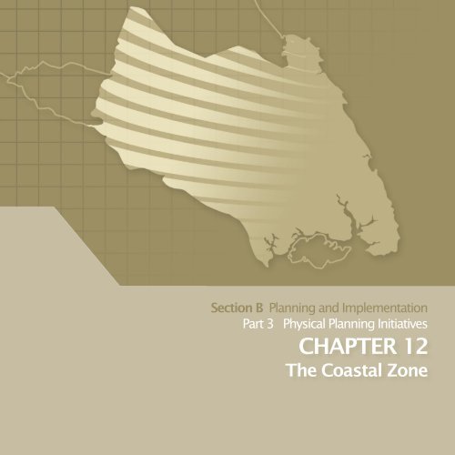
Section B Planning and Implementation<br />
Part 3 Physical Planning Initiatives<br />
CHAPTER 12<br />
<strong>The</strong> <strong>Coastal</strong> <strong>Zone</strong>
<strong>The</strong> <strong>Coastal</strong> <strong>Zone</strong><br />
chapter<br />
12<br />
12.1 Introduction<br />
Figure 12.1: <strong>The</strong> <strong>Coastal</strong> <strong>Zone</strong> of SJER<br />
<strong>The</strong> <strong>Coastal</strong> <strong>Zone</strong> of South Johor is 64 km in length. It fronts the Straits<br />
of Johor, the waterway that separates <strong>Malaysia</strong> from Singapore. Also<br />
known to locals as the Tebrau Straits, Johor Straits, Selat Johor or Selat<br />
Tebrau, this waterway is a valuable and vulnerable resource, which<br />
needs careful management and protection.<br />
SOUTH JOHOR ECONOMIC REGION<br />
(SJER)<br />
<strong>The</strong> Straits of Johor has an international boundary line that defines<br />
the boundaries of the two countries. It is spanned by two man-made<br />
connections, which are ‘<strong>The</strong> Causeway’ connecting Johor Bahru and<br />
Woodlands in Singapore and the <strong>Malaysia</strong>-Singapore Second Link,<br />
which links western Johor at Gelang Patah to Tuas in Singapore.<br />
As such, it is the southern gateway for international entry into<br />
<strong>Malaysia</strong>. Hence, it is the objective of this plan to ensure that land use<br />
development is controlled and that its urbanscape reflects a desirable<br />
image. Consequently, the development of the coastal zone needs to<br />
be balanced with its natural landscape and integrated spatial planning<br />
will be adopted in developing the coastal zone.<br />
12.2 Definition<br />
<strong>The</strong> coastal zone for SJER encompasses the waters of Johor Straits within<br />
<strong>Malaysia</strong>n boundary and a 3km inland zone along the coastline of<br />
Johor Straits, which also lies within the SEC. It extends all the way into<br />
Pontian and Kota Tinggi where the Johor Straits waterway leads into<br />
two open waters which are the Straits of Malacca on the west) and<br />
the South China Sea (on the east). Protection and control of this area is<br />
therefore of utmost importance, given potential cross-border issues.<br />
Source : SJER CDP 2025<br />
12.3 Goals<br />
<strong>The</strong> coastal zone of SJER has many interesting natural features,<br />
encompassing areas of mangrove forest. It also features the famous<br />
protected ‘Dugong’ species, which resides near the mudflats off Sungai<br />
Pulai river estuary, supported by availability of sea grass .<br />
It is also fast becoming an area of rapid growth, with ports and<br />
waterfront development projects emerging along the coastal area.<br />
Thus the need to protect the environment and to manage the pace of<br />
development within this zone is paramount. <strong>The</strong> main goals of CDP with<br />
regard to the coastal areas are as follows:<br />
COASTAL ZONE GOAL<br />
Enhance coastal area development by protecting its natural<br />
environment and ensuring urban development complies with the<br />
highest environmental standards in achieving a balanced and<br />
sustainable environment.<br />
12 - 1
SECTION B<br />
PLANNING AND IMPLEMENTATION<br />
In light of this, SJER advocates protecting natural resources within the<br />
coastal areas to the extent possible. However, it cannot discount the<br />
fact that shipping and port activities are key to the economic growth<br />
of the area. In addition, there is likely to be significant development<br />
pressure for power, housing and commerce. However with proper<br />
planning and controls, a balance between the competing demands<br />
of economic advancement and environmental preservation can be<br />
achieved.<br />
A. Activities and Natural Assets In <strong>The</strong> Waterfront <strong>Zone</strong><br />
Economic activity in the coastal areas has accelerated in recent<br />
years. This includes the expansion of urban areas, industrial activities,<br />
infrastructure development as well as the development of tourism<br />
facilities. As a consequence, about one-third of the coastline comprise<br />
of built up areas with another one-third committed for development.<br />
B. Existing Use and Activities<br />
For the purpose of this report, the coastal zone maps are illustrated in<br />
two sub-zones, the east and west coastal zone. This is due to the length<br />
of the area and the inability to display the maps in a more readable<br />
format.<br />
Currently, only 20.74% (9005.27 hectares) of the total coastal zone are<br />
built-up areas used for residential, commercial, industrial, institution,<br />
road/rail and infrastructure purposes, while another 0.6% (262.26<br />
hectares) has been approved for development. In total, 9267.47<br />
hectares (21.34%) of land within the coastal zone comprises of built up<br />
areas and the balance of 78.66% is currently undeveloped.<br />
Table 12.1: Land Use Structure of <strong>Coastal</strong> <strong>Zone</strong><br />
Landuse<br />
Area (Ha)<br />
Forest 11,405.44<br />
Water Bodies 2,610.02<br />
Open Space 616.33<br />
Agriculture 13,691.69<br />
Residential 2,475.34<br />
Commercial 272.24<br />
Industry 1,442.89<br />
Institution 2,296.01<br />
Infrastructure and Utilities 410.38<br />
Road and rail 2,108.41<br />
Vacant land 5,837.22<br />
Others (Committed development) 262.26<br />
TOTAL AREA 43,428.23<br />
Source: SJER CDP 2025<br />
<strong>The</strong> total area of the defined coastal area is 43,428.23 hectares. <strong>The</strong> area<br />
within the coastal zone has been put to various uses, some of which<br />
are not compatible with each other and may be detrimental to the<br />
natural environment. However, a substantial portion of the coastal zone<br />
remains a green area, including forests, water bodies and agricultural<br />
areas.<br />
<strong>The</strong> existence of three major ports, which are the Port of Tanjung<br />
Pelepas, Pasir Gudang Port and Tanjung Langsat Port, has resulted in a<br />
proliferation of industrial activities, as well as activities associated with<br />
shipping including shipyards and boat repairs, and harbour services.<br />
<strong>The</strong>re has been an associated increase in the number of people living<br />
along the coastal zone.<br />
Figure 12.2: Indicative Key Plan for Sub-<strong>Zone</strong><br />
East <strong>Zone</strong><br />
Tanjung Bin, which is the largest coal fired power plant project in<br />
<strong>Malaysia</strong>, is also located along the coastal zone of Pontian. <strong>The</strong><br />
RM7.8 billion project is sprawled over 41 hectares of land, and upon<br />
completion the power plant will generate 2,100MW of electricity.<br />
West <strong>Zone</strong><br />
<strong>The</strong> Danga Bay and the Kota Air, Tebrau’s integrated township<br />
developments are among the new, predominantly residential<br />
waterfront developments fronting the Straits of Johor and overlooking<br />
Singapore. Nusajaya will also have a new waterfront once its marina<br />
development is completed.<br />
Source: SJER CDP 2025<br />
12 - 2
THE COASTAL AREA CHAPTER 12 | PART 3<br />
Waterfront activities in Johor Bahru city also include commercial and<br />
residential activities. Much of the coastline also has a scenic road that<br />
makes the waterfront areas accessible to the public and gives a sense<br />
of openness for the city.<br />
<strong>The</strong> development is concentrated on the coastal areas and it is mainly<br />
from Johor Bahru city centre towards Pasir Gudang and Tanjung<br />
Langsat. By contrast, the western zone comprises mainly of mangrove,<br />
agriculture and small settlement areas, although it also includes the<br />
Port of Tanjung Pelepas. However, with the emergence of the new<br />
Johor State Administrative Centre in Nusajaya and Danga Bay, there<br />
is increasing development pressure on the western part of the coastal<br />
area and if unabated this will accelerate conversion of natural resource<br />
areas into urban land.<br />
C. Natural Assets In <strong>The</strong> <strong>Coastal</strong> <strong>Zone</strong><br />
<strong>The</strong> waterfront of South Johor has diverse natural assets which include<br />
the mangrove swamps and rivers found along the coastal zone.<br />
<strong>The</strong>re are many rivers that flow into the Straits of Johor and these rivers<br />
and their tributaries play a major environmental role as well as a role<br />
in enhancing the aesthetics of the urbanscape of SJER. Due to rapid<br />
urban development, most of the rivers are affected by pollution. It is<br />
important to ensure that these rivers are clean. An integrated river basin<br />
management plan has to be put in place in order to ensure good water<br />
quality, which is important for preserving the environment within the<br />
coastal zone.<br />
230.79 sq.km. of mangrove is found along the coastal zone and these<br />
mangrove areas protect the shoreline from erosion. As the Straits of<br />
Johor is a short stretch of water, tidal effects from the two open waters<br />
of the South China Sea and the Straits of Malacca have substantial<br />
effect on the shoreline. Much of the mangrove area is being degraded<br />
and encroached upon by committed development, especially in<br />
the Nusajaya, Danga Bay and Tebrau areas. However, it is important<br />
to preserve some of these mangrove areas especially those of the<br />
RAMSAR, Pendas and Kim-Kim.<br />
12 - 3
SECTION B<br />
PLANNING AND IMPLEMENTATION<br />
Figure 12.3: Existing Land Use of the West <strong>Coastal</strong> <strong>Zone</strong><br />
Gelang Patah<br />
Sungai Pulai<br />
Tanjung<br />
Pelepas<br />
Port<br />
Second Link<br />
Kukup<br />
Tanjung Bin<br />
Tanjung Piai<br />
Legend<br />
Vilages<br />
Planned House<br />
Commercial<br />
Industry<br />
Community Hall<br />
Government Use<br />
Religious Reserve<br />
Education Reserve<br />
Security & Emergency Facilities<br />
Health Facilities<br />
Cemeteries<br />
Airport<br />
Army Camp<br />
Palace<br />
Port<br />
Infrastructure & Utility<br />
Highway/ Road/ Rail Reserved<br />
Parking<br />
Sea<br />
Port<br />
Infrastructure & Utility<br />
Mangrove Forest<br />
RAMSAR <strong>Zone</strong><br />
River/ Pond<br />
Agriculture<br />
Source: SJER CDP 2025<br />
12 - 4
THE COASTAL AREA CHAPTER 12 | PART 3<br />
Figure 12.4: Existing Land Use of the East <strong>Coastal</strong> <strong>Zone</strong><br />
Tebrau<br />
Johor Bahru City<br />
Stulang<br />
Selat Johor<br />
Tanjung<br />
Langsat<br />
Pasir Gudang<br />
Legend<br />
Vilages<br />
Planned House<br />
Commercial<br />
Industry<br />
Community Hall<br />
Government Use<br />
Religious Reserve<br />
Education Reserve<br />
Security & Emergency Facilities<br />
Source: SJER CDP 2025<br />
Health Facilities<br />
Cemeteries<br />
Airport<br />
Army Camp<br />
Palace<br />
Port<br />
Infrastructure & Utility<br />
Highway/ Road/ Rail Reserved<br />
Parking<br />
Sea<br />
Port<br />
Infrastructure & Utility<br />
Mangrove Forest<br />
RAMSAR <strong>Zone</strong><br />
River/ Pond<br />
Agriculture<br />
12 - 5
SECTION B<br />
PLANNING AND IMPLEMENTATION<br />
12.4 Protection and Development <strong>Zone</strong>s<br />
Figure 12.5: Protection Areas<br />
<strong>The</strong> coastal areas have historically played a significant role in SJER’s<br />
early history due to their importance to trade and transportation. <strong>The</strong>y<br />
remain important until today, supporting fisheries, port activities as well<br />
as settlements. Development is expected to be focused in the coastal<br />
zone and this is reflected in the CDP since much of the infrastructure<br />
development is focused there. Thus, the challenge lies in ensuring that<br />
the pace of development is balanced with the needs for environmental<br />
protection, to ensure that SJER can meet its aspirations of becoming a<br />
world-class sustainable conurbation.<br />
Sungai<br />
Pulai<br />
Gelang<br />
Patah<br />
Johor Bahru<br />
City<br />
Pasir<br />
Gudang<br />
KEY DIRECTION:<br />
CZ 1: Balanced development with environmental protection within<br />
the <strong>Coastal</strong> <strong>Zone</strong> to achieve a world-class sustainable conurbation<br />
Two main zones has been identified, the coastal protection zone and<br />
the coastal development zone. Any development in this zone should<br />
take great care to ensure that the environmental standards are met.<br />
A. <strong>The</strong> <strong>Coastal</strong> Protection Areas<br />
<strong>The</strong> protection zones along the coastal area are those areas that have<br />
been designated as preserved mangrove areas. <strong>The</strong>y also include<br />
the four main rivers in SJER which are water intake points and whose<br />
catchment areas need to be protected. <strong>The</strong> designated protection<br />
areas identified are considered to be the coastal land core areas; the<br />
areas closest to the waterfront and it comprise of:<br />
Table 12.2: Protection Areas<br />
Port of Tanjung<br />
Pelepas<br />
Source: SJER CDP 2025<br />
B. Planning Controls<br />
<strong>The</strong> SJER CDP Proposal Map, where the coastal zone has been defined,<br />
provides planning controls within these protection areas.<br />
Three other overlay planning zones will also help to control development<br />
of the coastal areas and these are the Environmental Protection<br />
<strong>Zone</strong> (which most of the mangrove and rivers are defined under),<br />
Aquaculture <strong>Zone</strong> (particularly the Sungai Pulai and Sungai Johor areas<br />
which falls within the coastal zone) and Water Catchment <strong>Zone</strong> (the<br />
catchment areas for the rivers fall within coastal areas and beyond).<br />
Table 12.3: Three Other Overlay Planning <strong>Zone</strong>s<br />
Designated Mangrove Areas<br />
RAMSAR Sites<br />
Pendas Mangrove Park<br />
Kim-Kim Mangrove Park<br />
Source: SJER CDP 2025<br />
Designated Rivers<br />
Sungai Johor<br />
Sungai Pulai<br />
Sungai Skudai<br />
Sungai Tebrau<br />
<strong>Coastal</strong> <strong>Zone</strong><br />
Environmental<br />
Protection <strong>Zone</strong><br />
Aquaculture<br />
<strong>Zone</strong><br />
Source: SJER CDP 2025<br />
<strong>The</strong> coastal zone for SJER comprises of the Johor<br />
Straits, within <strong>Malaysia</strong>n boundary, and a 3km inland<br />
zone along the coastline of Johor Straits that also lies<br />
within the SEC.<br />
Overlay of areas are identified to require further<br />
environmental control by virtue of their identification<br />
as Environmental Sensitive Areas (see Chapter on<br />
Natural Environment)<br />
Areas within the Sungai Pulai and Sungai Johor river<br />
which have been identified for aquaculture and<br />
cage-culture activities. Such activities should not<br />
disturb the mangrove forest within these two rivers.<br />
12 - 6
THE COASTAL AREA CHAPTER 12 | PART 3<br />
■ Environmental Protection <strong>Zone</strong> (EPZ)<br />
KEY DIRECTION:<br />
CZ 2: To define and manage the Environmental Protection <strong>Zone</strong> as<br />
a coastal land buffer area.<br />
■ Aquaculture <strong>Zone</strong> (AZ)<br />
KEY DIRECTION:<br />
CZ 3: To allow and promote sustainable aquaculture activities in<br />
Sungai Johor and Sungai Pulai<br />
For the designated mangrove areas, a 500m Environmental Protection<br />
<strong>Zone</strong> (EPZ) is imposed around the mangrove forest. This will act as a<br />
buffer to prevent encroachment into the mangrove forest reserves.<br />
Village settlements and small agriculture activities are permitted in these<br />
areas, subject to control so as not to damage and encroach upon the<br />
designated mangrove areas.<br />
Table 12.4: Designated Mangrove Areas and EPZ<br />
Designated Mangrove Areas<br />
RAMSAR – World Heritage Park (Sungai Pulai<br />
Mangrove Forest, Tanjung Piai and Pulau<br />
Kukup)<br />
Pendas Mangrove Park<br />
Kim-Kim Mangrove Park<br />
Sungai Johor Mangrove Forest<br />
Sungai Lebam Mangrove Forest<br />
Source: SJER CDP 2025<br />
EPZ Requirements<br />
500 m all around<br />
500 m all around<br />
500 m all around<br />
500 m all around<br />
500 m all around<br />
For other mangrove areas, which are non-designated mangrove<br />
reserves, a minimum buffer of 100m is required.<br />
Table 12.5: Non-Designated Mangrove Areas and EPZ<br />
Designated Mangrove Areas<br />
Sungai Melayu<br />
Sungai Perepat<br />
Sungai Busong<br />
Source: SJER CDP 2025<br />
EPZ Requirements<br />
100 m all around<br />
100 m all around<br />
100 m all around<br />
Two rivers have been identified as the Aquaculture <strong>Zone</strong> (AZ) which are<br />
Sungai Pulai and Sungai Johor. Aquaculture activities are only allowed<br />
within the waterways of the rivers and are confined to<br />
cage-cultures. Lightweight structures such as boardwalks and jetties<br />
may be built on stilts to link the mainland to the waterways of the rivers.<br />
Aquaculture activities in Sungai Pulai are expected to be less intensive<br />
than in Sungai Johor where the riverine area is larger and there are<br />
less mangrove forests. <strong>The</strong> Sungai Johor AZ will support the production<br />
of marine aquaculture fish for which Johor accounts for 40% (2003) of<br />
national production.<br />
A marine park has been identified in Sungai Johor and will include<br />
facilities such as laboratories, lightweight structured jetties, floating<br />
homes, small operations offices and cold rooms. <strong>The</strong> Economic and<br />
Social Aspect Report 2006 indicates that a total of 46,300 metric tonnes<br />
of production is targeted on these two sites which would make these<br />
major aquaculture industry areas.<br />
Thus, care must be taken to ensure that these aquaculture activities do<br />
not affect the surrounding mangrove forest which are breeding grounds<br />
for the fishing industry. <strong>The</strong> catchment area of these two rivers, which<br />
are currently of Class II standard (DOE, 2004), need to be preserved.<br />
Figure 12.7: Location plan of AZ<br />
Figure 12.6: <strong>The</strong> RAMSAR and 500m EPZ<br />
Sungai<br />
Johor<br />
Johor Bahru City<br />
Sungai<br />
Pulai<br />
Port of<br />
Tanjung<br />
Pelepas<br />
Gelang<br />
Patah<br />
Pasir<br />
Gudang<br />
500 m<br />
Environmental<br />
Protection <strong>Zone</strong><br />
Source: SJER CDP 2025<br />
Aquaculture <strong>Zone</strong><br />
Source: SJER CDP 2025<br />
12 - 7
SECTION B<br />
PLANNING AND IMPLEMENTATION<br />
C. Use and Activities within <strong>Coastal</strong> Protection Area (CPA)<br />
Figure 12.8: Examples of activities allowed in Mangrove Areas<br />
Careful planning and controls on development have to be imposed on<br />
the coastal protection areas. Generally, no development is allowed<br />
within the coastal protection areas which comprise of the designated<br />
mangrove areas and the five main rivers.<br />
Table 12.6: Activities allowed in the CPAs<br />
Planning <strong>Zone</strong> Activities Allowed Conditions<br />
Designated<br />
Mangrove<br />
Areas and<br />
Other<br />
Mangrove<br />
areas within<br />
<strong>Coastal</strong> area<br />
No development or<br />
agriculture allowed.<br />
Sustainable logging<br />
and low impact<br />
nature tourism may be<br />
permitted; subject to<br />
local constraints.<br />
Nil<br />
However, facilities<br />
for visitors such as<br />
boardwalks, lookout<br />
towers, visitors centres<br />
can be built.<br />
River Areas<br />
Passive Recreational<br />
activities<br />
Aqua-culture activities<br />
Jetty and Boardwalks<br />
Does not have impact on<br />
the river eco-system.<br />
Cage-culture activities<br />
only. Comply with<br />
environmental standards<br />
and planning guidelines<br />
for eco-zone.<br />
Preferably on pontoon or<br />
floating structures.<br />
Mangrove<br />
Environmental<br />
Protection <strong>Zone</strong><br />
(500m and<br />
150m buffer<br />
areas)<br />
Passive Recreational<br />
activities<br />
Does not have impact<br />
on the mangrove ecosystem.<br />
Only in areas identified<br />
for passive development.<br />
Comply with the<br />
environmental standards<br />
and planning guidelines<br />
for eco-zone.<br />
River EPZ’s<br />
Eco-Agriculture activities<br />
only.<br />
Eco-Resort<br />
• Low Density/Low<br />
Impact Resort Homes<br />
• Eco-friendly chalets<br />
• Resort Facilities<br />
Use of herbicide is<br />
not allowed for these<br />
agriculture activities.<br />
Comply with<br />
environmental standards<br />
and planning guidelines<br />
for eco-zone.<br />
Source: SJER CDP 2025<br />
Source: SJER CDP 2025<br />
12 - 8
THE COASTAL AREA CHAPTER 12 | PART 3<br />
D. <strong>The</strong> <strong>Coastal</strong> Development <strong>Zone</strong> (CDZ)<br />
<strong>The</strong> <strong>Coastal</strong> Development <strong>Zone</strong>s comprise of areas other than the<br />
environmental protection zone and aquaculture zone. <strong>The</strong>se are areas<br />
which can be developed or areas that are already built-up.<br />
<strong>The</strong> main objective is to ensure major development along waterfront<br />
areas are planned to protect both the urban qualities (urban profile)<br />
and the natural landscape of the area.<br />
Key Direction:<br />
CZ 4: New Development along the waterfront development shall<br />
adapt to the coastal landscape of the area.<br />
This implies that development projects within the coastal area need to<br />
take into consideration the natural elements within the area.<br />
New development along the coastal area should be confined to the<br />
uses allowed in the CDP. Tourism or leisure based activities are the most<br />
appropriate uses along the coastal areas. However, other uses that can<br />
capitalise on the location, while adhering to environmental standards,<br />
should not be denied.<br />
▼ Economic Opportunities<br />
<strong>The</strong> coastal area of SJER is an important area of economic activity; it<br />
is expected to generate many opportunities to support the growing<br />
population base as this has been emphasised in the Economic Report<br />
of SJER. Three project initiatives that have direct impact to the coastal<br />
areas are:-<br />
Table 12.7: Economic Project Initiatives<br />
Initiative L 1 Enhance Role of PTP as the Maritime Hub<br />
Initiative F 8 Development of Marine Aquaculture Park<br />
Initiative T 5 Development of Waterways Into A Maritime Corridor<br />
Source: Economics Report SJER, 2006, RMA<br />
<strong>The</strong> Port of Tanjung Pelepas or PTP is not only an important transhipment<br />
port but a focal point for logistics activities. It is further enhancing its<br />
role as a maritime hub and is expanding its services to support all forms<br />
of marine activities. <strong>The</strong> existence of the port has encouraged many<br />
enterprises to be sited there and hence, creates opportunities for a Free<br />
<strong>Zone</strong> to be established.<br />
As mentioned in the above section, aquaculture activities in Sungai<br />
Pulai and Sungai Johor are encouraged to support the marine<br />
aquaculture industry. Under the Ninth <strong>Malaysia</strong> Plan, the Fisheries<br />
Department has targeted to reach the production output of 46,300<br />
metric tones of fish by 2010 which will lead to a demand for fish fry and<br />
fish feed.<br />
Tourism is a major economic sector for the country and SJER has many<br />
opportunities to expand its tourism industry. <strong>The</strong> coastal areas provide<br />
significant potential for tourism as a result of the attractions of scenic<br />
coastal views while natural resource areas can encourage eco-tourism<br />
activities. <strong>The</strong> waters of SJER create opportunities for marine sports such<br />
as yachting.<br />
All three of these major initiatives will spur urban development. However,<br />
they are also dependent on a healthy eco-system, hence, the need to<br />
protect the future of the coastal environment.<br />
▼ Planning Control<br />
Careful planning control needs to be exercised over the coastal<br />
areas to guide the development of the waterfront areas. To ensure a<br />
balanced development, the coastal area has been divided into several<br />
sections and the planning guidelines in the table below will be used to<br />
guide developments in this area.<br />
Table 12.8: Planning Controls for Development along <strong>Coastal</strong> Area<br />
Section<br />
A<br />
B<br />
C<br />
Use and Activities Allowed<br />
Pulau Kukup-Sungai Pulai<br />
No Development <strong>Zone</strong> except for Tanjung Bin and PTP.<br />
Sungai Pulai Waterways – Aquaculture activities only<br />
All guidelines as mentioned in <strong>Coastal</strong> Protection <strong>Zone</strong> applies<br />
i.e. for Mangrove and River areas.<br />
Sungai Pulai-2 nd Crossing<br />
Free Access <strong>Zone</strong> with 100m buffer from coastal waterfront<br />
2 nd Crossing- Sungai Pendas Forest Reserve<br />
• Medium density residential with 100m buffer from coastal<br />
waterfront<br />
• Regional Park at Pendas<br />
• No development or agriculture allowed. Sustainable<br />
logging and low impact nature tourism may be permitted<br />
subject to local constraints.<br />
12 - 9
SECTION B<br />
PLANNING AND IMPLEMENTATION<br />
Section<br />
D<br />
E<br />
F<br />
G<br />
H<br />
I<br />
Use and Activities Allowed<br />
Nusajaya CPA<br />
Waterfront development<br />
Nusajaya CPA – Kg Sungai Melayu<br />
• Facing Selat Johor – Waterfront Development<br />
• Along Sungai Melayu – Urban development with 100m<br />
buffer from waterfront<br />
Sungai Melayu – Sungai Danga<br />
Medium density – Medium high density residential with 100m<br />
buffer from coastal waterfront<br />
Danga Bay – Sg Skudai<br />
Waterfront Development<br />
Sungai Skudai – Johor Bahru City Centre<br />
Waterfront development<br />
Permas Jaya – Kota Puteri<br />
Medium density – Medium high density residential with 100m<br />
buffer from coastal waterfront<br />
Section<br />
Use and Activities Allowed<br />
J Pasir Gudang<br />
Port Activities<br />
K Kim-Kim Regional Park<br />
No development or agriculture allowed. Sustainable logging<br />
and low impact nature tourism may be permitted subject to<br />
local constraints.<br />
L Sungai Johor<br />
• Mangrove Reserves<br />
• Environmental Protection Area<br />
• Aquaculture activities only<br />
• All guidelines as mentioned in <strong>Coastal</strong> Protection <strong>Zone</strong><br />
apply i.e. for Mangrove and River areas.<br />
Source: SJER CDP 2025<br />
Figure 12.9: <strong>Coastal</strong> <strong>Zone</strong><br />
Sungai<br />
Johor<br />
Sungai<br />
Melayu<br />
Danga<br />
Bay<br />
Johor Bahru<br />
City Centre<br />
Pasir Gudang<br />
Sungai<br />
Kim Kim<br />
Nusajaya<br />
Sungai<br />
Pulai<br />
Pendas Mangrove<br />
Regional Park<br />
Second<br />
Link<br />
Kukup<br />
Source: SJER CDP 2025<br />
12 - 10
THE COASTAL AREA CHAPTER 12 | PART 3<br />
Figure 12.10: Major Developments along <strong>Coastal</strong> <strong>Zone</strong><br />
1. RAMSAR Site<br />
2. Tanjung Pelepas Port<br />
3. Free Trade <strong>Zone</strong><br />
4. Second Link Free Access <strong>Zone</strong><br />
5. Pendas Mangrove Regional Park<br />
6. Nusajaya Waterfront<br />
7. Cyber Park<br />
8. Danga Bay River Development<br />
9. Pantai Lido - Public <strong>Zone</strong><br />
10. Johor Bahru Waterfront<br />
11. Johor Bahru Access Free <strong>Zone</strong><br />
12. Stulang Park<br />
13. Tebrau Bay River Development<br />
14. Permas Jaya Waterfront<br />
15. Bandar Kota Puteri Waterfront<br />
16. Pasir Gudang Port<br />
17. Pasir Putih Waterfront<br />
18. Sungai Kim - Kim Regional Park<br />
19. Tanjung Langsat Technology Park & Port<br />
20. Aqua Culture Service Centre<br />
21. Sungai Johor Mangrove Park<br />
Source: SJER CDP 2025<br />
12 - 11
SECTION B<br />
PLANNING AND IMPLEMENTATION<br />
12.5 Johor Bahru <strong>Coastal</strong> Development<br />
<strong>The</strong> Johor Bahru coastal area presents an excellent prime waterfront<br />
development opportunity. <strong>The</strong> development would not only create<br />
an attractive new feature for the city but would also provide the<br />
opportunity to create new public spaces for the benefit of the growing<br />
population. 100 acres of parks and open spaces would be created, in<br />
addition to another 180 acres of land for mixed use development and<br />
infrastructure which have already been created. <strong>The</strong> opportunity to<br />
reshape the coastal area will result in a new and vibrant waterfront that<br />
will link Johor Bahru City Centre to Danga Bay development. <strong>The</strong> Johor<br />
Bahru <strong>Coastal</strong> development will reclaim 250 metres of land to create a<br />
new shoreline.<br />
Figure 12.11: Johor Bahru Waterfront Development<br />
MIXED USE<br />
9.68 ac<br />
OPEN SPACE<br />
MIXED USE<br />
8.12 ac<br />
MIXED USE<br />
11.17 ac<br />
MIXED USE<br />
15.42 ac<br />
MIXED USE<br />
8.60 ac<br />
MIXED USE<br />
5.79 ac<br />
Mixed Use<br />
Parks<br />
Existing Building (Lot 1)<br />
OPEN SPACE<br />
51.71 ac<br />
MIXED USE<br />
4.95 ac<br />
Promenade<br />
MIXED USE<br />
9.51 ac<br />
MIXED USE<br />
9.70 ac<br />
MIXED USE<br />
10.64 ac MIXED USE<br />
10.97 ac<br />
MIXED USE<br />
4.99 ac<br />
MIXED USE<br />
2.45 ac<br />
OPEN SPACE<br />
4.70 ac<br />
MIXED USE<br />
13.07 ac<br />
MIXED USE<br />
3.98 ac<br />
MIXED USE<br />
2.46 ac<br />
MIXED USE<br />
12.40 ac<br />
OPEN SPACE<br />
4.86 ac<br />
LANDUSE ACREAGE<br />
MIXED USE 161.11<br />
OPEN SPACE 118.78<br />
INFRASTRUCTURE 88.63<br />
TOTAL 368.52<br />
Source: SJER CDP 2025<br />
12 - 12
THE COASTAL AREA CHAPTER 12 | PART 3<br />
12.6 Proposed Nusajaya Free Access <strong>Zone</strong> (FAZ)<br />
Another area which has great potential is the proposed Nusajaya Free<br />
Access <strong>Zone</strong> (FAZ). <strong>The</strong> land is located just off the western part of the<br />
second crossing and it is 1029 acres in size, which allows for it to be<br />
developed as an integrated FAZ.<br />
<strong>The</strong> objectives of the FAZ are as follows:<br />
■ FAZ will help enhance the linkages between SJER and Singapore;<br />
■ FAZ, if extended to PTP could further enhance the position of the<br />
Port of Tanjung Pelepas;<br />
Subject to approval by SJA and other authorities, the FAZ will create a<br />
seamless work and living environment between Johor and Singapore. A<br />
golf course has also been proposed as part of the recreational facilities<br />
for its population. This will be enhanced further by shopping, food and<br />
entertainment facilities.<br />
Table 12.9: Development Components in FAZ<br />
LAND USE ACREAGE %<br />
Commercial<br />
Commercial Centre<br />
Office Parks<br />
243.63<br />
206.35<br />
23.66<br />
20.04<br />
Sub Total 449.98 43.71<br />
Open Space<br />
Parks<br />
Golf Course<br />
Promenade<br />
Canal<br />
135.79<br />
239.74<br />
20.35<br />
62.87<br />
13.19<br />
23.28<br />
1.98<br />
6.11<br />
Sub Total 458.75 44.56<br />
Infrastructure<br />
Road 120.78 11.73<br />
Sub Total 120.78 11.73<br />
GRAND TOTAL 1029.51 100.00<br />
Source: SJER CDP 2025<br />
Among the proposals of the proposed FAZ is that it will be a 24-hour<br />
city, the FAZ will have no limitations on duration of stay and access<br />
will be permitted at all hours. A smart card system will be developed<br />
to facilitate movement in and out of the area, and to entice<br />
Singaporeans to live in the FAZ and travel to work in Singapore.<br />
Most of the properties here will be on lease. Global businesses will be<br />
encouraged, although business licenses shall be limited to <strong>Malaysia</strong>ns.<br />
Direct access to the proposed FAZ from neighbouring areas is<br />
envisaged to be strictly controlled. For example, a 30m bund would be<br />
created, and a canal of 30m in length will be built all along this bund for<br />
retention as well as security purposes.<br />
12 - 13
SECTION B<br />
PLANNING AND IMPLEMENTATION<br />
Figure 12.12: Proposed Nusajaya FAZ Development Components<br />
Source: SJER CDP 2025<br />
Figure 12.13: FAZ Development Concepts<br />
OFFICE PARK<br />
45.87 ac<br />
PARK<br />
53.91 ac<br />
COMMERCIAL<br />
44.48 ac<br />
COMMERCIAL<br />
42.59 ac<br />
COMMERCIAL<br />
9.54 ac<br />
PARK<br />
24.03 ac<br />
OFFICE PARK<br />
160.48 ac<br />
GOLF COURSE<br />
239.74 ac<br />
COMMERCIAL<br />
17.04 ac<br />
COMMERCIAL<br />
46.31 ac<br />
COMMERCIAL<br />
52.48 ac<br />
PARK<br />
57.85 ac<br />
COMMERCIAL<br />
15.67 ac<br />
Source: SJER CDP 2025<br />
12 - 14
THE COASTAL AREA CHAPTER 12 | PART 3<br />
▼ Public Access<br />
In the coastal zone, public access to the coast shall be secured and<br />
designated to ensure free access for the general public. Thus, for all<br />
new developments, a public right of way in a form of a pedestrian<br />
promenade is proposed.<br />
▼ Edges<br />
Development works on the edges of the coastal areas are important.<br />
Two types of edges will be proposed along the coastal zone; soft edges<br />
and hard edges.<br />
Figure 12.16: Edges: Green represents soft edges; Orange represents hard edge<br />
Figure 12.14: Integration of Promenade along the Coastline<br />
Source: SJER CDP 2025<br />
▼ Visualisation<br />
<strong>The</strong> visual projection of the coastal zone development is important as<br />
the area is the gateway of <strong>Malaysia</strong>. Iconic buildings can be located<br />
along the coastline to enhance the skyline of Southern Johor.<br />
Figure 12.15: Iconic Buildings along the Coastline<br />
Source: SJER CDP 2025<br />
Soft edges are green and blend in with the natural landscape. <strong>The</strong><br />
natural protection and eco-zone areas are of natural soft edges<br />
with existing vegetation, while some urban areas with low impact<br />
development will also be of soft edges though it is subject to treatment<br />
to prevent erosion.<br />
Figure 12.17: Examples of soft edges with existing vegetation<br />
EXISTING EDGE<br />
GRADIENT<br />
Source: SJER CDP 2025<br />
300mm THICKNESS<br />
ROCK PROTECTION<br />
(NORMINAL 130MM<br />
dia.) WITH EARTH<br />
INFILL FOR PLANT<br />
GROWTH<br />
SUPPLEMENTARY ROCK<br />
PROTECTION WITH EARTH<br />
INFILL & REPLANTING<br />
EXISTING<br />
AQUATIC<br />
GROWTH<br />
ORIGINAL<br />
BEACH<br />
Source: SJER CDP 2025<br />
12 - 15
SECTION B<br />
PLANNING AND IMPLEMENTATION<br />
Figure 12.18: Examples of soft edges with treatments along<br />
development<br />
Hard edges are suitable for coastlines with commercial or higher impact<br />
development though protection of the seawall should not be harsh.<br />
Instead, it must integrate well with durable materials such as river stones<br />
and good quality timber work.<br />
Figure 12.19: Examples of hard edges with treatments along<br />
developments<br />
MAKE GOOD<br />
LOCALLY<br />
EXCAVATED<br />
MATERIAL<br />
PROMENADE<br />
(20M WIDE)<br />
BOLLARD<br />
FEATURE CAPPING<br />
PROTECTION<br />
EXTENDS 500<br />
BEYON BREAK<br />
POINT<br />
CONCRETE<br />
RETANING WALL<br />
REDUCE WATER LEVEL OR<br />
CONSTRUCT TEMPORARY BUND,<br />
EXCAVATE SLOPE<br />
TO REDUCE LEVEL AND INSTALL<br />
CONCRETE PILING<br />
PROMENADE<br />
(20M WIDE)<br />
TOPSOIL<br />
SITE BOULDERS<br />
EXISTING EDGE<br />
GRADIENT<br />
MORTAR BEDDING<br />
300mm THICKNESS<br />
ROCK PROTECTION<br />
(NORMINAL 130MM<br />
dia.)<br />
SUBSOIL BACKFILL<br />
STONE FACING<br />
Source: SJER CDP 2025<br />
ANGLED AND<br />
STAGGERED GABION<br />
GEOTEXTILE<br />
ROCK PROTECTION<br />
Source: SJER CDP 2025<br />
12 - 16
THE COASTAL AREA CHAPTER 12 | PART 3<br />
▼ Ambiance<br />
Marinas and jetties are synonymous with the coastline. <strong>The</strong>se types of<br />
structures can help to enhance the commercial areas along coastlines<br />
and support the use of water taxis. For residential developments, it is<br />
recommended that the buildings are built fronting the river.<br />
Figure 12.20: Examples of marina and jetty along the Coastline<br />
▼ Coastline water quality<br />
<strong>The</strong> quality of water along the coast needs to be maintained . Gross<br />
pollution trap and similar natural devices will be located in rivers to<br />
ensure garbage and mud are trapped before being discharged into<br />
coastal waters. In addition, a waterway is also proposed at the existing<br />
causeway to improve water flow along the coastline.<br />
Figure 12.21: Improve water flow at the existing Causeway<br />
Source: SJER CDP 2025<br />
12.7 Environmental Impact Assessment<br />
<strong>The</strong> <strong>Coastal</strong> <strong>Zone</strong> is considered to be an Environmental Sensitive Area<br />
(ESA) and the environmental impact of new development projects<br />
or major changes to existing projects must undergo an Environmental<br />
Impact Assessment (EIA).<br />
KEY DIRECTION<br />
CZ 5: <strong>The</strong> need to conduct and obtain approvals for an<br />
Environmental Impact Assessment on any development within the<br />
<strong>Coastal</strong> <strong>Zone</strong><br />
Source: SJER CDP 2025<br />
<strong>The</strong> Environmental Quality Act (EQA) has identified 19 prescribed<br />
activities that require Environmental Impact Assessments (EIA) to be<br />
carried out and submitted for approvals of activities. However, based<br />
on the Act, the need for EIA for ESAs appear to have been left out. Thus,<br />
in the CDP, it is proposed that EIA is required for development projects<br />
within the coastal zone for whatever scale of activity, given that the<br />
sensitivity of the coastal zone and the international obligations that SJER<br />
has over this area.<br />
12 - 17