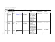
NANCEFIELD Ext.1 Sub-Area 10 NATURENA Sub-Area 13 ... - Joburg
NANCEFIELD Ext.1 Sub-Area 10 NATURENA Sub-Area 13 ... - Joburg
NANCEFIELD Ext.1 Sub-Area 10 NATURENA Sub-Area 13 ... - Joburg

You also want an ePaper? Increase the reach of your titles
YUMPU automatically turns print PDFs into web optimized ePapers that Google loves.
REGIONAL SPATIAL DEVELOPMENT FRAMEWORK. 2006/7<br />
ADMINISTRATIVE REGION 6 AND REGION <strong>10</strong><br />
<strong>NANCEFIELD</strong> <strong>Ext.1</strong> <strong>Sub</strong>-<strong>Area</strong> <strong>10</strong><br />
<strong>NATURENA</strong> <strong>Sub</strong>-<strong>Area</strong> <strong>13</strong><br />
<strong>NATURENA</strong> EXT.5 <strong>Sub</strong>-<strong>Area</strong> <strong>13</strong><br />
<strong>NATURENA</strong> EXT.6 <strong>Sub</strong>-<strong>Area</strong> <strong>13</strong><br />
<strong>NATURENA</strong> EXT.11 <strong>Sub</strong>-<strong>Area</strong> <strong>13</strong><br />
<strong>NATURENA</strong> EXT.<strong>13</strong> <strong>Sub</strong>-<strong>Area</strong> <strong>13</strong><br />
<strong>NATURENA</strong> EXT.17 <strong>Sub</strong>-<strong>Area</strong> <strong>13</strong><br />
<strong>NATURENA</strong> EXT.19 <strong>Sub</strong>-<strong>Area</strong> <strong>13</strong><br />
<strong>NATURENA</strong> EXT.20 <strong>Sub</strong>-<strong>Area</strong> <strong>13</strong><br />
<strong>NATURENA</strong> EXT.25 <strong>Sub</strong>-<strong>Area</strong> <strong>13</strong><br />
<strong>NATURENA</strong> EXT.26 <strong>Sub</strong>-<strong>Area</strong> <strong>13</strong><br />
NOORDGESIG <strong>Sub</strong>-<strong>Area</strong> 2<br />
NOORDGESIG EXT.1 <strong>Sub</strong>-<strong>Area</strong> 2<br />
ORLANDO <strong>Sub</strong>-<strong>Area</strong> 2<br />
ORLANDO EAST <strong>Sub</strong>-<strong>Area</strong> 2<br />
ORLANDO WEST <strong>Sub</strong>-<strong>Area</strong> 2<br />
ORLANDO WEST EXT.1 <strong>Sub</strong>-<strong>Area</strong> 2<br />
ORLANDO WEST EXT.2 <strong>Sub</strong>-<strong>Area</strong> 2<br />
ORLANDO WEST EXT.5 <strong>Sub</strong>-<strong>Area</strong> 2<br />
PHIRI <strong>Sub</strong>-<strong>Area</strong> 8<br />
PIMVILLE ZONE 1 <strong>Sub</strong>-<strong>Area</strong> 11<br />
PIMVILLE ZONE 2 <strong>Sub</strong>-<strong>Area</strong> 11<br />
PIMVILLE ZONE 3 <strong>Sub</strong>-<strong>Area</strong> 11<br />
PIMVILLE ZONE 4 <strong>Sub</strong>-<strong>Area</strong> 11<br />
PIMVILLE ZONE 5 <strong>Sub</strong>-<strong>Area</strong> 11<br />
PIMVILLE ZONE 6 <strong>Sub</strong>-<strong>Area</strong> 11<br />
PIMVILLE ZONE 7 <strong>Sub</strong>-<strong>Area</strong> 11<br />
POWER PARK <strong>Sub</strong>-<strong>Area</strong> 1<br />
POWER PARK EXT.2 <strong>Sub</strong>-<strong>Area</strong> 1<br />
POWER PARK EXT.3 <strong>Sub</strong>-<strong>Area</strong> 2<br />
PROTEA GLEN <strong>Sub</strong>-<strong>Area</strong> 7<br />
PROTEA GLEN EXT.1 <strong>Sub</strong>-<strong>Area</strong> 7<br />
PROTEA GLEN EXT.2 <strong>Sub</strong>-<strong>Area</strong> 7<br />
PROTEA GLEN EXT.3 <strong>Sub</strong>-<strong>Area</strong> 7<br />
PROTEA GLEN EXT.4 <strong>Sub</strong>-<strong>Area</strong> 7<br />
PROTEA GLEN EXT.5 <strong>Sub</strong>-<strong>Area</strong> 7<br />
PROTEA GLEN EXT.11 <strong>Sub</strong>-<strong>Area</strong> 7<br />
PROTEA GLEN EXT.12 <strong>Sub</strong>-<strong>Area</strong> 7<br />
PROTEA INDUSTRIAL PARK <strong>Sub</strong>-<strong>Area</strong> 7<br />
PROTEA NORTH <strong>Sub</strong>-<strong>Area</strong> 7<br />
PROTEA SOUTH <strong>Sub</strong>-<strong>Area</strong> 7<br />
RACECOURSE <strong>Sub</strong>-<strong>Area</strong> <strong>10</strong><br />
RIVASDALE <strong>Sub</strong>-<strong>Area</strong> <strong>13</strong><br />
SENAOANE <strong>Sub</strong>-<strong>Area</strong> 8<br />
SLOVOVILLE <strong>Sub</strong>-<strong>Area</strong> 15<br />
SLOVOVILLE EXT.1 <strong>Sub</strong>-<strong>Area</strong> 15<br />
TLADI <strong>Sub</strong>-<strong>Area</strong> 6<br />
THULANI <strong>Sub</strong>-<strong>Area</strong> 15<br />
TSEPISONG <strong>Sub</strong>-<strong>Area</strong> 15<br />
ZOLA <strong>Sub</strong>-<strong>Area</strong> 6<br />
ZONDI <strong>Sub</strong>-<strong>Area</strong> 6<br />
Section 4: <strong>Sub</strong>-<strong>Area</strong> Development Management Tables<br />
46
REGIONAL SPATIAL DEVELOPMENT FRAMEWORK. 2006/7<br />
ADMINISTRATIVE REGION 6 AND REGION <strong>10</strong><br />
5.2. SUB – AREA DEVELOPMENT MANAGEMENT TABLES<br />
THESE DEVELOPMNET OBJECTIVES ARE APPLICABLE TO ALL SUB - AREAS<br />
Soweto Empowerment Zone.<br />
DEVELOPMENT OBJECTIVE ONE<br />
The need to create employment opportunities close to Soweto by providing an<br />
investor friendly environment. Being strategically located on the highway, with<br />
linkages to the surrounding labour markets of Soweto, Eldorado Park and Lenasia,<br />
Devland and Baralink form the cornerstone of the Soweto Empowerment Zone.<br />
INTERVENTIONS<br />
1.1 Create sustainable employment<br />
opportunities.<br />
1.2 Promote safety and security to<br />
stimulate economic investment.<br />
Promote Soweto Tourist Route.<br />
1.3 Stimulate the development of a<br />
viable local economy in the area.<br />
1.4 Support the development of a mixed<br />
use (commerce with associated<br />
service industry and residential<br />
GUIDELINES<br />
• Provide an investor friendly<br />
environment.<br />
• Draft a Policy that examines<br />
effective land release<br />
mechanisms for economic<br />
development.<br />
• Controlled access to Industrial<br />
Parks and Tourist Heritage sites<br />
will need to be investigated as<br />
well as local policing and public<br />
awareness.<br />
• Implement Soweto Tourism Trail<br />
proposals.<br />
• Apply Nodal Strategy.<br />
• Secure private land ownership.<br />
• Encourage the establishment of<br />
SMME’s by linking onto LED<br />
inititatives.<br />
• Establishment of a business<br />
advice centre.<br />
• Concentrate non-residential uses<br />
in and around defined nodes in<br />
support of higher order economic<br />
activity.<br />
• Encourage the establishment of<br />
public-private partnerships to<br />
stimulate development.<br />
• Apply the Nodal Strategy.<br />
Section 4: <strong>Sub</strong>-<strong>Area</strong> Development Management Tables<br />
47
REGIONAL SPATIAL DEVELOPMENT FRAMEWORK. 2006/7<br />
ADMINISTRATIVE REGION 6 AND REGION <strong>10</strong><br />
nodes).<br />
1.5 Promote infill and densification<br />
opportunities within the Urban<br />
Development Boundary.<br />
• Apply Density Strategy.<br />
• Consider residential infill<br />
opportunities within the Regions’<br />
identified nodes<br />
• Apply Urban Development<br />
Boundary (UDB).<br />
• Nodal Study.<br />
1.6 Propcom land sales to be assessed. • JPC to consult more widely and to<br />
devise policy on land sales.<br />
• Consultation with and involvement<br />
of Stakeholders.<br />
1.7 Promote Home Ownership • Continue with transfer of existing<br />
public housing stock by means of<br />
Housing Bureau process and<br />
resolve problems preventing<br />
opening of township registers for<br />
old townships.<br />
Section 4: <strong>Sub</strong>-<strong>Area</strong> Development Management Tables<br />
48
REGIONAL SPATIAL DEVELOPMENT FRAMEWORK. 2006/7<br />
ADMINISTRATIVE REGION 6 AND REGION <strong>10</strong><br />
DEVELOPMENT OBJECTIVE TWO<br />
Land Use Management<br />
To formulate a consolidated statutory land-use management system.<br />
Soweto is administered through various planning legislation that includes the<br />
Roodepoort Town Planning Scheme (1987), Johannesburg Town Planning Scheme<br />
(1979) and Annexure F of the repealed Black Communities Development Act (1984).<br />
No overall town planning scheme currently exists for Soweto.<br />
INTERVENTIONS<br />
GUIDELINES<br />
1.1 Promote consistent development<br />
management and stable land market.<br />
1.2 Contain urban sprawl, promote high<br />
densities and mixed land use,<br />
integrate public open spaces.<br />
1.3 Undertake a vacant land assessment,<br />
with specific reference to the<br />
development of non-residential land<br />
uses.<br />
• Formulate an appropriate<br />
statutory land –use management<br />
system.<br />
• Comply with guidelines of the<br />
Spatial Development Framework,<br />
and the GDS.<br />
• Apply Urban Development<br />
Boundary.<br />
• Appropriate size of land parcels<br />
for local community facilities.<br />
• Apply Nodal Strategy<br />
1.4 Promote land release. • Formulate an appropriate land<br />
release strategy.<br />
1.5 Reduce and regulate the<br />
Informalisation activities.<br />
1.6 Regulate scrap yards, taverns and<br />
informal land uses.<br />
1.7 Curtailment of proliferation of Back<br />
Yard Shacks.<br />
1.8 Implement a uniform land-use<br />
management system, with specific<br />
reference to:<br />
• Development in road reserves;<br />
• Develop Local Economic<br />
Development Initiatives.<br />
• Regulate and restrict illegal land<br />
uses.<br />
• Enforce respective Council<br />
Policies.<br />
• Need to review the effectiveness<br />
of the policies on scrap yards and<br />
taverns.<br />
• Adopt policy mechanisms to<br />
reduce proliferation of scrap<br />
yards and taverns.<br />
• An appropriate Density Strategy<br />
needs to be prepared and<br />
adopted.<br />
• Apply National Building<br />
Regulations.<br />
• Top 20 Housing Initiative<br />
• Develop and complete a land use<br />
management mechanism.<br />
• Ensure effective law enforcement.<br />
Section 4: <strong>Sub</strong>-<strong>Area</strong> Development Management Tables<br />
49
REGIONAL SPATIAL DEVELOPMENT FRAMEWORK. 2006/7<br />
ADMINISTRATIVE REGION 6 AND REGION <strong>10</strong><br />
• Legalising existing developments.<br />
1.9 Promote strong nodal developments<br />
at identified intersection points.<br />
1.<strong>10</strong> Support the development of an<br />
appropriate infrastructure<br />
management plan for public<br />
investment in conjunction<br />
with the metro wide infrastructure<br />
plan.<br />
• Apply Nodal Strategy.<br />
• Adequate public transport system<br />
and facilities to be provided.<br />
• Ensure consistent service levels<br />
in the area. Allocation criteria in<br />
conjunction with community.<br />
• Control land invasions.<br />
• Apply Urban Development<br />
Boundary.<br />
• Promote greater access.<br />
• Improve linkages with other<br />
settlements and the surrounding<br />
developed areas.<br />
Section 4: <strong>Sub</strong>-<strong>Area</strong> Development Management Tables<br />
50
REGIONAL SPATIAL DEVELOPMENT FRAMEWORK. 2006/7<br />
ADMINISTRATIVE REGION 6 AND REGION <strong>10</strong><br />
GENERAL ENVIRONMENTAL INTERVENTIONS FOR ALL SUB-AREAS<br />
DEVELOPMENT<br />
OBJECTIVE THREE<br />
To promote sustainable and responsible use of natural resources and protection of environmentally<br />
sensitive areas to ensure a safe and balanced environment.<br />
INTERVENTION<br />
1. Undertake a Strategic Environmental Assessment of<br />
Administrative Region 6 and <strong>10</strong> to determine assets and<br />
liabilities, with specific reference to:<br />
• Implementation of the Johannesburg Metropolitan Open<br />
Space System.<br />
• Rivers, streams and wetlands.<br />
• The Ridge.<br />
• Protection of sensitive areas such as:<br />
- Rivers, streams, wetlands and pans<br />
- Sites within the 1:<strong>10</strong>0 year flood line. (This is not<br />
considered as a suitable location by the<br />
Department of Water Affairs and Forestry and<br />
location alternatives must be considered)<br />
- Bird Sanctuaries or adjoining properties<br />
- Proclaimed Nature Reserves, protected natural<br />
environments or adjoining properties<br />
- Properties subject to any statutory conservation<br />
status or similar, including, but not restricted to,<br />
National Parks, Provincial, Local or Private Nature<br />
Reserves, Protected Natural Environments, or<br />
adjoining properties<br />
- Any area that is of cultural importance, for example,<br />
historical sites, as proclaimed by the National<br />
Monuments Act<br />
- Any Environment Protected <strong>Area</strong> including zoned<br />
open spaces or adjoining properties<br />
- <strong>Area</strong>s of high ecological, cultural, social or heritage<br />
environmental importance in Gauteng, as defined<br />
by this Department [Gauteng Open Space Project<br />
(GOSP, Phase 2), 2000]<br />
- Ridges (the term refers to hills, koppies, mountains,<br />
kloofs, gorges etc.)<br />
- Dolomitic or undermined areas.<br />
- Sensitive or major aquifers.<br />
GUIDELINES<br />
• Provide for public access.<br />
• Implement environmental<br />
management.<br />
• Pro-actively demarcate and<br />
secure open spaces.<br />
• Apply EMF/IEMP and<br />
JMOSS.<br />
• Stormwater management.<br />
• Solid waste management (semi-rural areas).<br />
• Earmark open space for regional and local public use.<br />
• Eco-tourism potential of the Vista koppies.<br />
• Catchment Management.<br />
Section 4: <strong>Sub</strong>-<strong>Area</strong> Development Management Tables<br />
51
REGIONAL SPATIAL DEVELOPMENT FRAMEWORK. 2006/7<br />
ADMINISTRATIVE REGION 6 AND REGION <strong>10</strong><br />
2. Development in Watercourses • A buffer with a minimum of<br />
32 meters each side of the<br />
water course edge (or<br />
greater as is necessary to<br />
maintain ecological<br />
functioning) shall be<br />
provided adjacent to all<br />
wetlands and water courses.<br />
• The 1:<strong>10</strong>0 year floodline<br />
should be respected at all<br />
times.<br />
3. Development in Ridges • Development in ridges<br />
should not be allowed and if<br />
allowed should be subject to<br />
conditions i.e. An<br />
environmental impact study<br />
should be conducted, and a<br />
200 meter buffer should be<br />
left between the foot of the<br />
ridge and the development.<br />
Section 4: <strong>Sub</strong>-<strong>Area</strong> Development Management Tables<br />
52
REGIONAL SPATIAL DEVELOPMENT FRAMEWORK. 2006/7<br />
ADMINISTRATIVE REGION 6 AND REGION <strong>10</strong><br />
SUB - AREA ONE<br />
BARALINK, POWER PARK, POWER PARK EXT 2.<br />
To enhance the integration of Soweto and Johannesburg CBD as well as to improve<br />
access to employment opportunities.<br />
Key issues include the following:<br />
• High Densities in Elias Motsoaledi<br />
• Large tracts of vacant land in and around Baralink;<br />
• Environmentally sensitive areas around the Klipspruit and Orlando Dam;<br />
• Traffic congestion around Baragwanath Taxi Rank;<br />
Key structuring elements include:<br />
• Old Potchesfstroom Road;<br />
• Chris Hani Hospital<br />
• Lack of access to the N1 highway;<br />
• Goudkoppies land fill site and the need to expand Devland Industrial Park;<br />
• Golden Highway linkage to the south;<br />
• Orlando Dam and Power Station.<br />
Proposed Projects:<br />
• Upgrading of the Baragwanath Taxi Rank;<br />
• Linkages to Ben Naude/ Sofasonke Road and Old Potchestroom Road;<br />
• Access to the N1 Highway;<br />
• Development of Baralink Precinct including Elias Motsoaledi Informal<br />
Settlement<br />
• Katavi Housing Development.<br />
• Development of Orlando Ekhaya Precinct (co-ordinated by Johannesburg<br />
Property Company)<br />
DEVELOPMENT OBJECTIVE ONE<br />
To integrate Soweto with the City by promoting commercial and retail development<br />
along Old Potchefstroom Road and within the adjacent Nasrec area. Improved<br />
accessibility to the N1 must be expedited.<br />
Section 4: <strong>Sub</strong>-<strong>Area</strong> Development Management Tables<br />
53
REGIONAL SPATIAL DEVELOPMENT FRAMEWORK. 2006/7<br />
ADMINISTRATIVE REGION 6 AND REGION <strong>10</strong><br />
INTERVENTIONS<br />
1.1 Enhance the integration of Soweto<br />
and Johannesburg CBD.<br />
1.2 Improve access to employment<br />
opportunities.<br />
1.3 Promote the development of mixeduse<br />
precincts.<br />
1.4 The provision of modal interchanges<br />
and/or taxi stops facilities.<br />
1.5 Promote the optimal use of existing<br />
land uses.<br />
1.6 Support business, institutional uses<br />
and high density residential.<br />
1.7 Provide or facilitate the provision of a<br />
diversity of social and community<br />
services.<br />
1.8 Prioritise and encourage the<br />
development of under-utilized land<br />
within the area.<br />
1.9 Formalisation/upgrading of Elias<br />
Motsoaledi Informal Settlement<br />
GUIDELINES<br />
• Implement the Baralink<br />
Development Framework.<br />
• Co-ordinated development through<br />
the Baralink Coordination<br />
Committee.<br />
• Identify quick win projects to<br />
stimulate development.<br />
• Implement key linkages as<br />
identified in the RSDF.<br />
• Apply Movement Strategy.<br />
• Apply Nodal Strategy.<br />
• Guided by the infrastructure<br />
capacities.<br />
• Apply Nodal Strategy.<br />
• Apply the Baralink Development<br />
Framework.<br />
• Permissible uses to compliment<br />
Regional character.<br />
• Apply Density Strategy.<br />
• Guided by infrastructure<br />
capacities.<br />
• Apply Nodal Strategy.<br />
• Clustering of services (One stopservice)<br />
• Establish public-private<br />
partnership.<br />
• Coordination between all spheres<br />
of Government.<br />
• Apply service provision standards.<br />
• Identify key linkages.<br />
• Improve linkages.<br />
• Enforce by-laws.<br />
• Ensure that the future urban<br />
development is not isolated from<br />
the rest of the residential<br />
developments.<br />
• Investigate upgrade at a higher<br />
density than normally implemented<br />
Section 4: <strong>Sub</strong>-<strong>Area</strong> Development Management Tables<br />
54
REGIONAL SPATIAL DEVELOPMENT FRAMEWORK. 2006/7<br />
ADMINISTRATIVE REGION 6 AND REGION <strong>10</strong><br />
SUB - AREA TWO<br />
NOORDGESIG, NOORDGESIG EXT 1, ORLANDO, ORLANDO EAST, ORLANDO<br />
WEST EXT 1, ORLANDO WEST EXT 2, ORLANDO WEST EXT 5, DIEPKLOOF<br />
ZONE 1, DIEPKLOOF ZONE 2, DIEPKLOOF ZONE 3, DIEPKLOOF ZONE 4,<br />
DIEPKLOOF ZONE 5, DIEPKLOOF ZONE 6, DIEPKLOOF EXT 1, DIEPKLOOF<br />
EXT 2, DIEPKLOOF EXT 3, DIEPKLOOF EXT <strong>10</strong>, POWER PARK EXT 3<br />
The aim of this sub-area is to consolidate and upgrade the existing infrastructure in<br />
the area. The consolidation of the Baralink Precinct is of paramount importance.<br />
Key issues include the following:<br />
• High densities in Orlando East;<br />
• Congestion along Mooki Road and at Baragwanath/ Chris Hani Hospital;<br />
•<br />
Key structuring elements include:<br />
• River and open space along Bailey Spruit;<br />
• Major road network – N1 in East, Old Potchefstroom Road, Soweto Highway<br />
and Ben Naude/ Sofasonke Road;<br />
Proposed Projects:<br />
• Baralink Precinct (Precinct Nine);<br />
• Diepkloof Hostel conversion;<br />
• Environmental quality upgrade along Klipspruit;<br />
• Northern Ramps on and off the N1;<br />
• Orlando Top Twenty Urban Regeneration Project (addressing backyard<br />
dwellings and social facilities)<br />
DEVELOPMENT OBJECTIVE ONE<br />
To expedite service delivery and manage the Baralink Development Framework.<br />
Develop appropriate tourism facilities along Vilakazi Street.<br />
INTERVENTIONS<br />
GUIDELINES<br />
1.1 Support the development of a mix of<br />
compatible land uses but to be<br />
confined along major nodes – Bara,<br />
Orlando, Diepkloof.<br />
• Optimal use of existing<br />
infrastructure.<br />
• Support mixed small scale<br />
service industry activities along<br />
Old Potch Rd.<br />
• Law enforcement on informal<br />
economic activities.<br />
• Revitalization and renewal<br />
through economic development.<br />
1.2 Upgrade the public environment and • Undertake Precinct Plan.<br />
Section 4: <strong>Sub</strong>-<strong>Area</strong> Development Management Tables<br />
55
REGIONAL SPATIAL DEVELOPMENT FRAMEWORK. 2006/7<br />
ADMINISTRATIVE REGION 6 AND REGION <strong>10</strong><br />
promote secure tourism industry. • Apply Soweto Tourism Strategy<br />
and the Cities Tourism Strategy.<br />
• Close Vilakazi Street.<br />
1.4 Support commercial, business and<br />
related developments.<br />
1.5 Improve and retain all residential<br />
amenity by allowing business<br />
development in demarcated areas.<br />
Upgrade backyard dwellings<br />
1.6 Support the formulation of a focused<br />
economic development strategy.<br />
1.7 Promote the Mobility Function by<br />
limiting mixed uses along major<br />
roads.<br />
• Promote job creation.<br />
• Support training and skills<br />
development programmes.<br />
• Apply Nodal Strategy.<br />
• Apply Baralink Development<br />
Framework.<br />
• Develop housing subsidy<br />
procedures and guidelines<br />
• Encourage appropriate affordable<br />
rental housing market<br />
• Promote SMME’s.<br />
• Establish and support publicprivate<br />
partnerships.<br />
• Support the establishment of<br />
local business forums.<br />
• Major roads include Immink, Ben<br />
Naude, Sofasonke, Marthinus<br />
Smuts and Eben Cyler.<br />
• Apply Movement Strategy<br />
Section 4: <strong>Sub</strong>-<strong>Area</strong> Development Management Tables<br />
56
REGIONAL SPATIAL DEVELOPMENT FRAMEWORK. 2006/7<br />
ADMINISTRATIVE REGION 6 AND REGION <strong>10</strong><br />
DEVELOPMENT OBJECTIVE TWO<br />
To ensure that any prospecting and mining operations contribute to the economic<br />
growth of the metropolitan area and have a minimal impact on the surrounding<br />
development and the environments<br />
INTERVENTIONS<br />
GUIDELINES<br />
1. Monitoring, management and strict<br />
adherence to national legislation<br />
governing quarries and other mining<br />
operations.<br />
Refer to the approved Environmental<br />
Management Plan (EMP) as required in<br />
terms of the Mineral and Petroleum<br />
Resources Development Act (Act 28 of 2002)<br />
2. Any development taking place in the<br />
vicinity of any mining or quarry<br />
operations is to comply with the approved<br />
EMP for the operation and take<br />
cognisance of the mining operation plan<br />
as contained in the EMP and the<br />
associated mitigation and management<br />
measures.<br />
3. The erection or construction of any<br />
buildings, roads, railways, or any<br />
structure within a horizontal distance of<br />
<strong>10</strong>0 metres from the workings of the mine<br />
or quarry shall comply with all the<br />
requirements and obligations of the Mine<br />
Health and Safety Act (Act 29 of 1996)<br />
and the associated Mine Health and<br />
Safety regulations.<br />
Section 4: <strong>Sub</strong>-<strong>Area</strong> Development Management Tables<br />
57
REGIONAL SPATIAL DEVELOPMENT FRAMEWORK. 2006/7<br />
ADMINISTRATIVE REGION 6 AND REGION <strong>10</strong><br />
SUB - AREA THREE<br />
DOBSONVILLE, DOBSONVILLE EXT 1, DOBSONVILLE EXT 2, DOBSONVILLE<br />
EXT 3, DOBSONVILLE EXT 4, DOBSONVILLE EXT 5, MEADOWLANDS,<br />
MEADOWLANDS EXT 11, MEADOWLANDS EXT 12, MEADOWLANDS WEST<br />
ZONE 6, MEADOWLANDS WEST ZONE 7, MEADOWLANDS WEST ZONE 8,<br />
MEADOWLANDS WEST ZONE 9, MEADOWLANDS WEST ZONE <strong>10</strong>,<br />
MEADOWLANDS EASTZONE 1, MEADOWLANDS EASTZONE 2,<br />
MEADOWLANDS EASTZONE 3, MEADOWLANDS EASTZONE 4,<br />
MEADOWLANDS EASTZONE 5, MMESI PARK.<br />
The consolidation of land uses to improve the functionality of the node and to create<br />
employment opportunities by the upgrading of public facilities and the improvement<br />
of traffic management.<br />
Key issues include:<br />
• Unemployment (67%) is one of the highest in Soweto and much higher than<br />
the Soweto average (45%).<br />
• Low income levels<br />
• Mine dust pollution is the worst in Johannesburg and a major community and<br />
health issue.<br />
• Poor north-south linkages, particularly to new settlements at Doornkop and<br />
Thulani (outside UDB).<br />
• Further north-south severance potential due to proposed roads (K<strong>10</strong>2 and<br />
N17) and rail (Naledi – New Canada).<br />
• Large number of hostels.<br />
• Nodal potential: Dobsonville node, Dube-Phefeni axis, Heckroodt Circle.<br />
• High crime (Dobsonville in particular, experiences some of the worst crime in<br />
Soweto).<br />
• Water supply problems, particularly in Meadowlands.<br />
• Ambulances supplied from distant Randburg<br />
• Few parks and community open spaces<br />
• Approximately 75 hectares of vacant land.<br />
Key structuring elements include:<br />
• Dobsonville Koppies: Any approved development should be in line with the<br />
Catchment Management policies, buffer zone requirements and any other<br />
applicable legislation<br />
• Major north-south roads (Roodepoort Road) and east west linkages (Soweto<br />
Highway, Ben Naude/Sofasonke Road).<br />
• Proposed road reserves: N17 and K<strong>10</strong>2<br />
• Proposed rail reserves: (Naledi-New Canada).<br />
• Klipspruit Valley open space<br />
• Nodes: Dobsonville, Dube and Heckroodt Circle.<br />
• River and open space along Bailey Spruit<br />
Section 4: <strong>Sub</strong>-<strong>Area</strong> Development Management Tables<br />
58
REGIONAL SPATIAL DEVELOPMENT FRAMEWORK. 2006/7<br />
ADMINISTRATIVE REGION 6 AND REGION <strong>10</strong><br />
• Major roads: N1 in east, Old Potchefstroom. Soweto Highway, Ben<br />
Naude/Sofasonke Road<br />
• Railway line a barrier within the community.<br />
Proposed Projects:<br />
• Cultural and Heritage route projects;<br />
• Precinct Plans for Dube, Phefeni and Dobsonville;<br />
• Environmental assessment and action plan for reducing mining dust.<br />
DEVELOPMENT OBJECTIVE ONE<br />
To strengthen the existing nodes by integrating the existing land uses.<br />
INTERVENTIONS<br />
1.1 Support the Dobsonville<br />
Neighbourhood Node.<br />
1.2 Stimulate the development of the<br />
local economy in the area.<br />
1.3 Prioritise and encourage the<br />
Development of underutilised land<br />
within the area.<br />
1.4 Some Extensions and Zones have<br />
no conditions of establishment.<br />
GUIDELINES<br />
• Ensure adequate service levels.<br />
• Apply Nodal Strategy.<br />
• Strengthen the area by:<br />
o Allowing business<br />
development.<br />
o Allowing limited amount of<br />
residential development on<br />
vacant land.<br />
o Allow businesses that provide<br />
a neighbourhood service<br />
• Put in place an effective land<br />
release mechanism.<br />
• Make land available to privately<br />
interested parties.<br />
• Promote infill and the productive<br />
use of vacant land.<br />
• Apply Nodal Strategy.<br />
• Apply Mobility Strategy/ Restrict<br />
development along Mobility roads<br />
• Request deeds office to expedite<br />
the allocation of new numbering<br />
system.<br />
Section 4: <strong>Sub</strong>-<strong>Area</strong> Development Management Tables<br />
59
REGIONAL SPATIAL DEVELOPMENT FRAMEWORK. 2006/7<br />
ADMINISTRATIVE REGION 6 AND REGION <strong>10</strong><br />
DEVELOPMENT OBJECTIVE TWO<br />
To ensure that any prospecting and mining operations contribute to the economic<br />
growth of the metropolitan area and have a minimal impact on the surrounding<br />
development and the environments<br />
INTERVENTIONS<br />
GUIDELINES<br />
1. Monitoring, management and strict<br />
adherence to national legislation<br />
governing quarries and other mining<br />
operations.<br />
Refer to the approved Environmental<br />
Management Plan (EMP) as required in<br />
terms of the Mineral and Petroleum<br />
Resources Development Act (Act 28 of 2002)<br />
2. Any development taking place in the<br />
vicinity of any mining or quarry<br />
operations is to comply with the<br />
approved EMP for the operation and<br />
take cognisance of the mining<br />
operation plan as contained in the<br />
EMP and the associated mitigation<br />
and management measures.<br />
3. The erection or construction of any<br />
buildings, roads, railways, or any<br />
structure within a horizontal distance<br />
of <strong>10</strong>0 metres from the workings of<br />
the mine or quarry shall comply with<br />
all the requirements and obligations<br />
of the Mine Health and Safety Act<br />
(Act 29 of 1996) and the associated<br />
Mine Health and Safety regulations.<br />
Section 4: <strong>Sub</strong>-<strong>Area</strong> Development Management Tables<br />
60
REGIONAL SPATIAL DEVELOPMENT FRAMEWORK. 2006/7<br />
ADMINISTRATIVE REGION 6 AND REGION <strong>10</strong><br />
SUB-AREA FOUR<br />
MOFOLO NORTH, MOFOLO CENTRAL, MOFOLO SOUTH, MOLAPO, JABAVU,<br />
JABAVU EXT 1, MOROKA, MOROKA NORTH, DUBE.<br />
To improve the functionality and accessibility of the node by integrating the intermodal<br />
facility within the existing urban fabric.<br />
DEVELOPMENT OBJECTIVE ONE<br />
To revitalize and upgrade the public environment.<br />
Key issues include the following:<br />
• Poverty and high unemployment<br />
• Pollution of Klipspruit, illegal dumping, poor waste management and low<br />
environmental awareness<br />
• Large open spaces/undeveloped sites<br />
• Concrete ‘Elephant Houses’ at Jabavu<br />
• Mshenguville informal settlement on problematic ground conditions<br />
• Lack of public transport facilities<br />
Key structuring elements include:<br />
• Existing major nodes of Ikwezi and Crossroads and smaller developing nodes<br />
on Mlageni and Kinini Roads<br />
• Major road network (Koma Road, Phake Road)<br />
• Mofolo-Moroka Valley, part of the ‘Green Heart’ of Soweto<br />
• Railway line acts as a barrier to north-west (Jabulani)<br />
• Extensive vacant land (e.g. Jabavu stadium site)<br />
• Regional sports facilities at Moroka and Jabavu<br />
Proposed Projects:<br />
• Development of Ikwezi Node;<br />
• Upgrading of the Cross-roads node;<br />
• Development of the Regina Mundi Park of Remembrance;<br />
• Development of the Oppenheimer Park;<br />
• Mofolo-Moroka Open Space Network;<br />
• Development of the Klipspruit Park;<br />
• Ikwezi Taxi rank;<br />
Section 4: <strong>Sub</strong>-<strong>Area</strong> Development Management Tables<br />
61