Metropolitan Views Draft SPD - Westminster City Council
Metropolitan Views Draft SPD - Westminster City Council
Metropolitan Views Draft SPD - Westminster City Council

You also want an ePaper? Increase the reach of your titles
YUMPU automatically turns print PDFs into web optimized ePapers that Google loves.
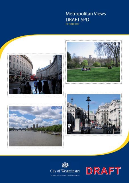
<strong>Metropolitan</strong> <strong>Views</strong><br />
DRAFT <strong>SPD</strong><br />
OCTOBER 2007<br />
DRAFT
Index<br />
Introduction<br />
Introduction 2<br />
The Policy Context 3<br />
Identification of <strong>Metropolitan</strong> <strong>Views</strong> 4<br />
Methodology 5<br />
Overview Map 7<br />
The <strong>Views</strong><br />
V1 Buckingham Palace from the Mall 10<br />
V2 Buckingham Palace from bridge in St James’s Park 11<br />
V3 St James’s Palace from Marlborough Road 12<br />
V4 St James’s Palace from Piccadilly 13<br />
V5 Carlton House Terraces from the Mall 14<br />
V6 Foreign Office from St James’s Park 15<br />
V7 Admiralty Arch from the Mall 16<br />
V8 Wellington Arch from Constitution Hill 17<br />
V9 Marble Arch from Hyde Park 18<br />
V10 Royal Albert Hall 19<br />
V11 A,B&C The Albert Memorial from<br />
Kensington Gore 20<br />
V12 Kensington Palace from Hyde Park 21<br />
V13 Palace of <strong>Westminster</strong> from Hyde Park 22<br />
V14 Palace of <strong>Westminster</strong> from Lambeth Road 23<br />
V15 A&B Palace of <strong>Westminster</strong> from Queen<br />
Elizabeth II Walkway 24<br />
V16 Palace of <strong>Westminster</strong> from Golden Jubilee Bridge 25<br />
V17 Victoria Embankment towards the Palace of<br />
<strong>Westminster</strong> Clock Tower 26<br />
V18 Churches of St Clement Danes and<br />
St Mary-le-Strand 27<br />
V19 Royal Courts of Justice Law Courts from the<br />
Strand 28<br />
V20 St Martin in the Fields from Pall Mall 29<br />
V21 St Paul’s Cathedral from Victoria Embankment<br />
outside Somerset House 30<br />
V22 Dome of St Paul’s from Somerset House<br />
River Terrace 31<br />
V23 Somerset House from Waterloo Bridge 32<br />
V24 A&B Battersea Power Station from Grosvenor<br />
Road & Chelsea Bridge 33<br />
V25 Lambeth Palace from Lambeth Bridge 34<br />
V26 <strong>Westminster</strong> Cathedral from Victoria Street 35<br />
V27 Regent Street to Piccadilly 36<br />
V28 Regent Street to All Soul’s Langham Place 37<br />
V29 Waterloo Place towards Piccadilly 38<br />
V30 A&B Piccadilly Circus from Piccadilly & Lower<br />
Regent Street 39<br />
V31 A&B Whitehall <strong>Views</strong> north & south 40<br />
V32 A&B Trafalgar Square from outside the National<br />
Gallery & from the north Terrace 41<br />
V33 A&B Trafalgar Square from Spring Gardens &<br />
Whitehall 42<br />
V34 Horse Guards and Whitehall Court from<br />
St James’s Park 43<br />
V35 Horse Guards from Horse Guards Road 44<br />
V36 The Holme across the Regent’s Park Lake 45<br />
V37 Houses of Parliament from Parliament Square 46<br />
V38 <strong>Westminster</strong> Abbey from Tothill Street 47<br />
V39 York Gate and St Marylebone Church from York<br />
Bridge approach 48<br />
V40 Big Ben Clock Tower from the bottom of<br />
Constitution Hill 49<br />
V41 Somerset House internal courtyard views 50<br />
V42 A&B Waterloo Bridge looking downstream &<br />
upstream 51<br />
V43 A&B Golden Jubilee Bridge looking downstream<br />
& upstream 52<br />
V44 <strong>Westminster</strong> Bridge looking downstream 53<br />
V45 South Bank Arts Complex from Waterloo Bridge 54<br />
Appendix<br />
A<br />
B<br />
View Cones<br />
Photography Methodology<br />
WCC METROPOLITAN VIEWS DRAFT <strong>SPD</strong> PAGE 1
Introduction<br />
Situated at the heart of London, the <strong>City</strong> of <strong>Westminster</strong> is<br />
proud of its unique architectural heritage. The steady and<br />
successive development of the area since the sixteenth<br />
century has created a complex townscape, which includes<br />
many of London’s most famous and best-loved buildings and<br />
landmarks; these enhanced by the open spaces of the Royal<br />
Parks, London Squares and the River Thames.<br />
The <strong>City</strong> <strong>Council</strong> is keen to protect the many familiar views of<br />
its unique townscape and river frontages, whilst encouraging<br />
new development where appropriate. This Supplementary<br />
Planning Document (<strong>SPD</strong>) has therefore been produced to<br />
supplement the policies which are set out in <strong>Westminster</strong>’s<br />
Unitary Development Plan (UDP). It explains <strong>Westminster</strong>’s<br />
policy with regard to the protection and enhancement of what it<br />
has termed ‘<strong>Metropolitan</strong> <strong>Views</strong>’.<br />
Aims of the Supplementary Planning Document<br />
• Provide a definition of <strong>Metropolitan</strong> <strong>Views</strong>.<br />
• Explain the policy context, both national and local to protect<br />
these views.<br />
• Set out the criteria used to select <strong>Metropolitan</strong> <strong>Views</strong><br />
• Identify and describe the signifi cance of each <strong>Metropolitan</strong><br />
View in the <strong>City</strong> of <strong>Westminster</strong>.<br />
• Identify which features within each view should be<br />
protected, and where there is potential for enhancement.<br />
This <strong>SPD</strong> has been prepared in accordance with the advice<br />
contained in Planning Policy Statement 2 (PPS 2) and the<br />
Town and Country Planning (Local Development) (England)<br />
Regulations 2004. Consultation has been carried out in<br />
accordance with <strong>Westminster</strong>’s Statement of Community<br />
Involvement. A sustainability appraisal, and a statement setting<br />
out how the public have been involved in the preparation of the<br />
document, is provided at the back of this document.<br />
Definitions<br />
In recognition of the complexity of its built environment,<br />
<strong>Westminster</strong> has identifi ed two types of signifi cant view:<br />
<strong>Metropolitan</strong> and Local. These relate in a hierarchical manner<br />
to the more strategic Protected <strong>Views</strong> identified by the Mayor in<br />
the London Plan and View Management Framework.<br />
<strong>Metropolitan</strong> <strong>Views</strong> include both views from <strong>Westminster</strong><br />
to other parts of London, and views from other parts of<br />
London into <strong>Westminster</strong>, such as views along and across<br />
the River Thames. They also include views within and across<br />
<strong>Westminster</strong>, particularly views of landmark buildings of<br />
metropolitan importance. For example the view eastwards<br />
from the Serpentine Bridge towards the Palace of <strong>Westminster</strong>,<br />
or the view along Regent Street towards All Souls Church.<br />
<strong>Metropolitan</strong> suggests a wider significance than local views.<br />
These may be longer, more open or more accessible views.<br />
Definition of <strong>Metropolitan</strong> <strong>Views</strong><br />
Familiar views held in affection by both Londoners and<br />
visitors, enjoyed from well-known public spaces and featuring<br />
an exceptional townscape or landscape, including visually<br />
prominent landmarks; they demonstrate the outstanding<br />
qualities of <strong>Westminster</strong>’s environment.<br />
Local <strong>Views</strong> are likely to be less familiar than <strong>Metropolitan</strong><br />
<strong>Views</strong> and to have a contained rather than a broad focus.<br />
They includes both views to important local landmarks, and<br />
unexpected views of more well-known landmarks from side<br />
streets and less well known spaces.<br />
Local views contribute signifi cantly to the appreciation of areas<br />
of special architectural or historic interest and the buildings they<br />
contain. Cumulatively, they make an invaluable contribution to<br />
the general quality and character of <strong>Westminster</strong>. There are<br />
a very large number of views of local importance and these<br />
are not therefore described in this document. Local <strong>Views</strong> are<br />
identifi ed within the ‘Conservation Area Audits’ which the <strong>City</strong><br />
<strong>Council</strong> is undertaking for each of its 54 Conservation areas.<br />
These can be downloaded from the <strong>Westminster</strong> website at:<br />
http://www.westminster.gov.uk/environment/planning/.<br />
Definition of Local <strong>Views</strong><br />
<strong>Views</strong> which can be enjoyed within, and from a wide range<br />
of localities of distinctive character. These views will include<br />
locally signifi cant landmarks, groups of historic and other<br />
buildings of local interest, or other features such as parks,<br />
squares and gardens.<br />
Strategic Level <strong>Views</strong> can be defi ned as those of national<br />
importance and are of the most signifi cant landmarks on the<br />
London skyline. They traverse more than one London borough<br />
and the majority are from viewing points some distance<br />
from <strong>Westminster</strong>. These are identifi ed by the Mayor’s View<br />
Management Framework (see Policy, below).<br />
PAGE 2 INTRODUCTION
The Policy Context<br />
The London Plan<br />
The London Plan, adopted in February 2004, deals with the<br />
designation and protection of strategically important London<br />
views. Policy 4B.15 relates to the London View Protection<br />
Framework and states that:<br />
The Mayor will keep the list of designated views under review.<br />
<strong>Views</strong> will only be considered for designation where:<br />
• the viewing place is open, publicly accessible and well<br />
used, a place in its own right allowing for pause and<br />
enjoyment of the view.<br />
• significant parts of London, or significant buildings, would<br />
be visible.<br />
• the view is highly valued and allows for the appreciation and<br />
understanding of London as a whole, or of major elements<br />
within it, and does not replicate existing managed views<br />
without added benefi t.<br />
• the view represents at least one of the following: a<br />
panorama across a substantial part of London, a broad<br />
prospect along the river or a view from an urban space,<br />
including urban parks, which may be a linear view to a<br />
defined object or group of objects, which offers a cohesive<br />
viewing experience.<br />
The Mayor’s View Management Framework (2007) expands<br />
upon this and provides further advice on the protection of<br />
these views, which are known as ‘protected vistas’. A number<br />
of the designated views are within and towards <strong>Westminster</strong>.<br />
Boroughs are advised to base the designation and management<br />
of local views in their UDPs on Policies 4B.15 - 4B.17.<br />
The Unitary Development Plan<br />
The <strong>City</strong> <strong>Council</strong>’s Unitary Development Plan, adopted in<br />
January 2007, sets out the planning policies for safeguarding<br />
<strong>Westminster</strong>’s Heritage, as well as guiding change and<br />
new development. In particular, Chapter 10 of the Unitary<br />
Development Plan sets out the council’s Urban Design and<br />
Conservation policies, all of which may be relevant to the<br />
protection and enhancement of <strong>Metropolitan</strong> <strong>Views</strong>, but of<br />
particular relevance are the following:<br />
(C) important groups of buildings<br />
(D) monuments and statues<br />
(E) parks, squares and gardens<br />
(F) The Grand Union and Regent’s Canals<br />
(G) The River Thames<br />
DES3 – Tall buildings<br />
Tall building will inevitably impact upon views within and outside<br />
the <strong>City</strong> of <strong>Westminster</strong>. Policy DES3 – High buildings, sets<br />
clear criteria for assessing the impact of such development.<br />
These will be inappropriate in much of <strong>Westminster</strong>.<br />
DES 12 Parks, Gardens and Squares<br />
Policy DES 12 Parks, Gardens and Squares seeks to ensure<br />
that proposals adjacent to parks, public and private squares<br />
do not harm views into and out of these spaces. The <strong>City</strong><br />
<strong>Council</strong> will seek to protect existing views out from the parks,<br />
by resisting development which will project above the existing<br />
tree or building lines, so maintaining the existing relationship<br />
buildings and sky.<br />
DES 16 World Heritage Site<br />
Permission will only be granted for developments that protect<br />
and conserve the character, appearance, setting and ecological<br />
value of the World Heritage Site.<br />
In addition, policies in Chapter 11 safeguard the protection of<br />
the setting of the River Thames.<br />
RIV 2: <strong>Views</strong><br />
Developments that would have a significant adverse effect<br />
on views from, of, across or along the River Thames will be<br />
refused.<br />
Policy DES 15 <strong>Metropolitan</strong> and Local <strong>Views</strong>. :<br />
Permission will not be granted for developments which would<br />
have an adverse effect upon important views of:<br />
(A) listed buildings<br />
(B) landmark buildings<br />
WCC METROPOLITAN VIEWS DRAFT <strong>SPD</strong> PAGE 3
INTRODUCTION<br />
Identifi cation of <strong>Metropolitan</strong> <strong>Views</strong><br />
Forty-five <strong>Metropolitan</strong> <strong>Views</strong> have been identifi ed. These<br />
have been divided into three categories:<br />
1. <strong>Views</strong> of individual buildings<br />
2. <strong>Views</strong> of notable streets and spaces<br />
3. River prospects<br />
Whilst there may be consensus in the choice of many of<br />
these views, each viewer will fi nd their own signifi cance<br />
within them. This may be through association with a memory<br />
of a personal experience or with a state or cultural event.<br />
However, the overriding factors in their designation will be<br />
the quality of the view itself, its lasting importance and its<br />
recognisability to a wide spectrum of people. The <strong>City</strong> <strong>Council</strong><br />
has considered the following criteria in its identifi cation and<br />
selection of views of metropolitan importance:<br />
Familiarity and Cultural Importance<br />
Clearly, many of the views, and the landmark buildings within<br />
them, will be very familiar; the classic ‘picture postcard’ images<br />
of London. <strong>Westminster</strong>’s role at the centre of London, as the<br />
seat of central government and as a world-renowned centre<br />
for financial, commercial and cultural activity further increases<br />
this significance. The views described often feature in state<br />
and other special occasions, and in representations of London<br />
in film and television, which increases their familiarity beyond<br />
the confines of <strong>Westminster</strong>. However, this familiarity also<br />
depends upon who the viewers are and their experience of<br />
the city. Different groups will perceive and experience the city<br />
in a variety of ways: workers, tourists, residents and different<br />
community groups may value different views. Other more<br />
modern landmarks: the London Eye, Battersea Power Station<br />
and the Royal Festival Hall have also become synonymous<br />
with central London. Consultation is therefore an important<br />
part of the process of identifi cation of <strong>Metropolitan</strong> <strong>Views</strong>.<br />
The Nash re-planning of early nineteenth century London is<br />
one signifi cant example, which is the basis for several of the<br />
<strong>Metropolitan</strong> <strong>Views</strong> and creates some of the most memorable<br />
routes through <strong>Westminster</strong>. Many of the individual buildings,<br />
or groups of buildings featured, are outstanding examples of<br />
London’s architectural heritage and historic land uses.<br />
Accessibility<br />
All the views covered by this <strong>SPD</strong> can be experienced<br />
from publicly accessible locations. Whilst some views are<br />
experienced from the tops of buildings; the Campanile of<br />
<strong>Westminster</strong> Cathedral, the terrace of the Royal Opera House<br />
overlooking the Covent Garden Piazza, or the restaurant at the<br />
National Portrait Gallery, these cannot be readily experienced<br />
by all. It is not therefore considered appropriate to seek to<br />
give them protection. However, the successful protection of<br />
<strong>Metropolitan</strong> <strong>Views</strong> will also help to maintain other views of<br />
importance.<br />
New views<br />
The townscape of <strong>Westminster</strong> is not static and change and<br />
development can open up exciting new views of the <strong>City</strong>.<br />
Changes in the river views resulting from the construction of<br />
the new Golden Jubilee pedestrian bridge is one example.<br />
Therefore, it is the intention of the <strong>City</strong> <strong>Council</strong> to review the<br />
list of <strong>Metropolitan</strong> <strong>Views</strong> from time to time.<br />
Aesthetic Value<br />
All the views selected will have high aesthetic value. This<br />
is derived from a combination of individual buildings of<br />
outstanding architectural interest and attractive groups of<br />
buildings which contribute to the townscape. Some buildings<br />
have been designed specifi cally to create a distinctive<br />
silhouette set against open sky, whilst other groups of<br />
buildings have been arranged along formal processional<br />
routes or as picturesque compositions, often creating<br />
distinctive roofscapes. The interrelationship of buildings<br />
with the landscape setting, whether along the river, in the<br />
Royal Parks or next to open spaces contributes to this view<br />
experience.<br />
Historic significance<br />
Many views identified are also representative of important<br />
phases in London’s architectural and historic development.<br />
PAGE 4 INTRODUCTION
Methodology<br />
The <strong>SPD</strong> contains a description of each <strong>Metropolitan</strong> View.<br />
Each entry describes the view: its composition, the viewing<br />
area and proposals for its protection and enhancement.<br />
View Description and Composition<br />
The view description explains the signifi cance of the view to<br />
<strong>Westminster</strong>, relevant historical background and the main<br />
elements in the view. The composition describes the focal<br />
point(s) and other elements which contribute to the view. This<br />
may be a single dominant landmark, a high number or important<br />
group of listed buildings/structures, or dominant landscape<br />
elements. It also identifi es the importance of materials used.<br />
Viewing Area<br />
A viewing area has been identifi ed for each view and this<br />
defines the locations from where the view can be enjoyed.<br />
Precise viewpoints have not been identified because very few<br />
views can only be enjoyed from one specifi c location. Some<br />
views are experienced in a sequential way along the whole<br />
length of a street. The range of views which can be experienced<br />
from each viewing area are described in the individual view<br />
descriptions. It will be important to consider the potential<br />
impact of any proposals from throughout the viewing area. The<br />
viewing area is identified on a map for each entry.<br />
The majority of viewing places will include pavements or other<br />
parts of the public highway but some may best be appreciated<br />
from the middle of streets: for example Cenotaph views. Whilst<br />
not always accessible, festivals and special occasions give<br />
the opportunity to see views from this perspective. Whitehall is<br />
always closed for state occasions and Remembrance Sunday,<br />
The Mall and Constitution Hill are closed to traffi c on Sundays,<br />
while The Embankment is closed for the London Marathon<br />
and other events. In addition, the changes to the north side of<br />
Trafalgar Square have enhanced opportunities to enjoy views<br />
of the National Gallery, St Martin’s in the Fields and Trafalgar<br />
Square.<br />
View cones<br />
Maps of view cones can be found at Appendix A, and have<br />
been drawn from each viewing area in the case of longer views<br />
only. This is particularly important where views have an impact<br />
across boroughs. For short views, where impacts are limited,<br />
viewing cones have not been included.<br />
VIEW PROTECTION<br />
<strong>Westminster</strong> is a dynamic city and pressures for change are<br />
varied and constant. Development proposals of all sizes can<br />
have positive and negative impacts on important views in and<br />
to the <strong>City</strong>. Such proposals may be small scale, such as new<br />
advertisements or roof extensions affecting the foreground or<br />
middle ground of a view, or they can be much larger, involving<br />
tall buildings which have an impact on the background or<br />
skyline. In protecting <strong>Metropolitan</strong> <strong>Views</strong>, the <strong>City</strong> <strong>Council</strong> will<br />
have regard to the impact of proposals on the foreground,<br />
middleground and background.<br />
Foreground<br />
This is the most easily controlled, adapted and improved<br />
element in any view. Here, a sense of safety and adequate<br />
space to linger or take a photograph are desirable. Some views<br />
are experienced in a sequential way where standard pavements<br />
provide adequate opportunities to enjoy linear views when<br />
walking along city streets. It is recognised that they should<br />
be as unobstructed as possible. The immediate foreground,<br />
including the maintenance and treatment of the carriageway,<br />
road markings and traffi c signs, the control of litter and quality<br />
and maintenance of street furniture all affect the experience.<br />
Therefore, the <strong>City</strong> <strong>Council</strong> will consider these aspects with<br />
care when exercising its responsibilities as highway authority<br />
and will encourage other relevant authorities to do the same.<br />
Middleground<br />
As <strong>Westminster</strong> is a long established urban area, the middle<br />
ground will generally consist of combinations of buildings<br />
or other structures which provide the focus for most of the<br />
views. The <strong>City</strong> <strong>Council</strong> will continue to carefully control<br />
new developments, advertisements, extensions and other<br />
alterations to buildings in accordance with its adopted policies.<br />
Even minor alterations can form intrusive elements in the<br />
middle ground, that detract from familiar views.<br />
Background<br />
The background to most of the selected views is sky. An<br />
uninterrupted sky backdrop enables the viewer to experience<br />
the character of roofs and silhouettes of buildings, which form<br />
the focus of so many of the views included in this document.<br />
This provides the views and the buildings they contain with<br />
greatest clarity and provides a constantly changing contrast<br />
to the building structure and spaces. The quality of the view<br />
experience is intensified if an historic landmark building or area<br />
continues to be appreciated in similar conditions to those that<br />
existed when it was fi rst created.<br />
WCC METROPOLITAN VIEWS DRAFT <strong>SPD</strong> PAGE 5
INTRODUCTION<br />
High Buildings<br />
These are of particular concern in relation to <strong>Metropolitan</strong> <strong>Views</strong>,<br />
given their potentially significant impact over considerable<br />
distances. The age and nature of development give <strong>Westminster</strong><br />
a more settled appearance, with the urban form providing<br />
more linear views. This means that inappropriately located tall<br />
buildings could have a more significant impact in terms of local<br />
views than in the context of other parts of London.<br />
Two tall buildings, Centrepoint and the Post Offi ce Tower,<br />
located in the London Borough of Camden, are visible in views<br />
of the Palace of <strong>Westminster</strong> World Heritage Site from the<br />
South Bank. The setting, character and appearance of some<br />
<strong>City</strong> parks and gardens have suffered signifi cant damage<br />
mainly caused by a relatively small number of insensitive<br />
developments. The Hilton Hotel, the Knightsbridge Barracks,<br />
the Royal Lancaster Hotel and the former Home Offi ce are<br />
notable examples. Many of the identifi ed <strong>Metropolitan</strong> <strong>Views</strong><br />
are located in south <strong>Westminster</strong> because that has been<br />
where London’s key buildings and activities are located. These<br />
views that are especially vulnerable to the impacts of new<br />
development.<br />
VIEW ENHANCEMENT<br />
The <strong>City</strong> <strong>Council</strong> also recognises that views evolve. It will<br />
continue to take every opportunity to enhance <strong>Metropolitan</strong><br />
<strong>Views</strong> identified in this guidance and to encourage<br />
improvements to the public realm, appropriate illumination,<br />
as well as development which is sensitive to the scale and<br />
character of the exiting townscape.<br />
A number of <strong>Metropolitan</strong> <strong>Views</strong> have been compromised by<br />
insensitive development, but it cannot be assumed that such<br />
damage is necessarily a permanent feature in the cityscape and<br />
it is now realistic to anticipate redevelopment. The identification<br />
of temporary structures/elements which are impacting upon<br />
views is also important.<br />
Examples of views have been transformed include the Palace<br />
of <strong>Westminster</strong>, Constitution Arch Constitution Hill, Albert Hall,<br />
Covent Garden Piazza and <strong>Westminster</strong> Roman Catholic<br />
Cathedral. The redevelopment in 2004 of the once infamous<br />
site of the three Marsham Street towers is an example of how<br />
redevelopment can provide opportunities for enhancement.<br />
These towers created a high plateau immediately behind the<br />
Palace of <strong>Westminster</strong>, damaging its picturesque silhouette<br />
in views from the South Bank. The replacement building now<br />
restores the outline of Sir Charles Barry’s masterpiece.<br />
Application of this Guidance<br />
In applying this guidance to individual development proposals,<br />
it will be necessary to give due consideration to relevant<br />
policies in the London Plan and the <strong>Westminster</strong> UDP, as<br />
set out previously. In addition, some of the views included in<br />
the guidance are also covered by the Mayor’s London View<br />
Management Framework and the <strong>City</strong> <strong>Council</strong> will also apply<br />
this guidance in considering development proposals.<br />
The protection of identifi ed <strong>Metropolitan</strong> <strong>Views</strong> will be a<br />
material consideration in determining applications for planning<br />
permission, listed building consent, advertisement consent<br />
and conservation area consent and any development that<br />
would have a damaging impact on <strong>Metropolitan</strong> <strong>Views</strong> will be<br />
resisted.<br />
Permission will not be given for development that impinges on<br />
important views or skylines, would appear too close or high in<br />
relation to a landmark or historic feature or building, or would<br />
appear behind, and mar the silhouette of, a landmark or historic<br />
feature or building.<br />
Applications<br />
Applicants should provide accurate illustrative material to show<br />
the potential impact of proposals on <strong>Metropolitan</strong> <strong>Views</strong>. This<br />
should consider how proposals will affect the character and<br />
composition of each view, from throughout the viewing area<br />
illustrated in this document. Submissions should describe<br />
the impact of proposals on the view composition, considering<br />
the foreground, middleground and background, as well as<br />
considering the potential for view enhancement.<br />
Trees and Seasonal Changes<br />
Applicants should also consider the impact of trees and<br />
seasonal change. The <strong>City</strong> <strong>Council</strong> is unlikely to accept the<br />
argument that a proposed development is acceptable because<br />
it will be shielded by tree canopies, as a justification for the<br />
height of a particular proposal.<br />
Consultations on Applications.<br />
There are buildings in <strong>Westminster</strong>, most notably the Palace<br />
of <strong>Westminster</strong> where some of the best views can be gained<br />
from Lambeth and Southwark. The <strong>City</strong> <strong>Council</strong> will undertake<br />
to notify boroughs affected by proposals likely to impact<br />
on the backgrounds of cross river views, within the defined<br />
background area.<br />
It is also recognised that there are some buildings like the<br />
Former London County Hall in Southwark or Battersea Power<br />
Station in Wandsworth, where the best views of these buildings<br />
can be enjoyed from <strong>Westminster</strong>. The <strong>Council</strong> will endeavour<br />
to work with adjoining boroughs and the GLA to ensure the<br />
impacts of such proposals are understood. The council should<br />
be notified of applications within the defined background area<br />
which would be likely to have an impact on these views.<br />
PAGE 6 INTRODUCTION
Paul’s Horse<br />
WCC METROPOLITAN VIEWS DRAFT <strong>SPD</strong> PAGE 7
PAGE 8 VIEW DESCRIPTIONS
<strong>Metropolitan</strong> <strong>Views</strong> Descriptions<br />
WCC METROPOLITAN VIEWS DRAFT <strong>SPD</strong> PAGE 9
VIEW 1<br />
Buckingham Palace from the Mall<br />
Description<br />
This most familiar of images is synonymous with state<br />
occasions and national celebrations. The area in front of the<br />
palace was remodelled by Sir Aston Webb as part of a set<br />
piece to commemorate the reign of Queen Victoria. He refaced<br />
Buckingham Palace, designed the Victoria Memorial and was<br />
also architect for Admiralty Arch at the eastern end of the<br />
Mall.<br />
The imposing statue on the memorial dates from 1911, by Sir<br />
Thomas Brock, while the supporting white marble base is by<br />
Webb. Areas diagonally opposite the statue are planted out in<br />
Victorian style and complement the setting of the Palace. The<br />
space in front of the Palace has been reordered, with improved<br />
access to the Memorial for pedestrians. The width of the<br />
carriageway means some views of the Palace are dominated<br />
by the sea of red tarmac.<br />
Composition<br />
The Palace forms the sole focus of the views. Its outline, with<br />
the skyline stepping down either side of the façade, is an<br />
important characteristic. On The Mall, the double rows of plane<br />
trees help to emphasise the view’s linear quality and lead the<br />
eye towards the palace.<br />
Key<br />
Viewing Area<br />
Extent and Viewing Area<br />
From the Mall the view is contained by the trees which line<br />
it. There are views of the Palace from an extensive area,<br />
although this does partly depend upon the season. On<br />
Sundays Constitution Hill and the Mall are closed to traffi c and<br />
this provides an opportunity to enjoy a wider variety of views. A<br />
map illustrating the Viewing Cone is at Appendix A1.<br />
Scale 1:4000<br />
View Subject<br />
View protection<br />
Foreground<br />
The surface of The Mall is required to meet a range of needs<br />
and events and there are no current proposals to change what<br />
exists. Any change to the colour or texture of the surface could<br />
have a considerable impact on this view and would require<br />
careful consideration.<br />
Middle ground<br />
This is formed by the plane trees and the ceremonial flagpoles<br />
and lampstandards, which are all well-maintained.<br />
Background<br />
The closer, oblique view may be vulnerable to further high<br />
buildings in the Victoria area; the top of the tower of the ODPM<br />
building on Bressenden Place can be seen on the skyline.<br />
The front view of the palace is unlikely to be affected by<br />
high buildings appearing above its outline and the extensive<br />
grounds lie behind it and provide a buffer, as does the Belgravia<br />
Conservation Area, which extends beyond that.<br />
Additional View<br />
See also Mayor of London’s View Management<br />
Framework View 7: The Mall to Buckingham Palace<br />
Enhancement<br />
No measures are proposed.<br />
PAGE 10 VIEW DESCRIPTIONS
VIEW 2<br />
Buckingham Palace from Bridge in<br />
St James’s Park<br />
Description<br />
This view with the lake and greenery of St James’s Park in<br />
the foreground provides a softer, more picturesque setting for<br />
Buckingham Palace than the axial view down The Mall. This<br />
landscape was the result of the remodelling of the park by John<br />
Nash in 1828, who did away with the straight canal previously<br />
leading up to the Palace and introduced the sinuous, curving<br />
expanses of water. This is the only view of the palace where the<br />
traffic is screened and the location in St James’s Park results in<br />
a peaceful viewing area.<br />
Composition<br />
The composition of this view is informal. The Palace is the<br />
dominant element, but in a quite different and picturesque<br />
landscape context. The large expanse of water winds up to<br />
the Palace and the low skyline to either side is framed by the<br />
unbroken tree canopy.<br />
Extent and viewing Area<br />
This view is limited to the bridge, which provides an ideal<br />
stopping point to take in the view in a tranquil environment. A<br />
map illustrating the Viewing Cone is at Appendix A2.<br />
View protection<br />
Foreground<br />
St James’s Park is maintained to a very high standard and no<br />
measures are required.<br />
Key<br />
Viewing Area<br />
View Subject<br />
Scale 1:6000<br />
Middleground<br />
The impressive range of trees defi nes this view and their<br />
continued protection will be essential. It will also be desirable<br />
to ensure that the trees in front of the Palace and also those<br />
flanking it do not obscure the façade to a greater extent than<br />
they do at the moment.<br />
Background<br />
The background is protected by the extensive gardens to the<br />
rear of the Palace. While it is unlikely that this view will be under<br />
threat; it could be affected by proposals for high buildings in the<br />
Victoria or Knightsbridge area.<br />
Enhancement<br />
No measures are proposed.<br />
WCC METROPOLITAN VIEWS DRAFT <strong>SPD</strong> PAGE 11
VIEW 3<br />
St James’s Palace from Marlborough<br />
Road<br />
Description<br />
Originally built by Henry VIII, the Palace has an intimate scale.<br />
In this view, the open courtyard can be appreciated, which<br />
exposes its unique silhouette. The building has undergone<br />
many adaptations during its long history and this adds to its<br />
appeal. The single storey arcade bridging over the western<br />
footpath enables pedestrians to walk through and engage with<br />
the building. The security measures around the Palace are<br />
relatively unobtrusive and temporary in nature.<br />
Composition<br />
This view could be described as having a picturesque<br />
composition. The courtyard’s exposure to the street is a unique<br />
feature and the animated roofl ine and tall chimneys provide a<br />
distinctive skyline. The modest Chapel Royal by Inigo Jones<br />
is to the right and faces the Palace across Marlborough Road.<br />
It is diffi cult appreciate the two buildings together except by<br />
standing in the middle of the road.<br />
Extent and viewing area<br />
The extent of the view is limited to the southern half of<br />
Marlborough Road, from the junction with the Mall. The viewing<br />
area is restricted to the pavements, except when the road is<br />
closed.<br />
View protection<br />
Foreground<br />
The continuation of the distinctively coloured material of the<br />
carriageway across the courtyard provides a visual link and<br />
gives consistency to the setting of the Palace and thereby<br />
enhances this view. Whilst in an ideal world it would be desirable<br />
to dispense with the crash barriers, they are temporary and<br />
relatively unobtrusive.<br />
Key<br />
Viewing Area<br />
View Subject<br />
Scale 1:4000<br />
Middleground<br />
The Palace is well maintained and protected as a Grade I listed<br />
building.<br />
Background<br />
There are unlikely to be proposals for high buildings. However,<br />
the buildings at the corner of Pall Mall and St James’s Street<br />
do form part of the backdrop and their roofl ines will continue<br />
to require careful consideration, as they could impinge upon<br />
the view.<br />
Enhancement<br />
A reduction in the large expanse of tarmac might benefi t the<br />
setting of the Palace and the quality of this view. Whilst this<br />
does not provide an attractive setting for the Palace, the broad<br />
carriageway has to cope with traffi c and ceremonial events.<br />
The maintenance and design of the traffic island at the bottom<br />
of St James’s Street, including signage, requires continued<br />
careful consideration and is under review.<br />
PAGE 12 VIEW DESCRIPTIONS
VIEW 4<br />
St James’s Palace from Piccadilly<br />
Description<br />
In this view, King Henry VIII’s gatehouse acts as a termination<br />
in the views down St James’s Street from Piccadilly. This view<br />
has been compromised by distant tall buildings: the Millbank<br />
tower by the Thames and the New Scotland Yard tower on<br />
Victoria Street. However, the evocative outline of the imposing<br />
early Tudor Gatehouse, topped by the later lantern and<br />
weathervane, can still be appreciated outlined against the sky.<br />
The trees in St James’s Park can be seen above the Palace<br />
roof and enhance the view.<br />
Composition<br />
This is a corridor view with the Palace acting as a focal point.<br />
The gatehouse becomes increasingly dominant when viewed<br />
towards the southern end of St James’s Street, due to the<br />
significant drop in level between Piccadilly and Pall Mall.<br />
The historic skyline of the Palace is intact until King Street is<br />
reached, when the upper stories of the Millbank tower start<br />
to appear. Further up St James’s Street at the junction with<br />
Ryde Street, the former Home Offi ce building in Queen Anne’s<br />
Gate and New Scotland Yard block out the sky between the<br />
Gatehouse and the buildings on the west side of the street.<br />
Key<br />
Viewing Area<br />
View Subject<br />
Scale 1:4000<br />
Extent and viewing area<br />
The views that can be gained are fairly extensive but are<br />
focused by the nature of St James’s as a corridor street. The<br />
viewing area is the length of St James’s Street mainly from the<br />
pavement. A map illustrating the viewing cones is at Appendix<br />
A3.<br />
View protection<br />
Foreground<br />
No measures other than the appropriate location of street<br />
furniture and road signs to ensure that their intrusion into the<br />
view is kept to a minimum.<br />
Middleground<br />
This view will be protected by the continued maintenance and<br />
control of development affecting the buildings lining the street.<br />
Background<br />
The background to this view is protected to some extent by St<br />
James’s Park to the south which acts as a buffer. However,<br />
it has been compromised and could be further damaged by<br />
proposals for high buildings on the south bank.<br />
Enhancement<br />
Very careful consideration will be needed in the event of<br />
proposals affecting the existing high buildings in the background.<br />
Their existence should not be justifi cation for new buildings of<br />
a similar or greater height in their vicinity or backdrop.<br />
WCC METROPOLITAN VIEWS DRAFT <strong>SPD</strong> PAGE 13
VIEW 5<br />
Carlton House Terraces from The Mall<br />
Description<br />
Carlton House Terrace was built in 1827-33 and designed by<br />
Nash. The two stucco terraces are divided by Duke of York<br />
stairs and form an imposing and formal backdrop to the many<br />
state occasions that take place along the Mall. This oblique<br />
view is necessitated by the double row of plain trees lining The<br />
Mall, which obscure the buildings in views from the centre of<br />
The Mall and St James’s Park. However, the viewpoint enables<br />
the viewer to take in the combined length of the terraces at<br />
once and creates a very dramatic impression. This adds to the<br />
appreciation of the scale and architectural power of this fi ne<br />
architectural composition. The higher building visible in the<br />
middle ground, No 4 Carlton Gardens by Sir Reginald Blomfield<br />
1932-4, disrupts the otherwise regular skyline of Nash’s work.<br />
East of the Duke of York Steps, New Zealand House, which<br />
stands at the corner of Haymarket and Pall Mall, stands high<br />
above Nash’s composition.<br />
Composition<br />
This view has a very formal character, intensifi ed by the<br />
regularity of the buildings and the painted stucco. The relatively<br />
low building height is emphasised by the stepped ground fl oor.<br />
The mature Plane trees lining the mall provide a contrasting<br />
green foil in the foreground..<br />
Key<br />
Viewing Area<br />
Extent and Viewing Area<br />
The form and symmetry of the terraces emphasise the length<br />
of the view, while the viewing area is limited by the plane trees,<br />
especially in summer months.<br />
Scale 1:4000<br />
View Subject<br />
View protection<br />
Foreground<br />
The regular use of the lower walk for car parking impacts on<br />
this view. A more intensive use could have a detrimental effect<br />
on this view. The vehicles obscure the lower half of the squat<br />
Greek Doric cast iron columns, which form the distinctive base<br />
to the terraces. The parking appears to be a particular problem<br />
in front of the western range.<br />
Middleground<br />
This is formed by the terrace, which is listed and wellmaintained.<br />
Additional View<br />
Background<br />
The background of the terraces is unlikely to be affected by<br />
any further high buildings.<br />
Enhancement<br />
There are no obvious measures required, apart from strict<br />
control over parking and its eventual removal.<br />
PAGE 14 VIEW DESCRIPTIONS
VIEW 6<br />
Foreign Offi ce from St James’s Park<br />
Description<br />
One of the most imposing, yet picturesque, impressions of the<br />
Foreign and Commonwealth Office is from St James’s Park<br />
with its distinctive asymmetrical Italianate tower. Its design was<br />
the result of the most notorious battle of the styles of the 19th<br />
Century. The then Prime Minister, Lord Palmerston, abhorred<br />
the Gothic style and insisted that Sir Giles Gilbert Scott abandon<br />
his original design. Scott admitted that the idea of the grouping<br />
and outline had been inspired by a Digby Wyatt sketch .<br />
Composition<br />
The Foreign and Commonwealth Offi ce is the dominant<br />
element in the view, with the tower prominent at the centre.<br />
This is an informal and picturesque view of this building in a<br />
landscape setting which softens its impact and gives a quite<br />
different impression to views from Horseguards Road. The<br />
interesting varieties of trees in the Park greatly enhance the<br />
composition.<br />
Extent and viewing area<br />
The Foreign Office is visible from an extensive area of the<br />
Park. One of the best views can be gained from the raised<br />
terrace of Inn the Park. A map illustrating the viewing cone is<br />
at Appendix A4.<br />
View protection<br />
Foreground<br />
St James’s Park is maintained to a very high standard and no<br />
measures are required.<br />
Key<br />
Viewing Area<br />
View Subject<br />
Scale 1:4000<br />
Middleground<br />
The only issue affecting this view is the appropriate management<br />
of the tree canopies in order to maintain the visibility of the<br />
building.<br />
Background<br />
The outline of the building could be affected by high buildings<br />
in Lambeth and it would be very damaging for the tower to<br />
have a rival on the skyline.<br />
Enhancement<br />
No measures are proposed.<br />
WCC METROPOLITAN VIEWS DRAFT <strong>SPD</strong> PAGE 15
VIEW 7<br />
Admiralty Arch from the Mall<br />
Description<br />
Constructed in 1911, the Arch was designed by Sir Aston<br />
Webb to compliment his re-facing of Buckingham Palace and<br />
the construction of the Victoria Memorial. The three elements<br />
were conceived as part of the national monument to Queen<br />
Victoria. Admiralty Arch faces Buckingham Palace at the other<br />
end of the Mall. It defi nes the separation between Trafalgar<br />
Square and the Royal Park and acts as a visual and physical<br />
barrier to the bustle of the West End beyond. It is an imposing<br />
point of arrival and departure for the Park.<br />
Composition<br />
The composition is very formal and the arch is the focus. The<br />
plane trees form an integral part of the composition; their size<br />
meaning that the shape of the road is mirrored in the sky. The<br />
trees are established enough to partially screen Carlton House<br />
Terrace, which would otherwise tend to dominate the view and<br />
upset its axial formality. The skyline is disrupted only by roof<br />
plant on the buildings behind.<br />
Extent and viewing area<br />
The view is defined and limited by the magnificent double<br />
avenue of mature plane trees. During weekdays, the Mall is an<br />
important traffic route and so this view can normally be enjoyed<br />
from the spacious walkways on either side. On Sundays and<br />
ceremonial occasions, the viewing area is more expansive and<br />
relaxed, as the viewer is able to stand in the middle of the<br />
carriageway.<br />
View protection<br />
Foregound<br />
The carriageway forms the foreground and is well maintained,<br />
if somewhat off -putting. However, in fi ne weather, this large<br />
surface is enlivened by shadows cast by the Plane Trees lining<br />
the Mall.<br />
Enhancement<br />
Key<br />
Scale 1:4000<br />
Viewing Area<br />
View Subject<br />
No measures are proposed, apart from the careful control<br />
and rationalisation of roof plant in order to minimise any<br />
potential impact on the view.<br />
Middleground<br />
The plane trees are an essential element in this view and<br />
reinforce its directional character. It will be important to ensure<br />
that the trees at the eastern end do not obscure the central<br />
section of the Arch.<br />
Background<br />
This view is sensitive to the impact of high buildings. The arch<br />
was intended to be the focus when looking eastwards down<br />
the Mall, despite its relatively modest height. The dark roof line<br />
of the roof plant level of Grand Buildings with its articulated<br />
Frenchified pavilions forms the skyline in the view. Any<br />
additional buildings, extensions or new roof plant appearing<br />
above this structure would be likely to undermine and weaken<br />
the role of Admiralty Arch. This view could be vulnerable to<br />
high buildings in the Fleet Street area.<br />
PAGE 16 VIEW DESCRIPTIONS
VIEW 8<br />
Wellington Arch from Constitution Hill<br />
Description<br />
This majestic structure, designed as a grand outer entrance to<br />
Buckingham Palace, was originally commissioned by George<br />
IV. Now a notable London landmark, it was designed in 1825<br />
by the architect Decimus Burton. It was finally erected in 1846<br />
and originally stood in line with the impressive Hyde Park<br />
Corner Screen, also by Burton. It was moved to its present<br />
location in 1882 and is crowned by an heroic sculpture of the<br />
angel of peace descending on the chariot of war. It presents an<br />
imposing termination to the long view up Constitution Hill.<br />
Composition<br />
The present location of this triumphal Arch relates specifically<br />
to Constitution Hill. The arch forms the focus of the view, set<br />
against open sky. In closer views from the Hill, the four pillars<br />
of the Commonwealth Memorial, erected in 2002, provide a<br />
formal and monumental architectural foreground and context<br />
for the Arch.<br />
Extent and viewing area<br />
The viewing area is extensive and includes the entire length of<br />
Constitution Hill. This is especially the case when it is closed to<br />
traffic on Sundays.<br />
View protection<br />
Foreground<br />
The Arch stands on a traffic island and the volume of traffic<br />
detracts from its setting. Continued vigilance will be required to<br />
avoid inappropriately placed traffi c signs.<br />
Key<br />
Viewing Area<br />
View Subject<br />
Scale 1:4000<br />
Middleground<br />
The plane trees contribute greatly to this view but it is important<br />
to ensure that they are appropriately managed.<br />
Background<br />
This view is unlikely to be affected by the potential impact of<br />
high buildings. However, the Lanesborough Hotel can be seen<br />
through the arch and to its left and therefore, any additions<br />
at roof level of this building would be likely to impact on this<br />
view.<br />
Enhancement<br />
The building has been recently refurbished and so there are no<br />
measures required.<br />
WCC METROPOLITAN VIEWS DRAFT <strong>SPD</strong> PAGE 17
VIEW 9<br />
Marble Arch from Hyde Park<br />
Description<br />
Designed by John Nash in 1828 to form a triumphal entrance to<br />
the Buckingham Palace forecourt, it was removed to its present<br />
location at the north east corner of Hyde Park in 1851. The Art<br />
Deco Portland stone buildings at each corner of Cumberland<br />
Place, including the Cumberland Hotel on the right, provide the<br />
Arch with a suitably symmetrical setting. The view through the<br />
arch is enhanced by the trees in Bryanston Square Garden,<br />
some distance to the north. Good views of the Arch can also be<br />
gained looking south down Cumberland Place.<br />
Composition<br />
The composition is formal and the axiality provided by<br />
Cumberland Place contributes to the impression of Marble<br />
Arch as an entry point to the Park.<br />
Extent and viewing Area<br />
The viewing area is restricted by the local road system,<br />
and therefore is largely limited for pedestrians to the area<br />
immediately surrounding the Arch.<br />
View protection<br />
Foreground<br />
Proposals are under consideration for alterations to the traffic<br />
routes in the vicinity. It will be important to ensure that the<br />
impact on the setting of Marble Arch is carefully considered if<br />
these proceed.<br />
Key<br />
Viewing Area<br />
View Subject<br />
Scale 1:4000<br />
Middleground<br />
The trees which flank the arch will need to be maintained to<br />
ensure that they do not encroach on the view.<br />
Background<br />
While it is unlikely that high buildings will be proposed in the<br />
area of Marylebone Station and Euston Road, this view could<br />
be sensitive to their impact. The appearance of the two fl anking<br />
background buildings infl uences the view. The fenestration on<br />
the western corner of Cumberland Place has been replaced in<br />
an unsympathetic manner, which dilutes the sense of symmetry.<br />
In addition, their rooflines need to be maintained and the view<br />
could be affected by additional plant accommodation.<br />
Enhancement<br />
The Arch is currently marooned on an area of tarmac<br />
surrounded by roads and traffic. There is considerable scope<br />
to enhance the immediate setting of the Arch. Proposals are<br />
under consideration for short and long term changes to the<br />
traffic layout to improve the setting of the arch. Whilst the<br />
structure has been cleaned, the pollution caused by circulating<br />
traffic can only further erode the delicate fabric of the building.<br />
PAGE 18 VIEW DESCRIPTIONS
VIEW 10 A & B<br />
Royal Albert Hall from Kensington Gore /<br />
Hyde Park<br />
Description<br />
The Albert Hall was constructed in 1867-71. It is on an island<br />
site and on an axis with the Albert Memorial, which it faces<br />
across Kensington Gore. It has a distinctive elliptical shape;<br />
its domed brick cylinder simply decorated with very little<br />
external embellishment other than terracotta and mosaic frieze<br />
depicting the Triumph of Art by Minton. Four porches mark the<br />
entrances, with a hierarchy of scale between them. To the west<br />
is the Royal College of Art (1959-64 and on the eastern side<br />
are Albert Mansions, designed by Norman Shaw (1879). Since<br />
it first opened in 1871, over 50,000 performances have been<br />
staged in the building.<br />
Composition<br />
From Kensington Gardens (View A), the view is of the building’s<br />
familiar stepped and rounded profi le. The north porch forms<br />
the central focus, projecting well beyond the front. The east<br />
and west porches are prominent, stepping down to either<br />
side. From the south (View B) the building is approached by a<br />
balustraded flight of steps, which lead the eye towards a statue<br />
of Prince Albert and the central porch behind. From this side,<br />
the Hall is more closely framed than from the north but the sky<br />
wraps around the dome and is visible either side of the drum,<br />
enhancing the building’s legibility. While Prince Albert Mansions<br />
and the Royal College of Music do not provide a symmetrical<br />
setting for the Hall, the former being of a much larger scale, the<br />
materials of these two buildings and their overall appearance<br />
compliment it.<br />
A<br />
A<br />
B<br />
Extent and Viewing Area<br />
Viewing areas have been identified to the north and south<br />
of the building. Fairly extensive views can be gained from<br />
the northern side of Kensington Gore although some of the<br />
best views are from Carriage Road, or the steps of the Albert<br />
Memorial. There are views the path which crosses the Park<br />
to the north, especially in winter months. From the south, the<br />
view is contained by the fl anking buildings and so is limited to<br />
a relatively short area of Prince Consort Road.<br />
View protection<br />
Foreground and Middleground<br />
The control and location of bus stops and other street furniture<br />
is important to ensure that the view is uncluttered. The control<br />
of alterations to adjacent buildings is important in these views<br />
especially at roof level.<br />
Key<br />
Viewing Area<br />
View Subject<br />
B<br />
Scale 1:4000<br />
impact on Prince Consort Road<br />
Background<br />
It is unlikely that these views would be impinged upon by high<br />
buildings. However, the building’s silhouette against the sky<br />
is important, allowing the viewer to appreciate its form and<br />
design.<br />
Enhancement<br />
No measures proposed. The Exhibition Road project may<br />
WCC METROPOLITAN VIEWS DRAFT <strong>SPD</strong> PAGE 19
VIEW 11 A, B & C<br />
The Albert Memorial from Kensington<br />
Gore<br />
Description<br />
This Albert Memorial was constructed between 1863-72 to the<br />
design of Sir George Gilbert Scott and stands at a height of<br />
175ft., 5 ft. taller than Nelson’s Column. The re-gilded fi gure<br />
of the Prince is seated underneath a pointed-arched spired<br />
canopy surrounded by sculptural groups. From the side, views<br />
of the monument are framed by avenues of trees and this is<br />
where the Prince’s contemplative pose can be seen in profi le.<br />
The elevated position of the monument adds to its impact in<br />
this view. The experience of the memorial is greatly enhanced<br />
by a subtle lighting scheme at night.<br />
Composition<br />
The composition is formal and the memorial has a direct<br />
relationship with the Albert Hall; the two structures having<br />
been conceived as an ensemble. The spot where the Albert<br />
memorial now stands is the point of intersection between a line<br />
drawn through the centre of the Commissioners’ estate. The<br />
Memorial is set on a plinth approached by steps, which adds<br />
to its visual impact. The side views are framed by avenues of<br />
trees.<br />
Extent and Viewing Area<br />
The Memorial can be seen from Kensington Gore between<br />
Queen’s Gate and Exhibition Road and from the area around<br />
the Albert Hall. The view is framed by trees and these inevitably<br />
limit the extent of the view. To the sides views are obtained<br />
from the symmetrical layout of paths around the monument.<br />
A<br />
B<br />
View protection<br />
Foregound<br />
The foreground looking north is formed by Kensington Gore.<br />
Here, it will be important to ensure that bus stops and other<br />
services are not located in front of the Memorial. Other views<br />
are framed by the park, which is very well maintained.<br />
Middleground<br />
This is formed by the Carriage Road in the Park and is well<br />
maintained. The Memorial is elevated on a plinth approached<br />
by steps. It is listed and has been recently restored.<br />
Background<br />
This view is unlikely to be affected by development as the full<br />
extent of Hyde Park lies behind it.<br />
C<br />
C<br />
Enhancement<br />
The monument has undergone refurbishment relatively recently<br />
and no further measures are proposed.<br />
B<br />
A<br />
Key<br />
Scale 1:6000<br />
Viewing Area<br />
View Subject<br />
PAGE 20 VIEW DESCRIPTIONS
VIEW 12<br />
Kensington Palace from Hyde Park<br />
Description<br />
Kensington Palace was once favoured as the home of Britain’s<br />
monarchs. Originally a private country house, the building was<br />
acquired by William III and Mary II in 1689 and was adapted<br />
for use as a royal residence by Sir Christopher Wren. In the<br />
19th century, Kensington was the birthplace and childhood<br />
home of Princess Victoria (later Queen Victoria) and more<br />
recently achieved prominence as the home of Diana, Princess<br />
of Wales between 1981 and 1997. Seen across the lake, the<br />
low skyline is only interrupted by the Royal Kensington Hotel<br />
block. The outline of the Palace is softened by the backdrop<br />
of a continuous tree canopy. These Trees help to screen the<br />
upper stories of apartment blocks to the west. On the western<br />
side of the Lake, the outline of the Palace can be enjoyed set<br />
against the sky.<br />
Key<br />
Viewing Area<br />
View Subject<br />
Scale 1:6000<br />
Composition<br />
This focus is the east front of the Palace, which appears to<br />
be set in a semi-rural location. Trees frame the view and the<br />
Round Pond provides an attractive foreground.<br />
Extent and Viewing Area<br />
This view is very open and extensive and the viewing area<br />
includes the paths adjacent to the Pond.<br />
View protection<br />
Foregound<br />
This is formed by the Round Pond which provides a tranquil<br />
setting for the Palace. The park is maintained to a very high<br />
standard and no measures are required.<br />
Middleground<br />
Whilst the trees enhance the view and help screen unsympathetic<br />
development in the background, it will be important to ensure<br />
that their future management avoids views of the Palace being<br />
blocked.<br />
Background<br />
The background to the Palace is potentially vulnerable to<br />
further development in the area residential area between Hyde<br />
Park and Holland Park and any proposals will need careful<br />
assessment to ensure that this view is not compromised.<br />
Enhancement<br />
No measures are proposed.<br />
WCC METROPOLITAN VIEWS DRAFT <strong>SPD</strong> PAGE 21
VIEW 13<br />
Palace of <strong>Westminster</strong> from Hyde Park<br />
(Serpentine Bridge)<br />
Description<br />
This is one of the more evocative views of the Palace of<br />
<strong>Westminster</strong> seen in the semi-rural setting of Hyde Park. The<br />
fact that this view is experienced from the bridge adds to the<br />
experience as do the balustrades and Victorian lamps. The<br />
view of the Palace is only marred by the former Home Offi ce<br />
building on Queen Anne’s Gate. The viewer is also aware of the<br />
Hilton Hotel, the Hotel on Knightsbridge and the Knightsbridge<br />
Barrack tower standing either side of the lake. However, these<br />
are set far enough away to the margins not to impinge upon<br />
this view.<br />
Composition<br />
The large expanse of the Serpentine Lake forming the<br />
foreground, leads the eye towards Parliament. The Victoria<br />
Tower is the central element in this view. The immediate<br />
foreground is formed by the open stone balustrade and lamps,<br />
whilst the trees are important in the middle ground, also leading<br />
the eye towards the Palace of <strong>Westminster</strong>.<br />
Extent and viewing area<br />
This is restricted to the length of both footpaths on the<br />
Serpentine Bridge. While traffi c is allowed across the Bridge,<br />
its speed is strictly controlled and so it is not as intrusive as<br />
might be expected. A Map illustrating the viewing cone is at<br />
Appendix A5.<br />
Key<br />
Scale 1:4000<br />
Viewing Area<br />
View Protection<br />
Foregound<br />
The bridge and foreground are attractive and well-maintained<br />
Middleground<br />
The control of development along Knightsbridge and Park<br />
Lane to ensure that any new development does not appear<br />
above the tree canopy will be highly desirable.<br />
See also Mayor of London’s View Management<br />
Framework View 23: Serpentine Bridge to the Palace of<br />
<strong>Westminster</strong><br />
Background<br />
This view could be affected by high buildings in the Waterloo and<br />
Blackfriars Road areas. The World Heritage Site Management<br />
Plan should be referred to, to ensure protection of its setting.<br />
Enhancement<br />
No measures proposed.<br />
PAGE 22 VIEW DESCRIPTIONS
VIEW 14<br />
Palace of <strong>Westminster</strong> from Lambeth<br />
Palace Road/Albert Embankment<br />
Description<br />
The full sweep of Palace of <strong>Westminster</strong> can best be appreciated<br />
from the south bank. The Victoria Tower dominates this splendid<br />
view, with the Clock Tower appearing beyond as a relatively<br />
diminutive feature. When its construction was completed in<br />
1860, the Victoria Tower was the tallest secular building in the<br />
world. Barry was especially proud of this impressive structure<br />
and its image is engraved on his tomb in <strong>Westminster</strong> Abbey.<br />
Composition<br />
This view is composed of a symmetrical range of buildings<br />
fronting the river, with the principal vertical elements set away<br />
from the river edge. This enables the symmetry of the block<br />
fronting the River to be appreciated. The intricate roofline of the<br />
palace set against the sky is a particularly important element<br />
of the view. The foreground and middleground is formed by<br />
the river. The Abbey is visible in the background, to the left of<br />
Victoria Tower.<br />
Extent and viewing area<br />
The viewing area is extensive along the Queen Elizabeth II<br />
Walkway in Lambeth. The edge of the river provides attractive<br />
viewing conditions, away from the busy traffi c along Albert<br />
Embankment and Lambeth Palace Road.<br />
View protection<br />
Middleground<br />
The rigorous control of moorings is required on both banks of<br />
the River to ensure the continuance of unobstructed views of<br />
the World Heritage Site. The maintenance of the uninterrupted<br />
expanse of the River is vital to the setting of the Palace.<br />
Key<br />
Viewing Area<br />
View Subject<br />
Scale 1:6000<br />
Background<br />
This view is unlikely to be affected by additional high buildings<br />
in the backdrop. Centrepoint and the Telecom Tower are visible<br />
above the Palace in certain views. However, the combination<br />
of its relatively modest height, together with its expressive<br />
skyline composition means that it is especially vulnerable to<br />
even quite modest extensions to existing buildings. The World<br />
Heritage Site Management Plan and Palace of <strong>Westminster</strong><br />
Conservation Plan should help preserve the setting of the<br />
building.<br />
Enhancement<br />
No measures required.<br />
WCC METROPOLITAN VIEWS DRAFT <strong>SPD</strong> PAGE 23
VIEW 15 A & B<br />
Palace of <strong>Westminster</strong> from Queen<br />
Elizabeth 11 Walkway<br />
Description<br />
A sequence of stunning views of the Palace of <strong>Westminster</strong> can<br />
be enjoyed from the pedestrian environment of the riverside<br />
walkway on the South Bank. Beyond <strong>Westminster</strong> Bridge, the<br />
full impact of the magnifi cent architectural composition of the<br />
Palace seen rising above the Thames can be enjoyed. This<br />
is one of the classic picture postcard images of London. The<br />
river in the foreground also enhances the experience. The twin<br />
towers of <strong>Westminster</strong> Abbey can be seen rising behind Sir<br />
Charles Barry’s masterpiece.<br />
A<br />
Composition<br />
The principal elements are the River and the Palace of<br />
<strong>Westminster</strong> bounded by the impressive bridge structure. The<br />
angle of this view offers a different impression of the Palace<br />
of <strong>Westminster</strong> with <strong>Westminster</strong> Bridge in the middleground.<br />
While <strong>Westminster</strong> Central Hall can be seen in the background<br />
across Parliament Square.<br />
Extent and viewing area<br />
The viewing area is fairly extensive from the riverside walkway<br />
in front of County Hall. The extent of the view is limited by the<br />
Bridge, which focuses the view towards the Palace, which is<br />
the sole subject in the view. The view can be enjoyed from the<br />
walkway which runs along the South Bank.<br />
View protection<br />
Middleground<br />
<strong>Westminster</strong> Bridge forms a prominent and evocative feature in<br />
this view and its continued maintenance, sensitive decoration<br />
and appropriate lighting will be important to the quality of this<br />
view. The maintenance of the uninterrupted expanse of the<br />
River is vital to the setting of the Palace.<br />
Key<br />
Viewing Area<br />
View Subject<br />
Scale 1:6000<br />
B<br />
A<br />
B<br />
Background<br />
This view could be affected by additional high buildings in the<br />
area of Victoria Station. The combination of its relatively modest<br />
height, together with its expressive skyline composition means<br />
that it may be vulnerable to even quite modest extensions<br />
to existing buildings. Advice in the World Heritage Site<br />
Management Plan should help to protect its setting.<br />
Enhancement<br />
No measures are proposed.<br />
PAGE 24 VIEW DESCRIPTIONS
VIEW 16<br />
Palace of <strong>Westminster</strong> from Golden<br />
Jubilee Bridge<br />
Description<br />
This new view has resulted from the recent construction of the<br />
pedestrian crossing at this point. The new southern footbridge<br />
provides an excellent, elevated view of Big Ben. Its familiar<br />
chime, known as the <strong>Westminster</strong> peal, is embedded in our<br />
collective consciousness as the national timekeeper.<br />
Composition<br />
Big Ben is the focus of the view, with the outline of the<br />
Victoria Tower and the central fl eche of St Stephen’s Tower<br />
behind it, the latter designed as part of the ventilation system.<br />
Beyond that, the solid mass of the Millbank tower looms in the<br />
distance, especially in winter months. The plane trees lining<br />
the embankment frame this iconic structure.<br />
Extent and viewing area.<br />
This is a fairly concentrated view and is limited to the fi rst<br />
section of the Bridge. The viewing area is ideal being in a<br />
secure environment, above the traffic on the Embankment.<br />
Unlike other bridge views, this one is a more concentrated<br />
experience because it is only possible to look in one direction.<br />
A map illustrating the Viewing Cone is at Appendix A6.<br />
View protection<br />
Foreground<br />
Not relevant to this view<br />
Key<br />
Scale 1:4000<br />
Viewing Area<br />
Middleground<br />
The Embankment Plane trees will need continual management<br />
to ensure that the clock tower remains visible all the year<br />
around.<br />
Background<br />
The view would be vulnerable to high buildings in the Vauxhall<br />
area and any large structure would be likely to distract the<br />
viewer’s attention from the Palace of <strong>Westminster</strong> and detract<br />
from Barry’s composition.<br />
See also Mayor of London’s View Management<br />
framework View 17: Golden Jubilee/ Hungerford<br />
Footbridges<br />
Enhancement<br />
No measures are considered necessary at the present time.<br />
WCC METROPOLITAN VIEWS DRAFT <strong>SPD</strong> PAGE 25
VIEW 17<br />
Victoria Embankment towards the Palace<br />
of <strong>Westminster</strong> Clock Tower<br />
Description<br />
This ground level view of the Palace is, in some ways, more<br />
immediate than the elevated view from Hungerford Bridge.<br />
The sense of this being an intended view of the Palace is<br />
emphasised by the clock face addressing the viewer.<br />
Composition<br />
Big Ben is the focus of the view, with the outline of the Victoria<br />
Tower behind it and the fl eche of St Stephen’s Tower beyond<br />
that. The solid mass of the Millbank tower looms in the<br />
distance, especially in winter months. The plane trees lining<br />
the Embankment provide an attractive and ever changing<br />
frame for this view. Norman Shaw’s Old Scotland Yard is visible<br />
through the trees and the distinctive roofline of Sir Michael<br />
Hopkins Portcullis House is seen juxtaposed with the Palace<br />
of <strong>Westminster</strong>.<br />
Key<br />
Viewing Area<br />
View Subject<br />
Scale 1:6000<br />
Extent and viewing area<br />
This view can be enjoyed south of Hungerford Bridge from<br />
the Embankment pavements and the carriageway, especially<br />
when the embankment is closed to traffi c for special events. A<br />
map showing the Viewing Cone is at Appendix A7.<br />
View protection<br />
Foreground<br />
The carriageway and pavements are maintained to a high<br />
standard. However, the volume of traffi c, especially when there<br />
is a tailback of vehicles wanting to turn right into Parliament<br />
Square, does detract from the view experience.<br />
Middleground<br />
The Embankment plane trees will need continual management<br />
to ensure that the upper part of the clock tower remains visible<br />
all the year around.<br />
Background<br />
The view would be vulnerable to high buildings in the Vauxhall<br />
area and any large structure would be likely to distract the<br />
viewer’s attention from the Palace of <strong>Westminster</strong> and detract<br />
from Barry’s composition.<br />
Enhancement<br />
The joint Greater London Authority/ Transport for London/ <strong>City</strong><br />
of <strong>Westminster</strong> Victoria Embankment study has the potential to<br />
change traffic layout and levels.<br />
PAGE 26 VIEW DESCRIPTIONS
VIEW 18<br />
Churches of St Clement Danes and<br />
St Mary-Le-Strand<br />
Description<br />
St Mary-le-Strand by James Gibbs and St Clement Danes<br />
by Sir Christopher Wren now both occupy island sites in the<br />
Strand. St Mary’s had been connected to houses on the north<br />
side the Strand until 1910. Gibbs was also responsible for<br />
adding the spire to St Clement Danes, which was begun in<br />
1715. They dominate eastern views along the Strand from<br />
where the make a delightful and lasting impression. While St<br />
Mary’s splendid baroque facade is predominant, the interplay<br />
between the two spires as the viewing position changes adds to<br />
the experience. The tower of the Royal Courts of Justice is just<br />
visible in the distance behind St Clement’s. The jagged outline<br />
of the Barbican towers is prominent in certain locations.<br />
Composition<br />
The view is linear and is framed by the buildings fronting onto<br />
the Strand. The expanse of sky, which provides the backdrop<br />
to the steeples, is of great importance. In addition, the sky to<br />
the south is of particular value, as it increases the legibility of<br />
the churches from the Strand.<br />
Extent and viewing area<br />
The two spires can be seen from the southern pavement east<br />
of Exeter Street while the Barbican towers are visible past<br />
Adam Street on the northern pavement. This view can be<br />
experienced along the Strand east of Bedford Street. A map<br />
showing the viewing cone is at Appendix A8.<br />
Key<br />
Viewing Area<br />
View Subject<br />
Scale 1:4000<br />
View Protection<br />
Foreground<br />
The foreground is dominated by the central reservation and the<br />
traditional lighting standards. No measures are recommended<br />
but the avoidance to street clutter is important.<br />
Middleground<br />
While the plane trees on the northern side of the Strand<br />
introduce soft contrast, they do obscure the Sty Mary’s from<br />
some locations and their management will ensure that they<br />
continue to contribute to the street.<br />
Background<br />
The skyline role of the churches in this view could be threatened<br />
by high buildings located in the east of the <strong>City</strong>.<br />
Enhancement<br />
No measures are proposed.<br />
WCC METROPOLITAN VIEWS DRAFT <strong>SPD</strong> PAGE 27
VIEW 19<br />
Royal Courts of Justice Law Courts from<br />
the Strand<br />
Description<br />
This familiar building is an outstanding example of High Victorian<br />
architecture, whose composition cleverly modulated to adjust<br />
a monumental building to a relatively narrow street. George<br />
Edmund Street won a competition for its design in 1866, but<br />
the building was not completed until after his death in 1881.<br />
Reputedly, this was the last notable public building in a Gothic<br />
Revival style. The first dramatic introduction to the Law Courts<br />
is from the curve south of St Clement’s Danes. This oval circus<br />
was laid out by George Dance in 1793 and following its curve<br />
today, the viewer is presented with this dramatic image of the<br />
building.<br />
Composition<br />
This is an informal, picturesque view. The building is the<br />
dominant feature but its mass is broken down into a number<br />
of elements. It has a particularly distinctive and romantic<br />
skyline with turrets and gables. At its centre the eye is drawn<br />
to the elaborate portal with the gable of the central hall visible<br />
above.<br />
Extent and Viewing Area<br />
Wider views are facilitated by Dance’s oval circus, while the<br />
extent of the view is partially limited by St Clement Danes.<br />
There is a broad area of pavement to the east of the Church<br />
that forms an ideal location to take in this composition.<br />
View protection<br />
Foregound<br />
No measures are recommended but the avoidance to street<br />
clutter is important.<br />
Key<br />
Viewing Area<br />
View Subject<br />
Scale 1:4000<br />
Middleground<br />
The highly decorative street lamp makes an individual<br />
contribution, as do the trees around the Church.<br />
Background<br />
It is unlikely that this view could be affected by high buildings<br />
in the areas of Holborn or Farringdon, although the oblique<br />
view of the Courts from the Strand could be affected by high<br />
buildings in the area of Bishopsgate.<br />
Enhancement<br />
No measures are proposed.<br />
PAGE 28 VIEW DESCRIPTIONS
VIEW 20<br />
St Martin in the Fields from Pall Mall<br />
Description<br />
The eastern view along Pall Mall is terminated by this<br />
unexpected, informal grouping of buildings. The main temple<br />
front of St Martin’s was rebuilt in 1722-6 by James Gibbs, the<br />
most important church architect in London in the fi rst half of<br />
the 18th Century. Trafalgar Square was not in existence at this<br />
time and it is inconceivable that William Wilkins did not take<br />
into account the direct juxtaposition of his new gallery with St<br />
Martin’s as well as it its principal role in forming the northern<br />
edge of the new space.<br />
Composition<br />
The Portico and steeple of St Martin in the Fields act as the focal<br />
point, this enhanced by the juxtaposition with the foreshortened<br />
view of the National Gallery facade and its projecting central<br />
portico. Closet to the viewer, the northern portico of Sir<br />
Robert Smirke’s Canada House forms the western side of the<br />
Square and completes the composition. The ability to see sky<br />
underneath the portico is an important component of the view.<br />
Key<br />
Viewing Area<br />
View Subject<br />
Scale 1:4000<br />
Extent and viewing area<br />
The view is contained by the width of Pall Mall and runs across<br />
the northern edge of the Square. The viewing area is on the<br />
northern pavement of Pall Mall and can best be appreciated<br />
eastward of its junction with Lower Regent Street. The central<br />
dome and portico on the National gallery can be seen from the<br />
western end of Pall Mall. A map showing the viewing cone is<br />
at Appendix A9.<br />
View protection<br />
Foreground<br />
The management of the traffi c is a key consideration. Traffi c<br />
between Lower Regent Street and around the west side of the<br />
square obstructs the view foreground. The Square is also used<br />
intensively for events and it is important to ensure that related<br />
structures are sensitively designed.<br />
The continued maintenance of the buildings and protection of<br />
their skylines, as well as control of advertising on the National<br />
Gallery, will ensure that they continue to contribute to this<br />
view.<br />
Middleground<br />
Any further extensions on the block on the south side of the<br />
Strand could erode views through the portico of Canada<br />
House.<br />
Background<br />
High buildings could intrude into the sky backdrop of this<br />
view. This would be likely to disrupt the appreciation of the<br />
symmetrical architecture of the church and its townscape<br />
role. The clear sky surrounding the steeple and the top of the<br />
temple front greatly enhances its contribution. The relatively<br />
low skyline increases the apparent impact and perceived scale<br />
of the church. The distinctive outline of the National Gallery is<br />
also sensitive to the impact of high buildings.<br />
Enhancement<br />
WCC METROPOLITAN VIEWS DRAFT <strong>SPD</strong> PAGE 29
VIEW 21<br />
St Paul’s Cathedral from Victoria<br />
Embankment outside Somerset House<br />
Description<br />
Looking east along the embankment is an unusual view of<br />
the dome of St Paul’s, un-encumbered by other structures,<br />
which are screened out by the tree canopies. The view is<br />
fortuitous as St Paul’s long predates the construction of the<br />
Victoria Embankment and represents one of the few closer<br />
views of the dome from <strong>Westminster</strong>. In winter, the bare plane<br />
trees lining the embankment create a ‘nest’ for the dome,<br />
while in summer months their leaves provide a delightful<br />
contrast to the superb geometry of one of Sir Christopher<br />
Wren’s greatest achievements. Before the construction of the<br />
Victoria Embankment, this view could only be enjoyed from the<br />
historic river terrace of Somerset House itself. This part of the<br />
Embankment is given extra use following the creation of the<br />
new entrance to Somerset House.<br />
Composition<br />
In this unexpected view, the dome of St Paul’s rises above the<br />
canopy of trees lining Victoria Embankment. The road, trees<br />
and formal street furniture draw the eye along the embankment<br />
to a point where the dome emerges against clear sky.<br />
Extent and viewing area<br />
The view can be enjoyed from the stretch of pavement<br />
adjacent to Somerset House, which is used to a greater extent<br />
by pedestrians as it is now possible to gain entry to Somerset<br />
House from this lower level. A map showing the viewing cone<br />
is at Appendix A 10.<br />
Key<br />
Scale 1:4000<br />
Viewing Area<br />
View protection<br />
Foregound<br />
Not relevant.<br />
Middleground<br />
The trees will need careful management to ensure that they<br />
enable this view to continue to be appreciated.<br />
Background<br />
The background of this view is sensitive to the impact from<br />
high buildings in the Bishopsgate, Shoreditch and Spitalfi elds<br />
areas.<br />
Enhancement<br />
No measures are proposed.<br />
PAGE 30 VIEW DESCRIPTIONS
VIEW 22<br />
Dome of St Paul’s from Somerset House<br />
River Terrace<br />
Description<br />
This is an historic view rediscovered by the re-opening of the<br />
River Terrace, which was a popular venue for promenading<br />
during the mid 19th century. The fact that it is now directly<br />
accessible from Waterloo Bridge is an added attraction.<br />
The elevated terrace is on a level with the canopies of the<br />
Embankment plain trees and these, together with Chamber’s<br />
façade, lead the eye towards the dome of St Paul’s, which is<br />
the focal point. The dome can currently be appreciated without<br />
the damaging impact of modern city towers.<br />
Composition<br />
The dome, rising above the tree canopy and set against clear<br />
skies, acts as a natural and unexpected focal point in views<br />
along the terrace, the foreground formed by the terrace itself,<br />
with trees in the middle ground.<br />
Key<br />
Scale 1:4000<br />
Viewing Area<br />
Extent and viewing area<br />
The view of the dome can best be appreciated from the<br />
central entrance to the Seaman’s Hall and its steps and further<br />
eastwards along the terrace. The view can be enjoyed in the<br />
safe and relaxed atmosphere on the River Terrace. A map<br />
showing the viewing cone is at Appendix A11.<br />
View protection<br />
Foregound<br />
The surface of the terrace was renewed recently. The café<br />
and temporary displays will require careful management to<br />
ensure the terrace remains uncluttered and fully accessible to<br />
pedestrians throughout the year.<br />
Middleground<br />
The continued management of the tree canopies of the<br />
Embankment plane trees will be required to ensure the visibility<br />
of St Paul’s.<br />
Background<br />
The background of this important view of St Paul’s is vulnerable<br />
to the impact of high buildings in the Bishopsgate area.<br />
Enhancement<br />
Consideration should be given to changing the surface<br />
treatment of the central part of the terrace in order to facilitate<br />
the use of the terrace.<br />
WCC METROPOLITAN VIEWS DRAFT <strong>SPD</strong> PAGE 31
VIEW 23<br />
Somerset House from Waterloo Bridge<br />
Description<br />
Walking across Waterloo Bridge towards Somerset House,<br />
it is possible to enjoy the façade from different angles and<br />
distances, which greatly enhances the appreciation of its<br />
architectural qualities. The southern orientation ensures that<br />
the Portland stone façade, --by Sir William Chamber, is seen<br />
to best advantage. In recent years the building has been<br />
transformed and its monumental base of arches now supports<br />
the river terrace. It now houses the celebrated collections of<br />
the Courtauld Institute of Art, Gilbert Collection and Hermitage<br />
Rooms and has become a successful cultural destination.<br />
Composition<br />
Somerset House is the focus of this view, with its diminutive<br />
dome visible against the sky at the centre and trees providing<br />
a soft edge to the river bank. While Somerset House forms part<br />
of the group of monumental buildings lining the <strong>Westminster</strong><br />
bank of the river, it is a stand alone building.<br />
Extent and viewing area<br />
The viewing area is the full length of Waterloo Bridge.<br />
View protection<br />
Foregound<br />
It will be important to ensure that moorings are not introduced<br />
in front of the building, which would detract from its riverside<br />
setting.<br />
Middleground<br />
The impressive plane trees lining the Victoria Embankment<br />
form an integral part of the townscape along the embankment.<br />
They will need to be managed to ensure that they do not<br />
obscure too much of the façade of the building.<br />
Key<br />
Scale 1:4000<br />
Viewing Area<br />
View Subject<br />
See also Mayor of London’s View Management<br />
Framework View 16: Rover Prospect, The South Bank<br />
Background<br />
The skyline of the building is very sensitive to buildings behind<br />
it on the Strand, Aldwych, along Kingsway and in the area<br />
of Lincoln’s Inn although these are not in themselves high<br />
buildings. Therefore, even quite modest plant extensions and<br />
other minor alterations could have a signifi cant impact on the<br />
way the building is appreciated. It will be important to ensure<br />
that no further encroachment or loss of skyline happens.<br />
Enhancement<br />
There are no obvious measures, apart from seeking<br />
improvements to the backdrop as and when development<br />
proposals are forthcoming. The Victoria Embankment Study<br />
will consider improvements along the riverfront.<br />
PAGE 32 VIEW DESCRIPTIONS
VIEW 24 A & B<br />
Battersea Power Station from<br />
Grosvenor Road & Chelsea Bridge<br />
Description<br />
Battersea Power Station is an iconic 20th century listed<br />
building designed by Sir Giles Gilbert Scott between 1932-4.<br />
The best views of this monumental building can be gained<br />
from <strong>Westminster</strong> where its architectural form and direct<br />
relationship with the Thames can be appreciated. Striking<br />
views of the power station, seen in isolation can also be gained<br />
from Grosvenor Road. The full power of Scott’s composition,<br />
likened to an upturned table, can be appreciated from Chelsea<br />
Bridge, where it is seen standing triumphantly above the<br />
railway bridge.<br />
A<br />
A<br />
Composition<br />
The distinctive silhouette of the building is the focus of both<br />
views, with its four tall chimneys piercing the sky. The large<br />
gasometer to the left is a reminder of the industrial character<br />
that this area once had.<br />
Key<br />
Viewing Area<br />
View Subject<br />
Scale 1:6000<br />
Extent and viewing area<br />
A series of changing impressions of the building that can be<br />
gained along the river walkway until Chelsea Bridge. The<br />
viewing area is this broad stretch of the pedestrian walkway.<br />
In some locations the trees and width of the walkway mean<br />
that the viewer is less aware of the continuous traffi c along<br />
Grosvenor Road.<br />
View protection<br />
Foreground<br />
The surface treatment of the footpath could be improved and<br />
potentially unified.<br />
Middleground<br />
The industrial uses fronting the Thames to the left of the power<br />
station provide an appropriately workaday context for the<br />
building.<br />
Background<br />
The immediate background has been developed with new<br />
housing development along Queenstown Road with the<br />
extensive area of Battersea Park to the west. It is not currently<br />
anticipated that this view would be affected by high buildings.<br />
Enhancement<br />
Consideration should be given to the upgrading of the<br />
footpath surface.<br />
B<br />
Key<br />
B<br />
Viewing Area<br />
View Subject<br />
Scale 1:6000<br />
WCC METROPOLITAN VIEWS DRAFT <strong>SPD</strong> PAGE 33
VIEW 25<br />
Lambeth Palace from Lambeth Bridge<br />
Description<br />
Lambeth Palace is of importance as the London home of the<br />
Archbishop of Canterbury. The Chapel is an important example<br />
of the Early English Gothic style, while Morton’s Tower is a<br />
significant example of Tudor architecture. It provides an<br />
interesting counterpoint to the Palace of <strong>Westminster</strong> and the<br />
best views of the Palace can be enjoyed from the northern side<br />
of Lambeth Bridge. From here, the low picturesque outline of<br />
the Palace can still be enjoyed with only the distant buildings,<br />
including the former Natwest tower visible beyond.<br />
Composition<br />
This view is informal and the setting of the Palace is enhanced<br />
by its location adjacent to the Thames and by the trees which<br />
surround it and provide a buffer to adjoining development.<br />
Key<br />
Viewing Area<br />
View Subject<br />
Scale 1:4000<br />
Extent and viewing area<br />
<strong>Views</strong> of the Palace can be gained from the entire length of<br />
Lambeth Bridge, which provides an elevated view at its mid<br />
point.<br />
View protection<br />
Foregound<br />
The pavement surface contributes to the view experience, as<br />
does the high standard of maintenance of Lambeth Bridge.<br />
Middleground<br />
The mooring of boats requires careful control in this location in<br />
order not to detract from the setting of the Palace.<br />
Background<br />
This view is sensitive to the impact of potential high buildings in<br />
the Blackfriars Road and London Bridge areas of Southwark.<br />
Enhancement<br />
No measures proposed.<br />
PAGE 34 VIEW DESCRIPTIONS
VIEW 26<br />
<strong>Westminster</strong> Cathedral from Victoria<br />
Street<br />
Description<br />
This distinctive building was designed by John Francis Bentley<br />
1895 - 1903. Its campanile is a local landmark in the Victoria<br />
area. The now familiar view from Victoria Street was created<br />
following redevelopment in the 1970s. Before that, the façade<br />
of the Cathedral was obscured by buildings on Victoria Street.<br />
Composition<br />
The composition of the building is deliberately asymmetrical<br />
and while the flanking buildings have no direct architectural<br />
relationship, they do provide a consistent framework for the<br />
Cathedral, if not an ideal setting architecturally.<br />
Extent and Viewing Area<br />
The view is restricted to the Piazza, both sides of Victoria Street<br />
and Cardinal Place.<br />
NB<br />
Cardinal Place<br />
Development now on this<br />
site<br />
View protection<br />
Foregound<br />
The control of parking will continue to be important in order<br />
not to obscure this view. The piazza would benefit from public<br />
realm improvements<br />
Middleground<br />
This is formed by the arcaded offi ce buildings that were<br />
designed to expose this view.<br />
Background<br />
This view is unlikely to be affected by high buildings. However<br />
it would be sensitive to their impact especially on the righthand<br />
side, where they could appear over the side chapel.<br />
Key<br />
Viewing Area<br />
View Subject<br />
Scale 1:4000<br />
Enhancement<br />
The <strong>City</strong> <strong>Council</strong> is working on proposals for public realm<br />
improvements to the piazza.<br />
WCC METROPOLITAN VIEWS DRAFT <strong>SPD</strong> PAGE 35
VIEW 27<br />
Regent Street to Piccadilly<br />
Description<br />
Regent Street was conceived as a Royal Mile from Carlton<br />
House to Regent’s Park. From its inception, there was no<br />
attempt to make Regent Street straight. Originally, it had<br />
been Nash’s intention for the street to be rigidly uniform like<br />
the Rue de Rivoli in Paris, but this was modifi ed as a result<br />
of the demands of individual developers. The one exception<br />
was the Quadrant undertaken by Nash himself. The unbroken<br />
sweep leads the viewer out of Piccadilly Circus to the long<br />
vista of Regent Street. The Piccadilly Hotel dates from 1905-<br />
18 by Norman Shaw. Sir Reginald Blomfi eld was responsible<br />
for rebuilding the whole of the Quadrant dating from 1920-31<br />
in a slightly toned down treatment, while the boldly projecting<br />
cornices emphasize the curve of the street. He also designed<br />
the elegant façade of the former Swann & Edgar store, with its<br />
notable domed roof.<br />
Key<br />
Scale 1:4000<br />
Viewing Area<br />
Composition<br />
This view has a formal composition re-enforced by the consistent<br />
scale, materials and repetition of architectural expression of<br />
the enclosing buildings along the street. The gentle curve to<br />
the southern end of this street draws the eye to the illuminated<br />
advertisements of Piccadilly Circus in contrast to the Classical<br />
design of the facades<br />
Extent and Viewing Area<br />
The viewing area is quite extensive, formed by the generous<br />
pavements principally on the western side of Regent Street.<br />
View protection<br />
Foreground<br />
Regent Street has been the subject of an enhancement scheme<br />
carried out by the Crown Estate, including street furniture and<br />
high quality paving.<br />
Middleground<br />
The control of shopfronts and signs is important to enhance the<br />
architectural unity of the buildings and to avoid the introduction<br />
of unduly assertive advertising which could disrupt the view.<br />
Background<br />
This view is unlikely to be affected by high buildings, although<br />
such buildings located in the vicinity of Waterloo could be a<br />
cause for concern. Skylines of the enclosing buildings should<br />
continue to be protected in order to maintain the unity of the<br />
composition.<br />
Enhancement<br />
No measures are proposed.<br />
PAGE 36 VIEW DESCRIPTIONS
VIEW 28<br />
Regent Street to All Soul’s Langham<br />
Place<br />
Description<br />
The misalignment of Upper Regent Street with Portland Place<br />
posed a particular diffi culty for Nash who used the circular<br />
All Soul’s as the pivotal focal point at the change in direction.<br />
Dating from 1822, its Bath stone façade and distinctive pointed<br />
spire closes the views. Its impact is especially noticeable at<br />
night time when the subtle illumination displays the building to<br />
best advantage.<br />
Composition<br />
The focal point is the slender spire of All Soul’s, with circular<br />
portico, and tower below. The change in direction is also<br />
emphasised by the curved façade of the BBC building whose<br />
diminutive tower, appears like a pale version of the spire of All<br />
Soul’s.<br />
Extent and viewing area<br />
The view extends both sides of Regent Street north of Oxford<br />
Circus and can be enjoyed from the generous pavements.<br />
View protection<br />
Foreground<br />
Sandwich boards and signs in the foreground detract from the<br />
view.<br />
Key<br />
Viewing Area<br />
Middleground<br />
The continued control of advertising and shopfronts will be<br />
important to the maintenance of the quality of this view.<br />
Scale 1:4000<br />
View Subject<br />
Background<br />
The BBC redevelopment will affect the view. Phase 2, the<br />
largest and tallest part of the building will provide a dramatic new<br />
backdrop to the view. It is important that any new development<br />
in the vicinity should not detract from the setting of the church.<br />
Enhancement<br />
No measures are proposed.<br />
WCC METROPOLITAN VIEWS DRAFT <strong>SPD</strong> PAGE 37
VIEW 29<br />
Waterloo Place towards Piccadilly<br />
Description<br />
The view up lower Regent Street was originally terminated by<br />
the County Fire Office. This was designed by Robert Abraham<br />
under the supervision of Nash from 1819. Subsequently, this<br />
was replaced by Ernest Newton’s domed composition for the<br />
same client in 1925, which today performs an equally successful<br />
role in closing this view. The regularity of the buildings, placing<br />
of monuments and sculpture and grandiose civic style of the<br />
architecture provide a processional and celebratory street<br />
scene. The use of uniform natural materials bringing a sense of<br />
permanence and quality, particularly to the northern part. The<br />
symmetry and unity of Waterloo Place was maintained when<br />
reconstruction took place in the 1920’s. No 6 was designed by<br />
Durwood Brown in 1926, in a Classical style, and is typical of<br />
the period.<br />
Composition<br />
The consistent materials, scale and height of the buildings as<br />
they rise up the hill create a symmetrical view corridor, which<br />
is terminated by the former Fire Assurance Building. The<br />
statuary and street furniture form foci in the foreground and<br />
middleground, which add to the processional character of the<br />
street<br />
Extent and viewing area<br />
It is possible to take in this view from the top of the Duke of<br />
York Steps, either side of the column where the symmetry of<br />
Waterloo Place can be fully appreciated.<br />
Key<br />
Viewing Area<br />
View Subject<br />
Scale 1:6000<br />
View protection<br />
Foreground<br />
There are no obvious measures required to protect the<br />
foreground of this view.<br />
Middleground<br />
Control of alterations to the façades and rooflines of the<br />
buildings in Waterloo Place and up Lower Regent Street will<br />
be important to maintain the quality of this view. The careful<br />
control of flags and other signage should also be maintained<br />
Background<br />
The outline of the former Fire Assurance building, with its<br />
elegant copper clad dome contained by two prominent<br />
chimneys, can be seen silhouetted against the sky. The area<br />
of sky around it could be compromised by even quite modest<br />
new development or extensions to existing buildings in the<br />
backdrop to the north.<br />
Enhancement<br />
No measures are proposed.<br />
PAGE 38 VIEW DESCRIPTIONS
VIEW 30 A & B<br />
Piccadilly Circus from Piccadilly &<br />
Lower Regent Street<br />
Description<br />
Piccadilly Circus was laid out by Nash; its geometry skilfully<br />
employed to resolve the irregular junction of Lower Regent<br />
street, Piccadilly and Regent Street. The experience of the<br />
space very much depends upon the viewing position. Eros is<br />
seen to dominate the view out of the Circus up Shaftesbury<br />
Avenue with the London Pavilion building to the right. The<br />
statue by Alfred Gilbert of 1892 was erected as a memorial<br />
to Lord Shaftesbury. The unique feature of the space is the<br />
advertising covering the facade of the buildings at the corner of<br />
Shaftesbury Avenue, which have become a London landmark.<br />
The London Pavilion Building by Worley & Saunders is also<br />
prominent.<br />
A<br />
Composition<br />
<strong>Views</strong> across Piccadilly Circus are defi ned by the different<br />
elements at each corner: large classical buildings such as the<br />
Trocadero, the concentration of advertising, the statue of Eros<br />
as well as the views down the streets leading away from the<br />
Circus. The relationship of these elements varies.<br />
Extent and viewing area<br />
The main viewing area is from the pavement on the south side<br />
of Piccadilly. On Lower Regent Street, the view is contained by<br />
the Circus and the viewing area is limited to the pavements to<br />
the north.<br />
B<br />
View protection<br />
Foreground<br />
The pedestrian barriers and traffic control measures introduce<br />
visual clutter into an already visually anarchic space.<br />
Middleground<br />
This is formed partly by Sir Reginald Blom’s building at the top<br />
of Lower Regent Street, which is part of his larger scheme to<br />
the west of the space.<br />
Background<br />
The background is unlikely to be affected by high buildings but<br />
roof extensions/ alterations could affect the view.<br />
A<br />
B<br />
Key<br />
Viewing Area<br />
Enhancement<br />
De-cluttering of the public realm would be benefi cial.<br />
Scale 1:4000<br />
WCC METROPOLITAN VIEWS DRAFT <strong>SPD</strong> PAGE 39
VIEW 31 A & B<br />
Whitehall views north & south<br />
Description<br />
Whitehall is part of the processional route from Buckingham<br />
Palace to the Palace of <strong>Westminster</strong> and is witness to<br />
numerous state occasions. Its signifi cance is also derived<br />
from its role as the centre of national government, with many<br />
important buildings, in particular he Horse Guards by William<br />
Kent and the Banqueting House by Inigo Jones. The curve of<br />
the street towards Trafalgar Square is evident in this view and<br />
is terminated by Nelson’s Column. The equestrian statue of<br />
Earl Haig is a prominent feature of this view. The Cenotaph<br />
was designed by Sir Edwin Lutyens 1919-20. Its importance<br />
is emphasised by its location in the centre of Whitehall. The<br />
domed turrets of the old war offi ce building designed in 898<br />
by William Young feature in the background. In southern views<br />
along this historic street, the Victoria Tower tends to dominate,<br />
while further towards Parliament Square, the Millbank Tower<br />
introduces a disruptive element in the distance.<br />
Composition<br />
This is a linear view which changes due to the curve of the street<br />
and the variety of buildings. The formality of the composition<br />
is emphasised by the Cenotaph’s placement at the centre of<br />
Whitehall. The street is enclosed by classical, Portland stone<br />
buildings of a consistent scale. the Millbank tower intrudes on<br />
certain views to the south.<br />
Extent and viewing area<br />
Extensive views can be appreciated from both sides of<br />
Whitehall.<br />
View protection<br />
Foreground<br />
The foreground is formed by the wide carriageway and the<br />
delineation of the bus lane is especially prominent.<br />
Middleground<br />
The enclosing buildings form the middleground in the view and<br />
these buildings are well maintained. Security measures need<br />
sensitive design and siting.<br />
Background<br />
This view is unlikely to be affected by high buildings.<br />
Key<br />
Scale 1:4000<br />
Viewing Area<br />
Enhancement<br />
The removal of the bus lane markings would enhance the<br />
view.<br />
PAGE 40 VIEW DESCRIPTIONS
VIEW 32 A & B<br />
Trafalgar Square from outside the<br />
National Gallery & from its Terrace<br />
Description<br />
The pedestrianisation of the north side of the square has<br />
provided a great opportunity to enjoy the panorama southwards<br />
across the Square. The enormous plinth of Nelson’s Column<br />
all but blocks the view down Whitehall with The Palace of<br />
<strong>Westminster</strong> Clock Tower clearly visible in the distance. Grand<br />
Buildings occupies the large corner site between the Strand<br />
and has become a familiar landmark. This elevated terrace<br />
also enables the viewer to appreciate the layout of the Square,<br />
which is not really possible from ground level. There are also<br />
good views of St Martin’s in the Fields from here.<br />
A<br />
Composition<br />
Both views are dominated by Nelson’s Column, in the<br />
middle ground which leads the eye away from neighbouring<br />
buildings and towards Whitehall. The variety of building<br />
heights, scales and architectural expression lends the space<br />
a varied townscape. From the terrace, the view is enhanced<br />
by the framing effect of the portico columns. Big Ben forms a<br />
Secondary focus.<br />
Extent and viewing area<br />
Both views are wide panoramas. Two viewing locations<br />
have been identified: along the length of the broad northern<br />
pavement running in front of the Gallery with elevated views<br />
confined to the terrace. A map showing the viewing cone is at<br />
Appendix A12.<br />
A<br />
B<br />
B<br />
View protection<br />
Foregound<br />
This has been upgraded during the course of the recent<br />
pedestrianisation.<br />
Middleground<br />
The rooflines of north facing buildings enclosing the southern<br />
side of the Square require particular attention as they are<br />
especially prominent in the view. Roof plant and extensions<br />
could adversely affect these views.<br />
Background<br />
This view could be affected by proposals for high buildings in<br />
the vicinity of Vauxhall.<br />
Key<br />
Viewing Area<br />
Scale 1:4000<br />
Enhancement<br />
No measures are proposed.<br />
WCC METROPOLITAN VIEWS DRAFT <strong>SPD</strong> PAGE 41
VIEW 33 A & B<br />
Trafalgar Square from Spring<br />
Gardens & Whitehall<br />
Description<br />
Erected to the design of William Wilkins in 1832-8, the<br />
National Gallery was originally built to house Sir Julius<br />
Angerstein’s collection of pictures purchased by the<br />
government as the basis of the national art collection. It was<br />
also intended to provide the crowning effect of the newly<br />
formed square, which was the idea of John Nash. The square<br />
was completed by 1830, when it was named. The northern<br />
terrace, intended to overcome the slope, was introduced by<br />
Sir Charles Barry in 1840. These views encapsulates most<br />
of the key historic elements of the Square and demonstrates<br />
its unique qualities.<br />
Composition<br />
The Gallery is part of a formal composition and was intended<br />
to dominate the Square. The overall layout, sculpture and<br />
fountain pools is symmetrical. The formality of the space,<br />
despite the disparity of the enclosing buildings, is emphasised<br />
by the commanding presence of Nelson’s Column. The<br />
central portico and dome of the National Gallery forms the<br />
focus in longer views from Whitehall. From within the square,<br />
St Martin’s in the Fields, the Edwardian Baroque tower of<br />
the Coliseum beyond are also important. The bulk of South<br />
Africa House dominates the eastern side of the space and in<br />
the foreground is the diminutive statue of King Charles I.<br />
A<br />
B<br />
Extent and viewing area<br />
The viewing area is restricted by the width of Whitehall until<br />
the viewer enters the Square when it is possible to take in the<br />
whole of Wilkins façade. Spring Gardens is a good location<br />
to take in the Square. Comprehensive views of the space<br />
and buildings surrounding it can also be gained from the<br />
pavement.<br />
View protection<br />
Foreground<br />
This is sensitive to the impact of street signs and carriageway<br />
markings, which should be kept to a minimum.<br />
Middleground<br />
The buildings around the square are all listed and are well<br />
maintained. The square is used for events and any temporary<br />
structures need sensitive design and siting.<br />
Key<br />
Scale 1:4000<br />
Viewing Area<br />
A<br />
B<br />
Background<br />
The skyline of the Gallery has been compromised by a<br />
number of buildings, including the Swiss Centre on Leicester<br />
Square, the former Thorn/EMI tower on St Martin’s Lane and<br />
centrepoint is visible in views from the top of Whitehall. This<br />
view could be affected by tall buildings in the Holborn area.<br />
Enhancement<br />
Street signage could be rationalised. The space needs<br />
careful management given the significant increase in the<br />
number of events now associated with it.<br />
PAGE 42 VIEW DESCRIPTIONS
VIEW 34<br />
Horse Guards and Whitehall Court from<br />
St James’s Park<br />
Description<br />
This famous view is very evocative, terminated by the romantic<br />
outline of Whitehall Court, designed by Archer & Green in<br />
1884. It completely overwhelms William Kent’s picturesque<br />
Horse Guards building of 1758, which has remained unaltered<br />
since then, although its outline can just be discerned. To the far<br />
north of the bridge are glimpses of the Shell Building and the<br />
London Eye which slightly lessen the picturesque composition<br />
of the view, which has been described by Pevsner as ‘the<br />
finest publicly accessible piece of picturesque landscaping in<br />
London’.<br />
Composition<br />
This is an irresistibly picturesque view. This focal point is the<br />
romantic roofs of Whitehall Court in an idyllic landscape setting.<br />
These form a low skyline at the end of the sinuous expanse<br />
of water, and the whole is framed by trees. The composition<br />
changes as you cross the bridge, with the London Eye visible<br />
in the view at the eastern edge of the bridge.<br />
Key<br />
Scale 1:4000<br />
Viewing Area<br />
Extent and viewing area<br />
The viewing area is restricted to the bridge crossing the St<br />
James’s Park Lake. It provides a tranquil viewing location<br />
for really savouring this outstanding view, which feels quite<br />
separate from the city. A map showing the viewing cone is at<br />
Appendix A13.<br />
View protection<br />
Foregound<br />
This is formed by the large expanse of water which greatly<br />
adds to the appeal and special atmosphere of this view. The<br />
Park is well maintained.<br />
Middleground<br />
The protection of the trees in the Park and on Duck Island is<br />
important as these provide an attractive setting and make an<br />
important contribution to the view.<br />
Background<br />
This view could be particularly vulnerable to proposals for high<br />
buildings in the vicinity of Waterloo and Blackfriars Road.<br />
Enhancement<br />
1. Bradley, S and Pevsner, N London 6: <strong>Westminster</strong> (2003)<br />
WCC METROPOLITAN VIEWS DRAFT <strong>SPD</strong> PAGE 43
VIEW 35<br />
Horse Guards from Horse Guards Road<br />
Description<br />
The term Horse Guards refers to William Kent’s distinguished<br />
building constructed for George II. This is the location for the<br />
famous Trooping of the Colour ceremony and has also been<br />
earmarked as the location for the beach volleyball competitions<br />
during the 2012 London Olympics. It is possible to enjoy Horse<br />
Guards without Whitehall Court, or its neighbour, the former<br />
National Liberal Club, forming a backdrop from just within the<br />
Parade.<br />
Composition<br />
The expansive gravelled open space of Horse Guards Parade<br />
provides an ideal foreground to the formal composition and<br />
layout of the Portland stone building. Horseguards Parade<br />
also provides a much used pedestrian link to Whitehall. The<br />
skyline is largely uninterrupted. The northern side is occupied<br />
by the Admiralty building, while the London Eye is visible to<br />
the south.<br />
Extent and viewing area<br />
The extent of the view is broad and can be enjoyed from within<br />
Horse Guards Parade as well as from the Road and the edge<br />
of St James’s Park. See also view cone for View 34.<br />
Key<br />
Viewing Area<br />
View protection<br />
Foreground<br />
The openness of the space and gravel surfacing is important.<br />
A series of robust, traditional style bollards have recently been<br />
laid out to defined the edge of the space and provide security<br />
and these have been sensitively designed.<br />
Scale 1:4000<br />
View Subject<br />
Middleground<br />
This is formed by various government buildings. All are listed<br />
and well-maintained. However any security measures need to<br />
be sensitively designed and sited.<br />
Background<br />
This view could be vulnerable to proposals for high buildings<br />
in the vicinity of Waterloo and Blackfriars Road, especially in<br />
more distant views from the edge of St James’s Park.<br />
Enhancement<br />
No measures are proposed.<br />
PAGE 44 VIEW DESCRIPTIONS
VIEW 36<br />
The Holme across the Regent’s Park<br />
Lake<br />
Description<br />
The picturesque rural quality of this charming landscape<br />
view is centred on The Holme, designed by Decimus Burton<br />
before he was twenty for his father, James Burton. The Holme<br />
is one of the surviving, and least altered, of the original eight<br />
villas that were built in the fi rst phase of the Regent’s Park<br />
development. It provides the impression of villas, set within a<br />
landscape setting.<br />
Composition<br />
The villa is the central focus, set in a most attractive informal<br />
landscape setting, greatly enhanced by the broad expanse of<br />
open sky reflected in the lake, which forms the foreground.<br />
Key<br />
Viewing Area<br />
View Subject<br />
Scale 1:4000<br />
Extent and Viewing Area<br />
The viewing area is fairly extensive but is limited to the western<br />
side of the lake. A map illustrating the viewing cone is at<br />
Appendix A14.<br />
View protection<br />
Foregound<br />
No particular issues affect the foreground.<br />
Middleground<br />
The appropriate management of the trees will be important<br />
to ensure that the relationship of the villa to the lake is<br />
maintained.<br />
Background<br />
The impression of a rural idyll is interrupted by the incongruous<br />
presence of the Euston Tower on Euston Road, which is visible<br />
between the trees. The view could be encroached upon by high<br />
building proposals to the east, in the vicinity of Euston Station.<br />
Enhancement<br />
No measures are proposed.<br />
WCC METROPOLITAN VIEWS DRAFT <strong>SPD</strong> PAGE 45
VIEW 37<br />
Houses of Parliament from Parliament<br />
Square<br />
Description<br />
Parliament Square was originally laid out by Charles Barry and<br />
was relaid after World War II by George Grey Wornum. The<br />
Square is given civic character by the statues, which have been<br />
placed around it, including Sir Winston Churchill, Abraham<br />
Lincoln and Disraeli. This is a spectacular view looking across<br />
Parliament Square from the western side towards the Houses<br />
of Parliament, with the Clock Tower being framed by Plane<br />
trees. The roof of <strong>Westminster</strong> Hall is a key component. To the<br />
south are the House of Lords and the Victoria Tower.<br />
Composition<br />
The Square was laid out at the time of the construction of the<br />
Houses of Parliament and this provides the structure for this<br />
view. The Clock Tower is the focus, with the Palace silhouetted<br />
against open sky. Statuary and formal planting provide interest<br />
in the middle ground whilst the Abbey and Portcullis House<br />
frame the view to either side. Bridge Street leads out of the<br />
Square and the former County Hall the on the other side of the<br />
Thames, closes this view out of the square.<br />
Extent and viewing area<br />
The view is contained by the Square and the viewing area is<br />
along the western side in front of the Chartered Accountants<br />
Building. A map showing the viewing cone is at Appendix A15.<br />
View protection<br />
Foreground<br />
This comprises the wide carriageway which circulates around<br />
the Square.<br />
Key<br />
Viewing Area<br />
View Subject<br />
Scale 1:4000<br />
Middleground<br />
This consists of the relatively plain square garden, which could<br />
benefit from enhancement.<br />
Background<br />
The delicate outline of the Palace is silhouetted against the<br />
Sky. This could be affected by proposals for high buildings in<br />
the vicinity of Waterloo and Blackfriars Road.<br />
Enhancement<br />
Options for improving Parliament Square are currently being<br />
developed by the Greater London Authority as part of Phase II<br />
of the World Square’s For All project.<br />
PAGE 46 VIEW DESCRIPTIONS
VIEW 38<br />
<strong>Westminster</strong> Abbey from Tothill Street/<br />
Victoria Street and Broad Sanctuary<br />
Description<br />
This magnificent, picture postcard view, of the west front<br />
demonstrates how the composition can change by moving<br />
the viewing position slightly. From the northern side of Tothill<br />
Street, the Victoria Tower makes its presence felt, to the right<br />
of Hawksmoor’s famous twin towers of 1735-40, filling the gap<br />
between the Abbey and Pugin’s Houses to the right.<br />
Composition<br />
The Abbey’s twin towers dominate the view and the silhouette<br />
of the Abbey can be read against the sky. The Victoria Tower<br />
appears to the right in some views, while the imposing roof<br />
of <strong>Westminster</strong> Hall is immediately to the left, with the Clock<br />
Tower beyond that.<br />
Key<br />
Viewing Area<br />
View Subject<br />
Scale 1:4000<br />
Extent and viewing area<br />
The Abbey can be viewed from directly opposite on the large<br />
corner pavement created by the redevelopment of the building<br />
at the corner of Victoria Street and Tothill Street. This is<br />
frequently used as a convenient location to take photographs.<br />
It can also be viewed from the north side of Tothill Street.<br />
View protection<br />
Foreground<br />
This comprises Victoria Street and adjacent pavements with<br />
the usual street furniture. It will be important to ensure street<br />
signs and furniture and tourist facilities do not detract from this<br />
view.<br />
Middleground<br />
This is formed by the building itself and no particular concerns<br />
arise with regards to its protection.<br />
Background<br />
This outline of the church set against the sky may be vulnerable<br />
to proposals for high buildings in the area of Blackfriars Road.<br />
Enhancement<br />
No measures are proposed.<br />
WCC METROPOLITAN VIEWS DRAFT <strong>SPD</strong> PAGE 47
VIEW 39<br />
York Gate and St Marylebone Church<br />
from York Bridge approach<br />
Description<br />
Designed by Thomas Hardwick 1813-17, the original design for<br />
the church was embellished when it was decided that it would<br />
become a new parish church during the course of construction.<br />
This neoclassical composition sacrifices traditional church<br />
orientation for visual effect and this view can be experienced<br />
from Regent’s Park or from the Marylebone Road. Nash<br />
designed York Terrace in 1822, to allow an axial view with the<br />
new church, emphasising the planned formality of the space.<br />
Composition<br />
This is a carefully composed architectural set piece. The focus<br />
of the view is the circular tower of the Church and six columned<br />
portico below this. The Church is framed by the Nash terraces<br />
to either side of York Terrace and the villas on York Gate<br />
beyond.<br />
Key<br />
Viewing Area<br />
View Subject<br />
Scale 1:4000<br />
Extent and viewing area<br />
This view can be enjoyed from the pavements on York Bridge,<br />
which provides an elevated viewing position, all the way down<br />
to the Marylebone Road.<br />
View protection<br />
Foreground<br />
The neatly trimmed hedges and listed 19th Century lamp<br />
columns in the foreground provide a suitable introduction to<br />
the view. These should be protected and maintained as part of<br />
the foreground views.<br />
Middleground<br />
The stuccoed terraces provide a formal framework for the view<br />
and are well maintained. It is important to maintain the integrity<br />
of their rooflines.<br />
Background<br />
The maintenance of the uninterrupted outline of the church, set<br />
against the sky is a key component of this view and enforces<br />
the symmetry of the layout.<br />
Enhancement<br />
It is suggested that consideration be given to the removal of<br />
the tree on the right-hand side of the view in order to maintain<br />
the symmetry of the composition.<br />
PAGE 48 VIEW DESCRIPTIONS
VIEW 40<br />
Big Ben Clock Tower from the bottom of<br />
Constitution Hill<br />
Description<br />
This view of the Clock Tower of the Palace of <strong>Westminster</strong>,<br />
framed by the trees in St James’s Park can be enjoyed in a<br />
relaxed way when the roads surrounding the Palace are closed<br />
on Sundays. The fact the Tower is seen in splendid isolation,<br />
rather than as part of the Palace of <strong>Westminster</strong> complex adds<br />
to the uniqueness of this view.<br />
Composition<br />
This view is dominated by the Victoria Monument to the right<br />
of the foreground and is counter-balanced by the vertical<br />
emphasis of the Clock Tower in the distance. Trees provide the<br />
middleground.<br />
Extent and viewing Area<br />
The best view can be obtained from the pavement and<br />
carriageway at the bottom of Constitution Hill. A map showing<br />
the viewing cone is at Appendix A16.<br />
View protection<br />
Foreground<br />
The plinth of the Victoria Monument spreads across the view<br />
so that bronze sculptural group is seen directly in from of the<br />
Tower which creates an interesting juxtaposition. No measures<br />
are proposed to protect the foreground.<br />
Key<br />
Viewing Area<br />
Middleground<br />
The tree canopies frame this view effectively and will need<br />
careful maintenance to ensure the visibility of the Tower.<br />
Scale 1:4000<br />
Background<br />
This view could be affected by high building proposals at<br />
the southern ends of Waterloo Road, Blackfriars Road and<br />
Southwark Bridge Road. The introduction of a competing<br />
vertical element would seriously compromise this view.<br />
Enhancement<br />
No measures are proposed.<br />
WCC METROPOLITAN VIEWS DRAFT <strong>SPD</strong> PAGE 49
VIEW 41<br />
Somerset House internal courtyard views<br />
Description<br />
The courtyard of Somerset House has a subtle hierarchy,<br />
with the northern and southern façades having a grander<br />
architectural treatment, than the two sides. The northern<br />
range is perhaps the most imposing, while the side facades<br />
have clock towers punctuating the skyline. It has become an<br />
increasingly significant public space in central London, used<br />
for a variety of events, such as concerts and the Christmas<br />
skating rink. The southern range dominates the view from the<br />
Strand, seen through the elegant columned entrance. The<br />
recent refurbishment of the courtyard, which was previously<br />
used as a car park, allows the viewer to fully appreciate the<br />
space, the whole effect enhanced by the new fountain. The<br />
architecture is particularly effective at night when the buildings<br />
are elegantly illuminated.<br />
Composition<br />
This is a formal composition characterised by its Georgian<br />
symmetry and order. On the northern side of the courtyard,<br />
taller buildings appear above the skyline, including the King’s<br />
College building of 1966-7 by Troup & Steel, which detracts<br />
from the viewers’ appreciation of the courtyard.<br />
Extent and viewing Area<br />
This is limited by the dimensions of the courtyard although the<br />
longest view can be gained from the pavement in the Strand,<br />
through the triple arched entrance.<br />
Key<br />
Viewing Area<br />
View Subject<br />
Scale 1:4000<br />
View protection<br />
Foregound<br />
The courtyard has been recently refurbished to a high standard<br />
using traditional materials and the continued maintenance of<br />
this is important. Directional signage creates visual clutter.<br />
Middleground<br />
Somerset House is protected as a Grade I listed building.<br />
The elegant facades have been refurbished and therefore no<br />
particular concerns arise.<br />
Background<br />
The skylines of three of the four elevations are intact. It is the<br />
northern side where taller buildings appear above the skyline.<br />
It is possible the southern range could be affected by high<br />
buildings located in the vicinity of Waterloo.<br />
Enhancement<br />
Improvements should be sought to the plant room on the<br />
Aldwych building. Signage could also be rationalised.<br />
PAGE 50 VIEW DESCRIPTIONS
VIEW 42 A & B<br />
Waterloo Bridge looking downstream &<br />
upstream<br />
Description<br />
Looking upstream it is possible to take in the full expanse of<br />
the river, with the Art Deco Shellmex House dominating the<br />
foreground. Cleopatra’s Needle is prominently placed in front<br />
of the Embankment wall with the backdrop of trees. Beyond<br />
that is the distinctive arched form of the offi ce development<br />
over Charing Cross Station. Then, the fi nal stretch includes<br />
Whitehall Court followed by the three Defence Ministry towers<br />
leading up to the Palace of <strong>Westminster</strong> in the distance.<br />
Millbank tower terminates the view. The London Eye forms a<br />
visually dominant landmark on the opposite bank.<br />
A<br />
<strong>Views</strong> downstream have a contrasting character to those<br />
towards <strong>Westminster</strong> and are dominated by the <strong>City</strong>’s fi nancial<br />
district. The Dome of St Paul’s remains of central importance<br />
but its prominence on the skyline has diminished.<br />
Composition<br />
The upstream prospect is composed of major individual<br />
buildings addressing the River. This distinctive roofl ines of<br />
the Ministry of Defence, Whitehall Court and the Houses of<br />
Parliament are an imposing part of this view. Whilst many are<br />
imposing, they are not oppressive being setback behind the<br />
Embankment and partially obscured by the trees.<br />
B<br />
To the north, there is not a formal composition to the view but<br />
the long-term operation of the St Paul’s Heights controls has<br />
had a strong influence on the development affecting St Paul’s,<br />
and hence on this view.<br />
Extent and viewing area<br />
This is a very long prospect in both directions. The Bridge<br />
provides a good viewing area to experience the changing<br />
prospects as the viewer crosses it.<br />
A<br />
B<br />
View protection<br />
Foreground<br />
The limited moorings add some interest to the scene. No<br />
measures are proposed to protect the foreground.<br />
Key<br />
Viewing Area<br />
Middleground<br />
In the middleground the protection of the buffer of trees to the<br />
riverbanks is important.<br />
Background<br />
Looking downstream, views could be affected by proposals for<br />
high buildings at Vauxhall.<br />
Enhancement<br />
No measures are proposed.<br />
Scale 1:4000<br />
View Subject<br />
See also Mayor of London’s View Management<br />
framework View 15: River Prospect: Waterloo Bridge<br />
WCC METROPOLITAN VIEWS DRAFT <strong>SPD</strong> PAGE 51
VIEW 43 A & B<br />
Golden Jubilee Bridge looking<br />
downstream & upstream<br />
Description<br />
Looking downstream the prospect includes the slim outline of<br />
Waterloo Bridge with St Paul’s and the <strong>City</strong> skyline beyond. It<br />
is possible to appreciate the sweep of the river as it changes<br />
direction around Waterloo Bridge and turns south ward. The<br />
ITN tower is a prominent feature on the Southwark bank.<br />
A<br />
Upstream are unrivalled views of the Embankment with the<br />
low consistent height of the buildings leading to the Palace of<br />
<strong>Westminster</strong>. Millbank Tower intrudes in the background, as do<br />
the lower towers of the St George’s development at Vauxhall.<br />
Composition<br />
Downstream, this view provides a comprehensive prospect<br />
with the distinctive outline of Shellmex House. Cleopatra’s<br />
Needle forming a prominent feature at the very edge of the<br />
embankment, in front of the trees.<br />
Upstream buildings are designed to address the river and are<br />
individual architectural statements, which nonetheless sit well<br />
together. Portcullis House is the most recent addition and sits<br />
comfortably in its setting. The trees form the middleground.<br />
Extent and viewing area<br />
This is a broad prospect in both directions. The viewing location<br />
is created by the new bridge and its supporting structure<br />
provides an ideal viewing area.<br />
View protection<br />
Foreground<br />
The shiny metal roof of the Embankment Pier is a distraction<br />
in the foreground of the view. The familiar outline of the Royal<br />
Festival Hall is prominent on the opposite end of the bridge. No<br />
measures are proposed to protect the foreground.<br />
Middleground<br />
In the middleground the protection of the buffer of trees to the<br />
riverbanks is important.<br />
Background<br />
Upstream buildings are of a generally low scale with the Palace<br />
of <strong>Westminster</strong> retaining its prominence on the skyline. This<br />
view could be affected by proposals for high buildings in the<br />
Vauxhall area.<br />
A<br />
B<br />
B<br />
Key<br />
Viewing Area<br />
View Subject<br />
Scale 1:4000<br />
Enhancement<br />
There are no measures proposed.<br />
See also Mayor of London’s View Management<br />
framework View 43: River prospect: Golden Jubilee/<br />
Hungerford Bridges<br />
PAGE 52 VIEW DESCRIPTIONS
VIEW 44<br />
<strong>Westminster</strong> Bridge looking downstream<br />
Description<br />
The viewer is able to enjoy the full sweep of the River and<br />
the buildings lining the Embankment. These include New<br />
Scotland Yard, Ministry of Defence and Whitehall Court. Then<br />
the Shellmex building dominates the view beyond the Golden<br />
Jubilee Bridge. The RAF memorial is prominently sighted and<br />
stands at the Embankment edge, in front of the tree canopy,<br />
which increases its visual impact and adds interest to the<br />
prospect.<br />
Composition<br />
The main element in the view is the curve of the River and<br />
the wide expanse of the Thames. The relatively low scale of<br />
buildings in this view means the sky and river remain dominant<br />
elements.<br />
Key<br />
Viewing Area<br />
View Subject<br />
Scale 1:4000<br />
Extent and viewing area<br />
This is an extensive prospect and the Bridge provides a good,<br />
if somewhat crowded vantage point.<br />
View protection<br />
Foreground<br />
The roof of the <strong>Westminster</strong> Pier, which is quite a long structure<br />
dominates the foreground. The former London County Hall is<br />
also dominant element in the foreground.<br />
Middleground<br />
This includes the London Eye on the opposite bank which<br />
forms a prominent feature.<br />
Background<br />
The background to this view lies beyond the Golden Jubilee<br />
Bridge, where the skyline does not feature high buildings.<br />
See also Mayor of London’s View Management<br />
framework View 18: River Prospect: <strong>Westminster</strong> Bridge<br />
Enhancement<br />
No measures are proposed.<br />
WCC METROPOLITAN VIEWS DRAFT <strong>SPD</strong> PAGE 53
VIEW 45<br />
South Bank Arts Complex from Waterloo<br />
Bridge<br />
Description<br />
The Southbank is one of London’s most important centres<br />
for the arts. The Royal Festival Hall dating from 1950 by Sir<br />
Leslie Martin and Robert Matthew of London County <strong>Council</strong><br />
Architect’s department was designed for the Festival of Britain<br />
and is an architectural milestone, one of the country’s fi rst major<br />
buildings in a modern idiom. It was substantially altered in the late<br />
1960’s but has been recently refurbished. The Queen Elizabeth<br />
Hall and the Hayward Gallery complex designed in the mid<br />
1960’s also by the GLC architect’s department complemented<br />
this design and the final structure to be completed was the<br />
National Theatre designed by Sir Denys Lasdun in 1976 in<br />
brutalist style. The grouping of these distinctive buildings is<br />
divided by Waterloo and Jubilee Bridges.<br />
Key<br />
Viewing Area<br />
View Subject<br />
Scale 1:4000<br />
Composition<br />
Although of relatively modest height, these buildings have<br />
considerable visual prominence due to the curve in the<br />
riverbank. They are designed as strong individual architectural<br />
statements and it is the use of exposed concrete and the resulting<br />
uncompromising, even brutal expression, which makes them<br />
distinctive in a London context. The National Theatre and the<br />
Festival Hall address the river in a conventional way.<br />
Extent and viewing area<br />
There are wide views available from the north bank between<br />
Jubilee Bridge and Waterloo bridges as well as from the bridges<br />
themselves.<br />
View protection<br />
Background<br />
This view could be threatened by proposals for further high<br />
buildings in the background.<br />
Enhancement<br />
There are no measures proposed.<br />
PAGE 54 VIEW DESCRIPTIONS
Appendix<br />
A View Cones<br />
A1 View 1 Buckingham Palace<br />
A2 View 2 Buckingham Palace from the Bridge in St James Park<br />
A3 View 4 St James Palace from Piccadilly<br />
A4 View 6 Foreign Offi ce from St James Park<br />
A5 View 13 Palace of <strong>Westminster</strong> from Hyde Park<br />
A6 View 16 Palace of <strong>Westminster</strong> from Hungerford footbridges<br />
A7 View 17 Victoria Embankment towards Palace of <strong>Westminster</strong> Clock tower<br />
A8 View 18 Churches of St Clement Danes and St Mary-Le-Strand<br />
A9 View 20 St Martin in the Fields from Pall Mall<br />
A10 View 21 St Paul’s from the Victoria embankment<br />
A11 View 25 Dome of St Paul’s from Somerset House Terrace<br />
A12 View 32 Trafalgar Square<br />
A13 View 34 Horse Guards and Whitehall Court from St James Park<br />
A14 View 36 The Holme Across Regent’s Park<br />
A15 View 37 Houses of Parliament from Parliament Square<br />
A16 View 40 Big Ben Clock Tower from the bottom of Constitution Hill<br />
B<br />
Photography Methodology<br />
View Cone Key<br />
View cone<br />
Viewing area<br />
(shown on diagrams in<br />
main section)<br />
N<br />
Northpoint<br />
WCC METROPOLITAN VIEWS DRAFT <strong>SPD</strong> PAGE 55
Appendix A1<br />
View 1 Buckingham Palace from the Mall<br />
N<br />
Scale 1:15000<br />
PAGE 56 APPENDIX
Appendix A2<br />
View 2 Buckingham Palace from Bridge<br />
in St James’s Park<br />
N<br />
Scale 1:15000<br />
WCC METROPOLITAN VIEWS DRAFT <strong>SPD</strong> PAGE 57
Appendix A3<br />
View 4 St James’s Palace from Piccadilly<br />
N<br />
Scale 1:15000<br />
PAGE 58 APPENDIX
Appendix A4<br />
View 6 Foreign Office from St James’s Park<br />
N<br />
Scale 1:15000<br />
WCC METROPOLITAN VIEWS DRAFT <strong>SPD</strong> PAGE 59
Appendix A5<br />
View 13 Palace of <strong>Westminster</strong> from<br />
Hyde Park<br />
Scale 1:15000<br />
N<br />
PAGE 60 APPENDIX
Appendix A6<br />
View 16 Palace of <strong>Westminster</strong> from<br />
Golden Jubilee Bridge<br />
N<br />
Scale 1:15000<br />
WCC METROPOLITAN VIEWS DRAFT <strong>SPD</strong> PAGE 61
Appendix A7<br />
View 17 Victoria Embankment towards<br />
the Palace of <strong>Westminster</strong> Clock Tower<br />
N<br />
Scale 1:15000<br />
PAGE 62 APPENDIX
Appendix A8<br />
View 18 Churches of St Clement Danes<br />
and St Mary-le-Strand<br />
N<br />
Scale 1:15000<br />
WCC METROPOLITAN VIEWS DRAFT <strong>SPD</strong> PAGE 63
Appendix A9<br />
View 20 St Martin in the Fields from Pall Mall<br />
N<br />
Scale 1:15000<br />
PAGE 64 APPENDIX
Appendix A10<br />
View 21 St Paul’s from the Victoria embankment<br />
N<br />
Scale 1:15000<br />
Appendix A11<br />
View 22 Dome of St Paul’s from Somerset House Terrace<br />
N<br />
Scale 1:15000<br />
WCC METROPOLITAN VIEWS DRAFT <strong>SPD</strong> PAGE 65
Appendix A12<br />
View 32 Trafalgar Square from outside<br />
the National Gallery & from its Terrace<br />
N<br />
Scale 1:15000<br />
PAGE 66 APPENDIX
Appendix A13<br />
View 34 Horse Guards and Whitehall<br />
Court from St James Park<br />
Scale 1:15000<br />
N<br />
WCC METROPOLITAN VIEWS DRAFT <strong>SPD</strong> PAGE 67
Appendix A14<br />
View 36 The Holme Across Regent’s<br />
Park<br />
N<br />
Scale 1:15000<br />
PAGE 68 APPENDIX
Appendix A15<br />
View 37 Houses of Parliament from<br />
Parliament Square<br />
N<br />
Scale 1:15000<br />
WCC METROPOLITAN VIEWS DRAFT <strong>SPD</strong> PAGE 69
Appendix A16<br />
View 40 Big Ben Clock Tower from the<br />
bottom of Constitution Hill<br />
Scale 1:15000<br />
N<br />
PAGE 70 APPENDIX
Appendix B<br />
Photography methodology<br />
Field of view<br />
The principle source for standard practice in this area is<br />
‘Guidelines for Landscape and Visual Impact Assesment’ 1 ,<br />
jointly published by the Landscape Institute and the Institute<br />
of Environmental Management and Assessment. The<br />
Landscape Institute has also since published an ‘advice note’ 2<br />
specifically dealing with this.<br />
This approach suggests the use of a 50mm (standard) lens<br />
on a 35mm format camera, but goes on to acknowledge that<br />
different tasks and contexts would be best served by different<br />
formats. They stress the overriding importance of consistency<br />
and transparency of working.<br />
In the recently published London View Management<br />
Framework <strong>Draft</strong> SPG 3 the consultants, also referencing<br />
the above advice, made use of a standard lens on a large<br />
format camera.<br />
LI/IEMA recommendation<br />
Owing to the inherent nature of many of the views we have<br />
opted for a format providing a wider field of view than the<br />
nominal LI/IEMA suggestion. The chosen format of a 38mm<br />
lens on a 35mm format camera provides a field of view<br />
between that afforded by the other formats described.<br />
The three sets of photographs presented here, show the<br />
same view, taken from the same point with three different<br />
camera formats. These are firstly the LI/IEMA suggested<br />
50mm / 35mm format, secondly the 38mm / 35mm<br />
format used in this document and lastly the standard lens<br />
/ large format used by the LVMF consultants.<br />
<strong>Metropolitan</strong> <strong>Views</strong> <strong>Draft</strong> <strong>SPD</strong><br />
LVMF <strong>Draft</strong> SPG<br />
1. Landscape Institute with the Institute for Environmental management & Assessment, Guidelines for landscape and visual impact assessment, Spoon,<br />
London 2002.<br />
2. Landscape Institute Technical and Environment Committee, Use of Photography and Photomontage in Landscape and Visual Assessment, LI, London 2004.<br />
3. Mayor of London View Management Framework SPG, GLA, London 2007.<br />
WCC METROPOLITAN VIEWS DRAFT <strong>SPD</strong> PAGE 71
Prepared for<br />
<strong>Westminster</strong> <strong>City</strong> <strong>Council</strong><br />
December 2006<br />
DRAFT
<strong>Metropolitan</strong> <strong>Views</strong> Descriptions<br />
WCC METROPOLITAN VIEWS DRAFT <strong>SPD</strong> PAGE 73