atlas - University of Wisconsin-Madison
atlas - University of Wisconsin-Madison
atlas - University of Wisconsin-Madison

You also want an ePaper? Increase the reach of your titles
YUMPU automatically turns print PDFs into web optimized ePapers that Google loves.
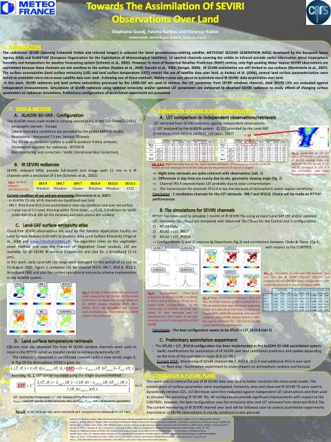
Stephanie Guedj, Fatima Karbou and Florence Rabier<br />
CNRM-GAME, Météo-France & CNRS, Toulouse, France<br />
The radiometer SEVIRI (Spinning Enhanced Visible and Infrared Imager) is onboard the latest geostationary-orbiting satellite: METEOSAT SECOND GENERATION (MSG) developed by the European Space<br />
Agency (ESA) and EUMETSAT (European Organisation for the Exploitation <strong>of</strong> Meteorological Satellites). 12 spectral channels covering the visible to infrared provide useful information about tropospheric<br />
humidity and temperature for weather forecasting system (Schmetz et al., 2002). However, in most <strong>of</strong> Numerical Weather Prediction (NWP) centres, only high-peaking Water Vapour SEVIRI observations are<br />
assimilated because these channels are not sensitive to the surface (Kopken et al., 2004; Szyndel et al., 2004; Stengel, 2008). IR SEVIRI assimilation are still limited to sea surfaces (Montmerle et al., 2007).<br />
The surface uncertainties (land surface emissivity (LSE) and land surface temperature (LST)) restrict the use <strong>of</strong> satellite data over land. In Karbou et al. (2006), several land surface parameterization were<br />
tested to assimilate more micro-wave satellite data over land . Following one <strong>of</strong> these methods, Météo-France sets about to assimilate more IR SEVIRI data assimilation over land.<br />
In this work, SEVIRI radiances and land surface emissivities processed by the LAND-SAF are used to retrieve the LST parameter from SEVIRI windows channels. New SEVIRI LSTs are evaluated against<br />
independent measurements. Simulations <strong>of</strong> SEVIRI radiances using updated emissivity and/or updated LST parameters are compared to observed SEVIRI radiances to study effects <strong>of</strong> changing surface<br />
parameters on radiances simulations. Preliminary configurations <strong>of</strong> assimilation experiment are presented.<br />
The ALADIN meso-scale model is running operationally at METEO-FRANCE (2005)<br />
- Geographic domain : Europe<br />
- Lateral boundary conditions are provided by the global ARPEGE model.<br />
- Resolutions : Horizontal 7.5 km, Vertical 70 levels<br />
- The 3D-Var assimilation system is used to produce 4 daily analyses.<br />
- Observation operator for radiances : RTTOV-8<br />
- Bias monitoring and correction : VarBC (Variational Bias Correction)<br />
SEVIRI, onboard MSG, provide full-hearth disk image each 15 min in 6 IR<br />
channels with a resolution <strong>of</strong> 3 km (Schmetz et al., 2002).<br />
Tab 1: SEVIRI IR<br />
channels<br />
and characteritics<br />
IR3.9 IR8.7 IR9.7 IR10.8 IR12.0 IR13.4<br />
Window Window Ozone Window Window CO2<br />
Current condition <strong>of</strong> use and pre-processing (Montmerle et al, 2007) :<br />
- In ALADIN 3D-Var, all IR channels are blacklisted over land<br />
- IR8.7, IR10.8 and IR12.0 are assimilated in clear sky conditions and over sea surface<br />
1 pixel out <strong>of</strong> 5 is used, thinning within 70 km boxes, σ o =0.25, 3 Predictors for VarBC<br />
(1000-300 hPa & 200-50 hPa thickness and total column WV content)<br />
Cloud-free SEVIRI observations are used by the Satellite Application Facility on<br />
Land Surface Analysis (LSA-SAF) to produce daily Land Surface Emissivity (Trigo et<br />
al., 2008 and www://landsaf.meteo.pt). The algorithm relies on the vegetation<br />
cover method and uses the Fraction <strong>of</strong> Vegetation Cover product. LSE are<br />
available for all SEVIRI IR window frequencies and also for a broadband (3-14<br />
µm).<br />
In this work, daily Land-SAF LSE maps were averaged for the period <strong>of</strong> 15-July to<br />
15-August 2009. Figure 1 compares LSE for channel IR3.9, IR8.7, IR10.8, IR12.0,<br />
Broadband (BB) and also the current operational emissivity scheme implemented<br />
in the ALADIN system.<br />
IR3.9 IR8.7 IR10.8<br />
LST retrieved from SEVIRI radiances against independent observations :<br />
1) LST analysed by the ALADIN system 2) LST provided by the Land-SAF<br />
3) retrievals from MODIS (MOD11_L2) (Wan, 2007)<br />
≠ 5K<br />
Tab. 2 & 3: Night-time (day-time on the right) statistics between LST analysed by ALADIN, Land-SAF,<br />
MODIS and our retrievals from SEVIRI. Data are for the period <strong>of</strong> 15-July to 15-August<br />
Fig 2: Scatterplot <strong>of</strong> LST SAF<br />
minus LST MODIS as a function<br />
<strong>of</strong> MODIS viewing angle obs.<br />
Data are for the period <strong>of</strong> 15-<br />
July to 15-August at 12h. R is<br />
the correlation. Low (high)<br />
frequencies are in blue (red).<br />
Night-time retrievals are quite coherent with observations (tab. 1)<br />
Differences in day-time are mainly due to obs. geometric viewing angle (fig. 2)<br />
Channel IR3.9 overestimates LST probably due to solar contamination<br />
The transmission for channels IR12.0 is too low because <strong>of</strong> atmospheric water vapour sensitivity.<br />
Conclusion : 2 candidates channels for the LST retrievals : IR8.7 and IR10.8. Choice will be made on RTTOV<br />
performances<br />
RTTOV has been used to simulate 1 month <strong>of</strong> IR SEVIRI Tbs using as input Land-SAF LSE and/or updated<br />
LST. Simulated Tbs (Tbsim) are compared with Observed Tbs (Tbobs) for the Control and 3 configurations :<br />
1) ATLAS-Only<br />
2) ATLAS + LST_IR8.7<br />
3) ATLAS + LST_IR10.8<br />
Configurations 2) and 3) improve fg-Departures (fig.3) and correlations between Tbobs & Tbsim (fig.4)<br />
a) IR12.0<br />
with respect to the CONTROL<br />
a) IR8.7 b) IR10.8<br />
c) IR12.0 d) IR13.4<br />
CONTROL ATLAS+LST_8.7 ATLAS+LST_10.8<br />
b) IR13.4<br />
CONTROL ATLAS+LST_8.7 ATLAS+LST_10.8<br />
Tab. 3 : Correlation (r), bias and STD between Tbobs<br />
and Tbsim for IR SEVIRI channels. Statistics are<br />
computed for the CONTROL and 2 configurations. Data<br />
are for the period <strong>of</strong> 15-July to 15-August 2009.<br />
IR12.0<br />
BB<br />
CONTROL<br />
Fig. 1: Average <strong>of</strong> daily Land Surface Emissivity<br />
maps produced by the LSA-SAF for the period<br />
<strong>of</strong> 15-July to 15-August over Europe. Maps are<br />
for SEVIRI window channels IR3.9, IR8.7,<br />
IR10.8, IR12.0 and BroadBand (BB). Current<br />
static emissivity map implemented in ALADIN<br />
system is also presented<br />
Fig.3: Fg-Departures (Tbobs-Tbsim)<br />
histograms <strong>of</strong> channel a) IR8.7, b) IR10.8,<br />
c) IR12.0 and d) IR13.4 for 15-July to 15-<br />
August 2009. Configurations : 1) The<br />
control (ctl), 2) Land-SAF emissivity <strong>atlas</strong><br />
(<strong>atlas</strong>), 3) <strong>atlas</strong> emissivity and LST<br />
calculated from IR8.7 (ts87), 4) and <strong>atlas</strong><br />
emissivity and LST calculated from IR10.8<br />
(ts108).<br />
Fig. 4: Maps <strong>of</strong> correlations between Tbobs and<br />
Tbsim <strong>of</strong> SEVIRI channel a) IR12.0 and b) IR13.4.<br />
The correlation have been computed using data<br />
falling in a grid cell <strong>of</strong> 2°x2° from 15-July to 15-<br />
August 2009. LAND-SAF emissivity <strong>atlas</strong> and LST<br />
computed using SEVIRI channel IR10.8 or IR8.7<br />
are used to simulated Tbs. The Control use the<br />
curent operational configuration.<br />
Conclusion : The best configuration seems to be ATLAS + LST_IR10.8 (tab.3)<br />
CONTROL ATLAS+LST_8.7 ATLAS+LST_10.8<br />
r bias std r bias std r bias std<br />
IR3.9 0,927 1,23 4,84 0,980 2,47 2,70 0,983 2,25 2,48<br />
IR8.7 0,943 1,15 3,30 NaN NaN NaN 0,998 0,18 0,71<br />
IR9.7 0,949 2,64 2,85 0,979 1,86 1,61 0,982 1,74 1,46<br />
IR10.8 0,938 1,78 3,50 0,996 -0,19 0,53 NaN NaN NaN<br />
IR12.0 0,937 1,17 3,25 0,995 -0,43 0,79 0,998 -0,58 0,77<br />
IR13.4 0,963 -1,40 1,42 0,985 -1,75 0,86 0,988 -1,81 0,79<br />
LSE and clear sky observed Tbs from IR SEVIRI window channels were used as<br />
input in the RTTOV radiative transfer model to retrieve dynamically LST.<br />
- The radiance L i measured in an infrared channel i with a view zenith angle θ υ<br />
at Top Of the Atmosphere (TOA) is given by:<br />
L<br />
i<br />
( T , ) <br />
( )[( ( ) L ( LST ) (1 <br />
i i <strong>atlas</strong> i)<br />
i<br />
<strong>atlas</strong>(<br />
i)<br />
] T<br />
- Inverting eq. 1, LST can be retrieved using the single channel method :<br />
LST<br />
<br />
L<br />
1<br />
<br />
<br />
<br />
L<br />
i<br />
( T<br />
i<br />
, <br />
<br />
LST : Land Surface Temperature , L -1 : the inversion <strong>of</strong> the Planck function<br />
ε <strong>atlas</strong> : Land-SAF spectral surface emissivity <strong>atlas</strong> and T atm↑ ,T atm↓ and τ: Atmospheric parameters<br />
Result :4 LST field per day were retrieved and compared to independent LST field<br />
( <br />
)) T<br />
( <br />
( atmi<br />
atm<br />
<br />
)<br />
<br />
L<br />
atmi<br />
( <br />
<br />
( <br />
i<br />
) <br />
( )(1 <br />
<br />
i<br />
)( <br />
<br />
<strong>atlas</strong>(<br />
i)<br />
)( <br />
<br />
<strong>atlas</strong>(<br />
i)<br />
)<br />
( <br />
<br />
)) T<br />
atmi<br />
( <br />
<br />
)<br />
<br />
<br />
<br />
)<br />
(eq.1)<br />
(eq.2)<br />
- The ATLAS + LST_IR10.8 configuration has been implemented in the ALADIN 3D-VAR assimilation system.<br />
- VarBC modifications for assimilation <strong>of</strong> IR SEVIRI over land (additional predictors and update depending<br />
on the time <strong>of</strong> the assimilation cycle (0-6-12-18) )<br />
- Current STEP : Monitoring <strong>of</strong> SEVIRI channel IR8.7, IR10.8, IR12.0 and additional IR13.4 over land<br />
Next step : Assimilation experiment to study impacts on atmospheric analysis and forecast<br />
This work aims to extend the use <strong>of</strong> IR SEVIRI data over land to better constrain the meso-scale model. The<br />
modelisation <strong>of</strong> surface parameters were investigated. Emissivity <strong>atlas</strong> and observed IR SEVIRI Tb were used to<br />
dynamically retrieve LSTs. LST Retrievals were first evaluated against independent LST observations and then used<br />
to simulate the remaining IR SEVIRI Tbs. All configurations provide significant improvements with respect to the<br />
CONTROL. However, the best configuration uses the emissivity <strong>atlas</strong> and LST retrieved from observed IR10.8 Tbs.<br />
The current monitoring <strong>of</strong> IR SEVIRI channel over land will be followed soon by several assimilation experiments.<br />
Assimilation <strong>of</strong> SEVIRI observations in cloudy conditions is also planned.<br />
Karbou F., E; Gerard, F; Rabier, 2006, Microwave land emissivity and skin temperature for AMSU-A & -B Assimilation over land, QJRMS, vol 132, n°620, pp2333-2355(23).<br />
Kopken C., G.Kelly, and J-N. Thépaut, 2004, Assimilation <strong>of</strong> Meteosat radiance data within the 4D-Var system at ECMWF : Assimilation experiment and forecast impacts, QJRMS,130.<br />
Montmerle T., F. Rabier and C. Fisher, 2007, Relative impact <strong>of</strong> polar-orbiting and geostationary satellite radiances in the ALADIN/France NWP system, QJRMS, n°133,pp 655-671.<br />
Schmetz J., P.Pili, S. Tjemkes, D. Just, J. Kerkmann, S.Rota and A. Ratier, 2002, An introduction to Meteosat Second Generation (MSG), BAMS, vol.83, 977-992<br />
Stengel M., 2008,Assimilation <strong>of</strong> SEVIRI’s WV channels observations in clear-sky conditions into the HIRLAM model. Technical Report. HIRLAM workshop.<br />
Szyndel M., G. Kelly, J-N. Thépaut, 2004, Evaluation <strong>of</strong> the potential for assimilation <strong>of</strong> SEVIRI radiance data from Meteosat-8, Technical Report, EUMETSAT/ECMWF.<br />
Trigo IF, LF Peres, CC DaCamara, SC Freitas, 2008, Thermal land surface emissitiy retrieved from SEVIRI/Meteosat, IEEE TGRS, vol. 46, issue 2, pp. 307-315.<br />
Wan Z., 2007, New Refinements and validation <strong>of</strong> the MODIS Land-Surface Temperature/emissivity products.
International TOVS Study Conference, 17 th , ITSC-17, Monterey, CA, 14-20 April 2010.<br />
<strong>Madison</strong>, WI, <strong>University</strong> <strong>of</strong> <strong>Wisconsin</strong>-<strong>Madison</strong>, Space Science and Engineering Center,<br />
Cooperative Institute for Meteorological Satellite Studies, 2011.