future plans - Dublin City, Ohio
future plans - Dublin City, Ohio
future plans - Dublin City, Ohio

You also want an ePaper? Increase the reach of your titles
YUMPU automatically turns print PDFs into web optimized ePapers that Google loves.
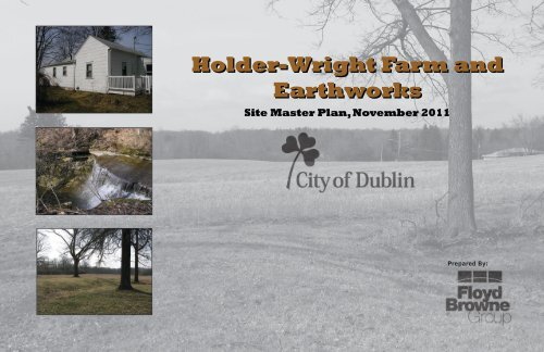
Holder-Wright Farm and<br />
Earthworks<br />
Site Master Plan, November 2011<br />
Prepared By:
Acknowledgements<br />
<strong>City</strong> of <strong>Dublin</strong><br />
Fred Hahn<br />
Laura Karagory<br />
Matt Besecker<br />
Sara Ott<br />
Holder-Wright Park Visioning Committee<br />
Joan Harless<br />
Stephanie Harless<br />
Janell Thomas<br />
Randy Roth<br />
Paul Gardner<br />
Jules Angel<br />
Jarrod Burks<br />
Consultant Team<br />
Floyd Browne Group<br />
Matt Simpson, RLA, LEED AP<br />
Andrea Smith, ASLA<br />
Gary Schmidt, ASLA, AICP<br />
3769 Columbus Pike<br />
Delaware, <strong>Ohio</strong> 43015<br />
(740) 363-6792<br />
Architectural Renderings<br />
The Arter Company
Introduction<br />
History<br />
Vicinity Map<br />
SR 161<br />
Emerald<br />
Parkway<br />
I-270<br />
Historic<br />
District<br />
Riverside Drive<br />
Holder-<br />
Wright Study<br />
Area<br />
Sawmill Road<br />
The Holder-Wright Farm and Earthworks has been a site of interest for the <strong>City</strong> of<br />
<strong>Dublin</strong>, <strong>Ohio</strong>ans and Midwesterners for many years. Some of the oldest references<br />
about the site date back to the 1880s. This is due to several significant features of<br />
the site. The first is the existence of the “ancient works near <strong>Dublin</strong>” or the Holder-<br />
Wright Works. These prehistoric mounds consist of three geometric earthworks and<br />
five burial mounds and are considered to belong to the Middle Woodland period dating<br />
to 200 B.C.-A.D. 400. Since first mapped in the 1880s, numerous archaeological<br />
investigations have occurred. Professional excavations were conducted in 1922 and<br />
1961 and revealed abundant chipped stone flakes, fireplace, human bone piles and<br />
several post molds for presumably a structure. Due to disturbance by farming activities,<br />
several of the mounds are difficult to see with the untrained eye. However,<br />
because of the their excellent condition below plow depth and significance as one<br />
of the few remaining prehistoric community centers in the state, this site has great<br />
interpretive and archaeological opportunities.*<br />
*A report on the Holder-Wright Earthwork Complex, Perry Township, Franklin County, <strong>Ohio</strong> By William S. Dancey, Ph.D. June 5, 1997<br />
In addition to the earthworks is the Holder-Wright Farmhouse. The site was originally<br />
settled by Joseph Ferris in 1818. It is believed that in 1820 he built the first<br />
framed house in the area, with all others being cabins. Through the years, there<br />
have been numerous additions to the house, however the original footprint remains<br />
evident by the stone foundation, original wood flooring, horse hair plaster walls and<br />
hand-sawn beams and joists in the attic. Because the farmhouse is one of the few<br />
remaining examples of architecture from the early 1800s, it offers terrific opportunities<br />
to interpret <strong>Ohio</strong>’s early farming history.<br />
Introduction<br />
The plan for Holder-Wright Park will preserve and showcase the ancient earthworks,<br />
farm house and natural features that are a significant part of <strong>Dublin</strong>’s history. As park<br />
visitors walk the trails that meander through the site’s restored meadows, they will<br />
view the ancient ceremonial mounds and learn about the archaeological, natural and<br />
historic features from the park’s informational signage. The Holder-Wright home will<br />
be renovated to its historic stature, and will serve as an interpretive center for the<br />
entire park. In addition, an interactive demonstration earthwork, children’s natural<br />
play area and observation deck overlooking the rugged terrain of Wright Run will be<br />
constructed to enhance the educational and recreational focus of the park. Visitors<br />
travelling by car/bus will access the park off of (<strong>future</strong>) Emerald Parkway, which will<br />
provide a parking area, restrooms and an orientation space for park users before they<br />
cross the creek through the woods that form the gateway to Holder-Wright Park.<br />
And lastly, Wright’s Run, the creek located south of the earthworks and farm house<br />
offers the opportunity to look back into geological time. There are several significant<br />
features to the creek including several waterfalls, a stone arch and sheer cliffs<br />
that fall approximately thirty feet to the stream below.<br />
Site Location<br />
Holder-Wright site is located approximately one mile northeast of the historic district<br />
Center. The site is accessible by Riverside Drive to the west, Bright Road to the<br />
north and Grandee Cliffs Drive to the east. The Scioto River is located just west of<br />
the site and scenic Wright’s Run (Billingsly Creek) runs through the site. As Emerald<br />
Parkway is extended, a pedestrian trail is planned along with the parkway that will<br />
provide connection to <strong>Dublin</strong>’s numerous other parks and trails.
Target Audience and Facility Development<br />
Problem Statement<br />
Floyd Browne Group was commissioned by the <strong>City</strong> of <strong>Dublin</strong> Parks and Open<br />
Space Division to provide site design services for the Holder-Wright Farm and<br />
adjacent parcels. The team was charged to develop programming, master<br />
<strong>plans</strong>, implementation <strong>plans</strong> and construction cost opinions for the park complex.<br />
Additionally Floyd Browne was tasked to provide concept <strong>plans</strong> for the planned<br />
office space located between I270 and Wright’s Run.<br />
Prior to the selection of Floyd Browne, a visioning committee had developed a<br />
preliminary set of goals and objectives for the study area. A list of desired elements,<br />
Bright Road Area Plan and historic and archaeological background information was<br />
provided as the basis for refinement during this design process. An initial list of<br />
potential activities was developed including peaceful walkways, mound restoration<br />
and archaeology areas, habitat preservation and restoration, native American and<br />
pioneer interpretation, outdoor learning labs, and picnic areas.<br />
Target Audience<br />
The visioning committee made it clear in the work sessions that the proposed facilities<br />
should communicate to a broad and diverse target audience. This park is part of a<br />
large park system that will draw visitors who explore <strong>Dublin</strong>’s recreational amenities. In<br />
addition, it will also appeal to specific user groups who choose it for its unique natural<br />
and cultural resources and for its educational opportunities. Such a diverse and broad<br />
audience requires an equally diverse range of activities.<br />
Facility Development<br />
The site’s natural and cultural resources have played a very significant role in determining<br />
facilities for the site and their site selection. Upon meeting with the Visioning Committee<br />
to discuss opportunities, constraints, vision and thematic development, several goals for<br />
the park were identified. The specific goals to incorporate into the activity program,<br />
interpretive design, and site features include:<br />
• Demonstrate the value of the land and illustrate the strong connection that the native<br />
Americans, early Americans and Holder-Wright Family had on this site.<br />
• Help visitors understand, enjoy, appreciate the historic significance of the site and<br />
develop respect for their environment.<br />
• Implement environmental improvements that mirror the sustainable culture of Native<br />
Americans and early pioneers.<br />
• Provide an interpretive trail that highlights the numerous natural and cultural features<br />
of the site.<br />
Interpretive Sign<br />
Junior Archeologist Programs<br />
Seasonal Guided Hikes
Site Description<br />
Site Description<br />
4<br />
The project study area is northeast of Historic Downtown <strong>Dublin</strong> and is bound by<br />
Riverside Drive to the west, Grandee Cliff’s Drive to the East, Bright Road to the<br />
north and I-270 to the south. The total acreage of the project study area is 47.1<br />
acres with the eastern 21.4 acres being owned by the <strong>City</strong> of <strong>Dublin</strong> and the western<br />
25.6 acres privately owned. For the purpose of this project, all three parcels will be<br />
included in the master planning of the site.<br />
8 7<br />
6<br />
1<br />
3<br />
9<br />
2<br />
5<br />
The Wright-Holder house is centrally located at the highpoint of the site overlooking<br />
Wright’s Run to the south and farm fields to the east and west. In addition to the<br />
home, there is a block garage and small metal silo. Located to the north and west of<br />
the farmhouse are the prehistoric earthworks. There are four known earthworks on<br />
the site. They are the central square earthwork, northeastern circular earthwork,<br />
southwestern circular earthwork and Krumm mound.<br />
Approaching the site from Riverside Drive, the farmhouse, earthworks and Wright’s<br />
Run are hidden from view due to the rising topography. However, once at the<br />
farmhouse the site offers 360 degree views. The relatively dense vegetation along<br />
Wright’s Run buffers views and noise between the primary park area and I-270,<br />
<strong>future</strong> Emerald Parkway and <strong>future</strong> office development to the south. Generally the<br />
site has rolling topography with gentle swales draining toward the Wright’s Run or<br />
the Scioto River.<br />
KEY<br />
. Holder-Wright Farm House<br />
. Garage<br />
. Silo<br />
. Northeast Circular Earthwork<br />
5. Central Square Earthwork<br />
6. Southwestern Circular Earthwork<br />
7. Krumm Mound (approximate location)<br />
. Ferris Cemetery<br />
9. Wright’s Run<br />
The site falls within the <strong>City</strong> of <strong>Dublin</strong>’s Bright Road Area Plan, which calls for a mix<br />
of land uses in the vicinity including; parkland, standard office and medium density<br />
residential. Recommendations in the Area Plan that impact the project study area<br />
are:<br />
•<br />
•<br />
•<br />
•<br />
•<br />
•<br />
•<br />
The preservation of the Holder-Wright Works<br />
A bike path connection through the park to Grandee Cliffs and Emerald parkway<br />
Restricted access to Riverside Drive by creating a cul-de-sac at Bright Road<br />
The extension of Emerald Parkway through the southern portion of the site<br />
Development of planned office outlots along Emerald Parkway<br />
Preservation of Ferris Cemetery area<br />
Protection of Wright’s Run stream corridor and ravine and providing a 200’ scenic<br />
setback along Riverside Drive
Existing Buildings<br />
Silo<br />
• The existing silo is an interesting<br />
architectural element to the site<br />
and should be preserved as part of<br />
the visitor experience and possible<br />
interpretive opportunity.<br />
For additional information see: A Feasibility Study for The Holder-<br />
Wright House, Prepared by Schooley Caldwell Associates<br />
July 2011<br />
Farm House and Yard Area<br />
• The Holder-Wright House represents one of<br />
the oldest surviving residential structures<br />
in the area. It is believed that this house<br />
has the significance of being the first frame<br />
built home in the area (others being log<br />
cabins).<br />
• Several significant features of the original<br />
home include; walls built with one inch<br />
lath and plaster with horse hair, dry laid<br />
limestone foundation walls, timber framing<br />
in the basement, and hand-sawn beams<br />
and framing in the attic.<br />
• The original structure has great potential<br />
to be restored and used as an interpretive<br />
center that highlights this important piece<br />
of <strong>Dublin</strong>’s History and early settlement<br />
in the area.<br />
• Over the years, additions have<br />
significantly increased the size of the<br />
house. Due to the lack of historical<br />
significance of the additions, it is<br />
recommended that they be removed and<br />
the home be restored to its early 20th<br />
century configuration.<br />
• Restorations may include space for Native<br />
American and early American heritage<br />
displays, kitchenette and small office<br />
space.<br />
• The overhead electric line should be<br />
removed and buried.<br />
• Healthy shade trees should be preserved<br />
and protected.<br />
• The lawn area adjacent to the house likely<br />
contains archaeological remains from the<br />
farm. Where possible, site disturbance<br />
should be limited to previously disturbed<br />
areas.<br />
Block Garage<br />
• This is a modern block garage building with<br />
a second story loft.<br />
• The garage is recommended to be removed<br />
due to its lack of historical significance,<br />
long-term maintenance cost and no defined<br />
purpose in the park.
Holder-Wright Earthworks<br />
Southwest Circular Earthwork<br />
• This is the most easily recognizable<br />
earthwork and is located directly north<br />
of the farm house.<br />
• The earthwork measures approximately<br />
160’ in diameter and consists<br />
of an enclosure, interior ditch and<br />
burial mound.<br />
• The western section has been leveled<br />
by farming, but much of the eastern<br />
portion is relatively intact and offers<br />
great interpretive and archaeological<br />
opportunities.<br />
Central Square Earthwork<br />
• This is the largest earthwork on the site<br />
and is approximately 1.4 acres in size.<br />
It includes a square enclosure and burial<br />
mound.<br />
• Due to leveling caused by farming and<br />
the overall large scale of the space this<br />
earthwork is difficult to visually identify<br />
• To increase interpretive opportunities and<br />
to help visitors identify the earthwork,<br />
the use of non-invasive grasses is<br />
recommended to help define the grand<br />
scale of the space and call attention to<br />
the earthwork. Grasses will be selected<br />
that have contracting color, texture and<br />
height from surrounding lawn areas.<br />
Northeast Circular Earthwork<br />
• This earthwork is located in the far<br />
northeast corner of the site. Approximately<br />
half of the enclosure is located<br />
in the park with the other half being<br />
on private property.<br />
• The earthwork measures<br />
approximately 120’ in diameter and<br />
consists of an enclosure and interior<br />
ditch.<br />
• Similarly to the central square<br />
earthwork, this site is also difficult<br />
to identify due to leveling caused by<br />
farming.<br />
• To help visitors identify the earthwork,<br />
the use of non-invasive grasses is<br />
recommended to call attention to the<br />
space. Grasses will be selected that<br />
have contracting color, texture and<br />
height from surrounding lawn areas.<br />
For additional information see: A report on the Holder-Wright<br />
Earthwork Complex, Perry Township, Franklin County, <strong>Ohio</strong> By<br />
William S. Dancey, Ph.D. June 5, 1997
Wright’s Run<br />
Wright’s Run<br />
• Wright’s Run (also known as Billingsly<br />
Creek) flows east to west toward the<br />
Scioto River and divides the site into two<br />
distinct areas. It also serves as a logical<br />
dividing line between the proposed<br />
parkland to the north and <strong>future</strong> office<br />
development to the south.<br />
• This scenic portion of the creek has<br />
several waterfalls, a stone arch, high<br />
cliff walls and caves.<br />
• Site development should ensure that the<br />
stream corridor and woodland vegetation<br />
is protected and preserved as much as<br />
possible.<br />
• There is an opportunity to tell the<br />
story of <strong>Dublin</strong>’s geological history, the<br />
stream’s morphology and importance of<br />
waterways.<br />
• Due to the high vertical cliffs on the<br />
western portion of the creek, visitor<br />
controls such as timber fencing is<br />
recommend to reduce the potential<br />
of visitors falling off the cliffs.<br />
• Invasive shrubs have taken over much<br />
of the stream corridor. Removal of<br />
the invasives should be completed to<br />
open views to the scenic stream and<br />
to increase the opportunity for native<br />
vegetation to reestablish.
Design Recommendations<br />
Site and Activity Programming<br />
The Floyd Browne Group team used input and recommendations from the<br />
<strong>City</strong> and Visioning Committee during the concept development process to<br />
identify interpretive and site program elements. Key messages that the team<br />
expressed were to preserve the existing Hopewellian Earthworks, utilize the<br />
farm house as an interpretive center and develop the site in an environmentally<br />
friendly manner. Below are the primary design recommendations:<br />
• Retain the existing farm house as a focal point of the site. Recondition<br />
it so that it allows public access but doesn’t detract from the historical<br />
significance of the structure. Provide an adjacent outdoor classroom space<br />
for informal gatherings and special events. Remove the existing detached<br />
garage due to its lack of historical significance, no defined purpose in the<br />
park and long-term maintenance cost. Maintain the existing silo for its<br />
charm and potential interpretive opportunities.<br />
• Preserve the existing earthworks. Work with local archaeological groups<br />
to further investigate the site and provide a real world archaeological<br />
outdoor classroom for OSU and <strong>City</strong> of <strong>Dublin</strong> students. Utilize noninvasive<br />
plantings, stone edging and other means to highlight the earthworks that<br />
are difficult to detect with the untrained eye.<br />
• Provide passive recreational opportunities for visitors who are visiting the<br />
site for its recreational aspects. Ensure park improvements such as shelters,<br />
overlooks and pedestrian bridge are in keeping with the architectural style<br />
and simplicity of the farm house.<br />
• In planning the office development on the southern portion of the site,<br />
ensure that design standards are established that encourage sustainable<br />
design principles that reduce potential negative environmental impacts<br />
to the park development such as: energy efficient buildings, minimal<br />
disturbance to the riparian corridor, use of bioswales, dark sky lighting and<br />
pervious paving.<br />
Visitor Experience<br />
The following is a graphic tour of the proposed improvements to the site<br />
using <strong>plans</strong>, sketches and images that demonstrate the design intent. The<br />
tour begins at the visitor orientation space and proceeds through the park.<br />
Descriptions of specific activities, exhibits and program items are provided. A<br />
plan view with descriptive legend is included to give an overview of the entire<br />
development area.<br />
• Provide an interpretive trail system that can be self-guided or used during<br />
guided tours. Provide trailside displays at points of interest such as the farm<br />
house, earthworks, Wright’s Run, Ferris Cemetery and at the demonstration<br />
earthwork. Provide Quick Response Codes or web links coordinated with<br />
trail markers to highlight these features of the site. The trail system should<br />
follow the contour of the land and be as inconspicuous as possible to<br />
minimize the affect to the natural surroundings and to reduce archaeological<br />
impacts. Along the trail, provide wildlife habitat enhancements such as<br />
meadow areas, restored wetlands, woodlands and shrub plantings.<br />
• Partner with Historic Society and/or OSU to provide periodic child and<br />
adult educational opportunities and programs that focus on reconnecting<br />
the public back to the land. Demonstrate how Native Americans, Early<br />
Americans and the Holder-Wright family had a strong connection to the<br />
site. This could include programs such as: Hopewell Discovery Day, Junior<br />
Archaeologist Programs, <strong>Ohio</strong>’s Farming Heritage Display, and Pottery<br />
Demonstrations to name a few.<br />
OSU Field Research Site
Holder-Wright Park Master Plan<br />
LEGEND<br />
1.<br />
2.<br />
3.<br />
4.<br />
5.<br />
6.<br />
7.<br />
8.<br />
9.<br />
Entrance Drive<br />
Visitor Orientation Space<br />
Planned Office Development<br />
Natural Play Area and Pedestrian<br />
Bridge<br />
Interpretive Trail<br />
Multi-Use Trail<br />
Interpretive Center and Outdoor<br />
Classroom Space<br />
Picnic Area/Open Lawn<br />
Existing Earthwork<br />
10. Habitat Restoration Area<br />
11. Demonstration Earthwork<br />
12. Restored Ferris Cemetery<br />
13. Creek Overlook<br />
14. Demonstration Garden<br />
6<br />
Riverside Drive<br />
6<br />
6<br />
12<br />
13<br />
3<br />
Bright Road<br />
11<br />
10<br />
9<br />
9<br />
8<br />
5<br />
Emerald Parkway<br />
6<br />
14<br />
7<br />
3<br />
4<br />
5<br />
8<br />
2<br />
6<br />
9<br />
10<br />
1<br />
9<br />
The goal of the master plan is to guide development<br />
of the park in a way that provides amenities and<br />
attractions to visitors interested in both the natural and<br />
cultural resources of the site as well as the recreational<br />
aspects. Included in the plan are areas that focus on<br />
the archaeological features of the site such as; the<br />
interpretive center and outdoor classroom, existing<br />
earthworks, Ferris Cemetery, and demonstration<br />
earthwork. For the casual visitor, there are picnic<br />
areas, shelter, creek overlook and habitat restoration<br />
areas.<br />
Linking the numerous proposed amenities is an<br />
interpretive trail system that meanders through the<br />
park closely following the hillside contours. The rustic<br />
gravel trail offers an up close view of Wright’s Run,<br />
meadows, reconstructed Ferris Cemetery, farm house<br />
and earthworks. In addition to the interpretive trail,<br />
there is a multi-use asphalt trail around the perimeter<br />
of the site that allows visitors an alternative way to<br />
access and view the site. At Wright’s Run, there<br />
are <strong>plans</strong> to remove invasive shrubs and weeds and<br />
replant with hardy natives to open views to this scenic<br />
creek and provide additional wildlife habitat. Just to<br />
the north of Wright’s Run are two unprogrammed<br />
picnic/open lawn areas that will provide the casual<br />
visitors an opportunity to enjoy the site, sun bathe,<br />
play catch or have a picnic. Within the picnic area<br />
will be a rustic shelter that provides an informal place<br />
for family gatherings or a quick lunch. And adjacent<br />
to Wright’s Run is a dramatic overlook that will give<br />
visitors a chance to see the waterfalls and view the<br />
geology of the area. On the southern portion of the<br />
site is a proposed office development. It contains<br />
approximately 70,000 square feet of office space.<br />
Highlights of this development include preservation<br />
of existing vegetation, pedestrian path system,<br />
stormwater bioswales and rain gardens.
Holder-Wright Park<br />
10
Visitor Orientation Space<br />
As visitors come to the site, their tour will begin at the<br />
Visitor Orientation Space. This space is located on the<br />
south side of Wright’s Run and will be incorporated<br />
with the office development. The parking area will<br />
accommodate approximately 30 cars and will be<br />
designed with bio-swales, rain gardens and native<br />
plantings to set the tone for this environmentally<br />
sensitive park.<br />
The orientation space gets its inspiration from the<br />
Hopewell Culture’s fascination with geometry and<br />
sculpting the land. The oval shaped central gathering<br />
spaces with raised grass mound and curvilinear<br />
walkways is an area for visitors to be introduced to the<br />
park’s archaeological, natural and cultural resources.<br />
Interpretive, informational and directional signs will<br />
be used to highlight the sites many attractions, direct<br />
visitors to the various destinations, advertise a seasonal<br />
hike series and post upcoming special events.<br />
To unify the space with the rest of the park, construction<br />
materials will be repeated such as; the use of field<br />
stone foundations on the restroom facility and seat<br />
walls, restroom roof materials will match the farm<br />
house and colored, textured concrete paving surface<br />
will be used to reinforce the space and add interest<br />
to the ground plain. In addition, sustainable site<br />
elements such as rain gardens and native plantings<br />
are planned to reduced the negative impacts that<br />
parking lots and development have on the site and<br />
Wright’s Run.<br />
11
Interpretive Center and Outdoor Classroom<br />
The tour continues as visitors walk across the<br />
pedestrian bridge over Wright’s Run and enter the<br />
main park area. Along the path visitors pass by a<br />
natural play area at Wright’s Run, the existing silo and<br />
demonstration gardens. The natural play area offers<br />
visitors a chance to splash in Wright’s Run, search<br />
out aquatic life and learn about the importance of<br />
our waterways. And the demonstration gardens<br />
offer visitors insight into native and early American<br />
agriculture. Once at the top of the hill, visitors are<br />
introduced to the Holder-Wright Farm House and<br />
adjacent Hopewellian earthworks.<br />
The focal point of the interpretive center is the<br />
Holder-Wright Farm House. Because of the original<br />
structure’s historical significance, the house is<br />
planned to be restored to its approximate early 1900s<br />
configuration. It will contain lecture rooms for small<br />
events and will display early American and Native<br />
American artifacts and interpretive elements.<br />
Outside of the home is an outdoor classroom space<br />
with interpretive signs that help visitors better<br />
understand and appreciate the home and earthworks.<br />
The classroom space is located on the former gravel<br />
farm lane and is oriented toward the west so visitors<br />
can easily view the historical elements. To add<br />
interest to the outdoor classroom space, specialty<br />
paving (colored concrete in the shape of a bird’s claw)<br />
is used to provide an opportunity to interpret the<br />
Hopewell peoples interest in art and decorations. The<br />
classroom’s circular design with low seat wall provides<br />
a gathering space for seasonal guided tours, place for<br />
visitors to listen as archaeologists or historians tell<br />
the story of this site or a place for children to search<br />
for replica artifacts at a junior archeologist program.<br />
12
Demonstration Earthwork<br />
Northwest of the farm house is the demonstration<br />
earthwork. This space will be constructed to illustrate<br />
to visitors what a typical Hopewell earthwork may<br />
have looked like in its original condition. The site<br />
was chosen due to its similar characteristics of the<br />
existing southwestern circular earthwork located next<br />
to the farm house. It is positioned on relatively level<br />
topography, offers views to the Scioto River valley<br />
and is far enough from existing earthworks that it<br />
doesn’t compete with their interpretive potential.<br />
Features of the demonstration earthwork include:<br />
its earthen enclosure, interior ditch, central mound<br />
and fire pit. There is also a cut-away at the south<br />
entrance so visitors can see, in cross section, how the<br />
mound was constructed and what was often buried<br />
inside. To further illustrate the site’s archaeological<br />
significance, a demonstration archaeological dig area<br />
with interpretive signs will be constructed so visitors<br />
can better understand the archaeological process,<br />
techniques and what artifacts have been found at<br />
the site. As an added three dimensional teaching<br />
element, sculptural elements are placed in the<br />
enclosure helping visitors to recognize this park as an<br />
important ceremonial space.<br />
13
Phasing Plan<br />
Bright Road<br />
Phasing Legend<br />
Visitor Orientation Space<br />
Interpretive Center<br />
Eastern Trail System<br />
Western Trail System (Subject to land acquisition)<br />
Perimeter Multi-Use Trail (Subject to land acquisition)<br />
Perimeter<br />
Multi-use<br />
Trail<br />
Western<br />
Trail<br />
System<br />
Interpretive<br />
Center<br />
Eastern Trail<br />
System<br />
Grandee Cliffs Dr<br />
The Design Team and <strong>City</strong> of <strong>Dublin</strong> identified the following<br />
phasing plan and list of priority projects:<br />
• Park Entrance Drive, Vehicular Parking, Visitor<br />
Orientation Space, Wright’s Run Pedestrian Bridge.<br />
• Farm House Renovation, Outdoor Classroom and<br />
Demonstration Garden.<br />
• Eastern Trail System, Meadow Planting, Picnic Shelter<br />
and Lawn Picnic Area Seeding.<br />
Riverside Drive<br />
Visitor<br />
Orientation<br />
Space<br />
• West Side Trail System, Demonstration Mound, Wright’s<br />
Run Overlook, Meadow and Lawn Picnic Area Seeding.<br />
(Subject to land acquisition)<br />
• Perimeter Multi-Use Trails, Ferris Cemetery Restoration.<br />
(Subject to land acquisition)<br />
Jenmar Ct<br />
I-270<br />
14
Opinion of Probable Cost<br />
CITY OF DUBLIN<br />
HOLDER-WRIGHT PARK MASTER PLAN<br />
OPINION OF PROBABLE COST<br />
NOVEMBER 2011<br />
DESCRIPTION QTY. UNIT UNIT COST TOTAL COST<br />
Visitor Orientation Space<br />
A. Misc. Clearing & Grubbing 1 ALLOW $5,000.00 $5,000.00<br />
B. Erosion Control 1 ALLOW $2,500.00 $2,500.00<br />
C. Entrance Drive 500 LF $300.00 $150,000.00<br />
D. Parking Lot 1 ALLOW $62,000.00 $62,000.00<br />
E. Stormwater Structures 1 ALLOW $14,000.00 $14,000.00<br />
F. Pedestrian Trail 600 LF $65.00 $39,000.00<br />
G. Pedestrian Bridge/Boardwalk 95 LF $850.00 $80,750.00<br />
H. Bridge Abutments 2 EA $10,000.00 $20,000.00<br />
I. Architectural Paving 4,500 SF $10.00 $45,000.00<br />
J. Seat wall 500 FF $80.00 $40,000.00<br />
K. Restroom Facility 1 ALLOW $92,000.00 $92,000.00<br />
L. Sanitary Sewer Service 550 LF $75.00 $41,250.00<br />
M. Water Service 550 LF $20.00 $11,000.00<br />
N. Bike Rack 1 EA $750.00 $750.00<br />
O. Interpretive and Directional Signs 4 EA $500.00 $2,000.00<br />
P. Stormwater Rain Garden 1 ALLOW $5,000.00 $5,000.00<br />
Q. Misc. Landscaping 1 ALLOW $10,000.00 $10,000.00<br />
Total $620,250.00<br />
Contingency (15%) $93,037.50<br />
CONSTRUCTION TOTAL $713,287.50<br />
Interpretive Center<br />
A. Misc. Clearing & Grubbing 1 ALLOW $5,000.00 $5,000.00<br />
B. Garage Demolition 1 ALLOW $4,000.00 $4,000.00<br />
C. Electric Line Relocation 620 LF $6.00 $3,720.00<br />
D. Erosion Control 1 ALLOW $1,000.00 $1,000.00<br />
E. Pedestrian Trail 260 LF $65.00 $16,900.00<br />
F. Architectural Paving 1,200 SF $10.00 $12,000.00<br />
G. Seat wall 130 FF $80.00 $10,400.00<br />
H. Demonstration Archaeological Dig Display 1 ALLOW $2,500.00 $2,500.00<br />
I. Interpretive and Directional Signs 4 EA $500.00 $2,000.00<br />
J. Picnic Tables 3 EA $1,000.00 $3,000.00<br />
K. Demonstration Garden 1 ALLOW $3,500.00 $3,500.00<br />
L. Misc. Landscaping 1 ALLOW $10,000.00 $10,000.00<br />
M. House Renovation (Per SCA Feasibility Study) 1 ALLOW $300,000.00 $300,000.00<br />
Total $374,020.00<br />
Contingency (15%) $56,103.00<br />
CONSTRUCTION TOTAL $430,123.00<br />
CITY OF DUBLIN<br />
HOLDER-WRIGHT PARK MASTER PLAN<br />
OPINION OF PROBABLE COST<br />
NOVEMBER 2011<br />
DESCRIPTION QTY. UNIT UNIT COST TOTAL COST<br />
Eastern Trail System<br />
A. Erosion Control 1 ALLOW $8,000.00 $8,000.00<br />
B. Pedestrian Trail 2,300 LF $65.00 $149,500.00<br />
C. Shelter (24'x44') 1 ALLOW $52,000.00 $52,000.00<br />
D. Picnic Table 4 EA $1,000.00 $4,000.00<br />
E. Interpretive and Directional Signs 4 EA $500.00 $2,000.00<br />
F. Bird Boxes 3 EA $100.00 $300.00<br />
G. Lawn Seeding 3,300 SY $1.00 $3,300.00<br />
H. Meadow Seeding 13,000 SY $1.50 $19,500.00<br />
I. Misc. Landscaping 1 ALLOW $10,000.00 $10,000.00<br />
Total $248,600.00<br />
Contingency (15%) $37,290.00<br />
CONSTRUCTION TOTAL $285,890.00<br />
Western Trail System<br />
A. Erosion Control 1 ALLOW $3,000.00 $3,000.00<br />
B. Pedestrian Nature Trail 2,040 LF $45.00 $91,800.00<br />
C. Hopewell Demonstration Earthwork 1 ALLOW $90,000.00 $90,000.00<br />
D. Observation Deck (15'x15') 225 SF $35.00 $7,875.00<br />
E. Timber Fence 200 LF $20.00 $4,000.00<br />
F. Interpretive and Directional Signs 6 EA $500.00 $3,000.00<br />
G. Bird Boxes 3 EA $100.00 $300.00<br />
H. Trailside Bench 2 EA $800.00 $1,600.00<br />
I. Picnic Table 4 EA $1,000.00 $4,000.00<br />
J. Lawn Seeding 15,000 SY $1.00 $15,000.00<br />
K. Meadow Seeding 35,400 SY $1.50 $53,100.00<br />
Total $273,675.00<br />
Contingency (15%) $41,051.25<br />
CONSTRUCTION TOTAL $314,726.25<br />
Perimeter Multi-Use Trails<br />
A. Riverside Drive Trail 1,625 LF $90.00 $146,250.00<br />
B. Bright Road Trail 1,035 LF $90.00 $93,150.00<br />
Total $239,400.00<br />
Contingency (15%) $35,910.00<br />
CONSTRUCTION TOTAL $275,310.00<br />
15