Rettendon Village Design Statement - Chelmsford Borough Council
Rettendon Village Design Statement - Chelmsford Borough Council
Rettendon Village Design Statement - Chelmsford Borough Council

You also want an ePaper? Increase the reach of your titles
YUMPU automatically turns print PDFs into web optimized ePapers that Google loves.
<strong>Rettendon</strong> <strong>Village</strong> <strong>Design</strong> <strong>Statement</strong><br />
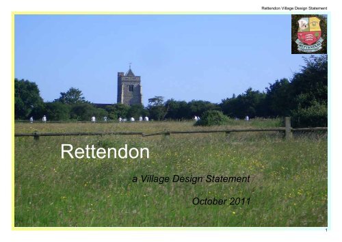
<strong>Rettendon</strong><br />
a <strong>Village</strong> <strong>Design</strong> <strong>Statement</strong><br />
October 2011<br />
1
<strong>Rettendon</strong> <strong>Village</strong> <strong>Design</strong> <strong>Statement</strong><br />
Contents<br />
1. Introduction 03<br />
1.1 What is a <strong>Village</strong> <strong>Design</strong> <strong>Statement</strong> 03<br />
1.2 What does it cover 03<br />
1.3 How was it developed 03<br />
1.4 Current status 03<br />
1.5 Planning context 04<br />
1.6 Document structure 05<br />
2. Our Parish 06<br />
2.1 Character of the Parish 08<br />
2.2 Geological survey 08<br />
2.3 Classification of character areas 08<br />
2.4 <strong>Rettendon</strong> Place 09<br />
2.5 <strong>Rettendon</strong> Common 12<br />
2.6 Battlesbridge 16<br />
2.7 Housing 19<br />
2.8 Transport 20<br />
2.9 Public utilities 22<br />
2.10 Leisure 23<br />
2.11 Business 24<br />
2.12 The natural environment 25<br />
3. Planning Guidance 26<br />
3.1 Guidelines for <strong>Rettendon</strong> Place character areas 27<br />
3.2 Guidelines for <strong>Rettendon</strong> Common character areas 30<br />
3.3 Guidelines for Battlesbridge character area 33<br />
3.4 General guidelines 35<br />
3.4.1 Diversity 35<br />
3.4.2 Street Scenes 35<br />
3.4.3 Footpaths and Cycle Paths 36<br />
3.4.4 Transport 37<br />
3.4.5 Extensions 38<br />
3.4.6 Energy Saving Technology 39<br />
3.4.7 Enforcement 39<br />
3.4.8 The natural environment 40<br />
3.4.9 Future Development 41<br />
3.4.10 Sustainable Development 41<br />
Appendices<br />
Appendix 0 - Housing Diversity and Density Rating definitions 42<br />
Appendix 1 - Public consultation process 43<br />
Appendix 2 - Geological survey 45<br />
Appendix 3 - Meadow Road settlement map 46<br />
Appendix 4 - East Hanningfield Road settlement map 47<br />
Appendix 5 - Battlesbridge conservation area map 48<br />
Appendix 6 - Parish map showing footpaths 49<br />
Appendix 7 - Proposed new amenities around Meadow Road 50<br />
Appendix 8 - Proposed ‘green’ corridors 51<br />
Acknowledgements 52<br />
Entrance to RHS Hyde Hall gardens<br />
2
<strong>Rettendon</strong> <strong>Village</strong> <strong>Design</strong> <strong>Statement</strong><br />
1. An introduction to the <strong>Village</strong> <strong>Design</strong> <strong>Statement</strong><br />
1.1 What is a <strong>Village</strong> <strong>Design</strong> <strong>Statement</strong> ?<br />
The <strong>Village</strong> <strong>Design</strong> <strong>Statement</strong> is a document that is used to express the desires and intentions of individual communities so these can<br />
be taken into account as part of future planning decisions that might affect them. Based on information gathered in a series of public<br />
consultation events this is an opportunity for the residents of the Parish of <strong>Rettendon</strong> to state what they want to change and what they<br />
value and wish to preserve. It is our chance to have a say in how <strong>Rettendon</strong> evolves in the future.<br />
1.2 What does it cover ?<br />
The <strong>Village</strong> <strong>Design</strong> <strong>Statement</strong> covers the entire Parish of <strong>Rettendon</strong> incorporating <strong>Rettendon</strong> Common which includes the Chalk<br />
Street and South and East Hanningfield Road areas, <strong>Rettendon</strong> Place which includes the Meadow Road area and Battlesbridge<br />
which includes the Woodham Road.<br />
Consideration has been given to the full range of areas directly affected or impacted by planning decisions such as Housing, Transport,<br />
Public Services and the Environment.<br />
1.3 How was the VDS developed ?<br />
Development of the <strong>Village</strong> <strong>Design</strong> <strong>Statement</strong> has been sponsored by the <strong>Rettendon</strong> Parish <strong>Council</strong> following the successful<br />
completion of the <strong>Village</strong> Survey in 2003. It has been developed through a number of stages of public consultation and through<br />
advice and guidance supplied by peer groups in other communities as well as from our local authority. The public consultations steps<br />
taken so far are listed in Appendix 1. It is intended that the document should be adopted first by the <strong>Rettendon</strong> Parish <strong>Council</strong> and<br />
subsequently by the local planning authority as a reflection of the community wishes of the Parish residents. The adopted document will<br />
be distributed to all households in the Parish.<br />
1.4 Current status<br />
<strong>Rettendon</strong> VDS was approved by <strong>Chelmsford</strong> <strong>Borough</strong> <strong>Council</strong> at its meeting on October 11 th 2011 as planning guidance. The VDS<br />
carries weight in the determination of planning applications by the local authority, although it is not a statutory planning document.<br />
T<br />
he VDS is also for reference by the local community when considering making physical changes to their properties which might not<br />
actually require planning permission. The VDS is a tool that can influence the people who live and work in <strong>Rettendon</strong>, increase local<br />
pride, encourage care and help to improve the overall quality of physical change.<br />
3
<strong>Rettendon</strong> <strong>Village</strong> <strong>Design</strong> <strong>Statement</strong><br />
1.5 Planning Context<br />
The Government has introduced a new plan making regime which has led to the <strong>Borough</strong> <strong>Council</strong> creating the Local Development<br />
Framework (LDF). The LDF sets out policies and proposals for dealing with new development. It identifies sites where new housing<br />
and other development can take place and sets out the policies of the <strong>Council</strong> in relation to the use of land and buildings. The LDF is<br />
itself governed by regional policies which result from central government policies. Every planning application is considered against the<br />
LDF. The Core Strategy and Development Control Policies Development Plan Document (adopted Feb 2008) is the overarching policy<br />
document in the LDF. Key policies relating to <strong>Rettendon</strong> are:<br />
<strong>Rettendon</strong> Common and <strong>Rettendon</strong> Place are Defined Settlements in the Local Development Framework. The Site Allocations<br />
Document, part of the LDF, continues to support this.<br />
The outer boundary of the Metropolitan Green Belt exists to the west of both settlements and also to the south of <strong>Rettendon</strong> Place<br />
along the southern edge of the Parish. LDF policies (including DC1) and PPG2 seek to protect the Green Belt from inappropriate<br />
development. Policy DC2 seeks to protect the countryside from undesirable development.<br />
Land to the east of Goose’s Farm is a Special Protection Area and a Ramsar site, internationally important for waterfowl and<br />
other species. The River Crouch inter-tidal habitat (those areas between low and high water) is part of the Essex Estuaries<br />
Special Area of Conservation (the marine equivalent of a National Park). This is also a Site of Special Scientific Interest due to<br />
the salt marsh and grazing marsh habitat, its geological formation and floral species. There are also other sites of bio-diversity<br />
and geological value which Policy DC13 protects and also encourages bio-diversity across the borough.<br />
The boundary to the south is included in the Coastal Protection Belt policy DC10 a countywide designation where there are<br />
stringent restrictions on development with the purpose of seeking to protect the coast as a special resource in its own right.<br />
Battlesbridge Conservation Area is statutorily protected backed up by Policy DC17. The Parish of <strong>Rettendon</strong> has 16 listed<br />
buildings which have statutory protection backed up by Policy DC18.<br />
The Industrial Estate at Battlesbridge is a rural Employment Area. Policy DC52 on industrial and warehouse development seeks<br />
to protect this type of employment land to ensure supply and meet the needs of existing companies.<br />
The design of development is covered by core policies CP20 and CP21 and development control policies DC42 and DC45.<br />
Core Policy CP14 provides a direct link between VDS and local planning policy. The policy also sets the scene for the visual<br />
impact of all development proposals on the landscape.<br />
The VDS also complements the <strong>Borough</strong> <strong>Council</strong>’s Supplementary Planning Documents; including Sustainable Development SPD<br />
and Making Places SPD; and the residential design guidance on roof and side extensions. It is important to take these into account<br />
during the planning process.<br />
4
<strong>Rettendon</strong> <strong>Village</strong> <strong>Design</strong> <strong>Statement</strong><br />
1.6 Document Structure<br />
The document starts with two sections with Section 1 first introducing and Section 2 then describing the important features of the<br />
Parish, both good and bad, as identified in consultation with the community. To indicate the positive and negative aspects the<br />
following symbols have been used :-<br />
This symbol is used to indicate where the consultation results have shown a positive feature worthy of preservation.<br />
This symbol is used to indicate where the consultation results show issues that need to be addressed.<br />
It is anticipated that the <strong>Village</strong> <strong>Design</strong> <strong>Statement</strong> will be used as guidance material when future planning decisions affecting <strong>Rettendon</strong><br />
Parish are being considered. To simplify access to this guidance all identified guidelines have been collated in section 3 with<br />
cross-references where relevant to any supporting reasons in the previous sections.<br />
5
<strong>Rettendon</strong> <strong>Village</strong> <strong>Design</strong> <strong>Statement</strong><br />
2. Our Parish<br />
The Parish of <strong>Rettendon</strong> is a rural community situated on the northern bank of the River<br />
Crouch. The Parish encompasses the three principle village communities of <strong>Rettendon</strong><br />
Common in the north, Battlesbridge in the south and <strong>Rettendon</strong> Place which is located between<br />
them and forms the centre of the Parish. While physically quite dislocated the closure of the old A130<br />
has benefited residents not only in the obvious reduction of noise and improved safety but with<br />
noticeably increased contact between neighbours and an enhanced spirit of combined community These<br />
communities are described in more detail in the following sections.<br />
6
<strong>Rettendon</strong> <strong>Village</strong> <strong>Design</strong> <strong>Statement</strong><br />
<strong>Rettendon</strong> - Aerial View showing Parish<br />
boundary in yellow and main character<br />
areas in red<br />
A130<br />
RHS Garden<br />
Hyde Hall<br />
North<br />
<strong>Rettendon</strong> Common<br />
East Hanningfield Road<br />
Chalk Street<br />
Main Road<br />
<strong>Rettendon</strong> Place<br />
South Woodham Ferrers<br />
Main Road<br />
Meadow Road<br />
Woodham Road<br />
Church Chase<br />
Battlesbridge<br />
Battlesbridge centre<br />
Wickford<br />
7
<strong>Rettendon</strong> <strong>Village</strong> <strong>Design</strong> <strong>Statement</strong><br />
2.1 Character of the Parish<br />
<strong>Rettendon</strong> is a rural Parish with three major settlements at <strong>Rettendon</strong> Common, <strong>Rettendon</strong> Place and Battlesbridge. Historically there<br />
has been significant commercial activity around Battlesbridge with the River Crouch barge trade, cereal milling, grain storage and<br />
road stone haulage. The southern part of the Parish has also seen the confluence of major road, rail and river crossings which has<br />
encouraged industrial and commercial uses, notably plastic manufacture and a flourishing antiques trade.<br />
The development and enlargement of Hyde Hall gardens under the management of the Royal Horticultural Society has placed the<br />
Parish under a national spotlight. Significant inputs from residents resulted in an improved design for road access to the site which<br />
will help offset the local impacts of a facility which is destined to generate much more traffic in the future. A projected 200,000 visitors<br />
per annum will find their way to and from this attraction via the local road network.<br />
Most of the development in the Parish pre-dates the Planning Acts and mainly comprises intermittent farms and country housing with<br />
more intense development to Salforal Close and the Meadow Road housing estate at <strong>Rettendon</strong> Place which is managed by<br />
Chelmer Housing Partnership.<br />
The original Runwell Hospital which lies between <strong>Rettendon</strong> Parish and nearby Wickford has now been replaced by a new medium<br />
secure hospital with 97 beds known as Brockfield House. A large residential development of 624 houses had also been approved<br />
for this site but this has been somewhat delayed by a subsequent and now rejected planning application from the Ministry of Justice for<br />
a category B prison of some 1,500 inmates. When completed the presence of this number of new homes is certain to generate significant<br />
additional loads on local infrastructure.<br />
2.2 Geological Survey<br />
Soils underlying the Parish are mainly London Clay and Head Materials with Claygate Beds to the elevated sections of the Parish. The edges of<br />
the River Crouch and Fenn Creek to the eastern boundary are underlain with Estuarine Alluvium. There are patches of Second Terrace Gravel<br />
in the vicinity of Hayes Farm, Gosses Farm and to the south west of Battlesbridge station. A diagram showing these deposits can be found at<br />
Appendix 2.<br />
2.3 Classification of character areas<br />
For descriptive purposes each of the main settlements has been sub-divided into character areas. Each character area is also given<br />
a classification in terms of housing diversity and density. These terms should be treated as being relative within the Parish rather<br />
than absolute. Appendix 0 gives detailed definitions for these classifications.<br />
8
<strong>Rettendon</strong> <strong>Village</strong> <strong>Design</strong> <strong>Statement</strong><br />
2.4 <strong>Rettendon</strong> Place<br />
<strong>Rettendon</strong> Place represents the main area of habitation within the Parish with its<br />
hilltop location making it the highest part of the Parish. There is no established<br />
business sector within this part of the village and only limited indigenous farming<br />
activity. Fields surround and enhance the area. <strong>Rettendon</strong> Place is split into three main<br />
character areas.<br />
2.4.1 Meadow Road<br />
To the East of the old A130 (Main Road) lies the Meadow Road development which<br />
is the only part of the Parish where houses form an estate and is the area of highest<br />
housing density. This post war development was originally council housing some of<br />
which are now in private ownership while the remainder are owned and managed by<br />
Chelmer Housing Partnership. This area has a completely different ‘feel’ to any other<br />
part of the Parish as houses are relatively modern with the vast majority enjoying both<br />
front and rear gardens.<br />
Estate road and on-street parking<br />
However, the street scene in this area is dominated by the need for on-street parking which restricts the already narrow estate roads still<br />
further.<br />
There are a number of<br />
bungalows designed for the<br />
elderly.<br />
This area can be classified as<br />
a Low diversity, High density<br />
residential area which lies within<br />
the current settlement boundary<br />
which can be seen at<br />
Appendix 3.<br />
Retirement bungalows<br />
Estate road and on-street parking<br />
9
<strong>Rettendon</strong> <strong>Village</strong> <strong>Design</strong> <strong>Statement</strong><br />
2.4.2 Church Chase<br />
The Church of All Saints which dates back to the 10th century stands on commanding high<br />
ground close to the western edge of the Parish and is a widely identifiable landmark to the<br />
now vast traffic which plies the new A130 bypass between the A12 and the A127.<br />
Housing in this area consists of large old detached properties set amongst mature tree<br />
stands forming a pleasant and traditional backdrop to the church and churchyard.<br />
This area can be characterised as a High diversity, Low density residential area which lies<br />
outside of the settlement boundary.<br />
All Saints Church<br />
2.4.3 Main Road<br />
The remainder of the houses on Main Road consist of a diverse mix of timber framed and brick houses which pre-date the Meadow Road<br />
development by, in some cases, many hundreds of years.<br />
There is a true sense of community focused around the Meeson Bungalows, <strong>Rettendon</strong> Primary School and <strong>Rettendon</strong> Memorial Hall all of<br />
which are located within this part of the village. To the rear of the Memorial Hall lies the cricket ground which further emphasises the<br />
traditional village feel of this area.<br />
This area can be characterised as a Medium diversity, Medium<br />
density residential which lies outside of the settlement boundary.<br />
<strong>Rettendon</strong> Primary School<br />
10
<strong>Rettendon</strong> <strong>Village</strong> <strong>Design</strong> <strong>Statement</strong><br />
2.4.4 Map of<br />
<strong>Rettendon</strong><br />
Place<br />
Whitehouse Farm<br />
E<br />
Workhouse Lane<br />
pasture<br />
Area<br />
Industrial<br />
Colour Key<br />
Planning considerations<br />
Appropriate commercial development<br />
where infrastructure load<br />
can be tolerated<br />
(not to scale)<br />
pasture<br />
Parish Boundary<br />
Main Road<br />
<strong>Rettendon</strong><br />
Old Hall<br />
D<br />
Traffic calming<br />
(width restriction)<br />
<strong>Rettendon</strong><br />
Hall<br />
1<br />
New Hall<br />
Farm<br />
Primary school<br />
and Nursery<br />
arable<br />
Residential or<br />
Settlement boundary<br />
Metropolitan Green<br />
Belt<br />
Proposed<br />
development<br />
Minor infill development<br />
possible<br />
No development other than agricultural<br />
except in extreme circumstances<br />
Development in line with VDS<br />
guidance possible<br />
1 Proposed site for Affordable<br />
Housing and new <strong>Village</strong> Hall<br />
(see section 3.1.1)<br />
2 Impacted areas for existing<br />
<strong>Village</strong> Hall redevelopment<br />
Proposed new footpath<br />
to Runwell (see Section<br />
3.4.3)<br />
<strong>Village</strong> Hall car park<br />
Existing <strong>Village</strong> Hall<br />
Cricket ground<br />
and open space<br />
2<br />
A<br />
C<br />
B<br />
<strong>Rettendon</strong><br />
Place<br />
Meadow Road<br />
housing estate<br />
Meadow Road<br />
Traffic calming<br />
(width restriction)<br />
footpath<br />
arable<br />
Open countryside<br />
Woodland<br />
Protected in its own right with only<br />
agricultural development permitted<br />
footpath<br />
A130<br />
Main Road<br />
Listed buildings<br />
A Church of All Saints (Grade I)<br />
B Barn at <strong>Rettendon</strong> Place (Grade II)<br />
C Granary south-west of <strong>Rettendon</strong> Place (Grade II)<br />
D <strong>Rettendon</strong> Old Hall Grade II)<br />
E Milestone (Grade II)<br />
arable<br />
footpath<br />
arable<br />
footpath<br />
Part of Woodham Road<br />
(see Battlesbridge)<br />
footpath<br />
11
<strong>Rettendon</strong> <strong>Village</strong> <strong>Design</strong> <strong>Statement</strong><br />
2.5 <strong>Rettendon</strong> Common<br />
<strong>Rettendon</strong> Common has no large estates, the dwellings within the area having been built up piece-meal along the South and East<br />
Hanningfield roads and Chalk Street. The houses are themselves a delightful mixture of styles and designs ranging from early timber<br />
framed red brick houses to more modern infill developments. Few working farms have survived within <strong>Rettendon</strong> Common and the land<br />
surrounding the Common area is farmed by owners outside the Parish. This however does not inhibit the enjoyment of the countryside<br />
although it has affected agricultural employment within the village.<br />
<strong>Rettendon</strong> Common residents can also enjoy public open space provided in the form of a football pitch. There are also numerous<br />
bridleways and footpaths linking <strong>Rettendon</strong> Common to other parts of the Parish and beyond.<br />
There are three main character areas.<br />
2.5.1 Chalk Street<br />
Incorporating Coal Hill and a short section of the South Hanningfield Road this area consists of delightful rural roads with mature trees and<br />
hedging forming an almost continuous screen partially obscuring many of the dwellings from the road. The style of the dwellings<br />
themselves range from small thatched cottages to modern substantial houses.<br />
There is a total mixture of architectural age and style which combined with the proliferation of mature trees and hedging creates a special<br />
rural street scene which should be enhanced and maintained.<br />
Care should be taken to preserve the character of this area which can be characterised as one of High diversity and Low density<br />
residential lying outside of the settlement boundary.<br />
12
<strong>Rettendon</strong> <strong>Village</strong> <strong>Design</strong> <strong>Statement</strong><br />
2.5.2 East Hanningfield Road<br />
A<br />
somewhat crowded residential street with mainly twentieth century properties of all<br />
styles. The majority of dwellings are single storey and almost all have well tended front<br />
gardens which add much to the character of the road. The majority of properties have off road<br />
parking facilities allowing for the overall appearance of the road itself to be uncluttered - a<br />
typical semi-rural street scene.<br />
Situated on high ground in the north eastern corner of the Parish, Hyde Hall was a working<br />
farm for centuries and now enjoys an international reputation as one of the top three RHS<br />
gardens in the UK.<br />
This area is characterised as one of High diversity and Medium density residential lying<br />
within the existing settlement boundary which can be seen at Appendix 4.<br />
Diverse designs and off-street parking<br />
2.5.3 Main Road<br />
Main road is typified by occasional large period properties standing within their own<br />
grounds interspersed with occasional farm houses and buildings. In the main such farm<br />
buildings have been converted to industrial use.<br />
Open, green frontages<br />
The overall impression is one of a rural open landscape where the road itself is bordered for much of the time by mixed hedging. The road<br />
also is home to two public houses and the treatment of their forecourts does much to fix the visual impression when travelling along the<br />
former A130. Particular care should be given in this area to protect the existing visual openness.<br />
This area is characterised as one of High diversity and Low density residential lying outside the existing settlement boundary.<br />
13
2.5.4a Map of<br />
<strong>Rettendon</strong> Common<br />
Excluding<br />
Chalk Street<br />
(not to scale)<br />
B<br />
A130<br />
to Chalk<br />
Street and<br />
CoalHill (see<br />
next map)<br />
Laceys Farm<br />
Parish boundary<br />
<strong>Rettendon</strong> Great<br />
Common<br />
pasture<br />
Highlands Farm<br />
Main Road<br />
Hilltop<br />
House<br />
South Hanningfield Road<br />
Hill<br />
House<br />
Football<br />
pitch and<br />
open space<br />
Rawlings<br />
Farm<br />
The Bell<br />
PH<br />
A<br />
Main Road<br />
Lappages Farm<br />
residential<br />
Pound Farm<br />
arable<br />
footpath<br />
Bartletts Farm<br />
footpath<br />
pasture<br />
pasture<br />
Mill Hill Farm<br />
pasture<br />
footpath<br />
East Hanningfield Road<br />
Garden<br />
Centre<br />
<strong>Rettendon</strong><br />
Little<br />
Common<br />
footpath<br />
Area<br />
<strong>Rettendon</strong> <strong>Village</strong> <strong>Design</strong> <strong>Statement</strong><br />
Buckhatch Lane<br />
Herds Farm<br />
Mill House<br />
footpath<br />
Industrial<br />
Settlement<br />
boundary<br />
Metropolitan<br />
Green Belt<br />
Problem sites<br />
arable<br />
Colour Key<br />
RHS<br />
Hyde<br />
Hall<br />
Potters Farm<br />
Planning considerations<br />
Appropriate commercial<br />
development where infrastructure<br />
load can be tolerated<br />
Minor infill development<br />
possible<br />
No development other than<br />
agricultural except in extreme<br />
circumstances<br />
Areas of existing planning<br />
The Wheatsheaf PH<br />
(disused)<br />
Workhouse<br />
Lane<br />
A<br />
B<br />
Listed buildings<br />
Pound Farmhouse (Grade II)<br />
Laceys Farmhouse (Grade II)<br />
Open countryside<br />
Protected in its own right<br />
with only agricultural development<br />
permitted<br />
14
<strong>Rettendon</strong> <strong>Village</strong> <strong>Design</strong> <strong>Statement</strong><br />
2.5.4b Map of<br />
<strong>Rettendon</strong> Common<br />
showing<br />
Chalk Street<br />
(not to scale)<br />
footpath<br />
Romans Farm<br />
Chapel<br />
South Hanningfield Road<br />
A130<br />
Area<br />
Settlement<br />
areas<br />
Metropolitan<br />
Green Belt<br />
Colour Key<br />
Planning considerations<br />
Minor infill development<br />
possible<br />
No development other than<br />
agricultural except in extreme<br />
circumstances<br />
Great Elms Farm<br />
footpath<br />
Marks Farm<br />
Open countryside<br />
A<br />
B<br />
C<br />
Protected in its own right<br />
with only agricultural development<br />
permitted<br />
Listed buildings<br />
Mill Hill Farmhouse (Grade II)<br />
Giffords Farmhouse (Grade II)<br />
Staceys Farmhouse (Grade II)<br />
footpath<br />
Chalk Street<br />
Main Road<br />
C<br />
Staceys Farm<br />
A130<br />
A<br />
Mill Hill Farm<br />
B<br />
Giffords Farm<br />
Warren Road<br />
Hoe Lane<br />
15
<strong>Rettendon</strong> <strong>Village</strong> <strong>Design</strong> <strong>Statement</strong><br />
2.6 Battlesbridge<br />
This part of the Parish is situated on the north bank and forms the head of navigation of the River Crouch. It has two main character<br />
areas.<br />
16
<strong>Rettendon</strong> <strong>Village</strong> <strong>Design</strong> <strong>Statement</strong><br />
2.6.1 Battlesbridge centre<br />
The character of the area is a rich mix of industrial, retail and<br />
residential buildings of various ages with the tall structure of the granary<br />
building dominating the small settlement adjacent to the river.<br />
At the centre of the settlement is a Conservation Area embedded within the<br />
surrounding Metropolitan Green Belt. See Appendix 5. Parts of the Conservation Area<br />
fall within the Essex Coastal Protection Belt and a Special Landscape Area.<br />
Virtually the whole of Battlesbridge is low lying and has been designated as<br />
a flood risk zone though this is mitigated by well maintained and recently<br />
enhanced tidal defence embankments.<br />
T<br />
raffic passing over the bridge at Battlesbridge is one way with yielding points and<br />
with very poor visibility of oncoming traffic. This causes traffic conflicts and<br />
congestion in the heart of Battlesbridge spoiling its unique atmosphere.<br />
Antiques centre<br />
There is a direct rail service to London from Battlesbridge station.<br />
This area can be characterised as High diversity, Medium density mixed residential / industrial lying within the settlement boundary which can be seen<br />
at Appendix 5.<br />
2.6.2 Woodham Road<br />
This is an area characterised by 1940’s ribbon development following the road with a<br />
variety of dwelling styles mixed in with several quite diverse commercial establishments.<br />
These include second hand car sales, a small trading estate, a market trader in plants, a<br />
hand car wash, a tyre service centre and a fancy dress outfitter. There are two public garden<br />
centres, four commercial nurseries using glasshouses and a vegetable wholesalers yard.<br />
The area also contains a field used by Woodham Athletic as a football ground for training<br />
and matches with a marked pitch. A local farm also provides 98 individual and rabbit<br />
proofed allotments. These are serviced by the landowner who provides mechanical soil<br />
preparation, wheelbarrows, farmyard manure and water for the plot holders.<br />
This area can be characterised as High diversity, Low density with mixed residential /<br />
industrial uses lying outside of the settlement boundary.<br />
Woodham Road scene<br />
17
<strong>Rettendon</strong> <strong>Village</strong> <strong>Design</strong> <strong>Statement</strong><br />
2.6.3 Map of<br />
Battlesbridge<br />
(not to scale)<br />
pasture<br />
Main Road<br />
footpath<br />
Woodham Road<br />
Area<br />
Industrial<br />
Colour Key<br />
Planning considerations<br />
Appropriate commercial development<br />
where infrastructure<br />
load can be tolerated<br />
A130<br />
<strong>Rettendon</strong><br />
Turnpike<br />
F<br />
footpath<br />
Settlement boundary<br />
and Residential<br />
Areas<br />
Metropolitan Green<br />
Belt<br />
Minor infill development possible<br />
No development other than agricultural<br />
except in extreme<br />
circumstances<br />
footpath<br />
A132<br />
Conservation Area<br />
Open countryside<br />
Strict protection of<br />
character,resistance of inappropriate<br />
development<br />
Protected in its own right with<br />
only agricultural development<br />
permitted<br />
Footbridge<br />
Woods<br />
Farm<br />
Gosses<br />
Farm<br />
To Wickford<br />
Battlesbridge<br />
Station<br />
footpath<br />
footpath<br />
The<br />
Hawk<br />
PH<br />
C<br />
Muggeridge Farm<br />
E<br />
G<br />
The Barge PH<br />
D<br />
River Crouch<br />
(and Parish<br />
Boundary<br />
A<br />
Listed buildings<br />
A The Battlesbridge (Grade I)<br />
B Old Tide Mill and Dam Wall (Grade II)<br />
C Hay Barn Antique Centre (Grade II)<br />
D The Barge Inn (Grade II)<br />
E Dovecote at Muggeridge Farm (Grade II)<br />
F High House (Grade II)<br />
G Great Coopers Farmhouse (Grade II)<br />
A130<br />
B<br />
Tide Mill<br />
footpath<br />
18
<strong>Rettendon</strong> <strong>Village</strong> <strong>Design</strong> <strong>Statement</strong><br />
2.7 Housing<br />
The Parish boasts a wide range of residential buildings ranging from listed hall houses to modern estate dwellings. Many of the more modern<br />
houses originated as council houses and are built on an estate basis. The architecture of the older properties is traditionally Essex in nature many<br />
of these houses having been created originally as small farmhouses. As a result of this the prevailing development densities are low on average<br />
and variable.<br />
It is this combination of traditional buildings and open spaces that defines the desirable nature of the Parish and these characteristics should<br />
be maintained and enhanced.<br />
In common with many rural areas there is a scarcity of<br />
low-cost and starter homes in the Parish. This has<br />
some undesirable impacts :-<br />
Residents at both end of the age spectrum are<br />
forced to seek accommodation outside the Parish.<br />
It generates additional demand for extensions to<br />
existing houses.<br />
Chalk Street skyline<br />
Main road frontages<br />
<strong>Rettendon</strong> Old Hall<br />
Local traditional features<br />
Typical housing diversity<br />
19
<strong>Rettendon</strong> <strong>Village</strong> <strong>Design</strong> <strong>Statement</strong><br />
2.8 Transport<br />
As a rural community <strong>Rettendon</strong> Parish has a number of transport challenges. The lack of local shops, healthcare, secondary and further<br />
education and social services leads to a high dependence on both private and public transport services as residents seek these<br />
amenities outside of the Parish.<br />
2.8.1 Private vehicle transport<br />
<strong>Rettendon</strong> Parish sits alongside the A130 which forms the major North / South link for Essex. providing residents with good access to the<br />
wider trunk road and motorway networks.<br />
Woodham Road<br />
Traffic along the old A130 (Main Road), old Woodham Road and Battlesbridge while acceptable<br />
in terms of volume is susceptible to peak loads e.g.. when there are problems on the<br />
A130, A132 or when local car boot sales are running. This can lead to jams particularly around<br />
the traffic calming measures and other pinch points such as the bridge in Battlesbridge.<br />
Residents have recent bitter experience of the impacts of a saturated road network as demonstrated<br />
by the old A130 and the present pressure on the <strong>Rettendon</strong> Turnpike.<br />
Over the years the village has acquired a plethora<br />
of traffic signs which detract significantly<br />
from its rural nature.<br />
Main Road congestion<br />
Speeding is a persistent issue across the Parish despite the police carrying out regular speed<br />
checks. Current traffic calming measures have proved to be ineffective and different<br />
approaches need to be investigated including driver education for residents.<br />
Because it contains long straight sections, speeding along the Woodham Road is a particular<br />
and urgent issue. Enforcement of the present 40 mph limit and other measures are required<br />
to provide an effective solution to this problem<br />
Main Road traffic calming<br />
20
<strong>Rettendon</strong> <strong>Village</strong> <strong>Design</strong> <strong>Statement</strong><br />
2.8.2 Public transport - buses<br />
The bus route between Rayleigh and <strong>Chelmsford</strong> provides an hourly service for local residents<br />
to get to their nearest major shopping centres. The general trend over recent years however<br />
has been towards decreasing service frequency and increasing fares.<br />
2.8.3 Public transport - rail<br />
Many <strong>Rettendon</strong> residents live within walking distance of Battlesbridge station with train<br />
services into London Liverpool Street though complaints have been received regarding<br />
personal and vehicle security at this somewhat isolated unmanned station.<br />
Shelter in Woodham Road<br />
H<br />
owever, for many residents and particularly those with mobility problems, a short car journey<br />
is the only way to get to a station either at Battlesbridge or in nearby Wickford with its more<br />
frequent services to London. London rail links from the area for commuters are congested at peak<br />
times.<br />
The overall opinion expressed by residents if one of congested transport infrastructure,<br />
inadequate public transport services and enforced high dependency on the private motor car.<br />
These limitations must be taken into account in future planning.<br />
<strong>Rettendon</strong> turnpike<br />
Battlesbridge Station<br />
21
<strong>Rettendon</strong> <strong>Village</strong> <strong>Design</strong> <strong>Statement</strong><br />
2.9 Public utilities<br />
Anumber of challenges arise from the current rather patchy supply of utility services within the Parish.<br />
2.9.1 Electricity<br />
The area is served with a reliable electricity service. However, much of this is provided by overhead<br />
cables that are unsightly. The electricity and telecommunications services should be delivered<br />
underground to prevent the proliferation of overhead cables where practicable.<br />
2.9.2 Water<br />
There is a mains water supply and most properties are served by mains. However, the area is one of<br />
low rainfall and water use restrictions e.g. hosepipe bans have become a more frequent event which<br />
seems likely to become more common in the future.<br />
2.9.3 Gas<br />
There is as yet no gas supply to the majority of the Parish and suppliers demand prohibitive per<br />
household costs to provide gas main connections. The provision of gas to existing residences would<br />
have advantages in terms of consumer / energy efficiency choice and this should be addressed for all<br />
future developments.<br />
Overhead power lines<br />
2.9.4 Telecommunications<br />
Telephone lines are still largely overhead and problems are occasionally<br />
experienced due to line damage. Broadband telephone and data connections<br />
are available in the Parish via the telephone infrastructure but these vary significantly<br />
in terms of quality and bandwidth. Fibre-optic cable was laid along the old<br />
A130 route some years ago but connectivity is not available to residents.<br />
2.9.5 Mains drainage<br />
Some properties still use private drainage facilities and as housing densities<br />
increase this will risk public health problems. Any development proposal<br />
should be assessed in relation to drainage capacity and public health risk.<br />
Main Road<br />
22
<strong>Rettendon</strong> <strong>Village</strong> <strong>Design</strong> <strong>Statement</strong><br />
2.10 Leisure<br />
Consultation has indicated that the Parish has leisure facilities in keeping with its rural nature although some specific issues have been<br />
raised.<br />
2.10.1 Public open spaces<br />
Football takes place on the pitch opposite the <strong>Rettendon</strong> Bell Public House and along the Woodham Road while Cricket is played on the<br />
ground behind the Memorial Hall. It is important that these spaces are preserved and enhanced.<br />
2.10.2 Footpaths, bridleways and cycle tracks<br />
There are excellent walks around the village and nearby at the Hanningfield Nature Reserve. However some footpaths were severed by<br />
previous road constructions and this loss of connectivity should be addressed by the Parish <strong>Council</strong> and the Highways Authority.<br />
2.10.3 The village hall<br />
The village memorial hall is used for a number of leisure activities by local groups. The hall itself is nearing the end of its economic life and<br />
its replacement will become an issue in the near future.<br />
2.10.4 Youth Facilities<br />
While the village offers many leisure facilities lack of voluntary support leads to very little opportunity for social activity amongst its teenage<br />
population.<br />
23
<strong>Rettendon</strong> <strong>Village</strong> <strong>Design</strong> <strong>Statement</strong><br />
2.11 Business environment and Employment<br />
Around 40% of residents surveyed work within the Parish while the majority commute to<br />
nearby towns with a small percentage travelling to London. The preservation of local<br />
employment opportunities is therefore of vital importance to residents.<br />
The Parish is an important national centre of Horticulture which provides an increasing source<br />
of local employment. Farming activity continues while at Battlesbridge, a large antiques<br />
centre has built up over the years bringing with it welcome employment. Tourism to Battlesbridge<br />
and its local conservation area is also on the increase. There is likely to be a significant increase<br />
in tourism associated with the upgrading of the Hyde Hall gardens to National RHS status. There<br />
are several popular pubs and restaurants within the Parish.<br />
Local industry is mixed being based on small businesses and being concentrated in 5 main<br />
locations :-<br />
Maltings Road industrial estate<br />
The Antiques centre Battlesbridge<br />
Hawk Lane industrial area<br />
Ivanhoe industrial park, old Woodham road<br />
Whitehouse Farm, <strong>Rettendon</strong><br />
Rawlings Farm, <strong>Rettendon</strong><br />
The Parish no longer has a shop, post office or garage all of these businesses having<br />
proved to be unviable in the past.<br />
There is a history of unauthorised commercial<br />
and industrial development within the Parish<br />
particularly in the reuse of redundant farm sites.<br />
The <strong>Rettendon</strong> Bell<br />
Hyde Hall<br />
The enforcement of planning legislation in this<br />
area has been perceived to be ineffective leading<br />
to unnecessary conflicts between residents and<br />
proprietors.<br />
Signage in Battlesbridge<br />
Antiques centre Battlesbridge<br />
24
<strong>Rettendon</strong> <strong>Village</strong> <strong>Design</strong> <strong>Statement</strong><br />
2.12 The natural environment<br />
Public consultations revealed that interaction<br />
with the natural environment was an important<br />
factor in the decision to live in <strong>Rettendon</strong>.<br />
The vast majority of the Parish is laid to fields<br />
with small pockets of woodland. Agriculture is<br />
a diverse mix of arable and livestock and is based<br />
on small fields with abundant hedgerows. When<br />
added to the significant number of large and<br />
mature gardens this leads to a thriving diversity of<br />
flora and fauna across the entire food chain.<br />
There are fishing ponds near <strong>Rettendon</strong> Common<br />
which have created ideal habitats for<br />
swans and both indigenous and migratory wildfowl<br />
to visit and colonise.<br />
Private conservation work in Battlesbridge<br />
around the Crouch has encouraged Samphire<br />
in the brackish waters and water voles in<br />
the river bank. Swans, Kingfishers, Teal and<br />
Heron are all a regular sight.<br />
R<br />
ettendon Place has a cluster of mature horse<br />
chestnut trees adjacent to the church which<br />
supports birds and insects. There is a bat roost<br />
in the church tower and badger sets close to the<br />
church yard.<br />
25
<strong>Rettendon</strong> <strong>Village</strong> <strong>Design</strong> <strong>Statement</strong><br />
3. Planning Guidance<br />
This section contains the planning guidelines arising from the previous narrative. The first sections contain guidelines that are specific<br />
to each defined character area followed by more general guidance applicable to the entire Parish. Where appropriate recommendations<br />
are cross-referenced to the relevant part of section 2.<br />
In addition references to <strong>Chelmsford</strong> <strong>Borough</strong> planning policies are highlighted.<br />
26
<strong>Rettendon</strong> <strong>Village</strong> <strong>Design</strong> <strong>Statement</strong><br />
3.1 Guidelines for <strong>Rettendon</strong> Place<br />
3.1.1 Meadow Road<br />
Street Scene<br />
No special restrictions should apply to the built scene on the estate. However to offset the impact of on road parking sympathetic<br />
views should be taken of applications to harden front gardens for parking providing porous surfaces are employed. The estate which<br />
is at the centre of village life was constructed in the post second world war period of prefabricated housing construction but the estate<br />
has an inadequate road width and parking facilities. The original houses are being progressively faced with external brick skins which<br />
improve the street scene. It would be helpful if a site could be found close to the estate to provide a car park for residents. To assist<br />
with the parking issue it is also recommended that an area be allocated for shared parking with natural screening situated to the east of<br />
the estate. See section 2.4.2. and also Appendix 7 for a map of this location. DC7<br />
New development<br />
Asmall amount of new development is tolerable in this character area provided it consists largely of affordable housing. This should<br />
be a low volume development designed to meet the needs of the <strong>Rettendon</strong> community only. See section 2.7. The preferred site for<br />
this development is to the east of the village school. In addition this area should be considered as the site for a new village hall or<br />
community centre. See section 2.10.3. This should be designed with the following objectives :-<br />
DC31, DC32<br />
Provision of a hall space to cover existing <strong>Village</strong> Hall activities CP16, CP17, CP18, DC1/2, DC38, DC39<br />
Room to accommodate visiting medical and other care services<br />
Sports facilities of sufficient quality to attract commercial interest in operations. Provision of youth leadership by the operator would be a<br />
part of this arrangement. See section 2.10.4<br />
Small scale retail outlet preferably to include a Post Office.<br />
Part of the site should be used to provide allotments for the use of local residents<br />
Funding for the project could be generated in part at least by the sale of the existing <strong>Village</strong> Hall site if planning permission is possible<br />
for residential redevelopment. The existing car park should however be preserved.<br />
Appendix 7 contains a diagram of these locations.<br />
Extensions<br />
Aflexible approach to planning applications by the local planning authority would enable home owners to achieve house extensions<br />
suitable for the houses in this character area.<br />
Open spaces<br />
The existing recreation ground to the east of the estate should be preserved for its current use and the existing playground facilities<br />
significantly upgraded to provide safe play activities for children of all ages. DC1/2<br />
27
<strong>Rettendon</strong> <strong>Village</strong> <strong>Design</strong> <strong>Statement</strong><br />
3.1.2 Church Chase<br />
Street Scene<br />
It is important that no changes should be made in this area as its proximity to the church and churchyard warrant this.<br />
DC1/2, DC18<br />
New development<br />
No new development should be permitted in the vicinity of the church. It is important that no new building or alterations to an existing<br />
building impinges on :-<br />
DC1/2, DC4, DC15<br />
Any view of the church<br />
Views of the churchyard<br />
The Church Chase street scene<br />
Distant views across open countryside<br />
Extensions<br />
No extensions visible from the street should be permitted in the vicinity of the church.<br />
DC1/2<br />
28
<strong>Rettendon</strong> <strong>Village</strong> <strong>Design</strong> <strong>Statement</strong><br />
3.1.3 Main Road<br />
Street Scene<br />
Reduction in use of traffic signage to remove ‘urban clutter’ from Main Road. See section 2.8.1.<br />
Undergrounding of overhead cabling should be included as planning gain where possible. See section 2.9.<br />
New development<br />
Applications for small scale infill development could be considered provided they maintain the current diverse and open feel of the<br />
area. CP17, DC4, DC12<br />
Extensions<br />
No extensions visible from the street should be permitted unless exceptionally sensitively designed.<br />
DC7<br />
Transport<br />
Small throughput and safety gains could be achieved on the old A130 route by the replacement of the existing traffic calming chicanes<br />
with more effective measures. See section 2.8.1. These measures should be aimed at :-<br />
Managing excessive speed CP19, CP26, DC41<br />
Discouraging unnecessary through journeys by non-local traffic<br />
Maximising the effective throughput of the road to minimise the impacts of peaks in traffic volume.<br />
Open spaces<br />
The existing cricket ground and facilities must be preserved.<br />
29
<strong>Rettendon</strong> <strong>Village</strong> <strong>Design</strong> <strong>Statement</strong><br />
3.2 Guidelines for <strong>Rettendon</strong> Common<br />
3.2.1 Chalk Street<br />
Street Scene<br />
Frontage should be greened as far as possible and rural nature maintained.<br />
DC13, DC15<br />
New development<br />
Infill development only should be considered here. Developments should be in keeping with surrounding buildings and should not alter<br />
or dominate the existing street scene. DC12<br />
Applications for development or extension should only be approved when they will not lead to increased on-street parking.<br />
Extensions<br />
Sympathetic designs appropriate to the location should be considered.<br />
Transport<br />
Strong need for speed controls and traffic calming.<br />
DC41<br />
30
<strong>Rettendon</strong> <strong>Village</strong> <strong>Design</strong> <strong>Statement</strong><br />
3.2.2 East Hanningfield Road<br />
Street scene<br />
Frontage should be greened as far as possible.<br />
DC15<br />
New developments<br />
Infill development only should be considered here. Developments should be in keeping with surrounding buildings and should not alter<br />
or dominate the existing street scene. Adequate provision for off-street parking should be required for all new development.<br />
DC1/2, DC4, DC12<br />
Extensions<br />
Atolerant attitude should be adopted towards applications for extensions and re builds.<br />
Transport<br />
Need for speed control by means such as radar controlled traffic signs and other visual indicators. Particular area of concern extends<br />
as far east as Buckhatch Lane. CP19, CP26, DC41<br />
Open Spaces<br />
The football pitch should be upgraded to provide improved facilities such as :-<br />
All weather surface<br />
Floodlighting<br />
Modernised changing accommodation<br />
Spectator seating<br />
CP17<br />
31
<strong>Rettendon</strong> <strong>Village</strong> <strong>Design</strong> <strong>Statement</strong><br />
3.2.3 Main Road<br />
Street scene<br />
Frontages and highways should be greened as far as possible. Proposed greening of the Bell intersection should be pursued as<br />
planned. DC13, DC15<br />
New development<br />
Infill only in area covered by village envelope. Green belt areas should be preserved to retain open character. Developments should<br />
be in keeping with surrounding buildings and should not alter or dominate the existing street scene. DC1/2, DC4, DC12<br />
All developments should include sufficient off-road parking to avoid the use of the main road and access to all developments onto<br />
Main Road should be designed to maintain road safety.<br />
Extensions<br />
Only to be allowed when they enhance the character of the existing street scene. DC1/2, DC4<br />
Open spaces<br />
Improvements to the facilities of the Bell playing field and possible other uses should be encouraged.<br />
Problem sites<br />
here are four sites which give concern :-<br />
T<br />
CP26<br />
Redundant Garage. This is a possible site for a residential development for the elderly such as the Meeson bungalows. All<br />
development however should be contained within the current brown field site.<br />
Rawlings Farm. This site should be subjected to continued monitoring and enforcement to prevent expansion and to control its<br />
impact on the street scene. A long term solution might be to redevelop this site also to residential use.<br />
Former Wheatsheaf public house. Support should be given to projects that will benefit the community e.g. additional sports and<br />
leisure facilities, protected accommodation for the elderly etc.. Protect the historic building and seek Local and Statutory listing.<br />
Whitehouse Farm. This site should be subjected to continued monitoring and enforcement to prevent expansion and to control its<br />
impact on the street scene and local transport infrastructure.<br />
32
<strong>Rettendon</strong> <strong>Village</strong> <strong>Design</strong> <strong>Statement</strong><br />
3.3 Guidelines for Battlesbridge<br />
3.3.1 Battlesbridge centre<br />
Street scene<br />
The current street scene should be preserved. The signs at the end of Maltings Road should be simplified and a public notice board<br />
erected to list local businesses and events. A standard layout and colour scheme should be identified for the <strong>Chelmsford</strong> <strong>Borough</strong><br />
<strong>Council</strong> area so that a discreet standardisation can be achieved throughout the area. CP9, DC1<br />
New development<br />
There should be no new development in this character area unless under exceptional circumstances.<br />
CP5, CP10, CP13, CP14, DC1/2, DC4, DC10,DC12, DC17, DC18, DC22<br />
Extensions<br />
These should only be approved in exceptional circumstances.<br />
CP5<br />
Transport<br />
The flow of traffic across the single carriageway bridge at Battlesbridge should be assisted by the installation of improved traffic<br />
signalling to provide drivers with information about oncoming traffic at the blind corners at both sides of the bridge. To this end a<br />
discreet automatic or censored traffic light system should be installed to the bridge to aid visibility available to motorists travelling from<br />
north to south. See section 2.6.1. CP8, CP19, CP26, DC41<br />
Open spaces<br />
The green and pond areas must be maintained in their current state.<br />
DC13, DC15<br />
Problem sites<br />
The Hawk Lane industrial estate has insufficient road access to support heavy commercial use. Change of use should be considered<br />
for this site to one more appropriate to the location and access. CP26<br />
33
<strong>Rettendon</strong> <strong>Village</strong> <strong>Design</strong> <strong>Statement</strong><br />
3.3.2 Woodham Road<br />
Street scene<br />
The existing green frontages should be maintained and enhanced wherever possible.<br />
DC13, DC15<br />
New development<br />
Infill development only should be allowed. Where houses are to be replaced this should be strictly on a one-for-one basis.<br />
DC1/2, DC4, DC12<br />
Extensions<br />
Atolerant attitude should be adopted towards applications for extensions and re builds.<br />
DC1/2<br />
Transport<br />
The persistent speeding problem along the Woodham Road requires strict enforcement of the 40 mph speed limit. Failing that, the<br />
installation of enforcement cameras and surface calming measures should be considered to reduce speeds and encourage safe<br />
driving. CP19, DC41<br />
Open Spaces<br />
Maintain existing footpaths and bridleways and enhance where possible.<br />
DC15<br />
34
<strong>Rettendon</strong> <strong>Village</strong> <strong>Design</strong> <strong>Statement</strong><br />
3.4 General guidelines<br />
This section contain more general guidelines applicable to all character areas in the Parish.<br />
3.4.1 Diversity<br />
In terms of housing, the character of the Parish is predominantly mixed and diverse. This diversity is a function of development over several<br />
hundred years and has been determined by unregulated or time-variable design objectives. These are characteristics that the village<br />
would like to retain and encourage in the future. Diversity is also reflected in the wide range of housing densities across the different<br />
character areas of the Parish. Care should be taken to avoid loss of this diversity when considering planning applications for infill development.<br />
CP14, DC1/2, DC12, DC31<br />
The Granary building, Muggeridge Farm and the old tide mill buildings at Battlesbridge have all found new uses and this type of<br />
regeneration is typical of local enterprise which should be encouraged and facilitated by the Planning Policy.<br />
CP22, DC1/2, DC18<br />
The horticultural industry along the Crouch Valley is also typical of several successful enterprises which enrich our community and offer<br />
opportunities for employment and investment in the local area. These are appropriate uses for the rural area and complement and<br />
strengthen the retention of Metropolitan Green belt policies.<br />
3.4.2 Street Scenes<br />
Much of the minor road network is fronted with hedgerows and tree planting. This sylvan appearance is precious to the village and<br />
should be retained and improved as much as possible. When development does take place the village would like to see the<br />
attachment of planning conditions to planning permissions that will protect existing vegetation or require the planting of new growth in<br />
keeping with the character area.<br />
CP14, DC1, DC12, DC13, DC15<br />
We commend the tree planting along the new A130 route and the sowing of wild flowers to the greensward of the old A130 which has<br />
now been improved with enlarged greenswards, a protected cycle track and footpath and traffic calming measures.<br />
DC13<br />
35
<strong>Rettendon</strong> <strong>Village</strong> <strong>Design</strong> <strong>Statement</strong><br />
3.4.3 Footpaths and cycle paths<br />
The Parish is generally well served with footpaths but parishioners are concerned that the north / south and east / west cycle tracks and<br />
footpaths have been severed by the new A130 and the Battlesbridge bypass projects. New underpasses, bridges or traffic lights need<br />
to be established to reconnect routes lost during construction. The establishment, of an east / west permissive footpath/cycle track link from<br />
<strong>Rettendon</strong> Place to the Runwell Hospital site over the Curry Hill footbridge would also be a tremendous asset and link us once again to the<br />
Essex network. . It is therefore important if the Core Policy is to be implemented in <strong>Rettendon</strong> for improvements to be carried out. See<br />
section 2.10.2. It is suggest that the following would significantly improve the situation.<br />
CP19, DC15, DC41<br />
1. Construct a bridge/tunnel across the Battlesbridge by-pass at grid reference 953779 to link the footpath from Battlesbridge conservation<br />
area to the Woodham Road. Calming measures along the Woodham Road would also reduce complaints of speeding and facilitate safety<br />
at the crossing point in the footpath network.<br />
2. Establish a footpath and cycle path, if possible, (probably a permissive grant by the local landowners) from <strong>Rettendon</strong> Place to the Curry<br />
Hill footbridge and thereon through the Runwell Hospital development to provide a footpath link with the Wickford network.<br />
3. The cycle tracks and footpaths are effectively terminated or severed at <strong>Rettendon</strong> Turnpike. It is therefore necessary for the <strong>Chelmsford</strong><br />
<strong>Borough</strong> <strong>Council</strong>/Essex County <strong>Council</strong> to investigate this as a matter of urgency. The works necessary to provide safe routes for vulnerable<br />
persons should then be designed for local consultation before commissioning the work to cross the A132 Burnham Road in safety and<br />
link the A130/Turnpike to the new roundabout on the Wickford Road that will serve the Runwell Hospital development.<br />
4. The fragments of bridlepath / cycle tracks that exist along the stretch of the old A130 between the <strong>Rettendon</strong> Turnpike and Howe Green<br />
should be fully connected.<br />
See Appendix 6 for a map showing these proposals.<br />
Clear guidelines are also required to ensure that the needs of both the equestrian and off-roading communities are met without conflicts.<br />
The new roads have effectively created circumstances where pedestrians and cyclists have been forced back into their cars at the<br />
expense of the environment and contrary to national planning policy<br />
36
<strong>Rettendon</strong> <strong>Village</strong> <strong>Design</strong> <strong>Statement</strong><br />
3.4.4 Transport<br />
The availability of spare transport infrastructure capacity is a limiting factor in the consideration of new residential or commercial<br />
developments. CP19<br />
At the present time the ability of both road and rail infrastructures to absorb additional load is limited as is evidenced by the road<br />
gridlock that arises from the slightest issue on the A130 or from exceptional loads from car boot sales etc. and from the minimal<br />
and overcrowded rail services offered at Battlesbridge station. CP19, DC41<br />
What little spare capacity exists will be further reduced by developments already approved such as :-<br />
The Runwell Hospital redevelopment projects<br />
The expansion in Hyde Hall visitor numbers<br />
The conversion of the Moorlands site to residential use<br />
No further residential or commercial development, including the above, should take place without transport capacity studies and<br />
provision of new transport capacity if necessary.<br />
Future residential developments should recognise the high levels of car dependency in such rural settlements and plan for realistic<br />
garaging and parking facilities.<br />
Single carriageway country roads in the Parish should have speed limits of 20 mph.<br />
37
<strong>Rettendon</strong> <strong>Village</strong> <strong>Design</strong> <strong>Statement</strong><br />
3.4.5 Extensions to residential and commercial buildings<br />
In countryside areas and Metropolitan Green Belt, planning policy strictly controls extensions to buildings.<br />
The village favours a more permissive interpretation of the Core Policy with regard to extensions to buildings for residential or appropriate<br />
commercial use. CP21, DC1/2, DC36, DC45, DC47<br />
Sustainability is more possible in rural areas if residents can provide an additional bedroom for growing family, an office or factory<br />
extension to an existing but expanding business or an extension to a key workers bungalow on an horticultural holding. Whilst the<br />
village agrees with the general presumption against inappropriate development in the countryside, a more practical approach should be<br />
exercised when dealing with minor development which will enhance and sustain the existing rural activities. CP22<br />
In our view greater credibility should be given to local and Parish council opinions in respect of planning applications and the general views<br />
which are expressed in the guidance contained within the <strong>Village</strong> <strong>Design</strong> <strong>Statement</strong>.<br />
Sustainability is often enhanced by permitting extensions into a redundant roof void either at first or second floor level. This should be<br />
encouraged subject to the problem of overlooking being addressed.<br />
Rooms in the roof conversions will inevitable require dormer windows/extensions with a resultant impact on the street scene. Planners<br />
reviewing applications for such extensions should give value to the functional and internal impacts of the proposal consistent with the<br />
age and style of the building. Small tiled roof cottage style dormers are thought to be more attractive but the result is smaller, darker<br />
accommodation with limited head room that permanently restricts the utility of the extra space. The policy should provide a sensible<br />
balance between functional and aesthetic objectives appropriate to the style of the original building.<br />
38
<strong>Rettendon</strong> <strong>Village</strong> <strong>Design</strong> <strong>Statement</strong><br />
3.4.6 Energy saving technology<br />
The Parish wishes to see more widespread use of energy<br />
saving technology such as solar panels and wind power<br />
and planners are encouraged to act favourably towards applications<br />
for such improvements. Re-cycling is to be encouraged.<br />
3.4.7 Enforcement<br />
There is considerable local concern with regard to the growth of<br />
unauthorised and inappropriate development within the Parish of<br />
which there are many examples. See section 2.11. Examples include<br />
unauthorised industrial development, the accumulation of waste materials<br />
and material changes of use or development and these sites have<br />
become established over time causing blight to the rural areas which<br />
Core Policy is intended to protect.<br />
Residents are advised to report any unauthorised uses and the<br />
Parish requests the <strong>Borough</strong> <strong>Council</strong> to be more collaborative and<br />
pro-active in enforcing the relevant policies.<br />
39
<strong>Rettendon</strong> <strong>Village</strong> <strong>Design</strong> <strong>Statement</strong><br />
3.4.8 The natural environment<br />
Additional sites for wild life should be identified to<br />
protect and strengthen the rural characteristics of the<br />
Parish. Projects such as the formation of new ponds,<br />
deciduous tree planting and new hedgerows are to be<br />
commended. The planning process should utilise every<br />
opportunity to apply reasonable planning conditions and<br />
planning gains as part of planning agreements<br />
It is proposed that to encourage and protect the wildlife<br />
in <strong>Rettendon</strong> the following should be done :-<br />
Tree count is carried out and any notable specimens<br />
scheduled and where appropriate preservation orders<br />
applied.<br />
Protection offered to ancient hedgerows, containing<br />
trees such as spindle berries.<br />
Encouragement of conservation work such as providing<br />
ponds, copses and new hedgerows.<br />
Pollution in all its various forms should be limited and<br />
controlled. DC15<br />
When considering planning applications that might<br />
impact on the natural environment Appendix 8<br />
should be referred to. This defines green corridors<br />
across the Parish that exist to a large extent at the<br />
present time. This network should be preserved and<br />
enhanced to ensure wildlife can continue to thrive.<br />
40
<strong>Rettendon</strong> <strong>Village</strong> <strong>Design</strong> <strong>Statement</strong><br />
3.12 Future Development<br />
In line with national demographics there is demand within the Parish for further<br />
development including infilling development and affordable housing. It is considered<br />
that the best site for providing affordable housing would be to the north and east of the<br />
Meadow Road estate being close to village amenities including the Memorial Hall,<br />
primary school and bus routes. This area lies to the southern end of the Parish in close<br />
proximity to the transport infrastructure, Battlesbridge railway station and the A130 road<br />
network. Appendix 7 shows this site.<br />
S<br />
CP15, DC31, DC36<br />
ome landowners would like to see a comprehensive development in the southern<br />
part of the Parish to include housing, improvement of the railway station, the<br />
installation of a bus terminal, shopping and the employment uses which would make<br />
good sustainable use of the existing infrastructure. It is expected that planning gains<br />
arising from the planning agreements and permissions will address some of the outstanding<br />
requirements for gas supply, mains drainage, street lighting, the provision of<br />
more cycle tracks, bridle paths and footpaths as well as other gains relating to the<br />
provision of services in the Parish. See section 2.9. Public consultation to date however<br />
has shown little support for large scale development of this nature.<br />
3.13 Sustainable development<br />
The Government’s policies on different aspects of planning are shown in Planning<br />
Policy Guidance Notes (PPG’s) and circulars. Local Planning Authorities must take<br />
their contents into account when preparing their own development plans. The Guidance<br />
will also be a consideration for decisions on individual planning applications and<br />
appeals. The concept of sustainable development has a strong emphasis and in recent<br />
years there has been particular focus on mixed-used developments and design. It is<br />
these three themes, sustainable development, mixed use and design which underpin<br />
the Government’s current approach to the planning system.<br />
41
<strong>Rettendon</strong> <strong>Village</strong> <strong>Design</strong> <strong>Statement</strong><br />
Appendix 0 - Housing Diversity and Density Rating definitions<br />
This section defines the rating used to describe housing Diversity and Density ratings included in this <strong>Village</strong> <strong>Design</strong> <strong>Statement</strong>. Note that<br />
these ratings are not intended to be quantitative but are used only to compare and contrast between different character areas within the<br />
Parish<br />
Factor Explanation LOW MEDIUM HIGH<br />
Diversity<br />
A rating based around the variability of<br />
the :-<br />
More than 80% of houses in the<br />
character area are :-<br />
The character area contains an<br />
approximate balance exhibiting :-<br />
More than 80% of houses in the<br />
character area are :-<br />
Original design<br />
Use of construction materials<br />
Construction age<br />
Size based on the number of rooms<br />
Usage to which the building is put e.g.<br />
family housing, single occupancy, retirement<br />
etc.<br />
Built to a common / repetitive<br />
design (estate housing) or in<br />
compliance to a common set of<br />
design rules<br />
Based on an original construction<br />
age spanning only 1 or 2 decades<br />
Of similar size in terms of room<br />
numbers having 3 to 4 bedrooms<br />
Aimed at similar housing markets<br />
A variety of building designs but<br />
with the presence of pockets of<br />
design repetition e.g. infill<br />
development<br />
A range of construction ages with<br />
50% of buildings having been<br />
constructed within the last 100<br />
years<br />
A range of building sizes spanning<br />
1 to 4 bedrooms<br />
Built to a completely individual<br />
design unique for that character<br />
area or with recognisable regional<br />
design features<br />
Have an original construction age<br />
spanning centuries<br />
Have a dissimilar size with 1 to 10+<br />
bedrooms<br />
Aimed at all housing markets<br />
A significant similarity of usage<br />
Factor Explanation LOW MEDIUM HIGH<br />
Density<br />
A rating based on living density including<br />
factors such as :-<br />
The basic type of house in terms of<br />
detached, semi-detached, terrace or link<br />
etc.<br />
The average street frontage of the plots<br />
The number of stories<br />
The availability of off-street parking<br />
The proximity between housing and<br />
industrial / commercial activities<br />
More than 80% of houses in the<br />
character area are :-<br />
Detached properties<br />
On plots with an average street<br />
frontage of greater than 50 metres<br />
Either 1 or 2 stories high<br />
Provisioned with off-street parking<br />
Separated from commercial activity<br />
by more than 100 metres<br />
The character area contains an<br />
approximate balance with up to<br />
50% of the houses being :-<br />
Semi-detached, linked or terrace<br />
buildings<br />
On plots with an average street<br />
frontage less than 15 metres<br />
Between 1 and 3 stories high<br />
Reliant upon on-street parking<br />
Separated from commercial activity<br />
by less than 100 metres<br />
More than 80% of houses in the<br />
character area are :-<br />
Semi-detached, linked or terrace<br />
buildings<br />
On plots with an average street<br />
frontage less than 15 metres<br />
Between 1 and 3+ stories high<br />
Highly reliant upon on-street<br />
parking<br />
Separated from commercial activity<br />
by less than 100 metres<br />
42
<strong>Rettendon</strong> <strong>Village</strong> <strong>Design</strong> <strong>Statement</strong><br />
Appendix 1 - Public Consultation<br />
Process<br />
The following consultations<br />
have taken place and the<br />
results included in this <strong>Village</strong><br />
<strong>Design</strong> <strong>Statement</strong><br />
Date<br />
Consultation Event<br />
2003 <strong>Rettendon</strong> Parish <strong>Council</strong> surveyed residents by questionnaire for views on community life and<br />
issues. Survey results were published and distributed to all households.<br />
Sep 2004<br />
<strong>Rettendon</strong> Parish <strong>Council</strong> announce in <strong>Rettendon</strong> and Battlesbridge Newsletter their intention to<br />
set up Steering Group to produce a <strong>Village</strong> Plan and/or a <strong>Village</strong> <strong>Design</strong> <strong>Statement</strong>.<br />
Nov 2004<br />
Announcement in <strong>Rettendon</strong> and Battlesbridge Newsletter inviting parishioners to a meeting in<br />
the <strong>Village</strong> Hall to set up a Project team. Following this the first full meeting of the Steering<br />
Committee was held to elect officers and brainstorm the approach. Both events were supported<br />
by members of <strong>Chelmsford</strong> <strong>Borough</strong> <strong>Council</strong> and Rural Community <strong>Council</strong> of Essex.<br />
Apr 2005<br />
Jun 2005<br />
Jul 2005<br />
Nov 2005<br />
Jan 2006<br />
Feb 2006<br />
Jul 2006<br />
Announcement in <strong>Rettendon</strong> and Battlesbridge Newsletter communicating the outcomes of the<br />
inaugural Steering Committee meeting, the election of officers and the adoption of a constitution.<br />
Members of the Steering Committee visit <strong>Rettendon</strong> Primary School and encourage children in<br />
Years 5 and 6 to talk about their likes and dislikes of living in the village. The children also produced<br />
a series of pictures as illustrations of their views.<br />
A stall was set up at the <strong>Rettendon</strong> Horticultural Society Summer Show to illustrate the work of<br />
the VDS group. Attendees were invited to complete questionnaires and offer opinions on issues<br />
affecting village and its environment. (33 questionnaires returned). Feedback was analysed<br />
and the results published as VDS version 0.1.<br />
An article appeared in <strong>Rettendon</strong> and Battlesbridge newsletter inviting residents to submit photographs<br />
for a public display to illustrate opinions on local issues.<br />
Reminder in <strong>Rettendon</strong> and Battlesbridge Newsletter inviting residents to participate in the VDS<br />
consultation process, with attached green information sheet and an entry form for submission of<br />
photographic feedback.<br />
Article in <strong>Rettendon</strong> and Battlesbridge newsletter thanking residents who submitted photos.<br />
Invitation in <strong>Rettendon</strong> and Battlesbridge Newsletter to attend VDS display at Summer Show. At<br />
the <strong>Rettendon</strong> and Battlesbridge Horticultural Summer Show, the VDS Group had a stall to<br />
communicate the draft document and present results of the photographic and school visit feedback.<br />
Further opinion was invited using a questionnaire. Some 60 responses were analysed<br />
and the resulting data consolidated into VDS version 0.25.<br />
43
<strong>Rettendon</strong> <strong>Village</strong> <strong>Design</strong> <strong>Statement</strong><br />
Date<br />
Nov 2006<br />
Oct 2007<br />
Nov 2007<br />
Aug 2008<br />
Sep 2008<br />
Apr 2009<br />
Jun 2009<br />
Jul 2009<br />
Sep 2009<br />
Oct 2009<br />
Nov 2009<br />
Jan 2010<br />
Dec 2010<br />
Jul 2011<br />
Consultation Event<br />
Members of VDS Committee attend RCCE exhibition and information event held at<br />
Feering.<br />
VDS version 0.25 was sent to <strong>Chelmsford</strong> <strong>Borough</strong> <strong>Council</strong> Planning Department for comment.<br />
<strong>Chelmsford</strong> <strong>Borough</strong> <strong>Council</strong> Planning response received by VDS Committee and feedback<br />
incorporated into VDS as version 1.0.<br />
VDS Committee submit VDS version 3.03 updated with further content derived from public<br />
consultation to the Planning Department at <strong>Chelmsford</strong> <strong>Borough</strong> <strong>Council</strong> for further comment.<br />
<strong>Chelmsford</strong> <strong>Borough</strong> <strong>Council</strong> Planning response received by VDS Committee and subsequently discussed<br />
in a conference call between VDS Editors and a Planning representative. Major document<br />
updates agreed at the meeting were incorporated into the VDS resulting in version 4.0.<br />
VDS Committee meet with <strong>Council</strong>lor Ray Ride to receive his feedback on VDS version 4.0. His<br />
feedback was used to make further significant revisions resulting in VDS version 4.5.<br />
Electronic copy of document published on village web site and residents invited to submit comments<br />
and feedback via a notice in the <strong>Rettendon</strong> and Battlesbridge Newsletter.<br />
<strong>Rettendon</strong> Horticultural Society Summer Show. The VDS version 4.5 document was set out on<br />
display boards on a stall. Residents were invited to give further feedback on the latest document by<br />
questionnaire (37 questionnaires returned). These comments were analysed and incorporated in<br />
VDS version 5.0.<br />
VDS Committee submit VDS version 5.0 document to the Planning Department at <strong>Chelmsford</strong><br />
<strong>Borough</strong> <strong>Council</strong> for further comment.<br />
<strong>Chelmsford</strong> <strong>Borough</strong> <strong>Council</strong> Planning responses received by VDS Committee. Further changes<br />
arising from these comments included to form VDS version 5.5.<br />
Final comments were received from <strong>Council</strong>lors Ray Ride and Lance Millane and the document<br />
updated resulting in VDS version 6.0.<br />
VDS version 6.0 was adopted by <strong>Rettendon</strong> Parish <strong>Council</strong> on 25th January 2010 and subsequently<br />
to <strong>Chelmsford</strong> <strong>Borough</strong> <strong>Council</strong>. More feedback was received and discussed.<br />
A final set of changes required for <strong>Chelmsford</strong> <strong>Borough</strong> <strong>Council</strong> adoption were provided<br />
VDS version 6.5 was subsequently produced to include this feedback and re-presented to<br />
<strong>Rettendon</strong> Parish <strong>Council</strong> for adoption<br />
Other contacts The <strong>Village</strong> <strong>Design</strong> <strong>Statement</strong> Steering Committee met a total of 39 times since November 2005.<br />
After each meeting a progress report was communicated to the <strong>Rettendon</strong> Parish <strong>Council</strong>.<br />
Full details of the individual survey results are available through the Parish <strong>Council</strong>.<br />
44
<strong>Rettendon</strong> <strong>Village</strong> <strong>Design</strong> <strong>Statement</strong><br />
Appendix 2 - Geological Survey<br />
45
<strong>Rettendon</strong> <strong>Village</strong> <strong>Design</strong> <strong>Statement</strong><br />
Appendix 3 - Meadow Road settlement<br />
46
<strong>Rettendon</strong> <strong>Village</strong> <strong>Design</strong> <strong>Statement</strong><br />
Appendix 4 - East Hanningfield Road settlement<br />
47
<strong>Rettendon</strong> <strong>Village</strong> <strong>Design</strong> <strong>Statement</strong><br />
Appendix 5 - Battlesbridge Conservation area<br />
48
<strong>Rettendon</strong> <strong>Village</strong> <strong>Design</strong> <strong>Statement</strong><br />
Appendix 6<br />
Parish map showing existing<br />
and proposed new footpaths<br />
49
<strong>Rettendon</strong> <strong>Village</strong> <strong>Design</strong> <strong>Statement</strong><br />
Appendix 7 - proposed new amenities<br />
around Meadow Road estate<br />
Main<br />
Road<br />
New <strong>Village</strong><br />
Community<br />
Centre<br />
Affordable<br />
Housing Site<br />
School and<br />
Nursery<br />
<strong>Village</strong><br />
Hall Car<br />
Park<br />
Existing<br />
<strong>Village</strong><br />
Hall<br />
Meadow Road<br />
Estate<br />
Shared parking<br />
area<br />
50
<strong>Rettendon</strong> <strong>Village</strong> <strong>Design</strong> <strong>Statement</strong><br />
Appendix 8 - proposed ‘green<br />
corridors’<br />
51
Acknowledgements<br />
Firstly, thanks must go to all those Parish residents who gave their time<br />
to participate in the many public consultation events. In addition the<br />
following contributions to the preparation of this document are gratefully<br />
acknowledged :-<br />
<strong>Rettendon</strong> <strong>Village</strong> <strong>Design</strong> <strong>Statement</strong><br />
<strong>Rettendon</strong> Parish <strong>Council</strong> for their support and funding.<br />
The hard work of the VDS Steering Committee members :-<br />
Pat Prebble - Chairman<br />
Roy Hart - Vice Chairman<br />
Martin Hendra – Treasurer and Editor<br />
Kay Miles - Secretary<br />
Jane Godfrey-Ryle - Editor<br />
Dudley Anderson<br />
David Bishop<br />
Mike Bunney<br />
Isobel Greenshields<br />
With special thanks to Michelle Gardiner for her guidance and advice<br />
during the initial process and to Jamie Cole and Roger Estop of<br />
<strong>Chelmsford</strong> <strong>Borough</strong> <strong>Council</strong> for their invaluable reviews and feedback on<br />
draft documents along the way.<br />
This document is also dedicated to our fond memories of working<br />
alongside Dudley Anderson (1924 to 2008). Dudley was an unsung<br />
World War II hero who sadly passed away during our labours on the VDS.<br />
RVDS_Version_6.5_Final<br />
52