Landscape Character Assessment - Chelmsford Borough Council
Landscape Character Assessment - Chelmsford Borough Council
Landscape Character Assessment - Chelmsford Borough Council

Create successful ePaper yourself
Turn your PDF publications into a flip-book with our unique Google optimized e-Paper software.
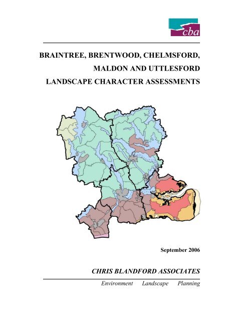
BRAINTREE, BRENTWOOD, CHELMSFORD,MALDON AND UTTLESFORDLANDSCAPE CHARACTER ASSESSMENTSSeptember 2006CHRIS BLANDFORD ASSOCIATESEnvironment <strong>Landscape</strong> Planning
CONTENTSPrefaceExecutive Summary1.0 INTRODUCTION1.1 Background and Study Area1.2 Study Aims and Objectives1.3 The Importance of <strong>Landscape</strong> <strong>Character</strong>1.4 Planning Policy Framework1.5 Approach and Methodology1.6 Structure of the Report2.0 OVERVIEW OF THE STUDY AREA2.1 General2.2 Physical Influences on the Shaping of the <strong>Landscape</strong>2.3 Historical Influences on the <strong>Landscape</strong>2.4 Key Forces for Change in the <strong>Landscape</strong>2.5 <strong>Landscape</strong> <strong>Character</strong> in The Study Area – An Overview3.0 LANDSCAPE CHARACTER OF BRAINTREE DISTRICT3.1 General3.2 River Valley <strong>Landscape</strong>s3.3 Farmland Plateau <strong>Landscape</strong>s3.4 Wooded Farmland <strong>Landscape</strong>s4.0 LANDSCAPE CHARACTER OF BRENTWOOD BOROUGH4.1 General4.2 River Valley <strong>Landscape</strong>s4.3 Wooded Farmland <strong>Landscape</strong>s4.4 Fenland <strong>Landscape</strong>s5.0 LANDSCAPE CHARACTER OF CHELMSFORD BOROUGH5.1 General5.2 River Valley <strong>Landscape</strong>s5.3 Farmland Plateau <strong>Landscape</strong>s5.4 Drained Estuarine Marsh <strong>Landscape</strong>s5.5 Wooded Farmland <strong>Landscape</strong>s6.0 LANDSCAPE CHARACTER OF MALDON DISTRICT6.1 General6.2 River Valley <strong>Landscape</strong>s6.3 Farmland Plateau <strong>Landscape</strong>s6.4 Estuarine Marsh/Mudflat <strong>Landscape</strong>s6.5 Drained Estuarine Marsh <strong>Landscape</strong>s6.6 Coastal Farmland <strong>Landscape</strong>s6.7 Wooded Farmland <strong>Landscape</strong>s7.0 LANDSCAPE CHARACTER OF UTTLESFORD DISTRICT7.1 General7.2 River Valley <strong>Landscape</strong>s7.3 Farmland Plateau <strong>Landscape</strong>s7.4 Chalk Upland <strong>Landscape</strong>s11100101R Final LCAs_09-06Contents
8.0 RECOMMENDATIONS8.1 General8.2 Key Applications of the <strong>Landscape</strong> <strong>Character</strong> <strong>Assessment</strong>s8.3 Incorporating <strong>Landscape</strong> <strong>Character</strong> into Local Development Frameworks8.4 Monitoring <strong>Landscape</strong> Change8.5 Enhancing the <strong>Character</strong> Evidence BaseAPPENDICESA. Stakeholder ConsultationB. GlossaryC. Sources of Further InformationD. Historic <strong>Landscape</strong> <strong>Character</strong> Areas MethodologyE. Current Local Planning SituationF. Draft Core Strategy <strong>Landscape</strong> <strong>Character</strong> PolicyFIGURES1.1 The Study Area2.1 Surface Geology2.2 Landform and Drainage2.3 Nature Conservation Designations2.4 Historic <strong>Landscape</strong> <strong>Character</strong> Types and Areas2.5 National Joint <strong>Character</strong> Areas2.6 National <strong>Landscape</strong> Typology2.7 County <strong>Landscape</strong> <strong>Character</strong> Types and Areas2.8 District/<strong>Borough</strong> <strong>Landscape</strong> <strong>Character</strong> Types and Areas in The Study Area3.1 Braintree District <strong>Landscape</strong> <strong>Character</strong> Types and Areas4.1 Brentwood <strong>Borough</strong> <strong>Landscape</strong> <strong>Character</strong> Types and Areas5.1 <strong>Chelmsford</strong> <strong>Borough</strong> <strong>Landscape</strong> <strong>Character</strong> Types and Areas6.1 Maldon District <strong>Landscape</strong> <strong>Character</strong> Types and Areas7.1 Uttlesford District <strong>Landscape</strong> <strong>Character</strong> Types and AreasBox 1 <strong>Landscape</strong> <strong>Character</strong> <strong>Assessment</strong> ProcessBox 2 <strong>Landscape</strong> Sensitivity Evaluation CriteriaContents11100101R Final LCAs_09-06
PREFACEThis Technical Study was commissioned jointly by Braintree District <strong>Council</strong>, Brentwood <strong>Borough</strong><strong>Council</strong>, <strong>Chelmsford</strong> <strong>Borough</strong> <strong>Council</strong>, Maldon District <strong>Council</strong> and Uttlesford District <strong>Council</strong>.The Study provides a baseline inventory of the landscape character of the five authority areas. It alsosets out recommendations for the application of the Study for consideration and action as appropriateby the local authorities. The need to protect and enhance landscape character is recognised byGovernment planning policy on the delivery of sustainable development through the planning system.To ensure that full account is given to landscape character in planning decisions, this Study iscommended to the local authorities for use as an evidence base for informing the preparation of LocalDevelopment Frameworks and in development control.The preparation of the Study was steered by officers from the five local authorities. We are gratefulfor the advice and guidance provided by the Steering Group, namely:Melvyne Crow– Braintree District <strong>Council</strong>Melanie Jones and Sarah Nicholas – Uttlesford District <strong>Council</strong>Paul McBride and Derek Stebbing – <strong>Chelmsford</strong> <strong>Borough</strong> <strong>Council</strong>Geoff Boyton – Brentwood <strong>Borough</strong> <strong>Council</strong>Chris Bailey and Zyuoya Ling – Maldon District <strong>Council</strong>In addition, we appreciate the help of other <strong>Council</strong> officers and individuals from other organisationswho willingly assisted in the provision of data and information for the Study. We would also like toacknowledge the representatives of organisations who attended the three stakeholder consultationworkshops held during the course of the Study (see Appendix A for details). The information gainedfrom these stakeholders provided an important input to the Study.The Consultant Team comprised:Dominic WatkinsEmma ClarkeMarian CameronAlison MacDonaldDarina WilliamsChris Blandford AssociatesSeptember 200611100101R Final LCAs_09-06 i Preface
EXECUTIVE SUMMARYBackgroundIn October 2005 Braintree District <strong>Council</strong>, Brentwood <strong>Borough</strong> <strong>Council</strong>, <strong>Chelmsford</strong> <strong>Borough</strong><strong>Council</strong>, Maldon District <strong>Council</strong> and Uttlesford District <strong>Council</strong> jointly commissioned ChrisBlandford Associates (CBA) to undertake <strong>Landscape</strong> <strong>Character</strong> <strong>Assessment</strong>s of their respective areas.The aim of the Study is to provide a comprehensive <strong>Borough</strong>/District-wide assessment of landscapecharacter within the Study Area to inform land use planning and land management decisions. The<strong>Landscape</strong> <strong>Character</strong> <strong>Assessment</strong> will be specifically used as a technical evidence base to inform theLocal Development Frameworks currently being prepared by the respective local planning authorities.The overall aim of landscape planning, design and management should be to achieve ‘sustainablelandscapes’ that are as visually, biodiverse and culturally rich as possible to meet all of society’s social,economic and environmental needs. A better understanding of landscapes provided by <strong>Landscape</strong><strong>Character</strong> <strong>Assessment</strong>s – their diversity, character and distinctiveness, evolution, sensitivity to changeand their management needs – is essential to help to work towards this goal.MethodologyThe overall approach to the study is based on <strong>Landscape</strong> <strong>Character</strong> <strong>Assessment</strong> – Guidance forEngland and Scotland (Countryside Agency/Scottish Natural Heritage, 2002), the latest publishedguidance, and takes into account current best practice. <strong>Landscape</strong> <strong>Character</strong> <strong>Assessment</strong> addressesboth the relatively objective process of landscape characterisation, which involves identifying,mapping, classifying and describing ‘landscape character’, and the more subjective process ofevaluating landscape character to inform planning and land management decisions. In summary, themain stages involved in the study process were:Desk Study ResearchField Survey<strong>Character</strong>isationEvaluationPreparation of the Study ReportConsultation with key stakeholder organisations at three main stages of the above process was animportant and integral element of the Study. The purpose of the stakeholder consultation was tostrengthen the evidence base by gathering opinions about landscape character from the keystakeholders, and to promote the value of the Study as a tool for informing planning and landmanagement decisions in rural areas. As a technical study, local community and special interestgroups were not consulted on the Study at this preparatory stage. However, it is anticipated thatcommunity involvement in the future application of the <strong>Landscape</strong> <strong>Character</strong> <strong>Assessment</strong> will beencouraged through development of character-based design guidance at the local level (e.g. VillageDesign Statements, Town Design Statements, Parish Plans etc.).Content of the ReportSection 1.0 sets out the context for the Study. It explains the background to the Study, its aims andobjectives, and highlights the importance of landscape character. It also describes the planning policyframework for the Study, and outlines the approach and process behind the assessment methodology.Executive Summary ii 11100101R Final LCAs_09-06
Section 2.0 provides an overview of the Study Area. It describes the physical and historical influenceson the landscape, and identifies the key forces for change affecting landscape character today. Thissection also provides an overview of landscape character across the Study Area as a whole in itsnational and county context.Eight separate <strong>Landscape</strong> <strong>Character</strong> Types were defined at 1:25,000 scale within the Study Area.<strong>Landscape</strong> <strong>Character</strong> Types are generic and have broadly similar patterns of geology, landform, soils,vegetation, land use, settlement and field systems. The eight <strong>Landscape</strong> <strong>Character</strong> Types have beenbroken down into seventy <strong>Landscape</strong> <strong>Character</strong> Areas that reflect distinctive variations in localcharacter based on visual analysis of how different combinations of physical features and perceptualqualities such as scale, pattern, tranquillity, cultural associations, etc. create areas of distinctivelandscape character.Sections 3.0 to 7.0 of the report provide the detailed ‘profiles’ of the <strong>Landscape</strong> <strong>Character</strong> Areasidentified within Braintree, Brentwood, <strong>Chelmsford</strong>, Maldon and Uttlesford respectively. The profilesare structured as follows:Key characteristicsOverall character descriptionVisual characteristicsHistoric land useEcological featuresKey planning and land management issuesSensitivities to changeProposed landscape strategy objectivesSuggested landscape planning guidelinesSuggested land management guidelinesThe evaluation of indicative landscape sensitivity for each <strong>Landscape</strong> <strong>Character</strong> Area took into accountthe area’s intrinsic landscape qualities, biodiversity value, visual characteristics (intervisibility andvisual prominence), historic integrity and its re-creatabililty. The sensitivity analysis, together with theproposed strategy objectives and suggested guidelines for each <strong>Landscape</strong> <strong>Character</strong> Area, can be usedto inform:the identification of spatial development options within the District/<strong>Borough</strong> Local DevelopmentFrameworks.Sustainability Appraisal/Strategic Environmental <strong>Assessment</strong> of Local Development Frameworksite allocations.the highlighting of landscape issues that may need to be considered in greater detail in relation todevelopment control decisions for major schemes.the application of criteria-based landscape protection and enhancement policies within LocalDevelopment Frameworks.Section 8.0 sets out the consultant’s recommendations to the commissioning authorities for theirconsideration and action as appropriate. Recommendations are provided for the application of the<strong>Landscape</strong> <strong>Character</strong> <strong>Assessment</strong> including its use in relation to informing Local DevelopmentFramework policies for protecting and enhancing landscape character, and in providing a baseline andframework for monitoring landscape change. Recommendations for further work required to enhancethe evidence base on the landscape and settlement character of the Study Area are also included.11100101R Final LCAs_09-06 iii Preface
Executive Summary iv 11100101R Final LCAs_09-06
1.0 INTRODUCTION
11.0 INTRODUCTION1.1 Background and Study Area1.1.1 In October 2005 Braintree District <strong>Council</strong>, Brentwood <strong>Borough</strong> <strong>Council</strong>, <strong>Chelmsford</strong><strong>Borough</strong> <strong>Council</strong>, Maldon District <strong>Council</strong> and Uttlesford District <strong>Council</strong> jointlycommissioned Chris Blandford Associates (CBA) to undertake <strong>Landscape</strong> <strong>Character</strong><strong>Assessment</strong>s of their respective areas.1.1.2 The Study Area is shown on Figure 1.1. Situated in the County of Essex, the Study Areacomprises the following administrative areas: Braintree District Brentwood <strong>Borough</strong> <strong>Chelmsford</strong> <strong>Borough</strong> Maldon District Uttlesford District1.1.3 The areas characterised by this Study include all the rural area up to and including the urbanedge and, where they exist, river valleys and other green corridors extending into urban areas.1.1.4 The Study Area borders Babergh District and St Edmundsbury District in Suffolk, and SouthCambridgeshire District in Cambridgeshire to the north; the Districts of North and EastHertfordshire and Epping Forest District in Essex to the west; the <strong>Borough</strong> of Havering inGreater London, and Thurrock and the Districts of Basildon and Rochford in Essex whichform the southern border of the Study Area. The eastern border of the Study Area is providedby the North Sea and by Colchester <strong>Borough</strong> in Essex.1.2 Study Aims and Objectives1.2.1 The aim of the Study is to provide a comprehensive <strong>Borough</strong>/District-wide assessment oflandscape character within the Study Area to inform land use planning and land managementdecisions.1.2.2 The <strong>Landscape</strong> <strong>Character</strong> <strong>Assessment</strong> will be specifically used to inform the LocalDevelopment Frameworks currently being prepared by the respective local planningauthorities.1.2.3 The key objectives of the Study are to: Provide a baseline inventory and description of landscape character by Type and Area at ascale of 1:25,000. Identify key issues, sensitivities to change and management strategy objectives/guidelinesfor each <strong>Character</strong> Area. Ensure that <strong>Landscape</strong> <strong>Character</strong> Areas and Types join up seamlessly acrossadministrative boundaries, including with existing character assessment studies carried outby neighbouring authorities outside of the Study Area. To liaise with and understand the issues and concerns of the key stakeholder organisationsin relation to the landscape characterisation process.11100101R Final LCAs_09-06Section 1.0 - Introduction
21.3 The Importance of <strong>Landscape</strong> <strong>Character</strong>1.3.1 The UK Government signed the European <strong>Landscape</strong> Convention 1 on the24 February 2006. The Convention aims to encourage public authorities within memberstates to adopt policies and measures for the protection, management and planning of alllandscapes, both outstanding and ordinary, that determine the quality of people’s livingenvironment. The Convention specially encourages local authorities to introduce exemplaryand long lasting polices or measures to protect, manage and plan landscapes.1.3.2 The European <strong>Landscape</strong> Convention defines landscape as:‘an area, as perceived by people, whose character is the result of the action and interactionof natural and/or human factors.’1.3.3 The term landscape is typically synonymous with the countryside; however, landscape iseverywhere and may comprise rural landscapes, urban landscapes or townscapes, urbanfringe landscapes, coastal landscapes or seascapes, etc.1.3.4 The European <strong>Landscape</strong> Convention defines ‘landscape character’ as:‘a distinct and recognisable pattern of elements that occur consistently in a particular type oflandscape.’1.3.5 In England and Scotland, <strong>Landscape</strong> <strong>Character</strong> <strong>Assessment</strong> 2 is a tool that allows landscapecharacter to be understood, explained and described in a transparent and robust way. It doesthis by mapping and describing the variations in physical, natural and cultural attributes andexperiential characteristics that make one area distinctive from another at a range of spatialscales. <strong>Landscape</strong> <strong>Character</strong> <strong>Assessment</strong> also recognises how landscapes have changed overtime, and acknowledges the changing influences of human activities and the impacts ofeconomic development.1.3.6 The overall aim of landscape planning, design and management should be to achievesustainable landscapes that are as visually, biodiverse and culturally rich as possible to meetall of society’s social, economic and environmental needs. A better understanding oflandscapes provided by <strong>Landscape</strong> <strong>Character</strong> <strong>Assessment</strong>s – their diversity, character anddistinctiveness, evolution, sensitivity to change and their management needs – is essential tohelp to work towards this goal.1.4 Planning Policy Framework1.4.1 National Planning Policy relating to landscape character is contained in PPS1 3 and PPS7 4 .Planning Policy Statement 1 : Delivering Sustainable Development1.4.2 PPS1 sets out the Government’s overarching planning policies on the delivery of sustainabledevelopment through the planning system. It states that one of the Government’s objectivesfor the planning system is that planning should facilitate and promote sustainable urban andrural development by protecting and enhancing the natural and historic environment and thequality and character of the countryside (para 5). In its key principles, PPS1 states that ‘a1 The European <strong>Landscape</strong> Convention opened for signature in Florence on 20 October 2000. Jim Knight, Minister for RuralAffairs, <strong>Landscape</strong> and Biodiversity announced the UK signing of the European <strong>Landscape</strong> Convention on 24 February 2006.2 <strong>Landscape</strong> <strong>Character</strong> <strong>Assessment</strong>: Guidance for England and Scotland (Countryside Agency and Scottish Natural Heritage,2002).3 Planning Policy Statement 1 : Delivering Sustainable Development (ODPM, 2005).4 Planning Policy Statement 7 : Sustainable Development in Rural Areas (ODPM, 2004).Section 1.0 – Introduction11100101R Final LCAs_09-06
3spatial planning approach should be at the heart of planning for sustainable development’(para 13.iii) and ‘design which fails to take the opportunities for improving the character andquality of an area should not be accepted’ (para 13.iv). When preparing development plans‘planning authorities should seek to enhance as well as protect biodiversity, natural habitats,the historic environment and landscape and townscape character’ (para 27). PPS1 alsorequires new design to be integrated into the existing urban form and natural and builtenvironments (para 35).Planning Policy Statement 7 : Sustainable Development in Rural Areas1.4.3 <strong>Landscape</strong> <strong>Character</strong> <strong>Assessment</strong>, along with Village or Town Design Statements and Villageor Parish Plans, is recommended by PPS7 as a tool to assist Local Authorities in thepreparation of policies and guidance that encourages good quality design throughout ruralareas (para 13). <strong>Landscape</strong> <strong>Character</strong> <strong>Assessment</strong> is also recommended by PPS7 as a tool forcreating carefully drafted, criteria-based policies in Local Development Documents to protectvalued landscapes outside nationally designated areas without the need for rigid localdesignations, which may restrict sustainable development and the economic vitality of ruralareas. PPS7 advises that local landscape designations should only be maintained or,exceptionally, extended where it can be clearly shown that criteria-based policies cannotprovide the necessary protection (paras 24 and 25).The East of England Regional Spatial Strategy1.4.4 The East of England Plan : Draft Revision to the Regional Spatial Strategy (RSS) for the Eastof England was published by the East of England Regional Assembly for consultation inDecember 2004. An Examination in Public (EIP) into the draft RSS was held betweenNovember 2005 and March 2006. The EIP Panel Report was published in June 2006, whichincluded recommended changes to the draft RSS.1.4.5 The Draft RSS is based on the principles of sustainable development and specificallyidentifies landscape character as a key consideration in the spatial development of the region.Taking into account the recommended changes of the EIP Panel, draft Policy ENV2<strong>Landscape</strong> Conservation states:‘Planning authorities and other agencies in their plans, policies and programmes anddecision-making will, in accordance with statutory requirements, afford the highest status ofprotection to the East of England’s nationally designated landscapes – the Norfolk andSuffolk Broads (having status equal to a National Park) and the Chilterns, Norfolk Coast,Dedham Vale and Suffolk Coast and Heaths Areas of Outstanding Natural Beauty (AONB)s.Within the Broads priority will be given to the statutory purposes of conserving andenhancing the natural beauty, promoting public enjoyment and protecting the interests ofnavigation. Within the AONBs priority over other considerations will be given toconservation of the natural beauty, wildlife and cultural heritage.Throughout the East of England planning authorities and other agencies in their plans,policies, programmes and decision-making will aim to recognise, protect and enhance thediversity and local distinctiveness of the countryside character areas indicated on Map 9.1by:- developing area-wide strategies, based on landscape character assessments, settinglong-term goals for landscape change, targeting planning and land management toolsand resources to influence that change, and giving priority to those areas subject tomost growth and change;11100101R Final LCAs_09-06Section 1.0 - Introduction
4- developing criteria-based policies, informed by the area-wide strategies and landscapecharacter assessments, to ensure that all development, wherever possible respects andenhances local landscape character; and- providing/requiring appropriate mitigation measures where avoidance of damage tolocal landscape character is unavoidable.’The Essex Structure Plan1.4.6 The Essex and Southend on Sea Replacement Structure Plan was adopted in April 2001.Under the Planning and Compulsory Purchase Act 2004, the Structure Plan will remain theoperative development plan for Essex from 2004-2007. The Structure Plan and its policiesare therefore saved for three years, unless the East of England Regional Spatial Strategy isadopted sooner. Once the East of England Plan is adopted, the Structure Plan policies will berepealed and will have no effect.1.4.7 The need to protect landscape character has been recognised by Essex County <strong>Council</strong>, andpolicies to protect the distinctive character of the towns, villages, countryside and coast of theCounty is set out in the Structure Plan. The Structure Plan specifically encourages Districtand <strong>Borough</strong> <strong>Council</strong>s in Essex to prepare <strong>Landscape</strong> <strong>Character</strong> <strong>Assessment</strong>s to inform landuse planning and land management in their areas.Local Planning Context1.4.8 The five local planning authorities within the Study Area have prepared and adopted LocalPlans for the whole of their areas to guide development and to protect and enhance theenvironment. These will eventually be replaced by Local Development Frameworks (LDFs)under the arrangements set out in the Planning and Compulsory Purchase Act 2004. LDFscomprise a series of Local Development Documents (LDDs) that will set out proposals forthe future development use and conservation of land and buildings.1.4.9 The new LDFs will normally comprise the following main LDDs of relevance to landscapeplanning objectives:Statement of Community Involvement – sets out how the community will be consultedduring the production of LLDs and in development control.Core Strategy – establishes the overarching vision for development in local authority areasand sets out the key planning objectives as a basis for policies. It contains a spatialstrategy, strategic policies and proposals for promoting and controlling development inaccordance with the principles of sustainable development, and includes a monitoring andimplementation framework.Development Control Policies – comprise a suite of policies to be used in developmentcontrol to ensure that all development meets the vision and strategy set out in the CoreStrategy.Site Specific Allocations – this identifies site-specific land allocations for different types ofdevelopment, and land to which specific policies apply.Area Action Plans – are developed, where necessary, for particular sites or areas identifiedfor significant change or conservation. They focus on implementation, setting out themeasures needed to deliver development or conservation initiatives.Section 1.0 – Introduction11100101R Final LCAs_09-06
5Proposals Map - expresses geographically the adopted development plan policies,including locations and sites for particular land use and development proposals, and areasof protection.Supplementary Planning Documents – provide detailed guidance to elaborate upon thecore policies and proposals, e.g. design guides, site development briefs or topic basedguidance. SPDs are capable of being updated regularly making them more able torespond to changing circumstances. They do not have Development Plan Documentstatus, but are a material consideration in the determination of planning applications.1.4.10 The Core Strategy, Development Control Policies, Site Specific Allocations, Proposals Mapand any Area Action Plans, together with the RSS, comprise the statutory Development PlanDocuments against which all planning decisions will normally need to be made. It isintended that this <strong>Landscape</strong> <strong>Character</strong> <strong>Assessment</strong> will be used as part of the evidence baseof technical studies to inform the preparation of the LDFs within the Study Area.1.4.11 The current local planning situation in each of the respective authority areas is set out inAppendix E.1.5 Approach and Methodology1.5.1 The overall approach for undertaking the <strong>Landscape</strong> <strong>Character</strong> <strong>Assessment</strong> is based on thelatest guidance published by the Countryside Agency 5 , taking into account current bestpractice. <strong>Landscape</strong> <strong>Character</strong> <strong>Assessment</strong> addresses both the relatively objective process oflandscape characterisation, which involves identifying, mapping, classifying and describing‘landscape character’, and the more subjective process of evaluating landscape character toinform planning and land management decisions.1.5.2 The study process is illustrated in Box 1, and described below.Box 1 – <strong>Landscape</strong> <strong>Character</strong> <strong>Assessment</strong> ProcessKEY STAKEHOLDERCONSULTATIONNovember 2005KEY STAKEHOLDERCONSULTATION March2006DESK STUDY RESEARCHFIELD SURVEYCHARACTERISATIONEVALUATIONKEY STAKEHOLDERCONSULTATIONJune 2006DRAFT STUDY REPORTFINAL STUDY REPORT5 <strong>Landscape</strong> <strong>Character</strong> <strong>Assessment</strong> – Guidance for England and Scotland (Countryside Agency/Scottish Natural Heritage,2002).11100101R Final LCAs_09-06Section 1.0 - Introduction
6Desk Study Research1.5.3 This stage involved desk-based research to identify physical and historical factors that haveinfluenced the shape and use of the landscape. This work drew on a variety of documentsand maps that describe the physical geography and cultural history of the Study Area (seeAppendix C for details). The desk research also identified the forces for change affecting thecharacter of the landscape within the Study Area.1.5.4 In summary, the desk work involved: A review of existing national and local character assessments relating to the Study Area,including the Countryside Agency’s <strong>Character</strong> of England Map/Countryside <strong>Character</strong>descriptions and National <strong>Landscape</strong> Typology; Essex <strong>Landscape</strong> <strong>Character</strong> <strong>Assessment</strong>;and existing assessments for neighbouring areas in Essex, Suffolk, Cambridgeshire,Hertfordshire and Thurrock. Production and analysis of map overlays of surface geology, landform and drainage, andnature conservation designations. Analysis of air photos. Identification of draft <strong>Landscape</strong> <strong>Character</strong> Types and draft <strong>Landscape</strong> <strong>Character</strong> Areas.1.5.5 In recognition of the important contribution that historic patterns and features make to thecharacter of the current landscape in this part of Essex, information from the Essex Historic<strong>Landscape</strong> <strong>Character</strong>isation (HLC) Study dataset was incorporated into the <strong>Landscape</strong><strong>Character</strong> <strong>Assessment</strong> using a methodology developed and agreed with Essex County<strong>Council</strong> Historic Environment Unit and English Heritage (see Appendix D for details).‘Historic <strong>Landscape</strong> <strong>Character</strong> Areas’ were derived from amalgamation of the HLC typology,and used to (i) inform the definition of the <strong>Landscape</strong> <strong>Character</strong> Areas defined in this report,and (ii) to identify the key historic land use features in the present-day landscape (see the<strong>Landscape</strong> <strong>Character</strong> Area profiles in Sections 3.0 to 7.0).Field Survey1.5.6 Field surveys were undertaken between November 2005 and April 2006 to allowconsideration of seasonal variations. The aim of the surveys was to undertake a visualanalysis of how different features and elements combined to create distinctive patterns in thelandscape. The surveys were undertaken from key viewpoints within each draft <strong>Landscape</strong><strong>Character</strong> Area by a team of field assessors. The checklist included: Landform Rivers/drainage Land cover Field pattern and field boundaries Communication routes Settlement form/pattern Building styles Scale Texture Enclosure Stimuli Sense of tranquillity MovementSection 1.0 – Introduction11100101R Final LCAs_09-06
7 View types and composition Landmarks1.5.7 The survey information (including photographs) was used to (i) inform the descriptions oflandscape character and (ii) to test and refine the draft <strong>Landscape</strong> <strong>Character</strong> Area boundaries.<strong>Character</strong>isation1.5.8 The characterisation stage involved the combination of the desk study research and fieldsurvey analysis to identify and map generic <strong>Landscape</strong> <strong>Character</strong> Types and geographicallyunique <strong>Landscape</strong> <strong>Character</strong> Areas at 1:25,000 scale (see Section 2.5 for details).1.5.9 For each generic <strong>Landscape</strong> <strong>Character</strong> Type, its boundaries were mapped and its keycharacteristics described. For each unique <strong>Landscape</strong> <strong>Character</strong> Area, its boundaries weremapped and the following characterisation information was recorded: Key <strong>Character</strong>istics Overall <strong>Character</strong> Description Visual <strong>Character</strong>istics Historic Land Use Ecological FeaturesEvaluation1.5.10 This stage involved making the following judgements about each <strong>Landscape</strong> <strong>Character</strong> Area: Key Planning and Land Management Issues Sensitivities to Change Proposed landscape Strategy Objectives Suggested <strong>Landscape</strong> Planning Guidelines Suggested Land Management GuidelinesEvaluation of <strong>Landscape</strong> Sensitivity1.5.11 The methodology for evaluating the intrinsic sensitivities of each <strong>Landscape</strong> <strong>Character</strong> Areato change is based on the criteria for judging sensitivity set out in an accompanying paper tothe <strong>Landscape</strong> <strong>Character</strong> <strong>Assessment</strong> – Guidance for England and Scotland 6 , taking intoaccount current best practice.1.5.12 It should be noted that the evaluation is based on the relatively broad-brush analysisundertaken at 1:25,000 scale for this Study. The degree of sensitivity is not absolute. It islikely to vary according to the nature of change under consideration, and is therefore onlyindicative. This evaluation should be read in conjunction with the more strategic evaluationof landscape sensitivity set out in the Essex <strong>Landscape</strong> <strong>Character</strong> <strong>Assessment</strong> 7 .1.5.13 The criteria used to evaluate the relative sensitivities of each <strong>Landscape</strong> <strong>Character</strong> Area aredefined in Box 2.6 <strong>Landscape</strong> <strong>Character</strong> <strong>Assessment</strong> – Guidance for England and Scotland : Topic Paper 8 – Techniques and Criteria forJudging Capacity and Sensitivity (Swanwick, 2004).7 Essex County <strong>Council</strong> and Southend-on-Sea <strong>Borough</strong> <strong>Council</strong> (July 2002).11100101R Final LCAs_09-06Section 1.0 - Introduction
8Box 2 - <strong>Landscape</strong> Sensitivity Evaluation CriteriaIntrinsic <strong>Landscape</strong> Qualities The number and contribution of positive visual qualities/characteristics to landscapevalue/sense of place.Biodiversity Value The contribution of positive ecological elements or features to landscape value/sense ofplace.Visual <strong>Character</strong>istics (Intervisibility and Visual Prominence) The degree to which an area is widely visible from, and positively influences the characterof, surrounding areas.Historic Integrity The contribution of positive visible historic elements within the area, taking into accountthe intactness and integrity of historic landscape patterns and the presence of valuedhistoric features within the area.Re-creatabililty The degree to which the intrinsic landscape qualities, biodiversity value and historicintegrity of an area can be re-created if eroded or lost.<strong>Landscape</strong> Strategy Objectives and Guidelines1.5.14 This stage also involved identifying proposed broad strategy objectives and suggestedguidelines for each <strong>Landscape</strong> <strong>Character</strong> Area. Taking into account the condition andsensitivities of the particular <strong>Landscape</strong> <strong>Character</strong> Area, one or more of the followingstrategy objectives was identified:Conserve - seek to protect and enhance positive features that are essential in contributingto local distinctiveness and sense of place through effective planning and positive landmanagement measures.Enhance - seek to improve the integrity of the landscape, and reinforce its character, byintroducing new elements where distinctive features or characteristics are absent. Restore - seek to reinforce and/or reinstate historic landscape patterns and features thatcontribute to sense of place and time depth, by repairing distinctive elements that havebeen lost or degraded.1.5.15 The sensitivity analysis, together with the proposed strategy objectives and suggestedguidelines for each <strong>Landscape</strong> <strong>Character</strong> Area, can be used to inform: the identification of spatial development options within the District/<strong>Borough</strong> LocalDevelopment Frameworks. Sustainability Appraisal/Strategic Environmental <strong>Assessment</strong> of Local DevelopmentFramework site allocations.Section 1.0 – Introduction11100101R Final LCAs_09-06
9 the highlighting of landscape issues that may need to be considered in greater detail inrelation to development control decisions for major schemes. the application of criteria-based landscape protection and enhancement policies withinLocal Development Frameworks.Key Stakeholder Consultation1.5.16 Consultation with key stakeholder organisations was an important and integral element of theStudy. The purpose of the stakeholder consultation was to strengthen the evidence base bygathering opinions about landscape character from the key stakeholders, and to promote thevalue of the Study as a tool for informing planning and land management decisions in ruralareas.1.5.17 The first stage of consultation in November 2005 involved a workshop to explorestakeholder’s views on what gives different places within each of the authority areas theirlocal identity and distinctive character (see Appendix A for further details). This informationwas fed into the desk study research and field survey stages of the Study to refine andvalidate the preliminary draft mapping of <strong>Landscape</strong> <strong>Character</strong> Types and Areas by theConsultant Team.1.5.18 The second stage of consultation in March 2006 involved a further workshop to: explorestakeholder’s views on the refined <strong>Landscape</strong> <strong>Character</strong> Types and Areas identified followingfield survey work; identify key threats to valued landscape characteristics/areas; and identifyopportunities to enhance landscape character and sense of place (see Appendix A for furtherdetails). This information was fed into the characterisation and evaluation stages of the Studyto inform: (i) the descriptions of landscape character; (ii) judgements about the sensitivities ofdifferent <strong>Landscape</strong> <strong>Character</strong> Areas to change; and (iii) the development of strategyobjectives and guidelines for guiding change within different areas.1.5.19 The findings of the Draft Report were presented to and discussed with the key stakeholders ata third workshop held in early June 2006, and their comments incorporated into the finalversion.1.5.20 As a technical study, local community and special interest groups were not consulted on theStudy at this preparatory stage. However, it is anticipated (see Section 8.0) that communityinvolvement in the future application of the <strong>Landscape</strong> <strong>Character</strong> <strong>Assessment</strong> will beencouraged through development of character-based design guidance at the local level (e.g.Village Design Statements, Town Design Statements, Parish Plans etc.).1.6 Structure of the Report1.6.1 The study report is structured as follows.1.6.2 Section 1.0 sets out the context for the Study. It explains the background to the Study, itsaims and objectives, and highlights the importance of landscape character. It also describesthe planning policy framework for the Study, and outlines the approach and process behindthe assessment methodology.1.6.3 Section 2.0 provides an overview of the Study Area. It describes the physical and historicalinfluences on the landscape, and identifies the key forces for change affecting landscapecharacter today. This section also provides an overview of landscape character across theStudy Area as a whole in its national and county context. The descriptions of individual<strong>Landscape</strong> <strong>Character</strong> Areas in Sections 3.0 to 7.0 (see below), should be read in conjunctionwith this information to ensure that the contextual relationship with the wider landscape isunderstood.11100101R Final LCAs_09-06Section 1.0 - Introduction
101.6.4 Sections 3.0 to 7.0 of the report provide the detailed ‘profiles’ of <strong>Landscape</strong> <strong>Character</strong> Areaswithin Braintree, Brentwood, <strong>Chelmsford</strong>, Maldon and Uttlesford respectively. The profilesare structured as follows: Location of character area (map) Boundaries of character area (map) Photograph Key characteristics Overall character description Visual characteristics Historic land use Ecological features Key planning and land management issues Sensitivities to change Proposed landscape strategy objectives Suggested landscape planning guidelines Suggested land management guidelinesWhere <strong>Landscape</strong> <strong>Character</strong> Areas fall within two or more adjacent District/<strong>Borough</strong> areasincluded within this Study report, the same profile has been included within the respectivesection. For example, the profile for <strong>Landscape</strong> <strong>Character</strong> Area B16 – Felsted FarmlandPlateau is ‘shared’ by Braintree District (Section 3.0), <strong>Chelmsford</strong> <strong>Borough</strong> (Section 5.0) andUttlesford District (Section 7.0). In such instances, a cross-reference is noted in therespective <strong>Character</strong> Area profile(s). References to other studies in neighbouring authorityareas is facilitated by signposts to relevant documents as appropriate within each Section.1.6.5 Section 8.0 sets out the consultant’s recommendations to the commissioning authorities fortheir consideration and action as appropriate. Recommendations are provided for theapplication of the <strong>Landscape</strong> <strong>Character</strong> <strong>Assessment</strong> including its use in relation to informingLocal Development Framework policies for protecting and enhancing landscape character,and in providing a baseline and framework for monitoring landscape change.Recommendations for further work required to enhance the evidence base on the landscapeand settlement character of the Study Area are also included.Section 1.0 – Introduction11100101R Final LCAs_09-06
2.0 OVERVIEW OF THE STUDY AREA
112.0 OVERVIEW OF THE STUDY AREA2.1 General2.1.1 This section provides an overview of the Study Area. It describes the physical and historicalinfluences on the landscape, and identifies the key forces for change affecting landscapecharacter today. This section also provides an overview of landscape character across theStudy Area as a whole in its national and county context.2.2 Physical Influences on the Shaping of the <strong>Landscape</strong>2.2.1 The landscape within the Study Area has evolved as a result of an interaction of the physicalstructure of the landscape and the vegetation and land uses that cover it. To understand whatmakes a place distinctive, it is useful to identify the key physical influences that have shapedthe landscape over time.2.2.2 The basic structure of the landscape is fundamentally influenced by its underlying rocks andrelief. Geology and the processes of weathering, erosion and deposition influence the shapeand form of the landscape and its drainage and soils. In turn, these influence patterns ofvegetation and land use.Geology, Landform and Drainage2.2.3 The oldest rocks were laid down between 440 and 360 million years ago. They mainlyconsist of hard, slaty shales, mudstones and sandstones. Overlying this base are a number ofdifferent geological layers that have formed and undergone erosion through marine, fluvialand glacial processes between 135 million years ago to the present to form the rock structureof the Study Area today.2.2.4 The surface geology of the Study Area (see Figure 2.1) is dominated by the deposition ofglacial tills laid down during the Quaternary Period when the area was subjected to periodicice advances and retreats as the climate cooled and warmed. This led to a complex mix ofglacial, proglacial and periglacial deposits overlying each other, forming a generally flatlandscape near the coast developing into gently undulating hills and valleys in the northwestwith a corresponding mixture of soils and vegetation cover.2.2.5 In the coastal plains of the Study Area, alluvial mud deposits laid down on the floor of asubtropical sea 50 million years ago overlay the London Clay. This forms the extensive areaof low flat land in the southeast near to the coast at an altitude of 0-20m AOD (see Figure2.2).2.2.6 Overlying the alluvial deposits, soils along the coastline are derived largely from intertidalalluvial muds, which give rise to reclaimed coastal marshes with stoneless, clayey, silty andloamy soils. The soils on the saltmarshes are heavy gleys that undergo periodic waterloggingfrom fluctuations in the ground water table. Good arable yields have resulted from underdraining,levelling and liming.2.2.7 Inland from the coastal marshes, the soils on the London Clay are seasonally water-loggedslowly permeable heavy clay soils. There are some lighter soils on foot slopes. Generally thesoils shrink and crack on drying, swelling on rewetting. When wet the soils become verysticky and plastic, they are not easy to cultivate requiring drainage to grow arable crops.Along the river courses alluvial sand and gravels provide well-drained fertile soils onundulating valleys. Surrounding the valleys are low hills and ridges the highest of which isDanbury Hill at 116m AOD.11100101R Final LCAs_09-06Section 2.0 – Overview of the Study Area
122.2.8 On the hills above the London Clay, the capping of the fine sands of the Bagshot Beds by thepebbly clay drifts have led to acidic soils with low natural fertility that are easily cultivated.2.2.9 In the northwest of the Study Area, the geology changes to glacial tills composed of sandsand gravels overlain by the most extensive soils in the area, pelosols. These are heavy acidicsoils often prone to waterlogging in winter months and to shrinking and cracking in summerresulting in a predominance of pasture fields on the low hills and ridges.2.2.10 In the northwest of Uttlesford, the altitude reaches just over 130m AOD to the west ofSaffron Walden. In this area the chalk is exposed at the surface and has given the area itscharacteristic rolling topography and free draining poor alkaline soils that support widespreadcereal farming.2.2.11 The Study Area has a large intricate network of rivers and streams. These are an importantcomponent of the area’s topography, character and identity and are frequently of landscape,nature conservation and heritage value. To the north the valleys become steeper and moredeeply cut.2.2.12 Most of the rivers flow towards either the Thames or the North Sea (see Figure 2.2). Onlythe Cam flows northward. Principal rivers within the Study Area are the Stour, Colne,Blackwater, Chelmer and Crouch. The Colne, Blackwater, Chelmer and tributaries rise in theplateau to the north and flow south where their estuaries are extensive and contribute to thedeeply indented coastline. The Crouch flows east across the undulating lowland to the southof the plateau and when joined by the Roach forms an estuary complex that includes theislands of Wallasea, Potton and Foulness.2.2.13 The coastline is mainly marshland and is characterised by a maze of winding shallow creeks,drowned estuaries, mudflats and broad tracts of tidal salt-marsh with sand and shinglebeaches along the coast edge. The relatively permanent, branching, meandering creeks,dissect the salt marshes.Landcover and Ecological <strong>Character</strong>2.2.14 The rural landscape of the Study Area is predominantly used for arable or improved pasture,particularly on the flat or gently undulating land. The rich soils are intensively cultivated andlarge cereal fields are a major feature of the landscape. The cereal field margins occasionallysupport uncommon plants such as cornflower, broad-leaved cudweed, corn cleavers andshepherd’s needle.2.2.15 There are significant areas of remaining semi-natural habitat that make an importantcontribution to the area’s distinctive character. The presence and distribution of thesehabitats is strongly influenced by geology and landform, and include woodland, grassland,heath, estuary, saltmarsh and mudflat and freshwater and open water habitats. Many siteswhere these habitats occur are designated as Ramsar Sites, candidate Special Areas ofConservation (cSAC), Sites of Special Scientific Interest (SSSI), Sites of Importance forNature Conservation (SINCs) 1 , Special Protection Areas (SPA), National Nature Reserves(NNR) and/or Local Nature Reserves (LNR). The distribution of these areas designated fortheir nature conservation value are shown on Figure 2.3 and described below in relation tokey habitat types.1 SINCs are also referred to as County Wildlife Sties, which will become known as Local Wildlife Sites in duecourse.Section 2.0 – Overview of the Study Area11100101R Final LCAs_09-06
13Woodland2.2.16 There are areas of lowland beech and yew woodland scattered in the west of the Study Areaon the pelosols overlying glacial tills. This type of woodland includes a variety of vegetationtypes reflecting soil and topographical differences. The canopy can include mixtures ofbeech, ash, sycamore, yew and whitebeam. Some of these woods are former pasturewoodland, where grazing as well as wood production was practised.2.2.17 Ancient Woodland, practically all of which have been coppiced since medieval times orearlier, are found throughout the Study Area on the various soil types. Examples of theancient woodland include Bovingdon Hall Woods SSSI (north of Braintree), West Wood,Little Sampford SSSI (northeast of Thaxted), Nunn Wood SSSI (west of Ashdon). Many ofthe areas of ancient woodland are ancient Pedunculate Oak-Hornbeam coppice-withstandardswoodland. They provide valuable habitats for invertebrates, dormouse andbreeding birds.Grassland2.2.18 There are a number of broad types of grassland determined by the plant species which arelargely influenced by the soil type and underlying geology. However within the Study Area alot of the grassland has been drained and agriculturally improved for pasture, but somegrasslands of conservation importance remain. For example there are two small areas ofcalcareous grassland on the chalk hills at Debden Water SSSI near Newport in the northwestof the Study Area and a further small area of calcareous grassland as well as unimprovedneutral grassland at Ashdon Meadows SSSI near Saffron Walden.2.2.19 Wet grasslands are also common in the Study Area. Of particular importance are thefloodplain marshes of the Thames and Cam, where areas of permanent grassland aredeliberately flooded to prevent rivers over-topping.Heath2.2.20 The largest remaining fragments of heath within the Study Area are located around Danburyeast of <strong>Chelmsford</strong> on the brown calcareous earths. Danbury Common SSSI is one of thelargest areas of heathland remaining in Essex and shows various stages in the successionfrom open heath, through bracken and gorse scrub, to birch and oak woodland. The upperparts of the site are located on the glacial gravels capping Danbury Ridge. Lower down,spring lines and flushes at the junction between the gravels and the underlying clay give riseto boggy areas of heath and moist woodlands. Unimproved meadows adjacent to theCommon support a rich grassland flora including a number of uncommon species. There arealso other smaller fragments found in the south and in the northeast corner.Estuary, Saltmarsh and Mudflat2.2.21 The Essex Coast is among the top five coastal wetlands in the UK. Grazing marshesdominate the southeast corner of the Study Area along the coast of the Greater ThamesEstuary such as at Sandbeach Meadows SSSI located on the intertidal alluvial muds. Theestuaries, floodplain and coastal marshes are important for the invertebrate fauna of both thewet grasslands and their associated ditches, and support internationally important populationsof wintering waterfowl. These areas along the coast of the Study Area are of internationalsignificance and designated as candidate Special Areas of Conservation (cSACs), SpecialProtection Areas (SPAs), or Ramsar sites as well as Sites of Special Scientific Interest(SSSIs) and National Nature Reserves (NNRs).11100101R Final LCAs_09-06Section 2.0 – Overview of the Study Area
142.2.22 The Essex Estuaries cSAC is a large estuarine site forming the eastern coastal boundary ofthe Study Area. It is a typical, undeveloped, flat low lying coastal plain estuarine systemwith associated open coast mudflats and sandbanks. The site comprises the major estuariesof the Blackwater, Crouch and Roach rivers and is important as an extensive area ofcontiguous estuarine habitat. Essex Estuaries also contains a very wide range ofcharacteristic marine and estuarine sediment communities and some diverse and unusualmarine communities in the lower reaches.2.2.23 Blackwater Estuary is the largest estuary in Essex north of the Thames and one of the largestestuarine complexes in East Anglia. Fringed by saltmarsh, its mudflats, on the upper shores,support internationally and nationally important numbers of over wintering waterfowl. Theseawall, ancient grazing marsh, associated fleet and ditch systems and semi-improvedgrassland are all of high conservation interest.2.2.24 Dengie SPA is located on the coast. It is a large remote area of tidal mud-flats andsaltmarshes at the eastern end of the Dengie Peninsula, between the adjacent Blackwater andCrouch Estuaries. The saltmarsh is the largest continuous example of its type in Essex.Foreshore, saltmarsh and beaches support an outstanding assemblage of rare coastal flora.2.2.25 The Crouch and Roach Estuaries SPA are located on the southeast coast of the Study Area.The River Crouch occupies a shallow valley between two ridges of London Clay, whilst theRiver Roach is set predominantly between areas of brick earth and loams with patches ofsand and gravel. The intertidal zone along the Rivers Crouch and Roach is 'squeezed'between the sea walls along both banks and the river channel. Unlike more extensiveestuaries elsewhere in Essex, there is only a relatively narrow strip of tidal mud which,nonetheless, is used by significant numbers of birds.Fresh Water and Open Water Habitats2.2.26 A complex of rivers and streams flow across the Study Area, many of which have beenmodified for flood alleviation or drainage. The rivers support a varied aquatic and emergentflora and scarce plants such as along the River Ter SSSI, west of Terling. Chalk rivers in thenorthwest of the Study Area are particularly rich in species.2.2.27 A number of animal species occur in the rivers, including the freshwater pea mussel, thewhite clawed crayfish, otters and water voles. The river corridors also provide rich foraginghabitats for many of the ten species of bat recorded in East of England.2.2.28 There are flooded gravel pits, clay pits and reservoirs in the Study Area, forming significantlandscape features. The artificial water bodies have a wide range of water and substratetypes, with a corresponding variety of aquatic plants. One example is Glemsford Pits SSSIcomprising a series of water-filled disused gravel workings and a length of the River Stour onthe Essex/Suffolk border.2.2.29 Hanningfield Reservoir SSSI, approximately 5 miles south of <strong>Chelmsford</strong>, is the secondlargest reservoir in Essex. Its main scientific interest lies in its breeding and winteringwildfowl.2.2.30 Most natural bodies of open water in the Study Area are eutrophic (rich in nutrients) ormesotrophic/eutrophic (medium – rich in nutrients). Small ponds and lakes are alsoabundant.Section 2.0 – Overview of the Study Area11100101R Final LCAs_09-06
152.3 Historical Influences on the <strong>Landscape</strong>Settlement of the <strong>Landscape</strong>2.3.1 The landscape of the Study Area has long been subject to episodes of settlement,abandonment and reuse, evolving into the present day rich tapestry.2.3.2 People have transformed the landscape of this area from their first appearance in thePalaeolithic (500,000 – 10,000BC). The wildwood forests that covered the Study Area wereslowly cleared as people began to inhabit and use the area. Favoured areas for the earlyhunter-gatherers of the Palaeolithic and the Mesolithic (c.10, 000 to c.4, 000 BC) were therich and fertile river valleys. A few flint artefacts, dating from the Palaeolithic have beenfound in the gravels of the river valleys. However, from at least the Mesolithic (c.8000 BC),the diverse landscapes within the boundaries of the modern <strong>Borough</strong>s and Districts ofBrentwood, Braintree, <strong>Chelmsford</strong>, Malton and Uttlesford has attracted continuous humanoccupation. The presence of human groups, whose economy was based entirely on huntingand gathering is attested by flint scatters, which are widespread. These collections of flinttools and waste flakes concentrate on the sands and gravels of the river valleys and woodedhills, with a major site at Great Baddow. One of the most important and extensive sites is inthe far south-east of <strong>Chelmsford</strong> District, around the junction of Fenn Creek and the Crouchat South Woodham Ferrers. This site, like many others around the coast of Maldon District,is now within the estuarine intertidal zone, however, during the Mesolithic it would haveoccupied a location adjacent to freshwater streams, and probably represents a ‘base camp’.This would have operated for quite lengthy periods during particular seasons and wasreoccupied year on year over many generations.2.3.3 As agriculture was adopted in the Neolithic period (4000 – 2200 BC), at first onlyaugmenting rather than replacing the existing hunter-gather economy, land managementpractices dramatically altered, and probably involved increased clearance of woodland andmore permanent settlement. Investigation over the last twenty years has revealed asophisticated social and economic system operating throughout parts of the region, if not theentirety of it. In some area, for example <strong>Chelmsford</strong>, major ceremonial monuments werebuilt. The Springfield Cursus, a kind of processional way defined by a large ditch andinternal bank with a circular setting of upright posts within the eastern terminal, wasconstructed just above the floodplain of the Chelmer. A Causewayed Enclosure wasconstructed at Springfield Lyons commanding wide views of the valley. This site wasdefined by a deep ditch broken by many gaps, or causeways (hence the name) which cut off aneck of land between two small streams. Both the Springfield monuments lie close to theedge of the Boulder clay plateau. They thus occur at a transitional point in the landscape forpeople passing to and from the river valleys up on to the boulder clays, and may have beengathering places, at particular times of year, for normally dispersed communities.2.3.4 This process continued and intensified during the Bronze Age (2200 – 700 BC). Numerouscropmark ring-ditches, the remains of early and middle Bronze Age barrows, are knownthroughout the area. By the Late Bronze Age (c 1000BC) the economy was fullyagricultural, and some locations within the area were densely occupied, for example the areaof the present <strong>Chelmsford</strong> <strong>Borough</strong>. At this time a landscape of farms or small groups ofbuildings was dominated by circular enclosures like those found at Great Baddow andSpringfield Lyons. The latter site besides being strategically placed within the landscape waslocated at a place already hallowed by traditional ancestral associations represented by theremains of the Neolithic causewayed enclosure. Extensive excavations of the Springfield siterevealed that it had a deep ditch, rampart and impressive gate structure. The largest quantityof clay moulds for casting bronze swords ever found at a Bronze Age site in Britain wererecovered during excavation of the enclosure ditch. Other settlements have been excavatedthroughout Brentwood, Braintree, <strong>Chelmsford</strong>, Maldon and Uttlesford <strong>Borough</strong>s and Districts11100101R Final LCAs_09-06Section 2.0 – Overview of the Study Area
16and have been found to have been either enclosed by small fairly shallow ditchers ofunenclosed. In addition the site excavated at Boreham Interchange contained small post-builtstructures, which appear to have been shrines.2.3.5 In addition to the evidence of bronze casting at Springfield Lyons, finds of Bronze Agemetalwork are widespread throughout the region. The raw materials for this all had to beimported, and the river valleys and estuaries, were crucial routes. Fenn Creek and the CrouchEstuary, which by this stage was fully tidal, provide evidence of the economic importance ofestuarine areas; the earliest saltern in Essex, of later Bronze Age date has been recorded here.Salt would have played a vital role as flavouring, preservative and valuable commodity fortrade.2.3.6 The Iron Age (800 BC – AD 45) brought an increased focus to settlement as the first ‘towns’or ‘Oppida’ began to develop. Hillforts, such as that established at Danbury whichcommands wide views to the south across the Crouch valley towards the distant Thames,were also an iconic monument of the time. In general there is more Iron Age settlementevidence from the boulder clay areas than other areas within the region. Rectilinear fields ofIron Age/Romano-British date exist within the landscape. Towards the end of the Iron Agecoinage was first introduced into Britain and recently a number of Iron Age gold coin hoardshave been recovered.2.3.7 Examples of prehistoric sites in this area include: Slight univallate hillfort, in Brentwood, dating between the late Bronze Age and early IronAge, at the crest of a ridge of sands. Ring Hill Camp in the parish of Littlebury, Uttlesford. An oval hillfort on a summit of thehill overlooking the River Cam.2.3.8 Roman settlement (c.43 to 410 AD) was generally built along the Roman roads from thecoast and into Colchester, or other economic centres. In addition to Colchester other smalltowns or significant settlements include <strong>Chelmsford</strong>, Heybridge, Wickford, Braintree andGreat Dunmow. Forts within the region may have been established after AD60 in theaftermath of the Boudican rebellion. The rural hinterland was densely settled, with some IronAge settlements being formalised, such as at Little Waltham. Villas, bathhouses, Temples,administrative centres and also supporting farming systems have all been recorded within theregion. Environmental evidence recovered from alluvium and peat in the intertidal zone ofthe Crouch estuary near Fenn Creek has also revealed largely freshwater sedimentationperhaps the result of constriction of the tidal flow by bridges at Hullbridge and/or Fambridge.2.3.9 Examples of Roman sites in the area include: Roman barrow, in the Parish of Elmdon Langley, Uttlesford. Circular in plan and 50m indiameter. Ploughing over the years has reduced the mound, but there is still a significantamount left to make it a prominent landmark. Roman Villa, in Rivenhall, Braintree. This site comprises of the remains of at least fourmajor Roman building and associated characteristics including Roman burials that havebeen built on a previous Iron Age settlement.2.3.10 As the Saxons settled in the Study Area they reused earlier settlements but also created newones. Settlement also tends to lie around, but at a distance from, the former Roman towns,which is probably not an accident. It seems to be an acknowledgement of the strategicimportance of river confluences and the significance of the former Roman town, togetherwith a desire to keep at a distance from them. Pollen evidence from peat deposits recorded inthe valley of the Chelmer and Sandon Brook in advance of construction of the A12 bypass,Section 2.0 – Overview of the Study Area11100101R Final LCAs_09-06
17showed continuous cereal production from the Iron Age throughout the Roman period andinto the Saxon period.2.3.11 The principal towns of the Study Area were market towns by the Domesday Book (1086).They each had their own church, and in Maldon and Uttlesford there were several. In around1100, the Bishops of London built a new bridge at <strong>Chelmsford</strong> which stimulated growth andattracted traffic back to the more direct route between London and Colchester. Brentwoodwas founded as a small market town by the monks of St Osyth in 1177.2.3.12 Sizes of communities started to change and many of the estates were laid within medievalparkland, of which a number survive within the landscape today. The settlement pattern wasessential dispersed, with numerous farmsteads and moated sites, and church/hall complexesand greens forming focal points. Even villages which today are strongly nucleated wereoriginally polyfocal. The complex landscape of Writtle Forest with its compartmentalisedcoppice woodland surrounded by banks and ditches, commons, and green lanes is a fineexample of a medieval forest of national significance and comparable with the better knownHatfield Forest in northwest Essex. The complex landscape of woods and heaths at Danburyand Little Badow preserves many boundary banks of medieval origin defining areas ofwoodland and common. Much ancient woodland survives but the area is now significantlymore wooded than in the medieval period with much former common and heathlandcolonised by secondary woodland. Many of the sites of present day farms and villagesoccupy the sites of their medieval predecessors, and of course timer framed buildings ofmedieval origin survive in use throughout the region. However, settlement though broadlyoccupying the same location have often shifted slightly over the centuries and the 13 th centurya time of great prosperity and agricultural expansion, saw medieval rural settlement at itsmost widespread. The 14 th century was beset by economic and social unrest, poor harvests,wars, epidemics and rebellion, with many more marginal settlements being abandoned neverto be re-occupied.2.3.13 Some of the most striking features of the medieval landscape whether urban or rural weremonastic establishments and religious houses of various kinds. These included the college ofcannons established at Pleshey and the Dominican friary at <strong>Chelmsford</strong>. Some elements ofthe medieval priory itself survive although most of the buildings which can be seen today arethe remains of the post-medieval brick mansion built by Richard Rich, earl of Warwick in thesecond half of the 16 th century.2.3.14 Examples of medieval sites in these areas include: Cressing Temple, Cressing, Braintree. Although with its origins in prehistory, CressingTemple developed during the medieval period with barns and a farmhouse that theKnights Templar built in the 12 th century. Old Thorndon Hall and Gardens, in the parish of Herongate and Ingrave, Brentwood. Theremains of this medieval hall and gardens dating back to the Domesday survey, the 17 thcentury saw the rebuilding of this hall using as much of the old masonry as possible. Leez Augustinian Priory, fishponds and Tudor mansion, in the parish of Felsted, Great andLittle Leighs. The remains of one of the 11 Augustinian houses in Essex until thedissolution in 1532. The mansion built by Lord Rich, is one of the best examples of amonastic house being turned into domestic use. This kind of conversion is very rare andof national importance. Canfield motte and bailey castle and moated site in the parish of Great Canfield. Flattoppedmotte with the eastern side filled with water, double rampart and ditch around thebailey.11100101R Final LCAs_09-06Section 2.0 – Overview of the Study Area
18 Medieval settlement, in the parish of Ashdon. The remains of a medieval settlement,terraces and platforms spreading 100m across the field immediately east to All SaintsChurch.2.3.15 The 17 th century brought the manor house, many of which were built on the early estates ofthe medieval period. These were usually set within parkland landscapes, such as Audley EndHouse and designed in formal styles influenced by the fashions of the Continent. By the 18 thcentury the Study Area towns were expanding with new trade, the prosperity of which can beseen in some of the buildings such as the churches and the Town Halls. This wealth camefrom wool and silk, however much of the trade and wealth went to neighbouring Colchester.2.3.16 The diverse economic base of the rural economy in the region in the late 16 th century isreflected by a 1582 survey of the manor of Woodham Ferrers which emphasises the presenceof woodland arable and pasture, including grazing marsh, the proximity both to <strong>Chelmsford</strong>and London, ease of water transport via the Crouch estuary and the value of salt productionform the saline water of the estuary. Mounds and earthworks which are the remains of suchsalt production can still be seen in Marsh Farm Country Park, and more extensive and betterpreserved examples lie just across Clements Green Creek at Stow Maries.Utilisation of the Marshes and Mudflats2.3.17 As unreclaimed environments, the marshes provide an important interface between the landand water, and historically have been an important resource for the area’s residents, not onlyproviding a rich and varied source of food, including fish, eels, oysters and wildfowl, but alsoserving as the location for important early industrial activity such as salt making and potteryproduction. The unreclaimed marshes also provided protection. It is within Maldon that thisevidence can be found in its 96.54 kilometres (60 miles) of coastline, including salt marshesand archaeological evidence of an Iron Age port among other sites.2.3.18 Rivers and marshes became the ideal place for industry to grow from as early as the Romanperiod. The retention of the marshes and reclamation of the marshland within the area datesback from the Roman period and has continued through to present day. By the 12 th century,wool was one of Britain’s most important exports. This led to increased pressure onreclamation of the marshlands. Key sites of historical interest in the landscape include: Rat Island: Saltings at the mouth of the Geedon Creek. Abbots Hall farm: 25km of Essex coast and wildlife land. Roman River valley; marsh and woodland fed by springs. Stow Marie’s Halt: Nature reserve on the disused Maldon to Woodham Ferrers railwayline. Tollesbury Wick: Salt marsh land and wildlife habitat. Fingringhoe Wick: West shore of the Colne estuary, land and animal conservation area.2.3.19 The marshland landscapes of the past were ideal in the production of salt. The manufactureof salt (which began in the Bronze Age) flourished in the early Roman period, turning mostof the coastline at certain times into a smokey landscape. By the end of the 1 st century ADthis production went into decline, possibly due to inland salt production sites. TollesburyWick, in Malden, shows us the extent of this production with 242.81 hectares (600 acres) ofsalt marsh land.2.3.20 Fishing and hunting would have been the earliest forms of industry dating from thePalaeolithic to the present day. Fishing in the later periods became more complex as thecreeks and estuaries were used to catch fish.Section 2.0 – Overview of the Study Area11100101R Final LCAs_09-06
19Parks2.3.21 During the late 16 th and 17 th centuries, Essex became a key area for wildfowl. The marsheswere an ideal landscape for the wildfowl hunters of the past as they are for the bird watchersof the present. Key sites of interest include: Weald Country Park, 202.34 hectares (500 acres) of parkland, which had a deer park from1063 along with Remains of an Iron Age settlement dating back to the 1 st century BC. Thorndon Park, Comprising of 142.85 hectares (353 acres), smaller now than when it wasfirst recorded before the Norman Conquest. At the heart of the park is an ancient deerenclosure. Hylands Estate, The house is surrounded by 242.81 hectares (600 acres) of parkland,ancient woodland and lakes. Marine Lake. Europe’s largest marine lake, formally opened in 1905, but having manyadditions to it throughout the 20th century.Agriculture2.3.22 The adoption of agriculture and its development from the Neolithic to today has been asignificant influence on the character of the landscape. Prehistoric agricultural practices tookplace in a variety of field systems and open landscapes, where people used, reused andabandoned areas across generations. Prehistoric and Roman field systems are very difficultto detect, however it is possible that fields retain some or all of their early pattern and form.2.3.23 Both during and after the medieval period, much of the landscape underwent piecemealenclosure, whereby the land had been rationalised into consolidated private ownershipthrough a series of private land exchanges and through gradual enclosure of woodland, forest,heath and common. This is also true for parkland such as Thorndon Park, which although notimparked until 1414, it had been a park since before the Norman Conquest.Communications2.3.24 People have always moved within the landscape for activities such as hunting, trading andsocial meetings. Trackways, rivers and the coastal shores formed the earliest forms ofcommunication networks from prehistory onwards. Historic routeways are important as theprecursors of the modern communication system, but also as a significant influence on thesitting of later settlement and other features within the landscape. Key historicalcommunication routes in the Study Area include: Blackwater River in Maldon. Roman roads from Maldon to Colchester. Railway. Routes of modern roads (M11, A12, A120 and A131 for example).Historic <strong>Landscape</strong> <strong>Character</strong>2.3.25 The historic land use features in the present day landscape within the Study Area are mappedon Figure 2.4, taken from the Essex Historic <strong>Landscape</strong> <strong>Character</strong>isation Study 2 . This showsthe extent and distribution of historic field systems and settlements, and other features, thattogether create the cultural dimension of the existing landscape character.2 Essex County <strong>Council</strong> and Southend-on-Sea <strong>Borough</strong> <strong>Council</strong> (July 2002).11100101R Final LCAs_09-06Section 2.0 – Overview of the Study Area
20Historic Environment Designations2.3.26 A variety of historic environment sites and features within the Study Area are protected inrecognition of their historical, archaeological and/or architectural value. These are describedbelow:Scheduled Monuments2.3.27 There are 145 nationally important archaeological sites within Study Area (compared to 297in Essex as a whole), which are protected under the Ancient Monuments and ArchaeologicalAreas Act (1979). These include: Braintree - 36 Scheduled Monuments Brentwood - 12 Scheduled Monuments <strong>Chelmsford</strong> - 13 Scheduled Monuments Maldon - 15 Scheduled Monuments Uttlesford - 72 Scheduled MonumentsConservation Areas2.3.28 There are 122 Conservation Areas of special architectural or historical interest within theStudy Area (compared to 209 in Essex as a whole) protected under the Listed Building andConservation Areas Act 1990. These include: Braintree - 39 Conservation Areas Brentwood - 13 Conservation Areas <strong>Chelmsford</strong>: 24 Conservation Areas Maldon - 11 Conservation Areas Uttlesford - 35 Conservation AreasRegistered Historic Parks and Gardens2.3.29 There are 27 designed landscapes with the Study Area (compared to 37 in Essex as a whole),which are included on the English Heritage non-statutory national Register of Parks andGardens of Special Historic Interest. These include: Braintree - 9 Registered Historic Parks and Gardens (Belchamp Hall, Faulkbourne Hall,Glazenwood, Gosfield Hall, Hatfield Priory, Saling Grove, Saling Hall, Spains Hall andTerling Place). Brentwood - 3 Registered Historic Parks and Gardens (Thorndon Park, Warley Place andWeald Park). <strong>Chelmsford</strong> - 6 Registered Historic Parks and Gardens (Boreham House, Danbury Park,Hylands Park, Langleys, New Hall, Boreham and Riffhams). Maldon - 1 Registered Historic Parks and Garden (Braxted Park). Uttlesford - 7 Registered Historic Parks and Gardens (Audley End, Bridge End Gardens,Down Hall, Easton Lodge, Quendon Park, Shortgrove Park and The Maze, SaffronWalden).2.4 Key Forces for Change in the <strong>Landscape</strong>2.4.1 Use of land for housing, minerals, recreation, energy generation and other activities haveresulted in some places in a general erosion of the character, quality and diversity of thelandscapes within the Study Area since the mid-twentieth century. The cumulative effects ofSection 2.0 – Overview of the Study Area11100101R Final LCAs_09-06
21small-scale and incremental changes have had a particularly marked effect on the character ofthe landscape.2.4.2 The pace, mixture, and scale of landscape will continue to change in the future, which mayimpact, positively or negatively, upon those qualities that make the landscape special. A keychallenge is to understand, manage and direct future positive change in the landscape in waysthat conserve and enhance its essential characteristics and valued attributes, whilst enablingsensitively designed development to be accommodated to meet social and economic needs.2.4.3 The key global, national and local forces for change that affect the character of the StudyArea’s landscapes are considered under the following main headings: Agriculture, Land Management and Diversification Socio-Economic <strong>Character</strong>istics Infrastructure, Transport and Traffic Built Development Recreation and Tourism Mineral Extraction and Waste Climate ChangeAgriculture, Land Management and Diversification2.4.4 Agricultural activity is a vital aspect of the rural environment within the Study Area and is aprimary factor in shaping the character of the landscape. Braintree, Brentwood, <strong>Chelmsford</strong>,Maldon and Uttlesford Districts form a highly productive arable farming area. Pasture is notextensive, except in the river valleys where drainage is a constraint on cultivation.2.4.5 Agriculture has the ability to substantially enhance and detract from the character of thelandscape in a relatively short period of time, primarily due to an increase in mechanisationand intensive practices. These have, over the last fifty years, contributed to the changes inthe rural environment through intensive cropping, loss of field boundaries, introduction of alarger-scale field pattern, drainage of marshes/wetlands, and the introduction of new farmbuildings. Pastures and coastal grazing marshes are dependent on appropriate livestockgrazing practices. On some coastal grazing marshes scrub encroachment is becoming aproblem due to lack of grazing/management.2.4.6 Changes in farming practice and fluctuations in the agricultural economy have an importantimpact and these changes will only increase, as global markets become a major influencingfactor. Whilst the effects of post-1945 agricultural change on landscape character are wellunderstood, future changes may result from increasing competition in a global market place,ongoing from the reform of the Common Agricultural Policy and the proposals of theGovernment Strategy for Sustainable Farming and Food, including proposed Entry-LevelAgri-Environment Scheme (ELS) and Higher Tier Scheme, are yet to become clear. Theremay be ongoing adverse effect on character, as well as important opportunities to enhanceand restore character as a result of changes in policy.2.4.7 The area was affected by Dutch Elm disease and there has been a gradual decline intraditional hedge-laying and coppicing creating more fragmented and gappy hedgerows.2.4.8 Historically the marshes on the coastal fringe of Maldon District (aligning the BlackwaterEstuary) were utilised for purposes other than agriculture. The diverse saltmarshes provideda rich food resource (oysters) and were also utilised in early industrial activity (salt-making).With gradual agricultural and industrial change, there was pressure for more pasture andagricultural land within the coastal margins. This led to the enclosure of areas of saltmarsh11100101R Final LCAs_09-06Section 2.0 – Overview of the Study Area
22and drainage of other coastal wetland areas (through installation of a sea wall) to create areasof grazing marsh behind the sea wall. There is future pressure for further intensification ofthe coastal grazing marsh habitat, however, there is also possible future potential forsaltmarsh habitat creation and restoration through managed realignment along certainstretched of the coastline (with regard to information set out within the ShorelineManagement Plan and the Colne and Blackwater Estuary Flood Management Strategy).2.4.9 There is also potential through agri-environmental schemes such as EnvironmentalStewardship to encourage farmers to make changes to their farming practices that would helprestore the loss of important habitats and features within the landscape.2.4.10 The key issues affecting landscape character include: Decrease in woodland and tree cover. Continuing decline/loss of landscape features such as hedgerows, field margins and farmponds as a result of maximising field size, lack of appropriate management and spray drift. Loss of elms in past reducing sense of intimacy and enclosure. Soil erosion as a result of autumn cultivation of arable crops. Increased pressure for new uses of ‘marginal’ land, including small holdings, leisure usesand pony paddocks. Increase in pony paddocks giving rise to poor hedgerow and grassland management andintrusive post and wire fencing/ranch fencing, stable facilities and ménages. Loss of grazing marsh in past through arable conversion. Potential loss of limited grazing marsh back to salt marsh through managed retreat. Loss of salt marsh through coastal squeeze. Increase in large arable farm units which may lead to further homogenisation of thelandscape, reduction in biodiversity and potential demand for more centralised and largescalebuildings such as grain storage facilities. Farm diversification such as the adoption or reuse of farm buildings for commercial,industrial and storage uses which may conflict with historical/architectural character andthe introduction of new industrial crops.Socio-economic characteristics2.4.11 The social and economic characteristics of the towns in the Study Area, including<strong>Chelmsford</strong>, Braintree, Maldon, Brentwood, Witham, Great Dunmow and Saffron Waldenplay an important role in the process of future change and regeneration within the region. Inrecent years there has been a change in the structure and type of employment away fromtraditional manufacturing and agriculture to the service industries including retail, officeemployment and the high tech sector. Tourism is also a source of rural employmentespecially in the river valleys of the Colne, Blackwater, Chelmer and Brain. Commuting outof the Study Area, including to London and to Stansted Airport for employment, is alsosignificant.2.4.12 The town centres, local centres within urban neighbourhoods and village shops provide thesocial economic focus of their communities. The last ten to fifteen years have seen manychanges in retailing, including the growth of regional shopping centres, the growth of out-oftownretail parks, extended opening hours and Sunday trading, and more recently internetshopping. All of these changes have had an effect on existing town and local centres. Inparticular employment opportunities have increased significantly in the East Braintree areafollowing the success of the Single Regeneration Budget project. This has revitalised thewhole area, modernising the infrastructure, buildings new roads, bridges and cycleways,achieving environmental improvements and creating over 1,000 new jobs including those atthe Freeport Designer Outlet.Section 2.0 – Overview of the Study Area11100101R Final LCAs_09-06
232.4.13 Key socio-economic characteristics of the districts include:Braintree District In mid-2003 there was an estimated 134,900 residents with a population structure of 49%male and 51% female, which was about average for the East of England region. The population density in 2002 averaged 220 people per square kilometre which is belowaverage for the region. In 2001 there was an unemployment rate of 2.3% of all economically active people aged16-74.Brentwood <strong>Borough</strong> In mid-2003 there was an estimated 69,500 residents with a population structure of 49%male and 51% female which is average for the East of England Region. The population density of Brentwood in 2002 averaged 448 people per square kilometrewhich is higher than the average for the region. An unemployment rate of 1.9 per cent of all economically active people aged 16-74.<strong>Chelmsford</strong> <strong>Borough</strong> In mid-2003 <strong>Chelmsford</strong> had an estimated 158,500 residents with a population structure of49% male and 51% female which is average for the East of England Region. The population density of <strong>Chelmsford</strong> in 2002 averaged 465 people per square kilometrewhich is higher than the average for the region. An unemployment rate of 2.1 per cent of all economically active people aged 16-74.Maldon District In mid-2003 Maldon had an estimated 60,000 residents with a population structure of 50%male and 50% female which is similar to the average for the East of England Region. The population density of Maldon in 2002 averaged 168 people per square kilometrewhich is below the average for the region. An unemployment rate of 2.2 per cent of all economically active people aged 16-74.Uttlesford District In mid-2003 Uttlesford had an estimated 70,000 residents with a population structure of50% male and 50% female which is similar to the average for the East of England Region. The population density of Uttlesford in 2002 is below average for the region with anaverage of 108 people per square kilometre. An unemployment rate of 1.7 per cent of all economically active people aged 16-74.2.4.14 Key issues affecting landscape character include: The expansion of regional and out of town shopping centres into the surroundingcountryside with the associated loss of characteristic farmland. Increase in congestion surrounding routes to key employment and residential areas..Infrastructure, Transport and Traffic2.4.15 Reflecting the national trend, the Study Area has seen increasing levels of car usage. This isleading to major congestion, pollution problems, and pressures for new road schemes in thecountryside between the towns and road improvements that significantly affect landscape11100101R Final LCAs_09-06Section 2.0 – Overview of the Study Area
24character. Upgrading of the rail network may create new types of pressure and the buildingof new multi-modal transport interchanges.2.4.16 Throughout the Study Area there is a comprehensive network of major roads, which provideconnections between the towns in the area including Braintree, Brentwood, <strong>Chelmsford</strong>,Uttlesford and Maldon and also outside the area including London, Harlow and Cambridge.The A12 (two lane dual carriageway) connects Witham, <strong>Chelmsford</strong> and Brentwood with theM25, the City (city airport) and Central London to the west. Further north the A120 (twolane dual-carriageway) crosses the Study Area connecting Braintree with Stansted Airportand the M11. The A12 and A120 and several of the minor roads can also become congestedduring peak periods especially around the towns of Braintree, Brentwood and <strong>Chelmsford</strong>.2.4.17 There are several cycle trails within the Districts with more being planned in and around thetowns. In Braintree, Uttlesford and <strong>Chelmsford</strong> districts cycleways are proposed to beconstructed as segregated footways and cycleways separated by a raised white line or kerb,thereby making walking a more attractive option.2.4.18 There are also rail links between the towns and linking the districts with London and beyond.The opportunities for travelling to work by rail have recently increased since the opening ofthe new station at Braintree Freeport. The train links between the towns in the Study Areaand London take less than one hour and can be as little as 20 minutes from Shenfield Stationin Brentwood. Significant traffic build-up frequently occurs during peak times around thestations.2.4.19 The Essex and South Suffolk Community Rail Partnership has been established to enhancepatronage and the long-term future of branch lines. The proposal for Shenfield Station inBrentwood as the eastern terminus for Crossrail will increase the frequency of services intoLondon.2.4.20 The key issues affecting landscape character include: Construction of new roads, bypasses and service stations, include the introduction of newstructures, lighting, and earthworks into the landscape. Road improvements that can have an urbanising effect, especially on rural lanes, by roadwidening, straightening and introduction of features such as kerbs, paving, highwaylighting, visibility splays and signage. Increased requirement for parking provision in villages and towns popular with tourists,such as <strong>Chelmsford</strong>, Coggeshall and Maldon.Built Development2.4.21 The pressures of development are a result of locally generated needs for requirements such asa strong housing market, jobs and transport. They are also a product of externally generatedgrowth factors such as Stansted Airport and the M25/M11 corridor. Urban development hasplaced an increasing pressure on all aspects of the landscape over the last fifty years inparticular. This has resulted in urban expansion into undeveloped rural areas, redevelopmentand intensification of urban areas, increasing urbanisation and development of rural villages.The urban fringe is often used to locate access roads, sewage works, waste disposal facilitiesand intensive recreation uses. However the urban fringe also provides a setting for urbanareas, and often contains important landscape features/habitats.Section 2.0 – Overview of the Study Area11100101R Final LCAs_09-06
252.4.22 Relatively high levels of development have been absorbed by Braintree, <strong>Chelmsford</strong> andBrentwood and the surrounding rural landscape over the last thirty years but there is aconstant need for the provision of new houses and services. However, Green Belt policy hashelped to constrain development and control the expansion of settlements in the south-west ofthe Study Area. Some scope for new development can be accommodated through the re-useof industrial sites and brown field sites within the towns such as along the River Pant riverbank to the north of Braintree. Other key potential development areas include the settlementsof Great Dunmow, Saffron Walden, Stansted Mountfitchet and A120 corridor.2.4.23 The key issues affecting landscape character include: Quality of built environment. Loss/erosion of urban open spaces and of tree cover. Night-time remoteness damaged by lighting at urban fringes. Decline in the condition of landscapes in the urban fringe, with problems such as lack ofmanagement of hedgerows/trees, poorly managed horse paddocks and fly-tipping. Housing growth at the periphery of towns can extend the urban character of these areasinto the landscape, as increased noise and light pollution and development leads to anurbanising effect on the rural landscape and loss of tranquillity. New strategic initiatives to maintain and enhance existing green spaces and corridors andto create new provision of green infrastructure, as an integral part of new development.Recreation and Tourism2.4.24 In recent years there has been a substantial increase in the number and proportion of peopleplaying sport and taking part in recreational activities. Tourism, leisure and the boatingindustry make a vital contribution to local employment. In addition the many ‘traditional’villages and the countryside in the Study Area are an attraction in their own right. The RiversBrain, Colne, Blackwater, and Chelmer and their valleys are important for informalrecreation such as angling, canoeing, cycling and walking along set routes. Other keyfacilities for informal recreation include Country Parks within the Study Area – such asThorndon and Weald in Brentwood <strong>Borough</strong> for example.2.4.25 The key issues affecting landscape character include: Disturbance of habitat by inappropriate recreation. Increased desire for public access to the coast which would potentially lead to increaseddisturbance and truncation of habitats such as salt marsh. Increased desire for water-based activities, including boat trips. Pressure from tourism to increase the capacity and size of caravan and camping areas andtheir associated facilities. Continued demand for golf courses, driving ranges and associated facilities. Increased desire for public access to river valleys and ‘traditional’ valleys wouldpotentially lead to creation of footpaths and cycleways that cause scarring and erosion tothe landscape. Localised fence clutter through management for recreation.Mineral Extraction and Waste2.4.26 Mineral extraction occurs in <strong>Chelmsford</strong> and Braintree Districts as the area is rich in depositsof sand and gravel. Essex as a whole is the largest producer of sand and gravel in the SouthEast Region, regularly producing over 20% of the Regions output. Clary, brickearth andsmall quantities of silica sand are also extracted. The extent to which mineral extractioncontinues to impact on the landscape may depend upon whether more recycled aggregates or11100101R Final LCAs_09-06Section 2.0 – Overview of the Study Area
26alternative sources from outside the area are used. Once the sand and gravel pits are closed,restoration of the landscape occurs in places such as surrounding Hatfield Peverel Gravel pitswhere they have been filled with water and the surroundings planted with trees andlandscaped. With regard to waste, despite moves away from landfill as the primary means ofwaste disposal, this is likely to continue for some time, such as at Rivenhall disused airfield,and other methods of waste management may create new pressures on the landscape.2.4.27 The key issues affecting landscape character include: The effects of minerals/landfill operations including changes to field pattern, loss oflandscape features, introduction of alien landforms, land raising, haulage routes andlighting. The effects of restoration schemes depending on restoration to agriculture, woodland orother uses, and whether these are sympathetic to landscape character. Extensive quarrying and inappropriate restoration causing loss of hedgerow pattern anduncharacteristic landform.Climate Change2.4.28 It is widely acknowledged that global climate change is inevitable, and that it is likely to havesignificant physical impacts on the landscape. The South East region including Essex isparticularly sensitive to the effects of climate change. Changes in the form of increasedtemperatures, wetter winters, and more extreme weather events have been identified in thelast 10 years. The scenarios produced by the UK Climate Impacts Programme (UKCIP02)suggests by 2080 the UK is likely to experience: Annual temperature rises by between 2 and 3.5 o C. More frequent high summer temperatures and very cold winters becoming increasinglyrare. Winters becoming wetter and summers becoming drier. More frequent summer droughts, winter flooding and storms. Sea-levels rising between 26 and 86 cm above the current level in South East England.2.4.29 Whilst there are still uncertainties regarding exact changes at regional and local levels, it isclear there could be both direct and indirect impacts on landscape character. The coastal areais a critical and irreplaceable natural asset supporting diverse internationally importanthabitats. The potential implications for landscape character includes changes in habitats, andspecies composition, habitat fragmentation, water resources, soils, agricultural land use,recreation and tourism and cultural heritage.2.4.30 There is future pressure for further intensification of the coastal grazing marsh habitat,however, there is also possible future potential for saltmarsh habitat creation and restorationthrough managed realignment along certain stretches of the coastline (with regard toinformation set out within the Essex Estuarine Strategy). This strategy (commissioned by theEnvironment Agency) states that, whilst there will ‘always be locations that must beprotected by traditional hard defences, Managed Realignment can also be seen as importantin terms of creating new habitats, providing new recreational areas, and producing localeconomic gain.’2.4.31 The key issues affecting landscape character include: Increases in sea levels, especially if coupled with increases in storm activity, may causegreater erosion of habitats such as intertidal mudflats and salt marsh.Section 2.0 – Overview of the Study Area11100101R Final LCAs_09-06
27 Rising sea level may also affect agricultural land which is currently located on reclaimedmarshland. Rich agricultural land below 5m AOD is at risk of saline intrusion from rising sea levels.There may be an increased requirement for irrigation reservoirs to store winter rainfall andfor use of sprinkling equipment etc. in summer. Traditional arable crops may also bereplaced by more summer drought tolerant species such as sunflowers and maize. Damage to historic landscapes and archaeological sites may occur through erosion fromsea level rise and flooding, as well as through changes in farming practice and soildesiccation. Transference of water via the River Stour due to reduced rainfall. Creation of reservoirs such as at Halstead which may involve loss of agricultural land.2.5 <strong>Landscape</strong> <strong>Character</strong> in The Study Area – An Overview2.5.1 This section describes the context for the <strong>Borough</strong>/District <strong>Landscape</strong> <strong>Character</strong> <strong>Assessment</strong>sprovided by the hierarchical classification of <strong>Landscape</strong> <strong>Character</strong> Areas and Types definedat the national and county levels.National Level2.5.2 The national context for defining the boundaries of the different <strong>Landscape</strong> <strong>Character</strong> Unitswithin the Study Area is provided by the Joint <strong>Character</strong> Areas from the <strong>Character</strong> ofEngland Map 3 and the National <strong>Landscape</strong> Typology 4 – as illustrated on Figures 2.5 and 2.6respectively.National Joint <strong>Character</strong> Areas2.5.3 The Study Area contains part of the following three national Joint <strong>Character</strong> Areas defined at1:250,000 scale (see Figure 2.5): South Suffolk and North Essex Clayland (86) East Anglian Chalk (87) Northern Thames Basin (111)2.5.4 The character of these Joint <strong>Character</strong> Areas is described in Countryside <strong>Character</strong> Volume 6,published by the Countryside Agency 5 .National <strong>Landscape</strong> Typology2.5.5 The National <strong>Landscape</strong> Typology is a hierarchical classification of <strong>Landscape</strong> <strong>Character</strong>Types being developed by the Countryside Agency and English Nature. The Typology hasproduced a national classification of ‘Level 1’ <strong>Landscape</strong> <strong>Character</strong> Types 6 defined at a1:250,000 scale. These are homogenous units of land with a uniform character that aredistinct from each other on the basis of definitive natural and cultural attributes.2.5.6 The Study Area contains part of the six national <strong>Landscape</strong> <strong>Character</strong> Types shown onFigure 2.6, each of which share similar physiography, landcover and cultural patterns.3 <strong>Character</strong> of England Map (Countryside Agency, English Nature, Rural Development Service, EnglishHeritage, updated 2006).4 National <strong>Landscape</strong> Typology (Living <strong>Landscape</strong>s Project for the Countryside Agency & Partners, 2002).5 Countryside <strong>Character</strong> Volume 6 – East of England (Countryside Agency, 1999).6 Level 1 <strong>Landscape</strong> <strong>Character</strong> Types – 1:250,000 Scale (Developed for the Countryside Agency/English Natureby Steven Warnock/the Living <strong>Landscape</strong>s Project/Entec Ltd, 2002).11100101R Final LCAs_09-06Section 2.0 – Overview of the Study Area
282.5.7 Together with the Joint <strong>Character</strong> Areas, the national <strong>Landscape</strong> <strong>Character</strong> Types provide thecontextual framework within which more detailed classifications of <strong>Landscape</strong> <strong>Character</strong>Units at 1:50,000 and 1:25,000 scale can be defined.County Level2.5.8 Within the framework provided by the Joint <strong>Character</strong> Areas, the Essex <strong>Landscape</strong> <strong>Character</strong><strong>Assessment</strong> 7 identifies <strong>Landscape</strong> <strong>Character</strong> Types and Areas defined at 1:50,000 scale. Thedefinition of these landscape units was not informed by the National <strong>Landscape</strong> Typologyclassification.2.5.9 The distribution of the County <strong>Landscape</strong> <strong>Character</strong> Types and <strong>Landscape</strong> <strong>Character</strong> Areaswithin the Study Area is illustrated on Figure 2.7.District/<strong>Borough</strong> Level2.5.10 The County <strong>Landscape</strong> <strong>Character</strong> Types and <strong>Landscape</strong> <strong>Character</strong> Areas provides theframework for the more detailed classification <strong>Landscape</strong> <strong>Character</strong> <strong>Assessment</strong>s of theDistrict/<strong>Borough</strong> within the Study Area at 1:25,000 scale.2.5.11 The distribution of the eight separate <strong>Landscape</strong> <strong>Character</strong> Types defined at 1:25,000 scalewithin the Study Area are shown on Figure 2.8. <strong>Landscape</strong> <strong>Character</strong> Types are generic andhave broadly similar patterns of geology, landform, soils, vegetation, land use, settlement andfield systems. Their key characteristics are summarised below:A - River Valley <strong>Landscape</strong>s V-shaped or u-shaped landform which dissects Boulder Clay/Chalky Till plateau Main river valley served by several tributaries Flat or gently undulating valley floor Intimate character in places Wooded character in placesB - Farmland Plateau <strong>Landscape</strong>s Elevated gently rolling Boulder Clay/Chalky Till plateau landscape which is incised byriver valleys Network of winding lanes and minor roads Medium to large-scale enclosed predominantly arable fields Long distance views across valleys from certain locations Well wooded in places (with several areas of semi-natural and ancient woodland)C – Estuarine Marsh/Mudflats <strong>Landscape</strong>s Flat, low-lying and open landscape. Areas of saltmarsh, mudflats, shingle spits and tidal creeks adjacent to the coast. Generally tranquil and undisturbed character. Sense of remoteness and tranquillity. Visible sea walls separate drained former marshland and current saltmarsh/mudflats. Lack of trees or hedgerows.7 Essex <strong>Landscape</strong> <strong>Character</strong> <strong>Assessment</strong> (Essex County <strong>Council</strong> & Southend-on-Sea <strong>Borough</strong> <strong>Council</strong>, July2002).Section 2.0 – Overview of the Study Area11100101R Final LCAs_09-06
29D – Drained Estuarine Marsh <strong>Landscape</strong>s Areas of flat, artificially drained former saltmarsh currently grassland and cultivated fields Visible sea walls separate drained former marshland and current saltmarsh/mudflats Lack of large areas of trees or woodland Network of visible drainage ditchesE – Coastal Farmland <strong>Landscape</strong>s Predominantly flat, low-lying landscape, sloping gradually upwards to the north Views of river estuaries and coastline from several locations Arable farmland on underlying heavy clay soils Lack of large patches/areas of woodland Relatively sparse settlement patternF – Wooded Farmland <strong>Landscape</strong>s Elevated undulating hills or ridges and slopes Mixture of arable and pasture farmland Pockets of common and pasture Views to wooded horizons Well wooded with blocks of mature mixed and deciduous woodland (including areas ofancient and semi-natural woodland); copses, hedges and mature single trees Mature field boundaries Framed views to adjacent character areas Enclosed character in places Network of quiet, often tree-lined narrow lanesG – Fenland <strong>Landscape</strong>s Level relief Open, exposed landscape Large-scale arable and pasture farmland Gappy hedges Linear roads on causewaysH – Chalk Upland <strong>Landscape</strong>s Strongly rolling landform of broad roundbacked ridges Large scale arable farmland Distinctive elevated, expansive and generally open character Panoramic views from ridgetops Dispersed blocks of woodland and isolated copses Sparse settlement pattern, small linear villages alongside stream courses, and hamlets withgreens2.5.12 Within the eight generic <strong>Landscape</strong> <strong>Character</strong> Types, seventy <strong>Landscape</strong> <strong>Character</strong> Areashave been identified at 1:25,000 scale within the Study Area (see Figure 2.8). The <strong>Landscape</strong><strong>Character</strong> Areas reflect distinctive variations in local character within each <strong>Landscape</strong><strong>Character</strong> Type based on visual analysis of how different combinations of physical featuresand perceptual qualities such as scale, pattern, tranquillity, cultural associations, etc. createareas of distinctive landscape character.11100101R Final LCAs_09-06Section 2.0 – Overview of the Study Area
302.5.13 The seventy <strong>Landscape</strong> <strong>Character</strong> Areas are:A - River Valley <strong>Landscape</strong>sA1 - Cam River ValleyA2 - Stour River ValleyA3 - Stort River ValleyA4 - Colne River ValleyA5 - Pant River ValleyA6 - Upper Chelmer River ValleyA7 - Lower Chelmer River ValleyA8 - Can and Wid River ValleyA9 - Blackwater River ValleyA10 - Brain River ValleyA11 - Roding River ValleyA12 - Pods Brook River ValleyB - Farmland Plateau <strong>Landscape</strong>sB1 - Ashdon Farmland PlateauB2 - Hempstead Farmland PlateauB3 - Bumpstead Farmland PlateauB4 - Belchamp Farmland PlateauB5 - Yeldham Farmland PlateauB6 - Wickham Farmland PlateauB7 - Debden Farmland PlateauB8 - Thaxted Farmland PlateauB9 - Stambourne Farmland PlateauB10 - Broxted Farmland PlateauB11 - Lindsell & Bardfield Farmland PlateauB12 - Hatfield Forest Farmland PlateauB13 - Rayne Farmland PlateauB14 - Roding Farmland PlateauB15 - Pleshey Farmland PlateauB16 - Felsted Farmland PlateauB17 - Terling Farmland PlateauB18 - Silver End Farmland PlateauB19 - Langley Green Farmland PlateauB20 - Writtle Farmland PlateauB21 - Boreham Farmland PlateauC - Estuarine Marsh/Mudflats <strong>Landscape</strong>sC1 - Tollesbury Fleet Estuarine Marsh/MudflatsC2 - Blackwater Estuarine Marsh/MudflatsC3 - Dengie Flats Estuarine Marsh/MudflatsC4 - Fleet Estuarine Marsh/MudflatsC5 - Bridgemarsh Island Estuarine Marsh/MudflatsD - Drained Estuarine Marsh <strong>Landscape</strong>sD1 - Old Hall Marshes and Tollesbury Wick Drained Estuarine MarshD2 - Maldon Drained Estuarine MarshD3 - Northey Island Drained Estuarine MarshD4 - Osea Island Drained Estuarine MarshSection 2.0 – Overview of the Study Area11100101R Final LCAs_09-06
31D5 – Mundon Drained Estuarine MarshD6 - Ramsay Drained Estuarine MarshD7 - Bradwell Drained Estuarine MarshD8 - Dengie Drained Estuarine MarshD9 - Fambridge Drained Estuarine MarshE - Coastal Farmland <strong>Landscape</strong>sE1 - Tolleshunt Coastal FarmlandE2 - Tillingham and Latchingdon Coastal FarmlandF - Wooded Farmland <strong>Landscape</strong>sF1 - Gosfield Wooded FarmlandF2 - High Garrett/Markshall Wooded FarmlandF3 - Totham Wooded FarmlandF4 - Tolleshunt Knights Wooded FarmlandF5 - Little Baddow and Danbury Wooded FarmlandF6 - Woodham Wooded FarmlandF7 - Blackmore Wooded FarmlandF8 - Doddinghurst Wooded FarmlandF9 - Little Warley Wooded FarmlandF10 - Heybridge Wooded FarmlandF11 - South Hanningfield Wooded FarmlandF12 - East Hanningfield Wooded FarmlandF13 - Great Warley Wooded FarmlandF14 - Ingrave and Herongate Wooded FarmlandF15 - Weald Wooded FarmlandF16 - Galleywood Wooded FarmlandG – Fenland <strong>Landscape</strong>sG1 – Horndon FenlandH - Chalk Upland <strong>Landscape</strong>sH1 - Elmdon Chalk UplandH2 - Arkesden Chalk UplandH3 - Langley Chalk UplandH4 - Berden and Farnham Chalk Upland2.5.14 As acknowledged by the Countryside Agency’s guidelines, landscape is a continuum andcharacter does not in general change abruptly on the ground. More commonly, the characterof the landscape will change gradually rather than suddenly, and therefore boundaries drawnbetween <strong>Landscape</strong> <strong>Character</strong> Types and Areas shown on Figure 2.8 should be considered toreflect zones of transition in many cases. In addition, the boundaries drawn around<strong>Landscape</strong> <strong>Character</strong> Types and Areas has been defined and mapped at a scale of 1:25,000,and the assessment is therefore only suitable for use at this scale. This should be taken intoconsideration when the assessment is being used to inform decision making in relation todevelopment and land management proposals.11100101R Final LCAs_09-06Section 2.0 – Overview of the Study Area
32Section 2.0 – Overview of the Study Area11100101R Final LCAs_09-06
5.0 LANDSCAPE CHARACTER OF CHELMSFORD BOROUGH
1395.0 LANDSCAPE CHARACTER OF CHELMSFORD BOROUGH5.1 General5.1.1 This section of the report provides the detailed ‘profiles’ of <strong>Landscape</strong> <strong>Character</strong> Areaswithin <strong>Chelmsford</strong> <strong>Borough</strong>, structured as follows: Location of character area (map) Boundaries of character area (map) Photograph Key characteristics Overall character description Visual characteristics Historic land use Ecological features Key planning and land management issues Sensitivities to change Proposed landscape strategy objectives Suggested landscape planning guidelines Suggested land management guidelinesThe profiles should be read as a whole when used to inform decision making. Where<strong>Landscape</strong> <strong>Character</strong> Areas fall within two or more adjacent District/<strong>Borough</strong> areas includedin this Study report, the same profile has been included within the respective section. In suchinstances, a cross-reference is noted in the respective <strong>Character</strong> Area profile(s).5.1.2 The following <strong>Landscape</strong> <strong>Character</strong> Types and Areas have been identified within <strong>Chelmsford</strong><strong>Borough</strong> (see Figure 5.1), and are described in the following sections:A - River ValleyA6 - Upper Chelmer River ValleyA7 - Lower Chelmer River ValleyA8 - Can and Wid River ValleyB - Farmland PlateauB15 - Pleshey Farmland PlateauB16 - Felsted Farmland PlateauB17 - Terling Farmland PlateauB20 - Writtle Farmland PlateauB21 - Boreham Farmland PlateauD - Drained Estuarine MarshD9 - Fambridge Drained Estuarine MarshF - Wooded FarmlandF5 - Little Baddow and Danbury Wooded FarmlandF6 - Woodham Wooded FarmlandF7 - Blackmore Wooded FarmlandF10 - Heybridge Wooded FarmlandF11 - South Hanningfield Wooded FarmlandF12 - East Hanningfield Wooded FarmlandF16 - Galleywood Wooded Farmland11100101R Final LCAs_09-06Section 5.0 – <strong>Landscape</strong> <strong>Character</strong> of <strong>Chelmsford</strong> <strong>Borough</strong>
1405.2 River Valley <strong>Landscape</strong>s5.2.1 The key characteristics of this <strong>Landscape</strong> <strong>Character</strong> Type are: V-shaped or u-shaped landform which dissects Boulder Clay/Chalky Till plateau Main river valley served by several tributaries Flat or gently undulating valley floor Intimate character in places Wooded character in places5.2.2 This <strong>Landscape</strong> <strong>Character</strong> Type contains the following <strong>Landscape</strong> <strong>Character</strong> Areas:A6 - Upper Chelmer River ValleyA7 - Lower Chelmer River ValleyA8 - Can and Wid River ValleySection 5.0 – <strong>Landscape</strong> <strong>Character</strong> of <strong>Chelmsford</strong> <strong>Borough</strong>11100101R Final LCAs_09-06
141A6 UPPER CHELMER RIVER VALLEY (shared with Uttlesford District)Key <strong>Character</strong>istics Narrow valley, with a restrictedvalley floor. Small meandering river channelon the left side of the valleyclose to the rising ground of thevalley side. Dense riverside trees. Arable valley sides with a fairlyopen character. Small linear settlements occupythe upper valley sides or straggledown to a few bridging points. Historic watermills and SecondWorld War pillboxes aredistinctive features. Mostly tranquil away from GreatDunmow, <strong>Chelmsford</strong> and theA120.Overall <strong>Character</strong>The River Chelmer and its valleystretches from the southern edge ofthe historic town of Thaxted withits tall church spire and wind mill,southwards to the point at which theriver meets the urban edge of<strong>Chelmsford</strong>. It is a narrow valleywithin the surrounding gentlyundulating boulder clay plateau. There are several small tributary streams that form valley sides suchas the Stebbing Brook that joins the River Chelmer north of Felsted. The gently undulating valleyfloor has an enclosed character and restricted views often framed by the many riverside and hedgerow11100101R Final LCAs_09-06Section 5.0 – <strong>Landscape</strong> <strong>Character</strong> of <strong>Chelmsford</strong> <strong>Borough</strong>
142trees, a string of small wet woodlands and the sloping valley sides. The undulating valley sides whichare steep in places, have a more open character with low thick but fragmented hedgerows, scatteredhedgerow trees and only occasional woods separating the large arable fields that line the valley sidesmeeting at the river. The fields to the east of the River Chelmer tend to be larger and more regular inshape. Those to west of the river tend to be smaller pastoral fields or areas of rough pasture or wetmeadow in the small floodplain with larger arable fields dominating the valley sides. As the RiverChelmer approaches <strong>Chelmsford</strong> it becomes more sinuous and meanders further from the east valleyside. The majority of the settlements excluding Great Dunmow are situated high on the valley sideswith very limited modern development. Great Dunmow is located within the western side of the rivervalley with the urban edge crossing the river and forming a finger of new development on the east sideof the valley to the south of the main town. The new development dominates views across the valleysouth of the town. The river valley is lined by roads running parallel to the valley along the top of thevalley sides. There are also a few small narrow lanes that cross the river before joining the road on theopposite valley side. Variety and interest is provided by the presence of a number of local vernacularbuildings with timber-frames, bright colour washed walls and thatched roofs. Examples of such housesinclude a group of 17 th century timber-framed houses clustered around the Manor in Little Easton. Themotte and ditch of Great Easton castle with the ground so Easton Hall also provides a visible landmark.Barnson Hall and Lodge, Liberty Hall, Chatham Hall and associated deer park also contribute to thecharacter and overall strong sense of place. There is an overall sense of tranquillity within the rivervalley, with a comprehensive network of public rights of way and narrow lanes winding through thelandscape. The river valley permeates <strong>Chelmsford</strong> introducing an important green corridor of ‘natural’character into the urban fabric of the town.Visual <strong>Character</strong>istics The church tower at Great Easton (St. John and St. Giles), Little Easton (St Mary the Virgin), LittleDunmow (St. Mary the Virgin) and Barnston (St. Andrews) and the spire of the church in Thaxtedform landmarks within views into and across the valley slopes. Generally open views from the valley sides into the gently meandering valley floodplain, which areframed in places by small patches of woodland. Enclosed and framed views along the valley corridor.Historic Land UseEvidence of historic land use within the <strong>Character</strong> Area is dominated by extensive enclosed meadowpastures along the river valley floodplains and pre-18 th century generally irregular fields, probably ofmedieval origin and some maybe even older. Whilst much 20 th century development has occurred,particularly in and around Little Waltham, the original medieval pattern of dispersed settlements andscattered farmsteads largely survives, with isolated farms, moated sites, and small hamlets strung outalong linear greens. The main historic landscape features include: Several areas of Ancient woodlands, particularly in the Ter valley. A limited number of small historic parklands. Occasional common fields, which has been later enclosed piecemeal by agreement. A number of parks or former parks including Little Easton, which subsequently became a WorldWar II airfield. The line of the Roman road from <strong>Chelmsford</strong> to Braintree, which effectively bisects the area.Ecological FeaturesThis <strong>Character</strong> Area is dominated by widespread arable agriculture within the valley of the RiverChelmer. The area contains 23 sites of nature conservation value. These include: Nine CWSs with ancient and semi-natural woodland habitats including: Eseley Wood, HomeWood, Bush Wood, Hoglands Wood/Frederick's Spring, Markshill Wood, Clobbs Wood. Three CWSs of woodland habitats to the south.Section 5.0 – <strong>Landscape</strong> <strong>Character</strong> of <strong>Chelmsford</strong> <strong>Borough</strong>11100101R Final LCAs_09-06
143 Fourteen CWSs with unimproved grassland, scrub and wetland habitat including Flitch Way andFelsted Fen. Twelve CWSs with species-rich hedgerows and copses; and along the River Chelmer and itstributaries including Stebbing Brook.Key Planning and Land Management Issues Potential for pollution of the River Chelmer and its tributaries from fertilizer and pesticide run-offfrom agricultural valley slopes and floor. Potential for erection of new farm buildings on the valley slopes, which would be conspicuous onthe skyline. Potential residential expansion of villages onto valley slopes, which would be conspicuous on theskyline. Increasing traffic on minor roads, especially during busy tourist periods. Potential further decline in condition of field boundaries through further agriculture intensification.Sensitivities to ChangeSensitive key characteristics and landscape elements within this character area include dense riversidetrees and a string of small wet woodland on the sloping valley sides, which are sensitive to changes inland management. The skyline of the valley slopes is visually sensitive, with open and framed crossvalleyviews and long views along the river corridor potentially affected by new tall or non-screenednew development. Views to the valley sides from adjacent <strong>Landscape</strong> <strong>Character</strong> Areas are alsosensitive. Historic integrity is strong, with a largely surviving pattern of medieval dispersedsettlements, isolated farms, moated sites and small hamlets strung out along linear greens, smallhistoric parklands and a number of churches and local vernacular buildings with timber-frames, brightcolour-washed walls and thatched roofs. Several important wildlife habitats are scattered throughoutthe area (including 23 sites of importance for nature conservation, comprising ancient woodland,unimproved grassland, species-rich hedgerows and copses). Overall this character area has relativelyhigh sensitivity to change.Proposed <strong>Landscape</strong> Strategy ObjectivesConserve - seek to protect and enhance positive features that are essential in contributing to localdistinctiveness and sense of place through effective planning and positive land management measures.Enhance - seek to improve the integrity of the landscape, and reinforce its character, by introducingnew and/or enhanced elements where distinctive features or characteristics are absent.Suggested <strong>Landscape</strong> Planning Guidelines Consider the visual impact of new residential development and farm buildings upon valley sides. Conserve and enhance cross-valley views and characteristic views across and along the valley. Ensure any new development on valley sides is small-scale, responding to historic settlementpattern, landscape setting and locally distinctive building styles. Protect and enhance the role of the river valley in providing a network of informal open space andnature conservation sites.Suggested Land Management Guidelines Conserve and enhance the existing hedgerow pattern, and strengthen through planting whereappropriate to local landscape character. Conserve and manage areas of ancient and semi-natural woodland as important historical, landscapeand nature conservation features. Conserve and manage the ecological structure of woodland, copses and hedges within the characterarea. Strengthen the recreational role of the woodland resource.11100101R Final LCAs_09-06Section 5.0 – <strong>Landscape</strong> <strong>Character</strong> of <strong>Chelmsford</strong> <strong>Borough</strong>
144 Conserve and promote the use of building materials, which are in keeping with localvernacular/landscape character. Conserve and enhance the green ‘natural’ character of the river valley through appropriatemanagement of wildlife habitats.Section 5.0 – <strong>Landscape</strong> <strong>Character</strong> of <strong>Chelmsford</strong> <strong>Borough</strong>11100101R Final LCAs_09-06
145A7 LOWER CHELMER RIVER VALLEY (shared with Maldon District)Key <strong>Character</strong>istics Shallow valley. Predominantly arable farmlandon the valley slopes. The Lower Chelmer where itmeets the River Blackwater hasgentle valley sides. Overall strong sense of placeand tranquillity away fromMaldon and the A12 and therailway line.(Sub-Unit A7a) Mixture of arable and pastoralfields on the valley floor. The Lower Chelmer where it meets the River Blackwater has a wide flat valley floor Extensive linear poplar and willow plantations are a distinctive feature in close proximity to theriver.Overall <strong>Character</strong>The lower reaches of the River Chelmer between <strong>Chelmsford</strong> and Maldon are open in character, with awide floodplain and gently sloping valley sides. South of Langford the narrower meandering RiverBlackwater joins the wider more mature River Chelmer to flow towards Maldon. Medium to largescale arable and pastoral fields with a regular pattern dominate its length. Hedgerows with frequenthedgerow trees delineate their boundaries. In places the hedgerows are thick but fragmented. Whereroads cross the river valley ditches with banks that are often vegetated with hedgerows bound them.Tree cover is high along the banks of the river with willow and poplar plantations common as well aspockets of wet alder/willow woodland. The majority of the river valley floor is sparsely populatedadding to its open character. Small settlements are dispersed along valleysides or clustered around thefew bridging points. Maldon occupies a valley-side location at the mouth of the river, but along withmajor roads that cross the area there is a limited impact on character. Within the valley floor are a11100101R Final LCAs_09-06Section 5.0 – <strong>Landscape</strong> <strong>Character</strong> of <strong>Chelmsford</strong> <strong>Borough</strong>
146series of reservoirs in proximity to the river. There is an overall sense of tranquillity throughout thecharacter area, with several quiet rural lanes winding through the landscape.Visual <strong>Character</strong>istics The views are open and occasionally panoramic in the lower reaches of the river valley where theyare unconstrained by hedgerow trees. Views along the valley corridor are framed.Historic Land UseEvidence of historic land use within the <strong>Character</strong> Area is dominated by a predominance of medium tolarge pre-18 th century fields with straight boundaries, including 18 th to 19 th -century enclosure in thesouth of the area, and with a pocket of small irregular fields to the northeast. On a micro-scale there isa considerable degree of co-axiality in their layout, usually relating directly to the immediatetopography. The river valleys are marked by enclosed water meadows. Historic dispersed settlementpattern of scattered farmsteads, isolated manors with some nucleated hamlets.Ecological FeaturesThis <strong>Character</strong> Area is dominated by intensive and widespread arable agriculture. The area contains 10sites of nature conservation value, including: Ten CWS along and including the River Chelmer of running water, wetland, grassland and seminaturalwoodland habitats. Four areas of ancient woodland.Key Planning and Land Management Issues Potential for pollution of the ditches and the River Chelmer from fertiliser and pesticide run-offfrom the surrounding agricultural fields. Potential for erection of new farm buildings and houses within the open landscape, which would beconspicuous on the skyline. Increasing traffic on minor roads including large lorries and HGVs. Potential further decline in condition of field boundaries through further agricultural intensification.Sensitivities to ChangeSensitive key characteristics and landscape elements within this character area include linear poplarand willow plantations and pockets of wet alder/willow woodland, which are sensitive to changes inland management. The overall sense of tranquillity throughout the character area would potentially beaffected by new development. The skyline of the slopes of the lower valley are moderately visuallysensitive, with open (and occasionally panoramic views) gained to and from the river corridor, whichcould be affected by new development. There is a sense of historic continuity resulting from watermeadows along the river valley and a historic dispersed settlement pattern of scattered farmsteads andisolated manors with some isolated hamlets. Wildlife habitats are scattered throughout the area(including 10 sites of importance for nature conservation, comprising ancient woodland, running water,wetland and grassland). Overall, this area has relatively high sensitivity to change.Proposed <strong>Landscape</strong> Strategy ObjectivesConserve - seek to protect and enhance positive features that are essential in contributing to localdistinctiveness and sense of place through effective planning and positive land management measures.Enhance - seek to improve the integrity of the landscape, and reinforce its character, by introducingnew and/or enhanced elements where distinctive features or characteristics are absent.Section 5.0 – <strong>Landscape</strong> <strong>Character</strong> of <strong>Chelmsford</strong> <strong>Borough</strong>11100101R Final LCAs_09-06
147Suggested <strong>Landscape</strong> Planning Guidelines Manage the traffic flows along the minor roads especially those not suitable for HGVs and lorriesdue to narrow bridges. Ensure that new built development is in keeping landscape character. Conserve and enhance the landscape setting of settlements. Enhance the screening of the A12 and the railway line.Suggested Land Management Guidelines Conserve and enhance the existing hedgerow pattern, and strengthen through planting whereappropriate to local landscape character. Conserve and manage the ecological structure of hedges and ditches within the character area. Conserve and promote the use of building materials, which area in keeping with localvernacular/landscape character.11100101R Final LCAs_09-06Section 5.0 – <strong>Landscape</strong> <strong>Character</strong> of <strong>Chelmsford</strong> <strong>Borough</strong>
148A8 CAN AND WID RIVER VALLEYKey <strong>Character</strong>istics Confluence of the relatively shallow U-shaped valleys of the Can and Wid rivers. Human-influenced/course of River Can as itflows into <strong>Chelmsford</strong>’s urban area. Can river channel surrounded by designedparkland/amenity landscape (Admiral’sPark). Sense of enclosure provided by diversemature vegetation lining the Can (within thebuilt area). Relatively open nature of the floodplain andslopes of the River Wid. Patchwork of riverside habitats, includingpasture and arable fields, interspersed withriverside poplars and other patches ofvegetation lining the Wid. River valleys overlooked by <strong>Chelmsford</strong>Urban Edge. Dispersed settlement pattern, withoccasional single farmsteads within thefloodplain and on the slopes.Overall <strong>Character</strong>This character area is situated adjacent to the western edge of <strong>Chelmsford</strong> and encompasses theconfluence of the relatively shallow U-shaped valleys of the Can and Wid. The Can valley flows intothe area through farmland plateau to the northwest, where the course of the river does not dominate thecharacter of the landscape. As the river valley gently meanders into the fabric of <strong>Chelmsford</strong> urbanarea to the east, the character of the valley is more greatly influenced by human interaction as it flowsthrough Admiral’s Park, (than in its upper reaches). At this point, diverse riverside vegetation andmature trees line the river (which is straightened in places). Immediately adjacent to the river, areas ofopen amenity grassland, dotted with single mature (predominantly deciduous) parkland trees contributeSection 5.0 – <strong>Landscape</strong> <strong>Character</strong> of <strong>Chelmsford</strong> <strong>Borough</strong>11100101R Final LCAs_09-06
149to designed character and sense of place. Although the river is crossed by several bridges andsurrounded by an inter-connecting network of public footpaths and several public sports facilitieswithin the park, there is a sense of tranquillity within pockets of Admiral’s Park. Views are generallyrestricted and channelled (by vegetation) along the river corridor, leading to a sense of enclosure. Incontrast the Wid valley has a more open character, with views across and along the course and also toadjacent areas of farmland plateau and wooded farmland. The Wid valley flows into the area throughwooded farmland to the south and converges within the Can to the northeast of Writtle and west of<strong>Chelmsford</strong>. The eastern and western slopes of the valley are relatively steep, rising towards HylandsPark in the west and wooded farmland to the east. There area few patches of woodland on the slopesof the valley, with character determined by a patchwork of riverside habitats, including pasture andarable fields, interspersed with riverside poplars and other patches of vegetation. As the Wid valleycurls around the western edge of <strong>Chelmsford</strong>, commercial and industrial units at the urban edgeoverlook the open floodplain.Visual <strong>Character</strong>istics Open views to Hylands Park and house from the eastern slopes of the Wid valley and also fromwithin the floodplain. Open views to the wooded horizons of farmland to the west of the area. Open views to the urban edges of <strong>Chelmsford</strong>. Open views of farmland plateau to the north of the River Can.Historic Land UseEvidence of historic land use within the <strong>Character</strong> Area is dominated by a rather mixed field patternconsisting of many small fields of ancient origin, both grid-like co-axial and irregular in shape. Thehistoric settlement was very dispersed with scattered farmsteads in an irregular field and woodlandpattern, some of the settlement being focussed on greens and commons, which lies along the highestground. The main historic landscape features include: Some patches of enclosed meadow along the valley floors. A few small areas of parkland attached to mansion houses. Many small patches of ancient woodland through the area.Ecological FeaturesThis <strong>Character</strong> Area is dominated by intensive and widespread arable agriculture. The area contains3 sites of nature conservation value including: A CWS near the River Car of wetland and grassland habitat. Two CWSs comprised of ancient and semi-natural habitats.Key Planning and Land Management Issues Potential expansion of the <strong>Chelmsford</strong> urban edge (to the east) and Writtle urban edge (to the west). Noise and visual intrusion associated with the A414 and A12 road corridors and also the railwaycorridor. Visual intrusion of large-scale industrial and commercial warehouse units within <strong>Chelmsford</strong> urbanarea (to the east of the character area). Re-use of past mill sites. Management and maintenance of the Can river corridor as a recreational and leisure resource(particularly along stretches within the urban area).Sensitivities to ChangeSensitive key characteristics and landscape elements within this character area include maturevegetation lining the River Can, and a patchwork of riverside habitats, including pasture and arablefields, interspersed with riverside poplars, which are sensitive to changes in land management. Single11100101R Final LCAs_09-06Section 5.0 – <strong>Landscape</strong> <strong>Character</strong> of <strong>Chelmsford</strong> <strong>Borough</strong>
150(predominantly deciduous) parkland trees within Admiral’s Park are also sensitive landscape features.The skyline of the slopes of the Wid valley is visually sensitive, with potential new development beingvisible within several views to and from adjacent <strong>Landscape</strong> <strong>Character</strong> Areas. There is also a sense ofhistoric integrity, resulting from a dispersed and scattered settlement pattern, patches of enclosedmeadows along the valley floor and a few small areas of parkland. This landscape is moderately to -highly sensitive to change or new development.Proposed <strong>Landscape</strong> Strategy ObjectivesConserve - seek to protect and enhance positive features that are essential in contributing to localdistinctiveness and sense of place through effective planning and positive land management measures.Enhance - seek to improve the integrity of the landscape, and reinforce its character, by introducingnew and/or enhanced elements where distinctive features or characteristics are absent.Suggested <strong>Landscape</strong> Planning Guidelines Conserve the relatively tranquil and undeveloped character of the floodplain of the River Wid. Consider the visual impact of new farm buildings or extensions to existing settlements upon valleysslopes. Conserve the western landscape setting of <strong>Chelmsford</strong> and the eastern landscape setting of Writtle. Maintain cross-valley views and conserve characteristic views along the valleys. Ensure any new development on valley sides is small-scale and responds to historic settlementpattern, form and building materials. Maintain views to Hylands Park and House to the west. Screen visually intrusive urban-edge development within <strong>Chelmsford</strong> (especially large warehousebuildings within the industrial estate at the eastern edge of the town) with selective tree plantingwhich is appropriate to local landscape character.Suggested Land Management Guidelines Conserve and manage existing hedgerows. Seek to manage and control potential fertiliser run-off from nearby farmland. Seek to enhance existing floodplain habitats. Encourage the planting of native alder, willow, ash and oak in groups along the riverside whereappropriate.Section 5.0 – <strong>Landscape</strong> <strong>Character</strong> of <strong>Chelmsford</strong> <strong>Borough</strong>11100101R Final LCAs_09-06
1515.3 Farmland Plateau <strong>Landscape</strong>s5.3.1 The key characteristics of this <strong>Landscape</strong> <strong>Character</strong> Type are: Elevated gently rolling Boulder Clay/Chalky Till plateau landscape which is incised byriver valleys Network of winding lanes and minor roads Medium to large-scale enclosed predominantly arable fields Long distance views across valleys from certain locations Well wooded in places (with several areas of semi-natural and ancient woodland)5.3.2 This <strong>Landscape</strong> <strong>Character</strong> Type contains the following <strong>Landscape</strong> <strong>Character</strong> Areas:B15 - Pleshey Farmland PlateauB16 - Felsted Farmland PlateauB17 - Terling Farmland PlateauB20 - Writtle Farmland PlateauB21 - Boreham Farmland Plateau11100101R Final LCAs_09-06Section 5.0 – <strong>Landscape</strong> <strong>Character</strong> of <strong>Chelmsford</strong> <strong>Borough</strong>
152B15 PLESHEY FARMLAND PLATEAU (shared with Uttlesford District)Key <strong>Character</strong>istics Irregular field pattern ofmainly medium sizearable fields, marked bysinuous hedgerows andditches. Small woods and copsesprovide structure andedges in the landscape. Scattered settlementpattern, with frequentsmall hamlets, typicallywith greens andoccasionally ponds. Comprehensive networkof narrow, winding lanes. Strong sense oftranquillity.Overall <strong>Character</strong>Pleshey Farmland Plateau islocated south of Barnstonnear Great Dunmow where itstretches to the edge of <strong>Chelmsford</strong>. The area’s eastern boundary along the A130 abuts the RiverChelmer and its valley and to the west the boundary follows narrow country lanes from Barnston towest of Leaden Roding. The area is characterised by the extensive area of gently undulating farmlandon the boulder clay plateau dissected by several small streams and their valleys. Irregular mediumsized arable fields bound by hedgerows and ditches dominate the farmland. The condition of thehedgerows varies across the area with some thick and continuous, some fragmented and gappy andothers with mature hedgerow trees. Amongst the arable land are small pockets of deciduous copsesand small woods which when added to hedgerow trees and tall hedgerows in some areas form moreintimate landscapes. These areas are found particularly in the south west of the area around MashburySection 5.0 – <strong>Landscape</strong> <strong>Character</strong> of <strong>Chelmsford</strong> <strong>Borough</strong>11100101R Final LCAs_09-06
153and Good Easter in the lower lying areas surrounding the River Can and its tributaries. On the higherland in the middle and to the east there are fewer trees or woodland pockets providing more open viewsacross the patchwork of fields. In addition to the arable farmland there are clusters of smaller fieldsand paddocks with improved grassland and bounded by wooden or white tape fencing. These aregenerally located around the hamlets or farmsteads and are used to graze horses. Other medium sizedpastoral fields are located in the lower regions of the area around Mashbury and Good Easter in thefloodplains of the watercourses. Throughout the area are scattered ponds, lakes and reservoirs. Thereis a concentration of these to the south east of the area. Some of these water bodies are the result offilling disused sand and gravel pits with water. Local vernacular buildings are found dispersed acrossthe area concentrating in the hamlets and small villages that are scattered throughout the area. Thesebuildings are generally colour washed with tiled or thatched roofs. There are several large halls in thearea including Mashbury Hall and Pleshey Grange. Trees generally screen settlements and isolateddwellings from the surrounding open farmland. There is an overall sense of tranquillity throughout thecharacter area with several quiet, rural lanes winding through the landscape.Visual <strong>Character</strong>istics. The key landmarks within the Pleshey Farmland are the water tower northwest of Greenstreet andthe spires or towers of the churches at Pleshey, High Easter and Good Easter from the surroundingfarmland. The views within the area vary from open views over the arable farmland on the highest land to theenclosed views in the valleys in the south of the area.Historic Land UseEvidence of historic land use within the <strong>Character</strong> Area is dominated by small irregular fields ofancient origin across the area, with pockets of sinuous co-axial fields. Historic dispersed settlementpattern, often originally focussed on greens, with scattered farmsteads survives. The main historiclandscape features include: Small roads and green lanes linking settlements, many of which have survived. A few, small woods of ancient origin surviving.Ecological FeaturesThis <strong>Character</strong> Area is dominated by intensive and widespread arable agriculture. The area contains 16sites of nature conservation value. These include Seven CWSs with ancient and semi-natural woodland habitats including Margaret Roding Wood,Garnetts Wood, Crows Wood. Four small areas of ancient and semi-natural woodland further south. Nine CWSs with unimproved grassland, scrub and wetland habitats including Leaden RodingMarsh/Longstead Lane, Barnston/High Easter - Onslow Green, part of Hounslow Green and sixCWS sites further south.Key Planning and Land Management Issues Potential for pollution of the ditches and streams that cross the arable farmland from fertilizer andpesticide run-off from the fields. Potential for erection of new farm buildings on the higher areas, which could be conspicuous on theskyline. Potential further decline in condition of field boundaries through further agricultural intensification. Increase noise disturbance in the northern part of the area from airplanes taking off and landing atStansted Airport if the airport expands.11100101R Final LCAs_09-06Section 5.0 – <strong>Landscape</strong> <strong>Character</strong> of <strong>Chelmsford</strong> <strong>Borough</strong>
154Sensitivities to ChangeSensitive key characteristics and landscape elements within this character area include sinuoushedgerows and ditches and small pockets of deciduous woodland, (which are sensitive to changes inland management). The comprehensive network of quiet rural lanes and byways, which cross thelandscape are sensitive to potential increased traffic flow, associated with new development. Inassociation with this, the overall sense of tranquillity within the area is sensitive to change. There is asense of historic integrity, resulting from a dispersed historic settlement pattern and several large halls(including Mashbury Hall and Pleshey Grange). There are also several important wildlife habitatswithin the area (including 16 sites of importance for nature conservation, comprising ancientwoodland, unimproved grassland, scrub and wetland habitats) which are sensitive to changes in landmanagement. Overall, this character area has moderate sensitivity to change.Proposed <strong>Landscape</strong> Strategy ObjectivesConserve - seek to protect and enhance positive features that are essential in contributing to localdistinctiveness and sense of place through effective planning and positive land management measures.Enhance - seek to improve the integrity of the landscape, and reinforce its character, by introducingnew and/or enhanced elements where distinctive features or characteristics are absent.Suggested <strong>Landscape</strong> Planning Guidelines Consider the visual impact of new residential development and farm buildings upon the surroundingfarmland. Maintain the mixture of open and enclosed views across the hills and valleys. Ensure any new development is small-scale, responding to historic settlement pattern, landscapesetting and locally distinctive building styles.Suggested Land Management Guidelines Conserve and enhance the existing hedgerow pattern, and strengthen through planting species whichare appropriate to local landscape character such as blackthorn. Conserve and mange areas of ancient and semi-natural woodland as important historical, landscapeand nature conservation features. Conserve and mange the ecological structure of woodland, copses and hedges within the characterarea. Conserve and promote the use of building materials, which are in keeping with localvernacular/landscape character.Section 5.0 – <strong>Landscape</strong> <strong>Character</strong> of <strong>Chelmsford</strong> <strong>Borough</strong>11100101R Final LCAs_09-06
155B16 FELSTED FARMLAND PLATEAU (shared with Braintree District and Uttlesford District)Key <strong>Character</strong>istics Gently undulating farmland. Network of narrow, winding lanes. Many small woods and copses provide structureand edges in the landscape. The farmland is predominantly arable with fieldboundaries delineated by fragmented hedgerows.Overall <strong>Character</strong>The Felsted Farmland Plateau extends from theA120 in the north to Black Notley in the east,Chatham Green in the south and Felsted in the west.The farmland is gently undulating with a patchworkof irregular medium to large fields. Theirboundaries are enclosed by either thick but intermittent hedgerows, or just marked by grassy banks andditches. In long views scattered small woods and copses and hedgerow trees coalesce to sometimescreate the illusion of a wooded horizon. The farmland surrounding the villages of Mole Hill Green,Bannister Green and Watch House Green is composed of smaller irregular predominantly pastoralgrass fields. The area is fairly densely populated with villages straggling along the roads to coalescewith each other. The farmsteads also form clusters of buildings. There is a comprehensive network ofnarrow winding rural lanes around which the settlement pattern is based. Many of the roadssurrounded by fields tend to be surrounded by raised banks or hedges. Interest and variety is added tothe area through the presence of local vernacular buildings with colour washed walls and red tiled orthatched roofs. The area has a strong sense of place and away from the key settlements and the A120and A131 is tranquil.Visual <strong>Character</strong>istics The views are open to panoramic across the farmland. The variation in the nature of the view isdictated by the trees.11100101R Final LCAs_09-06Section 5.0 – <strong>Landscape</strong> <strong>Character</strong> of <strong>Chelmsford</strong> <strong>Borough</strong>
156Historic Land UseEvidence of historic land use within the <strong>Character</strong> Area is dominated by pre-18 th century irregularfields, probably of medieval origin and some maybe even older, relatively small in size in the southernhalf of the area and getting larger to the north. Historically the settlement comprised dispersed orpolyfocal settlement strung out along an extensive network of linear and triangular greens, the latterlocated at road junctions. In addition there were isolated farms set within their own lands.Ecological FeaturesThis <strong>Character</strong> Area is dominated by intensive and widespread arable agriculture. The area containsone site of nature conservation value - Flitch Way CWS comprising unimproved grassland andhedgerow habitats. Other ecological features include: Patches of ancient woodland at Margaret Roding Wood, Nightingale Wood, Garnetts Wood andBarnston Lays. Species rich hedgerows and ditches bounding the arable and pastoral fields. Small deciduous woodlands and copses scattered across the area. Tree/scrub-lined stream corridors.Key Planning and Land Management Issues Potential for pollution of the streams and ditches from fertiliser and pesticide run-off fromagricultural fields. Potential for erection of new farm buildings and residential dwellings on the edge of thesettlements, which would be conspicuous on the skyline. Potential further decline in condition of field boundaries through further agricultural intensification. Increased traffic on the minor roads when the Essex Showground is open.<strong>Landscape</strong> Strategy OptionConserve - seek to protect and enhance positive features that are essential in contributing to localdistinctiveness and sense of place through effective planning and positive land management measures.Enhance - seek to improve the integrity of the landscape, and reinforce its character, by introducingnew and/or enhanced elements where distinctive features or characteristics are absent.Suggested <strong>Landscape</strong> Planning Guidelines Ensure that new build is in keeping with landscape character. Conserve and enhance the landscape setting of settlements. Maintain cross-valley views and characteristic views across and along the valley. Ensure any new development on valley sides is small-scale, responding to historic settlementpattern, landscape setting and locally distinctive building styles.Suggested Land Management Guidelines Conserve and enhance the existing hedgerow pattern, and strengthen through planting whereappropriate to local landscape character. Conserve and manage areas of semi-natural woodland as important landscape and natureconservation features. Conserve and manage the ecological structure of hedges within the character area. Conserve and promote the use of building materials, which are in keeping with localvernacular/landscape character.Section 5.0 – <strong>Landscape</strong> <strong>Character</strong> of <strong>Chelmsford</strong> <strong>Borough</strong>11100101R Final LCAs_09-06
157B17 TERLING FARMLAND PLATEAU (shared with Braintree District)Key <strong>Character</strong>istics Rolling arable farmland. Irregular pattern of medium to largescale fields. Scattered settlement pattern, withfrequent small hamlets, typically withgreens and ponds. Network of narrow winding lanes. Mostly tranquil away from the A12 andA131.Overall <strong>Character</strong>The farmland plateau surrounding Terlingbetween the A12 and A131 is on rollinghills and valleys especially in the west.North east of Terling the farmlandbecomes flat and very open overlying deep well drained fine loams. The land is mainly arable with anirregular pattern of medium to large scale fields. Thick but intermittent hedgerows with frequenthedgerow trees often delineate the field boundaries. In the north east of the area the grassy banks andditches often mark field boundaries. There are many pockets of predominantly deciduous woodlandwith occasional mixed woodland. Some of these pockets form the remnants of ancient woodland. Inaddition there are several ponds or depressions in the middle of the larger fields that tend to besurrounded in trees. In long views these scattered small woods and copses, and hedgerow treescoalesce to create the illusion of a wooded horizon. The farmland is crossed by a comprehensivenetwork of winding narrow lanes that are often bound by tall hedgerows and trees or where they aresunk below the surrounding fields by ditches and banks. In addition the Essex Way and the EastAnglian Farm Rides Horse Riding Trail along with a network of footpaths cross the fields. Pylonscross the farmland creating a strong linear feature within the skyline. The dispersed settlement patternis characterised by small isolated hamlets and farmsteads that are occasionally moated, often dispersedalong lanes, with the larger village of Terling in the centre of the area. Away from the A12 and A131there are areas with a tranquil character.11100101R Final LCAs_09-06Section 5.0 – <strong>Landscape</strong> <strong>Character</strong> of <strong>Chelmsford</strong> <strong>Borough</strong>
158Visual <strong>Character</strong>istics Key Focal features are the Terling Church Spire which towers over the surrounding countryside andTerling Place. Views in the area vary between open and panoramic depending on the locality and density of treeswithin the view.Historic Land UseEvidence of historic land use within the <strong>Character</strong> Area is dominated by a historic pattern of irregularfields of various sizes. The historic pattern of dispersed settlements and scattered farmsteads survive.Some settlements would have been focussed on greens. The main historic landscape features include: Despite moderate to significant boundary loss, the field boundary pattern survives. Several areas of ancient woodland. The line of the Roman road from <strong>Chelmsford</strong> to Braintree, which bisects the <strong>Character</strong> Area.Ecological FeaturesThis <strong>Character</strong> Area is dominated by intensive and widespread arable agriculture. The area contains 35sites of nature conservation value: The River Ter SSSI and associated wetland habitats. 34 CWSs, including 25 with ancient and semi-natural woodland habitat.Key Planning and Land Management Issues Potential for pollution of the streams and ditches from fertiliser and pesticide run-off fromagricultural fields. Potential for erection of new farm buildings and residential dwellings on the edge of thesettlements, which would be conspicuous on the skyline. Potential further decline in condition of field boundaries through further agricultural intensification.<strong>Landscape</strong> Strategy OptionConserve - seek to protect and enhance positive features that are essential in contributing to localdistinctiveness and sense of place through effective planning and positive land management measures.Enhance - seek to improve the integrity of the landscape, and reinforce its character, by introducingnew and/or enhanced elements where distinctive features or characteristics are absent.Suggested <strong>Landscape</strong> Planning Guidelines Ensure that new build is in keeping with landscape character. Conserve and enhance the landscape setting of settlements. Ensure any new development within the farmland is small-scale, responding to historic settlementpattern, landscape setting and locally distinctive building styles.Suggested Land Management Guidelines Conserve and enhance the existing hedgerow pattern, and strengthen through planting whereappropriate to local landscape character. Conserve and manage areas of semi-natural woodland as important historical, landscape and natureconservation features. Conserve and manage the ecological structure of woodland, copses and hedges within the characterarea. Conserve and promote the use of building materials, which are in keeping with localvernacular/landscape character.Section 5.0 – <strong>Landscape</strong> <strong>Character</strong> of <strong>Chelmsford</strong> <strong>Borough</strong>11100101R Final LCAs_09-06
159B20 WRITTLE FARMLAND PLATEAUKey <strong>Character</strong>istics Gently undulating glacial till farmland plateaulandscape. Predominantly arable farmland, with patches ofpasture in close proximity to settlements. Predominantly irregular field pattern. Fields generally delineated by gappy hedges,often containing single mature deciduous trees. Scattered settlement pattern, dominated byWrittle in the east. Several halls and associated designed/parklandlandscapes. Network of narrow, winding lanes.Overall <strong>Character</strong>Situated to the west of <strong>Chelmsford</strong>, this gently undulating area of glacial till plateau is dissected by anumber of small brooks (including Newlands and Roxwell Brook) and overlooks the confluence of theRivers Can and Wid to the east. <strong>Character</strong> is dominated by an irregular arrangement of predominantlyarable fields, with smaller pasture fields and paddocks in close proximity to settlements. Mediumsizedarable fields are generally delineated by gappy hedges, which contain several single maturedeciduous trees and also ditches. Other than Writtle (a large village in the east of the area, andRoxwell (a smaller hamlet to the north), settlement pattern consists of scattered farmsteads andhamlets, which are sprinkled across the landscape. Writtle 1 is separated from <strong>Chelmsford</strong> further to theeast by the floodplains of the Rivers Can and Wid (LCA A8). A number of halls (including NewneyHall, Moor Hall and Newland Hall), often areas of designed parkland landscape, are peppered acrossthe landscape. The character of the heart of Writtle is influenced by several historic buildings whichare clustered around a village green, delineated by mature deciduous trees and was described byPevsner as ‘one of the most attractive village greens of Essex’ 2 . Although the main road corridors ofthe A414 and A1060 road run through the area, there is a sense of tranquillity away from these routes.1 Writtle Village Design Statement (Writtle Parish <strong>Council</strong>, 2004).2 The Buildings of England: Essex (Pevsner, N. 2003).11100101R Final LCAs_09-06Section 5.0 – <strong>Landscape</strong> <strong>Character</strong> of <strong>Chelmsford</strong> <strong>Borough</strong>
160A network of narrow winding lanes also cross the plateau, providing differing views across theundulating landscape. Open views across the Wid valley to wooded horizons in the east and southfrom the southeastern half of the area; give a sense of the raised nature of this area of farmland plateau.Visual <strong>Character</strong>istics Open views across the Wid valley to wooded horizons in the east and south from the southeasternhalf of the area. Open views into the floodplain of the Rivers Can and Wid from eastern edge of the area. Open views to the western urban edge of <strong>Chelmsford</strong> from the eastern edge of the area. Landmark church spires of Writtle and Roxwell churches visible across the farmland plateau.Historic Land Use Evidence of historic land use within the <strong>Character</strong> Area is dominated by any small irregular fieldsof ancient origin, with pockets of sinuous co-axial fields. This area was part of Writtle Forest, amedieval hunting forest. Substantial pockets of ancient woodland survive, as does the historicsettlement pattern of dispersed villages focussed on greens and commons, and scattered farmsteadsin an irregular field and woodland pattern. Only within Writtle itself has development graduallyspread to encompass two greens and take on the characteristics of a nucleated settlement inrelatively modern times.Ecological FeaturesThis <strong>Character</strong> Area is dominated by widespread arable agriculture and pasture. The area contains 10sites of nature conservation value. These include: Three CWSs with ancient woodland habitat. Seven CWSs comprised of grassland, semi-natural woodland habitats.Key Planning and Land Management Issues Visually intrusive signage associated with garden centres and nurseries. Highway improvements or potential widening of the A414 and A1060. Disturbance of sense of tranquillity as a result of noise and traffic associated with the A414 andA1060. Potential pressure for expansion of Writtle settlement. Potential future decline and loss of field boundaries through lack of management and furtherintroduction of intensive agricultural practices. Increased pressure on minor roads and rural lanes. Potential for the introduction of new visually intrusive farm buildings. Ensure any extensions to existing housing developments avoid visual intrusion.Sensitivities to ChangeSensitive key characteristics and landscape elements within this character area include single maturedeciduous trees within hedgerows and ditches at field boundaries, (which are sensitive to changes inland management). The open nature of the skyline of several areas of the plateau is visually sensitive,with new development potentially visible within expansive views across the plateau and also withinviews to and from the Wid Valley. There is a strong sense of historic integrity, resulting from adispersed historic settlement pattern of small hamlets and villages and several visible historic features(including Newney Hall, Moor Hall and Newland Hall). The comprehensive network of quiet rurallanes, which cross the landscape are sensitive to potential increased traffic flow, associated with newdevelopment. There are also several important wildlife habitats within the area (including 10 sites ofimportance for nature conservation, comprising ancient woodland and grassland habitats) which aresensitive to changes in land management. Overall, this character area has moderate sensitivity tochange.Section 5.0 – <strong>Landscape</strong> <strong>Character</strong> of <strong>Chelmsford</strong> <strong>Borough</strong>11100101R Final LCAs_09-06
161Proposed <strong>Landscape</strong> Strategy ObjectivesConserve - seek to protect and enhance positive features that are essential in contributing to localdistinctiveness and sense of place through effective planning and positive land management measures.Enhance - seek to improve the integrity of the landscape, and reinforce its character, by introducingnew and/or enhanced elements where distinctive features or characteristics are absent.Suggested <strong>Landscape</strong> Planning Guidelines Protect the setting of Writtle (including the floodplains of the Can and Wid to the east), whichseparates the settlement from <strong>Chelmsford</strong>. Ensure that any appropriate new development responds to the historic settlement pattern and usesmaterials which are appropriate to local landscape character. Conserve views into the Can and Wid valleys from the eastern edge of the area. Conserve the mostly rural character of the area.Suggested Land Management Guidelines Conserve and enhance existing hedgerow network by planting hawthorn and strengthening elm. Establish arable field margins as an important nature conservation habitat. Seek ways to reduce the visual impact of the main road corridors (A414 & A1060), throughintroducing new and strengthening existing parallel shelterbelts where appropriate. Conserve historic lanes and unimproved roadside verges.11100101R Final LCAs_09-06Section 5.0 – <strong>Landscape</strong> <strong>Character</strong> of <strong>Chelmsford</strong> <strong>Borough</strong>
162B21 BOREHAM FARMLAND PLATEAU (shared with Braintree District and Maldon District)Key <strong>Character</strong>istics Irregular field pattern of mainly medium sizearable and pastoral fields, marked by hedgerows,banks and ditches. Small woods and copses provide structure andedges in the landscape. Scattered settlement pattern, with frequent smallhamlets. A concentration of isolated farmsteads. Network of narrow winding lanes.Overall <strong>Character</strong>Boreham Farmland Plateau is centred on Borehamand the A12 dual carriageway. The gently undulating landscape is fairly densely populated with thelarge settlements of Hatfield Peveral and Boreham and the scattered smaller villages and hamlets suchas Nounsley. Farmsteads line the roads outside of the main settlements. To the east and north ofBoreham there are several disused sand and gravel pits. The pits have predominantly been filled inwith water, the surrounding areas landscaped and trees have been planted. Some of these new lakes areused as fisheries and are surrounded by rough grassland and wire fences. Surrounding the settlementspastoral fields tend to be small to medium with their boundaries delineated by gappy and fragmentedhedgerows with hedgerow trees. In the south west of the area are large open arable fields separated bybanks and ditches providing extensive long distance views across the River Chelmer Valley. In theseareas there are a few isolated dwellings and farmsteads and trees scattered across the landscape.Throughout the area outside the built up areas the roads tend to be sunk below the surrounding fieldsand lined with banks topped with tall hedges and hedgerow trees. The A12 dual carriageway splits thearea visually into two with only a few crossing points to join the areas. The road is a very dominantfeature as the traffic noise carries across large swathes of the area reducing the sense of tranquillity.Section 5.0 – <strong>Landscape</strong> <strong>Character</strong> of <strong>Chelmsford</strong> <strong>Borough</strong>11100101R Final LCAs_09-06
163Visual <strong>Character</strong>istics. The A12 forms the key landmark in the area as it is raised above the surrounding landscape and isvisible over a long distance. The views in the area are generally short distance and constrained by the tall hedges and smallwoodlands, however in the south and west of the area, the large arable fields provide very openpanoramic views.Historic Land UseEvidence of historic land use within the <strong>Character</strong> Area is dominated by a predominance of medium tolarge fields with straight boundaries, including 18 th to 19 th -century enclosure, with a pocket of smallirregular fields to the northeast. Historically there is a dispersed settlement pattern of scatteredfarmsteads, with nucleated settlement at Boreham. The main historic landscape features include: The Roman roads of Stane Street and the former A12 which have left their imprint on the modernlandscape, influencing field alignment and settlement distribution. Modern development that is focussed around Boreham, but also within the <strong>Character</strong> Area these isalso an airfield, the modern arterial route of the A12, and areas of gravel extraction. Water meadows along the river valleys. Historic park and gardens surrounding Boreham House.Ecological FeatureThis <strong>Character</strong> Area is dominated by intensive and widespread arable agriculture with small pockets ofwoodland and narrow lanes. The area contains 9 sites of nature conservation value including two withancient and semi-natural woodland habitat. Ecological features also include ditches, reservoirs,streams and rivers and gravel and sand Pits.Key Planning and Land Management Issues Potential for pollution of the streams, rivers and ditches from fertiliser and pesticide run-off fromagricultural fields. Potential for erection of new farm buildings in the open agricultural land, which would beconspicuous on the sky line. Potential residential expansion of villages and towns, which would be conspicuous on thesurrounding rural landscape. Increasing traffic on minor roads, especially during rush hour. Potential further decline in condition of field boundaries through further agricultural intensification.Sensitivities to ChangeSensitive key characteristics and landscape elements within this character area include hedgerows,banks and ditches at field boundaries (which are sensitive to changes in land management). There is asense of historic integrity, with a dispersed historic settlement pattern visible in places and occasionalhistoric features such as New Hall and/or Boreham House and historic park/gardens visible within thelandscape. Overall, this character area has low to- moderate sensitivity to change.Proposed <strong>Landscape</strong> Strategy ObjectivesConserve - seek to protect and enhance positive features that are essential in contributing to localdistinctiveness and sense of place through effective planning and positive land management measures.Enhance - seek to improve the integrity of the landscape, and reinforce its character, by introducingnew and/or enhanced elements where distinctive features or characteristics are absent.11100101R Final LCAs_09-06Section 5.0 – <strong>Landscape</strong> <strong>Character</strong> of <strong>Chelmsford</strong> <strong>Borough</strong>
164Suggested <strong>Landscape</strong> Planning Guidelines Consider the visual impact of new residential development and farm buildings in the surroundingagricultural fields. Ensure any new development is small-scale, responding to historic settlement pattern, landscapesetting and locally distinctive building styles.Suggested Land Management Guidelines Conserve and enhance the existing hedgerow pattern, and strengthen through planting whereappropriate to local landscape character. Conserve and manage areas of ancient and semi-natural woodland as important historical, landscapeand nature conservation features. Conserve and manage the ecological structure of woodland, copses and hedges within the characterarea. Strengthen the recreational role of the water filled sand and gravel pits. Conserve and promote the use of building materials, which are in keeping with localvernacular/landscape character.Section 5.0 – <strong>Landscape</strong> <strong>Character</strong> of <strong>Chelmsford</strong> <strong>Borough</strong>11100101R Final LCAs_09-06
1655.4 Drained Estuarine Marsh <strong>Landscape</strong>s5.4.1 The key characteristics of this <strong>Landscape</strong> <strong>Character</strong> Type are: Areas of flat, artificially drained former saltmarsh currently grassland and cultivated fields Visible sea walls separate drained former marshland and current saltmarsh/mudflats Lack of large areas of trees or woodland Network of visible drainage ditches5.4.2 This <strong>Landscape</strong> <strong>Character</strong> Type contains the following <strong>Landscape</strong> <strong>Character</strong> Area:D9 - Fambridge11100101R Final LCAs_09-06Section 5.0 – <strong>Landscape</strong> <strong>Character</strong> of <strong>Chelmsford</strong> <strong>Borough</strong>
166D9 FAMBRIDGE DRAINED ESTUARINE MARSH (shared with Maldon District)Key <strong>Character</strong>istics Low-lying flatdrained marshhinterland north ofRiver Crouch thatbecome gentlyrolling furtherinland. Predominantlyopen, arable fieldswith a regular,rectilinear fieldpattern. Steeply rising landabove Creekseaand North Fambridge Extensive grazing marsh. Sense of isolation and openness near the sea wall.Overall <strong>Character</strong>This character area is the hinterland of the marshes on the north shore of the narrow River Crouch.This drained marshland is now primarily arable, although extensive grazing is apparent near the seawall. Gently rising from the marsh levels, the landform is gently rolling country indented by manycreeks, with scattered blocks of trees, linear tree belts, scrub and formerly elm-dominated hedgerowsaround pastures. The narrow estuary penetrates far inland at Bridgemarsh Creek, Althorne Creek, FennCreek and Clementsgreen Creek. Drainage ditches and relic dykes accentuate the medium to largescalefield pattern, and sinuous ditches are visible near Bridgemarsh Creek. Small blocks of woodlandare visible west and north of North Fambridge and west of Burnham-on-Crouch, but most other treecover is usually near farmsteads. The land rises dramatically at Creeksea in a broad ridge that stretchesnorthwest. Pylons dominate the horizon to the north, and the only road through the area, theB1012/1010, follows the right-angled pattern found elsewhere on the Dengie Peninsula which suggestsancient planned landscape here also. The railroad between South Woodham Ferrers and Burnham isSection 5.0 – <strong>Landscape</strong> <strong>Character</strong> of <strong>Chelmsford</strong> <strong>Borough</strong>11100101R Final LCAs_09-06
167well screened in the landscape. Pedestrian access to the sea wall and marsh landscape is limited, withonly a few tracks and lanes leading to the river from North Fambridge, Althorne and Creeksea. Thereis a public footpath along the sea wall between Burnham and North Fambridge, Little Hayes. TheMarsh Farm Country Park also provides public access to the river. Settlement pattern is linear alongthe main road, with scattered farms on the slopes. Woodham Ferrers is a large new town with a wellscreenedwooded perimeter, but it appears out of character with such dense planting in an openmarshland landscape. Historic buildings are less visible here than elsewhere on the Dengie Peninsulabut some examples are seen at North Fambridge and occasionally elsewhere, including Creeksea Place.Local vernacular is primarily weatherboarding, painted white with black trim. The Ferryman Pub atNorth Fambridge highlights the former importance of the area for the ferry landing across the riverhere. Overall, this landscape character appears sandwiched between two urban centres, historic butexpanding Burnham and modern South Woodham Ferrers, and yet due to its lack of access across thefarmland, it retains a strong sense of place and offers many opportunities, especially along the sea wall,to find places with a great sense of isolation and tranquillity.Visual <strong>Character</strong>istics Historic pub at North Fambridge where ferry used to cross the river. Panoramic views across adjacent saltmarsh and mudflats down the river and across large farmlandfields to the south shore of the river at North Fambridge. Short-distance views across Althorne Creek to Bridgemarsh Island. Long views down Clementsgreen Creek to Brandyhole Reach.Historic Land UseEvidence of historic land use within the <strong>Character</strong> Area is dominated by a distinctive co-axialrectilinear field pattern (known as Dengie-form after this area). Historically settlement is scatteredalong the roads along the top of the ridge and on smaller peninsulas protruding out to the coast. Themain historic landscape features include: Areas of salt marsh and grazing marsh adjacent to the River Crouch within Marsh Farm CountryPark. Field systems of considerable antiquity, that may have their origins in the middle Saxon period, ifnot before.Ecological FeaturesThis <strong>Character</strong> Area is dominated by arable farmland and extensive grazing marsh. The area containsnumerous sites of nature conservation value and other ecological features. These include: Crouch & Roach Estuaries Ramsar and SPA - supports internationally and nationally importantnumbers of wildfowl. Essex Estuaries cSAC - supports variety of internationally important habitats including estuarine,mudflats, sandflats, Salicornia colonising mud, Spartina swards and Atlantic salt meadows. Croach and Roach Estuaries SSSI – tidal mud, saltmarsh and grazing marsh which supportinternationally important numbers of dark-bellied Brent geese, and nationally important numbers ofblack-tailed godwit, shelduck and shoveler plus other wildfowl and uncommon flora. Ancient woodland at North Fambridge Hall Wood. Fen, saltmarsh and mudflats. Riverside creek margins and banks of the River Crouch.Key Planning and land Management Issues Encroaching urban edge at South Woodham Ferrers very abrupt. Potential growth in water sports, especially sailing and pleasure craft, with inherent demand formore marinas and river moorings. Sea-level rise and erosion could lead to the loss of existing saltmarsh within the Crouch Estuarychannel.11100101R Final LCAs_09-06Section 5.0 – <strong>Landscape</strong> <strong>Character</strong> of <strong>Chelmsford</strong> <strong>Borough</strong>
168 Risk of erosion due to wash from motorised craft. Potential for damage to diverse, important saltmarsh and bird habitats with a potential increase intourism and accessibility to visitors. Further development, including caravan parks as at Creeksea could erode the generally undisturbedcharacter of the area and adversely affect saltmarsh. Pressure for change of use from arable for development, which may have a visually intrusive impacton landscape character. Pressure from development within this, and adjacent character areas. Continuing loss of hedges and field boundary vegetation with subsequent loss of historic pattern,sense of enclosure and ecological habitat.Sensitivities to ChangeSensitive key characteristics and landscape elements within this character area include areas of drainedgrazing marsh close to the sea wall, ditches, dykes and sea walls, scattered blocks of trees and lineartree belts (which are sensitive to changes in land management). The open nature of the area is visuallysensitive to new development (especially in close proximity to the sea wall), which would be visiblewithin views from adjacent character areas. There is a sense of historic integrity, resulting from adistinctive co-axial rectilinear field pattern and a dispersed historic settlement pattern. Potential newdevelopment either within the area, or within adjacent character areas, may also disturb the strongsense of tranquillity. The area also contains several internationally and nationally important sites forwildlife (in particular, wildfowl). Overall, this character area has high sensitivity to change.Proposed <strong>Landscape</strong> Strategy ObjectivesConserve - seek to protect and enhance positive features that are essential in contributing to localdistinctiveness and sense of place through effective planning and positive land management measures.Enhance - seek to improve the integrity of the landscape, and reinforce its character, by introducingnew and/or enhanced elements where distinctive features or characteristics are absent.Restore - seek to reinforce and/or reinstate historic landscape patterns and features that contribute tosense of place and time depth, by repairing distinctive elements that have been lost or degraded.Suggested <strong>Landscape</strong> Planning Guidelines Loss of hedgerows due to agricultural intensification. Ensure that any new development is well integrated into the surrounding landscape, responds tohistoric settlement pattern and scale, and uses materials which are appropriate to the local landscapecharacter. Conserve the rural character of the area. Ensure that new farm buildings are sensitively designed and located within the landscape to accordwith existing character. Conserve panoramic long distance views to adjacent character areas of drained and open estuarinemarsh to the south.Suggested Land Management Guidelines Conserve and restore the existing hedgerow network with particular emphasis placed on theplanting and management of elm. Conserve historic lanes and unimproved roadside verges. Conserve and enhance the landscape setting of North Fambridge, Creeksea and other villages.Section 5.0 – <strong>Landscape</strong> <strong>Character</strong> of <strong>Chelmsford</strong> <strong>Borough</strong>11100101R Final LCAs_09-06
1695.5 Wooded Farmland <strong>Landscape</strong>s5.5.1 The key characteristics of this <strong>Landscape</strong> <strong>Character</strong> Type are: Elevated undulating hills or ridges and slopes Mixture of arable and pasture farmland Pockets of common and pasture Views to wooded horizons Well wooded with blocks of mature mixed and deciduous woodland (including areas ofancient and semi-natural woodland); copses, hedges and mature single trees Mature field boundaries Framed views to adjacent character areas Enclosed character in places Network of quiet, often tree-lined narrow lanes5.5.2 This <strong>Landscape</strong> <strong>Character</strong> Type contains the following <strong>Landscape</strong> <strong>Character</strong> Areas:F5 - Little Baddow and Danbury Wooded FarmlandF6 - Woodham Wooded FarmlandF7 - Blackmore Wooded FarmlandF10 - Heybridge Wooded FarmlandF12 - East Hanningfield Wooded FarmlandF16 - Galleywood Wooded Farmland11100101R Final LCAs_09-06Section 5.0 – <strong>Landscape</strong> <strong>Character</strong> of <strong>Chelmsford</strong> <strong>Borough</strong>
170F5 LITTLE BADDOW AND DANBURY WOODED FARMLAND (shared with MaldonDistrict)Key <strong>Character</strong>istics Wooded hill and ridge housing the linearsettlements of Little Baddow and Danbury. Sense of enclosure provided by large areas ofdense deciduous and mixed woodland. Intricate landscape pattern consisting ofcommons, pasture, heathland and woodlandhabitats. Arable farmland fringing the outer edges ofpatches of woodland. Series of narrow lanes winding down thehillsides and facilitation views into and acrossthe Chelmer/Blackwater valley to the north andeast. Views to wooded horizons within adjacentwooded farmland to the south. Predominantly linear settlement pattern.Overall <strong>Character</strong>This character area encompasses a distinctive area of wooded hills to the east of <strong>Chelmsford</strong>. Therelatively large linear villages of Little Baddow form a crossroads upon a very large, gently domed hilland connecting ridge. Within the settlements, a strong sense of enclosure is provided by extensivedense patches of deciduous and mixed woodland (e.g. Birch Wood, Pheasanthouse Wood, SpringWood, Blake’s Wood, Belhill Wood) within the surrounding landscape setting. These woodlandpatches are interspersed with an intricate, diverse and interesting mosaic of commons (e.g Danbury,Woodham Walter and Lingwood) heathland (Little Baddow – containing several mature oak pollards)and pasture. Relatively open arable farmland, which is punctuated by single mature deciduous treesand has mature field boundaries, provides the setting for this patchwork of habitats. Narrow lanes(several of which are tree-lined) wind down the hillsides, facilitating panoramic views across and intothe Chelmer/Blackwater valley to the north and east. <strong>Character</strong> is also influenced by views to woodedhorizons within adjacent wooded farmland <strong>Landscape</strong> <strong>Character</strong> Areas to the south. There is a sense ofSection 5.0 – <strong>Landscape</strong> <strong>Character</strong> of <strong>Chelmsford</strong> <strong>Borough</strong>11100101R Final LCAs_09-06
171enclosure and tranquillity and an intimate character within pockets of the area (away from the mainA414 corridor). The area also has a strong sense of place and historic continuity. Settlement pattern ispredominantly linear, with a cluster of attractive vernacular buildings at Horne Row and housingarranged around a triangular village green within Danbury.Visual <strong>Character</strong>istics Open and framed panoramic views into and across the Chelmer/Blackwater valley and floodplain tothe north and east. Framed views to adjacent arable farmland. Open and framed views to wooded horizons of adjacent wooded farmland to the south. Patches of woodland create a sense of enclosure and restrict views out from Little Baddow andDanbury.Historic Land UseEvidence of historic land use within the <strong>Character</strong> Area is dominated by small and irregular fields ofancient origin. Historically settlement was dispersed around several commons and greens, with a smallnucleation around the church in Danbury. This original settlement pattern has been extended, mostlyalong the roads, with the commons preserved as nature reserves. The main historic landscape featuresinclude: The prominent Iron Age hill fort, covering an area of 25 hectares. Areas of ancient woodland, surrounding Danbury.Ecological FeaturesThis <strong>Character</strong> Area is dominated by widespread arable agriculture with woodland areas surroundingthe urban area of Danbury. The area contains 23 sites of nature conservation value. These include: Blake's Wood & Lingwood Common SSSI (90 hectares) comprising woodland and grasslandhabitats. Danbury Common SSSI (70- hectares) of woodland and grassland habitats. Woodham Walter Common SSSI (80 hectares) comprising woodland and grassland habitats. Twenty CWS sites comprising ancient and semi-natural woodland, wetland and grassland habitats.Key Planning and Land Management Issues Pressure of increasing traffic on minor rural roads. Management of common land and heathland for nature conservation and recreational purposes. Noise and visual intrusion associated with the A414 road corridor. Potential loss of mature field boundaries as a result of lack of management or further intensificationof agricultural practices. Management and maintenance of patches of mature deciduous and mixed woodland. Potential new development at the fringes of Little Baddow or Danbury, or on the slopes of the hill,which may be highly visible from surrounding character areas, including the Chelmer/Blackwatervalley to the north.Sensitivities to ChangeSensitive key characteristics and landscape elements within this character area include large areas ofdense deciduous and mixed woodland, an intricate mosaic of commons, pasture and heathland spreadthroughout the area and several mature field boundaries (containing several mature trees), all of whichare sensitive to changes in land management. The network of quiet rural lanes is also sensitive tochange or increased traffic associated with new development. There is a strong sense of historicintegrity, resulting from patches of ancient woodland and a prominent Iron Age hill fort (which is avisible historic feature). There are also several important wildlife habitats within the area (including 20sites of importance for nature conservation, comprising ancient woodland, grassland and commons),11100101R Final LCAs_09-06Section 5.0 – <strong>Landscape</strong> <strong>Character</strong> of <strong>Chelmsford</strong> <strong>Borough</strong>
172which are sensitive to changes in land management. Overall, this character area has relatively highsensitivity to change.Proposed <strong>Landscape</strong> Strategy ObjectivesConserve - seek to protect and enhance positive features that are essential in contributing to localdistinctiveness and sense of place through effective planning and positive land management measures.Suggested <strong>Landscape</strong> Planning Guidelines Conserve and enhance the landscape setting of Little Baddow and Danbury settlements. Ensure that any appropriate new development responds to historic settlement pattern and usesmaterials which are appropriate to local landscape character. Such development should be wellintegrated within the surrounding landscape. Potential new development should be carefully sited in relation to the ridge and hillsides (takinginto account possible visual intrusion when viewed from adjacent character areas). Conserve the open and framed nature of views into and across the Chelmer/Blackwater valley to thenorth and also to wooded horizons to the south.Suggested Land Management Guidelines Conserve and manage areas of ancient and semi-natural woodland within the area as importanthistorical, landscape and nature conservation features. Conserve and restore pastures. Conserve and manage the existing hedgerow pattern, and strengthen where appropriate throughplanting. Conserve the predominantly rural character of the area. Conserve, enhance and manage areas of common land through appropriate management/natureconservation strategies. Conserve and manage areas of heathland as important historic, landscape and nature conservationfeatures. Conserve historic tree-lined lanes and unimproved roadside verges.Section 5.0 – <strong>Landscape</strong> <strong>Character</strong> of <strong>Chelmsford</strong> <strong>Borough</strong>11100101R Final LCAs_09-06
173F6 WOODHAM WOODED FARMLAND (shared with Maldon District)Key <strong>Character</strong>istics Sands and gravels over London Clay. Broad wooded east-west ridge descending fromDanbury. Distinctive small rounded hills visible whereridge has eroded in southeast. Open landscape of arable farmland framed bywoodland and hedgerows on the lower ground. Enclosed to semi-enclosed commons, smallirregular fields and pasture on the wooded ridge.Overall <strong>Character</strong>This character area encompasses the gentlyundulating wooded hill and ridge landscape southwest of Maldon and south of Danbury. Part of theDanbury Hills, this ridge landscape runs above the Chelmer Valley and stretches south from CurlingTye Green to Cock Clark’s. The southwestern portion of the area centres on Bicknacre (outside thedistrict boundary), and extends across Hyde Chase to Rudley Street in the east. The distinctivelandform of nearby Danbury, with its very large gently domed hill, is often visible on the horizon. Aconnecting ridge runs southwest from Danbury across this character area, and erosion has created somevisually dramatic small rounded hills in the southeast, at Hazeleigh. This heavily wooded landscape ischaracterised by trees: tree-lined roads, lanes, and tracks, tree-enclosed fields and many dispersedfragments of ancient oak-hornbeam woodland that merge with newer plantings. Hedgerows andhedgebanks are often lined with oaks along the lanes, and in some field boundaries. Small to mediumscaleirregular arable fields, some pasture and wooded commons on the slopes are interspersed amongthe woodland south of Danbury. More open medium- to-large scale arable farmland is visible to thesouth in adjacent area F12, around Bicknacre, and in the northern parts of this area. Here thehedgerows are more gappy. The busy A414 winds through this countryside, as well as many lanes andsecondary roads including the B1010. Pylons march across the landscape from Cock Clark’s in anortheast direction towards Maldon. Settlement pattern consists of small villages, hamlets anddispersed farmsteads, with larger settlements in adjacent areas. Traditional colour-washed plaster orhalf-timbered buildings are noticeable in the old villages, but most settlements have predominantly 20 thcentury buildings. Historic churches are visible on higher ground, as at Woodham Walter. Many11100101R Final LCAs_09-06Section 5.0 – <strong>Landscape</strong> <strong>Character</strong> of <strong>Chelmsford</strong> <strong>Borough</strong>
174footpaths crisscross the area, including St Peter’s Way. Other land use is visible that extends from theproximity to Danbury and Maldon: sand and gravel pits, nurseries, agricultural storage and othercommercial activity. This is a varied and interesting landscape, where the enclosed, intimate characterin the wooded hills contrasts with the semi-enclosed, more open views surrounding it on the lowerground. Heavy traffic detracts from the overall tranquillity of the area, but in the wooded hills and inthe lanes south of Danbury there are still areas with a strong sense of tranquillity and a strong sense ofplace.Visual <strong>Character</strong>istics Long views of the Chelmer Valley framed by woodland open up on the edges of the ridge in thenorth, whereas more open views across arable fields are possible on the lower ground aroundBicknacre and Cock Clarke’s. Intimate character in the wooded areas. Occasional views to churches that sit on higher ground. Dramatic small rounded hills at Hazeleigh.Historic Land UseEvidence of historic land use within the <strong>Character</strong> Area is dominated by pre-18th century fields,probably of medieval origin and some maybe even older, mostly regular in plan. Historically, thesettlement pattern was dispersed, some of it being focussed on commons. This pattern has survivedwith a more recent nucleation at Bicknacre. The main historic landscape features include: Co-axial field layouts, usually relating directly to the immediate topography. River valleys marked by enclosed meadow. Areas of ancient woodland, primarily along the eastern side of the area. A number of parks of medieval origin.Ecological FeaturesThis <strong>Character</strong> Area is dominated by widespread arable agriculture with large blocks of woodland.The area contains 9 sites of nature conservation and a further four areas of ancient woodland areas,including: Thrift Wood, Woodham Ferrers SSSI, comprised of ancient and semi-natural woodland. Eight CWSs comprised of ancient and semi-natural woodland and grassland habitats, includingHyde Wood, Thrift Wood, Folks Wood, Parsonage Wood, Hazeleigh High Wood, Slough HouseWood, Jackletts Wood, New England Wood, Round Wood, Squeaking-Gate Wood, Cank Wood,and Great Wood. Other ecological features, including small streams, ditches, irrigation reservoirs, Hedgerows and afew unimproved meadows.Key Planning and Land Management Issues Pressure of increased traffic on rural and minor lanes. Potential visually intrusive development along A414. Potential for visually intrusive expansion to the settlement edges of Maldon. Potential for visually intrusive development of new farm buildings.Sensitivities to ChangeSensitive key characteristics and landscape elements within this character area include the wooded,east-west ridge, tree-lined road, lanes and tracks, tree-enclosed fields and many dispersed fragments ofancient oak-hornbeam woodland, all of which are sensitive to changes in land management. Thenetwork of quiet rural lanes (including lining hedgebanks and hedgerows) is also sensitive to change orincreased traffic associated with new development. There is a relatively strong sense of historicintegrity, resulting from a dispersed settlement pattern (with more recent nucleation at Bicknacre),Section 5.0 – <strong>Landscape</strong> <strong>Character</strong> of <strong>Chelmsford</strong> <strong>Borough</strong>11100101R Final LCAs_09-06
175enclosed meadows within river valleys and a considerable degree of co-axiality within fields (on alocal-scale, usually relating directly to the immediate topography. Overall, this character area hasrelatively high sensitivity to change.Proposed <strong>Landscape</strong> Strategy ObjectivesConserve - seek to protect and enhance positive features that are essential in contributing to localdistinctiveness and sense of place through effective planning and positive land management measures.Enhance - seek to improve the integrity of the landscape, and reinforce its character, by introducingnew and/or enhanced elements where distinctive features or characteristics are absent.Suggested <strong>Landscape</strong> Planning Guidelines Conserve the mostly rural character of the area. Ensure that any new development responds to historic settlement pattern and uses materials whichare appropriate to the local landscape character; such development should be well integrated intothe surrounding landscape. Ensure that new farm buildings are sensitively designed and located within the landscape to accordwith existing characterSuggested Land Management Guidelines Conserve and restore existing hedgerow network where gappy and depleted especially on propertyboundaries or on field margins. Conserve, manage and enhance areas of semi natural and ancient woodland as important heritage,nature conservation and landscape features. Conserve historic lanes and unimproved roadside verges. Introduce arable field margins as a means to ensure that mature trees within hedgerows are notdisturbed by ploughing. Introduce a planting management programme to ensure future trees within field hedgerowboundaries will succeed mature trees. Safeguard Woodham Walter Common SSSI.11100101R Final LCAs_09-06Section 5.0 – <strong>Landscape</strong> <strong>Character</strong> of <strong>Chelmsford</strong> <strong>Borough</strong>
176F7 BLACKMORE WOODED FARMLAND (shared with Brentwood <strong>Borough</strong>)Key <strong>Character</strong>istics Undulating wooded farmland. Medium to large-scale patches ofwoodland interspersed withirregular arable fields. Mature hedgerows anddeciduous treed field boundaries. Patches of smaller-scale pasturefields and pony paddocks. Views to wooded horizons. Several small hamlets andfarmsteads lining routes throughthe area. Sense of tranquillity away frommajor roads. Network of narrow lanes.Overall <strong>Character</strong>The character of this area of undulating farmland is dominated by a wide belt of medium to large-scalewoodlands stretching from Fryerning Wood in the southwest to South Wood (on the fringes of HylandsPark) in the northeast. Patches of predominantly deciduous woodland are interspersed with andirregular arrangement of medium to large-scale fields. Smaller-scale pasture fields and pony paddocksare also dotted within the landscape, particularly within woodland clearings to the north of Fryerning.Fields are generally delineated by mature hedges and deciduous treed field boundaries, which areusually in good condition but occasionally gappy in places. Within fields surrounding the patches ofwoodland, recognisable sense of place and character is provided by views to wooded horizons, bothwithin the character area and also within adjacent character areas. Settlement pattern is scattered andconsists of two main nucleated villages (Blackmore to the west and Fryerning to the east) and severalsmall hamlets and farmsteads, which generally line routes through the area. St. Mary the Virginchurch, Fryerning post mill and the tower of St. Lawrence church, Blackmore (which Pevsner describeas ‘one of the most, if not the most impressive of all timber towers in England) are visible landmarkswithin the landscape. The main A414, A12 and A1016 road corridors line this character area to theSection 5.0 – <strong>Landscape</strong> <strong>Character</strong> of <strong>Chelmsford</strong> <strong>Borough</strong>11100101R Final LCAs_09-06
177north, south and east. Therefore, although within patches of landscape enclosed by woodland there isan intimate character with a relatively strong sense of tranquillity; in proximity to road corridors thischaracter is disturbed by constant background traffic noise. Views across the landscape generallyunfold, enclosed by the rolling topography and patches of woodland. A network of narrow lanes, oftencovered by canopies of mature trees traverse the area, providing a sense of seclusion. The mature,designed parkland landscape of Hylands Park, containing several mature trees, and associated withHylands House (a neo-classical mansion, built around 1730) dominates the character of the eastern partof this character area.Visual <strong>Character</strong>istics Open views to wooded horizons, both within the character area and also within adjacent LCA. Long-distance views across farmland enclosed by patches of woodland. Unfolding views, moving through the undulating landscape and patches of woodland. Open views to the <strong>Chelmsford</strong>’s south-western urban edge from Hylands Park. St. Mary’s Church (Widford) is landmark within views north-eastwards from Hylands Park. St. Mary the Virgin church, Fryerning post mill and the tower of St. Lawrence church, Blackmoreare landmarks within views across the character area.Historic Land UseAnciently, parts of this <strong>Character</strong> Area were within Writtle Forest, a medieval hunting forest.Substantial pockets of woodland survive, as does the historic settlement pattern of dispersed villagesfocussed on greens and commons, and scattered farmsteads in an irregular field and woodland pattern.The field pattern is rather mixed: to the east and south is an extensive area of pre-18 th century co-axialenclosure; to the north and north-east is an area of pre-18 th century irregular fields, probably ofmedieval origin and some maybe even older, some of which may be the result of intermittent woodlandclearance along the edges of Writtle Forest. Historically the settlement pattern has been verydispersed. The main historic landscape features include: Areas of large, irregular fields. Hylands Park, a medieval parkland. A single Saxon estate, the place-name evidence suggests that the area encompassed Ingatestone andthe adjoining parishes of Mountnessing (F8), Margaretting, Fryerning and Buttsbury in the upperWid valley. A number of areas of ancient woodland. A few small areas of parkland attached to mansion houses.Ecological FeaturesThis <strong>Character</strong> Area is dominated by widespread arable and pastoral agriculture interspersed withdeciduous woodland. The area contains 18 sites of nature conservation value including: Hylands Park SINC with unimproved grassland and woodland habitats and a further 17 sites withancient and semi-natural woodland.Key Planning and Land Management Issues Pressure of increased traffic on major roads, rural and minor lanes. Potential for visually intrusive development around the edges of <strong>Chelmsford</strong> (for example withinthe floodplain of the River Wid to the west of <strong>Chelmsford</strong>). Noise and visual intrusion associated with A414, A12 and A1016 road corridors, Potential major road improvements (A414, A12 and A1016). Potential visually intrusive development of new farm buildings. Deterioration and eventual loss of mature treed hedgerows and single mature trees through lack ofappropriate management.11100101R Final LCAs_09-06Section 5.0 – <strong>Landscape</strong> <strong>Character</strong> of <strong>Chelmsford</strong> <strong>Borough</strong>
178Sensitivities to ChangeSensitive key characteristics and landscape elements within this character area include medium tolarge-scale patches of woodland, mature hedgerows and deciduous treed field boundaries, and patchesof small-scale pasture fields and paddocks, which are sensitive to changes in land management. Theoverall sense of tranquillity within parts of the character area (away from main road corridors) is alsosensitive to change and potential new development, or increases in traffic flow associated with suchdevelopment. Open views to wooded horizons (where gained) are sensitive to potential newdevelopment, which may interrupt or block such views. There is a sense of historic integrity, resultingfrom a historic settlement pattern of dispersed villages, focussed on greens and commons and scatteredfarmsteads in an irregular field and woodland pattern. This pattern is particularly sensitive to largescalenew development. Sensitive visible historic features also include Hylands Park (a medievalparkland) and a few smaller areas of parkland attached to mansion houses. The network of quiet rurallanes is also sensitive to change or increased traffic associated with new development along with thesense of tranquillity away from major road corridors. There are several important wildlife habitatswithin the area (including 18 sites of importance for nature conservation, comprising unimprovedgrassland woodland habitats and ancient woodland). Overall, this character area has relatively highsensitivity to change.Proposed <strong>Landscape</strong> Strategy ObjectivesConserve - seek to protect and enhance positive features that are essential in contributing to localdistinctiveness and sense of place through effective planning and positive land management measures.Enhance - seek to improve the integrity of the landscape, and reinforce its character, by introducingnew and/or enhanced elements where distinctive features or characteristics are absent.Suggested <strong>Landscape</strong> Planning Guidelines Conserve and enhance the landscape setting of <strong>Chelmsford</strong> town and Ingatestone Village. Ensure that any appropriate new development responds to historic settlement pattern and usesmaterials, which are appropriate to local landscape character. Such development should be wellintegrated with the surrounding landscape. Conserve the mostly rural character of the area. Conserve views into the Wid valley from the eastern edge of the area. Conserve the setting of Hylands House and Park. Seek to screen visual detractors (such as major road corridors, for example with planted shelterbelts).Suggested Land Management Guidelines Conserve and manage the existing mature hedgerow network. Conserve, manage and enhance patches of woodland (consider the use of traditional methods, suchas coppicing and pollarding where appropriate to locality and local landscape character). Conserve historic lanes and unimproved roadside verges. Plant half-standard trees within field hedgerow boundaries to succeed over mature trees. Introduce arable field margins as a means of ensuring that mature trees within hedgerows are notdisturbed by ploughing. Conserve and enhance areas of semi-natural and ancient woodland as important heritage, natureconservation and landscape features.Section 5.0 – <strong>Landscape</strong> <strong>Character</strong> of <strong>Chelmsford</strong> <strong>Borough</strong>11100101R Final LCAs_09-06
179F10 HEYBRIDGE WOODED FARMLAND (shared with Brentwood <strong>Borough</strong>)Key <strong>Character</strong>istics Mature, undulating woodedfarmland lining the B1002 roadand railway corridor. Mixture of medium to large-scalepredominantly arable fields withmature treed field boundaries. Single mature trees andvegetation-lined ditches. Strong linear settlement patternthough the centre of the area,becoming more scattered atdistance from the road/railwaycorridor. Landmark halls and churches. Narrow, often tree-lined rurallanes.Overall <strong>Character</strong>Situated to the northeast ofBrentwood urban area, this characterarea encompasses wooded farmlandto the south of the B1002 road andrailway corridor. The northern half of the character area surrounds the southern half of the valley ofthe River Wid. A mixture of medium to large-scale, predominantly arable fields, delineated withmature trees, rather than lower hedges, dominates the character of the area. Several single mature treesand species-rich ditches also provide recognisable landscape features. The strong linear settlementpattern of Ingatestone and Margaretting settlements (lining the straight B1002 road and railwaycorridor) and Brentwood urban edge to the southwest, introduce a suburbanised character to thenorthern part of the character area. Away from this main settlement corridor, however, settlementpattern is smaller scale, consisting of small hamlets and scattered farmsteads which are accessible via anetwork of quiet, often tree-lined rural lanes - for example Old Church Lane. Church towers and small11100101R Final LCAs_09-06Section 5.0 – <strong>Landscape</strong> <strong>Character</strong> of <strong>Chelmsford</strong> <strong>Borough</strong>
180halls within Ingatestone and Margaretting for example, and Mountnessing windmill, are landmarkswithin views across the area and from surrounding character areas.Visual <strong>Character</strong>istics Open views to urban edges of Brentwood, Mountnessing and Ingatestone. Open views into the valley of the River Wid from fields within the northern half of the area. Views to wooded horizons both within the area and within adjacent <strong>Landscape</strong> <strong>Character</strong> Areas. Framed views to landmark church towers and halls (such as Ingatestone Hall) and also toMountnessing windmill.Historic Land UseEvidence of historic land use within the <strong>Character</strong> Area is dominated by irregular fields mixed in withthe predominant co-axial field system of ancient origin. The co-axial fields are mostly aligned east towest. The commons were mostly enclosed by the 19th century, but part of their extent can be seen inthe surviving field boundary pattern. Historically, the settlement pattern was dispersed, some of itbeing focussed on commons. There were also scattered farmsteads, and parkland associated withIngatestone Hall.Ecological FeaturesThis <strong>Character</strong> Area is dominated by widespread arable agriculture with scattered woodland. The areacontains 13 SINCs comprised of unimproved grassland, scrub and ancient and semi-natural woodlandhabitats, plus 9 ancient woodlands south of Ingatestone.Key Planning and Land Management Issues Noise and visual intrusion associated with the B1002 road and main railway corridor. Potential visually intrusive expansion of the urban edges of Brentwood, Mountnessing andIngatestone. Pressure of increased traffic on rural and minor lanes. Potential visually intrusive farm buildings.Sensitivities to ChangeSensitive key characteristics and landscape elements within this character area include mature treedfield boundaries, single mature trees and vegetation-lined ditches, which are sensitive to changes inland management. The overall sense of tranquillity within parts of the character area (away from mainroad corridors) and the network of narrow tree-lined lanes is also sensitive to change and potential newdevelopment, or increases in traffic flow associated with such development. Open views to woodedhorizons are sensitive to potential new development, which may interrupt or block such views. Thereis a sense of historic integrity, resulting from linear historic settlement pattern and the presence ofseveral areas of co-axial fields (of ancient origin). There are also several important wildlife habitatswithin the area (including 13 sites of importance for nature conservation, predominantly comprisingancient woodland). Overall, this character area has relatively high sensitivity to change.Proposed <strong>Landscape</strong> Strategy ObjectivesConserve - seek to protect and enhance positive features that are essential in contributing to localdistinctiveness and sense of place through effective planning and positive land management measures.Enhance - seek to improve the integrity of the landscape, and reinforce its character, by introducingnew and/or enhanced elements where distinctive features or characteristics are absent.Section 5.0 – <strong>Landscape</strong> <strong>Character</strong> of <strong>Chelmsford</strong> <strong>Borough</strong>11100101R Final LCAs_09-06
181Suggested <strong>Landscape</strong> Planning Guidelines Conserve the mostly rural character of the area. Ensure that any appropriate new development responds to historic settlement pattern and usesmaterials, which are appropriate to local landscape character. Such development should be wellintegrated with the surrounding landscape. Maintain views to landmark churches and halls and also to wooded horizons. Maintain open views into the Wid valley from the northern part of the character area. Ensure that new farm buildings are sensitively designed and located within the landscape inaccordance with existing landscape character. Seek measures to screen visually intrusive urban edges around Brentwood, Mountnessing andIngatestone.Suggested Land Management Guidelines Conserve and enhance mature hedgerow trees. Conserve and manage areas of woodland (consider the use of traditional methods, such ascoppicing and pollarding, in keeping with local landscape character). Conserve and enhance areas of semi-natural and ancient woodland as important heritage, natureconservation and landscape features. Conserve historic lanes and unimproved roadside verges. Introduce arable field margins as a means of ensuring that mature trees within hedgerows are notdisturbed by ploughing.11100101R Final LCAs_09-06Section 5.0 – <strong>Landscape</strong> <strong>Character</strong> of <strong>Chelmsford</strong> <strong>Borough</strong>
182F11 SOUTH HANNINGFIELD WOODED FARMLANDKey <strong>Character</strong>istics Undulating mature woodedfarmland. Vast expanse of Hanningfieldreservoir. Mixed woodland and apatchwork of diverse habitatssurrounding the reservoir. Small-scale linear settlementpattern. Medium to large-scale arablefields with hedged and treedfield boundaries. Views to wooded horizons bothwithin the character area andwithin adjacent character areas. Network of quiet, narrow rurallanes traverse the area.Overall <strong>Character</strong>This character area is situated to the south of <strong>Chelmsford</strong> and north of Billericay and Wickford (to thesouth of the Study Area). Undulating arable wooded farmland (delineated by mature hedgerows withseveral hedgerow trees) covers the area. The area slopes (relatively steeply in places) downwards fromnorth to south, affording spectacular views across the Thames valley in places. At the centre of thearea, character is dominated by the vast expanse of Hanningfield reservoir. The large body of water issurrounded by a mixed woodland reserve (including Peninsula Wood, Well Wood, Chestnut Wood andHawks Wood, a visitors centre and nature reserve) and contains diverse habitats for wildlife (especiallywildfowl). Flocks of swifts, swallows and martins swooping onto the reservoir during the summer,provide a visually interesting and dynamic character. The uniform and engineered concrete edges ofthe reservoir exert a strong human influence upon the surrounding landscape, whilst certain stretches ofthe reservoir exhibit more natural shorelines and have well-developed marginal vegetation. Settlementpattern consists of several small linear hamlets and villages (including South and West HanningfieldSection 5.0 – <strong>Landscape</strong> <strong>Character</strong> of <strong>Chelmsford</strong> <strong>Borough</strong>11100101R Final LCAs_09-06
183and Ramsden Heath). Church towers within these villages are visible landmarks from the surroundinglandscape. There is some sense of enclosure and tranquillity within woodland clearings and away fromsettlements. A network of quiet, rural and often tree-lined lanes also crosses the character area.Visual <strong>Character</strong>istics Open and framed views to wooded horizons, both within the character area and also within adjacentLCA. Spectacular panoramic views into the Thames valley from certain locations. Open, panoramic views across Hanningfield reservoir dramatically influenced by changing weatherand colours of the sky.Historic Land UseEvidence of historic land use within the <strong>Character</strong> Area is dominated by irregular fields mixed, withthe predominant co-axial fields of ancient origin. The commons were mostly enclosed by the 19 thcentury, but part of their extent can be seen in the surviving field boundary pattern. Historically, thesettlement pattern was dispersed, some of it being focussed on commons. There were also scatteredfarmsteads. This pattern has survived with more recent nucleations of settlement at East Hanningfieldand Rettendon.Ecological FeaturesThis <strong>Character</strong> Area is dominated by widespread arable agriculture and pasture with frequentwoodland. The area contains Hanningfield Reservoir SSSI (c. 400 ha) and 32 CWSs, comprisingancient and semi-natural woodland, unimproved grassland and wetland habitats.Key Planning and Land Management Issues Pressure of increased traffic on rural, minor lanes. Potential future expansion of Hanningfield reservoir. Potential for fertiliser and pesticide run-off from adjacent agricultural farmland to polluteHanningfield reservoir and affect water quality and habitats. Potential for visually intrusive development at the fringes of small villages and also Wickford andBillericay. Noise and visual intrusion associated with A127 road corridor. Potential major road improvements to the A127. Potential visually intrusive development of new farm buildings. Deterioration and eventual loss of mature woodland, single trees and hedgerows.Sensitivities to ChangeSensitive key characteristics and landscape elements within this character area include mature hedgedand treed field boundaries and a patchwork of diverse woodland and other habitats surroundingHanningfield reservoir (which are sensitive to changes in land management). The overall sense oftranquillity within parts of the character area (away from main road corridors) and the network ofnarrow tree-lined lanes is also sensitive to change and potential new development, or increases intraffic flow associated with such development. Open views to wooded horizons are sensitive topotential new development, which may interrupt or block such views. There is a sense of historicintegrity, resulting from a dispersed historic settlement pattern and the presence of several areas of coaxialfields (of ancient origin). There are also several important wildlife habitats consisting of 22 areasof ancient woodland. Overall, this character area has relatively high sensitivity to change.11100101R Final LCAs_09-06Section 5.0 – <strong>Landscape</strong> <strong>Character</strong> of <strong>Chelmsford</strong> <strong>Borough</strong>
184Proposed <strong>Landscape</strong> Strategy ObjectivesConserve - seek to protect and enhance positive features that are essential in contributing to localdistinctiveness and sense of place through effective planning and positive land management measures.Enhance - seek to improve the integrity of the landscape, and reinforce its character, by introducingnew and/or enhanced elements where distinctive features or characteristics are absent.Suggested <strong>Landscape</strong> Planning Guidelines Conserve and enhance the landscape settings of small settlements within the character area and alsoWickford and Billericay. Ensure that any appropriate new development responds to historic settlement pattern and usesmaterials, which are appropriate to local landscape character. Such development should be wellintegrated with the surrounding landscape. Conserve the mostly rural character of the area. Conserve existing views across the area and to adjacent <strong>Landscape</strong> <strong>Character</strong> Areas. Seek to screen visual detractors (such as A127 road corridor, for example with planted shelterbelts). Conserve the open, undeveloped character and valuable wetland habitats associated withHanningfield Reservoir.Suggested Land Management Guidelines Conserve and manage the existing mature hedgerow network. Conserve, manage and enhance patches of woodland (consider the use of traditional methods, suchas coppicing and pollarding where appropriate to locality and local landscape character. Conserve historic lanes and unimproved roadside verges. Plant half-standard trees within field hedgerow boundaries to succeed over mature trees. Introduce arable field margins as a means of ensuring that mature trees within hedgerows are notdisturbed by ploughing. Conserve and enhance areas of semi-natural and ancient woodland as important heritage, natureconservation and landscape features. Seek to minimise potential impacts from agricultural practices (such as run off) on valuable habitatswithin and fringing Hanningfield Reservoir.Section 5.0 – <strong>Landscape</strong> <strong>Character</strong> of <strong>Chelmsford</strong> <strong>Borough</strong>11100101R Final LCAs_09-06
185F12 EAST HANNINGFIELD WOODED FARMLAND (shared with Maldon District)Key <strong>Character</strong>istics Gently rolling/undulating wooded farmland overlooking the Crouch River channel to the south. Predominantly large arable fields, delineated with very mature treed field boundaries and ditches. Evidence of field boundary loss. Pockets of pasture and pony paddocks. Network of quiet narrow lanes. Generally dispersed settlement pattern. Sense of tranquillity away from major road corridors.11100101R Final LCAs_09-06Section 5.0 – <strong>Landscape</strong> <strong>Character</strong> of <strong>Chelmsford</strong> <strong>Borough</strong>
186 Fords where streams and narrow lanes meet. Views to wooded horizons and across the Crouch River channel.Overall <strong>Character</strong>This character area encompasses gently rolling/undulating wooded farmland to the north of SouthWoodham Ferrers and south of <strong>Chelmsford</strong>. Overall, the area slopes gradually downwards from northto south, towards the floor of the Crouch River valley. Predominantly large arable fields are delineatedby very mature deciduous treed field boundaries, ditches and simple wooden post fences. In places,however, field boundaries are gappy with evidence of boundary loss. Pockets of pasture and ponypaddocks are also dotted throughout the character area (for example surrounding Howe Green). Anetwork of quiet, narrow tree-lined lanes cross the area, upon which there is a sense of enclosure.Patches of mature deciduous and mixed woodland provide further enclosure. Other than the large,nucleated settlement of South Woodham Ferrers (overlooking the Crouch River channel), settlementpattern consists of several small hamlets and scattered farmsteads. There is a sense of tranquillitywithin more intimate, northern parts of the character area, which becomes more disturbed to the southby activity associated with South Woodham Ferrers , the A132 and A130 road corridors. Open viewsacross drained estuarine marsh to the Crouch channel help to create a recognisable sense of place.Pylons are also dominant within views southwards from the area. Several small stream corridors andnarrow lanes permeate the area, and where these meet, fords are a key characteristic. Churches withinsmall settlements (for example All Saints Church, East Hanningfield) are landmarks within viewsacross and to the area.Visual <strong>Character</strong>istics Open and framed views to wooded horizons, both within the character area and also within adjacentLCA. Panoramic views across drained estuarine marsh to the south, along the Crouch River channel. Open views to urban edges of South Woodham Ferrers. Pylons dominant within views southwards from the area. Church towers are landmarks within views across the area.Historic Land UseEvidence of historic land use within the <strong>Character</strong> Area is dominated by irregular fields mixed in withthe predominant co-axial fields of ancient origin. Historically, the settlement pattern was dispersed,some of it being focussed on commons. This pattern has survived with more recent nucleations ofsettlement at East Hanningfield and Rettendon. The main historic landscape features include: Co-axial fields mostly aligned east to west Commons, which were mostly enclosed by the 19 th century, although part of their former extent canbe seen in the surviving field boundary pattern. A few ancient woodlands on the north of the area.Ecological FeaturesThis <strong>Character</strong> Area is dominated by widespread arable agriculture and pasture. The area contains 4CWSs, comprising grassland habitats.Key Planning and Land Management Issues Pressure of increased traffic on rural, minor lanes. Potential for fertiliser and pesticide run-off from adjacent agricultural farmland to pollute streamcorridors/River Crouch and affect water quality and habitats. Potential for visually intrusive development at the fringes of small villages and also SouthWoodham Ferrers. Noise and visual intrusion associated with A132 and A130 road corridors.Section 5.0 – <strong>Landscape</strong> <strong>Character</strong> of <strong>Chelmsford</strong> <strong>Borough</strong>11100101R Final LCAs_09-06
187 Potential major road improvements to the A132 and A130. Visual prominence of new road bridges. Potential visually intrusive development of new farm buildings. Deterioration and eventual loss of mature woodland, single trees and hedgerows.Sensitivities to ChangeSensitive key characteristics and landscape elements within this character area include very maturetreed field boundaries, ditches and patches of mature deciduous and mixed woodland, which aresensitive to changes in land management. The overall sense of tranquillity within parts of the characterarea (away from main road corridors) and the network of narrow (often tree-lined lanes, with fords atthe meeting point with streams) is also sensitive to change and potential new development, or increasesin traffic flow associated with such development. Open views to wooded horizons and also panoramicviews across drained estuarine marsh to the south are sensitive to potential new development, whichmay interrupt or block such views. There is a sense of historic integrity, resulting from a dispersedhistoric settlement pattern and presence of several areas of co-axial fields (of ancient origin). Overall,this character area has relatively high sensitivity to change.Proposed <strong>Landscape</strong> Strategy ObjectivesConserve - seek to protect and enhance positive features that are essential in contributing to localdistinctiveness and sense of place through effective planning and positive land management measures.Enhance - seek to improve the integrity of the landscape, and reinforce its character, by introducingnew and/or enhanced elements where distinctive features or characteristics are absent.Suggested <strong>Landscape</strong> Planning Guidelines Conserve and enhance the landscape settings of small settlements within the character area and alsoSouth Woodham Ferrers. Ensure that any appropriate new development responds to historic settlement pattern and usesmaterials, which are appropriate to local landscape character. Such development should be wellintegrated with the surrounding landscape. Conserve the mostly rural character of the area. Conserve existing views across the area and to adjacent <strong>Landscape</strong> <strong>Character</strong> Areas. Conserve open views across and along the Crouch River channel. Seek to screen visual detractors (such as A130 and A132 road corridors, for example with plantedshelter belts). Seek to minimise the impact of visually intrusive new development on the wooded slopes.Suggested Land Management Guidelines Conserve and manage the existing mature hedgerow network. Conserve, manage and enhance patches of woodland (consider the use of traditional methods, suchas coppicing and pollarding where appropriate to locality and local landscape character. Conserve historic lanes and unimproved roadside verges. Plant half-standard trees within field hedgerow boundaries to succeed over mature trees. Introduce arable field margins as a means of ensuring that mature trees within hedgerows are notdisturbed by ploughing. Conserve and enhance areas of semi-natural and ancient woodland as important heritage, natureconservation and landscape features. Seek to minimise potential impacts from agricultural practices (such as run off) on valuable habitatswithin streams and the Crouch River channel.11100101R Final LCAs_09-06Section 5.0 – <strong>Landscape</strong> <strong>Character</strong> of <strong>Chelmsford</strong> <strong>Borough</strong>
188F16 GALLEYWOOD WOODED FARMLANDKey <strong>Character</strong>istics Gently undulating topography with views tohigher land to the south and east. Settlement pattern dominated by Galleywoodnucleated settlement. Occasional scattered farmsteads. Wide strip of small arable fields to the south of<strong>Chelmsford</strong> urban area. Intricate arrangement of habitats surroundingGalleywood common. Sense of tranquillity despite proximity to majorA12 road corridor.Overall <strong>Character</strong>Situated directly to the south of <strong>Chelmsford</strong>, thewestern slopes of this area encompass the eastern valley sides of the River Wid. Topography gentlyundulates throughout the area, with views to higher land to the south (of the A12) and east (Danburywooded hills). Settlement pattern is dominated by the large nucleated settlement – Galleywood, whichis separated from the main built fabric within <strong>Chelmsford</strong> by a wide strip of small-scale fields, oftenwith mature field boundaries. Occasional single farmsteads are also sprinkled within the area. Anintricate and diverse arrangement of habitats (including woodland, lowland heath, open grassland,ponds, bog and common) surrounds Galleywood common, to the west of Galleywood. Open,panoramic views to surrounding wooded hill horizons can be gained looking southwards and eastwardsfrom the common area. Despite proximity to the A12 corridor, there is a sense of tranquillity within(and in areas surrounding) Galleywood common and woodland.Visual <strong>Character</strong>istics Open, panoramic views to surrounding wooded hill horizons to the south and east. Open views into and along the Wid valley to the west. Views to <strong>Chelmsford</strong> urban edge from the northern part of the character area.Section 5.0 – <strong>Landscape</strong> <strong>Character</strong> of <strong>Chelmsford</strong> <strong>Borough</strong>11100101R Final LCAs_09-06
189Historic Land UseEvidence of historic land use within the <strong>Character</strong> Area is dominated by irregular fields mixed in withthe predominant co-axial fields of ancient origin. The commons were mostly enclosed by the 19 thcentury, but part of their extent can be seen in the surviving field boundary pattern. Historically, thesettlement pattern was dispersed, some of it being focussed on commons. There were also scatteredfarmsteads. The main historic landscape features include: Co-axial fields that are mostly aligned east to west. A few ancient woodlands.Ecological FeaturesThis <strong>Character</strong> Area is dominated by widespread arable agriculture and pasture. The area contains thefollowing sites of nature conservation value and one area of ancient woodland, including: A CWS comprising ancient and semi-natural habitat. Numerous CWSs at Galleywood, comprising woodland habitats and unimproved grassland.Key Planning and Land Management Issues Loss of mature field boundaries. Noise and visual intrusion associated with the main A12 road corridor. Increased pressure on historic lanes and minor roads. Potential visually intrusive expansion of <strong>Chelmsford</strong> and Galleywood. Potential loss of small-scale intricate field pattern to the north of Galleywood and south of<strong>Chelmsford</strong> through potential coalescence of both settlements. Management of Galleywood common for recreation and nature conservation purposes.Sensitivities to ChangeSensitive key characteristics and landscape elements within this character area include the intricatearrangement of habitats (including woodland, lowland heath, open grassland, ponds bog and common)surrounding Galleywood common, which are sensitive to changes in land management. Open views towooded horizons to the south and east and also open views into and along the Wid valley to the west,are sensitive to potential new development, which may interrupt or block such views. There is a senseof historic integrity, resulting from east-west aligned co-axial fields, a few ancient woodlands, adispersed settlement pattern and a visible surviving field boundary pattern, denoting the extent offormer commons. Overall, this character area has relatively- high sensitivity to change.Proposed <strong>Landscape</strong> Strategy ObjectivesConserve - seek to protect and enhance positive features that are essential in contributing to localdistinctiveness and sense of place through effective planning and positive land management measures.Suggested <strong>Landscape</strong> Planning Guidelines Ensure that the design of new agricultural buildings reflects the local vernacular style and usesmaterials which are appropriate to local landscape character. Conserve the mostly rural character of the area. Ensure that any new development responds to the historic settlement pattern and uses materialswhich are appropriate to local landscape character. Seek ways to ensure that potential new development at the fringes of <strong>Chelmsford</strong> and Galleywoodnot visually intrusive within the surrounding landscape setting. Conserve the landscape setting of <strong>Chelmsford</strong> and Galleywood within the character area.11100101R Final LCAs_09-06Section 5.0 – <strong>Landscape</strong> <strong>Character</strong> of <strong>Chelmsford</strong> <strong>Borough</strong>
190Suggested Land Management Guidelines Conserve and manage areas of ancient and semi-natural woodland within the area as importanthistorical, landscape and nature conservation features. Conserve and manage the existing hedgerow pattern, and strengthen where appropriate throughplanting. Seek ways to mitigate the visual impact of the A12 road corridor through introducing news andstrengthening existing parallel shelter belts. Conserve historic, tree lined and covered lanes and unimproved roadside verges. Establish arable field margins as important nature conservation habitats.Section 5.0 – <strong>Landscape</strong> <strong>Character</strong> of <strong>Chelmsford</strong> <strong>Borough</strong>11100101R Final LCAs_09-06
8.0 RECOMMENDATIONS
3418.0 RECOMMENDATIONS8.1 General8.1.1 This section sets out the consultant’s recommendations to the commissioning authorities fortheir consideration and action as appropriate.8.1.2 Recommendations are provided for the application of the <strong>Landscape</strong> <strong>Character</strong> <strong>Assessment</strong> inrelation to Local Development Framework policies for protecting and enhancing landscapecharacter, and an outline framework for monitoring landscape change. Recommendations forfurther work required to enhance the evidence base on the landscape and settlement characterof the Study Area are also included.8.2 Key Applications of the <strong>Landscape</strong> <strong>Character</strong> <strong>Assessment</strong>s8.2.1 It is intended that the <strong>Landscape</strong> <strong>Character</strong> <strong>Assessment</strong>s of Braintree District, Brentwood<strong>Borough</strong>, <strong>Chelmsford</strong> <strong>Borough</strong>, Maldon District and Uttlesford District can be used by allthose with an interest in landscape planning, design and management within the Study Area.8.2.2 In line with the aims and objectives set out in Section 1.2, the principal recommendedapplication of the <strong>Landscape</strong> <strong>Character</strong> <strong>Assessment</strong>s is in relation to the local authorityplanning process. Practical uses of the <strong>Landscape</strong> <strong>Character</strong> <strong>Assessment</strong>s in this regardinclude: Raising the general awareness in the planning process of the importance of landscapecharacter in contributing to quality of life within the Study Area by recognising:* both the differences and similarities between places* what gives different places their special local identity and distinctiveness* the need to protect and enhance special and valued characteristics* that development needs to be sympathetic to these special qualities* the need to actively improve the quality of places through good design. Informing the formulation of character-based landscape policies in the Local DevelopmentFramework. Providing the spatial framework for considering the landscape character implications ofoptions for different scales and patterns of strategic development in the LocalDevelopment Framework. Informing development control decisions about proposals for built development and otherforms of land use change. Informing the Strategic Environmental <strong>Assessment</strong> and evidence base of the LocalDevelopment Frameworks of the impact of new development on landscape character. Providing a framework for more detailed studies to enhance the evidence base, and for thetargeting of landscape enhancements in concert with development schemes. Informing design guidance to promote higher quality landscape design. Providing a baseline for monitoring the impact of new development on landscapecharacter and quality.11100101R Final LCAs_09-06Section 8.0 - Recommendations
3428.2.3 Planners, developers, architects, urban designers, landscape architects and other professionalsmay also find the characterisation information and guidelines useful as a reference source forinforming the site masterplanning and building design process for specific developmentschemes. Other applications of the <strong>Landscape</strong> <strong>Character</strong> <strong>Assessment</strong>s include its use bythose involved in the targeting and delivery of environmental land management schemes -e.g. Environmental Stewardship advisers, landowners and managers. Local communities andother stakeholders may also find the Study useful as a basis for guiding their responses toconsultations by the local planning authorities on plans, strategies and planning applicationsthat may have significant implications for their local landscapes.8.3 Incorporating <strong>Landscape</strong> <strong>Character</strong> into Local Development FrameworksKey Issues to be Addressed by LDF Policies8.3.1 The landscape planning policy framework in the Study Area was outlined in Section 1.4. Insummary, the focus of the current national and emerging regional planning policy frameworkin relation to the protection and enhancement of landscape character can be summarised as: Sustainable development is the overarching objective and priority. <strong>Landscape</strong> character, settlement character and local distinctiveness should be taken intoconsideration in development. <strong>Landscape</strong> character should inform but not constrain development. The countryside is to be protected for its own sake but development that supports the ruraleconomy should be considered. Core policies need to be clear, concise and criteria-based. A strong evidence base is required to support policies and any Supplementary PlanningDocuments. Local landscape designations and green wedges/strategic gaps, where these are to beretained, need justification based on a formal and robust assessment. Design policy is an important means for achieving landscape character objectives.8.3.2 The range of issues affecting landscape character in the Study Area was identified in Section2.4. The key issues in relation to planning can be summarised as follows: Built development – expansion of suburban character and pattern; use of standardisedhousing designs/inappropriate building methods/materials/details that ignore localvernacular; expansion of industrial, leisure and retail developments on settlement edges;pressure on open character of countryside gaps. Infrastructure - loss of tranquillity from road and development growth/widespreadlighting; increase in power lines, telecommunication masts and associated buildings. Small-scale and incremental change - gentrification, suburbanisation and extension ofrural settlements, dwellings and gardens; planting of exotic species, urban style fencingand lighting; loss of locally distinctive features such as walls, fences, signs, etc; increasedcar use/erosion of narrow lanes/adverse impact on landscape and settlementcharacter/obtrusive road signage and traffic calming measures. Settlements in their landscape settings - relationship between settlement core andlandscape severed by settlement expansion; new development unsympathetic to originalsettlement pattern and relationship with landscape; poor relationships between settlementand landscape/key views/landmarks/other landscape features. Recreation and tourism – access infrastructure; horse-related developments, golf courses.Section 8.0 - Recommendations11100101R Final LCAs_09-06
343 Climate change – reducing the causes of climate change through energyconservation/efficiency and increased use of renewable energy sources; adapting to theconsequences of climate change in relation to flood risk and sea level rise.8.3.3 In order to most effectively address these issues, it is recommended that the commissioningauthorities use this <strong>Landscape</strong> <strong>Character</strong> <strong>Assessment</strong> to underpin a character-based approachto landscape protection and enhancement in their Core Strategies. This is consistent withapproaches by other authorities in England where criteria-based landscape character policies,with supporting guidance, are replacing the traditional reliance on Local <strong>Landscape</strong>Designations where these are considered to be too blunt an instrument for deliveringsustainable development in landscape terms. The following approaches to incorporatinglandscape character within the respective Core Strategy documents are recommended basedon existing and emerging best practice from Staffordshire 1 and West Sussex 2 .Incorporating <strong>Landscape</strong> <strong>Character</strong> into the Vision8.3.4 It is recommended that the role of landscape in contributing to quality of life should beincorporated into the Core Strategy’s Vision. For example:‘The [District/<strong>Borough</strong>] will be a place where distinctive and valued natural and historiclandscapes and the built environment will be protected and enhanced over time, contributingto a high quality of life.’Incorporating <strong>Character</strong> Objectives8.3.5 It is recommended that a landscape character objective be included in the Core Strategy. Thiscould be drafted as:‘To protect, conserve and, where possible, enhance the varied landscape character within the[District/<strong>Borough</strong>] reflecting landscape sensitivity and promoting local distinctiveness.’8.3.6 In addition, it is recommended that a settlement character objective should also be included inthe Core Strategy. This could be drafted as:‘To protect, conserve and, where possible, enhance the locally distinctive and historiccharacter of the urban and rural settlements and their settings within the [District/<strong>Borough</strong>]and to retain the separation between settlements.’8.3.7 To support the above character objectives, it is recommended that a design objective is alsoincluded, such as:‘To promote high quality design and a rigorous design process that embodies sustainabledevelopment and management principles, takes full account of site and context, respects andenhances the character of the area, and provides for inclusive access.’1 Planning for <strong>Landscape</strong> Change - an Introduction and User’s Guide to Supplementary Planning Guidance to theStaffordshire and Stoke-on-Trent Plan 1996-2011 (Staffordshire County <strong>Council</strong>, 1999).2 Countryside Agency Demonstration Project - Criteria-based <strong>Landscape</strong> Policies and Guidance in Local DevelopmentDocuments : an Approach in West Sussex, Report No.1 Policies (White Consultants, February 2006)11100101R Final LCAs_09-06Section 8.0 - Recommendations
344Drafting Core Policies and Supporting Text8.3.8 It is recommended that a criteria-based landscape character policy is included in each localauthority’s core strategy as a replacement for/in preference to Local <strong>Landscape</strong> Designations.The Policy should include reference to the following main components: <strong>Landscape</strong> character and local distinctiveness to be protected, conserved and, wherepossible, enhanced. Proposals for development to take into account the key characteristics, localdistinctiveness and the sensitivities to change of the relevant <strong>Landscape</strong> <strong>Character</strong> Areasidentified by this <strong>Landscape</strong> <strong>Character</strong> <strong>Assessment</strong>. Development to be permitted where it can protect, conserve and enhance:* landscape character and local distinctiveness of the area (including its historical,biodiversity and cultural character and its tranquillity)* the distinctive setting of, and relationship between, settlement and buildings and thelandscape including important views* the function of watercourses, woodland, trees, field boundaries, vegetation and otherlandscape features as ecological corridors* the special qualities of rivers, waterways, wetlands and their surroundings* the topography of the area including sensitive skylines, hillsides and geologicalfeatures.8.3.9 The policy needs to be drafted to reflect the predominant landscape character of therespective District/<strong>Borough</strong> as required – such as emphasising the particular character andsensitivities of coastal landscapes in Maldon District for example.8.3.10 It is recommended that the supporting text for the landscape character policy should includereference to the following: <strong>Landscape</strong> character is of fundamental importance to the quality of life for communities inall areas. High priority to be afforded to the protection, conservation and enhancement of landscapecharacter in delivering sustainable development in line with Government policy. A clear definition of landscape character and local distinctiveness. The intended preparation of a joint Supplementary Planning Document (if appropriate) toprovide guidance on how the overall character of each <strong>Landscape</strong> <strong>Character</strong> Areaidentified in the <strong>Landscape</strong> <strong>Character</strong> <strong>Assessment</strong> can be protected, conserved andenhanced. Other existing character studies (e.g. the Essex Historic <strong>Landscape</strong> <strong>Character</strong>isationStudy) and proposed studies that provide part of the evidence base for landscape andsettlement character. Well-designed, high quality new development within rural areas that helps sustain and/orcreate landscapes with a strong sense of place and local identity to be encouraged. Encouragement for landscape enhancement schemes, submission of landscape designstatement with planning applications and provision of landscape-scale managementplans/strategies.8.3.11 The character of settlements within the Study Area is also of importance to the quality of life.Subject to provision of an appropriate evidence base being available (see Section 8.5 fordetails), a criteria-based settlement character policy is recommended - either in combinationwith the landscape character policy or as a separate policy. The formulation of a settlementcharacter policy should include reference to the following main components:Section 8.0 - Recommendations11100101R Final LCAs_09-06
345 Settlement character and local distinctiveness to be protected, conserved and, wherepossible, enhanced. Proposals for development within and/or on the edge of settlements to take into accountsettlement character including its distinct identity, historic core pattern, setting and, inappropriate places, separation from adjacent settlements. Development to be permitted, provided that settlement character is protected, conservedand, where possible, enhanced.8.3.12 It is recommended that the supporting text for the settlement character policy should includereference to the following: Settlement pattern of separate settlements with intervening countryside is highly valued bylocal communities. Retaining the separate identity, character and the visual and functional amenity ofsettlements and preventing coalescence is a key objective. The intended preparation/facilitation of studies to contribute to the evidence base for thepreparation of a joint Supplementary Planning Document (if appropriate) to provideguidance on how the overall character of towns and villages within the Study Area can beprotected, conserved and enhanced. Studies include Urban Archaeological Surveys, Conservation Area Appraisals,Settlement-Edge Studies, and Local Distinctiveness Studies, and Town/Village DesignStatements and Parish Plans developed by local communities. Encouragement for landscape enhancement schemes, submission of landscape designstatements with planning applications and provision of landscape-scale managementplans/strategies.8.3.13 Based on the advice set out in paragraphs 8.3.8 to 8.3.12 above, a recommended draft policyfor consistent use across all the local authorities’ Core Strategies is included as Appendix F.Incorporating <strong>Landscape</strong> <strong>Character</strong> into Other Core Policies8.3.14 To support the above landscape/settlement character policies, it is recommended that localcharacter considerations should also be incorporated into the following policies: Design Policy - to include reference to character, local distinctiveness, design process anduse of design statements. Nature Conservation Policy - to include reference to European, national and locallydesignated wildlife sites, meeting BAP targets in ways that reinforce local landscapecharacter, etc. Heritage Policy - to include reference to listed buildings, Conservation Areas, ScheduledMonuments, etc.Developing a Joint <strong>Landscape</strong> <strong>Character</strong> Supplementary Planning Document8.3.15 Building on the partnership approach to the preparation of the <strong>Landscape</strong> <strong>Character</strong><strong>Assessment</strong>s, it is recommended that consideration is given to developing a jointSupplementary Planning Document (SPD) for Braintree, Brentwood, <strong>Chelmsford</strong>, Maldonand Uttlesford. The aims of this ‘<strong>Landscape</strong> <strong>Character</strong> SPD’ would be to: Develop a co-ordinated approach or ‘toolkit’ for using the <strong>Landscape</strong> <strong>Character</strong><strong>Assessment</strong> and other characterisation information to inform criteria-based planningpolicies and guidance in Local Development Documents (LDDs).11100101R Final LCAs_09-06Section 8.0 - Recommendations
346 Make the link between planning policy work and landscape management guidance forlandowners and managers. Promote consistent approaches to development control practice by the five local planningauthorities.8.3.16 This approach would help integrate development planning with conservation and landmanagement, in line with the requirements of PPS12 3 .8.3.17 The purpose of the SPD would be to support the core and development control policies in therespective LDDs, and should therefore have a direct correlation with these policies. Asadvised by PPS12, the SPD should be relatively concise and criteria and process-based,without being over prescriptive. It should provide the link between the <strong>Landscape</strong> <strong>Character</strong><strong>Assessment</strong>s that form the evidence base, and the LDD policies. Subject to development ofappropriate evidence bases (see Section 8.4), it is recommended that the <strong>Landscape</strong> <strong>Character</strong>SPD could incorporate Settlement <strong>Character</strong> and Design issues, or be complemented byseparate SPDs addressing such issues. Examples of this type of SPD include High Peak<strong>Borough</strong> <strong>Council</strong>’s <strong>Landscape</strong> <strong>Character</strong> SPD 4 .8.4 Monitoring <strong>Landscape</strong> Change8.4.1 In order to measure the effectiveness of planning policies in protecting, conserving andenhancing landscape character, quality and local distinctiveness, it is recommended that thelocal planning authorities give consideration to developing a framework for monitoringlandscape change within the <strong>Landscape</strong> <strong>Character</strong> Areas identified by this Study. An outlineof a possible monitoring framework is set out below as a starting point for consideration andfurther development as appropriate.Defining <strong>Landscape</strong> Change8.4.2 Policies and proposals can affect landscape in two basic ways: by impacting on landscape character – the subtle cumulative effects of often small-scaleand incremental development over time on the underlying characteristics that affect senseof a place and contribute to local identity and distinctiveness; by impacting on landscape quality – typically through abrupt changes of development thateither enhance or cause the loss or deterioration in landscape features that are of particularvalue.8.4.3 In both cases, it is often changes related to the intangible attributes of landscape character(e.g. scale, pattern, texture, enclosure, visual stimuli, sense of tranquillity, etc), rather thanphysical elements, that most affect quality and character. This makes monitoring landscapechange problematic. In relation to the first type of change, it is recommended that the localplanning authorities jointly commission a project to devise a methodology for monitoring andmeasuring the impact of small-scale and incremental change on landscape character. Currentwork in West Sussex being led by the Chichester Harbour AONB Unit may offer some usefulguidance in this respect.3 PPS12 Local Development Frameworks (ODPM, 2004).4 High Peak <strong>Borough</strong> Local Development Framework : <strong>Landscape</strong> <strong>Character</strong> Supplementary Planning Document SPD5 (HighPeak <strong>Borough</strong> <strong>Council</strong>, Adopted March 2006).Section 8.0 - Recommendations11100101R Final LCAs_09-06
347Developing Monitoring Objectives8.4.4 Taking into account the suggested components of the landscape and settlement characterpolicy in Section 8.3, the overall objective is to monitor the effectiveness of policies andproposals in protecting, conserving and enhancing elements that contribute to the character,quality and local distinctiveness of landscapes and settlements within the Study Area. Thisshould use the relevant strategy objectives for each <strong>Landscape</strong> <strong>Character</strong> Area set out inSections 3.0 to 7.0 of this report as the basis against which to monitor change.Developing Monitoring Targets8.4.5 In line with the suggested policy approach, the target against which the monitoring should becarried out is for development to have no net significant adverse affect on the character orquality of landscape character as described in the relevant <strong>Landscape</strong> <strong>Character</strong> Areadescriptions, and wherever possible development should contribute positively by enhancinglandscape character through high quality and innovative design.Developing Monitoring Indicators8.4.6 The Countryside Agency 5 advise that specific features or attributes need to be selected fromthe key characteristics of individual <strong>Landscape</strong> <strong>Character</strong> Areas to act as indicators formonitoring changes within different areas. In relation to this Study, the criteria for selectionof features or attributes as indicators include that they must be: central to the distinctive character of the individual <strong>Landscape</strong> <strong>Character</strong> Areas; liable to experience change either in extent or in their condition; capable of being measured against the key objectives for individual <strong>Landscape</strong> <strong>Character</strong>Areas and the overall monitoring target.8.4.7 The selection of indicators also needs to consider the following: they need to be defined precisely in terms of desired trends; the desired direction of change (target) of the chosen indicator must be known; where possible, local stakeholders should be involved in the choice of indicators,particularly where there participation is needed to collect information to monitor changes.8.4.8 Taking the above considerations into account, suggested indicators for monitoring changes toindividual <strong>Landscape</strong> <strong>Character</strong> Areas include: change in the extent of existing characteristic elements in the landscape; change in the condition of existing characteristic elements in the landscape; change in the extent and form of new elements in the landscape;5 <strong>Landscape</strong> <strong>Character</strong> <strong>Assessment</strong> – Guidance for England and Scotland : Topic Paper 2 – Links to Other SustainabilityTools (Countryside Agency/Scottish Natural Heritage, 2002).11100101R Final LCAs_09-06Section 8.0 - Recommendations
348 change in the degree of key factors affecting landscape experience/sense of place(tranquillity/disturbance) and social benefits/well-being (access to wildlife, public openspace); alteration and loss of vernacular buildings and other structures that contribute localdistinctiveness.8.4.9 In addition, suggested process indicators for monitoring landscape change could include: change in the coverage of landscape enhancement schemes; change in the number of landscape design statements submitted with planningapplications; change in the coverage of completed landscape-scale management plans/strategies.8.4.10 It is acknowledged that assembling data for monitoring landscape change against theseindicators can potentially be a resource intensive process. As a minimum, it is recommendedthat the three process indicators set out in paragraph 8.4.9 are used to monitor the impact ofthe recommended policy set out in Appendix F.8.5 Enhancing the <strong>Character</strong> Evidence Base8.5.1 This <strong>Landscape</strong> <strong>Character</strong> <strong>Assessment</strong> provides information to help understand the distinctivecharacter of landscapes within the Study Area, and it is expected that the evidence base willbe treated as a material consideration in planning decisions. A variety of other characterbasedstudies are needed to more fully inform the LDF policies and any SPDs. It is thereforerecommended that, over time, the authorities work together with Essex County <strong>Council</strong> andother key partners to enhance the current character evidence base within the frameworkprovided by this <strong>Landscape</strong> <strong>Character</strong> <strong>Assessment</strong>.8.5.2 Options for enhancing the evidence base in relation to the character of the landscape (andsettlements) within the Study Area include: Local Distinctiveness Studies – these should complement and significantly expand uponthe content of this <strong>Landscape</strong> <strong>Character</strong> <strong>Assessment</strong> to provide comprehensive illustratedinformation and analysis of distinctive settlement forms/patterns, building styles andmaterials, and countryside signage/furniture.<strong>Landscape</strong> Design Guidance – to promote sensitive and high quality landscape design, byproviding guidance on how the settings of new development can be carried out inaccordance with the design policies of the Local Development Framework in order to helpretain local distinctiveness. Settlement Studies – including for example Townscape <strong>Character</strong> <strong>Assessment</strong>s, urbanarchaeological surveys, settlement-edge studies, Conservation Area <strong>Character</strong> Appraisals,Town and Village Design Statements, and Parish Plans. Local <strong>Landscape</strong> Studies - more detailed assessments of landscape character at the localscale, undertaken to inform place-specific planning, design and management issues. Historic Environment <strong>Character</strong>isation Studies - detailed integrated assessments of builtheritage, historic landscape features and archaeological potential on a character area basis(in conjunction with Essex County <strong>Council</strong>).Section 8.0 - Recommendations11100101R Final LCAs_09-06
349Area-based Regeneration Initiatives – detailed character appraisal studies to inform andunderpin masterplans and design frameworks for the renewal and reuse of brownfield sitesaround settlement edges.Green Infrastructure Network Plans – long-term plans to establish networks of multifunctionalgreen infrastructure sites, corridors and areas within the countryside in andaround the District’s/<strong>Borough</strong>’s main settlements in concert with expansion proposals.Green Space Strategies – detailed strategies for delivering high quality parks and otherpublic open spaces, based on PPG17 6 open space audits and need assessments, prepared inline with CABE Space guidance 7 .River Corridor Environmental Strategies – including a coherent vision, objectives and anaction plan for the long-term conservation, enhancement and enjoyment of key rivercorridors within the Study Area.6 PPG17 - Open Space, Sport and Recreation (HMSO, 2002).7 Green Space Strategies - a Good Practice Guide (CABE Space, Undated).11100101R Final LCAs_09-06Section 8.0 - Recommendations
350Section 8.0 - Recommendations11100101R Final LCAs_09-06
APPENDICES
APPENDIX ASTAKEHOLDER CONSULTATION
ParticipantsBRAINTREE, BRENTWOOD, CHELMSFORD, MALDON AND UTTLESFORDLANDSCAPE CHARACTER ASSESSMENTSFirst Stakeholder Workshop Note2-4pm, Wednesday 30 th November 2005, The <strong>Council</strong> Chamber, Saffron WaldenChris Blandford Associates (CBA)Braintree District <strong>Council</strong>Brentwood <strong>Borough</strong> <strong>Council</strong>Maldon District <strong>Council</strong>Uttlesford District <strong>Council</strong>Dedham Vale & Stour CountrysideProjectColchester <strong>Borough</strong> <strong>Council</strong>Essex County <strong>Council</strong>Hertfordshire County <strong>Council</strong>Dominic Watkins (Associate Technical Director)Emma Clarke (<strong>Landscape</strong> Planner)Paul Munson (Planning)Melvyne Crow (<strong>Landscape</strong>)Jason Houghton (GIS)Chris Bailey (Planning)Zyuoya Ling (Planning)Melanie Jones (Planning)Sarah Nicholas (Planning)Ben Smeeden (<strong>Landscape</strong>)Matt Hullis (Operations Manager)Adam John (<strong>Landscape</strong>)Alison Bennett (Historic Environment)Martin Wakelin (<strong>Landscape</strong>)Crispin Downs (<strong>Landscape</strong>)Peter Spurrier (<strong>Landscape</strong>)Simon Odell (<strong>Landscape</strong>)Aim of the WorkshopTo discuss and review initial <strong>Landscape</strong> <strong>Character</strong> Types and Areas maps.1. Welcome and IntroductionCBA gave a short presentation on aims of the overall project and the principles of landscape characterassessment as a tool for establishing local distinctiveness and sense of place within each<strong>Borough</strong>/District, to inform land use planning, and land management policy and decisions.It was also noted that initial work and preliminary characterisation had been based onDesk-study and had not included site visits, which are scheduled to start early in the New Year.2. Review of National Level <strong>Landscape</strong> <strong>Character</strong> AreasCBA presented an A0 plan to show Countryside <strong>Character</strong> Areas (Countryside Agency) and NationalTypology <strong>Landscape</strong> Description Units (Countryside Agency) which covered the Study Area. Thismap provided the starting layer of information to help build up a picture of landscape character withinthe Study Area.3. Review of County <strong>Landscape</strong> <strong>Character</strong> AreasCBA presented an AO plan to show Essex County <strong>Landscape</strong> <strong>Character</strong> Types and Areas. These wereplotted from previous work carried out at a County (1:50,000) scale for the whole of Essex (Essex<strong>Landscape</strong> <strong>Character</strong> <strong>Assessment</strong>, CBA, 2003). CBA noted that it was important that the local level(1:25,000) scale assessment being undertaken for each <strong>Borough</strong>/District, should be broadly consistent11100101R Final LCAs_09-06Appendix A – Stakeholder Consultation
with the County assessment, but should seek to refine the scale of assessment and boundaries toprovide a more detailed description of landscape character, based on types and areas.4. Correlation with adjacent Local Level <strong>Landscape</strong> <strong>Character</strong> Types and AreasCBA noted that landscape character assessments, which are either, complete or undergoing withinadjacent Counties and Districts, should be used to inform the definition of <strong>Landscape</strong> <strong>Character</strong> Areasat the boundaries of this study. This should ensure a consistent approach, wherever possible across thelandscape, regardless of administrative boundaries. CBA noted that information was currently beinggathered and fed in from the following adjacent studies: Colchester <strong>Borough</strong> <strong>Landscape</strong> <strong>Character</strong> <strong>Assessment</strong> Thurrock <strong>Borough</strong> <strong>Landscape</strong> <strong>Character</strong> <strong>Assessment</strong> Hertfordshire <strong>Landscape</strong> <strong>Character</strong> <strong>Assessment</strong> Cambridge <strong>Landscape</strong> <strong>Character</strong> <strong>Assessment</strong> Suffolk <strong>Landscape</strong> <strong>Character</strong> <strong>Assessment</strong>5. Preliminary <strong>Landscape</strong> <strong>Character</strong> Types and Areas (1:25,000 scale)CBA presented A0 plans to show preliminary <strong>Landscape</strong> <strong>Character</strong> Types and Areas for the StudyArea, based on desk study and invited participatative discussion of initial classification.The following key points arose from discussions with stakeholders: Planning and land management guidelines for each <strong>Landscape</strong> <strong>Character</strong> Area, along with anapproach based on determining sensitivity on a character area basis was seen as a useful andinformative approach; Maldon DC (CB) emphasised the importance of the 6m contour in relation to potential coastalchange (managed retreat/realignment/abandonment) within the District; Braintree DC (PM/MC) noted a distinctive ridge which should be picked up as part of theassessment process, but thought that this would be recorded more clearly after field work hadtaken place; Uttlesford DC (MJ/SN) noted that Stansted Airport should perhaps be included as an urbanlandscape type/area, rather than falling within Farmland Plateau type; Hertfordshire County <strong>Council</strong> (SO) offered to provide GIS shapefiles for East Hertfordshire toenable CBA to look more closely at the western boundary of the Study Area where this correlateswith Hertfordshire work. SO noted that he was particularly interested in establishing a consistentapproach at the boundaries with the Study Area; Essex County <strong>Council</strong> (MW) noted that it would probably be possible to further subdivide areas offarmland plateau following initial fieldwork; Essex County <strong>Council</strong> (AB) provided information on relevant on-going historic environmentcharacterisation work in <strong>Chelmsford</strong> <strong>Borough</strong>; Essex County <strong>Council</strong> (PS) highlighted previous <strong>Landscape</strong> <strong>Character</strong> <strong>Assessment</strong> work for<strong>Chelmsford</strong> <strong>Borough</strong>.Date of Next Meeting: Tuesday 21 st March 2006, 10.00am – 1pm, Hylands House, <strong>Chelmsford</strong>.Appendix A – Stakeholder Consultation11100101R Final LCAs_09-06
ParticipantsBRAINTREE, BRENTWOOD, CHELMSFORD, MALDON AND UTTLESFORDLANDSCAPE CHARACTER ASSESSMENTSSecond Stakeholder Workshop Note10 am – 1pm, Tuesday 21st March 2006, Hylands House, <strong>Chelmsford</strong>Chris Blandford Associates (CBA)Braintree District <strong>Council</strong><strong>Chelmsford</strong> <strong>Borough</strong> <strong>Council</strong>River Colne Countryside ProjectBrentwood <strong>Borough</strong> <strong>Council</strong>Maldon District <strong>Council</strong>Uttlesford District <strong>Council</strong>Dedham Vale & Stour CountrysideProjectColchester <strong>Borough</strong> <strong>Council</strong>Essex County <strong>Council</strong>Dominic Watkins (Associate Technical Director)Alison MacDonald (Senior Heritage Planner)Emma Clarke (<strong>Landscape</strong> Planner)Paul Munson (Planning)Melvyne Crow (<strong>Landscape</strong>)Nina Pegler (Planning)Paul MacBride (Planning)Simon Amstutz (Project Officer)Geoff Boyton (Planning)Zyuoya Ling (Planning)Tom Kelly (Cllr)Sarah Nicholas (Planning)Matt Hullis (Operations Manager)Adam John (<strong>Landscape</strong>)Nigel Brown (County Archaeologist)Martin Wakelin (<strong>Landscape</strong>)Aim of the WorkshopTo review latest character area mapping and identify key issues/changes in the landscape.1. IntroductionCBA gave a short presentation on the aims of the workshop and outlined progress of fieldwork to date.2. The <strong>Landscape</strong> <strong>Character</strong> Types and AreasFor the first half of the workshop, CBA presented key information and findings to date as part of theongoing LCA workScale of definitionCBA confirmed that the assessment is being undertaken at 1:25,000 scale and that draft <strong>Landscape</strong><strong>Character</strong> Types and Areas fit within the broader framework of Essex County LCA (1:50,000).Boundary definition issuesCurrent ongoing fieldwork seeks to verify draft LCA boundaries based on landscape typologyclassifications.11100101R Final LCAs_09-06Appendix A – Stakeholder Consultation
Fit with adjacent classificationsCBA confirmed that ongoing work was broadly consistent with adjacent character assessments:Suffolk are in the process of determining draft <strong>Landscape</strong> <strong>Character</strong> Types from their LandDescription Units (CBA awaiting information from Suffolk CC);South and North Hertfordshire have completed district level <strong>Landscape</strong> <strong>Character</strong><strong>Assessment</strong>s and provided digital LCA boundaries to CBA;<strong>Landscape</strong> <strong>Character</strong> Types within Cambridgeshire are broadly consistent with <strong>Landscape</strong><strong>Character</strong> Types defined for the purpose of this study;Boundaries are also consistent along the eastern edge with Colchester <strong>Borough</strong> <strong>Council</strong> andsouthern edge with Thurrock <strong>Borough</strong> <strong>Council</strong>.‘Historic <strong>Landscape</strong> <strong>Character</strong> Areas’CBA gave a presentation of ongoing Historic <strong>Landscape</strong> <strong>Character</strong> (HLC) work, which is beingundertaken to feed into the landscape character assessment process. The methodology has beenagreed with English Heritage and Essex County <strong>Council</strong> and seeks to define historic <strong>Landscape</strong><strong>Character</strong> Areas for each district. It will highlight historic field patterns and features within the StudyArea.Field SurveyCBA noted that this is an ongoing process, which is seeking to refine boundaries, whilst at the sametime describing the key characteristics and sense of place within each character area.4. Key Issues/Changes in the <strong>Landscape</strong>For the second part of the workshop, initiated a discussion and stakeholders were split into two groups,with a summary discussion at the end of the process. For each Authority area, stakeholders wereasked to identify:1. The key threats to valued characteristics/sense of place in relation to, for example: Major urban extension and new settlements; Small urban extensions; Major transportation developments/improvements; Commercial/warehouse estate/port development; Developments with individual large/bulky buildings (eg. large farm buildings, industrialplant); Large scale ‘open uses’ (eg. golf courses, water bodies, major agricultural change,forestry, marinas, caravan parks); Mineral extraction/waste disposal; Incremental small scale developments (eg. minor highway improvements, small landformchanges, farmstead intensification); Utilities development, ie. masts, pylons; Changes in traditional countryside management.2. The key opportunities to enhance character/sense of place?A brief summary of the key threats to valued characteristics and key opportunities to enhancecharacter/sense of place, on an Authority basis is given below:Appendix A – Stakeholder Consultation11100101R Final LCAs_09-06
Braintree – Key threats to valued characteristics/sense of place: Minerals & waste – impacts on open landscape; Visibility of A120 and B19 (Silver End); Commercial development; Urban extensions - Braintree, Witham (sensitivity); New A120/A120 extension - Braintree eastwards to A12; A12/road improvements; <strong>Character</strong> of Protected Lanes (historic designation); Maltings Lane urban extension (2 nd Phase - wider landscape impacts?)- Original masterplan 10 y.o. (No landscape input from District <strong>Council</strong>)- LCA guidelines may have helped - quality of design; Railway line improvements; Sudbury Western Bypass (possible?); Traffic from expanded airport? Waste management facility @ Rivenhall disused airfield; Halstead football ground relocation (possible?) - greenfield site; Water transfer proposals via Stour; Rural Diversification.Braintree – Key opportunities to enhance character/sense of placeStewardship schemes – enhancements e.g. field margins;Rural diversification;AONB extension?Protect rural/tranquil lanes;Hatfield Peverel Gravel Pits - restoration (ongoing) – possible;ES enhancement/restoration of plateaux – ecological/historic opportunities.Brentwood – Key threats to valued characteristics/sense of place:Speculative plot division – small holdings/residential/horses etc;Removal of field boundaries due to agricultural changes – (not a big issue);Small-scale development - diversification of rural building;Possible future pressure for new urban development/extensions in longer term around mainsettlements/transport corridors e.g. Brentwood, Ingatestone;Transportation improvements/widening; strategic road network- M25/A12 & A127 – westernboundary - visibility/lighting;Rail corridors - ‘Shenfield Loop?’Mobile phone mastsBrentwood– Key opportunities to enhance character/sense of placeThames Gateway - issues - regeneration/pressure for rural leisure development;Principles for enhancement/conservation;Thames Chase (Project) – southern part of <strong>Borough</strong>, but particularly fenland south of A127denuded at boundaries (elm disease/agricultural practices)- Planting boundary enhancementsto reflect historic pattern;Diversification – improvements associated with proposals;Stewardship - further guidance;Green Arc - improvement/enhancement;11100101R Final LCAs_09-06Appendix A – Stakeholder Consultation
<strong>Chelmsford</strong> – Key threats to valued characteristics/sense of place:River valleys - pressures on grazing/openness;Urban extensions - north of <strong>Chelmsford</strong>;Protection of urban areas - key villages;Flood alleviation reservoirs - impact e.g. Halstead;Infrastructure - NE bypass/A12;Some mineral extraction - Country Park – Restoration;Changing agricultural practices – legacy;Reservoirs - creation of, and impacts<strong>Chelmsford</strong> – Key opportunities to enhance character/sense of placeEnhancements associated development;Policy design - i.e. green wedges - biodiversity/recreation- Pointers to good practice/engineered ‘feel’/Boreham airfield- In keeping with landscape character;Nature conservation sites along river corridors (potential);Maldon – Key threats to valued characteristics/sense of place:Wind power (all, including coast) – visibility;Industry – nuclear;Water transfer - proposals knock-on;Future power stations;Highway improvements /widening (impact on landscape structure/pattern);Mobile masts;Sea level rise/climate change (agriculture/land cover/ecology);Excessive light pollution (study area wide issue);Expansion of settlements pressures (towns and villages) (capacity issues);Blackwater Estuary recreational use capacity issues;Hall Road Chalet Site proposals.Maldon – Key opportunities to enhance character/sense of place Flood risk management - catchment area - river valleys; Managed realignment; Coastal protection policy belt - special character of coastal strip; Undergrounding pylons? Managed retreat; Tree planting/‘Community’ woodlands (nb. WGS changes uncertainty & ESA future?) Targeting ES schemes; Improved estuary management (more integrated); Partnership working (with £)Uttlesford– Key threats to valued characteristics/sense of place: Stansted - 2 nd runway - secondary effects - traffic/noise; Urban extension - A120/M11 - B1383 - corridors- damaging effects on landscape; A1060; Agricultural storage; Cypressus - planting - open/visible scape;Appendix A – Stakeholder Consultation11100101R Final LCAs_09-06
Urban extensions - Haverhill.Uttlesford - Key opportunities to enhance character/sense of placeMineral extraction/enhancement;Diversification;ES schemes.Generic ThreatsStreams and rivers drying;Climate Change;Complex landscapes - sensitive to change;Park & Ride sites?Pressure for extension of gardens - varying sizes/uses - biodiversity - creeping urbanisation;Car boot sale sites + associated structures;Polytunnels – visibility.Date of Final Workshop: 10.30am-1pm Tuesday 6 th June 2006, <strong>Council</strong> Chamber, BrentwoodTown Hall11100101R Final LCAs_09-06Appendix A – Stakeholder Consultation
Appendix A – Stakeholder Consultation11100101R Final LCAs_09-06
BRAINTREE, BRENTWOOD, CHELMSFORD, MALDON AND UTTLESFORDLANDSCAPE CHARACTER ASSESSMENTThird Stakeholder Workshop Note10.30 am – 1pm, Tuesday 6th June 2006, <strong>Council</strong> Chamber, Brentwood Town HallParticipantsChris Blandford Associates (CBA)Braintree District <strong>Council</strong><strong>Chelmsford</strong> <strong>Borough</strong> <strong>Council</strong>Brentwood <strong>Borough</strong> <strong>Council</strong>Maldon District <strong>Council</strong>Uttlesford District <strong>Council</strong>River Colne Countryside ProjectEssex County <strong>Council</strong>Countryside AgencyDominic Watkins (Associate Technical Director)Emma Clarke (<strong>Landscape</strong> Planner)Paul Munson (Planning)Paul MacBride (Planning)Geoff Boyton (Planning)Chris Bailey (Planning)Penny Jenner (Cllr)Tony Lancaster (Planning)Melanie Jones (Planning)Ben Smeeden (<strong>Landscape</strong>)Simon Amstutz (Project Officer)Martin Wakelin (<strong>Landscape</strong>)Nigel Brown (County Archaeologist)Graham KingAim of the workshopTo present and discuss the overall draft findings of the Study with stakeholders.1. IntroductionCBA distributed a short handout containing extracts from the First Draft Report.11100101R Final LCAs_09-06Appendix A – Stakeholder Consultation
CBA gave a brief overview of the status and contents of the First Draft Report. This noted thefollowing key points:The relationship of the five assessments to adjacent completed and emerging landscapecharacter assessments;Aims and Objectives of the Study;Approach and Methodology (including incorporation of Historic landscape characterisationinputs to provide a historic time-depth dimension).2. Overview of the Study AreaCBA gave a brief presentation of the main components of Section 2.0, which covered the followingkey sections:Physical Influences on the Shaping of the <strong>Landscape</strong>;Historical Influences on the <strong>Landscape</strong>;Key Forces for Change in the <strong>Landscape</strong> (including discussion of potential applications withinthe LDF process);An overview of <strong>Landscape</strong> <strong>Character</strong> within the Study Area.3. Structure of the <strong>Character</strong> Area ProfilesCBA explained that each character area profile was structured to include the following sections:Key <strong>Character</strong>istics;Overall <strong>Character</strong>;Visual <strong>Character</strong>istics;Historic Land Use;Ecological Features;Key Planning and Land Management Issues;Sensitivities to Change;Proposed <strong>Landscape</strong> Strategy Objective;Suggested <strong>Landscape</strong> Planning Guidelines;Suggested Land Management Guidelines.Appendix A – Stakeholder Consultation11100101R Final LCAs_09-06
CBA also noted that within the Draft Final Report, each character area profile would include:Schematic context map to identify location of <strong>Character</strong> Area;OS base map showing <strong>Character</strong> Area boundaries;Photograph(s) to illustrate typical character/features of <strong>Character</strong> Areas.Discussion followed regarding the potential to show <strong>Landscape</strong> <strong>Character</strong> Area boundary lines onfigures as a blurred line, rather than a solid boundary. All concluded that the preferred approach wasto stick with the solid line to ensure consistency with other recent LCA studies, and caveat each LCAFigure with a relevant statement.4. <strong>Landscape</strong> <strong>Character</strong> of Braintree DistrictCBA gave a brief presentation of the 3 <strong>Landscape</strong> <strong>Character</strong> Types and 22 <strong>Character</strong> Areas within thearea.5. <strong>Landscape</strong> <strong>Character</strong> of Brentwood <strong>Borough</strong>CBA gave a brief presentation of the 3 <strong>Landscape</strong> <strong>Character</strong> Types and 9 <strong>Character</strong> Areas within thearea.6. <strong>Landscape</strong> <strong>Character</strong> of <strong>Chelmsford</strong> <strong>Borough</strong>CBA gave a brief presentation of the 4 <strong>Landscape</strong> <strong>Character</strong> Types and 16 <strong>Character</strong> Areas within thearea.7. <strong>Landscape</strong> <strong>Character</strong> of Maldon DistrictCBA gave a brief presentation of the 6 <strong>Landscape</strong> <strong>Character</strong> Types and 24 <strong>Character</strong> Areas within thearea.8. <strong>Landscape</strong> <strong>Character</strong> of Uttlesford DistrictCBA gave a brief presentation of the 3 <strong>Landscape</strong> <strong>Character</strong> Types and 21 <strong>Character</strong> Areas within thearea.11100101R Final LCAs_09-06Appendix A – Stakeholder Consultation
9. Summary and Recommendations/ApplicationsCBA presented the possible applications of the <strong>Landscape</strong> <strong>Character</strong> <strong>Assessment</strong> in relation to LDFpolicies for protecting and enhancing landscape character, including:Raising the general awareness in the planning process of the importance of landscapecharacter in contributing to quality of life within the Study Area by recognising;* both the differences and similarities between places* what gives different places their special local identity and distinctiveness* the need to protect and enhance special and valued characteristics* that development needs to be sympathetic to these special qualities* the need to actively improve the quality of places through good designInforming the formulation of policies in the Local Development Framework;Providing the spatial framework for considering the landscape character implications ofoptions for different scales and patterns of strategic development in the Local DevelopmentFramework;Informing development control decisions about proposals for built development and otherforms of land use change;Informing the Strategic Environmental <strong>Assessment</strong> and evidence base of the LocalDevelopment Frameworks of the impact of new development on landscape characterProviding a framework for more detailed studies to enhance the evidence base, and for thetargeting of landscape enhancements in concert with development schemes;Informing design guidance to promote higher quality landscape design;Providing a baseline for monitoring the impact of new development on landscape characterand quality.10. Discussion and Comments – AllPMB noted the need for the study to flag up a link between the character-based approach andreplacement of Special <strong>Landscape</strong> Areas.MW noted the need for signposts within the document to surrounding adjacent landscape characterassessments.Appendix A – Stakeholder Consultation11100101R Final LCAs_09-06
NB noted the need to point out that adjacent landscape character area descriptions should be read inconjunction with each other to ensure that the relationships (for example historic links) between thewhole landscape can be understood.All discussed the processes involved in two possible methods for assessing sensitivity:1. Assessing the inherent sensitivity of an area of landscape, based upon a number of criteria;2. Assessing the sensitivity of an area of landscape to a particular type of development or change.DW explained that this study took the first approach and sought to provide broad statements about theinherent sensitivities of areas of landscape within the Study Area. It was noted that this study shouldalso be read alongside the County LCA work.CB questioned the achievability of some of the suggested landscape strategy objectives/landscapeplanning and land management guidelines.GK suggested that it was important that a strategic study such as this should be a statement of thedesirable situation.All agreed that it was necessary to look carefully at the emphasis placed on landscape planning andland management guidelines, and suggested the use of words such as ‘suggested’ and ‘proposed’.CB also noted that there was a possibility that people may read sections of the planning and landmanagement guidelines out of the context of the main report and character area profiles.GB suggested that it might be possible to add a caveat to each landscape character area profile toensure that sections were not read in isolation.CB noted the need to ensure that the document was consistent with Environment Agency advice,particularly within coastal character areas.11. Next StepsAll discussed possible ways to take the project forward, including the possibility of preparing a‘<strong>Landscape</strong> <strong>Character</strong> Planning Toolkit’ to develop a co-ordinated approach to the use of <strong>Landscape</strong><strong>Character</strong> <strong>Assessment</strong> and other characterisation information to inform criteria-based planning policiesand guidance in Local Development Documents (LDDs). This approach would help integrate11100101R Final LCAs_09-06Appendix A – Stakeholder Consultation
development planning with conservation and land management, in line with the requirements ofPPS12. This toolkit should be capable of being formally adopted as a joint Supplementary PlanningDocument (SPD) if required.Appendix A – Stakeholder Consultation11100101R Final LCAs_09-06
APPENDIX BGLOSSARY
GLOSSARYCommunity StrategyAll local planning authorities have a duty to prepare community strategies under the LocalGovernment Act 2000 in conjunction with other public, private and community sector organisations.Community Strategies should promote the economic, social and environmental well being of theirareas and contribute to the achievement of sustainable development. Local Development Frameworksprovide the spatial expression to those elements of the Community Strategy that relate to the use anddevelopment of land.Core StrategyThe Core Strategy sets out the long term vision and the strategic policies required to deliver thatvision. Its main aim is to promote sustainable development. It will also seek to protect and enhancethe environment, as well as defining the general locations for delivering strategic developmentincluding housing, employment, retail, leisure, community and transport. This Development PlanDocument includes the existing national, regional and local strategies that have implications for thedevelopment and use of land. The Core Strategy includes a key diagram showing in broad terms themain policies and proposals, and also includes a number of strategic development policies that set outthe broad criteria against which planning applications for the development and use of land andbuildings will be considered. Such policies will ensure that any development in the area is in harmonywith the spatial vision and objectives set out in the core strategy. They will also highlight the needsand characteristics of the local area.Design GuidesA document providing guidance on how development can be carried out in accordance with the designpolicies of a local authority or other organisation often with a view to retaining local distinctiveness.Development BriefsInform developers and other interested parties of the constraints and opportunities presented by a site,and the type of development expected or encouraged by local planning policies.Development Plan Document (DPD)Development Plan Documents that a <strong>Council</strong> are required to prepare include the core strategy, sitespecificallocations of land and area action plans. There will also be a proposals map, which willillustrate the spatial extent of policies that must be prepared and maintained to accompany alldevelopment plan documents. All Development Plan Documents must be subject to rigorousprocedures of community involvement, consultation and independent examination, and adopted afterreceipt of the inspector’s binding report.Evidence BaseAn up-to-date information base on key aspects of the social, economic and environmentalcharacteristics of the area, to enable the preparation of a sound spatial plan that meets the objectives ofsustainable development.Local Development Document (LDD)Local Development Documents are those documents that together make up the Local DevelopmentFramework. They comprise of Development Plan Documents, Supplementary Planning Documentsand the Statement of Community Involvement.Local Development Framework (LDF)This is the term given to the portfolio of Local Development Documents which will provide theframework for delivering the spatial planning strategy for the area.11100101R Final LCAs_09-06Appendix B - Glossary
Site Specific AllocationsLand allocated for specific uses identified in specific Development Plan Documents. Specific policiesthat relate to these designations are set out in a Development Plan Document and cover principles suchas design or specific requirements for implementation. Policies relating to the delivery of the SiteSpecific Allocations, such as any critical access requirements, any broad design principles or anyplanning obligations which may be sought, are set out in a development plan document.Statement of Community Involvement (SCI)This sets out the standards that a <strong>Council</strong> intends to achieve in relation to involving the communityand all stakeholders in the preparation, alteration and continuing review of all Local DevelopmentPlan Documents and in significant planning applications, and also how the local planning authorityintends to achieve those standards. A consultation statement showing how a council has compliedwith its Statement of Community Involvement should accompany all Local Development Documents.Supplementary Planning Document (SPD)These documents contain policy guidance to supplement the policies and proposals in DevelopmentPlan Documents. They do not form part of the development plan, nor are they subject to independentexamination.Sustainability Appraisal (SA)An appraisal of the economic, social and environmental effects of a plan from the outset of thepreparation process, so that decisions can be made that accord with sustainable development.<strong>Landscape</strong> <strong>Character</strong> AreaA discrete geographical area of a particular <strong>Landscape</strong> <strong>Character</strong> Type with a distinct and recognisablepattern of elements that occur consistently throughout the area.<strong>Landscape</strong> <strong>Character</strong> TypeA generic unit of landscape with a distinct and recognisable pattern of elements that occur consistentlythroughout the type.Conservation AreaAreas of special architectural or historic interest, the character of which is desirable to preserve orenhance, through strict control of new development, and protection of trees, and the need fordemolition of buildings or walls to be subject to Conservation Area Consent.Scheduled MonumentAn ancient monument or deposits designated by DCMS under the Ancient Monuments Act 1979.Appendix B - Glossary11100101R Final LCAs_09-06
APPENDIX CSOURCES OF FURTHER INFORMATION
SOURCES OF FURTHER INFORMATIONCountryside Agency, 1999, Countryside <strong>Character</strong> Volume 6: East of England, The CountrysideAgency, Northampton.Countryside <strong>Council</strong> for Wales, Brady/Shipman/Martin, University College Dublin, 2001, Guide toBest Practice in Seascape <strong>Assessment</strong>, Maritime Ireland/Wales Interreg, Report No. 5.English Heritage and The Royal Commission on the Historical Monuments of England, 1996,England’s Coastal Heritage: A statement on the management of coastal archaeology, EnglishHeritage, London.Essex County <strong>Council</strong>, 1996, The Essex <strong>Landscape</strong>: In search of its history, Essex County <strong>Council</strong>,Essex.Essex County <strong>Council</strong>, 1997, The Essex Design Guide (Document 60), Essex County <strong>Council</strong>,<strong>Chelmsford</strong>.Essex Wildlife Trust, 2000, Wild Essex: A Guide to the nature reserves and country parks of Essexand east London, The Wildlife Trusts and Lopinga Books, Fingringhoe, Essex.Groundwork and the Countryside Agency, 2004, Unlocking the potential of the urban fringe.Hunter, J. 1999, The Essex <strong>Landscape</strong>, a study of its form and history, Essex Records Office.Maldon District <strong>Council</strong> & Colchester <strong>Borough</strong> <strong>Council</strong>, 1996, Blackwater Estuary ManagementPlan, England.Pevsner, N 1965, The Buildings of England: Essex, 2 nd Edition, Yale University Press, New Haven &London.Rural Surveys Research Unit, ND, The Common Lands of Essex a Biological Survey, University ofWales, Aberystwyth.Williams, A. and Martin G. H., 1992.London.Domesday Book A Complete Translation. Penguin Books:Braintree District <strong>Council</strong>, July 2005, Braintree District Local Plan Review, Adopted Plan, BraintreeDistrict <strong>Council</strong>.Brentwood <strong>Borough</strong> <strong>Council</strong>, August 2005, Brentwood Replacement Local Plan, Adopted Plan,Brentwood <strong>Borough</strong> <strong>Council</strong>.<strong>Chelmsford</strong> <strong>Borough</strong> <strong>Council</strong>, April 1997, <strong>Chelmsford</strong> <strong>Borough</strong> Local Plan, Written Statement,<strong>Chelmsford</strong> <strong>Borough</strong> <strong>Council</strong>.Countryside Agency & Scottish Natural Heritage, 2002, <strong>Landscape</strong> <strong>Character</strong> <strong>Assessment</strong> Guidancefor England and Scotland, Countryside Agency Publications, Wetherby.East of England Regional Assembly, 2004, East of England Plan: Draft Revision to the RegionalSpatial Strategy (RSS) for the East of England, East of England Regional Assembly, Bury St.Edmunds.English Heritage, 1996. County List of Scheduled Monuments – Essex. English Heritage: London11100101R Final LCAs_09-06Appendix C – Sources of Further Information
English Heritage, 2003, Register of Parks and Gardens of Special Historic Interest in England Essex(revised version). English Heritage: LondonEnglish Heritage, 2005, Heritage Counts, English Heritage: LondonEssex County <strong>Council</strong>, 2001, Essex and Southend on Sea Replacement Structure Plan, Essex County<strong>Council</strong>, <strong>Chelmsford</strong> & Southend on Sea <strong>Borough</strong> <strong>Council</strong>, Southend on Sea.Essex County <strong>Council</strong>, 2006. Essex HLC <strong>Character</strong> Areas Historic <strong>Landscape</strong> <strong>Character</strong> Areadescriptions, Unpublished Report, Essex County <strong>Council</strong>Essex County <strong>Council</strong> and <strong>Chelmsford</strong> <strong>Borough</strong> <strong>Council</strong>, 2006. Draft <strong>Chelmsford</strong> <strong>Borough</strong> HistoricEnvironment <strong>Character</strong>isation Project, Unpublished Report, Essex County <strong>Council</strong>Essex County <strong>Council</strong>, Forthcoming. Historic <strong>Landscape</strong> <strong>Character</strong> Users Guide. UnpublishedReport, Essex County <strong>Council</strong>.Maldon District <strong>Council</strong>, Colchester <strong>Borough</strong> <strong>Council</strong>, English Nature & Essex County <strong>Council</strong>, 1996,The Blackwater Estuary Management Plan.Maldon District <strong>Council</strong>, November 2005, Maldon District Replacement Local Plan, Adopted PlanWritten Statement, Maldon District <strong>Council</strong>.Uttlesford District <strong>Council</strong>, 2005, Uttlesford Local Plan, Uttlesford District <strong>Council</strong>.Appendix C – Sources of Further Information11100101R Final LCAs_09-06
APPENDIX DHISTORIC LANDSCAPE CHARACTER AREAS METHODOLOGY
HISTORIC LANDSCAPE CHARACTER AREAS METHODOLOGYThis methodology for the definition of Historic <strong>Landscape</strong> <strong>Character</strong> Areas (HLCAs) was agreed withEssex County <strong>Council</strong> Historic Environment Unit (Nigel Brown) and English Heritage (David Went).The methodology involved five broad stages:Addition of supplementary datasets to the Essex Historic <strong>Landscape</strong> <strong>Character</strong>isation (HLC)dataset;Creation of outline areas;Review in relation to work undertaken by Essex County <strong>Council</strong>;Description and review;Overlay of <strong>Landscape</strong> <strong>Character</strong> Areas.Addition of Supplementary Datasets to HLC DatasetTwo additional supplementary datasets were included within the analysis:Ancient Woodland data (from English Nature); andRegistered Historic Park and Garden data (from English Heritage).Creation of Outline AreasThe initial HLCA were primarily derived from an interpretative analysis of the HLC dataset coupledwith on-screen references back to original datasets, e.g. OS mapping, historic mapping and referencesto secondary surveys. This process formed the foundation for the entire characterisation. Theboundaries of these areas were cross-checked with digital OS historic mapping which allowed theteam to analyse areas where certain HLC types were open to debate. This analysis allowed for thesub-division and redefinition of some areas.It should be noted that the character area boundaries are ‘soft’ and do not exactly match the underlyingHLC data. This reflects the broad scale of digitisation and assessment. The analysis was undertakenat a variety of scales depending on the particular locality and situation. As the areas were developed,short notes on the key characteristics were developed to guide the descriptions of the areas.Review in Relation to Work undertaken by Essex County <strong>Council</strong>Essex County <strong>Council</strong> have undertaken a HLC zoning project for the entirety of Essex. They used asimilar methodology to that described above. However, due to the County level scale it is not asrefined as the level which is required at District level, producing 118 zones for the County and 57 forthe Study Area. The boundaries and descriptions of these <strong>Character</strong> Zones were used to review andfurther modify the HLCA boundaries.Description and ReviewOnce the initial areas were digitised, the descriptions for each area were prepared. The descriptionsdrew on a range of sources and attempted to reflect the reasoning behind the definition of an area and,where possible, relate that area to its wider historic context. The descriptions sought to highlight thekey characteristics and HLC types in an area, and identified any particular significant features orassets. The process of preparing the descriptions were also part of the process of defining the areas,and this lead to the modifications and deletion of some boundaries.The draft HLCAs and associated descriptions were circulated to English Heritage and Essex County<strong>Council</strong> for comment.11100101R Final LCAs_09-06Appendix D – Historic <strong>Landscape</strong> <strong>Character</strong> Areas Methodology
Overlay of <strong>Landscape</strong> <strong>Character</strong> AreasThe HLCAs and the draft <strong>Landscape</strong> <strong>Character</strong> Areas were overlaid to enable an assessment to bemade of the correlation between boundaries. The HLCAs contributed both to the description of<strong>Landscape</strong> <strong>Character</strong> Areas and to their definition.Appendix D – Historic <strong>Landscape</strong> <strong>Character</strong> Areas Methodology11100101R Final LCAs_09-06
APPENDIX ECURRENT LOCAL PLANNING SITUATION
APPENDIX ECURRENT LOCAL PLANNING SITUATIONAuthorityCurrent LocalPlan StatusCore Strategy:Issues & OptionsCore Strategy:Preferred OptionsBraintree DC Adopted July 2005 November 2006 January 2007Brentwood BC Adopted August 2005 December 2006 June 2007<strong>Chelmsford</strong> BC Adopted April 1997 March 2005 November 2005Maldon DC Adopted November 2005 December 2006 July 2007Uttlesford DC Adopted January 2005 May 2006 October 200611100101R Final LCAs_09-06Appendix E – Current Local Planning Situation
Appendix E – Current Local Planning Situation11100101R Final LCAs_09-06
APPENDIX FDRAFT CORE STRATEGY LANDSCAPE CHARACTER POLICY
APPENDIX FDRAFT CORE STRATEGY LANDSCAPE CHARACTER POLICYOption A - <strong>Landscape</strong> <strong>Character</strong> Policy‘POLICY X - PROTECTION AND ENHANCEMENT OF LANDSCAPE CHARACTERPROPOSALS FOR DEVELOPMENT OUTSIDE OF URBAN AREAS SHOULD BE INFORMED BYAND BE SYMPATHETIC TO LOCAL LANDSCAPE CHARACTER, AND SHOULD CONTRIBUTE,AS APPROPRIATE, TO THE ACTIVE CONSERVATION, ENHANCEMENT AND/ORRESTORATION OF THE LANDSCAPE CHARACTER AREAS LIKELY TO BE AFFECTED.DEVELOPMENT WILL BE PERMITTED WHERE IT CAN PROTECT, CONSERVE AND/ORENHANCE:* LANDSCAPE CHARACTER AND LOCAL DISTINCTIVENESS OF THE AREA(INCLUDING ITS HISTORICAL, BIODIVERSITY AND CULTURAL CHARACTERAND ITS TRANQUILLITY)* THE DISTINCTIVE SETTING OF, AND RELATIONSHIP BETWEEN, SETTLEMENTSAND BUILDINGS AND THE LANDSCAPE INCLUDING IMPORTANT VIEWS* THE FUNCTION OF WATERCOURSES, WOODLAND, TREES, FIELD BOUNDARIES,VEGETATION AND OTHER LANDSCAPE FEATURES AS ECOLOGICALCORRIDORS* THE SPECIAL QUALITIES OF RIVERS, WATERWAYS, WETLANDS AND THEIRSURROUNDINGS* THE TOPOGRAPHY OF THE AREA INCLUDING SENSITIVE SKYLINES, HILLSIDESAND GEOLOGICAL FEATURES.Supporting Explanatory TextThe undeveloped countryside is part of the everyday surroundings for a large proportion of thepopulation in the <strong>Borough</strong>/District, and the visual character of landscapes is a significant influenceon the quality of life for communities in all areas. In line with Government policy, the <strong>Council</strong>affords high priority to the protection, conservation and enhancement of landscape character indelivering sustainable development within the <strong>Borough</strong>/District. The <strong>Council</strong> seeks to encouragewell-designed, high quality new development that helps sustain and/or create landscapes with astrong sense of place and local identity.A <strong>Landscape</strong> <strong>Character</strong> Supplementary Planning Document has been prepared to provide guidanceon how the <strong>Landscape</strong> <strong>Character</strong> <strong>Assessment</strong> of the <strong>Borough</strong>/District (a technical study prepared byindependent consultants in consultation with representatives of stakeholder groups) can be appliedto help protect, conserve and enhance the landscape. The study identifies and describes distinctive<strong>Landscape</strong> <strong>Character</strong> Areas throughout the <strong>Borough</strong>/District as a whole. Drawing on this study,the SPD set out objectives and guidelines for conserving, enhancing and restoring the character ofthe <strong>Landscape</strong> <strong>Character</strong> Areas. This information can be used, along with other studies thatprovide part of the evidence base about landscape character, to inform considerations about theeffects of development proposals on the distinctive character, qualities and sensitivities oflandscapes throughout the <strong>Borough</strong>/District.’ Other studies include the Essex Historic <strong>Landscape</strong><strong>Character</strong>isation Study for example.11100101R Final LCAs_09-06Appendix F – Draft Core Stratregy <strong>Landscape</strong> <strong>Character</strong> Policy
Option B – Combined <strong>Landscape</strong> and Settlement <strong>Character</strong> Policy‘POLICY X - PROTECTION AND ENHANCEMENT OF LANDSCAPE AND SETTLEMENTCHARACTERPROPOSALS FOR DEVELOPMENT SHOULD BE INFORMED BY AND BE SYMPATHETIC TOLOCAL LANDSCAPE AND SETTLEMENT CHARACTER, AND SHOULD CONTRIBUTE, ASAPPROPRIATE, TO THE ACTIVE CONSERVATION, ENHANCEMENT AND/OR RESTORATIONOF THE LANDSCAPE OR TOWNSCAPE CHARACTER AREAS LIKELY TO BE AFFECTED.DEVELOPMENT WILL BE PERMITTED WHERE IT CAN PROTECT, CONSERVE AND/ORENHANCE:* LANDSCAPE OR TOWNSCAPE CHARACTER AND LOCAL DISTINCTIVENESS OFTHE AREA (INCLUDING ITS HISTORICAL, BIODIVERSITY AND CULTURALCHARACTER AND ITS TRANQUILLITY)* THE DISTINCTIVE SETTING OF, AND RELATIONSHIP BETWEEN, SETTLEMENTSAND BUILDINGS AND THE LANDSCAPE INCLUDING IMPORTANT VIEWS* THE FUNCTION OF WATERCOURSES, WOODLAND, TREES, FIELD BOUNDARIES,VEGETATION AND OTHER LANDSCAPE FEATURES AS ECOLOGICALCORRIDORS* THE SPECIAL QUALITIES OF RIVERS, WATERWAYS, WETLANDS AND THEIRSURROUNDINGS* THE TOPOGRAPHY OF THE AREA INCLUDING SENSITIVE SKYLINES, HILLSIDESAND GEOLOGICAL FEATURES.Supporting Explanatory TextThe undeveloped countryside is part of the everyday surroundings for a large proportion of thepopulation in the <strong>Borough</strong>/District, and the visual character of both landscapes and townscapes area significant influence on the quality of life for communities in all areas. The settlement pattern ofseparate settlements with intervening countryside is also highly valued by local communities. Inline with Government policy, the <strong>Council</strong> affords high priority to the protection, conservation andenhancement of landscape and townscape character in delivering sustainable development withinthe <strong>Borough</strong>/District. The <strong>Council</strong> seeks to encourage well-designed, high quality new developmentthat helps sustain and/or create landscapes and townscapes with a strong sense of place and localidentity. Retaining the separate identity, character and the visual and functional amenity ofsettlements and preventing coalescence is also a key objective.A <strong>Landscape</strong> <strong>Character</strong> Supplementary Planning Document has been prepared to provide guidanceon how the <strong>Landscape</strong> <strong>Character</strong> <strong>Assessment</strong> of the <strong>Borough</strong>/District (a technical study prepared byindependent consultants in consultation with representatives of stakeholder groups) can be appliedto help protect, conserve and enhance the landscape. The study identifies and describes distinctive<strong>Landscape</strong> <strong>Character</strong> Areas throughout the <strong>Borough</strong>/District as a whole. Drawing on this study,the SPD set out objectives and guidelines for conserving, enhancing and restoring the character ofthe <strong>Landscape</strong> <strong>Character</strong> Areas. This information can be used, along with other studies thatprovide part of the evidence base about landscape and the character of towns and villages in the<strong>Borough</strong>/District, to inform considerations about the effects of development proposals on thedistinctive character, qualities and sensitivities of landscapes and townscapes throughout the<strong>Borough</strong>/District.’ Other studies include the Essex Historic <strong>Landscape</strong> <strong>Character</strong>isation Study,Urban Archaeological Surveys, Conservation Area Appraisals, Settlement-Edge Studies and LocalDistinctiveness Studies, and Town/Village Design Statements and Parish Plans developed by localcommunities.Appendix F – Draft Core Stratregy <strong>Landscape</strong> <strong>Character</strong> Policy11100101R Final LCAs_09-06
cbawww.cba.uk.netLondon OfficeSwan Court 9 Tanner Street London SE1 3LETel: 0207 089 6480 Fax: 0207 089 9260 Email: mail@cba.uk.netSouth East OfficeThe Old Crown High Street Blackboys Uckfield East Sussex TN22 5JRTel: 01825 891071 Fax: 01825 891075 Email: mail@cba.uk.netChris Blandford Associates is the trading name of Chris Blandford Associates LtdRegistered in England No 3741865. Registered Office: 29 High Street, Crawley, West Sussex RH10 1BQ