Background for selecting LandXML as the ... - buildingSMART
Background for selecting LandXML as the ... - buildingSMART
Background for selecting LandXML as the ... - buildingSMART

You also want an ePaper? Increase the reach of your titles
YUMPU automatically turns print PDFs into web optimized ePapers that Google loves.
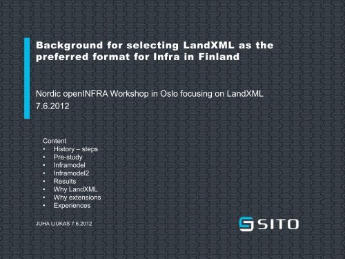
<strong>Background</strong> <strong>for</strong> <strong>selecting</strong> <strong>LandXML</strong> <strong>as</strong> <strong>the</strong><br />
preferred <strong>for</strong>mat <strong>for</strong> Infra in Finland<br />
Nordic openINFRA Workshop in Oslo focusing on <strong>LandXML</strong><br />
7.6.2012<br />
Content<br />
• History – steps<br />
• Pre-study<br />
• Inframodel<br />
• Inframodel2<br />
• Results<br />
• Why <strong>LandXML</strong><br />
• Why extensions<br />
• Experiences<br />
JUHA LIUKAS 7.6.2012<br />
When Infr<strong>as</strong>tructure Counts.
2<br />
BACKGROUND FOR SELECTING LANDXML<br />
5.6.2012<br />
Inframodel (IM) history<br />
2001 2002 2003 2004 2005 2006 2007 2008 2009 2010<br />
2011<br />
Pre-study<br />
Inframodel<br />
Inframodel 2<br />
IM v1.0<br />
26.3.2006<br />
Road Admin.<br />
Inframodel guideline<br />
27.10.2007<br />
IM v1.2<br />
20.3.2010<br />
Piloting<br />
Update<br />
InfraFINBIM<br />
<strong>LandXML</strong> v1.0<br />
17.7.2002<br />
<strong>LandXML</strong> v1.1<br />
21.7.2006<br />
<strong>LandXML</strong> v1.2<br />
15.8.2008<br />
<strong>LandXML</strong> ?
3 | BACKGROUND FOR SELECTING LANDXML<br />
5.6.2012<br />
Infra Technology Programme 2001-2006 - Pre-study<br />
• SKOL (The Finnish Association of Consulting<br />
Firms) / SITO 2001<br />
• Current situation – standardization projects –<br />
development<br />
• De facto <strong>for</strong>mats in Finland<br />
• OGC, OpenGIS, STANLI, GEOSIS, IFC, GDF,<br />
CIRC, OSYRIS, OKSTRA, OpenDesign…<br />
• <strong>LandXML</strong> ?<br />
• Significant benefits from <strong>the</strong> harmonization of data<br />
transfer<br />
• An common infra product data model big ef<strong>for</strong>t<br />
• Best tool <strong>for</strong> infr<strong>as</strong>tructure design ?<br />
When Infr<strong>as</strong>tructure Counts.
Infra-related standards general in<strong>for</strong>mation map<br />
Source and reference data<br />
Design objects, structures<br />
OGC, ISO19100 series standards<br />
B<strong>as</strong>ic methods and <strong>for</strong>mats<br />
(services, GML)<br />
Civil engineering data<br />
Infra structures<br />
<strong>LandXML</strong><br />
Networks<br />
Catalogue<br />
in<strong>for</strong>mation<br />
Metadata<br />
KuntaGML/KRYSP<br />
(Finnish adaptation of GML<br />
<strong>for</strong> cities and municipalities)<br />
Land survey, maps<br />
Inframodel (Finnish adaptation of <strong>LandXML</strong>)<br />
Transport networks<br />
Roads and streets<br />
Header in<strong>for</strong>mation,<br />
b<strong>as</strong>e in<strong>for</strong>mation<br />
Railways<br />
Areal structures<br />
INSPIRE<br />
Town and city plans<br />
Waterways<br />
Water supply<br />
and sewerage<br />
Soil investigation<br />
in<strong>for</strong>mation<br />
National Finnish<br />
Infra-<strong>for</strong>mat<br />
IFC / Bridge<br />
extension<br />
Bridge structures<br />
Buildings<br />
Spaces Structures HVAC and<br />
mechanical design<br />
BOM Scheduling<br />
Cost<br />
<strong>buildingSMART</strong> / IFC Connected structures<br />
InfraTM / KSn
5 | BACKGROUND FOR SELECTING LANDXML<br />
5.6.2012<br />
Inframodel<br />
• Development of data exchange between sofwares in infra<br />
design<br />
• Actors VTT, Sito, Tekla, Vi<strong>as</strong>ys(Vianova)<br />
• Harmonization study<br />
- Map in<strong>for</strong>mation<br />
- Soil investigations<br />
- Terrain and subsoil model<br />
• <strong>LandXML</strong> 1.0 requirement specifications and fe<strong>as</strong>ibily study<br />
- Metadata<br />
- Geometry, pipenetworks<br />
- Road / railway model<br />
When Infr<strong>as</strong>tructure Counts.
6 | BACKGROUND FOR SELECTING LANDXML<br />
5.6.2012<br />
Inframodel - results<br />
• Harmonization<br />
- Infra-<strong>for</strong>mat <strong>for</strong> soil investigations<br />
- Some o<strong>the</strong>r guidelines<br />
• <strong>LandXML</strong> recommended to <strong>the</strong> data exchange <strong>for</strong>mat<br />
- Fullfill partly <strong>the</strong> demands<br />
- Possibility to expand (feature)<br />
• Postpone <strong>the</strong> start of <strong>the</strong> common product data model<br />
When Infr<strong>as</strong>tructure Counts.
7 | BACKGROUND FOR SELECTING LANDXML<br />
5.6.2012<br />
Why <strong>LandXML</strong> ? (2006)<br />
• “A specialized XML data file <strong>for</strong>mat containing civil<br />
engineering and survey me<strong>as</strong>urement data commonly<br />
used in <strong>the</strong> Land Development and Transportation<br />
Industries”<br />
• An existing, worldwide, open organization<br />
• A non-proprietary data standard<br />
• Driven by an industry consortium of partners<br />
(Autodesk, Bentley, Trimble, Topcon, Leica…)<br />
• February 2006: 35 countries and 495 representatives<br />
from 400 member companies/government agencies<br />
• Active development (www.<strong>LandXML</strong>.org)<br />
• XML b<strong>as</strong>ed<br />
• Possibility to expand<br />
• Possibility to influense ?<br />
When Infr<strong>as</strong>tructure Counts.
8<br />
|<br />
BACKGROUND FOR SELECTING LANDXML<br />
5.6.2012<br />
Inframodel2 - goals<br />
• To improve data exchange between design softwares<br />
• To bring <strong>LandXML</strong>-transfer <strong>for</strong>mat in <strong>the</strong> use<br />
• Open documentation of Finnish practice<br />
• Implementations in three design softwares:<br />
- Sito/CityCad, Tekla/Civil, Vianova/Novapoint<br />
• A plan <strong>for</strong> <strong>the</strong> maintaining and fur<strong>the</strong>r development<br />
• Common requirements of design<br />
• Definitions by Sito, Tekla, Vianova; documentation by VTT<br />
• Total cost 600 000 € (public/private 50/50% & Tekes)<br />
When Infr<strong>as</strong>tructure Counts.
http://cic.vtt.fi/projects/inframodel...
10 | BACKGROUND FOR SELECTING LANDXML<br />
5.6.2012<br />
Inframodel – why extensions ?<br />
• Mechanism provide by <strong>LandXML</strong> (Feature)<br />
• Type coding system and type coding<br />
• Plan data<br />
- Ph<strong>as</strong>e, subproject<br />
• Stringline model<br />
- Descriping construction layers<br />
• Crossection parameters<br />
- Between design - design<br />
• Pipenetworks: struct and pipe properties<br />
When Infr<strong>as</strong>tructure Counts.
11 | BACKGROUND FOR SELECTING LANDXML<br />
5.6.2012<br />
After Inframodel2<br />
• Piloting project<br />
• Inframodel guidelines<br />
• Upgrade to LandXL 1.2 (documentation)<br />
• InfraTM & InfraFINBIM<br />
- InfraBIM modelling guidelines<br />
- InfraBIM cl<strong>as</strong>sifications and coding systems<br />
- New steps in BIM activation, pilot projects<br />
- Inframodel3 (<strong>LandXML</strong>1.2 etc.)<br />
- buildingSmart<br />
When Infr<strong>as</strong>tructure Counts.
12 | BACKGROUND FOR SELECTING LANDXML<br />
5.6.2012<br />
Experiencies<br />
• Benefits<br />
- Metadata, pipenetworks, surfaces<br />
- Road model from design to construction<br />
- Co-operation between different organizations<br />
• Challenges<br />
- Road model from design to design<br />
- <strong>LandXML</strong> Inframodel extents (international /<br />
national)<br />
- Active use is <strong>the</strong> best way to develop<br />
- Organizing <strong>the</strong> fur<strong>the</strong>r development and<br />
maintenace<br />
- Need <strong>for</strong> InfraBIM guidelines / cl<strong>as</strong>sification and<br />
coding systems<br />
When Infr<strong>as</strong>tructure Counts.
Thank You !<br />
Comments ? Questions ?<br />
2001 2002 2003 2004 2005 2006 2007 2008 2009 2010<br />
2011<br />
Pre-study<br />
Inframodel<br />
Inframodel 2<br />
IM v1.0<br />
26.3.2006<br />
Road Admin.<br />
Inframodel guideline<br />
27.10.2007<br />
IM v1.2<br />
20.3.2010<br />
Piloting<br />
Update<br />
InfraFINBIM<br />
<strong>LandXML</strong> v1.0<br />
17.7.2002<br />
<strong>LandXML</strong> v1.1<br />
21.7.2006<br />
<strong>LandXML</strong> v1.2<br />
15.8.2008<br />
<strong>LandXML</strong> ?