Download a PDF of our 2009 Annual Report - Ancient Egypt ...
Download a PDF of our 2009 Annual Report - Ancient Egypt ...
Download a PDF of our 2009 Annual Report - Ancient Egypt ...

You also want an ePaper? Increase the reach of your titles
YUMPU automatically turns print PDFs into web optimized ePapers that Google loves.
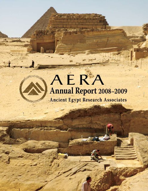
<strong>Annual</strong> <strong>Report</strong> 2008–<strong>2009</strong><br />
<strong>Ancient</strong> <strong>Egypt</strong> Research Associates
Contents<br />
A Message from the President............................................................................... 1<br />
The Two Towns: Season <strong>2009</strong> at Giza...................................................................4<br />
“Grad School” at Giza: The <strong>2009</strong> Advanced Field School...............................20<br />
Under the Microscope: <strong>2009</strong> Archaeological Science......................................24<br />
The Giza Center Becomes a Reality....................................................................28<br />
Celebrating 20 Years <strong>of</strong> Discovery at Giza......................................................... 32<br />
Sharing Our Work.................................................................................................34<br />
Thank You to Our Contributors..........................................................................36<br />
The AERA Team 2008-<strong>2009</strong>.................................................................................. 37<br />
© <strong>2009</strong> by <strong>Ancient</strong> <strong>Egypt</strong> Research Associates<br />
<strong>Ancient</strong> <strong>Egypt</strong> Research Associates, Inc.<br />
26 Lincoln Street, Suite 5<br />
Boston, MA 02135-2608<br />
USA<br />
E-mail: information@aeraweb.org<br />
Website: http://www.aeraweb.org<br />
<strong>Ancient</strong> <strong>Egypt</strong> Research Associates is a 501(c) (3),<br />
tax-exempt, non-pr<strong>of</strong>it organization dedicated to<br />
research on ancient <strong>Egypt</strong>.<br />
Cover photo: Stairways <strong>of</strong> the Khentkawes Valley Complex ascending to the Northern<br />
Lateral Ramp, marked by the rising ledge cut into the bedrock face (below). Remains<br />
<strong>of</strong> House E lie exposed halfway to the monumental Khentkawes tomb, with the<br />
Menkaure Pyramid in the background (above).
A Message<br />
from Mark Lehner<br />
AERA’s 2008–<strong>2009</strong> fiscal year saw <strong>our</strong> 18 th season <strong>of</strong> archaeology at Giza.<br />
AERA, Inc., has grown into a viable research organization, with twelve<br />
full-time staff members, <strong>of</strong>fices in Boston, and, now, AERA’s own Giza<br />
Archaeological Center and Field School. It was a year <strong>of</strong> doing what AERA<br />
does best—executing one <strong>of</strong> the largest archaeological missions in <strong>Egypt</strong><br />
and teaching state-<strong>of</strong>-the-art archaeology in a field school that sets the<br />
standard for members <strong>of</strong> <strong>Egypt</strong>’s Supreme Council <strong>of</strong> Antiquities (SCA).<br />
AERA’s major discovery <strong>of</strong> the year: an entire new architectural layout<br />
east <strong>of</strong> the Khentkawes Town, what may indeed be the valley complex<br />
<strong>of</strong> this enigmatic queen who ruled as king.<br />
AERA’s major leap forward this year: securing <strong>our</strong> own property, one<br />
block from the entrance to the Giza Plateau, at the bottom <strong>of</strong> the road<br />
leading to the very foot <strong>of</strong> the Great Pyramid. Here we will build <strong>our</strong> own<br />
facilities for the AERA Archaeological Center and Field School. Already in the<br />
month and a half at the end <strong>of</strong> <strong>our</strong> busy field season, we refurbished the old<br />
villa with a view to the pyramids. In the long term, this will prove the most<br />
important <strong>of</strong> AERA’s achievements during <strong>our</strong> year 2008–<strong>2009</strong>.<br />
Let me list all <strong>of</strong> AERA’s achievements during the past year, which were<br />
possible thanks to y<strong>our</strong> interest and generous support, combined with a<br />
skilled team <strong>of</strong> archaeologists who take on AERA’s mission with dedication,<br />
skill, and passion. Please see at the end <strong>of</strong> this report the list <strong>of</strong> everyone who<br />
supported the following:<br />
Mark Lehner<br />
Accomplishments<br />
• Discovery <strong>of</strong> the Valley Complex <strong>of</strong> Queen Khentkawes<br />
After two seasons (2007–2008) <strong>of</strong> struggling with the depredations <strong>of</strong><br />
previous excavations, erosion <strong>of</strong> the surrounding site, and an enormous<br />
overburden <strong>of</strong> sand, the AERA team found a complex <strong>of</strong> terraces, ramps,<br />
stairways, and a yawning, deep basin at the eastern end <strong>of</strong> the causeway<br />
leading through the Khentkawes Town and to the monumental tomb <strong>of</strong><br />
this mysterious queen who ended Giza’s 4th Dynasty <strong>of</strong> pyramid-building<br />
kings. We may indeed have here the equivalent <strong>of</strong> the king’s valley<br />
temples, this one built for a queen who ruled as king.<br />
• Lost City Site Excavations<br />
After a two-year hiatus because <strong>of</strong> the rising water table, we resumed excavations<br />
in <strong>our</strong> flagship site, the Lost City <strong>of</strong> the Pyramids. Archaeologists<br />
and students <strong>of</strong> AERA’s Advanced Field School excavated scores <strong>of</strong> graves<br />
<strong>of</strong> the Late Period (around 664–525 BC) in order to reach the floors and<br />
walls <strong>of</strong> the enigmatic western part <strong>of</strong> the settlement dating 2,000 years<br />
earlier than these graves.<br />
• Advanced Field School <strong>2009</strong><br />
Field School Co-Directors Mohsen Kamel and Ana Tavares successfully<br />
designed and fielded the second session <strong>of</strong> the AERA Advanced Field<br />
School at Giza. Nine SCA supervisors and eight non-<strong>Egypt</strong>ian teachers<br />
1
gave eight-week advanced c<strong>our</strong>ses for 42 former field school students specializing<br />
in osteoarchaeology (excavation <strong>of</strong> human remains), advanced<br />
excavation methods, archaeological illustration, survey and mapping, and<br />
ceramics.<br />
• Archaeological Science Program<br />
In the Giza Field Laboratory AERA’s international team <strong>of</strong> specialists honed<br />
their analyses <strong>of</strong> the material culture from six years <strong>of</strong> excavations in the<br />
Royal Administrative Building (RAB). Through workshops and study sessions<br />
the site and lab teams integrated macro- and micro-archaeology to<br />
reveal patterns <strong>of</strong> life within the RAB <strong>of</strong> the Lost City in advance <strong>of</strong> its final<br />
publication.<br />
• Property Purchase for the AERA Archaeological Center and Field School<br />
We realized <strong>our</strong> three-year quest for property near the pyramids where<br />
we will build the AERA Archaeological Center and Field School. For the<br />
first time AERA has its own home, one block from the entrance to the Giza<br />
Pyramids, where at the end <strong>of</strong> this season we were able to move <strong>our</strong> books,<br />
computers, and dig equipment instead <strong>of</strong> putting them into rented storage.<br />
• Villa Renovation as AERA-<strong>Egypt</strong> Headquarters in Giza<br />
With funds left in the capital campaign after <strong>our</strong> purchase, the AERA team<br />
completely renovated the 1930s villa on the property, installing new wiring<br />
and plumbing, plastering, and painting.<br />
• AERA Pottery Manual and Giza Occasional Papers<br />
AERA published A Manual <strong>of</strong> <strong>Egypt</strong>ian Pottery volumes 1 and 2 by AERA<br />
ceramicist Dr. Anna Wodzińska, the first-ever comprehensive catalogue<br />
<strong>of</strong> <strong>Egypt</strong>ian pottery. The manual covers pottery from the earliest Neolithic<br />
period until modern times. The f<strong>our</strong>-volume set is the first publication <strong>of</strong><br />
the AERA Field Manual Series (AFM). AERA also completed Giza Occasional<br />
Papers (GOP) volumes 1 through 4. These monographs summarize the<br />
results <strong>of</strong> AERA excavations during seasons 2004 through 2008.<br />
• AERA Anniversary and Study Day in Cairo<br />
In celebration <strong>of</strong> 10 years since AERA’s Millennium Project launched, 20<br />
years since AERA began to excavate the Lost City <strong>of</strong> the Pyramids, and<br />
30 years since I began directing archaeological projects at Giza, Dr. Zahi<br />
Hawass and the SCA hosted the AERA Study Day at the SCA headquarters in<br />
Cairo. AERA team members presented results <strong>of</strong> excavations, analyses, and<br />
the field school program in lectures and posters to the entire <strong>Egypt</strong>ology<br />
community in Cairo.<br />
• COSI Science Museum Exhibit Highlighting AERA’s Work<br />
AERA worked with a team from COSI, the Center <strong>of</strong> Science and Industry in<br />
Columbus (Ohio) on an immersive, interactive exhibit, “Lost <strong>Egypt</strong>,” featuring<br />
AERA’s archaeology. “Lost <strong>Egypt</strong>” will t<strong>our</strong> science museums around<br />
the United States.<br />
Through the past year, AERA continued to grow, and more important, to consolidate<br />
its growth <strong>of</strong> prior years. It is enormously satisfying to all <strong>of</strong> us at AERA<br />
that we are now making a difference—to <strong>Egypt</strong> through the field school, and to<br />
the common understanding <strong>of</strong> ancient <strong>Egypt</strong> through a variety <strong>of</strong> formats.<br />
Dr. Richard Redding continues to donate his time as Chief Research Officer,<br />
working with Dr. Mary Anne Murray, Director <strong>of</strong> Archaeological Science;<br />
2 <strong>Ancient</strong> <strong>Egypt</strong> Research Associates 2008–<strong>2009</strong> <strong>Annual</strong> <strong>Report</strong>
Mohsen Kamel and Ana Tavares, Field Directors and Directors <strong>of</strong> the AERA<br />
Field Schools; John Nolan, Associate Director and Chief Financial Officer;<br />
John Anderson, who donates his time to provide counsel on finances and<br />
operations; Dr. Wilma Wetterstrom, Science Editor; Erin Nell, Business<br />
Manager; Jim Schnare, Communications Associate; and Ali Witsell, Assistant<br />
Editor.<br />
All <strong>of</strong> us at AERA thank Douglas Rawles and Mark Wakim <strong>of</strong> Reed Smith<br />
LLP for providing advice and counsel on a myriad <strong>of</strong> legal matters. Douglas,<br />
who has worked with AERA for over 13 years, continues to provide services<br />
on a pro bono basis, which is much appreciated by everyone in the AERA<br />
family.<br />
In Boston, AERA continues to fill three suites with a total <strong>of</strong> five rooms<br />
at 26 Lincoln Street. AERA Archivist Mari Rygh assisted by Aparna Das, continually<br />
upgrades the organization and filing <strong>of</strong> the back suite, where AERA<br />
archives its ever-growing corpus <strong>of</strong> original maps, drawings, notebooks, and<br />
photographs. AERA shares one <strong>of</strong> the three suites with the Dash Foundation<br />
for Archaeological Research, thanks to AERA Board member Glen Dash.<br />
It is entirely right and extremely satisfying to see <strong>our</strong> work get out to the<br />
world at large in a variety <strong>of</strong> forms and media—the COSI Science Exhibit, the<br />
AERA Study Day during <strong>our</strong> mid-March celebration, <strong>our</strong> AERAGRAM newsletters,<br />
<strong>our</strong> website (aeraweb.org), as well as traditional, substantive forms: A<br />
Manual <strong>of</strong> <strong>Egypt</strong>ian Pottery, <strong>our</strong> GOP series, and <strong>our</strong> forthcoming volumes <strong>of</strong><br />
Giza <strong>Report</strong>s. Stay tuned for the AERA team featured in a forthcoming NOVA<br />
documentary film on the Sphinx and its builders. And, we are even testing<br />
the waters <strong>of</strong> newer “social media:” <strong>our</strong> monthly AERA E-Bulletin and tweets<br />
to Twitter.<br />
The AERA team now looks forward to building <strong>our</strong> Archaeological<br />
Center and Field School in bricks and mortar on <strong>our</strong> land in Giza at the<br />
foot <strong>of</strong> the Pyramids. Under the title, Bringing the Lost City Back to Life, we<br />
are planning ambitious new projects: re-creations <strong>of</strong> the Lost City, not only<br />
in published reports, but also in new, exciting ways by rebuilding parts <strong>of</strong><br />
the ancient city in mudbrick, through experimental archaeology as a kind<br />
<strong>of</strong> “This (4,500-year-) Old House” approach, and digitally using the latest<br />
computer graphics. These re-creations take special place in <strong>our</strong> forthcoming<br />
long-range plan.<br />
3
The Two Towns: Season <strong>2009</strong> at Giza<br />
Between January 31 and May 7 we worked at <strong>our</strong> flagship Lost City site south <strong>of</strong> the Wall <strong>of</strong> the Crow (which we refer to as HeG,<br />
after Heit el-Ghurab, Wall <strong>of</strong> the Crow in Arabic) and in the town attached to the monument <strong>of</strong> Queen Khentkawes (KKT) to the<br />
northwest <strong>of</strong> the high desert knoll, the Gebel el-Qibli, which dominates both sites. We embedded the AERA Advanced Field School<br />
for Supreme Council <strong>of</strong> Antiquities (SCA) Inspectors in <strong>our</strong> excavation program from February 7 to April 2, <strong>2009</strong>.<br />
Heit el-Ghurab (HeG): The Lost City Site<br />
In the Lost City site we spread <strong>our</strong> forces over two distinct excavation<br />
zones: the Western Compound and, much farther to the<br />
south, House Unit 1, possibly the residence and workplace <strong>of</strong> an<br />
administrator.<br />
Exploring Terra Incognita:<br />
The Western Compound<br />
Up to now the expansive area immediately south <strong>of</strong> the tunnel-like<br />
gate through the Wall <strong>of</strong> the Crow has remained terra<br />
incognita. Thick fieldstone walls that show through the surface<br />
define the broad Eastern and Western Compounds, separated<br />
from each other by the even thicker Enclosure Wall. The surfaces<br />
within these compounds rise higher than the floor levels<br />
<strong>of</strong> the Gallery Complex and Eastern and Western Towns. In<br />
2008, when an elevated water table saturated most <strong>of</strong> these<br />
low-lying areas, we chose to focus work in <strong>2009</strong> within the mysterious<br />
Western Compound. The whole site has since dried out,<br />
but we stuck to <strong>our</strong> decision to finally explore what lay inside<br />
the Western Compound. Our goals were as follows:<br />
• Establish the chronology, phasing, and function <strong>of</strong> the<br />
Western Compound.<br />
• Find the path <strong>of</strong> “the Chute,” a corridor <strong>of</strong> fieldstone walls<br />
curving northwest from an alignment with the gate at the<br />
western end <strong>of</strong> Main Street.<br />
We began with questions. Was the Chute like a chute in an<br />
abattoir for introducing and possibly slaughtering animals? Did<br />
the occupants use the Western Compound as a holding area for<br />
the large numbers <strong>of</strong> animals consumed by people elsewhere<br />
in the Lost City site, as indicated by Richard Redding’s analysis<br />
<strong>of</strong> animal bone from <strong>our</strong> excavations over 20 years? Was the<br />
Western Compound a provisional storage zone, like the water<br />
depot known from the entrance to the Workmen’s Village at<br />
Amarna? Or did the Western Compound simply contain yet<br />
more food production facilities, especially bakeries?<br />
Unfortunately for answering these questions, the dead<br />
lay in <strong>our</strong> way; a Late Period cemetery punctuated the Old<br />
Kingdom settlement. Excavating the dozens <strong>of</strong> burials in <strong>our</strong><br />
path took much <strong>of</strong> <strong>our</strong> time in the field.<br />
The Late Period Cemetery<br />
We expected that numerous burials would lie between us and<br />
the more ancient features. The northwest part <strong>of</strong> the site contains<br />
thousands <strong>of</strong> burials dating from the Late Period (664–525<br />
BC) into Roman times—2,000 years after people abandoned the<br />
Old Kingdom settlement. In previous seasons, Jessica Kaiser and<br />
her osteoarchaeology team excavated close to 300 burials, an<br />
important achievement, delivering systematic information on<br />
a corpus <strong>of</strong> 2,500-year-old human remains, a corpus that draws<br />
the attention <strong>of</strong> medical researchers and anthropologists.<br />
4 <strong>Ancient</strong> <strong>Egypt</strong> Research Associates 2008–<strong>2009</strong> <strong>Annual</strong> <strong>Report</strong>
Facing page: Work begins in the<br />
Western Compound. Advanced<br />
Field School students and their<br />
instructors lay out grid stakes,<br />
backed by the Wall <strong>of</strong> the Crow<br />
and its Gate. Khufu’s pyramid<br />
rises to the northwest. The<br />
stony mass <strong>of</strong> the Chute lies in<br />
the foreground. View to the<br />
northwest.<br />
East-West<br />
Fieldstone Walls<br />
Corridor?<br />
Entrance<br />
3.S<br />
3. R<br />
3. Q<br />
3. P<br />
3. O<br />
Below: Plan <strong>of</strong> the Heit el-Ghurab<br />
site. Right: the Chute operations.<br />
Lower right: the excavations in the<br />
“bakery” <strong>of</strong> House Unit 1.<br />
3. N<br />
3. M<br />
3. L<br />
0 1 5 10 meters<br />
Trench B<br />
3. K<br />
35 36 37 38 39 40 41 42 43 44<br />
Area AA<br />
“Bakery”<br />
<strong>2009</strong><br />
Excavations<br />
House Unit 1<br />
0 5 10 meters<br />
5
Above left: Our archaeologists examine a cut through a 4th Dynasty wall in the Western Compound made for a burial interred in the Late Period.<br />
Right: A Late Period burial <strong>of</strong> a male in an anthropoid painted mud c<strong>of</strong>fin. The skeleton was poorly preserved, but the osteoarchaeology team was<br />
able to estimate his age as between 35–45 years old, based on dental wear.<br />
But we did not expect that Jessica, Scott Haddow, and the<br />
Advanced Field School Human Osteology team would have such<br />
a busy season. The density <strong>of</strong> burials and the fact that many had<br />
fragile, delicately painted mud c<strong>of</strong>fins required careful excavation,<br />
consolidation, and lifting. Progress was frustratingly slow.<br />
The team excavated 17 burials in the Western Compound and 19<br />
in the Chute, as well as one in KKT. Field school students gained<br />
invaluable experience that will help when, all too <strong>of</strong>ten, they<br />
encounter and have to excavate ancient burial grounds lying in<br />
the path <strong>of</strong> modern development throughout <strong>Egypt</strong>.<br />
Dog Burials<br />
It is well known amongst archaeologists that the most significant<br />
or unusual discoveries come in the last few days <strong>of</strong> work<br />
on site! So on the last days <strong>of</strong> excavation, we found an intriguing<br />
child burial in <strong>our</strong> attempt to trace the path <strong>of</strong> the Chute.<br />
Eight dogs, some wrapped in linen, (Burial 492), which have no<br />
parallels at Giza, lay above the burial.<br />
In the Late Period, people buried thousands <strong>of</strong> mummified<br />
ibis birds, falcons, baboons, cats, cows, bulls, shrews, small<br />
reptiles, amphibians, jackals, and dogs. Such animal cemeteries<br />
are large and numerous at Saqqara, the national cemetery <strong>of</strong><br />
ancient <strong>Egypt</strong>. But the only other animal burials at Giza consist<br />
<strong>of</strong> a cache <strong>of</strong> ibis mummies and an interment <strong>of</strong> shrew mice.<br />
Our discovery, although only a single burial, merits further<br />
study.<br />
Old Kingdom Burials<br />
Amongst scores <strong>of</strong> Late Period burials, we found two Old<br />
Kingdom graves dating close to the time people lived here.<br />
Lying south <strong>of</strong> a massive east-west limestone wall, under small<br />
chambers belonging to the later phases <strong>of</strong> Old Kingdom occupation<br />
(see below), these simple burials predate the limestone<br />
structures. They may have been poor people interred in free<br />
ground outside <strong>of</strong> the Enclosure Wall. When builders expanded<br />
the settlement, they built their walls over the earlier graves. We<br />
must add these to three other Old Kingdom burials we have<br />
found at the HeG settlement site. They could be outliers to the<br />
crowded “Workers’ Cemetery” that Dr. Zahi Hawass and the<br />
Giza Inspectorate have excavated up the slope from <strong>our</strong> site.<br />
Old Kingdom Landscaping, Compounds, and<br />
More Bakeries<br />
We entrusted the excavations in the Western Compound to<br />
the Advanced Field School students specializing in excavation<br />
techniques. Freya Sadarangani, James Taylor, Essam Mohamed<br />
Shehab, and Rabea Eissa Mohamed supervised the excavators.<br />
The idea was to clear down to the Old Kingdom floor level,<br />
along a transect—a line <strong>of</strong> excavation squares or trenches. Our<br />
intended transect began on the north in <strong>our</strong> grid square 3.S42,<br />
just where we saw a break through the Enclosure Wall (map on<br />
page 5). Because it roughly aligns with North Street, 60 meters<br />
(197 feet) to the east, we thought this break might be a gate at<br />
the end <strong>of</strong> the street. The transect crossed two thick fieldstone<br />
walls that run east-west across the southern end <strong>of</strong> the Western<br />
Compound and ended on the south at the eastern end <strong>of</strong> the<br />
Chute. We thought this trench would give us a section across<br />
all these Old Kingdom structures.<br />
The <strong>2009</strong> team revealed another north-south wall, running<br />
parallel to the Enclosure Wall, possibly forming a corridor. This<br />
6 <strong>Ancient</strong> <strong>Egypt</strong> Research Associates 2008–<strong>2009</strong> <strong>Annual</strong> <strong>Report</strong>
wall attached to the eastern end <strong>of</strong> the east-west fieldstone wall.<br />
Just where the two walls might connect in a 90° corner, a large<br />
dump <strong>of</strong> Old Kingdom pottery, disturbed by Late Period burials,<br />
obscured the possible intersection. However, the team was<br />
able to see an entrance that people later blocked after they had<br />
dumped the vast quantities <strong>of</strong> broken pottery.<br />
The entrance opened into the southeastern corner <strong>of</strong> a<br />
large space, extending 45 meters (148 feet) to the north and 34<br />
meters (112 feet) to the east, taking up the northern two-thirds<br />
<strong>of</strong> the Western Compound, enclosed by thick walls. After the<br />
southern wall <strong>of</strong> this space had stood for a long while, people<br />
built thinner fieldstone walls up against it, forming small chambers,<br />
which were filled with dark ash and fragments <strong>of</strong> bread<br />
pots—yet more bakeries, which we can add to the dozens we<br />
have located elsewhere across the site.<br />
As much as the numerous Late Period burials hindered a<br />
broader exposure <strong>of</strong> the Old Kingdom structures, the sections<br />
through ancient layers in the sides <strong>of</strong> the graves gave us valuable<br />
archaeological information. We could see in the burial<br />
cuts “tip lines” where people had tipped their baskets full <strong>of</strong><br />
material to dump. This dumping raised the surface two to three<br />
Stone walls uncovered in the Western Compound operation. View to<br />
the northwest.<br />
meters (roughly 7 to 10 feet) higher than the floor level inside<br />
the Gallery Complex.<br />
From <strong>our</strong> work in the Western Compound we learned:<br />
• People began to raise the surface in the northwestern<br />
area <strong>of</strong> the site before they built the Enclosure Wall.<br />
• The opening in the Enclosure Wall is not an entrance<br />
or gate, rather a gap that someone hacked through the<br />
wall.<br />
• People built the Western Compound after the construction<br />
<strong>of</strong> the Enclosure Wall.<br />
• People, and not natural forces, continued to raise the<br />
area west <strong>of</strong> the Enclosure Wall by dumping sand.<br />
The Puzzling Chute<br />
The Chute starts 12 meters (39.3 feet) west <strong>of</strong> West Gate, the<br />
only known entrance in the Enclosure Wall, and disappears on<br />
the northwest at the limit <strong>of</strong> <strong>our</strong> clearing. Since we found and<br />
mapped the Chute in 2001 we have drawn a dashed line from<br />
its northwestern end to the gate in the Wall <strong>of</strong> the Crow, thinking<br />
it could be the principle conduit into the site. It reminds us<br />
<strong>of</strong> modern cattle chutes (narrow passageways through which<br />
animals are driven). It forms the southern side <strong>of</strong> the Western<br />
Compound.<br />
The fact that the passage between the walls is so restricted,<br />
and then simply stops at an open area before West Gate, led<br />
to the hypothesis that people used it to control, and perhaps<br />
count, animals brought to the site for slaughter, possibly in the<br />
open area.<br />
Ashraf Abd el-Aziz supervised Noha Hassan Bulbul, Amy<br />
McMahon, and May Al-Haik, the first Syrian archaeologist to<br />
join the AERA team. The goals <strong>of</strong> their excavation were to learn<br />
more about the date and purpose <strong>of</strong> the Chute, as well as to<br />
determine if it turns north to feed into the Gate in the Wall <strong>of</strong><br />
the Crow.<br />
The team excavated three trenches perpendicular to the<br />
Chute (Trenches A and C) along its length and at the eastern<br />
end (Trench B). The stratigraphy <strong>of</strong> these trenches established<br />
that the Chute walls are contemporary with the walls <strong>of</strong> the<br />
Western Compound.<br />
The Chute consists <strong>of</strong> two parallel walls forming a passage<br />
2.40 to 2.80 meters (7.9 to 9.2 feet) wide. Each wall, approximately<br />
1.45 meters (4.8 feet) wide, is built <strong>of</strong> un-c<strong>our</strong>sed limestone<br />
blocks, with two skin walls holding a core <strong>of</strong> mixed material,<br />
including stone, sand, and broken pottery. The team excavated<br />
successive street surfaces that functioned between the walls <strong>of</strong><br />
the Chute at approximately 18.08 meters above sea level.<br />
Trench B, at the eastern end <strong>of</strong> the Chute, revealed that the<br />
space outside West Gate was an open area in which a series <strong>of</strong><br />
trampled surfaces formed upon layers containing large quantities<br />
<strong>of</strong> animal bone; cattle and sheep in an upper layer and<br />
7
mostly sheep in a lower one. The layers might indicate that people<br />
indeed butchered animals in front <strong>of</strong> West Gate. However,<br />
the walls <strong>of</strong> the Chute rest upon these trampled surfaces and<br />
thus date after them. The results at best indicate that the inhabitants<br />
might have slaughtered animals in the area where people<br />
later built the eastern end <strong>of</strong> the Chute.<br />
Where Goes the Road?<br />
A basic question at the beginning <strong>of</strong> the season was whether the<br />
Chute turns north to the Gate in the Wall <strong>of</strong> the Crow or continues<br />
to the northwest. To find out we cleared west as close as we<br />
could to the modern Coptic Cemetery (shown in the map on<br />
page 17). Here on line with the gate in the Wall <strong>of</strong> the Crow were<br />
two very disturbed humps <strong>of</strong> stone, the remains <strong>of</strong> the Chute,<br />
indicating that it continues on its trajectory to the northwest.<br />
Perhaps this is already too far west-northwest to make a turn<br />
toward the Gate. Unfortunately, the end <strong>of</strong> digging was upon us<br />
before we could resolve this question.<br />
Deep Probe and <strong>Ancient</strong> Landscaping<br />
Could there have been an older Chute, buried by sand? To<br />
assess this possibility and to look at what lies below, Noha and<br />
May excavated a small probe 2 meters (6.7 feet) below the base<br />
<strong>of</strong> the Chute walls in Trench B. The probe descended about<br />
40 centimeters (15.8 inches) lower than the general floor level<br />
at the lower, northern ends <strong>of</strong> the galleries. Below the animal<br />
bone layers (mentioned above), the probe showed thick dump<br />
deposits. People had intentionally filled in the area.<br />
This evidence for ancient landscaping is one <strong>of</strong> the most<br />
important results <strong>of</strong> <strong>our</strong> excavations in the northwest territory.<br />
The dumped layers <strong>of</strong> desert<br />
clay under the eastern end <strong>of</strong> the<br />
Chute and the dumped sand layers<br />
under the Western Compound<br />
show how drastically people altered<br />
the terrain. We see similar massive<br />
remodelling <strong>of</strong> the ancient landscape<br />
in other areas <strong>of</strong> the site, such<br />
as along the Wall <strong>of</strong> the Crow and in<br />
the Royal Administrative Building.<br />
We should not be surprised at the<br />
impressive scale <strong>of</strong> the artificial<br />
landscaping in a settlement <strong>of</strong> Giza<br />
pyramid builders, for the pyramids<br />
and their quarries themselves represent<br />
human intervention on a<br />
geological scale.<br />
Character <strong>of</strong> the Western Compound<br />
The Western Compound appears to contain massive dumps <strong>of</strong><br />
pottery waste and ash. People built fieldstone walls and chambers,<br />
ad hoc, as they dumped, so that some <strong>of</strong> these structures<br />
rest upon already dumped waste, and such waste also covered<br />
the structures.<br />
In this respect, the Western Compound is similar to Area<br />
EOG, an industrial yard east <strong>of</strong> the galleries, with many bakeries.<br />
The Western Compound also resembles the Eastern<br />
Compound, with concentrated ashy dumps <strong>of</strong> pottery waste<br />
embedding fieldstone structures, one <strong>of</strong> which was a bakery we<br />
excavated in 1991. Was the Western Compound a compounding,<br />
if you will, <strong>of</strong> the extensive production facilities, especially<br />
bread-baking, that surrounded the central Gallery Complex?<br />
The people who lived in the HeG settlement during its<br />
later years seem to have turned to bread-baking on a massive,<br />
industrial scale. It may be historically significant that the intensification<br />
<strong>of</strong> production, and the signs <strong>of</strong> its control, occurred<br />
in the later phase <strong>of</strong> occupation, not long before people abandoned<br />
this site.<br />
Baking and Brewing in House Unit 1<br />
With great relief, by autumn 2008, we saw that the water table,<br />
which had been steadily rising and saturating the site since<br />
2005, was falling as a result <strong>of</strong> a series <strong>of</strong> pumps installed by the<br />
SCA and Cairo University. We seized the opportunity to finish<br />
excavating House Unit 1 in the Western Town.<br />
House Unit 1 (map on page 5), the largest house we have<br />
so far found on the site, covers 400 square meters (4,306 square<br />
feet), with approximately 20 rooms/spaces. More elegant than<br />
The parallel stone walls <strong>of</strong> the Chute.<br />
In the background Main Street shows<br />
as a linear depression. View to the<br />
southeast.<br />
8 <strong>Ancient</strong> <strong>Egypt</strong> Research Associates 2008–<strong>2009</strong> <strong>Annual</strong> <strong>Report</strong>
House Unit 1 in the Western Town. Yukinori Kawae<br />
(right), area supervisor, and his workman excavating<br />
the dark, ashy fill <strong>of</strong> a hearth. View to the north.<br />
most <strong>of</strong> the other houses we have seen at the site, it includes<br />
very large rooms, well-laid floors, traces <strong>of</strong> red and black paint<br />
on the base <strong>of</strong> the plastered walls, and a master bedroom with a<br />
sleeping platform for two.<br />
Yukinori Kawae, assisted by Manami Yahata, continued<br />
the excavations <strong>of</strong> House Unit 1 that they had carried out over<br />
f<strong>our</strong> seasons between 2004 and 2007. When Yuki had to leave<br />
unexpectedly in mid-season, Freya Sadarangani took over.<br />
Advanced Field School students Hussein Rikaby Hamid and<br />
Ahmed Shukri Omar supplemented the team.<br />
They excavated the eastern “bakery,” the last unexcavated<br />
component within the house. Unlike the rest <strong>of</strong> the house with<br />
its well-laid floors, the five small chambers <strong>of</strong> the bakery were<br />
buried in dark, ashy fill that the residents seemingly allowed to<br />
accumulate over time, rather than remove. The floor level was<br />
higher here than elsewhere in the house.<br />
During its lifetime the “bakery” went<br />
through a succession <strong>of</strong> renovations. The team<br />
identified at least f<strong>our</strong> phases <strong>of</strong> remodeling and<br />
occupation, although they did not finish excavating<br />
the bakery.<br />
The North Room initially included an oven<br />
and vat standing side by side. Later the residents<br />
built a rectangular bin around this area,<br />
followed by another, smaller bin. Over time ash<br />
accumulated, the floor rose, and the occupants<br />
built a small bin directly over the top <strong>of</strong> the oven, the vat, and<br />
the large bin. Such rebuilding and accumulation is why the latest<br />
floors within the “bakery” are 0.60 meters (2 feet) higher<br />
than the other floors <strong>of</strong> House Unit 1.<br />
In the two small chambers in the mid-section <strong>of</strong> the bakery<br />
the residents built more low bins. The one in the eastern<br />
room was a basin, with a sunken floor sloping down to a center<br />
hole where the occupants probably stuck a small pottery vat.<br />
Yet another vat and a smaller set <strong>of</strong> two bins were added later in<br />
the southeast corner.<br />
The basin, vat socket, and small bins in this room are<br />
very similar to installations in the bakery we found east <strong>of</strong><br />
the Pedestal Building in Area AA during 2006 and 2007. They<br />
probably served the same function, which we hypothesized was<br />
malting. In this process emmer or barley grains are soaked in<br />
water, spread out on a moist surface to allow sprouting, which<br />
House Unit 1, phases in the “bakery.” See map on page 5 for the location <strong>of</strong> the “bakery” within the house.<br />
Phases 1 & 2 Phases 3 & 4 Phase 4a<br />
J<br />
North Room<br />
J<br />
North Room North Room<br />
J<br />
Vat<br />
Oven<br />
Bin<br />
Bin<br />
Bin<br />
Bin<br />
I<br />
Basin<br />
I<br />
Basin<br />
I<br />
Basin<br />
K<br />
Hearth<br />
K<br />
Hearth<br />
K<br />
Hearth<br />
0 2.5 5 meters<br />
4 5 6 4 5 6 4 5 6<br />
9
activates enzymes that produce sugars. Subsequently the grains<br />
are spread out to dry in warm air so as to arrest the sprouting<br />
before the growth <strong>of</strong> the stem consumes the sugars. People might<br />
have used vats sunk into the floor <strong>of</strong> these basins for soaking<br />
grain, which they then spread out across the basin within the<br />
low rim, while excess water drained back to the socket or a vat.<br />
In the southern rooms people built hearths, probably for<br />
baking and cooking. In the southeast chamber people lined a<br />
hearth with mud accretions against the southern wall and the<br />
western wall. The structure is very similar to the hearths built<br />
against the southeastern corners <strong>of</strong> the bakeries we excavated in<br />
1991. In the southwest chamber ash with pottery and bone filled<br />
the southeast corner, which was scorched. In the northwestern<br />
corner the team found a simple platform made <strong>of</strong> two pieces <strong>of</strong><br />
limestone and one <strong>of</strong> granite.<br />
Bakery or Brewery?<br />
The preponderance <strong>of</strong> low bins and vats suggests that the “bakery”<br />
may have had as much to do with malting, hence brewing,<br />
as baking. Other evidence suggests people might have devoted<br />
this complex to beer production. It connects via a long corridor<br />
to a room in the southwestern corner <strong>of</strong> the house with a set<br />
<strong>of</strong> eight shallow bins, like the ones we proposed were used for<br />
sprouting. Immediately south <strong>of</strong> this corridor we found large<br />
quantities <strong>of</strong> beer jar fragments in a massive dump we called<br />
“Pottery Mound.”<br />
Another possible connection to brewing may be a set <strong>of</strong><br />
pedestals, similar to those we have found across the site, under<br />
Pottery Mound and in a c<strong>our</strong>t south <strong>of</strong> the “bakery.” We believe<br />
that jars and pedestals functioned together to effect evaporative<br />
cooling to keep grain cool and moist in a jar or other container,<br />
a stage preliminary to spreading out on a cool bin floor to allow<br />
continued sprouting.<br />
If we could ascertain some degree <strong>of</strong> specialized work with<br />
brewing or malt production here, it would be the first and so<br />
far only facilities for beer brewing that we have found across<br />
the site, whereas we have found dozens <strong>of</strong> bakeries. It will be<br />
interesting to see how this evidence <strong>of</strong> specialized beer production<br />
associated with House Unit 1 plays out in <strong>our</strong> continued<br />
excavations.<br />
The Khentkawes Town (KKT) and Monument and Menkaure Valley Temple. AERA operations in <strong>2009</strong> are outlined in black; 2008 operations<br />
are shown in aqua; and 2006–2007 in yellow. The houses in KKT are indicated with letters. The map is from Selim Hassan’s 1942 publication,<br />
Excavations at Giza IV (1932–33). George Reisner published the map <strong>of</strong> the Menkaure Valley Temple in his 1931 publication, Mycerinus, the<br />
Temples <strong>of</strong> the Third Pyramid at Giza. Hassan excavated and mapped the Ante-Town.<br />
42 43 44 45 46 47 48 49 50 1 2 3 4 5 6 7 8 9 10 11 12 13 14 15 16 17 18 19 20 21 22 23 24 25 26 27 28 29 30 31 32 33 34 35 36 37 38<br />
KKT-E <strong>2009</strong><br />
Khentkawes Monument<br />
0 5 20 40 60 80 meters<br />
A B C<br />
Khentkawes Town<br />
D<br />
KKT-AI <strong>2009</strong><br />
E<br />
KKT-N <strong>2009</strong><br />
Menkaure Valley Temple<br />
F<br />
2008<br />
G<br />
2008<br />
Ante-Town<br />
2006–2007<br />
H<br />
I<br />
K<br />
2008<br />
J<br />
L<br />
K<br />
J<br />
I<br />
H<br />
G<br />
F<br />
E<br />
D<br />
C<br />
B<br />
A<br />
Z<br />
Y<br />
X<br />
W<br />
V<br />
U<br />
T<br />
S<br />
R<br />
Q<br />
P<br />
O<br />
N<br />
M<br />
L<br />
K<br />
J<br />
I<br />
H<br />
G<br />
F<br />
E<br />
D<br />
10 <strong>Ancient</strong> <strong>Egypt</strong> Research Associates 2008–<strong>2009</strong> <strong>Annual</strong> <strong>Report</strong>
The Khentkawes Town (KKT) and the Menkaure Valley Temple (MVT)<br />
Expecting a wealth <strong>of</strong> information, and new discoveries at the<br />
Khentkawes complex, we placed the core <strong>of</strong> the excavation<br />
team here. We were not disappointed.<br />
On the east we uncovered a striking arrangement <strong>of</strong> terraces,<br />
ramps, stairways, and a very deep basin, which could<br />
belong to the valley temple and harbor <strong>of</strong> Khentkawes’ funerary<br />
complex. In the town we completely excavated one <strong>of</strong> the<br />
houses and discovered that the town was not continuously<br />
inhabited, but endured a long hiatus before being reoccupied.<br />
To the south we pursued the elusive stratigraphic link between<br />
the Khentkawes Town and the Valley Temple <strong>of</strong> King Menkaure,<br />
possibly Khentkawes’ husband or father.<br />
A House Through Time<br />
For three seasons we have been gradually clearing and mapping<br />
the houses where <strong>Egypt</strong>ologists have long thought priests lived<br />
in the Khentkawes Town (map on facing page). This year one<br />
<strong>of</strong> <strong>our</strong> most experienced archaeologists, Lisa Yeomans, assisted<br />
by Hanan Mahmoud, a gifted <strong>Egypt</strong>ian archaeologist, seized<br />
the chance to excavate one <strong>of</strong> the better preserved houses that<br />
remained after Selim Hassan’s large scale excavations in 1932.<br />
Hanan expanded <strong>our</strong> knowledge <strong>of</strong> the phasing and layout <strong>of</strong><br />
this part <strong>of</strong> the town by dissecting a cross-section <strong>of</strong> the causeway.<br />
The layers revealed the history <strong>of</strong> its building.<br />
Khentkawes’ town planners laid out eight houses along the<br />
north side <strong>of</strong> the causeway. The western six houses (A-F) share<br />
the same general plan; the f<strong>our</strong> houses on the east are smaller.<br />
Two larger houses (K-L) lay south <strong>of</strong> the causeway. We mapped<br />
the scant remains <strong>of</strong> the eastern houses in 2007.<br />
During 2007 and 2008 we progressively cleared southwards<br />
across the foot <strong>of</strong> the town and westward along the causeway.<br />
In 2007 Lisa Yeomans and Pieter Collet recorded the scanty<br />
remains <strong>of</strong> the houses I-J, where many <strong>of</strong> the walls had been<br />
sc<strong>our</strong>ed down to bedrock. During <strong>our</strong> 2008 season Pieter continued<br />
clearing and mapping westward. During <strong>2009</strong> Lisa and<br />
Hanan excavated House E.<br />
Phase 5a<br />
70<br />
69<br />
Building E phases.<br />
Changes in walls<br />
in Phase 6 shown<br />
in gray.<br />
68<br />
Phases <strong>of</strong> occupation<br />
and<br />
renovation in<br />
Building E at the<br />
Khentkawes Town.<br />
Changes in the<br />
walls in Phases<br />
5b through 6 are<br />
shown in gray.<br />
20 21 22<br />
Street<br />
71<br />
79<br />
Phase 5b<br />
70<br />
69<br />
73<br />
74<br />
80<br />
77<br />
76<br />
0 1 5 meters<br />
71<br />
79<br />
74<br />
G<br />
H<br />
E<br />
D<br />
C<br />
B<br />
80<br />
Phase 6<br />
70<br />
72<br />
79<br />
Phase 5c<br />
70<br />
72<br />
79<br />
68<br />
77<br />
73 76<br />
Narrow Causeway<br />
69<br />
74<br />
69<br />
74<br />
71<br />
80<br />
71<br />
80<br />
77<br />
77<br />
68<br />
73<br />
76<br />
68<br />
73<br />
76<br />
11
House E covers about 189 square meters (2,034 square feet)<br />
(15.70 × 12.05 meters), about mid-range between the area <strong>of</strong><br />
the Eastern Town House (100 square meters) and House Unit 1<br />
(400 square meters) at <strong>our</strong> HeG site.<br />
Lisa and Hanan identified six discreet phases <strong>of</strong> occupation<br />
and structural modification. Originally the house had f<strong>our</strong><br />
elongated, north-south rooms, and one transversal room (74)<br />
opening from a c<strong>our</strong>tyard (79), which was shared with neighboring<br />
House F to the east. A doorway on the north opened to<br />
a street along the town Enclosure Wall.<br />
The main entrance, on the southeast, opens to a zigzag succession<br />
<strong>of</strong> small chambers (76, 77, 80), typical <strong>of</strong> Old Kingdom<br />
houses and shrines, which provided privacy from the street.<br />
These lead to a central room (74), a vestibule possibly left unro<strong>of</strong>ed,<br />
from which doorways open north to the open c<strong>our</strong>tyard<br />
(79) at the back <strong>of</strong> the house, another leading to a “kitchen” (73)<br />
and the third leading to an elongated room (71).<br />
Room 73, which Selim Hassan identified as a "kitchen,"<br />
showed much evidence <strong>of</strong> burning that left thick ash over the<br />
floor and damage to the western wall. The room may have been<br />
open or only partially covered to allow smoke to escape.<br />
Hassan designated Rooms 68 and 69 as bedrooms.<br />
However, Lisa found a number <strong>of</strong> hearth features against the<br />
eastern wall <strong>of</strong> Room 69, opposite a doorway from Room 67<br />
in House D, including pottery, bone, and burnt fish bone that<br />
suggest Room 69 shared cooking facilities with the people in<br />
House D. On the other hand, Room 68 could have been a bedroom,<br />
with a bed in an eastward niche. We have found bed<br />
platforms within niches that turn <strong>of</strong>f a main room in the HeG<br />
site, and bed platforms within niches are known from ancient<br />
<strong>Egypt</strong>ian houses at other sites.<br />
Room 71, which Selim Hassan described as the “living<br />
room,” might also have been a bedroom. At the southern end,<br />
pilasters define a niche, the width <strong>of</strong> the room. In House Unit 1<br />
in the Lost City site the large central room was also configured<br />
with two pilasters defining a niche. A<br />
bed platform tucked in the niche suggests<br />
it was for sleeping.<br />
In the first phase (5a) <strong>of</strong> House<br />
E, the builders framed two entrances<br />
to the street on the north. In the<br />
next phase (5b) they blocked the<br />
northern entrances <strong>of</strong> the house and<br />
partitioned <strong>of</strong>f a small room (70) in<br />
the northwest corner. About this<br />
time, builders put up an east-west<br />
wall on the street to the south. This<br />
wall now formed the southern border<br />
0 5 10 meters<br />
<strong>of</strong> a narrower causeway running straight from the doorway <strong>of</strong><br />
the queen’s chapel to the valley complex.<br />
House Intermingling<br />
One <strong>of</strong> the most significant discoveries <strong>of</strong> <strong>our</strong> <strong>2009</strong> season is<br />
that what we perceive as separate house plans at some points in<br />
time were “intermingled” houses. These “separate” houses had<br />
rooms that were more easily accessible, or only accessible, from<br />
the house next door.<br />
Room 69, a “bedroom” in House E, could be more easily<br />
accessed through two open doorways from House D to the<br />
west. Room 79, the supposed reception hall <strong>of</strong> House E, was<br />
completely open to the northern end <strong>of</strong> House F to the east during<br />
all but the last period (Phase 6) that people lived here. In<br />
fact Room 79 was for much <strong>of</strong> the time one very long c<strong>our</strong>t<br />
which continued east to span the entire width <strong>of</strong> House F. Selim<br />
Hassan’s map shows the most direct access into this c<strong>our</strong>t was<br />
a doorway from the northern street into the part <strong>of</strong> the c<strong>our</strong>t<br />
spanning House F. At some point the occupants built walls to<br />
subdivide the western end <strong>of</strong> this c<strong>our</strong>t within House F into two<br />
small chambers, Rooms 83 and 84. We do not know when these<br />
walls went up since we have not yet excavated House F. But we<br />
suspect it was during Phase 6 <strong>of</strong> House E, when people made<br />
the thin north-south wall that closed Room 79, now with the<br />
silos, on the east. Even at this point, the most direct access into<br />
the granaries at the northern end <strong>of</strong> House E was through the<br />
doorway in the northern wall <strong>of</strong> House F.<br />
In fact, Lisa Yeomans’ preliminary chronological phasing<br />
suggests that people blocked both <strong>of</strong> the two doorways through<br />
the northern wall <strong>of</strong> House E in Phase 5b, and then, in Phase<br />
5c, they built the silos in Room 79. But they screened this storage<br />
<strong>of</strong>f from the northwest corner <strong>of</strong> Building E with a thin<br />
wall (creating Room 72). Eventually they blocked the doorway<br />
through the southern wall <strong>of</strong> the silos c<strong>our</strong>t (Room 79) into the<br />
rest <strong>of</strong> House E via Room 74. If we understand this sequence<br />
House D House E House F<br />
Khentkawes Town Building E, phase 6,<br />
plan superimposed over a digitized version<br />
<strong>of</strong> Hassan’s original map.<br />
12 <strong>Ancient</strong> <strong>Egypt</strong> Research Associates 2008–<strong>2009</strong> <strong>Annual</strong> <strong>Report</strong>
correctly, people completely blocked access to the silos from<br />
inside House E, while making them fully accessible to House F.<br />
Later they reduced the access to the silos to a door in a thin wall<br />
during Phase 6, but still left them inaccessible to House E.<br />
Selim Hassan’s map <strong>of</strong> the Khentkawes Town indicates<br />
no lateral access via doorways between Houses A, B, and C.<br />
However, doorways or openings allowed passage through f<strong>our</strong><br />
houses, D to G, without going into the northern street or causeway.<br />
Could what we perceive as f<strong>our</strong> separate house plans have<br />
been occupied by one extended household at some period?<br />
Unfortunately, Hassan’s map is not entirely reliable.<br />
We cannot be certain that the complex <strong>of</strong> rooms along<br />
the northern side <strong>of</strong> the Khentkawes causeway functioned as<br />
distinct structural and social units in spite <strong>of</strong> the houses we<br />
distinguish.<br />
Abandonment and Reoccupation<br />
Another <strong>of</strong> the most significant discoveries <strong>of</strong> this season was<br />
that the Khentkawes Town was completely abandoned, perhaps<br />
for a considerable time. Evidence <strong>of</strong> abandonment has cropped<br />
up in each <strong>of</strong> <strong>our</strong> three seasons <strong>of</strong> work, but it was particularly<br />
striking this season in House E and in the southern causeway<br />
and street during Phase 6 (map page 11).<br />
In House E people used mudbricks <strong>of</strong> a very different size<br />
and material for rebuilding many <strong>of</strong> the walls on the southeast<br />
corner. These bricks are distinct from those <strong>of</strong> earlier building<br />
periods; they are small and formed <strong>of</strong> brown sandy silt with a<br />
slight reddish tint, as though the soil had been burnt. Builders<br />
used such bricks to make a thin wall screening <strong>of</strong>f the c<strong>our</strong>t<br />
with silos (Room 79). In this period the northwest corner <strong>of</strong> the<br />
house was now totally inaccessible, as all doorways had been<br />
blocked (in Phases 5b-c) and fell into disuse. The residents used<br />
the small brown bricks to repair major parts <strong>of</strong> the walls in the<br />
small chambers inside the southeast entrance, and the walls <strong>of</strong><br />
Room 73, the kitchen, which might have suffered heat damage<br />
from long contact with cooking fires.<br />
The streets to the south were resurfaced at least three times.<br />
Most dramatic, the original southern town enclosure wall was<br />
drastically cut down and back on the north, leaving only a patch<br />
<strong>of</strong> its characteristic large bricks <strong>of</strong> dark clay. It looks as though<br />
people robbed the bricks, as they did in much <strong>of</strong> the Lost City<br />
site, for reuse elsewhere. Perhaps generations later, people<br />
rebuilt the wall using the small reddish brown bricks and small<br />
local limestone fragments as the casing <strong>of</strong> a debris-filled core, a<br />
cheap way to fill out a wall 2.22 meters (7.3 feet) thick.<br />
The reoccupation <strong>of</strong> the town was not haphazard. Here<br />
and there throughout the town we see that masons used the<br />
same small, reddish brown bricks and local limestone pieces<br />
for rebuilding, from foundation level up, parts <strong>of</strong> older walls<br />
that had been cut away. It is possible that a tax-exemption or,<br />
a re-endowment <strong>of</strong> the Khentkawes funerary cult, enc<strong>our</strong>aged<br />
people to move into the deserted town, as happened with the<br />
settlement inside the Menkaure Valley Temple to the south<br />
during the reign <strong>of</strong> the 6th Dynasty pharaoh Pepi II.<br />
Above: SCA inspector<br />
Hanan Mahmoud carefully<br />
trowels a surface<br />
in Building E.<br />
Left: Building E with<br />
silos <strong>of</strong> Phase 5c<br />
exposed. In the background<br />
Khentkawes’<br />
tomb stands directly<br />
in line with the house;<br />
to the right, Khafre’s<br />
pyramid. View to the<br />
west.<br />
13
KKT-E: A Queen Who Would Be King?<br />
Queens <strong>of</strong> the pyramid age were buried in small pyramids and<br />
mastabas next to the large pyramid <strong>of</strong> the king. They did not<br />
usually have valley temples, nor causeways leading from the<br />
chapels attached to their tombs.<br />
But Khentkawes had both. She may have been one <strong>of</strong> those<br />
rare queens who, at the end <strong>of</strong> a dynasty, took the throne as<br />
king in her own right. Her titles can be read either “Mother <strong>of</strong><br />
the Two Kings <strong>of</strong> Upper and Lower <strong>Egypt</strong>,” or, “Mother <strong>of</strong> the<br />
King <strong>of</strong> Upper and Lower <strong>Egypt</strong>, and King <strong>of</strong> Upper and Lower<br />
<strong>Egypt</strong>.”<br />
Khentkawes must have lived and ruled at the end <strong>of</strong> the 4th<br />
Dynasty, the era <strong>of</strong> pyramid-building kings Khufu, Khafre, and<br />
Menkaure, and built her tomb in the final years <strong>of</strong> <strong>our</strong> Lost City<br />
site. Was she a daughter or a wife (or both) <strong>of</strong> Menkaure?<br />
Ramping Up: A Valley Complex for Khentkawes<br />
Until 2007 no one knew why the Khentkawes Town (KKT)<br />
extends along the causeway east <strong>of</strong> the queen’s tomb only to<br />
turn south abruptly in an L-shape. Clearing the deep sand to<br />
the east in 2007, we learned that the eastern enclosure wall <strong>of</strong><br />
the town ran flush along the upper edge <strong>of</strong> a quarry cut. Below,<br />
on the east, at a lower level, lies a large mudbrick<br />
layout.<br />
In <strong>our</strong> <strong>2009</strong> season we excavated 20 meters<br />
(66 feet) along the north and 45 meters (148 feet)<br />
along the west side <strong>of</strong> this complex. We uncovered<br />
a lower terrace formed <strong>of</strong> crushed limestone<br />
over bedrock, retained by mudbrick walls. The<br />
open area in front <strong>of</strong> these walls drops 3 meters<br />
(9.8 feet) to bedrock. We believe this sand-filled<br />
depression is a basin, which opens to the east.<br />
KKT-E <strong>2009</strong> operation. Left: Daniel Jones picks<br />
through mud mass collapse on the Lower Terrace.<br />
Below: Clearing over two seasons revealed the<br />
Khentkawes Valley Complex. The town sits above on<br />
a bedrock plane. Lateral ramps ascend the bedrock<br />
face to the threshold <strong>of</strong> the Khentkawes causeway.<br />
Khentkawes Monument<br />
Causeway<br />
Khentkawes Town<br />
South Lateral Ramp<br />
North Lateral Ramp<br />
Corridor<br />
Stairs<br />
Lower Terrace<br />
Stairs<br />
Basin<br />
14 <strong>Ancient</strong> <strong>Egypt</strong> Research Associates 2008–<strong>2009</strong> <strong>Annual</strong> <strong>Report</strong>
From the depression, a stairway ramp leads up to the lower<br />
terrace and from there another stairway leads to an upper corridor<br />
along the north and west sides <strong>of</strong> the basin. At the bottom<br />
<strong>of</strong> the stairs and in <strong>our</strong> excavation <strong>of</strong> the northern corridor we<br />
found deposits <strong>of</strong> votive miniature ceramics, similar to those<br />
archaeologists have found outside pyramid temples.<br />
On the south, from the lower terrace a long north-south<br />
ramp ascends along the face <strong>of</strong> the bedrock ledge to the threshold<br />
<strong>of</strong> the queen’s causeway at the east edge <strong>of</strong> the town. Builders<br />
later added a second ramp to the threshold from the north.<br />
We need to investigate this structure further, but we can<br />
suggest, based on its position, size, and layout, that it is the valley<br />
complex and harbor for the funerary monument <strong>of</strong> Queen<br />
Khentkawes. Below we summarize the excavations in KKT-E.<br />
Tumble in the Temple:<br />
Mud Mass <strong>of</strong> the Ruins<br />
Daniel Jones and Kasia Olchowska<br />
supervised the KKT-E excavations. At the<br />
beginning, they faced a massive mudbrick<br />
collapse sloping to the south and<br />
east in the northwestern corner <strong>of</strong> the<br />
bedrock ledge. The thick mudbrick walls<br />
had collapsed down and into the southeast,<br />
better preserving this corner against<br />
forces <strong>of</strong> erosion that sc<strong>our</strong>ed the walls to<br />
the south.<br />
On the northern limit <strong>of</strong> the excavation<br />
area, Kasia excavated the Northern<br />
Corridor for a distance <strong>of</strong> 12.40 meters<br />
(40.7 feet). The corridor is practically the<br />
same width as the Khentkawes causeway<br />
in its second phase. The builders may<br />
have intended the northern corridor as a<br />
continuation <strong>of</strong> the causeway passage.<br />
The builders created the Southern<br />
Lateral Ramp (SLR) between the eastern<br />
edge <strong>of</strong> the KKT-E town terrace and<br />
a parallel mudbrick wall. They filled the<br />
north-south corridor with crushed limestone<br />
to make a floor surface ascending<br />
to the causeway at an 11° slope. At the top<br />
<strong>of</strong> the ramp, just south <strong>of</strong> the causeway<br />
threshold, a jamb projects from the corridor<br />
wall to make a restriction, possibly<br />
a doorway.<br />
Sometime later the builders constructed the Northern<br />
Lateral Ramp (NLR). Like its counterpart on the south, it slopes<br />
up within a corridor, but its incline is half that <strong>of</strong> the SLR, rising<br />
at around 4° over a length <strong>of</strong> 8.41 meters (27.6 feet).<br />
At the northern end <strong>of</strong> the NLR corridor, a doorway opens<br />
onto a stairway that descends to the lower terrace. Dan expertly<br />
articulated six steps and exposed a little banister, one brick<br />
wide, on the south along the uppermost two steps.<br />
As we cleared the clean sand during <strong>our</strong> <strong>2009</strong> season we<br />
realized that the builders extended the remains <strong>of</strong> a bedrock<br />
quarry ledge with crushed limestone debris held in place by<br />
mudbrick retaining walls. The lateral ramps, the northern corridor,<br />
and the stairs rest on this lower terrace. From this level<br />
the bedrock drops again down into a deeper depression.<br />
0 5 10 meters<br />
KKT-E <strong>2009</strong> operation. The Khentkawes Valley<br />
Complex, phases 3, 4, and 5. The Northern Lateral<br />
Ramp had not yet been built but its future<br />
location is indicated.<br />
15
Khentkawes<br />
Causeway<br />
Khentkawes<br />
Town<br />
North Lateral Ramp<br />
South Lateral Ramp<br />
Lower<br />
Terrace<br />
Corridor<br />
Basin<br />
The Khentkawes Valley Complex. A deep basin fronts the eastern end <strong>of</strong> the Khentkawes Town. Two flights <strong>of</strong> stairs (the lower one not yet exposed)<br />
lead up to the Northern Lateral Ramp. The Northern and Southern Lateral Ramps ascend a steep bedrock face to the threshold <strong>of</strong> the east<br />
end <strong>of</strong> the Khentkawes Causeway.<br />
The upper terrace on which the KKT is founded slopes down<br />
from north to south following the natural dip <strong>of</strong> the limestone<br />
bedrock strata, while the lower terrace is roughly level. Builders<br />
added the lateral ramps to bridge this difference in elevation.<br />
As <strong>our</strong> workers cleared the clean sand deeper and deeper,<br />
Dan found a second stairway ramp embedded in the slope at<br />
the northwest corner <strong>of</strong> the terrace. The ramp descends at a<br />
slope <strong>of</strong> 20° down into the clean, wet sand filling the basin at<br />
the base <strong>of</strong> the terrace. At the southern end <strong>of</strong> <strong>our</strong> clearing we<br />
noted cuttings into the bedrock foundation <strong>of</strong> the terrace that<br />
might indicate where another stairway or ramp ascended as a<br />
compliment to the one on the north.<br />
Drastic Climate Change: The Sand Blanket<br />
As the team excavated into the toppled, eroded mud mass to<br />
articulate the various floors, stairs, and ramps, Field Director<br />
Mohsen Kamel saw to it that workers, and then machines, continued<br />
to remove the clean sand filling this corner.<br />
So consistent was the clean sand from the top <strong>of</strong> the mound<br />
that covered the site to the deepest fill <strong>of</strong> the basin, we could<br />
assign it a single stratigraphic feature number. The enormous<br />
deposit seems to have resulted from a single long-term event<br />
or set <strong>of</strong> conditions.<br />
Just as consistent as the sand in the depressions, is the<br />
mudbrick tumble that filled the corridor Kasia excavated; it was<br />
completely devoid <strong>of</strong> sand. The mudbrick collapsed in the corridor<br />
and hit the surface <strong>of</strong> the latest floor directly. We found<br />
this to be the case, with some exceptions, in the HeG site as<br />
well. If the structures <strong>of</strong> that site and the Khentkawes Valley<br />
Complex had been left derelict, to decay over time, we would<br />
expect mudbrick fragments and silt from the gradual deterioration<br />
<strong>of</strong> the walls intercalated with sand from sandstorms.<br />
The evidence suggests that the 4th Dynasty structures came<br />
down quickly after people abandoned them. Mudbrick debris,<br />
possibly left by people robbing bricks for reuse, filled streets,<br />
corridors, and chambers right down to the floor level.<br />
It now seems evident that the same forces <strong>of</strong> erosion that cut<br />
a roughly horizontal section through the Lost City ruins also cut<br />
the structures <strong>of</strong> the Khentkawes Valley Complex into the pronounced<br />
30° slope down into the deep basin. These same forces<br />
<strong>of</strong> erosion may have differentially weathered the limestone bedrock<br />
layers in the Sphinx core body and Sphinx ditch.<br />
The thick, heavy overburden <strong>of</strong> clean sand filling and covering<br />
the sunken Khentkawes Valley Complex and blanketing the<br />
HeG site signals a drastic change in environmental conditions,<br />
a shift toward the aridity <strong>of</strong> the present day. Archaeologists have<br />
found immense sand deposits over other Old Kingdom structures<br />
in other parts <strong>of</strong> Giza and in other sites from Abu Roash<br />
to Dahshur. The story is one <strong>of</strong> dramatic climate shift, such as<br />
archaeologists suspect for the time <strong>of</strong> the late Old Kingdom<br />
elsewhere in <strong>Egypt</strong> and in other parts <strong>of</strong> the Near East.<br />
Temple Harbor? The Very Deep Basin<br />
It is hard to convey the immensity <strong>of</strong> the sand deposit, and the<br />
great depth down to the queen’s valley complex. We cleared<br />
an area 30 meters (98.43 feet) long (north-south) by 15 meters<br />
16 <strong>Ancient</strong> <strong>Egypt</strong> Research Associates 2008–<strong>2009</strong> <strong>Annual</strong> <strong>Report</strong>
Sphinx<br />
Sphinx<br />
Temple<br />
Khafre Valley<br />
Temple<br />
Topographic map showing the area<br />
around the Khentkawes Town and<br />
the HeG site. The cont<strong>our</strong> lines are at<br />
intervals <strong>of</strong> 5 meters (16.4 feet).<br />
W<br />
a<br />
Khentkawes Town<br />
Menkaure<br />
Valley Temple<br />
d i<br />
KKT-E<br />
Muslim<br />
Cemetery<br />
Coptic<br />
Cemetery<br />
(49.2 feet) wide (east-west) on the north, narrowing to 6 meters<br />
(19.7 feet) wide on the south, where we were constrained by the<br />
curve <strong>of</strong> the modern cemetery and road.<br />
At the beginning <strong>of</strong> <strong>our</strong> season <strong>2009</strong>, the sand mounded up<br />
to around elevation 24.00 meters above sea level. Dan’s deepest<br />
probe reached 14.60 meters above sea level, where we had to<br />
stop because <strong>of</strong> the water table. The drop <strong>of</strong> 9.4 meters (30.8<br />
feet) made this one <strong>of</strong> the deepest, most dramatic excavations<br />
we have ever undertaken at Giza.<br />
We then carried out f<strong>our</strong> drill cores with a hand augur.<br />
These suggested that the bedrock bottom <strong>of</strong> the basin steps<br />
down toward the east. The core farthest out into the basin went<br />
the deepest, hitting bedrock at about 12.50 meters above sea<br />
level, the elevation <strong>of</strong> the 4th Dynasty Nile Valley floodplain.<br />
The level at which we stopped clearing the sand is very close to<br />
the average base level, 14.74, <strong>of</strong> Old Kingdom settlements in the<br />
Nile valley east <strong>of</strong> the Giza Plateau. Those settlements would<br />
have stood on islands and levees above the Nile flood waters,<br />
which probably reached 14.00 meters above sea level during<br />
peak flood season, when the flood waters stood at 1.5 meters<br />
(4.9 feet) average depth above the floodplain. Based on the erosion<br />
<strong>of</strong> the mudbrick retaining wall <strong>of</strong> the lower terrace, Dan<br />
suggested that water filled the basin to this level, giving a total<br />
depth <strong>of</strong> 3.17 meters (10.4 feet) <strong>of</strong> water.<br />
Our results from previous seasons’ work north <strong>of</strong> the Wall<br />
<strong>of</strong> the Crow, bounding <strong>our</strong> Lost City site on the north (map<br />
page 5), suggested that the Menkaure Valley Temple could<br />
never have fronted directly onto Nile waters. Access to the<br />
0 100 200 meters<br />
Wall <strong>of</strong> the Crow<br />
The Chute<br />
To Nile River<br />
Lost City <strong>of</strong><br />
the Pyramids<br />
(HeG site)<br />
Nile lay 700 to 800 meters (2,300<br />
to 2,600 feet) to the east across a<br />
terrace (at 16.30 meters above sea<br />
level) built on natural, desert wadi<br />
deposits. We found no evidence<br />
<strong>of</strong> Nile alluvium for up to 20 to 30<br />
meters north <strong>of</strong> the wall.<br />
Now, 50 to 100 meters (164 to<br />
328 feet) north <strong>of</strong> the Menkaure<br />
Valley Temple, we have evidence<br />
<strong>of</strong> a very deep cut into the bedrock<br />
reaching down to Old Kingdom<br />
floodplain levels. But <strong>our</strong> f<strong>our</strong><br />
cores so far show no evidence at<br />
the bottom <strong>of</strong> silts that Nile flood<br />
waters would have left. A thick<br />
layer <strong>of</strong> such silt filled a depression<br />
into which the entrance ramps <strong>of</strong><br />
the Khafre Valley Temple descend.<br />
The artificial 90° cut into the bedrock at KKT, which drops<br />
the surface nearly 10 meters (32.81 feet), must continue at least<br />
50 meters (164.04 feet) farther east <strong>of</strong> <strong>our</strong> <strong>2009</strong> excavations.<br />
Exposed bedrock with rock-cut tombs continues this far east<br />
just to the north <strong>of</strong> the open area east <strong>of</strong> KKT.<br />
North <strong>of</strong> the Wall <strong>of</strong> the Crow, the 2500 BC surface must<br />
have remained high and dry on an artificial terrace <strong>of</strong> limestone<br />
debris. We did not find the northern edge <strong>of</strong> that terrace. It is<br />
possible that farther north, we would find a large 4th Dynasty<br />
cut that the builders made through the natural wadi sediments,<br />
and perhaps a wall they used to hold it in place. The edges might<br />
form the southern and northern sides <strong>of</strong> a basin that delivered<br />
water to the eastern foot <strong>of</strong> the terraced Khentkawes complex<br />
and perhaps to the town and valley temple <strong>of</strong> Menkaure.<br />
We exposed the “glacis” <strong>of</strong> the eastern enclosure wall <strong>of</strong><br />
the Ante-town attached to the eastern front <strong>of</strong> the Menkaure<br />
Valley Temple at a depth as low as 16.00 meters above sea level.<br />
Immediately beside the “glacis” a broad ramp ascends to the<br />
Ante-town and temple. We have not seen the eastern ends <strong>of</strong><br />
the broad ramp or the glacis, which disappear under the modern<br />
road and Muslim cemetery. If the depression, or basin, east<br />
<strong>of</strong> the Khentkawes Town extends 100 meters south, it would<br />
reach the line <strong>of</strong> the broad ramp. It is possible that <strong>our</strong> 2004–<br />
2007 trenches north <strong>of</strong> the Wall <strong>of</strong> the Crow came down to,<br />
and excavated through, a shoulder <strong>of</strong> a broad depression (or a<br />
bottom surface at Nile flood depth) that delivered water to both<br />
the Khentkawes and Menkaure valley complexes.<br />
17
Stone-lined<br />
Basin<br />
Drain<br />
House outside<br />
Enclosure Wall<br />
Operation KKT-AI, the<br />
interface between the<br />
Khentkawes Town and<br />
the Menkaure Valley<br />
Temple. For a map <strong>of</strong><br />
the whole area see<br />
page 10.<br />
0 5 10 meters<br />
Ramp<br />
Menkaure Valley Temple Ante-Town<br />
Khentkawes<br />
Town<br />
Enclosure Wall<br />
The Elusive Interface<br />
One <strong>of</strong> <strong>our</strong> main reasons for working at KKT has been to find out<br />
how this town related to the houses that invaded the Menkaure<br />
Valley Temple (MTV). The village inside the Menkaure Valley<br />
Temple functioned for at least 350 years, until the end <strong>of</strong> the 6th<br />
Dynasty. Selim Hassan, who excavated KKT in 1932, mentions<br />
houses <strong>of</strong> a later phase in the eastern part, but largely assumed<br />
that the Queen’s town dated to the 4th Dynasty. Disconcertingly,<br />
the only archaeological map known <strong>of</strong> this zone shows an<br />
“empty” area between the Khentkawes Town and the eastern<br />
extension <strong>of</strong> the Menkaure Valley Temple, the Ante-Town. We<br />
have been investigating the stratigraphic and chronological link<br />
between these two communities since 2005.<br />
In 2005 we saw that the “empty” space was in fact a very<br />
broad Ramp built <strong>of</strong> mudbrick and quarry debris, sloping<br />
up from the east and running along the northern side <strong>of</strong> the<br />
Menkaure Valley Temple. In <strong>our</strong> 2008 and <strong>2009</strong> seasons we<br />
excavated a trench across the Ramp and into the vestibule <strong>of</strong><br />
the Ante-Town. We found evidence that people had been living,<br />
cooking, and storing foodstuffs in the small temple vestibule<br />
between f<strong>our</strong> magnificent alabaster column bases, each a meter<br />
in diameter (3.3 feet). George Reisner had earlier (1904–1910)<br />
found such secular use <strong>of</strong> sacred structures farther inside the<br />
Menkaure Valley Temple.<br />
Over three seasons we gathered a wealth <strong>of</strong> information on<br />
both towns and yet the stratigraphic link has proved elusive. A<br />
large and deep, canyon-like, irregular trench that people excavated<br />
along the northern side <strong>of</strong> the Ramp in a late phase <strong>of</strong><br />
occupation removed the crucial deposits that link these distinct<br />
towns. The ancient trench diggers cut deeply into thick deposits<br />
<strong>of</strong> limestone quarry-chips, used to level the area and as a foundation<br />
for the construction <strong>of</strong> the Ramp and <strong>of</strong> the KKT town.<br />
People later filled the trench with slightly different limestone<br />
chip gravel.<br />
Mike House, assisted by Kate Liszka, took on the task <strong>of</strong><br />
excavating the trench. Later in the season they were joined by<br />
James Taylor, SCA inspector Hanan Mahmoud, and Nagwan<br />
Bahaa Fayeza, an Advanced Field School student. We followed<br />
the canyon-like, ragged trench east to the very face <strong>of</strong> the KKT<br />
western Enclosure Wall, where it turns almost 90° south to cut<br />
across the broad Ramp. We tracked the trench to the west and<br />
found that it narrows and runs to the southeast corner <strong>of</strong> a deep<br />
stone-lined basin, described below.<br />
As Mike and Kate excavated the debris fill <strong>of</strong> the ancient<br />
trench, and a deep sondage on the edge <strong>of</strong> the Ramp, it became<br />
apparent that only the lower rubble deposits were preserved<br />
across the area. The stratigraphic link was eluding us again.<br />
We refined <strong>our</strong> strategy and decided to pursue the stratigraphic<br />
link between the two settlements in a series <strong>of</strong> <strong>our</strong> own<br />
controlled trenches at key points. We wanted to find a sequence<br />
<strong>of</strong> ancient deposits across the interface that would help us with<br />
relative and absolute dating <strong>of</strong> the two areas. We positioned <strong>our</strong><br />
trenches (B, C, and D) to find links between the houses lying<br />
outside the KKT western Enclosure Wall, the Enclosure Wall,<br />
and the Ramp; <strong>our</strong> trenches A and E in turn related the houses<br />
outside the wall, the stone-lined Basin, the Ramp, and the Ante-<br />
Town to each other. The information assembled and especially<br />
the results <strong>of</strong> trench E, excavated by Hanan, finally provided us<br />
with the elusive stratigraphic link.<br />
We now know that the houses outside the KKT Enclosure<br />
Wall are later than the Enclosure Wall and that the Ramp surfaces<br />
are later than the Ante-Town, but earlier than the houses.<br />
So, in broad terms, we now know that the houses outside the<br />
KKT Enclosure Wall are later than the Enclosure Wall and that<br />
18 <strong>Ancient</strong> <strong>Egypt</strong> Research Associates 2008–<strong>2009</strong> <strong>Annual</strong> <strong>Report</strong>
the Ramp surfaces are later than the Ante-Town, but earlier<br />
than the houses.<br />
Our trenches provided a few direct stratigraphic ties<br />
between deposits across the ancient trench. We saw traces <strong>of</strong><br />
a prepared surface approximately 5 meters (16.4 feet) wide<br />
running along the north side <strong>of</strong> the Ramp, which was itself<br />
approximately 10 meters wide (32.8 feet). Quite a monumental<br />
approach to this area <strong>of</strong> the settlement and necropolis!<br />
The Mysterious Basin<br />
During the <strong>2009</strong> season, we cleared and recorded the large<br />
stone-lined basin (photo on pages 21 and 32) to the northwest<br />
<strong>of</strong> the Ramp. The well-cut rectangular limestone blocks, laid<br />
in five stepped c<strong>our</strong>ses, increase in size with each c<strong>our</strong>se up.<br />
People may have used these projecting c<strong>our</strong>ses as steps to go<br />
in and out <strong>of</strong> the basin since there is no stairway. On the south<br />
a shoulder <strong>of</strong> limestone debris rises higher than the top <strong>of</strong> the<br />
Ramp, held in place by a fieldstone retaining wall.<br />
A stone-lined drain slopes down to the north from the surface<br />
<strong>of</strong> the Ramp under the southern shoulder to empty into the<br />
upper c<strong>our</strong>se <strong>of</strong> the stepped basin. The drain consists <strong>of</strong> three<br />
different elements: a base made <strong>of</strong> carved U-shaped stones, the<br />
cover (also U-shaped in cross-section), and Nile silt sealing<br />
the top <strong>of</strong> the drain, possibly to make it water-tight. The drain<br />
is about 9 centimeters (3.5 inches) in diameter and over 7.20<br />
meters (23.6 feet) long.<br />
Two stepped gravel terraces surround the basin, rising<br />
above and stepping outward from it. Traces <strong>of</strong> mudbrick walls<br />
remain on each terrace. The southern shoulder and fieldstone<br />
retaining wall are built over the surface <strong>of</strong> the Ramp.<br />
The basin is part <strong>of</strong> a series <strong>of</strong> basins and water tanks<br />
known from both the MVT and the KKT settlement. It seems to<br />
relate to a mudbrick podium structure, now much denuded, at<br />
the top <strong>of</strong> the Ramp, immediately to the southeast.<br />
<br />
The information gathered so far from recording and excavating<br />
at the town <strong>of</strong> Khentkawes has changed substantially <strong>our</strong><br />
understanding <strong>of</strong> the nature and time span <strong>of</strong> this settlement.<br />
The analysis <strong>of</strong> the material culture and the integration <strong>of</strong> the<br />
various excavation reports into an overall, coherent narrative is<br />
<strong>our</strong> next priority.<br />
The Ramp area in the KKT-AI operation. View to the west.<br />
Basin<br />
Menkaure Valley<br />
Temple Ante-Town<br />
Ramp<br />
House outside KKT<br />
Enclosure Wall<br />
19
“Grad School” at Giza<br />
The <strong>2009</strong> Advanced Field School<br />
The Field School changed <strong>our</strong> lives and the way we think about archaeology and <strong>our</strong> own heritage. Now, archaeology is not just about<br />
monuments, but is a s<strong>our</strong>ce <strong>of</strong> information about <strong>our</strong> ancestors.—Essam Shehab, Field School graduate<br />
Thank you for all that AERA has done for us. Please convey <strong>our</strong> thanks to everyone who made the Field School possible and gave us<br />
this chance to improve <strong>our</strong> careers and <strong>our</strong> lives.—Rabea Eissa, Field School graduate<br />
It is always incredibly meaningful to hear the responses <strong>of</strong><br />
<strong>our</strong> Field School graduates. As Inspectors <strong>of</strong> <strong>Egypt</strong>’s Supreme<br />
Council <strong>of</strong> Antiquities (SCA), they hold university degrees in<br />
<strong>Egypt</strong>ology, the culmination <strong>of</strong> an impressive f<strong>our</strong> years <strong>of</strong><br />
<strong>Egypt</strong>ological study, but are assigned to supervise excavations<br />
throughout <strong>Egypt</strong> with virtually no archaeological field-training.<br />
Significantly, this “clean hands” approach is not exclusive to<br />
<strong>Egypt</strong>: it is unfortunately typical <strong>of</strong> many academic programs in<br />
archaeology. It doesn’t make a whole lot <strong>of</strong> sense. To us at AERA,<br />
what does make sense (you’ll forgive a smidgen <strong>of</strong> bias here) is<br />
to equip today’s guardians <strong>of</strong> one <strong>of</strong> the world’s most important<br />
ancient cultures with the know-how to protect their heritage.<br />
It was in this spirit <strong>of</strong> pr<strong>of</strong>ound respect and commitment that<br />
this year we launched the fifth in <strong>our</strong> series <strong>of</strong> Field Schools<br />
(ongoing annually since 2005) for <strong>Egypt</strong>ian inspectors <strong>of</strong> the<br />
SCA, with funding from USAID through the American Research<br />
Center in <strong>Egypt</strong>. Held at Giza from February 6 to April 2, <strong>2009</strong>,<br />
<strong>our</strong> session was an Advanced Field School—a “grad school” <strong>of</strong><br />
sorts, designed for graduates <strong>of</strong> <strong>our</strong> prior Beginners sessions,<br />
and in keeping with <strong>our</strong> comprehensive two-part program that<br />
alternates yearly between beginners’ and advanced training. We<br />
embedded the school, as we have done previously, within <strong>our</strong><br />
controlled excavations at the Lost City <strong>of</strong> the Pyramid Builders<br />
(Heit el-Ghurab site).<br />
We selected 40 trainees (11 <strong>of</strong> them women) out <strong>of</strong> 180<br />
applicants, each personally interviewed, armed with a curriculum<br />
vitae in English, and expressing a keen interest in<br />
increasing their knowledge and skill in a particular specialization.<br />
We integrated the rigorous eight-week training session<br />
into <strong>our</strong> standard excavation season. Under the overall direction<br />
<strong>of</strong> Co-Field School Directors Mohsen Kamel and Ana Tavares,<br />
a crack team <strong>of</strong> instructors and their ten <strong>Egypt</strong>ian assistants (all<br />
graduates <strong>of</strong> <strong>our</strong> previous Field Schools—very gratifying!) provided<br />
concentrated training in osteology, excavation, survey,<br />
ceramics, and archaeological drawing/epigraphy. Each day at<br />
7:00 AM work began, either on site or in the aera Field Lab. We<br />
gave each student a study manual covering the topic <strong>of</strong> their<br />
specialty. They took regular exams and quizzes, attended evening<br />
lectures, prepared weekly presentations <strong>of</strong> their work, and<br />
wrote mid-term and final reports.<br />
Osteology<br />
Inspector Maha Sayah, Advanced Field School graduate in osteology,<br />
makes no bones about the significance <strong>of</strong> her training<br />
under instructors Jessica Kaiser, Scott Haddow, and their team.<br />
She explains that, in <strong>Egypt</strong>, it is almost impossible to enter a<br />
program <strong>of</strong> biological anthropology without attending medical<br />
school. For an SCA Inspector with a background in <strong>Egypt</strong>ology,<br />
Osteo supervisor Ahmed Gabr gently brushes fill to expose the bones in<br />
a burial.<br />
20<br />
<strong>Ancient</strong> <strong>Egypt</strong> Research Associates<br />
2008–<strong>2009</strong> <strong>Annual</strong> <strong>Report</strong>
Jessica Kaiser, head <strong>of</strong> the AERA Osteo team, works with Osteo Student<br />
Maha Hassan Sayah.<br />
Excavation: Can You Dig It?<br />
Instructors James Taylor and Freya Sadarangani and their team<br />
emphasized a true archaeological imperative: as SCA Inspectors,<br />
the students must learn how to be independent excavators, capable<br />
<strong>of</strong> supervising their own sites throughout <strong>Egypt</strong> and <strong>of</strong> analyzing<br />
and reporting their own data. The students, therefore, carried<br />
out all stages <strong>of</strong> the excavation process—excavation, recording,<br />
analyses, and report writing—working shoulder to shoulder with<br />
AERA archaeologists in the enigmatic area known as the Western<br />
Compound.<br />
Survey<br />
The ability to survey varied terrains and structures using both<br />
high-tech and low-tech strategies was the goal <strong>of</strong> <strong>our</strong> advanced<br />
survey c<strong>our</strong>se, taught by Ana Tavares. Survey students were<br />
assigned practice in a number <strong>of</strong> areas within and outside the<br />
aera concession, and even at <strong>our</strong> newly purchased villa property<br />
<strong>of</strong>f Pyramid Street. Here the students gained experience in<br />
handling urban salvage situations (such as the one we experienced<br />
first-hand at last year’s Salvage Archaeology Field School<br />
in Luxor). The mastaba <strong>of</strong> Nensedjerkai in the Western Cemetery<br />
<strong>of</strong> Khufu afforded students the opportunity to survey and map<br />
a superstructure with, among other features, a sloping enclosure<br />
wall, an <strong>of</strong>f-axis entry, and three floor levels. Pragmatism was<br />
an important characteristic <strong>of</strong> the c<strong>our</strong>se. Not only did we train<br />
students to use the total station, but also to measure by simple<br />
pacing—the minimal recording strategy they would be able to<br />
use at provincial sites. As SCA Inspectors working in locations<br />
throughout <strong>Egypt</strong>, <strong>our</strong> students are destined to face the gamut <strong>of</strong><br />
there are essentially no options for<br />
osteology study short <strong>of</strong> education<br />
abroad and field schools. Further<br />
underscoring the urgent need for<br />
osteology training is the fact that so<br />
many sites in <strong>Egypt</strong>, like <strong>our</strong>s, are<br />
riddled with Late Period burials.<br />
Because the burials are stratigraphically<br />
later than <strong>our</strong> settlement, they<br />
are effectively blocking excavation<br />
<strong>of</strong> the Old Kingdom site. Through<br />
a collaborative effort, the osteology<br />
and excavation students excavated,<br />
recorded, and analyzed a total <strong>of</strong> 38<br />
burials, many with fragile, painted<br />
mud c<strong>of</strong>fins that required extracareful<br />
handling.<br />
The entire Survey group works in the<br />
stone-lined basin (described on page<br />
19) in operation KKT-AI.<br />
21
Above: Hans-Åke Nordström, Janine B<strong>our</strong>riau, and Ceramics student Mohamed Naguib<br />
Reda pose with the ceramics poster exhibited during AERA Study Day on March 15, <strong>2009</strong><br />
(discussed on pages 32–33) .<br />
Left: Illustration supervisor Yasser Mahmoud showing student Assayed Muhammed<br />
El-Banna how to draw.<br />
survey predicaments that <strong>Egypt</strong>ian archaeology presents—from<br />
sloping pyramid to terraced temple, from desert escarpment to<br />
subterranean tomb shaft; as Advanced Field School graduates,<br />
they will be equipped to meet these challenges. We are proud<br />
<strong>of</strong> that.<br />
Ceramics<br />
The study <strong>of</strong> ceramics lends itself to (begs for!) an empirical<br />
approach. After a general introduction to the identification<br />
<strong>of</strong> pottery manufacture, surface treatments/decoration, and<br />
typology <strong>of</strong> clays by advanced ceramics instructors Teodzja<br />
Rzeuska and Janine B<strong>our</strong>riau, the students practiced drawing<br />
and processing pottery, using a variety <strong>of</strong> samples taken from<br />
locations throughout the site. During the second month <strong>of</strong> the<br />
c<strong>our</strong>se, the group was joined for a time by guest instructor Hans-<br />
Åke Nordström. Pr<strong>of</strong>essors B<strong>our</strong>riau and Nordström, eminent<br />
ceramicists both, are among the developers <strong>of</strong> the widely used<br />
“Vienna System” <strong>of</strong> ceramic fabric classification. Their presence<br />
on <strong>our</strong> staff was a special privilege for AERA. This was not lost<br />
on the student body: Advanced ceramics student Mohamed<br />
Naguib went far beyond the call <strong>of</strong> duty in spending every free<br />
minute <strong>of</strong> his time translating the Vienna System into Arabic.<br />
His translation, now ready for publication, will soon be available<br />
to all SCA Inspectors.<br />
Archaeological Illustration<br />
Before one can draw, one must learn<br />
to look. This was a fundamental lesson<br />
taught in <strong>our</strong> advanced archaeological<br />
drawing/epigraphy c<strong>our</strong>se, led by Will<br />
Schenck and his team. To this end, we<br />
enc<strong>our</strong>aged students to spend time handling,<br />
studying, and really “seeing” an<br />
object before drawing it. In this way, their<br />
drawings could capture information that<br />
would not register in a photograph, such<br />
as signs <strong>of</strong> wear, damage, or retouching.<br />
Part <strong>of</strong> this training included study<br />
Ceramics student Yasmeen Hassan Mustafa<br />
uses a pr<strong>of</strong>ile gauge to create an outline <strong>of</strong> a<br />
pottery sherd.<br />
22 <strong>Ancient</strong> <strong>Egypt</strong> Research Associates 2008–<strong>2009</strong> <strong>Annual</strong> <strong>Report</strong>
The Ceramics group discuss<br />
their assignment in a<br />
session held at <strong>our</strong> rented<br />
villa. Teodozja Rzeuska,<br />
one <strong>of</strong> the Ceramics teachers<br />
sits at the far end <strong>of</strong><br />
the table.<br />
trips to the Coptic and <strong>Egypt</strong>ian Museums, where the students<br />
sketched and discussed a number <strong>of</strong> artifacts. Will emphasized<br />
the value <strong>of</strong> a clean and organized archive. As such, students<br />
were required to maintain their work in well-organized portfolios<br />
that they would take with them upon graduation. The<br />
group joined the survey students at the mastaba <strong>of</strong> Nensedjerkai<br />
to gain epigraphical training through copying the hieroglyphic<br />
inscriptions there.<br />
The Illustration group at work on drawings in the Giza Field Lab.<br />
Graduation and Beyond<br />
It was in an atmosphere <strong>of</strong> pride and celebration that on April 2,<br />
at the end <strong>of</strong> eight weeks’ intense training, the students one by<br />
one received their graduation certificates from SCA Chairman<br />
Dr. Zahi Hawass and AERA President Dr. Mark Lehner in a<br />
ceremony held in Zamalek. The growing reservoir <strong>of</strong> skilled<br />
archaeologists (graduates <strong>of</strong> all <strong>our</strong> Field Schools) now contains<br />
over 150 names and is drawn upon by the SCA to address their<br />
archaeological challenges wherever they arise in <strong>Egypt</strong>.<br />
And the wave <strong>of</strong> graduates is making a difference. Last<br />
year Afaf Wahba, osteology graduate <strong>of</strong> <strong>our</strong> first advanced Field<br />
School (2006), was sent to work at Saqqara. Her meticulous<br />
recording <strong>of</strong> burials in the necropolis drew the attention <strong>of</strong> surrounding<br />
foreign missions, as well as the commendation <strong>of</strong> Dr.<br />
Hawass himself. What’s more, Afaf ’s SCA colleagues at Saqqara<br />
are now applying her methodology, because she trained them<br />
while she was there. The wave ripples.<br />
23
Under the Microscope:<br />
<strong>2009</strong> Archaeological Science<br />
From February 1 to April 31, <strong>2009</strong>, the Giza Field Laboratory<br />
—home to the AERA Archaeological Science program—was<br />
opened to <strong>our</strong> international team <strong>of</strong> specialists who analyze<br />
the material culture and environmental information from <strong>our</strong><br />
excavations. This interdisciplinary team includes experts from<br />
ten countries who examine the artifacts, pottery, human bone,<br />
animal bone, plants, stone tools, pigments, wood charcoal,<br />
mud sealings, ro<strong>of</strong>ing material, faience, mudbrick, and geological<br />
specimens from the Lost City, Heit el-Ghurab (HeG), and<br />
the nearby site <strong>of</strong> Khentkawes (KKT). Our experienced team <strong>of</strong><br />
photographers, illustrators, and videographers are also on hand<br />
to help us record <strong>our</strong> findings.<br />
An exciting addition to the <strong>2009</strong> Archaeological Science<br />
season was the celebration <strong>of</strong> the 20th anniversary <strong>of</strong> <strong>our</strong> HeG<br />
excavations (described on page 32). This included numerous<br />
t<strong>our</strong>s <strong>of</strong> the Giza Lab for donors, colleagues, and friends. Each<br />
specialist team produced attractive, informative posters on their<br />
particular subject to accompany their lab talks. We held a wellattended<br />
Study Day <strong>of</strong> lectures that included several members<br />
<strong>of</strong> the “Arch Sci” team—Anna Wodzińska (pottery), Marina<br />
Milić (lithics), Emmy Malak (artifacts), Richard Redding (animal<br />
bone), Jessica Kaiser and Afaf Wahba (human bone), John<br />
Nolan (mud sealings), and Mary Anne Murray (on both the<br />
Archaeological Science program itself and the ancient plants<br />
from <strong>our</strong> excavations).<br />
As ever, the Giza Field Lab also accommodated the teaching<br />
<strong>of</strong> several <strong>of</strong> the specialized subjects provided by the Advanced<br />
AERA Field School, such as human osteology (Jessica Kaiser),<br />
pottery (Anna Wodzińska), and illustration (Will Schenck).<br />
Other members <strong>of</strong> the Giza Lab gave evening lectures to the<br />
Field School students on their specialized subjects, so as to<br />
show the full range <strong>of</strong> data available to a well-excavated, wellintegrated<br />
archaeological project.<br />
The next area <strong>of</strong> <strong>our</strong> HeG site to be published in full is the<br />
Royal Administrative Building (RAB). This season, the specialists<br />
finished their analyses and wrote up their results from<br />
this complex area <strong>of</strong> the settlement. The integration <strong>of</strong> these<br />
specialist data within the final RAB archaeological report by<br />
Freya Sadarangani is a priority. The team held a series <strong>of</strong> meetings,<br />
international Skype calls, and, ultimately, a day-long RAB<br />
Workshop with Freya and specialists—another highlight <strong>of</strong> the<br />
<strong>2009</strong> Giza Lab season.<br />
Two documentary film productions were filmed in the<br />
AERA field lab, one to show AERA’s interdisciplinary scientific<br />
analyses and another produced by NOVA in Boston on the Giza<br />
Sphinx. Several members <strong>of</strong> the Lab team were also featured in<br />
the COSI Lost <strong>Egypt</strong> exhibition (discussed on page 35).<br />
Here we list by specialty some <strong>of</strong> the other highlights <strong>of</strong> <strong>our</strong><br />
<strong>2009</strong> Archaeological Science season in the Giza Field Lab:<br />
Artifacts<br />
The main goal <strong>of</strong> the artifacts team <strong>of</strong> Ana Tavares<br />
and Emmy Malak was to complete the identification<br />
and analysis <strong>of</strong> the artifacts from RAB for the<br />
final publication. By the end <strong>of</strong> the <strong>2009</strong> season,<br />
they had analyzed and entered in the database 1,063<br />
objects. They assessed objects from KKT, including<br />
faience beads, re-cut pottery sherds, limestone<br />
objects, and a calcite vase.<br />
Ana and Emmy also reorganized and reshelved<br />
artifacts by category, including metals; anvils;<br />
querns; abraders; whetstones; burnishers; pounders;<br />
weights; palettes; household items; drills;<br />
24 <strong>Ancient</strong> <strong>Egypt</strong> Research Associates 2008–<strong>2009</strong> <strong>Annual</strong> <strong>Report</strong><br />
Limestone marbles or gaming pieces recovered from the<br />
Lost City. The objects team experimented with how they<br />
might be used in a board game.
The first two volumes <strong>of</strong> A Manual <strong>of</strong> <strong>Egypt</strong>ian Pottery, in spiral and perfect-bound editions,<br />
“pose” on the stack <strong>of</strong> boxes in which the manuals were delivered to the Boston AERA <strong>of</strong>fices.<br />
Left: Author Dr. Anna Wodzińska.<br />
vessels; gaming pieces; tokens; inscribed, painted, or incised<br />
objects; burial objects; faience, personal adornment, and fragile/fine<br />
objects; and re-cut ceramic sherds later used as tools.<br />
Each category requires a different type <strong>of</strong> storage and artifactspecific<br />
ways to record the details <strong>of</strong> the objects.<br />
Emmy Malak designed the artifact database with a view<br />
to the ease <strong>of</strong> access. Emmy also worked closely with <strong>our</strong> new<br />
geologist, Philip LaPorta, who identified the raw materials in<br />
many <strong>of</strong> the artifact categories. The team drew and photographed<br />
objects to keep up with basic recording.<br />
Lithics<br />
Marina Milić, from Serbia, analyzes <strong>our</strong> lithics. “Lithics” refers<br />
to all chipped stone tools and/or flakes and other debris produced<br />
during the manufacture <strong>of</strong> tools (usually made <strong>of</strong> chert).<br />
In the <strong>2009</strong> season Marina largely focused on the final write-up<br />
<strong>of</strong> the RAB report.<br />
For Marina and all <strong>of</strong> the specialists, checking and correcting<br />
the database was also a priority. The analytical team works<br />
from the comprehensive RAB “synoptic” feature list, which<br />
includes all the information about a deposit required to complete<br />
statistics, graphs, charts, and a final interpretation. They<br />
work closely with GIS team members who create distribution<br />
maps <strong>of</strong> chipped tool types, for example, and who furnish other<br />
information for the various spatial and temporal variables associated<br />
with the RAB.<br />
As it was only Marina’s second season at Giza, her research<br />
also included reading as many relevant lithics articles as possible<br />
from the wider region to get a better idea about the nature<br />
<strong>of</strong> the Giza chipped stone within the <strong>Egypt</strong>ian context and<br />
beyond.<br />
Ceramics<br />
The ceramics team, headed by Dr. Anna Wodzińska, accomplished<br />
many tasks this season, including the analysis <strong>of</strong> the<br />
<strong>2009</strong> pottery from the Khentkawes town and the main HeG<br />
site. The team completed drawings and photographs <strong>of</strong> the pottery<br />
from the two sites.<br />
The KKT material makes a fascinating contrast to the HeG<br />
site ceramics in terms <strong>of</strong> style (e.g., many miniature votive <strong>of</strong>ferings)<br />
and the later date <strong>of</strong> the KKT assemblage, which includes<br />
pottery from the 4th, 5th, and 6th Dynasties, long after the Lost<br />
City was abandoned.<br />
Two volumes <strong>of</strong> Anna Wodzińska’s A Manual <strong>of</strong> <strong>Egypt</strong>ian<br />
Pottery were printed in time for the 20th Anniversary celebrations.<br />
The remaining two volumes <strong>of</strong> the manual are now<br />
complete and are currently being peer-reviewed prior to their<br />
imminent publication. This invaluable res<strong>our</strong>ce describes and<br />
illustrates ceramics from all periods <strong>of</strong> <strong>Egypt</strong>ian history, from<br />
the earliest Predynastic periods to traditional, modern <strong>Egypt</strong>ian<br />
pottery. Anna also completed her comprehensive report on the<br />
ceramics from the RAB.<br />
Archaeozoology<br />
Dr. Richard Redding had three goals for his research on animal<br />
bone in <strong>2009</strong>:<br />
1. Finish identifying all the bird bone from HeG and KKT to<br />
date. He identified the species <strong>of</strong> more than 500 fragments,<br />
most <strong>of</strong> which were ducks and geese. But the identifications<br />
also included common sparrow and <strong>Egypt</strong>ian vulture.<br />
2. Finish analyzing animal bone from RAB. The final report<br />
now awaits editing for publication.<br />
25
Left: Faunal analyst Richard Redding examines an animal<br />
bone fragment. In determining an identification he may<br />
consult his reference collection <strong>of</strong> modern animal bone,<br />
some <strong>of</strong> which lie on the table in the foreground.<br />
Below: Claire Malleson, archaeobotany assistant, sorts<br />
samples <strong>of</strong> plant remains.<br />
3. Identify the faunal remains from Area AA (a storage/production<br />
facility in the Western Town in HeG), prepare the<br />
assemblage for final analysis, and write a report for<br />
the 2011 publication on AA.<br />
It is a maxim in archaeology that in excavation<br />
things never go as planned—something<br />
unexpected always turns up. Such was the<br />
case in <strong>2009</strong> when Lisa Yeomans and Hanan<br />
Mahmoud excavated House E (described<br />
on pages 11–13) in the Khentkawes Town.<br />
The evidence for the subsistence base here<br />
turned out to be quite different from that <strong>of</strong><br />
the Lost City. Although the sample <strong>of</strong> animal<br />
bone fragments is small, it presents a unique<br />
fauna, dominated by domestic pig and ducks,<br />
the latter probably also domesticated. Only a single<br />
sheep or goat fragment was recovered. The fauna<br />
suggests that we are dealing with a small “village” that<br />
was located near a lake or pond and was probably producing<br />
garden crops.<br />
Archaeobotany<br />
During <strong>2009</strong>, Dr. Mary Anne Murray and her assistant, Claire<br />
Malleson, finished analyzing and recording the ancient plant<br />
material from RAB, more than 95,000 individual plant items.<br />
Relative to HeG as a whole and most other areas <strong>of</strong> the settlement,<br />
the archaeobotanical record <strong>of</strong> RAB has good preservation,<br />
a large number <strong>of</strong> plant items per liter <strong>of</strong> soil, a high number <strong>of</strong><br />
individual plant species and <strong>of</strong> legumes, as well as relatively large<br />
quantities <strong>of</strong> fruits, roots/tubers, animal dung, and especially<br />
weeds (including numerous water-tolerant plants). Emmer<br />
wheat and barley were both common throughout the complex.<br />
The main fuels used for cooking and heating were a mixture<br />
<strong>of</strong> wood (or wood charcoal) from trees and shrubs, primarily<br />
Nile acacia; cereal processing waste; other household debris;<br />
and some animal dung. The residents might have also burned<br />
grasses and other materials. Curious textured fragments recovered<br />
from RaB may be dregs from beer brewing.<br />
We also analyzed many <strong>of</strong> the archaeobotanical samples<br />
from KKT. The contrast between KKT and the HeG site is notable.<br />
All <strong>of</strong> the ancient botanical material at both sites is preserved<br />
by charring, i.e., by burning. But the KKT plants are much better<br />
preserved than the HeG remains. Most <strong>of</strong> the same species<br />
occur at both sites, but in different proportions. More work<br />
is required on the KKT material before we can make a direct<br />
comparison.<br />
Human Osteology<br />
Jessica Kaiser heads <strong>our</strong> Human Osteology team.<br />
She and her crew, along with the Osteology<br />
Field School students, excavated human<br />
burials from the Chute and the Western<br />
Compound at HeG (described on pages 4<br />
and 6). In all, the team exhumed 37 burials.<br />
One contained several mummified<br />
dogs, perhaps interred as a votive <strong>of</strong>fering.<br />
Preservation <strong>of</strong> the burials varied<br />
from very poor to fair. The osteo team<br />
excavated one burial at KKT.<br />
Jessica and her team examined the<br />
burials for evidence <strong>of</strong> skeletal pathologies<br />
that <strong>of</strong>fer vital insights into the health and diet<br />
<strong>of</strong> past populations, as well as living conditions and<br />
occupations. A number <strong>of</strong> the individuals showed signs <strong>of</strong><br />
disease, primarily osteoarthritis, especially in the spine. <strong>Ancient</strong><br />
<strong>Egypt</strong>ian human skeletons <strong>of</strong>ten show a pattern <strong>of</strong> osteoarthritis<br />
to the lower (lumbar) spine in men and to the cervical (neck)<br />
spine in women. This has been interpreted as evidence <strong>of</strong> men<br />
engaging in heavy lifting and hard manual labor and <strong>of</strong> women<br />
carrying heavy loads on their heads.<br />
The few artifacts associated with these burials include a<br />
single cowrie shell, two fragmented faience scarabs, and a large<br />
amphora. Preliminary dating places the amphora to around the<br />
26 <strong>Ancient</strong> <strong>Egypt</strong> Research Associates 2008–<strong>2009</strong> <strong>Annual</strong> <strong>Report</strong>
Charred plant remains under the microscope. From left: lolium grains, seeds <strong>of</strong> mallow (both weeds <strong>of</strong> grain fields), and emmer wheat chaff.<br />
25th or 26th Dynasty. In addition, several <strong>of</strong> the individuals were<br />
buried in c<strong>of</strong>fins. Overall, the c<strong>of</strong>fins in the area <strong>of</strong> the Western<br />
Compound and Chute were generally made with better craftsmanship<br />
than what has been noted elsewhere at HeG.<br />
Pigments<br />
Dr. Laurie Flentye’s main objective in <strong>2009</strong> was to finish analyzing<br />
all the excavated pigments, minerals, and painted plaster<br />
from the RAB, as well as to refine and enlarge the pigment database.<br />
Laurie precisely defines the color using Munsell color<br />
charts, identifies the material, produces a photographic record,<br />
and measures each specimen.<br />
Red hematite and yellow ochre were the most common<br />
pigments from the RAB. The presence <strong>of</strong> querns with hematite<br />
staining suggests that some type <strong>of</strong> pigment production was<br />
taking place there. Most samples <strong>of</strong> painted plaster, primarily<br />
red, came from the earlier structures <strong>of</strong> the RAB.<br />
We identified a number <strong>of</strong> raw materials for pigments in<br />
the mineral samples, which helped complete the inventory <strong>of</strong><br />
pigments from RAB. Having <strong>our</strong> new geologist, Philip LaPorta,<br />
on hand greatly facilitated this line <strong>of</strong> inquiry. Laurie and Philip<br />
will collaborate to find the s<strong>our</strong>ce <strong>of</strong> pigments and identify the<br />
process <strong>of</strong> their production.<br />
Geology<br />
Dr. Philip LaPorta joined <strong>our</strong> Giza Lab team for a week in the<br />
<strong>2009</strong> season. During his brief visit, he managed to analyze<br />
more than 500 objects and specimens recovered from Areas<br />
RAB, BBE, MSE, KKT, and the Chute. More than 100 <strong>of</strong> the items<br />
analyzed were from the RAB.<br />
Philip identified nine broad categories <strong>of</strong> raw materials<br />
used at HeG and KKT. In order <strong>of</strong> abundance, these are: limonite<br />
(used in pigment production), hematites (used as pigments<br />
and a by-product <strong>of</strong> pigment production), limestones (used for<br />
tools and objects), intermediate to ultrabasic igneous rocks<br />
(used for quarry tools and querns), granites (used as a building<br />
stone or for statuary), sandstones (used as abraders and whetstones),<br />
quartzites (used as querns and drill bits), calcites (used<br />
for small vessels, jars, and dishes) and minor minerals (used as<br />
statuary, small jars, plates, beads, and bracelets).<br />
Philip concluded that a foundry or kiln requiring an enormous<br />
quantity <strong>of</strong> quartz sand for casting objects was set up<br />
somewhere near the RAB. He inferred that the RAB must contain<br />
discrete areas for the production <strong>of</strong> pigments and abrasive<br />
materials to polish stone; for processing a considerable quantity<br />
<strong>of</strong> alabaster; and perhaps also for minor bead manufacture. We<br />
find pillow stones, and headrests, used as anvils that would be<br />
perfect for making faience beads, folding thin sheets <strong>of</strong> copper,<br />
possibly working leather sandals, and so on.<br />
While some <strong>of</strong> the raw materials from the site could be<br />
acquired locally, some may have come from as far away as<br />
Aswan. The range <strong>of</strong> raw materials indicates the residents <strong>of</strong> the<br />
Lost City had a deep understanding <strong>of</strong> the mineral res<strong>our</strong>ces<br />
available.<br />
<br />
Stone headrest/anvil from RAB,<br />
approximately 16 centimeters long<br />
(about 6 inches).<br />
The success <strong>of</strong> the <strong>2009</strong> Archaeological Science season is a<br />
credit to <strong>our</strong> interdisciplinary Lab team, who, surrounded by<br />
the imposing Giza Pyramid complex, patiently explore some <strong>of</strong><br />
the most minute and elemental structures <strong>of</strong> daily life at Giza<br />
4,500 years ago. Our collaborative efforts in the Giza Lab also<br />
help keep AERA at the forefront <strong>of</strong> modern archaeology and<br />
archaeological science.<br />
27
The Giza Center Becomes a Reality<br />
Over the last three years, AERA searched for property to<br />
house <strong>our</strong> future base <strong>of</strong> operations in <strong>Egypt</strong>. The search<br />
has been intense and, frequently, disappointing. Several times<br />
we found promising properties, but <strong>our</strong> hopes were dashed by<br />
questions <strong>of</strong> ownership, legal title, and <strong>Egypt</strong>ian restrictions on<br />
building. In fact the future home <strong>of</strong> AERA in <strong>Egypt</strong> lay within<br />
two blocks <strong>of</strong> the villa that we have been renting, every season,<br />
for the last 19 years.<br />
On February 24 AERA closed on property one block from<br />
the entrance to the Giza Plateau. Major gifts from the Waitt<br />
Family Foundation, the Ann and Robert H. Lurie Foundation,<br />
the David H. Koch Foundation, the Charles Simonyi Fund for<br />
Arts and Sciences, the Peter Norton Family Foundation, Dr.<br />
Marjorie Fisher, and the ULI (Urban Land Institute) t<strong>our</strong> members<br />
on behalf <strong>of</strong> Bruce Ludwig made the purchase possible.<br />
The property includes not only a substantial piece <strong>of</strong> land<br />
but also a large villa, with a separate storage building/garage.<br />
This property will become the AERA-<strong>Egypt</strong> Center, which is<br />
critical for AERA’s future in <strong>Egypt</strong>. It will become the center for all<br />
<strong>of</strong> AERA’s education and research activities. The villa will house<br />
<strong>our</strong> library and archive, laboratories, lecture rooms, and a dining<br />
room and catering kitchen. On the additional land we will build<br />
a dormitory to house <strong>our</strong> excavators, researchers, and students.<br />
Since we purchased the property, we have been engaged in<br />
a period <strong>of</strong> assessing its potential and making it immediately<br />
functional for AERA. We would like to share with you what we<br />
have done and <strong>our</strong> plans for the future.<br />
The property is perfect for <strong>our</strong> needs. First, it is within easy<br />
walking distance <strong>of</strong> the pyramids; as the real estate agents say,<br />
“location, location, location.” The property includes enough<br />
space to build a sizable dormitory complex and other structures.<br />
Jon Jerde, <strong>of</strong> the Jerde Partnership, Venice, California,<br />
has taken the lead in helping us with architectural planning.<br />
We will have designs by fall and hope to build within a couple<br />
<strong>of</strong> years.<br />
The existing villa has large rooms on all <strong>of</strong> its three floors,<br />
which is ideal as we need sizable spaces to accommodate the<br />
large number <strong>of</strong> people who will be using the AERA-<strong>Egypt</strong><br />
Center. On the first and second floors the Villa will house a<br />
library/archive, computer room, human osteology laboratory/library,<br />
and large lecture room. The first floor includes a<br />
large kitchen, capacious dining room, and a lounge area. The<br />
third floor will house some staff until we build the dormitory<br />
complex, at which time it will become work, laboratory, and<br />
classroom space.<br />
We decided that as we developed plans for the land, we<br />
28 <strong>Ancient</strong> <strong>Egypt</strong> Research Associates 2008–<strong>2009</strong> <strong>Annual</strong> <strong>Report</strong>
Facing page: South facade <strong>of</strong> the renovated villa.<br />
Above: Mark Lehner signs the sale documents to purchase<br />
the villa as <strong>our</strong> lawyer assists. Standing behind him<br />
Amir Abdel Hamid, <strong>our</strong> Cairo Project Manager, watches.<br />
A member <strong>of</strong> the Helmy family, the sellers, sits at the table<br />
(far right) with his lawyer (back to the camera).<br />
Right: The villa before we began renovations.<br />
Right below: Renovations underway on the villa at the<br />
foot <strong>of</strong> the Pyramids.<br />
would focus <strong>our</strong> efforts in <strong>2009</strong>, while still in <strong>Egypt</strong>, on making<br />
the villa functional for the 2010 season. If we can use it as <strong>our</strong><br />
headquarters in 2010 we will save $4,300 per month, the rent <strong>of</strong><br />
<strong>our</strong> current headquarters, which totals $21,500 for the season.<br />
When we purchased the Villa, a 60-to-70-year-old structure,<br />
it had not been occupied for 20 years and suffered from<br />
neglect. The primary problems were the plumbing and electrical<br />
systems. The cast iron plumbing pipes (the stacks) were<br />
broken. Water draining from the fixtures over the years <strong>of</strong><br />
neglect had damaged broad swaths <strong>of</strong> plaster. The electrical<br />
system was inadequate to support present-day electronics and<br />
computers. So we completely replaced the plumbing and the<br />
electrical wiring. We also installed Ethernet cables so that<br />
every room in the Villa would connect to <strong>our</strong> main server.<br />
In the process we learned how very plastic <strong>Egypt</strong>ian<br />
buildings can be. Pathways for new wiring or plumbing can be<br />
simply carved into or through the s<strong>of</strong>t brick walls. Walls can<br />
easily be removed, albeit with some care. Windows and doors<br />
can be shifted and installed. However, at every step we tried<br />
to preserve the character <strong>of</strong> the building and save some <strong>of</strong> the<br />
beautiful architectural details. The bathrooms on the second<br />
and third floors had old, intricate porcelain tile floors, which<br />
we saved. Many <strong>of</strong> the rooms had parquet wood floors. And,<br />
although most had suffered water damage, we managed to save<br />
and refinish them.<br />
In May we moved <strong>our</strong> equipment, library, archive, and<br />
computers into the Villa, saving us the cost <strong>of</strong> renting a secure,<br />
dry storage facility. This final move to a permanent home will<br />
29
Before<br />
After<br />
Before<br />
Before<br />
After<br />
Top: new kitchen; top left: old kitchen<br />
Above: new clean-up/dishwasher area and new stairs; left: area before renovations<br />
Left: Third floor<br />
bathroom before<br />
work and, below,<br />
renovated with<br />
restored tile floor<br />
and a shower stall<br />
in place <strong>of</strong> the<br />
bathtub.<br />
After<br />
also spare <strong>our</strong> books, records, and computers any further wear<br />
and tear from packing, unpacking, and moving. Staff can now<br />
stay on the second floor, saving us hotel expenses during <strong>of</strong>fseason<br />
activities, such as interviewing field school candidates.<br />
In order to have the Villa ready for the 2010 season we<br />
need to construct a 50-square-meter (538-square-foot) structure<br />
to accommodate the laundry, pantry, and staff quarters.<br />
This should cost around $30,000. We hope to complete the<br />
building this fall so we can begin using the Villa as the focus <strong>of</strong><br />
all AERA activities in 2010.<br />
The Future<br />
In the coming year we will develop plans for dormitory/housing<br />
structures and, perhaps, more lecture rooms and laboratories.<br />
When the housing complex is completed, the AERA-<strong>Egypt</strong><br />
Center will reduce <strong>our</strong> expenses substantially. Our monthly<br />
cost for housing in <strong>2009</strong> was $41,412. We estimate that a renovated<br />
and expanded Villa will save us $91,000 per field season,<br />
not including the savings gained by using the Villa year-round.<br />
Construction costs in <strong>Egypt</strong> are about $60 per square foot<br />
for high quality building. A dormitory complex for 60 people<br />
would cost about $300,000, a sum we would recover in about<br />
three and a half years.<br />
30<br />
<strong>Ancient</strong> <strong>Egypt</strong> Research Associates<br />
2008–<strong>2009</strong> <strong>Annual</strong> <strong>Report</strong>
The restored front door and entrance hall<br />
Stairwell with restored parquet floors<br />
After restoration: a welcoming entrance<br />
Boxes <strong>of</strong> <strong>our</strong> archives and books being unpacked after<br />
their final end-<strong>of</strong>-season move. They will reside permanently<br />
in the new archives/library in the Villa, available to us<br />
throughout the year.<br />
The most important impact <strong>of</strong> completing<br />
the Giza Center will be to bring all AERA team<br />
members (<strong>Egypt</strong>ian students, <strong>Egypt</strong>ian archaeologists,<br />
and foreign archaeologists) together,<br />
working and living under one ro<strong>of</strong>. No longer<br />
scattered through flats and hotels across<br />
Giza, we will be a stronger team, more readily<br />
exchanging ideas, sharing <strong>our</strong> work, and collaborating<br />
on projects. This will be especially<br />
valuable for <strong>our</strong> field school students, who will<br />
finally be truly embedded in <strong>our</strong> project.<br />
With its Giza Center, AERA will be able<br />
to establish a year-round presence in <strong>Egypt</strong>.<br />
We will have access to <strong>our</strong> library, computers,<br />
and research collections throughout the year.<br />
Team members, housed in the Center, will be<br />
able to work <strong>of</strong>f-season, using the library and<br />
archives as they analyze their data and prepare<br />
publications. We also expect to open <strong>our</strong> doors<br />
to the wider archaeological community. Our<br />
library and archives will be especially useful<br />
res<strong>our</strong>ces for the <strong>Egypt</strong>ian students we train as<br />
well as visiting scholars.<br />
Thanks to <strong>our</strong> donors, AERA is on its way<br />
to establishing a permanent base at the foot <strong>of</strong><br />
the Pyramids, a legacy for future generations.<br />
Restored pergola on the east side <strong>of</strong> the villa<br />
31
Celebrating 20 Years <strong>of</strong> Discovery at Giza<br />
Left: Mike House explains the stone-lined basin (Water Tank 2)<br />
north <strong>of</strong> the Menkaure Valley Temple (discussed on page 19).<br />
Mike re-excavated this large basin during <strong>our</strong> <strong>2009</strong> field<br />
season.<br />
Facing page: AERA Study Day. Clockwise from top: Dr. Zahi<br />
Hawass, Undersecretary <strong>of</strong> State and Secretary General <strong>of</strong> the<br />
Supreme Council <strong>of</strong> Antiquities, opened the afternoon sessions<br />
and announced the hope for formal direct collaboration<br />
for future field schools between AERA and the SCA. Emmy<br />
Malak with the poster showing the uses <strong>of</strong> some <strong>of</strong> the objects<br />
that she and Ana Tavares have been working with. CRO and<br />
archaeozoologist Richard Redding stands with his poster<br />
illustrating the process <strong>of</strong> faunal analysis and what we can learn<br />
from it. Ashraf Abd el-Aziz discusses Gallery III.4, one <strong>of</strong> the<br />
structures that might have functioned as a barracks for rotating<br />
laborers. Marina Milić describes how she reassembled a stone<br />
tool from the chips that were struck <strong>of</strong>f <strong>of</strong> it.<br />
It has been 20 years since we first laid out grid stakes and troweled<br />
the sand in the area south <strong>of</strong> the Wall <strong>of</strong> Crow, launching<br />
<strong>our</strong> excavations at the Lost City <strong>of</strong> the Pyramid Builders. To<br />
mark the occasion and reflect on all that we have accomplished<br />
over 20 years, AERA celebrated at Giza on March 14 and 15,<br />
with an open house for the public and special events for <strong>our</strong><br />
benefactors.<br />
The celebration included t<strong>our</strong>s <strong>of</strong> <strong>our</strong> excavations at the<br />
Heit el-Ghurab and Khentkawes Town sites and the AERA Field<br />
Laboratory. As we were in the middle <strong>of</strong> <strong>our</strong> field season, there<br />
was much to see.<br />
We devoted the second day to formal presentations on<br />
<strong>our</strong> work at the Ahmed Pasha Hall <strong>of</strong> the Supreme Council <strong>of</strong><br />
Antiquities, which Dr. Zahi Hawass, Undersecretary <strong>of</strong> State<br />
and Secretary General <strong>of</strong> the Supreme Council <strong>of</strong> Antiquities,<br />
generously made available to AERA. The e-mail announcement<br />
<strong>of</strong> the event went out to the entire list <strong>of</strong> all scholars, expeditions,<br />
research centers, and foreign institutes in Cairo and<br />
abroad. Among the distinguished guests, were the directors <strong>of</strong><br />
the French and German institutes in Cairo.<br />
AERA Study Day, as we called the program, <strong>of</strong>fered short<br />
presentations by 17 team members and 20 posters on AERA’s<br />
work and discoveries.<br />
During <strong>our</strong> celebration we were honored to host benefactor<br />
and board member Ann Lurie, whose prodding, enc<strong>our</strong>agement,<br />
and financial support transformed AERA from a small<br />
excavation with periodic field seasons into a major force in<br />
<strong>Egypt</strong>ian archaeology. We were also delighted to host AERA<br />
board members Matthew McCauley and Bruce Ludwig as well<br />
as loyal AERA supporters Nelson, Suzanne, and Nelson (Jr.) Del<br />
Rio; and Adina Savin.<br />
Zeinab Hashesh (holding box), osteoarchaeology<br />
teacher in the AERA Advanced Field<br />
School, describes some <strong>of</strong> the techniques<br />
used to excavate burials. From left to right:<br />
Nelson Del Rio Jr., Jessica Kaiser (AERA osteoarchaeology<br />
team leader), Zeinab, Wayne<br />
Ewing, Mark Muheim, and Ann Lurie.<br />
32 <strong>Ancient</strong> <strong>Egypt</strong> Research Associates 2008–<strong>2009</strong> <strong>Annual</strong> <strong>Report</strong>
AERA Study Day Program<br />
Introduction to the Works <strong>of</strong> AERA · Mark Lehner<br />
Excavations<br />
Village, Town, and Barracks: an Urban Footprint at Giza · Ana Tavares<br />
Causeway for a Queen: Excavations at KKT · Daniel Jones<br />
A Workers’ Barracks: Excavations at Gallery III.4 · Ashraf Abd el-Aziz<br />
A Tale <strong>of</strong> Two Buildings: Excavations in the RAB Area · Freya Sadarangani<br />
The Mystery <strong>of</strong> the Pedestal Building: Excavations at AA · James Taylor<br />
Bricks, Stones, and Broken Bones: the HeG Cemetery · Jessica Kaiser<br />
Material Culture<br />
Science at Giza: the Giza Field Laboratory · Mary Anne Murray<br />
Broken but Revealing: Understanding the Ceramics from Giza · Anna WodziŃska<br />
Status and Diet at Giza: the Evidence <strong>of</strong> the Animal Bones · Richard Redding<br />
Untold Stories: the Objects Yield their Tales · Emmy Malak<br />
Seeds <strong>of</strong> Understanding: the Archaeobotany · Mary Anne Murray<br />
From Rocks to Royalty: Chipped Stone from the RAB · Marina Milić<br />
<strong>Ancient</strong> Administration: Sealing Evidence from Giza · John Nolan<br />
Projects<br />
Hands-on Learning: the AERA/ARCE Field School · Mohsen Kamal<br />
A 3-D View: Laser Scanning around Giza and Beyond · Yukinori Kawae<br />
The Bones <strong>of</strong> Teaching: Human Osteology at the Field School · Afaf Wahba<br />
Developing a GIS for the Giza Plateau · Camilla Mazzucato<br />
Conclusion<br />
Putting it All Together: a Picture <strong>of</strong> the Pyramid Age · Mark Lehner<br />
33
SHARING OUR<br />
Scholarly Publications for 2008–<strong>2009</strong><br />
MARK LEHNER<br />
“Enigma <strong>of</strong> the Pedestal Building: Desert Refrigerator?<br />
Malting Machine? Or Both?” In Beyond the Horizon: Studies<br />
in <strong>Egypt</strong>ian Art, Archaeology, and History in Hon<strong>our</strong> <strong>of</strong> Barry<br />
J. Kemp, edited by Salima Ikram and Aidan Dodson. Cairo:<br />
SCA, <strong>2009</strong>.<br />
MARK LEHNER AND ANA TAVARES<br />
“Walls, Ways and Stratigraphy: Signs <strong>of</strong> Social Control in an<br />
Urban Footprint at Giza.” In Cities and Urbanism in <strong>Ancient</strong><br />
<strong>Egypt</strong>. Papers from a Workshop in November 2006 at the<br />
Austrian Academy <strong>of</strong> Sciences, edited by M. Bietak, E.<br />
Czerny, and I. Forstner Müller, UZK 35. Vienna, <strong>2009</strong>.<br />
ANNA WODZIŃSKA<br />
“White Carinated Bowls from Giza and Dating <strong>of</strong> the<br />
Giza Plateau Mapping Project Site.” In Chronology and<br />
Archaeology <strong>of</strong> <strong>Egypt</strong>. The Late F<strong>our</strong>th and the Third<br />
Millennium BC, Proceedings <strong>of</strong> the Conference Held in Prague<br />
(June 11–14, 2007), edited by Hana Vamazalova and Miroslav<br />
Bárta, 111–123. Prague: Czech Institute <strong>of</strong> <strong>Egypt</strong>ology, 2008.<br />
A Manual <strong>of</strong> <strong>Egypt</strong>ian Pottery, Vol. 1. Fayum A–Lower<br />
<strong>Egypt</strong>ian Culture, Vol. 2. Naqada III–Middle Kingdom. Boston:<br />
<strong>Ancient</strong> <strong>Egypt</strong> Research Associates, Inc., <strong>2009</strong>.<br />
During this past year we also submitted papers for publication<br />
that will be coming out soon. Please see <strong>our</strong> website<br />
(http://www.aeraweb.org) for a list <strong>of</strong> these forthcoming<br />
papers and a complete list <strong>of</strong> all <strong>our</strong> publications.<br />
Lectures and Conference Presentations<br />
LAUREL FLENTYE<br />
“The Decorative Programs <strong>of</strong> the Pyramid Complexes <strong>of</strong><br />
Khufu and Khafra at Giza.” Old Kingdom Art and Archaeology<br />
Conference, Cambridge, England. May 21, <strong>2009</strong>.<br />
JESSICA KAISER<br />
"The Bones <strong>of</strong> Teaching: Human Osteology and<br />
Bioarchaeology at the AERA/ARCE Field School." ARCE<br />
<strong>Annual</strong> Meeting, Dallas April 24–26, <strong>2009</strong>.<br />
MARK LEHNER<br />
“From the Prairie to the Pyramids: A Quest that Began in<br />
High School.” Minot High School, Central Campus, Minot,<br />
North Dakota, July 31, 2008.<br />
“Archaeology as Diplomacy: The AERA/ARCE Field School.”<br />
The Woodrow Wilson International Center for Scholars.<br />
Middle East Program. October 6, 2008.<br />
“Ramping Up to Giza: Environment and History in the<br />
Khentkawes Temple Town,” Harvard Semitic Museum, May<br />
13, <strong>2009</strong>.<br />
“Re-examining the Khentkawes Town (KKT): 2005 through<br />
<strong>2009</strong>,” Old Kingdom Art and Archaeology Conference,<br />
Cambridge, England. May 21, <strong>2009</strong>.<br />
“AERA: Finding the Lost City <strong>of</strong> the Pyramids,” Opening <strong>of</strong><br />
“Lost <strong>Egypt</strong>” exhibit. COSI (Center <strong>of</strong> Science and Industry),<br />
Columbus, Ohio. May 28, <strong>2009</strong>.<br />
JOHN S. NOLAN<br />
“Scribal Organization and Hierarchical Structure in the<br />
Reign <strong>of</strong> Menkaure: Sealings from Giza.” <strong>Egypt</strong>ian Archives/<br />
<strong>Egypt</strong>ological Archives: International Congress, Università<br />
degli Studi di Milano, Milan, Italy, September 9–12, 2008.<br />
RICHARD REDDING<br />
“Archaeology as Diplomacy: the AERA/ARCE Field School.”<br />
University <strong>of</strong> Michigan, Museum <strong>of</strong> Anthropology, December<br />
2008.<br />
“The Lost City at Giza.” Michigan Archaeological Society:<br />
Huron Valley Chapter, November 2008.<br />
WILMA WETTERSTROM<br />
(and RICHARD REDDING and MARY ANNE MURRAY)<br />
“Feeding the Pyramid Builders.” North Texas Chapter <strong>of</strong> the<br />
ARCE, Dallas, February 21, <strong>2009</strong>.<br />
ANA TAVARES<br />
“Village, Town, and Barracks, a 4th Dynasty Settlement at<br />
Heit el-Ghurab (Wall <strong>of</strong> the Crow), Giza.” Old Kingdom Art and<br />
Archaeology Conference, Cambridge, England. May 21, <strong>2009</strong>.<br />
ANNA WODZIŃSKA<br />
“Potmarks <strong>of</strong> the Early Dynastic Buto and the Old Kingdom<br />
Giza. Their Occurrence and Economic Significance.”<br />
<strong>Egypt</strong> at its Origin Conference, British Museum, London, July<br />
27–August 2, 2008.<br />
“Pottery <strong>of</strong> the late New Kingdom and Third Intermediate<br />
Period in Tell el-Retaba. Change <strong>of</strong> Types Repertoire.”<br />
Institute <strong>of</strong> Archaeology (University <strong>of</strong> Warsaw) <strong>Annual</strong><br />
Conference, Wiktorowo, November 24-26, 2008.<br />
“<strong>Ancient</strong> <strong>Egypt</strong> Research Associates Settlement Site at Giza:<br />
Old Kingdom Ceramic Distribution.” Old Kingdom Art and<br />
Archaeology Conference, Cambridge, England, May 21, <strong>2009</strong>.<br />
34 <strong>Ancient</strong> <strong>Egypt</strong> Research Associates 2008–<strong>2009</strong> <strong>Annual</strong> <strong>Report</strong>
WORK<br />
AERA team members and the Lost City are on t<strong>our</strong>!<br />
.Travelling to science museums around the country,<br />
Lost <strong>Egypt</strong>: <strong>Ancient</strong> Secrets, Modern Science features<br />
AERA’s work as exemplary for how modern archaeologists<br />
use science and technology to understand the people and<br />
culture <strong>of</strong> <strong>Ancient</strong> <strong>Egypt</strong>. Lost <strong>Egypt</strong> was created and produced<br />
by COSI (the dynamic hands-on Center <strong>of</strong> Science<br />
and Industry in Columbus, Ohio) and built by the Science<br />
Museum <strong>of</strong> Minnesota.<br />
In videos and still photos, AERA archaeologists explain<br />
their work at Giza in the “Field Site” section <strong>of</strong> the show,<br />
where visitors explore the tools, techniques, science, and<br />
technologies used at the Lost City <strong>of</strong> the Pyramid Builders.<br />
In the “Orientation” segment <strong>of</strong> the show a modern<br />
<strong>Egypt</strong>ian street scene transports visitors to <strong>Egypt</strong> where<br />
they learn about some <strong>of</strong> the archaeologists working in<br />
<strong>Egypt</strong> today, including seven <strong>of</strong> <strong>our</strong> team members.<br />
The Lost <strong>Egypt</strong> production team spent a week at Giza<br />
filming <strong>our</strong> excavations and field lab and interviewing team<br />
members Dr. Mark Lehner, Ana Tavares, Dr. Mary Anne<br />
Murray, Dr. Anna Wodzińska, Jessica Kaiser, Dr. Richard<br />
Redding, and John Nolan. The interviews focused on life in<br />
the field, discoveries, artifacts, and careers.<br />
Mark Lehner and Ana Tavares attended the opening<br />
celebration in Columbus on May 30 where Mark helped<br />
kick <strong>of</strong>f the show with a lecture. The exhibition will be in<br />
Columbus until September 7 and thereafter travels among<br />
the member museums <strong>of</strong> the Science Museum Exhibit<br />
Collaborative.<br />
We were delighted to collaborate on Lost <strong>Egypt</strong>. As<br />
the target audience includes families, especially those with<br />
children ages 9–13, we will reach a far wider audience than<br />
we normally do through <strong>our</strong> website and publications.<br />
Above: Mark captivates the audience at the opening <strong>of</strong> the COSI Lost <strong>Egypt</strong>:<br />
<strong>Ancient</strong> Secrets, Modern Science exhibition on May 30, <strong>2009</strong>.<br />
Below: The COSI production team films an interview with AERA osteoarchaeologist<br />
Jessica Kaiser (left).<br />
Preview the show at: http://www.lostegypt.org/.<br />
35
Thank You to Our Contributors<br />
AERA has been able to achieve all that we have described here in <strong>our</strong> annual report because <strong>of</strong> the generous contributions <strong>of</strong> <strong>our</strong> benefactors<br />
and members. Each and every tax-deductible donation supports AERA’s archaeological excavations, the publication <strong>of</strong> <strong>our</strong><br />
findings, and educational programs aimed to advance and protect knowledge about <strong>our</strong> common human heritage. We are extremely<br />
grateful to the following foundations, businesses, and individuals who generously supported <strong>our</strong> work this year.<br />
LEADERS CIRCLE: $100,000 and up<br />
Ann and Robert H. Lurie Foundation<br />
David H. Koch Foundation<br />
Charles Simonyi Fund for Arts and Sciences<br />
Ted Waitt Family Foundation<br />
Lee M. Bass<br />
KHUFU SOCIETY: $10,000 to $99,999<br />
Glen Dash Foundation<br />
Ed and Kathy Fries<br />
Peter Norton Family Foundation<br />
KHAFRE SOCIETY: $5,000 to $9,999<br />
Dr. Marjorie Fisher<br />
Ann Thompson<br />
MENKAURE SOCIETY: $1,000 to $4,999<br />
Raymond and Mary Arce<br />
Edgar and Elissa Cullman<br />
Nelson and Suzanne Del Rio<br />
Donna L. Dinardo<br />
James and Mary Ann Harris<br />
Alice Hyman<br />
Michael and Debbie Koss<br />
Don Kunz<br />
Dr. Michael K. MacDonald<br />
Matthew McCauley<br />
Dr. Bonnie M. Sampsell<br />
Adina Savin<br />
A. Gary Shilling<br />
Craig and Nancy Smith<br />
Frank and Irene Stanek<br />
Charles and Mrs. Caroline J. Swindells<br />
Marilyn Taylor<br />
SUPPORTING MEMBERSHIP: $250 to $999 per year<br />
John W. Carney<br />
Richard Cook<br />
Mohammed Ahmed Fayed<br />
Florence Friedman<br />
Daniel Lehner<br />
Edward and Angette Meaney<br />
Fred and Suzanne Rheinstein<br />
Charles Rigano<br />
Cindy L. Sebrell<br />
Peter and Michelle Serchuk<br />
Stephen and Amy Sills<br />
BASIC MEMBERSHIP<br />
Roger Atkinson<br />
Barb Krause and Renee Barnaby<br />
Lanny Bell<br />
Barbara Bell<br />
College de France Bibliotheque d’<strong>Egypt</strong>ologie<br />
Dr. Charles Boer<br />
Bob Brier<br />
Dorothy J. Brookens<br />
George R. Bunn Jr., Esq.<br />
Ursula Burger-Nafeh<br />
Jonna Castle<br />
Susan Cottman<br />
Doug and Mary Davy<br />
Pam Davy<br />
Erl Dordal<br />
Delores Eckrich<br />
Dr. Laurel Ann Flentye<br />
Barbara Gaerlan<br />
Mary Lou Gillard<br />
David Goodman<br />
Anne Charlotte Harvey<br />
David Hiles<br />
Ann Jaffin<br />
Nancy Jones<br />
Gary Knapp<br />
Pr<strong>of</strong>. Leonard Lesko<br />
Betsy Link<br />
Robert H. Lowdermilk<br />
Carlotta Maher<br />
Anita McHugh<br />
Jeanette Michel<br />
Lois Moger<br />
Rufus Mosely<br />
Michael Nylan<br />
Richmond and Lisa Prehn<br />
John William Pye<br />
James Ringenoldus<br />
Harry Rogers<br />
Ralph and Barbara Russo<br />
Kimberly Sanders<br />
William Kelly Simpson<br />
Leslie Simpson<br />
O. J. Sopranos<br />
Elaine Streets<br />
Gregory D. Thomas<br />
Patricia Tompkins<br />
Charles Toth<br />
Susan M. Troccolo<br />
Sara Waldheim<br />
Alexander Weintraub<br />
Anna White<br />
Robin Young<br />
36<br />
<strong>Ancient</strong> <strong>Egypt</strong> Research Associates<br />
2008–<strong>2009</strong> <strong>Annual</strong> <strong>Report</strong>
The AERA Team 2008-<strong>2009</strong><br />
PRESIDENT AND TREASURER<br />
Dr. Mark Lehner<br />
Board Members<br />
Glen Dash, Secretary<br />
Matthew McCauley<br />
Dr. James Allen<br />
Ed Fries<br />
Jon Jerde<br />
Bruce Ludwig<br />
Ann Lurie<br />
Peter Norton<br />
Dr. Richard Redding<br />
Senior Staff<br />
John Nolan, Chief Financial Officer, Associate Director,<br />
<strong>Egypt</strong>ologist, Sealings Specialist<br />
Richard Redding, Chief Research Officer,<br />
Archaeozoologist<br />
Mohsen Kamel, Co-Field Director<br />
Ana Tavares, Co-Field Director<br />
Mary Anne Murray, Director <strong>of</strong> Archaeological Science,<br />
Archaeobotanist<br />
Erin Nell, Business Manager<br />
Mari Rygh, Archivist<br />
Brian Hunt, Website Manager<br />
Farrah Brown, GIS Manager<br />
Wilma Wetterstrom, Science Editor<br />
Archaeologists<br />
Ashraf Abd el-Aziz, Area Supervisor<br />
Lisa Yeomans, Area Supervisor<br />
Mike House, Area Supervisor<br />
Daniel Jones, Area Supervisor<br />
Yukinori Kawae, Area Supervisor<br />
Freya Sadarangani, Archaeologist, Post-Excavation<br />
Manager<br />
Kate Liszka<br />
Hanan Mahmoud<br />
Amy McMahon<br />
Kaisa Olchowska<br />
Manami Yahata<br />
Alex Jacobsen, Trainee<br />
Osteoarchaeology Team<br />
Jessica Kaiser, Team Leader<br />
Scott Haddow<br />
Zeinab Hashesh<br />
Afaf Wahba, SCA<br />
Ahmed Gabr, SCA<br />
Gillian Knox, Volunteer<br />
Photography<br />
Jason Quinlan, Photographer, Videographer<br />
GIS Team<br />
Farrah Brown La Pan, Team Leader<br />
Camilla Mazzucato<br />
Rebekah Miracle<br />
Giza IT Team<br />
Jack Tavares<br />
Mohamed Said<br />
Archaeological Science Team<br />
Mary Anne Murray, Director <strong>of</strong> Archaeological Science<br />
Archaeobotany<br />
Mary Anne Murray, Team Leader<br />
Claire Malleson<br />
Archaeozoology<br />
Richard Redding, Archaeozoologist<br />
Ceramics<br />
Anna Wodzińska, Team Leader<br />
Edyta Klimaszewska, Ceramicist<br />
Aleksandra Ksiezak, Ceramics Assistant<br />
Meredith Brand, Ceramics Assistant<br />
Sherif Mohamed Abd el-Monaem, Ceramics Assistant<br />
Objects<br />
Ana Tavares, Team Leader<br />
Emmy Malak, Objects Registrar<br />
Ahmed Ezz, Objects Team, SCA Inspector<br />
Sabine Harding, Objects Volunteer<br />
Pigment Analysis<br />
Laurel Flentye, Pigment Specialist<br />
Lithic Analysis<br />
Marina Milić, Lithics Specialist<br />
Geology<br />
Philip LaPorta, Geologist<br />
Giza Archives Team<br />
Mari Rygh, Archivist<br />
Manami Yahata, Data Entry<br />
Soha Kamil, Archives Assistant<br />
Kaya Fraser, Volunteer<br />
Sam Walton, Volunteer<br />
Cairo Project Manager<br />
Amir Abdel Hamid<br />
<strong>2009</strong> ADvanced field school FACULTY<br />
Mohsen Kamel & Ana Tavares,<br />
Co-Field School Directors<br />
Survey<br />
Ana Tavares<br />
Mohamed Abd el-Baset<br />
Ceramics<br />
Teodozja Rzeuska<br />
Janine B<strong>our</strong>riau<br />
Hans-Åke Nordström<br />
Mohamed Ali Abd el-Hakiem<br />
Sherif Mohamed Abd el-Monaem<br />
Excavation<br />
Rabea Eissa<br />
James Taylor<br />
Freya Sadarangani<br />
Essam Shihab<br />
Osteoarchaeology<br />
Jessica Kaiser<br />
Ahmed Gabr<br />
Afaf Wahba<br />
Scott Haddow<br />
Zeinab Hashesh<br />
Archaeological Illustration<br />
William Schenck<br />
Yasser Mahmoud Hossein<br />
Boston <strong>of</strong>fice<br />
Alexandra Witsell, Assistant Editor, Sealings Assistant<br />
James Schnare, Communications Associate<br />
Aparna Das, Boston Office Archivist<br />
The 2008-<strong>2009</strong> AERA Field School team.<br />
37
<strong>Ancient</strong> <strong>Egypt</strong> Research Associates, Inc.<br />
26 Lincoln Street, Suite 5<br />
Boston, MA 02135-2608<br />
USA<br />
E-mail: information@aeraweb.org<br />
Website: http://www.aeraweb.org<br />
38 <strong>Ancient</strong> <strong>Egypt</strong> Research Associates 2008–<strong>2009</strong> <strong>Annual</strong> <strong>Report</strong>