AERAgram newsletter - Ancient Egypt Research Associates
AERAgram newsletter - Ancient Egypt Research Associates
AERAgram newsletter - Ancient Egypt Research Associates

Create successful ePaper yourself
Turn your PDF publications into a flip-book with our unique Google optimized e-Paper software.
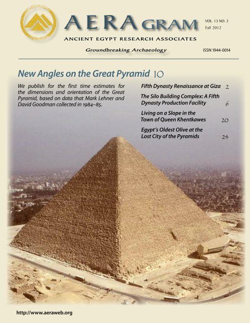
VOL. 13 NO. 2<br />
GRAM Fall 2012<br />
ANCIENT EGYPT RESEARCH ASSOCIATES<br />
Groundbreaking Archaeology ISSN 1944-0014<br />
New Angles on the Great Pyramid 10<br />
We publish for the first time estimates for<br />
the dimensions and orientation of the Great<br />
Pyramid, based on data that Mark Lehner and<br />
David Goodman collected in 1984–85.<br />
Fifth Dynasty Renaissance at Giza 2<br />
The Silo Building Complex: A Fifth<br />
Dynasty Production Facility 6<br />
Living on a Slope in the<br />
Town of Queen Khentkawes 20<br />
<strong>Egypt</strong>’s Oldest Olive at the<br />
Lost City of the Pyramids 24<br />
http://www.aeraweb.org
Fifth Dynasty Renaissance at Giza by John Nolan<br />
Khafre<br />
Pyramid<br />
Mastabas<br />
Khufu Pyramid<br />
Queens’<br />
Pyramids<br />
Mastabas<br />
Khafre Causeway<br />
Sphinx<br />
Sphinx Temple<br />
Khentkawes<br />
Monument<br />
Khentkawes Town<br />
Khafre Valley<br />
Temple<br />
4th Dynasty building boom. The view to the northwest from the top of the Gebel el-<br />
Qibli ridge takes in the great building projects carried out during this period. To the<br />
left just out of view lie the Menkaure Pyramid, temple, and queens’ pyramids.<br />
Over the last 25 years AERA has excavated the Lost City of the Pyramids, occupied during the 4th Dynasty when thousands<br />
labored to build the pyramids, tombs, and temples of Giza. When pyramid construction ended, kings moved to Saqqara to<br />
build their monuments, leaving Giza to the dead and the priests who served them. Our recent discoveries in the Khentkawes<br />
Town and Menkaure Valley Temple mark the return of royal attention in the middle of the 5th Dynasty. John Nolan, AERA<br />
Associate Director and epigrapher, opens a window onto Giza’s transition and revival after the end of the 4th Dynasty.<br />
Scrambling up the ridge called the Gebel el-Qibli west of the<br />
Lost City of the Pyramids—also called the Heit el-Ghurab<br />
site (HeG)—the entire panorama of Giza, chockablock with<br />
stone monuments, opens up at your feet. It’s difficult to imagine<br />
that almost all of the structures you see before you were<br />
built in the span of just 90 years. Before Khufu started building<br />
the Great Pyramid, the Giza Plateau was a high desert outcrop<br />
where the Maadi geologic formation meets the Moqattam formation.<br />
Aside from several isolated tombs from the first few<br />
dynasties, the plateau was untouched.<br />
Fourth Dynasty Building Boom<br />
The next four generations of <strong>Egypt</strong>’s rulers would oversee an<br />
explosion of construction at Giza. They raised three major<br />
pyramids with their associated temples, causeways, and valley<br />
temples, plus two satellite pyramids and six queens’ pyramids.<br />
The Sphinx was carefully carved out of bedrock, while the<br />
blocks cut out from around its feline body were stacked up to<br />
make the Sphinx Temple. High up on the plateau, both to the<br />
west and east of the Great Pyramid, the overseer of works laid<br />
out several cemeteries, comprised of street after street of large<br />
stone mastaba cores. Each of these stripped-down tombs stood<br />
ready to be assigned to one of the king’s officials, who would<br />
then case and decorate it as his house for eternity.<br />
Toward the end of this intense period, the rich and powerful<br />
started building tombs in the quarries east of the Khafre<br />
Pyramid, creating the great Central Field burial ground.<br />
End of the 4th Dynasty<br />
During the 4th Dynasty the HeG settlement at the edge of the<br />
Giza Plateau was an important administrative and economic<br />
center, a command center for pyramid building. We have<br />
found evidence of a wide range of activities at the town, from<br />
food preparation, storage, construction, and crafts to highlevel<br />
administration. We see indications of a vast spectrum of<br />
people from laborers to high administrators.<br />
Some of the most striking information about the town<br />
comes from discarded clay sealings that had been used to<br />
secure containers, papyrus rolls, and doors. The clay was impressed<br />
while wet with cylinder seals that bear titles of the seal<br />
owner and the king he served. The titles on the sealings we have<br />
recovered belong to high officials, some of whom worked closely<br />
with the king’s Prime Minister—the Vizier—and educated<br />
future officials in the king’s household. Other sealings indicate<br />
that purification priests of the living king worked at the edge of<br />
the settlement in an outpost of the royal funerary workshop.<br />
All of this activity appears to have stopped abruptly at the<br />
end of Menkaure’s reign late in the 4th Dynasty. Several lines of<br />
archaeological evidence indicate that the settlement was delib-<br />
2<br />
AERAGRAM 13-2
erately dismantled and abandoned. Our clay sealings also suggest<br />
that there was virtually no activity after this point. Out of<br />
more than 5,000 clay sealings recovered from the site, only five<br />
belong to a king other than Khafre or Menkaure. All five date<br />
to the reign of Userkaf, the founding ruler of the 5th Dynasty.<br />
When Menkaure died, workers were still finishing off his<br />
pyramid and its complex of temples and queens’ pyramids. His<br />
successor, Shepseskaf, took up the work and finished these<br />
structures using a distinctive size and style of mudbrick.<br />
We now believe Shepseskaf carried out an even larger<br />
project on the plateau by completing the mortuary complex of<br />
Queen Khentkawes as part of a single, massive construction<br />
effort. When he finished, Shepseskaf abandoned Giza, moved<br />
the royal house to South Saqqara, and began building his own<br />
funerary monument there.<br />
Transition to the 5th Dynasty at Giza<br />
With the end of the 4th Dynasty, major construction projects<br />
were completed, but Giza did not become a ghost town. A<br />
community of priests lived in the settlement at the foot of the<br />
Khentkawes monument, and teams of artists and craftsmen<br />
labored away on tombs in the Western and Central Cemeteries.<br />
As the owners of these tombs passed away, priests visited their<br />
tomb chapels and established cults for them. Even the spaces<br />
in between the great 4th Dynasty tomb cores gradually filled in<br />
with smaller mudbrick burials for minor officials and relatives.<br />
With the end of the large scale projects of the 4th Dynasty, Giza<br />
29<br />
28<br />
Khentkawes<br />
Monument<br />
Khentkawes Town<br />
27<br />
25<br />
23<br />
21<br />
19<br />
18<br />
18<br />
19<br />
Modern Cemetery<br />
was a quieter place. Then after 45 subdued years, Giza was<br />
infused with new vitality.<br />
Giza Revival<br />
Our 2011 and 2012 excavations in the Menkaure Valley Temple<br />
revealed that sometime in the middle of the 5th Dynasty workers<br />
returned to the temple and refurbished the cult emplacements.<br />
In his excavations here over 100 years ago, George<br />
Reisner had noted some of this activity but did not single it out<br />
as an archaeological phase in its own right. We, however, felt it<br />
was significant enough to merit a discrete phase of its own.<br />
Who was responsible for the refurbishment? Mark Lehner<br />
observes that the architecture of this phase includes massive<br />
corner constructions used in some of the walls of the Annex<br />
at the front of the valley temple and a small square chamber<br />
with a single, central column up in the mortuary temple, both<br />
innovations introduced in other temples during the reign of<br />
Niuserre, an important king who reigned (ca. 2402–2374 BC)<br />
in the middle of the 5th Dynasty. In addition, clay sealings and<br />
broken inscriptions discovered by Reisner throughout the<br />
pyramid complex bear the names of Khafre, Menkaure, and<br />
Shepseskaf, three of the last rulers in the 4th Dynasty, but no<br />
later kings until Niuserre, followed by almost every other king<br />
of the Old Kingdom. This evidence points to Niuserre as the<br />
driving force behind the resuscitation of the temple and the<br />
renewal of Menkaure’s cult.<br />
Evidence gathered from our 2012 excavations in the Silo<br />
Building Complex (described in “Conundrums and Surprises:<br />
The Silo Building Complex,” page 6), east of the Khentkawes<br />
Town, confirms our view of Niuserre’s role. From limited, preliminary<br />
excavations in this mudbrick compound—probably<br />
an administrative/production center—surrounded by<br />
a thick mudbrick wall, we recovered over 35 impressed<br />
clay sealings, many of which bear the name of Niuserre.<br />
One sealing in particular includes the title “Overseer<br />
23<br />
Menkaure<br />
Valley Temple<br />
26<br />
23<br />
Lost City of the<br />
Pyramids or Heit el-Ghurab<br />
(HeG) site<br />
22<br />
24<br />
59<br />
Gebel el-Qibli<br />
21<br />
19<br />
18<br />
18<br />
Contour lines represent meters above<br />
sea level at one-meter intervals.<br />
Map by Rebekah Miracle, AERA GIS.<br />
0 25 50 100 200 meters<br />
Fall 2012 3
HOW TO READ<br />
A CLAY SEALING:<br />
Right: Clay sealing found in the Silo Building Complex in 2012 that<br />
bears the Horus name of Niuserre: Set-ib tawy, “Favorite of the Two<br />
Lands.” The Horus name (here highlighted in red), written inside a<br />
box topped by a falcon over a stylized “palace facade,” indicates<br />
that Niuserre was alive at the time the cylinder seal was carved.<br />
Below: Clay sealing found in the Silo Building Complex in 2012 that<br />
bears the title “Overseer of the Pyramid ‘Great is Khafre’.” In all the<br />
line drawings presented here, a solid black line indicates a clear<br />
reading, gray shading indicates an interpretation based on the existing<br />
traces, and a dashed line represents a complete reconstruction.<br />
The transliterations and translations below correspond to the<br />
columns of text in the line drawing in bottom right, where red lines<br />
indicate the column text breaks. Photos by Yaser Mahmoud.<br />
of the Pyramid ‘Great is Khafre’” alongside Niuserre’s name.<br />
This seal impression suggests that, at a minimum, Niuserre<br />
took an active interest in the administration of the old pyramid<br />
town that housed priests and others maintaining the cult of<br />
Khafre in his temple. Altogether the emerging evidence shows<br />
that Niuserre focused his attention on many of the same structures<br />
and institutions at the foot of the Giza Plateau as did his<br />
successor Shepseskaf at the end of the 4th Dynasty.<br />
Set<br />
Ib<br />
Tawy<br />
1<br />
2<br />
3<br />
4<br />
Îr: Òt-ib -t3.wy<br />
Horus: “Favorite of the Two Lands,”<br />
1<br />
2 3 4<br />
imy-r3 ‹r-≈æ=f-Ræ …<br />
Overseer of the Pyramid “Great is Khafre,” …<br />
Îr: Òt-ib-[t3.wy]<br />
Horus: “Favorite of the Two Lands,”<br />
iry-xt-ny-sw.t sm3a [wda-mdw ...]<br />
Custodian of the King’s Property,<br />
who makes right [the judgement …]<br />
Niuserre Looks Back to Giza<br />
Why was Niuserre interested in Giza? We turn to details of<br />
his reign for answers. After his father Neferirkare passed away<br />
Niuserre’s older brother Raneferef became king. But, after ruling<br />
for just two years, Raneferef died unexpectedly. At this<br />
point, Shepseskare, Niuserre’s cousin and a son of the old pharaoh<br />
Sahure, may have seized the throne. While little is known<br />
about Shepseskare’s reign, he seems to have ruled long enough<br />
to level the site for his pyramid just north of Sahure’s pyramid<br />
at Abusir, before he too died. After two ephemeral reigns and<br />
an apparent power struggle between two collateral lines of the<br />
royal family, Niuserre ascended to the throne.<br />
He set to work completing his brother Raneferef’s funerary<br />
monument and made substantial changes to that of his<br />
mother, a woman named Khentkawes. Originally the temple<br />
attached to her pyramid at Abusir opened north into the larger<br />
pyramid complex of her husband, Neferirkare. Niuserre shifted<br />
its entrance to the east making it an independent cult. He also<br />
bestowed on his mother the title “Mother of Two Kings of<br />
Upper and Lower <strong>Egypt</strong>,” mirroring—perhaps intentionally—<br />
the same title held by the earlier, 4th Dynasty queen also named<br />
Khentkawes, but buried under the large monument towering<br />
above the Khentkawes Town at Giza.* Taking over after a period<br />
of instability and perhaps judging that his grasp on power<br />
was shaky, Niuserre drew upon the obvious parallels between<br />
the name and title of his mother Khentkawes buried at Abusir<br />
and her earlier namesake at Giza. By revitalizing the cults of<br />
Khafre, Menkaure, and Khentkawes I at Giza, Niuserre hoped<br />
* For more on the two queens named Khentkawes see “On the Cusp of a New<br />
Dynasty: Khentkawes and Userkaf” in AERAGRAM 11.2, Winter 2011, pages<br />
10–12. All issues of AERAGRAM are available for free download at our website:<br />
aeraweb.org.<br />
4<br />
AERAGRAM 13-2
Djedefre<br />
(c. 2482–2475)<br />
Khufu<br />
(c. 2509–2483)<br />
Khafre<br />
(c. 2472–2448)<br />
?<br />
Khentkawes I (Giza)<br />
Detail from the statue<br />
of Menkaure and his<br />
queen found in the<br />
Menkaure Valley Temple.<br />
Museum of Fine<br />
Arts Boston. Photo by<br />
Mark Lehner.<br />
Fourth Dynasty<br />
Fifth Dynasty<br />
Menkaure<br />
(c. 2447–2442)<br />
Shepseskaf<br />
(c. 2441–2436)<br />
Userkaf<br />
(c. 2435–2429)<br />
Sahure<br />
(c. 2428–2416)<br />
Neferirkare<br />
(c. 2415–2405)<br />
Khentkawes II (Abusir)<br />
Head of Userkaf found<br />
at Abusir. Cairo Museum.<br />
Photo by Mark Lehner.<br />
Shepseskare<br />
(c. 2403)<br />
Raneferef<br />
(c. 2405–2403)<br />
NIUSERRE<br />
(c. 2402–2374)<br />
marriage<br />
order of regnal succession<br />
likely royal blood line<br />
unclear blood relationship<br />
Menkauhor<br />
(c. 2373–2366)<br />
Djedkare Izezi<br />
(c. 2365–2322)<br />
Proposed family relationships among the kings from Khufu through Djedkare Izezi. The relationships for the 4th Dynasty, especially that Menkaure<br />
and Shepseskaf might have been brothers and sons of Khentkawes I, are only hypothetical. The relationships for the 5th Dynasty agree with those on<br />
pages 64–65 in A. Dodson and D. Hilton, The Complete Royal Families of <strong>Ancient</strong> <strong>Egypt</strong>, London: Thames and Hudson, 2010. Year dates for the rulers<br />
largely follow E. Hornung, R. Krauss, and D. Warburton, <strong>Ancient</strong> <strong>Egypt</strong>ian Chronology, Leiden and Boston: Brill, 2006.<br />
to solidify his ties to the 4th Dynasty and at the same time to<br />
legitimize his own reign.<br />
Repercussions<br />
The revitalization of the cults had wider repercussions through<br />
the end of the 5th Dynasty. Giza, it appears, took on increased<br />
economic and religious prominence in the late 5th Dynasty. For<br />
example, the cults of both Khafre and Menkaure played important<br />
roles elsewhere in <strong>Egypt</strong>, as can be gleaned from papyrus<br />
documents discovered in the ruins of pyramid temples at<br />
Abusir, just north of Saqqara. These documents start in the<br />
reign of Niuserre’s successor, Menkauhor, and continue into<br />
the 6th Dynasty. Scattered among the hundreds of pieces of<br />
papyrus were receipts of linen and textiles from the Menkaure<br />
Valley Temple. Another document identifies priests of Khafre<br />
as those who sealed the walkway that opened onto the truncated<br />
pyramid of Raneferef, indicating that they were among the<br />
most important priests in the Raneferef cult. These glimpses<br />
from the Abusir documents suggest that the royal temples at<br />
Giza, newly revitalized by Niuserre, played an important role<br />
in the economic and administrative life of the late 5th Dynasty.<br />
At the same time, high officials like one named Rawer, who<br />
served Niuserre’s father, chose to be buried in elaborate tombs<br />
at Giza, as did two viziers of Djedkare Izezi—Seshemnefer III<br />
and Senedjemib Inty. Clearly, by the late 5th Dynasty Giza had<br />
once again become a prestigious burial ground for <strong>Egypt</strong>’s upper<br />
classes. Niuserre’s campaign of legitimization was apparently<br />
a great success.<br />
As we digest the results of AERA’s recent fieldwork and<br />
prepare for upcoming seasons in the Khentkawes Town and<br />
the Menkaure Valley Temple, it is clear that we are now moving<br />
into a dynamic historical period, not only for Giza, but<br />
for <strong>Egypt</strong> as a whole. With the passing of Menkaure, the royal<br />
focus shifted away from Giza for a few generations. The vibrant<br />
settlement at the HeG was dismantled and put to bed just as<br />
priests and their families moved into the newly-built structures<br />
around the Khentkawes monument and Menkaure Valley<br />
Temple. After some years, the royal gaze returned to Giza as<br />
a symbol of legitimacy. Niuserre, the unexpected king and<br />
witness to years of dynastic strife, emphasized the parallels between<br />
his rule and those of his predecessors at Giza by rebuilding<br />
their temples and revitalizing their cults. As we put together<br />
the evidence from the Khentkawes Town and the Menkaure<br />
Valley Temple and dig deeper into the Silo Building Complex,<br />
we hope to learn more about Niuserre and his successors.<br />
Fall 2012 5
Conundrums and Surprises: The Silo Building Complex<br />
2011<br />
Menkaure<br />
Pyramid<br />
Khentkawes<br />
Monument<br />
Khentkawes<br />
Town<br />
Ramps<br />
Basin<br />
Above: The tops of silo walls begin to appear as<br />
excavators scrape the ruin surface. Beyond lies<br />
the basin and at its far side, approach ramps<br />
leading up to the Khentkawes Town. View<br />
to the west-northwest. Photo by Mark<br />
Lehner.<br />
Northern Enclosure Wall<br />
Corridor<br />
Khafre<br />
Pyramid<br />
We launch each field season with ideas<br />
as to how the excavation might answer<br />
particular questions. But we do not know<br />
what we will find until we dig. This past<br />
season the Silo Building Complex yielded<br />
conundrums and surprises. We first<br />
exposed this mudbrick compound in 2011<br />
while clearing to the east of the settlement<br />
dedicated to the cult of the 4th Dynasty<br />
Queen Khentkawes. The Silo Building<br />
Complex appeared to be an extension of<br />
the Khentkawes layout. But we discovered<br />
a more complicated and surprising story:<br />
a 5th Dynasty structure that may have<br />
served the cult of the 4th Dynasty king<br />
Khafre built inside an enclosure predating<br />
the Khentkawes Complex.<br />
We launched the 2012 season eager to<br />
return to the Silo Building Complex<br />
(SBC), where we exposed and mapped the tops<br />
of walls in 2011 as part of our ongoing work<br />
at the Khentkawes Town. We had discovered<br />
a previously unknown eastern approach to<br />
the Khentkawes Town in 2009. This valley<br />
2012<br />
6<br />
AERAGRAM 13-2
Map 1: What was known of the Khentkawes Town<br />
and monument when AERA began work here in<br />
2005 was based on the map published in S. Hassan,<br />
Excavations at Giza, 1932–1933, Vol. IV, Cairo:<br />
Government Press, 1943. Map 2: In 2009 AERA<br />
discovered an eastern approach to the settlement<br />
(2009 excavations in blue). In 2011 AERA teams<br />
cleared to the east (green). Map 3: In 2012 AERA<br />
excavated the Silo Building Complex (gold). Maps<br />
by Rebekah Miracle, AERA GIS.<br />
complex, as we called it, included corridors,<br />
stairs, and ramps fronting on a deep basin,<br />
which was probably a harbor. But we had<br />
only captured the northwestern corner of the<br />
approach. The basin, flanked on the north<br />
by a thick mudbrick wall (the Northern<br />
Enclosure Wall) and corridor, continued east<br />
beyond our excavation.<br />
2011: Khentkawes Complex Farther East?<br />
In 2011 we resumed clearing and eventually<br />
located the eastern end of the Northern<br />
Enclosure Wall, corridor, and basin.* A massive<br />
wall—reduced to only a few centimeters—<br />
bordered the basin on the east. The corridor<br />
terminated in a niche in this massive wall.<br />
Farther east beyond the Basin Enclosure<br />
Wall we exposed the Silo Building Complex, a<br />
compound with silos, small chambers, and a<br />
courtyard that extended beyond our clearing<br />
(2011 photo on facing page, top; map 2 on the right, center).<br />
We were surprised to find that the Khentkawes Valley<br />
Complex extended so far east, but the SBC appeared to be an integral<br />
part of the layout, fronting on the basin. The niche could<br />
have been an access from the northern corridor through the<br />
Basin Enclosure Wall into the SBC. We proposed that goods and<br />
offerings were stored here and then carried through the niche,<br />
up the corridor and ramp, onto the Khentkawes causeway to<br />
the chapel, where they were offered to the deceased queen.<br />
2012: Corner Conundrum<br />
Our theory about the ties between the SBC and Khentkawes<br />
Complex began to collapse during the 2012 excavations when<br />
we literally ran into a wall—the top of a massive mudbrick wall,<br />
2.62 meters thick (8.6 feet), lying right where we expected to<br />
find a corridor between the SBC and the Basin Enclosure Wall.<br />
Coming to a dead-end at this wall, the niche would not have<br />
1<br />
2<br />
Khentkawes<br />
Monument<br />
Ramp<br />
Causeway<br />
1932–2005<br />
Ramp<br />
2009<br />
Chapel<br />
0 10 50 meters<br />
Khentkawes Town<br />
Northern Enclosure Wall<br />
3<br />
Northern Corridor<br />
Basin<br />
0 5 10 15 meters<br />
Northern Enclosure Wall<br />
Northern Corridor<br />
Basin<br />
Niche<br />
Test Trench<br />
0 1 5 meters<br />
Basin Retaining Wall<br />
Causeway<br />
Basin Enclosure Wall<br />
Niche<br />
2011<br />
Threshold<br />
SBC Enclosure Wall<br />
Silo<br />
Building<br />
Complex<br />
offered access from the corridor after all. Two thick enclosure<br />
walls stood back to back (facing page, bottom; map 3 above).<br />
A connection between the SBC and Khentkawes seemed even<br />
more dubious when excavation supervisors Hussein el-Rikaby<br />
and Rabee Eissa discovered that the massive wall next to the<br />
SBC—the SBC Enclosure Wall—wrapped around the complex on<br />
the north. It formed a corner that opened out to the southeast<br />
and away from the Khentkawes Complex.<br />
Basin Retaining Wall<br />
Basin Enclosure Wall<br />
SBC Enclosure Wall<br />
Corridor<br />
Silos<br />
Silo Building Complex<br />
2012<br />
* We first reported on the 2011 work and the SBC in AERAGRAM 12-1, Spring<br />
2011, pages 10–13. All back issues of AERAGRAM are available for free download<br />
at our website: aeraweb.org.<br />
Facing page: The Silo Building Complex at the end of the 2012 excavations.<br />
In the background the high water table floods the basin. At the<br />
far end of the basin a protective backfill layer covers the ramps and corridors.<br />
View to the north-northwest. Photo by Mark Lehner.<br />
An Old Enclosure<br />
To find out how the two sets of enclosure walls were related,<br />
we dug a test trench down into the traces of the badly eroded<br />
Basin Enclosure Wall and the bank of limestone debris on<br />
which it rested. The trench exposed the west face of the SBC<br />
Enclosure Wall and revealed that it was older than the Basin<br />
Fall 2012 7
Enclosure Wall. We could clearly see a coating of plaster on<br />
the western face of the SBC Enclosure Wall, which would not<br />
have been there had it been built at the same time as the Basin<br />
Enclosure Wall or later. Moreover, the builders had piled limestone<br />
debris against the older wall, forming a bank upon which<br />
they laid the first course of the Basin Enclosure Wall.<br />
At this point the SBC appeared to be older than the Basin<br />
Enclosure Wall, which we assumed was built for Khentkawes.<br />
Excavations revealed a more complex situation.<br />
Room A featured scorched walls and black ash fill as well as<br />
a large granite quern stone. Millers would have used it with a<br />
smaller hand stone to grind cereals into flour.<br />
An official who administered the operation might have been<br />
quartered in the central SBC rooms. Room G perhaps served as<br />
the audience hall, where the official would have received visitors<br />
while seated in a niche defined by pilasters. He might have<br />
found private space in Room P, while H, Q, and V served as the<br />
kitchen.<br />
An Older Enclosure, a Younger Complex<br />
As we slowly worked our way down through the mudbrick<br />
tumble filling the SBC we discovered from architectural evidence<br />
that the SBC compound was built later than its enclosure<br />
wall. The SBC walls on the west side were built up to the SBC<br />
Enclosure Wall. Someone had blocked an opening in that massive<br />
wall and built the SBC east of it. In addition, the bricks<br />
of the SBC walls are made of tan or yellowish marl desert clay,<br />
in contrast to the dark Nile silt bricks of the SBC Enclosure<br />
Wall. They are also smaller—three-quarters the size of the SBC<br />
Enclosure Wall bricks.<br />
The SBC: A Production Center<br />
Although our initial impression of the SBC as an extension of<br />
the Khentkawes Complex proved wrong, we were apparently<br />
right about it being a production-administrative facility, based<br />
on our few limited excavation trenches that reached only to the<br />
final occupation floor.<br />
The five large mudbrick silos probably stored emmer wheat<br />
and barley. Production facilities occupied rooms on the north<br />
and east sides (C, A, O, N, M, and L), which were probably open<br />
to the sky (see map facing page, top). Ashy deposits, abundant<br />
bread molds and beer jars, as<br />
well as other evidence suggested<br />
bread-baking—and probably beerbrewing—on<br />
a large scale, as well<br />
as cooking.<br />
Some activity scorched the<br />
walls of Room L and left black ash<br />
across the floor. Along with Room<br />
M, Room L most likely functioned<br />
as a bakery. Room N also displayed<br />
burned walls, probably as a result<br />
of cooking. A circular feature in<br />
the floor might have been a hearth,<br />
perhaps where workers heated beer<br />
mash. The feature could also have<br />
been a socket for a vat or for a mortar<br />
used with a pestle to break apart<br />
cereal spikelets in preparation for<br />
grinding.<br />
8<br />
AERAGRAM 13-2<br />
Silo Building<br />
Complex (SBC)<br />
Cut<br />
SBC Enclosure Wall<br />
N<br />
Thrust into the 5th Dynasty<br />
Our ceramics team first alerted us to a possible 5th Dynasty<br />
occupation when they began finding 5th Dynasty pottery coming<br />
out of the SBC. But the clincher for this later date came<br />
from discarded clay sealings bearing the Horus name of 5th<br />
Dynasty king Niuserre (described in the box on page 4).<br />
<strong>Ancient</strong> <strong>Egypt</strong>ians secured containers,<br />
papyrus rolls, and doors from unauthorized<br />
opening with clay sealings,<br />
which were impressed while<br />
still wet with a cylinder<br />
seal often bearing<br />
the seal owner’s title<br />
and the Horus name<br />
Right: 5th Dynasty<br />
storage and beer jars<br />
from the Silo Building<br />
Complex (far right). Photo<br />
by Yaser Mahmoud. Below:<br />
The northeast corner of the<br />
Khentkawes Valley Complex<br />
and the west side of the Silo<br />
Building Complex. View to the<br />
south-southeast.<br />
Test Trench<br />
Northern Enclosure<br />
Wall<br />
Niche<br />
Basin Enclosure<br />
Wall<br />
Erosion Gully<br />
(Originally an<br />
opening to the Basin?)<br />
Threshold<br />
0 1 5 centimeters<br />
Basin<br />
Corridor<br />
Northern<br />
Enclosure<br />
Wall<br />
Mark Lehner
Northern<br />
Enclosure Wall<br />
Corridor<br />
Basin<br />
Basin Retaining Wall<br />
Niche<br />
Basin Enclosure Wall<br />
Threshold<br />
SBC Enclosure Wall<br />
Cut<br />
C<br />
Q<br />
H<br />
Above: Detail map of the Silo Building Complex based on AERA 2012<br />
excavations. Map by Rebekah Miracle, AERA GIS. Below: Workers<br />
excavate ashy layers in Room L, while in the background a worker and<br />
excavation supervisor Mohammed Fethi Mansour clear fill in Room M.<br />
Note the burned walls in Room L. View to the north. Photo by Mark<br />
Lehner.<br />
V<br />
E<br />
A<br />
Blocked<br />
Doorway<br />
B<br />
P<br />
D<br />
G<br />
O<br />
Pilasters<br />
N<br />
M<br />
0 1 5 meters<br />
L<br />
Blocked<br />
Doorway<br />
of the king he served. We know that the seals represented on<br />
the SBC sealings were carved when Niuserre was king because<br />
the Horus name was used only when the king was alive. So the<br />
SBC most likely functioned during the reign of Niuserre, half a<br />
century after the Khentkawes Complex was built.<br />
The sealings complement other evidence we uncovered of<br />
Niuserre’s presence on the plateau (described in the article<br />
“Fifth Dynasty Renaissance at Giza” starting on page 2). He may<br />
have retrofitted the SBC into the corner of the old mudbrick<br />
enclosure predating Khentkawes. But for whom was the older<br />
enclosure originally built?<br />
Whose Cult?<br />
Another sealing (shown on page 4) suggests an answer. It bears<br />
Niuserre’s Horus name along with the title: “Overseer of the<br />
Pyramid, ‘Great is Khafre,’” the name of the Khafre pyramid.<br />
The sealing suggests that the SBC was part of Khafre’s pyramid<br />
town and supported priests who maintained the cult of this 4th<br />
Dynasty king long after his death, during Niuserre’s reign (see<br />
chronology on page 5).<br />
The massive walls around the SBC may have originally been<br />
built for Khafre’s cult before the Khentkawes Complex was<br />
conceived. The Khafre Temple, where the cult priests would<br />
have conducted their rituals, lies only about 70 meters (around<br />
230 feet) to the northeast, although the enclosure seems to open<br />
to the southeast.<br />
Fifth Dynasty Access Conundrum<br />
Before we can verify that the SBC served the Khafre cult during<br />
the 5th Dynasty, we have to address a perplexing access<br />
issue. The northern entrance to the compound in which the<br />
SBC stands was blocked before the final occupation phase and<br />
the only access into SBC, through Room N, seems to have been<br />
completely sealed off as well (see map above, left).<br />
How did people get in and out of the SBC? Perhaps the niche<br />
in the Basin Enclosure Wall was their entrée after all. If the SBC<br />
Enclosure Wall stood only at the height we found it—perhaps<br />
eroded or partially dismantled—people could have exited the<br />
niche and stepped across. The east side of the wall might have<br />
contained steps to facilitate access. We found a cut in the wall<br />
but did not have time to explore further.<br />
An entrance on the west would connect the SBC with the<br />
Khentkawes Complex rather than the Khafre Valley Temple.<br />
Perhaps workers produced bread and beer for Khafre and<br />
Khentkawes. Niuserre seems to have revitalized the cult of<br />
Khafre and perhaps that of Khentkawes (his mother’s namesake)<br />
as well.<br />
We look forward to another excavation season with so much<br />
yet to learn about a 5th Dynasty occupation at the SBC and about<br />
the original structure in the enclosure wall. Much work lies<br />
ahead and probably more unexpected discoveries.<br />
Fall 2012 9
New Angles on<br />
the Great Pyramid<br />
by Glen Dash<br />
In 1984 Mark Lehner and David Goodman measured the elusive base of the Great Pyramid of Khufu. They followed in the<br />
footsteps of researchers, going back to the 17th century, who tried to determine the true dimensions of the pyramid—no easy<br />
task. Stripped of nearly all of its casing, the monument no longer has any corners, nor well-defined edges. Now, for the first<br />
time, we publish the Lehner-Goodman data with an analysis that gives the dimensions and orientation of the Great Pyramid.<br />
No monument in the world has given rise to more<br />
speculation about its meaning than the Great Pyramid<br />
of Khufu. It has been said to encode “God’s unit of measurement”—<br />
the Pyramid inch—to physically represent the mathematical<br />
constant pi, and incorporate the Golden Section. Sir<br />
Isaac Newton thought it could be used to refine his theory<br />
of universal gravitation. All of these ideas, sensible or not,<br />
depended to one degree or another on knowing the exact size<br />
and orientation of the Great Pyramid. It is surprising then to<br />
find that there has been no final, definitive work on the subject.<br />
The reason is due, in large part, to the condition we find<br />
the Pyramid in today. We find scant traces of its original corners.<br />
The best we can do is to project their original positions<br />
from the fragmentary data that does remain. It has proven to<br />
Above: Map of the Giza Plateau<br />
prepared by Napoleon’s expedition.<br />
Description de l’Égypte,<br />
Antiquites Planches, vol 5. Pyramids<br />
de Memphis. Plate 6, Plan<br />
Topographique des Pyramides<br />
et des Environs, 1809–17. Image<br />
courtesy of the Linda Hall Library<br />
of Science, Engineering & Technology.<br />
Right: David Goodman<br />
surveys in 1984 with a theodolite<br />
and electronic distance measuring<br />
device to establish the Giza Plateau<br />
Mapping Project grid, looking toward<br />
the Great Pyramid. View to<br />
the east-northeast. Photo by Mark<br />
Lehner.<br />
10<br />
AERAGRAM 13-2
Mark Lehner<br />
Northeast Socket<br />
Gill Survey<br />
Marker<br />
The Northeast Corner Socket. Left: AERA Surveyor Mohammed<br />
el-Baset walks past the remains of the socket (dotted line). Right:<br />
The same corner socket was photographed by Piazzi Smyth in<br />
1865. Smyth photo © Photoarchive3D; courtesy of George Mutter<br />
and Bernard Fishman.<br />
be a challenge. Of the original base, only 55 meters (180 feet)<br />
of what was once a casing baseline of 921 meters (3,022 feet)<br />
survives. Of the original platform baseline (as defined by its<br />
top, outer edge), only 212 meters (696 feet) of 924 meters (3031<br />
feet) survives.<br />
Flinders Petrie, the father of <strong>Egypt</strong>ian archaeology, measured<br />
the base of the Great Pyramid from 1880 to 1882.1 J. H.<br />
Cole, a surveyor with the <strong>Egypt</strong>ian Ministry of Finance, made<br />
additional measurements, which he published in 1925.2 Joseph<br />
Dorner measured it in 1979 for his doctoral dissertation at the<br />
University of Innsbruck, but was unable to complete the work<br />
to his satisfaction.3,4 After Mark Lehner and David Goodman<br />
measured the base of the Pyramid in 1984, they set the<br />
data aside while Lehner undertook the decades long<br />
task of uncovering and mapping the Lost City of the Pyramids.<br />
I now return to it.<br />
Pyramid Surveys: From Savants to the 1970s<br />
John Greaves, Professor of Astronomy at the University of<br />
Oxford, made one of the first attempts in modern times to<br />
precisely measure the base of the Great Pyramid. However,<br />
upon his arrival in <strong>Egypt</strong> in 1638 he found the base covered<br />
in centuries-old debris. Accurate measurements were all but<br />
impossible. Greaves measured the base as 693 feet<br />
in length. He would prove to be off by more<br />
than 60 feet.5<br />
When Napoleon invaded <strong>Egypt</strong> in<br />
1798, he brought along his “savants,”<br />
Fall 2012 11
N<br />
N<br />
W<br />
230.363 meters<br />
-3 ‘ 20 “ E<br />
PETRIE’S GREAT PYRAMID MEASUREMENTS<br />
-3‘ 57”<br />
-3‘ 57”<br />
Side Length (meters) Angle<br />
North 230.363 -3’ 20”<br />
East 230.320 -3’ 57”<br />
230.342 meters<br />
230.320 meters<br />
Detail of corner<br />
South 230.365 -3’ 41”<br />
West 230.342 -3’ 54”<br />
Average 230.348 -3’ 43”<br />
This drawing and table present Petrie’s measurements of the sides of the Great<br />
Pyramid and the angles at which they deviate from the cardinal directions. The<br />
W<br />
-3‘ 54”<br />
230.365 meters<br />
-3’ 41” E<br />
drawing exaggerates the angles in order to display them. Petrie found that each<br />
side was rotated slightly counterclockwise from cardinal points, as indicated by<br />
the minus sign.<br />
S<br />
S<br />
150 members of the “Commission of Arts and Sciences” to study<br />
and document sites throughout <strong>Egypt</strong>. Savant Edme-François<br />
Jomard assaulted the accumulated debris on the base of the<br />
Pyramid in Napoleonic style with a small army of Ottoman<br />
Turks. They cut through the overburden, uncovering two<br />
“sockets” off the northeast and northwest corners, one of which<br />
can be seen in the photos on the previous page. Jomard believed<br />
these sockets once held the very cornerstones of the Pyramid.<br />
To compute the Pyramid’s orientation and size, he thought, one<br />
only needed to measure the relative positions of the socket’s<br />
outermost corners.<br />
Petrie’s Measurements. Flinders Petrie, who arrived at Giza<br />
in 1880 to perform his measurements, disagreed with Jomard.<br />
By analyzing the Pyramid’s angles, he determined that the true<br />
corners must have fallen somewhere inside the sockets. Petrie,<br />
at 27, had already gained recognition for his skills as a surveyor,<br />
even before winning lasting fame as an archaeologist.<br />
By then, all four corner sockets had been found and exposed.<br />
Conveniently, Royal Astronomer and surveyor David Gill had<br />
preceded Petrie and in 1874 set bronze survey markers just<br />
inside the socket corners (shown in photo on previous page).<br />
Petrie, and almost every surveyor since, would use Gill’s markers<br />
as control points.<br />
Petrie found the north side of the Pyramid partially cleared<br />
of debris, revealing its ancient casing of smooth, white Tura<br />
limestone, seen in the photo on the facing page. The casing’s<br />
outer surface, Petrie estimated, sloped at a mean angle of 51° and<br />
52 minutes plus or minus 2 minutes. The casing once covered<br />
the entire Pyramid, requiring 21 acres of casing stones in all.<br />
Most of the casing had been carted away for building material<br />
centuries before. Originally it was supported by platform slabs<br />
set into bedrock, which Petrie found to be remarkably level.<br />
At that time, however, most of the east, west, and south<br />
sides of the Pyramid still remained covered in debris. Petrie cut<br />
through the debris to find a section of well-preserved casing<br />
near the center of each side. He chose one point on each side<br />
and then measured their relative positions precisely.<br />
Petrie then set out to calculate the size and orientation of<br />
the Pyramid by making a key assumption. He assumed that the<br />
corners of the Pyramid’s casings fell on the “pyramid diagonals”—lines<br />
that connected the four socket corners to their<br />
opposing corner.<br />
With that assumption and his measurements in hand, Petrie<br />
claimed he could calculate the length of the casing’s baseline<br />
on each side and the orientation of each baseline relative to<br />
cardinal points using a complex geometrical argument.6 He<br />
found that each side was rotated slightly counterclockwise from<br />
cardinal points, as indicated by the minus sign in angle measurements<br />
shown above in the table and the stylized pyramid<br />
with Petrie’s measurements. The maximum difference in length<br />
between any two sides, Petrie said, was just 4.5 centimeters<br />
(about 1.75 inches), and the corners of the casing formed nearly<br />
perfect right angles. The maximum deviation from a 90° angle<br />
at any corner was at the northeast corner, where it was just 37<br />
seconds of arc (.01°)—about the angle subtended by a dime<br />
viewed from across a football field.<br />
However, as noted, Petrie measured just one point on each<br />
side. Establishing a line, of course, requires at least two.<br />
Cole’s Lines. In the Pyramid’s case, no lines would actually be<br />
measured until the 1920s, when J. H. Cole of the Computation<br />
Office of the <strong>Egypt</strong>ian Ministry of Finance did so at the<br />
request of the German archaeologist Ludwig Borchardt. Cole<br />
laboriously cut through debris to expose several more points<br />
of the casing on each side. He chose the “best” two on each<br />
12<br />
AERAGRAM 13-2
COLE’S GREAT PYRAMID MEASUREMENTS<br />
Side Length (meters) Angle<br />
North 230.353 -2’ 28”<br />
East 230.391 -5’ 30”<br />
South 230.454 -1’ 57”<br />
West 230.357 -2’ 30”<br />
Average 230.364 -3’ 06”<br />
Petrie’s<br />
estimate for<br />
angle of slope<br />
51°52’<br />
Casing Stone<br />
100<br />
meters<br />
DORNER’S GREAT PYRAMID MEASUREMENTS<br />
Side Length (meters) Angle<br />
North 230.328 -2’ 28”<br />
East 230.369 -3’ 26”<br />
South 230.372 -2’ 31”<br />
West 230.372 -2’ 47”<br />
Average 230.360 -2’ 48”<br />
Platform Lines Casing Lines Sides of Great Pyramid N<br />
Best-fit Line<br />
Confidence Intervals<br />
Best-fit Line<br />
1 meter<br />
Measured<br />
Data Points<br />
(“Fallings”)<br />
Lehner’s Fallings. Mark Lehner mapped points near the middle of the<br />
east, west, and north side of the Great Pyramid where he found well<br />
preserved edges. We derive best-fit lines and confidence intervals<br />
for these. (The horizontal scale is exaggerated here to emphasize the<br />
angle.) The original corners can be located by extrapolation.<br />
and measured their angle. His measurements for the Great<br />
Pyramid are shown in the table above.<br />
The Pyramid was looking a little less perfect than what<br />
Petrie had determined. The maximum difference between any<br />
two sides, according to Cole, was 10 centimeters, about twice<br />
what Petrie had found. Its sides were also less square, with a<br />
deviation of about 3½ minutes of arc (.058°) at the northeast<br />
Platform Stone<br />
Casing Edge<br />
Platform Top<br />
Outer Edge<br />
Casing and Platform Stones. Near the corner of the north side the angled<br />
casing stones sit upon platform stones. The lower, outer edge of the<br />
casing and the top, outer edge of the platform provide the best places<br />
to measure the Pyramid’s lines. Petrie estimated the angle of the casing<br />
slope to be 51° 52 minutes ± 2 minutes. Photo by Mark Lehner.<br />
corner, about six times what Petrie found. Cole did find<br />
Petrie correct in one respect; the corners of the casing<br />
seemed to fall on the Pyramid diagonals.<br />
The <strong>Egypt</strong>ian Government eventually cleared the entire<br />
base of the Pyramid, but there would be no additional<br />
surveys until decades later.<br />
Dorner’s Values. In 1979, when Josef Dorner surveyed<br />
the Great Pyramid for his doctoral dissertation, he was<br />
able to provide preliminary measurements for the Great<br />
Pyramid, as shown in the table above on the left.<br />
The maximum difference between any two sides, according<br />
to Dorner, was 4.4 centimeters (almost 1.75 inches).<br />
The most askew of the right angles was 58 seconds (.016°)<br />
from square on the northeast. While not as perfect a pyramid<br />
as Petrie had proposed, Dorner’s findings were more<br />
in line with Petrie’s than Cole’s.<br />
Lehner’s Fallings<br />
In 1984, Mark Lehner and David Goodman made a comprehensive<br />
survey of the base of the Pyramid. Goodman,<br />
a surveyor then with the California Department of<br />
Transportation, established the survey grids now used to<br />
map both the Giza Plateau and the Valley of the Kings.<br />
For this study, he first laid a survey line along each side<br />
of the Pyramid between the bronze survey markers left<br />
by Gill, to serve as a control. Lehner then walked along<br />
the survey lines, choosing points to measure. When he<br />
chose a point, Goodman recorded its distance from one<br />
of Gill’s markers electronically. Goodman then sighted<br />
along the survey line using his theodolite’s telescope.<br />
Fall 2012 13
Lehner laid a tape measure from the point he<br />
wished to measure to the survey line, while<br />
Goodman, who could see the tape measure in<br />
his telescope, recorded the distance between the<br />
two. Surveyors refer to these offset measures as<br />
“fallings.” At each station, Lehner carefully noted<br />
the condition of the edges of the casing and<br />
platform stones. Mapping those points where<br />
he found the top, outer edge of the platform<br />
stones or the lower edge of the casing stones<br />
well preserved, I can attempt to reconstruct the<br />
original lines of the Pyramid. While previous<br />
surveyors had concentrated only on the casing,<br />
Lehner measured the platform as well.<br />
Northern Bestfit<br />
Casing Line<br />
Northern Bestfit<br />
Platform Line<br />
Analyzing the<br />
Lehner-Goodman Data<br />
In order to analyze this data, I first need to<br />
place it on a master grid. The grid I will use<br />
is the Giza Plateau Mapping Project (GPMP)<br />
control network that was established by Lehner<br />
and Goodman in 1984 and 1985. It assigns every<br />
point on the plateau coordinates, like addresses<br />
for houses on a city map. The origin of the<br />
map lies at the calculated center of the Great<br />
Pyramid, and everything is measured from that<br />
point, in units of meters. For example, Gill’s<br />
bronze survey marker off the northeast corner<br />
of the Pyramid is at 115.802 meters north of the center of the<br />
Pyramid, and 115.607 meters to its east. By convention, surveyors<br />
do not work with negative numbers, so instead of making<br />
the center of the Great Pyramid point (0, 0), Goodman and<br />
Lehner arbitrarily assigned it a location of (N100,000, E500,000).<br />
That places the northeast Gill marker at “Northing” 100,115.802<br />
and “Easting” 500,115.607. As designed, the GPMP system can<br />
be used to map features up to 100 kilometers south of the<br />
Pyramid, and 500 kilometers to its west, with unlimited range<br />
to its north and east.<br />
Once the Lehner-Goodman data is converted to GPMP coordinates,<br />
I can use a standard statistical method known as linear<br />
regression analysis to “best-fit” lines to it. In the figure on<br />
page 13 (center left), I show best-fit lines for the casing and the<br />
platform on the west side of the Pyramid. My linear regression<br />
analysis not only generates best-fit lines, but margins of error as<br />
well, known as confidence intervals.<br />
I have generated best-fit lines and confidence intervals for<br />
the north and east sides as well.* To derive corners, I need only<br />
* The south side is too badly damaged to provide data useful for statistical<br />
analysis. However, since I am assuming that the original casing and platform<br />
corners fell on the diagonals, I can proceed without that data.<br />
Confidence Area<br />
Platform<br />
Casing<br />
Western Best-fit Casing Line<br />
Confidence<br />
Area<br />
Gill Survey<br />
Marker<br />
Error Bounds<br />
Error<br />
Bounds<br />
Western Best-fit Platform Line<br />
Platform<br />
Socket Edge<br />
This schematic drawing of<br />
a hypothetical pyramid<br />
corner illustrates in three<br />
dimensions the location of<br />
best-fit lines, error bounds,<br />
confidence areas, and the<br />
socket edge in the diagrams<br />
on the facing page.<br />
to extrapolate these lines to see where they cross. The figure<br />
on the facing page shows the situation at the northwest corner.<br />
Here, two sets of best-fit lines for the casing, and two for the<br />
platform, meet. Each line is accompanied by confidence intervals.<br />
Based on my measurements and assumptions, there is a<br />
95% probability that the original casing and platform edges fell<br />
within the regions bounded by the dotted lines. For the casing,<br />
the error range, or “confidence area,” is approximately 16 by 9<br />
centimeters (6.3 by 3.5 inches). For the platform, it is about 16 by<br />
5 centimeters (6.3 by 2.0 inches).<br />
Is there a way to narrow this confidence area further? I<br />
can assume, as did Petrie and Cole, that all four corners of the<br />
platform and casing fell on the Pyramid’s diagonals (shown in<br />
the figure on the right). The locations of the Pyramid diagonals<br />
are well documented. † Since I only need the intersection of two<br />
lines to define a corner, and I am assuming that the casing and<br />
platform corners fell on the diagonal, I only need consider the<br />
intersection of either the northern casing and platform lines<br />
† Petrie and Maragioglio and Rinaldi placed the northern socket corners<br />
in exactly the same locations. Compare Plate X in W. M. F. Petrie, The<br />
Pyramids and Temples of Gizeh, London: Field and Tuer, 1883, with Plate 2 in<br />
V. Maragioglio and C. Rinaldi, L’Architettura Delle Piramidi Menfite Parte IV,<br />
Rapallo, Tipografia Canessa, 1965.<br />
14<br />
AERAGRAM 13-2
NW Socket Corner<br />
N100,115.841<br />
E499,883.898<br />
1 meter<br />
Petrie Station “O”<br />
(Gill Survey Marker)<br />
N100,115.591<br />
E499,884.148<br />
Pyramid Diagonal<br />
SOCKET<br />
Confidence<br />
Areas<br />
Error Bounds<br />
Northern Best-fit Platform line<br />
PLATFORM<br />
The Northwest Corners<br />
I can locate the corners from the<br />
intersection of the best-fit lines<br />
derived from the Lehner-Goodman<br />
data. Each line is surrounded<br />
by confidence intervals. (While<br />
the confidence intervals are, in<br />
fact, curved [hyperbolic] they appear<br />
straight over short distances.)<br />
There is a 95% chance that the<br />
original corners fell within the<br />
“confidence areas.”<br />
Error Bounds<br />
Northern Best-fit Casing Line<br />
CASING<br />
Western Best-fit<br />
Platform line<br />
Western Best-fit<br />
Casing Line<br />
NW Socket Corner<br />
N100,115.841<br />
E499,883.898<br />
1 meter<br />
Petrie Station “O”<br />
(Gill Survey Marker)<br />
N100,115.591<br />
E499,884.148<br />
Error Bounds<br />
2.6 cm<br />
SOCKET<br />
Northern Best-fit Platform line<br />
Narrowing the Range<br />
I can use the intersection of the<br />
Pyramid diagonal, which extends<br />
from the socket corner to the approximate<br />
center of the Pyramid,<br />
and the northern best fit lines, to<br />
narrow the confidence areas. This<br />
helps to better locate the corners.<br />
Pyramid Diagonal<br />
Confidence<br />
Areas<br />
PLATFORM<br />
Error Bounds<br />
5.0 cm<br />
Western Best-fit<br />
Platform line<br />
Northern Best-fit Casing line<br />
CASING<br />
Western Best-fit<br />
Casing Line<br />
Fall 2012 15
LEHNER-GOODMAN CASING CORNERS<br />
Corner Northing Easting Confidence<br />
Areas (meters)<br />
Northeast 100,115.288 500,115.034 ±.054<br />
Southeast 99,885.006 500,115.262 ±.093<br />
Southwest 99,884.759 499,884.954 ±.060<br />
Northwest 100,115.095 499,884.645 ±.050<br />
LEHNER-GOODMAN PLATFORM CORNERS<br />
Corner Northing Easting Confidence<br />
Areas (meters)<br />
Northeast 100,115.668 500,115.414 ±.013<br />
Southeast 99,884.484 500,115.785 ±.031<br />
Southwest 99,884.396 499,884.592 ±.023<br />
Northwest 100,115.522 499,884.217 ±.026<br />
with the diagonal, or the intersection of<br />
the western casing and platform lines<br />
with the diagonal. The northern lines<br />
have narrower confidence intervals and<br />
thus are better defined. Therefore, I<br />
will locate the northwest platform and<br />
casing corners at the intersections of the<br />
northern lines with the diagonal. The<br />
regions bounding their intersections are<br />
their confidence areas.<br />
Applying the same procedure at all<br />
four of the Pyramid’s corners, I can<br />
derive their locations. In the tables<br />
above I provide my best estimates for<br />
the original locations of the corners and<br />
their confidence areas. The largest of the<br />
confidence areas is at the southeast, but<br />
even there I can locate the casing corner<br />
to within ± 9.3 centimeters (3.7 inches).<br />
I can also use this data to calculate<br />
the length of the Pyramid’s sides and its<br />
angles. The Lehner-Goodman estimates<br />
for the casing lengths compared with<br />
that of Petrie, Cole, and Dorner are<br />
in the table on the right. Petrie’s and<br />
Dorner’s measurements fit comfortably<br />
inside the Lehner-Goodman ranges.<br />
Lehner-Goodman and Petrie differ in<br />
the mean of all four sides by only 1.8<br />
centimeters (0.75 inches). One of Cole’s<br />
measurements, however, falls outside<br />
the Lehner-Goodman ranges (in italics).<br />
As for the angles, the Lehner-<br />
Goodman estimates are compared with<br />
that of Petrie, Cole, and Dorner in the<br />
THE GREAT PYRAMID’S CASING LENGTHS IN METERS:<br />
LEHNER-GOODMAN, PETRIE, COLE, AND DORNER<br />
Side Lehner/Goodman Petrie Cole Dorner<br />
Min Mean Max<br />
North 230.286 230.389 230.493 230.363 230.253 230.328<br />
East 230.135 230.282 230.429 230.320 230.391 230.369<br />
South 230.155 230.309 230.462 230.365 230.454 230.372<br />
West 230.227 230.337 230.447 230.342 230.357 230.372<br />
Average 230.329 230.348 230.364 230.360<br />
THE GREAT PYRAMID’S CASING ANGLES:<br />
LEHNER-GOODMAN, PETRIE, COLE, AND DORNER<br />
Side Lehner/Goodman Petrie Cole Dorner<br />
Min Mean Max<br />
North -1’ 19” -2’ 52” -4’ 25” -3’ 20” -2’ 28” -2’ 28”<br />
East -1’ 12” -3’ 24” -5’ 36” -3’ 57” -5’ 30” -3’ 26”<br />
South -1’ 24” -3’ 41” -5’ 58” -3’ 41” -1’ 57” -2’ 31”<br />
West -2’ 58” -4’ 37” -6’ 14” -3’ 54” -2’ 30” -2’ 47”<br />
Average -3’ 38” -3’ 43” -3’ 06” -2’ 48”<br />
LEHNER-GOODMAN LENGTH AND ANGLES OF<br />
THE GREAT PYRAMID’S PLATFORM<br />
Side Length (meters) Angle<br />
Min Mean Max Min Mean Max<br />
North 231.157 231.196 231.236 -1’ 35” -2’ 10” -2’ 45”<br />
East 231.140 231.184 231.229 -4’ 51” -5’ 31” -6’ 11”<br />
South 231.138 231.193 231.248 -29” -1’ 18” -2’ 07”<br />
West 231.076 231.126 232.176 -4’ 50” -5’ 34” -6’ 18”<br />
Average 231.175 -3’ 38”<br />
16<br />
AERAGRAM 13-2
table on the left. All the measurements fall within the Lehner-<br />
Goodman ranges except for the Dorner and Cole measurements<br />
on the west side. ‡<br />
Recalling that Lehner measured the platform as well, I<br />
include its lengths and angles in the table on the left. The<br />
platform extends outward from the casing by an average of 42.3<br />
centimeters (16.7 inches) on each side. The casing does not run<br />
quite parallel to the platform. Although this difference is too<br />
small to illustrate in our figures, it is still significant and helps<br />
us to understand how the Pyramid was built. It might suggest,<br />
for example, that the Pyramid’s builders were unsatisfied with<br />
the platform’s original lines and chose to square things up a bit<br />
before finally dressing the casing down.<br />
‡ Dorner initially set his azimuth by measuring the angle of the casing on the<br />
north side with a WILD meridian telescope. He found the north side running<br />
at an angle of -3’ 0.” However, he rejected his own measurement in favor of<br />
Cole’s: – 2’ 28.” My analysis indicates he would have been better off not doing<br />
so. If he had accepted his own measurements, all his angles would change<br />
by -32” of arc. Not only would these revised angles fall within the Lehner-<br />
Goodman ranges, but they would be quite close to Petrie’s values as well.<br />
The South Side<br />
In this analysis, I managed to compute the length and orientation<br />
of the base of the Great Pyramid without the benefit<br />
of data from its south side. I was able to do this because I<br />
assumed that the corners of both the casing and the platform<br />
fell on the socket diagonals. This was necessary because so<br />
little of the south survives. There, the top, outer edge of the<br />
platform is nowhere to be found. As for the casing, at one<br />
point 122.2 meters east of the southwest Gill marker, Lehner<br />
found that the casing once met the platform at N99,884.838<br />
and E500,006.828. My model predicts that at that location the<br />
casing should have fallen at N99,884.889 and E500,006.889 plus<br />
or minus 0.075 meters. The casing does indeed fall within the<br />
range my model predicts. It is the only usable data point on the<br />
casing I have identified for the south side.<br />
Conclusions<br />
I gather my results in the figure on the next page. I have<br />
derived new estimates for the locations of the casing and<br />
Lost in the fog of time: the exact size and orientation of the Great Pyramid<br />
(above left) and the Khafre Pyramid (above) are not certain because the corners<br />
are missing. Right: One of the Lehner-Goodman 1984 survey sheets recording<br />
their fallings on the south side of the Great Pyramid. The detail shows Lehner’s<br />
sketches of the casing and platform at three points. The center sketch includes<br />
the comments: “Casing foot extrapolated from extant face at top of block.” “Plat.<br />
surface here slightly worn away. Note this upper piece shows a crack along the<br />
top – slightly dislodged.”
platform corners and provided error<br />
bounds (confidence areas). I can fix<br />
the locations of the platform corners<br />
to within 4 centimeters, and the casing<br />
corners within 10 centimeters.<br />
The mean of the Lehner-Goodman<br />
estimates for the casing corners are<br />
remarkably close to Petrie’s. The largest<br />
deviation between the two is on the<br />
northwest and is less than 4 centimeters<br />
(1.6 inches).<br />
NW Socket Corner<br />
N100,115.841<br />
E499,883.898<br />
Petrie Station “O” (Gill Survey Marker, G1.4)<br />
N100,115.591<br />
E499,884.148<br />
Lehner-Goodman Platform Corner<br />
N100,115.522<br />
E499,884.217<br />
ACKNOWLEDGEMENTS<br />
I wish to thank the following people<br />
who aided me in the preparation of<br />
this article. Jeff Stefanik, a professional<br />
surveyor with CME <strong>Associates</strong><br />
of Woodstock, CT, helped establish<br />
the protocol I used to complete my<br />
February 2012 survey of the Great<br />
Pyramid’s base. Dr. Robert Craig of<br />
Bird Conservation <strong>Research</strong>, Inc., of<br />
Putnam, CT, provided me with valuable<br />
insight into the proper methods of statistical<br />
analysis needed to analyze the<br />
data. Glenn Harrison of Fairfield, CT,<br />
performed some of the statistical analysis<br />
and re-checked my calculations.<br />
References<br />
1. W. M. F. Petrie, The Pyramids and Temples<br />
of Gizeh, London: Field and Tuer, 1883.<br />
2. J. H. Cole, Determination of the Exact<br />
Size and Orientation of the Great Pyramid of<br />
Giza, Cairo: Government Press, 1925.<br />
3. J. Dorner, Die Absteckung und astronomische<br />
Orientierung aegyptischer<br />
Pyramiden, PhD Dissertation, Universitaet<br />
Innsbruck, 1981.<br />
4. J. Dorner, “Das Basisviereck der<br />
Cheopspyramide,” in Structure and<br />
Significance, Thoughts on <strong>Ancient</strong> <strong>Egypt</strong>ian<br />
Architecture, P. Janosi, ed., Vienna: Verlag<br />
der Oestrreichischen Akademie der<br />
Wissenschaften, 2005.<br />
5. J. Greaves, Pyramidographia, or, a<br />
Description of the Pyramids in Ægypt,<br />
London: King’s Arms, 1736.<br />
6. W. M. F. Petrie, The Pyramids and<br />
Temples of Gizeh, London: Field and Tuer,<br />
1883, page 39.<br />
Petrie Station “W”<br />
N99,884.559<br />
E99,884.760<br />
Gill Survey Marker, G1.3<br />
N99,884.432<br />
E499,884.628<br />
Lehner-Goodman<br />
Confidence<br />
Area<br />
± 2.3 cm<br />
SW Socket Corner<br />
N99,884.262<br />
E499,884.458<br />
Lehner-<br />
Goodman<br />
Confidence<br />
Area<br />
± 2.6 cm<br />
Lehner-<br />
Goodman<br />
Confidence<br />
Area<br />
± 5.0 cm<br />
Lehner-<br />
Goodman<br />
Confidence<br />
Area<br />
± 6.0 cm<br />
Lehner-Goodman Casing Corner<br />
N100,115.095<br />
E499,884.645<br />
Petrie Casing Corner<br />
N100,115.074<br />
E499,884.663<br />
Lehner-Goodman Casing Corner<br />
N99,884.759<br />
E499,884.954<br />
Petrie Casing Corner<br />
N99,884.780<br />
E499,884.976<br />
Lehner-Goodman Platform Corner<br />
N99,884.396<br />
E499,884.592<br />
18<br />
AERAGRAM 13-2
Petrie Casing Corner<br />
N100,115.305<br />
E500,115.047<br />
Lehner-Goodman Casing Corner<br />
N100,115.288<br />
E500,115.034<br />
Lehner-Goodman Platform Corner<br />
N100,115.668<br />
E500,115.414<br />
Lehner-<br />
Goodman<br />
Confidence<br />
Area<br />
± 5.4 cm<br />
Lehner-<br />
Goodman<br />
Confidence<br />
Area<br />
±1.3 cm<br />
NE Socket Corner<br />
N100,116.072<br />
E500,115.817<br />
Petrie Station “Q”<br />
(Gill Survey Marker, G1.1)<br />
N100,115.802<br />
E500,115.607<br />
Feb. 2 to April 28, 2013<br />
Great Lakes Science Center<br />
Cleveland, Ohio<br />
The Lost <strong>Egypt</strong>, <strong>Ancient</strong> Secrets, Modern<br />
Science exhibition highlights AERA’s use of<br />
science and technology to understand the<br />
people and culture of ancient <strong>Egypt</strong>.<br />
Lost <strong>Egypt</strong> was created and produced by<br />
COSI (the Center of Science and Industry in<br />
Columbus, Ohio) and built by the Science<br />
Museum of Minnesota.<br />
AERAGRAM<br />
Volume 13 Number 2, Fall 2012<br />
Executive Editor: Dr. Mark Lehner<br />
Science & Arts Editor: Dr. Wilma Wetterstrom<br />
Managing Editor: Alexandra Witsell<br />
AERAGRAM is published by AER A,<br />
<strong>Ancient</strong> <strong>Egypt</strong> <strong>Research</strong> <strong>Associates</strong>, Inc.,<br />
a 501(c) (3), tax-exempt, non-profit<br />
organization.<br />
<strong>Ancient</strong> <strong>Egypt</strong> <strong>Research</strong> <strong>Associates</strong><br />
26 Lincoln St. Ste. 5, Boston, MA 02135<br />
E-mail: jschnare@aeraweb.org<br />
Lehner-Goodman Casing Corner<br />
N99,885.006<br />
E500,115.262<br />
Petrie Casing Corner<br />
N99,885.004<br />
E500,115.264<br />
Lehner-Goodman Platform Corner<br />
N99,884.484<br />
E500,115.785<br />
Lehner-Goodman Confidence Area<br />
± 3.1 cm<br />
Lehner-<br />
Goodman<br />
Confidence<br />
Area<br />
±9.3 cm<br />
Petrie Station “U”<br />
(Gill Survey Marker, G1.2)<br />
N99,884.402<br />
E500,115.858<br />
SE Socket Corner<br />
N99,884.102<br />
E500,116.168<br />
AERA Board Members<br />
President: Dr. Mark Lehner<br />
Vice President & Treasurer:<br />
Matthew McCauley<br />
Assistant Treasurer: Dr. John Nolan<br />
Secretary: Glen Dash<br />
Dr. James Allen<br />
Ed Fries<br />
Jon Jerde<br />
Bruce Ludwig<br />
Ann Lurie<br />
Louis Hughes<br />
Dr. Richard Redding<br />
© <strong>Ancient</strong> <strong>Egypt</strong> <strong>Research</strong> <strong>Associates</strong> 2012<br />
Request AERA's E-Bulletin<br />
Keep up with AERA by signing up for<br />
our E-Bulletin, sent out periodically.<br />
Please e-mail: jschnare@aeraweb.org.<br />
In the subject line type: “E-Bulletin.”<br />
Visit AERA's Website<br />
http://www.aeraweb.org<br />
Follow AERA on Twitter<br />
@AERA_EGYPT<br />
Fall 2012 19
Living on a Slope in the Town of Queen Khentkawes<br />
by Ana Tavares, Hanan Mahmoud, and Essam Shehab<br />
Walking around our reconstruction of House E in the town<br />
of Queen Khentkawes, Mohsen Kamel, AERA co-field<br />
director, exclaimed, “This is totally impossible!” Though we had<br />
been aware of the marked slope across the site since 2005 when<br />
we began recording the 4th Dynasty town of Queen Khentkawes<br />
(the Khentkawes Town or KKT), it was during the reconstruction<br />
of House E that the impractical slope of the floor surprised<br />
and puzzled us.* How did the inhabitants cope with the slope?<br />
We reviewed the information from our excavation records as<br />
to whether the house builders tried to lessen or level the slope<br />
within certain rooms by spreading a bed of limestone gravel<br />
between the walls. We had to go on what was left after Selim<br />
Hassan excavated the entire town in 1932 and 75 years of subsequent<br />
decay and erosion. We found that the builders managed<br />
to keep brick courses horizontal and that they tried to compensate<br />
for slope within rooms but could not totally eliminate it.<br />
Recording the Town: Mission Accomplished<br />
This past spring, Essam Shehab and an all-<strong>Egypt</strong>ian team<br />
cleared, surveyed, and mapped the last three houses on the<br />
west, bringing to completion the archaeological recording of<br />
the KKT that we began in 2005 (maps of KKT are shown on<br />
pages 3 and 7). With our meticulous methods, it took seven<br />
seasons to carefully document the town that Selim Hassan<br />
excavated in a single season. Hassan mapped at a scale of 1:200;<br />
we mapped at 1:20. We photographed and described every visible<br />
archaeological feature, including walls, deposits, and floors.<br />
Such careful mapping and recording allowed us to save information<br />
previously discarded or misunderstood. Our targeted<br />
excavations revealed the town’s original layout, development,<br />
* Articles about our work at the Khentkawes Town have appeared in previous<br />
issues of our <strong>newsletter</strong>. AERAGRAM 9-2, Fall 2008, pages 8–11,<br />
presents an overview of our findings and results of the 2008 field season.<br />
AERAGRAM 10-2, Fall 2009, pages 10–13, describes the excavations of<br />
House E. AERAGRAM 12-1, Spring 2011, pages 16–18, discusses the House<br />
E conservation project. All back issues of AERAGRAM are available for<br />
free download at our website: aeraweb.org.<br />
and longevity. We excavated House E in its entirety, finding out<br />
about the construction of the house. Finally, we protected the<br />
ancient remains with a mudbrick reconstruction over them.<br />
The work at KKT has radically altered our understanding<br />
of the town and brought to light many baffling features. We<br />
now know that the town was occupied over a long period of<br />
time, that there were various phases of rebuilding and a distinct<br />
phase of abandonment, and that the town functioned with a<br />
valley complex to the east. Puzzling features are changes in<br />
access and movement between different parts of the town and<br />
within house features, such as blocked rooms; how rooms were<br />
lit and ventilated; if they had upper floors; and, most startling,<br />
sloping floors, which are discussed below.<br />
The Strange Case of the Sloping Town<br />
A striking feature of the KKT is its unsuitable location. This<br />
priests’ town is positioned where it should be—near the funerary<br />
monument it serves—but the physical location presented<br />
substantial building problems. When the ancient <strong>Egypt</strong>ians<br />
laid out new settlements on the level floodplain or relatively<br />
flat low desert, they required little preparation. This is the case<br />
at the Lost City of the Pyramids (also called Heit el-Ghurab),<br />
a city for housing the pyramid builders, which AERA has been<br />
excavating since 1988 to the southeast of the KKT site (both<br />
sites are shown in the map on page 3). Here many buildings,<br />
such as the galleries in the Gallery Complex—possibly used<br />
as barracks—and the Royal Administrative Building—a large<br />
compound with grain silos and evidence of crafts and administration—were<br />
laid down with little levelling or other preparations.<br />
These structures have hardly any foundations, with the<br />
brick walls being built directly on sand, sometimes in a shallow<br />
foundation trench, or upon older settlement deposits.<br />
The area chosen by Khentkawes for her priests’ town stands<br />
in great contrast to the Heit el-Ghurab site. Khentkawes lived at<br />
the end of the 4th Dynasty when Giza had already been extensively<br />
quarried and built up during the earlier reigns of Khufu,<br />
20<br />
AERAGRAM 13-2
House D<br />
E<br />
F<br />
D<br />
Niche<br />
Kitchen<br />
C<br />
G<br />
B<br />
A<br />
House E House F<br />
Courtyard<br />
A well-appointed house:<br />
House E showing five<br />
elongated north-south<br />
spaces (A, C, D, E, and F),<br />
one transversal room (B)<br />
and an open courtyard<br />
(G). The size and layout of<br />
these modular houses, each<br />
approximately 189 square<br />
meters (2,034 square feet),<br />
reflects the high status of<br />
the inhabitants.<br />
Causeway<br />
Facing page: The mudbrick reconstruction of House E highlights the<br />
slope across the site and within a single house (compare the man in the<br />
foreground left with the one standing in the entrance to the house, in<br />
the background on the right). The overall site slope is very marked<br />
and needs to be taken into account when reconstructing the ancient<br />
town. Because the ancient structures are badly eroded and the site is<br />
vast, the drop in levels is difficult to visualize. View to the east.<br />
Khafre, and Menkaure. She built as her funerary monument a<br />
mastaba above a protruding block of limestone bedrock that remained<br />
from three generations of quarrying on a massive scale.<br />
Her tomb occupied a commanding position of the wadi and<br />
delivery area at the low, southeastern base of the Giza Plateau.<br />
Mark Lehner suggests this knoll was purposively left un-quarried<br />
and may have served as a surveyors’ point for the building<br />
of the pyramids and adjacent valley temples.* The KKT is laid<br />
out east of the queen’s monument, along the southern edge of<br />
the older quarries, on a broad quarry shelf, sloping down about<br />
6° from northwest to southeast.<br />
As Hassan published a plan with no elevations, this pronounced<br />
slope—a striking aspect of the settlement—went unnoticed.<br />
After the 1932 excavation the mudbrick ruins were left<br />
uncovered and eroded rapidly, further obscuring the contours.<br />
The causeway, 150 meters long (492 feet), drops from an elevation<br />
of 28.5 meters above sea level on the west, at the entrance<br />
of the Khentkawes chapel, to 18.5 meters above sea level at the<br />
doorway to the valley complex on the east, a slope of 1:15. In the<br />
“foot” of the town the builders compensated for the east-west<br />
drop by using debris to build up a terrace, but the north-south<br />
slope is almost as severe as that of the causeway, a 6-meter (19.7<br />
* For more information about the quarrying around the monument see<br />
Mark Lehner’s article “Khentkawes and the Great Circle of Quarrying” in<br />
AERAGRAM 9-2, Fall 2008, pages 14–15.<br />
feet) drop over a distance of 85 meters (279 feet). Although such<br />
drops in elevation can be dealt with easily in towns by terracing,<br />
or building individual structures at different levels accessible by<br />
stairs and ramps, the consequences are more conspicuous within<br />
individual houses.<br />
Coping with Slope<br />
The 1932 excavation removed occupation deposits and later<br />
floors. <strong>Ancient</strong> remodelling and severe erosion since the<br />
original excavation complicated the picture further. We were,<br />
however, able to recover the original modular plan of the<br />
houses. This consists of five elongated north-south spaces (A,<br />
C, D, E, and F), and one transversal room (B) leading to an open<br />
courtyard (G), on the north at the back of the house. House E<br />
measures 15.70 by 12 meters (51.5 by 39.8 feet), making it a substantial<br />
house with an area of 189 square meters (2,034 square<br />
feet). The house was entered from the southeast, into a rectangular<br />
space (A) subdivided by walls into a zigzag passage that<br />
allowed for increased privacy as one progressed through the<br />
house.<br />
The bedrock of the KKT site provided a solid foundation for<br />
building. The problem, however, was that within the House E<br />
area the bedrock slopes down across the house (from northwest<br />
to southeast) by over 2 meters (6.6 feet). The builders compensated<br />
for this by building the main walls out from the lowest<br />
point and keeping brick courses horizontal by extending each<br />
successive course farther out than the preceding course. They<br />
then reduced the slope inside each room by placing a thick, uneven<br />
layer of limestone chips between the walls. The thickness<br />
of this layer is uneven because of the contour of the underlying<br />
bedrock, but always thicker at the south–southeast end of the<br />
rooms. Then they laid the floors above this layer. This, however,<br />
was not enough, and the long north-south rooms (particularly<br />
Fall 2012 21
D and E) still had clearly sloping floors, as shown in the<br />
section drawing on the right. Despite previous excavations<br />
and subsequent site erosion, we were able to ascertain floor<br />
levels from thresholds and doorsockets, fragments of floor,<br />
and traces on wall plaster.<br />
Slopes, Ramps, and Steps<br />
When a drop in level is evident across other ancient<br />
<strong>Egypt</strong>ian settlements, piecemeal solutions seem to have<br />
been adopted. At the Stone Village, a workmen’s small<br />
hamlet at Amarna in Middle <strong>Egypt</strong>, a 7-meter (23 feet)<br />
drop across the village was not surmounted with terraces,<br />
but in a haphazard way by either building up floor levels<br />
with debris or cutting down into the marl desert clay.1<br />
Despite this, floor levels varied within houses and necessitated<br />
steps between rooms. A similar situation is clear at<br />
Deir el-Medinah, the village of the New Kingdom royal<br />
tomb builders at Thebes. Here floor levels varied from<br />
room to room, requiring much stepping up and down as<br />
the inhabitants moved through these houses. At Ayn ‘Asyl<br />
in the Governors’ Palace, dated to the 6th Dynasty, level floors<br />
were also not a priority. The floors were uneven from the start<br />
and were patched as they subsided, but no effective attempt<br />
was made to correct slope or evenness.2<br />
Ramps, often with central shallow steps, are ubiquitous in<br />
formal <strong>Egypt</strong>ian architecture. They allow access between terraces,<br />
courtyards, and rooms. The <strong>Egypt</strong>ians obtained an increasing<br />
sense of privacy as one progressed through a building by<br />
raising the floor and lowering the ceiling. This is well attested<br />
in temple architecture but is also present in domestic architecture,<br />
for example, at Heit el-Ghurab in Gallery III.4* where the<br />
floor rises by a total of 1.18 meters from the entrance to the back<br />
rooms. In House E the rising floor was particularly noticeable<br />
on entering the house, through the narrow, ramp-like zigzag<br />
passage (Space A in the drawing on page 21). This liminal zone<br />
was a deliberate way of increasing privacy not only by restricting<br />
access but by creating a sense of disorientation as visitors<br />
entered from a bright street into a dark, twisting, and steep<br />
passage before arriving in the main rooms. However, once in<br />
the main house, the slope is mostly reversed because of the site<br />
topography. As one progressed into the more private rooms of<br />
the house (through C, D, E, and F) the floors slope down, not up.<br />
For example, in Room D the floor sloped by 60 centimeters over<br />
6.30 meters (23.6 inches over 20.7 feet), as shown in the drawing<br />
on the right. That is a drop of 9.5 centimeters for each meter<br />
(that is 1:10.5). How did the inhabitants cope with this?<br />
Staying Low<br />
Why didn’t the inhabitants consider these houses unusable<br />
* Gallery III.4 is described in AERAGRAM 6-1, 2002, pages 4–5.<br />
SOUTH<br />
E<br />
23.35 m asl<br />
0 1 5 meters<br />
D<br />
23.66 m asl<br />
G<br />
Courtyard<br />
24.34 m asl<br />
NORTH<br />
m asl = meters above sea level<br />
How did they cope? A north-south section through House E showing floor slopes<br />
of the mudbrick reconstruction, with floor elevations indicated in meters above<br />
sea level (asl). After excavation we buried the ancient house under a protective<br />
layer of sand and encased the upper part of walls with mudbrick. We then built<br />
a mudbrick replica of House E above the ancient house. Original floors were evident<br />
from the excavation of doorsockets, door sills, debris levelling layers, fragments<br />
of floor, and traces of junction between floors and wall plaster. The lower<br />
part of the walls is based on our mudbrick reconstruction. The upper part of the<br />
walls and roofing are based on a hypothetical reconstruction by Felix Arnold (F.<br />
Arnold, “Die Priesterhäuser der Chentkaues in Giza.” Mitteilungen des deutschen<br />
archäologischen Instituts, Kairo, vol. 54, 1998, pages 2–18).<br />
given the sloping floors? <strong>Ancient</strong> <strong>Egypt</strong>ian furniture and lifestyle<br />
may provide a partial explanation. Many cultures, including<br />
modern cultures in the Middle East and Far East, prefer<br />
living with low furniture, and many activities are carried out<br />
sitting, kneeling, or squatting on the floor. This was the case<br />
in ancient <strong>Egypt</strong>, where inhabitants favored low furniture such<br />
as stools, chairs, and beds, ranging from the simplest stone and<br />
reed pieces to sophisticated wood furniture, inlaid and gilded.<br />
Wood suitable for making furniture was a rare commodity<br />
in <strong>Egypt</strong>, and modest households often used stone, reed,<br />
leather, and matting as an alternative. Although conditions<br />
at the Heit el-Ghurab site do not allow for the preservation of<br />
organic materials, we have found low tables and fragments of<br />
stools made of stone, like those on the facing page. For storage,<br />
the ancient <strong>Egypt</strong>ians used boxes and baskets placed on the<br />
ground, or pottery jars partly buried in the floor, or placed on<br />
low stands. In the Heit el-Ghurab galleries we found low sleeping<br />
platforms, which, probably covered with a simple reed mat,<br />
served as beds. Those who have camped “roughing it” with<br />
sleeping bags on the ground and food cooking over a campfire<br />
or have lived in a traditional Middle Eastern or Japanese style<br />
will know that short-legged furniture, and generally living<br />
on the ground, lessens the problems with slope and unevenness,<br />
while high-legged furniture accentuates the need for level<br />
floors. The priests of the KKT Town would have used this type<br />
of low furniture, which lessens the problems of uneven or sloping<br />
floors.<br />
Or, people ate, slept, and worked directly on the floor, probably<br />
on mats, using very little furniture. Old Kingdom tomb<br />
scenes show a great range of activities on the floor: traders in<br />
markets exchanging wares placed on the ground before them;<br />
in workshops craftsmen making artisanal goods as they kneel<br />
22<br />
AERAGRAM 13-2
or squat on a low brick; and scribes recording<br />
with a papyrus scroll stretched<br />
across their laps, in front of a low table<br />
or near chests and boxes for storing<br />
documents, scribal tools, and papyrus<br />
rolls, all resting on the floor. The scenes<br />
show, directly on the floor, ancient<br />
<strong>Egypt</strong>ians playing board games, receiving<br />
guests, and enjoying musicians at<br />
banquets. Objects found at both the<br />
Heit el-Ghurab and KKT sites provide<br />
evidence for many of these activities.<br />
Living close to or upon the ground with<br />
low furniture may explain why a sloping<br />
floor may have been an inconvenient,<br />
but not insurmountable, obstacle to the<br />
inhabitants of the KKT houses.<br />
More Questions than Answers<br />
AERA’s work at the town of Khentkawes<br />
has produced more questions than<br />
answers. The KKT priests’ town was<br />
built in a difficult area. The ground<br />
slope was dealt with in a pragmatic, piecemeal manner, but<br />
builders could not compensate fully for the topography. Slope<br />
was particularly striking within individual houses. House size<br />
and layout were commensurate with the high status of the<br />
occupants, and yet inconvenient features such as sloping floors,<br />
were acceptable. <strong>Ancient</strong> <strong>Egypt</strong>ian lifestyle and furniture may<br />
in part explain why living on a slope was tolerable. The excavation<br />
and reconstruction of House E has also highlighted other<br />
questions about light and ventilation, use of rooms, and flow of<br />
space. These questions are our driving motivation as we place<br />
the Khentkawes Town and its structures in the wider context<br />
of <strong>Egypt</strong>ian urbanism and ancient <strong>Egypt</strong>ian culture.<br />
Structures of everyday life.<br />
Household furniture was mostly<br />
low; short-legged beds, chairs,<br />
tables, and stands complemented<br />
with mats and low stools. We<br />
have found limestone fragments<br />
of table-stands and stools at the<br />
Heit el-Ghurab site, similar to<br />
these three examples currently in<br />
the Petrie Museum, London (UC<br />
16530, UC 16532, and UC 64713).<br />
Courtesy of the Petrie Museum.<br />
UC 16530<br />
0 5 25 cm<br />
Low furniture minimizes the problem of sloping or uneven<br />
floors. The chair, on display at the Metropolitan Museum<br />
of Art, New York, is from Dira Abu el-Naga, ca. 1550–1425<br />
B.C., Thebes. The Met provides this information: “This<br />
low, wooden chair, with its straight back, legs carved in<br />
the form of a lion’s legs, and mesh seat, is characteristic<br />
of chairs used by women in <strong>Egypt</strong>ian wall paintings of<br />
banquet scenes. The chair is held together with pegs and<br />
dowels; the angle braces are carved from forked branches.<br />
The central slat in the back and a few minor repairs are<br />
modern, and the mesh seat has been restored following<br />
indications provided by remnants.” “Tamarisk wood,<br />
UC 16532<br />
UC 64713<br />
reed. Overall: H. 58.8 cm (23 1/8 in); w. 43.3 cm (17 1/16 in); d. 47.5 cm (18 11/16 in) seat: H. 19.3 cm<br />
(7 5/8 in); w. 43.3 cm (17 1/16 in); d. 45.7 cm (18 in). 3/4 Left view. Rogers Fund, 1912 (12.182.28).”<br />
Photo Credit: image copyright The Metropolitan Museum of Art. Image source: Art Resource,<br />
NY Image Reference: ART403815, Image size: 4812 X 5002 px.<br />
ACKNOWLEDGEMENTS<br />
This article is based on the recording and excavation work supervised<br />
by Amelia Fairman, Daniel Jones, Hanan Mahmoud, Essam Shehab,<br />
and Lisa Yeomans. The reconstruction of House E involved Ashraf<br />
Abd el-Aziz, Gunter Heindl, Hanan Mahmoud, and Ana Tavares.<br />
References<br />
1. A. Stevens, Akhenaten’s Workers, The Amarna Stone Village Survey,<br />
2005–2009. Volume I: The Survey, Excavations and Architecture,<br />
Excavation Memoir 100, London: <strong>Egypt</strong> Exploration Society and<br />
Amarna Trust, 2012, pages 23–68.<br />
2. G. Soukiassian, Balat 6. Le palais des gouverneurs de l’époque de<br />
Pépy II: Les sanctuaires de ka et leurs dépendances, Cairo: Institut<br />
francais d’archeologie orientale, 2002, pages 281–283.<br />
Low living. Tomb scenes<br />
show a great variety of<br />
activities taking place<br />
while sitting on low<br />
furniture or directly on<br />
the floor. Here a scribal<br />
office depicted in the<br />
5th Dynasty tomb of Ti<br />
at Saqqara, shows scribes<br />
kneeling on the ground,<br />
while working in front<br />
of low tables laden with<br />
writing equipment and<br />
boxes. After L. Épron,<br />
Le Tombeau de Ti,<br />
Cairo: Institut Français<br />
d’Archéologie Orientale,<br />
1939.<br />
Fall 2012 23
<strong>Egypt</strong>’s Oldest<br />
Two<br />
halves of<br />
a charred olive pit<br />
found at the Lost<br />
City site. Photo by<br />
Claire Malleson.<br />
live Pit at<br />
the Lost City of the Pyramids<br />
On the basis of archaeological evidence, <strong>Egypt</strong>ologists say that olives<br />
first arrived in <strong>Egypt</strong> during the 18th Dynasty, and even then were<br />
a rare commodity. <strong>Egypt</strong>ologists would never expect to find olives at an Old Kingdom site. Yet, this past<br />
season, AERA archaeobotanist Claire Malleson discovered two halves of a charred olive pit in an ashy<br />
sample from the Lost City of the Pyramids excavations.<br />
T<br />
he charred olive pit pieces turned up in Gallery III.3, one of<br />
the elongated structures in the middle of the Lost City of<br />
the Pyramids (also called the Heit el-Ghurab site, map on page<br />
3), which may have served as a barracks.<br />
Prior to this discovery, the earliest finds are fragments from<br />
a context with a dubious 13th Dynasty date at Memphis, then<br />
capital of ancient <strong>Egypt</strong>. The most reliable early finds of olive<br />
come from the 18 th Dynasty. The earliest evidence for cultivation<br />
of olives in <strong>Egypt</strong> dates to the reign of Ramesses III (20th<br />
Dynasty), but <strong>Egypt</strong>’s climate does not suit olive growing.<br />
We might reject our exceptionally early find as intrusive<br />
material from later periods, but the olive pit halves came from<br />
a sealed deposit with no evidence of later disturbance. So how<br />
do we account for this olive at 4th Dynasty Giza so much earlier<br />
than any other examples in <strong>Egypt</strong>?<br />
Perhaps the olive came with a shipment of olive oil, which<br />
was imported from the Levant and Libya beginning as early<br />
as the 1st Dynasty. Levantine oil, scholars believe, was transported<br />
in vessels of combed ware, a hard ceramic named for<br />
the striations scratched in the clay before firing. We have found<br />
fragments of combed ware at the Lost City site, suggesting that<br />
olive oil might have been delivered to the settlement. It may<br />
have held olive oil for elite residents. Or, perhaps it was stored<br />
there before going to the Giza Necropolis, where it was placed<br />
in tombs as an offering. More than 50 complete combed jars<br />
have been found in the mastaba tombs of high officials.<br />
The olive pit is not our first evidence of olive at the Heit<br />
el-Ghurab site. Since 2002 charcoal analyst Rainer Gerisch<br />
has found bits of charred olive twigs scattered<br />
0 1 5 mm<br />
throughout the settlement—the oldest olive<br />
wood in <strong>Egypt</strong>.* The twigs, probably<br />
prunings, may have come with shipments<br />
of olive oil from the Levant.<br />
The twigs could have been packing<br />
material around oil storage jars.<br />
Perhaps our olive pit traveled with<br />
these twigs? If the olive wood did<br />
*The olive wood finds are described in<br />
AERAGRAM 9/1, Fall 2008, page 3. All back<br />
issues of AERAGRAM are available for free<br />
download at our website: aeraweb.org.<br />
indeed travel with combed storage jars, we<br />
can pin the source down more precisely.<br />
Our combed ware came from the area<br />
now within the modern country of<br />
Lebanon, most of it from a region<br />
between Beirut and Byblos, according<br />
to ceramicist Mary Ownby who<br />
determined its provenance through<br />
analysis of the clay. †<br />
Rainer found the olive wood associated with<br />
bits of other Levantine woods, such as cedar,<br />
pine, and oak, suggesting yet another possible<br />
explanation for our olive pit. When <strong>Egypt</strong>ian crews<br />
went to the Levant to fell trees for timber, they may have<br />
taken kindling for the return trip, a voyage as short as five days.<br />
Among the twigs and other material they picked up for their<br />
fires, a stray olive—perhaps a spoiled fruit—might have lurked.<br />
Since our specimens are charred we know that the olive ended<br />
up in a fire, although we cannot say if that was intentional.<br />
Our olive specimen most likely arrived at Giza by accident,<br />
but we plan to consider other options, such as the possibility<br />
that someone attempted to import a live olive tree.<br />
† M. F. Ownby, “The Importance of Imports: Petrographic Analysis<br />
of Levantine Pottery Jars in <strong>Egypt</strong>,” Journal of <strong>Ancient</strong> <strong>Egypt</strong>ian<br />
Interconnections, vol. 4:3, pages 23–29, 2012.<br />
Mediterranean Sea<br />
Lost City of<br />
the Pyramids<br />
site<br />
Roughly 575 kilometers (358 miles)<br />
Cairo<br />
About 270 nautical miles<br />
Byblos<br />
Beirut<br />
Damascus<br />
Tel Aviv<br />
Jerusalem<br />
Lebanon<br />
T H E L E V A N T