Satilla Initiative, Spring 2004 - River Basin Center at the University of ...
Satilla Initiative, Spring 2004 - River Basin Center at the University of ...
Satilla Initiative, Spring 2004 - River Basin Center at the University of ...

Create successful ePaper yourself
Turn your PDF publications into a flip-book with our unique Google optimized e-Paper software.
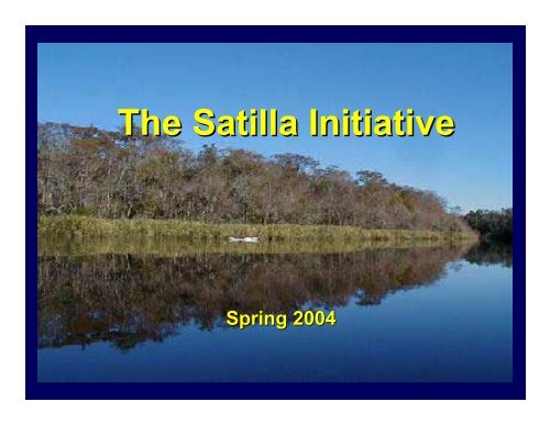
The <strong>S<strong>at</strong>illa</strong> <strong>Initi<strong>at</strong>ive</strong><br />
<strong>Spring</strong> <strong>2004</strong>
Overview<br />
• Background on <strong>the</strong> <strong>S<strong>at</strong>illa</strong> w<strong>at</strong>ershed<br />
– Including summary <strong>of</strong> region and current<br />
environmental issues<br />
• <strong>River</strong>s 101<br />
• Expect<strong>at</strong>ions for & overview <strong>of</strong> <strong>the</strong> class
Wh<strong>at</strong> Is a W<strong>at</strong>ershed?<br />
A w<strong>at</strong>ershed is <strong>the</strong> area <strong>of</strong> land th<strong>at</strong> drains<br />
to a particular point along a stream<br />
<strong>Center</strong> for W<strong>at</strong>ershed Protection
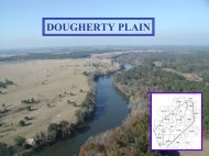
<strong>S<strong>at</strong>illa</strong> <strong>River</strong> <strong>Basin</strong><br />
• Lies entirely with<br />
Atlantic coastal plain<br />
• <strong>Basin</strong> occupies<br />
3,940 square miles<br />
Douglas •<br />
• <strong>S<strong>at</strong>illa</strong> <strong>River</strong> flows<br />
260 miles before<br />
emptying into St.<br />
Andrews Sound<br />
Waycross •<br />
Woodbine •<br />
• O<strong>the</strong>r major w<strong>at</strong>erways in basin include<br />
Alapaha <strong>River</strong>, Little <strong>S<strong>at</strong>illa</strong> <strong>River</strong>, Turtle <strong>River</strong>,<br />
Seventeen Mile Creek and Hurricane Creek
Why <strong>the</strong> <strong>S<strong>at</strong>illa</strong>?<br />
• Georgia DNR specifically asked UGA to<br />
initi<strong>at</strong>e program in <strong>S<strong>at</strong>illa</strong> similar to Etowah<br />
• UGA received property along <strong>S<strong>at</strong>illa</strong><br />
• Development, agricultural run<strong>of</strong>f and<br />
industrial-residential residential pollution are rel<strong>at</strong>ively<br />
low so <strong>the</strong>re is potential for protection<br />
AND…
A Unique Ecosystem<br />
• Black-w<strong>at</strong>er river with<br />
beach-white sandbars<br />
• Extensive bottomland<br />
forests and cypress and<br />
black gum swamps<br />
bordering river<br />
• Bluffs go up to 50 ft above<br />
river in upper reaches<br />
and 8 ft in lower reaches<br />
• Near Woodbine, <strong>S<strong>at</strong>illa</strong> widens and loses canopy <strong>of</strong><br />
trees, and <strong>the</strong>n becomes tidally influenced and<br />
surrounding veget<strong>at</strong>ion consists <strong>of</strong> marsh
<strong>S<strong>at</strong>illa</strong> Wildlife
<strong>S<strong>at</strong>illa</strong> Wildlife<br />
• Raccoons, opossum, armadillos,<br />
bobc<strong>at</strong>s, otters, beaver, gray foxes,<br />
black bear, allig<strong>at</strong>ors and turtles<br />
• Game species include white-tailed tailed deer,<br />
wild turkey, gray squirrel and feral hogs<br />
• Birds include belted kingfisher, barred<br />
owl, gre<strong>at</strong> horned owl, red tail hawk,<br />
wood storks, herons and osprey
<strong>S<strong>at</strong>illa</strong> Fishes<br />
• 52 species th<strong>at</strong> represent 16 families live in <strong>the</strong> w<strong>at</strong>ershed<br />
• Supplies major fisheries for redbreast sunfish and c<strong>at</strong>fish<br />
Redbreast Sunfish (Lepomis auritus)<br />
Banded Topminnow (Fundulus cingul<strong>at</strong>us)<br />
Chain Pickerel (Esox niger)<br />
Largemouth Bass (Micropterus salmoides)<br />
Channel C<strong>at</strong>fish (Ictalurus punct<strong>at</strong>us)<br />
Bluegill (Lepomis macrochirus)
Fl<strong>at</strong>head C<strong>at</strong>fish<br />
(Pylodictus<br />
olivaris)<br />
• Invasive species in <strong>S<strong>at</strong>illa</strong><br />
• Decim<strong>at</strong>es popul<strong>at</strong>ions <strong>of</strong> o<strong>the</strong>r<br />
fishes, especially <strong>the</strong> redbreast<br />
sunfish<br />
• Georgia DNR’s Wildlife<br />
Resources Division has a<br />
removal program to keep<br />
popul<strong>at</strong>ion from gaining<br />
dominance<br />
• Harvest all fl<strong>at</strong>head c<strong>at</strong>fish caught<br />
in <strong>S<strong>at</strong>illa</strong>; Do not release any
<strong>S<strong>at</strong>illa</strong> Flora<br />
• Wet areas: cypress<br />
and black gum<br />
swamps<br />
• Drier areas: w<strong>at</strong>er<br />
oak, laurel oak,<br />
sweetbay, , red maple<br />
and pine<br />
• Many higher, sandy pl<strong>at</strong>eaus converted to<br />
monoculture pine plant<strong>at</strong>ions
Chinese Tallow<br />
(Sapium<br />
sebiferum )<br />
• Invasive<br />
species found<br />
around <strong>S<strong>at</strong>illa</strong><br />
• Gradually displacing black willow and o<strong>the</strong>r<br />
n<strong>at</strong>ive species on sandbars and margins <strong>of</strong> river
Laura Walker St<strong>at</strong>e Park<br />
• Only publicly owned lake in <strong>the</strong> <strong>S<strong>at</strong>illa</strong><br />
<strong>River</strong> W<strong>at</strong>ershed<br />
• 110-acre blackw<strong>at</strong>er lake<br />
• Fisheries for largemouth bass, bluegill,<br />
c<strong>at</strong>fish, chain pickerel and flier
Brief History <strong>of</strong> <strong>S<strong>at</strong>illa</strong><br />
• “<strong>S<strong>at</strong>illa</strong>” comes from Saint Illa, , an <strong>of</strong>ficer in<br />
<strong>the</strong> Spanish Army<br />
• Early times, <strong>the</strong> <strong>S<strong>at</strong>illa</strong> was known for<br />
abundant game and fur<br />
• By <strong>the</strong> l<strong>at</strong>e 1800s, pioneer families<br />
established sustainable farming near <strong>the</strong> river<br />
• Many famous large rice plant<strong>at</strong>ions near<br />
coast – Belleview, Fairfield and Refuge
Brief History <strong>of</strong> <strong>S<strong>at</strong>illa</strong><br />
• <strong>S<strong>at</strong>illa</strong> and its bottomlands provided numerous<br />
n<strong>at</strong>ural resources to settlers<br />
– Farmers grazed c<strong>at</strong>tle and hogs in bottomlands<br />
– Longleaf pines were timbered and rafted down river<br />
– Pine forests supported naval stores industry<br />
(turpentine)<br />
• Early 1900s, wood pulp and paper mills were<br />
established in <strong>the</strong> areas and began <strong>the</strong> steady<br />
depletion <strong>of</strong> <strong>the</strong> n<strong>at</strong>ural forested areas
Development in <strong>the</strong> W<strong>at</strong>ershed<br />
• As <strong>of</strong> 1995, about<br />
101,000 people live in<br />
<strong>the</strong> <strong>S<strong>at</strong>illa</strong> w<strong>at</strong>ershed<br />
• Between 1975 and<br />
1995, popul<strong>at</strong>ion<br />
increased <strong>at</strong> a r<strong>at</strong>e <strong>of</strong><br />
1% per year<br />
• <strong>S<strong>at</strong>illa</strong> <strong>River</strong> basin supported 182,100 jobs in 1995<br />
• Moving from a manufacturing-based to a service-<br />
based economy
Stresses to <strong>the</strong> <strong>S<strong>at</strong>illa</strong><br />
• Lack <strong>of</strong> planning, zoning and enforcement<br />
<strong>of</strong> regul<strong>at</strong>ions<br />
• Rural development has continued without<br />
controls<br />
• Cabins and trailer sites have encroached<br />
into floodplain
Stresses have resulted in…<br />
• Lack <strong>of</strong> public<br />
awareness and<br />
concern<br />
– Dead animal<br />
carcasses<br />
– Cars and ATVs<br />
damage streambed<br />
• Pollution from raw sewage and medical<br />
waste spills, domestic trash and litter
Change in Land Use and Cover<br />
Major Land Cover %<br />
Upland Forest<br />
Deciduous<br />
Pine<br />
Mixed<br />
Agriculture<br />
Urban<br />
Non-forested Wetland<br />
Forested Wetland<br />
W<strong>at</strong>er/Fl<strong>at</strong>/Beaches<br />
1974<br />
56.39<br />
0.10<br />
51.74<br />
4.48<br />
26.14<br />
1.11<br />
1.51<br />
14.32<br />
0.52<br />
1990<br />
56.19<br />
7.00<br />
34.50<br />
14.73<br />
22.04<br />
1.70<br />
3.49<br />
15.71<br />
0.87
Impaired W<strong>at</strong>erways<br />
• 19 stream segments<br />
do not support<br />
design<strong>at</strong>ed use<br />
(fecal<br />
coliform and<br />
dissolved oxygen)<br />
• 2 stream segments<br />
do not meet fish<br />
consumption<br />
guidelines (mercury(<br />
mercury)
Streams Not Supporting Design<strong>at</strong>ed Uses<br />
Stream<br />
Loc<strong>at</strong>ion<br />
Design<strong>at</strong>ed<br />
Use<br />
Criterion<br />
Viol<strong>at</strong>ed<br />
Potential<br />
Cause(s)<br />
Big Creek<br />
S. Prong Big Cr. To <strong>S<strong>at</strong>illa</strong> <strong>River</strong><br />
(Brantley)<br />
Fishing<br />
DO<br />
NP (Non Point)<br />
Big <strong>S<strong>at</strong>illa</strong> Creek<br />
Headw<strong>at</strong>ers near Hazlehurst to<br />
Sweetw<strong>at</strong>er Cr. near Baxley (Jeff Davis /<br />
Appling)<br />
Fishing<br />
DO,FC<br />
UR (Urban<br />
Run<strong>of</strong>f)<br />
Boggy Creek<br />
Dry Creek to Little <strong>S<strong>at</strong>illa</strong> Cr. north <strong>of</strong><br />
Screven (Wayne)<br />
Fishing<br />
DO,FC<br />
NP<br />
Broxton Creek<br />
Seven Cr. To Seventeen Mile <strong>River</strong> near<br />
Broxton (C<strong>of</strong>fee)<br />
Fishing<br />
DO,FC<br />
NP<br />
City Drainage Canal<br />
Trib. . To <strong>S<strong>at</strong>illa</strong> <strong>River</strong>, Waycross (Ware)<br />
Fishing<br />
FC<br />
UR<br />
Colemans Creek<br />
Dry Brach S. <strong>of</strong> Surrency to Big <strong>S<strong>at</strong>illa</strong> Cr.<br />
Near Screven (Appling / Wayne)<br />
Fishing<br />
DO,FC<br />
Ur<br />
Hog Creek<br />
Hurricane Cr. To <strong>S<strong>at</strong>illa</strong> <strong>River</strong> S. <strong>of</strong><br />
Nicholls near Bickley (C<strong>of</strong>fee / Ware)<br />
Fishing<br />
DO,FC<br />
NP<br />
Hurricane Creek<br />
Downstream Little Cr. To Ten Mile Cr.<br />
Near Alma (Bacon)<br />
Fishing<br />
DO,FC<br />
NP<br />
Little Hurricane<br />
Creek<br />
Ga. Hwy. 32 to Hurricane Cr. (Bacon /<br />
Ware / Pierce)<br />
Fishing<br />
DO,FC<br />
NP<br />
Little <strong>S<strong>at</strong>illa</strong> Creek<br />
Keene Bay Branch to Dry Branch near<br />
Odum (Wayne)<br />
Fishing<br />
DO,FC<br />
UR<br />
Source: Georgia EPD, 2002
Streams Not Supporting Design<strong>at</strong>ed Uses<br />
(Continued)<br />
Stream<br />
Loc<strong>at</strong>ion<br />
Design<strong>at</strong>ed<br />
Use<br />
Criterion<br />
Viol<strong>at</strong>ed<br />
Potential<br />
Cause(s)<br />
Little <strong>S<strong>at</strong>illa</strong> Creek<br />
Boggy Cr. To Little <strong>S<strong>at</strong>illa</strong> <strong>River</strong> near<br />
Screven (Wayne)<br />
Fishing<br />
DO<br />
NP<br />
Pudding Creek<br />
Park Bay to <strong>S<strong>at</strong>illa</strong> <strong>River</strong> N. <strong>of</strong> Pearson<br />
(Atkinson)<br />
Fishing<br />
DO<br />
NP<br />
Red Bluff Creek<br />
Little Red Bluff Cr. to <strong>S<strong>at</strong>illa</strong> <strong>River</strong> E. <strong>of</strong><br />
Pearson (Atkinson)<br />
Fishing<br />
DO<br />
NP<br />
Reedy Creek<br />
Headw<strong>at</strong>ers to Big <strong>S<strong>at</strong>illa</strong> Cr. Near Screven<br />
(Appling / Wayne)<br />
Fishing<br />
DO,FC<br />
UR<br />
Roses Creek<br />
Upstream Ga. Hwy. 206 to Seventeen Mile<br />
<strong>River</strong> near Broxton (C<strong>of</strong>fee)<br />
Fishing<br />
DO,FC<br />
NP<br />
<strong>S<strong>at</strong>illa</strong> Creek<br />
Hunters Cr. E. <strong>of</strong> Ocilla to <strong>S<strong>at</strong>illa</strong> <strong>River</strong><br />
(Irwin / C<strong>of</strong>fee)<br />
Fishing<br />
DO,FC<br />
NP<br />
<strong>S<strong>at</strong>illa</strong> <strong>River</strong><br />
<strong>S<strong>at</strong>illa</strong> Cr. to Reedy Cr. Near Douglas<br />
(C<strong>of</strong>fee)<br />
Fishing<br />
DO<br />
NP<br />
Seventeen Mile<br />
<strong>River</strong><br />
Twenty Mile Cr. N. <strong>of</strong> Douglas to Otter Cr.<br />
Downstream Gen. C<strong>of</strong>fee St. Park (C<strong>of</strong>fee)<br />
Fishing<br />
DO,FC<br />
UR<br />
Sweetw<strong>at</strong>er Creek<br />
Black W<strong>at</strong>er Cr. to Big <strong>S<strong>at</strong>illa</strong> Cr. near<br />
Baxley (Appling)<br />
Fishing<br />
DO,FC<br />
UR<br />
Source: Georgia EPD, 2002
<strong>S<strong>at</strong>illa</strong> <strong>River</strong><br />
Conclusion:<br />
• Unique ecosystem in Georgia<br />
• Right now, development and pollution are<br />
low, but are increasing.<br />
The Time is Now…
<strong>River</strong>s 101<br />
Background inform<strong>at</strong>ion<br />
on rivers and <strong>the</strong><br />
importance <strong>of</strong> aqu<strong>at</strong>ic<br />
resource protection<br />
Dr. Ron Carroll<br />
Institute <strong>of</strong> Ecology
The <strong>S<strong>at</strong>illa</strong> <strong>Initi<strong>at</strong>ive</strong><br />
The <strong>S<strong>at</strong>illa</strong> <strong>Initi<strong>at</strong>ive</strong> is a service learning<br />
course th<strong>at</strong> provides a structured and<br />
supportive form<strong>at</strong> for students to apply<br />
policy, design and ecological principles<br />
learned in <strong>the</strong> classroom to <strong>the</strong> real<br />
world <strong>of</strong> people and policy.
Mission St<strong>at</strong>ement<br />
To help protect <strong>the</strong> ecological<br />
integrity <strong>of</strong> <strong>the</strong> <strong>S<strong>at</strong>illa</strong> <strong>River</strong> <strong>Basin</strong> by<br />
working with stakeholders to reduce<br />
<strong>the</strong> impact <strong>of</strong> human activities on<br />
w<strong>at</strong>er quality and biodiversity.
Practicum Goals<br />
• Provide an educ<strong>at</strong>ional environment where<br />
students can apply skills learned in <strong>the</strong><br />
traditional classroom to pressing community<br />
concerns and problems<br />
• Provide an opportunity for students and<br />
faculty to work with o<strong>the</strong>r disciplines in<br />
integr<strong>at</strong>ed environmental decision-making<br />
and problem-solving thus improving <strong>the</strong>ir<br />
ability to understand, communic<strong>at</strong>e with,<br />
and influence o<strong>the</strong>r disciplines
Practicum Goals<br />
• Increase awareness <strong>of</strong> <strong>the</strong> importance <strong>of</strong><br />
addressing environmental issues proactively<br />
within <strong>the</strong> university community and <strong>the</strong><br />
broader community<br />
• Respond to community concerns and<br />
problems in <strong>S<strong>at</strong>illa</strong> <strong>River</strong> basin<br />
• Build capacity for service learning <strong>at</strong> UGA
<strong>S<strong>at</strong>illa</strong> <strong>Initi<strong>at</strong>ive</strong><br />
• Law<br />
• Ecology<br />
• Educ<strong>at</strong>ion<br />
• Agricultural engineering<br />
• Environmental design<br />
• Forestry
How <strong>the</strong> Practicum Works<br />
• Students choose groups/projects<br />
• Faculty provides support<br />
– Developing work plans/str<strong>at</strong>egy<br />
– Lectures<br />
– Resources (liter<strong>at</strong>ure, contacts)<br />
– Group oversight<br />
• Reflections throughout semester<br />
• Final products
Expect<strong>at</strong>ions<br />
• Attend class lectures and field trip<br />
• Read assignments prior to each lecture<br />
• Work toge<strong>the</strong>r to define class projects<br />
• Attend group meetings and work cooper<strong>at</strong>ively to<br />
develop a work plan and to complete project<br />
• Attend individual meetings with pr<strong>of</strong>essors<br />
• Keep a journal <strong>of</strong> work completed and reflections<br />
• Students will be graded on class particip<strong>at</strong>ion and<br />
project substance and present<strong>at</strong>ion.
Potential Projects<br />
• Develop a stormw<strong>at</strong>er management plan for <strong>the</strong><br />
City <strong>of</strong> Waycross<br />
• Identify solution to City <strong>of</strong> Waycross sewage spills<br />
• Develop str<strong>at</strong>egy for elimin<strong>at</strong>ing disposal <strong>of</strong> animal<br />
carcasses in <strong>the</strong> river<br />
• Manage ATVs and o<strong>the</strong>r <strong>of</strong>f-road vehicular traffic<br />
within <strong>the</strong> banks (and streambed!)<br />
• Develop plan for controlling invasive flora and fauna<br />
• Manage industrial forestry practices within <strong>the</strong><br />
w<strong>at</strong>ershed
Potential Projects/cont.<br />
• Manage siting and oper<strong>at</strong>ion <strong>of</strong> septic tanks within<br />
w<strong>at</strong>ershed<br />
• Titanium mining<br />
• Sand mining<br />
• Develop an ongoing forum/organiz<strong>at</strong>ion for regional<br />
discussion <strong>of</strong>/action on w<strong>at</strong>er-rel<strong>at</strong>ed rel<strong>at</strong>ed issues<br />
• Develop management plan for <strong>the</strong> Institute <strong>of</strong><br />
Ecology’s property adjacent to <strong>the</strong> <strong>S<strong>at</strong>illa</strong><br />
• Durango Paper Mill Reloc<strong>at</strong>ion<br />
• Research and recommend st<strong>at</strong>e and local str<strong>at</strong>egies<br />
for protecting wetlands, including isol<strong>at</strong>ed wetlands
Wh<strong>at</strong> Next?<br />
• Pass around contact sheet<br />
• Talk about rubric<br />
• Talk about paddling trip<br />
• Any questions?
Special thanks<br />
• Georgia Department <strong>of</strong> N<strong>at</strong>ural Resources<br />
• Georgia Wildlife Feder<strong>at</strong>ion<br />
• Gloria Taylor and Save Our <strong>S<strong>at</strong>illa</strong> – SOS<br />
• Jack Sandow, , fisheries biologist and local expert<br />
• UGA N<strong>at</strong>ural Resources Sp<strong>at</strong>ial Analysis Lab – NARSAL<br />
• Georgia <strong>River</strong> Network<br />
• Photos: Randall Hollis, Jack Sandow and <strong>S<strong>at</strong>illa</strong><strong>River</strong>.com