Draft EIR - San Francisco Planning Department
Draft EIR - San Francisco Planning Department
Draft EIR - San Francisco Planning Department

You also want an ePaper? Increase the reach of your titles
YUMPU automatically turns print PDFs into web optimized ePapers that Google loves.
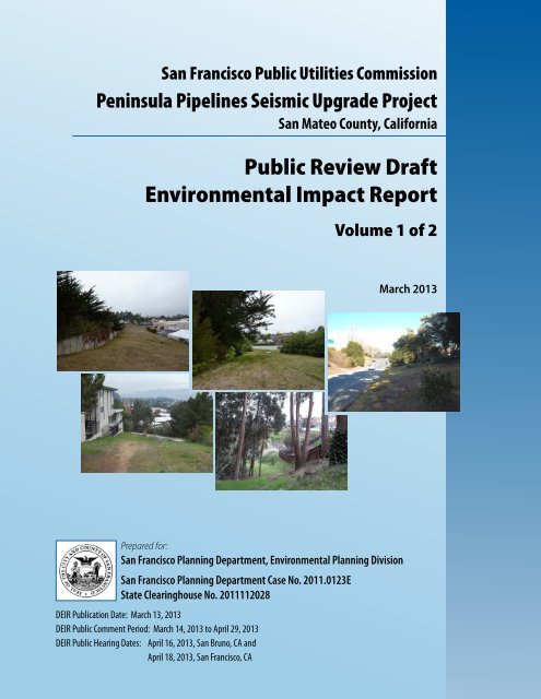
<strong>San</strong> <strong>Francisco</strong> Public Utilities Commission<br />
Peninsula Pipelines Seismic Upgrade Project<br />
<strong>San</strong> Mateo County, California<br />
Public Review <strong>Draft</strong><br />
Environmental Impact Report<br />
Volume 1 of 2<br />
March 2013<br />
Prepared for:<br />
<strong>San</strong> <strong>Francisco</strong> <strong>Planning</strong> <strong>Department</strong>, Environmental <strong>Planning</strong> Division<br />
<strong>San</strong> <strong>Francisco</strong> <strong>Planning</strong> <strong>Department</strong> Case No. 2011.0123E<br />
State Clearinghouse No. 2011112028<br />
D<strong>EIR</strong> Publication Date: March 13, 2013<br />
D<strong>EIR</strong> Public Comment Period: March 14, 2013 to April 29, 2013<br />
D<strong>EIR</strong> Public Hearing Dates: April 16, 2013, <strong>San</strong> Bruno, CA and<br />
April 18, 2013, <strong>San</strong> <strong>Francisco</strong>, CA
DATE:<br />
TO:<br />
FROM:<br />
SUBJECT:<br />
March13,2013<br />
DistributionListforthePeninsulaPipelinesSeismicUpgradeProject<strong>Draft</strong><br />
<strong>EIR</strong><br />
SarahJones,ActingEnvironmentalReviewOfficer<br />
Request for the Final Environmental Impact Report for the Peninsula<br />
Pipelines Seismic Upgrade Project (<strong>Planning</strong> <strong>Department</strong> File No.<br />
2011.0123E)<br />
This is the <strong>Draft</strong> of the Environmental Impact Report (<strong>EIR</strong>) for the Peninsula Pipelines<br />
SeismicUpgradeProject.Apublichearingwillbeheldontheadequacyandaccuracyof<br />
thisdocument.Afterthepublichearing,ourofficewillprepareandpublishadocument<br />
titled“ResponsestoComments,”whichwillcontainasummaryofallrelevantcomments<br />
onthis<strong>Draft</strong><strong>EIR</strong>andourresponsestothosecomments.Itmayalsospecifychangesto<br />
this <strong>Draft</strong> <strong>EIR</strong>. Those who testify at the hearing on the <strong>Draft</strong> <strong>EIR</strong> will automatically<br />
receiveacopyoftheResponsestoCommentsdocument,alongwithnoticeofthedate<br />
reservedforcertification;othersmayreceiveacopyoftheResponsestoCommentsand<br />
noticebyrequestorbyvisitingouroffice.This<strong>Draft</strong><strong>EIR</strong>togetherwiththeResponsesto<br />
Commentsdocumentwillbeconsideredbythe<strong>Planning</strong>Commissioninanadvertised<br />
publicmeetingandwillbecertifiedasaFinal<strong>EIR</strong>ifdeemedadequate.<br />
After certification, we will modify the <strong>Draft</strong> <strong>EIR</strong> as specified by the Responses to<br />
CommentsdocumentandprintbothdocumentsinasinglepublicationcalledtheFinal<br />
<strong>EIR</strong>.TheFinal<strong>EIR</strong>willaddnonewinformationtothecombinationofthetwodocuments<br />
excepttoreproducethecertificationresolution.Itwillsimplyprovidetheinformationin<br />
one document, rather than two. Therefore, if you receive a copy of the Responses to<br />
Commentsdocumentinadditiontothiscopyofthe<strong>Draft</strong><strong>EIR</strong>,youwilltechnicallyhave<br />
acopyoftheFinal<strong>EIR</strong>.<br />
Weareawarethatmanypeoplewhoreceivethe<strong>Draft</strong><strong>EIR</strong>andResponsestoComments<br />
have no interest in receiving virtually the same information after the <strong>EIR</strong> has been<br />
certified.Toavoidexpendingmoneyandpaperneedlessly,wewouldliketosendcopies<br />
oftheFinal<strong>EIR</strong>inAdobeAcrobatformatonacompactdisk(CD)toprivateindividuals<br />
onlyiftheyrequestthem.Therefore,ifyouwouldlikeacopyoftheFinal<strong>EIR</strong>,pleasefill<br />
outandmailthepostcardprovidedinsidethebackcovertotheEnvironmental<strong>Planning</strong><br />
divisionofthe<strong>Planning</strong><strong>Department</strong>withintwoweeksaftercertificationofthe<strong>EIR</strong>.Any<br />
privatepartynotrequestingaFinal<strong>EIR</strong>bythattimewillnotbemailedacopy.Public<br />
agenciesonthedistributionlistwillautomaticallyreceiveacopyoftheFinal<strong>EIR</strong>.<br />
Thankyouforyourinterestinthisproject.<br />
<br />
Revised10/5/12<br />
www.sfplanning.org
<strong>San</strong> <strong>Francisco</strong> Public Utilities Commission<br />
Peninsula Pipelines Seismic Upgrade Project<br />
<strong>San</strong> Mateo County, California<br />
Public Review <strong>Draft</strong><br />
Environmental Impact Report<br />
Volume 1 of 2<br />
March 2013<br />
Prepared for:<br />
<strong>San</strong> <strong>Francisco</strong> <strong>Planning</strong> <strong>Department</strong>, Environmental <strong>Planning</strong> Division<br />
<strong>San</strong> <strong>Francisco</strong> <strong>Planning</strong> <strong>Department</strong> Case No. 2011.0123E<br />
State Clearinghouse No. 2011112028
TABLE OF CONTENTS<br />
VOLUME 1<br />
CHAPTER 1 – EXECUTIVE SUMMARY .............................................................................................. 1-1<br />
1.1 INTRODUCTION AND PURPOSE OF PROJECT .................................................. 1-1<br />
1.2 OVERVIEW OF SFPUC REGIONAL WATER SYSTEM ........................................ 1-1<br />
1.3 PROJECT BACKGROUND AND OBJECTIVES ...................................................... 1-2<br />
1.3.1 Project Background .................................................................................... 1-2<br />
1.3.2 Project Objectives ....................................................................................... 1-3<br />
1.4 PROJECT DESCRIPTION ........................................................................................... 1-3<br />
1.4.1 Project Location and Components ........................................................... 1-3<br />
1.4.2 Project Construction .................................................................................. 1-4<br />
1.4.3 Project Operations ...................................................................................... 1-4<br />
1.5 SUMMARY OF PROJECT IMPACTS AND MITIGATION MEASURES ............. 1-5<br />
1.6 ALTERNATIVES TO THE PROPOSED PROJECT ................................................ 1-99<br />
1.7 AREAS OF CONTROVERSY ................................................................................... 1-99<br />
1.8 REFERENCES ........................................................................................................... 1-103<br />
CHAPTER 2 – INTRODUCTION AND BACKGROUND .................................................................. 2-1<br />
2.1 INTRODUCTION ........................................................................................................ 2-1<br />
2.2 BACKGROUND – REGIONAL WATER SYSTEM AND THE WATER<br />
SYSTEM IMPROVEMENT PROGRAM .................................................................... 2-1<br />
2.2.1 SFPUC Regional Water System Overview ............................................. 2-1<br />
2.2.2 SFPUC Water System Improvement Program ....................................... 2-2<br />
2.2.3 Regional Water System Facilities ............................................................. 2-7<br />
2.3 PURPOSE OF THIS ENVIRONMENTAL IMPACT REPORT ............................... 2-7<br />
2.4 PUBLIC OUTREACH .................................................................................................. 2-8<br />
2.4.1 Notice of Preparation ................................................................................ 2-8<br />
2.4.2 Public Scoping Meeting ............................................................................. 2-8<br />
2.4.3 Public and Agency Comments on Notice of Preparation ..................... 2-8<br />
2.4.4 Other Community Outreach .................................................................. 2-12<br />
2.5 PROJECT CHANGES SUBSEQUENT TO PUBLICATION OF NOTICE<br />
OF PREPARATION ................................................................................................... 2-12<br />
2.6 ORGANIZATION OF THE DRAFT ENVIRONMENTAL IMPACT<br />
REPORT ....................................................................................................................... 2-12<br />
2.7 REFERENCES ............................................................................................................. 2-13<br />
CHAPTER 3 – PROJECT DESCRIPTION .............................................................................................. 3-1<br />
3.1 PROJECT LOCATION ................................................................................................ 3-1<br />
3.1.1 Colma Site ................................................................................................... 3-3<br />
3.1.2 South <strong>San</strong> <strong>Francisco</strong> Site ............................................................................ 3-3<br />
3.1.3 <strong>San</strong> Bruno North Site ................................................................................. 3-3<br />
3.1.4 <strong>San</strong> Bruno South Site ................................................................................. 3-7<br />
Page<br />
SFPUC Peninsula Pipelines Seismic Upgrade i Environmental <strong>Planning</strong> Case No. 2011.0123E<br />
Public Review <strong>Draft</strong> <strong>EIR</strong> March 2013
Table of Contents<br />
3.1.5 Millbrae Site ................................................................................................ 3-7<br />
3.1.6 Common Staging Area .............................................................................. 3-7<br />
3.2 PROJECT BACKGROUND ....................................................................................... 3-10<br />
3.3 GOALS AND OBJECTIVES ...................................................................................... 3-11<br />
3.4 EXISTING FACILITIES ............................................................................................. 3-11<br />
3.5 PROPOSED PROJECT ............................................................................................... 3-12<br />
3.5.1 Colma Site ................................................................................................. 3-14<br />
3.5.2 South <strong>San</strong> <strong>Francisco</strong> Site .......................................................................... 3-16<br />
3.5.3 <strong>San</strong> Bruno North Site ............................................................................... 3-16<br />
3.5.4 <strong>San</strong> Bruno South Site ............................................................................... 3-19<br />
3.5.5 Millbrae Site .............................................................................................. 3-19<br />
3.6 SFPUC STANDARD CONSTRUCTION MEASURES .......................................... 3-22<br />
3.7 GREENHOUSE GAS REDUCTION ACTIONS ..................................................... 3-22<br />
3.8 PROJECT CONSTRUCTION .................................................................................... 3-22<br />
3.8.1 Pipeline Replacement and Stabilization................................................ 3-23<br />
3.8.2 Excavation and Stockpiling of Soil ........................................................ 3-27<br />
3.8.3 Spoils Disposal and Removal of Construction and Demolition<br />
Debris ......................................................................................................... 3-27<br />
3.8.4 Pipeline Shutdown and Startup ............................................................. 3-28<br />
3.8.5 Dewatering................................................................................................ 3-30<br />
3.8.6 Construction Staging and Spoils Areas................................................. 3-30<br />
3.8.7 Site Access and Construction Vehicle Routes ...................................... 3-32<br />
3.8.8 Project Workforce and Construction Vehicle Parking ........................ 3-34<br />
3.8.9 Construction Schedule and Equipment ................................................ 3-34<br />
3.9 OPERATIONS AND MAINTENANCE .................................................................. 3-36<br />
3.10 REQUIRED PERMITS ............................................................................................... 3-36<br />
3.10.1 Federal ....................................................................................................... 3-36<br />
3.10.2 State ............................................................................................................ 3-38<br />
3.10.3 Local ........................................................................................................... 3-38<br />
3.10.4 Other Actions ............................................................................................ 3-39<br />
3.11 REFERENCES ............................................................................................................. 3-39<br />
CHAPTER 4 – PLANS AND POLICIES ................................................................................................ 4-1<br />
4.1 OVERVIEW ................................................................................................................... 4-1<br />
4.2 PLANS AND POLICIES RELEVANT TO THE PPSU PROJECT .......................... 4-1<br />
4.2.1 City and County of <strong>San</strong> <strong>Francisco</strong> Plans and Policies ........................... 4-1<br />
4.2.2 SFPUC Plans and Policies ......................................................................... 4-4<br />
4.2.3 Other Land Use Plans and Policies .......................................................... 4-6<br />
4.3 PLAN CONSISTENCY EVALUATION .................................................................... 4-8<br />
4.3.1 Approach to Analysis ................................................................................ 4-8<br />
4.3.2 Consistency with <strong>San</strong> <strong>Francisco</strong> Plans and Policies .............................. 4-9<br />
4.3.3 Consistency with SFPUC Plans and Policies ........................................ 4-10<br />
4.3.4 Consistency with Other Land Use Plans and Policies ........................ 4-11<br />
4.4 REFERENCES ............................................................................................................. 4-12<br />
CHAPTER 5 – ENVIRONMENTAL SETTING, IMPACTS, AND MITIGATION MEASURES . 5.1-1<br />
5.1 OVERVIEW ................................................................................................................ 5.1-1<br />
SFPUC Peninsula Pipelines Seismic Upgrade ii Environmental <strong>Planning</strong> Case No. 2011.0123E<br />
Public Review <strong>Draft</strong> <strong>EIR</strong> March 2013
Table of Contents<br />
5.1.1 Scope of Analysis .................................................................................... 5.1-1<br />
5.1.2 Significance Determinations .................................................................. 5.1-2<br />
5.1.3 Cumulative Impacts ............................................................................... 5.1-3<br />
5.1.4 References .............................................................................................. 5.1-10<br />
5.2 LAND USE AND LAND USE PLANNING .......................................................... 5.2-1<br />
5.2.1 Setting ....................................................................................................... 5.2-1<br />
5.2.2 Regulatory Framework .......................................................................... 5.2-4<br />
5.2.3 Impacts and Mitigation Measures ........................................................ 5.2-4<br />
5.2.4 References .............................................................................................. 5.2-15<br />
5.3 AESTHETICS ............................................................................................................. 5.3-1<br />
5.3.1 Setting ....................................................................................................... 5.3-1<br />
5.3.2 Regulatory Framework ........................................................................ 5.3-21<br />
5.3.3 Impacts and Mitigation Measures ...................................................... 5.3-22<br />
5.3.4 References .............................................................................................. 5.3-33<br />
5.4 POPULATION AND HOUSING ............................................................................ 5.4-1<br />
5.4.1 Setting ....................................................................................................... 5.4-1<br />
5.4.2 Regulatory Framework .......................................................................... 5.4-2<br />
5.4.3 Impacts and Mitigation Measures ........................................................ 5.4-2<br />
5.4.4 References ................................................................................................ 5.4-3<br />
5.5 CULTURAL AND PALEONTOLOGICAL RESOURCES ................................... 5.5-1<br />
5.5.1 Setting ....................................................................................................... 5.5-1<br />
5.5.2 Regulatory Framework ........................................................................ 5.5-16<br />
5.5.3 Impacts and Mitigation Measures ...................................................... 5.5-21<br />
5.5.4 References .............................................................................................. 5.5-32<br />
5.6 TRANSPORTATION AND CIRCULATION ........................................................ 5.6-1<br />
5.6.1 Setting ....................................................................................................... 5.6-1<br />
5.6.2 Regulatory Framework ........................................................................ 5.6-11<br />
5.6.3 Impacts and Mitigation Measures ...................................................... 5.6-12<br />
5.6.4 References .............................................................................................. 5.6-41<br />
5.7 NOISE ......................................................................................................................... 5.7-1<br />
5.7.1 Setting ....................................................................................................... 5.7-1<br />
5.7.2 Regulatory Framework ........................................................................ 5.7-16<br />
5.7.3 Impacts and Mitigation Measures ...................................................... 5.7-19<br />
5.7.4 References .............................................................................................. 5.7-52<br />
5.8 AIR QUALITY ........................................................................................................... 5.8-1<br />
5.8.1 Setting ....................................................................................................... 5.8-1<br />
5.8.2 Regulatory Framework .......................................................................... 5.8-8<br />
5.8.3 Impacts and Mitigation Measures ...................................................... 5.8-13<br />
5.8.4 References .............................................................................................. 5.8-28<br />
SFPUC Peninsula Pipelines Seismic Upgrade iii Environmental <strong>Planning</strong> Case No. 2011.0123E<br />
Public Review <strong>Draft</strong> <strong>EIR</strong> March 2013
Table of Contents<br />
5.9 GREENHOUSE GAS EMISSIONS .......................................................................... 5.9-1<br />
5.9.1 Setting ....................................................................................................... 5.9-1<br />
5.9.2 Regulatory Framework .......................................................................... 5.9-2<br />
5.9.3 Impacts and Mitigation Measures ........................................................ 5.9-5<br />
5.9.4 References .............................................................................................. 5.9-10<br />
5.10 WIND AND SHADOW ......................................................................................... 5.10-1<br />
5.10.1 Setting ..................................................................................................... 5.10-1<br />
5.10.2 Regulatory Framework ........................................................................ 5.10-1<br />
5.10.3 Impacts and Mitigation Measures ...................................................... 5.10-2<br />
5.10.4 References .............................................................................................. 5.10-3<br />
5.11 RECREATION ......................................................................................................... 5.11-1<br />
5.11.1 Setting ..................................................................................................... 5.11-1<br />
5.11.2 Regulatory Framework ........................................................................ 5.11-3<br />
5.11.3 Impacts and Mitigation Measures ...................................................... 5.11-3<br />
5.11.4 References .............................................................................................. 5.11-9<br />
5.12 UTILITIES AND SERVICE SYSTEMS .................................................................. 5.12-1<br />
5.12.1 Setting ..................................................................................................... 5.12-1<br />
5.12.2 Regulatory Framework ........................................................................ 5.12-5<br />
5.12.3 Impacts and Mitigation Measures ...................................................... 5.12-7<br />
5.12.4 References ............................................................................................ 5.12-18<br />
5.13 PUBLIC SERVICES ................................................................................................. 5.13-1<br />
5.13.1 Setting ..................................................................................................... 5.13-1<br />
5.13.2 Regulatory Framework ........................................................................ 5.13-2<br />
5.13.3 Impacts and Mitigation Measures ...................................................... 5.13-4<br />
5.13.4 References .............................................................................................. 5.13-5<br />
5.14 BIOLOGICAL RESOURCES .................................................................................. 5.14-1<br />
5.14.1 Setting ..................................................................................................... 5.14-1<br />
5.14.2 Regulatory Framework ...................................................................... 5.14-23<br />
5.14.3 Impacts and Mitigation Measures .................................................... 5.14-31<br />
5.14.4 References ............................................................................................ 5.14-56<br />
5.15 GEOLOGY AND SOILS ......................................................................................... 5.15-1<br />
5.15.1 Setting ..................................................................................................... 5.15-1<br />
5.15.2 Regulatory Framework ...................................................................... 5.15-18<br />
5.15.3 Impacts and Mitigation Measures .................................................... 5.15-23<br />
5.15.4 References ............................................................................................ 5.15-30<br />
5.16 HYDROLOGY AND WATER QUALITY ............................................................ 5.16-1<br />
5.16.1 Setting ..................................................................................................... 5.16-1<br />
5.16.2 Regulatory Framework ........................................................................ 5.16-5<br />
5.16.3 Impacts and Mitigation Measures .................................................... 5.16-11<br />
5.16.4 References ............................................................................................ 5.16-25<br />
SFPUC Peninsula Pipelines Seismic Upgrade iv Environmental <strong>Planning</strong> Case No. 2011.0123E<br />
Public Review <strong>Draft</strong> <strong>EIR</strong> March 2013
Table of Contents<br />
5.17 HAZARDS AND HAZARDOUS MATERIALS ................................................. 5.17-1<br />
5.17.1 Setting ..................................................................................................... 5.17-1<br />
5.17.2 Regulatory Framework ...................................................................... 5.17-12<br />
5.17.3 Impacts and Mitigation Measures .................................................... 5.17-17<br />
5.17.4 References ............................................................................................ 5.17-28<br />
5.18 MINERAL AND ENERGY RESOURCES ............................................................ 5.18-1<br />
5.18.1 Setting ..................................................................................................... 5.18-1<br />
5.18.2 Regulatory Framework ........................................................................ 5.18-2<br />
5.18.3 Impacts and Mitigation Measures ...................................................... 5.18-5<br />
5.18.4 References .............................................................................................. 5.18-8<br />
5.19 AGRICULTURE AND FOREST RESOURCES.................................................... 5.19-1<br />
5.19.1 Setting ..................................................................................................... 5.19-1<br />
5.19.2 Regulatory Framework ........................................................................ 5.19-2<br />
5.19.3 Impacts and Mitigation Measures ...................................................... 5.19-3<br />
5.19.4 References .............................................................................................. 5.19-5<br />
CHAPTER 6 – OTHER CEQA ISSUES .................................................................................................. 6-1<br />
6.1 GROWTH INDUCEMENT ......................................................................................... 6-1<br />
6.1.1 Approach to Analysis ................................................................................ 6-1<br />
6.1.2 Growth Inducement Analysis .................................................................. 6-1<br />
6.2 SUMMARY OF CUMULATIVE IMPACTS .............................................................. 6-2<br />
6.3 SIGNIFICANT ENVIRONMENTAL EFFECTS THAT CANNOT BE<br />
AVOIDED IF THE PROPOSED PROJECT IS IMPLEMENTED ............................ 6-4<br />
6.4 SIGNIFICANT IRREVERSIBLE ENVIRONMENTAL CHANGES ....................... 6-4<br />
6.5 REFERENCES ............................................................................................................... 6-5<br />
CHAPTER 7 – ALTERNATIVES ............................................................................................................ 7-1<br />
7.1 INTRODUCTION ........................................................................................................ 7-1<br />
7.2 ALTERNATIVES ANALYSIS ..................................................................................... 7-2<br />
7.2.1 Project Objectives ....................................................................................... 7-3<br />
7.2.2 Overview of the Project’s Potentially Significant and<br />
Significant Impacts ..................................................................................... 7-3<br />
7.2.3 Alternative 1 – No Project Alternative .................................................... 7-5<br />
7.2.4 Alternative 2 – Sliplining Alternative ................................................... 7-15<br />
7.3 COMPARISON OF ALTERNATIVES ..................................................................... 7-29<br />
7.3.1 Comparison of Environmental Impacts ................................................ 7-29<br />
7.3.2 Environmentally Superior Alternative ................................................. 7-34<br />
7.4 ALTERNATIVES IDENTIFICATION AND SCREENING .................................. 7-35<br />
7.5 ALTERNATIVES CONSIDERED BUT REJECTED FROM FURTHER<br />
CONSIDERATION .................................................................................................... 7-35<br />
7.5.1 Steel Pipe Inside a Corrugated Metal Pipe Alternative (<strong>San</strong><br />
Bruno South and Millbrae Sites) ............................................................ 7-36<br />
7.5.2 Pipe with Pre-Formed Bulge Zone inside a Corrugated Metal<br />
Pipe Alternative (<strong>San</strong> Bruno South and Millbrae Sites) ...................... 7-37<br />
SFPUC Peninsula Pipelines Seismic Upgrade v Environmental <strong>Planning</strong> Case No. 2011.0123E<br />
Public Review <strong>Draft</strong> <strong>EIR</strong> March 2013
Table of Contents<br />
7.5.3 Fiber-Wrap Pipe Joints and Encase Pipe Bends Alternative<br />
(Millbrae Site) ........................................................................................... 7-38<br />
7.5.4 Isolation Valves Alternative (Millbrae Site) ......................................... 7-38<br />
7.5.5 Welded Steel Pipe Alternative (<strong>San</strong> Bruno North and <strong>San</strong><br />
Bruno South Sites) .................................................................................... 7-38<br />
7.5.6 Relocation Alternative (All Project Sites) .............................................. 7-39<br />
7.6 REFERENCES ............................................................................................................. 7-40<br />
CHAPTER 8 – <strong>EIR</strong> AUTHORS AND CONSULTANTS ...................................................................... 8-1<br />
8.1 <strong>EIR</strong> AUTHORS ............................................................................................................. 8-1<br />
8.2 <strong>EIR</strong> CONSULTANTS ................................................................................................... 8-1<br />
8.3 PROJECT SPONSOR ................................................................................................... 8-3<br />
SFPUC Peninsula Pipelines Seismic Upgrade vi Environmental <strong>Planning</strong> Case No. 2011.0123E<br />
Public Review <strong>Draft</strong> <strong>EIR</strong> March 2013
Table of Contents<br />
TABLES<br />
Table 1-1 Summary of Impacts and Mitigation Measures....................................................... 1-6<br />
Table 1-2 Comparison of Significant Impacts of the PPSU Project to Impacts of<br />
Alternatives ............................................................................................................... 1-100<br />
Table 2-1 Summary of Scoping Comments ............................................................................... 2-9<br />
Table 3-1 Proposed Project Sites ............................................................................................... 3-13<br />
Table 3-2 Project Materials Transport ...................................................................................... 3-26<br />
Table 3-3 Discharge Estimates ................................................................................................... 3-29<br />
Table 3-4 Proposed Construction Staging Areas .................................................................... 3-31<br />
Table 3-5 Construction Duration at Each Site ......................................................................... 3-34<br />
Table 3-6 Typical Construction Activities and Equipment ................................................... 3-37<br />
Table 5.1-1 Cumulative Project List ............................................................................................ 5.1-6<br />
Table 5.2-1 Summary of Impacts – Land Use and Land Use <strong>Planning</strong> ................................. 5.2-6<br />
Table 5.3-1 Gateways and Scenic Corridors .............................................................................. 5.3-3<br />
Table 5.3-2 Summary of Impacts – Aesthetics......................................................................... 5.3-24<br />
Table 5.4-1 Population and Housing Data (2010) ..................................................................... 5.4-1<br />
Table 5.5-1 Paleontological Sensitivity Ratings for Geologic Rock Units within the<br />
PPSU C-APE ............................................................................................................ 5.5-12<br />
Table 5.5-2 Historic Architecture Eligibility Status ................................................................ 5.5-16<br />
Table 5.5-3 Summary of Impacts – Cultural Resources ......................................................... 5.5-23<br />
Table 5.5-4 Impact Potential to Paleontological Resources for Geologic Rock Units<br />
within the C-APE .................................................................................................... 5.5-28<br />
Table 5.6-1 Daily Traffic Volumes on Regional Facilities ........................................................ 5.6-4<br />
Table 5.6-2 Daily Traffic Volumes on Local Roadways ........................................................... 5.6-5<br />
Table 5.6-3 Level of Service Definitions for Signalized and Unsignalized<br />
Intersections ............................................................................................................... 5.6-6<br />
Table 5.6-4 Intersection Level of Service: Existing Conditions ............................................... 5.6-9<br />
Table 5.6-5 Existing Transit Service in the Vicinity of the Project Sites ............................... 5.6-10<br />
Table 5.6-6 Daily Construction Vehicles by Site ..................................................................... 5.6-15<br />
Table 5.6-7 AM and PM Peak Hour Construction Vehicles by Site ..................................... 5.6-15<br />
Table 5.6-8 Summary of Impacts – Transportation and Circulation .................................... 5.6-16<br />
Table 5.6-9 Intersection Level of Service: Existing and Existing plus Project<br />
Conditions ................................................................................................................ 5.6-19<br />
Table 5.7-1 Typical A-weighted Sound Levels .......................................................................... 5.7-2<br />
Table 5.7-2 Decibel Addition ....................................................................................................... 5.7-3<br />
Table 5.7-3 Long-Term Measurements – Summary of Existing Noise Levels .................... 5.7-10<br />
Table 5.7-4 Short-Term Measurements – Summary of Existing Noise Levels .................... 5.7-11<br />
SFPUC Peninsula Pipelines Seismic Upgrade vii Environmental <strong>Planning</strong> Case No. 2011.0123E<br />
Public Review <strong>Draft</strong> <strong>EIR</strong> March 2013
Table of Contents<br />
Table 5.7-5 Nearest Distances Between Project Sites and Sensitive Receptors ................... 5.7-13<br />
Table 5.7-6 Caltrans Guidelines for Vibration Damage Potential Threshold Criteria ....... 5.7-17<br />
Table 5.7-7 Caltrans Guidelines for Vibration Annoyance Potential Criteria..................... 5.7-17<br />
Table 5.7-8 <strong>San</strong> Mateo County Exterior Noise Standards (dBA).......................................... 5.7-18<br />
Table 5.7-9 Summary of Noise and Vibration Significance Thresholds .............................. 5.7-24<br />
Table 5.7-10 Summary of Impacts – Noise and Vibration ....................................................... 5.7-25<br />
Table 5.7-11 Construction Equipment Reference Noise Levels .............................................. 5.7-27<br />
Table 5.7-12 Summary of Daytime Construction Noise Impacts by Site and<br />
Construction Phase ................................................................................................. 5.7-30<br />
Table 5.7-13 Estimated Hourly Leq Along Project Access Routes ........................................... 5.7-38<br />
Table 5.7-14 Summary of Nighttime Construction Noise Impacts by Site and<br />
Construction Phase ................................................................................................. 5.7-39<br />
Table 5.7-15 Distance Within Which Vibration Annoyance and Damage Potential<br />
Thresholds For Continuous Construction Sources Would Be Exceeded ........ 5.7-45<br />
Table 5.8-1 <strong>San</strong> <strong>Francisco</strong>-Arkansas Street Ambient Air Quality Monitoring<br />
Summary 2009-2011 .................................................................................................. 5.8-2<br />
Table 5.8-2 Permitted Stationary, Mobile, and Concurrent Construction Project<br />
Emissions Sources in the Project Vicinity .............................................................. 5.8-6<br />
Table 5.8-3 State and Federal Ambient Air Quality Standards and SFBAAB<br />
Attainment Status ..................................................................................................... 5.8-9<br />
Table 5.8-4 Air Quality Significance Thresholds .................................................................... 5.8-14<br />
Table 5.8-5 Summary of Impacts – Air Quality....................................................................... 5.8-18<br />
Table 5.8-6 Average Daily Emissions and Total Emissions of Criteria Pollutants<br />
During Construction ............................................................................................... 5.8-19<br />
Table 5.8-7 Construction-Related Cancer Risk, Acute, and Chronic Noncancer<br />
Health Risk at MEI .................................................................................................. 5.8-23<br />
Table 5.8-8 Construction Period Cumulative Health Risk Assessment Results ................. 5.8-27<br />
Table 5.9-1 GHG Reductions from the Assembly Bill 32 Scoping Plan Sectors ................... 5.9-3<br />
Table 5.9-2 Summary of Impacts – Greenhouse Gas Emissions ............................................. 5.9-7<br />
Table 5.9-3 Estimated Greenhouse Gas Emissions During Construction ............................. 5.9-7<br />
Table 5.11-1 Summary of Impacts – Recreation Resources ..................................................... 5.11-5<br />
Table 5.12-1 Distance to PG&E Natural Gas Lines ................................................................... 5.12-1<br />
Table 5.12-2 Summary of Impacts – Utilities and Service Systems ...................................... 5.12-10<br />
Table 5.14-1 Vegetation Communities ....................................................................................... 5.14-6<br />
Table 5.14-2 Special-Status Wildlife Species Potentially Occurring at the Sites ................. 5.14-19<br />
Table 5.14-3 Trees Protected by <strong>San</strong> Mateo County Heritage Tree Ordinance .................. 5.14-29<br />
Table 5.14-4 Summary of Biological Resources within the Project Area ............................. 5.14-34<br />
Table 5.14-5 Summary of Impacts – Biological Resources ..................................................... 5.14-35<br />
Table 5.14-6 Summary of Applicable Tree Ordinances ......................................................... 5.14-52<br />
Table 5.15-1 Significant Active and Potentially Active Faults ................................................ 5.15-3<br />
Table 5.15-2 Significant Historic Earthquakes in the <strong>San</strong> <strong>Francisco</strong> Bay Area ................... 5.15-14<br />
SFPUC Peninsula Pipelines Seismic Upgrade viii Environmental <strong>Planning</strong> Case No. 2011.0123E<br />
Public Review <strong>Draft</strong> <strong>EIR</strong> March 2013
Table of Contents<br />
Table 5.15-3 Soil Types in the Study Area ............................................................................... 5.15-21<br />
Table 5.15-4 Summary of Impacts – Geology and Soils ......................................................... 5.15-26<br />
Table 5.16-1 Creeks and Watersheds in the Study Area .......................................................... 5.16-4<br />
Table 5.16-2 Groundwater Elevations and Depths in the Study Area ................................... 5.16-6<br />
Table 5.16-3 Summary of Impacts – Hydrology and Water Quality ................................... 5.16-13<br />
Table 5.16-4 Comparison between Depth to Shallow Groundwater and Expected<br />
Depth of Excavation ............................................................................................. 5.16-19<br />
Table 5.17-1 Summary of Impacts – Hazards and Hazardous Materials ............................ 5.17-20<br />
Table 5.18-1 Summary of Impacts – Mineral and Energy Resources ..................................... 5.18-6<br />
Table 6-1 Summary of Cumulative Impacts .............................................................................. 6-3<br />
Table 7-1 Selected Alternatives for CEQA Analysis ................................................................ 7-2<br />
Table 7-2 Reduction in Impacts – Sliplining Alternative ....................................................... 7-29<br />
Table 7-3 Comparison of the Environmental Impacts of the CEQA Alternatives ............. 7-30<br />
Table 7-4 Alternatives Considered But Rejected from Further Consideration ................... 7-36<br />
SFPUC Peninsula Pipelines Seismic Upgrade ix Environmental <strong>Planning</strong> Case No. 2011.0123E<br />
Public Review <strong>Draft</strong> <strong>EIR</strong> March 2013
Table of Contents<br />
FIGURES<br />
Figure 2-1 SFPUC Regional Water System .................................................................................. 2-3<br />
Figure 2-2 SFPUC Water Supply Watersheds ............................................................................. 2-4<br />
Figure 2-3 SFPUC Water Service Area – <strong>San</strong> <strong>Francisco</strong> and SFPUC Wholesale<br />
Customers ..................................................................................................................... 2-5<br />
Figure 3-1 Project Vicinity ............................................................................................................. 3-2<br />
Figure 3-2 Colma Site ..................................................................................................................... 3-4<br />
Figure 3-3 South <strong>San</strong> <strong>Francisco</strong> Site .............................................................................................. 3-5<br />
Figure 3-4 <strong>San</strong> Bruno North Site ................................................................................................... 3-6<br />
Figure 3-5 <strong>San</strong> Bruno South Site ................................................................................................... 3-8<br />
Figure 3-6 Millbrae Site .................................................................................................................. 3-9<br />
Figure 3-7 Colma Plan and Profile ............................................................................................. 3-15<br />
Figure 3-8 South <strong>San</strong> <strong>Francisco</strong> Plan and Profile ...................................................................... 3-17<br />
Figure 3-9 <strong>San</strong> Bruno North Plan and Profile ........................................................................... 3-18<br />
Figure 3-10 <strong>San</strong> Bruno South Plan and Profile ............................................................................ 3-20<br />
Figure 3-11 Millbrae Plan and Profile .......................................................................................... 3-21<br />
Figure 3-12 Construction Phasing ................................................................................................ 3-35<br />
Figure 5.1-1 Cumulative Projects .................................................................................................. 5.1-9<br />
Figure 5.3-1 Photo Point Locations – Colma Site ........................................................................ 5.3-6<br />
Figure 5.3-2 Views of Colma Site .................................................................................................. 5.3-7<br />
Figure 5.3-3 Photo Point Locations – South <strong>San</strong> <strong>Francisco</strong> Site ................................................ 5.3-8<br />
Figure 5.3-4 Views of South <strong>San</strong> <strong>Francisco</strong> Site .......................................................................... 5.3-9<br />
Figure 5.3-5 Photo Point Locations – <strong>San</strong> Bruno North Site ................................................... 5.3-10<br />
Figure 5.3-6 Views of <strong>San</strong> Bruno North Site .............................................................................. 5.3-11<br />
Figure 5.3-7 Photo Point Locations – <strong>San</strong> Bruno South Site .................................................... 5.3-12<br />
Figure 5.3-8 Views of <strong>San</strong> Bruno South Site .............................................................................. 5.3-13<br />
Figure 5.3-9 Photo Point Locations – Millbrae Site .................................................................. 5.3-14<br />
Figure 5.3-10 Views of Millbrae Site ............................................................................................. 5.3-15<br />
Figure 5.6-1 Study Intersections ................................................................................................... 5.6-7<br />
Figure 5.7-1 Noise Measurement Locations Colma Site ............................................................ 5.7-5<br />
Figure 5.7-2 Noise Measurement Locations South <strong>San</strong> <strong>Francisco</strong> Site .................................... 5.7-6<br />
Figure 5.7-3 Noise Measurement Locations <strong>San</strong> Bruno North Site .......................................... 5.7-7<br />
Figure 5.7-4 Noise Measurement Locations <strong>San</strong> Bruno South Site .......................................... 5.7-8<br />
Figure 5.7-5 Noise Measurement Locations Millbrae Site ......................................................... 5.7-9<br />
Figure 5.7-6 24-Hour Dewatering Locations ............................................................................. 5.7-15<br />
Figure 5.14-1 Vegetation Communities and Water Features – Colma Site ............................ 5.14-7<br />
Figure 5.14-2 Vegetation Communities and Water Features – South <strong>San</strong> <strong>Francisco</strong> Site .... 5.14-8<br />
Figure 5.14-3 Vegetation Communities and Water Features – <strong>San</strong> Bruno North Site .......... 5.14-9<br />
Figure 5.14-4 Vegetation Communities and Water Features – <strong>San</strong> Bruno South Site ........ 5.14-10<br />
Figure 5.14-5 Vegetation Communities and Water Features – Millbrae Site ....................... 5.14-11<br />
SFPUC Peninsula Pipelines Seismic Upgrade x Environmental <strong>Planning</strong> Case No. 2011.0123E<br />
Public Review <strong>Draft</strong> <strong>EIR</strong> March 2013
Table of Contents<br />
Figure 5.15-1 Geology – Overview ............................................................................................... 5.15-4<br />
Figure 5.15-2 Geology – Colma Site ............................................................................................. 5.15-5<br />
Figure 5.15-3 Geology – South <strong>San</strong> <strong>Francisco</strong> Site ...................................................................... 5.15-6<br />
Figure 5.15-4 Geology – <strong>San</strong> Bruno North Site ........................................................................... 5.15-7<br />
Figure 5.15-5 Geology – <strong>San</strong> Bruno South Site............................................................................ 5.15-8<br />
Figure 5.15-6 Geology – Millbrae Site .......................................................................................... 5.15-9<br />
Figure 15.5-7 Historic Seismicity ................................................................................................ 5.15-13<br />
Figure 5.15-8 Soil Types – North Sites ....................................................................................... 5.15-19<br />
Figure 5.15-9 Soil Types – South Sites ........................................................................................ 5.15-20<br />
Figure 5.16-1 Hydrology – North Sites ........................................................................................ 5.16-2<br />
Figure 5.16-2 Hydrology – South Sites........................................................................................ 5.16-3<br />
Figure 7-1 Sliplining Alternative South <strong>San</strong> <strong>Francisco</strong> Site ..................................................... 7-17<br />
Figure 7-2 Sliplining Alternative <strong>San</strong> Bruno South Site .......................................................... 7-18<br />
Figure 7-3 Sliplining Alternative Millbrae Site ......................................................................... 7-19<br />
SFPUC Peninsula Pipelines Seismic Upgrade xi Environmental <strong>Planning</strong> Case No. 2011.0123E<br />
Public Review <strong>Draft</strong> <strong>EIR</strong> March 2013
Table of Contents<br />
VOLUME 2 (BOUND SEPARATELY)<br />
APPENDICES<br />
A. Notice of Preparation<br />
B. Public Scoping Process Summary Report<br />
C. Transportation<br />
D. Noise<br />
D-1 Noise and Vibration Fundamentals<br />
D-2 Long-Term Measurement Data Time History Plots<br />
D-3 Estimates of Construction-Related Noise Levels at the Closest Sensitive<br />
Receptors<br />
E. Air Quality Technical Report<br />
F. Biological Resources<br />
Table 1.1 Special-Status Plant Species Potentially Occurring in Study Area<br />
Table 1.2 Vascular Plant Species Observed in Study Area<br />
Table 2.1 Special-Status Wildlife Species Potentially Occurring in Study Area<br />
Table 2.2 Wildlife Species Observed in Study Area<br />
G. Historical Site Data -<strong>San</strong>born Map Reports, Historical Topographic Map Reports, and<br />
Aerial Photographs<br />
SFPUC Peninsula Pipelines Seismic Upgrade xii Environmental <strong>Planning</strong> Case No. 2011.0123E<br />
Public Review <strong>Draft</strong> <strong>EIR</strong> March 2013
TableofContents<br />
<br />
SFPUCPeninsulaPipelinesSeismicUpgrade xiii Environmental<strong>Planning</strong>CaseNo.2011.0123E<br />
PublicReview<strong>Draft</strong><strong>EIR</strong><br />
March2013<br />
<br />
<br />
ACRONYMS<br />
AASHTO<br />
AmericanAssociationofStateHighwayandTransportationOfficials<br />
AB<br />
AssemblyBill<br />
ABAG<br />
AssociationofBayAreaGovernments<br />
ACM<br />
asbestoscontainingmaterials<br />
AADT<br />
annualaveragedailytraffic<br />
AEP<br />
ArchaeologicalEvaluationPlan<br />
AEW<br />
AEWEngineering,Inc.<br />
AMP<br />
ArchaeologicalMonitoringPlan<br />
A.D.<br />
AnnoDomini<br />
ANSI<br />
AmericanNationalStandardsInstitute<br />
APE<br />
areaofpotentialeffect<br />
ASP<br />
ArchaeologicalSurveyPlan<br />
AYSO<br />
AmericanYouthSoccerOrganization<br />
B.C.<br />
BeforeChrist<br />
B.P.<br />
beforepresent<br />
BAAQMD<br />
BayAreaAirQualityManagementDistrict<br />
BART<br />
BayAreaRapidTransit<br />
BAWSCA<br />
BayAreaWaterSupplyandConservationAgency<br />
BCRLF<br />
BrownfieldsCleanupRevolvingLoanFund<br />
bgs<br />
belowgroundsurface<br />
BMPs<br />
bestmanagementpractices<br />
BO<br />
BiologicalOpinion<br />
C/CAG<br />
CityandCountyAssociationofGovernmentsof<strong>San</strong>MateoCounty<br />
CALFIRE<br />
California<strong>Department</strong>ofForestryandFireProtection<br />
CalWater<br />
CaliforniaWaterServiceCompany<br />
Cal/OSHA<br />
CaliforniaDivisionofOccupationalSafetyandHealth<br />
CalEPA<br />
CaliforniaEnvironmentalProtectionAgency<br />
CalIPC<br />
CaliforniaInvasivePlantCouncil<br />
Calisphere<br />
Calisphere:AWorldofDigitalResources<br />
Caltrans<br />
California<strong>Department</strong>ofTransportation<br />
CAPE<br />
CaliforniaEnvironmentalQualityAct–AreaofPotentialEffects<br />
CARB<br />
CaliforniaAirResourcesBoard<br />
CBC<br />
The2008CaliforniaBuildingCode<br />
CCR<br />
CaliforniaCodeofRegulations<br />
CCSF<br />
CityandCountyof<strong>San</strong><strong>Francisco</strong><br />
CCTS<br />
CentralCaliforniaTaxonomicSystem<br />
CDC<br />
California<strong>Department</strong>ofConservation<br />
CDFG<br />
California<strong>Department</strong>ofFishandGame(nowCDFW)<br />
CDFW<br />
California<strong>Department</strong>ofFishandWildlife<br />
CEHTP<br />
CaliforniaEnvironmentalHealthTrackingProgram<br />
CEQA<br />
CaliforniaEnvironmentalQualityAct<br />
CERCLA<br />
ComprehensiveEnvironmentalResponse,Compensation,and<br />
LiabilityAct
Table of Contents<br />
CERCLIS<br />
Comprehensive Environmental Response, Compensation, and<br />
Liability Information System<br />
CESA<br />
California Endangered Species Act<br />
CFC<br />
California Fire Code<br />
CFPD<br />
Colma Fire Protection District<br />
CFR<br />
Code of Federal Regulations<br />
CGS<br />
California Geological Survey<br />
CHMIRS<br />
California Hazardous Material Incident Report System<br />
CMP<br />
Congestion Management Program<br />
CNDDB<br />
California Natural Diversity Database<br />
CNEL<br />
community noise equivalent level<br />
CNPS<br />
California Native Plant Society<br />
CO<br />
carbon monoxide<br />
CO2<br />
carbon dioxide<br />
CO2e<br />
carbon dioxide-equivalent<br />
Corps<br />
U.S. Army Corps of Engineers<br />
CPUC<br />
California Public Utilities Commission<br />
CRA<br />
Conestoga-Rovers & Associates<br />
CRHR<br />
California Register of Historical Resources<br />
CSCSD<br />
Crystal Springs County <strong>San</strong>itation District<br />
CWA<br />
Clean Water Act<br />
CWHR<br />
California Wildlife Habitat Relationships System<br />
dBA<br />
A-weighted decibel<br />
DPM<br />
diesel particulate matter<br />
DPR<br />
<strong>Department</strong> of Parks and Recreation<br />
DTSC<br />
<strong>Department</strong> of Toxic Substances Control<br />
DWR<br />
California <strong>Department</strong> of Water Resources<br />
eb<br />
eastbound<br />
EDR<br />
Environmental Data Resources, Inc.<br />
<strong>EIR</strong><br />
Environmental Impact Report<br />
Environmental <strong>Planning</strong> <strong>San</strong> <strong>Francisco</strong> <strong>Planning</strong> <strong>Department</strong>’s Environmental <strong>Planning</strong><br />
Division<br />
ERNS<br />
Emergency Response Notification System<br />
ERO<br />
Environmental Review Officer<br />
ESA<br />
Environmental Site Assessment<br />
°F degree Fahrenheit<br />
FAA<br />
Federal Aviation Administration<br />
FAR<br />
Federal Aviation Regulations<br />
FCC<br />
Federal Communications Commission<br />
Fed-OSHA<br />
U.S. Occupational Safety and Health Administration<br />
FEMA<br />
Federal Emergency Management Agency<br />
FESA<br />
Federal Endangered Species Act<br />
FHSZ<br />
Fire Hazard Severity Zones<br />
FIRM<br />
Flood Insurance Rate Map<br />
FRAP<br />
Fire and Resource Assessment Program<br />
FTA<br />
Federal Transit Authority<br />
FWLA<br />
Fugro William Lettis & Associates, Inc.<br />
SFPUC Peninsula Pipelines Seismic Upgrade xiv Environmental <strong>Planning</strong> Case No. 2011.0123E<br />
Public Review <strong>Draft</strong> <strong>EIR</strong> March 2013
Table of Contents<br />
GSR<br />
Groundwater Storage and Recovery<br />
GTC<br />
Geotechnical Consultants, Inc.<br />
HASP<br />
Health and Safety Plan<br />
HCASR<br />
Historic Context and Archaeological Survey Report<br />
HCP<br />
Habitat Conservation Plan<br />
HI<br />
hazard index<br />
HMBP<br />
Hazardous Material Business Plan<br />
HPC<br />
The <strong>San</strong> <strong>Francisco</strong> Historic Preservation Commission<br />
HPSR<br />
Historic Properties Survey Report<br />
HQ<br />
hazard quotient<br />
HTWTP<br />
Harry Tracy Water Treatment Plant<br />
I-280 Interstate 280<br />
I-380 Interstate 380<br />
IBC<br />
International Building Code<br />
ICF<br />
ICF Jones & Stokes<br />
in/sec<br />
inches per second<br />
ISCST3 Industrial Source Complex Short Term Model 3<br />
ITP<br />
Incidental Take Permit<br />
JRP<br />
JRP Historical Consulting, LLC<br />
Ldn<br />
day-night average sound level<br />
Leq<br />
equivalent continuous noise level<br />
Lmax<br />
maximum A-weighted sound level<br />
LOS<br />
Level of Service<br />
LUST<br />
Leaking Underground Storage Tank Lists<br />
MBTA<br />
Migratory Bird Treaty Act<br />
MEA<br />
<strong>San</strong> <strong>Francisco</strong> <strong>Planning</strong> <strong>Department</strong>, Major Environmental Analysis<br />
Division (now Environmental <strong>Planning</strong>)<br />
MEI<br />
maximally exposed individual<br />
MG<br />
million gallons<br />
mgd<br />
million gallons per day<br />
μg/L<br />
micrograms per liter<br />
μg/m 3<br />
micrograms per cubic meter<br />
micro-Pa<br />
microPascal<br />
MLD<br />
Most Likely Descendant<br />
MMTCO2e<br />
million metric tons of carbon dioxide-equivalent<br />
MOA<br />
memorandum of agreement<br />
mph<br />
miles per hour<br />
MS4s<br />
municipal separate storm sewer systems<br />
msl<br />
mean sea level<br />
MRZ<br />
Mineral Resource Zones<br />
MT<br />
metric tons<br />
NAHC<br />
Native American Heritage Commission<br />
nb<br />
northbound<br />
NEPA<br />
National Environmental Policy Act<br />
NFIP<br />
National Flood Insurance Program<br />
NHPA<br />
National Historic Preservation Act<br />
NMFS<br />
National Marine Fisheries Service<br />
SFPUC Peninsula Pipelines Seismic Upgrade xv Environmental <strong>Planning</strong> Case No. 2011.0123E<br />
Public Review <strong>Draft</strong> <strong>EIR</strong> March 2013
Table of Contents<br />
NO2<br />
nitrogen dioxide<br />
NOA<br />
naturally occurring asbestos<br />
NOI<br />
Notice of Intent<br />
NOP<br />
Notice of Preparation<br />
NOX<br />
oxides of nitrogen<br />
NPDES<br />
National Pollutant Discharge Elimination System<br />
NPL<br />
National Priorities List<br />
NRHP<br />
National Register of Historic Places<br />
NSR<br />
New Source Review<br />
NWIC<br />
Northwest Information Center<br />
OHP<br />
Office of Historic Preservation<br />
OPR<br />
California Governor’s Office of <strong>Planning</strong> and Research<br />
PCB<br />
polychlorinated biphenyls<br />
PCCP<br />
Prestressed Concrete Cylinder Pipe<br />
P<strong>EIR</strong><br />
Program Environmental Impact Report<br />
PG&E<br />
Pacific Gas and Electric Company<br />
Phase I ESA<br />
Phase I Environmental Site Assessment<br />
PM10<br />
particulate matter less than or equal to 10 microns in diameter<br />
PM2.5<br />
particulate matter less than or equal to 2.5 microns in diameter<br />
ppb<br />
parts per billion<br />
ppm<br />
parts per million<br />
PPSU<br />
Peninsula Pipelines Seismic Upgrade<br />
PPV<br />
peak particle velocity<br />
PRC<br />
California Public Resources Code<br />
PRDs<br />
Permit Registration Documents<br />
RCRA<br />
Resource Conservation Recovery Act<br />
REL<br />
reference exposure level<br />
RGSR<br />
Regional Groundwater Storage and Recovery<br />
ROG<br />
reactive organic gas<br />
ROW<br />
right-of-way<br />
RWQCB<br />
Regional Water Quality Control Board<br />
s/n<br />
serial number<br />
SamTrans<br />
<strong>San</strong> Mateo Country Transit<br />
SAPL<br />
<strong>San</strong> Andreas Pipeline<br />
SAPL2 <strong>San</strong> Andreas Pipeline No. 2<br />
SAPL3 <strong>San</strong> Andreas Pipeline No. 3<br />
SARA<br />
Superfund Amendment Reauthorization Act<br />
SB<br />
Senate Bill<br />
sb<br />
southbound<br />
SFBAAB<br />
<strong>San</strong> <strong>Francisco</strong> Bay Area Air Basin<br />
SFDPH<br />
<strong>San</strong> <strong>Francisco</strong> <strong>Department</strong> of Public Health<br />
SFO<br />
<strong>San</strong> <strong>Francisco</strong> International Airport<br />
SF <strong>Planning</strong><br />
City and County of <strong>San</strong> <strong>Francisco</strong>, <strong>San</strong> <strong>Francisco</strong> <strong>Planning</strong><br />
<strong>Department</strong><br />
SFPUC<br />
<strong>San</strong> <strong>Francisco</strong> Public Utilities Commission<br />
SFWD<br />
<strong>San</strong> <strong>Francisco</strong> Water <strong>Department</strong><br />
SIL<br />
Significant Impact Level<br />
SFPUC Peninsula Pipelines Seismic Upgrade xvi Environmental <strong>Planning</strong> Case No. 2011.0123E<br />
Public Review <strong>Draft</strong> <strong>EIR</strong> March 2013
Table of Contents<br />
SIP<br />
State Implementation Plan<br />
SLIC<br />
Spills, Leaks, Investigations, and Cleanup<br />
SMARA Surface Mining and Reclamation Act of 1975<br />
SMCEH<br />
<strong>San</strong> Mateo County Environmental Health<br />
SMCWPPP<br />
<strong>San</strong> Mateo Countywide Water Pollution Prevention Program<br />
SO2<br />
sulfur dioxide<br />
SR<br />
State Route<br />
SSBPL<br />
Sunset Supply Branch Pipeline<br />
SVP<br />
Society of Vertebrate Paleontology<br />
SVWC<br />
Spring Valley Water Company<br />
SWRCB<br />
State Water Resources Control Board<br />
TAC<br />
toxic air contaminant<br />
TBA<br />
Targeted Brownfields Assessment<br />
TMDL<br />
Total Maximum Daily Load<br />
TOG<br />
total organic gas<br />
TPH-diesel<br />
total petroleum hydrocarbons as diesel<br />
TPH-gas<br />
total petroleum hydrocarbons as gasoline<br />
TSCA<br />
Toxic Substances Control Act<br />
U.S. 101 U.S. Highway 101<br />
U.S. EPA<br />
United States Environmental Protection Agency<br />
URS<br />
URS Corporation<br />
USFWS<br />
U. S Fish and Wildlife Service<br />
USGS<br />
U.S. Geological Survey<br />
UTM<br />
Universal Transverse Mercator Zone<br />
VegCAMP<br />
Vegetation Classification and Mapping Program<br />
VHFHSZ<br />
Very High Fire Severity Zones<br />
WMUDS/SWAT<br />
Waste Management Unit Database System<br />
WSIP<br />
Water System Improvement Program<br />
SFPUC Peninsula Pipelines Seismic Upgrade xvii Environmental <strong>Planning</strong> Case No. 2011.0123E<br />
Public Review <strong>Draft</strong> <strong>EIR</strong> March 2013
This page left intentionally blank.
CHAPTER 1<br />
<br />
1.1 Introduction and Purpose of Project<br />
The <strong>San</strong> <strong>Francisco</strong> Public Utilities Commission (SFPUC) is proposing the Peninsula Pipelines<br />
Seismic Upgrade (PPSU) project (or proposed project). The proposed project involves seismic<br />
upgrades to SFPUC regional water facilities on the <strong>San</strong> <strong>Francisco</strong> Peninsula at five sites in the<br />
Town of Colma and the cities of South <strong>San</strong> <strong>Francisco</strong>, <strong>San</strong> Bruno, Millbrae, and in unincorporated<br />
<strong>San</strong> Mateo County. The SFPUC is proposing the PPSU project to improve the seismic reliability of<br />
transmission pipelines between the Harry Tracy Water Treatment Plant (HTWTP) and the<br />
Capuchino, Baden, and <strong>San</strong> Pedro Valve Lots, in the event of a major earthquake on the <strong>San</strong><br />
Andreas Fault.<br />
Under the <strong>San</strong> <strong>Francisco</strong> Administrative Code, Chapter 31, the <strong>San</strong> <strong>Francisco</strong> <strong>Planning</strong><br />
<strong>Department</strong>’s Environmental <strong>Planning</strong> Division (Environmental <strong>Planning</strong>) (formerly the Major<br />
Environmental Analysis Division) is responsible for conducting the environmental review of all<br />
City and County of <strong>San</strong> <strong>Francisco</strong> (CCSF) projects pursuant to the requirements of the California<br />
Environmental Quality Act (CEQA). Thus, Environmental <strong>Planning</strong> is the lead agency<br />
responsible for preparing this Environmental Impact Report (<strong>EIR</strong>) in compliance with CEQA, and<br />
the SFPUC is the project sponsor proposing to implement the PPSU project. This <strong>EIR</strong> is being<br />
prepared to disclose to the public and decision-makers the potential physical impacts of the PPSU<br />
project, so that an informed judgment can be made about the project’s environmental<br />
consequences.<br />
1.2 Overview of SFPUC Regional Water System<br />
The CCSF, through the SFPUC, owns and operates a regional water system that extends from the<br />
Sierra Nevada to <strong>San</strong> <strong>Francisco</strong>, and serves retail and wholesale customers in <strong>San</strong> <strong>Francisco</strong>, <strong>San</strong><br />
Mateo, <strong>San</strong>ta Clara, Alameda, and Tuolumne counties. The regional water system consists of<br />
water conveyance, treatment, and distribution facilities, and delivers water to retail and<br />
wholesale customers. The regional system includes more than 280 miles of pipelines, more than<br />
60 miles of tunnels, 11 reservoirs, five pump stations, and two water treatment plants. The<br />
SFPUC currently delivers an annual average of about 265 million gallons per day of water to its<br />
customers. The water comes from a combination of local supplies from streamflow and runoff in<br />
the Alameda Creek watershed and the <strong>San</strong> Mateo Creek and Pilarcitos Creek watersheds<br />
SFPUC Peninsula Pipelines Seismic Upgrade 1-1 Environmental <strong>Planning</strong> Case No. 2011.0123E<br />
Public Review <strong>Draft</strong> <strong>EIR</strong> March 2013
1. Executive Summary<br />
(referred to together as the Peninsula watersheds), augmented with imported supplies from the<br />
Tuolumne River watershed. Local watersheds provide about 15 percent of total supplies, and the<br />
Tuolumne River provides the remaining 85 percent.<br />
The SFPUC serves about one-third of its water supplies directly to retail customers, primarily in<br />
<strong>San</strong> <strong>Francisco</strong>, and about two-thirds of its water supplies to wholesale customers by contractual<br />
agreement. The wholesale customers are largely represented by the Bay Area Water Supply and<br />
Conservation Agency, which consists of 26 member agencies in Alameda, <strong>San</strong> Mateo, and <strong>San</strong>ta<br />
Clara counties. Some of these wholesale customers have other sources of water in addition to the<br />
SFPUC, while others rely completely on the SFPUC for supply.<br />
In October 2008, the SFPUC adopted a systemwide program, the Water System Improvement<br />
Program (WSIP) (also known as the “Phased WSIP Variant”) (SFPUC Resolution 08-200 [SFPUC,<br />
2008]). The WSIP is a comprehensive program designed to improve the regional system with<br />
respect to water quality, seismic response, and water delivery, based on a planning horizon<br />
through the year 2030; and to improve the regional system with respect to water supply to meet<br />
water delivery needs in the SFPUC service area through the year 2018. The WSIP consists of a<br />
water supply strategy and modifications to system operations, as well as construction of a series<br />
of facility improvement projects in seven counties—Tuolumne, Stanislaus, <strong>San</strong> Joaquin, Alameda,<br />
<strong>San</strong>ta Clara, <strong>San</strong> Mateo, and <strong>San</strong> <strong>Francisco</strong>. The PPSU project was not initially identified as a<br />
WSIP facility improvement project, but is now proposed under the WSIP. The PPSU project was<br />
determined to have independent utility, as further described in Chapter 2, Introduction and<br />
Background.<br />
1.3 Project Background and Objectives<br />
1.3.1 Project Background<br />
The PPSU project was not included in the WSIP Program <strong>EIR</strong> (P<strong>EIR</strong>) as a facility improvement<br />
project because the need for the project was not identified when the WSIP was originally<br />
conceived. The SFPUC identified the need for the project after certification of the WSIP P<strong>EIR</strong>, as a<br />
result of geotechnical investigations in connection with the HTWTP Long-Term Improvements<br />
Project, which is a WSIP facility improvement project that was approved and adopted by the<br />
SFPUC in 2010.<br />
During these investigations, the SFPUC determined that fault strands within the plant’s site<br />
could cause significant failure in existing facilities in the event of a major <strong>San</strong> Andreas earthquake<br />
(G&E/GTC Joint Venture, 2011). The fault strands were determined to be part of the Serra Fault<br />
system, a secondary fault located along the peninsula in <strong>San</strong> Mateo County. During additional<br />
investigations of the Serra Fault system, the SFPUC identified areas along the <strong>San</strong> Andreas<br />
Pipeline No. 2 (SAPL2), <strong>San</strong> Andreas Pipeline No. 3 (SAPL3), and Sunset Supply Branch Pipeline<br />
(SSBPL) that are susceptible to liquefaction, ground shaking, and landslides (G&E/GTC Joint<br />
Venture, 2011). As a result of these studies, the SFPUC identified six pipeline segments in need of<br />
seismic improvements at five locations, which are included in the proposed project and are the<br />
subject of this <strong>EIR</strong>.<br />
SFPUC Peninsula Pipelines Seismic Upgrade 1-2 Environmental <strong>Planning</strong> Case No. 2011.0123E<br />
Public Review <strong>Draft</strong> <strong>EIR</strong> March 2013
1. Executive Summary<br />
1.3.2 Project Objectives<br />
The goal of the proposed project is to improve the seismic reliability of transmission pipelines<br />
between HTWTP and the Capuchino, Baden, and <strong>San</strong> Pedro Valve Lots in the event of a major<br />
earthquake on the <strong>San</strong> Andreas Fault. Objectives would be achieved by completing proposed<br />
improvements designed to prevent the failure of SAPL2, SAPL3, and SSBPL, to maintain<br />
reliability during a major seismic event.<br />
The objectives of the proposed project are as follows:<br />
<br />
<br />
<br />
Upgrade segments of the SAPL2, SAPL3, and SSBPL to meet current seismic standards in<br />
locations where they cross the Serra Fault, so that they can withstand the ground<br />
displacements potentially caused by a fault offset. This is intended to preserve water flow<br />
from the HTWTP to downstream facilities after a major <strong>San</strong> Andreas earthquake, and to<br />
achieve WSIP seismic reliability Level of Service goals.<br />
Minimize interruptions of water delivery during and following a seismic event by<br />
minimizing seismic vulnerabilities at the Serra Fault crossing locations, and by minimizing<br />
vulnerabilities at the liquefaction-susceptible zones.<br />
Reduce the physical, social, and economic impacts associated with the potential rupture of<br />
the existing SAPL2, SAPL3, and SSBPL during a major earthquake.<br />
1.4 Project Description<br />
1.4.1 Project Location and Components<br />
The proposed project consists of seismic upgrades to three SFPUC water transmission pipelines—<br />
SAPL2, SAPL3, and SSBPL—at five locations on the <strong>San</strong> <strong>Francisco</strong> Peninsula. The upgrades<br />
would improve segments of pipelines to increase reliability during potential seismic events. The<br />
proposed project activities are listed below:<br />
Colma Site – Replacement of an approximately 700-foot segment of SAPL2;<br />
South <strong>San</strong> <strong>Francisco</strong> Site – Replacement of an approximately 720-foot segment of SAPL2; 1<br />
<strong>San</strong> Bruno North Site – Stabilization of SAPL2 where it extends through a tunnel;<br />
<strong>San</strong> Bruno South Site – Replacement of an approximately 1,170-foot segment of SAPL2 and<br />
an approximately 1,050-foot segment of SAPL3; and<br />
Millbrae Site – Replacement of an approximately 900-foot segment of SSBPL.<br />
A common staging area would be located at SFPUC’s Baden Valve Lot in South <strong>San</strong> <strong>Francisco</strong> on<br />
El Camino Real.<br />
1<br />
A portion of the project site is also located in unincorporated <strong>San</strong> Mateo County.<br />
SFPUC Peninsula Pipelines Seismic Upgrade 1-3 Environmental <strong>Planning</strong> Case No. 2011.0123E<br />
Public Review <strong>Draft</strong> <strong>EIR</strong> March 2013
1. Executive Summary<br />
1.4.2 Project Construction<br />
Construction is estimated to begin in 2014 and end in 2015, with a total duration of<br />
approximately 12 months. The duration of construction activities at each site would range from<br />
1 month to 9 months. Construction activities would occur concurrently at multiple sites, and<br />
primarily during weekdays, from 7 a.m. to 5 p.m. Weekend work may be required on a limited<br />
basis, although the nature of such work is not currently known. Weekend construction hours<br />
would be the same as those described for weekdays. Nighttime construction may be required at<br />
the <strong>San</strong> Bruno North site. Nighttime activities would also include limited 24-hour pumping for<br />
dewatering of the pipelines at a few locations, as described in Chapter 3, Project Description.<br />
There would be three phases of construction activities. Initially, tree removal would be completed<br />
at the South <strong>San</strong> <strong>Francisco</strong> and Millbrae sites, where dense groves of trees are present in the<br />
SFPUC right-of-way. The first construction phase would entail shutdown and dewatering of the<br />
pipeline, and mobilization activities such as installation of fencing, grubbing, and preparation of<br />
laydown areas. The second phase would include excavation; pipeline removal and installation;<br />
hydrostatic testing; and backfill, landscaping, and site restoration. The third phase would include<br />
disinfection of the pipelines.<br />
Primary access to the sites that comprise the project and the common staging area would be from<br />
Interstate 280; localized access would vary by site. Construction access routes would include both<br />
public roadways and unpaved routes. New and existing unpaved routes through public and<br />
private lands would be required for the Millbrae site.<br />
On-haul of construction materials, including shoring materials, new pipes, and trench backfill<br />
materials; and off-haul of construction debris, including old pipe, shoring, tree debris and<br />
vegetation, and excavated spoils, would require a total of approximately 7,060 truck trips. The<br />
estimated average trips per day would range from approximately two trips at the <strong>San</strong> Bruno<br />
North site to approximately 21 truck trips at the <strong>San</strong> Bruno South site; the estimated maximum<br />
trips would range from approximately eight trips per day at the <strong>San</strong> Bruno North site to<br />
approximately 118 trips at the <strong>San</strong> Bruno South site.<br />
1.4.3 Project Operations<br />
Future operations and maintenance would be the same as existing operations and maintenance<br />
activities, and would continue to entail yearly visual inspections. Approximately every 10 to<br />
15 years, inspections would entail physically entering the manholes for visual inspections inside<br />
the pipelines. On an annual basis, water may be discharged from the manholes, as required by<br />
other SFPUC projects or inspections.<br />
SFPUC Peninsula Pipelines Seismic Upgrade 1-4 Environmental <strong>Planning</strong> Case No. 2011.0123E<br />
Public Review <strong>Draft</strong> <strong>EIR</strong> March 2013
1. Executive Summary<br />
1.5 Summary of Project Impacts and Mitigation<br />
Measures<br />
Table 1-1 summarizes the potential environmental impacts for each site, by resource area, and<br />
identifies the mitigation measures that would reduce potentially significant impacts to a lessthan-significant<br />
level, where feasible. The significance criteria used for each environmental topic/<br />
resource area are presented in each section of Chapter 5, following the environmental setting and<br />
before the discussion of impacts. For the impact analyses, the following categories are used to<br />
determine impact significance:<br />
<br />
<br />
<br />
<br />
<br />
<br />
No Impact (NI). An impact is considered not applicable (no impact) if there is no potential<br />
for impacts, or the environmental resource does not occur within the project area or the area<br />
of potential effect. For example, there would be no impacts related to tree removal if there is<br />
no tree removal proposed at a project site.<br />
Less-than-Significant impact, no mitigation required (LS). This determination applies if<br />
there is a potential for a limited impact that would not qualify as a significant impact under<br />
the significance criteria.<br />
Less-than-Significant impact with Mitigation (LSM). This determination applies if the<br />
project would result in an adverse effect that meets the significance criteria, but feasible<br />
mitigation is available that would reduce the impact to a less-than-significant level.<br />
Significant impact (S). This determination applies if the project would result in a substantial,<br />
or potentially substantial, adverse change that meets the significance criteria before<br />
mitigation.<br />
Significant and Unavoidable impact for which feasible mitigation is not available (SU).<br />
This determination applies if the project would result in an adverse effect that meets the<br />
significance criteria, but for which there appears to be no feasible mitigation available to<br />
reduce the impact to a less-than-significant level. Therefore, the impact would be significant<br />
and unavoidable.<br />
Significant and Unavoidable impact with implementation of feasible Mitigation (SUM).<br />
This determination applies if it is certain that the project would result in an adverse effect<br />
that meets the significance criteria and mitigation is available to lessen the impact, but the<br />
residual effect after implementation of the measure would remain significant. Therefore, the<br />
impact is significant and unavoidable with mitigation.<br />
SFPUC Peninsula Pipelines Seismic Upgrade 1-5 Environmental <strong>Planning</strong> Case No. 2011.0123E<br />
Public Review <strong>Draft</strong> <strong>EIR</strong> March 2013
1. Executive Summary<br />
Table 1-1<br />
Summary of Impacts and Mitigation Measures<br />
Impact Significance Without<br />
Mitigation Measure<br />
Impact Significance With<br />
Mitigation Measure<br />
Impact Summary<br />
Colma Site<br />
South <strong>San</strong> <strong>Francisco</strong> Site<br />
<strong>San</strong> Bruno North Site<br />
<strong>San</strong> Bruno South Site<br />
Millbrae Site<br />
Common Staging Area<br />
Mitigation Measures<br />
Colma Site<br />
South <strong>San</strong> <strong>Francisco</strong> Site<br />
<strong>San</strong> Bruno North Site<br />
<strong>San</strong> Bruno South Site<br />
Millbrae Site<br />
Common Staging Area<br />
Section 5.2: Land Use and Land Use <strong>Planning</strong><br />
Impact LU-1: Project construction could have a<br />
substantial temporary direct or indirect impact on the<br />
existing character of the vicinity, or could substantially<br />
impact or disrupt existing land uses or land use<br />
activities.<br />
S S S S S NI Mitigation Measure M-LU-1a: Notice of Construction Activities<br />
This mitigation measure applies to all the project sites. The<br />
following notification procedures shall be implemented prior<br />
to construction:<br />
LSM LSM LSM LSM LSM<br />
Overall Project Impact: LSM<br />
NI<br />
1. The SFPUC shall provide advance notification to businesses,<br />
property owners, facility managers, and residents of<br />
adjacent areas potentially affected by the PPSU project<br />
about the nature, extent, and duration of construction<br />
activities, at least 1 week prior to construction. The SFPUC<br />
shall also provide interim updates to these parties during<br />
periods of active construction to inform them of the status of<br />
the construction activities and schedule. Notices shall be<br />
sent to sensitive receptors and affected adjacent properties<br />
identified below:<br />
<br />
<br />
Colma Site – Kohl’s <strong>Department</strong> Store; Home Sweet<br />
Home Assisted Living Facility; and Cypress Lawn<br />
Memorial Cemetery;<br />
South <strong>San</strong> <strong>Francisco</strong> Site –Residences adjacent to<br />
the construction zone along Arroyo Drive;<br />
Clubview Apartments; and California Golf Club of<br />
<strong>San</strong> <strong>Francisco</strong>;<br />
SFPUC Peninsula Pipelines Seismic Upgrade 1-6 Environmental <strong>Planning</strong> Case No. 2011.0123E<br />
Public Review <strong>Draft</strong> <strong>EIR</strong> March 2013
1. Executive Summary<br />
Table 1-1<br />
Summary of Impacts and Mitigation Measures (Continued)<br />
Impact Significance Without<br />
Mitigation Measure<br />
Impact Significance With<br />
Mitigation Measure<br />
Impact Summary<br />
Colma Site<br />
South <strong>San</strong> <strong>Francisco</strong> Site<br />
<strong>San</strong> Bruno North Site<br />
<strong>San</strong> Bruno South Site<br />
Millbrae Site<br />
Common Staging Area<br />
Mitigation Measures<br />
Colma Site<br />
South <strong>San</strong> <strong>Francisco</strong> Site<br />
<strong>San</strong> Bruno North Site<br />
<strong>San</strong> Bruno South Site<br />
Millbrae Site<br />
Common Staging Area<br />
<br />
<br />
<br />
<strong>San</strong> Bruno North Site – Residences adjacent to the<br />
construction zone along Cedarwood Court and<br />
Pepper Drive;<br />
<strong>San</strong> Bruno South Site – Park Plaza Apartments and<br />
Shelter Creek Condominiums; Residences adjacent to<br />
the construction zone along Courtland Drive; Peninsula<br />
High School and other uses at the former Crestmoor<br />
High School campus; Peninsula High School<br />
Athletic Fields; and <strong>San</strong> Bruno Chinese Church; and<br />
Millbrae Site – Green Hills Country Club;<br />
Meadows Elementary School; Residences along<br />
Ridgewood Drive; Residences adjacent to the<br />
construction zone along Ridgewood Drive,<br />
Hacienda Way, Helen Drive, Banbury Lane;<br />
Millwood Drive and Barcelona Drive; and Glen<br />
Oaks and Millbrae Montessori Schools;<br />
2. The SFPUC shall coordinate with managers of facilities<br />
including, but not limited to, Kohl’s <strong>Department</strong> Store,<br />
<strong>San</strong> Bruno Chinese Church, Peninsula High School, and<br />
the Green Hills Country Club to minimize disruptions to<br />
facility operations and activities, to the extent feasible.<br />
3. Should weekend work be necessary, the SFPUC shall<br />
notify adjacent properties, including reasonable advance<br />
notification to the businesses, owners, and residents of<br />
adjacent areas potentially affected by the proposed<br />
project, and interim updates shall be provided.<br />
SFPUC Peninsula Pipelines Seismic Upgrade 1-7 Environmental <strong>Planning</strong> Case No. 2011.0123E<br />
Public Review <strong>Draft</strong> <strong>EIR</strong> March 2013
1. Executive Summary<br />
Table 1-1<br />
Summary of Impacts and Mitigation Measures (Continued)<br />
Impact Significance Without<br />
Mitigation Measure<br />
Impact Significance With<br />
Mitigation Measure<br />
Impact Summary<br />
Colma Site<br />
South <strong>San</strong> <strong>Francisco</strong> Site<br />
<strong>San</strong> Bruno North Site<br />
<strong>San</strong> Bruno South Site<br />
Millbrae Site<br />
Common Staging Area<br />
Mitigation Measures<br />
Colma Site<br />
South <strong>San</strong> <strong>Francisco</strong> Site<br />
<strong>San</strong> Bruno North Site<br />
<strong>San</strong> Bruno South Site<br />
Millbrae Site<br />
Common Staging Area<br />
M-LU-1b: Minimum 2-Week Notice of Construction<br />
Activities to Homes with Significant Unavoidable Noise<br />
Impacts<br />
This mitigation measure applies to South <strong>San</strong> <strong>Francisco</strong>, <strong>San</strong><br />
Bruno North, <strong>San</strong> Bruno South, and Millbrae sites only. The<br />
SFPUC or its contractor shall provide 14-day advance notice<br />
by mail or hand delivery to all residents, tenants, and/or<br />
property owners in those homes listed below as being<br />
potentially subject to significant and unavoidable noise<br />
impacts, even after administrative and source controls are<br />
implemented.<br />
<br />
<br />
<br />
South <strong>San</strong> <strong>Francisco</strong> Site – Arroyo Drive (address<br />
numbers 105, 107 and 108);<br />
<strong>San</strong> Bruno North Site – Cedarwood Court (address<br />
numbers 1790, 1791, 1800, 1801, 1820, 1821, 1840,<br />
and 1841); and Pepper Drive (address numbers 763, 769,<br />
773, 779, 783, 789, 793, and 795);<br />
<strong>San</strong> Bruno South Site – Courtland Drive (address<br />
numbers 300, 306, 310, 316, 320, 326, 330, 336, 340, 350,<br />
360, and 370); Shelter Creek Condominiums<br />
Buildings 4A, 4B, and 4D; and Park Plaza Apartments;<br />
and<br />
SFPUC Peninsula Pipelines Seismic Upgrade 1-8 Environmental <strong>Planning</strong> Case No. 2011.0123E<br />
Public Review <strong>Draft</strong> <strong>EIR</strong> March 2013
1. Executive Summary<br />
Table 1-1<br />
Summary of Impacts and Mitigation Measures (Continued)<br />
Impact Significance Without<br />
Mitigation Measure<br />
Impact Significance With<br />
Mitigation Measure<br />
Impact Summary<br />
Colma Site<br />
South <strong>San</strong> <strong>Francisco</strong> Site<br />
<strong>San</strong> Bruno North Site<br />
<strong>San</strong> Bruno South Site<br />
Millbrae Site<br />
Common Staging Area<br />
Mitigation Measures<br />
Colma Site<br />
South <strong>San</strong> <strong>Francisco</strong> Site<br />
<strong>San</strong> Bruno North Site<br />
<strong>San</strong> Bruno South Site<br />
Millbrae Site<br />
Common Staging Area<br />
Millbrae Site – Hacienda Way (address numbers 859,<br />
869, 873, 877, 881, 885, 889, 913, and 917); Ridgewood<br />
Drive (address numbers 1078, 1086, 1094, 1100, 1101,<br />
1106, 1110, 1116, 1120, 1126, and 1130); and Banbury<br />
Lane (address number 971).<br />
The notice will state the construction location, anticipated<br />
activities, and schedule, including whether nighttime<br />
construction is proposed. The notice will provide information<br />
about anticipated construction-related noise impacts and<br />
provide suggestions for avoiding or reducing exposure to<br />
such impacts (e.g., planning alternative schedules, closing<br />
windows facing the planned construction sites).<br />
The SFPUC shall identify and provide a public liaison person<br />
before and during construction to respond to the concerns of<br />
neighboring property owners. Procedures for contacting the<br />
public liaison officer via a toll-free telephone number, email, or<br />
in person will be included in the notices. Prior to construction,<br />
the SFPUC communications manager, resident engineer, and<br />
construction manager shall develop and review procedures for<br />
receiving and responding to questions and complaints.<br />
M-RE-1: Coordination with Green Hills Country Club<br />
Facility (see Impact RE-1 in Section 5.11, Recreation, for<br />
description)<br />
SFPUC Peninsula Pipelines Seismic Upgrade 1-9 Environmental <strong>Planning</strong> Case No. 2011.0123E<br />
Public Review <strong>Draft</strong> <strong>EIR</strong> March 2013
1. Executive Summary<br />
Table 1-1<br />
Summary of Impacts and Mitigation Measures (Continued)<br />
Impact Significance Without<br />
Mitigation Measure<br />
Impact Significance With<br />
Mitigation Measure<br />
Impact Summary<br />
Impact LU-2: Project operations would not result in<br />
substantial long-term or permanent impacts on the<br />
existing character of the vicinity or could substantially<br />
impact or disrupt existing land uses or land use<br />
activities.<br />
Impact C-LU: Project construction could result in a<br />
cumulatively considerable contribution to cumulative<br />
impacts on existing land uses.<br />
Impact AE-1: Project construction would not result in<br />
substantial adverse effects on scenic vistas or<br />
temporarily degrade the visual character of the site and<br />
its surroundings<br />
Colma Site<br />
South <strong>San</strong> <strong>Francisco</strong> Site<br />
<strong>San</strong> Bruno North Site<br />
<strong>San</strong> Bruno South Site<br />
Millbrae Site<br />
Common Staging Area<br />
Mitigation Measures<br />
NI LS NI NI LS NI None required. NI LS NI NI LS NI<br />
Colma Site<br />
South <strong>San</strong> <strong>Francisco</strong> Site<br />
<strong>San</strong> Bruno North Site<br />
<strong>San</strong> Bruno South Site<br />
Millbrae Site<br />
Overall Project Impact: LS<br />
S S S S S S Mitigation Measure M-LU-1a: Notice of Construction Activities LSM LSM LSM LSM LSM LSM<br />
(see above)<br />
M-LU-1b: Minimum 2-Week Notice of Construction<br />
Activities to Homes with Significant Unavoidable Noise<br />
Impacts (see above)<br />
Section 5.3: Aesthetics<br />
Overall Project Impact: LSM<br />
LS LS LS LS LS LS None required. LS LS LS LS LS LS<br />
Overall Project Impact: LS<br />
Common Staging Area<br />
Impact AE-2: Project construction could result in<br />
significant impacts related to a new source of<br />
substantial light or glare.<br />
LS LS S LS LS LS M-AE-2: Site-Specific Construction Lighting Plan<br />
This mitigation measure applies to the <strong>San</strong> Bruno North site<br />
only.<br />
LS LS LSM LS LS LS<br />
Overall Project Impact: LSM<br />
SFPUC Peninsula Pipelines Seismic Upgrade 1-10 Environmental <strong>Planning</strong> Case No. 2011.0123E<br />
Public Review <strong>Draft</strong> <strong>EIR</strong> March 2013
1. Executive Summary<br />
Table 1-1<br />
Summary of Impacts and Mitigation Measures (Continued)<br />
Impact Significance Without<br />
Mitigation Measure<br />
Impact Significance With<br />
Mitigation Measure<br />
Impact Summary<br />
Colma Site<br />
South <strong>San</strong> <strong>Francisco</strong> Site<br />
<strong>San</strong> Bruno North Site<br />
<strong>San</strong> Bruno South Site<br />
Millbrae Site<br />
Common Staging Area<br />
Mitigation Measures<br />
Colma Site<br />
South <strong>San</strong> <strong>Francisco</strong> Site<br />
<strong>San</strong> Bruno North Site<br />
<strong>San</strong> Bruno South Site<br />
Millbrae Site<br />
Common Staging Area<br />
The SFPUC shall require the contractor to develop and implement<br />
a site-specific nighttime lighting plan. A qualified lighting<br />
professional shall prepare the plan, which shall specify lighting<br />
sources for nighttime operations, and require that lighting be<br />
shielded and directed specifically onto work areas to minimize<br />
light spillover. The plan shall also provide for light source monitoring<br />
to ensure that feasible adjustments are made as necessary<br />
to provide maximum shielding during all phases of construction.<br />
The contractor shall submit the plan to the SFPUC for review and<br />
approval prior to commencing nighttime construction operations,<br />
at which time the plan shall be implemented continuously until<br />
the end of nighttime construction.<br />
Impact AE-3: Project operations would not result in<br />
long-term adverse effects on scenic vistas or scenic<br />
resources, or degradation of the visual character of the<br />
site and its surroundings.<br />
Impact C-AE: Implementation of the proposed project<br />
would not result in a cumulatively considerable<br />
contribution to cumulative impacts on scenic vistas,<br />
scenic resources, visual character, or light and glare.<br />
M-LU-1b: Minimum 2-Week Notice of Construction<br />
Activities to Homes with Significant Unavoidable Noise<br />
Impacts (see Impact LU-1 in Section 5.2, Land Use and Land<br />
Use <strong>Planning</strong>, for description)<br />
LS LS LS LS LS LS None required. LS LS LS LS LS LS<br />
Overall Project Impact: LS<br />
LS LS LS LS LS LS None required. LS LS LS LS LS LS<br />
Overall Project Impact: LS<br />
SFPUC Peninsula Pipelines Seismic Upgrade 1-11 Environmental <strong>Planning</strong> Case No. 2011.0123E<br />
Public Review <strong>Draft</strong> <strong>EIR</strong> March 2013
1. Executive Summary<br />
Table 1-1<br />
Summary of Impacts and Mitigation Measures (Continued)<br />
Impact Significance Without<br />
Mitigation Measure<br />
Impact Significance With<br />
Mitigation Measure<br />
Impact Summary<br />
Colma Site<br />
South <strong>San</strong> <strong>Francisco</strong> Site<br />
<strong>San</strong> Bruno North Site<br />
<strong>San</strong> Bruno South Site<br />
Millbrae Site<br />
Common Staging Area<br />
Mitigation Measures<br />
Colma Site<br />
South <strong>San</strong> <strong>Francisco</strong> Site<br />
<strong>San</strong> Bruno North Site<br />
<strong>San</strong> Bruno South Site<br />
Millbrae Site<br />
Common Staging Area<br />
Section 5.4: Population and Housing<br />
No impacts related to Population and Housing. NI NI NI NI NI NI None required. NI NI NI NI NI NI<br />
Overall Project Impact: NI<br />
Section 5.5: Cultural and Paleontological Resources<br />
Impact CP-1: Project construction would not cause a<br />
substantial adverse change in the significance of a<br />
historical resource.<br />
NI NI NI NI LS NA None required. NI NI NI NI LS NA<br />
Overall Project Impact: LS<br />
Impact CP-2: Project construction could cause a<br />
substantial adverse change in the significance of a<br />
historical or unique archaeological resource.<br />
S S NI S S NA M-CP-2a: Distribute “ALERT” Sheet<br />
This mitigation measure applies to the Colma, South <strong>San</strong><br />
<strong>Francisco</strong>, <strong>San</strong> Bruno South, and Millbrae sites only.<br />
At these sites, there is a potential for the inadvertent<br />
discovery of archaeological resources because all require<br />
excavation into previously undisturbed soils.<br />
LSM LSM NI LSM LSM NA<br />
Overall Project Impact: LSM<br />
SFPUC Peninsula Pipelines Seismic Upgrade 1-12 Environmental <strong>Planning</strong> Case No. 2011.0123E<br />
Public Review <strong>Draft</strong> <strong>EIR</strong> March 2013
1. Executive Summary<br />
Table 1-1<br />
Summary of Impacts and Mitigation Measures (Continued)<br />
Impact Significance Without<br />
Mitigation Measure<br />
Impact Significance With<br />
Mitigation Measure<br />
Impact Summary<br />
Colma Site<br />
South <strong>San</strong> <strong>Francisco</strong> Site<br />
<strong>San</strong> Bruno North Site<br />
<strong>San</strong> Bruno South Site<br />
Millbrae Site<br />
Common Staging Area<br />
Mitigation Measures<br />
Colma Site<br />
South <strong>San</strong> <strong>Francisco</strong> Site<br />
<strong>San</strong> Bruno North Site<br />
<strong>San</strong> Bruno South Site<br />
Millbrae Site<br />
Common Staging Area<br />
To avoid any potential adverse effects on accidentally<br />
discovered buried cultural resources, as defined in CEQA<br />
Guidelines Section 15064.5(a)(c), the SFPUC shall distribute<br />
the <strong>San</strong> <strong>Francisco</strong> <strong>Planning</strong> <strong>Department</strong>’s archaeological<br />
resource “ALERT” sheet to the project prime contractor; to<br />
any subcontractors (including firms subcontracted to perform<br />
demolition, excavation, grading, foundation, and pile<br />
driving); and/or to any utilities firms involved in any and all<br />
soil-disturbing activities within the PPSU C-APE.<br />
Prior to any soil-disturbing activities, each contractor shall be<br />
responsible for ensuring that the ALERT sheet is circulated to<br />
all field personnel, including machine operators, field crew,<br />
pile drivers, and supervisory personnel. The SFPUC shall<br />
provide the Environmental Review Officer (ERO) with the<br />
sign-in sheet from the responsible parties (i.e., prime<br />
contractor, subcontractor[s], and utilities firm) confirming<br />
that all field personnel have received copies of the ALERT<br />
sheet.<br />
Should any indication of an archeological resource be<br />
encountered during any soil-disturbing activity, SFPUC<br />
and/or the contractor shall immediately suspend the soildisturbing<br />
activities within 50 feet of the discovery, and shall<br />
notify the ERO immediately.<br />
SFPUC Peninsula Pipelines Seismic Upgrade 1-13 Environmental <strong>Planning</strong> Case No. 2011.0123E<br />
Public Review <strong>Draft</strong> <strong>EIR</strong> March 2013
1. Executive Summary<br />
Table 1-1<br />
Summary of Impacts and Mitigation Measures (Continued)<br />
Impact Significance Without<br />
Mitigation Measure<br />
Impact Significance With<br />
Mitigation Measure<br />
Impact Summary<br />
Colma Site<br />
South <strong>San</strong> <strong>Francisco</strong> Site<br />
<strong>San</strong> Bruno North Site<br />
<strong>San</strong> Bruno South Site<br />
Millbrae Site<br />
Common Staging Area<br />
Mitigation Measures<br />
Colma Site<br />
South <strong>San</strong> <strong>Francisco</strong> Site<br />
<strong>San</strong> Bruno North Site<br />
<strong>San</strong> Bruno South Site<br />
Millbrae Site<br />
Common Staging Area<br />
Ground-disturbing activities in the vicinity of the discovery<br />
shall remain suspended until the ERO has determined what<br />
additional measures should be undertaken.<br />
If an archaeological resource is present, the archaeological<br />
monitor retained for the project (see Mitigation Measure<br />
M-CP-2b) shall identify and evaluate the archaeological<br />
resource. The archaeological monitor shall make a<br />
recommendation as to what action, if any, is warranted.<br />
Based on this information, the ERO may require, if warranted,<br />
specific additional measures to be implemented by the<br />
SFPUC. These measures might include preservation in situ of<br />
the archaeological resource; or an archaeological evaluation<br />
program (see Mitigation Measure M-CP-2c).<br />
M-CP-2b: Conduct Archaeological Monitoring in<br />
Accordance with Approved Archaeological Monitoring Plan<br />
This mitigation measure applies to the Colma, South <strong>San</strong><br />
<strong>Francisco</strong>, and <strong>San</strong> Bruno South sites only. At these sites,<br />
portions of the C-APE are of elevated archaeological<br />
sensitivity.<br />
SFPUC Peninsula Pipelines Seismic Upgrade 1-14 Environmental <strong>Planning</strong> Case No. 2011.0123E<br />
Public Review <strong>Draft</strong> <strong>EIR</strong> March 2013
1. Executive Summary<br />
Table 1-1<br />
Summary of Impacts and Mitigation Measures (Continued)<br />
Impact Significance Without<br />
Mitigation Measure<br />
Impact Significance With<br />
Mitigation Measure<br />
Impact Summary<br />
Colma Site<br />
South <strong>San</strong> <strong>Francisco</strong> Site<br />
<strong>San</strong> Bruno North Site<br />
<strong>San</strong> Bruno South Site<br />
Millbrae Site<br />
Common Staging Area<br />
Mitigation Measures<br />
Colma Site<br />
South <strong>San</strong> <strong>Francisco</strong> Site<br />
<strong>San</strong> Bruno North Site<br />
<strong>San</strong> Bruno South Site<br />
Millbrae Site<br />
Common Staging Area<br />
The SFPUC will retain a qualified archaeologist meeting the<br />
Secretary of the Interior’s professional standards for<br />
archaeology and, as necessary, a Native American monitor to<br />
be present during specific ground disturbing activities at<br />
specific locations within the Colma, South <strong>San</strong> <strong>Francisco</strong>, and<br />
<strong>San</strong> Bruno South sites as stipulated within the Archaeological<br />
Monitoring Plan (AMP) to be prepared for the project (URS,<br />
2012a). The monitoring shall be conducted in accordance with<br />
the approved AMP. Archaeological monitoring is not<br />
required at the Millbrae site, given the low archaeological<br />
sensitivity of the soils occurring within that portion of the<br />
C-APE.<br />
M-CP-2c: Prepare and Comply with an Archaeological<br />
Evaluation Plan and Evaluation Report<br />
This mitigation measure applies to the Colma, South <strong>San</strong><br />
<strong>Francisco</strong>, <strong>San</strong> Bruno South, and Millbrae sites only. In the<br />
event archaeological resources are inadvertently exposed<br />
during any project-related construction, all ground-disturbing<br />
work within 50 feet of the discovery shall immediately cease,<br />
and the SFPUC Project Manager and the ERO shall be notified<br />
immediately.<br />
SFPUC Peninsula Pipelines Seismic Upgrade 1-15 Environmental <strong>Planning</strong> Case No. 2011.0123E<br />
Public Review <strong>Draft</strong> <strong>EIR</strong> March 2013
1. Executive Summary<br />
Table 1-1<br />
Summary of Impacts and Mitigation Measures (Continued)<br />
Impact Significance Without<br />
Mitigation Measure<br />
Impact Significance With<br />
Mitigation Measure<br />
Impact Summary<br />
Colma Site<br />
South <strong>San</strong> <strong>Francisco</strong> Site<br />
<strong>San</strong> Bruno North Site<br />
<strong>San</strong> Bruno South Site<br />
Millbrae Site<br />
Common Staging Area<br />
Mitigation Measures<br />
Colma Site<br />
South <strong>San</strong> <strong>Francisco</strong> Site<br />
<strong>San</strong> Bruno North Site<br />
<strong>San</strong> Bruno South Site<br />
Millbrae Site<br />
Common Staging Area<br />
In consultation with the SFPUC, the ERO, and the <strong>San</strong><br />
<strong>Francisco</strong> <strong>Planning</strong> <strong>Department</strong>’s Environmental <strong>Planning</strong><br />
Division archaeologist or Designee, the monitoring<br />
archaeologist shall prepare an Archaeological Evaluation Plan<br />
(AEP) consistent with the requirements of the <strong>San</strong> <strong>Francisco</strong><br />
<strong>Planning</strong> <strong>Department</strong>, Environmental <strong>Planning</strong> Division (EP)<br />
WSIP Archaeological Guidance No. 5.<br />
The AEP shall create a program to determine the potential of<br />
the expected resource to meet the California Register<br />
criteria—particularly Criterion 4, the resource’s potential to<br />
address important research questions identified in the AEP—<br />
and the archaeologist shall submit this plan to the ERO for<br />
approval. The archaeologist shall then conduct an evaluation<br />
consistent with the ERO-approved AEP. The methods and<br />
findings of the evaluation shall be presented in an<br />
Archaeological Evaluation and Effects Report consistent with<br />
EP WSIP Archaeological Guidance No. 6, which shall be<br />
submitted to the ERO upon completion.<br />
Based on the conclusions of the Archaeological Evaluation<br />
and Effects Report, the Environmental <strong>Planning</strong> Division<br />
Archeologist or Designee shall determine if the project will<br />
adversely affect a CEQA-significant archaeological resource.<br />
If the project will have an adverse effect on such a resource,<br />
an Archaeological Research Design and Treatment Plan shall<br />
SFPUC Peninsula Pipelines Seismic Upgrade 1-16 Environmental <strong>Planning</strong> Case No. 2011.0123E<br />
Public Review <strong>Draft</strong> <strong>EIR</strong> March 2013
1. Executive Summary<br />
Table 1-1<br />
Summary of Impacts and Mitigation Measures (Continued)<br />
Impact Significance Without<br />
Mitigation Measure<br />
Impact Significance With<br />
Mitigation Measure<br />
Impact Summary<br />
Colma Site<br />
South <strong>San</strong> <strong>Francisco</strong> Site<br />
<strong>San</strong> Bruno North Site<br />
<strong>San</strong> Bruno South Site<br />
Millbrae Site<br />
Common Staging Area<br />
Mitigation Measures<br />
be prepared by the archaeologist and submitted to the ERO.<br />
The Archaeological Research Design and Treatment Plan shall<br />
be prepared consistent with the EP (formerly MEA) WSIP<br />
Archaeological Guidance No. 7. Once approved by the ERO, a<br />
data-recovery investigation and/or other treatment shall be<br />
conducted by the archaeologist.<br />
Colma Site<br />
South <strong>San</strong> <strong>Francisco</strong> Site<br />
<strong>San</strong> Bruno North Site<br />
<strong>San</strong> Bruno South Site<br />
Millbrae Site<br />
Common Staging Area<br />
Impact CP-3: Project construction could result in a<br />
substantial adverse effect by directly or indirectly<br />
destroying a unique paleontological resource or site.<br />
S S NI S S NA M-CP-3: Prepare and Implement a Paleontological<br />
Resources Monitoring Program<br />
This mitigation measure applies to the Colma, South <strong>San</strong><br />
<strong>Francisco</strong>, <strong>San</strong> Bruno South, and Millbrae sites only.<br />
Prior to the initiation of any site preparation or start of<br />
construction, SFPUC shall retain a qualified professional<br />
paleontologist or a California Professional Geologist with<br />
appropriate paleontological expertise, as defined by the<br />
Society of Vertebrate Paleontology’s Conformable Impact<br />
Mitigation Guidelines Committee (SVP, 1995), to carry out a<br />
paleontological resources training program for construction<br />
workers and to develop a paleontological monitoring<br />
program, except at the <strong>San</strong> Bruno North site. The SFPUC shall<br />
require the paleontologist to be on call throughout the<br />
duration of ground-disturbing activities. At a minimum, the<br />
monitoring program shall include:<br />
LSM LSM NI LSM LSM NA<br />
Overall Project Impact: LSM<br />
SFPUC Peninsula Pipelines Seismic Upgrade 1-17 Environmental <strong>Planning</strong> Case No. 2011.0123E<br />
Public Review <strong>Draft</strong> <strong>EIR</strong> March 2013
1. Executive Summary<br />
Table 1-1<br />
Summary of Impacts and Mitigation Measures (Continued)<br />
Impact Significance Without<br />
Mitigation Measure<br />
Impact Significance With<br />
Mitigation Measure<br />
Impact Summary<br />
Colma Site<br />
South <strong>San</strong> <strong>Francisco</strong> Site<br />
<strong>San</strong> Bruno North Site<br />
<strong>San</strong> Bruno South Site<br />
Millbrae Site<br />
Common Staging Area<br />
Mitigation Measures<br />
Colma Site<br />
South <strong>San</strong> <strong>Francisco</strong> Site<br />
<strong>San</strong> Bruno North Site<br />
<strong>San</strong> Bruno South Site<br />
Millbrae Site<br />
Common Staging Area<br />
Preparation of a Paleontological Monitoring Plan. Based on<br />
the results of the paleontological investigation completed for<br />
the PPSU project (URS, 2012b), the volume and depth of<br />
proposed soil excavations, and professional judgment, the<br />
paleontologist shall identify the specific locales and depths<br />
within the project components where geologic units of high<br />
paleontological sensitivity occur, and to determine the<br />
frequency in which monitoring will be undertaken to ensure<br />
the proper management of paleontological resources. The<br />
SFPUC shall review and approve the plan in consultation<br />
with the ERO.<br />
Paleontological Resources Training. All construction<br />
forepersons and field supervisors shall be trained in the<br />
recognition of potential fossil materials prior to the initiation<br />
of any site preparation or start of construction. Training on<br />
paleontological resources shall also be provided to all other<br />
construction workers, but may include videotape of the initial<br />
training and/or the use of written materials rather than inperson<br />
training by the qualified paleontologist. In addition to<br />
fossil recognition, the training shall convey procedures to<br />
follow if construction crews encounter potential fossil<br />
materials in the course of earthwork, excavation, or grading,<br />
as described below.<br />
SFPUC Peninsula Pipelines Seismic Upgrade 1-18 Environmental <strong>Planning</strong> Case No. 2011.0123E<br />
Public Review <strong>Draft</strong> <strong>EIR</strong> March 2013
1. Executive Summary<br />
Table 1-1<br />
Summary of Impacts and Mitigation Measures (Continued)<br />
Impact Significance Without<br />
Mitigation Measure<br />
Impact Significance With<br />
Mitigation Measure<br />
Impact Summary<br />
Colma Site<br />
South <strong>San</strong> <strong>Francisco</strong> Site<br />
<strong>San</strong> Bruno North Site<br />
<strong>San</strong> Bruno South Site<br />
Millbrae Site<br />
Common Staging Area<br />
Mitigation Measures<br />
Colma Site<br />
South <strong>San</strong> <strong>Francisco</strong> Site<br />
<strong>San</strong> Bruno North Site<br />
<strong>San</strong> Bruno South Site<br />
Millbrae Site<br />
Common Staging Area<br />
Active Monitoring of Construction Sites for Paleontological<br />
Resources, if Recommended in the Paleontological<br />
Monitoring Plan. Paleontological monitoring shall consist of<br />
inspecting disturbed, graded, and excavated surfaces, as well<br />
as soil stockpiles and disposal sites in accordance with the<br />
schedule and methods outlined in the Paleontological<br />
Monitoring Plan. The monitor (i.e., the professional<br />
paleontologist or a designee of the paleontologist) shall have<br />
authority to divert grading or excavation away from exposed<br />
surfaces temporarily in order to examine disturbed areas<br />
more closely and/or recover fossils. The monitor shall<br />
coordinate with the construction manager to ensure that<br />
monitoring is thorough but does not result in unnecessary<br />
delays. If the monitor encounters a paleontological resource,<br />
he or she shall assess the fossil, and record or salvage it, as<br />
described above.<br />
Assessment and Salvage of Potential Fossil Finds. If the<br />
paleontological monitor or construction crews discover<br />
potential fossils, all earthwork or other types of ground<br />
disturbance within 50 feet of the find shall stop immediately<br />
until the qualified professional paleontologist can assess the<br />
nature and importance of the find.<br />
SFPUC Peninsula Pipelines Seismic Upgrade 1-19 Environmental <strong>Planning</strong> Case No. 2011.0123E<br />
Public Review <strong>Draft</strong> <strong>EIR</strong> March 2013
1. Executive Summary<br />
Table 1-1<br />
Summary of Impacts and Mitigation Measures (Continued)<br />
Impact Significance Without<br />
Mitigation Measure<br />
Impact Significance With<br />
Mitigation Measure<br />
Impact Summary<br />
Colma Site<br />
South <strong>San</strong> <strong>Francisco</strong> Site<br />
<strong>San</strong> Bruno North Site<br />
<strong>San</strong> Bruno South Site<br />
Millbrae Site<br />
Common Staging Area<br />
Mitigation Measures<br />
Colma Site<br />
South <strong>San</strong> <strong>Francisco</strong> Site<br />
<strong>San</strong> Bruno North Site<br />
<strong>San</strong> Bruno South Site<br />
Millbrae Site<br />
Common Staging Area<br />
Based on the scientific value or uniqueness of the find, the<br />
monitor may record the find and allow work to continue, or<br />
recommend salvage and recovery of the fossil. The monitor<br />
may also propose modifications to the stop-work radius<br />
based on the nature of the find, site geology, and the activities<br />
occurring on the site. Recommendations for any necessary<br />
treatment shall be consistent with the SVP 1995 and 1996<br />
guidelines and currently accepted scientific practices.<br />
If required, treatment for fossil remains may include<br />
preparation and recovery of fossil materials so that they can<br />
be housed in an appropriate museum or university collection,<br />
and may also include preparation and publication of a report<br />
describing the finds. The monitor’s recommendations shall be<br />
subject to review and approval by the ERO or designee. The<br />
SFPUC shall be responsible for ensuring that treatment is<br />
implemented and reported to the <strong>San</strong> <strong>Francisco</strong> <strong>Planning</strong><br />
<strong>Department</strong>. If no report is required, the SFPUC shall<br />
nonetheless ensure that information on the nature, location,<br />
and depth of all finds is readily available to the scientific<br />
community through university curation or other appropriate<br />
means.<br />
Impact CP-4: Project construction could result in a<br />
substantial adverse effect related to the disturbance of<br />
human remains.<br />
S S NI S S NA M-CP-4: Treatment of Inadvertently Discovered Human<br />
Remains<br />
LSM LSM NI LSM LSM NA<br />
Overall Project Impact: LSM<br />
SFPUC Peninsula Pipelines Seismic Upgrade 1-20 Environmental <strong>Planning</strong> Case No. 2011.0123E<br />
Public Review <strong>Draft</strong> <strong>EIR</strong> March 2013
1. Executive Summary<br />
Table 1-1<br />
Summary of Impacts and Mitigation Measures (Continued)<br />
Impact Significance Without<br />
Mitigation Measure<br />
Impact Significance With<br />
Mitigation Measure<br />
Impact Summary<br />
Colma Site<br />
South <strong>San</strong> <strong>Francisco</strong> Site<br />
<strong>San</strong> Bruno North Site<br />
<strong>San</strong> Bruno South Site<br />
Millbrae Site<br />
Common Staging Area<br />
Mitigation Measures<br />
Colma Site<br />
South <strong>San</strong> <strong>Francisco</strong> Site<br />
<strong>San</strong> Bruno North Site<br />
<strong>San</strong> Bruno South Site<br />
Millbrae Site<br />
Common Staging Area<br />
This mitigation measure applies to the Colma, South <strong>San</strong><br />
<strong>Francisco</strong>, <strong>San</strong> Bruno South, and Millbrae sites only. The<br />
treatment of any human remains and associated funerary<br />
objects discovered during soil-disturbing activities shall<br />
comply with applicable state laws. Such treatment would<br />
include immediate notification of the <strong>San</strong> Mateo County<br />
coroner and, in the event of the coroner’s determination that<br />
the human remains are Native American, notification of the<br />
NAHC, which would appoint a Most Likely Descendant<br />
(MLD) (PRC Section 5097.98).<br />
The archaeological consultant, SFPUC, and MLD shall make<br />
all reasonable efforts to develop an agreement for the<br />
treatment, with appropriate dignity, of any human remains<br />
and associated objects (CEQA Guidelines Section 15064.5[d]).<br />
The agreement would take into consideration the appropriate<br />
excavation, removal, recordation, analysis, custodianship,<br />
curation, and final disposition of the human remains and<br />
associated or unassociated funerary objects.<br />
The PRC allows 48 hours to reach agreement on these<br />
matters.<br />
SFPUC Peninsula Pipelines Seismic Upgrade 1-21 Environmental <strong>Planning</strong> Case No. 2011.0123E<br />
Public Review <strong>Draft</strong> <strong>EIR</strong> March 2013
1. Executive Summary<br />
Table 1-1<br />
Summary of Impacts and Mitigation Measures (Continued)<br />
Impact Significance Without<br />
Mitigation Measure<br />
Impact Significance With<br />
Mitigation Measure<br />
Impact Summary<br />
Colma Site<br />
South <strong>San</strong> <strong>Francisco</strong> Site<br />
<strong>San</strong> Bruno North Site<br />
<strong>San</strong> Bruno South Site<br />
Millbrae Site<br />
Common Staging Area<br />
Mitigation Measures<br />
Colma Site<br />
South <strong>San</strong> <strong>Francisco</strong> Site<br />
<strong>San</strong> Bruno North Site<br />
<strong>San</strong> Bruno South Site<br />
Millbrae Site<br />
Common Staging Area<br />
If the MLD and the other parties could not agree on the<br />
reburial method, the SFPUC shall follow Section 5097.98(b) of<br />
the PRC, which states that “the landowner or his or her<br />
authorized representative shall reinter the human remains<br />
and items associated with Native American burials with<br />
appropriate dignity on the property in a location not subject<br />
to further subsurface disturbance.”<br />
All archaeological work performed under this mitigation<br />
measure shall be subject to review by the ERO or designee.<br />
Impact C-CP: Project construction could result in a<br />
cumulatively considerable contribution to cumulative<br />
impacts on cultural resources such as archaeological<br />
sites (historical and/or unique) including those with<br />
human remains, historic architectural, or<br />
paleontological resources.<br />
S S NI S S NA M-CP-2a: Distribute “ALERT” Sheet (see above)<br />
M-CP-2b: Conduct Archaeological Monitoring in<br />
Accordance with Approved Archaeological Monitoring Plan<br />
(see above)<br />
M-CP-2c: Prepare and Comply with an Archaeological<br />
Evaluation Plan and Evaluation Report (see above)<br />
M-CP-3: Prepare and Implement a Paleontological<br />
Resources Monitoring Program (see above)<br />
M-CP-4: Treatment of Inadvertently Discovered Human<br />
Remains (see above)<br />
LSM LSM NI LSM LSM NA<br />
Overall Project Impact: LSM<br />
SFPUC Peninsula Pipelines Seismic Upgrade 1-22 Environmental <strong>Planning</strong> Case No. 2011.0123E<br />
Public Review <strong>Draft</strong> <strong>EIR</strong> March 2013
1. Executive Summary<br />
Table 1-1<br />
Summary of Impacts and Mitigation Measures (Continued)<br />
Impact Significance Without<br />
Mitigation Measure<br />
Impact Significance With<br />
Mitigation Measure<br />
Impact Summary<br />
Colma Site<br />
South <strong>San</strong> <strong>Francisco</strong> Site<br />
<strong>San</strong> Bruno North Site<br />
<strong>San</strong> Bruno South Site<br />
Millbrae Site<br />
Common Staging Area<br />
Mitigation Measures<br />
Colma Site<br />
South <strong>San</strong> <strong>Francisco</strong> Site<br />
<strong>San</strong> Bruno North Site<br />
<strong>San</strong> Bruno South Site<br />
Millbrae Site<br />
Common Staging Area<br />
Impact TR-1: Project construction could substantially<br />
conflict with an applicable plan, ordinance, or policy<br />
establishing measures of effectiveness for the<br />
performance of the circulation system, taking into<br />
account all modes of travel.<br />
Section 5.6: Transportation and Circulation<br />
LS LS S LS LS LS M-TR-1: Maintain Traffic Flow on <strong>San</strong> Bruno Avenue West<br />
During the A.M. Peak Hour<br />
The SFPUC or its contractor(s) shall maintain eastbound<br />
traffic flow on <strong>San</strong> Bruno Avenue West during the a.m. peak<br />
period (generally, between 7 and 9 a.m.) if the temporary<br />
closure of the right-turn lane of the I-280 off-ramp and the<br />
eastbound <strong>San</strong> Bruno Avenue West lane adjacent to the<br />
project site occur simultaneously. Eastbound traffic flow<br />
would be maintained on <strong>San</strong> Bruno Avenue West during the<br />
2-week period when a portion of the right-hand eastbound<br />
lane of <strong>San</strong> Bruno Avenue would be required for construction<br />
activities by plating over the access pit. The SFPUC or its<br />
contractor(s) shall coordinate with the City of <strong>San</strong> Bruno and<br />
Caltrans, and the plan for maintaining access shall conform to<br />
the State’s Manual of Traffic Controls for Construction and<br />
Maintenance Work Areas (Caltrans, 2006).<br />
LS LS LSM LS LS LS<br />
Overall Project Impact: LSM<br />
Impact TR-2: Project construction would not result in<br />
inadequate emergency access.<br />
LS LS LS LS LS LS None required. LS LS LS LS LS LS<br />
Overall Project Impact: LS<br />
SFPUC Peninsula Pipelines Seismic Upgrade 1-23 Environmental <strong>Planning</strong> Case No. 2011.0123E<br />
Public Review <strong>Draft</strong> <strong>EIR</strong> March 2013
1. Executive Summary<br />
Table 1-1<br />
Summary of Impacts and Mitigation Measures (Continued)<br />
Impact Significance Without<br />
Mitigation Measure<br />
Impact Significance With<br />
Mitigation Measure<br />
Impact Summary<br />
Colma Site<br />
South <strong>San</strong> <strong>Francisco</strong> Site<br />
<strong>San</strong> Bruno North Site<br />
<strong>San</strong> Bruno South Site<br />
Millbrae Site<br />
Common Staging Area<br />
Mitigation Measures<br />
Colma Site<br />
South <strong>San</strong> <strong>Francisco</strong> Site<br />
<strong>San</strong> Bruno North Site<br />
<strong>San</strong> Bruno South Site<br />
Millbrae Site<br />
Common Staging Area<br />
Impact TR-3: Project construction activities could<br />
decrease the safety of public roadways for vehicles,<br />
bicyclists, and pedestrians.<br />
S S S S S S M-TR-3: Traffic Control Plan<br />
This mitigation measure applies to all project sites, as well as<br />
the common staging area. The SFPUC or its contractor(s) shall<br />
prepare and implement a traffic control plan.<br />
The plan shall conform to the State’s Manual of Traffic<br />
Controls for Construction and Maintenance Work Areas<br />
(Caltrans, 2006), where applicable. Elements of the traffic<br />
control plan shall include, but not be limited to, the following:<br />
General Measures for All Project Sites<br />
Advance warning signs shall be placed upstream of work<br />
areas advising motorists, bicyclists, and pedestrians of<br />
the construction zone ahead in order to minimize<br />
hazards associated with construction activities, including<br />
the vehicular entry and egress of project-related<br />
construction activities.<br />
LSM LSM LSM LSM LSM LSM<br />
Overall Project Impact: LSM<br />
<br />
A public information system shall be developed and<br />
implemented to advise motorists, bicyclists, and nearby<br />
property owners of the impending construction activities<br />
(e.g., direct distribution of flyers to affected properties,<br />
email notices, portable message signs, and informational<br />
signs).<br />
SFPUC Peninsula Pipelines Seismic Upgrade 1-24 Environmental <strong>Planning</strong> Case No. 2011.0123E<br />
Public Review <strong>Draft</strong> <strong>EIR</strong> March 2013
1. Executive Summary<br />
Table 1-1<br />
Summary of Impacts and Mitigation Measures (Continued)<br />
Impact Significance Without<br />
Mitigation Measure<br />
Impact Significance With<br />
Mitigation Measure<br />
Impact Summary<br />
Colma Site<br />
South <strong>San</strong> <strong>Francisco</strong> Site<br />
<strong>San</strong> Bruno North Site<br />
<strong>San</strong> Bruno South Site<br />
Millbrae Site<br />
Common Staging Area<br />
Mitigation Measures<br />
Colma Site<br />
South <strong>San</strong> <strong>Francisco</strong> Site<br />
<strong>San</strong> Bruno North Site<br />
<strong>San</strong> Bruno South Site<br />
Millbrae Site<br />
Common Staging Area<br />
<br />
<br />
<br />
<br />
All equipment and materials shall be stored within the<br />
designated work areas so as to avoid obstructing traffic.<br />
At all project sites, roadside safety protocols shall be<br />
implemented such as advance “Road Work Ahead,”<br />
“One Lane Road Ahead,” “Flagger Ahead,” “Prepare to<br />
Stop,” and “Trucks Entering Road” signs. Warning signs<br />
and speed control shall be provided to achieve speed<br />
reductions for safe traffic flow through the work zone.<br />
At all sites, pedestrian and bicycle access and circulation<br />
shall be maintained during project construction where it<br />
is safe to do so. Where appropriate, detours shall be<br />
included for bicycles and pedestrians in areas affected by<br />
project construction.<br />
To the maximum extent feasible, truck trips (i.e., haul<br />
trucks and heavy construction equipment) shall be<br />
scheduled outside of the a.m. (7 to 9 a.m.) and p.m. (4 to<br />
6 p.m.) peak commute periods.<br />
SFPUC Peninsula Pipelines Seismic Upgrade 1-25 Environmental <strong>Planning</strong> Case No. 2011.0123E<br />
Public Review <strong>Draft</strong> <strong>EIR</strong> March 2013
1. Executive Summary<br />
Table 1-1<br />
Summary of Impacts and Mitigation Measures (Continued)<br />
Impact Significance Without<br />
Mitigation Measure<br />
Impact Significance With<br />
Mitigation Measure<br />
Impact Summary<br />
Colma Site<br />
South <strong>San</strong> <strong>Francisco</strong> Site<br />
<strong>San</strong> Bruno North Site<br />
<strong>San</strong> Bruno South Site<br />
Millbrae Site<br />
Common Staging Area<br />
Mitigation Measures<br />
Colma Site<br />
South <strong>San</strong> <strong>Francisco</strong> Site<br />
<strong>San</strong> Bruno North Site<br />
<strong>San</strong> Bruno South Site<br />
Millbrae Site<br />
Common Staging Area<br />
<br />
<br />
At all project sites, construction shall be coordinated with<br />
facility owners or administrators of sensitive land uses<br />
such as schools, police and fire stations, churches,<br />
hospitals, and residences. Facility owners or operators<br />
shall be notified in advance by the SFPUC regarding the<br />
timing, location, and duration of construction activities,<br />
and the locations of detours and lane closures.<br />
Roadway rights-of-ways shall be repaired or restored to<br />
their original conditions or better upon completion of<br />
construction.<br />
Specific Measures for Project Sites<br />
At the Colma site, construction worker parking shall be<br />
accommodated within the project area boundary.<br />
<br />
At the South <strong>San</strong> <strong>Francisco</strong> site, flaggers shall be<br />
provided at new project driveway on West Orange<br />
Avenue to facilitate pedestrian travel adjacent to the<br />
project site. Construction worker parking shall be<br />
accommodated within the project staging area, or within<br />
the common staging area; carpooling between the South<br />
<strong>San</strong> <strong>Francisco</strong> site and the common staging area shall be<br />
established.<br />
SFPUC Peninsula Pipelines Seismic Upgrade 1-26 Environmental <strong>Planning</strong> Case No. 2011.0123E<br />
Public Review <strong>Draft</strong> <strong>EIR</strong> March 2013
1. Executive Summary<br />
Table 1-1<br />
Summary of Impacts and Mitigation Measures (Continued)<br />
Impact Significance Without<br />
Mitigation Measure<br />
Impact Significance With<br />
Mitigation Measure<br />
Impact Summary<br />
Colma Site<br />
South <strong>San</strong> <strong>Francisco</strong> Site<br />
<strong>San</strong> Bruno North Site<br />
<strong>San</strong> Bruno South Site<br />
Millbrae Site<br />
Common Staging Area<br />
Mitigation Measures<br />
Colma Site<br />
South <strong>San</strong> <strong>Francisco</strong> Site<br />
<strong>San</strong> Bruno North Site<br />
<strong>San</strong> Bruno South Site<br />
Millbrae Site<br />
Common Staging Area<br />
<br />
<br />
At the <strong>San</strong> Bruno North site, the construction contractor<br />
shall obtain an encroachment permit from Caltrans, and<br />
comply with Caltrans requirements for traffic control<br />
activities within the State right-of-way, as described in<br />
Section 3.10, Required Permits. Construction worker<br />
parking on local residential streets shall be limited to<br />
10 vehicles. The remaining workers shall park at the<br />
common staging area, and carpooling between the <strong>San</strong><br />
Bruno North site and the common staging area shall be<br />
established.<br />
At the <strong>San</strong> Bruno South site, travel lane closures on<br />
Whitman Way shall be limited during the a.m. (7 to<br />
9 a.m.) and p.m. (4 to 6 p.m.) peak periods to the<br />
maximum extent feasible.<br />
Outside of allowed working hours or when work is not<br />
in progress, Whitman Way shall be restored to normal<br />
operations by covering all trenches with steel plates.<br />
When sidewalk closures are required on Whitman Way,<br />
pedestrian detour routes shall be maintained.<br />
SFPUC Peninsula Pipelines Seismic Upgrade 1-27 Environmental <strong>Planning</strong> Case No. 2011.0123E<br />
Public Review <strong>Draft</strong> <strong>EIR</strong> March 2013
1. Executive Summary<br />
Table 1-1<br />
Summary of Impacts and Mitigation Measures (Continued)<br />
Impact Significance Without<br />
Mitigation Measure<br />
Impact Significance With<br />
Mitigation Measure<br />
Impact Summary<br />
Colma Site<br />
South <strong>San</strong> <strong>Francisco</strong> Site<br />
<strong>San</strong> Bruno North Site<br />
<strong>San</strong> Bruno South Site<br />
Millbrae Site<br />
Common Staging Area<br />
Mitigation Measures<br />
Colma Site<br />
South <strong>San</strong> <strong>Francisco</strong> Site<br />
<strong>San</strong> Bruno North Site<br />
<strong>San</strong> Bruno South Site<br />
Millbrae Site<br />
Common Staging Area<br />
At the intersection of Shelter Creek Lane and the<br />
driveway to the Shelter Creek Condominiums<br />
(Intersection #5), the construction contractor shall<br />
provide flaggers to facilitate truck access into and out of<br />
the project work area at the Shelter Creek<br />
Condominiums. Access to lower Garage 4, Lot B, and<br />
Lot C shall be maintained to the maximum extent<br />
feasible, and alternative fire access to building #3B shall<br />
be maintained.<br />
The construction contractor shall be required to have<br />
ready at all times the means necessary to accommodate<br />
emergency vehicles, such as plating over excavations<br />
through the use of steel place to provide for a fire lane<br />
with a minimum width of 12 feet. The traffic control plan<br />
shall include flaggers with radio communication to allow<br />
ingress/egress to the parking areas.<br />
SFPUC Peninsula Pipelines Seismic Upgrade 1-28 Environmental <strong>Planning</strong> Case No. 2011.0123E<br />
Public Review <strong>Draft</strong> <strong>EIR</strong> March 2013
1. Executive Summary<br />
Table 1-1<br />
Summary of Impacts and Mitigation Measures (Continued)<br />
Impact Significance Without<br />
Mitigation Measure<br />
Impact Significance With<br />
Mitigation Measure<br />
Impact Summary<br />
Colma Site<br />
South <strong>San</strong> <strong>Francisco</strong> Site<br />
<strong>San</strong> Bruno North Site<br />
<strong>San</strong> Bruno South Site<br />
Millbrae Site<br />
Common Staging Area<br />
Mitigation Measures<br />
Colma Site<br />
South <strong>San</strong> <strong>Francisco</strong> Site<br />
<strong>San</strong> Bruno North Site<br />
<strong>San</strong> Bruno South Site<br />
Millbrae Site<br />
Common Staging Area<br />
Flaggers shall be provided on Courtland Drive at the<br />
construction vehicle access to the staging area within the<br />
Peninsula High School site, to reduce the potential for<br />
conflicts between construction vehicles and vehicles<br />
destined to other parking or passenger loading/<br />
unloading areas within the site. If construction activities<br />
occur on weekends, flaggers shall be provided.<br />
Plans and Specifications at 65 percent design completion,<br />
along with the traffic control plan, shall be submitted to<br />
the <strong>San</strong> Bruno Fire Marshal when available for review<br />
and comment.<br />
Construction worker parking shall be accommodated<br />
within the project area boundary.<br />
<br />
At the Millbrae site, the SFPUC or the construction<br />
contractor shall coordinate with the schedule of schools<br />
to minimize impacts on school operations to the<br />
maximum extent feasible. At the Millbrae site, to the<br />
maximum extent feasible, construction haul trips shall<br />
not be conducted prior to 9 a.m. or after 3 p.m. when<br />
SFPUC Peninsula Pipelines Seismic Upgrade 1-29 Environmental <strong>Planning</strong> Case No. 2011.0123E<br />
Public Review <strong>Draft</strong> <strong>EIR</strong> March 2013
1. Executive Summary<br />
Table 1-1<br />
Summary of Impacts and Mitigation Measures (Continued)<br />
Impact Significance Without<br />
Mitigation Measure<br />
Impact Significance With<br />
Mitigation Measure<br />
Impact Summary<br />
Colma Site<br />
South <strong>San</strong> <strong>Francisco</strong> Site<br />
<strong>San</strong> Bruno North Site<br />
<strong>San</strong> Bruno South Site<br />
Millbrae Site<br />
Common Staging Area<br />
Mitigation Measures<br />
Colma Site<br />
South <strong>San</strong> <strong>Francisco</strong> Site<br />
<strong>San</strong> Bruno North Site<br />
<strong>San</strong> Bruno South Site<br />
Millbrae Site<br />
Common Staging Area<br />
children are traveling to and from the Meadows<br />
Elementary School and the Glen Oaks/Millbrae<br />
Montessori School. Similarly, if determined appropriate<br />
by the school administrators, the SFPUC or the<br />
construction contractor shall provide traffic control<br />
officers at the intersections of Helen Drive/Larkspur<br />
Drive (Intersection #9) near the Meadows Elementary<br />
School, and <strong>San</strong>ta Margarita Avenue/Capuchino Drive<br />
(Intersection #11) near the Glen Oaks/Millbrae<br />
Montessori School.<br />
If sidewalk closures are required on Ridgewood Drive,<br />
pedestrian detour routes shall be provided. Construction<br />
worker parking shall be accommodated on-street.<br />
<br />
At the Common Staging Area, construction worker<br />
parking for the PPSU project shall be accommodated<br />
within the site, as feasible.<br />
Impact TR-4: Vehicle trips generated during project<br />
operation and maintenance activities would not<br />
substantially conflict with an applicable congestion<br />
management program.<br />
LS LS LS LS LS LS None required. LS LS LS LS LS LS<br />
Overall Project Impact: LS<br />
SFPUC Peninsula Pipelines Seismic Upgrade 1-30 Environmental <strong>Planning</strong> Case No. 2011.0123E<br />
Public Review <strong>Draft</strong> <strong>EIR</strong> March 2013
1. Executive Summary<br />
Table 1-1<br />
Summary of Impacts and Mitigation Measures (Continued)<br />
Impact Significance Without<br />
Mitigation Measure<br />
Impact Significance With<br />
Mitigation Measure<br />
Impact Summary<br />
Impact C-TR: Project construction could result in a<br />
cumulatively considerable contribution to cumulative<br />
traffic increases and safety hazards on local and regional<br />
roads.<br />
Colma Site<br />
South <strong>San</strong> <strong>Francisco</strong> Site<br />
<strong>San</strong> Bruno North Site<br />
<strong>San</strong> Bruno South Site<br />
Millbrae Site<br />
Common Staging Area<br />
Mitigation Measures<br />
S S S S S S M-TR-1: Maintain Traffic Flow on <strong>San</strong> Bruno Avenue West<br />
During the A.M. Peak Hour, (see above)<br />
M-TR-3: Traffic Control Plan (see above)<br />
M-C-TR: Assign a SFPUC Water System Improvement<br />
Program Projects Construction Coordinator<br />
This mitigation measure applies to all project sites, as well as<br />
the common staging area. Due to the potential for<br />
overlapping project activities and the operation of<br />
construction vehicles to affect travel along local roadways, the<br />
SFPUC shall assign a qualified construction coordinator<br />
responsible for coordinating the project-specific traffic control<br />
plan developed as part of Mitigation Measure TR-3: Traffic<br />
Control Plan with other SFPUC projects, including, but not<br />
limited to the Regional GSR project and the HTWTP Long-<br />
Term Improvements project.<br />
Throughout the construction schedule for the SFPUC projects<br />
in the Water System Improvement Program Peninsula<br />
Region, the SFPUC construction coordinator shall work with<br />
local and regional agencies to minimize local and regional<br />
traffic impacts, and shall incorporate these measures into the<br />
SFPUC’s project-specific traffic control plans.<br />
Such measures could include, but would not be limited to,<br />
monitoring during construction to identify intersections or<br />
areas of problematic cumulative congestion or hazard; and rerouting<br />
or coordinating the timing of vehicular or truck trips<br />
to avoid or minimize such congestion or hazard.<br />
Colma Site<br />
South <strong>San</strong> <strong>Francisco</strong> Site<br />
<strong>San</strong> Bruno North Site<br />
<strong>San</strong> Bruno South Site<br />
Millbrae Site<br />
Common Staging Area<br />
LSM LSM LSM LSM LSM LSM<br />
Overall Project Impact: LSM<br />
SFPUC Peninsula Pipelines Seismic Upgrade 1-31 Environmental <strong>Planning</strong> Case No. 2011.0123E<br />
Public Review <strong>Draft</strong> <strong>EIR</strong> March 2013
1. Executive Summary<br />
Table 1-1<br />
Summary of Impacts and Mitigation Measures (Continued)<br />
Impact Significance Without<br />
Mitigation Measure<br />
Impact Significance With<br />
Mitigation Measure<br />
Impact Summary<br />
Impact NO-1: Daytime construction activities could<br />
result in substantial temporary increases in ambient<br />
daytime noise levels that could interfere with nearby<br />
land uses.<br />
Colma Site<br />
South <strong>San</strong> <strong>Francisco</strong> Site<br />
<strong>San</strong> Bruno North Site<br />
<strong>San</strong> Bruno South Site<br />
Millbrae Site<br />
Common Staging Area<br />
Section 5.7: Noise<br />
Mitigation Measures<br />
S S S S S LS M-NO-1: Prepare and Implement Administrative and<br />
Source Controls<br />
This mitigation measure applies to all project sites, but does<br />
not apply to the common staging area.<br />
The SFPUC shall include in construction contract<br />
specifications the requirement to prepare a noise control plan.<br />
The contractor shall submit a noise control plan, prepared by<br />
a qualified noise consultant, to the SFPUC for review and<br />
approval at least 21 days before the start of mobilization/<br />
construction. The SFPUC shall require the noise consultant to<br />
be a board-certified Institute of Noise Control Engineering<br />
member or other qualified consultant or engineer, to be<br />
approved by the SFPUC project construction manager. The<br />
noise control plan shall contain performance standards based<br />
on the more-restrictive of the 70 dBA Leq speech interference<br />
threshold and the limits established in noise ordinances of<br />
<strong>San</strong> Mateo County, the Town of Colma, and the cities of <strong>San</strong><br />
Bruno and Millbrae. The noise control plan shall identify the<br />
applicable threshold for each project site. The noise control<br />
plan shall, at a minimum, contain the following elements:<br />
Colma Site<br />
South <strong>San</strong> <strong>Francisco</strong> Site<br />
<strong>San</strong> Bruno North Site<br />
<strong>San</strong> Bruno South Site<br />
Millbrae Site<br />
Common Staging Area<br />
LSM SUM SUM SUM SUM LS<br />
Overall Project Impact: SUM<br />
SFPUC Peninsula Pipelines Seismic Upgrade 1-32 Environmental <strong>Planning</strong> Case No. 2011.0123E<br />
Public Review <strong>Draft</strong> <strong>EIR</strong> March 2013
1. Executive Summary<br />
Table 1-1<br />
Summary of Impacts and Mitigation Measures (Continued)<br />
Impact Significance Without<br />
Mitigation Measure<br />
Impact Significance With<br />
Mitigation Measure<br />
Impact Summary<br />
Colma Site<br />
South <strong>San</strong> <strong>Francisco</strong> Site<br />
<strong>San</strong> Bruno North Site<br />
<strong>San</strong> Bruno South Site<br />
Millbrae Site<br />
Common Staging Area<br />
Mitigation Measures<br />
Colma Site<br />
South <strong>San</strong> <strong>Francisco</strong> Site<br />
<strong>San</strong> Bruno North Site<br />
<strong>San</strong> Bruno South Site<br />
Millbrae Site<br />
Common Staging Area<br />
<br />
<br />
Location of equipment, parking, and other noise<br />
generating sources.<br />
Detailed list of potential noise control methods to meet<br />
the performance standards. Locations where it is not<br />
feasible to meet the performance standards shall be<br />
identified<br />
<br />
<br />
<br />
<br />
Proposed staging and schedule of noise control<br />
measures.<br />
Anticipated performance of noise control measures.<br />
Number and location of monitoring locations and<br />
relation to stationary noise controls and sensitive<br />
receptors.<br />
Schedule for ongoing monitoring and reporting of<br />
construction noise levels to meet performance standards.<br />
Monitoring shall occur at least weekly, or more often if<br />
needed, in response to complaints.<br />
Specific noise control measures that shall be contained in the<br />
plan may include, but are not limited to, the following:<br />
a) Best available noise control techniques (including<br />
mufflers, intake silencers, ducts, engine enclosures, and<br />
acoustically attenuating shields or shrouds) will be used<br />
for all equipment and trucks in order to minimize<br />
construction noise impacts.<br />
SFPUC Peninsula Pipelines Seismic Upgrade 1-33 Environmental <strong>Planning</strong> Case No. 2011.0123E<br />
Public Review <strong>Draft</strong> <strong>EIR</strong> March 2013
1. Executive Summary<br />
Table 1-1<br />
Summary of Impacts and Mitigation Measures (Continued)<br />
Impact Significance Without<br />
Mitigation Measure<br />
Impact Significance With<br />
Mitigation Measure<br />
Impact Summary<br />
Colma Site<br />
South <strong>San</strong> <strong>Francisco</strong> Site<br />
<strong>San</strong> Bruno North Site<br />
<strong>San</strong> Bruno South Site<br />
Millbrae Site<br />
Common Staging Area<br />
Mitigation Measures<br />
Colma Site<br />
South <strong>San</strong> <strong>Francisco</strong> Site<br />
<strong>San</strong> Bruno North Site<br />
<strong>San</strong> Bruno South Site<br />
Millbrae Site<br />
Common Staging Area<br />
b) If impact equipment (e.g., concrete/rock breaker, rock<br />
drill) is used during project construction, hydraulically or<br />
electric-powered equipment will be used to avoid the<br />
noise associated with compressed-air exhaust from<br />
pneumatically powered tools. However, where use of<br />
pneumatically powered tools is unavoidable, an exhaust<br />
muffler on the compressed-air exhaust will be used (a<br />
muffler can lower noise levels from the exhaust by up to<br />
10 dBA). External jackets on the tools themselves will be<br />
used, which could achieve a reduction of 5 dBA. Quieter<br />
procedures, such as drilling or vibratory methods rather<br />
than impact equipment, will be used.<br />
c) Alternative shoring installation techniques, such as<br />
beam-and-plate or drilled soldier piles, shall be<br />
employed to meet noise thresholds.<br />
d) The use of vibratory rollers and pile drivers shall be<br />
limited to the hours between 7 a.m. to 5 p.m.<br />
e) Locate stationary noise sources away from sensitive<br />
receptors. If the sources must be located near receptors,<br />
adequate muffling (with enclosures where appropriate)<br />
will be used to ensure performance standards are met.<br />
Enclosure openings or vents will face away from<br />
sensitive receptors. If any stationary equipment (pumps,<br />
ventilation fans, generators) is operated beyond the<br />
ordinance time limits, this equipment will conform to the<br />
affected jurisdiction’s noise limits.<br />
SFPUC Peninsula Pipelines Seismic Upgrade 1-34 Environmental <strong>Planning</strong> Case No. 2011.0123E<br />
Public Review <strong>Draft</strong> <strong>EIR</strong> March 2013
1. Executive Summary<br />
Table 1-1<br />
Summary of Impacts and Mitigation Measures (Continued)<br />
Impact Significance Without<br />
Mitigation Measure<br />
Impact Significance With<br />
Mitigation Measure<br />
Impact Summary<br />
Colma Site<br />
South <strong>San</strong> <strong>Francisco</strong> Site<br />
<strong>San</strong> Bruno North Site<br />
<strong>San</strong> Bruno South Site<br />
Millbrae Site<br />
Common Staging Area<br />
Mitigation Measures<br />
Colma Site<br />
South <strong>San</strong> <strong>Francisco</strong> Site<br />
<strong>San</strong> Bruno North Site<br />
<strong>San</strong> Bruno South Site<br />
Millbrae Site<br />
Common Staging Area<br />
f) Erect temporary noise barriers to maintain construction<br />
noise levels at or below the performance standards.<br />
Barriers shall be constructed with a solid material with a<br />
density of at least 2 pounds per square foot with no gaps.<br />
The location and specification of the barriers shall be<br />
determined by the approved noise consultant as part of<br />
the noise control plan.<br />
g) Designate a project liaison to be responsible for<br />
responding to noise complaints during construction. The<br />
name and phone number of the liaison will be<br />
conspicuously posted at construction areas and on all<br />
advanced notifications. The liaison will take steps to<br />
resolve complaints, including the arrangement of<br />
periodic noise monitoring, if necessary. Results of noise<br />
monitoring will be presented at regular project meetings<br />
with the project contractor, and the liaison will<br />
coordinate with the contractor to modify any<br />
construction activities that generated excessive noise<br />
levels.<br />
h) In the event of noise complaints, the contractor shall<br />
provide information to the SFPUC within 48 hours of<br />
being notified of the complaint regarding the noise levels<br />
measured and activities that correspond to the<br />
complaints.<br />
SFPUC Peninsula Pipelines Seismic Upgrade 1-35 Environmental <strong>Planning</strong> Case No. 2011.0123E<br />
Public Review <strong>Draft</strong> <strong>EIR</strong> March 2013
1. Executive Summary<br />
Table 1-1<br />
Summary of Impacts and Mitigation Measures (Continued)<br />
Impact Significance Without<br />
Mitigation Measure<br />
Impact Significance With<br />
Mitigation Measure<br />
Impact Summary<br />
Colma Site<br />
South <strong>San</strong> <strong>Francisco</strong> Site<br />
<strong>San</strong> Bruno North Site<br />
<strong>San</strong> Bruno South Site<br />
Millbrae Site<br />
Common Staging Area<br />
Mitigation Measures<br />
Colma Site<br />
South <strong>San</strong> <strong>Francisco</strong> Site<br />
<strong>San</strong> Bruno North Site<br />
<strong>San</strong> Bruno South Site<br />
Millbrae Site<br />
Common Staging Area<br />
The SFPUC will compare the noise levels to the<br />
information in the noise control plan, and the<br />
effectiveness of the noise control measures will be<br />
verified by the contractor. The contractor will be<br />
responsible for the correct installation and use of all<br />
implemented noise control measures and for complying<br />
with noise specifications.<br />
To mitigate the contribution to elevated noise levels from<br />
back-up alarms, the contractor may use administrative<br />
controls instead of audible back-up alarms, subject to safety<br />
priorities and consistency with state and federal worker<br />
safety laws. Administrative controls may include designing<br />
traffic patterns at the project sites to minimize the need for<br />
backward movement, or requiring a spotter or flagger in clear<br />
view of the operator to direct the backing operation, or<br />
requiring the operator to dismount and circle the vehicle<br />
immediately prior to starting a reverse operation.<br />
Alternatively, the SFPUC may consult with the California<br />
Division of Occupational Safety and Health (Cal/OSHA) to<br />
determine whether additional noise reductions may be<br />
achieved through Cal/OSHA-approved alternatives to backup<br />
alarms without compromising site safety.<br />
SFPUC Peninsula Pipelines Seismic Upgrade 1-36 Environmental <strong>Planning</strong> Case No. 2011.0123E<br />
Public Review <strong>Draft</strong> <strong>EIR</strong> March 2013
1. Executive Summary<br />
Table 1-1<br />
Summary of Impacts and Mitigation Measures (Continued)<br />
Impact Significance Without<br />
Mitigation Measure<br />
Impact Significance With<br />
Mitigation Measure<br />
Impact Summary<br />
Colma Site<br />
South <strong>San</strong> <strong>Francisco</strong> Site<br />
<strong>San</strong> Bruno North Site<br />
<strong>San</strong> Bruno South Site<br />
Millbrae Site<br />
Common Staging Area<br />
Mitigation Measures<br />
Colma Site<br />
South <strong>San</strong> <strong>Francisco</strong> Site<br />
<strong>San</strong> Bruno North Site<br />
<strong>San</strong> Bruno South Site<br />
Millbrae Site<br />
Common Staging Area<br />
If Cal/OSHA indicates that such alternatives are a viable<br />
option and the SFPUC, in consultation with the contractor,<br />
determines that site safety would not be compromised, then<br />
the contractor shall apply for a variance from Cal/OSHA and<br />
use such alternatives consistent with Cal/OSHA<br />
requirements. Such alternatives could include, but are not<br />
limited to:<br />
<br />
“Smart” alarms that have an audible range of 77 to<br />
103 dBA (but limit the warning signal to 5 dBA over<br />
ambient noise levels).<br />
<br />
Radar presence-sensing alarms that identify objects in the<br />
reversing path of a truck.<br />
<br />
Use of “bbs-tek” broadband back-up alarm systems that<br />
use a broadband sound instead of a more noticeable<br />
single-frequency sound.<br />
<br />
Use of strobe lights instead of audible alarms.<br />
The administrative source controls and alternatives identified<br />
above that are approved by Cal/OSHA instead of back-up<br />
alarms shall be included in the noise control plan. If none of<br />
these alternatives to back-up alarms can be implemented, the<br />
use of back-up alarms shall be minimized by routing the<br />
trucks and equipment through sites in a manner that reduces<br />
the need to back up.<br />
SFPUC Peninsula Pipelines Seismic Upgrade 1-37 Environmental <strong>Planning</strong> Case No. 2011.0123E<br />
Public Review <strong>Draft</strong> <strong>EIR</strong> March 2013
1. Executive Summary<br />
Table 1-1<br />
Summary of Impacts and Mitigation Measures (Continued)<br />
Impact Significance Without<br />
Mitigation Measure<br />
Impact Significance With<br />
Mitigation Measure<br />
Impact Summary<br />
Impact NO-2: Nighttime construction and dewatering<br />
activities could result in substantial temporary increases<br />
in ambient nighttime noise levels that could interfere<br />
with nearby land uses.<br />
Impact NO-3: Construction activities could result in<br />
exposure of persons to or generation of noise levels in<br />
excess of standards established in the local general plan<br />
or noise ordinance.<br />
Impact NO-4: Construction activities could result in<br />
exposure of persons or structures to generation of<br />
excessive groundborne vibration<br />
Colma Site<br />
South <strong>San</strong> <strong>Francisco</strong> Site<br />
<strong>San</strong> Bruno North Site<br />
<strong>San</strong> Bruno South Site<br />
Millbrae Site<br />
Common Staging Area<br />
Mitigation Measures<br />
NI NI S S S NI M-NO-1: Prepare and Implement Administrative and<br />
Source Controls<br />
(see above)<br />
S NI S NI S S M-NO-1: Prepare and Implement Administrative and<br />
Source Controls<br />
(see above)<br />
M-NO-3a: Limit Hours of Construction at Colma Site<br />
This mitigation measure applies to the Colma site. Any<br />
construction work conducted within the Town of Colma shall be<br />
limited to the hours established in the Town noise ordinance<br />
(weekdays 7:00 a.m. to 8 p.m. and Saturdays 10 a.m. to 6 p.m.),<br />
unless determined otherwise by the Colma building official.<br />
M-NO-3b: Limit Hours of Construction at Millbrae Site<br />
This mitigation measure applies to the Millbrae site. Except for<br />
dewatering activities, any construction work conducted within<br />
the City of Millbrae shall be limited to the hours established in the<br />
City noise ordinance (weekdays 7:30 a.m. to 7 p.m.; Saturdays 8<br />
a.m. to 6 p.m.; and Sundays and holidays 9 a.m. to 6 p.m.).<br />
LS S S S S LS M-NO-4: Develop and Implement Vibration <strong>Planning</strong>,<br />
Monitoring, and Reporting<br />
This mitigation measure applies to the South <strong>San</strong> <strong>Francisco</strong>,<br />
<strong>San</strong> Bruno North, <strong>San</strong> Bruno South, and Millbrae sites.<br />
Colma Site<br />
South <strong>San</strong> <strong>Francisco</strong> Site<br />
<strong>San</strong> Bruno North Site<br />
<strong>San</strong> Bruno South Site<br />
Millbrae Site<br />
Common Staging Area<br />
NI NI SUM LSM LSM NI<br />
Overall Project Impact: SUM<br />
LSM NI SUM NI SUM LSM<br />
Overall Project Impact: SUM<br />
LS LSM SUM LSM LSM LS<br />
Overall Project Impact: SUM<br />
SFPUC Peninsula Pipelines Seismic Upgrade 1-38 Environmental <strong>Planning</strong> Case No. 2011.0123E<br />
Public Review <strong>Draft</strong> <strong>EIR</strong> March 2013
1. Executive Summary<br />
Table 1-1<br />
Summary of Impacts and Mitigation Measures (Continued)<br />
Impact Significance Without<br />
Mitigation Measure<br />
Impact Significance With<br />
Mitigation Measure<br />
Impact Summary<br />
Colma Site<br />
South <strong>San</strong> <strong>Francisco</strong> Site<br />
<strong>San</strong> Bruno North Site<br />
<strong>San</strong> Bruno South Site<br />
Millbrae Site<br />
Common Staging Area<br />
Mitigation Measures<br />
Colma Site<br />
South <strong>San</strong> <strong>Francisco</strong> Site<br />
<strong>San</strong> Bruno North Site<br />
<strong>San</strong> Bruno South Site<br />
Millbrae Site<br />
Common Staging Area<br />
The SFPUC shall include in construction contract<br />
specifications the requirement to prepare and implement a<br />
vibration control plan. The contractor shall submit a vibration<br />
control plan, prepared by a qualified vibration consultant, to<br />
the SFPUC for review and approval at least 21 days before the<br />
start of mobilization/construction. The vibration control plan<br />
shall contain measures to reduce construction-related<br />
vibration to meet the 0.3 in/sec PPV damage potential<br />
threshold. In addition, at the <strong>San</strong> Bruno North site, the plan<br />
shall contain measures to reduce construction-related<br />
vibration to meet the 0.01 in/sec PPV nighttime annoyance<br />
potential threshold, to the extent feasible.<br />
The vibration control plan shall, at a minimum, contain the<br />
following elements:<br />
<br />
Procedures outlining the coordination among the SFPUC,<br />
the contractor, field monitors, and property owners.<br />
<br />
Address the use of low-vibration equipment (or using<br />
lower power equipment or lower power setting) and<br />
methods when working near residential receptors.<br />
Specific vibration control measures that could be addressed in<br />
the plan include, but are not limited to, the following:<br />
SFPUC Peninsula Pipelines Seismic Upgrade 1-39 Environmental <strong>Planning</strong> Case No. 2011.0123E<br />
Public Review <strong>Draft</strong> <strong>EIR</strong> March 2013
1. Executive Summary<br />
Table 1-1<br />
Summary of Impacts and Mitigation Measures (Continued)<br />
Impact Significance Without<br />
Mitigation Measure<br />
Impact Significance With<br />
Mitigation Measure<br />
Impact Summary<br />
Colma Site<br />
South <strong>San</strong> <strong>Francisco</strong> Site<br />
<strong>San</strong> Bruno North Site<br />
<strong>San</strong> Bruno South Site<br />
Millbrae Site<br />
Common Staging Area<br />
Mitigation Measures<br />
Colma Site<br />
South <strong>San</strong> <strong>Francisco</strong> Site<br />
<strong>San</strong> Bruno North Site<br />
<strong>San</strong> Bruno South Site<br />
Millbrae Site<br />
Common Staging Area<br />
a) Avoiding or reducing simultaneous operation of multiple<br />
pieces of construction equipment in proximity to<br />
buildings.<br />
b) The use of vibratory rollers and pile drivers shall be<br />
limited to the hours between 7 a.m. and 10 p.m.<br />
c) Continuous monitoring of vibration levels when<br />
vibratory equipment is in use within 50 feet of residential<br />
receptors.<br />
d) Continuous monitoring of pile driving vibration levels<br />
within 150 feet of residential receptors.<br />
e) Pile driving is not to occur within 60 feet of residential<br />
structures; the contractor must provide trench shoring<br />
using another less-vibration-intensive method within<br />
60 feet of residential structures.<br />
f) Weekly reporting of the vibration monitoring results.<br />
If construction vibration monitoring demonstrates that the<br />
project-generated vibration is lower than the values<br />
estimated, then the SFPUC could allow these activities to be<br />
conducted within the buffer zones, based on evaluation of<br />
monitoring data by a qualified vibration consultant.<br />
The SFPUC will consult with a California-licensed<br />
geotechnical engineer to develop procedures to reduce<br />
vibration impacts on adjacent sensitive receptors.<br />
SFPUC Peninsula Pipelines Seismic Upgrade 1-40 Environmental <strong>Planning</strong> Case No. 2011.0123E<br />
Public Review <strong>Draft</strong> <strong>EIR</strong> March 2013
1. Executive Summary<br />
Table 1-1<br />
Summary of Impacts and Mitigation Measures (Continued)<br />
Impact Significance Without<br />
Mitigation Measure<br />
Impact Significance With<br />
Mitigation Measure<br />
Impact Summary<br />
Colma Site<br />
South <strong>San</strong> <strong>Francisco</strong> Site<br />
<strong>San</strong> Bruno North Site<br />
<strong>San</strong> Bruno South Site<br />
Millbrae Site<br />
Common Staging Area<br />
Mitigation Measures<br />
Colma Site<br />
South <strong>San</strong> <strong>Francisco</strong> Site<br />
<strong>San</strong> Bruno North Site<br />
<strong>San</strong> Bruno South Site<br />
Millbrae Site<br />
Common Staging Area<br />
The SFPUC will ensure that the construction contractor<br />
follows the recommendations of the final geotechnical report<br />
regarding excavation and construction. The SFPUC will also<br />
ensure that the construction contractor monitors adjacent<br />
residential receptors during construction as recommended by<br />
the geotechnical engineer.<br />
The construction contractor will use low-vibration equipment<br />
and appropriate trench shoring when working close to<br />
buildings, when required by the geotechnical engineer. If<br />
necessary, trench shoring near buildings will be designed<br />
with the capacity to support the soil loading, as determined<br />
by the project structural and/or geotechnical engineer. The<br />
construction contractor will monitor the building until the<br />
trench is backfilled.<br />
SFPUC and the contractor will coordinate with property<br />
owners to attempt to gain property access where necessary<br />
for vibration monitoring. Where access is granted, the SFPUC<br />
shall conduct monitoring to assess construction vibration<br />
impacts on adjacent buildings. The SFPUC shall assess the<br />
building’s pre-construction conditions, identify potential<br />
sources of background vibration, and monitor construction<br />
vibration near adjacent residential receptors using<br />
appropriate monitoring equipment.<br />
SFPUC Peninsula Pipelines Seismic Upgrade 1-41 Environmental <strong>Planning</strong> Case No. 2011.0123E<br />
Public Review <strong>Draft</strong> <strong>EIR</strong> March 2013
1. Executive Summary<br />
Table 1-1<br />
Summary of Impacts and Mitigation Measures (Continued)<br />
Impact Significance Without<br />
Mitigation Measure<br />
Impact Significance With<br />
Mitigation Measure<br />
Impact Summary<br />
Impact C-NO: Construction of the proposed project<br />
could result in a cumulatively considerable contribution<br />
to cumulative noise and vibration impacts.<br />
Colma Site<br />
South <strong>San</strong> <strong>Francisco</strong> Site<br />
<strong>San</strong> Bruno North Site<br />
<strong>San</strong> Bruno South Site<br />
Millbrae Site<br />
Common Staging Area<br />
Mitigation Measures<br />
The SFPUC will coordinate with the construction contractor<br />
to adjust construction techniques so as to keep vibration<br />
levels below the 0.3 in/sec PPV threshold potential damage<br />
criterion. The SFPUC will conduct visual surveys during<br />
construction, monitor for cracks and other damage, and<br />
conduct a post-construction structural evaluation.<br />
SFPUC will provide outreach and information to affected<br />
residential receptors regarding projected vibration. At a<br />
minimum, this will be provided to residences with structures<br />
within approximately 200 feet of construction activities. For<br />
residential structures within these zones, the SFPUC will<br />
convey to the owners the fact that structural damage occurs at<br />
very high vibration levels, far above the threshold of human<br />
perception, and that vibration from construction activities<br />
will be monitored to prevent structural damage.<br />
S LS NI NI LS LS M-NO-1: Prepare and Implement Administrative and<br />
Source Controls<br />
(see above)<br />
Section 5.8: Air Quality<br />
Colma Site<br />
South <strong>San</strong> <strong>Francisco</strong> Site<br />
<strong>San</strong> Bruno North Site<br />
<strong>San</strong> Bruno South Site<br />
Millbrae Site<br />
Common Staging Area<br />
LSM LS NI NI LS LS<br />
Overall Project Impact: LSM<br />
Impact AQ-1: Project construction could violate air<br />
quality standards or contribute significantly to an<br />
existing air quality violation.<br />
S S S S S S M-AQ-1: BAAQMD Basic Construction Measures<br />
This mitigation measure applies to all project sites and the<br />
common staging area.<br />
LSM LSM LSM LSM LSM LSM<br />
Overall Project Impact: LSM<br />
SFPUC Peninsula Pipelines Seismic Upgrade 1-42 Environmental <strong>Planning</strong> Case No. 2011.0123E<br />
Public Review <strong>Draft</strong> <strong>EIR</strong> March 2013
1. Executive Summary<br />
Table 1-1<br />
Summary of Impacts and Mitigation Measures (Continued)<br />
Impact Significance Without<br />
Mitigation Measure<br />
Impact Significance With<br />
Mitigation Measure<br />
Impact Summary<br />
Colma Site<br />
South <strong>San</strong> <strong>Francisco</strong> Site<br />
<strong>San</strong> Bruno North Site<br />
<strong>San</strong> Bruno South Site<br />
Millbrae Site<br />
Common Staging Area<br />
Mitigation Measures<br />
Colma Site<br />
South <strong>San</strong> <strong>Francisco</strong> Site<br />
<strong>San</strong> Bruno North Site<br />
<strong>San</strong> Bruno South Site<br />
Millbrae Site<br />
Common Staging Area<br />
The SFPUC shall post one or more publicly visible signs with<br />
the telephone number and person to contact at the SFPUC<br />
with complaints related to excessive dust or vehicle idling.<br />
This person shall respond to complaints and, if necessary,<br />
take corrective action within 48 hours. The telephone number<br />
and person to contact at the BAAQMD’s Compliance and<br />
Enforcement Division shall also be provided on the sign(s) in<br />
the event that the complainant also wishes to contact the<br />
applicable air district.<br />
In addition, to limit dust, criteria pollutants, and precursor<br />
emissions associated with project construction, the following<br />
BAAQMD-recommended Basic Construction Measures shall<br />
be included in all construction contract specifications for the<br />
proposed project:<br />
<br />
<br />
<br />
All exposed surfaces (e.g., parking areas, staging areas,<br />
soil piles, graded areas, and unpaved access roads) shall<br />
be watered two times per day.<br />
All haul trucks transporting soil, sand, or other loose<br />
material offsite shall be covered.<br />
All visible mud or dirt track-out onto adjacent public<br />
roads shall be removed using wet power vacuum street<br />
sweepers at least once per day. The use of dry power<br />
sweeping is prohibited.<br />
SFPUC Peninsula Pipelines Seismic Upgrade 1-43 Environmental <strong>Planning</strong> Case No. 2011.0123E<br />
Public Review <strong>Draft</strong> <strong>EIR</strong> March 2013
1. Executive Summary<br />
Table 1-1<br />
Summary of Impacts and Mitigation Measures (Continued)<br />
Impact Significance Without<br />
Mitigation Measure<br />
Impact Significance With<br />
Mitigation Measure<br />
Impact Summary<br />
Colma Site<br />
South <strong>San</strong> <strong>Francisco</strong> Site<br />
<strong>San</strong> Bruno North Site<br />
<strong>San</strong> Bruno South Site<br />
Millbrae Site<br />
Common Staging Area<br />
Mitigation Measures<br />
Colma Site<br />
South <strong>San</strong> <strong>Francisco</strong> Site<br />
<strong>San</strong> Bruno North Site<br />
<strong>San</strong> Bruno South Site<br />
Millbrae Site<br />
Common Staging Area<br />
<br />
<br />
<br />
<br />
Vehicle speeds on unpaved areas shall be limited to<br />
15 mph.<br />
All roadways, driveways, and sidewalks to be paved<br />
shall be completed as soon as possible. Building pads<br />
shall be laid as soon as possible after grading unless<br />
seeding or soil binders are used.<br />
Idling times for construction equipment (including<br />
vehicles) shall be minimized either by shutting<br />
equipment off when not in use or reducing the maximum<br />
idling time to 5 minutes. Clear signage of this<br />
requirement shall be provided for construction workers<br />
at all access points to construction areas.<br />
All construction equipment shall be maintained and<br />
properly tuned in accordance with manufacturer’s<br />
specifications. All equipment shall be checked by a<br />
certified mechanic and determined to be running in<br />
proper condition prior to operation.<br />
Impact AQ-2: Project construction would not expose<br />
sensitive receptors to substantial pollutant<br />
concentrations.<br />
LS LS LS LS LS LS None required. LS LS LS LS LS LS<br />
Overall Project Impact: LS<br />
SFPUC Peninsula Pipelines Seismic Upgrade 1-44 Environmental <strong>Planning</strong> Case No. 2011.0123E<br />
Public Review <strong>Draft</strong> <strong>EIR</strong> March 2013
1. Executive Summary<br />
Table 1-1<br />
Summary of Impacts and Mitigation Measures (Continued)<br />
Impact Significance Without<br />
Mitigation Measure<br />
Impact Significance With<br />
Mitigation Measure<br />
Impact Summary<br />
Colma Site<br />
South <strong>San</strong> <strong>Francisco</strong> Site<br />
<strong>San</strong> Bruno North Site<br />
<strong>San</strong> Bruno South Site<br />
Millbrae Site<br />
Common Staging Area<br />
Mitigation Measures<br />
Colma Site<br />
South <strong>San</strong> <strong>Francisco</strong> Site<br />
<strong>San</strong> Bruno North Site<br />
<strong>San</strong> Bruno South Site<br />
Millbrae Site<br />
Common Staging Area<br />
Impact AQ-3: Project construction would not create<br />
objectionable odors affecting a substantial number of<br />
people.<br />
Impact AQ-4: Project construction would not conflict<br />
with or obstruct implementation of the applicable air<br />
quality plan.<br />
LS LS LS LS LS LS None required. LS LS LS LS LS LS<br />
Overall Project Impact: LS<br />
LS LS LS LS LS LS None required. LS LS LS LS LS LS<br />
Overall Project Impact: LS<br />
Impact C-AQ: Project construction could result in a<br />
cumulatively considerable net increase of any criteria<br />
pollutant for which the project region is a nonattainment<br />
area for an applicable federal or State ambient air quality<br />
standard (including releasing emissions that exceed<br />
quantitative thresholds for ozone precursors).<br />
S S S S S S M-AQ-1: BAAQMD Basic Construction Measures (see<br />
above)<br />
Section 5.9: Greenhouse Gas Emissions<br />
LSM LSM LSM LSM LSM LSM<br />
Overall Project Impact: LSM<br />
Impact GG-1: Project construction would generate<br />
greenhouse gas emissions, but not at levels that would<br />
result in a significant impact on the environment, or that<br />
would conflict with any applicable plan, policy, or<br />
regulation adopted for the purpose of reducing GHG<br />
emissions.<br />
Impact C-GG: Project construction would not result in a<br />
cumulatively considerable contribution to GHG<br />
emissions.<br />
LS LS LS LS LS LS None required. LS LS LS LS LS LS<br />
Overall Project Impact: LS<br />
LS LS LS LS LS LS None required. LS LS LS LS LS LS<br />
Overall Project Impact: LS<br />
SFPUC Peninsula Pipelines Seismic Upgrade 1-45 Environmental <strong>Planning</strong> Case No. 2011.0123E<br />
Public Review <strong>Draft</strong> <strong>EIR</strong> March 2013
1. Executive Summary<br />
Table 1-1<br />
Summary of Impacts and Mitigation Measures (Continued)<br />
Impact Significance Without<br />
Mitigation Measure<br />
Impact Significance With<br />
Mitigation Measure<br />
Impact Summary<br />
Colma Site<br />
South <strong>San</strong> <strong>Francisco</strong> Site<br />
<strong>San</strong> Bruno North Site<br />
<strong>San</strong> Bruno South Site<br />
Millbrae Site<br />
Common Staging Area<br />
Mitigation Measures<br />
Colma Site<br />
South <strong>San</strong> <strong>Francisco</strong> Site<br />
<strong>San</strong> Bruno North Site<br />
<strong>San</strong> Bruno South Site<br />
Millbrae Site<br />
Common Staging Area<br />
Section 5.10: Wind and Shadow<br />
No impacts related to Wind and Shadow. NI NI NI NI NI NI None required. NI NI NI NI NI NI<br />
Overall Project Impact: NI<br />
Section 5.11: Recreation<br />
Impact RE-1: The proposed project could temporarily<br />
degrade existing recreational uses during construction.<br />
NI LS NI LS S NI M-RE-1: Coordination with Green Hills Country Club<br />
Facility Managers<br />
This mitigation measure applies to the Millbrae site.<br />
The SFPUC shall work with the Green Hills Country Club<br />
prior to initiation of project activities on the golf course<br />
property, and shall coordinate with the club to implement<br />
measures that will facilitate maximum continued use of golf<br />
course facilities during project construction.<br />
Staging areas and access routes should be located to avoid use<br />
of fairways, where practicable. Continued play of the fifth<br />
hole (adjacent to the construction zone and staging area)<br />
should be allowed, to the extent feasible.<br />
NI LS NI LS LSM NI<br />
Overall Project Impact: LSM<br />
SFPUC Peninsula Pipelines Seismic Upgrade 1-46 Environmental <strong>Planning</strong> Case No. 2011.0123E<br />
Public Review <strong>Draft</strong> <strong>EIR</strong> March 2013
1. Executive Summary<br />
Table 1-1<br />
Summary of Impacts and Mitigation Measures (Continued)<br />
Impact Significance Without<br />
Mitigation Measure<br />
Impact Significance With<br />
Mitigation Measure<br />
Impact Summary<br />
Colma Site<br />
South <strong>San</strong> <strong>Francisco</strong> Site<br />
<strong>San</strong> Bruno North Site<br />
<strong>San</strong> Bruno South Site<br />
Millbrae Site<br />
Common Staging Area<br />
Mitigation Measures<br />
Colma Site<br />
South <strong>San</strong> <strong>Francisco</strong> Site<br />
<strong>San</strong> Bruno North Site<br />
<strong>San</strong> Bruno South Site<br />
Millbrae Site<br />
Common Staging Area<br />
The access road through the driving range should be aligned<br />
to the maximum extent practicable to avoid sensitive, highly<br />
developed and expensive features such as the chipping green<br />
and unique bunkers, such as deep sand traps with steep<br />
slopes. In addition, alternatives to allow the continued use of<br />
the fifth hole should be considered.<br />
Impact C-RE: Construction of the project would not<br />
result in a cumulatively considerable contribution to<br />
cumulative impacts on recreational resources or uses.<br />
NI LS NI LS LS NI None required. NI LS NI LS LS NI<br />
Overall Project Impact: LS<br />
Section 5.12: Utilities and Service Systems<br />
Impact UT-1: Project construction could result in a<br />
substantial adverse effect related to disruption of utility<br />
operations or accidental damage to existing utilities.<br />
S S S S S S M-UT-1a: Confirm Utility Line Information<br />
This mitigation measure applies to all project sites, as well as<br />
the common staging area. The SFPUC or its contractors shall<br />
locate overhead and underground utility lines that may be<br />
encountered during excavation work prior to opening an<br />
excavation. Information regarding the size, color, and location<br />
of existing utilities shall be confirmed before excavation<br />
activities commence. These utilities shall be highlighted on all<br />
construction drawings.<br />
LSM LSM LSM LSM LSM LSM<br />
Overall Project Impact: LSM<br />
SFPUC Peninsula Pipelines Seismic Upgrade 1-47 Environmental <strong>Planning</strong> Case No. 2011.0123E<br />
Public Review <strong>Draft</strong> <strong>EIR</strong> March 2013
1. Executive Summary<br />
Table 1-1<br />
Summary of Impacts and Mitigation Measures (Continued)<br />
Impact Significance Without<br />
Mitigation Measure<br />
Impact Significance With<br />
Mitigation Measure<br />
Impact Summary<br />
Colma Site<br />
South <strong>San</strong> <strong>Francisco</strong> Site<br />
<strong>San</strong> Bruno North Site<br />
<strong>San</strong> Bruno South Site<br />
Millbrae Site<br />
Common Staging Area<br />
Mitigation Measures<br />
Colma Site<br />
South <strong>San</strong> <strong>Francisco</strong> Site<br />
<strong>San</strong> Bruno North Site<br />
<strong>San</strong> Bruno South Site<br />
Millbrae Site<br />
Common Staging Area<br />
M-UT-1b: Safeguard Employees from Potential Accidents<br />
Related to Underground Utilities<br />
This mitigation measure applies to all project sites, as well as<br />
the common staging area. While any excavation is open, the<br />
SFPUC or its contractors shall protect, support, or remove<br />
underground utilities as necessary to safeguard employees.<br />
As part of contractor specifications, the contractor(s) shall be<br />
required to provide updates on planned excavations for the<br />
upcoming week, and to specify when construction will occur<br />
near a high-priority utility. SFPUC construction managers<br />
shall attend tailgate meetings with contractor staff, as<br />
required by the California Occupational Safety and Health<br />
Administration, to record all protective and avoidance<br />
measures regarding such excavations.<br />
M-UT-1c: Notify Local Fire <strong>Department</strong>s<br />
This mitigation measure applies to all project sites, as well as<br />
the common staging area. In the event that construction<br />
activities result in damage to high-priority utility lines,<br />
including leaks or suspected leaks, the SFPUC or its<br />
contractors shall immediately notify local fire departments to<br />
protect worker and public safety.<br />
SFPUC Peninsula Pipelines Seismic Upgrade 1-48 Environmental <strong>Planning</strong> Case No. 2011.0123E<br />
Public Review <strong>Draft</strong> <strong>EIR</strong> March 2013
1. Executive Summary<br />
Table 1-1<br />
Summary of Impacts and Mitigation Measures (Continued)<br />
Impact Significance Without<br />
Mitigation Measure<br />
Impact Significance With<br />
Mitigation Measure<br />
Impact Summary<br />
Colma Site<br />
South <strong>San</strong> <strong>Francisco</strong> Site<br />
<strong>San</strong> Bruno North Site<br />
<strong>San</strong> Bruno South Site<br />
Millbrae Site<br />
Common Staging Area<br />
Mitigation Measures<br />
Colma Site<br />
South <strong>San</strong> <strong>Francisco</strong> Site<br />
<strong>San</strong> Bruno North Site<br />
<strong>San</strong> Bruno South Site<br />
Millbrae Site<br />
Common Staging Area<br />
M-UT-1d: Emergency Response Plan<br />
This mitigation measure applies to all project sites, as well as<br />
the common staging area. Prior to commencing construction<br />
activities, the SFPUC shall develop an emergency response<br />
plan that outlines procedures to follow in the event of a leak<br />
or explosion. The emergency response plan shall identify the<br />
names and phone numbers of PG&E staff who would be<br />
available 24 hours per day in the event of damage or rupture<br />
of the high-pressure PG&E natural gas pipelines. The plan<br />
shall also detail emergency response protocols including<br />
notification, inspection, and evacuation procedures; any<br />
equipment and vendors necessary to respond to an<br />
emergency, such as an alarm system; and routine inspection<br />
guidelines.<br />
M-UT-1e: Ensure Prompt Reconnection of Utilities<br />
This mitigation measure applies to all project sites, as well as<br />
the common staging area. The SFPUC or its contractors shall<br />
promptly notify utility providers to reconnect any<br />
disconnected utility lines as soon as it is safe to do so.<br />
SFPUC Peninsula Pipelines Seismic Upgrade 1-49 Environmental <strong>Planning</strong> Case No. 2011.0123E<br />
Public Review <strong>Draft</strong> <strong>EIR</strong> March 2013
1. Executive Summary<br />
Table 1-1<br />
Summary of Impacts and Mitigation Measures (Continued)<br />
Impact Significance Without<br />
Mitigation Measure<br />
Impact Significance With<br />
Mitigation Measure<br />
Impact Summary<br />
Colma Site<br />
South <strong>San</strong> <strong>Francisco</strong> Site<br />
<strong>San</strong> Bruno North Site<br />
<strong>San</strong> Bruno South Site<br />
Millbrae Site<br />
Common Staging Area<br />
Mitigation Measures<br />
Colma Site<br />
South <strong>San</strong> <strong>Francisco</strong> Site<br />
<strong>San</strong> Bruno North Site<br />
<strong>San</strong> Bruno South Site<br />
Millbrae Site<br />
Common Staging Area<br />
M-UT-1f: Coordinate Final Construction Plans with<br />
Affected Utilities<br />
This mitigation measure applies to all project sites, as well as<br />
the common staging area. The SFPUC or its contractors shall<br />
coordinate final construction plans and specifications with<br />
affected utilities.<br />
Impact UT-2: Project construction could result in a<br />
substantial adverse effect related to the relocation of<br />
regional or local utilities.<br />
S S S S S S M-UT-1a: Confirm Utility Line Information (see above)<br />
M-UT-1b: Safeguard Employees from Potential Accidents<br />
Related to Underground Utilities (see above)<br />
M-UT-1c: Notify Local Fire <strong>Department</strong>s (see above)<br />
M-UT-1d: Emergency Response Plan (see above)<br />
M-UT-1e: Ensure Prompt Reconnection of Utilities (see<br />
above)<br />
M-UT-1f: Coordinate Final Construction Plans with<br />
Affected Utilities (see above)<br />
LSM LSM LSM LSM LSM LSM<br />
Overall Project Impact: LSM<br />
Impact UT-3: Project construction would not result in a<br />
substantial adverse effect related to water supply<br />
availability.<br />
Impact UT-4: Project construction would not result in a<br />
substantial adverse effect related to landfill capacity.<br />
LS LS LS LS LS LS None required. LS LS LS LS LS LS<br />
Overall Project Impact: LS<br />
LS LS LS LS LS LS None required. LS LS LS LS LS LS<br />
Overall Project Impact: LS<br />
SFPUC Peninsula Pipelines Seismic Upgrade 1-50 Environmental <strong>Planning</strong> Case No. 2011.0123E<br />
Public Review <strong>Draft</strong> <strong>EIR</strong> March 2013
1. Executive Summary<br />
Table 1-1<br />
Summary of Impacts and Mitigation Measures (Continued)<br />
Impact Significance Without<br />
Mitigation Measure<br />
Impact Significance With<br />
Mitigation Measure<br />
Impact Summary<br />
Colma Site<br />
South <strong>San</strong> <strong>Francisco</strong> Site<br />
<strong>San</strong> Bruno North Site<br />
<strong>San</strong> Bruno South Site<br />
Millbrae Site<br />
Common Staging Area<br />
Mitigation Measures<br />
Colma Site<br />
South <strong>San</strong> <strong>Francisco</strong> Site<br />
<strong>San</strong> Bruno North Site<br />
<strong>San</strong> Bruno South Site<br />
Millbrae Site<br />
Common Staging Area<br />
Impact UT-5: Project construction could result in a<br />
substantial adverse effect related to compliance with<br />
federal, State, and local statutes and regulations<br />
pertaining to solid waste.<br />
S S S S S S M-UT-5: Prepare and Implement a Construction Solid<br />
Waste Recycling Plan<br />
This mitigation measure applies to all project sites, as well as<br />
the common staging area.<br />
The SFPUC or its contractors shall prepare a construction<br />
solid waste recycling plan/waste management plan. The plan<br />
should identify the goal of salvaging the maximum amount of<br />
demolition debris at all projects sites.<br />
The plan should also include identification of the types of<br />
debris generated by the project and of how waste streams will<br />
be handled; and identification of actions to reuse or recycle<br />
construction debris and clean excavated soil to the extent<br />
possible. The plan shall include actions to divert waste with<br />
disposal in a landfill in accordance, at a minimum, with the<br />
solid waste diversion goal set by the California Integrated<br />
Waste Management Act, and with local ordinance<br />
requirements as follows:<br />
LSM LSM LSM LSM LSM LSM<br />
Overall Project Impact: LSM<br />
<br />
At the Colma site – 50 percent recycling of the waste<br />
tonnage from any demolition project where the waste<br />
includes concrete and asphalt (or 15 percent where there<br />
is no concrete and/or asphalt); and 50 percent recycling of<br />
waste tonnage;<br />
SFPUC Peninsula Pipelines Seismic Upgrade 1-51 Environmental <strong>Planning</strong> Case No. 2011.0123E<br />
Public Review <strong>Draft</strong> <strong>EIR</strong> March 2013
1. Executive Summary<br />
Table 1-1<br />
Summary of Impacts and Mitigation Measures (Continued)<br />
Impact Significance Without<br />
Mitigation Measure<br />
Impact Significance With<br />
Mitigation Measure<br />
Impact Summary<br />
Colma Site<br />
South <strong>San</strong> <strong>Francisco</strong> Site<br />
<strong>San</strong> Bruno North Site<br />
<strong>San</strong> Bruno South Site<br />
Millbrae Site<br />
Common Staging Area<br />
Mitigation Measures<br />
Colma Site<br />
South <strong>San</strong> <strong>Francisco</strong> Site<br />
<strong>San</strong> Bruno North Site<br />
<strong>San</strong> Bruno South Site<br />
Millbrae Site<br />
Common Staging Area<br />
<br />
At the South <strong>San</strong> <strong>Francisco</strong> site and Common Staging<br />
Area – 100 percent recycling of inert solids; and at least<br />
50 percent recycling of the remaining construction and<br />
demolition debris tonnage; and<br />
Impact C-UT: Construction of the proposed project<br />
could result in a cumulatively considerable contribution<br />
to cumulative impacts related to disruption or<br />
relocation of utilities.<br />
At the Millbrae site – 50 percent recycling of all waste<br />
generated for the project by weight, with at least<br />
25 percent achieved through reuse and recycling of<br />
materials other than source separated dirt, concrete and<br />
asphalt.<br />
No local ordinances apply at the <strong>San</strong> Bruno North and South<br />
sites; therefore, diversion shall be consistent with State law (at<br />
least 50 percent recycling of solid wastes).<br />
S S S S S S M-UT-1a: Confirm Utility Line Information (see above)<br />
M-UT-1b: Safeguard Employees from Potential Accidents<br />
Related to Underground Utilities (see above)<br />
M-UT-1c: Notify Local Fire <strong>Department</strong>s (see above)<br />
M-UT-1d: Emergency Response Plan (see above)<br />
M-UT-1e: Ensure Prompt Reconnection of Utilities (see<br />
above)<br />
M-UT-1f: Coordinate Final Construction Plans with<br />
Affected Utilities (see above)<br />
LSM LSM LSM LSM LSM LSM<br />
Overall Project Impact: LSM<br />
SFPUC Peninsula Pipelines Seismic Upgrade 1-52 Environmental <strong>Planning</strong> Case No. 2011.0123E<br />
Public Review <strong>Draft</strong> <strong>EIR</strong> March 2013
1. Executive Summary<br />
Table 1-1<br />
Summary of Impacts and Mitigation Measures (Continued)<br />
Impact Significance Without<br />
Mitigation Measure<br />
Impact Significance With<br />
Mitigation Measure<br />
Impact Summary<br />
Colma Site<br />
South <strong>San</strong> <strong>Francisco</strong> Site<br />
<strong>San</strong> Bruno North Site<br />
<strong>San</strong> Bruno South Site<br />
Millbrae Site<br />
Common Staging Area<br />
Mitigation Measures<br />
Colma Site<br />
South <strong>San</strong> <strong>Francisco</strong> Site<br />
<strong>San</strong> Bruno North Site<br />
<strong>San</strong> Bruno South Site<br />
Millbrae Site<br />
Common Staging Area<br />
Section 5.13: Public Services<br />
No impacts related to Public Services. NI NI NI NI NI NI None required. NI NI NI NI NI NI<br />
Overall Project Impact: NI<br />
Section 5.14: Biological Resources<br />
Impact BI-1: Construction of the proposed project could<br />
have a substantial adverse effect through habitat<br />
modification on special-status wildlife species.<br />
S S S S S S M-BI-1a: General Protection Measures<br />
This mitigation measure applies to all project sites, as well as<br />
the common staging area.<br />
The SFPUC shall ensure that the following general measures<br />
are implemented by the contractor(s) during construction to<br />
minimize or avoid impacts on biological resources:<br />
LSM LSM LSM LSM LSM LSM<br />
Overall Project Impact: LSM<br />
<br />
<br />
Construction contractor(s) shall minimize the extent of<br />
the construction disturbance as much as feasible, which<br />
shall be limited to boundaries of the project sites.<br />
For trees to be retained or trimmed:<br />
- A qualified arborist or a qualified biologist will<br />
identify trees to be retained, and exclusion fencing<br />
will be installed no closer than the drip line of these<br />
trees.<br />
SFPUC Peninsula Pipelines Seismic Upgrade 1-53 Environmental <strong>Planning</strong> Case No. 2011.0123E<br />
Public Review <strong>Draft</strong> <strong>EIR</strong> March 2013
1. Executive Summary<br />
Table 1-1<br />
Summary of Impacts and Mitigation Measures (Continued)<br />
Impact Significance Without<br />
Mitigation Measure<br />
Impact Significance With<br />
Mitigation Measure<br />
Impact Summary<br />
Colma Site<br />
South <strong>San</strong> <strong>Francisco</strong> Site<br />
<strong>San</strong> Bruno North Site<br />
<strong>San</strong> Bruno South Site<br />
Millbrae Site<br />
Common Staging Area<br />
Mitigation Measures<br />
Colma Site<br />
South <strong>San</strong> <strong>Francisco</strong> Site<br />
<strong>San</strong> Bruno North Site<br />
<strong>San</strong> Bruno South Site<br />
Millbrae Site<br />
Common Staging Area<br />
- Prior to the start of construction, SFPUC or its<br />
contractors will install exclusion fencing at the limits<br />
of construction, outside the dripline of all trees<br />
bordering the limits.<br />
- All necessary tree pruning will be completed either<br />
by a certified arborist or by the contractor under the<br />
supervision of either an International Society of<br />
Arboriculture qualified arborist, American Society<br />
of Consulting Arborists consulting arborist, or a<br />
qualified horticulturist.<br />
<br />
<br />
<br />
Project-related vehicles shall observe a 15 mile-per-hour<br />
speed limit on unpaved roads in the work area, or as<br />
otherwise determined by the applicable regulatory<br />
agencies.<br />
The contractor shall provide closed garbage containers<br />
for the disposal of all food-related trash items (e.g.,<br />
wrappers, cans, bottles, food scraps). All garbage shall be<br />
collected daily from the project site and placed in a<br />
closed container from which garbage shall be removed<br />
weekly.<br />
Construction personnel shall not feed or otherwise attract<br />
wildlife in the project area.<br />
SFPUC Peninsula Pipelines Seismic Upgrade 1-54 Environmental <strong>Planning</strong> Case No. 2011.0123E<br />
Public Review <strong>Draft</strong> <strong>EIR</strong> March 2013
1. Executive Summary<br />
Table 1-1<br />
Summary of Impacts and Mitigation Measures (Continued)<br />
Impact Significance Without<br />
Mitigation Measure<br />
Impact Significance With<br />
Mitigation Measure<br />
Impact Summary<br />
Colma Site<br />
South <strong>San</strong> <strong>Francisco</strong> Site<br />
<strong>San</strong> Bruno North Site<br />
<strong>San</strong> Bruno South Site<br />
Millbrae Site<br />
Common Staging Area<br />
Mitigation Measures<br />
Colma Site<br />
South <strong>San</strong> <strong>Francisco</strong> Site<br />
<strong>San</strong> Bruno North Site<br />
<strong>San</strong> Bruno South Site<br />
Millbrae Site<br />
Common Staging Area<br />
<br />
<br />
<br />
<br />
No pets shall be allowed in the project area.<br />
No firearms shall be allowed in the project area.<br />
Staging areas shall be located at least 100 feet from<br />
riparian habitat, creeks, and wetlands, where feasible. If<br />
not feasible, then staging areas shall be situated outside<br />
of the dripline of riparian trees. If a 100 foot setback is not<br />
feasible due to field constraints, the project biologist will<br />
work with the contractor to determine where the silt<br />
fence erected for perimeter control should be placed, and<br />
what additional BMPs may be required to prevent<br />
construction spoils and sediment from leaving the work<br />
area. Sediment controls, such as silt fence or straw<br />
wattles, shall be erected along the perimeter of all<br />
construction and staging areas to minimize the transport<br />
of sediment from the site. If silt fence is used, the fence<br />
shall be installed so that the stakes face toward the<br />
outside of the work area.<br />
Exclusion fencing shall be erected along the boundaries<br />
of construction and staging areas to provide perimeter<br />
control, and to prevent construction personnel and<br />
activities from entering sensitive areas, as determined to<br />
be needed by the project biologist.<br />
SFPUC Peninsula Pipelines Seismic Upgrade 1-55 Environmental <strong>Planning</strong> Case No. 2011.0123E<br />
Public Review <strong>Draft</strong> <strong>EIR</strong> March 2013
1. Executive Summary<br />
Table 1-1<br />
Summary of Impacts and Mitigation Measures (Continued)<br />
Impact Significance Without<br />
Mitigation Measure<br />
Impact Significance With<br />
Mitigation Measure<br />
Impact Summary<br />
Colma Site<br />
South <strong>San</strong> <strong>Francisco</strong> Site<br />
<strong>San</strong> Bruno North Site<br />
<strong>San</strong> Bruno South Site<br />
Millbrae Site<br />
Common Staging Area<br />
Mitigation Measures<br />
Colma Site<br />
South <strong>San</strong> <strong>Francisco</strong> Site<br />
<strong>San</strong> Bruno North Site<br />
<strong>San</strong> Bruno South Site<br />
Millbrae Site<br />
Common Staging Area<br />
<br />
If vehicle or equipment fueling or maintenance is<br />
necessary, it shall be performed in the designated staging<br />
area, consistent with Mitigation Measure M-HY-1:<br />
Preparation and Implementation of a SWPPP (see<br />
Section 5.16, Hydrology and Water Quality).<br />
M-BI-1b: Worker Training and Awareness Program<br />
This mitigation measure applies to all project sites, as well as<br />
the common staging area. The SFPUC shall ensure that<br />
mandatory biological resources awareness training is<br />
provided to all construction personnel as follows:<br />
<br />
<br />
The training shall be developed and provided by a<br />
qualified biologist or construction compliance manager<br />
familiar with the sensitive species that may occur in the<br />
project area. If a consulting biologist prepares the<br />
training program, SFPUC staff shall approve the<br />
program prior to implementation.<br />
The training shall be provided before any work,<br />
including vegetation clearing and grading, occurs within<br />
the work area boundaries.<br />
SFPUC Peninsula Pipelines Seismic Upgrade 1-56 Environmental <strong>Planning</strong> Case No. 2011.0123E<br />
Public Review <strong>Draft</strong> <strong>EIR</strong> March 2013
1. Executive Summary<br />
Table 1-1<br />
Summary of Impacts and Mitigation Measures (Continued)<br />
Impact Significance Without<br />
Mitigation Measure<br />
Impact Significance With<br />
Mitigation Measure<br />
Impact Summary<br />
Colma Site<br />
South <strong>San</strong> <strong>Francisco</strong> Site<br />
<strong>San</strong> Bruno North Site<br />
<strong>San</strong> Bruno South Site<br />
Millbrae Site<br />
Common Staging Area<br />
Mitigation Measures<br />
Colma Site<br />
South <strong>San</strong> <strong>Francisco</strong> Site<br />
<strong>San</strong> Bruno North Site<br />
<strong>San</strong> Bruno South Site<br />
Millbrae Site<br />
Common Staging Area<br />
<br />
<br />
<br />
The training shall provide education on the natural<br />
history of the special-status species potentially occurring<br />
in the project area, and discuss the required mitigation<br />
measures to avoid impacts on the special-status species<br />
and the penalties for failing to comply with biological<br />
mitigation requirements.<br />
The environmental awareness training program for<br />
construction personnel shall include an orientation<br />
regarding the importance of preventing the spread of<br />
invasive nonnative plants.<br />
If new construction personnel are added to the project,<br />
the contractor shall ensure that they receive training prior<br />
to starting work. The subsequent training of personnel<br />
can include a videotape of the initial training and/or the<br />
use of written materials rather than in-person training by<br />
a biologist.<br />
M-BI-1c: Prepare and Implement a Vegetation Restoration Plan<br />
This mitigation measure applies to all project sites, but does<br />
not apply to the common staging area. The SFPUC or<br />
contractor shall prepare and implement a vegetation<br />
restoration plan with detailed specifications for minimizing<br />
the introduction of invasive weeds, and for restoring all<br />
temporarily disturbed areas.<br />
SFPUC Peninsula Pipelines Seismic Upgrade 1-57 Environmental <strong>Planning</strong> Case No. 2011.0123E<br />
Public Review <strong>Draft</strong> <strong>EIR</strong> March 2013
1. Executive Summary<br />
Table 1-1<br />
Summary of Impacts and Mitigation Measures (Continued)<br />
Impact Significance Without<br />
Mitigation Measure<br />
Impact Significance With<br />
Mitigation Measure<br />
Impact Summary<br />
Colma Site<br />
South <strong>San</strong> <strong>Francisco</strong> Site<br />
<strong>San</strong> Bruno North Site<br />
<strong>San</strong> Bruno South Site<br />
Millbrae Site<br />
Common Staging Area<br />
Mitigation Measures<br />
Colma Site<br />
South <strong>San</strong> <strong>Francisco</strong> Site<br />
<strong>San</strong> Bruno North Site<br />
<strong>San</strong> Bruno South Site<br />
Millbrae Site<br />
Common Staging Area<br />
The plan shall include methods to ensure that the contractor<br />
successfully implements the vegetation restoration plan after<br />
the project is completed, so that proposed success criteria can<br />
be achieved subsequent to construction.<br />
<br />
<br />
<br />
The plan shall be developed by a qualified restoration<br />
ecologist familiar with the ecological requirements of<br />
special-status species. Willows removed from the South<br />
<strong>San</strong> <strong>Francisco</strong> site, north of Westborough Boulevard,<br />
shall be replaced with vegetation that would provide<br />
shelter for California red-legged frog, as specified in the<br />
SFPUC’s ROW Integrated Vegetation Management<br />
Policy (SFPUC, 2007).<br />
The plan shall be developed with the intent to replace (to<br />
the extent possible) the function and values of trees<br />
removed during the construction project with plants that<br />
are acceptable for planting within the SFPUC ROW.<br />
The plan shall indicate the best time of year for seeding<br />
to occur and will be consistent with the SFPUC’s ROW<br />
Integrated Vegetation Management Policy (SFPUC,<br />
2007). The restoration plan shall specify measures to<br />
SFPUC Peninsula Pipelines Seismic Upgrade 1-58 Environmental <strong>Planning</strong> Case No. 2011.0123E<br />
Public Review <strong>Draft</strong> <strong>EIR</strong> March 2013
1. Executive Summary<br />
Table 1-1<br />
Summary of Impacts and Mitigation Measures (Continued)<br />
Impact Significance Without<br />
Mitigation Measure<br />
Impact Significance With<br />
Mitigation Measure<br />
Impact Summary<br />
Colma Site<br />
South <strong>San</strong> <strong>Francisco</strong> Site<br />
<strong>San</strong> Bruno North Site<br />
<strong>San</strong> Bruno South Site<br />
Millbrae Site<br />
Common Staging Area<br />
Mitigation Measures<br />
Colma Site<br />
South <strong>San</strong> <strong>Francisco</strong> Site<br />
<strong>San</strong> Bruno North Site<br />
<strong>San</strong> Bruno South Site<br />
Millbrae Site<br />
Common Staging Area<br />
remove and/or control weeds in the project area. For<br />
grassland and ruderal areas, the affected areas shall be<br />
reseeded with a native or noninvasive grass and forb<br />
seed mix.<br />
<br />
<br />
Replacement of ordinance-protected trees shall be<br />
completed as described in Mitigation Measure M-BI-4:<br />
Replacement of Trees to Be Removed. As specified<br />
therein, a qualified biologist shall conduct postconstruction<br />
monitoring of the replacement trees for<br />
5 years.<br />
The SFPUC or contractor shall ensure that topsoil is<br />
salvaged during grading and earthmoving activities<br />
(including during the preparation of spoils sites),<br />
stockpiled separately from subsoils, and protected from<br />
erosion (e.g., covered or watered); that composting<br />
amendments are added if necessary; and, if needed, that<br />
potentially compacted construction work areas are<br />
properly prepared prior to reuse of the soil in the postconstruction<br />
restoration of temporarily disturbed areas.<br />
The SFPUC shall ensure that a minimum of 12 inches of<br />
topsoil is salvaged; or, if there is less than 12 inches of<br />
topsoil, as much as practicable.<br />
SFPUC Peninsula Pipelines Seismic Upgrade 1-59 Environmental <strong>Planning</strong> Case No. 2011.0123E<br />
Public Review <strong>Draft</strong> <strong>EIR</strong> March 2013
1. Executive Summary<br />
Table 1-1<br />
Summary of Impacts and Mitigation Measures (Continued)<br />
Impact Significance Without<br />
Mitigation Measure<br />
Impact Significance With<br />
Mitigation Measure<br />
Impact Summary<br />
Colma Site<br />
South <strong>San</strong> <strong>Francisco</strong> Site<br />
<strong>San</strong> Bruno North Site<br />
<strong>San</strong> Bruno South Site<br />
Millbrae Site<br />
Common Staging Area<br />
Mitigation Measures<br />
Colma Site<br />
South <strong>San</strong> <strong>Francisco</strong> Site<br />
<strong>San</strong> Bruno North Site<br />
<strong>San</strong> Bruno South Site<br />
Millbrae Site<br />
Common Staging Area<br />
<br />
<br />
<br />
<br />
Construction equipment shall arrive at the project areas<br />
free of soil, seed, and plant parts to reduce the likelihood<br />
of introducing new weed species.<br />
Any soil amendments, gravel, etc., required for<br />
construction and/or restoration activities that would be<br />
placed within the upper 12 inches of the ground surface<br />
shall be free of vegetation and plant material, and<br />
certified pathogen-free. Imported fill material shall be<br />
covered with the topsoil layer to prevent any imported<br />
seed bed from growing.<br />
Certified, weed-free, imported erosion-control materials<br />
(or rice straw in upland areas) shall be used exclusively,<br />
as applicable (this measure concerns biological material<br />
and does not preclude the use of silt fences, etc.).<br />
Erosion-control materials shall be natural and<br />
biodegradable, such as burlap wattles, and not have<br />
plastic netting, especially in areas with the potential for<br />
California red-legged frog, to prevent wildlife<br />
entanglement.<br />
No invasive nonnative plant species shall be used in any<br />
restoration plantings.<br />
SFPUC Peninsula Pipelines Seismic Upgrade 1-60 Environmental <strong>Planning</strong> Case No. 2011.0123E<br />
Public Review <strong>Draft</strong> <strong>EIR</strong> March 2013
1. Executive Summary<br />
Table 1-1<br />
Summary of Impacts and Mitigation Measures (Continued)<br />
Impact Significance Without<br />
Mitigation Measure<br />
Impact Significance With<br />
Mitigation Measure<br />
Impact Summary<br />
Colma Site<br />
South <strong>San</strong> <strong>Francisco</strong> Site<br />
<strong>San</strong> Bruno North Site<br />
<strong>San</strong> Bruno South Site<br />
Millbrae Site<br />
Common Staging Area<br />
Mitigation Measures<br />
Colma Site<br />
South <strong>San</strong> <strong>Francisco</strong> Site<br />
<strong>San</strong> Bruno North Site<br />
<strong>San</strong> Bruno South Site<br />
Millbrae Site<br />
Common Staging Area<br />
M-BI-1d: Minimize Disturbance to Nesting Birds and<br />
Raptors<br />
This mitigation measure applies to all project sites, as well as<br />
the common staging area. As feasible, the SFPUC shall<br />
conduct tree and shrub removal in the project areas during<br />
the nonbreeding season (generally August 15 through<br />
February 15) for migratory birds, raptors, and special-status<br />
bird species. If trees cannot be removed outside of the bird<br />
breeding season, nesting bird surveys will be conducted on<br />
all trees prior to removal.<br />
If construction activities must occur during the bird breeding<br />
season (February 15 to August 15), the SFPUC shall retain a<br />
qualified wildlife biologist who is experienced in identifying<br />
birds and their habitat to conduct nesting-raptor surveys in<br />
and within 300 feet of the project area. Migratory passerine<br />
bird surveys shall be conducted within 50 feet of all work<br />
areas (as feasible) unless otherwise directed by CDFW.<br />
If an area is not accessible for survey, the project biologist<br />
shall make a determination if further survey is necessary, and<br />
may request assistance to enter properties that may need<br />
closer investigation.<br />
SFPUC Peninsula Pipelines Seismic Upgrade 1-61 Environmental <strong>Planning</strong> Case No. 2011.0123E<br />
Public Review <strong>Draft</strong> <strong>EIR</strong> March 2013
1. Executive Summary<br />
Table 1-1<br />
Summary of Impacts and Mitigation Measures (Continued)<br />
Impact Significance Without<br />
Mitigation Measure<br />
Impact Significance With<br />
Mitigation Measure<br />
Impact Summary<br />
Colma Site<br />
South <strong>San</strong> <strong>Francisco</strong> Site<br />
<strong>San</strong> Bruno North Site<br />
<strong>San</strong> Bruno South Site<br />
Millbrae Site<br />
Common Staging Area<br />
Mitigation Measures<br />
Colma Site<br />
South <strong>San</strong> <strong>Francisco</strong> Site<br />
<strong>San</strong> Bruno North Site<br />
<strong>San</strong> Bruno South Site<br />
Millbrae Site<br />
Common Staging Area<br />
All migratory bird and active raptor nests within these areas<br />
shall be mapped. These surveys must be conducted within 2<br />
weeks prior to initiation of construction activities at any time<br />
between February 15 and August 15. If no active nests are<br />
detected during surveys, no additional mitigation is required.<br />
If migratory bird and/or active raptor nests are found in the<br />
project areas or in the adjacent surveyed area, the SFPUC<br />
shall establish a no-disturbance buffer around the nesting<br />
location to avoid disturbance or destruction of the nest site<br />
until after the breeding season or after a wildlife biologist<br />
determines that the young have fledged (usually late June<br />
through mid-July). The extent of these buffers would be<br />
determined by a wildlife biologist in consultation with CDFW<br />
and would depend on the species’ sensitivity to disturbance<br />
(which can vary among species); the level of noise or<br />
construction disturbance; line of sight between the nest and<br />
the disturbance; ambient levels of noise and other<br />
disturbances; and consideration of other topographical or<br />
artificial barriers. The wildlife biologist shall analyze and use<br />
these factors to assist the CDFW in making an appropriate<br />
decision on buffer distances.<br />
SFPUC Peninsula Pipelines Seismic Upgrade 1-62 Environmental <strong>Planning</strong> Case No. 2011.0123E<br />
Public Review <strong>Draft</strong> <strong>EIR</strong> March 2013
1. Executive Summary<br />
Table 1-1<br />
Summary of Impacts and Mitigation Measures (Continued)<br />
Impact Significance Without<br />
Mitigation Measure<br />
Impact Significance With<br />
Mitigation Measure<br />
Impact Summary<br />
Colma Site<br />
South <strong>San</strong> <strong>Francisco</strong> Site<br />
<strong>San</strong> Bruno North Site<br />
<strong>San</strong> Bruno South Site<br />
Millbrae Site<br />
Common Staging Area<br />
Mitigation Measures<br />
Colma Site<br />
South <strong>San</strong> <strong>Francisco</strong> Site<br />
<strong>San</strong> Bruno North Site<br />
<strong>San</strong> Bruno South Site<br />
Millbrae Site<br />
Common Staging Area<br />
M-BI-1e: Pre-construction Surveys for Special-Status Bats<br />
and Avoidance and Minimization Measures<br />
This mitigation measure applies to the Millbrae site. Not more<br />
than 1 week prior to tree removal in the project areas, a<br />
qualified biologist (i.e., one familiar with the identification of<br />
bats and signs of bats) shall identify trees that might be<br />
potential day or maternity roosts. Bats may be present any<br />
time of the year. The biologist shall thoroughly search the tree<br />
or snag that provides appropriate habitat (trees with foliage<br />
or cavities or that are hollow) for the presence of roosting bats<br />
or evidence of bats. If bats are found or evidence of use by<br />
bats is present, the following procedures shall be<br />
implemented before felling the tree:<br />
1. Trees shall be removed under the warmest possible<br />
conditions. Peel any sections of the exfoliated bark off the<br />
tree gently and search for any roosting bats underneath.<br />
Create noise and vibrations on the tree itself. Noise and<br />
vibrations may include running a chain saw and making<br />
shallow cuts in the trunk (where bark has been), and<br />
striking the tree base with fallen limbs or tools such as<br />
hammers.<br />
SFPUC Peninsula Pipelines Seismic Upgrade 1-63 Environmental <strong>Planning</strong> Case No. 2011.0123E<br />
Public Review <strong>Draft</strong> <strong>EIR</strong> March 2013
1. Executive Summary<br />
Table 1-1<br />
Summary of Impacts and Mitigation Measures (Continued)<br />
Impact Significance Without<br />
Mitigation Measure<br />
Impact Significance With<br />
Mitigation Measure<br />
Impact Summary<br />
Colma Site<br />
South <strong>San</strong> <strong>Francisco</strong> Site<br />
<strong>San</strong> Bruno North Site<br />
<strong>San</strong> Bruno South Site<br />
Millbrae Site<br />
Common Staging Area<br />
Mitigation Measures<br />
Colma Site<br />
South <strong>San</strong> <strong>Francisco</strong> Site<br />
<strong>San</strong> Bruno North Site<br />
<strong>San</strong> Bruno South Site<br />
Millbrae Site<br />
Common Staging Area<br />
Disturbance shall be near-continuous for 10 minutes, and<br />
then another 10 minutes shall pass before the tree is<br />
felled. When cutting sections of the trunk, if any hollows<br />
or cavities (such as woodpecker holes) are discovered, be<br />
especially careful to check for the presence of bats in<br />
those areas. Cut slowly and carefully at all times. If<br />
possible, section trunk near cavities to focus noise and<br />
vibrations, and open hollows by sectioning off a side.<br />
2. The SFPUC will ensure that trees are not removed or<br />
altered until CDFW has been contacted for guidance on<br />
measures to avoid and minimize disturbance of the bats.<br />
Additional measures may include monitoring trees,<br />
excluding bats from a tree until it is removed and/or<br />
restricting the timing of tree removal, and use of a<br />
construction buffer to avoid breeding disturbance of<br />
young before they are able to fly (for pallid bats, this<br />
period is between April and August).<br />
M-BI-1f: Mitigation for the Mission Blue Butterfly<br />
This mitigation measure applies to the Millbrae site. At the<br />
Millbrae site, not more than 2 weeks prior to the onset of<br />
work activities (including equipment mobilization) and<br />
immediately prior to commencing work, the qualified<br />
SFPUC Peninsula Pipelines Seismic Upgrade 1-64 Environmental <strong>Planning</strong> Case No. 2011.0123E<br />
Public Review <strong>Draft</strong> <strong>EIR</strong> March 2013
1. Executive Summary<br />
Table 1-1<br />
Summary of Impacts and Mitigation Measures (Continued)<br />
Impact Significance Without<br />
Mitigation Measure<br />
Impact Significance With<br />
Mitigation Measure<br />
Impact Summary<br />
Colma Site<br />
South <strong>San</strong> <strong>Francisco</strong> Site<br />
<strong>San</strong> Bruno North Site<br />
<strong>San</strong> Bruno South Site<br />
Millbrae Site<br />
Common Staging Area<br />
Mitigation Measures<br />
Colma Site<br />
South <strong>San</strong> <strong>Francisco</strong> Site<br />
<strong>San</strong> Bruno North Site<br />
<strong>San</strong> Bruno South Site<br />
Millbrae Site<br />
Common Staging Area<br />
biologist shall survey grassland habitat in the project area for<br />
Mission blue butterfly and its larval host plant. As feasible,<br />
host plants identified within the project boundaries shall be<br />
fenced or flagged and avoided during construction.<br />
If it is infeasible to avoid host plants of the Mission blue<br />
butterfly, SFPUC shall restore the site to pre-construction<br />
conditions.<br />
M-BI-1g: Mitigation for <strong>San</strong> <strong>Francisco</strong> Dusky-Footed<br />
Woodrat Middens<br />
This mitigation measure applies to the South <strong>San</strong> <strong>Francisco</strong><br />
and Millbrae sites. Not more than 2 weeks prior to the onset<br />
of work activities (including equipment mobilization) and<br />
immediately prior to commencing work, the qualified<br />
biologist shall survey the areas to be disturbed within the<br />
Central Coast riparian scrub (South <strong>San</strong> <strong>Francisco</strong> site) and<br />
eucalyptus grove and coast live oak woodland (Millbrae site)<br />
for <strong>San</strong> <strong>Francisco</strong> dusky-footed woodrat and their nests.<br />
If no middens are found within such areas, no further action<br />
is required.<br />
SFPUC Peninsula Pipelines Seismic Upgrade 1-65 Environmental <strong>Planning</strong> Case No. 2011.0123E<br />
Public Review <strong>Draft</strong> <strong>EIR</strong> March 2013
1. Executive Summary<br />
Table 1-1<br />
Summary of Impacts and Mitigation Measures (Continued)<br />
Impact Significance Without<br />
Mitigation Measure<br />
Impact Significance With<br />
Mitigation Measure<br />
Impact Summary<br />
Colma Site<br />
South <strong>San</strong> <strong>Francisco</strong> Site<br />
<strong>San</strong> Bruno North Site<br />
<strong>San</strong> Bruno South Site<br />
Millbrae Site<br />
Common Staging Area<br />
Mitigation Measures<br />
Colma Site<br />
South <strong>San</strong> <strong>Francisco</strong> Site<br />
<strong>San</strong> Bruno North Site<br />
<strong>San</strong> Bruno South Site<br />
Millbrae Site<br />
Common Staging Area<br />
If middens are found and can be avoided, the biologist shall<br />
direct the contractor in placing orange barrier fencing<br />
between the proposed construction clearing and the midden,<br />
allowing as much room as possible to avoid indirect<br />
disturbance to the midden, but no less than 2 feet from and<br />
along the construction side of the middens to protect them<br />
from construction activities.<br />
If avoidance is not feasible and the minimum fencing distance<br />
cannot be achieved, a qualified biologist shall disassemble<br />
middens or, if adjacent habitat is not suitable, trap and<br />
relocate woodrats out of the construction area (using livetraps)<br />
prior to the start of construction. In addition, the<br />
biologists shall attempt to relocate the disassembled midden<br />
to the same area where the woodrats are released. If young<br />
are present during disassembling, discontinue disassembling<br />
and inspect every 48 hours until young have relocated. The<br />
midden may not be fully disassembled until the young have<br />
left.<br />
SFPUC Peninsula Pipelines Seismic Upgrade 1-66 Environmental <strong>Planning</strong> Case No. 2011.0123E<br />
Public Review <strong>Draft</strong> <strong>EIR</strong> March 2013
1. Executive Summary<br />
Table 1-1<br />
Summary of Impacts and Mitigation Measures (Continued)<br />
Impact Significance Without<br />
Mitigation Measure<br />
Impact Significance With<br />
Mitigation Measure<br />
Impact Summary<br />
Colma Site<br />
South <strong>San</strong> <strong>Francisco</strong> Site<br />
<strong>San</strong> Bruno North Site<br />
<strong>San</strong> Bruno South Site<br />
Millbrae Site<br />
Common Staging Area<br />
Mitigation Measures<br />
Colma Site<br />
South <strong>San</strong> <strong>Francisco</strong> Site<br />
<strong>San</strong> Bruno North Site<br />
<strong>San</strong> Bruno South Site<br />
Millbrae Site<br />
Common Staging Area<br />
M-BI-1h: Mitigation for the California Red Legged Frog<br />
This mitigation measure applies to the South <strong>San</strong> <strong>Francisco</strong><br />
site. Not more than 2 weeks prior to the onset of work<br />
activities (including equipment mobilization) and<br />
immediately prior to commencing work, the qualified<br />
biologist shall survey the South <strong>San</strong> <strong>Francisco</strong> site project area<br />
for California red-legged frog, and potential refuge or<br />
burrow/estivation sites. As feasible, potential<br />
burrow/estivation areas identified within the project<br />
boundaries shall be temporarily fenced and avoided.<br />
At locations where potential refuge/estivation burrows are<br />
identified and cannot be avoided, burrows shall be excavated<br />
by hand or by other means by a qualified biologist, approved<br />
by the CDFW and USFWS, prior to construction. If a burrow<br />
is occupied, the individual animal shall be moved to suitable<br />
habitat within 0.25 mile of the project area, or other location<br />
as agreed by the appropriate agencies, where a natural<br />
burrow or artificial burrow will be constructed of PVC pipe.<br />
Even if California red-legged frog species are not found at the<br />
site, temporary exclusion fencing shall be installed as<br />
described below to prevent movement of the species.<br />
SFPUC Peninsula Pipelines Seismic Upgrade 1-67 Environmental <strong>Planning</strong> Case No. 2011.0123E<br />
Public Review <strong>Draft</strong> <strong>EIR</strong> March 2013
1. Executive Summary<br />
Table 1-1<br />
Summary of Impacts and Mitigation Measures (Continued)<br />
Impact Significance Without<br />
Mitigation Measure<br />
Impact Significance With<br />
Mitigation Measure<br />
Impact Summary<br />
Colma Site<br />
South <strong>San</strong> <strong>Francisco</strong> Site<br />
<strong>San</strong> Bruno North Site<br />
<strong>San</strong> Bruno South Site<br />
Millbrae Site<br />
Common Staging Area<br />
Mitigation Measures<br />
Colma Site<br />
South <strong>San</strong> <strong>Francisco</strong> Site<br />
<strong>San</strong> Bruno North Site<br />
<strong>San</strong> Bruno South Site<br />
Millbrae Site<br />
Common Staging Area<br />
At the beginning of each work day at the South <strong>San</strong> <strong>Francisco</strong><br />
site that includes initial ground disturbance, including<br />
grading, excavation, and vegetation removal activities, a<br />
qualified biological monitor shall conduct on site monitoring<br />
for California red-legged frog in the area where ground<br />
disturbance shall occur, as follows:<br />
<br />
<br />
The South <strong>San</strong> <strong>Francisco</strong> site shall be surveyed prior to<br />
any ground disturbing or vegetation removal activities.<br />
Prior to the start of construction at the South <strong>San</strong><br />
<strong>Francisco</strong> site, the contractor, in coordination with a<br />
qualified biologist, shall install wildlife exclusion fencing<br />
to prevent species such as California red-legged frog<br />
from moving through the project site. If a silt fence is<br />
used as an exclusion fence, it shall be installed with the<br />
stakes on the inside of the work area (facing construction)<br />
so that wildlife cannot climb up the stakes to enter the<br />
construction zone. The SFPUC shall ensure that the<br />
temporary fencing is continuously maintained until all<br />
construction activities are completed, and that<br />
construction equipment is confined to the designated<br />
work areas.<br />
SFPUC Peninsula Pipelines Seismic Upgrade 1-68 Environmental <strong>Planning</strong> Case No. 2011.0123E<br />
Public Review <strong>Draft</strong> <strong>EIR</strong> March 2013
1. Executive Summary<br />
Table 1-1<br />
Summary of Impacts and Mitigation Measures (Continued)<br />
Impact Significance Without<br />
Mitigation Measure<br />
Impact Significance With<br />
Mitigation Measure<br />
Impact Summary<br />
Colma Site<br />
South <strong>San</strong> <strong>Francisco</strong> Site<br />
<strong>San</strong> Bruno North Site<br />
<strong>San</strong> Bruno South Site<br />
Millbrae Site<br />
Common Staging Area<br />
Mitigation Measures<br />
Colma Site<br />
South <strong>San</strong> <strong>Francisco</strong> Site<br />
<strong>San</strong> Bruno North Site<br />
<strong>San</strong> Bruno South Site<br />
Millbrae Site<br />
Common Staging Area<br />
The fencing shall be made of suitable material that does<br />
not allow the species to pass through, and the bottom<br />
shall be buried to a depth of 6 inches (or to a sufficient<br />
depth specified by the applicable resource agencies) so<br />
that these species cannot crawl under the fence. The<br />
fencing shall have one-way escape vents to allow for<br />
species to leave the site.<br />
<br />
<br />
<br />
Perimeter fences shall be inspected weekly to ensure they<br />
do not have any tears or holes, that the bottoms of the<br />
fences are still buried, and that no individuals have been<br />
trapped in the fences.<br />
Any California red-legged frogs found along and inside<br />
the fence shall be closely monitored until they move<br />
away from the construction area, or the biologist may be<br />
brought in to relocate the frog as described above.<br />
All open trenches or holes and areas under parked<br />
vehicles shall be checked daily for the presence of<br />
California red-legged frogs.<br />
SFPUC Peninsula Pipelines Seismic Upgrade 1-69 Environmental <strong>Planning</strong> Case No. 2011.0123E<br />
Public Review <strong>Draft</strong> <strong>EIR</strong> March 2013
1. Executive Summary<br />
Table 1-1<br />
Summary of Impacts and Mitigation Measures (Continued)<br />
Impact Significance Without<br />
Mitigation Measure<br />
Impact Significance With<br />
Mitigation Measure<br />
Impact Summary<br />
Colma Site<br />
South <strong>San</strong> <strong>Francisco</strong> Site<br />
<strong>San</strong> Bruno North Site<br />
<strong>San</strong> Bruno South Site<br />
Millbrae Site<br />
Common Staging Area<br />
Mitigation Measures<br />
Colma Site<br />
South <strong>San</strong> <strong>Francisco</strong> Site<br />
<strong>San</strong> Bruno North Site<br />
<strong>San</strong> Bruno South Site<br />
Millbrae Site<br />
Common Staging Area<br />
<br />
<br />
<br />
All excavated or deep-walled holes or trenches greater<br />
than 2 feet shall be covered at the end of each workday<br />
using plywood or similar materials, or escape ramps<br />
shall be constructed of earth fill or wooden planks. Before<br />
such holes are filled, they shall be thoroughly inspected<br />
for trapped animals.<br />
In cases where excavations require dewatering, the<br />
intakes shall be screened with a maximum mesh size of<br />
5 millimeters.<br />
Project personnel shall be required to immediately report<br />
any harm, injury, or mortality of a special-status species<br />
during construction (including entrapment) to the<br />
construction foreman or biological monitor, and the<br />
construction foreman or biological monitor shall<br />
immediately notify the SFPUC. The SFPUC shall provide<br />
verbal notification to the USFWS Endangered Species<br />
Office in Sacramento, California, and/or to the local<br />
CDFW warden or biologist (as applicable) within one<br />
working day of the incident.<br />
SFPUC Peninsula Pipelines Seismic Upgrade 1-70 Environmental <strong>Planning</strong> Case No. 2011.0123E<br />
Public Review <strong>Draft</strong> <strong>EIR</strong> March 2013
1. Executive Summary<br />
Table 1-1<br />
Summary of Impacts and Mitigation Measures (Continued)<br />
Impact Significance Without<br />
Mitigation Measure<br />
Impact Significance With<br />
Mitigation Measure<br />
Impact Summary<br />
Colma Site<br />
South <strong>San</strong> <strong>Francisco</strong> Site<br />
<strong>San</strong> Bruno North Site<br />
<strong>San</strong> Bruno South Site<br />
Millbrae Site<br />
Common Staging Area<br />
Mitigation Measures<br />
Colma Site<br />
South <strong>San</strong> <strong>Francisco</strong> Site<br />
<strong>San</strong> Bruno North Site<br />
<strong>San</strong> Bruno South Site<br />
Millbrae Site<br />
Common Staging Area<br />
The SFPUC shall follow up with written notification to<br />
USFWS and/or CDFW (as applicable) within five<br />
working days of the incident. All observations of<br />
federally- and state-listed species shall be recorded on<br />
CNDDB field sheets and sent to the CDFW by the SFPUC<br />
or representative biological monitor.<br />
<br />
Willows removed from the South <strong>San</strong> <strong>Francisco</strong> site,<br />
north of Westborough Boulevard, shall be replaced with<br />
vegetation that would provide shelter for California redlegged<br />
frog, as specified in the SFPUC’s ROW Integrated<br />
Vegetation Management Policy (SFPUC, 2007).<br />
Replacement plantings will be included in the Vegetation<br />
Restoration Plan.<br />
Impact BI-2: Construction of the proposed project could<br />
have a substantial adverse effect on coast live oak<br />
woodland, central coast riparian scrub habitat, or other<br />
sensitive natural community.<br />
M-HY-1: Preparation and Implementation of a Storm Water<br />
Pollution Prevention Plan (see Impact HY-1 in Section 5.16,<br />
Hydrology and Water Quality, for description.)<br />
NI S NI NI LS NI M-BI-1a: General Protection Measures (see above)<br />
M-BI-1b: Worker Training and Awareness Program (see<br />
above)<br />
M-BI-1c: Prepare and Implement a Vegetation Restoration<br />
Plan (see above)<br />
NI LSM NI NI LS NI<br />
Overall Project Impact: LSM<br />
SFPUC Peninsula Pipelines Seismic Upgrade 1-71 Environmental <strong>Planning</strong> Case No. 2011.0123E<br />
Public Review <strong>Draft</strong> <strong>EIR</strong> March 2013
1. Executive Summary<br />
Table 1-1<br />
Summary of Impacts and Mitigation Measures (Continued)<br />
Impact Significance Without<br />
Mitigation Measure<br />
Impact Significance With<br />
Mitigation Measure<br />
Impact Summary<br />
Colma Site<br />
South <strong>San</strong> <strong>Francisco</strong> Site<br />
<strong>San</strong> Bruno North Site<br />
<strong>San</strong> Bruno South Site<br />
Millbrae Site<br />
Common Staging Area<br />
Mitigation Measures<br />
Colma Site<br />
South <strong>San</strong> <strong>Francisco</strong> Site<br />
<strong>San</strong> Bruno North Site<br />
<strong>San</strong> Bruno South Site<br />
Millbrae Site<br />
Common Staging Area<br />
M-BI-2a: Minimize Disturbance to Riparian Habitat<br />
This mitigation measure applies to the South <strong>San</strong> <strong>Francisco</strong><br />
site. To minimize impacts to Central Coast riparian scrub and<br />
water quality in the drainage situated adjacent to the<br />
northwest end of the work area, a silt fence shall be placed<br />
along the work area boundaries adjacent to the drainage. This<br />
would prevent construction personnel from damaging<br />
riparian vegetation outside of the work area, and prevent<br />
sediment and debris from entering the drainage.<br />
M-BI-2b: Supplemental Measures for the Vegetation<br />
Restoration Plan<br />
This mitigation measure applies to the South <strong>San</strong> <strong>Francisco</strong><br />
site. The following activities shall be completed for the<br />
Vegetation Restoration Plan at the site:<br />
<br />
To facilitate preparation of the plan, the SFPUC shall<br />
ensure that prior to construction a qualified botanist (i.e.,<br />
one experienced in identifying plant species in the project<br />
area) performs additional pre-construction surveys of the<br />
areas to collect more detailed vegetation composition<br />
data, including species occurrence, vegetation<br />
characterization (tree diameter size, etc.), and percent<br />
cover of plant species. Photo documentation shall be<br />
used to show pre-project conditions.<br />
SFPUC Peninsula Pipelines Seismic Upgrade 1-72 Environmental <strong>Planning</strong> Case No. 2011.0123E<br />
Public Review <strong>Draft</strong> <strong>EIR</strong> March 2013
1. Executive Summary<br />
Table 1-1<br />
Summary of Impacts and Mitigation Measures (Continued)<br />
Impact Significance Without<br />
Mitigation Measure<br />
Impact Significance With<br />
Mitigation Measure<br />
Impact Summary<br />
Colma Site<br />
South <strong>San</strong> <strong>Francisco</strong> Site<br />
<strong>San</strong> Bruno North Site<br />
<strong>San</strong> Bruno South Site<br />
Millbrae Site<br />
Common Staging Area<br />
Mitigation Measures<br />
Colma Site<br />
South <strong>San</strong> <strong>Francisco</strong> Site<br />
<strong>San</strong> Bruno North Site<br />
<strong>San</strong> Bruno South Site<br />
Millbrae Site<br />
Common Staging Area<br />
<br />
<br />
<br />
If required, the SFPUC shall provide the vegetation<br />
restoration plan to the CDFW and RWQCB during the<br />
permitting process, as any vegetation to be removed may<br />
provide habitat for special-status species and may also be<br />
within areas under the jurisdiction of the Corps and the<br />
RWQCB.<br />
Although trees cannot be replanted within the SFPUC<br />
ROW, native plant species allowed for planting as<br />
described in the Right of Way Integrated Vegetation<br />
Management Policy (SFPUC, 2007) should be selected<br />
and planted in appropriate locations. Enhancement of the<br />
riparian corridor outside of the ROW may be<br />
incorporated into the Vegetation Restoration Plan (see<br />
Impact BI 1, above, for description).<br />
To ensure success, vegetation planted as part of the<br />
vegetation restoration plan will be monitored for 1 year<br />
following installation. In addition, monitoring shall be<br />
conducted for 5 years for any tree species planted.<br />
Impact BI-3: Construction of the proposed project could<br />
have a substantial adverse effect on jurisdictional<br />
waters.<br />
S S NI S S NI M-BI-1a: General Protection Measures (see above)<br />
M-BI-1b: Worker Training and Awareness Program (see<br />
above)<br />
LSM LSM NI LSM LSM NI<br />
Overall Project Impact: LSM<br />
SFPUC Peninsula Pipelines Seismic Upgrade 1-73 Environmental <strong>Planning</strong> Case No. 2011.0123E<br />
Public Review <strong>Draft</strong> <strong>EIR</strong> March 2013
1. Executive Summary<br />
Table 1-1<br />
Summary of Impacts and Mitigation Measures (Continued)<br />
Impact Significance Without<br />
Mitigation Measure<br />
Impact Significance With<br />
Mitigation Measure<br />
Impact Summary<br />
Colma Site<br />
South <strong>San</strong> <strong>Francisco</strong> Site<br />
<strong>San</strong> Bruno North Site<br />
<strong>San</strong> Bruno South Site<br />
Millbrae Site<br />
Common Staging Area<br />
Mitigation Measures<br />
Colma Site<br />
South <strong>San</strong> <strong>Francisco</strong> Site<br />
<strong>San</strong> Bruno North Site<br />
<strong>San</strong> Bruno South Site<br />
Millbrae Site<br />
Common Staging Area<br />
M-BI-3: Avoidance and Protection Measures for<br />
Jurisdictional Water Bodies<br />
This mitigation measure applies to the Colma, <strong>San</strong> Bruno<br />
South, and Millbrae sites. The SFPUC and its contractors shall<br />
minimize impacts on waters of the United States and waters<br />
of the State by implementing the following measures:<br />
<br />
Erosion and sedimentation control measures such as a<br />
silt fence shall be installed adjacent to all water<br />
conveyance features to be avoided within 100 feet of any<br />
proposed construction activity, and signs installed<br />
indicating the required avoidance. If a 100 foot setback is<br />
not feasible due to field constraints, the project biologist<br />
or qualified environmental inspector will work with the<br />
contractor to determine where the silt fence erected for<br />
perimeter control should be placed, and what additional<br />
erosion and sedimentation controls, such as sediment<br />
traps, may be required to prevent construction spoils and<br />
sediment from leaving the work area. No equipment<br />
mobilization, grading, clearing, or storage of equipment<br />
or machinery, or similar activity, shall occur until a<br />
representative of the SFPUC has inspected and approved<br />
the fencing installed around these features.<br />
SFPUC Peninsula Pipelines Seismic Upgrade 1-74 Environmental <strong>Planning</strong> Case No. 2011.0123E<br />
Public Review <strong>Draft</strong> <strong>EIR</strong> March 2013
1. Executive Summary<br />
Table 1-1<br />
Summary of Impacts and Mitigation Measures (Continued)<br />
Impact Significance Without<br />
Mitigation Measure<br />
Impact Significance With<br />
Mitigation Measure<br />
Impact Summary<br />
Colma Site<br />
South <strong>San</strong> <strong>Francisco</strong> Site<br />
<strong>San</strong> Bruno North Site<br />
<strong>San</strong> Bruno South Site<br />
Millbrae Site<br />
Common Staging Area<br />
Mitigation Measures<br />
Colma Site<br />
South <strong>San</strong> <strong>Francisco</strong> Site<br />
<strong>San</strong> Bruno North Site<br />
<strong>San</strong> Bruno South Site<br />
Millbrae Site<br />
Common Staging Area<br />
The SFPUC shall ensure that the temporary fencing is<br />
continuously maintained until all construction activities<br />
are completed. No construction activities, including<br />
equipment movement, material storage, or temporary<br />
spoil stockpiling, shall be allowed within the fenced areas<br />
protecting water features.<br />
<br />
Exposed slopes shall be stabilized immediately upon the<br />
completion of construction activities.<br />
M-HY-1: Preparation and Implementation of a Storm Water<br />
Pollution Prevention Plan (see Impact HY-1 in Section 5.16,<br />
Hydrology and Water Quality, for description.)<br />
Impact BI-4: Construction of the proposed project could<br />
be inconsistent with local policies or ordinances<br />
protecting biological resources, including trees.<br />
NI S S NI NI NI M-BI-1a: General Protection Measures (see above) NI LSM LSM NI NI NI<br />
M-BI-4: Replacement of Trees to Be Removed<br />
This mitigation measure applies to the South <strong>San</strong> <strong>Francisco</strong><br />
and <strong>San</strong> Bruno North sites only, where affected trees meet the<br />
parameters of the applicable ordinance outlined in the<br />
summary table below. The SFPUC will avoid and minimize<br />
impacts on ordinance-protected trees by implementing the<br />
following measures:<br />
Overall Project Impact: LSM<br />
SFPUC Peninsula Pipelines Seismic Upgrade 1-75 Environmental <strong>Planning</strong> Case No. 2011.0123E<br />
Public Review <strong>Draft</strong> <strong>EIR</strong> March 2013
1. Executive Summary<br />
Table 1-1<br />
Summary of Impacts and Mitigation Measures (Continued)<br />
Impact Significance Without<br />
Mitigation Measure<br />
Impact Significance With<br />
Mitigation Measure<br />
Impact Summary<br />
Colma Site<br />
South <strong>San</strong> <strong>Francisco</strong> Site<br />
<strong>San</strong> Bruno North Site<br />
<strong>San</strong> Bruno South Site<br />
Millbrae Site<br />
Common Staging Area<br />
Mitigation Measures<br />
Colma Site<br />
South <strong>San</strong> <strong>Francisco</strong> Site<br />
<strong>San</strong> Bruno North Site<br />
<strong>San</strong> Bruno South Site<br />
Millbrae Site<br />
Common Staging Area<br />
<br />
<br />
<br />
A tree survey will be conducted prior to construction by<br />
a qualified arborist (defined as an International Society of<br />
Arboriculture certified arborist or consulting arborist<br />
who is a member of the America Society of Consulting<br />
Arborists) or a qualified biologist to identify the<br />
protected and heritage trees within the project footprint.<br />
Protected trees and heritage trees are defined in<br />
Table 5.14 6 (on the following page) for the City of South<br />
<strong>San</strong> <strong>Francisco</strong> and the City of <strong>San</strong> Bruno.<br />
Removal of ordinance-protected trees or work within the<br />
dripline of such trees will be avoided to the extent<br />
feasible during construction. If construction must occur<br />
within the dripline of a tree, a qualified arborist will<br />
determine where the protective fencing should be placed<br />
in order to protect the tree.<br />
Where feasible, native trees to be removed that are<br />
located within the existing SFPUC ROW, shall be<br />
replaced according to the SFPUC’s Right of Way<br />
Integrated Vegetation Management Policy. If it is not<br />
feasible to compensate for all native tree removal in<br />
SFPUC’s ROW in the vicinity of the project, then native<br />
tree compensation shall occur at a suitable offsite<br />
location.<br />
SFPUC Peninsula Pipelines Seismic Upgrade 1-76 Environmental <strong>Planning</strong> Case No. 2011.0123E<br />
Public Review <strong>Draft</strong> <strong>EIR</strong> March 2013
1. Executive Summary<br />
Table 1-1<br />
Summary of Impacts and Mitigation Measures (Continued)<br />
Impact Significance Without<br />
Mitigation Measure<br />
Impact Significance With<br />
Mitigation Measure<br />
Impact Summary<br />
Colma Site<br />
South <strong>San</strong> <strong>Francisco</strong> Site<br />
<strong>San</strong> Bruno North Site<br />
<strong>San</strong> Bruno South Site<br />
Millbrae Site<br />
Common Staging Area<br />
Mitigation Measures<br />
Colma Site<br />
South <strong>San</strong> <strong>Francisco</strong> Site<br />
<strong>San</strong> Bruno North Site<br />
<strong>San</strong> Bruno South Site<br />
Millbrae Site<br />
Common Staging Area<br />
<br />
<br />
For each removed landscape tree that meets ordinance<br />
criteria, the SFPUC shall plant two 24-inch box size trees<br />
or one 36-inch box size replacement tree of similar<br />
species. If replanting trees on the same site is infeasible,<br />
the SFPUC shall find a suitable alternative location.<br />
A qualified biologist or arborist shall conduct postconstruction<br />
monitoring of replacement trees for 5 years.<br />
Any replacement trees that fail within the first 5 years<br />
shall be replaced. The survival period shall be extended,<br />
as necessary, until the planted trees have survived for a<br />
period of 5 years, and show signs that they are<br />
permanently established.<br />
SFPUC Peninsula Pipelines Seismic Upgrade 1-77 Environmental <strong>Planning</strong> Case No. 2011.0123E<br />
Public Review <strong>Draft</strong> <strong>EIR</strong> March 2013
1. Executive Summary<br />
Table 1-1<br />
Summary of Impacts and Mitigation Measures (Continued)<br />
Impact Significance Without<br />
Mitigation Measure<br />
Impact Significance With<br />
Mitigation Measure<br />
Impact Summary<br />
Mitigation Measures<br />
Colma Site<br />
South <strong>San</strong> <strong>Francisco</strong> Site<br />
<strong>San</strong> Bruno North Site<br />
<strong>San</strong> Bruno South Site<br />
Millbrae Site<br />
Common Staging Area<br />
Colma Site<br />
South <strong>San</strong> <strong>Francisco</strong> Site<br />
<strong>San</strong> Bruno North Site<br />
<strong>San</strong> Bruno South Site<br />
Millbrae Site<br />
Common Staging Area<br />
Summary of Applicable Tree Ordinances<br />
SFPUC Peninsula Pipelines Seismic Upgrade 1-78 Environmental <strong>Planning</strong> Case No. 2011.0123E<br />
Public Review <strong>Draft</strong> <strong>EIR</strong> March 2013
1. Executive Summary<br />
Table 1-1<br />
Summary of Impacts and Mitigation Measures (Continued)<br />
Impact Significance Without<br />
Mitigation Measure<br />
Impact Significance With<br />
Mitigation Measure<br />
Impact Summary<br />
Colma Site<br />
South <strong>San</strong> <strong>Francisco</strong> Site<br />
<strong>San</strong> Bruno North Site<br />
<strong>San</strong> Bruno South Site<br />
Millbrae Site<br />
Common Staging Area<br />
Mitigation Measures<br />
Colma Site<br />
South <strong>San</strong> <strong>Francisco</strong> Site<br />
<strong>San</strong> Bruno North Site<br />
<strong>San</strong> Bruno South Site<br />
Millbrae Site<br />
Common Staging Area<br />
Impact C-BI: Implementation of the project could result<br />
in a cumulatively considerable contribution to<br />
cumulative impacts on biological resources during<br />
project construction.<br />
S S S S S S M-BI-1a: General Protection Measures (see above)<br />
M-BI-1b: Worker Training and Awareness Program (see<br />
above)<br />
M-BI-1c: Prepare and Implement a Vegetation Restoration<br />
Plan (see above)<br />
M-BI-1d: Minimize Disturbance to Nesting Birds and<br />
Raptors (see above)<br />
M-BI-1e: Pre-construction Surveys for Special-Status Bats<br />
and Avoidance and Minimization Measures (see above)<br />
M-BI-1f: Mitigation for the Mission Blue Butterfly (see<br />
above)<br />
M-BI-1g: Mitigation for <strong>San</strong> <strong>Francisco</strong> Dusky-Footed<br />
Woodrat Middens (see above)<br />
M-BI-1h: Mitigation for the California Red Legged Frog (see<br />
above)<br />
M-BI-2a: Minimize Disturbance to Riparian Habitat (see<br />
above)<br />
M-BI-2b: Supplemental Measures for the Vegetation<br />
Restoration Plan (see above)<br />
LSM LSM LSM LSM LSM LSM<br />
Overall Project Impact: LSM<br />
SFPUC Peninsula Pipelines Seismic Upgrade 1-79 Environmental <strong>Planning</strong> Case No. 2011.0123E<br />
Public Review <strong>Draft</strong> <strong>EIR</strong> March 2013
1. Executive Summary<br />
Table 1-1<br />
Summary of Impacts and Mitigation Measures (Continued)<br />
Impact Significance Without<br />
Mitigation Measure<br />
Impact Significance With<br />
Mitigation Measure<br />
Impact Summary<br />
Colma Site<br />
South <strong>San</strong> <strong>Francisco</strong> Site<br />
<strong>San</strong> Bruno North Site<br />
<strong>San</strong> Bruno South Site<br />
Millbrae Site<br />
Common Staging Area<br />
Mitigation Measures<br />
Colma Site<br />
South <strong>San</strong> <strong>Francisco</strong> Site<br />
<strong>San</strong> Bruno North Site<br />
<strong>San</strong> Bruno South Site<br />
Millbrae Site<br />
Common Staging Area<br />
M-BI-3: Avoidance and Protection Measures for<br />
Jurisdictional Water Bodies (see above)<br />
M-BI-4: Replacement of Trees to Be Removed (see above)<br />
M-HY-1: Preparation and Implementation of a Storm Water<br />
Pollution Prevention Plan (see Impact HY-1 in Section 5.16,<br />
Hydrology and Water Quality, for description.)<br />
Impact GE-1: The project construction could result in<br />
substantial soil erosion or the loss of topsoil.<br />
Section 5.15: Geology and Soils<br />
S S S S S S M-HY-1: Preparation and Implementation of a Storm Water<br />
Pollution Prevention Plan (see Impact HY-1 in Section 5.16,<br />
Hydrology and Water Quality, for description.)<br />
M-BI-1a: General Protection Measures (see Impact BI-1a in<br />
Section 5.14, Biological Resources, for description.)<br />
LSM LSM LSM LSM LSM LSM<br />
Overall Project Impact: LSM<br />
Impact GE-2: The project would not be located on a<br />
geologic unit that is unstable or that would become<br />
unstable as a result of the project.<br />
LS LS LS LS LS LS None required. LS LS LS LS LS LS<br />
Overall Project Impact: LS<br />
SFPUC Peninsula Pipelines Seismic Upgrade 1-80 Environmental <strong>Planning</strong> Case No. 2011.0123E<br />
Public Review <strong>Draft</strong> <strong>EIR</strong> March 2013
1. Executive Summary<br />
Table 1-1<br />
Summary of Impacts and Mitigation Measures (Continued)<br />
Impact Significance Without<br />
Mitigation Measure<br />
Impact Significance With<br />
Mitigation Measure<br />
Impact Summary<br />
Colma Site<br />
South <strong>San</strong> <strong>Francisco</strong> Site<br />
<strong>San</strong> Bruno North Site<br />
<strong>San</strong> Bruno South Site<br />
Millbrae Site<br />
Common Staging Area<br />
Mitigation Measures<br />
Colma Site<br />
South <strong>San</strong> <strong>Francisco</strong> Site<br />
<strong>San</strong> Bruno North Site<br />
<strong>San</strong> Bruno South Site<br />
Millbrae Site<br />
Common Staging Area<br />
Impact GE-3: The project operations would not expose<br />
people or structures to potential substantial adverse<br />
effects involving surface fault rupture, groundshaking,<br />
ground failure, or landslides.<br />
Impact GE-4: During project operations, the project sites<br />
are not likely to become unstable.<br />
Impact GE-5: The proposed project would not be<br />
located on expansive soils that could create substantial<br />
risks during project operations.<br />
LS LS LS LS LS LS None required. LS LS LS LS LS LS<br />
Overall Project Impact: LS<br />
LS LS LS LS LS LS None required. LS LS LS LS LS LS<br />
Overall Project Impact: LS<br />
LS LS LS LS LS LS None required. LS LS LS LS LS LS<br />
Overall Project Impact: LS<br />
Impact C-GE: Project construction could result in a<br />
cumulatively considerable contribution to cumulative<br />
impacts related to geology and soils.<br />
Impact HY-1: Project construction could substantially<br />
violate water quality standards or waste discharge<br />
requirements or degrade water quality as a result of<br />
erosion and sedimentation or an accidental release of<br />
hazardous chemicals.<br />
S S S S S S M-HY-1: Preparation and Implementation of a Storm Water<br />
Pollution Prevention Plan (see Impact HY-1 in Section 5.16,<br />
Hydrology and Water Quality, for description)<br />
M-BI-1a: General Protection Measures (see Impact BI-1 in<br />
Section 5.14, Biological Resources, for description)<br />
Section 5.16: Hydrology and Water Quality<br />
S S S S S S M-HY-1: Preparation and Implementation of a Storm Water<br />
Pollution Prevention Plan<br />
This mitigation measure applies to all project sites, as well as<br />
the common staging area.<br />
LSM LSM LSM LSM LSM LSM<br />
Overall Project Impact: LSM<br />
LSM LSM LSM LSM LSM LSM<br />
Overall Project Impact: LSM<br />
SFPUC Peninsula Pipelines Seismic Upgrade 1-81 Environmental <strong>Planning</strong> Case No. 2011.0123E<br />
Public Review <strong>Draft</strong> <strong>EIR</strong> March 2013
1. Executive Summary<br />
Table 1-1<br />
Summary of Impacts and Mitigation Measures (Continued)<br />
Impact Significance Without<br />
Mitigation Measure<br />
Impact Significance With<br />
Mitigation Measure<br />
Impact Summary<br />
Colma Site<br />
South <strong>San</strong> <strong>Francisco</strong> Site<br />
<strong>San</strong> Bruno North Site<br />
<strong>San</strong> Bruno South Site<br />
Millbrae Site<br />
Common Staging Area<br />
Mitigation Measures<br />
Colma Site<br />
South <strong>San</strong> <strong>Francisco</strong> Site<br />
<strong>San</strong> Bruno North Site<br />
<strong>San</strong> Bruno South Site<br />
Millbrae Site<br />
Common Staging Area<br />
In accordance with the Construction General Permit, the<br />
SFPUC or its contractor(s) would submit the required notices,<br />
prepare a SWPPP, and implement site-specific BMPs to<br />
control and reduce discharges of sediments and pollutants<br />
associated with construction stormwater runoff that could<br />
discharge to storm drains or creeks.<br />
BMPs would include, but are not limited, to the following.<br />
Scheduling<br />
<br />
Schedule construction to minimize ground disturbance<br />
during the rainy season to the extent practicable.<br />
<br />
<br />
Install erosion and sediment control BMPs prior to the<br />
start of any ground-disturbing activities.<br />
Provide plans to stabilize soil with vegetation or physical<br />
means in the event that rainfall is expected. Stabilize all<br />
disturbed soils as soon as possible following the<br />
completion of soil-disturbing activities.<br />
Erosion and Sedimentation<br />
Install silt fences or fiber rolls, or implement other<br />
suitable measures around the perimeters of the<br />
construction zone, staging areas, temporary stockpiles,<br />
and drainage features.<br />
SFPUC Peninsula Pipelines Seismic Upgrade 1-82 Environmental <strong>Planning</strong> Case No. 2011.0123E<br />
Public Review <strong>Draft</strong> <strong>EIR</strong> March 2013
1. Executive Summary<br />
Table 1-1<br />
Summary of Impacts and Mitigation Measures (Continued)<br />
Impact Significance Without<br />
Mitigation Measure<br />
Impact Significance With<br />
Mitigation Measure<br />
Impact Summary<br />
Colma Site<br />
South <strong>San</strong> <strong>Francisco</strong> Site<br />
<strong>San</strong> Bruno North Site<br />
<strong>San</strong> Bruno South Site<br />
Millbrae Site<br />
Common Staging Area<br />
Mitigation Measures<br />
Colma Site<br />
South <strong>San</strong> <strong>Francisco</strong> Site<br />
<strong>San</strong> Bruno North Site<br />
<strong>San</strong> Bruno South Site<br />
Millbrae Site<br />
Common Staging Area<br />
<br />
<br />
<br />
<br />
<br />
Use filter fabric or other appropriate measures to prevent<br />
sediment from entering storm drain inlets.<br />
When dewatering, regulate discharge rate, use energy<br />
dissipation device(s), and install sediment barriers, as<br />
necessary, to prevent erosion, streambed scour,<br />
suspension of sediments, or excessive streamflow.<br />
Detain and treat water produced by construction site<br />
dewatering using sedimentation basins, sediment traps<br />
(when water is flowing and there is sediment), or other<br />
measures, to ensure that discharges to receiving waters<br />
meet applicable water quality objectives.<br />
Locate stockpiles a minimum of 50 feet away from<br />
concentrated flows of stormwater, water bodies, ditches,<br />
and inlets. Contain all stockpiles using perimeter controls<br />
such as berms, dikes, fiber rolls, silt fences, sandbag,<br />
gravel bags, or straw bale barriers. Cover all stockpiles<br />
with visqueen or other impermeable materials.<br />
Preserve existing vegetation in areas where no<br />
construction activity is planned or where construction<br />
activity will occur at a later date.<br />
SFPUC Peninsula Pipelines Seismic Upgrade 1-83 Environmental <strong>Planning</strong> Case No. 2011.0123E<br />
Public Review <strong>Draft</strong> <strong>EIR</strong> March 2013
1. Executive Summary<br />
Table 1-1<br />
Summary of Impacts and Mitigation Measures (Continued)<br />
Impact Significance Without<br />
Mitigation Measure<br />
Impact Significance With<br />
Mitigation Measure<br />
Impact Summary<br />
Colma Site<br />
South <strong>San</strong> <strong>Francisco</strong> Site<br />
<strong>San</strong> Bruno North Site<br />
<strong>San</strong> Bruno South Site<br />
Millbrae Site<br />
Common Staging Area<br />
Mitigation Measures<br />
Colma Site<br />
South <strong>San</strong> <strong>Francisco</strong> Site<br />
<strong>San</strong> Bruno North Site<br />
<strong>San</strong> Bruno South Site<br />
Millbrae Site<br />
Common Staging Area<br />
<br />
Stabilize and revegetate disturbed areas as soon as<br />
possible after construction by planting or seeding and/or<br />
using mulch (e.g., straw or hay, erosion control blankets,<br />
hydromulch, or other similar material).<br />
Nonstormwater Control<br />
Prevent raw cement, concrete or concrete washings,<br />
asphalt, paint or other coatings, and oils or other<br />
petroleum products from entering watercourses or storm<br />
drains. If possible, all concrete waste and wash water<br />
should be returned with each concrete truck for disposal<br />
at the concrete batch plant.<br />
<br />
<br />
<br />
Locate the entrance and exit pit at each end of the jackand-bore<br />
construction area at least 10 feet from the creek,<br />
ditch, or canal.<br />
Cofferdam materials used to create dams upstream and<br />
downstream of diversion should be erosion-resistant and<br />
could include materials such as steel plate, sheetpile,<br />
sandbags, continuous berms, inflatable or water<br />
bladders.<br />
Keep construction vehicles and equipment clean; do not<br />
allow excessive buildup of oil and grease.<br />
SFPUC Peninsula Pipelines Seismic Upgrade 1-84 Environmental <strong>Planning</strong> Case No. 2011.0123E<br />
Public Review <strong>Draft</strong> <strong>EIR</strong> March 2013
1. Executive Summary<br />
Table 1-1<br />
Summary of Impacts and Mitigation Measures (Continued)<br />
Impact Significance Without<br />
Mitigation Measure<br />
Impact Significance With<br />
Mitigation Measure<br />
Impact Summary<br />
Colma Site<br />
South <strong>San</strong> <strong>Francisco</strong> Site<br />
<strong>San</strong> Bruno North Site<br />
<strong>San</strong> Bruno South Site<br />
Millbrae Site<br />
Common Staging Area<br />
Mitigation Measures<br />
Colma Site<br />
South <strong>San</strong> <strong>Francisco</strong> Site<br />
<strong>San</strong> Bruno North Site<br />
<strong>San</strong> Bruno South Site<br />
Millbrae Site<br />
Common Staging Area<br />
<br />
<br />
<br />
<br />
Check construction vehicles and equipment daily at<br />
startup for leaks, and repair any leaks immediately.<br />
To prevent run-on and runoff and to contain spills, do<br />
not refuel vehicles and equipment within 100 feet of<br />
surface waters.<br />
Conduct all refueling and servicing of equipment with<br />
absorbent material or drip pans underneath to contain<br />
spilled fuel. Collect any fluid drained from machinery<br />
during servicing in leak-proof containers and deliver to<br />
an appropriate disposal or recycling facility.<br />
Contain fueling areas to prevent run-on and runoff and<br />
to contain spills.<br />
Tracking Controls<br />
Grade and stabilize construction site entrances and exits<br />
to prevent runoff from the site, and to prevent erosion.<br />
Employ street sweeping to remove any soil or sediment<br />
tracked off paved roads during construction.<br />
SFPUC Peninsula Pipelines Seismic Upgrade 1-85 Environmental <strong>Planning</strong> Case No. 2011.0123E<br />
Public Review <strong>Draft</strong> <strong>EIR</strong> March 2013
1. Executive Summary<br />
Table 1-1<br />
Summary of Impacts and Mitigation Measures (Continued)<br />
Impact Significance Without<br />
Mitigation Measure<br />
Impact Significance With<br />
Mitigation Measure<br />
Impact Summary<br />
Colma Site<br />
South <strong>San</strong> <strong>Francisco</strong> Site<br />
<strong>San</strong> Bruno North Site<br />
<strong>San</strong> Bruno South Site<br />
Millbrae Site<br />
Common Staging Area<br />
Mitigation Measures<br />
Colma Site<br />
South <strong>San</strong> <strong>Francisco</strong> Site<br />
<strong>San</strong> Bruno North Site<br />
<strong>San</strong> Bruno South Site<br />
Millbrae Site<br />
Common Staging Area<br />
Waste Management and Hazardous Materials Pollution<br />
Controls<br />
<br />
Control the discharge of pollutants in stormwater from<br />
vehicles and equipment by using drip pans, spill kits,<br />
berms, and secondary containment.<br />
<br />
<br />
<br />
<br />
<br />
Remove trash and construction debris from the project<br />
area regularly. Provide an adequate number of waste<br />
containers with lids or covers to keep rain out of the<br />
containers, and to prevent trash and debris from being<br />
blown away during high winds.<br />
Locate sanitary facilities a minimum of 200 feet from<br />
creeks.<br />
Ensure the containment of sanitation facilities (e.g.,<br />
portable toilets) to prevent discharges of pollutants to the<br />
stormwater drainage system or receiving water.<br />
Maintain sanitary facilities regularly.<br />
Store all hazardous materials in an area protected from<br />
rainfall and stormwater run-on, and prevent the offsite<br />
discharge of leaks or spills.<br />
SFPUC Peninsula Pipelines Seismic Upgrade 1-86 Environmental <strong>Planning</strong> Case No. 2011.0123E<br />
Public Review <strong>Draft</strong> <strong>EIR</strong> March 2013
1. Executive Summary<br />
Table 1-1<br />
Summary of Impacts and Mitigation Measures (Continued)<br />
Impact Significance Without<br />
Mitigation Measure<br />
Impact Significance With<br />
Mitigation Measure<br />
Impact Summary<br />
Colma Site<br />
South <strong>San</strong> <strong>Francisco</strong> Site<br />
<strong>San</strong> Bruno North Site<br />
<strong>San</strong> Bruno South Site<br />
Millbrae Site<br />
Common Staging Area<br />
Mitigation Measures<br />
Colma Site<br />
South <strong>San</strong> <strong>Francisco</strong> Site<br />
<strong>San</strong> Bruno North Site<br />
<strong>San</strong> Bruno South Site<br />
Millbrae Site<br />
Common Staging Area<br />
<br />
<br />
<br />
Minimize the potential for contamination of surface<br />
water bodies by maintaining spill containment and<br />
cleanup equipment onsite, and by properly labeling and<br />
disposing of hazardous wastes.<br />
Inspect dumpsters and other waste and debris containers<br />
regularly for leaks, and remove and properly dispose of<br />
any hazardous materials and liquid wastes placed in<br />
these containers.<br />
Train construction personnel in proper material delivery,<br />
handling, storage, cleanup, and disposal procedures.<br />
BMP Inspection, Maintenance, and Repair<br />
Inspect all BMPs on a regular basis to confirm proper<br />
installation and function.<br />
Inspect all stormwater BMPs daily during storms.<br />
<br />
<br />
Inspect sediment basins, sediment traps, and other<br />
detention and treatment facilities regularly throughout<br />
the construction period.<br />
Provide sufficient devices and materials (e.g., silt fence,<br />
fiber rolls, and erosion blankets) throughout project<br />
construction to enable immediate repair or replacement<br />
of failed BMPs.<br />
SFPUC Peninsula Pipelines Seismic Upgrade 1-87 Environmental <strong>Planning</strong> Case No. 2011.0123E<br />
Public Review <strong>Draft</strong> <strong>EIR</strong> March 2013
1. Executive Summary<br />
Table 1-1<br />
Summary of Impacts and Mitigation Measures (Continued)<br />
Impact Significance Without<br />
Mitigation Measure<br />
Impact Significance With<br />
Mitigation Measure<br />
Impact Summary<br />
Colma Site<br />
South <strong>San</strong> <strong>Francisco</strong> Site<br />
<strong>San</strong> Bruno North Site<br />
<strong>San</strong> Bruno South Site<br />
Millbrae Site<br />
Common Staging Area<br />
Mitigation Measures<br />
Colma Site<br />
South <strong>San</strong> <strong>Francisco</strong> Site<br />
<strong>San</strong> Bruno North Site<br />
<strong>San</strong> Bruno South Site<br />
Millbrae Site<br />
Common Staging Area<br />
<br />
Inspect all seeded areas regularly for failures, and<br />
remediate or repair as soon as feasible.<br />
Permitting, Monitoring, and Reporting<br />
Provide the required documentation for SWPPP<br />
inspections, maintenance, and repair requirements.<br />
<br />
<br />
<br />
<br />
Maintain written records of inspections, spills, BMPrelated<br />
maintenance activities, corrective actions, and<br />
visual observations of any offsite discharge of sediment<br />
or other pollutants, as required by the RWQCB.<br />
Monitor water quality to assess the effectiveness of<br />
control measures.<br />
Notify the RWQCB and other agencies as required (e.g.,<br />
California <strong>Department</strong> of Fish and Wildlife) if the criteria<br />
for turbidity, oil/grease, or foam are exceeded, and<br />
undertake corrective actions.<br />
Immediately notify the RWQCB and other agencies as<br />
required (e.g., California <strong>Department</strong> of Fish and<br />
Wildlife) of any spill of petroleum products or other<br />
organic or earthen materials, and undertake corrective<br />
action.<br />
SFPUC Peninsula Pipelines Seismic Upgrade 1-88 Environmental <strong>Planning</strong> Case No. 2011.0123E<br />
Public Review <strong>Draft</strong> <strong>EIR</strong> March 2013
1. Executive Summary<br />
Table 1-1<br />
Summary of Impacts and Mitigation Measures (Continued)<br />
Impact Significance Without<br />
Mitigation Measure<br />
Impact Significance With<br />
Mitigation Measure<br />
Impact Summary<br />
Colma Site<br />
South <strong>San</strong> <strong>Francisco</strong> Site<br />
<strong>San</strong> Bruno North Site<br />
<strong>San</strong> Bruno South Site<br />
Millbrae Site<br />
Common Staging Area<br />
Mitigation Measures<br />
Colma Site<br />
South <strong>San</strong> <strong>Francisco</strong> Site<br />
<strong>San</strong> Bruno North Site<br />
<strong>San</strong> Bruno South Site<br />
Millbrae Site<br />
Common Staging Area<br />
Post-Construction BMPs<br />
<br />
Revegetate all temporarily disturbed areas as required<br />
after construction activities are completed.<br />
<br />
Remove any remaining construction debris and trash<br />
from the project area and staging areas upon project<br />
completion.<br />
<br />
<br />
<br />
Phase the removal of temporary BMPs as necessary to<br />
ensure stabilization of the site.<br />
Maintain post-construction site conditions to avoid any<br />
unintended drainage channels, erosion, or areas of<br />
sedimentation.<br />
Correct post-construction site conditions as necessary to<br />
comply with the SWPPP and any other pertinent<br />
RWQCB requirements.<br />
Impact HY-2: Dewatering of excavated areas during<br />
project construction would not substantially deplete<br />
groundwater supplies or substantially interfere with<br />
groundwater recharge.<br />
Impact HY-3: Discharges of dewatering effluent from<br />
excavated areas during project construction would not<br />
substantially degrade water quality.<br />
LS LS LS LS LS NI None required. LS LS LS LS LS NI<br />
Overall Project Impact: LS<br />
LS LS LS LS LS NI None required. LS LS LS LS LS NI<br />
Overall Project Impact: LS<br />
SFPUC Peninsula Pipelines Seismic Upgrade 1-89 Environmental <strong>Planning</strong> Case No. 2011.0123E<br />
Public Review <strong>Draft</strong> <strong>EIR</strong> March 2013
1. Executive Summary<br />
Table 1-1<br />
Summary of Impacts and Mitigation Measures (Continued)<br />
Impact Significance Without<br />
Mitigation Measure<br />
Impact Significance With<br />
Mitigation Measure<br />
Impact Summary<br />
Colma Site<br />
South <strong>San</strong> <strong>Francisco</strong> Site<br />
<strong>San</strong> Bruno North Site<br />
<strong>San</strong> Bruno South Site<br />
Millbrae Site<br />
Common Staging Area<br />
Mitigation Measures<br />
Colma Site<br />
South <strong>San</strong> <strong>Francisco</strong> Site<br />
<strong>San</strong> Bruno North Site<br />
<strong>San</strong> Bruno South Site<br />
Millbrae Site<br />
Common Staging Area<br />
Impact HY-4: Discharges of treated water from existing<br />
and newly installed pipelines during project<br />
construction would not substantially degrade water<br />
quality.<br />
LS LS LS LS LS NI None required. LS LS LS LS LS NI<br />
Overall Project Impact: LS<br />
Impact C-HY: Project construction could result in a<br />
cumulatively considerable contribution to cumulative<br />
impacts on hydrology and water quality.<br />
S S S S S S M-HY-1: Preparation and Implementation of a Storm Water<br />
Pollution Prevention Plan (see above)<br />
Section 5.17: Hazards and Hazardous Materials<br />
LSM LSM LSM LSM LSM LSM<br />
Overall Project Impact: LSM<br />
Impact HZ-1: Project construction would not create a<br />
significant hazard to the public or the environment<br />
through the routine transport, use, or disposal of<br />
hazardous materials.<br />
LS LS LS LS LS LS None required. LS LS LS LS LS LS<br />
Overall Project Impact: LS<br />
Impact HZ-2: Project construction could create a<br />
significant hazard to the public or the environment<br />
through reasonably foreseeable upset and accident<br />
conditions involving the release of hazardous materials<br />
into the environment.<br />
S S S S S S M-HZ-2a: Prepare and Implement a Hazardous Material<br />
Handling and Disposal Plan<br />
This mitigation measure applies to all project sites, as well as<br />
the common staging area. The contractor shall prepare,<br />
submit to SFPUC, and implement a Hazardous Material<br />
Handling and Disposal Plan during the construction of the<br />
project. The Hazardous Material Handling and Disposal Plan<br />
shall include, but would not be limited to, the following<br />
information:<br />
LSM LSM LSM LSM LSM LSM<br />
Overall Project Impact: LSM<br />
SFPUC Peninsula Pipelines Seismic Upgrade 1-90 Environmental <strong>Planning</strong> Case No. 2011.0123E<br />
Public Review <strong>Draft</strong> <strong>EIR</strong> March 2013
1. Executive Summary<br />
Table 1-1<br />
Summary of Impacts and Mitigation Measures (Continued)<br />
Impact Significance Without<br />
Mitigation Measure<br />
Impact Significance With<br />
Mitigation Measure<br />
Impact Summary<br />
Colma Site<br />
South <strong>San</strong> <strong>Francisco</strong> Site<br />
<strong>San</strong> Bruno North Site<br />
<strong>San</strong> Bruno South Site<br />
Millbrae Site<br />
Common Staging Area<br />
Mitigation Measures<br />
Colma Site<br />
South <strong>San</strong> <strong>Francisco</strong> Site<br />
<strong>San</strong> Bruno North Site<br />
<strong>San</strong> Bruno South Site<br />
Millbrae Site<br />
Common Staging Area<br />
<br />
<br />
<br />
Results of the pre-construction hazardous assessment<br />
and descriptions of potential hazardous wastes to be<br />
generated.<br />
Onsite waste management protocols, which will require<br />
that all excavated materials suspected of being hazardous<br />
be inspected prior to initial stockpiling, and that<br />
excavated materials that are visibly stained, have<br />
noticeable odor, and/or are known or suspected to<br />
contain contaminants be stockpiled separately, to<br />
minimize the amount of material that may require special<br />
handling.<br />
Hazardous waste characterization protocols, and waste<br />
profiling and acceptance criteria. To properly evaluate<br />
suspected contaminated soil, a qualified professional will<br />
collect a representative sample and submit it to a<br />
California-certified laboratory for analysis of<br />
contaminants-of-concern. The analytical results will be<br />
used to classify the spoils as hazardous or nonhazardous<br />
waste, in accordance with applicable federal and state<br />
laws and regulations for offsite disposal at an<br />
appropriate disposal facility or for onsite reuse.<br />
SFPUC Peninsula Pipelines Seismic Upgrade 1-91 Environmental <strong>Planning</strong> Case No. 2011.0123E<br />
Public Review <strong>Draft</strong> <strong>EIR</strong> March 2013
1. Executive Summary<br />
Table 1-1<br />
Summary of Impacts and Mitigation Measures (Continued)<br />
Impact Significance Without<br />
Mitigation Measure<br />
Impact Significance With<br />
Mitigation Measure<br />
Impact Summary<br />
Colma Site<br />
South <strong>San</strong> <strong>Francisco</strong> Site<br />
<strong>San</strong> Bruno North Site<br />
<strong>San</strong> Bruno South Site<br />
Millbrae Site<br />
Common Staging Area<br />
Mitigation Measures<br />
Colma Site<br />
South <strong>San</strong> <strong>Francisco</strong> Site<br />
<strong>San</strong> Bruno North Site<br />
<strong>San</strong> Bruno South Site<br />
Millbrae Site<br />
Common Staging Area<br />
<br />
Transportation and disposal for hazardous wastes in<br />
accordance with applicable federal and state regulations.<br />
<br />
Hazardous waste management documentation and<br />
reporting.<br />
M-HZ-2b: Develop and Implement a Hazardous Material<br />
Business Plan<br />
This mitigation measure applies to all project sites, as well as<br />
the common staging area. A Hazardous Material Business<br />
Plan (HMBP) shall be required when any of the following<br />
conditions are met:<br />
<br />
55 gallons or more of liquid hazardous material, such as<br />
fuel products, are present on site at any one project site;<br />
<br />
500 pounds of solid hazardous material are present at<br />
any one project site;<br />
<br />
<br />
<br />
200 cubic feet of compressed gases including flammable<br />
gases for welding are present at any one project site;<br />
Any amount of an extremely hazardous substance is<br />
present, as specified in 40 CFR Part 355, Appendix A or<br />
B; or<br />
Any amount of radiological materials that are present in<br />
quantities for which an emergency plan is required<br />
pursuant to 10 CFR Parts 30, 40, or 70.<br />
SFPUC Peninsula Pipelines Seismic Upgrade 1-92 Environmental <strong>Planning</strong> Case No. 2011.0123E<br />
Public Review <strong>Draft</strong> <strong>EIR</strong> March 2013
1. Executive Summary<br />
Table 1-1<br />
Summary of Impacts and Mitigation Measures (Continued)<br />
Impact Significance Without<br />
Mitigation Measure<br />
Impact Significance With<br />
Mitigation Measure<br />
Impact Summary<br />
Colma Site<br />
South <strong>San</strong> <strong>Francisco</strong> Site<br />
<strong>San</strong> Bruno North Site<br />
<strong>San</strong> Bruno South Site<br />
Millbrae Site<br />
Common Staging Area<br />
Mitigation Measures<br />
Colma Site<br />
South <strong>San</strong> <strong>Francisco</strong> Site<br />
<strong>San</strong> Bruno North Site<br />
<strong>San</strong> Bruno South Site<br />
Millbrae Site<br />
Common Staging Area<br />
In the event that the above criteria are applicable to the<br />
construction activities, the contractor will prepare, submit to<br />
SFPUC, and implement a HMBP for the construction. The<br />
HMBP shall be certified by a qualified professional (such as a<br />
California-licensed civil engineer) from the contractor, and<br />
will include step-by-step procedures for the use, storage, and<br />
handling of hazardous materials during construction. The<br />
HMBP shall include, but not be limited to, the following<br />
elements:<br />
<br />
Descriptions of planned operation for which the HMBP is<br />
applicable;<br />
<br />
Procedures for handling, transporting, storing, and<br />
disposing all hazardous materials used for the project<br />
component activities;<br />
<br />
Location where the hazardous materials are stored;<br />
<br />
Spill prevention protocols;<br />
<br />
Protocols including response equipment to address any<br />
accidental spill and releases of hazardous materials to be<br />
used during the operation;<br />
<br />
Personnel training requirement to implement the HMBP;<br />
and<br />
SFPUC Peninsula Pipelines Seismic Upgrade 1-93 Environmental <strong>Planning</strong> Case No. 2011.0123E<br />
Public Review <strong>Draft</strong> <strong>EIR</strong> March 2013
1. Executive Summary<br />
Table 1-1<br />
Summary of Impacts and Mitigation Measures (Continued)<br />
Impact Significance Without<br />
Mitigation Measure<br />
Impact Significance With<br />
Mitigation Measure<br />
Impact Summary<br />
Colma Site<br />
South <strong>San</strong> <strong>Francisco</strong> Site<br />
<strong>San</strong> Bruno North Site<br />
<strong>San</strong> Bruno South Site<br />
Millbrae Site<br />
Common Staging Area<br />
Mitigation Measures<br />
Colma Site<br />
South <strong>San</strong> <strong>Francisco</strong> Site<br />
<strong>San</strong> Bruno North Site<br />
<strong>San</strong> Bruno South Site<br />
Millbrae Site<br />
Common Staging Area<br />
<br />
Emergency response and spill contingency protocols to<br />
address any emergencies and contingencies resulting<br />
from hazardous chemicals or waste from the project<br />
components.<br />
The HMBP will be prepared in compliance with the<br />
requirements of the local environmental department (<strong>San</strong><br />
Mateo County, SMCEH Division).<br />
M-HZ-2c: Develop and Implement an Health and Safety<br />
Plan<br />
This mitigation measure applies to all project sites, as well as<br />
the common staging area. This mitigation measure will be<br />
applicable when any of the following conditions is observed:<br />
<br />
Handling of hazardous materials during construction is<br />
required;<br />
<br />
Visual signs of hazardous wastes are observed during<br />
construction; or<br />
<br />
Potential presence of hazardous wastes is anticipated for<br />
the construction activities.<br />
Prior to the start of any construction activities, the contractor<br />
shall prepare, submit to SFPUC, and implement a Health and<br />
Safety Plan (HASP) to address chemical hazards identified for<br />
the construction.<br />
SFPUC Peninsula Pipelines Seismic Upgrade 1-94 Environmental <strong>Planning</strong> Case No. 2011.0123E<br />
Public Review <strong>Draft</strong> <strong>EIR</strong> March 2013
1. Executive Summary<br />
Table 1-1<br />
Summary of Impacts and Mitigation Measures (Continued)<br />
Impact Significance Without<br />
Mitigation Measure<br />
Impact Significance With<br />
Mitigation Measure<br />
Impact Summary<br />
Colma Site<br />
South <strong>San</strong> <strong>Francisco</strong> Site<br />
<strong>San</strong> Bruno North Site<br />
<strong>San</strong> Bruno South Site<br />
Millbrae Site<br />
Common Staging Area<br />
Mitigation Measures<br />
Colma Site<br />
South <strong>San</strong> <strong>Francisco</strong> Site<br />
<strong>San</strong> Bruno North Site<br />
<strong>San</strong> Bruno South Site<br />
Millbrae Site<br />
Common Staging Area<br />
The contractor shall not start any construction activities until<br />
the contractor receives SFPUC’s notification that all submittal<br />
requirements regarding the health and safety plan have been<br />
fulfilled in accordance with the project contract bid and<br />
specification documentation.<br />
The HASP shall be consistent with all applicable CCR Title 8<br />
or other applicable regulations and SFPUC’s health and safety<br />
requirements. The HASP shall establish, in detail, the<br />
protocols necessary for the recognition, evaluation, and<br />
control of all hazards associated with the construction<br />
activities performed by the contractor and its subcontractors.<br />
The HASP will include, but not be limited to, the following<br />
major elements:<br />
<br />
Chemicals to be encountered, handled, or used;<br />
<br />
Chemical hazard analyses to identify potential health and<br />
safety hazards associated with the chemicals identified<br />
for the project;<br />
<br />
Chemical action levels for site worker safety;<br />
<br />
<br />
Name and qualifications of all the site health and safety<br />
personnel designated for the project;<br />
Health and safety organization for the project including,<br />
but not limited to, lines of authority, responsibility, and<br />
communication protocols<br />
SFPUC Peninsula Pipelines Seismic Upgrade 1-95 Environmental <strong>Planning</strong> Case No. 2011.0123E<br />
Public Review <strong>Draft</strong> <strong>EIR</strong> March 2013
1. Executive Summary<br />
Table 1-1<br />
Summary of Impacts and Mitigation Measures (Continued)<br />
Impact Significance Without<br />
Mitigation Measure<br />
Impact Significance With<br />
Mitigation Measure<br />
Impact Summary<br />
Colma Site<br />
South <strong>San</strong> <strong>Francisco</strong> Site<br />
<strong>San</strong> Bruno North Site<br />
<strong>San</strong> Bruno South Site<br />
Millbrae Site<br />
Common Staging Area<br />
Mitigation Measures<br />
Colma Site<br />
South <strong>San</strong> <strong>Francisco</strong> Site<br />
<strong>San</strong> Bruno North Site<br />
<strong>San</strong> Bruno South Site<br />
Millbrae Site<br />
Common Staging Area<br />
Impact HZ-3: Project construction would not result in<br />
emissions or use of hazardous materials or substances<br />
within 0.25 mile of a school during construction.<br />
<br />
<br />
<br />
<br />
<br />
<br />
<br />
Worker safety monitoring requirement and protocols;<br />
Confined space entry permit and plan, if applicable;<br />
Crane critical lift plan, if applicable;<br />
Fall protection and prevention plan;<br />
Personal protective equipment;<br />
Emergency response and contingency planning<br />
procedures, including emergency and first aid<br />
equipment; and information on the nearest emergency<br />
room, including address, phone number, and routing<br />
from each of the project sites; and<br />
Inspection, incident investigation, and reporting<br />
requirements, including documentation and record<br />
keeping procedures.<br />
M-HY-1: Preparation and Implementation of a Storm Water<br />
Pollution Prevention Plan (see Impact HY-1 in Section 5.16,<br />
Hydrology and Water Quality, for description.)<br />
LS LS LS LS LS LS None required. LS LS LS LS LS LS<br />
Overall Project Impact: LS<br />
SFPUC Peninsula Pipelines Seismic Upgrade 1-96 Environmental <strong>Planning</strong> Case No. 2011.0123E<br />
Public Review <strong>Draft</strong> <strong>EIR</strong> March 2013
1. Executive Summary<br />
Table 1-1<br />
Summary of Impacts and Mitigation Measures (Continued)<br />
Impact Significance Without<br />
Mitigation Measure<br />
Impact Significance With<br />
Mitigation Measure<br />
Impact Summary<br />
Colma Site<br />
South <strong>San</strong> <strong>Francisco</strong> Site<br />
<strong>San</strong> Bruno North Site<br />
<strong>San</strong> Bruno South Site<br />
Millbrae Site<br />
Common Staging Area<br />
Mitigation Measures<br />
Colma Site<br />
South <strong>San</strong> <strong>Francisco</strong> Site<br />
<strong>San</strong> Bruno North Site<br />
<strong>San</strong> Bruno South Site<br />
Millbrae Site<br />
Common Staging Area<br />
Impact HZ-4: Project construction would not result in<br />
public airport-related aviation hazards during<br />
construction.<br />
Impact HZ-5: Project construction would not impair<br />
implementation of, or physically interfere with, an<br />
emergency response plan or emergency evacuation<br />
plan.<br />
LS LS LS LS LS LS None required. LS LS LS LS LS LS<br />
Overall Project Impact: LS<br />
LS LS LS LS LS LS None required. LS LS LS LS LS LS<br />
Overall Project Impact: LS<br />
Impact C-HZ: Construction of the proposed project<br />
could result in a cumulatively considerable contribution<br />
to cumulative impacts related to hazards and hazardous<br />
materials.<br />
S S S S S S M-HZ-2a: Prepare and Implement a Hazardous Material<br />
Handling and Disposal Plan (see above)<br />
M-HZ-2b: Develop and Implement a Hazardous Material<br />
Business Plan (see above)<br />
M-HZ-2c: Develop and Implement an Health and Safety<br />
Plan (see above)<br />
M-HY-1: Preparation and Implementation of a Storm Water<br />
Pollution Prevention Plan (see Impact HY-1 in Section 5.16,<br />
Hydrology and Water Quality, for description)<br />
Section 5.18: Mineral and Energy Resources<br />
LSM LSM LSM LSM LSM LSM<br />
Overall Project Impact: LSM<br />
Impact ME-1: Project construction would not encourage<br />
activities that would result in the use of large amounts<br />
of fuel, water, or energy, or use these resources in a<br />
wasteful manner.<br />
LS LS LS LS LS LS None required. LS LS LS LS LS LS<br />
Overall Project Impact: LS<br />
SFPUC Peninsula Pipelines Seismic Upgrade 1-97 Environmental <strong>Planning</strong> Case No. 2011.0123E<br />
Public Review <strong>Draft</strong> <strong>EIR</strong> March 2013
1.ExecutiveSummary<br />
<br />
Table11<br />
SummaryofImpactsandMitigationMeasures(Continued)<br />
ImpactSignificanceWithout<br />
MitigationMeasure<br />
ImpactSignificanceWith<br />
MitigationMeasure<br />
ImpactSummary<br />
ImpactCME:Projectimplementationwouldnotresult<br />
inacumulativelyconsiderablecontributiontotheuseof<br />
fuel,water,orenergyresourcesinawastefulmanner.<br />
NoimpactsrelatedtoAgriculturalandForest<br />
Resources.<br />
Source:Source:PPSUprojectanalysis,URS.<br />
Notes:<br />
NA=NotApplicable<br />
NI=NoImpact<br />
LS=LessthanSignificantimpact,nomitigationrequired<br />
LSM=LessthanSignificantImpactwithmitigation<br />
S=Significantimpact<br />
SUM=SignificantandUnavoidableimpact,withimplementationoffeasibleMitigation<br />
<br />
ColmaSite<br />
South<strong>San</strong><strong>Francisco</strong>Site<br />
<strong>San</strong>BrunoNorthSite<br />
<strong>San</strong>BrunoSouthSite<br />
MillbraeSite<br />
CommonStagingArea<br />
MitigationMeasures<br />
LS LS LS LS LS LS Nonerequired. LS LS LS LS LS LS<br />
Section5.19:AgriculturalandForestResources<br />
ColmaSite<br />
South<strong>San</strong><strong>Francisco</strong>Site<br />
<strong>San</strong>BrunoNorthSite<br />
<strong>San</strong>BrunoSouthSite<br />
MillbraeSite<br />
OverallProjectImpact:LS<br />
NI NI NI NI NI NI Nonerequired. NI NI NI NI NI NI<br />
OverallProjectImpact:NI<br />
CommonStagingArea<br />
SFPUCPeninsulaPipelinesSeismicUpgrade 198 Environmental<strong>Planning</strong>CaseNo.2011.0123E<br />
PublicReview<strong>Draft</strong><strong>EIR</strong><br />
March2013
1. Executive Summary<br />
1.6 Alternatives to the Proposed Project<br />
Chapter 7, Alternatives, of this <strong>EIR</strong> evaluates two alternatives to the proposed project:<br />
<br />
<br />
Alternative 1: No Project Alternative. The SFPUC would not make improvements, and the<br />
SAPL2, SAPL3, and SSBPL would continue to operate as they do under existing conditions.<br />
Alternative 2: Sliplining Alternative. The SFPUC would construct improvements at the<br />
South <strong>San</strong> <strong>Francisco</strong>, <strong>San</strong> Bruno South, and Millbrae sites using a sliplining construction<br />
method instead of the proposed open-trench and jack-and-bore construction methods. In this<br />
method, a smaller-diameter new pipe is pushed or pulled through the existing pipe.<br />
Compared to the proposed project, sliplining would require less ground disturbance since<br />
pits (40 feet long by 12 feet wide) would be excavated at intervals along the existing pipeline,<br />
thereby potentially reducing significant and unavoidable noise impacts. Under this<br />
alternative, the PPSU project as proposed would be implemented at the Colma and <strong>San</strong><br />
Bruno North sites.<br />
The impacts of the proposed project and those of the alternatives are summarized in Table 1-2.<br />
The No Project Alternative would avoid the significant unavoidable impacts resulting from<br />
construction of the proposed project in the absence of a major earthquake along the <strong>San</strong> Andreas<br />
Fault. However, during a probable seismic event and subsequent pipeline rupture, the No Project<br />
Alternative would likely result in greater or more severe environmental impacts, although the<br />
impact conclusion would remain the same for some impacts. For example, under Impact AE-2<br />
(new source of substantial light or glare), potential light and glare impacts could be reduced by<br />
measures that require that lighting to be shielded and directed specifically onto work areas to<br />
minimize light spillover, resulting in an impact that would be less than significant with<br />
mitigation (LSM), similar to the proposed project. However, due to the emergency nature of such<br />
repairs, it may be unlikely that such controls could be initially implemented, resulting in greater<br />
impacts than the proposed project while still resulting in the same overall impact conclusion<br />
(LSM). This alternative would not meet any of the project objectives.<br />
The Sliplining Alternative would have the same or fewer impacts than the proposed project, and<br />
in many cases, the intensity or severity of the impact would be reduced compared to the<br />
proposed project, although the impact conclusion would generally remain the same. For<br />
example, under Impact NO-1 (temporary increases in daytime noise levels), the noise levels<br />
would be reduced at some locations as a result of sliplining, while there would still overall be<br />
significant and unavoidable noise impacts even with mitigation (SUM). This alternative would<br />
meet some of the project objectives, but would provide a lower seismic reliability than the<br />
proposed PPSU project (G&E/GTC Joint Venture, 2011). Therefore, among the alternatives to the<br />
proposed project the Sliplining Alternative is considered environmentally superior.<br />
1.7 Areas of Controversy<br />
No areas of scientific or technical controversy have been identified for the proposed project.<br />
During the scoping meeting held on November 30, 2011, attendees commented on the scope of<br />
SFPUC Peninsula Pipelines Seismic Upgrade 1-99 Environmental <strong>Planning</strong> Case No. 2011.0123E<br />
3Public Review <strong>Draft</strong> <strong>EIR</strong> March 2013
1. Executive Summary<br />
Table 1-2<br />
Comparison of Significant Impacts of the PPSU Project to Impacts of Alternatives 1<br />
Proposed<br />
Project<br />
Alternative 1<br />
No Project<br />
Alternative<br />
Alternative 2<br />
Sliplining<br />
Alternative<br />
Description<br />
Seismic<br />
upgrades to<br />
three SFPUC<br />
water<br />
transmission<br />
pipelines—<br />
SAPL2, SAPL3,<br />
and SSBPL—at<br />
five locations on<br />
the <strong>San</strong> <strong>Francisco</strong><br />
Peninsula.<br />
Construction<br />
techniques<br />
would be<br />
primarily open<br />
trench.<br />
No pipeline repair/<br />
replacement unless<br />
pipeline failure<br />
(assumed).<br />
Sliplining of<br />
pipeline segments<br />
at selected project<br />
sites to reduce<br />
environmental<br />
impacts. Relies on<br />
pushing smaller<br />
new pipe inside<br />
existing pipe;<br />
would reduce<br />
construction noise,<br />
volume of<br />
excavation, and<br />
truck trips.<br />
Ability to Meet SFPUC’s Objectives<br />
Would meet<br />
all project<br />
objectives.<br />
Would not meet<br />
any of the project<br />
objectives.<br />
Would meet some<br />
of the project<br />
objectives, but<br />
would have a lower<br />
seismic reliability<br />
than the proposed<br />
PPSU project.<br />
IMPACTS:<br />
Land Use and Land Use <strong>Planning</strong><br />
Impact LU-1 Temporary impacts on existing<br />
character and land use disruptions<br />
Impact C-LU Contribution to cumulative impacts<br />
on existing land uses<br />
LSM Greater (SU) Reduced (LSM) 2<br />
LSM Greater (SU) Reduced (LSM) 2<br />
Aesthetics<br />
Impact AE-2 New source of substantial light or glare LSM Greater (LSM) 3 Similar (LSM)<br />
Impact C-AE Contribution to cumulative impacts<br />
on scenic vistas, scenic resources, visual character,<br />
or light and glare<br />
LS Greater (SUM) Similar (LS)<br />
Cultural and Paleontological Resources<br />
Impact CP-2 Archaeological resources LSM Greater (SU) Reduced (LSM) 2<br />
Impact CP-3 Paleontological resources LSM Greater (SU) Reduced (LSM) 2<br />
Impact CP-4 Human remains LSM Greater (SU) Reduced (LSM) 2<br />
Impact C-CP Contribution to cumulative impacts on<br />
cultural resources<br />
LSM Greater (SU) Reduced (LSM) 2<br />
SFPUC Peninsula Pipelines Seismic Upgrade 1-100 Environmental <strong>Planning</strong> Case No. 2011.0123E<br />
Public Review <strong>Draft</strong> <strong>EIR</strong> March 2013
1. Executive Summary<br />
Table 1-2<br />
Comparison of Significant Impacts of the PPSU Project to Impacts of Alternatives 1<br />
(Continued)<br />
Proposed<br />
Project<br />
Alternative 1<br />
No Project<br />
Alternative<br />
Alternative 2<br />
Sliplining<br />
Alternative<br />
Transportation and Circulation<br />
Impact TR-1 Conflict with an applicable plan, ordinance,<br />
or policy establishing measures of effectiveness for the<br />
performance of the circulation system<br />
LSM Greater (SU) Similar (LSM)<br />
Impact TR-2 Inadequate emergency access LS Greater (SU) Similar (LS)<br />
Impact TR-3 Safety of public roadways for vehicles,<br />
bicyclists, and pedestrians<br />
Impact C-TR Contribution to cumulative traffic increases<br />
and safety hazards on local and regional roads<br />
LSM Greater (SU) Reduced (LSM) 2<br />
LSM Greater (SU) Reduced (LSM) 2<br />
Noise<br />
Impact NO-1 Temporary increases in daytime noise levels SUM Greater (SU) Reduced (SUM) 2<br />
Impact NO-2 Nighttime noise levels SUM Greater (SU) Similar (SUM)<br />
Impact NO-3 Local general plan or noise ordinance standards SUM Greater (SU) Similar (SUM)<br />
Impact NO-4 Excessive groundborne vibration SUM Greater (SU) Similar (SUM)<br />
Impact C-NO Contribution to cumulative noise and<br />
vibration impacts<br />
LSM Greater (SU) Reduced (LSM) 2<br />
Air Quality<br />
Impact AQ-1 Violate air quality standards LSM Greater (LSM) 3 Reduced (LSM) 2<br />
Impact AQ-2 Expose sensitive receptors to substantial<br />
pollutant concentrations<br />
LS Greater (LSM) Reduced (LS) 2<br />
Impact AQ-3 Create objectionable odors LS Greater (LSM) Reduced (LS) 2<br />
Impact C-AQ Contribution to cumulative air quality impacts LSM Greater (LSM) 3 Reduced (LSM) 2<br />
Recreation<br />
Impact RE-1 Temporarily degrade existing recreational uses LSM Greater (SU) Reduced (LSM) 2<br />
Impact C-RE Contribution to cumulative recreational impacts LS Greater (SU) Reduced (LS) 2<br />
Utilities and Service Systems<br />
Impact UT-1 Disruption of utility operations or accidental<br />
damage<br />
LSM Greater (SU) Reduced (LSM) 2<br />
Impact UT-2 Relocation of regional or local utilities LSM Greater (SU) Reduced (LSM) 2<br />
Impact UT-3 Water supply availability LS Greater (SU) Similar (LS)<br />
Impact UT-5: Solid waste LSM Greater (SU) Reduced (LSM) 2<br />
Impact C-UT Contribution to cumulative impacts related<br />
to disruption or relocation of utilities<br />
LSM Greater (SU) Reduced (LSM) 2<br />
Biological Resources<br />
Impact BI-1 Special-status wildlife species LSM Greater (SU) Similar (LSM)<br />
SFPUC Peninsula Pipelines Seismic Upgrade 1-101 Environmental <strong>Planning</strong> Case No. 2011.0123E<br />
3Public Review <strong>Draft</strong> <strong>EIR</strong> March 2013
1. Executive Summary<br />
Table 1-2<br />
Comparison of Significant Impacts of the PPSU Project to Impacts of Alternatives 1<br />
(Continued)<br />
Proposed<br />
Project<br />
Alternative 1<br />
No Project<br />
Alternative<br />
Alternative 2<br />
Sliplining<br />
Alternative<br />
Impact BI-2 Coast live oak woodland, central coast<br />
riparian scrub habitat, or other sensitive natural<br />
community<br />
LSM Greater (SU) Similar (LSM)<br />
Impact BI-3 Jurisdictional waters LSM Greater (SU) Similar (LSM)<br />
Impact BI-4 Local policies or ordinances protecting<br />
biological resources, including trees<br />
Impact C-BI Contribution to cumulative impacts on<br />
biological resources<br />
LSM Greater (SU) Similar (LSM)<br />
LSM Greater (SU) Similar (LSM)<br />
Geology and Soils<br />
Impact GE-1 Soil erosion or the loss of topsoil LSM Greater (SU) Reduced (LSM) 2<br />
Impact GE-2 Geologic unit that is unstable or that would<br />
become unstable as a result of the project<br />
Impact GE-3 Expose people or structures to adverse effects<br />
involving surface fault rupture, groundshaking, ground<br />
failure, or landslides<br />
Impact C-GE Contribution to cumulative impacts related<br />
to geology and soils<br />
LS Greater (SU) Greater (LS) 3<br />
LS Greater (SU) Greater (LS) 3<br />
LSM Greater (SU) Similar (LSM)<br />
Hydrology and Water Quality<br />
Impact HY-1 Violate water quality standards or waste<br />
discharge requirements or degrade water quality<br />
Impact C-HY Contribution to cumulative impacts on<br />
hydrology and water quality<br />
LSM Greater (SU) Reduced (LSM) 2<br />
LSM Greater (SU) Reduced (LSM) 2<br />
Hazards and Hazardous Materials<br />
Impact HZ-2 Reasonably foreseeable upset and accident<br />
conditions involving the release of hazardous materials<br />
into the environment<br />
Impact HZ-5 Interfere with emergency response plan or<br />
emergency evacuation plan<br />
Impact C-HZ Contribution to cumulative impacts related<br />
to hazards and hazardous materials<br />
LSM Similar (LSM) Similar (LSM)<br />
LS Greater (SU) Similar (LS)<br />
LSM Greater (SU) Reduced (LSM) 2<br />
Source: G&E/GTC Joint Venture, 2011; PPSU project analysis, URS.<br />
Notes:<br />
1<br />
Includes significant impacts of alternatives.<br />
2<br />
Although the impact conclusion does not change, the level or intensity of the impact would be reduced under this<br />
alternative.<br />
3<br />
Although the impact conclusion does not change, the level or intensity of the impact would be greater under this<br />
alternative.<br />
LS = Less-than-Significant impact, no mitigation required<br />
LSM = Less-than-Significant Impact with Mitigation<br />
SU = Significant and Unavoidable impact for which feasible mitigation is not available<br />
SUM = Significant and Unavoidable impact, with implementation of feasible Mitigation<br />
SFPUC Peninsula Pipelines Seismic Upgrade 1-102 Environmental <strong>Planning</strong> Case No. 2011.0123E<br />
Public Review <strong>Draft</strong> <strong>EIR</strong> March 2013
1. Executive Summary<br />
the <strong>Draft</strong> <strong>EIR</strong>. Written comments were also received during the scoping period, which began on<br />
November 9, 2011, and ended on December 9, 2011. A scoping report was prepared that<br />
summarizes the comments received on the project, including a transcript of oral testimony at the<br />
November 2011 scoping meeting (see Appendix B). Refer to Table 2-1 in Chapter 2, Introduction<br />
and Background, for an overview of environmental concerns raised during the scoping period.<br />
These concerns cover the following topics: construction impacts on adjacent residences and<br />
schools, including dust and noise; security and safety of neighborhood and schools during<br />
construction; communication plan to inform neighbors of construction activities; minimization of<br />
visual effects on neighbors during construction, including commercial uses; traffic circulation/<br />
congestion from construction equipment; maintenance of access routes through neighborhood to<br />
facilities/services during construction; vegetation and tree removal; weed and pest management;<br />
erosion controls; and utility replacement and impacts to wholesale customers.<br />
1.8 References<br />
Caltrans (California <strong>Department</strong> of Transportation), 2006. Manual of Traffic Controls for<br />
Construction and Maintenance Work Areas.<br />
G&E/GTC Joint Venture, 2011. CUW 36702 Peninsula Pipeline Seismic Upgrade Project, Final<br />
Alternatives Analysis Report. September.<br />
SF <strong>Planning</strong> (City and County of <strong>San</strong> <strong>Francisco</strong>, <strong>San</strong> <strong>Francisco</strong> <strong>Planning</strong> <strong>Department</strong>), 2008. Final<br />
Program Environmental Impact Report for the <strong>San</strong> <strong>Francisco</strong> Public Utility Commission’s Water<br />
System Improvement Program, File No. 2005.0159E, State Clearinghouse No. 2005092026.<br />
Certified October 30, 2008.<br />
SFPUC (<strong>San</strong> <strong>Francisco</strong> Public Utilities Commission), 2007. Right-of-Way Integrated Vegetation<br />
Management Policy. February.<br />
<strong>San</strong> <strong>Francisco</strong> Public Utilities Commission (SFPUC), 2008. SFPUC Resolution 08-200, Water<br />
System Improvement Program California Environmental Quality Act Findings: Findings of Fact,<br />
Evaluation of Mitigation Measures and Alternatives, and Statement of Overriding<br />
Considerations. October 2008.<br />
SVP (Society of Vertebrate Paleontology), 1995. Assessment and Mitigation of Adverse Impacts to<br />
Nonrenewable Paleontologic Resources: Standard Guidelines. Society of Vertebrate Paleontology<br />
News Bulletin 163:22–27.<br />
SVP (Society of Vertebrate Paleontology), 1996. Conditions of Receivership for Paleontologic<br />
Salvage Collections. Society of Vertebrate Paleontology News Bulletin 166:31 32.<br />
URS (URS Corporation), 2012a. Peninsula Pipelines Seismic Upgrade Project. Historic Context<br />
and Archaeological Survey Report, Final. April. Confidential Report.<br />
URS (URS Corporation), 2012b. Peninsula Pipelines Seismic Upgrade Project. Paleontological<br />
Resources Survey Report, Final. April.<br />
SFPUC Peninsula Pipelines Seismic Upgrade 1-103 Environmental <strong>Planning</strong> Case No. 2011.0123E<br />
3Public Review <strong>Draft</strong> <strong>EIR</strong> March 2013
This page left intentionally blank.
CHAPTER 2<br />
<br />
2.1 Introduction<br />
The proposed Peninsula Pipelines Seismic Upgrade (PPSU) project involves seismic upgrades to<br />
<strong>San</strong> <strong>Francisco</strong> Public Utilities Commission (SFPUC) regional water facilities at five discrete<br />
project sites on the <strong>San</strong> <strong>Francisco</strong> Peninsula in <strong>San</strong> Mateo County. The project sites are in the<br />
Town of Colma, and the cities of South <strong>San</strong> <strong>Francisco</strong>, 1 <strong>San</strong> Bruno, and Millbrae; and a common<br />
staging area is proposed in South <strong>San</strong> <strong>Francisco</strong>. The SFPUC is proposing the PPSU project to<br />
improve the seismic reliability of transmission pipelines between Harry Tracy Water Treatment<br />
Plant (HTWTP) and the Capuchino, Baden, and <strong>San</strong> Pedro Valve Lots, in the event of a major<br />
earthquake on the <strong>San</strong> Andreas Fault. Proposed project improvements include seismic upgrades<br />
to the SFPUC’s <strong>San</strong> Andreas Pipeline No. 2 (SAPL2), <strong>San</strong> Andreas Pipeline No. 3 (SAPL3), and<br />
Sunset Supply Branch Pipeline (SSBPL), which deliver water from the HTWTP to the SFPUC’s<br />
regional water system. The objectives of the project would be achieved by completing the<br />
proposed improvements, which are designed to prevent the failure of SAPL2, SAPL3, and SSBPL,<br />
and maintain their reliability during a major seismic event.<br />
2.2 Background – Regional Water System and the Water<br />
System Improvement Program<br />
2.2.1 SFPUC Regional Water System Overview<br />
The City and County of <strong>San</strong> <strong>Francisco</strong> (CCSF), through the SFPUC, owns and operates a regional<br />
water system that extends from the Sierra Nevada to <strong>San</strong> <strong>Francisco</strong> and serves drinking water to<br />
2.4 million people in <strong>San</strong> <strong>Francisco</strong>, <strong>San</strong> Mateo, <strong>San</strong>ta Clara, Alameda, and Tuolumne counties.<br />
The regional water system consists of water conveyance, storage, treatment, and distribution<br />
facilities, and delivers water to retail and wholesale customers. The existing system includes<br />
more than 280 miles of pipeline, more than 60 miles of tunnels, 11 reservoirs, five pump stations,<br />
and two water treatment plants. The SFPUC currently delivers an annual average of about<br />
265 million gallons per day of water to its customers. The water comes from a combination of<br />
local supplies from streamflow and runoff in the Alameda Creek watershed and the <strong>San</strong> Mateo<br />
Creek and Pilarcitos Creek watersheds (referred to together as the Peninsula watershed), which is<br />
1 A portion of the South <strong>San</strong> <strong>Francisco</strong> project site is located in unincorporated <strong>San</strong> Mateo County.<br />
SFPUC Peninsula Pipelines Seismic Upgrade 2-1 Environmental <strong>Planning</strong> Case No. 2011.0123E<br />
Public Review <strong>Draft</strong> <strong>EIR</strong> March 2013
2. Introduction and Background<br />
augmented with imported supplies from the Tuolumne River watershed. Local watersheds<br />
provide about 15 percent of total supplies, and the Tuolumne River provides the remaining<br />
85 percent. Figure 2-1 illustrates the general location of the SFPUC regional system, and<br />
Figure 2-2 shows the location of the water supply watersheds.<br />
Water from the upper Tuolumne River watershed that is captured in Hetch Hetchy Reservoir can be<br />
delivered to SFPUC customers without filtration, provided it meets all federal 2 and State 3 “filtration<br />
avoidance” requirements. These requirements specify that the water provider must meet source water<br />
quality standards and disinfection criteria, and conduct extensive routine water quality monitoring<br />
and watershed protection activities. The SFPUC maintains the filtration avoidance status for Hetch<br />
Hetchy water by proactively operating and maintaining facilities to prevent contamination of water<br />
supplies, and, when unfavorable changes in water quality do occur, by diverting the quality-impaired<br />
Hetch Hetchy water out of the regional system to prevent the water from being delivered to<br />
customers (SFPUC, 2008). SFPUC water supplies from the Alameda and Peninsula watersheds do not<br />
meet the filtration avoidance criteria, and require filtration before delivery to customers.<br />
The SFPUC serves about one-third of its water supplies directly to retail customers, primarily in <strong>San</strong><br />
<strong>Francisco</strong>, and about two-thirds of its water supplies to wholesale customers by contractual<br />
agreement. The wholesale customers are represented by the Bay Area Water Supply and<br />
Conservation Agency, which consists of 26 member agencies, as shown on Figure 2-3. 4 Some of these<br />
wholesale customers have access to other sources of water in addition to the supplies they receive<br />
from the SFPUC regional water system, while others rely completely on the SFPUC for water supply.<br />
2.2.2 SFPUC Water System Improvement Program<br />
On October 30, 2008, the SFPUC adopted the Water System Improvement Program (WSIP) (also<br />
known as the “Phased WSIP Variant”) and the WSIP goals and objectives (SFPUC Resolution<br />
08-200 [SFPUC, 2008]). The adopted WSIP will improve the reliability of the regional water<br />
system with respect to water quality, seismic response, and water delivery based on a planning<br />
horizon through the year 2030. The WSIP will also improve the regional system with respect to<br />
water supply to meet water delivery needs in the service area through the year 2018. The<br />
program area spans seven counties—Tuolumne, Stanislaus, <strong>San</strong> Joaquin, Alameda, <strong>San</strong>ta Clara,<br />
<strong>San</strong> Mateo, and <strong>San</strong> <strong>Francisco</strong>.<br />
The WSIP includes a water supply strategy, modifications to system operations, and construction<br />
of a series of facility infrastructure improvement projects. The overall goals of the WSIP are to<br />
2<br />
In 1991, the U.S. Environmental Protection Agency (U.S. EPA) adopted the Surface Water Treatment Rule,<br />
which includes water quality provisions for unfiltered water systems. In 1993, the U.S. EPA approved<br />
Hetch Hetchy water supplies as an unfiltered source that meets all filtration avoidance criteria contained<br />
in the federal statute.<br />
3<br />
In 1998, the state added filtration avoidance provisions to Title 22 of the California Code of Regulations, under<br />
which the California <strong>Department</strong> of Public Health currently regulates the Hetch Hetchy water system.<br />
4<br />
The Cordilleras Mutual Water Association is an additional wholesale customer receiving water from the<br />
SFPUC, but it is not a Bay Area Water Supply and Conservation Agency member and is not shown in<br />
Figure 2-3. It is a small water association serving 18 single-family homes in <strong>San</strong> Mateo County.<br />
SFPUC Peninsula Pipelines Seismic Upgrade 2-2 Environmental <strong>Planning</strong> Case No. 2011.0123E<br />
Public Review <strong>Draft</strong> <strong>EIR</strong> March 2013
5/29/12 vsa... T:\SFPUC CS-116 Peninsula Pipelines\D<strong>EIR</strong> 2012\Fig2-1_sfpuc_reg_water_sys.ai<br />
SUNSET<br />
RESERVOIR<br />
SUNSET<br />
SUPPLY<br />
PIPELINE<br />
SAN<br />
ANDREAS<br />
PIPELINE<br />
SAN PEDRO<br />
VALVE LOT<br />
HARRY<br />
TRACY<br />
WTP<br />
CRYSTAL<br />
SPRINGS/<br />
SAN ANDREAS<br />
PIPELINE<br />
CRYSTAL<br />
SPRINGS<br />
PUMP<br />
STATION<br />
UPPER CRYSTAL<br />
SPRINGS DAM<br />
Pacific<br />
Ocean<br />
<strong>San</strong> <strong>Francisco</strong><br />
SAN ANDREAS<br />
RESERVOIR<br />
PILARCITOS<br />
RESERVOIR<br />
STONE DAM<br />
Pilarcitos<br />
LOWER<br />
Creek<br />
CRYSTAL<br />
SPRINGS DAM<br />
Pipeline<br />
Tunnel<br />
Millbrae<br />
CRYSTAL SPRINGS<br />
RESERVOIR<br />
PULGAS<br />
BALANCING<br />
RESERVOIR<br />
Water Treatment Plant (WTP)<br />
Other Facilities<br />
Segments of the system not shown<br />
Source: <strong>San</strong> <strong>Francisco</strong> <strong>Planning</strong> <strong>Department</strong> (2008)<br />
MERCED MANOR<br />
RESERVOIR<br />
UNIVERSITY<br />
MOUND<br />
RESERVOIR<br />
CRYSTAL SPRINGS<br />
PIPELINE<br />
BADEN VALVE LOT<br />
CAPUCHINO VALVE LOT<br />
<strong>San</strong> <strong>Francisco</strong> Bay<br />
CRYSTAL SPRINGS<br />
BYPASS TUNNEL<br />
PULGAS<br />
PUMP<br />
STATION<br />
PULGAS<br />
TUNNEL<br />
Redwood<br />
City<br />
STANFORD<br />
TUNNEL<br />
Palo Alto<br />
Los Altos<br />
BAY DIVISION<br />
PIPELINES 3&4<br />
Hayward<br />
Newark<br />
ALAMEDA EAST<br />
PORTAL<br />
SAN ANTONIO<br />
PUMP STATION<br />
IRVINGTON<br />
PORTAL<br />
Fremont<br />
ALAMEDA<br />
SIPHONS<br />
ALAMEDA WEST<br />
PORTAL<br />
BAY DIVISION<br />
PIPELINES 1&2<br />
SANTA CLARA VALLEY WATER<br />
DISTRICT INTERTIE<br />
IRVINGTON<br />
TUNNEL<br />
SUNOL<br />
VALLEY<br />
WTP<br />
<strong>San</strong> Jose<br />
$<br />
Not to Scale<br />
Milpitas<br />
JAMES H. TURNER DAM<br />
OAKDALE PORTAL<br />
SAN ANTONIO<br />
RESERVOIR<br />
COAST RANGE<br />
TUNNEL<br />
Alameda<br />
Creek<br />
CALAVERAS<br />
RESERVOIR<br />
MOCHO<br />
SHAFT<br />
CALAVERAS DAM<br />
THOMAS<br />
SHAFT<br />
TESLA<br />
PORTAL<br />
FOOTHILL<br />
TUNNEL<br />
LAKE LLOYD<br />
(CHERRY RESERVOIR)<br />
MOCCASIN<br />
RESERVOIR<br />
ROCK RIVER<br />
LIME FACILITY<br />
<strong>San</strong> Joaquin River<br />
SAN JOAQUIN<br />
PIPELINES 1, 2 & 3<br />
TESLA<br />
DISINFECTION<br />
FACILITY<br />
ALAMEDA CREEK<br />
DIVERSION<br />
TUNNEL<br />
HOLM<br />
POWERHOUSE<br />
CHERRY<br />
POWER<br />
TUNNEL<br />
PRIEST<br />
RESERVOIR<br />
ALAMEDA CREEK DIVERSION DAM<br />
MOUNTAIN<br />
TUNNEL<br />
MOCCASIN<br />
POWERHOUSE<br />
LAKE<br />
ELEANOR<br />
CANYON POWER TUNNEL<br />
Tuolumne River<br />
KIRKWOOD<br />
POWERHOUSE<br />
AND EARLY<br />
INTAKE BYPASS<br />
HETCH HETCHY<br />
RESERVOIR<br />
Yosemite<br />
National<br />
Park<br />
O‘SHAUGHNESSY DAM<br />
SFPUC REGIONAL WATER SYSTEM<br />
Peninsula Pipelines Seismic Upgrade<br />
<strong>San</strong> <strong>Francisco</strong> Public Utilities Commission<br />
<strong>San</strong> Mateo County, California<br />
FIGURE 2-1
Sacraemento<br />
River<br />
NEVADA<br />
CALIFORNIA<br />
SACRAMENTO<br />
Hetch Hetchy<br />
System Drainage<br />
5/29/12 vsa... T:\SFPUC CS-116 Peninsula Pipelines\D<strong>EIR</strong> 2012\Fig2-2_sfpuc_watersheds.ai<br />
<strong>San</strong> <strong>Francisco</strong> Bay<br />
SAN<br />
FRANCISCO<br />
Pilarcitos<br />
Reservoir<br />
Crystal Springs<br />
Reservoir<br />
<strong>San</strong> Andreas<br />
Reservoir<br />
VALLEJO<br />
OAKLAND<br />
SAN JOSE<br />
Peninsula Reservoirs<br />
Drainage<br />
Source: <strong>San</strong> <strong>Francisco</strong> <strong>Planning</strong> <strong>Department</strong> (2008)<br />
Alameda Reservoirs<br />
Drainage<br />
<strong>San</strong> Antonio<br />
Reservoir<br />
Calaveras<br />
Reservoir<br />
Sacramento-<br />
<strong>San</strong> Joaquin Delta<br />
STOCKTON<br />
<strong>San</strong><br />
Joaquin River<br />
MODESTO<br />
$<br />
0 10 20<br />
Miles<br />
Tuolumne<br />
River<br />
Lake Lloyd<br />
Lake Eleanor<br />
Hetch Hetchy<br />
Reservoir<br />
YOSEMITE<br />
NATIONAL<br />
PARK<br />
SFPUC WATER SUPPLY WATERSHEDS<br />
Peninsula Pipelines Seismic Upgrade<br />
<strong>San</strong> <strong>Francisco</strong> Public Utilities Commission<br />
<strong>San</strong> Mateo County, California<br />
FIGURE 2-2
<strong>San</strong> <strong>Francisco</strong><br />
Daly<br />
City<br />
26<br />
6<br />
17<br />
Pacific Ocean<br />
$<br />
Half<br />
Moon<br />
Bay<br />
21<br />
4c<br />
2<br />
14<br />
<strong>San</strong><br />
Andreas<br />
Reservoir<br />
Pilarcitos<br />
Reservoir<br />
5<br />
5*<br />
9<br />
SFO<br />
3<br />
5*<br />
11<br />
<strong>San</strong> <strong>Francisco</strong> Bay<br />
4a<br />
<strong>San</strong><br />
Mateo<br />
4b<br />
13<br />
Crystal<br />
Springs<br />
Reservoir<br />
8<br />
4b<br />
<strong>San</strong> Mateo<br />
County<br />
20<br />
4a<br />
12<br />
4a<br />
12<br />
24<br />
19<br />
18<br />
7<br />
Palo<br />
Alto<br />
18<br />
10<br />
Hayward<br />
16<br />
1<br />
25<br />
<strong>San</strong><br />
Jose<br />
23 22<br />
Alameda<br />
County<br />
15<br />
<strong>San</strong>ta Clara<br />
County<br />
Lawrence<br />
Livermore<br />
National<br />
Laboratory<br />
<strong>San</strong> Antonio<br />
Reservoir<br />
Calaveras<br />
Reservoir<br />
Not to Scale<br />
5/29/12 vsa... T:\SFPUC CS-116 Peninsula Pipelines\D<strong>EIR</strong> 2012\Fig2-3_sfpuc_water_service_areas.ai<br />
Legend<br />
(Wholesale customers and members of<br />
Bay Area Water Supply and Conservation Agency)<br />
1 Alameda County Water District<br />
2 City of Brisbane<br />
3 City of Burlingame<br />
4a CWS – Bear Gulch<br />
4b CWS – Mid-Peninsula<br />
4c CWS – South <strong>San</strong> <strong>Francisco</strong><br />
5 Coastside County Water District<br />
6 City of Daly City<br />
7 City of East Palo Alto<br />
8 Estero Municipal Improvement District<br />
9 Guadalupe Valley Municipal Improvement District<br />
10 City of Hayward<br />
11 Town of Hillsborough<br />
12 City of Menlo Park<br />
* Portions of Coastside County Water District not<br />
served by the SFPUC regional water system.<br />
NOTE:<br />
For the purposes of this <strong>EIR</strong>, the California Water<br />
Service (CWS) Company is a single wholesale<br />
customer with three different water service districts.<br />
Source: BAWSCA (2010)<br />
13 Mid-Peninsula Water District<br />
14 City of Millbrae<br />
15 City of Milpitas<br />
16 City of Mountain View<br />
17 North Coast County Water District<br />
18 City of Palo Alto<br />
19 Purissima Hills Water District<br />
20 City of Redwood City<br />
21 City of <strong>San</strong> Bruno<br />
22 City of <strong>San</strong> Jose (North)<br />
23 City of <strong>San</strong>ta Clara<br />
24 Stanford University<br />
25 City of Sunnyvale<br />
26 Westborough Water District<br />
SFPUC WATER SERVICE AREA<br />
SAN FRANCSICO AND SFPUC WHOLESALE CUSTOMERS<br />
Peninsula Pipelines Seismic Upgrade<br />
<strong>San</strong> <strong>Francisco</strong> Public Utilities Commission<br />
<strong>San</strong> Mateo County, California<br />
FIGURE 2-3
2. Introduction and Background<br />
maintain high-quality water; reduce vulnerability to earthquakes; increase delivery reliability and<br />
improve the ability to maintain the system; meet customer purchase requests in nondrought and<br />
drought periods; enhance sustainability in all system activities; and achieve a cost-effective, fully<br />
operational system. To further these program goals, the WSIP also includes objectives that<br />
address system performance in the areas of water quality, seismic reliability, delivery reliability,<br />
and water supply.<br />
The <strong>San</strong> <strong>Francisco</strong> <strong>Planning</strong> <strong>Department</strong> prepared a Program Environmental Impact Report<br />
(P<strong>EIR</strong>) to address the potential environmental impacts of the WSIP. The <strong>San</strong> <strong>Francisco</strong> <strong>Planning</strong><br />
Commission certified the WSIP P<strong>EIR</strong> on October 30, 2008 (SF <strong>Planning</strong>, 2008; <strong>San</strong> <strong>Francisco</strong><br />
<strong>Planning</strong> Commission Motion No. 17734). The SFPUC approved the WSIP and made findings<br />
pursuant to the California Environmental Quality Act (CEQA), including a statement of<br />
overriding considerations, and adopted a mitigation monitoring and reporting program for the<br />
WSIP (SFPUC Resolution 08-200).<br />
The PPSU project was not identified as a WSIP facility improvement project, and was not part of<br />
the WSIP evaluated in the P<strong>EIR</strong>. The need for the project was identified only as a result of<br />
geotechnical investigations in connection with the HTWTP Long Term Improvements project,<br />
which is a WSIP facility improvement project that was approved and adopted by the SFPUC in<br />
2010.<br />
Based on project information provided by the SPFUC (Zhang, 2012a), the <strong>San</strong> <strong>Francisco</strong> <strong>Planning</strong><br />
<strong>Department</strong> determined that the PPSU project should proceed with environmental review under<br />
a separate project Environmental Impact Report, independent of the P<strong>EIR</strong>, for the following<br />
reasons:<br />
1. The purpose of the project is reduce the risk of pipeline failure at locations along the SAPL2,<br />
SAPL3, and SSBPL that are susceptible to liquefaction, ground shaking, and landslides<br />
during seismic events; the project would serve this function and is necessary irrespective of<br />
any other WSIP project.<br />
2. The project proposes replacement and stabilization of segments of the existing pipelines, and<br />
would not increase the normal operating capacity of the regional water system.<br />
3. The project would not change the manner in which water is dispersed, increase the storage<br />
capacity of the regional water system, or increase or alter the nature of any treatment<br />
capacity of the system.<br />
4. Any potential cumulative impacts associated with the project are addressed in this<br />
Environmental Impact Report (<strong>EIR</strong>).<br />
5. Proceeding with the PPSU project does not commit the City to any other project, including<br />
WSIP facility improvement projects.<br />
For these reasons, the PPSU project is independent of the WSIP P<strong>EIR</strong>, and is undergoing<br />
separate environmental review. However, this <strong>EIR</strong> relies on the WSIP P<strong>EIR</strong> as a key source of<br />
information about the SFPUC facilities and operations. In addition, to the extent that they<br />
overlap in timing and geography with the proposed project, the WSIP facility improvement<br />
SFPUC Peninsula Pipelines Seismic Upgrade 2-6 Environmental <strong>Planning</strong> Case No. 2011.0123E<br />
Public Review <strong>Draft</strong> <strong>EIR</strong> March 2013
2. Introduction and Background<br />
projects are included in this <strong>EIR</strong>’s cumulative impact analysis (see Section 5.1.3, Cumulative<br />
Impacts).<br />
2.2.3 Regional Water System Facilities<br />
The regional water system begins with Hetch Hetchy Reservoir and O’Shaughnessy Dam, which<br />
are located in Yosemite National Park on the main stem of the Tuolumne River in the Sierra<br />
Nevada. From Hetch Hetchy Reservoir, raw surface water is transported westward within a<br />
series of tunnels (Canyon Power, Mountain, and Foothill tunnels) to the Oakdale Portal.<br />
Approximately 3 miles upstream from the Oakdale Portal is the Rock River Lime Facility, where<br />
chemicals are added to water in the Foothill Tunnel for corrosion control. From the Oakdale<br />
Portal, water is conveyed within the <strong>San</strong> Joaquin Pipelines to the Tesla Disinfection Facility at the<br />
Tesla Portal, where chlorine is applied in the form of sodium hypochlorite for primary<br />
disinfection. At the Tesla Portal, the chlorinated Hetch Hetchy water enters the 25-mile-long<br />
Coast Range Tunnel and is conveyed west to the Alameda East Portal in the Sunol Valley, which<br />
connects the Coast Range Tunnel to the Alameda Siphons.<br />
The Alameda Siphons are three parallel pipelines that extend approximately 3,000 feet from the<br />
Alameda East Portal across the Sunol Valley and beneath Alameda Creek to the Alameda West<br />
Portal. Under normal operating conditions, local water supplies from the Alameda watershed<br />
that have been treated at the Sunol Valley Water Treatment Plant enter the regional water system<br />
and are blended with Hetch Hetchy supplies in Alameda Siphons Nos. 1 and 2. At the Sunol<br />
Valley Chloramination Facility and the fluoride facility located south of the Alameda Siphons,<br />
chloramine is added to the blended water for secondary disinfection, fluoride is added to prevent<br />
tooth decay, and the pH of the blended water is adjusted for corrosion control. The blended<br />
water exits the Sunol Valley at the Alameda West Portal, where it enters the Irvington Tunnel<br />
and is conveyed westward to Bay Area customers.<br />
The Peninsula water system originates with the impounding of local drainage at Crystal Springs<br />
Reservoir, where local water sources from within the Peninsula watershed blend with water from<br />
the Hetch Hetchy and Alameda Watersheds. Crystal Springs Reservoir is composed of two<br />
reservoirs, Upper and Lower Crystal Springs Reservoirs, divided by a dam with two large<br />
culverts enabling unimpeded flow between the reservoirs. From Crystal Springs Reservoir, the<br />
Crystal Springs Pump Station pumps stored water through the Crystal Springs/<strong>San</strong> Andreas<br />
Pipeline to the <strong>San</strong> Andreas Reservoir, which serves as the terminus of the Peninsula water<br />
system. The <strong>San</strong> Andreas Reservoir, which also receives inflow from the Pilarcitos Reservoir and<br />
<strong>San</strong> Mateo Creek drainage, is the source of raw water inflow to the HTWTP. The HTWTP<br />
provides the treatment process necessary (i.e., filtration, fluoridation, and disinfection) to convert<br />
raw water from the <strong>San</strong> Andreas Reservoir to drinking water before being delivered to customers<br />
in northern <strong>San</strong> Mateo County and <strong>San</strong> <strong>Francisco</strong> via the SAPL2, and SAPL3 or the SSBPL.<br />
2.3 Purpose of this Environmental Impact Report<br />
Under the <strong>San</strong> <strong>Francisco</strong> Administrative Code, Chapter 31, the <strong>San</strong> <strong>Francisco</strong> <strong>Planning</strong><br />
<strong>Department</strong> Environmental <strong>Planning</strong> Division (Environmental <strong>Planning</strong>) (formerly the Major<br />
Environmental Analysis Division) is the lead agency responsible for implementing CEQA<br />
SFPUC Peninsula Pipelines Seismic Upgrade 2-7 Environmental <strong>Planning</strong> Case No. 2011.0123E<br />
Public Review <strong>Draft</strong> <strong>EIR</strong> March 2013
2. Introduction and Background<br />
requirements for all projects sponsored by the CCSF or conducted in <strong>San</strong> <strong>Francisco</strong>, including<br />
those sponsored by the SFPUC. Environmental <strong>Planning</strong> determined that preparation of this <strong>EIR</strong><br />
for the PPSU project, for which the SFPUC is the project sponsor, is required to comply with<br />
CEQA. CEQA requires the preparation of an <strong>EIR</strong> when a proposed project could significantly<br />
affect the physical environment.<br />
Environmental <strong>Planning</strong> has prepared this <strong>EIR</strong> to provide the public and responsible and trustee<br />
agencies reviewing the PPSU project with information about the potential effects of the project on<br />
the environment. This <strong>EIR</strong> describes the potential environmental impacts resulting from<br />
implementation of the PPSU project, identifies mitigation measures for reducing impacts to a<br />
less-than-significant level where feasible, and evaluates alternatives to the project.<br />
2.4 Public Outreach<br />
2.4.1 Notice of Preparation<br />
In accordance with Sections 15063 and 15082 of the CEQA Guidelines, the <strong>San</strong> <strong>Francisco</strong> <strong>Planning</strong><br />
<strong>Department</strong>, as lead agency, sent a Notice of Preparation (NOP) to responsible and trustee agencies,<br />
as well as to interested entities and individuals, to begin the formal CEQA scoping process. These<br />
included local, State, and federal agencies; regional and local interest groups; and property owners<br />
within 300 feet of the project area (see Appendix A). The scoping period began on November 9,<br />
2011, and ended on December 9, 2011. The NOP included a preliminary discussion of the potential<br />
environmental impacts of the project. The NOP was placed in the Examiner (<strong>San</strong> <strong>Francisco</strong>, CA)<br />
and in the <strong>San</strong> Mateo Times on November 9, 2011, and was posted to the <strong>San</strong> <strong>Francisco</strong> <strong>Planning</strong><br />
<strong>Department</strong> website along with other information related to the proposed project.<br />
2.4.2 Public Scoping Meeting<br />
Pursuant to CEQA Guidelines Section 15083, the <strong>San</strong> <strong>Francisco</strong> <strong>Planning</strong> <strong>Department</strong> held a public<br />
scoping meeting at 6:30 p.m. on November 30, 2011, at the <strong>San</strong> Bruno Chinese Church, 250 Courtland<br />
Avenue, <strong>San</strong> Bruno, California. Notices were placed in local newspapers informing the general public<br />
of the scoping meeting, the purpose of which was to present the project to the public and to receive<br />
public input regarding the proposed scope of the <strong>EIR</strong> analysis. Attendees were provided with an<br />
opportunity to make comments or express concerns on potential effects of the project.<br />
2.4.3 Public and Agency Comments on Notice of Preparation<br />
The scoping process provided an opportunity for governmental agencies and the public to<br />
provide comments on the issues and scope of the <strong>EIR</strong>. The <strong>Planning</strong> <strong>Department</strong> prepared a<br />
scoping report to summarize the public scoping process and the comments received in response<br />
to the NOP. Appendix B includes the comments received during the public scoping period, a<br />
transcript of the scoping meeting, and the scoping report. Approximately a dozen members of the<br />
public attended, and four of those present provided comment. Additional comments were<br />
received by <strong>San</strong> <strong>Francisco</strong> <strong>Planning</strong> <strong>Department</strong> staff via mail and email correspondence. The<br />
major environmental concerns raised during the scoping period are summarized in Table 2-1.<br />
SFPUC Peninsula Pipelines Seismic Upgrade 2-8 Environmental <strong>Planning</strong> Case No. 2011.0123E<br />
Public Review <strong>Draft</strong> <strong>EIR</strong> March 2013
2. Introduction and Background<br />
Table 2-1<br />
Summary of Scoping Comments<br />
Summary of Scoping Comments<br />
General<br />
The <strong>EIR</strong> should describe the history of right-of-way and easement<br />
boundaries and ownership issues, especially in the area of the Fifth<br />
Avenue right-of-way in Colma.<br />
Provide a detailed site plan showing planned improvements in the<br />
vicinity of the Fifth Avenue right-of-way.<br />
Communications<br />
Describe neighborhood outreach plans that will be implemented during<br />
project construction.<br />
Specify a contact person whom neighbors can call should concerns arise.<br />
Keep affected neighbors informed of exact construction start and end<br />
dates.<br />
Notify neighbors in advance of any scheduled utility interruptions, or if<br />
any evening or weekend work is planned.<br />
Safety and Security<br />
Address the potential for project activities to disrupt gas pipelines in the<br />
neighborhoods and result in explosions.<br />
Identify site security measures to be taken in and near construction<br />
areas, including fencing and signage.<br />
Location Where<br />
Addressed in the <strong>EIR</strong><br />
Chapter 3, Project<br />
Description (planned<br />
improvements);<br />
history regarding<br />
Fifth Avenue rightof-way<br />
not an<br />
environmental issue<br />
Section 5.2, Land Use<br />
and Land Use<br />
<strong>Planning</strong><br />
Section 5.12, Utilities<br />
and Service Systems/<br />
Section 5.2, Land Use<br />
and Land Use<br />
<strong>Planning</strong><br />
Aesthetics<br />
Consider the location of staging areas and spoils storage areas to<br />
minimize the visual impacts to the Serramonte Boulevard commercial<br />
uses in Colma.<br />
Consider locating staging and material/storage areas to minimize the<br />
visual impacts on adjacent residential areas.<br />
Describe post-construction landscaping and grounds maintenance plans;<br />
consider improving on existing conditions in Colma commercial<br />
corridor.<br />
Identify plans to restore directly affected residential parcels after project<br />
completion to be visually compatible with the surrounding<br />
neighborhood.<br />
Keep portable restrooms within the staging areas.<br />
Remove construction debris from work areas regularly.<br />
Chapter 3, Project<br />
Description/<br />
Section 5.3,<br />
Aesthetics<br />
SFPUC Peninsula Pipelines Seismic Upgrade 2-9 Environmental <strong>Planning</strong> Case No. 2011.0123E<br />
Public Review <strong>Draft</strong> <strong>EIR</strong> March 2013
2. Introduction and Background<br />
Table 2-1<br />
Summary of Scoping Comments (Continued)<br />
Summary of Scoping Comments<br />
Noise and Vibration<br />
Identify noise impacts on adjacent neighboring uses.<br />
Identify construction equipment noise and vibration impacts on nearby<br />
homes.<br />
Address project vibration impacts on nearby home foundations.<br />
Land Use Conflicts<br />
Address project construction interference with activities at the <strong>San</strong><br />
Bruno Chinese Church.<br />
Address construction impacts on residents of Shelter Creek<br />
Condominiums.<br />
Consider privacy concerns of residents in immediate project vicinity.<br />
Consider quality-of-life impacts on adjacent residents.<br />
Transportation, Traffic, and Parking<br />
Describe impacts of construction on local roads.<br />
Consider project traffic impacts on sidewalks, curbs, and roads that<br />
homeowners are responsible for maintaining.<br />
Consider project impacts on local parking and traffic.<br />
Describe project disruption to ingress/egress from Shelter Creek<br />
Condominiums and parking structure.<br />
Consider impacts to home access and street parking in residential areas.<br />
Consider the traffic impacts of construction access routes, as well as<br />
routes for ongoing cleaning, maintenance, and repair activities.<br />
Consider the need for additional traffic mitigation measures to reduce<br />
conflicts during the busy holiday shopping period in the adjacent Colma<br />
commercial uses.<br />
Identify how project construction may interfere with Meadows Elementary<br />
School traffic—especially parents dropping off or picking up kids.<br />
Biological Resources<br />
Provide a detailed description of tree removal plans and postconstruction<br />
vegetation management.<br />
Describe post-construction vegetation management plans in the Spur Area.<br />
Address pest control issues associated with vegetation removal and<br />
excavation, and identify an environmentally sensitive pest control program.<br />
Discuss the need to handle noxious weeds and poison oak carefully on<br />
the Spur property.<br />
Identify encroachment impacts on local wildlife habitat and suggest<br />
mitigation measures to minimize such impacts.<br />
Implement an active neighborhood pest control program after<br />
vegetation removal and ground disturbance.<br />
Location Where<br />
Addressed in the <strong>EIR</strong><br />
Section 5.7, Noise<br />
Section 5.2, Land<br />
Use and Land Use<br />
<strong>Planning</strong><br />
Section 5.6,<br />
Transportation and<br />
Circulation<br />
Section 5.14,<br />
Biological Resources<br />
SFPUC Peninsula Pipelines Seismic Upgrade 2-10 Environmental <strong>Planning</strong> Case No. 2011.0123E<br />
Public Review <strong>Draft</strong> <strong>EIR</strong> March 2013
2. Introduction and Background<br />
Table 2-1<br />
Summary of Scoping Comments (Continued)<br />
Summary of Scoping Comments<br />
Hydrology and Water Quality<br />
Identify stormwater impacts associated with project construction.<br />
Air Quality<br />
Identify dust impacts and proposed control measures related to the<br />
project.<br />
Erosion Control<br />
Address the potential for vegetation removal and grading/trenching<br />
activities to exacerbate landslide risks in hilly areas.<br />
Consider the need for additional erosion control measures during winter<br />
construction periods.<br />
Identify post-construction compacting and drainage plans for sloped<br />
areas.<br />
Utilities and Services<br />
Consider project impacts on other utilities that may be located in the<br />
vicinity of the right-of-way.<br />
Describe construction impacts on all wholesale customer turnouts.<br />
Identify any other utility repair or replacement work in the vicinity to be<br />
done concurrently with the PPSU work.<br />
Other<br />
Address project description discrepancies between the NOP, the PPSU<br />
Final Alternatives Analysis Report, and the Conceptual Engineering<br />
Report.<br />
The Alternatives Analysis should quantify the degree to which seismic<br />
reliability goals can be met, as well as any potential changes in operating<br />
performance.<br />
Consider compensation and/or relocation for homeowners whose daily<br />
lives will be disrupted by the project.<br />
Identify property value impacts associated with construction.<br />
Indemnify property owners for actions related to the project.<br />
Source: URS and Mara Feeney & Associates (Appendix B).<br />
Notes:<br />
<strong>EIR</strong> = Environmental Impact Report<br />
NOP = Notice of Preparation<br />
PPSU = Peninsula Pipelines Seismic Upgrade<br />
SFPUC = <strong>San</strong> <strong>Francisco</strong> Public Utilities Commission<br />
Location Where<br />
Addressed in the <strong>EIR</strong><br />
Section 5.16,<br />
Hydrology and<br />
Water Quality<br />
Section 5.8, Air<br />
Quality<br />
Section 5.15,<br />
Geology and Soils/<br />
Section 5.16,<br />
Hydrology and<br />
Water Quality<br />
Section 5.12, Utilities<br />
and Service Systems<br />
Not environmental<br />
issues; response to<br />
commenter<br />
separately provided<br />
by SFPUC<br />
SFPUC Peninsula Pipelines Seismic Upgrade 2-11 Environmental <strong>Planning</strong> Case No. 2011.0123E<br />
Public Review <strong>Draft</strong> <strong>EIR</strong> March 2013
2. Introduction and Background<br />
2.4.4 Other Community Outreach<br />
In addition to the public meeting and formal public input process described above, members of<br />
the SFPUC project team have met with representatives from local jurisdictions, including the<br />
Town of Colma and the cities of <strong>San</strong> Bruno and Millbrae. Additional meetings have occurred<br />
with the <strong>San</strong> Bruno Fire Marshall and private property owners to discuss the project and learn<br />
more about the concerns of community members, including representatives of groups that use<br />
the Peninsula High School facilities; representatives of the <strong>San</strong> Bruno Chinese Church; and<br />
representatives of the Shelter Creek Condominiums (Zhang, 2012b). Information gained at<br />
these meetings has been incorporated into the setting and impact analysis of this <strong>EIR</strong>.<br />
2.5 Project Changes Subsequent to Publication of<br />
Notice of Preparation<br />
This section describes the various modifications made to the PPSU project subsequent to<br />
publication of the NOP in 2011. The project evolved as more detailed information was developed<br />
during project design. The lengths of some of the pipeline segments to be replaced were slightly<br />
modified, construction methods have been further defined, and the schedule has been reduced by<br />
approximately 4 months. A common staging area is now proposed in South <strong>San</strong> <strong>Francisco</strong> at the<br />
northern portion of the SFPUC’s Baden Value Lot, west of El Camino Real and north of West<br />
Orange Avenue. The footprint of several staging areas was modified in response to information<br />
obtained regarding potential impacts to adjacent land uses. Nighttime construction may be<br />
required at the <strong>San</strong> Bruno North site, and the project site was extended into a portion of the righthand<br />
eastbound lane of <strong>San</strong> Bruno Avenue West, which may require the closure of the lane for<br />
up to 2 weeks during construction. Nighttime activities would also include limited 24-hour<br />
pumping for dewatering of the pipelines at a few locations. Chapter 3, Project Description, of this<br />
<strong>EIR</strong> provides a detailed description of the project, inclusive of these revisions.<br />
2.6 Organization of the <strong>Draft</strong> Environmental Impact<br />
Report<br />
This <strong>EIR</strong> is organized into eight chapters, as discussed below:<br />
Chapter 1 – Executive Summary. This chapter presents a summary of the proposed project,<br />
identifies potentially significant environmental impacts and mitigation measures, and describes<br />
the alternatives considered in this <strong>EIR</strong>. It also addresses areas of controversy and issues to be<br />
resolved.<br />
Chapter 2 – Introduction and Background. This chapter provides project background<br />
information and describes the purpose and organization of the <strong>EIR</strong>, as well as the environmental<br />
review process.<br />
SFPUC Peninsula Pipelines Seismic Upgrade 2-12 Environmental <strong>Planning</strong> Case No. 2011.0123E<br />
Public Review <strong>Draft</strong> <strong>EIR</strong> March 2013
2. Introduction and Background<br />
Chapter 3 – Project Description. This chapter presents the proposed project description<br />
(including project objectives), a summary of project components, and information about project<br />
construction. The chapter also lists required permits and approvals.<br />
Chapter 4 – Plans and Policies. This chapter describes applicable land use plans and policies and<br />
their relevance to the project, and then discusses the project’s consistency with those plans.<br />
Chapter 5 – Environmental Setting, Impacts, and Mitigation Measures. This chapter is<br />
subdivided into sections for each environmental resource topic. Each section describes the<br />
environmental and regulatory setting, the criteria used to determine impact significance, and the<br />
approach to the analysis for that resource topic. It then presents an analysis of potential<br />
environmental impacts and the project-specific mitigation measures that have been developed to<br />
address significant and potentially significant impacts. Each section also includes an evaluation<br />
of cumulative impacts with respect to that resource topic.<br />
Chapter 6 – Other CEQA Issues. This chapter discusses growth-inducing effects, summarizes the<br />
cumulative impacts, identifies the significant environmental effects that cannot be avoided if the<br />
proposed project is implemented, and describes the significant irreversible impacts.<br />
Chapter 7 – Alternatives. This chapter describes the alternatives to the proposed project and<br />
compares their impacts to those of the proposed project. This chapter also summarizes the<br />
alternatives that were considered but screened from further analysis.<br />
Chapter 8 – <strong>EIR</strong> Authors and Consultants. This chapter lists the authors of this <strong>EIR</strong>.<br />
Appendices<br />
2.7 References<br />
SF <strong>Planning</strong> (City and County of <strong>San</strong> <strong>Francisco</strong>, <strong>San</strong> <strong>Francisco</strong> <strong>Planning</strong> <strong>Department</strong>), 2008. Final<br />
Program Environmental Impact Report for the <strong>San</strong> <strong>Francisco</strong> Public Utility Commission’s Water<br />
System Improvement Program, File No. 2005.0159E, State Clearinghouse No. 2005092026.<br />
Certified October 30, 2008.<br />
SFPUC (<strong>San</strong> <strong>Francisco</strong> Public Utilities Commission), 2008. SFPUC Resolution 08-200, Water<br />
System Improvement Program California Environmental Quality Act Findings: Findings of Fact,<br />
Evaluation of Mitigation Measures and Alternatives, and Statement of Overriding<br />
Considerations. October.<br />
Zhang, YinLan, 2012a. SFPUC Peninsula Pipeline Seismic Upgrade Project, Memo Documenting<br />
Project Independent Utility to Steven Smith. July 31.<br />
Zhang, YinLan, 2012b. Personal communication between YinLan Zhang, SFPUC Environmental<br />
Project Manager, and Hannah Young, URS. December 5.<br />
SFPUC Peninsula Pipelines Seismic Upgrade 2-13 Environmental <strong>Planning</strong> Case No. 2011.0123E<br />
Public Review <strong>Draft</strong> <strong>EIR</strong> March 2013
This page left intentionally blank.
CHAPTER 3<br />
<br />
This chapter describes the proposed Peninsula Pipelines Seismic Upgrade (PPSU) project (the<br />
“project”). Topics addressed include the proposed project’s location; project background; goals<br />
and objectives; existing facilities; proposed construction and operation activities; the <strong>San</strong><br />
<strong>Francisco</strong> Public Utilities Commission’s (SFPUC) standard construction measures that would be<br />
implemented as part of the proposed project; the SFPUC’s proposed greenhouse gas reduction<br />
actions; proposed project construction activities; proposed operations and maintenance; and<br />
required permits for project implementation.<br />
3.1 Project Location<br />
The proposed project would entail seismic upgrades to the SFPUC’s <strong>San</strong> Andreas Pipeline No. 2<br />
(SAPL2), <strong>San</strong> Andreas Pipeline No. 3 (SAPL3), and Sunset Supply Branch Pipeline (SSBPL),<br />
potable water transmission pipelines that deliver water from the Harry Tracy Water Treatment<br />
Plant (HTWTP) to the SFPUC’s regional water system. The proposed project would be located on<br />
the <strong>San</strong> <strong>Francisco</strong> Peninsula at five sites in the Town of Colma, and the cities of South <strong>San</strong><br />
<strong>Francisco</strong>, <strong>San</strong> Bruno, and Millbrae in <strong>San</strong> Mateo County, as shown on Figure 3-1.<br />
Within this Environmental Impact Report (<strong>EIR</strong>), the sites comprising the project 1 are referred to<br />
as follows:<br />
Colma site – SAPL2 replacement in the Town of Colma;<br />
South <strong>San</strong> <strong>Francisco</strong> site – SAPL2 replacement in the City of South <strong>San</strong> <strong>Francisco</strong>; 2<br />
<strong>San</strong> Bruno North site – SAPL2 pipe stabilization in the City of <strong>San</strong> Bruno, near the <strong>San</strong> Bruno<br />
Avenue West off-ramps from Interstate 280 (I-280);<br />
<strong>San</strong> Bruno South site – SAPL2 and SAPL3 replacement in the City of <strong>San</strong> Bruno, at Whitman<br />
Way; and<br />
Millbrae site – SSBPL replacement in the City of Millbrae.<br />
A common staging area is proposed in the City of South <strong>San</strong> <strong>Francisco</strong> at the northern portion of<br />
the SFPUC’s Baden Value Lot near the South <strong>San</strong> <strong>Francisco</strong> site.<br />
1 Each site includes the construction zone, staging and spoils areas, and new or existing access routes requiring<br />
upgrades, as applicable.<br />
2 A portion of the project site is also located in unincorporated <strong>San</strong> Mateo County.<br />
SFPUC Peninsula Pipelines Seismic Upgrade 3-1 Environmental <strong>Planning</strong> Case No. 2011.0123E<br />
Public Review <strong>Draft</strong> <strong>EIR</strong> March 2013
DR<br />
BAYSHORE<br />
D A L Y C I T Y<br />
C O L M A<br />
SERRAMONTE BLVD<br />
CALLAN BLVD<br />
JUNIPERO<br />
HICKEY B LVD<br />
SAPL2 & SAPL3<br />
D A<br />
SERRA BLVD<br />
L Y<br />
C I T Y<br />
COLMA SITE<br />
JUNIPERO SERRA BLVD<br />
§¨¦280<br />
COLMA<br />
C O L M A<br />
WESTBOROUGH<br />
SAN ANDREAS PIPELINE NO.2/SAPL2 &<br />
SAN ANDREAS PIPELINE NO.3/SAPL3<br />
ALTA<br />
ARROYO<br />
MESA DR<br />
DR<br />
HILLSIDE BLVD<br />
MISSION RD<br />
SUNSET SUPPLY PIPELINE<br />
BLVD<br />
HOLLY AVE<br />
SOUTH SAN FRANCISCO<br />
California Golf Club<br />
of <strong>San</strong> <strong>Francisco</strong><br />
SOUTH SAN FRANCISCO SITE<br />
COMMON STAGING AREA<br />
EL CAMINO REAL<br />
ORANGE A VE<br />
<strong>San</strong> Bruno<br />
Mountain State<br />
& County Park<br />
PARK<br />
S SPRUCE<br />
Sign<br />
Hill Park<br />
WAY<br />
MILLER AVE<br />
GRAND AVE<br />
AVE<br />
HILLSIDE<br />
BLVD<br />
SLINDEN AVE<br />
LINDEN AVE<br />
£¤ 101<br />
P a c<br />
S AIRPORT BLVD<br />
i f i c<br />
AIRPORTBLVD<br />
O c e a n<br />
UTAH AVE<br />
UV1<br />
US HWY101<br />
E GRAND AVE<br />
LITTLEFIELD AVE<br />
BLVD<br />
§¨¦ 80<br />
§¨¦ 880<br />
<strong>San</strong><br />
<strong>Francisco</strong><br />
Alameda<br />
Daly<br />
City<br />
Colma<br />
South<br />
§¨¦ <strong>San</strong> <strong>Francisco</strong><br />
280 UV101<br />
Pacifica Oyster Point<br />
Park<br />
<strong>San</strong> Millbrae<br />
Bruno<br />
UV82<br />
Burlingame<br />
B R I S B A N E<br />
S a n<br />
S O U T H S A N F R A N C I S C O<br />
B a y<br />
F r a n c<br />
i s c o<br />
UV<br />
S a n F r a n c i s c o<br />
B a y<br />
S O U T H S A N F R A N C I S C O<br />
AV<br />
SUNSET SUPPLY PIPELINE<br />
S A N<br />
SHARP PARK<br />
B R U N O<br />
RD<br />
S A N B R U N O<br />
OAKMONT DR<br />
FLEETWOOD DR<br />
ROLLINGWOOD<br />
DR<br />
ALO N<br />
DR<br />
CRESTW OOD<br />
Golden Gate<br />
National<br />
Cemetery<br />
SNEATH LN<br />
I380<br />
SAN<br />
BRUNO<br />
§¨¦380<br />
SAN MATEO AVE<br />
HUNTINGTON AVE<br />
SHAW RD<br />
7TH AVE<br />
S O U T H S A N F R A N C I S C O<br />
S A N F R A N C I S C O I N T E R N A T I O N A L A I R P O R T<br />
SAN BRUNO AVE<br />
ACCESS RD 8<br />
N ACCESS RD<br />
P A C I F I C A<br />
Sharp<br />
Park<br />
SNEATH LN<br />
EARL<br />
AVE<br />
SAN BRUNO NORTH SITE<br />
GLENVIEW DR<br />
OLD BAYSHORE HWY<br />
STATE HWY 35<br />
vsa/ed U:\GIS\SFPUC_Peninsula_Pipeline\Projects\<strong>EIR</strong>\ERO_D<strong>EIR</strong>\Fig3_1_project_vicinity.mxd 2/12/2013 12:17:00 PM<br />
PACIFICA<br />
Golden Gate<br />
National<br />
Recreation Area<br />
^_<br />
Project Site<br />
Source: SFPUC 2009/2011<br />
P A C I F I C A<br />
Access Route to Project Site<br />
S A N B R U N O<br />
SAN BRUNO<br />
CRESTMOORDR<br />
S a n A n d r<br />
L a k e<br />
AVE W<br />
Buckeye<br />
Park<br />
SUNSET SUPPLY BRANCH PIPELINE/SSBPL<br />
SFPUC Water Transmission Line<br />
Harry Tracy Water Treatment Plant<br />
City Limits<br />
e a s<br />
UNINCORPORATED<br />
^_<br />
$<br />
0 0.5 1<br />
Mile<br />
MADISON AVE<br />
PIEDMONT AVE<br />
SAN BRUNO SOUTH SITE<br />
City<br />
Park<br />
CUNNINGHAM<br />
M I L L B R A E<br />
JENEVEIN AVE<br />
Junipero Serra<br />
County Park<br />
LARKSPUR DR<br />
S A N B R U N O<br />
EL CAMINO REAL<br />
MILLBRAE SITE<br />
Green<br />
Hills<br />
Country Club<br />
Lions<br />
Park<br />
MILLWOOD DR<br />
HILLCREST BLVD<br />
SAN ANTONIO AVE<br />
LUDEMAN LN<br />
RICHMOND DR<br />
MILLBRAE<br />
MURCHISON<br />
MAGNOLIA AVE<br />
DR<br />
LOYOLA DR<br />
SAN FRANCISCO<br />
INTERNATIONAL AIRPORT<br />
S<br />
US HWY 101<br />
POPLAR AVE<br />
ASHTON AVE<br />
MILLBRAE AVE<br />
QUESADA WAY<br />
TROUSDALE<br />
OLD BAYSHORE HWY<br />
DR<br />
EMILLBRAE AVE<br />
STATE<br />
HWY 82<br />
R A Y DR<br />
ROLLINS RD<br />
CALIFORNIA DR<br />
PROJECT VICINITY<br />
Peninsula Pipelines Seismic Upgrade<br />
<strong>San</strong> <strong>Francisco</strong> Public Utilities Commission<br />
<strong>San</strong> Mateo County, California<br />
FIGURE 3-1
3. Project Description<br />
The locations of the five sites that comprise the project and the common staging area are<br />
described below.<br />
3.1.1 Colma Site<br />
The proposed project activity in the Town of Colma consists of the replacement of a segment of<br />
pipeline along the SAPL2. The Colma site would be located in a commercial area between I-280<br />
and El Camino Real. As shown on Figure 3-2, the site would be predominantly located within the<br />
SFPUC right-of-way (ROW), which is unpaved vacant land that extends roughly north-south, just<br />
east of the Serra Shopping Center, south of Serramonte Boulevard. A portion of the site proposed<br />
to be used for construction staging and spoils storage would be located within the Kohl’s<br />
<strong>Department</strong> Store parking lot, immediately east of the ROW. This area at the rear of the store is<br />
used for merchandise deliveries and trash collection, but not for customer parking (Fletcher,<br />
2012). The staging area would be designed so as not to impede access to and circulation along the<br />
rear of the store. Commercial uses in the shopping center include car dealerships, department<br />
stores, auto repair shops, a car rental agency, and a plumbing supply store. Several cemeteries are<br />
located in the area, including Cypress Lawn Cemetery, immediately south of the site. An<br />
unnamed creek runs through an underground culvert that crosses the site. The site is accessible<br />
from I-280 via the Serramonte Boulevard and Hickey Boulevard exits.<br />
3.1.2 South <strong>San</strong> <strong>Francisco</strong> Site<br />
The proposed project activity in the City of South <strong>San</strong> <strong>Francisco</strong> consists of the replacement of a<br />
segment of pipeline along SAPL2. A portion of the project site is also located in unincorporated<br />
<strong>San</strong> Mateo County. The South <strong>San</strong> <strong>Francisco</strong> site would be located in a mixed residential/<br />
commercial area west of Camaritas Avenue and El Camino Real, and is accessible from I-280 via<br />
the Westborough Boulevard exit. As depicted on Figure 3-3, the site would be predominantly<br />
located in the SFPUC ROW that extends between Arroyo Drive and West Orange Avenue. The<br />
ROW extends under Westborough Boulevard, adjacent to the California Golf Club of <strong>San</strong><br />
<strong>Francisco</strong> and a landscaped area along West Orange Avenue. A grove of willows is established<br />
on top of the ROW, north of Westborough Boulevard. A portion of the site proposed to be used<br />
for construction staging and spoils storage would be located within the Pacific Supermarket<br />
parking lot north of Camaritas Avenue. Twelve Mile Creek previously extended through the area<br />
and now runs through a culvert underneath Westborough Boulevard.<br />
3.1.3 <strong>San</strong> Bruno North Site<br />
The northernmost of the two proposed project activities in the City of <strong>San</strong> Bruno consists of the<br />
stabilization of a segment of pipeline along SAPL2. As shown on Figure 3-4, the <strong>San</strong> Bruno North<br />
site would be adjacent to a residential neighborhood and the I-280 off ramp to <strong>San</strong> Bruno Avenue<br />
West, and across <strong>San</strong> Bruno Avenue West from the Bayhill Shopping Center. The site is accessible<br />
from I-280 via the Sneath Lane/<strong>San</strong> Bruno Avenue West exit. The proposed project would be<br />
located within the SFPUC ROW that extends between <strong>San</strong> Bruno Avenue West and the I-280<br />
north off ramp. The ROW extends over California <strong>Department</strong> of Transportation (Caltrans)<br />
SFPUC Peninsula Pipelines Seismic Upgrade 3-3 Environmental <strong>Planning</strong> Case No. 2011.0123E<br />
Public Review <strong>Draft</strong> <strong>EIR</strong> March 2013
TO I-280 FREEWAY<br />
SERRAMONTE BLVD<br />
Customer service<br />
connection to be replaced<br />
0.13<br />
acre<br />
0.11<br />
acre<br />
Serra Shopping<br />
Center<br />
700 ft<br />
Kohl's<br />
<strong>Department</strong> Store<br />
Underground Creek<br />
Culvert<br />
EL CAMINO REAL<br />
TO I-280 FREEWAY<br />
Enterprise Rent A Car<br />
COLLINS AVE<br />
95 ft<br />
vsa/ed U:\GIS\SFPUC_Peninsula_Pipeline\Projects\<strong>EIR</strong>\AD<strong>EIR</strong>2\Fig3_2_project_description_colma.mxd 10/9/2012 5:32:03 PM<br />
Source: SFPUC 2011<br />
Cypress Lawn Memorial<br />
Cemetery<br />
Project Components<br />
SAN ANDREAS PIPELINE NO.2/SAPL2<br />
Construction Zone<br />
Staging and Spoils Area<br />
Access Route<br />
SFPUC Water Transmission Line<br />
SFPUC Water Transmission Line<br />
to be Replaced<br />
SFPUC Parcels -<br />
Right-of-Way<br />
$<br />
0 100 200<br />
Feet<br />
0.25<br />
acre<br />
0.28<br />
acre<br />
SAN ANDREAS PIPELINE NO.3/SAPL3<br />
COLMA SITE<br />
Peninsula Pipelines Seismic Upgrade<br />
<strong>San</strong> <strong>Francisco</strong> Public Utilities Commission<br />
<strong>San</strong> Mateo County, California<br />
FIGURE 3-2
750 ft<br />
SAN ANDREAS PIPELINE NO.2/SAPL2<br />
SAN ANDREAS PIPELINE NO.3/SAPL3<br />
ARROYO<br />
DR<br />
WESTBOROUGH BLVD<br />
SOUTH SAN FRANCISCO<br />
SITE<br />
WEST ORAN GE AVE<br />
ARROYO DR<br />
ALTA LOMA DR<br />
EL CAMINO REAL<br />
TO I-280 FREEWAY<br />
COMMON STAGING AREA<br />
OVERVIEW<br />
WESTBOROUGH BLVD<br />
California<br />
Golf Club of<br />
<strong>San</strong> <strong>Francisco</strong><br />
CAMARITAS AVE<br />
Underground Creek<br />
Culvert<br />
0.05<br />
acre<br />
Customer service<br />
connection to be replaced<br />
vsa/ed U:\GIS\SFPUC_Peninsula_Pipeline\Projects\<strong>EIR</strong>\AD<strong>EIR</strong>2\Fig3_3_project_description_SSF.mxd 10/4/2012 4:21:48 PM<br />
Project Components<br />
Source: SFPUC 2011<br />
Construction Zone<br />
Staging and Spoils Area<br />
Boring Pit<br />
Access Route<br />
WEST ORANGE AVE<br />
$<br />
95 ft<br />
SFPUC Water Transmisson Line<br />
SFPUC Water Transmission Line<br />
to be Replaced<br />
SFPUC Parcels -<br />
Right-of-Way<br />
0 75 150<br />
Feet<br />
KNOLL CIR<br />
FAIRWAY DR<br />
0.32<br />
acre<br />
WEST ORANGE AVE<br />
Westborough<br />
Royale Assisted<br />
Living<br />
Pacific<br />
Supermarket<br />
COMMON STAGING AREA<br />
EL CAMINO REAL<br />
0 100 200<br />
Feet<br />
SOUTH SAN FRANCISCO SITE<br />
Peninsula Pipelines Seismic Upgrade<br />
<strong>San</strong> <strong>Francisco</strong> Public Utilities Commission<br />
<strong>San</strong> Mateo County, California<br />
FIGURE 3-3
SAN ANDREAS PIPELINE NO.2/SAPL2<br />
SAN ANDREAS PIPELINE NO.3/SAPL3<br />
Bayhill Shopping Center<br />
TO I-280 FREEWAY<br />
130 ft<br />
SAN BRUNO AVE WEST<br />
0.14<br />
acre<br />
CEDARWOOD CT<br />
FROM I-280 FREEWAY<br />
CEDAR AVE<br />
320 ft<br />
§¨¦ 280<br />
vsa/ed U:\GIS\SFPUC_Peninsula_Pipeline\Projects\<strong>EIR</strong>\ERO_D<strong>EIR</strong>\Fig3_4_project_description_<strong>San</strong>Bruno_North.mxd 2/12/2013 12:20:22 PM<br />
LIVINGSTON TERRACE DR<br />
CRESTMOOR DR<br />
Project Components<br />
Construction Zone<br />
Staging and Spoils Area<br />
Access Portal<br />
Access Route<br />
Source: SFPUC 2011<br />
SHELTER CREEK LN<br />
SFPUC Water Transmission Line<br />
SFPUC Parcels - Right-of-Way<br />
50 ft<br />
FROM I-280 FREEWAY<br />
PEPPER DR<br />
150<br />
Feet<br />
0 75<br />
FIGURE 3-4<br />
SAN BRUNO NORTH SITE<br />
$<br />
Peninsula Pipelines Seismic Upgrade<br />
<strong>San</strong> <strong>Francisco</strong> Public Utilities Commission<br />
<strong>San</strong> Mateo County, California<br />
0 75 150<br />
Feet
3. Project Description<br />
property. The project site would extend into a portion of the right-hand eastbound lane of <strong>San</strong><br />
Bruno Avenue West, requiring the closure of the lane for up to 2 weeks during construction. A<br />
portion of SAPL2 that would be stabilized extends under the rear yard of 1840 Cedarwood Court.<br />
3.1.4 <strong>San</strong> Bruno South Site<br />
The southernmost project activity in the City of <strong>San</strong> Bruno consists of pipeline replacements<br />
along both SAPL2 and SAPL3. As shown on Figure 3-5, the proposed <strong>San</strong> Bruno South site is<br />
located in a residential neighborhood west of I-280, and is accessible from I-280 via the Sneath<br />
Avenue/<strong>San</strong> Bruno Avenue West and Cunningham Way exits. This site would be predominantly<br />
located within the SFPUC ROW, which is generally unpaved open land, although a portion of the<br />
site extends under Whitman Way and the Shelter Creek Condominium parking lot.<br />
Construction staging and spoils storage areas are proposed along the ROW south of the<br />
construction zone, near the ROW within the Peninsula High School parking lot, and in the <strong>San</strong><br />
Bruno Chinese Church parking lot. The proposed staging area for the <strong>San</strong> Bruno South site at the<br />
northern parking lot of the <strong>San</strong> Bruno Chinese Church would be used during the week for project<br />
staging, but would be available for church parking during the weekend so that adequate parking<br />
would be maintained during the most attended church activities.<br />
3.1.5 Millbrae Site<br />
The proposed project activity in the City of Millbrae consists of a pipeline replacement along the<br />
SSBPL. As shown on Figure 3-6, the Millbrae site generally extends east from the intersection of<br />
Banbury Lane and Ridgewood Drive, through two residential side yards, and through a portion<br />
of the Green Hills Country Club golf course. The proposed Millbrae site is accessible from I-280<br />
via the Larkspur Drive and Hillcrest Boulevard exits. The HTWTP is located approximately<br />
0.4 mile west of this site. The Millbrae site extends through a residential neighborhood, City of<br />
Millbrae open space area, and a golf course. The site is located predominantly within the SFPUC<br />
ROW and is generally unpaved land, with residential encroachments and a dense grove of<br />
primarily eucalyptus and oak trees established on top of a portion of the ROW. Proposed access<br />
routes requiring upgrades and a portion of the construction staging and spoils storage areas are<br />
proposed to be located on City of Millbrae and Green Hills Country Club property.<br />
3.1.6 Common Staging Area<br />
The common staging area is the approximately 0.32-acre northern portion of the SFPUC’s Baden<br />
Valve Lot, located just west of El Camino Real in the City of South <strong>San</strong> <strong>Francisco</strong> (see Figure 3-3).<br />
The Baden Valve Lot is an approximately 2-acre, triangularly shaped site within the SFPUC ROW<br />
at the corner of El Camino Real and West Orange Avenue. The common staging area is accessible<br />
from I-280 via the Westborough Boulevard exit, continuing on Westborough Boulevard to El<br />
Camino Real, then to West Orange Avenue. Existing ground cover consists of gravel interspersed<br />
with vegetation and exposed soils. A chain-link fence borders the site (SF <strong>Planning</strong>, 2008b).<br />
Surrounding land uses are both residential and nonresidential, including commercial and water<br />
SFPUC Peninsula Pipelines Seismic Upgrade 3-7 Environmental <strong>Planning</strong> Case No. 2011.0123E<br />
Public Review <strong>Draft</strong> <strong>EIR</strong> March 2013
Shelter Creek<br />
Condominiums<br />
4B<br />
4D<br />
4C<br />
TO I-280 FREEWAY<br />
Parking<br />
Lot C<br />
Garage 4<br />
WHITMAN WAY<br />
4A<br />
Parking<br />
Lot B<br />
112 ft<br />
Shelter Creek<br />
Condominiums<br />
Garage 3<br />
SHELTER CREEK LN<br />
§¨¦ 280<br />
HAWTHORNE AVE<br />
JENEVEIN AVE<br />
0.09<br />
acre<br />
TO I-280 FR EEWAY<br />
CUNNINGHAM WAY<br />
1080 ft<br />
ROSEWOOD DR<br />
GLENBROOK LN<br />
COURTLAND DR<br />
60 ft<br />
0.18<br />
acre<br />
TO I-2 80 FREEWAY<br />
Church<br />
Parking Lot<br />
vsa/ed U:\GIS\SFPUC_Peninsula_Pipeline\Projects\<strong>EIR</strong>\AD<strong>EIR</strong>2\Fig3_5_project_description_<strong>San</strong>BrunoSouth.mxd 10/11/2012 11:06:23 AM<br />
Project Components<br />
Source:SFPUC 2011<br />
Peninsula High School<br />
Athletic Fields<br />
Basketball Courts/<br />
Parking Lot<br />
Construction Zone<br />
Staging and Spoils Area<br />
Access Route<br />
1.08<br />
acres<br />
0.96<br />
acre<br />
Peninsula High School<br />
Parking Lot<br />
SFPUC Water Transmisson Line<br />
SFPUC Water Transmission Line<br />
to be Replaced<br />
SFPUC Parcels -<br />
Right-of-Way<br />
0 100 200<br />
Feet<br />
$<br />
FIGURE<br />
<strong>San</strong> Bruno<br />
Chinese Church<br />
SAN ANDREAS PIPELINE NO.2/SAPL2<br />
SAN ANDREAS PIPELINE NO.3/SAPL3<br />
FROM<br />
I-280 FREEWAY<br />
SAN BRUNO SOUTH SITE<br />
Peninsula Pipelines Seismic Upgrade<br />
<strong>San</strong> <strong>Francisco</strong> Public Utilities Commission<br />
<strong>San</strong> Mateo County, California<br />
3-5
Junipero Serra<br />
County Park<br />
LOMITA AVE<br />
TERRACE DR<br />
SANTA BARBARA AVE<br />
BAYVIEW AVE<br />
FAIRVIEW PL<br />
ROBIN LN<br />
City of Millbrae<br />
Open Space Area<br />
SANTA MARGARITA AVE<br />
RIDGEWOOD DR<br />
BROOKSIDE LN<br />
Glen Oaks/<br />
Millbrae<br />
Montessori School<br />
GLENWOOD DR<br />
FERNWOOD DR<br />
OAKWOOD DR<br />
ELMWOOD DR<br />
1.1<br />
acres<br />
CAPUCHINO DR<br />
TO US 101 FREEWAY<br />
HACIENDA WAY<br />
BERTOCCHI LN<br />
vsa/ed U:\GIS\SFPUC_Peninsula_Pipeline\Projects\<strong>EIR</strong>\SC_D<strong>EIR</strong>\Fig3_6_project_description_Millbrae.mxd 1/8/2013 5:20:10 PM<br />
SUNSET SUPPLY BRANCH PIPELINE/SSBPL<br />
PINEHURST CT<br />
Project Components<br />
Meadows<br />
Elementary<br />
School<br />
Construction Zone*<br />
Staging and Spoils Area<br />
Access Route<br />
Requiring Upgrade<br />
Source: NAIP Imagery Summer 2010; SFPUC 2011<br />
HELEN DR<br />
MOSSWOOD LN<br />
BANBURY LN<br />
Meadows<br />
Park<br />
Access Route<br />
LARKSPUR DR<br />
SFPUC Water Transmisson Line<br />
SFPUC Water Transmission<br />
Line to be Replaced<br />
SFPUC Parcels -<br />
Right-of-Way<br />
* SFPUC right-of-way from Ridgewood Drive (shown as construction<br />
zone) would also serve as an access route to project site.<br />
150 ft<br />
TO I-280 FREEWAY<br />
$<br />
0 200 400<br />
Feet<br />
140 ft<br />
610 ft<br />
280 ft<br />
0.31<br />
acre<br />
47 ft<br />
0.62<br />
acre<br />
Green Hills<br />
Country Club<br />
50 ft<br />
MILLBRAE SITE<br />
Peninsula Pipelines Seismic Upgrade<br />
<strong>San</strong> <strong>Francisco</strong> Public Utilities Commission<br />
<strong>San</strong> Mateo County, California<br />
FIGURE 3-6
3. Project Description<br />
facilities. Commercial uses are located along El Camino Real to the east, a funeral home is located<br />
to the north, and water facilities are located south of the staging area on the Baden Valve Lot.<br />
Single-family residences are located immediately west of the common staging area.<br />
3.2 Project Background<br />
The City and County of <strong>San</strong> <strong>Francisco</strong>, through the SFPUC, owns and operates a water<br />
conveyance, treatment, and distribution system that extends from the Sierra Nevada mountain<br />
range to the <strong>San</strong> <strong>Francisco</strong> Bay Area, as shown on Figure 2-1. SFPUC’s regional water system<br />
serves approximately 2.4 million people in <strong>San</strong> <strong>Francisco</strong>, <strong>San</strong> Mateo, <strong>San</strong>ta Clara, Alameda, and<br />
Tuolumne counties. The basic network of major facilities in the Regional Water System was built<br />
from the late 1880s through the 1930s. Expansion and improvements of the major facilities<br />
continued through the 1970s. The SFPUC has identified aging facilities within the system that are<br />
in need of major repair, rehabilitation, upgrade, and/or replacement.<br />
In October 2008, the SFPUC adopted a systemwide program, the Water System Improvement<br />
Program (WSIP) (SF <strong>Planning</strong>, 2008a). The WSIP is a comprehensive program designed to<br />
improve the Regional Water System with respect to water quality, seismic response, and water<br />
delivery, based on a planning horizon through the year 2030; and to improve the water system<br />
with respect to water supply to meet water delivery needs in the SFPUC service area through the<br />
year 2018. To address the potential environmental impacts of the WSIP, the <strong>San</strong> <strong>Francisco</strong><br />
<strong>Planning</strong> <strong>Department</strong> prepared a Program <strong>EIR</strong> (P<strong>EIR</strong>), which was certified by the <strong>San</strong> <strong>Francisco</strong><br />
<strong>Planning</strong> Commission in 2008 (P<strong>EIR</strong> State Clearinghouse No. 2005092026). The WSIP P<strong>EIR</strong><br />
evaluated the environmental impacts of the water supply strategy and system operations at a<br />
project level of detail, and evaluated the environmental impacts of certain WSIP facility<br />
improvement projects at a program level of detail.<br />
The PPSU project was not included in the WSIP P<strong>EIR</strong> as a facility improvement project because<br />
the need for the project was not identified when the WSIP was originally conceived. The SFPUC<br />
identified the need for the project after certification of the WSIP P<strong>EIR</strong>, as a result of geotechnical<br />
investigations in connection with the HTWTP Long-Term Improvements Project, 3 which is a<br />
WSIP facility improvement project that was approved and adopted by the SFPUC in 2010.<br />
During these investigations, the SFPUC determined that fault strands within the plant’s site could<br />
cause significant failure in existing facilities in the event of a major <strong>San</strong> Andreas earthquake<br />
(G&E/GTC Joint Venture, 2011). The fault strands were determined to be part of the Serra Fault<br />
system, a secondary fault located along the peninsula in <strong>San</strong> Mateo County. As a result, additional<br />
geotechnical studies were pursued to determine the ability of the Peninsula water transmission<br />
system to achieve the adopted WSIP Level of Service (LOS) goal related to seismic reliability. The<br />
LOS goal requires that within 24 hours of a major earthquake on the <strong>San</strong> Andreas Fault, the<br />
HTWTP must be capable of delivering up to 140 million gallons per day of potable drinking water<br />
to customers within the Regional Water System and in the City and County of <strong>San</strong> <strong>Francisco</strong>.<br />
3 The HTWTP Long-Term Improvements Project proposed improvements to the plant’s treatment process to meet water<br />
quality and delivery reliability goals, seismic reliability improvements, and other improvements to the HTWTP, such<br />
as pipeline distribution, access, and site improvements.<br />
SFPUC Peninsula Pipelines Seismic Upgrade 3-10 Environmental <strong>Planning</strong> Case No. 2011.0123E<br />
Public Review <strong>Draft</strong> <strong>EIR</strong> March 2013
3. Project Description<br />
During these additional investigations of the Serra Fault system, the SFPUC identified areas<br />
along the SAPL2, SAPL3, and SSBPL that are susceptible to liquefaction, ground shaking, and<br />
landslides (G&E/GTC Joint Venture, 2011). As a result of these studies, the SFPUC identified the<br />
six pipeline segments in need of seismic improvements that are the subject of this <strong>EIR</strong>. The<br />
proposed project does not include any new pipelines, an increase the size or capacity of existing<br />
pipelines, or an increase in the normal operating capacity of the regional water system.<br />
3.3 Goals and Objectives<br />
As described above and in Section 2.2.2, SFPUC Water System Improvement Program, the<br />
proposed project is part of the SFPUC’s WSIP.<br />
As stated in the P<strong>EIR</strong>, the WSIP is intended to deliver capital improvements that enhance the SFPUC’s<br />
ability to provide reliable, affordable, high-quality water to its customers in an environmentally<br />
sustainable manner. The WSIP includes a water supply strategy, modifications to system operations,<br />
and construction of a series of facility improvement projects. Although the PPSU project was not<br />
originally identified in the WSIP P<strong>EIR</strong>, it is considered a WSIP project as described above and in<br />
Section 2.2, Background – Regional Water System and the Water System Improvement Program.<br />
The goal of the proposed project is to improve the seismic reliability of transmission pipelines<br />
between HTWTP and the Capuchino, Baden, and <strong>San</strong> Pedro Valve Lots in the event of a major<br />
earthquake on the <strong>San</strong> Andreas Fault. The objectives of the project would be achieved by<br />
completing proposed improvements designed to prevent the failure of SAPL2, SAPL3, and<br />
SSBPL, and maintain their reliability during a major seismic event.<br />
The objectives of the proposed project are as follows:<br />
<br />
<br />
<br />
Upgrade segments of the SAPL2, SAPL3, and SSBPL to meet current seismic standards in<br />
locations where they cross the Serra Fault, so that they can withstand the ground<br />
displacements potentially caused by a fault offset. This is intended to preserve water flow<br />
from the HTWTP to downstream facilities after a major <strong>San</strong> Andreas earthquake and achieve<br />
WSIP seismic reliability LOS goals.<br />
Minimize interruptions of water delivery during and following a seismic event by<br />
minimizing seismic vulnerabilities at the Serra Fault crossing locations, and by minimizing<br />
vulnerabilities at the liquefaction-susceptible zones.<br />
Reduce the physical, social, and economic impacts associated with the potential rupture of<br />
the existing SAPL2, SAPL3, and SSBPL during a major earthquake.<br />
3.4 Existing Facilities<br />
As described above, the existing SAPL2, SAPL3, and SSBPL water transmission pipelines deliver<br />
water from the HTWTP to the SFPUC’s regional water system. The location of the existing<br />
alignment for these three pipelines within the project vicinity is shown on Figure 3-1.<br />
The existing pipelines are described briefly below (G&E/GTC Joint Venture, 2011).<br />
SFPUC Peninsula Pipelines Seismic Upgrade 3-11 Environmental <strong>Planning</strong> Case No. 2011.0123E<br />
Public Review <strong>Draft</strong> <strong>EIR</strong> March 2013
3. Project Description<br />
<br />
SAPL2 is a 54-inch-diameter riveted lockbar steel pipe that was constructed by the Spring Valley<br />
Water Company in approximately 1928. The original pipe features lockbar joints for longitudinal<br />
joints and rivets for circumferential joints. Several sections of SAPL2 have been reconstructed or<br />
encased since 1928. Modifications to the original pipeline were made in the 1950s, 1960s, and early<br />
1980s. Pipeline improvements in the vicinity of the proposed project include:<br />
<br />
<br />
<br />
In the vicinity of the <strong>San</strong> Bruno North site, a structural arch plate was installed over the<br />
pipe, and a concrete tunnel was built over an approximately 140-foot portion of SAPL2 to<br />
support soils placed over the pipe during construction of <strong>San</strong> Bruno Avenue West in the<br />
1950s. To the south, SAPL2 was encased in concrete.<br />
In the vicinity of the <strong>San</strong> Bruno South site, the pipe is original construction, except at the<br />
Shelter Creek Condominiums, where it has been relocated and is likely encased in concrete.<br />
A segment of SAPL2 between <strong>San</strong> Bruno and Daly City was lined with cement mortar,<br />
and weakened sections of the pipe were repaired in 1983. However, in the vicinity of the<br />
Colma and South <strong>San</strong> <strong>Francisco</strong> project sites, the pipe is original construction.<br />
<br />
SAPL3 was constructed by the SFPUC in 1979, and portions of the pipeline were rehabilitated<br />
in 1991 and 1997. SAPL3 consists of the following types of pipe segments:<br />
<br />
<br />
Extending north of Baden Valve Lot in South <strong>San</strong> <strong>Francisco</strong>, the pipeline consists of<br />
approximately 17,550 feet of 66-inch pre-stressed concrete cylinder pipe (PCCP) with a steellined<br />
interior, and approximately 460 feet of 67.5-inch cement mortar-lined and coated steel<br />
pipe. The PCCP pipe was retrofitted in 1997 with an interior steel 60-inch-diameter liner.<br />
Extending south of Baden Valve Lot, the pipeline is a 66-inch PCCP, which was<br />
subsequently lined on the inside with pipe ranging in diameter from 66 inches to<br />
54 inches. In the vicinity of the <strong>San</strong> Bruno South site, segments of the pipe have been<br />
encased in concrete, and the PCCP pipe has been sliplined with smaller (60-inch- or<br />
57-inch-diameter) steel pipe.<br />
<br />
The portion of SSBPL in Millbrae was constructed in 1955 and consists of a 60-inch-diameter<br />
welded steel pipe. No modifications have been made to the pipe.<br />
The existing pipelines are located within the SFPUC ROW on land that is either owned by the<br />
City and County of <strong>San</strong> <strong>Francisco</strong> or subject to an easement held by the City. The pipelines are<br />
located below ground in the vicinity of the sites. Some appurtenances, such as manholes and<br />
customer service connections, extend either above or below ground in several locations within<br />
the proposed sites.<br />
3.5 Proposed Project<br />
The proposed project consists of seismic upgrades to three SFPUC water transmission pipelines—<br />
SAPL2, SAPL3, and SSBPL—at five locations on the <strong>San</strong> <strong>Francisco</strong> Peninsula. The upgrades<br />
would improve segments of pipelines to increase reliability during potential seismic events. The<br />
proposed project activities are listed below and summarized in Table 3-1:<br />
SFPUC Peninsula Pipelines Seismic Upgrade 3-12 Environmental <strong>Planning</strong> Case No. 2011.0123E<br />
Public Review <strong>Draft</strong> <strong>EIR</strong> March 2013
3. Project Description<br />
Project Site<br />
Pipeline<br />
Approximate<br />
Distance of<br />
Pipe Upgrade 1<br />
(feet)<br />
Staging and<br />
Spoils Areas<br />
(acres)<br />
Construction<br />
Zone<br />
(acres)<br />
Table 3-1<br />
Proposed Project Sites<br />
Total<br />
Construction<br />
Work Area 2<br />
(acres)<br />
Proposed<br />
Project<br />
Activities<br />
Colma SAPL2 700 0.77 1.47 2.24 Pipe segment<br />
replacement<br />
South <strong>San</strong><br />
<strong>Francisco</strong><br />
<strong>San</strong> Bruno<br />
North<br />
<strong>San</strong> Bruno<br />
South<br />
SAPL2 720 .05 1.29 1.34 Pipe segment<br />
replacement<br />
SAPL2 140 3 0.14 0.76 0.90 Stabilization of<br />
pipe segment in<br />
tunnel<br />
SAPL2 1,170 2.31 1.59 3.90 Pipe segment<br />
replacement<br />
SAPL3 1,050 Pipe segment<br />
replacement<br />
Millbrae SSBPL 900 2.03 1.07 3.10 Pipe segment<br />
replacement<br />
Source: G&E Engineering Systems, Inc., 2012; PPSU project analysis, URS.<br />
Notes:<br />
1 Approximate distance of pipe is measured as horizontal distance. Total length of pipe to be replaced may be longer, due to the vertical changes along the pipeline.<br />
2 Total Construction Work Area is the sum of Staging and Spoils Areas and the Construction Zone.<br />
3 Estimated length of work in tunnel.<br />
ROW = right-of-way<br />
Existing Uses – Site<br />
and Vicinity<br />
Site: Vacant SFPUC ROW and area within Kohl’s<br />
<strong>Department</strong> Store Parking Lot<br />
Adjacent Uses: Commercial and cemetery<br />
Site: Vacant SFPUC ROW, Westborough Boulevard<br />
and area within Pacific Supermarket Parking Lot<br />
Adjacent Uses: Commercial, residential, and<br />
recreational<br />
Site: Vacant SFPUC ROW and area within Caltrans<br />
ROW; portion of right-hand eastbound lane on <strong>San</strong><br />
Bruno Avenue West<br />
Adjacent Uses: Commercial, residential,<br />
recreational<br />
Site: Vacant SFPUC ROW, Whitman Way, and areas<br />
within parking lots for Peninsula High School and<br />
<strong>San</strong> Bruno Chinese Church<br />
Adjacent Uses: Residential, church, school, open<br />
space, and recreational<br />
Site: Vacant SFPUC ROW, areas within a golf<br />
course, open space, and residential lots<br />
Adjacent Uses: Residential and recreational<br />
SFPUC Peninsula Pipelines Seismic Upgrade 3-13 Environmental <strong>Planning</strong> Case No. 2011.0123E<br />
Public Review <strong>Draft</strong> <strong>EIR</strong> March 2013
3. Project Description<br />
Colma Site – Replacement of an approximately 700-foot 4 segment of SAPL2;<br />
South <strong>San</strong> <strong>Francisco</strong> Site – Replacement of an approximately 720-foot segment of SAPL2;<br />
<strong>San</strong> Bruno North Site – Stabilization of SAPL2 where it extends through a tunnel; 5<br />
<strong>San</strong> Bruno South Site – Replacement of an approximately 1,170-foot segment of SAPL2 and<br />
an approximately 1,050-foot segment of SAPL3; and<br />
Millbrae Site – Replacement of an approximately 900-foot segment of SSBPL.<br />
Proposed project activities are described for each site below.<br />
3.5.1 Colma Site<br />
At the Colma site, the proposed construction activities would include the installation of a new<br />
54-inch-diameter steel pipeline to replace the existing 54-inch-diameter riveted lockbar steel<br />
pipeline for an approximately 700-foot segment of SAPL2. The existing pipeline consists of<br />
lockbar 6 joints for longitudinal joints and rivets for circumferential joints, which could fail due to<br />
soil liquefaction during an earthquake (G&E Engineering Systems, Inc., 2012; Kennedy/Jenks<br />
Consultants, 2012; Young and Manders, n.d.). The new pipeline segment would be constructed<br />
with thick-welded steel, designed to withstand the expected differential settlement and lateral<br />
spread due to liquefaction during a seismic event (G&E Engineering Systems, Inc., 2012).<br />
The segment of pipeline to be replaced is south of Serramonte Boulevard, extending to<br />
approximately 100 feet north of Collins Avenue. Open-trench construction techniques would be<br />
used: the existing pipeline would be excavated and removed; the trench would be excavated to<br />
an additional depth and width to allow for placement of support and trench backfill materials;<br />
and the new pipeline would be installed in the same general location as the existing pipeline. The<br />
new pipeline would be installed at depths ranging from approximately 9 feet to 16 feet below<br />
ground surface (bgs) and would extend under an existing box culvert that conveys a tributary of<br />
Colma Creek, as shown on Figure 3-7. As described under Section 3.8.1, Pipeline Replacement<br />
and Stabilization, a portion of the box culvert would be demolished to allow access to SAPL2,<br />
and subsequently replaced in kind. This culvert is considered other waters of the United States,<br />
subject to the jurisdiction of the U.S. Army Corps of Engineers; as well as waters of the State of<br />
California, under the jurisdiction of the Regional Water Quality Control Board (RWQCB). In<br />
addition, a concrete v-ditch designed for slope stability or to carry runoff away from the vicinity<br />
of the site during precipitation events would be removed for construction activities. After<br />
completion of the pipeline replacement, the SFPUC would replace the v-ditch in kind. The<br />
v-ditch is considered a water of the State of California, and is under the jurisdiction of the<br />
RWQCB.<br />
4 Throughout this <strong>EIR</strong>, approximate pipe replacement lengths are provided as horizontal distances. The total length of<br />
pipe to be replaced may be longer, due to the vertical changes along the pipeline.<br />
5 Currently, SAPL2 extends through a concrete tunnel but is not supported within the tunnel. Stabilization activities<br />
would entail the injection of grouting to fill the void under the pipeline within the tunnel, or the installation of pipe<br />
stabilization structures within the tunnel to prevent it from shifting during a seismic event.<br />
6 Lockbar joints, an old construction method, consists of two cast half pipe steel sections joined longitudinally with a<br />
locking metal bar.<br />
SFPUC Peninsula Pipelines Seismic Upgrade 3-14 Environmental <strong>Planning</strong> Case No. 2011.0123E<br />
Public Review <strong>Draft</strong> <strong>EIR</strong> March 2013
Plan and Profile for SAPL2<br />
Existing 54” SAPL2<br />
Collins Ave<br />
New 54” SAPL2<br />
Existing 66” SAPL3<br />
Underground<br />
Concrete Culvert<br />
Serramonte Blvd<br />
Existing 54” SAPL2<br />
Kohl’s <strong>Department</strong> Store<br />
$<br />
Not to scale<br />
160<br />
Existing Ground Line<br />
150<br />
Collins Ave<br />
140<br />
10/4/12 hk/vsa ..T:\SFPUC CS-116 Peninsula Pipelines\D<strong>EIR</strong> 2012\AD<strong>EIR</strong>2\Fig3_7_Colma_P&P.ai<br />
Elevation (ft.)<br />
130<br />
120<br />
110<br />
100<br />
90<br />
Existing<br />
Pipeline<br />
0 100<br />
Source: G&E Engineering Systems, Inc., September 2011.<br />
New Pipeline<br />
New 54” SAPL2<br />
Existing Ground Line<br />
Underground<br />
Concrete Culvert (Creek)<br />
Serramonte Blvd<br />
Existing<br />
54” SAPL2<br />
200 300 400 500 600 700 800 900 1000 1100 1200<br />
Distance (ft.)<br />
COLMA PLAN AND PROFILE<br />
Peninsula Pipelines Seismic Upgrade<br />
<strong>San</strong> <strong>Francisco</strong> Public Utilities Commission<br />
<strong>San</strong> Mateo County, California<br />
FIGURE 3-7
3. Project Description<br />
Two different trench types would be used: controlled low-strength material trench and normal<br />
trench. 7 Additionally, the existing pipe and valves connecting SAPL2 with the existing customer<br />
service connection, located approximately 59 feet to 70 feet south of Serramonte Boulevard,<br />
would be replaced.<br />
3.5.2 South <strong>San</strong> <strong>Francisco</strong> Site<br />
At the South <strong>San</strong> <strong>Francisco</strong> site, the proposed construction activities would include the<br />
installation of a new 54-inch-diameter steel pipeline to replace the existing 54-inch-diameter<br />
riveted lockbar steel pipeline for an approximately 720-foot segment of SAPL2. As described<br />
above, the existing SAPL2 pipeline consists of lockbar joints for longitudinal joints and rivets for<br />
circumferential joints, which could fail due to liquefaction of soils during an earthquake (G&E<br />
Engineering Systems, Inc., 2012). The new pipeline segment would be constructed with thickwelded<br />
steel, designed to withstand the expected differential settlement and lateral spread due to<br />
liquefaction during a seismic event (G&E Engineering Systems, Inc., 2012).<br />
The approximately 720-foot segment of pipeline to be replaced is from approximately 45 feet south of<br />
Arroyo Drive, extending approximately 230 feet to Westborough Boulevard, approximately 170 feet<br />
under Westborough Boulevard, and then another 270 feet to West Orange Avenue. North and south<br />
of Westborough Boulevard, open-trench construction techniques would be used, and the new<br />
pipeline would be installed in same general location as the existing pipeline, shown on Figure 3-8. As<br />
described under Section 3.8.1, Pipeline Replacement and Stabilization, jack-and-bore techniques<br />
would be used to jack a steel casing underneath Westborough Boulevard, into which the new pipe<br />
would be installed. The pipeline would be installed at depths ranging from approximately 11 feet to<br />
30 feet bgs, and would extend under the existing creek culvert. Two different trench types would be<br />
used: controlled low-strength material trench and normal trench. In addition, the project would<br />
include replacement of the existing pipe and valves connecting the customer service connection,<br />
located approximately 50 feet south of Westborough Avenue, with SAPL2.<br />
3.5.3 <strong>San</strong> Bruno North Site<br />
At the <strong>San</strong> Bruno North site, construction activities would entail the stabilization of<br />
approximately 140 feet of SAPL2 within the tunnel from <strong>San</strong> Bruno Avenue West to just before<br />
the <strong>San</strong> Bruno Avenue West northbound exit from I-280, through which SAPL2 currently<br />
extends, as shown on Figure 3-9. Project construction activities would include excavation of two<br />
access pits above the existing tunnel, removal of portions of the tunnel roof to gain access to the<br />
tunnel, and the injection of grouting to fill the void under the pipeline within the tunnel, or the<br />
installation of pipe supports within the tunnel. The access pits would be approximately 10 feet<br />
wide by 10 feet long. It is estimated that the roof of the tunnel is 10 feet bgs. The stabilization<br />
efforts are intended to enable SAPL2 to withstand the expected effects of ground shaking during<br />
a seismic event (G&E Engineering Systems, Inc., 2012).<br />
7 A normal trench is backfilled with granular material, such as gravel or sand materials, and a controlled low-strength<br />
material trench is backfilled with controlled low-strength material. Controlled low-strength material is cementitious<br />
grout-like material used primarily as backfill in lieu of granular, compacted backfill.<br />
SFPUC Peninsula Pipelines Seismic Upgrade 3-16 Environmental <strong>Planning</strong> Case No. 2011.0123E<br />
Public Review <strong>Draft</strong> <strong>EIR</strong> March 2013
Plan and Profile for SAPL2<br />
54” SAPL2<br />
Surveyed<br />
66” SAPL3<br />
Surveyed<br />
Arroyo Drive<br />
$<br />
Not to scale<br />
West Orange Ave<br />
Westborough Blvd<br />
Camaritas Ave<br />
30” Baden-<br />
Merced Pipeline<br />
Surveyed<br />
54” SAPL2<br />
As-Designed<br />
10/4/12 hk/vsa ..T:\SFPUC CS-116 Peninsula Pipelines\D<strong>EIR</strong> 2012\AD<strong>EIR</strong>2\Fig3_8_SSF_P&P.ai<br />
Elevation (ft.)<br />
80<br />
70<br />
60<br />
Existing Pipeline<br />
50<br />
40<br />
30<br />
20<br />
10<br />
Existing Pipeline<br />
New Pipeline<br />
0 100<br />
Source: G&E Engineering Systems, Inc., September 2011.<br />
Note: Location and dimensions of boring pits are approximate.<br />
Boring Pit<br />
Concrete Culvert<br />
(Creek)<br />
Elevation of the<br />
existing pipe under<br />
Westborough Blvd<br />
is unknown<br />
Westborough Blvd<br />
New 66” Steel<br />
Casing Pipe 150 ft.<br />
Boring Pit<br />
Existing Ground Line<br />
New 54” SAPL2<br />
Existing<br />
54” SAPL2<br />
200 300 400 500 600 700 800<br />
Distance (ft.)<br />
SOUTH SAN FRANCISCO PLAN AND PROFILE<br />
Peninsula Pipelines Seismic Upgrade<br />
<strong>San</strong> <strong>Francisco</strong> Public Utilities Commission<br />
<strong>San</strong> Mateo County, California<br />
FIGURE 3-8
$<br />
Plan and Profile for SAPL2<br />
<strong>San</strong> Bruno Avenue<br />
I-280 Off-Ramp<br />
End Concrete Tunnel and<br />
Begin Concrete Encasement<br />
End Concrete<br />
Encasement<br />
Existing 54” SAPL<br />
Begin Concrete Tunnel<br />
New Lateral<br />
Pipe Support<br />
Begin Structural Plate<br />
End Structural Plate<br />
New Lateral Pipe Support<br />
Not to scale<br />
120± Existing 72” Structural Plate Arch<br />
10/9/12 vsa ..T:\SFPUC CS-116 Peninsula Pipelines\D<strong>EIR</strong> 2012\AD<strong>EIR</strong>2\Fig3_19_SBN_P&P.ai<br />
Elevation (ft.)<br />
210<br />
200<br />
190<br />
Source: Kennedy/Jenks Consultants, August 2012.<br />
Existing Ground Line<br />
Existing <strong>San</strong> Bruno Avenue<br />
180<br />
170<br />
New Lateral Pipe Support<br />
Existing 54” SAPL2<br />
160<br />
150<br />
140± Existing Concrete Tunnel<br />
New Lateral Pipe Support<br />
155± Existing<br />
Concrete Encasement<br />
140<br />
0 100 200 300 400 500 600<br />
Distance (ft.)<br />
SAN BRUNO NORTH PLAN AND PROFILE<br />
Peninsula Pipelines Seismic Upgrade<br />
<strong>San</strong> <strong>Francisco</strong> Public Utilities Commission<br />
<strong>San</strong> Mateo County, California<br />
FIGURE 3-9
3. Project Description<br />
3.5.4 <strong>San</strong> Bruno South Site<br />
At the <strong>San</strong> Bruno South site, construction activities would include the installation of a new 54-inchdiameter<br />
steel pipeline to replace the existing 54-inch-diameter steel pipeline for an approximately<br />
1,170-foot segment of SAPL2. The existing pipeline consists of lockbar joints for longitudinal joints<br />
and rivets for circumferential joints, which could fail at the fault crossing location in the event of an<br />
earthquake (G&E Engineering Systems, Inc., 2012). The new pipeline would be constructed with<br />
thick-welded steel, designed to withstand the expected loads and ground offset imposed by the<br />
Serra Fault on the pipeline during a seismic event (G&E Engineering Systems, Inc., 2012).<br />
Open-trench construction techniques would be used, and the new pipeline would be installed in<br />
same general alignment as the existing pipeline. The pipeline would be installed at depths<br />
ranging from approximately 11 feet to 32 feet bgs. Four different trench types would be used:<br />
controlled low-strength material trench, normal trench, and two different special trenches with<br />
expanded polystyrene backfill. 8 In addition to the project activities for SAPL2 above, the<br />
proposed project would include the installation of a new 66-inch-diameter steel pipeline to<br />
replace the existing 66-inch-diameter steel SAPL3. An approximately 1,050-foot segment of<br />
SAPL3 would be replaced. The new pipeline would be thick-welded steel, designed to withstand<br />
the expected loads and ground offset imposed by the Serra Fault on the pipeline during a seismic<br />
event (G&E Engineering Systems, Inc., 2012).<br />
Open-trench construction techniques would be used; a portion of the pipeline would be installed<br />
at a lower elevation than the existing pipeline, as shown on Figure 3-10. The new alignment of the<br />
pipeline would be at depths similar to those described above for SAPL2. A normal trench would<br />
be used for the length of the new pipeline.<br />
A concrete v-ditch designed for slope stability or to carry runoff away from the vicinity of the site<br />
during precipitation events would be removed for construction activities. After completion of the<br />
pipeline replacement, the SFPUC would replace the v-ditch in kind. The v-ditch is considered<br />
waters of the State of California, and is under the jurisdiction of the RWQCB.<br />
3.5.5 Millbrae Site<br />
At the Millbrae site, construction activities would include installation of a new 61-inch-diameter<br />
steel pipeline to replace the existing 61-inch-diameter steel SSBPL pipeline, from the eastern curb<br />
of Ridgewood Drive and extending approximately 900 feet to the east. The new pipeline segment<br />
would be constructed with thick-welded steel, designed to withstand the expected loads and<br />
ground offset imposed by the Serra Fault on the pipeline during a seismic event (G&E<br />
Engineering Systems, Inc., 2012).<br />
Open-trench construction would be used, and the new pipeline would be installed in the same<br />
general location as the existing pipeline. The pipeline would be installed at depths ranging up to<br />
18 feet bgs; a portion of the pipeline would be installed at a lower elevation than the existing<br />
pipeline, as shown on Figure 3-11. Three different trench types would be used: controlled lowstrength<br />
material trench; normal trench; and special wide trench, with pea gravel backfill<br />
designed to improve the pipeline’s performance in a seismic event.<br />
8 Expanded polystyrene backfill is a low-density cellular plastic foam solid used as a lightweight fill for construction on<br />
soft ground.<br />
SFPUC Peninsula Pipelines Seismic Upgrade 3-19 Environmental <strong>Planning</strong> Case No. 2011.0123E<br />
Public Review <strong>Draft</strong> <strong>EIR</strong> March 2013
$<br />
Plan and Profile for SAPL3<br />
Driveway to <strong>San</strong> Bruno Chinese Church<br />
New 54” SAPL2<br />
New 66” SAPL3<br />
Not to scale<br />
New 66” SAPL3<br />
Whitman Way<br />
Shelter Creek Lane<br />
Existing 54” SAPL2<br />
400<br />
380<br />
360<br />
Existing Ground Line<br />
New 66” SAPL3<br />
Existing Steel Pipe<br />
to be Removed<br />
10/4/12 hk/vsa ..T:\SFPUC CS-116 Peninsula Pipelines\D<strong>EIR</strong> 2012\AD<strong>EIR</strong>2\Fig3_10_SBS_P&P.ai<br />
Elevation (ft.)<br />
340<br />
320<br />
300<br />
280<br />
260<br />
240<br />
220<br />
200<br />
180<br />
Existing<br />
Pipeline<br />
160<br />
0 100<br />
Source: G&E Engineering Systems, Inc., February 2011.<br />
Note: The profile shown for SAPL3 is generally representative of the profile for SAPL2.<br />
New Pipeline<br />
Existing Ground Line<br />
to be Removed<br />
New Ground Line<br />
Whitman Way<br />
Existing Ground Line<br />
Existing Pipeline<br />
Existing 66” SAPL3<br />
200 300 400 500 600 700 800 900 1000 1100 1200 1300 1400 1500 1600 1700<br />
Distance (ft.)<br />
SAN BRUNO SOUTH PLAN AND PROFILE<br />
Peninsula Pipelines Seismic Upgrade<br />
<strong>San</strong> <strong>Francisco</strong> Public Utilities Commission<br />
<strong>San</strong> Mateo County, California<br />
FIGURE 3-10
Ridgewood<br />
Drive<br />
Plan and Profile for SSBPL<br />
Hacienda Way<br />
1100<br />
1080<br />
New 61” SSBPL<br />
10/4/12 hk/vsa ..T:\SFPUC CS-116 Peninsula Pipelines\D<strong>EIR</strong> 2012\AD<strong>EIR</strong>2\Fig3_11_Millbrae_P&P.ai<br />
Elevation (ft.)<br />
400<br />
350<br />
300<br />
250<br />
200<br />
150<br />
$<br />
Not to scale<br />
Ridgewood Drive<br />
Existing<br />
Pipeline<br />
New Pipeline<br />
See inset for details<br />
Existing Pipeline<br />
Existing Ground Line<br />
0 100 200 300 400 500 600 700 800 900 1000 1100 1200<br />
Source: G&E Engineering Systems, Inc., February 2011.<br />
Distance (ft.)<br />
Elevation (ft.)<br />
Golf Course<br />
Existing 61” SSBPL<br />
Inset<br />
270<br />
260<br />
250<br />
240<br />
Existing Pipeline<br />
to be Removed<br />
230<br />
220<br />
210<br />
200<br />
190<br />
180<br />
170<br />
160<br />
New Pipeline<br />
Below Existing<br />
Pipeline<br />
Existing<br />
Ground Line<br />
500 600<br />
Distance (ft.)<br />
700<br />
MILLBRAE PLAN AND PROFILE<br />
Peninsula Pipelines Seismic Upgrade<br />
<strong>San</strong> <strong>Francisco</strong> Public Utilities Commission<br />
<strong>San</strong> Mateo County, California<br />
FIGURE 3-11
3. Project Description<br />
3.6 SFPUC Standard Construction Measures<br />
The SFPUC has established standard construction measures for all WSIP projects that would be<br />
implemented as part of the proposed project (SFPUC, 2007a). The main objectives of these<br />
measures are to:<br />
<br />
<br />
<br />
Reduce impacts on existing resources to the extent feasible;<br />
Include activities such as early identification of sensitive environmental resources in the<br />
WSIP project area; and<br />
Notify businesses, owners, and residents of adjacent areas potentially affected by the WSIP<br />
projects about the nature, extent, and duration of construction activities.<br />
The SFPUC would ensure that the proposed project’s contract specifications contain uniform<br />
minimum provisions to address these issues.<br />
3.7 Greenhouse Gas Reduction Actions<br />
In addition to standard construction measures, the SFPUC has established greenhouse gas<br />
reduction actions that would be implemented for all projects completed as part of the WSIP. The<br />
SFPUC would include the following measures in the contractor’s specifications, which in<br />
addition to having other environmental benefits, would help reduce greenhouse gas emissions:<br />
<br />
<br />
The SFPUC would require that all contractors maintain tire inflation to the manufacturers’<br />
inflation specifications and limit idling time; and<br />
The SFPUC would implement a construction worker education program.<br />
3.8 Project Construction<br />
This section describes the proposed project construction activities and includes the following topics:<br />
<br />
<br />
<br />
<br />
<br />
<br />
<br />
<br />
<br />
Pipeline replacement and stabilization;<br />
Excavation and stockpiling of soil;<br />
Spoils disposal and removal of construction and demolition debris;<br />
Pipeline shutdown and startup;<br />
Dewatering;<br />
Construction staging and spoils areas;<br />
Site access and construction vehicle routes;<br />
Project workforce and construction vehicle parking; and<br />
Construction schedule and equipment.<br />
The recommendations and requirements of the geotechnical investigations completed for the<br />
PPSU project would be implemented during project design and construction. Specific<br />
requirements pertain to each of the following activities: site preparation; excavations and ground<br />
support; groundwater/dewatering; pipeline trenching; pipe bedding and pipe-zone backfill;<br />
trench zone backfill; trenchless crossings; modulus of soil reaction; thrust block design; and<br />
corrosion (GTC, 2011a, GTC, 2011b, and GTC, 2011c).<br />
SFPUC Peninsula Pipelines Seismic Upgrade 3-22 Environmental <strong>Planning</strong> Case No. 2011.0123E<br />
Public Review <strong>Draft</strong> <strong>EIR</strong> March 2013
3. Project Description<br />
3.8.1 Pipeline Replacement and Stabilization<br />
3.8.1.1 Common Construction Elements for Pipeline Replacement<br />
With the exception of the <strong>San</strong> Bruno North site, construction activities at all of the sites that<br />
comprise the project would use shored open-trench construction techniques for the pipe<br />
replacement. In addition to open-trench construction, activities at the South <strong>San</strong> <strong>Francisco</strong> site<br />
would use the jack-and-bore construction method for an approximately 170-foot portion of the<br />
pipeline segment to be replaced under Westborough Boulevard, described under Unique<br />
Construction Elements, below. Activities at the <strong>San</strong> Bruno North site would use the methods<br />
described under Unique Construction Elements, below.<br />
Open-trench construction for the pipe replacement would generally include the following<br />
activities: (1) mobilization of the site, including removal of vegetation and grading; (2) trench<br />
excavation and shoring, as necessary; (3) removal of existing pipe and installation of new pipe;<br />
(4) trench backfill and compacting; and (5) surface restoration and landscaping.<br />
Site Mobilization and Preparation<br />
Site mobilization and preparation would include the preparation of the site for excavation and,<br />
depending on the site, would require the removal of existing structures, pavement, and vegetation<br />
consistent with the SFPUC’s Right-of-Way Encroachment Policy (SFPUC, 2007b), the SFPUC’s<br />
Right-of-Way Integrated Vegetation Management Policy (SFPUC, 2007c), and with the terms of<br />
existing easements, as applicable. Existing encroachments on SFPUC property would be removed<br />
prior to construction. Such encroachments include small structures, fences, and landscaping<br />
belonging to the properties through which the SFPUC ROW extends. Within each site, some trees<br />
may be removed, particularly those located above the pipelines. However, more extensive tree<br />
removal would be required at the South <strong>San</strong> <strong>Francisco</strong> and Millbrae sites, as described below under<br />
Unique Construction Elements. Survey work and potholing 9 would be completed first to precisely<br />
locate the pipeline and other underground utilities. Topsoil would then be removed and either offhauled<br />
or stored for reuse. In paved areas, the pavement would be broken up and removed for<br />
recycling. Temporary fencing would be installed around construction zones and staging areas.<br />
Gravel would be laid down in some locations along the construction zone to provide traction for<br />
the movement of equipment. Mobilization would also include pipeline shutdown and dewatering,<br />
described in Section 3.8.4, Pipeline Shutdown and Startup; and Section 3.8.5, Dewatering.<br />
Trench Excavation and Shoring<br />
Trenches would be excavated to allow for the removal of the existing pipe. Approximately<br />
500 feet of trench could be open at one time. The existing pipe would be cut using a torch, and<br />
removed by crane or backhoe. Once the existing pipe is removed, additional soil would be<br />
excavated along the length of the pipeline segment to be replaced, to allow for installation of<br />
supporting materials under the new pipe. Final trench excavation would be approximately<br />
10 feet to 50 feet wide, and from approximately 11 feet to 32 feet deep, depending on the type of<br />
trench to be constructed and the depth of the new pipe. Open-trench construction would proceed<br />
9 Potholing entails removing material, such as soil or asphalt, to verify the location and depth of the pipeline prior to excavation.<br />
SFPUC Peninsula Pipelines Seismic Upgrade 3-23 Environmental <strong>Planning</strong> Case No. 2011.0123E<br />
Public Review <strong>Draft</strong> <strong>EIR</strong> March 2013
3. Project Description<br />
at a rate of approximately 30 to 100 linear feet per day, with approximately 500 feet of open<br />
trench at any given time. Section 3.8.3, Spoils Disposal and Removal of Construction and<br />
Demolition Debris, describes the use and off-haul of excavated soils and pipe debris.<br />
The sidewalls of trenches would be stabilized using standard shoring methods, in accordance<br />
with the SFPUC’s Health and Safety requirements and the California Occupational Safety and<br />
Health Administration’s requirements (California Code of Regulations Title 8, Chapter 4,<br />
Section 1541). Shoring methods would include hydraulic shoring, soldier pile shoring, or sheet<br />
pile shoring methods. Hydraulic shoring entails aluminum side walls that are supported by<br />
vertical and horizontal hydraulic struts installed within the excavated trench. Soldier pile shoring<br />
entails installation of steel H-beams at intervals along the trench and extending below the trench,<br />
and installation of a steel plate or timber lagging between the beams to form the walls of the<br />
trench. Steel beams would be installed using either a drill rig or pile driver and crane. Additional<br />
bracing within the trench may be installed. Sheet pile shoring entails installation of interlocking<br />
sheets of steel that will form a continuous trench wall. Sheet pile shoring would be installed by a<br />
hydraulic, diesel, or vibrating hammer and crane, and would extend below the trench. During<br />
nonwork hours, open trenches within the roadways would be covered with steel plates, and<br />
trenches in other areas would be fenced off. Prior to pipe installation, trenches would be<br />
prepared by installing materials that support the pipeline, such as sand or polystyrene slabs.<br />
Removal of Existing Pipe and Installation of New Pipe<br />
The existing pipe would be removed, new pipe would be welded into place, the joints would be<br />
inspected, and a protective coating would be applied. Hydrostatic testing of the pipeline would<br />
be completed to verify the structural integrity of the pipeline, as described in Section 3.8.4,<br />
Pipeline Shutdown and Startup.<br />
Trench Backfill<br />
Trenches would be backfilled with materials to meet the specifications of the trench design. Backfilled<br />
trenches would be compacted and graded to restore soils to general pre-construction conditions,<br />
except where the slope would be redesigned. For example, in most cases, the finished grade would<br />
typically be similar to existing grade; however, at the <strong>San</strong> Bruno South site, the finished grade along<br />
SAPL3 would be lower than existing grade in order to match the grade along the adjacent SAPL2 for a<br />
portion of the replacement. An estimated total of approximately 32,190 cubic yards of trench backfill<br />
materials would be imported to all of the sites. In addition, new pipeline and shoring materials would<br />
be trucked to the sites. In total, approximately 3,520 truck trips would be required for on-haul of these<br />
materials. Construction debris would be hauled away for disposal as described in Section 3.8.3, Spoils<br />
Disposal and Removal of Construction and Demolition Debris.<br />
Surface Restoration and Revegetation<br />
Topsoil would be replaced in disturbed areas, which would be re-vegetated with native plant<br />
seed mix. The ROW would generally be returned to pre-construction conditions. However, in<br />
accordance with the SFPUC’s Right-of-Way Integrated Vegetation Management Policy (SFPUC,<br />
2007c), trees generally would not be replanted along the pipeline because their roots could<br />
damage the pipeline. Vegetation would be monitored for up to a year to ensure it has become<br />
established. Permitted structures in the ROW that would be removed during construction would<br />
SFPUC Peninsula Pipelines Seismic Upgrade 3-24 Environmental <strong>Planning</strong> Case No. 2011.0123E<br />
Public Review <strong>Draft</strong> <strong>EIR</strong> March 2013
3. Project Description<br />
be replaced; however, unpermitted structures would not be replaced, in accordance with the<br />
SFPUC’s Right-of-Way Encroachment Policy (SFPUC, 2007b).<br />
Unique Construction Elements for Pipeline Stabilization or Replacement<br />
Creek Culvert Work at Colma Site<br />
The box culvert that conveys waters of a tributary to Colma Creek across the Colma site is located<br />
above the existing SAPL2 pipe. To allow access to SAPL2 for construction activities, the portion<br />
of the culvert that is located within the trench area for SAPL2 may need to be demolished.<br />
Construction methods used to collect and discharge the water in the culvert during construction<br />
may include temporary piping around the demolished culvert section, or construction of a<br />
cofferdam. If temporary piping is used, flexible piping would be installed between the source of<br />
the water and a point of discharge—either a storm drain or another inlet to the culvert. If a<br />
cofferdam is used, a collection liner and shoring, such as sand bags or steel and wood, would be<br />
installed to collect the water in the culvert, which would then be pumped out and discharged<br />
through temporary piping to a storm drain or another inlet to the culvert. Once the new water<br />
transmission pipe is installed, the culvert would be replaced in kind.<br />
Access Pits and Tunnel Work at <strong>San</strong> Bruno North Site<br />
Construction activities at the <strong>San</strong> Bruno North site would stabilize the SAPL2 pipeline that<br />
extends through an existing tunnel. Activities would include excavation of access pits and tunnel<br />
work. Project construction activities would include excavation of two access pits above the<br />
existing tunnel, removal of portions of the tunnel roof to gain access to the tunnel, and the<br />
injection of grouting to fill the void under the pipeline within the tunnel, or the installation of<br />
pipe stabilization structures within the tunnel.<br />
Two access pits, approximately 10 feet wide by 10 feet in length, would be excavated above the<br />
tunnel; the precise locations of the pits would be determined during final design. One of the access<br />
pits would be constructed on the sidewalk and extend into a portion of the right-hand eastbound<br />
lane of <strong>San</strong> Bruno Avenue West, requiring closure of the lane during construction. The other pit<br />
would be located within a landscaped area on Caltrans property. The interior of the tunnel would<br />
be accessed by removal of portions of the tunnel roof. Grouting would be injected to fill the void<br />
under the pipeline within the tunnel, and/or new pipe supports, such as concrete, would be<br />
installed within the tunnel at intervals of approximately 50 feet. The roof of the tunnel would be<br />
repaired once tunnel work is completed. The access pits would be backfilled and graded to restore<br />
soils to pre-construction conditions. Topsoil would be replaced in disturbed areas, which would be<br />
re-vegetated with native plant seed mix. Vegetation would be monitored for up to a year to ensure<br />
it has become established. Construction debris would be hauled away for disposal, as described in<br />
Section 3.8.3, Spoils Disposal and Removal of Construction and Demolition Debris.<br />
Jack-and-Bore Construction at South <strong>San</strong> <strong>Francisco</strong> Site<br />
The jack-and-bore method would be used at the South <strong>San</strong> <strong>Francisco</strong> site for the approximately<br />
170-foot section of the pipeline replacement that extends under Westborough Boulevard. In jackand-bore<br />
construction, a tubular steel casing is pushed and drilled (i.e., “jacked” and “bored”)<br />
horizontally underground through the soil, and a new “carrier” pipe is installed through the<br />
casing. Pits would be excavated at either end of the bore; a “jacking pit” would be excavated at<br />
SFPUC Peninsula Pipelines Seismic Upgrade 3-25 Environmental <strong>Planning</strong> Case No. 2011.0123E<br />
Public Review <strong>Draft</strong> <strong>EIR</strong> March 2013
3. Project Description<br />
the beginning of a section and a “receiving pit” at the end. The pits, shown on Figure 3-3, would<br />
be approximately 20 feet wide, up to 50 feet long, and up to 30 feet deep, and would be shored by<br />
either the soldier pile or sheet pile shoring methods, as described above.<br />
The boring machine would be placed in the jacking pit, tracks for the machine would be installed,<br />
an auger would be inserted in a 66-inch casing, and the machine would push the auger and<br />
casing into the ground simultaneously while the machine is turning a cutting head through the<br />
ground. The auger would carry the debris through the auger and back to the machine, where the<br />
dirt and debris would be removed from the pit.<br />
A new 54-inch welded steel pipe (carrier pipe) would then be inserted, and the space between the<br />
casing and carrier pipe would be grouted. The ends of the carrier pipe would be connected with<br />
new pipe sections in the pits.<br />
A new connection to the existing customer service turnout and other appurtenances would be<br />
installed. Construction activities would be completed as described above for the open-trench<br />
method. Dewatering of the insertion pits would be performed as described in Section 3.8.5,<br />
Dewatering. Truck trips associated with jack-and-bore construction are included in the estimates<br />
provided under Section 3.2, Excavation and Stockpiling of Soil, and Section 3.8.3, Spoils Disposal<br />
and Removal of Construction and Demolition Debris, above and in Table 3-2.<br />
Project Site<br />
Estimated<br />
Excavation<br />
Volume<br />
(cubic yards) 1<br />
Table 3-2<br />
Project Materials Transport<br />
Estimated<br />
Off-Haul<br />
Truck<br />
Trips 2<br />
Estimated<br />
On-Haul<br />
Truck<br />
Trips<br />
Estimated<br />
Total Truck<br />
Trips<br />
Estimated<br />
Average<br />
Trips Per<br />
Day 3<br />
Estimated<br />
Maximum<br />
Trips per<br />
Day 4<br />
Colma 4,650 280 280 560 11 44<br />
South <strong>San</strong> <strong>Francisco</strong> 12,090 680 680 1,360 27 80<br />
<strong>San</strong> Bruno North 50 10 10 20 2 8<br />
<strong>San</strong> Bruno South 38,500 2,040 2,040 4,080 21 118<br />
Millbrae 5,650 530 510 1,040 12 65<br />
Total 60,940 3,540 3,520 7,060 — —<br />
Source: Roche, 2011a.<br />
Notes:<br />
Truck trips are calculated based on a 10-cubic-yard truck capacity. Pipe and shoring import to site is based on a 40-footlong<br />
flatbed truck.<br />
Based on the conservative assumption that on-haul and off-haul trips would be separate, meaning the same truck would<br />
not bring materials to the site and then remove materials from the site.<br />
Off-haul includes truck trips for tree and vegetation removal.<br />
On-haul trips include construction materials, trench backfill materials, and new pipe.<br />
Trip estimate conservatively assumes shoring would be removed post-construction.<br />
1 Not all excavated material would be off-hauled. Some materials would be reused on site.<br />
2 Up to 32,190 cubic yards of construction debris and excavated soils would be off-hauled.<br />
3 Estimated average trips per day is the total estimated trips divided by the anticipated duration of construction<br />
activities at the site.<br />
4 Estimated maximum trips per day is the maximum trips anticipated for any day during construction activities based<br />
on phasing of activities at the site.<br />
SFPUC Peninsula Pipelines Seismic Upgrade 3-26 Environmental <strong>Planning</strong> Case No. 2011.0123E<br />
Public Review <strong>Draft</strong> <strong>EIR</strong> March 2013
3. Project Description<br />
Tree Removal at the South <strong>San</strong> <strong>Francisco</strong> and Millbrae Sites<br />
While some tree removal could be required at most sites, more extensive tree removal efforts would<br />
occur at the South <strong>San</strong> <strong>Francisco</strong> and Millbrae sites to allow access to the pipeline, and in accordance<br />
with the SFPUC’s Right-of-Way Integrated Vegetation Management Policy (SFPUC, 2007c).<br />
At the South <strong>San</strong> <strong>Francisco</strong> site, a grove of approximately 20 willows would be removed from the<br />
ROW along SAPL2, north of Westborough Boulevard. This would entail cutting the limbs, if<br />
necessary, and cutting the trunks into segments. Debris would be chipped and stumps would be<br />
ground to a specified depth below grade and may be treated with herbicide to prevent the trees<br />
from growing back. Debris would be removed by truck, as shown in Table 3-2. Tree stumps<br />
would be excavated and removed above the pipelines and within the area to be trenched.<br />
At the Millbrae site, the dense grove of approximately 300 trees, primarily eucalyptus and oaks,<br />
would be removed from the ROW along SSBPL. This would generally be accomplished by first<br />
removing the limbs for chipping, cutting the trunks into segments for chipping, and then<br />
grinding stumps to a specified depth below grade. Tree limbs and trunk segments with a<br />
diameter too great to be chipped (approximately 20 inches or greater) would be removed by<br />
truck, as reflected in Table 3-2. Tree stumps would be excavated and removed above the<br />
pipelines and within the area to be trenched. For trees within the ROW that are not above the<br />
pipeline and not within the area to be trenched, tree stumps would be ground down to a<br />
maximum of 6 feet below grade and may be treated with herbicide to prevent the trees from<br />
growing back. As described in Section 3.8.7, Site Access and Construction Vehicle Routes, some<br />
tree removals and/or trimming would also occur along the access route through the City of<br />
Millbrae open space area.<br />
3.8.2 Excavation and Stockpiling of Soil<br />
Excavated soils, including topsoil, would be stockpiled during construction at each site, and may<br />
be reused as backfill and/or off-hauled for recycling or disposal as described in Section 3.8.3,<br />
Spoils Disposal and Removal of Construction and Demolition Debris. Estimated spoils from<br />
excavation would range from approximately 50 to 38,500 cubic yards per site, as shown in<br />
Table 3-2. Approximately 61,000 cubic yards would be excavated for the entire project. Spoils<br />
would be temporarily stored in the SFPUC ROW, either in the area designated as the<br />
construction zone or in the staging and spoils areas, as shown on Figures 3-2 through 3-6.<br />
Additionally, spoils may be temporarily stockpiled in areas designated for staging and spoils<br />
areas outside of the ROW. Temporary stockpiling of tree debris may also occur at the sites,<br />
particularly at the South <strong>San</strong> <strong>Francisco</strong> and Millbrae sites, where tree debris would be chipped<br />
and stockpiled along the SFPUC ROW prior to removal. See Section 3.8.6, Construction Staging<br />
and Spoils Areas, for additional information.<br />
3.8.3 Spoils Disposal and Removal of Construction and<br />
Demolition Debris<br />
Construction debris would include tree debris, soils, pavement, and existing pipelines that would be<br />
removed and trucked to Ox Mountain <strong>San</strong>itary Landfill in Half Moon Bay for recycling or disposal.<br />
SFPUC Peninsula Pipelines Seismic Upgrade 3-27 Environmental <strong>Planning</strong> Case No. 2011.0123E<br />
Public Review <strong>Draft</strong> <strong>EIR</strong> March 2013
3. Project Description<br />
While each site would have a minimal amount of vegetation debris associated with preparing the sites<br />
for construction, the South <strong>San</strong> <strong>Francisco</strong> and Millbrae sites would have an estimated 50 cubic yards<br />
and 205 cubic yards of tree debris, respectively, associated with the removal of the dense groves that<br />
are established above the pipelines. An estimated 5 truck trips and 21 truck trips would be required to<br />
remove the debris from the South <strong>San</strong> <strong>Francisco</strong> and Millbrae sites, respectively.<br />
Spoils excavated during construction would be reused as backfill, if they are of a suitable quality,<br />
and excess soil or soil that is inadequate for backfill (i.e., rocky) would be hauled off site for<br />
recycling or disposal. Construction debris, including shoring materials, old pipe materials, and<br />
pavement, would be off-hauled as needed during construction and once construction is<br />
completed. Up to 32,190 cubic yards of materials would be off-hauled. As shown in Table 3-2, an<br />
estimated total of approximately 3,540 truck trips would be required to off-haul spoils.<br />
3.8.4 Pipeline Shutdown and Startup<br />
Pipeline shutdown activities, primarily dewatering of pipeline sections, would be required prior<br />
to pipeline construction activities. Pipeline startup activities, including hydrostatic testing and<br />
disinfection, would be completed prior to operation of the new pipelines following installation.<br />
During construction activities, including pipeline shutdown and startup, the existing water<br />
services to wholesale customers would not be interrupted (Huey, 2012).<br />
For pipeline dewatering, a customized pump would be used that implements manufacturerdesigned<br />
noise controls. This pump would be similar to the Godwin NC150, which is designed to<br />
limit noise from pumping operations (Godwin Pumps of America, 2005).<br />
During pipeline shutdown, water would be drained from sections of the pipelines and would be<br />
discharged to the nearest storm drain system, open channel, natural creek, or overland in<br />
accordance with the <strong>San</strong> <strong>Francisco</strong> RWQCB’s Waste Discharge Requirements of Order<br />
No. R2-2008-0102 (RWQCB, 2008), which stipulates requirements related to discharges of<br />
drinking water from the SFPUC’s water transmission system, including dechlorination<br />
requirements, flow rates, effluent limitations, and monitoring. For planned discharges such as for<br />
pipeline shutdown, water would be dechlorinated prior to discharge through the addition of<br />
treatment chemicals such as sodium bisulfite and calcium thiosulfate. Project-related discharges<br />
would typically occur over an approximately 1-week period, and flow rates would be controlled<br />
(typically less than or equal to 3,500 gallons per minute) using best management practices to limit<br />
potential erosion and discharge of sediment to receiving waters. The discharges would be from<br />
low spots along the transmission system and would be conducted in compliance with the effluent<br />
limitations, monitoring requirements, and reporting procedures of RWQCB Order<br />
No. R2-2008-0102, the SFPUC’s Erosion Control Standard Operating Procedure (RMC Water and<br />
Environment, 2008), and the SFPUC’s Policies and Procedures for Transmission System<br />
Discharges (SFPUC, 2009a).<br />
As shown in Table 3-3, an estimated 5.4 million gallons (MG) of water would be discharged<br />
from the pipeline sections for dewatering. Dewatering for shutdown of SAPL2 would be<br />
completed concurrently at the Colma, South <strong>San</strong> <strong>Francisco</strong>, <strong>San</strong> Bruno North, and <strong>San</strong> Bruno<br />
South sites.<br />
SFPUC Peninsula Pipelines Seismic Upgrade 3-28 Environmental <strong>Planning</strong> Case No. 2011.0123E<br />
Public Review <strong>Draft</strong> <strong>EIR</strong> March 2013
3. Project Description<br />
Table 3-3<br />
Discharge Estimates<br />
Project Site<br />
Dewatering<br />
during<br />
Shutdown<br />
(million gallons)<br />
Dewatering Post-<br />
Hydrostatic<br />
Testing<br />
(million gallons)<br />
Dewatering Post-<br />
Disinfection<br />
(million gallons)<br />
SAPL2<br />
Colma Site 2.1 2 0.1 5.3 2<br />
South <strong>San</strong> <strong>Francisco</strong> Site 0.1<br />
<strong>San</strong> Bruno South Site 1 0.1<br />
SAPL3<br />
<strong>San</strong> Bruno South Site 2.4 0.2 6.0<br />
SSBPL<br />
Millbrae Site 0.9 0.1 2.1<br />
Total 5.41 0.6 13.5<br />
Source: Roche, 2011b.<br />
Notes:<br />
1 The shutdown, dewatering, and disinfection activities for the <strong>San</strong> Bruno North site (SAPL2) are the same as those<br />
activities for the <strong>San</strong> Bruno South site (SAPL2), and are therefore not included separately here.<br />
2 Only one shutdown of SAPL2 would be performed to complete the work at the Colma, South <strong>San</strong> <strong>Francisco</strong>, and <strong>San</strong><br />
Bruno South sites. Separate hydrostatic testing and dewatering would be performed for each site.<br />
Prior to startup, the SFPUC would perform hydrostatic testing and disinfection of the pipes.<br />
Hydrostatic testing, which is used to verify the structural integrity of the pipeline, entails<br />
filling sections of the pipeline with clean water, maintaining a test pressure in excess of normal<br />
operating pressures for a specified period of time (typically 8 hours), and then discharging the<br />
water. Hydrostatic testing would be completed independently for each segment of pipeline<br />
replaced, except for SAPL2 at both the <strong>San</strong> Bruno North and <strong>San</strong> Bruno South sites, which<br />
would be tested concurrently. An estimated total of 0.6 MG of hydrostatic test water would be<br />
discharged. The hydrostatic test water would be discharged to the nearest storm drain system,<br />
open channel, natural creek, or overland in accordance with the <strong>San</strong> <strong>Francisco</strong> RWQCB’s Waste<br />
Discharge Requirements of Order No. R2-2008-0102 (RWQCB, 2008) or with the State Water<br />
Resources Control Board’s (SWRCB) National Pollutant Discharge Elimination System<br />
(NPDES) General Permit (Order 2003-0003-DWQ) for low-threat water quality discharges to<br />
land.<br />
After hydrostatic testing, and prior to distribution of water through the pipelines, disinfection<br />
would be completed. Disinfection of the pipeline typically requires 1 week and includes filling,<br />
disinfecting, flushing, dechlorinating, and taking water samples from the disinfected pipelines<br />
for bacteriological analysis and residuals management in compliance with the SFPUC’s <strong>San</strong>itary<br />
SFPUC Peninsula Pipelines Seismic Upgrade 3-29 Environmental <strong>Planning</strong> Case No. 2011.0123E<br />
Public Review <strong>Draft</strong> <strong>EIR</strong> March 2013
3. Project Description<br />
Work Practices and Disinfection (SFPUC, 2009b). Water from the disinfection process would then<br />
be discharged from the pipe sections to the nearest storm drain system, open channel, natural<br />
creek, or overland, in accordance with the <strong>San</strong> <strong>Francisco</strong> RWQCB’s Waste Discharge<br />
Requirements of Order No. R2-2008-0102 (RWQCB, 2008) or with the SWRCB’s NPDES General<br />
Permit (Order 2003-0003-DWQ) for low-threat water quality discharges to land. An estimated<br />
total of approximately 13.5 MG of water would be discharged due to disinfection activities.<br />
Disinfection of SAPL2 would be conducted after project activities at both the <strong>San</strong> Bruno North<br />
site and the <strong>San</strong> Bruno South site have been completed.<br />
3.8.5 Dewatering<br />
During construction, dewatering may be required for groundwater, rainwater, or other water that<br />
enters the trenches and pits, such as from potential pipe leakage at upstream valves. Once this water<br />
is pumped out of the trench or pit, it would be stored, tested, and treated to meet required standards,<br />
then discharged to a nearby sanitary sewer, stormwater culvert, creek, or overland, similar to the<br />
initial pipeline shutdown performed by the SFPUC. Discharge rates would not exceed 3,500 gallons<br />
per minute per pipeline. The construction contractor would be responsible for requesting a permit<br />
from the appropriate wastewater agency prior to discharge to the sanitary sewer. Discharge of water<br />
from dewatering activities must be performed in accordance with the requirements of the Statewide<br />
General Construction Permit for Stormwater Discharges Associated with Construction Activity issued<br />
by the SWRCB, the SWRCB’s NPDES General Permit (Order 2003-0003-DWQ) for low-threat water<br />
quality discharges to land, and municipal stormwater permits.<br />
3.8.6 Construction Staging and Spoils Areas<br />
Potential construction staging and spoils areas have been identified for the proposed project, as<br />
shown on Figures 3-2 through 3-6 and as summarized in Table 3-4 on the following page. In<br />
addition to the staging areas at or near each site, a common staging area in South <strong>San</strong> <strong>Francisco</strong><br />
would be used for the duration of the project construction at all of the PPSU sites. This staging<br />
area would be used for temporary construction offices (trailers) and worker parking. Trailers<br />
would be installed on the site and gravel would be placed in areas used for worker parking. No<br />
ground-disturbing activities related to the PPSU project are proposed within the common staging<br />
area.<br />
The SFPUC and/or its contractor may need to secure construction easements or access and use<br />
agreements for the use of staging and spoils areas on private property that are not within the<br />
SFPUC ROW. These proposed temporary staging and spoils areas would be used for materials<br />
and equipment staging and laydown, worker vehicle parking, temporary construction equipment<br />
trailers and office trailers, and temporary stockpiling of spoils and construction debris. No spoils<br />
would be left in these areas after project construction is completed. Temporary fencing would be<br />
installed around these staging areas to prevent public access. See Section 3.8.8, Project Workforce<br />
and Construction Vehicle Parking, which describes the use of the staging and spoils areas for<br />
proposed employee parking.<br />
SFPUC Peninsula Pipelines Seismic Upgrade 3-30 Environmental <strong>Planning</strong> Case No. 2011.0123E<br />
Public Review <strong>Draft</strong> <strong>EIR</strong> March 2013
3. Project Description<br />
Table 3-4<br />
Proposed Construction Staging Areas<br />
Project Site<br />
Staging Area<br />
Approximate<br />
Size<br />
(acres)<br />
Project Activities<br />
Estimated<br />
Duration<br />
of Use<br />
Colma<br />
Kohl’s <strong>Department</strong> Store<br />
parking lot<br />
0.24 Laydown staging area<br />
and staff parking<br />
2 months<br />
Vacant SFPUC ROW 0.53 Laydown staging area 2 months<br />
Subtotal 0.77<br />
South <strong>San</strong><br />
<strong>Francisco</strong><br />
Pacific Supermarket<br />
parking lot<br />
0.05 Laydown staging area<br />
and staff parking<br />
3 months<br />
Subtotal 0.05<br />
<strong>San</strong> Bruno North Vacant Caltrans property 0.14 Laydown staging area 1 month<br />
Subtotal 0.14<br />
<strong>San</strong> Bruno South<br />
<strong>San</strong> Bruno Chinese Church<br />
parking lot<br />
Vacant SFPUC ROW along<br />
<strong>San</strong> Bruno Chinese Church<br />
0.18 Laydown staging area 9 months<br />
0.96 Spoils storage 9 months<br />
Peninsula High School<br />
parking lot<br />
1.08 Laydown staging area<br />
and staff parking<br />
9 months<br />
Vacant land along SFPUC<br />
ROW<br />
0.09 Laydown staging area 9 months<br />
Subtotal 2.31<br />
Millbrae<br />
City of Millbrae open<br />
space area<br />
1.1 Laydown staging area 4.5 months 1<br />
Green Hills Country Club/<br />
City of Millbrae property<br />
0.2 Laydown staging area<br />
and vehicle access and<br />
turnaround<br />
3 months<br />
Green Hills Country Club 0.31 Laydown staging area 3 months<br />
Subtotal 2.03<br />
Common Staging<br />
Area<br />
Vacant land within SFPUC<br />
ROW on Baden Valve Lot<br />
0.32 Construction offices and<br />
staff parking<br />
12 months 2<br />
All Project Sites Total 5.62<br />
Source: G&E Engineering Systems, Inc., 2012; PPSU project analysis, URS.<br />
Notes:<br />
1 The duration of staging at the City of Millbrae open space area includes both the tree removal phase and project construction.<br />
2 The common staging area would be used for the duration of construction at all PPSU sites.<br />
ROW = right-of-way<br />
SFPUC = <strong>San</strong> <strong>Francisco</strong> Public Utilities Commission<br />
SFPUC Peninsula Pipelines Seismic Upgrade 3-31 Environmental <strong>Planning</strong> Case No. 2011.0123E<br />
Public Review <strong>Draft</strong> <strong>EIR</strong> March 2013
3. Project Description<br />
3.8.7 Site Access and Construction Vehicle Routes<br />
Construction access routes would include both public roadways and unpaved routes. New and<br />
existing unpaved routes through public and private lands would be required for the Millbrae<br />
site, as described below. As described in Section 3.8.6, Construction Staging and Spoils Areas, the<br />
SFPUC and/or its contractor would coordinate with the applicable public agencies and private<br />
property owners to obtain the necessary temporary construction easements or other access and<br />
use agreements to facilitate access to the sites.<br />
On-haul of construction materials, including shoring materials, new pipes, and trench backfill<br />
materials; and off-haul of construction debris, including old pipe, shoring, tree debris and<br />
vegetation, and excavated spoils, would require a total of approximately 7,060 truck trips. As<br />
shown in Table 3-2, the estimated trips per day would range from approximately two to eight<br />
trips at the <strong>San</strong> Bruno North site to approximately 21 to 118 truck trips at the <strong>San</strong> Bruno South<br />
site. Truck trips for the other sites would fall within that range, as shown in Table 3-2.<br />
Primary access to the sites that comprise the project and the common staging area would be from<br />
I-280, as shown on Figure 3-1. Local access is described below, and shown on Figures 3-2<br />
through 3-6.<br />
Colma Site. Access would be from I-280 via the Serramonte Boulevard or Hickey Boulevard<br />
exits, continuing on Serramonte Boulevard, Collins Avenue, or Junipero Serra Boulevard. Access<br />
to the northern portion of the site is proposed to be through Kohl’s <strong>Department</strong> Store parking lot<br />
off Serramonte Boulevard. Staging areas south of the construction zone would be accessed from<br />
Collins Avenue.<br />
South <strong>San</strong> <strong>Francisco</strong> Site. Access would be from I-280 via the Westborough Boulevard exit,<br />
continuing on Westborough Boulevard to Camaritas Avenue and Arroyo Drive or West Orange<br />
Avenue. Access to the northern portion of the construction zone and staging area would be from<br />
Arroyo Drive, while access to the construction zone south of Westborough Boulevard would be<br />
from West Orange Avenue. The temporary staging and spoils area proposed at the Pacific<br />
Supermarket parking lot would be accessed from Camaritas Avenue.<br />
<strong>San</strong> Bruno North Site. Access would be from I-280 via the Sneath Lane/<strong>San</strong> Bruno Avenue West<br />
exit to <strong>San</strong> Bruno Avenue West. Due to the location of one of the access pits, the right-hand<br />
eastbound lane of <strong>San</strong> Bruno Avenue West would be required to be closed for up to 2 weeks<br />
during construction. The right-turn-only lane on the I-280 northbound off-ramp adjacent to the<br />
site would be temporarily closed for a period of up to 10 days. Throughout the 1-month<br />
construction period at this site, a flagger would be positioned at the entrance to the site.<br />
<strong>San</strong> Bruno South Site. Access would be from I-280 via the Sneath Lane/<strong>San</strong> Bruno Avenue West<br />
exit to Shelter Creek Lane, Whitman Way, and Courtland Drive. Pipeline replacement across<br />
Whitman Way (a two-lane roadway with on-street parking) would require temporary closure of<br />
one travel lane at a time for up to 21 days (for each of the two pipelines to be replaced at this<br />
location), necessitating alternate one-way traffic operations for approximately 180 feet. Flaggers<br />
would direct traffic during the lane closures.<br />
SFPUC Peninsula Pipelines Seismic Upgrade 3-32 Environmental <strong>Planning</strong> Case No. 2011.0123E<br />
Public Review <strong>Draft</strong> <strong>EIR</strong> March 2013
3. Project Description<br />
Construction activities associated with the pipeline replacement would temporarily displace<br />
about 24 of the 33 parking spaces in surface parking Lot B at the Shelter Creek Condominium<br />
complex (see Figure 3-5). In addition, during pipeline construction, access to the remaining nine<br />
spaces in Lot B, the lower level of parking Garage 4, and surface parking Lot C, which is<br />
provided from a driveway off Shelter Creek Lane, would be restricted during construction hours;<br />
access would be provided via an alternative route from a driveway off of Whitman Way. At the<br />
end of each day when daytime construction activities are completed, the excavated area would be<br />
covered with steel plates, and access from Shelter Creek Lane would be restored.<br />
Millbrae Site. Access would be from I-280 via on-ramp and off-ramps at Larkspur Drive, and the<br />
southbound on-ramp at Hillcrest Boulevard, continuing on Highway 35 or Larkspur Drive to<br />
Ridgewood Drive and Lomita Avenue. Access to Bertocchi Lane would be from Highway 101 via<br />
El Camino Real to Millwood Drive. Access to the Millbrae site would be from unpaved access<br />
routes, which would require improvements as described below. Access routes to the construction<br />
zone and staging areas could include the SFPUC ROW through the side yards of residences at<br />
1100 and 1094 Ridgewood Drive; via Larkspur Drive to an access route through the Green Hills<br />
Country Club golf course; via Lomita Avenue to an access route through the City of Millbrae<br />
open space area north of the project area; and/or via Bertocchi Lane through private open space<br />
to the access route through the City of Millbrae open space area.<br />
Proposed improvements for these access routes at the Millbrae site are described below.<br />
<br />
<br />
<br />
<br />
The access route through the City of Millbrae open space area may require improvements at<br />
several locations. Access from Lomita Avenue may require trimming of trees near the trail<br />
and filling of potholes on the trail. In addition, the trail may need to be widened in one<br />
location, requiring the removal of approximately four trees. Telephone lines that extend<br />
across the trailhead would be raised by the installation of temporary telephone poles along<br />
the existing telephone line alignment, to accommodate the height of trucks and equipment<br />
that would be accessing the trail from Lomita Avenue. To the extent feasible, and as<br />
determined by the City of Millbrae, the trail would be open to the public for use when it is<br />
not required for construction access.<br />
For access from a cul-de-sac at the end of Bertocchi Lane, improvements that may be required<br />
include removal and/or modification to a portion of an approximately 3-foot-high retaining<br />
wall, plating over the existing culvert, and compaction of soils. Some trimming of native oaks<br />
may also be required.<br />
For access from Larkspur Drive through the Green Hills Country Club golf course,<br />
improvements would include the removal of the chain link fence at the end of the Larkspur<br />
Drive cul-de-sac, and placement of steel plates over the cement culvert.<br />
For access through the SFPUC ROW from Ridgewood Drive, existing small structures, fences,<br />
landscaping, and other encroachments would be removed from the side yards of 1100 and<br />
1094 Ridgewood Drive prior to commencement of construction. A permanent retaining wall<br />
with approximately 10-foot footings would be constructed under the existing back yard fence<br />
at 1094 Ridgewood Drive to shore up the slope prior to excavation of the pipeline.<br />
SFPUC Peninsula Pipelines Seismic Upgrade 3-33 Environmental <strong>Planning</strong> Case No. 2011.0123E<br />
Public Review <strong>Draft</strong> <strong>EIR</strong> March 2013
3. Project Description<br />
Common Staging Area. Access would be from I-280 via the Westborough Boulevard exit,<br />
continuing on Westborough Boulevard to El Camino Real to West Orange Avenue. Ingress/egress<br />
to the SFPUC’s Baden Valve Lot is from a driveway off West Orange Avenue.<br />
3.8.8 Project Workforce and Construction Vehicle Parking<br />
The workforce at each site is anticipated to consist of one crew, with up to 20 personnel. A<br />
maximum of four sites would be under construction simultaneously, as shown on Figure 3-12,<br />
requiring up to 80 personnel. As described above, staff parking would be located at the common<br />
staging area for the duration of PPSU construction. Additionally, construction staff parking<br />
would be located in paved staging and spoils areas or on surface streets at the sites.<br />
3.8.9 Construction Schedule and Equipment<br />
Construction is estimated to begin in 2014 and end in 2015, with a total duration of<br />
approximately 12 months. The duration of construction activities at each site would range from<br />
1 month to 9 months, as shown in Table 3-5.<br />
Table 3-5<br />
Construction Duration at Each Site<br />
Project Site<br />
Colma Site (SAPL2)<br />
Construction Duration<br />
2 months<br />
South <strong>San</strong> <strong>Francisco</strong> Site (SAPL2) 3 months 1<br />
<strong>San</strong> Bruno North Site (SAPL2) 1 month 2<br />
<strong>San</strong> Bruno South Site (SAPL2) and (SAPL3)<br />
9 months<br />
Millbrae Site (SSBPL) 4.5 months 3<br />
Source: G&E Engineering Systems, Inc., 2012.<br />
Notes:<br />
1 The 3-month duration of construction at South <strong>San</strong> <strong>Francisco</strong> includes approximately 2 weeks required for tree<br />
removal, which will be completed separately and in advance of the 2.5-month construction at the site.<br />
2 The shutdown, dewatering, and disinfection activities for the <strong>San</strong> Bruno North site (SAPL2) are the same as those<br />
activities for the <strong>San</strong> Bruno South site (SAPL2) and are, therefore, not included in the construction duration.<br />
3 The 4.5-month duration of construction at Millbrae includes the 1.5 months required for tree removal, which will be<br />
completed separately and in advance of the 3-month construction at the site.<br />
As shown on Figure 3-12, construction activities would occur concurrently at multiple sites.<br />
Construction is anticipated to proceed at the South <strong>San</strong> <strong>Francisco</strong> and Millbrae sites first, with the<br />
removal of the trees in the SFPUC ROW during the fall (October to November). During the<br />
winter season (November through March), construction is anticipated to occur at the following<br />
sites: Colma, South <strong>San</strong> <strong>Francisco</strong>, <strong>San</strong> Bruno North, and <strong>San</strong> Bruno South (SAPL2 only).<br />
Construction at the <strong>San</strong> Bruno South (SAPL3 only) and Millbrae sites is anticipated to occur<br />
during spring/summer season (April through August). Approximately 1 month of construction<br />
closeout activities would occur, from August 2015 through September 2015.<br />
SFPUC Peninsula Pipelines Seismic Upgrade 3-34 Environmental <strong>Planning</strong> Case No. 2011.0123E<br />
Public Review <strong>Draft</strong> <strong>EIR</strong> March 2013
2014 2015<br />
JUL AUG SEP OCT NOV DEC JAN FEB MAR APR MAY JUN JUL AUG SEP OCT NOV DEC<br />
Tree Removal – Millbrae<br />
(SSBPL)<br />
Millbrae<br />
(SSBPL)<br />
Tree Removal –<br />
South <strong>San</strong> <strong>Francisco</strong> (SAPL2)<br />
South <strong>San</strong> <strong>Francisco</strong><br />
(SAPL2)<br />
<strong>San</strong> Bruno South<br />
(SAPL2)<br />
<strong>San</strong> Bruno South<br />
(SAPL3)<br />
<strong>San</strong> Bruno North<br />
(SAPL2)<br />
12/4/12 vsa..T:\SFPUC CS-116 Peninsula Pipelines\D<strong>EIR</strong> 2012\SC D<strong>EIR</strong>\Fig3_12_construct_phasing.ai<br />
Note: The pipeline shutdown and disinfection activities for the <strong>San</strong> Bruno North site (SAPL2)<br />
are the same as those activities for the <strong>San</strong> Bruno South site (SAPL2) and are included in the<br />
<strong>San</strong> Bruno South site duration only.<br />
Colma<br />
(SAPL2)<br />
Construction<br />
Closeout<br />
CONSTRUCTION PHASING<br />
Peninsula Pipelines Seismic Upgrade<br />
<strong>San</strong> <strong>Francisco</strong> Public Utilities Commission<br />
<strong>San</strong> Mateo County, California<br />
FIGURE 3-12
3. Project Description<br />
Construction activities would occur primarily during weekdays, from 7 a.m. to 5 p.m. Weekend<br />
work may be required on a limited basis, although the nature of such work is not currently<br />
known. Weekend construction hours would be the same as those described for weekdays.<br />
Nighttime construction may be required at the <strong>San</strong> Bruno North site. The vibratory rollers and<br />
pile drivers would not be used during nighttime hours (10 p.m. to 7 a.m.). Nighttime activities<br />
would also include limited 24-hour pumping for dewatering of the pipelines at a few locations.<br />
For SSBPL, pumping would be required at four locations in Millbrae: near the intersection of<br />
Helen Drive and Banbury Lane; near the 5th green on the Green Hills Country Club; Millwood<br />
Drive and Barcelona Drive; and Millwood Drive and Magnolia Avenue (at the SFPUC’s<br />
Capuchino Valve Lot). For SAPL2, pumping would be required for dewatering at a single<br />
location in the project construction zone on Whitman Way by Park Plaza Apartments. For SAPL3,<br />
pumping would be required at two locations: near the Shelter Creek Condominiums driveway on<br />
Shelter Creek Lane (near the project site); and farther north on Shelter Creek Lane, also adjacent<br />
to the Shelter Creek Condominiums. See Section 5.7, Noise, for further details and an analysis of<br />
the project’s consistency with local noise ordinances and potential nighttime noise impacts.<br />
Figure 5.7-6, provided therein, shows the proposed dewatering locations.<br />
There would be three phases of construction activities, with initial tree removal activities at a few sites,<br />
as shown in Table 3-6 on the following page. Initial tree removal would be completed at the South <strong>San</strong><br />
<strong>Francisco</strong> and Millbrae sites, where dense groves of trees are present in the SFPUC ROW. The first<br />
construction phase would entail shutdown and dewatering of the pipeline and mobilization at the<br />
site, such as installation of fencing, grubbing, and preparation of laydown areas. The second phase<br />
would include excavation; pipeline removal and installation; hydrostatic testing; and backfill,<br />
landscaping, and site restoration. The third phase would include disinfection of the pipelines.<br />
3.9 Operations and Maintenance<br />
Future operations and maintenance would be the same as existing operations and maintenance<br />
activities, and would continue to entail yearly visual inspections. Within the first 2 years after<br />
final construction, and approximately every 10 to 15 years thereafter, inspections would entail<br />
physically entering the manholes for visual inspections inside the pipelines. On an annual basis,<br />
water may be discharged from the manholes, as required by other SFPUC projects or inspections.<br />
3.10 Required Permits<br />
In addition to the California Environmental Quality Act (CEQA), the proposed project would be<br />
subject to compliance and permitting requirements under federal, State, and local regulations.<br />
The anticipated agency permits/approvals necessary for the implementation of the proposed<br />
project are listed below. This <strong>Draft</strong> <strong>EIR</strong> is intended to provide the information and environmental<br />
analysis necessary to assist permitting agencies (also known under CEQA as “responsible<br />
agencies”) in considering the approvals required for the proposed project.<br />
3.10.1 Federal<br />
The following federal approval and consultation would be required for the proposed project, but<br />
these are not responsible agencies under CEQA:<br />
SFPUC Peninsula Pipelines Seismic Upgrade 3-36 Environmental <strong>Planning</strong> Case No. 2011.0123E<br />
Public Review <strong>Draft</strong> <strong>EIR</strong> March 2013
3. Project Description<br />
Table 3-6<br />
Typical Construction Activities and Equipment<br />
Construction Activities Estimated Duration Anticipated Construction Equipment<br />
Tree Removal (South <strong>San</strong> <strong>Francisco</strong><br />
and Millbrae sites only; at other<br />
sites, only a few tree removals may<br />
be required)<br />
Approximately<br />
2 months 1<br />
Chain saw<br />
Brush chipper<br />
Whole tree chippers<br />
Rubber tire skidder and track skid-steer<br />
loader<br />
Haul truck<br />
Flatbed truck<br />
Shutdown and dewatering Approximately 1 week Pumps and Hoses<br />
Generator<br />
Pickup Truck<br />
Baker Tanks<br />
Mobilization 2<br />
Approximately 2 weeks Flatbed trucks<br />
Haul trucks<br />
Pickup trucks<br />
Shoring and excavation, pipeline<br />
removal and installation,<br />
intermittent dewatering,<br />
hydrostatic testing, backfill and<br />
restoration<br />
Approximately 2 to<br />
3 months per pipeline<br />
depending on site 3<br />
Backhoe-Loader<br />
Cement/Mortar Mixer<br />
Compactor 4<br />
Concrete Truck with Pump<br />
Crane (with hydraulic or diesel impact<br />
hammer attachments) 4<br />
Dozer<br />
Excavator<br />
Forklift<br />
Grader<br />
Generator<br />
Loader<br />
Pump<br />
Street Sweeper<br />
Tractor<br />
Trucks (haul, water, flatbed, dump, pickup,<br />
various off-road)<br />
Welding Set<br />
Winch<br />
Disinfection<br />
Approximately 2 weeks Pumps and Hoses<br />
Generator<br />
Pickup Truck<br />
Baker Tanks<br />
Source: Manders, 2012.<br />
Notes:<br />
1 Tree removal activities would occur at the South <strong>San</strong> <strong>Francisco</strong> and Millbrae sites. Estimated duration for tree<br />
removal activities would be 2 months, inclusive of both the South <strong>San</strong> <strong>Francisco</strong> and Millbrae sites.<br />
2 Mobilization would occur concurrently with shutdown and dewatering.<br />
3 Segments of two pipelines (SAPL2 and SAPL3) would be sequentially replaced at the <strong>San</strong> Bruno South site; work at<br />
the other sites would only involve one pipeline.<br />
4 Compactors (such as vibratory rollers) and cranes with impact hammer attachments (used for pile driving) would not<br />
be used during nighttime hours (10 p.m. to 7 a.m.).<br />
SFPUC Peninsula Pipelines Seismic Upgrade 3-37 Environmental <strong>Planning</strong> Case No. 2011.0123E<br />
Public Review <strong>Draft</strong> <strong>EIR</strong> March 2013
3. Project Description<br />
<br />
<br />
U.S. Army Corps of Engineers – Section 404 Clean Water Act permit; and<br />
U.S. Fish and Wildlife Service – Federal Endangered Species Act Section 7 consultation.<br />
3.10.2 State<br />
The following State agency approvals would be required for the proposed project:<br />
<br />
<br />
<br />
<br />
<br />
California State Water Resources Control Board – Section 401 Water Quality Certification<br />
(or waiver); compliance with the NPDES Construction General Permit for stormwater<br />
discharges associated with construction activities; and compliance with the NPDES General<br />
Permit for Low-Threat Water Quality Discharges to Land (e.g., for discharge of hydrostatic<br />
test water from pipes or groundwater from trenches);<br />
<strong>San</strong> <strong>Francisco</strong> Bay Regional Water Quality Control Board – Compliance with the SFPUC’s<br />
existing NPDES permit for planned, unplanned, and emergency discharges from the<br />
drinking water transmission system;<br />
Caltrans – Encroachment and access permits;<br />
California <strong>Department</strong> of Fish and Wildlife – Section 1602 Streambed Alteration<br />
Agreement; for project construction activities that would substantially divert or obstruct the<br />
natural flow of any stream; substantially change or use any material from the bed, channel, or<br />
bank of any stream; or deposit or dispose of debris, waste, or other material containing<br />
crumbled, flaked, or ground pavement where it may pass into any stream; and<br />
State Historic Preservation Office – Compliance with Section 106 of the National Historic<br />
Preservation Act.<br />
3.10.3 Local<br />
The following local agency actions, permits, or approvals would be required for the proposed<br />
project:<br />
<br />
<br />
<br />
<br />
<br />
<strong>San</strong> <strong>Francisco</strong> <strong>Planning</strong> Commission – Certification of the Final <strong>EIR</strong>;<br />
SFPUC – Review of the Final <strong>EIR</strong>, approval of the proposed project, and adoption of CEQA<br />
findings and mitigation monitoring and reporting program;<br />
<strong>San</strong> <strong>Francisco</strong> Board of Supervisors – Consideration of any appeals of the <strong>Planning</strong><br />
Commission Final <strong>EIR</strong> certification, adoption of CEQA findings, appropriation of any<br />
funding related to implementation of the project, and approval of acquisition of property<br />
rights or interests, if necessary;<br />
Various cities – Haul permits, encroachment permits, temporary construction easements,<br />
and leases or other agreements as needed in connection with project construction; and<br />
<strong>San</strong> Mateo Union High School District – Memorandum of Agreement with school district.<br />
SFPUC Peninsula Pipelines Seismic Upgrade 3-38 Environmental <strong>Planning</strong> Case No. 2011.0123E<br />
Public Review <strong>Draft</strong> <strong>EIR</strong> March 2013
3. Project Description<br />
3.10.4 Other Actions<br />
In addition to the federal, State, and local permits and approvals described above,<br />
implementation of the proposed project would require temporary construction easements or<br />
other access and use agreements from private property owners and agencies for use of proposed<br />
staging and spoils areas, and in connection with project construction.<br />
3.11 References<br />
Fletcher, Angelic, 2012. Personal communication between Angelic Fletcher, Kohl’s <strong>Department</strong><br />
Store Manager, and Mara Feeney, Mara Feeney & Associates. September 20.<br />
G&E/GTC Joint Venture, 2011. CUW 36702 Peninsula Pipeline Seismic Upgrade Project, Final<br />
Alternatives Analysis Report. September.<br />
G&E Engineering Systems, Inc., 2012. CUW 36702 Peninsula Pipeline Seismic Upgrade Project, Final<br />
Conceptual Engineering Report. April.<br />
Godwin Pumps of America, 2005. Critically-Silenced Dri-Prime Pumps Engineering Data,<br />
Engineering Catalog, Issue 4.<br />
GTC (Geotechnical Consultants, Inc.), 2011a. Final Geotechnical Data Report, Peninsula Pipelines<br />
Seismic Upgrade, CS-101, SF10016B, March.<br />
GTC (Geotechnical Consultants, Inc.), 2011b. Final Addendum to the Geotechnical Data Report,<br />
Peninsula Pipelines Seismic Upgrade, CS-101, SF10016C. November.<br />
GTC (Geotechnical Consultants, Inc.), 2011c. Final Addendum to the Geotechnical Interpretive<br />
Report, Peninsula Pipelines Upgrade, CS-101, SF10016C, November.<br />
Huey, Calvin, 2012. Personal correspondence with URS, Corporation. Project Manager for PPSU.<br />
SFPUC Infrastructure Division. January 20.<br />
Kennedy/Jenks Consultants, 2012. Technical Memorandum – Review of Final Conceptual Engineering<br />
Report, Peninsula Pipelines Seismic Upgrade Project. August 28.<br />
Manders, Heather, 2012. Personal e-mail communication between Heather Manders, PPSU<br />
Project Engineer, SFPUC and Hannah Young, URS Regarding Construction Equipment. June 22.<br />
Roche, Anna, 2011a. Personal e-mail communication between Anna Roche, PPSU Environmental<br />
Project Manager, SFPUC and Hannah Young, URS Regarding Excavation Volumes and Truck<br />
Trips. November 8.<br />
Roche, Anna, 2011b. Personal e-mail communication between Anna Roche, PPSU Environmental<br />
Project Manager, SFPUC and Hannah Young, URS Regarding Discharge Estimates. November 14.<br />
RMC Water and Environment, 2008. Water Transmission NPDES Technical Support Services,<br />
Erosion Control Standard Operating Procedure. Technical Memorandum Reference<br />
No. 0092-004.09. July 16.<br />
SFPUC Peninsula Pipelines Seismic Upgrade 3-39 Environmental <strong>Planning</strong> Case No. 2011.0123E<br />
Public Review <strong>Draft</strong> <strong>EIR</strong> March 2013
3. Project Description<br />
RWQCB (Regional Water Quality Control Board), 2008. Waste Discharge Requirements For The<br />
<strong>San</strong> <strong>Francisco</strong> Public Utilities Commission, <strong>San</strong> <strong>Francisco</strong> Public Utilities Commission Drinking<br />
Water Transmission System, Order No. R2-2008-0102, NPDES No. Ca0038857. Adopted<br />
December 10, 2008.<br />
SF <strong>Planning</strong> (City and County of <strong>San</strong> <strong>Francisco</strong>, <strong>San</strong> <strong>Francisco</strong> <strong>Planning</strong> <strong>Department</strong>), 2008a. <strong>San</strong><br />
<strong>Francisco</strong> Public Utilities Commission Water System Improvement Program. Final <strong>EIR</strong> (Case<br />
No. 2005.0159E, State Clearinghouse No. 200509206). <strong>San</strong> <strong>Francisco</strong> <strong>Planning</strong> Commission.<br />
Motion No. 17734, October 30.<br />
SF <strong>Planning</strong> (City and County of <strong>San</strong> <strong>Francisco</strong>, <strong>San</strong> <strong>Francisco</strong> <strong>Planning</strong> <strong>Department</strong>), 2008b.<br />
Baden and <strong>San</strong> Pedro Valve Lots Improvement Project Mitigated Negative Declaration. Case<br />
No. 2006.1314E. September.<br />
SFPUC (<strong>San</strong> <strong>Francisco</strong> Public Utilities Commission), 2007a. SFPUC Standard Construction<br />
Measures to be included in Construction Contracts and Project Implementation. Susan Leal,<br />
SFPUC General Manager, February 27.<br />
SFPUC (<strong>San</strong> <strong>Francisco</strong> Public Utilities Commission), 2007b. Right-of-Way Encroachment Policy, 2007.<br />
SFPUC (<strong>San</strong> <strong>Francisco</strong> Public Utilities Commission), 2007c. Right-of-Way Integrated Vegetation<br />
Management Policy. February.<br />
SFPUC (<strong>San</strong> <strong>Francisco</strong> Public Utilities Commission), 2009a. Water Supply and Treatment Division<br />
Policies and Procedures Transmission System Discharges. Last revision August 21.<br />
SFPUC (<strong>San</strong> <strong>Francisco</strong> Public Utilities Commission), 2009b. Technical Specifications Division 01:<br />
General Requirements 01565: <strong>San</strong>itary Work Practices And Disinfection. October 1.<br />
State of California. California Code of Regulations (CCR), Chapter 4, Section 1541, Excavation,<br />
General Requirements.<br />
Young, Sam, and Manders, Heather, n.d. SFPUC Infrastructure Division Memorandum: Review<br />
Summary of Final Conceptual Engineering Report Peninsula Pipelines Seismic Upgrade Project.<br />
SFPUC Peninsula Pipelines Seismic Upgrade 3-40 Environmental <strong>Planning</strong> Case No. 2011.0123E<br />
Public Review <strong>Draft</strong> <strong>EIR</strong> March 2013
CHAPTER 4<br />
<br />
4.1 Overview<br />
Pursuant to the California Environmental Quality Act (CEQA) Guidelines Section 15125(d), this<br />
section describes land use plans and policies and the manner in which they apply to the<br />
Peninsula Pipelines Seismic Upgrade (PPSU) project, and then analyzes the project’s consistency<br />
with applicable plans.<br />
As described in Chapter 3, Section 3.10, Required Permits, the <strong>San</strong> <strong>Francisco</strong> <strong>Planning</strong><br />
Commission is the agency responsible for certifying the environmental impact report (<strong>EIR</strong>) for<br />
the proposed project. The <strong>San</strong> <strong>Francisco</strong> Public Utilities Commission (SFPUC) is responsible for<br />
adopting the CEQA findings and deciding whether to approve the project.<br />
Applicable plans and policies addressed in this chapter are organized by agency, and include:<br />
<br />
<br />
<br />
City and County of <strong>San</strong> <strong>Francisco</strong>. <strong>San</strong> <strong>Francisco</strong> General Plan, Accountable <strong>Planning</strong><br />
Initiative, <strong>San</strong> <strong>Francisco</strong> Sustainability Plan, and <strong>San</strong> <strong>Francisco</strong> Municipal Green Building<br />
Program;<br />
<strong>San</strong> <strong>Francisco</strong> Public Utilities Commission. Water Enterprise Environmental Stewardship<br />
Policy, Right-of-Way Integrated Vegetation Management Policy, and Right-of-Way<br />
Encroachment Policy; and<br />
Local Jurisdictions. Town of Colma, cities of South <strong>San</strong> <strong>Francisco</strong>, <strong>San</strong> Bruno, and Millbrae,<br />
and <strong>San</strong> Mateo County.<br />
Sections 5.2 through 5.19 of Chapter 5, Environmental Setting, Impacts, and Mitigation Measures,<br />
describe pertinent resource-specific plans (e.g., air quality management plans are discussed in<br />
Section 5.8, Air Quality; and plans to reduce greenhouse gas emissions are discussed in<br />
Section 5.9, Greenhouse Gas Emissions).<br />
4.2 Plans and Policies Relevant to the PPSU Project<br />
4.2.1 City and County of <strong>San</strong> <strong>Francisco</strong> Plans and Policies<br />
The City and County of <strong>San</strong> <strong>Francisco</strong>’s (CCSF) land use plans and policies are primarily<br />
applicable to projects within the jurisdictional boundaries of the City of <strong>San</strong> <strong>Francisco</strong>, although<br />
SFPUC Peninsula Pipelines Seismic Upgrade 4-1 Environmental <strong>Planning</strong> Case No. 2011.0123E<br />
Public Review <strong>Draft</strong> <strong>EIR</strong> March 2013
4. Plans and Policies<br />
in some cases they may apply to projects outside of <strong>San</strong> <strong>Francisco</strong>. The SFPUC is guided by the<br />
<strong>San</strong> <strong>Francisco</strong> City Charter, and other City plans and policies, including: the <strong>San</strong> <strong>Francisco</strong><br />
General Plan, which sets forth the comprehensive, long-term land use policy for <strong>San</strong> <strong>Francisco</strong>;<br />
the <strong>San</strong> <strong>Francisco</strong> Accountable <strong>Planning</strong> Initiative, which serves as the basis for resolving<br />
inconsistencies in the <strong>San</strong> <strong>Francisco</strong> General Plan; and the <strong>San</strong> <strong>Francisco</strong> Sustainability Plan,<br />
which addresses the long-term sustainability 1 of the City.<br />
The SFPUC has adopted various plans and policies that further direct its activities, including the<br />
Water Enterprise Environmental Stewardship Policy, Right-of-Way Integrated Vegetation<br />
Management Policy, and Right-of-Way Encroachment Policy.<br />
4.2.1.1 Extraterritorial Lands<br />
The CCSF has authority (<strong>San</strong> <strong>Francisco</strong> City Charter, Section 4.112) over the management, use,<br />
and control of land it owns outside of the City, subject to SFPUC’s exclusive charge of the<br />
construction, management, use, and control of City water supplies and utilities (<strong>San</strong> <strong>Francisco</strong><br />
Charter, Section 8B.121). Accordingly, the CCSF gives consideration to its own plans and policies<br />
on its extraterritorial lands, when applicable.<br />
Under the provisions of California Government Code Section 53090 et seq., the SFPUC receives<br />
intergovernmental immunity from the planning and building ordinances of other cities and<br />
counties. The SFPUC, however, seeks to work cooperatively with local jurisdictions where CCSFowned<br />
facilities are sited outside of <strong>San</strong> <strong>Francisco</strong>, and to avoid conflicts with local land use plans<br />
and building and zoning codes, where possible. Also, the SFPUC is required under Government<br />
Code Section 65402(b) to inform local governments of its plans to construct projects or acquire or<br />
dispose of its extraterritorial property. The local governments have a 40-day review period to<br />
determine project consistency with their general plans. Under this requirement, the cities’ or<br />
counties’ determinations of consistency are advisory to the SFPUC rather than binding.<br />
4.2.1.2 <strong>San</strong> <strong>Francisco</strong> General Plan<br />
The <strong>San</strong> <strong>Francisco</strong> General Plan (CCSF, 2009) sets forth the comprehensive, long-term land use<br />
policy for <strong>San</strong> <strong>Francisco</strong>. One of the basic goals of the general plan is “coordination of the growth<br />
and development of the City with the growth and development of adjoining cities and counties<br />
and of the <strong>San</strong> <strong>Francisco</strong> Bay Region.” The general plan consists of ten issue-oriented plan<br />
elements: Air Quality, Arts, Commerce and Industry, Community Facilities, Community Safety,<br />
Environmental Protection, Housing, Recreation and Open Space, Transportation, and Urban<br />
Design. The plan elements that may be relevant to the project are briefly described below.<br />
Air Quality Element – This element promotes the goal of clean air planning through objectives<br />
and policies aimed at adhering to air quality regulations.<br />
Commerce and Industry Element – This element serves as a guide for decisions related to<br />
economic growth and change in <strong>San</strong> <strong>Francisco</strong>. The three goals of the element are: continued<br />
1<br />
Sustainability or sustainable development can be defined as development that meets the needs of the<br />
present without compromising the ability of future generations to meet their needs.<br />
SFPUC Peninsula Pipelines Seismic Upgrade 4-2 Environmental <strong>Planning</strong> Case No. 2011.0123E<br />
Public Review <strong>Draft</strong> <strong>EIR</strong> March 2013
4. Plans and Policies<br />
economic vitality; social equity with respect to employment opportunities; and environmental<br />
quality. These goals address general citywide objectives, as well as objectives for each of the<br />
major sectors of <strong>San</strong> <strong>Francisco</strong>’s economy.<br />
Community Safety Element – This element addresses the potential for geologic, structural, and<br />
nonstructural hazards to affect City-owned structures and critical infrastructure. The goal of this<br />
element is to protect human life and property from hazards.<br />
Environmental Protection Element – This element addresses the impact of urbanization on the<br />
natural environment. The element promotes the protection of plant and animal life and<br />
freshwater sources, and reflects <strong>San</strong> <strong>Francisco</strong>’s responsibility to provide a permanent, clean<br />
water supply to meet present and future needs, and to maintain an adequate water-distribution<br />
system.<br />
Urban Design Element – This element promotes the preservation of landmarks and structures<br />
with notable historic, architectural, or aesthetic value, and seeks to balance development with its<br />
site’s natural environmental and visual features.<br />
4.2.1.3 <strong>San</strong> <strong>Francisco</strong> Accountable <strong>Planning</strong> Initiative<br />
In November 1986, the voters of <strong>San</strong> <strong>Francisco</strong> approved Proposition M, the Accountable<br />
<strong>Planning</strong> Initiative, which added Section 101.1 to the City <strong>Planning</strong> Code to establish the<br />
following eight priority policies as a preamble to the <strong>San</strong> <strong>Francisco</strong> General Plan (CCSF, 1986).<br />
The priority policies serve as the basis upon which inconsistencies in the general plan are to be<br />
resolved. Of the eight priority policies listed below, only the sixth policy is relevant to the<br />
proposed project:<br />
1. That existing neighborhood-serving retail uses shall be preserved and enhanced, and future<br />
opportunities for resident employment in, and ownership of, such businesses enhanced;<br />
2. That existing housing and neighborhood character shall be conserved and protected in order<br />
to preserve the cultural and economic diversity of our neighborhoods;<br />
3. That the City’s supply of affordable housing be preserved and enhanced;<br />
4. That commuter traffic shall not impede <strong>San</strong> <strong>Francisco</strong> Municipal Railway transit service or<br />
overburden our streets or neighborhood parking;<br />
5. That a diverse economic base shall be maintained by protecting our industrial and service<br />
sectors from displacement due to commercial office development, and that future<br />
opportunities for resident employment and ownership in these sectors be enhanced;<br />
6. That the City achieves the greatest possible preparedness to protect against injury and loss of<br />
life in an earthquake;<br />
7. That landmarks and historic buildings be preserved; and<br />
8. That our parks and open space and their access to sunlight and vistas shall be protected from<br />
development.<br />
SFPUC Peninsula Pipelines Seismic Upgrade 4-3 Environmental <strong>Planning</strong> Case No. 2011.0123E<br />
Public Review <strong>Draft</strong> <strong>EIR</strong> March 2013
4. Plans and Policies<br />
4.2.1.4 <strong>San</strong> <strong>Francisco</strong> Sustainability Plan<br />
The <strong>San</strong> <strong>Francisco</strong> Board of Supervisors endorsed the <strong>San</strong> <strong>Francisco</strong> Sustainability Plan in 1997<br />
(CCSF, 1997), but has not committed the CCSF to perform the actions addressed in the plan. The<br />
plan serves as a blueprint for sustainability, with many of its individual proposals requiring<br />
further development and public comment. The underlying goals of the plan are to maintain the<br />
physical resources and systems that support life in <strong>San</strong> <strong>Francisco</strong>, and to create a social structure<br />
that will allow such maintenance. The plan is divided into fifteen topic areas, ten that address<br />
specific environmental issues (air quality; biodiversity; energy, climate change, and ozone<br />
depletion; food and agriculture; hazardous materials; human health; parks, open spaces and<br />
streetscapes; solid waste; transportation; and water and wastewater), and five that are broader in<br />
scope and cover many issues (economy and economic development; environmental justice;<br />
municipal expenditures; public information and education; and risk management). The topic<br />
“water” includes goals addressing water reuse, water quality, water supply, groundwater<br />
supply, and infrastructure. Each topic area in the plan contains a set of indicators to be used over<br />
time in determining whether <strong>San</strong> <strong>Francisco</strong> is moving in a sustainable direction in that particular<br />
area.<br />
4.2.2 SFPUC Plans and Policies<br />
4.2.2.1 Water Enterprise Environmental Stewardship Policy<br />
Adopted in June 2006, the Water Enterprise Environmental Stewardship Policy established the<br />
long-term management direction for CCSF-owned lands and natural resources affected by<br />
operation of the SFPUC water system within the Tuolumne River, Alameda Creek, and Peninsula<br />
watersheds (SFPUC, 2006). It also addresses rights-of-way (ROWs) and properties in urban<br />
surroundings under SFPUC management. The policy includes the following:<br />
<br />
<br />
<br />
The SFPUC will proactively manage the watersheds under its responsibility in a manner that<br />
maintains the integrity of the natural resources, restores habitats for native species, and<br />
enhances ecosystem function.<br />
To the maximum extent practicable, the SFPUC will ensure that all operations of the SFPUC<br />
water system (including water diversion, storage, and transport); construction and<br />
maintenance of infrastructure; land management policies and practices; purchase and sale of<br />
watershed lands; and lease agreements for watershed lands protect and restore native species<br />
and the ecosystems that support them.<br />
ROWs and properties in urban surroundings under SFPUC management will be managed in<br />
a manner that protects and restores habitat value where available, and encourages<br />
community participation in decisions that significantly interrupt or alter current land use in<br />
these parcels.<br />
The Environmental Stewardship Policy calls for the update of the Watershed and Environmental<br />
Improvement Program, as well as specific integration of this policy into individual infrastructure<br />
projects.<br />
SFPUC Peninsula Pipelines Seismic Upgrade 4-4 Environmental <strong>Planning</strong> Case No. 2011.0123E<br />
Public Review <strong>Draft</strong> <strong>EIR</strong> March 2013
4. Plans and Policies<br />
4.2.2.2 SFPUC Strategic Sustainability Plan<br />
SFPUC’s Strategic Sustainability Plan (SFPUC, 2011) provides a system for planning, managing,<br />
and evaluating SFPUC-wide performance that takes into account the long-term economic,<br />
environmental, and social impacts of business activities.<br />
The five long-term goals of the plan are to promote a green and sustainable city; provide highquality<br />
services; engage SFPUC’s public and invest in its communities; plan for the future; and<br />
invest in SFPUC’s people.<br />
The applicable objectives pertaining to the proposed project are to optimize maintenance for<br />
water, wastewater, and power assets (objective j); improve capital facilities through construction<br />
(objective k); and advance security, emergency planning and response (objective r).<br />
4.2.2.3 Right-of-Way Integrated Vegetation Management Policy<br />
The SFPUC adopted its Right-of-Way Integrated Vegetation Management Policy in February<br />
2007 to manage vegetation that poses a threat or hazard to the system’s operation, maintenance,<br />
and infrastructure. The roots of large woody vegetation can damage transmission pipelines by<br />
causing corrosion of the outer easements. Trees and other vegetation directly adjacent to<br />
pipelines can also make emergency and annual maintenance difficult, hazardous, and expensive,<br />
and can increase concerns for public safety. Fire danger within the SFPUC ROWs is also a<br />
concern. The SFPUC is required to comply with local fire ordinances, which require that existing<br />
vegetation be identified, reduced, and managed to prevent potential disruption to fire-protection<br />
services. One of the other objectives of this plan is to reduce and eliminate as much as practicable<br />
the use of herbicides on vegetation within the ROW. Specific elements of the ROW Integrated<br />
Vegetation Management Plan address the management and removal of vegetation, annual<br />
grasses, and weeds within the SFPUC ROW, and the management and removal of vegetation and<br />
trees on land leased or permitted by the SFPUC (SFPUC, 2007a).<br />
4.2.2.4 Right-of-Way Encroachment Policy<br />
The SFPUC approved a revised ROW Encroachment Policy in February 2007 that clarifies how it<br />
will handle encroachments into its ROWs (SFPUC, 2007b). The policy provides overall guidance<br />
and procedures for prioritizing and implementing encroachment removal efforts. Specifically,<br />
removal efforts will focus on encroachments that would:<br />
<br />
<br />
<br />
<br />
<br />
Endanger water, sewer, or electrical transmission lines and appurtenances;<br />
Impair access to facilities for emergency repair, maintenance, or operational activity;<br />
Be detrimental to the efficient and effective maintenance of limited vegetation in the ROW, in<br />
accordance with the ROW Integrated Vegetation Management Plan described above;<br />
Cause an obstruction to the inspection and monitoring or equipment or the collection of land<br />
survey, corrosion control, and water quality data; or<br />
Increase liability of the SFPUC.<br />
SFPUC Peninsula Pipelines Seismic Upgrade 4-5 Environmental <strong>Planning</strong> Case No. 2011.0123E<br />
Public Review <strong>Draft</strong> <strong>EIR</strong> March 2013
4. Plans and Policies<br />
4.2.3 Other Land Use Plans and Policies<br />
This section describes the local general plans adopted by other jurisdictions that would be<br />
applicable to the project.<br />
The proposed project is located in the Town of Colma and cities of South <strong>San</strong> <strong>Francisco</strong>, <strong>San</strong><br />
Bruno, and Millbrae, and in unincorporated <strong>San</strong> Mateo County. Although the SFPUC is not<br />
legally bound to the land use plans and policies of other jurisdictions, non-CCSF land use plans<br />
and policies are discussed in this section to the extent that they provide pertinent planning<br />
information with respect to evaluating the project under CEQA. For example, this <strong>EIR</strong> addresses<br />
aspects of compatibility with local land use planning if the project would:<br />
<br />
<br />
<br />
<br />
<br />
<br />
Conflict with adopted policies, plans, or programs supporting alternative transportation (e.g.,<br />
conflict with policies promoting bus turnouts or bicycle racks), or would cause a substantial<br />
increase in transit demand that cannot be accommodated by existing or proposed transit<br />
capacity or alternative travel modes (analyzed in Section 5.6, Transportation and Circulation);<br />
Expose people to or generate noise levels in excess of standards established in the local<br />
general plan or noise ordinance, or applicable standards of other agencies (analyzed in<br />
Section 5.7 Noise);<br />
For a project located within an area covered by an airport land use plan (or within 2 miles of<br />
a public airport or public use airport where such a plan has not been adopted), expose people<br />
residing or working in the project area to excessive noise levels (analyzed in Section 5.7,<br />
Noise);<br />
Conflict with any local policies or ordinances protecting biological resources, such as a treepreservation<br />
policy or ordinance (analyzed in Section 5.14, Biological Resources);<br />
Conflict with the provisions of an adopted habitat conservation plan, natural community<br />
conservation plan, or other approved local, regional, or state habitat conservation plan<br />
(analyzed in Section 5.14, Biological Resources); or<br />
Result in the loss of availability of a locally important mineral resource recovery site<br />
delineated on a local general plan, specific plan, or other land use plan (analyzed in<br />
Section 5.15, Geology and Soils).<br />
4.2.3.1 <strong>San</strong> Mateo County<br />
The South <strong>San</strong> <strong>Francisco</strong> site is located at the intersection of West Orange Avenue and<br />
Westborough Boulevard (see Figure 3-3 in Chapter 3, Project Description), and is partially in<br />
unincorporated <strong>San</strong> Mateo County and partially in the City of South <strong>San</strong> <strong>Francisco</strong>; the portion of<br />
the project site that is south of Westborough Boulevard is located in unincorporated <strong>San</strong> Mateo<br />
County. The <strong>San</strong> Mateo County General Plan (<strong>San</strong> Mateo County, 1986) governs land use<br />
planning and development in unincorporated <strong>San</strong> Mateo County.<br />
SFPUC Peninsula Pipelines Seismic Upgrade 4-6 Environmental <strong>Planning</strong> Case No. 2011.0123E<br />
Public Review <strong>Draft</strong> <strong>EIR</strong> March 2013
4. Plans and Policies<br />
The General Plan promotes the conservation, enhancement, protection, maintenance, and<br />
managed use of the county’s vegetative, water, fish, and wildlife resources, and seeks to balance<br />
open space, rural uses, and urban development within the county.<br />
The General Plan encourages replacement of vegetation and trees removed during construction,<br />
as well as the placement of utilities underground to decrease visual impacts. The General Plan<br />
also recognizes the need to develop critical public facilities, such as water supply facilities, that<br />
can minimize service interruptions during emergencies. Policies pertaining to historical and<br />
archaeological resources state that construction should be temporarily suspended in the event of<br />
a discovery, and natural hazards policies address the protection of public utilities from the effects<br />
of natural disasters. The General Plan addresses the use of noise-reduction techniques during<br />
construction. It also recognizes SFPUC watershed lands as unique areas that should be protected<br />
for open space, wildlife, water supply, and recreational resources. Minimizing traffic congestion<br />
on recreational access routes is also addressed. Specific policies that pertain to the proposed<br />
project are listed, where relevant, in Chapter 5, Environmental Setting, Impacts and Mitigation<br />
Measures.<br />
4.2.3.2 Town of Colma<br />
The Colma site is located west of El Camino Real and south of Serramonte Boulevard (see<br />
Figure 3-2 in Chapter 3, Project Description) in Colma. The Town of Colma General Plan (Town<br />
of Colma, 1999) provides a comprehensive, long-term plan for the development of the Town and<br />
addresses circulation, open space, conservation, housing, noise, open space, conservation, and<br />
safety within the Town. The General Plan is intended to be used as the principal policy document<br />
guiding development matters. The community goals are aimed at sustaining economic,<br />
environmental, and social attributes of the Town. Emphasis is placed on the important greenbelt<br />
theme of Colma, enhancing its residential environment, and promoting its status as a regional<br />
center for cemeteries and commerce. Specific policies that pertain to the proposed project are<br />
listed, where relevant, in Chapter 5, Environmental Setting, Impacts and Mitigation Measures.<br />
4.2.3.3 City of South <strong>San</strong> <strong>Francisco</strong><br />
The South <strong>San</strong> <strong>Francisco</strong> site is located at the intersection of West Orange Avenue and<br />
Westborough Boulevard (see Figure 3-3 in Chapter 3, Project Description) in South <strong>San</strong> <strong>Francisco</strong>;<br />
also, as described above, a portion of the site is located in unincorporated <strong>San</strong> Mateo County. The<br />
City of South <strong>San</strong> <strong>Francisco</strong> General Plan (City of South <strong>San</strong> <strong>Francisco</strong>, 2009) outlines long-range<br />
physical and economic development and resource conservation that reflect the aspirations of the<br />
community and provides strategies and specific implementing actions that would accomplish<br />
these goals. It establishes a basis for determining whether specific development proposals and<br />
public project are in consistent with the City’s policies and standards. The General Plan also<br />
provides guidance to help enhance the character of the community, preserve and enhance critical<br />
environmental resources, and minimize hazards. The plan addresses issues such as<br />
neighborhood-oriented development; economic development and diversification; increased<br />
connectivity and accessibility, redevelopment of older industrial areas; land use/transportation<br />
correlation and promotion of transit; enhancement of community character; and sustainability.<br />
Specific policies that pertain to the proposed project are listed, where relevant, in Chapter 5,<br />
Environmental Setting, Impacts, and Mitigation Measures.<br />
SFPUC Peninsula Pipelines Seismic Upgrade 4-7 Environmental <strong>Planning</strong> Case No. 2011.0123E<br />
Public Review <strong>Draft</strong> <strong>EIR</strong> March 2013
4. Plans and Policies<br />
4.2.3.4 City of <strong>San</strong> Bruno General Plan<br />
There are two project sites located in the City of <strong>San</strong> Bruno: <strong>San</strong> Bruno North site located at<br />
Interstate 280 and <strong>San</strong> Bruno Avenue West (see Figure 3-4 in Chapter 3, Project Description), and<br />
<strong>San</strong> Bruno South located near Whitman Way and Shelter Creek Lane (see Figure 3-5 in Chapter 3,<br />
Project Description). The City of <strong>San</strong> Bruno General Plan (City of <strong>San</strong> Bruno, 2008) reflects the<br />
long-range vision for physical and economic development in the City. The plan promotes<br />
balanced development; fosters development of transit-supportive uses adjacent to the new and<br />
planned public transit stations; includes policies for expanding the affordable housing stock and<br />
promoting mixed-use development; and outlines strategies for conserving established<br />
neighborhoods, revitalizing aging commercial and industrial areas, and improving bicycle and<br />
pedestrian connections between residences, activity centers, and transit stations. The City of <strong>San</strong><br />
Bruno General Plan identifies specific implementing policies addressing the development and<br />
redevelopment of land, provision of economic development, improvement of the circulation and<br />
transportation system, preservation of parks and open spaces, conservation of existing natural<br />
resources, control of noise and protection of life and property from hazards, provision of<br />
adequate public services, facilities and infrastructure, and provision of housing for current and<br />
future residents. Specific policies that pertain to the proposed project are listed, where relevant,<br />
in Chapter 5, Environmental Setting, Impacts, and Mitigation Measures.<br />
4.2.3.5 City of Millbrae General Plan<br />
The Millbrae site is located near the intersection of Ridgewood Drive and Banbury Lane (see<br />
Figure 3-6 in Chapter 3, Project Description) in the City of Millbrae. The City of Millbrae General<br />
Plan (City of Millbrae, 1998) reflects the long range vision for physical development in the City.<br />
The plan addresses issues related to sustaining the City of Millbrae’s quality of life, including<br />
protecting residential neighborhoods and environmental resources; balancing future<br />
development with the provision of adequate services, facilities and infrastructure; collaborating<br />
on regional planning efforts; meeting affordable housing needs; and providing for economic<br />
development. The City of Millbrae General Plan identifies policies and programs addressing the<br />
development and redevelopment of land, preservation of parks and open spaces, provision of<br />
housing for current and future residents, conservation of natural resources, improvement of the<br />
circulation and transportation system, control of noise and protection of life and property from<br />
hazards. Specific policies that pertain to the proposed project are listed, where relevant, in<br />
Chapter 5, Environmental Setting, Impacts, and Mitigation Measures.<br />
4.3 Plan Consistency Evaluation<br />
4.3.1 Approach to Analysis<br />
The evaluation of plan consistency is based on the applicability of relevant land use plans and<br />
policies described above to the PPSU project. An evaluation was undertaken to determine<br />
whether any inconsistencies existed between the project and these plans and policies, in<br />
accordance with Section 15125(d) of the CEQA Guidelines. However, because the policy<br />
language found in a land use plan is susceptible to varying interpretations, it is often difficult to<br />
determine whether a project is consistent or inconsistent with such policies. Furthermore, because<br />
SFPUC Peninsula Pipelines Seismic Upgrade 4-8 Environmental <strong>Planning</strong> Case No. 2011.0123E<br />
Public Review <strong>Draft</strong> <strong>EIR</strong> March 2013
4. Plans and Policies<br />
land use plans often contain numerous policies emphasizing differing legislative goals, a project<br />
may be consistent with the general plan, taken as a whole, even though it may appear to be<br />
inconsistent with specific policies within the plan. The board or commission that enacted the plan<br />
or policy generally determines the meaning of such policies; these interpretations prevail if they<br />
are “reasonable,” even though other reasonable interpretations may also exist. In light of these<br />
considerations, the consistency evaluation in this <strong>EIR</strong> is intended to advise decision-makers as to<br />
whether the project is consistent with applicable land use plans and policies. Direct and indirect<br />
physical impacts resulting from project implementation are addressed in the appropriate<br />
technical sections of the <strong>EIR</strong>.<br />
As stated above, the <strong>San</strong> <strong>Francisco</strong> General Plan and <strong>San</strong> <strong>Francisco</strong> Sustainability Plan are<br />
primarily applicable to projects located in <strong>San</strong> <strong>Francisco</strong>; however, they may also be applicable to<br />
projects on CCSF extraterritorial lands.<br />
4.3.2 Consistency with <strong>San</strong> <strong>Francisco</strong> Plans and Policies<br />
Consistency of the PPSU with the plans and policies of <strong>San</strong> <strong>Francisco</strong>, the SFPUC, and local<br />
jurisdictions is described below.<br />
4.3.2.1 <strong>San</strong> <strong>Francisco</strong> General Plan<br />
The <strong>San</strong> <strong>Francisco</strong> General Plan sets forth the CCSF’s comprehensive, long-term land use policy<br />
and, therefore, is primarily applicable to projects within its jurisdictional boundaries. The<br />
proposed project, which is located outside the CCSF boundaries, would improve the seismic<br />
reliability of transmission pipelines between the Harry Tracy Water Treatment Plant and the<br />
Capuchino, Baden, and <strong>San</strong> Pedro Valve Lots in the event of a major earthquake on the <strong>San</strong><br />
Andreas Fault. The proposed project consists of seismic upgrades to three SFPUC water<br />
transmission pipelines—<strong>San</strong> Andreas Pipeline No. 2, <strong>San</strong> Andreas Pipeline No. 3, and Sunset<br />
Supply Branch Pipeline—at five locations on the <strong>San</strong> <strong>Francisco</strong> Peninsula. The upgrades would<br />
improve segments of pipelines to increase reliability during potential seismic events.<br />
Consistent with the General Plan’s air quality objectives, the proposed project would implement<br />
dust control and other emission reducing measures to reduce construction air quality impacts<br />
and adhere to air quality regulations. The project would contribute to the economic vitality of <strong>San</strong><br />
<strong>Francisco</strong> in support of the General Plan’s goals by ensuring a continued reliable water supply.<br />
By seismically retrofitting the city’s critical infrastructure, the project would support General Plan<br />
goals pertaining to the protection of human life and protecting property from hazards. The<br />
proposed project would be consistent with policies pertaining to providing a clean water supply<br />
and maintaining an adequate water distribution system. Therefore, the project would support the<br />
health and safety of SFPUC water customers within the City and within the region. Overall, the<br />
project would be consistent with the spirit and intent of the <strong>San</strong> <strong>Francisco</strong> General Plan.<br />
The compatibility of the project with <strong>San</strong> <strong>Francisco</strong> General Plan policies that do not relate to<br />
physical environmental issues will be considered by decision-makers as part of their decision<br />
whether to approve or disapprove the proposed project. Any potential conflicts identified as part<br />
of the process would not alter the physical environmental effects of the proposed project.<br />
SFPUC Peninsula Pipelines Seismic Upgrade 4-9 Environmental <strong>Planning</strong> Case No. 2011.0123E<br />
Public Review <strong>Draft</strong> <strong>EIR</strong> March 2013
4. Plans and Policies<br />
4.3.2.2 <strong>San</strong> <strong>Francisco</strong> Accountable <strong>Planning</strong> Initiative<br />
Of the eight Priority Policies, Policy 6 (concerning earthquake preparedness) is relevant to the<br />
proposed project. The other policies are not relevant because the project: would be constructed<br />
outside of <strong>San</strong> <strong>Francisco</strong> and would not affect <strong>San</strong> <strong>Francisco</strong> neighborhoods; would not affect or<br />
create the need for affordable housing; would not result in commuter traffic; would not result in<br />
commercial office development or employment; would not affect landmarks or historic buildings;<br />
and would not affect open space.<br />
<br />
Maximization of earthquake preparedness: One of the primary goals of the proposed project<br />
is to provide seismic improvements to existing facilities, which would in turn improve the<br />
seismic reliability of the SFPUC water supply system.<br />
The proposed project would be consistent with Policy 6 as it would result in seismic upgrades to<br />
the water transmission system and protect against losses in an earthquake. Therefore, on the<br />
whole, the proposed project would be consistent with the <strong>San</strong> <strong>Francisco</strong> Priority Policies.<br />
4.3.2.3 <strong>San</strong> <strong>Francisco</strong> Sustainability Plan<br />
The <strong>San</strong> <strong>Francisco</strong> Sustainability Plan was developed for the purpose of addressing <strong>San</strong><br />
<strong>Francisco</strong>’s long-term environmental sustainability. The proposed project would increase the<br />
overall reliability of the regional water system for SFPUC water users and be consistent with<br />
goals to maintain physical resources. The proposed project would also be consistent with goals<br />
related to ensuring an adequate water supply system.<br />
4.3.3 Consistency with SFPUC Plans and Policies<br />
4.3.3.1 Water Enterprise Environmental Stewardship Policy<br />
The implementation strategies of the Water Enterprise Environmental Stewardship Policy<br />
specifically require the integration of the policy into individual WSIP facility improvement<br />
projects such as the PPSU project. As discussed in Sections 5.14, Biological Resources, and 5.16,<br />
Hydrology and Water Quality, significant impacts on natural resources, habitats, or ecosystems<br />
could be mitigated to a less-than-significant level through mitigation measures identified in this<br />
<strong>EIR</strong>. Therefore, the proposed project would be consistent with the underlying goals of the Water<br />
Enterprise Environmental Stewardship Policy.<br />
4.3.3.2 SFPUC Strategic Sustainability Plan<br />
The proposed project would improve the reliability of transmission pipelines between Harry<br />
Tracy Water Treatment Plant and the Capuchino, Baden, and <strong>San</strong> Pedro Valve Lots in the event<br />
of a major earthquake on the <strong>San</strong> Andreas Fault, which would be consistent with Strategic<br />
Sustainability Plan objectives of optimizing maintenance for water (objective j) and improving<br />
capital facilities through construction (objective k). By optimizing maintenance of water<br />
infrastructure and improving existing capital facilities (the pipelines), the project would ensure<br />
that, in the event of an emergency, transmission pipelines would be able to convey water to<br />
communities. Additionally, the seismic upgrade of the PPSU project constitutes advanced<br />
SFPUC Peninsula Pipelines Seismic Upgrade 4-10 Environmental <strong>Planning</strong> Case No. 2011.0123E<br />
Public Review <strong>Draft</strong> <strong>EIR</strong> March 2013
4. Plans and Policies<br />
preparation for emergencies; it would be consistent with the objectives of the Strategic<br />
Sustainability Plan, which call for advanced security, emergency planning, and response<br />
(objective r). Therefore, the proposed project would be consistent with this plan.<br />
4.3.3.3 Right-of-Way Integrated Vegetation Management Policy<br />
Part of the overall goal of the Right-of-Way Integrated Vegetation Management Policy is to<br />
manage vegetation that poses a threat or hazard to the regional water system’s operation,<br />
maintenance, and infrastructure. After project construction, topsoil would be replaced in<br />
disturbed areas and would be re-vegetated with native plant seed mix. While some tree removal<br />
could be required at most sites, more extensive tree removal efforts would occur at the South <strong>San</strong><br />
<strong>Francisco</strong> and Millbrae sites to allow access to the pipeline. In accordance with the SFPUC’s<br />
Right-of-Way Integrated Vegetation Management Policy, trees generally would not be replanted<br />
along the pipeline, because their roots could damage the pipeline. Vegetation would be<br />
monitored for up to a year to ensure it has become established. Therefore, the proposed project<br />
would be consistent with this policy.<br />
4.3.3.4 Right-of-Way Encroachment Policy<br />
The Right-of-Way Encroachment Policy provides guidance on how encroachment removal efforts<br />
should be handled. Site mobilization and preparation of the proposed project would include the<br />
preparation of the site for excavation including removal of existing structures, pavement, and<br />
vegetation. Existing encroachments on SFPUC property would be removed prior to construction.<br />
Where construction activities would require removal of improvements on private property over<br />
which the SFPUC has a ROW pursuant to an easement, the removal and reinstallation of those<br />
improvements after construction would be undertaken in accordance with the terms of the<br />
easement. Encroachments and/or improvements include small structures, fences, and<br />
landscaping. Survey work and potholing would be completed first to precisely locate the pipeline<br />
and other underground utilities. Therefore, the proposed project would be consistent with the<br />
Right-of-Way Encroachment Policy.<br />
4.3.4 Consistency with Other Land Use Plans and Policies<br />
As described above, the SFPUC is not legally bound by the land use policies of other local<br />
governments. Determinations of project consistency with local general plans would be made by<br />
the pertinent land use jurisdictions following preparation of this <strong>EIR</strong>, and through notification by<br />
the SFPUC pursuant to State law. The local jurisdictions in which the PPSU project facilities<br />
would be located are primarily built out, established communities. Current general plans (or<br />
proposed general plan updates) of these jurisdictions generally seek to preserve the existing<br />
community character, protect natural resources and unique physical features, protect the health<br />
and safety of residents, and support appropriate levels of economic growth.<br />
The intent of general plans is to preserve and improve the quality of life for citizens and to<br />
consider growth in a manner that appropriately reflects the community’s values. An adequate,<br />
sanitary, and reliable water supply is a fundamental public service requirement to accomplish<br />
these goals. Each of the cities and counties in which the proposed project would be located<br />
receive all or part of their water supply from the SFPUC.<br />
SFPUC Peninsula Pipelines Seismic Upgrade 4-11 Environmental <strong>Planning</strong> Case No. 2011.0123E<br />
Public Review <strong>Draft</strong> <strong>EIR</strong> March 2013
4. Plans and Policies<br />
As described above, the general plans of the jurisdictions generally include policies that address<br />
environmental resources, including locating utilities to avoid or minimize damage from seismic<br />
and geologic hazards; protecting sensitive wildlife habitats and plants; implementing erosion<br />
control measures and stormwater quality controls; locating utility lines underground to minimize<br />
visual impacts; conserving and protecting archaeological and historic resources; implementing<br />
dust and exhaust control measures during construction; implementing a noise-control plan that<br />
includes source controls, barriers, and limiting hours of construction to the extent feasible to<br />
minimize noise impacts on surrounding uses; and implementing a traffic control plan to reduce<br />
impacts on traffic flows as well as on emergency services, bicycles, and pedestrians. In addition,<br />
several general plans include policies specifically relate to the protection of SFPUC water supply<br />
and watershed lands and call for coordination with the SFPUC to ensure a reliable source of<br />
water. All of these policies are addressed where relevant in Chapter 5, Environmental Setting,<br />
Impacts and Mitigation Measures, and in Chapter 6, Section 6.1, Growth Inducement.<br />
The proposed project would be consistent with the objectives and policies of local land use plans<br />
and policies through implementation of the mitigation measures included in Sections 5.7, Noise;<br />
and 5.14, Biological Resources; and 5.17, Hazards and Hazardous Materials. With<br />
implementation of these measures, on the whole, the proposed project would mitigate impacts to<br />
the extent feasible and be consistent with environmental protection policies.<br />
Overall the project would conform to the broader goals of their respective general plans to<br />
maintain and improve the quality of life of the local population through increasing water supply<br />
reliability, meeting water supply needs, and maintaining high water supply quality.<br />
4.4 References<br />
City of Millbrae, 1998. General Plan. Adopted November 24, 1998.<br />
City of <strong>San</strong> Bruno, 2009. City of <strong>San</strong> Bruno General Plan. Adopted March 24.<br />
City of South <strong>San</strong> <strong>Francisco</strong>, 2009. General Plan.<br />
<strong>San</strong> Mateo County, 1986. County of <strong>San</strong> Mateo General Plan. Adopted November 1986.<br />
SF <strong>Planning</strong> (City and County of <strong>San</strong> <strong>Francisco</strong>, <strong>San</strong> <strong>Francisco</strong> <strong>Planning</strong> <strong>Department</strong>), 1986.<br />
Accountable <strong>Planning</strong> Initiative, <strong>Planning</strong> Code Section 101.1. November.<br />
SF <strong>Planning</strong> (City and County of <strong>San</strong> <strong>Francisco</strong>, <strong>San</strong> <strong>Francisco</strong> <strong>Planning</strong> <strong>Department</strong>), 1997.<br />
Environmental <strong>Planning</strong>, The Sustainability Plan for the City of <strong>San</strong> <strong>Francisco</strong>.<br />
SF <strong>Planning</strong> (City and County of <strong>San</strong> <strong>Francisco</strong>, <strong>San</strong> <strong>Francisco</strong> <strong>Planning</strong> <strong>Department</strong>), 2009. <strong>San</strong><br />
<strong>Francisco</strong> General Plan, 1988, as amended through 2009.<br />
SFPUC (<strong>San</strong> <strong>Francisco</strong> Public Utilities Commission), 2006. SFPUC Final Water Enterprise<br />
Environmental Stewardship Policy. June 27.<br />
SFPUC (<strong>San</strong> <strong>Francisco</strong> Public Utilities Commission), 2007a. Right-of-Way Integrated Vegetation<br />
Management Policy. February.<br />
SFPUC Peninsula Pipelines Seismic Upgrade 4-12 Environmental <strong>Planning</strong> Case No. 2011.0123E<br />
Public Review <strong>Draft</strong> <strong>EIR</strong> March 2013
4. Plans and Policies<br />
SFPUC (<strong>San</strong> <strong>Francisco</strong> Public Utilities Commission), 2007b. Right-of-Way Encroachment Policy,<br />
2007.<br />
SFPUC (<strong>San</strong> <strong>Francisco</strong> Public Utilities Commission), 2011. Strategic Sustainability Plan, March.<br />
Town of Colma, 1999. Colma General Plan. Adopted June 1999.<br />
SFPUC Peninsula Pipelines Seismic Upgrade 4-13 Environmental <strong>Planning</strong> Case No. 2011.0123E<br />
Public Review <strong>Draft</strong> <strong>EIR</strong> March 2013
This page left intentionally blank.
5. Environmental Setting, Impacts, and Mitigation Measures<br />
CHAPTER 5<br />
<br />
<br />
5.1 Overview<br />
This chapter provides a project-level impact analysis of the physical environmental effects of<br />
implementing the Peninsula Pipelines Seismic Upgrade (PPSU) project. This chapter describes the<br />
environmental setting, assesses impacts, and identifies mitigation measures for significant impacts.<br />
5.1.1 Scope of Analysis<br />
This chapter is organized by environmental resource topic, as follows, with references included<br />
within each section:<br />
Sections<br />
5.1 Overview<br />
5.2 Land Use and Land Use <strong>Planning</strong><br />
5.3 Aesthetics<br />
5.4 Population and Housing<br />
5.5 Cultural and Paleontological Resources<br />
5.6 Transportation and Circulation<br />
5.7 Noise<br />
5.8 Air Quality<br />
5.9 Greenhouse Gas Emissions<br />
5.10 Wind and Shadow<br />
5.11 Recreation<br />
5.12 Utilities and Service Systems<br />
5.13 Public Services<br />
5.14 Biological Resources<br />
5.15 Geology and Soils<br />
5.16 Hydrology and Water Quality<br />
5.17 Hazards and Hazardous Materials<br />
5.18 Mineral and Energy Resources<br />
5.19 Agricultural and Forest Resources<br />
Each section of Chapter 5 contains the following elements, based on requirements of the<br />
California Environmental Quality Act (CEQA) and Chapter 31 of the City and County of <strong>San</strong><br />
<strong>Francisco</strong> Administrative Code:<br />
<br />
<br />
Setting. This subsection presents a description of the existing physical environmental<br />
conditions in the vicinity of the project with respect to each resource topic at an appropriate<br />
level of detail to allow the reader to understand the impact analysis.<br />
Regulatory Framework. This subsection describes the relevant laws and regulations that<br />
apply to protecting the environmental resources within the proposed project area, and the<br />
governmental agencies responsible for enforcing those laws and regulations.<br />
SFPUC Peninsula Pipelines Seismic Upgrade 5.1-1 Environmental <strong>Planning</strong> Case No. 2011.0123E<br />
Public Review <strong>Draft</strong> <strong>EIR</strong> March 2013
5. Environmental Setting, Impacts, and Mitigation Measures<br />
5.1 Overview<br />
<br />
<br />
Impacts and Mitigation Measures. This subsection evaluates the potential for the proposed<br />
project to adversely affect the physical environment described in the setting. Significance<br />
criteria for evaluating environmental impacts are defined at the beginning of each impact<br />
analysis section, followed by the Approach to Analysis, which describes how the significance<br />
criteria are applied in evaluating the PPSU project. Each impact analysis concludes with the<br />
impact significance, as described further in Section 5.1.2 below. This subsection also identifies<br />
mitigation measures for all of the impacts considered significant or potentially significant,<br />
consistent with the CEQA Guidelines (Section 15126.4[a][1]), which state that an<br />
environmental impact report (<strong>EIR</strong>), “shall describe feasible measures which could minimize<br />
significant adverse impacts…”<br />
Cumulative Impacts and Mitigation Measures. Cumulative impacts are analyzed at the end<br />
of each section in Chapter 5. The analysis describes the effects of the proposed project<br />
together with those of other past, present, or reasonably foreseeable future projects proposed<br />
by the SFPUC and other entities. The analysis of cumulative impacts is based on the setting,<br />
regulatory framework, and significance criteria that is used for the analysis of direct project<br />
impacts. If it is determined that the cumulative projects would result in a significant<br />
cumulative impact, then the PPSU project’s level of contribution to cumulative impacts is<br />
described (prior to implementation of any project-specific mitigation measures identified for<br />
direct project impacts). If the PPSU project would have a cumulatively considerable<br />
contribution to a significant cumulative impact, then mitigation measures are identified,<br />
where feasible, to reduce the PPSU project’s contribution. If the PPSU project’s contribution<br />
to cumulative impacts would not be cumulatively considerable (with mitigation, if<br />
appropriate), the project’s cumulative impacts would be less than significant.<br />
5.1.2 Significance Determinations<br />
The significance criteria used in this <strong>EIR</strong> are based on the <strong>San</strong> <strong>Francisco</strong> <strong>Planning</strong> <strong>Department</strong>’s<br />
Environmental <strong>Planning</strong> Division (formerly Major Environmental Analysis Division) guidance<br />
regarding the thresholds of significance used to assess the severity of the environmental impacts<br />
of the proposed project. The <strong>San</strong> <strong>Francisco</strong> <strong>Planning</strong> <strong>Department</strong>’s guidance is based on CEQA<br />
Guidelines Appendix G, with some modifications. The significance criteria used to analyze the<br />
various environmental resource topics are presented in each section of Chapter 5 before the<br />
discussion of impacts. If an impact is described as “potentially significant,” then there is a<br />
potential for the impact to occur but there is either not enough project information or site-specific<br />
information to determine definitively whether it qualifies under the significance criteria as<br />
significant. An impact identified as “potentially significant” is treated the same as significant<br />
impacts in this <strong>EIR</strong>. The categories used to designate impact significance are:<br />
<br />
<br />
No Impact (NI). An impact is considered not applicable (no impact) if there is no potential<br />
for impacts, or the environmental resource does not occur within the project area or the area<br />
of potential effect. For example, there would be no impacts related to tree removal if there is<br />
no tree removal proposed at a project site.<br />
Less-than-Significant impact, no mitigation required (LS). This determination applies if<br />
there is a potential for a limited impact that would not qualify as a significant impact under<br />
the significance criteria.<br />
SFPUC Peninsula Pipelines Seismic Upgrade 5.1-2 Environmental <strong>Planning</strong> Case No. 2011.0123E<br />
Public Review <strong>Draft</strong> <strong>EIR</strong> March 2013
5. Environmental Setting, Impacts, and Mitigation Measures<br />
5.1 Overview<br />
<br />
<br />
<br />
<br />
Less-than-Significant impact with Mitigation (LSM). This determination applies if the<br />
project would result in an adverse effect that meets the significance criteria, but feasible<br />
mitigation is available that would reduce the impact to a less-than-significant level.<br />
Significant impact (S). This determination applies if the project would result in a substantial,<br />
or potentially substantial, adverse change that meets the significance criteria, before<br />
mitigation.<br />
Significant and Unavoidable impact for which feasible mitigation is not available (SU).<br />
This determination applies if the project would result in an adverse effect that meets the<br />
significance criteria, but for which there appears to be no feasible mitigation available to<br />
reduce the impact to a less-than-significant level. Therefore, the impact would be significant<br />
and unavoidable.<br />
Significant and Unavoidable impact with implementation of feasible Mitigation (SUM).<br />
This determination applies if it is certain that the project would result in an adverse effect<br />
that meets the significance criteria and mitigation is available to lessen the impact, but the<br />
residual effect after implementation of the measure would remain significant. Therefore, the<br />
impact is significant and unavoidable with mitigation.<br />
A table at the beginning of the impact discussion in each section summarizes the potential<br />
impacts and indicates the level of impact significance. For each impact statement, the overall<br />
impact conclusion represents the worst case of all project sites, while the impact analysis<br />
describes the impacts that would occur at each site. The analysis also specifies the sites at which<br />
mitigation is required, if any. Environmental impacts are numbered throughout this <strong>EIR</strong>, using<br />
an abbreviation for the resource topic, followed by sequentially numbered impacts. Mitigation<br />
measures are numbered to correspond with the impact numbers; for example, Mitigation<br />
Measure M-LU-1 addresses Impact LU-1.<br />
5.1.3 Cumulative Impacts<br />
Cumulative impacts, as defined in Section 15355 of the CEQA Guidelines, refer to two or more<br />
individual effects that, when taken together, are “considerable” or that compound or increase<br />
other environmental impacts. A cumulative impact from several projects is the change in the<br />
environment that would result from the incremental impact of the project when added to those of<br />
other closely related past, present, or reasonably foreseeable future projects. Pertinent guidance<br />
for cumulative impact analysis is provided in Section 15130 of the CEQA Guidelines:<br />
<br />
<br />
<br />
An <strong>EIR</strong> shall discuss cumulative impacts of a project when the project’s incremental effect is<br />
“cumulatively considerable” (i.e., the incremental effects of an individual project are<br />
considerable when viewed in connection with the effects of past, current, and probable future<br />
projects, including those outside the control of the agency, if necessary).<br />
An <strong>EIR</strong> should not discuss impacts that do not result in part from the project evaluated in the <strong>EIR</strong>.<br />
A project’s contribution is less than cumulatively considerable, and thus not significant, if the<br />
project is required to implement or fund its fair share of a mitigation measure or measures<br />
designed to alleviate the cumulative impact.<br />
SFPUC Peninsula Pipelines Seismic Upgrade 5.1-3 Environmental <strong>Planning</strong> Case No. 2011.0123E<br />
Public Review <strong>Draft</strong> <strong>EIR</strong> March 2013
5. Environmental Setting, Impacts, and Mitigation Measures<br />
5.1 Overview<br />
<br />
<br />
The discussion of impact severity and likelihood of occurrence need not be as detailed as for<br />
effects attributable to the project alone.<br />
The focus of analysis should be on the cumulative impact to which the identified other<br />
projects contribute, rather than on attributes of the other projects that do not contribute to the<br />
cumulative impact.<br />
The cumulative impact analysis for each individual resource topic is described in each subsection<br />
of this chapter, immediately following the description of direct project impacts and identified<br />
mitigation measures. A summary of all cumulative impacts is provided in Chapter 6, Other<br />
CEQA Issues, Section 6.2.<br />
5.1.3.1 Approach to Cumulative Impact Analysis<br />
Two approaches to a cumulative impact analysis are discussed in CEQA Guidelines<br />
Section 15130(b) (1): (a) the analysis can be based on a list of past, present, and probable future<br />
projects producing related or cumulative impacts, or (b) a summary of projections contained in a<br />
general plan or related planning document or in an adopted or certified environmental document<br />
that described or evaluated regional or area-wide conditions contributing to the cumulative<br />
impact can be used to determine cumulative impacts. For the purpose of this <strong>EIR</strong>, the analysis<br />
employs the list-based approach. The following factors were used to determine an appropriate<br />
list of projects to be considered in this cumulative analysis:<br />
<br />
<br />
<br />
Similar Environmental Impacts – A relevant project would contribute to effects on resources<br />
also affected by the PPSU project. A relevant future project is defined as one that is<br />
“reasonably foreseeable,” such as a proposed project that has approved funding or for which<br />
an application has been filed with the approving agency.<br />
Geographic Scope and Location – A relevant project is located within the defined<br />
geographic scope for the cumulative effect.<br />
Timing and Duration of Implementation – Effects associated with activities for a relevant<br />
project (e.g., short-term construction or demolition, or long-term operations) would likely<br />
coincide in timing with the effects of the PPSU project.<br />
Similar Environmental Impacts<br />
Projects that are relevant to the cumulative analysis include those that could contribute<br />
incremental effects on the same environmental resources and would have environmental impacts<br />
similar to those discussed in this <strong>EIR</strong>. The cumulative impact discussions in Sections 5.2<br />
through 5.19 of this chapter analyze the cumulative impacts that could occur when the impacts of<br />
the PPSU project are considered in combination with the impacts of other past, present, and<br />
reasonably foreseeable future projects, which are generally subject to independent environmental<br />
review and consideration by the approving agencies. Consequently, it is possible that some of the<br />
reasonably foreseeable future projects will not be approved or will be modified prior to approval<br />
(e.g. as a result of the CEQA alternatives analysis process or permitting requirements). For the<br />
purpose of assessing worst-case cumulative impacts, however, the cumulative impact analysis is<br />
SFPUC Peninsula Pipelines Seismic Upgrade 5.1-4 Environmental <strong>Planning</strong> Case No. 2011.0123E<br />
Public Review <strong>Draft</strong> <strong>EIR</strong> March 2013
5. Environmental Setting, Impacts, and Mitigation Measures<br />
5.1 Overview<br />
premised on the approval and construction of all of the reasonably foreseeable projects identified<br />
in this analysis.<br />
Geographic Scope and Location<br />
The geographic scope of cumulative projects is dependent on the resource topic affected, and is<br />
specifically described for each resource topic in Sections 5.2. through 5.19. In general, the<br />
geographic scope includes the areas within and adjacent to the project area. However, for some<br />
resource topics the geographic scope can extend further, such as the regional roadway network<br />
or the regional air basin.<br />
Timing and Duration of Implementation<br />
Construction of the PPSU project would span approximately 12 months, between 2014 and 2015;<br />
the duration of construction activities at each site would range from 1 month to 9 months. For<br />
temporal impacts such as noise and traffic, cumulative effects from other projects are considered<br />
if the planned construction of those projects could overlap with PPSU project construction, or<br />
could occur immediately prior to or after construction of the PPSU project, and would affect the<br />
same environmental resources. Cumulative effects related to operations, such as operational<br />
energy consumption, are also considered if PPSU project operations would affect the same<br />
resources as the operations of other projects and have the potential to occur within a similar<br />
timeframe.<br />
5.1.3.2 List of Relevant Projects<br />
Table 5.1-1 lists the past, present, and reasonably foreseeable projects and activities within and<br />
near the project area, and provides a brief description of the projects and their expected<br />
schedules. The table also identifies the areas of potential cumulative effects associated with each<br />
of the cumulative projects. Figure 5.1-1 shows the general location of the cumulative projects<br />
listed. The cumulative impact analysis is presented under each resource topic in the subsections<br />
that follow. A summary of all cumulative impacts is provided in Chapter 6, Other CEQA Issues,<br />
Section 6.2. The projects listed in Table 5.1-1 include projects proposed by the SFPUC and other<br />
parties that would potentially contribute to cumulative impacts when considered together with<br />
the PPSU project.<br />
The list of projects was developed through: review of online information from CEQAnet; review<br />
of available information on the websites of the jurisdictions in which the project sites are located;<br />
personal communications with the planning departments of these cities; review of City and<br />
County of <strong>San</strong> <strong>Francisco</strong> information regarding planned SFPUC projects; personal<br />
communications with SFPUC staff regarding the project schedules for planned projects in the<br />
PPSU project vicinity; review of other agency websites, including the California <strong>Department</strong> of<br />
Transportation and the Pacific Gas and Electric Company; and review of recent environmental<br />
documents for nearby projects.<br />
The initial list of projects was then narrowed to focus on planned and potential projects within<br />
the general vicinity of the PPSU project sites, including the project construction access routes, and<br />
on projects having tentative construction schedules that could overlap with construction of the<br />
PPSU project.<br />
SFPUC Peninsula Pipelines Seismic Upgrade 5.1-5 Environmental <strong>Planning</strong> Case No. 2011.0123E<br />
Public Review <strong>Draft</strong> <strong>EIR</strong> March 2013
5. Environmental Setting, Impacts, and Mitigation Measures<br />
Table 5.1-1<br />
Cumulative Project List<br />
Project<br />
Number Project Name Project Summary Location<br />
Estimated Construction<br />
Schedule<br />
Potential Cumulative Resource<br />
Impacts<br />
1 Regional<br />
Groundwater<br />
Storage and<br />
Recovery Project<br />
SFPUC proposes the Regional Groundwater<br />
Storage and Recovery Project to further the<br />
use of the South Westside Groundwater<br />
Basin as an underground storage reservoir,<br />
by storing water in the basin during wet<br />
periods for subsequent recapture during dry<br />
periods. This new dry-year water supply<br />
would be made available to the cities of Daly<br />
City and <strong>San</strong> Bruno, the California Water<br />
Company in its South <strong>San</strong> <strong>Francisco</strong> service<br />
area, and SFPUC wholesale water customers.<br />
The SFPUC has selected the 16 potential well<br />
facility sites it proposes to develop; three<br />
alternate sites are also evaluated and would<br />
be developed in the event one or more of the<br />
16 sites is not successful. The new<br />
groundwater well facilities as a whole would<br />
have an annual average pumping capacity of<br />
7.2 mgd, which is equivalent to 8,100 acre-feet<br />
per year, and a peak pumping capacity of<br />
8.3 mgd (Zhang, 2012).<br />
The Town of<br />
Colma;<br />
Peninsula cities<br />
including Daly<br />
City, South <strong>San</strong><br />
<strong>Francisco</strong>, <strong>San</strong><br />
Bruno, Millbrae;<br />
and<br />
unincorporated<br />
<strong>San</strong> Mateo<br />
County<br />
Overall: June 2014 through<br />
May 2016;<br />
Colma: June 2014 to<br />
November 2015; 1<br />
South <strong>San</strong> <strong>Francisco</strong>:<br />
August 2014 to February<br />
2016 2<br />
(Illingworth and Rodkins,<br />
Inc., 2012)<br />
Land Use, Aesthetics, Cultural<br />
and Paleontological Resources,<br />
Transportation and Circulation,<br />
Noise, Utilities and Service<br />
Systems, Biological Resources,<br />
Hydrology and Water Quality,<br />
Hazards and Hazardous<br />
Materials<br />
2 599 Cedar<br />
Avenue (singlefamily<br />
homes)<br />
Proposal to construct 14 single-family<br />
homes with a new private access road.<br />
(City of <strong>San</strong> Bruno, 2011)<br />
599 Cedar<br />
Avenue, <strong>San</strong><br />
Bruno<br />
Project initiation December<br />
2011. Timeline for<br />
completion unknown.<br />
Land Use, Cultural and<br />
Paleontological Resources,<br />
Transportation and Circulation,<br />
Noise, Utilities and Service<br />
Systems, Biological Resources,<br />
Hydrology and Water Quality,<br />
Hazards and Hazardous Materials<br />
SFPUC Peninsula Pipelines Seismic Upgrade 5.1-6 Environmental <strong>Planning</strong> Case No. 2011.0123E<br />
Public Review <strong>Draft</strong> <strong>EIR</strong> March 2013
5. Environmental Setting, Impacts, and Mitigation Measures<br />
5.1 Overview<br />
Table 5.1-1<br />
Cumulative Project List (Continued)<br />
Project<br />
Number Project Name Project Summary Location<br />
3 Parkside<br />
Intermediate<br />
School Classroom<br />
Buildings<br />
Replacement<br />
Demolition of three older existing<br />
classroom wings (21,186 square feet) to be<br />
replaced with two new earthquakeresistant<br />
classroom buildings<br />
(36,500 square feet). Several aged trees<br />
would be removed from the western part of<br />
the site, and the current landscaping would<br />
be replaced with new water-efficient and<br />
fire-resistant landscaping (CEQAnet, 2011).<br />
Donner Avenue<br />
and Niles<br />
Avenue, <strong>San</strong><br />
Bruno<br />
Estimated Construction<br />
Schedule<br />
Notice of Exemption<br />
February 2011;<br />
Construction schedule<br />
unknown.<br />
Potential Cumulative Resource<br />
Impacts<br />
Land Use, Cultural and<br />
Paleontological Resources,<br />
Transportation and Circulation,<br />
Biological Resources, Hydrology<br />
and Water Quality, Hazards and<br />
Hazardous Materials<br />
4 Harry Tracy<br />
Water Treatment<br />
Plant Long-Term<br />
Improvements<br />
Project<br />
The project entails improvements to water<br />
treatment processes to meet water quality<br />
and delivery reliability goals, seismic<br />
reliability improvements, and other<br />
improvements to the HTWTP such as<br />
pipeline distribution, access, and site<br />
improvements. The primary differences in<br />
treatment process resulting from the project<br />
would be changes to solids handling,<br />
whereby solids from the sludge holding<br />
tank would be transferred to a solids<br />
dewatering facility before being trucked off<br />
site, and to the treated water storage, which<br />
would occur in a single new tank north of<br />
the main plant site instead of two tanks<br />
southeast of the main plant (SF <strong>Planning</strong>,<br />
2011).<br />
2901 Crystal<br />
Springs Road,<br />
<strong>San</strong> Bruno (East<br />
of I-280)<br />
Completion date for<br />
HTWTP is March 2015<br />
(Roche, 2012).<br />
Land Use, Cultural and<br />
Paleontological Resources,<br />
Transportation and Circulation,<br />
Noise, Utilities and Service<br />
Systems, Biological Resources,<br />
Hydrology and Water Quality,<br />
Hazards and Hazardous<br />
Materials<br />
SFPUC Peninsula Pipelines Seismic Upgrade 5.1-7 Environmental <strong>Planning</strong> Case No. 2011.0123E<br />
Public Review <strong>Draft</strong> <strong>EIR</strong> March 2013
5. Environmental Setting, Impacts, and Mitigation Measures<br />
5.1 Overview<br />
Table 5.1-1<br />
Cumulative Project List (Continued)<br />
Project<br />
Number Project Name Project Summary Location<br />
Estimated Construction<br />
Schedule<br />
Potential Cumulative Resource<br />
Impacts<br />
5 Millbrae Safeway<br />
Store Replacement<br />
Project<br />
Demolition of the existing store and<br />
reconstruction of a new, podium style<br />
59,001-square-foot store that would be on<br />
the second floor, with 181 surface parking<br />
spaces beneath. The new store would have<br />
two loading docks at the south end of the<br />
property (CEQAnet, 2011).<br />
El Camino Real<br />
Between Taylor<br />
Boulevard and<br />
Silva Avenue,<br />
Millbrae<br />
Mitigated Negative<br />
Declaration published<br />
December 2010;<br />
Construction schedule<br />
unknown<br />
Land Use, Cultural and<br />
Paleontological Resources,<br />
Transportation and Circulation,<br />
Biological Resources, Hydrology<br />
and Water Quality, Hazards and<br />
Hazardous Materials<br />
Sources: CEQAnet, 2011; City of <strong>San</strong> Bruno, 2011; Illingworth and Rodkins, Inc., 2012; Roche, 2012; SF <strong>Planning</strong>, 2011; Zhang, 2012.<br />
Notes:<br />
1 GSR well sites proposed at or within the vicinity of the PPSU Colma site are well sites 8 and 17 (alternate).<br />
2 GSR well sites proposed at or within the vicinity of the PPSU South <strong>San</strong> <strong>Francisco</strong> site are well sites 11, 12, and 19 (alternate).<br />
GSR = groundwater storage and recovery<br />
HTWTP = Harry Tracy Water Treatment Plant<br />
I-280 = Interstate 280<br />
mgd = million gallons per day<br />
PPSU = Peninsula Pipelines Seismic Upgrade<br />
SFPUC = <strong>San</strong> <strong>Francisco</strong> Public Utilities Commission<br />
SFPUC Peninsula Pipelines Seismic Upgrade 5.1-8 Environmental <strong>Planning</strong> Case No. 2011.0123E<br />
Public Review <strong>Draft</strong> <strong>EIR</strong> March 2013
COLMA SITE<br />
1<br />
!(<br />
!(<br />
1<br />
COLMA<br />
SUNSET SUPPLY PIPELINE<br />
SAPL2 & SAPL3<br />
DALY CITY<br />
§¨¦280<br />
!(<br />
COMMON STAGING AREA<br />
1<br />
SOUTH SAN FRANCISCO SITE<br />
!(<br />
!(<br />
1<br />
1<br />
SOUTH SAN<br />
FRANCISCO<br />
£¤ 101<br />
SOUTH SAN<br />
FRANCISCO<br />
SAN ANDREAS PIPELINE NO.2/SAPL2 &<br />
SAN ANDREAS PIPELINE NO.3/SAPL3<br />
SUNSET SUPPLY PIPELINE<br />
SAN BRUNO<br />
§¨¦380<br />
SAN BRUNO NORTH SITE<br />
!(<br />
SAN BRUNO<br />
2<br />
vsa/ed U:\GIS\SFPUC_Peninsula_Pipeline\Projects\<strong>EIR</strong>\ERO_D<strong>EIR</strong>\Fig5_1_1_Cumulative_projects.mxd 2/7/2013 10:23:40 AM<br />
PACIFICA<br />
Cumulative Projects<br />
1. Regional Groundwater Storage and<br />
Recovery Project<br />
2. 599 Cedar Avenue (Single-family housing)<br />
3. Parkside Intermediate School<br />
Classroom Buildings Replacement<br />
4. Harry Tracy Water Treatment Plant<br />
Long-Term Improvement Project<br />
5. Millbrae Safeway Store Replacement Project<br />
SAN BRUNO SOUTH SITE<br />
Project Site<br />
!( Cumulative Projects<br />
Access Route to Project Site<br />
City Limits<br />
SFPUC Water Transmission Line<br />
^_ Harry Tracy Water Treatment Plant<br />
NOTE: Locations for Regional Groundwater Storage and<br />
Recovery Project extend north and south beyond the extent of the map.<br />
^_<br />
$<br />
0 0.5 1<br />
Mile<br />
Source: USA Topo Maps (National Geographic Society, 2011); SFPUC 2011; Cumulative projects compiled by URS, 2012.<br />
4<br />
4<br />
!(<br />
!( !(<br />
3<br />
MILLBRAE SITE<br />
MILLBRAE 5<br />
!(<br />
SUNSET SUPPLY BRANCH PIPELINE/SSBPL<br />
CUMULATIVE PROJECTS<br />
Peninsula Pipelines Seismic Upgrade<br />
<strong>San</strong> <strong>Francisco</strong> Public Utilities Commission<br />
<strong>San</strong> Mateo County, California<br />
FIGURE 5.1-1
5. Environmental Setting, Impacts, and Mitigation Measures<br />
5.1 Overview<br />
5.1.4 References<br />
CEQAnet, 2011. Official Website. Available online at: www.ceqanet.ca.gov/QueryForm.asp.<br />
Accessed December 2011.<br />
City of <strong>San</strong> Bruno, 2011. Current Development Projects. Official Website. Available online at:<br />
sanbruno.ca.gov/developments.html. Accessed December 2011.<br />
Illingworth and Rodkins, Inc., 2012. Final Air Quality Technical Report Regional Groundwater<br />
Storage and Recovery Project. Prepared for GHD. July 25.<br />
Roche, Anna, 2012. Email communication with URS. Environmental Project Manager, SFPUC.<br />
February 28.<br />
SF <strong>Planning</strong> (City and County of <strong>San</strong> <strong>Francisco</strong>, <strong>San</strong> <strong>Francisco</strong> <strong>Planning</strong> <strong>Department</strong>), 2011. Harry<br />
Tracy Water Treatment Plant Long-Term Improvements Project, <strong>Draft</strong> <strong>EIR</strong>. SCH No. 2008052106.<br />
March.<br />
Zhang, YinLan, 2012. Personal communication between YinLan Zhang, SFPUC Environmental<br />
Project Manager and Hannah Young, URS, regarding the Regional Groundwater Storage and<br />
Recovery Project. December 20.<br />
SFPUC Peninsula Pipelines Seismic Upgrade 5.1-10 Environmental <strong>Planning</strong> Case No. 2011.0123E<br />
Public Review <strong>Draft</strong> <strong>EIR</strong> March 2013
5. Environmental Setting, Impacts, and Mitigation Measures<br />
5.2 Land Use and Land Use <strong>Planning</strong><br />
This section provides an overview of existing land use and land use planning conditions within<br />
the Peninsula Pipelines Seismic Upgrade (PPSU) project area, evaluates the potential impacts to<br />
land use that could result from implementation of the project, and identifies mitigation measures,<br />
as appropriate. For a description of applicable land use plans, please refer to Chapter 4, Plans and<br />
Policies.<br />
5.2.1 Setting<br />
Land uses in the vicinity of the five sites, and near the proposed common staging area, are<br />
described below.<br />
5.2.1.1 Colma Site<br />
The Colma site is located in a mixed commercial area situated between Interstate 280 (I-280) and<br />
El Camino Real in the Town of Colma (see Figure 3-2 in Chapter 3, Project Description). The<br />
proposed construction zone would be predominantly within the <strong>San</strong> <strong>Francisco</strong> Public Utilities<br />
Commission’s (SFPUC) right-of-way (ROW), on unpaved, vacant land stretching between<br />
Serramonte Boulevard to Collins Avenue, just east of the Serra Shopping Center, behind Kohl’s<br />
department store. One staging area would be located in an auxiliary parking area behind Kohl’s<br />
department store, immediately adjacent to the existing ROW, and another would be located at<br />
the southern end of the construction zone. Access would be from I-280, via Serramonte Boulevard<br />
or Hickey Boulevard exits, continuing on Serramonte Boulevard, Collins Avenue, or Junipero<br />
Serra Boulevard. Access to the northern part of the proposed construction zone and staging area<br />
would be through Kohl’s <strong>Department</strong> Store parking lot, via Serramonte Boulevard. Staging areas<br />
south of the construction zone would be accessed from Collins Avenue.<br />
There is one single-family home in the vicinity of the Colma site, as well as the Home Sweet<br />
Home assisted-living facility. Commercial uses in the site vicinity include car dealerships, retail<br />
stores, auto repair shops, a car rental agency, a plumbing supply store, and a bank. In addition,<br />
numerous cemeteries are located in the area, including Cypress Lawn Memorial Cemetery to the<br />
south of the site, and the Greek Orthodox Memorial Park to the north of the site. The Colma<br />
Town Hall/Clerk’s office is located about 500 feet north of the proposed construction zone.<br />
5.2.1.2 South <strong>San</strong> <strong>Francisco</strong> Site<br />
The South <strong>San</strong> <strong>Francisco</strong> site is west of Camaritas Avenue and El Camino Real, in a<br />
predominantly residential area, with a mix of single-family and multi-family homes and<br />
community services. This site is located partially in the City of South <strong>San</strong> <strong>Francisco</strong>, and partially<br />
in unincorporated <strong>San</strong> Mateo County (see Figure 3-3 in Chapter 3, Project Description).<br />
Construction activities would occur predominantly in the SFPUC’s ROW between Arroyo Drive<br />
and West Orange Avenue. The construction zone extends under Westborough Boulevard, and<br />
along the northern edge of the California Golf Club of <strong>San</strong> <strong>Francisco</strong>, which lies in<br />
unincorporated <strong>San</strong> Mateo County, where the ROW separates the active play area of the golf<br />
course from a triangular, landscaped area at the intersection of Westborough Boulevard and West<br />
SFPUC Peninsula Pipelines Seismic Upgrade 5.2-1 Environmental <strong>Planning</strong> Case No. 2011.0123E<br />
Public Review <strong>Draft</strong> <strong>EIR</strong> March 2013
5. Environmental Setting, Impacts, and Mitigation Measures<br />
5.2 Land Use and Land Use <strong>Planning</strong><br />
Orange Avenue. A portion of the site proposed to be used as a staging area would be located<br />
within the Pacific Market parking lot in the shopping center north of Camaritas Avenue. Access<br />
would be from I-280 via Westborough Boulevard exit. Access to the northern portion of the<br />
construction zone and staging area would be from Arroyo Drive, while access to the construction<br />
zone south of Westborough Boulevard would be from West Orange Avenue. The Pacific<br />
Supermarket parking lot would be accessed from Camaritas Avenue.<br />
Land uses closest to the site include the golf course, the Clubview Apartments, a dialysis<br />
laboratory, a liquor store, and a bank. The closest single-family residences are to the northwest of<br />
the site, located along Arroyo Drive. A South <strong>San</strong> <strong>Francisco</strong> public library branch lies about<br />
300 feet south of the site on Orange Avenue.<br />
5.2.1.3 <strong>San</strong> Bruno North Site<br />
The northernmost of the two proposed sites in the City of <strong>San</strong> Bruno is located on and adjacent to<br />
the SFPUC ROW, south of the Bayhill Shopping Center (see Figure 3-4 in Chapter 3, Project<br />
Description). The site is accessible from I-280 via the Sneath Lane/<strong>San</strong> Bruno Avenue West exit.<br />
Proposed construction activities would occur on the south side of <strong>San</strong> Bruno Avenue West,<br />
between the I-280 off-ramp and the immediately adjacent single family residential neighborhood.<br />
Construction activities would occur predominantly within the SFPUC ROW easement that<br />
extends between <strong>San</strong> Bruno Avenue West and the I-280 north off-ramp. The ROW extends over<br />
California <strong>Department</strong> of Transportation property and the rear yard of residences on Cedarwood<br />
Court (1840 and 1841). The closest residences would be homes on Cedarwood Court and Pepper<br />
Drive. Access would be from I-280 via the Sneath Lane/<strong>San</strong> Bruno Avenue West exit to <strong>San</strong> Bruno<br />
Avenue West.<br />
5.2.1.4 <strong>San</strong> Bruno South Site<br />
The <strong>San</strong> Bruno South site lies east of I-280 in a predominantly suburban residential area in the<br />
<strong>San</strong> Bruno hills, in the vicinity of Shelter Creek Lane and Whitman Way (see Figure 3-5 in<br />
Chapter 3, Project Description). This area has a mix of single-family and multi-family housing<br />
and institutional uses. The construction zone would be located within the SFPUC ROW, which<br />
extends along a ridge between a single family development and vacant open space on a hill<br />
overlooking I-280. At the north end, the construction zone is surrounded by multi-family housing<br />
developments, including the 1,296-unit Shelter Creek Condominium complex and the 48-unit<br />
Park Plaza Apartment complex at the intersection of Shelter Creek Lane and Whitman Way, and<br />
an apartment complex at 2001 Whitman Way. The construction zone would pass through a strip<br />
of mature vegetation that buffers the Shelter Creek condominiums from Whitman Way,<br />
extending beneath Whitman Way, then behind a row of single-family homes on the west side of<br />
Courtland Drive. The construction zone would terminate at the access road leading from<br />
Courtland Drive to the <strong>San</strong> Bruno Chinese Church.<br />
Across Courtland Drive from the church is a sports field complex associated with the adjacent<br />
former Crestmoor High School campus. Crestmoor High School was closed in 1980 due to<br />
declining enrollment in the <strong>San</strong> Mateo Union High School District. The site now serves as the<br />
home for Peninsula High School, a small continuing high school education program that aids<br />
students who need additional credits to earn their high school diplomas. Approximately 250 to<br />
SFPUC Peninsula Pipelines Seismic Upgrade 5.2-2 Environmental <strong>Planning</strong> Case No. 2011.0123E<br />
Public Review <strong>Draft</strong> <strong>EIR</strong> March 2013
5. Environmental Setting, Impacts, and Mitigation Measures<br />
5.2 Land Use and Land Use <strong>Planning</strong><br />
270 students are enrolled for school year 2010 to 2011 (McManus, 2011). The school district also<br />
uses the complex for other programs such as special education programs (currently serving about<br />
30 students) and sports programs (especially for other schools in the district whose sports<br />
facilities may be undergoing renovations). The district also leases building space to Crayon<br />
College, a private daycare center that operates on weekdays year-round, and Central Peninsula<br />
Church that holds services in the theater on Sundays. The athletic fields immediately adjacent to<br />
the proposed staging area are actively used year-round for youth soccer games and other<br />
community recreation activities. In addition, basketball courts are located on a portion of the<br />
northern school parking lot, which is also used on Sundays for church parking (<strong>San</strong> <strong>Francisco</strong><br />
Examiner, 2010; Carlisle, 2011; Russell, 2011).<br />
Proposed access routes include Shelter Creek Lane, Whitman Way, and Courtland Drive, which<br />
are the primary access streets serving this residential neighborhood, the church, the school, and<br />
the sports fields. At a meeting held with representatives of groups that use the Peninsula High<br />
School facilities, community members expressed concerns about speeding traffic, limited parking,<br />
and pedestrian safety issues in this area (Zhang, 2012).<br />
Staging areas are proposed in a portion of the north high school parking lot that is currently<br />
fenced off and used for maintenance and storage, and at the small auxiliary parking lot of the <strong>San</strong><br />
Bruno Chinese Church. Another proposed staging area extending about 200 feet along the<br />
unpaved area directly east of Courtland Drive, between the north and south driveways of the <strong>San</strong><br />
Bruno Chinese Church, is used for parking during soccer practices and/or games, and can<br />
accommodate about 15 to 20 vehicles; parking is not officially permitted at this location.<br />
5.2.1.5 Millbrae Site<br />
The Millbrae site is located in an open-space area that stretches through a single-family residential<br />
neighborhood known as the Meadows Tract that was developed in the late 1950s and 1960s,<br />
adjacent to the private Green Hills Country Club (see Figure 3-6 in Chapter 3, Project Description).<br />
The construction zone for the Millbrae site would be located entirely within the SFPUC ROW<br />
easement. The western part of the construction zone would extend between two existing singlefamily<br />
homes on Ridgewood Drive at Banbury Lane (1100 and 1094 Ridgewood Drive), through a<br />
portion of the City of Millbrae open space area (City of Millbrae, 1998), then extending along the<br />
northern edge of the Green Hills Country Club—through a stand of mature oak trees just north of<br />
the driving range, and extending eastward about 100 feet into an active play area of the golf course.<br />
The Green Hills Country Club is a private membership club with an 18-hole golf course that was<br />
designed in 1929 by the world-renowned golf course designer, Dr. Alister MacKenzie. The course<br />
was opened in 1930. In addition to the golf course and driving range, other on-site amenities<br />
include tennis courts, a swimming pool, and a new club house (which replaced a former club house<br />
in 2009) that includes a pro shop and bar/restaurant facilities.<br />
Four access routes are proposed, all of which would follow, at least to some extent, existing city<br />
streets through the existing single-family, residential neighborhood. One route would entail<br />
access from Ridgewood Drive immediately adjacent to the construction zone. Another route<br />
would require minor improvements to the trail that extends through the City of Millbrae open<br />
space area from Lomita Avenue to the SFPUC ROW. A third route would involve accessing the<br />
construction zone from Larkspur Drive via the Green Hills Country Club driving range. The<br />
fourth route would involve accessing the construction zone from Capuchino Drive to Bertocchi<br />
SFPUC Peninsula Pipelines Seismic Upgrade 5.2-3 Environmental <strong>Planning</strong> Case No. 2011.0123E<br />
Public Review <strong>Draft</strong> <strong>EIR</strong> March 2013
5. Environmental Setting, Impacts, and Mitigation Measures<br />
5.2 Land Use and Land Use <strong>Planning</strong><br />
Lane to the trail described for route two above. This route would pass approximately 150 feet<br />
south of two Montessori schools and a preschool, including their school gardens and playing<br />
fields. A 1.1-acre staging area is proposed to be located north of the SFPUC ROW in the City of<br />
Millbrae open space area behind the residences on Ridgewood Drive, and staging would also be<br />
located south of the SFPUC ROW and at the eastern terminus of the construction zone on the golf<br />
course.<br />
5.2.1.6 Common Staging Area<br />
The common staging area proposed for all five sites would be located on a portion of the<br />
SFPUC’s Baden Valve Lot, a fenced facility located within the SFPUC ROW, on the west side of El<br />
Camino Real at West Orange Avenue in the city of South <strong>San</strong> <strong>Francisco</strong> (see inset on Figure 3-3 in<br />
Chapter 3, Project Description). The Baden Valve Lot is a triangular-shaped property<br />
approximately two acres in size. The northern portion of this property (approximately acre in<br />
size) would be used as a common staging area for the PPSU project, for uses such as construction<br />
office trailers and employee parking. Surrounding land uses include single-family residences to<br />
the west, a funeral home (Garden Chapel Funeral Directors) to the north, and mixed commercial<br />
uses along El Camino Real to the east and south of the Baden Valve Lot.<br />
5.2.2 Regulatory Framework<br />
The section below describes applicable regulations pertaining to land use resources within the<br />
project area. For a list of specific permits required for implementation of the proposed project, see<br />
Section 3.10, Required Permits.<br />
5.2.2.1 Federal Regulations<br />
No federal land use regulations directly apply to the proposed project.<br />
5.2.2.2 State Regulations<br />
No State land use regulations directly apply to the proposed project.<br />
5.2.2.3 Local Regulations<br />
Under California Government Code Section 53090, et seq., the SFPUC receives intergovernmental<br />
immunity from city and county zoning and building ordinances. Refer to Chapter 4, Plans and<br />
Policies, for a discussion of the regulatory setting related to land use plans and policies and more<br />
detailed information concerning intergovernmental immunity.<br />
5.2.3 Impacts and Mitigation Measures<br />
5.2.3.1 Significance Criteria<br />
The CCSF has not formally adopted significance standards for impacts related to land use, but<br />
generally considers that implementation of the proposed project would have a significant impact<br />
on land uses if it would:<br />
SFPUC Peninsula Pipelines Seismic Upgrade 5.2-4 Environmental <strong>Planning</strong> Case No. 2011.0123E<br />
Public Review <strong>Draft</strong> <strong>EIR</strong> March 2013
5. Environmental Setting, Impacts, and Mitigation Measures<br />
5.2 Land Use and Land Use <strong>Planning</strong><br />
<br />
<br />
<br />
<br />
Physically divide an established community;<br />
Conflict with any applicable land use plan, policy, or regulation of an agency with<br />
jurisdiction over the project (including but not limited to the general plan, specific plan, local<br />
coastal program, or zoning ordinance) adopted for the purpose of avoiding or mitigating an<br />
environmental effect; 1<br />
Have a substantial impact on the existing character of the vicinity; or<br />
Substantially impact or disrupt existing land uses or land use activities.<br />
5.2.3.2 Approach to Analysis<br />
Because of the nature of the proposed project, there would be no construction or operational<br />
impacts related to the following significance criteria. Therefore, an impact discussion is not<br />
provided for these topics for the reasons described below.<br />
<br />
<br />
Physically divide an established community. There is no potential for dividing established<br />
communities. The project would occur within established communities, but since the project<br />
involves replacing below-ground pipelines within the existing SFPUC ROW and restoring<br />
landscaping, there would be no displacement of community facilities or introduction of a<br />
new linear facility that would divide a community. Therefore, this significance criterion is not<br />
applicable to the proposed project and is not discussed further.<br />
Conflict with any applicable land use plan, policy, or regulation of an agency with<br />
jurisdiction over the project. No applicable land use plans, policies, or regulations that pertain<br />
to subsurface water transmission pipelines have been adopted for the purpose of avoiding or<br />
mitigating an environmental effect. Therefore, this significance criterion is not discussed further<br />
in this section. Land use plans and policies are discussed more generally in Chapter 4 of this<br />
<strong>Draft</strong> Environmental Impact Report.<br />
This analysis considers the proposed project’s potential to adversely affect the existing character<br />
of the vicinity and the project’s potential to substantially impact or disrupt existing land uses or<br />
land use activities either directly or indirectly during construction or operation. Direct impacts<br />
could include temporary displacement or disruption of access to existing land uses, or a<br />
substantial impact on the existing character of the vicinity. Indirect impacts on land uses or land<br />
use activities could result from a combination of short-term effects, including emissions of criteria<br />
air pollutants, increased noise levels, traffic safety hazards, and impeded access related to traffic<br />
congestion and detours. These temporary effects could indirectly disturb or disrupt land uses in<br />
the vicinity of the project area in a way that substantially alters the land use character. The direct<br />
physical impacts related to each of these topics are analyzed separately in Sections 5.6,<br />
Transportation and Circulation; 5.7, Noise; and 5.8, Air Quality. Findings are summarized in this<br />
section to evaluate their indirect effects on existing land uses.<br />
1<br />
See Section 5.14, Biological Resources, for analysis pertaining to conflicts with applicable habitat conservation plan or<br />
natural community conservation plan.<br />
SFPUC Peninsula Pipelines Seismic Upgrade 5.2-5 Environmental <strong>Planning</strong> Case No. 2011.0123E<br />
Public Review <strong>Draft</strong> <strong>EIR</strong> March 2013
5. Environmental Setting, Impacts, and Mitigation Measures<br />
5.2 Land Use and Land Use <strong>Planning</strong><br />
5.2.3.3 Summary of Impacts<br />
Table 5.2-1 summarizes the project’s land use impacts and significance determinations. These are<br />
discussed further in the subsections below.<br />
Table 5.2-1<br />
Summary of Impacts – Land Use and Land Use <strong>Planning</strong><br />
Significance Determination<br />
Impacts<br />
Colma<br />
South<br />
<strong>San</strong><br />
<strong>Francisco</strong><br />
<strong>San</strong><br />
Bruno<br />
North<br />
<strong>San</strong><br />
Bruno<br />
South<br />
Millbrae<br />
Common<br />
Staging<br />
Area<br />
Impact LU-1: Project<br />
construction could have a<br />
substantial temporary direct<br />
or indirect impact on the<br />
existing character of the<br />
vicinity, or could substantially<br />
impact or disrupt existing<br />
land uses or land use<br />
activities.<br />
Impact LU-2: Project<br />
operations would not result in<br />
substantial long-term or<br />
permanent impacts on the<br />
existing character of the<br />
vicinity or could substantially<br />
impact or disrupt existing<br />
land uses or land use<br />
activities.<br />
Impact C-LU: Project<br />
construction could result in a<br />
cumulatively considerable<br />
contribution to cumulative<br />
impacts on existing land uses.<br />
LSM LSM LSM LSM LSM NI<br />
NI LS NI NI LS NI<br />
LSM LSM LSM LSM LSM NI<br />
Notes:<br />
NI = No Impact<br />
LS = Less-than-Significant impact, no mitigation required<br />
LSM = Less-than-Significant impact with Mitigation<br />
SUM = Significant and Unavoidable with Mitigation<br />
SFPUC Peninsula Pipelines Seismic Upgrade 5.2-6 Environmental <strong>Planning</strong> Case No. 2011.0123E<br />
Public Review <strong>Draft</strong> <strong>EIR</strong> March 2013
5. Environmental Setting, Impacts, and Mitigation Measures<br />
5.2 Land Use and Land Use <strong>Planning</strong><br />
5.2.3.4 Construction Impacts and Mitigation Measures<br />
Impact LU-1: Project construction could have a substantial temporary direct or indirect<br />
impact on the existing character of the vicinity or could substantially impact or disrupt<br />
existing land uses or land use activities. (Less than Significant with Mitigation)<br />
Figures 3-2 through 3-6 in Chapter 3, Project Description, show proposed construction zones,<br />
staging areas, and proposed access routes in relation to existing land uses at each of the sites. The<br />
potential for construction-related direct or indirect land use impacts would vary for each site, as<br />
discussed below and as reflected in Table 5.2-1.<br />
Direct Impacts<br />
Direct impacts on the character of the project area or disruption to land use or land use activities<br />
could occur if the project were to temporarily displace or impede access to existing land uses<br />
during construction. Access to an existing land use could be impeded by blocking commonly<br />
used entryways, or by removing parking resources that are needed for users of a particular<br />
community facility. Most of the project sites (proposed construction zones and staging areas)<br />
consist of vacant land. In some cases, however, facilities have been developed within or near the<br />
ROW that could be displaced or disrupted during excavation and construction activities, or<br />
access to adjacent land uses could be disrupted by construction activities. Potential impacts are<br />
examined by site below.<br />
Colma Site (Less than Significant)<br />
At the Colma site, construction would occur entirely within the existing SFPUC ROW, on fenced<br />
and vacant land. The proposed staging area, however, would temporarily displace a strip<br />
(approximately 200 feet in length) of paved area at the rear of the Kohl’s department store,<br />
immediately adjacent to the SFPUC ROW. This area is striped for parking, and it is occasionally<br />
used by nearby automotive-related businesses for temporary vehicle storage, but it is not used by<br />
Kohl’s department store customers. Kohl’s uses the area behind the store mainly for merchandise<br />
deliveries and trash collection (Fletcher, 2012).<br />
The staging area would be designed so as not to impede access to and circulation along the rear<br />
of the store, and none of the customer parking in front of the department store would be<br />
displaced. However, because construction is proposed to begin at the Colma site in mid-<br />
December, during the busy holiday shopping period that extends over the last 6 weeks of the<br />
calendar year, construction-related traffic could delay or disrupt deliveries or customer access to<br />
parking that facilitates use of the store. Because the area designated for construction staging is<br />
not used for customer parking, the temporary removal of the 40 parking spaces would not<br />
substantially affect the overall use of the Kohl’s department store. The project would not displace<br />
or substantially disrupt any existing land uses or change the character of the existing commercial<br />
area; therefore, this land use impact would be less than significant.<br />
Although parking and traffic impacts at the Colma site would be less than significant, Mitigation<br />
Measure M-TR-3: Traffic Control Plan (see Section 5.6, Transportation and Circulation) would<br />
reduce any adverse impacts related to merchandise delivery and trash collection at Kohl’s by<br />
requiring the preparation of a Traffic Management Plan. A Traffic Management Plan would<br />
SFPUC Peninsula Pipelines Seismic Upgrade 5.2-7 Environmental <strong>Planning</strong> Case No. 2011.0123E<br />
Public Review <strong>Draft</strong> <strong>EIR</strong> March 2013
5. Environmental Setting, Impacts, and Mitigation Measures<br />
5.2 Land Use and Land Use <strong>Planning</strong><br />
identify special issues, such as heavy use of the area during the holiday shopping period, and the<br />
appropriate actions to address these issues (such as the use of flaggers if necessary).<br />
South <strong>San</strong> <strong>Francisco</strong> Site (Less than Significant)<br />
The construction zone at the South <strong>San</strong> <strong>Francisco</strong> site would be located entirely within the<br />
existing SFPUC ROW on predominantly vacant land between residential uses on Arroyo Drive<br />
and commercial uses on Camaritas Avenue, extending beneath Westborough Boulevard and<br />
along the northern edge of the California Golf Club of <strong>San</strong> <strong>Francisco</strong>. Construction would not<br />
displace any existing structures or other community facilities or golf course amenities, nor would<br />
it change the character of the mixed use area. Construction would involve some removal of<br />
vegetation, but this would occur at the side of the adjacent residence and at the back of the<br />
adjacent commercial uses, and sufficient vegetation would remain to buffer views of the<br />
construction zone from the golf course. Therefore, project construction would not displace or<br />
impede access to existing land uses at the South <strong>San</strong> <strong>Francisco</strong> site, and this impact would be less<br />
than significant.<br />
<strong>San</strong> Bruno North Site (No Impact)<br />
Construction at the <strong>San</strong> Bruno North site would occur within the existing SFPUC ROW and on<br />
adjacent open space between the ROW and the I-280 freeway off-ramp. No buildings or<br />
community facilities would be displaced by the project, the character of the vicinity would not be<br />
changed, and access to other adjacent land uses would not be disrupted. Therefore, there would<br />
be no impacts related to direct displacement or land use access disruption at this site.<br />
<strong>San</strong> Bruno South Site (Less than Significant)<br />
Construction would occur entirely within the existing SFPUC ROW on vacant land. No buildings<br />
or other facilities would be displaced by activities within the construction zone, nor would the<br />
character of the vicinity be altered. Construction activities at Shelter Creek Condominiums could<br />
temporarily disrupt access to the lower level of Garage 4, Parking Lot B, and Parking Lot C; and<br />
would also temporarily remove some parking spaces in Lot B for the duration of construction.<br />
However, alternative access would be provided for the parking lots and garage, as described in<br />
Section 5.6, Transportation and Circulation.<br />
Staging of construction activities would partially occur at the north parking lot on the <strong>San</strong> Bruno<br />
Chinese Church property. This parking lot is generally not used on weekdays, but does<br />
accommodate church members on weekends (Wong, 2012; Wu, 2012). The project construction<br />
activities would occupy this parking area during the week and would return the area during the<br />
weekend for church parking, as described in Chapter 3, Project Description. This parking area<br />
would be available during the weekend so that adequate parking would be maintained during<br />
the most attended church activities.<br />
The portion of the Peninsula High School parking lot that is proposed for construction staging is<br />
a fenced-off maintenance yard that is not used for parking. The adjacent parking lot is heavily<br />
used on weekends and at other times for athletic events at the nearby athletic fields, as well as for<br />
church parking for the Central Peninsula Church that meets in the high school gymnasium on<br />
Sundays (Russell, 2011); however, this parking area would not be used or otherwise affected by<br />
project construction. On weekends during heavily attended athletic events, some drivers park<br />
SFPUC Peninsula Pipelines Seismic Upgrade 5.2-8 Environmental <strong>Planning</strong> Case No. 2011.0123E<br />
Public Review <strong>Draft</strong> <strong>EIR</strong> March 2013
5. Environmental Setting, Impacts, and Mitigation Measures<br />
5.2 Land Use and Land Use <strong>Planning</strong><br />
off-street, within the SFPUC ROW, east of Courtland Drive. That area is proposed for<br />
construction staging. The proposed staging area along the unpaved area of Courtland Drive<br />
would not reduce the availability of legal street parking spaces, but would displace the unofficial<br />
off-street parking within that SFPUC ROW. People currently parking in those areas would be<br />
required to park farther from the athletic fields, either in the parking lots on the southern end of<br />
the high school or on Courtland Drive. There is ample parking in the high school parking lots to<br />
accommodate those vehicles, as documented in a traffic study performed for Central Peninsula<br />
Church, which was approved by the <strong>San</strong> Bruno <strong>Planning</strong> Commission in September 2011 (City of<br />
<strong>San</strong> Bruno, 2011).<br />
Therefore, because the project would not substantially conflict with existing parking resources<br />
that facilitate access to nearby community facilities or other land uses, impacts would be less<br />
than significant.<br />
Millbrae Site (Less than Significant with Mitigation)<br />
Construction would occur within the SFPUC ROW where it extends between two single-family<br />
homes on Ridgewood Drive at Banbury Lane, across city-owned open space that is used for<br />
passive recreational purposes, and into the Green Hills Country Club property. One existing<br />
structure, a gazebo built within the SFPUC ROW in the side yard of the single family home at<br />
1094 Ridgewood Drive, would be displaced. Mature trees would be removed from the ROW, as<br />
well as from an approximately 50-foot by 150-foot area of the rough and fairway adjacent to the<br />
fifth hole at the Green Hills Country Club golf course. In addition, a proposed access route on the<br />
trail from Lomita Avenue and an approximately 1.1-acre staging area would be located within<br />
the City of Millbrae open space area. Another proposed access route may extend through the<br />
driving range at the Green Hills Country Club golf course. These activities could temporarily<br />
result in substantial disruption and displacement of recreation facilities associated with the golf<br />
course, or a temporary change to the recreational character of the vicinity, a potentially<br />
significant land use impact. (The potential impact to adjacent homes is addressed below under<br />
Indirect Impacts).<br />
Both the City of Millbrae open space area and the golf course are recreational facilities that are<br />
analyzed in greater detail in Section 5.11, Recreation. As noted in this section, the City of Millbrae<br />
would determine whether to keep the trail open when not needed for construction access; the<br />
temporary impact would not be significant. In addition, implementation of Mitigation<br />
Measure M-RE-1: Coordination with Green Hills Country Club Facility Managers would<br />
facilitate the continued use of the golf course during project construction. With this mitigation<br />
measure, the impact to the golf course would be reduced to less than significant. Therefore,<br />
associated land use impacts related to the disruption of recreation land uses would be less than<br />
significant with mitigation.<br />
Common Staging Area (No Impact)<br />
Project activities at the common staging area would be located within the SFPUC’s Baden Valve<br />
Lot. These activities would include use of the area for temporary staging and spoils storage for<br />
materials and equipment; worker vehicle parking; and installation of temporary construction<br />
equipment trailers and office trailers. The character of the vicinity would not be changed, and<br />
SFPUC Peninsula Pipelines Seismic Upgrade 5.2-9 Environmental <strong>Planning</strong> Case No. 2011.0123E<br />
Public Review <strong>Draft</strong> <strong>EIR</strong> March 2013
5. Environmental Setting, Impacts, and Mitigation Measures<br />
5.2 Land Use and Land Use <strong>Planning</strong><br />
access to other adjacent land uses would not be disrupted. Therefore, there would be no impacts<br />
related to direct displacement or land use access disruption at the common staging area.<br />
Indirect Impacts<br />
The project sites are located in the vicinity of land uses that could be sensitive to temporary<br />
construction impacts such as increased traffic, noise, vibration, dust, and exhaust emissions, or<br />
nighttime lighting. These factors would be considered indirect impacts because they could<br />
contribute to changes in the character of land uses, but would not directly alter or displace them.<br />
PPSU project construction periods would range from 1 month at the <strong>San</strong> Bruno North site to<br />
approximately 9 months at the <strong>San</strong> Bruno South site; however, the duration of indirect impacts<br />
would typically be shorter for specific sensitive receptors (e.g., residences) depending on the type<br />
of construction activities at any given time.<br />
PPSU project construction activities would occur concurrently at multiple sites. Work would take<br />
place primarily on weekdays from 7 a.m. to 5 p.m. Weekend work may be required on a limited<br />
basis, although the nature of such work is not currently known. Weekend construction hours<br />
would be the same as those described for weekdays. Weekend work could conflict less with<br />
certain land uses, such as schools and daycare centers, which operate only during the weekdays;<br />
but more with other uses, such as homes, athletic fields, golf courses, or churches, which are<br />
generally more heavily used on weekends. In addition, nighttime construction may be required at<br />
the <strong>San</strong> Bruno North site. Nighttime activities would also include limited 24-hour pumping for<br />
dewatering of the pipelines at a few locations, as described in Chapter 3, Project Description.<br />
Construction activities associated with the proposed project would involve the operation of<br />
diesel-powered construction equipment and vehicles, and would increase noise, traffic, dust and<br />
emissions of criteria air pollutants. In addition, project construction would increase vehicle and<br />
truck traffic along neighborhood roadways, which would generate noise and diesel emissions<br />
and potentially increase traffic safety risks for adjacent land uses, due to the increased potential<br />
for conflicts between construction vehicles and pedestrians, bicyclists, and non-constructionrelated<br />
automobiles. The combination of construction-related traffic, noise/vibration, and dust/<br />
exhaust emissions could adversely affect daytime residential land use activities nearby. Similarly,<br />
disruptions could occur to recreational activities such as playing golf, or to educational activities.<br />
These disruptions would be temporary; however, during the construction period they could<br />
substantially change the character of the vicinity or disrupt adjacent land uses or land use<br />
activities, resulting in significant land use impacts.<br />
Mitigation Measure M-LU-1a: Notice of Construction Activities would address these indirect<br />
impacts by providing advance notice to affected land uses. Mitigation measures that address<br />
direct impacts of other resource topics but that relate to indirect land use impacts are described in<br />
Sections 5.3, Aesthetics; 5.6, Transportation and Circulation; 5.7, Noise; and 5.8, Air Quality.<br />
Mitigation Measure M-LU-1a: Notice of Construction Activities<br />
This mitigation measure applies to all the project sites. The following notification<br />
procedures shall be implemented prior to construction:<br />
SFPUC Peninsula Pipelines Seismic Upgrade 5.2-10 Environmental <strong>Planning</strong> Case No. 2011.0123E<br />
Public Review <strong>Draft</strong> <strong>EIR</strong> March 2013
5.EnvironmentalSetting,Impacts,andMitigationMeasures<br />
5.2LandUseandLandUse<strong>Planning</strong><br />
1. The SFPUC shall provide advance notification to businesses, property owners,<br />
facility managers, and residents of adjacent areas potentially affected by the PPSU<br />
project about the nature, extent, and duration of construction activities, at least<br />
1weekpriortoconstruction.TheSFPUCshallalsoprovideinterimupdatestothese<br />
parties during periods of active construction to inform them of the status of the<br />
constructionactivitiesandschedule.Noticesshallbesenttosensitivereceptorsand<br />
affectedadjacentpropertiesidentifiedbelow:<br />
<br />
<br />
<br />
<br />
<br />
Colma Site – Kohl’s <strong>Department</strong> Store; Home Sweet Home Assisted Living<br />
Facility;andCypressLawnMemorialCemetery;<br />
South<strong>San</strong><strong>Francisco</strong>Site–Residencesadjacenttotheconstructionzonealong<br />
Arroyo Drive; Clubview Apartments; and California Golf Club of <strong>San</strong><br />
<strong>Francisco</strong>;<br />
<strong>San</strong> Bruno North Site – Residences adjacent to the construction zone along<br />
CedarwoodCourtandPepperDrive;<br />
<strong>San</strong> Bruno South Site – Park Plaza Apartments and Shelter Creek<br />
Condominiums; Residences adjacent to the construction zone along Courtland<br />
Drive; Peninsula High School and other uses at the former Crestmoor High<br />
School campus; Peninsula High School Athletic Fields; and <strong>San</strong> Bruno Chinese<br />
Church;and<br />
Millbrae Site – Green Hills Country Club; Meadows Elementary School;<br />
ResidencesadjacenttotheconstructionzonealongRidgewoodDrive,Hacienda<br />
Way, Helen Drive, Banbury Lane; Millwood Drive and Barcelona Drive; and<br />
GlenOaksandMillbraeMontessoriSchools;<br />
2. TheSFPUCshallcoordinatewithmanagersoffacilitiesincluding,butnotlimitedto,<br />
Kohl’s<strong>Department</strong>Store,<strong>San</strong>BrunoChineseChurch,PeninsulaHighSchool,andthe<br />
Green Hills Country Club to minimize disruptions to facility operations and<br />
activities,totheextentfeasible.<br />
3. Should weekend work be necessary, the SFPUC shall notify adjacent properties,<br />
includingreasonableadvancenotificationtothebusinesses,owners,andresidentsof<br />
adjacentareaspotentiallyaffectedbytheproposedproject,andinterimupdatesshall<br />
beprovided.<br />
Nighttimeconstructionactivities,whichmayberequiredatthe<strong>San</strong>BrunoNorthsite,would<br />
use lighting. They could result in substantial light and glare impacts (refer to Section5.3,<br />
Aesthetics), and temporarily result in a significant indirect land use impact. The noticing<br />
requirements contained in Mitigation MeasureMLU1b: Minimum 2Week Notice of<br />
Construction Activities to Homes with Significant Unavoidable Noise Impacts (described<br />
below),wouldalertresidentstoupcomingnighttimeconstructionactivities,andprovideatoll<br />
free number for reporting constructionrelated complaints, reducing impacts to a lessthan<br />
significantlevel.<br />
SFPUCPeninsulaPipelinesSeismicUpgrade 5.211 Environmental<strong>Planning</strong>CaseNo.2011.0123E<br />
PublicReview<strong>Draft</strong><strong>EIR</strong><br />
March2013
5.EnvironmentalSetting,Impacts,andMitigationMeasures<br />
5.2LandUseandLandUse<strong>Planning</strong><br />
As detailed in Section5.7, Noise, for certain homes located in very close proximity to the<br />
construction zones, or in certain locations where building heights or elevations make noise<br />
barriers infeasible or ineffective, noise and vibration impacts would remain significant and<br />
unavoidable,evenwithimplementationofmitigationmeasuressummarizedunderNoise,above.<br />
In these cases, the speech or sleep interference thresholds could be exceeded for greater than<br />
2weeks. This aggravating new source of noise could be compounded by a sense of loss of<br />
privacyondecksorinbackyardsassociatedwiththesehomes,especiallyifresidentsareathome<br />
during daytime construction hours. This would be a potentially significant land use impact.<br />
These affected homes are listed below in Mitigation MeasureMLU1b: Minimum 2Week<br />
Notice of Construction Activities to Homes with Significant Unavoidable Noise Impacts,<br />
which would reduce temporary land use conflicts associated with the project by requiring<br />
advancenotificationtoadjacentresidencesofconstructionactivities.<br />
MitigationMeasureMLU1b:Minimum2WeekNoticeofConstructionActivitiesto<br />
HomeswithSignificantUnavoidableNoiseImpacts<br />
This mitigation measure applies to the South <strong>San</strong> <strong>Francisco</strong>, <strong>San</strong> Bruno North, <strong>San</strong><br />
BrunoSouth,andMillbraesitesonly.TheSFPUCoritscontractorshallprovide14day<br />
advance notice by mail or hand delivery to all residents, tenants, and/or property<br />
owners in those homes listed below as being potentially subject to significant and<br />
unavoidable noise impacts, even after administrative and source controls are<br />
implemented.<br />
<br />
<br />
<br />
<br />
South<strong>San</strong><strong>Francisco</strong>Site–ArroyoDrive(addressnumbers105,107and108);<br />
<strong>San</strong>BrunoNorthSite–CedarwoodCourt(addressnumbers1790,1791,1800,1801,<br />
1820,1821,1840,and1841);andPepperDrive(addressnumbers763,769,773,779,<br />
783,789,793,and795);<br />
<strong>San</strong>BrunoSouthSite–CourtlandDrive(addressnumbers300,306,310,316,320,<br />
326,330,336,340,350,360,and370);ShelterCreekCondominiumsBuildings4A,4B,<br />
and4D;andParkPlazaApartments;and<br />
MillbraeSite–HaciendaWay(addressnumbers859,869,873,877,881,885,889,913,<br />
and917); Ridgewood Drive (address numbers 1078, 1086, 1094, 1100, 1101, 1106,<br />
1110,1116,1120,1126,and1130);andBanburyLane(addressnumber971).<br />
The notice will state the construction location, anticipated activities, and schedule,<br />
including whether nighttime construction is proposed. The notice will provide<br />
information about anticipated constructionrelated noise impacts and provide<br />
suggestionsforavoidingorreducingexposuretosuchimpacts(e.g.,planningalternative<br />
schedules, closing windows facing the planned construction sites). The SFPUC shall<br />
identifyandprovideapublicliaisonpersonbeforeandduringconstructiontorespondto<br />
the concerns of neighboring property owners. Procedures for contacting the public<br />
liaisonofficerviaatollfreetelephonenumber,email,orinpersonwillbeincludedinthe<br />
notices. Prior to construction, the SFPUC communications manager, resident engineer,<br />
SFPUCPeninsulaPipelinesSeismicUpgrade 5.212 Environmental<strong>Planning</strong>CaseNo.2011.0123E<br />
PublicReview<strong>Draft</strong><strong>EIR</strong><br />
March2013
5.EnvironmentalSetting,Impacts,andMitigationMeasures<br />
5.2LandUseandLandUse<strong>Planning</strong><br />
and construction manager shall develop and review procedures for receiving and<br />
respondingtoquestionsandcomplaints.<br />
Although the direct impact resulting from construction noise is considered significant and<br />
unavoidable (refer to Section5.7, Noise), implementation of Mitigation MeasuresMLU1a<br />
andMLU1b would reduce indirect land use impacts resulting from construction activities by<br />
providing sufficient notification, options, and suggestions for occupants; therefore, the impact<br />
wouldbelessthansignificantwithmitigation.<br />
5.2.3.5 OperationalImpactsandMitigationMeasures<br />
ImpactLU2:Projectoperationswouldnotresultinsubstantiallongtermorpermanent<br />
impactsontheexistingcharacterofthevicinityorimpactstoordisruptionofexisting<br />
landusesorlanduseactivities.(LessthanSignificant)<br />
Longterm impacts related to land use disruption could occur if the PPSU project were to<br />
permanentlydisplaceordisruptestablishedlandusesorchangethecharacterofthevicinitydue<br />
to project siting or operation. The proposed facilities and improvements would be constructed<br />
underground within the existing SFPUC ROW, with only temporary staging areas and access<br />
roads outside of the existing ROW. Permitted structures in the ROW that would be removed<br />
duringconstructionwouldbereplaced;however,unpermittedstructures—includingthegazebo<br />
attheMillbraesite—arenotproposedtobereplaced.Suchchangestoexistingfacilitieswouldbe<br />
minorandwouldnotrepresentachangeinlandusecharacterofthevicinityoradisruptionto<br />
existinglanduses.<br />
Thecharacteroftheprojectvicinity,followingimplementationoftheproposedproject,wouldbe<br />
similarto,andconsistentwith,theexistinglandusecharacteroftheimmediatevicinity.Atthe<br />
Colma,<strong>San</strong>BrunoNorth,and<strong>San</strong>Brunosouthsiteslongtermchangestotheexistingcharacter<br />
ofthevicinitywouldbenegligibleafterrevegetationoftheprojectsites.Althoughtheexisting<br />
wooded character along portions of the South <strong>San</strong> <strong>Francisco</strong> and Millbrae sites would change<br />
becausetreeswouldnotbereplanted,consistentwiththeSFPUCROWIntegratedManagement<br />
Policy, othertrees outsideof the ROWwould remain and would continue tocontribute to the<br />
naturalcharacterofthearea,asdescribedinSection5.3,Aesthetics.<br />
These longterm changes to the existing character and removal of encroaching trees and<br />
structures are considered less than significant at the South <strong>San</strong> <strong>Francisco</strong> and Millbrae sites<br />
because they would not result in the substantial disruption of the ongoing residential,<br />
institutional, and recreational uses in the vicinity or in substantial changes to the land use<br />
characterofthearea.Attheotherthreesitesandthecommonstagingarea,therewouldbeno<br />
impact.<br />
SFPUCPeninsulaPipelinesSeismicUpgrade 5.213 Environmental<strong>Planning</strong>CaseNo.2011.0123E<br />
PublicReview<strong>Draft</strong><strong>EIR</strong><br />
March2013
5. Environmental Setting, Impacts, and Mitigation Measures<br />
5.2 Land Use and Land Use <strong>Planning</strong><br />
5.2.3.6 Cumulative Impacts and Mitigation Measures<br />
Impact C-LU: Project construction could result in a cumulatively considerable<br />
contribution to cumulative impacts on existing land uses. (Less than Significant with<br />
Mitigation)<br />
The geographic scope for potential cumulative land use impacts encompasses land uses in the<br />
vicinity of the PPSU project sites, including the access roads. Cumulative impacts on the existing<br />
character of the project vicinity or impacts on, or disruption to, land uses or land use activities<br />
resulting from increases in construction-related noise, traffic and traffic safety hazards, or<br />
emissions of criteria air pollutants, could be significant if the construction schedule for the<br />
proposed project overlapped with the schedules for other projects in the same vicinity.<br />
The cumulative projects identified in Table 5.1-1 would be located near PPSU project sites and<br />
could overlap in schedule. If construction of these projects overlaps with construction of the<br />
PPSU project, the PPSU project could contribute to cumulative impacts related to the existing<br />
character of the project vicinity or disruption of existing land uses. Most of the cumulative<br />
projects listed in Table 5.1-1, however, would not directly affect the same land uses as the PPSU<br />
project, because they are not located in the same immediate vicinity (e.g. within 150 feet) as the<br />
proposed project construction sites, with the exception of the Groundwater Storage and Recovery<br />
(GSR) project, which would be located at the PPSU Colma site and near the common staging area<br />
in South <strong>San</strong> <strong>Francisco</strong>. The GSR project would share the same construction area as the PPSU<br />
Colma site; it would be located in the SFPUC ROW, near or adjacent to the common staging area,<br />
depending on the GSR location alternative implemented. GSR activities at these sites would<br />
include the installation of a groundwater well or the conversion of a test well to a groundwater<br />
production well, water and other utility connections, and installation of a chemical treatment/<br />
filtration building.<br />
At the Colma site, because the construction activities for the PPSU and GSR projects are not<br />
substantial, and the direct land use impacts associated with these two projects are minor, there<br />
would be a less-than-significant cumulative impact to land uses. At the common staging area,<br />
the PPSU project would have no direct land use impacts, the character of the vicinity would not<br />
be changed, and access to other adjacent land uses would not be disrupted, as described in the<br />
project analysis above. Therefore, at the common staging area there would be no impacts.<br />
Air quality, traffic and traffic safety hazards, or noise impacts from the cumulative projects could<br />
result in indirect cumulative land use impacts, if such impacts were to occur at the same time and<br />
in similar locations as similar impacts associated with the PPSU project. This could result in<br />
indirect land use impacts, because they could contribute to changes in the character of land uses<br />
(although they would not directly alter or displace them). Two of the identified cumulative<br />
projects have the potential to overlap with the PPSU project schedule at four PPSU locations: the<br />
GSR project could overlap with construction activities at the Colma and South <strong>San</strong> <strong>Francisco</strong><br />
sites, as well as the common staging area (as described above); and the Harry Tracy Water<br />
Treatment Plant Long-Term Improvements project could overlap with PPSU tree removal<br />
activities at the Millbrae site (this project would not be in close enough proximity to the PPSU<br />
project at this site to result in direct cumulative land use impacts). Depending on the severity of<br />
the impacts and the degree to which they overlap, indirect cumulative impacts on land use could<br />
SFPUC Peninsula Pipelines Seismic Upgrade 5.2-14 Environmental <strong>Planning</strong> Case No. 2011.0123E<br />
Public Review <strong>Draft</strong> <strong>EIR</strong> March 2013
5. Environmental Setting, Impacts, and Mitigation Measures<br />
5.2 Land Use and Land Use <strong>Planning</strong><br />
be significant. The discussion of direct cumulative construction impacts related to other resource<br />
topics is provided in Sections 5.3, Aesthetics; 5.6, Transportation and Circulation; 5.7, Noise; and<br />
5.8, Air Quality. To address indirect land use impacts, the proposed project would implement<br />
Mitigation Measure LU-1a:Notice of Construction Activities and Mitigation<br />
Measure LU-1b:Minimum 2-Week Notice of Construction Activities to Homes with Significant<br />
Unavoidable Impacts, which would reduce the project’s contribution to temporary and indirect<br />
land use impacts. Therefore, the project’s contribution to the indirect impacts on land use would<br />
not be cumulatively considerable with the implementation of mitigation measures.<br />
For all of the reasons described above, the PPSU project would not have a cumulatively<br />
considerable contribution to cumulative land use impacts during construction (less than<br />
significant with mitigation).<br />
5.2.4 References<br />
Carlisle, Jackie, 2011. Telephone conversation between Jackie Carlisle, City of <strong>San</strong> Bruno<br />
Community Services <strong>Department</strong>, Parks and Recreation Division, and Mara Feeney of Mara<br />
Feeney & Associates, May 20.<br />
City of Millbrae, 1998. City of Millbrae General Plan. Adopted November 24, 1998.<br />
City of <strong>San</strong> Bruno, 2011. City of <strong>San</strong> Bruno <strong>Planning</strong> Commission Staff Report, Item No. 5.A<br />
(Request for Conditional Use Permit, 300 Piedmont Avenue). September 20.<br />
Fletcher, Angelic, 2012. Personal communication between Angelic Fletcher, Kohl’s <strong>Department</strong><br />
Store Manager and Mara Feeney, Mara Feeney & Associates. September 20.<br />
McManus, Elizabeth, 2011. Telephone conversation between Elizabeth McManus, Deputy<br />
Superintendent, <strong>San</strong> Mateo Union High School District, and Mara Feeney of Mara Feeney &<br />
Associates. May 20.<br />
<strong>San</strong> <strong>Francisco</strong> Examiner, 2010. “Crestmoor School Debate Not Over,” November 24, 2010.<br />
Accessed December 3, 2010.<br />
Wong, Stephanie, 2012. Personal conversation between Stephanie Wong, <strong>San</strong> Bruno Chinese<br />
Church, and Mara Feeney, Mara Feeney & Associates.<br />
Wu, Andrew, 2012. Personal communication between Daniel Jaimes, SFPUC Communications<br />
Coordinator, and Pastor Wu, <strong>San</strong> Bruno Chinese Church and Meeting Notes from conference call<br />
with <strong>San</strong> Bruno Chinese Church. September 14 and September 20.<br />
Zhang, YinLan, 2012. Personal communication between YinLan Zhang, SFPUC Environmental<br />
Project Manager, and Hannah Young, URS. December 5.<br />
SFPUC Peninsula Pipelines Seismic Upgrade 5.2-15 Environmental <strong>Planning</strong> Case No. 2011.0123E<br />
Public Review <strong>Draft</strong> <strong>EIR</strong> March 2013
This page left intentionally blank.
5. Environmental Setting, Impacts, and Mitigation Measures<br />
5.3 Aesthetics<br />
This section describes existing aesthetics and visual resources in the vicinity of the proposed<br />
Peninsula Pipelines Seismic Upgrade (PPSU) project, and evaluates the potential aesthetic<br />
impacts of the proposed project. Mitigation measures to avoid or reduce adverse impacts are<br />
identified, as appropriate.<br />
5.3.1 Setting<br />
The proposed project is located in the Town of Colma and the cities of South <strong>San</strong> <strong>Francisco</strong>, <strong>San</strong><br />
Bruno, Millbrae, and in unincorporated <strong>San</strong> Mateo County, in the northern portion of the <strong>San</strong><br />
<strong>Francisco</strong> Peninsula (see Figure 3-1 in Chapter 3, Project Description). To the west of the cities are<br />
the Pacific Coast Range foothills and intervening valleys, and to the east are the flatland areas<br />
that extend to <strong>San</strong> <strong>Francisco</strong> Bay.<br />
The existing water transmission pipelines are located within the <strong>San</strong> <strong>Francisco</strong> Public Utilities<br />
Commission (SFPUC) right-of-way (ROW). The pipelines in the study area 1 are underground,<br />
and are therefore not visible. The SFPUC ROW is an existing utility corridor that passes through<br />
neighborhoods and community areas, cemeteries, and commercial and recreational areas. The<br />
SFPUC ROW contains minimal visible utility facilities. The few visible facilities include manhole<br />
covers, aboveground valve boxes, and customer service connections, with storm drains crossing<br />
the SFPUC ROW at some locations.<br />
Views of the five sites and the common staging area can be seen by pedestrians, bicyclists, and<br />
motorists on surrounding roadways, by recreationists (including those using the trail through the<br />
City of Millbrae open space area accessible from Lomita Avenue, and the Green Hills Country<br />
Club at the Millbrae site), by staff and patrons of nearby commercial and institutional<br />
establishments, from the <strong>San</strong> Bruno Chinese Church, and from a limited number of neighboring<br />
residences.<br />
5.3.1.1 Scenic Vistas<br />
Scenic vistas are views of an area or landscape that are visually or aesthetically pleasing. Scenic<br />
routes or corridors contain views of these vistas.<br />
Scenic vistas in the study area can be seen from designated scenic highways and corridors, as<br />
well as from local roadways. A scenic corridor can be described as a roadway or highway with<br />
unique or distinctive physical or cultural features. According to the California <strong>Department</strong> of<br />
Transportation’s (Caltrans) Scenic Highway Guidelines, a scenic highway passes through an area<br />
of outstanding scenic quality, containing striking views, flora, geology, and other unique natural<br />
attributes (Caltrans, 2011).<br />
1 The aesthetics study area consists of the five sites and the common staging area, as well as surrounding areas with<br />
publicly accessible views of the sites.<br />
SFPUC Peninsula Pipelines Seismic Upgrade 5.3-1 Environmental <strong>Planning</strong> Case No. 2011.0123E<br />
Public Review <strong>Draft</strong> <strong>EIR</strong> March 2013
5. Environmental Setting, Impacts, and Mitigation Measures<br />
5.3 Aesthetics<br />
The general plans for the Town of Colma (Town of Colma, 1999 and 2000) and for the cities of<br />
South <strong>San</strong> <strong>Francisco</strong> (City of South <strong>San</strong> <strong>Francisco</strong>, 1999) and Millbrae (City of Millbrae, 1998) do<br />
not identify any scenic vistas in the study area.<br />
The <strong>San</strong> Bruno General Plan (City of <strong>San</strong> Bruno, 2009) recognized the following as local scenic<br />
corridors:<br />
Skyline Boulevard (identified in the general plan as a State scenic highway) –<br />
approximately 1.3 miles and 0.6 mile from the <strong>San</strong> Bruno North and <strong>San</strong> Bruno South sites,<br />
respectively;<br />
<br />
<br />
<br />
Crystal Springs Road (County Scenic Road) – approximately 0.9 and 0.5 mile from the <strong>San</strong><br />
Bruno North and <strong>San</strong> Bruno South sites, respectively;<br />
Sharp Park Road (identified in the general plan as a County Scenic Road) – approximately<br />
2.5 and 2.7 miles from the <strong>San</strong> Bruno North and <strong>San</strong> Bruno South sites, respectively; and<br />
Sneath Lane – approximately 0.5 and 0.9 mile from the <strong>San</strong> Bruno North and <strong>San</strong> Bruno<br />
South sites, respectively.<br />
The <strong>San</strong> Mateo County General Plan defines a scenic corridor as land adjacent to a scenic road<br />
which, when seen from the road, provides outstanding views of natural landscapes and attractive<br />
manmade development (<strong>San</strong> Mateo County, 1986). The General Plan identifies Cabrillo Highway<br />
(also known as State Route [SR] 1) from Junipero Serra Freeway to the northern limits of the City<br />
of Half Moon Bay as a scenic road in Colma within a distance of 0.7 mile from the Colma site; and<br />
Westborough Boulevard between Skyline Boulevard and Junipero Serra Freeway as a scenic road<br />
in South <strong>San</strong> <strong>Francisco</strong>, approximately 0.9 mile from the South <strong>San</strong> <strong>Francisco</strong> site. The <strong>San</strong> Mateo<br />
County General Plan also identifies Crystal Springs Road as a scenic road in <strong>San</strong> Bruno; as stated<br />
above, this road is approximately 0.5 and 0.9 mile from the <strong>San</strong> Bruno North and <strong>San</strong> Bruno<br />
South sites, respectively.<br />
In <strong>San</strong> Mateo County, portions of SR 35 and SR 1 have been designated as scenic highways by<br />
Caltrans (Caltrans, 2011). However, the portion of SR 35 listed as a scenic highway is<br />
approximately 7 miles from the closest site, the Millbrae site. The portion of SR 1 listed as a scenic<br />
highway is approximately 9 miles from the closest site, the Millbrae site. Interstate 280 (I-280) is<br />
the only Caltrans-designated scenic highway in close proximity to the project. I-280 is discussed<br />
in the State regulatory section (Section 5.3.2.2), below. The <strong>San</strong> Mateo County General Plan (<strong>San</strong><br />
Mateo County, 1986) also identified these portions of I-280 as a scenic road.<br />
5.3.1.2 Visual Resources<br />
Visual resources are generally defined as both the natural and built features of the landscape that<br />
add to or result in the visual quality of an area. Visual resources may include trees, rock<br />
outcroppings, viewsheds, ridgelines, gateways, waterways, open-space corridors, and built<br />
features such as structures and roads. The following discussion summarizes visual resources as<br />
identified in the General Plan of the respective jurisdiction.<br />
SFPUC Peninsula Pipelines Seismic Upgrade 5.3-2 Environmental <strong>Planning</strong> Case No. 2011.0123E<br />
Public Review <strong>Draft</strong> <strong>EIR</strong> March 2013
5. Environmental Setting, Impacts, and Mitigation Measures<br />
5.3 Aesthetics<br />
<strong>San</strong> Mateo County<br />
As noted above, the <strong>San</strong> Mateo General Plan (<strong>San</strong> Mateo County, 1986) identifies I-280 from<br />
Millbrae to the <strong>San</strong>ta Clara County line as a State-designated scenic road. I-280 is also discussed<br />
in the State regulatory section (Section 5.3.2.2), below.<br />
Town of Colma<br />
The Town of Colma General Plan identifies tree masses as contributing to the visual quality of the<br />
town. The general plan identifies pine, cypress, acacia, and eucalyptus as the typical tree species<br />
planted in these groupings.<br />
The Colma General Plan Land Use Element identifies six distinct gateways where motorists,<br />
bicyclists, and pedestrians view the town. These gateways and their distance to the Colma site are<br />
shown in Table 5.3-1.<br />
Table 5.3-1<br />
Gateways and Scenic Corridors<br />
Gateway/Scenic Corridor Location<br />
Approximate Distance<br />
to Nearest Project Site<br />
Town of Colma<br />
Mission Street at the intersection of B Street<br />
El Camino Real and Mission Road<br />
Serramonte Boulevard and Collins Avenue where they intersect<br />
Junipero Serra Boulevard<br />
Hillside Boulevard at the intersection of Hoffman Street<br />
Hillside Boulevard at the Hickey Boulevard extension (a proposed<br />
future gateway)<br />
Mission Road at the Hickey Boulevard extension (a proposed<br />
future gateway)<br />
City of <strong>San</strong> Bruno<br />
<strong>San</strong> Bruno North Site<br />
Skyline Boulevard (at northern city limits)<br />
Skyline Boulevard (at southern city limits)<br />
Sharp Park Road (at western city limit)<br />
0.7 mile<br />
0.2 mile<br />
0.4 mile<br />
0.6 mile<br />
0.9 mile<br />
0.6 mile<br />
2.2 miles<br />
1.3 miles<br />
2.5 miles<br />
I-280 (at the northern city limits) 1.1 miles<br />
I-280 (at the southern city limits) 1.3 miles<br />
El Camino Real (at the northern city limits)<br />
El Camino Real (at the southern city limits)<br />
<strong>San</strong> Mateo Avenue (at the northern city limit)<br />
1.1 miles<br />
1.3 miles<br />
1.4 miles<br />
SFPUC Peninsula Pipelines Seismic Upgrade 5.3-3 Environmental <strong>Planning</strong> Case No. 2011.0123E<br />
Public Review <strong>Draft</strong> <strong>EIR</strong> March 2013
5. Environmental Setting, Impacts, and Mitigation Measures<br />
5.3 Aesthetics<br />
Table 5.3-1<br />
Gateways and Scenic Corridors (Continued)<br />
Gateway/Scenic Corridor Location<br />
Approximate Distance<br />
to Nearest Project Site<br />
I-380 (at the eastern city limit) 1.3 miles<br />
<strong>San</strong> Bruno Avenue West (at the eastern city limits)<br />
<strong>San</strong> Bruno Avenue West (at the western city limits)<br />
Skyline Boulevard scenic corridor<br />
1.3 miles<br />
0.9 mile<br />
1.3 miles<br />
I-280 scenic corridor 0.6 mile<br />
Crystal Springs Road scenic corridor<br />
Sharp Park Road scenic corridor<br />
Sneath Lane scenic corridor<br />
0.85 mile<br />
2.5 miles<br />
0.53 mile<br />
<strong>San</strong> Bruno South Site<br />
Skyline Boulevard (at northern city limits)<br />
Skyline Boulevard (at southern city limits)<br />
Sharp Park Road (at western city limit)<br />
2.5 miles<br />
0.6 mile<br />
2.5 miles<br />
I-280 (at the northern city limits) 1.4 miles<br />
I-280 (at the southern city limits) 0.6 mile<br />
El Camino Real (at the northern city limits)<br />
El Camino Real (at the southern city limits)<br />
<strong>San</strong> Mateo Avenue (at the northern city limit)<br />
1.5 miles<br />
1.1 miles<br />
1.7 miles<br />
I-380 (at the eastern city limit) 1.6 miles<br />
<strong>San</strong> Bruno Avenue West (at the eastern city limits)<br />
<strong>San</strong> Bruno Avenue West (at the western city limits)<br />
Skyline Boulevard scenic corridor<br />
1.4 miles<br />
0.8 mile<br />
0.6 mile<br />
I-280 scenic corridor 0.6 mile<br />
Crystal Springs Road scenic corridor<br />
Sharp Park Road scenic corridor<br />
Sneath Lane scenic corridor<br />
0.14 mile<br />
0.9 mile<br />
0.9 mile<br />
Sources: City of <strong>San</strong> Bruno, 2009; Town of Colma, 1999.<br />
Notes:<br />
I-280 = Interstate 280<br />
I-380 = Interstate 380<br />
SFPUC Peninsula Pipelines Seismic Upgrade 5.3-4 Environmental <strong>Planning</strong> Case No. 2011.0123E<br />
Public Review <strong>Draft</strong> <strong>EIR</strong> March 2013
5. Environmental Setting, Impacts, and Mitigation Measures<br />
5.3 Aesthetics<br />
City of South <strong>San</strong> <strong>Francisco</strong><br />
The City of South <strong>San</strong> <strong>Francisco</strong> General Plan does not identify any visual resources in the study<br />
area.<br />
City of <strong>San</strong> Bruno<br />
The City of <strong>San</strong> Bruno General Plan identifies seven gateways that serve as entrances to the city<br />
limits or district boundaries, informing visitors and residents that they have entered a special<br />
place. These gateways contain coordinated landscape design, signage, and street furniture, and<br />
are considered visual resources in the study area. The roadways and highways that serve as<br />
gateways to the City of <strong>San</strong> Bruno, and their distances to the <strong>San</strong> Bruno North and <strong>San</strong> Bruno<br />
South sites, are shown in Table 5.3-1.<br />
The City of <strong>San</strong> Bruno General Plan also identifies the tall, shady trees along <strong>San</strong> Bruno roadways<br />
as the scenic characteristic contributing to designation of several corridors as scenic. These<br />
corridors, and their distances to the <strong>San</strong> Bruno North and <strong>San</strong> Bruno South sites, are shown in<br />
Table 5.3-1.<br />
City of Millbrae<br />
The City of Millbrae General Plan (City of Millbrae, 1998) does not identify specific visual<br />
resources in Millbrae.<br />
5.3.1.3 Visual Character<br />
Visual character is a general description of the visual attributes of a particular area. The purpose<br />
of defining the visual character of an area is to provide the context within which the visual<br />
quality of a particular site or locale is most likely to be perceived from public vantage points. For<br />
urban areas, visual character is typically described on the neighborhood level or in terms of areas<br />
with common land use, intensity of development, socioeconomic conditions, and/or landscaping<br />
and urban design features. For natural and open space settings, visual character is most<br />
commonly described in terms of areas with common landscape attributes, such as landform,<br />
vegetation, or water features.<br />
The individual visible elements in an area contribute to the overall visual character of the area.<br />
This section identifies the visible elements, including the presence of any unique features, in the<br />
project sites and describes the overall visual character of each site.<br />
Figures 5.3-1 through 5.3-10 show the visual character of the five sites as viewed from nearby,<br />
publicly accessible locations. Across the five sites, the visible elements in, or adjacent to, the<br />
SFPUC ROW include residential and community structures such as single-family homes,<br />
apartments and condominiums, schools, a church, commercial establishments, and recreational<br />
features such as golf courses and trails. Within the SFPUC ROW, utility features such as<br />
manholes, vaults (up to approximately 3.5 feet in height), and customer service connections are<br />
visible.<br />
SFPUC Peninsula Pipelines Seismic Upgrade 5.3-5 Environmental <strong>Planning</strong> Case No. 2011.0123E<br />
Public Review <strong>Draft</strong> <strong>EIR</strong> March 2013
1b<br />
b<br />
! 1 b<br />
SERRAMONTE BLVD<br />
! 2<br />
Serra Shopping<br />
Center<br />
Kohl's<br />
<strong>Department</strong> Store<br />
COLLINS AVE<br />
Enterprise Rent A Car<br />
vsa/ed U:\GIS\SFPUC_Peninsula_Pipeline\Projects\<strong>EIR</strong>\AD<strong>EIR</strong>2\Fig5_3_1_photo_locs_Colma.mxd 10/3/2012 10:26:59 AM<br />
SAN ANDREAS PIPELINE NO.2/SAPL2<br />
!<br />
Source: SFPUC 2011<br />
Cypress Memorial<br />
Cemetery<br />
Photo Point Location and Direction<br />
Project Components<br />
Construction Zone<br />
Staging and Spoils Area<br />
Access Route<br />
$<br />
0 100 200<br />
Feet<br />
b<br />
! 3<br />
! 4<br />
b<br />
SAN ANDREAS PIPELINE NO.3/SAPL3<br />
PHOTO POINT LOCATIONS<br />
COLMA SITE<br />
Peninsula Pipelines Seismic Upgrade<br />
<strong>San</strong> <strong>Francisco</strong> Public Utilities Commission<br />
<strong>San</strong> Mateo County, California<br />
FIGURE 5.3-1
View 1: View to the south from Serramonte Boulevard to the<br />
construction zone in the SFPUC ROW<br />
View 2: View to the west from Serramonte Boulevard to the staging<br />
and spoils area<br />
5/31/12 vsa... T:\SFPUC CS-116 Peninsula Pipelines\D<strong>EIR</strong> 2012\Fig5_3_2_colma.ai<br />
View 3: View to northwest from Collins Avenue to the construction<br />
zone in the SFPUC ROW<br />
View 4: View to the south from Collins Avenue to the staging and<br />
spoils area in the SFPUC ROW<br />
VIEWS OF COLMA SITE<br />
Peninsula Pipelines Seismic Upgrade<br />
<strong>San</strong> <strong>Francisco</strong> Public Utilities Commission<br />
<strong>San</strong> Mateo County, California<br />
FIGURE 5.3-2
1b<br />
! 1<br />
b<br />
WESTBOROUGH BLVD<br />
SOUTH SAN FRANCISCO<br />
SITE<br />
ARROYO DR<br />
EL CAMINO REAL<br />
ARROYO DR<br />
SAN ANDREAS PIPELINE NO.2/SAPL2<br />
SAN ANDREAS PIPELINE NO.3/SAPL3<br />
WEST ORANGE<br />
AVE<br />
COMMON STAGING AREA<br />
OVERVIEW<br />
WESTBOROUGH BLVD<br />
! 3<br />
b<br />
CAMARITAS AVE<br />
b<br />
! 4<br />
vsa U:\GIS\SFPUC_Peninsula_Pipeline\Projects\<strong>EIR</strong>\AD<strong>EIR</strong>2\Fig5_3_3_photo_locs_SSF.mxd 10/3/2012 10:52:07 AM<br />
!<br />
Source: SFPUC 2011<br />
California<br />
Golf Club of<br />
<strong>San</strong> <strong>Francisco</strong><br />
Photo Point Location and Direction<br />
Project Components<br />
Construction Zone<br />
Staging and Spoils Area<br />
Boring Pit<br />
Access Route<br />
0 100<br />
Feet<br />
$<br />
b<br />
WEST ORANGE<br />
AVE<br />
b<br />
! 2<br />
KNOLL CIR<br />
COMMON STAGING AREA<br />
! 6<br />
! 5<br />
FAIRWAY DR<br />
WEST ORANGE AVE<br />
EL CAMINO REAL<br />
0 100 200<br />
Feet<br />
Pacific<br />
Supermar<br />
PHOTO POINT LOCATIONS<br />
SOUTH SAN FRANCISCO SITE<br />
Peninsula Pipelines Seismic Upgrade<br />
<strong>San</strong> <strong>Francisco</strong> Public Utilities Commission<br />
<strong>San</strong> Mateo County, California<br />
b<br />
FIGURE 5.3-3
View 1: View to east from the driveway at 106 Arroyo Drive to<br />
the construction zone in the SFPUC ROW<br />
View 2: View to the north from<br />
Westborough Boulevard and Camaritas<br />
Avenue to the staging and spoils area<br />
View 3: View to southeast from Westborough Boulevard to<br />
the construction zone in the SFPUC ROW<br />
5/31/12 vsa... T:\SFPUC CS-116 Peninsula Pipelines\D<strong>EIR</strong> 2012\Fig5_3_4_SSB.ai<br />
View 4: View to the northwest from Westborough<br />
Boulevard to the construction zone in the SFPUC ROW<br />
View 5: View to the northwest from Orange Avenue<br />
to the construction zone in the SFPUC ROW<br />
View 6: View to the northwest from El Camino Real to<br />
the common staging area in the SFPUC ROW<br />
VIEWS OF SOUTH SAN FRANCISCO SITE<br />
Peninsula Pipelines Seismic Upgrade<br />
<strong>San</strong> <strong>Francisco</strong> Public Utilities Commission<br />
<strong>San</strong> Mateo County, California<br />
FIGURE 5.3-4
1b<br />
SAN ANDREAS PIPELINE NO.2/SAPL2<br />
SAN ANDREAS PIPELINE NO.3/SAPL3<br />
SAN BRUNO AVE WEST<br />
! 2<br />
b<br />
b<br />
! 1<br />
CEDARWOOD CT<br />
CEDAR AVE<br />
vsa/ed U:\GIS\SFPUC_Peninsula_Pipeline\Projects\<strong>EIR</strong>\ERO_D<strong>EIR</strong>\Fig5_3_5_photo_locs_<strong>San</strong>Bruno_N.mxd 2/7/2013 10:22:21 AM<br />
!<br />
Source: SFPUC 2011<br />
§¨¦ 280<br />
Photo Point Location and Direction<br />
Project Components<br />
Construction Zone<br />
Staging and Spoils Area<br />
Access Portal<br />
Access Route<br />
$<br />
FIGURE<br />
b<br />
! 3<br />
0 100<br />
Feet<br />
PEPPER DR<br />
PHOTO POINT LOCATIONS<br />
SAN BRUNO NORTH SITE<br />
Peninsula Pipelines Seismic Upgrade<br />
<strong>San</strong> <strong>Francisco</strong> Public Utilities Commission<br />
<strong>San</strong> Mateo County, California<br />
5.3-5
View 1: View to the south from <strong>San</strong> Bruno Avenue to the construction<br />
zone, adjacent to the I-280 off-ramp<br />
View 2: View to the southeast from <strong>San</strong> Bruno Avenue to the<br />
construction zone, adjacent to <strong>San</strong> Bruno Avenue<br />
5/31/12 vsa... T:\SFPUC CS-116 Peninsula Pipelines\D<strong>EIR</strong> 2012\Fig5_3_6_SBnorth_.ai<br />
View 3: View to the north from the I-280 off ramp, toward <strong>San</strong> Bruno<br />
Avenue, with the access route and construction zone to the right<br />
VIEWS OF SAN BRUNO NORTH SITE<br />
Peninsula Pipelines Seismic Upgrade<br />
<strong>San</strong> <strong>Francisco</strong> Public Utilities Commission<br />
<strong>San</strong> Mateo County, California<br />
FIGURE 5.3-6
1b<br />
Shelter Creek<br />
Condominiums<br />
! 1<br />
b<br />
Shelter Creek<br />
Condominiums<br />
WHITMAN WAY<br />
b<br />
! 2 ! 3<br />
b<br />
SHELTER CREEK LN<br />
§¨¦ 280<br />
HAWTHORNE AVE<br />
JENEVEIN AVE<br />
CUNNINGHAM WAY<br />
ROSEWOOD DR<br />
GLENBROOK LN<br />
COURTLAND DR<br />
Church<br />
Parking Lot<br />
vsa/ed U:\GIS\SFPUC_Peninsula_Pipeline\Projects\<strong>EIR</strong>\AD<strong>EIR</strong>2\Fig5_3_7_photo_locs_<strong>San</strong>Bruno_S.mxd 10/4/2012 5:52:26 PM<br />
!<br />
Source:SFPUC 2011<br />
Peninsula High School<br />
Athletic Fields<br />
Photo Point Location and Direction<br />
Project Components<br />
Construction Zone<br />
Staging and Spoils Area<br />
Access Route<br />
Peninsula High School<br />
Parking Lot<br />
$<br />
FIGURE<br />
! 5<br />
b! 6<br />
b<br />
0 100 200<br />
Feet<br />
b<br />
! 4<br />
<strong>San</strong> Bruno<br />
Chinese Church<br />
SAN ANDREAS PIPELINE NO.2/SAPL2<br />
SAN ANDREAS PIPELINE NO.3/SAPL3<br />
PHOTO POINT LOCATIONS<br />
SAN BRUNO SOUTH SITE<br />
Peninsula Pipelines Seismic Upgrade<br />
<strong>San</strong> <strong>Francisco</strong> Public Utilities Commission<br />
<strong>San</strong> Mateo County, California<br />
5.3-7
View 1: View to the west from Shelter Creek Lane toward<br />
the Shelter Creek Condominiums parking lot along the<br />
SFPUC ROW, with the construction zone in the background<br />
View 2: View to the north from Whitman Way<br />
to the construction zone in the SFPUC ROW<br />
View 3: View to the south from Whitman Way to the<br />
construction zone in the SFPUC ROW, with the Park Plaza<br />
Apartments to the west<br />
5/31/12 vsa... T:\SFPUC CS-116 Peninsula Pipelines\D<strong>EIR</strong> 2012\Fig5_3_8_SBsouth.ai<br />
View 4: View to the south from <strong>San</strong> Bruno Chinese<br />
Church parking lot to the staging and spoils area<br />
View 5: View to the southeast from Courtland Drive<br />
toward the staging and spoils area beyond the fence, in<br />
the SFPUC ROW, with the <strong>San</strong> Bruno Chinese Church in<br />
the background<br />
View 6: View to the west from the sidewalk along<br />
Courtland Drive toward the staging and spoils area at<br />
Peninsula High School<br />
VIEWS OF SAN BRUNO SOUTH SITE<br />
Peninsula Pipelines Seismic Upgrade<br />
<strong>San</strong> <strong>Francisco</strong> Public Utilities Commission<br />
<strong>San</strong> Mateo County, California<br />
FIGURE 5.3-8
1b<br />
b<br />
Junipero Serra<br />
County Park<br />
! 1 ! 2 ! 3<br />
! 5<br />
LOMITA AVE<br />
TERRACE DR<br />
b<br />
SANTA BARBARA AVE<br />
BAYVIEW AVE<br />
FAIRVIEW<br />
PL<br />
ROBIN LN<br />
City of Millbrae<br />
Open Space Area<br />
SANTA MARGARITA AVE<br />
RIDGEWOOD DR<br />
BROOKSIDE LN<br />
Glen Oaks/<br />
Millbrae<br />
Montessori School<br />
GLENWOOD DR<br />
FERNWOOD DR<br />
OAKWOOD DR<br />
ELMWOOD DR<br />
b<br />
BERTOCCHI LN<br />
CAPUCHINO DR<br />
HACIENDA WAY<br />
vsa/ed U:\GIS\SFPUC_Peninsula_Pipeline\Projects\<strong>EIR</strong>\SC_D<strong>EIR</strong>\Fig5_3_9_photo_locs_Millbrae.mxd 1/8/2013 5:27:26 PM<br />
!<br />
SUNSET SUPPLY BRANCH PIPELINE/SSBPL<br />
PINEHURST CT<br />
Meadows<br />
Elementary<br />
School<br />
Source: NAIP Imagery Summer 2010/ SFPUC 2011<br />
HELEN DR<br />
Photo Point Location and Direction<br />
Project Components<br />
Construction Zone<br />
Staging and Spoils Area<br />
Access Route Requiring Upgrade<br />
Access Route<br />
MOSSWOOD LN<br />
BANBURY LN<br />
Meadows<br />
Park<br />
LARKSPUR DR<br />
$<br />
! 4<br />
0 200 400<br />
Feet<br />
b<br />
! 6<br />
b<br />
b<br />
Green Hills<br />
Country<br />
Club<br />
PHOTO POINT LOCATIONS<br />
MILLBRAE SITE<br />
Peninsula Pipelines Seismic Upgrade<br />
<strong>San</strong> <strong>Francisco</strong> Public Utilities Commission<br />
<strong>San</strong> Mateo County, California<br />
FIGURE 5.3-9
View 1: View to the south from Lomita Avenue to the<br />
access route along the Lomita Avenue Trail<br />
View 2: View to the north from the Lomita<br />
Avenue Trail along the access route<br />
View 3: View to the southwest from Bertocchi Lane to<br />
the Lomita Avenue Trail access route<br />
5/31/12 vsa... T:\SFPUC CS-116 Peninsula Pipelines\D<strong>EIR</strong> 2012\Fig5_3_10_millbrae.ai<br />
View 4: View to east from Ridgewood Drive to the<br />
construction zone in the SFPUC ROW<br />
View 5: View to the north of the Green Hills Country Club<br />
driving range (access route from Larkspur Drive); staging<br />
and spoils area and construction zone in the distance<br />
View 6: View to the east from Larkspur Drive to the<br />
access route at the Green Hills Country Club<br />
VIEWS OF MILBRAE SITE<br />
Peninsula Pipelines Seismic Upgrade<br />
<strong>San</strong> <strong>Francisco</strong> Public Utilities Commission<br />
<strong>San</strong> Mateo County, California<br />
FIGURE 5.3-10
5. Environmental Setting, Impacts, and Mitigation Measures<br />
5.3 Aesthetics<br />
At the Colma site, the SFPUC ROW extends through a vacant parcel and a grassy sloped area<br />
(Views 1, 3, and 4 on Figure 5.3-2). The site is located between commercial developments, including<br />
car dealerships, vacant stores, and retail establishments and associated parking lots. The area has<br />
wide, multilane roads, providing access for large retail stores and car dealerships. The staging and<br />
spoils area would be located in the Kohl’s <strong>Department</strong> Store parking lot (View 2 on Figure 5.3-2).<br />
At the South <strong>San</strong> <strong>Francisco</strong> site, the SFPUC ROW passes through a densely wooded area (Views 1<br />
and 4 on Figure 5.3-4) and a landscaped, grassy area (View 5 on Figure 5.3-4). A residence is<br />
located adjacent to the northern end of the site on Arroyo Road (Figure 5.3-3 shows the residence<br />
adjacent to photo point 1). A staging and spoils area would be located in a parking lot across<br />
Camaritas Avenue (View 2 on Figure 5.3-4).<br />
The <strong>San</strong> Bruno North site is a triangular-shaped site bordered by the exit ramp of I-280 (Views 1, 2,<br />
and 3 on Figure 5.3-6), <strong>San</strong> Bruno Avenue West, and residences. Trees and other vegetation grow on<br />
the site. A fence, along with the trees and vegetation, screens the site, <strong>San</strong> Bruno Avenue West, and<br />
the exit ramp from the residents. Across <strong>San</strong> Bruno Avenue West to the north is the Bayhill Shopping<br />
Center. The shopping center structure and large trees block views of the site from the shopping center.<br />
The <strong>San</strong> Bruno South site contains a mix of single-family dwellings, condominiums and<br />
apartments, a church, and a school. The SFPUC ROW extends through the driveway and parking<br />
area of the condominiums (View 1 on Figure 5.3-8), past single-family homes on Courtland Drive,<br />
adjacent to the <strong>San</strong> Bruno Chinese Church, and across from the Peninsula High School (Views 2<br />
through 6 on Figure 5.3-8). Adjacent to the single-family dwellings, the site is an undeveloped,<br />
unpaved strip of open land with vegetation. Views of <strong>San</strong> <strong>Francisco</strong> Bay are visible from the<br />
SFPUC ROW. The SFPUC ROW adjacent to the <strong>San</strong> Bruno Chinese Church is an open vegetated<br />
area with some landscaping that is a vegetative buffer between Courtland Drive and the church,<br />
its driveway, and its parking lot (Views 4 and 5 on Figure 5.3-8). At the <strong>San</strong> Bruno South site, the<br />
topography plays a key role in shaping the visual character. Hills to the north and west provide a<br />
prominent visual backdrop to the commercial areas adjacent to El Camino Real.<br />
At the Millbrae site, the SFPUC ROW extends through a residential neighborhood of singlefamily<br />
dwellings, through the City of Millbrae open space area, and through the Green Hills<br />
Country Club (Views 1 through 6 on Figure 5.3-10). The SFPUC ROW is unpaved, and a dense<br />
grove of trees is established on the SFPUC ROW (Views 4 and 5 on Figure 5.3-10). The trail from<br />
Lomita Avenue through the open space area is a unique feature to the area, offering publicly<br />
accessible open space within the residential neighborhood. The visual character of the area is<br />
defined by the residential neighborhood, open spaces, and dense trees.<br />
The common staging area is located on a portion of the SFPUC’s Baden Valve Lot, a 2-acre site at<br />
the corner of El Camino Real and West Orange Avenue, and is surrounded by commercial and<br />
residential development (SF <strong>Planning</strong>, 2008). The common staging area is a 0.32-acre area at the<br />
north of the Baden Valve Lot, which is generally vegetated with grass. Views of the lot from<br />
passing pedestrians, bicyclists, and motorists on El Camino Real are obscured by a line of trees<br />
that generally blocks views to the common staging area (View 6 on Figure 5.3-4).<br />
5.3.1.4 Visual Sensitivity<br />
The overall visual sensitivity is related to the visual quality of the site and viewer exposure<br />
conditions. Visual sensitivity is the overall measure of a site’s susceptibility to adverse visual<br />
SFPUC Peninsula Pipelines Seismic Upgrade 5.3-16 Environmental <strong>Planning</strong> Case No. 2011.0123E<br />
Public Review <strong>Draft</strong> <strong>EIR</strong> March 2013
5. Environmental Setting, Impacts, and Mitigation Measures<br />
5.3 Aesthetics<br />
changes. Visual sensitivity is rated as high, moderate, or low and is determined based on the<br />
combined factors of visual quality, viewer types and volumes, and exposure conditions to the<br />
proposed project. These topics are further defined below.<br />
Visual quality is defined as the overall visual impression or attractiveness of a site or locale, as<br />
determined by its aesthetic qualities (such as color, variety, vividness, coherence, uniqueness,<br />
harmony, and pattern). For this analysis, the visual quality of a site or locale is defined according<br />
to three levels:<br />
<br />
<br />
<br />
Low. The location is lacking in natural or cultural visual resource amenities typical of the<br />
region. A site with low visual quality will have aesthetic elements that are relatively<br />
unappealing and perceptibly uncharacteristic of the surrounding area.<br />
Moderate. The location is typical or characteristic of the natural or cultural visual amenities<br />
of the area. A site with moderate visual quality maintains the visual character of the<br />
surrounding area, with aesthetic elements that do not stand out as either contributing to, or<br />
detracting from, the visual character of an area.<br />
High. The location has visual resources that are unique or exemplary of the natural or cultural<br />
scenic amenities for the area. A site with high visual quality is likely to stand out as particularly<br />
appealing and makes a notable positive contribution to the visual character of an area.<br />
Affected viewers are those who have a strong stake or interest in the quality of the landscape and<br />
have a greater sensitivity to changes that degrade or detract from the visual character of an area.<br />
Examples of sensitive viewers might include motorists on designated scenic routes, bikers,<br />
pedestrians, other recreationists, or tourists. The identification of viewer types and volumes<br />
describes the type and quantity of potentially affected viewers within the visual study area. Land<br />
uses that derive value from the quality of their settings are considered potentially sensitive to<br />
changes in visual conditions.<br />
Exposure conditions address the variables that affect the viewing conditions of a site. Exposure<br />
conditions considers some or all of the following factors: landscape visibility (the ability to see the<br />
landscape); viewing distance (i.e., the proximity of viewers to the project); viewing angle<br />
(whether the project would be viewed from a superior, inferior, or level line of sight); extent of<br />
visibility (whether the line of sight is open and panoramic to the project area or restricted by<br />
terrain, vegetation, and/or structures); and duration of view.<br />
Colma Site<br />
Visual Quality<br />
At the Colma site, the SFPUC ROW is a vegetated grassy strip of land. Public use and access is<br />
restricted between Serramonte Boulevard and Collins Avenue. To the south of Collins Avenue, the<br />
proposed staging and spoils area is also vegetated with grasses. The section of the site between<br />
Serramonte Boulevard and Collins Avenue does not contain any features with notable aesthetic<br />
qualities, but does provide views of an undeveloped parcel of land located within the commercial<br />
developments in the area. Bordering the staging and spoils area are eucalyptus trees. The area itself<br />
does not offer striking visual features, and, therefore, the visual quality is considered low.<br />
SFPUC Peninsula Pipelines Seismic Upgrade 5.3-17 Environmental <strong>Planning</strong> Case No. 2011.0123E<br />
Public Review <strong>Draft</strong> <strong>EIR</strong> March 2013
5. Environmental Setting, Impacts, and Mitigation Measures<br />
5.3 Aesthetics<br />
Affected Viewers and Exposure Conditions<br />
A security fence around the portion of the site north of Collins Avenue restricts unauthorized<br />
individuals from entering, and the site is lower in elevation than the adjacent Serramonte<br />
Boulevard and Collins Avenue. To the west of the construction zone is a car dealership, and to the<br />
east is the loading and overflow parking for the Kohl’s <strong>Department</strong> Store and the Enterprise Rent-<br />
A-Car car wash. Views of the site are screened or blocked by large retail buildings or cars.<br />
Motorists, bicyclists, and pedestrians traveling on Serramonte Boulevard might have brief and<br />
limited views of the construction zone because the roadway passes he site. Motorists, bicyclists, and<br />
pedestrians travelling on Collins Avenue would also have brief views of the construction zone or<br />
staging and spoils area as they pass by. Therefore, the site has low viewer exposure, and is visible<br />
only briefly as motorists, bicyclists, pedestrians, or customers of the area stores pass by or park.<br />
Visual Sensitivity<br />
Because the site has low visual quality and low viewer exposure, the Colma site is considered to<br />
have low visual sensitivity.<br />
South <strong>San</strong> <strong>Francisco</strong> Site<br />
Visual Quality<br />
The South <strong>San</strong> <strong>Francisco</strong> site is restricted from public use and access between Arroyo Drive and<br />
Westborough Boulevard. It is predominantly densely vegetated with trees and dense understory<br />
north of Westborough Boulevard, and some cleared and scrubby areas. To the west of the site<br />
along Arroyo Drive are residences, and northwest of Westborough Boulevard is an impenetrable<br />
grove of willows. Northeast of the site is a commercial strip with a liquor store and restaurant.<br />
South of Westborough Boulevard, the site is a grassy, landscaped area, and is adjacent to the<br />
California Golf Club of <strong>San</strong> <strong>Francisco</strong>. North of Westborough Boulevard, the visual quality is<br />
considered low due to the commercial strip and surrounding commercial business. The visual<br />
quality is moderate south of Westborough Boulevard due to the landscaped area.<br />
Affected Viewers and Exposure Conditions<br />
A security fence around the site restricts unauthorized individuals from entering the dense<br />
wooded portion of the site between Arroyo Drive and Westborough Boulevard. Motorists,<br />
bicyclists, and pedestrians traveling along Arroyo Drive have obstructed views of the site as they<br />
approach the area due to existing vegetation. For motorists, bicyclists, and pedestrians traveling<br />
along Westborough Boulevard, the site is visible. Motorists, bicyclists, and pedestrians travelling<br />
eastbound along Arroyo Drive and Westborough Boulevard and northbound along West Orange<br />
Avenue also have views of the nearby commercial areas, which are characterized by commercial<br />
establishments such as supermarkets, restaurants, and furniture stores. Motorists, bicyclists, and<br />
pedestrians traveling westbound along Arroyo Drive and southbound along West Orange<br />
Avenue have views of the site in the context of a residential setting, with dense vegetation and<br />
green spaces. Motorists, bicyclists, and pedestrians traveling westbound on Westborough<br />
Boulevard, a four-lane road, have views of the wooded and landscaped areas on either side of the<br />
road. Motorists, bicyclists, and pedestrians traveling eastbound on Arroyo Drive or Westborough<br />
Boulevard, or northbound on West Orange Avenue, have views of the commercial area toward El<br />
Camino Real. The site has moderate viewer exposure and is visible to motorists, bicyclists,<br />
pedestrians, and customers of area stores, and nearby residents.<br />
SFPUC Peninsula Pipelines Seismic Upgrade 5.3-18 Environmental <strong>Planning</strong> Case No. 2011.0123E<br />
Public Review <strong>Draft</strong> <strong>EIR</strong> March 2013
5. Environmental Setting, Impacts, and Mitigation Measures<br />
5.3 Aesthetics<br />
Visual Sensitivity<br />
The site has low to moderate visual quality because there are views of both wooded and<br />
landscaped areas, and of commercial parking lots and structures. Combined with the site’s<br />
moderate viewer exposure, it is considered to have low to moderate visual sensitivity.<br />
<strong>San</strong> Bruno North Site<br />
Visual Quality<br />
The <strong>San</strong> Bruno North site is a triangular-shaped area immediately east of I-280 and south of <strong>San</strong><br />
Bruno Avenue. The site runs along the <strong>San</strong> Bruno Avenue West exit off-ramp from I-280,<br />
continues to its intersection with <strong>San</strong> Bruno Avenue West, and west along <strong>San</strong> Bruno Avenue<br />
West. The site is vegetated, with low grasses, trees, and dense underbrush in some locations. The<br />
visual quality is considered moderate because portions of the site are framed by a major road and<br />
freeway, but are landscaped and maintained, resulting in aesthetically pleasing views.<br />
Affected Viewers and Exposure Conditions<br />
Views from the freeway off-ramp offer glimpses to the east of the residential area bordering the<br />
site, and views across <strong>San</strong> Bruno Avenue West to the on-ramp for I-280. Motorists, bicyclists, and<br />
pedestrians traveling along <strong>San</strong> Bruno Avenue West would view the site as they pass. <strong>San</strong> Bruno<br />
Avenue West, a major four-lane divided road, lies immediately north of the site and slopes<br />
downhill to the east. There are residential areas to the south of <strong>San</strong> Bruno Avenue West, and<br />
commercial businesses to the north. The project site would be partially visible from the second<br />
stories of a few residents on Cedarwood Court and Pepper Drive. In the vicinity of the project<br />
site, wooded areas are located on either side of <strong>San</strong> Bruno Avenue West. The site has moderate<br />
viewer exposure along <strong>San</strong> Bruno Avenue West, and would be visible only briefly to motorists,<br />
bicyclists, and pedestrians. Motorists exiting I-280 would view the site for a longer duration.<br />
Therefore, this site is considered to have a moderate to high viewer exposure.<br />
Visual Sensitivity<br />
The site has moderate visual quality because it is landscaped with trees and brush, offering a<br />
pleasant view for motorists exiting I-280 or motorists, bicyclists, and pedestrians at the<br />
intersection of the site and <strong>San</strong> Bruno Avenue West. However, the duration of the views is brief<br />
for these viewers, and is quickly replaced with views of the underpass for I-280 or the<br />
commercial and residential development along <strong>San</strong> Bruno Avenue West. Therefore, the <strong>San</strong><br />
Bruno North site is considered to have low to moderate visual sensitivity.<br />
<strong>San</strong> Bruno South Site<br />
Visual Quality<br />
The <strong>San</strong> Bruno South site extends through a driveway and parking area of Shelter Creek<br />
Condominiums, past single-family homes, the <strong>San</strong> Bruno Chinese Church, and the Peninsula<br />
High School. Along the back yards of single-family homes along Courtland Drive, the site is a<br />
grassy vegetated area. Some residences have views of <strong>San</strong> <strong>Francisco</strong> Bay. The views of the <strong>San</strong><br />
<strong>Francisco</strong> Bay are exemplary representatives of the natural scenic amenities of the area, and offer<br />
views from the Peninsula across <strong>San</strong> <strong>Francisco</strong> Bay to the East Bay hills. Along the <strong>San</strong> Bruno<br />
SFPUC Peninsula Pipelines Seismic Upgrade 5.3-19 Environmental <strong>Planning</strong> Case No. 2011.0123E<br />
Public Review <strong>Draft</strong> <strong>EIR</strong> March 2013
5. Environmental Setting, Impacts, and Mitigation Measures<br />
5.3 Aesthetics<br />
Chinese Church, the site is vegetated with trees and shrubs. The site includes a portion of the<br />
northern parking lot of the <strong>San</strong> Bruno Chinese Church, and a portion of the Peninsula High<br />
School parking lot. The visual quality is considered moderate to high because the views of the<br />
<strong>San</strong> Bruno Church and Peninsula High School parking lot, which are typical and have a<br />
moderate quality, are augmented by the higher-quality views of <strong>San</strong> <strong>Francisco</strong> Bay and the hills<br />
beyond the foreground views.<br />
Affected Viewers and Exposure Conditions<br />
The <strong>San</strong> Bruno South site may be viewed from single-family dwellings, condominiums, and<br />
parking lots for the <strong>San</strong> Bruno Chinese Church and Peninsula High School. The church parking<br />
lot that would be used for staging and spoils storage is located on the side of the church and is<br />
not readily visible from Courtland Drive, but would be highly visible to churchgoers and others<br />
using educational facilities within the church building. The SFPUC ROW along the front of the<br />
church is visible from Courtland Drive, although it is somewhat screened by vegetation. The<br />
Peninsula High School parking lot is visible from Courtland Drive. Motorists, bicyclists, and<br />
pedestrians on Whitman Way have a view of the site upon immediate approach to the area. The<br />
site has low to moderate viewer exposure; it is visible only briefly as motorists, bicyclists, and<br />
pedestrians pass, and for longer periods for attendees of church activities and classes, high school<br />
attendees, and for residents along Courtland Drive.<br />
Visual Sensitivity<br />
The site has moderate to high visual quality because it is vegetated with trees and shrubs,<br />
offering a pleasant view for area residents and those attending the church or high school. These<br />
viewers would have a longer exposure to the site than passing motorists, bicyclists, and<br />
pedestrians, whose exposure would be relatively short. These two combined sensitivities result in<br />
the site having a moderate visual sensitivity.<br />
Millbrae Site<br />
Visual Quality<br />
The Millbrae site is unpaved where it extends through residential yards, and a dense grove of<br />
trees is established on portions of the site. Staging and spoils areas would be on flat, grassy areas<br />
near the back yards of residences on Ridgewood Drive, along the SFPUC ROW, and on<br />
landscaped portions of the Green Hills Country Club golf course. Access routes requiring<br />
improvements would extend through the City of Millbrae open space area and the golf course.<br />
The visual quality is considered moderate to high.<br />
Affected Viewers and Exposure Conditions<br />
The project site is visible to patrons of the Green Hills Country Club and from the back yards of<br />
some residents on Ridgewood Drive and Hacienda Way. The site is visible to recreationists using<br />
the trail accessible from Lomita Avenue, and to residents at the end of the cul-de-sac on Bertocchi<br />
Lane. Passing motorists, bicyclists, and pedestrians would have very limited views of the site at a<br />
few locations on Ridgewood Drive, Lomita Avenue, and Bertocchi Lane. The site has moderate<br />
viewer exposure.<br />
SFPUC Peninsula Pipelines Seismic Upgrade 5.3-20 Environmental <strong>Planning</strong> Case No. 2011.0123E<br />
Public Review <strong>Draft</strong> <strong>EIR</strong> March 2013
5. Environmental Setting, Impacts, and Mitigation Measures<br />
5.3 Aesthetics<br />
Visual Sensitivity<br />
The site has moderate to high visual quality, and moderate viewer exposure. It is considered to<br />
have moderate to high visual sensitivity.<br />
Common Staging Area<br />
Visual Quality<br />
The common staging area at the Baden Valve Lot in South <strong>San</strong> <strong>Francisco</strong> (shown on Figure 2-3) is<br />
located in an urbanized area. Surrounding land uses consist of commercial uses along El Camino<br />
Real to the east, a funeral home to the north, residential uses along Fairway Drive to the west,<br />
and the remainder of the Baden Value Lot to the south. The Baden Valve Lot contains numerous<br />
water supply valves and vaults, a water quality control building, storage sheds, an electrical<br />
transformer, other ancillary buildings and structures, and the Baden Pump Station (SF <strong>Planning</strong>,<br />
2008). The common staging area is an undeveloped portion of the Baden Valve Lot; it is covered<br />
with gravel and interspersed with vegetation and exposed soils. Because of the water supply<br />
facilities on the Baden Valve Lot, the visual quality of the common staging area is low.<br />
Affected Viewers and Exposure Conditions<br />
A security fence surrounds the common staging area and restricts unauthorized individuals from<br />
entering. The Garden Chapel Funeral Directors and associated parking lot are located to the<br />
north of the common staging area. For motorists, bicyclists, and pedestrians traveling along El<br />
Camino Real, the site is partially obscured by large trees between the site and El Camino Real.<br />
Because of its elevated grade, the site is further separated from the street. El Camino Real is a sixlane<br />
road with a vegetated median in the middle. The site has low viewer exposure due to its<br />
obscured visibility to motorists, bicyclists, pedestrians.<br />
Visual Sensitivity<br />
The site has low visual quality due to the water supply facilities, including parking lots and<br />
structures, and scattered vegetation. Combined with the site’s low viewer exposure, it is<br />
considered to have low visual sensitivity.<br />
5.3.2 Regulatory Framework<br />
5.3.2.1 Federal<br />
There are no applicable federal standards.<br />
5.3.2.2 State<br />
California’s Scenic Highway Program was adopted by the State legislature in 1963. Its purpose is to<br />
protect and enhance the natural scenic beauty of California highways and adjacent corridors, through<br />
special conservation treatment. The scenic highway program consists of eligible and officially<br />
designated routes. A highway may be designated as eligible for listing as a State scenic highway if it<br />
offers travelers scenic views of the natural landscape, largely undisrupted by development. Eligible<br />
routes achieve officially designated status when the local jurisdiction adopts ordinances to establish a<br />
scenic corridor protection program, and approval is received from Caltrans.<br />
SFPUC Peninsula Pipelines Seismic Upgrade 5.3-21 Environmental <strong>Planning</strong> Case No. 2011.0123E<br />
Public Review <strong>Draft</strong> <strong>EIR</strong> March 2013
5. Environmental Setting, Impacts, and Mitigation Measures<br />
5.3 Aesthetics<br />
I-280 is an officially designated State scenic highway (Caltrans, 2011) from its southern<br />
intersection with SR 17 in <strong>San</strong>ta Clara County, to the Millbrae city limits. From the Millbrae city<br />
limits until its intersection with Interstate 80, north of First Street in <strong>San</strong> <strong>Francisco</strong>, the route is<br />
eligible for designation as a State scenic highway but is not officially designated as such. The<br />
study area is greater than 1 and 0.6 mile from the officially designated portion of I-280 at the<br />
Millbrae and <strong>San</strong> Bruno sites, respectively.<br />
5.3.2.3 Local<br />
<strong>San</strong> Mateo County<br />
The <strong>San</strong> Mateo County General Plan contains policies regarding visual resources related to the<br />
protection of visual quality, protection of shorelines, protection of vegetation, and the appearance<br />
of rural and urban development (<strong>San</strong> Mateo County, 1986).<br />
Town of Colma<br />
The Town of Colma General Plan policies pertaining to visual resources focus on the preservation<br />
of selected tree masses, landscape features, and other scenic elements, and maintaining visual<br />
distinction from surrounding cities (Section 5.04.361) (Town of Colma, 2000).<br />
City of South <strong>San</strong> <strong>Francisco</strong><br />
South <strong>San</strong> <strong>Francisco</strong> General Plan Guiding Policy 3.4 G-1 requires the development of El Camino<br />
Real as a boulevard that accommodates its role as a regional corridor, but with streetscape and<br />
development that provides identity to the street. It is the only policy pertaining to visual<br />
resources for the City of South <strong>San</strong> <strong>Francisco</strong>.<br />
City of <strong>San</strong> Bruno<br />
Visual policies in the <strong>San</strong> Bruno General Plan are intended to help preserve and enhance the<br />
unique natural features that constitute <strong>San</strong> Bruno’s scenic roadways, as well as the visual quality<br />
of major gateways into the city and scenic corridors (City of <strong>San</strong> Bruno, 2009). General Plan<br />
policies address coordination with Caltrans, <strong>San</strong> Mateo County, and adjacent cities to maintain a<br />
consistent approach in applying scenic conservation standards in roadway design,<br />
improvements, and maintenance.<br />
City of Millbrae<br />
Visual policies in the Millbrae General Plan are included in the Land Use Element. These policies<br />
primarily concern the preservation of neighborhood character and quality; impacts of new<br />
development on existing residential views; and the need for proper site planning and<br />
architectural review (City of Millbrae, 1998).<br />
5.3.3 Impacts and Mitigation Measures<br />
5.3.3.1 Significance Criteria<br />
The City and County of <strong>San</strong> <strong>Francisco</strong> has not formally adopted significance standards for<br />
impacts related to aesthetics and visual resources, but generally considers that implementation of<br />
the proposed project would have a significant impact if it were to:<br />
SFPUC Peninsula Pipelines Seismic Upgrade 5.3-22 Environmental <strong>Planning</strong> Case No. 2011.0123E<br />
Public Review <strong>Draft</strong> <strong>EIR</strong> March 2013
5. Environmental Setting, Impacts, and Mitigation Measures<br />
5.3 Aesthetics<br />
<br />
<br />
<br />
<br />
Have a substantial adverse effect on a scenic vista;<br />
Substantially damage scenic resources, including but not limited to trees, rock outcroppings,<br />
and other features of the built or natural environment that contribute to a scenic public setting;<br />
Substantially degrade the existing visual character or quality of the site and its surroundings; or<br />
Create a new source of substantial light or glare that would adversely affect day or nighttime<br />
views in the area or substantially affect other people or properties.<br />
5.3.3.2 Approach to Analysis<br />
This section evaluates potential impacts on visual resources that could occur during project<br />
construction and operations. For the purpose of the analysis, the visual sensitivity, as detailed in<br />
Section 5.3.1.4, is determined by a site’s visual quality combined with viewer exposure<br />
conditions. The visual quality of a given area results from the unique combination of natural<br />
landscape features including landform, water, and vegetation patterns, as well as built features<br />
such as buildings, roads, and other structures.<br />
The visual analysis is based on: field observations of the project area and surrounding vicinity;<br />
review of project development plans and drawings; review of existing California Environmental<br />
Quality Act documentation for other SFPUC projects on the Peninsula; evaluations of aerial and<br />
ground-level photographs of the project area; review of relevant planning documents; and the<br />
area’s visual quality and viewer exposure, the latter two of which, in combination, determine<br />
visual sensitivity. The evaluation of temporary or short-term visual impacts considers whether<br />
construction activities could substantially degrade the existing visual character or quality of the<br />
site or surrounding area, as well as the duration over which any such changes would take place,<br />
and exposure to viewers. Construction activities occurring in an area for less than 1 year typically<br />
have only temporary effects on visual quality, and are therefore generally considered to have a<br />
less-than-significant impact on visual quality.<br />
Permanent visual impacts were assessed based on the aforementioned visual quality and viewer<br />
exposure, which combine to determine visual sensitivity; and the project’s potential to substantially<br />
alter scenic vistas and scenic resources (through such actions as removing trees or permanently<br />
altering the landscape) in a manner that would adversely affect the visual quality of the area.<br />
Because of the nature of the proposed project, two of the significance criteria noted above are not<br />
applicable to the project. Therefore, an impact discussion is not provided for these topics for the<br />
reasons described below.<br />
PPSU project construction would have no impacts related to the following significance criterion:<br />
<br />
Substantially damage scenic resources, including but not limited to trees, rock<br />
outcroppings, and other features of the built or natural environment that contribute to a<br />
scenic public setting. Because damage to scenic resources such as trees, rock outcroppings,<br />
and other features of the built or natural environment would typically constitute a long-term<br />
effect, the potential for project implementation to damage scenic resources was evaluated<br />
solely as a long-term project operations impact. Therefore, this significance criterion is<br />
discussed below under Impact AE-3 only as it applies to project operational activities.<br />
PPSU project operations would have no impacts related to the following significance criterion:<br />
SFPUC Peninsula Pipelines Seismic Upgrade 5.3-23 Environmental <strong>Planning</strong> Case No. 2011.0123E<br />
Public Review <strong>Draft</strong> <strong>EIR</strong> March 2013
5. Environmental Setting, Impacts, and Mitigation Measures<br />
5.3 Aesthetics<br />
<br />
Create a new source of substantial light or glare that would adversely affect day or<br />
nighttime views in the area or substantially affect other people or properties. No<br />
aboveground structures or lighting features would be built or remain during operation of the<br />
PPSU project. Therefore, operational impacts related to light or glare not applicable, and this<br />
significance criterion is discussed below under Impact AE-2 only as it applies to project<br />
construction activities.<br />
5.3.3.3 Summary of Impacts<br />
Table 5.3-2 lists the proposed project’s visual impacts and significance determinations.<br />
Table 5.3-2<br />
Summary of Impacts – Aesthetics<br />
Significance Determination<br />
Impacts<br />
Colma<br />
South<br />
<strong>San</strong><br />
<strong>Francisco</strong><br />
<strong>San</strong><br />
Bruno<br />
North<br />
<strong>San</strong><br />
Bruno<br />
South<br />
Millbrae<br />
Common<br />
Staging<br />
Area<br />
Impact AE-1: Project construction<br />
would not result in substantial<br />
adverse effects on scenic vistas or<br />
temporarily degrade the visual<br />
character of the site and its<br />
surroundings<br />
Impact AE-2: Project construction<br />
could result in significant impacts<br />
related to a new source of<br />
substantial light or glare.<br />
Impact AE-3: Project operations<br />
would not result in long-term<br />
adverse effects on scenic vistas or<br />
scenic resources, or degradation<br />
of the visual character of the site<br />
and its surroundings.<br />
Impact C-AE: Implementation of<br />
the proposed project would not<br />
result in a cumulatively<br />
considerable contribution to<br />
cumulative impacts on scenic<br />
vistas, scenic resources, visual<br />
character, or light and glare.<br />
LS LS LS LS LS LS<br />
LS LS LSM LS LS LS<br />
LS LS LS LS LS LS<br />
LS LS LS LS LS LS<br />
Notes:<br />
LS = Less-than-Significant impact, no mitigation required<br />
LSM = Less-than-Significant impact with Mitigation<br />
SFPUC Peninsula Pipelines Seismic Upgrade 5.3-24 Environmental <strong>Planning</strong> Case No. 2011.0123E<br />
Public Review <strong>Draft</strong> <strong>EIR</strong> March 2013
5. Environmental Setting, Impacts, and Mitigation Measures<br />
5.3 Aesthetics<br />
5.3.3.4 Construction Impacts and Mitigation Measures<br />
Impact AE-1: Project construction would not result in substantial adverse effects on<br />
scenic vistas or temporarily degrade the visual character of the site and its surroundings.<br />
(Less than Significant)<br />
During construction at the Colma, South <strong>San</strong> <strong>Francisco</strong>, <strong>San</strong> Bruno South and Millbrae sites,<br />
open-trench techniques would be used, and the existing pipeline would be excavated and<br />
removed; trench backfill materials would be supported; and the new pipeline would be installed<br />
in the same general location as the existing pipeline. Open-trench construction would generally<br />
include the following activities: (1) mobilization of the site, including removal of vegetation and<br />
grading; (2) trench excavation and shoring, as necessary; (3) removal of existing pipe and<br />
installation of new pipe; (4) trench backfill and compacting; and (5) surface restoration and<br />
landscaping. Excavated soils, including topsoil, would be stockpiled during construction at each<br />
site, and may be reused as backfill and/or off-hauled for recycling or disposal. Jack-and-bore<br />
construction would also be used at the South <strong>San</strong> <strong>Francisco</strong> site, to place new pipe under<br />
Westborough Boulevard. At the <strong>San</strong> Bruno North site, two access pits would allow for<br />
stabilization of the existing pipeline, as described in more detail below.<br />
The PPSU project could result in temporary construction-related impacts on scenic vistas and<br />
resources, and the visual character of the project area and vicinity. Direct views of the project<br />
area, including views of construction work areas, are available from area roads. However, many<br />
of the views of the project areas contain sites with low visual quality and are absent of scenic<br />
vistas. Upon project completion, the construction contractor will return the SFPUC project site to<br />
its general condition before construction, including re-grading of the site and re-vegetation of<br />
disturbed areas. Potential impacts on scenic vistas and visual character as a result of construction<br />
activities are described below for each site. Long-term impacts related to tree removal and/or<br />
other alterations of the existing landscape are assessed under Impact AE-3.<br />
Colma Site<br />
Excavation activities and new pipeline installation would extend through a vacant parcel and a<br />
grassy sloped area at the rear of retail establishments, where typical uses include deliveries at<br />
Kohl’s department store and some worker or vehicle parking associated with a car rental agency.<br />
There are no scenic vistas in the vicinity of the Colma site; therefore, there would be no impacts<br />
to scenic vistas at this location. The low visual quality and lower viewer exposure to construction<br />
activities at the Colma site would result in a low visual sensitivity. Additionally, construction<br />
activities at the Colma site would be temporary, lasting for approximately 2 months. For these<br />
reasons, impacts to visual character due to construction at the Colma site would be less than<br />
significant.<br />
South <strong>San</strong> <strong>Francisco</strong> Site<br />
Excavation activities and new pipeline installation would extend from a nearby residence<br />
adjacent to the northern end of the site on Arroyo Drive; southward through a fenced, densely<br />
wooded area between the rear of a commercial strip and Westborough Boulevard; and south near<br />
the intersection of Westborough Boulevard and West Orange Avenue through a grassy,<br />
SFPUC Peninsula Pipelines Seismic Upgrade 5.3-25 Environmental <strong>Planning</strong> Case No. 2011.0123E<br />
Public Review <strong>Draft</strong> <strong>EIR</strong> March 2013
5. Environmental Setting, Impacts, and Mitigation Measures<br />
5.3 Aesthetics<br />
landscaped area. There are no scenic vistas in the vicinity of the South <strong>San</strong> <strong>Francisco</strong> site;<br />
therefore, there would be no impacts to scenic vistas at this location.<br />
Removal of approximately 20 willows would occur at the South <strong>San</strong> <strong>Francisco</strong> site to allow access<br />
to the pipeline, in accordance with the SFPUC’s Right-of-Way Integrated Vegetation<br />
Management Policy. The trees that would be removed are within the ROW along <strong>San</strong> Andreas<br />
Pipeline No. 2, north of Westborough Boulevard and behind a commercial strip. This area is<br />
considered to have moderate visual sensitivity because of the low visual quality due to the<br />
adjacent commercial strip and surrounding commercial businesses, and the moderate viewer<br />
exposure for motorists, bicyclists, pedestrians, customers of area stores, and residents as they<br />
pass along Westborough Boulevard. Therefore, a significant impact on the existing visual<br />
character would not result from tree removal activities.<br />
At the South <strong>San</strong> <strong>Francisco</strong> site, jack-and-bore construction would also occur with pits excavated<br />
at either end of the bore. The pits would be approximately 20 feet wide, up to 50 feet long, and up<br />
to 30 feet deep (see Figures 3-3 and 5.3-3 for pit locations). The areas where the proposed boring<br />
pits would be located are considered to have moderate visual sensitivity because they would be<br />
located in wooded and landscaped areas and have moderate viewer exposure for motorists,<br />
bicyclists, pedestrians, customers of area stores, and residents as they pass along Westborough<br />
Boulevard.<br />
The offsite staging and spoils area would be located in a parking lot which has low visual<br />
sensitivity due to the low visual quality and moderate viewer exposure. Because construction<br />
activities at the South <strong>San</strong> <strong>Francisco</strong> site would be temporary, lasting for approximately<br />
3 months, and due to the low to moderate visual sensitivity at this site, impacts on visual<br />
character would be less than significant.<br />
<strong>San</strong> Bruno North Site<br />
The <strong>San</strong> Bruno North site lies immediately east of I-280 and south of <strong>San</strong> Bruno Avenue West.<br />
The <strong>San</strong> Bruno Avenue West exit off-ramp from I-280 extends along the site and the backyards of<br />
several residences are adjacent to the site. The site is vegetated, with low grasses, trees, and dense<br />
underbrush in some locations. Project construction activities at the <strong>San</strong> Bruno North site would<br />
include excavation of two access pits (see Figure 4.1-5 for pit locations), removal of portions of<br />
the tunnel roof, and injection of grouting between the pipeline and the tunnel, or the installation<br />
of pipe stabilization structures within the tunnel. The access pits would be approximately 10 feet<br />
wide by 10 feet long. The precise locations of the pits would be determined during final design. It<br />
is estimated that the roof of the tunnel is 10 feet below ground surface.<br />
The I-280 scenic corridor is more than 0.6 mile from the <strong>San</strong> Bruno North site. A few landscaping<br />
trees would be removed and subsequently replaced. This would have no effect on this scenic<br />
corridor, because the distance and the higher elevation of I-280 would prevent motorists from<br />
having views of construction at the site. There are no other scenic vistas in the vicinity of the <strong>San</strong><br />
Bruno North site. For these reasons, there would be no impacts to scenic vistas at this location.<br />
The <strong>San</strong> Bruno North site has moderate visual quality because of the landscaped area that is<br />
visible to northbound motorists exiting off of I-280 at Sneath Avenue/<strong>San</strong> Bruno Avenue West.<br />
Motorists, bicyclists, and pedestrians along <strong>San</strong> Bruno Avenue West or accessing the northbound<br />
SFPUC Peninsula Pipelines Seismic Upgrade 5.3-26 Environmental <strong>Planning</strong> Case No. 2011.0123E<br />
Public Review <strong>Draft</strong> <strong>EIR</strong> March 2013
5. Environmental Setting, Impacts, and Mitigation Measures<br />
5.3 Aesthetics<br />
onramp to I-280 at <strong>San</strong> Bruno Avenue West would have direct views of construction. The<br />
intersection of <strong>San</strong> Bruno Avenue West and the I-280 on- and off-ramps are controlled by a<br />
stoplight, which could result in an increase in the duration of views to the project site by roadway<br />
users. Due to the distance from the scenic highway, and the lower elevation of the <strong>San</strong> Bruno<br />
North site, motorists continuing on I-280 would not have views of construction.<br />
People in the project area (e.g., motorists, bicyclists, pedestrians, residents, and business owners<br />
and visitors) would be subject to views of the construction for a short period of time. Visual<br />
quality and sensitivity at this site would be low, while viewer exposure would be moderate to<br />
high. For these reasons, and because construction would be temporary, lasting for 1 month,<br />
impacts on visual character due to construction at the <strong>San</strong> Bruno North site would be less than<br />
significant.<br />
<strong>San</strong> Bruno South Site<br />
Construction at the <strong>San</strong> Bruno South site would include excavation and installation of new<br />
pipelines, extending from north of the <strong>San</strong> Bruno Chinese Church, past the rear lots of residences<br />
along Courtland Drive and the Park Plaza Apartments, to the Shelter Creek Condominiums.<br />
Additionally, staging and spoils areas would extend south to include frontage along the <strong>San</strong><br />
Bruno Church and its northern parking lot, and a portion of the peninsula High School parking<br />
lot. The <strong>San</strong> Bruno South site would not be visible from either the I-280 scenic corridor or the<br />
Skyline Boulevard scenic corridor due to the distance from the site to the scenic corridor<br />
(approximately 0.6 mile), and because of intervening topography and landscaping features. No<br />
trees within these scenic corridors would be affected. There are no scenic vistas in the vicinity of<br />
the <strong>San</strong> Bruno South site except for views of <strong>San</strong> <strong>Francisco</strong> Bay and East Bay hills in the distance,<br />
which would not be disrupted. For these reasons, there would be no impacts to scenic vistas at<br />
this location.<br />
Construction may be viewed from area motorists, bicyclists, pedestrians, and residents of or<br />
visitors to the Shelter Creek Condominiums, Park Plaza Apartments, the <strong>San</strong> Bruno Chinese<br />
Church, the Peninsula High School, Courtland Avenue, and Whitman Way. At the residential<br />
areas, viewer exposure would be moderate to low because construction would occur in a parking<br />
lot access area of the Shelter Creek Condominiums, adjacent to the rear of the Park Plaza<br />
Apartments; and at the rear lots of residences along Courtland Drive, where existing vegetation<br />
or fencing would partially obstruct views of the construction. The construction zone contains a<br />
grassy hill side that is briefly visible as motorists, bicyclists, and pedestrians use Whitman Way.<br />
The SFPUC ROW between the church and Courtland Drive used for staging and spoils would be<br />
visible from the church, Peninsula High School, and Courtland Drive in the vicinity of the site.<br />
Viewer exposure would be high at the church and high school. The <strong>San</strong> Bruno South site has a<br />
moderate to high visual quality due to the trees and shrubs and from some vantage points, views<br />
of the <strong>San</strong> <strong>Francisco</strong> Bay and hills beyond. Visual sensitivity is also moderate to high due to the<br />
aforementioned landscaping and because some views of construction would be of longer<br />
duration (approximately 9 months). Because higher viewer sensitivity would primarily occur at<br />
the church and high school, where viewers are intermittent and views are of staging and spoils<br />
areas instead of construction; because most residents would primarily have obstructed views<br />
(rear views, fenced views, and parking lot views); and because views of construction would be<br />
temporary (less than 1 year), impacts to visual character would be less than significant.<br />
SFPUC Peninsula Pipelines Seismic Upgrade 5.3-27 Environmental <strong>Planning</strong> Case No. 2011.0123E<br />
Public Review <strong>Draft</strong> <strong>EIR</strong> March 2013
5. Environmental Setting, Impacts, and Mitigation Measures<br />
5.3 Aesthetics<br />
Millbrae Site<br />
Excavation and pipeline installation at the Millbrae site would occur from the northwestern<br />
portion of the Green Hills Country Club golf course driving range, extending west through a<br />
dense grove of trees and terminating at Ridgewood Drive. Flat, grassy areas near the back yards<br />
of residences on Ridgewood Drive, along the SFPUC ROW, and on landscaped portions of the<br />
Green Hills Country Club golf course would be used for staging and spoils storage. Access routes<br />
requiring improvements would extend through the City of Millbrae open space area and the golf<br />
course. There are no scenic vistas in the vicinity of the Millbrae site; therefore, there would be no<br />
impacts on scenic vistas at this location.<br />
The grove of trees within the SFPUC ROW that extends through the northern portion of the golf<br />
course would be removed in accordance with the SFPUC’s Right-of-Way Integrated Vegetation<br />
Management Policy. This dense grove of approximately 300 trees, dominated by eucalyptus and<br />
inclusive of some coast live oaks, would be removed from the ROW to provide access to the<br />
Sunset Supply Branch Pipeline. The tree-removal activity would not generally be visible to the<br />
public because removal would occur in the grove located between private residential backyards<br />
and the private Green Hills Country Club golf course. The trees to be removed would be along<br />
the periphery of a larger grove of trees that would remain. This grove is considered to have a<br />
moderate to high visual sensitivity due to the area’s high visual quality, but moderate viewer<br />
exposure because the trees are located behind resident backyards and at the edge of the Green<br />
Hills Country Club.<br />
The access route through the City of Millbrae open space area may require tree trimming along<br />
the trail from Lomita Avenue and the filling of potholes on the trail. The trail may be widened in<br />
one location, which would result in the removal of approximately four trees. For access from the<br />
Bertocchi Lane cul-de-sac, removal and/or modification to a portion of an approximately 3-foothigh<br />
retaining wall, plating over the existing culvert, and compaction of soils may occur and<br />
some trimming of native oaks may also be required. The trail has a high visual quality and<br />
moderate viewer exposure from recreationalists on the trail and residents at the end of the<br />
Bertocchi Lane cul-de-sac. Construction would be visible to trail users; briefly to motorists,<br />
bicyclists, and pedestrians as they pass the trail’s northern access point on Lomita Avenue; and to<br />
motorists, bicyclists, pedestrians, and residents on Bertocchi Lane. This area has moderate to high<br />
visual sensitivity.<br />
For access from Larkspur Drive through the Green Hills Country Club golf course, the chain-link<br />
fence at the end of the Larkspur Drive cul-de-sac would be temporarily removed, and the cement<br />
culvert would be covered by steel plates. These construction elements would be visible to<br />
motorists, cyclists, pedestrians, and residents on Larkspur Drive and to persons using the golf<br />
course. The visual quality is considered moderate as it contains aesthetically pleasing views of<br />
the golf course and views of the chain-link fence and the paved end of the cul-de-sac. This<br />
combined with the moderate viewer exposure due to the limited number of passing motorists,<br />
bicyclists, pedestrians, and recreationists at the golf course results in a moderate visual sensitivity<br />
in the vicinity of Larkspur Drive and the Green Hills Country Club golf course.<br />
Along the access route through the SFPUC ROW from Ridgewood Drive, existing small<br />
structures, fences and landscaping, and other encroachments are located within the SFPUC ROW.<br />
They would be removed from the side yards of 1100 and 1094 Ridgewood Drive prior to<br />
SFPUC Peninsula Pipelines Seismic Upgrade 5.3-28 Environmental <strong>Planning</strong> Case No. 2011.0123E<br />
Public Review <strong>Draft</strong> <strong>EIR</strong> March 2013
5. Environmental Setting, Impacts, and Mitigation Measures<br />
5.3 Aesthetics<br />
commencement of construction. These construction activities would be visible to residents of<br />
these two homes, because construction would be immediately adjacent to them. They would also<br />
be visible to motorists, bicyclists, or pedestrians on Ridgewood Drive. A permanent retaining<br />
wall with approximately 10-foot footings would be constructed under the existing backyard fence<br />
at 1094 Ridgewood Drive to stabilize the slope prior to excavation of the pipeline. This<br />
construction would be visible from nearby backyards. The area’s visual quality is high, but the<br />
exposure conditions, except for residents of 1100 and 1094 Ridgewood Drive, are low because<br />
motorists, bicyclists, and pedestrians would pass perpendicular to the construction area, and<br />
their views of construction would be limited. The visual sensitivity of this portion of the site is<br />
considered moderate.<br />
For all of the reasons described above, and because construction would be temporary, lasting for<br />
4.5 months, impacts to visual character would be less than significant.<br />
Common Staging Area<br />
The common staging area in South <strong>San</strong> <strong>Francisco</strong> would be used for the duration of the project<br />
construction at all of the PPSU sites (approximately 12 months). This staging area would be used<br />
for temporary construction office trailers and worker parking. Trailers would be installed on the<br />
site, and gravel would be placed in areas used for worker parking. No ground-disturbing<br />
activities related to the PPSU project are proposed within the common staging area. The<br />
construction features that would be added to the site are consistent with the site’s current layout<br />
and use. As described above, the common staging area is an undeveloped portion of the Baden<br />
Valve Lot with the other portion of the lot containing water supply facilities. The common<br />
staging area is surrounded by chain-link fencing and is partially obscured by large trees and is at<br />
an elevated grade. The staging area features are consistent with the site’s current use, and the<br />
area is partially obscured from views from area motorists, bicyclists, or pedestrians.<br />
There are no scenic vistas in the vicinity of the common staging area; therefore, there would be no<br />
impacts on scenic vistas at this location. The site has a low visual sensitivity due to the low visual<br />
quality of existing facilities at the site, and low viewer exposure due to being partially obscured<br />
by elevation and vegetation. The addition of the trailers and parking of cars would be consistent<br />
with current site usage and would not affect scenic vistas or degrade the visual character of the<br />
site and its surroundings. Therefore, the use of the common staging area would result in lessthan-significant<br />
impacts to visual character.<br />
Impact AE-2: Project construction could result in significant impacts related to a new<br />
source of substantial light or glare. (Less than Significant with Mitigation)<br />
As discussed in Section 3.8.9 in Chapter 3, Project Description, the majority of construction<br />
activities would occur on weekdays from 7 a.m. to 5 p.m.; however, weekend construction work<br />
may be necessary. Additionally, nighttime construction may be required at the <strong>San</strong> Bruno North<br />
site to minimize traffic conflicts. Nighttime activities would also include limited 24-hour<br />
pumping for dewatering of the pipelines at a few locations. Lighting would not be required for<br />
nighttime dewatering activities, but would be required for nighttime construction at the <strong>San</strong><br />
Bruno North site.<br />
SFPUC Peninsula Pipelines Seismic Upgrade 5.3-29 Environmental <strong>Planning</strong> Case No. 2011.0123E<br />
Public Review <strong>Draft</strong> <strong>EIR</strong> March 2013
5. Environmental Setting, Impacts, and Mitigation Measures<br />
5.3 Aesthetics<br />
Daytime construction activities would not be anticipated to produce substantial light or glare; if<br />
lighting is used during the day, it would be directed toward areas of excavation, and would<br />
likely not be substantially different from the natural daytime condition. However, because<br />
lighting could be visible from the adjacent residences as well as from I-280, impacts from lighting<br />
or glare during nighttime construction at the <strong>San</strong> Bruno North site could result in a significant<br />
impact. Implementation of Mitigation Measure M-AE-2: Site-Specific Construction Lighting<br />
Plan would reduce light and glare impacts by requiring the SFPUC’s contractor to develop a sitespecific<br />
lighting plan that includes locations and methods to minimize light spillover and glare<br />
impacts. In addition, implementation of Mitigation Measure M-LU-1b: Minimum 2-Week<br />
Notice of Construction Activities to Homes with Significant Unavoidable Noise Impacts,<br />
which requires 2-week advance notification of construction activities to adjacent residences at the<br />
<strong>San</strong> Bruno North site (among other sites), would alert residents to upcoming nighttime<br />
construction activities, and provide a toll-free number for reporting report problems regarding<br />
construction-related complaints. Therefore, impacts would be less than significant with<br />
mitigation at the <strong>San</strong> Bruno North site. Impacts at the Colma, South <strong>San</strong> <strong>Francisco</strong>, <strong>San</strong> Bruno<br />
South, and Millbrae sites and the common staging area would be less than significant because no<br />
nighttime lighting is proposed for these sites; and daytime lighting, if needed, would not create<br />
new sources of substantial light or glare.<br />
Mitigation Measure M-AE-2: Site-Specific Construction Lighting Plan<br />
This mitigation measure applies to the <strong>San</strong> Bruno North site only. The SFPUC shall<br />
require the contractor to develop and implement a site-specific nighttime lighting plan. A<br />
qualified lighting professional shall prepare the plan, which shall specify lighting sources<br />
for nighttime operations, and require that lighting be shielded and directed specifically<br />
onto work areas to minimize light spillover. The plan shall also provide for light source<br />
monitoring to ensure that feasible adjustments are made as necessary to provide<br />
maximum shielding during all phases of construction. The contractor shall submit the<br />
plan to the SFPUC for review and approval prior to commencing nighttime construction<br />
operations, at which time the plan shall be implemented continuously until the end of<br />
nighttime construction.<br />
5.3.3.5 Operational Impacts and Mitigation Measures<br />
Impact AE-3: Project operations would not result in long-term adverse effects on scenic<br />
vistas or scenic resources, or degradation of the visual character of the site and its<br />
surroundings. (Less than Significant)<br />
Once constructed, the proposed project pipelines would be underground and would not be<br />
visible. The only permanent aboveground components of the PPSU project that could affect<br />
visual character are tree and vegetation removal.<br />
As part of construction mobilization activities for the proposed project, the project sites would be<br />
cleared of vegetation and debris and then graded, as necessary, and in compliance with the<br />
SFPUC’s Right-of-Way Integrated Vegetation Management Policy. At both the South <strong>San</strong><br />
<strong>Francisco</strong> and Millbrae sites, dense groves of trees would be removed. At all other sites, only a<br />
few trees may be removed. As described in Chapter 3, Section 3.8.1, Pipeline Replacement and<br />
SFPUC Peninsula Pipelines Seismic Upgrade 5.3-30 Environmental <strong>Planning</strong> Case No. 2011.0123E<br />
Public Review <strong>Draft</strong> <strong>EIR</strong> March 2013
5. Environmental Setting, Impacts, and Mitigation Measures<br />
5.3 Aesthetics<br />
Stabilization, upon the completion of construction activities, the SFPUC’s contractor(s) would<br />
replace topsoil in disturbed areas, which would then be re-vegetated with native plant seed mix.<br />
In accordance with the SFPUC’s Right-of-Way Integrated Vegetation Management Policy, native<br />
non-woody plants and scrubs would be planted within the ROW; however, trees generally would<br />
not be replanted along the pipeline, because their roots could damage the pipeline. Vegetation<br />
would be monitored for up to a year to ensure it has become established. Because vegetation<br />
would be replaced and would appear generally as under existing conditions at the Colma, <strong>San</strong><br />
Bruno North, <strong>San</strong> Bruno South sites, project impacts would be less than significant at these sites.<br />
At the common staging area, the project would not result in substantial visual changes, and<br />
impacts would also be less than significant.<br />
However, at the South <strong>San</strong> <strong>Francisco</strong> site, trees would be permanently removed at the<br />
impenetrable grove of primarily willow trees (approximately 20 trees). This grove, as viewed<br />
from Westborough Boulevard, is considered to have moderate visual sensitivity, resulting from<br />
the low visual quality due to adjacent commercial strip and surrounding commercial businesses<br />
and the moderate viewer exposure for motorists, bicyclists, pedestrians, customers of area stores,<br />
and residents as they pass. The grove as viewed from Arroyo Drive is viewed in the context of a<br />
dense grove of trees in the vicinity of a residential street and a commercial area to the east. The<br />
visual quality of this area is also low due to the commercial strip and surrounding commercial<br />
businesses. Because the grove of trees has low visual quality and moderate viewer exposure,<br />
resulting in low to moderate visual sensitivity, the removal of the trees and the maintenance of<br />
the ROW would result in less-than-significant impacts.<br />
At the Millbrae site, approximately 300 trees within a grove of eucalyptus and oak trees would be<br />
removed. These trees are located beyond the backyards of the residences on Ridgewood Drive,<br />
within the SFPUC ROW that extends to the fairway at the Green Hills Country Club. The grove<br />
of trees is a potential scenic resource. Viewer exposure from the Ridgewood Drive backyards is<br />
low to moderate, as the grove is located downhill from the homes and at a slight distance. The<br />
removal of trees in the grove would result in a less-than-significant impact on the scenic<br />
resources or visual character of the project site that is visible from the Ridgewood Drive homes,<br />
because only a portion of the grove would be removed downslope from backyard views; the<br />
remainder of the grove would remain visible, and the overall visual character of the backyard<br />
views would remain relatively similar to existing views. The grove of trees is also visible from a<br />
portion of the Country Club along the golf fairway. Viewer exposure from the country club<br />
fairway is moderate; in relation to the golf fairway, the grove of trees is along the perimeter of the<br />
property. The removal of a portion of the trees would be visible to those accessing the fairway.<br />
However, as described above, only a portion of the grove would be removed and the remainder<br />
of the grove would remain visible. The overall visual quality of the area, including the mature<br />
trees bordering the golf course, would remain essentially intact. Therefore, tree removal in this<br />
area would not adversely impact the visual character of the area, and the removal of the trees<br />
would be a less-than-significant impact.<br />
SFPUC Peninsula Pipelines Seismic Upgrade 5.3-31 Environmental <strong>Planning</strong> Case No. 2011.0123E<br />
Public Review <strong>Draft</strong> <strong>EIR</strong> March 2013
5. Environmental Setting, Impacts, and Mitigation Measures<br />
5.3 Aesthetics<br />
5.3.3.6 Cumulative Impacts and Mitigation Measures<br />
Impact C-AE: Implementation of the proposed project would not result in a<br />
cumulatively considerable contribution to cumulative impacts on scenic vistas, scenic<br />
resources, visual character, or light and glare. (Less than Significant)<br />
The geographic scope of potential cumulative impacts on aesthetic resources encompasses the<br />
project work areas and areas that would contain views of both the project and other cumulative<br />
projects. The aesthetic and visual quality of the area of analysis for cumulative aesthetic impacts has<br />
been substantially affected by past activities, including urban and roadway development, and, as<br />
such, the visual quality of the area has been changed over time. The cumulative projects listed in<br />
Table 5.1-1 are within the vicinity of the PPSU project; however, only the Regional Groundwater<br />
Storage and Recovery (GSR) project is located in close enough proximity to contribute to<br />
cumulative aesthetics impacts in combination with the PPSU project, as discussed below.<br />
The GSR project has the potential to have effects that could combine with the PPSU project to<br />
result in cumulative visual impacts during construction, because both the GSR and the PPSU<br />
Colma site are located within the same viewshed on the SFPUC ROW south of Serramonte<br />
Boulevard between Kohl’s department store and a car dealership. Furthermore, the GSR project<br />
would be under construction during the entire PPSU construction period. The GSR project would<br />
include construction of a groundwater production well facility, including chemical treatment and<br />
filtration; underground distribution piping; and aboveground or underground utility<br />
connections. New pipelines would be installed below ground using standard open-cut<br />
construction methods, similar to the PPSU project. Site preparation for the GSR project would<br />
include vegetation clearing and stockpiling on site; grading; and installation of a gravel base rock<br />
for equipment support. After construction is complete, well sites would be restored to their<br />
general pre-construction conditions in accordance with the SFPUC’s Vegetation Management<br />
Policy. Construction equipment for these activities could include mounted drill rigs, backhoes,<br />
excavators, bulldozers, front-end loaders, compactors, concrete trucks/pump trucks, trailers/flat<br />
beds/low boys, water trucks, contractor vehicles/pickup trucks, jackhammers, asphalt pavers,<br />
steam rollers, and hydraulic boring rigs.<br />
The GSR project has identified an alternate location for a well facility on a vacant strip of land<br />
adjacent to Standard Plumbing Supply and Cypress Lawn Cemetery in Colma, south of Collins<br />
Avenue; this was also identified as a potential staging area for the PPSU project. One or more<br />
geotechnical borings may be needed at this location as part of project construction, if this<br />
alternate location is used.<br />
As described in Section 5.3.1.4, the Colma site has low visual quality and low viewer exposure,<br />
because it is visible only briefly as motorists, bicyclists, pedestrians, or customers of the area stores<br />
pass by or park. The site is therefore considered to have low visual sensitivity. The combined<br />
adverse impacts of construction are primarily limited to the rear of the buildings, and the<br />
coincident construction period for the two projects is only approximately 2 months. For all of these<br />
reasons, the cumulative impacts on visual character and light and glare during construction would<br />
be less than significant. There are no scenic vistas in the vicinity of the Colma site; therefore, there<br />
would be no cumulative impacts to scenic vistas at this location. Cumulative impacts related to<br />
scenic resources, visual character, or light and glare during operation would also be less than<br />
SFPUC Peninsula Pipelines Seismic Upgrade 5.3-32 Environmental <strong>Planning</strong> Case No. 2011.0123E<br />
Public Review <strong>Draft</strong> <strong>EIR</strong> March 2013
5. Environmental Setting, Impacts, and Mitigation Measures<br />
5.3 Aesthetics<br />
significant, as there would be no permanent degradation of scenic resources or visual character at<br />
the Colma site or the GSR facility in Colma, and no permanent sources of light or glare.<br />
The GSR project has also identified a well facility and an alternate well facility location in South<br />
<strong>San</strong> <strong>Francisco</strong> northwest of the proposed PPSU common staging area. (A third GSR well facility<br />
would be constructed in the PPSU project vicinity near the South <strong>San</strong> <strong>Francisco</strong> site, on El<br />
Camino Real north of Chestnut Avenue, but would not be within the project’s viewshed;<br />
therefore, it is not considered further in this cumulative analysis.) Construction of the GSR wells<br />
near the common staging area would be similar to that described for Colma, above, except that<br />
(1) construction would not occur in the same location as the PPSU project; (2) the primary well<br />
location would be somewhat smaller than at Colma, and (3) at the alternate location, the well<br />
would be fenced but there would be no chemical treatment or filtration, and the associated pump<br />
would be submersible rather than aboveground. As described in Section 5.3.1.4, the common<br />
staging area has low visual quality, and virtually no views or viewers except of vehicles entering<br />
or exiting the site. There are no scenic vistas in the vicinity of the common staging area; therefore,<br />
there would be no cumulative impacts to scenic vistas at this location. Cumulative impacts<br />
related to scenic resources, visual character, or light and glare during operation would also be<br />
less than significant, because there would be no permanent degradation of scenic resources or<br />
visual character at the common staging area or the GSR facility in South <strong>San</strong> <strong>Francisco</strong>, and no<br />
permanent sources of light or glare.<br />
Therefore, cumulative impacts resulting from implementation of the proposed project along with<br />
the GSR project would be less than significant.<br />
5.3.4 References<br />
Caltrans (California <strong>Department</strong> of Transportation), 2011. California Scenic Highway Guidelines.<br />
Available online at: http://www.dot.ca.gov/hq/LandArch/scenic/guidelines/scenic_hwy_<br />
guidelines_04-12-2012.pdf. Accessed on May 17, 2011.<br />
City of Millbrae, 1998. City of Millbrae General Plan, Chapter 3, Land Use Element. Adopted<br />
November 24, 1998.<br />
City of <strong>San</strong> Bruno, 2009. City of <strong>San</strong> Bruno General Plan. Adopted March 24, 2009.<br />
City of South <strong>San</strong> <strong>Francisco</strong>, 1999. City of South <strong>San</strong> <strong>Francisco</strong> General Plan, Chapter 2, Land Use<br />
and Chapter 3, <strong>Planning</strong> Sub-Areas Element.<br />
<strong>San</strong> Mateo County, 1986. County of <strong>San</strong> Mateo General Plan. Adopted November 1986.<br />
SF <strong>Planning</strong> (City and County of <strong>San</strong> <strong>Francisco</strong>, <strong>San</strong> <strong>Francisco</strong> <strong>Planning</strong> <strong>Department</strong>), 2008.<br />
Baden and <strong>San</strong> Pedro Valve Lots Improvement Project Mitigated Negative Declaration. Case<br />
No. 2006.1314E. September.<br />
Town of Colma, 1999. Town of Colma General Plan, Chapter 5.02, Land Use Element. Adopted<br />
June 1999.<br />
Town of Colma, 2000. Town of Colma General Plan, Chapter 5.04, Open Space/Conservation<br />
Element. Adopted April 2000.<br />
SFPUC Peninsula Pipelines Seismic Upgrade 5.3-33 Environmental <strong>Planning</strong> Case No. 2011.0123E<br />
Public Review <strong>Draft</strong> <strong>EIR</strong> March 2013
This page left intentionally blank.
5. Environmental Setting, Impacts, and Mitigation Measures<br />
5.4 Population and Housing<br />
This section evaluates the potential for the proposed Peninsula Pipelines Seismic Upgrade (PPSU)<br />
project to affect population and housing by displacing residents and housing units, adding new<br />
housing units to the existing housing stock, or attracting new population to the area, thereby<br />
creating demand for additional housing resources in the project area. The overall growthinducement<br />
effects of the PPSU project are analyzed in Section 6.1, Growth Inducement.<br />
5.4.1 Setting<br />
The project would be constructed at five sites in <strong>San</strong> Mateo County, located in the Town of Colma<br />
and the cities of South <strong>San</strong> <strong>Francisco</strong>, <strong>San</strong> Bruno and Millbrae; as well as in unincorporated <strong>San</strong><br />
Mateo County on the <strong>San</strong> <strong>Francisco</strong> peninsula, immediately south of the City and County of <strong>San</strong><br />
<strong>Francisco</strong>. <strong>San</strong> Mateo County is one of nine counties in the <strong>San</strong> <strong>Francisco</strong> Bay Area. The area had<br />
a region-wide population of approximately 7.3 million in 2010, and its population is expected to<br />
increase by approximately 19 percent to exceed 8.7 million by 2030 (ABAG, 2009). <strong>San</strong> Mateo<br />
County’s population is expected to grow at a rate similar to the regional population growth rate<br />
during that period.<br />
Table 5.4-1 below presents population and housing data from the decennial census for <strong>San</strong> Mateo<br />
County and the four communities in which the five project sites are located. In 2010, <strong>San</strong> Mateo<br />
County had a total population of 718,451, with just over 271,000 housing units and an average<br />
household size of 2.72 (U.S. <strong>Department</strong> of Commerce, Bureau of the Census, 2012). Of the four<br />
cities where sites are located, South <strong>San</strong> <strong>Francisco</strong> has the largest population and housing stock,<br />
and Colma has the smallest resident population and smallest number of housing units. Average<br />
household sizes in the four cities are comparable to the countywide average of 2.72, although<br />
they range from 2.65 in Millbrae to 3.13 in Colma.<br />
Table 5.4-1<br />
Population and Housing Data (2010)<br />
Colma<br />
South <strong>San</strong><br />
<strong>Francisco</strong> Millbrae <strong>San</strong> Bruno<br />
<strong>San</strong><br />
Mateo<br />
County<br />
Population 1,792 63,632 21,532 41,114 718,451<br />
Housing Units 586 21,184 8,372 15,356 271,031<br />
Average<br />
Household Size<br />
3.13 3.01 2.65 2.77 2.72<br />
Source: U.S. <strong>Department</strong> of Commerce, Bureau of the Census, 2012.<br />
The <strong>San</strong> <strong>Francisco</strong> Bay Area labor force has fluctuated over the past decade, from 3.74 million<br />
persons in 2000 to 3.54 million persons in 2004-2005, to 3.68 million persons in 2009. The number<br />
of employed residents in the <strong>San</strong> <strong>Francisco</strong> Bay Area peaked in 2000, at 3.61 million, but declined<br />
by 8.4 percent, to 3.31 million workers in 2009. During the same time period, unemployment rates<br />
SFPUC Peninsula Pipelines Seismic Upgrade 5.4-1 Environmental <strong>Planning</strong> Case No. 2011.0123E<br />
Public Review <strong>Draft</strong> <strong>EIR</strong> March 2013
5. Environmental Setting, Impacts, and Mitigation Measures<br />
5.4 Population and Housing<br />
have increased sharply in the region, from around 4 percent in 2000, to 10.1 percent in 2009 (SF<br />
<strong>Planning</strong>, 2010).<br />
5.4.2 Regulatory Framework<br />
There are no federal, State, or local regulations governing population and housing that apply to<br />
the proposed project.<br />
5.4.3 Impacts and Mitigation Measures<br />
5.4.3.1 Significance Criteria<br />
The City and County of <strong>San</strong> <strong>Francisco</strong> has not formally adopted significance standards for<br />
impacts related to population and housing, but generally considers that implementation of the<br />
proposed project would have a significant impact if it were to:<br />
<br />
<br />
<br />
Induce substantial population growth in an area, either directly (e.g., by proposing new<br />
homes and businesses) or indirectly (e.g., through extension of roads or other infrastructure);<br />
Displace substantial numbers of existing housing units or create demand for additional<br />
housing, necessitating the construction of replacement housing; or<br />
Displace substantial numbers of people, necessitating the construction of replacement<br />
housing elsewhere.<br />
5.4.3.2 Approach to Analysis<br />
Due to the nature of the proposed project, which would not create or eliminate any housing and<br />
which has limited demand for construction workers in a region with an ample labor force, there<br />
would be no construction or operational impacts related to the following significance criteria.<br />
Therefore, an impact discussion is not provided for these topics for the reasons described below:<br />
<br />
Induce Substantial Population Growth in an area, either directly or indirectly. Section<br />
3.8.8, Project Workforce and Construction Vehicle Parking, describes the limited size of<br />
workforce requirements for the proposed PPSU project, which would be implemented over a<br />
period of 12 months, from 2014 to 2015. During that time, work crews of up to 20 personnel<br />
each would be engaged in construction activities. A maximum of four sites would be under<br />
construction simultaneously, as shown on Figure 3.12 in Chapter 3, Project Description,<br />
requiring a total of up to 80 personnel. Given the size and nature of the <strong>San</strong> <strong>Francisco</strong> Bay<br />
Area labor force, and the anticipated availability of skilled construction workers, it is<br />
expected that the existing regional labor force would readily meet these construction<br />
workforce requirements, and the project would not result in an influx of construction<br />
workers from outside the region to fill these jobs. Existing <strong>San</strong> <strong>Francisco</strong> Public Utilities<br />
Commission (SFPUC) staff would conduct the long-term operation and maintenance of the<br />
project, and additional personnel would not be required for operations. Furthermore, the<br />
project would not result in the construction of new homes or businesses in the area or<br />
directly remove existing constraints to development in the area. Therefore, the project would<br />
not result in any impacts to the local population. Therefore, this significance criterion is not<br />
applicable to the PPSU project and is not discussed further.<br />
SFPUC Peninsula Pipelines Seismic Upgrade 5.4-2 Environmental <strong>Planning</strong> Case No. 2011.0123E<br />
Public Review <strong>Draft</strong> <strong>EIR</strong> March 2013
5. Environmental Setting, Impacts, and Mitigation Measures<br />
5.4 Population and Housing<br />
<br />
<br />
Displace Substantial Numbers of Housing Units or Create Demand for Additional<br />
Housing. The project would not displace any existing housing units, or, as described above,<br />
attract new workers to the region to fill either temporary construction jobs or permanent<br />
operation jobs. Therefore, this significance criterion is not applicable to the PPSU project and<br />
is not discussed further.<br />
Displace Substantial Numbers of People. The proposed project, which would improve the<br />
SFPUC’s water supply infrastructure, would be located in the existing SFPUC right-of-way<br />
(ROW). The project would not result in changes in land use in the ROW or ROW vicinity and<br />
would not displace substantial numbers of people. Therefore, this significance criterion is not<br />
applicable to the PPSU project and is not discussed further.<br />
5.4.3.3 Construction and Operations Impacts and Mitigation Measures<br />
As described above, the PPSU project would not result in an influx of construction workers,<br />
remove or create housing units, or directly remove existing constraints to growth in the study<br />
area, which is predominantly comprised of built-out suburban neighborhoods along the <strong>San</strong><br />
<strong>Francisco</strong> Peninsula. Therefore, there would be no impact to population or housing resources,<br />
and no mitigation measures are required.<br />
5.4.3.4 Cumulative Impacts and Mitigation Measures<br />
Because the PPSU project would not result in any project-specific impacts related to population<br />
and housing, implementation of the project would not result in cumulative impacts or contribute<br />
to cumulative impacts resulting from other projects planned for the project vicinity, and there<br />
would be no cumulative impact.<br />
5.4.4 References<br />
ABAG (Association of Bay Area Governments), 2009. Building Momentum: Projections and<br />
Priorities 2009. <strong>San</strong> <strong>Francisco</strong> Bay Area Population, Household, and Job Forecasts. August.<br />
SF <strong>Planning</strong> (City and County of <strong>San</strong> <strong>Francisco</strong> <strong>Planning</strong> <strong>Department</strong>), 2010. <strong>San</strong> <strong>Francisco</strong><br />
Commerce & Industry Inventory 2010. October.<br />
U.S. <strong>Department</strong> of Commerce, Bureau of the Census, 2012. ACS Demographic and Housing<br />
Estimates, 2006-2010 American Community Survey 5-year Estimates and <strong>San</strong> Mateo County<br />
QuickFacts. Available online at http://factfinder2.census.gov/. Accessed July 5, 2012.<br />
SFPUC Peninsula Pipelines Seismic Upgrade 5.4-3 Environmental <strong>Planning</strong> Case No. 2011.0123E<br />
Public Review <strong>Draft</strong> <strong>EIR</strong> March 2013
This page left intentionally blank.
5. Environmental Setting, Impacts, and Mitigation Measures<br />
5.5 Cultural and Paleontological Resources<br />
This section describes cultural and paleontological resources within the proposed Peninsula<br />
Pipelines Seismic Upgrade (PPSU) project area, and identifies and assesses the potential impacts<br />
to these resources that could occur with implementation of the proposed project. Mitigation<br />
measures to avoid or reduce adverse impacts are identified, as appropriate.<br />
5.5.1 Setting<br />
Cultural resources are broadly defined as buildings, sites, structures, landscapes, or objects,<br />
which may have historical, architectural, archaeological, cultural, or scientific importance<br />
(McGimsey and Davis, 1977; NPS, 1998). Under the California Environmental Quality Act<br />
(CEQA), impacts to paleontological resources are also addressed under the rubric of cultural<br />
resources (see CEQA Appendix G checklist).<br />
5.5.1.1 CEQA Area of Potential Effects<br />
For the purpose of environmental review under CEQA, a CEQA Area of Potential Effects<br />
(C-APE) for each resource category (i.e., archaeology, historic architecture, paleontology) was<br />
developed and used for this analysis. The use of C-APE as presented herein is based on the<br />
concept and definition presented in Code of Federal Regulations (CFR) Tile 36 800.16(d), where<br />
the:<br />
Area of potential effects means the geographic area or areas within which an<br />
undertaking may directly or indirectly cause alterations in the character or use of<br />
historic properties, if any such properties exist. The area of potential effects is<br />
influenced by the scale and nature of an undertaking and may be different for<br />
different kinds of effects caused by the undertaking.<br />
Although the definition of an area of potential effects as found in 36 CFR 800.16 (d) specifically<br />
addresses potential effects to “historic properties” (i.e., National Register-listed or eligible<br />
resources), the term is expanded herein to aid in the identification of potential impacts to cultural<br />
and paleontological resources as required by CEQA.<br />
The PPSU project C-APE for archaeology and paleontology are similar in that the approved<br />
C-APE addresses only direct effects and is confined to those areas where ground-disturbing<br />
activities resulting from project implementation would occur. For the current undertaking, the<br />
direct impact areas were confined primarily to the <strong>San</strong> <strong>Francisco</strong> Public Utilities Commission<br />
(SFPUC) Right-of-Way (ROW), although some staging and spoil areas on adjacent parcels were<br />
also included within the C-APE.<br />
The PPSU C-APE for historic architectural resources must also take into account indirect effects<br />
of construction-related vibrations or atmospheric intrusions which could impact historic<br />
structures. Therefore, the C-APE as it pertains to historic architectural resources is larger than the<br />
C-APE for either archaeological or paleontological resources. For the PPSU project, the C-APE for<br />
historic architectural resources includes the direct-impact area within the ROW, as well as the<br />
entire parcel through which these particular portions of the ROW passes. For the temporary<br />
SFPUC Peninsula Pipelines Seismic Upgrade 5.5-1 Environmental <strong>Planning</strong> Case No. 2011.0123E<br />
Public Review <strong>Draft</strong> <strong>EIR</strong> March 2013
5. Environmental Setting, Impacts, and Mitigation Measures<br />
5.5 Cultural and Paleontological Resources<br />
staging and spoils areas outside of the SFPUC ROW, only the portion of the parcel where the<br />
staging and spoils areas would occur were included in the C-APE for historic architectural<br />
resources. As permanent, aboveground, project-related features are not proposed, other indirect<br />
affects to the historic setting of cultural resources are not anticipated.<br />
It should be noted that no ground-disturbing activities or permanent improvements are proposed<br />
for the common staging area. The project-related activities proposed at this location would not<br />
affect cultural or paleontological resources, and the Baden Valve Lot was not included within the<br />
C-APE for the PPSU project. Additionally, the common staging area is not further considered in<br />
this section. It should be noted, however, that impacts to cultural resources resulting from<br />
proposed improvements at the Baden Valve Lot were addressed in the Baden and <strong>San</strong> Pedro<br />
Valve Lots Improvement Project Mitigated Negative Declaration (SF <strong>Planning</strong>, 2008a). The Baden<br />
and <strong>San</strong> Pedro Valve Lots Improvement project included both ground-disturbing construction<br />
and the introduction of permanent improvements, none of which were found to result in impacts<br />
to known cultural or paleontological resources.<br />
Discussions of the cultural and paleontological setting of the PPSU project area are presented in<br />
the individual technical reports prepared for the project (URS, 2012a; URS, 2012b; URS, 2012c;<br />
URS, 2012d; Sonoma State University, 2012; Sonoma State University, 2013). 1 Presented below are<br />
summary regional overviews of paleontology, prehistory, ethnography, and history, organized in<br />
basic chronological order. Following the background discussions, cultural resources inventory<br />
efforts and results are discussed with relationship to the PPSU project components in which they<br />
are located.<br />
Paleontology<br />
Paleontological resources include fossils, fossil localities, and stratigraphic units which contain<br />
the preserved remains or traces of fossil organisms. Fossils may be found as individual specimens<br />
or as assemblages of many organisms. Of particular importance are fossils that are unique or<br />
unusual and that may make significant contributions to taxonomy, systematics, evolutionary<br />
theory, paleoecology, or stratigraphy, or enhance our understanding of regional geologic history.<br />
The potential for an area to contain significant paleontological resources is determined by the<br />
area’s geology. Full geologic descriptions including regional geologic mapping is found in the<br />
paleontological technical report from which the following text is derived (URS, 2012c).<br />
The geology in and around the C-APE, as defined for paleontological resources, is primarily<br />
composed of six units: Cretaceous and Jurassic Franciscan Complex basement rock, Pleistocene<br />
and Pliocene Merced Formation, Late Pleistocene Colma Formation, Pleistocene slope debris and<br />
ravine fill deposits. Recent alluvial deposits, and historic artificial fill (Pampeyan, 1994; Brabb et<br />
al., 1998; Bonilla, 1998; FWLA, 2011) are also common in the area.<br />
The principal basement rock on the <strong>San</strong> <strong>Francisco</strong> Peninsula is the Mesozoic (Jurassic and<br />
Cretaceous) Franciscan Complex (KJfm), which commonly consists of greenstone, sandstone,<br />
1 Cultural resources technical reports prepared for the project are on file and available for public review at the <strong>Planning</strong><br />
<strong>Department</strong>, 1650 Mission Street, Suite 400, as part of Case No. 2011.0123E, except for the confidential Historic Context<br />
and Archaeological Survey Report and the confidential appendix for the Paleontological Resources Survey Report.<br />
SFPUC Peninsula Pipelines Seismic Upgrade 5.5-2 Environmental <strong>Planning</strong> Case No. 2011.0123E<br />
Public Review <strong>Draft</strong> <strong>EIR</strong> March 2013
5. Environmental Setting, Impacts, and Mitigation Measures<br />
5.5 Cultural and Paleontological Resources<br />
serpentinite, and mélange, a mixture of lithologies typically in a sheared, clay-rich matrix<br />
(Pampeyan, 1994; FWLA, 2011).<br />
The Merced Formation (Qtm) unconformably overlies, or is in fault contact with, Franciscan<br />
Complex rocks within the study area. It principally consists of weakly lithified to well-cemented,<br />
thinly bedded to massive sandstone and siltstone, with minor claystone and conglomerate with<br />
shell hash, deposited in shallow marine to estuarine and nonmarine coastal environments<br />
(FWLA, 2011). The age of the Merced Formation is uncertain, but it is likely Pliocene—between<br />
about 1.8 million years old and about 400,000 years old (FWLA, 2011), with the uppermost beds<br />
along the coast being younger than approximately 400,000 years (Kennedy, 2002). Clean to silty,<br />
fine-grained, poorly consolidated micaceous sands are characteristic of the upper Merced<br />
deposits, whereas nonmicaceous shallow marine sands and silts are characteristic of the lower<br />
Merced.<br />
The Colma Formation (Qc) overlies Merced Formation strata at and near the coast, and has a<br />
mapped outcrop extent similar to the Merced Formation (Pampeyan, 1994; Brabb et al., 1998;<br />
FWLA, 2011). The Colma Formation as described at and near the coast consists of poorly<br />
consolidated to unconsolidated sand and silt, and represents a variety of mostly nonmarine<br />
environments, including nearshore, foreshore, and backshore deposits. The age of the Colma<br />
Formation is late Pleistocene, between about 130,000 and 11,000 years old (FWLA, 2011; Kennedy,<br />
2002). Inland from the coast, including within the pipeline fault crossing site area, the Colma<br />
Formation is less well characterized, and at its southern mapped extent appears to be laterally<br />
continuous with deposits characterized as “older alluvium” (Brabb et al., 1998).<br />
Pleistocene slope debris and ravine fill deposits (Qsr) in the study area occur above the Colma<br />
Formation but below alluvium and artificial fill deposits. Slope debris and ravine fill deposits<br />
generally consist of stony silty to sandy clay; locally silty to clayey sand or gravel; yellowishorange<br />
to medium gray, and unstratified to poorly stratified. Where it overlies the Colma<br />
Formation, it is commonly a silty to clayey sand or gravel (Bonilla, 1998).<br />
Recent alluvium deposits in the study area consist of alluvial fan and fluvial (Qal/Qhaf), landslide<br />
(Ql), and levee deposits (Qhl). These deposits are composed of unconsolidated mixtures of sands,<br />
silts, clays and gravels found along hill slopes and stream channels. The recent alluvial deposits<br />
are generally less than 20 feet in thickness and overlay slope debris and ravine fill deposits,<br />
Colma and Merced Formations, and the Franciscan Complex (Brabb et al., 1998; Bonilla, 1998).<br />
Artificial fill (af) is common in the study area, and likely was used locally to infill ravines to<br />
flatten the topography and allow development activities. Artificial fill in the study area is<br />
variable in thickness, and consists of various combinations of poorly to well-compacted gravel,<br />
sand, silt, and rock fragments (Brabb et al., 1998; Bonilla, 1998; GTC, 2011a; GTC, 2011b; GTC,<br />
2011c).<br />
Prehistory<br />
Human settlement of the <strong>San</strong> <strong>Francisco</strong> Bay region probably began sometime during the early<br />
Holocene period, circa 10,000 years ago. During this period, the mean sea-level elevation was<br />
considerably lower than today, and the area now encompassed by <strong>San</strong> <strong>Francisco</strong> Bay was more<br />
than 30 miles inland from the coastline. Sea levels rose, and by 8,000 years ago, marine waters<br />
SFPUC Peninsula Pipelines Seismic Upgrade 5.5-3 Environmental <strong>Planning</strong> Case No. 2011.0123E<br />
Public Review <strong>Draft</strong> <strong>EIR</strong> March 2013
5. Environmental Setting, Impacts, and Mitigation Measures<br />
5.5 Cultural and Paleontological Resources<br />
began to inundate <strong>San</strong> <strong>Francisco</strong> Bay. Except for brief periods, the mean sea level has been at or<br />
above its present level for approximately 6,000 years (Moratto, 1984:221 223).<br />
Archaeological investigations over the last century have resulted in the identification of the<br />
following cultural sequence. The Windmiller Pattern (3000 to circa 500 Before Christ [B.C.]) is<br />
characterized by a commonality of mortar fragments, large numbers of baked clay balls, large<br />
quantities of projectile points, tridentate fish spears, Haliotis ornaments, Olivella beads, and<br />
ground and polished charmstones of alabaster, marble, and diorite. The Windmiller culture<br />
existed in the <strong>San</strong> <strong>Francisco</strong> Bay Area, but was more common in the delta area to the east and<br />
northeast (Moratto, 1984:201 207).<br />
The Berkeley Pattern (circa 500 B.C. to Anno Domini [A.D.] 500) is marked by a predominance of<br />
nonstemmed points, diagonally flaked, large, concave-based points, greater presence of ground<br />
stone than in Windmiller Pattern sites, a highly developed bone industry, flexed burials, and<br />
some cremations. A major characteristic is the great reliance on acorns for subsistence (Moratto,<br />
1984:209 211).<br />
The Augustine Pattern (circa A.D. 500 to contact) is characterized by intensive hunting, fishing,<br />
and gathering. Acorns were a main dietary staple. Other characteristics include: large, highdensity<br />
populations, shaped mortars and pestles, bone awls, and the bow and arrow. Burial<br />
practices varied with social status. High-status individuals may have been cremated. Other burial<br />
practices included flex interment and burning of artifacts in the grave prior to interment<br />
(Moratto, 1984:211 214).<br />
Sometime between 2500 and 2000 B.C., Utian-speaking peoples occupied what is now eastern<br />
Contra Costa County and then expanded westward to <strong>San</strong> <strong>Francisco</strong> Bay. Between the years 2000<br />
and 1000 B.C., bayshore- and marsh-adapted peoples began to settle in the Bay Area. By circa<br />
1500 B.C., Utian people had settled the area around the south end of <strong>San</strong> <strong>Francisco</strong> Bay. From<br />
there, they expanded to the north, west, and south. Ohlone peoples occupied essentially the same<br />
territory in circa 500 B.C. that they did until Euro American contact (Moratto, 1984:279).<br />
Ethnography<br />
The region in which the PPSU C-APE is located is within lands occupied during the ethnographic<br />
period by groups of Native American peoples referred to as the Costanoan. The territory inhabited<br />
by the Costanoan extended from the Carquinez Strait southward to the Sur River, and from the<br />
Pacific coast eastward to the Diablo Range. The name Costanoan is derived from the Spanish term<br />
Costanos, which means “coast people”; however, it does not represent a cohesive ethnic group.<br />
Instead, Costanoan is a linguistic division, grouping languages together due to their phonological<br />
similarities. The Costanoan inhabiting the vicinity of the project area were speakers of Ramaytush,<br />
one of eight Costanoan Indian languages spoken in California. Today, the name Ohlone is more<br />
commonly used for these peoples. (Kroeber, 1976; Levy, 1978; Shipley, 1978; Moratto, 1984).<br />
The Ohlone’s largest political organization was the tribelet. Common aboriginal Californians,<br />
tribelets were generally composed of one or more loosely affiliated villages and associated<br />
logistical camps situated within a recognized territory. Tribelet leadership was inherited<br />
patrilineally, generally passing from father to son, although women could also hold the office<br />
(Levy, 1978:487).<br />
SFPUC Peninsula Pipelines Seismic Upgrade 5.5-4 Environmental <strong>Planning</strong> Case No. 2011.0123E<br />
Public Review <strong>Draft</strong> <strong>EIR</strong> March 2013
5. Environmental Setting, Impacts, and Mitigation Measures<br />
5.5 Cultural and Paleontological Resources<br />
Richard Levy (Levy, 1978:487) estimated that in the early 1970s, the total number of persons of<br />
Ohlone descent was greater than 200 individuals. He stated that it was probable that the lastknown<br />
native speakers of the Ohlone language had died by 1935. In 1971, descendants of the<br />
Costanoan incorporated as the Ohlone Indian Tribe and received title to the Ohlone Indian<br />
Cemetery. Ohlone language and culture are in revival. Several groups from Monterey to <strong>San</strong><br />
<strong>Francisco</strong> self-identify as Ohlone.<br />
History<br />
As a result of the Cabrillo expedition of 1542 to 1543, the southbound passage of the Manila<br />
Galleon along the coast after 1565, and subsequent voyages of exploration by Cermenho in 1597<br />
and Vizcaino in 1602, the California coastline was familiar to navigators by the end of the<br />
sixteenth century (Donley et al., 1979). Conversely, the interior remained unknown until the<br />
eighteenth century. European exploration of what would become the project vicinity was<br />
initiated in 1769 and lasted until 1810. During this period, a number of Spanish expeditions<br />
penetrated the territory occupied by Ohlone peoples. Between 1769 and 1776, forays were led by<br />
Portola, Ortega, Fages, Fages and Crespi, Anza (two expeditions), Rivera, and Moraga. Favorable<br />
reports led to the founding of seven missions in the region between 1770 and 1797.<br />
The Ohlone were significantly affected by the Spanish presence in California. At the time of these<br />
early contacts, there were approximately 10,000 Ohlone organized into roughly 50 politically<br />
autonomous tribelets. By 1832, the Ohlone population had declined to less than 2,000 individuals.<br />
This precipitous drop was primarily due to Spanish-introduced diseases to which the Ohlone had<br />
no natural immunity. Most of the surviving population relocated to the missions; however, some<br />
Ohlone sought and received refuge among neighboring aboriginal groups (Cook, 1943a, 1943b).<br />
In the late 1700s, much of north <strong>San</strong> Mateo County, including the PPSU vicinity, was part of<br />
Rancho Buri Buri. The rancho extended from what is today Colma and South <strong>San</strong> <strong>Francisco</strong> to the<br />
middle of Burlingame, and from the <strong>San</strong> Andreas Valley to the bay shore, encompassing an area<br />
of approximately 15,000 acres (Beck and Haase, 1974).<br />
Jurisdiction over Alta California was established by Mexico in April 1822. During the Mexican<br />
Period of 1822 to 1848, the central and local Mexican authorities never held strong control over<br />
this remote area. Rather, the Mexican Period was one of a slow disintegration of control by the<br />
Mexican government. During this period, Mission lands were secularized, expropriated, and<br />
given out as private ranches in the form of land grants (Donley et al., 1979).<br />
In 1827, Rancho Buri Buri became a private land grant awarded to José Antonio <strong>San</strong>chez.<br />
According to Mildred Hoover and her colleagues (Hoover et al., 1990:378), this land was<br />
tentatively awarded to José Antonio <strong>San</strong>chez in 1827; however, he was officially granted the<br />
rancho by the provincial government in 1835.<br />
Friction between Mexico and the United States ultimately led to the Mexican War of 1846 to 1847.<br />
On July 9, 1846, a crew from the sloop-of-war USS Portsmouth came ashore and raised the first<br />
American flag over <strong>San</strong> <strong>Francisco</strong> (Beck and Haase, 1974:47; Hoover et al., 1990:336). However, as<br />
Mexico had ceased stationing regular troops in <strong>San</strong> <strong>Francisco</strong> following secularization (Hoover et<br />
al., 1990:331), the raising of the flag was more a symbolic gesture than a result of heroic exuberance.<br />
SFPUC Peninsula Pipelines Seismic Upgrade 5.5-5 Environmental <strong>Planning</strong> Case No. 2011.0123E<br />
Public Review <strong>Draft</strong> <strong>EIR</strong> March 2013
5. Environmental Setting, Impacts, and Mitigation Measures<br />
5.5 Cultural and Paleontological Resources<br />
California became part of the United States as a consequence of the U.S. victory over Mexico in<br />
the war. The territory was formally ceded in the treaty of Guadelupe Hidalgo in 1848, and was<br />
admitted as a state in 1850 (Bethel, 1969; Beck and Haase, 1974).<br />
When the United States took over California, land owners were required to prove their claims to<br />
land previously granted by the Mexican government to the newly established Public Land<br />
Commission. The U.S. Government confirmed the rights of the <strong>San</strong>chez family to the rancho;<br />
however, lengthy lawsuits and the need to pay taxes and loans ultimately resulted in the <strong>San</strong>chez<br />
heirs only being able to retain 5,000 of the original 15,000 acres granted to <strong>San</strong>chez (Chavez and<br />
Hupman, 1991:11). Among the new landowners of the former Rancho Buri Buri lands was cattle<br />
baron Charles Lux, who constructed a “stately home” on his 1,500-acre parcel (Hoover et al.,<br />
1990:378).<br />
Colma Site<br />
The Colma site is located in the Town of Colma (formerly Lawndale), which is situated on former<br />
Rancho Buri Buri land. Colma was first developed in the 1870s as a “city of cemeteries.”<br />
Concerned that Colma’s cemeteries would be annexed to Daly City or <strong>San</strong> <strong>Francisco</strong>, Colma’s<br />
small population incorporated on August 5, 1924 (Chandler, 1973). By 1973, Colma had more<br />
than 20 cemeteries and a small industry of florists and stone cutters in an area that only covered<br />
1.8 square miles (Chandler, 1973). Today, 73 percent of the town’s land is used for cemeteries<br />
(Town of Colma, 2011).<br />
South <strong>San</strong> <strong>Francisco</strong> Site<br />
The South <strong>San</strong> <strong>Francisco</strong> site is located in the City of South <strong>San</strong> <strong>Francisco</strong>, which was initially<br />
established on former Rancho Buri Buri land in 1890 as a “company town” managed by<br />
W.J. Martin and E.E. Cunning, in charge of the South <strong>San</strong> <strong>Francisco</strong> Land & Improvement<br />
Company (Alexander and Hamm, 1916; South <strong>San</strong> <strong>Francisco</strong> Historical Society, 2004). South <strong>San</strong><br />
<strong>Francisco</strong>, the “Industrial City,” was incorporated in September 19, 1908 (Alexander and Hamm,<br />
1916; South <strong>San</strong> <strong>Francisco</strong> Historical Society, 2004; City of South <strong>San</strong> <strong>Francisco</strong>, 2011). At<br />
incorporation, the city had nearly 2,000 residents (South <strong>San</strong> <strong>Francisco</strong> Historical Society, 2004).<br />
Only 8 years later, in 1916, South <strong>San</strong> <strong>Francisco</strong> had a population of 3,500 (Alexander and Hamm,<br />
1916).<br />
Since World War II, South <strong>San</strong> <strong>Francisco</strong> has endeavored to become a well-balanced community<br />
of mixed industrial and residential areas. As with many communities in the area, following the<br />
end of World War II, residential growth often took the form of large suburban subdivisions.<br />
Within the vicinity of the South <strong>San</strong> <strong>Francisco</strong> site, the Rancho Buri Buri subdivision was<br />
constructed after approval by the South <strong>San</strong> <strong>Francisco</strong> <strong>Planning</strong> Commission on March 20, 1946<br />
(City of South <strong>San</strong> <strong>Francisco</strong>, 1946). Like most post-World War II suburbs, the Rancho Buri Buri<br />
subdivision was laid out on curvilinear streets with cul-de-sacs, a form that was dictated in the<br />
Federal Housing Administration guidelines for neighborhood planning. Initially, the homes built<br />
after the war were simple structures, influenced by Federal Housing Administration 1940<br />
guidelines for the Minimum House and Small House Program, which emphasized a flexible<br />
system of house design based on the “principles of expandability, standardization, and<br />
variability” (Ames and McClelland, 2002). The homes were constructed to provide “a maximum<br />
accommodation within a minimum of means” (Ames and McClelland, 2002).<br />
SFPUC Peninsula Pipelines Seismic Upgrade 5.5-6 Environmental <strong>Planning</strong> Case No. 2011.0123E<br />
Public Review <strong>Draft</strong> <strong>EIR</strong> March 2013
5. Environmental Setting, Impacts, and Mitigation Measures<br />
5.5 Cultural and Paleontological Resources<br />
Beginning in the 1950s, heavy industrial use diminished and was replaced with warehousing.<br />
More recently, the city has been redeveloped for biotech, hospitality, research and development<br />
industries (South <strong>San</strong> <strong>Francisco</strong> Historical Society, 2004). Residential construction increased<br />
substantially after World War II (South <strong>San</strong> <strong>Francisco</strong> Historical Society, 2004), in large part to<br />
accommodate the city’s rapidly growing population which rose from 4,411 residents in 1920 to<br />
60,552 residents in 2000 (City of South <strong>San</strong> <strong>Francisco</strong>, 2011).<br />
<strong>San</strong> Bruno North and <strong>San</strong> Bruno South Sites<br />
The <strong>San</strong> Bruno North and <strong>San</strong> Bruno South sites are located in the City of <strong>San</strong> Bruno, which was<br />
initially established as rural farmland and horse-ranching properties in the 1870s on former<br />
Rancho Buri Buri land. Early settlers farmed and raised dairy cattle, until land speculators<br />
subdivided the land beginning in 1903 and set the lot patterns that continue to exist today<br />
(Cloud, 1928; City of <strong>San</strong> Bruno, 2011). Immediately following the 1906 <strong>San</strong> <strong>Francisco</strong> earthquake<br />
and fire, a wave of displaced persons moved to the suburbs seeking shelter. Approximately 1,400<br />
displaced people moved to <strong>San</strong> Bruno (Fredricks, 2003). Merging with Lomita Park on<br />
December 23, 1914, the City of <strong>San</strong> Bruno was incorporated, with a population of 1,400 residents<br />
(Alexander and Hamm, 1916; City of <strong>San</strong> Bruno, 2011). By 1916, <strong>San</strong> Bruno had grown slightly to<br />
a population of 1,752 residents (Alexander and Hamm, 1916). <strong>San</strong> Bruno remained a quiet,<br />
suburban community until the outbreak of World War II. As war-related industries arose in the<br />
neighboring South <strong>San</strong> <strong>Francisco</strong>, the demand for nearby housing grew. The populations of both<br />
cities increased dramatically during this period (City of <strong>San</strong> Bruno, 2011). <strong>San</strong> Bruno’s population<br />
grew from approximately 4,000 residents in 1940 to 15,000 residents by the mid-1940s. <strong>San</strong> Bruno<br />
annexed surrounding property, and grew from a city of 2 square miles to a city of 6 square miles<br />
in the 1940s (Fredricks, 2003). <strong>San</strong> Bruno’s greatest population growth, a 130 percent increase,<br />
occurred during the 1950s. As the post-war population grew, the housing tracts expanded<br />
westward into the hills (City of <strong>San</strong> Bruno, 2011). In the 1960s, both housing development and<br />
population growth slowed to approximately 25 percent, and in the 1970s the development of<br />
large multi-family housing complexes began. Today, <strong>San</strong> Bruno is essentially a residential<br />
community, with mostly service businesses, such as grocery stores and drug stores, serving the<br />
city’s residents (<strong>San</strong>born Map Company, 1949; Fredricks, 2003; Appendix G).<br />
Millbrae Site<br />
The Millbrae site is located in the City of Millbrae, originally established on former Rancho Buri<br />
Buri land as a private estate. Among the many speculators and builders who acquired portions of<br />
Rancho Buri Buri was Darius Ogden Mills. Mills built his estate on the Buri Buri land he acquired<br />
and called it Millbrae, which was a combination of his last name and “brae,” the Scottish word<br />
for rolling hills (Milan, 2010). The land around the 150-acre Mills estate was also named Millbrae.<br />
Following Mills’ death in 1910, the Mills family sold portions of its land for development, and the<br />
surrounding community began to grow. It was served by the Southern Pacific Railroad, the<br />
United Railroads, and the Peninsula Rapid Transit Company in 1916 (Alexander and Hamm,<br />
1916). In 1928, several affluent <strong>San</strong> <strong>Francisco</strong> businessmen joined resources and bought a 143-acre<br />
site approximately 20 miles south of <strong>San</strong> <strong>Francisco</strong> for $250,000. In 1929, the group hired Alister<br />
MacKenzie to create an 18-hole course. MacKenzie partnered with Robert Hunter and<br />
H. Chandler Egan to design the Union League Gold and Country Club, now the Green Hills<br />
Country Club (Cornish and Whitten, 1993).<br />
SFPUC Peninsula Pipelines Seismic Upgrade 5.5-7 Environmental <strong>Planning</strong> Case No. 2011.0123E<br />
Public Review <strong>Draft</strong> <strong>EIR</strong> March 2013
5. Environmental Setting, Impacts, and Mitigation Measures<br />
5.5 Cultural and Paleontological Resources<br />
Millbrae’s small business district was located on El Camino Real in the early 1930s, and began to<br />
expand along Broadway in the 1940s. On January 14, 1948, Millbrae was incorporated, and the<br />
community became a city with nearly 8,000 residents. Following incorporation, like elsewhere in<br />
the post-World War II building boom, the community witnessed expansion through the<br />
construction of suburban subdivisions. The following suburban subdivisions are within the vicinity<br />
of the PPSU project: the Millbrae Meadows No. 1 subdivision by the Stoneson Development<br />
Corporation was approved by the Millbrae <strong>Planning</strong> Commission on November 29, 1954, and the<br />
adjacent Millbrae Meadows No. 5 subdivision was approved in 1962 (City of Millbrae, 1962).<br />
Today, Millbrae is an important transportation hub due to its location at the southern terminus of<br />
the Bay Area Rapid Transit system, near the <strong>San</strong> <strong>Francisco</strong> International Airport, and adjacent to the<br />
main north-south highways of the <strong>San</strong> <strong>Francisco</strong> peninsula (U.S. Route 101 and Interstate 280). It is<br />
primarily a residential enclave (Millbrae Historical Society, 2007; Appendix G).<br />
Peninsula Water System<br />
All of the sites included in the PPSU project are within the larger Peninsula water system, which<br />
was first established in 1861. The following information is extracted from the <strong>San</strong> <strong>Francisco</strong> Water<br />
System Improvement Program Final Environmental Impact Report (SF <strong>Planning</strong>, 2008b). The<br />
reader is referred to this Environmental Impact Report and the technical report prepared for this<br />
document for more detailed historical information on the Peninsula water system (URS, 2012b).<br />
Brief contextual information on the components of the Peninsula Water System occurring within<br />
the C-APE for the PPSU project is presented below.<br />
The construction of the Baden-Merced Pipeline, <strong>San</strong> Andreas Pipeline No. 2 (SAPL2), <strong>San</strong><br />
Andreas Pipeline No. 3 (SAPL3), and the Sunset Supply Branch Pipeline (SSBPL) was an<br />
important development related to all of the PPSU project sites. In 1868, the Spring Valley Water<br />
Company (SVWC), which was founded in 1860, purchased the valley and began constructing a<br />
dam and pipeline to meet increasing demands to provide water service to <strong>San</strong> <strong>Francisco</strong>. By 1870,<br />
the <strong>San</strong> Andreas Reservoir, the first lake south of <strong>San</strong> <strong>Francisco</strong>, and SVWC’s second-highest<br />
storage reservoir, was placed into service. Water from the <strong>San</strong> Andreas Reservoir was carried to<br />
Millbrae through a tunnel, then delivered via a 30-inch-diameter pipeline to the College Hill<br />
Reservoir, <strong>San</strong> <strong>Francisco</strong>’s second-highest distribution resource. After the 1906 earthquake,<br />
SVWC sent Pilarcitos water into <strong>San</strong> Andreas Reservoir, where it was conveyed into the city via<br />
the <strong>San</strong> Andreas Pipeline and eventually the Baden-Merced Pipeline, built in 1907, and then<br />
pumped to Laguna Honda, rather than reaching that terminal by gravity flow as in the past.<br />
Because the earthquake destroyed the Pilarcitos Aqueduct, the flow from the Pilarcitos watershed<br />
was stored in <strong>San</strong> Andreas Reservoir. The Baden-Merced Pipeline was among the multiple<br />
transmission lines that delivered water from the Peninsula storage reservoirs to <strong>San</strong> <strong>Francisco</strong><br />
distributing reservoirs (JRP, 2008a). The pipeline was built from wrought-iron pipe reused from<br />
older pipelines. The pipeline was approximately 7 miles in length, running from the Baden Valve<br />
Lot, located at El Camino Real and West Orange Avenue in South <strong>San</strong> <strong>Francisco</strong>, to the Merced<br />
Manor Reservoir, located on 22nd Avenue north of Ocean Avenue in <strong>San</strong> <strong>Francisco</strong>. Based on<br />
information that SFPUC provided about the location of the pipeline, a review of other studies<br />
about the pipeline (JRP, 2008a), and current conditions of pipeline features visible at the surface,<br />
SVWC, and, later, the city, altered and moved the Baden-Merced Pipeline over time and<br />
reassigned the use of its water within the city distribution system. Based on field survey of the<br />
visible portions of the Baden-Merced Pipeline in the C-APE, the pipeline materials are original,<br />
SFPUC Peninsula Pipelines Seismic Upgrade 5.5-8 Environmental <strong>Planning</strong> Case No. 2011.0123E<br />
Public Review <strong>Draft</strong> <strong>EIR</strong> March 2013
5. Environmental Setting, Impacts, and Mitigation Measures<br />
5.5 Cultural and Paleontological Resources<br />
but there is some evidence of patching. No evidence was uncovered that the portion of Baden-<br />
Merced Pipeline in the C-APE has been moved as has been found in other portions of the<br />
pipelines in the SFWD system (JRP, 2008a).<br />
Raising of the <strong>San</strong> Andreas Dam in 1928 was accompanied by the construction of a second<br />
pipeline from <strong>San</strong> Andreas, SAPL2 (JRP, 2008b). SAPL2 was a 54-inch-diameter steel-lockbar<br />
pipeline built to conduct water from the <strong>San</strong> Andreas Outlet Structure No. 2, which was<br />
constructed at the same time, to the Laguna Honda Reservoir in <strong>San</strong> <strong>Francisco</strong>. On March 3, 1930,<br />
<strong>San</strong> <strong>Francisco</strong> purchased SVWC, and created the <strong>San</strong> <strong>Francisco</strong> Water <strong>Department</strong> (SFWD). All<br />
SVWC assets were transferred to SFWD, including the <strong>San</strong> Andreas Dam and Reservoir, and<br />
associated pipelines (JRP, 2008b; ICF, 2009). SFWD made numerous improvements and<br />
modifications to SAPL2. In 1966-1967, portions of the pipeline were relocated to accommodate<br />
Interstate 280, <strong>San</strong> Bruno Avenue West, and Interstate 380 improvements. Approximately 360 feet<br />
of SAPL2 adjacent to Shelter Creek Condominiums were encased in 1967. In 1983, the entire<br />
pipeline was lined with cement mortar (SF <strong>Planning</strong>, 2010).<br />
In 1955, SFWD built the 60-inch-diameter Sunset Supply Pipeline and SSBPL to supply water to<br />
the Sunset Reservoir in <strong>San</strong> <strong>Francisco</strong>. In the early 1970s, the Harry Tracy Water Treatment Plant<br />
(HTWTP), originally known as the <strong>San</strong> Andreas Water Treatment Plant, was constructed to filter<br />
water from the <strong>San</strong> Andreas Reservoir. Plant operations began on August 8, 1972. Plant capacity<br />
was expanded in 1992. In 1994, the plant was renamed in honor of Harry W. Tracy, a lifelong<br />
SFWD employee and Water Quality Manager. The plant serves SAPL2 and SAPL3, which feed<br />
the Sunset and Merced reservoirs in <strong>San</strong> <strong>Francisco</strong>. Since the construction of HTWTP, SSBPL<br />
delivers treated water from HTWTP to the Sunset Supply Pipeline. High-pressured water can<br />
also be carried through SSBPL (ICF, 2009).<br />
SAPL3 was constructed circa 1979 as a new pipeline extension, replacing the existing Baden-<br />
Merced Pipeline in the South <strong>San</strong> <strong>Francisco</strong> site. The segment of SAPL3 between HTWTP and<br />
Baden was rehabilitated circa 1991, and retrofitted with an interior steel liner, ranging from<br />
54 inches to 60 inches in diameter. The segment of SAPL3 north of Baden was retrofitted circa<br />
1997, with an interior steel 60-inch-diameter liner (SF <strong>Planning</strong>, 2010). The Baden-Merced<br />
Pipeline was abandoned following the completion of SAPL3.<br />
5.5.1.2 Existing Conditions<br />
Brief synopses of the methods used to identify resources for each of the resource categories<br />
within their respective C-APEs and the results of these efforts are presented below.<br />
Paleontology<br />
As detailed in the paleontological technical report (URS, 2012c), the paleontological investigation<br />
completed for the PPSU project consisted of a literature review and museum archival search,<br />
followed by field surveys to assess the paleontological sensitivity of the study area.<br />
The Society of Vertebrate Paleontology (SVP) developed the Conformable Impact Mitigation<br />
Guidelines (SVP Guidelines) (SVP, 1995), which outline criteria to assess paleontological sensitivity<br />
based on the potential of a geologic unit to contain significant paleontological resources.<br />
SFPUC Peninsula Pipelines Seismic Upgrade 5.5-9 Environmental <strong>Planning</strong> Case No. 2011.0123E<br />
Public Review <strong>Draft</strong> <strong>EIR</strong> March 2013
5. Environmental Setting, Impacts, and Mitigation Measures<br />
5.5 Cultural and Paleontological Resources<br />
Based on these guidelines, a vertebrate fossil is considered significant unless otherwise<br />
demonstrated, due to the relative rarity of vertebrate fossils. Vertebrate fossils are so uncommon<br />
that, in many cases, each recovered specimen will provide additional important information<br />
about the morphological variation or the geographic distribution of its species. Additionally,<br />
certain invertebrate or botanical fossils are considered significant paleontological resources if<br />
they provide new and substantial taxonomic, phylogenetic, ecologic, or stratigraphic data.<br />
The SVP defines paleontological resources to be significant fossils or assemblages of fossils if they<br />
are unique, unusual, rare, uncommon, and diagnostically or stratigraphically 2 important, and/or<br />
add to an existing body of knowledge in specific areas—stratigraphically, taxonomically, and/or<br />
regionally.<br />
A rock unit is considered “sensitive” to adverse impacts if there is a high probability that<br />
grading, excavation, or other earth-moving will jeopardize significant fossil remains. The<br />
paleontological importance or sensitivity of each rock unit exposed is the measure most amenable<br />
to assessing the significance of paleontological resources, because the areal distribution of each<br />
rock unit can be delineated on a topographic or geologic map. The paleontological sensitivity of a<br />
stratigraphic unit reflects its potential paleontological productivity and sensitivity, as well as the<br />
scientific significance of the fossils it has produced. This method of paleontological resource<br />
assessment is the most appropriate because discrete levels of paleontological importance can be<br />
delineated on a topographic or geologic map.<br />
The SVP Guidelines establish three categories of sensitivity for paleontological resources under<br />
the standard guidelines for assessment and mitigation of adverse impacts to paleontological<br />
resources. The three categories are low, high, and undetermined, as described below.<br />
Rock units that are not sedimentary in origin (e.g., most igneous and metamorphic rocks) are<br />
categorized as low-sensitivity paleontological resources. However, sedimentary rock units may<br />
also be categorized as low-sensitivity resources if they have been well examined and have not<br />
produced paleontological resources. Monitoring is not usually recommended or needed during<br />
excavation in a rock unit with low sensitivity.<br />
High-sensitivity paleontological resources are categorized as rock units older than Holocene<br />
(recent) 3 for which vertebrate or significant invertebrate or suite of plant fossils have been<br />
recovered. In areas of high paleontological sensitivity, full-time monitoring is recommended<br />
during ground-disturbing activities.<br />
Paleontological resources in sedimentary rock units for which little information is available are<br />
categorized as undetermined paleontological sensitivity. It is often possible for an experienced<br />
paleontologist to determine whether such a rock unit should be assigned a high or low sensitivity<br />
categorization after a pedestrian survey is performed, and detailed observations of both natural<br />
and artificial exposures of the rock unit are made.<br />
2 Pertaining to the layers of the earth’s surface.<br />
3 Holocene or recent age sediments (less than 10,000 years old) are generally considered to be too young to preserve<br />
significant fossils.<br />
SFPUC Peninsula Pipelines Seismic Upgrade 5.5-10 Environmental <strong>Planning</strong> Case No. 2011.0123E<br />
Public Review <strong>Draft</strong> <strong>EIR</strong> March 2013
5. Environmental Setting, Impacts, and Mitigation Measures<br />
5.5 Cultural and Paleontological Resources<br />
As described in the paleontological technical report, six geological units occur in the vicinity of<br />
the PPSU C-APE. Using the SVP Guidelines, these units were ranked as having either high or low<br />
paleontological sensitivity.<br />
High Paleontological Sensitivity Geologic Units<br />
Based on previously recorded vertebrate fossil localities, the Merced and Colma Formations in<br />
the study area are considered to have a high potential to contain significant fossils and therefore<br />
are ranked as having high paleontological sensitivity. Although recorded vertebrate fossil<br />
localities were not found within the slope debris and ravine fill, based on the age of this<br />
geological unit (Pleistocene), it is likely that undiscovered vertebrate fossils could be<br />
encountered. The slope debris and ravine fill is considered to have a high potential to contain<br />
significant fossils, and therefore is ranked as having high paleontological sensitivity.<br />
Low Paleontological Sensitivity Geologic Units<br />
Artificial fill is composed of previously disturbed combinations of poorly to well-compacted<br />
gravel, sand, silt and rock fragments. Based on the recent age (i.e., not old enough to preserve<br />
fossils) and being previously disturbed, artificial fill is considered to have low potential to<br />
contain significant fossils, and therefore is ranked as having low paleontological sensitivity.<br />
Alluvial fan and fluvial deposits are Holocene in age, and are considered too recent to preserve<br />
fossils. Alluvial fan and fluvial deposits are considered to have low potential to contain<br />
significant fossils, and therefore are ranked as having low paleontological sensitivity.<br />
Based on the rarity of recorded vertebrate localities and the disturbed and sheared nature of the<br />
Franciscan Complex in the study area, it is considered to have low potential to contain significant<br />
fossils, and therefore is ranked as having low paleontological sensitivity.<br />
Synthesis of Paleontological Sensitivity Ratings within the PPSU C-APE<br />
Using both the SVP Guidelines and field surveys, the following discussion on the paleontological<br />
sensitivity of each of the project components was developed. For a more detailed discussion of<br />
these efforts, the reader is referred to the paleontological technical report prepared for the PPSU<br />
project (URS, 2012c).<br />
The Pleistocene Colma Formation comprises the majority of the South <strong>San</strong> <strong>Francisco</strong>, and <strong>San</strong><br />
Bruno North sites, except for minor amounts of Pleistocene slope debris and ravine fill, Holocene<br />
alluvial fan and fluvial deposits, and historic artificial fill. Holocene alluvial fan and fluvial<br />
deposits comprise the majority of the Colma site, except for minor amounts of Pleistocene slope<br />
debris and ravine fill and Pleistocene Colma Formation. The Pliocene and Pleistocene Merced<br />
Formation comprises the majority of the <strong>San</strong> Bruno South site, except for a small outcrop of the<br />
Franciscan Complex located on the south side of and underneath Whitman Way, and a small area<br />
of artificial fill located in the vicinity of the Shelter Creek Condominiums. The Pliocene and<br />
Pleistocene Merced Formation comprises the majority of the Millbrae site, except for artificial fill<br />
in the staging and spoils area north of the SFPUC ROW, and the Pleistocene Colma Formation for<br />
the northern 500 feet of the to the trail that extends through the City of Millbrae open space area<br />
from Lomita Avenue to the SFPUC ROW. The last 100 feet of this trail are artificial fill.<br />
SFPUC Peninsula Pipelines Seismic Upgrade 5.5-11 Environmental <strong>Planning</strong> Case No. 2011.0123E<br />
Public Review <strong>Draft</strong> <strong>EIR</strong> March 2013
5. Environmental Setting, Impacts, and Mitigation Measures<br />
5.5 Cultural and Paleontological Resources<br />
Geologic units of high paleontological sensitivity (slope debris and ravine fill, Colma and Merced<br />
Formations) outcrop on the surface of a portion of all five sites (Brabb et al., 1998; Bonilla, 1998;<br />
GTC, 2011b). Ground disturbance in areas that have geologic units of high paleontological<br />
sensitivity could impact significant paleontological resources.<br />
Geologic units of low paleontological sensitivity (artificial fill and alluvial deposits) outcrop on<br />
the surface in all but the South <strong>San</strong> <strong>Francisco</strong> site. These recent age geologic units that have low<br />
paleontological sensitivity are commonly underlain by geologic units of high paleontological<br />
sensitivity (slope debris and ravine fill and the Colma and Merced Formations). Grounddisturbing<br />
activities, which extend below these geologic units of low paleontological sensitivity,<br />
and into geologic units of high paleontological sensitivity, could potentially impact significant<br />
undisturbed paleontological resources.<br />
The Franciscan Complex is considered to have low paleontological sensitivity and only outcrops<br />
in the <strong>San</strong> Bruno South site. It is unlikely that this unit is underlain by geologic units of high<br />
paleontological sensitivity in the study area.<br />
The geologic units as they occur within each of the project components, and each unit’s<br />
corresponding paleontological sensitivity rating are presented below in Table 5.5-1.<br />
Table 5.5-1<br />
Paleontological Sensitivity Ratings for Geologic Rock Units within the PPSU C-APE<br />
Geologic Rock<br />
Unit Age Colma Site<br />
South <strong>San</strong><br />
<strong>Francisco</strong><br />
Site<br />
<strong>San</strong> Bruno<br />
North Site<br />
<strong>San</strong> Bruno<br />
South Site<br />
Millbrae<br />
Site<br />
Paleontological<br />
Sensitivity<br />
Rating 1<br />
Artificial Fill<br />
Recent<br />
(Historic)<br />
No No Yes Yes Yes Low<br />
Alluvial Deposits Recent<br />
(Holocene)<br />
Yes Yes No No No Low<br />
Slope debris and<br />
ravine fill<br />
Pleistocene Yes Yes No No No High<br />
Colma Formation Pleistocene Yes Yes Yes No Yes High<br />
Merced<br />
Formation<br />
Pliocene<br />
and<br />
Pleistocene<br />
No No No Yes Yes High<br />
Franciscan<br />
Complex<br />
Mesozoic No No No Yes No Low<br />
Source: URS, 2012c.<br />
Notes:<br />
1<br />
Paleontological sensitivity ratings are based on Society of Vertebrate Paleontology (1995) Conformable Impact Mitigation Guidelines.<br />
Archaeology<br />
As described in the archaeological technical reports prepared for the PPSU project (URS, 2012a;<br />
URS, 2012d; Sonoma State University, 2012; Sonoma State University, 2013), the PPSU C-APE<br />
was inventoried for archaeological resources using a combination of background research,<br />
consultation with the California Native American Heritage Commission (NAHC) as well as<br />
SFPUC Peninsula Pipelines Seismic Upgrade 5.5-12 Environmental <strong>Planning</strong> Case No. 2011.0123E<br />
Public Review <strong>Draft</strong> <strong>EIR</strong> March 2013
5. Environmental Setting, Impacts, and Mitigation Measures<br />
5.5 Cultural and Paleontological Resources<br />
Native American groups identified by the NAHC, historical societies and other relevant parties,<br />
geoarchaeological assessment, and pedestrian surface surveys of the individual project<br />
components.<br />
No archaeological resources were identified within the approved C-APE as a result of the records<br />
search and the field survey. Although no archaeological resources were observed, the potential<br />
for the inadvertent exposure of buried archaeological resources with project implementation<br />
must be addressed. <strong>San</strong> <strong>Francisco</strong>’s Environmental <strong>Planning</strong> Division has developed a ratings<br />
system for the Water System Improvement Program (WSIP) to address the archaeological<br />
sensitivity of a project component’s underlying soils. Below are the definitions developed for<br />
WSIP to assess archaeological sensitivity (Praetzellis, 2009):<br />
<br />
<br />
<br />
High sensitivity: Archaeological resources are very likely to be present. Resources are known<br />
to exist at this location or immediately adjacent to it. Project effects on locations of high<br />
sensitivity may meet California Code of Regulations 15300.2(f); where this is the case, a<br />
project will not qualify for Categorical Exemption.<br />
Moderate sensitivity: Archaeological resources may be present. Although no resources have<br />
been recorded at this location, historical and cultural factors indicate they may be present.<br />
Low sensitivity: Archaeological resources are unlikely to be present. Either resources were<br />
probably never present, or portions of the location that may have contained resources have<br />
been so heavily disturbed that archaeological remains are unlikely to have survived.<br />
Given that much of the C-APE was previously disturbed by the installation of the pipelines on<br />
which the proposed project is focused, the archaeological sensitivity of the majority of the C-APE<br />
is considered low, according to the WSIP archaeological guidance presented above. Therefore,<br />
the likelihood of encountering intact, buried, archaeological deposits during project<br />
implementation within the previously disturbed portions of the C-APE is correspondingly low.<br />
Although most of the C-APE has low archaeological sensitivity, the records search completed for<br />
the investigation revealed the reported presence of archaeological site CA-SMA-95 within the<br />
vicinity of the C-APE at the <strong>San</strong> Bruno South site. Recorded in 1955 by Albert Elsasser of the<br />
University of California Archaeological Survey, CA-SMA-95 was identified as a prehistoric<br />
occupation site shellmound near the bank of a small creek. Because the location map attached to<br />
the confidential archaeological form is of insufficient scale or detail to accurately pinpoint the site<br />
location, the site’s exact location is unknown. It should also be noted, however, that it is unclear if<br />
Elsasser ever visited the site. The confidential archaeological site record states that the site was<br />
recorded by A. Elsasser from P. Lissol, perhaps suggesting that Elsasser recorded the site using<br />
data supplied to him as opposed to actually observing the site firsthand.<br />
In addition to the records search data, the geoarchaeological assessment identified soils of<br />
increased archaeological sensitivity (i.e., undisturbed Holocene soils in the vicinity of natural<br />
water courses) at the Colma and South <strong>San</strong> <strong>Francisco</strong> sites. Therefore, there are a few areas of<br />
increased archaeological sensitivity in the PPSU project C-APE.<br />
Using the rating system above, postulations for each project site are presented in the following<br />
paragraphs.<br />
SFPUC Peninsula Pipelines Seismic Upgrade 5.5-13 Environmental <strong>Planning</strong> Case No. 2011.0123E<br />
Public Review <strong>Draft</strong> <strong>EIR</strong> March 2013
5. Environmental Setting, Impacts, and Mitigation Measures<br />
5.5 Cultural and Paleontological Resources<br />
Colma Site<br />
The majority of the C-APE in the Colma site is of low archaeological sensitivity, given the extent<br />
of disturbance to the soils that occurred when SAPL2 and SAPL3 were originally constructed.<br />
There would be some overexcavation for the installation of the replacement pipelines and the<br />
shoring. These undisturbed soils are Holocene in age and occur in the C-APE along the course of<br />
a naturally occurring creek (now culverted) that would have been a draw to the prehistoric<br />
inhabitants of the area. These undisturbed soils could harbor buried archaeological deposits and<br />
therefore, using the rating system above, would be considered of moderate archaeological<br />
sensitivity.<br />
South <strong>San</strong> <strong>Francisco</strong> Site<br />
The majority of the C-APE in the South <strong>San</strong> <strong>Francisco</strong> site is of low archaeological sensitivity,<br />
given the extent of disturbance to the soils that occurred when SAPL2 and SAPL3 were originally<br />
constructed. There would be some overexcavation for the installation of the replacement<br />
pipelines and the shoring. There would also be the use of jack-and-bore procedures through<br />
undisturbed soils to place pipe under Westborough Avenue. These undisturbed soils are<br />
Holocene in age and occur in the C-APE along the course of a naturally occurring creek (now<br />
culverted) that would have been an attractant to the prehistoric inhabitants of the area. These<br />
undisturbed soils could harbor buried archaeological deposits and so, using the rating system<br />
above, would be considered of moderate archaeological sensitivity.<br />
<strong>San</strong> Bruno North Site<br />
All of the C-APE in the <strong>San</strong> Bruno North site is of low archaeological sensitivity, given that no<br />
excavation within undisturbed soils would occur with project implementation.<br />
<strong>San</strong> Bruno South Site<br />
The majority of the C-APE in the <strong>San</strong> Bruno South site is of low archaeological sensitivity, given<br />
the extent of disturbance to the soils that occurred when SAPL2 and SAPL3 were originally<br />
constructed. There would be some overexcavation for the installation of the replacement<br />
pipelines and the shoring, but the installation will be occurring in Colma and Merced formation<br />
geologic soils, which are unlikely to contain buried archaeological deposits. The records search<br />
did reveal, however, that archaeological site CA-SMA-95 was reportedly located near the<br />
northern terminus of the C-APE for this project site. This specific area is within the general<br />
vicinity of the Shelter Creek Condominiums. The presence of the site raises the archaeological<br />
sensitivity of this portion of the C-APE to high, according to the criteria listed above.<br />
Millbrae Site<br />
The majority of the C-APE in the Millbrae site is of low archaeological sensitivity, given the<br />
extent of disturbance to the soils that occurred when SSBPL was originally constructed. There<br />
would be some overexcavation for the installation of the replacement pipeline and the shoring,<br />
but all of this would be occurring in Colma and Merced formation geologic contexts, soils<br />
unlikely to contain buried archaeological deposits.<br />
SFPUC Peninsula Pipelines Seismic Upgrade 5.5-14 Environmental <strong>Planning</strong> Case No. 2011.0123E<br />
Public Review <strong>Draft</strong> <strong>EIR</strong> March 2013
5. Environmental Setting, Impacts, and Mitigation Measures<br />
5.5 Cultural and Paleontological Resources<br />
Historic Architecture<br />
As described in the historic architecture technical report prepared for the PPSU project (URS,<br />
2012b), the PPSU C-APE was inventoried for historic architectural resources using a combination<br />
of background research, consultation with historical societies and other relevant parties, and field<br />
investigations of each the individual project components.<br />
In total, seven historic-period built environment properties within the C-APE were identified and<br />
evaluated for this report. Several of the properties, specifically the portion of Baden-Merced<br />
Pipeline, and the portions of SAPL2 and SAPL3, are located in multiple sites. Below are the seven<br />
historic-period built-environment properties listed by site.<br />
Colma site:<br />
<br />
<br />
Portion of Baden-Merced Pipeline; and<br />
Portions of SAPL2 and SAPL3.<br />
South <strong>San</strong> <strong>Francisco</strong> site:<br />
<br />
<br />
<br />
105 Arroyo Drive;<br />
Portion of Baden-Merced Pipeline; and<br />
Portions of SAPL2 and SAPL3.<br />
<strong>San</strong> Bruno North and <strong>San</strong> Bruno South sites:<br />
<br />
Portions of SAPL2 and SAPL3.<br />
Millbrae site:<br />
<br />
<br />
<br />
<br />
1094 Ridgewood Drive;<br />
1100 Ridgewood Drive;<br />
Green Hills Country Club; and<br />
Portion of SSBPL.<br />
The significance of the surveyed properties within the C-APE was determined by applying the<br />
procedure and criteria for National Register of Historic Places (NRHP) and California Register of<br />
Historical Resources (CRHR) eligibility, and the definition of a historical resource for the<br />
purposes of CEQA (see Regulatory Setting below). For a full evaluation of each of the properties,<br />
refer to the DPR 523 series forms included as Appendix B to the technical report prepared for the<br />
project (URS, 2012b).<br />
After applying the procedure and criteria for the NRHP and CRHR eligibility, as well as other<br />
means by which properties can be considered historical resources for the purposes of CEQA (as<br />
defined in CEQA), it was determined that only one of the seven properties appears to be eligible<br />
for listing in the NRHP and CRHR, and is considered a historical resource for the purposes of<br />
CEQA. The Green Hills Country Club appears to be eligible for listing in the NRHP and CRHR<br />
under NRHP Criterion C and CRHR Criterion 3, as a distinctive example of a Dr. Alister<br />
MacKenzie-designed golf course (designed landscape). Table 5.5-2 lists each of the historicperiod,<br />
built-environment properties, organized by site.<br />
SFPUC Peninsula Pipelines Seismic Upgrade 5.5-15 Environmental <strong>Planning</strong> Case No. 2011.0123E<br />
Public Review <strong>Draft</strong> <strong>EIR</strong> March 2013
5. Environmental Setting, Impacts, and Mitigation Measures<br />
5.5 Cultural and Paleontological Resources<br />
Table 5.5-2<br />
Historic Architecture Eligibility Status<br />
Site<br />
Name<br />
Date of<br />
Construction<br />
Significance<br />
Colma and South <strong>San</strong><br />
<strong>Francisco</strong><br />
Portions of Baden-<br />
Merced Pipeline<br />
1907 Not Eligible<br />
Colma, South <strong>San</strong><br />
<strong>Francisco</strong>, <strong>San</strong> Bruno<br />
North and <strong>San</strong> Bruno<br />
South<br />
Portions of SAPL2<br />
Portions of SAPL3<br />
circa 1928<br />
circa 1979<br />
Not Eligible<br />
South <strong>San</strong> <strong>Francisco</strong> 105 Arroyo Drive 1948 Not Eligible<br />
Millbrae 1094 Ridgewood Drive 1964 Not Eligible<br />
Millbrae 1100 Ridgewood Drive 1956 Not Eligible<br />
Millbrae<br />
Green Hills Country<br />
Club<br />
1929 NRHP and CRHR Eligible,<br />
Historical Resource for<br />
CEQA<br />
Millbrae Portion of SSBPL circa 1955 Not Eligible<br />
Source: URS, 2012b.<br />
Notes:<br />
CEQA = California Environmental Quality Act<br />
CRHR = California Register of Historical Resources<br />
NRHP = National Register of Historic Places<br />
SAPL2 = <strong>San</strong> Andreas Pipeline No. 2<br />
SAPL3 = <strong>San</strong> Andreas Pipeline No. 3<br />
SSBPL = Sunset Supply Branch Pipeline<br />
5.5.2 Regulatory Framework<br />
Numerous laws, regulations, and statutes, on both the federal and State levels, seek to protect<br />
and target the management of cultural resources. The term “Cultural Resources” refers generally<br />
to resources as defined above. “Historical Resources” for the purposes of CEQA or “Historic<br />
Properties” for the purposes of NEPA or Section 106 level projects, refer to those cultural<br />
resources that have been evaluated as being eligible for listing in the CRHR and the NRHP,<br />
respectively.<br />
Both NEPA and CEQA specifically or implicitly also require consideration of paleontological<br />
resources. Paleontological resources are included among nonrenewable scientific resources by<br />
governmental agencies. Protection of such resources provided by federal and State legislation,<br />
and even by some local ordinances. The SVP has developed guidelines and professional<br />
standards for assessing the impact of projects on paleontological resources and for mitigation of<br />
adverse impacts (SVP, 1995, 1996).<br />
SFPUC Peninsula Pipelines Seismic Upgrade 5.5-16 Environmental <strong>Planning</strong> Case No. 2011.0123E<br />
Public Review <strong>Draft</strong> <strong>EIR</strong> March 2013
5. Environmental Setting, Impacts, and Mitigation Measures<br />
5.5 Cultural and Paleontological Resources<br />
Pertinent federal, State, and local regulations targeting the management of cultural resources that<br />
pertain to the PPSU project are described below.<br />
5.5.2.1 Federal Regulations<br />
National Historic Preservation Act<br />
Cultural resources are protected through the National Historic Preservation Act (NHPA) of 1966,<br />
as amended (16 United States Code 470f), and its implementing regulations. Before a federal<br />
agency can engage in an “undertaking” that would, for example, require federal funding or a<br />
federal permit, Section 106 of the NHPA requires the agency to consider the effects of the<br />
undertaking on historic properties (i.e., properties listed in or eligible for listing in the NRHP),<br />
and to afford the Advisory Council on Historic Preservation a reasonable opportunity to<br />
comment on any undertaking that would adversely affect historic properties. Under the NHPA, a<br />
property is considered significant if it meets the National Register listing criteria at 36 CFR 60.4,<br />
as stated below:<br />
The quality of significance in American history, architecture, archaeology,<br />
engineering, and culture is present in districts, sites, buildings, structures, and<br />
objects that possess integrity of location, design, setting, materials, workmanship,<br />
feeling, and association and that:<br />
a) Are associated with events that have made a significant contribution to the<br />
broad patterns of our history, or<br />
b) Are associated with the lives of persons significant in our past, or<br />
c) Embody the distinctive characteristics of a type, period, or method of<br />
construction, or that represent the work of a master, or that possess high<br />
artistic values, or that represent a significant and distinguishable entity<br />
whose components may lack individual distinction, or<br />
d) Have yielded, or may be likely to yield, information important in prehistory<br />
or history.<br />
Federal review of undertakings is referred to as the Section 106 process. This process is the<br />
responsibility of the federal lead agency. The Section 106 review typically involves a four-step<br />
procedure, which is described in detail in the implementing regulations (36 CFR 800):<br />
<br />
<br />
<br />
<br />
Identify historic properties in consultation with the State Historic Preservation Officer<br />
(SHPO) and interested parties;<br />
Assess the effects of the undertaking on historic properties;<br />
Consult with the SHPO, other agencies, and interested parties to develop an agreement that<br />
addresses the treatment of historic properties and notify the Advisory Council on Historic<br />
Preservation; and<br />
Proceed with the project according to the conditions of the agreement.<br />
SFPUC Peninsula Pipelines Seismic Upgrade 5.5-17 Environmental <strong>Planning</strong> Case No. 2011.0123E<br />
Public Review <strong>Draft</strong> <strong>EIR</strong> March 2013
5. Environmental Setting, Impacts, and Mitigation Measures<br />
5.5 Cultural and Paleontological Resources<br />
5.5.2.2 State Regulations<br />
California Office of Historic Preservation<br />
The State of California implements the NHPA through its statewide comprehensive cultural<br />
resource surveys and preservation programs. The California Office of Historic Preservation is an<br />
office of the California <strong>Department</strong> of Parks and Recreation, and implements the policies of the<br />
NHPA on a statewide level. The Office of Historic Preservation also maintains the California<br />
Historical Resources Inventory. The SHPO is an appointed official who implements historic<br />
preservation programs within the State’s jurisdiction, and is housed at the California Office of<br />
Historic Preservation.<br />
California Environmental Quality Act<br />
CEQA, as codified in California Public Resources Code (PRC) Section 21000 et seq., is the<br />
principal statute governing the environmental review of projects in the state. CEQA requires lead<br />
agencies to determine if a proposed project would have a significant effect on historical resources<br />
and unique archaeological resources. The CEQA Guidelines define a historical resource as:<br />
(1) a resource in the California Register; (2) a resource included in a local register<br />
of historical resources, as defined in PRC Section 5020.1(k), or identified as<br />
significant in a historical resource survey meeting the requirements of PRC<br />
Section 5024.1(g); or (3) any object, building, structure, site, area, place, record, or<br />
manuscript that a lead agency determines to be historically significant or<br />
significant in the architectural, engineering, scientific, economic, agricultural,<br />
educational, social, political, military, or cultural annals of California, provided<br />
the lead agency’s determination is supported by substantial evidence in light of<br />
the whole record.<br />
If a lead agency determines that an archaeological site is a historical resource, the provisions of<br />
PRC Section 21084.1 and CEQA Guidelines Section 15064.5 would apply. If an archaeological site<br />
does not meet the CEQA Guidelines criteria for a historical resource, then the site may meet the<br />
threshold of PRC Section 21083 regarding unique archaeological resources. A unique<br />
archaeological resource is an archaeological artifact, object, or site about which it can be clearly<br />
demonstrated that, without merely adding to the current body of knowledge, there is a high<br />
probability that it meets any of the following criteria:<br />
<br />
<br />
<br />
Contains information needed to answer important scientific research questions and that there<br />
is a demonstrable public interest in that information;<br />
Has a special and particular quality such as being the oldest of its type or the best available<br />
example of its type; or<br />
Is directly associated with a scientifically recognized, important, prehistoric, or historic event<br />
or person (PRC Section 21083.2 [g]).<br />
The CEQA Guidelines note that if a resource is neither a unique archaeological resource nor a<br />
historical resource, the effects of the project on that resource shall not be considered a significant<br />
effect on the environment (CEQA Guidelines Section 15064[c][4]).<br />
SFPUC Peninsula Pipelines Seismic Upgrade 5.5-18 Environmental <strong>Planning</strong> Case No. 2011.0123E<br />
Public Review <strong>Draft</strong> <strong>EIR</strong> March 2013
5. Environmental Setting, Impacts, and Mitigation Measures<br />
5.5 Cultural and Paleontological Resources<br />
Under PRC 21000 et seq., CEQA also requires that public agencies and private interests identify<br />
the significance of the impacts of their proposed projects on any object or site of significance to<br />
the scientific annals of California (CEQA Section 15064.5 [a][3]); this requirement also applies to<br />
paleontological resources. Administrative regulations for the implementation of CEQA are set<br />
forth in California Code of Regulations Section 15000 et seq., commonly known as the “CEQA<br />
Guidelines.” The CEQA Guidelines define the procedures, types of activities, persons, and public<br />
agencies required to comply with CEQA. Appendix G of the CEQA Guidelines contains an<br />
Environmental Checklist of questions that a lead agency should normally address if relevant to a<br />
project’s environmental impacts. One of the questions to be answered in this Environmental<br />
Checklist (California Code of Regulations Section 15063; Appendix G, Section V, Part c) is the<br />
following: “Would the project directly or indirectly destroy a unique paleontological resource or<br />
site?”<br />
California Register of Historical Resources<br />
The California Register is “an authoritative listing and guide to be used by state and local<br />
agencies, private groups, and citizens in identifying the existing historical resources of the state<br />
and to indicate which resources deserve to be protected, to the extent prudent and feasible, from<br />
substantial adverse change” (PRC Section 5024.1[a]). The criteria for eligibility to the California<br />
Register are based on National Register criteria (PRC Section 5024.1[b]). Certain resources are<br />
determined by the statute to be automatically included in the California Register, including<br />
California properties formally determined eligible for or listed in the National Register (PRC<br />
Section 5024.1[d]).<br />
To be eligible for the California Register as a historical resource, a prehistoric or historic-period<br />
resource must be significant at the local or state level under one or more of the following criteria:<br />
1. Is associated with events that have made a significant contribution to the broad patterns of<br />
California’s history and cultural heritage;<br />
2. Is associated with the lives of persons important in our past;<br />
3. Embodies the distinctive characteristics of a type, period, region, or method of construction, or<br />
represents the work of an important creative individual, or possesses high artistic values; or<br />
4. Has yielded, or may be likely to yield, information important in prehistory or history (CEQA<br />
Guidelines Section 15064.5 [a][3]).<br />
For a resource to be eligible for the California Register, it must also retain enough integrity to be<br />
recognizable as a historical resource and to convey its significance. A resource that does not meet<br />
the National Register criteria may still be eligible for listing in the California Register.<br />
California Public Resources Code<br />
As part of the determination made pursuant to PRC Section 21080.1, the lead agency must<br />
determine whether the project would have a significant effect on archaeological and<br />
paleontological resources.<br />
Several sections of the PRC protect cultural resources. Under Section 5097.5, no person shall<br />
knowingly and willfully excavate upon, or remove, destroy, injure, or deface, any historic or<br />
prehistoric ruins, burial grounds, archaeological or vertebrate paleontological site (including<br />
SFPUC Peninsula Pipelines Seismic Upgrade 5.5-19 Environmental <strong>Planning</strong> Case No. 2011.0123E<br />
Public Review <strong>Draft</strong> <strong>EIR</strong> March 2013
5. Environmental Setting, Impacts, and Mitigation Measures<br />
5.5 Cultural and Paleontological Resources<br />
fossilized footprints), inscriptions made by human agency, rock art, or any other archaeological,<br />
paleontological, or historical feature situated on public lands, except with the express permission<br />
of the public agency that has jurisdiction over the lands. Violation of this section is a<br />
misdemeanor. Section 5097.98 states that if Native American remains are identified within a<br />
project area, the landowner must “discuss and confer” with the appropriate Native American as<br />
identified by the NAHC and regarding the treatment or disposition of, with appropriate dignity,<br />
the human remains and any items associated with Native American burials. These procedures<br />
are also addressed in Section 15046.5 of the CEQA Guidelines. California Health and Safety Code<br />
Section 7050.5 prohibits disinterring, disturbing, or removing human remains from a location<br />
other than a dedicated cemetery. Section 30244 of the PRC requires reasonable mitigation for<br />
impacts on paleontological and archaeological resources that occur as a result of development on<br />
public lands.<br />
In addition, several sections of the PRC that are relevant for the project area protect<br />
paleontological resources. Section 5097.5 prohibits “knowing and willful” excavation, removal,<br />
destruction, injury, and defacement of any paleontologic feature on public lands (i.e., lands under<br />
state, county, city, district, or public authority jurisdiction, or the jurisdiction of a public<br />
corporation), except where the agency with jurisdiction has granted express permission. Section<br />
30244 requires reasonable mitigation for impacts on paleontological resources that occur as a<br />
result of development on public lands.<br />
5.5.2.3 Local Regulations<br />
<strong>San</strong> <strong>Francisco</strong> Historic Preservation Commission and <strong>Planning</strong> Code, Articles 10<br />
and 11<br />
The <strong>San</strong> <strong>Francisco</strong> Historic Preservation Commission (HPC) is a seven-member body that makes<br />
recommendations to the <strong>San</strong> <strong>Francisco</strong> Board of Supervisors on landmark designations, historic<br />
district designations, and individual resource designations within historic districts. The HPC may<br />
also review and comment on environmental documents under CEQA for projects affecting<br />
historical resources; and the HPC reviews and comments on any agreements proposed under the<br />
NHPA where the City would be a signatory. The HPC also approves Certificates of<br />
Appropriateness for landmarks and properties within Article 10 Historic Districts.<br />
The SHPO has included the City and County of <strong>San</strong> <strong>Francisco</strong> (CCSF) on its list of Certified Local<br />
Governments, which means that <strong>San</strong> <strong>Francisco</strong> has an approved historic preservation ordinance,<br />
HPC, and other formal processes related to historic preservation and cultural resources<br />
management. The CCSF reviews the historical resources designated under Articles 10 and 11 of<br />
the <strong>San</strong> <strong>Francisco</strong> <strong>Planning</strong> Code when it evaluates project impacts on historical resources.<br />
Article 10 describes procedures regarding the preservation of sites and areas of special character<br />
or special historical, architectural, or aesthetic interest or value, such as officially designated city<br />
landmarks and buildings included within locally designated historic districts. Article 11 of the<br />
<strong>Planning</strong> Code designated six downtown conservation districts. There are no CCSF-designated<br />
landmarks or properties that contribute to designated historic districts in the PPSU project<br />
C-APE.<br />
SFPUC Peninsula Pipelines Seismic Upgrade 5.5-20 Environmental <strong>Planning</strong> Case No. 2011.0123E<br />
Public Review <strong>Draft</strong> <strong>EIR</strong> March 2013
5. Environmental Setting, Impacts, and Mitigation Measures<br />
5.5 Cultural and Paleontological Resources<br />
5.5.3 Impacts and Mitigation Measures<br />
5.5.3.1 Significance Criteria<br />
CCSF has not formally adopted significance standards for impacts related to cultural resources,<br />
but generally considers that implementation of the proposed project would have a significant<br />
impact if it were to:<br />
<br />
<br />
<br />
<br />
Cause a substantial adverse change in the significance of a historical resource as defined in<br />
CEQA Guidelines Section 15064.5, including those resources listed in Article 10 or Article 11<br />
of the <strong>San</strong> <strong>Francisco</strong> <strong>Planning</strong> Code;<br />
Cause a substantial adverse change in the significance of a historical or unique archaeological<br />
resource pursuant to Section 15064.5;<br />
Directly or indirectly destroy a unique paleontological resource or site or unique geological<br />
feature; or<br />
Disturb any human remains, including those interred outside of formal cemeteries pursuant<br />
to California Health and Safety Code Section 7050.5.<br />
5.5.3.2 Approach to Analysis<br />
For this analysis, both direct and indirect effects of project implementation were considered.<br />
Direct impacts are typically associated with construction and/or ground-disturbing activities, and<br />
have the potential to immediately alter, diminish, or destroy all or part of the character and<br />
quality of archaeological resources, historic architecture, and/or paleontological remains. Indirect<br />
impacts are typically associated with post project implementation conditions that have the<br />
potential to alter or diminish the historic setting of a cultural resource (generally historic<br />
architecture) by the introduction of undesirable auditory or visual intrusions.<br />
The potential for the PPSU project to adversely affect cultural and paleontological resources<br />
would be limited to construction activities. As no permanent aboveground, project-related<br />
features are to be introduced, indirect affects to cultural resources are not anticipated. Ground<br />
disturbance and excavation during construction activities could disturb or destroy known and<br />
previously unrecorded, buried, archaeological and paleontological resources and human<br />
remains. Project construction activities could also generate vibrations through the use of<br />
vibratory equipment, such as large bulldozers and vibratory compactors, or through high-impact<br />
construction methods, such as pile driving and sheetpile driving as required for shoring, that<br />
could cause cosmetic, architectural, and structural damage to nearby historic buildings and<br />
structures. Operation of the proposed project would have no effect on cultural resources because<br />
project operations would not cause additional ground disturbance or generate strong vibrations.<br />
Therefore, the analysis below focuses on construction related impacts on cultural and<br />
paleontological resources.<br />
PPSU project operations would have no impacts related to the following significance criteria:<br />
SFPUC Peninsula Pipelines Seismic Upgrade 5.5-21 Environmental <strong>Planning</strong> Case No. 2011.0123E<br />
Public Review <strong>Draft</strong> <strong>EIR</strong> March 2013
5. Environmental Setting, Impacts, and Mitigation Measures<br />
5.5 Cultural and Paleontological Resources<br />
<br />
Cause a substantial adverse change in the significance of a historical resource or unique<br />
archaeological resource pursuant to Section 15064.5, directly or indirectly destroy a unique<br />
paleontological resource or site or unique geological feature, or disturb human remains.<br />
During project operations, project activities would be similar to existing operations and<br />
maintenance activities at the project sites, and would include yearly visual inspections, and<br />
may include water discharge from the manholes, as required by other SFPUC projects or<br />
inspections. Approximately every 10 to 15 years, inspections would entail physically entering<br />
the manholes for visual inspections inside the pipelines. Therefore, the significance criteria<br />
related to cultural resources are not applicable to the project operations, and are only<br />
analyzed below for project construction activities.<br />
Additionally, as described in Section 5.5.1.1, the common staging area was determined not to be<br />
within the C-APE, and therefore is not presented in Table 5.5-3 nor discussed in this section.<br />
Summary of Impacts<br />
Table 5.5-3 lists the proposed project’s cultural and paleontological resource impacts and<br />
provides significance determinations.<br />
Cultural Resources<br />
In considering impact significance under CEQA, the significance of the cultural resource itself<br />
must first be determined. At the State level, consideration of significance as an “historical<br />
resource” is measured by cultural resource provisions considered under CEQA Sections 15064.5<br />
and 15126.4, and the criteria regarding resource eligibility to the CRHR. These criteria apply to<br />
both archaeological and historic architectural resources.<br />
Impacts to “unique archaeological resources” are also considered under CEQA, as described under<br />
PRC 21083.2. A nonunique archaeological resource indicates an archaeological artifact, object, or<br />
site that does not meet the above criteria. Impacts to nonunique archaeological and resources that<br />
do not qualify for listing on the CRHR receive no further consideration under CEQA.<br />
Therefore, potential impacts to identified cultural resources need only be considered if the<br />
resource is a “historical resource” or “unique archaeological resource” under the provisions of<br />
CEQA Sections 15064.5 and 15126.4 and the eligibility criteria.<br />
Section 15064.5 of CEQA also assigns special importance to human remains, and specifies<br />
procedures to be used when Native American remains are discovered. These procedures are<br />
detailed under PRC Section 5097.98.<br />
Paleontological Resources<br />
In considering impact significance under CEQA, impacts to fossils is considered under<br />
PRC 21000 et seq. CEQA requires that public agencies and private interests identify the<br />
significance of the impacts of their proposed projects on any object or site of significance to the<br />
scientific annals of California (CEQA Section 15064.5 [a][3]); this requirement applies to<br />
paleontological resources.<br />
SFPUC Peninsula Pipelines Seismic Upgrade 5.5-22 Environmental <strong>Planning</strong> Case No. 2011.0123E<br />
Public Review <strong>Draft</strong> <strong>EIR</strong> March 2013
5. Environmental Setting, Impacts, and Mitigation Measures<br />
5.5 Cultural and Paleontological Resources<br />
Table 5.5-3<br />
Summary of Impacts – Cultural Resources<br />
Significance Determination 1<br />
Impact<br />
Colma<br />
South <strong>San</strong><br />
<strong>Francisco</strong><br />
<strong>San</strong> Bruno<br />
North<br />
<strong>San</strong> Bruno<br />
South<br />
Millbrae<br />
Impact CP-1: Project<br />
construction would not cause<br />
a substantial adverse change<br />
in the significance of a<br />
historical resource.<br />
Impact CP-2: Project<br />
construction could cause a<br />
substantial adverse change in<br />
the significance of a historical<br />
or unique archaeological<br />
resource.<br />
Impact CP-3: Project<br />
construction could result in a<br />
substantial adverse effect by<br />
directly or indirectly<br />
destroying a unique<br />
paleontological resource or<br />
site.<br />
Impact CP-4: Project<br />
construction could result in a<br />
substantial adverse effect<br />
related to the disturbance of<br />
human remains.<br />
Impact C-CP: Project<br />
construction could result in a<br />
cumulatively considerable<br />
contribution to cumulative<br />
impacts on cultural resources<br />
such as archaeological sites<br />
(historical and/or unique)<br />
including those with human<br />
remains, historic architectural,<br />
or paleontological resources.<br />
NI NI NI NI LS<br />
LSM LSM NI LSM LSM<br />
LSM LSM NI LSM LSM<br />
LSM LSM NI LSM LSM<br />
LSM LSM NI LSM LSM<br />
Notes:<br />
NI = No Impact<br />
LS = Less-than-Significant impact, no mitigation required<br />
LSM = Less-than-Significant Impact with Mitigation incorporated<br />
1<br />
As noted in Section 5.5.1.1, CEQA Area of Potential Effects, the common staging area is not included in the C-APE for<br />
the PPSU project; project-related activities proposed at this location would not affect cultural or paleontological<br />
resources (SF <strong>Planning</strong>, 2008a).<br />
SFPUC Peninsula Pipelines Seismic Upgrade 5.5-23 Environmental <strong>Planning</strong> Case No. 2011.0123E<br />
Public Review <strong>Draft</strong> <strong>EIR</strong> March 2013
5. Environmental Setting, Impacts, and Mitigation Measures<br />
5.5 Cultural and Paleontological Resources<br />
5.5.3.3 Construction Impacts and Mitigation Measures<br />
Impact CP-1: Project construction would not cause a substantial adverse change in the<br />
significance of a historical resource. (Less than Significant)<br />
As detailed in the historic architectural technical report prepared for the PPSU project (URS,<br />
2012b), a single historical resource (i.e., CRHR-listed or eligible resource) was identified within<br />
the C-APE, at the Millbrae site. The Green Hills Country Club, as a whole, appears to be eligible<br />
for listing in the NRHP and CRHR under NRHP Criterion C and CRHR Criterion 3, as a<br />
distinctive example of a Dr. Alister MacKenzie-designed golf course (designed landscape).<br />
The Green Hills Country Club encompasses approximately 143 acres (which represents the limits of<br />
the historical resource). The golf course is a characteristic MacKenzie-designed course, with a<br />
challenging terrain, aesthetically integrated interlocking features of a core-type (continuous)<br />
course, distinctive bunkering, small hillocks around greens, and a design that follows natural<br />
ground contours (Shackelford, 2003). Character-defining landscape features include MacKenziedesigned<br />
holes, greens, fairways, bunkers, pathways, and associated landscaping that remain<br />
mostly intact. Noncontributing landscape features include two nonhistoric period ponds,<br />
nonhistoric period practice green and driving range, nonhistoric period parking lot, and several<br />
nonhistoric buildings and structures, including a clubhouse, pool, two maintenance buildings,<br />
and tennis courts. Project construction within the SFPUC ROW located on the Green Hills<br />
Country Club would entail open-trench construction methods, and therefore would represent a<br />
potential direct impact to this identified historical resource. As specified in Chapter 3, Project<br />
Description, the pipe replacement would generally include the following activities:<br />
(1) preparation of the site, including removal of vegetation and grading; (2) trench excavation<br />
and shoring, as necessary; (3) removal of existing pipe and installation of new pipe; (4) trench<br />
backfill and compacting; and (5) surface restoration. The surface of the site would be restored,<br />
and would match its pre-construction appearance following the seismic upgrades. The<br />
improvements would not impact original materials, and the surface restoration would match<br />
physically and visually with the existing landscape materials, vegetation, and topography, in<br />
accordance with the SFPUC’s Right-of-Way Integrated Vegetation Management Policy (SFPUC,<br />
2007). Construction of the project, including the removal of trees within the SFPUC ROW, would<br />
not obstruct or diminish the significance of the character-defining features of MacKenzie’s course,<br />
which include the routing and location of the fairways, greens, holes, bunkers, and pathways.<br />
The improvements would maintain the historic use and character of the property, and be<br />
completed in-kind to existing materials, matching its pre-construction appearance when<br />
completed. Therefore, although the construction represents a direct impact, it is only temporary<br />
and would not cause a substantial adverse change in the significance of the Green Hills Country<br />
Club or its golf course, and therefore impacts would be less than significant.<br />
Impact CP-2: Project construction could cause a substantial adverse change in the<br />
significance of a historical or unique archaeological resource. (Less than Significant<br />
with Mitigation)<br />
This impact analysis addresses potential impacts to archaeological sites that qualify as either<br />
historical resources (i.e., CRHR-listed or eligible-to-be-listed resource) or unique archaeological<br />
resources (i.e., meets the threshold of PRC Section 21083). As detailed in the archaeological<br />
SFPUC Peninsula Pipelines Seismic Upgrade 5.5-24 Environmental <strong>Planning</strong> Case No. 2011.0123E<br />
Public Review <strong>Draft</strong> <strong>EIR</strong> March 2013
5. Environmental Setting, Impacts, and Mitigation Measures<br />
5.5 Cultural and Paleontological Resources<br />
technical report prepared for the PPSU project (URS, 2012a), no archaeological resources were<br />
identified within the C-APE defined for the proposed project. Prefield research did reveal, however,<br />
that one prehistoric archaeological site CA-SMA-95 is purportedly within the immediate vicinity of<br />
the C-APE as it relates to the <strong>San</strong> Bruno South site. In addition to this known site, two of the project<br />
components, Colma and South <strong>San</strong> <strong>Francisco</strong>, include some construction within undisturbed soils<br />
of moderate archaeological sensitivity. Although no archaeological resources are known within the<br />
C-APE, given the reported presence of CA-SMA-95 in the immediate vicinity of the C-APE and the<br />
soils of moderate archaeological sensitivity within specific portions of the C-APE, impacts to such<br />
resources cannot be discounted at the Colma, South <strong>San</strong> <strong>Francisco</strong> and <strong>San</strong> Bruno South sites.<br />
Additionally, although it is unlikely given the low archaeological sensitivity of the Millbrae site, the<br />
inadvertent exposure of an archaeological resource cannot be completely dismissed, given that<br />
construction would occur within undisturbed soils. Implementation of the project, including<br />
excavation, trenching, grading, and the movement of heavy construction vehicles and equipment,<br />
could expose and disturb or damage previously unrecorded archaeological resources at the Colma,<br />
South <strong>San</strong> <strong>Francisco</strong>, <strong>San</strong> Bruno South, and Millbrae sites, which could result in a substantial<br />
adverse change in the potential significance of a historical or unique archaeological resource. At the<br />
<strong>San</strong> Bruno North site, there would be no impact because all proposed excavation is confined to<br />
previously disturbed soils where intact archaeological materials would not occur.<br />
Any impact resulting from the disturbance of historical and/or unique archaeological resources<br />
during construction would be a potentially significant impact, but would be reduced to a less-thansignificant<br />
level with implementation of Mitigation Measure M-CP-2a: Distribute “ALERT”<br />
Sheet; Mitigation Measure M-CP-2b: Conduct Archaeological Monitoring in Accordance with<br />
Approved Archaeological Monitoring Plan; and, if necessary, Mitigation Measure M-CP-2c:<br />
Prepare and Comply with an Archaeological Evaluation Plan and Evaluation Report. These<br />
measures would reduce impacts to previously unidentified archaeological resources by ensuring<br />
that resources are identified and protected upon discovery, and if necessary by implementing an<br />
appropriate treatment strategy such as archaeological data recovery. Therefore, impacts would be<br />
less than significant with mitigation at the Colma, South <strong>San</strong> <strong>Francisco</strong>, <strong>San</strong> Bruno South , and<br />
Millbrae sites. There would be no impact at <strong>San</strong> Bruno North site.<br />
Mitigation Measure M-CP-2a: Distribute “ALERT” Sheet<br />
This mitigation measure applies to the Colma, South <strong>San</strong> <strong>Francisco</strong>, <strong>San</strong> Bruno South,<br />
and Millbrae sites only. At these sites, there is a potential for the inadvertent discovery of<br />
archaeological resources because all require excavation into previously undisturbed soils.<br />
To avoid any potential adverse effects on accidentally discovered buried cultural<br />
resources, as defined in CEQA Guidelines Section 15064.5(a)(c), the SFPUC shall<br />
distribute the <strong>San</strong> <strong>Francisco</strong> <strong>Planning</strong> <strong>Department</strong>’s archaeological resource “ALERT”<br />
sheet to the project prime contractor; to any subcontractors (including firms<br />
subcontracted to perform demolition, excavation, grading, foundation, and pile driving);<br />
and/or to any utilities firms involved in any and all soil-disturbing activities within the<br />
PPSU C-APE. Prior to any soil-disturbing activities, each contractor shall be responsible<br />
for ensuring that the ALERT sheet is circulated to all field personnel, including machine<br />
operators, field crew, pile drivers, and supervisory personnel. The SFPUC shall provide<br />
the Environmental Review Officer (ERO) with the sign-in sheet from the responsible parties<br />
SFPUC Peninsula Pipelines Seismic Upgrade 5.5-25 Environmental <strong>Planning</strong> Case No. 2011.0123E<br />
Public Review <strong>Draft</strong> <strong>EIR</strong> March 2013
5. Environmental Setting, Impacts, and Mitigation Measures<br />
5.5 Cultural and Paleontological Resources<br />
(i.e., prime contractor, subcontractor[s], and utilities firm) confirming that all field<br />
personnel have received copies of the ALERT sheet.<br />
Should any indication of an archeological resource be encountered during any soildisturbing<br />
activity, SFPUC and/or the contractor shall immediately suspend the soildisturbing<br />
activities in the vicinity of the discovery, and shall notify the ERO<br />
immediately. Ground-disturbing activities within 50 feet of the discovery shall remain<br />
suspended until the ERO has determined what additional measures should be<br />
undertaken.<br />
If an archaeological resource is present, the archaeological monitor retained for the<br />
project (see Mitigation Measure M-CP-2b) shall identify and evaluate the archaeological<br />
resource. The archaeological monitor shall make a recommendation as to what action, if<br />
any, is warranted. Based on this information, the ERO may require, if warranted, specific<br />
additional measures to be implemented by the SFPUC. These measures might include<br />
preservation in situ of the archaeological resource; or an archaeological evaluation<br />
program (see Mitigation Measure M-CP-2c).<br />
Mitigation Measure M-CP-2b: Conduct Archaeological Monitoring in Accordance with<br />
Approved Archaeological Monitoring Plan<br />
This mitigation measure applies to the Colma, South <strong>San</strong> <strong>Francisco</strong>, and <strong>San</strong> Bruno South<br />
sites only. At these sites, portions of the C-APE are of elevated archaeological sensitivity.<br />
The SFPUC will retain a qualified archaeologist meeting the Secretary of the Interior’s<br />
professional standards for archaeology and, as necessary, a Native American monitor to<br />
be present during specific ground disturbing activities at specific locations within the<br />
Colma, South <strong>San</strong> <strong>Francisco</strong>, and <strong>San</strong> Bruno South sites as stipulated within the<br />
Archaeological Monitoring Plan (AMP) to be prepared for the project (URS, 2012a). The<br />
monitoring shall be conducted in accordance with the approved AMP. Archaeological<br />
monitoring is not required at the Millbrae site, given the low archaeological sensitivity of<br />
the soils occurring within that portion of the C-APE.<br />
Mitigation Measure M-CP-2c: Prepare and Comply with an Archaeological Evaluation<br />
Plan and Evaluation Report<br />
This mitigation measure applies to the Colma, South <strong>San</strong> <strong>Francisco</strong>, <strong>San</strong> Bruno South,<br />
and Millbrae sites only. In the event archaeological resources are inadvertently exposed<br />
during any project-related construction, all ground-disturbing work within 50 feet of the<br />
discovery shall immediately cease, and the SFPUC Project Manager and the ERO shall be<br />
notified immediately. In consultation with the SFPUC, the ERO, and the <strong>San</strong> <strong>Francisco</strong><br />
<strong>Planning</strong> <strong>Department</strong>’s Environmental <strong>Planning</strong> Division archaeologist or Designee, the<br />
monitoring archaeologist shall prepare an Archaeological Evaluation Plan (AEP) consistent<br />
with the requirements of the <strong>San</strong> <strong>Francisco</strong> <strong>Planning</strong> <strong>Department</strong>, Environmental <strong>Planning</strong><br />
Division (EP) WSIP Archaeological Guidance No. 5. The AEP shall create a program to<br />
determine the potential of the expected resource to meet the California Register criteria—<br />
particularly Criterion 4, the resource’s potential to address important research questions<br />
identified in the AEP—and the archaeologist shall submit this plan to the ERO for<br />
approval. The archaeologist shall then conduct an evaluation consistent with the ERO-<br />
SFPUC Peninsula Pipelines Seismic Upgrade 5.5-26 Environmental <strong>Planning</strong> Case No. 2011.0123E<br />
Public Review <strong>Draft</strong> <strong>EIR</strong> March 2013
5. Environmental Setting, Impacts, and Mitigation Measures<br />
5.5 Cultural and Paleontological Resources<br />
approved AEP. The methods and findings of the evaluation shall be presented in an<br />
Archaeological Evaluation and Effects Report consistent with EP WSIP Archaeological<br />
Guidance No. 6, which shall be submitted to the ERO upon completion.<br />
Based on the conclusions of the Archaeological Evaluation and Effects Report, the<br />
Environmental <strong>Planning</strong> Division Archeologist or Designee shall determine if the project<br />
will adversely affect a CEQA-significant archaeological resource. If the project will have an<br />
adverse effect on such a resource, an Archaeological Research Design and Treatment Plan<br />
shall be prepared by the archaeologist and submitted to the ERO. The Archaeological<br />
Research Design and Treatment Plan shall be prepared consistent with the EP (formerly<br />
MEA) WSIP Archaeological Guidance No. 7. Once approved by the ERO, a data-recovery<br />
investigation and/or other treatment shall be conducted by the archaeologist.<br />
Impact CP-3: Project construction could result in a substantial adverse effect by<br />
directly destroying a unique paleontological resource or site. (Less than Significant with<br />
Mitigation)<br />
As described in the paleontological analysis presented in the technical report (URS, 2012c), the<br />
paleontological C-APE for the PPSU project is underlain by artificial fill, Holocene alluvium, slope<br />
debris and ravine fill, Colma Formation, Merced Formation, and Franciscan Complex Geologic<br />
units. No paleontological resources are known to exist within the project C-APE according to the<br />
University of California Museum of Paleontology database; however, paleontological resources<br />
have been found in the some of the same geologic contexts as that which occur within the PPSU<br />
project area. Fossils are typically a buried resource, and therefore impacts on them are determined<br />
based on the probability or potential that fossils may be present within a rock unit. Table 5.5-4<br />
summarizes the rock units in the project area, their paleontological potential based on the<br />
application of the SVP Guidelines, and their potential to be disturbed by project construction<br />
activity. Project construction could result in a substantial adverse effect by directly destroying a<br />
unique paleontological resource or site at all projects sites, except for the <strong>San</strong> Bruno North site,<br />
where no excavation of undisturbed soils is proposed. However, these potential impacts to<br />
paleontological resources at the Colma, South <strong>San</strong> <strong>Francisco</strong>, <strong>San</strong> Bruno South, and Millbrae sites<br />
would be reduced to less-than-significant levels with implementation of Mitigation Measure M-<br />
CP-3: Prepare and Implement a Paleontological Resources Monitoring Program. Implementation<br />
of Mitigation Measure M-CP-3 would address the PPSU project’s potential construction-related<br />
impacts on paleontological resources by requiring development of a paleontological plan;<br />
paleontological resources training for all construction forepersons and field supervisors;<br />
construction monitoring in accordance with the monitoring plan; and adherence to appropriate<br />
protocols for assessing and salvaging any potential fossil finds. Therefore, impacts would be less<br />
than significant with mitigation at the Colma, South <strong>San</strong> <strong>Francisco</strong>, <strong>San</strong> Bruno South and Millbrae<br />
sites, and there would be no impact at the <strong>San</strong> Bruno North site.<br />
Mitigation Measure M-CP-3: Prepare and Implement a Paleontological Resources<br />
Monitoring Program.<br />
This mitigation measure applies to the Colma, South <strong>San</strong> <strong>Francisco</strong>, <strong>San</strong> Bruno South,<br />
and Millbrae sites only. Prior to the initiation of any site preparation or start of<br />
construction, SFPUC shall retain a qualified professional paleontologist or a California<br />
SFPUC Peninsula Pipelines Seismic Upgrade 5.5-27 Environmental <strong>Planning</strong> Case No. 2011.0123E<br />
Public Review <strong>Draft</strong> <strong>EIR</strong> March 2013
5. Environmental Setting, Impacts, and Mitigation Measures<br />
5.5 Cultural and Paleontological Resources<br />
Table 5.5-4<br />
Impact Potential to Paleontological Resources for Geologic Rock Units within the C-APE<br />
Geologic Rock Unit and Units<br />
Paleontological Sensitivity Rating 1<br />
Artificial Fill<br />
Low Sensitivity<br />
Alluvial Deposits<br />
Low Sensitivity<br />
Slope debris and ravine fill<br />
High Sensitivity<br />
Colma Formation<br />
High Sensitivity<br />
Merced Formation<br />
High Sensitivity<br />
Franciscan Complex<br />
Low Sensitivity<br />
Potential Disturbance of Significant<br />
Paleontological Resource within<br />
Project Component?<br />
Colma Site<br />
South <strong>San</strong><br />
<strong>Francisco</strong> Site<br />
<strong>San</strong> Bruno<br />
North Site 2<br />
<strong>San</strong> Bruno<br />
South Site<br />
Millbrae<br />
Site<br />
No No Yes Yes Yes<br />
Yes Yes No No No<br />
Yes Yes No No No<br />
Yes Yes Yes No Yes<br />
No No No Yes Yes<br />
No No No Yes No<br />
Yes Yes No 2 Yes Yes<br />
Source: PPSU project analysis, URS.<br />
Notes:<br />
1 Paleontological sensitivity ratings are based on Society of Vertebrate Paleontology (1995) Conformable Impact<br />
Mitigation Guidelines.<br />
2 Project construction at <strong>San</strong> Bruno North Site does not include excavation of undisturbed soils. Therefore, although<br />
soils of elevated paleontological sensitivity occur in the project vicinity, project implementation will not result in<br />
disturbance of paleontological resources.<br />
Professional Geologist with appropriate paleontological expertise, as defined by the Society<br />
of Vertebrate Paleontology’s Conformable Impact Mitigation Guidelines Committee (SVP,<br />
1995), to carry out a paleontological resources training program for construction workers<br />
and to develop a paleontological monitoring program, except at the <strong>San</strong> Bruno North site.<br />
The SFPUC shall require the paleontologist to be on call throughout the duration of<br />
ground-disturbing activities. At a minimum, the monitoring program shall include:<br />
<br />
<br />
Preparation of a Paleontological Monitoring Plan. Based on the results of the<br />
paleontological investigation completed for the PPSU project (URS, 2012c), the<br />
volume and depth of proposed soil excavations, and professional judgment, the<br />
paleontologist shall identify the specific locales and depths within the project<br />
components where geologic units of high paleontological sensitivity occur, and to<br />
determine the frequency in which monitoring will be undertaken to ensure the<br />
proper management of paleontological resources. The SFPUC shall review and<br />
approve the plan in consultation with the ERO.<br />
Paleontological Resources Training. All construction forepersons and field<br />
supervisors shall be trained in the recognition of potential fossil materials prior to the<br />
initiation of any site preparation or start of construction. Training on paleontological<br />
resources shall also be provided to all other construction workers, but may include<br />
SFPUC Peninsula Pipelines Seismic Upgrade 5.5-28 Environmental <strong>Planning</strong> Case No. 2011.0123E<br />
Public Review <strong>Draft</strong> <strong>EIR</strong> March 2013
5. Environmental Setting, Impacts, and Mitigation Measures<br />
5.5 Cultural and Paleontological Resources<br />
videotape of the initial training and/or the use of written materials rather than inperson<br />
training by the qualified paleontologist. In addition to fossil recognition, the<br />
training shall convey procedures to follow if construction crews encounter potential<br />
fossil materials in the course of earthwork, excavation, or grading, as described below.<br />
<br />
<br />
Active Monitoring of Construction Sites for Paleontological Resources, if<br />
Recommended in the Paleontological Monitoring Plan. Paleontological monitoring<br />
shall consist of inspecting disturbed, graded, and excavated surfaces, as well as soil<br />
stockpiles and disposal sites in accordance with the schedule and methods outlined<br />
in the Paleontological Monitoring Plan. The monitor (i.e., the professional<br />
paleontologist or a designee of the paleontologist) shall have authority to divert<br />
grading or excavation away from exposed surfaces temporarily in order to examine<br />
disturbed areas more closely and/or recover fossils. The monitor shall coordinate<br />
with the construction manager to ensure that monitoring is thorough but does not<br />
result in unnecessary delays. If the monitor encounters a paleontological resource, he<br />
or she shall assess the fossil, and record or salvage it, as described above.<br />
Assessment and Salvage of Potential Fossil Finds. If the paleontological monitor or<br />
construction crews discover potential fossils, all earthwork or other types of ground<br />
disturbance within 50 feet of the find shall stop immediately until the qualified<br />
professional paleontologist can assess the nature and importance of the find. Based on<br />
the scientific value or uniqueness of the find, the monitor may record the find and allow<br />
work to continue, or recommend salvage and recovery of the fossil. The monitor may<br />
also propose modifications to the stop-work radius based on the nature of the find, site<br />
geology, and the activities occurring on the site. Recommendations for any necessary<br />
treatment shall be consistent with the SVP 1995 and 1996 guidelines and currently<br />
accepted scientific practices. If required, treatment for fossil remains may include<br />
preparation and recovery of fossil materials so that they can be housed in an appropriate<br />
museum or university collection, and may also include preparation and publication of a<br />
report describing the finds. The monitor’s recommendations shall be subject to review<br />
and approval by the ERO or designee. The SFPUC shall be responsible for ensuring that<br />
treatment is implemented and reported to the <strong>San</strong> <strong>Francisco</strong> <strong>Planning</strong> <strong>Department</strong>. If no<br />
report is required, the SFPUC shall nonetheless ensure that information on the nature,<br />
location, and depth of all finds is readily available to the scientific community through<br />
university curation or other appropriate means.<br />
Impact CP-4: Project construction could result in a substantial adverse effect related to<br />
the disturbance of human remains. (Less than Significant with Mitigation)<br />
Although no known human burial locations have been identified within the project C-APE, the<br />
possibility that human humans could be inadvertently exposed during ground-disturbing<br />
activities cannot be entirely discounted, except at the <strong>San</strong> Bruno North site where no excavation<br />
of undisturbed soils is proposed. Therefore, implementation of the project could result in direct<br />
impacts on previously undiscovered human remains, including those interred outside of formal<br />
cemeteries during any ground-disturbing activities. Any impact resulting from the disturbance of<br />
human remains during construction would be potentially significant, but would be reduced to a<br />
less-than-significant level with implementation of Mitigation Measure M-CP-4: Treatment of<br />
SFPUC Peninsula Pipelines Seismic Upgrade 5.5-29 Environmental <strong>Planning</strong> Case No. 2011.0123E<br />
Public Review <strong>Draft</strong> <strong>EIR</strong> March 2013
5. Environmental Setting, Impacts, and Mitigation Measures<br />
5.5 Cultural and Paleontological Resources<br />
Inadvertently Discovered Human Remains. Implementation of Mitigation Measure M-CP-4<br />
would address impacts on any human remains and associated funerary objects that are<br />
inadvertently exposed during project construction activities by requiring the SFPUC to adhere to<br />
appropriate excavation, removal, recordation, analysis, custodianship, curation, and final<br />
disposition protocols. Therefore, impacts related to disturbance of human remains would be less<br />
than significant with mitigation at the Colma, South <strong>San</strong> <strong>Francisco</strong>, <strong>San</strong> Bruno South, and<br />
Millbrae sites. There would be no impact at the <strong>San</strong> Bruno North site.<br />
Mitigation Measure M-CP-4: Treatment of Inadvertently Discovered Human Remains.<br />
This mitigation measure applies to the Colma, South <strong>San</strong> <strong>Francisco</strong>, <strong>San</strong> Bruno South,<br />
and Millbrae sites only. The treatment of any human remains and associated funerary<br />
objects discovered during soil-disturbing activities shall comply with applicable state laws.<br />
Such treatment would include immediate notification of the <strong>San</strong> Mateo County coroner and,<br />
in the event of the coroner’s determination that the human remains are Native American,<br />
notification of the NAHC, which would appoint a Most Likely Descendant (MLD) (PRC<br />
Section 5097.98). The archaeological consultant, SFPUC, and MLD shall make all reasonable<br />
efforts to develop an agreement for the treatment, with appropriate dignity, of any human<br />
remains and associated objects (CEQA Guidelines Section 15064.5[d]). The agreement would<br />
take into consideration the appropriate excavation, removal, recordation, analysis,<br />
custodianship, curation, and final disposition of the human remains and associated or<br />
unassociated funerary objects.<br />
The PRC allows 48 hours to reach agreement on these matters. If the MLD and the other<br />
parties could not agree on the reburial method, the SFPUC shall follow Section 5097.98(b)<br />
of the PRC, which states that “the landowner or his or her authorized representative shall<br />
reinter the human remains and items associated with Native American burials with<br />
appropriate dignity on the property in a location not subject to further subsurface<br />
disturbance.” All archaeological work performed under this mitigation measure shall be<br />
subject to review by the ERO or designee.<br />
5.5.3.4 Operational Impacts and Mitigation Measures<br />
There would be no change in the current operation of SAPL2, SAPL3, nor SSBPL following<br />
completion of the proposed seismic upgrades. Therefore, there would be no impact on historical<br />
cultural resources, unique archaeological resources, or paleontological resources as a result of<br />
project implementation.<br />
5.5.3.5 Cumulative Impacts and Mitigation Measures<br />
Impact C-CP: Project construction could result in a cumulatively considerable<br />
contribution to cumulative impacts on cultural resources such as archaeological sites<br />
(historical and/or unique) including those with human remains, historic architectural or<br />
paleontological resources. (Less than Significant with Mitigation)<br />
The geographic scope for cumulative impacts on cultural resources includes the individual<br />
archaeological, historic architectural and paleontological C-APEs as defined for the PPSU project,<br />
SFPUC Peninsula Pipelines Seismic Upgrade 5.5-30 Environmental <strong>Planning</strong> Case No. 2011.0123E<br />
Public Review <strong>Draft</strong> <strong>EIR</strong> March 2013
5. Environmental Setting, Impacts, and Mitigation Measures<br />
5.5 Cultural and Paleontological Resources<br />
and for archaeological and paleontological resources, the <strong>San</strong> <strong>Francisco</strong> Peninsula region as a<br />
whole. Because historic architectural resource impacts are site specific, the geographic context for<br />
the analysis of cumulative impacts is the overlapping area of potential effects on a single<br />
architectural resource. The PPSU project would contribute to cumulative impacts on cultural<br />
resources, including historical, archaeological, and paleontological resources, if the PPSU project<br />
and other projects listed in Table 5.1-1 were to adversely affect cultural resources in the project<br />
vicinity.<br />
At the <strong>San</strong> Bruno North site, the PPSU project would have no cultural resource impacts;<br />
therefore, there would be no cumulative impacts at the <strong>San</strong> Bruno North site, and it is not<br />
analyzed below.<br />
Historic Architecture<br />
As described above, the Green Hills Country Club is the only historical resource within the PPSU<br />
project’s C-APE. The PPSU project would not impact its original materials, and the surface<br />
restoration would match physically and visually the existing landscape materials, vegetation, and<br />
topography. Although the construction represents a direct impact, it is only temporary and<br />
would not cause a substantial adverse change in the significance of this historical resource.<br />
Construction of the project, including the removal of trees within the SFPUC ROW, would not<br />
obstruct or diminish the significance of the character-defining features of MacKenzie’s course,<br />
which include the routing and location of the fairways, greens, holes, bunkers, and pathways.<br />
The improvements would maintain the historic use and character of the property, and be<br />
completed in-kind to existing materials, matching its pre-construction appearance when<br />
completed. None of the other present and probable future cumulative projects would affect this<br />
resource. Therefore, the cumulative impacts to historic architectural resources would be less than<br />
significant.<br />
Archaeology<br />
During ground-disturbing activity, there is a potential for the cumulative projects to encounter<br />
previously unidentified cultural resources, including archaeological resources. Disturbance of<br />
these resources during construction of the PPSU project or other cumulative projects could result<br />
in significant cumulative impacts on archaeological resources. The PPSU project’s contribution to<br />
this impact could be cumulatively considerable. However, implementation of Mitigation<br />
Measures M-CP-2a: Distribute “ALERT” Sheet, Mitigation Measure M-CP-2b: Conduct<br />
Archaeological Monitoring in Accordance with Approved Archaeological Monitoring Plan,<br />
and M-CP-2c: Prepare and Comply with an Archaeological Evaluation Plan and Evaluation<br />
Report require distribution of the “ALERT” sheet at areas with potential for accidental discovery<br />
of buried cultural resources, and the preparation and implementation of an approved<br />
Archaeological Monitoring Plan in areas of high archaeological sensitivity (Colma, South <strong>San</strong><br />
<strong>Francisco</strong>, and <strong>San</strong> Bruno South sites). These mitigation measures include contractor education<br />
and immediate cessation of work within 50 feet of an archaeological discovery. The<br />
implementation of the plan provides for actions that, if necessary, include a data-recovery<br />
investigation and/or other treatment to be conducted by an archaeologist. These measures would<br />
reduce potential PPSU project impacts to de minimis levels. Therefore, with implementation of<br />
project mitigation measures, the PPSU project would not have a cumulatively considerable<br />
SFPUC Peninsula Pipelines Seismic Upgrade 5.5-31 Environmental <strong>Planning</strong> Case No. 2011.0123E<br />
Public Review <strong>Draft</strong> <strong>EIR</strong> March 2013
5. Environmental Setting, Impacts, and Mitigation Measures<br />
5.5 Cultural and Paleontological Resources<br />
contribution to archaeological impacts, and impacts would be less than significant with<br />
mitigation.<br />
Paleontology<br />
Significant impacts to inadvertently exposed paleontological resources could occur with<br />
implementation of projects listed in Table 5.1-1 because the projects could entail excavation in<br />
soils with high paleontological sensitivity, potentially resulting in disturbance of paleontological<br />
resources. Similarly, the proposed project could impact paleontological resources, given that<br />
portions of the project sites are located in areas of high sensitivity. The PPSU project’s<br />
contribution to this impact could be cumulatively considerable. However, implementation of<br />
Mitigation Measure M-CP-3: Prepare and Implement a Paleontological Resources Monitoring<br />
Program requires the contractor to carry out a paleontological resources training program for<br />
construction workers and to develop a paleontological monitoring program in areas of high<br />
paleontological sensitivity. The plan will include active monitoring, assessment, sand salvage of<br />
potential fossil finds. With implementation of this project mitigation measure, the PPSU project’s<br />
potential impacts to paleontological resources would be reduced to de minimis levels. Therefore,<br />
the project would not have a cumulatively considerable contribution to paleontological resources<br />
impacts, and impacts would be less than significant with mitigation.<br />
Discovery of Human Remains<br />
The cumulative projects, together with the PPSU project, could disturb human remains during<br />
ground-disturbing activities. Inadvertent disturbance of human remains would result in<br />
significant cumulative adverse impacts if the remains are not properly handled, analyzed, and<br />
treated. With implementation of Mitigation Measure M-CP-4: Treatment of Inadvertently<br />
Discovered Human Remains, applicable state laws governing the treatment of human remains<br />
would be followed and appropriate excavation, removal, recordation, analysis, custodianship,<br />
curation, and final disposition protocols would be executed, thus reducing potential PPSU project<br />
impacts to de minimis levels. Therefore, the proposed project’s impact on human remains would<br />
not be cumulatively considerable , and impacts would be less than significant with mitigation.<br />
5.5.4 References<br />
Alexander, Philip W. and Charles P. Hamm, 1916. History of <strong>San</strong> Mateo County. Burlingame,<br />
CA: Press of Burlingame Publishing Co.<br />
Ames, David and Linda Flint McClelland, 2002. National Register Bulletin: Historic Residential<br />
Suburbs. Washington D.C.: U.S. <strong>Department</strong> of the Interior, National Park Service, National<br />
Register of Historic Places.<br />
Beck, Warren, and Ynez D. Haase, 1974. Historical Atlas of California. University of Oklahoma<br />
Press, Norman, Oklahoma.<br />
Bethel, John P., ed., 1969. Webster’s Geographical Dictionary. G. & C. Merriam Co. The Collegiate<br />
Press, Menasha, Wisconsin.<br />
SFPUC Peninsula Pipelines Seismic Upgrade 5.5-32 Environmental <strong>Planning</strong> Case No. 2011.0123E<br />
Public Review <strong>Draft</strong> <strong>EIR</strong> March 2013
5. Environmental Setting, Impacts, and Mitigation Measures<br />
5.5 Cultural and Paleontological Resources<br />
Bonilla M.G., 1998. Preliminary Geologic Map of the <strong>San</strong> <strong>Francisco</strong> South 7.5' Quadrangle and<br />
Part of the Hunters Point 7.5' Quadrangle, <strong>San</strong> <strong>Francisco</strong> Bay Area, California: A Digital<br />
Database. Digital Database prepared by Carl Wentworth, Marjorie Lucks, Heather Schoonover,<br />
Scott Graham, and Thomas May. U.S. Geological Survey Open-File Report 98-354, 1:24,000.<br />
Brabb, E.E., R.W. Graymer, and D.L. Jones, 1998. Geology of the Onshore Part of <strong>San</strong> Mateo<br />
County, California: A Digital Database: U.S. Geological Survey Open-File Report 98 137, 1:62,500.<br />
Chandler, Samuel C., 1973. “Gateway to the Peninsula,” A History of the City of Daly City. Daly<br />
City, CA: City of Daly City.<br />
Chavez, David and Jan M. Hupman, 1991. Cultural Resources Evaluation for the <strong>San</strong> <strong>Francisco</strong><br />
International Airport Master Plan <strong>EIR</strong>, <strong>San</strong> Mateo County, California. David Chavez &<br />
Associates. Report prepared for Environmental Science Associates, Inc. <strong>San</strong> <strong>Francisco</strong>.<br />
City of Millbrae, 1962. Millbrae Meadows No. 5 Subdivision Map. http://gis.co.sanmateo.ca.us.<br />
February. Accessed May 23, 2011.<br />
City of <strong>San</strong> Bruno, 2011. History of the City of <strong>San</strong> Bruno. Online: www.sanbruno.ca.gov/<br />
commissions/History%20of%20<strong>San</strong>%20Bruno.pdf. Accessed November 2011.<br />
City of South <strong>San</strong> <strong>Francisco</strong>, 1946. Rancho Buri Buri Subdivision Map. gis.co.sanmateo.ca.us.<br />
March. Accessed on November 18, 2011.<br />
City of South <strong>San</strong> <strong>Francisco</strong>, 2011. “History of South <strong>San</strong> <strong>Francisco</strong>.” Online: www.ssf.net/index.<br />
aspx?nid=154. Accessed November 2011.<br />
Cloud, Roy W., 1928. History of <strong>San</strong> Mateo County, California. Chicago: The S.J. Clarke<br />
Publishing Company.<br />
Cook, Sherburne F., 1943a. The Conflict between the California Indian and White Civilization, I:<br />
The Indian Versus the Spanish Mission. Ibero-Americana 21. Berkeley.<br />
Cook, Sherburne F., 1943b. The Conflict between the California Indian and White Civilization, II:<br />
The Physical and Demographic Reaction of the Non-mission Indians in Colonial and Provincial<br />
California. Ibero-Americana 22. Berkeley.<br />
Cornish, Geoffrey S. and Ronald E. Whitten, 1993. The Architects of Golf. New York: Harper<br />
Collins Publishers.<br />
Donley, Michael W., Stuart Allan, Patricia Caro and Clyde P. Patton, 1979. Atlas of California.<br />
Pacific Book Center, Culver City, California.<br />
Fredricks, Darold, 2003. Images of America: <strong>San</strong> Bruno. Charleston, SC: Arcadia Publishing.<br />
FWLA (Fugro William Lettis & Associates, Inc.), 2011. Final Report, Fault Rupture Hazard<br />
Assessment. <strong>San</strong> Andreas Numbers 2 and 3 and Sunset Supply Branch Pipelines Serra Fault Zone<br />
Crossings, <strong>San</strong> Bruno and Millbrae, California. January.<br />
SFPUC Peninsula Pipelines Seismic Upgrade 5.5-33 Environmental <strong>Planning</strong> Case No. 2011.0123E<br />
Public Review <strong>Draft</strong> <strong>EIR</strong> March 2013
5. Environmental Setting, Impacts, and Mitigation Measures<br />
5.5 Cultural and Paleontological Resources<br />
GTC (Geotechnical Consultants, Inc.), 2011a. Final Geotechnical Data Report, Peninsula Pipelines<br />
Seismic Upgrade, CS 101. March.<br />
GTC (Geotechnical Consultants, Inc.), 2011b. Final Addendum to the Geotechnical Data Report,<br />
Peninsula Pipelines Seismic Upgrade, CS-101, SF10016C. November.<br />
GTC (Geotechnical Consultants, Inc.), 2011c. Final Addendum to the Geotechnical Interpretive<br />
Report, Peninsula Pipelines Upgrade, CS 101, SF10016C, November.<br />
Hoover, Mildred B., Hero E. Rensch, and Ethel G. Rensch, 1990. Historic Spots in California.<br />
Fourth Edition Revised by Douglas E. Kyle. Stanford University Press. Stanford, California.<br />
ICF (ICF Jones & Stokes), 2009. Final Historic Context and Cultural Resources Survey Report for<br />
the Harry Tracy Water Treatment Plan Long-Term Improvements Project, <strong>San</strong> Mateo County.<br />
JRP (JRP Historical Consulting, LLC), 2008a. Historical Resources Evaluation Report for the <strong>San</strong><br />
Andreas Pipeline No. 3 Installation Project.<br />
JRP (JRP Historical Consulting, LLC), 2008b. Analysis of Historic Districts Potentially Impacted<br />
by <strong>San</strong> <strong>Francisco</strong> Public Utilities Commission Water System Improvement Program Projects.<br />
Kennedy, D.G., 2002. Neotectonic Character of the Serra fault, Northern <strong>San</strong> <strong>Francisco</strong> Peninsula,<br />
California: unpublished M.S. thesis, <strong>San</strong> <strong>Francisco</strong> State University, 117 p.<br />
Kroeber, Alfred L., 1976. Handbook of the Indians of California. Reprinted. Dover Publications,<br />
Inc., New York. Originally published 1925, Bureau of American Ethnology Bulletin 78,<br />
Washington, D.C.<br />
Levy, Richard, 1978. Costanoan. Handbook of North American Indians, Volume 8, California,<br />
edited by Robert F. Heizer, pp. 485-499. Smithsonian Institution, Washington, D.C.<br />
McGimsey, Charles R. III and Hester A. Davis, 1977. The Management of Archaeological<br />
Resources, The Airlee House Report. Special Publication of the Society for American<br />
Archaeology.<br />
Milan, Clark, 2010. Millbrae Patch, “How Millbrae Got Its Name.” Online: www.millbrae.patch.<br />
com/articles/how-millbrae-got-its-name. Accessed on June 23, 2011.<br />
Millbrae Historical Society, 2007. Images of America: Millbrae. Charleston, NC: Arcadia<br />
Publishing.<br />
Moratto, Michael J., 1984. California Archaeology. Academic Press, New York.<br />
NPS (National Park Service), 1998. NPS-28: Cultural Resource Management Guideline. USDI<br />
NPS, Office of Policy, Washington, D.C.<br />
Pampeyan, E.H., 1994. Geologic Map of the Montara Mountain and <strong>San</strong> Mateo 7½ minute<br />
Quadrangles, <strong>San</strong> Mateo County, California: U.S. Geological Survey Map I 2390, 1:24,000.<br />
SFPUC Peninsula Pipelines Seismic Upgrade 5.5-34 Environmental <strong>Planning</strong> Case No. 2011.0123E<br />
Public Review <strong>Draft</strong> <strong>EIR</strong> March 2013
5. Environmental Setting, Impacts, and Mitigation Measures<br />
5.5 Cultural and Paleontological Resources<br />
Praetzellis, Adrian, 2009. Memo to File, Archaeological Sensitivity for Categorical Exemptions.<br />
Provided to URS by SFEP for use on various WSIP projects.<br />
<strong>San</strong>born Map Company, 1949. Fire Insurance Maps of California: Millbrae. Accessed through the<br />
<strong>San</strong> Diego Public Library.<br />
Shackelford, Geoff, 2003. Grounds for Golf. New York: Thomas Dunne Books, St. Martin’s Press.<br />
SF <strong>Planning</strong> (City and County of <strong>San</strong> <strong>Francisco</strong>, <strong>San</strong> <strong>Francisco</strong> <strong>Planning</strong> <strong>Department</strong>), 2008a.<br />
Baden and <strong>San</strong> Pedro Valve Lots Improvement Project Mitigated Negative Declaration. Case No.<br />
2006.1314E. September.<br />
SF <strong>Planning</strong> (City and County of <strong>San</strong> <strong>Francisco</strong>, <strong>San</strong> <strong>Francisco</strong> <strong>Planning</strong> <strong>Department</strong>), 2008b. <strong>San</strong><br />
<strong>Francisco</strong> <strong>Planning</strong> <strong>Department</strong>. <strong>San</strong> <strong>Francisco</strong> Public Utilities Commission Water System<br />
Improvement Program. Final Environmental Impact Report (Case No. 2005.0159E, State<br />
Clearinghouse No. 200509206). <strong>San</strong> <strong>Francisco</strong> <strong>Planning</strong> Commission Motion No. 17734.<br />
October 30.<br />
SF <strong>Planning</strong> (City and County of <strong>San</strong> <strong>Francisco</strong>, <strong>San</strong> <strong>Francisco</strong> <strong>Planning</strong> <strong>Department</strong>), 2010.<br />
Crystal Springs Pipeline No. 2 Replacement Project <strong>Draft</strong> Environmental Impact Report. <strong>San</strong><br />
<strong>Francisco</strong>, California.<br />
SFPUC (<strong>San</strong> <strong>Francisco</strong> Public Utilities Commission), 2007. Right-of-Way Integrated Vegetation<br />
Management Policy. February.<br />
Shipley, William F., 1978. “Native Languages in California.” In Handbook of North American<br />
Indians, Volume 8, California, edited by Robert F. Heizer, pp. 80-90. Smithsonian Institution,<br />
Washington, D.C.<br />
Sonoma State University, 2012. Memorandum Regarding Revision of Peninsula Pipelines Seismic<br />
Upgrade, <strong>San</strong> Bruno South C-APE. From Adrian Praetzellis to Steve Smith, <strong>San</strong> <strong>Francisco</strong><br />
Environmental <strong>Planning</strong>. October.<br />
Sonoma State University, 2013. Memorandum Regarding C-APE Revision, Peninsula Pipeline<br />
Seismic Upgrade, Millbrae. From Adrian Praetzellis to Steve Smith, <strong>San</strong> <strong>Francisco</strong> Environmental<br />
<strong>Planning</strong>. January 18.<br />
South <strong>San</strong> <strong>Francisco</strong> Historical Society, 2004. Images of America: South <strong>San</strong> <strong>Francisco</strong>. Charleston,<br />
SC: Arcadia Publishing.<br />
SVP (Society of Vertebrate Paleontology), 1995. Assessment and Mitigation of Adverse Impacts to<br />
Nonrenewable Paleontologic Resources: Standard Guidelines. Society of Vertebrate Paleontology<br />
News Bulletin 163:22–27.<br />
SVP (Society of Vertebrate Paleontology), 1996. Conditions of Receivership for Paleontologic<br />
Salvage Collections. Society of Vertebrate Paleontology News Bulletin 166:31 32.<br />
Town of Colma, 2011. “History of Colma.” Online: www.colma.ca.gov/index.php?option=com_<br />
content&view=article&id=48&Itemid=56. Accessed November 2011.<br />
SFPUC Peninsula Pipelines Seismic Upgrade 5.5-35 Environmental <strong>Planning</strong> Case No. 2011.0123E<br />
Public Review <strong>Draft</strong> <strong>EIR</strong> March 2013
5. Environmental Setting, Impacts, and Mitigation Measures<br />
5.5 Cultural and Paleontological Resources<br />
URS, 2012a. Peninsula Pipelines Seismic Upgrade Project. Historic Context and Archaeological<br />
Survey Report, Final. April. Confidential Report.<br />
URS, 2012b. Peninsula Pipelines Seismic Upgrade Project. Historic Resources Evaluation Report,<br />
Final. August.<br />
URS, 2012c. Peninsula Pipelines Seismic Upgrade Project. Paleontological Resources Survey<br />
Report, Final. April.<br />
URS, 2012d. Peninsula Pipelines Seismic Upgrade Project. CEQA Area of Potential Effects Report<br />
for Archaeological Resources, Revised Final. January.<br />
SFPUC Peninsula Pipelines Seismic Upgrade 5.5-36 Environmental <strong>Planning</strong> Case No. 2011.0123E<br />
Public Review <strong>Draft</strong> <strong>EIR</strong> March 2013
5. Environmental Setting, Impacts, and Mitigation Measures<br />
5.6 Transportation and Circulation<br />
This section provides an overview of existing transportation conditions within the Peninsula<br />
Pipelines Seismic Upgrade (PPSU) project area, evaluates the potential impacts to traffic,<br />
transportation, and circulation that could result from implementation of the project, and<br />
identifies mitigation measures, as appropriate.<br />
5.6.1 Setting<br />
The transportation setting for the study area, including the regional access routes in the project<br />
vicinity, local and site access and parking, traffic conditions at key intersections, public transit<br />
routes, bicycle networks, and pedestrian facilities, is described below.<br />
5.6.1.1 Regional Access<br />
Interstate 280<br />
Interstate 280 (I-280) is a north-south freeway that runs between the U.S. Highway 101 (U.S. 101)<br />
and Interstate 680 interchange in <strong>San</strong> Jose, and the King Street ramps in <strong>San</strong> <strong>Francisco</strong>. I-280<br />
would provide the primary regional access to the study area. In the vicinity of the project sites, it<br />
is an eight-lane freeway with four travel lanes in each direction. Access to the Colma site from<br />
I-280 is provided via the northbound on-ramp and southbound off-ramp at Serramonte<br />
Boulevard, and the northbound and southbound on-ramps and off-ramps at Hickey Boulevard.<br />
Access from I-280 to the South <strong>San</strong> <strong>Francisco</strong> site is provided via on-ramps and off-ramps at<br />
Westborough Boulevard. Access to the <strong>San</strong> Bruno North and South sites from I-280 is provided<br />
via on-ramps and off-ramps at <strong>San</strong> Bruno Avenue West. Access to the <strong>San</strong> Bruno South sites is<br />
also provided via the northbound on-ramp and southbound off-ramp connecting with<br />
Cunningham Way (to the east of the intersection of Whitman Way/Shelter Creek Lane). Access<br />
from I-280 to the Millbrae site is provided via on-ramp and off-ramps at Larkspur Drive, and the<br />
southbound on-ramp at Hillcrest Boulevard.<br />
U.S. Highway 101<br />
U.S. 101 is a north-south freeway spanning much of the length of California. It extends north<br />
across the Golden Gate Bridge to Marin County and the Pacific Northwest, and south to <strong>San</strong> Jose<br />
and Los Angeles. It is primarily an eight-lane freeway along the <strong>San</strong> <strong>Francisco</strong> Peninsula, south of<br />
Interstate 80 in <strong>San</strong> <strong>Francisco</strong>. U.S. 101 would also provide regional access to the Millbrae site.<br />
El Camino Real<br />
El Camino Real (State Route 82) generally runs parallel to U.S. 101 and serves as a regional access<br />
route. El Camino Real has six travel lanes between Colma and Millbrae, with the exception of the<br />
segment between Hickey Road and Mission Road, which has four travel lanes.<br />
5.6.1.2 Local and Site Access and Parking<br />
Local access in the vicinity of the study area and access to the project sites are described below.<br />
SFPUC Peninsula Pipelines Seismic Upgrade 5.6-1 Environmental <strong>Planning</strong> Case No. 2011.0123E<br />
Public Review <strong>Draft</strong> <strong>EIR</strong> March 2013
5. Environmental Setting, Impacts, and Mitigation Measures<br />
5.6 Transportation and Circulation<br />
Colma Site<br />
Roadways providing access to the Colma site include Serramonte Boulevard and Collins Avenue.<br />
Serramonte Boulevard is an east-west arterial that extends between St. Francis Boulevard and<br />
Hillsdale Boulevard. In the vicinity of the project site, Serramonte Boulevard has two travel lanes<br />
in each direction, and on-street parking is not permitted on either side of the street. Collins<br />
Avenue is an east-west roadway that extends between Serramonte Boulevard and El Camino<br />
Real. Collins Avenue has one travel lane in each direction, and on-street parking is generally<br />
permitted on both sides of the street.<br />
South <strong>San</strong> <strong>Francisco</strong> Site<br />
Roadways providing access to the South <strong>San</strong> <strong>Francisco</strong> site include Westborough Boulevard,<br />
West Orange Avenue, Camaritas Avenue, and Arroyo Drive. Westborough Boulevard is an eastwest<br />
arterial that extends between Skyline Boulevard and El Camino Real (the roadway<br />
continues east/northeast as Chestnut Avenue to Hillside Boulevard). In the vicinity of the project<br />
site, Westborough Boulevard has two travel lanes in each direction, and on-street parking is not<br />
permitted on either side of the street. Camaritas Avenue is a generally north-south roadway that<br />
extends between <strong>San</strong> Felipe Avenue and Westborough Boulevard (the roadway continues south<br />
as West Orange Avenue). Camaritas Avenue generally has one travel lane in each direction, with<br />
on-street parking on both sides of the street. However, the section of Camaritas Avenue between<br />
Arroyo Drive and Westborough Boulevard that is adjacent to the project site has two travel lanes<br />
in each direction, with on-street parking on the west side of the street. Arroyo Drive extends<br />
between El Camino Real and Junipero Serra Boulevard. The section of Arroyo Drive east of<br />
Camaritas Avenue (adjacent to the South <strong>San</strong> <strong>Francisco</strong> site) has one travel lane in each direction<br />
and on-street parking on both sides of the street. West Orange Avenue extends southeast of<br />
Camaritas Avenue to North Canal Street (and continues northeast as Orange Avenue). In the<br />
vicinity of the South <strong>San</strong> <strong>Francisco</strong> site, West Orange Avenue is two-way with one travel lane in<br />
each direction between Westborough Boulevard and the South <strong>San</strong> <strong>Francisco</strong> Public Library<br />
(about 650 feet south of Westborough Boulevard). West Orange Drive continues one-way<br />
southbound to Fairway Drive, and two-way to North Canal Street. On-street parking is generally<br />
permitted on both sides of West Orange Avenue. Arroyo Drive, Camaritas Avenue, and West<br />
Orange Avenue are designated bicycle routes.<br />
<strong>San</strong> Bruno North Site<br />
Access to the <strong>San</strong> Bruno North site is provided via <strong>San</strong> Bruno Avenue West. <strong>San</strong> Bruno Avenue<br />
West is an east-west arterial that extends between Skyline Boulevard and Huntington Avenue<br />
(the roadway continues east of <strong>San</strong> Bruno Avenue East). In the vicinity of the <strong>San</strong> Bruno North<br />
site, <strong>San</strong> Bruno Avenue West has two travel lanes in each direction, and on-street parking is not<br />
permitted on either side of the street.<br />
<strong>San</strong> Bruno South Site<br />
Roadways providing access to the <strong>San</strong> Bruno South site include <strong>San</strong> Bruno Avenue West, Shelter<br />
Creek Lane, Whitman Way, and Courtland Drive. <strong>San</strong> Bruno Avenue West is described above.<br />
Shelter Creek Lane is a north-south connector roadway that extends between <strong>San</strong> Bruno Avenue<br />
West and Whitman Way. Shelter Creek Lane has one travel lane in each direction, and on-street<br />
SFPUC Peninsula Pipelines Seismic Upgrade 5.6-2 Environmental <strong>Planning</strong> Case No. 2011.0123E<br />
Public Review <strong>Draft</strong> <strong>EIR</strong> March 2013
5. Environmental Setting, Impacts, and Mitigation Measures<br />
5.6 Transportation and Circulation<br />
parking is permitted on both sides of the street. Whitman Way is an east-west roadway that<br />
extends between Princeton Drive and Shelter Creek Lane (the roadway continues east of Shelter<br />
Creek Lane as Jenevein Avenue, which is also a designated bicycle route). In the vicinity of the<br />
project site, Whitman Way has one travel lane in each direction, and on-street parking is<br />
generally permitted on both sides of the street. Courtland Drive is a local north-south roadway<br />
that extends between the intersection of Madison Avenue and Piedmont Avenue to the south,<br />
and Whitman Way to the north. Courtland Drive is between 30 and 35 feet in width, has one<br />
travel lane in each direction, and has posted speed limits of 25 miles per hour (mph) between<br />
Whitman Way and the driveway to the <strong>San</strong> Bruno Chinese Church; and 10 mph between the<br />
driveway to the <strong>San</strong> Bruno Chinese Church and the intersection of Madison Avenue and<br />
Piedmont Avenue. On-street parking is generally permitted on both sides of Courtland Drive<br />
between Whitman Way and the driveway to the <strong>San</strong> Bruno Chinese Church, and permitted on<br />
only one side of the street between the driveway to the <strong>San</strong> Bruno Chinese Church and the<br />
intersection of Madison Avenue and Piedmont Avenue.<br />
Millbrae Site<br />
Roadways providing access to the Millbrae site include Larkspur Drive, Ridgewood Drive,<br />
Lomita Avenue, Bertocchi Lane, Capuchino Drive, and Millwood Drive. Larkspur Drive is an<br />
east-west roadway that extends between I-280 and the Green Hills Country Club. Between I-280<br />
and Helen Drive, Larkspur Drive is an arterial, serving as a connector to and from I-280. Between<br />
Helen Drive and the Green Hills Country Club, Larkspur Drive is a local residential street.<br />
Throughout its length, Larkspur Drive has one travel lane in each direction, with on-street<br />
parking on both sides of the street. Lomita Avenue, Ridgewood Drive, Bertocchi Lane, and<br />
Capuchino Drive are local residential streets, with one travel lane in each direction, and on-street<br />
parking on both sides of the street. Millwood Drive connects Capuchino Drive with El Camino<br />
Real; it is a local street with one travel lane in each direction, and on-street parking on both sides<br />
of the street.<br />
Common Staging Area<br />
Local access to the common staging area would be via Westborough Boulevard and West Orange<br />
Avenue, described above for the South <strong>San</strong> <strong>Francisco</strong> site, and via and El Camino Real. El<br />
Camino Real is a two-way roadway with three travel lanes in each direction, and on-street<br />
parking is not permitted on either side of the street.<br />
5.6.1.3 Traffic Conditions<br />
This section describes the traffic volumes in the study area and the operating conditions at the 11<br />
study intersections.<br />
Traffic Volumes<br />
Table 5.6-1 presents the average daily traffic volumes on the regional facilities in the vicinity of<br />
the study area. The most recent data published by the California <strong>Department</strong> of Transportation<br />
(Caltrans) indicate that, in the vicinity of the project sites, the average daily traffic volumes are<br />
approximately 214,000 to 238,000 vehicles on U.S. 101, and 102,000 to 170,000 vehicles on I-280<br />
SFPUC Peninsula Pipelines Seismic Upgrade 5.6-3 Environmental <strong>Planning</strong> Case No. 2011.0123E<br />
Public Review <strong>Draft</strong> <strong>EIR</strong> March 2013
5. Environmental Setting, Impacts, and Mitigation Measures<br />
5.6 Transportation and Circulation<br />
Table 5.6-1<br />
Daily Traffic Volumes on Regional Facilities<br />
Facility and Location<br />
Average Daily<br />
Traffic Volumes<br />
Trucks as a<br />
Percentage of<br />
Daily Traffic<br />
I-280 – South <strong>San</strong> <strong>Francisco</strong>, Westborough<br />
Interchange<br />
I-280 – <strong>San</strong> Bruno, <strong>San</strong> Bruno Avenue West<br />
Interchange<br />
170,000 0.8%<br />
114,000 2.4%<br />
I-280 – <strong>San</strong> Bruno, Whitman Way Interchange 102,000 NA<br />
I-280 – Millbrae, Larkspur Drive Interchange 106,000 NA<br />
U.S. 101 – South <strong>San</strong> <strong>Francisco</strong>, Grand Avenue<br />
Interchange<br />
U.S. 101 – Produce/S. Airport/Junction I-380<br />
Interchange<br />
214,000 NA<br />
232,000 NA<br />
U.S. 101 – Millbrae, Millbrae Avenue Interchange 238,000 4.4%<br />
SR 82 – Colma, Mission Road 19,000 NA<br />
SR 82 – South <strong>San</strong> <strong>Francisco</strong>, Chestnut 42,000 NA<br />
SR 82 – <strong>San</strong> Bruno, <strong>San</strong> Bruno Avenue West 37,000 2.0%<br />
SR 82 – Millbrae, Millbrae Avenue 24,700 NA<br />
Sources: Caltrans, 2009; Caltrans, 2010.<br />
Notes:<br />
NA =Not Available<br />
SR = State Route<br />
U.S. 101 = U.S. Highway 101<br />
(Caltrans, 2010). As a percentage of total daily traffic volumes, trucks range between 1 and<br />
2 percent of the daily traffic volumes on I-280, to approximately 4 percent of the daily traffic<br />
volumes on U.S. 101 (Caltrans, 2009). El Camino Real has average daily traffic volumes of<br />
between 19,000 and 42,000 vehicles. Trucks represent about 2 percent of the total daily traffic<br />
volumes on El Camino Real (Caltrans, 2009).<br />
Table 5.6-2 presents the average daily traffic volumes on local streets in the vicinity of the study<br />
area. Serramonte Boulevard, Westborough Boulevard, and <strong>San</strong> Bruno Avenue West are major<br />
arterials and serve approximately 10,000 to 36,800 vehicles per day. The average daily traffic<br />
volumes on local streets in the vicinity of the <strong>San</strong> Bruno South and Millbrae sites are substantially<br />
lower, and range between 1,200 and 6,100 vehicles per day.<br />
SFPUC Peninsula Pipelines Seismic Upgrade 5.6-4 Environmental <strong>Planning</strong> Case No. 2011.0123E<br />
Public Review <strong>Draft</strong> <strong>EIR</strong> March 2013
5. Environmental Setting, Impacts, and Mitigation Measures<br />
5.6 Transportation and Circulation<br />
Table 5.6-2<br />
Daily Traffic Volumes on Local Roadways<br />
Roadway<br />
Project Site<br />
Average Daily Traffic<br />
Volumes<br />
Serramonte Boulevard Colma 15,300<br />
Westborough Boulevard South <strong>San</strong> <strong>Francisco</strong> 36,800<br />
<strong>San</strong> Bruno Avenue West <strong>San</strong> Bruno North and South 9,400<br />
Courtland Drive <strong>San</strong> Bruno South 1,050<br />
Shelter Creek Lane <strong>San</strong> Bruno South 4,050<br />
Larkspur Drive Millbrae 6,100<br />
Lomita Avenue Millbrae 1,200<br />
Sources: City of South <strong>San</strong> <strong>Francisco</strong>, 1999; LCW Consulting, 2011a; <strong>San</strong> Mateo County, 2012; LCW Consulting, 2012a.<br />
Intersection Operations<br />
Intersection Level of Service (LOS) conditions were analyzed for the peak hour of the weekday<br />
a.m. (7:00 to 9:00 a.m.) and p.m. (4:00 to 6:00 p.m.) peak periods. 1 Counts of peak-period traffic<br />
turning movements for the study intersections were conducted on April 19, 2011, April 20, 2011,<br />
and October 12, 2011. The study intersections were evaluated using the 2000 Highway Capacity<br />
Manual methodology. For signalized intersections, this methodology uses various intersection<br />
characteristics (e.g., traffic volumes, lane geometry, and signal phasing and timing) to estimate<br />
the capacity for each lane group approaching the intersection. The LOS is based on average<br />
control delay experienced by motorists traveling through the intersection. A combined weighted<br />
average delay and LOS is presented for the intersection. For unsignalized intersections, average<br />
delay and LOS operating conditions are calculated by approach (e.g., northbound) and<br />
movement (e.g., northbound left turn), for those movements that are subject to delay. For the<br />
purposes of this analysis, the operating conditions (i.e., LOS and delay) for unsignalized<br />
intersections are presented for the worst approach (i.e., the approach with the highest average<br />
delay per vehicle). Table 5.6-3 presents the LOS descriptions and associated delays for signalized<br />
and unsignalized intersections.<br />
Existing intersection operating conditions were evaluated within the study area at selected<br />
intersections that would be affected by construction-related activities (e.g., either the use of the<br />
travel lanes for construction activities, or the addition of construction-generated vehicle trips) of<br />
the proposed project. A total of 11 intersections were analyzed, including one in Colma, one in<br />
South <strong>San</strong> <strong>Francisco</strong>, six in <strong>San</strong> Bruno, and three in Millbrae (see Figure 5.6-1). Four of the 11<br />
study intersections are signalized: Intersection #1 (Serramonte Boulevard/Junipero Serra<br />
1 LOS is a qualitative description of a facility’s performance based on average delay per vehicle, vehicle density, or<br />
volume-to-capacity ratios. LOS ranges from LOS A, which indicates free flow or excellent conditions with short delays,<br />
to LOS F, which indicates congested and overloaded conditions with extremely long delays.<br />
SFPUC Peninsula Pipelines Seismic Upgrade 5.6-5 Environmental <strong>Planning</strong> Case No. 2011.0123E<br />
Public Review <strong>Draft</strong> <strong>EIR</strong> March 2013
5. Environmental Setting, Impacts, and Mitigation Measures<br />
5.6 Transportation and Circulation<br />
Table 5.6-3<br />
Level of Service Definitions for Signalized and Unsignalized Intersections<br />
Control/<br />
LOS<br />
Signalized<br />
A<br />
B<br />
C<br />
D<br />
E<br />
F<br />
Description of Operations<br />
Insignificant Delays: No approach phase is fully used, and<br />
no vehicle waits longer than one red indication.<br />
Minimal Delays: An occasional approach phase is fully<br />
used. Drivers begin to feel restricted.<br />
Acceptable Delays: Major approach phase may become fully<br />
used. Most drivers feel somewhat restricted.<br />
Tolerable Delays. Drivers may wait through no more than<br />
one red indication. Queues may develop but dissipate<br />
rapidly, without excessive delays.<br />
Significant Delays: Volumes approach capacity. Vehicles<br />
may wait through several signal cycles, and long queues<br />
form upstream.<br />
Excessive Delays: Represents conditions at capacity, with<br />
extremely long delays. Queues may block upstream<br />
intersections.<br />
Average Control<br />
Delay (seconds<br />
per vehicle)<br />
< 10<br />
> 10.0 and < 20<br />
> 20.0 and < 35<br />
> 35.0 and < 55<br />
> 55.0 and < 80<br />
> 80<br />
Unsignalized<br />
A No delay for stop-controlled approach. < 10<br />
B Operations with minor delays. > 10.0 and < 15<br />
C Operations with moderate delays. > 15.0 and < 25<br />
D Operations with some delays. > 25.0 and < 35<br />
E Operations with high delays and long queues. > 35.0 and < 50<br />
F<br />
Operations with extreme congestion, with very high delays<br />
and long queues unacceptable to most drivers.<br />
> 50<br />
Source: Transportation Research Board, 2000.<br />
Notes:<br />
> = greater than<br />
< = less than or equal to<br />
LOS = Level of Service<br />
SFPUC Peninsula Pipelines Seismic Upgrade 5.6-6 Environmental <strong>Planning</strong> Case No. 2011.0123E<br />
Public Review <strong>Draft</strong> <strong>EIR</strong> March 2013
Colma<br />
South <strong>San</strong> <strong>Francisco</strong><br />
BONITA AVE<br />
SR 82<br />
ALTA LOMA DR<br />
EL CAMINO REAL<br />
MISSIO N RD<br />
GRAND AVE<br />
MARCIE C<br />
IR<br />
OAK AVE<br />
DALY CT<br />
CHESTNUT AVE<br />
2ND LN<br />
MILLER AVE<br />
4TH LN<br />
3RD LN<br />
BADEN AVE<br />
COMMERCIALAVE<br />
EL CAMINO REAL<br />
GREENLAWN CEMETERY<br />
COLMA BLVD<br />
SR 82<br />
vsa U:\GIS\SFPUC_Peninsula_Pipeline\Projects\<strong>EIR</strong>\ERO_D<strong>EIR</strong>\Fig5_6_1_transportation_intersections_new.mxd 1/28/2013 4:42:11 PM<br />
GELLERT BLVD<br />
CRESTMOOR DR<br />
KIN GSTON AVE<br />
WHITMAN WAY<br />
ALCOTT<br />
RD<br />
I280<br />
HAMILTON AVE<br />
TRENTON<br />
PRINCETON<br />
LO WELL AVE<br />
Source: SFPUC 2011<br />
JUNIPERO SERRA BLVD<br />
I280<br />
MADISON<br />
DR<br />
DR<br />
AVE<br />
HALF MOON LN<br />
<strong>San</strong> Bruno<br />
! 3<br />
! 1<br />
IMPERIAL WAY<br />
ROSEWOOD DR<br />
COURTLAND<br />
I280<br />
SHELTER CREEK LN<br />
DR<br />
SERRAMONTE BLVD<br />
COLLINS AVE<br />
! 2<br />
COMMON STAGING AREA<br />
SAN BRUNO NORTH SITE<br />
Millbrae<br />
SAN BRUNO SOUTH SITE<br />
! 6<br />
HICKORY AVE<br />
JUNIPER AVE<br />
HOLLY AVE<br />
CHESTNUT AVE<br />
CHERRY<br />
PEPPER DR HAWTHORNE AVE<br />
CEDAR AVE<br />
AVE<br />
REDWOOD AVE<br />
CUNNINGHAM WAY<br />
COLMA SITE<br />
CEMETERY<br />
ARLINGTON DR<br />
OLIVE CT<br />
WILLIAMS AVE<br />
PARK AVE<br />
MAPLE AVE<br />
BEECH AVE<br />
NILES AVE<br />
DONN ER<br />
CRYS TAL SPRINGS<br />
B RADFORD DR<br />
C ALVERT AVE<br />
RD<br />
AN GUS<br />
HAZEL AVE<br />
OAKAVE<br />
ELM AVE<br />
CYPRESS AVE<br />
Project Site<br />
$<br />
Study Intersection<br />
0 0.5<br />
Miles<br />
AVE<br />
AVE<br />
INDIO DR<br />
CAMARITAS AVE<br />
DEL MONTE AVE<br />
ALTA MESA DR<br />
ROBIN LN<br />
I 280<br />
TERRACE DR<br />
SYCAMORE DR<br />
I280<br />
ARROYO DR<br />
CHICO CT<br />
WESTBOROUGH BLVD<br />
BROOKSIDE LN<br />
GLENWOOD DR<br />
CRESTVIEW DR<br />
RIDGE W O OD DR<br />
OAKWOOD D R<br />
ELMWOOD DR<br />
FERNWOOD DR<br />
MOSSWOOD LN<br />
SR 82<br />
BAYVIEW CT<br />
LOMITA AVE<br />
BANBURY LN<br />
SOUTH SAN FRANCISCO SITE<br />
BAYVIEW AVE<br />
LASSEN ST<br />
LARKSPUR DR<br />
SOUTHWOOD DR<br />
HILL AVE<br />
BERTOCCHI LN<br />
EVERGREEN WAY<br />
SLEEP Y HOL L OW LN<br />
HAVEN AVE<br />
RAINIER AVE<br />
!<br />
! 11<br />
4<br />
! 5<br />
! 8 ! 10<br />
! 7<br />
! 9<br />
STUDY INTERSECTIONS<br />
! ! 1 Serramonte Boulevard/Junipero Serra Boulevard<br />
6 Shelter Creek Lane/Whitman Way<br />
! ! 2 West Orange Avenue/Westborough Boulevard<br />
7 Courtland Drive/Whitman Way<br />
! 3 I-280 northbound ramps/<strong>San</strong> Bruno Avenue West<br />
! 8<br />
! 4 Crestmoor Drive/<strong>San</strong> Bruno Avenue West/<br />
Shelter Creek Lane<br />
! 9 Helen Drive/Larkspur Drive<br />
! 5 Shelter Creek Lane/Shelter Creek Condominiums<br />
Ridgewood Drive/Banbury Lane<br />
! 10 Driveway<br />
! 11<br />
SR 82<br />
DUVAL DR<br />
1ST ST<br />
ORANGE<br />
STUDY INTERSECTIONS<br />
Peninsula Pipelines Seismic Upgrade<br />
<strong>San</strong> <strong>Francisco</strong> Public Utilities Commission<br />
<strong>San</strong> Mateo County, California<br />
FAIRWA Y DR<br />
GUADALUPE AVE<br />
HELEN DR<br />
2ND ST<br />
AST<br />
AVE<br />
JUANITA AVE<br />
BA R CELONA DR<br />
BONITA AVE<br />
AHWAHNEE DR<br />
Whitman Way/Shelter Creek Condominiums<br />
Driveway/Eastburn Court<br />
<strong>San</strong>ta Margarita Avenue/Capuchino Drive<br />
BST<br />
CA PUCHINO DR<br />
C ST<br />
P A RK BLVD<br />
MILLBRAE SITE<br />
TIOGA DR<br />
CST<br />
KENNEDY PL<br />
FIGURE 5.6-1
5. Environmental Setting, Impacts, and Mitigation Measures<br />
5.6 Transportation and Circulation<br />
Boulevard); Intersection #2 (West Orange Avenue/Westborough Boulevard); Intersection #3 (I-280<br />
Northbound ramps/<strong>San</strong> Bruno Avenue West); and Intersection #4 (Crestmoor Drive/<strong>San</strong> Bruno<br />
Avenue West/Shelter Creek Lane), and seven are unsignalized: Intersection #5 (Shelter Creek<br />
Lane/Shelter Creek Condominiums Driveway); Intersection #6 (Shelter Creek Lane/Whitman<br />
Way); Intersection #7 (Courtland Drive/Whitman Way); Intersection #8 (Whitman Way/Shelter<br />
Creek Condominiums Driveway/Eastburn Court); Intersection #9 (Helen Drive/Larkspur Drive);<br />
Intersection #10 (Ridgewood Drive/Banbury Lane); and Intersection #11 (<strong>San</strong>ta Margarita<br />
Avenue/Capuchino Drive). Table 5.6-4 presents the existing LOS and average vehicle delay for<br />
the study intersections. All intersections operate at LOS D or better.<br />
5.6.1.4 Public Transit<br />
<strong>San</strong> Mateo County Transit (SamTrans), operated by the <strong>San</strong> Mateo County Transit District,<br />
provides bus service within <strong>San</strong> Mateo County, as well as between <strong>San</strong> Mateo County and parts<br />
of <strong>San</strong> <strong>Francisco</strong> and Palo Alto. In addition, the Bay Area Rapid Transit (BART) system provides<br />
rail service between the East Bay and <strong>San</strong> <strong>Francisco</strong> International Airport, with stations in Colma,<br />
South <strong>San</strong> <strong>Francisco</strong>, <strong>San</strong> Bruno, and Millbrae. Caltrain provides commuter rail service between<br />
<strong>San</strong> <strong>Francisco</strong> and Gilroy, with stations in South <strong>San</strong> <strong>Francisco</strong>, <strong>San</strong> Bruno, and Millbrae.<br />
In the vicinity of the Colma site, SamTrans Route 130 and Route 391 run along El Camino Real. In<br />
the vicinity of the South <strong>San</strong> <strong>Francisco</strong> site, SamTrans Route 132 and Route 133 run southbound<br />
along West Orange Avenue. In the vicinity of the <strong>San</strong> Bruno North and South sites, SamTrans<br />
Route 141 runs southbound on Shelter Creek Lane and westbound on <strong>San</strong> Bruno Avenue West.<br />
Limited service is also provided via this route to the Peninsula High School via Whitman Way<br />
and Courtland Drive. In the vicinity of the Millbrae site, SamTrans Route 43 runs in both<br />
directions along Helen Drive, Mosswood Lane, Ridgewood Drive, and Lomita Avenue. There are<br />
no SamTrans bus stops adjacent to the five project sites.<br />
The SamTrans routes serving the study area also connect with one or more BART and Caltrain<br />
stations. For example, SamTrans Route 130, which serves the Colma site, connects with the<br />
Colma and South <strong>San</strong> <strong>Francisco</strong> BART stations, as well as the South <strong>San</strong> <strong>Francisco</strong> Caltrain<br />
station. Table 5.6-5 summarizes the SamTrans routes serving the project sites, and indicates the<br />
BART and/or Caltrain stations that are served.<br />
5.6.1.5 Bicycle Network<br />
Bikeways are typically classified as Class I, II, or III facilities. 2 Class I bikeways are designated<br />
bicycle paths with exclusive right-of-way (ROW) for use by bicyclists or pedestrians. Class II<br />
bikeways are bicycle lanes striped within the paved areas of roadways and established for the<br />
preferential use of bicycles. Class III bikeways are signed bicycle routes that allow bicycles to<br />
share streets or sidewalks with vehicles or pedestrians.<br />
There are no designated bicycle routes or bicycle lanes in the immediate vicinity of the project<br />
sites in Colma, <strong>San</strong> Bruno, or Millbrae. In South <strong>San</strong> <strong>Francisco</strong>, West Orange Avenue, Del Monte<br />
2 Bicycle facilities are defined by the State of California in the California Streets and Highway Code, Section 890.4.<br />
SFPUC Peninsula Pipelines Seismic Upgrade 5.6-8 Environmental <strong>Planning</strong> Case No. 2011.0123E<br />
Public Review <strong>Draft</strong> <strong>EIR</strong> March 2013
5. Environmental Setting, Impacts, and Mitigation Measures<br />
5.6 Transportation and Circulation<br />
Table 5.6-4<br />
Intersection Level of Service: Existing Conditions<br />
a.m. Peak<br />
Hour<br />
p.m. Peak<br />
Hour<br />
Intersection<br />
Location<br />
Delay 1 LOS Delay 1 LOS<br />
1. Serramonte Boulevard/Junipero<br />
Serra Boulevard 2<br />
2. West Orange Avenue/<br />
Westborough Boulevard 2<br />
3. I-280 Northbound ramps/<strong>San</strong><br />
Bruno Avenue West 2<br />
4. Crestmoor Drive/<strong>San</strong> Bruno<br />
Avenue West/Shelter Creek<br />
Lane 2<br />
5. Shelter Creek Lane/Shelter Creek<br />
Condominiums Driveway 3<br />
6. Shelter Creek Lane/Whitman<br />
Way 3<br />
Colma 35.2 D 36.6 D<br />
South <strong>San</strong> <strong>Francisco</strong> 31.2 C 32.7 C<br />
<strong>San</strong> Bruno North/South 31.9 C 28.9 C<br />
<strong>San</strong> Bruno North/South 39.4 D 33.6 C<br />
<strong>San</strong> Bruno South 10.5 (eb) B 10.0 (eb) A<br />
<strong>San</strong> Bruno South 13.4 (sb) B 10.6 (sb) B<br />
7. Courtland Drive/Whitman Way 3 <strong>San</strong> Bruno South 9.8 (nb) B 9.0 (nb) A<br />
8. Whitman Way/Shelter Creek<br />
Condominiums Driveway/<br />
Eastburn Court 3<br />
<strong>San</strong> Bruno South 10.7 (sb) B 10.3 (sb) B<br />
9. Helen Drive/Larkspur Drive 4 Millbrae 21.1 (nb) C 11.0 (nb) B<br />
10. Ridgewood Drive/Banbury<br />
Lane 3<br />
11. <strong>San</strong>ta Margarita Avenue/<br />
Capuchino Drive 3<br />
Millbrae 9.3 (eb) A 8.7 (eb) A<br />
Millbrae 8.7 (sb) A 8.6 (sb) A<br />
Source: LCW Consulting (Appendix C).<br />
Notes:<br />
1 Delay presented in seconds per vehicle. For unsignalized intersections, delay and LOS presented for worst approach.<br />
Worst approach indicated by ( ).<br />
2 Signalized Intersection<br />
3 Two-way stop-sign–controlled intersection<br />
4 All-way stop-sign–controlled intersection<br />
eb = eastbound<br />
nb = northbound<br />
sb = southbound<br />
SFPUC Peninsula Pipelines Seismic Upgrade 5.6-9 Environmental <strong>Planning</strong> Case No. 2011.0123E<br />
Public Review <strong>Draft</strong> <strong>EIR</strong> March 2013
5. Environmental Setting, Impacts, and Mitigation Measures<br />
5.6 Transportation and Circulation<br />
Table 5.6-5<br />
Existing Transit Service in the Vicinity of the Project Sites<br />
Project Site/SamTrans Route<br />
Colma<br />
South <strong>San</strong> <strong>Francisco</strong><br />
<strong>San</strong> Bruno<br />
North and<br />
South<br />
Millbrae<br />
BART and Caltrain<br />
Station Location<br />
Route<br />
130<br />
Route<br />
391<br />
Route<br />
132<br />
Route<br />
133<br />
Route<br />
141<br />
Route<br />
43<br />
BART Stations<br />
Colma <br />
South <strong>San</strong> <strong>Francisco</strong>/<br />
Common Staging<br />
Area<br />
<strong>San</strong> Bruno North<br />
and South<br />
Millbrae<br />
<br />
<br />
<br />
Caltrain Stations<br />
South <strong>San</strong> <strong>Francisco</strong>/<br />
Common Staging<br />
Area<br />
<strong>San</strong> Bruno North<br />
and South<br />
Millbrae<br />
<br />
<br />
<br />
<br />
Source: SamTrans, 2010.<br />
Notes:<br />
BART = Bay Area Rapid Transit<br />
SamTrans = <strong>San</strong> Mateo Country Transit<br />
Avenue/Arroyo Drive, and Chestnut Avenue east of West Orange Drive are designated bicycle<br />
routes (Class III facilities). A bicycle lane (Class II facility) is provided on Westborough Boulevard<br />
between West Orange Avenue and Junipero Serra Boulevard. In <strong>San</strong> Bruno, Jenevein Avenue east<br />
of Shelter Creek Lane is a designated bicycle route (Class III facility). During the weekday a.m.<br />
and p.m. peak period, bicycle volumes in the vicinity of the project sites are low. Weekday peakperiod<br />
bicycle volumes at the study intersections generally ranged between 0 and 3 bicyclists per<br />
hour. The greatest number of bicyclists was observed at the intersections of Helen Drive/<br />
Larkspur Drive and Crestmoor Drive/<strong>San</strong> Bruno Avenue West/Shelter Creek Lane during the<br />
a.m. peak period (LCW Consulting, 2011b).<br />
SFPUC Peninsula Pipelines Seismic Upgrade 5.6-10 Environmental <strong>Planning</strong> Case No. 2011.0123E<br />
Public Review <strong>Draft</strong> <strong>EIR</strong> March 2013
5. Environmental Setting, Impacts, and Mitigation Measures<br />
5.6 Transportation and Circulation<br />
5.6.1.6 Pedestrian Facilities<br />
Roadways in the vicinity of the project sites generally include 4-foot-wide sidewalks on both<br />
sides of the street. However, sidewalks are not provided on Westborough Boulevard at the South<br />
<strong>San</strong> <strong>Francisco</strong> site, west of the <strong>San</strong> <strong>Francisco</strong> Public Utilities Commission (SFPUC) ROW; and on<br />
Shelter Creek Lane at the <strong>San</strong> Bruno South site, sidewalks are only provided on the west side of<br />
the street (adjacent to the residential land uses). Pedestrian volumes in the vicinity of the project<br />
sites are generally low throughout the day, because the predominant mode of travel in these<br />
areas is the automobile.<br />
5.6.2 Regulatory Framework<br />
The section below describes applicable regulations pertaining to transportation within the project<br />
area. For a list of specific permits required for implementation of the proposed project, see<br />
Section 3.10, Required Permits.<br />
5.6.2.1 Federal<br />
There are no applicable federal regulations that address transportation facilities or infrastructure.<br />
5.6.2.2 State<br />
Transportation analysis in California is guided by policies and standards set at the State level by<br />
Caltrans. Caltrans plans and policies related to transportation and circulation are generally<br />
designed to foster appropriate planning and to accommodate future growth—and the vehicular,<br />
transit, pedestrian, and bicycle travel demand associated with that growth.<br />
5.6.2.3 Local<br />
The local policies of the Town of Colma and the cities of South <strong>San</strong> <strong>Francisco</strong>, <strong>San</strong> Bruno, and<br />
Millbrae specify that roadways maintain a LOS D on major streets during the peak periods of<br />
traffic flow, and require the implementation of mitigation measures when project-specific<br />
impacts would result in a LOS that exceeds the threshold (City of Millbrae, 1998; City of <strong>San</strong><br />
Bruno, 2009; City of South <strong>San</strong> <strong>Francisco</strong>, 1999; Town of Colma, 2000). The LOS standards for<br />
roadways in the <strong>San</strong> Mateo County and <strong>San</strong> <strong>Francisco</strong> County Congestion Management Program<br />
(CMP) networks vary by roadway segment (C/CAG, 2011); however, these standards do not<br />
apply to impacts resulting from construction activities associated with the project. The <strong>San</strong> Mateo<br />
CMP Traffic Impact Analysis Policy applies to projects involving roadway changes, General Plan<br />
Updates/Amendments and Specific Area Plans, and land use development projects (C/CAG,<br />
2011). 3<br />
3 The Traffic Impact Analysis Policy, which provides uniform procedures to analyze traffic impacts on the CMP network,<br />
was added to the 2009 <strong>San</strong> Mateo CMP.<br />
SFPUC Peninsula Pipelines Seismic Upgrade 5.6-11 Environmental <strong>Planning</strong> Case No. 2011.0123E<br />
Public Review <strong>Draft</strong> <strong>EIR</strong> March 2013
5. Environmental Setting, Impacts, and Mitigation Measures<br />
5.6 Transportation and Circulation<br />
5.6.3 Impacts and Mitigation Measures<br />
5.6.3.1 Significance Criteria<br />
The City and County of <strong>San</strong> <strong>Francisco</strong> has not formally adopted significance standards for<br />
impacts related to transportation and circulation, but generally considers that implementation of<br />
the proposed project would have a significant impact if it were to:<br />
<br />
<br />
<br />
<br />
<br />
<br />
Conflict with an applicable plan, ordinance, or policy establishing measures of<br />
effectiveness for the performance of the circulation system, taking into account all modes<br />
of transportation including mass transit and nonmotorized travel and relevant<br />
components of the circulation system, including but not limited to intersections, streets,<br />
highways, freeways, pedestrian paths, bicycle paths, and mass transit;<br />
Conflict with an applicable CMP, including but not limited to LOS standards, travel<br />
demand measures, or other standards established by the county congestion management<br />
agency for designated roads or highways;<br />
Result in a change in air traffic patterns, including either an increase in traffic levels,<br />
obstructions to flight, or a change in location, that causes substantial safety risks;<br />
Substantially increase hazards due to a design feature (e.g., sharp curves or dangerous<br />
intersections) or incompatible uses;<br />
Result in inadequate emergency access; or<br />
Conflict with adopted policies, plans, or programs regarding public transit, bicycle,<br />
or pedestrian facilities, or otherwise decrease the performance or safety of such<br />
facilities.<br />
5.6.3.2 Approach to Analysis<br />
As explained below, the proposed PPSU project would not result in impacts related to the<br />
following significance criteria; therefore, an impact discussion is not provided for these<br />
topics.<br />
PPSU project construction would have no impacts related to the following significance<br />
criterion:<br />
<br />
Conflict with an applicable congestion management program. The LOS standards<br />
established by <strong>San</strong> Mateo County are intended to regulate long-term traffic impacts<br />
resulting from a project, and do not apply to temporary construction projects. Therefore,<br />
this significance criterion is not applicable to project construction activities, and is only<br />
discussed below under Impact TR-4 as it relates to operational impacts.<br />
PPSU project operations would have no impacts related to the following significance criteria:<br />
<br />
Conflict with an applicable plan, ordinance, or policy establishing measures of<br />
effectiveness for the performance of the circulation system. Operations and<br />
SFPUC Peninsula Pipelines Seismic Upgrade 5.6-12 Environmental <strong>Planning</strong> Case No. 2011.0123E<br />
Public Review <strong>Draft</strong> <strong>EIR</strong> March 2013
5. Environmental Setting, Impacts, and Mitigation Measures<br />
5.6 Transportation and Circulation<br />
maintenance activities associated with the PPSU project are expected to be similar to<br />
those occurring under existing conditions, and would result in no change to traffic<br />
generation or transit demand. Thus, project operations would not result in long-term<br />
increases in traffic volumes or transit demand that would affect alternative<br />
transportation modes, nor would it affect bicycle or pedestrian travel. Therefore, this<br />
significance criterion is discussed below under Impact TR-1 only as it applies to project<br />
construction activities.<br />
<br />
<br />
<br />
Substantially increase hazards due to a design feature or incompatible uses.<br />
Operations and maintenance activities associated with the PPSU project are expected to<br />
be similar to those occurring under existing conditions, and would not result in<br />
changes to the design of transportation facilities or changes in uses. Thus, project<br />
operations would not result in long-term increases in hazards. Therefore, this<br />
significance criterion is discussed below under Impact TR-3 only as it applies to project<br />
construction activities.<br />
Result in inadequate emergency access. Implementation of the PPSU project would not<br />
permanently change the existing or planned transportation network and would not affect<br />
emergency vehicle access in the vicinity of the project sites. Therefore, this significance<br />
criterion is not applicable to the proposed project operations, and is discussed further<br />
under Impact TR-2 only as it applies to project construction activities.<br />
Conflict with adopted policies, plans, or programs regarding public transit, bicycle,<br />
or pedestrian facilities. Implementation of the PPSU project would not permanently<br />
change the existing or planned alternative mode transportation network in <strong>San</strong> Mateo<br />
County; therefore, it would not conflict with policies, plans, or programs related to<br />
transit, bicycle, or pedestrian travel. Upon completion of the proposed project,<br />
operations and maintenance activities are expected to be similar to those occurring<br />
under existing conditions; they would not result in long-term increases in traffic safety<br />
hazards or transit demand that would affect alternative transportation modes.<br />
Therefore, this significance criterion is not applicable to proposed project operations,<br />
and is discussed further under Impact TR-3 only as it applies to project construction<br />
activities.<br />
PPSU project construction and operations would have no impacts related to the following<br />
significance criterion:<br />
<br />
Result in a change in air traffic patterns. Due to the nature and scope of the proposed<br />
project, implementation of the project does not have the potential to change air traffic<br />
patterns. In addition, the project would not involve the installation of structures that<br />
could interfere with air space or result in changes to air traffic patterns. Therefore, this<br />
significance criterion is not applicable to the proposed project operations, and is not<br />
discussed further. Impact HZ-4 presents a discussion of potential construction-related<br />
hazards related to navigable airspace, and compliance with Federal Aviation<br />
Administration regulations.<br />
While parking deficits are considered to be a social effect rather than an impact on the physical<br />
environment, a deficiency in parking has the potential to trigger secondary effects that could<br />
SFPUC Peninsula Pipelines Seismic Upgrade 5.6-13 Environmental <strong>Planning</strong> Case No. 2011.0123E<br />
Public Review <strong>Draft</strong> <strong>EIR</strong> March 2013
5. Environmental Setting, Impacts, and Mitigation Measures<br />
5.6 Transportation and Circulation<br />
constitute significant environmental impacts under the California Environmental Quality Act.<br />
The <strong>San</strong> <strong>Francisco</strong> <strong>Planning</strong> <strong>Department</strong> recognizes, however, that parking conditions are often<br />
of interest to the public and decision makers. Therefore, for each project site, a parking analysis is<br />
presented both for informational purposes regarding supply and demand, and also to evaluate<br />
whether any project-related changes in parking supply and demand could trigger secondary<br />
effects.<br />
This impact analysis evaluates the potential for short-term impacts on roadways due to<br />
construction-related changes in traffic, as well as long-term impacts associated with operation of<br />
the proposed project. Project impacts are determined by adding the anticipated project-related<br />
traffic volumes to the existing intersection volumes presented above in Section 5.6.1.3, Traffic<br />
Conditions. The <strong>San</strong> <strong>Francisco</strong> <strong>Planning</strong> <strong>Department</strong> generally considers impacts to be significant<br />
when project-related traffic at an intersection causes the LOS to deteriorate from LOS D or better<br />
to LOS E or LOS F, or from LOS E to LOS F. In addition, a project would have a significant effect<br />
if it would contribute substantially to traffic volumes at intersections already operating at LOS E<br />
or LOS F. As noted in Section 5.6.2.3, Local, the local policies of the Town of Colma and the cities<br />
of South <strong>San</strong> <strong>Francisco</strong>, <strong>San</strong> Bruno, and Millbrae specify that roadways maintain LOS D on major<br />
streets during the peak periods of traffic flow.<br />
Construction of the proposed project is estimated to require a total of 12 months to complete, and<br />
project construction would generally occur on weekdays between 7 a.m. and 5 p.m. Constructionrelated<br />
vehicle trips would include construction workers traveling to and from the PPSU sites,<br />
haul truck trips associated with materials and equipment deliveries, and haul truck trips<br />
associated with the transport of excavated materials. The number of construction-related vehicles<br />
traveling to and from the project area would vary on a daily basis depending on the construction<br />
phase, planned activity, and materials needs. Table 5.6-6 presents the average and maximum<br />
number of construction truck and construction worker vehicle trips (inbound and outbound) by site<br />
on a daily basis, and presents the anticipated duration of construction activities. Overall, during the<br />
peak of construction activities at each site, the number of vehicle trips generated by short-term<br />
project construction would range from 56 to 276 vehicle trips per day (see Appendix C). Table 5.6-7<br />
presents the average and maximum number of construction truck and construction worker vehicle<br />
trips (inbound and outbound) by site during the a.m. and p.m. peak hours.<br />
Construction-related trips to and from the project work area would be distributed throughout<br />
the day. Construction workers would travel to and from the project site based on a work shift<br />
that would generally occur on weekdays between 7 a.m. and 5 p.m. Weekend work may be<br />
required on a limited basis, although the nature of such work is not currently known.<br />
Nighttime construction may be required at the <strong>San</strong> Bruno North site. Nighttime activities would<br />
also include limited 24-hour pumping for dewatering of the pipelines at a few locations, as<br />
described in Chapter 3, Project Description. Trucks delivering equipment and materials to the<br />
project area from offsite locations, and hauling excavated materials from the project area to<br />
offsite locations, would generally travel on weekdays between 7 a.m. and 5 p.m. Truck<br />
deliveries and hauling to and from the site would not occur on weekends or during nighttime<br />
hours, except as required for nighttime construction at the <strong>San</strong> Bruno North site.<br />
SFPUC Peninsula Pipelines Seismic Upgrade 5.6-14 Environmental <strong>Planning</strong> Case No. 2011.0123E<br />
Public Review <strong>Draft</strong> <strong>EIR</strong> March 2013
5. Environmental Setting, Impacts, and Mitigation Measures<br />
5.6 Transportation and Circulation<br />
Project Site/Estimated<br />
Construction Duration<br />
Table 5.6-6<br />
Daily Construction Vehicles by Site<br />
Daily Construction<br />
Truck Trips 1<br />
Daily<br />
Construction<br />
Worker Vehicle<br />
Trips 4<br />
Total Daily Vehicle Trips<br />
Average 2 Maximum 3 Average Maximum<br />
Colma 2 months 22 88 40 62 128<br />
South <strong>San</strong> <strong>Francisco</strong> 3 months 54 160 40 94 200<br />
<strong>San</strong> Bruno North 1 month 4 16 40 44 56<br />
<strong>San</strong> Bruno South 9 months 42 236 40 82 276<br />
Millbrae 4.5 months 24 130 40 64 170<br />
Common Staging Area 12 months 0 0 40 40 40<br />
Sources: G&E Engineering Systems, Inc., 2012; Roche, 2011.<br />
Notes:<br />
1 Construction truck trips are based on the estimate of project materials transport in Table 3-2, and include inbound and<br />
outbound vehicle trips during the construction phase of the project, when the greatest number of vehicle trips would occur.<br />
2 Estimated average trips per day are based on the total estimated trips divided by the anticipated duration of<br />
construction activities at the site.<br />
3 Estimated maximum trips per day are the maximum trips anticipated for any day during construction activities,<br />
based on phasing of activities at the site.<br />
4 Construction worker trips are based on one construction crew with up to 20 workers per crew, arriving in singleoccupant<br />
vehicles, and include inbound and outbound vehicle trips.<br />
Table 5.6-7<br />
AM and PM Peak Hour Construction Vehicles by Site 1<br />
Project Site/Estimated Construction<br />
Duration AM Peak Hour PM Peak Hour<br />
Average Hour<br />
(Trucks)<br />
Average<br />
Maximum<br />
Colma 2 months 32 32 3 11<br />
South <strong>San</strong> <strong>Francisco</strong> 3 months 40 40 7 20<br />
<strong>San</strong> Bruno North 1 month 22 22 1 2<br />
<strong>San</strong> Bruno South 9 months 50 50 5 30<br />
Millbrae 4.5 months 36 36 3 16<br />
Common Staging Area 12 months 20 20 0 0<br />
Sources: G&E Engineering Systems, Inc., 2012; PPSU project analysis, LCW Consulting.<br />
Notes:<br />
1 Construction activities would occur between 7 a.m. and 5 p.m. Based on construction trucks arriving and departing<br />
over an 8-hour period. As a conservative estimate, truck trips are assumed to occur during the a.m. and p.m. peak<br />
hours. Construction worker trips based on one crew with 20 personnel arriving and departing during the a.m. and<br />
p.m. peak hours.<br />
SFPUC Peninsula Pipelines Seismic Upgrade 5.6-15 Environmental <strong>Planning</strong> Case No. 2011.0123E<br />
Public Review <strong>Draft</strong> <strong>EIR</strong> March 2013
5. Environmental Setting, Impacts, and Mitigation Measures<br />
5.6 Transportation and Circulation<br />
5.6.3.3 Summary of Impacts<br />
The proposed project's impacts on transportation and circulation and the resulting significance<br />
determinations are summarized in Table 5.6-8.<br />
Table 5.6-8<br />
Summary of Impacts – Transportation and Circulation<br />
Significance Determination<br />
Impacts<br />
Colma<br />
South<br />
<strong>San</strong><br />
<strong>Francisco</strong><br />
<strong>San</strong><br />
Bruno<br />
North<br />
<strong>San</strong><br />
Bruno<br />
South<br />
Millbrae<br />
Common<br />
Staging<br />
Area<br />
Impact TR-1: Project construction<br />
could substantially conflict with an<br />
applicable plan, ordinance, or policy<br />
establishing measures of effectiveness<br />
for the performance of the circulation<br />
system, taking into account all modes<br />
of travel.<br />
Impact TR-2: Project construction<br />
would not result in inadequate<br />
emergency access.<br />
Impact TR-3: Project construction<br />
activities could decrease the safety of<br />
public roadways for vehicles,<br />
bicyclists, and pedestrians.<br />
Impact TR-4: Vehicle trips generated<br />
during project operation and<br />
maintenance activities would not<br />
substantially conflict with an<br />
applicable congestion management<br />
program.<br />
Impact C-TR: Project construction<br />
could result in a cumulatively<br />
considerable contribution to<br />
cumulative traffic increases and<br />
safety hazards on local and regional<br />
roads.<br />
LS LS LSM LS LS LS<br />
LS LS LS LS LS LS<br />
LSM LSM LSM LSM LSM LSM<br />
LS LS LS LS LS LS<br />
LSM LSM LSM LSM LSM LSM<br />
Notes:<br />
LS = Less-than-Significant impact, no mitigation required<br />
LSM = Less-than-Significant impact with mitigation<br />
5.6.3.4 Construction Impacts and Mitigation Measures<br />
Impact TR-1: Project construction could substantially conflict with an applicable plan,<br />
ordinance, or policy establishing measures of effectiveness for the performance of the<br />
SFPUC Peninsula Pipelines Seismic Upgrade 5.6-16 Environmental <strong>Planning</strong> Case No. 2011.0123E<br />
Public Review <strong>Draft</strong> <strong>EIR</strong> March 2013
5. Environmental Setting, Impacts, and Mitigation Measures<br />
5.6 Transportation and Circulation<br />
circulation system, taking into account all modes of travel. (Less than Significant with<br />
Mitigation)<br />
The plans, ordinances, and policies of local jurisdictions and county agencies that establish<br />
measures of effectiveness for the performance of the circulation system are intended to address<br />
potential long-term and permanent project effects on the circulation system (e.g., roadways,<br />
sidewalks, and bicycle and transit facilities). Due to the nature of the PPSU project<br />
(improvements to an existing water supply system), the project would not permanently affect the<br />
transportation and circulation system; therefore, this analysis assesses potential temporary<br />
impacts on the overall transportation and circulation system during construction activities,<br />
including roadways, public transit, bicycle facilities, and pedestrian facilities.<br />
The PPSU project would not conflict with established plans, ordinances, or policies pertaining to<br />
the performance of the circulation system because, as described below, most construction<br />
activities would occur within SFPUC ROW; the project would not permanently change the<br />
circulation system; the project would be limited in duration; and construction activities would<br />
not result in a substantial increase in vehicles traveling along local roadways.<br />
The PPSU project would result in short-term increases in construction-related vehicle trips on area<br />
roadways. These vehicle trips would include construction workers traveling to and from the five<br />
project sites and the common staging area; haul truck trips associated with the disposal of excavated<br />
materials; and material and equipment deliveries. The number of construction workers and<br />
construction vehicles at each site would vary on a daily basis depending on the type of activity (e.g.,<br />
tree removal, shoring and excavation, pipeline removal, backfilling, or restoration), construction<br />
phase, and material needs. In addition to the common staging area, each project site would include<br />
one or more construction staging areas that would be located within the SFPUC ROW or on nearby<br />
private property, and would be used for parking and for equipment and materials storage.<br />
The addition of construction vehicle traffic to the current roadway volumes could result in<br />
increased congestion and delay for vehicles. The presence of construction truck traffic would<br />
temporarily reduce roadway capacities due to the slower travel speeds and larger turning radii of<br />
trucks. The reduction in roadway capacity through temporary lane closures could further<br />
increase congestion and delays for vehicles using the roadway. The actual impact of construction<br />
vehicle traffic on the access routes would depend on the number and type of construction-related<br />
vehicles, the number of travel lanes on the roadways used as haul routes, existing traffic volumes<br />
on these roadways, the terrain, and other factors. Drivers would experience intermittent delays,<br />
particularly if they were traveling behind a construction truck. The impacts of construction traffic<br />
would be most noticeable in the immediate vicinity of the project sites and less noticeable farther<br />
away and on regional roadways.<br />
The haul routes for offsite disposal of excavated materials and delivery of concrete and other<br />
materials would entail a combination of regional highways (U.S. 101, I-280), major arterials (e.g.,<br />
Westborough Boulevard and Serramonte Boulevard), local arterials, and residential streets,<br />
depending on the geographic location of the construction activity. Construction debris would be<br />
removed and trucked to the Ox Mountain <strong>San</strong>itary Landfill in Half Moon Bay for recycling or<br />
disposal.<br />
Traffic impacts for a.m. and p.m. peak hour conditions were analyzed for the worst-case<br />
scenario with the highest project-generated trips. As a conservative assumption, construction<br />
SFPUC Peninsula Pipelines Seismic Upgrade 5.6-17 Environmental <strong>Planning</strong> Case No. 2011.0123E<br />
Public Review <strong>Draft</strong> <strong>EIR</strong> March 2013
5. Environmental Setting, Impacts, and Mitigation Measures<br />
5.6 Transportation and Circulation<br />
workers were assumed to arrive and depart during the a.m. and p.m. peak hours. Therefore,<br />
half of the daily construction worker trips were assumed to be inbound trips during the a.m.<br />
peak hour, and the remaining half were assumed to be outbound trips during the p.m. peak<br />
hour. Construction workers were assumed to originate equally from north and south of the<br />
project sites. The a.m. and p.m. peak hour construction truck trips in Table 5.6-7 were<br />
estimated by distributing the daily construction truck trips in Table 5.6-6 evenly throughout an<br />
8-hour work day that would occur sometime between 7 a.m. and 5 p.m. It was assumed that<br />
80 percent of truck trips would originate and depart to areas south of the project sites (i.e.,<br />
destined to and from the Ox Mountain <strong>San</strong>itary Landfill), and 20 percent would originate and<br />
depart to areas north of the project sites.<br />
Table 5.6-9 presents the results of the “existing plus project” analysis at the 11 study intersections<br />
for the a.m. and p.m. peak hour conditions. As shown in Table 5.6-9, the results of the quantitative<br />
LOS analysis indicates that the addition of the construction-generated vehicle trips would not<br />
substantially affect existing traffic conditions, and all intersections would continue to operate at<br />
acceptable levels (i.e., at LOS D or better). Therefore, the impact from short-term increases in traffic<br />
volumes during construction at all PPSU project sites would be less than significant.<br />
Colma Site<br />
Impacts on Roadways<br />
Construction access routes for the Colma site are presented on Figure 3-2. Construction traffic<br />
would result in short-term increases in traffic volumes on Serramonte Boulevard and Collins<br />
Avenue for an estimated construction period of 2 months. Project construction activities at this<br />
site would generate an average of 62 and a maximum of 128 vehicle trips (inbound and<br />
outbound) on a daily basis. During the a.m. and p.m. peak hours, there would be a maximum of<br />
12 construction truck trips accessing the project site, and 20 construction worker vehicle trips. The<br />
vehicle trips would be distributed between Serramonte Boulevard and Collins Avenue. As<br />
indicated in Table 5.6-9, the addition of the construction-generated vehicle trips would not<br />
substantially affect a.m. or p.m. peak hour LOS at the study intersection of Serramonte<br />
Boulevard/Junipero Serra Boulevard (Intersection #1), and the intersection would continue to<br />
operate at LOS D conditions. Therefore, the impact from short-term increases in traffic volumes<br />
during construction at the Colma site would be less than significant.<br />
Impacts on Public Transit<br />
Because there are no public transit routes on Serramonte Boulevard or Collins Avenue, project<br />
construction activities and vehicles would not affect public transit operations. Construction<br />
vehicle access to and from I-280 would be via Serramonte Boulevard and Collins Avenue west of<br />
El Camino Real, and thus would not affect SamTrans Routes 130 and 391 service along El Camino<br />
Real. Therefore, construction-related impacts on public transit would be less than significant.<br />
Impacts on Bicycle Facilities<br />
There are no designated bicycle routes or bicycle lanes in the immediate vicinity of the project site<br />
in Colma; bicyclists currently share the travel lanes with vehicles. As noted above, construction<br />
SFPUC Peninsula Pipelines Seismic Upgrade 5.6-18 Environmental <strong>Planning</strong> Case No. 2011.0123E<br />
Public Review <strong>Draft</strong> <strong>EIR</strong> March 2013
5. Environmental Setting, Impacts, and Mitigation Measures<br />
5.6 Transportation and Circulation<br />
Colma Site<br />
Table 5.6-9<br />
Intersection Level of Service: Existing and Existing plus Project Conditions<br />
Intersection<br />
Existing<br />
Existing plus Project<br />
a.m. Peak p.m. Peak a.m. Peak p.m. Peak<br />
Delay 1/ LOS Delay 1/ LOS Delay 1/ LOS Delay 1/ LOS<br />
1. Serramonte Boulevard/Junipero Serra Boulevard 2 35.2/D 36.6/D 35.3/D 36.7/D<br />
South <strong>San</strong> <strong>Francisco</strong> Site<br />
2. West Orange Avenue/Westborough Boulevard 2 31.2/C 32.7/C 31.2/C 33.7/C<br />
<strong>San</strong> Bruno North Site<br />
3. I-280 Northbound ramps/<strong>San</strong> Bruno Avenue West 2 31.9/C 28.9/C 32.4/C 29.4/C<br />
3. I-280 Northbound ramps/<strong>San</strong> Bruno Avenue<br />
West - during 10-day ramp lane closure<br />
3. I-280 Northbound ramps/<strong>San</strong> Bruno Avenue West<br />
– during 2-week eastbound <strong>San</strong> Bruno Avenue<br />
West lane closure<br />
3. I-280 Northbound ramps/<strong>San</strong> Bruno Avenue<br />
West - during 10-day ramp lane closure, plus 2-week<br />
eastbound <strong>San</strong> Bruno Avenue West lane closure<br />
<strong>San</strong> Bruno South Site<br />
4. Crestmoor Drive/<strong>San</strong> Bruno Ave West/Shelter<br />
Creek Lane 2,5<br />
5. Shelter Creek Lane/Shelter Creek Condominiums<br />
Driveway 3<br />
31.9/C 28.9/C 40.1/D 38.9/D<br />
31.9/C 28.9/C 33.8/C 30.7/C<br />
31.9/C 28.9/C 55.7/E 41.0/D<br />
39.4/D 33.6/C 40.5/D 34.6/C<br />
10.5 (eb)/B 10.0 (eb)/A 10.8 (eb)/B 10.3 (eb)/B<br />
6. Shelter Creek Lane/Whitman Way 3 13.4 (sb)/B 10.6 (sb)/B 13.8 (sb)/B 11.1 (sb)/B<br />
7. Courtland Drive/Whitman Way 3 9.8 (nb)/B 9.0 (nb)/A 10.0 (nb)/B 9.2 (nb)/A<br />
8. Whitman Way/Shelter Creek Condominiums<br />
Driveway/Eastburn Court 3<br />
Millbrae Site<br />
10.7 (sb)/B 10.3 (sb)/B 11.4 (sb)/B 10.9 (sb)/B<br />
9. Helen Drive/Larkspur Drive 4 21.1 (nb)/C 11.0 (nb)/B 22.6 (nb)/C 11.3 (nb)/B<br />
10. Ridgewood Drive/Banbury Lane 3 9.3 (eb)/A 8.7 (eb)/A 9.4 (eb)/A 8.7 (eb)/A<br />
11. <strong>San</strong>ta Margarita Avenue/Capuchino Drive 3 8.7 (sb)/A 8.6 (sb)/A 8.8 (sb)/A 8.7 (sb)/A<br />
Source: LCW Consulting (Appendix C).<br />
Notes:<br />
shading indicates where the LOS would change.<br />
1 Delay presented in seconds per vehicle. For unsignalized intersections, delay and LOS presented for worst approach.<br />
Worst approach indicated by ( ).<br />
2 Signalized Intersection<br />
3 Two-way stop-sign–controlled intersection<br />
4 All-way stop-sign–controlled intersection<br />
5 Construction vehicle trips from both <strong>San</strong> Bruno North and <strong>San</strong> Bruno South sites travel through these intersection.<br />
6 For up to 10 days of the 1-month construction period at the <strong>San</strong> Bruno North site, the right-turn lane on the I-280<br />
Northbound off-ramp would need to be closed.<br />
eb = eastbound<br />
nb = northbound<br />
sb = southbound<br />
SFPUC Peninsula Pipelines Seismic Upgrade 5.6-19 Environmental <strong>Planning</strong> Case No. 2011.0123E<br />
Public Review <strong>Draft</strong> <strong>EIR</strong> March 2013
5. Environmental Setting, Impacts, and Mitigation Measures<br />
5.6 Transportation and Circulation<br />
activities would not result in any travel lane closures on Serramonte Boulevard or Collins<br />
Avenue, and bicycle travel would be maintained throughout the construction period. Because<br />
bicycle travel would be maintained, and because the number of construction vehicles generated<br />
on an hourly basis would not be substantial (about 32 vehicles during the a.m. and p.m. peak<br />
hours when construction workers would be commuting to and from the project area, and<br />
between 3 and 11 vehicles during the nonpeak hours), project-related impacts on bicycle travel in<br />
the vicinity of the Colma site would be less than significant. Potential impacts related to bicycle<br />
safety are addressed below under Impact TR-3.<br />
Impacts on Pedestrian Travel<br />
Pedestrian volumes on Serramonte Boulevard and Collins Avenue are low throughout the day.<br />
Construction activities would not affect sidewalks adjacent to the project site; vehicular access to<br />
the project site would be via existing driveways. Therefore, construction traffic would not<br />
substantially affect pedestrian travel in the vicinity of the project site, and construction-related<br />
impacts on pedestrian travel would be less than significant. Potential impacts related to<br />
pedestrian safety are addressed below under Impact TR-3.<br />
Parking Information<br />
The construction worker parking demand per site is estimated to be 20 vehicles per day. The<br />
proposed staging areas serving the Colma site would provide sufficient capacity to accommodate<br />
the anticipated parking demand for construction worker vehicles.<br />
Construction activities or staging at the Colma site would not occupy on-street parking lanes, and<br />
therefore would not result in displacement of on-street parking in the immediate vicinity of the<br />
project site in Coma.<br />
Construction staging at the Colma site would occur within a portion of the Kohl’s <strong>Department</strong><br />
Store site, and would displace about 40 parking spaces during the estimated 2-month<br />
construction period; however, these parking spaces are not used for customer parking (Fletcher,<br />
2012). The staging area would be designed so as not to impede access to or circulation around the<br />
rear of the store, which is used primarily for merchandise deliveries and trash collection. Because<br />
the area that would be designated for construction staging is not used for customer parking, the<br />
temporary removal of the 40 parking spaces would not substantially affect the overall use of the<br />
Kohl’s parking lot. See Section 5.2, Land Use and Land Use <strong>Planning</strong>, for a further discussion of<br />
parking access for existing land uses.<br />
South <strong>San</strong> <strong>Francisco</strong> Site<br />
Impacts on Roadways<br />
Construction access routes for the South <strong>San</strong> <strong>Francisco</strong> site are presented on Figure 3-3.<br />
Construction traffic would result in short-term increases in traffic volumes on Westborough<br />
Boulevard, Camaritas Avenue, and West Orange Avenue for an estimated construction period of<br />
3 months. Project construction activities at this site would generate an average of 94 and a<br />
maximum of 200 vehicle trips (inbound and outbound) on a daily basis. During the a.m. and p.m.<br />
peak hours, there would be a maximum of 20 construction truck trips accessing the project site,<br />
and 20 construction worker vehicle trips. As indicated in Table 5.6-9, the addition of the<br />
SFPUC Peninsula Pipelines Seismic Upgrade 5.6-20 Environmental <strong>Planning</strong> Case No. 2011.0123E<br />
Public Review <strong>Draft</strong> <strong>EIR</strong> March 2013
5. Environmental Setting, Impacts, and Mitigation Measures<br />
5.6 Transportation and Circulation<br />
construction-generated vehicle trips would not substantially affect a.m. or p.m. peak hour LOS at<br />
the study intersection of West Orange Avenue/Westborough Boulevard (Intersection #2), and the<br />
intersection would continue to operate at LOS C conditions. Therefore, the impact from shortterm<br />
increases in traffic volumes during construction at the South <strong>San</strong> <strong>Francisco</strong> site would be<br />
less than significant.<br />
At the South <strong>San</strong> <strong>Francisco</strong> site, pipeline replacement would occur within the SFPUC ROW, and<br />
would include a segment that extends under Westborough Boulevard. Because jack-and-bore<br />
techniques would be used to jack a steel casing under Westborough Boulevard, into which a new<br />
pipe would be installed, construction activities would not impact any travel lanes on<br />
Westborough Boulevard. Jacking pits would be excavated on either end of the segment, as shown<br />
on Figure 3-3, and would also not impact travel lanes on Westborough Boulevard. Therefore, the<br />
impact on traffic from construction activities under Westborough Boulevard at the South <strong>San</strong><br />
<strong>Francisco</strong> site would be less than significant.<br />
Impacts on Public Transit<br />
In the vicinity of the South <strong>San</strong> <strong>Francisco</strong> site, SamTrans Routes 132 and 133 run southbound<br />
along West Orange Avenue, and the closest bus stop is located adjacent to the West Orange<br />
Library, about 600 feet south of Westborough Boulevard. It is not anticipated that construction<br />
vehicle access to the site from West Orange Avenue would affect SamTrans bus service.<br />
Therefore, construction-related impacts on public transit would be less than significant.<br />
Impacts on Bicycle Facilities<br />
In South <strong>San</strong> <strong>Francisco</strong>, West Orange Avenue, Del Monte Avenue/Arroyo Drive, and Chestnut<br />
Avenue east of West Orange Drive are designated bicycle routes (Class III facilities). A bicycle<br />
lane (Class II facility) is provided on Westborough Boulevard between West Orange Avenue and<br />
Junipero Serra Boulevard. As noted above, construction activities would not result in any travel<br />
lane closures on access routes to the South <strong>San</strong> <strong>Francisco</strong> site, and bicycle travel would be<br />
maintained throughout the construction period. Because bicycle travel would be maintained, and<br />
because the number of construction vehicles generated on an hourly basis would not be<br />
substantial (about 40 vehicles during the a.m. and p.m. peak hours when construction workers<br />
would be commuting to and from the project area, and between 7 and 20 vehicles during the<br />
nonpeak hours), project-related impacts on bicycle travel in the vicinity of the South <strong>San</strong><br />
<strong>Francisco</strong> site would be less than significant. Potential impacts related to bicycle safety are<br />
addressed below under Impact TR-3.<br />
Impacts on Pedestrian Travel<br />
Pedestrian volumes on streets adjacent to the South <strong>San</strong> <strong>Francisco</strong> site are generally low<br />
throughout the day, with higher volumes on Camaritas Avenue and West Orange Avenue than<br />
on Westborough Boulevard. Sidewalks are not provided on Westborough Boulevard, west of the<br />
SFPUC ROW. Construction activities would not affect sidewalks adjacent to the project site<br />
because vehicular access to the project site (including nearby staging area off of Camaritas<br />
Avenue) would generally be via existing driveways. However, a new curb cut would be<br />
provided to the SFPUC ROW on the south side of Arroyo Drive and on the north side of West<br />
Orange Avenue. While pedestrian volumes on streets adjacent to the site are low, pedestrians<br />
SFPUC Peninsula Pipelines Seismic Upgrade 5.6-21 Environmental <strong>Planning</strong> Case No. 2011.0123E<br />
Public Review <strong>Draft</strong> <strong>EIR</strong> March 2013
5. Environmental Setting, Impacts, and Mitigation Measures<br />
5.6 Transportation and Circulation<br />
were observed walking between the South <strong>San</strong> <strong>Francisco</strong> Public Library, about 450 feet east of the<br />
project site on West Orange Avenue, and the commercial area along Camaritas Avenue. At the<br />
new driveways to the SFPUC ROW (project site) at Arroyo Drive and West Orange Avenue, the<br />
sidewalk would remain open throughout the construction period; therefore, pedestrian access<br />
would be maintained. Overall, construction traffic would not substantially affect pedestrian<br />
travel in the vicinity of the project site, and construction-related impacts on pedestrian travel<br />
would be less than significant. Potential impacts related to pedestrian safety are addressed<br />
below under Impact TR-3.<br />
Parking Information<br />
The construction worker parking demand at the South <strong>San</strong> <strong>Francisco</strong> site is estimated to be 20<br />
vehicles per day. The onsite staging area and the common staging area in South <strong>San</strong> <strong>Francisco</strong><br />
(which would involve carpooling between the common staging area and the South <strong>San</strong> <strong>Francisco</strong><br />
site) would provide sufficient capacity to accommodate the anticipated parking demand for<br />
construction worker vehicles. It is not anticipated that construction workers would park on<br />
streets in the vicinity of the South <strong>San</strong> <strong>Francisco</strong> site.<br />
Construction activities or staging at the South <strong>San</strong> <strong>Francisco</strong> site would not occupy on-street<br />
parking lanes, and therefore would not result in displacement of on-street parking in the<br />
immediate vicinity of the project site in South <strong>San</strong> <strong>Francisco</strong>.<br />
<strong>San</strong> Bruno North Site<br />
Impacts on Roadways<br />
Construction access routes for the <strong>San</strong> Bruno North site are presented on Figure 3-4. Construction<br />
traffic would result in short-term increases in traffic volumes on <strong>San</strong> Bruno Avenue West for an<br />
estimated construction period of 1 month, and construction activities may occur during nighttime<br />
hours. Project construction activities at this site would generate an average of 44 and a maximum<br />
of 56 vehicle trips (inbound and outbound) on a daily basis. During the a.m. and p.m. peak hours,<br />
there would be a maximum of two construction truck trips accessing the project site, and 20<br />
construction worker vehicle trips (the intersection impact analysis assumed that construction<br />
workers would drive to the site, but because a staging area would not be provided on site, and<br />
on-street parking is not permitted on <strong>San</strong> Bruno Avenue West, it is anticipated that construction<br />
workers would park at the common staging area, and carpool to the site in construction vehicles).<br />
As indicated in Table 5.6-9, the addition of the construction-generated vehicle trips would not<br />
substantially affect a.m. or p.m. peak hour LOS at the study intersection of I-280 Northbound<br />
ramps/<strong>San</strong> Bruno Avenue West (Intersection #3), and the intersection would continue to operate<br />
at LOS C conditions. 4 Therefore, the impact from short-term increases in traffic volumes during<br />
construction at the <strong>San</strong> Bruno North site would be less than significant.<br />
At the <strong>San</strong> Bruno North site, the right-turn lane on the I-280 northbound off-ramp would need to<br />
be closed for a period of up to 10 days. Right turns would be made from the adjacent shared<br />
4 The peak hour traffic analysis at the intersection of I-280 Northbound ramps/<strong>San</strong> Bruno Avenue West includes<br />
construction vehicle trips from both <strong>San</strong> Bruno North and <strong>San</strong> Bruno South sites.<br />
SFPUC Peninsula Pipelines Seismic Upgrade 5.6-22 Environmental <strong>Planning</strong> Case No. 2011.0123E<br />
Public Review <strong>Draft</strong> <strong>EIR</strong> March 2013
5. Environmental Setting, Impacts, and Mitigation Measures<br />
5.6 Transportation and Circulation<br />
right-through-left lane (the left-turn only lane would not be affected). Throughout the 1-month<br />
construction period at this site, a flagger would be positioned at the entrance into the site. The<br />
construction contractor would obtain an encroachment permit from Caltrans for work within the<br />
State right-of-way, and would comply with Caltrans’ traffic control requirements, as described in<br />
Section 3.10, Required Permits. The temporary closure of the right-turn lane would not<br />
substantially affect intersection operations. The intersection currently operates at LOS C during<br />
the a.m. and p.m. peak hours, and as noted above, would continue to operate at LOS C with the<br />
addition of construction vehicle trips generated by the <strong>San</strong> Bruno North and <strong>San</strong> Bruno South<br />
sites. As indicated in Table 5.6-9, with the temporary closure of the right-turn-only lane, this<br />
intersection (Intersection #3) would operate at LOS D during the a.m. and p.m. peak hour for the<br />
10-day period when the right-turn lane would be closed, which is considered an acceptable LOS<br />
per <strong>San</strong> <strong>Francisco</strong> <strong>Planning</strong> <strong>Department</strong> and City of <strong>San</strong> Bruno traffic policy.<br />
In addition, at the <strong>San</strong> Bruno North site, the project would extend into a portion of the right-hand<br />
eastbound lane of <strong>San</strong> Bruno Avenue west, requiring closure of the lane for up to 2 weeks during<br />
construction. The temporary closure of the eastbound lane adjacent to the project site would not<br />
substantially affect intersection operations, and with the temporary closure of one of the two<br />
eastbound lanes on <strong>San</strong> Bruno Avenue West adjacent to the project site, the intersection<br />
(Intersection #3) would continue to operate at LOS C during the a.m. and p.m. peak hours with<br />
the addition of the construction vehicle trips generated by the <strong>San</strong> Bruno North and <strong>San</strong> Bruno<br />
South sites.<br />
The temporary closures of the right-turn lane of the I-280 off-ramp and the eastbound <strong>San</strong> Bruno<br />
Avenue West lane adjacent to the project site may occur simultaneously. As indicated in<br />
Table 5.6.9, with the closure of both lanes, the intersection of I-280 Northbound ramps/<strong>San</strong> Bruno<br />
Avenue West (Intersection #3) would operate at LOS E during the a.m. peak hour, which would<br />
not be an acceptable LOS per <strong>San</strong> <strong>Francisco</strong> <strong>Planning</strong> <strong>Department</strong> or City of <strong>San</strong> Bruno traffic<br />
policy; during the p.m. peak hour it would operate at LOS C, which would be considered an<br />
acceptable LOS. Therefore, the LOS E condition at the intersection of I-280 Northbound ramps/<br />
<strong>San</strong> Bruno Avenue West (Intersection #3) during the a.m. peak period is considered to be a<br />
significant impact. However, impacts related to the lane closures would be reduced to a lessthan-significant<br />
level with implementation of Mitigation Measure M-TR-1: Maintain Traffic<br />
Flow on <strong>San</strong> Bruno Avenue West During the A.M. Peak Hour, which would allow the LOS at<br />
the intersection to be maintained at LOS D. This measure would require that the SFPUC<br />
contractor maintain the eastbound traffic flow through the intersection of I-280 Northbound<br />
ramps/<strong>San</strong> Bruno Avenue West by plating over the access pit that extends into the eastbound<br />
lane of <strong>San</strong> Bruno Avenue West during the a.m. peak period. Therefore, this impact would be<br />
less than significant with mitigation.<br />
Mitigation Measure M-TR-1: Maintain Traffic Flow on <strong>San</strong> Bruno Avenue West<br />
During the A.M. Peak Hour<br />
The SFPUC or its contractor(s) shall maintain eastbound traffic flow on <strong>San</strong> Bruno<br />
Avenue West during the a.m. peak period (generally, between 7 and 9 a.m.) if the<br />
temporary closure of the right-turn lane of the I-280 off-ramp and the eastbound <strong>San</strong><br />
Bruno Avenue West lane adjacent to the project site occur simultaneously. Eastbound<br />
traffic flow would be maintained on <strong>San</strong> Bruno Avenue West during the 2-week period<br />
when a portion of the right-hand eastbound lane of <strong>San</strong> Bruno Avenue would be<br />
SFPUC Peninsula Pipelines Seismic Upgrade 5.6-23 Environmental <strong>Planning</strong> Case No. 2011.0123E<br />
Public Review <strong>Draft</strong> <strong>EIR</strong> March 2013
5. Environmental Setting, Impacts, and Mitigation Measures<br />
5.6 Transportation and Circulation<br />
required for construction activities by plating over the access pit. The SFPUC or its<br />
contractor(s) shall coordinate with the City of <strong>San</strong> Bruno and Caltrans, and the plan for<br />
maintaining access shall conform to the State’s Manual of Traffic Controls for<br />
Construction and Maintenance Work Areas (Caltrans, 2006).<br />
Impacts on Public Transit<br />
In the vicinity of the <strong>San</strong> Bruno North site, SamTrans Route 141 runs westbound on <strong>San</strong> Bruno<br />
Avenue West (i.e., within the travel lanes across the street from the project site). It is not<br />
anticipated that construction vehicle access to the site from eastbound <strong>San</strong> Bruno Avenue West<br />
would affect SamTrans bus service. Therefore, construction-related impacts on public transit<br />
would be less than significant.<br />
Impacts on Bicycle Facilities<br />
There are no designated bicycle routes or bicycle lanes in the immediate vicinity of the <strong>San</strong> Bruno<br />
North site; bicyclists currently share the travel lanes with vehicles. As noted above, construction<br />
activities would not result in any travel lane closures on <strong>San</strong> Bruno Avenue West, and bicycle<br />
travel would be maintained throughout the construction period. Because bicycle travel would be<br />
maintained, and because the number of construction vehicles generated on an hourly basis<br />
would not be substantial (about 22 vehicles during the a.m. and p.m. peak hours when<br />
construction workers would be commuting to and from the project area, and between one and<br />
two vehicles during the nonpeak hours), project-related impacts on bicycle travel in the vicinity<br />
of the <strong>San</strong> Bruno North site would be less than significant. Potential impacts related to bicycle<br />
safety are addressed below under Impact TR-3.<br />
Impacts on Pedestrian Travel<br />
Pedestrian volumes on <strong>San</strong> Bruno Avenue West are generally low throughout the day. Sidewalks<br />
are not provided on <strong>San</strong> Bruno Avenue West to the west of project site (i.e., under the I-280<br />
freeway overpass). Construction activities would not affect sidewalks adjacent to the project site.<br />
Vehicular access to the project site would be from a new access driveway on the I-280<br />
northbound off-ramp, on which pedestrians are not permitted; and on <strong>San</strong> Bruno Avenue West,<br />
pedestrian volumes are low due to the break in sidewalks under the I-280 freeway overpass.<br />
Therefore, construction traffic would not substantially affect pedestrian travel in the vicinity of<br />
the project site, and construction-related impacts on pedestrian travel would be less than<br />
significant. Potential impacts related to pedestrian safety are addressed below under<br />
Impact TR-3.<br />
Parking Information<br />
The construction worker parking demand associated with the <strong>San</strong> Bruno North site is estimated<br />
to be 20 vehicles per day. Construction workers could park at the common staging area in South<br />
<strong>San</strong> <strong>Francisco</strong> and carpool between the common staging area and <strong>San</strong> Bruno North site; park<br />
within the staging area at the <strong>San</strong> Bruno North site; or park on-street (up to 10 vehicles) in the<br />
vicinity of the <strong>San</strong> Bruno North site. As indicated in Section 5.6.1.2, in the vicinity of the <strong>San</strong><br />
Bruno North site, on-street parking is not permitted on either side of <strong>San</strong> Bruno Avenue West; up<br />
to 10 construction worker vehicles could park on residential streets south of <strong>San</strong> Bruno Avenue<br />
SFPUC Peninsula Pipelines Seismic Upgrade 5.6-24 Environmental <strong>Planning</strong> Case No. 2011.0123E<br />
Public Review <strong>Draft</strong> <strong>EIR</strong> March 2013
5. Environmental Setting, Impacts, and Mitigation Measures<br />
5.6 Transportation and Circulation<br />
West, where on-street parking is permitted (e.g., Cherry Avenue, Hickory Avenue, and<br />
Cedarwood Court).<br />
Pipeline rehabilitation at the <strong>San</strong> Bruno North site would not occupy on-street parking lanes, and<br />
therefore would not result in displacement of on-street parking in the immediate vicinity of the<br />
<strong>San</strong> Bruno North project site.<br />
<strong>San</strong> Bruno South Site<br />
Impacts on Roadways from Construction Traffic<br />
Construction access routes for the <strong>San</strong> Bruno South site are presented on Figure 3-5. Construction<br />
traffic would result in short-term increases in traffic volumes on a number of roadways in the<br />
vicinity of the <strong>San</strong> Bruno South site for an estimated construction period of 9 months. Primary<br />
access roadways that would experience short-term traffic increases would include Shelter Creek<br />
Lane, Whitman Way, and Courtland Drive. Project construction activities at the <strong>San</strong> Bruno South<br />
site would generate an average of 82 and a maximum of 276 vehicle trips (inbound and<br />
outbound) on a daily basis, as shown in Table 5.6-6. During the a.m. and p.m. peak hours, there<br />
would be a maximum of 30 construction truck trips accessing the project site, and 20 construction<br />
worker vehicle trips.<br />
The impact of the increase in peak hour traffic volumes was analyzed for five study intersections:<br />
Crestmoor Drive/<strong>San</strong> Bruno Avenue West/Shelter Creek Lane (Intersection #4), Shelter Creek<br />
Lane/Shelter Creek Condominiums Driveway (Intersection #5), Shelter Creek Lane/Whitman<br />
Way (Intersection #6), Courtland Drive/Whitman Way (Intersection #7) and Whitman Way/<br />
Shelter Creek Condominiums Driveway/Eastburn Court (Intersection #8). As indicated in<br />
Table 5.6-9, the addition of the construction-generated vehicle trips would not substantially affect<br />
a.m. or p.m. peak hour LOS at the study intersections. Intersection LOS would remain the same<br />
as under existing conditions, with the exception of the intersection of Shelter Creek Lane/Shelter<br />
Creek Condominiums Driveway (Intersection #5) during the a.m. peak hour. 5 During the a.m.<br />
peak hour, with the addition of the construction-generated vehicle trips, the eastbound stopsign—controlled<br />
approach at the intersection of Shelter Creek Lane/Shelter Creek Condominiums<br />
Driveway (Intersection #5) would change from LOS A to LOS B, which is considered acceptable.<br />
As noted in Table 5.6-9, the intersection of Courtland Drive/Whitman Way (Intersection #7)<br />
would continue to operate at LOS B conditions during both the a.m. and p.m. peak hour with the<br />
addition of the <strong>San</strong> Bruno South construction vehicles. Traffic volumes on Courtland Drive are<br />
about 1,050 vehicles per day, with about 25 percent of daily traffic occurring during the a.m. and<br />
p.m. peak hours. Traffic volumes on the segment of Courtland Drive between Rosewood Drive<br />
and Whitman Way are somewhat higher, because traffic destined to and from the residences on<br />
Rosewood Drive use Courtland Drive to access Whitman Way.<br />
The addition of <strong>San</strong> Bruno South construction vehicles to Courtland Drive would be<br />
accommodated within the travel lane capacity without substantial delays. However, in general,<br />
5 The peak hour traffic analysis at the intersection of I-280 Northbound ramps/<strong>San</strong> Bruno Avenue West includes<br />
construction vehicle trips from both <strong>San</strong> Bruno North and <strong>San</strong> Bruno South sites.<br />
SFPUC Peninsula Pipelines Seismic Upgrade 5.6-25 Environmental <strong>Planning</strong> Case No. 2011.0123E<br />
Public Review <strong>Draft</strong> <strong>EIR</strong> March 2013
5. Environmental Setting, Impacts, and Mitigation Measures<br />
5.6 Transportation and Circulation<br />
the presence of construction truck traffic within the traffic flow would temporarily reduce<br />
roadway capacities due to the slower travel speeds (e.g., particularly in the southbound uphill<br />
direction on Courtland Drive). Drivers on Courtland Drive would experience intermittent delays,<br />
particularly if they were traveling behind a construction truck. The posted speed limit on<br />
Courtland Drive is 25 mph between Whitman Way and the driveway to the <strong>San</strong> Bruno Chinese<br />
Church, and 10 mph between the driveway to the <strong>San</strong> Bruno Chinese Church and the intersection<br />
of Madison Avenue and Piedmont Avenue (these roadways are shown on Figure 3-1 in<br />
Chapter 3, Project Description).<br />
Vehicular access to the site via the driveway to the Shelter Creek Condominiums at Shelter Creek<br />
Lane would be maintained throughout the construction period involving replacement of the<br />
northern segment of the pipelines at the Shelter Creek Condominiums (estimated to be about<br />
2 months per pipeline, or 4 months total).<br />
Traffic volume counts conducted in April 2011 indicate that there are about 91 vehicles (18<br />
inbound and 73 outbound) using the driveway during the a.m. peak hour, and 87 vehicles (53<br />
inbound and 34 outbound) during the p.m. peak hour. During peak pipeline replacement<br />
construction activities, it is estimated that there would be about six trucks (three inbound and<br />
three outbound) per hour accessing the work area within the Shelter Creek Condominiums site<br />
via Shelter Creek Lane. As indicated in Table 5.6-9, the addition of the construction vehicles to the<br />
intersection volumes would not substantially affect the intersection LOS conditions, the<br />
eastbound approach would operate at LOS B conditions during both the a.m. and p.m. peak<br />
hours; therefore, traffic impacts at this intersection would be less than significant.<br />
Throughout the construction period for replacement of the northern segment of the pipelines at<br />
the Shelter Creek Condominiums, vehicular access to the Garage 4, Lot B and Lot C via the<br />
driveway on Shelter Creek Lane would be prohibited during construction hours. Access to and<br />
from these parking areas would be maintained via a driveway on Whitman Way east of<br />
Courtland Drive (Intersection #8), although residents arriving or departing during construction<br />
hours would experience slightly increased travel times. The addition of the construction vehicles<br />
and rerouted vehicles accessing Garage 4, Lot B, and Lot C trips to the existing intersection<br />
volumes at Whitman Way/Shelter Creek Condominiums Driveway/Eastburn Drive (Intersection<br />
#8) would not substantially affect the intersection LOS conditions. As indicated in Table 5.6-9, the<br />
southbound approach of the intersection of Whitman Way/Shelter Creek Condominiums<br />
Driveway/Eastburn Drive would continue to operate at LOS B conditions during both the a.m.<br />
and p.m. peak hours; therefore, traffic impacts at this intersection would be less than significant.<br />
Overall, because the addition of construction vehicles would not substantially affect the peakhour<br />
intersection operations, and because all study intersections would continue to operate at<br />
LOS C or better, the traffic impact from short-term increases in traffic volumes during<br />
construction at the <strong>San</strong> Bruno South site at the study intersections would be less than significant.<br />
Impacts on Roadways from Construction Activities<br />
At the <strong>San</strong> Bruno South site, open trench construction would be used to replace the existing<br />
pipeline, including the segment of pipe across Whitman Way (between the Shelter Creek<br />
Condominiums and the Park Plaza Apartments). Whitman Way is a two-lane roadway with onstreet<br />
parking on both sides of the street. Pipeline replacement across Whitman Way would<br />
SFPUC Peninsula Pipelines Seismic Upgrade 5.6-26 Environmental <strong>Planning</strong> Case No. 2011.0123E<br />
Public Review <strong>Draft</strong> <strong>EIR</strong> March 2013
5. Environmental Setting, Impacts, and Mitigation Measures<br />
5.6 Transportation and Circulation<br />
require temporary closure of one travel lane at a time as construction is conducted across the<br />
roadway, necessitating alternate one-way traffic operations for about 180 feet. In addition, larger<br />
trucks and equipment maneuvering may constrain traffic operations on Whitman Way, and it<br />
may be necessary to periodically stop traffic in both directions on Whitman Way for a few<br />
minutes at a time. Construction would also occur across the parking lanes and sidewalks.<br />
Pipeline replacement across Whitman Way is projected to occur over a period of up to<br />
21 calendar days per pipeline. Lane closures would result in additional vehicle delay when<br />
alternate one-way traffic operations are required, and some drivers might shift to other,<br />
potentially less convenient routes to access their destination. Vehicles would be delayed in the<br />
vicinity of the construction zone. These impacts would typically occur only during the day; the<br />
contractor would use steel plates to restore vehicle access at the end of each workday.<br />
Traffic volumes on Whitman Way are highest during the morning and evening commute periods,<br />
and lower throughout the day. On Whitman Way, east of Courtland Drive, there are<br />
approximately 240 vehicles per hour traveling eastbound, and about 100 vehicles per hour<br />
traveling westbound during the a.m. peak hour. During the p.m. peak hour there are about 120<br />
vehicles per hour traveling eastbound, and 190 vehicles per hour traveling westbound on the<br />
section of Whitman Way east of Courtland Drive. These volumes would be accommodated with<br />
alternate one-way operations, although some drivers may choose to use other routes to access<br />
their destination. As described above, during replacement of the pipelines at the Shelter Creek<br />
Condominiums, residents accessing Garage 4, Lot B and Lot C via the driveway on Shelter Creek<br />
Lane during construction hours would be routed to these parking areas via a driveway on<br />
Whitman Way. These drivers would also be delayed during alternate one-way traffic operations<br />
on Whitman Way, and some drivers might shift to other routes to access their destination.<br />
Both local residential streets and collector streets have available capacity to accommodate the low<br />
volume of potential diversion. As noted above, the total volume in both directions on Whitman<br />
Way is about 340 vehicles per hour during the a.m. peak hour, and 310 vehicles per hour during<br />
the p.m. peak hour, and only a small portion would be expected to divert if Whitman Way is<br />
closed during the peak hours. Traffic volumes on Whitman Way during off-peak hours are lower,<br />
and therefore off-peak diversions, if any, would also be less. Eastbound drivers on Whitman Way<br />
may divert to Madison Avenue and Princeton Drive to <strong>San</strong> Bruno Avenue West. Westbound<br />
drivers on Whitman Way/Jenevein Avenue may shift to Shelter Creek Lane to <strong>San</strong> Bruno Avenue<br />
West. As noted above, the length of detour would vary, depending on the actual origin and<br />
destination of the driver. There is ample capacity on surrounding streets to accommodate drivers<br />
who may choose to detour. Due to the limited length and duration of the alternate one-way<br />
operations, impacts of alternate one-way operations would be less than significant.<br />
Although traffic impacts at intersections and along roadway segments at the <strong>San</strong> Bruno South site<br />
would be less than significant, Mitigation Measure M-TR-3: Traffic Control Plan includes<br />
measures that would manage traffic flow during construction activities, and alert drivers to<br />
upcoming construction activities.<br />
Impacts on Public Transit<br />
In the vicinity of the <strong>San</strong> Bruno South site, SamTrans Route 141 runs southbound on Shelter<br />
Creek Lane, and eastbound on Whitman Way and Jenevein Avenue (east of Shelter Creek Lane).<br />
Limited service is also provided by this route to the Peninsula High School via Whitman Way<br />
SFPUC Peninsula Pipelines Seismic Upgrade 5.6-27 Environmental <strong>Planning</strong> Case No. 2011.0123E<br />
Public Review <strong>Draft</strong> <strong>EIR</strong> March 2013
5. Environmental Setting, Impacts, and Mitigation Measures<br />
5.6 Transportation and Circulation<br />
and Courtland Drive. On school days there is one bus trip in the morning and one bus trip in the<br />
afternoon. As noted above, pipeline replacement across Whitman Way would require temporary<br />
lane closures with alternate one-way traffic operations on the section of Whitman Way west of<br />
Shelter Creek Lane. Therefore, only the limited service to the Peninsula High School would be<br />
affected by construction across Whitman Way. SamTrans buses destined to the Peninsula High<br />
School may be slightly delayed as they travel through the construction zone for up to 21 calendar<br />
days per pipeline. It is not anticipated that construction vehicle access to the site would affect<br />
SamTrans bus service on Shelter Creek Lane or Whitman Way/Jenevein Avenue. Therefore,<br />
construction-related impacts on public transit would be less than significant.<br />
Impacts on Bicycle Facilities<br />
In the vicinity of the <strong>San</strong> Bruno South site, Jenevein Avenue east of Shelter Creek Lane is a<br />
designated bicycle route (Class III facility—bicyclists currently share the travel lanes with<br />
vehicles). As noted above, construction activities would not result in any travel lane closures,<br />
with the exception of Whitman Way when the pipeline that crosses Whitman Way is replaced.<br />
During the temporary travel lane closures (up to 21 days per pipeline) bicycle travel would be<br />
accommodated within the alternate one-way traffic operations, and would continue to share the<br />
travel lane with vehicles. Because bicycle travel would be maintained throughout the<br />
construction period, and because the number of construction vehicles generated on an hourly<br />
basis would not be substantial (about 50 vehicles during the a.m. and p.m. peak hours when<br />
construction workers would be commuting to and from the project area, and between 5 and 30<br />
vehicles during the nonpeak hours), project-related impacts on bicycle travel in the vicinity of the<br />
<strong>San</strong> Bruno South site would be less than significant. Potential impacts related to bicycle safety<br />
are addressed below under Impact TR-3.<br />
Impacts on Pedestrian Travel<br />
On weekdays, pedestrian volumes are generally low in the vicinity of the <strong>San</strong> Bruno South site,<br />
with the exception of Courtland Drive, which provides access to the Peninsula High School.<br />
Because the <strong>San</strong> Bruno Site staging and parking areas would be located off of Courtland Drive,<br />
traffic volume increases associated with project construction activities would be greatest on this<br />
street. Construction activities would not affect sidewalks adjacent to the project site, with the<br />
exception of Whitman Way during pipeline replacement in the street (up to 21 calendar days per<br />
pipeline). During this time, pedestrians would be instructed to use the sidewalk on the other side<br />
of the street. Therefore, temporary sidewalk closures on Whitman Way and construction traffic<br />
would not substantially affect pedestrian travel in the vicinity of the project site, and<br />
construction-related impacts on pedestrian travel would be less than significant. Potential<br />
impacts related to pedestrian safety are addressed below under Impact TR-3.<br />
Parking Information<br />
The construction worker parking demand at the <strong>San</strong> Bruno South site is estimated to be 20<br />
vehicles per day. The proposed staging areas serving the <strong>San</strong> Bruno South site would provide<br />
sufficient capacity to accommodate the anticipated parking demand for construction worker<br />
vehicles.<br />
SFPUC Peninsula Pipelines Seismic Upgrade 5.6-28 Environmental <strong>Planning</strong> Case No. 2011.0123E<br />
Public Review <strong>Draft</strong> <strong>EIR</strong> March 2013
5. Environmental Setting, Impacts, and Mitigation Measures<br />
5.6 Transportation and Circulation<br />
As indicated on Figure 3-5, the <strong>San</strong> Bruno South site includes three staging areas along Courtland<br />
Drive that could affect off-street parking: a 15-space parking lot at the <strong>San</strong> Bruno Chinese Church;<br />
a portion of the Peninsula High School parking lot that is currently fenced off and used for school<br />
storage; and an unpaved area on the east side of Courtland Drive adjacent to the <strong>San</strong> Bruno<br />
Chinese Church (within the SFPUC ROW). In addition, the construction zone at the Shelter Creek<br />
Condominiums and along Whitman Way would temporarily affect off-street and on-street<br />
parking, respectively. The effects of using these parking areas for staging and construction is<br />
analyzed below to determine whether the use of these areas would affect neighborhood parking<br />
conditions.<br />
<br />
Shelter Creek Condominiums. North of Whitman Way, the project site extends through<br />
the Shelter Creek Condominiums. Construction activities associated with the pipeline<br />
replacement would temporarily displace about 24 of the 33 parking spaces in Lot B (see<br />
Figure 3-5). In addition, pipeline construction would restrict access to parking, including<br />
the remaining nine spaces in Lot B; the 157 spaces in the lower level of Garage 4; and the<br />
38 spaces in Lot C typically accessed from Shelter Creek Lane (further described below).<br />
Outside of daily construction hours (generally 7 a.m. to 5 p.m.), excavated areas would<br />
be covered with steel plates, and access to these parking areas from Shelter Creek Lane<br />
would be available.<br />
During construction hours, access into and out of the lower level of Garage 4, Lot B, and<br />
Lot C could be maintained via a 12-foot-wide fire lane that connects Lot C with the<br />
Shelter Creek Condominiums driveway at Whitman Way (Intersection #8). Because the<br />
fire lane does not allow for two-way travel, alternate one-way traffic operations would be<br />
required, and flaggers with radio communication would control alternating outbound<br />
and inbound vehicles. Traffic volumes conducted in September 2012 indicate that<br />
between 7 a.m. and 7 p.m., there are about 145 inbound and 177 outbound vehicle trips<br />
associated with Garage 4 and Lot C, with roughly 200 vehicles trips (inbound/outbound)<br />
between 8 a.m. and 5 p.m. See discussion in Impact TR-2 regarding maintaining<br />
emergency vehicle access within the Shelter Creek Condominiums site during project<br />
construction.<br />
<br />
Whitman Way. Construction activities across Whitman Way would result in temporary<br />
displacement of on-street parking between Shelter Creek Lane and Courtland Drive<br />
during construction hours. Approximately 30 vehicles can park on the north side of the<br />
street and 10 vehicles on the south side of the street on this segment of Whitman Way.<br />
During field surveys conducted for the proposed project, on-street parking spaces on<br />
Whitman Way were close to fully occupied during the evening and overnight hours<br />
(LCW Consulting, 2012c). The segment of Whitman Way between Shelter Creek Lane<br />
and Courtland Drive was about 30 percent occupied during the midday period. During<br />
the 42 days of construction activities on Whitman Way, on-street parking would be<br />
restricted to allow for alternate one-way roadway operations. The daytime parking<br />
demand would be accommodated further west on Whitman Way, on Courtland Drive,<br />
and on Shelter Creek Lane, which have available capacity during the daytime hours.<br />
Drivers parking on other streets may need to walk further between their parked vehicle<br />
and destinations in the project vicinity. In addition, approximately three on-street<br />
parking spaces may be displaced in the project construction zone on Whitman Way<br />
SFPUC Peninsula Pipelines Seismic Upgrade 5.6-29 Environmental <strong>Planning</strong> Case No. 2011.0123E<br />
Public Review <strong>Draft</strong> <strong>EIR</strong> March 2013
5. Environmental Setting, Impacts, and Mitigation Measures<br />
5.6 Transportation and Circulation<br />
overnight, but the other parking spaces on Whitman Way would be available outside of<br />
construction hours.<br />
<strong>San</strong> Bruno Chinese Church. The <strong>San</strong> Bruno Chinese Church has a total of about 80<br />
parking spaces on site (including the 15 spaces in the proposed staging area). On<br />
weekends, all parking spaces are occupied; however, no spillover onto adjacent streets is<br />
required to accommodate the church’s parking demand (Wu, 2012). Construction staging<br />
at the <strong>San</strong> Bruno South site includes the north parking lot on the <strong>San</strong> Bruno Chinese<br />
Church property. The project construction activities would occupy the parking area<br />
during the week, and would return the area during the weekend for church parking, as<br />
described in Chapter 3, Project Description. Therefore, the project would not change the<br />
available parking supply at the <strong>San</strong> Bruno Chinese Church during peak demand periods,<br />
and the parking demand associated with church services would continue to be<br />
accommodated on site.<br />
<br />
SFPUC ROW along <strong>San</strong> Bruno Chinese Church. A separate proposed staging area at the<br />
<strong>San</strong> Bruno South site is the vacant SFPUC ROW along the unpaved area directly east of<br />
Courtland Drive. This area extends about 200 feet between the north and south<br />
driveways to the <strong>San</strong> Bruno Chinese Church, and can accommodate 15 to 20 vehicles for<br />
unofficial parking during soccer practices and/or games. Although parking is not legally<br />
permitted at this location, vehicles jump the curb to park perpendicular to the roadway<br />
in this area. This unofficial parking area would be part of the <strong>San</strong> Bruno South staging<br />
area throughout the 9-month construction duration at this site. Vehicles that currently<br />
park there would have to park at official parking lots, such as the parking lots at the<br />
southern end of the high school.<br />
Overall, the PPSU construction staging would result in minimal changes to existing<br />
parking conditions in the vicinity of the <strong>San</strong> Bruno Chinese Church and along Courtland<br />
Drive.<br />
<br />
Peninsula High School. The Peninsula High School campus contains 220 parking spaces<br />
in three parking lots supporting various uses, including a continuing education school,<br />
the Crayon College daycare, Central Peninsula Church, and sports activities at the<br />
adjacent athletic fields. The portion of the north parking lot that is fenced off and not<br />
currently used for parking is proposed as an additional staging area during construction<br />
activities.<br />
On weekdays, the existing parking supply meets the demand associated with the various<br />
uses. Construction trips to and from the staging area would not interfere with the<br />
passenger drop-off or pick-up activities associated with the Crayon College, which occur<br />
at the drop-off circle and at the rear of the high school near the playground. Construction<br />
activities at the <strong>San</strong> Bruno South site, including construction worker parking, would not<br />
occupy any on-street parking lanes on Courtland Drive.<br />
On Sundays, when soccer games and other sports activities at the athletic fields overlap<br />
with church services at the <strong>San</strong> Bruno Chinese Church and the Central Peninsula Church,<br />
parking spaces in the north high school parking lot are fully used. To manage the<br />
parking conditions during these overlapping periods, the Conditional Use Permit for the<br />
SFPUC Peninsula Pipelines Seismic Upgrade 5.6-30 Environmental <strong>Planning</strong> Case No. 2011.0123E<br />
Public Review <strong>Draft</strong> <strong>EIR</strong> March 2013
5. Environmental Setting, Impacts, and Mitigation Measures<br />
5.6 Transportation and Circulation<br />
Millbrae Site<br />
Central Peninsula Church issued by the City of <strong>San</strong> Bruno (City of <strong>San</strong> Bruno, 2011)<br />
requires a parking management strategy that restricts parking for church-related<br />
activities to the basketball courts; it also prohibits church parking in areas adjacent to the<br />
athletic fields, as well as on-street parking on Courtland Drive. In addition, the<br />
Conditional Use Permit identifies overflow parking for the church and sports activities at<br />
the southern parking lots in front of the school (approximately 60 spaces) and behind the<br />
school (approximately 50 parking spaces). Because the proposed staging area would not<br />
affect the on-street parking supply on Courtland Drive or the off-street parking supply<br />
within the Peninsula High School, it would not affect parking use.<br />
Impacts on Roadways<br />
Construction access routes for the Millbrae site are presented on Figure 3-6. Construction traffic<br />
would result in short-term increases in traffic volumes on a number of roadways in the vicinity of<br />
the Millbrae site for an estimated construction period of 4.5 months. Primary access roadways<br />
that would experience short-term traffic increases would include Larkspur Drive, Ridgewood<br />
Drive, and Lomita Avenue on the west side of the site, and Bertocchi Lane and Capuchino Drive<br />
on the east side of the site. Pipeline replacement construction activities at the Millbrae site would<br />
generate an average of 64 and a maximum of 170 vehicle trips (inbound and outbound) on a daily<br />
basis. During the a.m. and p.m. peak hours, there would be a maximum of 16 construction truck<br />
trips accessing the project site, and 20 construction worker vehicle trips.<br />
The impact of the increase in peak hour traffic volumes was analyzed for three study<br />
intersections: Helen Drive/Larkspur (Intersection #9), Ridgewood Drive/Banbury Lane<br />
(Intersection #10), and <strong>San</strong>ta Margarita Avenue/Capuchino Drive (Intersection #11). All three<br />
study intersections are unsignalized. As indicated in Table 5.6-9, with the addition of the<br />
construction-generated vehicle trips during the a.m. and p.m. peak hours, average vehicle delays<br />
would increase slightly; however, intersection LOS would remain the same as under existing<br />
conditions. Therefore, the impact from short-term increases in traffic volumes during<br />
construction at the Millbrae site would be less than significant.<br />
As indicated in Table 5.6-9, the worst approach (northbound) at the study intersection of Helen<br />
Drive/Larkspur Drive (Intersection #9) would continue to operate at LOS C during the a.m. peak<br />
hour, and LOS B during the p.m. peak hour. PPSU construction-related vehicles would access the<br />
Millbrae Site via Larkspur Drive and Ridgewood Drive (see Figure 3-6). Therefore, PPSU<br />
construction traffic would not conflict with a.m. peak period drop-off or p.m. peak period pickup<br />
activities at the Meadows Elementary School, which occur on Helen Drive about 700 feet<br />
north of Larkspur Drive. Similarly, the worst approach (southbound) at the study intersection of<br />
<strong>San</strong>ta Margarita Avenue/Capuchino Drive (Intersection #11) would continue to operate at LOS A<br />
during the a.m. and p.m. peak hours. PPSU construction-related vehicles would access the<br />
Millbrae Site via Capuchino Drive. Therefore, PPSU construction traffic would not conflict with<br />
a.m. peak period drop-off or p.m. peak period pick-up activities at the Glen Oaks/Millbrae<br />
Montessori School. Therefore, the traffic impact from construction activities at the Millbrae site<br />
on the intersections described above would be less than significant.<br />
SFPUC Peninsula Pipelines Seismic Upgrade 5.6-31 Environmental <strong>Planning</strong> Case No. 2011.0123E<br />
Public Review <strong>Draft</strong> <strong>EIR</strong> March 2013
5. Environmental Setting, Impacts, and Mitigation Measures<br />
5.6 Transportation and Circulation<br />
Impacts on Public Transit<br />
In the vicinity of the Millbrae site, SamTrans Route 43 runs in both directions along Helen Drive,<br />
Mosswood Lane, Ridgewood Drive, and Lomita Avenue. The Millbrae construction vehicle<br />
access route would overlap with the SamTrans Route 43 for about 0.50 mile, for the section of<br />
Lomita Avenue between the access driveway and Ridgewood Drive, and Ridgewood Drive<br />
between Lomita Avenue and Mosswood Lane. Because construction vehicles may be able to<br />
access the Millbrae site from four access routes, and because traffic volumes are relatively low on<br />
Lomita Avenue and Ridgewood Drive (about 1,200 vehicles per day), the increase in construction<br />
vehicles on these streets would not substantially affect SamTrans Route 43 service. Therefore,<br />
construction-related impacts on public transit would be less than significant.<br />
Impacts on Bicycle Facilities<br />
There are no designated bicycle routes or bicycle lanes in the immediate vicinity of the Millbrae<br />
site; bicyclists currently share the travel lanes with vehicles. Construction activities would not<br />
result in any travel lane closures in the vicinity of the project site or along access routes, and<br />
bicycle travel would be maintained throughout the construction period. Because bicycle travel<br />
would be maintained, and because the number of construction vehicles generated on an hourly<br />
basis would not be substantial (about 36 vehicles during the a.m. and p.m. peak hours when<br />
construction workers would be commuting to and from the project area, and between 3 and 16<br />
vehicles during the nonpeak hours), project-related impacts on bicycle travel in the vicinity of the<br />
Millbrae site would be less than significant. Potential impacts related to bicycle safety are<br />
addressed below under Impact TR-3.<br />
Impacts on Pedestrian Travel<br />
Pedestrian volumes in the vicinity of the Millbrae site are generally low throughout the day.<br />
Construction activities would not affect sidewalks adjacent to the project site, with the exception<br />
of a new curb cut that would be provided to the project site on the east side of Ridgewood Drive<br />
at Banbury Lane. At this location, pedestrian access would be maintained across the driveway.<br />
Therefore, construction activities would not substantially affect pedestrian travel in the vicinity of<br />
the project site, and construction-related impacts on pedestrian travel would be less than<br />
significant. Potential impacts related to pedestrian safety, including increase in vehicle traffic in<br />
the vicinity of nearby schools, are addressed below under Impact TR-3.<br />
Parking Information<br />
The construction worker parking demand at the Millbrae site is estimated to be 20 vehicles per<br />
day. Construction workers would park on local streets in the vicinity of the construction zone,<br />
such as on Ridgewood Drive, Mosswood Lane, and Banbury Lane. During the weekday work<br />
period, on-street parking is generally available on these streets, and would provide sufficient<br />
capacity to accommodate the anticipated parking demand for construction worker vehicles (LCW<br />
Consulting, 2012c).<br />
Construction activities or staging at the Millbrae site would not use on-street parking lanes, and<br />
therefore would not result in displacement of on-street parking in the immediate vicinity of the<br />
Millbrae site.<br />
SFPUC Peninsula Pipelines Seismic Upgrade 5.6-32 Environmental <strong>Planning</strong> Case No. 2011.0123E<br />
Public Review <strong>Draft</strong> <strong>EIR</strong> March 2013
5. Environmental Setting, Impacts, and Mitigation Measures<br />
5.6 Transportation and Circulation<br />
Common Staging Area<br />
In addition to the staging areas at or near each PPSU project site, a common staging area at<br />
SFPUC’s Baden Valve Lot in South <strong>San</strong> <strong>Francisco</strong> would be used for the 12-month duration of<br />
project construction. This staging area would be used for temporary field offices, staging of<br />
equipment and materials, and construction worker parking. Approximately 20 construction<br />
worker vehicles could be accommodated within this 0.32-acre site. Vehicle trips to and from the<br />
site would include construction workers traveling to and from home (about 40 vehicle trips per<br />
day), and trips between the staging area and project sites (estimated at 20 vehicle trips per day),<br />
for a total of 60 vehicle trips (inbound and outbound per day).<br />
Impacts on Roadways<br />
Driveway access into the common staging area is via West Orange Avenue. Access routes<br />
between I-280 and the staging area include Westborough Boulevard and El Camino Real, both of<br />
which are high traffic volume arterials carrying more than 10,000 vehicles per day. PPSU<br />
construction activities would result in vehicle trips traveling between the various construction<br />
sites and the common staging area. The percent increase in traffic volumes associated with<br />
construction worker parking and temporary field offices would not be substantial relative to the<br />
background traffic volumes (less than 0.2 percent of existing traffic volumes), nor would the<br />
project-generated construction trips substantially disrupt traffic flows on Westborough<br />
Boulevard or El Camino Real. Therefore, the effect of short-term traffic increases would be less<br />
than significant.<br />
Impacts on Public Transit<br />
Access to the common staging area would be via an existing driveway on West Orange Avenue,<br />
and increased vehicle trips into and out of the staging area would not affect SamTrans transit<br />
service or bus stops on El Camino Real. Therefore, the impact of the use of the common staging<br />
area to support PPSU project construction activities on public transit would be less than<br />
significant.<br />
Impacts on Bicycle Facilities<br />
West Orange Avenue and El Camino Real are Class III bicycle facilities. Vehicle access to the site<br />
would be via an existing driveway on West Orange Avenue, and the increase in vehicle trips into<br />
and out of the staging area would not substantially affect bicycle travel on West Orange Avenue.<br />
Therefore, PPSU project-related impacts on bicycle travel in the vicinity of the common staging<br />
area would be less than significant. Potential impacts related to bicycle safety are addressed<br />
below under Impact TR-3.<br />
Impacts on Pedestrian Travel<br />
Pedestrian volumes on the sidewalks in the vicinity of the common staging area on West Orange<br />
Avenue and El Camino Real are generally low throughout the day. The increase in vehicle trips<br />
into and out of the staging area would not substantially affect pedestrian travel in the area.<br />
Therefore, construction traffic would not substantially affect pedestrian travel on West Orange<br />
Avenue, and PPSU project-related impacts on pedestrian travel would be less than significant.<br />
Potential impacts related to pedestrian safety are addressed below under Impact TR-3.<br />
SFPUC Peninsula Pipelines Seismic Upgrade 5.6-33 Environmental <strong>Planning</strong> Case No. 2011.0123E<br />
Public Review <strong>Draft</strong> <strong>EIR</strong> March 2013
5. Environmental Setting, Impacts, and Mitigation Measures<br />
5.6 Transportation and Circulation<br />
Parking Information<br />
The common staging area in South <strong>San</strong> <strong>Francisco</strong> would accommodate field offices as well as<br />
construction worker parking for up to 20 vehicles for the 12-month duration of the PPSU project.<br />
It is not anticipated that any construction workers would park on-street on West Orange Avenue<br />
or other local streets in the vicinity of the common staging area. On-street parking is not<br />
permitted on either side of El Camino Real.<br />
Conclusion<br />
As described in the analysis above, impacts to transportation and circulation would be less than<br />
significant.<br />
Impact TR-2: Project construction would not result in inadequate emergency access.<br />
(Less than Significant)<br />
At the South <strong>San</strong> <strong>Francisco</strong> and Millbrae sites, project construction activities would occur within<br />
or near the SFPUC ROW, and not within the travel lanes of adjacent roadways. At the Colma, <strong>San</strong><br />
Bruno North, and <strong>San</strong> Bruno South sites, a portion of the staging areas or construction activities<br />
would occur within the adjacent travel lanes or parking/access routes. Construction-related traffic<br />
associated with project activities would not be substantial (an average of 44 and a maximum of<br />
176 vehicle trips per day, depending on the project site), and would not pose an obstacle to<br />
emergency response vehicles. Project construction activities would not require full closures of<br />
any streets, except for intermittent temporary closures associated with large truck and equipment<br />
maneuvering, and emergency vehicles would have continuous access to all public roadways.<br />
<br />
<br />
<br />
<br />
At the Colma site, a portion of the adjacent Kohl’s department store site would be used as<br />
a staging area. However, emergency vehicle access to and along the rear of the building<br />
would be maintained.<br />
At the <strong>San</strong> Bruno North site, the right-turn only lane on the I-280 northbound off-ramp<br />
would be temporarily closed for a period of up to 10 days, however, the two adjacent<br />
travel lanes would remain open and available for emergency response vehicles.<br />
At the <strong>San</strong> Bruno South site, pipeline replacement would require temporary closure of<br />
one travel lane at a time on Whitman Way, necessitating alternate one-way traffic<br />
operations for a period of up to 21 calendar days per pipeline. During alternate one-way<br />
traffic operations, emergency vehicle access to the frontage of the Park Plaza Apartments<br />
on Whitman Way would be maintained.<br />
At the <strong>San</strong> Bruno South site, pipeline replacement would require closure of a portion of<br />
fire lane #3 within the Shelter Creek Condominiums during daytime construction hours.<br />
This closure would also restrict access to the lower level of Garage 4, Lot B, and Lot C<br />
during construction. An alternate fire access route and ingress/egress for the lower level<br />
of Garage 4, Lot B, and Lot C would be provided from the Whitman Way driveway via<br />
the fire lane that connects the parking lots with that driveway. The <strong>San</strong> Bruno Fire<br />
Marshall has requested that Plans and Specifications at 65 percent design completion,<br />
along with the traffic control plans, be submitted to the <strong>San</strong> Bruno Fire Marshall when<br />
SFPUC Peninsula Pipelines Seismic Upgrade 5.6-34 Environmental <strong>Planning</strong> Case No. 2011.0123E<br />
Public Review <strong>Draft</strong> <strong>EIR</strong> March 2013
5. Environmental Setting, Impacts, and Mitigation Measures<br />
5.6 Transportation and Circulation<br />
available for review and comment (Allan, 2012). For additional details regarding this<br />
access, see Mitigation Measure M-TR-3: Traffic Control Plan, below.<br />
In addition, in some instances, traffic flow could be temporarily interrupted for short periods of<br />
time to accommodate large construction vehicles accessing the five PPSU project sites; however,<br />
travel lanes would be reopened and construction vehicles would move to the side of the road to<br />
accommodate any passing emergency vehicles. Therefore, impacts on emergency vehicle access<br />
would be less than significant.<br />
Impact TR-3: Project construction activities could decrease the safety of public<br />
roadways for vehicles, bicyclists, and pedestrians. (Less than Significant with<br />
Mitigation)<br />
Construction vehicles traveling to and from the project sites and the common staging area would<br />
share the roadway with other vehicles, as well as with bicyclists. The increase in vehicles<br />
traveling to and from the project sites during construction could increase traffic safety hazards<br />
due to potential conflicts between construction vehicles (with slower speeds and wider turning<br />
radii than autos) and automobiles, bicyclists, and pedestrians. See Section 5.2, Land Use and<br />
Land Use <strong>Planning</strong>, for community safety concerns. Increased traffic safety hazards by site, based<br />
on the impact assessment by mode provided in Impact TR-1, include:<br />
<br />
<br />
<br />
<br />
At the Colma site, a portion of the Kohl’s <strong>Department</strong> Store parking lot would be used<br />
for construction staging, which would result in an increase in conflicts between<br />
construction vehicles, and pedestrians and motorists. If construction activities overlap<br />
with the December holiday shopping season, traffic volumes at the Kohl’s parking lot<br />
would increase, thereby increasing the potential for conflicts.<br />
At the South <strong>San</strong> <strong>Francisco</strong> site, construction vehicles traveling into and out of the<br />
project site via new driveways on Arroyo Drive and West Orange Avenue would result<br />
in an increase in conflicts between construction vehicles and pedestrians. In particular,<br />
the sidewalk adjacent to the SFPUC ROW on West Orange Avenue is used by<br />
pedestrians traveling between the South <strong>San</strong> <strong>Francisco</strong> Public Library and the<br />
commercial areas along Camaritas Avenue.<br />
At the <strong>San</strong> Bruno North site, the project site would be accessed from the I-280 freeway<br />
off-ramp, resulting in an unexpected traffic pattern on the off-ramp, and increased<br />
potential for conflicts between construction vehicles and vehicles exiting I-280<br />
northbound. If the SFPUC determines that temporary closures of the right-turn lane of<br />
the I-280 off-ramp and the eastbound <strong>San</strong> Bruno Avenue West lane adjacent to the project<br />
site would need to occur simultaneously, Mitigation Measure TR-1, as described in<br />
Impact TR-1 above, is required to be implemented; the construction contractor shall<br />
coordinate with the City of <strong>San</strong> Bruno and Caltrans, and incorporate the measure into the<br />
traffic control plan.<br />
At the <strong>San</strong> Bruno South site, pipeline replacement across Whitman Way would include<br />
temporary closures of Whitman Way, as well as sidewalk closures requiring pedestrian<br />
detours. Construction activities at the Shelter Creek Condominiums would require a<br />
temporary reroute of access/egress to the lower level of Garage 4, Lot B, and Lot C via the<br />
SFPUC Peninsula Pipelines Seismic Upgrade 5.6-35 Environmental <strong>Planning</strong> Case No. 2011.0123E<br />
Public Review <strong>Draft</strong> <strong>EIR</strong> March 2013
5. Environmental Setting, Impacts, and Mitigation Measures<br />
5.6 Transportation and Circulation<br />
fire lane from the driveway on Whitman Way (Intersection #8). These construction<br />
activities would result in an increase in conflicts between construction vehicles, and<br />
pedestrians and vehicles (including transit) along Whitman Way and within the Shelter<br />
Creek Condominiums.<br />
<br />
<br />
At the Millbrae site, construction activities would result in increased traffic volumes in<br />
the project vicinity and in the proximity of the Meadows Elementary School and the Glen<br />
Oaks/Millbrae Montessori School, thereby increasing the potential for conflicts between<br />
construction vehicles, and vehicles and pedestrians traveling to and from these schools.<br />
In addition, construction vehicle access to the SFPUC ROW would require a new<br />
driveway, and therefore a new conflict point, on Ridgewood Drive.<br />
At the Common Staging Area in South <strong>San</strong> <strong>Francisco</strong>, PPSU would result in a temporary<br />
minor increase in vehicular activity at the site.<br />
The potential increase in traffic safety hazards during construction is considered to be a<br />
potentially significant impact. However, impacts related to increased safety hazards during<br />
construction activities would be reduced to a less-than-significant level with implementation of<br />
Mitigation Measure M-TR-3: Traffic Control Plan. This measure would require that SFPUC take<br />
actions to minimize traffic safety hazards during construction (i.e., through the installation of<br />
signs to warn motorists, bicyclists, and pedestrians of the construction zone; and use of flaggers,<br />
illuminated signs, and flashing yellow lights). Therefore, this impact would be less than<br />
significant with mitigation.<br />
Mitigation Measure M-TR-3: Traffic Control Plan<br />
This mitigation measure applies to all project sites, as well as the common staging area.<br />
The SFPUC or its contractor(s) shall prepare and implement a traffic control plan. The<br />
plan shall conform to the State’s Manual of Traffic Controls for Construction and<br />
Maintenance Work Areas (Caltrans, 2006), where applicable. Elements of the traffic<br />
control plan shall include, but not be limited to, the following:<br />
General Measures for All Project Sites<br />
<br />
<br />
<br />
<br />
Advance warning signs shall be placed upstream of work areas advising motorists,<br />
bicyclists, and pedestrians of the construction zone ahead in order to minimize<br />
hazards associated with construction activities, including the vehicular entry and<br />
egress of project-related construction activities.<br />
A public information system shall be developed and implemented to advise<br />
motorists, bicyclists, and nearby property owners of the impending construction<br />
activities (e.g., direct distribution of flyers to affected properties, email notices,<br />
portable message signs, and informational signs).<br />
All equipment and materials shall be stored within the designated work areas so as<br />
to avoid obstructing traffic.<br />
At all project sites, roadside safety protocols shall be implemented such as advance<br />
“Road Work Ahead,” “One Lane Road Ahead,” “Flagger Ahead,” “Prepare to Stop,”<br />
SFPUC Peninsula Pipelines Seismic Upgrade 5.6-36 Environmental <strong>Planning</strong> Case No. 2011.0123E<br />
Public Review <strong>Draft</strong> <strong>EIR</strong> March 2013
5. Environmental Setting, Impacts, and Mitigation Measures<br />
5.6 Transportation and Circulation<br />
and “Trucks Entering Road” signs. Warning signs and speed control shall be<br />
provided to achieve speed reductions for safe traffic flow through the work zone.<br />
<br />
<br />
<br />
<br />
At all sites, pedestrian and bicycle access and circulation shall be maintained during<br />
project construction where it is safe to do so. Where appropriate, detours shall be<br />
included for bicycles and pedestrians in areas affected by project construction.<br />
To the maximum extent feasible, truck trips (i.e., haul trucks and heavy construction<br />
equipment) shall be scheduled outside of the a.m. (7 to 9 a.m.) and p.m. (4 to 6 p.m.)<br />
peak commute periods.<br />
At all project sites, construction shall be coordinated with facility owners or<br />
administrators of sensitive land uses such as schools, police and fire stations,<br />
churches, hospitals, and residences. Facility owners or operators shall be notified in<br />
advance by the SFPUC regarding the timing, location, and duration of construction<br />
activities, and the locations of detours and lane closures.<br />
Roadway rights-of-ways shall be repaired or restored to their original conditions or<br />
better upon completion of construction.<br />
Specific Measures for Project Sites<br />
<br />
<br />
<br />
<br />
At the Colma site, construction worker parking shall be accommodated within the<br />
project area boundary.<br />
At the South <strong>San</strong> <strong>Francisco</strong> site, flaggers shall be provided at new project driveway<br />
on West Orange Avenue to facilitate pedestrian travel adjacent to the project site.<br />
Construction worker parking shall be accommodated within the project staging area,<br />
or within the common staging area; carpooling between the South <strong>San</strong> <strong>Francisco</strong> site<br />
and the common staging area shall be established.<br />
At the <strong>San</strong> Bruno North site, the construction contractor shall obtain an<br />
encroachment permit from Caltrans, and comply with Caltrans requirements for<br />
traffic control activities within the State right-of-way, as described in Section 3.10,<br />
Required Permits. Construction worker parking on local residential streets shall be<br />
limited to 10 vehicles. The remaining workers shall park at the common staging area,<br />
and carpooling between the <strong>San</strong> Bruno North site and the common staging area shall<br />
be established.<br />
At the <strong>San</strong> Bruno South site, travel lane closures on Whitman Way shall be limited<br />
during the a.m. (7 to 9 a.m.) and p.m. (4 to 6 p.m.) peak periods to the maximum<br />
extent feasible. Outside of allowed working hours or when work is not in progress,<br />
Whitman Way shall be restored to normal operations by covering all trenches with<br />
steel plates. When sidewalk closures are required on Whitman Way, pedestrian<br />
detour routes shall be maintained.<br />
At the intersection of Shelter Creek Lane and the driveway to the Shelter Creek<br />
Condominiums (Intersection #5), the construction contractor shall provide flaggers to<br />
facilitate truck access into and out of the project work area at the Shelter Creek<br />
SFPUC Peninsula Pipelines Seismic Upgrade 5.6-37 Environmental <strong>Planning</strong> Case No. 2011.0123E<br />
Public Review <strong>Draft</strong> <strong>EIR</strong> March 2013
5. Environmental Setting, Impacts, and Mitigation Measures<br />
5.6 Transportation and Circulation<br />
Condominiums. Access to lower Garage 4, Lot B, and Lot C shall be maintained to<br />
the maximum extent feasible, and alternative fire access to building #3B shall be<br />
maintained. The construction contractor shall be required to have ready at all times<br />
the means necessary to accommodate emergency vehicles, such as plating over<br />
excavations through the use of steel place to provide for a fire lane with a minimum<br />
width of 12 feet. The traffic control plan shall include flaggers with radio<br />
communication to allow ingress/egress to the parking areas.<br />
Flaggers shall be provided on Courtland Drive at the construction vehicle access to<br />
the staging area within the Peninsula High School site, to reduce the potential for<br />
conflicts between construction vehicles and vehicles destined to other parking or<br />
passenger loading/unloading areas within the site. If construction activities occur on<br />
weekends, flaggers shall be provided. Plans and Specifications at 65 percent design<br />
completion, along with the traffic control plan, shall be submitted to the <strong>San</strong> Bruno<br />
Fire Marshall when available for review and comment.<br />
Construction worker parking shall be accommodated within the project area<br />
boundary.<br />
<br />
At the Millbrae site, the SFPUC or the construction contractor shall coordinate with<br />
the schedule of schools to minimize impacts on school operations to the maximum<br />
extent feasible. At the Millbrae site, to the maximum extent feasible, construction<br />
haul trips shall not be conducted prior to 9 a.m. or after 3 p.m. when children are<br />
traveling to and from the Meadows Elementary School and the Glen Oaks/Millbrae<br />
Montessori School. Similarly, if determined appropriate by the school administrators,<br />
the SFPUC or the construction contractor shall provide traffic control officers at the<br />
intersections of Helen Drive/Larkspur Drive (Intersection #9) near the Meadows<br />
Elementary School, and <strong>San</strong>ta Margarita Avenue/Capuchino Drive (Intersection #11)<br />
near the Glen Oaks/Millbrae Montessori School.<br />
If sidewalk closures are required on Ridgewood Drive, pedestrian detour routes shall<br />
be provided. Construction worker parking shall be accommodated on-street.<br />
<br />
At the Common Staging Area, construction worker parking for the PPSU project<br />
shall be accommodated within the site, as feasible.<br />
5.6.3.5 Operational Impacts and Mitigation Measures<br />
Impact TR-4: Vehicle trips generated during project operation and maintenance<br />
activities would not substantially conflict with an applicable congestion management<br />
program. (Less than Significant)<br />
After completion of project construction activities, the replacement pipelines would require<br />
periodic operations review and maintenance, similar to existing conditions, and would not<br />
generate new vehicle trips. With the proposed project, the number of vehicle trips related to<br />
supply deliveries would not be expected to change compared to existing conditions (and would<br />
be considerably less than the construction vehicle trips analyzed in Impact TR-1). Overall,<br />
operation and maintenance of the replacement pipelines would not result in an increase in traffic<br />
SFPUC Peninsula Pipelines Seismic Upgrade 5.6-38 Environmental <strong>Planning</strong> Case No. 2011.0123E<br />
Public Review <strong>Draft</strong> <strong>EIR</strong> March 2013
5. Environmental Setting, Impacts, and Mitigation Measures<br />
5.6 Transportation and Circulation<br />
volumes on nearby streets and intersections. Therefore, intersection operations on roadways used<br />
to access the project sites would be similar to existing conditions, the proposed project would not<br />
result in long-term impacts on roadways used to access the project sites, and potential impacts on<br />
the local CMP would be less than significant.<br />
5.6.3.6 Cumulative Impacts and Mitigation Measures<br />
Impact C-TR: Project construction could result in cumulative traffic increases and traffic<br />
safety hazards on local and regional roads. (Less than Significant with Mitigation)<br />
The geographic scope of cumulative impacts related to transportation and circulation includes<br />
the roadways adjacent to the project site and common staging area, and truck access routes to<br />
and from the regional roadway network.<br />
As indicated in Table 5.1-1, five existing and probable future projects could contribute to<br />
cumulative impacts related to transportation and circulation, including SFPUC’s Regional<br />
Groundwater Storage and Recovery (GSR) project in Colma and South <strong>San</strong> <strong>Francisco</strong>, and Harry<br />
Tracy Water Treatment Plant (HTWTP) Long Term Improvement project in Millbrae; the 599<br />
Cedar Avenue residential project in <strong>San</strong> Bruno; the Parkside Intermediate School Classroom<br />
Building replacement project in <strong>San</strong> Bruno; and the Safeway Store Replacement project in<br />
Millbrae. As indicated in Table 5.1-1, the timelines for construction of the new residential project<br />
and the classroom replacement project in <strong>San</strong> Bruno, and the Safeway store replacement project<br />
in Millbrae are unknown at this time, and therefore the contribution of these projects to<br />
cumulative impacts during the PPSU project’s 12-month construction period (i.e., between 2014<br />
and 2015) is not known. The construction schedule for the GSR project components proposed at<br />
the PPSU Colma site and near the PPSU common staging area would overlap with the PPSU<br />
project. In addition, the tree removal at the PPSU Millbrae site would overlap with the<br />
completion of construction activities at the HTWTP.<br />
Traffic Impacts<br />
Cumulative traffic impacts include temporary short-term traffic increases related to construction<br />
vehicles traveling to and from the sites, as well as long-term vehicle trips generated by the new<br />
land uses (i.e., operational traffic increases). Most of the cumulative operational traffic increases<br />
would be generated by the residential development in <strong>San</strong> Bruno. The Parkside Intermediate<br />
School replacement project in <strong>San</strong> Bruno and the Safeway store replacement project in Millbrae<br />
would replace existing facilities and would not be expected to result in a substantial increase in<br />
vehicle trips. Periodic operations and maintenance of SFPUC facilities (Regional GSR wells and<br />
facilities, HTWTP Long-Term Improvements Project, and the PPSU project) would be similar to<br />
existing operations and would not result in a noticeable increase in vehicle trips to the area. Thus,<br />
long-term traffic increases would not be substantial, and cumulative impacts would be less than<br />
significant.<br />
Traffic Safety Hazards Impacts<br />
Construction of the cumulative projects would result in short-term cumulative traffic increases<br />
and increased traffic safety hazards. These cumulative impacts, and the PPSU project<br />
contribution to cumulative traffic increases and safety hazards, would only occur during the<br />
SFPUC Peninsula Pipelines Seismic Upgrade 5.6-39 Environmental <strong>Planning</strong> Case No. 2011.0123E<br />
Public Review <strong>Draft</strong> <strong>EIR</strong> March 2013
5. Environmental Setting, Impacts, and Mitigation Measures<br />
5.6 Transportation and Circulation<br />
PPSU project’s approximately 12-month construction period (i.e., 2014 to 2015). GSR construction<br />
activities at the Colma site would overlap in schedule with the PPSU construction activities at the<br />
site for up to the 2-month PPSU project construction duration; the location of the GSR project<br />
would also overlap the PPSU staging area at Kohl’s <strong>Department</strong> Store parking lot, but would not<br />
extend into any public roadways. Construction of the GSR project would temporarily limit access<br />
to the back of Kohl’s, but customers would continue to have access via the entrance at El Camino<br />
Real. The GSR project alternative site adjacent to Collins Avenue in Colma would extend into<br />
Collins Avenue, and may require partial lane closure during construction. In addition,<br />
construction activities at the common staging area and adjacent to Southwood Drive (a minor<br />
residential street south of West Orange Avenue) may require partial or complete roadway<br />
closure.<br />
Construction of the HTWTP project was initiated in 2011, and soil excavation and off-haul is<br />
nearing completion. The HTWTP project would have similar access routes to I-280 ramps at <strong>San</strong><br />
Bruno Avenue West and Cunningham Way. The HTWTP project Environmental Impact Report<br />
identified a potential significant project and cumulative impact at the intersection of the I-280 onramp<br />
and Cunningham Way during the a.m. peak hour, and identified a mitigation measure that<br />
would reduce the impact to less-than-significant levels (the mitigation measure included<br />
installing and operating a temporary traffic signal or use of flaggers at the intersection of the<br />
I-280 on-ramp and Cunningham Way during the a.m. peak hour). Significant cumulative impacts<br />
could potentially occur between July and December 2013 when construction vehicle traffic would<br />
be greatest, and after which the construction vehicle trips would decrease by half. Because the<br />
PPSU project would begin in 2014 and end in 2015, the potential for overlap during the peak<br />
phase of the HTWTP project is anticipated to be minimal. Construction activities at the <strong>San</strong> Bruno<br />
South site would add four truck trips (two inbound and two outbound) to this intersection<br />
during the a.m. peak hour, and up to 10 inbound construction worker trips. These volumes<br />
would not contribute considerably to the movements that would operate poorly at this<br />
intersection during construction of the HTWTP project.<br />
Overall, localized cumulative construction-related transportation and circulation impacts could<br />
occur as a result of cumulative projects that generate increased traffic at the same time and on the<br />
same roads as the proposed project, causing increased traffic safety hazards; although, as<br />
described above, the potential for overlap and the amount of overlapping traffic volumes is<br />
anticipated to be minimal. The cumulative impact on traffic safety hazards would be potentially<br />
significant depending on the amount of overlapping traffic. With implementation of Mitigation<br />
Measure M-TR-1: Maintain Traffic Flow on <strong>San</strong> Bruno Avenue West During the A.M. Peak<br />
Hour, which would require that the SFPUC contractor maintain the eastbound traffic flow<br />
through the intersection of I-280 Northbound ramps/<strong>San</strong> Bruno Avenue West by plating over the<br />
access pit that extends into the eastbound lane of <strong>San</strong> Bruno Avenue West during the a.m. peak<br />
period, and Mitigation Measure M-TR-3: Traffic Control Plan, which provides methods to<br />
reduce the effects of overlapping traffic and Mitigation Measure C-TR: Assign a SFPUC Water<br />
System Improvement Program Projects Construction Coordinator, the project’s traffic increases<br />
on local and regional roads and resulting increased traffic safety hazards would be minimized.<br />
Therefore, with mitigation, the proposed project’s contribution to cumulative traffic safety hazard<br />
impacts would not be cumulatively considerable and impacts would be less than significant<br />
with mitigation.<br />
SFPUC Peninsula Pipelines Seismic Upgrade 5.6-40 Environmental <strong>Planning</strong> Case No. 2011.0123E<br />
Public Review <strong>Draft</strong> <strong>EIR</strong> March 2013
5. Environmental Setting, Impacts, and Mitigation Measures<br />
5.6 Transportation and Circulation<br />
Mitigation Measure C-TR: Assign SFPUC Water System Improvement Program<br />
Projects Construction Coordinator<br />
This mitigation measure applies to all project sites, as well as the common staging area.<br />
Due to the potential for overlapping project activities and the operation of construction<br />
vehicles to affect travel along local roadways, the SFPUC shall assign a qualified<br />
construction coordinator responsible for coordinating the project-specific traffic control<br />
plan developed as part of Mitigation Measure TR-3: Traffic Control Plan with other<br />
SFPUC projects, including, but not limited to the Regional GSR project and the HTWTP<br />
Long-Term Improvements project. Throughout the construction schedule for the SFPUC<br />
projects in the Water System Improvement Program Peninsula Region, the SFPUC<br />
construction coordinator shall work with local and regional agencies to minimize local<br />
and regional traffic impacts, and shall incorporate these measures into the SFPUC’s<br />
project-specific traffic control plans. Such measures could include, but would not be<br />
limited to, monitoring during construction to identify intersections or areas of<br />
problematic cumulative congestion or hazard; and rerouting or coordinating the timing<br />
of vehicular or truck trips to avoid or minimize such congestion or hazard.<br />
5.6.4 References<br />
Allan, Jim, 2012. Personal communication between <strong>San</strong> Bruno Battalion Chief/Fire Marshall Jim<br />
Allan and Calvin Huey, SFPUC Peninsula Pipelines Seismic Upgrade Project Manager.<br />
September.<br />
Caltrans (California <strong>Department</strong> of Transportation), 2006. Manual of Traffic Controls for<br />
Construction and Maintenance Work Areas.<br />
Caltrans (California <strong>Department</strong> of Transportation), 2009. 2009 Annual Average Daily Truck<br />
Traffic on the California State Highway System.<br />
Caltrans (California <strong>Department</strong> of Transportation), 2010. 2010 Annual Average Daily Traffic.<br />
C/CAG (City and County Association of Governments of <strong>San</strong> Mateo County), 2011. Final<br />
Congestion Management Program for 2011.<br />
City of Millbrae, 1998. City of Millbrae General Plan, Chapter 4, Circulation Element. Adopted<br />
November 24, 1998.<br />
City of <strong>San</strong> Bruno, 2009. City of <strong>San</strong> Bruno General Plan. Adopted March 24, 2009.<br />
City of <strong>San</strong> Bruno, 2011. City of <strong>San</strong> Bruno <strong>Planning</strong> Commission Staff Report, September 20,<br />
2011.<br />
City of South <strong>San</strong> <strong>Francisco</strong>, 1999. City of South <strong>San</strong> <strong>Francisco</strong> General Plan, Chapter 4,<br />
Transportation.<br />
Fletcher, Angelic, 2012. Personal communication between Angelic Fletcher, Kohl’s <strong>Department</strong><br />
Store Manager and Mara Feeney, Mara Feeney & Associates. September 20.<br />
SFPUC Peninsula Pipelines Seismic Upgrade 5.6-41 Environmental <strong>Planning</strong> Case No. 2011.0123E<br />
Public Review <strong>Draft</strong> <strong>EIR</strong> March 2013
5. Environmental Setting, Impacts, and Mitigation Measures<br />
5.6 Transportation and Circulation<br />
G&E Engineering Systems, Inc., 2012. CUW 36702 Peninsula Pipeline Seismic Upgrade Project,<br />
Final Conceptual Engineering Report. April.<br />
LCW Consulting, 2011a. 24-Hour Counts on Courtland Drive, Shelter Creek Lane, Larkspur<br />
Drive, and Lomita Avenue, April 2011. (Located in Appendix C of this Environmental Impact<br />
Report [<strong>EIR</strong>.)<br />
LCW Consulting, 2011b. AM and PM peak period Traffic and Bicycle Volume Counts conducted<br />
in April and October 2011. (Located in Appendix C of this <strong>EIR</strong>.)<br />
LCW Consulting, 2012a. 24-hour Counts on Serramonte Boulevard. March. (Located in<br />
Append]ix C of this <strong>EIR</strong>.)<br />
LCW Consulting, 2012b. AM and PM peak period Traffic Volume Counts conducted in<br />
September and October 2012. (Located in Appendix C of this <strong>EIR</strong>.)<br />
LCW Consulting, 2012c. On-Street Parking Supply and Occupancy Surveys. October. (Located in<br />
Appendix C of this <strong>EIR</strong>.)<br />
Roche, Anna, 2011. Personal e-mail communication between Anna Roche, PPSU Environmental<br />
Project Manager, SFPUC, and Hannah Young, URS. November 8.<br />
SamTrans (<strong>San</strong> Mateo County Transit), 2010. Bus System Map effective February 2, 2010.<br />
Available online at: http://www.samtrans.com/schedulesandmaps/maps.html, accessed on<br />
January 4, 2012.<br />
<strong>San</strong> Mateo County, 2012. Traffic Volumes 2000-2006. Available online at: http://www.co.<br />
sanmateo.ca.us/portal/site/publicworks/menuitem.fd2e8ceae48fddfc82439054d17332a0/?<br />
vgnextoid=dd2711fd2f01f110VgnVCM1000001d37230aRCRD&cpsextcurrchannel=1.<br />
Town of Colma, 2000. Town of Colma General Plan, Chapter 5.04, Circulation Element. Adopted<br />
April 2000.<br />
Transportation Research Board, 2000. National Research Council, Highway Capacity Manual<br />
Washington D.C., 2000.<br />
Wu, Andrew, 2012. Personal communication between Daniel Jaimes, SFPUC Communications<br />
Coordinator, and Pastor Wu, <strong>San</strong> Bruno Chinese Church; and Meeting Notes from conference call<br />
with <strong>San</strong> Bruno Chinese Church. September 14 and September 20.<br />
SFPUC Peninsula Pipelines Seismic Upgrade 5.6-42 Environmental <strong>Planning</strong> Case No. 2011.0123E<br />
Public Review <strong>Draft</strong> <strong>EIR</strong> March 2013
5. Environmental Setting, Impacts, and Mitigation Measures<br />
5.7 Noise<br />
This section describes the existing noise environment in the vicinity of the proposed Peninsula<br />
Pipelines Seismic Upgrade (PPSU) project, presents relevant noise and vibration regulations,<br />
identifies sensitive noise and vibration receptors that could be affected by the project, and<br />
evaluates the potential noise and vibration impacts of the proposed project. Mitigation measures<br />
to avoid or reduce adverse impacts are identified, as appropriate.<br />
5.7.1 Setting<br />
5.7.1.1 Noise Descriptors<br />
Noise is commonly defined as unwanted sound that annoys or disturbs people and that can<br />
potentially cause an adverse physiological effect on human health. Because excessive noise is an<br />
environmental pollutant that can interfere with human activities, evaluation of noise is necessary<br />
when considering the environmental impacts of a proposed project.<br />
Sound is energy transmitted by pressure waves through a medium such as air or water. Sound<br />
can be characterized by various parameters including the rate of oscillation (frequency) and the<br />
pressure level (amplitude). The sound pressure level has become the most common descriptor<br />
used to characterize the loudness of a sound. Because human hearing can detect a very wide<br />
range of intensity, a logarithmic scale or decibel scale is used to keep sound pressure levels<br />
within a manageable range. Since the human ear does not hear sound equally well at all<br />
frequencies, sound measurements are weighted to emphasize the frequencies to which humans<br />
are most sensitive, a process called “A-weighting.” The resulting sound level is expressed in<br />
terms of A-weighted decibels (dBAs). Table 5.7-1 presents the sound pressure level of common<br />
everyday sources.<br />
Human perception is such that a change in sound level of 1 decibel (dB) is the smallest change<br />
perceived by an attentive listener, a change of 3 dB is just noticeable to the casual listener, a<br />
change of 5 dB is clearly noticeable, and a change of 10 dB is perceived as a halving or doubling<br />
of the sound level.<br />
Different descriptors are used to characterize the time-varying nature of sound (see<br />
Appendix D-1 for more details). The equivalent continuous noise level (Leq) is the level of<br />
constant noise energy that is equivalent to the time-varying sound energy over a specified time<br />
period; an hourly Leq refers to the energy equivalent level of sound for each 1-hour period. The<br />
day-night average sound level (Ldn) is the A-weighted Leq noise level over a 24-hour period with a<br />
10 dB penalty applied to sound levels between 10 p.m. to 7 a.m. to account for the higher<br />
potential for disturbance to human activities in the nighttime. Because of the 10-dB penalty<br />
during nighttime hours, the Ldn is very sensitive to late night noise events. The community noise<br />
equivalent level (CNEL) is similar to the Ldn with an additional 5 dB penalty applied to sound<br />
levels between 7 p.m. and 10 p.m. Typically, in environments where transportation sources are<br />
the primary noise source, the difference between the CNEL and the Ldn is trivial (1 dB or less).<br />
Based on this assumption, all data presented in this report are Ldn rather than CNEL.<br />
SFPUC Peninsula Pipelines Seismic Upgrade 5.7-1 Environmental <strong>Planning</strong> Case No. 2011.0123E<br />
Public Review <strong>Draft</strong> <strong>EIR</strong> March 2013
5. Environmental Setting, Impacts, and Mitigation Measures<br />
5.7 Noise<br />
Table 5.7-1<br />
Typical A-weighted Sound Levels<br />
OUTDOOR<br />
SOURCES<br />
INDOOR<br />
SOURCES<br />
Threshold of pain<br />
Thunder<br />
Jackhammer, 10 ft<br />
Motorcycle, 25 ft<br />
Noisy urban daytime,<br />
Heavy traffic<br />
Quiet urban daytime<br />
Quiet urban nighttime<br />
Quiet suburban nighttime<br />
Quiet rural nighttime<br />
Threshold of hearing<br />
dBA<br />
120<br />
|<br />
|<br />
110<br />
|<br />
|<br />
100<br />
|<br />
|<br />
90<br />
|<br />
|<br />
80<br />
|<br />
|<br />
70<br />
|<br />
|<br />
60<br />
|<br />
|<br />
50<br />
|<br />
|<br />
40<br />
|<br />
|<br />
30<br />
|<br />
|<br />
20<br />
|<br />
|<br />
10<br />
|<br />
|<br />
0<br />
Rock band<br />
Nightclub<br />
Food blender, 3 ft<br />
Garbage disposal, 3 ft<br />
Car interior, 70 mph<br />
Vacuum cleaner, 10 ft<br />
Normal conversation, 3 ft<br />
Large office<br />
Dishwasher in next room<br />
Small theater, large conference room<br />
Soft whisper, bedroom at night<br />
Concert hall background<br />
Broadcast/recording studio<br />
Sources: Foreman, 1990; Caltrans, 1998; Harris, 1998; Long, 2006.<br />
SFPUC Peninsula Pipelines Seismic Upgrade 5.7-2 Environmental <strong>Planning</strong> Case No. 2011.0123E<br />
Public Review <strong>Draft</strong> <strong>EIR</strong> March 2013
5. Environmental Setting, Impacts, and Mitigation Measures<br />
5.7 Noise<br />
Airborne noise sources attenuate as a function of the distance due to geometric spreading. Sound<br />
from point sources, such as an excavator, decreases at a rate of 6 dB per doubling of distance (this<br />
phenomenon is known as the “inverse square law”). Sound from line sources, such as highways,<br />
decreases at a rate of 3 dB per doubling of distance.<br />
Topography (hills), buildings, and other barriers can further decrease noise levels by interrupting<br />
the line-of-sight. The decrease varies but could be as high as 20 dB for large hills or buildings.<br />
Because decibels are logarithmic units, sound pressure levels cannot be added or subtracted by<br />
ordinary arithmetic means. For example, if one car produces a noise level of 60 dBA when it<br />
passes an observer, two cars passing simultaneously would not produce 120 dBA. Rather, they<br />
would combine to produce 63 dBA. When combining sound levels, Table 5.7-2 may be used to<br />
approximate the combined result. When a new source is introduced that is 10 dB quieter than the<br />
existing environment, the overall noise level is unchanged.<br />
Table 5.7-2<br />
Decibel Addition<br />
When Decibel Values Differ By:<br />
Add this Amount to the Higher Value<br />
Source: Caltrans, 1998.<br />
0 to 1 dB 3 dB<br />
2 to 3 dB 2 dB<br />
4 to 9 dB 1 dB<br />
10 dB or more 0 dB<br />
5.7.1.2 Vibration Descriptors<br />
Operation of heavy construction equipment, such as pile drivers, vibratory rollers, and hoe rams,<br />
create waves that radiate along the surface and downward into the earth. These surface waves<br />
can be felt as ground vibration. The waves dissipate energy with distance from the source; the<br />
amount of attenuation depends on the source, site geology, and other factors but generally<br />
attenuates at a rate slightly greater than 50 percent for each doubling of distance.<br />
Perceptible groundborne vibration is generally limited to areas within a couple hundred feet of<br />
construction activities. As the waves travel outward from the source, they excite the particles of<br />
rock and soil through which they pass, causing them to oscillate. The actual distance these<br />
particles move is very small, typically only a few ten-thousandths or thousandths of an inch. The<br />
rate or velocity (in inches per second [in/sec]) at which these particles move is the commonly<br />
accepted descriptor of the vibration amplitude, referred to as the peak particle velocity (PPV).<br />
The responses of human receptors and structures to vibration are influenced by a combination of<br />
factors, including soil/rock type, distance from the source, duration, and the number of events.<br />
Vibration transmitted through the ground can reach levels that cause structural damage;<br />
however, humans are very sensitive, and the vibration amplitudes that can be perceived by<br />
humans are well below the levels that cause cosmetic or structural damage.<br />
SFPUC Peninsula Pipelines Seismic Upgrade 5.7-3 Environmental <strong>Planning</strong> Case No. 2011.0123E<br />
Public Review <strong>Draft</strong> <strong>EIR</strong> March 2013
5. Environmental Setting, Impacts, and Mitigation Measures<br />
5.7 Noise<br />
5.7.1.3 Existing Noise Environment<br />
The project sites are located in primarily heavily developed suburban areas. The primary sources<br />
of noise at the project sites are local traffic on Interstate 280 (I-280), U. S. Highway 101 (U.S. 101),<br />
and surface arterial streets.<br />
To estimate the existing typical daytime (Leq) and 24-hour (Ldn) noise levels, a combination of<br />
short- and long-term noise measurements 1 were conducted in the study area at sensitive<br />
receptors adjacent to the five project sites (see Figures 5.7-1 through 5.7-5). The results of these<br />
measurements are presented in Tables 5.7-3 and 5.7-4 (short- and long-term measurements are<br />
denoted as ST and LT, respectively). See Appendix D-2 for additional information and the longterm<br />
measurement data time history plots. Measurements were previously conducted at the<br />
common staging area as part of the approved Baden and <strong>San</strong> Pedro Valve Lots Improvement<br />
Project Mitigated Negative Declaration (SF <strong>Planning</strong>, 2008), which was completed for<br />
improvements previously proposed by the <strong>San</strong> <strong>Francisco</strong> Public Utilities Commission (SFPUC)<br />
for the Baden Valve Lot. Because the noise conditions at the Baden Valve Lot remain<br />
substantially as described in the 2008 mitigated negative declaration, and because no new<br />
information is available that would change the findings of the mitigated negative declaration, the<br />
findings and the studies referenced therein are applicable to the common staging area for the<br />
PPSU project.<br />
Colma Site<br />
The Colma site is located in a primarily commercial area situated between Serramonte Boulevard<br />
and Collins Avenue, near El Camino Real. The ambient noise environment is dominated by local<br />
traffic on El Camino Real and Serramonte Boulevard with additional contributions from traffic on<br />
I-280 and aircraft flyovers. The average daytime 2 Leq varies from 54 to 55 dBA.<br />
South <strong>San</strong> <strong>Francisco</strong> Site<br />
The South <strong>San</strong> <strong>Francisco</strong> site is located in a mixed residential/commercial area and is bisected by<br />
Westborough Boulevard. Traffic on Westborough Boulevard is the dominant noise source, with<br />
local traffic and aircraft flyovers also contributing to the noise field. The average daytime Leq<br />
varies from 59 to 66 dBA.<br />
<strong>San</strong> Bruno North Site<br />
The <strong>San</strong> Bruno North site is located between an adjacent single-family residential neighborhood<br />
and I-280, south of <strong>San</strong> Bruno Avenue West and the Bayhill Shopping Center. Traffic on I-280 is<br />
the dominant noise source, with local traffic on <strong>San</strong> Bruno Avenue West and aircraft flyovers also<br />
contributing to the noise field. The average daytime Leq varies from 57 to 65 dBA.<br />
1 The long-term measurements were 24 hours each. These measurements were supplemented with short-term spotchecks<br />
of 1 hour each.<br />
2 Throughout this analysis, daytime refers to the hours between 7 a.m. and 10 p.m., and nighttime refers to the hours<br />
between 10 p.m. and 7 a.m.<br />
SFPUC Peninsula Pipelines Seismic Upgrade 5.7-4 Environmental <strong>Planning</strong> Case No. 2011.0123E<br />
Public Review <strong>Draft</strong> <strong>EIR</strong> March 2013
TO I-280 FREEWAY<br />
SERRAMONTE BLVD<br />
Customer service<br />
connection to be replaced<br />
Serra Shopping<br />
Center<br />
Kohl's<br />
<strong>Department</strong> Store<br />
EL CAMINO REAL<br />
TO 1-280 FREEWAY<br />
Enterprise Rent A Car<br />
")<br />
LT-C1<br />
Home Sweet Home<br />
Assisted Living<br />
COLLINS AVE<br />
vsa/ed U:\GIS\SFPUC_Peninsula_Pipeline\Projects\<strong>EIR</strong>\AD<strong>EIR</strong>2\Fig5_7_1_noise_Colma.mxd 10/4/2012 5:59:14 PM<br />
Source: SFPUC, 2011<br />
Cypress Lawn Memorial<br />
Cemetery<br />
Project Components<br />
ST-C1<br />
SAN ANDREAS PIPELINE NO.2/ SAPL2<br />
Construction Zone<br />
Staging and Spoils Area<br />
Access Route<br />
SFPUC Water Transmission Line<br />
SFPUC Water Transmission Line<br />
to be Replaced<br />
!(<br />
!( ST: Short-Term Noise Measurement<br />
") LT: Long-Term Noise Measurement<br />
C# : Denotes Location Number<br />
$<br />
0 100 200<br />
Feet<br />
SAN ANDREAS PIPELINE NO.3/SAPL3<br />
NOISE MEASUREMENT LOCATIONS<br />
COLMA SITE<br />
Peninsula Pipelines Seismic Upgrade<br />
<strong>San</strong> <strong>Francisco</strong> Public Utilities Commission<br />
<strong>San</strong> Mateo County, California<br />
FIGURE 5.7-1
SAN ANDREAS PIPELINE NO.2/SAPL2<br />
SAN ANDREAS PIPELINE NO.3/SAPL3<br />
")<br />
LT-SSF2<br />
ST-SSF4<br />
!(<br />
ARROYO<br />
DR<br />
ST-SSF3<br />
!(<br />
CHICO CT<br />
WESTBOROUGH BLVD<br />
SOUTH SAN FRANCISCO<br />
SITE<br />
WEST ORANGE<br />
AVE<br />
COMMON STAGING AREA<br />
ARROYO DR<br />
ALTA LOMA DR<br />
EL CAMINO REAL<br />
TO I-280 FREEWAY<br />
WESTBOROUGH BLVD<br />
105<br />
Arroyo<br />
Drive<br />
CAMARITAS AVE<br />
OVERVIEW<br />
California<br />
Golf Club of<br />
<strong>San</strong> <strong>Francisco</strong><br />
Customer service<br />
connection to be replaced<br />
vsa/ed U:\GIS\SFPUC_Peninsula_Pipeline\Projects\<strong>EIR</strong>\AD<strong>EIR</strong>2\Fig5_7_2_noise_SSF.mxd 10/4/2012 6:00:23 PM<br />
Project Components<br />
Source: SFPUC, 2011<br />
Construction Zone<br />
Staging and Spoils Area<br />
Boring Pit<br />
Access Route<br />
ST-SSF2<br />
WEST ORANGE AVE<br />
Note: Please refer to the Baden and <strong>San</strong> Pedro Valve Lots<br />
Improvement Project Mitigated Negative Declaration Case No.<br />
2006.1314E (<strong>San</strong> <strong>Francisco</strong> <strong>Planning</strong> <strong>Department</strong>, September<br />
2008) for a discussion of noise in the vicinity of common staging<br />
area.<br />
SFPUC Water Transmisson<br />
Line<br />
Clubview<br />
Apartments<br />
!(<br />
")<br />
LT-SSF1<br />
!(<br />
ST-SSF1<br />
SFPUC Water Transmission Line<br />
to be Replaced<br />
!( ST: Short-Term Noise Measurement<br />
") LT: Long-Term Noise Measurement<br />
SSF#: Denotes Location Number<br />
0 75 150<br />
Feet<br />
$<br />
KNOLL CIR<br />
COMMON STAGING AREA<br />
Pacific<br />
Supermarket<br />
FAIRWAY DR<br />
WEST ORANGE AVE<br />
EL CAMINO REAL<br />
0 100 200<br />
Feet<br />
NOISE MEASUREMENT LOCATIONS<br />
SOUTH SAN FRANCISCO SITE<br />
Peninsula Pipelines Seismic Upgrade<br />
<strong>San</strong> <strong>Francisco</strong> Public Utilities Commission<br />
<strong>San</strong> Mateo County, California<br />
FIGURE 5.7-2
SAN ANDREAS PIPELINE NO.2/SAPL2<br />
SAN ANDREAS PIPELINE NO.3/SAPL3<br />
Bayhill Shopping Center<br />
TO I-280 FREEWAY<br />
SAN BRUNO AVE WEST<br />
!(<br />
ST-SBN2<br />
CEDARWOOD CT<br />
FROM I-280 FREEWAY<br />
1840<br />
Cedarwood<br />
Court<br />
§¨¦ 280<br />
!( ST-SBN1<br />
")<br />
LT-SBN1<br />
ST-SBN3<br />
!(<br />
vsa/ed U:\GIS\SFPUC_Peninsula_Pipeline\Projects\<strong>EIR</strong>\ERO_D<strong>EIR</strong>\Fig5_7_3_noise_<strong>San</strong>BrunoNorth.mxd 2/7/2013 10:26:29 AM<br />
LIVINGSTON TERRACE DR<br />
CRESTMOOR DR<br />
Project Components<br />
Source: SFPUC, 2011<br />
Construction Zone<br />
Staging and Spoils Area<br />
Access Portal<br />
Access Route<br />
SFPUC Water<br />
Transmission Line<br />
SHELTER CREEK LN<br />
!( ST: Short-Term Noise Measurement<br />
") LT: Long-Term Noise Measurement<br />
SBN# : Denotes Location Number<br />
$<br />
0 75 150 Feet<br />
FROM I-280 FREEWAY<br />
PEPPER DR<br />
NOISE MEASUREMENT LOCATIONS<br />
SAN BRUNO NORTH SITE<br />
Peninsula Pipelines Seismic Upgrade<br />
<strong>San</strong> <strong>Francisco</strong> Public Utilities Commission<br />
<strong>San</strong> Mateo County, California<br />
FIGURE 5.7-3
Shelter Creek<br />
Condominiums<br />
4B<br />
4A<br />
4D<br />
4C<br />
")<br />
LT-SBS4<br />
Shelter Creek<br />
Condominiums<br />
TO FREEWAY<br />
HAWTHORNE AVE<br />
WHITMAN WAY<br />
STS-SBS5<br />
!(<br />
Park Plaza Apartments<br />
ST-SBS2<br />
!(<br />
!(<br />
TO FR EEWAY<br />
§¨¦ 280<br />
ST-SBS4<br />
JENEVEIN AVE<br />
CUNNINGHAM WAY<br />
ROSEWOOD DR<br />
ST-SBS3<br />
!(<br />
GLENBROOK LN<br />
LT-SBS3<br />
")<br />
!(<br />
ST-SBS6<br />
COURTLAND DR<br />
FROM<br />
FREEWAY<br />
TO FR EEWAY<br />
Church<br />
Parking Lot<br />
<strong>San</strong> Bruno<br />
Chinese Church<br />
U:\GIS\SFPUC_Peninsula_Pipeline\Projects\<strong>EIR</strong>\Fig5_7_4_noise_<strong>San</strong>BrunoSouth.mxd 10/11/2012 12:06:52 PM<br />
Project Components<br />
Source:SFPUC, 2011<br />
Construction Zone<br />
Peninsula High School<br />
Athletic Fields<br />
Peninsula High School<br />
Parking Lot<br />
LT-SBS1<br />
")<br />
Staging and Spoils Area<br />
Access Route<br />
SFPUC Water<br />
Transmission Line<br />
ST-SBS1<br />
!(<br />
!( ST: Short-Term Noise Measurement<br />
") LT: Long-Term Noise Measurement<br />
SBS#: Denotes Location Number<br />
")<br />
LT-SBS2<br />
$<br />
0 100 200<br />
Feet<br />
SAN ANDREAS PIPELINE NO.3/SAPL3<br />
SAN ANDREAS PIPELINE NO.2/SAPL2<br />
NOISE MEASUREMENT LOCATIONS<br />
SAN BRUNO SOUTH SITE<br />
Peninsula Pipelines Seismic Upgrade<br />
<strong>San</strong> <strong>Francisco</strong> Public Utilities Commission<br />
<strong>San</strong> Mateo County, California<br />
FIGURE 5.7-4
Junipero Serra<br />
County Park<br />
!(<br />
ST-M3<br />
LOMITA AVE<br />
TERRACE DR<br />
ST-M7<br />
ROBIN LN<br />
!(<br />
!(<br />
ST-M6<br />
")<br />
LT-M4<br />
FAIRVIEW<br />
PL<br />
City of Millbrae<br />
Open Space Area<br />
BAYVIEW AVE<br />
SANTA BARBARA AVE<br />
GUADALUPE AVE<br />
RIDGEWOOD DR<br />
BROOKSIDE LN<br />
ST-M2<br />
!(<br />
SANTA MARGARITA AVE<br />
Glen Oaks/<br />
Millbrae<br />
Montessori School<br />
GLENWOOD DR<br />
ELMWOOD DR<br />
OAKWOOD DR<br />
!(<br />
ST-M1<br />
TO US 101 FREEWAY<br />
HACIENDA WAY<br />
FERNWOOD DR<br />
MOSSWOOD LN<br />
LT-M2<br />
")<br />
LT-M3<br />
")<br />
1094-1100 Ridgewood Drive<br />
vsa/ed U:\GIS\SFPUC_Peninsula_Pipeline\Projects\<strong>EIR</strong>\SC_D<strong>EIR</strong>\Fig5_7_5_noise_Millbrae.mxd 1/8/2013 5:29:39 PM<br />
SUNSET SUPPLY BRANCH PIPELINE/SSBPL<br />
Meadows<br />
Elementary<br />
School<br />
PINEHURST CT<br />
ST-M8<br />
Project Components<br />
Construction Zone<br />
!(<br />
ST-M5<br />
Staging and Spoils Area<br />
Access Route<br />
Requiring Upgrade<br />
Access Route<br />
HELEN DR<br />
!(<br />
!(<br />
SFPUC Water<br />
Transmisson Line<br />
Sources: NAIP Aerial Imagery Summer 2010; SFPUC, 2011<br />
BANBURY LN<br />
Meadows<br />
Park<br />
LARKSPUR DR<br />
TO I-280 FREEWAY<br />
EVERGREEN WAY<br />
SFPUC Water Transmission Line<br />
to be Replaced<br />
ST: Short-Term Noise Measurement<br />
") LT: Long-Term Noise Measurement<br />
M# : Denotes Location Number<br />
LT-M1<br />
0 200 400 Feet<br />
$<br />
")<br />
!(<br />
Green Hills<br />
Country<br />
Club<br />
ST-M4<br />
NOISE MEASUREMENT LOCATIONS<br />
MILLBRAE SITE<br />
Peninsula Pipelines Seismic Upgrade<br />
<strong>San</strong> <strong>Francisco</strong> Public Utilities Commission<br />
<strong>San</strong> Mateo County, California<br />
FIGURE 5.7-5
5. Environmental Setting, Impacts, and Mitigation Measures<br />
5.7 Noise<br />
Table 5.7-3<br />
Long-Term Measurements – Summary of Existing Noise Levels<br />
Noise Level (dBA)<br />
Location<br />
Address<br />
Nearby Project<br />
Component<br />
Primary Noise<br />
Source<br />
Average<br />
Daytime Leq<br />
Ldn<br />
Colma Site<br />
LT-C1<br />
Home Sweet Home<br />
assisted living facility<br />
205 Collins Avenue<br />
Construction Zone El Camino Real 55 61<br />
South <strong>San</strong> <strong>Francisco</strong> Site<br />
LT-SSF1<br />
Clubview Apartments<br />
849 West Orange Avenue<br />
Construction Zone<br />
Westborough<br />
Boulevard<br />
60 62<br />
LT-SSF2 109 Arroyo Drive Construction Zone Westborough<br />
Boulevard<br />
62 65<br />
<strong>San</strong> Bruno North Site<br />
LT-SBN1 789 Pepper Drive Construction Zone I-280 65 66<br />
<strong>San</strong> Bruno South Site<br />
LT-SBS1<br />
LT-SBS2<br />
Peninsula High School<br />
300 Piedmont Avenue<br />
<strong>San</strong> Bruno Chinese<br />
Church<br />
250 Courtland Drive<br />
Staging Area I-280 53 55<br />
Staging Area I-280 55 59<br />
LT-SBS3 326 Courtland Drive Construction Zone I-280 59 62<br />
LT-SBS4<br />
Shelter Creek<br />
Condominiums<br />
701 Shelter Creek Lane<br />
Construction Zone I-280 62 62<br />
Millbrae Site<br />
LT-M1 1120 Ridgewood Drive Construction Zone U.S. 101 52 55<br />
LT-M2 1086 Ridgewood Drive Staging Area U.S. 101 57 56<br />
LT-M3 877 Hacienda Way Construction Zone U.S. 101 52 55<br />
LT-M4 18 Fairview Place Access Route U.S. 101 50 53<br />
Source: Vibro-Acoustic Consultants (Appendix D).<br />
Notes:<br />
dBA = A-weighted sound level<br />
Leq = equivalent continuous noise level<br />
Ldn = day-night average sound level<br />
LT = long-term noise measurement location<br />
LT-C# = denotes location number<br />
SFPUC Peninsula Pipelines Seismic Upgrade 5.7-10 Environmental <strong>Planning</strong> Case No. 2011.0123E<br />
Public Review <strong>Draft</strong> <strong>EIR</strong> March 2013
5. Environmental Setting, Impacts, and Mitigation Measures<br />
5.7 Noise<br />
Location<br />
Colma Site<br />
ST-C1<br />
Table 5.7-4<br />
Short-Term Measurements – Summary of Existing Noise Levels<br />
Address<br />
Cypress Lawn Memorial Cemetery<br />
1370 El Camino Real<br />
South <strong>San</strong> <strong>Francisco</strong> Site<br />
ST-SSF1<br />
ST-SSF2<br />
Westborough Royale Assisted Living<br />
89 Westborough Drive<br />
California Golf Club<br />
844 West Orange Avenue<br />
Nearby Project<br />
Component<br />
Primary Noise Source<br />
Noise Level (dBA)<br />
Hourly Estimated<br />
Daytime Leq Ldn<br />
Staging Area El Camino Real 54 59<br />
Construction Zone Westborough Drive 61 62<br />
Construction Zone Westborough Drive 59 61<br />
ST-SSF3 82 to 90 Arroyo Drive Access Route Arroyo Drive and<br />
Camaritas Avenue<br />
66 68<br />
ST-SSF4 110 Arroyo Drive Construction Zone Arroyo Drive and I-280 61 64<br />
<strong>San</strong> Bruno North Site<br />
ST-SBN1 1841 Cedarwood Court Construction Zone I-280 61 70<br />
ST-SBN2 1820 Cedarwood Court Staging Area I-280 63 70<br />
ST-SBN3 780 Cedar Avenue Construction Zone I-280 57 60<br />
<strong>San</strong> Bruno South Site<br />
ST-SBS1<br />
ST-SBS2<br />
ST-SBS3<br />
Peninsula High School Athletic Fields<br />
300 Piedmont Avenue<br />
Park Plaza Apartments<br />
2081 Whitman Way<br />
Apartments at<br />
2001 Jenevein Avenue<br />
Staging Area I-280 54 57<br />
Construction Zone I-280 60 64<br />
Construction Zone I-280 55 57<br />
ST-SBS4 20 Shelter Creek Lane Access Route I-280 65 68<br />
ST-SBS5<br />
Park Plaza Apartments<br />
2081 Whitman Way<br />
Access Route<br />
Whitman Way and<br />
Courtland Drive<br />
62 64<br />
ST-SBS6 331 Courtland Drive Access Route I-280 58 61<br />
Millbrae Site<br />
ST-M1 25 Bertocchi Lane Access Route U.S. 101 49 51<br />
ST-M2<br />
Montessori Schools<br />
797 <strong>San</strong>ta Margarita Avenue<br />
Construction Zone U.S. 101 58 60<br />
ST-M3 780 Lomita Avenue Access Route Lomita Avenue 63 65<br />
ST-M4<br />
Green Hills Country Club<br />
500 Ludeman Lane<br />
Construction Zone Groundskeeping 48 51<br />
ST-M5 916 Larkspur Drive Access Route Larkspur Drive 63 67<br />
ST-M6 1206 Ridgewood Drive Access Route I-280 and U.S. 101 52 54<br />
ST-M7 1235 Ridgewood Drive Access Route U.S. 101 54 55<br />
ST-M8<br />
Meadows Elementary School<br />
1101 Helen Drive<br />
Source: Vibro-Acoustic Consultants (Appendix D).<br />
Notes:<br />
dBA = A-weighted decibel<br />
Leq = equivalent continuous noise level<br />
Ldn = day-night average sound level<br />
ST = short-term noise measurement location<br />
ST-C# = denotes location number<br />
Access Route I-280 59 60<br />
SFPUC Peninsula Pipelines Seismic Upgrade 5.7-11 Environmental <strong>Planning</strong> Case No. 2011.0123E<br />
Public Review <strong>Draft</strong> <strong>EIR</strong> March 2013
5. Environmental Setting, Impacts, and Mitigation Measures<br />
5.7 Noise<br />
<strong>San</strong> Bruno South Site<br />
The <strong>San</strong> Bruno South site is located east of Interstate 280 in a residential area in the <strong>San</strong> Bruno<br />
hills, in the vicinity of Shelter Creek Lane and Whitman Way. Traffic on I-280, Courtland Drive,<br />
and Whitman Way are the dominant noise sources, with aircraft flyovers also contributing to the<br />
noise field. The average daytime Leq varies from 53 to 65 dBA.<br />
Millbrae Site<br />
The Millbrae site is located in a single-family residential neighborhood and extends through an<br />
open space area and golf course. Traffic on El Camino Real, U.S. 101, I-280, and local streets are<br />
the dominant noise sources, with aircraft flyovers also contributing to the noise field. The average<br />
daytime Leq varies from 48 to 63 dBA.<br />
Common Staging Area<br />
The common staging area is located on the SFPUC’s Baden Valve Lot between an adjacent singlefamily<br />
residential neighborhood and El Camino Real. The average daytime Leq varies from 58 to<br />
66 dBA at the western and southern boundaries of the Baden Valve Lot (SF <strong>Planning</strong>, 2008).<br />
5.7.1.4 Sensitive Receptors<br />
Noise-sensitive land uses or receptors are typically defined as single- or multi-family residences,<br />
schools, daycare facilities, hospitals, churches, public libraries, or nursing homes. For this<br />
analysis, outdoor and recreational areas, such as parks and playgrounds, are also considered to<br />
be noise-sensitive receptors. Vibration-sensitive receptors would typically include single- or<br />
multi-family residences, historical or fragile structures, and advanced technology research or<br />
manufacturing facilities.<br />
With the exception of the Colma site, which is located in a commercial area, the project sites are<br />
located in primarily residential areas, with several schools, a church, a cemetery, and<br />
recreational/outdoor areas in the vicinity. The sensitive receptors for each site are described<br />
below, with the closest receptors at each site summarized in Table 5.7-5.<br />
Colma Site<br />
As shown in Figure 5.7-1, sensitive receptors near the site include the Home Sweet Home assisted<br />
living facility (multi-unit residence) along Collins Avenue, and the Cypress Lawn Memorial<br />
Cemetery along El Camino Real. The cemetery holds burial services year round during daylight<br />
hours in its Memorial Park, which is located approximately 110 feet from the Colma site’s<br />
southern staging area and 500 feet from the construction zone. The access routes to the site extend<br />
through primarily commercial areas.<br />
South <strong>San</strong> <strong>Francisco</strong> Site<br />
As shown in Figure 5.7-2, sensitive receptors near the site include single-family homes along<br />
Arroyo Drive, multi-family residences along West Orange Avenue and Westborough Boulevard,<br />
SFPUC Peninsula Pipelines Seismic Upgrade 5.7-12 Environmental <strong>Planning</strong> Case No. 2011.0123E<br />
Public Review <strong>Draft</strong> <strong>EIR</strong> March 2013
5. Environmental Setting, Impacts, and Mitigation Measures<br />
Colma<br />
Table 5.7-5<br />
Nearest Distances Between Project Sites and Sensitive Receptors<br />
Project Site Nearest Sensitive Receptor Type of Receptor<br />
South <strong>San</strong> <strong>Francisco</strong><br />
Approximate Distance to Construction Activities 1 (feet)<br />
Tree<br />
Removal<br />
Pipeline<br />
Dewatering<br />
Mobilization<br />
Excavation and<br />
Restoration<br />
Home Sweet Home assisted living facility, 205 Collins Avenue Multi-unit residence NA NA 380 380<br />
Cypress Lawn Memorial Cemetery, 1370 El Camino Real Cemetery NA NA 110 110<br />
105 Arroyo Drive Single-family residence 30 NA 30 30<br />
Clubview Apartments, 849 West Orange Avenue Multi-family residence 550 NA 125 125<br />
California Golf Club of <strong>San</strong> <strong>Francisco</strong>, 844 West Orange Avenue Golf Course (recreational) 180 NA 30 30<br />
<strong>San</strong> Bruno North 1840 Cedarwood Court Single-family residence NA NA 15 15<br />
<strong>San</strong> Bruno South<br />
Millbrae<br />
Park Plaza Apartments, 2081 Whitman Way Multi-family residence NA 55 10 10<br />
Shelter Creek Condominiums, 20 Shelter Creek Lane Multi-family residence NA 75 10 10<br />
Residences along Courtland Drive Single-family residences NA 315 10 10<br />
Peninsula High School, 300 Piedmont Avenue School 2 NA 1,830 150 150<br />
Peninsula High School<br />
300 Piedmont Avenue<br />
Athletic Fields (recreational) 3 NA 950 40 40<br />
<strong>San</strong> Bruno Chinese Church, 250 Courtland Drive Church NA 1,050 30 30<br />
1094/1100 Ridgewood Drive Single-family residences 10 625 10 10<br />
Green Hills Country Club, 500 Ludeman Lane Golf Course (recreational) 10 10 10 10<br />
Residences along Hacienda Way Single-family residences 115 250 115 115<br />
Meadows Elementary School, 1101 Helen Drive School 1,250 45 1,275 1,130<br />
Glen Oaks and Millbrae Montessori Schools, 797 <strong>San</strong>ta Margarita Avenue School 750 825 615 750<br />
Residences along Helen Drive Single-family residences 1,100 36 1,125 980<br />
Residences along Millwood Drive and Barcelona Drive Single-family residences 1,800 40 1,800 1,800<br />
Residences along Millwood Drive and Magnolia Avenue Single-family residences 3,100 88 3,100 3,100<br />
Common Staging Area Residences along Fairway Drive Single-family residences NA NA 30 NA<br />
Source: Vibro-Acoustic Consultants (Appendix D).<br />
Notes:<br />
1 Construction activities described in Chapter 3, Project Description, include tree removal; pipeline dewatering (for shutdown, hydrostatic testing and disinfection); mobilization; shoring and<br />
excavation; pipeline removal and installation; intermittent dewatering; and backfill and restoration.<br />
2 The Peninsula High School receptor includes activities at Peninsula High School, including Crayon College (daycare) and Central Peninsula Church.<br />
3 The Peninsula High School athletic fields receptor includes activities sponsored by both Peninsula High School and <strong>San</strong> Bruno Community Services.<br />
NA = not applicable<br />
SFPUC Peninsula Pipelines Seismic Upgrade 5.7-13 Environmental <strong>Planning</strong> Case No. 2011.0123E<br />
Public Review <strong>Draft</strong> <strong>EIR</strong> March 2013
5. Environmental Setting, Impacts, and Mitigation Measures<br />
and the California Golf Club of <strong>San</strong> <strong>Francisco</strong> along West Orange Avenue. The nearest sensitive<br />
receptor is the single-family residence at 105 Arroyo Drive, located 30 feet from the project site.<br />
The construction zone and the southern boring pit at the South <strong>San</strong> <strong>Francisco</strong> site would be<br />
located near the California Golf Club of <strong>San</strong> <strong>Francisco</strong>. The golf course typically operates year<br />
round; operating hours vary with daylight. The access routes to the site would extend past<br />
commercial properties and sensitive residential receptors, such as single-family homes on Arroyo<br />
Drive and multi-family residential units on West Orange Avenue.<br />
<strong>San</strong> Bruno North Site<br />
As shown in Figure 5.7-3, sensitive receptors near the site include single-family homes along<br />
Cedarwood Court and Pepper Drive. The nearest sensitive receptor is the single-family residence<br />
at 1840 Cedarwood Drive, located 15 feet from the project site. The access routes would extend<br />
past sensitive receptors, including single-family homes with frontage along Pepper Drive and<br />
Cedarwood Court.<br />
<strong>San</strong> Bruno South Site<br />
As shown in Figures 5.7-4 and 5.7-6, sensitive receptors near the site include the Shelter Creek<br />
Condominiums, single-family homes, and the <strong>San</strong> Bruno Chinese Church along Courtland Drive;<br />
apartment buildings at 2001 Jenevein Avenue and 2081 Whitman Way (Park Plaza Apartments); and<br />
the Peninsula High School along Piedmont Avenue. 3 The nearest sensitive receptors are the Shelter<br />
Creek Condominiums, the Park Plaza Apartments, and single-family residences along Courtland<br />
Drive, all of which are located 10 feet from the project site. The church is located approximately 30 feet<br />
from the <strong>San</strong> Bruno South staging area and 190 feet from the construction zone. In addition to<br />
worship services on Sundays, the church holds educational classes on Wednesdays, Fridays, and<br />
Saturdays during daytime hours from late August to early June. The school is located approximately<br />
150 feet from the <strong>San</strong> Bruno South staging area and 1,000 feet from the construction zone and operates<br />
from 8:20 a.m. until 2:44 p.m. from late August to early June. The school’s athletic fields are used daily<br />
by the high school and the community. Access routes to the site would extend past sensitive<br />
residential receptors, including single-family homes and multi-family residential properties.<br />
Millbrae Site<br />
As shown in Figures 5.7-5 and 5.7-6, sensitive receptors near the site include single-family homes<br />
along Ridgewood Drive, Banbury Lane, Hacienda Way, Bertocchi Lane, Helen Drive, Millwood<br />
Drive, Barcelona Drive, and Magnolia Avenue; Meadows Elementary School at 1101 Helen Drive;<br />
the Glen Oaks and Millbrae Montessori Schools at 797 <strong>San</strong>ta Margarita Avenue; Capuchino High<br />
School at 1501 Magnolia Avenue; and the Green Hills Country Club. The nearest sensitive<br />
receptors are the single-family residences at 1094 and 1100 Ridgewood Drive, both of which are<br />
located 10 feet from the project site. Meadows Elementary School is located approximately<br />
3 Other uses at the Peninsula High School, in addition to the continuation high school, include Crayon College (daycare),<br />
Central Peninsula Church, and <strong>San</strong> Bruno Community Services sports activities on the athletic fields. The analyses<br />
applied to the Peninsula High School building and athletic fields receptors are inclusive of these uses.<br />
SFPUC Peninsula Pipelines Seismic Upgrade 5.7-14 Environmental <strong>Planning</strong> Case No. 2011.0123E<br />
Public Review <strong>Draft</strong> <strong>EIR</strong> March 2013
<strong>San</strong> Bruno<br />
CRESTMOOR DR<br />
WHITECLIFF WAY<br />
CHARLESTON<br />
TRENTON DR<br />
AVE<br />
CEDARWOOD CT<br />
HICKORY AVE<br />
JUNIPER AVE<br />
SAN BRUNO NORTH SITE<br />
HOLLY AVE<br />
CHESTNUT AVE<br />
SYCAMORE AVE<br />
CHERRY AVE<br />
PEPPER DR<br />
I280<br />
HAMILTON<br />
KINGSTON AVE<br />
AVE<br />
Bldg 1 SAPL3-1<br />
Bldg 2<br />
!(<br />
PARK AV E<br />
SAN ANDREAS PIPELINE NO.2/SAPL2<br />
SAN ANDREAS PIPELINE NO.3/SAPL3<br />
MAPLE AVE<br />
CEDAR AVE<br />
Bldg 3<br />
PRINCETON<br />
DR<br />
Shelter Creek<br />
Condominiums<br />
Bldg 4<br />
!(<br />
SAPL3-2<br />
REDWOODAVE<br />
HAWTHORNE AVE<br />
MADISON AVE<br />
WHITMAN WAY<br />
SAN BRUNO SOUTH SITE<br />
!(<br />
SAPL2-1<br />
0 1,000<br />
Feet<br />
Millbrae<br />
TERRACE DR<br />
REDW OOD WAY<br />
ROBIN LN<br />
BROOKSIDE LN<br />
RIDGE WO OD DR<br />
BAYVIEW CT<br />
LOMITA AVE<br />
MILLBRAE SITE<br />
BAYVIEW AVE<br />
F AIRVIE W PL<br />
SANTA BARBARA AVE<br />
BERTOCCHI LN<br />
SSBPL-2<br />
!(<br />
B O NITA<br />
AVE<br />
GUADALUP E<br />
AVE<br />
JUANITA AVE<br />
C APUCHINO DR<br />
PA RK BLVD<br />
BARCELONA DR<br />
Capuchino<br />
High School<br />
!(<br />
SSBPL-3<br />
!(<br />
SSBPL-4<br />
PARAMOUNT DR<br />
QUEEN ANNE CT<br />
SEVILLE CT<br />
SUNSET SUPPLY BRANCH PIPELINE/SSBPL<br />
MILLWOOD DR<br />
HEATH ER<br />
PL<br />
LUDEMAN LN<br />
EL CAMINO REAL<br />
BROADWAY<br />
MAGNOLIA A VE<br />
GREEN HILLS DR<br />
JEFFERSON CT<br />
EL CAMINO REAL<br />
SAN AN SELMO AVE<br />
CENTER ST<br />
FERNWOOD DR<br />
GLENWOOD DR<br />
vsa U:\GIS\SFPUC_Peninsula_Pipeline\Projects\<strong>EIR</strong>\ERO_D<strong>EIR</strong>\Fig5_7_6_noise_dewatering_locs.mxd 2/7/2013 10:37:05 AM<br />
HELEN DR<br />
0 1,000<br />
Feet<br />
Source: SFPUC 2011; ESRI aerial imagery 2013.<br />
MOSSWOOD LN<br />
!(<br />
BANBURY LN<br />
SSBPL-1<br />
24-Hour Dewatering Locations<br />
SAPL2-1<br />
SAPL3-1<br />
& SAPL3-2<br />
Project Site<br />
Whitman Way<br />
Shelter Creek Lane<br />
SFPUC Water Transmission Line<br />
!( 24-Hour Dewatering Locations<br />
LARKSPUR DR<br />
SSBPL-1<br />
SSBPL-2<br />
SSBPL-3<br />
SSBPL-4<br />
Helen Drive and Banbury Lane<br />
$<br />
GERALDINE DR<br />
5th green on the Green Hills Country Club<br />
Millwood Drive and Barcelona Drive<br />
Millwood Drive and Magnolia Avenue<br />
(at the SFPUC’s Capuchino Valve Lot)<br />
HELEN DR<br />
MICHAEL LN<br />
HENRY PL<br />
LAUREL AVE<br />
ANITA DR<br />
D EXTER PL<br />
RICHMOND DR<br />
ROBERT PL<br />
PALM AVE<br />
POPLAR AVE<br />
24-HOUR DEWATERING LOCATIONS<br />
Peninsula Pipelines Seismic Upgrade<br />
<strong>San</strong> <strong>Francisco</strong> Public Utilities Commission<br />
<strong>San</strong> Mateo County, California<br />
FIGURE 5.7-6
5. Environmental Setting, Impacts, and Mitigation Measures<br />
5.7 Noise<br />
1,250 feet from the Millbrae site staging area and 1,130 feet from the construction zone, and operates<br />
from 8:30 a.m. until 2:45 p.m. from late August to early June. The Millbrae Montessori School and the<br />
Glen Oaks Montessori School buildings are located approximately 615 feet from the Millbrae site<br />
staging area and 750 feet from the construction zone, and operate from 7:30 a.m. until 6 p.m. nearly<br />
year round. Portions of the Millbrae site staging area and construction zone are located on the Green<br />
Hills Country Club golf course, which typically operates year round during daylight hours. The<br />
access routes would extend past sensitive residential receptors, including single-family homes along<br />
Larkspur Drive, Ridgewood Drive, Lomita Avenue, Bertocchi Lane, and Capuchino Drive.<br />
Common Staging Area<br />
Sensitive receptors near the common staging area at the Baden Valve Lot include single-family homes<br />
within approximately 30 feet of the western boundary of the staging area (SF <strong>Planning</strong>, 2008).<br />
5.7.2 Regulatory Framework<br />
5.7.2.1 Federal<br />
There are no federal noise regulations that apply directly to the project. However, federal<br />
agencies have developed guidance related to noise and vibration that is relevant to the project.<br />
The U.S. Environmental Protection Agency (U.S. EPA) establishes that for indoor environments,<br />
the highest noise level identified for 100 percent speech intelligibility is 45 dBA. For outdoor<br />
environments, the highest noise level that permits normal conversation at a distance of 2 meters<br />
with 95 percent sentence intelligibility is 66 dBA (U.S. EPA, 1974).<br />
5.7.2.2 State<br />
The California Vehicle Code (Section 27204) limits the noise generated by all on-road trucks<br />
manufactured since 1987 to 80 dBA when measured at 50 feet from the line of travel for any<br />
operating condition.<br />
The California Occupational Safety and Health Administration (Cal/OSHA) requires backup<br />
warning alarms that activate immediately upon reverse movement on all vehicles used to haul<br />
dirt with a capacity of 2.5 cubic yards or more (Title 8, California Code of Regulations). Backup<br />
alarms must be audible above the surrounding ambient noise level at a distance of 200 feet.<br />
The California <strong>Department</strong> of Transportation (Caltrans) has published a guidance manual to evaluate<br />
the potential vibration impacts from construction activities (Caltrans, 2004). These guidelines are<br />
derived from several sources over decades of research and field studies. Table 5.7-6 summarizes the<br />
Caltrans guidelines applicable to structures; the criteria are given in maximum allowable PPV in the<br />
vertical direction. Table 5.7-7 summarizes the Caltrans guidelines applicable to human disturbance.<br />
5.7.2.3 Local<br />
At the local level, noise is addressed through implementation of General Plan policies, including noise<br />
and land use compatibility guidelines, and through enforcement of noise ordinances. General Plan<br />
SFPUC Peninsula Pipelines Seismic Upgrade 5.7-16 Environmental <strong>Planning</strong> Case No. 2011.0123E<br />
Public Review <strong>Draft</strong> <strong>EIR</strong> March 2013
5. Environmental Setting, Impacts, and Mitigation Measures<br />
5.7 Noise<br />
Table 5.7-6<br />
Caltrans Guidelines for Vibration Damage Potential Threshold Criteria<br />
Maximum PPV<br />
(inches/sec)<br />
Structure and Condition<br />
Transient<br />
Continuous/<br />
Intermittent<br />
Ruins, ancient monuments, extremely fragile historical<br />
structures<br />
0.12 0.08<br />
Fragile buildings 0.2 0.1<br />
Historic and some old buildings 0.5 0.25<br />
Older residential structures 0.5 0.3<br />
New residential structures 1.0 0.5<br />
Modern industrial/commercial buildings 2.0 0.5<br />
Source: Caltrans, 2004.<br />
Notes:<br />
Transient sources create a single isolated vibration event, such as blasting or drop balls. Continuous/Intermittent<br />
sources include impact pile drivers, pogo-stick compactors, crack-and-seat equipment, vibratory pile drivers, and<br />
vibratory compaction equipment.<br />
PPV = peak particle velocity<br />
Table 5.7-7<br />
Caltrans Guidelines for Vibration Annoyance Potential Criteria<br />
Maximum PPV<br />
(inches/sec)<br />
Human Response<br />
Transient<br />
Continuous/<br />
Intermittent<br />
Barely perceptible 0.04 0.01<br />
Distinctly perceptible 0.25 0.04<br />
Strongly perceptible 0.9 0.10<br />
Severe 2.0 0.4<br />
Source: Caltrans, 2004.<br />
Notes:<br />
Transient sources create a single isolated vibration event, such as blasting or drop balls. Continuous/Intermittent<br />
sources include impact pile drivers, pogo-stick compactors, crack-and-seat equipment, vibratory pile drivers, and<br />
vibratory compaction equipment.<br />
PPV = peak particle velocity<br />
SFPUC Peninsula Pipelines Seismic Upgrade 5.7-17 Environmental <strong>Planning</strong> Case No. 2011.0123E<br />
Public Review <strong>Draft</strong> <strong>EIR</strong> March 2013
5. Environmental Setting, Impacts, and Mitigation Measures<br />
5.7 Noise<br />
policies provide guidelines for determining whether a noise environment is appropriate for a<br />
proposed or planned land use. Noise ordinances regulate sources such as mechanical equipment and<br />
amplified sounds as well as prescribe hours of heavy equipment operation such as for construction.<br />
The impact assessment presented below uses local ordinance noise limits to determine the<br />
significance of project noise impacts.<br />
The following local noise standards are indicated for their applicability or use as guidance to<br />
determine significance under CEQA. For significance thresholds, the CEQA Guidelines,<br />
Appendix G, take into account the local general plan and noise ordinance standards. Therefore,<br />
for this analysis, a noise impact could be considered significant if project-related noise levels<br />
exceed the standards established in local noise ordinances.<br />
The proposed project construction zones are located on the SFPUC right-of-way within the Town<br />
of Colma, unincorporated <strong>San</strong> Mateo County, and cities of South <strong>San</strong> <strong>Francisco</strong>, <strong>San</strong> Bruno, and<br />
Millbrae. Each jurisdiction has developed noise ordinances to regulate noise exposure at noisesensitive<br />
land uses, which are summarized below.<br />
<strong>San</strong> Mateo County<br />
The <strong>San</strong> Mateo County Ordinance Code (<strong>San</strong> Mateo County, 1990) exempts permitted<br />
construction activities on weekdays during the daytime hours of 7 a.m. to 6 p.m., and on<br />
Saturdays during the daytime hours of 9 a.m. to 5 p.m. On Sundays, holidays, and outside of<br />
these hours, construction work is subject to the noise limits shown in Table 5.7-8 for single and<br />
multi-family residential, schools, churches, and public libraries. There are no published limits for<br />
commercial or outdoor recreational land uses. The ordinance also states that whenever, for the<br />
good of the public, a government agency, public utility, or private utility determines a project<br />
must be done before 7:00 a.m., or after 6:00 p.m., or on weekends, and so states in its contract,<br />
change order(s), or bid documents, said work shall be exempted from this chapter.<br />
Table 5.7-8<br />
<strong>San</strong> Mateo County Exterior Noise Standards (dBA) 1<br />
Category<br />
Maximum Number of<br />
Minutes in any 1-Hour<br />
Period (dBA) 2,3<br />
Daytime Hours<br />
(7 a.m. to 10 p.m.)<br />
(dBA)<br />
Nighttime Hours<br />
(10 p.m. to 7 a.m.)<br />
(dBA)<br />
1 30 55 50<br />
2 15 60 55<br />
3 5 65 60<br />
4 1 70 65<br />
5 0 75 70<br />
Source: <strong>San</strong> Mateo County, 1990.<br />
Notes:<br />
1 These standards apply to single or multi-family residential, schools, hospitals, churches, and public libraries.<br />
2 In the event the measured background noise level exceeds the applicable noise level standard in any category above,<br />
the applicable standard shall be adjusted in 5-dBA increments so as to encompass the background noise level.<br />
3 Each of the noise level standards specified above shall be reduced by 5 dBA for simple tone noises, consisting<br />
primarily of speech or music, or for recurring or intermittent impulsive noises.<br />
dBA = A-weighted decibels<br />
SFPUC Peninsula Pipelines Seismic Upgrade 5.7-18 Environmental <strong>Planning</strong> Case No. 2011.0123E<br />
Public Review <strong>Draft</strong> <strong>EIR</strong> March 2013
5. Environmental Setting, Impacts, and Mitigation Measures<br />
5.7 Noise<br />
Town of Colma<br />
The Town of Colma Municipal Code states that permitted construction activities within any<br />
residential zone, including Planned Developments that include residential uses, or within a<br />
radius of 500 feet therefrom, are allowed on weekdays during the daytime hours of 7 a.m. to<br />
8 p.m., and on weekends and holidays during the daytime hours of 10 a.m. to 6 p.m., if each piece<br />
of construction equipment is limited to a noise level of 85 dBA at a distance of 25 feet (Town of<br />
Colma, 2010). Outside of these hours, permitted construction activities are allowed if each piece<br />
of construction equipment is limited to a noise level of 60 dBA at a distance of 25 feet. The code<br />
also states that construction hours for projects occurring outside of residential zoning districts<br />
will be determined by the building official on a case-by-case basis.<br />
City of South <strong>San</strong> <strong>Francisco</strong><br />
The City of South <strong>San</strong> <strong>Francisco</strong> Municipal Code states that permitted construction activities are<br />
allowed weekdays during the daytime hours of 8 a.m. to 8 p.m.; on Saturdays during the daytime<br />
hours of 9 a.m. to 8 p.m.; and on Sundays and holidays during the daytime hours of 10 a.m. to<br />
6 p.m., if the two following requirements are met: (1) each piece of construction equipment is<br />
limited to a noise level of 90 dBA at a distance of 25 feet; and (2) the noise level at any point<br />
outside the project boundary is limited to 90 dBA. Outside of these hours, noise from<br />
construction activities is limited to 60 dBA during daytime hours (7 a.m. to 10 p.m.) and 50 dBA<br />
during nighttime hours (10 p.m. to 7 a.m.) at single-family residential receptors; and 60 dBA<br />
during daytime hours (7 a.m. to 10 p.m.) and 55 dBA during nighttime hours (10 p.m. to 7 a.m.)<br />
at multi-family residential receptors (City of South <strong>San</strong> <strong>Francisco</strong>, 1990). Utility and street repair<br />
work is exempt from the noise ordinance (Section 8.32.050 [c]) (Kalkin, 2013).<br />
City of <strong>San</strong> Bruno<br />
The City of <strong>San</strong> Bruno Municipal Code limits noise from construction activities to 85 dBA at a<br />
distance of 100 feet during the daytime hours of 7 a.m. to 10 p.m. During the nighttime hours of<br />
10 p.m. to 7 a.m., noise from construction activities is limited to 60 dBA at a distance of 100 feet<br />
(City of <strong>San</strong> Bruno, 1998).<br />
City of Millbrae<br />
The City of Millbrae Municipal Code limits construction activities to the daytime hours as<br />
follows: 7:30 a.m. to 7 p.m. Monday through Friday; 8 a.m. to 6 p.m. on Saturdays; and 9 a.m. to<br />
6 p.m. on Sundays and holidays (City of Millbrae, 2011). The municipal code does not contain<br />
specific noise limits for construction during these hours.<br />
5.7.3 Impacts and Mitigation Measures<br />
5.7.3.1 Significance Criteria<br />
The City and County of <strong>San</strong> <strong>Francisco</strong> has not formally adopted significance standards for<br />
impacts related to noise and vibration but generally considers that implementation of the<br />
proposed project would have a significant impact on noise and vibration if it would:<br />
<br />
Result in a substantial temporary or periodic increase in ambient noise levels in the project<br />
vicinity above levels existing without the project;<br />
SFPUC Peninsula Pipelines Seismic Upgrade 5.7-19 Environmental <strong>Planning</strong> Case No. 2011.0123E<br />
Public Review <strong>Draft</strong> <strong>EIR</strong> March 2013
5. Environmental Setting, Impacts, and Mitigation Measures<br />
5.7 Noise<br />
<br />
<br />
<br />
<br />
<br />
<br />
Result in exposure of persons to or generation of noise levels in excess of standards established in<br />
the local general plan or noise ordinance, or applicable standards of other agencies;<br />
Result in exposure of persons to generation of excessive groundborne vibration or<br />
groundborne noise levels;<br />
Result in a substantial permanent increase in ambient noise levels in the project vicinity<br />
above levels existing without the project;<br />
For a project located within an airport land use plan area, or, where such a plan has not been<br />
adopted, in an area within 2 miles of a public airport or public use airport, expose people<br />
residing or working in the area to excessive noise levels;<br />
For a project located in the vicinity of a private airstrip, expose people residing or working in<br />
the project area to excessive noise levels; or<br />
Be substantially affected by existing noise levels.<br />
5.7.3.2 Approach to Analysis<br />
Due to the nature of the proposed project, there would be no project impacts related to the<br />
following significance criteria. Therefore, an impact discussion is not provided for these topics for<br />
the reasons described below.<br />
PPSU project operations, and in certain cases project construction, would have no impacts related<br />
to the following significance criteria:<br />
<br />
<br />
Result in exposure of persons to or generation of noise levels in excess of standards<br />
established in the local general plan or noise ordinance. After completion of construction<br />
activities, operation and maintenance of the proposed project would not introduce new<br />
sources of noise. Future operations and maintenance would be the same as existing<br />
operations and maintenance activities and would continue to entail yearly visual inspections.<br />
Therefore, this significance criterion is not applicable to project operations, but is discussed<br />
below under Impact NO-3 as it applies to project construction activities.<br />
Result in exposure of persons to or generation of excessive groundborne vibration or<br />
groundborne noise levels. Groundborne noise occurs when groundborne vibration causes the<br />
ground surface and structures to radiate audible acoustic energy. Groundborne noise is not a<br />
concern for the PPSU project because the airborne noise from the equipment would dominate<br />
any groundborne noise. After completion of construction activities, operation and maintenance<br />
of <strong>San</strong> Andreas Pipeline 2 (SAPL2), <strong>San</strong> Andreas Pipeline 3 (SAPL3), and Sunset Supply Branch<br />
Pipeline (SSBPL) would not introduce new sources of noise or vibration. Future operations and<br />
maintenance would be the same as existing operations and maintenance activities, and would<br />
continue to entail yearly visual inspections. No new sources of noise or vibration would be<br />
introduced during operations; therefore, project operations would not generate excessive<br />
groundborne noise or vibration. As a result, this significance criterion, as it relates to<br />
groundborne noise levels, is not applicable to project construction or operations. Additionally,<br />
this criterion is not applicable to operations-related groundborne vibration levels and is<br />
discussed below under Impact NO-4 only as it applies to project construction activities.<br />
Both PPSU project construction and operations would have no impacts related to the following<br />
significance criteria:<br />
SFPUC Peninsula Pipelines Seismic Upgrade 5.7-20 Environmental <strong>Planning</strong> Case No. 2011.0123E<br />
Public Review <strong>Draft</strong> <strong>EIR</strong> March 2013
5. Environmental Setting, Impacts, and Mitigation Measures<br />
5.7 Noise<br />
<br />
<br />
<br />
<br />
Result in a substantial permanent increase in ambient noise levels. As described above,<br />
project operations would not introduce new sources of noise or vibration. Therefore, this<br />
significance criterion related to a permanent increase in ambient noise levels is not applicable<br />
to the proposed project and is not considered further in this analysis.<br />
Be located within 2 miles of a public airport or within an airport land use plan area and expose<br />
people to excessive noise levels. The closest public airport is <strong>San</strong> <strong>Francisco</strong> International Airport<br />
(SFO), which is located approximately 1 mile from the Millbrae site (the closest project site to<br />
SFO) and approximately 4 miles from the Colma site (the farthest site from SFO) (see Figure 3-1 in<br />
Chapter 3, Project Description). However, the project as proposed would not introduce any new<br />
land uses where people would reside or work within an airport land use plan area. No impact to<br />
temporary construction workers would result, because the project sites are outside of the SFO<br />
CNEL 65-dBA contour. Additionally, neither construction nor operation of the proposed project<br />
would be adversely affected by existing noise levels. Therefore, this significance criterion is not<br />
applicable to the proposed project and is not analyzed further.<br />
Be located in the vicinity of a private airstrip and expose people to excessive noise levels. There<br />
are no private airstrips in the project vicinity. The closest private airstrips are in <strong>San</strong> <strong>Francisco</strong> and<br />
in <strong>San</strong> Carlos, located approximately 7.5 miles north and 11 miles south of the nearest PPSU<br />
project site, respectively. Therefore, the PPSU project would not result in the exposure of workers<br />
to excessive airport-related noise levels. The significance criterion related to noise levels near<br />
private airstrips is not applicable to the PPSU project and no further analysis is provided.<br />
Be substantially affected by existing noise levels. Since the PPSU project is not a noisesensitive<br />
land use, this significance criterion related to whether the project would be<br />
substantially affected by existing noise levels is not applicable and is not analyzed further.<br />
The noise impact assessment evaluates short-term (temporary) impacts associated with<br />
construction of project facilities. The majority of construction activities would occur during<br />
daytime hours, except for limited nighttime construction at the <strong>San</strong> Bruno North site and limited<br />
nighttime pipeline dewatering activities. For construction noise, the potential for impacts is<br />
assessed by considering several factors, including the proximity of construction-related noise<br />
sources to sensitive receptors, typical noise levels generated by construction equipment, the<br />
potential for construction noise levels to interfere with activities, the duration that sensitive<br />
receptors would be affected, and whether proposed activities would occur outside the<br />
construction time limits established in local noise ordinances.<br />
To address the CEQA significance criterion regarding “substantial temporary or periodic noise<br />
increases in ambient noise levels” for construction noise, a “substantial” noise increase is defined as<br />
an increase in noise to a level that causes interference with land use activities at nearby sensitive<br />
receptors. One indicator that construction noise could interfere with daytime (7 a.m. to 10 p.m.)<br />
activities is speech interference. An additional indicator that nighttime pipeline dewatering noise<br />
could interfere with nighttime (10 p.m. to 7 a.m.) activities would be sleep interference.<br />
This analysis uses the following criteria to define potential “substantial” noise impacts:<br />
<br />
Speech Interference. Speech interference is an indicator of impact on typical daytime and<br />
evening activities. A speech interference threshold, in the context of impact duration and<br />
time of day, is used to identify a substantial increase in noise from temporary construction<br />
activities. Noise peaks generated by construction equipment could result in speech<br />
interference in adjacent buildings if the noise level at the interior of the building exceeds 45 to<br />
SFPUC Peninsula Pipelines Seismic Upgrade 5.7-21 Environmental <strong>Planning</strong> Case No. 2011.0123E<br />
Public Review <strong>Draft</strong> <strong>EIR</strong> March 2013
5. Environmental Setting, Impacts, and Mitigation Measures<br />
5.7 Noise<br />
60 dBA. The range is due to variables such as frequency content, listener hearing ability, and<br />
distance between speakers. A typical building can reduce noise levels by 25 dBA with the<br />
windows closed (U.S. EPA, 1974). This noise reduction could be maintained only on a<br />
temporary basis in some cases, since it assumes that windows must remain closed at all<br />
times. Assuming a 25-dBA reduction with the windows closed, an exterior noise level of<br />
70 dBA Leq at sensitive receptors would maintain an acceptable interior noise environment of<br />
45 dBA. With windows open, interior noise levels (due to a 70-dBA Leq exterior noise level)<br />
would increase to 55 dBA, which would still provide acceptable interior noise levels but<br />
could cause occasional speech interference effects. It should be noted that such noise levels<br />
would typically be sporadic rather than continuous in nature, because different types of<br />
construction equipment would be used throughout the construction process. The duration of<br />
exposure at any given receptor is then considered to determine the impact’s significance.<br />
Daytime exposure to noise from construction activities above these thresholds for 2 weeks or<br />
less is considered to be less than significant. For this analysis, a significant noise impact<br />
would occur if exterior noise levels remained above the 70-dBA Leq speech interference<br />
threshold for longer than 2 weeks.<br />
For outdoor land uses, noise levels above 66 dBA 4 Leq are considered to be significant,<br />
because there are no building attenuation effects, and speech interference can therefore occur<br />
at lower noise levels. However, because visitors to the cemetery and users of playgrounds,<br />
athletic fields, and golf courses are transitory users and only use these outdoor areas for a<br />
limited time, they would be exposed to elevated noise levels for a short period of time. This<br />
exposure is considered to be less than significant. On the other hand, some outdoor activities<br />
in the project vicinity, such as burial services at the cemetery, are considered to be inherently<br />
sensitive uses despite the limited duration of exposure to elevated noise levels; therefore,<br />
these impacts would be considered to be significant.<br />
<br />
Sleep Interference. Based on available sleep criteria data, an interior nighttime level of<br />
35 dBA is considered acceptable (U.S. EPA, 1974). Assuming a 25-dBA reduction with the<br />
windows closed, an exterior noise level of 60 dBA Leq at sensitive receptors would maintain<br />
an acceptable interior noise environment of 35 dBA. Given the local climate conditions (cool<br />
evenings) and expected short duration of dewatering activities, it is reasonable to anticipate<br />
that windows would be closed during the nighttime hours; therefore, the exterior sleep<br />
interference threshold of 60 dBA Leq is applied for this analysis.<br />
This noise impact assessment estimates noise levels associated with proposed project<br />
construction. It also compares daytime construction noise levels at sensitive receptors with the<br />
speech interference threshold; and nighttime construction and pipeline dewatering noise levels at<br />
sensitive receptors with the sleep interference threshold.<br />
To address the CEQA significance criterion regarding “noise levels in excess of standards established<br />
in the local noise ordinance,” this Environmental Impact Report considers the standards in <strong>San</strong> Mateo<br />
County, Town of Colma, and cities of South <strong>San</strong> <strong>Francisco</strong>, <strong>San</strong> Bruno, and Millbrae Noise<br />
Ordinances. For this analysis, a noise impact could be considered significant if project-related noise<br />
levels exceeded the established construction hours or noise level standards of these jurisdictions.<br />
4 As noted previously, for outdoor environments, the highest noise level that permits normal conversation at a distance<br />
of 2 meters with 95 percent sentence intelligibility is 66 dBA (U.S. EPA, 1974).<br />
SFPUC Peninsula Pipelines Seismic Upgrade 5.7-22 Environmental <strong>Planning</strong> Case No. 2011.0123E<br />
Public Review <strong>Draft</strong> <strong>EIR</strong> March 2013
5. Environmental Setting, Impacts, and Mitigation Measures<br />
5.7 Noise<br />
Project-related excavation and construction activities can result in groundborne vibration that could<br />
disturb nearby sensitive receptors, cause damage to buildings and structures, or cause damage to<br />
buried facilities such as pipelines. This assessment evaluates whether project-related construction<br />
activities would result in “excessive groundborne vibration” based on the thresholds of significance<br />
given below. CEQA significance thresholds for vibration are based on guidelines issued by<br />
Caltrans, which provide guidance for general construction projects as well as transportation<br />
projects (Caltrans, 2004); the applicable city ordinances do not address groundborne vibration.<br />
<br />
<br />
<br />
Damage Potential Thresholds for Structures (0.3~0.5 in/sec PPV). To assess the potential for<br />
construction-related vibration to cause threshold 5 damage to nearby structures, this analysis<br />
applies a 0.3 in/sec PPV threshold for continuous vibration sources (impact and vibratory pile<br />
drivers, vibratory compactors/rollers) and a 0.5 in/sec PPV threshold for transient vibration<br />
sources (blasting, ball drop). These thresholds are based on the Caltrans “older residential<br />
building” category 6 (Caltrans, 2004).<br />
Nighttime Annoyance Potential Thresholds (0.01~0.04 in/sec PPV). To assess the potential<br />
for construction-related vibration to cause disturbance or annoyance to residences, this<br />
analysis applies a 0.01 in/sec PPV threshold for continuous vibration sources (impact and<br />
vibratory pile drivers, vibratory compactors/rollers), and a 0.04 in/sec PPV threshold for<br />
transient vibration sources (blasting, ball drop) during the nighttime hours (10 p.m. to<br />
7 a.m.). These thresholds are based on the Caltrans “barely perceptible” category (Caltrans,<br />
2004). Consideration is given to the potentially affected use in determining significance.<br />
Excessive vibration at a residence would be a significant impact, whereas excessive vibration<br />
at an outdoor area serving as a transition area or with physical activity would not be<br />
considered significant. For this analysis, a significant vibration impact would occur if<br />
vibration levels exceeded the nighttime annoyance thresholds during nighttime hours.<br />
Damage Potential Threshold for Buried Facilities (4.0 in/sec PPV). 7 To assess the potential<br />
for construction-related vibration to cause damage to buried facilities such as pipelines, this<br />
analysis applies a 4.0 in/sec PPV damage threshold.<br />
The impact analysis presented below estimates vibration levels at nearby structures and sensitive<br />
receptors based on the vibration source and setback distance. The estimated vibration levels are<br />
then compared to the thresholds described above to determine the potential for significant<br />
vibration impacts to occur.<br />
The noise and vibration significance thresholds are summarized in Table 5.7-9.<br />
5 For the purpose of this analysis, threshold damage is defined as the level of vibration above which cosmetic damage to<br />
structures could occur. This criterion provides a conservative approach to assessing the potential for structural damage,<br />
which would occur at higher vibration levels than the threshold for cosmetic damage.<br />
6 As many of the residences near the PPSU construction zones were constructed in the early 1960s and have stucco<br />
facades at the exterior, the more conservative “older residential building” category is used. There are no historic, nonengineered<br />
structures adjacent to the PPSU construction zones; therefore, the “historic and some old buildings”<br />
category is not applicable to this project.<br />
7 Based on studies by the American Association of State Highway and Transportation Officials (AASHTO), vibration measured<br />
at ground level is much greater than the vibration measured at the buried pipelines. As a result, surface vibration<br />
measurements overestimate the vibration levels present at buried utilities. At least one major utility has established a criterion<br />
of 4.0 inch/sec PPV over its fiber-optic cables. Furthermore, a restrained monolithic concrete block (such as a pipeline encased<br />
in concrete) can experience 10.0 inch/sec PPV before cracking occurs (AASHTO, 2009). Therefore, buried utilities are more<br />
resistant to damage than even the strongest building structures and more relaxed criteria are appropriate.<br />
SFPUC Peninsula Pipelines Seismic Upgrade 5.7-23 Environmental <strong>Planning</strong> Case No. 2011.0123E<br />
Public Review <strong>Draft</strong> <strong>EIR</strong> March 2013
5. Environmental Setting, Impacts, and Mitigation Measures<br />
5.7 Noise<br />
Table 5.7-9<br />
Summary of Noise and Vibration Significance Thresholds<br />
Significance<br />
Threshold Noise Vibration<br />
Speech Interference 70 dBA Leq at exterior of sensitive receptors<br />
66 dBA Leq at exterior use areas<br />
Sleep Interference 60 dBA Leq at exterior of sensitive receptors NA<br />
<strong>San</strong> Mateo County<br />
Noise Ordinance<br />
Town of Colma<br />
Noise Ordinance<br />
City of South <strong>San</strong><br />
<strong>Francisco</strong> Noise<br />
Ordinance<br />
City of <strong>San</strong> Bruno<br />
Noise Ordinance<br />
City of Millbrae<br />
Noise Ordinance<br />
Monday-Friday (7 a.m. to 6 p.m.), Saturdays (9 a.m. to 5 p.m.): no limit on<br />
construction noise<br />
Outside of these hours: no limit on construction noise for outdoor<br />
recreational areas<br />
Within residential zones, including Planned Developments that include<br />
residential uses, or within a radius of 500 feet therefrom: Monday-Friday<br />
(7 a.m. to 8 p.m.), Weekends/Holidays (10 a.m. to 6 p.m.); each piece of<br />
equipment limited to 85 dBA at 25 feet<br />
Outside of these hours: each piece of equipment limited to 60 dBA at 25 feet<br />
Construction hours within all nonresidential zoning districts are assigned on<br />
a project-by-project basis by the Building Official<br />
Monday-Friday (8 a.m. to 8 p.m.), Saturdays (9 a.m. to 8 p.m.), Sundays/Holidays<br />
(10 a.m. to 6 p.m.): each piece of equipment limited to 90 dBA at 25 feet; total<br />
construction noise at project boundary is limited to 90 dBA<br />
Outside of these hours: total construction noise at single-family residential<br />
receptors is 60 dBA during daytime hours (7 a.m. to 10 p.m.) and 50 dBA<br />
during nighttime hours (10 p.m. to 7 a.m.); total construction noise at multifamily<br />
residential receptors is 60 dBA during daytime hours (7 a.m. to<br />
10 p.m.) and 55 dBA during nighttime hours (10 p.m. to 7 a.m.)<br />
Utility and street repair work is exempt from ordinance<br />
Daytime hours (7 a.m. to 10 p.m.): noise from construction activities limited<br />
to 85 dBA at 100 feet<br />
Nighttime hours (10 p.m. to 7 a.m.): noise from construction activities<br />
limited to 60 dBA at 100 feet<br />
Monday-Friday (7:30 a.m. to 7 p.m.), Saturdays (8 a.m. to 6 p.m.),<br />
Sundays/Holidays (9 a.m. to 6 p.m.): no limit on construction noise<br />
Outside of these hours: construction is not permitted<br />
Potential Damage NA 0.3 inch/sec PPV for<br />
continuous sources<br />
0.5 inch/sec PPV for<br />
transient sources<br />
Nighttime<br />
Annoyance<br />
Potential Damage to<br />
Buried Facilities<br />
NA<br />
NA<br />
NA<br />
NA<br />
NA<br />
NA<br />
NA<br />
NA<br />
0.01 inch/sec PPV for<br />
continuous sources<br />
0.04 inch/sec PPV for<br />
transient sources<br />
4.0 inch/sec PPV<br />
Source: Caltrans, 2004; City of Millbrae, 2011; City of <strong>San</strong> Bruno, 1998; City of South <strong>San</strong> <strong>Francisco</strong>, 1990; <strong>San</strong> Mateo County, 1990; Town of<br />
Colma, 2010; U.S. EPA, 1974.<br />
Notes:<br />
For the purposes of this analysis, exceedances of the speech interference threshold of 2 weeks or less are considered less than significant.<br />
Exceedances of this threshold for longer than 2 weeks, or exceedances of the damage potential thresholds for any duration are considered<br />
significant.<br />
dBA = A-weighted decibels<br />
NA = Not Applicable<br />
PPV = peak particle velocity<br />
SFPUC Peninsula Pipelines Seismic Upgrade 5.7-24 Environmental <strong>Planning</strong> Case No. 2011.0123E<br />
Public Review <strong>Draft</strong> <strong>EIR</strong> March 2013
5. Environmental Setting, Impacts, and Mitigation Measures<br />
5.7 Noise<br />
5.7.3.3 Summary of Impacts<br />
The proposed project’s noise and vibration impacts and the resulting significance determinations<br />
are summarized in Table 5.7-10.<br />
Table 5.7-10<br />
Summary of Impacts – Noise and Vibration<br />
Significance Determination<br />
Impacts<br />
Colma<br />
South<br />
<strong>San</strong><br />
<strong>Francisco</strong><br />
<strong>San</strong><br />
Bruno<br />
North<br />
<strong>San</strong><br />
Bruno<br />
South<br />
Millbrae<br />
Common<br />
Staging<br />
Area<br />
Impact NO-1: Daytime construction<br />
activities could result in substantial<br />
temporary increases in ambient<br />
daytime noise levels that could<br />
interfere with nearby land uses.<br />
Impact NO-2: Nighttime construction<br />
and dewatering activities could result<br />
in substantial temporary increases in<br />
ambient nighttime noise levels that<br />
could interfere with nearby land uses.<br />
Impact NO-3: Construction activities<br />
could result in exposure of persons to<br />
or generation of noise levels in excess<br />
of standards established in the local<br />
general plan or noise ordinance.<br />
Impact NO-4: Construction activities<br />
could result in exposure of persons or<br />
structures to generation of excessive<br />
groundborne vibration<br />
Impact C-NO: Construction of the<br />
proposed project could result in a<br />
cumulatively considerable<br />
contribution to cumulative noise and<br />
vibration impacts.<br />
LSM SUM SUM SUM SUM LS<br />
NI NI SUM LSM LSM NI<br />
LSM NI SUM NI SUM LSM<br />
LS LSM SUM LSM LSM LS<br />
LSM LS NI NI LS LS<br />
Notes:<br />
NI = No Impact<br />
LS = Less-than-Significant Impact, no mitigation required<br />
LSM = Less-than-Significant impact with Mitigation<br />
SUM = Significant and Unavoidable impact, with implementation of feasible Mitigation<br />
SFPUC Peninsula Pipelines Seismic Upgrade 5.7-25 Environmental <strong>Planning</strong> Case No. 2011.0123E<br />
Public Review <strong>Draft</strong> <strong>EIR</strong> March 2013
5. Environmental Setting, Impacts, and Mitigation Measures<br />
5.7 Noise<br />
5.7.3.4 Construction Impacts and Mitigation Measures<br />
Impact NO-1: Daytime construction activities could result in substantial temporary<br />
increases in ambient daytime noise levels that could interfere with nearby land uses.<br />
(Significant and Unavoidable with Mitigation)<br />
Project-related construction activities would result in temporary noise increases at sensitive<br />
receptors located adjacent to or near the project sites. Construction noise levels would vary at any<br />
given receptor depending on the construction activity, equipment type, duration of use, distance<br />
between the source and receptor, and the presence or absence of barriers between the noise<br />
source and the receptor.<br />
For construction noise, a “substantial” noise impact is defined as short-term interference with<br />
activities during daytime hours. One indicator that construction noise could interfere with<br />
daytime activities would be speech interference. A threshold of 70 dBA Leq at the exterior wall of<br />
a structure (66 dBA Leq for outdoor receptors) is applied for determining the significance of noise<br />
impacts associated with construction during daytime hours (7 a.m. to 10 p.m.).<br />
As described in Section 3.8.9, Construction Schedule and Equipment, construction activities<br />
would occur primarily during weekdays from 7 a.m. to 5 p.m. To meet the construction schedule,<br />
weekend work may be required on a limited basis; weekend construction hours would be as<br />
described for weekdays. Nighttime construction would be limited to the <strong>San</strong> Bruno North site<br />
and nighttime dewatering activities, which would be required at up to seven locations, as<br />
analyzed under Impact NO-2. Overall project construction is planned to begin in October 2014<br />
and end in September 2015.<br />
Construction Equipment Noise<br />
The types of construction equipment likely to be used for the proposed project are listed in<br />
Table 3-6 in Chapter 3, Project Description. Table 5.7-11 shows typical maximum noise levels<br />
generated by similar equipment at 50 feet as well as the acoustical use factor which accounts for<br />
the fraction of time that the equipment is typically in use over a given period. The reference Leq at<br />
50 feet is calculated using the following equation (FTA, 2006):<br />
Leq = Lmax + 10 × log(use factor)<br />
Construction equipment typically generates maximum noise levels ranging from 66 to 95 dBA<br />
Lmax at a distance of 50 feet from the source. The rate of geometric attenuation is 6 dBA for every<br />
doubling of distance from a point source.<br />
In order to estimate project-related construction noise levels at receptor locations, the noise levels<br />
were grouped by construction activity for each receptor and the minimum distances between<br />
sensitive receptors and project components were determined. These levels reflect the highest<br />
noise levels that would occur at the closest sensitive receptors (representing the maximum<br />
impact) but such levels would only occur when the equipment was operating at the closest<br />
location. Furthermore, these calculations do not include attenuation provided by intervening<br />
structures, elevation changes, existing solid fencing, or other elements.<br />
SFPUC Peninsula Pipelines Seismic Upgrade 5.7-26 Environmental <strong>Planning</strong> Case No. 2011.0123E<br />
Public Review <strong>Draft</strong> <strong>EIR</strong> March 2013
5. Environmental Setting, Impacts, and Mitigation Measures<br />
5.7 Noise<br />
Table 5.7-11<br />
Construction Equipment Reference Noise Levels<br />
Equipment<br />
Reference<br />
Lmax at 50 feet Usage Factor<br />
Reference Leq<br />
at 50 feet<br />
With<br />
Controls 1<br />
Leq at 50 feet<br />
with<br />
Controls<br />
Backhoe 78 40 74 -3 71<br />
Brush Chipper 80 40 76 0 76<br />
Cement Drum Mixer 80 50 77 -5 72<br />
Cement Mixer Truck 79 40 75 -4 71<br />
Chain Saw 85 50 82 0 82<br />
Compactor 83 20 76 0 76<br />
Crane 81 16 73 -6 67<br />
Dozer 82 40 78 -7 71<br />
Dump Truck 76 40 72 -1 71<br />
Flatbed Truck 74 40 70 0 70<br />
Forklift 66 40 62 0 62<br />
Generator, 25 kVA 81 100 81 -6 75<br />
Grader 85 40 81 -10 71<br />
Haul Truck 76 40 72 -1 71<br />
Hoe Ram 90 20 83 0 83<br />
Loader 79 40 75 -4 71<br />
Pickup Truck 74 40 70 0 70<br />
Pump, Concrete 81 20 74 -6 68<br />
Pump, Water 81 50 78 -6 72<br />
Skid Loader 79 40 75 -4 71<br />
Track Loader 85 40 81 -5 76<br />
Truck 80 40 76 -5 71<br />
Vacuum Street Sweeper 82 10 72 0 72<br />
Vibratory Pile Driver 95 20 88 -10 78<br />
Water Truck 74 40 70 0 70<br />
Welder, Diesel 74 40 70 0 70<br />
Whole Tree Chipper 87 40 83 -4 79<br />
Sources: U.S. EPA, 1971; FHWA, 2006; Health and Safety Laboratory, 2008.<br />
1<br />
Estimated levels can be obtained by selecting quieter procedures or equipment and implementing noise control features that do not<br />
require major redesign or high cost (e.g., improved mufflers, equipment redesign, and use of silencers, shields, shrouds, ducts, and<br />
engine enclosures). These controls are required as part of Mitigation Measure M-NO-1: Prepare and Implement Administrative and<br />
Source Controls.<br />
Notes:<br />
Leq = equivalent continuous noise level<br />
Lmax = maximum A-weighted sound level<br />
SFPUC Peninsula Pipelines Seismic Upgrade 5.7-27 Environmental <strong>Planning</strong> Case No. 2011.0123E<br />
Public Review <strong>Draft</strong> <strong>EIR</strong> March 2013
5. Environmental Setting, Impacts, and Mitigation Measures<br />
5.7 Noise<br />
Preceding the pipeline replacement at the South <strong>San</strong> <strong>Francisco</strong> and Millbrae sites, tree removal<br />
activities would be required, occurring over approximately 2 weeks at the South <strong>San</strong> <strong>Francisco</strong><br />
site and 1.5 months at the Millbrae site.<br />
Additionally, as described in Section 3.8.9, Construction Schedule and Equipment, limited<br />
24-hour dewatering activities (from 1 day up to 2 weeks) would occur at manholes, blow-outs, or<br />
valves along the three project pipelines during pipeline shutdown and start-up phases. Although<br />
the majority of dewatering activities would be via gravity and would not require pumping, seven<br />
of the dewatering locations near the <strong>San</strong> Bruno South and Millbrae sites would require pumping,<br />
as shown in Figure 5.7-6. At the other dewatering locations, pumping is not required and no<br />
noise or groundborne vibration generating equipment would be used. Therefore, these locations<br />
are not further considered in this analysis.<br />
Pumping for dewatering would be required at the following locations. For SAPL3, the two<br />
locations where dewatering pumping would be required are on Shelter Creek Lane adjacent to<br />
the Shelter Creek Condominiums (SAPL3-1), and farther south near the Shelter Creek<br />
Condominiums driveway on Shelter Creek Lane (SAPL3-2). For SAPL2, the single location where<br />
pumping would be required for dewatering is within the project construction zone on Whitman<br />
Way by Park Plaza Apartments (SAPL2-1). For SSBPL, the four locations in Millbrae where<br />
pumping would be required are as follows: near the intersection of Helen Drive and Banbury<br />
Lane (SSBPL-1); near the fifth green of the Green Hills Country Club (SSBPL-2); at Millwood<br />
Drive and Barcelona Drive (SSBPL-3); and at Millwood Drive and Magnolia Avenue, at the<br />
SFPUC’s Capuchino Valve Lot (SSBPL-4).<br />
For dewatering, a customized pump would be used that implements manufacturer-designed<br />
noise controls. This pump would be similar to the Godwin NC150, 8 which is rated by the<br />
manufacturer to generate 69 dBA at a distance of 30 feet from the pump (Godwin Pumps of<br />
America, 2005). The pump would be parked on the street at the curb near the manhole, blow-out,<br />
or valve. The 70-dBA Leq speech interference threshold would be met at a distance of 26 feet or<br />
greater from the pump.<br />
Pipeline replacement would be performed using open-trench construction techniques at all<br />
project sites, with the exception of <strong>San</strong> Bruno North. Additionally, at the South <strong>San</strong> <strong>Francisco</strong><br />
site, the jack-and-bore construction technique would also be used to replace the pipeline<br />
beneath Westborough Boulevard. At the <strong>San</strong> Bruno North site, the existing pipeline would be<br />
stabilized within the tunnel through which it currently extends by the addition of structural<br />
supports. At the Colma site, replacement of the pipeline would occur over approximately<br />
2 months; and at the South <strong>San</strong> <strong>Francisco</strong> site, replacement would occur over approximately<br />
2.5 months. At the <strong>San</strong> Bruno North site, the pipeline stabilization would occur over<br />
approximately 1 month. The pipeline replacement at the <strong>San</strong> Bruno South site would occur<br />
over approximately 9 months. At the Millbrae site, replacement of the pipeline would occur<br />
over approximately 3 months.<br />
8 The Godwin NC150 pump is designed with an acoustically designed silencing enclosure. The pump is intended for use<br />
where pumping is required, but engine and other noise must be kept to a minimum.<br />
SFPUC Peninsula Pipelines Seismic Upgrade 5.7-28 Environmental <strong>Planning</strong> Case No. 2011.0123E<br />
Public Review <strong>Draft</strong> <strong>EIR</strong> March 2013
5. Environmental Setting, Impacts, and Mitigation Measures<br />
5.7 Noise<br />
The noisiest pieces of construction equipment proposed for each type of construction activity are<br />
as follows: tree removal (chain saw, track loader, and whole tree chipper); pipeline dewatering<br />
(dewatering pump); mobilization (haul truck); and excavation and restoration (grader, generator,<br />
and vibratory pile driver). Haul trucks must have back-up alarms that are audible above the<br />
surrounding ambient noise level at a distance of 200 feet. The alarms are often designed to be<br />
10 to 15 dBA higher than the worst-case environment. As the proposed equipment on this<br />
project varies from 62 to 88 dBA at 50 feet, the alarms would typically be designed to be as loud<br />
as 103 dBA at 50 feet.<br />
An impact analysis for each site and the common staging area is provided below. Table 5.7-12<br />
summarizes the impacts at the closest sensitive receptors. Descriptions of the impact<br />
significance determination for each receptor follow the table. For additional details regarding<br />
estimates of the daytime construction-related noise levels at the closest sensitive receptors,<br />
refer to Tables D-3.1 through D-3.25 in Appendix D-3. 9 As described in the impact analysis,<br />
locations where it is not feasible to achieve the performance standards identified in Mitigation<br />
Measure M-NO-1: Prepare and Implement Administrative and Source Controls are shown as<br />
“significant and unavoidable with mitigation” in Table 5.7-12.<br />
Colma Site (Less than Significant with Mitigation)<br />
Home Sweet Home Assisted Living Facility: As indicated in Table D-3.1 in Appendix D-3, noise<br />
resulting from construction activities would not exceed the 70-dBA Leq speech interference<br />
threshold at the closest residential receptor during any of the construction phases. When<br />
compared to the average daytime ambient noise levels, noise from construction-related activities<br />
would typically be equivalent to the average daytime level. Therefore, the impact from noise<br />
levels would be less than significant.<br />
Cypress Lawn Memorial Cemetery: As indicated in Table D-3.2, construction noise would<br />
exceed the 66-dBA Leq speech interference threshold by 1 to 8 dBA at the Cypress Lawn Memorial<br />
Cemetery during the excavation and restoration phase. When compared to the average daytime<br />
ambient noise levels, construction-related noise levels could occasionally exceed the average<br />
ambient levels by several dB at the cemetery’s outdoor areas closest to the project staging/spoils<br />
area. Visitors to the cemetery are considered transient users, and would only be exposed to<br />
elevated noise levels due to the project construction activities for a short period of time.<br />
However, elevated noise levels would be a significant impact to burial services held at the<br />
cemetery, due to the sensitive nature of these outdoor activities. Implementation of Mitigation<br />
Measure M-NO-1: Prepare and Implement Administrative and Source Controls, which requires<br />
noise control measures and noise barrier walls as part of a Noise Control Plan, would reduce<br />
noise levels to below the speech interference threshold when burial services are in progress.<br />
Therefore, the noise levels would be less than significant with mitigation.<br />
9 Appendix D contains an analysis of the closest sensitive receptors to the construction activities.<br />
SFPUC Peninsula Pipelines Seismic Upgrade 5.7-29 Environmental <strong>Planning</strong> Case No. 2011.0123E<br />
Public Review <strong>Draft</strong> <strong>EIR</strong> March 2013
5. Environmental Setting, Impacts, and Mitigation Measures<br />
5.7 Noise<br />
Table 5.7-12<br />
Summary of Daytime Construction Noise Impacts by Site and Construction Phase<br />
Tree<br />
Removal<br />
Impact by Construction Phase<br />
Pipeline<br />
Dewatering 1 Mobilization<br />
Excavation and<br />
Restoration<br />
Receiver<br />
Colma Site<br />
Home Sweet Home Assisted Living Facility NA NA LS LS<br />
Cypress Lawn Memorial Cemetery NA NA LS LSM<br />
South <strong>San</strong> <strong>Francisco</strong> Site<br />
Residences along Arroyo Drive SUM 2 NA LSM SUM 2<br />
Clubview Apartments LS NA LS LSM<br />
Golf Club of <strong>San</strong> <strong>Francisco</strong> LS NA LS LS<br />
<strong>San</strong> Bruno North Site<br />
Residences along Cedarwood Court and Pepper Drive NA NA SUM 3 SUM 3<br />
<strong>San</strong> Bruno South Site<br />
Park Plaza Apartments and Shelter Creek<br />
Condominiums<br />
NA LSM SUM 4 SUM 4<br />
Residences along Courtland Drive NA LS SUM 5 SUM 5<br />
Peninsula High School NA LS LS LSM<br />
Peninsula High School Athletic Fields NA LS LS LS<br />
<strong>San</strong> Bruno Chinese Church NA LS LSM LSM<br />
Millbrae Site<br />
Residences along Ridgewood Drive and Banbury Lane SUM 6 LS SUM 6 SUM 6<br />
Green Hills Country Club LS LS LS LS<br />
Residences along Hacienda Way SUM 7 LS LS LSM<br />
Meadows Elementary School LS LS LS LS<br />
Glen Oaks and Millbrae Montessori Schools LS LS LS LS<br />
Residences along Helen Drive LS LSM LS LS<br />
Residences along Millwood Drive and Barcelona Drive LS LSM LS LS<br />
Residences along Millwood Drive and Magnolia Avenue LS LS LS LS<br />
Common Staging Area<br />
Residences along Fairway Drive NA NA LS NA<br />
Source: Vibro-Acoustic Consultants (Appendix D).<br />
Notes:<br />
1<br />
Impact significance determinations for nighttime dewatering activities are included in the table and described under Impact NO-2.<br />
Daytime pipeline dewatering activities would either be NA or LS, as described in Impact NO-1.<br />
2<br />
At the South <strong>San</strong> <strong>Francisco</strong> site, even with mitigation, three residences on Arroyo Drive (105, 107 and 108) would experience noise levels that<br />
exceed the speech interference threshold. Other residences would have an LS or LSM finding. Please refer to text for greater detail.<br />
3<br />
At the <strong>San</strong> Bruno North site, even with mitigation, four residences on Cedarwood Court (1800, 1820, 1840, and 1841) and five on<br />
Pepper Drive (769, 773, 779, 783, and 789) would experience noise levels that exceed the speech interference threshold. Other<br />
residences would have an LS or LSM finding. Please refer to text for greater detail.<br />
4<br />
At the <strong>San</strong> Bruno South site, even with mitigation, Shelter Creek Buildings 4A, 4B, and 4D only, and units at Park Plaza Apartments<br />
within 150 feet of the construction limit would experience noise levels that exceed the speech interference threshold. Other units would<br />
have an LS or LSM finding. Please refer to text for greater detail.<br />
5<br />
At the <strong>San</strong> Bruno South site, even with mitigation, 12 residences on Courtland Drive (300, 306, 310, 316, 320, 326, 330, 336, 340, 350, 360,<br />
and 370) would experience noise levels that exceed the speech interference threshold. Other residences would have an LS or LSM<br />
finding. Please refer to text for greater detail.<br />
6<br />
At the Millbrae site, even with mitigation, 11 residences on Ridgewood Drive (1078, 1086, 1094, 1100, 1101, 1106, 1110, 1116, 1120, 1126,<br />
and 1130) and one on Banbury Lane (971) would experience noise levels that exceed the speech interference threshold. Other<br />
residences would have an LS or LSM finding. Please refer to text for greater detail.<br />
7<br />
At the Millbrae site, even with mitigation, nine residences on Hacienda Way (859, 869, 873, 877, 881, 885, 889, 913, and 917) would<br />
experience noise levels that exceed the speech interference threshold. Other residences would have an LS or LSM finding. Please refer<br />
to text for greater detail.<br />
NA = Not Applicable<br />
NI = No Impact<br />
LS = Less-than-Significant impact, no mitigation required<br />
LSM = Less-than-Significant impact with Mitigation<br />
SUM = Significant and Unavoidable impact, with implementation of feasible Mitigation<br />
SFPUC Peninsula Pipelines Seismic Upgrade 5.7-30 Environmental <strong>Planning</strong> Case No. 2011.0123E<br />
Public Review <strong>Draft</strong> <strong>EIR</strong> March 2013
5. Environmental Setting, Impacts, and Mitigation Measures<br />
5.7 Noise<br />
An analysis of impacts at the South <strong>San</strong> <strong>Francisco</strong>, <strong>San</strong> Bruno North, <strong>San</strong> Bruno South, and<br />
Millbrae sites, as well as the common staging area, is provided below, following the text of<br />
Mitigation Measure M-NO-1.<br />
Mitigation Measure M-NO-1: Prepare and Implement Administrative and Source<br />
Controls<br />
This mitigation measure applies to all project sites, but does not apply to the common<br />
staging area. The SFPUC shall include in construction contract specifications the<br />
requirement to prepare a noise control plan. The contractor shall submit a noise control<br />
plan, prepared by a qualified noise consultant, to the SFPUC for review and approval at<br />
least 21 days before the start of mobilization/construction. The SFPUC shall require the<br />
noise consultant to be a board-certified Institute of Noise Control Engineering member or<br />
other qualified consultant or engineer, to be approved by the SFPUC project construction<br />
manager. The noise control plan shall contain performance standards based on the morerestrictive<br />
of the 70-dBA Leq speech interference threshold and the limits established in<br />
noise ordinances of <strong>San</strong> Mateo County, the Town of Colma, and the cities of <strong>San</strong> Bruno<br />
and Millbrae. The noise control plan shall identify the applicable threshold for each<br />
project site. The noise control plan shall, at a minimum, contain the following elements:<br />
<br />
<br />
<br />
<br />
<br />
<br />
Location of equipment, parking, and other noise generating sources.<br />
Detailed list of potential noise control methods to meet the performance standards.<br />
Locations where it is not feasible to meet the performance standards shall be<br />
identified.<br />
Proposed staging and schedule of noise control measures.<br />
Anticipated performance of noise control measures.<br />
Number and location of monitoring locations and relation to stationary noise<br />
controls and sensitive receptors.<br />
Schedule for ongoing monitoring and reporting of construction noise levels to meet<br />
performance standards. Monitoring shall occur at least weekly, or more often if<br />
needed, in response to complaints.<br />
Specific noise control measures that shall be contained in the plan may include, but are<br />
not limited to, the following:<br />
a) Best available noise control techniques (including mufflers, intake silencers, ducts,<br />
engine enclosures, and acoustically attenuating shields or shrouds) will be used for<br />
all equipment and trucks in order to minimize construction noise impacts.<br />
b) If impact equipment (e.g., concrete/rock breaker, rock drill) is used during project<br />
construction, hydraulically or electric-powered equipment will be used to avoid the<br />
noise associated with compressed-air exhaust from pneumatically powered tools.<br />
However, where use of pneumatically powered tools is unavoidable, an exhaust<br />
muffler on the compressed-air exhaust will be used (a muffler can lower noise levels<br />
SFPUC Peninsula Pipelines Seismic Upgrade 5.7-31 Environmental <strong>Planning</strong> Case No. 2011.0123E<br />
Public Review <strong>Draft</strong> <strong>EIR</strong> March 2013
5. Environmental Setting, Impacts, and Mitigation Measures<br />
5.7 Noise<br />
from the exhaust by up to 10 dBA). External jackets on the tools themselves will be<br />
used, which could achieve a reduction of 5 dBA. Quieter procedures, such as drilling<br />
or vibratory methods rather than impact equipment, will be used.<br />
c) Alternative shoring installation techniques, such as beam-and-plate or drilled soldier<br />
piles, shall be employed to meet noise thresholds.<br />
d) The use of vibratory rollers and pile drivers shall be limited to the hours between<br />
7 a.m. to 5 p.m.<br />
e) Locate stationary noise sources away from sensitive receptors. If the sources must be<br />
located near receptors, adequate muffling (with enclosures where appropriate) will<br />
be used to ensure performance standards are met. Enclosure openings or vents will<br />
face away from sensitive receptors. If any stationary equipment (pumps, ventilation<br />
fans, generators) is operated beyond the ordinance time limits, this equipment will<br />
conform to the affected jurisdiction’s noise limits.<br />
f) Erect temporary noise barriers to maintain construction noise levels at or below the<br />
performance standards. Barriers shall be constructed with a solid material with a<br />
density of at least 2 pounds per square foot with no gaps. The location and<br />
specification of the barriers shall be determined by the approved noise consultant as<br />
part of the noise control plan.<br />
g) Designate a project liaison to be responsible for responding to noise complaints<br />
during construction. The name and phone number of the liaison will be<br />
conspicuously posted at construction areas and on all advanced notifications. The<br />
liaison will take steps to resolve complaints, including the arrangement of periodic<br />
noise monitoring, if necessary. Results of noise monitoring will be presented at<br />
regular project meetings with the project contractor, and the liaison will coordinate<br />
with the contractor to modify any construction activities that generated excessive<br />
noise levels.<br />
h) In the event of noise complaints, the contractor shall provide information to the<br />
SFPUC within 48 hours of being notified of the complaint regarding the noise levels<br />
measured and activities that correspond to the complaints. The SFPUC will compare<br />
the noise levels to the information in the noise control plan, and the effectiveness of<br />
the noise control measures will be verified by the contractor. The contractor will be<br />
responsible for the correct installation and use of all implemented noise control<br />
measures and for complying with noise specifications.<br />
To mitigate the contribution to elevated noise levels from back-up alarms, the contractor<br />
may use administrative controls instead of audible back-up alarms, subject to safety<br />
priorities and consistency with state and federal worker safety laws. Administrative<br />
controls may include designing traffic patterns at the project sites to minimize the need<br />
for backward movement, or requiring a spotter or flagger in clear view of the operator to<br />
direct the backing operation, or requiring the operator to dismount and circle the vehicle<br />
immediately prior to starting a reverse operation.<br />
SFPUC Peninsula Pipelines Seismic Upgrade 5.7-32 Environmental <strong>Planning</strong> Case No. 2011.0123E<br />
Public Review <strong>Draft</strong> <strong>EIR</strong> March 2013
5. Environmental Setting, Impacts, and Mitigation Measures<br />
5.7 Noise<br />
Alternatively, the SFPUC may consult with the California Division of Occupational<br />
Safety and Health (Cal/OSHA) to determine whether additional noise reductions may be<br />
achieved through Cal/OSHA-approved alternatives to back-up alarms without<br />
compromising site safety. If Cal/OSHA indicates that such alternatives are a viable option<br />
and the SFPUC, in consultation with the contractor, determines that site safety would not<br />
be compromised, then the contractor shall apply for a variance from Cal/OSHA and use<br />
such alternatives consistent with Cal/OSHA requirements. Such alternatives could<br />
include, but are not limited to:<br />
<br />
<br />
<br />
<br />
“Smart” alarms that have an audible range of 77 to 103 dBA (but limit the warning<br />
signal to 5 dBA over ambient noise levels).<br />
Radar presence-sensing alarms that identify objects in the reversing path of a truck.<br />
Use of “bbs-tek” broadband back-up alarm systems that use a broadband sound<br />
instead of a more noticeable single-frequency sound.<br />
Use of strobe lights instead of audible alarms.<br />
The administrative source controls and alternatives identified above that are approved<br />
by Cal/OSHA instead of back-up alarms shall be included in the noise control plan. If<br />
none of these alternatives to back-up alarms can be implemented, the use of back-up<br />
alarms shall be minimized by routing the trucks and equipment through sites in a manner<br />
that reduces the need to back up.<br />
South <strong>San</strong> <strong>Francisco</strong> Site (Significant and Unavoidable with Mitigation)<br />
Residences along Arroyo Drive: Based on the results provided in Table D-3.3 in Appendix D,<br />
noise from construction activities would exceed the 70-dBA Leq speech interference threshold at<br />
approximately three homes along Arroyo Drive during the tree removal, mobilization, and<br />
excavation and restoration phases of construction, resulting in a potentially significant impact.<br />
Even with implementation of Mitigation Measure M-NO-1: Prepare and Implement<br />
Administrative and Source Controls (described above), which requires noise control measures<br />
and noise barrier walls as part of a Noise Control Plan, construction-related noise levels could<br />
still exceed the 70-dBA Leq speech interference threshold during the tree removal and excavation<br />
and restoration phases for longer than 2 weeks. When compared to the average daytime ambient<br />
noise levels, the mitigated noise levels would exceed the average ambient levels by up to 19 dB.<br />
With such an exceedance, the mitigated construction noise levels would be clearly audible during<br />
daytime hours. Therefore, the noise levels would be significant and unavoidable with<br />
mitigation.<br />
Clubview Apartments: As indicated in Table D-3.4 in Appendix D, noise from construction<br />
activities would exceed the 70-dBA Leq speech interference threshold at the Clubview Apartments<br />
and other residential receptors along West Orange Avenue during the excavation and restoration<br />
phase, for a period longer than 2 weeks, which is a significant impact. Implementation of<br />
Mitigation Measure M-NO-1: Prepare and Implement Administrative and Source Controls<br />
(described above), which requires noise control measures as part of a Noise Control Plan, would<br />
reduce the construction-related noise levels to below the 70-dBA Leq speech interference<br />
threshold. When compared to the average daytime ambient noise levels, the mitigated noise<br />
levels would typically be less than the average ambient level. Therefore, noise levels would be<br />
less than significant with mitigation.<br />
SFPUC Peninsula Pipelines Seismic Upgrade 5.7-33 Environmental <strong>Planning</strong> Case No. 2011.0123E<br />
Public Review <strong>Draft</strong> <strong>EIR</strong> March 2013
5. Environmental Setting, Impacts, and Mitigation Measures<br />
5.7 Noise<br />
California Golf Club of <strong>San</strong> <strong>Francisco</strong>: As indicated in Table D-3.5 in Appendix D, noise<br />
resulting from construction activities would exceed the 66-dBA Leq speech interference threshold<br />
at the California Golf Club of <strong>San</strong> <strong>Francisco</strong> during the excavation and restoration phase. When<br />
compared to the average daytime ambient noise levels, the noise levels would exceed the average<br />
ambient levels by several dB at the portion of the golf course closest to the eastern construction<br />
zone. However, the golf course users are mobile and are considered transient users, and would<br />
only be exposed to project noise levels for a short period of time; therefore, construction-related<br />
noise levels would be less than significant.<br />
<strong>San</strong> Bruno North Site (Significant and Unavoidable with Mitigation)<br />
Residences along Cedarwood Court and Pepper Drive: Based on the results provided in<br />
Table D-3.6 in Appendix D, noise from construction activities would exceed the 70-dBA Leq<br />
speech interference threshold at the four closest residential receptors along Cedarwood Court<br />
and the five closest residential receptors along Pepper Drive, during the mobilization and<br />
excavation and restoration construction phases, a potentially significant impact. Even with<br />
implementation of Mitigation Measure M-NO-1: Prepare and Implement Administrative and<br />
Source Controls (described above), which requires noise control measures and noise barrier<br />
walls as part of a Noise Control Plan, construction-related noise levels could still exceed the<br />
70-dBA Leq speech interference threshold for longer than 2 weeks, and by up to 13 dBA. When<br />
compared to the average daytime ambient noise levels, the mitigated noise levels would exceed<br />
the average ambient levels by up to 22 dB. Such an exceedance indicates that the construction<br />
noise levels would be clearly audible during daytime hours. Therefore, the mitigated noise levels<br />
would be significant and unavoidable with mitigation.<br />
<strong>San</strong> Bruno South Site (Significant and Unavoidable with Mitigation)<br />
Shelter Creek Condominiums: Based on the results provided in Table D-3.7 in Appendix D,<br />
noise resulting from construction activities would exceed the 70-dBA Leq speech interference<br />
threshold at Buildings 4A, 4B, and 4D during the mobilization and excavation and restoration<br />
phases of construction, a period longer than 2 weeks, which is a significant impact. Daytime<br />
pipeline dewatering is the only phase that would not exceed the 70-dBA Leq speech interference<br />
threshold. Even with implementation of Mitigation Measure M-NO-1: Prepare and Implement<br />
Administrative and Source Controls (described above), which requires noise control measures<br />
and noise barrier walls as part of a Noise Control Plan, construction-related noise levels could<br />
still exceed the 70-dBA Leq speech interference threshold by up to 22 dBA. When compared to the<br />
average daytime ambient noise levels, the mitigated noise levels would exceed the average<br />
ambient levels by up to 30 dB. With such an exceedance, the mitigated construction noise levels<br />
would be clearly audible during daytime hours. Although noise barrier walls can be employed to<br />
mitigate noise at ground floor receptors, it would not be feasible to construct noise barrier walls<br />
tall enough to mitigate construction-related noise levels at upper floor receptors. Therefore, the<br />
mitigated noise levels would be significant and unavoidable with mitigation.<br />
Park Plaza Apartments: Based on the results provided in Table D-3.7 in Appendix D, noise<br />
resulting from construction activities would exceed the 70-dBA Leq speech interference threshold<br />
at apartment units within 150 feet of the construction zone during the mobilization and<br />
excavation and restoration phases of construction, a period longer than 2 weeks, which is a<br />
significant impact. Daytime pipeline dewatering is the only phase that would not exceed the<br />
SFPUC Peninsula Pipelines Seismic Upgrade 5.7-34 Environmental <strong>Planning</strong> Case No. 2011.0123E<br />
Public Review <strong>Draft</strong> <strong>EIR</strong> March 2013
5. Environmental Setting, Impacts, and Mitigation Measures<br />
5.7 Noise<br />
70-dBA Leq speech interference threshold. Even with implementation of Mitigation<br />
Measure M-NO-1: Prepare and Implement Administrative and Source Controls (described<br />
above), which requires noise control measures and noise barrier walls as part of a Noise Control<br />
Plan, construction-related noise levels could still exceed the 70-dBA Leq speech interference<br />
threshold by up to 22 dBA. When compared to the average daytime ambient noise levels, the<br />
mitigated noise levels would exceed the average ambient levels by up to 33 dB. With such an<br />
exceedance, the mitigated construction noise levels would be clearly audible during daytime<br />
hours. Although noise barrier walls can be employed to mitigate noise at ground floor receptors,<br />
it would not be feasible to construct noise barrier walls tall enough to mitigate constructionrelated<br />
noise levels at upper floor receptors. Therefore, the mitigated noise levels would be<br />
significant and unavoidable with mitigation.<br />
Residences along Courtland Drive: Based on the results provided in Table D-3.8 in Appendix D,<br />
noise resulting from construction activities would exceed the 70-dBA Leq speech interference<br />
threshold at the closest residential receptors along the construction zone (approximately 12<br />
homes on the eastern side of Courtland Drive) during the mobilization and excavation and<br />
restoration phases of construction, a period longer than 2 weeks, which is a significant impact.<br />
Daytime pipeline dewatering is the only phase that would not exceed the 70-dBA Leq speech<br />
interference threshold. Even with implementation of Mitigation Measure M-NO-1: Prepare and<br />
Implement Administrative and Source Controls (described above), which requires noise control<br />
measures and noise barrier walls as part of a Noise Control Plan, construction-related noise levels<br />
could still exceed the 70-dBA Leq speech interference threshold by up to 22 dBA. When compared<br />
to the average daytime ambient noise levels, the mitigated noise levels would exceed the average<br />
ambient levels by up to 33 dB. With such an exceedance, the mitigated construction noise levels<br />
would be clearly audible during daytime hours. Therefore, the mitigated noise levels would be<br />
significant and unavoidable with mitigation.<br />
Peninsula High School: As indicated in Table D-3.9 in Appendix D, noise resulting from<br />
construction activities would exceed the 70-dBA Leq speech interference threshold at Peninsula<br />
High School during the excavation and restoration phase, a period longer than 2 weeks, which is<br />
a significant impact. Daytime pipeline dewatering and the mobilization phases would not exceed<br />
the 70-dBA Leq speech interference threshold. Implementation of Mitigation Measure M-NO-1:<br />
Prepare and Implement Administrative and Source Controls (described above), which requires<br />
noise control measures and noise barriers walls as part of a Noise Control Plan, would reduce the<br />
construction-related noise levels to below the 70-dBA Leq speech interference threshold. When<br />
compared to the average daytime ambient noise levels, the mitigated construction-related noise<br />
levels would typically be less than the average ambient level. Therefore, the noise levels would be<br />
less than significant with mitigation.<br />
As indicated in Table D-3.10 in Appendix D, noise resulting from construction activities would<br />
exceed the 66-dBA Leq speech interference threshold at the Peninsula High School athletic fields<br />
during the mobilization and excavation and restoration construction phases, but daytime<br />
pipeline dewatering would not exceed the speech interference threshold. When compared to the<br />
average daytime ambient noise levels, the noise levels would exceed the average ambient levels<br />
by up to 29 dB at the athletic fields. However, the athletic field users are considered transient<br />
users, and would only be exposed to project noise levels for a short period of time; therefore, the<br />
construction-related noise levels would be less than significant.<br />
SFPUC Peninsula Pipelines Seismic Upgrade 5.7-35 Environmental <strong>Planning</strong> Case No. 2011.0123E<br />
Public Review <strong>Draft</strong> <strong>EIR</strong> March 2013
5. Environmental Setting, Impacts, and Mitigation Measures<br />
5.7 Noise<br />
<strong>San</strong> Bruno Chinese Church: As indicated in Table D-3.11 in Appendix D, noise resulting from<br />
construction activities would exceed the 70-dBA Leq speech interference threshold at the <strong>San</strong><br />
Bruno Chinese Church during the mobilization and excavation and restoration phases, a period<br />
longer than 2 weeks, which is a significant impact. However, daytime pipeline dewatering would<br />
not exceed the speech interference threshold. Implementation of Mitigation Measure M-NO-1:<br />
Prepare and Implement Administrative and Source Controls (described above), which requires<br />
noise control measures and noise barrier walls as part of a Noise Control Plan, would reduce<br />
construction-related noise levels to below the 70-dBA Leq speech interference threshold. When<br />
compared to the average daytime ambient noise levels, the mitigated noise levels would typically<br />
be less than the average ambient level. Therefore, the noise levels would be less than significant<br />
with mitigation.<br />
Millbrae Site (Significant and Unavoidable with Mitigation)<br />
Residences along Ridgewood Drive and Banbury Lane: Based on the results provided in<br />
Table D-3.12 in Appendix D, noise resulting from construction activities would exceed the<br />
70-dBA Leq speech interference threshold at up to 11 homes along Ridgewood Drive and at one<br />
home along Banbury Lane, depending on the phase of construction and placement of contractor<br />
equipment, a potentially significant impact. However, daytime pipeline dewatering would not<br />
exceed the speech interference threshold. Even with implementation of Mitigation Measure M-<br />
NO-1: Prepare and Implement Administrative and Source Controls (described above), which<br />
requires noise control measures and noise barrier walls as part of a Noise Control Plan,<br />
construction-related noise levels could still exceed the 70-dBA Leq speech interference threshold<br />
by up to 17 dBA. When compared to the average daytime ambient noise levels, the mitigated<br />
noise levels would exceed the average ambient levels by up to 35 dB. Such an exceedance<br />
indicates that the mitigated construction noise levels would be clearly audible during daytime<br />
hours, and could continue over a period longer than 2 weeks. Due to the residences being located<br />
at a higher elevation than most of the construction zone, the use of noise barrier walls may only<br />
be mildly effective to reduce construction-related noise levels, particularly at the receptors<br />
located directly above the construction zone. Therefore, the mitigated noise levels would be<br />
significant and unavoidable with mitigation.<br />
Green Hill Country Club Golf Course: As indicated in Table D-3.13 in Appendix D, noise<br />
resulting from construction activities would exceed the 66-dBA Leq speech interference threshold<br />
at the Green Hills Country Club Golf Course during all phases of construction. When compared<br />
to the average daytime ambient noise levels, the noise levels would exceed the average ambient<br />
levels by up to 54 dB at the northern portion of the golf course. However, the golf course users<br />
are mobile and are considered transient users, and would only be exposed to project noise levels<br />
for a short period of time; therefore, the construction-related noise levels would be less than<br />
significant.<br />
Residences along Hacienda Way: Based on the results provided in Table D-3.14 in Appendix D,<br />
noise resulting from construction activities would exceed the 70-dBA Leq speech interference<br />
threshold at approximately nine homes along Hacienda Way during the tree removal and<br />
excavation and restoration phases, a period longer than 2 weeks, which is a significant impact.<br />
However, daytime pipeline dewatering would not exceed the speech interference threshold. With<br />
implementation of Mitigation Measure M-NO-1: Prepare and Implement Administrative and<br />
SFPUC Peninsula Pipelines Seismic Upgrade 5.7-36 Environmental <strong>Planning</strong> Case No. 2011.0123E<br />
Public Review <strong>Draft</strong> <strong>EIR</strong> March 2013
5. Environmental Setting, Impacts, and Mitigation Measures<br />
5.7 Noise<br />
Source Controls (described above), which requires noise control measures as part of a Noise<br />
Control Plan, construction-related noise levels would meet the 70-dBA Leq speech interference<br />
threshold, except during the tree removal period and when the pile driver is in use during<br />
excavation. When compared to the average daytime ambient noise levels, the mitigated noise<br />
levels would exceed the average ambient levels by up to 18 dB. Such an exceedance indicates that<br />
the mitigated construction noise levels would be clearly audible during daytime hours. Due to<br />
the residences being located at a higher elevation than most of the construction zone, it would not<br />
be feasible to construct noise barrier walls tall enough to reduce construction-related noise levels<br />
at the residential receptors. As the tree removal period is expected to take 1.5 months, this<br />
represents a substantial impact. Therefore, the mitigated noise levels would be significant and<br />
unavoidable with mitigation.<br />
Residences along Helen Drive/Millwood Drive/Barcelona Drive/Magnolia Avenue: As<br />
indicated in Table D-3.21, Table D-3.23, and Table D-3.24 in Appendix D, daytime pipeline<br />
dewatering would not exceed the 70-dBA Leq speech interference threshold. Therefore, the<br />
construction-related noise levels would be less than significant.<br />
Meadows Elementary/Montessori Schools/Capuchino High School: As indicated in<br />
Table D-3.15, Table D-3.16, Table D-3.21, and Table D-3.24 in Appendix D, noise from<br />
construction activities would not exceed the 70- or the 66-dBA Leq speech interference thresholds<br />
at the Meadows Elementary School, Glen Oaks and Millbrae Montessori Schools, or Capuchino<br />
High School during any of the construction phases. When compared to the average daytime<br />
ambient noise levels, construction-related noise levels would typically be less than the average<br />
ambient level. Therefore, the noise levels would be less than significant.<br />
Common Staging Area (Less than Significant)<br />
Residences along Fairway Drive: Based on the results provided in Table D-3.17 in Appendix D,<br />
noise from construction activities would exceed the 70-dBA Leq speech interference threshold at<br />
approximately eight homes directly to the west of the staging area along Fairway Drive during<br />
the mobilization phase. When compared to the average daytime ambient noise levels,<br />
construction-related noise levels would exceed the average ambient levels by several dB. With<br />
such an exceedance, the construction noise levels would be clearly audible during daytime hours.<br />
However, the overall expected duration of mobilization activities at the common staging area is<br />
only 2 weeks. Activities lasting 2 weeks or less are not considered to be a substantial impact.<br />
After the site mobilization, the common staging area would be used for crew parking for the<br />
duration of the project. As these vehicles would be on-road vehicles and the total volume of cars<br />
would not significantly increase the traffic or noise levels on El Camino Real, this represents a<br />
less-than-significant impact. Therefore, construction-related noise levels would be less than<br />
significant.<br />
Access Route Traffic<br />
Truck noise levels depend on vehicle speed, load, terrain, and other factors and the effects of<br />
construction-related truck traffic would depend on the level of background noise already occurring<br />
at a particular receptor. In quiet noise environments such as residential neighborhoods protected by<br />
freeway noise barrier walls (Leq averaging 50 dBA), one truck per hour would be noticeable, even<br />
though such a low volume would not measurably increase noise levels. In slightly noisier<br />
SFPUC Peninsula Pipelines Seismic Upgrade 5.7-37 Environmental <strong>Planning</strong> Case No. 2011.0123E<br />
Public Review <strong>Draft</strong> <strong>EIR</strong> March 2013
5. Environmental Setting, Impacts, and Mitigation Measures<br />
5.7 Noise<br />
environments such as the freeway interchange vicinity in front of noise barrier walls (Leq averaging<br />
60 dBA), the threshold level is higher, and 10 trucks per hour would be required to noticeably<br />
increase the noise exposure. In moderately noisy environments (Leq averaging 70 dBA), a noise<br />
increase would be perceptible with the addition of 100 trucks per hour (Caltrans, 1998).<br />
In quiet environments or during quieter times of the day, truck noise is mainly a single-event<br />
disturbance; although the hourly average noise level associated with short, single events is not very<br />
high, individual noise peaks of 80 dBA at 50 feet are common during a truck passage. However, in<br />
noisier environments or during less noise-sensitive hours, truck noise is perceived as part of the<br />
total noise environment rather than as an individual disturbance. Therefore, this analysis estimates<br />
noise levels associated with hourly haul truck volumes (rather than a single passing truck).<br />
Haul truck volumes associated with the proposed project would vary from day to day, with the<br />
highest volumes generally occurring during the excavation and backfilling stages of pipeline<br />
replacement. Table 5.6.-6 in Section 5.6, Transportation, presents the estimated average and<br />
maximum haul trips for each project site. Site access and construction vehicle routes for each<br />
project site are described in Section 3.8.7 in Chapter 3, Project Description. The estimated noise<br />
levels, on an hourly basis, are presented below in Table 5.7-13.<br />
Project Site<br />
Table 5.7-13<br />
Estimated Hourly Leq Along Project Access Routes<br />
Daily Construction Truck Trips<br />
Average<br />
Maximum<br />
Estimated<br />
Hourly Leq<br />
(Average Truck<br />
Trips/Day)<br />
Estimated Hourly<br />
Leq (Maximum<br />
Truck Trips/Day)<br />
Colma 22 88 41 dBA 48 dBA<br />
South <strong>San</strong> <strong>Francisco</strong> 54 160 55 dBA 59 dBA<br />
<strong>San</strong> Bruno North 4 16 40 dBA 46 dBA<br />
<strong>San</strong> Bruno South 42 236 57 dBA 65 dBA<br />
Millbrae 24 130 55 dBA 62 dBA<br />
Source: Roche, 2011; PPSU project analysis, Vibro-Acoustic Consultants.<br />
Notes:<br />
dBA = A-weighted decibels<br />
Leq = equivalent continuous noise level<br />
The estimated maximum hourly noise levels from haul traffic could range from 46 dBA Leq to<br />
65 dBA Leq during daytime hours, as shown in Table 5.7-13. The 70-dBA Leq speech interference<br />
criterion would not be exceeded at any of the project sites. Therefore, noise impacts associated<br />
with construction trucks would be less than significant.<br />
Truck trip estimates are not provided for the common staging area in Table 5.7-13 because the<br />
area would be used primarily for field offices and for construction worker parking for the<br />
12-month duration of the PPSU project, and there would primarily be vehicle trips (not truck<br />
trips) associated with the site.<br />
SFPUC Peninsula Pipelines Seismic Upgrade 5.7-38 Environmental <strong>Planning</strong> Case No. 2011.0123E<br />
Public Review <strong>Draft</strong> <strong>EIR</strong> March 2013
5. Environmental Setting, Impacts, and Mitigation Measures<br />
5.7 Noise<br />
Impact NO-2: Nighttime construction and pipeline dewatering activities could result in<br />
substantial temporary increases in ambient nighttime noise levels that could interfere<br />
with nearby land uses. (Significant and Unavoidable with Mitigation)<br />
Daytime noise associated with construction and dewatering activities is assessed under<br />
Impact NO-1, above. Construction at the <strong>San</strong> Bruno North site is anticipated to require nighttime<br />
activities to avoid traffic impacts during peak hours. Nighttime pipeline dewatering is proposed<br />
at the <strong>San</strong> Bruno South and Millbrae sites. No other nighttime activities are proposed.<br />
A nighttime “substantial” noise impact is defined as short-term interference with activities during<br />
nighttime hours (10 p.m. to 7 a.m.). One indicator that construction or dewatering noise could<br />
interfere with nighttime activities would be sleep interference. A sleep interference threshold of<br />
60 dBA Leq at the exterior wall of a structure is applied for determining the significance of noise<br />
impacts associated with dewatering during nighttime hours. Project-related pipeline dewatering<br />
activities would result in temporary noise increases at sensitive receptors adjacent to or near the<br />
dewatering sites, as described above under Impact NO-1, and as shown on Figure 5.7-6.<br />
Dewatering noise levels would vary at any given receptor depending on the distance between the<br />
pump and receptor, and the presence or absence of barriers between the pump and the receptor.<br />
Based on the use of a customized pump and the rate of noise attenuation, the 60-dBA Leq sleep<br />
interference threshold would be met at a distance of 80 feet or greater from the pump.<br />
An impact analysis for each site with nighttime construction or nighttime dewatering activities is<br />
provided below; Table 5.7-14 summarizes the impacts at the closest sensitive receptors.<br />
Table 5.7-14<br />
Summary of Nighttime Construction Noise Impacts by Site and Construction Phase<br />
Receiver<br />
<strong>San</strong> Bruno North Site<br />
Residences along Cedarwood Court and Pepper<br />
Drive<br />
<strong>San</strong> Bruno South Site<br />
Park Plaza Apartments and Shelter Creek<br />
Condominiums<br />
Millbrae Site<br />
Tree<br />
Removal<br />
Impact by Construction Phase<br />
Pipeline<br />
Dewatering Mobilization<br />
Excavation and<br />
Restoration<br />
NA NA SUM 1 SUM 1<br />
NA LSM NA NA<br />
Residences along Helen Drive NA LSM NA NA<br />
Residences along Hacienda Way NA LS NA NA<br />
Residences along Millwood Drive/Barcelona<br />
Drive/Magnolia Avenue<br />
NA LSM NA NA<br />
Capuchino High School NA LS NA NA<br />
Source: Vibro-Acoustic Consultants (Appendix D).<br />
Notes:<br />
1<br />
At the <strong>San</strong> Bruno North site, even with mitigation, seven residences on Cedarwood Court (1790, 1800, 1801, 1820, 1821, 1840,<br />
and 1841) and eight on Pepper Drive (763, 769, 773, 779, 783, 789, 793, and 795) would experience noise levels that exceed the sleep<br />
interference threshold. Other residences would have an LS or LSM finding. Please refer to text for greater detail.<br />
NA = Not Applicable<br />
LS = Less-than-Significant impact, no mitigation required<br />
LSM = Less-than-Significant impact with Mitigation<br />
SUM = Significant and Unavoidable impact, with implementation of feasible Mitigation<br />
SFPUC Peninsula Pipelines Seismic Upgrade 5.7-39 Environmental <strong>Planning</strong> Case No. 2011.0123E<br />
Public Review <strong>Draft</strong> <strong>EIR</strong> March 2013
5. Environmental Setting, Impacts, and Mitigation Measures<br />
5.7 Noise<br />
<strong>San</strong> Bruno North Site (Significant and Unavoidable with Mitigation)<br />
Residences along Cedarwood Court and Pepper Drive: Based on the results provided in<br />
Table D-3.25 in Appendix D, noise from nighttime construction activities would exceed the<br />
60-dBA Leq sleep interference threshold at the seven closest residential receptors along<br />
Cedarwood Court and the eight closest residential receptors along Pepper Drive during the<br />
mobilization and excavation and restoration construction phases, a potentially significant impact.<br />
Even with implementation of Mitigation Measure M-NO-1: Prepare and Implement<br />
Administrative and Source Controls (described above under Impact NO-1), which requires<br />
noise control measures and noise barrier walls as part of a Noise Control Plan and prohibits<br />
nighttime vibratory rolling and pile driving activities, construction-related noise levels could still<br />
exceed the 60-dBA Leq sleep interference threshold by up to 20 dBA. When compared to the<br />
average nighttime ambient noise levels, the mitigated noise levels would exceed the average<br />
ambient levels by up to 22 dB. Such an exceedance indicates that the construction noise levels<br />
would be clearly audible during nighttime hours. Therefore, the mitigated noise levels would be<br />
significant and unavoidable with mitigation.<br />
<strong>San</strong> Bruno South Site (Less than Significant with Mitigation)<br />
Park Plaza Apartments: The closest sensitive receptor to the SAPL2-1 dewatering site is the Park<br />
Plaza Apartments building, located approximately 55 feet from the site. As indicated in<br />
Table D-3.18 in Appendix D-3, noise resulting from dewatering activities would be 64 dBA at this<br />
receptor. Therefore, it would exceed the 60-dBA Leq sleep interference threshold at apartment<br />
units within 80 feet of the dewatering site, a potentially significant impact. With implementation<br />
of Mitigation Measure M-NO-1, which requires noise barrier walls as part of a Noise Control<br />
Plan, the noise levels would be reduced to below the 60-dBA Leq sleep interference threshold.<br />
Therefore, the noise levels would be less than significant with mitigation.<br />
Shelter Creek Condominiums: Buildings 1-B and 2-D are approximately 75 feet from the<br />
dewatering site SAPL3-1. As indicated in Table D-3.19 in Appendix D-3, noise resulting from<br />
dewatering activities would be 61 dBA at the closest sensitive receptor. This noise level would<br />
exceed the 60-dBA Leq sleep interference threshold at condominium units within 80 feet of the<br />
dewatering site, a potentially significant impact. With implementation of Mitigation<br />
Measure M-NO-1, which requires noise barrier walls as part of a Noise Control Plan, the noise<br />
levels would be reduced to below the 60-dBA Leq sleep interference threshold. Therefore, the<br />
noise levels would be less than significant with mitigation.<br />
There are no sensitive receptors within 80 feet of the SAPL3-2 dewatering site. As indicated in<br />
Table D-3.20 in Appendix D-3, noise resulting from dewatering activities would not exceed the<br />
60-dBA Leq sleep interference threshold at the Shelter Creek Condominiums. Therefore the impact<br />
would be less than significant.<br />
Millbrae Site (Less than Significant with Mitigation)<br />
Residences along Helen Drive: There are three residential receptors within 80 feet of the<br />
SSBPL-1 dewatering site (the distance for the sleep interference threshold). As indicated in<br />
Table D-3.21 in Appendix D-3, noise resulting from dewatering activities would be 67 dBA at the<br />
closest sensitive receptor. This noise level exceeds the 60-dBA Leq sleep interference threshold, a<br />
SFPUC Peninsula Pipelines Seismic Upgrade 5.7-40 Environmental <strong>Planning</strong> Case No. 2011.0123E<br />
Public Review <strong>Draft</strong> <strong>EIR</strong> March 2013
5. Environmental Setting, Impacts, and Mitigation Measures<br />
5.7 Noise<br />
potentially significant impact. With implementation of Mitigation Measure M-NO-1, which<br />
requires noise barrier walls as part of a Noise Control Plan, the noise levels would be reduced to<br />
below the 60-dBA Leq sleep interference threshold. Therefore, the noise levels would be less than<br />
significant with mitigation.<br />
Residences along Hacienda Way: There are no residential receptors within 80 feet of the SSBPL-2<br />
dewatering site located near the fifth green of the Green Hills Country Club. As indicated in<br />
Table D-3.22 in Appendix D-3, noise resulting from dewatering activities would not exceed the<br />
60-dBA Leq sleep interference threshold at the closest residential receptor. Therefore, the impact<br />
would be less than significant.<br />
Residences along Millwood Drive/Barcelona Drive/Magnolia Avenue: There is one residential<br />
receptor within 80 feet of the SSBPL-3 dewatering site at Millwood Drive and Barcelona Drive. As<br />
indicated in Table D-3.23 in Appendix D-3, noise resulting from dewatering activities would be<br />
67 dBA at the closest sensitive receptor. This noise level would exceed the 60-dBA Leq sleep<br />
interference threshold, a potentially significant impact. With implementation of Mitigation<br />
Measure M-NO-1, which requires noise barrier walls as part of a Noise Control Plan, the noise<br />
levels would be reduced to below the 60-dBA Leq sleep interference threshold. Therefore, the<br />
noise levels would be less than significant with mitigation.<br />
There are no residential receptors within 80 feet of the SSBPL-4 dewatering site at Millwood<br />
Drive and Magnolia Avenue. As indicated in Table D-3.24 in Appendix D-3, noise resulting from<br />
dewatering activities would not exceed the 60-dBA Leq sleep interference threshold at the closest<br />
residential receptor. Therefore the impact would be less than significant.<br />
Capuchino High School: The school does not operate during nighttime hours, and there are no<br />
school buildings or athletic fields within 80 feet of either the SSBPL-3 or SSBPL-4 dewatering<br />
sites. Therefore, the noise impact resulting from dewatering activities at the Capuchino High<br />
School is less than significant.<br />
Impact NO-3: Construction activities could result in exposure of persons to, or<br />
generation of, noise levels in excess of standards established in the local general plan or<br />
noise ordinance. (Significant and Unavoidable with Mitigation)<br />
Colma Site (Less than Significant with Mitigation)<br />
The Colma site is located in a commercial zone and is within 500 feet of Home Sweet Home<br />
assisted living facility, which is a Planned Development that includes residential uses. Therefore,<br />
the noise levels provided in the Town of Colma Noise Ordinance would apply. Under the Colma<br />
noise ordinance, construction hours are determined by the building official on a case-by-case<br />
basis for projects outside of residential zoning districts. Because it is uncertain at this time what<br />
hours would be established by the building official, this analysis uses the conservative hours<br />
provided in the ordinance for residential uses. The ordinance limits each piece of construction<br />
equipment to a noise level of 85 dBA at a distance of 25 feet. The equivalent noise limit at 50 feet<br />
would be 79 dBA. With implementation of Mitigation Measure M-NO-1: Prepare and<br />
Implement Administrative and Source Controls, which requires noise control measures as part<br />
of a Noise Control Plan, all equipment proposed for the project would meet the ordinance limit of<br />
SFPUC Peninsula Pipelines Seismic Upgrade 5.7-41 Environmental <strong>Planning</strong> Case No. 2011.0123E<br />
Public Review <strong>Draft</strong> <strong>EIR</strong> March 2013
5. Environmental Setting, Impacts, and Mitigation Measures<br />
5.7 Noise<br />
79 dBA at a distance of 50 feet with the implementation of the required noise control measures<br />
shown in Table 5.7-11.<br />
The proposed construction activities would start 3 hours before the ordinance time limits on<br />
weekends. Outside of the time limits, the ordinance limits noise from each piece of construction<br />
equipment to a level of 60 dBA at a distance of 25 feet. The equivalent noise limit at 50 feet would<br />
be 54 dBA. As indicated in Table 5.7-11, all equipment proposed for the project exceeds the<br />
ordinance limit of 54 dBA at a distance of 50 feet, even with the required noise control measures,<br />
a potentially significant impact. Implementation of Mitigation Measure M-NO-3a: Limit Hours<br />
of Construction at Colma Site would limit the hours and permissible noise levels of construction<br />
at the Colma site, and would reduce this impact to less than significant with mitigation.<br />
Mitigation Measure M-NO-3a: Limit Hours of Construction at Colma Site<br />
This mitigation measure applies to the Colma site. Any construction work conducted<br />
within the Town of Colma shall be limited to the hours established in the Town noise<br />
ordinance (weekdays 7:00 a.m. to 8 p.m. and Saturdays 10 a.m. to 6 p.m.), unless determined<br />
otherwise by the Colma building official.<br />
South <strong>San</strong> <strong>Francisco</strong> Site (No Impact)<br />
The California Golf Club of <strong>San</strong> <strong>Francisco</strong> is the only sensitive receptor located in unincorporated<br />
<strong>San</strong> Mateo County; the other sensitive receptors are located within the City of South <strong>San</strong><br />
<strong>Francisco</strong>, discussed below. In the <strong>San</strong> Mateo County Noise Ordinance, there are no published<br />
limits to noise levels generated by construction activities occurring on weekdays between 7 a.m.<br />
and 6 p.m., and on Saturdays between 9 a.m. and 5 p.m. Furthermore, there are no published<br />
limits to noise levels at outdoor recreational land uses outside of these hours. Therefore, the noise<br />
levels generated by the project would not conflict with the ordinance and would result in no<br />
impact.<br />
Utility and street repair work is exempt from the City of South <strong>San</strong> <strong>Francisco</strong> Noise Ordinance<br />
(Section 8.32.050 [c]). Therefore, the construction activities at the South <strong>San</strong> <strong>Francisco</strong> site would<br />
not conflict with the ordinance, and would result in no impact.<br />
<strong>San</strong> Bruno North Site (Significant and Unavoidable with Mitigation)<br />
During the City of <strong>San</strong> Bruno Noise Ordinance time limits, the noise level from constructionrelated<br />
activities is limited to 85 dBA at a distance of 100 feet during daytime hours (7 a.m. to<br />
10 p.m.), and to 60 dBA at a distance of 100 feet during nighttime hours (10 p.m. to 7 a.m.). The<br />
equivalent noise limits at 50 feet would be 91 dBA and 66 dBA, respectively. As indicated in<br />
Table 5.7-11, all equipment proposed for the project meets the daytime ordinance limit of 91 dBA<br />
at a distance of 50 feet. However, the majority of equipment proposed for use in the project<br />
construction exceeds the nighttime ordinance limit of 66 dBA at a distance of 50 feet. Even with<br />
implementation of Mitigation Measure M-NO-1: Prepare and Implement Administrative and<br />
Source Controls, which requires noise control measures and noise barrier walls as part of a Noise<br />
Control Plan, construction-related noise levels would exceed the nighttime ordinance limit by up<br />
to 4 dB. Therefore, construction-related noise levels would be significant and unavoidable with<br />
mitigation.<br />
SFPUC Peninsula Pipelines Seismic Upgrade 5.7-42 Environmental <strong>Planning</strong> Case No. 2011.0123E<br />
Public Review <strong>Draft</strong> <strong>EIR</strong> March 2013
5. Environmental Setting, Impacts, and Mitigation Measures<br />
5.7 Noise<br />
<strong>San</strong> Bruno South Site (No Impact)<br />
As described above, the noise level from construction-related activities is limited to 91 dBA at a<br />
distance of 50 feet in <strong>San</strong> Bruno during daytime hours (7 a.m. to 10 p.m.), and to 66 dBA at a<br />
distance of 50 feet during nighttime hours (10 p.m. to 7 a.m.). As indicated in Table 5.7-11, all<br />
equipment proposed for the project meets the daytime ordinance limit of 91 dBA at a distance of<br />
50 feet. As indicated in Impact NO-1, the pipeline dewatering pump generates 69 dBA at a<br />
distance of 30 feet; the resultant level at 50 feet is 65 dBA. The pipeline dewatering pump<br />
proposed for the project meets the ordinance limits during both daytime and nighttime hours.<br />
Therefore, the construction equipment noise levels would have no impact.<br />
Millbrae Site (Significant and Unavoidable with Mitigation)<br />
In the City of Millbrae Noise Ordinance, there are no published limits to noise levels generated<br />
by construction activities occurring on weekdays between 7:30 a.m. and 7 p.m., on Saturdays<br />
between 8 a.m. and 6 p.m., and on Sundays and holidays between 9 a.m. and 6 p.m. Therefore,<br />
the noise levels generated by the project during the regulated time limits would not conflict with<br />
the ordinance.<br />
As described under Impact NO-1 above, the proposed daytime construction activities would start<br />
one-half hour before the ordinance time limits on weekdays, 1 hour before the time limits on<br />
Saturdays, and 2 hours before the time limits on Sundays. Construction occurring outside of the<br />
ordinance time limits would be inconsistent with the ordinance and therefore could result in a<br />
significant impact. Implementation of Mitigation Measure M-NO-3b: Limit Hours of<br />
Construction at Millbrae Site would limit the hours and permissible noise levels of construction<br />
at the Millbrae site, and would reduce this impact to less than significant with mitigation.<br />
However, because the proposed pipeline dewatering activities would extend over 24-hour periods,<br />
these activities would occur outside of the City of Millbrae Noise Ordinance time limits. Construction<br />
occurring outside of the ordinance time limits would be inconsistent with the ordinance, and therefore<br />
could result in a significant noise impact. Even with implementation of Mitigation Measure M-NO-1:<br />
Prepare and Implement Administrative and Source Controls, which requires the SFPUC to reduce<br />
pipeline dewatering noise levels to the speech interference and sleep interference thresholds, this<br />
impact would remain significant and unavoidable with mitigation.<br />
Mitigation Measure M-NO-3b: Limit Hours of Construction at Millbrae Site<br />
This mitigation measure applies to the Millbrae site. Except for dewatering activities, any<br />
construction work conducted within the City of Millbrae shall be limited to the hours<br />
established in the City noise ordinance (weekdays 7:30 a.m. to 7 p.m.; Saturdays 8 a.m. to<br />
6 p.m.; and Sundays and holidays 9 a.m. to 6 p.m.).<br />
Common Staging Area (Less than Significant with Mitigation)<br />
The common staging area would be used for staging equipment and materials, as well as for<br />
temporary offices and personnel parking for the PPSU and other SFPUC projects in the region. Trucks<br />
moving equipment on and off site would generate the most noise associated with use of the<br />
common staging area. Because utility work is not being performed at this site, construction activities<br />
SFPUC Peninsula Pipelines Seismic Upgrade 5.7-43 Environmental <strong>Planning</strong> Case No. 2011.0123E<br />
Public Review <strong>Draft</strong> <strong>EIR</strong> March 2013
5. Environmental Setting, Impacts, and Mitigation Measures<br />
5.7 Noise<br />
at the common staging area are not considered to be exempt from the City of South <strong>San</strong> <strong>Francisco</strong><br />
Municipal Code for the purposes of this analysis. During the Municipal Code time limits, each piece<br />
of construction equipment is limited to a noise level of 84 dBA at a distance of 50 feet and the noise<br />
level at the project boundary is limited to 90 dBA. As indicated in Table 5.7-11, all equipment<br />
proposed for the project meet the ordinance limits of 84 dBA at a distance of 50 feet. Based on the<br />
results provided in Table D-3.17 in Appendix D, noise from construction activities also meets the<br />
ordinance limits of 90 dBA at the project boundary. Therefore, in regard to the South <strong>San</strong> <strong>Francisco</strong><br />
Municipal Code, the project would have no impact.<br />
When compared to the Municipal Code, the proposed construction activities would start 1 hour<br />
before the ordinance time limits on weekdays, 2 hours before the time limits on Saturdays, and<br />
3 hours before the time limits on Sundays and holidays. Outside of the time limits, the ordinance<br />
limits noise from construction activities to 60 dBA at residential receptors during daytime hours.<br />
As indicated in Table D-3.17 in Appendix D, noise resulting from construction activities could<br />
exceed the 60-dBA limit at residential receptors along Fairway Drive, a potentially significant<br />
impact. Implementation of Mitigation Measure M-NO-1: Prepare and Implement<br />
Administrative and Source Controls (detailed under Impact NO-1), which requires noise control<br />
measures as part of a Noise Control Plan, would reduce this impact to a less-than-significant<br />
level. Therefore, this impact would be less than significant with mitigation.<br />
After the site mobilization, the common staging area would be used for crew parking for the<br />
duration of the project. As these vehicles would be on-road vehicles generating similar noise to<br />
any vehicle parking along El Camino Real, and the total volume of cars would not significantly<br />
increase the traffic on El Camino Real, this represents a less-than-significant impact.<br />
Impact NO-4: Construction activities could result in exposure of persons or structures<br />
to generation of excessive groundborne vibration. (Significant and Unavoidable with<br />
Mitigation)<br />
Vibration levels generated by construction activities would vary depending on project conditions<br />
such as soil, construction methods, and equipment used. The use of pile drivers, vibratory rollers/<br />
compactors, and heavy trucks would generate groundborne vibration in the vicinity of the<br />
activity. As described above in Section 5.7.3.2, this analysis applies two significance thresholds,<br />
one related to potential damage and one related to nighttime vibration-related annoyance. The<br />
significance threshold related to potential damage is 0.3 in/sec PPV for continuous vibration and<br />
0.5 in/sec PPV for transient vibration. A significance threshold of 0.01 in/sec PPV for continuous<br />
vibration and 0.04 in/sec for transient vibration is applied to nighttime construction activities for<br />
vibration-related annoyance at residential receptors. However, none of the proposed equipment<br />
or construction methods meet the description of a transient source; therefore, the transient<br />
thresholds will not be considered further in this analysis.<br />
Table 5.7-15 summarizes vibration source levels from various types and sizes of vibrationproducing<br />
equipment that may be used for the PPSU project. The distance needed for vibration<br />
to attenuate to the vibration significance threshold levels has been calculated based on the<br />
following equation (Caltrans, 2004):<br />
PPV = PPVref × (25/Distance) 1.1<br />
SFPUC Peninsula Pipelines Seismic Upgrade 5.7-44 Environmental <strong>Planning</strong> Case No. 2011.0123E<br />
Public Review <strong>Draft</strong> <strong>EIR</strong> March 2013
5. Environmental Setting, Impacts, and Mitigation Measures<br />
5.7 Noise<br />
Distances calculated for potential vibration annoyance or building damage, such as those<br />
presented in Table 5.7-15, should be measured from the source of the vibration to the closest part<br />
of the actual structure (not the property line or at exterior locations away from the structure).<br />
Table 5.7-15<br />
Distance Within Which Vibration Annoyance and Damage Potential Thresholds For<br />
Continuous Construction Sources Would Be Exceeded<br />
Equipment<br />
Reference PPV at<br />
25 feet<br />
Distance to 0.3 in/sec<br />
PPV Damage<br />
Potential Threshold<br />
(older residential<br />
structure)<br />
Distance to<br />
0.01 in/sec PPV<br />
Annoyance<br />
Threshold<br />
(nighttime<br />
residential receptor)<br />
Large Bulldozer 0.089 10 feet 190 feet<br />
Loaded Trucks 0.076 10 feet 160 feet<br />
Small Bulldozer 0.003 5 feet 10 feet<br />
Vibratory Pile Driver 0.170/0.734 1 15/60 feet 2 330/1,250 feet 2<br />
Vibratory Roller 0.210 20 feet 400 feet<br />
Source: FTA, 2006; PPSU project analysis, Vibro-Acoustic Consultants.<br />
Notes:<br />
1 The 0.170 PPV level refers to typical levels; the 0.734 PPV level refers to the maximum level.<br />
2 The smaller distance applies to typical vibration levels; the larger distance applies to the maximum vibration level.<br />
Colma Site (Less than Significant)<br />
The estimated vibration levels from construction-related activities at the nearest residential<br />
receptor would be 0.04 in/sec PPV or less. These levels would be below the damage potential<br />
threshold. There would be no construction during nighttime hours at this site; therefore, no<br />
nighttime vibration impacts would occur. Therefore, impacts from groundborne vibration<br />
generated by construction activities at the Colma site would be less than significant.<br />
South <strong>San</strong> <strong>Francisco</strong> Site (Less than Significant with Mitigation)<br />
There is a single residential receptor on Arroyo Drive, which would be potentially located within<br />
60 feet of pile driving activities that would generate vibration levels of 0.14 to 0.6 in/sec PPV;<br />
these levels may exceed the damage potential threshold, a potentially significant impact. There<br />
would be no construction during nighttime hours; therefore, no nighttime vibration impacts<br />
would occur. Implementation of Mitigation Measure M-NO-4: Develop and Implement<br />
Vibration <strong>Planning</strong>, Monitoring, and Reporting, which requires vibration control measures and<br />
monitoring as part of a Vibration Control Plan, would reduce vibration impacts to less than<br />
significant with mitigation.<br />
An impact analysis for the <strong>San</strong> Bruno North, <strong>San</strong> Bruno South, and Millbrae sites is provided<br />
below, following the text of Mitigation Measure M-NO-4.<br />
SFPUC Peninsula Pipelines Seismic Upgrade 5.7-45 Environmental <strong>Planning</strong> Case No. 2011.0123E<br />
Public Review <strong>Draft</strong> <strong>EIR</strong> March 2013
5. Environmental Setting, Impacts, and Mitigation Measures<br />
5.7 Noise<br />
Mitigation Measure M-NO-4: Develop and Implement Vibration <strong>Planning</strong>,<br />
Monitoring, and Reporting<br />
This mitigation measure applies to the South <strong>San</strong> <strong>Francisco</strong>, <strong>San</strong> Bruno North, <strong>San</strong> Bruno<br />
South, and Millbrae sites. The SFPUC shall include in construction contract specifications<br />
the requirement to prepare and implement a vibration control plan. The contractor shall<br />
submit a vibration control plan, prepared by a qualified vibration consultant, to the<br />
SFPUC for review and approval at least 21 days before the start of mobilization/<br />
construction. The vibration control plan shall contain measures to reduce constructionrelated<br />
vibration to meet the 0.3 in/sec PPV damage potential threshold. In addition, at<br />
the <strong>San</strong> Bruno North site, the plan shall contain measures to reduce construction-related<br />
vibration to meet the 0.01 in/sec PPV nighttime annoyance potential threshold, to the<br />
extent feasible.<br />
The vibration control plan shall, at a minimum, contain the following elements:<br />
<br />
<br />
Procedures outlining the coordination among the SFPUC, the contractor, field<br />
monitors, and property owners.<br />
Address the use of low-vibration equipment (or using lower power equipment or<br />
lower power setting) and methods when working near residential receptors.<br />
Specific vibration control measures that could be addressed in the plan include, but are<br />
not limited to, the following:<br />
a) Avoiding or reducing simultaneous operation of multiple pieces of construction<br />
equipment in proximity to buildings.<br />
b) The use of vibratory rollers and pile drivers shall be limited to the hours between<br />
7 a.m. and 10 p.m.<br />
c) Continuous monitoring of vibration levels when vibratory equipment is in use<br />
within 50 feet of residential receptors.<br />
d) Continuous monitoring of pile driving vibration levels within 150 feet of residential<br />
receptors.<br />
e) Pile driving is not to occur within 60 feet of residential structures; the contractor must<br />
provide trench shoring using another less-vibration-intensive method within 60 feet<br />
of residential structures.<br />
f) Weekly reporting of the vibration monitoring results.<br />
If construction vibration monitoring demonstrates that the project-generated vibration is<br />
lower than the values estimated, then the SFPUC could allow these activities to be<br />
conducted within the buffer zones, based on evaluation of monitoring data by a qualified<br />
vibration consultant.<br />
The SFPUC will consult with a California-licensed geotechnical engineer to develop<br />
procedures to reduce vibration impacts on adjacent sensitive receptors. The SFPUC will<br />
ensure that the construction contractor follows the recommendations of the final<br />
SFPUC Peninsula Pipelines Seismic Upgrade 5.7-46 Environmental <strong>Planning</strong> Case No. 2011.0123E<br />
Public Review <strong>Draft</strong> <strong>EIR</strong> March 2013
5. Environmental Setting, Impacts, and Mitigation Measures<br />
5.7 Noise<br />
geotechnical report regarding excavation and construction. The SFPUC will also ensure<br />
that the construction contractor monitors adjacent residential receptors during<br />
construction as recommended by the geotechnical engineer.<br />
The construction contractor will use low-vibration equipment and appropriate trench<br />
shoring when working close to buildings, when required by the geotechnical engineer. If<br />
necessary, trench shoring near buildings will be designed with the capacity to support<br />
the soil loading, as determined by the project structural and/or geotechnical engineer.<br />
The construction contractor will monitor the building until the trench is backfilled.<br />
SFPUC and the contractor will coordinate with property owners to attempt to gain<br />
property access where necessary for vibration monitoring. Where access is granted, the<br />
SFPUC shall conduct monitoring to assess construction vibration impacts on adjacent<br />
buildings. The SFPUC shall assess the building’s pre-construction conditions, identify<br />
potential sources of background vibration, and monitor construction vibration near<br />
adjacent residential receptors using appropriate monitoring equipment. The SFPUC will<br />
coordinate with the construction contractor to adjust construction techniques so as to<br />
keep vibration levels below the 0.3-in/sec PPV threshold potential damage criterion. The<br />
SFPUC will conduct visual surveys during construction, monitor for cracks and other<br />
damage, and conduct a post-construction structural evaluation.<br />
SFPUC will provide outreach and information to affected residential receptors regarding<br />
projected vibration. At a minimum, this will be provided to residences with structures<br />
within approximately 200 feet of construction activities. For residential structures within<br />
these zones, the SFPUC will convey to the owners the fact that structural damage occurs<br />
at very high vibration levels, far above the threshold of human perception, and that<br />
vibration from construction activities will be monitored to prevent structural damage.<br />
<strong>San</strong> Bruno North Site (Significant and Unavoidable with Mitigation)<br />
The four residential receptors along Cedarwood Court closest to the construction and staging<br />
areas are potentially within 50 feet of vibratory roller activities, and within 60 feet of pile driving<br />
activities. At these receptors, vibratory roller activities could generate vibration levels up to<br />
0.37 in/sec PPV, and pile driving activities could generate vibration levels of 0.3 to 1.29 in/sec PPV;<br />
these levels exceed the damage potential threshold, a potentially significant impact.<br />
Implementation of Mitigation Measure M-NO-4: Develop and Implement Vibration <strong>Planning</strong>,<br />
Monitoring, and Reporting, which requires vibration control measures and monitoring as part of<br />
a Vibration Control Plan, would reduce vibration impacts to less than significant with<br />
mitigation.<br />
There are eight residential receptors along Cedarwood Court, and eight residential receptors along<br />
Pepper Drive that are potentially within 190 feet of construction activities (1790, 1791, 1800, 1801,<br />
1820, 1821, 1840, and 1841 Cedarwood Court; 763, 769, 773, 779, 783, 789, 793, and 795 Pepper<br />
Drive). At these receptors, the vibration levels from loaded trucks and bulldozers could be up to<br />
0.16 in/sec PPV; these levels are below the damage potential threshold but exceed the nighttime<br />
annoyance threshold of 0.01 in/sec PPV, a potentially significant impact. Residential receptors<br />
within 400 feet of vibratory rolling activities and 1,250 feet of pile driving activities could be<br />
subjected to vibration levels exceeding the nighttime annoyance threshold of 0.01 in/sec PPV, a<br />
SFPUC Peninsula Pipelines Seismic Upgrade 5.7-47 Environmental <strong>Planning</strong> Case No. 2011.0123E<br />
Public Review <strong>Draft</strong> <strong>EIR</strong> March 2013
5. Environmental Setting, Impacts, and Mitigation Measures<br />
5.7 Noise<br />
potentially significant impact. Implementation of Mitigation Measure M-NO-4: Develop and<br />
Implement Vibration <strong>Planning</strong>, Monitoring, and Reporting, which requires vibration control<br />
measures to the extent feasible and prohibits vibratory rolling and pile driving activities during<br />
nighttime hours as part of a Vibration Control Plan, would reduce vibration impacts but not<br />
necessarily to a less-than-significant level. Because this exceedance would potentially occur for<br />
up to 1 month, the nighttime vibration impact would be significant and unavoidable with<br />
mitigation.<br />
<strong>San</strong> Bruno South Site (Less than Significant with Mitigation)<br />
There are 11 single-family homes along Courtland Drive; several units at the Park Plaza<br />
Apartments; and the Shelter Creek Condominium Buildings 4A, 4B, and 4D potentially located<br />
within 50 feet of vibratory roller activities and within 60 feet of pile driving activities. At these<br />
receptors, vibratory roller activities could generate vibration levels up to 0.58 in/sec PPV and pile<br />
driving activities could generate vibration levels of 0.47 to 2.0 in/sec PPV; these levels exceed the<br />
damage potential threshold, a potentially significant impact. Implementation of Mitigation<br />
Measure M-NO-: Develop and Implement Vibration <strong>Planning</strong>, Monitoring, and Reporting,<br />
which requires vibration control measures and monitoring as part of a Vibration Control Plan,<br />
would reduce vibration impacts to less than significant with mitigation.<br />
Nighttime activities would be limited to pipeline dewatering. Because the pump for the dewatering<br />
would be mounted to a trailer supported on rubber tires, it would not generate substantial vibration<br />
levels. Therefore, pipeline dewatering-related vibration levels would be less than significant.<br />
Millbrae Site (Less than Significant with Mitigation)<br />
The five residential receptors along Ridgewood Drive closest to the construction zone are<br />
potentially located within 50 feet of vibratory roller activities and within 60 feet of pile driving<br />
activities. At these receptors, vibratory roller activities could generate vibration levels up to<br />
0.58 in/sec PPV and pile driving activities could generate vibration levels of 0.47 to 2.0 in/sec PPV;<br />
these levels exceed the damage potential threshold, a potentially significant impact.<br />
Implementation of Mitigation Measure M-NO-4: Develop and Implement Vibration <strong>Planning</strong>,<br />
Monitoring, and Reporting, which requires vibration control measures and monitoring as part of a<br />
Vibration Control Plan, would reduce vibration impacts to less than significant with mitigation.<br />
Nighttime activities would be limited to pipeline dewatering. Because the pump for the<br />
dewatering would be mounted to a trailer supported on rubber tires, it would not generate<br />
substantial vibration levels. Therefore, pipeline dewatering-related vibration levels would be less<br />
than significant.<br />
Common Staging Area (Less than Significant)<br />
The estimated vibration levels from construction-related activities at the nearest residential<br />
receptor would be 0.06 in/sec PPV or less. These levels are below the damage potential threshold.<br />
Therefore, groundborne vibration generated by construction activities at the common staging<br />
area would be less than significant.<br />
SFPUC Peninsula Pipelines Seismic Upgrade 5.7-48 Environmental <strong>Planning</strong> Case No. 2011.0123E<br />
Public Review <strong>Draft</strong> <strong>EIR</strong> March 2013
5. Environmental Setting, Impacts, and Mitigation Measures<br />
5.7 Noise<br />
5.7.3.5 Operational Impacts and Mitigation Measures<br />
As described above, during operation, the proposed project would not introduce new sources of<br />
noise or vibration. Future operations and maintenance would be the same as existing operations<br />
and maintenance activities and would continue to entail yearly visual inspections of the<br />
pipelines. As no new sources of noise or vibration would be introduced and yearly maintenance<br />
activities are extremely limited in duration, the proposed project would not have operationsrelated<br />
noise or vibration impacts, and there would be no impact.<br />
5.7.3.6 Cumulative Impacts and Mitigation Measures<br />
Impact C-NO: Project construction could result in a cumulatively considerable<br />
contribution to cumulative noise and vibration impacts. (Less than Significant with<br />
Mitigation)<br />
For cumulative construction-related noise and vibration impacts, the geographic scope<br />
encompasses the sensitive residential receptors adjacent to the construction zones and access<br />
routes for the cumulative project sites and the PPSU project site. As indicated in Section 5.1,<br />
Overview, and shown on Figure 5.1-1, construction of the following two projects could overlap<br />
geographically and/or occur concurrently with PPSU construction activities at the project sites:<br />
<br />
<br />
Regional Groundwater Storage and Recovery (GSR) project at the Colma and South <strong>San</strong><br />
<strong>Francisco</strong> sites, and at the Common Staging Area; and<br />
Harry Tracy Water Treatment Plant (HTWTP) Long-Term Improvements project at the<br />
Millbrae site.<br />
At the <strong>San</strong> Bruno North and <strong>San</strong> Bruno South sites, no cumulative noise impacts would occur<br />
because there are no other projects that would combine with the proposed project at these sites;<br />
therefore, cumulative impacts at these sites are not discussed below.<br />
Construction Equipment<br />
If construction activities from the PPSU and GSR projects were to coincide at the Colma or the<br />
South <strong>San</strong> <strong>Francisco</strong> sites, or if construction activities from the PPSU and HTWTP projects were<br />
to coincide at the Millbrae site, it is possible that the cumulative noise levels could exceed the<br />
speech interference criterion, which would be a cumulatively significant impact.<br />
As discussed in Impact NO-1, construction-related noise levels from the PPSU project at the<br />
Colma site would be less than significant with mitigation. Implementation of Mitigation<br />
Measure M-NO-1: Prepare and Implement Administrative and Source Controls, which requires<br />
noise control measures and noise barrier walls as part of a Noise Control Plan, would reduce<br />
noise from construction activities associated with the PPSU project to 60 dBA Leq or less at the<br />
Home Sweet Home facility, at least 10 dB below the speech interference threshold. Therefore, the<br />
project’s mitigated noise level would not be cumulatively considerable, and the cumulative<br />
impact at the Home Sweet Home facility would be less than significant with mitigation.<br />
If the GSR project coincides with the PPSU project, it is possible that the cumulative noise levels<br />
could exceed the speech interference criterion at the Cypress Lawn Cemetery, which would be a<br />
SFPUC Peninsula Pipelines Seismic Upgrade 5.7-49 Environmental <strong>Planning</strong> Case No. 2011.0123E<br />
Public Review <strong>Draft</strong> <strong>EIR</strong> March 2013
5. Environmental Setting, Impacts, and Mitigation Measures<br />
5.7 Noise<br />
cumulatively significant impact. Implementation of Mitigation Measure M-NO-1: Prepare and<br />
Implement Administrative and Source Controls, which requires noise control measures and<br />
noise barrier walls as part of a Noise Control Plan, would reduce construction-related noise levels<br />
from the PPSU project at the Cypress Lawn Cemetery to 62 dBA Leq or less, below the 66-dBA Leq<br />
speech interference threshold for outdoor areas. In addition, the project description for the GSR<br />
project indicates that GSR construction activities would be halted during burial services (Zhang,<br />
2012). As a result, the cumulative noise levels from the PPSU and GSR projects would not<br />
cumulatively combine to exceed the 66-dBA Leq speech interference criterion during burial<br />
services. Therefore, the cumulative impact would be less than significant with mitigation.<br />
At the South <strong>San</strong> <strong>Francisco</strong> site, the closest GSR project sites are approximately 850 feet and<br />
1,250 feet away from the closest sensitive receptors to the PPSU project site. At these distances,<br />
construction-related noise levels would be expected to decrease by 59 and 62 dBA, respectively.<br />
Thus, due to the distance between the two projects, noise from PPSU construction activities<br />
would not combine with noise from the GSR project at this location; therefore, the cumulative<br />
impact would be less than significant.<br />
At the Millbrae site, the HTWTP construction activities are expected to be complete in March<br />
2015; therefore, HTWTP construction activities will overlap with the tree removal phase of the<br />
PPSU project. However, construction-related noise levels at the Meadows Elementary School and<br />
residential receptors along Helen Drive from the tree removal phase of the PPSU project would<br />
be at least 10 dB lower than the speech interference threshold. The PPSU project noise levels<br />
would not combine with the noise levels associated with the HTWTP project to exceed the speech<br />
interference threshold; therefore, the cumulative impact would be less than significant.<br />
At the common staging area, the PPSU and GSR projects will overlap geographically and occur<br />
concurrently. As discussed in Impact NO-1, construction-related noise levels from the PPSU<br />
project would exceed the speech interference threshold. When combined with noise levels from<br />
the GSR project, the total noise levels could exceed the speech interference threshold at the<br />
residential receptors west of the common staging area. However, the duration of this exceedance<br />
will be limited to a 2-week period during mobilization for the PPSU project. Therefore, the<br />
cumulative impact would be less than significant.<br />
Access Route Traffic<br />
The GSR project is projected to use the same access routes as the PPSU project at the Colma and<br />
South <strong>San</strong> <strong>Francisco</strong> sites. It is estimated that the GSR project would have peak truck traffic of<br />
approximately 20 round trips per day at the PPSU site, and approximately 53 round trips per day<br />
at the South <strong>San</strong> <strong>Francisco</strong> site (Zhang, 2012). Conservatively, it can be estimated that maximum<br />
hourly noise levels from cumulative traffic activity could reach 49 dBA Leq at the Colma site and<br />
60 dBA Leq at the South <strong>San</strong> <strong>Francisco</strong> site. These levels would not exceed the 70-dBA Leq speech<br />
interference criterion. Therefore, there would be no significant cumulative impact. At the<br />
Millbrae site, the HTWTP project will also use Larkspur Drive as an access route; however, this<br />
route will only be used for heavy trucks during the Sunset Branch Pipeline relining phase, which<br />
is estimated to be complete by December 2013. Therefore, the access routes will not be used<br />
simultaneously, and there would be no significant cumulative impact. For all of these reasons,<br />
cumulative impacts related to access route traffic would be less than significant.<br />
SFPUC Peninsula Pipelines Seismic Upgrade 5.7-50 Environmental <strong>Planning</strong> Case No. 2011.0123E<br />
Public Review <strong>Draft</strong> <strong>EIR</strong> March 2013
5. Environmental Setting, Impacts, and Mitigation Measures<br />
5.7 Noise<br />
Exposure of Persons to Noise Levels in Excess of Standards Established in the Local Noise<br />
Ordinance<br />
The Town of Colma Noise Ordinance regulates the noise for single pieces of construction<br />
equipment, rather than noise levels at a sensitive receptor. Therefore, cumulative impacts from<br />
multiple projects would not conflict with the noise code, and would have no impact.<br />
The City of South <strong>San</strong> <strong>Francisco</strong> Noise Ordinance limits noise levels to 90 dBA at the project<br />
boundary; as discussed above under Construction Equipment, the noise from the GSR project<br />
sites would not combine to raise noise levels at the project boundaries. Therefore, the cumulative<br />
noise levels from PPSU project in combination with the GSR project would not conflict with the<br />
South <strong>San</strong> <strong>Francisco</strong> Noise Ordinance, and impacts would be less than significant.<br />
As described above, none of the cumulative projects would be located in close enough proximity<br />
to the PPSU project at the <strong>San</strong> Bruno North or <strong>San</strong> Bruno South sites to combine with the noise or<br />
vibration impacts associated with the PPSU project; therefore, there would be no impacts<br />
associated with the City of <strong>San</strong> Bruno Noise Ordinance. The City of Millbrae Noise Ordinance<br />
does not regulate the noise levels from construction during the permitted time limits. Therefore,<br />
cumulative noise from multiple projects would not conflict with the ordinance, and the<br />
cumulative impact would be less than significant.<br />
Exposure of Persons or Structures to Excessive Groundborne Vibration<br />
The Colma site and common staging area have the potential for combined vibration impacts due<br />
to proximity of cumulative projects to these PPSU sites. On the other hand, in the area of the<br />
South <strong>San</strong> <strong>Francisco</strong> and Millbrae sites, where there would be activities from the GSR and<br />
HTWTP sites, respectively, groundborne vibrations would be attenuated due to the distance<br />
between the sites in such a way that there would be no cumulative increase at any sensitive<br />
receptors.<br />
At the Colma site, concurrent activities from the PPSU and GSR projects could result in an<br />
increase of construction-related vibration levels at sensitive receptors. However, the proposed<br />
GSR project components would have approximately the same setbacks from sensitive receptors<br />
as the PPSU project components and would use similar types of construction equipment (Zhang,<br />
2012); the resulting cumulative levels would not exceed the potential damage threshold.<br />
Therefore, the cumulative impact would be less than significant.<br />
At the common staging area, the concurrent activities from the PPSU and GSR projects could<br />
result in an increase of construction-related vibration levels at sensitive receptors. However,<br />
because of the distance between the boundaries of the two projects and the nearby sensitive<br />
receptors, the combined vibration levels would be below the potential damage threshold at the<br />
sensitive receptors. Therefore, the cumulative impact would be less than significant.<br />
SFPUC Peninsula Pipelines Seismic Upgrade 5.7-51 Environmental <strong>Planning</strong> Case No. 2011.0123E<br />
Public Review <strong>Draft</strong> <strong>EIR</strong> March 2013
5. Environmental Setting, Impacts, and Mitigation Measures<br />
5.7 Noise<br />
5.7.4 References<br />
AASHTO (American Association of State Highway and Transportation Officials), 2009.<br />
Evaluation of Transportation-Related Earthborne Vibrations, Publication No. R 8-96 (2009).<br />
Caltrans (California <strong>Department</strong> of Transportation), 1998. Technical Noise Supplement, prepared<br />
by Noise, Air Quality, and Hazardous Waste Management Office. October.<br />
Caltrans (California <strong>Department</strong> of Transportation), 2004. Transportation and Construction-<br />
Induced Vibration Guidance Manual, prepared by Jones & Stokes, Publication No. J&S 02-039.<br />
City of Millbrae, 2011. City of Millbrae Municipal Code, Chapter 6.25, Community Preservation.<br />
Adopted October 11, 2011.<br />
City of <strong>San</strong> Bruno, 1998. City of <strong>San</strong> Bruno Municipal Code, Chapter 6.16, Noise Regulations.<br />
Adopted October 2011.<br />
City of South <strong>San</strong> <strong>Francisco</strong>, 1990. City of South <strong>San</strong> <strong>Francisco</strong> Municipal Code, Chapter 8.32,<br />
Noise Regulations. Adopted October 2011.<br />
Foreman, John E.K., 1990. Sound Analysis and Noise Control. Van Nostrand Reinhold, New<br />
York.<br />
FHWA (Federal Highway Administration), 2006. Construction Noise Handbook, Publication<br />
No. FHWA-HEP-06-015.<br />
FTA (Federal Transit Administration), 2006. Transit Noise and Vibration Impact Assessment,<br />
Publication No. FTA-VA-90-1003-06.<br />
Godwin Pumps of America, 2005. Critically-Silenced Dri-Prime Pumps Engineering Data,<br />
Engineering Catalog, Issue 4.<br />
Harris, Cyril M., 1998. Handbook of Acoustical Measurements and Noise Control, Third Edition.<br />
McGraw-Hill, Inc., New York.<br />
Health and Safety Laboratory, 2008. Noise Emissions and Exposure From Mobile Wood<br />
Chippers, Publication No. RR618.<br />
Kalkin, Susy, 2013. Personal communication between Susy Kalkin, Chief Planner, City of South<br />
<strong>San</strong> <strong>Francisco</strong>, and Hannah Young, URS. January 2.<br />
Long, Marshall, 2006. Architectural Acoustics. Published by Elsevier Academic Press.<br />
Roche, Anna, 2011. Personal e-mail communication between Anna Roche, PPSU Environmental<br />
Project Manager, SFPUC, and Hannah Young, URS. November 8.<br />
<strong>San</strong> Mateo County, 1990. County of <strong>San</strong> Mateo Municipal Code, Chapter 4.88, Noise Control.<br />
Adopted June 2012.<br />
SFPUC Peninsula Pipelines Seismic Upgrade 5.7-52 Environmental <strong>Planning</strong> Case No. 2011.0123E<br />
Public Review <strong>Draft</strong> <strong>EIR</strong> March 2013
5. Environmental Setting, Impacts, and Mitigation Measures<br />
5.7 Noise<br />
SF <strong>Planning</strong> (City and County of <strong>San</strong> <strong>Francisco</strong>, <strong>San</strong> <strong>Francisco</strong> <strong>Planning</strong> <strong>Department</strong>), 2008.<br />
Baden and <strong>San</strong> Pedro Valve Lots Improvement Project Mitigated Negative Declaration. Case<br />
No. 2006.1314E. September.<br />
Town of Colma, 2010. Town of Colma Municipal Code, Chapter 5.04.120, Regulations. Adopted<br />
March 2010.<br />
U.S. EPA (U.S. Environmental Protection Agency), 1971. Noise from Construction Equipment<br />
and Operations, Building Equipment, and Home Appliances, Publication No. EPA NTID300.1.<br />
December.<br />
U.S. EPA (U.S. Environmental Protection Agency), 1974. Information on Levels of Environmental<br />
Noise Requisite to Protect Public Health and Welfare with an Adequate Margin of Safety,<br />
Publication No. EPA 550/9-74-004. March.<br />
Zhang, YinLan, 2012. Personal communication between YinLan Zhang, SFPUC Environmental<br />
Project Manager, and Hannah Young, URS, regarding the Regional Groundwater Storage and<br />
Recovery Project. December 20.<br />
SFPUC Peninsula Pipelines Seismic Upgrade 5.7-53 Environmental <strong>Planning</strong> Case No. 2011.0123E<br />
Public Review <strong>Draft</strong> <strong>EIR</strong> March 2013
This page left intentionally blank.
5. Environmental Setting, Impacts, and Mitigation Measures<br />
5.8 Air Quality<br />
This section addresses the air quality impacts that could result from implementation of the<br />
proposed Peninsula Pipelines Seismic Upgrade (PPSU) project. The principal air emissions<br />
generated by the proposed project would be short term in nature and associated with the<br />
construction of project facilities. Impacts specific to greenhouse gas emissions and climate change<br />
are evaluated in Section 5.9, Greenhouse Gas Emissions.<br />
5.8.1 Setting<br />
The project sites are located in <strong>San</strong> Mateo County in the Town of Colma and the cities of South<br />
<strong>San</strong> <strong>Francisco</strong>, <strong>San</strong> Bruno, and Millbrae. The project areas are within the <strong>San</strong> <strong>Francisco</strong> Bay Area<br />
Air Basin (SFBAAB), which comprises all of Alameda, Contra Costa, Marin, Napa, <strong>San</strong> <strong>Francisco</strong>,<br />
<strong>San</strong> Mateo, and <strong>San</strong>ta Clara counties, as well as the southern portion of Sonoma County and the<br />
southwest portion of Solano County. Ambient concentrations of air pollutants in the project area<br />
are a product of the quantity of pollutants emitted by local sources, and the atmosphere’s ability<br />
to transport and dilute such emissions. Natural factors that affect air quality and pollutant<br />
transport and dilution include terrain, wind, atmospheric stability, and the presence of sunlight.<br />
5.8.1.1 Meteorology<br />
The peninsula region of the SFBAAB extends from the area northwest of <strong>San</strong> Jose to the Golden<br />
Gate. The <strong>San</strong>ta Cruz Mountains extend up the center of the peninsula, with elevations exceeding<br />
2,000 feet at the south end, and gradually decreasing to an elevation of 500 feet in South <strong>San</strong><br />
<strong>Francisco</strong>, where it terminates. <strong>San</strong> <strong>Francisco</strong> is at the north end of the peninsula and because<br />
most of the topography of <strong>San</strong> <strong>Francisco</strong> is below 200 feet, the marine layer is able to flow across<br />
most of the city, making its climate relatively cool and windy.<br />
Average maximum and minimum winter (i.e., January) temperatures in the project areas are<br />
56 and 42 degrees Fahrenheit (ºF), respectively, while average summer (i.e., July) maximum and<br />
minimum temperatures are 72 and 54 ºF, respectively. Precipitation at the project areas averages<br />
approximately 20 inches per year. Annual average wind speeds range from 5 to 10 miles per hour<br />
(mph) throughout the peninsula.<br />
5.8.1.2 Ambient Air Quality<br />
The Bay Area Air Quality Management District (BAAQMD) operates a regional monitoring<br />
network that measures the ambient concentrations of six criteria air pollutants: ozone, carbon<br />
monoxide (CO), particulate matter less than or equal to 10 microns in diameter (PM10), particulate<br />
matter less than or equal to 2.5 microns in diameter (PM2.5), nitrogen dioxide (NO2), and sulfur<br />
dioxide (SO2). Existing and probable future air quality in the project area can best be inferred by<br />
examining ambient air quality measurements taken by the BAAQMD at its <strong>San</strong> <strong>Francisco</strong>–<br />
Arkansas Street monitoring station over the past 3 years. The <strong>San</strong> <strong>Francisco</strong>-Arkansas Street<br />
monitoring station is the closest station to the project areas, 6 miles north of the Colma site<br />
(northernmost site) and 10 miles north of the Millbrae site (southernmost site). Table 5.8-1<br />
presents a 3-year summary of monitoring data (2009–2011) from the <strong>San</strong> <strong>Francisco</strong>–Arkansas<br />
SFPUC Peninsula Pipelines Seismic Upgrade 5.8-1 Environmental <strong>Planning</strong> Case No. 2011.0123E<br />
Public Review <strong>Draft</strong> <strong>EIR</strong> March 2013
5. Environmental Setting, Impacts, and Mitigation Measures<br />
5.8 Air Quality<br />
Table 5.8-1<br />
<strong>San</strong> <strong>Francisco</strong>-Arkansas Street Ambient Air Quality Monitoring Summary 2009-2011<br />
Ozone<br />
Pollutant<br />
Most<br />
Stringent<br />
Applicable<br />
Standard<br />
Number of Days Standards were Exceeded<br />
and Maximum Concentrations Measured<br />
2009 2010 2011<br />
Maximum 1-hour concentration (ppm) 0.072 0.079 0.070<br />
Days 1-hour standard exceeded >0.09 ppm 1 0 0 0<br />
Maximum 8-hour concentration (ppm) 0.057 0.051 0.054<br />
Days 8-hour standard exceeded >0.07 ppm 1 0 0 0<br />
Days 8-hour standard exceeded >0.075 ppm 2 0 0 0<br />
Carbon Monoxide<br />
Maximum 8-hour concentration (ppm) 2.86 1.37 1.20<br />
Maximum 1-hour concentration (ppm) 4.3 1.8 1.8<br />
Days 1-hour standards exceeded >20 ppm 1 0 0 0<br />
Days 8-hour standards exceeded >9 ppm 1,2 0 0 0<br />
Nitrogen Dioxide<br />
Maximum 1-hour concentration (ppm) 0.059 0.093 0.093<br />
Days 1-hour standard exceeded >0.18 ppm 1 0 0 0<br />
Suspended Particulates (PM10)<br />
Maximum 24-hour concentration (μg/m 3 ) 36.0 39.7 45.6<br />
Days 24-hour standard exceeded >50 μg/m 3 1 0 0 0<br />
Days 24-hour standard exceeded >150 μg/m 3 2 0 0 0<br />
Suspended Fine Particulates (PM2.5)<br />
Maximum 24-hour concentration (μg/m 3 ) 35.5 45.3 47.5<br />
Days 24-hour standard exceeded >35 μg/m 3 1 3 2<br />
Annual Average (μg/m 3 ) - 10.5 9.5<br />
Annual standard exceeded? >12 μg/m 3 1 - No No<br />
Sources: CARB, 2009 to 2011; U.S. EPA, 2009 to 2011.<br />
Notes:<br />
1 State Standard, not to be exceeded.<br />
2 Federal standard, not to be exceeded.<br />
"-" indicates that data are not available<br />
μg/m 3 = micrograms per cubic meter<br />
ppm = parts per million<br />
SFPUC Peninsula Pipelines Seismic Upgrade 5.8-2 Environmental <strong>Planning</strong> Case No. 2011.0123E<br />
Public Review <strong>Draft</strong> <strong>EIR</strong> March 2013
5. Environmental Setting, Impacts, and Mitigation Measures<br />
5.8 Air Quality<br />
Street monitoring station, and compares measured maximum pollutant concentrations against<br />
the most stringent applicable ambient air quality standards (both State and federal standards are<br />
described below in Section 5.8.2). SO2 is not included in the table because this pollutant was not<br />
monitored at the <strong>San</strong> <strong>Francisco</strong>–Arkansas Street monitoring station.<br />
Ozone<br />
Ozone is a secondary air pollutant produced in the atmosphere through a complex series of<br />
photochemical reactions involving reactive organic gases (ROG) and oxides of nitrogen (NOX).<br />
The main sources of NOX and ROG, often referred to as ozone precursors, are combustion<br />
processes (including motor vehicle engines) and the evaporation of solvents, paints, and fuels.<br />
Automobiles are the single largest source of ozone precursors in the Bay Area. Ozone is a<br />
regional air pollutant because its precursors are transported and diffused by wind concurrently<br />
with ozone production through the photochemical reaction process, resulting in the regional<br />
dispersion of ozone. Ozone causes eye irritation, airway constriction, and shortness of breath,<br />
and can aggravate existing respiratory diseases such as asthma, bronchitis, and emphysema<br />
(BAAQMD, 2011a). Table 5.8-1 shows that, according to published data, the more stringent<br />
applicable standards have not been exceeded during the past 3 years.<br />
Carbon Monoxide<br />
CO is an odorless, colorless gas usually formed as the result of the incomplete combustion of<br />
fuels. The single largest source of CO is motor vehicles; the highest emissions occur during low<br />
travel speeds, stop-and-go driving, cold starts, and hard acceleration. Exposure to high<br />
concentrations of CO reduces the oxygen-carrying capacity of the blood and can cause headaches,<br />
dizziness, fatigue, unconsciousness, and even death (BAAQMD, 2011a). Table 5.8-1 shows that<br />
no exceedances of CO standards were recorded at the <strong>San</strong> <strong>Francisco</strong>–Arkansas Street monitoring<br />
station between 2009 and 2011. Maximum 8-hour CO levels average less than 25 percent of the<br />
allowable 8-hour standard.<br />
Suspended and Inhalable Particulate Matter<br />
Particulate matter is a class of air pollutants that consists of solid and liquid airborne particles in<br />
an extremely small size range. Particulate matter is measured in two size ranges: PM10 for<br />
particles less than 10 microns in diameter, and PM2.5 for particles less than 2.5 microns in<br />
diameter. Motor vehicles generate about half of all Bay Area particulates, through tailpipe<br />
emissions as well as brake pad and tire wear. Another large source of fine particulates is wood<br />
burning in fireplaces and stoves. Fine particulates small enough to be inhaled into the deepest<br />
parts of the human lung can cause adverse health effects. Extended exposure to particulate<br />
matter can increase the risk of chronic respiratory disease. PM2.5 poses an increased health risk<br />
because the particles can deposit deep in the lungs, and they contain substances that are<br />
particularly harmful to human health (BAAQMD, 2011a).<br />
Diesel exhaust is an important concern in the Bay Area and throughout California. The California<br />
Air Resources Board (CARB) identified diesel particulate matter (DPM) as a toxic air contaminant<br />
(TAC), and DPM has also been identified as a human carcinogen. The exhaust from diesel<br />
engines includes hundreds of different gaseous and particulate components, many of which are<br />
toxic. Many of these toxic compounds adhere to the diesel soot particles, which are very small<br />
SFPUC Peninsula Pipelines Seismic Upgrade 5.8-3 Environmental <strong>Planning</strong> Case No. 2011.0123E<br />
Public Review <strong>Draft</strong> <strong>EIR</strong> March 2013
5. Environmental Setting, Impacts, and Mitigation Measures<br />
5.8 Air Quality<br />
and can penetrate deeply into the lungs. Several medical research studies have linked near-road<br />
pollution exposure to a variety of adverse health outcomes impacting children and adults,<br />
including significant allergic response and elevated production of specific antibodies (BAAQMD,<br />
2011a).<br />
Table 5.8-1 shows that no exceedances of the State PM10 standard occurred at the <strong>San</strong> <strong>Francisco</strong>–<br />
Arkansas Street monitoring station over the last 3 years. The less stringent federal 24-hour PM10<br />
standard, therefore, was also not exceeded during this period.<br />
In 2006, the U.S. Environmental Protection Agency (U.S. EPA) revised the standard for PM2.5,<br />
which represents the fine fraction of particulate matter. California’s annual average standard<br />
went into effect in 2003. Table 5.8-1 presents the PM2.5 data from the <strong>San</strong> <strong>Francisco</strong>–Arkansas<br />
Street monitoring station for 2009 through 2011. The federal 24-hour PM2.5 standard was<br />
exceeded once in 2009, three times in 2010, and twice in 2011.<br />
Other Criteria Pollutants<br />
The standards for NO2, SO2, and lead are being met in the SFBAAB, and pollutant trends suggest<br />
that the air basin will continue to meet these standards for the foreseeable future.<br />
5.8.1.3 Toxic Air Contaminants<br />
TACs are a defined set of airborne air pollutants that may pose a present or potential hazard to<br />
human health. A wide range of sources, from industrial plants to motor vehicles, emit TACs. Like<br />
PM2.5, TACs can be emitted directly and can also be formed in the atmosphere through reactions<br />
with different pollutants. The health effects associated with TACs are quite diverse and generally<br />
are assessed locally, rather than regionally. TACs can cause long-term health effects such as<br />
cancer, birth defects, neurological damage, asthma, bronchitis or genetic damage; or short-term<br />
acute effects such as eye watering, respiratory irritation (a cough), running nose, throat pain, and<br />
headaches. DPM, a component of PM2.5, accounts for more than 80 percent of the inhalation<br />
cancer risk from TACs in the Bay Area, and is one of the TACs of greatest concern. There are two<br />
categories of the most common sources of TACs: stationary sources such as backup diesel<br />
generators, drycleaners, and gasoline stations; and on-road mobile sources from cars and trucks<br />
on high traffic volume roadways, and off-road mobile sources such as construction equipment,<br />
ships, and trains.<br />
In addition to monitoring criteria air pollutants, both the BAAQMD and the CARB operate TAC<br />
monitoring networks in the <strong>San</strong> <strong>Francisco</strong> Bay Area. These stations measure 10 to 15 TACs,<br />
depending on the specific station. The TACs selected for monitoring are those that have<br />
traditionally been found in the highest concentrations in ambient air, and therefore tend to<br />
produce the most significant risk. The <strong>San</strong> <strong>Francisco</strong>-Arkansas Street monitoring station measures<br />
TAC concentrations in addition to criteria pollutants. Average TAC concentrations in at the<br />
monitoring station were within the range measured at other TAC monitoring stations within the<br />
SFBAAB (BAAQMD, 2009a).<br />
In the Bay Area, there are a number of areas where the exposure of sensitive populations to TACs<br />
is relatively high. These areas are identified by the BAAQMD as Impacted Communities. The<br />
PPSU project areas are not located within any Impacted Community boundaries.<br />
SFPUC Peninsula Pipelines Seismic Upgrade 5.8-4 Environmental <strong>Planning</strong> Case No. 2011.0123E<br />
Public Review <strong>Draft</strong> <strong>EIR</strong> March 2013
5. Environmental Setting, Impacts, and Mitigation Measures<br />
5.8 Air Quality<br />
Permitted Stationary Sources, Mobile Sources, and Concurrent Construction Projects in<br />
the Project Vicinity 1<br />
Stationary emission sources permitted by the BAAQMD and major roadway sources (>10,000<br />
annual average daily traffic [AADT]) located within 1,000 feet of the project area are listed in<br />
Table 5.8-2 and shown on Figure 1 in Appendix E. No major nonpermitted sources (e.g., train<br />
yards, distribution facilities, and high volume fueling stations) are located within 1,000 feet of the<br />
project area.<br />
There is only one construction project within the project’s 1,000-foot buffer zone: the Regional<br />
Groundwater Storage and Recovery (GSR) project, which would be constructed from June 2014<br />
through May 2016, and would coincide with the project’s construction period.<br />
Stationary Sources. The screening PM2.5 concentration, cancer risks, and hazards values for<br />
permitted stationary sources were obtained from the BAAQMD county-specific files for Google<br />
Earth TM (BAAQMD, 2012b). The BAAQMD gas station cancer risk and chronic hazard distance<br />
multipliers were used for gas stations, such as the Westborough Chevron, Comino Petroleum,<br />
Orange Avenue Shell, and the Shelter Creek Chevron. The multiplier is based on the distance<br />
between the gas station and the nearest sensitive receptor. There was one diesel generator for which<br />
BAAQMD did not provide screening values. The PM2.5 concentrations, cancer risks, and hazards<br />
values for that source were included in the cumulative analysis by modeling permitted emission<br />
rates, provided by the BAAQMD, in Industrial Source Complex Short Term Model 3 (ISCST3).<br />
Major Roadways. The screening PM2.5 concentration, cancer risks, and hazards values for<br />
highways and major roadways greater than 10,000 AADT were obtained from the BAAQMD<br />
county-specific files for Google Earth TM (BAAQMD, 2012b), based on distance from the nearest<br />
sensitive receptor. Traffic data for major surface roadways were obtained from the California<br />
Environmental Health Tracking Program traffic tool (CEHTP, 2012).<br />
Other Construction Projects. As mentioned above, the only construction project within the<br />
1,000-foot buffer zone that is anticipated to be constructed during the PPSU construction period<br />
is the GSR project. Two GSR wells are in the vicinity of the Colma site, and three GSR wells are in<br />
the vicinity of the South <strong>San</strong> <strong>Francisco</strong> site. The cancer risk, acute or chronic hazard index, and<br />
PM2.5 concentrations for these wells were obtained from the GSR Air Quality Technical Report<br />
(Illingworth and Rodkins, Inc., 2012), and used to estimate construction cumulative health risk<br />
values.<br />
5.8.1.4 Sensitive Receptors<br />
Land uses such as schools, children’s daycare centers, hospitals, and convalescent homes are<br />
considered to be more sensitive than the general population to poor air quality because the<br />
population groups associated with these uses have increased susceptibility to respiratory distress.<br />
People engaged in strenuous work or exercise are also more sensitive to poor air quality.<br />
1 Permitted stationary sources, mobile sources, and concurrent construction projects in the project vicinity are analyzed<br />
together with the PPSU project in Section 5.8.3.6, Cumulative Impacts and Mitigation Measures.<br />
SFPUC Peninsula Pipelines Seismic Upgrade 5.8-5 Environmental <strong>Planning</strong> Case No. 2011.0123E<br />
Public Review <strong>Draft</strong> <strong>EIR</strong> March 2013
5. Environmental Setting, Impacts, and Mitigation Measures<br />
5.8 Air Quality<br />
Table 5.8-2<br />
Permitted Stationary, Mobile, and Concurrent Construction Project Emissions Sources in the Project Vicinity 1<br />
Nearby Sources 5<br />
Annual Cancer<br />
Average PM2.5 Risk (per Chronic<br />
Project Site<br />
Plant Number/Plant Name<br />
(μg/m 3 ) million) Hazard Project Name<br />
Colma Site G11198: Lexus of Serramonte N/A 8.722 0.012 Regional<br />
South <strong>San</strong><br />
<strong>Francisco</strong> Site<br />
(including<br />
common staging<br />
area)<br />
<strong>San</strong> Bruno North<br />
Site<br />
<strong>San</strong> Bruno South<br />
Site<br />
8758: Serramonte Ford Body Shop 0.018 0.000 0.000<br />
12251: G & M Auto Body 0.000 0.040 0.000<br />
12368: Honda of Serramonte 0.000 0.000 0.000<br />
G8650: Home of Peace Cemetery N/A 0.222 0.000<br />
El Camino Real 2 0.077 2.571 0.030<br />
Serramonte Boulevard 2 0.034 1.161 0.030<br />
Groundwater<br />
Storage and<br />
Recovery Project 7<br />
G11428: 6 Westborough Chevron N/A 0.331 0.001 Regional<br />
19316: 4 Access Properties LLC 0.000 0.008 0.000<br />
El Camino Real 2 0.020 0.804 0.030<br />
Westborough Boulevard 2 0.204 5.903 0.030<br />
5611: Daland Body Shop 0.000 0.000 0.000<br />
14240: SFPUC Water Supply and Treatment Division 0.104 58.80 0.021<br />
19842: Chestnut Cleaners 0.000 7.490 0.020<br />
G11391: 6 Camino Petroleum N/A 0.214 0.019<br />
G12394: 6 Orange Avenue Shell N/A 0.149 0.013<br />
Groundwater<br />
Storage and<br />
Recovery Project 7<br />
Nearby Construction Projects<br />
Annual<br />
Average PM2.5<br />
(μg/m 3 )<br />
Cancer<br />
Risk (per<br />
million)<br />
Chronic<br />
Hazard<br />
0.010 1.1 0.18<br />
0.070 7.9 0.46<br />
G3134: 6 Shelter Creek Chevron N/A 0.618 0.001 N/A N/A N/A N/A<br />
I-280 3 0.118 6.843 0.009<br />
16280: Verizon Wireless Highway 35/280 0.003 11.140 0.004 N/A N/A N/A N/A<br />
I-280 3 0.034 2.008 0.002<br />
Millbrae Site G7549: Green Hills Country Club N/A 0.635 0.001 N/A N/A N/A N/A<br />
Sources: BAAQMD, 2012b; Illingworth and Rodkins, Inc., 2012.<br />
Notes:<br />
1<br />
Permitted stationary sources, mobile sources, and concurrent construction projects in the project vicinity are analyzed together with the PPSU project in Section 5.8.3.6,<br />
Cumulative Impacts and Mitigation Measures.<br />
2<br />
Roadway annual average PM2.5 and cancer risk for surface streets >10,000 AADT were estimated from screening tables provided by BAAQMD (BAAQMD, 2012b) and traffic data from the California<br />
Environmental Health Tracking Program traffic tool (CEHTP, 2012). The maximum acute and chronic HI for roadways will be less than 0.03 μg/m 3 .<br />
3<br />
Interstate annual average PM2.5, cancer risk, and chronic hazard values were estimated from the BAAQMD highway screening analysis tool for <strong>San</strong> Mateo County (BAAQMD, 2012b).<br />
4<br />
For Source #19316, URS was provided average daily emissions, and not annual average PM2.5, cancer risk, or chronic hazard. Consequently, the annual PM2.5 concentration, cancer risk, and chronic hazard<br />
were estimated by assuming this source was located at the construction site, and the same ratio methodology described in footnote 4 was used to calculate a worst case impact.<br />
5<br />
Some nearby sources emit PM2.5, but in quantities below the significant figures reported to the BAAQMD. These are represented by zero. Sources that do not emit PM2.5 (e.g., gas stations) have N/A for<br />
PM2.5 concentrations. In addition, for cancer risk and chronic hazard, some sites register values below the significant figures used by the BAAQMD.<br />
6<br />
The BAAQMD gas station cancer risk and chronic hazard distance multipliers were used where appropriate using the distance between the gas station and the nearest sensitive receptor.<br />
7<br />
GSR wells 8 and 17 (alternate) are in the vicinity of the Colma site, and GSR wells 11, 12, and 19 (alternate) are in the vicinity of the South <strong>San</strong> <strong>Francisco</strong> site.<br />
AADT = annual average daily traffic I-280 = Interstate 280 SFPUC = <strong>San</strong> <strong>Francisco</strong> Public Utilities Commission<br />
BAAQMD = Bay Area Air Quality Management District<br />
μg/m 3 = micrograms per cubic meter<br />
HI = hazard index<br />
PM2.5 = particulate matter less than or equal to 2.5 microns in diameter<br />
SFPUC Peninsula Pipelines Seismic Upgrade 5.8-6 Environmental <strong>Planning</strong> Case No. 2011.0123E<br />
Public Review <strong>Draft</strong> <strong>EIR</strong> March 2013
5. Environmental Setting, Impacts, and Mitigation Measures<br />
5.8 Air Quality<br />
Residential areas are considered more sensitive to air quality conditions than commercial and<br />
industrial areas because people generally spend longer periods of time at their residences,<br />
resulting in greater exposure to ambient air quality conditions. Recreational uses or parks are also<br />
considered sensitive due to the greater exposure to ambient air quality conditions, and because<br />
the presence of pollution detracts from the recreational experience.<br />
All sites, with the exception of the Colma site, are located within residential areas. Figures 2<br />
through 6 in Appendix E identify the sensitive receptors within 1,000 feet of the sites.<br />
As shown on Figure 2 in Appendix E, sensitive receptors at the Colma site include Home Sweet<br />
Home assisted living center and the adjacent residence along El Camino Real, east of the<br />
construction zone.<br />
As shown on Figure 3 in Appendix E, sensitive receptors within the 1,000-foot buffer at the South<br />
<strong>San</strong> <strong>Francisco</strong> site are residences along West Orange Avenue, Fairway Drive, and Southwood<br />
Drive to the south of the project construction zone and east of the staging and spoils area; and<br />
residences along Arroyo Drive, Alta Mesa Drive, Indio Drive, Del Monte Drive, Camaritas<br />
Avenue, Del Paso Drive, Hermosa Lane, and Chico Court to the north of the project construction<br />
zone and the staging and spoils area. There are also residences along A Street, B Street, and<br />
C Street to the south of the project construction area and west of the staging and spoils area.<br />
Other sensitive receptors identified on Figure 3 within the 1,000-foot buffer zone include the<br />
Westborough Royale Assisted Living Center and Our Redeemers Lutheran Church. Baden High<br />
School, South <strong>San</strong> <strong>Francisco</strong> Adult School, and Los Cerritos Elementary School are located just<br />
outside the 1,000-foot buffer zone.<br />
As shown on Figure 4 in Appendix E, sensitive receptors within a 1,000-foot buffer zone at the<br />
<strong>San</strong> Bruno North site include residences along Crestwood Drive, Cunningham Highway, and<br />
Hawthorne Avenue to the east of the project construction zone and the staging and spoils area;<br />
residences along Cedarwood Court, Hickory Avenue, Juniper Avenue, Holly Avenue, and<br />
Pepper Drive to the east of the project construction zone and the staging and spoils area; and the<br />
Shelter Creek condominiums to the southwest of the project construction zone.<br />
As shown on Figure 5 in Appendix E, the <strong>San</strong> Bruno South site includes sensitive receptors<br />
within a 1,000-foot buffer zone, such as residences along Rosewood Drive, Madison Avenue, and<br />
Glenbrook Lane to the west of the project construction zone and the staging and spoils area; the<br />
Peninsula High School 2 to the south of the project construction zone and the staging and spoils<br />
area; and the <strong>San</strong> Bruno Chinese Church to the east of the project staging and spoil area.<br />
As shown on Figure 6 in Appendix E, sensitive receptors near the construction area and the<br />
staging and spoils areas at the Millbrae site include the residences along Lomita Avenue,<br />
Terrance Drive, Ridgewood Drive, Robin Lane, Brookside Lane, Glenwood Drive, Fernwood<br />
Drive, Elmwood Drive, Oakwood Lane, and Banbury Lane to the west of the project construction<br />
zone and the staging and spoils area; residences along Parkview Drive, Bayview Avenue, <strong>San</strong>ta<br />
Barbara Avenue, Guadalupe Avenue, and <strong>San</strong>ta Margarita Avenue to the east of the project<br />
2 Other uses at the Peninsula High School, in addition to the continuation high school, include Crayon College (a<br />
daycare), Central Peninsula Church, and <strong>San</strong> Bruno Community Services sports activities on the athletic fields.<br />
SFPUC Peninsula Pipelines Seismic Upgrade 5.8-7 Environmental <strong>Planning</strong> Case No. 2011.0123E<br />
Public Review <strong>Draft</strong> <strong>EIR</strong> March 2013
5. Environmental Setting, Impacts, and Mitigation Measures<br />
5.8 Air Quality<br />
staging and spoils area; and residences along Ridgewood Drive, Helen Drive, and Evergreen<br />
Way to the south of the project construction zone and the staging and spoils area. Other notable<br />
sensitive receptors within the 1,000-foot area of the emission sources at the Millbrae site include<br />
the Glen Oaks Montessori School and Millbrae Montessori School north of the construction zone.<br />
Meadows Elementary School is identified as a sensitive receptor on Figure 6 in Appendix E, even<br />
though it is outside of the 1,000-foot buffer zone, because of potential impacts given the<br />
proximity to the project. 3<br />
5.8.2 Regulatory Framework<br />
5.8.2.1 Federal and State Regulations<br />
The Clean Air Act Amendments of 1970 established national ambient air quality standards, and<br />
individual states retained the option to adopt more stringent standards and to include other<br />
pollution sources. California had already established its own air quality standards when federal<br />
standards were established, and because of the unique meteorological problems in California,<br />
there is considerable diversity between the State and national ambient air quality standards, as<br />
shown in Table 5.8-3. California ambient standards tend to be at least as protective as national<br />
ambient standards, and are often more stringent.<br />
The ambient air quality standards are intended to protect the public health and welfare, and they<br />
specify the concentration of pollutants (with an adequate margin of safety) to which the public<br />
can be exposed without adverse health effects. They are designed to protect those segments of the<br />
public most susceptible to respiratory distress, known as sensitive receptors, including<br />
asthmatics, the very young, the elderly, people weak from other illness or disease, or people<br />
engaged in strenuous work or exercise. Healthy adults can tolerate occasional exposure to air<br />
pollution levels that are somewhat above the ambient air quality standards before adverse health<br />
effects are observed.<br />
Federal Clean Air Act<br />
The 1977 Clean Air Act (last amended in 1990; United States Code, Title 42, Section 7401 et seq.)<br />
requires that regional planning and air pollution control agencies prepare a regional air quality<br />
plan to outline the measures by which both stationary and mobile sources of pollutants will be<br />
controlled to achieve all standards within the deadlines specified in the Clean Air Act.<br />
In 1982, the Association of Bay Area Governments, the Metropolitan Transportation Commission,<br />
and the BAAQMD jointly prepared the Bay Area Air Quality Plan for the SFBAAB. The plan<br />
predicted attainment of the federal clean air standards within the air basin by 1987; however,<br />
federal clean air standards were not attained throughout the entire air basin until 1991. The Bay<br />
3 Meadows Elementary School is located approximately 1,200 feet from the emission sources at the Millbrae site.<br />
BAAQMD guidance states that impacts to sensitive receptors within the 1,000-foot area of the project site should be<br />
analyzed. Even though the school falls outside the 1,000-foot buffer zone, the school was conservatively included in the<br />
health risk analysis because of its proximity to the project and the construction access routes.<br />
SFPUC Peninsula Pipelines Seismic Upgrade 5.8-8 Environmental <strong>Planning</strong> Case No. 2011.0123E<br />
Public Review <strong>Draft</strong> <strong>EIR</strong> March 2013
5. Environmental Setting, Impacts, and Mitigation Measures<br />
5.8 Air Quality<br />
Table 5.8-3<br />
State and Federal Ambient Air Quality Standards and SFBAAB Attainment Status<br />
State Standards 1 Federal Standards 2<br />
Pollutant<br />
Averaging Time<br />
Concentration<br />
Attainment<br />
Status Concentration 3<br />
Attainment<br />
Status<br />
Ozone 1 hour 0.09 ppm<br />
(180 μg/m 3 )<br />
N N/A –<br />
8 hour 0.07 ppm<br />
(137 μg/m 3 )<br />
N<br />
0.075 ppm<br />
(147 μg/m 3 )<br />
N 4<br />
Carbon Monoxide 1 hour 20 ppm<br />
(23 mg/m 3 )<br />
A<br />
35 ppm<br />
(40 mg/m 3 )<br />
A<br />
8 hour 9 ppm<br />
(10 mg/m 3 )<br />
A<br />
9 ppm<br />
(10 mg/m 3 )<br />
A<br />
Nitrogen Dioxide 1 hour 0.18 ppm<br />
(339 μg/m 3 )<br />
A 0.10 ppm 5 U<br />
Annual<br />
arithmetic mean<br />
0.030 ppm<br />
(57 μg/m 3 )<br />
N/A<br />
0.053 ppm<br />
(100 μg/m 3 )<br />
A<br />
Sulfur Dioxide 6 1 hour 0.25 ppm<br />
(655 μg/m 3 )<br />
A<br />
0.075 ppm<br />
(196 μg/m 3 )<br />
A<br />
24 hour 0.04 ppm<br />
(105 μg/m 3 )<br />
A<br />
0.14 ppm<br />
(365 mg/m 3 )<br />
A<br />
Annual<br />
arithmetic mean<br />
N/A – 0.03 ppm<br />
(80 mg/m 3 )<br />
A<br />
Particulate Matter<br />
(PM10)<br />
Fine Particulate Matter<br />
(PM2.5)<br />
24 hour 50 μg/m 3 N 150 μg/m 3 U<br />
Annual<br />
arithmetic mean<br />
20 μg/m 3 N N/A –<br />
24 hour N/A – 35 μg/m 3 7 N<br />
Annual<br />
arithmetic mean<br />
12 μg/m 3 N 15 μg/m 3 A<br />
Sulfates 24 hour 25 μg/m 3 A N/A –<br />
Lead 8 30 day average 1.5 μg/m 3 – N/A A<br />
Calendar quarter N/A – 1.5 μg/m 3 A<br />
Rolling 3 month<br />
average 9<br />
N/A – 0.15 μg/m 3 9<br />
Hydrogen Sulfide 1 hour 0.03 ppm<br />
(42 μg/m 3 )<br />
U N/A –<br />
SFPUC Peninsula Pipelines Seismic Upgrade 5.8-9 Environmental <strong>Planning</strong> Case No. 2011.0123E<br />
Public Review <strong>Draft</strong> <strong>EIR</strong> March 2013
5. Environmental Setting, Impacts, and Mitigation Measures<br />
5.8 Air Quality<br />
Table 5.8-3<br />
State and Federal Ambient Air Quality Standards and SFBAAB Attainment Status (Continued)<br />
State Standards 1 Federal Standards 2<br />
Pollutant<br />
Averaging Time<br />
Concentration<br />
Attainment<br />
Status Concentration 3<br />
Attainment<br />
Status<br />
Vinyl Chloride 8 24 hour 0.01 ppm<br />
(26 μg/m 3 )<br />
– N/A –<br />
Source: BAAQMD, 2012a<br />
Notes:<br />
1<br />
State ambient air quality standards (California). The State standards for ozone, carbon monoxide (except Lake Tahoe), sulfur dioxide<br />
(1-hour and 24-hour), nitrogen dioxide, and suspended particulate matter (PM10) are values that are not to be exceeded. All other State<br />
standards shown are values not to be equaled or exceeded. If the standard is for a 1-hour, 8-hour or 24-hour average (i.e., all standards<br />
except for lead and the PM10 annual standard), then some measurements may be excluded. In particular, measurements are excluded<br />
that the CARB determined would occur less than once per year on the average.<br />
2<br />
National ambient air quality standards. National standards shown are the “primary standards” designed to protect public health.<br />
National standards, other than for ozone and particulates, and those based on annual averages or annual arithmetic means, are not to<br />
be exceeded more than once a year. The 1-hour ozone standard is attained if, during the most recent 3-year period, the average number<br />
of days per year with maximum hourly concentrations above the standard is equal to or less than one. The 8-hour ozone standard is<br />
attained when the 3-year average of the fourth highest daily concentration is 0.075 ppm (775 ppb) or less. The 24-hour PM10 standard is<br />
attained when the 3-year average of the 99th percentile of monitored concentrations is less than 150 μg/m 3 . The 24-hour PM2.5 standard<br />
is attained when the 3-year average of 98th percentile is less than 35 μg/m 3 .<br />
3<br />
National air quality standards are set by U.S. EPA at levels determined to be protective of public health with an adequate margin of safety.<br />
4<br />
In early January 2010, the U.S. EPA proposed a stricter air quality standard for ground level ozone. The new ozone proposal would set<br />
the primary smog standard at a level between 0.060 and 0.070 ppm measured over an 8-hour period. The U.S. EPA released a draft<br />
ambient air quality standard preamble for ozone in July 2011, but no standards have been finalized as of February 2013.<br />
5<br />
To attain this standard, the 3-year average of the 98th percentile of the daily maximum 1-hour average at each monitor within an area<br />
must not exceed 0.100 ppm (effective January 22, 2010).<br />
6<br />
On June 2, 2010, the U.S. EPA established a new 1-hour SO2 standard, effective August 23, 2010, which is based on the 3-year average<br />
of the annual 99th percentile of 1-hour daily maximum concentrations. The existing 0.030 ppm annual and 0.14 ppm 24-hour SO2<br />
national standards must continue to be used, however, until 1 year following U.S. EPA initial designations of the new 1-hour SO2<br />
national standard. The 1971 SO2 national standards (24-hour and annual) remain in effect until 1 year after an area is designated for<br />
the 2010 standard, except that in areas designated nonattainment for the 1971 standards, the 1971 standards remain in effect until<br />
implementation plans to attain or maintain the 2010 standards are approved.<br />
7<br />
The U.S. EPA designated the SFBAAB as nonattainment of the PM2.5 standard on October 8, 2009. The effective date of the designation<br />
is December 14, 2009, and the BAAQMD has 3 years to develop SIP that demonstrates the SFBAAB will achieve the revised standard<br />
by December 14, 2014. CARB revised the SIP on December 6, 2012, and submitted it to the U.S. EPA on January 14, 2013.<br />
8<br />
The CARB has identified lead and vinyl chloride as “toxic air contaminants” with no threshold level of exposure below which there are<br />
no adverse health effects determined.<br />
9<br />
National lead standard, rolling 3-month average: final rule signed October 15, 2008. Final designations effective December 31, 2011.<br />
A = attainment; N = nonattainment; U = unclassified; N/A = not applicable or no applicable standard; – = not indicated or no information<br />
available<br />
CARB = California Air Resources Board<br />
μg/m 3 = micrograms per cubic meter<br />
mg/m 3 = milligrams per cubic meter<br />
PM10 = particulate matter less than or equal to 10 microns in diameter<br />
PM2.5 = particulate matter less than or equal to 2.5 microns in diameter<br />
ppb = parts per billion<br />
ppm = parts per million<br />
SFBAAB = <strong>San</strong> <strong>Francisco</strong> Bay Area Air Basin<br />
SIP = State Implementation Plan<br />
SO2 = sulfur dioxide<br />
U.S. EPA = U.S. Environmental Protection Agency<br />
SFPUC Peninsula Pipelines Seismic Upgrade 5.8-10 Environmental <strong>Planning</strong> Case No. 2011.0123E<br />
Public Review <strong>Draft</strong> <strong>EIR</strong> March 2013
5. Environmental Setting, Impacts, and Mitigation Measures<br />
5.8 Air Quality<br />
Area Air Quality Plan was incorporated into California’s State Implementation Plan (SIP), a plan<br />
required under the federal Clean Air Act. A SIP must contain control strategies that demonstrate<br />
attainment of national ambient air quality standards by specific Clean Air Act deadlines.<br />
The SFBAAB’s current attainment status with respect to federal standards is summarized in<br />
Table 5.8-3. In general, the Bay Area experiences low concentrations of most pollutants when<br />
compared to federal standards, except for ozone and particulate matter (PM10 and PM2.5), for<br />
which standards are exceeded periodically. The SFBAAB’s attainment status for ozone has<br />
changed several times over the past decade, first from “nonattainment” to “attainment” in 1995,<br />
then back to “unclassified nonattainment” in 1998 for the 1-hour federal ozone standard. In June<br />
2004, the Bay Area was designated as “marginal nonattainment” for the 8-hour ozone standard.<br />
In 2008, the U.S. EPA lowered the 8-hour ozone standard from 0.08 part per million (ppm) to<br />
0.075 ppm. As a designated “marginal” nonattainment area for the federal 8-hour ozone<br />
standard, preparation of a SIP is currently not required.<br />
California Clean Air Act<br />
In 1988, California passed the California Clean Air Act (California Health and Safety Code<br />
Section 39600 et seq.), which, like its federal counterpart, called for the designation of areas as<br />
attainment or nonattainment, but based on the State ambient air quality standards rather than the<br />
federal standards. The attainment status of the SFBAAB with respect to State standards is<br />
summarized in Table 5.8-3. As shown in the table, the Bay Area experiences low concentrations of<br />
most pollutants when compared to State standards, except for ozone, PM10, and PM2.5, for which<br />
standards are exceeded periodically. The California Clean Air Act requires that air districts in<br />
which State air quality standards are exceeded must prepare a plan that documents reasonable<br />
progress towards attainment. A 3-year update is required. In the Bay Area, this planning process<br />
is incorporated into the Clean Air Plan (CAP) (BAAQMD, 2010a), and the BAAQMD adopted the<br />
CAP in 2010 (see discussion below under the heading Bay Area Air Quality Management Basin).<br />
California Air Resources Board<br />
The CARB is the State agency responsible for regulating air quality. Its responsibilities include<br />
establishing State ambient air quality standards, emissions standards, and regulations for mobile<br />
emissions sources (e.g., autos and trucks), in addition to overseeing the efforts of countywide and<br />
multi-county air pollution control districts, which have primary responsibility over stationary<br />
sources. The emission standards most relevant to the proposed project are those related to onand<br />
off-road heavy-duty diesel engines. The CARB also regulates vehicle fuels with the intent of<br />
reducing emissions; it has set emission reduction performance requirements for gasoline<br />
(California reformulated gasoline), and limited the sulfur and aromatic content of diesel fuel to<br />
make it burn cleaner. The CARB also sets the standards used to pass or fail vehicles in smogcheck<br />
and heavy-duty truck inspection programs. In 2005, the CARB approved the Airborne<br />
Toxic Control Measure to Limit Diesel-Fueled Commercial Motor Vehicle Idling to reduce<br />
emissions of toxic and criteria pollutants by limiting the idling of new heavy-duty diesel vehicles,<br />
which altered five sections of Title 13 of the California Code of Regulations (CCR). The relevant<br />
changes with respect to the proposed project are in Section 2485. Pertinent requirements of the<br />
measure include:<br />
SFPUC Peninsula Pipelines Seismic Upgrade 5.8-11 Environmental <strong>Planning</strong> Case No. 2011.0123E<br />
Public Review <strong>Draft</strong> <strong>EIR</strong> March 2013
5. Environmental Setting, Impacts, and Mitigation Measures<br />
5.8 Air Quality<br />
(c) The driver of any vehicle subject to this section:<br />
1. shall not idle the vehicle’s primary diesel engine for greater than 5 minutes at<br />
any location, except as noted below; and<br />
2. shall not operate a diesel-fueled auxiliary power system to power a heater, air<br />
conditioner, or any ancillary equipment on that vehicle during sleeping or<br />
resting in a sleeper berth for greater than five minutes at any location when<br />
within 100 feet of a restricted area, except as noted below.<br />
“Restricted area” means any real property zoned for individual or<br />
multifamily housing that has one or more such units. There are 12 exceptions<br />
to this requirement (e.g., emergency situations, military, adverse weather<br />
conditions, etc.), including when a vehicle’s power takeoff is being used to<br />
run pumps, blowers, or other equipment; when a vehicle is stuck in traffic,<br />
stopped at a light, or under direction of a police officer; when a vehicle is<br />
queuing beyond 100 feet from any restricted area; and when an engine is<br />
being tested, serviced, or repaired.<br />
5.8.2.2 Local Regulations<br />
Bay Area Air Quality Management District<br />
The BAAQMD replaced its former guidelines (December 1999) by issuing the California<br />
Environmental Quality Act (CEQA) Air Quality Guidelines, including Air Quality CEQA<br />
Thresholds of Significance, in June 2010 and updating them in May 2011 with new risk and<br />
hazard thresholds for sensitive receptors (BAAQMD, 2010b; BAAQMD, 2011a). The guidelines<br />
include new thresholds of significance to assist lead agencies in determining when potential air<br />
quality impacts would be considered significant under CEQA. These guidelines include<br />
recommendations for analytical methodologies to determine air quality impacts and identify<br />
mitigation measures that can be used to avoid or reduce air quality impacts.<br />
BAAQMD’s guidelines include procedures for evaluating whether a project’s construction and<br />
operational criteria pollutant emissions would result in a significant air quality impact, along<br />
with mitigation to reduce or eliminate any significant air impacts. BAAQMD’s guidelines also<br />
include procedures for evaluating TAC impacts resulting from project construction and<br />
operation. These procedures consist of a step-by-step approach for determining whether a<br />
project’s TAC emissions would result in significant acute, chronic, or carcinogenic health risks.<br />
The BAAQMD’s adoption of significance thresholds for air quality analysis in 2010 and 2011 were the<br />
subject of judicial actions, and adoption of the thresholds has been set aside. However, SF <strong>Planning</strong><br />
has determined that Appendix D of the BAAQMD CEQA Air Quality Guidelines, in combination<br />
with BAAQMD’s Revised <strong>Draft</strong> Options and Justification Report (BAAQMD, 2009b), provide<br />
substantial evidence to support the BAAQMD recommended thresholds. Therefore, the <strong>Planning</strong><br />
<strong>Department</strong> has determined they are appropriate for use in this analysis as standards of significance.<br />
A more detailed discussion of BAAQMD’s significance thresholds and the recommended analysis<br />
methodologies used in this analysis are described in the impact assessment section below.<br />
SFPUC Peninsula Pipelines Seismic Upgrade 5.8-12 Environmental <strong>Planning</strong> Case No. 2011.0123E<br />
Public Review <strong>Draft</strong> <strong>EIR</strong> March 2013
5. Environmental Setting, Impacts, and Mitigation Measures<br />
5.8 Air Quality<br />
5.8.3 Impacts and Mitigation Measures<br />
5.8.3.1 Significance Criteria<br />
The City and County of <strong>San</strong> <strong>Francisco</strong> has not formally adopted significance standards for<br />
impacts related to air quality, but generally considers that implementation of the proposed<br />
project would have a significant impact if it were to:<br />
<br />
<br />
<br />
<br />
<br />
Conflict with or obstruct implementation of the applicable air quality plan;<br />
Violate any air quality standard or contribute substantially to an existing or projected air<br />
quality violation;<br />
Result in a cumulatively considerable net increase of any criteria pollutant for which the<br />
project region is in nonattainment under an applicable federal, State, or regional ambient air<br />
quality standard (including releasing emissions which exceed quantitative thresholds for<br />
ozone precursors);<br />
Expose sensitive receptors to substantial pollutant concentrations; or<br />
Create objectionable odors affecting a substantial number of people.<br />
5.8.3.2 Approach to Analysis<br />
Due to the general nature of the CEQA Appendix G checklist thresholds, BAAQMD developed<br />
the following quantitative CEQA thresholds, which are being used in this analysis and are<br />
described in Section 5.8.2.2 above. This section discusses the thresholds for determining whether<br />
a project would result in a significant air quality impact. Table 5.8-4 summarizes the air quality<br />
thresholds of significance, followed by a discussion of each threshold.<br />
Ozone Precursors. As discussed previously, the SFBAAB is currently designated as<br />
nonattainment for ozone and particulate matter (PM10 and PM2.5). Ozone is a secondary air<br />
pollutant produced in the atmosphere through a complex series of photochemical reactions<br />
involving ROG and NOX. The BAAQMD is the primary regulatory agency in the SFBAAB<br />
charged with ensuring that the region attains applicable federal and State ambient air quality<br />
standards. The potential for a project to result in a cumulatively considerable net increase in<br />
criteria air pollutants, which may contribute to an existing or projected air quality violation, is<br />
based on the State and federal Clean Air Acts emissions limits for stationary sources. The federal<br />
New Source Review (NSR) program was created by the federal Clean Air Act to ensure that<br />
stationary sources of air pollution are constructed in a manner that is consistent with attainment<br />
of federal health-based ambient air quality standards. Similarly, to ensure that new stationary<br />
sources do not cause or contribute to a violation of an air quality standard, BAAQMD<br />
Regulation 2, Rule 2 requires that any new source that emits criteria air pollutants above a<br />
specified emissions limit must offset those emissions. For ozone precursors, ROG and NOX, the<br />
offset emissions level is an annual average of 10 tons per year (or 54 pounds per day) (BAAQMD,<br />
2009b, page 17). These levels represent emissions by which new sources are not anticipated to<br />
contribute to an air quality violation or result in a considerable net increase in criteria air<br />
pollutants.<br />
SFPUC Peninsula Pipelines Seismic Upgrade 5.8-13 Environmental <strong>Planning</strong> Case No. 2011.0123E<br />
Public Review <strong>Draft</strong> <strong>EIR</strong> March 2013
5. Environmental Setting, Impacts, and Mitigation Measures<br />
5.8 Air Quality<br />
Table 5.8-4<br />
Air Quality Significance Thresholds<br />
Construction Thresholds<br />
Operational Thresholds<br />
Pollutant<br />
Average Daily Emissions<br />
(pounds/day)<br />
Average Daily<br />
Emissions<br />
(pounds/day)<br />
Annual Average<br />
Emissions<br />
(tons/year)<br />
Criteria Air Pollutants<br />
ROG 54 54 10<br />
NOX 54 54 10<br />
PM10 82 1 82 15<br />
PM2.5 54 1 54 10<br />
CO Not Applicable 9.0 ppm (8-hour average) or 20.0 ppm<br />
(1-hour average)<br />
Fugitive Dust<br />
Construction Dust Ordinance<br />
or other Best Management<br />
Practices<br />
Not Applicable<br />
Health Risks and Hazards for New Sources<br />
Excess Cancer Risk 10 per one million 10 per one million<br />
Chronic or Acute<br />
Hazard Index<br />
Incremental annual<br />
average PM2.5<br />
1.0 1.0<br />
0.3 μg/m 3 0.3 μg/m 3<br />
Health Risks and Hazards for Sensitive Receptors (Cumulative from all sources within<br />
1,000-foot zone of influence) and Cumulative Thresholds for New Sources<br />
Excess Cancer Risk<br />
100 per one million<br />
Chronic Hazard Index 10.0<br />
Annual Average PM2.5 0.8 μg/m 3<br />
Source: BAAQMD, 2010b.<br />
Notes:<br />
1 PM10 and PM2.5 thresholds for construction apply only to exhaust emissions and do not include the fugitive dust<br />
component.<br />
CO = carbon monoxide<br />
μg/m 3 = micrograms per cubic meter<br />
NOX = oxides of nitrogen<br />
PM10 = particulate matter less than or equal to 10 microns in diameter<br />
PM2.5 = particulate matter less than or equal to 2.5 microns in diameter<br />
ppm = parts per million<br />
ROG = reactive organic gas<br />
SFPUC Peninsula Pipelines Seismic Upgrade 5.8-14 Environmental <strong>Planning</strong> Case No. 2011.0123E<br />
Public Review <strong>Draft</strong> <strong>EIR</strong> March 2013
5. Environmental Setting, Impacts, and Mitigation Measures<br />
5.8 Air Quality<br />
Although this regulation applies to new or modified stationary sources, land use development<br />
projects result in ROG and NOX emissions as a result of increases in vehicle trips, architectural<br />
coating, and construction activities. Therefore, the thresholds discussed above can be applied to<br />
the construction and operational phases of land use projects, and those projects that result in<br />
emissions below these thresholds would not be considered to contribute to an existing or<br />
projected air quality violation or result in a considerable net increase in ROG and NOX emissions.<br />
Because construction activities are temporary in nature, only the average daily thresholds are<br />
applicable to construction phase emissions.<br />
Particulate Matter (PM10 and PM2.5). The BAAQMD has not established an offset limit for PM2.5,<br />
and the current federal Prevention of Significant Deterioration offset limit of 100 tons per year for<br />
PM10 is too high and would not be an appropriate significance threshold for the SFBAAB<br />
considering the nonattainment status of PM10. However, the emissions limits provided for in the<br />
federal NSR that apply to stationary sources that emit criteria air pollutants in areas that are<br />
currently designated as nonattainment is an appropriate significance threshold. For PM10 and<br />
PM2.5, the emissions limit under NSR is 15 tons per year (82 pounds per day) and 10 tons per year<br />
(54 pounds per day), respectively. These emissions limits represent levels at which a source is not<br />
expected to have an impact on air quality (BAAQMD, 2009b, page 16). Similar to ozone precursor<br />
thresholds identified above, land use development projects typically result in particulate matter<br />
emissions as a result of increases in vehicle trips, space heating and natural gas combustion,<br />
landscape maintenance, and construction activities. Therefore, the thresholds discussed above<br />
can be applied to the construction and operational phases of a land use project. Those projects<br />
that result in emissions below the NSR emissions limits would not be considered to contribute to<br />
an existing or projected air quality violation or result in a considerable net increase in PM10 and<br />
PM2.5 emissions. Because construction activities are temporary in nature, only the average daily<br />
thresholds are applicable to construction-phase emissions.<br />
Other Criteria Pollutants. Regional concentrations of CO in the SFBAAB have not exceeded the<br />
California ambient air quality standards in the past 11 years, and SO2 concentrations have never<br />
exceeded the standards. The primary source of CO impacts from land use projects is vehicle<br />
traffic. Construction-related SO2 emissions represent a negligible portion of the total basin-wide<br />
emissions, and construction-related CO emissions represent less than 5 percent of the SFBAAB<br />
total basin-wide CO emissions (BAAQMD, 2009b, page 27). As discussed previously, the<br />
SFBAAB is designated as attainment for both CO and SO2. Furthermore, the BAAQMD has<br />
demonstrated that to exceed the California ambient air quality standard of 9.0 ppm (8-hour<br />
average) or 20.0 ppm (1-hour average) for CO, project traffic in addition to existing traffic would<br />
need to exceed 44,000 vehicles per hour at affected intersections (or 24,000 vehicles per hour<br />
where vertical and/or horizontal mixing is limited). Therefore, given the SFBAAB’s attainment<br />
status and the limited CO and SO2 emissions that could result from land use projects, land use<br />
projects would not result in a cumulatively considerable net increase in CO or SO2, and<br />
quantitative analysis is not required.<br />
Fugitive Dust. Fugitive dust emissions are typically generated during construction phases.<br />
Studies have shown that the application of best management practices (BMPs) at construction<br />
sites significantly control fugitive dust (Western Regional Air Partnership, 2006). Individual<br />
measures have been shown to reduce fugitive dust by anywhere from 30 percent to 90 percent<br />
(BAAQMD, 2009b, page 27). The BAAQMD has identified a number of BMPs to control fugitive<br />
SFPUC Peninsula Pipelines Seismic Upgrade 5.8-15 Environmental <strong>Planning</strong> Case No. 2011.0123E<br />
Public Review <strong>Draft</strong> <strong>EIR</strong> March 2013
5. Environmental Setting, Impacts, and Mitigation Measures<br />
5.8 Air Quality<br />
dust emissions from construction activities (BAAQMD, 2011a). The BAAQMD does not require<br />
quantification of fugitive dust emissions for projects employing fugitive dust control BMPs.<br />
Health Risks and Hazards from New or Modified Sources. Construction activities typically<br />
require the use of heavy-duty diesel vehicles and equipment, which emit DPM. CARB identified<br />
DPM as a TAC in 1998, based on evidence demonstrating cancer effects in humans (CARB, 1998).<br />
The exhaust from diesel engines includes hundreds of different gaseous and particulate<br />
components, many of which are toxic. Mobile sources such as trucks and buses are among the<br />
primary sources of diesel emissions, and concentrations of DPM are higher near heavily traveled<br />
highways. Other sources of health risks and hazards include gas stations, stationary diesel<br />
engines (i.e., backup generators), dry cleaners, crematories, spray booths, diesel-fueled railroads,<br />
major ports, railyards, airports, oil refineries, power plants, and cement plants (BAAQMD, 2011b,<br />
page 11). Land use projects that require a substantial amount of heavy-duty diesel vehicles and<br />
equipment, as well as projects that require stationary sources, such as a diesel backup generator,<br />
would result in emissions of DPM and possibly other TACs that may affect nearby sensitive<br />
receptors. Construction-phase TACs, however, would be temporary, and current health risk<br />
modeling methodologies are associated with longer-term exposure periods of 9, 40, and 70 years,<br />
which do not correlate well with the temporary and highly variable nature of construction<br />
activities, resulting in difficulties with producing accurate modeling results (BAAQMD, 2009b,<br />
page 29). Nevertheless, DPM is a known TAC; therefore, appropriate thresholds are identified to<br />
ensure that a project does not expose sensitive receptors to substantial pollutant concentrations.<br />
Similar to criteria pollutant thresholds identified above, the BAAQMD Regulation 2, Rule 5 sets<br />
cancer risk limits for new and modified sources of TACs at the maximally exposed individual<br />
(MEI). In addition to cancer risk, some TACs pose noncarcinogenic chronic and acute health<br />
hazards. Acute and chronic noncancer health hazards are expressed in terms of an HI, which is a<br />
ratio of the TAC concentration to a reference exposure level (REL), a level below which no<br />
adverse health effects are expected, even for sensitive individuals (BAAQMD, 2009b, page D-35).<br />
In accordance with Regulation 2, Rule 5, the BAAQMD Air Pollution Control Officer shall deny<br />
any permit to operate a source that results in an increased cancer risk of 10 per million, or<br />
increase in chronic or acute HI of 1.0 at the MEI. This threshold is designed to ensure that the<br />
source does not contribute to a cumulatively significant health risk impact (BAAQMD, 2011a,<br />
page D-40).<br />
In addition, particulate matter, primarily associated with mobile sources (vehicular emissions) is<br />
strongly associated with mortality, respiratory diseases, and impairment of lung development in<br />
children, and other endpoints such as hospitalization for cardiopulmonary disease. Based on<br />
toxicological and epidemiological research, smaller particles and those associated with traffic<br />
appear more closely related to health effects (<strong>San</strong> <strong>Francisco</strong> <strong>Department</strong> of Public Health, 2008).<br />
Therefore, estimates of PM2.5 emissions from a new source can be used to approximate broader<br />
potential adverse health effects. The U.S. EPA has proposed a Significant Impact Level (SIL) for<br />
PM2.5. For developed urban areas, including much of <strong>San</strong> <strong>Francisco</strong>, the U.S. EPA has proposed a<br />
SIL of between 0.3 micrograms per cubic meter (μg/m 3 ) and 0.8 μg/m 3 . The SIL represents the<br />
level of incremental PM2.5 emissions that represents a significant contribution to regional<br />
nonattainment (BAAQMD, 2011a, page D-36). The BAAQMD has determined that on balance the<br />
annual average PM2.5 threshold of 0.3 μg/m 3 will afford the same health protections as required<br />
by <strong>San</strong> <strong>Francisco</strong>’s Health Code Article 38 (BAAQMD, 2011a, page 41). Therefore, the lower range<br />
SFPUC Peninsula Pipelines Seismic Upgrade 5.8-16 Environmental <strong>Planning</strong> Case No. 2011.0123E<br />
Public Review <strong>Draft</strong> <strong>EIR</strong> March 2013
5. Environmental Setting, Impacts, and Mitigation Measures<br />
5.8 Air Quality<br />
of the U.S. EPA’s recommended SIL of 0.3 μg/m 3 is an appropriate threshold for determining the<br />
significance of a source’s PM2.5 impact.<br />
In determining the potential distance that emissions from a new source (construction sources or<br />
operational sources) may affect nearby sensitive receptors, a summary of research findings in<br />
CARB’s Land Use Compatibility Handbook suggests that air pollutants from high-volume<br />
roadways are substantially reduced or can even be indistinguishable from upwind background<br />
concentrations at a distance of 1,000 feet downwind from sources such as freeways and large<br />
distribution centers (BAAQMD, 2011a, page D-38). Given the scientific data on dispersion of<br />
TACs from a source, the BAAQMD recommends assessing impacts of sources of TACs on nearby<br />
receptors within a 1,000-foot radius (BAAQMD, 2011a, page D-40). This radius is also consistent<br />
with CARB’s Land Use Compatibility Handbook and Health and Safety Code Section 42301.6<br />
(Notice for Possible Source Near School) (BAAQMD, 2011a, page 40).<br />
In summary, potential health risks and hazards from new sources on existing or proposed<br />
sensitive receptors are assessed within a 1,000-foot zone of influence, and risks and hazards from<br />
new sources that exceed any of the following thresholds at the MEI are determined to be<br />
significant: excess cancer risk of 10 per one million, chronic or acute HI of 1.0, and annual average<br />
PM2.5 increase of 0.3 μg/m 3 .<br />
Cumulative Air Quality Impacts. Regional air quality impacts are by their very nature<br />
cumulative impacts. Emissions from past, present, and future projects contribute to adverse<br />
regional air quality impacts on a cumulative basis. No single project by itself would be sufficient<br />
in size to result in nonattainment of ambient air quality standards. Instead, a project’s individual<br />
emissions contribute to existing cumulative adverse air quality impacts (BAAQMD, 2010b). As<br />
described above, the project-level thresholds for criteria air pollutants are based on levels by<br />
which new sources are not anticipated to contribute to an air quality violation or result in a<br />
considerable net increase in criteria air pollutants. Therefore, if a project’s emissions are below<br />
the project-level thresholds, the project would not be considered to result in a considerable<br />
contribution to cumulative regional air quality impacts.<br />
With respect to localized health risks and hazards, as described above, the significance thresholds<br />
for sensitive receptors represent a cumulative impact analysis, because this analysis considers all<br />
potential sources that may result in adverse health impacts within a receptor’s zone of influence.<br />
Similarly, new sources that contribute to health risks and hazards at nearby sensitive receptors<br />
that exceed these cumulative thresholds would result in a significant health risk and hazards<br />
impact to existing sensitive receptors.<br />
Consistency with Applicable Air Quality Plan. As discussed previously, the BAAQMD has<br />
published the 2010 CAP, representing the most current applicable air quality plan for the<br />
SFBAAB. Consistency with this plan is the basis for determining whether the proposed project<br />
would conflict with or obstruct implementation of an applicable air quality plan.<br />
This analysis evaluates the proposed project’s potential effects on air quality during project<br />
construction. Construction-related effects on air quality relate strictly to direct and indirect<br />
impacts that could occur during construction activities, including site preparation and cleaning,<br />
excavation, dewatering, construction of improvements, and demobilization and site restoration.<br />
Due to the nature of the project, which entails replacement of underground portions of an<br />
SFPUC Peninsula Pipelines Seismic Upgrade 5.8-17 Environmental <strong>Planning</strong> Case No. 2011.0123E<br />
Public Review <strong>Draft</strong> <strong>EIR</strong> March 2013
5. Environmental Setting, Impacts, and Mitigation Measures<br />
5.8 Air Quality<br />
existing pipeline and restoration of the sites to pre-construction conditions, there are no<br />
operational impacts associated with the project. There would be no new emission sources added,<br />
and no substantial changes to current operation; therefore, operation-related effects on air quality<br />
are not analyzed further.<br />
5.8.3.3 Summary of Impacts<br />
The proposed project’s impacts on air quality and the resulting significance determinations are<br />
summarized in Table 5.8-5.<br />
Table 5.8-5<br />
Summary of Impacts – Air Quality<br />
Impacts<br />
Impact AQ-1: Project construction could violate air quality<br />
standards or contribute significantly to an existing air quality<br />
violation.<br />
Impact AQ-2: Project construction would not expose sensitive<br />
receptors to substantial pollutant concentrations.<br />
Impact AQ-3: Project construction would not create objectionable<br />
odors affecting a substantial number of people.<br />
Impact AQ-4: Project construction would not conflict with or<br />
obstruct implementation of the applicable air quality plan.<br />
Impact C-AQ: Project construction could result in a cumulatively<br />
considerable net increase of any criteria pollutant for which the<br />
project region is a nonattainment area for an applicable federal or<br />
State ambient air quality standard (including releasing emissions<br />
that exceed quantitative thresholds for ozone precursors).<br />
Significance<br />
Determination<br />
LSM<br />
LS<br />
LS<br />
LS<br />
LSM<br />
Note:<br />
LS = Less-than-Significant impact, no mitigation required<br />
LSM = Less-than-Significant impact with Mitigation<br />
5.8.3.4 Construction Impacts and Mitigation Measures<br />
Impact AQ-1: Project construction could violate air quality standards or contribute<br />
significantly to an existing air quality violation. (Less than Significant with<br />
Mitigation)<br />
Criteria Pollutants<br />
Criteria pollutants would be emitted during construction of all project components. Construction<br />
is planned to occur over approximately 12 months, from October 2014 through September 2015.<br />
Criteria pollutants would be generated from the exhaust emissions of construction equipment<br />
and vehicles.<br />
SFPUC Peninsula Pipelines Seismic Upgrade 5.8-18 Environmental <strong>Planning</strong> Case No. 2011.0123E<br />
Public Review <strong>Draft</strong> <strong>EIR</strong> March 2013
5. Environmental Setting, Impacts, and Mitigation Measures<br />
5.8 Air Quality<br />
The BAAQMD CEQA Guidelines require quantification of construction-related emissions<br />
(equipment exhaust). The BAAQMD’s daily criteria pollutant emissions significance thresholds<br />
for construction activities, which are the thresholds used for purposes of this analysis, are<br />
presented in Table 5.8-6.<br />
Table 5.8-6<br />
Average Daily Emissions and Total Emissions of Criteria Pollutants During Construction<br />
Emission Source ROG NOX Exhaust PM10 1 Exhaust PM2.5 1<br />
Construction Equipment (total tons) 2
5. Environmental Setting, Impacts, and Mitigation Measures<br />
5.8 Air Quality<br />
Because there are no operational emissions associated with the PPSU project, these thresholds<br />
apply only to the construction phase of the project.<br />
Fugitive Dust<br />
Fugitive dust emissions are typically generated during construction phases. Project construction<br />
would generate fugitive dust (including PM10 and PM2.5) during various construction activities,<br />
including excavation, grading, demolition, and vehicle travel on both paved and unpaved<br />
surfaces.<br />
Dust can be an irritant causing watering eyes or irritation to the lungs, nose, and throat.<br />
Demolition, excavation, grading, and other construction activities can cause wind-blown dust to<br />
add to particulate matter in the local atmosphere. Depending on exposure, adverse health effects<br />
can occur due to this particulate matter in general and also due to specific contaminants such as<br />
lead or asbestos that may be constituents of soil.<br />
Studies have shown that the application of best management practices (BMPs) at construction<br />
sites significantly control fugitive dust (Western Regional Air Partnership, 2006). Individual<br />
measures have been shown to reduce fugitive dust by anywhere from 30 to 90 percent<br />
(BAAQMD, 2009b). The BAAQMD has identified a number of BMPs to control fugitive dust<br />
emissions from construction activities (BAAQMD, 2011a).<br />
BAAQMD and this Environmental Impact Report consider uncontrolled fugitive dust from<br />
construction activities to be significant. Consequently, BAAQMD has developed Basic<br />
Construction Measures (Mitigation Measure M-AQ-1: BAAQMD Basic Construction Measures)<br />
that, if implemented, would reduce fugitive dust emissions to less than significant with<br />
mitigation.<br />
Mitigation Measure M-AQ-1: BAAQMD Basic Construction Measures<br />
This mitigation measure applies to all project sites and the common staging area. The<br />
SFPUC shall post one or more publicly visible signs with the telephone number and<br />
person to contact at the SFPUC with complaints related to excessive dust or vehicle<br />
idling. This person shall respond to complaints and, if necessary, take corrective action<br />
within 48 hours. The telephone number and person to contact at the BAAQMD’s<br />
Compliance and Enforcement Division shall also be provided on the sign(s) in the event<br />
that the complainant also wishes to contact the applicable air district.<br />
In addition, to limit dust, criteria pollutants, and precursor emissions associated with<br />
project construction, the following BAAQMD-recommended Basic Construction<br />
Measures shall be included in all construction contract specifications for the proposed<br />
project:<br />
<br />
<br />
All exposed surfaces (e.g., parking areas, staging areas, soil piles, graded areas, and<br />
unpaved access roads) shall be watered two times per day.<br />
All haul trucks transporting soil, sand, or other loose material offsite shall be<br />
covered.<br />
SFPUC Peninsula Pipelines Seismic Upgrade 5.8-20 Environmental <strong>Planning</strong> Case No. 2011.0123E<br />
Public Review <strong>Draft</strong> <strong>EIR</strong> March 2013
5. Environmental Setting, Impacts, and Mitigation Measures<br />
5.8 Air Quality<br />
<br />
<br />
<br />
<br />
<br />
All visible mud or dirt track-out onto adjacent public roads shall be removed using<br />
wet power vacuum street sweepers at least once per day. The use of dry power<br />
sweeping is prohibited.<br />
Vehicle speeds on unpaved areas shall be limited to 15 mph.<br />
All roadways, driveways, and sidewalks to be paved shall be completed as soon as<br />
possible. Building pads shall be laid as soon as possible after grading unless seeding<br />
or soil binders are used.<br />
Idling times for construction equipment (including vehicles) shall be minimized<br />
either by shutting equipment off when not in use or reducing the maximum idling<br />
time to 5 minutes. Clear signage of this requirement shall be provided for<br />
construction workers at all access points to construction areas.<br />
All construction equipment shall be maintained and properly tuned in accordance<br />
with manufacturer’s specifications. All equipment shall be checked by a certified<br />
mechanic and determined to be running in proper condition prior to operation.<br />
Impact AQ-2: Project construction would not expose sensitive receptors to substantial<br />
pollutant concentrations. (Less than Significant)<br />
The PPSU project would entail seismic upgrades to the SFPUC’s <strong>San</strong> Andreas Pipeline No. 2, <strong>San</strong><br />
Andreas Pipeline No. 3, and Sunset Supply Branch Pipeline, drinking water transmission<br />
pipelines that deliver water from the Harry Tracy Water Treatment Plant to the SFPUC’s regional<br />
water system. Combustion emissions from construction equipment and vehicles (i.e., heavy<br />
equipment and delivery/haul trucks, worker commute vehicles, air compressors, and generators)<br />
would be generated during project construction and could expose sensitive receptors to DPM<br />
and other TACs. Offsite DPM and other TAC emissions include those generated by construction<br />
worker commute vehicles and by diesel haul/delivery trucks used during construction,<br />
particularly trucks used to transport excavated materials from the project area and construction<br />
materials to the project area. TAC emissions from construction worker commute trips would be<br />
minor compared to the emissions generated by construction equipment and haul/delivery trucks.<br />
In addition to these offsite emissions, diesel-powered construction equipment would release<br />
DPM onsite along the internal construction site access routes. Combustion and exhaust contain a<br />
number of different TACs that are associated with various health risk factors (SCAQMD, 2010).<br />
DPM exhaust emissions from off-road heavy equipment and from on-road haul/delivery trucks<br />
operating within the project area during project construction were calculated using currently<br />
accepted calculation protocols, and are described in detail in the PPSU Air Quality Technical<br />
Report (see Appendix E). Because there are no operational emissions associated with the PPSU<br />
project, these health risk thresholds apply only to the construction phase of the project.<br />
A description of sensitive receptors near the project sites is given in Section 5.8.1.4.<br />
Construction-Related Cancer Risk<br />
Results for cancer risk impacts were modeled for the <strong>San</strong> Bruno South site, because this site had<br />
the longest construction period. If the health risk for the <strong>San</strong> Bruno South site was above the<br />
significance thresholds, the site with the second-longest construction period would have been<br />
SFPUC Peninsula Pipelines Seismic Upgrade 5.8-21 Environmental <strong>Planning</strong> Case No. 2011.0123E<br />
Public Review <strong>Draft</strong> <strong>EIR</strong> March 2013
5. Environmental Setting, Impacts, and Mitigation Measures<br />
5.8 Air Quality<br />
modeled. Because the health risks for the <strong>San</strong> Bruno South project site were below the<br />
significance thresholds, the health risks for other project sites were based on the modeling results<br />
for the <strong>San</strong> Bruno South site.<br />
Based on the assessment described above, it was determined that the MEI would be exposed to<br />
an incremental cancer risk of 6.9 in one million at the <strong>San</strong> Bruno South site, which is below the<br />
threshold of 10 in one million. Thus, incremental cancer risks at the various project sites would be<br />
below the cancer risk threshold (as presented in Table 5.8-7). The incremental cancer risks for the<br />
Colma, South <strong>San</strong> <strong>Francisco</strong>, 4 <strong>San</strong> Bruno North, and Millbrae sites were 2.3, 2.4, 0.5, and 3.2,<br />
respectively, and were calculated based on the ratio of DPM emissions at each site relative to the<br />
<strong>San</strong> Bruno South site. This method was appropriate for incremental cancer risk estimation, as<br />
well as for chronic and acute HI estimation, because the MEI at the <strong>San</strong> Bruno South site was<br />
adjacent to the construction area, providing the most conservative estimate at the other sites, and<br />
the meteorology remained the same at each site. The impact would be less than significant.<br />
Modeling results are presented in Appendix E.<br />
Construction-Related Chronic Noncancer Hazard Index<br />
The potential for exposure to result in chronic noncancer effects is evaluated by comparing the<br />
estimated annual average air concentration (which is equivalent to the average daily air<br />
concentration) to the chemical-specific noncancer chronic RELs. The chronic REL is the inhalation<br />
exposure concentration at which no adverse chronic health effects would be anticipated<br />
following exposure. When calculated for a single chemical, the comparison yields a ratio termed<br />
a hazard quotient (HQ). To evaluate the potential for adverse chronic noncancer health effects<br />
from simultaneous exposure to multiple chemicals, the HQs for all chemicals are summed,<br />
yielding a HI. The results are presented in Table 5.8-7. As shown in the table, TAC exposure from<br />
the project’s construction emissions would result in a maximum chronic HI of 0.016 at the <strong>San</strong><br />
Bruno South site, which is well below the threshold of 1.0. The maximum chronic HI at the<br />
Colma, South <strong>San</strong> <strong>Francisco</strong>, <strong>San</strong> Bruno North, and Millbrae sites were 0.005, 0.006, 0.001, and<br />
0.007, respectively; therefore, chronic noncancer health impacts at existing receptors would be<br />
less than significant.<br />
Construction-Related Acute Noncancer Hazard Index<br />
The potential exposure to emissions of pollutants resulting in acute noncancer effects is evaluated<br />
by comparing the estimated 1-hour maximum air concentration to the chemical-specific<br />
noncancer acute RELs. The acute REL is the inhalation exposure concentration at which no<br />
adverse acute health effects would be anticipated following exposure. When calculated for a<br />
single chemical, the comparison yields a ratio termed a HQ. To evaluate the potential for adverse<br />
acute noncancer health effects from simultaneous exposure to multiple chemicals, the HQs for all<br />
chemicals are summed, yielding an HI. There is currently no acute noncancer toxicity value<br />
4 The analysis for the South <strong>San</strong> <strong>Francisco</strong> site includes the common staging area. Emissions anticipated at the common<br />
staging area would be from mobile sources (truck trips and worker vehicle trips). No off-road emissions would result<br />
from activities at the common staging area. These minor emissions associated with the common staging area were<br />
combined with the anticipated construction emissions at the South <strong>San</strong> <strong>Francisco</strong> site for impact analysis purposes.<br />
SFPUC Peninsula Pipelines Seismic Upgrade 5.8-22 Environmental <strong>Planning</strong> Case No. 2011.0123E<br />
Public Review <strong>Draft</strong> <strong>EIR</strong> March 2013
5. Environmental Setting, Impacts, and Mitigation Measures<br />
5.8 Air Quality<br />
Table 5.8-7<br />
Construction-Related Cancer Risk, Acute, and Chronic Noncancer Health Risk at MEI<br />
Project Impact (Unmitigated)<br />
Site<br />
Annual Average<br />
PM2.5 (μg/m 3 )<br />
Cancer Risk<br />
(per million) 3<br />
Chronic<br />
Hazard<br />
Quotient 4<br />
Acute Hazard<br />
Quotient 5<br />
Colma 1 0.024 2.3 0.005 2.280E-07<br />
South SF 1<br />
(including common<br />
staging area)<br />
0.025 2.4 0.006 2.280E-07<br />
<strong>San</strong> Bruno North 1,2 0.005 0.5 0.001 0.000E+00<br />
<strong>San</strong> Bruno South 0.072 6.9 0.016 4.561E-07<br />
Millbrae 1 0.033 3.2 0.007 2.280E-08<br />
Thresholds 3 0.3 10 1 1<br />
Sources: BAAQMD, 2010b; URS (Appendix E).<br />
Notes:<br />
1 Only the <strong>San</strong> Bruno South site was modeled using ISCST3 (U.S. EPA, 2002). PM2.5 and DPM concentrations for the<br />
other sites were calculated by using the ratio of each site’s total emissions to the <strong>San</strong> Bruno South site’s total<br />
emissions. The nearest sensitive receptor to the <strong>San</strong> Bruno South site was adjacent to the construction area;<br />
therefore, these results present a worst case scenario at each of the other sites. Meteorological conditions are similar<br />
at all sites.<br />
2 The <strong>San</strong> Bruno North site Acute Hazard is zero because no gasoline operated equipment would be used during<br />
construction at the site. DPM does not cause acute health effects.<br />
3 The cancer risk was estimated for DPM and TOG at the Colma, South <strong>San</strong> <strong>Francisco</strong>, <strong>San</strong> Bruno South, and Millbrae<br />
sites. The cancer risk was estimated for DPM only at the <strong>San</strong> Bruno North site because there would be no gasolineoperated<br />
equipment at that site. The cancer risk for speciated TOG, such as acetaldehyde, benzene, 1,3-butadiene,<br />
ethylbenzene, formaldehyde, and naphthalene, was estimated based on the TOG dose multiplied by the individual<br />
speciated TOG cancer potency factor (BAAQMD, 2011b). There is no cancer potency factor available for acrolein, so<br />
cancer risks from acrolein were not estimated.<br />
4 The chronic hazard quotient was estimated for DPM at all sites by dividing the modeled DPM concentration at each<br />
site by the DPM chronic inhalation REL. The chronic hazard quotient for speciated TOG, such as acrolein (for onroad<br />
sources only), acetaldehyde, benzene, 1,3-butadiene, ethylbenzene, formaldehyde, and naphthalene, was<br />
estimated at all sites except <strong>San</strong> Bruno North, because the <strong>San</strong> Bruno North site would not have any gasoline<br />
equipment onsite. The chronic hazard quotient for speciated TOG was estimated by multiplying the modeled TOG<br />
concentration by the EMFAC speciated TOG percent, and dividing it by the speciated TOG chronic inhalation REL.<br />
5 There is no acute inhalation REL for DPM, 1,3-butadiene, ethylbenzene, and naphthalene, so an acute hazard<br />
quotient for those pollutants was not estimated. An acute hazard quotient was estimated for speciated TOGs, such<br />
as acrolein (for on-road sources only), acetaldehyde, benzene, and formaldehyde, at all sites except <strong>San</strong> Bruno<br />
North, because the <strong>San</strong> Bruno North site does not operate any gasoline equipment onsite. An acute hazard quotient<br />
for speciated TOG was estimated by multiplying the modeled TOG concentration by the EMFAC speciated TOG<br />
percent, and dividing it by the speciated TOG acute inhalation REL.<br />
DPM = diesel particulate matter<br />
MEI = maximally exposed individual<br />
μg/m 3 = micrograms per cubic meter<br />
PM2.5 = particulate matter less than or equal to 2.5 microns in diameter<br />
REL = reference exposure level<br />
TOG = total organic gas<br />
SFPUC Peninsula Pipelines Seismic Upgrade 5.8-23 Environmental <strong>Planning</strong> Case No. 2011.0123E<br />
Public Review <strong>Draft</strong> <strong>EIR</strong> March 2013
5. Environmental Setting, Impacts, and Mitigation Measures<br />
5.8 Air Quality<br />
available for DPM. TAC exposure from the project’s construction emissions would result in an<br />
acute HI of 4.6E-7 at the <strong>San</strong> Bruno South site (see Table 5.8-7), which is well below the threshold<br />
of 1.0. The maximum acute HI at the Colma, South <strong>San</strong> <strong>Francisco</strong>, <strong>San</strong> Bruno North, and Millbrae<br />
sites were 2.28E-7, 2.28E-7, 0.00, and 2.28E-8, respectively; therefore, acute noncancer health<br />
impacts at existing receptors would be less than significant.<br />
Construction-Related Ambient PM2.5 Increase<br />
The PM2.5 increase was modeled in ISCST3, based on the unit concentration of PM2.5. Results of<br />
the analysis also indicate that the incremental increase in annual average PM2.5 concentration<br />
would be 0.072 μg/m 3 near the <strong>San</strong> Bruno South site, which is below the significance threshold of<br />
0.3 μg/m 3 (see Table 5.8-7). The Colma, South <strong>San</strong> <strong>Francisco</strong>, <strong>San</strong> Bruno North, and Millbrae sites<br />
would also be below the threshold. Therefore, PM2.5 concentrations from construction-related<br />
emissions would be less than significant. No mitigation would be required.<br />
Impact AQ-3: Project construction would not create objectionable odors affecting a<br />
substantial number of people. (Less than Significant)<br />
Combustion emissions from the use of diesel fuel in construction equipment could generate<br />
localized objectionable odors. Construction equipment used at the South <strong>San</strong> <strong>Francisco</strong>,<br />
Millbrae, and <strong>San</strong> Bruno sites could result in objectionable odors for nearby residents. The<br />
proposed project would be subject to Title 13, CCR, Section 2485, which limits idling of dieselfueled<br />
commercial motor vehicles, thereby reducing related odors. Odors from diesel<br />
equipment typically come from incomplete fuel combustion that occurs during idling. Because<br />
regulations, such as Title 13, CCR, Section 2485, limit idling of diesel engines, they would<br />
reduce diesel-related odors. This impact is considered less than significant. Although this<br />
impact is already less than significant and no mitigation is necessary, the Section 2485<br />
requirements have been incorporated, with more stringent BAAQMD idling-time limitations,<br />
into Mitigation Measure M-AQ-1: BAAQMD Basic Construction Measures (see Impact AQ-1,<br />
above, for description), which would further limit diesel odors generated by construction<br />
vehicles.<br />
Impact AQ-4: Project construction would not conflict with or obstruct implementation<br />
of the applicable air quality plan. (Less than Significant)<br />
The most recently adopted air quality plan for the SFBAAB is the BAAQMD’s 2010 CAP, which is<br />
a comprehensive plan aimed at improving Bay Area air quality and protecting public health. The<br />
CAP defines a control strategy for implementation by the BAAQMD to reduce emissions and<br />
decrease ambient concentrations of harmful pollutants (ground-level ozone and its key<br />
precursors, ROG and NOX), as well as to safeguard public health by reducing exposure to the air<br />
pollutants that pose the greatest health risks (particulate matter, primarily PM2.5 and precursors to<br />
secondary PM2.5).<br />
As indicated above in Section 5.8.2.2, the CAP contains 55 control measures under the following<br />
categories: stationary-source measures, mobile-source measures, transportation control measures,<br />
land use and local impact measures, and energy and climate measures. The temporary air quality<br />
impacts associated with project construction would not hinder the long-term air quality planning<br />
goals of the 2010 CAP due to the short-term nature of the construction emissions. Thus, the<br />
SFPUC Peninsula Pipelines Seismic Upgrade 5.8-24 Environmental <strong>Planning</strong> Case No. 2011.0123E<br />
Public Review <strong>Draft</strong> <strong>EIR</strong> March 2013
5. Environmental Setting, Impacts, and Mitigation Measures<br />
5.8 Air Quality<br />
project would not conflict with or obstruct implementation of the applicable air quality plan, and<br />
this impact is considered less than significant.<br />
5.8.3.5 Operational Impacts and Mitigation Measures<br />
As summarized in Section 5.8.3.2, Approach to Analysis, under Consistency with Applicable Air<br />
Quality Plan, due to the nature of the project, which entails replacement of underground portions<br />
of an existing pipeline and restoration of the sites to pre-construction conditions, there are no<br />
operational impacts associated with this project (no impact).<br />
5.8.3.6 Cumulative Impacts and Mitigation Measures<br />
Impact C-AQ: Construction of the proposed project could result in a cumulatively<br />
considerable contribution to cumulative air quality impacts associated with criteria<br />
pollutant emission and health risks. (Less than Significant with Mitigation)<br />
Regional air quality impacts are by their very nature cumulative impacts. Emissions from past,<br />
present and future projects contribute to adverse regional air quality impacts on a cumulative<br />
basis. No single project by itself would be sufficient in size to result in nonattainment of ambient<br />
air quality standards. Instead, a project’s individual emissions contribute to existing cumulative<br />
adverse air quality impacts (BAAQMD, 2010b). As described above, the project-level thresholds<br />
for criteria air pollutants are based on levels by which new sources are not anticipated to<br />
contribute to an air quality violation or result in a considerable net increase in criteria air<br />
pollutants. Therefore, if a project’s emissions are below the project-level thresholds, the project<br />
would not be considered to result in a considerable contribution to cumulative regional air<br />
quality impacts.<br />
With respect to localized health risks and hazards, as described above, the significance thresholds<br />
for new receptors represent a cumulative impact analysis, because this analysis considers all<br />
potential sources that may result in adverse health impacts within a receptor’s zone of influence.<br />
Similarly, new sources that contribute to health risks and hazards at nearby sensitive receptors<br />
that exceed these cumulative thresholds would result in a significant health risk and hazards<br />
impact to existing sensitive receptors.<br />
Construction-Related Criteria Pollutant and Fugitive Dust Emissions<br />
To address cumulative impacts on regional air quality, the BAAQMD has established thresholds<br />
of significance for construction-related criteria pollutants and precursor emissions. These<br />
thresholds represent the levels at which a project’s individual emissions of criteria pollutants and<br />
precursors would result in a cumulatively considerable contribution to the SFBAAB’s existing air<br />
quality violations. If average daily or annual emissions exceed these thresholds, the PPSU project<br />
would result in a cumulatively significant impact. As indicated in Table 5.8-6 above,<br />
construction-related criteria pollutant and precursor emissions associated with the PPSU project<br />
would not exceed the significance threshold for any criteria pollutant, and the PPSU project’s<br />
contribution to this cumulative impact would not be cumulatively considerable.<br />
The cumulative impact of fugitive dust emissions from construction cannot be precisely<br />
quantified, and so is considered potentially significant. However, implementation of Mitigation<br />
SFPUC Peninsula Pipelines Seismic Upgrade 5.8-25 Environmental <strong>Planning</strong> Case No. 2011.0123E<br />
Public Review <strong>Draft</strong> <strong>EIR</strong> March 2013
5. Environmental Setting, Impacts, and Mitigation Measures<br />
5.8 Air Quality<br />
Measure M-AQ-1: BAAQMD Basic Construction Measures would reduce project-level<br />
emissions by requiring construction contractors to implement BMPs to limit dust. Therefore, the<br />
PPSU project would not have a cumulatively considerable contribution to cumulative air quality<br />
impacts related to fugitive dust emissions during construction (less than significant with<br />
mitigation).<br />
Construction-Related Health Risks<br />
To address cumulative impacts on local air quality conditions due to TAC emissions during<br />
project construction, the BAAQMD recommends assessing impacts within 1,000 feet of the<br />
proposed project, taking into account both project-specific and cumulative sources (i.e., the<br />
proposed project plus existing and foreseeable future projects). The BAAQMD has established<br />
the following cumulative thresholds of significance that should be applied at the PPSU project’s<br />
MEI: 100 excess cancer cases in a million; an HI of 10 for chronic and acute noncancer risk; and<br />
0.8 μg/m 3 of PM2.5 (annual average) from all local sources.<br />
As discussed above under Impact AQ-2, the PPSU project would result in an increase in PM2.5<br />
emissions from haul and delivery trucks during construction. While the project-related excess<br />
cancer risk, chronic noncancer HI, and average daily PM2.5 emissions at the MEI would not exceed<br />
the BAAQMD CEQA significance thresholds (see Table 5.8-7), it is possible that significant<br />
cumulative increases in PM2.5 emissions could occur due to simultaneous construction of other<br />
projects in the vicinity in addition to any existing identified risk sources within the project<br />
vicinity (listed in Table 5.8-2). Cumulative risk and hazard impacts at the MEI from cumulative<br />
construction projects in the PPSU project area are shown in Table 5.8-8. Based on the results<br />
shown in Table 5.8-8, the project plus other nearby construction projects and stationary sources<br />
would not result in a significant cumulative health risk impact. Therefore, the cumulative health<br />
risk impact would be less than significant.<br />
SFPUC Peninsula Pipelines Seismic Upgrade 5.8-26 Environmental <strong>Planning</strong> Case No. 2011.0123E<br />
Public Review <strong>Draft</strong> <strong>EIR</strong> March 2013
Table 5.8-8<br />
Construction Period Cumulative Health Risk Assessment Results<br />
5. Environmental Setting, Impacts, and Mitigation Measures<br />
5.8 Air Quality<br />
Nearby Sources 2 Nearby Construction Projects 3 Cumulative Analysis<br />
Annual Cancer Risk<br />
Annual Cancer<br />
Annual Cancer<br />
Average PM2.5 (per Chronic<br />
Average PM2.5 Risk (per Chronic Average PM2.5 Risk (per Chronic<br />
Project Site 1<br />
Plant Number/Plant Name<br />
(μg/m 3 ) million) Hazard Project Name (μg/m 3 ) 4 million) Hazard (μg/m 3 ) million) Hazard<br />
Colma Site G11198: Lexus of Serramonte N/A 8.722 0.012 Regional<br />
0.010 1.1 0.18 0.163 16 0.257<br />
South <strong>San</strong><br />
<strong>Francisco</strong> Site<br />
(including<br />
common<br />
staging area)<br />
8758: Serramonte Ford Body Shop 0.018 0.000 0.000<br />
12251: G & M Auto Body 0.000 0.040 0.000<br />
12368: Honda of Serramonte 0.000 0.000 0.000<br />
G8650: Home of Peace Cemetery N/A 0.222 0.000<br />
El Camino Real 6 0.077 2.571 0.030<br />
Serramonte Boulevard 6 0.034 1.161 0.030<br />
Groundwater<br />
Storage and<br />
Recovery<br />
Project 5<br />
G11428 7 : Westborough Chevron N/A 0.331 0.001 Regional<br />
0.070 7.9 0.46 0.423 84 0.599<br />
19316 8 : Access Properties LLC 0.000 0.008 0.000 Groundwater<br />
El Camino Real 6 0.020 0.804 0.030 Storage and<br />
Westborough Boulevard 6 0.204 5.903 0.030 Recovery<br />
5611: Daland Body Shop 0.000 0.000 0.000 Project 5<br />
14240: SFPUC Water Supply and Treatment Division 0.104 58.80 0.021<br />
19842: Chestnut Cleaners 0.000 7.490 0.020<br />
G11391 7 : Camino Petroleum N/A 0.214 0.019<br />
G12394 7 : Orange Avenue Shell N/A 0.149 0.013<br />
G3134 7 : Shelter Creek Chevron N/A 0.618 0.001 N/A N/A N/A N/A 0.123 8 0.011<br />
I-280 10 0.118 6.843 0.009<br />
16280: Verizon Wireless Highway 35/280 0.003 11.140 0.004 N/A N/A N/A N/A 0.109 20 0.022<br />
I-280 10 0.034 2.008 0.002<br />
<strong>San</strong> Bruno<br />
North Site 9<br />
<strong>San</strong> Bruno<br />
South Site<br />
Millbrae Site G7549: Green Hills Country Club N/A 0.635 0.001 N/A N/A N/A N/A 0.033 4 0.008<br />
Thresholds 11 0.8 100 10<br />
Sources: BAAQMD, 2012b; Illingworth and Rodkins, Inc., 2012; URS (Appendix E).<br />
Notes:<br />
1<br />
PM2.5 and DPM concentrations were modeled using ISCST3 only for the <strong>San</strong> Bruno South site. The remaining sites’ PM2.5 and DPM concentrations were calculated by using the ratio of each site’s total emissions to the <strong>San</strong> Bruno<br />
South site’s total emissions. The nearest sensitive receptor to the <strong>San</strong> Bruno South site was adjacent to the construction area; therefore, these results present a worst case scenario at each of the other sites. Meteorological conditions<br />
are similar at all sites.<br />
2<br />
Some nearby sources emit PM2.5, but in quantities below the significant figures reported to the BAAQMD. These are represented by zero. Sources that do not emit PM2.5 (e.g., gas stations) have N/A for PM2.5 concentrations. In<br />
addition, for cancer risk and chronic hazard, some sites register values below the significant figures used by the BAAQMD.<br />
3<br />
All nearby construction projects (within 1,000 feet of the construction area) were assumed to comply with the BAAQMD thresholds for project construction.<br />
4<br />
While the BAAQMD threshold for project construction PM2.5 concentrations is 0.3 μg/m 3 , in order to meet a cancer risk value of 10 in a million, PM2.5 concentrations from diesel exhaust cannot exceed 0.101 μg/m 3 . Therefore, the<br />
worst possible impact from PM2.5 concentrations at any receptor must be equal to or less than 0.101 μg/m 3 to comply with BAAQMD new source thresholds.<br />
5<br />
GSR wells 8 and 17 (alternate) are in the vicinity of the Colma site, and GSR wells 11, 12, and 19 (alternate) are in the vicinity of the South <strong>San</strong> <strong>Francisco</strong> site.<br />
6<br />
Roadway annual average PM2.5 and cancer risk for surface streets >10,000 AADT were estimated from screening tables provided by BAAQMD (BAAQMD, 2012b) and traffic data from the California Environmental Health<br />
Tracking Program traffic tool (CEHTP, 2012). The maximum acute and chronic HI for roadways will be less than 0.03.<br />
7<br />
The BAAQMD gas station cancer risk and chronic hazard distance multipliers were used where appropriate using the distance between the gas station and the nearest sensitive receptor.<br />
8<br />
For Source #19316, URS was provided average daily emissions, and not annual average PM2.5, cancer risk, or chronic hazard. Consequently, the annual PM2.5 concentration, cancer risk, and chronic hazard were estimated by<br />
assuming this source was located at the construction site, and the same ratio methodology described in footnote 4 was used to calculate a worst case impact.<br />
9<br />
Acute hazard for the <strong>San</strong> Bruno North site is zero because no gasoline-operated equipment would be used during construction. DPM does not impact acute hazard.<br />
10<br />
Interstate annual average PM2.5, cancer risk, and chronic hazard values were estimated from the BAAQMD highway screening analysis tool for <strong>San</strong> Mateo County (BAAQMD, 2012b).<br />
11<br />
The BAAQMD has acute hazard significance thresholds for individual projects, but not for cumulative impacts. Because there are no acute hazard cumulative thresholds, it is not possible to determine the significance of impacts.<br />
Therefore, cumulative acute hazards were not estimated.<br />
AADT = annual average daily traffic I-280 = Interstate 280 SFPUC = <strong>San</strong> <strong>Francisco</strong> Public Utilities Commission<br />
BAAQMD = Bay Area Air Quality Management District<br />
μg/m 3 = micrograms per cubic meter<br />
DPM = diesel particulate matter<br />
PM2.5 = particulate matter less than or equal to 2.5 microns in diameter<br />
SFPUC Peninsula Pipelines Seismic Upgrade 5.8-27 Environmental <strong>Planning</strong> Case No. 2011.0123E<br />
Public Review <strong>Draft</strong> <strong>EIR</strong> March 2013
5. Environmental Setting, Impacts, and Mitigation Measures<br />
5.8 Air Quality<br />
5.8.4 References<br />
BAAQMD (Bay Area Air Quality Management District), 2009a. Toxic Air Contaminant Air<br />
Monitoring Data for 2009 [Excel Spreadsheet]. December 31.<br />
BAAQMD (Bay Area Air Quality Management District), 2009b. BAAQMD, Revised <strong>Draft</strong><br />
Options and Justification Report, California Environmental Quality Act Thresholds of<br />
Significance. October 2009.<br />
BAAQMD (Bay Area Air Quality Management District (BAAQMD), 2010a. Bay Area 2010 Clean<br />
Air Plan. Adopted September 15, 2010.<br />
BAAQMD (Bay Area Air Quality Management District), 2010b. California Environmental Quality<br />
Act (CEQA) Air Quality Guidelines and adopted Thresholds of Significance. June. Available<br />
online at: http://www.baaqmd.gov/Divisions/<strong>Planning</strong>-and-Research/CEQA-GUIDELINES/<br />
Updated-CEQA-Guidelines.aspx.<br />
BAAQMD (Bay Area Air Quality Management District), 2011a. California Environmental Quality<br />
Act Air Quality Guidelines. Updated May.<br />
BAAQMD (Bay Area Air Quality Management District), 2011b. Recommended Methods for<br />
Screening and Modeling Local Risks and Hazards. May.<br />
BAAQMD (Bay Area Air Quality Management District), 2012a. Ambient Air Quality Standards and<br />
Attainment Status. Available online at: http://www.baaqmd.gov/Divisions/<strong>Planning</strong>-and-Research/<br />
Emission-Inventory-and-Air-Quality-Related/Air-Quality-Standards.aspx. Accessed June 18, 2012.<br />
BAAQMD (Bay Area Air Quality Management District), 2012b. Stationary Source and Highways<br />
Screening Analysis Tool. Available online at http://www.baaqmd.gov/Divisions/<strong>Planning</strong>-and-<br />
Research/CEQA-GUIDELINES/Tools-and-Methodology.aspx. Accessed March 2012.<br />
CEHTP (California Environmental Health Tracking Program), 2012. Traffic Tool Available at:<br />
http://www.ehib.org/traffic_tool.jsp. Accessed March 2012.<br />
CARB (California Air Resources Board), 1998. California Air Resources Board, Fact Sheet, “The<br />
Toxic Air Contaminant Identification Process: Toxic Air Contaminant Emissions from Dieselfueled<br />
Engines.” October. Available online at: http://www.arb.ca.gov/toxics/dieseltac/<br />
factsht1.pdf, accessed February 27, 2012.<br />
CARB (California Air Resources Board), 2009 to 2011. ADAM Air Quality Data Statistics.<br />
Available online at: http://www.arb.ca.gov/adam/. Accessed June 18, 2012.<br />
Illingworth and Rodkins, Inc., 2012. Final Air Quality Technical Report Regional Groundwater<br />
Storage and Recovery Project. Prepared for GHD. July 25.<br />
<strong>San</strong> <strong>Francisco</strong> <strong>Department</strong> of Public Health, 2008. Assessment and Mitigation of Air Pollutant<br />
Health Effects for Intra Urban Roadways: Guidance for Land Use <strong>Planning</strong> and Environmental<br />
Review. May.<br />
SFPUC Peninsula Pipelines Seismic Upgrade 5.8-28 Environmental <strong>Planning</strong> Case No. 2011.0123E<br />
Public Review <strong>Draft</strong> <strong>EIR</strong> March 2013
5. Environmental Setting, Impacts, and Mitigation Measures<br />
5.8 Air Quality<br />
SCAQMD (South Coast Air Quality Management District), 2006. Updated CEIDARS Table with<br />
PM2.5 Fractions. September.<br />
SCAQMD, 2010. Supplemental Instructions, Reporting Procedures for AB2588 Facilities for<br />
Reporting their Quadrennial Air Toxics Emissions Inventory, Annual Emissions Reporting<br />
Program. January.<br />
U.S. EPA (U.S. Environmental Protection Agency), 2002. Industrial Source Complex Short Term<br />
Dispersion Model (ISCST3) Computer Model. Available at: http://www.epa.gov/scram001/<br />
dispersion_alt.htm.<br />
U.S. EPA (U.S. Environmental Protection Agency), 2009 to 2011. AirData Monitor Values Report.<br />
Available online at: http://www.epa.gov/airdata/ad_rep_mon.html. Accessed June 18, 2012.<br />
Western Regional Air Partnership, 2006. WRAP Fugitive Dust Handbook. September 7. Available<br />
online at: http://www.wrapair.org/forums/dejf/fdh/content/FDHandbook_Rev_06.pdf, accessed<br />
February 16, 2012.<br />
SFPUC Peninsula Pipelines Seismic Upgrade 5.8-29 Environmental <strong>Planning</strong> Case No. 2011.0123E<br />
Public Review <strong>Draft</strong> <strong>EIR</strong> March 2013
This page left intentionally blank.
5. Environmental Setting, Impacts, and Mitigation Measures<br />
5.9 Greenhouse Gas Emissions<br />
This section addresses greenhouse gas (GHG) emissions that could result from implementation of<br />
the proposed Peninsula Pipelines Seismic Upgrade (PPSU) project. Construction-related GHG<br />
emissions are evaluated quantitatively and then compared to applicable significance thresholds.<br />
GHGs and their contribution to climate change are a global issue, and this analysis qualitatively<br />
assesses the PPSU project’s consistency with local and statewide GHG-reduction policies.<br />
5.9.1 Setting<br />
5.9.1.1 Greenhouse Gases and Climate Change<br />
Gases that trap heat in the atmosphere are referred to as GHGs because they capture heat<br />
radiated from the sun as it is reflected back into the atmosphere, much like a greenhouse does.<br />
The accumulation of GHGs in the atmosphere has been noted as the driving force for global<br />
climate change. The primary GHGs are carbon dioxide (CO2), methane, nitrous oxide, ozone, and<br />
water vapor.<br />
While the presence of the primary GHGs in the atmosphere is naturally occurring, CO2, methane,<br />
and nitrous oxide are largely emitted from human activities, accelerating the rate at which these<br />
compounds occur within earth’s atmosphere. Emissions of carbon dioxide are largely byproducts<br />
of fossil fuel combustion, whereas methane results from off-gassing associated with<br />
agricultural practices and landfills. Other GHGs are generated in certain industrial processes and<br />
include hydrofluorocarbons, perfluorocarbons, and sulfur hexafluoride. Greenhouse gases are<br />
typically reported in carbon dioxide-equivalent (CO2e) measures. 1<br />
There is international scientific consensus that human-caused increases in GHGs have and will<br />
continue to contribute to global warming. Potential global warming impacts in California may<br />
include, but are not limited to, loss in snow pack, sea-level rise, more extreme-heat days per year,<br />
more high-ozone days, more large forest fires, and more drought years. Secondary effects are<br />
likely to include a global rise in sea level, impacts to agriculture, changes in disease vectors, and<br />
changes in habitat and biodiversity (United States Global Change Research Program, 2009).<br />
5.9.1.2 Greenhouse Gas Emissions Summary<br />
The California Air Resources Board (CARB) estimated that in 2009 California produced about 457<br />
million gross metric tons of CO2e (MMTCO2e) (CARB, 2011a). CARB found that transportation is<br />
the source of 38 percent of the state’s GHG emissions, followed by electricity generation (both instate<br />
generation and imported electricity) at 23 percent and industrial sources at 18 percent.<br />
Commercial and residential fuel use (primarily for heating) accounted for 9 percent of GHG<br />
emissions (CARB, 2011a). In the <strong>San</strong> <strong>Francisco</strong> Bay Area, fossil fuel consumption in the<br />
1<br />
Because of the differential heat absorption potential of various GHGs, GHG emissions are frequently measured in<br />
“carbon dioxide-equivalents,” which present a weighted average based on each gas’s heat absorption (or “global<br />
warming”) potential.<br />
SFPUC Peninsula Pipelines Seismic Upgrade 5.9-1 Environmental <strong>Planning</strong> Case No. 2011.0123E<br />
Public Review <strong>Draft</strong> <strong>EIR</strong> March 2013
5. Environmental Setting, Impacts, and Mitigation Measures<br />
5.9 Greenhouse Gas Emissions<br />
transportation sector (on-road motor vehicles, off-highway mobile sources, and aircraft) and the<br />
industrial and commercial sectors are the two largest sources of GHG emissions, each accounting<br />
for approximately 36 percent of the <strong>San</strong> <strong>Francisco</strong> Bay Area’s 95.8 MMTCO2e emitted in 2007.<br />
Electricity generation accounts for approximately 16 percent of the Bay Area’s GHG emissions<br />
followed by residential fuel usage at 7 percent, off-road equipment at 3 percent and agriculture at<br />
1 percent (BAAQMD, 2010a).<br />
5.9.2 Regulatory Framework<br />
5.9.2.1 Federal Regulations<br />
There are no federal regulations or requirements pertaining to GHG emissions that apply to the<br />
PPSU project.<br />
5.9.2.2 State Regulations<br />
Global Warming Solutions Act (Assembly Bill 32)<br />
In 2006, the California legislature passed Assembly Bill (AB) 32 (California Health and Safety<br />
Code Division 25.5, Sections 38500, et seq.), also known as the Global Warming Solutions Act.<br />
AB 32 requires CARB to design and implement emission limits, regulations, and other measures,<br />
such that feasible and cost-effective statewide GHG emissions are reduced to 1990 levels by 2020,<br />
representing a 25 percent reduction in emissions.<br />
California Climate Change Scoping Plan<br />
Pursuant to AB 32, CARB adopted a Scoping Plan in December 2008, outlining measures to meet<br />
the 2020 GHG-reduction limits. In order to meet these goals, it was originally estimated that<br />
California must reduce its GHG emissions by 30 percent below projected 2020 business-as-usual<br />
emissions levels, or about 15 percent from today’s levels (CARB, 2010). Recently, however, CARB<br />
updated the 2020 business-as-usual emissions levels and projected that a 16 percent reduction from<br />
2020 business-as-usual emissions would enable the State to reach the scoping plan goal (CARB,<br />
2011b). The AB 32 Scoping Plan estimates a reduction of 174 MMTCO2e (about 191 million U.S.<br />
tons) from the transportation, energy, agriculture, forestry, and high-global-warming-potential<br />
sectors, as shown in Table 5.9-1. CARB has identified an implementation timeline for the GHG<br />
reduction strategies in the Scoping Plan (CARB, 2011b). Some measures may require new legislation<br />
to implement, some will require subsidies, some have already been developed, and some will<br />
require additional effort to evaluate and quantify. Additionally, some emissions reductions<br />
strategies may require their own environmental review under the California Environmental Quality<br />
Act (CEQA) or the National Environmental Policy Act.<br />
AB 32 also anticipates that local government actions will result in reduced GHG emissions. CARB<br />
has identified a GHG reduction target of 15 percent from current levels for local governments<br />
and notes that successful implementation of the plan relies on local governments’ land use<br />
planning and urban growth decisions, because local governments have primary authority to<br />
plan, zone, approve, and permit land development to accommodate population growth and the<br />
changing needs of their jurisdictions.<br />
SFPUC Peninsula Pipelines Seismic Upgrade 5.9-2 Environmental <strong>Planning</strong> Case No. 2011.0123E<br />
Public Review <strong>Draft</strong> <strong>EIR</strong> March 2013
5. Environmental Setting, Impacts, and Mitigation Measures<br />
5.9 Greenhouse Gas Emissions<br />
Table 5.9-1<br />
GHG Reductions from the Assembly Bill 32 Scoping Plan Sectors<br />
Sector<br />
Estimated GHG Reduction<br />
by 2020 (MMTCO2e)<br />
Transportation 62.3<br />
Electricity and Natural Gas 49.7<br />
Industry 1.4<br />
Landfill Methane Control Measure (Discrete Early Action) 1<br />
Forestry 5<br />
High-Climate-Change-Potential GHGs 20.2<br />
Additional Reductions Needed to Achieve the GHG Cap 34.4<br />
Total Reductions Counted Towards 2020 Target 174<br />
Other Recommended Measures<br />
Government Operations 1-2<br />
Water 4.8<br />
Green Buildings 26<br />
High Recycling/Zero Waste<br />
<br />
<br />
<br />
<br />
<br />
Commercial Recycling<br />
Composting<br />
Anaerobic Digestion<br />
Extended Producer Responsibility<br />
Environmentally Preferable Purchasing<br />
Total Reductions Counted Towards 2020 Target 40.8-41.8<br />
Source: CARB, 2011b.<br />
Notes:<br />
GHG = greenhouse gas<br />
MMTCO2e = million metric tons of carbon dioxide-equivalent<br />
9<br />
The AB 32 Scoping Plan relies on the requirements of Senate Bill (SB) 375 to implement the<br />
carbon emission reductions anticipated from land use decisions. SB 375 was enacted to align local<br />
land use and transportation planning sectors to better achieve the State’s GHG-reduction goals.<br />
SB 375 requires Metropolitan <strong>Planning</strong> Organizations to develop regional transportation plans<br />
which incorporate a “sustainable communities strategy” that would achieve GHG emission<br />
reduction targets set by CARB. SB 375 also includes provisions for streamlined CEQA review for<br />
some infill projects such as transit-oriented development. SB 375 would be implemented over the<br />
next several years and the Metropolitan Transportation Commission’s 2013 Regional<br />
Transportation Plan would be the commission’s first plan subject to SB 375.<br />
SFPUC Peninsula Pipelines Seismic Upgrade 5.9-3 Environmental <strong>Planning</strong> Case No. 2011.0123E<br />
Public Review <strong>Draft</strong> <strong>EIR</strong> March 2013
5. Environmental Setting, Impacts, and Mitigation Measures<br />
5.9 Greenhouse Gas Emissions<br />
SB 97 required the California Governor’s Office of <strong>Planning</strong> and Research (OPR) to amend the<br />
State CEQA Guidelines to address the feasible mitigation of GHG emissions and effects. In<br />
response, OPR amended the CEQA Guidelines to provide guidance for analyzing GHG<br />
emissions. Among other changes to the CEQA Guidelines, the amendments add a new section to<br />
the CEQA Checklist (CEQA Guidelines, Appendix G) to address questions regarding a proposed<br />
project’s potential to emit GHGs.<br />
5.9.2.3 Local Regulations<br />
Bay Area Air Quality Management District CEQA Guidelines<br />
The Bay Area Air Quality Management District (BAAQMD) is the primary agency responsible for<br />
air quality regulation in the nine-county <strong>San</strong> <strong>Francisco</strong> Bay Area Air Basin (SFBAAB). BAAQMD<br />
prepared the CEQA air quality guidelines to assist lead agencies in evaluating the air quality<br />
impacts of projects and plans proposed in the SFBAAB. The guidelines provide procedures for<br />
evaluating potential air quality impacts during the environmental review process consistent with<br />
CEQA requirements. On June 2, 2010, the BAAQMD adopted new and revised CEQA air quality<br />
thresholds of significance and issued revised guidelines that supersede the 1999 air quality<br />
guidelines. GHG operational thresholds for land use projects are: compliance with a Qualified<br />
GHG Reduction Strategy; or 1,100 metric tons (MT) of CO2e per year; or 4.6 MT CO2e per service<br />
population (residents plus employees) per year. No construction thresholds for GHG emissions<br />
are provided. The BAAQMD recommends the significance of GHG construction-related emission<br />
impacts be determined in relation to meeting AB 32 GHG reduction targets. As noted previously,<br />
BAAQMD’s adoption of thresholds for CEQA analysis was the subject of judicial action, and the<br />
adoption of the thresholds has been set aside. However, the SF <strong>Planning</strong> has determined that<br />
Appendix D of the BAAQMD CEQA Air Quality Guidelines, in combination with BAAQMD’s<br />
Revised <strong>Draft</strong> Options and Justification Report (BAAQMD, 2009), provide substantial evidence to<br />
support the BAAQMD recommended thresholds. Therefore, the <strong>Planning</strong> <strong>Department</strong> has<br />
determined that they are appropriate for use in this analysis as standards of significance.<br />
<strong>San</strong> <strong>Francisco</strong> Greenhouse Gas Reduction Ordinance<br />
In May 2008, the City and County of <strong>San</strong> <strong>Francisco</strong> (CCSF) adopted an ordinance amending the<br />
<strong>San</strong> <strong>Francisco</strong> Environment Code to establish GHG emissions targets and departmental action<br />
plans; to authorize the <strong>San</strong> <strong>Francisco</strong> <strong>Department</strong> of the Environment to coordinate efforts to<br />
meet these targets; and to make environmental findings. The Greenhouse Gas Reduction<br />
Ordinance establishes the following GHG emissions reduction limits and target dates by which to<br />
achieve them:<br />
Reduce GHG emissions by 25 percent below 1990 levels by 2017.<br />
Reduce GHG emissions by 40 percent below 1990 levels by 2025.<br />
Reduce GHG emissions by 80 percent below 1990 levels by 2050.<br />
The ordinance also directs CCSF departments to prepare climate action plans that assess GHG<br />
emissions associated with their activities and with the activities they regulate, and to report the<br />
results of those assessments to the <strong>San</strong> <strong>Francisco</strong> <strong>Department</strong> of the Environment.<br />
SFPUC Peninsula Pipelines Seismic Upgrade 5.9-4 Environmental <strong>Planning</strong> Case No. 2011.0123E<br />
Public Review <strong>Draft</strong> <strong>EIR</strong> March 2013
5. Environmental Setting, Impacts, and Mitigation Measures<br />
5.9 Greenhouse Gas Emissions<br />
<strong>San</strong> <strong>Francisco</strong> Public Utilities Commission Climate Action Plan<br />
In 2009, pursuant to <strong>San</strong> <strong>Francisco</strong>’s Greenhouse Gas Reduction Ordinance, the <strong>San</strong> <strong>Francisco</strong><br />
Public Utilities Commission (SFPUC) presented a departmental climate action plan focused on<br />
energy efficiency and renewable energy programs that would help reduce GHG emissions. The<br />
total energy savings potential for all SFPUC facilities is estimated to be 11.8 million kilowatthours<br />
of electricity. A number of SFPUC energy-efficiency and renewable energy generation<br />
projects have already been implemented, and many more are in the planning, design, or<br />
construction phases (SF <strong>Planning</strong>, 2010).<br />
The SFPUC manages and implements energy-efficiency projects in municipal buildings and<br />
facilities and provides energy-efficiency services such as energy audits and design and<br />
construction management. Energy-efficiency technologies are commonly applied to lighting;<br />
heating, ventilation, and air conditioning; facility pumps and motors; and electrical controls. The<br />
SFPUC estimated that the energy-efficiency improvement projects had resulted in a CO2<br />
emissions reduction of approximately 11,000 MT per year since 2007 (SF <strong>Planning</strong>, 2010).<br />
The SFPUC currently operates over 2 megawatts of solar electric photovoltaic projects<br />
throughout <strong>San</strong> <strong>Francisco</strong> that collectively generate over 2 million kilowatt-hours of clean<br />
renewable electricity annually. A large-scale solar electric photovoltaic project planned for Sunset<br />
Reservoir is expected to produce an additional 5 megawatts of solar energy. Other potential<br />
opportunities for large-scale solar projects are being considered for the SFPUC Tesla Portal<br />
facility in <strong>San</strong> Joaquin County and for SFPUC water supply facilities in the Sunol Valley. In<br />
addition, the SFPUC has installed wind-monitoring equipment at sites in and around the <strong>San</strong><br />
<strong>Francisco</strong> Bay Area and the Sierra Nevada mountains to evaluate the potential for wind power<br />
development (SF <strong>Planning</strong>, 2010). SFPUC projects that reduce electrical energy consumption<br />
and/or generate renewable energy help reduce GHG emissions associated with SFPUC facility<br />
operations.<br />
<strong>San</strong> <strong>Francisco</strong>’s Electricity Resource Plan<br />
The 2011 Updated Electricity Resource Plan presents the citywide plan to help <strong>San</strong> <strong>Francisco</strong><br />
achieve its goal of generating all of its energy needs from renewable and zero-GHG, electric<br />
energy sources by 2030 (SFPUC, 2011a). See Section 5.18.2.3 in Section 5.18, Energy and Mineral<br />
Resources, for additional information regarding this plan.<br />
5.9.3 Impacts and Mitigation Measures<br />
5.9.3.1 Significance Criteria<br />
The CCSF has not formally adopted significance standards for impacts related to GHG emissions,<br />
but generally considers that implementation of the proposed project would have a significant<br />
impact if it were to:<br />
<br />
<br />
Generate GHG emissions, either directly or indirectly, that may have a significant impact on<br />
the environment; or<br />
Conflict with any applicable plan, policy, or regulation adopted for the purpose of reducing<br />
GHG emissions.<br />
SFPUC Peninsula Pipelines Seismic Upgrade 5.9-5 Environmental <strong>Planning</strong> Case No. 2011.0123E<br />
Public Review <strong>Draft</strong> <strong>EIR</strong> March 2013
5. Environmental Setting, Impacts, and Mitigation Measures<br />
5.9 Greenhouse Gas Emissions<br />
5.9.3.2 Approach to Analysis<br />
This analysis of GHG emissions considers construction-related impacts associated with the<br />
proposed project. Pursuant to Section 15064.4 of the CEQA Guidelines, the significance of the<br />
PPSU project’s GHG emissions has been determined based on the BAAQMD’s adopted<br />
thresholds of significance, and on whether the PPSU project’s emissions would exceed levels<br />
outlined in any applicable GHG-reduction plans, policies, or regulations.<br />
The BAAQMD thresholds of significance include a threshold for operational GHG emissions but<br />
none for construction-related GHG emissions (BAAQMD, 2010b). BAAQMD recommends that<br />
the significance of GHG construction-related emission impacts be determined in relation to<br />
meeting AB 32 GHG reduction targets. BAAQMD further recommends, and encourages lead<br />
agencies to incorporate, best management practices (BMPs) to reduce GHG emissions during<br />
construction, when it is feasible and applicable (BAAQMD, 2011). BMPs could include, but are<br />
not limited to: ensuring that at least 15 percent of the construction fleet is comprised of<br />
alternatively fueled (e.g., biodiesel, electric) vehicles and equipment, using at least 10 percent<br />
local building materials, and recycling or reusing at least 50 percent of construction waste or<br />
demolition materials.<br />
The impact analysis in this section estimates the annual GHGs that would be emitted during<br />
project construction activities, and then compares these estimates to total annual GHG emissions<br />
in the <strong>San</strong> <strong>Francisco</strong> Bay Area and in the state (there are no applicable construction-related<br />
thresholds). The impact analysis also compares the total GHG emissions that would be generated<br />
during project construction (averaged over the lifespan of the project) to BAAQMD operational<br />
significance thresholds. The BAAQMD’s operational GHG thresholds of significance that apply<br />
to the PPSU project are 10,000 MT of CO2e per year for stationary sources, or 1,100 MT of CO2e<br />
per year for indirect sources<br />
This analysis evaluates the proposed project’s potential effects on GHG emissions during project<br />
construction. Construction-related effects on GHG emissions relate strictly to direct and indirect<br />
impacts that could occur during construction activities, including site preparation and cleaning,<br />
excavation, dewatering, construction of improvements, and demobilization and site restoration.<br />
Due to the nature of the project, which entails replacement of underground portions of an<br />
existing pipeline and restoration of the sites to pre-construction conditions, there are no<br />
operational impacts associated with the project. There would be no new emission sources added,<br />
and no substantial changes to current operation; therefore, operation-related effects on air quality<br />
are not analyzed further.<br />
5.9.3.3 Summary of Impacts<br />
The proposed project’s greenhouse gas impacts and the resulting significance determinations are<br />
summarized in Table 5.9-2.<br />
SFPUC Peninsula Pipelines Seismic Upgrade 5.9-6 Environmental <strong>Planning</strong> Case No. 2011.0123E<br />
Public Review <strong>Draft</strong> <strong>EIR</strong> March 2013
5. Environmental Setting, Impacts, and Mitigation Measures<br />
5.9 Greenhouse Gas Emissions<br />
Table 5.9-2<br />
Summary of Impacts – Greenhouse Gas Emissions<br />
Impacts<br />
Impact GG-1: Project construction would generate greenhouse gas<br />
emissions, but not at levels that would result in a significant impact on the<br />
environment, or that would conflict with any applicable plan, policy, or<br />
regulation adopted for the purpose of reducing GHG emissions.<br />
Impact C-GG: Project construction would not result in a cumulatively<br />
considerable contribution to GHG emissions.<br />
Significance<br />
Determination<br />
LS<br />
LS<br />
Notes:<br />
LS = Less than Significant impact, no mitigation required<br />
5.9.3.4 Construction Impacts and Mitigation Measures<br />
Impact GG-1: Project construction would generate GHG emissions, but not at levels<br />
that would result in a significant impact on the environment, or that would conflict<br />
with any applicable plan, policy, or regulation adopted for the purpose of reducing<br />
GHG emissions. (Less than Significant)<br />
Project construction activities are estimated to occur over approximately 12 months (between<br />
October 2014 and September 2015), and the resulting exhaust emissions from off-road equipment,<br />
on-road trucking, and construction worker commute traffic during this period are expected to<br />
contribute minimally to long-term regional increases in GHGs. Table 5.9-3 presents the PPSU<br />
project’s estimated total construction-related emissions for 2014 and 2015. As indicated in the<br />
Table 5.9-3<br />
Estimated Greenhouse Gas Emissions During Construction<br />
Years: 2014-2015 CH4 N2O CO2<br />
Construction Equipment 0.080 0.036 524<br />
Haul Trucks 0.00012 0.00011 64.5<br />
Worker Commute 0.017 0.030 205<br />
Total (Tons) 0.098 0.066 793<br />
GWP 21 310 1<br />
Total CO2e (Tons) 2.05 20.4 793<br />
Total CO2e (Metric Tons) 740<br />
Source: URS, 2012.<br />
Notes:<br />
MMTCO2e = million metric tons of carbon dioxide-equivalent<br />
SFPUC Peninsula Pipelines Seismic Upgrade 5.9-7 Environmental <strong>Planning</strong> Case No. 2011.0123E<br />
Public Review <strong>Draft</strong> <strong>EIR</strong> March 2013
5. Environmental Setting, Impacts, and Mitigation Measures<br />
5.9 Greenhouse Gas Emissions<br />
table, construction activities associated with the PPSU project would generate up to an estimated<br />
740 MT of CO2e during the construction of the project (2014 to 2015). Emissions associated with<br />
project construction would represent approximately 1.55 × 10 -4 (0.0002) percent of total annual<br />
GHG emissions for the state (CARB, 20111a), and approximately 7.72 × 10 -4 (0.0008) percent of<br />
total annual GHG emissions for the entire <strong>San</strong> <strong>Francisco</strong> Bay Area (BAAQMD, 2010a). 2 The<br />
contribution of GHG emissions from the project would be extremely small in terms of both the<br />
statewide and <strong>San</strong> <strong>Francisco</strong> Bay Area annual GHG emissions.<br />
Neither the State nor BAAQMD has adopted a methodology or quantitative threshold, such<br />
as those that exist for criteria pollutants, that can be applied to a construction project to<br />
evaluate the significance of an individual project’s construction-related contribution to GHG<br />
emissions.<br />
Therefore, because the project’s construction emissions are short-term, they can be amortized<br />
over the project lifetime, to estimate the annual amortized emissions. These amortized emissions<br />
can be compared to the BAAQMD threshold of 1,100 metric tons of CO2e. 3 When averaged over a<br />
conservatively estimated 20-year lifespan for the PPSU project, the annual amortized GHG<br />
emissions associated with all project construction activities would equate to approximately<br />
37 MT of CO2e emissions per year. The annual amortized emissions are below the BAAQMD<br />
threshold, so the impacts would be less than significant.<br />
Although BAAQMD’s CEQA Guidelines do not specify thresholds of significance for<br />
construction-related GHG emissions, they do encourage incorporation of BMPs to reduce GHG<br />
emissions during construction, as applicable, such as ensuring that at least 15 percent of the<br />
construction fleet is comprised of alternatively fueled (e.g., biodiesel, electric) construction<br />
vehicles/equipment; using at least 10 percent local building materials; and recycling or reusing at<br />
least 50 percent of construction waste or demolition materials.<br />
A relatively small amount of GHGs would be generated during project construction activities in<br />
comparison to statewide and Bay Area GHG emissions. As discussed above, the project’s GHG<br />
emissions during construction would not exceed the BAAQMD GHG operational thresholds<br />
when conservatively averaged over a 20-year project lifespan. (As noted previously, no<br />
operational GHG emissions will be emitted as a result of the proposed project.) Therefore, the<br />
proposed project would not conflict with the State’s AB 32 goal and associated scoping plan<br />
estimates of reducing GHG emissions to 1990 levels by 2020, or SFPUC’s Climate Action Plan’s<br />
goal of reducing GHG emissions by 25 percent below 1990 levels by 2017 and by 80 percent by<br />
2050. Therefore, the project would not result in a conflict with any applicable plan, policy, or<br />
regulation adopted for the purpose of reducing GHG emissions, and this impact would be less<br />
than significant.<br />
2<br />
BAAQMD reported regional Bay Area GHG emissions in 2007 at approximately 95.8 MMTCO2e (88.7 MMTCO2e were<br />
emitted within the <strong>San</strong> <strong>Francisco</strong> Bay Area Air District and 7.1 MMTCO2e were indirect emissions from imported<br />
electricity).<br />
3<br />
This is the BAAQMD operational threshold. Although there are no operational emissions for this project, the project’s<br />
amortized annual GHG emissions can be compared with the GHG operational threshold to determine impact<br />
conclusions.<br />
SFPUC Peninsula Pipelines Seismic Upgrade 5.9-8 Environmental <strong>Planning</strong> Case No. 2011.0123E<br />
Public Review <strong>Draft</strong> <strong>EIR</strong> March 2013
5. Environmental Setting, Impacts, and Mitigation Measures<br />
5.9 Greenhouse Gas Emissions<br />
Although no mitigation is necessary, implementation of BAAQMD Basic Construction Measures<br />
(see Impact AQ-1 in Section 5.8, Air Quality, for description), which includes idling restrictions<br />
specified in Title 13 of the California Code of Regulations, Section 2485, would limit criteria<br />
pollutant emissions and, in turn, reduce construction-related GHG emissions.<br />
5.9.3.5 Operational Impacts and Mitigation Measures<br />
As summarized in Section 5.9.3.2, due to the nature of the project, which entails replacement of<br />
underground portions of an existing pipeline and restoration of the sites to pre-construction<br />
conditions, there are no operational GHG impacts associated with the project, and there would be<br />
no impact.<br />
5.9.3.6 Cumulative Impacts and Mitigation Measures<br />
Impact C-GG: Project construction would not result in a cumulatively considerable<br />
contribution to GHG emissions. (Less than Significant)<br />
Because GHG emissions affect global climate change, the evaluation of GHG emissions is<br />
inherently a cumulative impact issue. Since it is not feasible to evaluate GHG emissions impacts<br />
based on the sum of all past, present, and reasonably foreseeable future projects on a global scale,<br />
the geographic scope for cumulative GHG emission impacts is the SFBAAB, as well as in the state<br />
as a whole.<br />
As discussed above under Impact GG-1, BAAQMD has not established a threshold of significance<br />
for construction-related GHG emissions. It is estimated that construction activities associated with<br />
the PPSU project would generate up to 740 MT of CO2e over the entire 12-month construction<br />
period. Construction emissions of 740 MT of CO2e would represent approximately 1.55 × 10 -4<br />
(0.0002) percent of total annual GHG emissions for the state (CARB, 2011a), 4 and approximately<br />
7.72 × 10 -4 (0.0008) percent of total annual GHG emissions for the entire <strong>San</strong> <strong>Francisco</strong> Bay Area.<br />
Thus, while the cumulative impact of regional and statewide GHG emissions is potentially<br />
significant, the contribution of GHG emissions from the project would be extremely small in terms<br />
of both the statewide and <strong>San</strong> <strong>Francisco</strong> Bay Area annual GHG emissions. In addition, constructionrelated<br />
GHG emissions would be temporary in nature and limited to the approximately 12-month<br />
construction period. Therefore, the PPSU project would not have a cumulatively considerable<br />
contribution to GHG emissions during construction (less than significant).<br />
There would be no change in GHG emissions during project operation; therefore, the PPSU<br />
project would not have a cumulatively considerable contribution) to GHG emissions during<br />
operation, and there would be no impact.<br />
4<br />
CARB reported statewide GHG emissions in 2008 at approximately 478 MMTCO2e.<br />
SFPUC Peninsula Pipelines Seismic Upgrade 5.9-9 Environmental <strong>Planning</strong> Case No. 2011.0123E<br />
Public Review <strong>Draft</strong> <strong>EIR</strong> March 2013
5. Environmental Setting, Impacts, and Mitigation Measures<br />
5.9 Greenhouse Gas Emissions<br />
5.9.4 References<br />
BAAQMD (Bay Area Air Quality Management District), 2009. Revised <strong>Draft</strong> Options and<br />
Justification Report. October 2009.<br />
BAAQMD (Bay Area Air Quality Management District), 2010a. Source Inventory of Bay Area<br />
Greenhouse Gas Emissions. February 2010.<br />
BAAQMD (Bay Area Air Quality Management District), 2010b. Adopted Air Quality CEQA<br />
Thresholds of Significance. June 2, 2010b.<br />
BAAQMD (Bay Area Air Quality Management District), 2011. California Environmental Quality<br />
Act Air Quality Guidelines. Updated May 2011.<br />
CARB (California Air Resources Board), 2010. California’s Climate Plan: Fact Sheet. Available<br />
online at: http://www.arb.ca.gov/cc/facts/scoping_plan_fs.pdf. Accessed March 4, 2010.<br />
CARB (California Air Resources Board), 2011a. California Greenhouse Gas Inventory for 2000-<br />
2009 by Category as Defined in the Scoping Plan. Available online at: http://www.arb.ca.gov/cc/<br />
inventory/data/tables/ghg_inventory_scopingplan_00-09_2011-10-26.pdf. October 26.<br />
CARB (California Air Resources Board), 2011b. Status of Scoping Plan Recommended Measures.<br />
Available online at: http://www.arb.ca.gov/cc/scopingplan/status_of_scoping_plan_measures.pdf.<br />
SF <strong>Planning</strong> (City of County of <strong>San</strong> <strong>Francisco</strong>, <strong>San</strong> <strong>Francisco</strong> <strong>Planning</strong> <strong>Department</strong>), 2010. City<br />
and County of <strong>San</strong> <strong>Francisco</strong> Strategies to Address Greenhouse Gas Emissions in <strong>San</strong> <strong>Francisco</strong>.<br />
November 2010.<br />
SFPUC (<strong>San</strong> <strong>Francisco</strong> Public Utilities Commission), 2011. <strong>San</strong> <strong>Francisco</strong>’s 2011 Updated<br />
Electricity Resource Plan, Achieving <strong>San</strong> <strong>Francisco</strong>’s Vision for Greenhouse Gas Free Electricity.<br />
March 2011.<br />
United States Global Change Research Program, 2009. Global Climate Change Impacts in the U.S.<br />
Available online at: http://www.globalchange.gov/what-we-do/assessment/previous-assessments/<br />
global-climate-change-impacts-in-the-us-2009.<br />
URS (URS Corporation), 2012. PPSU Final Greenhouse Gas Emissions Memorandum. June 29.<br />
SFPUC Peninsula Pipelines Seismic Upgrade 5.9-10 Environmental <strong>Planning</strong> Case No. 2011.0123E<br />
Public Review <strong>Draft</strong> <strong>EIR</strong> March 2013
5. Environmental Setting, Impacts, and Mitigation Measures<br />
5.10 Wind and Shadow<br />
This section evaluates the potential impacts on existing wind and shadow patterns related to the<br />
proposed Peninsula Pipelines Seismic Upgrade (PPSU). Mitigation measures to avoid or reduce<br />
adverse project impacts are identified, as appropriate.<br />
5.10.1 Setting<br />
The PPSU project sites are located in urban developed areas and are generally surrounded by<br />
commercial, residential, recreation, and open space uses. The development in the project vicinity<br />
is characteristically suburban in style, and structures are generally one to four-story buildings<br />
such as single-family residences, multi-story apartments, and “box” commercial buildings. The<br />
majority of the project sites are located within the <strong>San</strong> <strong>Francisco</strong> Public Utilities Commission<br />
right-of-way, and are open areas typically vegetated with grasses and/or trees.<br />
Outdoor recreation areas in the project vicinity include the California Golf Club of <strong>San</strong> <strong>Francisco</strong><br />
adjacent to the South <strong>San</strong> <strong>Francisco</strong> site (a private facility); the Peninsula High School Athletic<br />
Fields adjacent to the proposed staging area at <strong>San</strong> Bruno South Site; and the City of Millbrae<br />
open space area (park) and Green Hills Country Club (a private facility), through which the<br />
Millbrae site extends. See Section 5.11, Recreation, for additional details regarding recreation<br />
facilities in the project area.<br />
Other outdoor facilities in the project vicinity include Cypress Lawn Memorial Cemetery, a<br />
private cemetery adjacent to the Colma site.<br />
Because of the limited height of structures in the project vicinity and the amount of open areas,<br />
wind and shadow patterns in the project area are largely unaffected by development.<br />
5.10.2 Regulatory Framework<br />
There are no federal, State, or local regulations governing wind or shadow that apply to the PPSU<br />
project. Although the City and County of <strong>San</strong> <strong>Francisco</strong> (CCSF) regulations govern wind and<br />
shadow effects within the boundaries of <strong>San</strong> <strong>Francisco</strong>, these local regulations do not apply to the<br />
PPSU project because the project is not located in <strong>San</strong> <strong>Francisco</strong>. Nevertheless, an overview of<br />
CCSF wind and shadow regulations is provided for informational purposes.<br />
5.10.2.1 Wind<br />
The <strong>San</strong> <strong>Francisco</strong> <strong>Planning</strong> Code establishes wind comfort and wind hazard criteria for use in<br />
evaluating new development in four areas of the city: the C3 Downtown Commercial Districts<br />
(Section 148); the Van Ness Avenue Special Use District (Section 243[c][9]); the Folsom–Main<br />
Residential/Commercial Special Use District (Section 249.1); and the Downtown Residential<br />
District (Section 825). Because the proposed project would not be located in any of these areas,<br />
the wind comfort and wind hazard criteria established in the <strong>Planning</strong> Code do not apply to the<br />
project.<br />
SFPUC Peninsula Pipelines Seismic Upgrade 5.10-1 Environmental <strong>Planning</strong> Case No. 2011.0123E<br />
Public Review <strong>Draft</strong> <strong>EIR</strong> March 2013
5. Environmental Setting, Impacts, and Mitigation Measures<br />
5.10 Wind and Shadow<br />
5.10.2.2 Shadow<br />
<strong>San</strong> <strong>Francisco</strong> General Plan<br />
The Recreation and Open Space Element of the <strong>San</strong> <strong>Francisco</strong> General Plan (SF <strong>Planning</strong>, 1996)<br />
includes Policy 2.3, related to potential solar access or shading impacts, which states that solar<br />
access to public open space should be protected. The policy promotes solar access and avoidance<br />
of shade to maintain the usability of public open spaces. It states that the requirements of<br />
<strong>Planning</strong> Code Section 295 apply to the review of projects that could shade <strong>San</strong> <strong>Francisco</strong><br />
Recreation and Park <strong>Department</strong> property. Policy 2.3 further states:<br />
“A number of other open spaces designated in this Element or elsewhere in the<br />
General Plan are under the jurisdiction of other public agencies, or are privately<br />
owned and therefore not protected by the <strong>Planning</strong> Code amendments. These<br />
spaces should be given other forms of protection to assure they are not shaded<br />
during the hours of their most intensive use. Any new shading should be<br />
remedied to the extent feasible by expanding opportunities for public assembly<br />
and recreation in indoor and outdoor settings.”<br />
The proposed project would not be located on <strong>San</strong> <strong>Francisco</strong> Recreation and Park <strong>Department</strong><br />
property, and would not affect areas addressed in Policy 2.3. Therefore, these policies do not<br />
apply to the proposed project.<br />
<strong>San</strong> <strong>Francisco</strong> <strong>Planning</strong> Code<br />
<strong>Planning</strong> Code Section 295, adopted in 1984 pursuant to voter approval of Proposition K (also<br />
known as the Sunlight Ordinance), prohibits the issuance of building permits for structures more<br />
than 40 feet in height that would cast shade or shadow on property under the jurisdiction of, or<br />
designated to be acquired by, the Recreation and Park Commission. The statute applies to the<br />
time of day beginning 1 hour after sunrise and ending 1 hour before sunset at any time of year,<br />
unless the <strong>Planning</strong> Commission determines that the shade or shadow would have an<br />
insignificant adverse impact on the use of such property. The proposed PPSU project would be<br />
located outside of <strong>San</strong> <strong>Francisco</strong>, and there are no parks or open spaces within the project area or<br />
vicinity that are under the jurisdiction of the <strong>San</strong> <strong>Francisco</strong> Recreation and Park <strong>Department</strong>.<br />
Therefore, the PPSU project would not be subject to review under <strong>Planning</strong> Code Section 295.<br />
5.10.3 Impacts and Mitigation Measures<br />
5.10.3.1 Significance Criteria<br />
The CCSF has not formally adopted significance standards for impacts related to wind and<br />
shadow, but generally considers that implementation of the proposed project would have a<br />
significant impact if it were to:<br />
<br />
<br />
Alter wind in a manner that substantially affects public areas; or<br />
Create new shadow in a manner that substantially affects outdoor recreation facilities or<br />
other public areas.<br />
SFPUC Peninsula Pipelines Seismic Upgrade 5.10-2 Environmental <strong>Planning</strong> Case No. 2011.0123E<br />
Public Review <strong>Draft</strong> <strong>EIR</strong> March 2013
5. Environmental Setting, Impacts, and Mitigation Measures<br />
5.10 Wind and Shadow<br />
5.10.3.2 Approach to Analysis<br />
Due to the nature of the proposed project, there would be no construction or operational impacts<br />
related to the significance criteria for wind and shadow for the reasons described below:<br />
<br />
<br />
Alter wind in a manner that substantially affects public areas. The proposed PPSU project<br />
would result in upgrades to existing pipelines, which are located below ground in the<br />
vicinity of the sites. While some manholes and customer service connections extend above<br />
ground in several locations, they are generally not more than several feet in height. The<br />
proposed construction activities and equipment could include cranes and noise barriers/<br />
walls. These structures would be temporary (short-term) and would not alter wind patterns.<br />
Project operations would be similar to existing conditions and would not change wind<br />
patterns. The closest public areas to the project sites, the athletic fields adjacent to the<br />
Peninsula High School and City of Millbrae open space area, would not experience<br />
substantial changes in wind due to the project. Therefore, the significance criterion related to<br />
altering wind in a manner that substantially affects public areas is not applicable.<br />
Create new shadow in a manner that substantially affects outdoor recreation facilities or<br />
other public areas. The PPSU project does not propose any features that would substantially<br />
affect shadow patterns. The existing pipelines are located below ground in the vicinity of the<br />
sites, and would remain below ground after project implementation. Therefore, the<br />
significance criterion related to creating new shadow impacts is not applicable.<br />
5.10.3.3 Construction and Operational Impacts and Mitigation Measures<br />
As described above, implementation of the proposed project would not result in impacts related<br />
to wind and shadow. Therefore, no mitigation measures related to this resource topic are<br />
necessary, and there would be no impact.<br />
5.10.3.4 Cumulative Impacts and Mitigation Measures<br />
Implementation of the proposed project would not result in cumulative impacts related to wind<br />
and shadow because the project would not cause any project-specific impacts related to this<br />
resource topic, and there would be no impact.<br />
5.10.4 References<br />
CCSF (City and County of <strong>San</strong> <strong>Francisco</strong>), 2012. <strong>San</strong> <strong>Francisco</strong> <strong>Planning</strong> Code. June.<br />
SF <strong>Planning</strong> (City and County of <strong>San</strong> <strong>Francisco</strong>, <strong>San</strong> <strong>Francisco</strong> <strong>Planning</strong> <strong>Department</strong>), 1996. <strong>San</strong><br />
<strong>Francisco</strong> General Plan, Recreation and Open Space Element.<br />
SFPUC Peninsula Pipelines Seismic Upgrade 5.10-3 Environmental <strong>Planning</strong> Case No. 2011.0123E<br />
Public Review <strong>Draft</strong> <strong>EIR</strong> March 2013
This page left intentionally blank.
5. Environmental Setting, Impacts, and Mitigation Measures<br />
5.11 Recreation<br />
This section evaluates the potential impacts on recreation resources that would result from<br />
implementation of the Peninsula Pipelines Seismic Upgrade (PPSU) project. Recreational<br />
resources and potential project-related impacts are described for each of the proposed PPSU<br />
project sites. Mitigation measures to avoid or reduce adverse impacts are identified, as<br />
appropriate.<br />
5.11.1 Setting<br />
5.11.1.1 Colma Site<br />
As shown on Figure 3-2, the Colma site is generally surrounded by commercial uses, with no<br />
parks or recreational facilities in the area, although a substantial amount of open space is<br />
provided by the numerous cemeteries in the vicinity.<br />
5.11.1.2 South <strong>San</strong> <strong>Francisco</strong> Site<br />
As shown on Figure 3-3, the South <strong>San</strong> <strong>Francisco</strong> site is within the <strong>San</strong> <strong>Francisco</strong> Public Utilities<br />
Commission (SFPUC) right-of-way (ROW) that extends through the northern edge of the<br />
California Golf Club of <strong>San</strong> <strong>Francisco</strong>. This private golf club was incorporated in 1918, and<br />
moved to the South <strong>San</strong> <strong>Francisco</strong> location (a carefully selected portion of the large former Baden<br />
farms property) in 1924. The golf course was developed in 1924 to 1925, and it opened for play in<br />
1926, after the clubhouse was completed. A number of famous golf designers and architects<br />
worked on this course from the 1920s and into the twenty-first century, including Scott Willie<br />
Locke, A. Vernon Macan, Alister MacKenzie, Robert Trent Jones, and Kyle Phillips. Golf Club<br />
Atlas considers the California Golf Club of <strong>San</strong> <strong>Francisco</strong> to be one of the five best golf courses in<br />
the state (Golf Club Atlas, 2012).<br />
Most of the other surrounding land uses at the South <strong>San</strong> <strong>Francisco</strong> site are residential or<br />
commercial, but two small playgrounds with ball diamonds, Buri Buri Park and Southwood<br />
Playground, are each approximately mile from the proposed project site.<br />
5.11.1.3 <strong>San</strong> Bruno North Site<br />
There are no parks or recreational facilities in the immediate vicinity of the <strong>San</strong> Bruno North site.<br />
Surrounding uses are the Interstate 280 off-ramp, single-family homes and Bayhill Shopping<br />
Center, as shown on Figure 3-4.<br />
5.11.1.4 <strong>San</strong> Bruno South Site<br />
In the vicinity of the <strong>San</strong> Bruno South site, the SFPUC ROW south of Whitman Way is an<br />
undeveloped open area that is used for casual strolling and dog walking by residents of the<br />
adjacent community. The main recreational resources in the project vicinity include basketball<br />
courts and a complex of athletic fields originally built to serve the former Crestmoor High School<br />
campus, which is located west of Courtland Drive (refer to Figure 3-5). These fields currently<br />
SFPUC Peninsula Pipelines Seismic Upgrade 5.11-1 Environmental <strong>Planning</strong> Case No. 2011.0123E<br />
Public Review <strong>Draft</strong> <strong>EIR</strong> March 2013
5. Environmental Setting, Impacts, and Mitigation Measures<br />
5.11 Recreation<br />
serve multiple recreational uses, including weekday physical education programs associated<br />
with the small, approximately 275-student, Peninsula High School, as well as soccer games for<br />
many of the more than 100 youth soccer teams associated with the active <strong>San</strong> Bruno American<br />
Youth Soccer Organization (AYSO). AYSO uses the soccer fields most Saturdays and Sundays for<br />
games, and also holds practices during the week and soccer training for younger children some<br />
weekday evenings, as well as summer soccer camp programs. As many as 14 teams may use the<br />
soccer fields at any one time, with the heaviest use occurring from August through November.<br />
The athletic fields are owned by the <strong>San</strong> Mateo Union High School District, but the City of <strong>San</strong><br />
Bruno leases and maintains these fields and rents them to other users. The facilities are also used<br />
year-round as an exercise area for residents of the adjacent residential neighborhood (Carlisle,<br />
2011; <strong>San</strong> Bruno AYSO, 2011; McManus, 2011).<br />
A playground located immediately to the west of the high school is used by Crayon College<br />
(daycare), which is co-located within the Peninsula High School facilities.<br />
One of the proposed staging areas at the <strong>San</strong> Bruno South site is a fenced portion of the northern<br />
school parking lot, currently used as a maintenance/storage area and located immediately<br />
adjacent to the outdoor basketball courts. The remaining portion of the parking lot is<br />
immediately adjacent to the athletic fields; this area is available for parking, and is heavily used<br />
during sports events (City of <strong>San</strong> Bruno, 2011b).<br />
The city-owned seven-acre Buckeye Park is located approximately ½ mile west of the proposed<br />
staging areas adjacent to the athletic fields. This park, which has a picnic area with a barbeque pit<br />
and a children’s play area with a slide and climbing equipment, is used primarily by residents of<br />
the surrounding neighborhood (Carlisle, 2011; City of <strong>San</strong> Bruno, 2011a).<br />
5.11.1.5 Millbrae Site<br />
As shown on Figure 3-6, in the vicinity of the Millbrae site, the SFPUC ROW extends adjacent to<br />
and through a portion of the Green Hills Country Club, a private-membership club whose<br />
facilities include an 18-hole golf course, swimming pool, tennis courts, and a club house with a<br />
pro shop, fully equipped exercise room, and restaurant facilities. The golf course, constructed in<br />
1930, was designed by Dr. Alister MacKenzie, a world-renowned golf course designer who<br />
designed more than 30 golf courses in Europe and America, including the famous Augusta<br />
National Golf Club in Atlanta, Georgia, and Cypress Point Club in Monterey, California. A<br />
driving range was added around 1992. This golf course is open year-round, with relatively heavy<br />
use. Its full membership of approximately 400 members had declined to approximately 325<br />
members in mid-2012 (Green Hills Country Club, 2010; worldgolf.com, 2011; Halligan, 2011;<br />
Barrett, 2012).<br />
A City of Millbrae open space area is located north of the golf course and the SFPUC ROW. This<br />
area is used by local residents for dog walking and other passive recreation activities. An<br />
unpaved trail extends from Lomita Avenue through the open space to a grassy area behind<br />
residences on Ridgewood Drive (City of Millbrae, 1998). This trail would be used as an access<br />
route to the project site.<br />
Millbrae Meadows Park, located at the terminus of Lynnewood Drive, consists of about 4 acres of<br />
open space, surrounded by trees. There are no developed amenities, but residents of the adjacent<br />
SFPUC Peninsula Pipelines Seismic Upgrade 5.11-2 Environmental <strong>Planning</strong> Case No. 2011.0123E<br />
Public Review <strong>Draft</strong> <strong>EIR</strong> March 2013
5. Environmental Setting, Impacts, and Mitigation Measures<br />
5.11 Recreation<br />
community use it as a sports practice field, as well as a place to walk, relax, or walk dogs (City of<br />
Millbrae, 2011). Portions of this park lie approximately 300 feet west of Ridgewood Drive and 300<br />
feet north of Larkspur Drive, both of which are proposed access routes.<br />
The 106-acre Junipero Serra County Park lies north of Lomita Avenue, close to the proposed<br />
access route that would run through the city-owned open space property. The park is situated<br />
along a ridge top, providing views of <strong>San</strong> <strong>Francisco</strong> Bay and the surrounding communities. Park<br />
facilities include hiking trails, picnic areas, playgrounds, a volleyball court, and youth camp area<br />
(<strong>San</strong> Mateo County Parks, 2009).<br />
There are also sports fields and playgrounds associated with the Meadows Elementary School<br />
and the Montessori School campuses.<br />
5.11.1.6 Common Staging Area<br />
There are no parks or recreation facilities in the vicinity of the common staging area on SFPUC’s<br />
Baden Valve Lot.<br />
5.11.2 Regulatory Framework<br />
There are no federal, State, or local regulations or requirements pertaining to recreational<br />
resources or facilities that are directly applicable to the proposed PPSU project.<br />
5.11.3 Impacts and Mitigation Measures<br />
5.11.3.1 Significance Criteria<br />
CCSF has not formally adopted significance standards for impacts related to recreation, but<br />
generally considers that implementation of the proposed project would have a significant impact<br />
on recreation if it would:<br />
<br />
<br />
<br />
Increase the use of existing neighborhood and regional parks or other recreational facilities<br />
such that substantial physical deterioration of the facility would occur or be accelerated;<br />
Include recreational facilities or require the construction or expansion of recreational facilities<br />
that might have an adverse physical effect on the environment; or<br />
Physically degrade existing recreational resources.<br />
5.11.3.2 Approach to Analysis<br />
Due to the nature of the proposed project, there would be no impacts related to the following<br />
significance criteria. Therefore, an impact discussion is not provided for these topics for the<br />
reasons described below.<br />
PPSU project operations would have no impacts related to the following significance criterion:<br />
SFPUC Peninsula Pipelines Seismic Upgrade 5.11-3 Environmental <strong>Planning</strong> Case No. 2011.0123E<br />
Public Review <strong>Draft</strong> <strong>EIR</strong> March 2013
5. Environmental Setting, Impacts, and Mitigation Measures<br />
5.11 Recreation<br />
<br />
Physically degrade existing recreational resources. Existing recreational resources would<br />
not be affected or physically degraded during project operations. Therefore, this significance<br />
criterion is not applicable to project operations and is analyzed below under Impact RE-1<br />
only as it applies to project construction.<br />
Both PPSU project construction and operations would have no impacts related to the following<br />
significance criteria:<br />
<br />
<br />
Increase the use of existing neighborhood and regional parks or other recreational<br />
facilities resulting in a substantial physical deterioration of the facility. As described in<br />
Section 5.4, Population and Housing, the PPSU project would not result in any changes in<br />
population or housing resources. Therefore, implementation of the project would not result<br />
in an increase in demand for or use of parks or other recreational facilities in the area.<br />
Therefore, this significance criterion is not applicable to the proposed project and is not<br />
discussed further.<br />
Include recreational facilities or require construction or expansion of recreational facilities<br />
that might adversely affect the environment. The PPSU project does not propose to construct<br />
recreational facilities and would not cause an increase in local population that could result in<br />
the need for new or expanded recreational facilities. Thus, this significance criterion is not<br />
applicable to the proposed project and is not discussed further.<br />
To evaluate the PPSU project’s potential to physically degrade recreational resources, this<br />
analysis considers whether the project would remove or damage existing recreational resources<br />
directly; disrupt access to recreational resources; or indirectly affect the quality of the recreational<br />
experience through physical environmental effects such as increased noise or traffic, or changes<br />
in air quality or aesthetics.<br />
The analysis focuses on the potential for construction activities to directly or indirectly affect<br />
recreation resources in the project vicinity. Pipelines that would be replaced are underground,<br />
and after project construction, the surface would generally be restored to pre-project conditions.<br />
Therefore, project operations would not affect access to, or use, of recreation resources; recreation<br />
impacts during project operation are not discussed further.<br />
5.11.3.3 Summary of Impacts<br />
Table 5.11-1 lists the proposed project’s impacts to recreation resources, along with<br />
determinations of significance.<br />
5.11.3.4 Construction Impacts and Mitigation Measures<br />
Impact RE-1: The proposed project could temporarily degrade existing recreational uses<br />
during construction. (Less than Significant with Mitigation)<br />
Temporary, direct impacts on established recreation resources could result if construction<br />
activities overlap geographically with existing recreational facilities or disrupt access to such<br />
facilities. Construction could indirectly degrade recreation resources as a result of temporary<br />
impacts to visual aesthetics or air quality, or increases in noise and traffic.<br />
SFPUC Peninsula Pipelines Seismic Upgrade 5.11-4 Environmental <strong>Planning</strong> Case No. 2011.0123E<br />
Public Review <strong>Draft</strong> <strong>EIR</strong> March 2013
5. Environmental Setting, Impacts, and Mitigation Measures<br />
5.11 Recreation<br />
Table 5.11-1<br />
Summary of Impacts – Recreation Resources<br />
Significance Determination<br />
Impacts<br />
Colma<br />
South<br />
<strong>San</strong><br />
<strong>Francisco</strong><br />
<strong>San</strong><br />
Bruno<br />
North<br />
<strong>San</strong><br />
Bruno<br />
South<br />
Millbrae<br />
Common<br />
Staging<br />
Area<br />
Impact RE-1: The proposed<br />
project could temporarily<br />
degrade existing<br />
recreational uses during<br />
construction.<br />
Impact C-RE: Construction<br />
of the project would not<br />
result in a cumulatively<br />
considerable contribution to<br />
cumulative impacts on<br />
recreational resources or<br />
uses.<br />
NI LS NI LS LSM NI<br />
NI LS NI LS LS NI<br />
Notes:<br />
LSM = Less than Significant with Mitigation<br />
LS = Less than Significant<br />
NI – No Impact<br />
Because there are no recreation resources in the vicinity of the Colma site, the <strong>San</strong> Bruno North<br />
site, and the common staging area, activities at these sites would not affect any recreation<br />
resources directly or indirectly, and they are not discussed further, and there would be no<br />
impact.<br />
South <strong>San</strong> <strong>Francisco</strong> Site (Less than Significant)<br />
The proposed construction zone would be located within the SFPUC ROW that extends along the<br />
northern edge of the California Golf Club of <strong>San</strong> <strong>Francisco</strong>, approximately 50 feet north of an<br />
active play area. The green would be separated from the proposed construction zone by a fence, a<br />
strip of trees, and mature vegetation. Construction activities would not directly affect any greens,<br />
fairways, or other developed facilities at the golf course. Instead, construction would mainly<br />
affect the ROW where it lies within a landscaped strip of land at the intersection of Westborough<br />
Boulevard and West Orange Avenue that is not used for any active recreational purpose. As<br />
described in Section 5.16, Hydrology and Water Quality, an irrigation water supply well used by<br />
the golf club, located approximately 150 feet southwest of the South <strong>San</strong> <strong>Francisco</strong> site, would not<br />
be affected by the PPSU project. Indirect impacts associated with project-related noise, dust, or<br />
traffic could result in a slight reduction in enjoyment of the recreational experience in the vicinity<br />
of the construction zone; however, golfers would not linger in that area for long in the course of<br />
playing a game. Thus, the impact to recreation resources at this site would be less than<br />
significant.<br />
SFPUC Peninsula Pipelines Seismic Upgrade 5.11-5 Environmental <strong>Planning</strong> Case No. 2011.0123E<br />
Public Review <strong>Draft</strong> <strong>EIR</strong> March 2013
5. Environmental Setting, Impacts, and Mitigation Measures<br />
5.11 Recreation<br />
<strong>San</strong> Bruno South Site (Less than Significant)<br />
The portion of the project construction zone located south of Whitman Way would be located on<br />
privately owned undeveloped open land (within the SFPUC ROW) that is not a formal park but<br />
is currently used for dog walking and passive recreation use. However, because no developed or<br />
heavily used recreation facilities would be removed or disrupted, and because construction<br />
activity would be temporary, this impact would be less than significant. The proposed staging<br />
area within the unpaved SFPUC ROW directly east of Courtland Drive and adjacent to the <strong>San</strong><br />
Bruno Chinese Church is unofficially used for parking during soccer practices and/or games; it is<br />
immediately across from the athletic fields. Although parking is not permitted at this location,<br />
vehicles frequently are driven over the curb along Courtland Drive, and parked perpendicular to<br />
the roadway. The proposed staging area is shown on Figure 3-5. As described in Section 5.6,<br />
Transportation and Circulation, there is adequate parking supply at the Peninsula High School to<br />
accommodate the demand associated with use of the athletic fields. The athletic fields, basketball<br />
courts, and associated parking resources adjacent to the Peninsula High School would not be<br />
directly impacted by the project.<br />
Construction-related noise and traffic could indirectly affect the recreational experience at the<br />
athletic fields and basketball courts. However, such impacts would be temporary in duration and<br />
relatively minor. As described above, there is adequate parking to accommodate demand for<br />
these facilities and the project would not directly impact these facilities. Additionally, indirect<br />
impacts to recreational facilities from construction noise, dust, and traffic would be temporary<br />
and minor. Therefore, the project impacts to recreation resources at the <strong>San</strong> Bruno South site<br />
would be less than significant, and no mitigation would be required.<br />
Although the impact would not be significant, implementation of Mitigation Measure M-TR-3:<br />
Traffic Control Plan (see Section 5.6, Transportation and Circulation) would reduce any indirect<br />
adverse impacts related to traffic and circulation.<br />
Millbrae Site (Less than Significant with Mitigation)<br />
PPSU project activities include tree removal and pipeline upgrades at the Millbrae site. Tree<br />
removal would occur in the fall of 2014 for about 1.5 months. Construction activities are<br />
scheduled to occur between mid-April to mid-July 2015, for a duration of about 3 months.<br />
The trail that extends from Lomita Avenue through the City of Millbrae open space area is<br />
proposed to be used as an access road for the PPSU project; this would disrupt its recreational<br />
use. To the extent feasible and as determined by the City of Millbrae, the trail would be open to<br />
the public for use when it is not required for construction access. The disruption in access along<br />
the trail would be temporary (approximately 4.5 months), and during this time it would remain<br />
open to the public to the extent feasible. Additionally, there are several other open spaces/parks<br />
in the neighborhood (including the nearby Millbrae Meadows Park and Junipero Serra County<br />
Park) that can be used for dog walking and other passive recreation activities. Therefore, the<br />
temporary loss of this open space would be a less-than-significant impact.<br />
Construction activities (pipeline replacement and truck turnaround/staging) would displace a<br />
portion (a strip measuring approximately 50 feet by 150 feet) of the active fairway in the vicinity<br />
of the fifth hole of the Green Hills Country Club golf course for a period of approximately<br />
SFPUC Peninsula Pipelines Seismic Upgrade 5.11-6 Environmental <strong>Planning</strong> Case No. 2011.0123E<br />
Public Review <strong>Draft</strong> <strong>EIR</strong> March 2013
5. Environmental Setting, Impacts, and Mitigation Measures<br />
5.11 Recreation<br />
4.5 months. In addition, staging areas are proposed along the eastern and southern edges of the<br />
construction zone, including a portion of the driving range, as shown on Figure 3-6, in Chapter 3,<br />
Project Description. During tree removal and pipeline construction, the SFPUC proposes to use<br />
the driving range at Green Hills Country Club as an access route, requiring complete temporary<br />
closure of the driving range for the safety of construction workers. The driving range was not<br />
part of the original Green Hills Country Club golf course; it was constructed circa 1992 (Barrett,<br />
2012). Closure of the driving range would temporarily (approximately 4.5 months) make this<br />
amenity at the golf club unavailable, and would diminish the use of this well-used facility; but<br />
alternative driving ranges are available in the site vicinity. 1 Temporary closure of the driving<br />
range would not affect the ability to complete a round of golf on the Green Hills course.<br />
However, the obstruction of the use of the fifth hole from PPSU project construction would be a<br />
significant impact to this recreational resource.<br />
This impact would be reduced with implementation of Mitigation Measure M-RE-1:<br />
Coordination with Green Hills Country Club Facility Managers, which requires coordination of<br />
project activities with the golf course to reduce schedule conflicts and minimize the project’s use<br />
of the golf course fairways and other facilities. With appropriate notice, golf course managers<br />
could make temporary arrangements to enable continued course play (e.g. rearranging course<br />
features to allow continued play at the fifth hole; constructing a temporary hole; or playing one<br />
hole twice should the fifth hole be closed temporarily). These arrangements would minimize the<br />
inconvenience to the club’s members, and allow continued use of the golf course. With<br />
implementation of this mitigation measure, temporary construction impacts to the golf course<br />
would be less than significant with mitigation.<br />
Mitigation Measure M-RE-1: Coordination with Green Hills Country Club Facility<br />
Managers<br />
This mitigation measure applies to the Millbrae site. The SFPUC shall work with the<br />
Green Hills Country Club prior to initiation of project activities on the golf course<br />
property, and shall coordinate with the club to implement measures that will facilitate<br />
maximum continued use of golf course facilities during project construction. Staging<br />
areas and access routes should be located to avoid use of fairways, where practicable.<br />
Continued play of the fifth hole (adjacent to the construction zone and staging area)<br />
should be allowed, to the extent feasible. The access road through the driving range<br />
should be aligned to the maximum extent practicable to avoid sensitive, highly<br />
developed and expensive features such as the chipping green and unique bunkers, such<br />
as deep sand traps with steep slopes. In addition, alternatives to allow the continued use<br />
of the fifth hole should be considered.<br />
5.11.3.5 Operational Impacts and Mitigation Measures<br />
Because PPSU facilities would be constructed underground within the existing SFPUC ROW,<br />
project operation would not affect long-term access to or use of existing recreation resources or<br />
1 Burlingame Golf Center in Burlingame, <strong>San</strong> Bruno Golf Center in <strong>San</strong> Bruno, Mariner’s Point Golf Course in Foster<br />
City, Crystal Springs Golf Course in Burlingame, and Ocean View Driving Range in Half Moon Bay offer more than<br />
250 practice tees combined (CBS, 2012; Golf Link, 2013).<br />
SFPUC Peninsula Pipelines Seismic Upgrade 5.11-7 Environmental <strong>Planning</strong> Case No. 2011.0123E<br />
Public Review <strong>Draft</strong> <strong>EIR</strong> March 2013
5. Environmental Setting, Impacts, and Mitigation Measures<br />
5.11 Recreation<br />
facilities. Also, future project operations would not cause physical environmental impacts<br />
resulting in indirect effects on recreational uses. Vehicle traffic would not increase as a result of<br />
project operations; there would be no increase in emissions or noise; and lands would be<br />
generally restored to the previous condition, or to conditions specified in or in accordance with<br />
existing easements or agreements. Therefore, the proposed project would not have an effect on<br />
recreation resources as a result of project operations, and there would be no impact.<br />
5.11.3.6 Cumulative Impacts and Mitigation Measures<br />
Impact C-RE: Construction of the proposed project would not result in a cumulatively<br />
considerable contribution to cumulative impacts on recreational resources and uses.<br />
(Less than Significant)<br />
The geographic scope for potential cumulative recreation impacts encompasses recreational<br />
facilities in the vicinity of the PPSU project sites, including the access roads.<br />
Cumulative impacts related to degradation of existing recreational resources could be significant<br />
if the construction of the PPSU project and other cumulative projects overlapped, and<br />
degradation of existing recreational resources were to occur. Of the projects identified for the<br />
cumulative impact analysis, only one—599 Cedar Avenue—would result in a slight increase in<br />
demand for recreation facilities in the study region, as a result of constructing 14 new single<br />
family homes in <strong>San</strong> Bruno. The other projects, like PPSU, are facility or infrastructure<br />
replacement or improvement facilities that would not increase population, and therefore would<br />
not result in increased demand for recreation resources. The construction of 14 new homes could<br />
result in a significant impact if recreation resources in the region are being used to capacity so<br />
that the demand associated with these additional households could not be met. However,<br />
numerous other recreational resources are available in the region and are likely to be able to<br />
accommodate this small additional increase in demand without deterioration in quality.<br />
None of the cumulative projects listed in Table 5.1-1 are located close enough to the recreational<br />
facilities impacted by the PPSU project to generate additional construction-related noise, fugitive<br />
dust, diesel emissions, and traffic that could affect the use of or access to these recreational<br />
resources. The Harry Tracy Water Treatment Plant (HTWTP) project would affect a swim club<br />
and regional equestrian facilities, while PPSU does not affect any of these types of recreation<br />
facilities. Noise associated with HTWTP construction would indirectly affect the recreation<br />
experience at Junipero Serra County Park and the <strong>San</strong> Andreas Trail. However, the PPSU project<br />
would not contribute to impacts on these resources.<br />
As discussed above under Impact RE-1, construction of the PPSU project could cause temporary<br />
adverse effects on several specific recreation resources located in the project vicinity, including<br />
use of the athletic fields near the <strong>San</strong> Bruno South site, the City of Millbrae open space area, and<br />
the Green Hills Country Club golf course at the Millbrae site. The City of Millbrae open space<br />
area is used by neighbors for walking/dog walking, and the park is not considered a regional<br />
recreation resource. For the most part, the project-related impacts are both temporary and minor.<br />
Therefore, the PPSU project would not contribute cumulatively to degradation of major regional<br />
recreational resources. To the extent that there may be some shift in recreational resource<br />
demand during project construction due to temporary closure or restrictions to walking trails or<br />
golf facilities in the vicinity of the construction, such effects would be temporary and unlikely to<br />
SFPUC Peninsula Pipelines Seismic Upgrade 5.11-8 Environmental <strong>Planning</strong> Case No. 2011.0123E<br />
Public Review <strong>Draft</strong> <strong>EIR</strong> March 2013
5. Environmental Setting, Impacts, and Mitigation Measures<br />
5.11 Recreation<br />
impact any particular resource greatly. Therefore, the project would not be expected to have any<br />
substantial adverse impact on other available recreation resources.<br />
The cumulative projects, combined with the PPSU project, could result in a minor temporary<br />
inconvenience to recreation users, but would not increase recreation demand or result in longterm<br />
degradation of existing facilities. Therefore, cumulative impacts to regional recreation<br />
resources would be less than significant.<br />
5.11.4 References<br />
Barrett, Walter, Golf Course Superintendent, Green Hills Country Club, 2012. Interview with<br />
Mara Feeney of Mara Feeney & Associates. July 9.<br />
Carlisle, Jackie, City of <strong>San</strong> Bruno Community Services <strong>Department</strong>, Parks and Recreation<br />
Division, 2011. Telephone conversation with Mara Feeney of Mara Feeney & Associates. May 20.<br />
CBS, 2012. Best Driving Ranges in the Peninsula. Available online at: http://sanfrancisco.cbslocal.<br />
com/top-lists/best-driving-ranges-in-the-peninsula/. Accessed February 12, 2013.<br />
City of Millbrae, 1998. City of Millbrae General Plan, 1998-2015. Adopted November 24, 1998.<br />
City of Millbrae, 2011. City of Millbrae Parks Division, Meadows Park Webpage. Available online<br />
at: http://www.ci.millbrae.ca.us/index.aspx?page=273. Accessed May 12, 2011.<br />
City of <strong>San</strong> Bruno, 2011a. City of <strong>San</strong> Bruno Community Services <strong>Department</strong>, Parks Corporation<br />
Yard Webpage. Available online at: http://www.sanbruno.ca.gov/parks_locations.html. Accessed<br />
May 19, 2010.<br />
City of <strong>San</strong> Bruno, 2011b. City of <strong>San</strong> Bruno <strong>Planning</strong> Commission Staff Report, Item No. 5.A,<br />
(Request for Conditional Use Permit, 300 Piedmont Avenue). September 2011.<br />
Golf Club Atlas, 2012. California Golf Club of <strong>San</strong> <strong>Francisco</strong> Webpage. Available online at: http://<br />
www.golfclubatlas.com/courses-by-country/usa/california-golf-club-of-san-franciso/. Accessed<br />
May 29, 2012.<br />
Golf Link, 2013. Burlingame Golf Driving Ranges and Practice Facilities, and <strong>San</strong> Bruno Golf<br />
Driving Ranges and Practice Facilities. Available online at: http://www.golflink.com/golf-drivingranges/state.aspx?state=CA.<br />
Accessed February 12, 2013.<br />
Green Hills Country Club, 2010. Green Hills Country Club, About the Club Webpage. Available<br />
online at: http://www.greenhillscc.com/club/scripts/public/public.asp?GRP=15905&NS=PUBLIC.<br />
Accessed December 6, 2010.<br />
Halligan, General Manager, Green Hills Country Club, 2001. E-mail correspondence with Mara<br />
Feeney of Mara Feeney & Associates. May 17.<br />
McManus, Elizabeth, Deputy Superintendent, <strong>San</strong> Mateo Union High School District, 2011.<br />
Telephone conversation with Mara Feeney of Mara Feeney & Associates. May 20.<br />
SFPUC Peninsula Pipelines Seismic Upgrade 5.11-9 Environmental <strong>Planning</strong> Case No. 2011.0123E<br />
Public Review <strong>Draft</strong> <strong>EIR</strong> March 2013
5. Environmental Setting, Impacts, and Mitigation Measures<br />
5.11 Recreation<br />
<strong>San</strong> Bruno AYSO (<strong>San</strong> Bruno American Youth Soccer Organization), 2011. <strong>San</strong> Bruno AYSO<br />
Spring Newsletter 2011. Available online at: http://www.sanbrunoayso.org/Documents/2011_<br />
newsletter_spring.pdf. Accessed May 20, 2011.<br />
<strong>San</strong> Mateo County Parks, 2009. Junipero Serra: A <strong>San</strong> Mateo County Park. July, 2009. Available<br />
online at: http://www.co.sanmateo.ca.us/Attachments/parks/Files/Brochures/JuniperoSerra<br />
Brochure.web.pdf. Accessed May 20, 2011.<br />
worldgolf.com, 2011. Alister MacKenzie Courses Built Webpage. Available online at: http://<br />
www.worldgolf.com/golf-architects/alister-mackenzie.html. Accessed May 20, 2011.<br />
SFPUC Peninsula Pipelines Seismic Upgrade 5.11-10 Environmental <strong>Planning</strong> Case No. 2011.0123E<br />
Public Review <strong>Draft</strong> <strong>EIR</strong> March 2013
5. Environmental Setting, Impacts, and Mitigation Measures<br />
5.12 Utilities and Service Systems<br />
This section describes existing utilities and service systems in the vicinity of the proposed<br />
Peninsula Pipelines Seismic Upgrade (PPSU) project, and evaluates the potential utilities and<br />
service systems impacts of the proposed project. Mitigation measures to avoid or reduce adverse<br />
impacts are identified, as appropriate.<br />
5.12.1 Setting<br />
The proposed project, including a common staging area, would entail upgrades to six pipeline<br />
segments located at five different sites within the <strong>San</strong> <strong>Francisco</strong> Public Utilities Commission<br />
(SFPUC) right-of-way (ROW). These sites are located in the Town of Colma, the cities of South<br />
<strong>San</strong> <strong>Francisco</strong>, <strong>San</strong> Bruno, and Millbrae, and unincorporated <strong>San</strong> Mateo County.<br />
This section includes a description of utility lines and infrastructure within the project vicinity, as<br />
well as solid waste disposal facilities within the greater <strong>San</strong> <strong>Francisco</strong> Bay Area that could be<br />
used to dispose of construction-related wastes.<br />
5.12.1.1 Utilities<br />
Natural Gas<br />
The Pacific Gas and Electric Company (PG&E) provides natural gas to the study area. PG&E is<br />
regulated by the California Public Utilities Commission (CPUC). There are three regional gas<br />
lines that extend from Milpitas to <strong>San</strong> <strong>Francisco</strong> (City of <strong>San</strong> Bruno, 2009). Table 5.12-1 shows the<br />
distances from the project sites to the nearest natural gas line.<br />
Table 5.12-1<br />
Distance to PG&E Natural Gas Lines<br />
Project Site<br />
Approximate Distance to<br />
Nearest Gas Line<br />
Colma<br />
0.85 mile<br />
South <strong>San</strong> <strong>Francisco</strong> 0.15 mile (800 feet) 1<br />
Common Staging Area in South <strong>San</strong> <strong>Francisco</strong> 0.08 mile (400 feet) 1<br />
<strong>San</strong> Bruno North 0.07 mile (385 feet) 1<br />
<strong>San</strong> Bruno South<br />
Millbrae<br />
0.32 mile<br />
0.66 mile<br />
Source: PG&E, 2012.<br />
Note:<br />
1 Distance provided in feet as well as miles for distances less than ¼ mile.<br />
SFPUC Peninsula Pipelines Seismic Upgrade 5.12-1 Environmental <strong>Planning</strong> Case No. 2011.0123E<br />
Public Review <strong>Draft</strong> <strong>EIR</strong> March 2013
5. Environmental Setting, Impacts, and Mitigation Measures<br />
5.12 Utilities and Service Systems<br />
Electricity<br />
PG&E is the primary provider of electrical power to the Town of Coma (Town of Colma, 1999)<br />
and the cities of South <strong>San</strong> <strong>Francisco</strong> (City of South <strong>San</strong> <strong>Francisco</strong>, 2011), <strong>San</strong> Bruno, (City of <strong>San</strong><br />
Bruno, 2009), and Millbrae (City of Millbrae, 1998).<br />
Electrical power lines are located at the project sites as follows:<br />
<br />
<br />
<br />
<br />
<br />
<br />
There are no overhead or underground power lines at the Colma site.<br />
Overhead distribution lines cross the South <strong>San</strong> <strong>Francisco</strong> site. Electrical power is provided to<br />
the City of <strong>San</strong> Bruno from eight different distribution feeders, four of them from the Sneath<br />
Lane substation in <strong>San</strong> Bruno (City of <strong>San</strong> Bruno, 2009).<br />
The common staging area in South <strong>San</strong> <strong>Francisco</strong> is located on the SFPUC’s Baden Valve Lot.<br />
The valve lot contains several underground power lines (SF <strong>Planning</strong>, 2008); no overhead<br />
power lines are located on the site. Overhead distribution lines are located west of the SFPUC<br />
ROW in the back yards of the residences on Fairway Drive.<br />
Underground PG&E electrical cables are located at the <strong>San</strong> Bruno North site. There are no<br />
overhead power lines in the <strong>San</strong> Bruno North site.<br />
Overhead distribution lines are located west of the SFPUC ROW at the <strong>San</strong> Bruno South site.<br />
Underground electric lines cross through the site.<br />
Overhead distribution lines cross through the Millbrae site adjacent to Ridgeway Drive and<br />
at the end of the trail that extends through the City of Millbrae open space area from Lomita<br />
Avenue to the SFPUC ROW.<br />
Telecommunications<br />
AT&T (formerly Pacific Bell and SBC) provides telephone service (land line) to the Town of<br />
Colma (Town of Colma, 1999) and the cities of South <strong>San</strong> <strong>Francisco</strong> (City of South <strong>San</strong> <strong>Francisco</strong>,<br />
2011) and Millbrae (City of Millbrae, 2011a). The City of <strong>San</strong> Bruno General Plan does not identify<br />
a specific service provider.<br />
Within the project sites, telecommunications infrastructure includes overhead and underground<br />
lines. There are overhead telecommunications lines at the South <strong>San</strong> <strong>Francisco</strong> and Millbrae sites.<br />
There are no overhead lines at the Colma or <strong>San</strong> Bruno North sites. At the <strong>San</strong> Bruno South site,<br />
there are underground telecommunication lines in the staging and spoils area and overhead<br />
telecommunication lines west of the SFPUC ROW.<br />
Stormwater Drainage<br />
Town of Colma<br />
Stormwater runoff from the Town of Colma flows by gravity through open channels and culverts<br />
to Colma Creek. The creek exits Colma as an open channel through South <strong>San</strong> <strong>Francisco</strong>, and<br />
flows into <strong>San</strong> <strong>Francisco</strong> Bay (Town of Colma, 1999).<br />
SFPUC Peninsula Pipelines Seismic Upgrade 5.12-2 Environmental <strong>Planning</strong> Case No. 2011.0123E<br />
Public Review <strong>Draft</strong> <strong>EIR</strong> March 2013
5. Environmental Setting, Impacts, and Mitigation Measures<br />
5.12 Utilities and Service Systems<br />
Stormwater at the Colma site is conveyed via an underground culvert, which is a tributary to<br />
Colma Creek, and via a concrete-lined v-ditch, which conveys runoff to nearby storm drains.<br />
City of South <strong>San</strong> <strong>Francisco</strong><br />
The sewer system in South <strong>San</strong> <strong>Francisco</strong> includes gravity lines and force mains that combine<br />
both wastewater and stormwater runoff (Cal Water, 2011).<br />
A culverted section of Twelve Mile Creek, which is a tributary to Colma Creek, extends through<br />
the South <strong>San</strong> <strong>Francisco</strong> site, and an underground storm drain conveys water from a portion of<br />
the site north of Westborough Drive.<br />
City of <strong>San</strong> Bruno<br />
At the <strong>San</strong> Bruno South site, a concrete-lined v-ditch conveys water near the site to a storm drain<br />
in Whitman Way.<br />
City of Millbrae<br />
Storm sewers in Millbrae collect and channel runoff into the Lomita Creek, Green Hills Creek,<br />
and Millbrae Creek channels, where it is eventually transported to <strong>San</strong> <strong>Francisco</strong> Bay (City of<br />
Millbrae, 1998).<br />
At the Millbrae site, stormwater is primarily conveyed through concrete-lined v-ditches.<br />
Stormwater drains to Bertocchi Lane in a concrete-lined ditch, installed as a catchment to carry<br />
runoff from the slope to an underground storm drain system at the end of the lane. Behind<br />
residences on Ridgewood Drive near the Millbrae site, a concrete-lined horizontal ditch drains<br />
the slope. At the eastern end of Larkspur Drive, a concrete-lined ditch receives water from two<br />
culverts from the residential area. The ditch flows into an unnamed creek tributary, and<br />
eventually goes underground. Additionally, an underground storm drain crosses the project site<br />
in the Green Hills Country Club area.<br />
Water Supply<br />
By contractual agreement, the SFPUC provides water delivery services via the existing Crystal<br />
Springs/<strong>San</strong> Andreas Transmission System to wholesale customers in <strong>San</strong> Mateo County and the<br />
<strong>San</strong> <strong>Francisco</strong> Peninsula region. The wholesale customers consist of 24 cities and water districts,<br />
plus two private utilities in <strong>San</strong> Mateo, <strong>San</strong>ta Clara, and Alameda counties, all of which are<br />
represented by the Bay Area Water Supply and Conservation Agency (BAWSCA). The California<br />
Water Service Company (Cal Water) (which provides water to the Town of Colma) is a member<br />
of BAWSCA, as are the cities of <strong>San</strong> Bruno and Millbrae.<br />
Cal Water provides the Town of Colma with water purchased from SFPUC, and with local<br />
groundwater (Town of Colma, 1999).<br />
In the City of South <strong>San</strong> <strong>Francisco</strong>, the Westborough Water District provides water to the area<br />
west of Interstate 280 (I-280), and Cal Water provides water to the portion of the city located east<br />
of I-280 (City of South <strong>San</strong> <strong>Francisco</strong>, 2011). The South <strong>San</strong> <strong>Francisco</strong> site is east of I-280, and Cal<br />
Water is therefore the provider in the project area.<br />
SFPUC Peninsula Pipelines Seismic Upgrade 5.12-3 Environmental <strong>Planning</strong> Case No. 2011.0123E<br />
Public Review <strong>Draft</strong> <strong>EIR</strong> March 2013
5. Environmental Setting, Impacts, and Mitigation Measures<br />
5.12 Utilities and Service Systems<br />
The City of <strong>San</strong> Bruno provides water to <strong>San</strong> Bruno, including the area around the <strong>San</strong> Bruno<br />
North and <strong>San</strong> Bruno South sites. <strong>San</strong> Bruno owns, operates, and maintains the potable water<br />
distribution system that serves drinking water within the city limits. Water supplied through <strong>San</strong><br />
Bruno’s distribution system is a combination of groundwater pumped at <strong>San</strong> Bruno’s four<br />
groundwater supply wells, and water purchased from the SFPUC and the North Coast County<br />
Water District. <strong>San</strong> Bruno has four connections to the SFPUC water supply system, and one<br />
connection to the North Coast County Water District water supply system (Erler & Kalinowski,<br />
Inc., 2011). Underground City of <strong>San</strong> Bruno water pipelines cross through the <strong>San</strong> Bruno South<br />
site.<br />
The City of Millbrae provides water to Millbrae, including the area surrounding the Millbrae site.<br />
Underground City of Millbrae water pipelines cross through the Millbrae site. An 8-inch cast iron<br />
water main extends through the Millbrae site, from Banbury Lane to Hacienda Way (Riddell,<br />
2012).<br />
Within the project sites, segments of drinking water transmission pipelines would be seismically<br />
upgraded. These pipelines are the SFPUC’s <strong>San</strong> Andreas Pipeline No. 2 (SAPL2), <strong>San</strong> Andreas<br />
Pipeline No. 3 (SAPL3), and Sunset Supply Branch Pipeline (SSBPL).<br />
Wastewater<br />
Town of Coma<br />
The Town of Colma, through joint powers agreements, uses the South <strong>San</strong> <strong>Francisco</strong>/<strong>San</strong> Bruno<br />
Sewage Treatment Plant, described below, and the North <strong>San</strong> Mateo County <strong>San</strong>itation District<br />
Treatment Plant. The Colma site is located in the portion of Colma served by 10-inch, 8-inch, and<br />
6-inch lines connecting to a 10-inch force main along the unincorporated portion of A Street. A<br />
sewer pump station is located at F Street. The flow is then sent to the North <strong>San</strong> Mateo County<br />
<strong>San</strong>itation District Treatment Plant, which is located near John Daly and Lake Merced<br />
boulevards. An agreement with the North <strong>San</strong> Mateo County <strong>San</strong>itation District allows for<br />
treatment of 490,000 gallons per day of wastewater, with annual growth increments. The plant<br />
has a design capacity of 10.3 million gallons per day (mgd).<br />
City of South <strong>San</strong> <strong>Francisco</strong><br />
The South <strong>San</strong> <strong>Francisco</strong>/<strong>San</strong> Bruno Sewage Treatment Plant was constructed in the early 1970s,<br />
and is jointly operated by the cities of South <strong>San</strong> <strong>Francisco</strong> and <strong>San</strong> Bruno. The plant was last<br />
upgraded in 1997 to provide capacity for projected wastewater flows from South <strong>San</strong> <strong>Francisco</strong>,<br />
<strong>San</strong> Bruno, and parts of Colma and Daly City through the year 2015 (Erler & Kalinowski, Inc.,<br />
2011). The plant’s design capacity allows for 13 mgd of dry-weather flow and 61.8 mgd of peak<br />
wet-weather flow (Erler & Kalinowski, Inc., 2011). Treated wastewater is discharged from a<br />
60-inch outfall pipeline 2 miles out into <strong>San</strong> <strong>Francisco</strong> Bay, via a joint outfall pipe shared by<br />
Colma, South <strong>San</strong> <strong>Francisco</strong>, <strong>San</strong> Bruno, Millbrae, Burlingame, and the <strong>San</strong> <strong>Francisco</strong><br />
International Airport (City of <strong>San</strong> Bruno, 2009).<br />
As mentioned above, the sewer system in South <strong>San</strong> <strong>Francisco</strong> includes gravity lines and force<br />
mains that combine both wastewater and stormwater runoff (Cal Water, 2011).<br />
SFPUC Peninsula Pipelines Seismic Upgrade 5.12-4 Environmental <strong>Planning</strong> Case No. 2011.0123E<br />
Public Review <strong>Draft</strong> <strong>EIR</strong> March 2013
5. Environmental Setting, Impacts, and Mitigation Measures<br />
5.12 Utilities and Service Systems<br />
City of <strong>San</strong> Bruno<br />
The City of <strong>San</strong> Bruno is responsible for the wastewater collection system, and ensures<br />
compliance with all permit requirements in the city (City of <strong>San</strong> Bruno, 2009). The sanitary sewer<br />
system consists of approximately 150 miles of pipeline, and seven lift stations. <strong>San</strong> Bruno<br />
operates and maintains the wastewater collection system, which includes gravity pipelines, lift<br />
stations, and force mains (Erler & Kalinowski, Inc., 2011). Wastewater is sent to the South <strong>San</strong><br />
<strong>Francisco</strong>/<strong>San</strong> Bruno Sewage Treatment Plant.<br />
City of Millbrae<br />
The City of Millbrae’s Public Works department is responsible for 56 miles of sewer lines,<br />
21 miles of storm drains, and 3 miles of open creeks and ditches (City of Millbrae, 2011a).The City<br />
of Millbrae provides wastewater collection and treatment services throughout its jurisdiction,<br />
and for Capuchino High School in <strong>San</strong> Bruno. Wastewater is collected in gravity flow lines,<br />
assisted by lift stations and connected to force mains where necessary, and then conveyed to the<br />
Millbrae Wastewater Treatment Plant, located at 400 Millbrae Avenue, just west of El Camino<br />
Real (City of Millbrae, 2011a).<br />
Solid Waste Disposal<br />
In the Town of Colma, solid waste is collected by Browning Ferris Industries. The main solid<br />
waste disposal site for <strong>San</strong> Mateo County is the Ox Mountain Landfill, located north of<br />
Highway 92 (Town of Colma, 1999). Ox Mountain Landfill has a remaining capacity of<br />
approximately 44.6 million cubic yards, and is projected to close January 1, 2018 (CalRecycle,<br />
2011).<br />
Solid waste is collected from South <strong>San</strong> <strong>Francisco</strong> homes and businesses, and then processed at<br />
the South <strong>San</strong> <strong>Francisco</strong> Scavenger Company’s materials recovery facility and transfer station.<br />
Materials that cannot be recycled or composted are transferred to the Ox Mountain <strong>San</strong>itary<br />
Landfill (City of South <strong>San</strong> <strong>Francisco</strong>, 1999).<br />
In the City of <strong>San</strong> Bruno, garbage collection is provided by <strong>San</strong> Bruno Garbage Company. <strong>San</strong><br />
Bruno Garbage Company is part of Recology Peninsula Services. Recology Peninsula Services<br />
provides debris box, compactor, and commercial recycling services throughout <strong>San</strong> Mateo<br />
County (Recology, 2011). Materials that cannot be recycled or composted are transferred to the<br />
Ox Mountain <strong>San</strong>itary Landfill.<br />
South <strong>San</strong> <strong>Francisco</strong> Scavenger Company is franchised by the City of Millbrae to collect and<br />
dispose of refuse in Millbrae (City of Millbrae, 2011c). Materials that cannot be recycled or<br />
composted are transferred to the Ox Mountain <strong>San</strong>itary Landfill.<br />
5.12.2 Regulatory Framework<br />
The section below describes applicable regulations pertaining to utilities and services within the<br />
project area. For a list of specific permits required for implementation of the proposed project,<br />
refer to Section 3.10, Required Permits.<br />
SFPUC Peninsula Pipelines Seismic Upgrade 5.12-5 Environmental <strong>Planning</strong> Case No. 2011.0123E<br />
Public Review <strong>Draft</strong> <strong>EIR</strong> March 2013
5. Environmental Setting, Impacts, and Mitigation Measures<br />
5.12 Utilities and Service Systems<br />
5.12.2.1 Federal<br />
No federal regulations related to utilities and service systems are applicable to the proposed<br />
project.<br />
5.12.2.2 State<br />
California Public Utilities Commission<br />
The CPUC has exclusive power and sole authority to regulate privately owned and investorowned<br />
utilities. The CPUC does not regulate publicly owned utilities, such as the SFPUC. The<br />
CPUC regulates the electricity provider, PG&E. This exclusive power extends to all aspects of the<br />
location, design, construction, maintenance, and operation of regulated utility facilities. The<br />
CPUC requires regulated utilities to work closely with local governments and to give due<br />
consideration to their concerns.<br />
California Integrated Waste Management Act of 1989<br />
The California Integrated Waste Management Act of 1989 (Public Resources Code [PRC], Division 30),<br />
enacted through Assembly Bill (AB) 939 and modified by subsequent legislation, required all<br />
California cities and counties to implement programs to reduce, recycle, and compost at least<br />
50 percent of wastes by the year 2000 (PRC Section 41780). The State determines compliance with this<br />
mandate to divert 50 percent of generated waste (which includes both disposed and diverted waste)<br />
through a complex formula. This formula requires cities and counties to conduct empirical studies to<br />
establish a “base year” waste generation rate against which future diversion is measured. The actual<br />
determination of the diversion rate in subsequent years is arrived at through deduction, not direct<br />
measurement: instead of counting the amount of material recycled and composted, the city or county<br />
tracks the amount of material disposed at landfills, and then subtracts the disposed amount from the<br />
base-year amount. The difference is assumed to be diverted (PRC Section 41780.2).<br />
Utility Notification Requirements<br />
Title 8, Section 1541, of the California Code of Regulations requires excavators to determine the<br />
approximate locations of subsurface installations such as sewer, telephone, fuel, electric, and<br />
water lines prior to excavation. Contractors working in the vicinity of utilities, both below- and<br />
aboveground, are required by Article 2 of the California Code of Regulations 4216 to contact a<br />
regional notification center at least 2 days prior to excavation of any subsurface installations. The<br />
center for northern California is the Underground Service Alert. After receiving notification, the<br />
Underground Service Alert notifies utilities that may have buried lines within 1,000 feet of an<br />
excavation. The excavator is required to probe and expose underground facilities by hand prior<br />
to using power equipment for trenching and excavation. The California Government Code<br />
(Sections 4216 et seq.) requires owners and operators of underground utilities to become<br />
members of and participate in a regional notification center.<br />
5.12.2.3 Local<br />
The Town of Colma adopted Ordinance No. 569 to comply with the Integrated Waste<br />
Management Act. The ordinance requires that at least 50 percent of the waste tonnage from any<br />
SFPUC Peninsula Pipelines Seismic Upgrade 5.12-6 Environmental <strong>Planning</strong> Case No. 2011.0123E<br />
Public Review <strong>Draft</strong> <strong>EIR</strong> March 2013
5. Environmental Setting, Impacts, and Mitigation Measures<br />
5.12 Utilities and Service Systems<br />
demolition project where the waste includes concrete and asphalt, (or 15 percent where there is<br />
no concrete and/or asphalt) be recycled and/or reused to meet the terms and conditions of the<br />
ordinance. In addition to demolition, new construction, remodeling, and re-roofing of homes<br />
requires 50 percent recycling of waste tonnage (Town of Colma, n.d.).<br />
The South <strong>San</strong> <strong>Francisco</strong> General Plan (1999) includes a goal to reduce the generation of solid waste to<br />
slow the filling of local and regional landfills, in accordance with the California Integrated Waste<br />
Management Act of 1989. Additionally, the City of South <strong>San</strong> <strong>Francisco</strong> Municipal Code,<br />
Chapter 15.60 requires the diversion of 100 percent of inert solids 1 from landfills, and a minimum of<br />
50 percent of the remaining construction and demolition debris (City of South <strong>San</strong> <strong>Francisco</strong>, n.d.).<br />
The City of <strong>San</strong> Bruno Municipal Code, Chapter 10.23, Recycling and Diversion of Debris from<br />
Construction and Demolition, identifies salvage, diversion, and reporting requirements for waste<br />
disposal (City of <strong>San</strong> Bruno, n.d.). The code contains salvage requirements to recover the<br />
maximum feasible amount of salvageable designated recyclable and reusable materials prior to<br />
demolition. The code also requires a 50 percent diversion rate for construction and demolition<br />
debris from commercial and residential buildings. The salvage requirement is applicable to the<br />
PPSU project, but the diversion rates are not.<br />
The City of Millbrae operates a Recycling and Waste Prevention Program. The program was formed<br />
in 1994 to help meet the State-mandated goal to reduce the amount of garbage placed in landfills by<br />
50 percent by the end of the 2000. Since 1999, Millbrae has achieved the 50 percent requirement, and<br />
has a 67 percent waste reduction and recycling rate as of 2011 (City of Millbrae, 2011b). The Public<br />
Works <strong>Department</strong>, as part of its conditions of approval, requires 50 percent recycling of all waste<br />
generated for a project by weight, with at least 25 percent achieved through reuse and recycling of<br />
materials other than source-separated dirt, concrete, and asphalt (City of Millbrae, 2012).<br />
<strong>San</strong> Mateo County adopted Ordinance No. 04099 on February 26, 2002, to reduce construction<br />
and demolition debris (<strong>San</strong> Mateo County, 2002). The ordinance requires 100 percent of inert<br />
solids, and at least 50 percent of the remaining construction and demolition debris tonnage, to be<br />
diverted from local landfills. It also requires the project proponent to develop and submit a Waste<br />
Management Plan. This ordinance applies to unincorporated areas of the county.<br />
5.12.3 Impacts and Mitigation Measures<br />
5.12.3.1 Significance Criteria<br />
The City and County of <strong>San</strong> <strong>Francisco</strong> has not formally adopted significance standards for<br />
impacts related to utilities and service systems, but generally considers that implementation of<br />
the proposed project would have a significant impact if it were to:<br />
<br />
Exceed wastewater treatment requirements of the applicable Regional Water Quality Control<br />
Board;<br />
1 The City of South <strong>San</strong> <strong>Francisco</strong> Municipal Code Chapter 15.60.010 defines inert solids as “asphalt, concrete, rock,<br />
stone, brick, sand, soil and fines.”<br />
SFPUC Peninsula Pipelines Seismic Upgrade 5.12-7 Environmental <strong>Planning</strong> Case No. 2011.0123E<br />
Public Review <strong>Draft</strong> <strong>EIR</strong> March 2013
5. Environmental Setting, Impacts, and Mitigation Measures<br />
5.12 Utilities and Service Systems<br />
<br />
<br />
<br />
<br />
<br />
<br />
Require or result in the construction of new water or wastewater treatment facilities or<br />
expansion of existing facilities, the construction of which could cause significant<br />
environmental effects;<br />
Require or result in the construction of new stormwater drainage facilities or the expansion of<br />
existing facilities, the construction of which could cause significant environmental effects;<br />
Have insufficient water supply available to serve the project from existing entitlements and<br />
resources, or require new or expanded water supply resources or entitlements;<br />
Result in a determination by the wastewater treatment provider that would serve the project<br />
that it has inadequate capacity to serve the project’s projected demand in addition to the<br />
provider’s existing commitments;<br />
Be served by a landfill with insufficient permitted capacity to accommodate the project’s<br />
solid waste disposal needs; or<br />
Be out of compliance with federal, State, and local statutes and regulations related to solid<br />
waste.<br />
Due to the nature of the proposed project, this Environmental Impact Report applies the<br />
following additional criterion (in addition to those described above), and considers that the<br />
project would have a significant effect on utilities and service systems if it were to:<br />
<br />
Disrupt operation of or require relocation of regional or local utilities.<br />
5.12.3.2 Approach to Analysis<br />
Because of the nature of the proposed project, several of the significance criteria noted above are<br />
not applicable. Therefore, an impact discussion is not provided for these topics for the reasons<br />
described below.<br />
PPSU project operations would have no impacts related to the following significance criteria:<br />
<br />
<br />
<br />
Have insufficient water supply available to serve the project. The proposed project would<br />
not require additional water supply or require new or expanded water supply resources or<br />
entitlements. Therefore, the significance criterion related to sufficient water supply is not<br />
applicable to operation of the proposed project and this significance criterion is discussed<br />
below under Impact UT-3 only as it applies to project construction activities.<br />
Be served by a landfill with insufficient permitted capacity to accommodate the project’s<br />
solid waste disposal needs or be out of compliance with statutes and regulations related to<br />
solid waste. Upon completion of project construction, the proposed project would not<br />
generate solid waste requiring disposal. Therefore, the significance criteria related to solid<br />
waste and landfill capacity are not applicable to project operations, and are discussed below<br />
under Impact UT-4 and Impact UT-5 only as they relate to project construction.<br />
Disrupt operation of or require relocation of regional or local utilities. Once project<br />
construction is complete, the sites would be restored to pre-construction conditions, and<br />
SFPUC Peninsula Pipelines Seismic Upgrade 5.12-8 Environmental <strong>Planning</strong> Case No. 2011.0123E<br />
Public Review <strong>Draft</strong> <strong>EIR</strong> March 2013
5. Environmental Setting, Impacts, and Mitigation Measures<br />
5.12 Utilities and Service Systems<br />
relocation of utilities would not be required. Therefore, impacts on disruption or relocation of<br />
utilities due to project operations are not discussed further. This significance criterion is<br />
discussed below under Impact UT-1 and Impact UT-2 only as it applies to project<br />
construction activities.<br />
Both PPSU project construction and operations would have no impacts related to the following<br />
significance criteria:<br />
<br />
<br />
Exceed wastewater treatment requirements, result in the construction or expansion of new<br />
water or wastewater treatment facilities, or result in a determination by the wastewater<br />
treatment provider that there is insufficient capacity to serve the project. The project does<br />
not include the construction of new water or wastewater treatment facilities or stormwater<br />
drainage facilities; therefore, the significance criteria associated with construction of these<br />
facilities are not applicable. During construction, dewatering may be required for<br />
groundwater, rainwater, or other water that enters trenches and pits. This water would be<br />
pumped out of the trench or pit; stored, tested, and treated to meet required standards; and<br />
then discharged to a nearby sanitary sewer, stormwater culvert, creek, or overland, similar to<br />
the initial pipeline shutdown performed by the SFPUC. Discharge rates would not exceed<br />
3,500 gallons per minute per pipeline, and permits would be requested from the appropriate<br />
wastewater agency prior to discharge to the sanitary sewer. As described in Section 5.16,<br />
Hydrology and Water Quality, discharges would be conducted in compliance with the<br />
effluent limitations, monitoring requirements, the SFPUC’s Erosion Control Standard<br />
Operating Procedure, and the SFPUC’s Policies and Procedures for Transmission System<br />
Discharges. Discharge of water from pipeline dewatering activities, hydrostatic testing, and<br />
pipeline disinfection would be performed in accordance with the requirements of the<br />
Statewide General Construction Permit for Stormwater Discharges Associated with<br />
Construction Activity issued by the State Water Resources Control Board (SWRCB); the<br />
SWRCB’s National Pollutant Discharge Elimination System (NPDES) General Permit (Order<br />
2003-0003-DWQ) for low-threat water quality discharges to land; and municipal stormwater<br />
permits. For these reasons, the significance criteria related to wastewater treatment and<br />
capacity are not applicable to construction or operation of the proposed project and are not<br />
discussed further.<br />
Require or result in the construction or expansion of stormwater drainage facilities. The<br />
project does not propose to construct or expand stormwater drainage facilities. As discussed<br />
under Impact HY-3 and Impact HY-4 in Section 5.16, Hydrology and Water Quality, the<br />
construction contractor would be responsible for requesting a permit from the appropriate<br />
wastewater agency prior to discharge to the sanitary sewer. Discharge of water from<br />
dewatering activities must be performed in accordance with the requirements of the<br />
Statewide General Construction Permit for Stormwater Discharges Associated with<br />
Construction Activity issued by the SWRCB; the SWRCB’s NPDES General Permit (Order<br />
2003-0003-DWQ) for low-threat water quality discharges to land; and municipal stormwater<br />
permits. Thus, project implementation would not cause an exceedance of existing stormwater<br />
drainage capacity that would necessitate the construction or expansion of infrastructure.<br />
Therefore, the significance criterion related to the construction or expansion of stormwater<br />
drainage facilities is not applicable to the construction or operation of the proposed project<br />
SFPUC Peninsula Pipelines Seismic Upgrade 5.12-9 Environmental <strong>Planning</strong> Case No. 2011.0123E<br />
Public Review <strong>Draft</strong> <strong>EIR</strong> March 2013
5. Environmental Setting, Impacts, and Mitigation Measures<br />
5.12 Utilities and Service Systems<br />
and is not discussed further. For additional discussion of the proposed project’s effects on<br />
stormwater drainage facilities, see Section 5.16, Hydrology and Water Quality.<br />
The analysis of project effects related to utilities and service systems below addresses temporary<br />
construction-related impacts. During construction, short-term temporary disruption of service<br />
could occur if existing utilities were accidentally damaged during utility relocation or other<br />
project-related construction activities.<br />
The analysis below also identifies potential impacts related to landfill capacity resulting from the<br />
disposal of construction waste, as well as the ability of local jurisdictions to comply with federal,<br />
State, and local landfill statutes. The largest potential source of solid waste would be excavated<br />
soil and rock material.<br />
5.12.3.3 Summary of Impacts<br />
Table 5.12-2 lists the proposed project’s utility and service system impacts and significance<br />
determinations.<br />
Table 5.12-2<br />
Summary of Impacts – Utilities and Service Systems<br />
Impacts<br />
Impact UT-1: Project construction could result in a substantial<br />
adverse effect related to disruption of utility operations or<br />
accidental damage to existing utilities.<br />
Impact UT-2: Project construction could result in a substantial<br />
adverse effect related to the relocation of regional or local utilities.<br />
Impact UT-3: Project construction would not result in a substantial<br />
adverse effect related to water supply availability.<br />
Impact UT-4: Project construction would not result in a substantial<br />
adverse effect related to landfill capacity.<br />
Impact UT-5: Project construction could result in a substantial<br />
adverse effect related to compliance with federal, State, and local<br />
statutes and regulations pertaining to solid waste.<br />
Impact C-UT: Construction of the proposed project could result in<br />
a cumulatively considerable contribution to cumulative impacts<br />
related to disruption or relocation of utilities.<br />
Significance<br />
Determination<br />
LSM<br />
LSM<br />
LS<br />
LS<br />
LSM<br />
LSM<br />
Notes:<br />
LS = Less-than-Significant impact, no mitigation required<br />
LSM = Less than Significant with Mitigation<br />
SFPUC Peninsula Pipelines Seismic Upgrade 5.12-10 Environmental <strong>Planning</strong> Case No. 2011.0123E<br />
Public Review <strong>Draft</strong> <strong>EIR</strong> March 2013
5. Environmental Setting, Impacts, and Mitigation Measures<br />
5.12 Utilities and Service Systems<br />
5.12.3.4 Construction Impacts and Mitigation Measures<br />
Impact UT-1: Project construction could result in a substantial adverse effect related to<br />
disruption of utility operations or accidental damage to existing utilities. (Less than<br />
Significant with Mitigation)<br />
Excavation activities, and removal and installation of the proposed pipelines could result in<br />
accidental damage to existing regional or local utility lines or disruption of utility services.<br />
Pipeline replacement would result in excavation of approximately 4,540 lineal feet (2,590 feet of<br />
SAPL2, 1,050 feet of SAPL3, and 900 feet of SSBPL). Excavated trenches would range between<br />
9 feet and 32 feet deep.<br />
The use of cranes and other construction equipment to remove pipeline segments could result in<br />
accidental damage to existing overhead utility lines. In addition, overhead utility poles and<br />
underground utility lines along area roadways could be susceptible to accidental damage from<br />
the movement of large construction equipment and vehicles throughout the project sites.<br />
As described in Section 5.12.1, above, a number of underground utility lines cross the project<br />
sites, including electrical and telecommunication lines, and several water supply pipelines. As<br />
indicated in the engineering design drawings associated with the proposed project (G&E<br />
Engineering Systems, Inc., 2012; Meridian Surveying Engineering, Inc., 2011; and Chaudhary &<br />
Associates, Inc., 2011) and as shown by field reconnaissance, existing utilities in the project sites<br />
with the potential to conflict with the proposed project include:<br />
Colma Site<br />
<br />
<br />
An unspecified utility line<br />
SAPL2 and SAPL3<br />
South <strong>San</strong> <strong>Francisco</strong> Site<br />
<br />
<br />
<br />
Overhead electric distribution lines<br />
Overhead telecommunications lines<br />
SAPL2 and SAPL3<br />
<strong>San</strong> Bruno North Site<br />
<br />
<br />
Underground electric power lines<br />
SAPL2 and SAPL3<br />
<strong>San</strong> Bruno South Site<br />
<br />
<br />
<br />
<br />
<br />
Underground electric power lines<br />
Overhead distribution lines located west of the SFPUC ROW<br />
Underground telecommunication lines in the staging and spoils area<br />
Underground City of <strong>San</strong> Bruno water pipelines<br />
SAPL2 and SAPL3<br />
SFPUC Peninsula Pipelines Seismic Upgrade 5.12-11 Environmental <strong>Planning</strong> Case No. 2011.0123E<br />
Public Review <strong>Draft</strong> <strong>EIR</strong> March 2013
5. Environmental Setting, Impacts, and Mitigation Measures<br />
5.12 Utilities and Service Systems<br />
Millbrae Site<br />
<br />
<br />
<br />
Overhead electric distribution lines<br />
Underground City of Millbrae water pipelines<br />
SSBPL<br />
Common Staging Area<br />
<br />
<br />
<br />
Underground power lines<br />
Overhead distribution lines west of the SFPUC ROW in the back yards of the residences on<br />
Fairway Drive<br />
SAPL2, SAPL3, and SSBPL<br />
As described above, the closest natural gas line is approximately 385 feet from the <strong>San</strong> Bruno<br />
North site. Therefore, there are no natural gas transmission lines in the immediate vicinity of the<br />
project sites, and the PPSU project would not affect natural gas transmission lines.<br />
To accommodate the height of trucks and equipment that would be accessing the trail from<br />
Lomita Avenue, the overhead telephone lines that extend across the trailhead in the Millbrae site<br />
would be raised by the installation of temporary telephone poles along the existing telephone line<br />
alignment. In addition, SFPUC water customer service connections would be replaced at the<br />
Colma and South <strong>San</strong> <strong>Francisco</strong> sites; these replacements would not result in disruptions to water<br />
supply. Replacement of these connections is required to achieve the PPSU project objective of<br />
minimizing interruptions of water delivery to customers in Colma and South <strong>San</strong> <strong>Francisco</strong><br />
during and following a seismic event. Accidental rupture of or damage to these utility lines<br />
during project construction could temporarily disrupt utility services and, in the case of the<br />
PG&E electrical cables located at the <strong>San</strong> Bruno North site, could result in significant safety<br />
hazards for construction workers. For these reasons, impacts on existing utilities and utility<br />
services during project construction would be potentially significant.<br />
Implementation of Mitigation Measures M-UT-1a through M-UT-1f would reduce impacts<br />
related to the potential disruption of utility operations or accidental damage to existing utilities<br />
by requiring that SFPUC engineers and/or the construction contractor confirm the location of<br />
existing utilities and mark the confirmed locations accurately on the final construction drawings;<br />
work with utility service providers to minimize the risk of damage to existing utility lines, and<br />
ensure prompt reconnection of service in the event of a service disruption; clearly outline the<br />
procedures to follow in the event of a leak or explosion; take special precautions when working<br />
near high-priority utility lines; and immediately notify local fire departments of any damage to<br />
high-priority utility lines during project construction. Therefore, impacts to the potential<br />
disruption of utility operations or accidental damage to existing utilities would be less than<br />
significant with mitigation.<br />
Mitigation Measure M-UT-1a: Confirm Utility Line Information<br />
This mitigation measure applies to all project sites, as well as the common staging area.<br />
The SFPUC or its contractors shall locate overhead and underground utility lines that<br />
may be encountered during excavation work prior to opening an excavation. Information<br />
regarding the size, color, and location of existing utilities shall be confirmed before<br />
SFPUC Peninsula Pipelines Seismic Upgrade 5.12-12 Environmental <strong>Planning</strong> Case No. 2011.0123E<br />
Public Review <strong>Draft</strong> <strong>EIR</strong> March 2013
5. Environmental Setting, Impacts, and Mitigation Measures<br />
5.12 Utilities and Service Systems<br />
excavation activities commence. These utilities shall be highlighted on all construction<br />
drawings.<br />
Mitigation Measure M-UT-1b: Safeguard Employees from Potential Accidents Related<br />
to Underground Utilities<br />
This mitigation measure applies to all project sites, as well as the common staging area.<br />
While any excavation is open, the SFPUC or its contractors shall protect, support, or<br />
remove underground utilities as necessary to safeguard employees. As part of contractor<br />
specifications, the contractor(s) shall be required to provide updates on planned<br />
excavations for the upcoming week, and to specify when construction will occur near a<br />
high-priority utility. SFPUC construction managers shall attend tailgate meetings with<br />
contractor staff, as required by the California Occupational Safety and Health<br />
Administration, to record all protective and avoidance measures regarding such<br />
excavations.<br />
Mitigation Measure M-UT-1c: Notify Local Fire <strong>Department</strong>s<br />
This mitigation measure applies to all project sites, as well as the common staging area.<br />
In the event that construction activities result in damage to high-priority utility lines,<br />
including leaks or suspected leaks, the SFPUC or its contractors shall immediately notify<br />
local fire departments to protect worker and public safety.<br />
Mitigation Measure M-UT-1d: Emergency Response Plan<br />
This mitigation measure applies to all project sites, as well as the common staging area.<br />
Prior to commencing construction activities, the SFPUC shall develop an emergency<br />
response plan that outlines procedures to follow in the event of a leak or explosion. The<br />
emergency response plan shall identify the names and phone numbers of PG&E staff<br />
who would be available 24 hours per day in the event of damage or rupture of the highpressure<br />
PG&E natural gas pipelines. The plan shall also detail emergency response<br />
protocols including notification, inspection, and evacuation procedures; any equipment<br />
and vendors necessary to respond to an emergency, such as an alarm system; and routine<br />
inspection guidelines.<br />
Mitigation Measure M-UT-1e: Ensure Prompt Reconnection of Utilities<br />
This mitigation measure applies to all project sites, as well as the common staging area.<br />
The SFPUC or its contractors shall promptly notify utility providers to reconnect any<br />
disconnected utility lines as soon as it is safe to do so.<br />
Mitigation Measure M-UT-1f: Coordinate Final Construction Plans with Affected<br />
Utilities<br />
This mitigation measure applies to all project sites, as well as the common staging area.<br />
The SFPUC or its contractors shall coordinate final construction plans and specifications<br />
with affected utilities.<br />
SFPUC Peninsula Pipelines Seismic Upgrade 5.12-13 Environmental <strong>Planning</strong> Case No. 2011.0123E<br />
Public Review <strong>Draft</strong> <strong>EIR</strong> March 2013
5. Environmental Setting, Impacts, and Mitigation Measures<br />
5.12 Utilities and Service Systems<br />
Impact UT-2: Project construction could result in a substantial adverse effect related to<br />
the relocation of regional or local utilities. (Less than Significant with Mitigation)<br />
The proposed alignments for the SAPL2, SAPL3, and SSBPL would cross beneath or above<br />
existing utilities at several locations, as mentioned under Impact UT-1. Although the PPSU<br />
project does not propose to relocate such utilities owned and operated by other utility companies,<br />
relocation may become necessary once the locations and characteristics of conflicting utilities are<br />
confirmed. Removal, replacement, or stabilization of the pipelines could require temporary or<br />
permanent relocation of utility lines that are owned and operated by other utility companies.<br />
Therefore, because such relocation could cause health hazards to workers associated with<br />
relocation work, or disruptions to the service area during relocation, impacts related to utility<br />
relocation are considered potentially significant.<br />
Adverse effects related to the potential need to relocate regional or local utilities would be<br />
minimized through implementation of Mitigation Measure M-UT-1a: Confirm Utility Line<br />
Information, Mitigation Measure M-UT-1b: Safeguard Employees from Potential Accidents<br />
Related to Underground Utilities, Mitigation Measure M-UT-1c: Notify Local Fire<br />
<strong>Department</strong>s, Mitigation Measure M-UT-1d: Emergency Response Plan, Mitigation<br />
Measure M-UT-1e: Ensure Prompt Reconnection of Utilities, and Mitigation<br />
Measure M-UT-1f: Coordinate Final Construction Plans with Affected Utilities. These<br />
measures would require advanced planning and coordination with other utility providers, so<br />
that the nature and location of other utilities may be identified and provided to construction<br />
contractors, allowing them to avoid these utilities to the extent feasible and prevent or minimize<br />
service interruptions to customers. In addition, these measures would ensure that appropriate<br />
safety measures are implemented, and that emergency responders are notified of the project prior<br />
to construction. Should relocation become necessary, the mitigation would reduce potential<br />
human hazard and utility supply impacts associated with accidents and/or interruption of<br />
utilities. Therefore, impacts related to the relocation of regional or local utilities would be less<br />
than significant with mitigation.<br />
Impact UT-3: Project construction would not result in a substantial adverse effect<br />
related to water supply availability. (Less than Significant)<br />
As part of pipeline shutdown activities, dewatering of the pipelines would be required to empty<br />
the section of pipe that would be replaced. As shown in Table 3-3 in Chapter 3, Project<br />
Description, dewatering of the SAPL2, SAPL3, and SSBPL segments would eliminate<br />
approximately 5.41 million gallons (MG) of water from the SFPUC water transmission system.<br />
Subsequently, prior to pipeline startup, hydrostatic testing would be completed to verify the<br />
structural integrity of the pipeline. An estimated total of 0.6 MG of water would be needed for<br />
hydrostatic testing. Dewatering activities after pipeline disinfection and during the pipeline<br />
startup would require 13.5 MG of water. The water would be supplied by the SFPUC system and<br />
represents a minor, one-time demand. During construction, water would also be required for<br />
dust control and for other construction activities including preparation of cement. Water for dust<br />
control and for cement would likely be provided from municipal supplies. These water uses<br />
would be short term and minor in total demand. Therefore, impacts related to water supply<br />
availability during construction would be less than significant.<br />
SFPUC Peninsula Pipelines Seismic Upgrade 5.12-14 Environmental <strong>Planning</strong> Case No. 2011.0123E<br />
Public Review <strong>Draft</strong> <strong>EIR</strong> March 2013
5. Environmental Setting, Impacts, and Mitigation Measures<br />
5.12 Utilities and Service Systems<br />
Impact UT-4: Project construction would not result in a substantial adverse effect<br />
related to landfill capacity. (Less than Significant)<br />
Construction debris would include tree debris, soils, pavement, and the old pipelines that would<br />
be removed and trucked to Ox Mountain <strong>San</strong>itary Landfill in Half Moon Bay for recycling or<br />
disposal. While each site would have a minimal amount of vegetation debris associated with<br />
preparing the sites for construction, the South <strong>San</strong> <strong>Francisco</strong> and Millbrae sites would have an<br />
estimated 50 cubic yards and 205 cubic yards of tree debris, respectively, associated with the<br />
removal of the dense groves that are established above the pipelines. An approximate total of<br />
32,190 cubic yards of construction and demolition debris materials would be off-hauled from the<br />
five sites. This quantity represents approximately 0.07 percent of the estimated remaining landfill<br />
capacity at the Ox Mountain Landfill.<br />
Because adequate landfill capacity exists to accept the project’s construction waste, impacts<br />
related to exceeding permitted landfill capacity would be less than significant.<br />
Impact UT-5: Project construction could result in a substantial adverse effect related to<br />
compliance with federal, State, and local statutes and regulations pertaining to solid<br />
waste. (Less than Significant with Mitigation)<br />
To reduce the quantity of material to be sent to the landfill, as required by the California<br />
Integrated Waste Management Act, spoils excavated during construction would be reused as<br />
backfill, if they are of a suitable quality. Excess soil or soil that is inadequate for backfill (i.e.,<br />
rocky) would be hauled off site for recycling, if possible, or disposal if no reasonable alternative<br />
for reusing or recycling is possible. At the South <strong>San</strong> <strong>Francisco</strong> and Millbrae sites, trees would be<br />
removed from the SFPUC ROW, the debris would be chipped, and stumps would be ground to a<br />
specified depth below grade. Construction debris, including shoring materials, old pipe<br />
materials, and pavement, would be off-hauled as needed during construction and once<br />
construction is completed. As described above, up to approximately 32,190 cubic yards of<br />
materials would be off-hauled.<br />
It is unknown whether this quantity of waste would affect the 50 percent solid waste diversion<br />
goal set by the California Integrated Waste Management Act. Therefore, impacts related to<br />
compliance with federal, State, and local regulations related to solid waste would be<br />
conservatively considered to be potentially significant.<br />
With implementation of Mitigation Measure M-UT-5: Prepare and Implement a Construction<br />
Solid Waste Recycling Plan the proposed project would comply with federal, State, and local<br />
statutes and regulations pertaining to solid waste. Therefore, impacts would be less than<br />
significant with mitigation.<br />
Mitigation Measure M-UT-5 Prepare and Implement a Construction Solid Waste<br />
Recycling Plan<br />
This mitigation measure applies to all project sites, as well as the common staging area.<br />
The SFPUC or its contractors shall prepare a construction solid waste recycling plan/<br />
waste management plan. The plan should identify the goal of salvaging the maximum<br />
amount of demolition debris at all projects sites. The plan should also include<br />
SFPUC Peninsula Pipelines Seismic Upgrade 5.12-15 Environmental <strong>Planning</strong> Case No. 2011.0123E<br />
Public Review <strong>Draft</strong> <strong>EIR</strong> March 2013
5. Environmental Setting, Impacts, and Mitigation Measures<br />
5.12 Utilities and Service Systems<br />
identification of the types of debris generated by the project and of how waste streams<br />
will be handled; and identification of actions to reuse or recycle construction debris and<br />
clean excavated soil to the extent possible. The plan shall include actions to divert waste<br />
with disposal in a landfill in accordance with, at a minimum, the solid waste diversion<br />
goal set by the California Integrated Waste Management Act, and with local ordinance<br />
requirements as follows:<br />
<br />
<br />
<br />
At the Colma site – 50 percent recycling of the waste tonnage from any demolition<br />
project where the waste includes concrete and asphalt (or 15 percent where there is<br />
no concrete and/or asphalt); and 50 percent recycling of waste tonnage;<br />
At the South <strong>San</strong> <strong>Francisco</strong> site and Common Staging Area – 100 percent recycling of<br />
inert solids; and at least 50 percent recycling of the remaining construction and<br />
demolition debris tonnage; and<br />
At the Millbrae site – 50 percent recycling of all waste generated for the project by<br />
weight, with at least 25 percent achieved through reuse and recycling of materials<br />
other than source separated dirt, concrete and asphalt.<br />
No local ordinances apply at the <strong>San</strong> Bruno North and South sites; therefore, diversion<br />
shall be consistent with State law (at least 50 percent recycling of solid wastes).<br />
5.12.3.5 Operational Impacts and Mitigation Measures<br />
As summarized in Section 5.12.3.2, the project entails replacement of underground portions of an<br />
existing pipeline and restoration of the sites generally to pre-construction conditions. Therefore,<br />
there are no operational utilities or service system impacts associated with the project. Project<br />
operations would not generate wastewater, substantially change existing drainage facilities on<br />
the sites, require water supply, or generate solid waste, and there would be no impact.<br />
5.12.3.6 Cumulative Impacts and Mitigation Measures<br />
Impact C-UT: Construction of the proposed project could result in a cumulatively<br />
considerable contribution to cumulative impacts related to disruption or relocation of<br />
utilities. (Less than Significant with Mitigation)<br />
The geographic scope for potential cumulative utilities and service systems impacts consists of<br />
the project area, its immediate vicinity, and the service areas of regional service/utility providers.<br />
For landfill capacity, the geographic scope includes the service areas of <strong>San</strong> Mateo County, where<br />
disposal of construction-related waste could occur. For compliance with solid waste statutes and<br />
regulations, the geographic area encompasses <strong>San</strong> Mateo County.<br />
Damage to or Disruption of Existing Utilities and Relocation of Utilities<br />
Several of the cumulative projects listed in Table 5.1-1 could result in damage to existing utilities,<br />
disruption of utility services, or relocation of utilities. Construction activities for the cumulative<br />
projects could result in the temporary disruption of existing water, electrical, or natural gas<br />
SFPUC Peninsula Pipelines Seismic Upgrade 5.12-16 Environmental <strong>Planning</strong> Case No. 2011.0123E<br />
Public Review <strong>Draft</strong> <strong>EIR</strong> March 2013
5. Environmental Setting, Impacts, and Mitigation Measures<br />
5.12 Utilities and Service Systems<br />
services, whether as part of a planned service shutdown or as the result of possible physical<br />
damage to utility lines during construction.<br />
There would be an overlap in construction schedules for the PPSU and the Regional<br />
Groundwater Storage and Recovery (GSR) project at the Colma and South <strong>San</strong> <strong>Francisco</strong> sites,<br />
and an overlap in Harry Tracy Water Treatment Plant (HTWTP) Long-Term Improvements<br />
project with the tree removal at the Millbrae site. Because the construction schedules for the other<br />
cumulative projects are unknown, it cannot be determined whether the PPSU project would<br />
overlap with those construction schedules. Therefore, cumulative impacts related to disruption of<br />
utility operations or accidental damage to existing utilities and relocation of regional or local<br />
utilities could be significant if the construction of the PPSU project and other cumulative projects<br />
overlapped, and damage to or disruption of existing utilities and relocation of utilities were to<br />
occur. The PPSU project could have a cumulatively considerable contribution to this potentially<br />
significant impact because there could be multiple instances of disruption and relocation during<br />
construction. The proposed project would implement Mitigation Measures M-UT-1a: Confirm<br />
Utility Line Information; M-UT-1b: Safeguard Employees from Potential Accidents Related to<br />
Underground Utilities; M-UT-1c: Notify Local Fire <strong>Department</strong>s; M-UT-1d: Emergency<br />
Response Plan; M-UT-1e: Ensure Prompt Reconnection of Utilities; and M-UT-1f: Coordinate<br />
Final Construction Plans with Affected Utilities. Implementation of these mitigation measures<br />
would serve to avoid or limit any impacts on existing utilities by confirming the location prior to<br />
any excavation work, and through coordination with the appropriate safety and utility providers.<br />
Therefore, the project’s contribution to cumulative impacts would not be cumulatively<br />
considerable, and impacts would be less than significant with mitigation.<br />
Landfill Capacity<br />
All of the cumulative projects would generate construction-related waste. If all of these wastes were<br />
disposed of in offsite disposal facilities, there could be a significant cumulative impact on landfill<br />
capacity. The HTWTP includes an adopted mitigation measure that requires the SFPUC or its<br />
contractor to develop and implement a Waste Management Plan and a Spoils Diversion Plan<br />
detailing how the diversion requirements will be met, and identifying two alternate landfills to<br />
which waste could be diverted; these plans would also ensure that the volume and rate of diverted<br />
or recycled construction and demolition debris tonnage does not exceed the capacity of onsite<br />
staging areas and local and nearby diversion and recycling facilities. The PPSU project also includes<br />
proposed mitigation measures to develop a Waste Management Plan. In addition, each of the<br />
cumulative projects would be required to implement source reduction, recycling, and composting<br />
measures—as mandated by AB 939 and implemented by the specific project site and <strong>San</strong> Mateo<br />
waste management ordinance—to divert wastes from landfills. For all of these reasons, the<br />
cumulative impact on landfill capacity would be less than significant with mitigation.<br />
Compliance with Solid Waste Statutes and Regulations<br />
The proposed project and other cumulative projects would generate waste that requires offsite<br />
disposal. However, each of the cumulative projects would be required to implement source<br />
reduction, recycling, and composting measures—as mandated by AB 939 and implemented by<br />
the specific project site and <strong>San</strong> Mateo waste management ordinance—to divert wastes from<br />
landfills. Therefore, the potential cumulative impact related to compliance with solid waste<br />
statutes and regulations would be less than significant.<br />
SFPUC Peninsula Pipelines Seismic Upgrade 5.12-17 Environmental <strong>Planning</strong> Case No. 2011.0123E<br />
Public Review <strong>Draft</strong> <strong>EIR</strong> March 2013
5. Environmental Setting, Impacts, and Mitigation Measures<br />
5.12 Utilities and Service Systems<br />
5.12.4 References<br />
Cal Water (California Water Service Company), 2011. 2010 Urban Water Management Plan,<br />
South <strong>San</strong> <strong>Francisco</strong> District. Adopted June 2011. Available online at: www.calwater.com/<br />
your_district/uwmp/bay/South_<strong>San</strong>_<strong>Francisco</strong>/2010_Urban_Water_Management_Plan_(SSF).pdf.<br />
CalRecycle, 2011. Facility/Site Summary Details: Ox Mountain <strong>San</strong>itary Landfill (41-AA-0002).<br />
Available online at: www.calrecycle.ca.gov/SWFacilities/Directory/41-AA-0002/Detail/. Accessed<br />
November 15, 2011.<br />
City of Millbrae, 1998. General Plan. Adopted November 24, 1998.<br />
City of Millbrae, 2011a. City of Millbrae Budget, Economic Condition, and Major Initiatives.<br />
Available online at: www.ci.millbrae.ca.us/index.aspx?page=57. Accessed November 8, 2011.<br />
City of Millbrae, 2011b. City of Millbrae Recycling & Waste Prevention Program. City Website.<br />
Available online at: www.ci.millbrae.ca.us/index.aspx?page=232. Accessed November 15, 2011.<br />
City of Millbrae, 2011c. City of Millbrae Website, Garbage Service. Available online at: www.ci.<br />
millbrae.ca.us/index.aspx?page=144. Accessed November 10, 2011.<br />
City of Millbrae, 2012. City of Millbrae Public Works <strong>Department</strong> General Conditions of<br />
Approval (Construction and/or Demolition Reuse and Recycling Requirements). May.<br />
City of <strong>San</strong> Bruno, 2009. City of <strong>San</strong> Bruno General Plan. Adopted March 24.<br />
City of <strong>San</strong> Bruno, n.d.. City of <strong>San</strong> Bruno Municipal Code, Chapter 10.23, Recycling and<br />
Diversion of Debris from Construction and Demolition. Available online at: http://qcode.us/<br />
codes/sanbruno/view.php?topic=10-10_23&showAll=1&frames=on.<br />
City of South <strong>San</strong> <strong>Francisco</strong>, 1999. General Plan. October 13.<br />
City of South <strong>San</strong> <strong>Francisco</strong>, 2011. City of South <strong>San</strong> <strong>Francisco</strong> Utility Service. Available online at:<br />
www.ssf.net/index.aspx?nid=118. Accessed November 8, 2011.<br />
City of South <strong>San</strong> <strong>Francisco</strong>, n.d.. City of South <strong>San</strong> <strong>Francisco</strong> Municipal Code, Chapter 15.60,<br />
Recycling and Diversion of Debris from Construction and Demolition. Available online at:<br />
http://qcode.us/codes/southsanfrancisco/view.php?topic=15-15_60-15_60_010&frames=on.<br />
Chaudhary & Associates, Inc., 2011. Engineering drawings. April.<br />
Erler & Kalinowski, Inc., 2011. City of <strong>San</strong> Bruno Urban Water Management Plan. June.<br />
G&E Engineering Systems, Inc., 2012. CUW 36702 Peninsula Pipeline Seismic Upgrade Project,<br />
Final Conceptual Engineering Report. April.<br />
Meridian Surveying Engineering, Inc., 2011. Strip Topography Drawings. July.<br />
SFPUC Peninsula Pipelines Seismic Upgrade 5.12-18 Environmental <strong>Planning</strong> Case No. 2011.0123E<br />
Public Review <strong>Draft</strong> <strong>EIR</strong> March 2013
5. Environmental Setting, Impacts, and Mitigation Measures<br />
5.12 Utilities and Service Systems<br />
PG&E (Pacific Gas and Electric), 2012. Gas Transmission Pipeline System Map. Available online<br />
at: www.pge.com/myhome/edusafety/systemworks/gas/transmissionpipelines. Accessed<br />
March 1, 2012.<br />
Recology, 2011. Recology Peninsula Services website. Available online at: www.sanbruno<br />
garbage.com/index.htm. Accessed November 8, 2011.<br />
Riddell, Anthony, 2012. Personal communication between Anthony Riddell, Engineering<br />
Technician, City of Millbrae Public Works <strong>Department</strong> and Daniel Jaimes, SFPUC<br />
Communications Liaison. August.<br />
<strong>San</strong> Mateo County, 2002. County of <strong>San</strong> Mateo Ordinance No. 04099. Available online at:<br />
http://recycleworks.org/con_dem/or_04099.html. Accessed: May 22, 2012. Adopted on<br />
February 26, 2002. Effective on March 26, 2002.<br />
SF <strong>Planning</strong> (City and County of <strong>San</strong> <strong>Francisco</strong>, <strong>San</strong> <strong>Francisco</strong> <strong>Planning</strong> <strong>Department</strong>), 2008.<br />
Baden and <strong>San</strong> Pedro Valve Lots Improvement Project Mitigated Negative Declaration. Case<br />
No. 2006.1314E. September.<br />
Town of Colma, 1999. Town of Colma General Plan. Adopted June 1999.<br />
Town of Colma, n.d. Construction and Demolition Recycling Criteria. Available online at:<br />
www.recycleworks.org/pdf/colma.pdf. Accessed March 1, 2012.<br />
SFPUC Peninsula Pipelines Seismic Upgrade 5.12-19 Environmental <strong>Planning</strong> Case No. 2011.0123E<br />
Public Review <strong>Draft</strong> <strong>EIR</strong> March 2013
This page left intentionally blank.
5. Environmental Setting, Impacts, and Mitigation Measures<br />
5.13 Public Services<br />
This section describes the existing conditions and regulatory setting for public services in the<br />
cities in which the project sites are located and analyzes potential impacts on public services that<br />
could result from the proposed Peninsula Pipelines Seismic Upgrade (PPSU) project. Public<br />
services addressed in this section include law enforcement services and fire protection services.<br />
Because the PPSU project does not propose to construct new homes or businesses and, as such,<br />
would not increase the local population, the project would not affect schools or libraries;<br />
therefore, these public services are not addressed in this section. Potential impacts on parks and<br />
recreational facilities are analyzed in Section 5.11, Recreation.<br />
5.13.1 Setting<br />
The proposed project would be constructed at five separate sites, located along the <strong>San</strong> <strong>Francisco</strong><br />
peninsula in <strong>San</strong> Mateo County. The five sites are located in the incorporated communities of the<br />
Town of Colma and the cities of South <strong>San</strong> <strong>Francisco</strong>, <strong>San</strong> Bruno (two sites), and Millbrae; and a<br />
small area of unincorporated <strong>San</strong> Mateo County surrounded by South <strong>San</strong> <strong>Francisco</strong>. As<br />
described in Section 5.2, Land Use and Land Use <strong>Planning</strong>, the setting in the project vicinity is<br />
urban with mixed land uses including commercial and residential uses, and facilities such as<br />
schools and churches, cemeteries, golf clubs, and open-space areas.<br />
5.13.1.1 Law Enforcement Services<br />
Law enforcement services are provided by the local city police departments within the project<br />
area as described below.<br />
<br />
<br />
<br />
The Colma Police <strong>Department</strong> is located at 1199 El Camino Real and made up of 26 officers.<br />
Members often participate in county-wide efforts with other <strong>San</strong> Mateo County enforcement<br />
agencies (Town of Colma, 2012). The Colma Police <strong>Department</strong> serves approximately 1,800<br />
residents. Average response time ranges between 3 to 4 minutes (Silva, 2012).<br />
The South <strong>San</strong> <strong>Francisco</strong> Police <strong>Department</strong> is located at 33 Arroyo Drive, and the<br />
department is allotted 79 sworn and 35 civilian positions divided into two divisions:<br />
operations and services. The Operations Division includes patrol, investigations, and traffic.<br />
The Services Division includes communications, records, and community relations. The<br />
South <strong>San</strong> <strong>Francisco</strong> Police <strong>Department</strong> serves a population of over 60,000 residents, and<br />
nearly 100,000 people who work in the city during the week. (City of South <strong>San</strong> <strong>Francisco</strong>,<br />
2012a). The department is generally able to respond to high-priority calls within 2 to<br />
3 minutes (City of South <strong>San</strong> <strong>Francisco</strong>, 2010b).<br />
The <strong>San</strong> Bruno Police <strong>Department</strong> is located at 1177 Huntington Avenue and consists of<br />
48 sworn officers and over 70 employees. The department provides a range of law<br />
enforcement services and responds to over 25,000 calls for service each year (City of <strong>San</strong><br />
Bruno, 2012a). The <strong>San</strong> Bruno Police <strong>Department</strong> serves approximately 40,000 people in the<br />
City of <strong>San</strong> Bruno (City of <strong>San</strong> Bruno, 2012a). The estimated response time for emergency<br />
medical response is 2 to 3 minutes (City of <strong>San</strong> Bruno, 2008).<br />
SFPUC Peninsula Pipelines Seismic Upgrade 5.13-1 Environmental <strong>Planning</strong> Case No. 2011.0123E<br />
Public Review <strong>Draft</strong> <strong>EIR</strong> March 2013
5. Environmental Setting, Impacts, and Mitigation Measures<br />
5.13 Public Services<br />
<br />
In March 2012, the <strong>San</strong> Mateo County Sheriff’s Office began providing law enforcement<br />
service for the City of Millbrae, serving approximately 21,000 residents. The Sheriff’s Office<br />
Millbrae Police Bureau is located at the existing Millbrae Police <strong>Department</strong> at 581 Magnolia<br />
Avenue, Millbrae (City of Millbrae, 2012a). The average response time is approximately<br />
4 minutes (Barberini, 2012).<br />
5.13.1.2 Fire Protection Services<br />
As defined by the California Public Resources Code (Sections 4125–4127), there are State<br />
Responsibility Areas, lands for which the State has financial responsibility for fire prevention and<br />
suppression, and Local Responsibility Areas, areas for which local agencies have the financial<br />
responsibility for fire prevention and suppression. The five project sites are located in Local<br />
Responsibility Areas (CALFIRE FRAP, 2012). However, none of the project sites are located in<br />
areas designated as Very High Fire Severity Zones (CAL FIRE, 2008).<br />
Fire protection services are listed below from north to south for the project sites.<br />
<br />
<br />
<br />
<br />
The Town of Colma Fire Protection District is supported by 36 on-call department members<br />
reporting from Station 85, located at 50 Reiner Street in Colma, approximately 2.7 miles from<br />
the Colma site (CFPD, 2012).<br />
The South <strong>San</strong> <strong>Francisco</strong> Fire <strong>Department</strong> has five stations. The closest station to the South<br />
<strong>San</strong> <strong>Francisco</strong> site is Station 63, located at 33 Arroyo Drive, approximately 0.2 mile from the<br />
project site. (City of South <strong>San</strong> <strong>Francisco</strong>, 2012b). Every day, the department staffs three<br />
engine companies, two quints (a combination fire engine and fire truck), a battalion chief, and<br />
two ambulances. The department has a minimum of 20 people on staff at any given time.<br />
The City of <strong>San</strong> Bruno Fire <strong>Department</strong> has 35 full-time fire fighters, 10 trained “paid call<br />
reserves,” at two stations. Station 51, located at 555 El Camino Real, is approximately<br />
1.5 miles from the <strong>San</strong> Bruno North site (City of <strong>San</strong> Bruno, 2008 and 2012b). Station No. 52,<br />
located at 1999 Earl Avenue, approximately 1.5 miles from the <strong>San</strong> Bruno South site,<br />
responds to emergency calls west of Interstate 280.<br />
The Millbrae Fire <strong>Department</strong> has two stations and 27 full-time employees, including<br />
12 authorized paramedic positions. The closest station to the Millbrae site is located at<br />
785 Crestview Drive, approximately 1.6 miles from the Millbrae site (City of Millbrae, 2012b).<br />
5.13.2 Regulatory Framework<br />
5.13.2.1 Federal<br />
There are no federal regulations related to the provision of public services that pertain to the<br />
proposed project.<br />
5.13.2.2 State<br />
Requirements for fire protection services are legally bound to various requirements defined by<br />
the California Public Resources Code (Sections 700-745). These requirements primarily include<br />
SFPUC Peninsula Pipelines Seismic Upgrade 5.13-2 Environmental <strong>Planning</strong> Case No. 2011.0123E<br />
Public Review <strong>Draft</strong> <strong>EIR</strong> March 2013
5. Environmental Setting, Impacts, and Mitigation Measures<br />
5.13 Public Services<br />
equipment and construction-area protocols to which contractors must adhere during construction<br />
activities. Law enforcement and fire protection services are also subject to various requirements<br />
contained in the California Health and Safety Code.<br />
5.13.2.3 Local<br />
<strong>San</strong> Mateo County General Ordinance<br />
Within <strong>San</strong> Mateo County, administrative procedures related to law enforcement and fire<br />
protection services are outlined in the <strong>San</strong> Mateo County General Ordinance.<br />
Town of Colma General Plan<br />
The Town of Colma General Plan Safety Element includes the following sections: Fire Hazards,<br />
Urban Fire Hazards, Wildland Fire Hazards, Fire Control Services, and Fire Safety Policies (Town<br />
of Colma, 1999). No codes specifically apply to the Colma site.<br />
City of South <strong>San</strong> <strong>Francisco</strong> General Plan<br />
Section 8.4 of the South <strong>San</strong> <strong>Francisco</strong> General Plan, Fire Hazards, discusses fire risk factors,<br />
including both vegetation and infrastructure, throughout the city. The city is classified into low-,<br />
medium-, and high-management units. The South <strong>San</strong> <strong>Francisco</strong> site is in a low-priority area, and<br />
therefore does not require extra risk management (City of South <strong>San</strong> <strong>Francisco</strong>, 2010a).<br />
City of <strong>San</strong> Bruno General Plan<br />
Chapter 8, Public Facilities and Services Element, of the <strong>San</strong> Bruno General Plan (City of <strong>San</strong><br />
Bruno, 2009), includes the following policy:<br />
Policy PFS-30 protection measures in high-risk and urban-interface areas, including but not<br />
limited to:<br />
<br />
<br />
<br />
<br />
<br />
Proper siting, road and building clearances, and access;<br />
Brush clearance (non-fire-resistant landscaping 50 feet from structures);<br />
Use of fire-resistive materials (pressure-impregnated, fire-resistive shingles or shakes);<br />
Landscaping with fire-resistive species; and<br />
Installation of early warning systems (alarms and sprinklers).<br />
Both the <strong>San</strong> Bruno North and <strong>San</strong> Bruno South sites are within the area identified in the 2008<br />
general plan as a Wildland/Urban Interface Hazard Area.<br />
City of Millbrae General Plan<br />
Section 8.7 of the City of Millbrae General Plan Safety Element, Fire Hazards, identifies risks in<br />
undeveloped hill areas, lowland areas, and structural hazards (City of Millbrae, 1998).<br />
SFPUC Peninsula Pipelines Seismic Upgrade 5.13-3 Environmental <strong>Planning</strong> Case No. 2011.0123E<br />
Public Review <strong>Draft</strong> <strong>EIR</strong> March 2013
5. Environmental Setting, Impacts, and Mitigation Measures<br />
5.13 Public Services<br />
5.13.3 Impacts and Mitigation Measures<br />
5.13.3.1 Significance Criteria<br />
The City and County of <strong>San</strong> <strong>Francisco</strong> has not formally adopted significance standards for<br />
impacts related to public services, but generally considers that implementation of the proposed<br />
project would have a significant impact on public services if it were to:<br />
<br />
Result in substantial adverse physical impacts associated with the provision of, or the need<br />
for, new or physically altered governmental facilities, the construction of which could cause<br />
significant environmental impacts, in order to maintain acceptable service ratios, response<br />
times, or other performance objectives for any public services such as fire protection, police<br />
protection, schools, parks, or other services.<br />
5.13.3.2 Approach to Analysis<br />
Due to the nature of the proposed project, there would be no project construction or operational<br />
impacts related to the significance criterion. Therefore, an impact discussion is not provided for<br />
this topic for the reasons described below:<br />
<br />
Result in substantial adverse physical impacts associated with the provision of, or the<br />
need for, new or physically altered governmental facilities. Section 3.8.8, Project Workforce<br />
and Construction Vehicle Parking, describes the limited size of workforce requirements for<br />
the proposed PPSU project, which would be implemented over a period of approximately<br />
12 months, from October 2014 to September 2015. During that time, work crews of up to<br />
20 personnel each would be engaged in construction activities, with one crew per site. A<br />
maximum of four sites would be under construction simultaneously, as shown on Figure 3-12<br />
in Chapter 3, Project Description, requiring a total of up to 80 personnel. As described in<br />
Section 5.4, Population and Housing, given the size and nature of the <strong>San</strong> <strong>Francisco</strong> Bay Area<br />
labor force and the anticipated availability of skilled construction workers in the area, it is<br />
expected that the existing regional labor force would readily meet the project’s construction<br />
workforce requirements. Therefore, no population increase would be anticipated to result<br />
from construction workers outside the region moving to the region to fill these jobs.<br />
Potential incidents requiring law enforcement, fire protection, or emergency services could occur<br />
during construction; however, any temporary increase in incidents would not exceed the capacity<br />
of local law enforcement, fire protection, and emergency facilities such that new or expanded<br />
facilities would be required, because any temporary increase in the local population during<br />
project construction would be negligible and could be accommodated by existing service<br />
providers. Therefore, construction of the proposed project would not result in impacts related to<br />
the need for new or physically altered governmental facilities in order to maintain existing levels<br />
of public services, and no construction-related public service impacts would occur.<br />
Additionally, operation of the proposed project would not result in an increase in the local<br />
population. Operation and post-construction maintenance activities would be similar to existing<br />
maintenance activities and would not result in increases in the demand for public services,<br />
SFPUC Peninsula Pipelines Seismic Upgrade 5.13-4 Environmental <strong>Planning</strong> Case No. 2011.0123E<br />
Public Review <strong>Draft</strong> <strong>EIR</strong> March 2013
5. Environmental Setting, Impacts, and Mitigation Measures<br />
5.13 Public Services<br />
including fire protection, police protection, libraries, schools, hospitals, or other services.<br />
Therefore, operational impacts related to public services are not applicable.<br />
Because there would be no construction or operational impacts, the criterion related to the need<br />
for new or modified governmental facilities is not applicable to the project and is not discussed<br />
further.<br />
5.13.3.3 Construction and Operational Impacts and Mitigation Measures<br />
As described above, implementation of the proposed project would not result in impacts related<br />
to public services, no mitigation measures related to this resource topic are necessary, and there<br />
would be no impact.<br />
5.13.3.4 Cumulative Impacts and Mitigation Measures<br />
Implementation of the proposed project would not result in any cumulative impacts related to<br />
public services because the project would not result in any project-specific impacts related to this<br />
topic, and there would be no impact.<br />
5.13.4 References<br />
Barberini, Lieutenant Ed, 2012. Personal communication between Alissa Stillman, URS and<br />
Lieutenant Ed Barberini, Chief of Police Services, <strong>San</strong> Mateo County Sheriff's Office Millbrae<br />
Police Bureau. July 5.<br />
CAL FIRE (California <strong>Department</strong> of Forestry and Fire Protection), 2008. <strong>San</strong> Mateo County Very<br />
High Fire Hazard Severity Zones in LRA. Available online at: www.fire.ca.gov/fire_prevention/<br />
fhsz_maps/fhsz_maps_sanmateo.php. Accessed on June 5, 2012.<br />
CAL FIRE FRAP (California <strong>Department</strong> of Forestry and Fire Protection Fire and Resource<br />
Assessment Program), 2012. State Responsibility Areas for Fire Protection <strong>San</strong> Mateo County.<br />
Available online at: http://frap.cdf.ca.gov/webdata/maps/san_mateo/sramap.41.pdf. Accessed on<br />
June 26, 2012.<br />
CFPD (Colma Fire Protection District), 2012. Available online at: http://www.colmafd.org.<br />
Accessed on June 5, 2012.<br />
City of Millbrae, 1998. General Plan Safety Element. Section 8.7 Fire Hazards. November.<br />
City of Millbrae, 2012a. Millbrae Police Bureau, Sheriff’s Office. Available online at: http://www.<br />
ci.millbrae.ca.us/index.aspx?page=68. Accessed on June 5, 2012.<br />
City of Millbrae, 2012b. Fire <strong>Department</strong> Facts. Available online at: http://www.ci.millbrae.ca.us/<br />
index.aspx?page=62. Accessed on June 5, 2012.<br />
City of <strong>San</strong> Bruno, 2008. <strong>San</strong> Bruno 2025: General Plan <strong>Draft</strong> Environmental Impact Report.<br />
December.<br />
SFPUC Peninsula Pipelines Seismic Upgrade 5.13-5 Environmental <strong>Planning</strong> Case No. 2011.0123E<br />
Public Review <strong>Draft</strong> <strong>EIR</strong> March 2013
5. Environmental Setting, Impacts, and Mitigation Measures<br />
5.13 Public Services<br />
City of <strong>San</strong> Bruno, 2009. General Plan Chapter 7 Public Facilities and Services Element.<br />
December.<br />
City of <strong>San</strong> Bruno, 2012a. Police <strong>Department</strong>. Available online at: http://sanbruno.ca.gov/<br />
police_main.html. Accessed on June 5, 2012.<br />
City of <strong>San</strong> Bruno, 2012b. Fire <strong>Department</strong> Home Page. Available online at: http://www.san<br />
bruno.ca.gov/fire_contacts.html. Accessed on June 5, 2012.<br />
City of South <strong>San</strong> <strong>Francisco</strong>, 2010a. General Plan Health and Safety Element. Section 8.4 Fire<br />
Hazards. February.<br />
City of South <strong>San</strong> <strong>Francisco</strong>, 2010b. General Plan Health and Safety Element. Section 8.5 Law<br />
Enforcement. February.<br />
City of South <strong>San</strong> <strong>Francisco</strong>, 2012a. Police Home Page. Available online at: http://www.ssf.net/<br />
index.aspx?NID=248. Accessed on June 5, 2012.<br />
City of South <strong>San</strong> <strong>Francisco</strong>, 2012b. Fire Home Page. Available online at: http://casouthsanfrancisco.civicplus.com/index.aspx?NID=416.<br />
Accessed on June 5, 2012.<br />
Silva, Karen, 2012. Personal communication between Alissa Stillman, URS and Karen Silva,<br />
Colma Police <strong>Department</strong>, Dispatch/Records Division. July 5.<br />
Town of Colma, 1999. General Plan Safety Element. Section 5.07.320 Fire Hazards. June.<br />
Town of Colma, 2012. Colma Police <strong>Department</strong> Home Page. Available online at:<br />
http://www.colma.ca.gov/index.php?option=com_content&view=category&layout=blog&id=<br />
49&Itemid=61. Accessed on June 5, 2012.<br />
SFPUC Peninsula Pipelines Seismic Upgrade 5.13-6 Environmental <strong>Planning</strong> Case No. 2011.0123E<br />
Public Review <strong>Draft</strong> <strong>EIR</strong> March 2013
5. Environmental Setting, Impacts, and Mitigation Measures<br />
5.14 Biological Resources<br />
This section describes the biological resources present in the vicinity of the proposed Peninsula<br />
Pipelines Seismic Upgrade (PPSU) project and evaluates the project’s impacts on sensitive<br />
biological resources, including wetlands and aquatic species, fisheries, sensitive habitats, specialstatus<br />
plant and animal species, and protected trees. Mitigation measures to avoid or reduce<br />
adverse impacts are identified, as appropriate.<br />
5.14.1 Setting<br />
Biological studies for PPSU were designed to identify habitats and vegetation communities in the<br />
project study area, 1 determine the presence or absence of wetlands or other waters subject to the<br />
jurisdiction of State or federal agencies, and determine if special-status plant or wildlife species or<br />
sensitive vegetation communities are likely to be present within the study area.<br />
5.14.1.1 Definitions<br />
For the purposes of this analysis, the biological survey study area includes the five sites and the<br />
common staging area, as well as areas accessible immediately adjacent to the sites (generally<br />
within 25 feet of the site boundaries).<br />
Special-status biological resources include special-status plants, animals, and natural<br />
communities, plus wetlands and other waters of the U.S. and state as defined by the U.S. Army<br />
Corps of Engineers (Corps), California <strong>Department</strong> of Fish and Wildlife (CDFW), and the State<br />
Water Resources Control Board.<br />
Special-status natural community is a natural habitat community that receives regulatory<br />
recognition from municipal, county, state, and/or federal entities such as the CDFW because it is<br />
unique in its constituent components, restricted in distribution, supported by distinctive soil<br />
conditions, and/or considered locally rare.<br />
Special-status plant and animal species are defined as:<br />
<br />
<br />
Species listed under the Federal Endangered Species Act, Marine Mammal Protection Act,<br />
California Endangered Species Act (CESA), CDFW Code, and the Native Plant Protection Act<br />
as endangered or threatened species, or that are candidates or proposed for listing; or species<br />
that are designated as rare or fully protected.<br />
Locally rare species defined by California Environmental Quality Act (CEQA) Guidelines<br />
Sections, which may include species that are designated as sensitive, declining, rare, locally<br />
endemic, or as having limited or restricted distribution by various federal, state, and local<br />
agencies, organizations, and watch lists. This includes species on lists 1B and 2 of the<br />
California Native Plant Society (CNPS, 2010).<br />
1 For the purposes of the biological analysis, the study area includes the five sites and the common staging area, as well<br />
as areas accessible immediately adjacent to the sites (generally within 25 feet of the site boundaries).<br />
SFPUC Peninsula Pipelines Seismic Upgrade 5.14-1 Environmental <strong>Planning</strong> Case No. 2011.0123E<br />
Public Review <strong>Draft</strong> <strong>EIR</strong> March 2013
5. Environmental Setting, Impacts, and Mitigation Measures<br />
5.14 Biological Resources<br />
5.14.1.2 Information Sources and Survey Methodology<br />
This section describes the methodology used to characterize the existing biological conditions for<br />
the study area. In addition to the methods described below, pertinent information for the<br />
common staging area located on the <strong>San</strong> <strong>Francisco</strong> Public Utilities Commission’s (SFPUC) Baden<br />
Valve Lot is incorporated by reference from the approved Baden and <strong>San</strong> Pedro Valve Lots<br />
Improvement Project Mitigated Negative Declaration (SF <strong>Planning</strong>, 2008), which was completed<br />
for improvements previously proposed by the SFPUC for the Baden Lot. Because the<br />
environmental conditions on the Baden Valve Lot remain substantially as described in the 2008<br />
mitigated negative declaration, and because no new information is available that would change<br />
the findings of the mitigated negative declaration, the findings and the studies referenced therein<br />
are applicable to the common staging area for the PPSU project.<br />
Vegetation Communities<br />
Information about vegetation communities within the study area was obtained from the<br />
following resources, where appropriate:<br />
<br />
List of California Terrestrial Natural Communities Recognized by the California Natural<br />
Diversity Database (CDFG, 2003);<br />
Hierarchical List of Natural Communities with Holland Types (CDFG, 2010);<br />
California Natural Diversity Database (CNDDB, 2011);<br />
<br />
<br />
<br />
California Wildlife Habitat Relationships (CWHR, 2011), a comprehensive information<br />
system for terrestrial vertebrates and their habitats in California; Preliminary Descriptions of<br />
the Terrestrial Natural Communities of California (Holland, 1986);<br />
California Vegetation (Holland and Keil, 1995); and<br />
A Manual of California Vegetation (Sawyer and Keeler-Wolf, 1995) and A Manual of<br />
California Vegetation, second edition (Sawyer et al., 2009).<br />
Vegetation communities are described based on the resources listed above and on<br />
reconnaissance-level surveys that were conducted within the study area between December 2010<br />
and September 2011 by a qualified botanist and a qualified wildlife biologist. Classification of<br />
vegetation communities is based on the CDFW’s CWHR. Vegetation community descriptions<br />
were then refined based on plant species detected during the reconnaissance surveys, as well as<br />
protocol-level surveys for special-status plants, described below. An evaluation of the potential<br />
occurrence of sensitive vegetation communities was also conducted, based on the List of<br />
California Terrestrial Natural Communities Recognized by the California Natural Diversity<br />
Database (CDFG, 2003) and the Hierarchical List of Natural Communities with Holland Types<br />
(CDFG, 2010).<br />
Sensitive vegetation communities include those described in the List of California Terrestrial<br />
Natural Communities Recognized by the California Natural Diversity Database (CDFG, 2003) as<br />
communities that are either known or believed to be of high priority for inventory in the<br />
CNDDB. CDFWs earlier attempt at cataloging vegetation communities recognized certain special<br />
SFPUC Peninsula Pipelines Seismic Upgrade 5.14-2 Environmental <strong>Planning</strong> Case No. 2011.0123E<br />
Public Review <strong>Draft</strong> <strong>EIR</strong> March 2013
5. Environmental Setting, Impacts, and Mitigation Measures<br />
5.14 Biological Resources<br />
vegetation communities as having the “highest inventory priorities” (Holland, 1986). More<br />
recently, the CNDDB developed an updated, online classification system for vegetation<br />
communities under its Vegetation Classification and Mapping Program (VegCAMP). The<br />
VegCAMP program is intended to develop and maintain California’s expression of the National<br />
Vegetation Classification System. VegCAMP is a synthesis of the Natural Communities Program<br />
within the CNDDB and the Significant Natural Areas Program. This enables a more focused<br />
effort on developing and maintaining maps and the classification of all vegetation and habitats in<br />
the state, to support conservation and management decisions at the local, regional, and state<br />
levels (CDFG, 2011d).<br />
The VegCAMP website provides three versions of the most recent Natural Communities List,<br />
including the Hierarchical List of Natural Communities with Holland Types (CDFG, 2010), which<br />
ranks vegetation alliances according to their degree of imperilment as measured by rarity, trends,<br />
and threats. Ranking follows NatureServe’s Heritage Methodology, in which all alliances are<br />
listed with a G (global) and S (state) rank. Natural vegetation communities with a state rank of<br />
S1-S3 are considered to be of special concern. For alliances given state ranks of S1-S3, all<br />
associations within them are also considered to be highly imperiled.<br />
Special-Status Plant Species<br />
Special-status plants include those that are listed or proposed to be listed as endangered,<br />
threatened, or rare by the U.S. Fish and Wildlife Service (USFWS) (USFWS, 1996a), or are listed<br />
by the CDFG (CDFG, 2011a and 2011b), the CNDDB (CNDDB, 2011), or the CNPS (CNPS, 2001<br />
and 2010). The CNPS Inventory listing is recognized by the CDFW, and CNPS List 1B and 2<br />
species are considered especially eligible for State listing as endangered or threatened under the<br />
CDFW Code. CNPS List 3 and List 4 species are either plants about which more information is<br />
needed, or plants uncommon enough that their status should be closely monitored. As a general<br />
policy, both CDFW and CNPS advocate the consideration of all CNPS-listed species in the CEQA<br />
review process.<br />
A list of special-status plant species occurring within the vicinity of the study area was compiled<br />
from databases available from the CNPS (CNPS, 2010) and the CNDDB (CNDDB, 2011) for the<br />
Montara Mountain and <strong>San</strong> <strong>Francisco</strong> South U.S. Geological Survey (USGS) 7.5-minute<br />
quadrangles and the immediately adjacent quadrangles, which include Half Moon Bay, Hunter’s<br />
Point, Oakland West, Point Bonita, <strong>San</strong> <strong>Francisco</strong> North, <strong>San</strong> Mateo, and Woodside (Appendix F,<br />
Table 1.1).<br />
Reconnaissance-level surveys were conducted on December 6, 2010 and February 2, 2011 by a<br />
botanist, to assess the potential for available habitats to support special-status plant species, and<br />
to determine whether sensitive vegetation communities are present. Subsequently, protocol-level<br />
botanical surveys were conducted on March 21, April 18, and May 31, 2011, at the <strong>San</strong> Bruno<br />
South and Millbrae study areas as documented in the Rare Plant Survey Report (BioMaAS, Inc.<br />
and URS, 2012). 2 The timing of the seasonal surveys was generally based on the flowering period<br />
of special-status plants that could occur on habitats available on site, when the plants would be<br />
2 Technical reports prepared for the project are on file and available for public review at the <strong>Planning</strong> <strong>Department</strong>,<br />
1650 Mission Street, Suite 400, as part of Case No. 2011.0123E.<br />
SFPUC Peninsula Pipelines Seismic Upgrade 5.14-3 Environmental <strong>Planning</strong> Case No. 2011.0123E<br />
Public Review <strong>Draft</strong> <strong>EIR</strong> March 2013
5. Environmental Setting, Impacts, and Mitigation Measures<br />
5.14 Biological Resources<br />
most readily identifiable. Several late-flowering special-status annual plant species were<br />
considered for their potential to occur on site but were rejected based on an absence of suitable<br />
habitat, such as coastal salt marsh, stabilized sand dunes, or serpentine-derived soils. Several<br />
perennial plants considered to have a low potential to occur on onsite habitats would not have<br />
been flowering during the survey dates, but would have been identifiable at least to their genus,<br />
based on vegetative characteristics. Additional habitat reconnaissance and botanical surveys<br />
were conducted on August 4, 2011, at the Colma, South <strong>San</strong> <strong>Francisco</strong>, and <strong>San</strong> Bruno North sites,<br />
and an additional site visit was made on September 6, 2011, to the South <strong>San</strong> <strong>Francisco</strong> site for the<br />
assessment of wetlands potentially falling under the jurisdiction of CDFW. Based on the timing<br />
of the August reconnaissance and the highly disturbed nature of the added sites, further<br />
protocol-level botanical surveys for these areas were considered to be unwarranted.<br />
Protocol-level botanical surveys were conducted within the project study areas at the <strong>San</strong> Bruno<br />
South and Millbrae sites, and in immediately adjacent areas (generally within 25 feet) where<br />
suitable habitat for special-status plant species was present and accessible. Surveys were<br />
conducted according to protocols set forth by the CDFW in their Guidelines for Assessing the<br />
Effects of Proposed Developments on Rare and Endangered Plants and Plant Communities<br />
(CDFG, 2009), and according to the USFWS Guidelines for Conducting and Reporting Botanical<br />
Inventories for Federally Listed, Proposed and Candidate Plants (USFWS, 1996a). Botanical<br />
surveys were floristic in nature, meaning that during the surveys, all vascular plants 3<br />
encountered were identified in the field where possible, and recorded. Plants not readily<br />
identifiable in the field were collected and identified subsequently in the lab. References used to<br />
aid in plant identification included The Jepson Manual: Higher Plants of California (Hickman,<br />
1993), Illustrated Flora of the Pacific States (Abrams, 1923-1960), and Flora of the <strong>San</strong>ta Cruz<br />
Mountains of California (Thomas, 1961). Nomenclature for plants used throughout this report<br />
conforms to Hickman (Hickman, 1993). An inventory of all vascular plants detected within the<br />
study area is presented in Appendix F, Table 1.2. Only species considered to have the potential to<br />
occur or having suitable habitat present are discussed in the existing conditions section below.<br />
Wetlands and Other Waters<br />
The potential for the presence of wetlands or other aquatic features falling under the jurisdiction<br />
of federal or State agencies was assessed in the field during reconnaissance and botanical<br />
surveys. The initial assessment was based on the presence or absence of field characteristics of<br />
wetland hydrology and/or hydrophytic vegetation. Where warranted, subsurface soils were also<br />
examined in the field for characteristics of hydric soils.<br />
A more detailed discussion of the roles of these agencies is presented in Regulatory Framework,<br />
below.<br />
Wildlife Habitats and Wildlife Movement Corridors<br />
The potential for the presence of wildlife habitats and migratory wildlife corridors in the study<br />
area was evaluated based on the reconnaissance-level surveys, a review of existing literature, and<br />
3 Vascular plants include pteridophytes (ferns and ferns and fern-like plants), angiosperms (flowering plants), and<br />
gymnosperms, including conifers, but do not include plants such as mosses, liverworts, lichens, or algae.<br />
SFPUC Peninsula Pipelines Seismic Upgrade 5.14-4 Environmental <strong>Planning</strong> Case No. 2011.0123E<br />
Public Review <strong>Draft</strong> <strong>EIR</strong> March 2013
5. Environmental Setting, Impacts, and Mitigation Measures<br />
5.14 Biological Resources<br />
A Checklist for Evaluation of Impacts to Wildlife Movement Corridors (Beier and Loe, 1992). A<br />
wildlife movement corridor is a linear habitat connecting two or more substantive areas of<br />
habitats, and is generally used to maintain connectivity among formerly contiguous wildlands as<br />
they existed prior to urbanization. Based on the work of Beier and Loe, the criteria for identifying<br />
a potential corridor as a functioning wildlife corridor include areas where: 1) wide-ranging<br />
animals can travel, migrate, and find mates; 2) plants can propagate; 3) genetic interchange can<br />
occur; 4) populations can move in response to environmental changes and natural disasters; and<br />
5) individuals can re-colonize habitats from which populations have been locally extirpated<br />
(Beier and Loe, 1992).<br />
Habitat and other site features were photographed and described for the project sites. The CWHR<br />
was consulted for wildlife classification. This classification scheme is based on the 59 wildlife<br />
habitats described in A Guide to Wildlife Habitats of California (Mayer and Laudenslayer, 1988),<br />
which serves as a model to predict which wildlife species may inhabit specific plant<br />
communities. Habitat features with the potential to attract migratory wildlife species were also<br />
noted. Wildlife species observed were documented during reconnaissance-level surveys, and are<br />
listed in Appendix F, Table 2.2.<br />
Special-Status Wildlife Species<br />
Special-status animal species include those listed as or candidates for listing as Endangered,<br />
Threatened, or Rare by the USFWS and/or the CDFW. Additional animal species receive special<br />
protection under the federal Migratory Bird Treaty Act. The Fish and Game Code of California<br />
provides protection for “fully protected birds,” “fully protected mammals,” “fully protected<br />
reptiles and amphibians,” and “fully protected fish.” A botanist reviewed existing literature and<br />
the CNDDB, and completed reconnaissance-level surveys to determine the potential for specialstatus<br />
wildlife species to occur in the study area. Based on the types of vegetation present and the<br />
type of habitat provided by that vegetation, each special-status wildlife species considered in this<br />
report was evaluated for its potential to occur in the vicinity of the study area. Species with the<br />
potential to occur in the study area are briefly discussed in the following sections, and are listed<br />
in Appendix F, Table 2.1.<br />
The CDFW’s California Bird Species of Special Concern list is composed of three priority<br />
categories derived through a scoring and ranking process, and two unranked categories derived<br />
by definition. Because the distribution and abundance of many taxa (a taxonomic category or<br />
group) in California vary seasonally, the “season of concern” corresponds to the season, or<br />
seasons, for which a specific taxon is ranked for conservation priority (Shuford and Gardali,<br />
2008). Some of the birds listed are of special concern year round, while others are of concern only<br />
during the breeding season.<br />
Appendix F, Table 2.1 provides a list of the 38 special-status wildlife species with the potential to<br />
occur within the study area. The appendix lists the common and scientific names of each species,<br />
its legal status, the habitat type in which it occurs, and its potential to occur on the project site<br />
based on habitat suitability. If the possibility of occurrence of some species was eliminated, the<br />
table includes a brief discussion of how this assessment was derived. Only species considered to<br />
have the potential to occur or having suitable habitat present are discussed below.<br />
SFPUC Peninsula Pipelines Seismic Upgrade 5.14-5 Environmental <strong>Planning</strong> Case No. 2011.0123E<br />
Public Review <strong>Draft</strong> <strong>EIR</strong> March 2013
5. Environmental Setting, Impacts, and Mitigation Measures<br />
5.14 Biological Resources<br />
5.14.1.3 Survey Results and Existing Conditions<br />
Existing conditions for vegetation communities, including sensitive natural communities, specialstatus<br />
plant species, wetlands and other waters, wildlife habitats and migratory wildlife<br />
corridors, and special-status wildlife species, are described below.<br />
Vegetation Communities<br />
The following subsection describes the vegetation communities and urban areas observed in the<br />
study area. Vegetation communities present include annual grassland, Central Coast riparian<br />
scrub, coast live oak woodland, eucalyptus grove, and ruderal vegetation. Urban landscapes,<br />
including ornamental plantings, are also described. A single sensitive vegetation community,<br />
Central Coast riparian scrub as originally described by Holland (Holland, 1986), was identified<br />
within the study area at the South <strong>San</strong> <strong>Francisco</strong> site. It is discussed in more detail below.<br />
Figures 5.14-1 through 5.14-5 show the vegetation communities identified at each site, and<br />
Table 5.14-1 below identifies the acreage of each vegetation community at each site where it<br />
occurs.<br />
Table 5.14-1<br />
Vegetation Communities<br />
Vegetation Community<br />
Study Area<br />
Annual<br />
Grassland<br />
Central<br />
Coast<br />
Riparian<br />
Scrub<br />
Coast<br />
Live Oak<br />
Woodland<br />
Eucalyptus<br />
Grove<br />
Ruderal<br />
Vegetation<br />
Urban<br />
Landscape<br />
Colma – – – – 1.99 –<br />
South <strong>San</strong><br />
<strong>Francisco</strong><br />
– 0.17 – – 0.36 0.48<br />
<strong>San</strong> Bruno North – – – – – 0.85<br />
<strong>San</strong> Bruno South – – – – 2.04 0.15<br />
Millbrae 1 1.36 – 2.83 1.23 0.34 2.45<br />
Common Staging<br />
Area 2<br />
– – – – 0.32 –<br />
Total Acres 1.36 0.17 2.83 1.23 5.05 3.93<br />
Source: PPSU project analysis, BioMaAS and URS.<br />
Notes:<br />
– = Not present<br />
1 Millbrae study area includes the access routes requiring upgrades.<br />
2 Information for the common staging area interpreted from Baden and <strong>San</strong> Pedro Valve Lots Improvement Project<br />
Mitigated Negative Declaration Case No. 2006.1314E (SF <strong>Planning</strong>, 2008).<br />
SFPUC Peninsula Pipelines Seismic Upgrade 5.14-6 Environmental <strong>Planning</strong> Case No. 2011.0123E<br />
Public Review <strong>Draft</strong> <strong>EIR</strong> March 2013
SERRAMONTE BLVD<br />
Customer service<br />
connection to be replaced<br />
Serra Shopping<br />
Center<br />
Hedc<br />
Kohl's<br />
<strong>Department</strong> Store<br />
Underground Creek<br />
Culvert<br />
EL CAMINO REAL<br />
#*<br />
Enterprise Rent A Car<br />
vsa/ed U:\GIS\SFPUC_Peninsula_Pipeline\Projects\<strong>EIR</strong>\SC_D<strong>EIR</strong>\Fig5_14_1_vegetation_Colma.mxd 1/9/2013 10:34:25 AM<br />
Hedc<br />
Source: SFPUC, 2011<br />
Cypress Lawn Memorial<br />
Cemetery<br />
SAN ANDREAS PIPELINE NO.2/SAPL2<br />
Project Components<br />
Construction Zone<br />
Staging and Spoils Area<br />
Water Features<br />
Waters of the U.S.<br />
and State<br />
#*<br />
Waters of the State<br />
(RWQCB)<br />
SFPUC Water Transmission Line<br />
SFPUC Water Transmission Line<br />
to be Replaced<br />
Vegetation<br />
Ruderal vegetation<br />
0 100 200<br />
Feet<br />
$<br />
COLLINS AVE<br />
SAN ANDREAS PIPELINE NO.3/SAPL3<br />
VEGETATION COMMUNITIES AND WATER FEATURES<br />
COLMA SITE<br />
Peninsula Pipelines Seismic Upgrade<br />
<strong>San</strong> <strong>Francisco</strong> Public Utilities Commission<br />
<strong>San</strong> Mateo County, California<br />
FIGURE 5.14-1
SAN ANDREAS PIPELINE NO.2/SAPL2<br />
SAN ANDREAS PIPELINE NO.3/SAPL3<br />
WESTBOROUGH BLVD<br />
SOUTH SAN FRANCISCO<br />
SITE<br />
ARROYO DR<br />
EL CAMINO REAL<br />
ARROYO DR<br />
WEST ORANGE<br />
ARROYO DR<br />
AVE<br />
COMMON STAGING AREA<br />
OVERVIEW<br />
WESTBOROUGH BLVD<br />
#*<br />
CAMARITAS AVE<br />
Underground Creek<br />
Culvert<br />
Customer service<br />
connection to be replaced<br />
California<br />
Golf Club of<br />
<strong>San</strong> <strong>Francisco</strong><br />
Hedc<br />
Pacific<br />
Supermarket<br />
vsa/ed U:\GIS\SFPUC_Peninsula_Pipeline\Projects\<strong>EIR</strong>\ERO_D<strong>EIR</strong>\Fig5_14_2_vegetation_SSF.mxd 2/19/2013 4:21:01 PM<br />
Hedc<br />
Project Components<br />
Construction Zone<br />
Staging and Spoils Area<br />
Boring Pit<br />
Water Features<br />
Waters of the U.S.<br />
#*<br />
and State<br />
Potential Waters of<br />
the State (CDFW)<br />
Source: SFPUC, 2011<br />
WEST ORANGE AVE<br />
SFPUC Water Transmisson<br />
Line<br />
SFPUC Water Transmission Line<br />
to be Replaced<br />
Vegetation<br />
Central Coast riparian scrub<br />
Ruderal vegetation<br />
Urban landscape<br />
0 100 200<br />
Feet<br />
$<br />
KNOLL CIR<br />
COMMON STAGING AREA<br />
FAIRWAY DR<br />
WEST ORANGE AVE<br />
EL CAMINO REAL<br />
0 100 200<br />
Feet<br />
VEGETATION COMMUNITIES AND WATER FEATURES<br />
SOUTH SAN FRANCISCO SITE<br />
Peninsula Pipelines Seismic Upgrade<br />
<strong>San</strong> <strong>Francisco</strong> Public Utilities Commission<br />
<strong>San</strong> Mateo County, California<br />
FIGURE 5.14-2
SAN ANDREAS PIPELINE NO.2/SAPL2<br />
SAN ANDREAS PIPELINE NO.3/SAPL3<br />
SAN BRUNO AVE WEST<br />
CEDARWOOD CT<br />
CEDAR AVE<br />
§¨¦ 280<br />
vsa/ed U:\GIS\SFPUC_Peninsula_Pipeline\Projects\<strong>EIR</strong>\ERO_D<strong>EIR</strong>\Fig5_14_3_vegetation_<strong>San</strong>BrunoNorth.mxd 2/18/2013 10:10:23 AM<br />
CRESTMOOR<br />
Source: SFPUC, 2011<br />
DR<br />
Project Components<br />
Construction Zone<br />
Staging and Spoils Area<br />
Access Portal<br />
SFPUC Water Transmission Line<br />
Vegetation<br />
Note: No water features were observed on site.<br />
SHELTER CREEK LN<br />
$<br />
0 100 200<br />
Feet<br />
Urban landscape<br />
PEPPER DR<br />
VEGETATION COMMUNITIES AND WATER FEATURES<br />
SAN BRUNO NORTH SITE<br />
Peninsula Pipelines Seismic Upgrade<br />
<strong>San</strong> <strong>Francisco</strong> Public Utilities Commission<br />
<strong>San</strong> Mateo County, California<br />
FIGURE 5.14-3
REDWOOD AVE<br />
SHELTER CREEK LN<br />
HAWTHORNE AVE<br />
Shelter Creek<br />
Condominiums<br />
Shelter Creek<br />
Condominiums<br />
#*<br />
§¨¦ 280<br />
JENEVEIN AVE<br />
WHITMAN WAY<br />
CUNNINGHAM WAY<br />
GLENBROOK LN<br />
ROSEWOOD DR<br />
KEEFE CT<br />
COURTLAND DR<br />
Church<br />
Parking Lot<br />
vsa/ed U:\GIS\SFPUC_Peninsula_Pipeline\Projects\<strong>EIR</strong>\SC_D<strong>EIR</strong>\Fig5_14_4_vegetation_<strong>San</strong>BrunoSouth.mxd 1/8/2013 5:41:54 PM<br />
Project Components<br />
Source: SFPUC, 2011<br />
Construction Zone<br />
Peninsula High School<br />
Athletic Fields<br />
Staging and Spoils Area<br />
Water Features<br />
#* Waters of the State (RWQCB)<br />
SFPUC Water Transmisson Line<br />
SFPUC Water Transmission Line<br />
to be Replaced<br />
Vegetation<br />
Peninsula High School<br />
Parking Lot<br />
$<br />
0 100 200<br />
Feet<br />
Ruderal vegetation<br />
Urban landscape<br />
<strong>San</strong> Bruno<br />
Chinese Church<br />
SAN ANDREAS PIPELINE NO.2/SAPL2<br />
SAN ANDREAS PIPELINE NO.3/SAPL3<br />
CRYSTAL SPRINGS RD<br />
VEGETATION COMMUNITIES AND WATER FEATURES<br />
SAN BRUNO SOUTH SITE<br />
Peninsula Pipelines Seismic Upgrade<br />
<strong>San</strong> <strong>Francisco</strong> Public Utilities Commission<br />
<strong>San</strong> Mateo County, California<br />
FIGURE 5.14-4
Junipero Serra<br />
County Park<br />
LOMITA AVE<br />
TERRACE DR<br />
ROBIN LN<br />
BROOKSIDE LN<br />
FAIRVIEW<br />
City of Millbrae<br />
Open Space Area<br />
PL<br />
BAYVIEW AVE<br />
SANTA BARBARA AVE<br />
BARCELONA DR<br />
GUADALUPE AVE<br />
SANTA MARGARITA AVE<br />
RIDGEWOOD DR<br />
Glen Oaks/<br />
Millbrae<br />
Montessori School<br />
ELMWOOD DR<br />
OAKWOOD DR<br />
#*<br />
BERTOCCHI LN<br />
CAPUCHINO<br />
DR<br />
HACIENDA WAY<br />
FERNWOOD DR<br />
GLENWOOD DR<br />
vsa/ed U:\GIS\SFPUC_Peninsula_Pipeline\Projects\<strong>EIR</strong>\SC_D<strong>EIR</strong>\Fig5_14_5_vegetation_Millbrae.mxd 1/7/2013 1:58:00 PM<br />
MOSSWOOD LN<br />
SUNSET SUPPLY BRANCH PIPELINE/SSBPL<br />
Meadows<br />
Elementary<br />
School<br />
Project Components<br />
HELEN DR<br />
Construction Zone<br />
Staging and Spoils Area<br />
Access Route Requiring Upgrade<br />
SFPUC Water Transmisson<br />
Line<br />
SFPUC Water Transmission<br />
Line to be Replaced<br />
Sources: NAIP Imagery Summer 2010; SFPUC 2011<br />
Hedc<br />
BANBURY LN<br />
Meadows<br />
Park<br />
LARKSPUR DR<br />
Water Features<br />
Waters of the U.S. and State<br />
#*<br />
$<br />
Hedc<br />
Waters of the State (RWQCB)<br />
Vegetation<br />
Annual grassland<br />
Coast live oak woodland<br />
Eucalyptus grove<br />
Ruderal vegetation 0 100 200<br />
Urban landscape<br />
Feet<br />
#*<br />
Green<br />
Hills<br />
Country Club<br />
VEGETATION COMMUNITIES AND WATER FEATURES<br />
MILLBRAE SITE<br />
Peninsula Pipelines Seismic Upgrade<br />
<strong>San</strong> <strong>Francisco</strong> Public Utilities Commission<br />
<strong>San</strong> Mateo County, California<br />
FIGURE 5.14-5
5. Environmental Setting, Impacts, and Mitigation Measures<br />
5.14 Biological Resources<br />
Representative plant species observed in each community during the surveys conducted between<br />
December 2010 and September 2011 are included in the descriptions below.<br />
Annual Grassland<br />
Annual grassland communities are composed primarily of annual plant species, and are largely<br />
influenced by a combination of weather patterns, edaphic (or soil-related) conditions, and<br />
environmental conditions such as topographic position—and, to a lesser degree, land use<br />
practices and other anthropogenic disturbance. Introduced annual grasses are the dominant plant<br />
species in this habitat. Native plant species may sparsely persist in annual grasslands, but<br />
nonnative plant species typically prevent them from reestablishing (Kie, 2005).<br />
Annual grassland was observed at the <strong>San</strong> Bruno South and Millbrae sites. However, the patches<br />
of annual grassland at the <strong>San</strong> Bruno South site intergrade with ruderal vegetation, and were too<br />
small and scattered to be mapped. At the Millbrae site, annual grassland forms small stands<br />
along the margins or in openings of coast live oak woodland near the northern end of the trail, as<br />
shown on Figure 5.14-5. Annual grassland is also established on the staging and spoils area, north<br />
of the SFPUC right-of-way (ROW), and along the access route at the eastern end of Larkspur<br />
Drive. Approximately 1.36 acres of annual grassland are located in the study area.<br />
Plant species observed in the annual grasslands of the study area include nonnative species such<br />
as wild oats (Avena fatua), Italian ryegrass (Lolium multiflorum), ripgut brome (Bromus diandrus),<br />
wild radish (Raphanus sativus), bur clover (Medicago polymorpha), cranesbill (Geranium dissectum),<br />
rose clover (Trifolium hirtum), and narrow-leaved flax (Linum bienne), as well as occasional natives<br />
including blue-eyed grass (Sisyrinchium bellum), dove lupine (Lupinus bicolor), and Spanish clover<br />
(Lotus purshianus), among others.<br />
Central Coast Riparian Scrub<br />
Of the vegetation communities found in the study area, the Central Coast riparian scrub is the<br />
only community considered to be a sensitive natural community. Based on the Hierarchical List<br />
of Natural Communities with Holland Types (CDFG, 2010), which ranks vegetation alliances<br />
according to their degree of imperilment as measured by rarity, trends, and threats, Central Coast<br />
riparian scrub is ranked S3, which indicates it is considered to be of special concern, and may be<br />
highly imperiled.<br />
Central Coast riparian scrub typically consists of scrubby streamside, open to impenetrable<br />
thickets composed of several species of willows (Salix spp.). This plant community often occurs<br />
close to river channels and near the coast on fine-grained sand and gravel bars with a high water<br />
table. It is distributed along and at the mouths of most perennial and many intermittent streams<br />
of the South Coast ranges, from the Bay Area to near Point Conception (Holland, 1986). Central<br />
Coast riparian scrub is generally regarded as early seral, meaning that it typically precedes the<br />
development of other riparian woodland or forest communities in the absence of severe flooding.<br />
However, outside of riparian environments, such as on slopes near the coast subject to moist<br />
marine influence and summer fog, or near groundwater seeps, willow-dominated scrub<br />
represents a relatively stable plant community.<br />
Central Coast riparian scrub in association with an offsite riparian system is located at the South<br />
<strong>San</strong> <strong>Francisco</strong> site, and is not established at any of the other sites within the study area. Isolated,<br />
SFPUC Peninsula Pipelines Seismic Upgrade 5.14-12 Environmental <strong>Planning</strong> Case No. 2011.0123E<br />
Public Review <strong>Draft</strong> <strong>EIR</strong> March 2013
5. Environmental Setting, Impacts, and Mitigation Measures<br />
5.14 Biological Resources<br />
nonriparian willows are not considered to be sensitive natural communities. The individual or<br />
isolated stands of arroyo willow observed at the <strong>San</strong> Bruno North, <strong>San</strong> Bruno South, and Millbrae<br />
sites are supported by artificial irrigation and are not considered to be riparian because of their<br />
isolation from natural streams or other waterways.<br />
At the South <strong>San</strong> <strong>Francisco</strong> site, Central Coast riparian scrub occurs in a single dense, mature<br />
stand of willows immediately northwest of Westborough Boulevard, as shown on Figure 5.14-2,<br />
and occupies approximately 0.17 acre. Characteristic plant species occurring at this site include a<br />
dominant overstory of mature arroyo willow (Salix lasiolepis), with native California blackberry<br />
(Rubus ursinus) in the understory. The Central Coast riparian scrub conforms to the arroyo<br />
willow series, as described in Sawyer and Keeler-Wolf (Sawyer and Keeler-Wolf, 1995), and<br />
would represent the Arroyo willow thickets Alliance, following CDFW (CDFG, 2010). Very<br />
sparse poison hemlock (Conium maculatum), and patches of English ivy (Hectera helix) and<br />
Himalayan blackberry (Rubus discolor), all nonnative species, are also present. The willow thicket<br />
is nearly impenetrable in most of the site, and the canopy is continuous outside of the study area<br />
to the west. The canopy extends offsite to a small natural drainage that connects to a concrete<br />
culvert and flows underground toward Westborough Boulevard.<br />
Coast Live Oak Woodland<br />
In California, oak woodlands of several types occur at elevations ranging from about 30 to<br />
5,000 feet, where summers are warm and dry and winters are mild and wet. Coast live oak<br />
woodland is typically found on north-facing slopes and shaded ravines in the southern and<br />
inland portions of the state, and on more exposed, mesic (or moderately moist) sites in the north.<br />
This community is dominated by coast live oak (Quercus agrifolia), which frequently occurs in<br />
pure, dense stands with a closed canopy. Coast live oak woodland is restricted primarily to the<br />
coast side of the state, and is distributed from Sonoma County to Baja California. It occurs<br />
throughout the outer South Coast ranges and coastal slopes of the Transverse and Peninsular<br />
ranges, usually below 4,000 feet in elevation (Holland, 1986).<br />
Coast live oak woodland is only present at the Millbrae study area. Based on the field survey of<br />
the project study area and on aerial photographs, the primary vegetation community in the<br />
approximately 16.3-acre City of Millbrae open space area in the vicinity of the Millbrae site is<br />
considered to consist principally of oak woodlands, which are protected under the Oak<br />
Woodlands Conservation Act (where the canopy comprises greater than 10 percent coast live<br />
oak).<br />
In total, there are approximately 2.83 acres of coast live oak woodland in the study area; they are<br />
located along the trail from Lomita Avenue, and within a portion of the SFPUC ROW as it<br />
extends across the Green Hills Country Club. A mature stand of coast live oak woodland,<br />
dominated by coast live oak, is present along most of the trail through the City of Millbrae open<br />
space area, north of the golf course at the Green Hills Country Club, as shown on Figure 5.14-5.<br />
The oak woodland portion of the study area through which the trail (temporary access route)<br />
would extend is approximately 2.47 acres. Typical native plants associated with oak woodland at<br />
the Millbrae site include toyon (Heteromeles arbutifolia), snowberry (Symphorocarpus albus var.<br />
laevigatus), Pacific sanicle (<strong>San</strong>icula crassicaulis), poison oak (Toxicodendron diversilobum), and<br />
California blackberry, among others. In portions of coast live oak woodland along the trail,<br />
English ivy (Hedera helix) forms a nearly continuous understory. Further south, along the SFPUC<br />
SFPUC Peninsula Pipelines Seismic Upgrade 5.14-13 Environmental <strong>Planning</strong> Case No. 2011.0123E<br />
Public Review <strong>Draft</strong> <strong>EIR</strong> March 2013
5. Environmental Setting, Impacts, and Mitigation Measures<br />
5.14 Biological Resources<br />
ROW, a stand of coast live oak woodland intergrades or intersperses at its western margin,<br />
immediately west of a golf course fairway, with a well-developed eucalyptus grove. The oak<br />
woodland occupies approximately 0.36 acre within the construction zone. In this portion of the<br />
ROW, the oak woodland canopy is composed of greater than 10 percent of coast live oak.<br />
Nonnative or naturalized tree species in the oak woodland include blue gum (Eucalyptus<br />
globulus), Monterey pine (Pinus radiata), and Monterey cypress (Cupressus macrocarpus).<br />
Eucalyptus Grove<br />
There are more than 150 species of eucalyptus, and none of them are native to the United States.<br />
Eucalyptus trees were extensively planted throughout California in the mid-nineteenth century<br />
(Pearson, 1988) and continue to be popular introductions in both rural and urban landscapes as<br />
hedgerows and shade trees. They were also planted in dense groves to provide wind breaks or<br />
for hardwood production and harvesting due to their rapid growth. Eucalyptus species are<br />
highly successful seeders, producing abundant natural regeneration. Eucalyptus habitat for<br />
wildlife can consist of single trees or large stands of one or a few different eucalyptus species.<br />
Understory vegetation in eucalyptus groves are rare due to their ability to rapidly shed leaf litter,<br />
stringy bark, branches, and seeds, which block the ability of other plants to propagate. In<br />
addition, eucalyptuses produce allelopathic chemicals that inhibit the growth of other species.<br />
Eucalyptus trees commonly establish along creeks and streams, growing rapidly, crowding out<br />
native riparian vegetation, and competing for water and soil nutrients (Pearson, 1988).<br />
Eucalyptus grove was only observed at the Millbrae study area and comprises approximately<br />
1.23 acres in the study area. As shown on Figure 5.14-5, eucalyptus grove was observed along<br />
portions of the trail, within the staging area north of the SFPUC ROW, and within the SFPUC ROW<br />
as it extends across the golf course. The dense stand of mature trees approaches 60 to 80 feet in<br />
height and has a nearly closed canopy. The understory supports an abundance of young blue gum<br />
saplings, with a very sparse herbaceous understory consisting of only a few scattered individuals of<br />
California honeysuckle (Lonicera hispidula var. vacillans) and wood strawberry (Fragaria vesca).<br />
Ruderal Vegetation<br />
Ruderal plant communities are assemblages of plants that thrive in disused or abandoned lots,<br />
roadsides, and similar disturbed sites in urban areas and along rural roadways. Heavily<br />
compacted soils found on roadsides, parking lots, and footpaths typically support ruderal<br />
communities (Holland and Keil, 1995).<br />
Ruderal vegetation was observed at the Colma, South <strong>San</strong> <strong>Francisco</strong>, <strong>San</strong> Bruno South, and<br />
Millbrae sites, and was not observed at the <strong>San</strong> Bruno North site. The common staging area also<br />
supports ruderal vegetation (SF <strong>Planning</strong>, 2008).<br />
As shown on Figure 5.14-1, ruderal vegetation occurs throughout the Colma site, and covers<br />
approximately 1.99 acres. Ruderal vegetation is also present in the northwestern portion of the<br />
South <strong>San</strong> <strong>Francisco</strong> site (approximately 0.36 acre) and in the common staging area<br />
(approximately 0.36 acre), as shown on Figure 5.14-2. The majority of the <strong>San</strong> Bruno South site is<br />
ruderal vegetation (approximately 2.04 acres), as show on Figure 5.14-4, and it intergrades with a<br />
few small patches of annual grassland. At the Millbrae site, ruderal vegetation is primarily<br />
located within the SFPUC ROW, behind residences on Ridgewood Drive (approximately<br />
SFPUC Peninsula Pipelines Seismic Upgrade 5.14-14 Environmental <strong>Planning</strong> Case No. 2011.0123E<br />
Public Review <strong>Draft</strong> <strong>EIR</strong> March 2013
5. Environmental Setting, Impacts, and Mitigation Measures<br />
5.14 Biological Resources<br />
0.34 acre), as shown on Figure 5.14-5. Although not mapped, it intergrades with annual grassland<br />
at the north end of trail as well.<br />
Typical plants of ruderal vegetation within the study area include Bermuda buttercup (Oxalis pescaprae),<br />
creeping wood-sorrel, English plantain (Plantago lanceolata), bristly ox-tongue (Picris<br />
echioides), wild teasel (Dipsacus fullonum), sweet fennel (Foeniculum vulgare), Italian thistle<br />
(Carduus pycnocephalus), and Himalayan blackberry, among many others. Several dense stands of<br />
perennial grasses are also present, including Harding grass (Phalaris aquatica), meadow fescue<br />
(Festuca pratensis), and pampas grass (Cortaderia jubata). Scattered individuals of the native coyote<br />
brush (Baccharis pilularis) are also occasional within ruderal vegetation.<br />
Urban Landscapes<br />
The CWHR describes urban landscapes as urban areas with vegetation classified into five<br />
definitions: tree grove, street strip, shade tree/lawn, lawn, and shrub cover. Residential<br />
landscapes, parks, golf courses, and school grounds are included in this classification. In urban<br />
areas, productivity of plant biomass, consisting of the living or dead vegetative material<br />
generated by plant growth, is often greater than in natural grasslands because of irrigation and<br />
fertilization (McBride and Reid, 1988). The variable planting design and local climate produce<br />
complex mosaics, offering wildlife a good source of additional food such as fruits and berries.<br />
Urban landscaped areas can frequently overlap with ruderal vegetation and other vegetation<br />
types along their margins.<br />
Urban landscape was observed at all the project sites, with the exception of the Colma site.<br />
Although urban areas are not mapped for the Colma site, occasional, scattered ornamental trees<br />
and shrubs are present along its margins.<br />
The southeastern portion of the South <strong>San</strong> <strong>Francisco</strong> site supports an urban landscape of<br />
approximately 0.48 acre, which gently slopes upward from Westborough Boulevard to West<br />
Orange Avenue, as shown on Figure 5.14-2. Vegetation is largely composed of a planted and<br />
maintained lawn area dominated by red fescue (Festuca rubra), but also includes winter vetch<br />
(Vicia villosa), common vetch (Vicia sativa), white clover (Trifolium repens), bull thistle (Cirsium<br />
vulgare), cut-leaved plantain (Plantago coronopus), and rough cat’s-ear (Hypochaeris radicata),<br />
among others. The lawn area is bordered on both margins by various planted ornamental shrubs<br />
associated with individuals or small patches of arroyo willow, which appear to be naturalized in<br />
areas regularly irrigated for the benefit of the cultivated landscape. Monterey cypress is also<br />
present. The irrigation system evident at this site suggests that the willows are supported by<br />
artificial means, and are therefore not considered to be natural wetland vegetation.<br />
The <strong>San</strong> Bruno North site consists primarily of planted ornamental species and conforms to the<br />
urban areas classification, as shown on Figure 5.14-3. Approximately 0.85 acre of urban landscape<br />
is located at this site. Disturbance of the site also includes past activities associated with the<br />
installation and maintenance of the existing pipelines. Ornamental plantings on site include<br />
Lombardy poplar (Populus nigra), rose (Rosa sp.), capeweed (Arctotheca calendula), French broom<br />
(Genista monspessulana), Monterey pine, and Monterey cypress. Naturalized nonnative plants<br />
noted include herbaceous species such as prickly lettuce (Lactuca serriola), Hottentot fig<br />
(Carpobrotus edulis), wild radish, English ivy, bird’s-foot trefoil (Lotus corniculatus), sweet fennel,<br />
bristly ox-tongue, and wild oats, among others. Shrubs including Himalayan blackberry and<br />
SFPUC Peninsula Pipelines Seismic Upgrade 5.14-15 Environmental <strong>Planning</strong> Case No. 2011.0123E<br />
Public Review <strong>Draft</strong> <strong>EIR</strong> March 2013
5. Environmental Setting, Impacts, and Mitigation Measures<br />
5.14 Biological Resources<br />
cotoneaster are also present. In addition, several native plants are present at the <strong>San</strong> Bruno North<br />
site, including a mature coast live oak and a few small coast live oak seedlings. This tree may<br />
represent relict native vegetation, but is isolated by the surrounding urban landscape. Native<br />
toyon and coyote brush are also present, and may have become established naturally or may<br />
have been planted. Hooker’s evening primrose (Oenothera elata ssp. hookeri), which is also present,<br />
commonly establishes itself on roadsides on the <strong>San</strong> <strong>Francisco</strong> Peninsula, especially where there<br />
is irrigation. Several coast redwoods (Sequoia sempervirens) on the site were probably planted. A<br />
small cluster of arroyo willow is also present, and as described for the South <strong>San</strong> <strong>Francisco</strong> site<br />
above, appears to be supported by artificial irrigation.<br />
At the <strong>San</strong> Bruno South site, urban landscape is located between Whitman Way and Shelter<br />
Creek Lane, as shown on Figure 5.14-4. Approximately 0.15 acre is located at this site, consisting<br />
of Monterey pines and other common ornamental trees and shrubs.<br />
Approximately 2.45 acres of urban landscape are located at the Millbrae site along the residences<br />
in the SFPUC ROW and portions of the golf course, as shown on Figure 5.14-5. At this site, the<br />
urban landscape primarily consists of turf grass and scattered lawn weeds such as English daisy<br />
(Bellis perennis), creeping wood-sorrel, common dandelion (Taraxacum officinale), and white<br />
clover, among others.<br />
Special-Status Plant Species<br />
A total of 160 species of plants were observed within the study area (Appendix F, Table 1.2). Of<br />
these, 49 are native. The remaining 111 species are nonnative plants. None of the plant species<br />
observed during focused botanical surveys are considered to be special-status species.<br />
Additionally, based on available habitats and conditions at each of the sites, no special-status<br />
plant species are expected to be found. Plant species observed within the study area are described<br />
above under Vegetation Communities.<br />
No suitable habitat for special-status plant species is known to be present at the common staging<br />
area on the SFPUC’s Baden Valve Lot (SF <strong>Planning</strong>, 2008).<br />
Wetlands and Other Waters<br />
Within the study area, various constructed water conveyance features exhibiting evidence of<br />
periodic surface flow, as well as several individuals or small stands of arroyo willow, were<br />
assessed for their potential to be subject to State or federal jurisdiction. As described below, three<br />
are considered to fall under the jurisdiction of the Corps. These features are also protected by the<br />
Regional Water Quality Control Board (RWQCB), subject to regulation under the Porter-Cologne<br />
Water Quality Control Act and the Water Quality Control Plan for the <strong>San</strong> <strong>Francisco</strong> Bay Region<br />
(Basin Plan). Four additional features, which would not fall under the jurisdiction of the Corps,<br />
would be under the jurisdiction of the RWQCB as waters of the State of California, subject to the<br />
Porter-Cologne Water Quality Control Act.<br />
The three water conveyance features under U.S. jurisdiction are located at the Colma, South <strong>San</strong><br />
<strong>Francisco</strong>, and Millbrae sites (one feature at each site). At the Colma site, a portion of an<br />
underground culvert, which is a tributary to Colma Creek, extends across the site (Figure 5.14-1). At<br />
the South <strong>San</strong> <strong>Francisco</strong> site, an underground culvert associated with Twelve Mile Creek, also a<br />
SFPUC Peninsula Pipelines Seismic Upgrade 5.14-16 Environmental <strong>Planning</strong> Case No. 2011.0123E<br />
Public Review <strong>Draft</strong> <strong>EIR</strong> March 2013
5. Environmental Setting, Impacts, and Mitigation Measures<br />
5.14 Biological Resources<br />
tributary of Colma Creek, extends through the site (Figure 5.14-2). At the Millbrae site, the concrete<br />
v-ditch at the eastern end of Larkspur Drive adjacent to the Green Hills Country Club flows<br />
approximately 600 feet downslope to the southeast, where it empties into Green Hills Creek. These<br />
features convey waters of natural creek systems that have been re-routed in underground culverts<br />
or manmade ditches. As described above, they would also be considered waters of the state.<br />
Four other water conveyance features fall under the jurisdiction of the RWQCB as waters of the<br />
State. These features are concrete-lined v-ditches designed for slope stability or to carry runoff<br />
away from the vicinities of the sites during precipitation events. There is one feature at the Colma<br />
site, one at the <strong>San</strong> Bruno South site, and two at the Millbrae site (Figures 5.14-1, 5.14-4,<br />
and 5.14-5). These are man-made ditches excavated in uplands, and are therefore not expected to<br />
fall under the jurisdiction of the Corps. Waters from the ditches eventually flow through<br />
underground culverts and storm drain systems into <strong>San</strong> <strong>Francisco</strong> Bay. For this reason, they<br />
would fall under the jurisdiction of the RWQCB as waters of the State.<br />
Arroyo willow stands are the only conspicuous and widespread hydrophytic vegetation found in<br />
the study area. Arroyo willow is listed as a facultative wetland species in the National List of<br />
Plant Species that Occur in Wetlands (Reed, 1988), and as such is a plant species usually<br />
occurring in wetlands. However, it is occasionally found in nonwetland areas. Arroyo willow<br />
stands supported by artificial irrigation, or otherwise isolated from riparian features such as<br />
natural drainages, are not considered to be wetland vegetation according to the methodology<br />
used for this study. Isolated stands of willow are located on several sites in the study area;<br />
however, as described under Central Coast Riparian Scrub above, they are not considered to fall<br />
under the jurisdiction of the U.S. or the State.<br />
At the South <strong>San</strong> <strong>Francisco</strong> site, a small stand of arroyo willow is characterized as Central Coast<br />
riparian scrub based on its association with a natural tributary drainage immediately to the west<br />
of the site (Figure 5.14-2). The willow thicket is nearly impenetrable in most of the site, and the<br />
canopy is continuous outside of the study area to the west, where a small natural drainage,<br />
approximately 80 feet from the project site, provides a riparian context to the willow stand before<br />
it enters a concrete culvert and flows underground toward Westborough Boulevard.<br />
Due to an absence of both hydric soils and wetland hydrology, this feature would not fall under<br />
Corps jurisdiction; however, CDFW may assert jurisdiction over the stand due to the contiguous<br />
tree canopy connection with the willows along the natural drainage to the west of the project site<br />
(the drainage has a distinct bed, bank, and channel).<br />
There is no riparian habitat or jurisdictional wetlands within the vicinity of the common staging<br />
area near South <strong>San</strong> <strong>Francisco</strong> (SF <strong>Planning</strong>, 2008).<br />
Wildlife Habitats and Migratory Wildlife Corridors<br />
Urban landscapes and ruderal vegetative communities are dominated by generalist scavenger<br />
wildlife species such as raccoon (Procyon lotor), striped skunk (Mephitis mephitis), opossum<br />
(Didelphis virginiana), American crow (Corvus brachyrhynchos), common raven (Corvus corax),<br />
western scrub-jay (Aphelocoma californica), and various rodents. Generalist species prey upon a<br />
variety of wildlife, decreasing the likelihood that special-status wildlife species would be found<br />
in urban areas. As with urban areas, special-status wildlife species are not likely to use ruderal<br />
vegetation for foraging, breeding, or shelter (Fahrig, 2002, Goodrich and Buskirk, 1995). Wildlife<br />
SFPUC Peninsula Pipelines Seismic Upgrade 5.14-17 Environmental <strong>Planning</strong> Case No. 2011.0123E<br />
Public Review <strong>Draft</strong> <strong>EIR</strong> March 2013
5. Environmental Setting, Impacts, and Mitigation Measures<br />
5.14 Biological Resources<br />
species observed in the study area during surveys completed on December 2, 2011, and April 18,<br />
2011, are listed in Appendix F, Table 2.2.<br />
Oak woodland provides valuable habitat for a variety of bird and mammals species. The oak<br />
woodlands within the study area provide nesting habitat for special-status birds, including<br />
white-tailed kite (Elanus leucurus) and numerous other raptors and migratory bird species. In oak<br />
woodlands, mature trees and dead trees with hollows provide daytime roosting site for specialstatus<br />
bats such as western red bat (Lasiurus blossevillii) and pallid bat (Antrozous pallidus). A<br />
single nest of <strong>San</strong> <strong>Francisco</strong> dusky-footed woodrat (Neotoma fuscipes annectens) was observed<br />
about 50 feet west of the pedestrian path in the study area.<br />
Eucalyptus trees provide roost, nest, and perch sites for birds of prey such as red-tailed hawks,<br />
great-horned owls, barn owls, and kestrels. Songbirds also use eucalyptus in the same capacity<br />
but to a lesser degree. The leaf litter and bark shed by eucalyptus provide micro habitats for small<br />
vertebrate species such as alligator lizard, gopher snake, and woodrat (Pearson, 1988). Specialstatus<br />
birds that could nest in the eucalyptus include the white-tailed kite. The eucalyptus grove<br />
also provides nesting and foraging habitat for other raptors and numerous migratory birds. The<br />
monarch butterfly (Danaus plexippus) often uses eucalyptus groves for winter roosting (Shapiro<br />
and Manolis, 2007). No monarch butterflies were observed roosting in the eucalyptus trees<br />
during the December 2, 2010, surveys (as described below under Monarch Butterfly), and no<br />
known winter roosting sites are recorded for the any of the sites.<br />
The Mission blue butterfly (Plebejus icarioides missionensis) could occur in the annual grassland at<br />
the Millbrae site due to the presence of a few larval host plants for this species. It is unlikely that<br />
any other special-status wildlife species would occur in association with annual grasslands in the<br />
study area, because the project site is surrounded by urban development, has experienced<br />
fragmentation of habitat (Fahrig, 2002), and there is a lack of suitable habitat features used for<br />
foraging, cover, and breeding by sensitive wildlife species (Fischer and Lindenmayer, 2007). The<br />
presence of generalist species also reduces the likelihood that special-status wildlife species<br />
would be present due to the competition for resources (Goodrich and Buskirk, 1995).<br />
The sites are not considered to provide migratory wildlife corridors under the Beier-Loe<br />
classification scheme because they are entirely surrounded by urban development that does not<br />
allow animals that range widely to safely travel through the area. California red-legged frog (Rana<br />
draytonii) could disperse through the drainage adjacent to the South <strong>San</strong> <strong>Francisco</strong> site while water<br />
is present during the winter months; however, there is no connectivity to documented breeding<br />
habitat. Therefore, the site cannot be classified as a migratory wildlife corridor under the Beier-Loe<br />
classification scheme. If this species did disperse through the drainage it would be a rare event.<br />
Wildlife dependent upon migratory corridors cannot recolonize the study areas due to lack of<br />
suitable habitat and competition with wildlife species habituated to urbanized environments. In<br />
addition, the study area does not provide substantive areas of habitat.<br />
Special-Status Wildlife Species<br />
Thirty-eight special-status animal species were considered to have a potential to occur in certain<br />
types of habitats in the study area. Based upon the habitat preferences and CNDDB records for<br />
each listed species and the reconnaissance-level surveys (December 2, 2010, April 18, 2011,<br />
August 4, 2011, and September 6, 2011), each wildlife species was evaluated for its potential to<br />
occur in the vicinity of the study area. Of these species, seven are considered to have at least some<br />
SFPUC Peninsula Pipelines Seismic Upgrade 5.14-18 Environmental <strong>Planning</strong> Case No. 2011.0123E<br />
Public Review <strong>Draft</strong> <strong>EIR</strong> March 2013
5. Environmental Setting, Impacts, and Mitigation Measures<br />
5.14 Biological Resources<br />
potential to occur at the sites due to the presence of suitable habitat and CNDDB occurrences<br />
within the study area region, including Mission blue butterfly, monarch butterfly, white-tailed<br />
kite (nesting), western red bat, pallid bat, and <strong>San</strong> <strong>Francisco</strong> dusky-footed woodrat, as described<br />
below and shown in Table 5.14-2. The study area does not provide suitable breeding habitat for<br />
the seventh species, the California red-legged frog; however, suitable dispersal habitat is present<br />
on the South <strong>San</strong> <strong>Francisco</strong> site, due to proximity to a natural drainage west of the site. California<br />
red-legged frog could shelter in rodent burrows in the upland areas adjacent to the drainage.<br />
Monarch butterfly has no federal or state special-status listing, but has been included because it is<br />
generally recognized as a sensitive species and could be listed for protection in the future.<br />
Table 5.14-2<br />
Special-Status Wildlife Species Potentially Occurring at the Sites<br />
Wildlife Species<br />
Plebejus icarioides missionensis<br />
Mission blue butterfly<br />
Danaus plexippus<br />
monarch butterfly<br />
Rana draytonii<br />
California red-legged frog<br />
Elanus leucurus<br />
white-tailed kite<br />
Lasiurus blossevillii<br />
western red bat<br />
Antrozous pallidus<br />
pallid bat<br />
Neotoma fuscipes annectens<br />
<strong>San</strong> <strong>Francisco</strong> dusky-footed<br />
woodrat<br />
Status<br />
Federal/<br />
State<br />
Potential<br />
Occurrence<br />
(Project Site)<br />
Potential Wildlife Use<br />
FE/– Millbrae Low – Potential breeding habitat<br />
in grasslands.<br />
–/S3 Millbrae Low – Potential wintering<br />
habitat in eucalyptus grove.<br />
FT/SC<br />
South <strong>San</strong><br />
<strong>Francisco</strong><br />
Low – Potential dispersal habitat<br />
is present.<br />
–/FP Millbrae Moderate – Potential nesting<br />
habitat present.<br />
–/SC Millbrae Low – Potential breeding habitat<br />
present.<br />
–/SC Millbrae Low – Potential breeding habitat<br />
present.<br />
–/SC<br />
South <strong>San</strong><br />
<strong>Francisco</strong><br />
and Millbrae<br />
Present – Nest midden observed.<br />
Source: PPSU project analysis, BioMaAS and URS.<br />
Notes:<br />
– = No status<br />
Federal:<br />
FE = Listed as endangered under the Federal Endangered Species Act<br />
FT = Listed as threatened under the Federal Endangered Species Act<br />
State:<br />
SE = Listed as endangered under the California Endangered Species Act<br />
ST = Listed as threatened under the California Endangered Species Act<br />
SC = Species of special concern under the California Endangered Species Act<br />
S3 = State Rank 21-100 Element Occurrences (3,000 to 10,000 individuals for range of 10,000-50,000 acres)<br />
FP = Fully Protected under the California Endangered Species Act<br />
Potential Level:<br />
Low = Suitable habitat present; not likely to occur due to environmental constraints, but cannot be ruled as absent<br />
Moderate = Potential to occur based on habitat suitability<br />
Present = Species or evidence thereof observed on site<br />
SFPUC Peninsula Pipelines Seismic Upgrade 5.14-19 Environmental <strong>Planning</strong> Case No. 2011.0123E<br />
Public Review <strong>Draft</strong> <strong>EIR</strong> March 2013
5. Environmental Setting, Impacts, and Mitigation Measures<br />
5.14 Biological Resources<br />
No sensitive natural communities are present at the common staging area on the SFPUC’s Baden<br />
Valve Lot, and no suitable habitat for special-status animal species is known to be present (SF<br />
<strong>Planning</strong>, 2008).<br />
Mission Blue Butterfly<br />
The Mission blue butterfly is a federally listed endangered species with no State special status.<br />
No critical habitat has been designated for this species. This species is included in the USFWS’s<br />
Recovery Plan for <strong>San</strong> Bruno Elfin and Mission Blue Butterflies (USFWS, 1984). The range of the<br />
Mission blue butterfly was once widespread on the hills of <strong>San</strong> <strong>Francisco</strong> and <strong>San</strong> Mateo County<br />
(USFWS, 1976) where contiguous native grasslands existed. Current populations are known to<br />
occur from southern Marin, <strong>San</strong> <strong>Francisco</strong>, and <strong>San</strong> Mateo counties (USFWS, 2010). Habitat for<br />
this species is found where larval host plants are present in coastal prairie grasslands, between<br />
elevations of 690 and 1,180 feet.<br />
Mission blue butterflies rely on three species of lupine for reproductive purposes (larval host<br />
plant): silver lupine (Lupinus albifrons), many colored lupine (Lupinus varicolor) and summer<br />
lupine (Lupinus formosus). Adult butterflies emerge from the dormant caterpillar phase between<br />
early March and early July while the lupines are blooming. Males fly near and often perch on the<br />
preferred lupines, attempting to initiate contact with receptive females. Females lay several<br />
dozen eggs at a time throughout the breeding season on the lupines. The eggs hatch in about 4 to<br />
10 days (USFWS, 2010). Larvae hatch from the eggs after 4 to 7 days and begin to feed on the soft<br />
tissue inside leaf foliage for about 3 weeks. They then become caterpillars and shelter under the<br />
leaf litter below the host plant, where they go into a dormant state until emerging the following<br />
spring as reproductive adult butterflies (Arnold, 1983). They have a brief lifespan of 7 to 8 days<br />
(USFWS, 2010).<br />
During botanical surveys of the study area, three individuals of summer lupine, possibly<br />
withered from herbicide application, were found in one location near the top of the trail at the<br />
Millbrae site. Due to the management practices used to prevent vegetation from growing and<br />
becoming a fire hazard, it is unlikely that Mission blue butterfly would occur at the site; however,<br />
their presence cannot be ruled out entirely. The Mission blue butterfly occurrence nearest to the<br />
Millbrae study area (CNDDB record 11) is for butterflies observed in 1985 in the hills adjacent to<br />
the <strong>San</strong> Andreas Dam approximately 1.6 miles to the south.<br />
Monarch Butterfly<br />
Monarch butterflies have no federal protection under the Federal Endangered Species Act<br />
(FESA), or State protection under the CESA; however, they are classified by the State as S3. This<br />
means that it is a species that is experiencing some threat to its overall survival (CNDDB, 2011).<br />
Eucalyptus groves along the California coastline have been identified as potential winter roosting<br />
habitat for migratory monarch butterflies between late October to late February (Shapiro and<br />
Manolis, 2007). The Millbrae site has a large, dense grove of eucalyptus that could provide winter<br />
roosting for monarchs. No monarchs were observed during the December 2, 2010, survey. The<br />
nearest winter roosting sites are several miles to the west along the coast near Half Moon Bay and<br />
Montara Mountain (CNDDB, 2011). The presence of wintering monarch butterflies cannot be<br />
ruled out entirely because they could roost in the eucalyptus grove in subsequent years.<br />
SFPUC Peninsula Pipelines Seismic Upgrade 5.14-20 Environmental <strong>Planning</strong> Case No. 2011.0123E<br />
Public Review <strong>Draft</strong> <strong>EIR</strong> March 2013
5. Environmental Setting, Impacts, and Mitigation Measures<br />
5.14 Biological Resources<br />
California Red-Legged Frog<br />
The California red-legged frog is a federally listed threatened species and a State species of<br />
special concern (SSC). This frog is the subject of the USFWS Recovery Plan for the California Red-<br />
Legged Frog (USFWS, 2002). This frog historically occurred in coastal habitats from the vicinity of<br />
Point Reyes National Seashore, inland to the vicinity of Redding; and southward to northwestern<br />
Baja California, Mexico. The species has been extirpated from 70 percent of its historic range; its<br />
current distribution has been reduced to isolated localities in the Sierra Nevada, northern Coast<br />
Range, and northern Transverse Range (USFWS, 1996b).<br />
The California red-legged frog inhabits a variety of aquatic, upland, and riparian environments,<br />
including ephemeral (intermittent) and permanent ponds, seasonal wetlands, perennial creeks,<br />
intermittent streams, man-made aquatic features (e.g., stock ponds), riparian corridors,<br />
blackberry thickets, nonnative annual grasslands, and oak savannahs (USFWS, 1996b). The<br />
preferred habitat consists of deep-water pools with dense stands of overhanging willows, and an<br />
intermixed fringe of cattails. Well vegetated upland habitats in proximity of a riparian corridor<br />
may provide sheltering habitat during the winter (USFWS, 2005). Breeding occurs during winter<br />
and early spring (late November through April). Adults have a highly variable diet, including<br />
invertebrates, Pacific tree frogs, and occasionally mice. During the dry summer months these<br />
frogs estivate (overwinter) in small mammal burrows and moist leaf litter. California red-legged<br />
frogs have been recorded to cover distances from ¼ mile to more than 2 miles without apparent<br />
regard to topography, vegetation type, or riparian corridors (USFWS, 2005).<br />
The known California red-legged frog population nearest to the northern PPSU sites is the<br />
Milagra Ridge (near Pacifica), approximately 2.2 miles southwest of the South <strong>San</strong> <strong>Francisco</strong><br />
study area. The known populations of California red-legged frog nearest to the southern PPSU<br />
sites are at Crystal Springs Reservoir, which is approximately 1 mile west of the Millbrae study<br />
area (the closest PPSU site to this population). Critical habitat has been designated by the USFWS<br />
for the habitat from west of Interstate 280 (I-280) to the <strong>San</strong> Andreas Reservoir shoreline. Critical<br />
habitat does not extend to the east side of I-280 where the five sites are situated. California redlegged<br />
frog would not be likely to cross the heavily trafficked I-280 corridor to disperse to the<br />
PPSU study area, which is devoid of suitable breeding habitat.<br />
Although there is no suitable breeding habitat for the California red-legged frog within the PPSU<br />
study area, it is possible that suitable breeding habitat occurs in the vicinity, consisting of a<br />
reservoir on a golf course approximately 3,900 feet southwest of the South <strong>San</strong> <strong>Francisco</strong> site,<br />
across Westborough Boulevard. The lack of vegetation in and around the reservoir renders it as<br />
poor quality breeding habitat for California red-legged frog; however, the presence of this species<br />
cannot be ruled out entirely. The South <strong>San</strong> <strong>Francisco</strong> site is adjacent to an underground storm<br />
drain system that was once a natural creek, known as Twelve Mile Creek—which was, over time,<br />
buried or drained and water was rerouted into lengthy networks of culverts to conduct flows<br />
through urban areas (BioMaAS and URS, 2013). 4 A short remnant segment of creek lies in close<br />
proximity to the South <strong>San</strong> <strong>Francisco</strong> site (see Wetlands and Other Waters, above). The drainage<br />
contained no water during the wetland delineation conducted in September 2011. It is not likely<br />
4 Technical reports prepared for the project are on file and available for public review at the <strong>Planning</strong> <strong>Department</strong>,<br />
1650 Mission Street, Suite 400, as part of Case No. 2011.0123E.<br />
SFPUC Peninsula Pipelines Seismic Upgrade 5.14-21 Environmental <strong>Planning</strong> Case No. 2011.0123E<br />
Public Review <strong>Draft</strong> <strong>EIR</strong> March 2013
5. Environmental Setting, Impacts, and Mitigation Measures<br />
5.14 Biological Resources<br />
that California red-legged frog would breed here, due to the lack of suitable breeding pools.<br />
However, if there is a population present in the golf course ponds, it could aestivate 5 in small<br />
mammal burrows and disperse into the drainage during winter months. The desktop review of<br />
CNDDB data did not reveal any California red-legged frog records in these ponds. This could<br />
either indicate a lack of surveys in this area, or that frogs are not known to be present at this site.<br />
The CNDDB record of California red-legged frog closest to the South <strong>San</strong> <strong>Francisco</strong> site<br />
(occurrence 865) is for egg masses observed in 2006, approximately 2.2 miles southeast, in a pond<br />
on Milagra Ridge east of Pacifica. Another population of California red-legged frog is known to<br />
occur approximately 2.4 miles southwest (CNDDB record 1114) in a drainage that parallels the<br />
southbound lane of U.S. Highway 101 in Millbrae, just northwest of the airport.<br />
White-Tailed Kite<br />
The white-tailed kite is a State fully protected species, and is also protected under the federal<br />
Migratory Bird Treaty Act. This raptor hunts in open grasslands, agricultural fields, and<br />
wetlands, foraging for rodents. In California, the white-tailed kite ranges from the coastline west<br />
to the Sierras, and is patchily distributed from Eureka to the southern border. They are mostly<br />
year-round residents but move in response to prey abundance.<br />
White-tailed kites take cover and build nests in trees and tall shrubs with dense canopies. Their<br />
nests are situated near open foraging areas, and are constructed of loosely piled sticks and twigs<br />
in the fork near the top of a tree or bush. They breed between February and October, laying three<br />
to five eggs, which are incubated for about 1 month. The young fledge in 5 to 6 weeks (Polite,<br />
2005).<br />
There are no CNDDB records for white-tailed kite nests within 12 miles of the study area;<br />
however, the eucalyptus grove and oak woodlands at the Millbrae site provide suitable nesting<br />
habitat for this species, as well as other raptors and migratory birds.<br />
Western Red Bat<br />
The western red bat is a State SSC. It has a broad distribution throughout most of North America,<br />
but in California is found mostly in coastal areas from <strong>San</strong> <strong>Francisco</strong> Bay south, the Central<br />
Valley and surrounding foothills, and in limited numbers in Southern California (Pierson and<br />
Rainey, 1998a). Western red bats roost in the foliage of trees and shrubs, typically in edge habitats<br />
near streams and open fields where they forage for insects. They prefer trees with rigid, shortstemmed<br />
branches for protection from wind. Trees with open canopies and few low bare<br />
branches provide cover from perching predatory birds (Pierson and Rainey, 1998a). Maternity<br />
roosts are found in the same habitat as night roosts. Western bats mate in the late summer or<br />
early fall, with the female becoming pregnant in spring then giving birth to between one and five<br />
offspring in 80 to 90 days. The young begin to fly at 3 to 6 weeks of age (Pierson and Rainey,<br />
1998a).<br />
There are no CNDDB records for western red bat maternity roost sites in or near the study area;<br />
however, the Millbrae site provides suitable roosting habitat for the western red bat.<br />
5 Defined as existing in a dormant state.<br />
SFPUC Peninsula Pipelines Seismic Upgrade 5.14-22 Environmental <strong>Planning</strong> Case No. 2011.0123E<br />
Public Review <strong>Draft</strong> <strong>EIR</strong> March 2013
5. Environmental Setting, Impacts, and Mitigation Measures<br />
5.14 Biological Resources<br />
Pallid Bat<br />
The pallid bat is an SSC. It occurs throughout most of California in lower elevations in a wide<br />
variety of habitats, including grasslands, shrublands, woodlands, and forests. Day roost and<br />
hibernation roost sites include caves, rock or bridge crevices, buildings, and hollow trees. At<br />
night they roost usually in the open near foliage or in open buildings. Pallid bats leave their day<br />
roost an hour after sunset, capturing their prey on foliage or on the ground. They hibernate in the<br />
winter near the summer day roost. Maternity colonies form in early April and may have between<br />
a dozen to 100 individuals (Harris, 2005). The young are born from April to July.<br />
This species appears to be unable to habituate to urban and suburban environments. Even in<br />
areas with fragmented or remnant oak woodlands, where this species may have historically<br />
occurred, it is no longer found (Pierson and Rainey, 1998b). There are no CNDDB records for<br />
pallid bat maternity roost sites in or near the study area. However, due to the presence of oak<br />
woodlands at the Millbrae site, which may contain hollow trees that provide suitable roosting<br />
habitat for the pallid bat, the bat’s presence on the site cannot be ruled out entirely. Therefore, for<br />
the purposes of this analysis, the Millbrae site is considered to have potential breeding habitat for<br />
the pallid bat.<br />
<strong>San</strong> <strong>Francisco</strong> Dusky-Footed Woodrat<br />
The <strong>San</strong> <strong>Francisco</strong> dusky-footed woodrat (Neotoma fuscipes annectens) is an SSC. The approximate<br />
range of this subspecies extends from <strong>San</strong> <strong>Francisco</strong> Bay south to Elkhorn Slough, and directly<br />
east of the <strong>San</strong>ta Cruz Mountain range (Hall, 1981). These nocturnal animals inhabit wooded<br />
environments that provide moderate canopy with an evergreen understory where they can feed<br />
on native vegetation, including live oak, coffeeberry, alder, and elderberry (Brylski, 2005). They<br />
pile sticks to build stick houses approximately 3 feet in diameter, with houses often clustered<br />
together. Nests are constructed inside the houses, and breeding occurs from December to<br />
September, with mid-spring being the peak of the season.<br />
A <strong>San</strong> <strong>Francisco</strong> dusky-footed woodrat nest was observed in the oak woodland at the Millbrae<br />
site. Potential breeding habitat is also present in the vegetation in a natural drainage west of the<br />
South <strong>San</strong> <strong>Francisco</strong> site.<br />
5.14.2 Regulatory Framework<br />
The section below describes applicable regulations pertaining to biological resources within the<br />
project area. For a list of specific permits required for implementation of the proposed project,<br />
refer to Section 3.10, Required Permits.<br />
5.14.2.1 Federal<br />
Federal Endangered Species Act<br />
FESA protects fish and wildlife species that have been identified by USFWS or the National<br />
Marine Fisheries Service (NMFS) as threatened or endangered and their habitats. Endangered<br />
refers to species, subspecies, or distinct population segments that are in danger of extinction<br />
SFPUC Peninsula Pipelines Seismic Upgrade 5.14-23 Environmental <strong>Planning</strong> Case No. 2011.0123E<br />
Public Review <strong>Draft</strong> <strong>EIR</strong> March 2013
5. Environmental Setting, Impacts, and Mitigation Measures<br />
5.14 Biological Resources<br />
through all or a significant portion of their range; threatened refers to species, subspecies, or<br />
distinct population segments that are likely to become endangered in the near future.<br />
FESA is administered by USFWS and NMFS. In general, NMFS is responsible for protection of<br />
FESA-listed marine species and anadromous fishes, while listed, proposed, and candidate<br />
wildlife and plant species and freshwater fish species are under USFWS jurisdiction. Under<br />
FESA, it is illegal to take federally listed species. “Take” is defined as “to harass, harm, pursue,<br />
hunt, shoot, wound, kill, trap, capture or collect, or attempt to engage in such conduct.” Take of<br />
listed species can be authorized through either the Section 7 consultation process for actions by<br />
federal agencies, or the Section 10 permit process for actions by nonfederal agencies. Federal<br />
agency actions include activities that are:<br />
<br />
<br />
<br />
<br />
On federal land;<br />
Conducted by a federal agency;<br />
Funded by a federal agency; or<br />
Authorized by a federal agency (including issuance of federal permits and licenses).<br />
Under Section 7, the federal agency conducting, funding, or permitting an action (the federal lead<br />
agency) must consult USFWS or NMFS, as appropriate, to ensure that the proposed action would<br />
not jeopardize endangered or threatened species, or destroy or adversely modify designated<br />
critical habitat. If a proposed project “may affect” a listed species or designated critical habitat,<br />
the lead agency is required to prepare a biological assessment evaluating the nature and severity<br />
of the expected effect. In response, USFWS or NMFS issues a biological opinion (BO), with a<br />
determination that the proposed action either:<br />
<br />
<br />
May jeopardize the continued existence of one or more listed species (jeopardy finding), or<br />
result in the destruction or adverse modification of critical habitat (adverse modification<br />
finding); or<br />
Will not jeopardize the continued existence of any listed species (no jeopardy finding), or<br />
result in adverse modification of critical habitat (no adverse modification finding).<br />
The BO issued by USFWS or NMFS may stipulate discretionary “reasonable and prudent”<br />
conservation measures. If the project would not jeopardize a listed species, USFWS or NMFS<br />
issues an incidental take statement to authorize the proposed activity.<br />
In cases where a nonfederal entity is undertaking an action that does not require federal<br />
authorization, the take of listed species must be permitted by USFWS or NMFS through the<br />
Section 10 process. If the proposed project would result in the incidental take of a listed species,<br />
the project proponent must first obtain a Section 10(a)(1)(B) incidental take permit. Incidental<br />
take under Section 10 is defined as take of federally listed fish and wildlife species “that is<br />
incidental to, but not the purposes of, otherwise lawful activities.” To receive an incidental take<br />
permit, the nonfederal entity is required to prepare a Habitat Conservation Plan (HCP). The HCP<br />
must include conservation measures that avoid, minimize, and mitigate the project’s impact on<br />
listed species and their habitat.<br />
The FESA requires the federal government to designate “critical habitat” for any species it lists.<br />
Critical habitats are specific geographical areas occupied by the species for which the habitat has<br />
SFPUC Peninsula Pipelines Seismic Upgrade 5.14-24 Environmental <strong>Planning</strong> Case No. 2011.0123E<br />
Public Review <strong>Draft</strong> <strong>EIR</strong> March 2013
5. Environmental Setting, Impacts, and Mitigation Measures<br />
5.14 Biological Resources<br />
been designated, and areas that contain physical or biological features essential to conservation.<br />
Those features may require special management considerations or protections. No critical habitat<br />
was identified for plants or wildlife in the study area.<br />
Migratory Bird Treaty Act<br />
The Migratory Bird Treaty Act (MBTA) (16 U.S. Government Code [USC] 703) enacts the<br />
provisions of treaties between the United States and Great Britain, Mexico, and Japan, and<br />
authorizes the U.S. Secretary of the Interior to protect and regulate the taking of migratory birds.<br />
It establishes seasons and bag limits for hunted species, and protects migratory birds, their<br />
occupied nests, and their eggs (16 USC 703; 50 CDFW Code 10, 21). Most actions that result in<br />
taking or in permanent or temporary possession of a protected species constitute violations of the<br />
MBTA. Examples of permitted actions that do not violate the MBTA are the possession of a<br />
hunting license to pursue specific game birds, legitimate research activities, display in zoological<br />
gardens, bird-banding, and other similar activities. USFWS is responsible for overseeing<br />
compliance with the MBTA, and the U.S. <strong>Department</strong> of Agriculture’s Animal Damage Control<br />
Office makes recommendations on related animal protection issues.<br />
U.S. Army Corps of Engineers<br />
The Corps has the authority to regulate activities in waters of the U.S. under §404 of the federal<br />
Clean Water Act (CWA). Waters of the U.S. include, among others, waters used in interstate or<br />
foreign commerce, waters subject to the ebb and flow of tide, wetlands, lakes, rivers, streams,<br />
mudflats, sandflats, sloughs, prairie potholes, wet meadows, playa lakes, and natural ponds. The<br />
outer extent of “waters” is generally defined by the limits of “ordinary high water.” Evidence of<br />
ordinary high water includes clear and natural lines or impressions on opposite stream banks,<br />
scouring, sediment deposits, drift lines, exposed roots, shelving, destruction of terrestrial<br />
vegetation, and the presence of litter or debris.<br />
Wetlands are defined by the Corps as “those areas that are inundated or saturated by surface or<br />
ground water at a frequency and duration sufficient to support, and that under normal<br />
circumstances do support, a prevalence of vegetation typically adapted for life in saturated soil<br />
conditions” (§404 CWA). Indicators of three wetland parameters (hydrophytic vegetation, hydric<br />
soils, and wetland hydrology) must be present for a site to be classified as a wetland<br />
(Environmental Laboratory, 1987).<br />
5.14.2.2 State<br />
California Endangered Species Act<br />
CESA (CDFW Code Sections 2050 to 2097) is administered by CDFW, and prohibits the take of<br />
plant and animal species designated by the Fish and Game Commission as either threatened or<br />
endangered in the State of California. “Take” in the context of CESA means to hunt, pursue, kill,<br />
or capture a listed species, as well as any other actions that may result in adverse impacts when<br />
attempting to take individuals of a listed species.<br />
Sections 2091 and 2081 of CESA allowed CDFW to authorize exceptions to the State’s prohibition<br />
against take of a listed species. Section 2091 allows State lead agencies that have formally<br />
SFPUC Peninsula Pipelines Seismic Upgrade 5.14-25 Environmental <strong>Planning</strong> Case No. 2011.0123E<br />
Public Review <strong>Draft</strong> <strong>EIR</strong> March 2013
5. Environmental Setting, Impacts, and Mitigation Measures<br />
5.14 Biological Resources<br />
consulted with CDFW to take a listed species, if the take is incidental to carrying out an otherwise<br />
lawful project that has been approved under CEQA. Section 2081 allows CDFW to authorize take<br />
of a listed species for educational, scientific, or management purposes. Private developers whose<br />
projects do not involve a State lead agency under CEQA may not take a listed species without<br />
formally consulting with CDFW and agreeing to strict measures and standards for managing the<br />
listed species.<br />
Section 2080.1 allows CDFW to authorize take of listed species without issuing an incidental take<br />
permit (under Section 2081) if it concurs that a federal BO (issued by USFWS or NMFS) addresses<br />
affected State-listed species fully and provides for full compliance with CESA requirements. In<br />
this case, CDFW issues a Consistency Determination with the BO relative to State-listed species.<br />
California Fish and Game Code<br />
Species of Special Concern<br />
An SSC is a species, subspecies, or distinct population of an animal native to California that falls<br />
into one or more of the following categories:<br />
<br />
<br />
<br />
<br />
The animal is extirpated from the state or, in the case of birds, in its primary seasonal or<br />
breeding role;<br />
The animal meets the State definition of threatened or endangered but has not been formally<br />
listed;<br />
The animal is or has experienced serious population or range declines which, if decreases<br />
continue, could qualify the animal for State threatened or endangered status; or<br />
The animal has naturally small populations and is highly susceptible to risk of any factor(s)<br />
that could lead to declines that would qualify it for State threatened or endangered status.<br />
Impacts to SSC animals from a proposed project should be considered during the CEQA review<br />
process. Sections 15063 and 15065 of the CEQA Guidelines address how an impact is identified as<br />
relevant to SSCs (CDFG, 2011c).<br />
Fully Protected Species<br />
The CDFW Code provides protection from take for a variety of species, referred to as fully<br />
protected species. Section 5050 lists fully protected amphibians and reptiles. Section 3515<br />
prohibits take of fully protected fish species. Fully protected birds are included under<br />
Section 3511, and fully protected mammals are listed under Section 4700. Except for take related<br />
to scientific research, all take of fully protected species is prohibited.<br />
Fully protected species that have potential to occur in the Millbrae project areas include the<br />
white-tailed kite.<br />
Bird and Raptor Protections in the California Fish and Game Code<br />
Section 3503 of the CDFW Code prohibits take, possession, or destruction of eggs and nests of all<br />
birds. Section 3503.5 prohibits the killing of raptor species and the destruction of raptor nests.<br />
Take or possession of any migratory nongame bird as designated in the MBTA is prohibited<br />
under Sections 3513 and 3800.<br />
SFPUC Peninsula Pipelines Seismic Upgrade 5.14-26 Environmental <strong>Planning</strong> Case No. 2011.0123E<br />
Public Review <strong>Draft</strong> <strong>EIR</strong> March 2013
5. Environmental Setting, Impacts, and Mitigation Measures<br />
5.14 Biological Resources<br />
Wetlands and Riparian Resources Protection in the California Fish and Game Code<br />
The CDFW exercises jurisdiction over wetland and riparian resources associated with rivers, streams,<br />
and lakes under CDFW Codes §1600 through §1607. The CDFW has the authority to regulate work<br />
that will: 1) divert, obstruct, or change the natural flow of a river, stream, or lake; 2) change the bed,<br />
channel, or bank of a river, stream, or lake; or 3) use material from a streambed. CDFW’s jurisdictional<br />
area along a river, stream, or lake is generally bounded by the top of bank or the outermost edges of<br />
riparian vegetation. Typical activities regulated by CDFW under the CDFW Code include installation<br />
of outfalls, bank stabilization, creek restoration, implementation of flood control projects, construction<br />
of river or stream crossings, water diversion, dam construction, gravel mining, logging operations,<br />
and jack-and-bore tunneling underneath rivers or streams.<br />
Oak Woodlands Conservation Act of 2001<br />
The State recognizes oak woodlands, in general, as habitats with high ecological value, and<br />
encourages their conservation (CRA, 2001). The Oak Woodlands Conservation Act requires a<br />
county to determine, through the CEQA process, whether a project in its jurisdiction may result<br />
in loss or conversion of an oak woodland to another habitat, which would have a significant<br />
effect on the environment (CEQA public resources code §21083.4). Oaks are defined as a native<br />
tree species in the genus Quercus that is 5 inches or more in diameter at breast height. Oak<br />
woodlands means an oak stand that has greater than 10 percent oak canopy cover, or that may<br />
have historically supported greater than 10 percent canopy cover (CRA, 2001). If a county<br />
determines that a project would result in a significant effect to oak woodlands, the county shall<br />
require one or more of the following mitigation alternatives:<br />
1. Conserve oak woodlands by setting aside a conservation easement;<br />
2. Plant an appropriate number of trees, including maintaining plantings and replacing<br />
dead or diseased trees, per the following:<br />
a) The requirement to maintain trees terminates 7 years after the replacement trees were<br />
planted;<br />
b) Mitigation tree replacement shall not fulfill more than one-half of the mitigation<br />
requirements for the project; and<br />
c) Mitigation tree replacement may be fulfilled by enhancement plantings to restore<br />
former oak woodland;<br />
3. Funds may be contributed to the Oak Woodlands Conservation Fund as established<br />
under Section 1363(a) of the Fish and Game Code; and<br />
4. Other mitigation measures developed by the county.<br />
Regional Water Quality Control Board<br />
The RWQCB, under the auspices of the Porter-Cologne Water Quality Control Act (RWQCB,<br />
2011) defines “waters of the State” as any surface water or groundwater, including saline waters,<br />
within the boundaries of the State of California. All waters of the U.S. that are within the borders<br />
of California are also waters of the state. However, not all waters of the state are waters of the<br />
U.S. and therefore, waters of the U.S. represent a subset of waters of the state. The State of<br />
SFPUC Peninsula Pipelines Seismic Upgrade 5.14-27 Environmental <strong>Planning</strong> Case No. 2011.0123E<br />
Public Review <strong>Draft</strong> <strong>EIR</strong> March 2013
5. Environmental Setting, Impacts, and Mitigation Measures<br />
5.14 Biological Resources<br />
California, through the RWQCBs, retains authority to regulate discharges of waste to any waters<br />
of the state, regardless of whether the Corps has concurrent jurisdiction under CWA Section 404.<br />
The Porter-Cologne Water Quality Control Act defines “water quality control” as the regulation<br />
of any activity that may affect the quality of the waters of the State, and includes the prevention<br />
and correction of water pollution and nuisance. In their entirety, RWQCB statutes under the<br />
Porter-Cologne Water Quality Control Act include regulation of stormwater runoff associated<br />
with construction projects and other activities that could discharge soil, pollutants, or other<br />
materials into waters of the State. The RWQCB also issues water quality certifications under the<br />
CWA Section 401, as described in greater detail in Section 5.16, Hydrology and Water Quality.<br />
The RWQCB’s Basin Plan (RWQCB, 2010) is applicable to the project area. The Basin Plan designates<br />
beneficial uses for specific surface water and groundwater resources, establishes water quality<br />
objectives to protect those uses, and sets forth policies to guide the implementation of programs to<br />
attain the objectives. While the Basin Plan does not specify beneficial uses for Colma Creek, <strong>San</strong> Bruno<br />
Creek, or Green Hills Creek, existing beneficial uses for <strong>San</strong> <strong>Francisco</strong> Bay (to which these creeks<br />
ultimately discharge) include industrial service supply, commercial fishing, shellfish harvesting,<br />
estuarine habitat, fish migration, navigation, rare and endangered species preservation, wildlife<br />
habitat, and limited water contact recreation. Fish spawning is identified as a potential beneficial use.<br />
5.14.2.3 Local<br />
This section focuses on local tree protection ordinances for the cities in which the project is<br />
located, because they are the only local ordinances pertinent to the protection of biological<br />
resources that were identified in the study area.<br />
<strong>San</strong> Mateo County Tree Ordinances<br />
<strong>San</strong> Mateo County provides for the protection of trees in the Significant Tree Ordinance<br />
(Section 12,000; Part Three of Division VIII of the <strong>San</strong> Mateo County Ordinance Code) (<strong>San</strong> Mateo<br />
County, 1990) and the Regulation of the Removal and Trimming of Heritage Trees on Public and<br />
Private Property Ordinance (referred to herein as the Heritage Tree Ordinance) (<strong>San</strong> Mateo<br />
County, 1977). The Significant Tree Ordinance requires a permit for the removal from private<br />
property of any tree that has a circumference of 38 inches or larger (which is equivalent to<br />
12 inches diameter at breast height).<br />
The Heritage Tree Ordinance protects any tree or grove of trees so designated by the County<br />
Board of Supervisors, as well as any of the tree species and sizes listed in Table 5.14-3 on the<br />
following page (<strong>San</strong> Mateo County, 1977). The ordinance regulates activities that could impact<br />
heritage trees, and provides guidelines for compensating for lost heritage trees when avoidance is<br />
not feasible. Replacement plantings with acceptable tree species may be required.<br />
Town of Colma Tree Cutting and Removal Ordinance<br />
Chapter 5 of the Town of Colma Municipal Code specifies the requirements for tree removal (Town<br />
of Colma, 2010). Tree removal or activities that would significantly damage trees on private<br />
property require a tree removal permit from the town, with certain exceptions. Trees are defined as<br />
any live woody plant having a single perennial stem of 12 inches or more in diameter, or multi-<br />
SFPUC Peninsula Pipelines Seismic Upgrade 5.14-28 Environmental <strong>Planning</strong> Case No. 2011.0123E<br />
Public Review <strong>Draft</strong> <strong>EIR</strong> March 2013
5. Environmental Setting, Impacts, and Mitigation Measures<br />
5.14 Biological Resources<br />
Table 5.14-3<br />
Trees Protected by <strong>San</strong> Mateo County Heritage Tree Ordinance<br />
Scientific Name<br />
Common Name<br />
Diameter at Breast Height<br />
Requirements<br />
(inches)<br />
Arbutus menziesii Madrone >48 1<br />
Chrysolepis chrysolphylla Golden chinquapin >20<br />
Cupressus abramsiana Monterey Cypress All<br />
Fraxinus latifolia Oregon Ash >12<br />
Lithocarpus densiflorus Tan oak >48<br />
Quercus agrifolia Coast live oak >48<br />
Q. chrysolepis Canyon live oak >40<br />
Q. garryana Oregon white oak All<br />
Q. kellogii Black oak >32<br />
Q. wislizenii Interior live oak >40<br />
Q. lobata Valley oak >48<br />
Q. douglasii Blue oak >30<br />
Umbellularia californica<br />
California bay or<br />
laurel<br />
>48 1<br />
Torreya californica California nutmeg >39<br />
Sequoia sempervirens Redwood >72<br />
Source: <strong>San</strong> Mateo County, 1977.<br />
Notes:<br />
1 Single stems or multiple stems touching each other 4.5 feet above the ground and have a diameter greater than<br />
48 inches; or clumps visibly connected above ground with a basal area greater than 20 square feet measured 4.5 feet<br />
above average ground level.<br />
stemmed perennial plant having an aggregate diameter of 40 inches or more, as measured 4 feet<br />
above the natural grade. The requirements also apply to any woody plant that has been planted by<br />
the Town, or planted as required by permit of the Town, even if it is smaller in size than specified<br />
above. Tree removal permits may include conditions, including a requirement for the replacement<br />
of each tree removed with a 15-gallon size tree or shrub (1:1 replacement).<br />
City of South <strong>San</strong> <strong>Francisco</strong> Tree Preservation Ordinance<br />
The City of South <strong>San</strong> <strong>Francisco</strong> Street Tree Preservation Ordinance, Chapter 13.28 (City of South<br />
<strong>San</strong> <strong>Francisco</strong>, 2000), protects trees on city property. Street trees are defined as trees in a public<br />
area along a city street (Ord. 967§ (part) 1984; Ord. 815§ 2 1980), and public area is defined as the<br />
city ROW between the curb or edge of pavement and the property line along a city street. The<br />
SFPUC Peninsula Pipelines Seismic Upgrade 5.14-29 Environmental <strong>Planning</strong> Case No. 2011.0123E<br />
Public Review <strong>Draft</strong> <strong>EIR</strong> March 2013
5. Environmental Setting, Impacts, and Mitigation Measures<br />
5.14 Biological Resources<br />
planting, trimming, or removal of any official street tree in any public area along a city street<br />
requires a permit from the deputy city manager/city engineer, technical and maintenance<br />
services.<br />
Under the City of South <strong>San</strong> <strong>Francisco</strong> Tree Preservation Ordinance, Chapter 13.30 (City of South<br />
<strong>San</strong> <strong>Francisco</strong>, 2000) no “protected tree” shall be removed or pruned without a permit. Protected<br />
trees include:<br />
<br />
<br />
<br />
Any tree with a circumference of 48 inches or more when measured 54 inches above natural<br />
grade; or<br />
A tree or stand of trees so designated based upon findings that it is unique and of importance<br />
to the public due to its unusual appearance, location, or historical significance; or<br />
A stand of trees whereby each tree is dependent upon the others for survival.<br />
For the purposes of the ordinance, “pruning” means the removal of more than one-third of the<br />
crown or existing foliage of the tree, or more than one-third of the root system. Replacement of<br />
protected trees may be required as a condition of a permit, but no replacement ratio is designated<br />
in the tree ordinance.<br />
City of <strong>San</strong> Bruno Tree Ordinance<br />
Chapters 8.24 and 8.25 of the City of <strong>San</strong> Bruno Municipal Code address tree removal (City of <strong>San</strong><br />
Bruno, 2002); Chapter 8.24 addresses the planting and removal of street trees, and required permits<br />
for each; and Chapter 8.25 addresses heritage trees. A tree removal permit is required for removal<br />
of trees or pruning of heritage trees on private or public land. Heritage trees are defined as:<br />
<br />
<br />
<br />
<br />
Any native bay (Umbellularia californica), buckeye (Aesculus species), oak (Quercus species),<br />
redwood, or pine tree that has a diameter of 6 inches or more measured at 54 inches above<br />
natural grade;<br />
Any tree or stand of trees designated by resolution of the City Council to be of special<br />
historical value or of significant community benefit;<br />
A stand of trees, the nature of which makes each dependent on the others for survival; or<br />
Any other tree with a trunk diameter of 10 inches or more, measured at 54 inches above<br />
natural grade.<br />
Exemptions from the permit requirements are allowed under certain conditions, including for tree<br />
removal or pruning by or for the City on City-owned open space or park parcels, or when such<br />
activities are undertaken for fire safety. Public utilities are also exempted, and may remove trees that<br />
interfere with the safe and efficient operation of the public service for which they are responsible.<br />
Tree replacement recommendations are at the discretion of the City of <strong>San</strong> Bruno’s Parks Services<br />
Manager, and are formulated on the basis of location, condition, value, age, and reasons for tree<br />
removal. For each heritage tree removed, two 24-inch box size trees, or one 36-inch box size tree<br />
is required to be planted as replacement. If the Parks Services Manager decides that replacement<br />
is not feasible, he or she may require payment based on the purchase price and installation costs<br />
of trees that would be replaced.<br />
SFPUC Peninsula Pipelines Seismic Upgrade 5.14-30 Environmental <strong>Planning</strong> Case No. 2011.0123E<br />
Public Review <strong>Draft</strong> <strong>EIR</strong> March 2013
5. Environmental Setting, Impacts, and Mitigation Measures<br />
5.14 Biological Resources<br />
City of Millbrae Tree Protection<br />
The City of Millbrae Tree Protection and Urban Forestry Program (Millbrae Municipal Code,<br />
Chapter 8.60) addresses the planting, removal, and altering of street trees in the city (City of<br />
Millbrae, 2011). Street trees are defined as any woody perennial plant located in any street,<br />
including a parking strip, having a single main axis or stem, commonly achieving a minimum of<br />
10 feet in height, and capable of shaping and pruning to develop a branch-free trunk at least<br />
9 feet in height. Certain provisions apply to public utility companies subject to the California<br />
Public Utilities Commission. The City encourages the development of master tree plans for the<br />
planting of street trees, and to ensure a consistent and adequate program for the preservation and<br />
proper maintenance of the present street tree population. For each street tree removed, one<br />
24-inch box size tree is required to be planted as a replacement.<br />
5.14.3 Impacts and Mitigation Measures<br />
5.14.3.1 Significance Criteria<br />
The City and County of <strong>San</strong> <strong>Francisco</strong> has not formally adopted significance standards for<br />
impacts related to biological resources, but generally considers that implementation of the<br />
proposed project would have a significant impact on biological resources if it would:<br />
<br />
<br />
<br />
<br />
<br />
<br />
Have a substantial adverse effect, either directly or through habitat modifications, on any<br />
species identified as a candidate, sensitive, or special-status species in local or regional plans,<br />
policies, or regulations, or by CDFW or USFWS;<br />
Have a substantial adverse effect on any riparian habitat or other sensitive natural<br />
community identified in local or regional plans, policies, regulations, or by CDFW or USFWS;<br />
Have a substantial adverse effect on federally protected wetlands as defined by Section 404 of<br />
the CWA and as protected under the Porter-Cologne Water Quality Control Act (including<br />
but not limited to marsh, vernal pool, coastal, etc.) through direct removal, filling,<br />
hydrological interruption, or other means;<br />
Interfere substantially with the movement of any native resident or migratory fish or wildlife<br />
species or with established native resident or migratory wildlife corridors, or impede the use<br />
of native wildlife nursery sites; 6<br />
Conflict with any local policies or ordinances protecting biological resources, such as a tree<br />
preservation policy or ordinance; or<br />
Conflict with the provisions of an adopted HCP, Natural Community Conservation Plan, or<br />
other approved local, regional, or state HCP.<br />
6 A wildlife nursery site is an area containing essential habitat features and is used by wildlife over generations for<br />
rearing young.<br />
SFPUC Peninsula Pipelines Seismic Upgrade 5.14-31 Environmental <strong>Planning</strong> Case No. 2011.0123E<br />
Public Review <strong>Draft</strong> <strong>EIR</strong> March 2013
5. Environmental Setting, Impacts, and Mitigation Measures<br />
5.14 Biological Resources<br />
5.14.3.2 Approach to Analysis<br />
Due to the nature of the PPSU project, there would be no project impacts related to the following<br />
significance criteria. Therefore, an impact discussion is not provided for the topics described<br />
below:<br />
PPSU project operations would have no impacts related to the following significance criteria:<br />
<br />
Have a substantial adverse effect, either directly or through habitat modifications, on any<br />
species identified as a candidate, sensitive, or special-status species in local or regional<br />
plans, policies, or regulations, or by CDFW or USFWS. Both plant and wildlife species are<br />
considered under this significance criterion. With respect to plant species, no special-status<br />
plant species are known to occur within or adjacent to the project sites, and therefore,<br />
implementation of the PPSU project would not have a substantial adverse effect on any<br />
special-status plant species either directly or through habitat modifications. Therefore, this<br />
criterion, as it relates to plant species, is not applicable to the proposed project and is not<br />
discussed further.<br />
With respect to wildlife species, project operations activities would not result in substantial<br />
adverse effects on special-status wildlife. As described in Chapter 3, Project Description,<br />
project operations and maintenance activities would be similar to existing operations and<br />
maintenance activities and would entail pipe inspections, discharge of water from the<br />
pipelines as required for inspections or other SFPUC projects, and management of vegetation<br />
within the SFPUC ROW. As described in the SFPUC ROW Integrated Vegetation<br />
Management Policy: “all vegetation removal work and consultation on vegetation retention<br />
will be reviewed and supervised by a SFPUC-qualified professional on a case-by-case basis”<br />
(SFPUC, 2007). Therefore, this criterion is not applicable as it relates to project operations<br />
activities and is not analyzed further. However, this significance criterion is applicable to<br />
project construction activities as it relates to special-status wildlife species and is analyzed<br />
below under Impact BI-1.<br />
<br />
<br />
<br />
Have a substantial adverse effect on any riparian habitat or other sensitive natural<br />
community identified in local or regional plans, policies, regulations, or by CDFW or<br />
USFWS. During project operations, maintenance activities would be similar to practices<br />
implemented by the SFPUC along their ROW at the project sites. As described above,<br />
operations would be consistent with SFPUC ROW Integrated Vegetation Management Policy<br />
(SFPUC, 2007). No substantial adverse effects on riparian habitat or other sensitive natural<br />
communities would occur during operations, and therefore this significance criterion is only<br />
analyzed as it relates to project construction under Impact BI-2 below.<br />
Have a substantial adverse effect on federally protected wetlands. Project operations would<br />
be consistent with current SFPUC operations and maintenance activities and would not have<br />
a substantial adverse effect on federally protected wetlands. Therefore this significance<br />
criterion is only analyzed as it relates to project construction under Impact BI-3 below.<br />
Conflict with any local policies or ordinances protecting biological resources, such as a<br />
tree preservation policy or ordinance. Project operations after construction would be<br />
consistent with current operational practices implemented along the SFPUC ROW in the<br />
SFPUC Peninsula Pipelines Seismic Upgrade 5.14-32 Environmental <strong>Planning</strong> Case No. 2011.0123E<br />
Public Review <strong>Draft</strong> <strong>EIR</strong> March 2013
5. Environmental Setting, Impacts, and Mitigation Measures<br />
5.14 Biological Resources<br />
project sites. Because the planting of trees is limited by the SFPUC’s ROW Integrated<br />
Vegetation Management Policy, tree removal during operations would not be likely to be<br />
required, and there would be no conflicts with local tree ordinances. Therefore, this<br />
significance criterion is not applicable as it relates to project operations, and it is only<br />
analyzed as it relates to project construction under Impact BI-4 below.<br />
Both PPSU project construction and operations would have no impacts related to the following<br />
significance criteria:<br />
<br />
<br />
Interfere substantially with the movement of any native resident or migratory fish or<br />
wildlife species or with established native resident or migratory wildlife corridors, or<br />
impede the use of native wildlife nursery sites. The proposed PPSU project sites do not<br />
provide migratory wildlife corridors, nor would the project impede the use of native wildlife<br />
nursery sites. Therefore, this criterion is not applicable to the proposed project and is not<br />
analyzed further.<br />
Conflict with the provisions of an adopted Habitat Conservation Plan, Natural<br />
Community Conservation Plan, or other adopted local, regional, or state Habitat<br />
Conservation Plan. There are no adopted habitat conservation plans, natural community<br />
conservation plans, or other approved plans that apply to the PPSU project sites. Therefore,<br />
this criterion is not applicable to the proposed project and is not analyzed further.<br />
For this Environmental Impact Report, the definition of the word “substantial” as used in the<br />
significance criteria above has three principal components:<br />
<br />
<br />
<br />
Magnitude and duration of the impact (e.g., temporary/permanent);<br />
Uniqueness of the affected resource (rarity); and<br />
Susceptibility of the affected resource to disturbance.<br />
The evaluation of significance also considers the interrelationships among these three<br />
components. For example, a relatively small-magnitude impact on a federally endangered species<br />
(e.g., California red-legged frog egg destruction) would be considered significant because the<br />
species is rare and believed to be very susceptible to disturbance. Conversely, a natural<br />
community such as California nonnative grassland is not necessarily rare or sensitive to<br />
disturbance, and thus a much larger magnitude of impact would be required to result in a<br />
significant impact. The susceptibility of the affected resource to disturbance is based on the<br />
vulnerability of the resource to low-level impacts.<br />
Impacts on biological resources are evaluated based on the likelihood that special-status species,<br />
sensitive habitats, wildlife corridors, and protected trees are present within the project area (as<br />
described in Section 5.14.1, Setting, and summarized in Table 5.14-4) considered in conjunction<br />
with the likely effects that construction and operations activities might have on these resources.<br />
Special-status resources that have no potential or are unlikely to occur in the project area are not<br />
considered in the impact analysis.<br />
Due to the nature of the proposed project, which entails replacement of underground portions of<br />
an existing pipeline and restoration of the sites generally to pre-construction conditions, there are<br />
no operational impacts associated with the project.<br />
SFPUC Peninsula Pipelines Seismic Upgrade 5.14-33 Environmental <strong>Planning</strong> Case No. 2011.0123E<br />
Public Review <strong>Draft</strong> <strong>EIR</strong> March 2013
5. Environmental Setting, Impacts, and Mitigation Measures<br />
5.14 Biological Resources<br />
Table 5.14-4<br />
Summary of Biological Resources within the Project Area<br />
Site<br />
Special-<br />
Status<br />
Plants<br />
Species<br />
Special-<br />
Status<br />
Wildlife<br />
Species 1<br />
Vegetation<br />
Community 2<br />
Sensitive<br />
Habitat 2<br />
Wildlife Corridor,<br />
Migratory Habitat,<br />
or Wildlife Nursery<br />
Jurisdictional<br />
Waters<br />
Colma _ _ Ruderal _ _ U.S./State<br />
South <strong>San</strong><br />
<strong>Francisco</strong><br />
_<br />
CRLF;<br />
SFDW<br />
Scrub;<br />
Ruderal;<br />
Urban<br />
Scrub _ U.S./State<br />
<strong>San</strong> Bruno<br />
North<br />
_ _ Urban _ _ _<br />
<strong>San</strong> Bruno<br />
South<br />
_ _ Ruderal;<br />
Urban<br />
_ _ State<br />
Millbrae _ MBB; MOB;<br />
PB; WRB;<br />
WTK;<br />
SFDW<br />
Grassland;<br />
Eucalyptus;<br />
Oak; Ruderal;<br />
Urban<br />
Oak _ U.S./State<br />
Common<br />
Staging<br />
Area<br />
_ _ Ruderal _ _ _<br />
Source: PPSU project analysis, BioMaAS and URS.<br />
Notes:<br />
– = Not present<br />
1 Special-Status Wildlife Species are: CRLF=California red-legged frog; SFDW = <strong>San</strong> <strong>Francisco</strong> dusky-footed woodrat;<br />
MBB = Mission blue butterfly; MOB = monarch butterfly; PB = pallid bat; WRB = western red bat; WTK = white-tailed<br />
kite<br />
2 Vegetation communities are: Grassland = Annual Grassland; Scrub = Central Coast Riparian Scrub; Oak = Coast Live<br />
Oak Woodland; Eucalyptus = Eucalyptus Grove; Ruderal = Ruderal Vegetation; Urban = Urban Landscape<br />
Source:<br />
Information for the common staging area interpreted from Baden and <strong>San</strong> Pedro Valve Lots Improvement Project<br />
Mitigated Negative Declaration Case No. 2006.1314E (SF <strong>Planning</strong>, 2008).<br />
SFPUC Peninsula Pipelines Seismic Upgrade 5.14-34 Environmental <strong>Planning</strong> Case No. 2011.0123E<br />
Public Review <strong>Draft</strong> <strong>EIR</strong> March 2013
5.EnvironmentalSetting,Impacts,andMitigationMeasures<br />
5.14BiologicalResources<br />
5.14.3.3 ImpactSummary<br />
The proposed project’s impacts on biological resources and the resulting significance<br />
determinationsaresummarizedinTable5.145.<br />
Table5.145<br />
SummaryofImpacts–BiologicalResources<br />
SignificanceDetermination<br />
Impacts<br />
Colma<br />
South<br />
<strong>San</strong><br />
<strong>Francisco</strong><br />
<strong>San</strong><br />
Bruno<br />
North<br />
<strong>San</strong><br />
Bruno<br />
South<br />
Millbrae<br />
Common<br />
Staging<br />
Area<br />
ImpactBI1:Constructionoftheproposed<br />
projectcouldhaveasubstantialadverseeffect<br />
throughhabitatmodificationonspecialstatus<br />
wildlifespecies.<br />
ImpactBI2:Constructionoftheproposed<br />
projectcouldhaveasubstantialadverseeffect<br />
oncoastliveoakwoodland,centralcoast<br />
riparianscrubhabitat,orothersensitive<br />
naturalcommunity.<br />
ImpactBI3:Constructionoftheproposed<br />
projectcouldhaveasubstantialadverseeffect<br />
onjurisdictionalwaters.<br />
ImpactBI4:Constructionoftheproposed<br />
projectcouldbeinconsistentwithlocal<br />
policiesorordinancesprotectingbiological<br />
resources,includingtrees.<br />
ImpactCBI:Implementationoftheproject<br />
couldresultinacumulativelyconsiderable<br />
contributiontocumulativeimpactson<br />
biologicalresourcesduringproject<br />
construction.<br />
LSM LSM LSM LSM LSM LSM<br />
NI LSM NI NI LS NI<br />
LSM LSM NI LSM LSM NI<br />
NI LSM LSM NI NI NI<br />
LSM LSM LSM LSM LSM LSM<br />
Notes:<br />
NI=NoImpact<br />
LS=LessthanSignificantimpact,nomitigationrequired<br />
LSM=LessthanSignificantimpactwithMitigation<br />
SFPUCPeninsulaPipelinesSeismicUpgrade 5.1435 Environmental<strong>Planning</strong>CaseNo.2011.0123E<br />
PublicReview<strong>Draft</strong><strong>EIR</strong><br />
March2013
5. Environmental Setting, Impacts, and Mitigation Measures<br />
5.14 Biological Resources<br />
5.14.3.4 Construction Impacts and Mitigation Measures<br />
Impact BI-1: Construction of the proposed project could have a substantial adverse<br />
effect through habitat modification on special-status wildlife species. (Less than<br />
Significant with Mitigation)<br />
Tree Removal (All Sites)<br />
Tree removal would be required to allow access to the underground water transmission<br />
pipelines. A few trees may be removed at each project site. More extensive tree removal would be<br />
required at the South <strong>San</strong> <strong>Francisco</strong> and Millbrae sites. At the South <strong>San</strong> <strong>Francisco</strong> site, removal of<br />
approximately 20 willows located within the SFPUC’s ROW would be required. The willows are<br />
part of the riparian corridor associated with a small section of a drainage adjacent to the site. The<br />
removal of trees within the riparian corridor would result in a reduction of riparian canopy,<br />
which could decrease food, shelter, and breeding habitat for wildlife species, as described further<br />
in Impact BI-2.<br />
Construction at the Millbrae site includes the removal of a grove of approximately 300 trees,<br />
dominated by eucalyptus, as well as a portion of coast live oak woodland just east of the<br />
eucalyptus grove. Removal of the trees and understory vegetation in the grove would result in a<br />
decrease of food, shelter, and breeding habitat for wildlife species. In addition, a few trees may be<br />
required to be removed to allow equipment access along the trail from Lomita Avenue, which<br />
could serve as an access route to the project site.<br />
Removal of trees and vegetation at any of the project sites could result in nest failure of raptors<br />
and migratory bird species by inadvertent destruction or disruption of nests bearing eggs or<br />
young. The removal of trees could also impact bats that may use hollowed trees for maternity<br />
roosting sites. Additionally, the removal of eucalyptus trees could destroy potential wintering<br />
habitat for the monarch butterfly. These potential impacts are described further under the<br />
respective species headings below (in Impact BI-1). Tree removal could also conflict with tree<br />
protection ordinances, as described under Impact BI-4, below.<br />
Nonnative Plants (All Sites and Commons Staging Area)<br />
Earth-moving equipment (excavators, backhoes, etc.) typically collect mud and dirt during<br />
construction activities. Seeds are contained in the dirt, and if the equipment is not thoroughly<br />
washed before it leaves the site, the seeds are transported to the next project site, where they flake<br />
off or are washed off from rain or wet conditions. This is a common problem, and causes the<br />
spread of invasive, nonnative plants that readily colonize soils, such as yellow star-thistle, purple<br />
star-thistle, Italian thistle, bull thistle, and stinkwort. Soil disturbance (including clearing,<br />
grubbing, and grading) destabilizes and exposes soil, and increases the risk of the establishment<br />
of invasive plants. Such plants may be transported to the site, present in the seed bank, or both,<br />
and require less soil nutrients and water to establish than native plant species. Invasive plant<br />
seeds already present in the seed bank of soil at the sites (Cal-IPC, 2012). Invasive, nonnative<br />
plant species suppress growth and regeneration of native plant species, which are a primary food<br />
source for many wildlife species. Invasive, nonnative plants also compete with native plants for<br />
resources such as water, space, and nutrients. Native and special-status plant species are easily<br />
out-competed by the more vigorous invasive, nonnative species.<br />
SFPUC Peninsula Pipelines Seismic Upgrade 5.14-36 Environmental <strong>Planning</strong> Case No. 2011.0123E<br />
Public Review <strong>Draft</strong> <strong>EIR</strong> March 2013
5. Environmental Setting, Impacts, and Mitigation Measures<br />
5.14 Biological Resources<br />
The California Invasive Plant Council (Cal-IPC) provides an Invasive Plant Inventory on their<br />
website (Cal-IPC, 2006). The CalWeedMapper website provides maps and lists of invasive plants<br />
for each county in California. Cal-IPC assigns a rating of high for plants that have severe<br />
ecological impacts; moderate for plants that have substantial and adverse impacts; and limited<br />
for plants that have minor ecological impacts. The <strong>San</strong> <strong>Francisco</strong> Bay RWQCB also maintains a<br />
list of invasive species and uses the Cal-IPC ranking system to describe how invasive each species<br />
on the list is. The list is entitled “Invasive Non-Native Species to Avoid in Wetland Projects in the<br />
<strong>San</strong> <strong>Francisco</strong> Bay Region” (RWQCB, 2006). Although nonnative species occur at all of the project<br />
sites and the common staging area, precautionary measures should be taken to prevent the<br />
spread and growth of additional invasive species. Some special-status wildlife species rely<br />
entirely on native plants for breeding; for example, the Mission blue butterfly and other butterfly<br />
species only lay eggs on certain species of lupine. The further eradication of native plant species<br />
by infestations of nonnatives, either introduced to the site by contaminated construction<br />
equipment or through the disturbance of existing seed beds, could harm special-status wildlife<br />
species. The introduction of invasive species could prevent the growth of native host plants<br />
required by special-status species, which would be a significant impact.<br />
Mission Blue Butterfly (Millbrae Site)<br />
At the Millbrae site, project construction activities would occur in areas that could provide<br />
breeding habitat for the Mission blue butterfly. The construction staging area spoils area north of<br />
the construction zone, adjacent to residences and the City of Millbrae open space area could serve<br />
as breeding habitat, although it is unlikely that the Mission blue butterfly would occur on the site.<br />
The removal of vegetation from the annual grasslands could remove the larval host plants and<br />
destroy larvae of the Mission blue butterfly. In addition, introduction of invasive species that<br />
prevent the regeneration of the larval host plant, as described above, could result in loss of<br />
breeding habitat. Temporary loss of habitat during project construction and possible direct<br />
mortality of Mission blue butterfly would be a significant impact.<br />
Monarch Butterfly (Millbrae Site)<br />
Additionally, at the Millbrae site, project construction activities would occur in areas that provide<br />
wintering habitat for the monarch butterfly. Although no monarch butterflies were observed in<br />
the eucalyptus grove within the SFPUC ROW at the Millbrae site during December 2010 surveys<br />
and there are no CNDDB records for the area, the removal of eucalyptus trees could destroy<br />
potential wintering habitat for the monarch butterfly. Loss of wintering habitat for monarch<br />
butterfly would be permanent; however, because no monarch butterflies were observed during<br />
surveys and much of the eucalyptus grove adjacent to the project site would remain, this impact<br />
would be less than significant. Therefore, potential impacts on Monarch butterfly during project<br />
construction activities would be less than significant.<br />
California Red-Legged Frog (South <strong>San</strong> <strong>Francisco</strong> Site)<br />
At the South <strong>San</strong> <strong>Francisco</strong> site, project construction activities would occur in an area that is a<br />
potential dispersal habitat for California red-legged frog; therefore, site clearing and preparation<br />
for construction activities could temporarily disturb habitat for this species. The movement of<br />
construction vehicles across the project area could cause direct mortality of individuals by<br />
crushing them. Trenches and excavations, if left open during the night, could trap and injure<br />
SFPUC Peninsula Pipelines Seismic Upgrade 5.14-37 Environmental <strong>Planning</strong> Case No. 2011.0123E<br />
Public Review <strong>Draft</strong> <strong>EIR</strong> March 2013
5. Environmental Setting, Impacts, and Mitigation Measures<br />
5.14 Biological Resources<br />
California red-legged frogs that are moving through the construction area. Construction activities<br />
could also impede the dispersal movement of juveniles or the movement of adults between<br />
breeding ponds and upland refugia. Noise, vibration, the presence of human activities, and<br />
degradation of water quality during construction could affect habitat and cause injury or<br />
mortality to the California red-legged frog. The potential for direct mortality of California redlegged<br />
frog in this area would be a significant impact.<br />
<strong>San</strong> <strong>Francisco</strong> Dusky-Footed Woodrat (South <strong>San</strong> <strong>Francisco</strong> and Millbrae Sites)<br />
At the South <strong>San</strong> <strong>Francisco</strong> and Millbrae sites construction activities would occur in woodland<br />
and riparian habitat that potentially provide breeding habitat for the <strong>San</strong> <strong>Francisco</strong> dusky-footed<br />
woodrat. Impacts to <strong>San</strong> <strong>Francisco</strong> dusky-footed woodrat through direct removal of habitat could<br />
cause temporary disruption of breeding habitat due to construction noise and activities. The<br />
potential for direct mortality of <strong>San</strong> <strong>Francisco</strong> dusky-footed woodrat in these areas would be a<br />
significant impact.<br />
Nesting Birds, Raptors, and Bats (All Sites)<br />
Construction activities could remove the nesting and foraging habitat of special-status birds and<br />
other wildlife that depend on grassland, woodland, eucalyptus grove, and riparian habitat<br />
through direct removal of habitat, or could result in disruption of breeding and foraging habitat<br />
due to construction noise and activities. Project construction could result in the removal of large<br />
mature trees in developed and ruderal areas that provide important nesting habitat for nesting<br />
birds, raptors, and bats. Potentially affected bird and raptor species include nesting white-tailed<br />
kite. Potentially affected bat species include western red bat and pallid bat. These species are<br />
sensitive to human activity and noise from construction activity within 500 feet of an active nest<br />
or maternity site (for bats) could disrupt breeding of these species.<br />
Mature trees are located within the PPSU sites. Trees that are located above or adjacent to the<br />
pipelines would be removed to allow access to the pipelines and for consistency with the<br />
SFPUC’s ROW Integrated Vegetation Management Policy (SFPUC, 2007), which limits the<br />
location and types of vegetation within the ROW, particularly trees. The PPSU project would<br />
require more extensive tree removal at the South <strong>San</strong> <strong>Francisco</strong> and Millbrae sites as a dense<br />
stand of trees is established above the ROW along portions of each project site. The potential for<br />
temporary and permanent habitat loss and disruption of breeding and foraging habitat in these<br />
areas would be a significant impact.<br />
Impact Conclusion<br />
Construction of the proposed project could result in significant impacts associated with the<br />
temporary loss of habitat for Mission blue butterfly and temporary loss of potential California<br />
red-legged frog dispersal habitat; and loss of breeding habitat for <strong>San</strong> <strong>Francisco</strong> dusky-footed<br />
woodrat, birds, raptors, and bats, as described above.<br />
Mitigation Measures M-BI-1a through M-BI-1h, described below, would address impacts on<br />
special-status wildlife that have potential to occur on the project sites, as well as impacts related<br />
to loss and disruption of breeding and foraging habitat for nesting birds, raptors, and bats by:<br />
requiring general protection measures; a worker training and awareness program; biological<br />
SFPUC Peninsula Pipelines Seismic Upgrade 5.14-38 Environmental <strong>Planning</strong> Case No. 2011.0123E<br />
Public Review <strong>Draft</strong> <strong>EIR</strong> March 2013
5. Environmental Setting, Impacts, and Mitigation Measures<br />
5.14 Biological Resources<br />
monitoring for certain species; exclusion fencing to keep certain species outside of the work areas;<br />
implementation of protocols if individuals are found in the project area during construction; and<br />
revegetation and site restoration, including measures to prevent the spread and introduction of<br />
harmful invasive plant species that could prevent the growth of native plant species necessary for<br />
the survival of some special-status species.<br />
In addition, Mitigation Measure M-HY-1: Preparation and Implementation of a SWPPP (see<br />
Section 5.16, Hydrology and Water Quality) would reduce significant impacts to wildlife species<br />
from sediment-laden water, which can be lethal to aquatic species such as the California redlegged<br />
frog. Sediment suspended in water can clog the gills of amphibians and fish, causing them<br />
to suffocate. Proper best management practices (BMPs) (i.e., silt fence, straw wattles) would<br />
protect aquatic environments by preventing construction spoils from entering ditches and<br />
drainages and increasing turbidity. The preparation and implementation of a stormwater<br />
pollution prevention plan (SWPPP) to avoid construction-related water quality impacts would<br />
provide protection for aquatic-dependent special-status species.<br />
Therefore, with implementation of Mitigation Measures M-BI-1a through M-BI-1h, and M-HY-1,<br />
impacts to special-status wildlife species during construction would be reduced to a less-thansignificant<br />
level.<br />
Mitigation Measure M-BI-1a: General Protection Measures<br />
This mitigation measure applies to all project sites, as well as the common staging area.<br />
The SFPUC shall ensure that the following general measures are implemented by the<br />
contractor(s) during construction to minimize or avoid impacts on biological resources:<br />
<br />
<br />
Construction contractor(s) shall minimize the extent of the construction disturbance<br />
as much as feasible, which shall be limited to boundaries of the project sites.<br />
For trees to be retained or trimmed:<br />
<br />
<br />
<br />
A qualified arborist or a qualified biologist will identify trees to be retained, and<br />
exclusion fencing will be installed no closer than the drip line of these trees.<br />
Prior to the start of construction, SFPUC or its contractors will install exclusion<br />
fencing at the limits of construction, outside the dripline of all trees bordering the<br />
limits.<br />
All necessary tree pruning will be completed either by a certified arborist or by<br />
the contractor under the supervision of either an International Society of<br />
Arboriculture qualified arborist, American Society of Consulting Arborists<br />
consulting arborist, or a qualified horticulturist.<br />
<br />
<br />
Project-related vehicles shall observe a 15-mile-per-hour speed limit on unpaved<br />
roads in the work area, or as otherwise determined by the applicable regulatory<br />
agencies.<br />
The contractor shall provide closed garbage containers for the disposal of all foodrelated<br />
trash items (e.g., wrappers, cans, bottles, food scraps). All garbage shall be<br />
SFPUC Peninsula Pipelines Seismic Upgrade 5.14-39 Environmental <strong>Planning</strong> Case No. 2011.0123E<br />
Public Review <strong>Draft</strong> <strong>EIR</strong> March 2013
5. Environmental Setting, Impacts, and Mitigation Measures<br />
5.14 Biological Resources<br />
collected daily from the project site and placed in a closed container from which<br />
garbage shall be removed weekly.<br />
<br />
<br />
<br />
<br />
<br />
<br />
Construction personnel shall not feed or otherwise attract wildlife in the project area.<br />
No pets shall be allowed in the project area.<br />
No firearms shall be allowed in the project area.<br />
Staging areas shall be located at least 100 feet from riparian habitat, creeks, and<br />
wetlands, where feasible. If not feasible, then staging areas shall be situated outside<br />
of the dripline of riparian trees. If a 100-foot setback is not feasible due to field<br />
constraints, the project biologist will work with the contractor to determine where<br />
the silt fence erected for perimeter control should be placed, and what additional<br />
BMPs may be required to prevent construction spoils and sediment from leaving the<br />
work area. Sediment controls, such as silt fence or straw wattles, shall be erected<br />
along the perimeter of all construction and staging areas to minimize the transport of<br />
sediment from the site. If silt fence is used, the fence shall be installed so that the<br />
stakes face toward the outside of the work area.<br />
Exclusion fencing shall be erected along the boundaries of construction and staging<br />
areas to provide perimeter control, and to prevent construction personnel and<br />
activities from entering sensitive areas, as determined to be needed by the project<br />
biologist.<br />
If vehicle or equipment fueling or maintenance is necessary, it shall be performed in<br />
the designated staging area, consistent with Mitigation Measure M-HY-1:<br />
Preparation and Implementation of a SWPPP (see Section 5.16, Hydrology and<br />
Water Quality).<br />
Mitigation Measure M-BI-1b: Worker Training and Awareness Program<br />
This mitigation measure applies to all project sites, as well as the common staging area.<br />
The SFPUC shall ensure that mandatory biological resources awareness training is<br />
provided to all construction personnel as follows:<br />
<br />
<br />
<br />
The training shall be developed and provided by a qualified biologist or construction<br />
compliance manager familiar with the sensitive species that may occur in the project<br />
area. If a consulting biologist prepares the training program, SFPUC staff shall<br />
approve the program prior to implementation.<br />
The training shall be provided before any work, including vegetation clearing and<br />
grading, occurs within the work area boundaries.<br />
The training shall provide education on the natural history of the special-status<br />
species potentially occurring in the project area, and discuss the required mitigation<br />
measures to avoid impacts on the special-status species and the penalties for failing<br />
to comply with biological mitigation requirements.<br />
SFPUC Peninsula Pipelines Seismic Upgrade 5.14-40 Environmental <strong>Planning</strong> Case No. 2011.0123E<br />
Public Review <strong>Draft</strong> <strong>EIR</strong> March 2013
5. Environmental Setting, Impacts, and Mitigation Measures<br />
5.14 Biological Resources<br />
<br />
<br />
The environmental awareness training program for construction personnel shall<br />
include an orientation regarding the importance of preventing the spread of invasive<br />
nonnative plants.<br />
If new construction personnel are added to the project, the contractor shall ensure<br />
that they receive training prior to starting work. The subsequent training of<br />
personnel can include a videotape of the initial training and/or the use of written<br />
materials rather than in-person training by a biologist.<br />
Mitigation Measure M-BI-1c: Prepare and Implement a Vegetation Restoration Plan<br />
This mitigation measure applies to all project sites, but does not apply to the common<br />
staging area. The SFPUC or contractor shall prepare and implement a vegetation<br />
restoration plan with detailed specifications for minimizing the introduction of invasive<br />
weeds, and for restoring all temporarily disturbed areas. The plan shall include methods<br />
to ensure that the contractor successfully implements the vegetation restoration plan<br />
after the project is completed, so that proposed success criteria can be achieved<br />
subsequent to construction.<br />
<br />
<br />
<br />
<br />
<br />
The plan shall be developed by a qualified restoration ecologist familiar with the<br />
ecological requirements of special-status species. Willows removed from the South<br />
<strong>San</strong> <strong>Francisco</strong> site, north of Westborough Boulevard, shall be replaced with<br />
vegetation that would provide shelter for California red-legged frog, as specified in<br />
the SFPUC’s ROW Integrated Vegetation Management Policy (SFPUC, 2007).<br />
The plan shall be developed with the intent to replace (to the extent possible) the<br />
function and values of trees removed during the construction project with plants that<br />
are acceptable for planting within the SFPUC ROW.<br />
The plan shall indicate the best time of year for seeding to occur and will be<br />
consistent with the SFPUC’s ROW Integrated Vegetation Management Policy<br />
(SFPUC, 2007). The restoration plan shall specify measures to remove and/or control<br />
weeds in the project area. For grassland and ruderal areas, the affected areas shall be<br />
reseeded with a native or noninvasive grass and forb seed mix.<br />
Replacement of ordinance-protected trees shall be completed as described in<br />
Mitigation Measure M-BI-4: Replacement of Trees to Be Removed. As specified<br />
therein, a qualified biologist shall conduct post-construction monitoring of the<br />
replacement trees for 5 years.<br />
The SFPUC or contractor shall ensure that topsoil is salvaged during construction in<br />
areas that will be disturbed by grading and earthmoving activities (including during<br />
the preparation of spoils sites), stockpiled separately from subsoils, and protected<br />
from erosion (e.g., covered or watered); that composting amendments are added, if<br />
necessary; and, if needed, that potentially compacted construction work areas are<br />
properly prepared prior to reuse of the soil in the post-construction restoration of<br />
temporarily disturbed areas. The SFPUC shall ensure that a minimum of 12 inches of<br />
topsoil is salvaged; or, if there is less than 12 inches of topsoil, as much as practicable.<br />
SFPUC Peninsula Pipelines Seismic Upgrade 5.14-41 Environmental <strong>Planning</strong> Case No. 2011.0123E<br />
Public Review <strong>Draft</strong> <strong>EIR</strong> March 2013
5. Environmental Setting, Impacts, and Mitigation Measures<br />
5.14 Biological Resources<br />
<br />
<br />
<br />
<br />
Construction equipment shall arrive at the project areas free of soil, seed, and plant<br />
parts to reduce the likelihood of introducing new weed species. Prior to leaving the<br />
project site or moving between sites, construction equipment shall again be cleaned<br />
of soil, seed, and plant parts so as not to introduce new nonnative species to other<br />
project areas or off-project locations.<br />
Any soil amendments, gravel, etc., required for construction and/or restoration<br />
activities that would be placed within the upper 12 inches of the ground surface shall<br />
be free of vegetation and plant material, and certified pathogen-free. Imported fill<br />
material shall be covered with the topsoil layer to prevent any imported seed bed<br />
from growing.<br />
Certified, weed-free, imported erosion-control materials (or rice straw in upland<br />
areas) shall be used exclusively, as applicable (this measure concerns biological<br />
material and does not preclude the use of silt fences, etc.). Erosion-control materials<br />
shall be natural and biodegradable, such as burlap wattles, and not have plastic<br />
netting, especially in areas with the potential for California red-legged frog, to<br />
prevent wildlife entanglement.<br />
No invasive nonnative plant species shall be used in any restoration plantings.<br />
Mitigation Measure M-BI-1d: Minimize Disturbance to Nesting Birds and Raptors<br />
This mitigation measure applies to all project sites, as well as the common staging area.<br />
As feasible, the SFPUC shall conduct tree and shrub removal in the project areas during<br />
the nonbreeding season (generally August 15 through February 15) for migratory birds,<br />
raptors, and special-status bird species. If trees cannot be removed outside of the bird<br />
breeding season, nesting bird surveys will be conducted on all trees prior to removal.<br />
If construction activities must occur during the bird breeding season (February 15 to<br />
August 15), the SFPUC shall retain a qualified wildlife biologist who is experienced in<br />
identifying birds and their habitat to conduct nesting-raptor surveys in and within 300<br />
feet of the project area. Migratory passerine bird surveys shall be conducted within<br />
50 feet of all work areas (as feasible) unless otherwise directed by CDFW. If an area is not<br />
accessible for survey, the project biologist shall make a determination if further survey is<br />
necessary, and may request assistance to enter properties that may need closer<br />
investigation. All migratory bird and active raptor nests within these areas shall be<br />
mapped. These surveys must be conducted within 2 weeks prior to initiation of<br />
construction activities at any time between February 15 and August 15. If no active nests<br />
are detected during surveys, no additional mitigation is required.<br />
If migratory bird and/or active raptor nests are found in the project areas or in the<br />
adjacent surveyed area, the SFPUC shall establish a no-disturbance buffer around the<br />
nesting location to avoid disturbance or destruction of the nest site until after the<br />
breeding season or after a wildlife biologist determines that the young have fledged<br />
(usually late June through mid-July). The extent of these buffers would be determined by<br />
a wildlife biologist in consultation with CDFW and would depend on the species’<br />
sensitivity to disturbance (which can vary among species); the level of noise or<br />
SFPUC Peninsula Pipelines Seismic Upgrade 5.14-42 Environmental <strong>Planning</strong> Case No. 2011.0123E<br />
Public Review <strong>Draft</strong> <strong>EIR</strong> March 2013
5. Environmental Setting, Impacts, and Mitigation Measures<br />
5.14 Biological Resources<br />
construction disturbance; line of sight between the nest and the disturbance; ambient<br />
levels of noise and other disturbances; and consideration of other topographical or<br />
artificial barriers. The wildlife biologist shall analyze and use these factors to assist the<br />
CDFW in making an appropriate decision on buffer distances.<br />
Mitigation Measure M-BI-1e: Preconstruction Surveys for Special-Status Bats and<br />
Avoidance and Minimization Measures<br />
This mitigation measure applies to the Millbrae site. Not more than 1 week prior to tree<br />
removal in the project areas, a qualified biologist (i.e., one familiar with the identification<br />
of bats and signs of bats) shall identify trees that might be potential day or maternity<br />
roosts. Bats may be present any time of the year. The biologist shall thoroughly search<br />
the tree or snag that provides appropriate habitat (trees with foliage or cavities or that are<br />
hollow) for the presence of roosting bats or evidence of bats. If bats are found or evidence<br />
of use by bats is present, the following procedures shall be implemented before felling<br />
the tree:<br />
1. Trees shall be removed under the warmest possible conditions. Peel any sections of<br />
the exfoliated bark off the tree gently and search for any roosting bats underneath.<br />
Create noise and vibrations on the tree itself. Noise and vibrations may include<br />
running a chain saw and making shallow cuts in the trunk (where bark has been),<br />
and striking the tree base with fallen limbs or tools such as hammers. Disturbance<br />
shall be near-continuous for 10 minutes, and then another 10 minutes shall pass<br />
before the tree is felled. When cutting sections of the trunk, if any hollows or cavities<br />
(such as woodpecker holes) are discovered, be especially careful to check for the<br />
presence of bats in those areas. Cut slowly and carefully at all times. If possible,<br />
section trunk near cavities to focus noise and vibrations, and open hollows by<br />
sectioning off a side.<br />
2. The SFPUC will ensure that trees are not removed or altered until CDFW has been<br />
contacted for guidance on measures to avoid and minimize disturbance of the bats.<br />
Additional measures may include monitoring trees, excluding bats from a tree until<br />
it is removed and/or restricting the timing of tree removal, and use of a construction<br />
buffer to avoid disturbance of breeding colonies or disturbance of young before they<br />
are able to fly (for pallid bats, this period is between April and August).<br />
Mitigation Measure M-BI-1f: Mitigation for the Mission Blue Butterfly<br />
This mitigation measure applies to the Millbrae site. At the Millbrae site, not more than<br />
2 weeks prior to the onset of work activities (including equipment mobilization) and<br />
immediately prior to commencing work, the qualified biologist shall survey grassland<br />
habitat in the project area for Mission blue butterfly and its larval host plant. Host plants<br />
identified within the project boundaries shall be fenced or flagged and avoided during<br />
construction.<br />
If it is infeasible to avoid host plants of the Mission blue butterfly, SFPUC shall restore<br />
the site to pre-construction conditions as specified in the Vegetation Restoration Plan.<br />
SFPUC Peninsula Pipelines Seismic Upgrade 5.14-43 Environmental <strong>Planning</strong> Case No. 2011.0123E<br />
Public Review <strong>Draft</strong> <strong>EIR</strong> March 2013
5. Environmental Setting, Impacts, and Mitigation Measures<br />
5.14 Biological Resources<br />
Mitigation Measure M-BI-1g: Mitigation for <strong>San</strong> <strong>Francisco</strong> Dusky-Footed Woodrat<br />
Middens<br />
This mitigation measure applies to the South <strong>San</strong> <strong>Francisco</strong> and Millbrae sites. Not more<br />
than 2 weeks prior to the onset of work activities (including equipment mobilization) and<br />
immediately prior to commencing work, the qualified biologist shall survey the areas to<br />
be disturbed within the Central Coast riparian scrub (South <strong>San</strong> <strong>Francisco</strong> site) and<br />
eucalyptus grove and coast live oak woodland (Millbrae site) for <strong>San</strong> <strong>Francisco</strong> duskyfooted<br />
woodrat and their nests.<br />
If no middens are found within such areas, no further action is required.<br />
If middens are found and can be avoided, the biologist shall direct the contractor in<br />
placing orange barrier fencing between the proposed construction clearing and the<br />
midden, allowing as much room as possible to avoid indirect disturbance to the midden,<br />
but no less than 2 feet from and along the construction side of the middens to protect<br />
them from construction activities.<br />
If avoidance is not feasible and the minimum fencing distance cannot be achieved, a<br />
qualified biologist shall disassemble middens or, if adjacent habitat is not suitable, trap<br />
and relocate woodrats out of the construction area (using live-traps) prior to the start of<br />
construction. In addition, the biologists shall attempt to relocate the disassembled<br />
midden to the same area where the woodrats are released. If young are present during<br />
disassembling, discontinue disassembling and inspect every 48 hours until young have<br />
relocated. The midden may not be fully disassembled until the young have left.<br />
Mitigation Measure M-BI-1h: Mitigation for the California Red-Legged Frog<br />
This mitigation measure applies to the South <strong>San</strong> <strong>Francisco</strong> site. Not more than 2 weeks<br />
prior to the onset of work activities (including equipment mobilization) and immediately<br />
prior to commencing work, the qualified biologist shall survey the South <strong>San</strong> <strong>Francisco</strong><br />
site project area for California red-legged frog, and potential refuge or burrow/estivation<br />
sites. As feasible, potential burrow/estivation areas identified within the project<br />
boundaries shall be temporarily fenced and avoided. At locations where potential refuge/<br />
estivation burrows are identified and cannot be avoided, burrows shall be excavated by<br />
hand or by other means by a qualified biologist, approved by the CDFW and USFWS,<br />
prior to construction. If a burrow is occupied, the individual animal shall be moved to<br />
suitable habitat within 0.25 mile of the project area, or other location as agreed by the<br />
appropriate agencies, where a natural burrow or artificial burrow will be constructed of<br />
PVC pipe. Even if California red-legged frog species are not found at the site, temporary<br />
exclusion fencing shall be installed as described below to prevent movement of the<br />
species.<br />
At the beginning of each work day at the South <strong>San</strong> <strong>Francisco</strong> site during initial ground<br />
disturbance, including grading, excavation, and vegetation removal activities, a qualified<br />
biological monitor shall conduct on site monitoring for California red-legged frog in the<br />
area where ground disturbance shall occur, as follows:<br />
SFPUC Peninsula Pipelines Seismic Upgrade 5.14-44 Environmental <strong>Planning</strong> Case No. 2011.0123E<br />
Public Review <strong>Draft</strong> <strong>EIR</strong> March 2013
5. Environmental Setting, Impacts, and Mitigation Measures<br />
5.14 Biological Resources<br />
<br />
<br />
<br />
<br />
<br />
<br />
<br />
<br />
<br />
The South <strong>San</strong> <strong>Francisco</strong> site shall be surveyed within a week prior to any ground<br />
disturbing or vegetation removal activities.<br />
Prior to the start of construction at the South <strong>San</strong> <strong>Francisco</strong> site, the contractor, in<br />
coordination with a qualified biologist, shall install wildlife exclusion fencing to<br />
prevent species such as California red-legged frog from moving through the project<br />
site. If a silt fence is used as an exclusion fence, it shall be installed with the stakes on<br />
the inside of the work area (facing construction) so that wildlife cannot climb up the<br />
stakes to enter the construction zone. The SFPUC shall ensure that the temporary<br />
fencing is continuously maintained until all construction activities are completed,<br />
and that construction equipment is confined to the designated work areas. The<br />
fencing shall be made of suitable material that does not allow the species to pass<br />
through, and the bottom shall be buried to a depth of 6 inches (or to a sufficient<br />
depth specified by the applicable resource agencies) so that these species cannot<br />
crawl under the fence. The fencing shall have one-way escape funnels to allow for<br />
species to leave the site.<br />
Perimeter fences shall be inspected weekly to ensure they do not have any tears or<br />
holes, that the bottoms of the fences are still buried, and that no individuals have<br />
been trapped in the fences.<br />
Any California red-legged frogs found along and inside the fence shall be closely<br />
monitored until they move away from the construction area, or a qualified biologist<br />
may be brought in to relocate the frog as described above.<br />
All open trenches or holes and areas under parked vehicles shall be checked daily for<br />
the presence of California red-legged frogs.<br />
All excavated or deep-walled holes or trenches greater than 2 feet shall be covered at<br />
the end of each workday using plywood or similar materials, or escape ramps shall<br />
be constructed of earth fill or wooden planks. Before such holes are filled, they shall<br />
be thoroughly inspected for trapped animals.<br />
In cases where excavations require dewatering, the intakes shall be screened with a<br />
maximum mesh size of 5 millimeters.<br />
Project personnel shall be required to immediately report any harm, injury, or<br />
mortality of a special-status species during construction (including entrapment) to<br />
the construction foreman or biological monitor, and the construction foreman or<br />
biological monitor shall immediately notify the SFPUC. The SFPUC shall provide<br />
verbal notification to the USFWS Endangered Species Office in Sacramento,<br />
California, and/or to the local CDFW warden or biologist (as applicable) within one<br />
working day of the incident. The SFPUC shall follow up with written notification to<br />
USFWS and/or CDFW (as applicable) within five working days of the incident. All<br />
observations of federally- and state-listed species shall be recorded on CNDDB field<br />
sheets and sent to the CDFW by the SFPUC or representative biological monitor.<br />
Willows removed from the South <strong>San</strong> <strong>Francisco</strong> site, north of Westborough<br />
Boulevard, shall be replaced with vegetation that would provide shelter for<br />
SFPUC Peninsula Pipelines Seismic Upgrade 5.14-45 Environmental <strong>Planning</strong> Case No. 2011.0123E<br />
Public Review <strong>Draft</strong> <strong>EIR</strong> March 2013
5. Environmental Setting, Impacts, and Mitigation Measures<br />
5.14 Biological Resources<br />
California red-legged frog, as specified in the SFPUC’s ROW Integrated Vegetation<br />
Management Policy (SFPUC, 2007). Replacement plantings will be included in the<br />
Vegetation Restoration Plan.<br />
Impact BI-2: Construction of the proposed project could have a substantial adverse<br />
effect on coast live oak woodland, central coast riparian scrub habitat, or other<br />
sensitive natural community. (Less than Significant with Mitigation)<br />
Coast Live Oak Woodland<br />
The only coast live oak woodlands within the PPSU study area are located at the Millbrae site.<br />
These coast live oak woodlands are protected under the Oak Woodlands Conservation Act<br />
because the canopy cover is composed of greater than 10 percent oak (CRA, 2001).<br />
The approximately 2.83 acres of coast live oak woodlands within the study area comprise a small<br />
portion of the oak woodlands that are the primary vegetation community within the<br />
approximately 16.3-acre City of Millbrae open space area.<br />
Within the PPSU study area, the majority of the oak woodlands, approximately 2.47 acres, are<br />
located along the trail from Lomita Avenue that extends through the City of Millbrae open space<br />
area (Figure 5.14-5). A few trees may be required to be removed and/or trimmed to allow access<br />
for equipment along the trail. Otherwise, oaks along the trail will not be affected by the project.<br />
The remainder of oak woodlands within the study area, approximately 0.36 acre, are located<br />
within the pipeline construction zone where the live oak woodland abuts and somewhat<br />
intergrades with the adjacent eucalyptus grove. The trees within the ROW would be required to<br />
be removed.<br />
The oaks within the SFPUC ROW are located at the periphery of the woodlands, and would<br />
likely have diminished habitat value due to their immediate adjacency to the golf course fairway,<br />
which is routinely maintained. The removal of the 0.36-acre area conservatively represents<br />
approximately 2 percent of the oak woodland-dominated area within the contiguous City of<br />
Millbrae open space area, because the 0.36-acre area classified as oak woodlands in the ROW<br />
includes several nonnative tree species interspersed with the oaks. Given the scale of the<br />
impacted area, the removal of coast live oak woodlands within the project site would not result in<br />
a substantial loss or conversion of oak woodlands that would have a significant effect on the<br />
environment (CEQA public resources code §21083.4).<br />
Therefore, the impact on coast live oak woodland habitat would be less than significant. Coast<br />
live oak woodland does not occur at the Colma, South <strong>San</strong> <strong>Francisco</strong>, <strong>San</strong> Bruno North, or <strong>San</strong><br />
Bruno South sites, or at the common staging area, and therefore there would be no impact to oak<br />
woodlands at these sites.<br />
Central Coast Riparian Scrub Habitat<br />
Aside from protected coast live oak woodland at the Millbrae site as described above, the only<br />
other sensitive natural community identified with the project area is Central Coast riparian scrub,<br />
located at the South <strong>San</strong> <strong>Francisco</strong> site. Therefore, no impact to sensitive communities would<br />
occur at the Colma, <strong>San</strong> Bruno North, or <strong>San</strong> Bruno South sites, or at the common staging area.<br />
SFPUC Peninsula Pipelines Seismic Upgrade 5.14-46 Environmental <strong>Planning</strong> Case No. 2011.0123E<br />
Public Review <strong>Draft</strong> <strong>EIR</strong> March 2013
5. Environmental Setting, Impacts, and Mitigation Measures<br />
5.14 Biological Resources<br />
The Central Coast riparian scrub at the South <strong>San</strong> <strong>Francisco</strong> site is a sensitive habitat because of<br />
its jurisdictional designation as riparian habitat under CDFW Codes §1600 through §1602. The<br />
willow canopy is continuous outside of the study area to the west, where a small natural<br />
drainage provides a riparian context to the willow stand. Although the drainage associated with<br />
this habitat is beyond the project site, it has a distinct bed, bank, and channel, and CDFW may<br />
take jurisdiction over the riparian vegetation surrounding it. CDFW requires notification about<br />
any activity that could adversely affect an existing fish or wildlife resource (CDFW Code 1602,<br />
4Ai). Project construction would remove approximately 0.17 acre of riparian scrub vegetation, as<br />
described above under Impact BI-1. Because the growth of the scrub above the pipelines is not<br />
consistent with the SFPUC ROW Integrated Vegetation Management Policy, the trees would not<br />
be replanted after construction is completed, resulting in a significant impact to riparian habitat.<br />
Impact Conclusion<br />
The less-than-significant impact on coast live oak woodlands at the Millbrae site would be further<br />
reduced by implementation of Mitigation Measure M-BI-1a: General Protection Measures,<br />
which would require the installation of exclusion fencing along the PPSU project work area<br />
boundaries adjacent to the oak woodlands to prevent construction personnel from damaging oak<br />
vegetation outside of the work area.<br />
The removal of mature and emergent Central Coast riparian scrub along with native and<br />
nonnative vegetation located along the SFPUC ROW would be a significant impact on riparian<br />
habitat. The mature willows provide essential habitat for many species of birds and mammals<br />
including special-status species that depend on them for breeding, cover, and foraging. Removal<br />
of this vegetation would temporarily decrease the availability of food and shelter for wildlife.<br />
Mitigation Measures M-BI-2a: Minimize Disturbance to Riparian Habitat and M-BI-2b:<br />
Supplemental Measures for the Vegetation Restoration Plan (identified below), along with<br />
Mitigation Measures M-BI-1a: General Protection Measures, M-BI-1b: Worker Training and<br />
Awareness Program, and M-BI-1c: Prepare and Implement a Vegetation Restoration Plan<br />
(which are described above under Impact BI-1), would protect sensitive habitats and mature<br />
native trees by minimizing the overall area of construction disturbance and avoiding sensitive<br />
habitats, implementing a worker training and awareness program, and establishing protocols<br />
and performance standards for revegetation and restoration of disturbed areas. Therefore,<br />
impacts to riparian habitat or other sensitive natural communities would be less than significant<br />
with mitigation.<br />
Mitigation Measure M-BI-2a: Minimize Disturbance to Riparian Habitat<br />
This mitigation measure applies to the South <strong>San</strong> <strong>Francisco</strong> site. To minimize impacts to<br />
Central Coast riparian scrub and water quality in the drainage situated adjacent to the<br />
northwest end of the work area, a silt fence shall be placed along the work area<br />
boundaries adjacent to the drainage. This would prevent construction personnel from<br />
damaging riparian vegetation outside of the work area, and prevent sediment and debris<br />
from entering the drainage.<br />
SFPUC Peninsula Pipelines Seismic Upgrade 5.14-47 Environmental <strong>Planning</strong> Case No. 2011.0123E<br />
Public Review <strong>Draft</strong> <strong>EIR</strong> March 2013
5. Environmental Setting, Impacts, and Mitigation Measures<br />
5.14 Biological Resources<br />
Mitigation Measure M-BI-2b: Supplemental Measures for the Vegetation Restoration<br />
Plan<br />
This mitigation measure applies to the South <strong>San</strong> <strong>Francisco</strong> site. The following activities<br />
shall be completed for the Vegetation Restoration Plan at the site:<br />
<br />
<br />
<br />
<br />
To facilitate preparation of the plan, the SFPUC shall ensure that prior to<br />
construction a qualified botanist (i.e., one experienced in identifying plant species in<br />
the project area) performs additional preconstruction surveys of the areas to collect<br />
more detailed vegetation composition data, including species occurrence, vegetation<br />
characterization (tree diameter size, etc.), and percent cover of plant species. Photo<br />
documentation shall be used to show pre-project conditions.<br />
If required, the SFPUC shall provide the vegetation restoration plan to the CDFW<br />
and RWQCB during the permitting process, as any vegetation to be removed may<br />
provide habitat for special-status species and may also be within areas under the<br />
jurisdiction of the Corps and the RWQCB.<br />
Although trees cannot be replanted within the SFPUC ROW, native plant species<br />
allowed for planting as described in the Right of Way Integrated Vegetation<br />
Management Policy (SFPUC, 2007) should be selected and planted in appropriate<br />
locations. Enhancement of the riparian corridor outside of the ROW may be<br />
incorporated into the Vegetation Restoration Plan (see Impact BI-1, above, for<br />
description).<br />
To ensure success, vegetation planted as part of the vegetation restoration plan will<br />
be monitored for 1 year following installation. In addition, monitoring shall be<br />
conducted for 5 years for any tree species planted.<br />
Impact BI-3: Construction of the proposed project could have a substantial adverse<br />
effect on jurisdictional waters. (Less than Significant with Mitigation)<br />
Several water conveyance features extend through the project sites; three of these features would<br />
be under U.S. and State jurisdiction. Two concrete culverts convey creeks in the project sites: an<br />
unnamed tributary of Colma Creek extends under the Colma site and a portion of Twelve Mile<br />
Creek extends under the South <strong>San</strong> <strong>Francisco</strong> site. These areas would be classified as “other<br />
waters” of the United States. In addition, a concrete v-ditch located at the Millbrae site at the<br />
eastern end of Larkspur Drive adjacent to the Green Hills Country Club would be under U.S.<br />
jurisdiction. At the Colma site, the project activities would require the demolition of a portion of<br />
the culvert and the diversion of the upstream flow around the construction area by use of a<br />
temporary pipeline and cofferdams to maintain natural flow in the culvert downstream of the<br />
construction area, potentially resulting in significant impacts to jurisdictional waters. After<br />
completion of the pipeline replacement, the SFPUC would restore the culvert and replace the<br />
segment that was removed in kind. Construction activities at the South <strong>San</strong> <strong>Francisco</strong> and<br />
Millbrae sites would not affect the existing creek culvert or v-ditch. These features would also fall<br />
under the jurisdiction of the RWQCB.<br />
SFPUC Peninsula Pipelines Seismic Upgrade 5.14-48 Environmental <strong>Planning</strong> Case No. 2011.0123E<br />
Public Review <strong>Draft</strong> <strong>EIR</strong> March 2013
5. Environmental Setting, Impacts, and Mitigation Measures<br />
5.14 Biological Resources<br />
Additionally, features that would fall under the jurisdiction of the RWQCB would include<br />
several man-made ditches excavated in uplands at the Colma, <strong>San</strong> Bruno South, and Millbrae<br />
sites. Construction-related impacts on these waters of the State could occur if ditches are removed<br />
for construction activities or if erosion and sediment enters the ditches, resulting in significant<br />
impacts due to degradation of water quality from pollution and dewatering discharges. One<br />
v-ditch at the Colma site and one at the <strong>San</strong> Bruno South site would be removed for construction<br />
activities. After completion of the pipeline replacement, the SFPUC would replace the v-ditches<br />
in kind.<br />
Construction-related impacts on jurisdictional waters could also occur adjacent to the drainage at<br />
the South <strong>San</strong> <strong>Francisco</strong> site without the proper placement and maintenance of BMPs. Impacts on<br />
riparian habitat associated with trenching adjacent to the drainage were discussed in Impact BI-2,<br />
above, and could be significant because construction-related debris, or toxins, and/or sedimentladen<br />
water could enter the water if there are no protective measures (i.e., silt fence, straw<br />
wattles).<br />
No jurisdictional waters were identified at the <strong>San</strong> Bruno North site or the common staging area.<br />
Therefore, there would be no impacts to jurisdictional waters in these areas.<br />
Impact Conclusion<br />
Implementation of Mitigation Measure M-BI-3: Avoidance and Protection Measures for<br />
Jurisdictional Water Bodies, along with Mitigation Measures M-BI-1a: General Protection<br />
Measures and M-BI-1b: Worker Training and Awareness Program (described above under<br />
Impact BI-1)—in addition to compliance with the requirements of the CWA Section 404<br />
Nationwide Permit 12 (Utility Line Activities) and, if required, Nationwide Permit 33 (Temporary<br />
Construction, Access, and Dewatering); RWQCB Section 401 Permit; and CDFW Streambed<br />
Alteration Agreement (if permits are required)—would address impacts on aquatic resources by<br />
requiring staging areas to be set back from riparian areas, where feasible, requiring worker<br />
training regarding the resources present and general impact avoidance, requiring temporary<br />
fencing around the construction zone, and establishing protocols and performance standards for<br />
revegetation and restoration activities for impacted riparian areas. Additionally, Mitigation<br />
Measure M-HY-1: Preparation and Implementation of a SWPPP (see Section 5.16, Hydrology<br />
and Water Quality), which prescribes BMPs to protect water quality in receiving water bodies<br />
during construction activities, would reduce impacts to jurisdictional waters. Therefore, impacts<br />
to federal and State protected wetlands would be less than significant with mitigation.<br />
Mitigation Measure M-BI-3: Avoidance and Protection Measures for Jurisdictional<br />
Water Bodies<br />
This mitigation measure applies to the Colma, <strong>San</strong> Bruno South, and Millbrae sites. The<br />
SFPUC and its contractors shall minimize impacts on waters of the United States and<br />
waters of the State by implementing the following measures:<br />
<br />
Erosion and sedimentation control measures such as a silt fence shall be installed<br />
adjacent to all water conveyance features to be avoided within 100 feet of any<br />
proposed construction activity, and signs installed indicating the required avoidance.<br />
If a 100-foot setback is not feasible due to field constraints, the project biologist or<br />
SFPUC Peninsula Pipelines Seismic Upgrade 5.14-49 Environmental <strong>Planning</strong> Case No. 2011.0123E<br />
Public Review <strong>Draft</strong> <strong>EIR</strong> March 2013
5. Environmental Setting, Impacts, and Mitigation Measures<br />
5.14 Biological Resources<br />
qualified environmental inspector will work with the contractor to determine where<br />
the silt fence erected for perimeter control should be placed, and what additional<br />
erosion and sedimentation controls, such as sediment traps, may be required to<br />
prevent construction spoils and sediment from leaving the work area. No equipment<br />
mobilization, grading, clearing, or storage of equipment or machinery, or similar<br />
activity, shall occur until a representative of the SFPUC has inspected and approved<br />
the fencing installed around these features. The SFPUC shall ensure that the<br />
temporary fencing is continuously maintained until all construction activities are<br />
completed. No construction activities, including equipment movement, material<br />
storage, or temporary spoil stockpiling, shall be allowed within the fenced areas<br />
protecting water features.<br />
<br />
Exposed slopes shall be stabilized immediately upon the completion of construction<br />
activities.<br />
Impact BI-4: Construction of the proposed project could be inconsistent with local<br />
policies or ordinances protecting biological resources, including trees. (Less than<br />
Significant with Mitigation)<br />
Applicable tree ordinances and mitigation steps are listed below for each site.<br />
Colma Site<br />
Tree permits are required by the Town of Colma for any live woody plant having a single<br />
perennial stem of 12 inches or more in diameter, or any multi-stemmed perennial plant having an<br />
aggregate diameter of 40 inches or more as measured 4 feet above the natural grade. A 1-to-1<br />
replacement ratio with a 15-gallon size tree or shrub is required. Tree removal would not be<br />
required at this site; therefore, there would be no impact resulting from inconsistencies with local<br />
ordinances protecting trees.<br />
South <strong>San</strong> <strong>Francisco</strong> Site<br />
Tree removal and pruning would be required for construction of the project at this site. The City<br />
of South <strong>San</strong> <strong>Francisco</strong> protects street trees (which are trees in a public area along a city street), as<br />
well as any tree with a circumference of 48 inches or more when measured 54 inches above<br />
natural grade, or trees or stands of trees that have been designated as protected because they are<br />
of importance to the public due to their unusual appearance, location, or historical significance.<br />
The city has not designated a replacement ratio for protected trees. No street trees will be<br />
removed from the site; however, as described above under Impact BI-1, a dense stand of willows<br />
(approximately 20 trees) would be removed, resulting in a significant impact.<br />
A portion of the South <strong>San</strong> <strong>Francisco</strong> Site falls within unincorporated <strong>San</strong> Mateo County.<br />
However, tree removal at the project site south of Westborough Boulevard (within<br />
unincorporated <strong>San</strong> Mateo County) would not be required; therefore, there would be no impact<br />
resulting from inconsistencies with the <strong>San</strong> Mateo County local ordinances protecting trees.<br />
SFPUC Peninsula Pipelines Seismic Upgrade 5.14-50 Environmental <strong>Planning</strong> Case No. 2011.0123E<br />
Public Review <strong>Draft</strong> <strong>EIR</strong> March 2013
5. Environmental Setting, Impacts, and Mitigation Measures<br />
5.14 Biological Resources<br />
<strong>San</strong> Bruno North and South Sites<br />
The City of <strong>San</strong> Bruno Municipal Code protects from removal or pruning any native bay,<br />
buckeye, oak, redwood or pine trees that are 6 inches or greater when measured at 54 inches<br />
above grade. All other trees with a trunk diameter of 10 inches or more measured at 54 inches<br />
above grade also are protected. For each heritage tree removed, two 24-inch box size trees, or one<br />
36-inch box size tree is required to be planted as a replacement.<br />
At the <strong>San</strong> Bruno North site, tree removal may be required to allow for excavation of access pits<br />
to the tunnel, and to allow for construction staging. If trees protected by the ordinance are<br />
removed, it would result in inconsistencies with the city’s Municipal Code, resulting in a<br />
significant impact.<br />
At the <strong>San</strong> Bruno South site, tree removal would not be required. Therefore, there would be no<br />
impact resulting from inconsistencies with local ordinances protecting trees at the <strong>San</strong> Bruno<br />
South site.<br />
Millbrae Site<br />
As described above under Impact BI-1, approximately 300 trees, dominated by eucalyptus and<br />
interspersed with native oaks, would be removed from the SFPUC’s ROW at the Millbrae site. In<br />
addition, a few trees may be required to be removed along the trail from Lomita Avenue (outside<br />
of the SFPUC ROW). Because the City of Millbrae Tree Protection and Urban Forestry Program<br />
only protects street trees, removal of these trees would not be inconsistent with local ordinances.<br />
The Millbrae Municipal Code defines street trees as any woody perennial plant located in any<br />
street, including a parking strip, having a single main axis or stem, commonly achieving a<br />
minimum of 10 feet in height, and capable of shaping and pruning to develop a branch-free trunk<br />
at least 9 feet in height. Therefore, there would be no impact resulting from inconsistencies with<br />
local ordinances protecting trees at the Millbrae site.<br />
Common Staging Area<br />
The City of South <strong>San</strong> <strong>Francisco</strong> Tree Preservation Ordinance is the applicable ordinance at the<br />
common staging area. However, no tree removal would be required in the common staging area.<br />
Therefore, there would be no impact resulting from inconsistencies with local ordinances<br />
protecting trees at the common staging area.<br />
Impact Conclusion<br />
Tree removal that is inconsistent with the applicable local tree preservation ordinances would be<br />
a potentially significant impact at the South <strong>San</strong> <strong>Francisco</strong> and <strong>San</strong> Bruno North sites. However,<br />
this potential impact would be reduced to less than significant by Mitigation Measure M-BI-1a:<br />
General Protection Measures, which would protect the root systems of trees to be retained on<br />
site by requiring appropriate fencing; and would prevent long-term damage to trees by requiring<br />
that tree trimming be completed by an arborist. In addition, Mitigation Measure M-BI-4:<br />
Replacement of Trees to Be Removed, described below, would fulfill the intent of local treepreservation<br />
ordinances by requiring replanting of trees that are removed for construction of the<br />
project. Therefore, tree impacts would be reduced to less than significant with mitigation.<br />
SFPUC Peninsula Pipelines Seismic Upgrade 5.14-51 Environmental <strong>Planning</strong> Case No. 2011.0123E<br />
Public Review <strong>Draft</strong> <strong>EIR</strong> March 2013
5. Environmental Setting, Impacts, and Mitigation Measures<br />
5.14 Biological Resources<br />
Mitigation Measure M-BI-4: Replacement of Trees to be Removed<br />
This mitigation measure applies to the South <strong>San</strong> <strong>Francisco</strong> and <strong>San</strong> Bruno North sites<br />
only, where affected trees meet the parameters of the applicable ordinance outlined in<br />
the summary table below. The SFPUC will avoid and minimize impacts on ordinanceprotected<br />
trees by implementing the following measures:<br />
<br />
<br />
<br />
A tree survey will be conducted prior to construction by a qualified arborist (defined<br />
as an International Society of Arboriculture certified arborist or consulting arborist<br />
who is a member of the America Society of Consulting Arborists) or a qualified<br />
biologist to specifically identify the protected and heritage trees within the project<br />
footprint. Protected trees and heritage trees are defined in Table 5.14-6 for the City of<br />
South <strong>San</strong> <strong>Francisco</strong> and the City of <strong>San</strong> Bruno.<br />
Removal of ordinance-protected trees or work within the dripline of such trees will<br />
be avoided to the extent feasible during construction. If construction must occur<br />
within the dripline of a tree, a qualified arborist will determine where the protective<br />
fencing should be placed in order to protect the tree.<br />
Where feasible, native trees to be removed that are located within the existing SFPUC<br />
ROW, shall be replaced according to the SFPUC’s Right of Way Integrated<br />
Vegetation Management Policy. If it is not feasible to compensate for all native tree<br />
removal in SFPUC’s ROW in the vicinity of the project, then native tree<br />
compensation shall occur at a suitable offsite location.<br />
Table 5.14-6<br />
Summary of Applicable Tree Ordinances<br />
City<br />
Protected Trees<br />
South <strong>San</strong> <strong>Francisco</strong> Any tree with a circumference of 48 inches or more when measured<br />
54 inches above natural grade; or<br />
A tree or stand of trees so designated based upon findings that it is<br />
unique and of importance to the public due to its unusual<br />
appearance, location, or historical significance; or<br />
A stand of trees whereby each tree is dependent upon the others for<br />
survival.<br />
<strong>San</strong> Bruno<br />
Any native bay (Umbellularia californica), buckeye (Aesculus species),<br />
oak (Quercus species), redwood, or pine tree that has a diameter of<br />
6 inches or more measured at 54 inches above natural grade;<br />
Any tree or stand of trees designated by resolution of the City<br />
Council to be of special historical value or of significant community<br />
benefit;<br />
A stand of trees, the nature of which makes each dependent on the<br />
others for survival; or<br />
Any other tree with a trunk diameter of 10 inches or more, measured<br />
at 54 inches above natural grade.<br />
Sources: City of South <strong>San</strong> <strong>Francisco</strong>, 2000; City of <strong>San</strong> Bruno, 2002.<br />
SFPUC Peninsula Pipelines Seismic Upgrade 5.14-52 Environmental <strong>Planning</strong> Case No. 2011.0123E<br />
Public Review <strong>Draft</strong> <strong>EIR</strong> March 2013
5. Environmental Setting, Impacts, and Mitigation Measures<br />
5.14 Biological Resources<br />
<br />
<br />
For each removed landscape tree that meets ordinance criteria, the SFPUC shall plant<br />
two 24-inch box size trees or one 36-inch box size replacement tree of similar species.<br />
If replanting trees on the same site is infeasible, the SFPUC shall find a suitable<br />
alternative location.<br />
A qualified biologist or arborist shall conduct post-construction monitoring of<br />
replacement trees for 5 years. Any replacement trees that fail within the first 5 years<br />
shall be replaced. The survival period shall be extended, as necessary, until the<br />
planted trees have survived for a period of 5 years, and show signs that they are<br />
permanently established.<br />
5.14.3.5 Operational Impacts and Mitigation Measures<br />
As summarized in Section 5.14.3.2, due to the nature of the project, which entails replacement of<br />
underground portions of an existing pipeline and restoration of the sites to pre-construction<br />
conditions, there are no impacts associated with operation of the project.<br />
5.14.3.6 Cumulative Impacts and Mitigation Measures<br />
Impact C-BI: Project construction could result in a cumulatively considerable contribution<br />
to cumulative impacts on biological resources. (Less than Significant with Mitigation)<br />
The geographic scope for cumulative impacts on biological resources encompasses the project<br />
sites and extends for a small area beyond the sites to the jurisdictional waters and developed or<br />
previously disturbed habitats in the project area. Because the project would be located entirely<br />
within urban areas previously disturbed by development and routine operations and<br />
maintenance activities, and because the sites do not provide wildlife movement corridors, the<br />
area of potential cumulative impact is relatively limited.<br />
Adverse Effects on Special-Status Wildlife Species<br />
Although the areas to be developed by the cumulative projects are also located in urban areas<br />
that are generally previously disturbed, there remains the potential that these projects, in<br />
combination with the PPSU project, could result in substantial adverse effects on special-status<br />
wildlife species during construction activities due to the potential to affect species habitats.<br />
Several of the cumulative projects, including the Groundwater Storage and Recovery (GSR)<br />
project and the Harry Tracy Water Treatment Plant (HTWTP) Long-Term Improvement project,<br />
would be located in areas that support special-status species. These projects, together with the<br />
PPSU project, could result in significant cumulative impacts to species in the region through loss<br />
of habitat and/or mortality of species during construction activities.<br />
As discussed in Impact BI-1, construction of the PPSU project could result in significant impacts<br />
to several special-status wildlife species that have the potential to occur in the project area<br />
including the California red-legged frog, <strong>San</strong> <strong>Francisco</strong> dusky-footed woodrat, white-tailed kite,<br />
Mission blue butterfly, western red bat, and pallid bat. For example, the removal of trees at the<br />
South <strong>San</strong> <strong>Francisco</strong> and Millbrae sites would result in a reduction of sources of food, shelter, and<br />
breeding sites for wildlife species. In addition, construction of the project could result in the<br />
SFPUC Peninsula Pipelines Seismic Upgrade 5.14-53 Environmental <strong>Planning</strong> Case No. 2011.0123E<br />
Public Review <strong>Draft</strong> <strong>EIR</strong> March 2013
5. Environmental Setting, Impacts, and Mitigation Measures<br />
5.14 Biological Resources<br />
inadvertent introduction of invasive nonnative plant species that can out-compete native<br />
vegetation on which special-status wildlife species rely for food, shelter, and breeding.<br />
However, with implementation of Mitigation Measures M-BI-1a: General Protection Measures;<br />
M-BI-1b: Worker Training and Awareness Program; M-BI-1c: Prepare and Implement a<br />
Vegetation Restoration Plan; M-BI-1d: Minimize Disturbance to Nesting Birds and Raptors;<br />
M-BI-1e: Preconstruction Surveys for Special-Status Bats and Avoidance and Minimization<br />
Measures; M-BI-1f: Mitigation for the Mission Blue Butterfly; M-BI-1g: Mitigation for <strong>San</strong><br />
<strong>Francisco</strong> Dusky-Footed Woodrat Middens; M-BI-1h: Mitigation for the California Red-Legged<br />
Frog; and M-HY-1: Preparation and Implementation of a SWPPP (see Section 5.16, Hydrology and<br />
Water Quality), PPSU project-construction-related impacts on special-status species would be<br />
reduced by requiring general protection and avoidance measures, worker training, preconstruction<br />
surveys and construction monitoring, implementation of erosion control and water quality BMPs<br />
during construction, and revegetation and restoration of disturbed areas after construction.<br />
These mitigation measures would reduce the PPSU project’s potential impacts through<br />
avoidance, restoration, and construction practices to a de minimis level that would not adversely<br />
combine with the biological impacts of other projects. Therefore, with implementation of<br />
mitigation, the PPSU project would not have a cumulatively considerable contribution to<br />
significant cumulative impacts on special-status species (less than significant with mitigation).<br />
Adverse Effects on Coast Live Oak Woodland and Riparian Habitat<br />
Oak woodlands extend through the PPSU Millbrae site and HTWTP project site. Impacts from<br />
each of these projects to oak woodlands would be minor and in combination would be limited to<br />
a small geographic extent (SF <strong>Planning</strong>, 2011). The oak woodlands in the vicinity of each of the<br />
cumulative project sites would not be significantly affected by the individual projects. Because<br />
the two sites are isolated from one another by approximately ½ mile, in an area largely composed<br />
of urban development, cumulative impacts of the PPSU project with these other projects would<br />
not result in the loss or conversion of oak woodlands that would have a significant effect on the<br />
environment. Therefore, cumulative impacts to oak woodland habitats would be less than<br />
significant.<br />
Construction of the cumulative projects could result in riparian habitat removal and impacts<br />
from sediment and polluted runoff. A riparian corridor extends through the HTWTP project site,<br />
and several GSR sites are located in riparian habitat. Together with the PPSU project, the<br />
cumulative projects could result in significant impacts to riparian habitats.<br />
As discussed in Impact BI-2, the proposed project could adversely affect Central Coast riparian<br />
scrub habitat at the South <strong>San</strong> <strong>Francisco</strong> site. Mature willow trees and understory vegetation<br />
consisting of California and Himalayan blackberry would be removed. While providing food,<br />
shelter, and breeding sites, riparian trees also provide a canopy over aquatic habitats that harbor<br />
native species. Although the area of riparian scrub habitat that would be removed at the South<br />
<strong>San</strong> <strong>Francisco</strong> is fairly small, when added to the removal of riparian habitat at other related<br />
project sites, the impact could be cumulatively significant.<br />
The PPSU project’s impact on these resources would be reduced to a less-than-significant level<br />
with the implementation of Mitigation Measures M-BI-1a: General Protection Measures;<br />
SFPUC Peninsula Pipelines Seismic Upgrade 5.14-54 Environmental <strong>Planning</strong> Case No. 2011.0123E<br />
Public Review <strong>Draft</strong> <strong>EIR</strong> March 2013
5. Environmental Setting, Impacts, and Mitigation Measures<br />
5.14 Biological Resources<br />
M-BI-1b: Worker Training and Awareness Program; M-BI-1c: Prepare and Implement a<br />
Vegetation Restoration Plan; M-BI-2a: Minimize Disturbance to Riparian Habitat; and<br />
M-BI-2b: Supplemental Measures for the Vegetation Restoration Plan. Implementation of these<br />
mitigation measures would protect riparian habitat by minimizing the overall area of<br />
construction disturbance and avoiding sensitive habitats, providing a worker training and<br />
awareness program, and establishing protocols and performance standards for revegetation and<br />
restoration of disturbed areas. With implementation of these mitigation measures that require<br />
restoration of the riparian habitat, the PPSU project’s impacts would be reduced to de minimis<br />
levels, and the project would not have a cumulatively considerable contribution to significant<br />
cumulative impacts on riparian habitat (less than significant with mitigation).<br />
Adverse Effects on Jurisdictional Waters<br />
Construction of the PPSU project in combination with the cumulative projects has the potential to<br />
adversely affect jurisdictional waters, including waters of the U.S. and waters of the State. Both<br />
the GSR and HTWTP projects would adversely impact jurisdictional waters. Potential impacts<br />
could be direct, through modification of creeks, culverts, and indirect, through polluted<br />
stormwater runoff during construction. These cumulative impacts could be significant to<br />
jurisdictional waters.<br />
As discussed in Impact BI-3, construction of the proposed project could degrade water quality<br />
through direct modification of the creek culvert at the Colma site, or through other temporary<br />
impacts to concrete lined v-ditches at the Colma, <strong>San</strong> Bruno South, and Millbrae sites. Degraded<br />
water quality often has negative impacts on native aquatic life. Suspended sediment in water can<br />
clog the gills of fish and amphibians, including the California red-legged frog. The release of<br />
hazardous materials and other construction-related toxins into aquatic environments can result in<br />
the death or impairment of wildlife species when they ingest it. The PPSU project’s contribution<br />
to degraded water quality could be cumulatively considerable when added to impacts to<br />
jurisdictional waters from other SFPUC projects.<br />
However, the PPSU project’s impact on jurisdictional waters would be reduced to a less-thansignificant<br />
level with implementation of Mitigation Measure M-BI-3: Avoidance and Protection<br />
Measures for Jurisdictional Water Bodies, as well as M-BI-1a: General Protection Measures,<br />
M-BI-1b: Worker Training and Awareness Program; and M-HY-1a: Preparation and<br />
Implementation of a SWPPP (see Section 5.16, Hydrology and Water Quality). These measures<br />
would address impacts on jurisdictional waters and aquatic resources by requiring staging areas<br />
to be sited at least 100 feet from riparian areas where feasible, requiring worker training<br />
regarding the resources present and general impact avoidance, requiring temporary fencing<br />
around the construction zone, and requiring preparation and implementation of a SWPPP that<br />
prescribes BMPs to protect water quality in receiving water bodies during construction activities.<br />
With implementation of these mitigation measures that would avoid and protect the<br />
jurisdictional waters, the PPSU project’s impacts would be reduced to de minimis levels, and<br />
would not have a cumulatively considerable contribution to cumulative impacts on jurisdictional<br />
waters (less than significant with mitigation).<br />
SFPUC Peninsula Pipelines Seismic Upgrade 5.14-55 Environmental <strong>Planning</strong> Case No. 2011.0123E<br />
Public Review <strong>Draft</strong> <strong>EIR</strong> March 2013
5. Environmental Setting, Impacts, and Mitigation Measures<br />
5.14 Biological Resources<br />
Inconsistencies with Local Ordinances Protecting Biological Resources<br />
Construction of the cumulative projects would result in the removal of trees protected by local<br />
ordinances, resulting in inconsistencies with local tree protection ordinances at the South <strong>San</strong><br />
<strong>Francisco</strong> and <strong>San</strong> Bruno North sites. Together with tree removal for several other cumulative<br />
projects, including the GSR, HTWTP, and the 599 Cedar Avenue project, impacts from<br />
inconsistencies with local tree protection ordinances could result in cumulatively significant<br />
impacts. However, the PPSU project, as discussed in Impact BI-4, implementation of Mitigation<br />
Measures M-BI-1a: General Protection Measures and M-BI-4: Replacement of Trees to be<br />
Removed would protect the root systems of trees to be retained on site by requiring appropriate<br />
fencing; prevent long-term damage to trees by requiring that tree trimming is completed by an<br />
arborist; and fulfill the intent of local tree-preservation ordinances by requiring replanting of<br />
trees that are removed for construction of the project. Therefore, potential tree impacts from the<br />
PPSU project would be reduced to de minimis levels, so that the project would not have a<br />
cumulatively considerable contribution to cumulative impacts (less than significant with<br />
mitigation).<br />
5.14.4 References<br />
Abrams, L. R., 1923–1960. Illustrated Flora of the Pacific States, Washington, Oregon and California,<br />
Vol. 4 by L. R. Abrams and R. Ferris. Stanford University Press, Stanford, California. 4 vols.<br />
Arnold, R. A., 1983. Ecological Studies of Six Endangered Butterflies Island Biogeography, Patch<br />
dynamics, and design of habitat preserves. Pp. 1-161. University of California Publications in<br />
Entomology 99.<br />
Beier, P., and S. Loe, 1992. A checklist for evaluating impacts to wildlife movement corridors.<br />
Wildlife Society Bulletin, 20:434 – 440.<br />
BioMaAS (BioMaAS, Inc.) and URS (URS Corporation), 2012. Rare Plant Survey Report for the<br />
Peninsula Pipelines Seismic Upgrade Project. Prepared for <strong>San</strong> <strong>Francisco</strong> Public Utilities<br />
Commission and <strong>San</strong> <strong>Francisco</strong> <strong>Planning</strong> <strong>Department</strong>, Environmental <strong>Planning</strong> Division. June.<br />
BioMaAS (BioMaAS, Inc.) and URS (URS Corporation), 2013. Revised Final Wetlands Delineation<br />
and Jurisdictional Determination of Waters of the United States Report for the Peninsula<br />
Pipelines Seismic Upgrade Project. Prepared for <strong>San</strong> <strong>Francisco</strong> Public Utilities Commission and<br />
<strong>San</strong> <strong>Francisco</strong> <strong>Planning</strong> <strong>Department</strong>, Environmental <strong>Planning</strong> Division. January.<br />
Brylski, P., 2005. Dusky-Footed Woodrat Neotoma fuscipes. In California Wildlife Habitat<br />
Relationships System. California Interagency Wildlife Task Group Database Version 8.1, CDFG.<br />
Available online at nrm.dfg.ca.gov/FileHandler.ashx?DocumentID=2523&inline=1. Accessed<br />
June 13, 2011.<br />
Cal-IPC (California Invasive Plant Council), 2006. Invasive Plant Inventory. Online: calipc.org/ip/inventory/index.php#inventory.<br />
Accessed June 23, 2012.<br />
Cal-IPC, 2012. Preventing the Spread of Invasive Plants: Best Management Practices for Land<br />
Managers (3rd ed.). Cal-IPC Publication. California Invasive Plant Council, Berkeley, CA.<br />
SFPUC Peninsula Pipelines Seismic Upgrade 5.14-56 Environmental <strong>Planning</strong> Case No. 2011.0123E<br />
Public Review <strong>Draft</strong> <strong>EIR</strong> March 2013
5. Environmental Setting, Impacts, and Mitigation Measures<br />
5.14 Biological Resources<br />
CalWeedMapper, 2012. California Invasive Plant Mapper. CalWeedMapper. Available online at:<br />
calweedmapper.calflora.org/maps. Accessed June 23.<br />
CDFG (California <strong>Department</strong> of Fish and Game), 2003. List of California Terrestrial Natural<br />
Communities Recognized by the California Natural Diversity Database. The Vegetation<br />
Classification and Mapping Program, Wildlife and Habitat Data Analysis Branch. September.<br />
CDFG (California <strong>Department</strong> of Fish and Game), 2009. Guidelines for Assessing the Effects of<br />
Proposed Developments on Rare and Endangered Plants and Plant Communities. The Resources<br />
Agency. Sacramento. November 24.<br />
CDFG (California <strong>Department</strong> of Fish and Game), 2010. Hierarchical List of Natural<br />
Communities with Holland Types. September. Available online at: dfg.ca.gov/biogeodata/<br />
vegcamp/natural_comm_list.asp. Accessed September 23, 2011.<br />
CDFG (California <strong>Department</strong> of Fish and Game), 2011a. Special Vascular Plants, Bryophytes,<br />
and Lichens List. Natural Diversity Database. April.<br />
CDFG (California <strong>Department</strong> of Fish and Game), 2011b. Fully Protected Animals. Available<br />
online at: dfg.ca.gov/wildlife/nongame/t_e_spp/fully_pro.html. Accessed June 15, 2011.<br />
CDFG (California <strong>Department</strong> of Fish and Game), 2011c. Non-game wildlife program. Available<br />
on line at: dfg.ca.gov/wildlife/nongame/ssc. Accessed June 13, 2011.<br />
CDFG (California <strong>Department</strong> of Fish and Game), 2011d. Vegetation Classification and Mapping<br />
Program. Available on line at: dfg.ca.gov/biogeodata/vegcamp/. Accessed September 23, 2011.<br />
City of Millbrae, 2011. City of Millbrae Municipal Code, Chapter 8.60, Tree Protection and Urban<br />
Forestry Program.<br />
City of <strong>San</strong> Bruno, 2002. City of <strong>San</strong> Bruno Municipal Code, Chapter 8.24, Street Trees and Other<br />
Plantings; and Chapter 8.25, Heritage Trees.<br />
City of South <strong>San</strong> <strong>Francisco</strong>, 2000. South <strong>San</strong> <strong>Francisco</strong> Municipal Code, Chapter 13.28, Street<br />
Trees; and Chapter 13.30, Tree Preservation. Tree Preservation Ordinance No. 1271-2000.<br />
CNDDB (California Natural Diversity Database), 2011. RareFind 3. Computer printout for<br />
special-status species within <strong>San</strong> <strong>Francisco</strong> North, <strong>San</strong> <strong>Francisco</strong> South, Hunters Point, Montara<br />
Mountain, <strong>San</strong> Mateo, Redwood Point, Woodside, and Half Moon Bay USGS 7.5-minute<br />
quadrangles. California Natural Heritage Division, CDFG, Sacramento, CA.<br />
CNPS (California Native Plant Society), 2001. Inventory of Rare and Endangered Plants of<br />
California (sixth edition). Rare Plant Scientific Advisory Committee, David P. Tibor, Convening<br />
Editor. Sacramento, California. 388 pp.<br />
CNPS (California Native Plant Society), 2010. Online Inventory of Rare and Endangered Plants (8th<br />
edition). Database printout version 15.38b for the Montara Mountain, <strong>San</strong> Mateo, <strong>San</strong> <strong>Francisco</strong><br />
South, Hunter’s Point, Half Moon Bay, and Woodside USGS 7.5-minute quadrangles. December 8.<br />
SFPUC Peninsula Pipelines Seismic Upgrade 5.14-57 Environmental <strong>Planning</strong> Case No. 2011.0123E<br />
Public Review <strong>Draft</strong> <strong>EIR</strong> March 2013
5. Environmental Setting, Impacts, and Mitigation Measures<br />
5.14 Biological Resources<br />
CRA (California Resource Agency), 2001. The Oak Woodlands Conservation Act of 2001 Program<br />
Application and Guidelines.<br />
CWHR (California Wildlife Habitat Relationships), 2011. California Wildlife Habitat<br />
Relationships. Available online at: dfg.ca.gov/biogeodata/cwhr/. Accessed June 13, 2011.<br />
Environmental Laboratory, 1987. Corps of Engineers Wetlands Delineation Manual. Technical Report<br />
Y-87-1. U.S. Army Engineer Waterways Experiment Station, Vicksburg, Miss. January. 100 pp.<br />
Fahrig, L., 2002. Effect of habitat fragmentation on the extinction threshold: a synthesis.<br />
Ecological Applications 12(2), pp. 346-353.<br />
Fischer, J., and D. B. Lindenmayer, 2007. Landscape modification and habitat fragmentation: a<br />
synthesis. Global Ecology and Biogeography 16, pp. 265-280.<br />
Goodrich, J., and S. Buskirk, 1995. Control of Abundant Native Vertebrates for conservation of<br />
endangered species. Conservation Biology, 9 p 1357-1364.<br />
Hall, E. U., 1981. The Mammals of North America. New York: Wiley. Vol. 2. pp. 767.<br />
Harris, J., 2005. Pallid Bat Antrozous pallidus. In California Wildlife Habitat Relationships<br />
System. California Interagency Wildlife Task Group Database Version 8.1, CDFG. Available<br />
online at: nrm.dfg.ca.gov/FileHandler.ashx?DocumentID=2349&inline=1. Accessed June 13, 2011.<br />
Hickman, J. C., 1993. The Jepson Manual: Higher Plants of California. University of California<br />
Press, Berkeley, California. 1400 pp.<br />
Holland, R., 1986. Preliminary Descriptions of the Terrestrial Natural Communities of California.<br />
California <strong>Department</strong> of Fish and Game (CDFG), The Resources Agency. 156 pp.<br />
Holland, V. L., and D. J. Keil, 1995. California Vegetation. Kendall/Publishing Company,<br />
Dubuque, Iowa. pp. 516.<br />
Kie, J. G., 2005. Annual Grassland. In California Wildlife Habitat Relationships System. CDFG.<br />
Available online at: dfg.ca.gov/biogeodata/cwhr/pdfs/PGS.pdf. Accessed June 12, 2011.<br />
Mayer, K., and W. Laudenslayer Jr. (eds.), 1988. A Guide to Wildlife Habitats of California.<br />
CDFG. Wildlife Habitat Relationships systems. Available online at: dfg.ca.gov/biogeodata/cwhr/<br />
wildlife_habitats.asp. Accessed June 11, 2011.<br />
McBride, J. R., and C. Reid, 2008. Urban Vegetation. In California Wildlife Habitat Relationships<br />
Systems. Life History Accounts and Range Maps. CDFG. Available online at:<br />
dfg.ca.gov/biogeodata/cwhr/pdfs/URB.pdf. Accessed on June 11, 2011.<br />
Pearson, D. C., 1988. Eucalyptus. In California Wildlife Habitat Relationships System. CDFG.<br />
Available online at: http://www.dfg.ca.gov/biogeodata/cwhr/pdfs/EUC.pdf. Accessed April 18, 2011.<br />
Pierson, E. D. and W. E. Rainey, 1998a. Red bat (Lasiurus blossevillii). In Terrestrial Mammal<br />
Species of Special Concern in California (B.C. Bolster, Ed.). p. 33-34. Available online at:<br />
dfg.ca.gov/wildlife/nongame/ssc/docs/mammal/species/11.pdf. Accessed June 11, 2011.<br />
SFPUC Peninsula Pipelines Seismic Upgrade 5.14-58 Environmental <strong>Planning</strong> Case No. 2011.0123E<br />
Public Review <strong>Draft</strong> <strong>EIR</strong> March 2013
5. Environmental Setting, Impacts, and Mitigation Measures<br />
5.14 Biological Resources<br />
Pierson, E. D. and W. E. Rainey, 1998b. Pallid Bat. In Terrestrial Mammal Species of Special<br />
Concern in California (B.C. Bolster, Ed.). pp. 33-34. Available online at: dfg.ca.gov/wildlife/<br />
nongame/ssc/docs/mammal/species/08.pdf. Accessed June 11, 2011.<br />
Polite, C., 2005. White-tailed kite. In California Wildlife Habitat Relationships Systems. Life<br />
History Accounts and Range Maps. CDFG. Available online at: dfg.ca.gov/.?=&=1. Accessed<br />
June 11, 2011.<br />
Reed, P. B., 1988. National List of Plant Species that Occur in Wetlands; California (Region 0).<br />
National Wetlands Inventory, U.S. Fish and Wildlife Service. Biological Report 88(26.10).<br />
RWQCB (Regional Water Quality Control Board), 2006. Appendix I. Invasive Non-Native Species<br />
to Avoid in the <strong>San</strong> <strong>Francisco</strong> Bay Region.<br />
RWQCB (Regional Water Quality Control Board), 2010. Water Quality Control Plan (Basin Plan)<br />
for the <strong>San</strong> <strong>Francisco</strong> Bay Region. December 31.<br />
RWQCB (Regional Water Quality Control Board), 2011. Porter-Cologne Water Quality Control<br />
Act (Cal. Water Quality Control, Division 7), January.<br />
<strong>San</strong> Mateo County, 1977. Regulation of the Removal and Trimming of Heritage Trees on Public<br />
and Private Property. Ordinance No. 2427.<br />
<strong>San</strong> Mateo County, 1990. The Significant Tree Ordinance of <strong>San</strong> Mateo County, Part Three of<br />
Division VIII of the <strong>San</strong> Mateo County Ordinance Code. Ordinance No. 3229.<br />
Sawyer, J., and T. Keeler-Wolf, 1995. A Manual of California Vegetation. CNPS Sacramento.<br />
471 pp.<br />
Sawyer, J., T. Keeler-Wolf, and J. Evens, 2009. A Manual of California Vegetation (Second<br />
edition), CNPS Sacramento. 1,300 pp.<br />
SF <strong>Planning</strong> (City and County of <strong>San</strong> <strong>Francisco</strong>, <strong>San</strong> <strong>Francisco</strong> <strong>Planning</strong> <strong>Department</strong>), 2008.<br />
Baden and <strong>San</strong> Pedro Valve Lots Improvement Project Mitigated Negative Declaration. Case<br />
No. 2006.1314E. September.<br />
SF <strong>Planning</strong> (City and County of <strong>San</strong> <strong>Francisco</strong>, <strong>San</strong> <strong>Francisco</strong> <strong>Planning</strong> <strong>Department</strong>), 2011. Harry<br />
Tracy Water Treatment Plant Long-Term Improvements Project, <strong>Draft</strong> <strong>EIR</strong>. SCH No. 2008052106.<br />
March.<br />
SFPUC (<strong>San</strong> <strong>Francisco</strong> Public Utilities Commission), 2007. Right-of-Way Integrated Vegetation<br />
Management Policy. February.<br />
Shapiro, A. M., and T. D. Manolis, 2007. Field Guide to Butterflies of the <strong>San</strong> <strong>Francisco</strong> Bay and<br />
Sacramento Valley Regions. University of California Press, Berkeley and Los Angeles, California,<br />
302 pp.<br />
Shuford, W. D., and T. Gardali (Eds.), 2008. California Bird Species of Special Concern; a ranked<br />
assessment of species, subspecies and distinct populations of birds of immediate concern in<br />
California. Studies of Western Birds 1. Western Field Ornithologists, Camarillo, and California<br />
SFPUC Peninsula Pipelines Seismic Upgrade 5.14-59 Environmental <strong>Planning</strong> Case No. 2011.0123E<br />
Public Review <strong>Draft</strong> <strong>EIR</strong> March 2013
5. Environmental Setting, Impacts, and Mitigation Measures<br />
5.14 Biological Resources<br />
<strong>Department</strong> of Fish and Game, Sacramento. Available online from dfg.ca.gov/wildlife/<br />
nongame/ssc/birds.html. Accessed June 13, 2011.<br />
Thomas, J. H., 1961. Flora of the <strong>San</strong>ta Cruz Mountains of California. Stanford University Press.<br />
434 pp.<br />
Town of Colma, 2010. Colma Municipal Code, Chapter Five: <strong>Planning</strong>, Zoning, Use, and<br />
Development of Land and Improvements, Subchapter 5.06: Tree Cutting and Removal. March 2010.<br />
USFWS (U.S. Fish and Wildlife Service), 1976. Determination that Six Species of Butterflies are<br />
Endangered Species; 41 FR 22041 22044 (Lotis blue, Lycaeides argyrognomon lotis; El Segundo blue,<br />
Shijimiaeoides battoides allyni; Smith’s blue, Shijimiaeoides enoptes smithi; Mission blue, Icaricia<br />
icarioides missionensis; <strong>San</strong> Bruno elfin, Callophrys mossi bayensis; Lange’s metalmark, Apodemia<br />
mormo langei). Final rule. Federal Register, June 1, 1976. Vol. 41: pp. 22041-22044. Available online<br />
at: ecos.fws.gov/docs/federal_register/fr99.pdf. Accessed June 11, 2011.<br />
USFWS (U.S. Fish and Wildlife Service), 1984. Recovery Plan for <strong>San</strong> Bruno Elfin and Mission<br />
Blue Butterflies.<br />
USFWS (U.S. Fish and Wildlife Service), 1996a. Endangered and Threatened Plant and Animal<br />
Taxa; Proposed Rule. 50 Code of Federal Regulations (CFR) Part 17. February 28.<br />
USFWS (U.S. Fish and Wildlife Service), 1996b. Endangered and threatened wildlife and plants;<br />
determination of threatened status for the California red-legged frog. Final rule. Federal Register,<br />
Vol. 61 No. 101: 25813-25833. May 23, 1996.<br />
USFWS (U.S. Fish and Wildlife Service), 2002. Recovery Plan for the California Red-Legged Frog<br />
(Rana aurora draytonii). Region 1 U.S. Fish and Wildlife Office, Portland, Oregon.<br />
USFWS (U.S. Fish and Wildlife Service), 2005. Revised guidance on site assessments and field<br />
surveys for the California Red-Legged Frog. Sacramento Fish and Wildlife Office.<br />
USFWS (U.S. Fish and Wildlife Service), 2010. <strong>San</strong> Bruno Elfin Butterfly (Callophrys mossii<br />
bayensis) and Mission Blue Butterfly (Icaricia icarioides missionensis). 5-Year Review: Summary<br />
Review and Evaluation. Available online at: fws.gov.ecos/ajax/docs/five_year_review/<br />
doc3216.pdf. Accessed June 11, 2011.<br />
SFPUC Peninsula Pipelines Seismic Upgrade 5.14-60 Environmental <strong>Planning</strong> Case No. 2011.0123E<br />
Public Review <strong>Draft</strong> <strong>EIR</strong> March 2013
5. Environmental Setting, Impacts, and Mitigation Measures<br />
5.15 Geology and Soils<br />
This section describes existing geologic and soils conditions in the vicinity of the proposed<br />
Peninsula Pipelines Seismic Upgrade (PPSU) project as well as the site vicinity’s seismicity and<br />
evaluates the potential impacts of the proposed project. Mitigation measures to avoid or reduce<br />
adverse impacts are identified, as appropriate.<br />
5.15.1 Setting<br />
This section was prepared based on previous studies pertaining to the project vicinity and<br />
information was tailored to the PPSU site-specific conditions. Regional information is excerpted<br />
from the Crystal Springs/<strong>San</strong> Andreas Transmission Upgrade Project, Final Environmental<br />
Impact Report (SF <strong>Planning</strong>, 2010) and site-specific geology and information pertaining to the<br />
Serra Fault is based on the Fault Rupture Hazard Assessment, Final Report (FWLA, 2011).<br />
5.15.1.1 Regional Geology<br />
The study area is located on the <strong>San</strong> <strong>Francisco</strong> Peninsula within the Coast Ranges geomorphic<br />
province, which extends from the Transverse Ranges in <strong>San</strong>ta Barbara County northward beyond<br />
the Oregon border (CGS, 2002a). The region consists of northwest-trending mountain ranges and<br />
parallel elongated valleys. Most of the valleys are associated with differential erosion along faults<br />
that are generally oriented parallel to the <strong>San</strong> Andreas Fault. In the Coast Ranges, older,<br />
consolidated rocks are characteristically exposed in the mountains and are buried beneath<br />
younger, unconsolidated alluvial sediments in the valleys. In the coastal lowlands adjacent to <strong>San</strong><br />
<strong>Francisco</strong> Bay, these younger sediments commonly interfinger with marine deposits (Norris and<br />
Webb, 1990; Clifton and Leithold, 1991). The major geographic features in the study area include<br />
<strong>San</strong> <strong>Francisco</strong> Bay and the Diablo Range to the east and north, the <strong>San</strong>ta Cruz Mountains to the<br />
south and west, and the <strong>San</strong>ta Clara Valley to the south and east.<br />
The principal basement rock on the <strong>San</strong> <strong>Francisco</strong> Peninsula is the Franciscan Complex, which<br />
commonly consists of greenstone, sandstone, serpentinite, and mélange, a mixture of lithologies<br />
typically in a sheared, clay-rich matrix. On the <strong>San</strong> <strong>Francisco</strong> Peninsula, the Franciscan Complex<br />
is locally overlain by Tertiary, Quaternary, and Holocene marine and nonmarine sedimentary<br />
deposits of variable degrees of cementation or consolidation. In the study area, these are assigned<br />
to the <strong>San</strong>ta Clara Formation and Merced Formation (Wagner et al., 1990). Unconsolidated<br />
geological materials encountered in the study area include artificial fill, colluvium, alluvium,<br />
stream channel deposits, and alluvial fans.<br />
The study area is within a seismically active region near the boundary between two major<br />
tectonic plates: the Pacific Plate to the southwest and the North American Plate to the northeast.<br />
Within California, this plate boundary begins north of the Gulf of California near the Mexican<br />
border and traverses much of the state before terminating off the coast of Humboldt County.<br />
At the Earth’s surface, motion between the two plates within the study area is accommodated not<br />
only on the <strong>San</strong> Andreas Fault, but also on a number of subsidiary faults across a 50-mile-wide<br />
SFPUC Peninsula Pipelines Seismic Upgrade 5.15-1 Environmental <strong>Planning</strong> Case No. 2011.0123E<br />
Public Review <strong>Draft</strong> <strong>EIR</strong> March 2013
5. Environmental Setting, Impacts, and Mitigation Measures<br />
5.15 Geology<br />
zone that runs northeast from the <strong>San</strong> Gregorio Fault (which is southwest of the study area) to<br />
faults along the western margin of the Central Valley.<br />
The major active faults in the study area comprise a complex system of right-lateral, strike-slip<br />
faults known as the <strong>San</strong> Andreas Fault system. The principal active fault in the immediate project<br />
vicinity is the <strong>San</strong> Andreas Fault. The <strong>San</strong> Andreas Fault zone is topographically expressed in the<br />
valley in which the Crystal Springs and <strong>San</strong> Andreas reservoirs lie. Other substantial faults<br />
within the <strong>San</strong> Andreas Fault system are the <strong>San</strong> Gregorio Fault, approximately 7 miles to the<br />
southwest; the Hayward Fault, approximately 18 miles to the northeast; and the Calaveras Fault,<br />
approximately 26 miles to the northeast. Other more distant active faults in the region include the<br />
Concord-Green Valley Fault, approximately 31 miles to the northeast, and the Greenville Fault,<br />
approximately 41 miles to the northeast. Earthquakes occurring along these and other faults are<br />
capable of generating strong groundshaking at the project sites. Faults in the area that represent<br />
substantial potential seismic sources are listed in Table 5.15-1. Future earthquakes along these<br />
structures could be associated with localized liquefaction episodes.<br />
Although future earthquakes could occur anywhere along the faults listed in Table 5.15-1, only<br />
earthquakes of magnitude (M) 6.0 or greater are likely to be associated with surface fault rupture<br />
and offset in the study area; faults within the study area all have strike-slip displacement<br />
(CDMG, 1996). Co-seismic movement on nonseismogenic faults (e.g., the Serra Fault) may result<br />
from large earthquakes on nearby active faults. The most recent prediction has an approximately<br />
20 percent probability of a rupture-producing earthquake on the northern <strong>San</strong> Andreas Fault<br />
within the next 30 years (USGS and CGS, 2008).<br />
5.15.1.2 Study Area Geology<br />
An overview of the geologic units in the study area is shown on Figure 5.15-1, and geologic<br />
information for each site is shown on Figures 5.15-2 through 5.15-6. Geologic deposits in and<br />
around the study area are primarily composed of four units: Cretaceous and Jurassic Franciscan<br />
Complex basement rock, Pleistocene and Pliocene Merced Formation, Late Pleistocene Colma<br />
Formation, and other late Quaternary deposits (Pampeyan, 1994; Brabb et al., 1998; FWLA, 2011).<br />
Historic artificial fill is also common in the study area.<br />
The Franciscan Complex rock found along the Serra Fault zone in and south of the study area<br />
principally consists of sheared rock and clay (mélange) with tectonic inclusions of greywacke,<br />
chert, and greenstone, and minor serpentinite (Pampeyan, 1994).<br />
The Merced Formation unconformably overlies or is in fault contact with Franciscan Complex<br />
rocks within the study area, including at the <strong>San</strong> <strong>Francisco</strong> Public Utilities Commission (SFPUC)<br />
pipeline fault crossings. It principally consists of weakly lithified to well-cemented, thinly bedded<br />
to massive sandstone and siltstone, with minor claystone and conglomerate with shell hash,<br />
deposited in shallow marine to estuarine and nonmarine coastal environments (FWLA, 2011).<br />
The age of the Merced Formation is uncertain, but likely is between about 1.8 million years old<br />
and about 400,000 years old (FWLA, 2011), with the uppermost beds along the coast being<br />
younger than ~400,000 years (Kennedy, 2002). Clean to silty, fine-grained, poorly consolidated<br />
micaceous sands are characteristic of the upper Merced deposits, whereas nonmicaceous shallow<br />
marine sands and silts are characteristic of the lower Merced. Tectonic models imply original<br />
SFPUC Peninsula Pipelines Seismic Upgrade 5.15-2 Environmental <strong>Planning</strong> Case No. 2011.0123E<br />
Public Review <strong>Draft</strong> <strong>EIR</strong> March 2013
5. Environmental Setting, Impacts, and Mitigation Measures<br />
5.15 Geology<br />
Table 5.15-1<br />
Significant Active and Potentially Active Faults<br />
Fault Name<br />
Estimated<br />
Maximum<br />
Earthquake<br />
Magnitude 1,2<br />
Approximate<br />
Fault Segment<br />
Length<br />
(Miles) 2<br />
Average<br />
Recurrence<br />
Interval<br />
(Years) 3<br />
Fault Type,<br />
Dip Direction 2<br />
Approximate<br />
Slip Rate<br />
(mm/yr) 2,4<br />
<strong>San</strong> Andreas<br />
(Peninsula)<br />
<strong>San</strong> Andreas<br />
(North Coast South)<br />
<strong>San</strong> Gregorio<br />
(North)<br />
M7.2 53 246 Right-lateral strikeslip,<br />
90º<br />
M7.4 118 218 Right-lateral strikeslip,<br />
90º<br />
M7.2 68 392 Right-lateral strikeslip,<br />
90º<br />
17<br />
24<br />
7<br />
Monte Vista-<br />
Shannon<br />
M6.7 28 2,400 Blind thrust, 90º west 0.4<br />
Hayward<br />
(Northern)<br />
Hayward<br />
(Southern)<br />
Calaveras<br />
(Northern)<br />
Calaveras<br />
(Central)<br />
Concord-Green<br />
Valley<br />
M6.5 22 155 Right-lateral strikeslip,<br />
90º<br />
M6.7 33 161 Right-lateral strikeslip,<br />
90º<br />
M6.8 28 187 Right-lateral strikeslip,<br />
90º<br />
M6.2 37 54 Right-lateral strikeslip,<br />
90º<br />
M6.9 35 176 Right-lateral strikeslip,<br />
90º<br />
9<br />
9<br />
6<br />
15<br />
6<br />
Mount Diablo M6.6 15 389 Reverse thrust, 38º<br />
northeast<br />
2<br />
Greenville<br />
(North)<br />
Greenville<br />
(South)<br />
M6.7 17 644 Right-lateral strikeslip,<br />
90º<br />
M6.6 15 623 Right-lateral strikeslip,<br />
90º<br />
2<br />
9<br />
Source: SF <strong>Planning</strong>, 2010.<br />
Notes:<br />
1 Estimated Maximum Earthquake Magnitude: the maximum earthquake that appears capable of occurring under the<br />
presently known tectonic framework, using the Richter scale. M = earthquake magnitude.<br />
2 Fault parameters from CDMG, 1996; CGS, 2002b; USGS, 2003; and USGS and CGS, 2008.<br />
3 Recurrence intervals from USGS, 2003, and USGS and CGS, 2008.<br />
4 mm/yr = millimeters per year.<br />
SFPUC Peninsula Pipelines Seismic Upgrade 5.15-3 Environmental <strong>Planning</strong> Case No. 2011.0123E<br />
Public Review <strong>Draft</strong> <strong>EIR</strong> March 2013
!<br />
!<br />
!<br />
!<br />
!<br />
!<br />
!<br />
!<br />
!<br />
!<br />
!<br />
!<br />
!<br />
!<br />
!<br />
af<br />
! !<br />
Qcl<br />
Qhb<br />
COLMA SITE<br />
fs<br />
af<br />
! ! ! ! !<br />
KJs<br />
fsr<br />
Qcl<br />
! ! ! ! !<br />
! ! !<br />
Qcl<br />
! ! !<br />
Qhaf<br />
QTm<br />
Qc<br />
af<br />
af<br />
! ! ! ! ! ! ! ! ! ! !<br />
fs<br />
Qhaf<br />
SOUTH SAN FRANCISCO SITE<br />
Qcl<br />
Qhasc<br />
Qhaf<br />
COMMON STAGING AREA<br />
! ! ! ! ! ! ! !<br />
fsr<br />
Qc<br />
! ! ! ! ! ! ! ! ! ! !<br />
Qcl<br />
Qc<br />
! ! ! ! ! ! ! !<br />
Qc<br />
! ! ! ! ! ! ! ! !<br />
! ! ! ! ! !<br />
! ! ! ! ! ! ! ! ! !<br />
Qcl<br />
KJs<br />
Qcl<br />
fsr fsr af<br />
! ! !<br />
fsr Qc<br />
fs<br />
Qcl<br />
! !<br />
af<br />
Qhfp<br />
af<br />
fs<br />
af<br />
fs<br />
fg<br />
Qc<br />
Qhaf<br />
af<br />
Qcl<br />
af<br />
fs<br />
fg<br />
Qcl<br />
fs<br />
fs<br />
! ! ! !<br />
Qhasc<br />
! ! ! ! ! !<br />
vsa/ed U:\GIS\SFPUC_Peninsula_Pipeline\Projects\<strong>EIR</strong>\ERO_D<strong>EIR</strong>\Fig5_15_1_geology_overview.mxd 2/12/2013 12:29:00 PM<br />
fs<br />
fs<br />
Geologic Units<br />
af - Artificial fill (Historic)<br />
Qhasc - Artificial stream<br />
channels (Historic)<br />
Qcl - Colluvium (Holocene)<br />
Qhaf - Alluvial fan and fluvial<br />
deposits (Holocene)<br />
Qhbm - Bay Mud (Holocene)<br />
Qhl - Natural levee deposits<br />
(Holocene)<br />
Qhsc - Stream channel<br />
deposits (Holocene)<br />
Qyd - Younger alluvial fan deposits<br />
(Holocene)<br />
Qhfp - Floodplain Deposits<br />
Qc - Colma Formation (Pleistocene)<br />
Qtm - Merced Formation (lower<br />
Pleistocene and upper Pliocene)<br />
KJfm - Franciscan Complex Mélange<br />
KJs - Unnamed <strong>San</strong>dstone<br />
(Cretaceous or Jurassic)<br />
fg - Greenstone<br />
fs - <strong>San</strong>dstone<br />
fsr - Sheared rock (Mélange)<br />
fs<br />
Faults<br />
Project Site<br />
Certain<br />
Extent of Additional Surveys<br />
$<br />
Approximate<br />
Fugro William Letis & Associates Inc.<br />
! !! !!<br />
Concealed<br />
Geotechnical Consultants, Inc.<br />
1906 surface break<br />
Other Quaternary fault<br />
0 2,000 4,000<br />
fg<br />
fs<br />
fs<br />
fg<br />
af<br />
fg<br />
fs<br />
S E R RA FA U LT<br />
fg<br />
af<br />
af<br />
! ! !<br />
! !<br />
! !!<br />
! ! ! ! ! ! ! ! ! ! ! !<br />
af<br />
QTm<br />
S A N A N D R E A S F A U LT<br />
SAN BRUNO NORTH SITE<br />
SAN BRUNO SOUTH SITE<br />
KJfm<br />
! ! !<br />
S A N A N D R E A S L A K E<br />
! ! ! ! ! ! ! ! ! ! ! ! ! ! ! ! ! ! ! ! ! ! ! ! ! ! !<br />
fsr<br />
fg<br />
! ! !<br />
af<br />
! !<br />
QTm<br />
! ! ! !!<br />
Qhl<br />
Qhl<br />
MILLBRAE SITE<br />
QTm<br />
Qc<br />
QTm<br />
QTm<br />
fsr<br />
fsr<br />
Qhl<br />
Qc<br />
! ! !<br />
af<br />
! ! ! ! ! !<br />
Qc<br />
af<br />
! !<br />
af<br />
Qhl<br />
Qc<br />
GEOLOGY<br />
OVERVIEW<br />
Peninsula Pipelines Seismic Upgrade<br />
<strong>San</strong> <strong>Francisco</strong> Public Utilities Commission<br />
<strong>San</strong> Mateo County, California<br />
Feet<br />
FIGURE 5.15-1<br />
Sources: Geology: Overview, <strong>San</strong> Bruno Sites, and Millbrae sites-USGS Open-File 98-137 (Brabb, Graymer, Jones), 1998. Colma, South <strong>San</strong> <strong>Francisco</strong> sites- USGS Open-File 98-354 (Bonilla),1998.<br />
Additional geologic features surveyed: Colma and South <strong>San</strong> <strong>Francisco</strong> sites, Geotechnical Consultants, 2011. <strong>San</strong> Bruno and Millbrae sites, Fugro William Lettis & Associates, Inc., January 2011.<br />
Faults, digitized from maps included in Fault Rupture Hazard Assessment, Fugro William Lettis & Associates, Inc., January 2011.
Note: GTC modified the base USGS data in<br />
accordance with site-specific geotechnical<br />
surveys for the project. Geologic unit boundaries<br />
do not coincide precisely with the base USGS<br />
data at the edge of the surveyed area due to<br />
the different scales and methods by which the new<br />
data were surveyed.<br />
Ql<br />
Customer service<br />
connection to be replaced<br />
Qc<br />
SERRAMONTE BLVD<br />
Qsr<br />
Qsr<br />
Serra Shopping<br />
Center<br />
COLLINS AVE<br />
Qsr<br />
Kohl's<br />
<strong>Department</strong> Store<br />
Qal<br />
Qal<br />
EL CAMINO REAL<br />
Enterprise Rent A Car<br />
vsa/ed U:\GIS\SFPUC_Peninsula_Pipeline\Projects\<strong>EIR</strong>\AD<strong>EIR</strong>2\Fig5_15_2_geology_Colma.mxd 10/4/2012 4:50:07 PM<br />
Cypress Lawn Memorial<br />
Cemetery<br />
Geologic Units<br />
Ql - Landslide deposits (Holocene)<br />
Qal - Alluvium (Holocene)<br />
Qc - Colma Formation (Pleistocene)<br />
Project Components<br />
Construction Zone<br />
Staging and Spoils Area<br />
SFPUC Water Transmission Line<br />
SFPUC Water Transmission Line<br />
to be Replaced<br />
Extent of Additional Surveys<br />
Geotechnical Consultants, Inc.<br />
Qc<br />
Qsr - Slope debris and ravine fill (Pleistocene)<br />
$<br />
0 100 200<br />
Feet<br />
Qc<br />
SAN ANDREAS PIPELINE NO.2/SAPL2<br />
SAN ANDREAS PIPELINE NO.3/SAPL3<br />
GEOLOGY<br />
COLMA SITE<br />
Peninsula Pipelines Seismic Upgrade<br />
<strong>San</strong> <strong>Francisco</strong> Public Utilities Commission<br />
<strong>San</strong> Mateo County, California<br />
Source:SFPUC Water Transmission line, October 2011; Aerial Imagery, Bing Imagery 2009; Geology: USGS Open-File 98-354 (Bonilla),1998; modified by URS with data from Geotechnical Consultants, Inc, 2011.<br />
FIGURE 5.15-2
Note: GTC modified the base USGS data in<br />
accordance with site-specific geotechnical<br />
surveys for the project. Geologic unit boundaries<br />
do not coincide precisely with the base USGS<br />
data at the edge of the surveyed area due to<br />
the different scales and methods by which the new<br />
data were surveyed.<br />
Qc<br />
Qsr<br />
WESTBOROUGH BLVD<br />
SOUTH SAN FRANCISCO<br />
SITE<br />
WEST ORANGE<br />
AVE<br />
ALTA LOMA DR<br />
ARROYO DR<br />
Qc<br />
EL CAMINO REAL<br />
ARROYO DR<br />
COMMON STAGING AREA<br />
WESTBOROUGH BLVD<br />
OVERVIEW<br />
Qsr<br />
Qsr<br />
CAMARITAS AVE<br />
Customer service<br />
connection to be replaced<br />
Qsr<br />
California<br />
Golf Club of<br />
<strong>San</strong> <strong>Francisco</strong><br />
Qal<br />
Qal<br />
Qc<br />
Pacific<br />
Supermarket<br />
COMMON STAGING AREA<br />
vsa/ed U:\GIS\SFPUC_Peninsula_Pipeline\Projects\<strong>EIR</strong>\AD<strong>EIR</strong>2\Fig5_15_3_geology_SSF.mxd 10/4/2012 4:56:33 PM<br />
WEST ORANGE AVE<br />
SAN ANDREAS PIPELINE NO.2/ SAPL2<br />
SAN ANDREAS PIPELINE NO.3/ SAPL3<br />
Geologic Units<br />
Qal - Alluvium (Holocene)<br />
Qc - Colma Formation (Pleistocene)<br />
Qsr - Slope debris and ravine fill (Pleistocene)<br />
Project Components<br />
Construction Zone<br />
Staging and Spoils Area<br />
Boring Pit<br />
SFPUC Water Transmisson Line<br />
SFPUC Water Transmission Line<br />
to be Replaced<br />
Extent of Additional Surveys<br />
Geotechnical Consultants, Inc.<br />
$<br />
0 75 150<br />
Feet<br />
Qc<br />
KNOLL CIR<br />
FAIRWAY DR<br />
Westborough<br />
Royale Assisted<br />
Living<br />
Qal<br />
WEST ORANGE AVE<br />
Qc<br />
EL CAMINO REAL<br />
0 100 200<br />
Feet<br />
GEOLOGY<br />
SOUTH SAN FRANCISCO SITE<br />
Peninsula Pipelines Seismic Upgrade<br />
<strong>San</strong> <strong>Francisco</strong> Public Utilities Commission<br />
<strong>San</strong> Mateo County, California<br />
Source:SFPUC Water Transmission line, October 2011; Aerial Imagery, Bing Imagery 2009; Geology: USGS Open-File 98-354 (Bonilla), 1998; modified by URS with data from Geotechnical Consultants, Inc, 2011<br />
FIGURE 5.15-3
Bayhill Shopping Center<br />
Q<br />
SAN ANDREAS PIPELINE NO.2/SAPL2<br />
SAN ANDREAS PIPELINE NO.3/SAPL3<br />
af<br />
SAN BRUNO AVE WEST<br />
CEDARWOOD CT<br />
§¨¦ 280<br />
CEDAR AVE<br />
af<br />
vsa/ed U:\GIS\SFPUC_Peninsula_Pipeline\Projects\<strong>EIR</strong>\ERO_D<strong>EIR</strong>\Fig5_15_4_geology_<strong>San</strong>BrunoNorth.mxd 2/7/2013 11:22:21 AM<br />
LIVINGSTON TERRACE DR<br />
CRESTMOOR DR<br />
Project Components<br />
Construction Zone<br />
fs<br />
af<br />
Staging and Spoils Area<br />
Access Portal<br />
SFPUC Water Transmission Line<br />
SHELTER CREEK LN<br />
Geologic Units<br />
Qc<br />
af - Artificial fill (Historic)<br />
Qc - Colma Formation<br />
(Pleistocene)<br />
fs - <strong>San</strong>dstone<br />
0 75 150<br />
Feet<br />
$<br />
FIGURE<br />
PEPPER DR<br />
Qc<br />
GEOLOGY<br />
SAN BRUNO NORTH SITE<br />
Peninsula Pipelines Seismic Upgrade<br />
<strong>San</strong> <strong>Francisco</strong> Public Utilities Commission<br />
<strong>San</strong> Mateo County, California<br />
5.15-4<br />
Source: SFPUC Water Transmission line, October 2011; Aerial Imagery, Bing Imagery 2009;<br />
Geology: USGS Open-File 98-137 (Brabb, Graymer, Jones), 1998 (modified by URS, 2011)
! ! !<br />
! ! ! ! ! ! ! ! ! ! ! ! ! ! ! ! ! ! ! !<br />
Shelter Creek<br />
Condominiums<br />
af<br />
WHITMAN WAY<br />
Shelter Creek<br />
Condominiums<br />
SHELTER CREEK LN<br />
af<br />
§¨¦ 280<br />
Qc<br />
HAWTHORNE AVE<br />
JENEVEIN AVE<br />
QTm<br />
ROSEWOOD DR<br />
GLENBROOK LN<br />
KJfm<br />
af<br />
CUNNINGHAM WAY<br />
COURTLAND DR<br />
M A I N<br />
S E R R A<br />
af<br />
F A U L T<br />
af<br />
vsa/ed U:\GIS\SFPUC_Peninsula_Pipeline\Projects\<strong>EIR</strong>\AD<strong>EIR</strong>2\Fig5_15_5_geology_<strong>San</strong>BrunoSouth.mxd 10/4/2012 5:07:22 PM<br />
Peninsula High School<br />
Athletic Fields<br />
af<br />
Peninsula High School<br />
Parking Lot<br />
Geologic Units<br />
Concealed Project Components<br />
!!!!! Construction Zone<br />
Staging and Spoils Area<br />
af - Artificial fill (Historic)<br />
Qc - Colma Formation (Pleistocene)<br />
SFPUC Water Transmisson Line<br />
Qtm - Merced Formation (lower<br />
Pleistocene and upper Pliocene)<br />
SFPUC Water Transmission<br />
Line to be Replaced<br />
KJfm - Franciscan Complex<br />
Mélange<br />
Faults<br />
Approximate<br />
0 100 200<br />
Feet<br />
<strong>San</strong> Bruno<br />
Chinese Church<br />
Church<br />
Parking Lot<br />
QTm<br />
SAN ANDREAS PIPELINE NO.2/SAPL2<br />
SAN ANDREAS PIPELINE NO.3/SAPL3<br />
Source: SF PUC Water Transmission line, October 2011; Aerial Imagery, Bing Imagery 2009; Geology, USGS Open-File 98-137 (Brabb, Graymer, Jones), 1998 (modified by URS, 2011);<br />
Faults, digitized from maps included in Fault Rupture Hazard Assessment, Fugro William Lettis & Associates, Inc., January 2011.<br />
$<br />
FIGURE<br />
af<br />
GEOLOGY<br />
SAN BRUNO SOUTH SITE<br />
Peninsula Pipelines Seismic Upgrade<br />
<strong>San</strong> <strong>Francisco</strong> Public Utilities Commission<br />
<strong>San</strong> Mateo County, California<br />
5.15-5
Junipero Serra<br />
County Park<br />
! ! ! ! ! ! ! ! ! !<br />
! ! ! ! ! ! !<br />
! ! !<br />
QTm<br />
! ! ! ! ! ! !<br />
! ! ! ! ! !<br />
! ! ! ! ! ! !<br />
! ! !<br />
af<br />
LOMITA AVE<br />
TERRACE DR<br />
af<br />
fs<br />
Qc<br />
SANTA BARBARA AVE<br />
BAYVIEW AVE<br />
FAIRVIEW<br />
ROBIN LN<br />
BROOKSIDE LN<br />
PL<br />
City of Millbrae<br />
Open Space Area<br />
af<br />
Qhl<br />
RIDGEWOOD DR<br />
MAIN SI E R RA FAULT<br />
ELMWOOD DR<br />
GLENWOOD DR<br />
QTm<br />
Glen Oaks/<br />
Millbrae Montessori<br />
School<br />
CAPUCHINO<br />
DR<br />
OAKWOOD DR<br />
af<br />
af<br />
HACIENDA WAY<br />
U N N A M E D<br />
F A U L T<br />
vsa/ed U:\GIS\SFPUC_Peninsula_Pipeline\Projects\<strong>EIR</strong>\SC_D<strong>EIR</strong>\Fig5_15_6_geology_Millbrae.mxd 1/8/2013 5:45:29 PM<br />
af<br />
! ! !<br />
SUNSET SUPPLY BRANCH PIPELINE/SSBPL<br />
af<br />
Geologic Units<br />
Meadowsaf Elementary - Artificial fill (Historic)<br />
School<br />
Qhl - Natural levee deposits<br />
(Holocene)<br />
af<br />
Qc - Colma Formation (Pleistocene)<br />
Qtm - Merced Formation (lower<br />
Pleistocene and upper Pliocene)<br />
fsr<br />
fs - <strong>San</strong>dstone<br />
Project Components<br />
Construction Zone<br />
Staging and Spoils Area<br />
af<br />
! ! ! ! ! ! ! ! ! ! ! !<br />
Access Route<br />
Requiring Upgrade<br />
SFPUC Water Transmisson Line<br />
SFPUC Water Transmission Line<br />
to be Replaced<br />
MOSSWOOD LN<br />
Faults<br />
BANBURY LN<br />
Certain<br />
af<br />
Approximate<br />
!!!!! Concealed<br />
0 200 400<br />
Feet<br />
$<br />
LARKSPUR DR<br />
Source: SFPUC Water Transmission line, October 2011; Aerial Imagery, NAIP Imagery Summer 2010; Geology, USGS Open-File 98-137 (Brabb, Graymer, Jones), 1998<br />
(modified by URS, 2011); Faults, digitized from maps included in Fault Rupture Hazard Assessment, Fugro William Lettis & Associates, Inc., January 2011.<br />
QTm<br />
GEOLOGY<br />
MILLBRAE SITE<br />
Peninsula Pipelines Seismic Upgrade<br />
<strong>San</strong> <strong>Francisco</strong> Public Utilities Commission<br />
<strong>San</strong> Mateo County, California<br />
FIGURE 5.15-6
5. Environmental Setting, Impacts, and Mitigation Measures<br />
5.15 Geology<br />
deposition in the southern part of an ancestral pull-apart basin, and subsequent migration of the<br />
basin, and with the Merced Formation becoming younger to the north (FWLA, 2011).<br />
The Colma Formation overlies Merced Formation strata at and near the coast, and has a mapped<br />
outcrop extent similar to the Merced Formation (Pampeyan, 1994; Brabb et al., 1998). The Colma<br />
Formation, as described at and near the coast, consists of poorly consolidated to unconsolidated<br />
sand and silt, and represents a variety of mostly nonmarine environments, including nearshore,<br />
foreshore, and backshore deposits. The age of the Colma Formation is latest Pleistocene, between<br />
about 130,000 and 11,000 years old (FWLA, 2011; Kennedy, 2002). Inland from the coast,<br />
however, the Colma Formation is poorly characterized, and at its southern mapped extent<br />
appears to be laterally continuous with deposits characterized as “older alluvium” (Brabb et al.,<br />
1998).<br />
The other late Quaternary deposits primarily consist of recent alluvium, slope wash/fill, and<br />
artificial fill. Recent alluvium (Qal) deposits in the study area consist of unconsolidated mixtures<br />
of sands, silts, clays, and gravels found along stream channels. Slope wash/fill/(Qsr) consists of<br />
unconsolidated to moderately consolidated sands, silts, clays, and rock fragments accumulated<br />
by downslope movement of weathered rock debris and soil (GTC, 2011b). Artificial fill is<br />
common in the study area, and likely was used locally to infill ravines in order to flatten the<br />
topography to allow development activities. Artificial fill in the study area consists of various<br />
combinations of recent poorly- to well-compacted gravel, sand, silt, and rock fragments (GTC,<br />
2011b).<br />
Local geologic units for each of the five sites are presented on Figures 5.15-2 through 5.15-6 and<br />
consist of the following:<br />
<br />
<br />
<br />
<br />
<br />
The Colma site (Figure 5.15-2) is underlain by about 600 lineal feet of Quaternary alluvium<br />
and a short length of slope debris/fill, flanked by sediments of the Colma Formation.<br />
The South <strong>San</strong> <strong>Francisco</strong> site (Figure 5.15-3) is similarly underlain by a short length of<br />
Quaternary alluvium (about 100 to 200 lineal feet), flanked by two bodies of slope debris/fill<br />
and sediments of the Colma Formation at both ends of the project site.<br />
The <strong>San</strong> Bruno North site (Figure 5.15-4) is predominantly underlain by Colma Formation,<br />
with some artificial fill to the north along <strong>San</strong> Bruno Avenue.<br />
The <strong>San</strong> Bruno South site (Figure 5.15-5) spans the trace of the Serra Fault, and is underlain<br />
predominantly by sediments of the Merced Formation.<br />
The Millbrae site (Figure 5.15-6) project site is underlain by the Merced Formation. It also<br />
spans the main track of the Serra Fault. A portion of the access route requiring upgrade is<br />
underlain by the Colma Formation.<br />
The common staging area (Figure 5.15-3) is underlain predominantly by the Colma Formation. A<br />
several-foot-thick layer of artificial fill consisting of paving and granular base materials underlain<br />
by silty sand, silt, and sandy clay blankets the Colma Formation. A layer of mixed gravel was<br />
also encountered in a number of historical borings in the area (SF <strong>Planning</strong>, 2008).<br />
SFPUC Peninsula Pipelines Seismic Upgrade 5.15-10 Environmental <strong>Planning</strong> Case No. 2011.0123E<br />
Public Review <strong>Draft</strong> <strong>EIR</strong> March 2013
5. Environmental Setting, Impacts, and Mitigation Measures<br />
5.15 Geology<br />
The tectonic setting of the upper <strong>San</strong> <strong>Francisco</strong> Peninsula is dominated by the <strong>San</strong> Andreas Fault,<br />
the primary structure in the broad transform boundary that accommodates right-lateral relative<br />
motion between the Pacific and North America tectonic plates. According to the most recent<br />
earthquake hazard model conducted by the 2007 Working Group on California Earthquake<br />
Probabilities, there is about a 10 percent chance of a major earthquake on the peninsula segment<br />
of the <strong>San</strong> Andreas Fault by the year 2038 (GTC, 2011c). The Working Group on California<br />
Earthquake Probabilities model considers the most likely rupture scenario for the northern <strong>San</strong><br />
Andreas near the pipeline crossings of the Serra Fault and other project components to be an<br />
earthquake similar to the 1906 moment magnitude 7.9 earthquake.<br />
The Serra Fault accommodates a component of transpression (a combination of fault-parallel and<br />
contractional fault-normal movement) in the <strong>San</strong> Andreas Fault system, and is the northernmost<br />
structure in the foothills fold belt (Kennedy and Hitchcock, 2004), a set of faults and folds located<br />
east of the <strong>San</strong> Andreas Fault at the boundary between the hills and the <strong>San</strong>ta Clara Valley and<br />
<strong>San</strong> <strong>Francisco</strong> Bay margin. Onshore, the Serra Fault is located between about Hillsborough in the<br />
southeast to Fort Funston in southwestern <strong>San</strong> <strong>Francisco</strong> in the northwest (Pampeyan, 1994;<br />
Graymer et al., 2006; FWLA, 2011; GTC, 2011a). The Serra Fault dips southwest and probably<br />
intersects the <strong>San</strong> Andreas Fault in the shallow crust.<br />
Evidence for Holocene activity of the Serra Fault comes from at least three locations. Near Fort<br />
Funston, Kennedy (Kennedy, 2002) documented back-tilted peat beds and channel deposits that<br />
yielded mid-Holocene radiocarbon dates. The back-tilting was attributed to active folding above<br />
a blind Serra Fault. In <strong>San</strong> Bruno, at Junipero Serra County Park, a trench exposure across the<br />
main strand revealed evidence for multiple episodes of deformation in the late Quaternary,<br />
including a most recent episode in the late Holocene (Hengesh et al., 2004; FWLA, 2011). A<br />
possible third location comes from trench exposures in Millbrae, where ENGEO, Inc. interpreted<br />
a Holocene surface faulting event on a shorter, secondary trace of the Serra Fault based on soil<br />
stratigraphy (FWLA, 2011). Based on these data, the Serra Fault is considered an active fault.<br />
Because of its probable shallow intersection depth with the <strong>San</strong> Andreas Fault, the Serra Fault is<br />
considered unlikely to generate its own moderate to large earthquakes, although this has not<br />
been disproven. Instead, a commonly accepted view is that the Serra Fault is capable of<br />
secondary surface-fault rupture during large earthquakes on the <strong>San</strong> Andreas Fault.<br />
The main Serra Fault defines the primary fault rupture hazard to the pipelines in the study area.<br />
This fault zone is marked by the presence of Franciscan mélange (or thick fault gouge derived<br />
from mélange) that juxtaposes distinct bodies of friable to well-cemented sandstone, siltstone,<br />
and minor conglomerate of the Merced Formation. The best characterization of the fault zone<br />
comes from a paleoseismic trench completed at Junipero Serra County Park in <strong>San</strong> Bruno (FWLA,<br />
2011). The trench site is located directly between the two fault crossing locations. Review of<br />
historical stereographic aerial photographs and ground reconnaissance shows the main Serra<br />
Fault at the park to coincide with a side-hill bench and a low (~1- to 2-foot-high) scarp, and local<br />
outcrops of resistant “knockers” of greenstone and greywacke.<br />
5.15.1.3 Seismicity and Geologic Hazards<br />
Groundshaking is the product of a specific earthquake as manifested at a particular location with<br />
specific geologic conditions. The intensity of the groundshaking (also referred to as strong<br />
SFPUC Peninsula Pipelines Seismic Upgrade 5.15-11 Environmental <strong>Planning</strong> Case No. 2011.0123E<br />
Public Review <strong>Draft</strong> <strong>EIR</strong> March 2013
5. Environmental Setting, Impacts, and Mitigation Measures<br />
5.15 Geology<br />
ground motion) during an earthquake is dependent on the distance between a site and the<br />
epicenter of the earthquake, the magnitude of the earthquake, and the geologic conditions<br />
underlying and surrounding the site. Other conditions being equal, earthquakes with closer<br />
epicenters or higher magnitudes produce more intense groundshaking. Geologic conditions have<br />
a substantial impact on the intensity of local groundshaking.<br />
Areas that are underlain by bedrock tend to experience less groundshaking than those underlain<br />
by unconsolidated sediments such as artificial fill or alluvium. The composition of underlying<br />
soils in areas relatively distant from earthquake epicenters can intensify groundshaking from<br />
specific earthquakes. For instance, locations in the <strong>San</strong> <strong>Francisco</strong> Bay Area that experienced the<br />
worst structural damage during the 1989 Loma Prieta earthquake were not those closest to the<br />
epicenter. Instead, the greatest damage was on Bay Muds and artificial fill, because those soils<br />
magnified the effects of groundshaking (Plafker and Galloway, 1989).<br />
Figure 5.15-7 presents historic seismicity in the <strong>San</strong> <strong>Francisco</strong> Bay Area for earthquakes larger<br />
than or equal to magnitude M2.0 for the period 1967 to the 2011. A review of historic earthquake<br />
activity from 1800 to 2009 indicates that 10 earthquakes of magnitude M6.0 or greater have<br />
occurred in and near the study area during that time frame. A summary of these significant<br />
and/or damaging earthquakes is presented in Table 15.5-2.<br />
5.15.1.4 Seismic Hazards<br />
Surface Fault Rupture<br />
The main Serra Fault zone is identified at the <strong>San</strong> Andreas Pipeline No. 2 (SAPL2) and <strong>San</strong><br />
Andreas Pipeline No. 3 (SAPL3) crossing and the Sunset Supply Branch Pipeline (SSBPL)<br />
crossing, and constitutes a significant fault rupture hazard at both the <strong>San</strong> Bruno South and<br />
Millbrae sites. The main fault is characterized by the presence of shearing and the juxtaposition of<br />
clayey Franciscan mélange over sandy Merced Formation at the SAPL2 and SAPL3 crossing, and<br />
by clay gouge derived from mélange that is in fault contact with sandy Merced Formation at the<br />
SSBPL crossing. The main Serra Fault strikes about N30W and dips gently (12SW) at the<br />
SAPL2 and SAPL3 crossing. The main Serra Fault strikes between about N10W and N30W and<br />
dips gently (approximately 29 SW) at the SSBPL crossing. Total fault movements for each of the<br />
pipeline crossings, using a best estimate 975-year net displacement and deterministic values,<br />
range between 7 and 22 inches, respectively. Movement of the Serra Fault would likely be<br />
secondary, or sympathetic, related to a major event on the nearby <strong>San</strong> Andreas Fault rather than<br />
primary displacement of the Serra Fault itself (FWLA, 2011).<br />
Seismically Induced Ground Failure: Liquefaction and Related Failures<br />
Liquefaction is a secondary effect of groundshaking, whereby saturated granular sediments<br />
temporarily lose their strength and stiffness. Liquefaction can be mechanically induced to<br />
consolidate sediments at a site prior to construction, but presents a hazard when it occurs as a<br />
result of earthquake-induced, strong groundshaking. The susceptibility of a site to liquefaction is<br />
a function of the thickness, depth below ground surface, density, and water content of the<br />
sediments and the intensity of groundshaking at the site. Loose saturated sediments near the<br />
ground surface are most susceptible to liquefaction. As sediments consolidate over time, they<br />
SFPUC Peninsula Pipelines Seismic Upgrade 5.15-12 Environmental <strong>Planning</strong> Case No. 2011.0123E<br />
Public Review <strong>Draft</strong> <strong>EIR</strong> March 2013
Sacramento<br />
Arden-Arcade<br />
<strong>San</strong>ta<br />
Rosa<br />
Vacaville<br />
Napa<br />
Fairfield<br />
Vallejo<br />
Richmond<br />
Concord<br />
Antioch<br />
Stockton<br />
Berkeley<br />
<strong>San</strong><br />
<strong>Francisco</strong><br />
Daly<br />
City<br />
^<br />
^^^<br />
Millbrae<br />
Oakland<br />
Alameda<br />
<strong>San</strong><br />
Leandro<br />
<strong>San</strong><br />
Mateo<br />
Redwood<br />
City<br />
Hayward<br />
Union<br />
City<br />
Fremont<br />
Livermore<br />
Modesto<br />
Mountain<br />
View<br />
Sunnyvale<br />
<strong>San</strong>ta<br />
Clara <strong>San</strong> Jose<br />
lcd U:\GIS\SFPUC_Peninsula_Pipeline\Projects\<strong>EIR</strong>\AD<strong>EIR</strong>2\Fig5_15_7_geology_historic_seismicity.mxd 10/3/2012 3:18:20 PM<br />
Magnitude<br />
! 2.0<br />
! 2.1 - 3.0<br />
! 3.1 - 3.9<br />
! 4.0 - 5.0<br />
!<br />
! 6.1<br />
5.1 - 6.0<br />
- 7.0<br />
7.1+<br />
Note: Earthquakes in the <strong>San</strong> <strong>Francisco</strong> Bay Area with magnitude 2.0 or greater from 1967 to 2011.<br />
^ Project Site<br />
0 10 20<br />
Miles<br />
$<br />
FIGURE<br />
Salinas<br />
HISTORIC SEISMICITY<br />
Peninsula Pipelines Seismic Upgrade<br />
<strong>San</strong> <strong>Francisco</strong> Public Utilities Commission<br />
<strong>San</strong> Mateo County, California<br />
5.15-7<br />
Source: Northern California Earthquake Catalog Search (http://www.ncedc.org/ncedc/catalog-search.html), 2011; USGS Historic Earthquakes, 2011.
5. Environmental Setting, Impacts, and Mitigation Measures<br />
5.15 Geology<br />
Table 5.15-2<br />
Significant Historic Earthquakes in the <strong>San</strong> <strong>Francisco</strong> Bay Area<br />
Date<br />
Earthquake<br />
Magnitude 1<br />
Name, Location,<br />
or Region<br />
Affected<br />
Associated<br />
Fault Comments 2<br />
June 10, 1836 ~M6.25 South <strong>San</strong><br />
<strong>Francisco</strong> Bay<br />
Unknown, east<br />
of Monterey<br />
Bay<br />
Shaking from <strong>San</strong>ta Clara to<br />
Carmel. Previously attributed to a<br />
source on the Hayward Fault from<br />
comparisons made at the time of<br />
that later event.<br />
June 1838<br />
Assumed<br />
between<br />
M6.8 and<br />
M7.4<br />
<strong>San</strong> <strong>Francisco</strong><br />
Area<br />
<strong>San</strong> Andreas<br />
Associated with probable rupture<br />
of the <strong>San</strong> Andreas Fault from<br />
<strong>San</strong>ta Clara to <strong>San</strong> <strong>Francisco</strong><br />
(approximately 37 miles). Walls<br />
were cracked at Mission Dolores<br />
and in Monterey.<br />
October 8, 1865 M6.5 <strong>San</strong>ta Cruz<br />
Mountain<br />
<strong>San</strong> Andreas<br />
Caused severe damage in New<br />
Almaden, Petaluma, <strong>San</strong> <strong>Francisco</strong>,<br />
<strong>San</strong> Jose, <strong>San</strong>ta Clara, and <strong>San</strong>ta<br />
Cruz, resulting in $500,000 in<br />
property damage. Ground cracks,<br />
heaving, and subsidence were<br />
noted in several areas.<br />
October 21, 1868 M6.8 Hayward Hayward Felt throughout northern<br />
California and Nevada. Resulted<br />
in 30 deaths and $300,000 in<br />
property damage. Occurred on the<br />
Hayward Fault, with rupture from<br />
Berkeley to Fremont. Caused<br />
severe damage in the East Bay and<br />
<strong>San</strong> <strong>Francisco</strong>; destroyed Mission<br />
<strong>San</strong> Jose. U.S. Geological Survey<br />
estimates M7.0.<br />
June 20, 1897 M6.2 Gilroy Calaveras Felt from Woodland to <strong>San</strong> Luis<br />
Obispo. Resulted in building<br />
collapse in the <strong>San</strong>ta Clara Valley.<br />
Fissures were noted on the<br />
Calaveras Fault southeast of<br />
Gilroy.<br />
March 31, 1898 M6.3 Mare Island Rodgers Creek Approximately $350,000 in<br />
property damage from building<br />
collapse at Mare Island Naval<br />
Yard and Tubbs Island. Additional<br />
severe damage at Schellville,<br />
Greenwood Estate, and along<br />
Petaluma Creek in Sonoma<br />
County, with moderate damage in<br />
<strong>San</strong> <strong>Francisco</strong>.<br />
SFPUC Peninsula Pipelines Seismic Upgrade 5.15-14 Environmental <strong>Planning</strong> Case No. 2011.0123E<br />
Public Review <strong>Draft</strong> <strong>EIR</strong> March 2013
5. Environmental Setting, Impacts, and Mitigation Measures<br />
5.15 Geology<br />
Table 15.5-2<br />
Significant Historic Earthquakes in the <strong>San</strong> <strong>Francisco</strong> Bay Area (Continued)<br />
Date<br />
Earthquake<br />
Magnitude 1<br />
Name, Location,<br />
or Region<br />
Affected<br />
Associated<br />
Fault Comments 2<br />
April 18, 1906 M7.8 <strong>San</strong> <strong>Francisco</strong><br />
Earthquake, <strong>San</strong><br />
<strong>Francisco</strong><br />
<strong>San</strong> Andreas<br />
Earthquake and resulting fires<br />
caused approximately 3,000 deaths<br />
and $524 million in damage<br />
($24 million from the earthquake<br />
alone). Destruction from earthquake<br />
occurred at distances of up<br />
to 350 miles from the epicenter.<br />
June 1, 1911 M6.4 Morgan Hill Calaveras Caused substantial damage in<br />
Gilroy and the <strong>San</strong>ta Clara Valley.<br />
Felt as far away as Reno, Nevada.<br />
April 24, 1984 M6.2 Morgan Hill<br />
Earthquake,<br />
Morgan Hill<br />
October 17, 1989 M6.9 Loma Prieta<br />
Earthquake,<br />
<strong>San</strong>ta Cruz<br />
Mountains<br />
Calaveras<br />
<strong>San</strong> Andreas<br />
Earthquake was felt from <strong>San</strong><br />
<strong>Francisco</strong> to Bakersfield, and was<br />
located near the epicenter of the<br />
1911 earthquake in Morgan Hill.<br />
Resulted in injuries and approximately<br />
$8 million in property<br />
damage.<br />
Largest earthquake to occur on the<br />
<strong>San</strong> Andreas Fault since 1906.<br />
Resulted in 63 deaths, more than<br />
3,000 injuries, and an estimated<br />
$6 billion in property damage.<br />
Severe damage occurred from <strong>San</strong><br />
<strong>Francisco</strong> to Monterey and in the<br />
East Bay, and included damage<br />
and destruction of buildings,<br />
roads, bridges, and freeways.<br />
Source: SF <strong>Planning</strong>, 2010.<br />
Notes:<br />
1 Earthquake magnitudes and locations before 1932 are estimated by Real et al., 1978; Toppozada et al., 1981;<br />
Toppozada and Parke, 1982; Toppozada et al., 1992; and Toppozada and Borchardt, 1998, based on reports of damage<br />
and felt effects. Magnitudes reported using the Richter scale or equivalents.<br />
2 Earthquake damage information primarily compiled from the national Earthquake Information Center and the<br />
Berkeley Seismological Laboratory websites. Estimates of property damage are in dollars valued to the year of<br />
damage.<br />
SFPUC Peninsula Pipelines Seismic Upgrade 5.15-15 Environmental <strong>Planning</strong> Case No. 2011.0123E<br />
Public Review <strong>Draft</strong> <strong>EIR</strong> March 2013
5. Environmental Setting, Impacts, and Mitigation Measures<br />
5.15 Geology<br />
usually become less susceptible to liquefaction. For this reason, younger (i.e., Holocene-aged)<br />
alluvial sediments are especially prone to liquefaction (Knudsen et al., 2005). Damage from<br />
liquefaction results from any of a number of ground responses, including densification and<br />
subsidence, lateral spreading and flow failures, ground oscillation, and loss of bearing strength<br />
and temporary buoyancy of structures on the liquefied sediments (ABAG, 2001). Damage from<br />
liquefaction is generally most severe when liquefaction occurs within 15 to 20 feet of the ground<br />
surface.<br />
Lateral spreading is a secondary effect of liquefaction, whereby large blocks of intact,<br />
nonliquefied soil move downslope on a liquefied substrate (Youd and Perkins, 1978; Tinsley et<br />
al., 1985). The mass moves toward an unconfined area such as down a slope. Because the failure<br />
surface is liquefied and has no strength to resist movement, lateral spreading can occur on slope<br />
gradients as gentle as a few degrees (ABAG, 2001).<br />
Settlement of the ground surface can be accelerated and accentuated by earthquakes. During an<br />
earthquake, settlement can occur as a result of the relatively rapid rearrangement and<br />
compaction of subsurface materials, causing the land surface to subside. Loose, uncompacted,<br />
sandy sediments are most prone to settlement; if this material is saturated and liquefies,<br />
settlement is typically greater. Settlement can occur both uniformly and differentially (i.e., where<br />
adjoining areas settle at different rates). Areas are susceptible to differential settlement if<br />
underlain by compressible but nonhomogeneous sediments, such as poorly engineered artificial<br />
fill. With even small amounts of differential settlement, overlying structures are likely to be<br />
damaged (ABAG, 2001).<br />
Liquefaction, lateral spreading, and seismic settlement may occur at the Colma and South <strong>San</strong><br />
<strong>Francisco</strong> sites (GTC, 2011c).<br />
Groundshaking can induce substantial changes in the stresses on slopes, causing earthquakeinduced<br />
landslides or ground cracking if these changes are sufficient to cause the slope to fail.<br />
Landslides can occur in areas that are at moderate risk for landslides if they are also subject to<br />
strong ground motion during an earthquake. Strong groundshaking can trigger landslides on<br />
steep terrain underlain by weak soil and low-strength sheared rock, such as Franciscan mélange.<br />
The risk of landslides increases when the groundshaking occurs during periods of wet weather,<br />
compounding the effect of ground saturation on reduced slope stability (Highland and<br />
Bobrowski, 2008).<br />
5.15.1.5 Geologic Hazards<br />
Expansive/Corrosive/Collapsible Soils<br />
The engineering properties of site soils can contribute to geologic hazards, such as those<br />
described below.<br />
<br />
Expansivity can occur when a soil is subjected to variations in moisture content that can<br />
relate to shrinkage and/or swelling, and thus to differential ground movements.<br />
Susceptibility is usually related to the content of expansive clays; therefore, coarse-grained<br />
soils are, by definition, not susceptible to expansion. An increase in moisture content triggers<br />
expansivity, while a decrease leads to shrinkage.<br />
SFPUC Peninsula Pipelines Seismic Upgrade 5.15-16 Environmental <strong>Planning</strong> Case No. 2011.0123E<br />
Public Review <strong>Draft</strong> <strong>EIR</strong> March 2013
5. Environmental Setting, Impacts, and Mitigation Measures<br />
5.15 Geology<br />
<br />
<br />
Corrosivity to buried concrete and/or steel can occur when the chemical properties plus<br />
moisture conditions result in failure of engineering structures, unless they are properly<br />
designed and constructed.<br />
Collapsible materials are normally related to the soil structure, a function of depositional<br />
environment. Materials deposited rapidly in a generally arid environment are normally the<br />
most susceptible to collapse.<br />
The soils data, described below, do not indicate that these types of geologic hazards would occur<br />
at the PPSU project sites.<br />
Landslides<br />
A landslide is a geological phenomenon that includes a wide range of ground movement. The<br />
action of gravity is the primary driving force for a landslide to occur; the slope of the hillside, and<br />
soil and rock conditions generally, resist the action of gravity. These resisting forces can decrease<br />
with increased slope steepness (as from erosion or excavation of the toe of the slope), with<br />
reduced soil cohesion or internal friction, and with increased soil pore water. Often, these<br />
changes occur gradually and make the area/slope prone to failure, whereas the actual landslide<br />
often requires a trigger such as earthquake shaking or rapid changes in soil pore water pressure<br />
(Johnson and DeGraff, 1988; Highland and Bobrowski, 2008).<br />
Landslides can be classified based on the material involved (e.g., bedrock, coarse-grained soil, or<br />
fine-grained soil), the geometry of the failure surface (e.g., planar, translational, rotational), and<br />
the rapidity of earth movement (Johnson and DeGraff, 1988). Three types of damaging landslide<br />
activity that range from slow-moving to fast-moving and that could potentially occur within the<br />
study area are slides, earth flows, and debris flows. The term slide includes both slumps and<br />
translational slides, and earth flows are composed of clayey earth (Highland and Bobrowski, 2008).<br />
These kinds of landslides move slowly, in contrast to the rapid movement of debris flows. Slides<br />
and earth flows result in a deformed ground surface when they move, but remain in the<br />
landscape as recognizable landslide masses when they come to rest; whereas debris flows run<br />
downslope to locations lower in the landscape and form separate deposits that quickly become<br />
unrecognizable (Wentworth et al., 1997).<br />
Geologists from Fugro William Lettis & Associates, Inc. identified several shallow landslides in<br />
the Franciscan mélange above the main Serra Fault in the roadcut for Interstate 280, to the east of<br />
the SFPUC right-of-way (ROW), near the intersection with the Whitman Way onramp (FWLA,<br />
2011). This geologic investigation was conducted on behalf of the SFPUC for the purpose of<br />
designing the PPSU project. Mapped landslides are not located in the project sites.<br />
Soils<br />
The characteristics of soil reflect the influences of climate, biological activity, time, and<br />
topography on the weathering of geological source material. Most of the soils in the study area<br />
have formed from in situ weathering of bedrock and are loamy (a mixture of sand, silt, and clay)<br />
(NRCS, 2009).<br />
SFPUC Peninsula Pipelines Seismic Upgrade 5.15-17 Environmental <strong>Planning</strong> Case No. 2011.0123E<br />
Public Review <strong>Draft</strong> <strong>EIR</strong> March 2013
5. Environmental Setting, Impacts, and Mitigation Measures<br />
5.15 Geology<br />
Figures 5.15-8 and 5.15-9 present a map showing the distribution of naturally occurring soils in<br />
the study area (Figure 5.15-8: Colma and South <strong>San</strong> <strong>Francisco</strong> sites and the common staging area;<br />
and Figure 5.15-9: <strong>San</strong> Bruno North and South and Millbrae sites) (USDA/SCS, 1991). The<br />
descriptions of the soil units are provided in Table 5.15-3.<br />
As shown on Figure 5.15-8, the Colma and South <strong>San</strong> <strong>Francisco</strong> sites are predominantly underlain<br />
by Urban Land (greater than 85 percent covered by development), and the common staging area<br />
is underlain by Urban Land Orthents, smoothed complex 5- to 50-percent slopes.<br />
As shown on Figure 5.15-9, the <strong>San</strong> Bruno North site is dominantly underlain by Orthents 5- to<br />
75-percent slopes and Urban Land Orthents 5- to 75-percent slopes. The <strong>San</strong> Bruno South site is<br />
predominantly underlain by Urban land (the main staging and spoils areas), Urban Land<br />
Orthents 5- to 75-percent slopes, and Orthents, cut and fill, 15- to 75-percent slopes (pipeline<br />
ROW). The Millbrae site is underlain predominantly by Candlestick-Kron-Buriburi Complex<br />
soils, 30- to 75-percent slopes, some Orthents, cut and fill, 0- to 15-percent slopes along the golf<br />
course, and a small area of Urban Land Orthents 5- to 75-percent slopes near the trailhead at<br />
Lomita Avenue and Larkspur Drive access routes.<br />
5.15.2 Regulatory Framework<br />
5.15.2.1 Federal<br />
There are no federal regulations governing geologic and seismic hazards that are applicable to<br />
the proposed project.<br />
5.15.2.2 State<br />
Alquist-Priolo Earthquake Fault Zoning Act<br />
California’s Alquist-Priolo Earthquake Fault Zoning Act (California Public Resources Code Sec.<br />
2621 et seq.), originally enacted in 1972 as the Alquist-Priolo Special Studies Zones Act and<br />
renamed in 1994, is intended to reduce the risk to life and property from surface fault rupture<br />
during earthquakes. The Alquist-Priolo Act prohibits the location of most types of structures<br />
intended for human occupancy across the traces of active faults and strictly regulates<br />
construction in the corridors along active faults (earthquake fault zones). It also defines criteria<br />
for identifying active faults, giving legal weight to terms such as active, and establishes a process<br />
for reviewing building proposals in and adjacent to Earthquake Fault Zones.<br />
Under the Alquist-Priolo Act, faults are zoned and construction along or across them is strictly<br />
regulated if they are “sufficiently active” and “well-defined.” A fault is considered sufficiently<br />
active if one or more of its segments or strands shows evidence of surface displacement during<br />
Holocene time (defined for purposes of the Act as referring to approximately the last<br />
11,000 years). A fault is considered well-defined if its trace can be clearly identified by a trained<br />
geologist at the ground surface or in the shallow subsurface, using standard professional<br />
techniques, criteria, and judgment (Hart and Bryant, 1997).<br />
SFPUC Peninsula Pipelines Seismic Upgrade 5.15-18 Environmental <strong>Planning</strong> Case No. 2011.0123E<br />
Public Review <strong>Draft</strong> <strong>EIR</strong> March 2013
O<br />
DR<br />
SULLIVAN AVE<br />
JUNIPERO SERRA BLVD<br />
COLMA<br />
BLVD<br />
SERBIAN<br />
CEMETERY<br />
SR 82<br />
SR 1<br />
CTR<br />
SERRAM ON T E<br />
COLMA SITE<br />
COLLINS AVE<br />
CEMETERY<br />
HILLSIDE BLVD<br />
MORNINGSIDE<br />
vsa/ed U:\GIS\SFPUC_Peninsula_Pipeline\Projects\<strong>EIR</strong>\AD<strong>EIR</strong>2\Fig5_15_8_geology_soil_types_north.mxd 10/4/2012 5:29:20 PM<br />
ANDOVER DR<br />
MANOR DR<br />
YSABEL<br />
P E NHURST AVE<br />
MORTON DR<br />
Soil Type<br />
DR<br />
L OCKHAV<br />
SERRAMONTE<br />
W EMBLEY<br />
SUNSET DR<br />
SIMPSON DR<br />
WAKEFIELD AVE<br />
CANTERBURY AVE<br />
EN DR<br />
DR<br />
VICTORIA ST<br />
CLARIDGE DR<br />
SPYGLASS DR<br />
SR 35<br />
SHARP PARK RD<br />
CHILTON LN<br />
PARNELL AVE<br />
LEIX WAY<br />
BLVD<br />
MARBLY AVE<br />
SKY RI D GE<br />
COLBY WAY<br />
DR<br />
PHILIP<br />
MON<br />
W AY<br />
HICKEY BLVD<br />
DERBY<br />
JOHN GLENNCIR<br />
NELSON CT<br />
MADERA WAY<br />
WARWICK<br />
CARTER DR<br />
ATHY DR<br />
HALF MOON LN<br />
SERRAVISTA AVE<br />
LYCETT CIR<br />
TRE E<br />
NORWOOD<br />
AVE<br />
ST<br />
DENNIS<br />
IMPERIA L<br />
TE VISTA LN<br />
DR<br />
T OPS CIR<br />
SUMMIT RD<br />
ST<br />
D R<br />
ELSTON DR<br />
HAMPSHIRE CT<br />
VERDUCCI DR<br />
BUX TON AVE<br />
FASMAN DR<br />
ADRIAN AVE<br />
I 280<br />
GREENDALE DR<br />
DUN DE E<br />
BARBARA LN<br />
MICHELLE LN<br />
Barnabe-Rock outrock complex-<br />
15 to 75 percent slopes<br />
Barnabe-Candlestick complex-<br />
30 to 75 percent slopes<br />
Candlestick variant loam-<br />
2 to 15 percent slopes<br />
Candlestick-Kron-Buriburi complex-<br />
30 to 75 percent slopes<br />
Fagan loam-<br />
15 to 50 percent slopes<br />
Los Gatos loam-<br />
30 to 75 percent slopes<br />
Orthents, cut and fill-Urban land complex-<br />
0 to 5 percent slopes<br />
Orthents, cut and fill-<br />
0 to 15 percent slopes<br />
Orthents, cut and fill-Urban land complex-<br />
5 to 75 percent slopes<br />
Orthents, cut and fill-<br />
15 to 75 percent slopes<br />
Urban land<br />
Urban land-Orthents, reclaimed complex-<br />
0 to 2 percent slopes<br />
Urban land-Orthents, cut and fill complex-<br />
0 to 5 percent slopes<br />
Urban land-Orthents, smoothed complex-<br />
5 to 50 percent slopes<br />
Urban land-Orthents, cut and fill complex-<br />
5 to 75 percent slopes<br />
Zeni-Zeni variant gravelly loams-<br />
30 to 75 percent slopes<br />
Water<br />
Project Site<br />
Sources: SFPUC 2011; Soil Data, NRCS, 2010<br />
F<br />
CAMELOT CT<br />
BANTRY LN<br />
ARDEE LN<br />
TARA LN<br />
SUSAN DR<br />
GEOFFREY DR<br />
MANSFIELD DR<br />
DR<br />
LONGFORD DR<br />
KING DR<br />
GALWAY PL<br />
MEDINA DR<br />
C OLLEGE DR<br />
GOODWIN DR<br />
C ALVERT AVE<br />
WICKLOW DR<br />
LYM<br />
A IRFAX WAY<br />
CT<br />
DU BLIN<br />
ARLINGTON DR<br />
P<br />
UTH CIR<br />
GALWAY DR<br />
MUIRFIELD CIR<br />
OAKMONT DR<br />
FLEETWOOD DR<br />
BRADFORD DR<br />
KIPLING AVE<br />
RADBURN DR<br />
ERIN PL<br />
DUVAL DR<br />
C R O W N<br />
NEWMAN DR<br />
OLYMPIC DR<br />
CIR<br />
BYRON DR<br />
EL<br />
ELKWOOD DR<br />
DUBLIN DR<br />
R<br />
SAINT CLOUD DR<br />
KEONCREST DR<br />
BERKSHIRE DR<br />
SHANNON DR<br />
CHABOT DR<br />
DEL MONTE AVE<br />
THERESA DR<br />
ZITA DR<br />
ANCHO DR<br />
SERRA DR<br />
ALTAMONT DR<br />
ARBOR DR<br />
JUNIPERO SERRA BLVD<br />
JOAQUIN DR<br />
CATHERINE DR<br />
CUESTA DR<br />
WESTBOROUGH BLVD<br />
DONEGAL AVE<br />
TIPPERARY AVE<br />
EVERGREEN DR<br />
$<br />
0 1,000 2,000<br />
Feet<br />
APPIAN<br />
WAY<br />
K ENRY<br />
WEXFORD AVE<br />
SHER W OOD DR<br />
ORCHID<br />
D R<br />
SR 82<br />
CAMARITAS AVE<br />
SOUTH SAN FRANCISCO SITE<br />
CASEY DR<br />
MAYWOOD DR<br />
NYLA AVE<br />
APRILAVE<br />
WAY<br />
ALTA MESADR<br />
ESCANYO<br />
PINECREST<br />
DR<br />
CYMBIDIUM<br />
SAN FELIPE AVE<br />
VISTA CT<br />
DR<br />
CIR<br />
ALTURA WAY<br />
VERANO DR<br />
CLARA AVE<br />
CA PAY<br />
VALLEYVIEW<br />
EL CAMPO DR<br />
WAY<br />
CI R<br />
SEVILL E WAY<br />
VALLEYWOOD DR<br />
MISSION RD<br />
ALTA LOMA DR<br />
CARMEL O<br />
INDIO DR<br />
BAYWOOD AVE<br />
BONITA AVE<br />
COMMON STAGING AREA<br />
VALVERDE DR<br />
FERNWOODDR<br />
EVERGREEN DR<br />
LN<br />
VALENCIA<br />
CRESTWOOD DR<br />
SEQUOIA AVE<br />
DELPASO DR<br />
DR<br />
ZAMORA DR<br />
FERNDALE AVE<br />
WESTVIEW DR<br />
GRANADA<br />
SUNNYSIDE<br />
CONMUR ST<br />
BRIAR<br />
BIRCH AVE<br />
CRESTWOOD DR<br />
HAVEN<br />
DORADO WAY<br />
HEATHER W AY<br />
DR<br />
FOREST VIEW DR<br />
GRAND<br />
SO UTHWOOD DR<br />
HILL<br />
AVE<br />
AVE<br />
ALTA VISTA DR<br />
W OOD D R<br />
WILLOW AVE<br />
AVE<br />
AN TOINETTE<br />
KNOLL CI R<br />
FAIRWAY DR<br />
DOLORES WAY<br />
S USIE WAY<br />
AVE<br />
OAK AVE<br />
PONDEROSA RD<br />
LN<br />
2ND ST<br />
DR<br />
COUNTRY CLUB<br />
A ST<br />
HAZELWOOD DR<br />
WILDWOOD DR<br />
DR<br />
ALDENGLEN DR<br />
L U<br />
ALIDA WAY<br />
PICCADILLY PL<br />
CCA<br />
C ST<br />
STONEGATE<br />
D R<br />
IDA DR<br />
TAMARACK LN<br />
4TH LN<br />
3RD LN<br />
BADEN AVE<br />
2ND LN<br />
COMMERCIAL AVE<br />
NORTHWOOD DR<br />
G REENWOOD D R<br />
B ST<br />
JAMES CT<br />
BRENTWOOD DR<br />
EUCALYPTUS AVE<br />
TENNIS DR<br />
MANOR DR<br />
ROCKWOOD DR<br />
SOIL TYPES<br />
NORTH SITES<br />
Peninsula Pipelines Seismic Upgrade<br />
<strong>San</strong> <strong>Francisco</strong> Public Utilities Commission<br />
<strong>San</strong> Mateo County, California<br />
FIGURE 5.15-8
PAR<br />
PLROBERT<br />
D R<br />
MOR EL AND<br />
WEXFORD AVE<br />
DONEGAL AVE<br />
TIPPERARY AVE<br />
SHANNON DR<br />
EVERGREEN DR<br />
WILLOW WAY<br />
FLEETWOOD<br />
DR<br />
OOD DR<br />
SHER W<br />
DR<br />
MAY WOOD<br />
CARMEL DR<br />
COTTONWOOD DR<br />
VALLEYVIEW WAY<br />
DR<br />
ROLLINGWOOD<br />
A VALON DR<br />
SEVILLE WAY<br />
D R<br />
OOD<br />
FERNW<br />
TOYON WAY<br />
CATALPA WAY<br />
CRESTWOOD DR<br />
ALTA VISTA DR<br />
ENGVAL<br />
HAZELWOOD DR<br />
BRIA R W<br />
DR<br />
WILDWOOD DR<br />
OOD<br />
D R<br />
G REENWOOD<br />
PICCADILLY PL<br />
MANOR DR<br />
BOARDWALK AVE<br />
ROCKWOOD DR<br />
DR<br />
COMMODORE<br />
I380<br />
GRU NDY<br />
LN<br />
BAYHILL<br />
DR<br />
HUNTINGTON A<br />
FOREST LN<br />
GREEN AVE<br />
SCOTT ST<br />
MILLS AVE<br />
MASSON AVE<br />
EUCLID AVE<br />
EASTON AVE<br />
VE<br />
SAN MATEO AVE<br />
WALNUT ST<br />
4TH AVE<br />
3RD AVE<br />
6TH<br />
AVE<br />
5TH AVE<br />
SHAW RD<br />
7TH AVE<br />
B E<br />
A CON<br />
ST<br />
RD9<br />
RD 6<br />
ACCESS RD<br />
AMADOR AVE<br />
MER CED DR<br />
LAKE DR<br />
ULARE DR<br />
T<br />
GREE NWOOD WAY<br />
EARL<br />
SNEATH LN<br />
CLAR<br />
AVE<br />
EMONT<br />
DR<br />
SAN BRUNO NORTH SITE<br />
CHERRY AVE<br />
KAINS<br />
AVE<br />
BEECH AVE<br />
ANGUS AVE<br />
TAYLOR AVE<br />
OLD BAYSHORE HWY<br />
GLENVIEW DR<br />
L<br />
CT<br />
TRENTON<br />
DR<br />
PEPPER<br />
SHELTER CREEK LN<br />
DR<br />
PARK A VE<br />
OAKAVE<br />
HAZEL AVE<br />
HENSLEY AVE<br />
ACACIA AVE<br />
LINDEN AVE<br />
MASTICK AVE<br />
I280<br />
S A N A N D R E A S L A K E<br />
SAN BRUNO SOUTH SITE<br />
LARKSPUR DR<br />
SR 82<br />
1ST AVE<br />
2ND AVE<br />
US 101<br />
ELM AVE<br />
vsa/ed U:\GIS\SFPUC_Peninsula_Pipeline\Projects\<strong>EIR</strong>\ERO_D<strong>EIR</strong>\Fig5_15_9_geology_soil_types_south.mxd 2/12/2013 12:43:02 PM<br />
Soil Type<br />
FIRE<br />
TRL<br />
SR 35<br />
CRESTMOOR<br />
PRINCETON<br />
Barnabe-Rock outrock complex-<br />
15 to 75 percent slopes<br />
Barnabe-Candlestick complex-<br />
30 to 75 percent slopes<br />
Candlestick variant loam-<br />
2 to 15 percent slopes<br />
Candlestick-Kron-Buriburi complex-<br />
30 to 75 percent slopes<br />
Fagan loam-<br />
15 to 50 percent slopes<br />
Los Gatos loam-<br />
30 to 75 percent slopes<br />
Orthents, cut and fill-Urban land complex-<br />
0 to 5 percent slopes<br />
Orthents, cut and fill-<br />
0 to 15 percent slopes<br />
Orthents, cut and fill-Urban land complex-<br />
5 to 75 percent slopes<br />
Orthents, cut and fill-<br />
15 to 75 percent slopes<br />
Urban land<br />
Urban land-Orthents, reclaimed complex-<br />
0 to 2 percent slopes<br />
Urban land-Orthents, cut and fill complex-<br />
0 to 5 percent slopes<br />
Urban land-Orthents, smoothed complex-<br />
5 to 50 percent slopes<br />
Urban land-Orthents, cut and fill complex-<br />
5 to 75 percent slopes<br />
Zeni-Zeni variant gravelly loams-<br />
30 to 75 percent slopes<br />
Water<br />
Project Site<br />
Sources: SFPUC 2011; Soil Data, NRCS 201<br />
DR<br />
ALCOTT RD<br />
DR<br />
WHITMAN WAY<br />
ROSEWOOD DR<br />
DR<br />
COU RTLAND<br />
CIRCLE<br />
4WD<br />
CT<br />
RD<br />
$<br />
0 1,000 2,000<br />
Feet<br />
REDWOOD AVE<br />
HAWTHORNE AVE<br />
CUNNINGHAM<br />
CEDAR AVE<br />
WAY<br />
ROBIN<br />
MAPLE AVE<br />
LN<br />
BROOKSIDE<br />
SYCAMORE DR<br />
NILES AVE<br />
DONN<br />
CRYSTAL<br />
LN<br />
ER AVE<br />
BANBURY<br />
SPRINGS RD<br />
K VIEW DR<br />
RIDGEWOOD DR<br />
LN<br />
TUOLUMNE<br />
SKYLINE BLVD<br />
CYPRESS AVE<br />
BAYVIEW AVE<br />
LOMITA AVE<br />
RD<br />
POPLAR AVE<br />
AHWAHNEE DR<br />
LA<br />
PRENDA<br />
EAST AVE<br />
SANTA LUCIA AVE<br />
JUANITA AVE<br />
PARK BLVD<br />
BARCELONA DR<br />
MILLBRAE SITE<br />
DR<br />
TIOGA<br />
VISTA<br />
HELEN DR<br />
VALLEJO DR<br />
SAN LUIS AVE<br />
GRANDE<br />
MI L<br />
MILLWOOD DR<br />
PARAMOUNT DR<br />
L<br />
PARK PL<br />
A NI TA LN<br />
LOWE R VIS<br />
BRAEAVE<br />
MADERA WAY<br />
CONEJO<br />
SAN ANSELMO AVE<br />
LUDEMAN LN<br />
L N<br />
N<br />
G REE<br />
MICHAEL<br />
EL BONITO WAY<br />
AURAVI S<br />
A<br />
C<br />
DR<br />
SAN ANTONIO AVE<br />
VIA<br />
SR 35<br />
HILLS DR<br />
ANITA DR<br />
RICHMOND DR<br />
MINOALTO<br />
LIN C<br />
O<br />
CAN O N<br />
MURCHISON<br />
MANZANITA DR<br />
HUNT DR<br />
LN CIR<br />
DR<br />
ENCINA<br />
LANDING LN<br />
CENTER ST<br />
BROADWAY<br />
MAGNOLIA AVE<br />
EL PASEO<br />
LAS UEN DR<br />
LAUREL AVE<br />
ATWATER DR<br />
PALM AVE<br />
HAZEL AVE<br />
FRONTERA<br />
TROUSDALE<br />
LOYOLA DR<br />
DR<br />
ASHTON AVE<br />
LAKE ST<br />
TOYON DR<br />
POPLAR AVE<br />
CASTENADA<br />
BAY ST<br />
MONTEREY ST<br />
WAY<br />
MARIPOSA DR<br />
DR<br />
ELDER AVE<br />
PINE ST<br />
SEQUOIA AVE<br />
DR<br />
RIVERA DR<br />
SOIL TYPES<br />
SOUTH SITES<br />
Peninsula Pipelines Seismic Upgrade<br />
<strong>San</strong> <strong>Francisco</strong> Public Utilities Commission<br />
<strong>San</strong> Mateo County, California<br />
FIGURE 5.15-9
5. Environmental Setting, Impacts, and Mitigation Measures<br />
5.15 Geology<br />
Table 5.15-3<br />
Soil Types in the Study Area<br />
Soil Type 1<br />
Predominant<br />
Parent Material<br />
Permeability<br />
and Other<br />
Physical<br />
Properties<br />
Runoff<br />
Water<br />
Erosion<br />
Hazard<br />
Other<br />
110<br />
Candlestick-Kron-<br />
Buriburi Complex,<br />
30- to 75-percent<br />
slopes<br />
Hard, fractured<br />
sandstone<br />
Moderately<br />
slow to<br />
moderate<br />
Rapid or<br />
very rapid<br />
High or very<br />
high<br />
Highly susceptible<br />
to slippage when<br />
wet<br />
121<br />
Orthents – Cut and<br />
Fill 0- to 15-percent<br />
slopes<br />
Hard or soft<br />
sandstone<br />
Highly<br />
variable due to<br />
different fill<br />
materials<br />
Medium Moderate Typically used for<br />
recreational<br />
development (e.g.,<br />
golf courses) or<br />
cemeteries<br />
122<br />
Orthents – Cut and<br />
Fill 15- to 75-percent<br />
slopes<br />
<strong>San</strong>dstone<br />
Highly<br />
variable due to<br />
different fill<br />
materials<br />
Rapid or<br />
very rapid<br />
High or very<br />
high<br />
Typically urban<br />
development<br />
124<br />
Orthents Cut and Fill<br />
Urban Land<br />
Complex<br />
5- to 75-percent<br />
slopes<br />
<strong>San</strong>dstone<br />
Highly<br />
variable<br />
Medium to<br />
very rapid<br />
Moderate to<br />
very high<br />
Typically used for<br />
urban development<br />
131<br />
Urban Land<br />
(>85 percent covered<br />
by asphalt, concrete,<br />
buildings)<br />
N/A N/A N/A N/A Typically used for<br />
homesite, urban<br />
and recreational<br />
development<br />
133<br />
Urban Land –<br />
Orthents Cut and Fill<br />
Complex<br />
5- to 75-percent<br />
slopes<br />
N/A<br />
Highly<br />
variable due to<br />
different fill<br />
materials<br />
Medium to<br />
very rapid<br />
Moderate to<br />
very high<br />
Typically used for<br />
homesite<br />
development,<br />
including roads<br />
and streets<br />
135<br />
Urban Land –<br />
Orthents, smoothed<br />
complex,<br />
5- to 50-percent<br />
slopes<br />
Soft sandstone<br />
Highly<br />
variable<br />
Medium to<br />
rapid<br />
Moderate or<br />
high<br />
Typically used for<br />
homesite<br />
development<br />
Source: USDA/SCS, 1991.<br />
Note:<br />
1 Refer to Figures 5.15-8 and 5.15-9 for location of soil types relative to project components.<br />
SFPUC Peninsula Pipelines Seismic Upgrade 5.15-21 Environmental <strong>Planning</strong> Case No. 2011.0123E<br />
Public Review <strong>Draft</strong> <strong>EIR</strong> March 2013
5. Environmental Setting, Impacts, and Mitigation Measures<br />
5.15 Geology<br />
Seismic Hazards Mapping Act<br />
Like the Alquist-Priolo Act, the Seismic Hazards Mapping Act of 1990 (California Public<br />
Resources Code Sections 2690-2699.6) is intended to reduce damage resulting from earthquakes.<br />
While the Alquist-Priolo Act addresses surface fault rupture, the Seismic Hazards Mapping Act<br />
addresses other earthquake-related hazards, including strong groundshaking, liquefaction, and<br />
seismically induced landslides. Its provisions are similar in concept to those of the Alquist-Priolo<br />
Act: The state is charged with identifying and mapping areas at risk of strong groundshaking,<br />
liquefaction, landslides, and other corollary hazards, and cities and counties are required to<br />
regulate development within mapped Seismic Hazard Zones.<br />
Under the Seismic Hazards Mapping Act, permit review is the primary mechanism for local<br />
regulation of development. Specifically, cities and counties are prohibited from issuing<br />
development permits for sites within Seismic Hazard Zones until appropriate site-specific<br />
geologic and/or geotechnical investigations have been carried out and measures to reduce<br />
potential damage have been incorporated into the development plans.<br />
Building Codes<br />
The California Building Code (CBC), which is codified in Title 24 of the California Code of<br />
Regulations, Part 2, was promulgated to safeguard the public health, safety, and general welfare<br />
by establishing minimum standards related to structural strength, egress facilities, and general<br />
building stability. The purpose of the CBC is to regulate and control the design, construction,<br />
quality of materials, use/occupancy, location, and maintenance of all buildings and structures<br />
within its jurisdiction. Title 24 is administered by the California Building Standards Commission,<br />
which, by law, is responsible for coordinating all building standards. Under state law, all<br />
building standards must be centralized in Title 24 or they are not enforceable.<br />
The 2010 CBC is based on the 2009 International Building Code. In addition, the CBC contains<br />
necessary California amendments that are based on the American Society of Civil Engineers<br />
Minimum Design Standards 7-05. American Society of Civil Engineers 7-05 provides<br />
requirements for general structural design and includes means for determining earthquake loads<br />
as well as other loads (flood, snow, wind, etc.) for inclusion in building codes. The provisions of<br />
the CBC apply to the construction, alteration, movement, replacement, and demolition of every<br />
building or structure or any appurtenances connected or attached to such buildings or structures<br />
throughout California.<br />
The earthquake design requirements take into account the occupancy category of the structure,<br />
site class, soil classifications, and various seismic coefficients, all of which are used to determine a<br />
Seismic Design Category (SDC) for a project. The SDC is a classification system that combines the<br />
occupancy categories with the level of expected ground motions at the site, and ranges from<br />
SDC A (very small seismic vulnerability) to SDC E/F (very high seismic vulnerability and near a<br />
major fault). Design specifications are then determined according to the SDC.<br />
While construction of any aboveground facilities would generally be subject to the CBC, the<br />
Building Seismic Safety Council acknowledges that structures that require special considerations,<br />
such as buried utility lines, and their appurtenances, are not typical structures (BSSC, 2009).<br />
SFPUC Peninsula Pipelines Seismic Upgrade 5.15-22 Environmental <strong>Planning</strong> Case No. 2011.0123E<br />
Public Review <strong>Draft</strong> <strong>EIR</strong> March 2013
5. Environmental Setting, Impacts, and Mitigation Measures<br />
5.15 Geology<br />
5.15.2.3 Local<br />
SFPUC General Seismic Design Requirements<br />
The SFPUC established the General Seismic Design Requirements (SFPUC, 2006) to implement<br />
consistent criteria for the design and retrofit of all facilities and components of the regional water<br />
system. These design requirements require that every Water System Improvement Program<br />
project must have project-specific design criteria based on the local seismic environment and the<br />
importance of the subject facility to achieve the water service delivery goals in the event of a<br />
major earthquake. A major earthquake is identified in the General Seismic Design Requirements<br />
as earthquakes of M 7.8 or larger on the <strong>San</strong> Andreas Fault, M 7.1 or larger on the Hayward Fault,<br />
or M 6.8 or larger on the Calaveras Fault. The design criteria are based on standard industry<br />
practices, codes and standards, but exceed these requirements for facilities that are located in a<br />
severe seismic environment and are needed to achieve water system delivery goals. Under these<br />
design requirements, each facility is evaluated for its necessity in meeting the water service<br />
delivery goals and assigned a seismic performance class for the purposes of determining<br />
appropriate seismic design criteria.<br />
Facilities needed to achieve a basic level of service within 24 hours of a major earthquake are<br />
assigned a seismic performance class of Critical. Facilities needed to achieve the specified level of<br />
service within 30 days of a major earthquake are classified as Important. This class includes<br />
structures and components of the storage, distribution, treatment, and control systems with some<br />
level of redundancy, or for which failure would not result in an unacceptable level of service.<br />
Other facilities, such as administrative centers, repair shops, service centers, and similar support<br />
facilities, are classified as Standard. These facilities are not needed to achieve the water service<br />
delivery goals of the Water System Improvement Program and might not be repaired following a<br />
major earthquake for economic reasons.<br />
The PPSU project would be classified as “Critical” due to the number of components and control<br />
systems with little or no redundancy, the failure of which would result in an unacceptable level<br />
of service (G&E Engineering Systems, Inc., 2012).<br />
5.15.3 Impacts and Mitigation Measures<br />
5.15.3.1 Significance Criteria<br />
The City and County of <strong>San</strong> <strong>Francisco</strong> has not formally adopted significance standards for<br />
impacts related to geology and soils, but generally considers that implementation of the proposed<br />
project would have a significant impact on geology and soils if it would:<br />
<br />
Expose people or structures to potential substantial adverse effects, including the risk of loss,<br />
injury, or death involving:<br />
<br />
Rupture of a known earthquake fault, as delineated on the most recent Alquist-Priolo<br />
Earthquake Fault Zoning Map issued by the state geologist for the area or based on other<br />
substantial evidence of a known fault (refer to Division of Mines and Geology Special<br />
Publication 42),<br />
SFPUC Peninsula Pipelines Seismic Upgrade 5.15-23 Environmental <strong>Planning</strong> Case No. 2011.0123E<br />
Public Review <strong>Draft</strong> <strong>EIR</strong> March 2013
5. Environmental Setting, Impacts, and Mitigation Measures<br />
5.15 Geology<br />
<br />
<br />
<br />
Strong seismic groundshaking,<br />
Seismic-related ground failure, including liquefaction, or<br />
Landslides;<br />
<br />
<br />
<br />
<br />
<br />
Result in substantial soil erosion or the loss of topsoil;<br />
Be located on a geologic unit or soil that is unstable, or that would become unstable as a<br />
result of the project, and potentially result in onsite or offsite landslide, lateral spreading,<br />
subsidence, liquefaction, or collapse;<br />
Be located on expansive soil, as defined in Table 18-1-B of the Uniform Building Code,<br />
creating substantial risks to life or property;<br />
Have soils incapable of adequately supporting the use of septic tanks or alternative<br />
wastewater disposal systems; or<br />
Substantially change the topography or any unique geologic or physical features of the site.<br />
5.15.3.2 Approach to Analysis<br />
Due to the nature of the proposed project, there would be no project impacts related to the<br />
following significance criteria. Therefore, an impact discussion is not provided for the reasons<br />
described below.<br />
PPSU project construction would have no impacts related to the following significance criteria:<br />
<br />
<br />
Expose people or structures to potential substantial adverse effects, including the risk of<br />
loss, injury, or death involving: rupture of a known earthquake fault; strong seismic<br />
groundshaking; seismic-related ground failure, including liquefaction; or landslides.<br />
Because the project construction duration is considered relatively brief compared to the<br />
recurrence interval for a seismic event, it is considered unlikely that surface fault rupture,<br />
groundshaking, ground failure, or landslides associated with a seismic event, would have a<br />
substantial adverse effect on the proposed project. This significance criterion is intended to<br />
address facility siting and design impacts and does not apply to temporary construction<br />
impacts. Therefore, this significance criterion is not applicable to project construction<br />
activities and is discussed below under Impact GE-2 only as it relates to long-term<br />
operational impacts.<br />
Be located on expansive soil, as defined in Table 18 1 B of the Uniform Building Code,<br />
creating substantial risks to life or property. This significance criterion is intended to<br />
address facility siting and design impacts, and does not apply to temporary construction<br />
impacts. Therefore, this significance criterion is not applicable to project construction<br />
activities, and is analyzed below under Impact GE-4 only as it relates to project operations.<br />
PPSU project operations would have no impacts related to the following significance criterion:<br />
<br />
Result in substantial soil erosion or the loss of topsoil. During project operations, project<br />
activities would be similar to existing operations and maintenance activities, and would<br />
SFPUC Peninsula Pipelines Seismic Upgrade 5.15-24 Environmental <strong>Planning</strong> Case No. 2011.0123E<br />
Public Review <strong>Draft</strong> <strong>EIR</strong> March 2013
5. Environmental Setting, Impacts, and Mitigation Measures<br />
5.15 Geology<br />
entail inspections, discharge of water from the manholes as required by other SFPUC projects<br />
or inspections, and vegetation management in the SFPUC ROW. Water discharge would be<br />
conducted in accordance with SFPUC standard operating procedures for erosions control<br />
and water transmission system discharges (SFPUC’s Erosion Control Standard Operating<br />
Procedure [RMC Water and Environment, 2008]) and the SFPUC’s Policies and Procedures<br />
for Transmission System Discharges (SFPUC, 2009a), as well as the <strong>San</strong> <strong>Francisco</strong> Regional<br />
Water Quality Control Board (RWQCB)’s Waste Discharge Requirements of Order No.<br />
R2-2008-0102 (RWQCB, 2008) and the State Water Resources Control Board’s National<br />
Pollutant Discharge Elimination System General Permit (Order 2003-0003-DWQ), as<br />
described in Section 5.16, Hydrology and Water Quality. No project operations impacts<br />
related to soils erosion or loss of topsoil are anticipated. Therefore, this significance criterion<br />
is not applicable to project operations and is analyzed below under Impact GE-1 only as it<br />
relates to project construction.<br />
Both PPSU project construction and operations would have no impacts related to the following<br />
significance criteria:<br />
<br />
<br />
Have soils incapable of adequately supporting the use of septic tanks or alternative<br />
wastewater disposal systems. Construction and operation of the proposed project would not<br />
result in the disposal of wastewater via infiltration to soils. Therefore, the significance<br />
criterion related to the capacity of soils in the project area to support septic tanks or<br />
alternative wastewater disposal systems is not applicable to construction or operation of the<br />
proposed project and is not analyzed further.<br />
Substantially change the topography or any unique geologic or physical features of the<br />
site. The proposed project would entail excavation activities for the upgrade of the pipelines,<br />
and the existing topography would be altered during project construction activities. Because<br />
there are no unique geologic or physical features on the sites, the project sites have<br />
previously been modified from their natural state, and project-related modifications would<br />
be consistent with the current character and topography of the site, the project would not<br />
result in substantial changes to topography or unique features. Therefore, the significance<br />
criterion related to substantial changes in topography or unique geologic or physical features<br />
of the site is not applicable to construction or operation of the proposed project, and is not<br />
analyzed further.<br />
5.15.3.3 Summary of Impacts<br />
Table 5.15-4 summarizes the proposed project’s impacts on geology and soils and the resulting<br />
significance determination.<br />
5.15.3.4 Construction Impacts and Mitigation Measures<br />
Impact GE-1: The project construction could result in substantial soil erosion or the<br />
loss of topsoil. (Less than Significant with Mitigation)<br />
Implementation of the proposed project would require excavation of up to approximately 60,940<br />
cubic yards of soils to allow for the replacement and upgrade of existing pipelines. A portion of<br />
SFPUC Peninsula Pipelines Seismic Upgrade 5.15-25 Environmental <strong>Planning</strong> Case No. 2011.0123E<br />
Public Review <strong>Draft</strong> <strong>EIR</strong> March 2013
5. Environmental Setting, Impacts, and Mitigation Measures<br />
5.15 Geology<br />
Table 5.15-4<br />
Summary of Impacts – Geology and Soils<br />
Impacts<br />
Impact GE-1: The project construction could result in substantial soil erosion<br />
or the loss of topsoil.<br />
Impact GE-2: The project would not be located on a geologic unit that is<br />
unstable or that would become unstable as a result of the project.<br />
Impact GE-3: The project operations would not expose people or structures to<br />
potential substantial adverse effects involving surface fault rupture,<br />
groundshaking, ground failure, or landslides.<br />
Impact GE-4: During project operations, the project sites are not likely to<br />
become unstable.<br />
Impact GE-5: The proposed project would not be located on expansive soils<br />
that could create substantial risks during project operations.<br />
Impact C-GE: Project construction could result in a cumulatively considerable<br />
contribution to cumulative impacts related to geology and soils.<br />
Significance<br />
Determination<br />
LSM<br />
LS<br />
LS<br />
LS<br />
LS<br />
LSM<br />
Notes:<br />
LS = Less-than-Significant impact, no mitigation required.<br />
LSM = Less-than-Significant impact, with Mitigation<br />
the soils would be reused on site and the remaining soils would be off-hauled. The excavation of<br />
these sites could result in substantial soil erosion during the rainy season. Additionally, the<br />
discharge and dewatering of water from the pipelines during construction could result in<br />
downstream erosion. As described in Section 5.16, Hydrology and Water Quality, the proposed<br />
project would comply with SFPUC standard operating procedures for erosions control and water<br />
transmission system discharges (SFPUC’s Erosion Control Standard Operating Procedure [RMC<br />
Water and Environment, 2008] and the SFPUC’s Policies and Procedures for Transmission<br />
System Discharges [SFPUC, 2009a]). The project would be implemented in accordance with the<br />
<strong>San</strong> <strong>Francisco</strong> RWQCB’s Waste Discharge Requirements of Order No. R2-2008-0102 (RWQCB,<br />
2008) and with the State Water Resources Control Board’s National Pollutant Discharge<br />
Elimination System General Permit (Order 2003-0003-DWQ).<br />
The removal of the topsoil during site preparation and excavation activities could result in the<br />
permanent loss of these soils. While it is possible that topsoil was previously disturbed or<br />
removed from these sites during the installation of the existing pipelines, whatever topsoil does<br />
remain would be removed during project construction activities. The removal of topsoil could<br />
result in a significant loss of topsoil.<br />
Mitigation Measure M-HY-1: Preparation and Implementation of a Storm Water Pollution<br />
Prevention Plan (see Section 5.16, Hydrology and Water Quality) addresses soil erosion by<br />
requiring the SFPUC’s construction contractor to prepare and implement a Storm Water<br />
Pollution Prevention Plan (SWPPP) that specifies erosion control measures to be implemented<br />
during construction activities. This SWPPP would include best management practices to reduce<br />
SFPUC Peninsula Pipelines Seismic Upgrade 5.15-26 Environmental <strong>Planning</strong> Case No. 2011.0123E<br />
Public Review <strong>Draft</strong> <strong>EIR</strong> March 2013
5. Environmental Setting, Impacts, and Mitigation Measures<br />
5.15 Geology<br />
the likelihood of erosion; e.g., silt fences or fiber rolls around the perimeter of the construction<br />
zone, location of stockpiles greater than 50 feet from concentrated flows of water, and<br />
preservation of existing vegetation wherever possible. Mitigation Measure M-BI-1a: General<br />
Protection Measures (see Section 5.14, Biological Resources) addresses impacts related to the loss<br />
of topsoil by requiring the construction contractor to salvage topsoil generated during<br />
excavations for subsequent use as part of site restoration activities. With implementation of these<br />
mitigation measures at all project sites, as well as the common staging area, in addition to<br />
compliance with regulations described above, impacts related to substantial soil erosion or the<br />
loss of topsoil would be reduced to less than significant with mitigation.<br />
Impact GE-2: The project would not be located on a geologic unit or soil that is<br />
unstable or that would become unstable as a result of the project. (Less than<br />
Significant)<br />
The project would not be located on statically unstable soils or geologic materials. However, as<br />
described in Section 5.15.1.4, Seismic Hazards, above, during an earthquake the soils at the Colma<br />
and South <strong>San</strong> <strong>Francisco</strong> sites could become dynamically unstable (GTC, 2011c). The likelihood of<br />
an earthquake capable of causing liquefaction, lateral spreading, and seismic settlement<br />
occurring during the 2-month construction period at the Colma site or the 3-month construction<br />
period at the South <strong>San</strong> <strong>Francisco</strong> site is extremely remote. In addition, during project<br />
construction, engineered shoring or sloping of excavation faces would prevent slope or<br />
excavation face instability. Construction activities including excavation, shoring, and trenching<br />
are subject to occupational safety standards specified in the regulations of the California Division<br />
of Occupational Safety and Health (Title 8 of the California Code of Regulations and Section A33<br />
of the CBC), which prescribe allowable slope steepness based on the characteristics of site soils,<br />
and identify situations where shoring or other support systems are required to ensure worker<br />
safety. These regulations, and compliance with additional recommendations from site-specific<br />
geotechnical investigations conducted to support construction activities, would further reduce<br />
potential impacts related to instability and failure or collapse of temporary excavations. Detailed<br />
geotechnical investigations have been conducted at the five sites (GTC, 2011a, GTC, 2011b, and<br />
GTC, 2011c). Specific requirements pertain to each of the following activities: site preparation;<br />
excavations and ground support; groundwater/dewatering; pipeline trenching; pipe bedding and<br />
pipe-zone backfill; trench zone backfill; trenchless crossings; modulus of soil reaction; thrust<br />
block design; and corrosion. These requirements would be implemented for the project as<br />
described in Section 3.8 of the Project Description. For all of the above reasons, impacts related to<br />
unstable geologic units or soils would be less than significant.<br />
5.15.3.5 Operational Impacts and Mitigation Measures<br />
Impact GE-3: The project operations would not expose people or structures to potential<br />
substantial adverse effects involving surface fault rupture, groundshaking, ground<br />
failure, or landslides. (Less than Significant)<br />
The proposed project would reduce the seismic vulnerability of SAPL2, SAPL3, and SSBPL to<br />
earthquakes. This would be accomplished by replacing pipeline segments and providing<br />
structural support for pipeline segments where they are susceptible to the Serra Fault,<br />
liquefaction, and groundshaking. Implementation of the SFPUC’s General Seismic Design<br />
SFPUC Peninsula Pipelines Seismic Upgrade 5.15-27 Environmental <strong>Planning</strong> Case No. 2011.0123E<br />
Public Review <strong>Draft</strong> <strong>EIR</strong> March 2013
5. Environmental Setting, Impacts, and Mitigation Measures<br />
5.15 Geology<br />
Requirements, described in Section 5.15.2.3, above (which include designation of facilities as<br />
Critical, Important, or Standard), would serve to ensure that water service delivery goals are<br />
achieved in the event of a major earthquake without related geology and soils impacts. In<br />
accordance with SFPUC guidelines, the pipelines are all considered Critical; the retrofits would<br />
be designed and constructed to the highest standards to ensure that water service delivery goals<br />
are met. These design requirements require a site-specific investigation, and development of<br />
project-specific design criteria based on the seismic performance class of the facility as well as the<br />
site-specific geologic and seismic hazards.<br />
The seismic criteria and procedures included in the SFPUC’s General Seismic Design<br />
Requirements are incorporated into the design of the project, including strengthening of the<br />
pipes. Therefore, impacts during project operation related to seismic hazards, including fault<br />
rupture, groundshaking, seismic-related liquefaction and settlement, and landslides, would be<br />
less than significant.<br />
Impact GE-4: During project operations, the project sites are not likely to become<br />
unstable. (Less than Significant)<br />
The proposed project involves the seismic upgrade of subsurface pipelines. The pipelines are not<br />
located on slopes that are subject to failure. Small slope failures are identified in the Franciscan<br />
mélange exposures over 100 feet east of SAPL3 at the <strong>San</strong> Bruno South site but not in the Merced<br />
Formation that underlies the pipe alignment. Therefore, the potential slope instability of the<br />
reconstructed slopes would be less than significant.<br />
Impact GE-5: The proposed project would not be located on expansive soils that could<br />
create substantial risks during project operations. (Less than Significant)<br />
Problematic soils, including expansive and corrosive soils, can cause damage to improperly<br />
designed structures and facilities, potentially requiring repairs, and/or increasing the need for<br />
maintenance. Although clay-rich zones within Franciscan bedrock may be expansive, projectspecific<br />
geotechnical studies (GTC, 2011a, 2011b, 2011c) have not identified any substantial<br />
hazards associated with shrink-swell potential in native soils at the PPSU sites. Therefore, the<br />
PPSU project would have a less-than-significant impact due to expansive or corrosive soils.<br />
5.15.3.6 Cumulative Impacts and Mitigation Measures<br />
Impact C-GE: Project construction could result in a cumulatively considerable<br />
contribution to cumulative impacts related to geology and soils. (Less than Significant<br />
with Mitigation)<br />
The geographic scope for cumulative geologic and seismic impacts includes the project sites and<br />
immediate vicinity because these impacts are generally site-specific and depend on the local<br />
geology and soil conditions.<br />
The SFPUC’s Groundwater Storage and Recovery project would construct 16 groundwater<br />
production well facilities in various Peninsula locations, including the Town of Colma, the cities<br />
of Daly City, South <strong>San</strong> <strong>Francisco</strong>, <strong>San</strong> Bruno, Millbrae, and a small area of unincorporated <strong>San</strong><br />
Mateo County. The SFPUC’s Harry Tracy Water Treatment Plant (HTWTP) Long-Term<br />
SFPUC Peninsula Pipelines Seismic Upgrade 5.15-28 Environmental <strong>Planning</strong> Case No. 2011.0123E<br />
Public Review <strong>Draft</strong> <strong>EIR</strong> March 2013
5. Environmental Setting, Impacts, and Mitigation Measures<br />
5.15 Geology<br />
Improvements project entails improvements to water treatment facilities to meet water quality<br />
and delivery reliability goals, seismic reliability improvements, and other improvements to the<br />
HTWTP such as pipeline distribution, access, and site improvements. This project is also located<br />
in <strong>San</strong> Bruno, on Crystal Springs Road, East of Interstate 280. These projects would comply with<br />
SFPUC’s General Seismic Design Requirements and the 2010 CBC. The SFPUC General Seismic<br />
Design Requirements are generally more stringent than the CBC because they take into account<br />
the critical nature of the facilities that are being upgraded. Other pending development projects<br />
in <strong>San</strong> Bruno and Millbrae include 14 single-family homes with a new private access road on<br />
Cedar Avenue, and improvements to Parkside Intermediate School classroom buildings<br />
(demolition and replacement) at Donner Avenue and Niles Avenue. In Millbrae, the Millbrae<br />
Safeway Store Replacement Project would demolish the existing store and reconstruct a new,<br />
podium style store, with parking underneath, at El Camino Real between Taylor Boulevard and<br />
Silva Avenue. Each of these three projects would address its specific geologic site conditions in<br />
accordance with the 2010 CBC. The CBC provides requirements for general structural design and<br />
determining earthquake and other loads, and provides design specifications based on a project’s<br />
seismic design category. Compliance with these regulatory requirements would minimize<br />
potential cumulative impacts related to surface fault rupture, groundshaking, ground failure,<br />
landslides, slope instability, or expansive soils at each project site, through design for<br />
strengthened pipelines at fault crossings and at zones susceptible to liquefaction; and through<br />
pipeline stabilization. Cumulative impacts related to these issues would therefore be less than<br />
significant.<br />
All of the cumulative projects described above would require ground disturbance, which could<br />
result in soil erosion and loss of topsoil. This would be greatest at projects involving new<br />
construction, as well as at the Parkside Intermediate School, where several aged trees would be<br />
removed from the western part of the site, and the current landscaping would be replaced. The<br />
PPSU project could contribute to this potential impact during project construction. Depending on<br />
the extent of erosion and removal of topsoil, these projects could result in a significant<br />
cumulative impact. The PPSU project could have a cumulatively considerable contribution to this<br />
potentially significant impact because project excavation could result in substantial soil erosion<br />
during the rainy season, and the discharge and dewatering of water from the pipelines during<br />
construction could result in downstream erosion. Additionally, topsoil would be removed at all<br />
sites. However, Mitigation Measures M-HY-1: Preparation and Implementation of a SWPPP (see<br />
Impact HY-1 in Section 5.16, Hydrology and Water Quality, for description), and M-BI-1a:<br />
General Protection Measures (see Impact BI-1 in Section 5.14, Biological Resources, for<br />
description), identified under Impact GE-1, would reduce the project’s contribution to cumulative<br />
impacts. These mitigation measures would require preparation and implementation of a SWPPP<br />
that includes erosion control measures, the salvage of topsoil excavated during construction<br />
activities, and reuse of that topsoil during site restoration activities. With implementation of these<br />
measures, the PPSU project would not have a cumulatively considerable contribution (less than<br />
significant with mitigation).<br />
SFPUC Peninsula Pipelines Seismic Upgrade 5.15-29 Environmental <strong>Planning</strong> Case No. 2011.0123E<br />
Public Review <strong>Draft</strong> <strong>EIR</strong> March 2013
5. Environmental Setting, Impacts, and Mitigation Measures<br />
5.15 Geology<br />
5.15.4 References<br />
ABAG (Association of Bay Area Governments), 2001. The Real Dirt on Liquefaction: A Guide to<br />
the Liquefaction Hazard in Future Earthquakes Affecting the <strong>San</strong> <strong>Francisco</strong> Bay Area. Available<br />
online at: www.abag.ca.gov/bayarea/eqmaps/liquefac/Lq_rept.pdf. Accessed July 2009.<br />
ASCE (American Society of Civil Engineers) Minimum Design Standards 7-05.<br />
Brabb, E. E., R. W. Graymer, and D. L. Jones, 1998. Geology of the Onshore Part of <strong>San</strong> Mateo<br />
County, California: A Digital Database. U.S. Geological Survey Open-File Report 98-137, 1:62,500.<br />
Bryant, W. A., and E. W. Hart, 2007. Fault-Rupture Hazard Zones in California: Alquist-Priolo<br />
Earthquake Fault Zoning Act with Index to Earthquake Fault Zone Maps. Special Publication 42.<br />
California Geologic Survey.<br />
BSSC (Building Seismic Safety Council), 2003. The 2003 NEHRP Recommended Provisions for<br />
New Buildings and Other Structures Part 2: Commentary (FEMA 450), Chapter 14. Available<br />
online at: www.bssconline.org/NEHRP2003/comments. Accessed July 2009.<br />
CDMG (California Division of Mines and Geology), 1996. Probabilistic Seismic Hazard<br />
Assessment for the State of California. Open File Report 9608.<br />
CGS (California Geological Survey), 2002a. California Geomorphic Provinces. Note 36.<br />
CGS (California Geological Survey), 2002b. The revised 2002 California Probabilistic Seismic<br />
Hazard Maps. Tianqing Cao, William A. Bryant, Badie Rowshandel, David Branum, and<br />
Christopher J. Wills. Available online at: www.conservation.ca.gov/cgs/rghm/psha/Pages/<br />
Index.aspx. Accessed July 2009.<br />
CGS (California Geological Survey), 2009. Seismic Hazards Zonation Program Available online<br />
at: www.conservation.ca.gov/cgs/rghm/psha/Pages/Index.aspx. Accessed July 2009.<br />
Clifton, H. E., and E. L. Leithold, 1991. Quaternary Coastal and Shallow-Marine Facies Sequences,<br />
Northern California and the Pacific Northwest. In R.B. Morrison (ed.), Quaternary Nonglacial<br />
Geology: Conterminous U.S. The Geology of North America Volume K-2. Geological Society of<br />
America.<br />
FWLA (Fugro William Lettis & Associates, Inc.), 2011. Final Report, Fault Rupture Hazard<br />
Assessment. <strong>San</strong> Andreas Numbers 2 and 3 and Sunset Supply Branch Pipelines Serra Fault Zone<br />
Crossings, <strong>San</strong> Bruno and Millbrae, California. January.<br />
G&E Engineering Systems, Inc., 2012. CUW 36702 Peninsula Pipeline Seismic Upgrade Project,<br />
Final Conceptual Engineering Report. April. GTC (Geotechnical Consultants, Inc.), 2011a. Final<br />
Geotechnical Data Report, Peninsula Pipelines Seismic Upgrade, CS-101, SF10016B, March.<br />
GTC (Geotechnical Consultants, Inc.), 2011b. Final Addendum to the Geotechnical Data Report,<br />
Peninsula Pipelines Seismic Upgrade, CS-101, SF10016C. November.<br />
SFPUC Peninsula Pipelines Seismic Upgrade 5.15-30 Environmental <strong>Planning</strong> Case No. 2011.0123E<br />
Public Review <strong>Draft</strong> <strong>EIR</strong> March 2013
5. Environmental Setting, Impacts, and Mitigation Measures<br />
5.15 Geology<br />
GTC (Geotechnical Consultants, Inc.), 2011c. Final Addendum to the Geotechnical Interpretive<br />
Report, Peninsula Pipelines Upgrade, CS 101, SF10016C, November.<br />
Graymer, R.W., W. Bryant, C.A. McCabe, S. Hecker, and C.S. Prentice, 2006. Map of Quaternaryactive<br />
Faults in the <strong>San</strong> <strong>Francisco</strong> Bay Region: USGS Scientific Investigations Map 2919, scale<br />
1:275,000, digital files. Available online at: http://pubs.usgs.gov/sim/2006/2919.<br />
Hengesh, J. V., J. M. Nolan, and J. Wakabayashi, 2004. Seismic Hazards associated with the Serra<br />
Fault, <strong>San</strong> <strong>Francisco</strong> Peninsula, California: in Kennedy, D.G., and C.S. Hitchcock, eds., AEG Field<br />
Trip Guide Book Seismic Hazard of the Range Front Thrust Faults Northeastern <strong>San</strong>ta Cruz<br />
Mountains/ Southwestern <strong>San</strong>ta Clara Valley, pp. 4-1 to 4-9.<br />
Highland, L. M. and P. Bobrowsky, 2008. The Landslide Handbook—A Guide to Understanding<br />
Landslides. USGS Circular 1345.<br />
Johnson, R. B., and J. V. DeGraff, 1988. Principles of Engineering Geology. New York: John<br />
Wiley & Sons.<br />
Kennedy, D. G., 2002. Neotectonic Character of the Serra fault, Northern <strong>San</strong> <strong>Francisco</strong> Peninsula,<br />
California: unpublished M.S. thesis, <strong>San</strong> <strong>Francisco</strong> State University, 117 pp.<br />
Kennedy, D. G., and C. S. Hitchcock, 2004. Seismic Hazard of the Range Front Thrust Faults,<br />
Northeastern <strong>San</strong>ta Cruz Mountains/Southwestern <strong>San</strong>ta Clara Valley: An Overview: in<br />
Kennedy, D.G., and C.S. Hitchcock, eds., AEG Field Trip Guide book Seismic Hazard of the<br />
Range Front Thrust Faults Northeastern <strong>San</strong>ta Cruz Mountains/Southwestern <strong>San</strong>ta Clara Valley.<br />
pp. 1-6.<br />
Knudsen, K. L., J. M. Sowers, R. C. Witter, C. M. Wentworth, and E. J. Helley, 2005. Preliminary<br />
Mapping of Quaternary Deposits and Liquefaction Susceptibility, Nine-County <strong>San</strong> <strong>Francisco</strong><br />
Bay Region, California. United States Geological Survey Open-File Report 00-444. Scale 1:275,000.<br />
NRCS (Natural Resources Conservation Service), 2009. Web Soil Survey, <strong>San</strong> Mateo County<br />
Eastern Part and <strong>San</strong> <strong>Francisco</strong> County [map and data 2004, 2008] and <strong>San</strong> Mateo County Area<br />
[map and data 2006–2007]. Available online at: http://websoilsurvey.nrcs.usda.gov/app/<br />
WebSoilSurvey.aspx. Accessed July 2009. Accessed July 2009.<br />
Norris, R. M., and R. W. Webb, 1990. Geology of California, 2nd Ed. John Wiley & Sons, Inc.<br />
Pampeyan, E. H., 1994. Geologic Map of the Montara Mountain and <strong>San</strong> Mateo 7-½-foot<br />
Quadrangles, <strong>San</strong> Mateo County, California: U.S. Geological Survey Map I-2390, 1:24,000.<br />
Plafker, G. and J. P. Galloway, 1989. Lessons Learned from the Loma Prieta, California<br />
Earthquake of October 17, 1989. U.S. Government Printing Office.<br />
Real, C. R., T. R. Toppozada, and D. L. Parke, 1978. Earthquake Catalog of California, January 1,<br />
1900–December 31, 1974, California Division of Mines and Geology Special Publication 52.<br />
SF <strong>Planning</strong> (City and County of <strong>San</strong> <strong>Francisco</strong>, <strong>San</strong> <strong>Francisco</strong> <strong>Planning</strong> <strong>Department</strong>), 2008.<br />
Baden and <strong>San</strong> Pedro Valve Lots Improvement Project Mitigated Negative Declaration. Case<br />
No. 2006.1314E. September.<br />
SFPUC Peninsula Pipelines Seismic Upgrade 5.15-31 Environmental <strong>Planning</strong> Case No. 2011.0123E<br />
Public Review <strong>Draft</strong> <strong>EIR</strong> March 2013
5. Environmental Setting, Impacts, and Mitigation Measures<br />
5.15 Geology<br />
SF <strong>Planning</strong> (City and County of <strong>San</strong> <strong>Francisco</strong>, <strong>San</strong> <strong>Francisco</strong> <strong>Planning</strong> <strong>Department</strong>), 2010.<br />
Crystal Springs/<strong>San</strong> Andreas Transmission Upgrade Project, Final Environmental Impact Report,<br />
Case No. 2007.1255E. May.<br />
SFPUC (<strong>San</strong> <strong>Francisco</strong> Public Utilities Commission), 2006. General Seismic Requirements for<br />
Design of New Facilities and Upgrade of Existing Facilities. August 15.<br />
Tinsley, J. C., T. L. Youd, D. M. Perkins, and A. T. F. Chen, 1985. Evaluating Liquefaction<br />
Potential in Evaluating Earthquake Hazards in the Los Angeles Region—An earth science<br />
perspective. U.S. Geological Survey Professional Paper 1360:263–315.<br />
Toppozada, T. R., C. R. Real, and D. L. Parke, 1981. Preparation of Isoseismal Maps and<br />
Summaries of Reported Effects for Pre-1900 California Earthquakes. California Division of Mines<br />
and Geology Open-File Report 81-11, 182 pp.<br />
Toppozada, T. R., and D. L. Parke, 1982. Areas Damaged by California Earthquakes, 1900–1949.<br />
California Division of Mines and Geology Open-File Report 82-17, 65 pp.<br />
Toppozada, T. R., J. H. Bennett, C. L. Hallstrom, and L. G. Youngs, 1992. 1898 “Mare Island”<br />
Earthquake at the Southern end of the Rodger Creek Fault. Pages 385–392 in G. Borchardt et al.<br />
(eds.). Proceedings of the second conference on earthquake hazards in the eastern <strong>San</strong> <strong>Francisco</strong><br />
Bay Area. California Division of Mines and Geology Special Publication 113.<br />
Toppozada, T. R., and G. Borchardt, 1998. Re-evaluation of the 1836 “Hayward Fault” and the<br />
1838 <strong>San</strong> Andreas Fault Earthquakes. Bulletin of the Seismological Society of America 88(1):140–<br />
159.<br />
USDA (U.S. <strong>Department</strong> of Agriculture)/SCS (Soil Conservation Service), 1991. Soil Survey of <strong>San</strong><br />
Mateo County, Eastern Part, and <strong>San</strong> <strong>Francisco</strong> County, California.<br />
USGS (U.S. Geological Survey), 2003. Earthquake Probabilities in the <strong>San</strong> <strong>Francisco</strong> Bay Region:<br />
2002–2031. Open-File Report 03-214. Working Group on California Earthquake Probabilities.<br />
USGS (U.S. Geological Survey) and CGS (California Geological Survey), 2008. The Uniform<br />
California Earthquake Rupture Forecast, Version 2 (UCERF 2). Open-File Report 2007-1437; CGS<br />
Special Report 203. 2007 Working Group on California Earthquake Probabilities.<br />
Wagner, D. L., E. J. Bortugno, and R. D. McJunkin, 1990. Geologic Map of the <strong>San</strong> <strong>Francisco</strong>–<strong>San</strong><br />
Jose Quadrangle, Scale 1:250,000. (Regional Geologic Map Series, Map No. 5A.) Sacramento, CA:<br />
California Division of Mines and Geology.<br />
Wentworth, C. M., S. E. Graham, R. J. Pike, G. S. Beukelman, D. W. Ramsey, and A. D. Barron,<br />
1997. Summary Distribution of Slides and Earth Flows in the <strong>San</strong> <strong>Francisco</strong> Bay Region,<br />
California. GIS database for USGS Open-File Report 97-745 Part C.<br />
Youd, T. L., and D. M. Perkins, 1978. Mapping Liquefaction Induced Ground Failure Potential. In<br />
Proceedings of the American Society of Civil Engineers, Journal of the Geotechnical Engineering<br />
Division.<br />
SFPUC Peninsula Pipelines Seismic Upgrade 5.15-32 Environmental <strong>Planning</strong> Case No. 2011.0123E<br />
Public Review <strong>Draft</strong> <strong>EIR</strong> March 2013
5. Environmental Setting, Impacts, and Mitigation Measures<br />
5.16 Hydrology and Water Quality<br />
This section describes existing surface water and groundwater features in the vicinity of the<br />
proposed Peninsula Pipelines Seismic Upgrade (PPSU) project and evaluates the potential<br />
hydrology and water quality impacts of the proposed project. Mitigation measures to avoid or<br />
reduce adverse impacts are identified, as appropriate.<br />
5.16.1 Setting<br />
This section describes the setting, including <strong>San</strong> <strong>Francisco</strong> Public Utilities Commission (SFPUC)<br />
water supply facilities and operations related to surface water and groundwater hydrology, and<br />
water quality resources that could be affected by the proposed project.<br />
5.16.1.1 Regional Hydrology<br />
The study area lies within the <strong>San</strong> <strong>Francisco</strong> Bay hydrologic region, which covers an area of<br />
approximately 4,603 square miles extending from southern <strong>San</strong>ta Clara County north to<br />
Tomales Bay in Marin County, and inland to the confluence of the Sacramento and <strong>San</strong> Joaquin<br />
rivers (RWQCB, 2010). Rivers and streams in the region flow to <strong>San</strong> <strong>Francisco</strong> Bay or directly to<br />
the Pacific Ocean. The dominant feature is <strong>San</strong> <strong>Francisco</strong> Bay, where fresh water from the<br />
Central Valley mixes with saline water from the Pacific Ocean. Along the <strong>San</strong> <strong>Francisco</strong><br />
Peninsula, watershed boundaries are formed by natural topographic divides or engineered<br />
structures that have altered natural drainage patterns, such as dams, engineered channels, and<br />
major roadways.<br />
5.16.1.2 Study Area Hydrology<br />
The project sites are located within three watersheds, as shown on Figures 5.16-1 and 5.16-2, and<br />
as described below. The characteristics of the watersheds are summarized in Table 5.16-1.<br />
Colma Creek Watershed<br />
The Colma and South <strong>San</strong> <strong>Francisco</strong> sites and the common staging area are located within the<br />
Colma Creek Watershed. The Colma Creek watershed includes portions of <strong>San</strong> Bruno Mountain,<br />
as well as urbanized areas of Daly City, Colma, and South <strong>San</strong> <strong>Francisco</strong>. Most of this urbanized<br />
creek is channelized and/or conveyed underground to allow for urban development. An<br />
unnamed culverted tributary to Colma Creek extends through the Colma site; and a culverted<br />
portion of Twelve Mile Creek, also a tributary to Colma Creek, extends through the South <strong>San</strong><br />
<strong>Francisco</strong> site. Colma Creek is a flood control channel maintained by the <strong>San</strong> Mateo County<br />
<strong>Department</strong> of Public Works that discharges into <strong>San</strong> <strong>Francisco</strong> Bay north of the <strong>San</strong> <strong>Francisco</strong><br />
International Airport. No creeks, wetlands, or other surface water features are present in the<br />
immediate vicinity of the common staging area (SF <strong>Planning</strong>, 2008).<br />
SFPUC Peninsula Pipelines Seismic Upgrade 5.16-1 Environmental <strong>Planning</strong> Case No. 2011.0123E<br />
Public Review <strong>Draft</strong> <strong>EIR</strong> March 2013
COLMA SITE<br />
SOUTH SAN FRANCISCO SITE<br />
Colma Creek<br />
Watershed<br />
Colma Creek<br />
Twelve Mi<br />
le Creek<br />
Edgemar<br />
Watershed<br />
COMMON STAGING AREA<br />
vsa/ed U:\GIS\SFPUC_Peninsula_Pipeline\Projects\<strong>EIR</strong>\AD<strong>EIR</strong>2\Fig5_16_1_hydrology_north_sites.mxd 10/4/2012 5:28:28 PM<br />
Present flow network<br />
Creek<br />
Engineered channels<br />
!!!!!!!!<br />
Underground storm drain<br />
Engineered lake<br />
Historical features, circa 1850<br />
Creeks - buried or drained<br />
Willow grove<br />
Historical lake<br />
<strong>San</strong> Bruno<br />
Creek<br />
Watershed<br />
Project site<br />
$<br />
Present watersheds<br />
Note: Flow network shown drains to <strong>San</strong> <strong>Francisco</strong> Bay.<br />
0 1,000 2,000<br />
Feet<br />
Source: Hydrologic Data, William Lettis and Associates, Inc., 2007.<br />
HYDROLOGY<br />
NORTH SITES<br />
Peninsula Pipelines Seismic Upgrade<br />
<strong>San</strong> <strong>Francisco</strong> Public Utilities Commission<br />
<strong>San</strong> Mateo County, California<br />
FIGURE 5.16-1
!!!!!<br />
!!!!!<br />
!!!! !!!!<br />
!!!!!!!! !!!!!!!! !!!<br />
Colma<br />
Creek<br />
Watershed<br />
! !<br />
!!! !!<br />
!!! ! !!!!!!! !!!! !!!<br />
!! !!!! !!!!<br />
!!!! !!!! !!!! !!!! !!!!!!!!!!!! !!!!!!! ! !!!!!!<br />
!!! !!!! !!!! !!!!!!!! !!!!!!!! !!!!!!!! !<br />
!!! !!!!!!!!!<br />
!!!!!!!!!!!!! !!!!!!!! !!!! !!!!!<br />
!!!!!!!!!! !!!! !!!!!!!! !!!! !!!! !!!! !!!! !!!!!!!! !!!! !!!!!!!!!!<br />
SAN BRUNO NORTH SITE<br />
<strong>San</strong> Bruno Creek<br />
!!!!!!!!!<br />
!!!!!!! !!!! !!!!!<br />
!! ! !!!!!!!! !!<br />
!!! !<br />
!!!! !!<br />
!!!!!!! !!!! !!!! !!!!!!!!!<br />
!! !!<br />
!! !! !!!!!!<br />
!!! !!!! !!!!<br />
!!!<br />
!!! !!!!!<br />
SFO<br />
Watershed<br />
!!!!!!!!!!! !!!!!!!! !!!! !!!! !!!!!!!!!!<br />
!!!! !!!!!!<br />
!! !!<br />
!!!!!!!!!<br />
!!!!! !!!!!!!!!!!! !!!! !!!!<br />
!!!!!!!!!!!!!!!!!!!! !!!! !!!! !!!! !! !!!!!! !!!! !!!<br />
!!!!!!!!!!! !!<br />
!!! !!<br />
!!!!<br />
!! !!!! !!<br />
!!!!!!! !!!! !!!! !!!! !!!! !!!! !!!!!<br />
SAN BRUNO SOUTH SITE<br />
!!! ! !!<br />
!! !!!! !! !! !!!! !!!!<br />
!!!! !!!!!!!!!!!!!!!! !!!! !!!!!!!! ! ! !!!!!!<br />
!!<br />
!!!!<br />
!!! !!!!!!!!! !!!! !!!!!!!!<br />
<strong>San</strong> Bruno<br />
Creek<br />
Watershed<br />
El Zanjon<br />
!! !!!!!!!<br />
!!!! !!!! !!!!!!!!!! !! !!!! !!!! !!<br />
!! !!!!!!!<br />
!!!!!! !!!!!!!!!!!!!!!!!!!!!!!! !!!! !!!! !!!!<br />
!!!!!!!!!!!!<br />
!!! !!<br />
!!!!!!!!!!! !!!!!!<br />
!!! !!!!!<br />
!!!<br />
!!! !!<br />
!!<br />
vsa/ed U:\GIS\SFPUC_Peninsula_Pipeline\Projects\<strong>EIR</strong>\ERO_D<strong>EIR</strong>\Fig5_16_2_hydrology_south_sites.mxd 2/12/2013 12:36:22 PM<br />
<strong>San</strong> Mateo<br />
Creek<br />
Watershed<br />
Present flow network<br />
Creek<br />
Engineered channels<br />
!!!!!!!! Underground storm drain<br />
Engineered lake<br />
Historical features, circa 1850<br />
Creeks - buried or drained<br />
Tidal marsh and sloughs<br />
Freshwater marsh<br />
Historical lake<br />
S A N A N D R E A S L A K E<br />
Project site<br />
$<br />
Present watersheds<br />
Note: Flow network shown drains to <strong>San</strong> <strong>Francisco</strong> Bay.<br />
0 1,000 2,000<br />
Feet<br />
Sources: Topo Maps USA, 2011 (National Geographic Society); Hydrologic Data, William Lettis and Associates, Inc., 2007.<br />
MILLBRAE SITE<br />
!!!!!!<br />
!!!!!!! ! !!!!<br />
!!!!!!!! !!!! !!!!!!<br />
!!!<br />
!!!<br />
!!!!<br />
!!!!!<br />
!!<br />
!!!! !!!! !!<br />
!! !!!!<br />
!!!! !!<br />
!!!!!!!!!!!!!! !!<br />
Green<br />
Hills Creek<br />
Watershed<br />
Green Hills Creek<br />
!! !!!!! ! !! !!!!!!!!! !!! !!<br />
!!!!!!! !!!!!!!!!!!!!!!! !!<br />
!!!!!!!!!!!!!!!!!!<br />
!!!!!!!!<br />
!!!! !!!! ! !<br />
!!!!!<br />
! !!!! !!!!!!!!!!!! !!!!!!<br />
!!! !!<br />
Millbrae<br />
Creek<br />
Watershed<br />
!!<br />
!!!! !<br />
!!!!!!! !!!!!!!! !!!! !!<br />
!!!!!! !!!!<br />
!!! !!<br />
Millbrae Creek<br />
!! !!!!!!!! !!!! !!!!<br />
HYDROLOGY<br />
SOUTH SITES<br />
Peninsula Pipelines Seismic Upgrade<br />
<strong>San</strong> <strong>Francisco</strong> Public Utilities Commission<br />
<strong>San</strong> Mateo County, California<br />
FIGURE 5.16-2
5. Environmental Setting, Impacts, and Mitigation Measures<br />
5.16 Hydrology and Water Quality<br />
Table 5.16-1<br />
Creeks and Watersheds in the Study Area<br />
Creek Name<br />
Watershed<br />
Area<br />
(square<br />
miles)<br />
Unmodified<br />
Channel<br />
(miles)<br />
Engineered<br />
Channel<br />
(miles)<br />
Underground<br />
Culvert or<br />
Storm Drain<br />
(miles)<br />
Channel<br />
Length<br />
(miles)<br />
Surface Water<br />
Character near<br />
Project Site<br />
Colma Creek 15.7 2.7 7.1 49.9 59.7 Underground<br />
culverts and storm<br />
drains<br />
<strong>San</strong> Bruno<br />
Creek<br />
Green Hills<br />
Creek<br />
4.6 0.8 3.9 9.1 13.8 Underground<br />
culverts and storm<br />
drains<br />
2.8 0.5 1.8 7.9 10.2 Underground<br />
culverts and storm<br />
drains<br />
Sources: SMCWPPP, 2007; SFBAC, 2011.<br />
<strong>San</strong> Bruno Creek Watershed<br />
The <strong>San</strong> Bruno North and <strong>San</strong> Bruno South sites are located within the <strong>San</strong> Bruno Creek<br />
watershed. <strong>San</strong> Bruno Creek, including its tributaries, originally was an open, natural creek that<br />
flowed through the City of <strong>San</strong> Bruno to <strong>San</strong> <strong>Francisco</strong> Bay. As a result of urban development,<br />
the majority of the creeks within the watershed were placed in culverts, channels, and<br />
underground pipelines. Ultimately, the flow conveyed via the creek system discharges into <strong>San</strong><br />
<strong>Francisco</strong> Bay north of <strong>San</strong> <strong>Francisco</strong> International Airport.<br />
Green Hills Creek Watershed<br />
The Millbrae site is located within the Green Hills Creek watershed, which is an urban watershed<br />
that includes natural creeks, engineered channels, and underground storm drains and culverts<br />
(see Table 5.16-1). Green Hills Creek and its tributaries drain via the Highline Canal to <strong>San</strong><br />
<strong>Francisco</strong> Bay south of <strong>San</strong> <strong>Francisco</strong> International Airport.<br />
Please refer to Section 5.14, Biological Resources, for information pertaining wetlands or waters<br />
of the United States or of the State of California.<br />
5.16.1.3 Surface Water Quality<br />
As described above, the project sites are located near urbanized creeks that drain into <strong>San</strong><br />
<strong>Francisco</strong> Bay. Urban creeks of the <strong>San</strong> <strong>Francisco</strong> Bay Region are listed on the State Water<br />
Resources Control Board (SWRCB) 2002 Monitoring List for trash that could adversely affect<br />
water quality (SWRCB, 2003b). The amount of trash and litter in these urban creeks can vary<br />
greatly depending on nearby land uses and proximity to road overcrossings.<br />
While <strong>San</strong> Mateo County monitors the water quality of some creeks in the county through the<br />
<strong>San</strong> Mateo Countywide Water Pollution Prevention Program (SMCWPPP), in compliance with its<br />
municipal National Pollutant Discharge Elimination System (NPDES) permit (as described<br />
SFPUC Peninsula Pipelines Seismic Upgrade 5.16-4 Environmental <strong>Planning</strong> Case No. 2011.0123E<br />
Public Review <strong>Draft</strong> <strong>EIR</strong> March 2013
5. Environmental Setting, Impacts, and Mitigation Measures<br />
5.16 Hydrology and Water Quality<br />
below), no detailed studies have been conducted for the Colma Creek, <strong>San</strong> Bruno Creek, or Green<br />
Hills Creek watersheds.<br />
The <strong>San</strong> <strong>Francisco</strong> Bay Regional Water Quality Control Board (RWQCB), which regulates surface<br />
water quality in the study area, has established beneficial uses for surface water bodies and<br />
groundwater in the study area. These beneficial uses are described in the Water Quality Control<br />
Plan for the <strong>San</strong> <strong>Francisco</strong> Bay Region (Basin Plan). While the Basin Plan does not specify<br />
beneficial uses for Colma Creek, <strong>San</strong> Bruno Creek, or Green Hills Creek, existing beneficial uses<br />
for <strong>San</strong> <strong>Francisco</strong> Bay (to which these creeks ultimately discharge) include industrial service<br />
supply, commercial fishing, shellfish harvesting, estuarine habitat, fish migration, navigation,<br />
rare and endangered species preservation, wildlife habitat, and limited water contact recreation.<br />
Fish spawning is identified as a potential beneficial use. A detailed discussion of beneficial uses<br />
and water quality objectives can be found in the Basin Plan (RWQCB, 2010).<br />
5.16.1.4 Flood Potential<br />
The Flood Insurance Rate Maps (FIRMs) prepared by the Federal Emergency Management<br />
Agency (FEMA) for <strong>San</strong> Mateo County indicate that the study area is not located in FEMAdesignated<br />
floodplains (FEMA, 1981a; FEMA, 1981b; Town of Colma, 1999; City of <strong>San</strong> Bruno,<br />
2011).<br />
Additionally, the project sites are not located within a mapped dam failure inundation area<br />
(ABAG, 2011).<br />
5.16.1.5 Groundwater<br />
The Westside Groundwater Basin has a surface area of approximately 45 square miles, and<br />
extends south from Golden Gate Park in the City of <strong>San</strong> <strong>Francisco</strong> to the City of Burlingame<br />
(DWR, 2006; SFPUC, 2010). The four major geologic units are the Jurassic-Cretaceous Franciscan<br />
Complex, Pliocene Merced Formation, Pleistocene Colma Formation, and the Pleistocene to<br />
recent Dune <strong>San</strong>ds. The primary water-producing aquifers are in the Merced and Colma<br />
formations. The cities of South <strong>San</strong> <strong>Francisco</strong> and <strong>San</strong> Bruno, among others, use groundwater<br />
from this basin for potable and nonpotable uses (SFPUC, 2010; WRIME, 2012).<br />
The Colma and South <strong>San</strong> <strong>Francisco</strong> sites and the common staging area overlie the Westside<br />
Groundwater Basin. The <strong>San</strong> Bruno North and Millbrae sites are located on the boundary of the<br />
basin. The <strong>San</strong> Bruno South site is located west (i.e., outside of the basin).<br />
The typical groundwater elevations within the Westside Groundwater Basin’s primary<br />
production aquifer in the vicinity of the project sites are summarized in Table 5.16-2.<br />
Groundwater elevations noted during the recent geotechnical investigations conducted at the<br />
project sites are also provided in Table 5.16-2.<br />
5.16.2 Regulatory Framework<br />
Applicable federal, State, and local laws and policies that govern hydrology, groundwater, and<br />
water quality in the study area are described below. For a list of specific permits required for<br />
implementation of the proposed project, refer to Section 3.10, Required Permits.<br />
SFPUC Peninsula Pipelines Seismic Upgrade 5.16-5 Environmental <strong>Planning</strong> Case No. 2011.0123E<br />
Public Review <strong>Draft</strong> <strong>EIR</strong> March 2013
5. Environmental Setting, Impacts, and Mitigation Measures<br />
5.16 Hydrology and Water Quality<br />
Project Site<br />
Table 5.16-2<br />
Groundwater Elevations and Depths in the Study Area<br />
Approximate<br />
Ground<br />
Surface<br />
Elevation 1<br />
(feet)<br />
Approximate<br />
Groundwater<br />
Elevation of<br />
Primary<br />
Production<br />
Aquifer<br />
(feet)<br />
Approximate<br />
Depth Below<br />
Ground Surface of<br />
Primary<br />
Production<br />
Aquifer<br />
(feet)<br />
Approximate<br />
Groundwater<br />
Elevation<br />
Encountered<br />
during<br />
Geotechnical<br />
Investigation 1<br />
(feet)<br />
Approximate<br />
Depth Below<br />
Ground Surface of<br />
Groundwater<br />
Encountered<br />
during<br />
Geotechnical<br />
Investigation<br />
(feet)<br />
Colma 115 -90 205 75 40<br />
South <strong>San</strong><br />
<strong>Francisco</strong><br />
<strong>San</strong> Bruno<br />
North 2<br />
<strong>San</strong> Bruno<br />
South 3<br />
55 -150 205 -4.5 59.5<br />
217 -180 397 NA NA<br />
277<br />
374<br />
NA NA 221<br />
354<br />
Millbrae 2 279 -160 439 256 23<br />
Common<br />
Staging Area<br />
71 -160 231 43 28<br />
Sources: SFPUC, 2008; SFPUC, 2010; Geotechnical Consultants, Inc., 2011a and 2011b.<br />
Notes:<br />
Elevations are per North American Vertical Datum of 1988.<br />
1 For the <strong>San</strong> Bruno South and Millbrae sites, data measured from piezometers installed during 2011 geotechnical<br />
investigations were used. For the Colma and South <strong>San</strong> <strong>Francisco</strong> sites, data measured from piezometers installed<br />
during 2010 geotechnical investigations were used. For the common staging area, data measured in 2006 during<br />
geotechnical investigations for the Baden Valve Lot were used.<br />
2 The <strong>San</strong> Bruno North and Millbrae sites are located on the Westside Groundwater Basin boundary.<br />
3 The <strong>San</strong> Bruno South site is located adjacent to, but not within, the Westside Groundwater Basin boundary.<br />
NA = not available<br />
56<br />
20<br />
5.16.2.1 Federal<br />
Clean Water Act<br />
The Clean Water Act of 1972 (CWA) (33 U.S. Code § 1257 et seq.) requires states to set standards<br />
to protect water quality. The objective of the federal CWA is to restore and maintain the chemical,<br />
physical, and biological integrity of the nation’s waters. Specific sections of the CWA control<br />
discharge of pollutants and wastes into marine and aquatic environments. Section 101 specifies<br />
the goals and policies of the CWA. Title III (Standards and Enforcement) and Title IV (Permits<br />
and Licenses) provide further direction regarding the requirements for compliance with the<br />
objective of the CWA.<br />
Section 303—Impaired Water Bodies and Total Maximum Daily Loads<br />
Under Section 303(d) of the CWA, each state is required to develop effluent limitations for waters<br />
within its boundaries where water quality standards are not met. The state must establish<br />
SFPUC Peninsula Pipelines Seismic Upgrade 5.16-6 Environmental <strong>Planning</strong> Case No. 2011.0123E<br />
Public Review <strong>Draft</strong> <strong>EIR</strong> March 2013
5. Environmental Setting, Impacts, and Mitigation Measures<br />
5.16 Hydrology and Water Quality<br />
priority rankings for these waters and develop Total Maximum Daily Loads (TMDLs) to maintain<br />
its beneficial uses, and improve water quality. Seasonal variations in loading and a margin of<br />
safety are considered when TMDLs are established. In California, the SWRCB and RWQCBs<br />
prepare the CWA Section 303(d) List of Water Quality Limited Segments Requiring TMDLs.<br />
None of the creeks within the study area are included in the SWRCB’s 303(d) list (SMC and EOA,<br />
Inc., 2009; SWRCB, 2010). <strong>San</strong> <strong>Francisco</strong> Bay, however, is listed as impaired for pesticides (e.g.,<br />
chlordane, dichlorodiphenyltrichloroethane, dieldrin, dioxin, and furan compounds), mercury,<br />
invasive species from ballast water, polycyclic aromatic hydrocarbons, polychlorinated<br />
biphenyls, selenium, and trash (SWRCB, 2010).<br />
Section 401 – Clean Water Quality Certification<br />
Under Section 401 of the CWA, water quality certification is required from the State for any<br />
activity that requires a federal permit or license, and that may result in discharge into navigable<br />
waters. The certification must indicate that the activity will comply with the applicable State<br />
water quality standards. Under Section 401, states are required to establish water quality<br />
standards for all State waters. To receive certification under Section 401, an application must<br />
demonstrate that activities or discharges into waters will not cause concentrations of chemicals to<br />
exceed State standards. The authority to grant water quality certification has been delegated to<br />
the SWRCB; applications for certification under CWA Section 401 are processed by the <strong>San</strong><br />
<strong>Francisco</strong> Bay RWQCB. If a Section 404 permit for discharge into waters subject to U.S. Army Corps<br />
of Engineers jurisdiction is needed for the project, a Section 401 Certification will also be necessary.<br />
Please refer to the Section 5.14, Biological Resources, for information pertaining to State or federal<br />
jurisdiction of features within the study area.<br />
Section 402—NPDES Program<br />
Point source discharges to surface water are regulated by Section 402 of the CWA through<br />
requirements set forth in specific or general NPDES permits. Stormwater discharges associated with<br />
construction activities and certain categories of industrial activities, as well as incidental<br />
nonstormwater discharges associated with construction, fall under this act and are addressed through<br />
general NPDES permits. In California, requirements of the CWA regarding regulation of point source<br />
discharges and stormwater discharges are delegated to the SWRCB and administered by the nine<br />
RWQCBs. The <strong>San</strong> <strong>Francisco</strong> Bay RWQCB implements the statewide policy in the project area. Under<br />
California’s NPDES program, any waste discharger subject to the NPDES program must obtain<br />
coverage under the appropriate general NPDES permit from the local RWQCB.<br />
NPDES Permit for the SFPUC Water Transmission System<br />
Discharges of altered 1 water from the SFPUC water transmission system are regulated by<br />
RWQCB Order No. R2-2008-0102 (RWQCB, 2008). This order regulates planned discharges from<br />
routine operations and maintenance that can be scheduled in advance, and unplanned or<br />
emergency discharges that may occur due to pipeline failures or natural disasters. During<br />
1 All discharges authorized under Order R2-2008-0102 originate as potable water. Prior to planned discharges, the water<br />
is treated to remove chlorine and adjust the pH.<br />
SFPUC Peninsula Pipelines Seismic Upgrade 5.16-7 Environmental <strong>Planning</strong> Case No. 2011.0123E<br />
Public Review <strong>Draft</strong> <strong>EIR</strong> March 2013
5. Environmental Setting, Impacts, and Mitigation Measures<br />
5.16 Hydrology and Water Quality<br />
planned discharges, water is treated prior to discharge, and flow rates are controlled using best<br />
management practices (BMPs) to limit the potential for erosion in receiving waters. Planned<br />
discharges generally occur at low points along the transmission system. In the event of<br />
unplanned or emergency discharges, water is treated and BMPs are implemented subsequent to<br />
site stabilization for public safety. This order was issued pursuant to Section 402 of the CWA and<br />
Chapter 5.5, Division 7 of the California Water Code. It serves as the NPDES permit for point<br />
source discharges from, and as waste discharge requirements for, the SFPUC water transmission<br />
system.<br />
Flood Insurance Program<br />
The National Flood Insurance Act of 1968 and the Flood Disaster Protection Act of 1973 were<br />
passed to decrease the amount of federal spending on flood control structures and disaster relief,<br />
by restricting development within the floodplain. FEMA is responsible for determining flood<br />
elevations and developing the FIRMs, which are used in the National Flood Insurance Program<br />
(NFIP). Participation in the NFIP provides an opportunity for property owners in the community<br />
to purchase flood insurance, provided that the community complies with FEMA requirements for<br />
maintaining flood protection and managing development in the floodplain. Within designated<br />
floodplains, the community must not permit any development, new construction, or<br />
encroachment that would cause an increase in the 100-year (base) flood elevation. As described in<br />
Section 5.16.1.4, there are no FEMA-designated floodplains in the study area.<br />
5.16.2.2 State<br />
Porter–Cologne Water Quality Control Act of 1969<br />
The Porter-Cologne Water Quality Control Act of 1969 (Porter-Cologne Act) established the<br />
SWRCB and nine RWQCBs as the primary State agencies with regulatory authority over water<br />
quality and surface water rights allocation. Requirements of the Porter-Cologne Act are<br />
implemented by the SWRCB at the State level and the RWQCBs at the regional level.<br />
The SWRCB, as authorized by the Porter-Cologne Act, promulgated regulations in the California<br />
Code of Regulations Subchapter 15, Title 23, designed to protect water quality from the effects of<br />
waste discharges to land. Under Subchapter 15, wastes that cannot be discharged directly or<br />
indirectly to waters of the State (and therefore must be discharged to land for treatment, storage,<br />
or disposal) are classified to determine specifically where such wastes may be discharged. This<br />
classification requirement would apply to dredged material or fill that would be disposed in an<br />
upland environment.<br />
Applicable water quality protection regulations include SWRCB Resolution No. 68-16,<br />
“Statement of Policy with Respect to Maintaining High Quality of Water in California,” which<br />
generally restricts dischargers from reducing the water quality of surface water and<br />
groundwater. SWRCB Resolution No. 88-63, “Sources of Drinking Water Policy,” specifies that all<br />
groundwater occurrences in California are to be protected as existing or potential sources of<br />
municipal and domestic supply.<br />
As described above, the study area is within the jurisdiction of the <strong>San</strong> <strong>Francisco</strong> Bay RWQCB,<br />
and the Basin Plan (RWQCB, 2010) is the applicable plan for the study area. The Basin Plan<br />
SFPUC Peninsula Pipelines Seismic Upgrade 5.16-8 Environmental <strong>Planning</strong> Case No. 2011.0123E<br />
Public Review <strong>Draft</strong> <strong>EIR</strong> March 2013
5. Environmental Setting, Impacts, and Mitigation Measures<br />
5.16 Hydrology and Water Quality<br />
designates beneficial uses for specific surface water and groundwater resources, establishes water<br />
quality objectives to protect those uses, and sets forth policies to guide the implementation of<br />
programs to attain the objectives.<br />
Pursuant to the Porter-Cologne Act, the RWQCB is authorized to issue individual permits to<br />
allow for discharge of specified quantities and qualities of waste to land or surface waters. The<br />
limitations placed on the discharge are designed to ensure compliance with water quality<br />
objectives in the Basin Plan. To obtain a permit, the discharger must submit a Report of Waste<br />
Discharge, and the requirements of the California Environmental Quality Act must be met. All<br />
dischargers must submit monitoring reports. The RWQCB can use this approach to regulate any<br />
discharge to surface waters. The discharger would be responsible for providing enough<br />
information regarding the chemicals and volumes to be discharged and receiving waters to allow<br />
preparation of a permit.<br />
NPDES General Construction Stormwater Permit<br />
Construction activities that disturb one or more acres of land surface are regulated under the<br />
Statewide NPDES General Permit for Storm Water Discharges Associated with Construction and<br />
Land Disturbance Activities (Order No. 2009-0009-DWQ) (SWRCB, 2009). This general permit<br />
also covers construction activities associated with Linear Underground/Overhead Utility Projects,<br />
such as installation of underground pipelines; concrete and asphalt cutting and removal;<br />
trenching, excavation, boring, and drilling; substructure installation; welding, concrete, and/or<br />
pavement repair or replacement; and stockpile/borrow locations.<br />
To obtain coverage under the Construction General Permit, the legally responsible person must<br />
electronically file the Permit Registration Documents, which include a Notice of Intent (NOI),<br />
Storm Water Pollution Prevention Plan (SWPPP), risk assessment, site map(s), and drawings, and<br />
the appropriate permit fee to the SWRCB and RWQCB.<br />
General Waste Discharge Requirements for Dewatering Activities<br />
The California SWRCB’s Water Quality Order 2003-003-DWQ, Statewide General Waste<br />
Discharge Requirements for Discharges to Land with a Low Threat to Water Quality, addresses<br />
potential discharges of below-threat water quality discharges, which include construction<br />
dewatering discharges. In accordance with this permit, all dischargers must comply with all<br />
applicable provisions in the relevant Basin Plan, including any prohibitions and water quality<br />
objectives governing the discharge. In addition, the discharge of waste may not cause the spread<br />
of groundwater contamination. Discharges must be made to land owned or controlled by the<br />
discharger, unless the discharger has a written lease or agreement with the landowner. An NOI<br />
must be filed with the RWQCB prior to activities that would have below-threat water quality<br />
discharges (SWRCB, 2003a).<br />
Municipal Regional Stormwater NPDES Permit<br />
The RWQCB issued Order No. R2-2009-0074, NPDES Permit No. CAS612008 (RWQCB, 2009) for<br />
the discharge of stormwater runoff from the municipal separate storm sewer systems of<br />
jurisdictions and entities in the <strong>San</strong> <strong>Francisco</strong> Bay Area, including the SMCWPPP, which includes<br />
the Town of Colma and the cities of South <strong>San</strong> <strong>Francisco</strong>, <strong>San</strong> Bruno, and Millbrae. The Municipal<br />
SFPUC Peninsula Pipelines Seismic Upgrade 5.16-9 Environmental <strong>Planning</strong> Case No. 2011.0123E<br />
Public Review <strong>Draft</strong> <strong>EIR</strong> March 2013
5. Environmental Setting, Impacts, and Mitigation Measures<br />
5.16 Hydrology and Water Quality<br />
Regional Stormwater NPDES Permit prohibits nonstormwater discharges into storm drain<br />
systems and watercourses, as well as discharges that adversely affect beneficial uses of waters of<br />
the State. The permit requires the implementation of specific control measures such as BMPs to<br />
prevent construction site pollutant discharges, or impacts on beneficial uses of receiving waters.<br />
The proposed project is subject to the requirements of this permit, specifically Provision C.6<br />
(construction site control) and Provision C.15 (exempted and conditionally exempted discharges).<br />
5.16.2.3 Local<br />
<strong>San</strong> Mateo Countywide Water Pollution Prevention Program<br />
The SMCWPPP was established in 1990 to limit pollution from stormwater to receiving waters.<br />
SMCWPPP comprises <strong>San</strong> Mateo County and the incorporated cities and towns in the county.<br />
SMCWPPP prioritizes and develops methodologies for municipal maintenance activities,<br />
industrial and illicit discharge controls, public information and participation, new development<br />
and construction controls, and watershed assessment and monitoring. The participating<br />
municipalities share a common NPDES permit (NPDES Permit No. CAS0029921, issued by<br />
RWQCB Order No. 99-059 on July 21, 1999, amended by Order No. R2-2003-0023 on February 19,<br />
2003, amended by Order Nos. R2-2004-0060 and R2-2004-0062 on July 21, 2004, and amended by<br />
Order R2-2007- 0027 on March 14, 2007) (RWQCB, 1999; 2003; 2004a; 2004b; 2007) that requires<br />
treatment controls for stormwater discharges to prevent adverse effects to water quality of runoff<br />
entering the storm drainage system and local water bodies, during both construction and<br />
operation. Measures to minimize, to the maximum extent practicable, impacts to water quality<br />
resulting from new development and redevelopment projects are described below.<br />
Development or redevelopment projects that create or replace 10,000 square feet or more of<br />
impervious surface must incorporate site design measures, source control measures, and lowimpact<br />
development treatment measures to minimize stormwater pollutant discharges.<br />
Commonly used treatment measures include vegetated buffer strips, infiltration trenches, and<br />
extended detention basins. Stormwater treatment measures will be engineered and hydraulically<br />
sized in accordance with the NPDES permit criteria (SMCWPPP, 2010). The PPSU project would<br />
not create or replace 10,000 square feet or more of impervious surface.<br />
Projects that create and/or replace 1 acre or more of impervious surface and are located in an area<br />
susceptible to hydromodification are required to incorporate hydromodification management<br />
measures, pursuant to the Municipal Regional Stormwater NPDES Permit (NPDES Permit<br />
No. R2-2009-0074). Hydromodification management measures are design components that<br />
minimize the change in rate and flow of runoff at a project site when compared to predevelopment<br />
conditions. All of the project sites are located in areas subject to hydromodification<br />
management; however, the permit excludes routine maintenance or repair activities, including<br />
pavement resurfacing, repaving, and road pavement structural section rehabilitation within the<br />
existing footprint, and any other reconstruction work within a public street or road right-of-way<br />
(ROW) where both sides of the ROW are developed. The PPSU project would not create or<br />
replace 1 acre or more of impervious surface; therefore, it would not be subject to the flow and<br />
volume reduction requirements.<br />
As of December 1, 2011, stormwater treatment requirements must employ evapotranspiration,<br />
infiltration, and/or rainwater harvesting and reuse. Where infeasible, biotreatment, such as<br />
SFPUC Peninsula Pipelines Seismic Upgrade 5.16-10 Environmental <strong>Planning</strong> Case No. 2011.0123E<br />
Public Review <strong>Draft</strong> <strong>EIR</strong> March 2013
5. Environmental Setting, Impacts, and Mitigation Measures<br />
5.16 Hydrology and Water Quality<br />
landscape-based treatment with underdrains, may be substituted. The threshold for requiring<br />
stormwater treatment has been reduced from 10,000 to 5,000 square feet of impervious surface for<br />
projects involving uncovered parking areas, restaurants, auto service facilities, and retail gasoline<br />
outlets. The project would not create or replace impervious surfaces that would exceed the<br />
threshold; therefore, the project would not be subject to these stormwater treatment<br />
requirements.<br />
5.16.3 Impacts and Mitigation Measures<br />
5.16.3.1 Significance Criteria<br />
The City and County of <strong>San</strong> <strong>Francisco</strong> has not formally adopted significance standards for<br />
impacts related to hydrology and water quality, but generally considers that implementation of<br />
the proposed project would have a significant impact on hydrology and water quality if it would:<br />
<br />
<br />
<br />
<br />
<br />
<br />
<br />
<br />
<br />
<br />
Violate any water quality standards or waste discharge requirements;<br />
Substantially deplete groundwater supplies or interfere substantially with groundwater<br />
recharge such that there would be a net deficit in aquifer volume or a lowering of the local<br />
groundwater table level (e.g., the production rate of pre-existing nearby wells would drop to<br />
a level which would not support existing land uses or planned uses for which permits have<br />
been granted);<br />
Substantially alter the existing drainage pattern of the site or area, including through the<br />
alteration of the course of a stream or river, in a manner that would result in substantial<br />
erosion or siltation on or off site;<br />
Substantially alter the existing drainage pattern of the site or area, including through the<br />
alteration of the course of a stream or river, or substantially increase the rate or amount of<br />
surface runoff in a manner that would result in flooding on or off site;<br />
Create or contribute runoff water that would exceed the capacity of existing or planned<br />
stormwater drainage systems or provide substantial additional sources of polluted runoff;<br />
Otherwise substantially degrade water quality;<br />
Place housing within a 100-year flood hazard area as mapped on a federal Flood Hazard<br />
Boundary or FIRM or other authoritative flood hazard delineation map;<br />
Place within a 100-year flood hazard area structures that would impede or redirect flood<br />
flows;<br />
Expose people or structures to a significant risk of loss, injury, or death involving flooding,<br />
including flooding as a result of the failure of a levee or dam; or<br />
Expose people or structures to a significant risk of loss, injury, or death involving inundation<br />
by seiche, tsunami, or mudflow.<br />
SFPUC Peninsula Pipelines Seismic Upgrade 5.16-11 Environmental <strong>Planning</strong> Case No. 2011.0123E<br />
Public Review <strong>Draft</strong> <strong>EIR</strong> March 2013
5. Environmental Setting, Impacts, and Mitigation Measures<br />
5.16 Hydrology and Water Quality<br />
5.16.3.2 Approach to Analysis<br />
Due to the nature of the proposed project, there would be no project impacts related to the<br />
following significance criteria. Therefore, an impact discussion is not provided for these topics for<br />
the reasons described below.<br />
PPSU project operations would have no impacts related to the following significance criteria:<br />
<br />
<br />
Violate water quality standards or waste discharge requirements, substantially alter the<br />
existing drainage pattern, exceed the capacity of stormwater drainage systems, substantially<br />
degrade water quality or increase flows due to discharges to surface water. The project entails<br />
replacement of underground portions of existing pipelines. Once construction is complete, the<br />
sites would be restored to pre-construction conditions. There would be no substantial changes<br />
to grading or existing drainage patterns of the site or area. At the Colma site, a portion of the<br />
unnamed culverted creek that extends through the site would be removed for replacement of<br />
the pipeline and would be replaced in kind, so that there would be no change in flow<br />
conveyance and direction of this tributary to Colma Creek. The slight grade change at the South<br />
Bruno site would not substantially change drainage patterns. The project would not involve the<br />
construction of substantial new impervious surfaces that would increase the amount of runoff,<br />
result in erosion or siltation, or affect flooding on or off the site. In addition, the project does not<br />
involve any new discharge points along the pipeline (such as blow-off valves). Therefore,<br />
impacts on water quality or flooding due to project operations are not discussed further. These<br />
significance criteria are discussed below under Impact HY-1, HY-3, and HY-4 only as they<br />
apply to project construction activities.<br />
Substantially deplete groundwater supplies or interfere with groundwater recharge. The<br />
PPSU project would not use groundwater during operations and it would not create new<br />
impervious surfaces. The project operations would not deplete groundwater supplies or<br />
affect groundwater recharge. Therefore, the project would not have long-term impacts to<br />
groundwater, and this significance criterion is discussed below under Impact HY-2 only as it<br />
applies to project construction activities.<br />
Both PPSU project construction and operations would have no impacts related to the following<br />
significance criteria:<br />
<br />
<br />
Place structures within a 100-year flood hazard area that would impede or redirect flood<br />
flows or place housing within a 100-year flood hazard area as mapped on a federal Flood<br />
Hazard Boundary or Flood Insurance Rate Map. The project sites are not located in areas<br />
mapped as 100-year flood hazard areas. The project would not include the construction of<br />
housing. Therefore, the significance criteria related to the 100-year flood hazard areas are not<br />
applicable to the proposed project and are not discussed further.<br />
Expose people or structures to a significant risk of loss, injury, or death involving<br />
flooding, including flooding as a result of the failure of a levee or dam, or inundation by<br />
seiche, tsunami, or mudflow. The project sites are elevated approximately 50 feet to more<br />
than 370 feet above <strong>San</strong> <strong>Francisco</strong> Bay and the Pacific Ocean, and would not be susceptible to<br />
seiche or tsunami inundation. The project is not located near geologic or topographic<br />
conditions that would generate mudflows. There are no levees in the vicinity of the project,<br />
SFPUC Peninsula Pipelines Seismic Upgrade 5.16-12 Environmental <strong>Planning</strong> Case No. 2011.0123E<br />
Public Review <strong>Draft</strong> <strong>EIR</strong> March 2013
5. Environmental Setting, Impacts, and Mitigation Measures<br />
5.16 Hydrology and Water Quality<br />
and the project is not located in a dam inundation zone. Therefore, the significance criteria<br />
related to flooding, or inundation by seiche, tsunami, or mudflow, are not applicable to the<br />
proposed project and are not discussed further.<br />
This analysis evaluates the proposed project’s potential effects on hydrology and water quality during<br />
project construction. Construction-related effects on hydrology and water quality relate strictly to<br />
direct and indirect impacts that could occur during construction activities, including site preparation<br />
and clearing, excavation, dewatering, construction of improvements, and demobilization and site<br />
restoration. Due to the nature of the project, which entails replacement of underground portions of an<br />
existing pipeline and restoration of the sites to pre-construction conditions, there are no operational<br />
impacts associated with the project. There would be no new impervious surface areas, no substantial<br />
change in grading or drainage patterns, and no new discharges; therefore, operation-related effects on<br />
hydrology and water quality are not analyzed further.<br />
5.16.3.3 Summary of Impacts<br />
The proposed project’s impacts on hydrology and water quality and the resulting significance<br />
determinations are summarized in Table 5.16-3.<br />
Table 5.16-3<br />
Summary of Impacts – Hydrology and Water Quality<br />
Impacts<br />
Impact HY-1: Project construction could substantially violate water<br />
quality standards or waste discharge requirements or degrade<br />
water quality as a result of erosion and sedimentation or an<br />
accidental release of hazardous chemicals.<br />
Impact HY-2: Dewatering of excavated areas during project<br />
construction would not substantially deplete groundwater supplies<br />
or substantially interfere with groundwater recharge.<br />
Impact HY-3: Discharges of dewatering effluent from excavated<br />
areas during project construction would not substantially degrade<br />
water quality.<br />
Impact HY-4: Discharges of treated water from existing and newly<br />
installed pipelines during project construction would not<br />
substantially degrade water quality.<br />
Impact C-HY: Project construction could result in a cumulatively<br />
considerable contribution to cumulative impacts on hydrology and<br />
water quality.<br />
Significance<br />
Determination<br />
LSM<br />
LS 1<br />
LS 1<br />
LS 1<br />
LSM<br />
Notes:<br />
1<br />
The significance determination for the common staging area is No Impact, as described below in the impact<br />
analysis.<br />
LS = Less-than-Significant impact, no mitigation required<br />
LSM = Less-than-Significant with Mitigation<br />
SFPUC Peninsula Pipelines Seismic Upgrade 5.16-13 Environmental <strong>Planning</strong> Case No. 2011.0123E<br />
Public Review <strong>Draft</strong> <strong>EIR</strong> March 2013
5. Environmental Setting, Impacts, and Mitigation Measures<br />
5.16 Hydrology and Water Quality<br />
5.16.3.1 Construction Impacts and Mitigation Measures<br />
Impact HY-1: Project construction could substantially violate water quality standards<br />
or waste discharge requirements or degrade water quality as a result of erosion and<br />
sedimentation or an accidental release of hazardous chemicals. (Less than Significant<br />
with Mitigation)<br />
The project would include construction activities that involve soil disturbance that in the absence<br />
of proper controls could degrade the water quality of nearby creeks that flow to <strong>San</strong> <strong>Francisco</strong><br />
Bay, particularly if these activities occur during the rainy season. These soil disturbance activities<br />
include vegetation removal, excavation, soil stockpiling, backfilling, compacting, grading, site<br />
restoration, and landscaping. While some construction activities are anticipated to occur during<br />
the spring/summer season, construction at the sites is anticipated to occur during the winter<br />
(rainy) season. The use of construction equipment could accidentally release oils, grease, and fuel<br />
that could degrade water quality. The project would use concrete and concrete washout water,<br />
which if released into waterways would be toxic to fish and aquatic organisms due to its high pH<br />
and metal constituents.<br />
Open-trench construction techniques would be used at many of the PPSU project sites (except for<br />
the work at <strong>San</strong> Bruno North and for a portion of the work at South <strong>San</strong> <strong>Francisco</strong>), as described<br />
in Chapter 3, Project Description. The new pipeline would be installed in the same general<br />
location as the existing pipeline. Excavated soils, including topsoil, would be stockpiled during<br />
construction at each site, and may be reused as backfill, for restoration, and/or off-hauled for<br />
recycling or disposal. Spoils would be temporarily stored in the SFPUC ROW, either in the area<br />
designated as the construction zone or in the staging and spoils areas. Construction debris,<br />
including shoring materials, old pipe materials, and pavement, would be off-hauled as needed<br />
during construction and once construction is completed. In the absence of proper controls, these<br />
construction activities could result in erosion and sedimentation. BMPs would be implemented to<br />
prevent the offsite discharge of sediments and pollutants.<br />
With the exception of the Colma site, there would be no construction activities in or adjacent to a<br />
water body. The box culvert that conveys waters of a tributary to Colma Creek across the Colma<br />
site is located above the existing <strong>San</strong> Andreas Pipeline No. 2 (SAPL2) pipe. To allow access to<br />
SAPL2 for construction activities, the portion of the culvert that is located within the trench area for<br />
SAPL2 may need to be demolished. Construction methods used to collect and discharge the water<br />
in the culvert during construction may include temporary piping around the demolished culvert<br />
section, or construction of a cofferdam. If temporary piping is used, flexible piping would be<br />
installed between the source of the water and a point of discharge—either a storm drain or another<br />
inlet to the culvert. If a cofferdam is used, a collection liner and shoring—such as sand bags or steel<br />
and wood—would be installed to collect the water in the culvert. The water would then be pumped<br />
out and discharged through temporary piping to a storm drain or another inlet to the culvert. In the<br />
absence of proper controls, these construction activities could result in erosion and sedimentation.<br />
BMPs would be implemented to prevent discharge of sediments and pollutants into the tributary.<br />
Once the new water transmission pipe is installed, the culvert would be replaced in kind.<br />
At the South <strong>San</strong> <strong>Francisco</strong> site, construction activities could result in erosion and sedimentation<br />
if proper controls are not implemented. The jack-and-bore construction method would avoid<br />
SFPUC Peninsula Pipelines Seismic Upgrade 5.16-14 Environmental <strong>Planning</strong> Case No. 2011.0123E<br />
Public Review <strong>Draft</strong> <strong>EIR</strong> March 2013
5. Environmental Setting, Impacts, and Mitigation Measures<br />
5.16 Hydrology and Water Quality<br />
disturbance to the culverted creek by going approximately 10 feet below the bottom of the creek,<br />
as shown on Figure 3-8. Pits would be excavated at either end of the bore and would be situated<br />
away from the creek. In addition, BMPs would be implemented to prevent the offsite discharge of<br />
sediments and pollutants.<br />
Construction activities at the <strong>San</strong> Bruno North site would include excavation of two access pits<br />
above the tunnel (approximately 10 feet wide by 10 feet in length), removal of portions of the<br />
tunnel roof to gain access to the tunnel, and either the injection of grout to fill the void around the<br />
pipeline within the tunnel, or the installation of pipe stabilization structures within the tunnel.<br />
New pipe supports, such as concrete, would be installed within the tunnel. In the absence of<br />
proper controls, these construction activities could result in erosion and sedimentation. There<br />
would be no open-trench construction, because there would be no pipeline replacement at this<br />
site. Although this site is not adjacent to a water body, BMPs would be implemented to prevent<br />
the offsite discharge of sediments and pollutants. The roof of the tunnel would be repaired once<br />
tunnel work is completed. The access pits would be backfilled and graded to restore soils to preconstruction<br />
conditions.<br />
At each of the project sites, topsoil would be replaced in disturbed areas and re-vegetated with native<br />
plant seed mix. Vegetation would be monitored for up to a year to ensure it has become established.<br />
No ground-disturbing activities related to the PPSU project are proposed within the common<br />
staging area, and this area is not adjacent to a water body. Construction materials would be<br />
temporarily stored, and good housekeeping measures would be implemented to prevent the<br />
offsite discharge of pollutants.<br />
Table 3-1 summarizes the estimated construction work areas in acres for the project. With the<br />
exception of the <strong>San</strong> Bruno North site, the estimated construction work area for each of the<br />
project sites would exceed 1 acre. The combined construction work area for all project sites would<br />
be approximately 12.25 acres. Because the amount of land disturbance would exceed 1 acre, the<br />
requirements of the Construction General Permit would apply. For all of these reasons and in the<br />
absence of proper controls, impacts on water quality due to PPSU construction activities would<br />
be potentially significant.<br />
Mitigation Measure M-HY-1: Preparation and Implementation of a Storm Water Pollution<br />
Prevention Plan would address water quality impacts during construction activities by requiring<br />
the SFPUC or its contractor to prepare a SWPPP detailing the construction BMPs that would be<br />
implemented during construction to control erosion and sedimentation of receiving water bodies,<br />
and minimize the risk of hazardous material release to surface water bodies. Therefore, this<br />
impact would be less than significant with mitigation.<br />
Mitigation Measure M-HY-1: Preparation and Implementation of a Storm Water<br />
Pollution Prevention Plan<br />
This mitigation measure applies to all project sites, as well as the common staging area.<br />
In accordance with the Construction General Permit, the SFPUC or its contractor(s)<br />
would submit the required notices, prepare a SWPPP, and implement site-specific BMPs<br />
to control and reduce discharges of sediments and pollutants associated with<br />
construction stormwater runoff that could discharge to storm drains or creeks.<br />
SFPUC Peninsula Pipelines Seismic Upgrade 5.16-15 Environmental <strong>Planning</strong> Case No. 2011.0123E<br />
Public Review <strong>Draft</strong> <strong>EIR</strong> March 2013
5. Environmental Setting, Impacts, and Mitigation Measures<br />
5.16 Hydrology and Water Quality<br />
BMPs would include, but are not limited, to the following.<br />
Scheduling<br />
<br />
<br />
<br />
Schedule construction to minimize ground disturbance during the rainy season to<br />
the extent practicable.<br />
Install erosion and sediment control BMPs prior to the start of any ground-disturbing<br />
activities.<br />
Provide plans to stabilize soil with vegetation or physical means in the event that<br />
rainfall is expected. Stabilize all disturbed soils as soon as possible following the<br />
completion of soil-disturbing activities.<br />
Erosion and Sedimentation<br />
<br />
<br />
<br />
<br />
<br />
<br />
<br />
Install silt fences or fiber rolls, or implement other suitable measures around the<br />
perimeters of the construction zone, staging areas, temporary stockpiles, and<br />
drainage features.<br />
Use filter fabric or other appropriate measures to prevent sediment from entering<br />
storm drain inlets.<br />
When dewatering, regulate discharge rate, use energy dissipation device(s), and<br />
install sediment barriers, as necessary, to prevent erosion, streambed scour,<br />
suspension of sediments, or excessive streamflow.<br />
Detain and treat water produced by construction site dewatering using<br />
sedimentation basins, sediment traps (when water is flowing and there is sediment),<br />
or other measures, to ensure that discharges to receiving waters meet applicable<br />
water quality objectives.<br />
Locate stockpiles a minimum of 50 feet away from concentrated flows of stormwater,<br />
water bodies, ditches, and inlets. Contain all stockpiles using perimeter controls such<br />
as berms, dikes, fiber rolls, silt fences, sandbag, gravel bags, or straw bale barriers.<br />
Cover all stockpiles with visqueen or other impermeable materials.<br />
Preserve existing vegetation in areas where no construction activity is planned or<br />
where construction activity will occur at a later date.<br />
Stabilize and revegetate disturbed areas as soon as possible after construction by<br />
planting or seeding and/or using mulch (e.g., straw or hay, erosion control blankets,<br />
hydromulch, or other similar material).<br />
Nonstormwater Control<br />
<br />
Prevent raw cement, concrete or concrete washings, asphalt, paint or other coatings,<br />
and oils or other petroleum products from entering watercourses or storm drains. If<br />
possible, all concrete waste and wash water should be returned with each concrete<br />
truck for disposal at the concrete batch plant.<br />
SFPUC Peninsula Pipelines Seismic Upgrade 5.16-16 Environmental <strong>Planning</strong> Case No. 2011.0123E<br />
Public Review <strong>Draft</strong> <strong>EIR</strong> March 2013
5. Environmental Setting, Impacts, and Mitigation Measures<br />
5.16 Hydrology and Water Quality<br />
<br />
<br />
<br />
<br />
<br />
<br />
<br />
Locate the entrance and exit pit at each end of the jack-and-bore construction area at<br />
least 10 feet from the creek, ditch, or canal.<br />
Cofferdam materials used to create dams upstream and downstream of diversion<br />
should be erosion-resistant and could include materials such as steel plate, sheetpile,<br />
sandbags, continuous berms, inflatable or water bladders.<br />
Keep construction vehicles and equipment clean; do not allow excessive buildup of<br />
oil and grease.<br />
Check construction vehicles and equipment daily at startup for leaks, and repair any<br />
leaks immediately.<br />
To prevent run-on and runoff and to contain spills, do not refuel vehicles and<br />
equipment within 100 feet of surface waters.<br />
Conduct all refueling and servicing of equipment with absorbent material or drip<br />
pans underneath to contain spilled fuel. Collect any fluid drained from machinery<br />
during servicing in leak-proof containers and deliver to an appropriate disposal or<br />
recycling facility.<br />
Contain fueling areas to prevent run-on and runoff and to contain spills.<br />
Tracking Controls<br />
<br />
<br />
Grade and stabilize construction site entrances and exits to prevent runoff from the<br />
site, and to prevent erosion.<br />
Employ street sweeping to remove any soil or sediment tracked off paved roads<br />
during construction.<br />
Waste Management and Hazardous Materials Pollution Controls<br />
<br />
<br />
<br />
<br />
<br />
<br />
Control the discharge of pollutants in stormwater from vehicles and equipment by<br />
using drip pans, spill kits, berms, and secondary containment.<br />
Remove trash and construction debris from the project area regularly. Provide an<br />
adequate number of waste containers with lids or covers to keep rain out of the<br />
containers, and to prevent trash and debris from being blown away during high<br />
winds.<br />
Locate sanitary facilities a minimum of 200 feet from creeks.<br />
Ensure the containment of sanitation facilities (e.g., portable toilets) to prevent<br />
discharges of pollutants to the stormwater drainage system or receiving water.<br />
Maintain sanitary facilities regularly.<br />
Store all hazardous materials in an area protected from rainfall and stormwater runon,<br />
and prevent the offsite discharge of leaks or spills.<br />
SFPUC Peninsula Pipelines Seismic Upgrade 5.16-17 Environmental <strong>Planning</strong> Case No. 2011.0123E<br />
Public Review <strong>Draft</strong> <strong>EIR</strong> March 2013
5. Environmental Setting, Impacts, and Mitigation Measures<br />
5.16 Hydrology and Water Quality<br />
<br />
<br />
<br />
Minimize the potential for contamination of surface water bodies by maintaining<br />
spill containment and cleanup equipment onsite, and by properly labeling and<br />
disposing of hazardous wastes.<br />
Inspect dumpsters and other waste and debris containers regularly for leaks, and<br />
remove and properly dispose of any hazardous materials and liquid wastes placed in<br />
these containers.<br />
Train construction personnel in proper material delivery, handling, storage, cleanup,<br />
and disposal procedures.<br />
BMP Inspection, Maintenance, and Repair<br />
<br />
<br />
<br />
<br />
<br />
Inspect all BMPs on a regular basis to confirm proper installation and function.<br />
Inspect all stormwater BMPs daily during storms.<br />
Inspect sediment basins, sediment traps, and other detention and treatment facilities<br />
regularly throughout the construction period.<br />
Provide sufficient devices and materials (e.g., silt fence, fiber rolls, and erosion<br />
blankets) throughout project construction to enable immediate repair or replacement<br />
of failed BMPs.<br />
Inspect all seeded areas regularly for failures, and remediate or repair as soon as<br />
feasible.<br />
Permitting, Monitoring, and Reporting<br />
<br />
<br />
<br />
<br />
<br />
Provide the required documentation for SWPPP inspections, maintenance, and repair<br />
requirements.<br />
Maintain written records of inspections, spills, BMP-related maintenance activities,<br />
corrective actions, and visual observations of any offsite discharge of sediment or<br />
other pollutants, as required by the RWQCB.<br />
Monitor water quality to assess the effectiveness of control measures.<br />
Notify the RWQCB and other agencies as required (e.g., California <strong>Department</strong> of<br />
Fish and Wildlife) if the criteria for turbidity, oil/grease, or foam are exceeded, and<br />
undertake corrective actions.<br />
Immediately notify the RWQCB and other agencies as required (e.g., California<br />
<strong>Department</strong> of Fish and Wildlife) of any spill of petroleum products or other organic<br />
or earthen materials, and undertake corrective action.<br />
Post-Construction BMPs<br />
<br />
<br />
Revegetate all temporarily disturbed areas as required after construction activities<br />
are completed.<br />
Remove any remaining construction debris and trash from the project area and<br />
staging areas upon project completion.<br />
SFPUC Peninsula Pipelines Seismic Upgrade 5.16-18 Environmental <strong>Planning</strong> Case No. 2011.0123E<br />
Public Review <strong>Draft</strong> <strong>EIR</strong> March 2013
5. Environmental Setting, Impacts, and Mitigation Measures<br />
5.16 Hydrology and Water Quality<br />
<br />
<br />
<br />
Phase the removal of temporary BMPs as necessary to ensure stabilization of the site.<br />
Maintain post-construction site conditions to avoid any unintended drainage<br />
channels, erosion, or areas of sedimentation.<br />
Correct post-construction site conditions as necessary to comply with the SWPPP and<br />
any other pertinent RWQCB requirements.<br />
Impact HY-2: Dewatering of excavated areas during project construction would not<br />
substantially deplete groundwater supplies or substantially interfere with groundwater<br />
recharge. (Less than Significant)<br />
During construction, dewatering may be required for groundwater, rainwater, or other water<br />
that enters the trenches and pits. Dewatering could lower the water table of shallow groundwater<br />
zones temporarily and deplete groundwater supplies.<br />
Groundwater elevations and depths in the study area are summarized in Table 5.16-2.<br />
Groundwater associated with the primary production aquifer is more than 200 feet below the<br />
ground surface at all of the project sites; therefore, none of the construction activities, including<br />
dewatering, would be expected to impact the primary production aquifer.<br />
Based on the approximate elevation and depth of groundwater encountered during geotechnical<br />
investigations and the anticipated excavation depths, substantial quantities of groundwater requiring<br />
dewatering would not be anticipated, because the expected maximum depth of excavation is<br />
generally less than the depth to the shallow groundwater (see Table 5.16-4). Of the five project sites,<br />
excavation at the South Bruno South site is most likely to encounter shallow groundwater. However,<br />
actual groundwater elevations at the sites may fluctuate depending on the time of the year (e.g.,<br />
summer versus winter) and type of year (e.g., dry versus wet), as well as site-specific conditions.<br />
Groundwater extracted during construction of the project, if any, would be temporary and localized,<br />
and any effects from the lowering of groundwater levels or depletion of groundwater resources<br />
would be temporary, because once construction was completed, dewatering would cease.<br />
Table 5.16-4<br />
Comparison between Depth to Shallow Groundwater and Expected Depth of Excavation<br />
Project Site<br />
Approximate Depth to shallow<br />
groundwater (feet bgs) 1<br />
Expected Maximum Depth of<br />
Excavation (feet bgs)<br />
Colma 40 16<br />
South <strong>San</strong> <strong>Francisco</strong> 59.5 30<br />
<strong>San</strong> Bruno North >217 10<br />
<strong>San</strong> Bruno South 20 – 56 32<br />
Millbrae 23 18<br />
Sources: SFPUC, 2008; SFPUC, 2010; Geotechnical Consultants, Inc., 2011a and 2011b.<br />
Notes:<br />
1 Based on elevations shown in Table 5.16-2.<br />
bgs = below ground surface<br />
SFPUC Peninsula Pipelines Seismic Upgrade 5.16-19 Environmental <strong>Planning</strong> Case No. 2011.0123E<br />
Public Review <strong>Draft</strong> <strong>EIR</strong> March 2013
5. Environmental Setting, Impacts, and Mitigation Measures<br />
5.16 Hydrology and Water Quality<br />
At the South <strong>San</strong> <strong>Francisco</strong> Site, jack-and-bore techniques would be used to jack a steel casing<br />
underneath Westborough Boulevard, into which the new pipe would be installed. The pipeline<br />
would be installed at depths ranging from approximately 11 feet to 30 feet below ground surface<br />
(bgs), and would extend under the existing creek culvert. Because the depth to shallow<br />
groundwater at this site is expected to be approximately 59.5 feet bgs, groundwater dewatering<br />
would not be anticipated as part of the jack-and-bore installation.<br />
There is an irrigation water supply well on California Golf Club of <strong>San</strong> <strong>Francisco</strong> property, near<br />
the South <strong>San</strong> <strong>Francisco</strong> site. This well is located north of Westborough Boulevard, and<br />
approximately 150 feet southwest of the project site. The screen interval of the well is more than<br />
250 feet below ground surface (Fugro, 2012), which corresponds to the approximate depth of the<br />
primary production aquifer in this area (calculated as 205 feet below ground surface, as shown in<br />
Table 5.16-2). The screen interval of a well is the portion of the well that is open to groundwater<br />
inflow from the aquifer.<br />
The regional groundwater flow direction in the vicinity of the project site is generally toward the<br />
east, based on February 2010 groundwater monitoring data for a former Standard Oil Substation<br />
site approximately mile east of the South <strong>San</strong> <strong>Francisco</strong> site (CRA, 2010). Therefore, the golf<br />
course’s well is located upgradient from the construction zone and would not be affected by<br />
activities associated with the South <strong>San</strong> <strong>Francisco</strong> site. Also, due to the depth of the primary<br />
production aquifer (205 feet bgs) in relation to the maximum depth of the project’s tunneling<br />
(30 feet bgs), operation of the well would not be affected.<br />
At the common staging area, the project would not entail excavation, and no dewatering would<br />
be associated with project activities at the site. Therefore, because the project would not cause any<br />
impacts related to this significance criterion, there would be no impact at the common staging<br />
area.<br />
Therefore, groundwater dewatering would not be expected to substantially deplete groundwater<br />
resources or interfere substantially with groundwater recharge, and impacts related to the<br />
depletion of groundwater resources or interference with groundwater recharge would be less<br />
than significant.<br />
Impact HY-3: Discharges of dewatering effluent from excavated areas during project<br />
construction would not substantially degrade water quality. (Less than Significant)<br />
The proposed project would involve construction dewatering, with potential discharges to a<br />
surface water body, storm sewer system, or sanitary sewer system. During construction, trenches<br />
and pits would be open for short periods of time and would collect water, especially if left open<br />
during rain events. Dewatering may be required for groundwater, rainwater, or other water that<br />
enters the trenches and pits.<br />
Water that is pumped out of the trench or pit would be stored, tested, and treated to meet<br />
required standards, then discharged to a nearby sanitary sewer, stormwater culvert, creek, or<br />
overland. Construction dewatering associated with the project would be temporary and have a<br />
short duration.<br />
SFPUC Peninsula Pipelines Seismic Upgrade 5.16-20 Environmental <strong>Planning</strong> Case No. 2011.0123E<br />
Public Review <strong>Draft</strong> <strong>EIR</strong> March 2013
5. Environmental Setting, Impacts, and Mitigation Measures<br />
5.16 Hydrology and Water Quality<br />
The construction contractor would be responsible for requesting a permit from the appropriate<br />
wastewater agency prior to discharge to the sanitary sewer. Discharge of water from dewatering<br />
activities must be performed in accordance with the requirements of the Statewide General<br />
Construction Permit for Stormwater Discharges Associated with Construction Activity issued by<br />
the SWRCB, the SWRCB’s NPDES General Permit (Order 2003-0003 DWQ) for below-threat<br />
water quality discharges to land, and municipal stormwater permits (such as Provision C.15 of<br />
Order R2-2009-0074).<br />
At the common staging area no excavation and no dewatering would be required. Therefore,<br />
because the project would not cause any impacts related to this significance criterion, there<br />
would be no impact at the common staging area.<br />
With implementation of control measures in compliance with NPDES and local agency<br />
permitting requirements, potential water quality impacts related to construction discharges<br />
would be less than significant.<br />
Impact HY-4: Discharges of treated water from existing and newly installed pipelines<br />
during project construction would not substantially degrade water quality. (Less than<br />
Significant)<br />
Construction-related discharges of treated water would be required during pipeline shutdown<br />
and startup activities. Pipeline shutdown activities would primarily entail dewatering of pipeline<br />
sections, prior to pipeline construction activities. Pipeline startup activities, including hydrostatic<br />
testing and disinfection, would be completed prior to operation of the pipelines following<br />
installation. These discharges could adversely affect water quality of receiving water bodies.<br />
The portions of the pipeline system to be replaced as part of the project contain water that has<br />
been chlorinated or chloraminated. Discharge of this treated water could degrade the quality of<br />
water bodies and affect aquatic organisms. In addition, the rate of the discharge could result in<br />
erosion in the receiving water.<br />
During pipeline shutdown, water would be drained from sections of the pipelines and would be<br />
discharged to the nearest storm drain system, open channel, natural creek, or overland in<br />
accordance with the <strong>San</strong> <strong>Francisco</strong> RWQCB Waste Discharge Requirements of Order<br />
No. R2-2008-0102 (RWQCB, 2008), which stipulates requirements related to discharges of water<br />
from the SFPUC’s water transmission system, including dechlorination requirements, flow rates,<br />
effluent limitations, and monitoring. For planned discharges such as for pipeline shutdown,<br />
water would be dechlorinated prior to discharge through the addition of treatment chemicals<br />
such as sodium bisulfite and calcium thiosulfate. As shown in Table 3-3, an estimated 5.4 million<br />
gallons of water would be discharged from the pipeline sections during dewatering. The<br />
shutdown of SAPL2 would occur simultaneously at the Colma, South <strong>San</strong> <strong>Francisco</strong>, <strong>San</strong> Bruno<br />
North, and <strong>San</strong> Bruno South sites. Project-related discharges would typically occur over an<br />
approximately 1-week period, and flow rates would be controlled (typically less than or equal to<br />
3,500 gallons per minute) using BMPs to limit potential erosion and discharge of sediment to<br />
receiving waters. The water would be dispersed by an energy dissipation device to minimize<br />
erosion. Water discharged over land would be directed through containment structures such as<br />
straw bale structures and filter bags. The discharge rate would be regulated using valves, and the<br />
discharge would be monitored for residual materials being flushed from the tested pipe. The<br />
SFPUC Peninsula Pipelines Seismic Upgrade 5.16-21 Environmental <strong>Planning</strong> Case No. 2011.0123E<br />
Public Review <strong>Draft</strong> <strong>EIR</strong> March 2013
5. Environmental Setting, Impacts, and Mitigation Measures<br />
5.16 Hydrology and Water Quality<br />
discharges would occur at low spots along the transmission system and would be conducted in<br />
compliance with the effluent limitations, monitoring requirements, and reporting procedures of<br />
Order No. R2-2008-0102, the SFPUC’s Erosion Control Standard Operating Procedure (RMC<br />
Water and Environment, 2008), and the SFPUC’s Policies and Procedures for Transmission<br />
System Discharges (SFPUC, 2009a).<br />
Prior to startup, the SFPUC would perform hydrostatic testing and disinfection of the pipes.<br />
Hydrostatic testing, which is used to verify the structural integrity of the pipeline, entails filling<br />
sections of the pipeline with clean water, maintaining a test pressure in excess of normal<br />
operating pressures for a specified period of time (typically 8 hours), and then discharging the<br />
water. The source of the water to be used for hydrostatic testing of the pipelines would be SFPUC<br />
potable water. The hydrostatic testing will be performed on new pipelines. No chemicals will be<br />
added to the test water for the purpose of the hydrostatic testing. As such, the expected quality of<br />
the test water will be similar to the quality of the source water, which will be the same water<br />
quality that would be discharged during shutdown operations.<br />
Hydrostatic testing would be completed independently for each segment of pipeline replaced,<br />
except for SAPL2 at both the <strong>San</strong> Bruno North and <strong>San</strong> Bruno South sites, which would be tested<br />
concurrently. An estimated total of 0.6 million gallons of hydrostatic test water would be used<br />
and discharged. The hydrostatic test water would be discharged to the nearest storm drain<br />
system, open channel, natural creek, or overland in accordance with the <strong>San</strong> <strong>Francisco</strong> RWQCB’s<br />
Waste Discharge Requirements of Order No. R2-2008-0102 (RWQCB, 2008) or with the SWRCB’s<br />
NPDES General Permit (Order 2003-0003 DWQ) for low-threat water quality discharges to land.<br />
BMPs to limit potential erosion and discharge of sediment to receiving waters would be<br />
implemented, and would be similar to those described above for pipeline shutdown discharges.<br />
After hydrostatic testing, and prior to distribution of water through the pipelines, disinfection<br />
would be completed. Disinfection of the pipeline typically requires 1 week and includes filling,<br />
disinfecting, flushing, dechlorinating, and taking water samples from the disinfected pipelines<br />
for bacteriological analysis and residuals management, in compliance with the SFPUC’s <strong>San</strong>itary<br />
Work Practices and Disinfection (SFPUC, 2009b). Water from the disinfection process would then<br />
be discharged from the pipe sections in a similar manner and in accordance with the same<br />
requirements as described above for discharges associated with pipeline shutdown and<br />
hydrostatic testing.<br />
For the common staging area, there would be no construction-related discharges of treated water<br />
from pipe shutdown, hydrostatic testing, or disinfection. Therefore, there would be no impact at<br />
the common staging area.<br />
Discharges of treated water from existing and newly installed pipelines during project<br />
construction would not exceed the capacity of existing or planned stormwater drainage systems<br />
or provide substantial additional sources of polluted runoff. Water quality impacts related to<br />
these construction discharges would be less than significant with implementation of control<br />
measures in compliance with NPDES permit requirements and the requirements of other<br />
regulatory agencies.<br />
SFPUC Peninsula Pipelines Seismic Upgrade 5.16-22 Environmental <strong>Planning</strong> Case No. 2011.0123E<br />
Public Review <strong>Draft</strong> <strong>EIR</strong> March 2013
5. Environmental Setting, Impacts, and Mitigation Measures<br />
5.16 Hydrology and Water Quality<br />
5.16.3.2 Operational Impacts and Mitigation Measures<br />
As summarized in Section 5.16.3.2, due to the nature of the project, which entails replacement of<br />
underground portions of an existing pipeline and restoration of the sites to pre-construction<br />
conditions, there would be no impact associated with operation of the project.<br />
5.16.3.3 Cumulative Impacts and Mitigation Measures<br />
Impact C-HY: Project construction could result in a cumulatively considerable<br />
contribution to cumulative impacts on hydrology and water quality. (Less than<br />
Significant with Mitigation)<br />
The geographic scope for potential cumulative hydrology and water quality impacts consists of<br />
the five project sites, the common staging area, and the watersheds in which these sites are<br />
located. As described above, the proposed project is located in the Colma Creek, <strong>San</strong> Bruno<br />
Creek, and Green Hills Creek watersheds. The development projects considered for the<br />
cumulative impact analysis are summarized in Section 5.1.3, Cumulative Impacts, and listed in<br />
Table 5.1-1.<br />
Violate Water Quality Standards or Waste Discharge Requirements<br />
Other reasonably foreseeable development projects could also result in temporary and<br />
permanent impacts to water quality, and potentially exceed applicable water quality standards.<br />
Temporary impacts may result from land clearing, site disturbance, and grading associated with<br />
construction activities. Typical construction impacts include increased erosion, sediment<br />
transport, siltation, and onsite storage and use of lubricants and fuels. Temporary construction<br />
impacts could be minimized through use of project-specific BMPs and applicable federal, State,<br />
and local construction mitigation guidelines. Permanent water quality impacts could result from<br />
stormwater runoff from newly constructed impervious surfaces associated with developments.<br />
The Regional Groundwater Storage and Recovery (GSR) project includes drilling of new<br />
groundwater wells within the vicinity of the PPSU Colma and South <strong>San</strong> <strong>Francisco</strong> sites and the<br />
common staging area. Currently it is anticipated that there will be overlap in the construction<br />
schedules between the GSR and PPSU projects. Both the GSR project and the PPSU project have<br />
the potential to degrade water quality as a result of construction-related soil erosion, discharge of<br />
dewatering water, or accidental discharges of hazardous materials into receiving water bodies.<br />
Together, these projects could contribute to significant cumulative construction-related impacts<br />
from violations of water quality standards and discharge requirements.<br />
The PPSU project is located within <strong>San</strong> Mateo County, and would be subject to mandatory adherence<br />
to the NPDES General Construction Permit Requirements and the Waste Discharge Requirements for<br />
the SFPUC Drinking Water Transmission System (RWQCB Order No. R2-2008-0102), as well as with<br />
implementation of Mitigation Measure M-HY-1: Preparation and Implementation of a SWPPP.<br />
The waste discharge requirements specify that water is discharged in a manner that does not<br />
harm natural ecosystems: that the water is treated prior to planned discharges to remove<br />
chemicals harmful to natural environments; flow rates are controlled using BMPs to limit the<br />
potential for erosion in receiving waters; and monitoring to ensure requirements are achieved. In<br />
addition, preparation and implementation of a SWPPP would protect water quality during<br />
SFPUC Peninsula Pipelines Seismic Upgrade 5.16-23 Environmental <strong>Planning</strong> Case No. 2011.0123E<br />
Public Review <strong>Draft</strong> <strong>EIR</strong> March 2013
5. Environmental Setting, Impacts, and Mitigation Measures<br />
5.16 Hydrology and Water Quality<br />
construction, through implementation of BMPs at the project sites to control erosion and limit<br />
sedimentation of receiving water bodies, as well as minimize the risk of hazardous material<br />
release to surface water bodies. Therefore, the project’s residual contribution to surface water<br />
quality impacts would not be cumulatively considerable, and impacts would be less than<br />
significant with mitigation.<br />
Deplete Groundwater Supplies/Interfere with Groundwater Recharge<br />
Construction of the cumulative projects may entail dewatering required for groundwater that<br />
enters excavations, trenches, and pits, which could have a cumulatively significant impact related<br />
to the depletion of groundwater resources. The GSR project—which entails the construction of<br />
multiple groundwater wells on the <strong>San</strong> <strong>Francisco</strong> Peninsula, with operation of the project<br />
increasing groundwater storage during wet and normal rainfall years and pumping groundwater<br />
during dry years—could affect groundwater supplies. In addition, projects that create substantial<br />
amounts of impervious surfaces could interfere with groundwater recharge. For example,<br />
additional impervious surfaces resulting from the Harry Tracy Water Treatment Plant Long-<br />
Term Improvements project or the construction of 599 Cedar Avenue (14 single-family homes)<br />
could potentially limit groundwater recharge.<br />
As discussed under Impact HY-2, groundwater dewatering for the PPSU project would not be<br />
expected to substantially deplete groundwater resources or interfere substantially with<br />
groundwater recharge. Groundwater extracted during construction, if any, would be temporary<br />
and localized, and any effects from the lowering of groundwater levels or depletion of groundwater<br />
resources would be temporary, because once construction was completed, dewatering would cease.<br />
The PPSU project would not prevent groundwater recharge, because it would not result in the<br />
construction of substantial amounts of additional impervious surfaces. Therefore, the PPSU<br />
project’s contribution to impacts related to the depletion of groundwater resources would not be<br />
cumulatively considerable (less than significant).<br />
Discharge of Dewatering Effluent or Treated Water that Degrades Water Quality<br />
Construction of the cumulative projects would entail discharge of dewatered effluent such as<br />
rainwater or groundwater that enters project excavations. Projects such as 599 Cedar Avenue,<br />
Parkside Intermediate School, and the Millbrae Safeway Store may require dewatering of<br />
groundwater, rainwater, or other water that enters excavations, trenches and pits. The discharge<br />
of this groundwater extracted during construction of these projects could degrade water quality of<br />
the receiving water body. However, it is expected that existing programs, policies, and regulatory<br />
requirements would prevent and/or minimize the potential cumulative water quality impacts.<br />
Most of the cumulative projects would be subject to the Construction General Permit<br />
requirements, and would be required to implement BMPs to protect water quality during<br />
construction, including measures to avoid water quality impacts related to dewatering discharges<br />
from excavated areas. It is assumed that the sponsors of cumulative projects would comply with<br />
applicable requirements of the Construction General Permit. As discussed under Impact HY-3<br />
and Impact HY-4, discharge of groundwater or treated water from the PPSU project would not be<br />
expected to adversely impact water quality.<br />
The PPSU discharges would be completed in accordance with the <strong>San</strong> <strong>Francisco</strong> RWQCB’s Waste<br />
Discharge Requirements of Order No. R2-2008-0102 (RWQCB, 2008) and with the SWRCB’s<br />
SFPUC Peninsula Pipelines Seismic Upgrade 5.16-24 Environmental <strong>Planning</strong> Case No. 2011.0123E<br />
Public Review <strong>Draft</strong> <strong>EIR</strong> March 2013
5. Environmental Setting, Impacts, and Mitigation Measures<br />
5.16 Hydrology and Water Quality<br />
NPDES General Permit (Order 2003-0003 DWQ) for below-threat water quality discharges to<br />
land. Water quality impacts related to PPSU construction discharges would be reduced with<br />
implementation of control measures in compliance with NPDES permit requirements and the<br />
requirements of other regulatory agencies. Therefore, potential cumulative impact on water<br />
quality due to discharges of water from the cumulative projects would be less than significant.<br />
5.16.4 References<br />
ABAG (Association of Bay Area Governments), 2011. Dam Failure Inundation Hazard Map for<br />
South <strong>San</strong> <strong>Francisco</strong>/Brisbane/<strong>San</strong> Bruno; Dam Failure Inundation Hazard Map for Burlingame/<br />
Millbrae/Hillsborough. Available online at: http://www.abag.ca.gov/cgi-bin/pickdamx.pl.<br />
Accessed May 16, 2011.<br />
City of <strong>San</strong> Bruno, 2011. Flood Zone Information for Entire City Based on Panel Number 06326B<br />
Dated March 30, 1981. Available online at: http://sanbruno.ca.gov/comdev_planningMain.html.<br />
Accessed May 11, 2011.<br />
CRA (Conestoga-Rovers & Associates), 2010. Well Installation Report and First Quarter 2010<br />
Groundwater Monitoring Report, former Standard Oil Substation 30-9379, 972 El Camino Real,<br />
South <strong>San</strong> <strong>Francisco</strong>, California, <strong>San</strong> Mateo County Site #550196. March 9.<br />
DWR (California <strong>Department</strong> of Water Resources), 2006. California’s Groundwater, Bulletin 118.<br />
Updated January 20.<br />
FEMA (Federal Emergency Management Agency), 1981a. Flood Insurance Rate Map (FIRM) for<br />
City of Millbrae, <strong>San</strong> Mateo County, California. Community Panel Number 0650450002.<br />
September 30.<br />
FEMA (Federal Emergency Management Agency), 1981b. Flood Insurance Rate Map (FIRM) for<br />
City of South <strong>San</strong> <strong>Francisco</strong>, <strong>San</strong> Mateo County, California. Community Panel Number<br />
0650620001B. September 2.<br />
Fugro, 2012. TM 10-7, SFPUC Regional Groundwater Storage and Recovery Project; South<br />
Westside Basin Third-Party Well Survey and Well Interference Analysis. April.<br />
Geotechnical Consultants, Inc., 2011a. Final Geotechnical Data Report, Peninsula Pipelines<br />
Seismic Upgrade (CS-101), <strong>San</strong> Mateo County, California. March.<br />
Geotechnical Consultants, Inc., 2011b. Final Addendum to the Geotechnical Data Report,<br />
Peninsula Pipelines Seismic Upgrade (CS-101),CS-101, SF10016C. November.<br />
RMC Water and Environment, 2008. Water Transmission NPDES Technical Support Services,<br />
Erosion Control Standard Operating Procedure. Technical Memorandum Reference<br />
No. 0092-004.09. July 16.<br />
RWQCB (Regional Water Quality Control Board), 1999. <strong>San</strong> <strong>Francisco</strong> Bay Region, <strong>San</strong> Mateo<br />
Countywide NPDES Municipal Stormwater Permit Amendment, Order No. R2-1999-059, NPDES<br />
Permit No. CAS0029921. July 21.<br />
SFPUC Peninsula Pipelines Seismic Upgrade 5.16-25 Environmental <strong>Planning</strong> Case No. 2011.0123E<br />
Public Review <strong>Draft</strong> <strong>EIR</strong> March 2013
5. Environmental Setting, Impacts, and Mitigation Measures<br />
5.16 Hydrology and Water Quality<br />
RWQCB (Regional Water Quality Control Board), 2003. <strong>San</strong> <strong>Francisco</strong> Bay Region, <strong>San</strong> Mateo<br />
Countywide NPDES Municipal Stormwater Permit Amendment, Order No. R2-2003-0023,<br />
Amending Order No. 99-059, NPDES Permit No. CAS0029921. February 19.<br />
RWQCB (Regional Water Quality Control Board), 2004a. <strong>San</strong> <strong>Francisco</strong> Bay Region, <strong>San</strong> Mateo<br />
Countywide NPDES Municipal Stormwater Permit Amendment, Order No. R2-2004-0060,<br />
Amending Order No. 99-059, NPDES Permit No. CAS0029921. July 21.<br />
RWQCB (Regional Water Quality Control Board), 2004b. <strong>San</strong> <strong>Francisco</strong> Bay Region, <strong>San</strong> Mateo<br />
Countywide NPDES Municipal Stormwater Permit Amendment, Order No. R2-2004-0062,<br />
Amending Order No. 99-059, NPDES Permit No. CAS0029921. July 21.<br />
RWQCB (Regional Water Quality Control Board), 2007. <strong>San</strong> <strong>Francisco</strong> Bay Region, <strong>San</strong> Mateo<br />
Countywide NPDES Municipal Stormwater Permit Amendment, Order No. R2-2007-0027,<br />
Amending Order No. 99-059, NPDES Permit No. CAS0029921. March 14.<br />
RWQCB (Regional Water Quality Control Board), 2008. Order No. R2-2008-0102, NPDES<br />
No. CA0038857, Waste Discharge Requirements for the <strong>San</strong> <strong>Francisco</strong> Public Utilities<br />
Commission Drinking Water Transmission System, December.<br />
RWQCB (Regional Water Quality Control Board), 2009. <strong>San</strong> <strong>Francisco</strong> Bay Region, Municipal<br />
Regional Stormwater NPDES Permit Order R2-2009-0074, NPDES Permit No. CAS612008.<br />
October 14.<br />
RWQCB (Regional Water Quality Control Board), 2010. Water Quality Control Plan (Basin Plan)<br />
for the <strong>San</strong> <strong>Francisco</strong> Bay Region. December 31.<br />
SF <strong>Planning</strong> (City and County of <strong>San</strong> <strong>Francisco</strong>, <strong>San</strong> <strong>Francisco</strong> <strong>Planning</strong> <strong>Department</strong>), 2008.<br />
Baden and <strong>San</strong> Pedro Valve Lots Improvement Project Mitigated Negative Declaration. Case<br />
No. 2006.1314E. September.<br />
SFBAC (<strong>San</strong> <strong>Francisco</strong> Bay Area Creeks), <strong>San</strong> Bruno Creek Watershed and Green Hills Creek<br />
Watershed Maps. 2011. Available online at: http://www.museumca.org/creeks. Accessed: May 8,<br />
2011.<br />
SFPUC (<strong>San</strong> <strong>Francisco</strong> Public Utilities Commission), 2008. 2007 Annual Groundwater Monitoring<br />
Report, Westside Basin, <strong>San</strong> <strong>Francisco</strong> and <strong>San</strong> Mateo Counties, California. April.<br />
SFPUC (<strong>San</strong> <strong>Francisco</strong> Public Utilities Commission), 2009a. Water Supply and Treatment Division<br />
Policies and Procedures Transmission System Discharges. Last revision August 21.<br />
SFPUC (<strong>San</strong> <strong>Francisco</strong> Public Utilities Commission), 2009b. Technical Specifications Division 01:<br />
General Requirements 01565: <strong>San</strong>itary Work Practices And Disinfection. October 1.<br />
SFPUC (<strong>San</strong> <strong>Francisco</strong> Public Utilities Commission), 2010. Final – 2009 Annual Groundwater<br />
Monitoring Report, Westside Basin, <strong>San</strong> <strong>Francisco</strong> and <strong>San</strong> Mateo Counties, California. May.<br />
SMC (<strong>San</strong> Mateo County) Environmental Health and EOA, Inc., 2009. <strong>San</strong> Mateo Countywide<br />
Water Pollution Prevention Program, Fiscal Year 2008/2009 Annual Report. August 31.<br />
SFPUC Peninsula Pipelines Seismic Upgrade 5.16-26 Environmental <strong>Planning</strong> Case No. 2011.0123E<br />
Public Review <strong>Draft</strong> <strong>EIR</strong> March 2013
5. Environmental Setting, Impacts, and Mitigation Measures<br />
5.16 Hydrology and Water Quality<br />
SMCWPPP (<strong>San</strong> Mateo Countywide Water Pollution Prevention Program), 2007. <strong>San</strong> Mateo<br />
County Watershed Data in GIS, July 16.<br />
SMCWPPP (<strong>San</strong> Mateo Countywide Water Pollution Prevention Program), 2010. C.3 Stormwater<br />
Technical Guidance. October 20.<br />
SWRCB (State Water Resources Control Board), 2003a. Water Quality Order NO. 2003– 003–<br />
DWQ, Statewide General Waste Discharge Requirements (WDRs) for Discharges to Land with a<br />
Low Threat to Water Quality. April 30.<br />
SWRCB (State Water Resources Control Board), 2003b. Monitoring List 2002. July. Available<br />
online at: http://www.swrcb.ca.gov/water_issues/programs/tmdl/docs/2002_mon_list_020403.pdf.<br />
Accessed: May 17, 2011.<br />
SWRCB (State Water Resources Control Board), 2009. NPDES General Permit for Stormwater<br />
Discharges Associated with Construction and Land Disturbance Activities. Order NO.<br />
2009-0009-DWQ, NPDES NO. CAS000002. September 2. Available online at: http://www.swrcb.<br />
ca.gov/water_issues/programs/stormwater/constpermits.shtml. Accessed: May 19, 2011.<br />
SWRCB (State Water Resources Control Board), 2010. 2010 California 303(d) List of Water Quality<br />
Limited Segments. Available online at: http://www.waterboards.ca.gov/water_issues/programs/<br />
tmdl/2010state_ir_reports/category5_report.shtml. Accessed: May 11, 2011.<br />
Town of Colma, 1999. Town of Colma General Plan. Adopted June 1999. Available online at:<br />
www.colma.ca.gov/index.php?option=com_docman&Itemid=147. Accessed: October 24, 2011.<br />
WRIME, 2012. South Westside Basin Groundwater Management Plan. July.<br />
SFPUC Peninsula Pipelines Seismic Upgrade 5.16-27 Environmental <strong>Planning</strong> Case No. 2011.0123E<br />
Public Review <strong>Draft</strong> <strong>EIR</strong> March 2013
This page left intentionally blank.
5. Environmental Setting, Impacts, and Mitigation Measures<br />
5.17 Hazards and Hazardous Materials<br />
This section describes the assessment of potential impacts related to hazards and hazardous<br />
materials that might be present within the vicinity of the Peninsula Pipelines Seismic Upgrade<br />
(PPSU) project and evaluates the potential hazards and hazardous materials impacts of the<br />
proposed PPSU project. Mitigation measures to avoid or reduce adverse impacts are identified, as<br />
appropriate. Potential hazards addressed in this section include public and construction worker<br />
exposure to chemical contamination in subsurface soil and groundwater, naturally occurring<br />
asbestos (NOA), release of hazardous materials during construction, and fires.<br />
5.17.1 Setting<br />
5.17.1.1 Hazardous Materials in Soil and Groundwater<br />
This section assesses the potential for hazardous materials to be present in the soil or<br />
groundwater for the PPSU project, based on site reconnaissance, historical land use, and a review<br />
of the regulatory database for potentially hazardous sites as provided by Environmental Data<br />
Resources Inc. (EDR) for the Colma Site (EDR, 2011a), South <strong>San</strong> <strong>Francisco</strong> Site (EDR, 2011b), <strong>San</strong><br />
Bruno North Site (EDR, 2011c), <strong>San</strong> Bruno South Site (EDR, 2011d), and Millbrae Site (EDR,<br />
2011e) and, for the common staging area, information contained in the Baden and <strong>San</strong> Pedro<br />
Valve Lots Improvement Project Mitigated Negative Declaration (SF <strong>Planning</strong>, 2008). Copies of<br />
the topographic maps, aerial photographs, and <strong>San</strong>born maps are presented in Appendix G.<br />
Because the environmental conditions on the Baden Valve Lot remain substantially as described<br />
in the 2008 mitigated negative declaration, and because no new information is available that<br />
would change the findings of the mitigated negative declaration, the findings and the studies<br />
referenced therein are applicable to the common staging area for the PPSU project.<br />
Colma Site<br />
Site Reconnaissance<br />
The Colma site is located on vacant land that extends through Serra Shopping Center. Proposed<br />
laydown staging areas during construction of the project include a portion of the Kohl’s<br />
<strong>Department</strong> Store parking lot, and a vacant portion of land located within the <strong>San</strong> <strong>Francisco</strong><br />
Public Utilities Commission (SFPUC) right-of-way (ROW) south of Collins Avenue. Vegetation<br />
on the project site includes grasses that are cut and maintained by SFPUC.<br />
One piezometer 1 was identified within the Colma site, completed with a flush-mounted well box.<br />
The piezometer was recently installed for a geotechnical investigation at the time of the<br />
reconnaissance, and three soil drums marked with soil cuttings were located next to it.<br />
An aboveground well box surrounded by four bollards was also identified within the Colma site.<br />
The well box contains a group of monitoring wells used for the Westside Basin groundwater<br />
1 A piezometer is a small-diameter observation well used to measure the hydraulic head of groundwater in aquifers, or<br />
measure the pressure of a fluid at a specific location in a column.<br />
SFPUC Peninsula Pipelines Seismic Upgrade 5.17-1 Environmental <strong>Planning</strong> Case No. 2011.0123E<br />
Public Review <strong>Draft</strong> <strong>EIR</strong> March 2013
5. Environmental Setting, Impacts, and Mitigation Measures<br />
5.17 Hazards and Hazardous Materials<br />
quality program. A large-diameter underground storm drain culvert was identified that transects<br />
the Colma site. The depth to groundwater is approximately 40 feet below ground surface (bgs),<br />
based on the water level measurements collected within the piezometer (GTC, 2011).<br />
No indication of the presence of underground storage tanks was observed, and no adverse<br />
environmental conditions (e.g., large areas of ground surface staining or odors) were observed on<br />
the Colma site or on properties immediately adjacent to the site. Based on the site reconnaissance,<br />
no major recognized environmental concerns were identified within the Colma study area.<br />
Historical Land Use<br />
Historical land uses within the Colma study area were evaluated, based on a review of historical<br />
topographic maps 2 and aerial photographs, 3 to establish a chronological history of development<br />
in the study area. Copies of the topographic maps and aerial photographs are presented in<br />
Appendix G. The EDR search for <strong>San</strong>born Fire Insurance Maps did not reveal any maps for the<br />
Colma site. Following is a summary of developments at the Colma study area, as shown in the<br />
historical topographic maps and aerial photographs.<br />
<br />
<br />
<br />
<br />
<br />
The 1899 topographic map shows the Colma study area to be sparsely populated. A Southern<br />
Pacific railroad line and a roadway were identified near the present-day location of El<br />
Camino Real. Cemeteries were identified in the region of the study area.<br />
No topographic maps or aerial photos were available for dates between 1900 and 1942. The<br />
1940s and 1950s aerial photograph and topographic maps show the undeveloped project site.<br />
Colma Creek transected the project site in a west-east orientation. The 1943 aerial photograph<br />
shows a pipeline oriented in a north-south direction within the project site. Regional land<br />
uses within the study area appear to be agricultural, commercial development, and<br />
cemeteries.<br />
The 1960s aerial photograph and topographic map no longer show Colma Creek on the<br />
project site, which indicates that the creek was filled in some time in the late 1950s and early<br />
1960s. The project site remained undeveloped. New roadways were identified within the<br />
study area on the east side of the project site, which indicated further commercial<br />
development within the study area.<br />
The 1977 aerial photograph identifies an apparent culvert or ditch in the location of the<br />
Colma Creek within the project site. Further expansion of commercial land use and a<br />
decrease in agricultural use within the study area was identified during this year.<br />
The 1980 aerial photograph and topographic map indicate the development of the Serra<br />
Shopping Center within the study area.<br />
2 Historical topographic maps from the following years were reviewed: 1899, 1947, 1950, 1956, 1968, 1973, 1980, 1993, and<br />
1995.<br />
3 Historical aerial photographs from the following years were reviewed: 1943, 1956, 1965, 1977, 1982, 1993, 1998, 2005,<br />
and 2006.<br />
SFPUC Peninsula Pipelines Seismic Upgrade 5.17-2 Environmental <strong>Planning</strong> Case No. 2011.0123E<br />
Public Review <strong>Draft</strong> <strong>EIR</strong> March 2013
5. Environmental Setting, Impacts, and Mitigation Measures<br />
5.17 Hazards and Hazardous Materials<br />
<br />
<br />
No significant land use changes were observed from the available aerial photographs and<br />
topographic maps from the 1990s.<br />
The aerial 2005 and 2006 photographs show a small paved auto parking lot on the project<br />
site. The parking area appears to be accessed from behind the Kohl’s <strong>Department</strong> Store near<br />
the southern end of the store.<br />
Based on a review of the historical aerial photographs and topographic maps, no recognized<br />
environmental concerns due to historical land uses were identified within the Colma study area.<br />
Regulatory Agency Database Review<br />
The findings of the EDR report for the Colma study area are described in this section. The Colma<br />
site is not listed on any of the databases reviewed. However, within the ¼-mile radius study area,<br />
listed sites were identified, as summarized below.<br />
<br />
<br />
<br />
<br />
Leaking Underground Storage Tank Lists (LUST). Seven sites were listed in the LUST<br />
database. The status of these seven sites is “Completed – Case Closed.”<br />
Spills, Leaks, Investigations and Cleanup Cases. One site was listed in the Spills, Leaks,<br />
Investigations, and Cleanup (SLIC) database and the status of the site is “Completed – Case<br />
Closed.”<br />
Historical Hazardous Waste & Substance Site List. Five sites were listed in the HIST<br />
CORTESE database and are also listed in the LUST database, which describes the status of<br />
the sites as “Completed – Case Closed.”<br />
California Hazardous Material Incident Report System (CHMIRS). One site was listed in<br />
the CHMIRS database. A 720-gallon sewage spill due to blockage of a sewer main was<br />
reported at 1351 El Camino Real in <strong>San</strong> Bruno, located between and ¼ mile from the project<br />
site. The release was contained and flushed out by the Town of Colma Public Works.<br />
Based on the remedial status of the listed sites for the LUST, SLIC, and HIST CORTESE<br />
databases. and because the sewage spill listed in the CHMIRS database was contained, it is<br />
unlikely that these sites would affect soil and groundwater at the Colma site.<br />
South <strong>San</strong> <strong>Francisco</strong> Site<br />
Site Reconnaissance<br />
A dense grove of trees and shrubs is present in the western portion of the project site, and a<br />
landscaped area of grass and trees adjacent to the California Golf Club of <strong>San</strong> <strong>Francisco</strong> is present<br />
in the eastern portion of the project site.<br />
One piezometer and two soil borings were identified within the project site. The piezometer and<br />
borings appeared to have been recently installed, and soil storage drums marked with soil<br />
cuttings were located next to the piezometer and boring location. The piezometer and borings are<br />
associated with a recently completed geotechnical investigation conducted on the South <strong>San</strong><br />
<strong>Francisco</strong> site. The depth to groundwater is approximately 59 feet bgs, based on the water level<br />
measurements collected from the piezometer (GTC, 2011).<br />
SFPUC Peninsula Pipelines Seismic Upgrade 5.17-3 Environmental <strong>Planning</strong> Case No. 2011.0123E<br />
Public Review <strong>Draft</strong> <strong>EIR</strong> March 2013
5. Environmental Setting, Impacts, and Mitigation Measures<br />
5.17 Hazards and Hazardous Materials<br />
No indication of the presence of underground storage tanks was observed, and no adverse<br />
environmental conditions (e.g., large areas of ground surface staining or odors) were observed on<br />
the South <strong>San</strong> <strong>Francisco</strong> site or properties immediately adjacent to the South <strong>San</strong> <strong>Francisco</strong> site.<br />
Based on the site reconnaissance, no recognized environmental concerns were identified within<br />
the South <strong>San</strong> <strong>Francisco</strong> study area.<br />
Historical Land Use<br />
Historical land uses within the South <strong>San</strong> <strong>Francisco</strong> study area were evaluated, based on a review<br />
of historical topographic maps, 4 aerial photographs, 5 and <strong>San</strong>born Fire Insurance Maps (years<br />
1956 and 1970), to establish a chronological history of development in the study area. Copies of<br />
the topographic maps, aerial photographs, and <strong>San</strong>born maps are presented in Appendix G. A<br />
summary of developments at the South <strong>San</strong> <strong>Francisco</strong> study area is provided below.<br />
<br />
<br />
<br />
<br />
<br />
<br />
The 1899 topographic map shows the South <strong>San</strong> <strong>Francisco</strong> study area to be sparsely<br />
populated. A Southern Pacific railroad line and a roadway were identified near the presentday<br />
location of El Camino Real.<br />
No topographic maps or aerial photos were available for dates between 1900 and 1942. The<br />
1940s aerial photograph and topographic maps show the project site undeveloped. The 1943<br />
aerial photograph shows a pipeline oriented in a north-south direction within the project site.<br />
Regional land use within the study area appears to have been an agricultural and residential<br />
development.<br />
The 1950s and 1960s aerial photographs and topographic maps showed the presence of<br />
Twelve Mile Creek, transecting the study area in a west-to-east orientation. The California<br />
Golf Club of <strong>San</strong> <strong>Francisco</strong> was present in the 1956 aerial photograph and topographic map.<br />
The 1956 <strong>San</strong>born Fire Insurance map indicated the presence of a gas and oil station at the<br />
southeast corner of Arroyo Drive and Camaritas Avenue, approximately 200 feet east of the<br />
project site. Expansive residential development in the vicinity of the study area was<br />
identified in these decades.<br />
The 1970s aerial photograph and topographic map identified the presence of Westborough<br />
Boulevard, built over the former location of Twelve Mile Creek in the study area, and the<br />
completion of Interstate 280 (I-280). The gas and oil station identified in the 1956 <strong>San</strong>born Fire<br />
Insurance map is present at the same location.<br />
The 1980s aerial photograph did not show the presence of the gas and oil station identified in<br />
the 1956 <strong>San</strong>born Fire Insurance map.<br />
No significant land use changes were observed from the available aerial photographs and<br />
topographic maps from the 1990s through 2000.<br />
4 Historical topographic maps from the following years were reviewed: 1899, 1947, 1950, 1956, 1968, 1973, 1980, 1993, and<br />
1995.<br />
5 Historical aerial photographs from the following years were reviewed: 1943, 1956, 1965, 1973, 1982, 1993, 1998, 2005,<br />
and 2006.<br />
SFPUC Peninsula Pipelines Seismic Upgrade 5.17-4 Environmental <strong>Planning</strong> Case No. 2011.0123E<br />
Public Review <strong>Draft</strong> <strong>EIR</strong> March 2013
5. Environmental Setting, Impacts, and Mitigation Measures<br />
5.17 Hazards and Hazardous Materials<br />
Because a gas and oil station was previously located approximately 200 feet from the project site,<br />
additional review was conducted to assess the regional groundwater flow direction in order to<br />
evaluate whether any potential historical releases from the gas station may have affected the<br />
project site. Based on a review of the groundwater flow direction, described below under<br />
Regulatory Agency Database Review for the Former Standard Oil Substation, groundwater flow<br />
direction at the historical gas station is interpreted to be toward the east, and away from the<br />
project site. Therefore, it is presumed that the historical gas station would not have affected soil<br />
or groundwater within the South <strong>San</strong> <strong>Francisco</strong> site.<br />
Based on the review of the historical aerial photographs and topographic maps, no recognized<br />
environmental concerns due to historical land uses were identified within the South <strong>San</strong><br />
<strong>Francisco</strong> study area.<br />
Regulatory Agency Database Review<br />
The findings of the EDR report for the South <strong>San</strong> <strong>Francisco</strong> study area are described in this<br />
section. The South <strong>San</strong> <strong>Francisco</strong> site is not listed on any of the databases reviewed. However,<br />
within the ¼-mile radius study area, listed sites were identified, as summarized below.<br />
<br />
<br />
<br />
<br />
Federal Emergency Response Notification System (ERNS). Two sites were listed in the<br />
ERNS database. One site reported a 10-gallon gasoline release due to an equipment failure,<br />
and the other site reported a spill of milk from a loading dock. Both cases reported<br />
containment and cleanup by the respective responding agencies. Both sites are located<br />
between and ¼ mile from the project site.<br />
Leaking Underground Storage Tank Lists. Fourteen sites were listed in the LUST database,<br />
and the status of 13 of these sites is “Completed – Case Closed.” The status of one of the sites<br />
(Former Standard Oil Substation) was listed as “Open – Verification Monitoring.” Additional<br />
information for this site is presented below.<br />
Historical Hazardous Waste & Substance Site List. Three sites were listed in the HIST<br />
CORTESE database. These three sites are also listed in the LUST database, which describes<br />
the status of the sites as “Completed – Case Closed.”<br />
California Hazardous Material Incident Report System. Four sites were listed in the<br />
CHMIRS database. The four reported incidents included a sewage release, a small 10-gallon<br />
gasoline spill, a milk spill, and smoke from a malfunctioning pressure washer. Local agencies<br />
responded to the releases to assist in each of the cleanup efforts.<br />
Sites listed as “Completed – Case Closed” in the LUST and HIST CORTESE databases are unlikely<br />
to affect soil or groundwater at the South <strong>San</strong> <strong>Francisco</strong> site, because the cleanup of these sites has<br />
been completed. In addition, the cleanup efforts of the sites listed in the CHMIRS database<br />
indicate that these sites would not affect soil and groundwater at the South <strong>San</strong> <strong>Francisco</strong> site.<br />
Additional file review was undertaken for the one site listed in the LUST database as “Open –<br />
Verification Monitoring.” AEW Engineering, Inc. reviewed available electronic files for the site<br />
obtained from the SWRCB Geo Tracker database and <strong>San</strong> Mateo County Environmental Health<br />
(SMCEH). The identified site and a brief description of the findings for this site are summarized<br />
below.<br />
SFPUC Peninsula Pipelines Seismic Upgrade 5.17-5 Environmental <strong>Planning</strong> Case No. 2011.0123E<br />
Public Review <strong>Draft</strong> <strong>EIR</strong> March 2013
5. Environmental Setting, Impacts, and Mitigation Measures<br />
5.17 Hazards and Hazardous Materials<br />
<br />
Former Standard Oil Substation, 972 El Camino Real, South <strong>San</strong> <strong>Francisco</strong>, CA (MAP ID F56<br />
of the EDR Report in Appendix G). A former Standard Oil Substation is located at 972 El<br />
Camino Real, South <strong>San</strong> <strong>Francisco</strong>, California, at a distance approximately mile east of the<br />
South <strong>San</strong> <strong>Francisco</strong> site. According to the LUST database, the status of the site is “Open –<br />
Verification Monitoring.” Current environmental information for the former Standard Oil<br />
Substation was obtained from Conestoga-Rovers & Associates (CRA, 2010). The primary<br />
chemicals of concern in soil at the site are total petroleum hydrocarbons as gasoline (TPH-gas),<br />
total petroleum hydrocarbons as diesel (TPH-diesel), benzene, and naphthalene. The primary<br />
chemicals-of-concern in groundwater at the site are TPH-gas and TPH-diesel. Currently there<br />
are three groundwater monitoring wells at the site, which are sampled on a quarterly sampling<br />
schedule. A summary of the most recent groundwater data (February 2010) is presented below.<br />
<br />
<br />
TPH-gas and TPH-diesel were detected at maximum concentrations of 340 micrograms<br />
per liter (μg/L) and 210 μg/L, respectively. According to the report, the dissolved<br />
hydrocarbons appear to be adequately delineated at this time.<br />
Groundwater flow direction in the well field for the February 2010 groundwater<br />
monitoring event is to the east, with a hydraulic gradient of 0.01 vertical feet per<br />
horizontal foot. The groundwater flow direction is away from the project site.<br />
Because the groundwater flow direction is to the east, away from the South <strong>San</strong> <strong>Francisco</strong> site, the<br />
dissolved hydrocarbons appear to be adequately delineated, and as the site is greater than<br />
approximately mile from the South <strong>San</strong> <strong>Francisco</strong> site, it is unlikely that this site would affect<br />
soil and groundwater at the South <strong>San</strong> <strong>Francisco</strong> site.<br />
<strong>San</strong> Bruno North Site<br />
Site Reconnaissance<br />
The <strong>San</strong> Bruno North site consists of open space covered with grasses, shrubs, and trees, and is<br />
located adjacent to a residential neighborhood. The approximate elevation of the primary aquifer<br />
is -180 feet below mean sea level. No indication of the presence of underground storage tanks<br />
was observed, and no adverse environmental conditions (e.g., large areas of ground surface<br />
staining or odors) were observed on the <strong>San</strong> Bruno North site or on properties immediately<br />
adjacent to the <strong>San</strong> Bruno North site.<br />
Based on the site reconnaissance, no recognized environmental concerns were identified within<br />
the <strong>San</strong> Bruno North study area.<br />
Historical Land Use<br />
Historical land uses within the <strong>San</strong> Bruno North study area were evaluated, based on a review of<br />
historical topographic maps 6 and aerial photographs, 7 to establish a chronological history of<br />
6 Historical topographic maps from the following years were reviewed: 1899, 1947, 1949, 1956, 1968, 1973, 1980, 1993,<br />
1995, and 1997.<br />
7 Historical aerial photographs from the following years were reviewed: 1943, 1956, 1965, 1973, 1982, 1993, 1997, 2005,<br />
and 2006.<br />
SFPUC Peninsula Pipelines Seismic Upgrade 5.17-6 Environmental <strong>Planning</strong> Case No. 2011.0123E<br />
Public Review <strong>Draft</strong> <strong>EIR</strong> March 2013
5. Environmental Setting, Impacts, and Mitigation Measures<br />
5.17 Hazards and Hazardous Materials<br />
development in the study area. Copies of the topographic maps and aerial photographs are<br />
presented in Appendix G. The EDR search for <strong>San</strong>born Fire Insurance Maps did not reveal any<br />
maps for the <strong>San</strong> Bruno North site. A summary of developments at the <strong>San</strong> Bruno North study<br />
area is provided below.<br />
<br />
<br />
<br />
<br />
<br />
The 1899 topographic map showed the <strong>San</strong> Bruno North study area to be sparsely populated.<br />
No topographic maps or aerial photos were available for dates between 1900 and 1942. The<br />
1940s aerial photograph and topographic maps showed the study area as predominantly<br />
undeveloped. The 1949 topographic map identified a pipeline oriented in a north-south<br />
direction within the <strong>San</strong> Bruno North site.<br />
The 1950s and 1960s aerial photographs and topographic maps showed the expansion of<br />
residential development within the study area, including the neighborhood adjacent to the<br />
<strong>San</strong> Bruno North site.<br />
The 1970s aerial photograph and topographic map identified the completion of I-280,<br />
continued residential expansion west of the <strong>San</strong> Bruno North site, and the presence of the<br />
Bayhill Shopping Center to the north of the <strong>San</strong> Bruno North site.<br />
No significant land use changes were observed for the available aerial photographs and<br />
topographic maps from the 1980s through 2000.<br />
Based on the review of the historical aerial photographs and topographic maps, no recognized<br />
environmental concerns due to historical land uses were identified within the <strong>San</strong> Bruno North<br />
study area.<br />
Regulatory Agency Database Review<br />
The findings of the EDR report for the <strong>San</strong> Bruno North study area are described below in this<br />
section. The <strong>San</strong> Bruno North site is not listed on any of the databases reviewed. However, within<br />
the ¼-mile radius study area, listed sites were identified, as summarized below.<br />
<br />
<br />
Federal Emergency Response Notification System. One site was listed in the ERNS database<br />
as having had a reported 3-gallon spill of acetone. The incident was cleaned up by the<br />
respective responding agencies. The site is located between and ¼ mile from the <strong>San</strong> Bruno<br />
North site.<br />
California Hazardous Material Incident Report System. Three sites were listed in the<br />
CHMIRS database. Two of the three incidents involved a sewage release resulting from<br />
blockage by roots, while the third incident involved a release of wastewater from a<br />
wastewater plant. Local agencies responded to the releases to assist in each of the cleanup<br />
efforts.<br />
Based on the cleanup efforts of the sites listed in the ERNS and CHMIRS databases, it is unlikely<br />
that these sites would affect soil and groundwater at the <strong>San</strong> Bruno North site.<br />
SFPUC Peninsula Pipelines Seismic Upgrade 5.17-7 Environmental <strong>Planning</strong> Case No. 2011.0123E<br />
Public Review <strong>Draft</strong> <strong>EIR</strong> March 2013
5. Environmental Setting, Impacts, and Mitigation Measures<br />
5.17 Hazards and Hazardous Materials<br />
<strong>San</strong> Bruno South Site<br />
Site Reconnaissance<br />
Condominiums are located on the east and west sides of the SFPUC easement. The southern<br />
portion of the construction zone is located along a vacant hillside. Vegetation on the hillside<br />
includes grasses and brush. An apartment complex is located adjacent to the west boundary of<br />
the SFPUC easement near Whitman Way, and single family houses are located along the<br />
remaining western boundary of SFPUC easement.<br />
The depth to groundwater ranges from 20 to 56 feet bgs at the <strong>San</strong> Bruno South site. No<br />
indication of the presence of an underground storage tank was observed. No adverse<br />
environmental conditions (e.g., large areas of ground surface staining or odors) were observed on<br />
the <strong>San</strong> Bruno South site or on properties immediately adjacent to the project site.<br />
Based on the site reconnaissance, no recognized environmental concerns were identified within<br />
the <strong>San</strong> Bruno South study area.<br />
Historical Land Use<br />
Historical land uses at and adjacent to the <strong>San</strong> Bruno South site were evaluated, based on a<br />
review of historical topographic maps 8 and aerial photographs, 9 to establish a chronological<br />
history of development in the study area. Copies of the topographic maps and aerial photographs<br />
are presented in Appendix G. The EDR search for <strong>San</strong>born Fire Insurance Maps did not reveal<br />
any maps for the <strong>San</strong> Bruno South site. A summary of developments at the <strong>San</strong> Bruno South site,<br />
as shown in the historical topographic maps and aerial photographs, is provided below.<br />
<br />
<br />
<br />
The 1899 topographic map shows the <strong>San</strong> Bruno South site as undeveloped. A roadway<br />
along the eastern side of <strong>San</strong> Andreas Reservoir was identified near the present-day location<br />
of Skyline Boulevard. A road leading to the City of <strong>San</strong> Bruno near the present-day location<br />
of Crystal Springs Road was identified in the vicinity of the <strong>San</strong> Bruno South site. Scattered<br />
home sites are indicative of a sparse population near the current-day city boundaries.<br />
No topographic maps or aerial photos were available for dates between 1900 and 1942. The<br />
1943 aerial photograph and 1947 and 1949 topographic maps show the <strong>San</strong> Bruno South site<br />
as undeveloped. A linear feature on the ground surface in the aerial photograph may<br />
represent the location of the <strong>San</strong> Andreas Pipeline No. 2 (SAPL2). A “Pipe Line” appeared in<br />
the same orientation and location of SAPL2 for the first time on the 1949 topographic map.<br />
The 1956 aerial photograph and topographic map show major expansion of residential<br />
development to the east and north of the <strong>San</strong> Bruno South site. Junipero Serra Boulevard was<br />
identified as a major roadway just east of the project site. The aerial photograph shows largescale<br />
grading and construction in the vicinity of the project site for future residential<br />
development.<br />
8 Historical topographic maps from the following years were reviewed: 1899, 1947, 1949, 1956, 1968, 1980, 1993, and 1997.<br />
9 Historical aerial photographs from the following years were reviewed: 1943, 1956, 1965, 1973, 1982, 1993, 1998, and<br />
2005.<br />
SFPUC Peninsula Pipelines Seismic Upgrade 5.17-8 Environmental <strong>Planning</strong> Case No. 2011.0123E<br />
Public Review <strong>Draft</strong> <strong>EIR</strong> March 2013
5. Environmental Setting, Impacts, and Mitigation Measures<br />
5.17 Hazards and Hazardous Materials<br />
<br />
<br />
<br />
The 1965 aerial photograph and 1969 topographic map identify the completion of Peninsula<br />
High School and residential development along Courtland Drive. Whitman Way was present<br />
and intersects Junipero Serra Boulevard. I-280) was present on the 1968 topographic map.<br />
The SFPUC easement remained undeveloped, with the exception of apparent walking trails<br />
leading from Whitman Way to Peninsula High School.<br />
The 1973 aerial photograph shows the completion of the Shelter Creek Condominium<br />
complex north of Whitman Way. The SFPUC easement remained undeveloped south of<br />
Whitman Way.<br />
No significant land use changes were observed for the available aerial photographs and<br />
topographic maps for the decades of 1980, 1990, and 2000, with the exception of the <strong>San</strong><br />
Bruno Chinese Church, completed in the late 1990s or early 2000s.<br />
Based on a review of the historical aerial photographs and topographic maps, no recognized<br />
environmental concerns due to historical site uses were identified at or adjacent to the <strong>San</strong> Bruno<br />
South study area.<br />
Regulatory Agency Database Review<br />
The findings from the EDR report for the <strong>San</strong> Bruno South study area are described in this<br />
section. The <strong>San</strong> Bruno South site is not listed on any of the databases reviewed. Databases listed<br />
no other sites within the ¼-mile radius study area that may affect soil and groundwater at the<br />
<strong>San</strong> Bruno South site. Results of the database search, including site names, addresses, and maps<br />
showing identified locations within the search area, are presented in the EDR report.<br />
Millbrae Site<br />
Site Reconnaissance<br />
A dense grove, primarily of eucalyptus and oak trees, covers a major portion of the easement<br />
within the construction zone; this grove is planned to be removed as part of the construction<br />
activities. Miscellaneous golf course maintenance equipment (irrigation pipes, signs, mowers,<br />
etc.) were located near the vicinity of the construction zone.<br />
A concrete foundation and remnants of a former water storage tank were identified along the<br />
trail that extends through the City of Millbrae open space area from Lomita Avenue to the SFPUC<br />
ROW (access route to the project site). No indications of the presence of underground fuel storage<br />
tanks were observed, and no adverse environmental conditions (e.g., large areas of ground<br />
surface staining or odors) were observed on the Millbrae site or on properties immediately<br />
adjacent to the site.<br />
Based on the site reconnaissance, no recognized environmental concerns were identified within<br />
the Millbrae study area.<br />
SFPUC Peninsula Pipelines Seismic Upgrade 5.17-9 Environmental <strong>Planning</strong> Case No. 2011.0123E<br />
Public Review <strong>Draft</strong> <strong>EIR</strong> March 2013
5. Environmental Setting, Impacts, and Mitigation Measures<br />
5.17 Hazards and Hazardous Materials<br />
Historical Land Use<br />
Historical land uses within the Millbrae study area were evaluated, based on a review of<br />
historical topographic maps 10 and aerial photographs, 11 to establish a chronological history of<br />
development in the study area. Copies of the topographic maps and aerial photographs are<br />
presented in Appendix G. The EDR search for <strong>San</strong>born Fire Insurance Maps did not reveal any<br />
maps for the Millbrae site. A summary of developments at the Millbrae site, as shown in the<br />
historical topographic maps and aerial photographs, is provided below.<br />
<br />
<br />
<br />
<br />
<br />
The 1899 topographic map showed the Millbrae site as undeveloped. A roadway along the<br />
eastern side of <strong>San</strong> Andreas Reservoir was identified near the present-day location of Skyline<br />
Boulevard. Scattered home sites are indicative of a sparse population near the current-day<br />
City of Millbrae;<br />
No topographic maps or aerial photos were available for dates between 1900 and 1942. The<br />
1943 aerial photograph and 1947 and 1949 topographic maps showed the Millbrae site as<br />
undeveloped. Regional land use development included the expansion of residential<br />
development to the east of the Millbrae site. A large expanse of land labeled “Borrow Pit”<br />
was identified on the 1949 topographic map near the present-day location of Helen Drive,<br />
west of the Millbrae site. The identification of a borrow pit may be indicative that quarrying<br />
operations may have taken place at that location. Green Hills Country Club appeared for the<br />
first time on the 1949 topographic map;<br />
The 1956 aerial photograph and topographic map showed further expansion of residential<br />
development to the west of the Millbrae site, and the completion of Helen Drive and<br />
Larkspur Drive at their present-day locations. The area described as “Borrow Pit” on the 1949<br />
topographic map appeared to have been filled in for the expansion of residential<br />
development. A water tank was identified adjacent to the Millbrae site next to the potential<br />
construction access route through Junipero Serra County Park;<br />
The 1965 aerial photograph and 1969 topographic map identified continued expansion of<br />
residential development to the north and south of the Millbrae site. I-280 was present on the<br />
1968 topographic map; and<br />
No significant land use changes were observed for the available aerial photographs and<br />
topographic maps for decades of 1970, 1980, 1990 and 2000, with the exception of the dense<br />
tree groves within the City of Millbrae open space area.<br />
Based on a review of the historical aerial photographs and topographic maps, no recognized<br />
environmental concerns were identified within the Millbrae study area.<br />
Regulatory Agency Database Review<br />
The findings from the EDR report for the Millbrae study area are described in this section. The<br />
Millbrae site is not listed in any of the databases reviewed. Databases listed no other sites within<br />
10 Historical topographic maps from the following years were reviewed: 1899, 1947, 1949, 1956, 1968, 1980, 1993, and 1997.<br />
11 Historical aerial photographs from the following years were reviewed: 1943, 1956, 1965, 1974, 1982, 1993, 1998, and 2005.<br />
SFPUC Peninsula Pipelines Seismic Upgrade 5.17-10 Environmental <strong>Planning</strong> Case No. 2011.0123E<br />
Public Review <strong>Draft</strong> <strong>EIR</strong> March 2013
5. Environmental Setting, Impacts, and Mitigation Measures<br />
5.17 Hazards and Hazardous Materials<br />
the ¼-mile radius study area that may affect soil and groundwater at the Millbrae site. Results of<br />
the database search, including site names, addresses, and maps showing identified locations<br />
within the search area, are presented in the EDR report.<br />
Common Staging Area<br />
At the common staging area located on the northern portion of the SFPUC’s Baden Value Lot,<br />
existing water supply operations, facility maintenance activities, and water quality monitoring<br />
involve the use, storage, and generation of hazardous materials as described in the Baden and<br />
<strong>San</strong> Pedro Valve Lots Improvement Project Mitigated Negative Declaration (SF <strong>Planning</strong>, 2008).<br />
In accordance with requirements of the City and County of <strong>San</strong> <strong>Francisco</strong> and <strong>San</strong> Mateo County,<br />
the SFPUC possesses hazardous materials use permits for the use and storage of flammable and<br />
combustible liquids at the Baden Valve Lot, and has prepared a hazardous materials business<br />
plan to provide facility operators with step-by-step procedures for the use, storage, and handling<br />
of hazardous materials during routine and emergency operations. No records of violations<br />
related to the improper use, storage, or disposal of hazardous materials at the Baden Valve Lot<br />
were identified in environmental databases (SF <strong>Planning</strong>, 2008). However, based on the<br />
information described in the Baden and <strong>San</strong> Pedro Valve Lots Improvement Project Mitigated<br />
Negative Declaration, petroleum hydrocarbons such as diesel and motor oil have been identified<br />
in the soil at concentrations greater than environmental screening levels and criteria for<br />
unrestricted disposal, and the concentrations of soluble nickel and chromium may exceed<br />
hazardous waste criteria in the common staging area (SF <strong>Planning</strong>, 2008).<br />
5.17.1.2 Hazardous Building Materials<br />
There are no existing buildings located within the project construction zones 12 and, based on the<br />
historical land uses described above, no buildings previously existed within the construction<br />
zones. While the existing pipelines are not expected to contain hazardous materials, depending<br />
upon the construction methods and materials used, there may be internal coatings or material<br />
lining the pipelines that could contain hazardous substances.<br />
5.17.1.3 Naturally Occurring Asbestos<br />
Asbestos is a common name for a group of naturally occurring fibrous silicate minerals that are<br />
made up of thin but strong, durable fibers. Asbestos is a known carcinogen and presents a public<br />
health hazard if it is present in the friable (easily crumbled) form. Naturally occurring asbestos<br />
would most likely be encountered in Franciscan ultramafic rock 13 (primarily serpentinite 14 ), or as an<br />
inclusion in Franciscan mélange. 15 As described in Section 5.15, Geology and Soils, the underlying<br />
12 One existing structure, a gazebo, is located within the SFPUC ROW in the side yard of the single family home at<br />
1094 Ridgewood Drive, and would be removed for the proposed project.<br />
13 Ultramafic rocks are formed in high-temperature environments well below the surface of the earth.<br />
14 Serpentine is a naturally occurring group of minerals that can be formed when ultramafic rocks are metamorphosed<br />
during uplift to the earth’s surface. Serpentinite is a rock consisting of one or more serpentine minerals. This rock type<br />
is commonly associated with ultramafic rock along earthquake faults. Small amounts of chrysotile asbestos, a fibrous<br />
form of serpentine minerals, are common in serpentinite.<br />
15 Mélange is a mixture of rock materials of differing sizes and types typically contained within a sheared matrix.<br />
SFPUC Peninsula Pipelines Seismic Upgrade 5.17-11 Environmental <strong>Planning</strong> Case No. 2011.0123E<br />
Public Review <strong>Draft</strong> <strong>EIR</strong> March 2013
5. Environmental Setting, Impacts, and Mitigation Measures<br />
5.17 Hazards and Hazardous Materials<br />
geology of the project sites consists primarily of the Colma Formation and Merced Formation, with<br />
areas of alluvium deposits, slope wash/ravine fill/colluvium, and artificial fill. The Merced<br />
Formation overlies or is in fault contact with the Franciscan Complex. The Franciscan Complex rock<br />
found along the Serra Fault zone in and south of the study area consists principally of sheared rock<br />
and clay (mélange) with tectonic inclusions of greywacke, chert, and greenstone, and minor<br />
serpentinite. However, Franciscan ultramafic rock, including serpentinite, was not observed in the<br />
vicinity of the proposed project sites. Therefore, NOA is not expected to be encountered.<br />
5.17.1.4 Wildfire Hazards<br />
The California <strong>Department</strong> of Forestry and Fire Protection (CAL FIRE) provides statewide<br />
information pertaining to wildfire hazards and prevention. Land within the state is designated as<br />
either a State Responsibility Area (lands for which the state has financial responsibility with<br />
respect to preventing and suppressing fires) or as a Local Responsibility Areas (areas for which<br />
local agencies have the financial responsibility to prevent and suppress fires). Within each<br />
responsibility area, lands are categorized as either Very High Fire Hazard Severity Zones<br />
(VHFHSZ) or Non-Very High Fire Hazard Severity Zones (non-VHFHSZ). New buildings within<br />
areas categorized as VHFHSZs are required by California Building Code (Chapter 7A) to use<br />
ignition resistant construction methods and materials. The PPSU project sites are located in Local<br />
Responsibility Areas (CAL FIRE FRAP, 2012) and are categorized as Non-Very High Fire Hazard<br />
Severity Zones (CAL FIRE, 2008).<br />
5.17.1.5 Airports<br />
The <strong>San</strong> Mateo County Comprehensive Airport Land Use Plan (<strong>San</strong> Mateo County Airport Land<br />
Use Commission, 1996) identifies airspace obstruction criteria for public use airports in <strong>San</strong><br />
Mateo County. The closest public airport to the project sites is the <strong>San</strong> <strong>Francisco</strong> International<br />
Airport (SFO), which is located approximately 1 mile from the Millbrae Site (the closest project<br />
site to SFO) and approximately 4 miles from the Colma site (the farthest site to SFO).<br />
A review of private airport listing information from Federal Aviation Administration (FAA)<br />
indicated that there are no private airstrips in the vicinity of the proposed project sites (FAA, 2012).<br />
The closest private airports to the project sites are located in Half Moon Bay and <strong>San</strong> Carlos.<br />
5.17.2 Regulatory Framework<br />
Hazardous materials and hazardous wastes are subject to numerous federal, State, and local laws<br />
and regulations intended to protect public health and safety and the environment. The United<br />
States Environmental Protection Agency (U.S. EPA), California Environmental Protection Agency<br />
(Cal/EPA), <strong>Department</strong> of Toxic Substances Control (DTSC), and Regional Water Quality Control<br />
Board (RWQCB) are the major federal, State, and regional agencies that enforce these<br />
regulations. 16 These laws and regulations are summarized below.<br />
16 Bay Area Air Quality Management District regulations are discussed in the Air Quality Technical Report.<br />
SFPUC Peninsula Pipelines Seismic Upgrade 5.17-12 Environmental <strong>Planning</strong> Case No. 2011.0123E<br />
Public Review <strong>Draft</strong> <strong>EIR</strong> March 2013
5. Environmental Setting, Impacts, and Mitigation Measures<br />
5.17 Hazards and Hazardous Materials<br />
5.17.2.1 Federal<br />
Hazardous Materials<br />
The U.S. EPA is the lead agency responsible for enforcing federal laws and regulations regarding<br />
hazardous materials that affect public health or the environment. The major federal laws and<br />
regulations enforced by U.S. EPA include Resource Conservation Recovery Act (RCRA), Toxic<br />
Substances Control Act (TSCA), Comprehensive Environmental Response, Compensation, and<br />
Liability Act (CERCLA), and Superfund Amendment Reauthorization Act (SARA).<br />
In 1974, RCRA was enacted to provide a general framework for the U.S. EPA to regulate<br />
hazardous waste from the time it is generated until its ultimate disposal. In accordance with<br />
RCRA, facilities that generate, treat, store, or dispose of hazardous waste are required to ensure<br />
that the wastes are properly managed from “cradle to grave.”<br />
In 1976, TSCA was enacted to provide U.S. EPA the authority to regulate the production,<br />
importation, use, and disposal of chemicals that pose a risk of adversely impacting public health<br />
and the environment, such as polychlorinated biphenyls (PCBs), asbestos-containing materials<br />
(ACMs), and lead-based paint. TSCA also gives U.S. EPA the authority to regulate the cleanup of<br />
sites contaminated with specific chemicals, such as PCBs.<br />
In 1980, CERCLA, commonly known as Superfund, was enacted to ensure that a source of funds<br />
was available for the U.S. EPA to clean up uncontrolled or abandoned hazardous materials<br />
release sites that pose a risk of adversely affecting public health and the environment.<br />
Prohibitions and requirements regarding closed or abandoned hazardous waste sites, and<br />
liability standards for responsible parties were also established by CERCLA. In 1986, SARA<br />
amended CERCLA to increase the Superfund budget, modify contaminated cleanup criteria and<br />
schedules, and revise settlement procedures.<br />
Worker Health and Safety<br />
Worker health and safety is protected by federal and State laws and regulations. The<br />
U.S. Occupational Safety and Health Administration (Fed-OSHA) is the federal administering<br />
agency for worker health and safety regulations. Fed-OSHA is responsible for enforcement and<br />
implementation of federal laws and regulations pertaining to worker health and safety. Under<br />
Fed-OSHA jurisdiction, the Hazardous Waste Operations and Emergency Response regulations<br />
in 29 Code of Federal Regulations (CFR) 1210.120 require training and medical supervision for<br />
workers at hazardous waste sites. Additional regulations have been developed for construction<br />
workers regarding exposure to lead (29 CFR 1926.62) and asbestos (29 CFR 1926.1101) during<br />
construction activities.<br />
Airports/Airspace<br />
The FAA has jurisdiction over airspace in the United States, and the FAA requirements as they<br />
relate to land uses near the <strong>San</strong> <strong>Francisco</strong> International Airport are described below.<br />
The Federal Aviation Regulations (FAR) provide criteria for evaluating the potential effects of<br />
obstruction on the safe and efficient use of navigable airspace within approximately 2 to 3 miles<br />
SFPUC Peninsula Pipelines Seismic Upgrade 5.17-13 Environmental <strong>Planning</strong> Case No. 2011.0123E<br />
Public Review <strong>Draft</strong> <strong>EIR</strong> March 2013
5. Environmental Setting, Impacts, and Mitigation Measures<br />
5.17 Hazards and Hazardous Materials<br />
of airport runways and approximately 9.5 miles from the end of high-traffic runways that have a<br />
precision instrument approach. FAA requires notification of proposed construction or alteration<br />
projects identified by the following airspace obstruction criteria provided in FAR Part 77:<br />
<br />
<br />
<br />
Any construction or alteration of more than 200 feet in height above the ground level within<br />
navigable airspace as defined above.<br />
Any construction or alteration of greater height than an imaginary surface extending<br />
outward 100 feet and upward 1 foot for a horizontal distance of 20,000 feet from the nearest<br />
point of the nearest runway of an airport with at least one runway more than 3,200 feet of<br />
actual length; and<br />
Any construction or alteration of greater height that an imaginary surface extending outward<br />
50 feet and upward 1 foot for a horizontal distance of 10,000 feet from the nearest point of the<br />
nearest runway of an airport with its longest runway no more than 3,200 feet of actual length.<br />
Under the California State Aeronautics Act, local governments have the authority to protect airspace<br />
as defined by criteria provided in FAR Part 77. The City/County Association of Governments of <strong>San</strong><br />
Mateo is the Airport Land Use Commission and has adopted the <strong>San</strong> Mateo County Comprehensive<br />
Airport Land Use Plan, which incorporates and in some cases exceeds the criteria provided in FAR<br />
Part 77 (<strong>San</strong> Mateo County Airport Land Use Commission, 1996). Other airspace protection concerns<br />
described in FAR Part 77 include avoiding land uses in the airport vicinity that would create hazards<br />
to flight such as electrical interference, lighting, glare, smoke, and bird strikes.<br />
5.17.2.2 State<br />
In California, the U.S. EPA has granted most enforcement authority over federal hazardous<br />
materials regulation to Cal/EPA. The mission of Cal/EPA is to restore, protect, and enhance the<br />
environment to ensure public health, environmental quality, and economic vitality. Under the<br />
authority of Cal/EPA, DTSC and the <strong>San</strong> <strong>Francisco</strong> Bay RWQCB are responsible for overseeing the<br />
cleanup of contaminated sites. DTSC implements the State Superfund Act, which focuses on the<br />
protection of public health and the environment from the threats posed by releases or threatened<br />
releases of hazardous materials. The RWQCB implements the Porter-Cologne Act, which focuses on<br />
the preservation and protection of water quality and the beneficial uses of waters of the State.<br />
Hazardous Materials Sites<br />
Known or suspected contaminated sites under DTSC or RWQCB oversight are identified by<br />
Cal/EPA pursuant to Government Code 65962.5. The provisions of Government Code 65962.5,<br />
which are commonly referred to as the Cortese List, require the DTSC, the RWQCB, the<br />
<strong>Department</strong> of Health Services, and the California Integrated Waste Management Board to<br />
submit information pertaining to sites associated with solid waste disposal, hazardous waste<br />
disposal, and/or hazardous materials releases to the Secretary of Environmental Protection.<br />
Naturally Occurring Asbestos and Asbestos-Containing Materials<br />
Under the Clean Air Act, the U.S. EPA established the National Emissions Standard for<br />
Hazardous Air Pollutants to protect the public from hazardous air pollutants, such as asbestos.<br />
SFPUC Peninsula Pipelines Seismic Upgrade 5.17-14 Environmental <strong>Planning</strong> Case No. 2011.0123E<br />
Public Review <strong>Draft</strong> <strong>EIR</strong> March 2013
5. Environmental Setting, Impacts, and Mitigation Measures<br />
5.17 Hazards and Hazardous Materials<br />
The regulations for asbestos require protocols to minimize the release of asbestos fibers during<br />
activities involving the processing, handling, and disposal of ACMs. General requirements of<br />
these emissions standards include adequate wetting of ACMs and no visible emissions.<br />
The California Air Resources Board established an Asbestos Airborne Toxic Control Measure that<br />
requires the employment of the best available dust mitigation measures during construction and<br />
grading operations in areas where NOA rock is likely to be encountered. For sites larger than 1 acre,<br />
the Bay Area Air Quality Management District, which implements this measure in the Bay Area,<br />
would require that an asbestos dust mitigation plan be prepared and submitted for approval.<br />
Wildlands Fire Hazards<br />
State policies regarding wildland fire safety are administered by the office of the State Fire<br />
Marshall and CAL FIRE. CAL FIRE also staffs the <strong>San</strong> Mateo County Fire Protection Services<br />
program, which provides firefighting personnel and equipment in response to wildland fires in<br />
unincorporated areas of <strong>San</strong> Mateo County.<br />
State lands are classified by CAL FIRE into Fire Hazard Severity Zones (FHSZ) to assist<br />
responsible state and local agencies identify measures to reduce the potential for losses of life,<br />
property, and resources from wildland fire. FHSZ are classified by the CAL FIRE Director in<br />
accordance with California Public Resource Code (PRC) sections 4201 through 4204 for state<br />
responsibility areas and in accordance with Government Code sections 51176 through 51189 in<br />
local responsibility areas. FHSZ mapped by CAL FIRE for state and local responsibility areas are<br />
classified as Medium, High, or Very High based on fire hazards; however, the law only requires<br />
identification of Very High Fire Hazard Severity Zones in local responsibility areas.<br />
New buildings and development projects located in any FHSZ in the state responsibility area,<br />
and any Very High Fire Hazard Severity Zone in a local responsibility area, are required to<br />
comply with the materials and construction methods for exterior wildfire exposures and<br />
vegetation management practices described in Chapter 7A of the 2007 California Building Code<br />
(CBC) and Chapter 47 in the California Fire Code (CFC). When required by the <strong>San</strong> Mateo<br />
County Fire Protection Service Program, a fire Protection Plan for new developments in<br />
Wildland-Urban Interface Fire Areas that describes ways to minimize and mitigate potential for<br />
loss from wildland fire exposure must be prepared in accordance with the 2007 CBC and CFC.<br />
Construction contractors are required to comply with the following requirements during<br />
construction activities at sites with any forest, brush, or grass-covered land:<br />
<br />
<br />
<br />
Earthmoving and portable equipment with internal combustion engines shall be equipped<br />
with a spark arrestor to reduce the potential for igniting a wildland fire;<br />
Appropriate fire suppression equipment shall be maintained during the highest fire danger<br />
period – from April 1 to December 1;<br />
On days when a burning permit is required, flammable material shall be removed to a<br />
distance of 10 feet from any equipment that could produce a spark, fire, or flame, and the<br />
construction contractor shall maintain the appropriate fire suppression equipment; and<br />
SFPUC Peninsula Pipelines Seismic Upgrade 5.17-15 Environmental <strong>Planning</strong> Case No. 2011.0123E<br />
Public Review <strong>Draft</strong> <strong>EIR</strong> March 2013
5. Environmental Setting, Impacts, and Mitigation Measures<br />
5.17 Hazards and Hazardous Materials<br />
<br />
On days when a burning permit is required, portable tools powered by gasoline-fueled<br />
internal combustion engines shall not be used within 25 feet of any flammable materials.<br />
As of January 1, 2009, Section 4291 of the PRC also requires anyone who owns, leases, controls,<br />
operates, or maintains any building or structure in, upon, or adjoining a mountainous area,<br />
forest-covered lands, brush-covered lands, grass-covered lands, or land that is covered with<br />
flammable material within a state responsibility area to comply with the following conditions:<br />
<br />
<br />
<br />
<br />
Maintain any combustible materials, such as vegetation and petroleum-based products,<br />
within 100 feet of a structure in a condition so that a wildfire burning under average weather<br />
conditions would not likely ignite the structure;<br />
Implement the most intense fuel management within the first 30 feet around the structure.<br />
Beyond that, the intensity of fuels management may vary within the 100-foot perimeter of the<br />
structure;<br />
Maintain any tree, shrub, or other plant adjacent to or overhanging a structure to keep it free<br />
of dead or dying wood; and<br />
Remove leaves, needles, or other vegetative material from the roof structure.<br />
Worker Health and Safety<br />
California <strong>Department</strong> of Industrial Relations, Division of Occupational Safety and Health,<br />
enforces State regulations and supervision of workplaces in California that are not under direct<br />
federal jurisdiction. State worker health and safety regulations applicable to construction workers<br />
include training requirements for hazardous waste operations and emergency response<br />
(8 California Code of Regulations [CCR] 5192), lead (8 CCR 1532.1), and asbestos (8 CCR 1529)<br />
regulations that equal or exceed federal counterparts.<br />
5.17.2.3 Local<br />
Hazardous Materials Sites<br />
In <strong>San</strong> Mateo County, the SMCEH Division, or in some instances the RWQCB and/or the DTSC,<br />
perform oversight during the remediation of contaminated sites. At sites where contamination is<br />
suspected or known to have occurred, the site owner is required to perform a site investigation and<br />
perform site remediation, if necessary. Site remediation or development may also be subject to<br />
regulations by other agencies if the construction activities require dewatering operations. The project<br />
sponsor might be required to obtain a permit from the municipal sewer agency before discharging the<br />
water to the sewer system, or a National Pollutant Discharge Elimination System permit from the<br />
RWQCB before discharging to the stormwater collection system. Refer to Section 5.16, Hydrology and<br />
Water Quality, for regulations pertaining to waste discharge requirements for dewatering activities.<br />
SFPUC Peninsula Pipelines Seismic Upgrade 5.17-16 Environmental <strong>Planning</strong> Case No. 2011.0123E<br />
Public Review <strong>Draft</strong> <strong>EIR</strong> March 2013
5. Environmental Setting, Impacts, and Mitigation Measures<br />
5.17 Hazards and Hazardous Materials<br />
5.17.3 Impacts and Mitigation Measures<br />
5.17.3.1 Significance Criteria<br />
The City and County of <strong>San</strong> <strong>Francisco</strong> has not formally adopted significance standards for<br />
impacts related to hazards and hazardous materials, but generally considers that implementation<br />
of the proposed project would have a significant impact on hazards if it would:<br />
<br />
<br />
<br />
<br />
<br />
<br />
<br />
<br />
Create a significant hazard to the public or the environment through the routine transport,<br />
use, or disposal of hazardous materials;<br />
Create a significant hazard to the public or the environment through reasonably foreseeable<br />
upset and accident conditions involving the release of hazardous materials into the<br />
environment;<br />
Emit hazardous emissions or handle hazardous or acutely hazardous materials, substances,<br />
or waste within 0.25 mile of an existing or proposed school;<br />
Be located on a site that is included on a list of hazardous materials sites compiled pursuant<br />
to Government Code Section 65962.5 and, as a result, would create a significant hazard to the<br />
public or the environment;<br />
For a project located within an airport land use plan or, where such a plan has not been<br />
adopted, within 2 miles of a public airport or public use airport, result in a safety hazard for<br />
people residing or working in the project area;<br />
For a project within the vicinity of a private airstrip, result in a safety hazard for people<br />
residing or working in the project area;<br />
Impair implementation of or physically interfere with an adopted emergency response plan<br />
or emergency evacuation plan; or<br />
Expose people or structures to a significant risk of loss, injury, or death involving wildland<br />
fires.<br />
5.17.3.2 Approach to Analysis<br />
Due to the nature of the proposed activities at the project sites, there would be no impacts related<br />
to the following significance criteria. Therefore, an impact discussion is not provided for the<br />
reasons below.<br />
PPSU project operations would have no impacts related to the following significance criteria:<br />
<br />
Create a significant hazard through the routine transport, use, or disposal of hazardous<br />
materials or through reasonably foreseeable upset and accident conditions. Following<br />
completion of project construction, operation of the pipelines would be essentially the same<br />
as existing operations, and scheduled maintenance and repairs would occur as necessary.<br />
While the pipelines would be inspected regularly in accordance with the standard inspection<br />
SFPUC Peninsula Pipelines Seismic Upgrade 5.17-17 Environmental <strong>Planning</strong> Case No. 2011.0123E<br />
Public Review <strong>Draft</strong> <strong>EIR</strong> March 2013
5. Environmental Setting, Impacts, and Mitigation Measures<br />
5.17 Hazards and Hazardous Materials<br />
schedule, the type of inspection or maintenance activities would not substantially change<br />
from current practices. Operation and maintenance of the upgraded pipelines would not<br />
require increased use of hazardous materials or result in any other hazards. Therefore,<br />
project operations would not create a significant hazard to the public or the environment<br />
through the routine transport, use, or disposal of hazardous materials, or through reasonably<br />
foreseeable upset and accident conditions involving the release of hazardous materials into<br />
the environment. Therefore, these significance criteria are discussed below under Impact<br />
HZ-1 and Impact HZ-2 only as they apply to project construction activities.<br />
<br />
<br />
<br />
Emit hazardous materials, substances, or waste within 0.25 mile of a school. As described<br />
previously, project operations would not result in significant hazards from the routine<br />
transport, use or disposal of hazardous materials, or through the reasonably foreseeable<br />
upset or accident conditions involving the release of hazardous materials. Project operations<br />
and maintenance activities would be similar to existing activities and would include pipe<br />
inspections and maintenance activities. Although there are schools located within the project<br />
vicinity, project operations would not result in emissions or handling of hazardous materials<br />
within 0.25 mile of a school. Therefore, this significance criterion is not applicable to project<br />
operations and is discussed below under Impact HZ-3 only as it applies to project<br />
construction activities.<br />
Result in a safety hazard in the vicinity of a public airport. During project operations,<br />
project site conditions would generally be similar to existing site conditions. The pipeline<br />
segments to be replaced are underground and customer service connections are generally a<br />
few feet above ground. There is no lighting associated with project operations. As described<br />
above, the closest airport to the project sites is SFO, located approximately 1 mile from the<br />
Millbrae site (the site closest to the airport). Therefore, this significance criterion is not<br />
applicable to project operations and is discussed below under Impact HZ-4 only as it applies<br />
to project construction activities.<br />
Impair implementation of or physically interfere with an emergency response plan or<br />
emergency evacuation plan. During project operations, the site conditions would generally<br />
be similar to existing conditions, and emergency access in the vicinity of the project sites<br />
would not be impaired by the yearly inspections or other operations and maintenance<br />
activities. As described in Section 5.6, Transportation and Circulation, PPSU project<br />
operations would not permanently change the existing or planned transportation network<br />
and would not affect emergency vehicle access in the vicinity of the project sites. The<br />
operation of the project would not impair or interfere with implementation of the <strong>San</strong> Mateo<br />
County Emergency Operations Plan (<strong>San</strong> Mateo County Sheriff’s Office of Emergency<br />
Services and Homeland Security, 2011). Therefore, this significance criterion is discussed<br />
below under Impact HZ-5 only as it pertains to project construction activities.<br />
Both PPSU project construction and operations would have no impacts related to the following<br />
significance criteria:<br />
<br />
Be located on a site that is included on a list of hazardous materials sites compiled<br />
pursuant to Government Code Section 65962.5. This criterion is related to the identification<br />
of hazardous waste and substance sites as compiled by the RWQCB, the Integrated Waste<br />
Board, and the DTSC. As discussed in Section 5.17.1, the results of the Phase I Environmental<br />
SFPUC Peninsula Pipelines Seismic Upgrade 5.17-18 Environmental <strong>Planning</strong> Case No. 2011.0123E<br />
Public Review <strong>Draft</strong> <strong>EIR</strong> March 2013
5. Environmental Setting, Impacts, and Mitigation Measures<br />
5.17 Hazards and Hazardous Materials<br />
Site Assessment (ESA) for the project sites did not identify any sites within the study areas<br />
that are listed pursuant to Government Code Section 65962.5. Therefore, this significance<br />
criterion is not applicable to the proposed project and is not discussed further.<br />
<br />
<br />
Result in safety hazards in the vicinity of a private airstrip. As described above in<br />
Section 5.17.1.5, private airports are not located within the vicinity of the project sites.<br />
Therefore, the significance criterion that addresses potential aviation hazards from private<br />
airports is not applicable to the proposed project, and is not discussed further.<br />
Risk involving wildland fires. As described above in Section 5.17.1.4, none of the proposed<br />
project sites is located within a designated fire hazard severity zone. Therefore, the<br />
significance criterion that addresses potential wildland fires is not applicable to the proposed<br />
project and is not discussed further.<br />
This analysis focuses on the potential to encounter hazardous substances in soil and groundwater<br />
during construction and is based on: (1) the regulatory database review conducted to identify<br />
hazardous materials uses and environmental cases that could affect soil and groundwater within<br />
the PPSU projects (EDR 2011a, 2011b, 2011c, 2011d, and 2011e), and (2) review of chemical data<br />
for the common staging area (SF <strong>Planning</strong>, 2008). The analysis also addresses the potential for a<br />
release of hazardous materials from construction equipment during construction.<br />
As described in Chapter 3, Project Description, project operation and maintenance would be<br />
similar to existing operations and maintenance of the pipelines. As described above, project<br />
operation would not result in significant hazards pertaining to the applicable significance criteria.<br />
Therefore, there would be no project operations impacts.<br />
5.17.3.3 Summary of Impacts<br />
Table 5.17-1 lists the proposed project’s hazards and hazardous materials impacts and<br />
significance determination.<br />
5.17.3.4 Construction Impacts and Mitigation Measures<br />
Impact HZ-1: Project construction would not create a significant hazard to the public or<br />
the environment through the routine transport, use, or disposal of hazardous materials.<br />
(Less than Significant)<br />
Hazardous materials may be encountered during soil excavation, and would be trucked to an<br />
appropriate disposal facility. In addition, construction materials typically include varying<br />
amounts of hazardous materials. The materials expected to be transported to and used at the<br />
project sites include fuels (diesel and gasoline), lubricants, paints, solvents, and flammable gases<br />
for welding.<br />
Numerous laws and regulations ensure the safe transportation, use, storage, and disposal of<br />
hazardous materials as presented in the Regulatory Framework (Section 5.17.2). Routine<br />
transport of hazardous materials to and from project sites could indirectly result in an<br />
incremental increase in the potential for accidents; however, the California <strong>Department</strong> of<br />
SFPUC Peninsula Pipelines Seismic Upgrade 5.17-19 Environmental <strong>Planning</strong> Case No. 2011.0123E<br />
Public Review <strong>Draft</strong> <strong>EIR</strong> March 2013
5. Environmental Setting, Impacts, and Mitigation Measures<br />
5.17 Hazards and Hazardous Materials<br />
Table 5.17-1<br />
Summary of Impacts – Hazards and Hazardous Materials<br />
Impacts<br />
Impact HZ-1: Project construction would not create a significant<br />
hazard to the public or the environment through the routine<br />
transport, use, or disposal of hazardous materials.<br />
Impact HZ-2: Project construction could create a significant hazard<br />
to the public or the environment through reasonably foreseeable<br />
upset and accident conditions involving the release of hazardous<br />
materials into the environment.<br />
Impact HZ-3: Project construction would not result in emissions or<br />
use of hazardous materials or substances within 0.25 mile of a<br />
school during construction.<br />
Impact HZ-4: Project construction would not result in public<br />
airport-related aviation hazards during construction.<br />
Impact HZ-5: Project construction would not impair<br />
implementation of, or physically interfere with, an emergency<br />
response plan or emergency evacuation plan.<br />
Impact C-HZ: Construction of the proposed project could result in<br />
a cumulatively considerable contribution to cumulative impacts<br />
related to hazards and hazardous materials.<br />
Significance<br />
Determination<br />
LS<br />
LSM<br />
LS<br />
LS<br />
LS<br />
LSM<br />
Notes:<br />
LS = Less than significant.<br />
LSM = Less than significant with mitigation.<br />
Transportation and the California Highway Patrol regulate the transportation of hazardous<br />
materials and wastes, including container types and packaging requirements, as well as licensing<br />
and training for truck operators, chemical handlers, and hazardous waste haulers. Worker safety<br />
regulations under the jurisdiction of Fed-OSHA and the California <strong>Department</strong> of Industrial<br />
Relations, Division of Occupational Safety and Health, cover hazards related to the prevention of<br />
exposure to hazardous materials, release to the environment from hazardous materials use, and<br />
emergency response. Compliance with laws and regulations under the jurisdiction of the<br />
U.S. EPA, Cal/EPA, and DTSC would ensure disposal of hazardous materials at an appropriate<br />
landfill. Because the SFPUC and all service providers would be required to comply with existing<br />
and future hazardous materials laws and regulations for the transport, use, and disposal of<br />
hazardous materials, the impacts associated with the potential to create significant hazards to the<br />
public or the environment would be less than significant.<br />
SFPUC Peninsula Pipelines Seismic Upgrade 5.17-20 Environmental <strong>Planning</strong> Case No. 2011.0123E<br />
Public Review <strong>Draft</strong> <strong>EIR</strong> March 2013
5. Environmental Setting, Impacts, and Mitigation Measures<br />
5.17 Hazards and Hazardous Materials<br />
Impact HZ-2: Project construction could create a significant hazard to the public or the<br />
environment through reasonably foreseeable upset and accident conditions involving<br />
the release of hazardous materials into the environment. (Less than Significant with<br />
Mitigation)<br />
As described above, the Phase I ESA for the five project sites did not identify any hazardous<br />
materials uses or environmental sites within the study areas that could adversely impact soil and<br />
groundwater quality. Additionally, as described above, NOA is not anticipated to be encountered<br />
during construction; therefore, NOA is not considered to be a hazard at the project sites.<br />
Consequently, it is anticipated that there is a low potential to encounter hazardous materials in<br />
the soil and groundwater during construction. Based on the information described in the Baden<br />
and <strong>San</strong> Pedro Valve Lots Improvement Project Mitigated Negative Declaration (SF <strong>Planning</strong>,<br />
2008), petroleum hydrocarbons such as diesel and motor oil have been identified in the soil at<br />
concentrations greater than environmental screening levels and criteria for unrestricted disposal,<br />
and the concentrations of soluble nickel and chromium may exceed hazardous waste criteria in<br />
the common staging area. However, activities proposed at the common staging area would<br />
involve installation of offices and worker parking. Related construction activities include the<br />
placement of offices (trailers) and minor site improvements, such as gravel laydown. Therefore,<br />
there is low potential to encounter adversely impacted soil and groundwater at the common<br />
staging area, because soil and groundwater would likely not be disturbed.<br />
However, for all of the project sites it cannot be determined with certainty whether excavated<br />
materials would contain potentially hazardous soil and/or groundwater wastes. In addition,<br />
construction materials typically used during construction activities include varying amounts of<br />
hazardous materials. The materials expected to be used and stored at the project sites and staging<br />
areas include fuels (diesel and gasoline), lubricants, paints, solvents, and flammable gases for<br />
welding. If an accident occurred involving such hazardous materials during construction,<br />
exposure to hazardous materials could potentially pose a health risk to construction workers<br />
through ingestion, inhalation, or dermal contact; or to the public if unauthorized access to the<br />
materials occurred. Such an impact would be considered potentially significant.<br />
Implementation of the mitigation measures described below would reduce hazards to<br />
construction workers, the public, or the environment related to reasonably foreseeable upset and<br />
accident conditions involving the release of hazardous materials into the environment during<br />
construction. Mitigation Measures M-HZ-2a: Prepare and Implement a Hazardous Material<br />
Handling and Disposal Plan, M-HZ-2b: Prepare and Implement a Hazardous Material<br />
Business Plan, and M-HZ-2c: Develop and Implement a Health and Safety Plan, would reduce<br />
impacts through compliance with applicable laws and regulations for testing, handling,<br />
transporting, and disposing of hazardous waste; through implementation of site-specific,<br />
construction best management practices for use, disposal and transport of hazardous materials;<br />
and through protections for workers. Mitigation Measure M-HY-1: Preparation and<br />
Implementation of a Storm Water Pollution Prevention Plan (see Section 5.16, Hydrology and<br />
Water Quality), would reduce impacts through measures to control erosion and sedimentation of<br />
receiving water bodies, and minimize the risk of hazardous material release to surface water<br />
bodies. Therefore, this impact would be less than significant with mitigation.<br />
SFPUC Peninsula Pipelines Seismic Upgrade 5.17-21 Environmental <strong>Planning</strong> Case No. 2011.0123E<br />
Public Review <strong>Draft</strong> <strong>EIR</strong> March 2013
5. Environmental Setting, Impacts, and Mitigation Measures<br />
5.17 Hazards and Hazardous Materials<br />
Mitigation Measure M-HZ-2a: Prepare and Implement a Hazardous Material Handling<br />
and Disposal Plan<br />
This mitigation measure applies to all project sites, as well as the common staging area.<br />
The contractor shall prepare, submit to SFPUC, and implement a Hazardous Material<br />
Handling and Disposal Plan during construction of the project. The Hazardous Material<br />
Handling and Disposal Plan shall include, but would not be limited to, the following<br />
information:<br />
<br />
<br />
<br />
<br />
<br />
Results of the pre-construction hazardous assessment and descriptions of potential<br />
hazardous wastes to be generated.<br />
Onsite waste management protocols, which will require that all excavated materials<br />
suspected of being hazardous be inspected prior to initial stockpiling, and that<br />
excavated materials that are visibly stained, have noticeable odor, and/or are known<br />
or suspected to contain contaminants be stockpiled separately, to minimize the<br />
amount of material that may require special handling.<br />
Hazardous waste characterization protocols, and waste profiling and acceptance<br />
criteria. To properly evaluate suspected contaminated soil, a qualified professional<br />
will collect a representative sample and submit it to a California-certified laboratory<br />
for analysis of contaminants-of-concern. The analytical results will be used to classify<br />
the spoils as hazardous or nonhazardous waste, in accordance with applicable<br />
federal and state laws and regulations for offsite disposal at an appropriate disposal<br />
facility or for onsite reuse.<br />
Transportation and disposal for hazardous wastes in accordance with applicable<br />
federal and state regulations.<br />
Hazardous waste management documentation and reporting.<br />
Mitigation Measure M-HZ-2b: Develop and Implement a Hazardous Material<br />
Business Plan<br />
This mitigation measure applies to all project sites, as well as the common staging area. A<br />
Hazardous Material Business Plan (HMBP) shall be required when any of the following<br />
conditions are met:<br />
<br />
<br />
<br />
<br />
55 gallons or more of liquid hazardous material, such as fuel products, are present on<br />
site at any one project site;<br />
500 pounds of solid hazardous material are present at any one project site;<br />
200 cubic feet of compressed gases including flammable gases for welding are<br />
present at any one project site;<br />
Any amount of an extremely hazardous substance is present, as specified in 40 CFR<br />
Part 355, Appendix A or B; or<br />
SFPUC Peninsula Pipelines Seismic Upgrade 5.17-22 Environmental <strong>Planning</strong> Case No. 2011.0123E<br />
Public Review <strong>Draft</strong> <strong>EIR</strong> March 2013
5. Environmental Setting, Impacts, and Mitigation Measures<br />
5.17 Hazards and Hazardous Materials<br />
<br />
Any amount of radiological materials that are present in quantities for which an<br />
emergency plan is required pursuant to 10 CFR Parts 30, 40, or 70.<br />
In the event that the above criteria are applicable to the construction activities, the<br />
contractor will prepare, submit to SFPUC, and implement a HMBP for the construction.<br />
The HMBP shall be certified by a qualified professional (such as a California-licensed<br />
civil engineer) from the contractor, and will include step-by-step procedures for the use,<br />
storage, and handling of hazardous materials during construction. The HMBP shall<br />
include, but not be limited to, the following elements:<br />
<br />
<br />
<br />
<br />
<br />
<br />
<br />
Descriptions of planned operation for which the HMBP is applicable;<br />
Procedures for handling, transporting, storing, and disposing all hazardous materials<br />
used for the project component activities;<br />
Location where the hazardous materials are stored;<br />
Spill prevention protocols;<br />
Protocols including response equipment to address any accidental spill and releases<br />
of hazardous materials to be used during the operation;<br />
Personnel training requirement to implement the HMBP; and<br />
Emergency response and spill contingency protocols to address any emergencies and<br />
contingencies resulting from hazardous chemicals or waste from the project<br />
components.<br />
The HMBP will be prepared in compliance with the requirements of the local<br />
environmental department (<strong>San</strong> Mateo County, SMCEH Division).<br />
Mitigation Measure M-HZ-2c: Develop and Implement a Health and Safety Plan<br />
This mitigation measure applies to all project sites, as well as the common staging area.<br />
This mitigation measure will be applicable when any of the following conditions is<br />
observed:<br />
<br />
<br />
<br />
Handling of hazardous materials during construction is required;<br />
Visual signs of hazardous wastes are observed during construction; or<br />
Potential presence of hazardous wastes is anticipated for the construction activities.<br />
Prior to the start of any construction activities, the contractor shall prepare, submit to<br />
SFPUC, and implement a Health and Safety Plan (HASP) to address chemical hazards<br />
identified for the construction. The contractor shall not start any construction activities<br />
until the contractor receives SFPUC’s notification that all submittal requirements<br />
regarding the health and safety plan have been fulfilled in accordance with the project<br />
contract bid and specification documentation.<br />
The HASP shall be consistent with all applicable CCR Title 8 or other applicable<br />
regulations and SFPUC’s health and safety requirements. The HASP shall establish, in<br />
SFPUC Peninsula Pipelines Seismic Upgrade 5.17-23 Environmental <strong>Planning</strong> Case No. 2011.0123E<br />
Public Review <strong>Draft</strong> <strong>EIR</strong> March 2013
5. Environmental Setting, Impacts, and Mitigation Measures<br />
5.17 Hazards and Hazardous Materials<br />
detail, the protocols necessary for the recognition, evaluation, and control of all hazards<br />
associated with the construction activities performed by the contractor and its<br />
subcontractors. The HASP will include, but not be limited to, the following major<br />
elements:<br />
<br />
<br />
<br />
<br />
<br />
<br />
<br />
<br />
<br />
<br />
<br />
Chemicals to be encountered, handled, or used;<br />
Chemical hazard analyses to identify potential health and safety hazards associated<br />
with the chemicals identified for the project;<br />
Chemical action levels for site worker safety;<br />
Name and qualifications of all the site health and safety personnel designated for the<br />
project;<br />
Health and safety organization for the project including, but not limited to, lines of<br />
authority, responsibility, and communication protocols<br />
Worker safety monitoring requirement and protocols;<br />
Confined space entry permit and plan, if applicable;<br />
Crane critical lift plan, if applicable;<br />
Fall protection and prevention plan;<br />
Personal protective equipment;<br />
Emergency response and contingency planning procedures, including emergency<br />
and first aid equipment; and information on the nearest emergency room, including<br />
address, phone number, and routing from each of the project sites; and<br />
Inspection, incident investigation, and reporting requirements, including<br />
documentation and record keeping procedures.<br />
Impact HZ-3: Project construction would not result in emissions or use of hazardous<br />
materials or substances within 0.25 mile of a school during construction. (Less than<br />
Significant)<br />
Seven schools are identified within 0.25 mile of the proposed project sites as measured from the<br />
nearest location of the school property to the proposed project sites. The schools within the<br />
project vicinity are:<br />
<br />
<br />
<br />
Baden High School, 825 Southwood Drive, South <strong>San</strong> <strong>Francisco</strong>, located approximately<br />
0.15 mile from the common staging area;<br />
Los Cerritos Elementary School, 210 West Orange Avenue, South <strong>San</strong> <strong>Francisco</strong>, located<br />
approximately 0.19 mile from the common staging area;<br />
Ponderosa Elementary School, 295 Ponderosa Road, South <strong>San</strong> <strong>Francisco</strong>, located<br />
approximately 0.25 mile from the common staging area;<br />
SFPUC Peninsula Pipelines Seismic Upgrade 5.17-24 Environmental <strong>Planning</strong> Case No. 2011.0123E<br />
Public Review <strong>Draft</strong> <strong>EIR</strong> March 2013
5. Environmental Setting, Impacts, and Mitigation Measures<br />
5.17 Hazards and Hazardous Materials<br />
<br />
<br />
<br />
<br />
St. Veronica Catholic School, 434 Alida Way, South <strong>San</strong> <strong>Francisco</strong>, located approximately<br />
0.22 mile from the common staging area;<br />
Peninsula High School including Crayon College (daycare), 300 Piedmont Avenue, <strong>San</strong><br />
Bruno, which would be adjacent to the project staging area at the <strong>San</strong> Bruno South Site;<br />
Meadows Elementary School, 1101 Helen Drive, Millbrae, located approximately 0.18 mile<br />
from the Millbrae Site; and<br />
Glen Oaks/Millbrae Montessori School, 797 <strong>San</strong>ta Margarita Avenue, Millbrae, located<br />
approximately 0.11 mile from the Millbrae Site.<br />
Previous uses of hazardous materials at the PPSU project sites were not identified, nor were<br />
environmental sites identified within the study areas that could adversely impact soil and<br />
groundwater quality. Additionally, NOA is not anticipated to be encountered during<br />
construction. Consequently, it is anticipated that there is a low potential to encounter hazardous<br />
materials in the soil and groundwater during construction.<br />
Project construction activities would include the use of hazardous materials such as fuels,<br />
lubricants, degreasers, paints and solvents. These materials are commonly used during<br />
construction, are not acutely hazardous, and would be used in small quantities. The U.S. EPA,<br />
Cal/EPA, DTSC, RWQCB, and the SMCEH Division mandate compliance with laws and<br />
regulations to ensure the safe transportation, use, storage, and disposal of hazardous materials,<br />
as presented in Section 5.17.2, Regulatory Framework. Additionally, due to the nature of these<br />
materials and the small quantities that would be required, an accidental spill or release would be<br />
unlikely to result in significant impacts to the above-listed schools. Therefore, because the SFPUC<br />
and its contractors would be required to comply with hazardous materials laws and regulations<br />
covering the transport, use, and disposal of hazardous materials; and because of the nature and<br />
quantity of the hazardous materials, impacts from emissions or use of hazardous materials or<br />
substances within 0.25 mile of a school during construction would be less than significant.<br />
Impact HZ-4: Project construction would not cause public airport related aviation<br />
hazards during construction. (Less than Significant)<br />
The FAA has jurisdiction over the airspace in the United States, and the FAA requirements as<br />
they relate to land uses near the <strong>San</strong> <strong>Francisco</strong> International Airport (SFO). FAA requires<br />
notification of proposed construction or alteration projects identified by the following airport<br />
obstruction criterion related to the project sites:<br />
Any construction or alteration of greater height than an imaginary surface extending outward<br />
100 feet and upward 1 foot for a horizontal distance of 20,000 feet from the nearest point of the<br />
nearest runway of an airport with at least one runway more than 3,200 feet of actual length.<br />
Due to the elevation of the project sites and relative proximity to SFO, proposed construction<br />
activities may be subject to the above notification requirements related to navigable airspace at<br />
SFO (Chang, 2012). Compliance with these notification requirements would ensure that<br />
construction equipment and other temporary structures such as earth-moving equipment and<br />
stockpiles of equipment do not pose a hazard to navigable airspace. The SFPUC would comply<br />
with FAA regulations and would complete applicable notifications for the PPSU project,<br />
including FAA Form 7460-1 (Notice of Proposed Construction or Alteration), as described in the<br />
<strong>San</strong> Mateo County Comprehensive Airport Land Use Plan for FAA review. Pending response<br />
SFPUC Peninsula Pipelines Seismic Upgrade 5.17-25 Environmental <strong>Planning</strong> Case No. 2011.0123E<br />
Public Review <strong>Draft</strong> <strong>EIR</strong> March 2013
5. Environmental Setting, Impacts, and Mitigation Measures<br />
5.17 Hazards and Hazardous Materials<br />
from FAA on the notification regarding compliance with FAA recommendations, the contractor<br />
may be required to use appropriate lighting and flagging on equipment, which would minimize<br />
the potential to create impacts. With compliance of the FAA notification requirement, the<br />
potential impact of aviation hazards during project construction would be less than significant.<br />
Impact HZ-5: Project construction would not impair implementation of, or physically<br />
interfere with, an emergency response plan or emergency evacuation plan. (Less than<br />
Significant)<br />
Impact TR-2, described in Section 5.6, Transportation and Circulation, describes emergency<br />
access during project construction. As described under this impact, project construction would<br />
occur within or near the SFPUC ROW, and generally would not be located within the travel lanes<br />
of adjacent roadways, with the exception of staging at the <strong>San</strong> Bruno North site, and construction<br />
across Whitman Way at the <strong>San</strong> Bruno South site. Project construction activities would not<br />
require full closures of any streets, except for intermittent temporary closures associated with<br />
large truck and equipment maneuvering; emergency vehicles would have continuous access to<br />
all public roadways. Therefore, the project would not impair implementation of or physically<br />
interfere with an emergency response plan or an emergency evacuation plan, and project impacts<br />
would be less than significant.<br />
5.17.3.5 Operational Impacts<br />
As summarized in Section 5.17.3.2, due to the nature of the project, which entails replacement of<br />
underground portions of an existing pipeline and restoration of the sites to pre-construction<br />
conditions, there would be no impacts associated with project operations.<br />
5.17.3.6 Cumulative Impacts and Mitigation Measures<br />
Impact C-HZ: Construction of the proposed project could result in a cumulatively<br />
considerable contribution to cumulative impacts related to hazards and hazardous<br />
materials. (Less than Significant with Mitigation)<br />
The geographic scope for cumulative impacts associated with hazards and hazardous materials<br />
includes the project area and a 1,000-foot buffer zone of the project area. With respect to<br />
hazardous materials in the environment, effects are generally limited to site-specific conditions.<br />
The Groundwater Storage and Recovery (GSR) project areas in Colma and South <strong>San</strong> <strong>Francisco</strong> is<br />
the only cumulative project within the 1,000-foot buffer zone of the PPSU project, and therefore is<br />
the one project considered for the cumulative impact analyses.<br />
Create a Significant Hazard to the Public or the Environment<br />
Cumulative impacts related to exposure to hazards and hazardous materials in soil and<br />
groundwater could occur if the cumulative project construction activities entailed the excavation<br />
and/or groundwater dewatering within contaminated areas. In addition, construction of the<br />
cumulative projects could result in accidental release of hazardous construction materials. These<br />
releases could occur in proximity to schools. Therefore, cumulative impacts related to the<br />
accidental release of hazardous construction chemicals into the environment or upset of<br />
SFPUC Peninsula Pipelines Seismic Upgrade 5.17-26 Environmental <strong>Planning</strong> Case No. 2011.0123E<br />
Public Review <strong>Draft</strong> <strong>EIR</strong> March 2013
5. Environmental Setting, Impacts, and Mitigation Measures<br />
5.17 Hazards and Hazardous Materials<br />
contaminated soils or groundwater and release of hazardous materials during construction of the<br />
PPSU project and the GSR project is considered potentially significant.<br />
As discussed under Impact HZ-1, the construction of the PPSU project would use hazardous<br />
materials, including petroleum fuels and lubricants for earth-moving equipment, and flammable<br />
gases for welding. Use of these substances would be reduced to less-than-significant levels by<br />
compliance with regulations. As discussed under Impact HZ-2, there is a low potential to<br />
encounter hazardous materials in the soil and groundwater during construction activities for the<br />
PPSU project, because the environmental database reviews completed for the project did not<br />
identify any permitted hazardous materials uses or environmental cases in the vicinity that are<br />
likely to have adversely impacted soil and groundwater quality. However, unknown hazardous<br />
soils or groundwater could be excavated or released from the sites, or accidents could result in a<br />
release of hazardous materials used during construction. Therefore, the PPSU project together<br />
with the GSR could result in a significant cumulative impact.<br />
As discussed under Impact HZ-3, the use of hazardous materials during construction would be<br />
similar to standard construction practices, and would be required to comply with hazardous<br />
materials laws and regulations covering the transport, use, and disposal of hazardous materials.<br />
Therefore, the PPSU project’s contribution to cumulative impacts pertaining to emissions or use of<br />
hazardous materials or substances within 0.25 mile of a school would be de minimis and less than<br />
significant.<br />
The proposed project’s contribution to cumulative impacts pertaining to hazards to the public or<br />
the environment through reasonably foreseeable upset and accident conditions involving the<br />
release of hazardous materials into the environment would be reduced with the implementation<br />
of Mitigation Measure M-HZ-2a: Prepare and Implement a Hazardous Material Handling and<br />
Disposal Plan; Mitigation Measure M-HZ-2b: Develop and Implement a Hazardous Material<br />
Business Plan; Mitigation Measure M-HZ-2c: Develop and Implement a Health and Safety<br />
Plan; and Mitigation Measure M-HY-1: Preparation and Implementation of a Storm Water<br />
Pollution Prevention Plan (see Section 5.16, Hydrology and Water Quality), and through<br />
compliance with applicable federal, state, and local laws and regulations. Together, these<br />
measures and requirement for compliance with applicable laws and regulations would ensure<br />
that impacts related to exposure to hazardous materials are minimized and/or avoided. (Similar<br />
types of effects that could occur on the GSR project at Colma and South <strong>San</strong> <strong>Francisco</strong> sites would<br />
be mitigated through site-specific mitigation measures appropriate for that project, and the GSR<br />
project would also be required to comply with applicable laws and regulations.) Therefore, the<br />
project’s contribution to the identified cumulative impacts would not be cumulatively<br />
considerable (less than significant with mitigation).<br />
Cause Public Airport Related Aviation Hazards<br />
The PPSU project and GSR project areas in Colma and South <strong>San</strong> <strong>Francisco</strong> are located within an<br />
area subject to compliance with FAA regulations. The PPSU project and GSR project would be in<br />
compliance with FAA requirements through completion of notifications, including FAA<br />
Form 7460-1 (Notice of Proposed Construction or Alteration), as applicable. FAA will identify<br />
whether site-specific requirements would be needed to avoid aviation hazards related to public<br />
airports, based on the review of the notification from each project. With compliance with sitespecific<br />
FAA requirements, if any, the PPSU project and GSR project areas in Colma and South<br />
SFPUC Peninsula Pipelines Seismic Upgrade 5.17-27 Environmental <strong>Planning</strong> Case No. 2011.0123E<br />
Public Review <strong>Draft</strong> <strong>EIR</strong> March 2013
5. Environmental Setting, Impacts, and Mitigation Measures<br />
5.17 Hazards and Hazardous Materials<br />
<strong>San</strong> <strong>Francisco</strong> are not anticipated to pose aviation hazards to the public airport (i.e. <strong>San</strong> <strong>Francisco</strong><br />
International Airport). Therefore, potential cumulative impacts would be less than significant.<br />
Impair Implementation of or Physically Interfere with an Emergency Response Plan or<br />
Emergency Evacuation Plan<br />
At the Colma site, a portion of the adjacent Kohl’s department store site would be used as a<br />
staging area for both the GSR project and the PPSU project. This would allow for installation of a<br />
construction trailer to be used for both projects, and would occupy only a small portion of the<br />
rear of the Kohl’s site next to the SFPUC ROW, displacing approximately 40 parking spaces. The<br />
SFPUC would coordinate traffic control plans for each project to ensure that emergency vehicle<br />
access to the rear of the building would be maintained. Cumulative impacts at Colma would<br />
therefore be less than significant.<br />
Project construction activities for the GSR project and the PPSU project would occur within or<br />
near the SFPUC ROW in South <strong>San</strong> <strong>Francisco</strong>, and would not impede access through travel lanes<br />
of adjacent roadways. Therefore, there would be no cumulative interference with emergency<br />
response plans or emergency evacuation plans at this location, and cumulative impacts would be<br />
less than significant.<br />
There would be no cumulative impacts relating to interference with an emergency response plan<br />
or emergency evacuation plan at the <strong>San</strong> Bruno or Millbrae sites, because there are no cumulative<br />
projects that could combine with each other or the PPSU project to cause this type of impact.<br />
Therefore, there would be no impact.<br />
5.17.4 References<br />
CAL FIRE (California <strong>Department</strong> of Forestry and Fire Protection), 2008. <strong>San</strong> Mateo County, Very<br />
High Fire Hazard Severity Zones in LRA, as recommended by CAL FIRE, November 24.<br />
Available online at: www.fire.ca.gov/fire_prevention/fhsz_maps/fhsz_maps_sanmateo.php.<br />
CAL FIRE (California <strong>Department</strong> of Forestry and Fire Protection), 2007. <strong>San</strong> Mateo County, Fire<br />
Hazard Severity Zones in SRA, adopted by CAL FIRE on November 7. Available online at:<br />
www.fire.ca.gov/fire_prevention/fhsz_maps/fhsz_maps_sanmateo.php.<br />
Chang, Randy, 2012. Personal communication between Randy Chang, FAA <strong>San</strong> <strong>Francisco</strong> Airport<br />
District Office Lead Program Manager, and Randy Young, AEW Engineering, Inc. October 5.<br />
CRA (Conestoga-Rovers & Associates), 2010. Well Installation Report and First Quarter 2010<br />
Groundwater Monitoring Report, former Standard Oil Substation 30-9379, 972 El Camino Real,<br />
South <strong>San</strong> <strong>Francisco</strong>, California, <strong>San</strong> Mateo County Site #550196. March 9.<br />
EDR (Environmental Data Resources Inc.), 2011a. The EDR Radius Map TM Report with GeoCheck<br />
dated October 20, 2011, Colma Project Site and the EDR-City Directory Abstract, October 26,<br />
2011.<br />
EDR (Environmental Data Resources Inc.), 2011b. The EDR Radius Map TM Report with GeoCheck<br />
dated October 20, 2011, South <strong>San</strong> <strong>Francisco</strong> Project Site and the EDR-City Directory Abstract,<br />
October 26, 2011.<br />
SFPUC Peninsula Pipelines Seismic Upgrade 5.17-28 Environmental <strong>Planning</strong> Case No. 2011.0123E<br />
Public Review <strong>Draft</strong> <strong>EIR</strong> March 2013
5. Environmental Setting, Impacts, and Mitigation Measures<br />
5.17 Hazards and Hazardous Materials<br />
EDR (Environmental Data Resources Inc.), 2011c. The EDR Radius Map TM Report with GeoCheck<br />
dated October 21, 2011, <strong>San</strong> Bruno North Site and the EDR-City Directory Abstract, October 26,<br />
2011.<br />
EDR (Environmental Data Resources Inc.), 2011d. The EDR Radius Map TM Report with GeoCheck<br />
dated May 31, 2011, PPSU <strong>San</strong> Bruno and the EDR-City Directory Abstract, June 14, 2011.<br />
EDR (Environmental Data Resources Inc.), 2011e. The EDR Radius Map TM Report with GeoCheck<br />
dated May 31, 2011, PPSU Millbrae and the EDR-City Directory Abstract, June 20, 2011.<br />
GTC (Geotechnical Consultants, Inc.), 2011. <strong>Draft</strong> Addendum to the Geotechnical Data Report,<br />
SFPUC Peninsula Pipelines Seismic Upgrade Project. August.<br />
FAA (U.S. <strong>Department</strong> of Transportation, Federal Aviation Administration), 2012. General<br />
Aviation Airports: A National Asset. May.<br />
<strong>San</strong> Mateo County Airport Land Use Commission, 1996. <strong>San</strong> Mateo County Comprehensive<br />
Airport Land Use Plan, Half Moon Bay Airport Land Use Plan, <strong>San</strong> Carlos Airport Land Use<br />
Plan, <strong>San</strong> <strong>Francisco</strong> International Airport Land Use Plan. December.<br />
<strong>San</strong> Mateo County Sheriff’s Office of Emergency Services and Homeland Security, 2011. <strong>San</strong><br />
Mateo County Emergency Operations Plan. January 28.<br />
SF <strong>Planning</strong> (City and County of <strong>San</strong> <strong>Francisco</strong>, <strong>San</strong> <strong>Francisco</strong> <strong>Planning</strong> <strong>Department</strong>), 2008.<br />
Baden and <strong>San</strong> Pedro Valve Lots Improvement Project Mitigated Negative Declaration. Case<br />
No. 2006.1314E. September.<br />
SFPUC Peninsula Pipelines Seismic Upgrade 5.17-29 Environmental <strong>Planning</strong> Case No. 2011.0123E<br />
Public Review <strong>Draft</strong> <strong>EIR</strong> March 2013
This page left intentionally blank.
5. Environmental Setting, Impacts, and Mitigation Measures<br />
5.18 Mineral and Energy Resources<br />
This section describes existing mineral and energy resources in the vicinity of the proposed<br />
Peninsula Pipelines Seismic Upgrade (PPSU) project and evaluates the potential mineral and<br />
energy impacts of the proposed project. Mitigation measures to avoid or reduce adverse impacts<br />
are identified, as appropriate.<br />
5.18.1 Setting<br />
5.18.1.1 Mineral Resources<br />
Based on the geologic units underlying the PPSU project sites and vicinity, no known mineral<br />
resources are located in or adjacent to the project sites (Rice, 2012).<br />
5.18.1.2 Energy Resources<br />
This section provides an overview of the existing energy supply in the state, region and at the<br />
PPSU site.<br />
State Overview<br />
California’s electricity is supplied by several sources. Data for 2010 indicate these sources include<br />
natural gas (41.9 percent), coal (7.7 percent), large hydroelectric plants (10.8 percent), nuclear<br />
(13.9 percent), and renewables (13.7 percent), with 12 percent coming from unspecified sources<br />
(CEC, 2012a). Despite California’s policies aimed at diversifying the state’s electrical supply,<br />
natural gas continues to be an important source of the state’s energy, from 45.2 percent in 2007<br />
and 53.4 percent in 2008 to 41.0 percent in 2010 (CEC, 2009; CEC, 2012a).<br />
Public Utilities Code Section 399.11 – 399.19, established in 2002 under Senate Bill 1078 and<br />
modified in 2006 under Senate Bill 107, required investor-owned utilities, electric service<br />
providers and community choice aggregators regulated by the California Public Utilities<br />
Commission to procure an additional 1 percent of retail sales per year from eligible renewable<br />
sources until 20 percent is reached, by no later than 2010. Revised estimates by the California<br />
Public Utilities Commission indicate that investor-owned utilities will meet the 20 percent<br />
Renewable Portfolio Standard by 2013 to 2014. The state's load serving entities are required to<br />
meet a 33 percent renewable energy target by 2020 (CEC, 2012b).<br />
Regional Overview<br />
Energy Providers<br />
<strong>San</strong> <strong>Francisco</strong> Public Utilities Commission (SFPUC) Power Enterprise. The SFPUC Power<br />
Enterprise (formerly Hetch Hetchy Water and Power System) provides a long-term annual<br />
average of 1.7 billion kilowatt-hours (kWh) of electrical power, which is generated by the<br />
SFPUC’s hydroelectric facilities in the Hetch Hetchy system. The Hetch Hetchy project comprises<br />
400 megawatts of hydroelectric power generation plants on the Tuolumne River, and 150 miles of<br />
high-voltage transmission lines linking Hetch Hetchy power to California’s electricity grid at<br />
SFPUC Peninsula Pipelines Seismic Upgrade 5.18-1 Environmental <strong>Planning</strong> Case No. 2011.0123E<br />
Public Review <strong>Draft</strong> <strong>EIR</strong> March 2013
5. Environmental Setting, Impacts, and Mitigation Measures<br />
5.18 Mineral and Energy Resources<br />
Newark (SF <strong>Planning</strong>, 2008). The SFPUC Power Enterprise provides electricity to all City and<br />
County of <strong>San</strong> <strong>Francisco</strong> (CCSF) facilities (including tenants), the <strong>San</strong> <strong>Francisco</strong> International<br />
Airport and its tenants, Norris Industries (a federal facility), and the Modesto and Turlock<br />
Irrigation Districts (for municipal and agricultural pumping). While the quantity of power<br />
produced exceeds <strong>San</strong> <strong>Francisco</strong>’s municipal power needs on an annual basis, CCSF must<br />
supplement its power sources to meet municipal demand and its contractual obligations during<br />
the summer and fall months, when power generation is reduced so that water can be stored.<br />
Pacific Gas & Electric Company (PG&E). PG&E provides natural gas and electricity to most of<br />
northern California. It provides SFPUC Power Enterprise with transmission and distribution<br />
services from Newark to the west, pursuant to an interconnection agreement regulated by the<br />
Federal Energy Regulatory Commission. Under this agreement, PG&E transmits and distributes<br />
electricity to SFPUC Power Enterprise customers. PG&E is the primary provider of electrical<br />
power to the Town of Colma (Town of Colma, 1999) and the cities of South <strong>San</strong> <strong>Francisco</strong> (City of<br />
South <strong>San</strong> <strong>Francisco</strong>, 2011), <strong>San</strong> Bruno, (City of <strong>San</strong> Bruno, 2009), and Millbrae (City of Millbrae,<br />
1998).<br />
Energy Use<br />
The SFPUC customer base and generation base are distinguishable from other power supplies,<br />
and its load profile is relatively flat (i.e., not dramatically higher in the summer), because the<br />
milder climate does not drive increased demand that is typical of air-conditioning usage. Despite<br />
the overall surplus of energy produced, CCSF typically supplements its power supply with<br />
PG&E-produced power during fall and summer months in order to allow uninterrupted SFPUC<br />
operations (i.e., water storage) to occur while continuing to meet its municipal demand and<br />
contractual obligations for power supply.<br />
The SFPUC’s energy demand for operation of water facilities between Oakdale in the <strong>San</strong> Joaquin<br />
Valley and <strong>San</strong> <strong>Francisco</strong> is nearly 44 million kWh per year, which is less than 4 percent of the<br />
historical low production rate of the Hetch Hetchy system and less than 3 percent of the longterm<br />
annual average production rate (SF <strong>Planning</strong>, 2008). The SFPUC Power Enterprise (through<br />
connections with PG&E) provides power in the <strong>San</strong> <strong>Francisco</strong> Peninsula region, where existing<br />
SFPUC power usage is 24.4 million kWh (SF <strong>Planning</strong>, 2008). Electricity is distributed in both <strong>San</strong><br />
Mateo County and <strong>San</strong> <strong>Francisco</strong> County via local lines that are owned and operated by PG&E.<br />
5.18.2 Regulatory Framework<br />
5.18.2.1 Federal<br />
There are no federal regulations governing mineral resources that apply to the proposed project.<br />
National Energy Policy Act of 2005<br />
The National Energy Policy Act of 2005 sets equipment energy-efficiency standards, and seeks to<br />
reduce reliance on nonrenewable energy resources and provide incentives to reduce current<br />
demand on these resources. For example, under the act, consumers and businesses can attain<br />
federal tax credits for: purchasing fuel-efficient appliances and products, including hybrid<br />
vehicles; constructing energy-efficient buildings; and improving the energy efficiency of<br />
SFPUC Peninsula Pipelines Seismic Upgrade 5.18-2 Environmental <strong>Planning</strong> Case No. 2011.0123E<br />
Public Review <strong>Draft</strong> <strong>EIR</strong> March 2013
5. Environmental Setting, Impacts, and Mitigation Measures<br />
5.18 Mineral and Energy Resources<br />
commercial buildings. Additionally, tax credits are available for the installation of qualified fuel<br />
cells, stationary microturbine power plants, and solar power equipment.<br />
5.18.2.2 State<br />
Surface Mining and Reclamation Act of 1975<br />
Pursuant to the Surface Mining and Reclamation Act of 1975 (SMARA), the California Geological<br />
Survey has evaluated areas of California for mineral resource potential and has classified the land<br />
accordingly. One of the objectives of SMARA is to identify areas of the state that contain<br />
significant mineral resources so these lands can be set aside for uses that are compatible with<br />
possible future mining. Natural resources that are identified include air, minerals, water, sand<br />
and gravel, timber, energy, and other resources used for construction and operation. Under<br />
SMARA, protected mineral resources include construction materials, industrial and chemical<br />
mineral materials, metallic and rare minerals, and nonfluid mineral fuels. Non-fuel mineral<br />
resources include metals such as gold, silver, iron, and copper; industrial minerals such as boron<br />
compounds, rare-earth elements, clays, limestone, gypsum, salt, and dimension stone; and<br />
construction aggregate, which include sand, gravel, and crushed stone.<br />
In the land classification scheme adopted by the California Geological Survey, four types of<br />
Mineral Resource Zones (MRZs) are identified:<br />
<br />
<br />
<br />
<br />
MRZ-1 for areas of no mineral resource significance;<br />
MRZ-2 for areas identified as having mineral resource significance; and<br />
MRZ-3 for areas containing mineral resources that cannot be classified as significant because<br />
of inadequate data; and<br />
MRZ-4 for to areas where no known minerals occur, and where geologic data do not provide<br />
sufficient information to support a definite determination as to the area’s mineral potential.<br />
No known mineral resources are located in the project area as designated by SMARA.<br />
California 2008 Energy Action Plan<br />
The State of California 2008 Energy Action Plan Update is the state’s principal energy planning<br />
and policy document (State of California, 2008). The updated document examines the state’s<br />
ongoing actions in the context of global climate change. The 2008 Energy Action Plan updates<br />
previous action plans, including the 2005 Energy Action Plan II which continues the goals of the<br />
original 2003 Energy Action Plan. The Plan describes a coordinated implementation plan for state<br />
energy policies, and identifies specific action areas to ensure that California’s energy resources<br />
are adequate, affordable, technologically advanced, and environmentally sound. In accordance<br />
with this plan, the first-priority actions to address California’s increasing energy demands are<br />
energy efficiency and demand response (i.e., reduction of customer energy usage during peak<br />
periods to address system reliability and support the best use of energy infrastructure).<br />
Additional priorities include the use of renewable sources of power and distributed generation<br />
(i.e., the use of relatively small power plants near or at centers of high demand). To the extent<br />
that these actions are unable to satisfy the increasing energy demand and transmission capacity<br />
needs, clean and efficient fossil fuel-fired generation is supported.<br />
SFPUC Peninsula Pipelines Seismic Upgrade 5.18-3 Environmental <strong>Planning</strong> Case No. 2011.0123E<br />
Public Review <strong>Draft</strong> <strong>EIR</strong> March 2013
5. Environmental Setting, Impacts, and Mitigation Measures<br />
5.18 Mineral and Energy Resources<br />
The Energy Action Plan II included the following energy efficiency action specific to water<br />
supply systems:<br />
Identify opportunities and support programs to reduce electricity demand<br />
related to the water supply system during peak hours, and opportunities to<br />
reduce the energy needed to operate water conveyance and treatment systems.<br />
The California 2008 Energy Action Plan Update examines policy changes in the areas of energy<br />
efficiency, demand response, renewable energy, electricity reliability and infrastructure,<br />
electricity market structure, natural gas supply and infrastructure, research and development,<br />
and climate change.<br />
Building Energy Efficiency Standards<br />
The Energy Efficiency Standards for Residential and Nonresidential Buildings, as specified in<br />
Title 24, Part 6, of the California Code of Regulations (CCR), were established in 1978 in response<br />
to a legislative mandate to reduce California’s energy consumption. The standards are updated<br />
periodically to allow consideration and possible incorporation of new energy efficiency<br />
technologies and methods. The most recent update of the standards was adopted on April 23,<br />
2008 and went into effect August 1, 2009.<br />
Compliance with these standards is mandatory when new building permits are issued by city<br />
and county governments. These standards also promote cost-effective means to reduce energy<br />
use for new development relative to business-as-usual-conditions. California’s building efficiency<br />
standards (including standards for energy-efficient appliances) have saved more than $56 billion<br />
in electricity and natural gas costs since 1978 (CEC, 2009). It is estimated that an additional<br />
$23 billion will be saved by 2013.<br />
In addition, amendments to Title 24 CCR called the Green Building Standards Code (24 CCR 11)<br />
are currently in the rulemaking process. These largely voluntary standards would encourage<br />
building techniques that would substantially reduce energy consumption and water use below<br />
Title 24 standards.<br />
5.18.2.3 Local<br />
Applicable City of <strong>San</strong> <strong>Francisco</strong> energy policies are provided below. There are no applicable<br />
mineral or energy policies in <strong>San</strong> Mateo County, the Town of Colma, or the cities of South <strong>San</strong><br />
<strong>Francisco</strong>, <strong>San</strong> Bruno, or Millbrae.<br />
<strong>San</strong> <strong>Francisco</strong> Plans<br />
Sustainability Plan for <strong>San</strong> <strong>Francisco</strong><br />
The Sustainability Plan for <strong>San</strong> <strong>Francisco</strong> contains a set of general goals and specific objectives<br />
and actions for <strong>San</strong> <strong>Francisco</strong> to ensure that the city’s current energy needs are met without<br />
sacrificing the ability of future generations to meet their own needs (SFDE, 1996). The major<br />
energy goals expressed in the plan are to reduce overall power use by maximizing energy<br />
efficiency; to maintain an energy supply based on renewable, environmentally sound resources;<br />
to eliminate climate-changing and ozone-depleting emissions and toxic contaminants associated<br />
SFPUC Peninsula Pipelines Seismic Upgrade 5.18-4 Environmental <strong>Planning</strong> Case No. 2011.0123E<br />
Public Review <strong>Draft</strong> <strong>EIR</strong> March 2013
5. Environmental Setting, Impacts, and Mitigation Measures<br />
5.18 Mineral and Energy Resources<br />
with energy production and use; and to base energy decisions on the goal of creating a<br />
sustainable society.<br />
Electricity Resource Plan<br />
The 2002 Electricity Resource Plan for <strong>San</strong> <strong>Francisco</strong> presented the initial action plan to meet the<br />
city’s growth in demand for electricity using renewable energy resources. Goals included in the<br />
2002 Electricity Resource Plan included the following: assure reliable power, maximize energy<br />
efficiency, develop renewable power, increase local control, affordable electric bills, improve air<br />
quality, support environmental justice and promote economic opportunities. The 2011 Updated<br />
Electricity Resource Plan reaffirms the on-going goals of the 2002 Electricity Resource Plan and<br />
details the next steps to help <strong>San</strong> <strong>Francisco</strong> achieve its goal of generating all of its energy needs<br />
from renewable and zero-greenhouse gas (GHG) electric energy sources by 2030. The updated<br />
plan is designed to cover all electrical energy needs in <strong>San</strong> <strong>Francisco</strong>, not just the electrical energy<br />
needs provided by the SFPUC to serve municipal facilities. The updated plan proposes three<br />
broad strategies to reduce GHG emissions from electricity:<br />
1. Empower <strong>San</strong> <strong>Francisco</strong> citizens and businesses to cost-effectively reduce GHG emissions<br />
associated with their own electric energy usage;<br />
2. Increase the amount of zero-GHG electricity supplied to the City of <strong>San</strong> <strong>Francisco</strong>’s<br />
customers from the wholesale energy market; and<br />
3. Continue and expand SFPUC electric service to guarantee reliable, reasonably-priced, and<br />
environmentally sensitive service to its customers. The 2011 Updated Electricity Resource<br />
Plan includes recommendations for implementation of each of these strategies.<br />
5.18.3 Impacts and Mitigation Measures<br />
5.18.3.1 Significance Criteria<br />
CCSF has not formally adopted significance standards for impacts related to mineral and energy<br />
resources, but generally considers that implementation of the proposed project would have a<br />
significant impact on mineral and energy resources if it would:<br />
<br />
<br />
<br />
Result in the loss of availability of a known mineral resource that would be of value to the<br />
region and the residents of the state;<br />
Result in the loss of availability of a locally important mineral resource recovery site<br />
delineated on a local general plan, specific plan, or other land use plan; or<br />
Encourage activities that resulted in the use of large amounts of fuel, water, or energy, or<br />
used these resources in a wasteful manner.<br />
5.18.3.2 Approach to Analysis<br />
Because of the nature of the proposed project, there would be no impacts related to the following<br />
significance criteria. Therefore, an impact discussion is not provided for these topics for the<br />
reasons described below.<br />
SFPUC Peninsula Pipelines Seismic Upgrade 5.18-5 Environmental <strong>Planning</strong> Case No. 2011.0123E<br />
Public Review <strong>Draft</strong> <strong>EIR</strong> March 2013
5.EnvironmentalSetting,Impacts,andMitigationMeasures<br />
5.18MineralandEnergyResources<br />
PPSUprojectoperationswouldhavenoimpactsrelatedtothefollowingsignificancecriterion:<br />
<br />
Encourageactivitiesthatwouldresultintheuseoflargeamountsoffuel,water,orenergy,<br />
or use these resources in a wasteful manner. Project operations would require a limited<br />
amountoffuel,waterandenergyuse,consistentwithexistingoperationsandmaintenance<br />
activities. These uses of resources would not be wasteful and would not be in excess of<br />
standardconstructionandoperationspractices.Thissignificancecriterionisdiscussedbelow<br />
underImpactME1onlyasitappliestoprojectconstructionactivities.<br />
BothPPSUprojectconstructionandoperationswouldhavenoimpactsrelatedtothefollowing<br />
significancecriterion:<br />
<br />
Resultinthelossofavailabilityofaknownmineralresourceofvaluetotheregionorstateor<br />
ofalocallyimportantmineralresourcerecoverysite.Theproposedprojectwouldbelocated<br />
within the existing SFPUC rightofway in the same location as the existing SFPUC water<br />
transmissionpipelines.Theproposedprojectsitesarenotlocatedonlandswithaknownmineral<br />
resource or an area with a locally important mineral resource recovery site. Therefore, these<br />
significancecriteriaarenotapplicabletotheproposedprojectandarenotanalyzedfurther.<br />
5.18.3.3 ImpactAnalysis<br />
Table5.181 summarizes the proposed project’s impacts on minerals and energy, and the<br />
resultingsignificancedetermination.<br />
Table5.181<br />
SummaryofImpacts–MineralandEnergyResources<br />
Impacts<br />
ImpactME1:Projectconstructionwouldnotencourageactivities<br />
thatwouldresultintheuseoflargeamountsoffuel,water,or<br />
energy,orusetheseresourcesinawastefulmanner.<br />
ImpactCME:Projectimplementationwouldnotresultina<br />
cumulativelyconsiderablecontributiontotheuseoffuel,water,or<br />
energyresourcesinawastefulmanner.<br />
Significance<br />
Determination<br />
LS<br />
LS<br />
Notes:<br />
LS=LessthanSignificantimpact<br />
5.18.3.4 ConstructionImpactsandMitigationMeasures<br />
ImpactME1:Projectconstructionwouldnotencourageactivitiesthatwouldresultin<br />
theuseoflargeamountsoffuel,water,orenergy,orusetheseresourcesinawasteful<br />
manner.(LessthanSignificant)<br />
Construction of the proposed project would require the use of fuel, water, and energy during<br />
construction.Fuelwouldincludegas,diesel,andmotoroiltooperateavarietyofconstruction<br />
equipmentlistedinTable36oftheProjectDescription.Inaddition,fuelwouldberequiredfor<br />
SFPUCPeninsulaPipelinesSeismicUpgrade 5.186 Environmental<strong>Planning</strong>CaseNo.2011.0123E<br />
PublicReview<strong>Draft</strong><strong>EIR</strong><br />
March2013
5.EnvironmentalSetting,Impacts,andMitigationMeasures<br />
5.18MineralandEnergyResources<br />
construction worker commuting, but this would be minor in comparison to the fuel used by<br />
constructionequipment.Energywouldbeusedtooperatemobileofficefacilities,lighting,and<br />
some equipment. Construction activities requiring fuel and energy would vary at each project<br />
site,rangingfrom1monthto9months,withatotaldurationof12monthsfortheentirePPSU<br />
project.<br />
Water would be used for dust control and other purposes, including dewatering, hydrostatic<br />
testing, and disinfection of the pipeline, as described in Section5.16, Hydrology and Water<br />
Quality. The total amount of water to be discharged during construction activities would be<br />
approximately13.5milliongallons,asdescribedinChapter3,ProjectDescription.<br />
Theuseoffuel,energy,andwaterwouldbeashorttermuseoftheseresources,consistentwith<br />
current construction practices. Such constructionrelated uses of resources are typical of<br />
constructionpracticesforprojectsofasimilarnature,andtheseresourceswouldnotbeusedina<br />
wastefulmanner.Inaddition,theuseoftheseresourceswouldnotencouragesubsequentuseof<br />
resourcesinawastefulmanner.<br />
PoliciesandplansaswellasmitigationmeasuresdescribedinthisEnvironmentalImpactReport<br />
wouldrequireorencouragefuelandenergyefficiency.Exhaustcontrolsandreductionofidling<br />
times—as well as equipment maintenance required by the Bay Area Air Quality Management<br />
District,describedinSection5.8,AirQuality—wouldsupportfuelefficiency.Implementationof<br />
theGreenhouseGasMeasuresdescribedinChapter3,ProjectDescription,andenergyefficiency<br />
programsbytheSFPUC,includingthosedescribedin<strong>San</strong><strong>Francisco</strong>’sSustainability,Electricity,<br />
Resource,andClimateActionPlans(i.e.,greeningvehiclefleetsandincreasingenergyefficiency),<br />
wouldfurtherreducethepotentialforthewastefuluseoffuels.Therefore,constructionimpacts<br />
relatedtomineralorenergyresourceswouldbelessthansignificant.<br />
5.18.3.5 OperationImpactsandMitigationMeasures<br />
Asdescribedabove,implementationoftheproposedprojectoperationwouldresultinnoimpact<br />
relatedtomineralorenergyresources.Therefore,nomitigationmeasuresrelatedtothisresource<br />
topicarenecessary.<br />
5.18.3.6 CumulativeImpactsandMitigationMeasures<br />
ImpactCME:Projectimplementationwouldnotresultinacumulativelyconsiderable<br />
contributiontotheuseoffuel,water,orenergyresourcesinawastefulmanner.(Less<br />
thanSignificant)<br />
ConstructionofthePPSUprojectandotherreasonablyforeseeableprojectslistedinTable5.11,<br />
Cumulative Project List, would require the use of fuel, water, and energy during construction<br />
and operations. Each of the projects would require fuel and energy to operate construction<br />
equipment, and could use water during construction activities. However, constructionrelated<br />
uses of resources would be typical of standard construction practices, and would not be<br />
anticipatedtouseorencouragetheuseofresourcesinawastefulmanner.<br />
Therefore, the cumulative impact to fuel, water, and energy resources would be less than<br />
significant.<br />
SFPUCPeninsulaPipelinesSeismicUpgrade 5.187 Environmental<strong>Planning</strong>CaseNo.2011.0123E<br />
PublicReview<strong>Draft</strong><strong>EIR</strong><br />
March2013
5. Environmental Setting, Impacts, and Mitigation Measures<br />
5.18 Mineral and Energy Resources<br />
5.18.4 References<br />
CEC (California Energy Commission), 2009. Net System Power Report, July 2009. Online:<br />
www.energy.ca.gov/2009publications/CEC-200-2009-010/CEC-200-2009-010-CMF.PDF. Accessed<br />
July 7, 2012.<br />
CEC (California Energy Commission), 2012a. Energy Almanac Total Electricity System Power.<br />
Online: energyalmanac.ca.gov/electricity/total_system_power.html. Accessed July 7, 2012<br />
CEC (California Energy Commission), 2012b. Climate Action Team Energy Working Group Near-<br />
Term Implementation Plan Online: climatechange.ca.gov/climate_action_team/reports/catnip/<br />
energy/Energy%202%20Renewables%20CATNIP.pdf. Accessed July 7, 2012.<br />
City of Millbrae, 1998. City of Millbrae General Plan, 1998-2015. Adopted November 24, 1998.<br />
City of <strong>San</strong> Bruno, 2009. City of <strong>San</strong> Bruno General Plan. Adopted March 24.<br />
City of South <strong>San</strong> <strong>Francisco</strong>, 2011. General Plan. October 13.<br />
Rice, Ray. 2012. Personal correspondence between Alissa Stillman, URS and Ray Rice, Principal<br />
Engineering Geologist, URS. July 12, 2012.<br />
SF <strong>Planning</strong> (City and County of <strong>San</strong> <strong>Francisco</strong>, <strong>San</strong> <strong>Francisco</strong> <strong>Planning</strong> <strong>Department</strong>), 2008.<br />
Program Environmental Impact Report on the <strong>San</strong> <strong>Francisco</strong> Public Utilities Commission’s Water<br />
System Improvement Program, <strong>San</strong> <strong>Francisco</strong> <strong>Planning</strong> <strong>Department</strong> File No. 2005.0159E. October<br />
2008.<br />
<strong>San</strong> Mateo County, 1999. Environmental Services Agency <strong>Planning</strong> and Building Division.<br />
Zoning Regulations. July.<br />
SFDE (<strong>San</strong> <strong>Francisco</strong> <strong>Department</strong> of the Environment), 1996. Sustainability Plan for <strong>San</strong><br />
<strong>Francisco</strong>. Online at: www.sfenvironment.com/aboutus/policy/sustain/. October 1996.<br />
State of California, 2008. 2008 Energy Action Plan Update. February. Online: www.energy.ca.gov/<br />
2008publications/CEC-100-2008-001/CEC-100-2008- 001.PDF. Accessed June 1, 2012.<br />
SFPUC Peninsula Pipelines Seismic Upgrade 5.18-8 Environmental <strong>Planning</strong> Case No. 2011.0123E<br />
Public Review <strong>Draft</strong> <strong>EIR</strong> March 2013
5. Environmental Setting, Impacts, and Mitigation Measures<br />
5.19 Agriculture and Forest Resources<br />
This section describes existing agricultural and forest resources in the vicinity of the proposed<br />
Peninsula Pipelines Seismic Upgrade (PPSU) project, and analyzes the potential for project<br />
implementation to adversely affect such resources. Mitigation measures to avoid or reduce<br />
adverse impacts are identified, as appropriate.<br />
5.19.1 Setting<br />
As described in Section 5.2, Land Use and Land Use <strong>Planning</strong>, the PPSU project sites are located<br />
in urban developed areas and are generally surrounded by commercial, residential, recreation<br />
and open space uses. The project sites are primarily located within the <strong>San</strong> <strong>Francisco</strong> Public<br />
Utilities Commission (SFPUC) right-of-way (ROW), which can be generally characterized as open<br />
vegetated lands within the project vicinity.<br />
5.19.1.1 Agricultural Resources<br />
Farmland Mapping and Monitoring Program<br />
The California <strong>Department</strong> of Conservation, Division of Land Resource Protection, maps<br />
important farmlands throughout California. Important farmlands are classified into the<br />
categories listed below on the basis of soil conditions (their suitability for agriculture) and current<br />
land use.<br />
<br />
<br />
<br />
<br />
Prime Farmland. This category represents farmland with the best combination of physical<br />
and chemical characteristics for long-term agricultural production. It has the soil quality,<br />
growing season, and moisture supply needed to produce sustained high yields of crops when<br />
treated and managed. In addition, the land must have been used for irrigated agricultural<br />
production in the last 4 years to qualify under this category.<br />
Farmland of Statewide Importance. Farmland of Statewide Importance is similar to Prime<br />
Farmland in that it has a good combination of physical and chemical characteristics for crop<br />
production, but with minor shortcomings, such as greater slopes and less ability to store<br />
moisture.<br />
Unique Farmland. This land does not meet the criteria for Prime Farmland or Farmland of<br />
Statewide Importance, but is land that has been used for the production of the state’s leading<br />
agricultural crops. This land is usually irrigated but may include nonirrigated orchards or<br />
vineyards, as found in some climatic zones of California. Unique Farmland must have been<br />
cropped at some time during the 4 years prior to the mapping date.<br />
Farmland of Local Importance. This category applies to land of importance to the local<br />
agricultural economy as determined by the county. This land is either currently producing<br />
crops or has the capability of production, but does not meet the criteria of the preceding<br />
categories.<br />
SFPUC Peninsula Pipelines Seismic Upgrade 5.19-1 Environmental <strong>Planning</strong> Case No. 2011.0123E<br />
Public Review <strong>Draft</strong> <strong>EIR</strong> March 2013
5. Environmental Setting, Impacts, and Mitigation Measures<br />
5.19 Agriculture and Forest Resources<br />
<br />
<br />
<br />
Grazing Land. Grazing Land is land on which the vegetation is suited to the grazing of<br />
livestock.<br />
Urban and Built-up Land. This land is occupied by structures with a building density of at<br />
least one unit to 1.5 acres, or approximately six structures on a 10-acre parcel. This land<br />
generally provides unfavorable conditions for agricultural production.<br />
Other Land. This is land that is not included in any of the categories above and may include<br />
brush, timber, wetlands, confined livestock areas, strip mines, and gravel pits, among other<br />
land types.<br />
In <strong>San</strong> Mateo County, the mapped areas of important farmland are concentrated along the Pacific<br />
coast and coastal valleys. Designations in the vicinity of the PPSU project consist of Urban and<br />
Built-up Land and Other Land, and there are no important mapped farmlands or existing<br />
agricultural resources in the project vicinity (CDC, 2008).<br />
5.19.1.2 Forest Resources<br />
Section 12220(g) of the California Public Resources Code defines forest land as “land that can<br />
support 10 percent native tree cover of any species, including hardwoods, under natural<br />
conditions, and that allows for management of one or more forest resources, including timber,<br />
aesthetics, fish and wildlife, biodiversity, water quality, recreation, and other public benefits.”<br />
Timberland is land (other than land owned by the federal government and land designated by<br />
the California Board of Forestry and Fire Protection as experimental forest land) that is available<br />
for and capable of growing a crop of trees of any commercial species used to produce lumber and<br />
other forest products.<br />
The project site is located in an urban area and there are no lands classified as forest land or<br />
timberland within the vicinity (California <strong>Department</strong> of Forestry and Fire Protection, 2003). See<br />
Section 5.11, Recreation, for a description of recreational resources and Section 5.14, Biological<br />
Resources, for a description of biological habitats in the project area.<br />
5.19.2 Regulatory Framework<br />
5.19.2.1 Federal<br />
The Farmland Protection and Policy Act requires an evaluation of the relative value of farmland<br />
that could be affected by decisions sponsored in whole or part by the federal government. The<br />
Farmland Protection and Policy Act would not apply to the proposed project because the project<br />
is not a federal government action or program.<br />
5.19.2.2 State<br />
The California Land Conservation Act of 1965, commonly referred to as the Williamson Act,<br />
provides financial incentives, through reduced property taxes, to deter the conversion of<br />
farmland and open space preserves to other land uses. The act enables local governments to enter<br />
into contracts with private landowners to ensure that specific parcels are kept in agricultural or<br />
SFPUC Peninsula Pipelines Seismic Upgrade 5.19-2 Environmental <strong>Planning</strong> Case No. 2011.0123E<br />
Public Review <strong>Draft</strong> <strong>EIR</strong> March 2013
5. Environmental Setting, Impacts, and Mitigation Measures<br />
5.19 Agriculture and Forest Resources<br />
open space use as agricultural preserves. There are no agricultural resources in the project area<br />
under a Williamson Act contract; therefore, this State regulation is not applicable.<br />
5.19.2.3 Local<br />
Agriculture and forest policies for jurisdictions within the project areas are provided below for<br />
<strong>San</strong> Mateo County and the Town of Colma. There are no applicable agriculture or forestry<br />
regulations for the cities of <strong>San</strong> Bruno, South <strong>San</strong> <strong>Francisco</strong>, or Millbrae.<br />
Objective 6.12 of the Park and Recreation Resource Policies in the <strong>San</strong> Mateo County General<br />
Plan was established to minimize agricultural land use conflicts. This was established to<br />
“Preserve the best agricultural land for agricultural uses. On other lands capable of supporting<br />
agriculture, permit the location of park and recreation facilities when efforts are made to lease<br />
land not needed for recreational purposes to farm operations, and clearly defined buffer areas<br />
such as strips of land are established between these two uses to minimize land use conflicts” (<strong>San</strong><br />
Mateo County, 1986). The proposed project would not be located on agricultural lands; therefore,<br />
this policy would not apply to the project.<br />
The Open Space and Conservation Element of the Town of Colma General Plan (Section 5.04.125)<br />
was established to aid in continuing nursery and greenhouse operations. Additionally,<br />
agricultural land is located on privately maintained open space, which is commonly under lease<br />
from cemetery owners who are holding land that will, one day, be needed for gravesites. The<br />
proposed project would not be located on open space land used for agricultural uses; therefore,<br />
this policy would not apply to the project within the Town of Colma (Town of Colma, 2000).<br />
5.19.3 Impacts and Mitigation Measures<br />
5.19.3.1 Significance Criteria<br />
The City and County of <strong>San</strong> <strong>Francisco</strong> has not formally adopted significance standards for<br />
impacts related to agricultural or forestry resources, but generally considers that implementation<br />
of the proposed project would have a significant impact on agricultural or forestry resources if it<br />
would:<br />
<br />
<br />
<br />
<br />
<br />
Convert prime farmland, unique farmland, or farmland of statewide importance, as shown<br />
on the maps prepared pursuant to the Farmland Mapping and Monitoring Program of the<br />
California Resources Agency, to nonagricultural use;<br />
Conflict with existing zoning for agricultural use, or a Williamson Act contract;<br />
Conflict with existing zoning for, or cause rezoning of, forest land (as defined in Public<br />
Resources Code Section 12220[g]) or timberland (as defined by Public Resources Code<br />
Section 4526);<br />
Result in the loss of forest land or the conversion of forest land to nonforest use; or<br />
Involve other changes in the existing environment, which, due to their location or nature, could<br />
result in the conversion of farmland to nonagricultural use or forest land to nonforest use.<br />
SFPUC Peninsula Pipelines Seismic Upgrade 5.19-3 Environmental <strong>Planning</strong> Case No. 2011.0123E<br />
Public Review <strong>Draft</strong> <strong>EIR</strong> March 2013
5. Environmental Setting, Impacts, and Mitigation Measures<br />
5.19 Agriculture and Forest Resources<br />
5.19.3.2 Approach to Analysis<br />
Due to the nature of the proposed project, there would be no construction or operations impacts<br />
related to the significance criteria for agriculture and forestry for the reasons described below:<br />
<br />
<br />
<br />
Convert prime farmland, unique farmland, or farmland of statewide importance, as shown<br />
on the maps prepared pursuant to the Farmland Mapping and Monitoring Program of the<br />
California Resources Agency, to nonagricultural use or Conflict with Zoning for<br />
Agricultural Use or with a Williamson Act Contract. The proposed project would be located<br />
within the existing SFPUC ROW in the same location as the existing water transmission<br />
pipeline. The proposed project sites are not located on lands designated as farmland by the<br />
Farmland Mapping and Monitoring Program, nor are the sites zoned for agricultural uses or<br />
subject to a Williamson Act contract. Therefore, the proposed project would not convert<br />
farmland to nonagricultural uses or conflict with zoning for agricultural uses or a Williamson<br />
Act contract. These significance criteria are not applicable to the proposed project and are not<br />
analyzed further.<br />
Conflict with existing zoning for forest land or timberland, or result in the loss of forest<br />
land or the conversion of forest land to nonforest use. The proposed project is not located<br />
on lands zoned as forest land or timberland, nor are there forestry uses on the project sites.<br />
As described above, the project sites are located in urban areas, within the existing SFPUC<br />
ROW. The proposed project would not change the existing land uses in on the sites.<br />
Therefore, these significance criteria related to forest lands and timberlands are not<br />
applicable to the proposed project and are not analyzed further.<br />
Involve other changes in the existing environment, which, due to their location or nature,<br />
could result in the conversion of farmland to nonagricultural use or forest land to nonforest<br />
use. As described above, the proposed project would not result in changes to the existing land<br />
uses at the project sites. Because the character of the project area is urban/developed, the sites<br />
are located within existing communities, and farmland and forest land resources are not<br />
located within the vicinity, the proposed project would not directly or indirectly cause the<br />
conversion of farmland to nonagricultural use or forest land to nonforest use. Therefore, this<br />
significance criterion is not applicable to the proposed project and is not analyzed further.<br />
5.19.3.3 Construction and Operational Impacts and Mitigation Measures<br />
As described above, implementation of the proposed project would not result in impacts related<br />
to agriculture or forest resources. Therefore, no mitigation measures related to this resource topic<br />
are necessary, and there would be no impact.<br />
5.19.3.4 Cumulative Impacts and Mitigation Measures<br />
Implementation of the proposed project would not result in cumulative impacts related to<br />
agriculture or forest resources because the project would not cause any project-specific impacts<br />
related to this resource topic, and there would be no impact.<br />
SFPUC Peninsula Pipelines Seismic Upgrade 5.19-4 Environmental <strong>Planning</strong> Case No. 2011.0123E<br />
Public Review <strong>Draft</strong> <strong>EIR</strong> March 2013
5. Environmental Setting, Impacts, and Mitigation Measures<br />
5.19 Agriculture and Forest Resources<br />
5.19.4 References<br />
CDC (California <strong>Department</strong> of Conservation), 2008. Division of Land Resource Protection, <strong>San</strong><br />
Mateo County Important Farmland 2006. Published February 2008.<br />
California <strong>Department</strong> of Forestry and Fire Protection, 2003. Fire and Resource Assessment<br />
Program Land Cover Map. Available online at: www.frap.cdf.ca.gov/data/frapgismaps/select.<br />
asp?theme=3. Accessed May 31, 2012.<br />
<strong>San</strong> Mateo County, <strong>Department</strong> of Environmental Management <strong>Planning</strong> and Building Division,<br />
1986. General Plan Policies. November.<br />
Town of Colma, 2000. General Plan – Open Space and Conservation Element. April.<br />
SFPUC Peninsula Pipelines Seismic Upgrade 5.19-5 Environmental <strong>Planning</strong> Case No. 2011.0123E<br />
Public Review <strong>Draft</strong> <strong>EIR</strong> March 2013
This page left intentionally blank.
CHAPTER 6<br />
<br />
This chapter addresses the growth-inducement potential, cumulative impacts, significant<br />
environmental effects that cannot be avoided if the project is implemented, and significant<br />
irreversible impacts of the <strong>San</strong> <strong>Francisco</strong> Public Utilities Commission’s (SFPUC) proposed<br />
Peninsula Pipelines Seismic Upgrade (PPSU) project.<br />
6.1 Growth Inducement<br />
This section analyzes the growth-inducement potential of the proposed project, as required by<br />
the California Environmental Quality Act (CEQA). CEQA Guidelines Section 15126.2(d) requires<br />
that an environmental impact report (<strong>EIR</strong>) evaluate the growth-inducing impacts of a project. A<br />
growth-inducing impact is defined as follows:<br />
[T]he ways in which the project could foster economic or population growth, or<br />
the construction of additional housing, either directly or indirectly, in the<br />
surrounding environment. Included in this are projects which would remove<br />
obstacles to population growth…. It must not be assumed that growth in any<br />
area is necessarily beneficial, detrimental, or of little significance to the<br />
environment.<br />
The environmental effects of project-induced growth are secondary or indirect impacts of the<br />
project. Growth can result in a variety of indirect environmental impacts, including increased<br />
demand on community services and public service infrastructure; increased traffic and noise; and<br />
degradation of air and water quality.<br />
6.1.1 Approach to Analysis<br />
Based on the CEQA definition above, assessing the growth-inducement potential of the proposed<br />
project involves determining whether or not construction and/or operation of the proposed<br />
seismic upgrades to <strong>San</strong> Andreas Pipeline No. 2, <strong>San</strong> Andreas Pipeline No. 3, and Sunset Supply<br />
Branch Pipeline remove an obstacle to growth and therefore directly or indirectly support more<br />
economic or population growth or residential construction in the surrounding environment.<br />
6.1.2 Growth Inducement Analysis<br />
The <strong>San</strong> <strong>Francisco</strong> <strong>Planning</strong> <strong>Department</strong> prepared a detailed analysis of the growth-inducement<br />
potential of the SFPUC’s current water supply strategy as part of the Program Environmental<br />
SFPUC Peninsula Pipelines Seismic Upgrade 6-1 Environmental <strong>Planning</strong> Case No. 2011.0123E<br />
Public Review <strong>Draft</strong> <strong>EIR</strong> March 2013
6. Other CEQA Issues<br />
Impact Report (P<strong>EIR</strong>) for the Water System Improvement Program (WSIP) (SF <strong>Planning</strong><br />
<strong>Department</strong>, 2008). The PPSU project was not identified as a WSIP project, and was not evaluated<br />
in the P<strong>EIR</strong>. The need for the project was identified only as a result of geotechnical investigations<br />
for the Harry Tracy Water Treatment Plant Long-Term Improvements project, which is a WSIP<br />
facility improvement project. As described in Section 2.2.2, this project has “independent utility”<br />
from the overall WSIP program. While the project would contribute to the overall improved<br />
system reliability provided by the WSIP, its primary purpose is to reduce the risk of pipeline<br />
failure at locations along the <strong>San</strong> Andreas Pipeline No. 2, <strong>San</strong> Andreas Pipeline No. 3, and Sunset<br />
Supply Branch Pipeline that are susceptible to liquefaction, ground shaking, and landslides<br />
during a seismic event. The project would not contribute to the growth-inducement effects of the<br />
WSIP for the following reasons:<br />
<br />
<br />
<br />
<br />
<br />
The project is necessary and would serve its intended purpose irrespective of any other WSIP<br />
project;<br />
The project proposes replacement and stabilization of segments of the existing pipelines, and<br />
would not increase the normal operating capacity of the regional water system;<br />
The project would not change the manner in which water is dispersed, increase the storage<br />
capacity of the regional system, or increase or alter the nature of the treatment capacity of the<br />
system;<br />
Potential cumulative impacts associated with the project are adequately addressed by the<br />
cumulative impact analysis in this <strong>EIR</strong>; and<br />
Proceeding with the project does not commit the SFPUC to any other project, including the<br />
WSIP facility improvement projects.<br />
The proposed project would minimize interruptions of water delivery during and following a<br />
seismic event by minimizing seismic vulnerabilities at the Serra Fault crossing locations and at<br />
the liquefaction-susceptible zones. As discussed above and in Chapter 3, Project Description, the<br />
pipeline sizing and design capacity of the proposed improvements would be the same as those of<br />
the existing pipelines and associated infrastructure. The project would not increase the overall<br />
operating capacity of the regional water system; and project implementation would not facilitate<br />
an increase in water deliveries in the SFPUC’s service area. In addition, the project would not<br />
directly foster economic or population growth or the construction of housing. Therefore, for the<br />
reasons listed above, implementation of the project would not remove an obstacle to growth (in<br />
the form of increased capacity to convey additional water supplies), and would not have a direct<br />
growth-inducing impact.<br />
6.2 Summary of Cumulative Impacts<br />
The potential cumulative impacts of the proposed project are described in each environmental<br />
resource section in Chapter 5, and are summarized in Table 6-1 on the following page.<br />
SFPUC Peninsula Pipelines Seismic Upgrade 6-2 Environmental <strong>Planning</strong> Case No. 2011.0123E<br />
Public Review <strong>Draft</strong> <strong>EIR</strong> March 2013
6. Other CEQA Issues<br />
Table 6-1<br />
Summary of Cumulative Impacts<br />
Impact<br />
Impact C-LU: Cumulative disruption or displacement of existing land uses,<br />
and effects on the existing character of the project vicinity.<br />
Impact C-AE: Cumulative impacts on scenic resources, visual character,<br />
and new sources of light and glare.<br />
Significance of<br />
Project’s<br />
Contribution to<br />
Impact Before<br />
Mitigation<br />
S<br />
LS<br />
Significance<br />
Determination<br />
After<br />
Mitigation<br />
Impact C-PH: Cumulative impacts on population and housing. NI NI<br />
Impact C-CP: Cumulative impacts on historical, archaeological, and<br />
paleontological resources.<br />
Impact C-TR: Cumulative impacts related to increases in traffic and traffic<br />
hazards, access, and parking.<br />
Impact C-NO: Cumulative impacts related to increases in noise and vibration. S LSM<br />
Impact C-AQ: Cumulative impacts related to violations of air quality<br />
standards, increases in emissions of criteria air pollutants, and exposure of<br />
sensitive receptors to pollutants.<br />
Impact C-GHG: Cumulative impacts related to increases in greenhouse gas<br />
emissions.<br />
Impact C-WS: Cumulative impacts related to increases in wind and shadow. NI NI<br />
Impact C-RE: Cumulative impacts on recreational facilities. LS LS<br />
Impact C-UT: Cumulative impacts related to disruption or relocation of<br />
utilities, landfill capacity, and compliance with solid waste statutes and<br />
regulations.<br />
Impact C-PS: Cumulative impacts related to effects on public services. NI NI<br />
Impact C-BI: Implementation of the proposed project would result in a<br />
cumulatively considerable contribution to cumulative impact on biological<br />
resources during project construction.<br />
Impact C-GE: Cumulative impacts related to seismic hazards, soil erosion,<br />
unstable geologic units, expansive soils, and changes to topography.<br />
Impact C-HY: Cumulative impacts related to degradation of water quality,<br />
depletion of groundwater resources, and flooding.<br />
Impact C-HZ: Cumulative impacts related to a release of hazardous<br />
materials into the environment and impairment of or interference with<br />
implementation of an adopted emergency plan.<br />
Impact C-ME: Cumulative impacts related to the use of large amounts of<br />
mineral or energy resources or wasteful use of these resources.<br />
Impact C-AF: Cumulative impacts related to agricultural and forest resources. NI NI<br />
Source: PPSU project analysis, URS.<br />
Notes:<br />
NI = No Impact or Not Applicable<br />
LS = Less-than-Significant impact<br />
LSM = Less-than-Significant impact with Mitigation<br />
S = Significant impact<br />
S<br />
S<br />
S<br />
LS<br />
S<br />
S<br />
S<br />
S<br />
S<br />
LS<br />
LSM<br />
LS<br />
LSM<br />
LSM<br />
LSM<br />
LS<br />
LSM<br />
LSM<br />
LSM<br />
LSM<br />
LSM<br />
LS<br />
SFPUC Peninsula Pipelines Seismic Upgrade 6-3 Environmental <strong>Planning</strong> Case No. 2011.0123E<br />
Public Review <strong>Draft</strong> <strong>EIR</strong> March 2013
6. Other CEQA Issues<br />
6.3 Significant Environmental Effects that Cannot Be<br />
Avoided if the Proposed Project is Implemented<br />
In accordance with Section 21067 of CEQA, and with Sections 15126(b) and 15126.2(b) of the<br />
CEQA Guidelines, the purpose of this section is to identify project-related environmental<br />
impacts that could not be eliminated or reduced to a less-than-significant level with the<br />
implementation of all identified mitigation measures. The findings in this chapter are subject to<br />
final determination by the <strong>San</strong> <strong>Francisco</strong> <strong>Planning</strong> Commission as part of its certification of this<br />
<strong>EIR</strong>.<br />
This section identifies project-related impacts that would remain potentially significant or<br />
significant, even with the implementation of all identified mitigation measures. Chapter 5,<br />
Environmental Setting and Impacts, describes the potential environmental impacts of the<br />
proposed project, and identifies mitigation measures to reduce those impacts. Most impacts<br />
associated with the project would occur during the construction phase as opposed to the<br />
operations phase. Although construction impacts would be temporary, some of these impacts<br />
could be significant, as described in Chapter 5. With the exception of the significant and<br />
unavoidable impacts described below, all other significant construction impacts would be<br />
eliminated or reduced to less-than-significant levels by the identified mitigations measures.<br />
The four significant and unavoidable impacts associated with construction of the project are:<br />
<br />
<br />
<br />
<br />
Daytime construction noise associated with heavy equipment (Impact NO-1);<br />
Nighttime construction noise associated with heavy equipment (Impact NO-2);<br />
Generation of noise levels in excess of standards established in the local general plan or noise<br />
ordinance (Impact NO-3); and<br />
Generation of excessive groundborne vibration from use of heavy equipment<br />
(Impact NO-4).<br />
Mitigation measures would reduce construction noise and vibration adjacent to receptors;<br />
however, noise levels would exceed the speech interference criterion at houses within 50 feet of<br />
construction activities, even after implementation of mitigation measures, and vibration levels<br />
would exceed the nighttime annoyance threshold at houses with 190 feet of nighttime<br />
construction activities, even after implementation of mitigation measures, resulting in a<br />
significant and unavoidable impact related to noise and vibration (Impacts NO-1, NO-2, NO-3,<br />
and NO-4).<br />
6.4 Significant Irreversible Environmental Changes<br />
In accordance with Section 21100(b)(2)(B) of the CEQA, and with Sections 15126(c) and 15126.2(c)<br />
of the CEQA Guidelines, the purpose of this section is to identify significant irreversible<br />
environmental changes that would be caused by implementation of the project. Construction<br />
impacts associated with implementation of the project would result in an irretrievable and<br />
irreversible commitment of natural resources through the use of fossil fuels and construction<br />
materials. Project construction would involve only minor, incremental use of nonrenewable<br />
SFPUC Peninsula Pipelines Seismic Upgrade 6-4 Environmental <strong>Planning</strong> Case No. 2011.0123E<br />
Public Review <strong>Draft</strong> <strong>EIR</strong> March 2013
6. Other CEQA Issues<br />
irreversible commitment of natural resources through the use of fossil fuels and construction<br />
materials. Project construction would involve only minor, incremental use of nonrenewable<br />
resources, and would affect facilities located entirely on lands already committed to water supply<br />
purposes. Furthermore, because the SFPUC would implement the mitigation measures identified<br />
in this <strong>EIR</strong> in concert with other ongoing stewardship and watershed protection activities,<br />
implementation of the project would not result in significant irreversible environmental changes.<br />
6.5 References<br />
SF <strong>Planning</strong> (City and County of <strong>San</strong> <strong>Francisco</strong>, <strong>San</strong> <strong>Francisco</strong> <strong>Planning</strong> <strong>Department</strong>), 2008. <strong>San</strong><br />
<strong>Francisco</strong> Public Utilities Commission Water System Improvement Program. Final <strong>EIR</strong> (Case<br />
No. 2005.0159E, State Clearinghouse No. 200509206). <strong>San</strong> <strong>Francisco</strong> <strong>Planning</strong> Commission.<br />
Motion No. 17734, October 30.<br />
SFPUC Peninsula Pipelines Seismic Upgrade 6-5 Environmental <strong>Planning</strong> Case No. 2011.0123E<br />
Public Review <strong>Draft</strong> <strong>EIR</strong> March 2013
This page left intentionally blank.
CHAPTER 7<br />
<br />
7.1 Introduction<br />
This chapter describes alternatives to the proposed Peninsula Pipelines Seismic Upgrade (PPSU)<br />
project. Section 7.2 presents the objectives of the project and a summary of its significant<br />
environmental impacts, along with an analysis of the two alternatives evaluated, including the<br />
No Project Alternative. A comparison of the two alternatives to the proposed project is provided<br />
and the environmentally superior alternative is identified in Section 7.3.2, with the process used<br />
to identify and screen the alternatives described in Section 7.4. Alternatives considered but<br />
rejected from further consideration are described in Section 7.5.<br />
The California Environmental Quality Act (CEQA) Guidelines, Section 15126.6(a), state that an<br />
Environmental Impact Report (<strong>EIR</strong>) must describe and evaluate a reasonable range of alternatives<br />
to the proposed project that would feasibly attain most of the project’s basic objectives and would<br />
avoid or substantially lessen any significant adverse environmental effects of the project. An <strong>EIR</strong><br />
need not consider every conceivable alternative to the proposed project. Rather, it must consider<br />
a reasonable range of potentially feasible alternatives that will foster informed decision-making<br />
and public participation. The <strong>EIR</strong> must evaluate the comparative merits of the alternatives and<br />
include sufficient information about each alternative to allow meaningful evaluation, analysis,<br />
and comparison with the proposed project.<br />
Specifically, the CEQA Guidelines set forth the following criteria for selecting alternatives:<br />
<br />
<br />
<br />
Identifying Alternatives. The discussion of alternatives shall focus on alternatives to the<br />
project or its location that are capable of avoiding or substantially lessening any significant<br />
effects of the project, even if these alternatives would impede to some degree the attainment<br />
of the project objectives or would be more costly (Section 15126.6[b]).<br />
Range of Alternatives. The range of potential alternatives shall include those that could<br />
feasibly accomplish most of the basic objectives of the project and could avoid or<br />
substantially lessen one or more of the significant effects (Section 15126.6[c]). The specific<br />
alternative of “No Project” (referred to as the No Project Alternative) shall also be evaluated<br />
along with its impacts (Section 15126.6[e][1]).<br />
Evaluation of Alternatives. The alternatives should be limited to ones that would avoid or<br />
substantially lessen any of the significant effects of the project. Of those alternatives, the <strong>EIR</strong> need<br />
examine in detail only the ones that the lead agency determines could feasibly attain most of the<br />
basic objectives of the project. The range of feasible alternatives shall be selected and discussed so<br />
SFPUC Peninsula Pipelines Seismic Upgrade 7-1 Environmental <strong>Planning</strong> Case No. 2011.0123E<br />
Public Review <strong>Draft</strong> <strong>EIR</strong> March 2013
7. Alternatives<br />
as to foster meaningful public participation and informed decision-making (Section 15126.6[f]).<br />
An <strong>EIR</strong> is not required to consider alternatives that are infeasible (Section 15126.6[a]).<br />
7.2 Alternatives Analysis<br />
This section describes the project-specific alternatives that were selected and analyzed according<br />
to CEQA Guidelines Section 51526.6(a). These alternatives, including the No Project Alternative,<br />
represent a reasonable range of alternatives to the proposed project that would feasibly attain<br />
most of the project’s basic objectives and would avoid or substantially lessen significant adverse<br />
environmental effects of the project. The selected alternatives were based on engineering options<br />
previously considered by the SFPUC as described in Section 7.4, as well as an assessment of ways<br />
to reduce significant impacts of the proposed project. Section 7.5 describes alternatives<br />
considered but rejected from further analysis.<br />
The two alternatives selected for detailed analysis in this <strong>EIR</strong> include the No Project Alternative<br />
and one alternative related to construction methods. These alternatives are:<br />
<br />
<br />
Alternative 1: No Project Alternative<br />
Alternative 2: Sliplining of Pipeline Segments at Selected Project Sites. These sites are in<br />
South <strong>San</strong> <strong>Francisco</strong> (<strong>San</strong> Andreas Pipeline 2 [SAPL2]), <strong>San</strong> Bruno South (<strong>San</strong> Andreas<br />
Pipeline 2 [SAPL2] and <strong>San</strong> Andreas Pipeline 3 [SAPL3]), and Millbrae (Sunset Supply<br />
Branch Pipeline [SSBPL]). At the two remaining PPSU sites, the Colma and <strong>San</strong> Bruno North<br />
sites, the PPSU project as proposed would be implemented under this alternative.<br />
Table 7-1 provides a brief description of these alternatives, describes how each alternative differs<br />
from the proposed project, and lists the impact areas the alternative is intended to address.<br />
Table 7-1<br />
Selected Alternatives for CEQA Analysis<br />
Alternative Differs from Proposed Project Impact Areas Addressed<br />
1 No Project Alternative. No<br />
pipeline repair/replacement<br />
unless pipeline failure<br />
(assumed).<br />
2 Sliplining of Pipeline<br />
Segments at Selected Project<br />
Sites. Relies on pushing<br />
smaller new pipe inside<br />
existing pipe to reduce noise<br />
along length of construction<br />
area.<br />
No construction unless pipeline<br />
failure (assumed), does not meet<br />
any of the project objectives.<br />
Leaves pipelines susceptible to<br />
failure.<br />
Eliminates open-trench<br />
construction at South <strong>San</strong><br />
<strong>Francisco</strong>, <strong>San</strong> Bruno South, and<br />
Millbrae sites.<br />
All impact areas.<br />
All impact areas, with specific<br />
focus on significant and<br />
unavoidable noise impacts<br />
during construction.<br />
Sources: Manders, 2012b; G&E/GTC Joint Venture, 2011.<br />
SFPUC Peninsula Pipelines Seismic Upgrade 7-2 Environmental <strong>Planning</strong> Case No. 2011.0123E<br />
Public Review <strong>Draft</strong> <strong>EIR</strong> March 2013
7. Alternatives<br />
7.2.1 Project Objectives<br />
As described in Section 3.3 of Chapter 3, Project Description, the goal of the proposed project is to<br />
improve the seismic reliability of transmission pipelines between the Harry Tracy Water<br />
Treatment Plant and the Capuchino, Baden, and <strong>San</strong> Pedro Valve Lots in the event of a major<br />
earthquake on the <strong>San</strong> Andreas Fault. Objectives would be achieved by completing proposed<br />
improvements designed to prevent the failure of SAPL2, SAPL3, and SSBPL to maintain<br />
reliability during a major seismic event.<br />
The objectives of the proposed project are as follows:<br />
<br />
<br />
<br />
Upgrade segments of the SAPL2, SAPL3, and SSBPL to meet current seismic standards in<br />
locations where they cross the Serra Fault, so that they can withstand the ground<br />
displacements potentially caused by a fault offset. This is intended to preserve water flow<br />
from the HTWTP to downstream facilities after a major <strong>San</strong> Andreas earthquake, and to<br />
achieve WSIP seismic reliability level of service goals.<br />
Minimize interruptions of water delivery during and following a seismic event by<br />
minimizing seismic vulnerabilities at the Serra Fault crossing locations, and by minimizing<br />
vulnerabilities at the liquefaction-susceptible zones.<br />
Reduce the physical, social, and economic impacts associated with the potential rupture of<br />
the existing SAPL2, SAPL3, and SSBPL during a major earthquake.<br />
7.2.2 Overview of the Project’s Potentially Significant and<br />
Significant Impacts<br />
As described in Chapter 5, Environmental Setting and Impacts, of this <strong>EIR</strong>, implementation of the<br />
project would result in potentially significant or significant impacts on the following resources<br />
before mitigation:<br />
Land Use and Land Use <strong>Planning</strong>: Indirect impacts from noise could result in substantial<br />
disruption of land uses at residences near the South <strong>San</strong> <strong>Francisco</strong>, <strong>San</strong> Bruno North, <strong>San</strong> Bruno<br />
South, and Millbrae sites. Project construction could have a substantial temporary direct or<br />
indirect impact on the existing character of the vicinity, and could substantially impact or disrupt<br />
existing land uses or land use activities. Project impacts would be reduced to less than significant<br />
with mitigation.<br />
Aesthetics: Potential light and glare impacts could occur at the <strong>San</strong> Bruno North site from<br />
nighttime lighting for construction activities. Project impacts would be reduced to less than<br />
significant with mitigation.<br />
Cultural and Paleontological Resources: Potential impacts on historical or unique archaeological<br />
resources could occur during construction at the Colma, South <strong>San</strong> <strong>Francisco</strong>, <strong>San</strong> Bruno South,<br />
and Millbrae sites. Implementation of the project, including excavation, trenching, grading, and<br />
the movement of heavy construction vehicles and equipment, could expose and disturb or<br />
damage previously unrecorded archaeological resources at these sites, which could result in a<br />
SFPUC Peninsula Pipelines Seismic Upgrade 7-3 Environmental <strong>Planning</strong> Case No. 2011.0123E<br />
Public Review <strong>Draft</strong> <strong>EIR</strong> March 2013
7. Alternatives<br />
substantial adverse change in the potential significance of a historical or unique archaeological<br />
resource. Project construction could have a substantial adverse effect on paleontological resources<br />
based on the potential for fossils to be present at all projects sites except <strong>San</strong> Bruno North site.<br />
Potential impacts regarding the disturbance of human remains at the Colma, South <strong>San</strong><br />
<strong>Francisco</strong>, <strong>San</strong> Bruno South and Millbrae sites could occur. Project impacts would be reduced to<br />
less than significant with mitigation.<br />
Transportation and Circulation: The proposed project would have the potential to decrease the<br />
safety of public roadways for vehicles, bicyclists, and pedestrians. Temporary hazards for cyclists<br />
and pedestrians, and impaired emergency access during construction, have the potential to occur.<br />
In addition, lane closures would result in a decrease in level of service at the <strong>San</strong> Bruno Avenue<br />
West intersection, a potentially significant impact. Project impacts would be reduced to less than<br />
significant with mitigation.<br />
Noise: Potential impacts as a result of construction activities would include a substantial<br />
temporary increase in ambient noise levels that could interfere with nearby land uses at the<br />
Colma, South <strong>San</strong> <strong>Francisco</strong>, <strong>San</strong> Bruno North, <strong>San</strong> Bruno South, and Millbrae sites. Construction<br />
activities could potentially result in exposure of sensitive land uses to noise levels in excess of<br />
standards established in the local general plan or noise ordinance at the Colma, <strong>San</strong> Bruno North,<br />
and Millbrae sites, as well as the common staging area. Potential vibration impacts could occur at<br />
sensitive land uses at the South <strong>San</strong> <strong>Francisco</strong>, <strong>San</strong> Bruno North, <strong>San</strong> Bruno South, and Millbrae<br />
sites. Even with implementation of mitigation measures, project impacts would remain<br />
significant and unavoidable at sensitive receptors at the South <strong>San</strong> <strong>Francisco</strong>, <strong>San</strong> Bruno North,<br />
<strong>San</strong> Bruno South, and Millbrae sites.<br />
Recreation: Potential impacts from construction could temporarily degrade existing recreational<br />
facilities at the Millbrae site. The driving range and, potentially one hole at the Green Hills<br />
Country Club golf course could temporarily be closed during construction activities. Project<br />
impacts would be reduced to less than significant with mitigation.<br />
Utilities and Service Systems: Construction activity could potentially disrupt utility operations<br />
or cause accidental damage to existing utilities at the proposed project sites. The proposed project<br />
could also potentially cause adverse impacts related to compliance with federal, state, and local<br />
statutes in regards to solid waste. Project impacts would be reduced to less than significant with<br />
mitigation.<br />
Biological Resources: The proposed project has the potential to adversely affect special-status<br />
wildlife species during construction activities at all project sites. Potential impacts to riparian<br />
habitat may occur at the South <strong>San</strong> <strong>Francisco</strong> site. Construction activities could have a substantial<br />
adverse impact on jurisdictional waters at the Colma, South <strong>San</strong> <strong>Francisco</strong>, <strong>San</strong> Bruno South, and<br />
Millbrae sites. At the Colma site, the proposed project would remove and replace a concrete creek<br />
culvert to allow for pipeline replacement, resulting in impacts to jurisdictional waters. Due to the<br />
fixed location of the culvert and existing pipeline, it was determined to be the only feasible<br />
construction option at the site. Construction activities at the South <strong>San</strong> <strong>Francisco</strong> and <strong>San</strong> Bruno<br />
North sites have the potential to conflict with local tree protection ordinances. Project impacts<br />
would be reduced to less than significant with mitigation.<br />
SFPUC Peninsula Pipelines Seismic Upgrade 7-4 Environmental <strong>Planning</strong> Case No. 2011.0123E<br />
Public Review <strong>Draft</strong> <strong>EIR</strong> March 2013
7. Alternatives<br />
Geology and Soils: The project has the potential to result in substantial soil erosion or loss of<br />
topsoil at project sites. The removal of the topsoil during site preparation and excavation<br />
activities could result in the permanent loss of these soils. Project impacts would be reduced to<br />
less than significant with mitigation.<br />
Hydrology and Water Quality: Project construction could substantially violate water quality<br />
standards or waste discharge requirements, or degrade water quality, as a result of erosion and<br />
sedimentation or an accidental release of hazardous chemicals. The project would include<br />
construction activities that involve soil disturbance that could degrade the water quality of<br />
nearby creeks, particularly if these activities occur during the rainy season. Project impacts would<br />
be reduced to less than significant with mitigation.<br />
Hazards and Hazardous Materials: There is a low potential to encounter hazardous materials in<br />
the soil and groundwater during construction at the five project sites. However, it cannot be<br />
determined with certainty that excavated materials would not contain potentially hazardous soil<br />
and/or groundwater wastes. Project construction activities could create a significant hazard to the<br />
public or the environment through reasonably foreseeable upset and accident conditions<br />
involving the release of hazardous materials into the environment. Project impacts would be<br />
reduced to less than significant with mitigation.<br />
7.2.3 Alternative 1 – No Project Alternative<br />
7.2.3.1 Description of Alternative 1<br />
CEQA Guidelines Section 15126.6(e)(3)(B) describes the “No Project” Alternative as the<br />
circumstance under which the proposed project does not proceed. Consideration of the No<br />
Project Alternative is required under Section 15126(f) of the CEQA Guidelines. The purpose of<br />
describing and analyzing a No Project Alternative is to allow decision-makers to compare the<br />
impacts of approving the proposed project with the impacts of not approving the proposed<br />
project (CEQA Guidelines Section 15126.6[e][1]).<br />
The No Project Alternative includes those activities that would reasonably be expected to occur in<br />
the foreseeable future if the proposed project were not approved. These activities include the<br />
following:<br />
<br />
<br />
Continued operation and maintenance of SAPL2, SAPL3, and SSBPL as they are currently<br />
operated and maintained; and<br />
Emergency repairs to SAPL2, SAPL3, and SSBPL in the event of a pipeline failure resulting<br />
from a major earthquake or other unforeseeable event.<br />
In the absence of a major earthquake along the <strong>San</strong> Andreas Fault, future operations and<br />
maintenance under the No Project Alternative would be the same as under existing conditions.<br />
Normal maintenance activities include yearly visual inspections and discharge of water from the<br />
manholes as required by other SFPUC projects or inspections. Additionally, physical inspection<br />
of the pipelines by entering the manholes would occur approximately every 10 to 15 years.<br />
SFPUC Peninsula Pipelines Seismic Upgrade 7-5 Environmental <strong>Planning</strong> Case No. 2011.0123E<br />
Public Review <strong>Draft</strong> <strong>EIR</strong> March 2013
7. Alternatives<br />
In the event of pipeline failure resulting from a seismic event or other cause, SFPUC would use<br />
existing valves in the project vicinity to shut off flow of water to failed pipelines. Pipeline<br />
shutdown would disrupt service to customers for the duration of the emergency pipeline repairs.<br />
Depending on the severity of the rupture, the construction period for emergency repairs may be<br />
shorter or longer than that for the proposed project. Emergency pipeline repairs would require<br />
approximately 2 weeks for construction of temporary piping, and an additional 3 to 5 months for<br />
construction activities associated with permanent repairs to the existing pipelines (Manders,<br />
2012b). Emergency repairs could require 24-hour construction to restore water service,<br />
necessitating nighttime and weekend construction.<br />
The Working Group on California Earthquake Probabilities has estimated that during the 30-year<br />
time period between 2003 and 2032, there is a 21 percent probability of a large earthquake<br />
(magnitude 7.0 or higher) occurring on the <strong>San</strong> <strong>Francisco</strong> Peninsula segment of the <strong>San</strong> Andreas<br />
Fault earthquake (G&E/GTC Joint Venture, 2011). Based on geotechnical studies performed for<br />
the PPSU project, if a magnitude 7.0 earthquake were to occur on the <strong>San</strong> Andreas Fault, SAPL2<br />
may experience up to 4 inches of differential settlement at the Colma and South <strong>San</strong> <strong>Francisco</strong><br />
sites; at the <strong>San</strong> Bruno South site, SAPL2 and SAPL3 may experience up to 24 inches of<br />
displacement; and at the Millbrae site, SSBPL may experience up to 12 inches of displacement<br />
(GTC, 2010 and GTC, 2011). In their current condition, the Peninsula Pipelines would not be able<br />
to withstand these estimated values of displacement and settlement, and either the pipelines<br />
themselves and/or their connection piping to customer turnouts would most likely break due to<br />
their inability to withstand the imposed strain (G&E/GTC Joint Venture, 2011). Pipeline failure<br />
would release water and result in localized flooding, damage to adjacent infrastructure and<br />
residences, public safety hazards, and a disruption in water delivery services to downstream<br />
SFPUC customers. Because of the likelihood of occurrence, such a seismic event is assumed to<br />
occur in this analysis.<br />
If all pipelines at the <strong>San</strong> Bruno South and Millbrae sites (SAPL2, SAPL3, and SSBPL) failed,<br />
supply from HTWTP would be lost (approximately 160 million gallons per day [mgd]). If a break<br />
were only to occur on SSBPL at the Millbrae site there would be a loss in supply of 80 mgd to the<br />
customers in Hillsborough, Cal Water Mid-Peninsula District, Burlingame, Millbrae, <strong>San</strong><br />
<strong>Francisco</strong> International Airport, Foster City, <strong>San</strong> Bruno, Brisbane, Daly City, and South <strong>San</strong><br />
<strong>Francisco</strong>. If a break were to occur only on SAPL2 and SAPL3 at the <strong>San</strong> Bruno South site, there<br />
would be a loss of supply of 13 to 19 mgd to the North Coast Water <strong>Department</strong>, Daly City, South<br />
<strong>San</strong> <strong>Francisco</strong>, and City of <strong>San</strong> Bruno customers. Similarly, a break at the Colma or South <strong>San</strong><br />
<strong>Francisco</strong> sites would result in a loss in supply to downstream customers of each site.<br />
Additionally, the supply redundancy 1 feeding <strong>San</strong> <strong>Francisco</strong>, which represents approximately<br />
73 mgd, would be lost; and <strong>San</strong> <strong>Francisco</strong> would only be serviced through the low pressure zone<br />
pipelines (Sunset Supply Pipeline and Crystal Springs Pipelines 1 and 2).<br />
There are no feasibility issues or constraints associated with this alternative, other than the<br />
increasing risks associated with potential pipeline failure. However, the No Project Alternative<br />
would not achieve any of the project objectives.<br />
1<br />
Supply redundancy is intended to ensure water delivery in the event that one delivery method fails. For the SFPUC<br />
water transmission system, supply redundancy is achieved through several pipelines on the <strong>San</strong> <strong>Francisco</strong> Peninsula.<br />
SFPUC Peninsula Pipelines Seismic Upgrade 7-6 Environmental <strong>Planning</strong> Case No. 2011.0123E<br />
Public Review <strong>Draft</strong> <strong>EIR</strong> March 2013
7. Alternatives<br />
7.2.3.2 Impact Analysis for Alternative 1<br />
Land Use and Land Use <strong>Planning</strong><br />
Under the No Project Alternative, land use impacts could be greater than under the proposed<br />
project as the result of potential pipeline failure during a seismic event. In the absence of a<br />
pipeline failure, ongoing operations and maintenance activities could include tree removal,<br />
consistent with the SFPUC ROW Integrated Vegetation Management Policy (SFPUC, 2007); this<br />
could result in temporary noise and traffic impacts on land uses, similar to those described for<br />
tree removal under the proposed project. In the event of a pipeline failure, which could occur<br />
during a seismic event as described above, localized flooding could occur and water service<br />
could be disrupted, resulting in increased disruptions to existing land uses. Emergency repairs to<br />
portions of the pipelines would be necessary, and could entail tree removal and construction<br />
activities similar to those described for the proposed project. However, given the emergency<br />
nature of these repairs, which could require intensive 24-hour construction periods, and given<br />
the potential direct impacts from flooding and indirect impacts from disruption of water service,<br />
impacts to land uses from construction activities could be greater than those associated with the<br />
proposed project (Impact LU-1: greater). Land use impacts could be significant and unavoidable,<br />
and unlike the proposed project, mitigation may not be feasible or available to reduce impacts<br />
because of the uncontrolled nature of impacts. However, similar to the proposed project, these<br />
short-term impacts would not be anticipated to result in permanent impacts on the existing<br />
character of the vicinity or long-term disruptions to existing land uses (Impact LU-2: similar).<br />
Overall, the No Project Alternative would have greater impacts, which could be significant and<br />
unavoidable, because it could result in impacts for which mitigation would not be available, such<br />
as flooding, interruptions to water service, and emergency construction activities, and which<br />
would result in greater short-term disruptions to existing land uses and land use activities.<br />
Aesthetics<br />
Under the No Project Alternative, impacts on aesthetics could be greater than the proposed<br />
project in the event of pipeline failure during a seismic event. In the absence of a pipeline failure,<br />
ongoing operations and maintenance activities could result in the removal of trees along the<br />
pipelines at the project sites (primarily South <strong>San</strong> <strong>Francisco</strong> and Millbrae sites), which could<br />
result in minor changes in the views as seen from public vantage points in the area. Similar to the<br />
proposed project, these changes would not substantially degrade the visual character of the site<br />
or its surroundings, and the impact would be less than significant (Impact AE-1: similar<br />
and AE-3: similar).<br />
In the event of pipeline failure, repairs to the pipeline could occur on an accelerated schedule in<br />
order to restore water supply to customers; and additional nighttime work (beyond that<br />
proposed for the PPSU project at <strong>San</strong> Bruno North) may be required, which could result in new<br />
sources of light and glare during construction, a potentially significant impact (Impact AE-2:<br />
greater). Similar to the proposed project, potential light and glare impacts could be reduced by<br />
measures that require that lighting be shielded and directed specifically onto work areas to<br />
minimize light spillover. However, due to the emergency nature of such repairs, it may be<br />
unlikely that such controls could be initially implemented.<br />
SFPUC Peninsula Pipelines Seismic Upgrade 7-7 Environmental <strong>Planning</strong> Case No. 2011.0123E<br />
Public Review <strong>Draft</strong> <strong>EIR</strong> March 2013
7. Alternatives<br />
Overall, impacts on visual resources under the No Project Alternative could be greater than the<br />
proposed project, because the additional nighttime lighting for emergency construction could<br />
create temporary new sources of light and glare for adjacent to residences. However, these<br />
impacts could likely be reduced to less than significant with mitigation.<br />
Population and Housing<br />
The No Project Alternative would not have impacts to population and housing, similar to the<br />
proposed project. It would not result in an influx of construction workers, remove or create<br />
housing units, or directly remove existing constraints to growth in the study area. In the event of<br />
pipeline failure and the need for emergency repairs, this work would be performed by the<br />
existing labor force in the study region, and would not attract new residents to the area.<br />
Therefore, this alternative would have no impacts on population or housing, similar to the<br />
proposed project.<br />
Cultural Resources<br />
Under the No Project Alternative, impacts on cultural resources could be greater than the<br />
proposed project. In the absence of pipeline failure, ongoing operations and maintenance<br />
activities—including tree removal—would not cause a substantial adverse change in the<br />
significance of historical or unique archaeological resources, because the soils above the existing<br />
pipelines were previously disturbed during pipeline installation. However, if a seismic event<br />
were to result in pipeline failure, the uncontrolled release of water could result in extensive<br />
disturbance to archaeological and/or paleontological resources, and to human remains. Such<br />
disturbance could result in greater impacts than those identified for the proposed project,<br />
because mitigation may not be feasible given the uncontrolled nature of impacts<br />
(Impact CP-2, CP-3, and CP-4: greater). These impacts could be significant and unavoidable.<br />
Emergency construction activities would require excavation and shoring along the area of the<br />
pipeline break, which could also cause adverse impacts to historical or unique archaeological<br />
resources at the Colma, South <strong>San</strong> <strong>Francisco</strong>, <strong>San</strong> Bruno South, and Millbrae sites, similar to the<br />
proposed project. Temporary pipeline repair activities at the Millbrae site would likely result in<br />
less-than-significant impacts to the Green Hills Country Club, identified as a historical resource<br />
for CEQA, similar to the proposed project (Impact CP-1: similar).<br />
Overall, impacts on cultural resources under the No Project Alternative could be greater than the<br />
proposed project, because of the potential for disturbance to cultural resources during both<br />
pipeline rupture and repair. Impacts would likely be significant and unavoidable because of the<br />
potential irretrievable loss of cultural resources from release of water during pipeline rupture<br />
and the resulting erosion of soils, and because implementation of mitigation may not be feasible<br />
during emergency repairs.<br />
Transportation and Circulation<br />
Under the No Project Alternative, impacts on transportation and circulation would be similar to<br />
impacts under the proposed project. In the absence of pipeline failure, continued operation and<br />
maintenance of the pipelines and SFPUC ROW would generate a limited number of vehicle trips,<br />
which would not substantially conflict with applicable congestion management programs,<br />
similar to the proposed project (Impact TR-4: similar). If tree removal were to occur, the<br />
SFPUC Peninsula Pipelines Seismic Upgrade 7-8 Environmental <strong>Planning</strong> Case No. 2011.0123E<br />
Public Review <strong>Draft</strong> <strong>EIR</strong> March 2013
7. Alternatives<br />
associated construction vehicle trips would not substantially change typical operation and<br />
maintenance activities.<br />
However, in the event of a pipeline failure, emergency repairs could require construction<br />
activities and construction vehicle trips greater than those described for the proposed project. The<br />
duration of construction activity could be shorter (or longer) than for the proposed project, but<br />
could likely entail 24-hour construction periods, resulting in a greater number of trips per day.<br />
Additionally, the removal of debris could require an increased number of truck trips. Unlike the<br />
proposed project, the No Project Alternative could result in significant conflicts with applicable<br />
transportation plans and inadequate emergency access (Impacts TR-1 and TR-2: greater). Public<br />
safety on roadways for vehicles, bicyclists, and pedestrians could be decreased during the<br />
emergency response and repairs (Impact TR-3: greater).<br />
In the event of a significant seismic event, the effect of pipeline rupture on emergency response<br />
and repair would be compounded by other upset conditions such as roadway damage, response<br />
to first aid, and emergency needs, or fires. These conditions would further hamper emergency<br />
access in the project area.<br />
Overall, the No Project Alternative would have greater impacts on transportation and circulation<br />
compared to the proposed project, because of the emergency response and subsequent<br />
emergency repairs. Impacts would be significant and unavoidable because implementation of<br />
mitigation during emergency response may not be feasible.<br />
Noise<br />
Under the No Project Alternative, noise and vibration impacts could be greater than impacts<br />
under the proposed project, depending on the need for emergency repairs. Under nonemergency<br />
conditions, continued operation and maintenance of the pipelines would occur as described<br />
above, and could entail the removal of trees in the SFPUC ROW. If tree removal were to occur,<br />
noise and vibration impacts to sensitive receptors at the South <strong>San</strong> <strong>Francisco</strong> and Millbrae sites<br />
would be similar to the tree removal phase of the proposed project.<br />
Construction activities for emergency repairs in the event of a pipeline failure could have greater<br />
noise and vibration impacts than the proposed project. Depending on the site and the severity of<br />
the rupture, the construction period for emergency repairs may be shorter or longer than that for<br />
the proposed project; however, emergency repairs would likely require intensive 24-hour<br />
construction to restore water service, resulting in additional nighttime and weekend construction<br />
noise and vibration impacts, as well as additional impacts related to conflicts with local<br />
ordinance time limits (Impact NO-3: greater). Due to the immediate need for emergency repairs,<br />
construction would likely not initially include the same noise controls specified for the proposed<br />
project, and could result in greater substantial temporary increases in ambient noise levels that<br />
could interfere with nearby sensitive receptors (Impacts NO-1 and NO-2: greater), as well as<br />
increased exposure of persons or structures to excessive groundborne vibration (Impact NO-4:<br />
greater). These impacts could be significant and unavoidable.<br />
In addition to the noise impacts associated with the pipeline repairs, under the No Project<br />
Alterative there would be significant noise associated with emergency response activities and<br />
construction activities required to repair damaged structures and roadways.<br />
SFPUC Peninsula Pipelines Seismic Upgrade 7-9 Environmental <strong>Planning</strong> Case No. 2011.0123E<br />
Public Review <strong>Draft</strong> <strong>EIR</strong> March 2013
7. Alternatives<br />
Overall, the No Project Alternative would have even greater significant and unavoidable noise<br />
impacts compared to the proposed project, and feasible mitigation likely would not be initially<br />
available because of the nature of emergency pipeline repairs.<br />
Air Quality<br />
Under the No Project Alternative, impacts on air quality would be similar to the proposed<br />
project, based on the likelihood of pipeline failure. In the absence of a pipeline failure, this<br />
alternative would result in less criteria air pollutants than the proposed project. Limited<br />
emissions could result from tree removal activities that may occur during ongoing operations<br />
and maintenance of the pipeline.<br />
In the event that emergency repairs are required due to pipeline failure, initial temporary repairs<br />
would be made, followed by more permanent repairs to the pipeline. Even if the emergency<br />
repairs occur over a shorter construction period compared to the construction of the proposed<br />
project, construction activities, which could extend up to 24 hours per day, could result in a<br />
greater amount of emissions per day. Additionally, there would be greater emissions under the<br />
No Project Alterative due to the increased truck haul trips associated with debris removal; total<br />
emissions could be greater than emissions under the proposed project. Therefore, the No Project<br />
Alternative would likely result in greater regional criteria pollutant emissions and localized toxic<br />
air contaminant emissions compared to the proposed project. Emissions associated with<br />
construction activities for pipeline repairs in the event of pipeline rupture would may violate air<br />
quality standards, contribute significantly to an existing air quality violation, or could expose<br />
sensitive receptors to substantial pollutant concentrations, or create objectionable odors<br />
(Impacts AQ-1, AQ-2, and AQ-3: greater). However, similar to the proposed project, the<br />
temporary air quality impacts associated with emergency repairs would not hinder the<br />
achievement of long-term air quality goals due to the short-term nature of the emissions<br />
(Impact AQ-4: similar).<br />
Overall, the No Project Alternative would have greater impacts on air quality compared to the<br />
proposed project. Implementation of basic construction measures to reduce fugitive dust and<br />
emissions, such as limiting vehicle speeds, covering spoils, watering exposed surfaces, reducing<br />
idling times, and maintaining equipment per manufacturer’s specifications, would likely reduce<br />
impacts to less than significant with mitigation, although the emergency nature of repairs may<br />
limit the feasibility of implementing some measures, or delay their implementation.<br />
Greenhouse Gas Emissions<br />
In the absence of a pipeline failure, the No Project Alternative would result in minimal<br />
greenhouse gas (GHG) emissions associated with tree removal during continued operations and<br />
maintenance activities. However, in the event of a pipeline failure, emergency repairs to portions<br />
of the pipeline would be necessary. Although emergency repairs could be conducted over a<br />
shorter time period than the proposed project, the daily amount of emissions may be increased<br />
above those anticipated under the proposed project as a result of extended construction hours.<br />
Overall, the No Project Alternative would have similar impacts on climate change compared to<br />
the proposed project resulting from construction activities in the event of pipeline failure<br />
(Impacts GG-1: similar). Impacts would be less than significant, similar to the proposed project.<br />
SFPUC Peninsula Pipelines Seismic Upgrade 7-10 Environmental <strong>Planning</strong> Case No. 2011.0123E<br />
Public Review <strong>Draft</strong> <strong>EIR</strong> March 2013
7. Alternatives<br />
Wind and Shadow<br />
Similar to the proposed project, the No Project Alternative would have no impacts related to<br />
wind and shadow. The proposed PPSU project would result in upgrades to existing pipelines,<br />
which are located below ground in the vicinity of the sites and thus would not alter wind<br />
patterns. Additionally, the No Project Alternative would not propose any features that would<br />
substantially affect shadow patterns. Therefore, wind and shadow impacts would be no impact,<br />
similar to the proposed project.<br />
Recreation<br />
Under the No Project Alternative, impacts on recreation resources could be greater than under<br />
the proposed project. In the absence of pipeline failure, ongoing operations and maintenance<br />
activities would result in fewer impacts on recreation facilities, because there would be no<br />
construction activities that would directly affect recreation facilities, and no construction-related<br />
noise or traffic impacts that could affect recreational users. However, temporary noise and traffic<br />
impacts on recreation facilities could occur with removal of trees in the SFPUC ROW, in<br />
accordance with the SFPUC ROW Integrated Vegetation Management Policy (SFPUC, 2007),<br />
similar to those described for the proposed project. In the event of a pipeline failure, emergency<br />
repairs to portions of the pipelines would be necessary. Localized flooding of recreational<br />
facilities and loss of water service to facilities could occur, and emergency repairs would be<br />
required; this could temporarily degrade existing recreation uses, resulting in significant and<br />
unavoidable impacts if mitigation is not feasible or available due to the uncontrolled nature of<br />
pipeline failure (Impact RE-1: greater).<br />
Overall, the No Project Alternative could have greater impacts on recreation resources compared<br />
to the proposed project, given the potential impacts of pipeline failure and the emergency nature<br />
of repairs. Impacts would be significant and unavoidable, because feasible mitigation is not<br />
available.<br />
Utilities and Service Systems<br />
The No Project Alternative would have greater impacts to public services in comparison to the<br />
proposed project, because a pipeline rupture could cause severe damage to public utilities and<br />
result in substantial interruption of services, including water supply, before emergency repairs<br />
are constructed. Therefore, impacts related to utilities and service systems could be more severe<br />
than impacts under the proposed project (Impact UT-1 and UT-2: greater). Pipeline rupture<br />
would result in a substantial adverse effect to water supply availability because it could prevent<br />
the delivery of water to cities on the Peninsula, resulting in greater impacts than the proposed<br />
project (Impact UT-3: greater). With the loss of water supply, fire-fighting capabilities would be<br />
severely hampered, adding to these already significant impacts.<br />
Depending on the nature of emergency repairs in the event of pipeline rupture, the No Project<br />
Alternative could result in a larger amount of construction-related waste than the proposed<br />
project. Although the No Project Alternative would not be anticipated to result in significant<br />
impacts on landfill capacity because of the limited amount of waste that would be generated<br />
during repair of the pipeline, similar to the proposed project (Impact UT-4: similar), it is<br />
unknown if this alternative could achieve compliance with federal, State, and local statutes and<br />
SFPUC Peninsula Pipelines Seismic Upgrade 7-11 Environmental <strong>Planning</strong> Case No. 2011.0123E<br />
Public Review <strong>Draft</strong> <strong>EIR</strong> March 2013
7. Alternatives<br />
regulations pertaining to solid waste. Fewer materials may be recycled due to contamination or<br />
because the rapid speed of repairs may prevent separation of materials for recycling. Due to the<br />
emergency nature of repairs, mitigation to help achieve compliance with waste statutes may not<br />
be feasible, which could result in greater impacts than proposed project (Impact UT-5: greater).<br />
Overall, the No Project Alternative could have greater impacts to utilities and service systems<br />
than the proposed project, because it could result in disruption of services, including loss of<br />
water supply, and uncertain compliance with goals for diversion of waste from landfills. Impacts<br />
could be significant and unavoidable because mitigation may not be available to implement due<br />
to the emergency/uncontrolled nature of the impacts.<br />
Public Services<br />
The No Project Alternative would have impacts on public services, unlike the proposed project.<br />
Pipeline failure could require a temporary acute emergency response by fire protection and<br />
emergency services. Although this demand would likely not require the provision of new or<br />
physically altered government facilities, impacts would be substantially greater than the<br />
proposed project. Although the No Project Alternative could have greater impacts on public<br />
services than the proposed project, such impacts would likely be less than significant because of<br />
the temporary nature of the increased demand placed on the services.<br />
Biological Resources<br />
Under the No Project Alternative, impacts on biological resources could be greater than the<br />
proposed project in the event of pipeline failure. However, in the absence of pipeline rupture,<br />
continued operation and maintenance of the pipelines and SFPUC ROW could entail tree<br />
removal, resulting in impacts to special-status wildlife species—particularly at the South <strong>San</strong><br />
<strong>Francisco</strong> and Millbrae sites, where groves of trees are established in the ROW. Impacts would be<br />
similar to the proposed project.<br />
A pipeline failure, which could occur during a seismic event as described above, could result in a<br />
larger area of disturbance than the proposed project, which could affect more special status<br />
species or their habitat. In this event, emergency repairs to portions of the pipeline would be<br />
necessary. Repairs could entail tree removal, excavation and shoring, and pipeline replacement,<br />
which could have substantial impacts on special-status wildlife species. Because of the<br />
emergency nature of repairs, mitigation measures that could reduce potential impacts to specialstatus<br />
wildlife may not be feasible, resulting in greater impacts than the proposed project<br />
(Impacts BI-1 and BI-4: greater). Additionally, pipeline rupture could discharge chloraminated<br />
water to riparian habitat at the South <strong>San</strong> <strong>Francisco</strong> site, as well as to waters of the State or of the<br />
United States (Colma, South <strong>San</strong> <strong>Francisco</strong>, <strong>San</strong> Bruno South, and Millbrae), and result in impacts<br />
on riparian habitat, aquatic resources, and jurisdictional waters, beyond impacts identified for the<br />
proposed project (Impacts BI-2 and BI-3: greater).<br />
Overall, the No Project Alternative could have greater impacts on biological resources compared<br />
to the proposed project, due to potential emergency/uncontrolled discharges of chloraminated<br />
water to riparian habitats and storm drains that eventually flow to <strong>San</strong> <strong>Francisco</strong> Bay; and<br />
because implementation of mitigation to reduce impacts to special-status wildlife species and<br />
SFPUC Peninsula Pipelines Seismic Upgrade 7-12 Environmental <strong>Planning</strong> Case No. 2011.0123E<br />
Public Review <strong>Draft</strong> <strong>EIR</strong> March 2013
7. Alternatives<br />
comply with local tree protection ordinances may not be feasible, given the emergency nature of<br />
repairs. Impacts could be significant and unavoidable.<br />
Geology and Soils<br />
Under the No Project Alternative, impacts on geology and soils could be greater than the<br />
proposed project. The No Project Alternative would not result in the construction of pipeline<br />
upgrades; in the case of a seismic event, the pipelines could fail due to surface fault rupture or<br />
soil liquefaction, exposing people and structures to substantial adverse effects (Impact GE-2<br />
and GE-3: greater). Water loss from ruptured pipelines could result in scouring of topsoil and<br />
soil erosion (Impact GE-1: greater). These impacts could be significant and unavoidable, and<br />
unlike the proposed project, mitigation may not be feasible or available to reduce impacts<br />
because of the emergency nature of impacts. Similar to the proposed project, the No Project<br />
Alternative would not be located in areas with slopes that are likely to become unstable, nor is<br />
the project located in areas with expansive soils (Impact GE-4 and GE-5: similar).<br />
Overall, impacts related to geology and soils could be greater than impacts from the proposed<br />
project, and impacts would be significant and unavoidable because mitigation may not be<br />
available to implement due to the emergency/uncontrolled nature of pipeline rupture.<br />
Hydrology and Water Quality<br />
Under the No Project Alternative, impacts on hydrology and water quality could be greater than<br />
under the proposed project. In the absence of pipeline failure, ongoing operations and<br />
maintenance would not affect hydrology and water quality. However, a large-magnitude<br />
earthquake resulting in the rupture of the pipelines could release up to 6.7 million gallons of<br />
chloraminated water during 30 to 60 minutes, until SFPUC operators are able to close the shutoff<br />
valves to stop the flow, assuming the earthquake causes the rupture of all pipelines at the <strong>San</strong><br />
Bruno South and Millbrae sites (SAPL2, SAPL3, and SSBPL). This volume of water would cause<br />
localized flooding and erosion. Additionally, due to the emergency natures of these discharges,<br />
water would likely not be dechlorinated, unlike under the proposed project (which would<br />
discharge 5.4 million gallons). Therefore, this alternative could substantially violate water quality<br />
standards and degrade water quality as a result of erosion (Impact HY-1: greater), resulting in<br />
significant and unavoidable impacts.<br />
In addition, the repaired pipeline(s) would require disinfection (prior to being brought back<br />
online), and the associated discharge of this treated water. Similar to the proposed project,<br />
dewatering of excavated areas during project construction would not substantially deplete<br />
groundwater supplies (Impact HY-2: similar) nor would it degrade water quality (Impact HY-3:<br />
similar). Discharges of dewatering effluent from excavated areas and of treated water from<br />
repaired pipelines would not substantially degrade water quality, because it would comply with<br />
the same regulations as the proposed project (Impact HY-4: similar).<br />
Overall, the No Project Alternative could have greater impacts on water resources compared to<br />
the proposed project, because it could result in emergency discharges of chloraminated water,<br />
which, along with associated erosion, could result in degradation of water quality. Impacts<br />
would be significant and unavoidable, because feasible mitigation is not available.<br />
SFPUC Peninsula Pipelines Seismic Upgrade 7-13 Environmental <strong>Planning</strong> Case No. 2011.0123E<br />
Public Review <strong>Draft</strong> <strong>EIR</strong> March 2013
7. Alternatives<br />
Hazards and Hazardous Materials<br />
In the absence of a seismic event and pipeline rupture, the No Project Alternative would have<br />
fewer impacts related to hazards and hazardous materials than the proposed project, because<br />
ongoing operations and maintenance activities—including tree removal, if required—would use<br />
minimal amounts of hazardous substances, which would be primarily associated with vehicles<br />
and equipment.<br />
However, if a pipeline rupture were to occur during a seismic event, construction activities to<br />
repair the pipeline could create a significant hazard through the routine transport, use, and<br />
disposal of hazardous materials, or through the reasonably foreseeable upset of hazardous<br />
materials. Because these activities would be similar to construction activities for the proposed<br />
project, impacts would be similar (Impacts HZ-1 and HZ-2: similar). Mitigation measures similar<br />
to those identified for the proposed project would reduce these impacts to less than significant<br />
with mitigation. Because the use of hazardous materials during construction would be in<br />
compliance with applicable regulations, and because hazardous materials are likely not to be<br />
present in the soils or groundwater in the project area, construction activities would not result in<br />
the release of hazardous materials within 0.25 mile of a school (Impact HZ-3: similar). This<br />
alternative would also be located in the vicinity of the <strong>San</strong> <strong>Francisco</strong> International Airport and,<br />
similar to the proposed project, construction activities would not interfere with airport operations<br />
(Impact HZ-4: similar).<br />
As described above, this alternative would likely impair implementation of emergency response<br />
or evacuation plans (Impact HZ-5: greater) due to the upset conditions such as roadway damage,<br />
response to first aid and emergency needs, or fires during a seismic event. Emergency access<br />
could be further hampered by construction activities for the pipeline repair, resulting in a<br />
potentially significant impact. Overall, hazards and hazardous materials impacts under the No<br />
Project Alternative would have a greater impact compared to the proposed project, because of<br />
the possibility for emergency response and subsequent emergency repairs to impair<br />
implementation of or physically interfere with an emergency response plan or emergency<br />
evacuation plan. Impacts would be significant and unavoidable because implementation of<br />
mitigation during emergency response may not be feasible.<br />
Mineral and Energy Resources<br />
Similar to the proposed project, the No Project Alternative would not result in impacts related to<br />
mineral or energy resources. The project area is not located on lands with known mineral<br />
resources, or in an area with a locally important mineral resource recovery site. The use of energy<br />
associated with operations and maintenance activities and pipeline replacement in the event of a<br />
pipeline failure would not be in excess of standard construction and operation practices or<br />
encourage activities that use large amounts of fuel, water, or energy, or resources in a wasteful<br />
manner. Therefore, impacts to mineral and energy resources would be no impact, similar to the<br />
proposed project.<br />
Agriculture and Forest Resources<br />
Similar to the proposed project, the No Project Alternative would have no impacts to agriculture<br />
and forest resources. The project area is not designated as farmland by the Farmland Mapping<br />
SFPUC Peninsula Pipelines Seismic Upgrade 7-14 Environmental <strong>Planning</strong> Case No. 2011.0123E<br />
Public Review <strong>Draft</strong> <strong>EIR</strong> March 2013
7. Alternatives<br />
and Monitoring Program, nor is the area zoned for agricultural uses or subject to a Williamson<br />
Act contract. The area is not zoned as forest land or timberland, nor are there forestry uses in the<br />
vicinity. Therefore, impacts to agriculture and forest resources would be no impact, similar to the<br />
proposed project.<br />
7.2.3.3 Conclusions for Alternative 1<br />
In the absence of a major earthquake along the <strong>San</strong> Andreas Fault, the No Project Alternative<br />
would result in fewer and less severe impacts compared to the proposed project. Potential<br />
impacts would be associated with operations and maintenance activities along the pipeline.<br />
Significant impacts to biological resources would remain under normal circumstances due to the<br />
tree removal at the South <strong>San</strong> <strong>Francisco</strong> and Millbrae sites. However, many of the potentially<br />
significant and unavoidable and significant but mitigable impacts that would occur with the<br />
proposed project would be avoided, including impacts related to: land use and land use<br />
planning; cultural resources; transportation and circulation; noise; recreation; utilities and service<br />
systems; geology and soils; hydrology and water quality; and hazards and hazardous materials.<br />
However, in the probable event of rupture of SAPL2, SAPL3, and/or SSBPL during a seismic<br />
event, the No Project Alternative would likely result in greater impacts than the proposed project.<br />
Flooding could result in greater impacts related to land use disruption, closure or disruption of<br />
recreational facilities, soil erosion, damage to previously unidentified archaeological and<br />
paleontological resources, impacts to biological and hydrological resources from discharge of<br />
chloraminated water, and damage to utilities (including service disruption). In addition,<br />
emergency pipeline repair activities could result in greater impacts than the proposed project<br />
because some mitigation that could reduce construction-related impacts may not be feasible<br />
under this alternative due to the emergency nature of repairs. Although the construction period<br />
could be shorter under the No Project Alternative, repairs would likely require additional<br />
24-hour and weekend construction, resulting in greater noise-related impacts on nearby<br />
residences than under the proposed project and impacts from nighttime lighting for emergency<br />
construction. Removal of debris associated with pipeline failure and flooding would result in<br />
greater truck trips. Loss of water supply would adversely affect the provision of services on a<br />
normal service basis and for fire-fighting as a result of a seismic event. Acute demand for<br />
emergency response services would be required due to pipeline failure and flooding after a<br />
seismic event.<br />
The No Project Alternative would not meet any of the project objectives. Overall, the No Project<br />
Alternative would likely result in greater environmental impacts than would the proposed<br />
project, due to the high probability of pipeline failure caused by an earthquake on the <strong>San</strong><br />
Andreas Fault.<br />
7.2.4 Alternative 2 – Sliplining Alternative<br />
7.2.4.1 Description of Alternative 2<br />
The Sliplining Alternative is a design alternative that entails installation of new smaller-diameter<br />
pipe within the existing pipe to improve the seismic reliability of the pipeline, as described in the<br />
following text. The Sliplining Alternative would be implemented at selected locations where the<br />
SFPUC Peninsula Pipelines Seismic Upgrade 7-15 Environmental <strong>Planning</strong> Case No. 2011.0123E<br />
Public Review <strong>Draft</strong> <strong>EIR</strong> March 2013
7. Alternatives<br />
pipe is susceptible to failure from seismic events at project sites where the proximity of the<br />
proposed project construction to nearby sensitive receptors would result in significant<br />
construction-related impacts. As shown in Figures 7-1 through 7-3, these locations are: South <strong>San</strong><br />
<strong>Francisco</strong> (SAPL2), <strong>San</strong> Bruno South (SAPL2 and SAPL3), and Millbrae (SSBPL). Under this<br />
alternative, the PPSU project as proposed would be implemented at the Colma and <strong>San</strong> Bruno<br />
North sites.<br />
Sliplining was not considered for the Colma site because potential PPSU project impacts would<br />
be less than significant or less than significant with mitigation, and sliplining would not reduce<br />
any impacts associated with the PPSU project. It was not considered for the <strong>San</strong> Bruno North site<br />
because sliplining would not provide an adequate engineering solution to stabilize the pipeline<br />
as it extends through the tunnel at that location. Furthermore, unlike other project sites where<br />
open-trench construction would be used, and where a sliplining alternative would reduce the<br />
area of excavation and thus limit the exposure of sensitive receptors to noise, the project design at<br />
the <strong>San</strong> Bruno North site already entails limited construction areas because of the use of access<br />
portals, which have smaller dimensions than sliplining pits. Sliplining would actually require<br />
additional construction work compared to the proposed project to connect the new pipeline<br />
segment to the existing pipe. Therefore, sliplining would not be expected to reduce constructionrelated<br />
impacts at the <strong>San</strong> Bruno North site. 2<br />
Sliplining would meet some of the project objectives, but would provide a lower seismic<br />
reliability than the proposed PPSU project because the welds for the liner pipe are considered to<br />
have a lower strength compared to new construction, where both sides of the pipe are accessible<br />
for welding (G&E/GTC Joint Venture, 2011). If sliplining were used, the existing pipe joints —<br />
riveted joints along SAPL2 and pre-stressed concrete cylinder pipe joints along SAPL3 — would<br />
concentrate strain due to seismic offset at points of connection to existing pipe.<br />
Under this method, a smaller-diameter new pipe is pushed or pulled through the existing pipe.<br />
Compared to the proposed project, which would entail excavation of the existing pipeline along<br />
the entire section to be replaced at these sites, sliplining would require less ground disturbance<br />
since pits would be excavated where the pipeline alignment changes. These pits are typically<br />
located at the high and/or low points (vertical alignment change) and at horizontal deflection<br />
points (horizontal alignment change) of the pipeline alignment. To push the new pipeline<br />
through the old pipeline, hydraulic jacking equipment would be placed in the pit and braced<br />
against the wall opposite where the pipe would be pushed. To pull pipe, a winch would be set up<br />
in one pit and the new pipe would be placed at the opposite end of the pipe to be sliplined. A<br />
cable would be threaded through the existing pipe and attached to the new pipe. The new pipe<br />
would then be pulled through the existing pipeline. Once the new pipe is installed, the space<br />
between the new and old pipes would be filled with cement slurry.<br />
Under the Sliplining Alternative, a 48-inch-diameter pipeline would be sliplined inside the<br />
existing segments of SAPL2, SAPL3 and SSBPL at the South <strong>San</strong> <strong>Francisco</strong>, <strong>San</strong> Bruno South, and<br />
2<br />
The only other alternative to the proposed project at the <strong>San</strong> Bruno North site would involve pumping concrete into the<br />
tunnel to completely encase the existing pipe. However, this does not allow for future maintenance activities that may<br />
be required, and therefore was not considered further in this analysis.<br />
SFPUC Peninsula Pipelines Seismic Upgrade 7-16 Environmental <strong>Planning</strong> Case No. 2011.0123E<br />
Public Review <strong>Draft</strong> <strong>EIR</strong> March 2013
750 ft<br />
SAN ANDREAS PIPELINE NO.2/SAPL2<br />
SAN ANDREAS PIPELINE NO.3/SAPL3<br />
ARROYO<br />
DR<br />
WESTBOROUGH BLVD<br />
SOUTH SAN FRANCISCO<br />
SITE<br />
WEST ORAN GE AVE<br />
ARROYO DR<br />
ALTA LOMA DR<br />
EL CAMINO REAL<br />
TO I-280 FREEWAY<br />
COMMON STAGING AREA<br />
OVERVIEW<br />
WESTBOROUGH BLVD<br />
CAMARITAS AVE<br />
California<br />
Golf Club of<br />
<strong>San</strong> <strong>Francisco</strong><br />
Underground Creek<br />
Culvert<br />
0.05<br />
acre<br />
Customer service<br />
connection to be replaced<br />
vsa/ed U:\GIS\SFPUC_Peninsula_Pipeline\Projects\<strong>EIR</strong>\AD<strong>EIR</strong>2\Fig7_1_project_description_SSF_slipline_alt.mxd 10/11/2012 12:02:02 PM<br />
Project Components<br />
Source: SFPUC 2011<br />
Construction Zone<br />
Staging and Spoils Area<br />
Boring Pit<br />
Slipline Pit<br />
Access Route<br />
WEST ORANGE AVE<br />
$<br />
95 ft<br />
SFPUC Water Transmisson Line<br />
SFPUC Water Transmission Line<br />
to be Replaced<br />
SFPUC Parcels -<br />
Right-of-Way<br />
0 75 150<br />
Feet<br />
KNOLL CIR<br />
FAIRWAY DR<br />
0.32<br />
acre<br />
WEST ORANGE AVE<br />
Westborough<br />
Royale Assisted<br />
Living<br />
Pacific<br />
Supermarket<br />
COMMON STAGING AREA<br />
EL CAMINO REAL<br />
0 100 200<br />
Feet<br />
SLIPLINING ALTERNATIVE<br />
SOUTH SAN FRANCISCO SITE<br />
Peninsula Pipelines Seismic Upgrade<br />
<strong>San</strong> <strong>Francisco</strong> Public Utilities Commission<br />
<strong>San</strong> Mateo County, California<br />
FIGURE 7-1
Shelter Creek<br />
Condominiums<br />
TO I-280 FREEWAY<br />
112 ft<br />
Shelter Creek<br />
Condominiums<br />
WHITMAN WAY<br />
Park Plaza Apartments<br />
SHELTER CREEK LN<br />
§¨¦ 280<br />
TO I-280 FREEWAY<br />
0.09<br />
acre<br />
1080 ft<br />
ROSEWOOD DR<br />
GLENBROOK LN<br />
COURTLAND DR<br />
vsa/ed U:\GIS\SFPUC_Peninsula_Pipeline\Projects\<strong>EIR</strong>\AD<strong>EIR</strong>2\Fig7_2_project_description_<strong>San</strong>BrunoSouth_slipline_alt.mxd 10/4/2012 6:16:57 PM<br />
Project Components<br />
Source:SFPUC 2011<br />
Peninsula High School<br />
Athletic Fields<br />
Construction Zone<br />
Staging and Spoils Area<br />
Slipline Pit<br />
Access Route<br />
0.98<br />
acre<br />
SFPUC Water Transmisson Line<br />
SFPUC Water Transmission Line<br />
to be Replaced<br />
$<br />
0 85 170<br />
Feet<br />
SFPUC Parcels -<br />
Right-of-Way<br />
SAN ANDREAS PIPELINE NO.2/SAPL2<br />
SAN ANDREAS PIPELINE NO.3/SAPL3<br />
60 ft<br />
<strong>San</strong> Bruno<br />
Chinese Church<br />
0.18<br />
acre<br />
Church<br />
Parking Lot<br />
SLIPLINING ALTERNATIVE<br />
SAN BRUNO SOUTH SITE<br />
Peninsula Pipelines Seismic Upgrade<br />
<strong>San</strong> <strong>Francisco</strong> Public Utilities Commission<br />
<strong>San</strong> Mateo County, California<br />
FIGURE 7-2
CAPUCHINO DR<br />
TO US 101 FREEWAY<br />
BERTOCCHI LN<br />
1.1<br />
acre<br />
HACIENDA WAY<br />
SUNSET SUPPLY BRANCH PIPELINE/SSBPL<br />
RIDGEWOOD DR<br />
50 ft<br />
150 ft<br />
BANBURY LN<br />
140 ft<br />
610 ft<br />
0.62<br />
acre<br />
vsa/ed U:\GIS\SFPUC_Peninsula_Pipeline\Projects\<strong>EIR</strong>\SC_D<strong>EIR</strong>\Fig7_3_project_description_Millbrae_slipline_alt.mxd 12/10/2012 12:44:08 PM<br />
CLAREMONT CT<br />
Project Components<br />
Construction Zone<br />
Staging and Spoils Area<br />
Slipline Pit<br />
Access Route<br />
Requiring Upgrade<br />
Access Route<br />
Source: NAIP Imagery Summer 2010; SFPUC 2011<br />
SFPUC Water Transmisson Line<br />
SFPUC Water Transmission Line<br />
to be Replaced<br />
SFPUC Parcels -<br />
Right-of-Way<br />
$<br />
0 85 170<br />
Feet<br />
280 ft<br />
47 ft<br />
0.31<br />
acre<br />
Green Hills<br />
Country<br />
Club<br />
SLIPLINING ALTERNATIVE<br />
MILLBRAE SITE<br />
Peninsula Pipelines Seismic Upgrade<br />
<strong>San</strong> <strong>Francisco</strong> Public Utilities Commission<br />
<strong>San</strong> Mateo County, California<br />
FIGURE 7-3
7. Alternatives<br />
Millbrae sites. The excavation pit dimensions would be approximately 40 feet long by 12 feet<br />
wide. As shown on Figures 7-1 through 7-3, there would be approximately four pits along SAPL2<br />
at South <strong>San</strong> <strong>Francisco</strong>, seven pits each along SAPL2 and SAPL3 at <strong>San</strong> Bruno South, and eight<br />
pits along SSBPL at Millbrae. The maximum depth of the pits would be 30 feet for SAPL2 at<br />
South <strong>San</strong> <strong>Francisco</strong>, 30 feet for SAPL2 at <strong>San</strong> Bruno South, 14 feet for SAPL3 at <strong>San</strong> Bruno South,<br />
and 18 feet for SSBPL at Millbrae. The amount of soils that would be excavated at these sites<br />
would be approximately 15 percent of the amount of soils that would be excavated under the<br />
proposed project at the South <strong>San</strong> <strong>Francisco</strong> and <strong>San</strong> Bruno South sites, and 45 percent of the<br />
estimated soils that would be excavated under the proposed project at the Millbrae site (55 to<br />
85 percent less). In addition to construction equipment that would be used for the PPSU project,<br />
this alternative would require a hydraulic jacking machine.<br />
The Sliplining Alternative would occur during planned operational shutdowns, similar to the<br />
proposed project. Depending on the sliplining material and orientation of the pipeline, sliplining<br />
would occur at a rate of approximately 50 feet per day. The construction duration at the project<br />
sites would be the same or slightly less than the proposed PPSU project construction duration, as<br />
follows: At South <strong>San</strong> <strong>Francisco</strong> and <strong>San</strong> Bruno South, construction would be 0.5 month less than<br />
the proposed project (2.5 months and 8.5 months, respectively) and construction would be the<br />
same duration at Millbrae as the proposed project (4.5 months) (Manders, 2012a).<br />
The duration of work at each pit would include about 1 week for excavation and shoring of the<br />
pit, and would vary based on the distance to be sliplined. Durations for sliplining would range<br />
from 5 to 10 days at South <strong>San</strong> <strong>Francisco</strong>, 3 to 11 days at <strong>San</strong> Bruno South, and 4 to 7 days at<br />
Millbrae. In summary, total work durations at the pits would range from 1.5 to 3.5 weeks.<br />
Because the Sliplining Alternative would require substantially less off-haul of soils and<br />
construction debris due to the smaller amount of excavation required and because the existing<br />
pipelines would not be removed, truck trips would range from approximately 10 percent of the<br />
proposed project’s estimated truck trips at the South <strong>San</strong> <strong>Francisco</strong> and <strong>San</strong> Bruno South sites to<br />
30 percent of estimated truck trips at the Millbrae site.<br />
Other features of this alternative would be similar to the proposed project, including water<br />
discharges and blow-off locations, access routes, and staging areas. Additionally, future<br />
operations and maintenance activities would be similar to those for the proposed project.<br />
7.2.4.2 Impact Analysis for Alternative 2<br />
The Sliplining Alternative would occur at the South <strong>San</strong> <strong>Francisco</strong>, <strong>San</strong> Bruno South, and<br />
Millbrae sites. Under this alternative, the PPSU project as proposed would be implemented at the<br />
Colma and <strong>San</strong> Bruno North sites, and impacts would remain as described for the proposed<br />
project at those sites.<br />
Land Use and Land Use <strong>Planning</strong><br />
Under the Sliplining Alternative, land use impacts would be less than under the proposed project.<br />
The project “footprint,” including construction zones, tree removal areas, and staging areas, would<br />
be similar to the proposed project, but the amount of excavation at the South <strong>San</strong> <strong>Francisco</strong>, <strong>San</strong><br />
Bruno South, and Millbrae sites would be substantially less than required for the proposed project.<br />
SFPUC Peninsula Pipelines Seismic Upgrade 7-20 Environmental <strong>Planning</strong> Case No. 2011.0123E<br />
Public Review <strong>Draft</strong> <strong>EIR</strong> March 2013
7. Alternatives<br />
Because of the slightly reduced construction schedule at South <strong>San</strong> <strong>Francisco</strong> and <strong>San</strong> Bruno South<br />
sites and the substantial reduction in truck trips associated with construction activities, disruptions<br />
to existing land uses would be reduced (Impact LU-1: reduced). However, even with these<br />
reductions, potential construction impacts on nearby sensitive land uses would be significant.<br />
Mitigation measures identified for the proposed project for similar impacts would also apply to this<br />
alternative and would reduce impacts to less than significant with mitigation. Operations and<br />
maintenance activities would not result in significant permanent impacts to land uses, similar to the<br />
proposed project (Impact LU-2: similar).<br />
Overall, the Sliplining Alternative would have reduced land use impacts that, with mitigation,<br />
would be less than significant, similar to the proposed project..<br />
Aesthetics<br />
Under the Sliplining Alternative, impacts on aesthetics would generally be similar to the<br />
proposed project. During construction, temporary impacts from construction staging and<br />
activities could occur, but would not result in substantial adverse effects on scenic vistas or<br />
degrade the visual character of the area, and potential impacts would be less than significant<br />
(Impact AE-1: similar). Tree removal along the pipeline alignment would result in minor changes<br />
in the visual character of the area, but due to the combination of the limited viewer exposure<br />
and/or reduced visual quality of the sites, as well as the surrounding vegetation that would<br />
remain at the sites, these changes would be less than significant (Impact AE-3: similar). Similar to<br />
the proposed project, the Sliplining Alternative would not generate light and glare impacts for<br />
sensitive receptors during construction or operation at the South <strong>San</strong> <strong>Francisco</strong>, <strong>San</strong> Bruno South,<br />
or Millbrae sites (Impact AE-2: similar).<br />
Overall, the Sliplining Alternative, with mitigation, would have less-than-significant impacts on<br />
aesthetics resources, similar to the proposed project.<br />
Population and Housing<br />
The Sliplining Alternative would not have impacts to population and housing, similar to the<br />
proposed project. This alternative would not remove or create housing units or directly remove<br />
existing constraints to growth in the study area. Labor requirements would be similar to those<br />
associated with the proposed project, and these requirements could be readily filled by the<br />
existing resident labor force in the study region. Therefore, the Sliplining Alternative would have<br />
similar impacts on population or housing resources to the proposed project.<br />
Cultural Resources<br />
The Sliplining Alternative would result in fewer impacts to cultural resources compared to the<br />
proposed project. Because less ground disturbance would be required for this alternative, there would<br />
be a reduced potential to cause an adverse change in the significance of historical or unique<br />
archaeological resources at the South <strong>San</strong> <strong>Francisco</strong> and <strong>San</strong> Bruno South sites (Impact CP-2:<br />
reduced). Similarly, it would have a reduced likelihood to disturb paleontological resources or human<br />
remains (Impacts CP-3 and CP-4: reduced). Mitigation measures identified for the proposed project<br />
would still be required for the Sliplining Alternative, and with implementation of these measures,<br />
potential impacts to cultural resources would be reduced to less-than-significant levels.<br />
SFPUC Peninsula Pipelines Seismic Upgrade 7-21 Environmental <strong>Planning</strong> Case No. 2011.0123E<br />
Public Review <strong>Draft</strong> <strong>EIR</strong> March 2013
7. Alternatives<br />
Under the Sliplining Alternative, there would be a less-than-significant impact to historical<br />
resources from construction activities on the Green Hills Country Club at the Millbrae site,<br />
similar to the proposed project (Impact CP-1: similar).<br />
Overall, the Sliplining Alternative would have reduced cultural resource impacts because of the<br />
reduced amount of excavation that would occur under this alternative.<br />
Transportation and Circulation<br />
The Sliplining Alternative would result in fewer impacts on transportation and circulation than the<br />
proposed project. Because the Sliplining Alternative would require substantially less excavation of<br />
soils and less off-haul of spoils and construction debris, the number of truck trips would range from<br />
approximately 10 percent of the proposed project’s estimated truck trips at the South <strong>San</strong> <strong>Francisco</strong><br />
and <strong>San</strong> Bruno South sites, to 30 percent of estimated truck trips at the Millbrae site. Additionally,<br />
under the Sliplining Alternative, the duration of construction activity at the South <strong>San</strong> <strong>Francisco</strong><br />
and <strong>San</strong> Bruno South sites would be slightly less than for the proposed project, resulting in a<br />
slightly shorter period of construction impacts associated with access and haul routes.<br />
Similar to the proposed project, conflicts with applicable plans, ordinances, and policies, and<br />
impacts to emergency access for the Sliplining Alternative, would be less than significant because<br />
construction activities and the short-term increases in vehicle trips would not substantially<br />
conflict with applicable plans, or result in inadequate emergency access (Impacts TR-1 and TR-2:<br />
similar). Potential impacts to safety of public roadways for vehicles, bicyclists, and pedestrians<br />
would be reduced because of the reduction in the number of truck trips and slightly shorter<br />
duration of construction activities, as described above (Impact TR-3: reduced). With<br />
implementation of mitigation similar to that identified for the proposed project, impacts would<br />
remain less than significant with mitigation. Operation and maintenance of the pipelines and<br />
SFPUC ROW under this alternative would be similar to the proposed project, and impacts would<br />
be less than significant (Impact TR-4: similar).<br />
Overall, the Sliplining Alternative would have reduced impacts on transportation and circulation<br />
compared to the proposed project, because it would result in fewer construction vehicles at the<br />
South <strong>San</strong> <strong>Francisco</strong>, <strong>San</strong> Bruno South, and Millbrae sites and shorter construction durations at<br />
the South <strong>San</strong> <strong>Francisco</strong> and <strong>San</strong> Bruno South sites.<br />
Noise<br />
Under the Sliplining Alternative, construction noise and vibration impacts would be reduced<br />
compared to the proposed project.<br />
South <strong>San</strong> <strong>Francisco</strong> Site<br />
Compared with the proposed project, the Sliplining Alternative would have similar construction<br />
activities in terms of noise and vibration, but access route truck trips would be reduced by<br />
approximately 90 percent at the South <strong>San</strong> <strong>Francisco</strong> site. The construction period would be<br />
slightly shorter, but the noise and vibration levels at sensitive receptors due to construction<br />
activities would generally remain the same as under the proposed project. Due to the location of<br />
the northernmost sliplining pit and the truck access routes, the Sliplining Alternative would<br />
affect approximately the same number of sensitive receptors. Noise levels from haul traffic would<br />
SFPUC Peninsula Pipelines Seismic Upgrade 7-22 Environmental <strong>Planning</strong> Case No. 2011.0123E<br />
Public Review <strong>Draft</strong> <strong>EIR</strong> March 2013
7. Alternatives<br />
be reduced compared to the proposed project, because of the reduced number of truck trips<br />
required for this alternative. Overall, impacts from construction noise would be somewhat<br />
reduced compared to the proposed project (Impact NO-1: reduced), but would likely remain<br />
significant and unavoidable with mitigation at the residential receptors on Arroyo Drive, and less<br />
than significant with mitigation at the other receptors.<br />
Impacts due to excess groundborne vibration would be less than significant with mitigation,<br />
similar to the proposed project (Impact NO-4: similar). There would be no nighttime<br />
construction, and no conflicts with local ordinances, similar to the proposed project<br />
(Impacts NO-2 and NO-3: similar).<br />
<strong>San</strong> Bruno South Site<br />
Compared with the proposed project, the Sliplining Alternative would have similar construction<br />
noise and vibration levels, but access route traffic would be reduced by approximately 90 percent at<br />
the <strong>San</strong> Bruno South site. The duration of construction impacts at each individual sensitive receptor<br />
would be slightly reduced due to the slightly shorter construction schedule, but the noise and<br />
vibration levels from construction activities would be similar to those of the proposed project. Due to<br />
the anticipated location of the sliplining pits, this alternative would affect approximately the same<br />
number of sensitive receptors in the Shelter Creek Condominiums and Park Plaza Apartments.<br />
However, a small number of single-family sensitive receptors along Courtland Drive (approximately<br />
five residences) would experience a great enough reduction in construction noise levels that impacts<br />
would be reduced from significant and unavoidable with mitigation to less than significant with<br />
mitigation at the five residences. Noise levels from haul traffic would be reduced compared to the<br />
proposed project. Overall, impacts from daytime construction noise would be somewhat reduced<br />
compared to the proposed project (Impact NO-1: reduced), but would likely remain significant and<br />
unavoidable with mitigation at the multi-family residential receptors (Shelter Creek Condominiums<br />
and Park Plaza Apartments), as well as at some single-family residential receptors (along Courtland<br />
Drive). Construction noise impacts would remain less than significant with mitigation at the other<br />
sensitive receptors.<br />
Impacts due to nighttime construction (pipeline dewatering) and exposure of persons or<br />
structures to excess groundborne vibration would be less than significant with mitigation, similar<br />
to the proposed project (Impacts NO-2 and NO-4: similar). There would be no impacts due to<br />
conflicts with local ordinance time limits (Impact NO-3: similar).<br />
Millbrae Site<br />
Compared with the proposed project, the Sliplining Alternative would have similar noise and<br />
vibration levels from construction activities, but access route traffic would be reduced by<br />
approximately 70 percent at the Millbrae site. The construction schedule would be similar to the<br />
proposed project, but the duration of noise impacts at each individual sensitive receptor may be<br />
slightly reduced by the use of pit excavation instead of open-trench construction techniques. Due<br />
to the anticipated location of the pits, the Sliplining Alternative would affect approximately the<br />
same number of sensitive receptors as the proposed project. However, noise levels from haul<br />
traffic would be reduced compared to the proposed project. Overall, impacts from construction<br />
noise would be somewhat reduced compared to the proposed project (Impact NO-1: reduced),<br />
but would likely remain significant and unavoidable with mitigation at the single-family<br />
SFPUC Peninsula Pipelines Seismic Upgrade 7-23 Environmental <strong>Planning</strong> Case No. 2011.0123E<br />
Public Review <strong>Draft</strong> <strong>EIR</strong> March 2013
7. Alternatives<br />
residential receptors along Ridgewood Drive and Hacienda Way, and less than significant or less<br />
than significant with mitigation at the other receptors.<br />
Impacts due to nighttime construction (pipeline dewatering) and exposure of persons or<br />
structures to excess groundborne vibration would be less than significant with mitigation, similar<br />
to the proposed project (Impacts NO-2 and NO-4: similar). Impacts due to conflicts with local<br />
ordinance time limits would remain significant and unavoidable due to nighttime dewatering<br />
activities (Impact NO-3: similar).<br />
Overall, the Sliplining Alternative would have reduced noise impacts on sensitive receptors,<br />
although many of the significant impacts that could occur under the proposed project would<br />
likely also occur under this alternative.<br />
Air Quality<br />
Under the Sliplining Alternative, impacts on air quality would be somewhat less than the proposed<br />
project. This alternative would be constructed over a slightly shorter period than the proposed<br />
project at the South <strong>San</strong> <strong>Francisco</strong> and the <strong>San</strong> Bruno South sites (0.5 month less than the proposed<br />
project), although the construction period at the Millbrae site would be the same as the proposed<br />
project. Additionally, the Sliplining Alternative would result in substantially less excavation of<br />
soils, and would require approximately 70 to 90 percent fewer truck trips compared to the<br />
proposed project. As a result, the Sliplining Alternative would have less regional criteria pollutant<br />
emissions and localized toxic air contaminant emissions than the proposed project<br />
(Impacts AQ-1, AQ-2, and Impact AQ-3: reduced). However, to reduce impacts from fugitive dust,<br />
mitigation measures would be required to be implemented, similar to the proposed project. The<br />
temporary air quality impacts associated with construction of this alternative would not hinder<br />
the achievement of long-term air quality goals due to the short-term nature of the emissions,<br />
similar to the proposed project (Impact AQ-4: similar).<br />
The Sliplining Alternative would have reduced impacts on air quality compared to the proposed<br />
project, because of the reduced number of truck trips associated with construction at all three<br />
project sites, the shorter construction period at two of the three sites, and the reduced amount of<br />
excavation of soils required for this alternative. Overall, air quality impacts would remain less<br />
than significant with mitigation, similar to the proposed project.<br />
Greenhouse Gas Emissions<br />
Under the Sliplining Alternative, impacts on climate change would be somewhat less than the<br />
proposed project. The Sliplining Alternative would be conducted over a slightly shorter time<br />
period at two of the three project sites compared to the proposed project. Additionally, the<br />
Sliplining Alternative would require substantially fewer truck trips compared to the proposed<br />
project. As a result, the Sliplining Alternative would emit fewer GHG emissions. GHG emissions<br />
from the Sliplining Alternative would not have a significant impact on the environment, nor<br />
would they conflict with applicable plans, policies, or regulations adopted for the purpose of<br />
reducing GHG emissions (Impacts GG-1: reduced).<br />
SFPUC Peninsula Pipelines Seismic Upgrade 7-24 Environmental <strong>Planning</strong> Case No. 2011.0123E<br />
Public Review <strong>Draft</strong> <strong>EIR</strong> March 2013
7. Alternatives<br />
Overall, the Sliplining Alternative would have reduced impacts on climate change compared to<br />
the proposed project, because of the shorter construction timeframe and the substantially fewer<br />
truck trips. Impacts would remain less than significant, similar to the proposed project.<br />
Wind and Shadow<br />
The Sliplining Alternative would have no impacts related to wind and shadow, similar to the<br />
proposed project. The proposed PPSU project would result in upgrades to existing pipelines,<br />
which are located below ground in the vicinity of the sites and thus would not alter wind<br />
patterns. Additionally, the Sliplining Alternative would not propose any features that would<br />
substantially affect shadow patterns. Therefore, impacts to wind and shadow would be similar to<br />
the proposed project.<br />
Recreation<br />
Under the Sliplining Alternative, recreation impacts would be reduced compared to those<br />
associated with the proposed project. Similar construction and staging areas would be used<br />
compared to the proposed project, which would result in similar impacts to recreation facilities,<br />
including two golf courses and the athletic fields adjacent to the Peninsula High School; but the<br />
construction duration would be slightly shorter at the South <strong>San</strong> <strong>Francisco</strong> and <strong>San</strong> Bruno South<br />
sites (Impact RE-1: reduced).<br />
Therefore, overall impacts to recreation facilities would be reduced compared to the proposed<br />
project. Potential impacts would remain less than significant with mitigation, similar to the<br />
proposed project.<br />
Utilities and Service Systems<br />
Under the Sliplining Alternative, impacts on utilities and service systems would be less than the<br />
proposed project. Because this alternative would result in substantially less excavation, the<br />
potential to disrupt nearby utilities through accidental damage would be reduced (Impacts UT-1<br />
and UT-2: reduced). With implementation of mitigation similar to that identified for the<br />
proposed project, impacts would remain less than significant with mitigation.<br />
Dewatering activities and pipeline testing for the proposed project would require approximately<br />
20 million gallons of water. It is estimated that the Sliplining Alternative would have similar<br />
requirements for dewatering. Therefore, impacts from the Sliplining Alternative are anticipated<br />
to be similar to the proposed project regarding water supply, and would be less than significant<br />
(Impact UT-3: similar).<br />
The Sliplining Alternative would require less off-haul of soils and construction debris due to the<br />
substantially smaller amount of excavation required, and because the existing pipelines would<br />
not be removed. Therefore, potential impacts related to compliance with waste statutes and<br />
landfill capacity would be reduced compared to the proposed project (Impacts UT-4 and UT-5:<br />
reduced). This alternative would still be required to implement some of the mitigation measures<br />
that require compliance with waste statutes and landfills; therefore, it is anticipated that impacts<br />
would be reduced to less than significant with mitigation, similar to the proposed project.<br />
Overall, the Sliplining Alternative would have reduced impacts on utilities and service systems.<br />
SFPUC Peninsula Pipelines Seismic Upgrade 7-25 Environmental <strong>Planning</strong> Case No. 2011.0123E<br />
Public Review <strong>Draft</strong> <strong>EIR</strong> March 2013
7. Alternatives<br />
Public Services<br />
Similar to the proposed project, the Sliplining Alternative would have no impacts to public<br />
services. Potential incidents requiring law enforcement, fire protection, or emergency services<br />
could occur during construction of this alternative; however, any temporary increase in incidents<br />
would not exceed the capacity of local law enforcement, fire protection, and emergency facilities<br />
to such a degree that new or expanded facilities would be required. Therefore, impacts to public<br />
services would be similar to the proposed project.<br />
Biological Resources<br />
Under the Sliplining Alternative, impacts on biological resources would be similar to the<br />
proposed project. Tree removal could result in impacts to special-status wildlife, riparian habitat,<br />
and conflicts with tree protection ordinances, similar to the proposed project (Impacts BI-1, BI-2,<br />
and BI-4: similar). Impacts to jurisdictional waters would also be similar to the proposed project,<br />
because the Sliplining Alternative could affect the same waters of the United States and waters of<br />
the State as the proposed project (Impact BI-3: similar).<br />
Overall, the Sliplining Alternative would have similar impacts on biological resources compared<br />
to the proposed project. With implementation of mitigation similar to that identified for the<br />
proposed project, impacts would remain less than significant with mitigation.<br />
Geology and Soils<br />
Under the Sliplining Alternative, impacts on geology and soils would be less than the proposed<br />
project. Impacts from loss of topsoil and erosion would be decreased under the Sliplining<br />
Alternative, because there would be substantially less excavation than under the proposed<br />
project at the South <strong>San</strong> <strong>Francisco</strong>, <strong>San</strong> Bruno South, and Millbrae sites (approximately 55 percent<br />
to 85 percent less excavation) (Impact GE-1: reduced). However, impacts from erosion and loss of<br />
topsoil would remain less than significant with mitigation, similar to the proposed project.<br />
Because this alternative entails seismic upgrades to the pipelines, similar to the proposed project,<br />
potential operations impacts from surface fault rupture, ground shaking, ground failure, and<br />
landslides would be addressed by the design of this alternative. However, because this<br />
alternative would provide a lower seismic reliability than the proposed PPSU project, it could<br />
result in greater impacts related to surface fault rupture, ground shaking, ground failure, and<br />
landslides (Impact GE-2 and GE-3: greater). The pipelines are not located on slopes that are<br />
subject to failure, or on expansive soils, and are not likely to become unstable (Impacts GE-4<br />
and GE-5: similar). These impacts would be less than significant, similar to the proposed project.<br />
Overall, on the whole, impacts related to geology and soils would be similar to impacts under<br />
the proposed project.<br />
Hydrology and Water Quality<br />
Under the Sliplining Alternative, impacts on hydrology and water quality would be less than the<br />
proposed project. Similar to the proposed project, no significant changes to existing drainage<br />
patterns would result from construction of this alternative. The replaced pipeline sections would<br />
be designed to withstand fault movement, so that there would be no uncontrolled discharge of<br />
SFPUC Peninsula Pipelines Seismic Upgrade 7-26 Environmental <strong>Planning</strong> Case No. 2011.0123E<br />
Public Review <strong>Draft</strong> <strong>EIR</strong> March 2013
7. Alternatives<br />
untreated chloraminated water from pipeline failure. Construction of the Sliplining Alternative<br />
would result in substantially less excavation than the proposed project. Due to the reduced area<br />
of disturbance associated with the sliplining procedure compared to the proposed project’s opentrench<br />
method, there would be less excavated spoils and construction debris (asphalt) and less<br />
potential for erosion and sedimentation (Impact HY-1: reduced). Water quality impacts related to<br />
construction activities would remain less than significant with implementation of mitigation<br />
requiring implementation of a stormwater pollution prevention plan, and implementation of<br />
related stormwater best management practices. Compared to the proposed project, this<br />
alternative would require less groundwater dewatering of the trenches, and would have a lower<br />
risk to water quality because of the reduction in excavated areas (Impacts HY-2 and HY-3:<br />
reduced). Impacts would remain less than significant.<br />
Similar to the proposed project, discharges would be necessary when the pipelines are drained<br />
during shutdown and startup activities, which include hydrostatic testing and disinfection. The<br />
volume of these discharges would be about the same as for the proposed project. Similar to the<br />
proposed project, treated water from the pipelines would be discharged in compliance with the<br />
Waste Discharge Requirements for the SFPUC Drinking Water Transmission System (<strong>San</strong> <strong>Francisco</strong><br />
Bay Regional Water Quality Control Board Order No. R2-2008-0102), thereby avoiding adverse<br />
effects on water quality. Water quality impacts related to these discharges would be similar to those<br />
of the proposed project, and would remain less than significant (Impact HY-4: similar).<br />
Overall, the Sliplining Alternative would have reduced impacts on hydrology and water quality<br />
compared to the proposed project.<br />
Hazards and Hazardous Materials<br />
Under the Sliplining Alternative, impacts on hazards and hazardous materials would be less than<br />
the proposed project. There is a low potential to encounter hazardous materials in the soil and<br />
groundwater during construction at the project sites. However, it cannot be determined with<br />
certainty that excavated materials would not contain potentially hazardous soil and/or<br />
groundwater wastes. Therefore, because the amount of excavated materials would be<br />
substantially less for the South <strong>San</strong> <strong>Francisco</strong>, <strong>San</strong> Bruno South, and Millbrae sites under this<br />
alternative, the potential likelihood to release such hazardous materials through excavation<br />
would be decreased (Impact HZ-1: reduced), although this impact would remain less than<br />
significant with implementation of mitigation similar to that identified for the proposed project.<br />
Construction of the Sliplining Alternative would require use of hazardous materials, such as<br />
petroleum fuels, lubricants, and gases. The accidental release of these materials could result in<br />
impacts to the environment, similar to the proposed project (Impact HZ-2: similar).<br />
Implementation of mitigation measures identified for the proposed project would also reduce<br />
these impacts to less than significant with mitigation. Because the use of hazardous materials<br />
during construction would be in compliance with applicable regulations, and because hazardous<br />
materials are likely not to be present in the soils or groundwater in the project area, construction<br />
activities would not result in the release of hazardous materials within 0.25 mile of a school<br />
(Impact HZ-3: similar). Similar to the proposed project, the alternative is located in the vicinity of<br />
the <strong>San</strong> <strong>Francisco</strong> International Airport, but construction activities would not interfere with<br />
airport operations (Impact HZ-4: similar). Additionally, the alternative would not impair<br />
implementation of emergency response or evacuation plans (Impact HZ-5: similar).<br />
SFPUC Peninsula Pipelines Seismic Upgrade 7-27 Environmental <strong>Planning</strong> Case No. 2011.0123E<br />
Public Review <strong>Draft</strong> <strong>EIR</strong> March 2013
7. Alternatives<br />
Overall, the Sliplining Alternative would have reduced hazards and hazardous materials impacts<br />
compared to the proposed project, because of the reduced amount of excavation required and the<br />
corresponding decreased potential to encounter unknown hazards in the soils and/or groundwater.<br />
Mineral and Energy Resources<br />
The Sliplining Alternative would not result in impacts related to mineral or energy resources,<br />
similar to the proposed project. The project area is not located on lands with known mineral<br />
resources or in an area with a locally important mineral resource recovery site. Construction of<br />
the alternative and operations activities would not result in the use of energy resources in excess<br />
of standard construction and operation practices. Therefore, impacts to mineral and energy<br />
resources would be similar to the proposed project.<br />
Agriculture and Forest Resources<br />
Similar to the proposed project, the Sliplining Alternative would have no impacts to agriculture<br />
and forest resources. The project sites are not designated as farmland by the Farmland Mapping<br />
and Monitoring Program; zoned for agricultural uses or subject to a Williamson Act contract;<br />
located on lands zoned as forest land or timberland; or in the vicinity of forestry uses. The<br />
proposed project would also not directly or indirectly cause the conversion of farmland to<br />
nonagricultural use or forest land to nonforest use. Therefore, impacts to agriculture and forest<br />
resources would be similar to the proposed project.<br />
7.2.4.3 Conclusions for Alternative 2<br />
Under the Sliplining Alternative, impacts at the Colma and <strong>San</strong> Bruno North sites would be similar to<br />
the proposed project. Many of the potential impacts under the proposed project would be reduced at<br />
the South <strong>San</strong> <strong>Francisco</strong>, <strong>San</strong> Bruno South, and Millbrae sites. Although the severity or intensity of<br />
impacts would be reduced, mitigation measures similar to those identified for the proposed project<br />
would be required for each impact area, and the level of impacts would not be diminished such that<br />
potentially significant and unavoidable impacts would become less than significant with mitigation or<br />
that significant but mitigable impacts would become less than significant (without mitigation), except<br />
for approximately five residences on Courtland Drive at the <strong>San</strong> Bruno South site, where noise<br />
impacts would be reduced from significant and unavoidable with mitigation under the proposed<br />
project to less than significant with mitigation under Alternative 2. Overall, the Sliplining Alternative<br />
would have reduced impacts as summarized in Table 7-2 on the following page.<br />
Impacts related to biological resources, including impacts from tree removal required at the South<br />
<strong>San</strong> <strong>Francisco</strong> and Millbrae sites, would be similar to those identified under the proposed project<br />
because the project area, including the construction zone and staging areas would be the same as<br />
the proposed project. Additionally, impacts related to geology and soils would on the whole be<br />
similar to the proposed project; impacts related to soil erosion would be reduced but impacts<br />
related to surface fault rupture, ground shaking, ground failure, and landslides would increase<br />
under this alternative. However, many other construction-related impacts would be reduced<br />
because of differences in the sliplining construction method (compared to the open trench method<br />
that would be used for the proposed project). Because substantially less soils would be excavated<br />
and subsequently less off-haul of both spoils and construction debris, such as pipe materials, would<br />
SFPUC Peninsula Pipelines Seismic Upgrade 7-28 Environmental <strong>Planning</strong> Case No. 2011.0123E<br />
Public Review <strong>Draft</strong> <strong>EIR</strong> March 2013
7. Alternatives<br />
Table 7-2<br />
Reduction in Impacts – Sliplining Alternative<br />
Reduced Impacts Related To<br />
Environmental Resource<br />
Decreased Amount<br />
of Excavation and/or<br />
Fewer Truck Trips<br />
Shorter<br />
Construction<br />
Durations<br />
Location of<br />
Sliplining Pits<br />
Land Use and Land Use <strong>Planning</strong> X X X<br />
Cultural and Paleontological Resources<br />
X<br />
Transportation and Circulation X X<br />
Noise X X X<br />
Air Quality X X<br />
Greenhouse Gas Emissions X X<br />
Recreation X X<br />
Utilities and Service Systems<br />
Hydrology and Water Quality<br />
Hazards and Hazardous Materials<br />
X<br />
X<br />
X<br />
Sources: Manders, 2012a; PPSU project analysis, URS.<br />
be required for this alternative, impacts associated with excavation and truck trips would be<br />
reduced. Additionally, the slightly shorter construction duration at the South <strong>San</strong> <strong>Francisco</strong> and <strong>San</strong><br />
Bruno South sites would result in reduced duration of impacts at these sites.<br />
The Sliplining Alternative would meet some of the project objectives, but would have a lower<br />
seismic reliability than the proposed PPSU project. Generally, impact levels would be the same or<br />
less than the proposed project, and in many cases, the intensity or severity of the impact would<br />
be reduced compared to the proposed project. However, because the reductions would be<br />
limited, no change would result to the overall significance determination for any impact (i.e. to<br />
reduce a significant and unavoidable impact to less than significant with mitigation, or to reduce<br />
a less than significant with mitigation impact to less than significant without mitigation).<br />
7.3 Comparison of Alternatives<br />
7.3.1 Comparison of Environmental Impacts<br />
To determine the environmentally superior alternative, both alternatives were evaluated with<br />
respect to their ability to avoid or substantially lessen significant environmental effects of the<br />
proposed project. Both significant environmental effects that would be caused by each alternative<br />
and significant environmental effects that would be caused by the proposed project were<br />
considered. Table 7-3 on the following pages outlines the overall impacts of the proposed project<br />
SFPUC Peninsula Pipelines Seismic Upgrade 7-29 Environmental <strong>Planning</strong> Case No. 2011.0123E<br />
Public Review <strong>Draft</strong> <strong>EIR</strong> March 2013
7. Alternatives<br />
Table 7-3<br />
Comparison of the Environmental Impacts of the CEQA Alternatives 1<br />
Proposed<br />
Project<br />
Alternative 1<br />
No Project<br />
Alternative<br />
Alternative 2<br />
Sliplining<br />
Alternative<br />
Description<br />
Seismic upgrades<br />
to three SFPUC<br />
water<br />
transmission<br />
pipelines—SAPL2,<br />
SAPL3, and<br />
SSBPL—at five<br />
locations on the<br />
<strong>San</strong> <strong>Francisco</strong><br />
Peninsula.<br />
Construction<br />
techniques would<br />
be primarily open<br />
trench.<br />
No pipeline<br />
repair/<br />
replacement<br />
unless pipeline<br />
failure (assumed).<br />
Sliplining of pipeline<br />
segments at selected<br />
project sites to reduce<br />
environmental<br />
impacts. Relies on<br />
pushing smaller new<br />
pipe inside existing<br />
pipe; would reduce<br />
construction noise,<br />
volume of excavation,<br />
and truck trips.<br />
Ability to Meet SFPUC’s Objectives<br />
IMPACTS:<br />
Land Use and Land Use <strong>Planning</strong><br />
Would meet<br />
all project<br />
objectives.<br />
Would not meet<br />
any of the project<br />
objectives.<br />
Would meet some of<br />
the project objectives,<br />
but would have a<br />
lower seismic reliability<br />
than the proposed<br />
PPSU project.<br />
Impact LU-1 Temporary impacts on existing character and<br />
land use disruptions<br />
Impact C-LU Contribution to cumulative impacts on<br />
existing land uses<br />
LSM Greater (SU) Reduced (LSM) 2<br />
LSM Greater (SU) Reduced (LSM) 2<br />
Aesthetics<br />
Impact AE-2 New source of substantial light or glare LSM Greater (LSM) 3 Similar (LSM)<br />
Impact C-AE Contribution to cumulative impacts on scenic<br />
vistas, scenic resources, visual character, or light and glare<br />
LS Greater (SUM) Similar (LS)<br />
Cultural and Paleontological Resources<br />
Impact CP-2 Archaeological resources LSM Greater (SU) Reduced (LSM) 2<br />
Impact CP-3 Paleontological resources LSM Greater (SU) Reduced (LSM) 2<br />
Impact CP-4 Human remains LSM Greater (SU) Reduced (LSM) 2<br />
Impact C-CP Contribution to cumulative impacts on<br />
cultural resources<br />
LSM Greater (SU) Reduced (LSM) 2<br />
Transportation and Circulation<br />
Impact TR-1 Conflict with an applicable plan, ordinance, or<br />
policy establishing measures of effectiveness for the<br />
performance of the circulation system<br />
LSM Greater (SU) Similar (LSM)<br />
SFPUC Peninsula Pipelines Seismic Upgrade 7-30 Environmental <strong>Planning</strong> Case No. 2011.0123E<br />
Public Review <strong>Draft</strong> <strong>EIR</strong> March 2013
7. Alternatives<br />
Table 7-3<br />
Comparison of the Environmental Impacts of the CEQA Alternatives 1<br />
(Continued)<br />
Proposed<br />
Project<br />
Alternative 1<br />
No Project<br />
Alternative<br />
Alternative 2<br />
Sliplining<br />
Alternative<br />
Impact TR-2 Inadequate emergency access LS Greater (SU) Similar (LS)<br />
Impact TR-3 Safety of public roadways for vehicles,<br />
bicyclists, and pedestrians<br />
Impact C-TR Contribution to cumulative traffic increases<br />
and safety hazards on local and regional roads<br />
LSM Greater (SU) Reduced (LSM) 2<br />
LSM Greater (SU) Reduced (LSM) 2<br />
Noise<br />
Impact NO-1 Temporary increases in daytime noise levels SUM Greater (SU) Reduced (SUM) 2<br />
Impact NO-2 Nighttime noise levels SUM Greater (SU) Similar (SUM)<br />
Impact NO-3 Local general plan or noise ordinance standards SUM Greater (SU) Similar (SUM)<br />
Impact NO-4 Excessive groundborne vibration SUM Greater (SU) Similar (SUM)<br />
Impact C-NO Contribution to cumulative noise and<br />
vibration impacts<br />
LSM Greater (SU) Reduced (LSM) 2<br />
Air Quality<br />
Impact AQ-1 Violate air quality standards LSM Greater (LSM) 3 Reduced (LSM) 2<br />
Impact AQ-2 Expose sensitive receptors to substantial<br />
pollutant concentrations<br />
LS Greater (LSM) Reduced (LS) 2<br />
Impact AQ-3 Create objectionable odors LS Greater (LSM) Reduced (LS) 2<br />
Impact C-AQ Contribution to cumulative air quality impacts LSM Greater (LSM) 3 Reduced (LSM) 2<br />
Recreation<br />
Impact RE-1 Temporarily degrade existing recreational uses LSM Greater (SU) Reduced (LSM) 2<br />
Impact C-RE Contribution to cumulative recreational impacts LS Greater (SU) Reduced (LS) 2<br />
Utilities and Service Systems<br />
Impact UT-1 Disruption of utility operations or accidental<br />
damage<br />
LSM Greater (SU) Reduced (LSM) 2<br />
Impact UT-2 Relocation of regional or local utilities LSM Greater (SU) Reduced (LSM) 2<br />
Impact UT-3 Water supply availability LS Greater (SU) Similar (LS)<br />
Impact UT-5: Solid waste LSM Greater (SU) Reduced (LSM) 2<br />
Impact C-UT Contribution to cumulative impacts related to<br />
disruption or relocation of utilities<br />
LSM Greater (SU) Reduced (LSM) 2<br />
Biological Resources<br />
Impact BI-1 Special-status wildlife species LSM Greater (SU) Similar (LSM)<br />
Impact BI-2 Coast live oak woodland, central coast riparian<br />
scrub habitat, or other sensitive natural community<br />
LSM Greater (SU) Similar (LSM)<br />
Impact BI-3 Jurisdictional waters LSM Greater (SU) Similar (LSM)<br />
SFPUC Peninsula Pipelines Seismic Upgrade 7-31 Environmental <strong>Planning</strong> Case No. 2011.0123E<br />
Public Review <strong>Draft</strong> <strong>EIR</strong> March 2013
7. Alternatives<br />
Table 7-3<br />
Comparison of the Environmental Impacts of the CEQA Alternatives 1<br />
(Continued)<br />
Proposed<br />
Project<br />
Alternative 1<br />
No Project<br />
Alternative<br />
Alternative 2<br />
Sliplining<br />
Alternative<br />
Impact BI-4 Local policies or ordinances protecting<br />
biological resources, including trees<br />
Impact C-BI Contribution to cumulative impacts on<br />
biological resources<br />
LSM Greater (SU) Similar (LSM)<br />
LSM Greater (SU) Similar (LSM)<br />
Geology and Soils<br />
Impact GE-1 Soil erosion or the loss of topsoil LSM Greater (SU) Reduced (LSM) 2<br />
Impact GE-2 Geologic unit that is unstable or that would<br />
become unstable as a result of the project<br />
Impact GE-3 Expose people or structures to adverse effects<br />
involving surface fault rupture, groundshaking, ground<br />
failure, or landslides<br />
Impact C-GE Contribution to cumulative impacts related to<br />
geology and soils<br />
LS Greater (SU) Greater (LS) 3<br />
LS Greater (SU) Greater (LS) 3<br />
LSM Greater (SU) Similar (LSM)<br />
Hydrology and Water Quality<br />
Impact HY-1 Violate water quality standards or waste<br />
discharge requirements or degrade water quality<br />
Impact C-HY Contribution to cumulative impacts on<br />
hydrology and water quality<br />
LSM Greater (SU) Reduced (LSM) 2<br />
LSM Greater (SU) Reduced (LSM) 2<br />
Hazards and Hazardous Materials<br />
Impact HZ-2 Reasonably foreseeable upset and accident LSM Similar (LSM) Similar (LSM)<br />
conditions involving the release of hazardous materials into<br />
the environment<br />
Impact HZ-5 Interfere with emergency response plan or<br />
emergency evacuation plan<br />
LS Greater (SU) Similar (LS)<br />
Impact C-HZ Contribution to cumulative impacts related to<br />
hazards and hazardous materials<br />
LSM Greater (SU) Reduced (LSM) 2<br />
Source: G&E/GTC Joint Venture, 2011; PPSU project analysis, URS.<br />
Notes:<br />
1<br />
Includes significant impacts of alternatives.<br />
2<br />
Although the impact conclusion does not change, the level or intensity of the impact would be reduced under this<br />
alternative.<br />
3<br />
Although the impact conclusion does not change, the level or intensity of the impact would be greater under this<br />
alternative.<br />
LS = Less-than-Significant impact, no mitigation required<br />
LSM = Less-than-Significant Impact with Mitigation<br />
SU = Significant and Unavoidable impact for which feasible mitigation is not available<br />
SUM = Significant and Unavoidable impact, with implementation of feasible Mitigation<br />
SFPUC Peninsula Pipelines Seismic Upgrade 7-32 Environmental <strong>Planning</strong> Case No. 2011.0123E<br />
Public Review <strong>Draft</strong> <strong>EIR</strong> March 2013
7. Alternatives<br />
and the alternatives after mitigation, based on implementation of mitigation measures identified to<br />
reduce the PPSU project impacts. The table also identifies whether an alternative would have<br />
reduced impacts compared to the proposed project with respect to a specific resource (alternative<br />
is preferred); whether it would have greater impacts (project is preferred); or whether impacts<br />
would be similar (no clear environmental preference is apparent). The proposed project would<br />
result in significant unavoidable impacts from noise and vibration. The No Project Alternative<br />
would have significant unavoidable impacts to land use; cultural and paleontological resources;<br />
noise and vibration; transportation and circulation; recreation; utilities and service systems;<br />
biological resources; geology and soils; and hydrology and water quality. The Sliplining<br />
Alternative would have significant unavoidable impacts to noise and vibration, similar to the<br />
proposed project.<br />
7.3.1.1 Alternative 1: No Project Alternative<br />
In the absence of a major earthquake along the <strong>San</strong> Andreas Fault, the No Project Alternative<br />
would avoid the significant unavoidable impacts resulting from construction of the proposed<br />
project. However, during a probable seismic event and subsequent pipeline rupture, the No<br />
Project Alternative could result in more severe impacts related to disruption of land uses, light<br />
and glare, irretrievable loss of cultural resources, construction-related noise (including 24-hour<br />
construction), disruption of utilities and services, discharge of chloraminated water due to<br />
pipeline rupture, erosion, degradation of water quality and biological riparian habitats, and<br />
interference with implementation of emergency response or evacuation plans. Also, emergency<br />
repairs would have additional adverse impacts related to the likely infeasibility of<br />
implementation of some mitigation that would protect resources due to the emergency nature of<br />
repairs. Potential impacts could include reduced waste diversion, resulting in greater amounts of<br />
construction-related wastes being disposed of at permitted waste disposal facilities. Depending<br />
on the severity of damage from pipeline rupture, the No Project Alternative would likely result in<br />
similar impacts to the proposed project related to tree removal, air pollutant emissions,<br />
construction truck trips, greenhouse gas emissions, and hazardous materials. Overall, the No<br />
Project Alternative would likely result in greater or more severe environmental impacts than the<br />
proposed project.<br />
7.3.1.2 Alternative 2: Sliplining Alternative<br />
The Sliplining Alternative, which would occur only at the South <strong>San</strong> <strong>Francisco</strong>, <strong>San</strong> Bruno South,<br />
and Millbrae sites, would have reduced severity and intensity of impacts, compared to the<br />
proposed project and impacts at the Colma and <strong>San</strong> Bruno North sites would remain similar to<br />
the proposed project. Impacts would be reduced due to the decreased amount of soils to be<br />
excavated under this alternative construction method and due to the slightly reduced<br />
construction duration at the South <strong>San</strong> <strong>Francisco</strong> and <strong>San</strong> Bruno South sites. Because the<br />
sliplining method would leave the existing pipes in the ground, construction debris (old pipes)<br />
would be reduced as well. Therefore, truck trips would be reduced under this alternative.<br />
Resource areas with reduced impacts due to decreased excavation would include: cultural<br />
resources, transportation and circulation, utilities and service systems, geology and soils,<br />
hydrology and water quality, and hazards and hazardous materials. Additionally, resources with<br />
reduced impacts due to the shorter construction period at the South <strong>San</strong> <strong>Francisco</strong> and <strong>San</strong> Bruno<br />
SFPUC Peninsula Pipelines Seismic Upgrade 7-33 Environmental <strong>Planning</strong> Case No. 2011.0123E<br />
Public Review <strong>Draft</strong> <strong>EIR</strong> March 2013
7. Alternatives<br />
South sites, fewer truck trips (due to reduced excavation), and location of sliplining excavation<br />
pits would include: land use and land use planning, noise, air quality, greenhouse gas emissions,<br />
and recreation.<br />
Impacts related to biological resources, including impacts from tree removal, would be similar to<br />
those identified under the proposed project because the project area, including the construction<br />
zone and staging areas, would be similar to the proposed project. Impacts related to geology and<br />
soils would be reduced due to the reduction in excavation but impacts related to surface fault<br />
rupture, ground shaking, ground failure, and landslides would increase under this alternative<br />
because it would have a lower seismic reliability than the proposed PPSU project.<br />
The Sliplining Alternative would meet some of the project objectives, but would provide a lower<br />
seismic reliability than the proposed PPSU project because the welds for the liner pipe are<br />
considered to have a lower strength compared to new construction, where both sides of the pipe<br />
are accessible for welding (G&E/GTC Joint Venture, 2011). Generally, impacts would be the same<br />
as or less than the proposed project, and in many cases, the intensity or severity of the impact<br />
would be reduced compared to the proposed project. However, because the reductions would be<br />
limited, no change would result to the overall significance determination for any impact (i.e. to<br />
reduce a significant and unavoidable impact to less than significant with mitigation, or to reduce<br />
a less than significant with mitigation impact to less than significant without mitigation).<br />
7.3.2 Environmentally Superior Alternative<br />
The Sliplining Alternative is the environmentally superior alternative, based on the alternatives<br />
analysis above. This alternative would reduce impacts at the South <strong>San</strong> <strong>Francisco</strong>, <strong>San</strong> Bruno<br />
South, and Millbrae sites, where significant and unavoidable impacts would occur under the<br />
proposed project. This alternative would reduce the duration of impacts at the South <strong>San</strong><br />
<strong>Francisco</strong> and <strong>San</strong> Bruno South sites by approximately 0.5 month. Additionally, it would reduce<br />
the intensity and severity of impacts at some sensitive land uses due to the more limited extent of<br />
excavation and would reduce impacts related to truck trips due to the reduced amount of offhaul<br />
of spoils and construction debris required for the alternative. Under this alternative, the<br />
PPSU project as proposed would be implemented at the Colma site and <strong>San</strong> Bruno North site;<br />
therefore, impacts at these two sites would remain as described for the proposed project.<br />
Although this alternative would have significant and unavoidable impacts related to construction<br />
noise and vibration levels, these impacts would be less severe than the proposed project. Similar<br />
to the proposed project, the Sliplining Alternative would increase ambient noise levels and<br />
vibration during construction such that nearby sensitive land uses could be adversely affected<br />
and could result in exposure of these sensitive land uses to noise levels in excess of standards<br />
established in the local general plan or noise ordinance at the South <strong>San</strong> <strong>Francisco</strong> and Millbrae<br />
sites. Land uses would be temporarily disrupted due to the location of the staging area at the <strong>San</strong><br />
Bruno South site, which would restrict access to community recreation facilities, and due to the<br />
noise and vibration impacts near sensitive land uses.<br />
Although the Sliplining Alternative would have many less-than-significant impacts with<br />
mitigation, similar to the proposed project, some of these impacts would be reduced either due to<br />
the reduced amount of excavation required for this alternative or due to the reduced number of<br />
SFPUC Peninsula Pipelines Seismic Upgrade 7-34 Environmental <strong>Planning</strong> Case No. 2011.0123E<br />
Public Review <strong>Draft</strong> <strong>EIR</strong> March 2013
7. Alternatives<br />
truck trips or shorter construction duration. Resource areas that would have reduced impacts are:<br />
land use; cultural and paleontological resources; transportation and circulation; recreation;<br />
utilities and service systems; hydrology and water quality; and hazards and hazardous materials.<br />
The only significant impacts that would not be reduced under this alternative are impacts to<br />
biological resources and geology and soils, which would be similar to the proposed project.<br />
Additionally, impacts to air quality and greenhouse gas emissions, although less than significant,<br />
would be reduced under this alternative. Aesthetics, also less than significant, would be similar<br />
to the proposed project.<br />
Therefore, for the reasons described above, the Sliplining Alternative would have less overall<br />
environmental effects when taken as a whole and would be considered the environmentally<br />
superior alternative.<br />
7.4 Alternatives Identification and Screening<br />
Prior to the development of the PPSU project, the SFPUC conducted several background<br />
studies that identified the seismic hazards affecting SAPL2, SAPL3, and SSBPL in the Serra<br />
Fault crossing zones in <strong>San</strong> Bruno and Millbrae and the liquefaction zones in the Colma Valley<br />
(Colma and South <strong>San</strong> <strong>Francisco</strong> areas). An Alternatives Analysis Report (AAR) (G&E/GTC,<br />
2011) summarized the conditions assessment performed for the pipelines and identified<br />
vulnerable pipeline sections and viable alternatives for analysis. Seismic hazards used to assess<br />
the vulnerability of pipeline sections included fault crossings, landslides, ground shaking and<br />
liquefaction. The report developed engineering options to upgrade and/or replace the most<br />
vulnerable sections of the pipeline. Several design alternatives to the proposed project were<br />
considered in the AAR. A summary of these methods is described below and shown in<br />
Table 7-4 on the following page.<br />
As summarized in Section 7.5, Alternatives Considered but Rejected from Further Analysis, most<br />
of the design options developed by the SFPUC would not meet the seismic reliability goals of the<br />
proposed project or would result in constructability issues and greater environmental impacts<br />
than the proposed project, and therefore were not evaluated in detail in Section 7.2 as CEQA<br />
alternatives to the proposed project. Thus, these alternatives were rejected from further<br />
consideration. The design alternative selected for further analysis represents the alternative that<br />
would meet the project objectives and would have the fewest environmental impacts. During the<br />
scoping period for this <strong>EIR</strong>, the <strong>San</strong> <strong>Francisco</strong> <strong>Planning</strong> <strong>Department</strong> did not receive any<br />
comments or suggestions regarding alternatives to the project.<br />
7.5 Alternatives Considered but Rejected from Further<br />
Consideration<br />
Six alternatives were considered but were rejected from further consideration either because they<br />
would not meet the project goals or would not reduce environmental impacts compared to the<br />
SFPUC Peninsula Pipelines Seismic Upgrade 7-35 Environmental <strong>Planning</strong> Case No. 2011.0123E<br />
Public Review <strong>Draft</strong> <strong>EIR</strong> March 2013
7. Alternatives<br />
Table 7-4<br />
Alternatives Considered But Rejected from Further Consideration<br />
Potential Alternative Identified<br />
Steel Pipe Inside a Corrugated Metal Pipe<br />
(<strong>San</strong> Bruno South and Millbrae sites)<br />
Pipe with Pre-formed Bulge Zone Inside a<br />
Corrugated Metal Pipe<br />
(<strong>San</strong> Bruno South and Millbrae sites)<br />
Fiber-wrap Pipe Joints and Encase Pipe<br />
Bends<br />
(Millbrae site)<br />
Isolation Valves<br />
(Millbrae site)<br />
Welded Steel Pipe<br />
(<strong>San</strong> Bruno North and <strong>San</strong> Bruno South<br />
sites)<br />
Relocation<br />
(all project sites)<br />
Ability to Achieve<br />
Project Goals<br />
Yes<br />
Yes<br />
No<br />
No<br />
Yes<br />
Yes<br />
Reason(s) for Rejection<br />
Similar or greater environmental<br />
impacts to the proposed project<br />
Increased cost compared to the<br />
proposed project<br />
Similar or greater environmental<br />
impacts to the proposed project<br />
Increased cost compared to the<br />
proposed project<br />
Would not meet project goals<br />
Would not meet project goals<br />
Similar or greater environmental<br />
impacts to the proposed project<br />
Substantially increased cost<br />
compared to the proposed project<br />
Substantially greater environmental<br />
impacts than the proposed project<br />
Significant constraints: land<br />
availability; new rights-of-way;<br />
would require approximately<br />
23 new wholesale customer<br />
connections<br />
Substantially increased cost<br />
compared to the proposed project<br />
Sources: G&E/GTC Joint Venture, 2011; Roche, 2011; PPSU project analysis, URS.<br />
proposed project, as described below and shown in Table 7-4. Five of these alternatives are<br />
design options that were considered in the AAR and one alternative is a location variation option.<br />
The ability of each alternative to achieve the project goals is summarized below.<br />
7.5.1 Steel Pipe Inside a Corrugated Metal Pipe Alternative (<strong>San</strong><br />
Bruno South and Millbrae Sites)<br />
The installation of a thick-walled steel pipe inside a corrugated metal pipe was identified in the<br />
AAR as a potential construction method to address earthquake-related fault offsets and<br />
landslides where the pipeline crosses the Serra Fault. This alternative was focused on the <strong>San</strong><br />
Bruno South site (SAPL2 and SAPL3) and the Millbrae site (SSBPL). This alternative would<br />
involve placing the existing pipe inside a larger diameter corrugated metal pipe. Under this<br />
SFPUC Peninsula Pipelines Seismic Upgrade 7-36 Environmental <strong>Planning</strong> Case No. 2011.0123E<br />
Public Review <strong>Draft</strong> <strong>EIR</strong> March 2013
7. Alternatives<br />
scenario SAPL2, SAPL3, and SSBPL would remain with their current dimensions (54 inches,<br />
66 inches and 60 inches in diameter, respectively) and they would be placed in a 72- to 84-inchdiameter<br />
corrugated metal pipe. The benefit of this approach is that it allows the corrugated<br />
metal pipe to act as a sleeve, which allows the pipe to move — in a perpendicular direction to the<br />
pipe in the space created by the two different pipe diameters — when subject to fault offset. The<br />
AAR determined that this alternative would provide an equivalent seismic reliability to the<br />
proposed project.<br />
This alternative would cost between 25 and 30 percent more compared to the proposed project<br />
(Parsons, 2011; Roche, 2012). The construction cost would be higher because it would involve the<br />
purchase of more materials (i.e., corrugated metal pipe in addition to steel pipe would need to be<br />
purchased). Additionally, more labor would be involved in slipping the steel pipe into the<br />
corrugated metal pipe sleeve compared to normal excavation and backfill for a steel pipe.<br />
This alternative would have greater environmental impacts than the proposed project as it would<br />
require transport of more materials (more truck trips). Additionally, it would result in similar<br />
noise impacts compared to the proposed project because it would require a similar amount of<br />
excavation of soils (along the entire length of the pipeline to be replaced). Because the steel pipe<br />
inside a corrugated metal pipe alternative would not reduce significant impacts and would have<br />
increased costs, this alternative was rejected from further analysis.<br />
7.5.2 Pipe with Pre-Formed Bulge Zone inside a Corrugated Metal<br />
Pipe Alternative (<strong>San</strong> Bruno South and Millbrae Sites)<br />
The installation of a pre-formed bulge zone inside a corrugated metal pipe was identified by the<br />
AAR as a potential construction method to address earthquake-related fault offsets and<br />
landslides where the pipeline crosses the Serra Fault, at the <strong>San</strong> Bruno South site (SAPL2 and<br />
SAPL3) and the Millbrae site (SSBPL). This alternative would involve using a welded steel pipe<br />
that has pre-formed bulge zones or bellows where the pipe transitions from its typical diameter<br />
to a larger diameter zone, which acts as an expansion/movement sleeve allowing the pipe to<br />
compress into the bellow. This assembly would then be put into a corrugated metal pipe that<br />
would allow movement of the entire pipeline. The AAR determined that this alternative would<br />
provide approximately equivalent seismic reliability compared to the proposed project.<br />
The estimated costs for this alternative would be between 33 and 35 percent more compared to<br />
the proposed project (Parsons, 2011; Roche, 2012). The construction cost would be higher because<br />
it would involve purchasing a custom steel pipe which has pre-formed bulge zones built in at the<br />
pipe manufacturer. Additionally, more materials (i.e., corrugated metal pipe in addition to<br />
custom steel pipe) would need to be purchased. Also, more labor would be involved in slipping<br />
the steel pipe into the corrugated metal pipe sleeve, in comparison to normal excavation and<br />
backfill for a steel pipe.<br />
The pre-formed bulge zone inside a corrugated metal pipe alternative would have greater<br />
environmental impacts than the proposed project as it would require transport of more materials<br />
(more truck trips), thereby resulting in greater traffic and air quality impacts. Additionally, it<br />
would result in similar noise impacts compared to the proposed project because it would require<br />
a similar amount of excavation of soils (along the entire length of the pipeline to be replaced), and<br />
SFPUC Peninsula Pipelines Seismic Upgrade 7-37 Environmental <strong>Planning</strong> Case No. 2011.0123E<br />
Public Review <strong>Draft</strong> <strong>EIR</strong> March 2013
7. Alternatives<br />
would impact the same sensitive receptors as the proposed project. It would therefore result in a<br />
similar disruption of land uses from construction noise. Because this alternative would not<br />
reduce significant impacts and would have increased costs, this alternative was rejected from<br />
further analysis.<br />
7.5.3 Fiber-Wrap Pipe Joints and Encase Pipe Bends Alternative<br />
(Millbrae Site)<br />
Fiber-wrapping the pipe joints and encasement of pipe bends in reinforced concrete was<br />
identified by the AAR as a potential alternative at the Millbrae site (SSBPL). This alternative<br />
would be anticipated to accommodate an offset of up to 10 inches of fault displacement. This<br />
alternative would involve wrapping the existing joints of the pipe in Fiber Reinforced Polymer<br />
wrap using a coating system applied in layers. The Fiber Reinforced Polymer wrap would<br />
increase the hoop strength capacity of the pipe, giving it more strength in compression when<br />
subjected to fault offset. Additionally, the pipe bends would be encased in concrete. The benefit<br />
of this alternative is that it would require only the joints and bends of the pipeline to be<br />
excavated rather than the entire pipeline. However, because the AAR found it probable that the<br />
alternative would not allow the pipe to withstand the maximum fault offset of 24 inches<br />
anticipated at this site, this alternative would not meet the project’s basic objectives; therefore,<br />
this alternative was eliminated from further consideration.<br />
7.5.4 Isolation Valves Alternative (Millbrae Site)<br />
The AAR identified the installation of an isolation valve to protect the customer turnout and<br />
provide water in the event of pipeline failure at the fault crossing at the Millbrae site (SSBPL).<br />
This alternative would involve installing a 60-inch-diameter isolation valve upstream of the fault<br />
zone. The valve would be below grade, located in a concrete valve vault below the intersection of<br />
Banbury Lane and Helen Drive in Millbrae. The valve would be closed in the event of a leak at<br />
the fault and would protect the supply to those customers upstream of Banbury Lane (high zone<br />
of Millbrae), whose water is supplied primarily by the SSBPL line. This alternative would allow<br />
for continued delivery of water to the City of Millbrae from the Helen Drive turnout, while<br />
allowing the shutdown of the SSBPL pipeline in the event of a pipeline failure at the Serra Fault<br />
crossing. However, because this alternative would not allow for the flow of water to the<br />
Capuchino Value Lot after an earthquake event, it would not achieve the project’s reliability<br />
goals (see Section 7.2.1 above). Therefore, this alternative was eliminated from further<br />
consideration.<br />
7.5.5 Welded Steel Pipe Alternative (<strong>San</strong> Bruno North and <strong>San</strong><br />
Bruno South Sites)<br />
The installation of welded steel pipe was identified in the AAR as an alternative to the proposed<br />
project. At the <strong>San</strong> Bruno South site (SAPL2), the AAR determined that installation of an<br />
approximately 2,000-foot-long welded steel pipe segment would provide high reliability after an<br />
earthquake event. However, the AAR also determined that installation of a shorter length of pipe<br />
SFPUC Peninsula Pipelines Seismic Upgrade 7-38 Environmental <strong>Planning</strong> Case No. 2011.0123E<br />
Public Review <strong>Draft</strong> <strong>EIR</strong> March 2013
7. Alternatives<br />
(i.e., the proposed project, which proposed to replace approximately 1,108 feet of existing pipe at<br />
this site) would achieve the same reliability rating.<br />
At the <strong>San</strong> Bruno North site, the AAR examined an alternative to replace the segment of SAPL2<br />
with 140 feet of welded steel pipe where it extends through the tunnel. However, the AAR<br />
determined that this alternative would cost 185 percent more than the proposed project (Parsons,<br />
2011; Roche, 2012) and was not required to meet the reliability goals due to ground shaking at the<br />
site.<br />
Because the welded steel pipe alternative would require the replacement of a longer length of<br />
pipeline, it would have greater environmental impacts than the proposed project. It would<br />
require transport of more materials (more truck trips) and a greater amount of excavation of soils.<br />
Because this alternative would have increased environmental impacts and would have increased<br />
costs, this alternative was rejected from further analysis.<br />
7.5.6 Relocation Alternative (All Project Sites)<br />
The relocation of the existing pipelines to avoid crossing faults on the Peninsula was also<br />
considered as an alternative to address the hazards of earthquake fault offset (Roche, 2011). Two<br />
faults are known to extend along the Peninsula in the project vicinity, the <strong>San</strong> Andreas Fault and<br />
the Serra Fault. The <strong>San</strong> Andreas Fault extends north-westerly along Highway 35 to Mussel Rock<br />
Park on the Pacific coast between Pacifica and <strong>San</strong> <strong>Francisco</strong>. The Serra Fault, although generally<br />
parallel to Interstate 280, is not adjacent to the highway along the entire fault and is located east<br />
of the highway in several locations. The relocated SAPL2, SAPL3, and SSBPL would be<br />
constructed generally parallel to these faults and would extend between the two faults in order to<br />
avoid crossing the faults. The relocated SAPL2 and SAPL3 would extend approximately 10 miles<br />
and the relocated SSBPL would extend approximately 7.8 miles from the Harry Tracy Water<br />
Treatment Plant to the Sunset Reservoir.<br />
Because this alternative would be located outside of the existing SFPUC right-of-way, it would<br />
require the acquisition of new land and negotiation of new rights-of-way and would result in<br />
numerous environmental impacts associated with constructing new pipelines for approximately<br />
17.8 miles. The design of the alignments under this alternative would be challenging due to the<br />
presence of existing development along this alignment and the need to cross major roadways. In<br />
addition, new wholesale customer connections would need to be installed along the new<br />
alignments: SAPL2 and SAPL3 would require approximately 16 connections and SSBPL would<br />
require approximately 7 connections. Construction of these connections would entail similar<br />
challenges to those described for the relocation of the pipelines. Therefore, because the relocation<br />
alternative would have substantially increased environmental impacts, substantially increased<br />
costs, and real estate and other logistical constraints, this alternative was rejected from further<br />
analysis.<br />
SFPUC Peninsula Pipelines Seismic Upgrade 7-39 Environmental <strong>Planning</strong> Case No. 2011.0123E<br />
Public Review <strong>Draft</strong> <strong>EIR</strong> March 2013
7. Alternatives<br />
7.6 References<br />
G&E/GTC Joint Venture, 2011. CUW 36702 Peninsula Pipeline Seismic Upgrade Project, Final<br />
Alternatives Analysis Report. September.<br />
GTC (Geotechnical Consultants, Inc.), 2010. <strong>Draft</strong> Geotechnical Interpretive Report, Peninsula<br />
Pipelines Seismic Upgrade, CS 101, SF10016B, December.<br />
GTC (Geotechnical Consultants, Inc.), 2011. Final Geotechnical Data Report, Peninsula Pipelines<br />
Seismic Upgrade, CS 101, SF10016B, March.<br />
Manders, Heather, 2012a. Personal e-mail communication between Heather Manders, PPSU<br />
Project Engineer, SFPUC, and Hannah Young, URS. June 28.<br />
Manders, Heather, 2012b. Personal e-mail communication between Heather Manders, PPSU<br />
Project Engineer, SFPUC and Hannah Young, URS. July 18.<br />
Parsons, 2011. CUW36702 Peninsula Pipeline Seismic Upgrade Project, Conceptual Engineering<br />
Report, Estimate Validation, prepared for SFPUC. December 5.<br />
Roche, Anna, 2011. Personal e-mail communication between Anna Roche, PPSU Environmental<br />
Project Manager, SFPUC, and Hannah Young, URS. November 8.<br />
Roche, Anna, 2012. Personal e-mail communication between Anna Roche, PPSU Environmental<br />
Project Manager, SFPUC, and Hannah Young, URS. June 19.<br />
SFPUC (<strong>San</strong> <strong>Francisco</strong> Public Utilities Commission), 2007. Right-of-Way Integrated Vegetation<br />
Management Policy. February.<br />
SFPUC Peninsula Pipelines Seismic Upgrade 7-40 Environmental <strong>Planning</strong> Case No. 2011.0123E<br />
Public Review <strong>Draft</strong> <strong>EIR</strong> March 2013
CHAPTER 8<br />
<br />
8.1 <strong>EIR</strong> Authors<br />
<strong>Planning</strong> <strong>Department</strong>, City and County of <strong>San</strong> <strong>Francisco</strong><br />
Environmental <strong>Planning</strong> Division<br />
1650 Mission Street, Suite 400<br />
<strong>San</strong> <strong>Francisco</strong>, CA 94103<br />
<br />
<br />
<br />
Steven H. Smith, AICP – Environmental Coordinator<br />
Paul Maltzer – Senior Environmental Planner<br />
Sarah Jones – Acting Environmental Review Officer<br />
Office of the City Attorney, City and County of <strong>San</strong> <strong>Francisco</strong><br />
City Hall Room 234<br />
1 Dr. Carlton B. Goodlett Place<br />
<strong>San</strong> <strong>Francisco</strong>, CA 94102<br />
<br />
Lori Wider – Deputy City Attorney<br />
8.2 <strong>EIR</strong> Consultants<br />
URS Corporation (Prime Consultant)<br />
Post Montgomery Center<br />
One Montgomery Street, Suite 900<br />
<strong>San</strong> <strong>Francisco</strong>, CA 94104<br />
<br />
<br />
<br />
Marty Czarnecki, PE – Principal-In-Charge<br />
Denise Heick – Project Manager<br />
Hannah Young, AICP – Deputy Project Manager<br />
URS Corporation Participants:<br />
<br />
<br />
Vivien Arnold (Graphics)<br />
Paul Burge, INCE BD Cert (Senior Noise and Vibration Advisor)<br />
SFPUC Peninsula Pipelines Seismic Upgrade 8-1 Environmental <strong>Planning</strong> Case No. 2011.0123E<br />
Public Review <strong>Draft</strong> <strong>EIR</strong> March 2013
8. <strong>EIR</strong> Authors and Consultants<br />
<br />
<br />
<br />
<br />
<br />
<br />
<br />
<br />
<br />
<br />
<br />
<br />
<br />
<br />
<br />
<br />
<br />
<br />
<br />
<br />
<br />
Alana Callagy (Public Services, Utilities and Service Systems, Visual Resources)<br />
Anne Connell, PE (Hydrology and Water Quality)<br />
Emilia Dicharry (GIS)<br />
Beverly Epstein (Word Processing)<br />
Mark Hale (Cultural Resources – Archaeology/Permitting)<br />
Jeremy Hollins (Cultural Resources – Architectural History)<br />
Robert Horwath, PG, REA (Cultural Resources – Paleontology)<br />
Roxana Khakpour (Technical Editing)<br />
Hiroko Koike (Graphics)<br />
Leroy Laurie (Cultural Resources – Archaeology)<br />
Kirsten Lawrence (GIS)<br />
Steve Leach (Senior Permitting Advisor)<br />
Derek McCulloch (Technical Editing)<br />
Ray Rice, PG, CEG (Soils, Geology, and Seismicity)<br />
Tim Rimpo (Air Quality and Greenhouse Gases)<br />
Dina Robertson (Senior Biological Resources Advisor)<br />
Catherine Short (Project Coordinator)<br />
Alissa Stillman (Environmental Coordinator)<br />
Avanti Tamhane (Air Quality and Greenhouse Gases)<br />
Jon Tamimi (Air Quality and Greenhouse Gases)<br />
Maria Wada (Plans and Policies)<br />
AEW Engineering Inc.<br />
55 New Montgomery St, Suite 722<br />
<strong>San</strong> <strong>Francisco</strong>, CA 94105<br />
<br />
<br />
Ken Leung, PhD, PE, REA (Hazardous Materials and Waste)<br />
Randall Young (Hazardous Materials and Waste)<br />
BioMaAS<br />
24552 Long Court<br />
Hayward, CA 94545<br />
<br />
<br />
<br />
Steve Powell (Biological Resources/Project Manager)<br />
Chris Thayer (Biological Resources – Wetlands/Plants)<br />
<strong>San</strong>dra Etchell (Biological Resources – Wildlife/Permitting)<br />
LCW Consulting<br />
3990 20th Street<br />
<strong>San</strong> <strong>Francisco</strong>, CA 94114<br />
<br />
Luba Wyznyckyj (Transportation and Circulation)<br />
SFPUC Peninsula Pipelines Seismic Upgrade 8-2 Environmental <strong>Planning</strong> Case No. 2011.0123E<br />
Public Review <strong>Draft</strong> <strong>EIR</strong> March 2013
8. <strong>EIR</strong> Authors and Consultants<br />
Mara Feeney & Associates<br />
19B Beaver Street<br />
<strong>San</strong> <strong>Francisco</strong>, CA 94114<br />
<br />
Mara Feeney (Public Involvement, Population and Housing, Land Use, and Recreation)<br />
Vibro-Acoustic Consultants (VACC)<br />
490 Post Street, Suite 1427<br />
<strong>San</strong> <strong>Francisco</strong>, CA 94102<br />
<br />
<br />
<br />
J. Byron Davis (Noise)<br />
Tyler Rynberg (Noise)<br />
Ahmad Bayat (Noise)<br />
8.3 Project Sponsor<br />
<strong>San</strong> <strong>Francisco</strong> Public Utilities Commission<br />
Bureau of Environmental Management<br />
525 Golden Gate Avenue, 6th Floor<br />
<strong>San</strong> <strong>Francisco</strong>, CA 94102<br />
<br />
<br />
<br />
<br />
<br />
<br />
<br />
<br />
Yin Lan Zhang – Environmental Project Manager<br />
Calvin Huey – Project Manager<br />
Heather Manders – Project Engineer<br />
Sam Young – Project Engineer<br />
Alison Kastama – Primary Communications<br />
Daniel Jaimes – Communications<br />
Deborah Craven-Green – Permitting Manager<br />
Dan Ficker – GIS<br />
SFPUC Peninsula Pipelines Seismic Upgrade 8-3 Environmental <strong>Planning</strong> Case No. 2011.0123E<br />
Public Review <strong>Draft</strong> <strong>EIR</strong> March 2013
This page left intentionally blank.
PLACE<br />
POSTAGE<br />
HERE<br />
Steven Smith, AICP<br />
<strong>San</strong> <strong>Francisco</strong> <strong>Planning</strong> <strong>Department</strong><br />
Environmental <strong>Planning</strong> Division<br />
1650 Mission Street, Suite 400<br />
<strong>San</strong> <strong>Francisco</strong>, CA 94103<br />
PLEASE CUT ALONG DOTTED LINES<br />
PLEASE RETURN THIS POSTCARD TO REQUEST A COPY OF<br />
THE FINAL ENVIRONMENTAL IMPACT REPORT<br />
(NOTE THAT THE DRAFT <strong>EIR</strong> PLUS THE RESPONSES TO COMMENTS<br />
DOCUMENT CONSTITUTE THE FINAL <strong>EIR</strong>)<br />
______________________________________________________________________<br />
Revised10/5/12
_________________________________________________________________<br />
REQUEST FOR FINAL ENVIRONMENTAL IMPACT REPORT<br />
Peninsula Pipelines Seismic Upgrade Project,<br />
<strong>Planning</strong> <strong>Department</strong> Case No. 2011.0123E<br />
Check one box:<br />
Please send me a copy of the Final <strong>EIR</strong> on CD.<br />
Please send me a paper copy of the Final <strong>EIR</strong>.<br />
Signed:<br />
Name:<br />
Street:<br />
City: State: Zip:<br />
_________________________________________________________________<br />
Revised10/5/12