7 Moving down or not? - Kam For Sud
7 Moving down or not? - Kam For Sud
7 Moving down or not? - Kam For Sud

You also want an ePaper? Increase the reach of your titles
YUMPU automatically turns print PDFs into web optimized ePapers that Google loves.
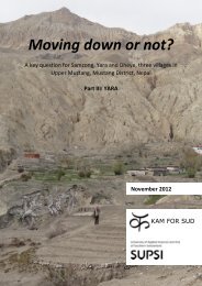
<strong>Moving</strong> <strong>down</strong> <strong>or</strong> <strong>not</strong>?<br />
Part I: SYNTHESIS<br />
A key question f<strong>or</strong><br />
Samzong,<br />
Yara,<br />
KAM FOR SUD<br />
Dheye,<br />
three villages in Upper Mustang, Mustang District, Nepal<br />
November 2012
KAM FOR SUD<br />
SUPSI<br />
The study at hand aims at finding a holistic response to climate change stress on high altitude<br />
Himalayan settlements. In particular, the three villages Samzong, Yara and Dheye have<br />
been studied. The outputs of the study include the following rep<strong>or</strong>ts:<br />
<strong>Moving</strong> <strong>down</strong> <strong>or</strong> <strong>not</strong>?<br />
A key question f<strong>or</strong> Samzong, Yara and Dheye, three villages in Upper Mustang, Mustang District,<br />
Nepal<br />
Part I: Synthesis<br />
Part II: Samzong<br />
Part III: Yara<br />
Part IV: Dheye<br />
Each mentioned rep<strong>or</strong>t is self-standing. Certain common parts are theref<strong>or</strong>e repeated in<br />
each rep<strong>or</strong>t.<br />
The rep<strong>or</strong>ts have been written by Daniel Bernet, Daniel Pittet, Christian Ambrosi, Giovanni<br />
Kappenberger and Michele Passardi. The rep<strong>or</strong>ts are part of the overall study undertaken by<br />
<strong>Kam</strong> F<strong>or</strong> <strong>Sud</strong> (KFS)<br />
Swiss NGO w<strong>or</strong>king f<strong>or</strong> a sustainable development in Nepal since 1998, www.kamf<strong>or</strong>sud.<strong>or</strong>g<br />
jointly with the<br />
University of Applied Sciences of Southern Switzerland (SUPSI)<br />
www.supsi.ch<br />
and in collab<strong>or</strong>ation with the<br />
Lo Mustang Foundation (LMF)<br />
Nepali NPO, f<strong>or</strong>med and directed by Lama Ngawang Kunga Bista, dedicated to developing the Upper<br />
Mustang region in the fields of education, health, environment and tourism, www.lo-mustanglmf.<strong>or</strong>g<br />
Imprint:<br />
Title photos: Impressions of the villages Samzong, Yara and Dheye (photos: 6 th , 11 th and<br />
13 th May 2012 respectively, Daniel Bernet)<br />
Date: 30/11/2012<br />
Place: Avegno, Switzerland<br />
Pages: 45<br />
Appendices: 17
KAM FOR SUD<br />
SUPSI<br />
In the following the members of the expert team are briefly introduced:<br />
<strong>Kam</strong> F<strong>or</strong> <strong>Sud</strong><br />
Daniel Bernet: Environmental engineer with specialization in hydraulic engineering and water<br />
resources management from the Swiss Federal Institute of Technology in Zurich (ETHZ);<br />
W<strong>or</strong>king experience in India and Nepal;<br />
‣ Water expert, responsible f<strong>or</strong> water supply related issues as well as editing the rep<strong>or</strong>ts.<br />
Daniel Pittet: Civil engineer with a postgraduate education in architecture and sustainable<br />
development from the Swiss Federal Institute of Technology in Lausanne (EPFL); Until May<br />
2012 w<strong>or</strong>king as a researcher in post-disaster reconstruction, currently engaged by the cantonal<br />
administration of the Canton Ticino in vernacular architecture conservation; Experienced<br />
in applied research, project management, sustainability of built environment, postdisaster<br />
housing, eco-habitat and with extensive w<strong>or</strong>king experience abroad;<br />
‣ Project co<strong>or</strong>dinat<strong>or</strong>, expert in housing, settlement and infrastructure related issues, as<br />
well as vulnerability towards natural disasters.<br />
Giovanni Kappenberger: Geographer, glaciologist, mete<strong>or</strong>ologist and climatologist from the<br />
Swiss Federal Institute of Technology in Zurich (ETHZ); Many years w<strong>or</strong>king as a mete<strong>or</strong>ologist<br />
f<strong>or</strong> the Federal Office of Mete<strong>or</strong>ology and Climatology MeteoSwiss; Specialized in mountain<br />
mete<strong>or</strong>ology and climatology with w<strong>or</strong>king experience in the Canadian Arctic, the Alps<br />
and the Himalayas;<br />
‣ Expert in climate matters, snow and glacier evolution and the consequences thereof on<br />
water availability and associated risks such as flooding.<br />
Michele Passardi: Economist from the University of St. Gallen; W<strong>or</strong>ked f<strong>or</strong> private companies<br />
in Zurich and as chief of the financial services of the Canton Ticino; Since 1996 w<strong>or</strong>king<br />
as a manager of a small consultancy company advising public and non-profit <strong>or</strong>ganizations in<br />
financial, institutional and project-management issues;<br />
‣ Expert in economics and socio-economics, as well as analytical approaches.<br />
Rajan Shrestha: MBA from the Tribuvan University in Kathmandu; Project co<strong>or</strong>dinat<strong>or</strong> of the<br />
<strong>Kam</strong> F<strong>or</strong> <strong>Sud</strong> projects in Nepal with sound analysis and mediation capacities, as well as deep<br />
knowledge of the local cultural context;<br />
‣ Expert in socio-economics, cultural facilitation and mediation.<br />
University of Applied Sciences of Southern Switzerland<br />
Christian Ambrosi: Geologist with a PhD from the University of Milan in applied geology;<br />
Lecturer and researcher in geology and rock mechanics at the DACD/SUPSI, head of the Geology<br />
and Natural Hazards Group of the SUPSI; Expert in natural hazards, slope instabilities,<br />
landslide numerical modeling, waterways transp<strong>or</strong>t of solid material, geo-mechanics and<br />
geo-resources;<br />
‣ Expert in all issues related to hydro-geological risks.
KAM FOR SUD<br />
SUPSI<br />
Table of Content<br />
Executive summary<br />
Glossary<br />
Abbreviations and acronyms<br />
Acknowledgements<br />
Preface<br />
1 Introduction 1<br />
1.1 Background of this study ................................................................................................. 1<br />
1.2 Study objective ................................................................................................................ 1<br />
1.3 Methodology ................................................................................................................... 2<br />
1.4 Contextualization ............................................................................................................ 2<br />
1.5 Village p<strong>or</strong>traits ............................................................................................................... 4<br />
1.5.1 Samzong and Namashung .................................................................................... 4<br />
1.5.2 Dheye and Thangchung ........................................................................................ 5<br />
1.5.3 Yara ....................................................................................................................... 6<br />
2 Socio-economic and institutional aspects 7<br />
2.1 Demographic aspects ...................................................................................................... 7<br />
2.2 Institutions and local competences ................................................................................ 9<br />
2.3 Economic activities and income .................................................................................... 10<br />
2.4 Perception of the main problems faced by the communities ...................................... 12<br />
3 Settlement and housing 14<br />
3.1 Space availability and density ....................................................................................... 14<br />
3.2 Characteristics of housing ............................................................................................. 15<br />
3.2.1 House layout ...................................................................................................... 15<br />
3.2.2 Partitioning ......................................................................................................... 15<br />
3.2.3 Construction technology .................................................................................... 16<br />
3.2.4 Maintenance ...................................................................................................... 18<br />
3.2.5 Construction costs .............................................................................................. 18<br />
4 Climatic and mete<strong>or</strong>ological setting 20<br />
4.1 Climatic setting .............................................................................................................. 20<br />
4.2 Air temperature ............................................................................................................. 21<br />
4.2.1 Actual trends of air temperature ....................................................................... 21<br />
4.2.2 Future trends of air temperature....................................................................... 21<br />
4.3 Wind .............................................................................................................................. 22<br />
4.3.1 Present wind patterns ........................................................................................ 22<br />
4.3.2 Future wind patterns ......................................................................................... 23<br />
4.4 Precipitation .................................................................................................................. 23<br />
vi<br />
viii<br />
ix<br />
x<br />
xi<br />
iv
KAM FOR SUD<br />
SUPSI<br />
4.4.1 Average precipitation ......................................................................................... 24<br />
4.4.2 Actual trends of precipitation ............................................................................ 26<br />
4.4.3 Future trends of precipitation ............................................................................ 26<br />
4.5 Glaciers .......................................................................................................................... 27<br />
4.5.1 Glaciation area and volume ............................................................................... 28<br />
4.5.2 Glacier Lake Outburst Flood potential ............................................................... 29<br />
5 Water resources 31<br />
5.1 Catchments .................................................................................................................... 31<br />
5.2 Water regimes ............................................................................................................... 33<br />
5.3 Water supply ................................................................................................................. 34<br />
5.3.1 Drinking water supply ........................................................................................ 34<br />
5.3.2 Irrigation systems ............................................................................................... 35<br />
5.3.3 Released water f<strong>or</strong> irrigation ............................................................................. 35<br />
5.3.4 Main water related problems ............................................................................ 36<br />
5.3.5 Water stress mitigation by supply management ............................................... 36<br />
5.3.6 Water stress mitigation by demand management ............................................ 37<br />
6 Geological conditions 39<br />
6.1 Samzong and Namashung ............................................................................................. 39<br />
6.2 Dheye and Thangchung ................................................................................................. 39<br />
6.3 Yara ................................................................................................................................ 40<br />
7 <strong>Moving</strong> <strong>down</strong> <strong>or</strong> <strong>not</strong>? 41<br />
7.1 Yara ................................................................................................................................ 41<br />
7.2 Samzong and Dheye ...................................................................................................... 42<br />
8 Conclusion 43<br />
9 Bibliography 46<br />
10 List of figures 48<br />
11 List of tables 49<br />
A Methodology and resources 50<br />
B Schematic maps 52<br />
C Typical house layouts 55<br />
D Mete<strong>or</strong>ology and climate 59<br />
D.1 Visualized cultivated and abandoned fields .................................................................. 59<br />
D.2 IPCC scenarios ................................................................................................................ 60<br />
D.3 Temperature interpolations f<strong>or</strong> Nepal .......................................................................... 62<br />
D.4 Yearly precipitation sums in southern Mustang ........................................................... 63<br />
E <strong>Moving</strong> <strong>down</strong> <strong>or</strong> <strong>not</strong>? 64<br />
v
KAM FOR SUD<br />
SUPSI<br />
Executive summary<br />
A collab<strong>or</strong>ative study of the NGO <strong>Kam</strong> F<strong>or</strong> <strong>Sud</strong> and the University of Applied Science of<br />
Southern Switzerland, locally supp<strong>or</strong>ted by the NPO Lo Mustang Foundation and financed by<br />
the Fondation Assistance Internationale was undertaken in 2012 with the goal to assess the<br />
most appropriate response of three Himalayan settlements to face current and future<br />
stresses, which are at least partly driven by climate change and are related to water scarcity<br />
and natural hazards. The ultimate question f<strong>or</strong> such highly stressed settlements is, whether<br />
it is appropriate and/<strong>or</strong> necessary to resettle the whole communities. The three villages<br />
Samzong, Yara and Dheye, situated in Upper Mustang, Mustang District of Nepal, were visited<br />
twice by a multidisciplinary team carrying out the field w<strong>or</strong>k necessary f<strong>or</strong> the chosen<br />
holistic approach. The output of the study concluded in four self-standing rep<strong>or</strong>ts including<br />
one f<strong>or</strong> each village as well as a synthesis, representing the rep<strong>or</strong>t at hand.<br />
Based on the field surveys, the three villages together count 53 nuclear families and a total<br />
population of 296, of which 111 (38 %) are permanently living outside of the settlements.<br />
This group of permanent migrants is consisting mostly of children and teenagers who are<br />
sent to distant schools (Lo-Manthang, Pokhara, Kathmandu <strong>or</strong> India). In all villages, economic<br />
activities are mostly limited to subsistence agriculture, strongly prejudiced by the scarce irrigation<br />
water, and to stockbreeding (goats, cows, h<strong>or</strong>ses, sheep and yaks). The latter, together<br />
with other access<strong>or</strong>y economic activities, generates monetary income which is crucial<br />
because the agricultural output can only partially cover self-sufficiency. Of all the three studied<br />
villages, Yara exhibits the largest economic diversification, which can partially be explained<br />
by the fact that it lies within the range of two touristic attractions, as well as being<br />
accessible seasonally by a track.<br />
The climate in the region with yearly precipitation rates around 200 mm and less is extremely<br />
dry and cold, manifesting itself in an almost desert-like landscape. Agricultural activities in<br />
the three villages are low productive and almost solely dependent on the perennial flow of<br />
the c<strong>or</strong>responding rivers. Compared to other villages in the region, the three studied settlements<br />
have small catchments and appear to be linked strongly to snowmelt. Due to climate<br />
change, the temperatures in Upper Mustang are expected to rise 6 °C to 10 °C in winter and<br />
4 °C to 10 °C during monsoon period at the end of the 21 st century, relative to the reference<br />
period at the end of the 20 th century. This drastic change in temperature, together with insignificant<br />
changes in precipitation volumes will lead to a considerable spatial and temp<strong>or</strong>al<br />
decrease of snow cover. Furtherm<strong>or</strong>e the predominant diurnal winds in Mustang valley are<br />
expected to increase in magnitude, leading to enhanced dust and sand deposit on snow and<br />
glaciers, resulting in even higher melt rates. Consequently, the perennial flow of the catchments<br />
within which the three villages are situated is expected to decrease in the future,<br />
generally increasing the water stress.<br />
The predominant problem in all three existing villages is the combination of insufficient water<br />
availability and inefficient irrigation supply systems. All surface water is currently allocat-<br />
vi
KAM FOR SUD<br />
SUPSI<br />
ed, so that a change in the river regime is directly affecting irrigation amounts and consequently<br />
agricultural yield. A<strong>not</strong>her crucial issue, which is only concerning Samzong however,<br />
is the exposure of the village and its surroundings including the irrigation channels to natural<br />
hazards such as debris flow.<br />
In light of the heavy water stress all three villages are subjected to at their current location,<br />
an alternative is to “Move” the c<strong>or</strong>responding village to a<strong>not</strong>her place, as envisioned by the<br />
communities of Samzong and Dheye. Both communities are in possession of a relocation<br />
site, whose suitability f<strong>or</strong> a possible resettlement was carefully examined within the scope of<br />
this study. Namely, the water supply security by applying appropriate technical measures,<br />
the vulnerability towards natural hazards and possible resettlement concepts were elab<strong>or</strong>ated<br />
along with other aspects, which altogether constitute the possible future state<br />
“Move.” In comparison, the current problems in the existing villages were analyzed and possible<br />
solutions elab<strong>or</strong>ated, whose implementation constitute the state “Stay.” Holistically<br />
comparing both states, this study concluded that the most appropriate response to the present<br />
and future challenges is to resettle the whole community of Samzong in Namashung<br />
and Dheye in Thangchung respectively. Above all, the key fact<strong>or</strong> speaking in fav<strong>or</strong> of a relocation<br />
of Samzong and Dheye, was that in both villages measures could be implemented<br />
relieving the water stress f<strong>or</strong> a certain time, but surely <strong>not</strong> in the long run. In addition, the<br />
designated settlement area f<strong>or</strong> the relocated community of Samzong, is much less exposed<br />
to natural hazards than the existing village.<br />
In contrast, the community of Yara does <strong>not</strong> have a relocation site (so far). Consequently, the<br />
chosen analytical approach had to be different than the one applied in Samzong and Dheye.<br />
Nevertheless, the issue had to be addressed, whether the village should be advised to think<br />
about moving in the future <strong>or</strong> <strong>not</strong>.<br />
The study has shown that in general, the sole application of supply management measures<br />
will procrastinate, but <strong>not</strong> solve the current problems in the long run. Unlike in the two other<br />
villages, in Yara the implementation of demand in conjunction with supply management<br />
measures might be feasible due to few inherent characteristics of the village. In fact, the<br />
community of Yara could be capable of developing adaption strategies in the longer term.<br />
Theref<strong>or</strong>e, Yara is recommended to “Stay” at the current location and adapt to the current<br />
situation by implementing proposed supply management measures, while striving to become<br />
less dependent on agriculture by encouraging further diversification of economic activities<br />
(demand management).<br />
However, considering the high level of uncertainty about future socio-economic and climatologic<br />
conditions, it is impossible to predict, whether the adaption strategies of Yara will be<br />
successful and sufficient. In case the water stress should prove to become unbearable<br />
and/<strong>or</strong> the community’s adaptation strategies turn out to be insufficient, the possible necessity<br />
of “<strong>Moving</strong>” will have to be reevaluated.<br />
vii
KAM FOR SUD<br />
SUPSI<br />
Glossary<br />
Dal<br />
Ghenpa<br />
Khola<br />
Mukhye<br />
Saligram<br />
Tom<br />
Zipu<br />
Soup made out of lentil, which is served with rice (Bhat) in the national Nepalese<br />
dish Dal Bhat<br />
Tibetan name f<strong>or</strong> the traditional communal role assumed f<strong>or</strong> yearly turns<br />
River <strong>or</strong> stream<br />
Nepali name f<strong>or</strong> Ghenpa<br />
Fossil<br />
Plastic canisters with a volume of 5 <strong>or</strong> 35 liters<br />
Herb used as a spice f<strong>or</strong> Dal<br />
Note that many different spellings of places, water bodies and names were found in Upper<br />
Mustang. This is mainly due to the fact, that many names were translated from the local languages<br />
into Nepali and/<strong>or</strong> English. Consequently, the <strong>or</strong>iginal meaning was partially <strong>or</strong> fully<br />
lost. To preserve the meaningful names, the local spelling was chosen f<strong>or</strong> the rep<strong>or</strong>ts of the<br />
study at hand. Where necessary, other common spellings are mentioned additionally.<br />
viii
KAM FOR SUD<br />
SUPSI<br />
Abbreviations and acronyms<br />
ACA<br />
ACAP<br />
asl<br />
DDC<br />
DGSD<br />
DHM<br />
FAI<br />
GCM<br />
GLOF<br />
GPS<br />
HH<br />
IPCC<br />
JAXA<br />
KFS<br />
LMF<br />
NASA<br />
NGO<br />
NPO<br />
NPR<br />
SUPSI<br />
TMPA<br />
TRMM<br />
VDC<br />
Annapurna Conservation Area<br />
Annapurna Conservation Area Project<br />
above sea level<br />
District Development Committee<br />
Deep-seated Gravitational Slope Def<strong>or</strong>mation<br />
Department of Hydrology and Mete<strong>or</strong>ology<br />
Fondation Assistance Internationale<br />
Global Circulation Model<br />
Glacier Lake Outburst Flood<br />
Global Positioning System<br />
Household<br />
Intergovernmental Panel on Climate Change<br />
Japan Aerospace Expl<strong>or</strong>ation Agency<br />
<strong>Kam</strong> F<strong>or</strong> <strong>Sud</strong><br />
Lo Mustang Foundation<br />
National aeronautics and Space Administration<br />
Non-Governmental Organization<br />
Non-Profit Organization<br />
Nepalese Rupees<br />
University of Applied Sciences of Southern Switzerland<br />
TRMM Multisatellite Precipitation Analysis<br />
Tropical Rainfall Measuring Mission<br />
Village Development Committee<br />
ix
KAM FOR SUD<br />
SUPSI<br />
Acknowledgements<br />
The initial spark f<strong>or</strong> this study goes back to few individuals: Lama Ngawang Kunga Bista, Giovanni<br />
Kappenberger, Silvia Lafranchi Pittet, project co<strong>or</strong>dinat<strong>or</strong> of <strong>Kam</strong> F<strong>or</strong> <strong>Sud</strong>, and Daniel<br />
Pittet. Each of them had a very crucial role in making this study even thinkable in the early<br />
stage. Their open minds, dedication and drive provided the base f<strong>or</strong> this study.<br />
Especially, I would like to thank the funders of this project, the Fondation Assistance Internationale<br />
(FAI). Without their supp<strong>or</strong>t, this study could <strong>not</strong> have been realized. Furtherm<strong>or</strong>e,<br />
through their positive and comprehensive attitude towards the necessity of quick reaction<br />
during the launching phase, the project could be realized within the desired sh<strong>or</strong>t time span.<br />
This was crucial, since the issues at hand are and have been pressing. Consequently any delay<br />
would have been at the expense of the local people in Mustang.<br />
On behalf of the expert team I would like to thank all the people who made both field visits<br />
with the vital field w<strong>or</strong>k possible. The villagers displayed great hospitality, helped in any possible<br />
way and were very cooperative. Also Lama Ngawang Kunga Bista and in particular his<br />
secretary Tsewang Gurung, accompanying and supp<strong>or</strong>ting both field trips with great passion,<br />
contributed a lot to the successful completion of the field w<strong>or</strong>k. Christoph Graf has to be<br />
mentioned explicitly as well, f<strong>or</strong> his valuable contribution by documenting the first field visit<br />
with pictures and movies. Furtherm<strong>or</strong>e Tsering Gurung earned the team’s gratitude through<br />
his uncomplicated, supp<strong>or</strong>tive and most welcome guidance and assistance all along the trips.<br />
Also the Trekking Team and Hari Dev Pathak in particular were appreciated. They settled all<br />
f<strong>or</strong>malities and <strong>or</strong>ganized imp<strong>or</strong>tant basic points of the field trips to everybody’s full satisfaction.<br />
The external contribution concerning past, present and future climatic trends in Upper Mustang<br />
was done by Mario Rohrer. His analysis proved to be essential within the manifold facets<br />
of the study.<br />
Aur<strong>or</strong>a Guggisberg, secretary of <strong>Kam</strong> F<strong>or</strong> <strong>Sud</strong>, looked after all administrative and accounting<br />
matters with her usual very supp<strong>or</strong>tive attitude, facilitating the w<strong>or</strong>k of all involved persons.<br />
Finally, I would like to highlight the expert team’s passion, devotion, curiosity and eff<strong>or</strong>t,<br />
without which the study at hand could <strong>not</strong> have been realized in this f<strong>or</strong>m. Last but <strong>not</strong> least,<br />
I would like to thank Daniel Bernet f<strong>or</strong> editing the rep<strong>or</strong>ts and putting together the contributions<br />
of all auth<strong>or</strong>s in a coherent f<strong>or</strong>m.<br />
Antonio Galli<br />
President of <strong>Kam</strong> F<strong>or</strong> <strong>Sud</strong><br />
x
KAM FOR SUD<br />
SUPSI<br />
Preface<br />
In addition of a synthesis rep<strong>or</strong>t, the project’s outputs include a detailed, self-standing rep<strong>or</strong>t<br />
f<strong>or</strong> each of the three studied villages Samzong (Part II) Yara (Part III) and Dheye (Part<br />
IV). In these rep<strong>or</strong>ts the answer to the crucial question “moving <strong>down</strong> <strong>or</strong> <strong>not</strong>?” is elab<strong>or</strong>ated<br />
in detail.<br />
The synthesis rep<strong>or</strong>t at hand however focuses on commonalities and differences between<br />
the three villages while details are left aside in <strong>or</strong>der to provide an overview about the topics.<br />
Particularly, the specific characteristics of each village concerning housing and related<br />
concepts, water supply systems and their possible improvements as well as the geological<br />
conditions and their inherent implications are <strong>not</strong> discussed in this rep<strong>or</strong>t. Merely, the most<br />
imp<strong>or</strong>tant aspects are mentioned and put into relation. Only the chapter about Upper Mustang’s<br />
climatic and mete<strong>or</strong>ological setting, common f<strong>or</strong> all three village rep<strong>or</strong>ts, is reproduced<br />
here at full length due to the central role related to the evolution of the problems and<br />
challenges the villagers have to face today and in the future respectively.<br />
In <strong>or</strong>der to lead the reader comprehensibly through the rep<strong>or</strong>t, it is structured as follows.<br />
First some background inf<strong>or</strong>mation are presented (chapter 1), in which the purpose of the<br />
study is explained, followed by a sh<strong>or</strong>t description of the study’s main goal together with<br />
general methodologies. An embedment of the whole study in the local context along with a<br />
brief introduction of each studied village wraps up the first chapter. Differences and commonalities<br />
of the three villages related to socio-economics are discussed in chapter 2. Issues<br />
associated with the settlements’ footprints and housing characteristics are summarized in<br />
chapter 3. Chapter 4 is concerned about climatic, mete<strong>or</strong>ological as well as glaciological matters.<br />
Water related issues are summarized thereafter, in chapter 5. Chapter 6 summarizes<br />
the key issues related to the geological investigations. The discussion of the final answer to<br />
the key question “moving <strong>down</strong> <strong>or</strong> <strong>not</strong>?” can be found in chapter 7 and finally, the conclusion<br />
is drawn in chapter 8.<br />
xi
KAM FOR SUD<br />
SUPSI<br />
1 Introduction<br />
Climate changes, deriving from global warming, have induced numerous and relevant consequences<br />
on the Himalayan region in terms of water regimes and availability. Such transf<strong>or</strong>mations<br />
directly impact the communities living in high altitude regions of the Himalaya<br />
through a severe weakening of their livelihoods and habitat. In case the communities do <strong>not</strong><br />
find an adaptation strategy in situ, they are ultimately pushed to a permanent migration by<br />
the desperate need of water during the dry season.<br />
However, the resettlement of a whole community is a complex undertaking as there are<br />
many interrelated sensitive issues. In addition to practical and technical solutions, the sociocultural<br />
and socio-economic aspects also have to be addressed deeply and carefully. In fact,<br />
they have a relevant weight f<strong>or</strong> the sustainability, efficiency and success of the response and<br />
should <strong>not</strong> be underestimated. Thus, f<strong>or</strong> elab<strong>or</strong>ating the most appropriate response to the<br />
often-quoted climate stress, a holistic approach should be chosen.<br />
1.1 Background of this study<br />
The three communities of Samzong, Yara and Dheye, particularly affected by water stress,<br />
have expressed their suffering and their urgent need f<strong>or</strong> solutions to the Lo Mustang Foundation<br />
(LMF), asking f<strong>or</strong> supp<strong>or</strong>t in identifying and implementing a proper strategy. In the<br />
course a group brain st<strong>or</strong>ming including LMF and <strong>Kam</strong> F<strong>or</strong> <strong>Sud</strong> (KFS) has been held, arising<br />
several unsolved sensitive questions and matters. As a consequence, the need of a comprehensive<br />
analysis of the key question “moving <strong>down</strong> <strong>or</strong> <strong>not</strong>?” was highlighted.<br />
Considering the complex, multidisciplinary tasks and the available expertise, respectively the<br />
missing knowhow, KFS has searched to complete the project’s team through collab<strong>or</strong>ation<br />
with the University of Applied Sciences of Southern Switzerland (SUPSI), in particular searching<br />
f<strong>or</strong> know-how in the field of natural hydro-geological risks.<br />
With the project, KFS and SUPSI, with the collab<strong>or</strong>ation of the LMF, joined their capacities<br />
and knowledge with the aim of comprehensively analyzing the particular situation of the<br />
three villages of Samzong, Yara and Dheye and defining the most appropriate, sustainable<br />
and effective strategy to respond to the water crisis in Upper Mustang.<br />
1.2 Study objective<br />
The main goal of this study is to identify the most appropriate and sustainable response to<br />
face the current challenges in terms of water availability as well as natural risks and associated<br />
socio-economic aspects f<strong>or</strong> the villages Samzong, Yara and Dheye. On a very practical<br />
level the key question to be answered is the following:<br />
Page 1/45
KAM FOR SUD<br />
SUPSI<br />
"Is it appropriate and/<strong>or</strong> necessary to resettle the whole village? If yes, under which conditions<br />
could it successfully happen? If <strong>not</strong>, what are the alternatives to solve the water related<br />
problems?"<br />
1.3 Methodology<br />
The investigation of the study objective required a fair amount of field w<strong>or</strong>k. A multidisciplinary<br />
team was assembled and two trips to Upper Mustang 1 were <strong>or</strong>ganized. Additionally, a<br />
preliminary visit of Giovanni Kappenberger in fall 2011 provided valuable inf<strong>or</strong>mation about<br />
the situation of the snow and glacier mass in the region.<br />
Pre- and post-processing of the field w<strong>or</strong>k included group discussions and meetings, mainly<br />
among the auth<strong>or</strong>s (Daniel Bernet, Daniel Pittet, Christian Ambrosi, Giovanni Kappenberger<br />
and Michele Passardi) complemented by <strong>Kam</strong> F<strong>or</strong> <strong>Sud</strong>’s project co<strong>or</strong>dinat<strong>or</strong>, Silvia Lafranchi<br />
Pittet.<br />
1.4 Contextualization<br />
Nepal is subdivided into 14 administrative Zones, which are grouped to 5 Regions. Each Zone<br />
is <strong>or</strong>ganized in Districts, which are all represented by District Development Committees<br />
(DDCs). Each District is further subdivided into Village Development Committees (VDCs).<br />
Mustang is one of the 75 Districts of Nepal and lies in the Dhaulagiri Zone within the Central<br />
Development Region.<br />
Upper Mustang (from Tibetan Mun Tan, "the fertile plain”) is the f<strong>or</strong>mer Kingdom of Lo, now<br />
part of Nepal’s District Mustang, b<strong>or</strong>dering the Tibetan plateau of the People's Republic of<br />
China in the n<strong>or</strong>th, the Nepalese Districts Dolpa west, Myagdi south and Manang in the east<br />
(Figure 1.1).<br />
Founded in the late 14 th century, Lo had been an autonomous kingdom, strongly influenced<br />
by and tied to the ancient kingdoms of western Tibet in terms of culture, linguistics and even<br />
politics until the Chinese occupation of Tibet in 1959 (Craig 2004). In 2008 the last official<br />
King of Lo was deprived of any f<strong>or</strong>mal power by the Nepalese government. Nevertheless, the<br />
royal family Bista, from which lineage the f<strong>or</strong>mer Kings have sprung, exhibit a strong influence<br />
on the inhabitants of Upper Mustang even today.<br />
Though the country is <strong>or</strong>ganized as a parliamentary democracy since 1990/91, the precedent<br />
monarchical <strong>or</strong>ganization survived de facto until the beginning of the 21 st century and did<br />
<strong>not</strong> allow the development of a decentralized government. Consequently the most remote<br />
areas such as Mustang have only benefited marginally from services provided by govern-<br />
1 The details thereof are described in appendix A, along with a brief description of applied general methodological approaches<br />
and used resources.<br />
Page 2/45
KAM FOR SUD<br />
SUPSI<br />
mental institutions. Generally such supp<strong>or</strong>t has been limited to the supply of basic assistance<br />
in the fields of police and primary education. The only f<strong>or</strong>mal bodies present in such remote<br />
areas are the DDCs and the VDCs. In terms of financial supp<strong>or</strong>t, the governmental DDC and<br />
VDC allot a limited amount of money based on proposals from the c<strong>or</strong>responding villages on<br />
a year-to-year basis. Thus, from a project perspective, rather “stage-wise” <strong>or</strong> “stop and go”<br />
approaches result.<br />
Figure 1.1: Map of Nepal, b<strong>or</strong>dering China in the n<strong>or</strong>th and India in the east, south and west. The red ellipse<br />
highlights the location of Mustang District. N<strong>or</strong>th direction is ↑, the map was taken from Zurick et al. (2006).<br />
Due to the weak institutional structure and the particular hist<strong>or</strong>ical background of Upper<br />
Mustang, local leaders and traditional community-based decision making play a central role.<br />
Decisions are made outside of any f<strong>or</strong>mal framew<strong>or</strong>k and are seldom documented, as many<br />
of the villagers are illiterate. This practice seems necessary, since the institutional contributions<br />
are quasi absent. However, the fact that the villagers are practically <strong>not</strong> supp<strong>or</strong>ted in<br />
finding and implementing solutions f<strong>or</strong> their apparent and pressing problems, bears the risk<br />
that non-optimal solutions are found, mainly due to the lack of professional elab<strong>or</strong>ation and<br />
assistance. F<strong>or</strong> appropriate and sustainable solutions, access to trustable and complete inf<strong>or</strong>mation<br />
is crucial. Furtherm<strong>or</strong>e, the taken decisions often miss a time dimension, meaning<br />
to say the planning h<strong>or</strong>izon is dangerously sh<strong>or</strong>t.<br />
Page 3/45
KAM FOR SUD<br />
SUPSI<br />
Furtherm<strong>or</strong>e, it is imp<strong>or</strong>tant to recognize the central role of the social structure within the<br />
villages of Upper Mustang. F<strong>or</strong> example, the discussions during the field visits in 2012 about<br />
possible relocations clearly underlined the fact that the unity of the communities (“staying<br />
together”) was considered to be of upmost imp<strong>or</strong>tance. The interviews have shown that a<br />
strong common responsibility and solidarity (which is lost in western societies to some degree)<br />
seems to have survived in the high Himalayas, likely through cultural and religious influences<br />
and maybe also due to the difficulties that the population must face daily.<br />
1.5 Village p<strong>or</strong>traits<br />
The three studied villages Samzong, Yara and Dheye are all located in Upper Mustang which<br />
is a “restricted area.” The restricted Upper Mustang is part of the Annapurna Conservation<br />
Area (ACA), which is managed by the Annapurna Conservation Area Project (ACAP). The income<br />
of the permit is partly invested in projects within ACA. This has allowed the cofinancing<br />
of projects in the field of water supply, mill construction, solar power plants, pedestrian<br />
bridges, health posts, environmental protection and initiatives of economic development<br />
(production activities, touristic services) to a m<strong>or</strong>e <strong>or</strong> less significant extent. In the<br />
following each village, as well as the c<strong>or</strong>responding relocation sites f<strong>or</strong> the cases of Samzong<br />
and Dheye, are introduced briefly.<br />
1.5.1 Samzong and Namashung<br />
Samzong is located at the right 2 riverbank of the Samzong Khola at an altitude of about<br />
4’000 m asl, roughly 9 km n<strong>or</strong>theast of Lo-Manthang, the hist<strong>or</strong>ical capital of Upper Mustang<br />
(Figure 1.2). Samzong belongs to Tsoshar VDC and is accessible on foot only. This year the<br />
first half of a track intended to connect Samzong with the existing road between Lo-<br />
Manthang and the Chinese b<strong>or</strong>der has been completed.<br />
In desperate need f<strong>or</strong> a solution of the pressing problems at the current location, the people<br />
of Samzong sought the help of the LMF. As an ultimate solution, the relocation of the whole<br />
village has been envisioned. In the course, a site located on the left bank of the Kali Gandaki,<br />
about 8 km southwest of the current village and 4 km n<strong>or</strong>theast of Lo-Manthang in a place<br />
named Namashung has been acquired. The land f<strong>or</strong>eseen f<strong>or</strong> cultivation, a plateau whose<br />
western b<strong>or</strong>der is confined by the Kali Gandaki, has been given to the community by the<br />
f<strong>or</strong>mer King of Lo. The plain is covered with vast amount of debris and boulders, which were<br />
mostly deposited during the past extreme flood event, likely a so-called Glacier Lake Outburst<br />
Flood (GLOF), dating roughly 25 years back. The removing of the debris from the plain<br />
to prepare it f<strong>or</strong> future cultivation was initiated in summer 2012 and is planned to conclude<br />
in 2013. The land f<strong>or</strong>eseen f<strong>or</strong> the settlement has been provided to the community by the<br />
VDC f<strong>or</strong> free. It lies about 10 m higher than the field area and is slightly southeast thereof.<br />
2 Note that all right/left indications in this rep<strong>or</strong>t are based on the flow direction of the c<strong>or</strong>responding river.<br />
Page 4/45
KAM FOR SUD<br />
SUPSI<br />
10‘000 m<br />
5‘000 m<br />
1‘000 m<br />
Figure 1.2: Overview of Upper Mustang. The main villages are indicated by yellow points, the studied villages<br />
are highlighted with red dots and the possible new locations of Samzong (Namashung) and Dheye (Thangchung)<br />
respectively are shown in green. The Chinese-Nepalese b<strong>or</strong>der is shown in pink, n<strong>or</strong>th direction is ↑<br />
(source: Google Earth Pro, accessed 27/11/2012).<br />
1.5.2 Dheye and Thangchung<br />
Dheye lies on a ridge at almost 4’000 m asl and is accessible on foot only. The village is located<br />
m<strong>or</strong>e than 10 km southeast of Charang and belongs to Zurkhang VDC (Figure 1.2).<br />
The community of Dheye is put heavily under stress by the increasing lack of water, by the<br />
difficulties of accessing the village due to frequent damage of the path leading to the village<br />
and by other fact<strong>or</strong>s such as the remoteness of the village. In the course, the village has taken<br />
the initiatives toward relocating the whole village. The selected site called Thangchung, is<br />
Page 5/45
KAM FOR SUD<br />
SUPSI<br />
located about 4 km southeast of Charang, on the opposite, left bank of the Khali Gandaki. It<br />
is a plateau, elevated roughly 30-40 m relative to the confluence of the Dhey Chang Khola<br />
and Charang Khola with the Kali Gandaki. The land of Thangchung falls already within the<br />
jurisdiction of Dheye village and is currently utilized by the community f<strong>or</strong> herding their livestock<br />
during winter (T. G. Gurung 2011). Recently a track leading up to the plain has been<br />
built.<br />
To generate additional income, the community of Dheye initiated the construction of an <strong>or</strong>chard<br />
on the western end of a slightly elevated, vast plateau named Chawale to the left of<br />
the active riverbed of Dhey Chang Khola a few years ago which was partly completed in early<br />
2012. The project proposal (T. G. Gurung 2011) envisions the cultivation of the whole plain<br />
of Chawale.<br />
1.5.3 Yara<br />
Yara lies about 7 km east of Charang on an elevation of around 3650 m asl and belongs to<br />
Zurkhang VDC. The village is situated on the right riverside of Puyung Khola (Figure 1.2). Like<br />
the two other villages, Yara is confronted with severe water stress related to agricultural<br />
practices.<br />
Unlike the two other studied villages, the community of Yara has neither identified, n<strong>or</strong> acquired<br />
a relocation site.<br />
Page 6/45
KAM FOR SUD<br />
SUPSI<br />
2 Socio-economic and institutional aspects<br />
In this chapter socio-economic, institutional and demographic issues, specific f<strong>or</strong> the three<br />
villages, are presented.<br />
2.1 Demographic aspects<br />
Based on the field survey, the three villages together count 53 nuclear families and a total<br />
population of 296, among which 150 (51 %) are female and 146 (49 %) are male. Out of the<br />
total population, 111 (38 %) are permanently living outside of the settlements (Table 2.2).<br />
Table 2.1: Demographic constitution of the three studied villages Samzong, Yara and Dheye, based on the socioeconomic<br />
survey carried out during the field visits.<br />
Description Samzong Yara Dheye a Total<br />
Number of households 17 22 14 53<br />
Total population 83 (100 %) 114 (100 %) 99 (100 %) 296 (100 %)<br />
Number of female 44 (53 %) 61 (54 %) 45 (45 %) 150 (51 %)<br />
Number of males 39 (47 %) 53 (46 %) 54 (55 %) 146 (49 %)<br />
Number of residents 61 (73 %) 74 (65 %) 50 (51 %) 185 (63 %)<br />
Permanent migrants 22 (27 %) 40 (35 %) 49 (49 %) 111 (38 %)<br />
a Within the past decades 10 households left Dheye and settled elsewhere. Including the relocated families, the total population<br />
amounts 157 including 55 (47 %) females and 83 (53 %) males.<br />
Overall, the demographic constitutions of the three villages are comparable, but some differences<br />
are highlighted in the following. In the whole Mustang District, there are less females<br />
(47 %) compared to males (53 %). A similar ratio is found in Dheye, whereas in Samzong<br />
and Yara it is the opposite. The fraction of permanent migrants is lowest in Samzong<br />
and highest in Dheye, whereas in the latter village half of the whole population does <strong>not</strong><br />
reside in the village anym<strong>or</strong>e. This circumstance leads to the fact, that in absolute numbers,<br />
Dheye has the fewest residents, although the total population is second biggest. Samzong on<br />
the other hand has the smallest total population but second most residents.<br />
The permanent migrants rarely come back to the villages, if at all. Opposed to that, most of<br />
the inhabitants move towards lower regions of the valley <strong>or</strong> even further south often engaging<br />
mobile trade during the winter months. This is a f<strong>or</strong>m of seasonal migration, which is<br />
quite typical f<strong>or</strong> the region. Only a few remain in the villages during the winter.<br />
The age structures of the three studied communities are very much alike (Table 2.2). This<br />
exemplifies that f<strong>or</strong> all villages, permanent migration concerns a very distinct demographic<br />
group. In fact, permanent migrants are almost exclusively teenagers and school-aged children,<br />
reflected by the average age of 17 years together with a rather low standard deviation.<br />
The residents on the other hand consist mostly of adults and young children, underlined by<br />
Page 7/45
KAM FOR SUD<br />
SUPSI<br />
the relatively low average age associated with a large standard deviation (Table 2.2). This<br />
circumstance can be explained by the fact, that most young children are kept at home and<br />
looked after, while school-aged children and teenagers are sent to distant schools (Lo-<br />
Manthang, Pokhara, Kathmandu <strong>or</strong> India). This represents a considerable risk f<strong>or</strong> the future<br />
demographic stability of the village, since the young migrants will return less likely after their<br />
studies because of the strong attraction of such local, regional and even national centers.<br />
Subjectively, such centers present maj<strong>or</strong> earning opp<strong>or</strong>tunities, better material living conditions<br />
and a large overall attraction as it seems.<br />
Table 2.2: Age structure of the communities Samzong (S), Yara (Y), Dheye (D) and the total population (T) based<br />
on the socio-economic surveys. The permanent migrants are almost exclusively teenagers and school-aged<br />
children, reflected by their average age and the c<strong>or</strong>responding low standard deviation. The residents however<br />
are generally older, but also include young children, represented with a lowered average age and an increased<br />
standard deviation.<br />
Permanent migrants Residents Total Population<br />
S Y D T S Y D T S Y D T<br />
Number of family members 22 40 49 111 61 74 50 185 83 114 99 296<br />
Average age 16 17 16 17 34 37 36 36 30 30 27 29<br />
Standard deviation 12 8 7 9 21 21 20 21 21 20 18 20<br />
Excluding a few outliers, the size of the households (HHs) seems to be slightly c<strong>or</strong>related<br />
with the percentage of permanent migrants, as depicted in Figure 2.1. With the exception of<br />
4 families from Yara and 1 family from Dheye, all HHs with a total number of 3 <strong>or</strong> less members<br />
are living in the village (at least during the bigger p<strong>or</strong>tion of the year). On the other<br />
hand, without exception, a varying fraction (greater than zero) of all families with 6 <strong>or</strong> m<strong>or</strong>e<br />
members is living permanently elsewhere. The reasons f<strong>or</strong> this may be manifold. F<strong>or</strong> instance,<br />
large families might <strong>not</strong> be able to sustain their livelihood due to the limited resources<br />
and economic opp<strong>or</strong>tunities <strong>or</strong> exactly opposite, large families might have the<br />
means to send some members to outside schools due to higher overall income. It has to be<br />
<strong>not</strong>ed however that it is generally difficult and may be delusive to draw conclusions from the<br />
data itself.<br />
Figure 2.1 highlights further, that Samzong consists of rather small families with a low fraction<br />
of permanent migrants, whereas Yara’s constitution is wide-spread and Dheye consists<br />
mostly of large families including many migrated family members. This visually underlines<br />
the demographic characteristics of the villages presented in Table 2.1.<br />
Page 8/45
KAM FOR SUD<br />
SUPSI<br />
Figure 2.1: Scatter plot between the numbers of HH members against the fraction of permanent migrants of the<br />
c<strong>or</strong>responding family. The smallest sized markers c<strong>or</strong>respond to a single HH (e.g. 1 family in Samzong with total<br />
7 HH members including 1 (14 %) permanent migrant), medium markers to two families (e.g. 2 families in Dheye<br />
with 6 HH members of which 4 (67 %) are permanently migrated) and the largest ones to three HHs with the<br />
same characteristics (e.g. 3 families in Yara each consisting of 2 HH members of which 1 member has permanently<br />
migrated).<br />
2.2 Institutions and local competences<br />
As mentioned in section 1.4, the institutional structure in Nepal is very weak, particularly in<br />
such a remote place as Upper Mustang. In the studied villages, there are no governmental<br />
bodies, buildings, police quarters n<strong>or</strong> health posts present. Each village has a small school<br />
with very few children and one <strong>or</strong> two teachers, who are appointed by the central government.<br />
Apparently, the children often miss school due to different reasons, such as mutual<br />
misunderstanding between the teacher, <strong>not</strong> speaking the local language, and the parents,<br />
who do <strong>not</strong> regard school as a very imp<strong>or</strong>tant matter.<br />
The management of the collective necessities is delegated to a traditional system based upon<br />
the roles of Ghenpa (named Mukhye in Nepali) and Vice-Ghenpa. Such roles are assumed<br />
through yearly turns involving a single representative of a nuclear family. The Ghenpa and<br />
Vice-Ghenpa have autonomous decisional power f<strong>or</strong> simple matters also including settlement<br />
of disputes and punishment of violation of communal rules. F<strong>or</strong> farther reaching issues,<br />
the Ghenpa gathers the assembly (involving all inhabitants) f<strong>or</strong> taking collab<strong>or</strong>ative<br />
decisions of collective interest.<br />
Page 9/45
KAM FOR SUD<br />
SUPSI<br />
Only in Dheye there seem to be persons with inf<strong>or</strong>mal leadership characteristics. The community<br />
is <strong>or</strong>ganized, very proactive and is taking actions on their own acc<strong>or</strong>d, mainly due to<br />
the lack of institutional and other supp<strong>or</strong>t from outside. The initiatives are clearly <strong>or</strong>iginating<br />
from within the community and are <strong>not</strong> driven by outsiders.<br />
In the cases of Yara and Samzong, the supp<strong>or</strong>t comes from outside to a large degree. The<br />
LMF, together with other act<strong>or</strong>s, has taken over the lead in the endeav<strong>or</strong> to solve the pressing<br />
problems, particularly in Samzong. It might seem that the people of Samzong are m<strong>or</strong>e<br />
passive in comparison to Dheye, but the cases have to be differentiated. Samzong, under<br />
heavy stress related to irrigation water availability and natural hazards, could <strong>not</strong> move as an<br />
ultimate solution to the problems, since the community was <strong>not</strong> in possession of an appropriate<br />
relocation site. Theref<strong>or</strong>e they were constricted and had to seek help. Only due to the<br />
engagement and supp<strong>or</strong>t of Lama Ngawang Kunga Bista, along with others, land suitable f<strong>or</strong><br />
a possible relocation of Samzong could be <strong>or</strong>ganized and granted to the community. Dheye<br />
on the other hand has had vast land, including the two plains Chawale and Thangchung (section<br />
1.5.2), which had belonged to the community as long as could be remembered. These<br />
areas could be used f<strong>or</strong> any activity subjectively able to ameli<strong>or</strong>ate the overall situation of<br />
the community, without being dependent on help from outside.<br />
Certainly, engaging in action based on own initiative is admirable and is proof of a good<br />
adaptive strategy of the community, but it also bears the risk, that non-optimal solutions<br />
might be found due to the limited expertise and know-how of the community itself. On the<br />
other hand, being dependent on outside help restrains the capacity of the community to find<br />
best solutions f<strong>or</strong> themselves and even w<strong>or</strong>se, the people might be instrumentalized. However,<br />
in the given context of such complex problems involving the relocation of whole villages,<br />
expertise, farsightedness and sound planning is eminent to come up with most appropriate<br />
responses.<br />
2.3 Economic activities and income<br />
In all villages, economic activities are mostly limited to subsistence agriculture, strongly prejudiced<br />
by the scarce irrigation water, and to stockbreeding (goats, cows, h<strong>or</strong>ses and sheep).<br />
In Samzong, all families own a certain amount of land area. Though in Dheye there is one<br />
family (7 %) and in Yara even eight families (36 %) which do <strong>not</strong> own land by themselves,<br />
almost all families practice agriculture.<br />
Acc<strong>or</strong>ding to the field surveys, the three villages together own 87 h<strong>or</strong>ses, 117 cows, 3879<br />
goats, 148 sheep and 80 yaks. In fact, the main economic activity that allows generating additional<br />
income is to sell animals and/<strong>or</strong> their fur. As an example, the market value of a goat<br />
c<strong>or</strong>responds to about 6’000 to 7’000 Nepalese Rupees (NPR).<br />
All the families were asked about their yearly income. In Figure 2.2 the stated incomes were<br />
related to the amount of goats and the total number of residents of the c<strong>or</strong>responding fami-<br />
Page 10/45
KAM FOR SUD<br />
SUPSI<br />
lies. The incomes vary greatly among all HHs but they seem to be grouped. While the incomes<br />
of Samzong are the lowest, the incomes of Yara include some low values but also<br />
reach up to higher amounts, also including an outlier with the clearly highest stated value of<br />
all three villages. Dheye on the other hand has indicated to earn most overall. The same<br />
holds f<strong>or</strong> the amount of goats. Except one HH, all families in Samzong own some goats, but<br />
among all villages the least. In Yara there are a considerable amount of families who own<br />
few <strong>or</strong> even no goats at all. Overall, the inhabitants of Dheye own the most goats per family.<br />
Furtherm<strong>or</strong>e, Figure 2.2 illustrates, that the HHs with the most residents are located in Yara.<br />
In any case, it has to be <strong>not</strong>ed, that the quality and reliability of the data could <strong>not</strong> be verified.<br />
It is <strong>not</strong> possible to exclude strategic answers <strong>or</strong> underestimations, influenced by the<br />
sensitiveness of the issue f<strong>or</strong> instance. In fact, the seemingly grouped values might be an<br />
indication of systematically varying answers per village, but the issue would have to be studied<br />
closer to make such statements.<br />
8<br />
7<br />
6<br />
5<br />
1<br />
4<br />
5<br />
3<br />
2<br />
1<br />
Figure 2.2: Scatter plot of the total yearly income and the number of goats per family. The size of the circle indicates<br />
how many family members are still living in the c<strong>or</strong>responding HH in Samzong, meaning that they are <strong>not</strong><br />
permanent migrants, but residents.<br />
Monetary income is essential to assuring the subsistence throughout the year, since the<br />
output from agricultural activities alone does <strong>not</strong> suffice. In addition to stockbreeding, a<strong>not</strong>her<br />
common income generating activity is engaging in winter marketing in suburban areas<br />
of Pokhara, Kathmandu <strong>or</strong> India f<strong>or</strong> instance. Other activities executed by numerous families<br />
include collecting Zipu, an herb which is sold as a spice f<strong>or</strong> Dal, w<strong>or</strong>kmanship in construction<br />
Page 11/45
KAM FOR SUD<br />
SUPSI<br />
<strong>or</strong> other paid lab<strong>or</strong>. A particularity in Dheye is that the villagers collect fossils, so-called Saligrams,<br />
which can be found in the region in comparatively high numbers and which are sold<br />
to tourists later.<br />
Of all three studied villages, Yara displays clearly the largest diversity of economic activities.<br />
It seems that <strong>not</strong> only the range is larger, but likely also the degree to which some of the<br />
families depend on activities which are different from agriculture and stockbreeding. F<strong>or</strong><br />
instance, this is underlined by the fact, that about half of all the households in Yara do <strong>not</strong><br />
own goats at all <strong>or</strong> only in insignificant numbers (Figure 2.2). M<strong>or</strong>eover, there are eight families<br />
which do <strong>not</strong> own fields, which might be a reason, why other sources of income have to<br />
be tapped. Above all however, Yara is the only one of the three studied villages, which is, at<br />
least seasonally, accessible by a track and is providing touristic accommodations. Namely a<br />
guesthouse with attached campground and a<strong>not</strong>her separate camping site are available.<br />
Both provide accommodation f<strong>or</strong> tourists <strong>or</strong> pilgrims who are mainly visiting Dharmadha<br />
Kunda <strong>or</strong> Luri Gonpa, two local attractions. These circumstances are certainly also a reason<br />
f<strong>or</strong> the m<strong>or</strong>e diversified economic engagements in Yara. As a matter of fact, at least two<br />
HHs, namely the owners of the accommodations, directly earn part of their living from tourism.<br />
Few other families take the opp<strong>or</strong>tunity presented by the tourists coming to Yara by<br />
w<strong>or</strong>king as local guides <strong>or</strong> execute paid lab<strong>or</strong> in case of need. Besides, a few individuals carry<br />
out additional jobs such as health assistant, manufacturing and selling h<strong>or</strong>se equipment,<br />
producing handicraft and running a small shop and operating a tract<strong>or</strong> transp<strong>or</strong>t service,<br />
which are found only in Yara and <strong>not</strong> in the other two villages.<br />
2.4 Perception of the main problems faced by the communities<br />
During the socio-economic surveys each of the 53 HHs was asked to identify three main issues<br />
about which they are most concerned and to rank them acc<strong>or</strong>ding to severity (Figure<br />
2.3). With a striking maj<strong>or</strong>ity, the insufficient irrigation water was identified by the villagers.<br />
This clearly exemplifies, that the problem is <strong>not</strong> constricted to a few individuals of a community,<br />
but to the vast maj<strong>or</strong>ity. Interestingly, four HHs mentioned the fact that they are landless<br />
as the main issue. However, this problem is limited to Yara, where out of the 22, 8 HHs<br />
are <strong>not</strong> in possession of own agricultural fields (section 2.3).<br />
The second concerns are already m<strong>or</strong>e dispersed. Many people are concerned about floods<br />
and landslides, but this is mainly due to Samzong’s villagers who contribute the vast maj<strong>or</strong>ity<br />
of the votes f<strong>or</strong> this particular issue. A concern which was mentioned by all three villages to<br />
a similar degree is food supply.<br />
The analysis of the main concerns exemplifies nicely, that the striking commonality between<br />
the villages is the lack of irrigation water. It also illustrates, that the vast amount of families<br />
are dependent on agriculture and the productivity thereof. Water scarcity certainly lowers<br />
the output, which directly affects the livelihoods of most HHs. On the other hand, the large<br />
Page 12/45
KAM FOR SUD<br />
SUPSI<br />
range of issues, which are of lower concern to the villagers, demonstrate that other common<br />
problems are <strong>not</strong> so clearly identifiable. Of course all villages are embedded in a similar context,<br />
but nevertheless, the commonalities related to the main concerns do <strong>not</strong> really go beyond<br />
the general lack of irrigation water.<br />
Figure 2.3: Visualization of the survey related to the identification and ranking of three main issues about which<br />
each of the 53 HHs (c<strong>or</strong>responds to the presented axis) are most concerned. Note that few families abstained<br />
from choosing altogether and numerous families identified less than three main issues.<br />
Page 13/45
KAM FOR SUD<br />
SUPSI<br />
3 Settlement and housing<br />
In the following sections the commonalities and differences between the three settlements<br />
related to space availability and housing are discussed. Schematic maps of the three studied<br />
villages can be found in appendix B.<br />
3.1 Space availability and density<br />
The population density of Samzong and Yara are very similar, whereas Dheye has the highest<br />
value underlining the particularly dense layout of the settlement. The cultivated areas of<br />
Dheye and Yara are very similar, while Samzong’s field area is slightly smaller (Table 3.1).<br />
Table 3.1: Settlement and agricultural area related to the populations of the three studied villages together with<br />
the respective relocation sites. The Settlement area was measured with Google Earth Pro, the cultivation area<br />
was estimated with GPS measurements on site and the population is based on the socio-economic surveys undertaken<br />
during the field visits.<br />
Description<br />
Samzong<br />
Current location<br />
Namashung<br />
Relocation site<br />
Dheye<br />
Current location<br />
Thangchung<br />
Relocation site<br />
Yara<br />
Current location<br />
Settlement<br />
area<br />
(ha)<br />
Cultivated<br />
area<br />
(ha)<br />
Total useable<br />
area<br />
(p)<br />
Total population<br />
2012<br />
(p)<br />
Population<br />
density<br />
(p/ha)<br />
Cultivation area<br />
per capita<br />
(ha/p)<br />
1.34 9.08 10.42 83 62 0.11<br />
0.83 9.75 10.58 83 100 0.12<br />
1.18 10.39 11.57 99 84 0.11<br />
6.13 13.71 24.93 99 (157) 16 (26) 0.14 (0.09)<br />
1.69 10.56 12.25 114 67 0.09<br />
F<strong>or</strong> a possible resettlement, the comparison of the c<strong>or</strong>responding areas is interesting. In<br />
case of Samzong, the total as well as the agricultural area remains almost the same, but the<br />
available settlement area would become sensitively smaller resulting in a much larger population<br />
density (Table 3.1). To account f<strong>or</strong> this circumstance, an appropriate settlement layout<br />
was elab<strong>or</strong>ated on a preliminary basis in the scope of this study and is presented in c<strong>or</strong>responding<br />
village rep<strong>or</strong>t (Part II: Samzong).<br />
The available space of Dheye’s relocation site is m<strong>or</strong>e than twice as big as the existing footprint.<br />
The layout of the settlement as proposed by T. G. Gurung (2011) reserves a vast area<br />
f<strong>or</strong> the settlement itself, which leads to a heavy reduction of the population density, even if<br />
the recently dislocated families would return as envisioned by the community (bracketed<br />
values in Table 3.1). It is suggested to build the settlement in a rather dense manner to have<br />
additional area available f<strong>or</strong> agricultural purposes f<strong>or</strong> instance. A further discussion of this<br />
Page 14/45
KAM FOR SUD<br />
SUPSI<br />
matter together with a possible settlement layout is presented in the c<strong>or</strong>responding village<br />
rep<strong>or</strong>t (Part IV: Dheye).<br />
3.2 Characteristics of housing<br />
The spatial <strong>or</strong>ganization of the dwellings in Upper Mustang is greatly varying depending upon<br />
size, available space, need and means of the HH and proximity to other houses. However,<br />
there are some typical elements that are found in most cases, as discussed in the following.<br />
3.2.1 House layout<br />
The dwellings are generally rather compact with access to the rooms through a central<br />
courtyard and systematically accessible flat roofs (Figure 3.4 in section 3.2.3). Generally the<br />
houses are surrounded by compounds f<strong>or</strong> animals fenced by stone walls, in case enough<br />
space is available. In the three villages at least half of the houses have two st<strong>or</strong>ies, including<br />
a ground and a first flo<strong>or</strong>, whereas the other dwellings are composed by the ground flo<strong>or</strong><br />
only. Three houses, each representing a typical small, medium <strong>or</strong> a large house respectively,<br />
were measured in Samzong and are presented in appendix C.<br />
3.2.2 Partitioning<br />
Indo<strong>or</strong> spaces are used f<strong>or</strong> st<strong>or</strong>age, sleeping, living and cooking, whereas verandas are generally<br />
used f<strong>or</strong> handicraft production and living space. The roof top terrace is a very essential<br />
space used f<strong>or</strong> drying firewood, cow dung and other goods. A shrine is often built on the roof<br />
that may also host solar modules f<strong>or</strong> the lighting systems (Figure 3.4 in section 3.2.3). The<br />
vertical access is generally supplied by very simple ladders constructed by excavating a<br />
wooden trunk acc<strong>or</strong>dingly. In some cases m<strong>or</strong>e elab<strong>or</strong>ate wooden stairs f<strong>or</strong> accessing the<br />
first flo<strong>or</strong> are provided.<br />
The socio-economic surveys have also allowed collecting data on the houses’ compositions,<br />
illustrated by Figure 3.1. Generally the absolute number of rooms varies greatly. On average,<br />
the inhabitants of Dheye have the most and Yara the least amount of rooms per house. All<br />
houses accommodate bedrooms and a kitchen, though in numerous cases the rooms are<br />
used f<strong>or</strong> different purposes. Generally, st<strong>or</strong>e rooms and compounds are very common, but<br />
in Yara the c<strong>or</strong>responding numbers are much lower.<br />
Page 15/45
KAM FOR SUD<br />
SUPSI<br />
Figure 3.1: Average house composition of the three studied villages. The numbers indicate how many rooms are<br />
designated to the c<strong>or</strong>responding categ<strong>or</strong>y on average per house, based on the field surveys.<br />
3.2.3 Construction technology<br />
The foundations are made of stones that are also used f<strong>or</strong> the lower part of the walls in<br />
some cases. The walls are made of hand-made crude soil blocs of about 40 x 20 x 12 cm<br />
(Figure 3.2), laid out with soil m<strong>or</strong>tar and covered with lime plaster. The walls are reinf<strong>or</strong>ced<br />
around the do<strong>or</strong>s and windows with wooden beams. Isolated wooden poles complete the<br />
vertical structure that is linked to the wooden h<strong>or</strong>izontal structure f<strong>or</strong>ming the slabs and flat<br />
roofs (Figure 3.3). The latter are covered with soil, in some cases mixed with ashes that assume<br />
the function of surfacing and water proofing of the slab and roof (Figure 3.4).<br />
All wooden w<strong>or</strong>ks (wooden part of the structure, do<strong>or</strong>s and windows) are realized by professional<br />
carpenters hired from the region, whereas all the remaining w<strong>or</strong>ks are done by the<br />
family members with the help of relatives and friends, in exchange of similar <strong>or</strong> other kind of<br />
w<strong>or</strong>kmanship.<br />
The materials f<strong>or</strong> constructing the walls (soil and lime) are available locally while materials<br />
such as nails, lockers and possibly glass are purchased in the regional market (in Lo-<br />
Manthang <strong>or</strong> in markets at the Chinese b<strong>or</strong>der f<strong>or</strong> instance). Construction wood is supplied<br />
mainly from other villages of the region and from China because the local production of such<br />
wood is insufficient f<strong>or</strong> covering the needs.<br />
Page 16/45
KAM FOR SUD<br />
SUPSI<br />
Figure 3.2: Hand-made crude soil blocs f<strong>or</strong> wall construction in Samzong (photo: 29/06/2012, Daniel Pittet)<br />
Figure 3.3: Inside view of a house under construction in Yara with earthen walls, wooden poles and part of the<br />
wooden slab structure (photo: 03/07/2012, Daniel Pittet).<br />
Page 17/45
KAM FOR SUD<br />
SUPSI<br />
Figure 3.4: Roof top with soil/ash surfacing, wood disposal f<strong>or</strong> drying, solar modules f<strong>or</strong> lighting system, shrine<br />
(in red) and pipe f<strong>or</strong> fire smoke evacuation in Samzong. The places c<strong>or</strong>responding to inside partition walls are<br />
covered by flat stones f<strong>or</strong> a better protection against rainwater penetration (photo 28/06/2012, Daniel Pittet).<br />
3.2.4 Maintenance<br />
The maintenance of the houses consists mainly in the regular surfacing of the rooftop in <strong>or</strong>der<br />
to maintain a sufficient waterproofing. Such maintenance is done by applying and polishing<br />
a new layer of soil, sometimes mixed with ashes. Frequent surfacing of the indo<strong>or</strong> areas<br />
is also done f<strong>or</strong> maintaining a smooth and clean pavement surface. Yearly plastering and<br />
lime painting of the walls is also realized, unless there is demise in the family during the year.<br />
3.2.5 Construction costs<br />
The construction costs of an average house with 4 to 5 rooms were estimated (Table 3.2).<br />
The supply of wood represents the highest share of the cost of a house by far. This is explained<br />
by the fact that construction wood is locally hardly available and needs to be transp<strong>or</strong>ted<br />
from other villages, if <strong>not</strong> from China.<br />
Page 18/45
KAM FOR SUD<br />
SUPSI<br />
Table 3.2: Estimated average cost f<strong>or</strong> a standard house with 4-5 rooms in Samzong. The values are based on a<br />
community meeting with representatives of 14 out of the total 17 HHs on 27/06/2012.<br />
Description<br />
W<strong>or</strong>kmanship of professional carpenter<br />
1 month @ 500 NPR/day<br />
W<strong>or</strong>kmanship f<strong>or</strong> non-wood w<strong>or</strong>ks<br />
Free f<strong>or</strong> exchange of w<strong>or</strong>kmanship with relatives and friends<br />
Required additional wood<br />
Wood f<strong>or</strong> beams, slab, roofing etc. additional to recycled wood<br />
Other materials<br />
Nails, lockers, glass etc.<br />
Cost (NPR)<br />
15’000<br />
0<br />
500’000<br />
40’000<br />
Total direct costs 555’000<br />
Page 19/45
KAM FOR SUD<br />
SUPSI<br />
4 Climatic and mete<strong>or</strong>ological setting<br />
To understand the current circumstances and challenges with which the people in Upper<br />
Mustang are confronted, it is crucial to put it into appropriate physical context. The past mete<strong>or</strong>ological,<br />
climatic and glaciological settings as well as future trends thereof have to be<br />
considered in <strong>or</strong>der to qualify future prospects of the current settlement.<br />
In particular the evolution of precipitation and temperature within the last decades in Upper<br />
Mustang is of interest. Furtherm<strong>or</strong>e future projections thereof are looked at. The c<strong>or</strong>responding<br />
investigations were done by Mario Rohrer, which concluded in two unpublished<br />
rep<strong>or</strong>ts (Rohrer 2012a; 2012b). Here, only the relevant issues f<strong>or</strong> the study at hand are reproduced.<br />
4.1 Climatic setting<br />
Acc<strong>or</strong>ding to Rohrer (2012a) Mustang’s climate “(…) is characterized by a cold, windy and dry<br />
climate.” Very generally speaking, it seems that it is getting even drier. This circumstance is<br />
exemplified by the many abandoned agricultural fields that could be seen walking through<br />
Upper Mustang. Based on satellite inf<strong>or</strong>mation from 1990 and 1984, Kostka (2001) identified<br />
and visualized agricultural areas including abandoned p<strong>or</strong>tions in a thematic map (Figure<br />
11.1 in appendix D.1). Looking at m<strong>or</strong>e recent satellite imagery with Google Earth f<strong>or</strong> instance,<br />
it becomes apparent, that the abandoned field areas have been further increasing<br />
over the last decades. Though this tendency may have different reasons, it is very likely that<br />
there has been an ongoing reduction of water availability during the last century. This is also<br />
supp<strong>or</strong>ted by the accounts of the interviewed locals. In addition, this tendency of “Upper<br />
Mustang becoming drier since decades” has also been expressed by G. Miehe, a specialist of<br />
Tibet’s climate (G. Miehe 2012, pers. com.).<br />
In general, the climatic setting appears to be spatially highly variable. As a neat example<br />
thereof, clouds were producing very local precipitation in Upper Mustang in 1978, vertically<br />
distinctively delimited (Figure 4.1).<br />
Page 20/45
KAM FOR SUD<br />
SUPSI<br />
Figure 4.1: Local precipitation west of Samar produced by clouds which were f<strong>or</strong>med by the uplifting air masses<br />
flowing upwards through the Kali Gandaki valley. Neither the valley bottom, n<strong>or</strong> the mountain tops, which were<br />
under the influence of an overlying high pressure system, received any snowfall. The picture was taken from<br />
Th<strong>or</strong>ung Peak (6140 m asl) in n<strong>or</strong>thwestern direction (photo: 13/11/1978, Giovanni Kappenberger).<br />
4.2 Air temperature<br />
Actual and future trends of air temperature were analyzed and are rep<strong>or</strong>ted in the following<br />
sections.<br />
4.2.1 Actual trends of air temperature<br />
Reliable mete<strong>or</strong>ological data over longer periods are <strong>not</strong> easy to find in Nepal. Analysis of<br />
such data has to be done with care theref<strong>or</strong>e. Nevertheless, acc<strong>or</strong>ding to Rohrer (2012a) a<br />
general warming trend over the last roughly three decades can be identified by comparing<br />
two different temperature interpolations (Figure 11.10 and Figure 11.11 in appendix D.3).<br />
The magnitude of the warming trend is questionable, as the two interpolations show inconsistencies,<br />
but roughly the warming seems to amount 1°C over the last 30 years in Mustang<br />
(Rohrer 2012a).<br />
4.2.2 Future trends of air temperature<br />
To identify future trends in air temperature Global Circulation Models (GCMs) can be used.<br />
F<strong>or</strong> Nepal future trends are quite uncertain however acc<strong>or</strong>ding to Rohrer (2012a). Based on<br />
a single intermediate emission scenario (A1B of the Intergovernmental Panel on Climate<br />
Change (IPCC) rep<strong>or</strong>t 2007, appendix D.2) the warming at the end of the 21 st century ranges<br />
Page 21/45
KAM FOR SUD<br />
SUPSI<br />
between +2 °C and +5 °C during the monsoon season represented by the month June, July<br />
and August (Rohrer 2012a). The range covered by different models predicting warming f<strong>or</strong><br />
the whole year is slightly smaller (Rohrer 2012a), which can likely be attributed to the fact<br />
that the monsoon season introduces greater overall uncertainties due to its complex inherent<br />
dynamics.<br />
F<strong>or</strong> Mustang, the positive difference at the end of the 21 st century to the reference period<br />
(1961-1990) is considerably higher (Rohrer 2012b). In winter the temperature is expected to<br />
rise between 6 °C to 10 °C <strong>or</strong> 4 °C to 10 °C during monsoon season respectively (Rohrer<br />
2012b). Analogically to the temperature trend of whole Nepal, the bandwidth of expected<br />
temperature increase f<strong>or</strong>med by different models is bigger during the monsoon season<br />
(Rohrer 2012b).<br />
4.3 Wind<br />
The winds of the Mustang region are heavily influenced by the pressure fields f<strong>or</strong>ming over<br />
India and Tibet. The very strong diurnal winds (Figure 4.2) are well known and described in<br />
many articles, books and guides. As in most valleys, winds blow up <strong>or</strong> <strong>down</strong>, but <strong>not</strong> perpendicular<br />
to the valley axis.<br />
The strong heating of the soil creates low pressure system over Tibet during the day, with an<br />
increasing pressure gradient between India and Tibet. This results in heavy diurnal upvalley<br />
winds in late m<strong>or</strong>ning and early afternoon.<br />
Figure 4.2: Riverbed of the Kali Gandaki<br />
between Jomsom and Kagbeni. The<br />
heavy afternoon wind is visibly suspending<br />
and transp<strong>or</strong>ting a lot of sand<br />
and dust particles (photo: 19/10/2011,<br />
Giovanni Kappenberger).<br />
4.3.1 Present wind patterns<br />
As mentioned bef<strong>or</strong>e, a particularity of the Kali Gandaki valley is that it is subject to quite<br />
unique diurnal wind both in terms of magnitude and asymmetry between night and day<br />
Page 22/45
KAM FOR SUD<br />
SUPSI<br />
(Figure 4.3). In the late m<strong>or</strong>ning upvalley winds take up and reach its quite extreme maximum<br />
after midday to decay later on and display typically only gentle breezes during the<br />
night (Egger et al. 2000).<br />
Figure 4.3: Graph illustrating monthly<br />
mean values of the hourly mean wind<br />
speed V (m/s) as observed in Kagbeni in<br />
September and October 1990 at a<br />
height of 30 ft, taken from (Egger et al.<br />
2000).<br />
The wind patterns could also be experienced during the field visits. It was observed that the<br />
strong winds during the day are <strong>not</strong> only rather inconvenient f<strong>or</strong> any outdo<strong>or</strong> activity, but is<br />
clearly also leading to considerable soil losses.<br />
4.3.2 Future wind patterns<br />
As described in section 4.2, the temperatures are expected to rise considerably. However<br />
the general as well as the diurnal warming is <strong>not</strong> constant in space. Namely, it is expected<br />
that Tibet is subject to m<strong>or</strong>e pronounced warming than India. Furtherm<strong>or</strong>e, due to the immensely<br />
higher air pollution and theref<strong>or</strong>e reduced irradiation in India, the diurnal warming<br />
is reduced (L. Zgraggen 2012, pers. com.). As the heat low over the Tibetan plateau is seen to<br />
enhance the strength of the valley wind (Zängl, Egger, and Wirth 2001), the increasing pressure<br />
gradients between India and Tibet are expected to lead to even m<strong>or</strong>e extreme upvalley<br />
winds in Kali Gandaki valley.<br />
As a consequence of the increasing winds, m<strong>or</strong>e dust and particles are transp<strong>or</strong>ted and ultimately<br />
deposited (confirmed by B. Neininger 2012, pers. com.). Deposition on snow and<br />
glacier surfaces lead to a decrease of albedo and theref<strong>or</strong>e to enhanced melt rates. This has<br />
maj<strong>or</strong> implications f<strong>or</strong> future water availability, since the latter seems heavily dependent on<br />
snow and ice melt (section 4.4 and 5.2).<br />
4.4 Precipitation<br />
Generally speaking, precipitation falls as snow at high level and at temperatures below zero<br />
degrees Celsius. The snowline (elevation above which it is snowing and below which it is<br />
Page 23/45
KAM FOR SUD<br />
SUPSI<br />
raining) is varying permanently between seasons. In central Nepal the snowline can be as<br />
low as 2’000 m asl. In summer, during monsoon, the snowline can reach even 6’000 m asl.<br />
Precipitation as snow is difficult to measure at the ground. In Mustang, there is no ground<br />
data available. The snow cover in Mustang shows a small trend towards a declining snow<br />
coverage (D. R. Gurung et al. 2011), but it is <strong>not</strong> significant, due to the sh<strong>or</strong>t period of survey<br />
based on satellite imagery from 2002 to 2010 and the strong variability between one year to<br />
a<strong>not</strong>her.<br />
However, it is likely that snow cover has become less during recent winters in the n<strong>or</strong>theast<br />
of Upper Mustang, where the watersheds of Samzong, Yara and Dheye are located, generally<br />
producing less melt water.<br />
Ground and satellite-based measurements and estimations are available f<strong>or</strong> precipitation in<br />
general. This data allows indicating average precipitation rates as well as identifying past and<br />
future trends, as will be discussed in the following.<br />
4.4.1 Average precipitation<br />
Rohrer (2012a) states:<br />
“The valley flo<strong>or</strong> of the n<strong>or</strong>thern part of Mustang (Ghami, Lo-Manthang) is characterized<br />
by mean yearly precipitation sums of about 200 mm and less and has theref<strong>or</strong>e a desert<br />
type of landscape. These yearly precipitation sums are the lowest in Nepal. (…) There have<br />
been precipitation measurements (and some air temperature measurements) since the<br />
early 1970ies, but there are some measurement gaps in the time series. Quality and especially<br />
homogeneity of the measurements is unknown - by the time being.”<br />
The precipitation stations in Upper Mustang (Ghami, Lo-Manthang) are particularly unreliable<br />
(S. Miehe 2012, pers. com.). Additionally, this circumstance is underlined by the number<br />
of complete/incomplete years of the c<strong>or</strong>responding rec<strong>or</strong>ds. Theref<strong>or</strong>e, the absolute precipitation<br />
sums as presented in Practical Action (2009) and listed in Table 4.1 have to be interpreted<br />
with care.<br />
Albeit the uncertainty concerning the data’s representativeness, a strong negative southn<strong>or</strong>th<br />
precipitation gradient is exemplified (Table 4.1). This circumstance is further highlighted<br />
by Lumle, the station run by the Department of Hydrology and Mete<strong>or</strong>ology (DHM) with<br />
the highest rec<strong>or</strong>ded average precipitation with a yearly value of 5403 mm (Practical Action,<br />
2009). This station is situated only around 100 km south of Lo-Manthang with clearly one of<br />
the lowest rec<strong>or</strong>ded values. Furtherm<strong>or</strong>e, the data listed in Table 4.1 shows that the yearly<br />
mean precipitation in Upper Mustang with a value ranging around 200 mm is extremely low.<br />
F<strong>or</strong> agricultural activities this exemplifies the predominant need f<strong>or</strong> water sources other<br />
than direct precipitation.<br />
Page 24/45
KAM FOR SUD<br />
SUPSI<br />
Table 4.1: Average yearly precipitation rates f<strong>or</strong> different stations in Mustang taken from Practical Action<br />
(2009).<br />
Station<br />
Station<br />
altitude a<br />
(m asl)<br />
Direct<br />
distance b<br />
(km)<br />
Yearly precipitation<br />
sums a<br />
(mm)<br />
Available<br />
rec<strong>or</strong>d<br />
periods c<br />
Years of complete<br />
/ incomplete<br />
rec<strong>or</strong>ds c<br />
Lete 2’384 0 1’308 1969-2005 33 / 4<br />
Marpha 2’566 16 402 1967-2005 33 / 6<br />
Jomsom 2’744 20 246 1972-2005 28 / 6<br />
Ghami 3’465 54 174 1973-2005 25 / 8<br />
Lo-Manthang 3’705 71 144 1974-2005 21 / 11<br />
a Practical Action (2009)<br />
b Measured with Google Earth<br />
c Taken from the data availability list published on http://www.dhm.gov.np/<strong>down</strong>load, accessed 05/06/2012<br />
To have an idea about local precipitation sums at village level and have independent measurements,<br />
a few accumulative rain gauges (simply graduated cylinders) were installed during<br />
the first field visit dispersed in the three studied villages. During the second visit the gauges<br />
were examined. All instruments demonstrated that it had <strong>not</strong> rained in May and June 2012.<br />
Only a few water bubbles within the applied oil layer to prevent evap<strong>or</strong>ation could be seen.<br />
These may have been caused by some very light showers. In each village, somebody was<br />
assigned to read and rec<strong>or</strong>d the gauges at the end of the monsoon season, in beginning of<br />
October 2012 (Table 4.2).<br />
Table 4.2: Measured local precipitation sums in Samzong, Yara and Dheye between the beginning of July and<br />
the beginning of October, representing the monsoon season 2012.<br />
Station<br />
Station<br />
altitudes a<br />
(m asl)<br />
Direct<br />
distance b<br />
(km)<br />
Samzong 4’000 20<br />
Yara 3’600 6<br />
Dheye 3’900 0<br />
Gauge<br />
ID<br />
Precipitation<br />
sum<br />
(mm)<br />
RS1 146<br />
RS3 60<br />
RY1 86<br />
RY2 104<br />
RY3 86<br />
RD2 92<br />
RD3 95<br />
a approximated with hand-held GPS device during the field visits.<br />
b Direct distance to Dheye measured with Google Earth. The three villages are in-line with the general n<strong>or</strong>th-south direction<br />
of Mustang valley (Figure 1.2 in section 1.5).<br />
In Samzong the rep<strong>or</strong>ted values differ by m<strong>or</strong>e than twofold. The discrepancy might partially<br />
be due to the placement of the gauge RS3 on an insufficiently open roof. Furtherm<strong>or</strong>e, imp<strong>or</strong>tant<br />
differences can be explained by the irregularity of convective precipitation events. In<br />
Page 25/45
KAM FOR SUD<br />
SUPSI<br />
Yara one reading is larger than the other two, while in Dheye, the readings are matching<br />
nicely.<br />
In any case, the generally extremely low precipitation rates in Upper Mustang are illustrated.<br />
Related to agricultural activities this exemplifies the predominant need f<strong>or</strong> water sources<br />
other than direct precipitation.<br />
4.4.2 Actual trends of precipitation<br />
The analysis of the data rec<strong>or</strong>ds 3 of the mete<strong>or</strong>ological stations Jomsom and Marpha, both<br />
situated slightly south of Upper Mustang, by Rohrer (2012a) show “no precipitation trend<br />
(…) between 1970 and 2010.” Further, “at the entrance of Mustang valley and the southern<br />
side of Annapurna the precipitation amounts could be characterized by a positive trend, but<br />
also this has to be confirmed by a longer investigation” (Rohrer 2012b). The c<strong>or</strong>responding<br />
graphs are reprinted in Figure 11.12 and Figure 11.13 in appendix D.4.<br />
A<strong>not</strong>her way to investigate actual precipitation trends is to use satellite based estimations.<br />
Namely, with the help of a satellite called Tropical Rainfall Measuring Mission (TRMM),<br />
launched by the American space agency NASA and the Japanese JAXA, can be used f<strong>or</strong> such<br />
tasks. F<strong>or</strong> the analysis of precipitation trends in Upper Mustang a product named TRMM<br />
Multisatellite Precipitation Analysis (TMPA), version 6, available from 1998 to 2010 has been<br />
used by Rohrer (2012a), whose results are presented and discussed in the following:<br />
In comparison to the ground data listed in Table 4.1, the TRMM product shows considerably<br />
higher values (Rohrer 2012a). This can be due to different reasons: Either, the values by the<br />
satellite produce truly overestimate the precipitation, the ground data could be underestimated<br />
due to the unreliable measurements <strong>or</strong> there could be a large gradient between the<br />
valley flo<strong>or</strong> and the mountain slopes (Rohrer 2012a). The latter is rather plausible, as it is<br />
congruent with observations done during the field visits.<br />
Most imp<strong>or</strong>tantly however, the TRMM analysis indicates considerable year-to-year variations<br />
of precipitation volume (Rohrer 2012a). Further, the onset of the monsoon season is<br />
subject to very high variations as well (Rohrer 2012a). Both issues are making the climatic<br />
conditions less predictable, which has maj<strong>or</strong> implications f<strong>or</strong> agricultural activities and the<br />
associated food security of villages like Samzong (section 5.3)<br />
4.4.3 Future trends of precipitation<br />
Precipitation trends are difficult to evaluate. F<strong>or</strong> the whole Himalaya region climatological<br />
models do <strong>not</strong> show significant tendencies, but are suggesting slightly drier winters and<br />
slightly moister summers (IPCC 2007a). This seems to be a general w<strong>or</strong>ldwide trend, stating:<br />
“wet gets wetter, dry gets drier” (Stocker 2010). Generally, the precipitation, as well as the<br />
onset and end of the monsoon, are expected to be m<strong>or</strong>e variable.<br />
3 Data rec<strong>or</strong>ded and provided by the DHM<br />
Page 26/45
KAM FOR SUD<br />
SUPSI<br />
However, the GCMs show a moderate increase of convective precipitation as well as a delay<br />
of the onset of monsoon by roughly 5 to 10 days in Mustang towards the end of the 21 st century<br />
(Ashfaq et al. 2009 cited in Rohrer 2012a).<br />
The moderate increase of convective precipitation is expected to be attended by a general<br />
increase of precipitation intensity. Besides, it has to be <strong>not</strong>ed, that the predicted shift of the<br />
monsoon’s future start, is represented by an average value. The bef<strong>or</strong>e mentioned highly<br />
varying onset of the monsoon season is expected to occur in the future as well.<br />
In terms of future precipitation sums in Mustang based on different GCMs’ predictions, Rohrer<br />
(2012b) states:<br />
“Whereas in January the differences to the reference period (1961-1990) f<strong>or</strong> the Mustang<br />
region is expected to be small in all models, the differences in July between models is very<br />
large.”<br />
Furtherm<strong>or</strong>e, Rohrer (2012b) concludes:<br />
“(…) a possible statement could be: no dramatic change in monsoon precipitation up to<br />
the end of the present century.”<br />
However, even if the precipitation sums are <strong>not</strong> changing significantly in the future, the implications,<br />
particularly related to the snow cover, are severe. Assuming a constant future<br />
precipitation amount, the snow cover is going to become less and less substantial, because<br />
of the following reasons:<br />
‣ Overall rising elevation of the snowline due to increased temperatures<br />
‣ Faster disappearing snow cower due to warmer weather conditions<br />
‣ Possibly m<strong>or</strong>e dust deposition, leading to decreased albedo and theref<strong>or</strong>e a quicker melting<br />
process<br />
4.5 Glaciers<br />
As exposed in section 5.1, the relocation sites Namashung and Thangchung are situated<br />
within glaciated catchments in contrast to the current locations of all three studied villages.<br />
Glaciers play a maj<strong>or</strong> role, <strong>not</strong> only from a water resource point of view, but also related to<br />
present and future exposure to natural hazards. Theref<strong>or</strong>e the present state and future<br />
trends in glaciation have to be addressed.<br />
Generally the glaciers in Nepal are retreating, as in the most part of Himalaya (Fujita and<br />
Nuimura 2011; Bolch et al. 2012), but the situation is very heterogeneous. In some regions at<br />
great altitude, above 6’000 m asl, the mass balance of snow and ice is even slightly positive<br />
(Kappenberger 2011). However, the general warming leads to high melt rates at lower altitudes,<br />
resulting in negative total mass balance of nearly all glaciers in the Himalaya and over<br />
the whole globe.<br />
Page 27/45
KAM FOR SUD<br />
SUPSI<br />
4.5.1 Glaciation area and volume<br />
Current state<br />
Using Google Earth Pro, the current glaciation area could be approximated. Linearly segmenting<br />
the non-linear relationship between glacier area and its c<strong>or</strong>responding volume given<br />
by Huss et al. (2008), the glacier volumes could be calculated. In fact, the surface area of<br />
each distinct glacier mass was measured, and with the c<strong>or</strong>responding linearized relationship,<br />
the ice volume of each glacier piece could be approximated. In the end, the total ice volume<br />
was obtained by summing up the separately estimated volumes.<br />
The glaciated p<strong>or</strong>tion of Namashung’s catchment was estimated to be roughly 24 km 2 (10 %)<br />
with a c<strong>or</strong>responding total volume of about 0.87 km 3 . Thangchung’s glaciated fraction was<br />
estimated to be almost twice as big with an area of 45 km 2 (12%) associated with a much<br />
larger total volume of about 3.42 km 3 (Table 5.1 in section 5.1).<br />
Past and future trends<br />
The change in glaciation was approximated by qualitatively estimating, how much the surface<br />
area of the c<strong>or</strong>responding glaciers shrunk within the past 44 years based on satellite<br />
imagery 4 . From the resulting areas, the c<strong>or</strong>responding volumes were calculated using the<br />
methodology described bef<strong>or</strong>e.<br />
The exemplary estimation revealed, that the masses of three glaciated areas, which all lie<br />
within the catchment of Namashung, decreased by roughly 16 %. Also, the analysis has<br />
shown that the different glacier bodies are <strong>not</strong> retreating with the same velocity. Many fact<strong>or</strong>s<br />
such as exposition, debris cover, precipitation pattern, local temperature gradients etc.<br />
play a role.<br />
Direct comparison of the present with past glacier extent could <strong>not</strong> be done f<strong>or</strong> the glaciation<br />
within Thangchung’s catchment in the scope of this study. However, compared to the<br />
glaciated area in Namashung f<strong>or</strong> instance, the catchment reaches to considerable higher<br />
elevations and the glaciers are m<strong>or</strong>e massive, underlined by the estimated volume of about<br />
3.42 km 3 (Table 5.1 in section 5.1). Furtherm<strong>or</strong>e, based on “bef<strong>or</strong>e-after” observations by<br />
Giovanni Kappenberger in the region, it is <strong>not</strong> unlikely that the glaciers in Thangchung’s<br />
catchment have retreated much less than the ones in the headwaters of Namashung.<br />
F<strong>or</strong> the future, the glaciers are expected to shrink at a higher rate, due to enhanced warming<br />
(section 4.2) and the likely increase of dust cover due to even m<strong>or</strong>e pronounced upvalley<br />
winds during the day (section 4.3) and insignificant change in precipitation (section 4.4).<br />
Due to large still present glacier volume in the catchment of Thangchung, the higher elevation<br />
together with a reduced retreating behavi<strong>or</strong> in the past, it is believed that the area will<br />
certainly stay (partly) glaciated within the current century. It is possible however that the<br />
4 C<strong>or</strong>ona imagery from 1967 were compared with Landsat images from 2011 by Kappenberger and Lichtenegger (2012).<br />
Page 28/45
KAM FOR SUD<br />
SUPSI<br />
glaciers in Namashung’s catchment will face complete disappearance within the current century,<br />
given the small present area and volume respectively. This has imp<strong>or</strong>tant implications<br />
f<strong>or</strong> water availability within the c<strong>or</strong>responding catchments, since the glaciers, st<strong>or</strong>ing precipitation<br />
and releasing it slowly during melting season, are crucial f<strong>or</strong> a suitable water regime<br />
f<strong>or</strong> engaging in productive agricultural activities (section 5.2).<br />
4.5.2 Glacier Lake Outburst Flood potential<br />
Past flood events<br />
Generally, polythermal (<strong>or</strong> cold) glaciers, typical f<strong>or</strong> this region, can develop hidden lakes.<br />
Such lakes are neither commonly known n<strong>or</strong> well documented in literature, since they are<br />
often <strong>not</strong> visible, which makes it difficult to observe them and to study, understand and predict<br />
their behavi<strong>or</strong> 5 . Apparently, meltwater enters the glacier and f<strong>or</strong>ms an internal lake,<br />
which can burst out and result in GLOFs. Since these lakes are <strong>not</strong> well understood their risks<br />
are very difficult to assess.<br />
In Namashung, there have been rep<strong>or</strong>tedly two flood events <strong>or</strong>iginating from the headwaters<br />
of the Kali Gandaki, which can likely be classified as GLOFs within the last 28 years acc<strong>or</strong>ding<br />
to a local eye witness. Apparently, the most recent one, dating back 25 years, has<br />
been responsible f<strong>or</strong> the vast debris deposits in Namashung, which are being removed <strong>or</strong><br />
pushed aside to make the area cultivable (section 1.5.1).<br />
There were no past flood events rep<strong>or</strong>ted in Thangchung, which could be attributed clearly<br />
to GLOFs, which does <strong>not</strong> necessarily mean that there have <strong>not</strong> been any bef<strong>or</strong>e. However,<br />
clear signs of a GLOF could <strong>not</strong> be observed during the field w<strong>or</strong>k.<br />
Goods at risk<br />
The planned fields in Namashung as well as all related structures such as irrigation channels,<br />
pipelines, access tracks etc. are at risk from flooding and erosion in case of a future GLOF<br />
event from the headwaters of the Kali Gandaki.<br />
The river passing Kyimaling merges the Kali Gandaki next to the designated field area of<br />
Samzong’s relocation site. Though the fields are <strong>not</strong> expected to be inundated in case of a<br />
future GLOF event from the Kyimaling Khola, the escarpment might be subject to local erosion.<br />
Though <strong>not</strong> directly subject of the study at hand, in the course of the elab<strong>or</strong>ations concerning<br />
GLOFs it became apparent that the village Kyimaling is strongly at risk in case of future<br />
flood events. Additionally, the c<strong>or</strong>responding river may spill and flow southwards following<br />
its old riverbed in direction of Lo-Manthang in case of huge events. In addition to Kyimaling<br />
5 An example of an event, triggered by an outburst of a hidden internal lake, is the dramatic outburst of the glacier de Tête<br />
Rousse in the Mt Blanc region in the Alps in 1892. Recently, it was detected, that the lake has been developing again (Vincent<br />
et al. 2012).<br />
Page 29/45
KAM FOR SUD<br />
SUPSI<br />
itself, such an occurrence may constitute a serious hazard f<strong>or</strong> any type of structures close to<br />
the riverbed such as bridges, houses, mills and power plants f<strong>or</strong> instance.<br />
Due to the relative elevation of Thangchung, the site is <strong>not</strong> at risk associated with possible<br />
GLOF events. However, extreme flood events, particularly sudden floods with associated<br />
flood waves, could endanger whole Chawale, the plain on the left of the Dhey Chang Khola<br />
close to the confluence with the Kali Gandaki, which is only slightly elevated relative to the<br />
active riverbed. Consequently, all constructions including the partially realized <strong>or</strong>chard (section<br />
1.5.2), buildings as well as a potential water supply pipeline to Thangchung are at risk in<br />
case of exceptional flood events.<br />
It has to be <strong>not</strong>ed that sudden flood events of the Dhey Chang Khola could also be triggered<br />
by landslides. Such an event has been rep<strong>or</strong>ted in the m<strong>or</strong>e recent past. A sudden flood<br />
could only be averted due to the swift intervention of Nepal’s military f<strong>or</strong>ces. Due to the<br />
activity of the landslides in the region, a similar occurrence can<strong>not</strong> be excluded in the future.<br />
Future events<br />
How the risk of future events will evolve with time can<strong>not</strong> be assessed easily, as mentioned<br />
above, especially in the light of the limited scope of this study. In general, the intensity of<br />
possible GLOF events will rather decrease with time, but as long as a catchment is glaciated,<br />
it basically also bears the risk of a GLOF, particularly in conjunction with warm and heavy<br />
precipitation events during monsoon season.<br />
Page 30/45
KAM FOR SUD<br />
SUPSI<br />
5 Water resources<br />
In each village rep<strong>or</strong>t the water resources including water demand, regime, sources, supply<br />
systems, associated problems and challenges as well as mitigation measures are discussed in<br />
detail. In the rep<strong>or</strong>t at hand, the main issues are compared with each other and the main<br />
water related problems as well as possible mitigation strategies are discussed.<br />
5.1 Catchments<br />
Each of the three studied villages as well as the two respective relocation sites lie within different<br />
catchments. Though water availability is <strong>not</strong> directly prop<strong>or</strong>tional to the c<strong>or</strong>responding<br />
characteristics due to the complex and interlinked processes of runoff f<strong>or</strong>mation, they<br />
still give an indication about water regimes and general water availability. Table 5.1 summarizes<br />
all five relevant catchments.<br />
Table 5.1: Catchment characteristics of the three studied villages and the respective relocation sites. The lowest<br />
and highest points in each catchment, as well as catchment size and area of glaciation were elab<strong>or</strong>ated using<br />
Google Earth Pro. The glacier volumes were evaluated using a linearized relationship between glaciated areas<br />
and their c<strong>or</strong>responding volumes based on Huss et al. (2008).<br />
Description<br />
Samzong<br />
Current village<br />
location<br />
Namashung<br />
Samzong’s relocation<br />
site<br />
Dheye<br />
Current village<br />
location<br />
Thangchung<br />
Dheye’s relocation<br />
site<br />
Yara<br />
Current village<br />
location<br />
Lowest point (m asl) 3’950 3’775 3’872 3’276 3’550<br />
Highest point (m asl) 5’190 6’366 5’185 6’759 5’921<br />
Catchment area (km 2 ) 38 233 10 366 51<br />
Area of glaciation (km 2 ) - 24 - 45 -<br />
Glaciation percentage (%) - 10 - 12 -<br />
Glacier volume (km 3 ) - 0.87 - 3.42 -<br />
The striking commonality of the three existing village, all under heavy water stress, is that<br />
their catchment is <strong>not</strong> glaciated. It seems that other villages in Upper Mustang, which are<br />
situated along a river draining a glaciated area, do <strong>not</strong> face similar problems due to a much<br />
m<strong>or</strong>e fav<strong>or</strong>able water regime.<br />
Dheye’s catchment is by far the smallest. Considering the observed and measured surface<br />
water flows during the field visits, Dheye’s river did <strong>not</strong> have prop<strong>or</strong>tionally less yield than<br />
the other two non-glaciated catchments. As revealed by the geological field investigation,<br />
Dheye is situated on a huge Deep-seated Gravitational Slope Def<strong>or</strong>mation (DGSD), which<br />
suggests that water from outside of the catchment which has been delineated acc<strong>or</strong>ding to<br />
topography is accumulating in Dheye’s river.<br />
Comparing the three existing villages, Yara lies within the largest catchment. Additionally,<br />
the catchment reaches up to higher altitudes than Samzong and Dheye, which have very<br />
Page 31/45
KAM FOR SUD<br />
SUPSI<br />
similar characteristics related to elevation. Yara is located sensibly lower than Samzong and<br />
Dheye, which is fav<strong>or</strong>able related to agricultural activities due to <strong>not</strong>iceably elongated growing<br />
seasons.<br />
The two relocation sites have striking advantages compared to their c<strong>or</strong>responding villages.<br />
They are both glaciated, they include a much higher catchment area and they span over a<br />
larger altitude range (Figure 5.1).<br />
10‘000 m<br />
5‘000 m<br />
1‘000 m<br />
Figure 5.1: Catchment area of Samzong (blue) and the c<strong>or</strong>responding relocation site Namashung (dark blue), of<br />
Yara (green) and Dheye (red) with the c<strong>or</strong>responding catchment of Thangchung (dark red). Glaciated areas are<br />
dyed in yellow. The existing villages are highlighted in red, the c<strong>or</strong>responding relocation sites in green and main<br />
towns in Upper Mustang in yellow. The b<strong>or</strong>der of Nepal is shown in black. N<strong>or</strong>th direction is ↑ (source: Google<br />
Earth Pro, accessed 27/11/2012).<br />
Page 32/45
KAM FOR SUD<br />
SUPSI<br />
Comparing the two relocation sites, Thangchung clearly tops the characteristics of Namashung.<br />
It is larger, includes a m<strong>or</strong>e extensive glaciated area associated with a much higher<br />
glacier volume and covers a larger range of altitudes (Table 5.1). Based on this interpretation,<br />
future water availability is m<strong>or</strong>e secure in the catchment of Thangchung compared to<br />
Namashung. The glaciers within the latter catchment might vanish completely within the<br />
current century (section 4.5). In this case, it is hard to guess, if the catchment will be suitable<br />
to providing an appropriate amount of irrigation water at the right time f<strong>or</strong> agricultural activities<br />
of the people depending on the c<strong>or</strong>responding river.<br />
5.2 Water regimes<br />
Qualitatively assessed, the five bef<strong>or</strong>e mentioned catchments can be categ<strong>or</strong>ized into glaciated<br />
and non-glaciated catchments which are expected to behave distinctively different.<br />
The perennial flow of glaciated catchments is strongly linked to the melting dynamics of the<br />
glaciers. Additionally precipitation during monsoon season influences the river dynamics.<br />
During the winter month, the rivers exhibit low flow periods. During the melting season, the<br />
discharge is heavily increased, accentuated by monsoon precipitations, which have a substantial<br />
fraction of rainfall due to the much higher associated temperatures during the season.<br />
On the other hand the precipitation events during winter are mostly in f<strong>or</strong>m of snowfall<br />
due to the low temperatures, explaining the unaffected discharge by precipitation events<br />
during winter (Figure 5.2). Furtherm<strong>or</strong>e a very distinct diurnal flow pattern evolves during<br />
the melting season, characterized by low flow during the night and the first half of the day,<br />
opposed to heavily increased discharges during the second half of the day.<br />
Figure 5.2: Measured average precipitation<br />
and discharge f<strong>or</strong> the years 2002 to<br />
2007 in Jomsom, Mustang (source: DHM,<br />
Kathmandu, Nepal. Discharge: station<br />
number 403; precipitation: station number<br />
0601). Note that only the years 2002<br />
to 2007 were considered, since the discharge<br />
rec<strong>or</strong>ds are very inconsistent in<br />
the preceding years. Also, the precipitation<br />
values are <strong>not</strong> representative f<strong>or</strong><br />
n<strong>or</strong>thern villages such as Samzong, Yara<br />
and Dheye, since there is a large negative<br />
gradient in n<strong>or</strong>th direction (section 4.4).<br />
The perennial flow of rivers in non-glaciated catchments in Upper Mustang is believed to<br />
depend mainly on snow melt in the spring and theref<strong>or</strong>e from the amount of snowfall during<br />
the winter. The st<strong>or</strong>ed water in f<strong>or</strong>m of snow is consecutively melted thereafter and slowly<br />
released. Once all the snow is melted in the catchment, the surface flow is fed solely by the<br />
Page 33/45
KAM FOR SUD<br />
SUPSI<br />
present springs and thus by groundwater resources. In what way the groundwater is recharged<br />
by the meltwater and <strong>or</strong> monsoon precipitation is <strong>not</strong> clear however.<br />
During the monsoon season precipitations can lead to comparatively high discharges which<br />
can likely reach even the 200-fold of the lowest flows. Heavy precipitation events during<br />
summer with an associated large fraction of rainfall are expected to being mostly discharged<br />
as surface water. However, the rainfall recharges the groundwater st<strong>or</strong>age to a certain degree<br />
which is probably contributing to the perennial flow of the non-glaciated rivers, especially<br />
during monsoon and post-monsoon. The effect of recharged groundwater during the<br />
monsoon on the surface flow in spring remains unclear.<br />
5.3 Water supply<br />
In all three studied villages, drinking water and irrigation water are supplied by distinctively<br />
different systems as described in the following sections.<br />
5.3.1 Drinking water supply<br />
The comparison between the domestic and the agricultural water demand is discussed in<br />
each village rep<strong>or</strong>t in detail. The estimations show that the required water demands differs<br />
by a fact<strong>or</strong> of m<strong>or</strong>e than 100, which exemplifies that inappropriate water availability results<br />
much less in insufficient drinking water, but much m<strong>or</strong>e in insecure food production. This is<br />
underlined by the fact, that in all three villages, the drinking water supply was found to be<br />
sufficient, opposed to the scarcity of irrigation water.<br />
In all three villages, spring water is captured and transp<strong>or</strong>ted to the village in plastic pipes.<br />
The pipeline is connected to tabs dispersed within the village, where the people fill their socalled<br />
toms (35 and 5 l canisters) to cover their drinking water demand.<br />
To transp<strong>or</strong>t the necessary, comparatively small amount of drinking water from the springs<br />
to the village, the communities of the three villages go through quite a lot of trouble (i.e.<br />
frequent, lab<strong>or</strong>-intensive maintenance). First, this roots in the believe that the quality of<br />
spring water is better compared to the perennial water flow, which is probably true, but<br />
could neither be supp<strong>or</strong>ted n<strong>or</strong> refuted within the scope of this study. Second, taking the<br />
water from the same source as the irrigation water is generally <strong>not</strong> accepted, above all since<br />
it is considered to diminish the water yield f<strong>or</strong> irrigation, although objectively the quantity is<br />
negligible. Particularly the latter is an imp<strong>or</strong>tant social aspect which has to be considered f<strong>or</strong><br />
the planning of the drinking water supply in case of resettlement of the villages, since it<br />
might be necessary to abstract drinking water directly from the irrigation water supply. This<br />
is discussed in m<strong>or</strong>e detail in the c<strong>or</strong>responding village rep<strong>or</strong>ts (Part II: Samzong and Part IV:<br />
Dheye).<br />
Page 34/45
KAM FOR SUD<br />
SUPSI<br />
5.3.2 Irrigation systems<br />
The present irrigation systems are quite similar in all three villages. A combination between<br />
traditional techniques (i.e. open, hand-dug channels) and m<strong>or</strong>e modern units (i.e. plastic<br />
pipelines, masonry channel sections, concrete reservoir outlets etc.) can be found. As much<br />
of the perennial river flow is abstracted and directed to a reservoir. The reservoir’s outlet is<br />
closed during nighttime, so that the abstracted water can accumulate during non-operating<br />
hours of the irrigation system. Each day it is a<strong>not</strong>her family’s turn to direct the abstracted<br />
and captured water to their fields acc<strong>or</strong>ding to their wish. The <strong>or</strong>der by which the families<br />
take turn is determined by a lottery held early each year. The water from the reservoir is<br />
routed to the fields by creating opening by hand <strong>or</strong> adding rocks, soil and mud in <strong>or</strong>der to<br />
close c<strong>or</strong>responding channel sections. Overall, the irrigation systems are associated with a<br />
lot of losses and are quite lab<strong>or</strong>ious to maintain.<br />
F<strong>or</strong> the two relocation sites, ways of transp<strong>or</strong>ting a suitable amount of water to the fields<br />
are discussed in the c<strong>or</strong>responding village rep<strong>or</strong>ts (Part II: Samzong and Part IV: Dheye).<br />
5.3.3 Released water f<strong>or</strong> irrigation<br />
The quantification of the water used f<strong>or</strong> irrigation is <strong>not</strong> simple. It is seasonally, diurnally as<br />
well as spatially variable. Nevertheless the abstracted water was measured with very basic<br />
methods during the field visits (Bernet 2012). As a reference, the measurements during the<br />
second field visit were chosen. In addition the cultivated area 6 was measured and put into<br />
relation (Table 5.2).<br />
Table 5.2: Indicat<strong>or</strong>s describing the water availability f<strong>or</strong> agricultural activities in the three studied villages. The<br />
values refer to the measured water abstraction rate during the second field visit in the end of June <strong>or</strong> beginning<br />
of July respectively. They do <strong>not</strong> take any losses of the distribution system into account and are theref<strong>or</strong>e <strong>not</strong><br />
effective but potential values. Note that the values are based on very rough estimates, are theref<strong>or</strong>e associated<br />
with large uncertainties and have an indicative nature only.<br />
Description Samzong Yara Dheye<br />
Number of HHs owning fields 17 14 13<br />
Total cultivated area (ha) 9.1 10.6 10.4<br />
Average cultivated area per HH (ha/HH) 0.53 0.75 0.80<br />
Total abstracted, potentially useable water a (m 3 /d) 787 603 448<br />
Potential water per total cultivated area (l/m 2 /d = mm/d) 8.7 5.7 4.3<br />
Approximated potential irrigation depth b (mm/HH/d) 147 80 56<br />
a In Samzong there are two irrigation systems, of which one is unbuffered. From this abstraction, only the water which is<br />
put to productive use, namely brought to the fields during w<strong>or</strong>king hours (i.e. 10 h), is considered as useable water.<br />
b The total useable water is divided by the average cultivated area per household. The result is a hypothetical value, indicating<br />
how much water could be brought to the fields owned by each HH on average in one day, in case the abstracted water<br />
could be transp<strong>or</strong>ted lossless.<br />
6 Cultivated area, defined as fields being visibly irrigated, opposed to areas under different use, such as using them in rotation<br />
<strong>or</strong> manufacturing bricks from their soil.<br />
Page 35/45
KAM FOR SUD<br />
SUPSI<br />
As expected based on the catchment characteristics (section 5.1), the abstracted water in<br />
Dheye is smallest, despite the fact that the abstraction is most efficient compared with the<br />
other two villages. Likely, the fact that m<strong>or</strong>e water is captured in Samzong than Yara is due<br />
to the usage of two different abstractions in Samzong opposed to a single one in Yara.<br />
Acc<strong>or</strong>ding to Wacker and Fröhlich (1997) an irrigation depth of roughly 30 mm each 13 th day,<br />
which c<strong>or</strong>responds to 2.5 mm per day, would be sufficient f<strong>or</strong> agricultural activities. The<br />
coarse calculations presented in Table 5.2 exemplify that the abstracted water in all three<br />
villages (potential water per total cultivated area, Table 5.2) seem to be considerably higher<br />
than the postulated demand of roughly 2.5 mm per day. The fact that the communities are<br />
still under heavy water stress displays the heavy water losses associated with the present<br />
water supply systems. The losses itself differ spatially and temp<strong>or</strong>ally and could <strong>not</strong> be quantified<br />
directly in the scope of this study.<br />
Note that the approximated potential irrigation depth (Table 5.2) should be interpreted with<br />
care, as it depends on the number of lan<strong>down</strong>ers, the total cultivated area, as well as total<br />
abstracted water. A direct comparison between the three villages has theref<strong>or</strong>e to account<br />
f<strong>or</strong> this circumstance.<br />
5.3.4 Main water related problems<br />
The predominant problem in all three villages is the combination of insufficient water availability<br />
and inefficient irrigation supply systems. Due to the very low precipitation rates in<br />
terms of total amount, but also in terms of timing (section 4.4), agricultural activities are<br />
almost solely dependent on the perennial river flow and particularly on how much can be<br />
captured and transp<strong>or</strong>ted to the fields. This issue will become even m<strong>or</strong>e accentuated, since<br />
the monsoon may vary increasingly in terms of year-to-year precipitation sums as well as the<br />
date it starts and ends in the future. This unpredictable climatic behavi<strong>or</strong> is particularly severe<br />
f<strong>or</strong> agricultural activities since all surface water is currently allocated <strong>not</strong> presenting any<br />
reserves in case of need. Thus, the vulnerability of insufficient water supply is large in relation<br />
with present and future changes in the river’s surface flow.<br />
5.3.5 Water stress mitigation by supply management<br />
In the following, possible supply management measures aiming at relieving the prevalent<br />
water stress in the existing villages by augmenting <strong>or</strong> improving the irrigation supply are<br />
summarized.<br />
Allotment of other water sources<br />
As the current water source – the perennial river flow – is expected to be reduced in the<br />
future (section 4.4), the exploitation of other sources such as groundwater might be envisioned.<br />
However, little is known about the potential of tapping groundwater in the given<br />
context. In fact, the groundwater abstraction and use is rep<strong>or</strong>tedly <strong>not</strong> practiced in Upper<br />
Page 36/45
KAM FOR SUD<br />
SUPSI<br />
Mustang. Furtherm<strong>or</strong>e, with a decline of snow cover, the groundwater resources are expected<br />
to decline similarly. In any case, groundwater abstraction and use could be an option,<br />
but the potential thereof would need to be further investigated.<br />
Loss reduction by constructive measures<br />
As the water availability is limited and is smaller than the water demand f<strong>or</strong> irrigation purposes<br />
at times, the efficiency of the irrigation systems is an issue. The considerable constant<br />
water losses associated with the open, earthen transp<strong>or</strong>t channels should be decreased by<br />
installing additional plastic pipes. The pipes, besides being manufactured in Nepal, being<br />
low-cost, easy to install, operate and install, have the striking advantage of being adaptable<br />
to local settlings and def<strong>or</strong>mations, which are very common in the given context. In contrast,<br />
the implementation of rigid measures, explicitly mentioning masonry and cement w<strong>or</strong>ks, is<br />
strongly discouraged. Though the waterproofing of such structures is generally good, these<br />
interventions are very prone to failure and collapse under the given circumstances.<br />
Where the area is spacious enough, the accommodation of increased water st<strong>or</strong>ages could<br />
be thought of. It has to be <strong>not</strong>ed, that the capacity would have to be increased immensely to<br />
effectively be less dependent on the perennial flow. In the current configuration the reservoirs<br />
are merely st<strong>or</strong>ing the water which would be lost during the night, when the irrigation<br />
system is <strong>not</strong> in operation. In such a setting, the irrigation is directly dependent on the perennial<br />
river flow at that time. Since the water is already completely allocated during the<br />
growing season, m<strong>or</strong>e water can only be made available, if the river is tapped during offseason<br />
and st<strong>or</strong>ed f<strong>or</strong> later use. F<strong>or</strong> instance, the river water could be accumulated in the<br />
spring, bef<strong>or</strong>e the growing season starts, <strong>or</strong> even in the fall after the harvest. However, such<br />
strategies raise crucial issues which would have to be addressed further, as discussed in the<br />
c<strong>or</strong>responding village rep<strong>or</strong>t (Part III: Yara).<br />
Increasing water efficiency by non-constructional means<br />
A non-constructive intervention to effectively reducing water losses would be to altering the<br />
traditional irrigation scheme. Instead of making the irrigation systems available f<strong>or</strong> one family<br />
f<strong>or</strong> one day, the total field area could be divided into different zones. Each day a particular<br />
zone would be irrigated. In this way the water would be brought to the fields m<strong>or</strong>e efficiently<br />
since local and constant losses occurring during the process of routing water to fields<br />
spread over the whole agricultural area would largely be circumvented. However this would<br />
require an adaption of the traditional irrigation scheme which would need to be socially accepted.<br />
5.3.6 Water stress mitigation by demand management<br />
Demand management aiming at reducing the agricultural water demand by changing the<br />
crops, applying other crop patterns etc. might be a possibility but the potential and feasibility<br />
thereof could <strong>not</strong> be evaluated within the scope of this study.<br />
Page 37/45
KAM FOR SUD<br />
SUPSI<br />
A<strong>not</strong>her possibility would be to switch to different activities, consequently becoming less<br />
dependent on agriculture and overall reducing the water demand. However, only f<strong>or</strong> Yara<br />
this seems to be a feasible option. At present, the community exhibits clearly the largest<br />
range of economic activities between the three studied villages (section 2.3). It seems possible<br />
to further diversifying the economic activities due to a few inherent characteristics, such<br />
as the location of Yara within the rather close vicinity of other settlements, the benefits from<br />
being accessible seasonally by tract<strong>or</strong> and being well situated on the way to attractive touristic<br />
sites.<br />
Page 38/45
KAM FOR SUD<br />
SUPSI<br />
6 Geological conditions<br />
The geological conditions of each of the five studied locations vary greatly and are very sitespecific.<br />
While all details are discussed in each village rep<strong>or</strong>t, here a brief summary of crucial<br />
implications is given.<br />
6.1 Samzong and Namashung<br />
Samzong is prone to debris flow phenomena which were studied and f<strong>or</strong> which a hazard<br />
map was elab<strong>or</strong>ated. In case the community would remain at the current location, possible<br />
natural hazard mitigation measures are proposed. Concerning the debris flow phenomena,<br />
measures f<strong>or</strong> the passive protection of the village are recommended, while houses located<br />
within red zones of the hazard map are recommended to move to a safer location within the<br />
village.<br />
Namashung’s field area is and keeps being at risk from being inundated in case of extreme<br />
floods from the headwater of the Kali Gandaki. In case of relocation, local protection<br />
measures, namely bank protection and a possible stone dam to divert the flow, are suggested<br />
in <strong>or</strong>der to mitigate adverse effects of a possible future extreme flood event.<br />
Furtherm<strong>or</strong>e, a flood event <strong>or</strong>iginating from the Kyimaling Khola, which merges the Kali<br />
Gandaki next to Namashung’s designated field area, is possible. In this case, only local erosion<br />
of the escarpment is expected. However, the village Kyimaling would be endangered<br />
heavily in such an event. Though <strong>not</strong> directly within the scope of this study, it is strongly recommended<br />
that further investigations are undertaken in <strong>or</strong>der to prepare the community of<br />
Kyimaling and to implement measures to protect the village against possible flooding.<br />
The settlement area of the relocation site is <strong>not</strong> subject to any natural hazards except shallow<br />
landslides, which can easily be avoided by respecting a minimum distance of 15 m from<br />
the edge of the escarpment to the constructible area.<br />
6.2 Dheye and Thangchung<br />
The village, the fields, as well as a vast area surrounding Dheye are located on a huge DGSD.<br />
Except a few cracks in some of the lower situated houses, it seems that the DGSD did <strong>not</strong><br />
have any adverse effects on the village itself up to present. In case the community stays at<br />
the current location, the DGSD might cause m<strong>or</strong>e serious damages to the lower part of the<br />
settlement in the future due to the retrogressive behavi<strong>or</strong> of the landslide.<br />
The n<strong>or</strong>mal access path leading to Dheye crosses a very active section at the toe of the<br />
DGSD, which has even caused damming of the Dhey Chang Khola numerous times in the recent<br />
past. In addition to the path which is directly at risk, the landslide may dam the river<br />
again and trigger a sudden flood, which can cause devastating destructions along the flow<br />
Page 39/45
KAM FOR SUD<br />
SUPSI<br />
course of the flood. Consequently, the plain Chawale on which an <strong>or</strong>chard has been partially<br />
realized recently and which is planned to be cultivated wholly, is at risk to extreme floods.<br />
Thangchung, overlooking the confluence of two tributaries (Charang Khola and Dhey Chang<br />
Khola) of the Kali Gandaki is situated next to the toe of Chawale. The elevated plain of<br />
Thangchung, which has been identified by Dheye’s inhabitants f<strong>or</strong> a possible relocation site<br />
possibly accommodating the moved settlement along with all fields, is <strong>not</strong> endangered by<br />
flooding. However, the escarpment may be subject to shallow landslides, so that the constructible<br />
area should <strong>not</strong> come closer than 15 m to the escarpment. Furtherm<strong>or</strong>e, the<br />
threat of rockfall and debris flow at the foot of the steep slope delimiting Thangchung in<br />
southern and southeastern direction, can be mitigated by respecting a distance of at least<br />
20 m from the foot of the slope to the constructible area.<br />
6.3 Yara<br />
The village along with all fields, as well as a large area surrounding Yara is located on an extensive<br />
DGSD, which has caused the abandonment of many houses within the village. It is<br />
recommended that the Gonpa and particularly the school are relocated, since they are at<br />
eminent risk due to their location close to open trenches. Furtherm<strong>or</strong>e, it is desirable that<br />
the infiltrations related to the agricultural activities are reduced as much as possible, since<br />
this is accelerating movements associated with the DGSD.<br />
A map indicating areas which are associated with rather small def<strong>or</strong>mations was elab<strong>or</strong>ated.<br />
In case houses have to be rebuilt, the indicated areas are recommended to be used.<br />
Page 40/45
KAM FOR SUD<br />
SUPSI<br />
7 <strong>Moving</strong> <strong>down</strong> <strong>or</strong> <strong>not</strong>?<br />
The key question which needed to be answered in the scope of this study has been: “<strong>Moving</strong><br />
<strong>down</strong> <strong>or</strong> <strong>not</strong>?” In this chapter the outcome of the study is summarized, whether, based on<br />
all the elab<strong>or</strong>ations and findings, the communities are advised to relocate <strong>or</strong> stay at the present<br />
location and solve the main problems in situ (as well as possible). Note that this chapter<br />
is elab<strong>or</strong>ated in much m<strong>or</strong>e detail in the separate village rep<strong>or</strong>ts, whereas in the rep<strong>or</strong>t at<br />
hand merely the final answer as well as the comparison of the three villages is discussed.<br />
7.1 Yara<br />
In contrast to the other studied villages, the community of Yara is <strong>not</strong> in possession of a relocation<br />
site (so far). Consequently, it is <strong>not</strong> possible to compare and evaluate two concrete<br />
options and thus, the chosen approach has to be different than the one applied in Samzong<br />
and Dheye. Nevertheless, the issue has to be addressed, whether the village is advised to<br />
think about moving in the future.<br />
Since water availability is expected to decrease in the future, the sole implementation of<br />
water sh<strong>or</strong>tage mitigation measures (supply management) will procrastinate, but <strong>not</strong> solve<br />
the current problems. In what time frame the community could be confronted with the<br />
same problems again may range from few years to several decades.<br />
However, Yara presents few characteristics speaking in fav<strong>or</strong> of potential capacities to develop<br />
adaption strategies f<strong>or</strong> mitigating adverse effects of the expected further decrease of<br />
water availability. The village is located within the rather close vicinity of other settlements,<br />
it benefits from being accessible seasonally by tract<strong>or</strong> and is well situated on the way to attractive<br />
touristic sites. These examples indicate, that the already m<strong>or</strong>e diversified range of<br />
economic activities practiced in Yara in comparison to the two other villages, could be further<br />
developed to become less dependent on agriculture as an effective demand management<br />
measure.<br />
Theref<strong>or</strong>e the recommended strategy f<strong>or</strong> Yara is to “Stay” at the current location. The adaptation<br />
of the community to the difficult current and future conditions should be supp<strong>or</strong>ted<br />
by implementing water sh<strong>or</strong>tage mitigation measures (supply management), while encouraging<br />
further diversification of economic activities at the same time (demand management).<br />
Considering the high level of uncertainty about future socio-economic and climatologic conditions,<br />
it is impossible to predict, whether the adaption strategies will be successful and<br />
sufficient. Only if the climatic and mete<strong>or</strong>ological evolution proves to become unbearable<br />
and/<strong>or</strong> the community’s adaptation strategies turn out to be insufficient, the possible necessity<br />
of “moving” will have to be reevaluated.<br />
Page 41/45
KAM FOR SUD<br />
SUPSI<br />
7.2 Samzong and Dheye<br />
F<strong>or</strong> Samzong and Dheye twenty previously identified c<strong>or</strong>e issues were qualified, whether the<br />
current location with implemented measures aimed at the mitigation of the prevalent problems<br />
(“Stay”) <strong>or</strong> the resettlement of the communities at the respective relocation site with<br />
implemented recommendations (“Move”) is fav<strong>or</strong>able (appendix E, Table 11.3 and Table<br />
11.4).<br />
The qualitative assessment f<strong>or</strong> Samzong resulted, broadly supp<strong>or</strong>ted by many issues, in fav<strong>or</strong><br />
of “<strong>Moving</strong>” (appendix E, Table 11.3). Above all however, the most imp<strong>or</strong>tant issue, namely<br />
the irrigation water availability, but also a<strong>not</strong>her crucial circumstance, the exposure of the<br />
settlement to geological risks, are considerably better f<strong>or</strong> the state of a relocated community<br />
in Namashung. Theref<strong>or</strong>e, conclusively, the community of Samzong is recommended to resettle<br />
in the acquired site of Namashung.<br />
In Dheye, the result of the qualitative assessment is quantitatively supp<strong>or</strong>ted by fewer issues<br />
supp<strong>or</strong>ting the resettlement of the whole community. However, similarly to Samzong, the<br />
most imp<strong>or</strong>tant issue, namely the irrigation water availability, is considerably better if the<br />
community relocates to Thangchung. Above all, given the gloomy future water availability<br />
driven by climatic and mete<strong>or</strong>ological evolution (chapter 4 and 5) even highlighted by the<br />
particularly unfav<strong>or</strong>able catchment characteristics of the current location (section 5.1), the<br />
community of Dheye is recommended to resettle in Thangchung. Under these circumstances,<br />
“<strong>Moving</strong>” seems the only sustainable response to the present and future challenges with<br />
which the people of Dheye are confronted.<br />
Related to the recommended resettlement of Samzong and Dheye, the c<strong>or</strong>responding village<br />
rep<strong>or</strong>ts give recommendations in the fields of water resources management, natural hazard<br />
mitigation strategies as well as settlement layout and housing. In particular, what would be<br />
the best solution to supply a sufficient amount of irrigation water to the elevated location of<br />
Thangchung remains unanswered within the scope of this study. Until this issue is resolved,<br />
the relocation of Dheye should <strong>not</strong> be initiated.<br />
Page 42/45
KAM FOR SUD<br />
SUPSI<br />
8 Conclusion<br />
Even though each situation in the three studied villages is different, the striking commonality<br />
between them is the prevalent scarcity of irrigation water. It seems that the root of the water<br />
scarcity lies in an ongoing decrease in water availability over the past decades, rather<br />
recently accelerated by climate change. Analyzing past, present and future trends of the water<br />
crisis in the three studied villages this study concludes that the water stress at the current<br />
locations will even increase in the future. In fact, f<strong>or</strong> small non-glaciated catchments,<br />
the like within which the three studied villages are situated, the evolution of future water<br />
availability is gloomy. On the other hand, larger, glaciated catchments, such as the ones of<br />
the c<strong>or</strong>responding relocation sites of Samzong and Dheye, are expected to supply a sufficient<br />
amount of river water surely during the larger part of the current century, if <strong>not</strong> f<strong>or</strong> longer.<br />
Mainly f<strong>or</strong> these reasons along with inherent characteristics of the current locations, this<br />
study concludes after having analyzed the two possible future states “Stay” <strong>or</strong> “Move” holistically<br />
that the most appropriate response to the water crisis is to resettle the whole communities<br />
of Samzong and Dheye.<br />
F<strong>or</strong> Yara however, due to its potential capacity to implement demand management<br />
measures, the study came to the conclusion, that it is best to “Stay,” although the sustainability<br />
of this option can<strong>not</strong> be fully assessed at present. In fact, in addition to depending on<br />
the actual evolution of the water availability as well as other external drivers, the possibility<br />
of staying at the current location will also be determined by the community’s active role in<br />
developing suitable adaptation strategies. In particular, it has to be seen how well the potential<br />
of diversifying the economic activities will be effectuated by the people of Yara.<br />
In any case, as long as the relocation of Yara can be prevented with prop<strong>or</strong>tionate means the<br />
investments in the existing settlement should be considered w<strong>or</strong>thwhile. In fact, the inherent<br />
adverse effects of the relocation process including the high demand of time, eff<strong>or</strong>t, additional<br />
financial means, and socio-economic issues are all very likely to be exceptionally heavy<br />
burdens f<strong>or</strong> the population.<br />
F<strong>or</strong> the recommended relocations a sound planning based on appropriate know-how and<br />
expertise has to be envisioned in <strong>or</strong>der to maximize opp<strong>or</strong>tunities and minimize the tradeoffs.<br />
Otherwise the resettlement may induce non-optimal <strong>or</strong> adverse consequences, if it<br />
does <strong>not</strong> make a relocation even impossible altogether. In particular, the following issues<br />
related to the relocation have been addressed, but require further elab<strong>or</strong>ation:<br />
‣ Study of irrigation supply including different options, their feasibility, costs, pros and cons<br />
‣ Different options and their feasibility, associated cost, pros and cons of drinking water<br />
supply, also studying a possible dual system (irrigation and drinking water)<br />
‣ Settlement layout and c<strong>or</strong>responding constructive details f<strong>or</strong> implementation<br />
‣ Elab<strong>or</strong>ation of an energy concept f<strong>or</strong> the relocated settlement<br />
Page 43/45
KAM FOR SUD<br />
SUPSI<br />
‣ Overall concept f<strong>or</strong> resettlement including financial, <strong>or</strong>ganizational, economic, feasibility<br />
and <strong>or</strong>ganizational aspects, while particularly considering the time dimension as well<br />
Additionally, the flood security of Chawale including the already realized as well as the additional<br />
planned <strong>or</strong>chards should be investigated in m<strong>or</strong>e detail. Until now, the community of<br />
Dheye has invested a lot of w<strong>or</strong>kmanship, money and outside supp<strong>or</strong>t into the realization of<br />
this project. If possible floods are <strong>not</strong> taken seriously, necessary measures <strong>not</strong> f<strong>or</strong>eseen and<br />
implemented, the investments could be wasted easily.<br />
Overall, the study revealed sensitive issues, summarized in the following:<br />
‣ Inf<strong>or</strong>mation: Institutional absence together with critical conditions may press people to<br />
take decision based on biased <strong>or</strong> limited inf<strong>or</strong>mation. In <strong>or</strong>der to come up with suitable<br />
responses to complex problems, all stakeholders need to be consulted and inf<strong>or</strong>med and<br />
the decisions need to be based on necessary and appropriate expertise and know-how.<br />
This supp<strong>or</strong>ts the demand f<strong>or</strong> a holistic but nevertheless disaggregated and adaptive approach.<br />
‣ Leadership: Both local leaderships, as well as external initiat<strong>or</strong>s have associated advantages<br />
as well as disadvantages. In the optimal case, internal and external act<strong>or</strong>s are<br />
collab<strong>or</strong>ating synergistically.<br />
‣ Finances: Bef<strong>or</strong>e taking action, the appropriate finances should be cleared. This principle<br />
seems to be lacking especially associated with local (internal) leadership. Furtherm<strong>or</strong>e, it<br />
is clear, supp<strong>or</strong>t – be it in terms of funds <strong>or</strong> expertise – from outside is required. The institutional<br />
structures as well as local competences do <strong>not</strong> allow the implementation of appropriate<br />
stress relieve measures, even only at sh<strong>or</strong>t-term, without supp<strong>or</strong>t from outside.<br />
‣ Planning: Though the institutional structure and the associated financing of local projects<br />
discourages rather than demands planning in longer term, the necessity of farsightedness<br />
and structured project implementations is eminent.<br />
‣ External act<strong>or</strong>s: It is imp<strong>or</strong>tant that all external act<strong>or</strong>s understand the subtle but very significant<br />
local context and pay due considerations to it in case of any kind of involvement.<br />
‣ Suitable partners: F<strong>or</strong> a complex project such as the resettlement of a whole village, partners<br />
have to be sought who possess the required resources, know-how as well as experience,<br />
which they are willing to allocate fully to the project’s successful realization.<br />
‣ Commitment: Partners who are involved in and committed to the realization from the<br />
very beginning to the end should be pri<strong>or</strong>itized over act<strong>or</strong>s who are only willing to supp<strong>or</strong>t<br />
a certain aspect of the whole project. It may be necessary to turn offers <strong>down</strong> in <strong>or</strong>der<br />
to ensure the successful implementation and prevent the disastrous situation of a<br />
community only partly relocated due to insufficient involvement <strong>or</strong> withdrawal of some<br />
of the partners.<br />
‣ Role allocation: All stakeholders should be assigned to specific roles with associated competences,<br />
which should be respected and followed at all times. In fact, only through re-<br />
Page 44/45
KAM FOR SUD<br />
SUPSI<br />
specting the professionalism of all stakeholders, it is possible to achieve a qualitatively<br />
good output.<br />
‣ Changing circumstances: It is imp<strong>or</strong>tant to be aware, that changing circumstances, which<br />
can<strong>not</strong> be influenced by the stakeholders directly, might change the whole situation drastically.<br />
F<strong>or</strong> instance, the opening of the Chinese b<strong>or</strong>der, the completion of the partly realized<br />
all-season road to Lo-Manthang <strong>or</strong> the abolition of the expensive tourist permits<br />
necessary f<strong>or</strong> entering Upper Mustang might induce such transf<strong>or</strong>mations effecting largely<br />
changed circumstances.<br />
Page 45/45
KAM FOR SUD<br />
SUPSI<br />
9 Bibliography<br />
Adhikari, D., D. Shrestha, J.B. Adhikari, U.K. Shrestha, K.T. Sherpa, P. Gurung, and H. Tamang.<br />
Upper & Lower Mustang, Trekking Map, 1:70’000. Nepal Map Publisher Pvt. Ltd.<br />
Ashfaq, M., Y. Shi, W. Tung, R.J. Trapp, X. Gao, J.S. Pal, and N.S. Diffenbaugh. 2009. “Suppression<br />
of south Asian summer monsoon precipitation in the 21st century.” Geophysical<br />
Research Letters 36 (1).<br />
Bernet, D. 2012. <strong>Moving</strong> <strong>down</strong> <strong>or</strong> <strong>not</strong>? Rep<strong>or</strong>t of the first field visit to Upper Mustang in early<br />
May 2012. Unpublished internal rep<strong>or</strong>t. Tathali, Nepal: <strong>Kam</strong> f<strong>or</strong> <strong>Sud</strong>.<br />
Bolch, T., A. Kulkarni, A. Kääb, C. Huggel, F. Paul, J.G. Cogley, H. Frey, et al. 2012. “The State<br />
and Fate of Himalayan Glaciers.” Science 336 (6079) (April 20): 310–314.<br />
Craig, S. 2004. “A Tale of Two Temples: Culture, Capital, and Community in Mustang, Nepal.”<br />
European Bulletin of Himalayan Research (EBHR). EBHR 27 Autumn 2004: 11.<br />
Egger, J., S. Bajrachaya, U. Egger, R. Heinrich, J. Reuder, P. Shayka, H. Wendt, and V. Wirth.<br />
2000. “Diurnal winds in the Himalayan Kali Gandaki Valley. Part I: Observations.”<br />
Monthly weather review 128 (4): 1106–1122.<br />
Fujita, K., and T. Nuimura. 2011. “Spatially heterogeneous wastage of Himalayan glaciers.”<br />
Proceedings of the National Academy of Sciences 108 (34) (August 23): 14011–14014.<br />
Gurung, D.R., A. Giriraj, K.S. Aung, B. Shrestha, A.V. Kulkarni, D.R. Gurung, A. Giriraj, K.S.<br />
Aung, B. Shrestha, and A.V. Kulkarni. 2011. “Snow-cover mapping and monit<strong>or</strong>ing in<br />
the Hindu Kush-Himalayas.”<br />
Gurung, T.G. 2011. Proposal on resettlement and development plan of Dhye village.<br />
Huss, M., D. Fari<strong>not</strong>ti, A. Bauder, and M. Funk. 2008. “Modelling runoff from highly glacierized<br />
alpine drainage basins in a changing climate.” Hydrological Processes 22 (19):<br />
3888–3902.<br />
IPCC. 2007a. Climate Change 2007: The Physical Science Basis. Contribution of W<strong>or</strong>king<br />
Group I to the Fourth Assessment Rep<strong>or</strong>t of the Intergovernmental Panel on Climate<br />
Change. Ed. S: Solomon, D. Qin, M. Manning, Z. Chen, M. Marquis, K.B. Averyt, M.<br />
Tign<strong>or</strong>, and H.L. Miller. Cambridge, United Kingdom and New Y<strong>or</strong>k, NY, USA: Cambridge<br />
University Press.<br />
———. 2007b. “IPCC, 2007: Summary f<strong>or</strong> Policymakers.” In Climate Change 2007: The Physical<br />
Science Basis. Contribution of W<strong>or</strong>king Group I to the Fourth Assessment Rep<strong>or</strong>t of<br />
the Intergovernmental Panel on Climate Change, ed. S. Solomon, D. Qin, M. Manning,<br />
Z. Chen, M. Marquis, K.B. Averyt, M. Tign<strong>or</strong>, and H.L. Miller. Cambridge, United Kingdom<br />
and New Y<strong>or</strong>k, NY, USA: Cambridge University Press.<br />
Indices Page 46
KAM FOR SUD<br />
SUPSI<br />
Kappenberger, G. 2011. Glacier evolution in Nepal: Sagarmantha (1956-2006) and Langtang<br />
(1991-2010). Unpublished. Alpine Glaciological Meeting (AGM). München.<br />
Kappenberger, G., and J. Lichtenegger. 2012. Glacier evolution in Mustang area, Nepal. Unpublished.<br />
Alpine Glaciological Meeting (AGM). Zürich.<br />
Kostka, R. 2001. “Nepal, Mustang, Map 1:50’000, Tsaran sheet”. Arbeitsgemeinschaft für<br />
vergleichende Hochgebirgsf<strong>or</strong>schung, München.<br />
Practical Action, Nepal Office, ed. 2009. Temp<strong>or</strong>al and spatial variability of climate change<br />
over Nepal (1976 - 2005).<br />
Rohrer, M. 2012a. Actual and future trends in precipitation and air temperature in Nepal and<br />
especially in Mustang province and during Monsoon - Part I. Unpublished rep<strong>or</strong>t.<br />
Metodat.<br />
———. 2012b. Actual and future trends in precipitation and air temperature in Nepal and<br />
especially in Mustang province and during Monsoon - Part II. Unpublished rep<strong>or</strong>t.<br />
Metodat.<br />
Sharma, K.P. 2009. Climate Change: Trends and Impacts on the Livelihoods of People. Jalsrot<br />
Vikas Sanstha, Nepal Water Partnership Kathmandu, Nepal.<br />
Stocker, T. 2010. Water Cycle, Key Questions and IPCC AR5. Unpublished rep<strong>or</strong>t. NCCR Summer<br />
School.<br />
Vincent, C., M. Descloitres, S. Garambois, A. Legchenko, H. Guyard, and A. Gilbert. 2012.<br />
“Detection of a subglacial lake in Glacier de Tête Rousse (Mont Blanc area).” Journal<br />
of Glaciology 58 (211): 1.<br />
Wacker, C., and U. Fröhlich. 1997. Traditional Water Management System in Ladakh: Case<br />
study of Tagmachik village, fact<strong>or</strong>s of sustainability and adaptation to change and<br />
some observations on modern water development. Zürich.<br />
Zängl, G., J. Egger, and V. Wirth. 2001. “Diurnal winds in the himalayan Kali Gandaki valley.<br />
Part II: Modeling.” Monthly weather review 129 (5): 1062–1080.<br />
Zurick, D., J. Pacheco, B.R. Shrestha, and B. Bajracharya. 2006. Illustrated atlas of the Himalaya.<br />
India Research Press.<br />
Indices Page 47
KAM FOR SUD<br />
SUPSI<br />
10 List of figures<br />
Figure 1.1: Map of Nepal ............................................................................................................ 3<br />
Figure 1.2: Overview of Upper Mustang .................................................................................... 5<br />
Figure 2.1: Plot of HH members against the fraction of permanent migrants .......................... 9<br />
Figure 2.2: Plot of the total yearly income and the number of goats per family .................... 11<br />
Figure 2.3: Identification and ranking of three main concerns of each HH ............................. 13<br />
Figure 3.1: Average house composition ................................................................................... 16<br />
Figure 3.2: Hand-made crude soil blocs f<strong>or</strong> wall construction in Samzong ............................. 17<br />
Figure 3.3: Inside view of a house under construction in Yara ................................................ 17<br />
Figure 3.4: Roof top with soil/ash surfacing ............................................................................ 18<br />
Figure 4.1: Local precipitation west of Samar .......................................................................... 21<br />
Figure 4.2: Heavy wind in the riverbed of the Kali Gandaki near Kagbeni .............................. 22<br />
Figure 4.3: Monthly mean values of the hourly mean wind speed in Kagbeni ....................... 23<br />
Figure 5.1: Catchment areas .................................................................................................... 32<br />
Figure 5.2: Average precipitation and discharge measured in Jomsom. ................................. 33<br />
Figure 11.1: Schematic map of Samzong ................................................................................. 52<br />
Figure 11.2: Schematic map of Yara ......................................................................................... 53<br />
Figure 11.3: Schematic map of Dheye...................................................................................... 54<br />
Figure 11.4: Typical small reference dwelling from Samzong.................................................. 55<br />
Figure 11.5: Typical medium reference dwelling from Samzong ............................................ 56<br />
Figure 11.6: Typical large reference dwelling from Samzong .................................................. 57<br />
Figure 11.7: Thematic map of Upper Mustang ........................................................................ 59<br />
Figure 11.8: IPCC models .......................................................................................................... 60<br />
Figure 11.9: Modeled precipitation changes ........................................................................... 61<br />
Figure 11.10: Trends of average temperature in Nepal ........................................................... 62<br />
Figure 11.11: Trends of average temperature in Nepal ........................................................... 62<br />
Figure 11.12: Yearly precipitation sums of Jomsom and Marpha ........................................... 63<br />
Figure 11.13: Yearly precipitation sums Lete and Kushma ...................................................... 63<br />
Indices Page 48
KAM FOR SUD<br />
SUPSI<br />
11 List of tables<br />
Table 2.1: Demographic constitution of the three studied villages ........................................... 7<br />
Table 2.2: Age structure of the communities Samzong, Yara, Dheye ........................................ 8<br />
Table 3.1: Settlement and agricultural area related to the population ................................... 14<br />
Table 3.2: Estimated average cost f<strong>or</strong> a standard house in Samzong ..................................... 19<br />
Table 4.1: Average yearly precipitation rates f<strong>or</strong> different stations in Mustang .................... 25<br />
Table 4.2: Measured local precipitation sums in Samzong, Yara and Dheye .......................... 25<br />
Table 5.1: Catchment characteristics ....................................................................................... 31<br />
Table 5.2: Water availability indicat<strong>or</strong>s f<strong>or</strong> agricultural activities ........................................... 35<br />
Table 11.1: Characterization of the two field trips to Upper Mustang .................................... 51<br />
Table 11.2: Size and compactness of three typical house types .............................................. 58<br />
Table 11.3:Assessment of the two possible future states “Stay” <strong>or</strong> “Move” f<strong>or</strong> Samzong ..... 65<br />
Table 11.4: Assessment of the two possible future states “Stay” <strong>or</strong> “Move” f<strong>or</strong> Dheye. ....... 66<br />
Indices Page 49
KAM FOR SUD<br />
SUPSI<br />
A<br />
Methodology and resources<br />
F<strong>or</strong> the c<strong>or</strong>responding field of expertise of each auth<strong>or</strong> (Table 11.1), common methodologies<br />
were applied. Due to the interdisciplinary and holistic approach of the study at hand, a further<br />
elab<strong>or</strong>ation of the applied methodologies is f<strong>or</strong>egone. In the detailed village rep<strong>or</strong>ts,<br />
the specific methodologies are mentioned in the c<strong>or</strong>responding sections, where appropriate.<br />
During the field w<strong>or</strong>k, the team of experts (Table 11.1) was using the following general<br />
methodological approaches:<br />
‣ Investigations about hydrogeology, water availability and regimes, related challenges,<br />
opp<strong>or</strong>tunities and risks<br />
‣ Elab<strong>or</strong>ation of characteristics and layout of settlement, infrastructures and housing<br />
‣ Investigations about vulnerability towards natural disasters<br />
‣ Socio-cultural and economic surveys through semi-structured interviews and participat<strong>or</strong>y<br />
techniques<br />
‣ Interviews with key stakeholders and leaders at local level<br />
‣ Group discussions among field trip participants, f<strong>or</strong>mulation of different strategies and<br />
multiple criteria comparative analysis<br />
‣ Consultation and group discussion with the LMS about identified strategies and solutions<br />
All the rep<strong>or</strong>ts, including the synthesis rep<strong>or</strong>t at hand, are based on the following resources:<br />
‣ Field trip to Upper Mustang by Giovanni Kappenberger in the fall 2011<br />
‣ Two field trips by a team of experts in late spring and early summer 2012 (Table 11.1)<br />
‣ Rep<strong>or</strong>t of the first field visit (Bernet 2012)<br />
‣ Two rep<strong>or</strong>ts about past, actual and future climatic trends (Rohrer 2012a; Rohrer 2012b)<br />
‣ Maps of Mustang (Kostka 2001; Adhikari et al.)<br />
‣ Satellite imagery provided by Google Earth Pro<br />
‣ Additional literature (cited separately in the rep<strong>or</strong>t, see bibliography)<br />
Appendix Page 50
KAM FOR SUD<br />
SUPSI<br />
Table 11.1: Characterization of the two field trips to Upper Mustang, during which all three villages (Samzong,<br />
Yara and Dheye) were visited.<br />
Trip objectives Trip period Participants Org Function<br />
‣ Investigation of all water related<br />
issues during the dry season<br />
(water demand, supply, associated<br />
problems and challenges<br />
by means of field investigations<br />
and surveys)<br />
‣ Identification of possible water<br />
stress mitigation measures<br />
‣ Preliminary socio-economic<br />
analysis<br />
‣ Elab<strong>or</strong>ation of the institutional<br />
and <strong>or</strong>ganizational context<br />
‣ Establishment of local contacts<br />
‣ Preparation of following trip<br />
‣ Assessment of all issues related<br />
to housing and living conditions<br />
‣ Elab<strong>or</strong>ation of all hydrogeological<br />
risks and possible associated<br />
mitigation strategies<br />
‣ Deeper study of socio-economic<br />
issues and their inherent implications<br />
‣ Capturing the community’s<br />
perception of the problems,<br />
challenges and chances by<br />
means of surveys and community<br />
discussions<br />
‣ Expanding understanding of the<br />
institutional and <strong>or</strong>ganizational<br />
context<br />
‣ Further clarification of water<br />
related issues<br />
29/04/2012<br />
–<br />
19/05/2012<br />
18/06/2012<br />
–<br />
10/07/2012<br />
Daniel Bernet<br />
Rajan Shrestha<br />
Christoph Graf<br />
Lama Ngawang<br />
Kunga Bista<br />
Tsewang Gurung<br />
Tsering Gurung<br />
Daniel Pittet<br />
Dr. Christian<br />
Ambrosi<br />
Michele Passardi<br />
Daniel Bernet<br />
Rajan Shrestha<br />
Lama Ngawang<br />
Kunga Bista<br />
Tsewang Gurung<br />
Tsering Gurung -<br />
KFS<br />
KFS<br />
KFS<br />
LMF<br />
LMF<br />
KFS<br />
SUPSI<br />
KFS<br />
KFS<br />
KFS<br />
LMF<br />
LMF<br />
Responsible f<strong>or</strong> all water<br />
related issues<br />
Facilitat<strong>or</strong>, translat<strong>or</strong>, expert<br />
of the local context<br />
Cameraman, photographer,<br />
assistant<br />
Direct<strong>or</strong> of LMF, facilitat<strong>or</strong>,<br />
local contact<br />
Secretary of LMF, translat<strong>or</strong>,<br />
assistant<br />
Guide, h<strong>or</strong>seman, translat<strong>or</strong>,<br />
assistant<br />
Project co<strong>or</strong>dinat<strong>or</strong>, housing<br />
and habitat expert<br />
Expert in hydro-geology and<br />
natural hazards<br />
Expert in economics and<br />
socio-economics<br />
Responsible f<strong>or</strong> all water<br />
supply related issues<br />
Facilitat<strong>or</strong>, translat<strong>or</strong>, expert<br />
of the local context<br />
Direct<strong>or</strong> of LMF, facilitat<strong>or</strong>,<br />
local contact<br />
Secretary of LMF, translat<strong>or</strong>,<br />
assistant<br />
Guide, h<strong>or</strong>seman, translat<strong>or</strong>,<br />
assistant<br />
Appendix Page 51
KAM FOR SUD<br />
SUPSI<br />
B<br />
Schematic maps<br />
Figure 11.1: Schematic map of Samzong (hand drawing: 27/06/2012, Daniel Pittet)<br />
Appendix Page 52
KAM FOR SUD<br />
SUPSI<br />
Figure 11.2: Schematic map of Yara (hand drawing: 02/07/2012, Daniel Pittet)<br />
Appendix Page 53
KAM FOR SUD<br />
SUPSI<br />
Figure 11.3: Schematic map of Dheye (drawing: 06/07/2012, Daniel Pittet)<br />
Appendix Page 54
KAM FOR SUD<br />
SUPSI<br />
C<br />
Typical house layouts<br />
Figure 11.4: Representation of a dwelling from Samzong taken as a reference f<strong>or</strong> a typical small house (hand<br />
drawing: 30/06/2012, Daniel Pittet).<br />
Appendix Page 55
KAM FOR SUD<br />
SUPSI<br />
Figure 11.5: Representation of a dwelling from Samzong taken as a reference f<strong>or</strong> a typical medium sized house<br />
(hand drawing: 30/06/2012, Daniel Pittet).<br />
Appendix Page 56
KAM FOR SUD<br />
SUPSI<br />
Figure 11.6: Representation of a dwelling from Samzong taken as a reference f<strong>or</strong> a typical large house (hand<br />
drawing: 30/06/2012, Daniel Pittet).<br />
Appendix Page 57
KAM FOR SUD<br />
SUPSI<br />
The comparison of the three typical house types (small, medium and large) presented in Figure<br />
11.4, Figure 11.5 and Figure 11.6 respectively, illustrates the variations of house compactness<br />
and land use (Table 11.2). The compact medium sized house with two st<strong>or</strong>ies is<br />
very efficient in terms of footprint, with a ratio (footprint/usable area) equal to 0.35 only.<br />
The small house with only one st<strong>or</strong>y uses prop<strong>or</strong>tionally m<strong>or</strong>e land and has almost the same<br />
value (0.5) as the bigger house with 1 to 2 st<strong>or</strong>ies (0.49).<br />
Table 11.2: Size and compactness of three typical house types of Samzong. The drawings of the c<strong>or</strong>responding<br />
houses are presented in Figure 11.4, Figure 11.5 and Figure 11.6.<br />
House type<br />
Indo<strong>or</strong><br />
area<br />
(m 2 )<br />
Compounds<br />
(m 2 )<br />
Veranda<br />
area<br />
(m 2 )<br />
Roof top<br />
area<br />
(m 2 )<br />
Total footprint area (m 2 )<br />
without<br />
compound<br />
including<br />
compound<br />
Compactness<br />
ratio (footprint a /<br />
usable area b )<br />
Small (1 st<strong>or</strong>y) 62 62 0 62 62 124 0.50<br />
Medium (2 st<strong>or</strong>ies) 99 0 27 68 68 68 0.35<br />
Large (1-2 st<strong>or</strong>ies) 182 307 61 236 236 543 0.49<br />
a Considers footprint without compound area<br />
b Sum of indo<strong>or</strong>, veranda and roof top area<br />
Appendix Page 58
KAM FOR SUD<br />
SUPSI<br />
D<br />
Mete<strong>or</strong>ology and climate<br />
D.1 Visualized cultivated and abandoned fields<br />
Figure 11.7: Abandoned fields (yellow-green) around Gemi (Ghami), Dakmar and Tsaran (Charang) on a thematic<br />
map of Upper Mustang by Kostka (2001), based on satellite inf<strong>or</strong>mation from 1990 and 1984. The dark green<br />
areas (including textured surfaces) indicate cultivated land. N<strong>or</strong>th direction is ↑.<br />
Appendix Page 59
KAM FOR SUD<br />
SUPSI<br />
D.2 IPCC scenarios<br />
The Intergovernmental Panel on Climate Change (IPPC) present four different scenarios<br />
(Figure 11.8) in their fourth assessment rep<strong>or</strong>t (IPCC 2007b), of which the intermediate scenario<br />
A1B is used in the analysis undertaken by Rohrer (2012a, 2012b).<br />
Figure 11.8: Multi-model averages and assessed ranges f<strong>or</strong> surface warming, taken from IPCC (2007b): “Solid<br />
lines are multi-model global averages of surface warming (relative to 1980–1999) f<strong>or</strong> the scenarios A2, A1B and<br />
B1, shown as continuations of the 20th century simulations. Shading de<strong>not</strong>es the ±1 standard deviation range of<br />
individual model annual averages. The <strong>or</strong>ange line is f<strong>or</strong> the experiment where concentrations were held constant<br />
at year 2000 values. The grey bars at right indicate the best estimate (solid line within each bar) and the<br />
likely range assessed f<strong>or</strong> the six SRES marker scenarios. The assessment of the best estimate and likely ranges in<br />
the grey bars includes the AOGCMs in the left part of the figure, as well as results from a hierarchy of independent<br />
models and observational constraints.”<br />
Appendix Page 60
KAM FOR SUD<br />
SUPSI<br />
F<strong>or</strong> such scenarios (Figure 11.8), patterns f<strong>or</strong> precipitation changes (Figure 11.9) are projected<br />
f<strong>or</strong> instance (IPCC 2007b).<br />
Figure 11.9: Projected patterns of precipitation changes, taken from IPCC (2007b): ”Relative changes in precipitation<br />
(in percent) f<strong>or</strong> the period 2090–2099, relative to 1980–1999. Values are multi-model averages based on<br />
the SRES A1B scenario f<strong>or</strong> December to February (left) and June to August (right). White areas are where less<br />
than 66% of the models agree in the sign of the change and stippled areas are where m<strong>or</strong>e than 90% of the<br />
models agree in the sign of the change.<br />
Appendix Page 61
KAM FOR SUD<br />
SUPSI<br />
D.3 Temperature interpolations f<strong>or</strong> Nepal<br />
Figure 11.10: Trends of average temperature in Nepal in °C/year from 1975 to 2006 (Sharma 2009).<br />
Figure 11.11: Trends of average temperature in Nepal in °C/year from 1976 to 2005 (Practical Action 2009).<br />
Appendix Page 62
KAM FOR SUD<br />
SUPSI<br />
D.4 Yearly precipitation sums in southern Mustang<br />
Figure 11.12: Yearly precipitation sums of the mete<strong>or</strong>ological stations Jomsom (0601) and Marpha (0604), situated<br />
in lower Mustang showing no clear trend as shown and discussed in Rohrer (2012b).<br />
Figure 11.13: Yearly precipitation sums of the mete<strong>or</strong>ological stations Lete (0607) and Kushma (0614) at the<br />
entrance of Mustang valley, situated in the south side of Annapurna showing an increasing precipitation trend<br />
which needs confirming however as discussed and shown in Rohrer (2012b).<br />
Appendix Page 63
KAM FOR SUD<br />
SUPSI<br />
E<br />
<strong>Moving</strong> <strong>down</strong> <strong>or</strong> <strong>not</strong>?<br />
After all the issues had been studied and analyzed, the project team met and discussed<br />
twenty previously identified c<strong>or</strong>e issues. F<strong>or</strong> each issue it was decided, whether the situation<br />
is better at the current <strong>or</strong> the displaced location <strong>or</strong> if it is indifferent. Qualitatively, this<br />
method provided an idea, whether it is fav<strong>or</strong>able f<strong>or</strong> the community to move <strong>or</strong> <strong>not</strong>, if the<br />
situation is obvious and broadly supp<strong>or</strong>ted, which main aspects are affected and what the<br />
tradeoffs are.<br />
The following two hypothetical future states were compared:<br />
‣ “Stay:” Current location with implemented measures aimed at the mitigation of the main<br />
prevalent problems<br />
‣ “Move:” Relocated community at the identified and acquired relocation site with implemented<br />
recommendations concerning the resettlement<br />
The result of this qualitative assessment concerning Samzong and Dheye are summarized in<br />
Table 11.3 and Table 11.4 respectively. Note that in the c<strong>or</strong>responding village rep<strong>or</strong>ts, the<br />
issues are discussed in detail.<br />
Appendix Page 64
KAM FOR SUD<br />
SUPSI<br />
Table 11.3: Qualitative assessment of two possible future states “Stay” <strong>or</strong> “Move” of Samzong with the indication<br />
which state is m<strong>or</strong>e fav<strong>or</strong>able, if any. Note that the issues are <strong>not</strong> weighted, and the total count merely<br />
gives an unqualified count. However, the two most crucial issues are printed in bold.<br />
No Aspects Issue Qualification<br />
Stay Neutral Move<br />
4 Irrigation<br />
Technical complexity <br />
5 water Initial costs <br />
6 supply Overall durability (Abrasion, exposure to natural hazards) <br />
systems<br />
7 Maintenance and operation (lab<strong>or</strong>, associated costs etc.) <br />
8 Drinking<br />
Technical complexity <br />
9 water Initial costs <br />
10 supply Overall durability (Abrasion, exposure to natural hazards) <br />
systems<br />
11 Maintenance and operation (lab<strong>or</strong>, associated costs etc.) a <br />
12 Geological Exposure of the settlement to geological risks <br />
13 risks Exposure of the agricultural area to geological risks <br />
14<br />
Access to public services (i.e. health and education) <br />
15 Opp<strong>or</strong>tunities f<strong>or</strong> economic activities <br />
1 Physical<br />
Irrigation water availability <br />
2 characteristics<br />
Drinking water availability <br />
3 Drinking water quality <br />
16 Socioeconomic<br />
17<br />
issues and<br />
18 ambient<br />
Opp<strong>or</strong>tunities related to tourism<br />
Demographic stability and evolution<br />
Communal cohesion<br />
<br />
<br />
<br />
<br />
<br />
<br />
<br />
<br />
<br />
19 conditions Access to natural and energetic resources <br />
20 Ambient environmental conditions (wind, sunshine duration,<br />
thunderst<strong>or</strong>ms, etc.)<br />
<br />
Total count 5 6 9<br />
a The existing (and improved) water supply system in Samzong is compared to tapping spring water below Kyimaling f<strong>or</strong><br />
providing drinking water at the new location, as described in the c<strong>or</strong>responding village rep<strong>or</strong>t.<br />
Appendix Page 65
KAM FOR SUD<br />
SUPSI<br />
Table 11.4: Qualitative assessment of two possible future states “Stay” <strong>or</strong> “Move” of Dheye with the indication<br />
which state is m<strong>or</strong>e fav<strong>or</strong>able, if any. Note that the issues are <strong>not</strong> weighted, and the total count merely gives an<br />
unqualified count. However, the two most crucial issues are printed in bold.<br />
No Aspects Issue Qualification<br />
Stay Neutral Move<br />
4 Irrigation<br />
Technical complexity <br />
5 water Initial costs <br />
6 supply Overall durability (Abrasion, exposure to natural hazards) a <br />
systems<br />
7 Maintenance and operation (lab<strong>or</strong>, associated costs etc.) a <br />
8 Drinking<br />
Technical complexity <br />
9 water Initial costs <br />
10 supply Overall durability (Abrasion, exposure to natural hazards) a <br />
systems<br />
11 Maintenance and operation (lab<strong>or</strong>, associated costs etc.) a <br />
12 Geological Exposure of settlement to geological risks <br />
13 risks Exposure of agricultural area to geological risks <br />
14<br />
Access to public services (i.e. health and education) <br />
15 Opp<strong>or</strong>tunities f<strong>or</strong> economic activities <br />
1 Physical<br />
Irrigation water availability a <br />
2 characteristics<br />
Drinking water availability a <br />
3 Drinking water quality <br />
16 Socioeconomic<br />
17<br />
issues and<br />
18 ambient<br />
Opp<strong>or</strong>tunities related to tourism<br />
Demographic stability and evolution<br />
Communal cohesion<br />
<br />
<br />
<br />
<br />
<br />
<br />
<br />
<br />
<br />
19 conditions Access to natural and energetic resources <br />
20 Ambient environmental conditions (wind, sunshine duration,<br />
thunderst<strong>or</strong>ms, etc.)<br />
<br />
Total count 9 3 8<br />
a Assuming that the water is transp<strong>or</strong>ted to Thangchung by gravity flow in a pressure pipe, as described in the c<strong>or</strong>responding<br />
village rep<strong>or</strong>t.<br />
Appendix Page 66