- Page 1 and 2: Ministry of Natural Resources & Env
- Page 3 and 4: Outline •Introduction: IWRM and G
- Page 5 and 6: …..builds on river basin manageme
- Page 7 and 8: Groundwater /river basin Edited Fro
- Page 9 and 10: Klang River Basin Langat River Basi
- Page 11 and 12: NATIONAL HYDRAULIC RESEARCH INSTITU
- Page 13 and 14: NATIONAL HYDRAULIC RESEARCH INSTITU
- Page 15 and 16: We all live in a river basin Lemban
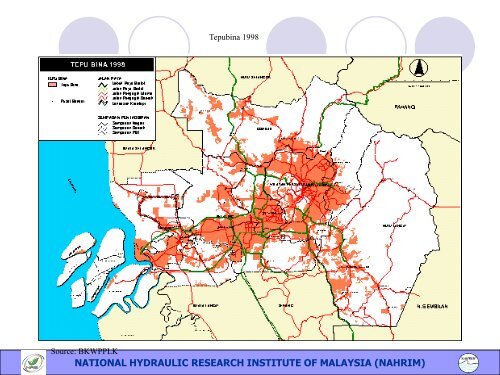
- Page 17: Tepubina 1988 Source: BKWPPLK NATIO
- Page 21 and 22: Current use •Basic information
- Page 23 and 24: Origins of rivers • Head waters o
- Page 25 and 26: Digital Elevation Model with State,
- Page 27 and 28: Current use •Basic information
- Page 29 and 30: Water Resources Challenges •Flood
- Page 31 and 32: Flooding at the North-South Highway
- Page 33 and 34: FLOOD PRONE AREA (EAST MALAYSIA) Ko
- Page 35 and 36: Lembangan Sg. Selangor SPLASH ID Hu
- Page 37 and 38: Ramalan kawasan banjir Mula - 0 jam
- Page 39 and 40: Coastal Resource Risk Index (CORRI)
- Page 41 and 42: Sg Kedah NATIONAL HYDRAULIC RESEARC
- Page 43 and 44: Loading in kg/day Result: Pollutant
- Page 45 and 46: Classification of 90 Lakes Studied
- Page 47 and 48: Water Resources Challenges •Flood
- Page 49 and 50: How Does Peat Form? Flooded hollows
- Page 51 and 52: Peat Swamp Location in Langat River
- Page 53 and 54: MAP 3: GENERALISED SOIL MAP Dominan
- Page 55 and 56: •Annual Subsidence (cm) Subsidenc
- Page 57 and 58: NATIONAL HYDRAULIC RESEARCH INSTITU
- Page 59 and 60: C3 Climate Change NATIONAL HYDRAULI
- Page 61 and 62: Observed Climate Change C3 GLOBAL*
- Page 63 and 64: From IPCC AR4 WG2 NATIONAL HYDRAULI
- Page 65 and 66: NATIONAL HYDRAULIC RESEARCH INSTITU
- Page 67 and 68: The grid layout for the outer domai
- Page 69 and 70:
Get your Longitudes and Latitudes t
- Page 71 and 72:
Water Resources Challenges •Flood
- Page 73 and 74:
Erosion - Sabah & Sarawak Kategori
- Page 75 and 76:
Shoreline Management Problems Silte
- Page 77 and 78:
NATIONAL HYDRAULIC RESEARCH INSTITU
- Page 79 and 80:
Sebelum Perbandingan Perubahan kela
- Page 81 and 82:
Jeti CADANGAN PROJEK LAPANGAN TERBA
- Page 83 and 84:
Tapak Cadangan Asal Pergerakan sedi
- Page 85 and 86:
Pusat Gempa Bumi yang berbeda impak
- Page 87 and 88:
Case 2 Pulau Pinang Kuala Muda, Ked
- Page 89 and 90:
Case 4 Pantai Barat,Sabah Pusat Gem
- Page 91 and 92:
Water Resources Challenges •Flood
- Page 93 and 94:
Putrajaya Catchment, Sg Chuau Catch
- Page 95 and 96:
Outline •Introduction: IWRM and G
- Page 97 and 98:
What has been done elsewhere •Flo
- Page 99 and 100:
Details of NAGRIS Occurred: April 2
- Page 101 and 102:
Advanced Land Observing Satellite (
- Page 103 and 104:
Singapore River and Kallang Basin
- Page 105 and 106:
SINGAPORE: PUBLIC SPACE & URBAN WAT
- Page 107 and 108:
River Rhine • Introduction • le
- Page 109 and 110:
New York City: Greenway Plan NATION
- Page 111 and 112:
CITY OF VANCOUVER: Greenways Networ
- Page 113 and 114:
Shanghai, China NATIONAL HYDRAULIC
- Page 115 and 116:
Sg Kelang - 2050? Yodogawa - up str
- Page 117 and 118:
0 - 2.5 2.5 - 5 5 - 10 10 - 15 15 -
- Page 119 and 120:
NATIONAL HYDRAULIC RESEARCH INSTITU
- Page 121 and 122:
NATIONAL HYDRAULIC RESEARCH INSTITU
- Page 123 and 124:
Udang Galah @ Brickfields? in 2050?
- Page 125 and 126:
The NFWRM i • Focuses on Water re
- Page 127 and 128:
“A vision without action is just