single pgs 4 pdf - Somerset County Council
single pgs 4 pdf - Somerset County Council
single pgs 4 pdf - Somerset County Council

Create successful ePaper yourself
Turn your PDF publications into a flip-book with our unique Google optimized e-Paper software.
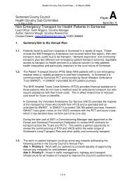
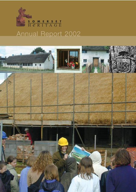
S O M E R S E T<br />
H e RITAGE<br />
Annual Report 2002
Contents<br />
Front cover shows St Margaret’s Almshouses, Taunton<br />
repaired and converted into three houses. The project was<br />
coordinated by the <strong>Somerset</strong> Building Preservation Trust<br />
working with the Falcon Housing Association. Grant-aid<br />
and technical advice was provided by <strong>Somerset</strong> <strong>County</strong> <strong>Council</strong>.<br />
Our consultant Rachel Shaw provided educational and<br />
outreach support throughout the project<br />
Introduction 1<br />
Archaeology 2<br />
Heritage Management 7<br />
Conservation and Enhancement 10<br />
Outreach and Community Heritage 16<br />
Facts, Figures and Thanks 22<br />
Professor Mick Aston and Bob Croft with some of the 3000<br />
visitors to Athelney during the Time Team excavations
Introduction<br />
Welcome to the 2002 Annual Report of the Architectural<br />
and Historic Heritage Group of <strong>Somerset</strong> <strong>County</strong> <strong>Council</strong>.<br />
Culture and Heritage<br />
Following re-organisation of the <strong>County</strong> <strong>Council</strong> the Group<br />
left the Environment & Property Department and joined<br />
the newly created Culture and Heritage Directorate. This<br />
Directorate formally combines those services which had<br />
previously been brought together for the purposes of a<br />
Best Value Review. The outcome of the Review strongly<br />
underlined the need for the <strong>County</strong> <strong>Council</strong> to give<br />
Culture and Heritage a much greater profile by developing<br />
services that have been assessed as being fair but<br />
capable of improvement. This challenge is now being<br />
taken up by our new Director, Jane Murray with Archive<br />
and Records Service, <strong>County</strong> Museum Service, <strong>County</strong><br />
Library Service, Arts and Victoria <strong>County</strong> History.<br />
Unlocking <strong>Somerset</strong>’s Historic Environment<br />
One major step forward in widening our service base<br />
and providing better and easier access to the historic<br />
environment was made possible by the Heritage Lottery<br />
Fund. Their award in the summer of 2002, funded the<br />
post of an Archaeological Outreach Officer to investigate<br />
the ways and means of making the Sites and Monuments<br />
Record available on the Internet for schools, colleges,<br />
libraries and the general public (see page 17).<br />
Highlights of a very busy and productive year for the<br />
Group included the successful completion of St Margaret’s<br />
Almshouses, Taunton for social housing, the archaeological<br />
award for the Lopen Mosaic and the Royal visit by Prince<br />
Charles to Hestercombe. These and other achievements<br />
were only made possible through the continued support<br />
Living in the Iron Age<br />
Pointing the way in<br />
(see pages 20 and 21) Cheddar (see page 13)<br />
and funding from our partners, especially the District<br />
<strong>Council</strong>s, English Heritage and the Heritage Lottery<br />
Fund.<br />
The Architectural and Historic Heritage Group<br />
The Group comprises two multi-disciplinary teams of<br />
building conservationists and archaeologists supported<br />
by other specialists who provide professional expertise<br />
and guidance on all aspects of the historic environment.<br />
The Group is responsible for the nationally important<br />
Edwardian gardens at Hestercombe and also the Peat<br />
Moors Centre near Shapwick.<br />
This report has been written and compiled by staff of the<br />
service and reviews some of the activities carried out in<br />
2002 in pursuit of the Group’s stated objectives:<br />
“...to ensure that <strong>Somerset</strong>’s historic environment<br />
is protected and enhanced through... the wider<br />
planning process, effective liaison and partnership,<br />
maximising funding and other resources, advancing<br />
knowledge, standards and skills, and improving<br />
public access, understanding and enjoyment.”<br />
1
Archaeology<br />
Every year new aspects of the archaeological heritage<br />
of the county are revealed through development and<br />
research. This report highlights some of the key sites<br />
examined during 2002.<br />
Non-Conformists Burials in Wellington<br />
Excavations by Exeter Archaeology in Wellington produced<br />
evidence of the health and lives of the 17th and 18th<br />
century residents. The site is behind the nineteenth century<br />
church and adjacent to the cemetery so an archaeological<br />
condition was placed on the planning permission. This<br />
was intended to be a watching brief in case the demolition<br />
of the building revealed disturbed burials or any other<br />
archaeological remains.<br />
During the excavation of the existing foundations of the<br />
Congregational Church human remains were unearthed.<br />
(photo above right) The police were contacted and a<br />
Home Office Licence was issued to Exeter Archaeology<br />
in order for these remains (and any further burials) to be<br />
archaeologically excavated, recorded and removed. At<br />
that time there only appeared to be a limited number of<br />
burials on the site. However, after two further weeks of<br />
excavation it became clear that after removing 30 burials<br />
there could possibly be a total of c.100 within the<br />
development area. Therefore, excavations ceased and<br />
the developers, A & H Gadd Ltd. designed a piling<br />
foundation scheme which preserved the remaining<br />
burials in-situ.<br />
Research has indicated that these burials belong to a<br />
non-Conformist sect and are likely to date from 1680’s<br />
through to the late 19th century (c. 1879). They are<br />
currently being analysed at Bournemouth University after<br />
a grant was offered by English Heritage. These forms of<br />
rural post-medieval burials are rarely excavated<br />
archaeologically although some urban sites such as<br />
Spittlefields in London have been extensively analysed.<br />
The Wellington examples are particularly important as<br />
they offer the potential of assessing the impact of<br />
industrialisation on human health as they can be<br />
compared with the data on urban populations from sites<br />
such as Kingston-upon-Thames, St Augustine the Less,<br />
and Portland St Andrews. This data is particularly<br />
relevant in an international context to the study of affects<br />
on population health in the rapidly industrialising<br />
countries in the developing world.<br />
2
Athelney - New Research<br />
Athelney, the “Isle of the Princes” where King Alfred<br />
camped his army before defeating the Danish invasion,<br />
was the focus of archaeological attention this summer.<br />
This project was inspired by the rediscovery of the<br />
important medieval document, the Cartulary of Athelney<br />
Abbey, which had been missing since the 18th century<br />
and renewed interest from the Channel 4 Time Team.<br />
This resulted in two major events, an exhibition on Alfred<br />
and Athelney, in the <strong>County</strong> Museum in Taunton throughout<br />
the summer, and an archaeological excavation on the<br />
site. The archive exhibition brought the Athelney Cartulary<br />
back to <strong>Somerset</strong> and it was shown to HM the Queen<br />
during her visit to Taunton in May.<br />
This was the second visit by the Time Team, celebrating<br />
10 years of programmes by returning to Athleney<br />
following their original programme in 1993. Although<br />
at that time no excavations were carried out GSB<br />
Prospection did conduct a geophysical survey and<br />
fieldwaking took place. This evidence indicated that<br />
important archaeological remains survive on the site.<br />
In 2002 a conservation and management project was<br />
submitted to English Heritage. Although Athelney Island<br />
is currently under grass the site was ploughed for many<br />
years and it was assumed that any building remains had<br />
been robbed over the last 400 years as indicated by<br />
numerous historical references. However, the geophysics<br />
indicated that stone foundations might survive on the site<br />
despite many generations of ploughing damage. One of<br />
the main objectives for the 2002 research programme<br />
was to assess the nature and extent of any surviving<br />
walls around the area of the abbey church. The project<br />
also looked at two areas on the western part of the<br />
island, firstly where metal working slag had been found<br />
during field walking and secondly at the end of the island<br />
closest to East Lyng where there were indications of a<br />
boundary ditch feature. Following this partnership project<br />
with the Time Team a major public open day was<br />
organised which was attended by over 3000 people.<br />
photo above: Excavations at the eastern end of the<br />
site revealed part of the Athelney cemetery area.<br />
Photograph shows Bob Croft describing the<br />
archaeological work to <strong>Council</strong>lor Cathy Bakewell<br />
whilst Channel 4 - Time Team film in the foreground.<br />
The Church Area<br />
Excavations on the east end of the church showed that<br />
many of the walls had indeed been robbed out and that<br />
the abbey church expanded into an area of an earlier<br />
cemetery. The main body of the church was also<br />
investigated and despite early indications that this had<br />
also been robbed, very well preserved foundations of<br />
the north wall were revealed still in-situ including part<br />
of a buttress.<br />
3
Photo below: A section cut through<br />
the ditches confirmed an Iron Age date<br />
for the occupation on Athelney hill.<br />
Western ditches<br />
At the western end of the island two sections were<br />
excavated to reveal a substantial ditch that followed<br />
the edge of the island. It was clear from these sections<br />
that there were at least two main stages to this ditch.<br />
A deeper earlier ditch contained what appeared to be<br />
Iron Age type pottery. Subsequently this ditch silted up<br />
and was re-dug at a later date. Detailed analysis of the<br />
pottery and other artefacts from these ditches is still<br />
awaited but the indications are that the earlier prehistoric<br />
ditch was re-dug in the Saxon or early medieval period.<br />
Radio carbon dating evidence from bone samples has<br />
provided Iron Age dates for the origins this defensive<br />
ditch. This is one of the most significant finds from<br />
Athelney and it confirms that occupation occurred on<br />
the hill long before the abbey was founded in the 9th<br />
century.<br />
Education and site conservation<br />
The archaeological research was coordinated to provide<br />
evidence of the nature and extent of the buried remains<br />
with a view to securing a long-term management;<br />
conservation and interpretation plan. The 2002 Athelney<br />
project was a great success involving local groups and<br />
the nearby schools of Burrowbridge and Stoke St Gregory<br />
led by Rachel Shaw. The project was also used as an<br />
opportunity for A level archaeology students from Richard<br />
Huish College to see how such projects are coordinated.<br />
Photo below: Monument to King Alfred erected in<br />
1801, repaired by the Group in 1985.<br />
4
Dinnington - Roman Villa<br />
A large Roman building was first recorded at Dinnington<br />
following the droughts of 1976. Early in 2002 landowners<br />
working with local archaeologist, Alan Graham discovered<br />
evidence of mosaic remains on the site. Permission was<br />
obtained for Channel 4 Time Team, to undertake a small<br />
research excavation and carry out an extensive geographical<br />
survey of the site. The results of this research were quite<br />
spectacular. They revealed the remains of a very substantial<br />
courtyard villa with at least three rooms containing 4th<br />
century AD mosaics. The upper layers of the villa and<br />
the mosaic floors were affected by plough damage.<br />
Photo right: Dr.David Neal recording the 4th century<br />
mosaic at Dinnington. The plough damage can be<br />
clearly seen.<br />
The River Huntspill Project<br />
The Environment Agency and <strong>Somerset</strong> <strong>County</strong> <strong>Council</strong><br />
are undertaking a joint project examining the archaeological<br />
remains that are at risk of erosion from the Huntspill<br />
River. The river, a SSSI owned and managed by the<br />
Agency, has a wealth of archaeological remains<br />
preserved in its banks. The first year of the project<br />
examined a Roman occupation site beside Bleak Bridge.<br />
In February 2002 work focused on a two-week excavation<br />
of one of the Roman salt-making sites which are visible<br />
in the riverbanks. The excavation team included many<br />
local volunteers displayed great fortitude and resilience in<br />
the face of appalling weather conditions. The excavations<br />
discovered many features of the salt-making process<br />
including large circular tanks where the salt water from<br />
tidal creeks was retained to allow sediment to settle out<br />
and part of a rectangular open-hearth structure where<br />
the brine was evaporated to leave salt. The hearth walls<br />
and kiln furniture were made of clay mixed with straw<br />
fired at low temperatures producing pottery called<br />
briquetage that often retained the handprints of its makers.<br />
Middle photo: The waterlogged conditions helped to<br />
preserve organic artefacts including part of a wickerwork<br />
basket, one of only six known from Roman Britain.<br />
Lower photo: Local volunteer archaeologists working in<br />
very muddy conditions at Bleak Bridge.<br />
5
Photo below: scientific analysis of clay deposits<br />
being taken by English Heritage at Bleak Bridge.<br />
Samples from the peat and clay under and over the mound<br />
were analysed to show how the local landscape had<br />
changed over 6,500 years. Raised bog dominated the<br />
area for most of the prehistoric period until it became<br />
part of the coastal salt marsh with salt production occurring<br />
in the 3rd and 4th centuries AD. The salt marsh continued<br />
in the area until the 16th century and is shown as ‘Brent<br />
Marsh’ on Bowen’s 1750 map of the county (below).<br />
Origin of Villages - Excavations at Ash<br />
Terrain Archaeology carried out an excavation of a plot<br />
of land at Back Street, Ash prior to the building of two<br />
houses. Initially the site was evaluated by C & N<br />
Hollinrake which produced evidence of a medieval<br />
building. The site is important because Ash has a<br />
fascinating yet little understood history. Originally Ash<br />
was two medieval planned settlements appearing first<br />
as Esse (Ash Tree) in 1225 and then Ash Bologne in<br />
the later 13th century. Strangely another settlement is<br />
mentioned in records in the 14th century called<br />
Pykesash. The excavation took place in the area of the<br />
modern village associated with the Ash Bologne place<br />
name on an empty plot which had been used as an<br />
orchard for the last two centuries.<br />
Photo above: Local schoolchildren visiting the<br />
excavations at Ash near Martock.<br />
The excavation revealed traces of a small stone building<br />
which had apparently been destroyed by fire in the 16th<br />
century. Large amounts of pottery were recovered from<br />
a ditch which ran around the building which represents<br />
one of the largest and most complete sequences of late<br />
medieval ceramics yet found in such a rural site in<br />
<strong>Somerset</strong>. The ditch itself remains somewhat enigmatic,<br />
as it is very unusual to see a ditch so close to a building.<br />
It has been suggested that it might have acted as a<br />
surface water drain designed to help reduce damp<br />
conditions around the building.<br />
6
Scheduled Monuments which have been subject to degradation or neglect are targeted as part of an ongoing<br />
programme of works. In 2002 a number of burial mounds on the Mendip Hills were cleared of scrub<br />
(see Chewton Mendip photo below) enhancing their setting within the landscape, and preventing their<br />
degradation through root damage. The difficult issue of badger damage is also being tackled on two sites -<br />
non-lethal measures are being introduced to attempt to control their sett location and spread.<br />
Heritage Management<br />
Countryside Archaeology<br />
The importance of the historic environment is achieving<br />
an increased profile through the recognition and<br />
management of archaeological and historic sites within<br />
the countryside. Government grant aid, through agrienvironment<br />
and woodland grant funding, which affects<br />
large areas of the county, necessitates guidance on the<br />
principles of protection and preservation for recognised<br />
and potential sites which fall within the landholdings for<br />
these schemes.<br />
In 2002 the number of consultations and preparatory<br />
consultations increased to 257. The majority of these<br />
were related to the Countryside Stewardship Scheme,<br />
and some 15 new sites were discovered in the process.<br />
Within the total land area assessed for its potential were<br />
276 known archaeological sites.<br />
Government funding to farmers via the Countryside<br />
Stewardship Scheme provides scope for the protection<br />
or preservation of many aspects of the historic environment,<br />
from maintaining a grassland cover on monuments, to<br />
traditional and historic buildings, to hedgerow works<br />
which preserve historic field patterns. Three Environmentally<br />
Sensitive Areas - the Levels & Moors, Blackdowns and<br />
Exmoor - lie within <strong>Somerset</strong>, and management of the<br />
historic environment is a key part of their remit. Provision<br />
of advice to the Department for Environment, Food and<br />
Rural Affairs ensures that their records are updated and<br />
allows informed management to take place.<br />
Historic Landscape Characterisation Project<br />
Following the successful completion of a series of English<br />
Heritage funded projects, Oscar Aldred’s contact came<br />
to an end in May 2002 and he joined the Icelandic<br />
Archaeological Institute in Reykjavik. Full details of the<br />
HLC project can be found in the Annual Report for 2000.<br />
7
Photo below: A new survey of Fenny Castle, a<br />
motte and bailey castle in the wetlands near<br />
Godney has been undertaken by Exeter University<br />
with funding from SCC and the <strong>Somerset</strong><br />
Archaeological and Natural History Society.<br />
Levels and Moors<br />
New projects<br />
Several collaborative projects were developed in 2002<br />
in the Levels and Moors area. The second stage of the<br />
River Huntspill Project was carried out with funding from<br />
the Environment Agency (see page 5). The Group report<br />
on peat wastage and archaeology has lead to a research<br />
project dating the uppermost peat layers on the <strong>Somerset</strong><br />
moors, which has also succeeded in gaining funding<br />
from the Agency. The objective of the project is to obtain<br />
information on how much peat has been lost to desiccation<br />
since reclamation and drainage of the moorland began.<br />
Another project examining the condition of the most<br />
important waterlogged archaeological sites in the county<br />
was also approved for joint funding by English Heritage<br />
and the Environment Agency, to begin in 2003. European<br />
funding has also been secured through the Leader+<br />
scheme for the establishment of a Heritage Network in<br />
the Avalon Marshes area of the Brue valley.<br />
Those within the countryside sphere will be aware<br />
of the coming reorganisation for agri-environment<br />
schemes - various consultation documents are<br />
circulating, and responses highlighting the importance<br />
of the historic environment will hopefully enhance its<br />
profile in the forthcoming review.<br />
Other consultations included assessments for<br />
the woodland grant scheme - recognition of<br />
archaeological sites prior to planting can often<br />
result in their protection within the rural environment.<br />
Liaison with Forestry Commission occurs frequently,<br />
with visits to possible new sites and provision of<br />
management advice for known monuments.<br />
Photo left: Jan Grove carrying out a condition survey<br />
at Adscombe Chapel on the Quantocks.<br />
Photo left: Remains of a medieval cross base at Castle<br />
Farm, Wookey parish being inspected by SCC and<br />
English Heritage. Many of the medieval crosses in the<br />
county are in need of repair and conservation.<br />
8
Hestercombe Gardens<br />
2002 saw the continuing restoration of the formal<br />
gardens by the partnership of <strong>Somerset</strong> <strong>County</strong> <strong>Council</strong><br />
and Lutyens Jekyll Garden Company in accordance with<br />
the Restoration Plan approved in 2000. The work was<br />
undertaken by the gardens team with help from the<br />
Group’s conservation team.<br />
Photo below: The highlight of the year was a<br />
visit by HRH Prince Charles on the 17th May.<br />
The staff had an opportunity to meet Prince<br />
Charles, and the photo shows Jill Pullinger<br />
exchanging a few words. Jill left the Gardens<br />
in August after 9 years voluntary service.<br />
Restoration work included:<br />
The secure fixing of two urns on the Dutch Garden wall.<br />
These urns have been a valuable addition to the vertical<br />
elements within this somewhat flat garden space.<br />
The realignment of the Victorian Terrace central beds.<br />
We also took the opportunity to fit preserved timber to<br />
the inner edges of the beds to enable ease of<br />
maintenance.<br />
A new glasshouse erected to replace the one, which had<br />
to be dismantled to make space for a new covered area<br />
in which the rare colony of bats could ‘limber up’ before<br />
the fories into the landscape garden.<br />
In the Rose Garden a major project for this year involved<br />
the clearance of the beds, realignment of the edges,<br />
timber edging and planting the beds with new roses to a<br />
design supplied to us by our Gertrude Jekyll planting<br />
specialist Professor Michael Tooley.<br />
In the Dutch garden, the replacement of the planttraining<br />
wall bars on the high rear wall of the garden so<br />
plants can be trained up them and so dress the walls.<br />
Photographs show restoration progress in The Plat<br />
at Hestercombe, middle 1997, bottom 2002.<br />
1998 45,000<br />
1999 47,000<br />
2000 55,500<br />
2001 60,000<br />
2002 72,000<br />
Table 1. Visitor Numbers<br />
9
Conservation & Enhancement<br />
Each year the Group undertakes a wide range of<br />
environmental enhancement schemes generally funded<br />
in partnership with District and Parish <strong>Council</strong>s. Longer<br />
term conservation agreements exist in Langport,<br />
Wincanton, Bridgwater and Frome.<br />
Bridgwater THI<br />
2002 was notable for the start of the Bridgwater Townscape<br />
Heritage Initiative (THI). In March an application was<br />
received from the YMCA for funding towards a drop-in<br />
and accommodation centre on the vacant site of 16 St<br />
Mary Street. The grant would cover the ‘conservation<br />
deficit’ of using traditional materials on the new building<br />
that went beyond the standard normally required by the<br />
local planning authority. The application received approval<br />
and work was well underway by the end of the year. A<br />
revised scheme was received for repair and reinstatement<br />
works to the facade of The Lions, West Quay. However,<br />
the cost of these works and the limited funds of the<br />
Bridgwater THI prohibited a full grant being offered.<br />
In spring 2002 Sedgemoor District <strong>Council</strong>, as owners,<br />
agreed to financially support a comprehensive scheme<br />
for the Cornhill: to introduce a bistro/restaurant in the<br />
Corn Exchange and refurbish the Market and shopfronts.<br />
Half of the Bridgwater THI Common Fund is ring-fenced<br />
for the Cornhill and this would be matched by<br />
Sedgemoor District <strong>Council</strong>.<br />
Since the start of the Bridgwater THI Sedgemoor District<br />
<strong>Council</strong> has pursued a rescue package in partnership<br />
with SAVE, a charitable trust for Castle House, a Grade<br />
II* listed experimental concrete building. By September<br />
the transfer of the building to SAVE was completed, and<br />
discussions started with a local housing association,<br />
English Heritage and the Heritage Lottery Fund on the<br />
long term use, repair and funding for the project.<br />
photo below left: The junction of St Mary and Dampiet<br />
Streets before work starts on the THI supported project<br />
and right: during construction of the YMCA building.<br />
10
Frome THI<br />
Over the last 14 years a series of partnership grant aid<br />
schemes have provided funding for conservation and<br />
regeneration work in Frome. A Town Scheme based on<br />
the Catherine Hill area commenced in 1988 and with an<br />
extended area, a Conservation Area Partnership Scheme<br />
followed in 1996. The present Townscape Heritage<br />
Initiative covering a much larger area of the town was<br />
approved in 1999 and the deadline for making grant<br />
commitments was reached on 31st July 2002 with all of<br />
the available grant funding of £754,000 fully committed.<br />
The THI identified three ‘Critical Buildings’ and two of<br />
these, the Feather Factory and the Lamb Brewery, have<br />
been resolved through grant funding. Eight of the nine<br />
Target Buildings have been improved, six of them with<br />
grant aid and three of the five buildings in Bath Street<br />
have been completed. This work has resulted in three<br />
buildings being removed from the Buildings at Risk<br />
Register and eight previously derelict buildings being<br />
restored to full repair with new long term uses.<br />
Photo below: N o 8 Bath Street, Frome<br />
part of a terrace dating from 1811-13.<br />
Coat of Arms on 2 nd floor of the Thynne<br />
family of Longleat. Building repaired with<br />
grant-aid from the THI fund.<br />
In the public realm the conservation of statues at the<br />
Blue House Almshouses has been completed and work<br />
has commenced on the restoration and re-erection of<br />
the second Bunn Pillar. The Conservation Team recovered<br />
the recently discovered stone sections from a local<br />
resident’s garden and have prepared a site close to<br />
the pillar’s original position in Christchurch Street West<br />
for re-erection in 2003.<br />
The THI is funded by the local authority partners, <strong>Somerset</strong><br />
<strong>County</strong> <strong>Council</strong>, Mendip District <strong>Council</strong> and Frome<br />
Town <strong>Council</strong>, together with English Heritage and the<br />
Heritage Lottery Fund.<br />
Photo right: The former Morlands and Bailey’s<br />
sheepskin works at Glastonbury were the subject<br />
of a detailed appraisal by SCC, English Heritage,<br />
South West Regional Development Agency and<br />
historic building consultants. The important buildings<br />
on the site have now been identified. The historic<br />
setting of the site, including the Beckery Chapel,<br />
adds to the regeneration potential of the site.<br />
11
Photo below: The former Stoate’s Flour Mill,<br />
a 19th century complex of mill buildings now<br />
included within the Conservation Area.<br />
Watchet Conservation Area<br />
In the summer of 2002 the Group undertook a review<br />
of the Conservation Area designation in the Civil Parish of<br />
Watchet, at the request of West <strong>Somerset</strong> District<br />
<strong>Council</strong>. Evidence of semi-urban activity at Watchet<br />
dates back to Saxon times and the settlement developed<br />
as the port and trading area of the royal hundred of<br />
Williton. Its distinctive character emanating from its<br />
function as a Bristol Channel port. The existing Watchet<br />
Conservation Area was designated in 1975 and largely<br />
reflected the pre-19th century historic core, which is<br />
characterised by small-scale narrow streets with modest<br />
buildings constructed from a limited range of materials.<br />
The nineteenth century saw the transformation of<br />
Watchet from a small Medieval port to an industrial<br />
centre. This transformation was over a short period<br />
around the 1860s and included the redevelopment of<br />
the harbour and arrival of two railways. The increase in<br />
industrial activity is also reflected in the terrace housing,<br />
partly built from materials imported as return cargo and<br />
ballast from South Wales. Since 1975 the appreciation of<br />
19th century development and industrial archaeology has<br />
grown and the review concluded that the area should be<br />
extended to include the former Stoate’s Mills complex off<br />
Mill Street, together with the surviving evidence of the<br />
West <strong>Somerset</strong> Mineral Railway and the West <strong>Somerset</strong><br />
Railway.<br />
Other significant areas recommended for inclusion<br />
included East Quay, which in 1975 was a busy working<br />
wharf but is now seeking a new role, and the Pleasure<br />
Grounds, which rises above East Wharf and are a<br />
defining landscape feature and important open space.<br />
The recommendations were adopted by West <strong>Somerset</strong><br />
District <strong>Council</strong> and the new Conservation Areas<br />
designated on 24 October 2002. The Map shows the<br />
original Conservation Area (light shading) and the new<br />
additions (dark shading).<br />
OS licence N o LA 07683. Based on Ordnance Survey map.<br />
c Crown Copyright. All rights reserved.<br />
12
Water Trough, Somerton<br />
To mark the Golden Jubilee of Queen Elizabeth II,<br />
Somerton Town <strong>Council</strong> commissioned the repair and<br />
restoration of the unique water trough and ornamental<br />
light in Cow Square which had been erected to<br />
commemorate the Coronation of King Edward VII,<br />
August 9th 1902. The project was funded with assistance<br />
from <strong>Somerset</strong> <strong>County</strong> <strong>Council</strong>, South <strong>Somerset</strong> District<br />
<strong>Council</strong>, the Heritage Lottery Fund and Wyvern<br />
Environmental Trust. The restoration involved the removal<br />
of the trough to the Bristol workshop of Dorothea Restorations.<br />
This provided an opportunity to rebuild the paved base<br />
and improve the setting of the trough including the repair<br />
of the <strong>County</strong> Finger post. This work was carried out<br />
by the Conservation Team using reclaimed stone kerbs,<br />
slabs and setts from our salvaged materials yard at Wells.<br />
Photo right: Water Trough after completion<br />
of the repair works and new paving.<br />
Cheddar Market Cross<br />
In November 2001 the Group was consulted by Highway<br />
Services on a scheme to enhance and protect the Grade<br />
II* listed medieval Market Cross, as part of a programme<br />
of works under the Local Transport Plan. The Group<br />
developed the design for the scheme and provided specialist<br />
advise to WS Atkins on its implementation. The basis of<br />
the scheme was to create a paved area around the Cross<br />
with kerbing and bollards to keep traffic away from the<br />
structure, and to provide a pedestrian crossing point. A<br />
restricted pallet of natural materials was chosen,<br />
including cobble paving, salvaged lias kerbing, and<br />
Draycott Marble edgings and quadrant kerbs. The laying<br />
of the cobble paving was a challenge for the contractor,<br />
compounded by the need to complete the works before<br />
the summer season and by an exceptionally wet spring.<br />
The scheme was completed with a bespoke pedestrian<br />
finger signpost at the apex of the new paved area. The<br />
cost of patterns for new cast elements is high, therefore,<br />
the design had to be such that the basic form could be<br />
used elsewhere in the <strong>County</strong>. The finger post was cast<br />
and manufactured at the Cerdic Foundry, Chard and<br />
erected in time for Christmas 2002.<br />
Photo right: The completed Cheddar<br />
Market Cross scheme.<br />
13
Pictures below show the plaque in its<br />
design stage and the Queen’s car<br />
processing up Wells High Street.<br />
THE RAILWAY AGE IN WELLS 1859 - 1963<br />
Great Western<br />
Railway<br />
formerly<br />
Portway<br />
Burcott Road<br />
N<br />
to Cheddar<br />
S & DJR (S.W. Johnson) GWR ( C.B. Collett )<br />
Wells Tucker Street Station &<br />
Yard<br />
opened 5th April 1870<br />
closed 9th September 1963 (passengers)<br />
Wells Priory Road Station &<br />
Yard<br />
opened 15th March 1859<br />
closed 29th October 1951 (passengers)<br />
Wells Railway Plaques<br />
The Wells Relief Road was constructed for much of its<br />
length on the route of former railways and on the sites<br />
of three stations. These stations stood remarkably close<br />
to one another as they were the terminals for the three<br />
railway companies that initially served the city: Bristol &<br />
Exeter Railway; <strong>Somerset</strong> & Dorset Joint Railway; and<br />
East <strong>Somerset</strong> Railway. As part of the Relief Road works,<br />
<strong>Somerset</strong> and Dorset Railway Trust and local railway<br />
enthusiasts asked the <strong>County</strong> <strong>Council</strong> to mark the site<br />
of each station with a commemorative plaque. The<br />
artwork for the stainless steel plaques were designed by<br />
John Parsons of Wookey Hole. The bases were built by<br />
the Group’s Conservation Craftsmen using Draycott<br />
Marble salvaged from the Burcott Railway Bridge that<br />
was dismantled as part of the Relief Road works. Sawn<br />
and polished by Wells Cathedral Stonemasons of<br />
Cheddar, the Draycott Marble produced a very attractive<br />
capping stone to each base.<br />
to Glastonbury<br />
<strong>Somerset</strong> & Dorset Joint<br />
Railway<br />
formerly<br />
Great Western Railway<br />
formerly East <strong>Somerset</strong><br />
Glastonbury Road<br />
Wells East <strong>Somerset</strong> Station &<br />
Yard<br />
opened 1st March 1862<br />
closed 1st January 1878 (passengers)<br />
to Shepton Mallet<br />
The plaques were unveiled on 6 March 2002 by Mrs P<br />
Hayes, the widow of the last Station Master at Wells,<br />
and assisted by Roger Bennett of BBC Radio Bristol.<br />
Scale:<br />
0 50 100 150 200 250<br />
Ministry of Food<br />
Cold Store 1942<br />
<strong>Somerset</strong> <strong>County</strong> <strong>Council</strong><br />
metre<br />
based on O.S. Maps 1908, 1930 & 1968<br />
Wells High Street<br />
Construction work on the High Street phase of the city<br />
centre enhancement scheme commenced in January<br />
and was completed, on schedule, in May. This project,<br />
which began in 2000/01 with works in Sadler Street,<br />
has created a safer, more comfortable environment for<br />
shoppers and visitors by providing greater pedestrian<br />
priority and minimising traffic impact while retaining the<br />
historic character and features of these streets.<br />
Using natural stone materials pavements have been<br />
widened, water channels realigned and stone sett<br />
pitchings reproduced.<br />
The High Street works had to be carefully programmed<br />
to be completed before a visit by H.M. Queen Elizabeth II<br />
on the 2nd May as part of her Jubilee tour of the country.<br />
Funding was made available from the Local Transport<br />
Plan. The scheme was designed in collaboration with<br />
Andy Davison, Project Engineer with Atkins. Atkins<br />
Construction undertook the works under the direction<br />
of Mike Hodd.<br />
14
Photo below: West Coker, the Group’s<br />
Conservation Craftsmen undertook the<br />
scheme under difficult working<br />
conditions in November.<br />
West Coker<br />
West Coker is an attractive village to the west of Yeovil,<br />
the majority of which is designated as a Conservation<br />
Area. At the centre of the village was a raised stone<br />
pavement to the busy A30 in need of repair, with<br />
unattractive concrete kerbing and pedestrian barrier that<br />
blighted the area. At the request of the Parish <strong>Council</strong>,<br />
the Group prepared, on behalf of the Area Highway Manger,<br />
a small scheme for the resurfacing of the pavement with<br />
natural stone, replacement of the kerbing with a low lias<br />
stone retaining wall and replacement of the unsightly<br />
barrier with one of oak posts and metal rails. In addition,<br />
the scheme extended the new paving to enhance the<br />
space in front of the memorial wooden bus shelter.<br />
Cannington (right)<br />
2002 saw the completion of the Cannington<br />
enhancement scheme. The scheme which included<br />
new lighting, removal of overhead cables and<br />
resurfacing had suffered long delays waiting for<br />
the right weather conditions to lay the surface dressing<br />
in the churchyard paths and surrounding lanes.<br />
Bicknoller (far right)<br />
The medieval stocks in Bicknoller churchyard<br />
were conserved and re-instated by the Conservation<br />
team, working with the Parochial Church <strong>Council</strong>,<br />
Matt Conlon of Cheddon Fitzpaine Forge,<br />
and Andy Fowler of Chard.<br />
15
Outreach & Community Heritage<br />
The Group continues to be involved with a wide of<br />
variety of community projects and local schemes.<br />
Wherever possible we actively promote the importance<br />
and educational value of archaeology and the historic<br />
environment.<br />
St. Margaret’s Almshouses<br />
This year children, teachers and helpers from Holy Trinity,<br />
Halcon, Holway Park and Blackbrook Primary Schools<br />
continued their involvement with the St. Margaret’s Leper<br />
Hospital/Almshouses project.<br />
Over three days in April they made the now-familiar<br />
journey to the Almshouses, some for the third or fourth<br />
time, to see the craftsmen at work. On their previous<br />
visit, the burnt roof timbers were being removed, and<br />
they could see the bare bones of the building. Since<br />
then, it had been shrouded by a temporary roof of white<br />
sheeting, concealing the progress of the restoration<br />
work. However, the first group had the excitement of<br />
seeing the final covers removed, to reveal the almostfinished<br />
thatched roof.<br />
It is impossible to judge the long-term impact this project<br />
has had on the children. It has certainly given them some<br />
unique, memorable, experiences and a sense of<br />
privileged involvement with the building and the people<br />
doing the work. We hope it has given them some insight<br />
into issues of conservation and responsible heritage<br />
management as well as the technical aspects of the<br />
project. It has opened their eyes to the reality of the<br />
local past, the actual lives of individual, often excluded,<br />
people. This awareness spilled over into action in the<br />
case of one school which had raised money for a leprosy<br />
charity in South America. It is to be hoped that the St<br />
Margaret’s project will pave the way for more such<br />
opportunities for creative partnership between the<br />
heritage specialists and the local community.<br />
The St Margarets Almshouse project has brought<br />
architects, archaeologists, conservators, schoolchildren<br />
and members of the local community together to ensure<br />
the survival of this historic building.<br />
The site was even busier than before, with plasterers,<br />
builders and thatchers at work, so the visiting groups<br />
were kept small. Robert Battersby, the architect, took<br />
children into the almshouses, where they could see the<br />
restructuring of the building taking shape. At this halfway<br />
stage, they could see clearly where new materials<br />
were replacing or repairing old. They were also quick to<br />
spot that the original stone commemoration plaque had<br />
been removed for conservation.<br />
16<br />
Photo: On 31 st October 2002 the keys to St Margaret’s were handed over to Rev.Ray,<br />
Chairman of Falcon Housing Association by Mike Foden, Chairman of the <strong>Somerset</strong><br />
Building Preservation Trust in the presence of the Mayor and Mayoress of Taunton.
Unlocking <strong>Somerset</strong>’s Historic Environment<br />
This year, after a lot of hard work preparing the bid, the<br />
<strong>Somerset</strong> Sites and Monuments Record received a grant<br />
from the Heritage Lottery Fund in order to improve public<br />
access to the SMR. Currently SMR information can only<br />
be accessed through direct contact with the SMR<br />
Officer. The information exists as computer database<br />
and a number of paper records. Each SMR entry lists all<br />
the references that are relevant and a summary of what<br />
is known. The main aims of the project are to make the<br />
database available on a website and to make the public<br />
aware of its existence and its value in research.<br />
Photo below: Front cover of<br />
the current SMR leaflet.<br />
In September 2002 Talya Bagwell was appointed as the<br />
Outreach Officer to accomplish this task. Her work on<br />
the HLF project began in October 2002 with an initial job<br />
of sorting through and cataloguing the Group’s vast slide<br />
collection. From these a number of slides were selected<br />
for scanning for archive purposes. It is also planned that<br />
each SMR entry on the website will be accompanied by<br />
a digital image. The Group’s slide collection is housed in<br />
filing cabinets organised on a parish and district basis.<br />
Over 9000 slides were catalogued and 1500 selected for<br />
scanning. The slides cover a whole range of sites from<br />
aerial photographs of cropmarks to pictures of<br />
milestones through to snapshots in time taken during<br />
actual archaeological excavations and, as such, are an<br />
extremely valuable resource.<br />
A tender process was put into action to select a<br />
company to construct the website. The winning design<br />
needed to meet a number of important criteria, the<br />
primary ones were that it should be simple and easy to<br />
use and also that it should work efficiently on home<br />
computers without taking too long and without<br />
‘crashing’. A shortlist of three proposals was selected<br />
and each company was visited for a presentation and<br />
discussion. Finally a company from Birmingham, Dotted<br />
Eyes, was chosen to undertake the work, which is now<br />
in progress.<br />
17
Once the website is up and running, scheduled for<br />
Autumn 2003, the task of promoting its existence will<br />
begin. Outreach work has already commenced with a<br />
number of visits to local societies. A full programme<br />
of talks and a travelling exhibition is currently being<br />
assembled for the autumn and winter of 2003.<br />
These are to be hosted by local societies, libraries<br />
and museums.<br />
The website (see left) is planned to consist of the SMR<br />
database which is to be linked with a map. Each will be<br />
searchable using a number of different search criteria<br />
such as site type, date, location or event type. As well as<br />
the database and the linked map the website will contain<br />
a number of other elements concerning the historic<br />
environment of <strong>Somerset</strong>. These will include sections on<br />
topics such as Chronology, Definitions of Archaeological<br />
Terms, a <strong>County</strong> Bibliography, and Summaries by period<br />
of archaeological evidence in the <strong>County</strong>, information on<br />
planning and themed essays on such topics as Defence,<br />
Agriculture and Transport.<br />
Lopen Roman Mosaic reconstructed (below left)<br />
The Lopen Local History group has taken up the project<br />
to examine and promote the story of the mosaic. They<br />
have held several public lectures and open evenings and<br />
have raised over £1500 towards their project. A particular<br />
success was an award from the Local Heritage Initiative<br />
Fund to construct and document a replica panel of<br />
the mosaic and to tell the story to local people. The<br />
reconstructed panel will be placed in Lopen parish<br />
church. A public exhibition giving details of the<br />
archaeological finds was organised by South <strong>Somerset</strong><br />
District <strong>Council</strong> in conjunction with Alan Graham and<br />
SCC in Yeovil museum. This coincided with a photographic<br />
display by Pauline Rook who recorded the events at<br />
Lopen in a series of quality black and white photographs.<br />
The Group has produced a newsletter and held several<br />
sessions to work on the reconstructed mosaic panel.<br />
The public interest and support in local archaeology has<br />
been given a tremendous boost entirely due to the sharp<br />
eyes and prompt action of the Osborne family. George<br />
Caton the digger driver received the 2002 Tarmac finders<br />
award for his discovery. The presentation was made at<br />
the British Archaeological Awards Ceremony in Liverpool<br />
in November 2002. The <strong>County</strong> <strong>Council</strong> was represented<br />
by Paddy Mc Master and Bob Croft.<br />
18
Peat Heritage Project Update<br />
The Peat Heritage Project was launched in October 2001<br />
following a successful funding bid to the Countryside<br />
Agency’s Local Heritage Initiative scheme. The project<br />
aimed to record, document and celebrate the social and<br />
landscape heritage of the <strong>Somerset</strong> Peat Industry.<br />
Picture below: detail from Peat Heritage<br />
Project postcard designed by Ashcott and<br />
Meare Primary Schools with local artist<br />
Kate Lynch. (see also back cover)<br />
Since its launch, the project has interviewed and traced<br />
around 20 people involved within the industry over the<br />
last 100 years and has pieced together their memories,<br />
anecdotes and experiences to form a comprehensive<br />
archive of oral recordings, transcriptions and photographs.<br />
This archive, which will be held at the <strong>Somerset</strong> Rural<br />
Life Museum, will be compatible with the Museum<br />
Service’s programme of archival digitising, aiming to<br />
make all stored archives accessible in more forms for<br />
more users.<br />
In July 2002 project co-ordinator Nancy Ashworth<br />
worked with local artist Kate Lynch and two local<br />
schools, Ashcott and Meare Primary schools, to turn<br />
the amazing anecdotes into an illustrative format. The<br />
children produced a triptych ‘mobile’ display of the three<br />
main periods covered by the project, 1900-1939, 1940-<br />
1959 and 1960-present day. With the help of Kate Lynch<br />
each child painted onto the board their chosen anecdote<br />
(from digging peat to flying pies) and brought to life some<br />
of the memories they had heard.<br />
Now completed, the boards have been professionally<br />
photographed and turned into sets of postcards. These<br />
will help to publicise the project and its archive and also<br />
provide some income for future reprints. The triptych will<br />
be based at Peat Moors Centre when not exhibiting at<br />
community venues such as schools, village halls and<br />
libraries.<br />
Work is currently underway to complete a book (Voices<br />
from the Peat) which will be a host of memories and<br />
anecdotes shared by the people who kindly took part in<br />
interviews, from tales about the Glastonbury to Burnham<br />
Train Crash, to coping with flooded peat fields and<br />
making blackbird pie.<br />
19
Peat Moors Centre<br />
The year began with collection of a good quantity of<br />
coppice material from the <strong>County</strong> farm estate woodland<br />
near Donyatt, supplemented by material supplied by<br />
Gloucestershire Wildlife Trust from their working coppice<br />
woodlands. This allowed for the programme of general<br />
site maintenance to continue. One major project was<br />
the building of a new shelter with assistance of members<br />
the British Trust for Conservation Volunteers on a ‘natural<br />
break’ weekend.<br />
The Centre organised a number of major events during<br />
the year, which coincided with the ancient quarterly fire<br />
festivals. Each event has it’s own successful formula<br />
which will be carried over from year to year. In May, the<br />
‘Beltane Gathering’, a three day event at which the main<br />
attraction where members of the Silures and Settantii<br />
Iron Age re-enactment societies who demonstrated a<br />
range of period activities. The ‘Lughnasa Skills Fair’ at<br />
the beginning of August was the highest grossing day of<br />
the year and featured demonstrations of a range of craft<br />
skills. The year ended (or began!) with the ‘Samhain Fair’<br />
and the annual burning of a Wicker Man ceremony<br />
which was witnessed by over 100 people and included<br />
the introduction of a storytelling competition for the<br />
‘Bardic Chair of the Avalon Marshes’. The Chair was<br />
awarded to Sharon Jacksties, who has subsequently<br />
moved to Langport and has organised a season of<br />
storytelling evenings in conjunction with the Centre for<br />
the 2003 season.<br />
Throughout the year a wide selection of demonstrations<br />
and courses were provided. Bronze casting courses by<br />
Neil Burridge continued to be popular as were the<br />
demonstrations of basket making and flint knapping.<br />
David Freeman’s regular monthly living history experience<br />
‘At home with Veratrix’ was always well received.<br />
The number of school visitors remained at similar level to<br />
the previous year, largely because smaller parties<br />
attended for a whole day of activities rather than a part.<br />
However it was clear that the demand is intense for this<br />
service as at peak times it was sadly necessary to turn<br />
schools away.<br />
During the summer months two new track way<br />
reconstructions where completed. Centre staff built a<br />
modified version of the ‘Sweet track’ in the peat cut. This<br />
was built in the hope that it could satisfy modern Health<br />
and Safety requirements which felt that that an accurate<br />
reconstruction was too narrow for visitors to safely cross.<br />
To this end wider planks were used, but this created new<br />
problems due to the natural twist within the oak trunk<br />
used. However, an alternative order to the construction<br />
process was revealed by working in the extremely wet<br />
conditions. It was found that an effective way to work<br />
was to drag the planks over the bottom rail while<br />
balancing on it and then levering the plank into position<br />
using the cross posts, which could then be pushed into<br />
the soft ground by hand. The reconstruction was<br />
televised on a BBC South West magazine programme<br />
which featured a short item on the significance of the<br />
original discovery. Sarah Bidgood a student in Experimental<br />
Archaeology at Exeter University constructed a short<br />
section of the Walton Heath (hurdle) trackway in order to<br />
test her hypothesis that cattle could use it. Centre staff<br />
put her in touch with Alan Difford of Porters Hatch in<br />
Meare, who maintains a small stock of Dexter cattle.<br />
These animals were trained fairly quickly to use the<br />
trackway, with the minimum of coercion, although it was<br />
not possible to entirely mimic the original ground conditions<br />
of the original trackway. Once the experiment was<br />
conducted, the trackway was moved to the peat cut<br />
at the Centre for demonstration purposes.<br />
Members of the experimental archaeology course at<br />
Strode College undertook a tin smelting experiment<br />
following on from the smelting of copper. Although it was<br />
insufficient to create a bronze axe head as was originally<br />
planned, the student did go on to smelt bronze in order<br />
to bring the experiment to its logical conclusion. As with<br />
the majority of experimental archaeology, the learning<br />
process itself is a measure of success to which end this<br />
experiment had a very positive result. The students<br />
chose to construct a Curach (an Irish vessel, similar to<br />
a coracle) as their autumn project. These two courses<br />
highlight the strong public interest in the field of<br />
experimental archaeology encouraged in part by the high<br />
profile archaeology enjoys in the media and act as a<br />
valuable opportunity for community involvement in the<br />
development of the Centre.<br />
20
Over the summer, the continued deterioration of the<br />
garden sheds which acted as display buildings reached<br />
a crisis point. The decision was taken to replace these<br />
with a purpose built visitor reception building in collaboration<br />
with partners, and outline plans began to be considered.<br />
The year ended with the departure of Assistant Warden<br />
Nancy Ashworth, who left to take up a post as ‘Youth<br />
Biodiversity Action Plan Officer’ for Bath and North East<br />
<strong>Somerset</strong> <strong>Council</strong>. Nancy had been at the Centre since<br />
April 1999 and in addition to her excellent work with<br />
young people has been responsible for much of the<br />
grounds maintenance over that time, greatly reducing<br />
the nettle patches on site with vigorous mowing and<br />
the construction of wattle fences. However, her lasting<br />
testament will be the Peat Heritage Project, which she<br />
undertook almost <strong>single</strong>-handed.<br />
Photo below: Living History at Peat Moors Centre is<br />
featured in “Living the Past” by Val Horsler published<br />
by Weidenfeld + Nicolson.<br />
Table 2: Visitor Numbers 2001 2002<br />
Adults 4085 4472<br />
Children 2532 2533<br />
Total Visitors 6617 7005<br />
School Children 1737 1545<br />
Number of Schools 46 41<br />
Students 156 416<br />
Colleges 9 13<br />
21
Facts, Figures and Thanks<br />
During the year 17 monuments were added to the schedule<br />
for <strong>Somerset</strong> and 29 alterations or additions made to the<br />
statutory lists of Buildings of Special Architectural or Historic<br />
Interest including: Pen Pits, Penselwood (picture left).<br />
Built in 1935 in the International Functionalist style by<br />
P.J.B. Harland for the composer Sir Arthur Bliss. The<br />
House and nearby Music Room were upgraded from<br />
Grade 11 to Grade 11* in January 2002. Pen Pits is a<br />
comparatively rare example of a listed 20th century<br />
building in <strong>Somerset</strong>. Original painting is in The Musée<br />
du Louvre in Paris.<br />
Table 3. Historic Environment Facts and Figures<br />
Area Listed Buildings Scheduled Register of Historic Register of Historic Conservation<br />
Grades Monuments Parks & Gardens Battlefields Areas<br />
I II* II I II* II<br />
Sedgemoor 53 91 998 77 1 Sedgemoor (1685) 16<br />
Mendip 91 210 2620 242 1 3 8 30<br />
West <strong>Somerset</strong> 33 101 1093 171 1 4 21<br />
Taunton Deane 37 119 1485 33 1 1 4 42<br />
South <strong>Somerset</strong> 94 271 4272 67 2 4 9 Langport (1645) 83<br />
<strong>Somerset</strong> 308 788 10468 589 5 9 25 2 192<br />
11564 39<br />
22
Almost all the work undertaken during the year required<br />
the active support, collaboration or agreement of a variety<br />
of partners ranging from organisations, authorities, societies<br />
and individuals. In particular the District <strong>Council</strong>s, all of<br />
whom work closely with the <strong>County</strong> <strong>Council</strong> protecting<br />
archaeological sites and historic buildings, and conserving<br />
and enhancing conservation areas.<br />
Consultations<br />
The Group acts as archaeological advisors to all District<br />
<strong>Council</strong>s and advises Sedgemoor and West <strong>Somerset</strong><br />
on applications affecting historic buildings. In 2002 the<br />
Group was consulted on 1570 planning applications and<br />
highway matters an overall increase of over 5% on 2001.<br />
All consultations increased by 8%.<br />
In addition, advice is provided to a range of statutory<br />
undertakings, such as Wessex Water, and the number of<br />
such consultations continues to increase year on year.<br />
Staff advise the Forestry Commission on all woodland<br />
grant schemes. Most of this work is covered under<br />
Countryside Archaeological advice which is funded by<br />
English Heritage. With their help we provided detailed<br />
comments on almost 100 Countryside Stewardships<br />
Schemes as well as a variety of applications for work<br />
within the Environmentally Sensitive Areas in <strong>Somerset</strong>.<br />
Funding<br />
As in previous years, partnership funding has been essential<br />
and in 2002-2003 grant-aid was received from both<br />
English Heritage and the Heritage Lottery Fund to support<br />
staff salaries. All five District <strong>Council</strong> continued to contribute<br />
towards the costs of providing an archaeological and<br />
historic buildings advice service. Total staffing numbers<br />
for 2002 remained at 19 (18.2 FTE) the same as for 2001<br />
(see page 25).<br />
Table 4: Consultations<br />
Planning Applications and Highway Matters 2000 2001 2002 Other Consultations 2000 2001 2002<br />
<strong>Somerset</strong> <strong>County</strong> <strong>Council</strong> 126 128 179 Forestry Commission 24 37 48<br />
Sedgemoor District <strong>Council</strong> 336 365 291 MAFF/DEFRA 74 107 193<br />
Mendip District <strong>Council</strong> 302 493 579 Wessex Water 53 167 122<br />
West <strong>Somerset</strong> District <strong>Council</strong> 59 26 31 Miscellaneous 44 72 90<br />
Taunton Deane Borough <strong>Council</strong> 111 129 118<br />
South <strong>Somerset</strong> District <strong>Council</strong> 481 346 372<br />
Totals 1415 1487 1570 Totals 195 383 453<br />
All Consultations 1610 1870 2023<br />
Table 5: Funding the Service (£000)<br />
(figures in bracket for 2001 - 2002) Architectural & Historic Heritage Peat Moors Centre Hestercombe Gardens<br />
Expenditure<br />
Employees 252.6 45.4 76.7<br />
Premises - 6.6 -<br />
Transport 16.8 0.6 -<br />
Supplies & Services 78.7 10.4 28.4<br />
GROSS EXPENDITURE 348.1 (334.9) 63.0 (60.8) 105.1 (88.0)<br />
INCOME 98.1 (107.6) 27.9 (26.5) 66.1 (49.0)<br />
NET EXPENDITURE 250.0 (227.3) 35.1 (34.3) 39.0 (39.0)<br />
(excluding central apportionments)<br />
23
Training<br />
During 2002 staff took part in a wide range of training<br />
events. Photograph above shows members of the<br />
<strong>Somerset</strong> Conservation Officers Group (<strong>County</strong>, District<br />
and National Park staff) at Henley Manor, near Crewkerne.<br />
The training day was designed to develop recording,<br />
research and interpretative skills and knowledge.<br />
Continuing professional development (CPD) visits were<br />
made to the Weald and Downland Open Air Museum,<br />
Fishbourne Roman Palace, Waddesdon Manor and<br />
Colgraves seed trial grounds.<br />
24<br />
Acknowledgements<br />
English Heritage; Bristol University<br />
particularly Professor Mick Aston and Vanessa Straker;<br />
The Environment Agency; English Nature;<br />
Department for Environment Food and Rural Affairs (DEFRA Taunton Office);<br />
Levels and Moors Partnership (LAMP); RSPB; The Clark Foundation<br />
have all contributed towards the archaeological work on the <strong>Somerset</strong><br />
Levels and Moors.<br />
We would also like to thank the following Town and Parish <strong>Council</strong>s for<br />
their help and support: Doulting, Frome, Watchet, Langport,<br />
Wincanton, Somerton, Cheddar, Wells, West Coker and Cannington.<br />
Thanks also to Lopen History Group; Local Heritage Initiative Fund<br />
and the Countryside Agency; Primary Schools at: Ashcott; Meare;<br />
Holy Trinity Halcon, Holway Park and Blackbrook, all in Taunton;<br />
The Morgan family at Athelney; Mike Holloway and Trudy Rigers at<br />
Dinnington; Alan Graham and Terrain Archaeology; Richard Huish<br />
College and Jenny Setchell; Heritage Lottery Fund for the Peat<br />
Heritage Project and Unlocking <strong>Somerset</strong>’s Historic Environment;<br />
Jerry Sampson (Caroe and Partners) and Andrew Clarke for Henley<br />
Manor.<br />
All photographs are by staff except for the following:<br />
Derry Babbs (p.21); Bob Winn (cover small centre, p.9 middle & bottom);<br />
Kiff Hancock (inside front cover); Mendip District <strong>Council</strong> (p.11 top);<br />
Chris Chapman (p.1 left); Pauline Rook (p.3, p.4 upper & lower, p11<br />
bottom).
Staff List<br />
Architectural and Historic Heritage Group<br />
Russell Lillford MA (Dist), Dip.Arch.Cons, Dip. TP, MRICS, MRTPI,<br />
IHBC, FRSA Group Manager, advisor to the <strong>Somerset</strong><br />
Building Preservation Trust and member of the Diocesan<br />
Advisory Committee for Bath and Wells.<br />
Tel: (01823) 355424<br />
Sarah Bisson<br />
Group administrator<br />
Tel: (01823) 355426<br />
Conservation Team<br />
Nic Wall BA (Hons), MSc,DipLA, Dip.Arch.Cons, MLI, MRTPI<br />
Senior Conservation Officer<br />
Tel: (01823) 355425<br />
Roger Hagley Dip.Arch.Cons, HNC (Building), IHBC<br />
Senior Conservation Officer<br />
Tel: (01823) 355616<br />
Andy Stevens and Ian Lewis<br />
Conservation Craftsmen<br />
Mobile (07711) 46549<br />
Patrick Stow BSc, MICE, CEng<br />
Consultant Structural Engineer<br />
Tel: (01460) 220973<br />
Archaeology Team<br />
Bob Croft BA, FSA, MIFA<br />
Principal Archaeologist and member of the Diocesan<br />
Advisory Committee for Bath and Wells.<br />
Tel: (01823) 356089<br />
Chris Webster B.Tech (Hons), Cert.Post.Ex, MIFA<br />
Sites and Monuments Record Officer<br />
Tel: (01823) 355620<br />
Richard Brunning BA, MA, MIFA<br />
Levels and Moors Archaeologist<br />
Tel: (01823) 355517<br />
Steven Membery BSc (Hons), HND<br />
Development Control Archaeologist<br />
Tel: (01823) 355619<br />
Oscar Aldred BA, MA (until 10 May 2002)<br />
Historic Landscape Archaeologist<br />
Tel: (01823) 355693<br />
Jan Grove B.Tech. HND, MA, AIFA<br />
Countryside Archaeological Advisor<br />
Tel: (01823) 356202<br />
Talya Bagwell BA, MA, PIFA (from 6 October 2002)<br />
Archaeological Outreach Officer<br />
Tel: (01823) 355693<br />
Rachel Shaw MA, PGCE<br />
Consultant on Education and the Historic Environment<br />
Tel: (0117 986 8638)<br />
Peat Moors Centre Tel: 01458 860697<br />
Edward Wills B.Tech. HND, MAHI<br />
Warden<br />
Nancy Ashworth BSc. (Hons) (until 31 December 2002)<br />
Assistant Warden<br />
Hestercombe Gardens Tel: 01823 412950<br />
David Usher Head Gardener<br />
John McGugan Deputy Head Gardener<br />
Steven Turner Gardener<br />
Sarah Ruston (from 5 August 2002) Trainee Gardener<br />
Michael Watkins Trainee Gardener<br />
Jill Pullinger (until 30 August 2002) Full-time Volunteer<br />
25
Contact Details<br />
Architectural and Historic Heritage Group<br />
Directorate of Culture and Heritage<br />
<strong>Somerset</strong> <strong>County</strong> <strong>Council</strong><br />
<strong>County</strong> Hall<br />
Taunton, TA1 4DY<br />
Tel: 01823 355426<br />
Fax: 01823 356889<br />
Email: heritage@somerset.gov.uk<br />
Jane Murray, Corporate Director<br />
August 2003<br />
Peat production over the last 100 years.<br />
1900 - 1939 1940 - 1959 1960 - present day<br />
copies of this report are available online at<br />
www.somerset.gov.uk/heritage