Pinner Conservation Areas - Harrow Council
Pinner Conservation Areas - Harrow Council
Pinner Conservation Areas - Harrow Council

Create successful ePaper yourself
Turn your PDF publications into a flip-book with our unique Google optimized e-Paper software.
LDF<br />
Local Development Framework<br />
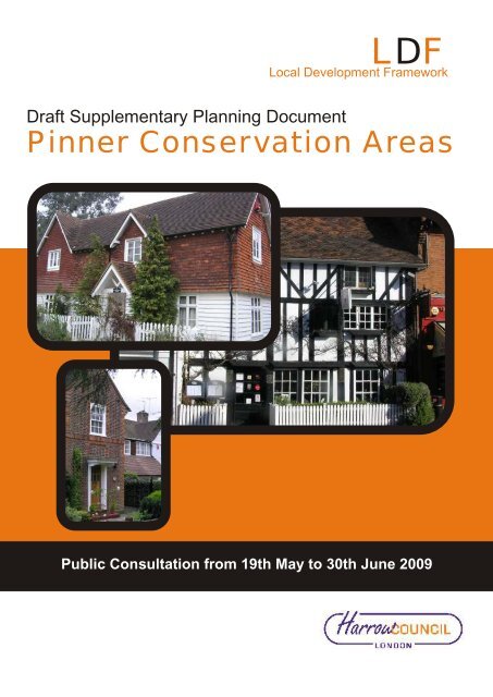
Draft Supplementary Planning Document<br />
<strong>Pinner</strong> <strong>Conservation</strong> <strong>Areas</strong><br />
Public Consultation from 19th May to 30th June 2009
Contents<br />
<strong>Harrow</strong> - Draft <strong>Pinner</strong> <strong>Conservation</strong> <strong>Areas</strong> Supplementary Planning Document LDF Panel 28th April 2009<br />
1.<br />
Introduction<br />
Introduction<br />
1.1 Introduction<br />
6<br />
6<br />
Policy Context<br />
2.<br />
Policy Context<br />
2.1 Policy Context<br />
9<br />
9<br />
Overview of <strong>Pinner</strong>'s <strong>Conservation</strong><br />
<strong>Areas</strong><br />
3.<br />
Overview of <strong>Pinner</strong>'s <strong>Conservation</strong><br />
<strong>Areas</strong><br />
3.1 Introduction<br />
3.1.1 Setting<br />
3.2 Historic Development<br />
3.2.1 Early Settlements<br />
3.2.2 Twentieth Century Settlements<br />
3.3 Archaeology and Geology<br />
3.3.1 Scheduled Monuments<br />
3.3.2 Archaeological Priority <strong>Areas</strong><br />
3.3.3 Geology<br />
3.4 Key Designations<br />
10<br />
10<br />
11<br />
12<br />
12<br />
12<br />
13<br />
14<br />
16<br />
16<br />
19<br />
Defining <strong>Pinner</strong>'s <strong>Conservation</strong><br />
<strong>Areas</strong> - Designation and Appraisal<br />
4.<br />
Defining <strong>Pinner</strong>'s <strong>Conservation</strong><br />
<strong>Areas</strong> - Designation and Appraisal<br />
4.1 Introduction<br />
4.2 Altering the Boundaries of Exisiting<br />
<strong>Conservation</strong> <strong>Areas</strong><br />
4.3 Appraisal of <strong>Conservation</strong> <strong>Areas</strong><br />
23<br />
23<br />
28<br />
28<br />
General Issues Relating to <strong>Pinner</strong>'s<br />
<strong>Conservation</strong> <strong>Areas</strong>
Contents<br />
arrow - Draft <strong>Pinner</strong> <strong>Conservation</strong> <strong>Areas</strong> Supplementary Planning Document LDF Panel 28th April 2009<br />
5.<br />
General Issues Relating to <strong>Pinner</strong>'s<br />
<strong>Conservation</strong> <strong>Areas</strong><br />
5.1 Introduction<br />
29<br />
29<br />
6.<br />
Environmental Issues<br />
6.1 Transport, Traffic and Parking<br />
6.1.1 Hierarchy of Roads<br />
6.1.2 Unadopted Roads<br />
6.1.3 Train Stations<br />
6.1.4 Cars and Parking<br />
6.2 Views<br />
6.3 Pressure for Developments<br />
6.3.1 Small Scale Alterations and the Need for<br />
Protection Measures<br />
6.3.2 Large Extensions and Demolition<br />
6.3.3 Pressure for New Housing<br />
6.3.4 Basements<br />
6.3.5 Backland Development in Town Centres<br />
6.4 Pressure to reduce green or open space<br />
6.4.1 Pressure for Development Within Green<br />
Belt, Open Space, or Within Sites of<br />
Importance for Nature <strong>Conservation</strong><br />
6.4.2 Pressure to Hard Surface Front Gardens<br />
6.5 Conversion of Exisiting Buildings for<br />
Different Uses<br />
6.6 Telecommunication Installations<br />
6.7 Redundant Buildings and Sites<br />
6.8 Quality of the <strong>Pinner</strong> Environment<br />
6.9 Energy Efficiency and Climate Change<br />
6.9.1 Bins<br />
6.10 Pressure for Works to and Felling of<br />
Trees<br />
30<br />
30<br />
31<br />
31<br />
31<br />
32<br />
33<br />
33<br />
33<br />
34<br />
34<br />
34<br />
35<br />
35<br />
35<br />
36<br />
36<br />
36<br />
37<br />
37<br />
38<br />
38<br />
39<br />
7.<br />
Economic Issues<br />
7.1 Commercial Viability<br />
7.1.1 Hatch End<br />
7.1.2 Shopfronts<br />
7.2 Employment Viability<br />
40<br />
40<br />
41<br />
42<br />
42<br />
8.<br />
Social Issues<br />
8.1 Crime and Fear of Crime<br />
42<br />
42
Contents<br />
<strong>Harrow</strong> - Draft <strong>Pinner</strong> <strong>Conservation</strong> <strong>Areas</strong> Supplementary Planning Document LDF Panel 28th April 2009<br />
8.2 Health and Well Being<br />
42<br />
Managing <strong>Pinner</strong>'s <strong>Conservation</strong><br />
<strong>Areas</strong><br />
9.<br />
Managing <strong>Pinner</strong>'s <strong>Conservation</strong><br />
<strong>Areas</strong><br />
9.1 Introduction<br />
9.2 Development Overview<br />
9.3 Maintaining Townscape and Built<br />
Character<br />
9.3.1 Retaining Buildings and Structures that<br />
Positively Contribute to the <strong>Conservation</strong> Area<br />
9.3.2 Maintaining Important Views<br />
9.3.3 New Development<br />
9.3.4 Retention of Single Family Dwellings<br />
9.3.5 Micro Generation Equipment<br />
9.4 Maintaining Greenery and Open Spaces<br />
9.4.1 Protecting Trees<br />
9.5 Protecting <strong>Pinner</strong>'s Archaeology<br />
9.5.1 Archaeological Priority <strong>Areas</strong><br />
9.5.2 Scheduled Monuments<br />
9.6 Protecting <strong>Pinner</strong>'s Streetscene<br />
9.6.1 Telecommunications Equipment, Other<br />
Tall Structures and Street Furniture<br />
9.6.2 Floorscape<br />
9.7 Protection Measures<br />
9.8 Article 4 Directions<br />
9.9 <strong>Areas</strong> of Special Advertising Control<br />
9.10 Enforcement Powers<br />
9.11 Acting Against Unauthorised<br />
Developments<br />
9.12 Section 215 Notices<br />
9.13 Urgent Works Notices<br />
43<br />
43<br />
43<br />
44<br />
44<br />
45<br />
45<br />
46<br />
47<br />
47<br />
47<br />
48<br />
48<br />
49<br />
49<br />
49<br />
50<br />
50<br />
50<br />
51<br />
52<br />
52<br />
52<br />
53<br />
Enhancing and Promoting <strong>Pinner</strong>'s<br />
<strong>Conservation</strong> <strong>Areas</strong><br />
10.<br />
Enhancing and Promoting <strong>Pinner</strong>'s<br />
<strong>Conservation</strong> <strong>Areas</strong><br />
10.1 Introduction<br />
53<br />
53
Contents<br />
arrow - Draft <strong>Pinner</strong> <strong>Conservation</strong> <strong>Areas</strong> Supplementary Planning Document LDF Panel 28th April 2009<br />
11.<br />
Enhancement Methods<br />
11.1 Development/Design Briefs<br />
11.2 External Funding<br />
11.3 <strong>Council</strong>-Led Schemes<br />
54<br />
54<br />
54<br />
54<br />
12.<br />
Promotion Methods<br />
12.1 Engagement with the Local Community<br />
and Groups<br />
12.2 Tourism and Education Initiatives<br />
55<br />
55<br />
55<br />
Conclusions and Policies<br />
13.<br />
Conclusions<br />
56<br />
14.<br />
Summary of Policies<br />
56<br />
1.<br />
Appendices<br />
59<br />
2.<br />
Waxwell Lane <strong>Conservation</strong> Area<br />
Appraisal and Management<br />
Strategy<br />
59<br />
3.<br />
Waxwell Close <strong>Conservation</strong> Area<br />
Appraisal and Management<br />
Strategy<br />
59<br />
4.<br />
<strong>Pinner</strong> High Street <strong>Conservation</strong><br />
Area Appraisal and Management<br />
Strategy<br />
59<br />
5.<br />
Moss Lane <strong>Conservation</strong> Area<br />
Appraisal and Management<br />
Strategy<br />
59<br />
6.<br />
East End Farm <strong>Conservation</strong> Area<br />
Appraisal and Management<br />
Strategy<br />
59
Contents<br />
<strong>Harrow</strong> - Draft <strong>Pinner</strong> <strong>Conservation</strong> <strong>Areas</strong> Supplementary Planning Document LDF Panel 28th April 2009<br />
7.<br />
West Towers <strong>Conservation</strong> Area<br />
Appraisal and Management<br />
Strategy<br />
59<br />
8.<br />
9.<br />
Tookes Green <strong>Conservation</strong> Area<br />
Appraisal and Management<br />
Strategy<br />
8.1 Background<br />
<strong>Pinner</strong>wood Park Estate<br />
<strong>Conservation</strong> Area Appraisal and<br />
Management Strategy<br />
59<br />
59<br />
60<br />
10.<br />
<strong>Pinner</strong> Hill Estate <strong>Conservation</strong><br />
Area Appraisal and Management<br />
Strategy<br />
60<br />
11.<br />
<strong>Pinner</strong>wood Farm <strong>Conservation</strong><br />
Area Appraisal and Management<br />
Strategy<br />
60<br />
12.<br />
Rayners Lane <strong>Conservation</strong> Area<br />
Appraisal and Management<br />
Strategy<br />
60<br />
13.<br />
Eastcote Village <strong>Conservation</strong> Area<br />
Appraisal and Management<br />
Strategy<br />
60
<strong>Harrow</strong> - Draft <strong>Pinner</strong> <strong>Conservation</strong> <strong>Areas</strong> Supplementary Planning Document<br />
LDF Panel 28th April 2009<br />
6<br />
Section 1 Introduction<br />
1.1 Introduction<br />
1.1.1 This document constitutes the Supplementary Planning Document (SPD) for <strong>Pinner</strong>'s<br />
twelve conservation areas. The SPD provides a strategic overview of issues affecting<br />
<strong>Pinner</strong>'s conservation areas and policies and guidance that can be applied to deal<br />
with these. This document should be read together with the <strong>Conservation</strong> Area<br />
Appraisal and Management Strategies (CAMS) which form the appendices for this<br />
document.
<strong>Harrow</strong> - Draft <strong>Pinner</strong> <strong>Conservation</strong> <strong>Areas</strong> Supplementary Planning Document<br />
LDF Panel 28th April 2009<br />
7<br />
Picture 1.1 <strong>Pinner</strong>'s <strong>Conservation</strong> <strong>Areas</strong><br />
1.1.2 <strong>Pinner</strong> has a rich and significant environment with some of the area's earliest<br />
buildings. <strong>Pinner</strong> High Street, for example, contains a number of historic timber<br />
framed buildings, the majority of which are listed. The importance of <strong>Pinner</strong>'s historic<br />
environment is reflected in its number of designated conservation areas. In total,<br />
these twelve conservation areas cover an area of just under 90 hectares. The two<br />
largest areas are <strong>Pinner</strong> Hill Estate and <strong>Pinner</strong>wood Park Estate, which cover 30<br />
hectares and 27 hectares respectively. The smallest of <strong>Pinner</strong>'s conservation areas<br />
is Eastcote Village which covers 0.4 hectares but this is because it is part of a larger
<strong>Harrow</strong> - Draft <strong>Pinner</strong> <strong>Conservation</strong> <strong>Areas</strong> Supplementary Planning Document<br />
LDF Panel 28th April 2009<br />
8<br />
conservation area that continues into the London Borough of Hillingdon. There are<br />
numerous listed and locally listed buildings as well as other landmark features<br />
throughout <strong>Pinner</strong> which make up a varied and notable built form.<br />
1.1.3 Based on an understanding of the above qualities, this SPD has the following vision<br />
and objectives:<br />
To preserve and enhance the architectural and historic character and appearance<br />
of <strong>Pinner</strong>'s conservation areas.<br />
Objectives:<br />
1. To secure the preservation of <strong>Pinner</strong>'s conservation areas<br />
2. To identify and encourage enhancement of <strong>Pinner</strong>'s conservation areas<br />
3. To promote awareness, understanding and enjoyment of <strong>Pinner</strong>'s twelve conservation<br />
areas<br />
1.1.4 The SPD is structured in the following way. Chapters 1, 2 and 3 set the overall context<br />
in terms of the policy background and an overview to <strong>Pinner</strong>. Chapter 4 covers how<br />
<strong>Pinner</strong>'s conservation areas are defined, designated and appraised. Chapters 5 to<br />
8 focus on specific issues relating to <strong>Pinner</strong>'s conservation areas, looking at<br />
environmental, economic and social matters. Chapter 9 discusses the management<br />
of <strong>Pinner</strong>'s conservation areas, with specific policy guidance to inform development<br />
proposals. Chapters 10 to 12 examine how <strong>Pinner</strong>'s conservation areas can be<br />
enhanced and promoted, with short conclusions in chapter 13, followed by a summary<br />
of policies which are embedded in the text throughout the document. Appendices<br />
and other useful information are contained at the end, as well as individual CAMS,<br />
which once adopted, will also be available separately on the <strong>Council</strong>'s conservation<br />
web site:http://www.harrow.gov.uk/conservationareas<br />
1.1.5 In accordance with Regulations 17 and 18 of the Town and Country Planning (Local<br />
Development) (England) Regulations 2004 as amended there will be a six week<br />
public consultation period on the SPD and its associated documents. This will take<br />
place from X until X. At this stage all CAMS have been subject to an informal round<br />
of public consultation, which targeted libraries, community centres and local resident<br />
associations as well as historical societies amongst other interested groups. National<br />
organisations like English Heritage and Natural England were also consulted. All<br />
comments from this round of informal consultation have been used to strengthen the<br />
documents before a longer period of formal consultation, which will invite comments<br />
from a wider audience.
<strong>Harrow</strong> - Draft <strong>Pinner</strong> <strong>Conservation</strong> <strong>Areas</strong> Supplementary Planning Document<br />
LDF Panel 28th April 2009<br />
9<br />
Section 2 Policy Context<br />
2.1 Policy Context<br />
2.1.1 <strong>Conservation</strong> areas were introduced through the Civic Amenities Act in 1967 and<br />
more than 9000 now exist nationally. There are twenty-eight conservation areas in<br />
the London Borough of <strong>Harrow</strong>. <strong>Conservation</strong> areas are places that can be perceived<br />
as having distinct identity; 'areas of special architectural or historic interest, the<br />
character or appearance of which it is desirable to preserve or enhance' (Section 69<br />
of the Planning (Listed Buildings and <strong>Conservation</strong> <strong>Areas</strong>) Act 1990).<br />
2.1.2 Under Section 72 of the Planning (Listed Buildings and <strong>Conservation</strong> <strong>Areas</strong>) Act<br />
1990, <strong>Harrow</strong> <strong>Council</strong> has a duty, as the local planning authority, to preserve or<br />
enhance the character and appearance of its conservation areas. Section 71 of the<br />
1990 Act places a duty on local planning authorities to formulate and adopt policies<br />
and guidance to preserve and enhance their conservation areas. These broad<br />
requirements are reinforced and elaborated upon by Planning Policy Guidance Note<br />
15: Planning and the Historic Environment (PPG15). The 2006 English Heritage<br />
publication, 'Guidance on the Management of <strong>Conservation</strong> <strong>Areas</strong>' is an important<br />
reference for policy formulation and for seeing the significance of the area retained.<br />
2.1.3 The 2004 Planning and Compulsory Purchase Act introduced a new planning system<br />
and a requirement for local planning authorities to produce Local Development<br />
Frameworks (LDFs) to replace existing development plans. In <strong>Harrow</strong>'s case, once<br />
all elements are completed, the LDF will replace the 2004 <strong>Harrow</strong> Unitary<br />
Development Plan (UDP). The LDF will contain Development Plan Documents (DPDs)<br />
including, most importantly, the Core Strategy. DPDs will form the basis for the new<br />
development plan. Supplementary Planning Documents, such as this one, provide<br />
further details and guidance on policies and proposals contained within the Core<br />
Strategy and other DPDs, and can relate to specific matters such as conservation<br />
areas. SPDs will replace Supplementary Planning Guidance (SPG) documents that<br />
have previously been used for conservation area policy documents. SPDs are an<br />
important material consideration in the determining of planning applications and<br />
appeals, as they are subject to rigorous consultation and will conform to broader<br />
development plan policies.<br />
2.1.4 Until the LDF replaces <strong>Harrow</strong>'s UDP, the <strong>Pinner</strong> <strong>Conservation</strong> <strong>Areas</strong> SPD will amplify<br />
and supplement saved policies D14, D15 and D16 relating to conservation areas.<br />
Minor amendments to the SPD may be required to acknowledge documents that<br />
emerge as part of the LDF process over the next couple of years.<br />
2.1.5 The <strong>Pinner</strong> <strong>Conservation</strong> <strong>Areas</strong> SPD will provide supplementary guidance for <strong>Pinner</strong>'s<br />
twelve conservation areas. Accompanying the SPD will be an individual character<br />
appraisal and management strategy (CAMS) for each area. Character appraisals<br />
are essentially analyses of what makes a conservation area special, while the<br />
management strategies proposals and plans seek to preserve or enhance those<br />
qualities. These documents provide the evidence base for the individual conservation<br />
areas. This SPD will provide policy support for the individual CAMS and provide a<br />
link between the higher level saved policies contained within the current <strong>Harrow</strong> UDP
<strong>Harrow</strong> - Draft <strong>Pinner</strong> <strong>Conservation</strong> <strong>Areas</strong> Supplementary Planning Document<br />
LDF Panel 28th April 2009<br />
10<br />
and the emerging LDF by providing more generic policy guidance which is applicable<br />
across <strong>Pinner</strong>'s conservation areas. It is therefore crucial that the SPD and CAMS<br />
are read together.<br />
Section 3 Overview of <strong>Pinner</strong>'s <strong>Conservation</strong> <strong>Areas</strong><br />
3.1 Introduction<br />
3.1.1 The most identifiable elements that make up the special character of each of <strong>Pinner</strong>'s<br />
twelve conservation areas are noted below. The detailed character and appearance<br />
of each individual area is provided in a conservation area appraisal and management<br />
strategy that are provided within the appendices of this document.<br />
<strong>Conservation</strong> Area<br />
Special Character<br />
Waxwell Lane (appendix 2, page<br />
X)<br />
Waxwell Close (appendix 3, page<br />
X)<br />
<strong>Pinner</strong> High Street (appendix 4,<br />
page X)<br />
Moss Lane (appendix 5, page X)<br />
East End Farm (appendix 6, page<br />
X)<br />
West Towers (appendix 7, page X)<br />
Tookes Green (appendix 8, page<br />
X)<br />
<strong>Pinner</strong>wood Park Estate (appendix<br />
9, page X)<br />
<strong>Pinner</strong> Hill Estate (appendix 10,<br />
page X)<br />
<strong>Pinner</strong>wood Farm (appendix 11,<br />
page X)<br />
Rayners Lane (appendix 12, page<br />
X)<br />
Village character with medium density development,<br />
community and recreational uses and high quality<br />
architecture<br />
Well defined cohesive group of buildings with distinctive<br />
character<br />
Early buildings, many of which are listed, with valuable<br />
historic built fabric in a village setting<br />
High quality early 20th century dwellings with interesting<br />
detailing in a setting of village character<br />
Medieval farmyard nucleus with a high proportion of listed<br />
buildings<br />
Strong example of Metroland development<br />
Village lane character with a high quality of architecture,<br />
attractive open spaces, mature trees and soft greenery<br />
Continuity of building type and materials based on the<br />
garden suburb model, as well as a high proportion of<br />
original features, interesting street layout, attractive open<br />
spaces, mature trees and grass verges<br />
Low density development from large houses in a variety<br />
of styles set within generous gardens, behind street side<br />
greenery and an informal road layout<br />
Traditional farmyard character, rich in greenery, openness<br />
and views as well as attractive dwellings<br />
1930s townscape character centred around a listed train<br />
station and former cinema
<strong>Harrow</strong> - Draft <strong>Pinner</strong> <strong>Conservation</strong> <strong>Areas</strong> Supplementary Planning Document<br />
LDF Panel 28th April 2009<br />
11<br />
<strong>Conservation</strong> Area<br />
Special Character<br />
Eastcote Village (appendix 13,<br />
page X)<br />
Low density high quality development in leafy surrounds<br />
<strong>Pinner</strong> <strong>Conservation</strong> <strong>Areas</strong>' Special Character<br />
3.1.2 Although each area is unique, when consulting the above table, there are a number<br />
of common qualities that account for their special interest and make these areas<br />
worthy of protection. Similar qualities tend to include a rich display of architecture,<br />
either historic or of significance for its portrayal of a particular time, usually<br />
complemented by greenery and visually furnished with mature trees.<br />
3.1.3 <strong>Pinner</strong>'s conservation areas met and continue to meet the following criteria:<br />
<strong>Conservation</strong> areas must meet two or more of the following criteria<br />
1. <strong>Areas</strong> with a high concentration of listed buildings whether statutorily or locally listed<br />
2. <strong>Areas</strong> of historical, social, economic and/or architectural merit<br />
3. <strong>Areas</strong> with a high proportion of buildings built prior to 1920, which remain largely unaltered<br />
4. <strong>Areas</strong> built post 1920 that are innovative in planning or architectural detail, and where a<br />
large proportion remain unaltered<br />
5. A significant group of buildings with distinct physical identity and cohesiveness<br />
6. <strong>Areas</strong> which have a special quality, where the site layout and landscaping are of<br />
exceptionally high quality and/or contain historic open space, natural landmarks or<br />
topographical features<br />
3.1.1 Setting<br />
3.1.1.1 A conservation area's setting often contributes to its architectural or historic interest<br />
and as such development within the setting will be expected to respect its qualities<br />
and special interest. The setting is usually land which obviously bounds the<br />
conservation area but the setting may also include areas not immediately adjacent<br />
but areas further away that impact on views into or out of the area. Where the setting<br />
can be described as open space this is likely to offer protection to the conservation<br />
area and therefore development may not always be appropriate in areas where this<br />
is the case.<br />
3.1.1.2 It is important to note that open spaces can refer to public and private spaces and<br />
therefore both front and rear garden land usually makes a positive contribution to<br />
the conservation area.
<strong>Harrow</strong> - Draft <strong>Pinner</strong> <strong>Conservation</strong> <strong>Areas</strong> Supplementary Planning Document<br />
LDF Panel 28th April 2009<br />
12<br />
3.2 Historic Development<br />
3.2.1 The <strong>Pinner</strong> area is characterised by a series of small historic villages or farmsteads,<br />
with <strong>Pinner</strong>'s High Street at its core. These historic areas are now connected by<br />
twentieth century development, much of which can be described as Metroland. The<br />
extension of the Metropolitan Railway into Middlesex at the turn of the twentieth<br />
century allowed for areas such as Nower Hill, Moss Lane and West Towers to assume<br />
this Metroland character, which has become the distinctive character of the wider<br />
<strong>Pinner</strong> area. Development of the 1920's and 1930's was not confined to residential<br />
within close proximity to railway stations however, but also saw whole new district<br />
centres, as at Rayners Lane, as well as the garden estates of <strong>Pinner</strong> Hill and<br />
<strong>Pinner</strong>wood Park. The conservation areas of <strong>Pinner</strong> therefore can be divided into<br />
two groups, those of medieval origin and those which were developed in the early<br />
twentieth century.<br />
3.2.1 Early Settlements<br />
3.2.1.1 <strong>Pinner</strong> High Street, East End Farm, <strong>Pinner</strong>wood Farm, part of Waxwell Lane, and<br />
part of Tookes Green represent early settlements. Added to these are the remains<br />
of farmsteads within both <strong>Pinner</strong> Hill Estate and <strong>Pinner</strong>wood Park Estate <strong>Conservation</strong><br />
<strong>Areas</strong>, which are otherwise characterised by twentieth century development. These<br />
aforementioned conservation areas have a much greater proportion of listed buildings<br />
by virtue of their earlier roots and more traditional appearance. The earliest of these<br />
is an early fifteenth century timber framed hall house in East End Farm. Indeed out<br />
of East End Farm CA's nine buildings, five of these are statutorily listed, making it<br />
an extremely significant area despite its small size. <strong>Pinner</strong> High Street also has a<br />
high proportion of statutorily listed buildings, and these too tend to be timber framed.<br />
The most notable properties are Church Farm and 25-27 High Street which date to<br />
the fifteenth century, and St John the Baptist Church, parts of which date even earlier,<br />
to the fourteenth century.<br />
3.2.2 Twentieth Century Settlements<br />
3.2.2.1 The conservation areas of Rayners Lane, West Towers, Moss Lane, <strong>Pinner</strong>wood<br />
Park Estate, <strong>Pinner</strong> Hill Estate, Eastcote Village and Waxwell Close are characterised<br />
by their twentieth century architecture and layout. The areas include a scattering of<br />
listed buildings but these tend to be as a result of an earlier settlement, for example,<br />
the sixteenth century Woodhall Farmhouse within <strong>Pinner</strong>wood Park Estate is<br />
somewhat of an oddity within the conservation area but is the most significant building,<br />
and is an important reference to illustrate how the area has evolved.<br />
3.2.2.2 The historic development of each conservation area is detailed within each respective<br />
CAMS.
<strong>Harrow</strong> - Draft <strong>Pinner</strong> <strong>Conservation</strong> <strong>Areas</strong> Supplementary Planning Document<br />
LDF Panel 28th April 2009<br />
13<br />
3.3 Archaeology and Geology<br />
Picture 3.1 Archaeology and Geology<br />
3.3.1 The <strong>Harrow</strong> area is very important for archaeology. The geology and topography of<br />
the area made <strong>Harrow</strong> popular with early settlers and traces of prehistoric man have<br />
been found in <strong>Harrow</strong> Weald. In addition, there is evidence of Romans in Stanmore<br />
and Saxons in both Sudbury and central <strong>Harrow</strong>.
<strong>Harrow</strong> - Draft <strong>Pinner</strong> <strong>Conservation</strong> <strong>Areas</strong> Supplementary Planning Document<br />
LDF Panel 28th April 2009<br />
14<br />
3.3.2 Archaeological designations in <strong>Harrow</strong> consist of two types. The first are Scheduled<br />
Monuments, which are known archaeological features. The second are Archaeological<br />
Priority <strong>Areas</strong> (APAs), where there are suspected archaeological remains.<br />
3.3.3 The Greater London Sites and Monuments Record (SMR) provides a computerised<br />
record of information regarding London's archaeological and historic fabric. The<br />
information held assists with the early identification of the archaeological and historic<br />
interest of an area or site when development is proposed. English Heritage maintains<br />
the SMR for London. To find out more about the Greater London Archaeological<br />
Advisory Service (GLAAS) at English Heritage, visit:<br />
http://www.english-heritage.org.uk/server/show/nav.9686<br />
3.3.4 Planning Policy Guidance Note 16: Archaeology and Planning (PPG16) 1990 should<br />
be read in relation to works that have the potential to affect <strong>Pinner</strong>'s archaeology.<br />
3.3.1 Scheduled Monuments<br />
3.3.1.1 A Scheduled Monument is an archaeological feature that the Secretary of State has<br />
deemed of national importance. 'Scheduling' is one of the ways we protect our<br />
archaeological heritage for future generations and is restricted to the most important<br />
sites and monuments. Scheduling is part of the Ancient Monuments and<br />
Archaeological <strong>Areas</strong> Act 1979. Large sections of Grim's Dyke and Old <strong>Pinner</strong> Deer<br />
Park are scheduled. Those areas of Grim's Dyke that are specific to <strong>Pinner</strong>, are linear<br />
sections between the Hatch End railway line, Shaftesbury Playing Fields, the gardens<br />
of Hallam Gardens and Montesole Playing Fields (see map on page X). The areas<br />
that pass through the gardens of Uxbridge Road are recognised as being APAs.<br />
3.3.1.2 It is recommended that prior to commencing any works owners should check with<br />
the Ancient Monuments Inspector at English Heritage to establish if Scheduled<br />
Monument Consent will be necessary (explained in para X). It would also be wise to<br />
check the terms of any lease or licence relating to the land. It is a criminal offence<br />
to damage a scheduled monument by carrying out unauthorised works.<br />
Old <strong>Pinner</strong> Deer Park<br />
3.3.1.3 Three sections of earth ditch and bank on the boundary of the park and a system of<br />
artificial ponds and water features within the ditch are designated as a Scheduled<br />
Monument. The remainder of the park is covered by an APA. Map X shows the extent<br />
of both areas.<br />
3.3.1.4 <strong>Pinner</strong> Park Farm land is clearly important as an area of open space and is designated<br />
green belt. However the scheduling recognises added importance as rare and well<br />
preserved evidence of this type of medieval landscape.<br />
3.3.1.5 As background to Old <strong>Pinner</strong> Deer Park, the deer park enclosure would have been<br />
set up for the Norman aristocracy in the eleventh and twelfth centuries. These parks<br />
were established in almost every county in England but many have been lost or<br />
substantially altered over the years.
<strong>Harrow</strong> - Draft <strong>Pinner</strong> <strong>Conservation</strong> <strong>Areas</strong> Supplementary Planning Document<br />
LDF Panel 28th April 2009<br />
15<br />
3.3.1.6 The earliest documentary reference to <strong>Pinner</strong> Deer Park dates from 1273-74 and<br />
describes some 250 acres (101 ha) surrounded by bank and double ditch. The<br />
boundary of this deer park has been perpetuated in the boundary of the farmland<br />
that exists today. The park is particularly unusual since it has a double ditch, which<br />
suggested that it was just as important to keep unwanted intruders out, as to keep<br />
livestock in. In 1490 it is recorded that there were around 137 deer in the park.<br />
3.3.1.7 Within the park there are two artificial ponds. Now dry, the larger would have been<br />
a fish pond managed by a sluice gate within a clay dam upstream. Remains of a<br />
ditch suggest that the river could have been diverted away from the fishpond during<br />
periods of dredging or repair. Another pond was created upstream as a watering<br />
place for the deer. This pond would have been visible from the original farmhouse<br />
(thought to have been on the site of the current farmyard), the viewpoint from which<br />
served to monitor the livestock and to provide attractive views across the land.<br />
3.3.1.8 During the fifteenth century the park was converted to agricultural land and the ditch<br />
and fences replaced with hedgerows. A survey carried out in 1896 revealed that<br />
some of these hedges date back to the late medieval period. The deer park was<br />
transferred to Henry VIII in 1546 and was then owned and tenanted out by various<br />
families. In 1930 it was purchased as open space to safeguard it from the threat of<br />
any future development. The park therefore represents a rare survival of ancient<br />
landscape showing how the nobility used their land during the thirteenth, fourteenth<br />
and fifteenth centuries.<br />
3.3.1.9 The park is particularly valuable to Moss Lane and East End Farm <strong>Conservation</strong><br />
<strong>Areas</strong> in providing a buffer of openness, helping to relieve the areas from pressures<br />
of development and to preserve skyline and open views.<br />
Grim's Dyke<br />
3.3.1.10 Another Scheduled Monument, Grim's Dyke is a linear earthwork thought to date<br />
from before the Saxon period. It can be found in the areas of Hatch End and <strong>Harrow</strong><br />
Weald, and in <strong>Pinner</strong> is best viewed at Montesole Playing Fields. It also runs through<br />
a number of private gardens and Shaftesbury Playing Fields.<br />
3.3.1.11 Like Old <strong>Pinner</strong> Deer Park, Grim's Dyke is of historical and archaeological importance.<br />
When is was built is unclear but it can be described as a linear earthwork that is<br />
thought to date from just before the Roman invasion of England. Local legend often<br />
dates the ditch to the Saxon period, but this date is probably too late. 'Grim' is however<br />
the Saxon word for devil or goblin and was given to various linear earthworks similar<br />
to the one in <strong>Harrow</strong>, and as such it is likely that the earthwork's name was derived<br />
from this time. Many Saxon earthworks served as defence lines or boundary markers.<br />
Today, Grim's Dyke still marks boundaries between properties and follows the line<br />
of a number of residential gardens, particularly in Hatch End.<br />
3.3.1.12 Little conclusive evidence has been found to accurately date the construction of the<br />
bank and ditch. However, archaeological excavations at Grim's Dyke Hotel in <strong>Harrow</strong><br />
Weald carried out in 1979 found a 1st century, or slightly earlier, fire hearth. In <strong>Pinner</strong>,<br />
discoveries include Iron Age and Belgic Pottery found during excavations of the<br />
Montesole Playing Fields in 1957.
<strong>Harrow</strong> - Draft <strong>Pinner</strong> <strong>Conservation</strong> <strong>Areas</strong> Supplementary Planning Document<br />
LDF Panel 28th April 2009<br />
16<br />
3.3.2 Archaeological Priority <strong>Areas</strong><br />
3.3.2.1 There are three Archaeological Priority <strong>Areas</strong> (APAs) in <strong>Pinner</strong>. These are identified<br />
below, and are highlighted on map X:<br />
<strong>Pinner</strong>'s Archaeological Priority <strong>Areas</strong><br />
Medieval <strong>Pinner</strong> (including <strong>Pinner</strong>'s High Street and surrounding roads)<br />
Old <strong>Pinner</strong> Deer Park (either side of George V Avenue)<br />
Parts of Grim's Dyke (in Hatch End and <strong>Pinner</strong> Green)<br />
3.3.2.2 Where development is proposed within an APA, English Heritage will require<br />
applicants to provide sufficient information to assess the archaeological implications<br />
of the development. Outside these areas, English Heritage can also ask applicants<br />
to provide archaeological assessments if they feel that below ground archaeology<br />
may be at risk.<br />
3.3.3 Geology<br />
3.3.3.1 Low clay hills (London Clay Formation) occupy most of north and west London.<br />
<strong>Pinner</strong> is one of the closest areas to the clay basin where the underlying chalk comes<br />
close to the surface. It is for this reason that underground chalk workings should be<br />
present at <strong>Pinner</strong>. <strong>Pinner</strong> Chalk Mines are highlighted on map X.<br />
3.3.3.2 The <strong>Pinner</strong> Chalk Mines are relatively extensive and are one of the deepest at about<br />
35m. Chalk was first extracted here via an open cast method and then subsequently<br />
through sinking mines. Extraction is recorded from 1647, from an area now called<br />
The Dell, opposite Waxwell Close CA. Shaft mines were later sunk in the area at<br />
<strong>Pinner</strong> Green from 1840 to c1870.<br />
3.3.3.3 <strong>Pinner</strong> Chalk Mines are recognised within <strong>Harrow</strong> UDP as being a regionally important<br />
geological site (RIGS). In London, RIGS are sites that are considered worthy of<br />
protection for their geodiversity.<br />
3.3.3.4 Hatch End lies in a valley but the land rises to some 134 metres at <strong>Pinner</strong> Hill. <strong>Pinner</strong><br />
Hill is capped with pebble gravels and at this point lie immediately above the clay.<br />
Most of <strong>Pinner</strong>wood Park lies on London Clay, but the south-eastern tip overlies the<br />
Reading Beds, whilst in the opposite corner the recent Pebble Gravel deposits are<br />
in evidence. <strong>Pinner</strong> Park Farm lies over London Clay of about 100 metres in depth,<br />
except for a small western incursion of Reading Beds where the River Pinn passes<br />
under George V Avenue.<br />
3.3.3.5 Planning Policy Statement 9: Biodiversity and Geological <strong>Conservation</strong> (PPS9) 2005<br />
should be read in relation to works that have the potential to affect sites of<br />
geodiversity.
<strong>Harrow</strong> - Draft <strong>Pinner</strong> <strong>Conservation</strong> <strong>Areas</strong> Supplementary Planning Document<br />
LDF Panel 28th April 2009<br />
17<br />
Picture 3.2 Flood Plain and Contours<br />
3.3.3.6 The topography of the <strong>Pinner</strong> area is undulating, peaking at <strong>Pinner</strong> Cemetery and<br />
<strong>Pinner</strong> Hill and dipping in between allowing for uninterrupted views between the two.<br />
The contours can be seen on the above map X. Strategic views are identified within<br />
the UDP on page 131 and are linked to policy D31.
<strong>Harrow</strong> - Draft <strong>Pinner</strong> <strong>Conservation</strong> <strong>Areas</strong> Supplementary Planning Document<br />
LDF Panel 28th April 2009<br />
18<br />
Picture 3.3 Route of the River Pinn<br />
3.3.3.7 The River Pinn flows through <strong>Pinner</strong> (see map X). Most of the river is confined within<br />
concrete culverts, having been diverted from its original route by residential and<br />
industrial development but there are glimpses of the river to the rear of <strong>Pinner</strong> High<br />
Street and in Old <strong>Pinner</strong> Park Farm. Due to the river's presence there is an identified<br />
flood plain which affects conservation areas in its close proximity, as shown on map<br />
X. As this map is indicative, clearer information is available from the Environment<br />
Agency's website where it is possible to search for area specific flood maps:<br />
http://www.environment-agency.gov.uk
<strong>Harrow</strong> - Draft <strong>Pinner</strong> <strong>Conservation</strong> <strong>Areas</strong> Supplementary Planning Document<br />
LDF Panel 28th April 2009<br />
19<br />
3.4 Key Designations<br />
Picture 3.4 <strong>Pinner</strong> Openness<br />
3.4.1 Green Belt, open space, Archaeological Priority <strong>Areas</strong> (APAs) and Scheduled<br />
Monuments all affect <strong>Pinner</strong>'s conservation areas. Sites of significance for biodiversity<br />
include sites of borough importance and sites of local importance for nature<br />
conservation. Sites that are important to the borough are graded: grade I which are<br />
the best, and grade II which, while containing important wildlife habitats, are not as<br />
intrinsically rich as grade I sites. Bridge Pond, on <strong>Pinner</strong>wood Golf Course for
<strong>Harrow</strong> - Draft <strong>Pinner</strong> <strong>Conservation</strong> <strong>Areas</strong> Supplementary Planning Document<br />
LDF Panel 28th April 2009<br />
20<br />
example, is know to house a population of great crested newt, a rather scarce species<br />
nationally. Damage to sites such as this would mean a significant loss to the borough.<br />
A site of Local Importance is one which is, or may be, of particular value to nearby<br />
residents or schools.<br />
3.4.2 Green corridors are also identified on the map above. These are linear features<br />
containing biodiversity. These tend to include sites such as railway embankments<br />
and cuttings, roadside verges, canals, rivers and their surrounds, and often act as<br />
corridors linking wildlife sites. The River Pinn is valuable in this respect for similar<br />
reasons.<br />
3.4.3 All trees within conservation areas are protected, but some will still be afforded<br />
additional protecting via a Tree Preservation Order (TPO). <strong>Pinner</strong>'s tree clusters are<br />
highlighted on map X.
<strong>Harrow</strong> - Draft <strong>Pinner</strong> <strong>Conservation</strong> <strong>Areas</strong> Supplementary Planning Document<br />
LDF Panel 28th April 2009<br />
21<br />
Picture 3.5 Tree Clusters<br />
3.4.4 These designations alongside others relating to the wider <strong>Pinner</strong> area, such as<br />
Metropolitan Open Land and green chains, can be seen on map X. The designations<br />
to directly affect the conservation areas are detailed below.
<strong>Harrow</strong> - Draft <strong>Pinner</strong> <strong>Conservation</strong> <strong>Areas</strong> Supplementary Planning Document<br />
LDF Panel 28th April 2009<br />
22<br />
<strong>Conservation</strong> Area<br />
Waxwell Lane<br />
Waxwell Close<br />
<strong>Pinner</strong> High Street<br />
Designations (may only effect part of the conservation area)<br />
N.B. All trees are protected in conservation areas<br />
Open space<br />
APA<br />
Open space<br />
APA<br />
Bounds:<br />
Open space<br />
Flood plain<br />
Moss Lane<br />
Flood plain<br />
Bounds:<br />
APA<br />
Scheduled Monument<br />
Site of borough importance for nature conservation, grade I<br />
Green belt<br />
East End Farm<br />
Within the setting of:<br />
Open space<br />
APA<br />
West Towers<br />
Tookes Green<br />
<strong>Pinner</strong>wood Park Estate<br />
None<br />
APA<br />
APA<br />
Scheduled Monument<br />
Open space<br />
Flood plain<br />
Bounds:<br />
Green belt<br />
Site of borough importance for nature conservation, grade I
<strong>Harrow</strong> - Draft <strong>Pinner</strong> <strong>Conservation</strong> <strong>Areas</strong> Supplementary Planning Document<br />
LDF Panel 28th April 2009<br />
23<br />
<strong>Conservation</strong> Area<br />
Designations (may only effect part of the conservation area)<br />
N.B. All trees are protected in conservation areas<br />
Area of special character<br />
Within the setting of:<br />
Site of local importance for nature conservation<br />
<strong>Pinner</strong> Hill Estate<br />
Green belt<br />
Area of special character<br />
Bounds:<br />
Site of borough importance for nature conservation, grade I<br />
<strong>Pinner</strong>wood Farm<br />
Green belt<br />
Area of special character<br />
Within the setting of:<br />
Site of borough importance for nature conservation, grade I<br />
Rayners Lane<br />
Bounds open space<br />
Within the setting of:<br />
Site of borough importance for nature conservation, grade II<br />
Eastcote Village<br />
Flood plain<br />
Within the setting of:<br />
Open space<br />
Site of local importance for nature conservation<br />
Planning Designations Relating to <strong>Conservation</strong> <strong>Areas</strong><br />
Section 4 Defining <strong>Pinner</strong>'s <strong>Conservation</strong> <strong>Areas</strong> - Designation and<br />
Appraisal<br />
4.1 Introduction<br />
4.1.1 Under section 69 of the Planning (Listed Buildings and <strong>Conservation</strong> <strong>Areas</strong>) Act<br />
1990, every local planning authority is required from time to time to determine which<br />
parts of their area are worthy of preservation and enhancement and designate them
<strong>Harrow</strong> - Draft <strong>Pinner</strong> <strong>Conservation</strong> <strong>Areas</strong> Supplementary Planning Document<br />
LDF Panel 28th April 2009<br />
24<br />
as conservation areas. The process of designating and the analyses of conservation<br />
areas is crucial to defining and understanding an area's positive and negative features,<br />
as well as identifying issues, opportunities and constraints. The continued analysis<br />
of conservation areas subsequent to their designation is important in assessing the<br />
impact of change.<br />
4.1.2 PPG15 also stresses the need for local planning authorities to define and record the<br />
special interest, character and appearance of conservation areas. It is also<br />
increasingly important to have statements that define each conservation area's<br />
qualities in order to:<br />
Help residents, owners, council members, potential investors, developers and others<br />
understand what is special about an area, what is being preserved and why<br />
Understand what it is that should be protected or enhanced, including assessment of<br />
the area's boundaries<br />
Formulate effective policies<br />
Highlight enhancement opportunities<br />
Help potential developers formulate sympathetic and high quality applications<br />
Make appropriate development management decisions<br />
Be able to justify designation and development management decisions at appeal<br />
Help prioritise internal funds and help obtain external funds, and to encourage inward<br />
investment<br />
Form an evidence base to inform overarching SPDs for geographical groups of<br />
conservation areas, such as <strong>Pinner</strong>, and the wider Local Development Framework<br />
process<br />
4.1.3 Throughout the borough of <strong>Harrow</strong> designation of conservation areas has tended to<br />
occur in waves. A number on <strong>Harrow</strong> on the Hill were designated in the late 1960s<br />
and early 1970s, shortly after conservation areas came into existence. <strong>Pinner</strong> High<br />
Street was also designated at this time. However, other than Tookes Green and<br />
Eastcote Village, which were both designated in the 1970s, all other <strong>Pinner</strong><br />
conservation areas were designated in the 1980/90s, with the exception of the recently<br />
designated Rayners Lane in 2003 (see table below). The designation of entirely new<br />
conservation areas has become rare but many existing areas have had their<br />
boundaries altered.
<strong>Harrow</strong> - Draft <strong>Pinner</strong> <strong>Conservation</strong> <strong>Areas</strong> Supplementary Planning Document<br />
LDF Panel 28th April 2009<br />
25<br />
<strong>Conservation</strong> area and size<br />
(a) Designation date<br />
(b) Article 4 Direction<br />
yes/no<br />
(c) Number of statutorily<br />
listed building entries (each<br />
entry may contain more<br />
than one address.<br />
Addresses such as 27-31<br />
High St, for example, may<br />
be listed as one entry)<br />
(d) Number of locally listed<br />
buildings<br />
Key issues<br />
Waxwell Lane (3.6759 ha)<br />
(a) Designated 1980 and<br />
extended in 1988 and 1991<br />
(b) No<br />
(c) 4 listed buildings<br />
(d) 5 locally listed buildings<br />
Hardsurfacing over front<br />
gardens<br />
Inappropriate window<br />
replacements and roof<br />
extensions<br />
Waxwell Close (0.7213 ha)<br />
(a) Designated 1980<br />
(b) No<br />
(c) None<br />
(d) None<br />
Potential for Article 4<br />
Directions to support<br />
existing restrictive<br />
covenants to control<br />
alterations<br />
<strong>Pinner</strong> High Street (6.6444 ha)<br />
(a) Designated 1968 and<br />
amended in 1991 and 2002<br />
(b) Yes<br />
(c) 25 listed buildings<br />
(d) 6 locally listed buildings<br />
Changing shopping<br />
character, shifting<br />
towards food and drink<br />
premises rather than<br />
retail<br />
Moss Lane (6.0172 ha)<br />
(a) Designated 1988<br />
(b) No<br />
(c) None<br />
(d) None<br />
Small scale alterations
<strong>Harrow</strong> - Draft <strong>Pinner</strong> <strong>Conservation</strong> <strong>Areas</strong> Supplementary Planning Document<br />
LDF Panel 28th April 2009<br />
26<br />
<strong>Conservation</strong> area and size<br />
(a) Designation date<br />
(b) Article 4 Direction<br />
yes/no<br />
(c) Number of statutorily<br />
listed building entries (each<br />
entry may contain more<br />
than one address.<br />
Addresses such as 27-31<br />
High St, for example, may<br />
be listed as one entry)<br />
(d) Number of locally listed<br />
buildings<br />
Key issues<br />
East End Farm (1.4068 ha)<br />
(a) Designated 1980<br />
(b) Yes<br />
(c) 5 listed buildings<br />
(d) None<br />
Pressure for<br />
development within the<br />
setting of the<br />
conservation area<br />
West Towers (2.9138 ha)<br />
(a) Designated 1990<br />
(b) Yes<br />
(c) None<br />
(d) None<br />
Inappropriate window<br />
replacements<br />
Conversion of garages<br />
into habitable rooms<br />
Tookes Green (4.1378 ha)<br />
(a) Designated in 1971 and<br />
extended in 1988<br />
(b) No<br />
(c) 3 listed buildings<br />
(d) 3 locally listed buildings<br />
Hardsurfacing of front<br />
gardens<br />
<strong>Pinner</strong>wood Park Estate (27.4773<br />
ha)<br />
(a) Designated in 1989<br />
(b) Yes<br />
(c) 1 listed building<br />
(d) None<br />
Loss of side passages<br />
as a result of garages<br />
being turned into<br />
habitable rooms<br />
Inappropriate window<br />
replacements
<strong>Harrow</strong> - Draft <strong>Pinner</strong> <strong>Conservation</strong> <strong>Areas</strong> Supplementary Planning Document<br />
LDF Panel 28th April 2009<br />
27<br />
<strong>Conservation</strong> area and size<br />
(a) Designation date<br />
(b) Article 4 Direction<br />
yes/no<br />
(c) Number of statutorily<br />
listed building entries (each<br />
entry may contain more<br />
than one address.<br />
Addresses such as 27-31<br />
High St, for example, may<br />
be listed as one entry)<br />
(d) Number of locally listed<br />
buildings<br />
Key issues<br />
<strong>Pinner</strong> Hill Estate (29.7797 ha)<br />
(a) Designated 1990<br />
(b) Yes<br />
(c) 5 listed buildings<br />
(d) 3 locally listed buildings<br />
Large extensions<br />
Hard surfacing of front<br />
gardens<br />
<strong>Pinner</strong>wood Farm (4.1220 ha)<br />
(a) Designated 1980<br />
(b) No<br />
(c) 1 listed building<br />
(d) 3 locally listed buildings<br />
Lack of maintenance of<br />
historic farmyard<br />
buildings<br />
Rayners Lane (2.643 ha)<br />
(a) Designated 2003<br />
(b) No<br />
(c) 2 listed buildings<br />
(d) 2 locally listed buildings<br />
Shift towards take away<br />
restaurants from retail<br />
Eastcote Village (0.3774) - Main<br />
part within the London Borough of<br />
Hillingdon<br />
(a) Designated 1972/73<br />
(b) No<br />
(c) None<br />
(d) None<br />
Hardsurfacing of<br />
driveways<br />
Overview of <strong>Pinner</strong>'s <strong>Conservation</strong> <strong>Areas</strong>
<strong>Harrow</strong> - Draft <strong>Pinner</strong> <strong>Conservation</strong> <strong>Areas</strong> Supplementary Planning Document<br />
LDF Panel 28th April 2009<br />
28<br />
4.2 Altering the Boundaries of Exisiting <strong>Conservation</strong> <strong>Areas</strong><br />
4.2.1 As part of the appraisal process for reviewing individual conservation areas the<br />
boundaries of the existing areas in question are reconsidered in the appended CAMS.<br />
This may include incorporating adjoining buildings and/or streets, which on review<br />
meet the criteria for designation. In some conservation areas, particularly those where<br />
there has not been sufficient protection in the form of Article 4 Directions and<br />
consequently there has been an accumulation of small scale changes, a process of<br />
de-designating the most altered areas and imposing Article 4 Directions on the<br />
remaining areas may be appropriate.<br />
4.2.2 The CAMS for each conservation area in <strong>Pinner</strong> discuss, where appropriate, possible<br />
changes to existing conservation area boundaries, to add or remove buildings or<br />
streets.<br />
4.3 Appraisal of <strong>Conservation</strong> <strong>Areas</strong><br />
4.3.1 Until 2005, <strong>Harrow</strong> <strong>Council</strong> produced a series of conservation area policy statements<br />
as supplementary planning guidance (SPGs). These documents, which were subject<br />
to public consultation, provided detailed information on the history, character and<br />
appearance of the area. They also set out proposals for enhancement and policies<br />
to safeguard the character of individual areas. Supplementary planning guidance<br />
ceases to exist within the new Local Development Framework. However, as published<br />
analyses of the character and appearance of the conservation areas, these documents<br />
will continue to remain very valuable until they are revised.<br />
4.3.2 Since 2005, the <strong>Council</strong> has adopted a new approach to the production of these<br />
documents, renaming them <strong>Conservation</strong> Area Appraisal and Management Strategies<br />
(CAMS). This is in response to two English Heritage documents, 'Guidance on the<br />
Management of <strong>Conservation</strong> <strong>Areas</strong>' and 'Guidance on <strong>Conservation</strong> Area Appraisals'<br />
(2006). Combined with making the appraisals more visual, these new style documents<br />
form two parts. The first defines the special interest of an area, examines its history<br />
and appearance, and sets out what contributes to the character of the place and<br />
what detracts from it. This leads on to the Management Strategy, which sets out how<br />
the positive features in the area will be preserved through the application of relevant<br />
policies and through additional controls. Ways of overcoming the detractions on the<br />
character of the area are set out along with proposals for positive action to enhance<br />
the area in question.<br />
4.3.3 This SPD sets out the broad range of policies that will be applicable in <strong>Pinner</strong>'s<br />
conservation areas, along with ideas for controlling and enhancing these areas.<br />
However, the individual CAMS which are annexed to this document, develop these<br />
policies and ideas so they can address specific issues relating to specific conservation<br />
areas.
<strong>Harrow</strong> - Draft <strong>Pinner</strong> <strong>Conservation</strong> <strong>Areas</strong> Supplementary Planning Document<br />
LDF Panel 28th April 2009<br />
29<br />
Section 5 General Issues Relating to <strong>Pinner</strong>'s <strong>Conservation</strong> <strong>Areas</strong><br />
5.1 Introduction<br />
5.1.1 Following on from the previous section's discussion on appraising individual<br />
conservation areas, this section briefly highlights and discusses key issues relating<br />
to <strong>Pinner</strong>'s conservation areas as a whole. These issues can be broadly broken down<br />
into environmental, economic and social issues. These issues influence the content<br />
of this SPD and the individual CAMS for each conservation area. Chapter 9 discusses<br />
management proposals to address these issues. Please note that the issues are<br />
listed in no particular order of importance.
<strong>Harrow</strong> - Draft <strong>Pinner</strong> <strong>Conservation</strong> <strong>Areas</strong> Supplementary Planning Document<br />
LDF Panel 28th April 2009<br />
30<br />
Section 6 Environmental Issues<br />
6.1 Transport, Traffic and Parking<br />
Picture 6.1 Hierarchy of Roads and Railways
<strong>Harrow</strong> - Draft <strong>Pinner</strong> <strong>Conservation</strong> <strong>Areas</strong> Supplementary Planning Document<br />
LDF Panel 28th April 2009<br />
31<br />
6.1.1 Hierarchy of Roads<br />
6.1.1.1 Three conservation areas to the north are separated by Uxbridge Road (A404), a<br />
principal thoroughfare that runs west to east through <strong>Pinner</strong> towards Stanmore. At<br />
the junction with St Thomas' Drive it continues southwards into George V Avenue,<br />
which carries on through the fields of <strong>Pinner</strong> Park Farm. At this junction, the road to<br />
Stanmore becomes the A410. The remaining conservation areas are contained within<br />
the area as outlined by the borough boundary and George V Avenue.<br />
6.1.1.2 The hierarchy of these major roads is evident by the numbers of vehicles and traffic<br />
speeds. The A404 does not run through any conservation areas but does impact on<br />
the entrances of <strong>Pinner</strong>wood Park Estate CA. Further south, the A404 meets the<br />
A4090 at the junction with <strong>Pinner</strong> Road and Imperial Drive. This road has a significant<br />
impact on Rayners Lane CA as it runs directly through its centre, dividing the area<br />
in half. However, as part of the character of Rayners Lane CA is derived from its<br />
food and retail elements reliant on access, the road here only adds to the dynamic<br />
of the area.<br />
6.1.1.3 <strong>Pinner</strong> village is again contained within the arterial routes of the A404 and the minor<br />
arterial routes of Elm Park Road, which continues into Bridge Street, Marsh Road<br />
and <strong>Pinner</strong> Road. Secondary routes, but still major thoroughfares for the borough<br />
are shown on map X. These impact on West Towers, Tookes Green, <strong>Pinner</strong> High<br />
Street, <strong>Pinner</strong>wood Park Estate and <strong>Pinner</strong> Hill Estate by bounding these conservation<br />
areas at some point as shown on map X. Despite the availability of these major<br />
routes, smaller roads are often treated as rat runs, inappropriately increasing the<br />
traffic speeds of minor roads; in particular, Paines Lane, Moss Lane and Waxwell<br />
Lane. Fast traffic speeds do not marry well with these roads, especially as their<br />
special interest is derived from their 'village' character.<br />
6.1.1.4 There have been some efforts to combat the impact on these lesser roads, such as<br />
pinch points introduced into Waxwell Lane and Moss Lane, but a survey of the whole<br />
area may be of benefit to see how speeds can be reduced in other sections of road,<br />
particularly where pavements are narrow, or non existent in some sections, such as<br />
Church Lane.<br />
6.1.2 Unadopted Roads<br />
6.1.2.1 <strong>Pinner</strong> Hill Estate is a private estate and residents here contribute to road<br />
maintenance. Gates at <strong>Pinner</strong> Hill and Hillside Road are marked as private. The road<br />
leading to <strong>Pinner</strong>wood Farm is also unadopted, with low traffic generation as a result.<br />
6.1.3 Train Stations<br />
6.1.3.1 There are four stations within close proximity to <strong>Pinner</strong>'s conservation areas. These<br />
are Hatch End, <strong>Pinner</strong>, Rayners Lane and Eastcote, which although it sits outside<br />
the Borough is still used by <strong>Pinner</strong> residents. <strong>Pinner</strong> is served by the Metropolitan<br />
line, Hatch End by the London Overground, and Eastcote and Rayners Lane by both<br />
the Metropolitan and Piccadilly lines. Train lines divide <strong>Pinner</strong> into three, with the<br />
majority of conservation areas lying in the northern most part (see map X). Other
<strong>Harrow</strong> - Draft <strong>Pinner</strong> <strong>Conservation</strong> <strong>Areas</strong> Supplementary Planning Document<br />
LDF Panel 28th April 2009<br />
32<br />
than providing the required links with London and surrounding areas, the stations<br />
contribute to the aesthetic of their respective town centres. This is recognised by the<br />
status of Hatch End and Rayners Lane which are both statutorily listed grade II and<br />
are therefore of national interest. <strong>Pinner</strong> Station is locally listed for its special interest<br />
to the borough and although it sits just outside <strong>Pinner</strong> High Street CA it does have<br />
a bearing on how the High Street is used. There are also views of St Mary's Church,<br />
<strong>Harrow</strong> on the Hill from its platforms. The physical relationship with the High Street<br />
has been somewhat diminished by the large supermarket which divides them, however<br />
it remains invaluable in supporting the retail and restaurant life here. As well as<br />
helping to support the eateries and shops, Rayners Lane is physically and visually<br />
central to the Rayners Lane CA. Its form and stature here as a landmark building<br />
comes from being historically and architecturally at the heart of the area, the integrity<br />
of which should not be compromised through inappropriate development within its<br />
setting. Hatch End is a beautifully designed and well articulated station on the cusp<br />
of the town centre.<br />
6.1.3.2 Common issues that all the aforementioned stations face are how to make these<br />
more accessible to everyone. As historic stations however these have limited flexibility<br />
as to how much change they can accommodate. To make <strong>Pinner</strong>'s stations compliant<br />
under the Disability Discrimination Act (DDA)1995 therefore by inserting tactile paving<br />
and lifts etc, or updating these to accommodate the lengths and widths of new trains<br />
puts pressure on the listed buildings. Rayners Lane, for example, serves two lines<br />
and is a busy station, but the route from the ticket office to the platform is difficult for<br />
some with a long and steep flight of stairs to navigate. A lift is therefore required but<br />
to include this within the body of the station would detract from much of its special<br />
interest, breaking the Art Deco clean lines that are central to its architectural<br />
significance. It may therefore be sensible to include lifts and bridge across the<br />
platform, linking this to the ticket hall at first floor level. <strong>Pinner</strong> has already inserted<br />
lifts which are hidden behind the stairs and walkway and therefore have little impact<br />
on the architectural or historical interest of the building. There is usually an imaginative<br />
solution without having to detract from the existing building. A sensitive approach<br />
and respect for historic buildings is necessary in any of <strong>Pinner</strong>'s stations where<br />
change is required. Where a station is listed, English Heritage would be involved in<br />
any discussions for change from the outset.<br />
6.1.4 Cars and Parking<br />
6.1.4.1 Car parks and on street parking serve both town centres of <strong>Pinner</strong> and Rayners<br />
Lane. The on street parking fronts onto the buildings, the spaces of which are<br />
necessary to help retain the area's vitality and to increase accessibility for all. As<br />
these are limited to small areas they are not too detracting, especially in Alexandra<br />
Avenue where the impact of cars is mitigated by wide pavements. Car parks however<br />
can easily detract from a townscape and therefore rely heavily on well planted<br />
screening to mitigate against the effect of large expanses of hardsurfacing. Car parks<br />
form part of the setting for both Rayners Lane and <strong>Pinner</strong> High Street CAs, which if<br />
increased are likely be harmful to the conservation areas. Policy T14 of <strong>Harrow</strong>'s<br />
UDP stresses the need to retain the balance between the attractiveness of the<br />
townscape and accommodation for cars.
<strong>Harrow</strong> - Draft <strong>Pinner</strong> <strong>Conservation</strong> <strong>Areas</strong> Supplementary Planning Document<br />
LDF Panel 28th April 2009<br />
33<br />
6.2 Views<br />
6.2.1 Views are considered within each conservation area appraisal, which form the<br />
appendices to this SPD. These are not exhaustive but indicate the types of views<br />
that are important to each area. They therefore tend to be targeted towards buildings<br />
of architectural merit or areas of green open space. They also tend to be views<br />
available to the public but this does not preclude private views from having some<br />
significance. Strategic views across <strong>Pinner</strong> include views to and from <strong>Pinner</strong> Hill<br />
towards <strong>Pinner</strong> Cemetery and views towards <strong>Harrow</strong> on the Hill from <strong>Pinner</strong>wood<br />
Farm and <strong>Pinner</strong> Hill. Views towards <strong>Harrow</strong> Weald Ridge from <strong>Pinner</strong> are highlighted<br />
within the UDP in map form and in policy D31.<br />
6.3 Pressure for Developments<br />
6.3.1 Small Scale Alterations and the Need for Protection Measures<br />
6.3.1.1 Pressure for development exists within every conservation area. Good design and<br />
the use of high quality materials are sought as part of the planning process but small<br />
scale alterations such as window or door replacement can often be changed without<br />
the benefit of this process. Such alterations to homes may not have the same impact<br />
as large-scale redevelopments, but cumulatively they can severely detract from the<br />
character and appearance of conservation areas. It is for this reason that protection<br />
measures have been adopted for a number of <strong>Pinner</strong>'s conservation areas through<br />
an Article 4 Direction, which removes household permitted development rights with<br />
a view to positively managing change.<br />
6.3.1.2 Article 4 Directions can cover anything from changes to elevations, to boundary<br />
treatment and hardsurfacing of front gardens. If a conservation area is covered by<br />
such a direction this will be outlined in the relevant appraisal and is also highlighted<br />
in the table on page X. Further Article 4 Directions are proposed for all twelve<br />
conservation areas, particularly in relation to front porches, garden outbuildings and<br />
microgeneration equipment such as wind turbines or solar panels (see appendices<br />
for details).<br />
6.3.1.3 Small scale alterations to business premises can also have the same cumulative<br />
detrimental impact, although planning controls on commercial buildings are generally<br />
stricter. Planning permission is required for new shop fronts, and signage under<br />
advertisement regulations within <strong>Pinner</strong>'s conservation areas.<br />
6.3.1.4 An adequate level of enforcement support is necessary to control unauthorised<br />
alterations and, at the same time, greater public awareness on what requires planning<br />
permission. This is particularly relevant for blocks of flats and businesses, where<br />
individual owners and/or occupiers may not be aware of how strict planning controls<br />
are.
<strong>Harrow</strong> - Draft <strong>Pinner</strong> <strong>Conservation</strong> <strong>Areas</strong> Supplementary Planning Document<br />
LDF Panel 28th April 2009<br />
34<br />
6.3.2 Large Extensions and Demolition<br />
6.3.2.1 Properties within the Green Belt (see map X) tend to sit comfortably within large<br />
plots. As this is the case for <strong>Pinner</strong> Hill Estate, there is pressure to substantially<br />
enlarge homes here. However Planning Policy Guidance Note 2: Green Belts (PPG2)<br />
stresses that development within areas of Green Belt should be restricted to safeguard<br />
areas of green and open land. The extent to which dwellings in <strong>Pinner</strong> Hill Estate<br />
CA can be extended is therefore limited creating a linked pressure for part demolition<br />
and rebuild to allow for the reconfiguration of internal space to enlarge room sizes.<br />
6.3.2.2 Demolition in conservation areas (in whole or in part) is protected by the planning<br />
process as policy holds 'there will be a presumption against demolition of buildings<br />
which make a positive contribution to the character and appearance of the area' (D14<br />
UDP). Demolition within conservation areas will also require a separate application<br />
for <strong>Conservation</strong> Area Consent.<br />
6.3.2.3 Buildings that are considered as making a positive contribution to the conservation<br />
area are identified with each appraisal. Alongside these, buildings that are considered<br />
to be neutral (i.e buildings that preserve the character of the area but are of no<br />
particular architectural merit) are outlined. If demolition is sought for a neutral building,<br />
or part of a neutral building, policy also dictates that demolition should not be granted<br />
unless the replacement enhances the conservation area.<br />
6.3.3 Pressure for New Housing<br />
6.3.3.1 Although not as large as the plots of <strong>Pinner</strong> Hill Estate, other <strong>Pinner</strong> conservation<br />
areas tend to incorporate properties sited comfortably within gardens. These sizeable<br />
gardens, in combination with the desirability of <strong>Pinner</strong> as a place to live, the need to<br />
meet government housing targets and the lack of obvious proposal sites, makes<br />
such areas highly sought after to the developer. Building on garden land however in<br />
a conservation area, or within its setting, is likely to harm its character and<br />
appearance. This is particularly relevant for the group of conservation areas<br />
surrounding <strong>Pinner</strong> High Street.<br />
6.3.3.2 New housing development is not suitable for open green space within <strong>Pinner</strong><br />
conservation areas, especially its gardens. When resisting applications these could<br />
also be refused on biodiversity and amenity grounds.<br />
6.3.4 Basements<br />
6.3.4.1 An increasing number of basements are being proposed throughout <strong>Pinner</strong>. This is<br />
a direct result of the lack of land and high land values, appealing to families by<br />
providing additional space without the burden of having to move. There are issues<br />
associated with this type of development however. Not only are concerns often raised<br />
about ground movement, impact on tree roots or the structural integrity of existing<br />
and neighbouring structures, but where railings, grills or roof lights are proposed<br />
these can be visually disturbing to the conservation area. Therefore, this type of<br />
development is not always in keeping with the architectural character of historic
<strong>Harrow</strong> - Draft <strong>Pinner</strong> <strong>Conservation</strong> <strong>Areas</strong> Supplementary Planning Document<br />
LDF Panel 28th April 2009<br />
35<br />
buildings or garden settings. In addition, it is unlikely that subterranean development<br />
would be permitted where within the vicinity of a Scheduled Monument, and where<br />
within an APA the utmost care should be taken.<br />
6.3.5 Backland Development in Town Centres<br />
6.3.5.1 Due to the food and drink outlets on both High Street <strong>Pinner</strong> and Alexandra Avenue<br />
there is pressure for external flues and additional accommodation at the rear. These<br />
service areas are often forgotten and as a result can become cluttered with extensions.<br />
There is opportunity for both areas to be enhanced through the reconfiguration of<br />
numerous small scale accretions or through the removal of unused flues. This is<br />
considered within the management strategies for both areas.<br />
6.4 Pressure to reduce green or open space<br />
6.4.1 Pressure for Development Within Green Belt, Open Space, or Within<br />
Sites of Importance for Nature <strong>Conservation</strong><br />
6.4.1.1 Green Belt stretches across the north of the borough. There are two areas of Green<br />
Belt in <strong>Pinner</strong> and these relate directly to the conservation areas or by affecting their<br />
setting. The two areas incorporate Shaftesbury Playing Fields, <strong>Pinner</strong> Park Farm,<br />
<strong>Pinner</strong> Golf Course and <strong>Pinner</strong>wood Farm. The majority of <strong>Pinner</strong> Hill Estate CA and<br />
all of <strong>Pinner</strong>wood Farm CA are covered by Green Belt, meaning that planning controls<br />
will be more stringent in relation to extensions (as mentioned in para X) and especially<br />
to new development, which relies on very special circumstances. Planning Policy<br />
Guidance Note 2: Green Belts (PPG2) provides guidance on what is and is not<br />
considered appropriate development within the Green Belt. The designation helps<br />
to preserve the openness between dwellings, and the surrounding fields and golf<br />
courses help to preserve the character of the area.<br />
6.4.1.2 <strong>Pinner</strong>wood Park Estate CA also benefits from bounding the Green Belt, providing<br />
open views from the gardens of Grimsdyke Road and Albury Drive. It helps to protect<br />
the areas in question by providing a buffer from surrounding development. Similarly,<br />
Moss Lane CA backs onto Green Belt, aiding in similar protection. The open setting<br />
provided by Green Belt in both cases also contributes to the conservation areas'<br />
respective garden suburb and semi rural character.<br />
6.4.1.3 Most park land has an open space designation, with the exception of some very<br />
small open green areas such as the area at the top of <strong>Pinner</strong>'s High Street. Open<br />
spaces do not necessarily have to be publicly accessible park land but can be treed<br />
areas, or sports grounds, allotments or cemeteries for example. <strong>Areas</strong> of open space<br />
are outlined in blue on map X. The physical and aesthetic attributes of open space<br />
should not be underestimated. These areas aid views of the historic buildings within<br />
the conservation areas and create buffers from surrounding suburban development.<br />
The most notable of these, which directly affect the conservation areas, are the<br />
triangular spaces within <strong>Pinner</strong>wood Park Estate, the Spinny of Waxwell Close, the<br />
Little Common in Waxwell Lane CA and <strong>Pinner</strong> Cemetery between East End Farm<br />
CA and <strong>Pinner</strong> High Street CA. In addition, the leisure, environmental and aesthetic<br />
benefits of <strong>Pinner</strong> Memorial Park are significant to <strong>Pinner</strong> High Street and Waxwell
<strong>Harrow</strong> - Draft <strong>Pinner</strong> <strong>Conservation</strong> <strong>Areas</strong> Supplementary Planning Document<br />
LDF Panel 28th April 2009<br />
36<br />
Lane CAs. Significantly, there are also small areas of openness that are not<br />
designated as open space, but which are valuable in performing the same benefit,<br />
especially the small areas of openness which can be seen throughout <strong>Pinner</strong>wood<br />
Park Estate CA. These, alongside an area in <strong>Pinner</strong> High Street are shown on map<br />
X.<br />
6.4.1.4 All developments will be expected to incorporate appropriate elements of open space<br />
that make a positive contribution to and are integrated with the wider network.<br />
6.4.2 Pressure to Hard Surface Front Gardens<br />
6.4.2.1 The continuing loss of front gardens is likely to be as a result of increasing car<br />
ownership, off street parking pressures, changes in garden fashions and also the<br />
absence in some cultures of any garden tradition. There is therefore a need for porous<br />
alternatives to impermeable materials and soft landscaping to soak up rainfall to<br />
reduce flooding, for the protection of building foundations, as well as to provide open<br />
spaces for pleasant townscapes. Where this is particularly relevant, this has been<br />
highlighted within the Management Strategies at the end of this document and an<br />
Article 4 Direction has been proposed.<br />
6.4.2.2 Greater controls were introduced to the General Permitted Development Order<br />
(GPDO) in October 2008 which insists on the use of permeable surfaces. To assist<br />
in recognising what constitutes a permeable material, the department for Communities<br />
and Local Government (DCLG) has produced guidance on driveways. This can be<br />
f o u n d a t :<br />
http://www.communities.gov.uk/documents/planningandbuilding/pdf/pavingfrontgardens.pdf<br />
6.5 Conversion of Exisiting Buildings for Different Uses<br />
6.5.1 Conversions of business properties from one use (e.g. retail) to another (e.g.<br />
restaurant) can affect the character and appearance of <strong>Pinner</strong>'s conservation areas<br />
and is particularly pertinent to Rayners Lane and <strong>Pinner</strong> High Street CAs. There are<br />
economic issues associated with these conversion pressures, which are addressed<br />
in the following section.<br />
6.5.2 Although pressure for flat conversions within <strong>Pinner</strong> is relatively low at present,<br />
conversions of large single family dwelling houses could have a significant effect on<br />
the character and appearance of <strong>Pinner</strong>'s conservation areas. Although the physical<br />
appearance of the original building may not substantially alter, its character and the<br />
character of the wider conservation area would change. The associated increase in<br />
car movements, fencing, bins and other features of flat conversions can also result<br />
in a detrimental impact. A separate SPD is currently being produced on conversions<br />
and will be available in due course as part of the emerging LDF.<br />
6.6 Telecommunication Installations<br />
6.6.1 <strong>Pinner</strong>wood Farm and <strong>Pinner</strong> Hill Estate CAs sit in elevated positions creating the<br />
potential for telecommunication demand here. The effectiveness of telecommunication<br />
signals varies throughout <strong>Pinner</strong> and therefore there is likely demand for
<strong>Harrow</strong> - Draft <strong>Pinner</strong> <strong>Conservation</strong> <strong>Areas</strong> Supplementary Planning Document<br />
LDF Panel 28th April 2009<br />
37<br />
telecommunication installations. If not carefully sited these add to street clutter which<br />
can detract from the richness of a conservation area's architecture and spaces and<br />
therefore the potential to detract from its character and appearance is high. A mast<br />
just outside the Rayners Lane CA for example could be re-sited to enhance the area.<br />
Proposals for telecommunication developments should be sympathetically designed<br />
and sited and will require careful consideration and discussion. Where<br />
telecommunication masts and boxes have already been sited, and where such<br />
positions would benefit from de-cluttering, the <strong>Council</strong> will work with the supplier to<br />
re-site the equipment to appropriate alternative locations.<br />
6.6.2 The digital switchover will put additional pressure on the area for satellite dishes.<br />
These would be required to be discreetly and sympathetically sited so as not to<br />
detract from the conservation area, and located in gardens if possible.<br />
6.7 Redundant Buildings and Sites<br />
6.7.1 Whilst the quality of <strong>Pinner</strong>'s environment is generally high, there are a few sites,<br />
structures and buildings the physical condition of which could be improved upon.<br />
Typically these fall in backland sites, especially to the rear of <strong>Pinner</strong> High Street,<br />
where village settlements patterns account for historical accretions and garages set<br />
amongst historic barns. Many of these such buildings are/were ancillary to the principal<br />
buildings that front the shopping street and as such where they are attached to a<br />
listed building they are also listed, and where they form the curtilage of a listed building<br />
they are also likely to be listed. One such notable example is the historic timber<br />
framed barn to the rear of 7 High Street. This is curtilage listed with only half of the<br />
building in use. Where structures are vacant and lacking in heating and general<br />
maintenance they deteriorate. Encouraging better maintenance and new uses for<br />
such structures is an essential part of this SPD and associated CAMS.<br />
6.7.2 The garages which also form part of backland development in the High Street and<br />
Alexandra Avenue are not always used for their intended purpose but for storage,<br />
which creates additional pressures. Where garages still function for their intended<br />
use, these help to relieve parking pressures.<br />
6.7.3 The historic agricultural buildings of <strong>Pinner</strong>wood Farm are noted within the relevant<br />
appraisal as requiring maintenance. It is unlikely that these buildings will be used<br />
again within an agricultural context, as the livery instead relies upon a large modern<br />
shed to meet their current needs. The historic buildings will therefore continue to<br />
deteriorate without general repair and would benefit for an alternative use to secure<br />
their future.<br />
6.8 Quality of the <strong>Pinner</strong> Environment<br />
6.8.1 Much of the public realm within <strong>Pinner</strong> is owned and managed by <strong>Harrow</strong> <strong>Council</strong>,<br />
but a significant proportion is in private ownership (such as <strong>Pinner</strong> Hill Estate and<br />
<strong>Pinner</strong>wood Farm). There are improvements to the streetscape required in most of<br />
the conservation areas and particularly in Waxwell Lane. Priority should however be<br />
given to the two town centre conservation areas of <strong>Pinner</strong> High Street and Rayners<br />
Lane, especially around the <strong>Pinner</strong> War Memorial. Poor quality pavements and roads,
<strong>Harrow</strong> - Draft <strong>Pinner</strong> <strong>Conservation</strong> <strong>Areas</strong> Supplementary Planning Document<br />
LDF Panel 28th April 2009<br />
38<br />
and badly designed and sited street furniture can detract from the overall townscape.<br />
Works by statutory undertakers and general wear and tear has led to the degradation<br />
of the public realm in certain areas. The continued and appropriate maintenance of<br />
the area is therefore necessary, as is the appropriate improvement to amenities,<br />
such as an increase in benches or the provision, or upgrade, of play areas for children,<br />
especially in Waxwell Lane's Little Common.<br />
6.8.2 Valuable areas of open space, such as Old <strong>Pinner</strong> Park Farm and <strong>Pinner</strong> Golf Course,<br />
provide biodiversity, wildlife habitat and also afford scenic views provided by the<br />
land. Smaller public areas also offer amenity benefits, particularly those within<br />
<strong>Pinner</strong>wood Park Estate and Waxwell Lane. These are illustrated on Map X.<br />
6.8.3 Important wildlife, such as bats, should be respected when considering development<br />
and lighting levels within open or garden areas.<br />
6.9 Energy Efficiency and Climate Change<br />
6.9.1 With a growing awareness of sustainable development and the effects of climate<br />
change, in combination with increased fuel bills, there is an increased drive at both<br />
national and local level for places to become more energy efficient and<br />
environmentally friendly. More sustainable approaches to transport, energy, water<br />
and waste management, in response to climate change, concern is therefore<br />
encouraged. Whilst these are positive objectives, there is potential for harm to be<br />
caused to <strong>Pinner</strong>'s conservation areas, especially to traditional built fabric and to the<br />
way the building functions.<br />
6.9.2 There is an increased pressure to adapt buildings to improve energy efficiency through<br />
the installation of micro generation equipment, which includes structures such as<br />
solar panels and wind turbines. This is likely to have a significant effect on the<br />
townscape and roofscape of <strong>Pinner</strong>'s conservation areas and as such an Article 4<br />
Direction that would require planning permission for all such elements will be<br />
considered for each conservation area. Even installations at the rear of properties<br />
could have an impact given the topography of some of <strong>Pinner</strong>'s higher ground and<br />
the public views of the backs of buildings. The sloping ground of <strong>Pinner</strong> Hill Estate,<br />
<strong>Pinner</strong> High Street, Tookes Green and Moss Lane <strong>Conservation</strong> <strong>Areas</strong> makes these<br />
most sensitive to the effects of microgeneration equipment.<br />
6.9.3 The <strong>Council</strong> has produced a Sustainable Building Design SPD to promote and ensure<br />
developments will be more efficient and sustainable.<br />
6.9.1 Bins<br />
6.9.1.1 Another pressure is for increased waste recycling. The conversion of garages into<br />
habitable rooms and the loss of passageways between house and garage has meant<br />
more bins are stored in front gardens, particularly in <strong>Pinner</strong>wood Park Estate, which<br />
detract from the character and appearance of the area.
<strong>Harrow</strong> - Draft <strong>Pinner</strong> <strong>Conservation</strong> <strong>Areas</strong> Supplementary Planning Document<br />
LDF Panel 28th April 2009<br />
39<br />
6.10 Pressure for Works to and Felling of Trees<br />
6.10.1 The trees within <strong>Pinner</strong>'s conservation areas are extremely important as they make<br />
a significant contribution to their character and appearance. They comprise a mix of<br />
native and exotic species found within the open spaces, in private gardens and as<br />
street trees. Trees within the conservation areas are protected by virtue of the<br />
conservation area designation and there are numerous individual and area Tree<br />
Preservation Orders as well. Generally, trees within the conservation areas are well<br />
managed by their owners. The main areas of pressure are connected with providing<br />
off street parking where there is pressure to fell street and private trees to create car<br />
parking spaces or afford access to them, and for extensions or basements which<br />
creates pressure on tree roots.
<strong>Harrow</strong> - Draft <strong>Pinner</strong> <strong>Conservation</strong> <strong>Areas</strong> Supplementary Planning Document<br />
LDF Panel 28th April 2009<br />
40<br />
Section 7 Economic Issues<br />
7.1 Commercial Viability<br />
Picture 7.1 Town Centres<br />
7.1.1 There are two district centres within the <strong>Pinner</strong> area: <strong>Pinner</strong> and Rayners Lane, and<br />
Hatch End is a local centre as shown on map X. All three town centres have a<br />
relationship with conservation areas by virtue of being part of a conservation area
<strong>Harrow</strong> - Draft <strong>Pinner</strong> <strong>Conservation</strong> <strong>Areas</strong> Supplementary Planning Document<br />
LDF Panel 28th April 2009<br />
41<br />
or by affecting its setting. All three have very different character but are linked by<br />
having traditionally provided local convenience goods and services. <strong>Pinner</strong> and<br />
Rayners Lane, in particular, contribute greatly to the character of their respective<br />
conservation areas. 'Developing the capacity of District centres for convenience<br />
shopping is critical to ensure access to goods and services at the local level,<br />
particularly for people without access to cars' (London Plan Annex 1, para 3).<br />
7.1.2 Rayners Lane is characterised by its Metroland feel and Art Deco inspired architecture,<br />
the linear shopping parades of which incorporate integral ground floor retail<br />
accommodation. This space still creates the intended liveliness and as such there<br />
are several eateries and shops. However the balance between retail and food outlets<br />
is shifting. The extent to which non-retail shops can infiltrate the area however is<br />
limited. For primary shopping frontages for example, (as shown in red on map X) the<br />
total amount of non-retail uses should not exceed 25% of the total district centre<br />
frontage or even primary frontage and they should not lead to a 'harmful concentration'<br />
in one area (EM16 UDP).<br />
7.1.3 Secondary shopping frontages are also included in map X in blue and the amount<br />
of non-retail here should not exceed 50% of the total district centre secondary<br />
frontage. The relevant policy for this is EM17 within <strong>Harrow</strong>'s UDP, which also<br />
reinforces that a 'harmful concentration of non-retail uses [should not be] created or<br />
added to'. When uses do change there is opportunity to see shopfronts enhanced.<br />
7.1.4 <strong>Pinner</strong> retains a commercial core along the High Street, Bridge Street and part of<br />
Marsh Road. The shopping area directly affects <strong>Pinner</strong> High Street and Waxwell<br />
Lane CAs. Like Rayners Lane, the vitality created here should also be preserved<br />
and enhanced. Specialist shops contribute to the character and appearance of <strong>Pinner</strong><br />
High Street. Elements such as traditional timber shopfronts, canopies and swan<br />
lighting complement the types of shops and the historic areas. Here too there has<br />
been a growth in food and drink uses in recent years which has somewhat given<br />
<strong>Pinner</strong> High Street a new character and focus. Generally however, the food and drink<br />
units are of high quality, and make a positive contribution to the area. There is likely<br />
to be further pressure on this area for bars and restaurants.<br />
7.1.1 Hatch End<br />
7.1.1.1 The garden suburb style estates were designed as residential areas, deliberately<br />
omitting pubs and shops, and only allowing churches and schools within the<br />
development. As such <strong>Pinner</strong>wood Park Estate relies on the local centre of Hatch<br />
End for goods and services. Although Hatch End is not included within the<br />
conservation area it forms part of its setting and is historically linked as a local centre<br />
to serve the houses.<br />
7.1.1.2 Hatch End has a character which is instantly recognisable as an area for eating out.<br />
Restaurants seem to predominate, but as the shopping frontage here is also protected<br />
to an extent, non-retail use should not exceed 30% of the designated frontage of the<br />
overall local centre.
<strong>Harrow</strong> - Draft <strong>Pinner</strong> <strong>Conservation</strong> <strong>Areas</strong> Supplementary Planning Document<br />
LDF Panel 28th April 2009<br />
42<br />
7.1.2 Shopfronts<br />
7.1.2.1 There are pressures on the town centres for new shopfronts, particularly when uses<br />
change. Shopfronts are an important element in the townscape and the buildings of<br />
which they form part. New or altered shopfronts should be in keeping with the building<br />
and conservation area and must ensure that access is available to all. Historic<br />
shopfronts should be protected and in <strong>Pinner</strong> High Street where these are modern,<br />
these should be replaced in the traditional style (D25 UDP). A Shopfront Design<br />
Guide forms part of the CAMS for <strong>Pinner</strong> High Street CA.<br />
7.2 Employment Viability<br />
7.2.1 <strong>Pinner</strong> employs a number of people via the shops and offices within the area. The<br />
supermarkets of Morrisons (Hatch End), Marks and Spencer, Sainsburys (both behind<br />
<strong>Pinner</strong> High Street) and Tesco (<strong>Pinner</strong> Green) are the main employers in the area,<br />
whose employees form an important part of the customer base for <strong>Pinner</strong>'s shops<br />
and restaurants. Other large employers include Ladbrokes, the headquarters of which<br />
are at Rayners Lane, as well as BT (Marsh Road and Cannon Lane), Clavering Care<br />
(Hatch End), London Ambulance Service (Imperial Drive) and <strong>Pinner</strong> Post Office<br />
(Bridge Street).<br />
7.2.2 <strong>Harrow</strong> Arts Centre at Hatch End also employs over fifty people and is a valuable<br />
cultural resource for the wider <strong>Pinner</strong> area.<br />
Section 8 Social Issues<br />
8.1 Crime and Fear of Crime<br />
8.1.1 Although <strong>Pinner</strong> can be regarded as a relatively safe area within the <strong>Harrow</strong> and<br />
London context, there is still a public perception regarding the threat and fear of<br />
crime. The relative affluence of the conservation areas is likely to contribute to this.<br />
8.1.2 There is danger that overly reactive measures could be implemented to safeguard<br />
security, and there are already examples within <strong>Pinner</strong> of CCTV camera installations,<br />
and there is pressure for vehicle recognition gates within <strong>Pinner</strong> Hill. Whilst crime<br />
and safety are important issues, the need to preserve and enhance the character<br />
and appearance of <strong>Pinner</strong>'s conservation areas must not be lost through the provision<br />
of inappropriate and unsuitable security measures.<br />
8.2 Health and Well Being<br />
8.2.1 The design quality of buildings, parks and streets to improve health and well being<br />
is important. Usable spaces that accommodate diverse needs and reinforce<br />
community identity through respect for historic context and heritage is critical. <strong>Harrow</strong><br />
Arts Centre is therefore a valuable asset that provides arts and culture to <strong>Pinner</strong> and<br />
the borough as a whole.
<strong>Harrow</strong> - Draft <strong>Pinner</strong> <strong>Conservation</strong> <strong>Areas</strong> Supplementary Planning Document<br />
LDF Panel 28th April 2009<br />
43<br />
8.2.2 Improved health and well being can be derived from proper management and<br />
maintenance of the built environment. By creating clean, safe and green public places<br />
and achieving sustainable development, through the efficient use of resources and<br />
adaptability to respond to future change, the quality of life in <strong>Pinner</strong> would be<br />
improved.<br />
Section 9 Managing <strong>Pinner</strong>'s <strong>Conservation</strong> <strong>Areas</strong><br />
9.1 Introduction<br />
9.1.1 Central Government guidance holds that preservation should not preclude all change;<br />
that areas have evolved over time and should continue to do so, while at the same<br />
time recognising that it is sometimes appropriate to conserve as found (PPG15).<br />
Managing conservation areas is based on an understanding of what is special about<br />
the area that deserves preservation or enhancement. For <strong>Pinner</strong>'s conservation areas<br />
this is outlined in the CAMS appended to this document.<br />
9.1.2 The <strong>Council</strong> will seek to manage <strong>Pinner</strong>'s conservation areas through measures<br />
which include the following.<br />
The application of policies and guidance to inform development proposals, specifically,<br />
in the form of CAMS or area specific design guidance<br />
The use of additional controls such as Article 4 Directions or areas of special<br />
advertisement control<br />
Enforcement powers to safeguard and repair buildings in poor condition, prioritising<br />
those that are listed<br />
Enforcement powers to act against unauthorised developments - This includes 3 yearly<br />
photo surveys to fully understand unauthorised changes<br />
9.1.3 This section sets out the aims of these measures and provides a policy framework<br />
for <strong>Pinner</strong>'s conservation areas, which elaborates on the higher level policies, D14,<br />
D15 and D16 held within <strong>Harrow</strong>'s Unitary Development Plan (UDP).<br />
9.1.4 Where appropriate, specific and detailed design guidance will be prepared for<br />
individual conservation areas within <strong>Pinner</strong>. This guidance will form part of the<br />
management strategy for the relevant conservation area.<br />
9.2 Development Overview<br />
9.2.1 The fundamental aim of this SPD is to ensure the preservation and enhancement of<br />
<strong>Pinner</strong>'s conservation areas, to fit within broader national and local policy guidance<br />
and to use these to provide area specific policies. The following overarching policy<br />
should therefore apply to all conservation areas:
<strong>Harrow</strong> - Draft <strong>Pinner</strong> <strong>Conservation</strong> <strong>Areas</strong> Supplementary Planning Document<br />
LDF Panel 28th April 2009<br />
44<br />
Policy i - Overarching Policy<br />
All development should respect the special character and layout of all <strong>Pinner</strong>'s conservation<br />
areas and their settings. Alongside this SPD, applications for development will be assessed<br />
against the relevant policies and objectives contained within the <strong>Harrow</strong> Unitary Development<br />
Plan, and/or the forthcoming Local Development Framework as well as Planning Policy<br />
Guidance Note 15<br />
9.2.2 This SPD intends to draw all <strong>Pinner</strong>'s conservation areas together through such<br />
overarching policies. These are in turn tailored towards each conservation area and<br />
feature within individual management strategies. Policies are grouped under four<br />
headings:<br />
1. Maintaining Townscape and Built Character<br />
2. Maintaining Greenery and Open Spaces<br />
3. Protecting <strong>Pinner</strong>'s Archaeology<br />
4. Protecting <strong>Pinner</strong>'s Streetscene<br />
9.3 Maintaining Townscape and Built Character<br />
9.3.1 Retaining Buildings and Structures that Positively Contribute to the<br />
<strong>Conservation</strong> Area<br />
9.3.1.1 Buildings and structures within <strong>Pinner</strong>'s conservation areas form a vital part of their<br />
townscape character. This not only includes buildings but smaller features such as<br />
boundary walls which make a positive contribution to the local street scene. Whilst<br />
the preservation of conservation areas does not prevent any change from occurring,<br />
a very strong justification would need to be made to demolish any building or structure<br />
that makes a positive contribution to its character and appearance. The individual<br />
conservation area character appraisals identify which buildings are considered to<br />
have a positive or neutral impact. In order to avoid empty and vacant sites within<br />
conservation areas following demolition, an acceptable replacement building/scheme<br />
would normally have to be agreed before consent was granted for demolition. In this<br />
case, reference would be made to PPG15, and in particular, its tests for demolition.<br />
Policy A-B<br />
To ensure <strong>Pinner</strong>'s townscape is preserved or enhanced the following policies will apply:<br />
A) There will be a presumption against the demolition of buildings which make a positive<br />
contribution to <strong>Pinner</strong>'s conservation areas. <strong>Conservation</strong> Area Consent for the demolition<br />
of any building will not be granted in the absence of an acceptable replacement development.
<strong>Harrow</strong> - Draft <strong>Pinner</strong> <strong>Conservation</strong> <strong>Areas</strong> Supplementary Planning Document<br />
LDF Panel 28th April 2009<br />
45<br />
B) The retention of visually important boundary treatments which are a characteristic of<br />
<strong>Pinner</strong>'s conservation areas will be required.<br />
9.3.2 Maintaining Important Views<br />
9.3.2.1 While it is acknowledged that the street scene is very important, other, more private<br />
viewpoints can also have some significance. This is particularly critical where backs<br />
of properties can be seen from public viewpoints due to the topography of the area.<br />
This guidance is therefore applicable to all elevations of a development irrespective<br />
of whether they face onto public areas.<br />
Policy C<br />
Development must ensure that views (as identified in the SPD and individual character<br />
appraisals) are not impeded between buildings or into areas of open space.<br />
9.3.3 New Development<br />
9.3.3.1 New development is defined as being any form of development, from small scale<br />
household alterations to larger extensions or whole new build. New development<br />
within <strong>Pinner</strong>'s conservation areas is inevitable and need not be considered as<br />
universally negative. If handled correctly, new development can preserve the<br />
character, appearance and setting of <strong>Pinner</strong>'s conservation areas and, in the right<br />
circumstances, lead to their enhancement. Proposals will be set against PPG15,<br />
which sets out the need to consider the desirability of preserving or enhancing the<br />
character or appearance of a conservation area, as well as its setting, or views into<br />
or out of the area. They will also be considered against the CAMS and will need to<br />
comply with policies in this SPD. Planning Policy Statement 1 (PPS1) also states<br />
that all development should exhibit good design and “contribute positively to making<br />
places better for people”.<br />
9.3.3.2 <strong>Pinner</strong>'s conservation areas vary significantly in terms of form, design, and character,<br />
but the following policies can and should apply to all new development. Therefore,<br />
to ensure that the character and appearance of <strong>Pinner</strong>'s conservation areas and their<br />
setting is preserved or enhanced, proposals for development should:<br />
Policy D-H<br />
To ensure that the townscape character is preserved or enhanced, proposals for<br />
development should:<br />
D) Respect the existing layout and historic form of the townscape and street scene, especially<br />
building lines and heights, and not diminish the gap between buildings.
<strong>Harrow</strong> - Draft <strong>Pinner</strong> <strong>Conservation</strong> <strong>Areas</strong> Supplementary Planning Document<br />
LDF Panel 28th April 2009<br />
46<br />
E) Complement and respect existing properties and areas of open space in terms of bulk,<br />
scale and siting.<br />
F) Respect and harmonise with existing buildings in terms of design, siting, detailing, scale<br />
and materials.<br />
G) Retain original design features (as identified in the CAMS), and where replacement is<br />
necessary the architectural detailing should closely match that of the original. Replacement<br />
features constructed of non-traditional materials will be resisted.<br />
H) Ensure material alterations to buildings protect the appearance of elevations, including<br />
alterations to chimneys and rooflines.<br />
9.3.3.3 This SPD draws on the advice from the following guidance document which is<br />
considered particularly helpful. The CABE website for further reference is<br />
http://www.cabe.org.uk<br />
Building In Context<br />
“Building in Context” (2001) is the published guidance document from English Heritage and<br />
the Commission for the Built Environment (CABE) which refers to achieving successful<br />
new development within historic areas. It should be referred to when considering new<br />
development within <strong>Pinner</strong>'s conservation areas. The document states that the right approach<br />
to building in an historic area is for developers to first understand the context for any<br />
proposed development in great detail and relating the new work to its surroundings through<br />
an informed appraisal (often in the form of a Design & Access Statement). This does not<br />
imply that any one architectural approach is, by its nature, more likely to succeed than any<br />
other, and there is no one formula to fit all solutions. According to the document, successful<br />
development projects will:<br />
relate well to the geography and history of the place and the lie of the land;<br />
sit happily in the pattern of existing development and routes through and around it;<br />
respect important views;<br />
respect the scale of neighbouring buildings;<br />
use materials and building methods which are as high in quality as those used in<br />
existing buildings;<br />
create new views and juxtapositions which add to the variety and texture of the setting.<br />
9.3.4 Retention of Single Family Dwellings<br />
9.3.4.1 As discussed in paragraph X, the conversion of single family dwellinghouses into<br />
smaller units would be out of character with <strong>Pinner</strong>'s conservation areas and is likely<br />
to have a harmful impact. The forthcoming SPD for conversions will be written with<br />
this in mind.
<strong>Harrow</strong> - Draft <strong>Pinner</strong> <strong>Conservation</strong> <strong>Areas</strong> Supplementary Planning Document<br />
LDF Panel 28th April 2009<br />
47<br />
9.3.5 Micro Generation Equipment<br />
9.3.5.1 It is likely that sustainability measures will likely lead to an increase in proposals<br />
involving the installation of solar panels and wind turbines on properties within<br />
conservation areas. If well designed and carefully integrated, these measures should<br />
be able to be accommodated without detriment to the character of the conservation<br />
area. In this instance, policy X will apply:<br />
Policy I<br />
Microgeneration equipment should be carefully sited to avoid being viewed from the<br />
streetscene and where historic built fabric would be least disturbed.<br />
9.4 Maintaining Greenery and Open Spaces<br />
9.4.1 Works affecting the green and open spaces within <strong>Pinner</strong> need to be carefully<br />
considered to avoid detracting from the character and appearance of the conservation<br />
areas, or their setting. This applies to both hard and soft landscaping in the<br />
streetscene. Private spaces such as front and rear gardens are also included as they<br />
contribute to the overall feel of the area. Works to the public realm and green spaces<br />
will require negotiations between various departments within <strong>Harrow</strong> <strong>Council</strong>, as well<br />
as private landowners, statutory bodies and local residents.<br />
Policy A - C<br />
To ensure that the soft and open character of the conservation areas and their setting is<br />
both preserved and enhanced, the <strong>Council</strong> will:<br />
A) Encourage the retention and improvement of both public and private green spaces,<br />
including trees and hedgerows.<br />
B) Resist the removal of grass verges.<br />
C) Normally refuse applications for development on existing areas of open land that have<br />
been defined as contributing to the character of the conservation area.<br />
9.4.1 Protecting Trees<br />
9.4.1.1 Trees make a significant contribution to <strong>Pinner</strong> and are protected by virtue of being<br />
within conservation areas. Therefore Tree Preservation Orders (TPOs) are only<br />
created within conservation areas where a clear need arises, such as:
<strong>Harrow</strong> - Draft <strong>Pinner</strong> <strong>Conservation</strong> <strong>Areas</strong> Supplementary Planning Document<br />
LDF Panel 28th April 2009<br />
48<br />
there is a threat of development;<br />
the tree is badly managed, or;<br />
there is a change of ownership of the tree, which can often lead to pressure for works<br />
to the tree.<br />
Policy D-F<br />
To ensure trees are protected in <strong>Pinner</strong>'s conservation areas, the council will:<br />
D) Further protect trees, and groups of private trees, by creating additional tree preservation<br />
orders where appropriate.<br />
E) Resist development that adversely affects significant trees or is likely to lead to pressure<br />
for excessive pruning or felling.<br />
F) Seek to retain, or where necessary, replace street trees.<br />
9.5 Protecting <strong>Pinner</strong>'s Archaeology<br />
9.5.1 Archaeological Priority <strong>Areas</strong><br />
9.5.1.1 As noted on map X substantial parts of the conservation areas are covered by<br />
Archaeological Priority <strong>Areas</strong> (APAs), especially <strong>Pinner</strong> High Street CA. Although<br />
archaeological remains are not always visible above ground, they represent a finite<br />
and important resource and record of <strong>Pinner</strong>'s history. Development proposals can<br />
damage or destroy these remains and require careful monitoring and mitigation<br />
measures to avoid or limit damage. Within existing APAs, any development proposal<br />
that could disturb archaeological remains requires consultation with Greater London<br />
Archaeological Advisory Service (GLAAS) at English Heritage. Even outside an APA,<br />
the <strong>Council</strong> can chose to consult with GLAAS if it is felt that there may be<br />
archaeological issues. The Greater London Sites and Monument Record (GLSMR)<br />
can also be consulted to identify whether there is likely to be any archaeological or<br />
historic interest within any given site in <strong>Pinner</strong>. Planning Policy Guidance Note 16<br />
(PPG16) would need to be referred to as part of any proposal that could potentially<br />
affect the area's archaeology.<br />
9.5.1.2 The existing APAs allow the <strong>Council</strong> to identify circumstances where development<br />
proposals may detrimentally affect archaeological remains in <strong>Pinner</strong>.<br />
Policy A-B<br />
A) <strong>Harrow</strong> <strong>Council</strong> recognises the archaeological importance of <strong>Pinner</strong>'s conservation areas<br />
and their settings, and where necessary will ensure that appropriate action or works, such<br />
as surveys, are carried out before any development commences.
<strong>Harrow</strong> - Draft <strong>Pinner</strong> <strong>Conservation</strong> <strong>Areas</strong> Supplementary Planning Document<br />
LDF Panel 28th April 2009<br />
49<br />
B) Where appropriate, and in discussion with English Heritage, the existing Archaeological<br />
Priority <strong>Areas</strong> will be revised, and/or new Archaeological Priority <strong>Areas</strong> created, to safeguard<br />
<strong>Pinner</strong>'s archaeological remains.<br />
9.5.2 Scheduled Monuments<br />
9.5.2.1 Grim's Dyke and Old <strong>Pinner</strong> Deer Park are Scheduled Monuments and constitute<br />
an important part of <strong>Pinner</strong>'s heritage. It is therefore essential that they are preserved<br />
for future generations. Grim's Dyke, in particular, has suffered considerably from<br />
unwelcome attention over the last two centuries. Nineteenth century searches for<br />
brickearth and gravel led to the destruction of parts of the earthwork, and considerable<br />
damage was caused by construction work in the 1930s. Today it is under threat from<br />
motorcycle scrambling and illegal rubbish dumping. In addition, where this forms<br />
garden land harm may be caused when digging occurs.<br />
9.5.2.2 The scheduling of a monument means that permission is required for works to the<br />
monument. This consent is termed 'Scheduled Monument Consent'. All activities that<br />
will change the site above or below ground need consent. For example, activities<br />
that would need this consent include construction, demolition, removal of earth,<br />
repairs, any alteration, and tipping. Normal agricultural or domestic gardening works<br />
would not usually be affected by this designation, for example, weeding. However<br />
consent is necessary for deeper excavations (300 mm or more) such as might be<br />
required for swimming pools or tree planting. Metal detecting must not be used on<br />
a Scheduled Monument.<br />
9.6 Protecting <strong>Pinner</strong>'s Streetscene<br />
9.6.1 Telecommunications Equipment, Other Tall Structures and Street<br />
Furniture<br />
9.6.1.1 The preservation of <strong>Pinner</strong>'s conservation areas must be the paramount concern<br />
when assessing proposals for telecommunication developments and other tall<br />
structures, such as wind turbines or lampposts, the design of which could harm the<br />
appearance of the area or serve to clutter the streetscene. Where possible streetscene<br />
clutter should be avoided and reduced where possible. The following policy will apply<br />
to telecommunications and other tall structures:<br />
Policy A-D<br />
To limit <strong>Pinner</strong>'s conservation areas from visually and physically obtrusive street clutter,<br />
the council will ensure that the character of the street scene is both preserved and enhanced<br />
by the following policies:<br />
A) There will be a presumption against proposals for telecommunications equipment and<br />
other tall structures which detrimentally affect the character and appearance of <strong>Pinner</strong>'s<br />
conservation areas.
<strong>Harrow</strong> - Draft <strong>Pinner</strong> <strong>Conservation</strong> <strong>Areas</strong> Supplementary Planning Document<br />
LDF Panel 28th April 2009<br />
50<br />
B) Encourage the utility companies to install the minimum amount of new and replacement<br />
street furniture and to locate any furniture sensitively.<br />
C) Encourage the retention, or reinstatement, of traditionally designed street furniture and<br />
materials, such as street lamps.<br />
D) Encourage street furniture to be well sited and designed. Redundant and unsightly<br />
street furniture will be removed where opportunities occur, including signage.<br />
9.6.2 Floorscape<br />
9.6.2.1 It is likely that <strong>Harrow</strong> <strong>Council</strong> will want to alter the floorscapes in <strong>Pinner</strong>'s conservation<br />
areas. If materials are sympathetic to the area and traditional floorscapes are retained,<br />
these measures should be able to be accommodated without detriment to the<br />
character of the conservation area. In this case, the following policy will apply:<br />
Policy E<br />
The retention of original floorscape materials, such as stone pavers or granite kerbs, will<br />
be encouraged. Wherever practicable, replacement floorscapes should be of traditional<br />
materials.<br />
9.7 Protection Measures<br />
9.7.1 In addition to the management of development proposals, <strong>Harrow</strong> <strong>Council</strong> can<br />
implement a number of controls and regulations to preserve and enhance the<br />
character and appearance of the <strong>Pinner</strong>'s conservation areas. These controls are<br />
normally connected with wider planning legislation and require public consultation<br />
before they are implemented. Such protection measures are discussed in the following<br />
paragraphs.<br />
9.8 Article 4 Directions<br />
9.8.1 As discussed in paragraph X, small scale alterations to properties, such as<br />
replacement windows or the insertion of roof lights can have a cumulative harmful<br />
effect on the character and appearance of conservation areas. <strong>Harrow</strong> <strong>Council</strong> can<br />
implement Article 4 Directions to control such works under the General Permitted<br />
Development Order. There are two types of Article 4 Direction; Article 4(1) Directions<br />
require the approval of the Secretary of State and can cover all parts of a conservation<br />
area; Article 4(2) Directions can be implemented by the local planning authority<br />
without this approval, but this direction only controls elevations fronting onto a<br />
highway, waterway or open space. Article 4 Directions require householders to apply
<strong>Harrow</strong> - Draft <strong>Pinner</strong> <strong>Conservation</strong> <strong>Areas</strong> Supplementary Planning Document<br />
LDF Panel 28th April 2009<br />
51<br />
for planning permission for works that otherwise would not normally require consent.<br />
These are not designed to prevent change, but rather to ensure that alterations are<br />
carried out sympathetically.<br />
9.8.2 Five of <strong>Pinner</strong>'s conservation areas are covered by Article 4 Directions. The most<br />
extensive controls exist within West Towers and <strong>Pinner</strong>wood Park Estate CAs because<br />
these are the most uniform areas. There is scope to extend the coverage of Article<br />
4 Directions to more of the <strong>Pinner</strong>'s conservation areas and to increase the amount<br />
of works that would require planning permission. This is proposed for all areas in the<br />
CAMS. In most cases, Article 4(2) Directions would be sufficient, but Article 4(1)<br />
Directions would be required to control garden outbuildings.<br />
9.8.3 The implementation of any Article 4 Direction would first require a thorough survey<br />
of the existing situation within each conservation area to assess the amount of original<br />
features that still survive and what can be protected. Before any Article 4 Direction<br />
is confirmed, there would be a period of public consultation allowing affected<br />
households to make comments and/or objections.<br />
Policy ii - Overarching Policy<br />
Article 4 Directions will be implemented by <strong>Harrow</strong> <strong>Council</strong> where it can be demonstrated<br />
that such controls would result in the preservation and enhancement <strong>Pinner</strong>'s conservation<br />
areas.<br />
9.9 <strong>Areas</strong> of Special Advertising Control<br />
9.9.1 Certain forms of advertisements, such as internally illuminated signage, do not have<br />
deemed consent within conservation areas (as they would in other locations) and as<br />
such require advertisement consent to be obtained from the local planning authority.<br />
However, many other forms of advertisement within conservation areas can be<br />
installed without needing consent. This can have a detrimental impact within <strong>Pinner</strong>,<br />
particularly within the shopping areas of <strong>Pinner</strong> High Street and Rayners Lane.<br />
9.9.2 Under the Advertisement Regulations 1992 (as amended), local planning authorities<br />
can ask the Secretary of State to approve <strong>Areas</strong> of Special Advertising Control to<br />
restrain more obtrusive forms of advertisement in designated areas such as<br />
conservation areas. Approval will only be given if sufficient justification is made to<br />
the Secretary of State and adequate consultation is carried out with local businesses.<br />
There may be scope for such control within the conservation area of <strong>Pinner</strong> High<br />
Street, which would help to preserve or enhance its character and appearance. Such<br />
control would be subject to research and analysis.
<strong>Harrow</strong> - Draft <strong>Pinner</strong> <strong>Conservation</strong> <strong>Areas</strong> Supplementary Planning Document<br />
LDF Panel 28th April 2009<br />
52<br />
Policy iii - Overarching Policy<br />
Subject to adequate research, justification and consultation, <strong>Harrow</strong> <strong>Council</strong> will ask the<br />
Secretary of State to confirm an Area or <strong>Areas</strong> of Special Advert Control within <strong>Pinner</strong>'s<br />
conservation areas.<br />
9.10 Enforcement Powers<br />
9.10.1 Despite the above development guidance and planning controls, there are instances<br />
within <strong>Pinner</strong>'s conservation areas of works or neglect that contravene planning<br />
legislation. Not all cases are deliberate and at times innocent mistakes can be made<br />
by landowners. The following sections discuss the different powers that the council<br />
has to deal with inappropriate development.<br />
9.11 Acting Against Unauthorised Developments<br />
9.11.1 Unauthorised development (i.e. development that should have obtained planning<br />
permission) can have a very negative impact on the character and appearance of<br />
<strong>Pinner</strong>'s conservation areas. Where necessary, reports of unauthorised development<br />
will be investigated by <strong>Harrow</strong> <strong>Council</strong>'s planning enforcement officers and appropriate<br />
action taken. As unlawful small scale development can impact hugely on the character<br />
and appearance of a conservation area. <strong>Conservation</strong> area related enforcement<br />
cases are prioritised for action above others. Such action will range from requesting<br />
a retrospective planning permission to the serving of an enforcement notice to secure<br />
the removal of works that are considered to have a detrimental impact. Due to the<br />
sensitive nature of enforcement complaints, these are kept anonymous and the cases<br />
are treated as highly confidential.<br />
9.11.2 Where possible, the council will monitor <strong>Pinner</strong>'s conservation areas on a regular<br />
basis and note any unauthorised works. Within Article 4 Direction areas, frequent (3<br />
yearly) photographic surveys will allow the council to maintain a snapshot of how<br />
properties look on a particular date, which can then assist enforcement investigations.<br />
Many unauthorised works are often on a small scale (such as replacement windows<br />
or fencing), but they can still have a significant harmful impact on the character and<br />
appearance of <strong>Pinner</strong>'s conservation areas.<br />
9.12 Section 215 Notices<br />
9.12.1 In addition to using enforcement powers against actual development, <strong>Harrow</strong> <strong>Council</strong><br />
can also take action against land and properties that are suffering neglect and<br />
dereliction. Under Section 215 of the 1990 Town and Country Planning Act, local<br />
planning authorities can require owners of derelict land and buildings to carry out<br />
repairs and improvements to improve the 'amenity' of the local area.
<strong>Harrow</strong> - Draft <strong>Pinner</strong> <strong>Conservation</strong> <strong>Areas</strong> Supplementary Planning Document<br />
LDF Panel 28th April 2009<br />
53<br />
9.12.2 As part of the Section 215 process, the <strong>Council</strong> will initially try to negotiate with the<br />
landowner to bring about improvements, resorting to formal legal action if necessary.<br />
<strong>Harrow</strong> <strong>Council</strong> will need to be clear on exactly what requires improvement and will<br />
have to demonstrate that the current condition of any given site detracts from the<br />
amenity of the local area.<br />
9.13 Urgent Works Notices<br />
9.13.1 Whilst Section 215 Notices can be effective and are relatively uncomplicated to apply,<br />
they have limited impact as they can only apply to the exterior of a building or site<br />
and the surrounding land. There may be buildings that require more extensive repair<br />
to ensure that they are not lost altogether. Within conservation areas, it is possible<br />
to serve Urgent Works Notices on buildings to ensure that essential repairs are<br />
carried out to safeguard the structure. Such notices are broadly similar to powers<br />
that can be used on listed buildings, but they require approval from the Secretary of<br />
State before they can be served. Adequate justification would need to be made to<br />
obtain such approval and there are significant resource implications on the authority<br />
of so doing.<br />
Policy iv - Overaching Policy<br />
Where appropriate, <strong>Harrow</strong> <strong>Council</strong> will use its planning enforcement powers to remedy<br />
breaches of planning control or take action against land and properties which are suffering<br />
from neglect.<br />
Section 10 Enhancing and Promoting <strong>Pinner</strong>'s <strong>Conservation</strong> <strong>Areas</strong><br />
10.1 Introduction<br />
10.1.1 In addition to the management and regulatory measures discussed in the previous<br />
chapter, there are many opportunities for promoting and enhancing <strong>Pinner</strong>'s<br />
conservation areas. Enhancement can range from the redevelopment of specific<br />
sites, through to the pro-active regeneration of entire areas, restoring and re-instating<br />
historic features. Combined with such enhancement is the opportunity to engage<br />
with local communities and amenity groups to ensure that <strong>Pinner</strong>'s conservation<br />
areas are valued and protected. This will help to reduce the amount of negative,<br />
unauthorised development that can occur. The following two sections outline the<br />
main aspects of conservation area enhancement and promotion.
<strong>Harrow</strong> - Draft <strong>Pinner</strong> <strong>Conservation</strong> <strong>Areas</strong> Supplementary Planning Document<br />
LDF Panel 28th April 2009<br />
54<br />
Section 11 Enhancement Methods<br />
11.1 Development/Design Briefs<br />
11.1.1 <strong>Harrow</strong> <strong>Council</strong> can encourage the redevelopment of problem or unsightly sites within<br />
the conservation areas of <strong>Pinner</strong> by publishing development and design briefs. These<br />
briefs could clearly state how the local planning authority intended a particular site<br />
to be redeveloped, by assessing the surrounding context and outlining overarching<br />
design guidelines that would be expected to be followed by a developer. This is a<br />
more positive approach than the punitive enforcement powers described in the<br />
previous chapter and could result in significant improvements to <strong>Pinner</strong>'s conservation<br />
areas, or within their setting.<br />
11.2 External Funding<br />
11.2.1 Organisations such as the Heritage Lottery Fund and English Heritage can offer<br />
substantial financial assistance to enable the regeneration and enhancement of<br />
specific historic areas. The most recent example for <strong>Harrow</strong> was the Heritage<br />
Economic Regeneration Scheme (HERS) that resulted in a number of improvements<br />
to the streetscape and the shop fronts of local businesses on <strong>Harrow</strong> on the Hill. By<br />
improving the streetscene, such schemes often continue to benefit the townscape<br />
by encouraging more investment and care in the local area from the local community.<br />
Applications for grant-aid schemes relevant to <strong>Pinner</strong>'s twelve conservation areas<br />
will be considered as and when necessary.<br />
11.2.2 In addition to large grant schemes, there are smaller pots of money that can be<br />
utilised for small scale restoration projects. Other small grant bodies include the<br />
<strong>Harrow</strong> Heritage Trust, Heritage of London Trust, the John Lyon Trust and other<br />
specialist organisations, such as the War Memorials Trust.<br />
11.2.3 Whilst <strong>Harrow</strong> <strong>Council</strong> will continue to seek to obtain grant aid, it will also support<br />
local residents, businesses and other organisations in obtaining funding. This may<br />
only be in the form of advice and supporting letters, but <strong>Harrow</strong> <strong>Council</strong> is committed<br />
to ensuring the enhancement of <strong>Pinner</strong>'s conservation areas in all forms.<br />
11.2.4 In addition to grant funding, the council can secure planning gain funds towards<br />
enhancements to conservation area. The <strong>Conservation</strong> Area Management Strategies<br />
set out opportunities for enhancement relevant to each conservation area and will<br />
be used as part of pre-application negotiations to secure the right level of contribution<br />
on a site by site basis. They are also being used as the evidence base for an emerging<br />
SPD on Section 106 obligations.<br />
11.3 <strong>Council</strong>-Led Schemes<br />
11.3.1 <strong>Harrow</strong> <strong>Council</strong> conducts a number of capital programmes each year to bring about<br />
improvements to the physical environment of the borough. Public realm projects are<br />
led by Landscape, Highway, Traffic and Transport Teams in conjunction with the<br />
council's appointed contractors. Schemes can range from the repair of pavements<br />
to the implementation of traffic control measures. The <strong>Conservation</strong> Team will
<strong>Harrow</strong> - Draft <strong>Pinner</strong> <strong>Conservation</strong> <strong>Areas</strong> Supplementary Planning Document<br />
LDF Panel 28th April 2009<br />
55<br />
endeavour to influence and assist these projects where appropriate to ensure that<br />
the overall character and appearance of <strong>Pinner</strong>'s conservation areas are preserved<br />
and enhanced.<br />
Section 12 Promotion Methods<br />
12.1 Engagement with the Local Community and Groups<br />
12.1.1 There are numerous local groups and organisations with an interest in the preservation<br />
and enhancement of <strong>Pinner</strong>'s conservation areas, in addition to the thousands of<br />
residents who live and work in <strong>Pinner</strong>. Engagement with local people and businesses<br />
is critical at all stages, whether it relates to the production of new character appraisals<br />
or the promotion of environmental improvements. Some of the principal organisations<br />
include the <strong>Pinner</strong> Association, <strong>Pinner</strong> Local History Society, <strong>Harrow</strong> Heritage Trust<br />
and the <strong>Conservation</strong> Area Advisory Committe. There are also numerous schools,<br />
residents associations and businesses. Community engagement can take many<br />
forms; it can include listening to the concerns of local people, holding specific<br />
workshops and exhibitions, or sending out letters and consultation leaflets.<br />
Engagement will follow the guidelines set out in <strong>Harrow</strong> <strong>Council</strong>'s Statement of<br />
Community Involvement .<br />
12.1.2 In addition to engagement at a local level, it is important that regular and meaningful<br />
engagement is sought with statutory bodies, including English Heritage and national<br />
amenity societies such as the Twentieth Century Society and the Society for the<br />
Protection of Ancient Buildings (SPAB). English Heritage have set up the HELM<br />
initiative (Historic Environment - Local Management) to provide local authorities with<br />
support and training on conservation matters. Sharing ideas and experiences with<br />
other councils and professional bodies will help <strong>Harrow</strong> <strong>Council</strong> to improve <strong>Pinner</strong>'s<br />
conservation areas.<br />
12.2 Tourism and Education Initiatives<br />
12.2.1 <strong>Pinner</strong> is widely renowned for its historic and architectural qualities. The borough's<br />
historic environment forms a key part of <strong>Harrow</strong> <strong>Council</strong>'s Tourism Strategy, elements<br />
of which regularly feature on promotional documents and initiatives. There are walking<br />
tours of <strong>Pinner</strong> and numerous leaflets and books to aid visitors. Many buildings also<br />
take part in the annual Open House London event, further promoting <strong>Pinner</strong> as a<br />
visitor destination. The preservation and enhancement of <strong>Pinner</strong>'s conservation areas<br />
is therefore crucial to maintain and improve this important tourism function.<br />
12.2.2 Linked to tourism is an opportunity to create educational initiatives within <strong>Pinner</strong> that<br />
would benefit local schools and communities. There are already a number of initiatives<br />
in place such as talks held by the <strong>Pinner</strong> Local History Society and the <strong>Pinner</strong> Fair,<br />
run yearly by the Showmen's Guild, usually on the first Wednesday after the May<br />
bank holiday. This should be maintained and built upon. Improving people's<br />
understanding and appreciation of <strong>Pinner</strong>'s conservation areas will benefit everyone.<br />
An estate agents welcome pack could be developed with <strong>Pinner</strong> Local History Society<br />
to better inform new residents about the conservation areas. There is further
<strong>Harrow</strong> - Draft <strong>Pinner</strong> <strong>Conservation</strong> <strong>Areas</strong> Supplementary Planning Document<br />
LDF Panel 28th April 2009<br />
56<br />
opportunity for the council to work with the <strong>Pinner</strong> Association and the residents<br />
associations in the work that they do in caring for the heritage of <strong>Pinner</strong> for the benefit<br />
of all.<br />
Section 13 Conclusions<br />
13.0.1 This supplementary planning document has attempted to provide an overview of<br />
<strong>Pinner</strong>'s twelve conservation areas from their historical development to the general<br />
issues and problems that they face today. It also incorporates comments made during<br />
the public consultation process. The policies and guidance contained within the<br />
document will help to inform development proposals and decisions and will support<br />
the individual character appraisals and management strategies (CAMS) that have<br />
been produced for each of the twelve conservation areas. Following the statutory<br />
public consultation and necessary amendments, this document and the associated<br />
CAMS will be formally adopted by <strong>Harrow</strong> <strong>Council</strong> and will carry significant weight<br />
in all future planning matters.<br />
13.0.2 This SPD will be monitored and reviewed on a regular basis to check that it retains<br />
its effectiveness in dealing with issues relating to <strong>Pinner</strong>'s conservation areas. Like<br />
the individual CAMS, it will be revised in the future to ensure that it is up to date and<br />
fully effective. It may also need minor amendments to acknowledge documents that<br />
emerge as part of the Local Development Framework process over the next couple<br />
of years.<br />
Section 14 Summary of Policies<br />
Overarching Policies<br />
i <strong>Harrow</strong> <strong>Council</strong> will require that all development respect the special character and layout<br />
of all <strong>Pinner</strong>'s conservation areas and their settings. Alongside this SPD, applications for<br />
development will be assessed against the relevant policies and objectives contained within<br />
the <strong>Harrow</strong> Unitary Development Plan, and/or the forthcoming Local Development<br />
Framework as well as Planning Policy Guidance Note 15<br />
ii Article 4 Directions will be implemented by <strong>Harrow</strong> <strong>Council</strong> where it can be demonstrated<br />
that such controls would result in the preservation and enhancement <strong>Pinner</strong>'s conservation<br />
areas.<br />
iii Subject to adequate research, justification and consultation, <strong>Harrow</strong> <strong>Council</strong> will ask the<br />
Secretary of State to confirm an Area or <strong>Areas</strong> of Special Advert Control within <strong>Pinner</strong>'s<br />
conservation areas.<br />
iv Where appropriate, <strong>Harrow</strong> <strong>Council</strong> will use its planning enforcement powers to remedy<br />
breaches of planning control or take action against land and properties which are suffering<br />
from neglect.
<strong>Harrow</strong> - Draft <strong>Pinner</strong> <strong>Conservation</strong> <strong>Areas</strong> Supplementary Planning Document<br />
LDF Panel 28th April 2009<br />
57<br />
Policy 1<br />
Maintaining Townscape and Built Heritage<br />
To ensure that the townscape character is preserved or enhanced, proposals for<br />
development should:<br />
A) There will be a presumption against the demolition of buildings which make a positive<br />
contribution to <strong>Pinner</strong>'s conservation areas. <strong>Conservation</strong> Area Consent for the demolition<br />
of any building will not normally be granted in the absence of an acceptable replacement<br />
development.<br />
B) The retention of visually important boundary treatments which are a characteristic of<br />
<strong>Pinner</strong>'s conservation areas will be required.<br />
C) Ensure that views (as identified in the SPD and individual character appraisals) are not<br />
impeded between buildings or into areas of open space.<br />
D) Respect the existing layout and historic form of the townscape and street scene, especially<br />
building lines and heights, and not diminish the gap between buildings.<br />
E) Complement and respect existing properties and areas of open space in terms of bulk,<br />
scale and siting.<br />
F) Respect and harmonise with existing buildings in terms of design, siting, detailing, scale<br />
and materials.<br />
G) Retain original design features (as identified in the CAMS) and where replacement is<br />
necessary, the architectural detailing should closely match that of the original. Replacement<br />
features constructed of non-traditional materials will be resisted.<br />
H) Ensure material alterations to buildings protect the appearance of elevations that face<br />
onto a highway, including alterations to chimneys and rooflines.<br />
I) Microgeneration equipment should be carefully sited to avoid being viewed from the<br />
streetscene and where historic built fabric would be least disturbed.<br />
Policy 2<br />
Maintaining Greenery and Open Spaces<br />
To ensure that the soft and open character of the conservation areas and their setting is<br />
both preserved and enhanced, the council will:<br />
A) Encourage the retention and improvement of both public and private green spaces,<br />
including trees and hedgerows.<br />
B) Resist the removal of grass verges.
<strong>Harrow</strong> - Draft <strong>Pinner</strong> <strong>Conservation</strong> <strong>Areas</strong> Supplementary Planning Document<br />
LDF Panel 28th April 2009<br />
58<br />
C) Normally refuse applications for development on existing areas of open land that have<br />
been defined as contributing to the character of the conservation area.<br />
D) Further protect trees, and groups of private trees, by creating additional tree preservation<br />
orders where appropriate.<br />
E) Resist development that adversely affects significant trees.<br />
F) Seek to retain, or where necessary, replace street trees.<br />
Policy 3<br />
Protecting <strong>Pinner</strong>'s Archaeology<br />
To ensure <strong>Pinner</strong>'s archaeology is protected:<br />
A) <strong>Harrow</strong> <strong>Council</strong> recognises the archaeological importance of <strong>Pinner</strong>'s conservation areas<br />
and their settings, and where necessary will ensure that appropriate action or works, such<br />
as surveys, are carried out before any development commences.<br />
B) Where appropriate, and in discussion with English Heritage, the existing Archaeological<br />
Priority <strong>Areas</strong> will be revised, and/or new Archaeological Priority <strong>Areas</strong> created, to safeguard<br />
<strong>Pinner</strong>'s archaeological remains<br />
Policy 4<br />
Protecting <strong>Pinner</strong>'s Streetscene<br />
To ensure that the character and appearance of the streetscene is preserved or enhanced:<br />
A) There will be a presumption against proposals for telecommunications equipment and<br />
other tall structures which detrimentally affect the character and appearance of <strong>Pinner</strong>'s<br />
conservation areas.<br />
B) Encourage the utility companies to install the minimum amount of new and replacement<br />
street furniture and to locate any furniture sensitively.<br />
C)Encourage the retention, or reinstatement, of traditionally designed street furniture and<br />
materials, such as street lamps.<br />
D) Encourage street furniture to be well sited and designed. Redundant and unsightly street<br />
furniture will be removed where opportunities occur, including signage.<br />
E) The retention of original floorscape materials, such as stone pavers or granite kerbs,<br />
will be encouraged. Wherever practicable, replacement floorscapes should be of traditional<br />
materials.
<strong>Harrow</strong> - Draft <strong>Pinner</strong> <strong>Conservation</strong> <strong>Areas</strong> Supplementary Planning Document<br />
LDF Panel 28th April 2009<br />
59<br />
Appendix 1 Appendices<br />
Appendix 2 Waxwell Lane <strong>Conservation</strong> Area Appraisal and<br />
Management Strategy<br />
Appendix 3 Waxwell Close <strong>Conservation</strong> Area Appraisal and<br />
Management Strategy<br />
Appendix 4 <strong>Pinner</strong> High Street <strong>Conservation</strong> Area Appraisal and<br />
Management Strategy<br />
Appendix 5 Moss Lane <strong>Conservation</strong> Area Appraisal and<br />
Management Strategy<br />
Appendix 6 East End Farm <strong>Conservation</strong> Area Appraisal and<br />
Management Strategy<br />
Appendix 7 West Towers <strong>Conservation</strong> Area Appraisal and<br />
Management Strategy<br />
Appendix 8 Tookes Green <strong>Conservation</strong> Area Appraisal and<br />
Management Strategy<br />
8.1 Background<br />
8.1 This conservation area appraisal and management strategy forms part of the <strong>Pinner</strong><br />
<strong>Conservation</strong> <strong>Areas</strong> Supplementary Planning Document (SPD), which provides<br />
policies to help preserve and enhance <strong>Pinner</strong>'s historic areas.<br />
8.2 There are twelve conservation areas in <strong>Pinner</strong>. Like this one, each will be subject to<br />
character analysis to inform the policies that are set out in the overarching draft SPD.<br />
8.3 This document has been revised to take account of the responses made to an initial<br />
round of consultation that ran from the 21st November to the 19th December 2008.<br />
This is therefore subject to a secondary round of consultation as part of the <strong>Pinner</strong><br />
<strong>Conservation</strong> <strong>Areas</strong> Supplementary Planning Document.<br />
8.4 Involvement in this consultation process is invited from all residents, local businesses,<br />
the <strong>Harrow</strong> community, as well as voluntary groups, government departments and<br />
other interested organisations. Comments and issues raised during this consultation<br />
period will be used to inform the council what further changes should be made to the<br />
documents to make these appropriately robust and to strongly reflect residents' views.<br />
This <strong>Conservation</strong> Area Appraisal and Management Strategy will be amended by<br />
the council after taking into account all comments to this second round of consultation.<br />
Subsequently this revised document alongside the <strong>Pinner</strong> SPD will be submitted to<br />
the Local Development Framework Panel with the recommendation that this be seen<br />
before Cabinet and adopted.
<strong>Harrow</strong> - Draft <strong>Pinner</strong> <strong>Conservation</strong> <strong>Areas</strong> Supplementary Planning Document<br />
LDF Panel 28th April 2009<br />
60<br />
8.5 Please ensure your consultation response is received by the X.<br />
Comments can be sent to:<br />
Weblink: http://harrow-consult.limehouse.co.uk<br />
Email: ldf@harrow.gov.uk<br />
Post: <strong>Conservation</strong><br />
Community and Environment Services<br />
3rd Floor North Wing<br />
Civic 1, Station Road<br />
<strong>Harrow</strong>, HA1 2XY<br />
Appendix 9 <strong>Pinner</strong>wood Park Estate <strong>Conservation</strong> Area Appraisal<br />
and Management Strategy<br />
Appendix 10 <strong>Pinner</strong> Hill Estate <strong>Conservation</strong> Area Appraisal and<br />
Management Strategy<br />
Appendix 11 <strong>Pinner</strong>wood Farm <strong>Conservation</strong> Area Appraisal and<br />
Management Strategy<br />
Appendix 12 Rayners Lane <strong>Conservation</strong> Area Appraisal and<br />
Management Strategy<br />
Appendix 13 Eastcote Village <strong>Conservation</strong> Area Appraisal and<br />
Management Strategy