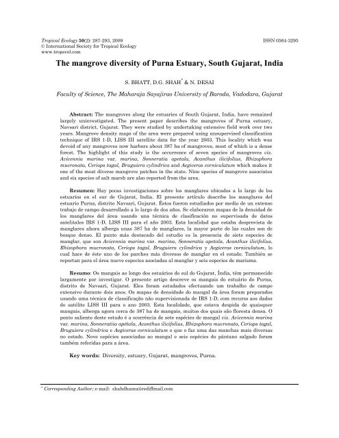
The mangrove diversity of Purna Estuary, South Gujarat, India
The mangrove diversity of Purna Estuary, South Gujarat, India
The mangrove diversity of Purna Estuary, South Gujarat, India

You also want an ePaper? Increase the reach of your titles
YUMPU automatically turns print PDFs into web optimized ePapers that Google loves.
Tropical Ecology 50(2): 287-293, 2009 ISSN 0564-3295<br />
© International Society for Tropical Ecology<br />
www.tropecol.com<br />
<strong>The</strong> <strong>mangrove</strong> <strong>diversity</strong> <strong>of</strong> <strong>Purna</strong> <strong>Estuary</strong>, <strong>South</strong> <strong>Gujarat</strong>, <strong>India</strong><br />
S. BHATT, D.G. SHAH * & N. DESAI<br />
Faculty <strong>of</strong> Science, <strong>The</strong> Maharaja Sayajirao University <strong>of</strong> Baroda, Vadodara, <strong>Gujarat</strong><br />
Abstract: <strong>The</strong> <strong>mangrove</strong>s along the estuaries <strong>of</strong> <strong>South</strong> <strong>Gujarat</strong>, <strong>India</strong>, have remained<br />
largely uninvestigated. <strong>The</strong> present paper describes the <strong>mangrove</strong>s <strong>of</strong> <strong>Purna</strong> estuary,<br />
Navsari district, <strong>Gujarat</strong>. <strong>The</strong>y were studied by undertaking extensive field work over two<br />
years. Mangrove density maps <strong>of</strong> the area were prepared using unsupervised classification<br />
technique <strong>of</strong> IRS 1-D, LISS III satellite data for the year 2003. This locality which was<br />
devoid <strong>of</strong> any <strong>mangrove</strong>s now harbors about 387 ha <strong>of</strong> <strong>mangrove</strong>s, most <strong>of</strong> which is a dense<br />
forest. <strong>The</strong> highlight <strong>of</strong> this study is the occurrence <strong>of</strong> seven species <strong>of</strong> <strong>mangrove</strong>s viz.<br />
Avicennia marina var. marina, Sonneratia apetala, Acanthus ilicifolius, Rhizophora<br />
mucronata, Ceriops tagal, Bruguiera cylindrica and Aegiceras corniculatum which makes it<br />
one <strong>of</strong> the most diverse <strong>mangrove</strong> patches in the state. Nine species <strong>of</strong> <strong>mangrove</strong> associates<br />
and six species <strong>of</strong> salt marsh are also reported from the area.<br />
Resumen: Hay pocas investigaciones sobre los manglares ubicados a lo largo de los<br />
estuarios en el sur de <strong>Gujarat</strong>, <strong>India</strong>. El presente artículo describe los manglares del<br />
estuario <strong>Purna</strong>, distrito Navsari, <strong>Gujarat</strong>. Éstos fueron estudiados por medio de un extenso<br />
trabajo de campo desarrollado a lo largo de dos años. Se elaboraron mapas de la densidad de<br />
los manglares del área usando una técnica de clasificación no supervisada de datos<br />
satelitales IRS 1-D, LISS III para el año 2003. Esta localidad que estaba desprovista de<br />
manglares ahora alberga unas 387 ha de manglares, la mayor parte de las cuales son de<br />
bosque denso. El punto más destacado del estudio es la presencia de siete especies de<br />
manglar, que son Avicennia marina var. marina, Sonneratia apetala, Acanthus ilicifolius,<br />
Rhizophora mucronata, Ceriops tagal, Bruguiera cylindrica y Aegiceras corniculatum, lo<br />
cual hace de éste uno de los parches más diversos de manglar en el estado. También se<br />
reportan para el área nueve especies asociadas al manglar y seis especies de marisma.<br />
Resumo: Os mangais ao longo dos estuários do sul do <strong>Gujarat</strong>, Índia, têm permanecido<br />
largamente por investigar. O presente artigo descreve os mangais do estuário do <strong>Purna</strong>,<br />
distrito de Navsari, <strong>Gujarat</strong>. Eles foram estudados efectuando um trabalho de campo<br />
extensivo durante dois anos. Os mapas de densidade do mangal da área foram preparados<br />
usando uma técnica de classificação não supervisionada de IRS 1-D, com recurso aos dados<br />
do satélite LISS III para o ano 2003. Esta localidade, que estava despida de quaisquer<br />
mangais, alberga agora cerca de 387 ha de mangais, muitos dos quais são floresta densa. O<br />
ponto saliente deste estudo é a ocorrência de sete espécies de mangal viz. Avicennia marina<br />
var. marina, Sonneratiia apétala, Acanthus ilicifolius, Rhizophora mucronata, Ceriops tagal,<br />
Bruguiera cylindrica e Aegiceras corniculatum o que o faz uma das manchas mais diversas<br />
no estado. Nove espécies associadas ao mangal e seis espécies do pântano salgado foram<br />
também referidas para a área.<br />
Key words: Diversity, estuary, <strong>Gujarat</strong>, <strong>mangrove</strong>s, <strong>Purna</strong>.<br />
*<br />
Corresponding Author; e-mail: shahdhamu@rediffmail.com
288 MANGROVE DIVERSITY OF PURNA ESTUARY<br />
Introduction<br />
Shorelines are one <strong>of</strong> the most rapidly<br />
changing places on the Earth. As many as 3 billion<br />
people (50% <strong>of</strong> the global total) live within 60 km<br />
<strong>of</strong> a shoreline (Woodr<strong>of</strong>fe 2002); huge populations<br />
inhabit areas near the coast to take advantage <strong>of</strong><br />
valuable marine resources and to participate in<br />
seaborne trade with other nations, thus reaping<br />
socio-economic benefits. Ecologically, the coast and<br />
its adjacent areas form a unique ecosystem owing<br />
to the combined influence <strong>of</strong> both fresh and saline<br />
water. It is due to this interaction that coastal<br />
landforms support a large <strong>diversity</strong> <strong>of</strong> flora and<br />
fauna, which are crucial to the food chain. One <strong>of</strong><br />
the important resources that the coast <strong>of</strong>fers is the<br />
<strong>mangrove</strong> ecosystem, which is amongst the world’s<br />
most productive ecosystems (Mitsch & Gosselink<br />
1993; Odum et al. 1982). Mangroves are trees or<br />
bushes growing between the level <strong>of</strong> high water <strong>of</strong><br />
spring tide and level close to slightly above the<br />
mean sea level (Macnae 1968). <strong>The</strong>y occupy the<br />
intertidal area <strong>of</strong> coastal wetlands with significant<br />
adaptation for salt tolerance and a distinct<br />
morphology and phenology. Mangroves have<br />
immense ecological and economic importance.<br />
<strong>The</strong>y not only provide socio-economic benefits to<br />
local tribes, but also provide protection to coastal<br />
areas against natural disasters and facilitate the<br />
formation <strong>of</strong> land by trapping sediments<br />
(Kathiresan 2003a).<br />
<strong>The</strong>re are 18 million ha (Spalding 1997) <strong>of</strong><br />
global <strong>mangrove</strong>s inhabiting the tropical and<br />
subtropical region from 30 0 N and 30º S. Around 34<br />
major and 20 minor <strong>mangrove</strong> species belonging to<br />
about 20 genera in over 11 families have been<br />
recorded globally (Tomlinson 1986). Mangroves <strong>of</strong><br />
<strong>South</strong> and <strong>South</strong>east Asia form the world's most<br />
extensive and diverse <strong>mangrove</strong> system<br />
comprising 41.4% <strong>of</strong> global <strong>mangrove</strong>s (Kathiresan<br />
2003b). <strong>India</strong>n <strong>mangrove</strong>s make up 3.1% <strong>of</strong> the<br />
total global cover and are distributed along all the<br />
maritime states, except the union territory <strong>of</strong><br />
Lakshwadeep, covering an area <strong>of</strong> about 4461 sq.<br />
km along the 7,500 km long <strong>India</strong>n coastline<br />
(Anon. 2005b). <strong>The</strong> floral <strong>diversity</strong> <strong>of</strong> <strong>mangrove</strong>s <strong>of</strong><br />
<strong>India</strong> is comprised <strong>of</strong> 38 core <strong>mangrove</strong> species<br />
(Kathiresan 2003c).<br />
<strong>Gujarat</strong> state, with a coastline <strong>of</strong> about 1650<br />
km, harbours approximately 960 sq. km <strong>of</strong><br />
<strong>mangrove</strong>s supporting the second largest block <strong>of</strong><br />
tidal forests <strong>of</strong> <strong>India</strong> (Anon. 2005b). Mangroves in<br />
<strong>Gujarat</strong> are mostly confined to (a) Indus deltaic<br />
region i.e. Kori creek and Sir Creek area, (b) <strong>The</strong><br />
Gulf <strong>of</strong> Kachchh, and (c) <strong>The</strong> Gulf <strong>of</strong> Cambay.<br />
Major work on the <strong>mangrove</strong>s in <strong>Gujarat</strong> has been<br />
carried out by agencies such as the State Forest<br />
Department, Space Applications Centre (SAC,<br />
<strong>India</strong>n Space Research Organisation, Ahmedabad),<br />
and <strong>Gujarat</strong> Ecological Education and Research<br />
Foundation (Gandhinagar). Eight core <strong>mangrove</strong><br />
species have been reported by them along the<br />
<strong>Gujarat</strong> coast. However, most <strong>of</strong> their work is<br />
restricted to the Gulf <strong>of</strong> Kachchh with an emphasis<br />
on species <strong>diversity</strong> and extent (Chavan 1985;<br />
Shah et al. 2005; Singh 2002; Singh 2006).<br />
Preliminary observations (Singh 2002) suggest<br />
that the estuaries <strong>of</strong> south <strong>Gujarat</strong> also harbour a<br />
rich <strong>diversity</strong> <strong>of</strong> <strong>mangrove</strong>s. However, they have<br />
remained largely uninvestigated, except for areas<br />
<strong>of</strong> Umargaon creek (Kothari & Rao 1991a, 1991b;<br />
Kothari & Singh 1998) and Valsad (Shah 1978).<br />
We conducted an inventory on <strong>mangrove</strong> <strong>diversity</strong><br />
<strong>of</strong> one such un-explored area in south <strong>Gujarat</strong>, the<br />
<strong>Purna</strong> estuary <strong>mangrove</strong>s, using comprehensive<br />
ground surveys coupled with preliminary remote<br />
sensing studies.<br />
Materials and methods<br />
Study area<br />
<strong>The</strong> coastal wetland <strong>of</strong> <strong>Purna</strong> River is located<br />
on the southern part <strong>of</strong> <strong>Gujarat</strong> state on the<br />
western coast <strong>of</strong> <strong>India</strong>. It extends between the<br />
longitude 72º 44’ E to 72º 55’ E and latitude 20º 53’<br />
N to 21º 01’ N (Fig. 1). <strong>The</strong> study area is covered in<br />
the Survey <strong>of</strong> <strong>India</strong> (SOI) topographical maps 46D/<br />
9 & 46 D/ 13. <strong>Purna</strong> is a perennial river <strong>of</strong> Navsari<br />
district in <strong>South</strong> <strong>Gujarat</strong> which originates from the<br />
Satpuras range and debouches into the Arabian<br />
Sea near Navsari. It has a mouth span <strong>of</strong><br />
approximately 1.5 km with the tidal influence up<br />
to 26.2 km upstream (as per the SOI topographical<br />
map, 1965). <strong>The</strong> mean annual rainfall received in<br />
this region was 2492 mm (measured at Navsari<br />
station) during the year 2004 (Anon. 2005a).<br />
<strong>The</strong> wetland comprises intertidal mudflats,<br />
<strong>mangrove</strong>s, salt marsh, sand beach, dunes, tidal<br />
creeks, etc. <strong>The</strong> lower most reaches <strong>of</strong> the river<br />
form extensive mudflats. <strong>The</strong> river mouth supports<br />
numerous small islands. Tidal waters reach the<br />
mudflats through a dense creek network. It<br />
experiences semi-diurnal tides, with two high and<br />
two low tides daily.
BHATT, SHAH & DESAI 289<br />
GUJARAT<br />
GUJARAT<br />
INDIA<br />
Fig. 1. Location map <strong>of</strong> the study area.<br />
Methods<br />
INDIA<br />
A base map indicating the shoreline, the<br />
coastal wetland features and surrounding villages<br />
<strong>of</strong> the study area was prepared from the SOI<br />
topographical map by tracing the relevant<br />
features. Extensive fieldwork on the northern as<br />
well as the southern fringe <strong>of</strong> the <strong>Purna</strong> <strong>Estuary</strong><br />
wetland was carried out to study the <strong>mangrove</strong><br />
<strong>diversity</strong>. <strong>The</strong> study area was visited 8 times<br />
during 2006 to 2008. <strong>The</strong> islands at the river<br />
mouth were surveyed using boats from the nearby<br />
coastal villages. <strong>The</strong> vegetation was studied using<br />
traverses laid perpendicular to the <strong>mangrove</strong><br />
fringe and extended till the end <strong>of</strong> the intertidal<br />
area and in the case <strong>of</strong> islands till the<br />
opposite fringe. <strong>The</strong> specimens, both <strong>mangrove</strong><br />
and non-<strong>mangrove</strong>s, were collected and labeled<br />
properly. <strong>The</strong>y were brought back to the laboratory<br />
where a few samples were preserved as Herbaria<br />
and few were dissected to identify the specimens.<br />
<strong>The</strong>y were identified using the <strong>mangrove</strong><br />
identification manuals and standard Floras<br />
(Banerjee et al. 1989; Rajendran & Sanjeevi 2004;<br />
Shah 1978). <strong>The</strong> plants whose identity could not be<br />
confirmed were sent to experts for identification.<br />
Precise GPS locations were collected from all the<br />
field areas visited.<br />
Digital LISS III satellite data obtained from<br />
the IRS P6 satellite, Path 93 and Row 57, dated<br />
31 st March, 2003 was used for generating a<br />
<strong>mangrove</strong> density map <strong>of</strong> <strong>Purna</strong> <strong>Estuary</strong>. Image<br />
was analyzed using the ERDAS IMAGINE, 8.5.<br />
<strong>The</strong> image was geometrically corrected with the<br />
reference projection Geographic Lat/Long and<br />
Spheroid and Datum Modified Everest using GPS<br />
points collected in the field. <strong>The</strong> image was then<br />
subjected to unsupervised classification technique<br />
using the maximum likelihood classifier for<br />
mapping the wetland features. Each class was<br />
then assigned a category based on the<br />
classification system developed for the Coastal<br />
Wetland Map at SAC (Anon. 1992). This<br />
classification system basically divides coastal<br />
areas into wetland and non-wetland categories at<br />
the first level and then for the coastal wetland<br />
features it makes a distinction between vegetated<br />
wetland classes and non-vegetated wetland<br />
classes. <strong>The</strong> vegetated classes have been<br />
designated based on their fidelity to the <strong>mangrove</strong><br />
ecosystem. <strong>The</strong> class grass has been separated out<br />
as it could be easily distinguished from the other<br />
<strong>mangrove</strong> associates due to its form and large<br />
extent. <strong>The</strong> map was subjected to contextual<br />
editing where a few classes that merged with<br />
another category were then recoded again to their<br />
correct category. <strong>The</strong> accuracy <strong>of</strong> this finalized<br />
map was assessed according to the method<br />
described by Green et al. (2000).<br />
Results and discussion<br />
Seven species <strong>of</strong> <strong>mangrove</strong>s are present in the<br />
study area. <strong>The</strong>se species have been listed in Table<br />
1 with comparative information <strong>of</strong> <strong>mangrove</strong><br />
<strong>diversity</strong> in other areas <strong>of</strong> <strong>Gujarat</strong> (Anon. 1987;<br />
Anon. 1992; Anon. 1998; Chavan 1985; Kothari &<br />
Rao 1991a 1991b; Kothari & Singh 1998;<br />
Rajendran & Sanjeevi 2004; Shah 1978; Shah et al.<br />
2005; Singh 2002; Singh 2006). <strong>The</strong> <strong>mangrove</strong>s are<br />
found mainly on the islands and on the estuarine<br />
fringe <strong>of</strong> the intertidal wetland where daily tidal<br />
flushing occurs. Different species <strong>of</strong> <strong>mangrove</strong>s<br />
occupy different areas <strong>of</strong> the wetland. <strong>The</strong><br />
<strong>mangrove</strong> vegetation shows the dominance <strong>of</strong><br />
Avicennia marina (Forsk.) Vierh. var. marina. It<br />
occurs as a fringe <strong>mangrove</strong> and is seen on the<br />
high tidal mudflats as well (Fig. 2). Sonneratia<br />
apetala Buch. Ham. is present on most <strong>of</strong> the<br />
intertidal mudflats and grows pr<strong>of</strong>usely along the<br />
creeks. Acanthus ilicifolius L. is generally found<br />
growing along the shallow creeks as well as on the<br />
landward fringe <strong>of</strong> the intertidal area. It is also the<br />
only <strong>mangrove</strong> species in this area which grows on<br />
the hyper-saline mudflats. Ceriops tagal (Perr.)
290 MANGROVE DIVERSITY OF PURNA ESTUARY<br />
C.B. Roinson and Bruguiera cylindrica (L) Bl.<br />
plants are present on the intertidal mudflats and<br />
behind fringe patches <strong>of</strong> Avicennia marina.<br />
Rhizophora mucronata Lam. is present dispersed<br />
along the intertidal mudflats. Plants <strong>of</strong> Aegiceras<br />
corniculatum (L.) Blanco were found on the edge <strong>of</strong><br />
a creek. Small saplings <strong>of</strong> all the <strong>mangrove</strong> species<br />
were observed in large numbers except for<br />
Aegiceras corniculatum which indicates the good<br />
regeneration status <strong>of</strong> the <strong>mangrove</strong> vegetation.<br />
Fig. 2. An overview <strong>of</strong> <strong>mangrove</strong>s at an island <strong>of</strong><br />
<strong>Purna</strong> <strong>Estuary</strong>.<br />
<strong>The</strong> area also harbours a rich <strong>diversity</strong> <strong>of</strong><br />
<strong>mangrove</strong> associates and salt marsh vegetation.<br />
Nine species <strong>of</strong> <strong>mangrove</strong> associates and six<br />
species <strong>of</strong> salt marsh are being reported in the<br />
area. <strong>The</strong>y have been listed in Table 2. Some <strong>of</strong><br />
these species show a distinct zonation in the<br />
intertidal as well as the high tidal areas <strong>of</strong> the<br />
estuary. Salvadora persica L. is present in the<br />
open <strong>mangrove</strong> patches as well as on the high tidal<br />
mudflats. It occupies the largest area among the<br />
<strong>mangrove</strong> associates. Extensive patches <strong>of</strong> Derris<br />
trifoliata Lour. have been observed all over the<br />
study area. <strong>The</strong> occurrence <strong>of</strong> this species is a new<br />
report for <strong>Gujarat</strong>. <strong>The</strong> salt marsh vegetation<br />
which comprises Suaeda fruticosa Forsk., Suaeda<br />
nudiflora (Willd.) Moq., Sesuvium portulacastrum<br />
L., Salicornia brachiata Roxb., Arthrocnemum<br />
indicum (Willd.) Moq., and Cressa cretica L.<br />
occupies the hightidal mudflats. Aeluropus<br />
lagopoides (L.) Trin. ex Thw. is prominently<br />
present along the intertidal and higher mudflats.<br />
Porteresia coarctata (Roxb.) Tateoka is seen along<br />
the fringes <strong>of</strong> the <strong>mangrove</strong> islands. Ipomoea<br />
biloba Forsk. occurs at several places along the<br />
sandy beaches <strong>of</strong> the wetland.<br />
Table 1. Mangroves <strong>of</strong> <strong>Purna</strong> <strong>Estuary</strong> vis-à-vis<br />
<strong>mangrove</strong>s <strong>of</strong> other region <strong>of</strong> <strong>Gujarat</strong> (compiled from<br />
various sources).<br />
Mangroves<br />
Occurrence<br />
<strong>Purna</strong> GUK <strong>Gujarat</strong><br />
Avicenniaceae<br />
Avicennia alba Blume - P P<br />
Avicennia marina (Forsk.)<br />
Vierh.<br />
P P P<br />
Avicennia <strong>of</strong>ficinalis L. - - P<br />
Sonneratiaceae<br />
Sonneratia apetala Buch. Ham. P - P<br />
Rhizophoraceae<br />
Ceriops tagal (Perr.) C.B.<br />
Roinson<br />
P P P<br />
Rhizophora mucronata Lam. P P P<br />
Rhizophora apiculata Bl. - - Extinct<br />
Bruguiera gymnorrhiza (L.)<br />
Lamk.<br />
- - Extinct<br />
Bruguiera cylindrica (L.) Bl. P - Extinct<br />
Myrsinaceae<br />
Aegiceras corniculatum (L.)<br />
Blanco<br />
P P P<br />
Acanthaceae<br />
Acanthus ilicifolius L. P - P<br />
GUK = Gulf <strong>of</strong> Kachchh, P = Present; minimum one<br />
stand<br />
Table 2. Mangrove associates and salt marsh<br />
halophytes <strong>of</strong> <strong>Purna</strong> <strong>Estuary</strong>.<br />
Species<br />
Aleuoropes lagopoides (L.) Pellegrin<br />
Arthrocnemum indicum (Willd.) Moq.<br />
Caesalpinia crista L.<br />
Canavalia gladiata (Jacq.) DC.<br />
Clerodendron inerme (L.) Gaertn.<br />
Cressa cretica L.<br />
Derris trifoliata Lour.<br />
Ipomoea biloba Forsk.<br />
Porteresia coactata (Roxb.) Tateoka<br />
Salicornia bractiata Roxb.<br />
Salvadora persica L.<br />
Sesuvium portulacustrum L.<br />
Suaeda fruticosa Frost.<br />
Suaeda nudiflora (Willd.) Moq.<br />
<strong>The</strong>spesia populinea (l.) Sol. Ex Corr.<br />
<strong>The</strong> coastal wetland map prepared from LISS<br />
III satellite imagery (2003) indicates the total<br />
wetland area, including water and non-vegetated<br />
areas, to be near 4870 ha (Fig. 3). Mangrove
BHATT, SHAH & DESAI 291<br />
vegetation covers an area <strong>of</strong> about 388 ha. Of this,<br />
dense <strong>mangrove</strong>s occupy about 303 ha while<br />
sparse <strong>mangrove</strong>s cover an area <strong>of</strong> about 85 ha.<br />
<strong>The</strong> extent <strong>of</strong> the other categories has been<br />
indicated in Table 3.<br />
species are reported to occur along the south<br />
<strong>Gujarat</strong> coast.<br />
Table 3. Area occupied by different wetland<br />
categories in Coastal wetland map- 2003 (Prepared<br />
from analysis <strong>of</strong> LISS III satellite data).<br />
Class<br />
Area (ha)<br />
Vegetated Wetlands<br />
Mangrove 387<br />
Mangrove Associate 1063<br />
Grass 707<br />
Salt marsh vegetation 375<br />
Land vegetation 196<br />
Nonvegetated Wetlands<br />
Water 486<br />
Mudflat 1654<br />
Total 4868<br />
Fig. 3. Coastal wetland map; <strong>Purna</strong> estuary - 2003<br />
(Prepared from analysis <strong>of</strong> LISS III satellite data).<br />
Studies on <strong>mangrove</strong>s <strong>of</strong> <strong>Gujarat</strong> have largely<br />
focused on the Gulf <strong>of</strong> Kachchh. 11 different<br />
species <strong>of</strong> <strong>mangrove</strong>s have been reported from the<br />
state <strong>of</strong> <strong>Gujarat</strong> so far (Anon. 1987; Anon. 1992;<br />
Anon. 1998; Chavan 1985; Kothari & Rao 1991a<br />
1991b; Kothari & Singh 1998; Rajendran &<br />
Sanjeevi 2004; Shah 1978; Shah et al. 2005; Singh<br />
2002; Singh 2006). <strong>The</strong>y have been listed in Table<br />
1 along with the <strong>mangrove</strong> <strong>diversity</strong> <strong>of</strong> <strong>Purna</strong><br />
River. Out <strong>of</strong> these, 3 species (Rhizophora<br />
apiculata, Bruguiera gymnorrhiza, Bruguiera<br />
cylindrica) are considered to be extinct by some<br />
workers (Singh 2002; Singh 2006) leaving the<br />
<strong>mangrove</strong> <strong>diversity</strong> <strong>of</strong> <strong>Gujarat</strong> to be 8. Precise<br />
information on <strong>mangrove</strong> distribution and<br />
<strong>diversity</strong> for any estuarine area in south <strong>Gujarat</strong> is<br />
lacking. Currently available information includes<br />
the presence <strong>of</strong> Sonneratia apetala at river Tapi<br />
(Singh 2002; Singh 2006), Bruguiera cylindrica in<br />
the Umargaon creek (Kothari & Rao 1991a, 1991b;<br />
Kothari & Singh 1998), and Rhizophora<br />
mucronata at sea coasts near Bulsar (now Valsad)<br />
(Shah 1978). In addition to this, the general<br />
occurrence <strong>of</strong> Acanthus ilicifolius in the estuarine<br />
area <strong>of</strong> <strong>South</strong> <strong>Gujarat</strong> has also been reported<br />
(Singh 2002; Singh 2006). No other <strong>mangrove</strong><br />
<strong>The</strong> <strong>mangrove</strong>s <strong>of</strong> the <strong>Purna</strong> River are found in<br />
an estuarine environment. Such an environment<br />
supports relatively high <strong>diversity</strong> as the <strong>mangrove</strong><br />
vegetation here is governed by fresh as well as<br />
saline water input (Anon. 1998). Earlier works<br />
have mentioned the <strong>Purna</strong> River <strong>Estuary</strong> as the<br />
largest single patch <strong>of</strong> <strong>mangrove</strong>s in <strong>South</strong> <strong>Gujarat</strong><br />
(Singh 2002; Singh 2006) with the occurrence <strong>of</strong><br />
salt marsh vegetation (Anon. 1992). However,<br />
information regarding <strong>mangrove</strong> species <strong>diversity</strong>,<br />
density as well as precise extent is lacking for the<br />
survey area. We observed 7 <strong>mangrove</strong> species, 6<br />
species <strong>of</strong> salt marsh, and 9 species <strong>of</strong> <strong>mangrove</strong><br />
associates (Table 2) in the study area. <strong>The</strong> Marine<br />
National Park and Sanctuary, Gulf <strong>of</strong> Kachchh,<br />
<strong>Gujarat</strong>, which is considered to be the most diverse<br />
<strong>mangrove</strong> patch in the state presently has 6<br />
<strong>mangrove</strong> species only (Singh 2002; Singh 2006).<br />
This makes the <strong>Purna</strong> <strong>Estuary</strong> one <strong>of</strong> the most<br />
diverse <strong>mangrove</strong> patches <strong>of</strong> the state.<br />
<strong>The</strong> Survey <strong>of</strong> <strong>India</strong> topographical maps from<br />
1965, showed no <strong>mangrove</strong>s in our survey area.<br />
Also the Forest Survey <strong>of</strong> <strong>India</strong> (FSI) report <strong>of</strong><br />
2003 (Anon. 2005b) reports a <strong>mangrove</strong> area <strong>of</strong> 100<br />
ha for the entire Navsari district. Our analysis <strong>of</strong><br />
satellite data for the year 2003 shows presence <strong>of</strong><br />
approximately 387.17 ha <strong>of</strong> <strong>mangrove</strong> forest. <strong>The</strong><br />
<strong>mangrove</strong>s in this area have migrated and<br />
established naturally, and presently show<br />
substantial <strong>diversity</strong> and density. Looking at the<br />
expanse <strong>of</strong> the intertidal area, this can be a major<br />
<strong>mangrove</strong> plantation site or a site for natural<br />
regeneration <strong>of</strong> <strong>mangrove</strong>s. Though the <strong>mangrove</strong><br />
area has reached such a condition naturally, they
292 MANGROVE DIVERSITY OF PURNA ESTUARY<br />
are presently under considerable threat due to the<br />
rapid industrial development in the area.<br />
Reclamation <strong>of</strong> <strong>mangrove</strong> wetlands for aquaculture<br />
and saltpans industries also poses a serious threat<br />
to this vegetation. With the growing threat to the<br />
coastal areas from the ever-increasing population<br />
as well as natural hazards like tsunamis, it<br />
becomes even more important to protect<br />
<strong>mangrove</strong>s, which have repeatedly proved their<br />
significance. Such a rich and diverse <strong>mangrove</strong><br />
patch on the <strong>Purna</strong> <strong>Estuary</strong> deserves thus<br />
conservation and protection.<br />
Acknowledgements<br />
<strong>The</strong> authors acknowledge the help <strong>of</strong> Space<br />
Application Centre, ISRO, Ahmedabad, for the<br />
satellite data as well as financial assistance<br />
provided for carrying out the work. <strong>The</strong>y<br />
acknowledge the help <strong>of</strong> Dr. L.K. Banerjee (Ex-<br />
Joint Director, Botanical Survey <strong>of</strong> <strong>India</strong>) in<br />
identification <strong>of</strong> the plant specimens. <strong>The</strong> authors<br />
also thank the two anonymous reviewers who have<br />
helped to improve the manuscript.<br />
References<br />
Anonymous. 1987. Mangrove in <strong>India</strong> - Status Report.<br />
Ministry <strong>of</strong> Environment and Forest, New Delhi,<br />
<strong>India</strong>.<br />
Anonymous. 1992. Coastal Environment. Space<br />
Application Centre, <strong>India</strong>n Space Research<br />
Organization, Ahmedabad, <strong>India</strong>.<br />
Anonymous. 1998. An Anthology <strong>of</strong> <strong>India</strong>n Mangroves.<br />
Environmental Information System, Ministry <strong>of</strong><br />
Environment and Forest, New Delhi, <strong>India</strong>.<br />
Anonymous. 2005a. Statistical Outline - <strong>Gujarat</strong> State.<br />
Directorate <strong>of</strong> Economics and Statistics.<br />
Government <strong>of</strong> <strong>Gujarat</strong>. Gandhinagar, <strong>India</strong>.<br />
Anonymous. 2005b. State <strong>of</strong> Forest Report 2003. Forest<br />
Survey <strong>of</strong> <strong>India</strong>, Ministry <strong>of</strong> Environment and<br />
Forests. Dehradun.<br />
Banerjee, L.K., A.R.K. Sastry & M.P. Nayar. 1989.<br />
Mangroves in <strong>India</strong> - Identification Manual.<br />
Botanical Survey <strong>of</strong> <strong>India</strong>, Calcutta.<br />
Chavan, Sanat A. 1985. Status <strong>of</strong> <strong>mangrove</strong> ecosystem<br />
in Gulf <strong>of</strong> Kachchh. pp. 475-482. In: Proc. Symp.<br />
Endangered Marine Animals and Marine Parks. 12-<br />
16 Jan. 1985, Marine Biology Association <strong>of</strong> <strong>India</strong>,<br />
Cochine, <strong>India</strong>.<br />
Green, E. P., P.J. Mumby, A.J. Edwards & C.D. Clark.<br />
2000. Remote Sensing Handbook for Tropical<br />
Coastal Management. Coastal Management Sourcebooks<br />
3. UNESCO, Paris.<br />
Kathiresan, K. 2003a. How do <strong>mangrove</strong> forests induce<br />
sedimentation? Revista de Biologia Tropical 51:<br />
355-360.<br />
Kathiresan, K. 2003b. Global policies and institution.<br />
Bio<strong>diversity</strong> in <strong>mangrove</strong> ecosystems. pp. 317-332.<br />
In: K. Kathiresan & A.N. Subramanian (eds.) UNU -<br />
UNESCO International Training Course on<br />
Bio<strong>diversity</strong> in Mangrove Ecosystems, Course<br />
Manual. Annamalai University, <strong>India</strong>.<br />
Kathiresan, K. 2003c. Ecology and environment <strong>of</strong><br />
<strong>mangrove</strong> systems. pp. 62-90. In: K. Kathiresan &<br />
A.N. Subramanian (eds.) UNU - UNESCO International<br />
Training Course on Bio<strong>diversity</strong> in<br />
Mangrove Ecosystems, Course Manual. Annamalai<br />
University, <strong>India</strong>.<br />
Kothari, M.J. & K.M. Rao. 1991a. Environmental impact<br />
on <strong>mangrove</strong>s in <strong>Gujarat</strong>. <strong>India</strong>n Botanic Contactor<br />
8: 51-57.<br />
Kothari, M.J. & K.M. Rao. 1991b. Two new records for<br />
Goa and <strong>Gujarat</strong>. <strong>India</strong>n Botanic Contactor 8: 59-61.<br />
Kothari, M.J. & N.P. Singh. 1998. Mangrove <strong>diversity</strong><br />
along the North-West coast <strong>of</strong> <strong>India</strong>. Journal <strong>of</strong><br />
Economic and Taxonomic Botany 22: 571-585.<br />
Macnae, W. 1968. A general account <strong>of</strong> the fauna and<br />
flora <strong>of</strong> <strong>mangrove</strong> swamps and forests in the Indo-<br />
West-Pacific region. Advances in Marine Biology 6:<br />
73-270.<br />
Mitsch, W.J. & J.G. Gosselink. 1993. Wetlands. 2nd edn.<br />
Van Nostrand Reinhold, New York.<br />
Odum, W.E., C.C. McIvor & T.J. Smith. 1982. <strong>The</strong><br />
Ecology <strong>of</strong> the Mangroves <strong>of</strong> <strong>South</strong> Florida: A<br />
Community Pr<strong>of</strong>ile. A final report by the U.S. Fish<br />
and Wildlife Service for the U.S. Department <strong>of</strong> the<br />
Interior, Minerals Management Service Gulf <strong>of</strong><br />
Mexico OCS Office, Metairie, LA.<br />
Rajendran, N. & S. Baskara Sanjeevi. 2004. Flowering<br />
Plants and Ferns in Mangrove Ecosystem <strong>of</strong> <strong>India</strong>,<br />
An Identification Manual. Environmental<br />
Information System (ENVIS), Centre for Advanced<br />
study in Marine Biology, Annamalai University,<br />
<strong>India</strong>.<br />
Shah, G.L. 1978. Flora <strong>of</strong> <strong>Gujarat</strong> State. Sardar Patel<br />
University, Vallabh Vidyanagar, <strong>India</strong>.<br />
Shah, D.G., A. Bahuguna, B. Deshmukh, S.R. Nayak,<br />
H.S. Singh & B.H. Patel. 2005. Zoning and<br />
monitoring dominant <strong>mangrove</strong> communities <strong>of</strong> a<br />
part <strong>of</strong> the Marine National Park, Gulf <strong>of</strong> Kachchh.<br />
Journal <strong>of</strong> the <strong>India</strong>n Society <strong>of</strong> Remote Sensing 33:<br />
155-163.
BHATT, SHAH & DESAI 293<br />
Singh, H.S. 2002. Mangroves in <strong>Gujarat</strong>, Current Status<br />
and Strategy for Conservation. <strong>Gujarat</strong> Ecological<br />
Education and Research Foundation, Gandhinagar,<br />
<strong>India</strong>.<br />
Singh, H.S. 2006. Mangroves and their Environment,<br />
with Emphasis on Mangroves in <strong>Gujarat</strong>. <strong>Gujarat</strong><br />
Forest Department, Gandhinagar, <strong>India</strong>.<br />
Spalding, M. 1997. <strong>The</strong> global distribution and status <strong>of</strong><br />
<strong>mangrove</strong> ecosystems. International News Letter <strong>of</strong><br />
Coastal Management - Intercoast Network, Special<br />
edition 1: 20-21.<br />
Tomlinson, P.B. 1986. <strong>The</strong> Botany <strong>of</strong> Mangroves.<br />
Cambridge Tropical Biology Series, Cambridge<br />
University Press, USA.<br />
Woodr<strong>of</strong>fe, C.D. 2002. Coasts: Form, Process and<br />
Evolution. Cambridge University Press, U.K.