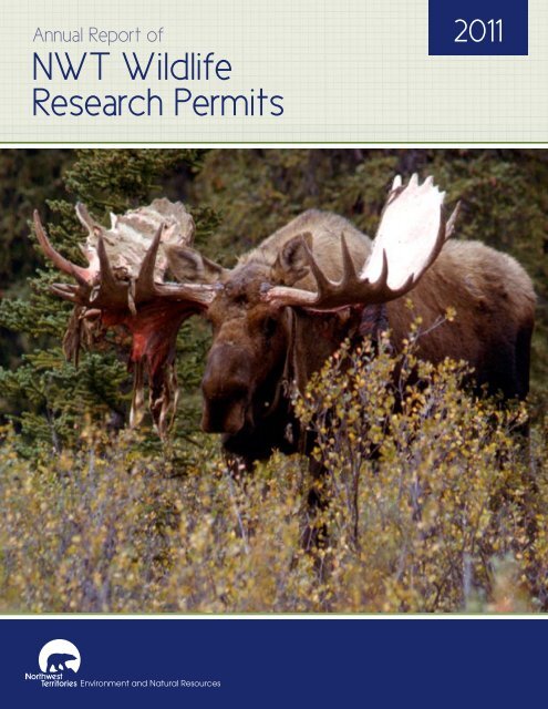
2011 Annual Report of NWT Wildlife Research Permits and Western ...
2011 Annual Report of NWT Wildlife Research Permits and Western ...
2011 Annual Report of NWT Wildlife Research Permits and Western ...

Create successful ePaper yourself
Turn your PDF publications into a flip-book with our unique Google optimized e-Paper software.
<strong>Annual</strong> <strong>Report</strong> <strong>of</strong><br />
<strong>NWT</strong> <strong>Wildlife</strong><br />
<strong>Research</strong> <strong>Permits</strong><br />
<strong>2011</strong>
Cover Photo: N. Larter
Contents<br />
ENR Administrative Regions <strong>of</strong> the <strong>NWT</strong>.. . . . . . . . . . . . . . . . . . . . . . . . . . . . . . . . . . 4<br />
Map <strong>of</strong> the Northwest Territories.. . . . . . . . . . . . . . . . . . . . . . . . . . . . . . . . . . . . . . . . . 5<br />
Introduction.. . . . . . . . . . . . . . . . . . . . . . . . . . . . . . . . . . . . . . . . . . . . . . . . . . . . . . . . . . . . . 7<br />
<strong>Wildlife</strong> Species <strong>Research</strong><br />
Bats.. . . . . . . . . . . . . . . . . . . . . . . . . . . . . . . . . . . . . . . . . . . . . . . . . . . . . . . . . . . . . . . . . . . . . . . . . . . . . . . . . . . 8<br />
Swarming Survey <strong>of</strong> Bats Near Wood Buffalo National Park . . . . . . . . . . . . . . . . . . . . . . . . . . . . . . . . . . . . . . . . . . . . . . . . . . . . . . .8<br />
Bears. . . . . . . . . . . . . . . . . . . . . . . . . . . . . . . . . . . . . . . . . . . . . . . . . . . . . . . . . . . . . . . . . . . . . . . . . . . . . . . . . 10<br />
Movement <strong>and</strong> Habitat Use by Adult Female Polar Bears . . . . . . . . . . . . . . . . . . . . . . . . . . . . . . . . . . . . . . . . . . . . . . . . . . . . . . . .10<br />
Black Bear Ecology in the North Slave Region . . . . . . . . . . . . . . . . . . . . . . . . . . . . . . . . . . . . . . . . . . . . . . . . . . . . . . . . . . . . . . . . . . . 12<br />
Birds.. . . . . . . . . . . . . . . . . . . . . . . . . . . . . . . . . . . . . . . . . . . . . . . . . . . . . . . . . . . . . . . . . . . . . . . . . . . . . . . . . 14<br />
Population Management <strong>of</strong> Geese <strong>and</strong> Swans in the Inuvialuit Settlement Region<br />
Using Aerial Surveys <strong>and</strong> B<strong>and</strong>ing Studies . . . . . . . . . . . . . . . . . . . . . . . . . . . . . . . . . . . . . . . . . . . . . . . . . . . . . . . . . . . . . . . . . . . . . .14<br />
Arctic Shorebird Monitoring Program. . . . . . . . . . . . . . . . . . . . . . . . . . . . . . . . . . . . . . . . . . . . . . . . . . . . . . . . . . . . . . . . . . . . . . . . . . .16<br />
Long-Term Population Monitoring <strong>of</strong> Songbirds at Fort Liard, <strong>NWT</strong> . . . . . . . . . . . . . . . . . . . . . . . . . . . . . . . . . . . . . . . . . . . . . . .18<br />
Cooperative Waterfowl Population Surveys in the Northwest Territories . . . . . . . . . . . . . . . . . . . . . . . . . . . . . . . . . . . . . . . . . 20<br />
Aerial Waterfowl Survey on Banks Isl<strong>and</strong>, Tuktoyaktuk Peninsula,<br />
<strong>and</strong> <strong>Western</strong> Victoria Isl<strong>and</strong>, <strong>2011</strong> . . . . . . . . . . . . . . . . . . . . . . . . . . . . . . . . . . . . . . . . . . . . . . . . . . . . . . . . . . . . . . . . . . . . . . . . . . . . . 22<br />
<strong>Western</strong> Canada Cooperative Duck B<strong>and</strong>ing Program at Willow Lake . . . . . . . . . . . . . . . . . . . . . . . . . . . . . . . . . . . . . . . . . . . . 24<br />
<strong>Western</strong> Canada Cooperative B<strong>and</strong>ing Program . . . . . . . . . . . . . . . . . . . . . . . . . . . . . . . . . . . . . . . . . . . . . . . . . . . . . . . . . . . . . . . . 26<br />
<strong>Western</strong> Canada Cooperative Pre-season Waterfowl B<strong>and</strong>ing Program<br />
Mills Lake Station, <strong>NWT</strong>. . . . . . . . . . . . . . . . . . . . . . . . . . . . . . . . . . . . . . . . . . . . . . . . . . . . . . . . . . . . . . . . . . . . . . . . . . . . . . . . . . . . . . 28<br />
Whooping Crane Ecology <strong>and</strong> Rehabilitation . . . . . . . . . . . . . . . . . . . . . . . . . . . . . . . . . . . . . . . . . . . . . . . . . . . . . . . . . . . . . . . . . . . 30<br />
Latitudinal Variation in Life History Traits <strong>and</strong> Carry-Over Effects <strong>of</strong> Yellow Warblers . . . . . . . . . . . . . . . . . . . . . . . . . . . . . . 34<br />
1
Caribou. . . . . . . . . . . . . . . . . . . . . . . . . . . . . . . . . . . . . . . . . . . . . . . . . . . . . . . . . . . . . . . . . . . . . . . . . . . . . . 36<br />
Late Winter Recruitment <strong>of</strong> the Tuktoyaktuk Peninsula, Cape Bathurst,<br />
<strong>and</strong> Bluenose-West Barren-ground Caribou Herds . . . . . . . . . . . . . . . . . . . . . . . . . . . . . . . . . . . . . . . . . . . . . . . . . . . . . . . . . . . . . 36<br />
Population Monitoring <strong>of</strong> the South Nahanni <strong>and</strong> Coal River Caribou Herds . . . . . . . . . . . . . . . . . . . . . . . . . . . . . . . . . . . . . . 38<br />
Population Parameters, Movements, Distribution, <strong>and</strong> Habitat Use<br />
<strong>of</strong> the Beverly <strong>and</strong> Ahiak Barren-ground Caribou . . . . . . . . . . . . . . . . . . . . . . . . . . . . . . . . . . . . . . . . . . . . . . . . . . . . . . . . . . . . . . . 40<br />
Aerial <strong>and</strong> Ground-based Caribou Surveys <strong>of</strong> the Winter Road . . . . . . . . . . . . . . . . . . . . . . . . . . . . . . . . . . . . . . . . . . . . . . . . . . 44<br />
Bathurst Caribou Health, Condition <strong>and</strong> Contaminant Monitoring . . . . . . . . . . . . . . . . . . . . . . . . . . . . . . . . . . . . . . . . . . . . . . . 46<br />
Continued Monitoring <strong>of</strong> the Bathurst <strong>and</strong> Bluenose-East Caribou Herd . . . . . . . . . . . . . . . . . . . . . . . . . . . . . . . . . . . . . . . . . . 50<br />
Dehcho Boreal Caribou Population Monitoring . . . . . . . . . . . . . . . . . . . . . . . . . . . . . . . . . . . . . . . . . . . . . . . . . . . . . . . . . . . . . . . . . 52<br />
Aerial Surveys <strong>of</strong> the Prairie Creek Mine Access Road for Caribou . . . . . . . . . . . . . . . . . . . . . . . . . . . . . . . . . . . . . . . . . . . . . . . 56<br />
Moose .. . . . . . . . . . . . . . . . . . . . . . . . . . . . . . . . . . . . . . . . . . . . . . . . . . . . . . . . . . . . . . . . . . . . . . . . . . . . . . . 58<br />
Moose Abundance <strong>and</strong> Composition Survey . . . . . . . . . . . . . . . . . . . . . . . . . . . . . . . . . . . . . . . . . . . . . . . . . . . . . . . . . . . . . . . . . . . 58<br />
Monitoring Moose Population in the Dehcho . . . . . . . . . . . . . . . . . . . . . . . . . . . . . . . . . . . . . . . . . . . . . . . . . . . . . . . . . . . . . . . . . . 60<br />
Geospatial Moose Surveys in the Dehcho . . . . . . . . . . . . . . . . . . . . . . . . . . . . . . . . . . . . . . . . . . . . . . . . . . . . . . . . . . . . . . . . . . . . . . 62<br />
Moose Baseline Health Study in the South Slave Region . . . . . . . . . . . . . . . . . . . . . . . . . . . . . . . . . . . . . . . . . . . . . . . . . . . . . . . . 64<br />
Moose Population Survey in the Slave River Area (Fort Smith <strong>and</strong> Fort Resolution Areas) . . . . . . . . . . . . . . . . . . . . . . . . . . 66<br />
Wolverine.. . . . . . . . . . . . . . . . . . . . . . . . . . . . . . . . . . . . . . . . . . . . . . . . . . . . . . . . . . . . . . . . . . . . . . . . . . . 68<br />
Wolverine DNA Sampling on the Central Barrens . . . . . . . . . . . . . . . . . . . . . . . . . . . . . . . . . . . . . . . . . . . . . . . . . . . . . . . . . . . . . . 68<br />
Wolves .. . . . . . . . . . . . . . . . . . . . . . . . . . . . . . . . . . . . . . . . . . . . . . . . . . . . . . . . . . . . . . . . . . . . . . . . . . . . . . 70<br />
Index <strong>of</strong> Abundance for Tundra-Denning Wolves . . . . . . . . . . . . . . . . . . . . . . . . . . . . . . . . . . . . . . . . . . . . . . . . . . . . . . . . . . . . . . . 70<br />
Wood Bison.. . . . . . . . . . . . . . . . . . . . . . . . . . . . . . . . . . . . . . . . . . . . . . . . . . . . . . . . . . . . . . . . . . . . . . . . . 72<br />
Monitoring the Nahanni Wood Bison Population . . . . . . . . . . . . . . . . . . . . . . . . . . . . . . . . . . . . . . . . . . . . . . . . . . . . . . . . . . . . . . . 72<br />
Nahanni Wood Bison Population Survey . . . . . . . . . . . . . . . . . . . . . . . . . . . . . . . . . . . . . . . . . . . . . . . . . . . . . . . . . . . . . . . . . . . . . . . 76<br />
2 <strong>2011</strong> <strong>Annual</strong> <strong>Report</strong> <strong>of</strong> <strong>NWT</strong> <strong>Wildlife</strong> <strong>Research</strong> <strong>Permits</strong>
<strong>Wildlife</strong> Health. . . . . . . . . . . . . . . . . . . . . . . . . . . . . . . . . . . . . . . . . . . . . . . . . . . . . . . . . . 78<br />
<strong>Wildlife</strong> Health <strong>and</strong> Genetic Monitoring . . . . . . . . . . . . . . . . . . . . . . . . . . . . . . . . . . . . . . . . . . . . . . . . . . . . . . . . . . . . . . . . . . . . . . . 78<br />
Community-based Monitoring <strong>of</strong> <strong>Wildlife</strong> Health . . . . . . . . . . . . . . . . . . . . . . . . . . . . . . . . . . . . . . . . . . . . . . . . . . . . . . . . . . . . . . 82<br />
<strong>Wildlife</strong> <strong>and</strong> Habitat Monitoring.. . . . . . . . . . . . . . . . . . . . . . . . . . . . . . . . . . . . . . . . . 86<br />
Small Mammal <strong>and</strong> Hare Surveys . . . . . . . . . . . . . . . . . . . . . . . . . . . . . . . . . . . . . . . . . . . . . . . . . . . . . . . . . . . . . . . . . . . . . . . . . . . . . 86<br />
Protected Areas . . . . . . . . . . . . . . . . . . . . . . . . . . . . . . . . . . . . . . . . . . . . . . . . . . . . . . . 90<br />
Marsh Bird Surveys in Kwets’ootłàà C<strong>and</strong>idate Area . . . . . . . . . . . . . . . . . . . . . . . . . . . . . . . . . . . . . . . . . . . . . . . . . . . . . . . . . . . . 90<br />
Avian Species at Risk Surveys <strong>and</strong> Nest Searches<br />
in the Ka’a’gee Tu C<strong>and</strong>idate Protected Area . . . . . . . . . . . . . . . . . . . . . . . . . . . . . . . . . . . . . . . . . . . . . . . . . . . . . . . . . . . . . . . . . . . 92<br />
Ecological Regions (ecosystem classification) <strong>of</strong> the Northwest Territories Arctic Isl<strong>and</strong>s . . . . . . . . . . . . . . . . . . . . . . . . . . 94<br />
<strong>Research</strong> Related to Development.. . . . . . . . . . . . . . . . . . . . . . . . . . . . . . . . . . . . . . 96<br />
Darnley Bay Resources Ltd. 2010-2013 Field Program: Pre-Activity Nest Surveys . . . . . . . . . . . . . . . . . . . . . . . . . . . . . . . . . 96<br />
Monitoring <strong>Wildlife</strong> along Enbridge Right <strong>of</strong> Way . . . . . . . . . . . . . . . . . . . . . . . . . . . . . . . . . . . . . . . . . . . . . . . . . . . . . . . . . . . . . . . 98<br />
<strong>Wildlife</strong> Effects Monitoring Program . . . . . . . . . . . . . . . . . . . . . . . . . . . . . . . . . . . . . . . . . . . . . . . . . . . . . . . . . . . . . . . . . . . . . . . . . . 100<br />
<strong>Wildlife</strong> Monitoring Program for the Diavik Diamond Mine. . . . . . . . . . . . . . . . . . . . . . . . . . . . . . . . . . . . . . . . . . . . . . . . . . . . . 108<br />
Courageous Lake Project Baseline Program . . . . . . . . . . . . . . . . . . . . . . . . . . . . . . . . . . . . . . . . . . . . . . . . . . . . . . . . . . . . . . . . . . . . 110<br />
Baseline <strong>Wildlife</strong> Studies: Gahcho Kue Project . . . . . . . . . . . . . . . . . . . . . . . . . . . . . . . . . . . . . . . . . . . . . . . . . . . . . . . . . . . . . . . . . . 112<br />
Baseline <strong>Wildlife</strong> Studies for the Fortune Minerals NICO Project . . . . . . . . . . . . . . . . . . . . . . . . . . . . . . . . . . . . . . . . . . . . . . . . . 114<br />
<strong>Wildlife</strong> Effects Monitoring Program (WEMP) Snap Lake Study Area . . . . . . . . . . . . . . . . . . . . . . . . . . . . . . . . . . . . . . . . . . . . 116<br />
Chemicals Management Plan <strong>Wildlife</strong> National Monitoring Program . . . . . . . . . . . . . . . . . . . . . . . . . . . . . . . . . . . . . . . . . . . . 118<br />
INDEX . . . . . . . . . . . . . . . . . . . . . . . . . . . . . . . . . . . . . . . . . . . . . . . . . . . . . . . . . . . . . . . . . 120<br />
3
Department <strong>of</strong> Environment<br />
<strong>and</strong> Natural Resources<br />
Administrative Regions<br />
InuvikSachs Harbour<br />
!<br />
Aulavik<br />
!<br />
Tuktoyaktuk<br />
!<br />
Ulukhaktok<br />
Aklavik<br />
! !<br />
Inuvik<br />
!<br />
Paulatuk<br />
!<br />
Fort McPherson<br />
!<br />
Tsiigehtchic<br />
Tuktut Nogait<br />
!<br />
!<br />
!<br />
!<br />
Tulita<br />
Colville Lake<br />
Fort Good Hope<br />
Sahtu<br />
Norman Wells<br />
!<br />
Délîne<br />
Produced by the<br />
<strong>NWT</strong> Centre for Geomatics<br />
August 3, <strong>2011</strong><br />
Centre for Geomatics<br />
Nahanni<br />
!<br />
!<br />
!<br />
Wrigley<br />
Dehcho<br />
Nahanni Butte<br />
Fort Liard<br />
!<br />
!<br />
Fort Simpson<br />
!<br />
Trout Lake<br />
Jean Marie River<br />
!<br />
!<br />
!<br />
!<br />
Kakisa<br />
Gamètì<br />
Whatì<br />
Fort Providence<br />
Hay River Dene Reserve<br />
!<br />
!<br />
!<br />
Behchokõ<br />
Hay River<br />
Enterprise<br />
Wekweètì<br />
!<br />
North Slave<br />
!<br />
Detah<br />
Ndilo<br />
Yellowknife<br />
!<br />
Wood Buffalo<br />
!<br />
!<br />
Fort Smith<br />
Åutselk`e<br />
South Slave<br />
Fort Resolution<br />
4 <strong>2011</strong> <strong>Annual</strong> <strong>Report</strong> <strong>of</strong> <strong>NWT</strong> <strong>Wildlife</strong> <strong>Research</strong> <strong>Permits</strong>
6<br />
Photo: B Ossenburg
<strong>2011</strong>-2012<br />
<strong>Wildlife</strong> <strong>Research</strong> <strong>Permits</strong><br />
Under the <strong>Wildlife</strong> Act (section 24), a valid <strong>Wildlife</strong> <strong>Research</strong> Permit is required to study wildlife or wildlife habitat in the<br />
Northwest Territories (<strong>NWT</strong>). It is an <strong>of</strong>fence to conduct a survey or census <strong>of</strong> wildlife or wildlife behaviour, administer<br />
drugs, collect or purchase specimens, or carry out any scientific research relating to wildlife without a permit.<br />
The Department <strong>of</strong> Environment <strong>and</strong> Natural Resources (ENR) is responsible for issuing <strong>Wildlife</strong> <strong>Research</strong> <strong>Permits</strong>. Each<br />
year, researchers carry out studies on all types <strong>of</strong> wildlife <strong>and</strong> wildlife habitat, throughout the <strong>NWT</strong>. As a requirement <strong>of</strong> an<br />
<strong>NWT</strong> <strong>Wildlife</strong> <strong>Research</strong> Permit, researchers must submit a summary report <strong>of</strong> their activities <strong>and</strong> findings to ENR. These<br />
summary reports are published each year in an annual report.<br />
This publication provides summary reports for the wildlife research carried out during <strong>2011</strong>. Contact information for the<br />
main investigator leading each project has been included if you wish to obtain more information on a specific project. For<br />
more information on <strong>Wildlife</strong> <strong>Research</strong> <strong>Permits</strong>, please go to www.enr.gov.nt.ca or contact your local Environment <strong>and</strong><br />
Natural Resources <strong>of</strong>fice.<br />
The contents <strong>of</strong> each summary are the sole responsibility <strong>of</strong> the team leads for each project <strong>and</strong> do not reflect any <strong>of</strong>ficial<br />
policy <strong>of</strong> ENR or the Government <strong>of</strong> the Northwest Territories (G<strong>NWT</strong>).<br />
7
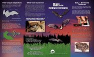
Swarming Survey <strong>of</strong> Bats<br />
Near Wood Buffalo National Park<br />
September 2010 to March <strong>2011</strong><br />
Main Investigator:<br />
Dr. Cori Lausen, Independent <strong>Research</strong> Biologist,<br />
Bat Specialist<br />
<strong>Wildlife</strong> <strong>Research</strong> Permit Number:<br />
WL004812<br />
LOCATION:<br />
The study took place in the Fort Smith area, around<br />
Wood Buffalo National Park (South Slave Region).<br />
PARTNERS:<br />
´ ´ Parks Canada<br />
´ ´ Environment <strong>and</strong> Natural Resources (G<strong>NWT</strong>)<br />
´ ´ Birchdale Ecological Ltd.<br />
CONTACT:<br />
Dr. Cori Lausen<br />
Independent <strong>Research</strong> Biologist, Bat Specialist<br />
IRDF <strong>Research</strong> Fellow,<br />
<strong>Wildlife</strong> Conservation Society Canada<br />
PO Box 606<br />
Kaslo, BC V0G 1M0<br />
(P) 250-353-7339<br />
(E) info@batsRus.ca<br />
RATIONALE:<br />
Little is known about bat diversity in the Northwest<br />
Territories (<strong>NWT</strong>). One <strong>of</strong> the four main bat hibernacula<br />
known in Alberta is in Wood Buffalo National Park<br />
(WBNP). It was thus hypothesized that bats also hibernate<br />
in <strong>NWT</strong> areas around WBNP.<br />
OBJECTIVES:<br />
´ ´ To locate bat hibernacula; <strong>and</strong><br />
´ ´ To determine what species <strong>of</strong> bats are still present<br />
in <strong>NWT</strong> in mid-September, during the mating period<br />
just prior to hibernation.<br />
METHODS:<br />
We used information from local residents regarding<br />
potential bat hibernacula in caves, <strong>and</strong> investigated these<br />
areas. Using mist nets for bats captured, <strong>and</strong> bat detectors<br />
to record ultrasounds we inventoried the general area<br />
to determine species diversity at this time <strong>of</strong> year.<br />
RESULTS AND MAIN CONCLUSIONS:<br />
We determined that there are three species <strong>of</strong> bats that<br />
overwinter in this region <strong>of</strong> the <strong>NWT</strong>: big brown bat<br />
(Eptesicus fuscus), little brown myotis (Myotis<br />
lucifugus), <strong>and</strong> northern myotis (Myotis septentrionalis).<br />
We located one major hibernaculum, containing<br />
approximately 3,000 individuals (almost exclusively<br />
males). Captures in the vicinity <strong>of</strong> this cave were <strong>of</strong> all<br />
three species, but internal observation was only <strong>of</strong> little<br />
brown myotis. There are many fissures inside this cave<br />
that could be used by big brown bats <strong>and</strong> northern<br />
myotis, <strong>and</strong> thus these species may also be hibernating in<br />
this cave, but they were not visible.<br />
The bat hibernaculum located during the study<br />
is the largest bat hibernaculum currently known<br />
in western Canada.<br />
8 <strong>2011</strong> <strong>Annual</strong> <strong>Report</strong> <strong>of</strong> <strong>NWT</strong> <strong>Wildlife</strong> <strong>Research</strong> <strong>Permits</strong>
<strong>Wildlife</strong> Species <strong>Research</strong>:<br />
Bats<br />
LONG-TERM PLANS .<br />
AND RECOMMENDATIONS:<br />
The following recommendations are made regarding<br />
the South Slave Region <strong>and</strong> the surrounding WBNP area:<br />
Acoustic monitoring year-round along Highway 5 in<br />
WBNP to determine if this highway is a migration route<br />
for bats in the spring <strong>and</strong>/or fall. Simultaneous monitoring<br />
along the Slave <strong>and</strong> Peace Rivers may also illustrate<br />
patterns <strong>of</strong> bat migration especially that <strong>of</strong> the<br />
tree-roosting bats (hoary, red <strong>and</strong> silver-haired) that are<br />
likely to move out <strong>of</strong> the area by late summer.<br />
Summer bat surveys (acoustic <strong>and</strong> capture). It would<br />
be especially interesting to determine whether big brown<br />
bats reside in the area during summer given its absence<br />
from the Fort McMurray / Fort McKay areas to the south<br />
<strong>of</strong> WBNP.<br />
Monitoring <strong>of</strong> the hibernacula described in this survey,<br />
including regular annual or biennial inspections (counts<br />
<strong>and</strong> checking for signs <strong>of</strong> White-Nose Syndrome).<br />
Acoustic monitoring year-round would be informative<br />
to underst<strong>and</strong> patterns <strong>of</strong> use. Periodic mist netting<br />
would allow for patterns <strong>of</strong> use by species <strong>and</strong> sex to be<br />
known. Continuous population estimates will be needed<br />
to monitor this hibernaculum as White-Nose Syndrome<br />
moves west; this disease has proven to be especially<br />
devastating to little brown myotis <strong>and</strong> northern myotis<br />
populations in eastern North America.<br />
Monitoring <strong>of</strong> microclimate (temperature <strong>and</strong> relative<br />
humidity) in both cave hibernacula, for comparison with<br />
each other <strong>and</strong> with future hibernacula, or to use in<br />
predicting use <strong>of</strong> other sinkholes/caves by hibernating bats.<br />
Radio tracking in early fall to locate new hibernacula.<br />
Big brown bats are larger <strong>and</strong> can therefore carry larger<br />
transmitters, which last longer <strong>and</strong> are stronger, therefore<br />
more likely to be detected from airplane. This may lead<br />
to finding mixed species hibernacula.<br />
Locate local Myotis lucifugus maternity colonies. This<br />
will provide opportunity to radio track adult females at<br />
the end <strong>of</strong> the summer to potentially locate hibernacula;<br />
this may facilitate an underst<strong>and</strong>ing <strong>of</strong> the male bias in<br />
the hibernacula <strong>and</strong> mist net captures during this study.<br />
Exploration <strong>and</strong> late summer investigation <strong>of</strong> sinkholes<br />
known by local people, such as in the Lobstick Creek area.<br />
COMMUNITY INVOLVEMENT:<br />
Following the inventory work, I made a public presentation<br />
about bats including the findings from this survey at the<br />
Parks Canada <strong>of</strong>fice in Fort Smith, <strong>NWT</strong>.<br />
Little brown bat.<br />
Photo: C. Lausen<br />
9
Movement <strong>and</strong> Habitat Use<br />
by Adult Female Polar Bears<br />
April 18, <strong>2011</strong> to July 1, <strong>2011</strong><br />
Main Investigator:<br />
Andrew E. Derocher, Pr<strong>of</strong>essor,<br />
University <strong>of</strong> Alberta<br />
<strong>Wildlife</strong> <strong>Research</strong> Permit Number:<br />
WL007425<br />
LOCATION:<br />
Southern Beaufort Sea, from Herschel Isl<strong>and</strong><br />
to Baillie Isl<strong>and</strong>s, <strong>NWT</strong>.<br />
CONTACT:<br />
Andrew E. Derocher, Ph. D. Pr<strong>of</strong>essor<br />
Department <strong>of</strong> Biological Sciences<br />
University <strong>of</strong> Alberta<br />
T6G 2E9<br />
(P) 780-492-5570<br />
(F) 780-492-9234<br />
(E) derocher@ualberta.ca<br />
RATIONALE:<br />
The study provides information on habitat use patterns,<br />
movement rates, identification <strong>of</strong> den sites, <strong>and</strong><br />
population boundaries. The study aims to fill data needs<br />
for the analysis <strong>of</strong> oil-spill / polar bear models.<br />
Information from this study will also be used in<br />
environmental impact assessments <strong>and</strong> in reviewing<br />
oil-industry plans for exploration, development, <strong>and</strong><br />
transportation in the Beaufort Sea.<br />
OBJECTIVES:<br />
´ ´ To deploy GPS satellite collars on adult<br />
female polar bears;<br />
´ ´ To analyze population movements <strong>and</strong> responses<br />
to the changing sea ice;<br />
´ ´ To determine habitat preferences <strong>and</strong><br />
seasonal distribution;<br />
´ ´ To test existing population boundaries with<br />
new movement data;<br />
´ ´ To use the data to assess the use <strong>of</strong> the <strong>of</strong>fshore<br />
oil <strong>and</strong> gas development areas by polar bears;<br />
´ ´ To develop an oil spill-polar bear movement model<br />
to determine how many bears could be affected<br />
by oil spills <strong>of</strong> different size <strong>and</strong> duration; <strong>and</strong><br />
´ ´ To collect samples from seals killed by polar bears<br />
to monitor diet <strong>and</strong> polar bear hunting areas.<br />
METHODS:<br />
Capture will occur in the spring (April–May). As necessary,<br />
<strong>and</strong> within logistic <strong>and</strong> financial limitations, bears will be<br />
recaptured <strong>and</strong> re-instrumented to monitor individual<br />
bears over longer periods. The research area will be on<br />
the Canadian side <strong>of</strong> the Beaufort Sea between Herschel<br />
Isl<strong>and</strong>, YT, Tuktoyaktuk <strong>and</strong> Baillie Isl<strong>and</strong>s, <strong>NWT</strong>. Efforts<br />
will be made to search <strong>and</strong> capture bears on the north side<br />
<strong>of</strong> the shore lead away from hunters. All data will be<br />
shared with the Government <strong>of</strong> the Northwest Territories<br />
10 <strong>2011</strong> <strong>Annual</strong> <strong>Report</strong> <strong>of</strong> <strong>NWT</strong> <strong>Wildlife</strong> <strong>Research</strong> <strong>Permits</strong>
<strong>Wildlife</strong> Species <strong>Research</strong>:<br />
Bears<br />
<strong>and</strong> all capture data will be stored with the Canadian<br />
<strong>Wildlife</strong> Service (CWS) <strong>and</strong> will be integrated into the<br />
National Polar Bear Database maintained in Edmonton<br />
by CWS.<br />
RESULTS AND MAIN CONCLUSIONS:<br />
No results <strong>and</strong> main conclusions submitted.<br />
Taking measurements <strong>of</strong> a<br />
tranquilized polar bear cub.<br />
LONG-TERM PLANS .<br />
AND RECOMMENDATIONS:<br />
No long-term plans <strong>and</strong><br />
recommendations submitted.<br />
Photo: A.E.Derocher<br />
Photo: A.E.Derocher<br />
Sea Ice near Tuktoyaktuk .<br />
11
Black Bear Ecology<br />
in the North Slave Region<br />
May 1, <strong>2011</strong> to October 30, <strong>2011</strong><br />
Main Investigator:<br />
Dean Cluff, Regional Biologist,<br />
Environment <strong>and</strong> Natural Resources,<br />
G<strong>NWT</strong>, North Slave Region<br />
<strong>Wildlife</strong> <strong>Research</strong> Permit Number:<br />
WL006883<br />
LOCATION:<br />
The study area will be the North Slave Region, with<br />
focus on black bears in bear baiting station areas<br />
along Highway 3, south <strong>of</strong> Behchokò˛, <strong>NWT</strong>.<br />
If additional collars are available, bears around<br />
Yellowknife, <strong>NWT</strong> <strong>and</strong> the Ingraham Trail<br />
(Highway 4) will also be monitored.<br />
CONTACT:<br />
Dean Cluff, Regional Biologist<br />
Environment <strong>and</strong> Natural Resources<br />
PO Box 2668<br />
Yellowknife, NT X1A 2P9<br />
(P) 867-873-7783<br />
(F) 867-873-0403<br />
(E) dean_cluff@gov.nt.ca<br />
RATIONALE:<br />
The North Slave Region (NSR) has used a considerable<br />
amount <strong>of</strong> staff <strong>and</strong> equipment resources over the past<br />
fifteen years responding to potential conflict situations<br />
between people <strong>and</strong> bears with little information gained.<br />
Also no studies <strong>of</strong> black bears (Ursus americanus) in the<br />
North Slave Region (NSR) have been done, therefore very<br />
little information is known about these bears in the<br />
northernmost part <strong>of</strong> their range. This lack <strong>of</strong> information<br />
was a limiting factor in assessing the impact <strong>of</strong> an<br />
outfitter’s recent proposal to bait black bears. Concern<br />
has been expressed that baits will habituate these bears to<br />
people <strong>and</strong> create conflicts. Whether baiting bears creates<br />
additional conflict situations with people is unknown.<br />
OBJECTIVES:<br />
´ ´ To document the movements <strong>and</strong> range sizes <strong>of</strong><br />
black bears in a sample <strong>of</strong> the northern boreal forest;<br />
´ ´ To identify den site locations <strong>and</strong> their fidelity;<br />
´ ´ To document movements <strong>and</strong> behaviour <strong>of</strong> black<br />
bears around highways <strong>and</strong> food attractants;<br />
´ ´ To describe movement behaviour <strong>of</strong> bears that return<br />
after being relocated versus those that did not; <strong>and</strong><br />
´ ´ To provide management recommendations for<br />
re-locating bears in the NSR.<br />
METHODS:<br />
Black bears will be captured beginning in early May <strong>2011</strong><br />
primarily along Highway 3, but near Yellowknife <strong>and</strong><br />
Behchokò˛ as opportunities permit. Captures will be<br />
primarily by culvert traps or remote dart injection, but leg<br />
snares may also be used as the situation warrants. Both<br />
solitary bears <strong>and</strong> family groups will be targeted. Once<br />
chemically immobilized, all bears will be ear tagged <strong>and</strong><br />
lip tattooed.<br />
Adult bears captured will be collared with a GPS /<br />
Iridium radio collar to allow their movements to be<br />
12 <strong>2011</strong> <strong>Annual</strong> <strong>Report</strong> <strong>of</strong> <strong>NWT</strong> <strong>Wildlife</strong> <strong>Research</strong> <strong>Permits</strong>
<strong>Wildlife</strong> Species <strong>Research</strong>:<br />
Bears<br />
tracked intensively (1 GPS location / 30 minutes) for two<br />
years. These duty cycles will allow the mapping <strong>of</strong> detailed<br />
movements for monitored bears.<br />
Bears captured in response to managing conflict<br />
situations may also be collared <strong>and</strong> relocated.<br />
Relocation sites may be areas accessed by vehicle along<br />
Highway 3 <strong>and</strong> away from people, or more remote areas<br />
if a helicopter is available.<br />
Tracking<br />
GPS collars obtain locations with a resolution <strong>of</strong> about<br />
two to five meters. The GPS / Iridium collar will obtain<br />
a GPS location every 30 minutes. Location data will<br />
be transmitted daily to the Iridium satellite system after<br />
every 20 locations <strong>and</strong> emailed to the Project Leader.<br />
Data Analysis<br />
Black bear locations will be mapped with ArcGIS. Range<br />
use will be estimated with the fixed kernel method <strong>and</strong><br />
other movement analysis methods. Analysis <strong>of</strong> movement<br />
patterns will include locations <strong>of</strong> all known bear<br />
baiting stations <strong>and</strong> other attractants. Individual<br />
based movement modeling will also be completed.<br />
RESULTS AND MAIN CONCLUSION:<br />
Three GPS collars were deployed on black bears in <strong>2011</strong><br />
in collaboration with wildlife <strong>of</strong>ficers. Data collection<br />
is continuing.<br />
LONG-TERM PLANS .<br />
AND RECOMMENDATIONS:<br />
Continue project in 2012.<br />
COMMUNITY INVOLVEMENT:<br />
<strong>Wildlife</strong> <strong>of</strong>ficers, Environment <strong>and</strong> Natural Resources<br />
<strong>and</strong> cabin owners along Highways 3 <strong>and</strong> 4.<br />
Black bear near Highway 4.<br />
Photo: M. Jackson<br />
13
Population Management <strong>of</strong> Geese <strong>and</strong> Swans<br />
in the Inuvialuit Settlement Region Using Aerial<br />
Surveys <strong>and</strong> B<strong>and</strong>ing Studies<br />
Summer <strong>2011</strong><br />
Main Investigator:<br />
Myra Robertson, Waterfowl Population Biologist<br />
for the <strong>Western</strong> Arctic,<br />
Canadian <strong>Wildlife</strong> Service<br />
<strong>Wildlife</strong> <strong>Research</strong> Permit Number:<br />
WL005405<br />
LOCATION:<br />
Since 1989, the Canadian <strong>Wildlife</strong> Service (CWS)<br />
has conducted aerial surveys <strong>and</strong> b<strong>and</strong>ed geese<br />
throughout the Inuvialuit Settlement Region (ISR)<br />
to monitor the abundance <strong>and</strong> productivity <strong>of</strong><br />
geese <strong>and</strong> swans in the area. Goose b<strong>and</strong>ing<br />
operations took place at known moulting areas<br />
(where previous b<strong>and</strong>ing occurred) at the<br />
Mackenzie Delta, Tuktoyaktuk Peninsula <strong>and</strong><br />
Anderson River on the mainl<strong>and</strong> <strong>of</strong> the ISR.<br />
PARTNERS:<br />
´ ´ <strong>Wildlife</strong> Management Advisory Council<br />
(<strong>NWT</strong>)<br />
´ ´ Polar Continental Shelf Project<br />
´ ´ United States Fish <strong>and</strong> <strong>Wildlife</strong> Service<br />
´ ´ Arctic Goose Joint Venture<br />
CONTACTS:<br />
Canadian <strong>Wildlife</strong> Service<br />
PO Box 2310<br />
Yellowknife, NT X1A 2P7<br />
Myra Robertson, Waterfowl Population Biologist<br />
Canadian <strong>Wildlife</strong> Service<br />
(P) 867-669-4763<br />
Cindy Wood, <strong>Wildlife</strong> Biologist<br />
Canadian <strong>Wildlife</strong> Service<br />
(P) 867-669-4786<br />
RATIONALE:<br />
The ISR <strong>of</strong> the western Canadian Arctic is an important<br />
breeding <strong>and</strong> moulting area for greater white-fronted<br />
goose, Canada goose, lesser snow goose, brant, tundra<br />
swan, <strong>and</strong> several other species <strong>of</strong> waterfowl. Information<br />
on bird numbers, distribution, habitat requirements,<br />
survival, <strong>and</strong> productivity is needed to determine if current<br />
local <strong>and</strong> international harvest levels are sustainable <strong>and</strong><br />
to ensure that populations are conserved for the long-term<br />
use by the Inuvialuit <strong>and</strong> others. This information is also<br />
timely for establishing baseline population information<br />
for areas <strong>of</strong> potential oil <strong>and</strong> gas development in the<br />
Mackenzie Delta.<br />
OBJECTIVES:<br />
´ ´ To monitor waterfowl populations in the ISR;<br />
´ ´ To evaluate the effect <strong>of</strong> harvest <strong>and</strong> other stressors<br />
on western Arctic populations <strong>of</strong> waterfowl; <strong>and</strong><br />
´ ´ To monitor migration routes, harvest rates, <strong>and</strong><br />
survival rates <strong>of</strong> the ISR mainl<strong>and</strong> goose populations.<br />
METHODS:<br />
In July, flightless adult <strong>and</strong> young geese are captured using<br />
a helicopter to drive the geese into a netted enclosure, <strong>and</strong><br />
b<strong>and</strong>ed with individually numbered metal leg b<strong>and</strong>s.<br />
Information about b<strong>and</strong>ed birds submitted by hunters<br />
helps determine the migration routes, seasonal<br />
distributions, survival, <strong>and</strong> harvest rates for these birds.<br />
RESULTS AND MAIN CONCLUSIONS:<br />
Helicopter surveys at the Kendall Isl<strong>and</strong> <strong>and</strong> Anderson<br />
River snow goose colonies are conducted at three year<br />
intervals to determine the colony size at each location<br />
as long as the total number <strong>of</strong> adults remains above<br />
a set threshold. A decrease in the number <strong>of</strong> adults would<br />
warrant possible further management actions. Although<br />
the next set <strong>of</strong> surveys at both colonies is scheduled to<br />
be carried out in 2012, a survey was flown over Anderson<br />
14 <strong>2011</strong> <strong>Annual</strong> <strong>Report</strong> <strong>of</strong> <strong>NWT</strong> <strong>Wildlife</strong> <strong>Research</strong> <strong>Permits</strong>
<strong>Wildlife</strong> Species <strong>Research</strong>:<br />
Birds<br />
River colony this year because a helicopter <strong>and</strong> crew were<br />
already in the area b<strong>and</strong>ing geese. <strong>2011</strong> was relatively<br />
productive as many family groups <strong>of</strong> snow geese were<br />
seen, with a minimum estimate <strong>of</strong> 2,563 adults <strong>and</strong> 1,867<br />
young counted in the area.<br />
In July <strong>2011</strong>, 1,343 white-fronted geese <strong>and</strong> one whitefronted<br />
/ snow goose hybrid were b<strong>and</strong>ed at the<br />
Mackenzie Delta, Tuktoyaktuk Peninsula <strong>and</strong> Anderson<br />
River. In addition, we recaptured 35 white-fronted geese<br />
that were b<strong>and</strong>ed in previous years.<br />
B<strong>and</strong> recoveries from our b<strong>and</strong>ing efforts show there has<br />
been an eastward shift in the winter distributions <strong>of</strong><br />
white-fronted geese from the western Arctic compared<br />
to historical data. A higher proportion <strong>of</strong> geese were<br />
recovered in Louisiana <strong>and</strong> the Mississippi Alluvial Valley<br />
in Arkansas in recent years.<br />
<strong>Annual</strong> summary reports are sent to regional contacts<br />
with our wildlife research permit applications.<br />
LONG-TERM PLANS AND<br />
RECOMMENDATIONS:<br />
The Canadian <strong>Wildlife</strong> Service (CWS) is currently<br />
undergoing a review <strong>of</strong> all bird monitoring programs in<br />
order to improve them. The results <strong>of</strong> the review will shape<br />
future monitoring activities for waterfowl populations in<br />
the western Arctic. Pending review results, future plans are<br />
to continue b<strong>and</strong>ing white-fronted geese <strong>and</strong> Canada /<br />
cackling geese on the ISR mainl<strong>and</strong> in 2012. This data will<br />
improve our underst<strong>and</strong>ing <strong>of</strong> survival rates <strong>and</strong><br />
movement <strong>of</strong> waterfowl from the ISR region to staging<br />
<strong>and</strong> wintering areas in the south. Our data has been,<br />
<strong>and</strong> continues to be an important reference as interest<br />
in developing natural resources in the Mackenzie Delta<br />
region grows.<br />
COMMUNITY INVOLVEMENT:<br />
CWS has reviewed all concerns <strong>and</strong> comments provided<br />
by the communities <strong>and</strong> discussed solutions directly with<br />
them. The main concern received by the communities was<br />
the opportunity for local hiring. The b<strong>and</strong>ing operations<br />
rely on transportation by helicopter <strong>and</strong> weight is<br />
restricted. This limits the number <strong>of</strong> passengers, b<strong>and</strong>ing<br />
gear <strong>and</strong> fuel that can be carried at one time as well as<br />
distance travelled before refueling. As such, opportunities<br />
for local participation are limited. In <strong>2011</strong>, we were once<br />
again able to hire Kayla Nuyaviak, a local student from<br />
Tuktoyaktuk to help with b<strong>and</strong>ing.<br />
Ducks soon to be b<strong>and</strong>ed.<br />
Photo: Canadian <strong>Wildlife</strong> Serivce<br />
15
Arctic Shorebird<br />
Monitoring Program<br />
June <strong>2011</strong> to July <strong>2011</strong><br />
Main Investigator:<br />
Canadian <strong>Wildlife</strong> Service, Environment Canada<br />
<strong>Wildlife</strong> <strong>Research</strong> Permit Number:<br />
WL005402<br />
LOCATION:<br />
<strong>Research</strong> was conducted in the Mackenzie Delta,<br />
Northwest Territories by a five person survey crew.<br />
A temporary tent camp was stationed at Taglu<br />
Tower on Fish Isl<strong>and</strong> in the outer Mackenzie Delta<br />
from June 4, <strong>2011</strong> to July 12, <strong>2011</strong>. This camp<br />
conducted shorebird monitoring inside the Kendall<br />
Isl<strong>and</strong> Bird Sanctuary (KIBS) <strong>and</strong> on Fish Isl<strong>and</strong>.<br />
Shorebird monitoring included but was not limited<br />
to intensive ground surveys, nest monitoring,<br />
b<strong>and</strong>ing shorebirds <strong>and</strong> collected genetic samples.<br />
PARTNERS:<br />
´ ´ Canadian <strong>Wildlife</strong> Service (CWS)<br />
´ ´ Program for Regional <strong>and</strong> International<br />
Shorebird Monitoring (PRISM)<br />
´ ´ Cumulative Impacts Monitoring Program,<br />
Indian <strong>and</strong> Northern Affairs Canada<br />
´ ´ Manomet Centre for Conservation Science<br />
CONTACT:<br />
Jennie Rausch, Shorebird Biologist<br />
Canadian <strong>Wildlife</strong> Service<br />
PO Box 2310<br />
Yellowknife, NT X1A 2P7<br />
(P) 867-669-4709<br />
(F) 867-873-6776<br />
(E) jennie.rausch@ec.gc.ca<br />
RATIONALE:<br />
Arctic breeding shorebird populations continue to decline.<br />
Underst<strong>and</strong>ing shorebird dynamics (i.e. nest success, chick<br />
survival rates, adult survival, breeding site fidelity <strong>and</strong><br />
population age structure) on the breeding sites <strong>and</strong><br />
collection <strong>of</strong> genetic samples may help us determine<br />
why these declines are occurring.<br />
This year was our second year working in cooperation<br />
with <strong>and</strong> instituting the protocols <strong>of</strong> the Arctic Shorebird<br />
Demographic Network (ASDN). ASDN is a North<br />
American working group that is working to determine<br />
what factors are limiting the populations <strong>of</strong> Arctic<br />
nesting shorebirds <strong>and</strong> contributing to declines<br />
in shorebird number.<br />
OBJECTIVES:<br />
´ ´ To collect demographic data on Arctic breeding<br />
shorebirds <strong>and</strong> document patterns <strong>of</strong> species<br />
presence <strong>and</strong> abundance;<br />
´ ´ To gather genetic information on shorebirds that<br />
can be used to determine migration patterns; <strong>and</strong><br />
´ ´ To collect data on local weather <strong>and</strong> snow conditions,<br />
timing <strong>of</strong> insect emergence, <strong>and</strong> other variables that<br />
will help determine the impact <strong>of</strong> climate change on<br />
shorebird breeding ecology.<br />
METHODS:<br />
We intensively surveyed five plots in shorebird breeding<br />
habitat on Taglu, Fish <strong>and</strong> Niglintgak Isl<strong>and</strong>s for shorebird<br />
nests <strong>and</strong> described the nest habitat. Additional habitat<br />
was surveyed along the coastline <strong>of</strong> KIBS. Nests were<br />
monitored every five days until hatch to determine fate.<br />
We b<strong>and</strong>ed adult <strong>and</strong> juvenile individuals <strong>of</strong> semipalmated<br />
s<strong>and</strong>pipers, pectoral s<strong>and</strong>pipers, stilt s<strong>and</strong>pipers,<br />
red-necked phalaropes, whimbrel, American<br />
golden-plovers <strong>and</strong> semipalmated plovers. Genetic<br />
samples (blood, feathers <strong>and</strong> fecal samples) were<br />
16 <strong>2011</strong> <strong>Annual</strong> <strong>Report</strong> <strong>of</strong> <strong>NWT</strong> <strong>Wildlife</strong> <strong>Research</strong> <strong>Permits</strong>
<strong>Wildlife</strong> Species <strong>Research</strong>:<br />
Birds<br />
collected from semipalmated s<strong>and</strong>pipers, red-necked<br />
phalaropes <strong>and</strong> pectoral s<strong>and</strong>pipers. Blood <strong>and</strong> feather<br />
samples were also collected from Hudsonian godwits<br />
<strong>and</strong> whimbrel.<br />
RESULTS AND MAIN CONCLUSIONS:<br />
We found a total <strong>of</strong> 76 shorebird nests. We b<strong>and</strong>ed 54<br />
adult shorebirds <strong>and</strong> 60 juveniles. Twenty-four <strong>of</strong> 35 nests<br />
on Taglu <strong>and</strong> Fish Isl<strong>and</strong>s hatched successfully. Nest<br />
success on Niglintgak Isl<strong>and</strong> was not determined as travel<br />
there was only possible once a week <strong>and</strong> sometimes the<br />
nests were gone by the time we arrived. Pectoral<br />
s<strong>and</strong>pipers, which were unusually absent from the site in<br />
2010, had returned. We also found three cases <strong>of</strong> least<br />
s<strong>and</strong>pipers nesting in the wet sedge low centered polygon<br />
habitat on Fish Isl<strong>and</strong>. In previous years, we have only<br />
observed least s<strong>and</strong>pipers nesting in dry upl<strong>and</strong> habitats.<br />
COMMUNITY INVOLVEMENT:<br />
Since 2005, CWS Shorebird Program has hired nine<br />
students from local communities including Fort<br />
McPherson, Yellowknife, Inuvik, <strong>and</strong> Tuktoyaktuk, to work<br />
as part <strong>of</strong> our field team (C<strong>and</strong>ice Cockney, Kayla Hansen-<br />
Craik, Kayla Nuyaviak, Kim Jones, Margaret Noksana,<br />
Ryan Binder, Ryan Greig, Ryan Vittrekwa, <strong>and</strong> Shelby<br />
Skinner). Our research is supported by the <strong>Wildlife</strong><br />
Management Advisory Council (<strong>NWT</strong>), the wildlife<br />
management board for the Inuvialuit Settlement Region.<br />
We regularly communicate with the Hunters <strong>and</strong> Trappers<br />
Committees in Inuvik <strong>and</strong> Tuktoyaktuk about our project<br />
<strong>and</strong> to obtain recommendations for research.<br />
LONG-TERM PLANS .<br />
AND RECOMMENDATIONS:<br />
The shorebird camp in the Mackenzie Delta is one<br />
<strong>of</strong> two Arctic Program for Regional <strong>and</strong> International<br />
Shorebird Monitoring (PRISM) Tier 2 (long term)<br />
shorebird monitoring sites in Canada. It is also part<br />
<strong>of</strong> the newly created ASDN which is drawing together<br />
arctic-breeding shorebird demographics from a variety<br />
<strong>of</strong> sites spread around the Arctic, using a st<strong>and</strong>ard set<br />
<strong>of</strong> protocols so the data can be part <strong>of</strong> a central database.<br />
Additional studies in the area are dependent on the<br />
outcome <strong>of</strong> the Joint Review Panel’s decision on the<br />
Mackenzie Gas Project (MGP). Should the MGP be<br />
approved, further studies will be necessary to monitor<br />
the impact <strong>of</strong> development on shorebirds breeding<br />
in the affected area.<br />
Whimbrel chick.<br />
Photo: L. Pirie<br />
17
Long-Term Population Monitoring<br />
<strong>of</strong> Songbirds at Fort Liard, <strong>NWT</strong><br />
May <strong>2011</strong> to September <strong>2011</strong><br />
Main Investigator:<br />
Craig Machtans, Forest Bird Biologist,<br />
Canadian <strong>Wildlife</strong> Service<br />
<strong>Wildlife</strong> <strong>Research</strong> Permit Number:<br />
WL005034<br />
LOCATION:<br />
Fort Liard, <strong>NWT</strong>.<br />
PARTNERS:<br />
Financial <strong>and</strong> logistical support was provided by:<br />
´ ´ Canadian <strong>Wildlife</strong> Service, Environment<br />
Canada<br />
´ ´ Aboriginal Affairs <strong>and</strong> Northern Development<br />
Canada (Fort Simpson <strong>of</strong>fice <strong>and</strong> Cumulative<br />
Impact Monitoring Program)<br />
´ ´ Environment <strong>and</strong> Natural Resources<br />
(Fort Liard <strong>of</strong>fice).<br />
CONTACT:<br />
Craig Machtans, Forest Bird Biologist<br />
Canadian <strong>Wildlife</strong> Service, Environment Canada<br />
P.O. Box 2310<br />
Yellowknife, NT X1A 2P7<br />
(P) 867-669-4771<br />
(F) 867-873-8185<br />
(E) craig.machtans@ec.gc.ca<br />
RATIONALE:<br />
A crew from Canadian <strong>Wildlife</strong> Service (CWS) returned<br />
to Fort Liard, <strong>NWT</strong> in June <strong>2011</strong> to visit long-term<br />
sampling locations for counting songbirds. The work<br />
started in 1998 <strong>and</strong> is currently repeated once every<br />
three years (2014 is the next anticipated visit). The<br />
purpose <strong>of</strong> the current work is to document long term<br />
trends in songbird numbers in the region.<br />
OBJECTIVES:<br />
´ ´ The objective <strong>of</strong> this project is to count birds<br />
repeatedly over time to detect any long-term<br />
changes to their numbers in the Fort Liard area.<br />
METHODS:<br />
A total <strong>of</strong> 513 bird counts were conducted at 258 unique<br />
locations. Each location is usually visited twice during<br />
June. Bird counts are ten minutes long <strong>and</strong> conducted<br />
between sunrise <strong>and</strong> 9 a.m. Plots are permanently marked.<br />
RESULTS AND MAIN CONCLUSIONS:<br />
We counted 5,971 birds from 79 bird species. Our<br />
complete dataset now contains over 48,000 records<br />
from the area. One new species for the region was<br />
heard in early June, a blue jay. We have recorded 187<br />
species since 1998 over the course <strong>of</strong> all work <strong>and</strong><br />
including incidental observations.<br />
A complex regression analysis that accounted for<br />
autocorrelation <strong>and</strong> observer effects was run<br />
on the data. Of 51 species analyzed, the summary is:<br />
Nineteen species had significant trends. Twelve species<br />
were increasing. Of those 12, six had poor statistical<br />
power so the result is questionable in spite <strong>of</strong> statistically<br />
significant results. Seven species were decreasing.<br />
Of those seven, one had poor power <strong>and</strong> is questionable.<br />
18 <strong>2011</strong> <strong>Annual</strong> <strong>Report</strong> <strong>of</strong> <strong>NWT</strong> <strong>Wildlife</strong> <strong>Research</strong> <strong>Permits</strong>
<strong>Wildlife</strong> Species <strong>Research</strong>:<br />
Birds<br />
Thirty-two species did not show any statistical trend.<br />
Twelve species had good statistical power so it is highly<br />
likely the result is correct. Seven species had moderate<br />
statistical power, so the result is likely correct<br />
(no increase or decrease). Thirteen had poor statistical<br />
power, so it is unclear until more data are collected<br />
what the population trend <strong>of</strong> these species are. Results<br />
are presented graphically in a companion document.<br />
The results are being integrated in a scientific paper<br />
to be submitted for peer-review <strong>and</strong> eventual publication<br />
in a scientific journal.<br />
LONG-TERM PLANS .<br />
AND RECOMMENDATIONS:<br />
Results from this project are used by Environment<br />
Canada to underst<strong>and</strong> bird population health in Canada.<br />
The long-term plan for the project is to continue to revisit<br />
the sites once every three years.<br />
COMMUNITY INVOLVEMENT:<br />
This year we did not hire any community help.<br />
The tragic loss <strong>of</strong> elder William Betthale when<br />
we were just starting our field program prevented<br />
our normal assistant (Gerry Betthale) from helping us.<br />
Bay-breasted warbler.<br />
Photo: C. Machtans<br />
Photo: C. Machtans<br />
Magnolia warbler.<br />
19
Cooperative Waterfowl Population Surveys<br />
in the Northwest Territories<br />
Spring <strong>2011</strong><br />
Main Investigator:<br />
James S. Wortham,<br />
Chief <strong>of</strong> Waterfowl Populations Surveys,<br />
United States Fish <strong>and</strong> <strong>Wildlife</strong> Service<br />
<strong>Wildlife</strong> <strong>Research</strong> Permit Number:<br />
WL005762<br />
LOCATION:<br />
The surveys cover much <strong>of</strong> the Mackenzie Valley<br />
region, from the southern border <strong>of</strong> the <strong>NWT</strong><br />
to the Mackenzie Delta region.<br />
PARTNERS:<br />
´ ´ United States Fish <strong>and</strong> <strong>Wildlife</strong> Service<br />
(USFWS)<br />
´ ´ Canadian <strong>Wildlife</strong> Service (CWS)<br />
CONTACTS:<br />
Canadian <strong>Wildlife</strong> Service<br />
PO Box 2310<br />
Yellowknife, NT X1A 2P7<br />
Myra Robertson, Waterfowl Population<br />
Management Biologist, <strong>Western</strong> Arctic<br />
Canadian <strong>Wildlife</strong> Service<br />
(P) 867-669-4763<br />
Cindy Wood, <strong>Wildlife</strong> Biologist<br />
Canadian <strong>Wildlife</strong> Service<br />
(P) 867-669-4786<br />
RATIONALE:<br />
The Northwest Territories is one <strong>of</strong> the most important<br />
breeding <strong>and</strong> summering areas for ducks, geese, <strong>and</strong><br />
swans in North America. Information on bird numbers,<br />
distribution, <strong>and</strong> population trends is needed to determine<br />
if current local <strong>and</strong> international harvest levels are<br />
sustainable, to ensure that populations are conserved for<br />
the long-term use, <strong>and</strong> to build appreciation by northern<br />
residents <strong>and</strong> all the other people residing within the<br />
migratory range <strong>of</strong> these species.<br />
OBJECTIVES:<br />
´ ´ To determine the size <strong>and</strong> species composition<br />
<strong>of</strong> the breeding populations <strong>of</strong> ducks <strong>and</strong> other<br />
waterfowl in the Mackenzie River drainage.<br />
METHODS:<br />
The survey procedure involves flying a single pass along<br />
straight transects in a single engine amphibious Cessna<br />
aircraft at a height <strong>of</strong> 46 m (150 feet). The procedures<br />
followed in conducting this survey are contained in the<br />
St<strong>and</strong>ard Operating Procedures for Aerial Waterfowl<br />
Breeding Ground Population <strong>and</strong> Habitat Surveys in<br />
North America, Section III, Revised 1987 document.<br />
Two observers record all waterfowl species observed<br />
within 200 m (660 feet) on each side <strong>of</strong> the aircraft.<br />
All observations are geo-referenced <strong>and</strong> can later be<br />
summarized on transect, strata, provincial / territorial<br />
<strong>and</strong> continental levels.<br />
RESULTS AND MAIN CONCLUSIONS:<br />
The entire survey area experienced a late spring breakup;<br />
however, a period <strong>of</strong> warm, fair weather just prior to<br />
the survey greatly accelerated ice-out. Overall, breeding<br />
waterfowl habitat conditions in the Northwest Territories<br />
were rated as “good”.<br />
20 <strong>2011</strong> <strong>Annual</strong> <strong>Report</strong> <strong>of</strong> <strong>NWT</strong> <strong>Wildlife</strong> <strong>Research</strong> <strong>Permits</strong>
<strong>Wildlife</strong> Species <strong>Research</strong>:<br />
Birds<br />
The <strong>2011</strong> total breeding duck estimate in central <strong>and</strong><br />
northern Alberta, northeastern British Columbia, <strong>and</strong><br />
the Northwest Territories was 19% lower than last year<br />
<strong>and</strong> similar to the long-term average (1955-2010).<br />
Counts <strong>of</strong> mallards were 31% lower than 2010 <strong>and</strong><br />
similar to the long-term average. The American widgeon<br />
estimate was similar to 2010 <strong>and</strong> 27% lower than the<br />
long-term average. Green-winged teal were similar to<br />
2010 <strong>and</strong> 60% above the long-term average. Northern<br />
shovelers were 55% lower than the 2010 estimate <strong>and</strong><br />
40% below the long-term average. Northern pintails<br />
were 64% below 2010 <strong>and</strong> 67% below the long-term<br />
average. Canvasback estimates were similar to 2010 <strong>and</strong><br />
32% below the long-term average. The scaup estimate<br />
was similar to last year <strong>and</strong> the long-term average.<br />
The <strong>2011</strong> Waterfowl Population Stratus report can be<br />
accessed online at: www.fws.gov/migratorybirds/<br />
New<strong>Report</strong>sPublications/PopulationStatus/Waterfowl/<br />
<strong>2011</strong>WaterfowlStatus<strong>Report</strong>.pdf.<br />
COMMUNITY INVOLVEMENT:<br />
Canadian <strong>Wildlife</strong> Service has reviewed all concerns<br />
<strong>and</strong> comments provided by communities <strong>and</strong> discussed<br />
solutions directly with them. The main concerns raised<br />
by the communities are opportunities for local hiring<br />
<strong>and</strong> disturbance to wildlife. The USFWS is unable to hire<br />
local help because <strong>of</strong> liability <strong>and</strong> legal issues as well<br />
as constraints in the U.S. civil service hiring regulations.<br />
Also, there are relatively few transects flown over a vast<br />
area once a year. It is expected that the surveys have<br />
a negligible effect on waterfowl <strong>and</strong> other wildlife.<br />
LONG-TERM PLANS AND<br />
RECOMMENDATIONS:<br />
The waterfowl population survey program has evolved<br />
into the largest <strong>and</strong> most reliable wildlife survey effort in<br />
the world. For more than 50 years, cooperative waterfowl<br />
surveys have been performed by United States Fish <strong>and</strong><br />
<strong>Wildlife</strong> Service (USFWS), Canadian <strong>Wildlife</strong> Service,<br />
state <strong>and</strong> provincial biologists <strong>and</strong> non-government<br />
partners. Survey results determine the status <strong>of</strong> North<br />
America’s waterfowl populations, play an important role<br />
in setting annual waterfowl hunting regulations, <strong>and</strong> help<br />
guide the decisions <strong>of</strong> waterfowl managers throughout<br />
North America.<br />
These surveys will continue until a more cost effective<br />
way is discovered to manage the North American<br />
waterfowl population.<br />
21
Aerial Waterfowl Survey on Banks Isl<strong>and</strong>, Tuktoyaktuk<br />
Peninsula, <strong>and</strong> <strong>Western</strong> Victoria Isl<strong>and</strong>, <strong>2011</strong><br />
June 17, <strong>2011</strong> to June 30, <strong>2011</strong><br />
Main Investigators:<br />
Deb Groves, Ed Mallek, Tim Moser –<br />
United States Fish <strong>and</strong> <strong>Wildlife</strong> Service,<br />
Migratory Bird Management<br />
<strong>Wildlife</strong> <strong>Research</strong> Permit Number:<br />
WL005403<br />
LOCATION:<br />
Tuktoyaktuk Peninsula, the southern two-thirds<br />
<strong>of</strong> Banks Isl<strong>and</strong>, <strong>and</strong> western Victoria Isl<strong>and</strong>, <strong>NWT</strong>.<br />
PARTNERS:<br />
´ ´ Canadian <strong>Wildlife</strong> Service<br />
´ ´ United States Fish <strong>and</strong> <strong>Wildlife</strong> Service<br />
´ ´ Central Flyway Council<br />
´ ´ Sea Duck Joint Venture<br />
´ ´ Arctic Goose Joint Venture<br />
´ ´ Mississippi Flyway Council<br />
CONTACTS:<br />
Deb Groves, United States Fish <strong>and</strong> <strong>Wildlife</strong> Service<br />
Migratory Bird Management<br />
3000 Vintage Blvd., Suite 240<br />
Juneau, Alaska 99801<br />
(P) 907-780-1174 (E) debbie_groves@fws.gov<br />
Ed Mallek, United States Fish <strong>and</strong> <strong>Wildlife</strong> Service<br />
Migratory Bird Management<br />
1412 Airport Way<br />
Fairbanks, Alaska 99701<br />
(P) 907-456-0341 (E) ed_mallek@fws.gov<br />
Tim Moser, United States Fish <strong>and</strong> <strong>Wildlife</strong> Service<br />
Migratory Bird Management<br />
Whipple Federal Bldg., Room 501<br />
1 Federal Drive<br />
Fort Snelling, MN<br />
(P) 612-713-5412 (E) tim_moser@fws.gov<br />
RATIONALE:<br />
The Canadian Arctic is an important breeding area for<br />
several species <strong>of</strong> waterfowl (e.g. Canada geese, greater<br />
white-fronted geese, king eiders, long-tailed ducks, <strong>and</strong><br />
tundra swans). The population status <strong>and</strong> trends <strong>of</strong><br />
waterfowl species have been monitored via programs<br />
established on wintering areas or at points along<br />
migration routes, with little or no information collected<br />
on their Arctic breeding grounds. For some species, e.g.<br />
king eiders <strong>and</strong> long-tailed ducks, existing quantitative<br />
data are extremely limited <strong>and</strong> apply only to broad-scale<br />
population levels. This lack <strong>of</strong> information hinders the<br />
ability <strong>of</strong> managers to underst<strong>and</strong> the species’ population<br />
dynamics <strong>and</strong> to identify causal factors associated with<br />
perceived changes in population sizes. Data on spatial<br />
distribution <strong>and</strong> abundance from breeding areas greatly<br />
complement information gathered elsewhere <strong>and</strong> allow<br />
for more effective monitoring <strong>and</strong> better-informed<br />
management decisions.<br />
OBJECTIVES:<br />
´ ´ To obtain population-size estimates <strong>and</strong> distribution<br />
information for waterfowl <strong>and</strong> other bird species<br />
within the study area; <strong>and</strong><br />
´ ´ To use the data collected to assist wildlife managers<br />
in efforts to design a long-term monitoring plan<br />
for birds in the Canadian Arctic.<br />
METHODS:<br />
Transects placed systematically at 20 km intervals across<br />
the survey areas were flown once with a Quest Kodiak<br />
airplane at 40 m altitude <strong>and</strong> 155 km/h. Two observers<br />
enumerated <strong>and</strong> recorded all birds (except shorebirds<br />
<strong>and</strong> small passerines) <strong>and</strong> large mammals observed<br />
within 200 m <strong>of</strong> the aircraft. We also recorded the<br />
locations <strong>of</strong> observations via a GPS unit interfaced<br />
with the data-collection program.<br />
22 <strong>2011</strong> <strong>Annual</strong> <strong>Report</strong> <strong>of</strong> <strong>NWT</strong> <strong>Wildlife</strong> <strong>Research</strong> <strong>Permits</strong>
<strong>Wildlife</strong> Species <strong>Research</strong>:<br />
Birds<br />
RESULTS AND MAIN CONCLUSIONS:<br />
Data analysis is ongoing. A final summary report,<br />
including population estimates <strong>and</strong> distribution maps<br />
by species, will be produced in 2012 <strong>and</strong> will be<br />
distributed to interested parties. It will also be available<br />
at the United States Fish <strong>and</strong> <strong>Wildlife</strong> Service (USFWS)<br />
Alaska Region website: http://alaska.fws.gov/mbsp/<br />
mbm/waterfowl/reports.htm. The raw data<br />
(georeferenced bird <strong>and</strong> mammal observations)<br />
will be available to G<strong>NWT</strong> upon request.<br />
LONG-TERM PLANS AND<br />
RECOMMENDATIONS:<br />
The results from our <strong>2011</strong> survey, combined with data<br />
collected in other areas <strong>of</strong> the central Canadian Arctic<br />
in recent years, will be used to inform the design<br />
<strong>of</strong> a long-term monitoring survey <strong>of</strong> birds breeding<br />
in the Canadian Arctic.<br />
COMMUNITY INVOLVEMENT:<br />
The important waterfowl habitats included in this<br />
survey were previously delineated by CWS biologists,<br />
who worked with local community members to<br />
incorporate traditional knowledge <strong>of</strong> waterfowl<br />
distribution in the region.<br />
Banks Isl<strong>and</strong> habitat.<br />
Photo: D. Groves US Fish <strong>and</strong> <strong>Wildlife</strong> Service<br />
23
<strong>Western</strong> Canada Cooperative<br />
Duck B<strong>and</strong>ing Program at Willow Lake<br />
August <strong>2011</strong><br />
Main Investigator:<br />
Richard Popko, <strong>Wildlife</strong> Technician,<br />
Environment <strong>and</strong> Natural Resources,<br />
G<strong>NWT</strong>, Sahtu Region<br />
<strong>Wildlife</strong> <strong>Research</strong> Permit Number:<br />
WL005159<br />
LOCATION:<br />
Willow Lake, Tulita, <strong>NWT</strong>.<br />
PARTNERS:<br />
´ ´ Tulita Renewable Resources Council (TRRC)<br />
´ ´ Environment <strong>and</strong> Natural Resources (ENR)<br />
´ ´ United States Fish <strong>and</strong> <strong>Wildlife</strong> Service<br />
(USFWS)<br />
CONTACT:<br />
Richard Popko, <strong>Wildlife</strong> Technician<br />
Environment <strong>and</strong> Natural Resources<br />
P.O. Box 130<br />
Norman Wells, NT X0E 0V0<br />
(P) 867-587-3517<br />
(F) 867-587-3525<br />
(E) richard_popko@gov.nt.ca<br />
RATIONALE:<br />
Dabbling ducks are migratory waterfowl that are hunted<br />
throughout their range across North America. B<strong>and</strong>ing<br />
large numbers <strong>of</strong> ducks across their summer range before<br />
the start <strong>of</strong> the hunting season <strong>and</strong> then documenting<br />
b<strong>and</strong> returns from successful hunters allows us to plot the<br />
harvest distribution. The data are also useful in identifying<br />
migration <strong>and</strong> wintering grounds, which assists in efforts<br />
to protect habitats through joint ventures as part <strong>of</strong> the<br />
North American Waterfowl Management Plan.<br />
OBJECTIVES:<br />
´ ´ The United States <strong>and</strong> Canada Cooperative<br />
B<strong>and</strong>ing Program sets annual b<strong>and</strong>ing objectives.<br />
Our objective is to b<strong>and</strong> 2,000 mallards, 2,000<br />
northern pintails, <strong>and</strong> all incidentally captured<br />
waterfowl (preferably 1,000 per species), prior<br />
to the opening day <strong>of</strong> duck hunting season<br />
(1 September).<br />
METHODS:<br />
Trap-sites have been selected in the Willow Lake area<br />
based upon the requirements <strong>of</strong> the traps, Traditional<br />
Environmental Knowledge <strong>and</strong> local knowledge <strong>of</strong> the<br />
area. Collapsible B-2 funnel traps are baited with germ-free<br />
cleaned barley. Approximately 2,250 kg (ca. 5,000 lbs.)<br />
will be used. The traps are checked at least once<br />
a day <strong>and</strong> all captured ducks are removed, b<strong>and</strong>ed,<br />
documented <strong>and</strong> released. Data entry <strong>of</strong> b<strong>and</strong>ing<br />
schedules is completed in B<strong>and</strong> Manager s<strong>of</strong>tware <strong>and</strong><br />
forwarded to the Canadian <strong>Wildlife</strong> Service in accordance<br />
with the conditions <strong>of</strong> the b<strong>and</strong>ing permit. An annual<br />
report will be presented to the Sahtu Renewable Resources<br />
Board, Tulita Renewable Resources Council, United States<br />
Fish <strong>and</strong> <strong>Wildlife</strong> Service, Canadian <strong>Wildlife</strong> Service<br />
B<strong>and</strong>ing Office, <strong>and</strong> other interested groups. B<strong>and</strong> recovery<br />
data are also entered into the Sahtu GIS project.<br />
24 <strong>2011</strong> <strong>Annual</strong> <strong>Report</strong> <strong>of</strong> <strong>NWT</strong> <strong>Wildlife</strong> <strong>Research</strong> <strong>Permits</strong>
<strong>Wildlife</strong> Species <strong>Research</strong>:<br />
Birds<br />
RESULTS AND MAIN CONCLUSIONS:<br />
This August marked the 16 th year <strong>of</strong> duck b<strong>and</strong>ing<br />
at Willow Lake (between Norman Wells <strong>and</strong> Tulita).<br />
St<strong>and</strong>ard leg b<strong>and</strong>s were placed on 1,674 ducks: 718<br />
mallards (43%), 466 northern pintails (28%), 300<br />
American wigeon (18%), 184 American green-winged<br />
teal (11%), 4 blue-winged teal, 1 northern shoveler <strong>and</strong><br />
1 lesser scaup. This was above the 1995-2009 average<br />
<strong>of</strong> 1,338 ducks.<br />
LONG-TERM PLANS AND<br />
RECOMMENDATIONS:<br />
The b<strong>and</strong>ing station at Willow Lake is well established.<br />
<strong>Annual</strong> funding commitment from United States Fish<br />
<strong>and</strong> <strong>Wildlife</strong> Service is essential to operate the project.<br />
However the 2012 funding is not available so the<br />
project will be postponed with no firm commitment<br />
for future funding.<br />
My recommendation is to continue annual pre-hunting<br />
season b<strong>and</strong>ing <strong>of</strong> dabbling ducks by this co-operative<br />
team. If funding issues continue, then the station<br />
equipment needs to be removed by aircraft <strong>and</strong><br />
the cabins turned over to the Tulita District L<strong>and</strong><br />
Corporation / Tulita Renewable Resources Council;<br />
or removed <strong>and</strong> the site reclaimed to its original condition.<br />
COMMUNITY INVOLVEMENT:<br />
All <strong>of</strong> the b<strong>and</strong>ing was done by Nathan Zimpfer<br />
(<strong>Wildlife</strong> Biologist USFWS), <strong>and</strong> assisted by<br />
Phillip Clemente (B<strong>and</strong>ing Assistant, TRRC) <strong>and</strong><br />
Blake Andrew (B<strong>and</strong>ing Assistant, Sahtu Renewable<br />
Resources Board); Richard Popko (<strong>Wildlife</strong> Technician,<br />
ENR) provided logistical support.<br />
Ducks captured <strong>and</strong><br />
awaiting b<strong>and</strong>ing.<br />
Photo: US Fish <strong>and</strong> <strong>Wildlife</strong> Service<br />
25
<strong>Western</strong> Canada Cooperative<br />
B<strong>and</strong>ing Program<br />
August<strong>2011</strong> to September <strong>2011</strong><br />
Main Investigator:<br />
Jon Klimstra, <strong>Wildlife</strong> Biologist,<br />
United States Fish <strong>and</strong> <strong>Wildlife</strong> Service<br />
<strong>Wildlife</strong> <strong>Research</strong> Permit Number:<br />
WL006884<br />
LOCATION:<br />
Stagg River delta, approximately 13 miles<br />
southeast <strong>of</strong> Behchokò˛, <strong>NWT</strong>.<br />
PARTNERS:<br />
Canadian <strong>Wildlife</strong> Service<br />
CONTACT:<br />
Jon Klimstra, <strong>Wildlife</strong> Biologist<br />
United States Fish <strong>and</strong> <strong>Wildlife</strong> Service<br />
Migratory Bird Management<br />
11510 American Holly Drive<br />
Laurel, MD 20708<br />
(P) 301-497-5852<br />
(E) jon_klimstra@fws.gov<br />
RATIONALE:<br />
This station is one <strong>of</strong> approximately 20 b<strong>and</strong>ing stations<br />
in western Canada that b<strong>and</strong> pre-season waterfowl in the<br />
support <strong>of</strong> waterfowl management in North America.<br />
OBJECTIVES:<br />
´ ´ Pre-season b<strong>and</strong>ing <strong>of</strong> 2,000 mallards, 1,500<br />
northern pintails <strong>and</strong> 1,000 <strong>of</strong> all other waterfowl<br />
species at each <strong>of</strong> the approximately 20 b<strong>and</strong>ing<br />
stations in western Canada. In <strong>2011</strong>, the Stagg River<br />
station b<strong>and</strong>ed 290 ducks including: 181 mallards,<br />
31 American green-winged teal, 3 American wigeon,<br />
<strong>and</strong> 75 northern pintail.<br />
METHODS:<br />
Swim-in bait traps will be used. Traps: 8’x8’x4’ – 1”x2”<br />
mesh welded wire with loafing platforms.<br />
Bait: approximately 4,000 lbs <strong>of</strong> “cleaned” Canadian<br />
barley will be used.<br />
RESULTS AND MAIN CONCLUSIONS:<br />
A total <strong>of</strong> 290 birds were b<strong>and</strong>ed over the course<br />
<strong>of</strong> trapping. The majority <strong>of</strong> birds b<strong>and</strong>ed across all species<br />
were made up <strong>of</strong> hatch year birds, which potentially<br />
indicates production was good for this year.<br />
LONG-TERM PLANS .<br />
AND RECOMMENDATIONS:<br />
This station will continue to be operated <strong>and</strong> b<strong>and</strong><br />
pre-season waterfowl.<br />
COMMUNITY INVOLVEMENT:<br />
Since the inception <strong>of</strong> this station we have utilized local<br />
business for lodging, fuel, groceries, <strong>and</strong> supplies.<br />
26 <strong>2011</strong> <strong>Annual</strong> <strong>Report</strong> <strong>of</strong> <strong>NWT</strong> <strong>Wildlife</strong> <strong>Research</strong> <strong>Permits</strong>
<strong>Wildlife</strong> Species <strong>Research</strong>:<br />
Birds<br />
Photo: US Fish <strong>and</strong> <strong>Wildlife</strong> Service<br />
A collection <strong>of</strong> mallards inside a bait trap.<br />
27
<strong>Western</strong> Canada Cooperative Pre-season Waterfowl<br />
B<strong>and</strong>ing Program Mills Lake Station, <strong>NWT</strong><br />
August 8 to 26, <strong>2011</strong><br />
Main Investigator:<br />
David Fronczak, <strong>Wildlife</strong> Biologist,<br />
United States Fish <strong>and</strong> <strong>Wildlife</strong> Service<br />
<strong>Wildlife</strong> <strong>Research</strong> Permit Number:<br />
WL004824<br />
LOCATION:<br />
Mills Lake, 21 miles WNW <strong>of</strong> Fort Providence,<br />
<strong>NWT</strong>. B<strong>and</strong>ing was conducted within the marsh<br />
on the east end <strong>of</strong> the lake.<br />
PARTNERS:<br />
´ ´ South Slave Region, Environment <strong>and</strong> Natural<br />
Resources, G<strong>NWT</strong> (permits)<br />
´ ´ Fort Providence community (supplies, gas,<br />
<strong>and</strong> logistical assistance)<br />
´ ´ Canadian <strong>Wildlife</strong> Service (b<strong>and</strong>ing permit)<br />
´ ´ United States Geological Survey, Bird B<strong>and</strong>ing<br />
Laboratory (b<strong>and</strong>s)<br />
CONTACT:<br />
David Fronczak, <strong>Wildlife</strong> Biologist<br />
United States Fish <strong>and</strong> <strong>Wildlife</strong> Service<br />
Bloomington, MN<br />
(P) 612-713-5411<br />
(E) dave_fronczak@fws.gov<br />
RATIONALE:<br />
Pre-season waterfowl b<strong>and</strong>ing at Mills Lake, <strong>NWT</strong> has<br />
been an ongoing event since 1964. Within the 40 years<br />
<strong>of</strong> operations, over 88,000 waterfowl have been b<strong>and</strong>ed.<br />
B<strong>and</strong> recovery information is used to help determine<br />
migration routes, assess harvest pressure, measure<br />
vulnerability to harvest pressure, estimate waterfowl<br />
production rates, <strong>and</strong> estimate survival rates <strong>of</strong> a<br />
breeding population. Mills Lake has proven to be an<br />
important area towards the overall waterfowl population<br />
monitoring program by providing a cost effective way to<br />
sample a segment <strong>of</strong> the boreal breeding population.<br />
OBJECTIVES:<br />
´ ´ To pre-season b<strong>and</strong> 1,000 mallards (<strong>of</strong> each<br />
cohort) for the combined b<strong>and</strong>ing effort within<br />
the Northwest Territories.<br />
METHODS:<br />
Waterfowl were trapped within baited wire funnel traps.<br />
Traps were placed in strategic areas within the marsh<br />
<strong>and</strong> checked daily after baiting has been initiated.<br />
Caught birds are herded into a catch box for processing.<br />
Biological information such as species, age, sex, date<br />
<strong>and</strong> location are then recorded for each bird. A federal<br />
aluminum b<strong>and</strong> is placed on the bird’s leg <strong>and</strong> the bird<br />
is released. Each b<strong>and</strong> has a unique number which links<br />
the collected biological information to that bird. Persons<br />
that encounter b<strong>and</strong>ed birds are highly encouraged to<br />
report the b<strong>and</strong> number to a wildlife agency, Government<br />
<strong>of</strong> the Northwest Territories (G<strong>NWT</strong>) or to the Canadian<br />
<strong>Wildlife</strong> Service’s B<strong>and</strong>ing Office, 1-800-327-b<strong>and</strong><br />
or at www.reportb<strong>and</strong>.gov.<br />
RESULTS AND MAIN CONCLUSIONS:<br />
A total <strong>of</strong> 2,028 ducks were b<strong>and</strong>ed (1,351 mallards,<br />
609 northern pintails, 63 American green-winged teal,<br />
3 American wigeon, <strong>and</strong> 2 blue-winged teal) over a 13 day<br />
28 <strong>2011</strong> <strong>Annual</strong> <strong>Report</strong> <strong>of</strong> <strong>NWT</strong> <strong>Wildlife</strong> <strong>Research</strong> <strong>Permits</strong>
<strong>Wildlife</strong> Species <strong>Research</strong>:<br />
Birds<br />
period (August 14 – 26). For mallard <strong>and</strong> northern<br />
pintail, the percentage <strong>of</strong> young totaled 39%, <strong>and</strong> 89%<br />
respectively. Thirteen previously b<strong>and</strong>ed ducks were<br />
captured, consisting <strong>of</strong> seven mallard <strong>and</strong> six northern<br />
pintail. Detailed information can be obtained from the<br />
Mills Lake <strong>2011</strong> Preseason B<strong>and</strong>ing <strong>Report</strong> from the South<br />
Slave Environment <strong>and</strong> Natural Resources G<strong>NWT</strong> <strong>of</strong>fice.<br />
LONG-TERM PLANS .<br />
AND RECOMMENDATIONS:<br />
Long-term plans include the continuation <strong>of</strong> annual<br />
pre-season b<strong>and</strong>ing at Mills Lake, <strong>NWT</strong>. Mills Lake<br />
is a unique staging area for waterfowl <strong>and</strong> logistically<br />
feasible for gathering pertinent information on waterfowl<br />
for population monitoring <strong>and</strong> management that pertains<br />
specifically to the Mackenzie River’s boreal forest region.<br />
Recommendation is for the regional communities <strong>and</strong><br />
the resource management agency’s continued support<br />
for pre-season b<strong>and</strong>ing within Mills Lake.<br />
Recovery locations <strong>of</strong> ducks<br />
b<strong>and</strong>ed at Mills Lake.<br />
Photo: US Fish <strong>and</strong> <strong>Wildlife</strong> Service<br />
Mesh trap <strong>and</strong> bait station.<br />
29
Whooping Crane<br />
Ecology <strong>and</strong> Rehabilitation<br />
May 1, <strong>2011</strong> to October 31, <strong>2011</strong><br />
Main Investigator:<br />
Mark Bidwell,<br />
Canadian <strong>Wildlife</strong> Service<br />
<strong>Wildlife</strong> <strong>Research</strong> Permit Number:<br />
WL004807<br />
LOCATION:<br />
The project took place within a 200 km radius<br />
circle centered at 60° 10” north, 113° 20” west.<br />
Most whooping cranes breed within Wood Buffalo<br />
National Park (WBNP), however, there are several<br />
nests north <strong>of</strong> the Nyarling River outside the<br />
northern park boundary. Also there are two nests<br />
in Lobstick marsh which is just east <strong>of</strong> the Little<br />
Buffalo River, east <strong>of</strong> the park boundary.<br />
PARTNERS:<br />
´ ´ Crane Trust<br />
´ ´ Platte River Recovery<br />
Implementation Program<br />
´ ´ International Crane Foundation<br />
´ ´ Parks Canada<br />
´ ´ United States Fish <strong>and</strong> <strong>Wildlife</strong> Service<br />
´ ´ United States Geological Survey<br />
CONTACT:<br />
Mark Bidwell<br />
Canadian <strong>Wildlife</strong> Service<br />
Environment Canada<br />
115 Perimeter Road<br />
Saskatoon, SK S7N 0X4<br />
(P) 306-975-4688<br />
RATIONALE:<br />
Whooping cranes are listed as an endangered species<br />
under the Species At Risk Act (SARA). Since 1966,<br />
the Canadian <strong>Wildlife</strong> Service (CWS) <strong>and</strong> United States<br />
Fish <strong>and</strong> <strong>Wildlife</strong> Service (USFWS) have increased<br />
management efforts for whooping cranes resulting<br />
in a population increase from a low <strong>of</strong> 21 birds in 1941,<br />
to the current population <strong>of</strong> about 280 in the wild in<br />
Canada (2010). In addition, surplus eggs were collected<br />
in WBNP to establish a captive population which now<br />
numbers 151, <strong>and</strong> additional wild populations have<br />
been established from both captive <strong>and</strong> wild produced<br />
eggs that number an additional 119 birds. Additional<br />
management activities are expected to further increase<br />
the wild population.<br />
OBJECTIVES:<br />
There were three key objectives to this project:<br />
´ ´ Breeding pair surveys: To provide an accurate<br />
count <strong>of</strong> breeding pairs in the population which<br />
can be used to gauge the health <strong>and</strong> well-being<br />
<strong>of</strong> this flock.<br />
´ ´ Capture <strong>and</strong> b<strong>and</strong>ing <strong>of</strong> pre-fledged chicks: .<br />
To answer questions regarding whooping crane<br />
migratory ecology <strong>and</strong> behaviour during migration<br />
using GPS. Specifically : a) stopover areas, habitat<br />
use patterns, <strong>and</strong> factors influencing habitat use<br />
at different spatial <strong>and</strong> temporal scales, b) how<br />
the current migratory route compares to previous<br />
route models <strong>and</strong> to determine environmental <strong>and</strong><br />
anthropogenic factors that may influence migratory<br />
behaviour, <strong>and</strong> c) to identify causes, locations, <strong>and</strong><br />
conditions <strong>of</strong> actual or potential mortality.<br />
´ ´ Fledging success surveys: To determine the mortality<br />
between hatch <strong>and</strong> fledging, <strong>and</strong> the number <strong>of</strong><br />
family groups expected on the migration route <strong>and</strong><br />
arriving in Aransas National <strong>Wildlife</strong> Refuge complex<br />
in Texas.<br />
30 <strong>2011</strong> <strong>Annual</strong> <strong>Report</strong> <strong>of</strong> <strong>NWT</strong> <strong>Wildlife</strong> <strong>Research</strong> <strong>Permits</strong>
<strong>Wildlife</strong> Species <strong>Research</strong>:<br />
Birds<br />
METHODS:<br />
Aerial surveys over the whooping crane summer range<br />
in <strong>and</strong> around Wood Buffalo National Park (WBNP),<br />
<strong>NWT</strong>. Breeding pair surveys between May 1-30;<br />
pre-fledge chick capture <strong>and</strong> chick survival surveys<br />
August 1-10.<br />
Breeding pair counts by fixed-wing aircraft <strong>and</strong> / or<br />
helicopter between May 1-30 <strong>of</strong> each year:<br />
´ ´ plot locations on aerial photographs<br />
´ ´ record GPS coordinates for nests<br />
´ ´ record b<strong>and</strong> colours<br />
´ ´ determination egg laying dates <strong>and</strong> clutch size<br />
Rotary wing aircraft surveys in August were used<br />
to capture <strong>and</strong> b<strong>and</strong> pre-fledge chicks. We will trap<br />
hatch-year birds before fledgling age with the use<br />
<strong>of</strong> a helicopter. From 1977-1988, CWS b<strong>and</strong>ed 134<br />
juveniles in WBNP, <strong>and</strong> we will capture birds using<br />
the same techniques. The capture crew will consist<br />
<strong>of</strong> three personnel; a veterinarian, h<strong>and</strong>ler, <strong>and</strong> b<strong>and</strong>er.<br />
The crane will be cornered <strong>and</strong> either h<strong>and</strong>-grabbed<br />
or a long-h<strong>and</strong>led net will be placed over the bird<br />
to subdue it. The h<strong>and</strong>ler will control the crane while<br />
the veterinarian <strong>and</strong> b<strong>and</strong>er collect samples, take<br />
measurements, <strong>and</strong> attach leg b<strong>and</strong>s. We will attach<br />
GPS Platform Transmitter Terminals (PTTs), a federal leg<br />
b<strong>and</strong>, <strong>and</strong> a unique combination <strong>of</strong> coloured leg b<strong>and</strong>s.<br />
Surveys were conducted slightly differently this season.<br />
A Bell 206 Jet Ranger helicopter was used for the majority<br />
<strong>of</strong> the nest searching to increase safety <strong>and</strong> visibility.<br />
Helicopter surveys were conducted May 14-17 for a total<br />
<strong>of</strong> 17.7 hours. An additional 7.2 hours <strong>of</strong> fixed wing flying<br />
in a Cessna 210 was done May 18 <strong>and</strong> 19. The fixed wing<br />
flying searched whooping crane territories where no pairs<br />
were yet seen <strong>and</strong> answered questions about pair<br />
identities. Breeding pair surveys were conducted by<br />
Mark Bidwell (CWS) <strong>and</strong> Kathy St. Laurent (CWS).<br />
On August 2, Mark Bidwell <strong>and</strong> Felipe Chavez-Ramirez<br />
(Gulf Coast Bird Observatory) flew for 4.8 hours in the<br />
Bell 206 to locate family groups suitable for capture.<br />
It was decided that families with twins were not eligible<br />
for capture because it would be too great a disturbance<br />
to the family group splitting up both young <strong>and</strong> parents.<br />
Fifteen attempts were needed to capture twelve chicks<br />
on August 3 <strong>and</strong> 4. The ground capture crew consisted<br />
<strong>of</strong> Mark Bidwell, Felipe Chavez-Ramirez, Dave Br<strong>and</strong>t<br />
(USGS), <strong>and</strong> Barry Hartup (DVM with the International<br />
Crane Foundation) with Rhona Kindopp (Parks Canada)<br />
guiding activities from the helicopter. Jim Dewitte from<br />
Wood Buffalo Helicopters was our pilot. A total <strong>of</strong> 10.4<br />
hours were spent in the helicopter.<br />
Once families were located, the helicopter circled <strong>and</strong><br />
found a suitable l<strong>and</strong>ing spot where the ground crew<br />
was dropped <strong>of</strong>f (typically 200-300 meters from the<br />
family group). The helicopter then hovered <strong>and</strong><br />
positioned itself between the family <strong>and</strong> ground crew,<br />
giving the crew an aerial target to walk towards in the<br />
dense, high vegetation. Radio contact between the<br />
helicopter <strong>and</strong> ground crew allowed for better<br />
coordination <strong>and</strong> took advantage <strong>of</strong> the aerial view <strong>of</strong> the<br />
chicks' movements <strong>and</strong> location. Families did not appear<br />
stressed from the presence <strong>of</strong> the helicopter <strong>and</strong> walked<br />
slowly away from it, stopping to preen or feed. Once the<br />
ground crew was visible to the adults they typically flew<br />
away. Chicks appeared to have one <strong>of</strong> two responses to<br />
the ground disturbance; they made their way to cover or<br />
they fled <strong>and</strong> were impossible to round up <strong>and</strong> capture. It<br />
became obvious how the chick was going to respond<br />
within the first few moments <strong>of</strong> the adults flying away<br />
leaving the chick.<br />
Blood, feather <strong>and</strong> cloacal swab samples were taken from<br />
all chicks but no feces were collected as the birds did not<br />
defecate. It was felt that all chicks were in optimal<br />
condition based on the veterinarian’s health inspection.<br />
Chicks were estimated to be one to two weeks from flying<br />
31
ased on primary growth. Measurements taken were<br />
weight <strong>and</strong> tarsus to reduce h<strong>and</strong>ling time.<br />
RESULTS AND MAIN CONCLUSIONS:<br />
Since 1965 the population has grown from 44<br />
individuals to about 280. During surveys, 75 whooping<br />
crane nests were discovered. This is the highest number <strong>of</strong><br />
nests on record <strong>and</strong> similar to 2010, likely attributable to a<br />
pulse <strong>of</strong> new birds hatched three to five years ago entering<br />
the breeding population.<br />
A total <strong>of</strong> seven nests were outside the park; two in<br />
Lobstick Creek to the east <strong>and</strong> five to the north <strong>of</strong> the<br />
Nyarling river. Six nests were in new territories, <strong>of</strong> which<br />
five were within the park <strong>and</strong> one was outside the park<br />
approximately 10 km further north <strong>of</strong> north Nyarling<br />
established territories. An additional 11 territorial pairs,<br />
without nests, were found in the breeding marshes<br />
indicating a healthy breeding population <strong>and</strong> a<br />
significant potential expansion in coming years.<br />
LONG-TERM PLANS .<br />
AND RECOMMENDATIONS:<br />
It is very rare in wildlife ecology to be able to monitor<br />
an entire population <strong>and</strong> track individuals for extended<br />
periods <strong>of</strong> time. Due to the small size <strong>of</strong> the Wood<br />
Buffalo-Aransas whooping crane population, the birds’<br />
size <strong>and</strong> colour, <strong>and</strong> their high degree <strong>of</strong> territoriality, it<br />
has been possible to monitor the population in great<br />
detail. This long-term data has provided incredible<br />
insight to the populations’ growth, obstacles <strong>and</strong> path<br />
to recovery.<br />
Despite a healthy average annual growth rate <strong>of</strong> 4%,<br />
reaching the recovery goal <strong>of</strong> 1,000 birds in the wild<br />
is many years away. The long-term plans for this project<br />
are to continue monitoring breeding effort <strong>and</strong> chick<br />
production. We would like to relate these variables to<br />
habitat conditions <strong>and</strong> quality to better forecast future<br />
expansion <strong>of</strong> the breeding grounds, <strong>and</strong> forecast future<br />
impacts from global warming <strong>and</strong> changes in water<br />
quality <strong>and</strong> quantity.<br />
Whooping crane chick wearing<br />
leg b<strong>and</strong>s.<br />
Photo: R. Kindopp<br />
32 <strong>2011</strong> <strong>Annual</strong> <strong>Report</strong> <strong>of</strong> <strong>NWT</strong> <strong>Wildlife</strong> <strong>Research</strong> <strong>Permits</strong>
<strong>Wildlife</strong> Species <strong>Research</strong>:<br />
Birds<br />
COMMUNITY INVOLVEMENT:<br />
We received only one comment directly related to our<br />
whooping crane work from a First Nation community.<br />
The Deninu K’ue First Nation indicated they were pleased<br />
with how we worked with communities <strong>and</strong> honored our<br />
research permit.<br />
Photo: R. Kindopp<br />
Much cooperation is needed to successfully<br />
b<strong>and</strong> a whooping crane chick.<br />
33
Latitudinal Variation in Life History Traits<br />
<strong>and</strong> Carry-Over Effects <strong>of</strong> Yellow Warblers<br />
May 15, <strong>2011</strong> to July 20, <strong>2011</strong><br />
Main Investigator:<br />
Dr. David Green,<br />
Simon Fraser University<br />
<strong>Wildlife</strong> <strong>Research</strong> Permit Number:<br />
WL005401<br />
LOCATION:<br />
Inuvik, <strong>NWT</strong>.<br />
PARTNERS:<br />
´ ´ Canadian <strong>Wildlife</strong> Service (CWS)<br />
´ ´ Aurora <strong>Research</strong> Institute (logistical support)<br />
CONTACTS:<br />
Dr. David Green <strong>and</strong><br />
Michaela Martin, MSc. C<strong>and</strong>idate<br />
Department <strong>of</strong> Biological Sciences<br />
Simon Fraser University<br />
8888 University Drive<br />
Burnaby, BC V5A 1S6<br />
(P) 778-782-3981 / 778-782-5618<br />
(F) 778-782-3496<br />
(E) davidg@sfu.ca or mma110@sfu.ca<br />
RATIONALE:<br />
Latitudinal variation in life history traits is common for<br />
many species; however, the underlying factors influencing<br />
this variation are not well understood. Species with wide<br />
breeding distributions, such as yellow warblers, provide<br />
an excellent opportunity to study potential trade-<strong>of</strong>fs<br />
among breeding parameters <strong>and</strong> vital rates at different<br />
latitudes. In addition, recent migratory songbird studies<br />
have shown that events on wintering grounds can carryover<br />
into the breeding season <strong>and</strong> influence individual<br />
reproductive success <strong>and</strong> dynamics <strong>of</strong> populations on<br />
the breeding grounds. This is important given longterm<br />
declines in many songbird species. By using direct<br />
monitoring <strong>of</strong> breeding pairs <strong>and</strong> by testing the stable<br />
isotope composition <strong>of</strong> their feathers, we plan to link<br />
reproductive success to locations <strong>and</strong> habitats these<br />
birds occupy in the winter. We will evaluate latitudinal<br />
differences in breeding activities for evidence <strong>of</strong> life<br />
history trade-<strong>of</strong>f. Additionally, we will look at how<br />
variation in climatic conditions <strong>and</strong> winter habitat<br />
use influence the arrival times, condition <strong>and</strong> the<br />
number <strong>of</strong> <strong>of</strong>fspring had by these birds.<br />
Photo: M. Martin<br />
Female yellow warbler on her nest.<br />
34 <strong>2011</strong> <strong>Annual</strong> <strong>Report</strong> <strong>of</strong> <strong>NWT</strong> <strong>Wildlife</strong> <strong>Research</strong> <strong>Permits</strong>
<strong>Wildlife</strong> Species <strong>Research</strong>:<br />
Birds<br />
OBJECTIVES:<br />
´ ´ To evaluate the latitudinal variation in life history<br />
traits <strong>of</strong> yellow warblers;<br />
´ ´ To test the generality <strong>of</strong> winter habitat impacts<br />
on breeding success (“carry-over” effects)<br />
in neotropical songbirds by studying a species<br />
on the western flyway; <strong>and</strong><br />
´ ´ To determine whether there is a latitudinal impact<br />
on carry-over effects. It is expected that carry-over<br />
effects will be more pronounced for birds breeding<br />
in more northerly locations.<br />
METHODS:<br />
Breeding activities were monitored <strong>and</strong> feathers sampled<br />
at two locations in Canada: Revelstoke, BC <strong>and</strong> Inuvik,<br />
<strong>NWT</strong>. Data from Revelstoke was collected by team<br />
research technicians under the supervision <strong>of</strong> Dr. David<br />
Green. Breeding activities (date <strong>of</strong> first egg, clutch size,<br />
development periods, <strong>and</strong> number fledged) were<br />
monitored throughout the season at each site. The<br />
majority <strong>of</strong> all breeding adults were captured using mist<br />
nets. Each bird had st<strong>and</strong>ard body metrics taken, six<br />
feathers sampled–three greater covert (moulted on<br />
wintering grounds), two primary coverts <strong>and</strong> a single<br />
retrice (moulted on breeding grounds), <strong>and</strong> was colourb<strong>and</strong>ed<br />
for identification purposes. Nestlings were b<strong>and</strong>ed<br />
at seven days <strong>of</strong> age.<br />
RESULTS AND MAIN CONCLUSIONS:<br />
The first male yellow warbler arrived on our study site<br />
on 22 May. Males arrived over a 20 day period, with<br />
the majority arriving near the end <strong>of</strong> May. Females<br />
followed shortly thereafter. A total <strong>of</strong> 114 adults were<br />
caught throughout the season <strong>and</strong> were sexed, aged,<br />
measured <strong>and</strong> feather sampled. Of these, 90 adults were<br />
new captures <strong>and</strong> were newly b<strong>and</strong>ed. The earliest nest<br />
was initiated on May 26 <strong>and</strong> the last nest was predicted<br />
to fledge on July 28. Over the course <strong>of</strong> the breeding<br />
season we monitored 49 breeding pairs <strong>and</strong> located<br />
a total <strong>of</strong> 77 nests, 61 <strong>of</strong> which turned active with eggs.<br />
Average clutch size across all breeding attempts was<br />
4.2 eggs, incubation periods spanned 11 days, <strong>and</strong> young<br />
usually left nests after 9 days. Approximately 70% <strong>of</strong><br />
all breeding pairs successfully fledged young. Relative<br />
to the Revelstoke population, males arrived later, nests<br />
were initiated over a shorter time period <strong>and</strong> later in the<br />
season, clutch sizes were larger, development periods<br />
were similar <strong>and</strong> overall pair survival was higher in Inuvik.<br />
Yellow warblers breeding at high latitudes appear to have<br />
shifted some but not all life history traits towards<br />
a “fast” life history. Stable isotope data from <strong>2011</strong><br />
feather samples are currently being analyzed.<br />
LONG-TERM PLANS .<br />
AND RECOMMENDATIONS:<br />
This was the final year <strong>of</strong> a three year study <strong>of</strong> breeding<br />
ecology <strong>of</strong> yellow warblers in Inuvik, <strong>NWT</strong> (2009-<strong>2011</strong>).<br />
We plan to return during the 2012 season to resight<br />
b<strong>and</strong>ed individuals from previous breeding seasons.<br />
B<strong>and</strong> returns will allow for a better estimate <strong>of</strong> population<br />
survivorship. The Inuvik study sites appear to be important<br />
breeding sites for yellow warblers as they are high density,<br />
productive breeding grounds.<br />
COMMUNITY INVOLVEMENT:<br />
On 7 June <strong>2011</strong>, we presented our research to students<br />
enrolled in the Environment <strong>and</strong> Natural Resources<br />
Technology Program at Aurora College, <strong>and</strong> invited<br />
students to participate in our research. On 14 July <strong>2011</strong>,<br />
we provided a public presentation <strong>of</strong> our research<br />
proposal, methods <strong>and</strong> preliminary findings at the Aurora<br />
<strong>Research</strong> Institute. Throughout the season, we stayed in<br />
contact with the Gwich’in Renewable Resources Council<br />
<strong>and</strong> <strong>of</strong>fered to take on students to provide experience<br />
with bird i.d., nest monitoring <strong>and</strong> bird b<strong>and</strong>ing.<br />
35
Late Winter Recruitment <strong>of</strong> the Tuktoyaktuk<br />
Peninsula, Cape Bathurst, <strong>and</strong> Bluenose-West<br />
Barren-ground Caribou Herds<br />
April 2010 to March <strong>2011</strong><br />
Main Investigator:<br />
Tracy Davison, Regional Biologist,<br />
Environment <strong>and</strong> Natural Resources,<br />
G<strong>NWT</strong>, Inuvik Region<br />
<strong>Wildlife</strong> <strong>Research</strong> Permit Number:<br />
WL007410<br />
LOCATION:<br />
Range <strong>of</strong> the Tuktoyaktuk Peninsula <strong>and</strong> Cape<br />
Bathurst barren-ground caribou herds in the<br />
Inuvialuit Settlement Region (ISR).<br />
PARTNERS:<br />
This study was jointly funded by Inuvialuit <strong>Wildlife</strong><br />
Studies Funds, <strong>and</strong> Environment <strong>and</strong> Natural<br />
Resources.<br />
CONTACT:<br />
Tracy Davison, Regional Biologist<br />
Department <strong>of</strong> Environment<br />
<strong>and</strong> Natural Resources<br />
Box 2749<br />
Inuvik, NT X0E 0T0<br />
(P) 867-678-6670<br />
(F) 867-678-6659<br />
(E) tracy_davison@gov.nt.ca<br />
RATIONALE:<br />
Late winter (March-April) recruitment surveys provide<br />
estimates <strong>of</strong> the number <strong>of</strong> calf caribou that will enter the<br />
adult (1-year <strong>and</strong> older) population each year. Recruitment<br />
estimates are one <strong>of</strong> the key means for determining future<br />
growth potential <strong>of</strong> a caribou population.<br />
OBJECTIVES:<br />
´ ´ To obtain a current estimate <strong>of</strong> late winter<br />
recruitment for the Tuktoyaktuk Peninsula (TP),<br />
Cape Bathurst (CB), <strong>and</strong> Bluenose-West (BNW)<br />
barren-ground caribou herds.<br />
METHODS:<br />
All groups <strong>of</strong> caribou seen were classified. Classification<br />
was done from the air by flying a single pass over the<br />
caribou. Each caribou was classified as a cow, calf, or<br />
bull (young or mature). Classification was based on<br />
size, presence/absence <strong>and</strong> size/configuration <strong>of</strong><br />
antlers, <strong>and</strong> sex-organs (presence/absence <strong>of</strong> vulva<br />
patch, <strong>and</strong> penis sheath).<br />
RESULTS AND MAIN CONCLUSIONS:<br />
As there were not any collared caribou in the ISR during<br />
the time period <strong>of</strong> this survey, the Bluenose-West herd<br />
was not included in this survey.<br />
The number <strong>of</strong> calves per 100 cows was 47.4 ± 2.8 (SE)<br />
for the CB herd, <strong>and</strong> 52.4 ± 4.6 for the TP herd. These<br />
recruitment rates were not significantly different from<br />
2010 for the CB herd (48.2± 3.0 in 2010). However, the<br />
TP herd had a slightly higher rate than 2010 (TP 46.6 ±<br />
2.3 in 2010).<br />
36 <strong>2011</strong> <strong>Annual</strong> <strong>Report</strong> <strong>of</strong> <strong>NWT</strong> <strong>Wildlife</strong> <strong>Research</strong> <strong>Permits</strong>
<strong>Wildlife</strong> Species <strong>Research</strong>:<br />
Caribou<br />
LONG-TERM PLANS .<br />
AND RECOMMENDATIONS:<br />
Our observations in 2008 to <strong>2011</strong> suggest consecutive<br />
years <strong>of</strong> good recruitment into these herds following<br />
relatively poor recruitment in 2007. Current recruitment<br />
rates are closer to ratios observed during the 1980s<br />
when the population was increasing.<br />
COMMUNITY INVOLVEMENT:<br />
A local observer was hired to help with the survey.<br />
Photo: A. Gunn<br />
Barren-ground caribou.<br />
37
Population Monitoring <strong>of</strong> the South Nahanni<br />
<strong>and</strong> Coal River Caribou Herds<br />
October <strong>2011</strong><br />
Main Investigator:<br />
Troy Hegel, Ungulate Biologist,<br />
Environment Yukon<br />
<strong>Wildlife</strong> <strong>Research</strong> Permit Number:<br />
WL005765<br />
LOCATION:<br />
From October 2-7, <strong>2011</strong>, the South Nahanni <strong>and</strong><br />
Coal River northern mountain caribou herds were<br />
surveyed during fall composition counts. The South<br />
Nahanni survey took place in the South Nahanni<br />
river watershed, in the trans-boundary area north<br />
<strong>of</strong> the Cantung mine <strong>and</strong> in <strong>and</strong> adjacent to<br />
Nahanni National Park Reserve, east <strong>of</strong> the Flat<br />
River. The Coal River survey took place in an area<br />
west <strong>of</strong> the Flat River to the Hyl<strong>and</strong> River (YT).<br />
PARTNERS:<br />
´ ´ Environment Yukon<br />
´ ´ Parks Canada (Nahanni National Park<br />
Reserve <strong>and</strong> Park Establishment Branch)<br />
CONTACTS:<br />
Troy Hegel, Caribou, Sheep <strong>and</strong> Goat Biologist<br />
Environment Yukon<br />
PO Box 2703<br />
Whitehorse, YT Y1A 2C6<br />
(P) 867-667-5465 (E) troy.hegel@gov.yk.ca<br />
Doug Tate, Conservation Biologist<br />
Nahanni National Park Reserve, Parks Canada<br />
PO Box 348<br />
Fort Simpson, NT X0E 0N0<br />
(P) 867-695-3151 (E) doug.tate@pc.gc.ca<br />
Mike Suitor, Ecologist<br />
Nahanni National Park Reserve, Parks Canada<br />
PO Box 348<br />
Fort Simpson, NT X0E 0N0<br />
(P) 867-695-7765 (E) mike.suitor@pc.gc.ca<br />
RATIONALE:<br />
The South Nahanni <strong>and</strong> Coal River mountain caribou<br />
herds are both readily accessible, with all-season roads<br />
located within their ranges. Previous surveys <strong>and</strong> counts<br />
<strong>of</strong> the South Nahanni herd suggest that the herd may<br />
be heavily harvested, based on lower bull:cow sex ratios.<br />
The harvest rate in 2001 was estimated to be between<br />
4-5%, substantially higher than the 2-3% recommended<br />
by the Yukon Woodl<strong>and</strong> Caribou Management<br />
Guidelines. This potentially high harvest level is coupled<br />
with recruitment rates that have been lower than average<br />
for other mountain caribou herds throughout the Yukon<br />
Territory. Given the concern over the population<br />
dynamics <strong>of</strong> the herd, additional yearly monitoring<br />
<strong>of</strong> population parameters is warranted to gain a more<br />
complete assessment <strong>of</strong> the herd’s health, compared<br />
to what can be inferred from a single year’s estimate.<br />
Furthermore, information on the space use <strong>of</strong> the South<br />
Nahanni herd is relatively sparse. The South Nahanni<br />
herd is bordered by three other herds: Coal River (south),<br />
Finlayson (west), <strong>and</strong> Redstone (north). Obtaining<br />
a better underst<strong>and</strong>ing <strong>of</strong> how the South Nahanni herd<br />
uses the l<strong>and</strong>scape will aid management as more<br />
detailed seasonal range delineation will reduce the<br />
likelihood that animals from other herds are included<br />
in monitoring <strong>and</strong>/or population estimation activities.<br />
Additionally, given the high amount <strong>of</strong> industrial activity<br />
occurring along the YT-<strong>NWT</strong> border, a more<br />
comprehensive underst<strong>and</strong>ing <strong>of</strong> l<strong>and</strong>scape use by<br />
this herd may provide information to better mitigate<br />
impacts <strong>of</strong> development. The Coal River herd has been<br />
surveyed four times before (1997, 2008, 2009 <strong>and</strong> 2010)<br />
<strong>and</strong> given the accessibility <strong>of</strong> this herd to hunters,<br />
obtaining more information on its demographic health<br />
is also warranted.<br />
38 <strong>2011</strong> <strong>Annual</strong> <strong>Report</strong> <strong>of</strong> <strong>NWT</strong> <strong>Wildlife</strong> <strong>Research</strong> <strong>Permits</strong>
<strong>Wildlife</strong> Species <strong>Research</strong>:<br />
Caribou<br />
OBJECTIVES:<br />
´ ´ To estimate the composition <strong>of</strong> the South Nahanni<br />
<strong>and</strong> Coal River mountain caribou herds, specifically<br />
recruitment (calf:cow) <strong>and</strong> sex (bull:cow) ratios; <strong>and</strong><br />
´ ´ To collect spatial information on seasonal distribution<br />
patterns <strong>of</strong> the South Nahanni caribou herd.<br />
METHODS:<br />
For both the South Nahanni <strong>and</strong> Coal River herds<br />
a helicopter was used to fly at or above treeline,<br />
focussing on high plateaus, which are areas known<br />
to be used by mountain caribou during the rut. Routes<br />
were flown <strong>and</strong> areas chosen so as to avoid doublecounting<br />
<strong>of</strong> animals. When a group was observed, its<br />
composition was assessed <strong>and</strong> animals were classified<br />
into one <strong>of</strong> five categories: calves, adult female, immature<br />
male, mature male, or unclassified. All attempts were<br />
made to classify each animal in a group. The locations<br />
(latitude /longitude) <strong>of</strong> groups were recorded using GPS.<br />
Spatial location data from the South Nahanni herd is<br />
obtained from satellite collared adult females. Thirty<br />
females were collared in 2008 <strong>and</strong> will be monitored<br />
through 2012.<br />
LONG-TERM PLANS .<br />
AND RECOMMENDATIONS:<br />
Remaining satellite collars will be monitored during the<br />
next year to provide more precise estimates <strong>of</strong> seasonal<br />
distribution <strong>and</strong> movement patterns. This was the final<br />
year <strong>of</strong> planned monitoring for these herds in this four-year<br />
project. During 2012/2013, a detailed report synthesizing<br />
all information including composition surveys, population<br />
estimates, <strong>and</strong> satellite collar information will be prepared.<br />
COMMUNITY INVOLVEMENT:<br />
Copies <strong>of</strong> this <strong>and</strong> all other reports are provided to<br />
communities <strong>and</strong> Boards. Throughout this long-term<br />
project efforts have been made to have community<br />
members on survey flights when possible <strong>and</strong> to date<br />
we have had observers from Tulita <strong>and</strong> Watson Lake<br />
participate on the surveys. Observers for the <strong>2011</strong> survey<br />
were Troy Hegel, Matt Clarke, <strong>and</strong> Ryan Drummond,<br />
all with Environment Yukon.<br />
RESULTS AND MAIN CONCLUSIONS:<br />
In the South Nahanni survey (~ 14 hours <strong>of</strong> flying), 484<br />
animals were classified resulting in a calf:cow ratio <strong>of</strong><br />
24.7 calves:100 cows, <strong>and</strong> a sex ratio <strong>of</strong> 43.9 bulls:100<br />
cows. In the Coal River survey (~ 12 hours <strong>of</strong> flying), 271<br />
animals were classified resulting in a calf:cow ratio <strong>of</strong><br />
35.2 calves:100 cows, <strong>and</strong> a sex ratio <strong>of</strong> 32.1 bulls:100<br />
cows. Calf recruitment in both herds was similar to those<br />
in 2010 <strong>and</strong> higher than in previous years (2008, 2009).<br />
This may be due to more favorable weather conditions<br />
at calving during the 2010 <strong>and</strong> <strong>2011</strong> springs. This level <strong>of</strong><br />
recruitment generally follows a pattern observed in other<br />
mountain caribou herds across the Yukon this year.<br />
Coal River mountain caribou herd.<br />
Photo: T. Hegel<br />
39
Population Parameters, Movements,<br />
Distribution, <strong>and</strong> Habitat Use <strong>of</strong> the<br />
Beverly <strong>and</strong> Ahiak Barren-ground Caribou<br />
February <strong>2011</strong> to February 2012<br />
Main Investigator:<br />
Allicia Kelly, Regional Biologist,<br />
Environment <strong>and</strong> Natural Resources,<br />
G<strong>NWT</strong>, South Slave Region<br />
<strong>Wildlife</strong> <strong>Research</strong> Permit Number:<br />
WL005757<br />
LOCATION:<br />
Beverly/Ahiak barren-ground caribou range<br />
(includes communities <strong>of</strong> Lutsel K’e, Fort<br />
Resolution <strong>and</strong> Fort Smith in the <strong>NWT</strong>). The<br />
closest <strong>NWT</strong> community is Lutsel K’e.<br />
PARTNERS:<br />
´ ´ Deninu K’ue First Nation<br />
´ ´ Environment <strong>and</strong> Natural Resources<br />
´ ´ Lutsel K’e First Nation<br />
´ ´ Salt River First Nation<br />
´ ´ Smith L<strong>and</strong>ing First Nation<br />
´ ´ <strong>NWT</strong> Métis Nation<br />
CONTACT:<br />
Allicia Kelly, Regional Biologist<br />
Environment <strong>and</strong> Natural Resources<br />
Government <strong>of</strong> the Northwest Territories<br />
P.O. Box 900<br />
Fort Smith, NT X0E 0P0<br />
(P) 867-872-6408<br />
(F) 867-872-4250<br />
(E) allicia_kelly@gov.nt.ca<br />
RATIONALE:<br />
The range <strong>of</strong> the Beverly/Ahiak barren-ground caribou<br />
herds is one <strong>of</strong> the largest in North America. These<br />
caribou range from northern Saskatchewan to the Queen<br />
Maud Gulf <strong>and</strong> Northeast Mainl<strong>and</strong> <strong>of</strong> Nunavut. Mineral<br />
exploration is occurring on spring <strong>and</strong> fall migration<br />
corridors, calving, post-calving, fall rutting <strong>and</strong> wintering<br />
areas in the <strong>NWT</strong> <strong>and</strong> Nunavut. There are also mines<br />
<strong>and</strong> winter roads on their southern winter range in<br />
northern Saskatchewan. This range is remote <strong>and</strong> little<br />
observational information on these herds’ distribution<br />
is obtained each year <strong>and</strong> only where caribou range<br />
near communities. Collar technology is an invaluable<br />
tool to collect information on seasonal movements <strong>and</strong><br />
range use patterns <strong>and</strong> to aid in surveying population<br />
parameters. Monitoring collar locations provides the<br />
most cost effective <strong>and</strong> least intrusive method for<br />
obtaining information needs on caribou movements <strong>and</strong><br />
distribution to assess the cumulative impacts <strong>of</strong> human<br />
activity <strong>and</strong> natural disturbances. Collars also aid in<br />
designing surveys to monitor population parameters<br />
<strong>and</strong> population estimates.<br />
Collar information indicates that at least a portion <strong>of</strong> the<br />
Beverly herd has shifted northwards, from calving on the<br />
traditional Beverly calving ground near Pelly Lake, to<br />
calving in the Queen Maud Gulf (Ahiak) area in the late<br />
2000s. Continuing to monitor Beverly/Ahiak caribou is<br />
important to determine the status <strong>of</strong> these caribou <strong>and</strong><br />
to underst<strong>and</strong> factors driving changes in herd status <strong>and</strong><br />
range use.<br />
The Government <strong>of</strong> Nunavut is conducting a population<br />
survey <strong>of</strong> these caribou in June <strong>2011</strong>. Government <strong>of</strong> the<br />
Northwest Territories (G<strong>NWT</strong>) collars <strong>and</strong> survey data<br />
will contribute to designing <strong>and</strong> conducting the survey.<br />
Sex ratios from survey data will help refine estimates<br />
<strong>of</strong> total herd size.<br />
40 <strong>2011</strong> <strong>Annual</strong> <strong>Report</strong> <strong>of</strong> <strong>NWT</strong> <strong>Wildlife</strong> <strong>Research</strong> <strong>Permits</strong>
<strong>Wildlife</strong> Species <strong>Research</strong>:<br />
Caribou<br />
OBJECTIVES:<br />
´ ´ To continue to monitor the distribution <strong>and</strong><br />
movements <strong>of</strong> collared Beverly/Ahiak cows, to:<br />
´ ´ get information on seasonal use patterns,<br />
movement rates <strong>and</strong> migration routes;<br />
´ ´ evaluate the movements <strong>of</strong> cows in relation to<br />
human <strong>and</strong> natural disturbances; <strong>and</strong><br />
´ ´ aid in surveying population parameters;<br />
´ ´ To measure sex ratio <strong>and</strong> over-summer calf survival<br />
(fall survey);<br />
´ ´ To measure 10-month calf survival (late winter<br />
survey); <strong>and</strong><br />
´ ´ To opportunistically collect <strong>and</strong> analyze biological<br />
specimens.<br />
METHODS:<br />
Continue to acquire location data from the satellite collars<br />
currently deployed on Beverly/Ahiak caribou. Locations<br />
are mapped weekly.<br />
For fall sex ratio <strong>and</strong> 10 month-calf survival surveys:<br />
(survey methods are similar). A fixed wing reconnaissance<br />
survey may be required for allocation <strong>of</strong> effort in relation<br />
to the distribution <strong>and</strong> density <strong>of</strong> caribou observed as well<br />
as the location <strong>of</strong> collared cows. A helicopter crew<br />
consisting <strong>of</strong> a spotter, recorder <strong>and</strong> pilot will fly over<br />
groups <strong>of</strong> caribou <strong>and</strong> classify as calves, cows, yearlings<br />
<strong>and</strong> bulls. Cochran’s (1977) Jackknife technique will be<br />
used to calculate age <strong>and</strong> sex ratios <strong>and</strong> their associated<br />
variances on a daily basis to ensure that the required level<br />
<strong>of</strong> precision is achieved.<br />
Further aerial surveys (helicopter or fixed wing) will only<br />
be conducted if unexpected events make it necessary<br />
to investigate caribou distribution <strong>and</strong> habitat conditions<br />
over the Beverly/Ahiak range.<br />
Biological specimens (examples: skin samples for DNA<br />
testing <strong>and</strong> to check for effects <strong>of</strong> collars, fecals for<br />
parasite work) will be collected where necessary <strong>and</strong>/or<br />
opportunistically.<br />
RESULTS AND MAIN CONCLUSIONS:<br />
Collared caribou were monitored throughout the year.<br />
Collared cow locations were mapped weekly <strong>and</strong><br />
movements were used in survey planning <strong>and</strong> analyses.<br />
In March <strong>2011</strong> there were 15 active collars on Beverly/<br />
Ahiak cows. These collars were deployed in 2006 (1),<br />
2007 (3), 2008 (9) <strong>and</strong> 2009 (2). Between March <strong>2011</strong><br />
<strong>and</strong> February 2012 there were eight mortalities; two in<br />
each <strong>of</strong> April, July, <strong>and</strong> August; one each in December<br />
<strong>and</strong> February; <strong>and</strong> one collar dropped <strong>of</strong>f as scheduled.<br />
Caribou necropsies were completed on 16 caribou (8<br />
males, 8 females) harvested during Aurora College’s<br />
Environment <strong>and</strong> Natural Resources Program (ENRTP)<br />
winter camp from March 1-4, <strong>2011</strong>. This provides a<br />
learning opportunity for students as well as valuable<br />
biological data. The camp location was north <strong>of</strong> Orpheus<br />
Lake, <strong>NWT</strong> (61.11° N 106.46° W). This location is in a<br />
wintering area that has been used in recent years by both<br />
Beverly <strong>and</strong> Qamanirjuaq caribou. Nunavut <strong>and</strong> G<strong>NWT</strong><br />
collar location data from <strong>2011</strong> indicated that Qamanirjuaq<br />
caribou were most likely sampled during this winter camp.<br />
A spring composition survey was conducted April 5-9,<br />
<strong>2011</strong>. Prior to the composition survey a reconnaissance<br />
survey was flown (April 1-5, <strong>2011</strong>). During the composition<br />
survey 7,304 caribou were classified. The calf:cow ratio<br />
was 57 calves:100 cows.<br />
A fall composition survey was conducted from October<br />
25-29, <strong>2011</strong>. Prior to the composition survey a<br />
reconnaissance survey was flown (October 22-28, <strong>2011</strong>).<br />
Overall 12,421 caribou were classified. The overall sex ratio<br />
was 69 bulls:100 cows.<br />
41
Updates on this monitoring program were shared at the<br />
May <strong>2011</strong> <strong>and</strong> November <strong>2011</strong> meetings <strong>of</strong> the Beverly<br />
<strong>and</strong> Qamanirjuaq Caribou Management Board (BQCMB)<br />
<strong>and</strong> at the November <strong>2011</strong> South Slave Regional <strong>Wildlife</strong><br />
Workshop. Data was shared with the Nunavut<br />
Government to assist with the <strong>2011</strong> calving ground<br />
based population survey.<br />
LONG-TERM PLANS .<br />
AND RECOMMENDATIONS:<br />
Monitoring <strong>of</strong> barren-ground caribou on this range will<br />
continue in 2012/13. By January 2013 there will be no<br />
active collars remaining from the 2006 to 2009<br />
deployments. We recommend that a minimum <strong>of</strong> 20 GPS<br />
collars be deployed across this range in March 2012. ENR<br />
staff will assist the Government <strong>of</strong> Nunavut with a calving<br />
ground population survey in June 2012.<br />
COMMUNITY INVOLVEMENT:<br />
Community members assisted as observers on aerial<br />
reconnaissance surveys. Sample collections are done<br />
in cooperation with Aurora College’s Environment <strong>and</strong><br />
Natural Resources Technology Program.<br />
Community representatives on the Beverly <strong>and</strong><br />
Qamanirjuaq Caribou Management Board (BQCMB)<br />
support the continued monitoring <strong>of</strong> these caribou <strong>and</strong><br />
the collection <strong>of</strong> biological data that will help assess<br />
the state <strong>of</strong> these caribou.<br />
Photo: A. Kelly<br />
Barren-ground caribou bulls fighting..<br />
42 <strong>2011</strong> <strong>Annual</strong> <strong>Report</strong> <strong>of</strong> <strong>NWT</strong> <strong>Wildlife</strong> <strong>Research</strong> <strong>Permits</strong>
<strong>Wildlife</strong> Species <strong>Research</strong>:<br />
Caribou<br />
Migrating barren-ground caribou.<br />
Photo: A. Kelly<br />
43
Aerial <strong>and</strong> Ground-based Caribou Surveys<br />
<strong>of</strong> the Winter Road<br />
March 8, <strong>2011</strong> to April 15, <strong>2011</strong><br />
Main Investigator:<br />
Erik Madsen, Director Winter Road Operations,<br />
Tibbitt to Contwoyto Joint Venture<br />
Management Committee<br />
<strong>Wildlife</strong> <strong>Research</strong> Permit Number:<br />
WL005699<br />
LOCATION:<br />
The wildlife monitoring program was conducted<br />
along the southern part <strong>of</strong> the winter road, from<br />
Tibbitt to Lockhart Lakes, <strong>NWT</strong>.<br />
CONTACT:<br />
Ron Near, Director<br />
Tibbitt to Contwoyto Winter Road<br />
PO Box 2498<br />
Yellowknife, NT X1A 2P8<br />
(P) 867-669-6561<br />
(F) 867-669-9058<br />
RATIONALE:<br />
To monitor wildlife within the vicinity <strong>of</strong> the road.<br />
OBJECTIVES:<br />
´ ´ To document the general distribution <strong>and</strong> number<br />
<strong>of</strong> caribou in relation to the winter road.<br />
METHODS:<br />
The object is to collect appropriate information that<br />
will assist the operators <strong>of</strong> the winter road in verifying<br />
the numbers <strong>and</strong> general distribution <strong>of</strong> barren-ground<br />
caribou in relation to the road using aerial surveys <strong>and</strong><br />
GPS locations, <strong>and</strong> ground-based road observations.<br />
RESULTS AND MAIN CONCLUSIONS:<br />
Two aerial surveys were conducted during winter road<br />
operations <strong>and</strong> resulted in a total <strong>of</strong> four observations<br />
<strong>and</strong> 26 caribou seen. There were also three wolves <strong>and</strong><br />
one wolverine spotted during these surveys. Numerous<br />
occurrences <strong>of</strong> caribou sign, such as tracks (119) <strong>and</strong><br />
bedding areas (28) were observed during each survey.<br />
All these observations were close to the Lockhart Lake<br />
camp, near Brown Lake. Additionally, one moose <strong>and</strong><br />
ten sets <strong>of</strong> moose tracks were observed along the route.<br />
In addition to the aerial surveys, the Winter Road<br />
Communities Environment Committee travelled the<br />
road to observe any wildlife <strong>and</strong> monitor environmental<br />
performance along the road. No caribou were seen during<br />
the Committee’s travels in <strong>2011</strong>.<br />
44 <strong>2011</strong> <strong>Annual</strong> <strong>Report</strong> <strong>of</strong> <strong>NWT</strong> <strong>Wildlife</strong> <strong>Research</strong> <strong>Permits</strong>
<strong>Wildlife</strong> Species <strong>Research</strong>:<br />
Caribou<br />
LONG-TERM PLANS .<br />
AND RECOMMENDATIONS:<br />
The Tibbitt to Contwoyto Winter Road Joint Venture views<br />
the Winter Road Communities Environment Committee<br />
as a valuable resource to monitor the road <strong>and</strong> assist with<br />
inspections <strong>and</strong> wildlife observations. The Joint Venture<br />
plans to continue working with this Committee to carry<br />
out inspections along the road. There have been many<br />
issues raised recently by communities in relation to the<br />
impacts <strong>of</strong> aerial surveys on caribou. In response to these<br />
concerns, the Joint Venture is not planning to conduct<br />
further aerial surveys during the 2012 winter road season.<br />
COMMUNITY INVOLVEMENT:<br />
Northern residents will continue to be an integral part<br />
<strong>of</strong> the wildlife monitoring programs for the winter road<br />
by providing assistance, local knowledge, <strong>and</strong><br />
a northern perspective.<br />
During <strong>2011</strong>, the Winter Road Communities Environment<br />
Committee travelled the road.<br />
Numerous community members are hired to assist with<br />
the construction <strong>and</strong> operation <strong>of</strong> the road. These <strong>and</strong><br />
other employees working on the road record incidental<br />
wildlife observations that may occur at any time, either<br />
at the road camps or on the road itself.<br />
Community members also participate in annual spring<br />
surveys <strong>of</strong> the road, as well as archaeological surveys<br />
along the road, in order to ensure that local participation<br />
<strong>and</strong> knowledge from different communities is incorporated<br />
into the various monitoring programs. This also allows for<br />
community members to work on the l<strong>and</strong> <strong>and</strong> gain a better<br />
underst<strong>and</strong>ing <strong>of</strong> mining developments <strong>and</strong> the<br />
infrastructure required to support such operations<br />
in remote areas.<br />
Photo: A. Gunn<br />
Male <strong>and</strong> female barren-ground caribou.<br />
45
Bathurst Caribou Health,<br />
Condition <strong>and</strong> Contaminant Monitoring<br />
January <strong>2011</strong> to December <strong>2011</strong><br />
Main Investigator:<br />
Bruno Cr<strong>of</strong>t, Manager <strong>Research</strong> <strong>and</strong> Monitoring,<br />
Environment <strong>and</strong> Natural Resources,<br />
G<strong>NWT</strong>, North Slave Region<br />
<strong>Wildlife</strong> <strong>Research</strong> Permit Number:<br />
WL006878<br />
LOCATION:<br />
The Bathurst caribou collection was conducted by<br />
Yellowknife Dene First Nation (YKDFN) hunters on<br />
January 25 th , February 5 th <strong>and</strong> March 27 th <strong>2011</strong> on<br />
Lockhart, Drybones <strong>and</strong> Mackay Lake, <strong>NWT</strong>.<br />
PARTNERS:<br />
´ ´ Tłichǫ Government<br />
´ ´ Community <strong>of</strong> Wekweètì (spring hunt)<br />
´ ´ Yellowknife Dene First Nation<br />
(N’Dilo <strong>and</strong> Dettah).<br />
CONTACT:<br />
Bruno Cr<strong>of</strong>t, Manager <strong>Research</strong> <strong>and</strong> Monitoring<br />
Environment <strong>and</strong> Natural Resources<br />
PO Box 2668<br />
Yellowknife, NT X1A 2P9<br />
(P) 867-920-6265<br />
(E) bruno_cr<strong>of</strong>t@gov.nt.ca<br />
RATIONALE:<br />
Health, body condition, <strong>and</strong> disease <strong>and</strong> parasite status<br />
<strong>of</strong> barren-ground caribou provide important information<br />
on the status <strong>of</strong> the herd <strong>and</strong> on the potential for<br />
population growth. Samples taken from animals<br />
harvested for health assessment permit current levels<br />
<strong>of</strong> environmental contaminants to be determined <strong>and</strong><br />
trends over time assessed.<br />
OBJECTIVES:<br />
´ ´ To collect information on the health, diseases <strong>and</strong><br />
parasites <strong>of</strong> Bathurst caribou to assess current status<br />
<strong>and</strong> monitor trends over time;<br />
´ ´ To collect information on body condition <strong>of</strong> caribou<br />
on the Bathurst range;<br />
´ ´ To collect information on the presence<br />
<strong>of</strong> environmental contaminants in caribou, <strong>and</strong> to<br />
assess current exposure <strong>and</strong> trends over time; <strong>and</strong><br />
´ ´ To compare this information to previous information<br />
from the Bathurst caribou herd <strong>and</strong> other caribou<br />
herds across the north using a st<strong>and</strong>ardized protocol<br />
developed by the CircumArctic Rangifer Monitoring<br />
<strong>and</strong> Assessment Network (CARMA), <strong>and</strong> previous<br />
collections by Government <strong>of</strong> the Northwest<br />
Territories (G<strong>NWT</strong>) Environment <strong>and</strong> Natural<br />
Resources (ENR).<br />
46 <strong>2011</strong> <strong>Annual</strong> <strong>Report</strong> <strong>of</strong> <strong>NWT</strong> <strong>Wildlife</strong> <strong>Research</strong> <strong>Permits</strong>
<strong>Wildlife</strong> Species <strong>Research</strong>:<br />
Caribou<br />
METHODS:<br />
Health, condition <strong>and</strong> contaminant sampling was<br />
conducted on caribou harvested by community hunters<br />
on the Bathurst caribou range in late winter <strong>of</strong> 2010.<br />
A field camp was established based on the location <strong>and</strong><br />
distribution <strong>of</strong> caribou, determined by location <strong>of</strong> collars<br />
<strong>and</strong> advice from the communities. Local hunters harvested<br />
<strong>and</strong> butchered the caribou, <strong>and</strong> sampling was conducted<br />
on each animal.<br />
Information requested <strong>and</strong> collected consisted .<br />
<strong>of</strong> the following:<br />
´ ´ Date <strong>and</strong> Location <strong>of</strong> the harvest<br />
´ ´ Sex<br />
´ ´ Field age estimate<br />
´ ´ Pregnancy status<br />
´ ´ Field condition assessment<br />
´ ´ Back fat measurement<br />
´ ´ Record <strong>of</strong> any diseases or abnormalities<br />
´ ´ Any other observations<br />
´ ´ Lower jaw collection with the incisor teeth for aging<br />
´ ´ Kidney (one per animal) collection for condition <strong>and</strong><br />
contaminant analysis)<br />
RESULTS AND MAIN CONCLUSIONS:<br />
Total caribou sample kits submitted: 52<br />
Sample Collection Timing:<br />
42 harvested between January 25 <strong>and</strong> February 5, <strong>2011</strong><br />
(Lockhart Lake <strong>and</strong> Drybones Lake)<br />
10 harvested on March 26/27, <strong>2011</strong> (Lockhart Lake <strong>and</strong><br />
Mackay Lake)<br />
Sex composition <strong>of</strong> harvest:<br />
31 females, 19 males, 2 not identified<br />
Estimate <strong>of</strong> Age (hunters): Teeth submitted to Matson’s<br />
Laboratory for exact age determination by cementum<br />
analysis; results expected later in the year.<br />
Cows: 19 adults (3 young adults, 11 moderate adults,<br />
5 old adults), 2 yearlings, 10 not recorded<br />
Bulls: 16 adults (8 young adults, 1 moderate adult,<br />
7 old adults), 3 not recorded<br />
Field Assessment <strong>of</strong> Condition (hunters): An assessment<br />
<strong>of</strong> the body condition <strong>of</strong> each caribou was done by hunters<br />
using a subjective condition score with four categories<br />
(skinny, not bad, fat <strong>and</strong> very fat). Hunter assessments<br />
suggested caribou were generally in good body condition<br />
for the age, sex <strong>and</strong> time <strong>of</strong> year, with a range in condition<br />
scores for each sampling interval.<br />
Cows: Very fat 2; Fat 11; Not bad 10; Skinny 4;<br />
Not recorded 4<br />
Bulls: Very fat 1; Fat 1; Not bad 12; Skinny 4;<br />
Not recorded 1<br />
47
Back Fat Measurements: Back fat measurements were<br />
taken by hunters by measuring the thickness <strong>of</strong> fat over<br />
the back at the base <strong>of</strong> the tail.<br />
Adult cows (n=26mm): mean 4.4mm (range 0-22mm)<br />
Adult bulls (n=16mm): mean 4.6mm (range 0-18mm)<br />
Kidney Fat: Kidney Fat Index (KFI) is a widely used<br />
measurement used as an indicator <strong>of</strong> abdominal fat<br />
reserves (Harder <strong>and</strong> Kirkpatrick 1994). Kidneys were<br />
evaluated using a st<strong>and</strong>ardized technique to provide<br />
a ratio <strong>of</strong> the weight <strong>of</strong> the kidney X 100; the FKI is<br />
reported as a percentage <strong>and</strong> can be >100%. The<br />
amount <strong>of</strong> kidney fat was variable within <strong>and</strong> between<br />
sampling periods, with all animals having some amount<br />
<strong>of</strong> kidney fat stores.<br />
Adult cows (n=26): mean 63.9% (range 33.6 – 89.1%)<br />
Adult bulls (n=16): mean 28.3% (range 8.7 – 79.6%)<br />
Pregnancy Rates: Pregnancy rates were determined in late<br />
winter by the presence <strong>of</strong> a fetus.<br />
Adult cows: 21/26 (80.77%)<br />
LONG-TERM PLANS .<br />
AND RECOMMENDATIONS:<br />
These initiatives are part <strong>of</strong> the monitoring actions<br />
identified in the Bathurst Caribou Management Plan<br />
(2004) <strong>and</strong> the long term objective is to continue<br />
to assess health <strong>and</strong> condition <strong>of</strong> caribou using a less<br />
detailed sampling protocol that can be carried out at the<br />
community level.<br />
COMMUNITY INVOLVEMENT:<br />
Information from the communities was used to help select<br />
a site where caribou will be collected. We worked with<br />
hunters in the field to discuss the health <strong>and</strong> condition <strong>of</strong><br />
caribou that were collected <strong>and</strong> tested.<br />
48 <strong>2011</strong> <strong>Annual</strong> <strong>Report</strong> <strong>of</strong> <strong>NWT</strong> <strong>Wildlife</strong> <strong>Research</strong> <strong>Permits</strong>
<strong>Wildlife</strong> Species <strong>Research</strong>:<br />
Caribou<br />
Photo: J. Nagy<br />
Caribou are one <strong>of</strong> the most important resources<br />
in the Northwest Territories.<br />
49
Continued Monitoring <strong>of</strong> the Bathurst<br />
<strong>and</strong> Bluenose-East Caribou Herd<br />
Late Winter <strong>2011</strong><br />
Main Investigator:<br />
Bruno Cr<strong>of</strong>t, Manager <strong>Research</strong> <strong>and</strong> Monitoring,<br />
Environment <strong>and</strong> Natural Resources,<br />
G<strong>NWT</strong>, North Slave Region<br />
<strong>Wildlife</strong> <strong>Research</strong> Permit Number:<br />
WL006879<br />
LOCATION:<br />
The late winter <strong>2011</strong> composition survey took<br />
place between April 4-7, <strong>2011</strong> <strong>and</strong> most <strong>of</strong> the<br />
caribou classified were located within 50 km west<br />
<strong>of</strong> Gamètì, 100 km NE <strong>of</strong> Hottah Lake, 70 km east<br />
<strong>of</strong> Gamètì <strong>and</strong> the area around Wekweètì, <strong>NWT</strong>.<br />
PARTNERS:<br />
´ ´ Tłı¸cho¸ Government<br />
´ ´ Community participants from Gamètì,<br />
Whatì <strong>and</strong> Wekweètì<br />
CONTACT:<br />
Bruno Cr<strong>of</strong>t, Manager <strong>Research</strong> <strong>and</strong> Monitoring<br />
Environment <strong>and</strong> Natural Resources<br />
PO Box 2668<br />
Yellowknife, NT X1A 2P9<br />
(P) 867-920-6265<br />
(E) bruno_cr<strong>of</strong>t@gov.nt.ca<br />
RATIONALE:<br />
Monitoring <strong>and</strong> documenting overwinter calf survival<br />
provides a measure <strong>of</strong> net recruitment <strong>of</strong> new animals<br />
into the caribou herd <strong>and</strong> is one important indicator to<br />
assess status <strong>of</strong> a caribou herd. The monitoring action<br />
is conducted every year in late March <strong>and</strong>/or early April.<br />
OBJECTIVES:<br />
´ ´ To determine movement <strong>and</strong> distribution<br />
<strong>of</strong> the caribou <strong>and</strong>;<br />
´ ´ To determine spring calf survival.<br />
METHODS:<br />
A preliminary fixed-wing reconnaissance survey is<br />
conducted first to determine locations <strong>of</strong> caribou in<br />
relation to collared cows. Once caribou numbers <strong>and</strong><br />
location are determined, a crew <strong>of</strong> biologists <strong>and</strong><br />
community observers classify caribou after using a<br />
helicopter to l<strong>and</strong> near animals. Spotting scopes <strong>and</strong>/or<br />
powerful image stabilizer binoculars are used by the field<br />
crew.<br />
RESULTS AND MAIN CONCLUSIONS:<br />
For the Bathurst herd, 2,669 caribou were classified<br />
in late winter <strong>and</strong> the calf:cow ratio was 46 per 100.<br />
For the Bluenose-East herd, 5,846 caribou were classified<br />
in late winter <strong>and</strong> the calf:cow ratio was 41 per 100.<br />
50 <strong>2011</strong> <strong>Annual</strong> <strong>Report</strong> <strong>of</strong> <strong>NWT</strong> <strong>Wildlife</strong> <strong>Research</strong> <strong>Permits</strong>
<strong>Wildlife</strong> Species <strong>Research</strong>:<br />
Caribou<br />
LONG-TERM PLANS .<br />
AND RECOMMENDATIONS:<br />
The late winter <strong>and</strong> fall composition surveys are two<br />
important indicators <strong>of</strong> population status <strong>and</strong> will be<br />
continued on an annual basis until a solid recovery <strong>of</strong><br />
the herd is demonstrated.<br />
COMMUNITY INVOLVEMENT:<br />
Information from the communities was used to<br />
interpret movements <strong>and</strong> locate caribou for spring<br />
<strong>and</strong> fall composition counts. Aboriginal hunters were<br />
part <strong>of</strong> the survey teams to help assess overall condition<br />
<strong>of</strong> animals classified.<br />
Photo: B. Cr<strong>of</strong>t<br />
Caribou observation.<br />
Photo: B. Cr<strong>of</strong>t<br />
51
Dehcho Boreal Caribou<br />
Population Monitoring<br />
September 28, 2010 .<br />
to September 30, <strong>2011</strong><br />
Main Investigator:<br />
Nic Larter, Regional Biologist,<br />
Environment <strong>and</strong> Natural Resources,<br />
G<strong>NWT</strong>, Dehcho Region<br />
<strong>Wildlife</strong> <strong>Research</strong> Permit Number:<br />
WL005031<br />
LOCATION:<br />
This is an ongoing study, initiated in March 2004,<br />
that has increased in size <strong>and</strong> scope to include the<br />
traditional areas <strong>of</strong> eight Dehcho First Nations <strong>and</strong><br />
includes that area <strong>of</strong> the Dehcho Region east <strong>of</strong> the<br />
Mackenzie Mountains. The study area is adjacent to<br />
the North <strong>and</strong> South Cameron Hills study areas where<br />
female boreal caribou have been collared by the South<br />
Slave ENR.<br />
RATIONALE:<br />
Oil <strong>and</strong> gas exploration is anticipated to continue <strong>and</strong><br />
increase in the future, especially with the proposed<br />
Mackenzie Gas Pipeline. To ensure informed l<strong>and</strong>use<br />
decisions are made in regard to the maintenance <strong>of</strong><br />
boreal caribou populations in the Dehcho, radio collars<br />
were deployed on female boreal caribou starting in<br />
March 2004.<br />
A combination <strong>of</strong> satellite, GPS <strong>and</strong> VHF collars have<br />
been deployed on female boreal caribou to document<br />
seasonal range use, seasonal movements, detailed daily<br />
movements, <strong>and</strong> fidelity to calving areas <strong>of</strong> female<br />
caribou over multiple years in areas <strong>of</strong> boreal caribou<br />
range which have had limited to moderate fire <strong>and</strong><br />
seismic disturbances. Collars <strong>and</strong> the annual spring<br />
classification survey provide estimates <strong>of</strong> calf <strong>and</strong> adult<br />
female survival as well as calf production which provide<br />
annual estimates <strong>of</strong> the rate <strong>of</strong> population change.<br />
These data will be used to monitor the population <strong>and</strong><br />
determine habitat use <strong>and</strong> habitat requirements, assist in<br />
the delineation <strong>of</strong> secure <strong>and</strong> critical habitat, <strong>and</strong> to assess<br />
impacts <strong>of</strong> potential resource development. More specific<br />
details are available in the annual Dehcho Boreal Caribou<br />
Progress <strong>Report</strong>, April 2010.<br />
(www.enr.gov.nt.ca/_live/documents/content/ProgRep6_<br />
Dehcho_Boreal_Caribou_Study_AbsoluteFinal.pdf)<br />
OBJECTIVES:<br />
´ ´ To monitor annual calf production, calf survival,<br />
<strong>and</strong> adult survival in order to make annual estimates<br />
<strong>of</strong> lambda (λ);<br />
´ ´ To ensure that the distribution <strong>of</strong> collared boreal<br />
caribou covers key areas throughout the range<br />
<strong>of</strong> boreal caribou in the Dehcho region;<br />
52 <strong>2011</strong> <strong>Annual</strong> <strong>Report</strong> <strong>of</strong> <strong>NWT</strong> <strong>Wildlife</strong> <strong>Research</strong> <strong>Permits</strong>
<strong>Wildlife</strong> Species <strong>Research</strong>:<br />
Caribou<br />
´ ´ To determine the calving period <strong>and</strong> the degree<br />
<strong>of</strong> fidelity <strong>of</strong> female caribou to calving areas over<br />
multiple years in areas with a range <strong>of</strong> seismic <strong>and</strong><br />
fire disturbance history;<br />
´ ´ To use location data <strong>of</strong> female boreal caribou<br />
over multiple years overlaid with the current<br />
human footprint <strong>and</strong> wildfires to determine areas<br />
<strong>of</strong> high use <strong>and</strong> areas <strong>of</strong> avoidance by female<br />
boreal caribou in the l<strong>and</strong>scape, <strong>and</strong> whether<br />
there is a seasonal component;<br />
´ ´ To provide empirical data to determine areas<br />
<strong>of</strong> secure boreal caribou habitat, given the current<br />
human footprint, <strong>and</strong> to compare this to the<br />
predictions <strong>and</strong> robustness <strong>of</strong> the study completed<br />
to predict high value boreal caribou habitats<br />
in the Dehcho;<br />
´ ´ To provide current knowledge <strong>of</strong> boreal caribou<br />
ecology for use in evaluating l<strong>and</strong>use applications<br />
made in the Dehcho;<br />
´ ´ To provide empirical data for RSF modeling to assist<br />
with assessing important habitat types/areas;<br />
´ ´ To assess responses <strong>of</strong> female caribou in relation to<br />
their use <strong>of</strong> space in the l<strong>and</strong>scape as development<br />
occurs; <strong>and</strong><br />
´ ´ To continue to document <strong>and</strong> assess disease <strong>and</strong><br />
parasites in boreal caribou.<br />
METHODS:<br />
An aerial spring classification survey was conducted<br />
where we locate all collared caribou <strong>and</strong> classify all<br />
animals associated with all groups <strong>of</strong> caribou seen. We<br />
specifically check to see if collared females have calves<br />
because we know how many female caribou had calves<br />
in the previous May.<br />
Based upon an agreement with our First Nation partners<br />
there will be no collar deployment this year but location<br />
data will continue to be collected <strong>and</strong> analyzed to<br />
determine calving events <strong>and</strong> there will be a spring aerial<br />
classification survey to document overwinter survival <strong>of</strong><br />
calves. Dropped collars will<br />
be retrieved if the opportunities arise. Collars will be<br />
purchased <strong>and</strong> refurbished for deployment in February<br />
2012 to maintain an adequate number <strong>of</strong> functioning units<br />
on females in the population.<br />
RESULTS AND MAIN CONCLUSIONS:<br />
Location data was received <strong>and</strong> calving events were<br />
determined based upon movement data. A spring<br />
classification survey was conducted, 161 caribou were<br />
classified. Demographic parameters were estimated.<br />
Adult survival <strong>and</strong> calf overwinter survival have been<br />
greater than in previous years but the population shows<br />
an overall decline from when the study was initiated.<br />
More details can be found in the Dehcho Boreal Caribou<br />
Progress <strong>Report</strong>, April <strong>2011</strong>.<br />
(www.enr.gov.nt.ca/_live/documents/content/ProgRep7_<br />
Dehcho_Boreal_Caribou_Study_March11_v2.1.pdf)<br />
The caribou are relatively free <strong>of</strong> diseases <strong>and</strong> parasites.<br />
See:<br />
Johnson, D., N.J. Harms, N.C. Larter, B.T. Elkin, H. Tabel <strong>and</strong><br />
G. Wei. 2010. Serum biochemistry, serology <strong>and</strong><br />
parasitology <strong>of</strong> boreal caribou (Rangifer tar<strong>and</strong>us caribou)<br />
in the Northwest Territories, Canada. Journal <strong>of</strong> <strong>Wildlife</strong><br />
Diseases 46: 1096-1107.<br />
Presentations <strong>of</strong> some <strong>of</strong> the work were made at the 13 th<br />
North American Caribou Workshop in Winnipeg:<br />
All location data was cleaned <strong>and</strong> added to the database.<br />
Maps indicating the area used by each individual collared<br />
female caribou are produced on a quarterly basis <strong>and</strong><br />
distributed to our First Nations partners.<br />
53
PARTNERS:<br />
´ ´ Environment Canada provided funding<br />
assistance.<br />
´ ´ First Nation partners include Sambaa K’e<br />
Dene B<strong>and</strong>, Liidlii Kue First Nation, Fort<br />
Simpson Métis Local, Jean Marie River First<br />
Nation, Pehdzeh Ki First Nation, Nahanni<br />
Butte Dene B<strong>and</strong>, Acho Dene Koe B<strong>and</strong> <strong>and</strong><br />
Ka’a’gee Tu First Nation.<br />
CONTACT:<br />
Nicholas (Nic) Larter, Ph.D., Regional Biologist<br />
Environment <strong>and</strong> Natural Resources<br />
PO Box 240<br />
Fort Simpson, NT X0E 0N0<br />
(P) 867-695-7475<br />
(F) 867-695-2381<br />
(E) nic_larter@gov.nt.ca<br />
Allaire, D.G., N.C. Larter, <strong>and</strong> the Sambaa K’e Dene B<strong>and</strong>.<br />
2010. Combining Traditional <strong>and</strong> Scientific knowledge: a<br />
Mbedzih (woodl<strong>and</strong> caribou) field study by the Sambaa<br />
K’e Dene B<strong>and</strong>. Poster presented at 13 th North American<br />
Caribou Workshop, Winnipeg, MB.<br />
Larter, N.C., J.A. Nagy <strong>and</strong> D.G. Allaire. 2010 Alternate<br />
prey, predators, <strong>and</strong> linear development: their effects on<br />
the use <strong>of</strong> space by boreal caribou in the Dehcho, <strong>NWT</strong>.<br />
Poster presented at 13 th North American Caribou<br />
Workshop, Winnipeg, MB.<br />
LONG-TERM PLANS .<br />
AND RECOMMENDATIONS:<br />
Monitoring <strong>of</strong> collared caribou will continue through<br />
the life <strong>of</strong> the collars that have currently been deployed<br />
to better refine local <strong>and</strong> l<strong>and</strong>scape seasonal patterns<br />
<strong>of</strong> use over extended periods <strong>of</strong> time. Detailed analyses<br />
are currently being conducted with results to be used for<br />
environmental assessments <strong>of</strong> l<strong>and</strong>use activities among<br />
other things. An annual report <strong>of</strong> the program is being<br />
prepared. Additional collars are to be deployed in February<br />
2012 to ensure that there are at least 30 functioning<br />
collars on female boreal caribou annually.<br />
COMMUNITY INVOLVEMENT:<br />
This year community involvement was limited because<br />
it had been mutually agreed that there would be no<br />
collar deployment for a year.<br />
The program was reviewed <strong>and</strong> critiqued by First<br />
Nations delegates at the 5 th biannual Dehcho Regional<br />
<strong>Wildlife</strong> Workshop in October 2010. There was<br />
consensus that collars would be deployed on female<br />
caribou in February 2012.<br />
54 <strong>2011</strong> <strong>Annual</strong> <strong>Report</strong> <strong>of</strong> <strong>NWT</strong> <strong>Wildlife</strong> <strong>Research</strong> <strong>Permits</strong>
<strong>Wildlife</strong> Species <strong>Research</strong>:<br />
Caribou<br />
Boreal caribou can be found in small groups<br />
throughout the Dehcho region.<br />
Photo: D. Allaire<br />
55
Aerial Surveys <strong>of</strong> the Prairie Creek Mine<br />
Access Road for Caribou<br />
September 10, 2010 .<br />
to November 30, <strong>2011</strong><br />
Main Investigator:<br />
David Harpley, P. Geoscience,<br />
Canadian Zinc Corporation<br />
<strong>Wildlife</strong> <strong>Research</strong> Permit Number:<br />
WL005033<br />
LOCATION:<br />
Prairie Creek Mine; approximately 90 km<br />
southeast <strong>of</strong> Nahanni Butte, <strong>NWT</strong>.<br />
CONTACT:<br />
David Harpley, P. Geoscience<br />
Canadian Zinc Corporation<br />
Suite 1710-650 West Georgia Street<br />
Vancouver, BC V6B 4N9<br />
(P) 604-688-<strong>2011</strong><br />
(F) 604-688-2043<br />
(E) david@canadianzinc.com<br />
RATIONALE:<br />
Canadian Zinc Corporation’s (CZN) access road links<br />
the Prairie Creek Mine to the Liard Highway near Nahanni<br />
Butte, <strong>and</strong> crosses terrain that may not be significantly<br />
used by caribou populations. As part <strong>of</strong> the environmental<br />
assessment for mine operations (EA0809-002), CZN was<br />
asked to provide additional information to verify that this<br />
is the case. Specifically, CZN has been asked to conduct<br />
three surveys along the route <strong>and</strong> adjacent areas over<br />
the 2010/<strong>2011</strong> winter, survey timing to be approximately<br />
November 2010, February <strong>2011</strong> <strong>and</strong> March <strong>2011</strong>.<br />
OBJECTIVES:<br />
´ ´ To determine if caribou congregate in any significant<br />
numbers in proximity to the access road alignment.<br />
Previous survey <strong>and</strong> anecdotal evidence indicates<br />
this is not the case. Structured surveys are planned<br />
to provide additional confirmation.<br />
METHODS:<br />
A fixed wing Cessna 185 will be used for the surveys. The<br />
access road alignment will be flown using hexagon blocks<br />
along the route. The route will be flown in short segments,<br />
with logging using GPS. The adjacent “buffer” area <strong>and</strong><br />
further out will be flown using larger blocks. The survey<br />
will focus on the identification <strong>of</strong> caribou tracks rather<br />
than animals as these can be difficult to see.<br />
RESULTS AND MAIN CONCLUSIONS:<br />
December 2010 survey results:<br />
Approximately 1,564 km <strong>of</strong> survey lines were flown over<br />
three days. A total <strong>of</strong> 62 caribou, 48 moose, 13 bison,<br />
<strong>and</strong> 7 Dall’s sheep were observed during flights. Tracks<br />
<strong>of</strong> caribou (n=13), moose (n=6), grey wolf (n=3),<br />
wolverine (n=2). Red fox (n=1) <strong>and</strong> river otter (n=1)<br />
were also observed during survey flights. Caribou <strong>and</strong><br />
caribou sign were detected in ten <strong>of</strong> the hexagon survey<br />
units. Observed caribou were usually in groups (range 4<br />
56 <strong>2011</strong> <strong>Annual</strong> <strong>Report</strong> <strong>of</strong> <strong>NWT</strong> <strong>Wildlife</strong> <strong>Research</strong> <strong>Permits</strong>
<strong>Wildlife</strong> Species <strong>Research</strong>:<br />
Caribou<br />
to 15 animals) with few lone individuals observed.<br />
No wildlife or wildlife sign was observed during<br />
the December 17, 2010 access road reconnaissance<br />
level fly-over.<br />
February <strong>2011</strong> survey results:<br />
Approximately 2,200 km <strong>of</strong> survey lines were flown over<br />
four days. A total <strong>of</strong> 89 caribou, 31 moose, <strong>and</strong> 3 bison<br />
were observed during flights. Tracks <strong>of</strong> caribou (n=73),<br />
moose (n=222), grey wolf (n=21), bison (n=6), lynx (n=3)<br />
<strong>and</strong> wolverine (n=1) were observed during survey flights.<br />
Caribou <strong>and</strong> caribou sign were detected in 20 <strong>of</strong> the<br />
hexagon survey units. <strong>Wildlife</strong> tracks observed on or<br />
immediately adjacent to the access road alignment during<br />
the reconnaissance level fly-over consisted <strong>of</strong> caribou,<br />
moose <strong>and</strong> wolf. Snowmobile tracks (n=4) were observed<br />
in the southeastern portion <strong>of</strong> the study area.<br />
LONG-TERM PLANS .<br />
AND RECOMMENDATIONS:<br />
The results from this survey, in conjunction with the<br />
December 2010 survey results <strong>and</strong> one additional<br />
survey to be completed by March 31, <strong>2011</strong>, will be used<br />
to estimate the probability <strong>of</strong> occurrence <strong>of</strong> caribou in the<br />
study area. A complete description <strong>of</strong> survey methods<br />
<strong>and</strong> results will be provided in a report following<br />
completion <strong>of</strong> all three aerial surveys in the study area.<br />
Predicted locations <strong>of</strong> caribou occurance.<br />
57
Moose Abundance<br />
<strong>and</strong> Composition Survey<br />
March <strong>2011</strong> to May <strong>2011</strong><br />
Main Investigators:<br />
Kristen Callaghan, Gwich’in Renewable Resources Board<br />
<strong>and</strong> Tracy Davison, Regional Biologist,<br />
Environment <strong>and</strong> Natural Resources,<br />
G<strong>NWT</strong>, Inuvik Region<br />
<strong>Wildlife</strong> <strong>Research</strong> Permit Number:<br />
WL007420<br />
LOCATION:<br />
The survey took place within the Gwich’in Settlement<br />
Area <strong>and</strong> Inuvialuit Settlement Region within the ENR<br />
Inuvik region.<br />
PARTNERS:<br />
Funding was provided by Gwich’in Renewable<br />
Resources Board, Environment <strong>and</strong> Natural Resources,<br />
Inuvialuit <strong>Wildlife</strong> Species Fund, <strong>and</strong> by Aboriginal Affairs<br />
<strong>and</strong> Northern Development Canada’s Cumulative Impact<br />
Monitoring Fund.<br />
Many thanks to the Gwich’in Renewable Resource<br />
Councils <strong>and</strong> Inuvialuit Hunters <strong>and</strong> Trappers<br />
Committees, to workshop participants <strong>and</strong> to Kevin<br />
Allen, Douglas Esagok, Allen Firth, Cheryl Greenl<strong>and</strong>,<br />
Samuel McLeod, George Niditchi, Elvis Raddi <strong>and</strong><br />
Steven Tetlichi for their keen eyes <strong>and</strong> patience in the air.<br />
CONTACTS:<br />
Kristen Callaghan,<br />
Gwich’in Renewable Resources Board (GRRB)<br />
PO Box 2240<br />
Inuvik, NT X0E 0T0<br />
(P) 867-777-6610 (E) kcallaghan@grrb.nt.ca<br />
Tracy Davison, Regional Biologist<br />
Environment <strong>and</strong> Natural Resources<br />
PO Box 2749<br />
Inuvik, NT X0E 0T0<br />
(P) 867-678-6672 (E) tracy_davison@gov.nt.ca<br />
RATIONALE:<br />
Moose (Alces americanus) is a year-round resident<br />
<strong>and</strong> an important food species for many citizens <strong>of</strong><br />
the Gwich’in Settlement Area <strong>and</strong> Inuvialuit Settlement<br />
Region. This survey provides moose population density,<br />
but also gives important insights related to the influence<br />
<strong>of</strong> habitat characteristics <strong>and</strong> human-related<br />
disturbances on moose. Collecting baseline data in<br />
regions <strong>of</strong> future development is also an important<br />
component to assessing potential <strong>and</strong> cumulative<br />
impacts <strong>of</strong> those projects. Survey results will serve<br />
as a management tool for wildlife managers.<br />
OBJECTIVES:<br />
´ ´ To obtain an estimate <strong>of</strong> moose density<br />
in the study area; <strong>and</strong><br />
´ ´ To obtain data on moose composition <strong>and</strong> data.<br />
METHODS:<br />
A stratified r<strong>and</strong>om block survey design was used,<br />
modified from Gasaway et al. (1985). Survey areas<br />
were stratified into grid cells <strong>of</strong> high <strong>and</strong> low moose<br />
density using information from community members<br />
<strong>and</strong> vegetation covers. Survey grids were selected<br />
r<strong>and</strong>omly <strong>and</strong> flown in March <strong>2011</strong>. A pilot, navigator<br />
<strong>and</strong> two observers spotted <strong>and</strong> classified moose inside<br />
each selected grid cell <strong>and</strong> noted any moose observed<br />
outside selected cells. Wolves <strong>and</strong> other wildlife<br />
observations inside or outside selected grids were also<br />
recorded. Density estimates were made for each <strong>of</strong> the<br />
eight survey blocks based on total number <strong>of</strong> moose<br />
sighted in selected grid cells.<br />
58 <strong>2011</strong> <strong>Annual</strong> <strong>Report</strong> <strong>of</strong> <strong>NWT</strong> <strong>Wildlife</strong> <strong>Research</strong> <strong>Permits</strong>
<strong>Wildlife</strong> Species <strong>Research</strong>:<br />
Moose<br />
RESULTS AND MAIN CONCLUSIONS:<br />
Survey flights were conducted from March 16 to March 24<br />
for a total <strong>of</strong> 61.9 hours flown. A total <strong>of</strong> 168 moose were<br />
observed: 79 within surveyed grid cells <strong>and</strong> 89 moose<br />
outside surveyed cells. Of the total moose observed, 106<br />
were classified <strong>and</strong> 62 were not. Of the classified animals<br />
40 cows, 32 calves <strong>and</strong> 34 bulls were observed, resulting<br />
in bull to cow <strong>and</strong> calf to cow ratios <strong>of</strong> 85:100 <strong>and</strong> 80:100,<br />
respectively. In addition to moose, 33 sheep, 38 wolves<br />
<strong>and</strong> five caribou were observed.<br />
LONG-TERM PLANS .<br />
AND RECOMMENDATIONS:<br />
Informed participation <strong>of</strong> knowledgeable community<br />
members <strong>and</strong> harvesters in the stratification <strong>of</strong> survey<br />
areas is important to improve accuracy <strong>of</strong> population<br />
estimates. It is possible that natural low densities make<br />
it difficult to detect trends between surveys. Composition<br />
estimates would be improved if surveys are conducted<br />
before bull moose shed their antlers. Information on<br />
moose habitat, recruitment <strong>and</strong> mortality as well as<br />
increased coverage <strong>of</strong> future surveys would help to<br />
increase precision <strong>and</strong> confidence <strong>of</strong> estimates <strong>and</strong><br />
would help to explain changes in moose distribution,<br />
density <strong>and</strong> number.<br />
COMMUNITY INVOLVEMENT:<br />
Community workshops were held with local RRCs<br />
<strong>and</strong> HTCs to define the survey region <strong>and</strong> map areas<br />
<strong>of</strong> expected high <strong>and</strong> low moose density. Community<br />
members were also employed as observers for the<br />
survey, to spot <strong>and</strong> classify moose from the aircraft.<br />
Moose bedded down.<br />
Photo: K. Callaghan<br />
59
Monitoring Moose Population<br />
in the Dehcho<br />
September 2010 to September <strong>2011</strong><br />
Main Investigator:<br />
Nic Larter, Regional Biologist,<br />
Environment <strong>and</strong> Natural Resources,<br />
G<strong>NWT</strong>, Dehcho Region<br />
<strong>Wildlife</strong> <strong>Research</strong> Permit Number:<br />
WL005030<br />
LOCATION:<br />
The aerial geospatial survey is conducted<br />
throughout the Mackenzie <strong>and</strong> Liard Valley<br />
drainages with ca. 16 km 2 block sampling<br />
units picked from the areas indicated on the<br />
map.<br />
CONTACT:<br />
Nicholas (Nic) Larter, Ph.D., Regional Biologist<br />
Environment <strong>and</strong> Natural Resources<br />
PO Box 240<br />
Fort Simpson, NT X0E 0N0<br />
(P) 867-695-7475<br />
(F) 867-695-2381<br />
(E) nic_larter@gov.nt.ca<br />
RATIONALE:<br />
Moose is an important traditional food resource<br />
for residents <strong>of</strong> the Dehcho. Baseline ecological data<br />
on moose are lacking. Oil <strong>and</strong> gas exploration is<br />
anticipated to continue <strong>and</strong> increase in the future,<br />
especially with the proposed Mackenzie Gas Pipeline.<br />
Local residents requested information on the abundance<br />
<strong>and</strong> distribution <strong>of</strong> moose <strong>and</strong> the health <strong>and</strong> condition<br />
<strong>of</strong> moose they harvest in the Dehcho prior to any<br />
large-scale development.<br />
OBJECTIVES:<br />
´ ´ To annually monitor the density <strong>and</strong> distribution<br />
<strong>of</strong> moose in areas <strong>of</strong> the Mackenzie River <strong>and</strong> Liard<br />
River Valleys, including the proposed Mackenzie Gas<br />
Pipeline right-<strong>of</strong>-way;<br />
´ ´ To get annual estimates <strong>of</strong> cow:calf <strong>and</strong> bull:cow<br />
ratios in early winter (after the fall hunt) in the<br />
Mackenzie <strong>and</strong> Liard River Valleys; <strong>and</strong><br />
´ ´ To collect biological samples from harvested moose<br />
to assess health <strong>and</strong> condition <strong>and</strong> address local<br />
concerns about contaminant levels <strong>of</strong> a primary<br />
country food source.<br />
METHODS:<br />
This is an ongoing study monitoring baseline population<br />
demography <strong>and</strong> the health <strong>and</strong> condition <strong>of</strong> moose<br />
harvested in the Dehcho.<br />
Geospatial aerial surveys involve total counts <strong>of</strong> animals<br />
within 16 km 2 blocks <strong>of</strong> l<strong>and</strong>. Blocks are stratified into<br />
low <strong>and</strong> high density areas <strong>and</strong> those blocks flown are<br />
r<strong>and</strong>omly selected. Approximately 45 blocks are flown<br />
in the Mackenzie Valley <strong>and</strong> 25 blocks are flown in the<br />
Liard Valley.<br />
A variety <strong>of</strong> biological samples have been collected from<br />
harvested moose (including organ samples) throughout<br />
the course <strong>of</strong> the study. Samples have been forwarded<br />
60 <strong>2011</strong> <strong>Annual</strong> <strong>Report</strong> <strong>of</strong> <strong>NWT</strong> <strong>Wildlife</strong> <strong>Research</strong> <strong>Permits</strong>
<strong>Wildlife</strong> Species <strong>Research</strong>:<br />
Moose<br />
to various labs to determine disease <strong>and</strong> parasite presence,<br />
levels <strong>of</strong> various elements, <strong>and</strong> ages. Marrow fat analyses<br />
have been conducted in house. Submission <strong>of</strong> biological<br />
samples is currently on a voluntary basis.<br />
RESULTS AND MAIN CONCLUSIONS:<br />
Geospatial survey techniques in November have provided<br />
baseline monitoring <strong>of</strong> demographic measures. Density<br />
estimates <strong>and</strong> cow:calf ratios have been relatively<br />
consistent over time. Localized distribution <strong>of</strong> moose<br />
has been affected by delayed freeze up in some years.<br />
A poster <strong>of</strong> the large-scale survey was presented at<br />
the 40 th North American Moose Conference.<br />
A paper describing the monitoring program was<br />
published in Alces 45: 89-99.<br />
Harvested animals are healthy with low presence<br />
<strong>of</strong> parasites <strong>and</strong> disease. Levels <strong>of</strong> various elements<br />
found in moose harvested from the Mackenzie <strong>and</strong><br />
Liard River Valleys are similar to those found in moose<br />
elsewhere. However, cadmium levels found in moose<br />
harvested from the southern Mackenzie Mountains<br />
were high. A public health advisory on the consumption<br />
<strong>of</strong> moose organs in the Dehcho was issued based upon<br />
our findings. Also a plain language poster <strong>of</strong> the cadmium<br />
levels <strong>and</strong> moose consumption as a country food will<br />
be published for distribution in the Dehcho.<br />
Posters have also been presented at 43 rd North American<br />
Moose Conference <strong>and</strong> Workshop <strong>and</strong> 15 th Northern<br />
Contaminants Program Results Workshop. Additional<br />
reports <strong>and</strong> publications are being drafted.<br />
Biological samples from harvested moose need to be<br />
actively acquired over the next few years so that the<br />
level <strong>of</strong> contaminants can be assessed in relation<br />
to the levels found from samples collected from<br />
moose harvested 2005-2007.<br />
COMMUNITY INVOLVEMENT:<br />
All six First Nation partners were involved in the<br />
delineation <strong>and</strong> stratification <strong>of</strong> the original large-scale<br />
geospatial aerial surveys <strong>of</strong> the Mackenzie <strong>and</strong> Liard<br />
River Valleys conducted during winter 2003-04.<br />
Based upon First Nations requests the smaller areas<br />
shown on the map were delineated for subsequent<br />
smaller scale annual winter monitoring aerial surveys.<br />
Members from local First Nations are hired as observers<br />
for all monitoring aerial surveys.<br />
Community harvesters provide biological samples from<br />
harvested moose.<br />
LONG-TERM PLANS AND<br />
RECOMMENDATIONS:<br />
A repeat large-scale survey is required by winter <strong>2011</strong>.<br />
As a long-term goal, a detailed report showing the<br />
results <strong>of</strong> the contaminants analyses will be published.<br />
Study block sampling units.<br />
61
Geospatial Moose Surveys<br />
in the Dehcho<br />
November <strong>2011</strong><br />
Main Investigator:<br />
Nic Larter, Regional Biologist,<br />
Environment <strong>and</strong> Natural Resources,<br />
G<strong>NWT</strong>, Dehcho Region<br />
<strong>Wildlife</strong> <strong>Research</strong> Permit Number:<br />
WL005036<br />
LOCATION:<br />
As part <strong>of</strong> an ongoing study monitoring population<br />
demography <strong>and</strong> the health <strong>and</strong> condition <strong>of</strong><br />
moose harvested in the Dehcho, this large-scale<br />
geospatial aerial moose survey will estimate<br />
moose density <strong>and</strong> distribution over approximately<br />
32,000 km 2 <strong>of</strong> the Dehcho; ca. 23,000 km 2 along<br />
the Mackenzie River valley drainage <strong>and</strong> ca. 9,000<br />
km 2 along the Liard River Valley drainage.<br />
PARTNERS:<br />
Aboriginal Affairs <strong>and</strong> Northern Development<br />
Canada (AANDC) provided additional funding<br />
through Cumulative Impact Monitoring Program.<br />
First Nation partners include Liidlii Kue First<br />
Nation, Fort Simpson Métis Local, Jean Marie River<br />
First Nation, Pehdzeh Ki First Nation, Nahanni<br />
Butte Dene B<strong>and</strong>, <strong>and</strong> Acho Dene Koe B<strong>and</strong>.<br />
CONTACT:<br />
Nicholas (Nic) Larter, Ph.D., Regional Biologist<br />
Environment <strong>and</strong> Natural Resources<br />
PO Box 240<br />
Fort Simpson, NT X0E 0N0<br />
(P) 867-695-7475<br />
(F) 867-695-2381<br />
(E) nic_larter@gov.nt.ca<br />
RATIONALE:<br />
Moose is an important traditional food resource for<br />
residents <strong>of</strong> the Dehcho. Baseline ecological data on<br />
moose are lacking. Oil <strong>and</strong> gas exploration is anticipated<br />
to continue <strong>and</strong> increase in the future, especially with<br />
the proposed Mackenzie Gas Pipeline. Local residents<br />
requested information on the abundance <strong>and</strong><br />
distribution <strong>of</strong> moose <strong>and</strong> the health <strong>and</strong> condition <strong>of</strong><br />
moose they harvest in the Dehcho prior to any largescale<br />
development. The first large-scale geospatial<br />
survey <strong>of</strong> the Dehcho was conducted in winter 2003-<br />
04. Because moose are associated with more<br />
successional habitats there is a need to conduct these<br />
large-scale surveys every five to six years. By November<br />
<strong>2011</strong>, eight years had passed since the last large-scale<br />
survey. This permit is specifically for conducting largescale<br />
geospatial surveys along the Mackenzie <strong>and</strong> Liard<br />
River drainages.<br />
OBJECTIVES:<br />
´ ´ To annually monitor the density <strong>and</strong> distribution<br />
<strong>of</strong> moose in areas <strong>of</strong> the Mackenzie River <strong>and</strong> Liard<br />
River Valleys, including the proposed Mackenzie<br />
Gas Pipeline right-<strong>of</strong>-way;<br />
´ ´ To gather annual estimates <strong>of</strong> cow:calf <strong>and</strong> bull:cow<br />
ratios in early winter (after the fall hunt) in the<br />
Mackenzie <strong>and</strong> Liard River Valleys;<br />
´ ´ To collect biological samples from harvested moose<br />
to assess health <strong>and</strong> condition <strong>and</strong> address local<br />
concerns about contaminant levels <strong>of</strong> a primary<br />
country food source; <strong>and</strong><br />
´ ´ To assess the need for the annual small-scale<br />
survey program during the period between the<br />
large-scale surveys.<br />
62 <strong>2011</strong> <strong>Annual</strong> <strong>Report</strong> <strong>of</strong> <strong>NWT</strong> <strong>Wildlife</strong> <strong>Research</strong> <strong>Permits</strong>
<strong>Wildlife</strong> Species <strong>Research</strong>:<br />
Moose<br />
METHODS:<br />
Geospatial aerial surveys involve total counts <strong>of</strong> animals<br />
found within blocks <strong>of</strong> l<strong>and</strong> <strong>of</strong> ca. 16 km 2 . Blocks are<br />
stratified into relatively low <strong>and</strong> relatively high density<br />
areas for finding moose in winter. About 80% <strong>of</strong> the blocks<br />
that are flown are r<strong>and</strong>omly selected by a computer. The<br />
remaining 20% are r<strong>and</strong>omly selected from larger areas<br />
where no sample blocks were picked from the first 80%.<br />
Approximately twice as many blocks <strong>of</strong> relatively high<br />
moose density are flown compared to blocks <strong>of</strong> relatively<br />
low moose density.<br />
We use a Cessna 185 as a survey aircraft with two<br />
observers in the rear seats <strong>and</strong> pilot plus one observer/<br />
recorder in the front seats. All wildlife seen whether<br />
in or out <strong>of</strong> a block is recorded.<br />
Flight lines are made at about 200–250 m above ground<br />
level in such a way to complete a total count <strong>of</strong> moose in<br />
any survey block. The flight line is recorded as a track log<br />
in a h<strong>and</strong>held GPS <strong>and</strong> all wildlife observations are<br />
entered as waypoints. This allows us to accurately<br />
determine whether animals observed were inside or<br />
outside the block being surveyed. Moose are classified<br />
as either females, calves <strong>of</strong> the year, or males. Males are<br />
further broken down into three classes based upon size<br />
(small, medium, large).<br />
Density estimates, female to calf ratios, <strong>and</strong> male to<br />
female ratios are all derived using geospatial population<br />
estimator s<strong>of</strong>tware (Alaska Department <strong>of</strong> Fish <strong>and</strong><br />
Game). Only moose observed within survey blocks<br />
are used to derive these estimates.<br />
RESULTS AND MAIN CONCLUSIONS:<br />
The survey was flown November 14-22, <strong>2011</strong>.<br />
A total <strong>of</strong> 188 blocks were surveyed; 84 high density <strong>and</strong><br />
37 low density in the Mackenzie <strong>and</strong> 45 high density <strong>and</strong><br />
22 low density in the Liard. This worked out to coverage<br />
<strong>of</strong> 8.3% for the Mackenzie <strong>and</strong> 12.5% for the Liard.<br />
In total we saw 299 moose, 60 boreal caribou, 60 wood<br />
bison, <strong>and</strong> 10 wolves (both inside <strong>and</strong> outside the survey<br />
blocks). We saw 3 three female moose with twin calves.<br />
Moose were relatively abundant in or near areas that<br />
had burned 15-20 years ago.<br />
The final analysis <strong>and</strong> report on the survey results will<br />
be completed in 2012-2013.<br />
LONG-TERM PLANS .<br />
AND RECOMMENDATIONS:<br />
A repeat large-scale survey should be scheduled for winter<br />
2017. Small-scale surveys should continue to be conducted<br />
during the intervening years but these surveys could be<br />
conducted every two years rather than annually.<br />
COMMUNITY INVOLVEMENT:<br />
All six First Nation partners were involved in the<br />
delineation <strong>and</strong> stratification <strong>of</strong> the original large-scale<br />
geospatial aerial surveys <strong>of</strong> the Mackenzie <strong>and</strong> Liard River<br />
Valleys conducted during winter 2003-04.<br />
Similarly, for the November <strong>2011</strong> surveys all six First Nation<br />
partners were involved. At the request <strong>of</strong> First Nations<br />
partners the survey area was modified to extend along<br />
the Liard River to the south into British Columbia <strong>and</strong> the<br />
Mackenzie River to the east. They requested a decrease in<br />
the Bulmer Lake coverage area <strong>and</strong> the survey area did not<br />
include any <strong>of</strong> the newly exp<strong>and</strong>ed Nahanni National Park<br />
Reserve. Local harvesters also assisted in delineating the<br />
strata.<br />
Members from all six local First Nations were hired<br />
as observers for the geospatial surveys.<br />
63
Moose Baseline Health Study<br />
in the South Slave Region<br />
September 2010 to September <strong>2011</strong><br />
Main Investigator:<br />
Allicia Kelly, Regional Biologist,<br />
Environment <strong>and</strong> Natural Resources,<br />
G<strong>NWT</strong>, South Slave Region<br />
<strong>Wildlife</strong> <strong>Research</strong> Permit Number:<br />
WL004813<br />
LOCATION:<br />
South Slave Region, <strong>NWT</strong>.<br />
PARTNERS:<br />
´ ´ Deninu K’ue First Nation<br />
´ ´ Environment <strong>and</strong> Natural Resources<br />
´ ´ Fort Providence Resource Management Board<br />
´ ´ Ka’a’gee Tu First Nation<br />
´ ´ K’atl’odeeche First Nation<br />
´ ´ <strong>NWT</strong> Métis Nation<br />
´ ´ Resident moose hunters<br />
´ ´ Salt River First Nation<br />
´ ´ Smith L<strong>and</strong>ing First Nation<br />
CONTACT:<br />
Allicia Kelly, Regional Biologist<br />
Environment <strong>and</strong> Natural Resources<br />
P.O. Box 900<br />
Fort Smith, NT X0E 0P0<br />
(P) 867-872-6408 (F) 867-872-4250<br />
(E) allicia_kelly@gov.nt.ca<br />
RATIONALE:<br />
In the South Slave region, moose are one <strong>of</strong> the most<br />
important food animals to the communities. Diseases<br />
<strong>and</strong> parasites can have an important impact on individual<br />
<strong>and</strong> population health. In other jurisdictions, winter ticks<br />
(which appear to be exp<strong>and</strong>ing in range <strong>and</strong> numbers in<br />
the <strong>NWT</strong>) can have significant impacts on moose health.<br />
Underst<strong>and</strong>ing what types <strong>and</strong> levels <strong>of</strong> parasites <strong>and</strong><br />
disease moose currently carry <strong>and</strong> the occurrence <strong>of</strong><br />
new or emerging pathogens is an important first step<br />
in determining if parasites or disease pose any risk to<br />
moose populations in the South Slave region. Establishing<br />
contaminant levels in moose in the South Slave is also<br />
important to instill confidence in moose as a safe <strong>and</strong><br />
healthy food choice.<br />
OBJECTIVES:<br />
´ ´ To determine the type <strong>and</strong> levels <strong>of</strong> parasites<br />
currently present, monitor for new or exp<strong>and</strong>ing<br />
parasites, <strong>and</strong> identify any potential issues for<br />
moose health;<br />
´ ´ To establish baseline contaminant information<br />
in moose in the South Slave; <strong>and</strong><br />
´ ´ To collect baseline information on the age, body<br />
condition <strong>and</strong> health status <strong>of</strong> the collected animals.<br />
METHODS:<br />
This study depends on samples submitted by local<br />
hunters: fecal pellets, kidney plus fat, 5 cm 3 piece <strong>of</strong> liver,<br />
a 15 cm portion <strong>of</strong> long bone, a 5 cm 3 piece <strong>of</strong> muscle, <strong>and</strong><br />
lower incisor bar. Hunters are also asked to supply basic<br />
information such as the condition, sex/age class, date <strong>and</strong><br />
location <strong>of</strong> the harvested moose. We know that kidneys<br />
are valuable to harvesters, <strong>and</strong> that it requires extra effort<br />
to carefully fill out the data sheet, collect samples <strong>and</strong><br />
especially to make sure samples taken in the summer<br />
<strong>and</strong> fall stay frozen. As compensation $50 is provided<br />
to harvesters that provide complete, valid sample sets.<br />
64 <strong>2011</strong> <strong>Annual</strong> <strong>Report</strong> <strong>of</strong> <strong>NWT</strong> <strong>Wildlife</strong> <strong>Research</strong> <strong>Permits</strong>
<strong>Wildlife</strong> Species <strong>Research</strong>:<br />
Moose<br />
These samples will provide data on indices <strong>of</strong> health <strong>and</strong><br />
condition (marrow <strong>and</strong> fat content), disease <strong>and</strong> parasites<br />
(blood <strong>and</strong> fecal pellets), concentration <strong>of</strong> key<br />
contaminants (muscle or organ tissues), <strong>and</strong> age (teeth<br />
provide age, which is critical to assess contaminant levels<br />
that are known to bioaccumulate <strong>and</strong> thus vary over time).<br />
Winter tick:<br />
Posters are displayed in ENR <strong>of</strong>fices <strong>and</strong> on community<br />
bulletin boards to raise awareness <strong>of</strong> winter tick <strong>and</strong><br />
encourage people to report any observations <strong>of</strong> signs <strong>of</strong><br />
winter tick. Posters are circulated in late winter each year<br />
when the effects <strong>of</strong> winter tick on moose are most likely<br />
to be noticed. Hunters are also encouraged to provide<br />
samples <strong>of</strong> ticks to their local ENR <strong>of</strong>fice if they harvest<br />
a moose with ticks. A database <strong>of</strong> observations <strong>of</strong> moose<br />
with ticks or evidence <strong>of</strong> ticks is maintained.<br />
RESULTS AND MAIN CONCLUSIONS:<br />
Fifteen samples were received during the 2010/<strong>2011</strong><br />
season. An update on this study was shared at the<br />
November <strong>2011</strong> Regional <strong>Wildlife</strong> Workshop.<br />
LONG-TERM PLANS .<br />
AND RECOMMENDATIONS:<br />
This is a multi-year study. Baseline (for the study period)<br />
health <strong>and</strong> contaminant information will be described<br />
when a minimum <strong>of</strong> 30 samples, distributed across the<br />
region, have been received. This health <strong>and</strong> condition data<br />
will be used along with population data to help underst<strong>and</strong><br />
moose dynamics in the South Slave Region.<br />
COMMUNITY INVOLVEMENT:<br />
This project was initiated in response to a communityidentified<br />
monitoring priority. Hunters from South Slave<br />
communities are invited to participate in the study.<br />
This program’s success depends on active support<br />
from local harvesters.<br />
A small group <strong>of</strong> male moose<br />
w<strong>and</strong>er through the bush.<br />
Photo: A. Kelly<br />
65
Moose Population Survey in the Slave River Area<br />
(Fort Smith <strong>and</strong> Fort Resolution Areas)<br />
November <strong>2011</strong> to December <strong>2011</strong><br />
Main Investigator:<br />
Allicia Kelly, Regional Biologist, Environment <strong>and</strong><br />
Natural Resources, G<strong>NWT</strong>, South Slave Region<br />
<strong>Wildlife</strong> <strong>Research</strong> Permit Number:<br />
WL004826<br />
LOCATION:<br />
The moose survey area was selected to include<br />
harvesting areas used by community members<br />
from Fort Smith <strong>and</strong> Fort Resolution. Boundaries<br />
were based on ecological regions. The survey<br />
included the Taiga Plains Level III Slave (River)<br />
Lowl<strong>and</strong>s <strong>and</strong> Slave Delta ecoregions <strong>and</strong> the Taiga<br />
Shield Level II Mid-Boreal ecoregion. The survey<br />
area encompassed previous Fort Smith <strong>and</strong> Fort<br />
Resolution moose census areas.<br />
PARTNerS:<br />
´ ´ Deninu K’ue First Nation<br />
´ ´ Environment <strong>and</strong> Natural Resources<br />
´ ´ Salt River First Nation<br />
´ ´ Smith L<strong>and</strong>ing First Nation<br />
´ ´ <strong>NWT</strong> Métis Nation<br />
CONTACT:<br />
Allicia Kelly, Regional Biologist<br />
Environment <strong>and</strong> Natural Resources<br />
P.O. Box 900<br />
Fort Smith, NT X0E 0P0<br />
(P) 867-872-6408<br />
(F) 867-872-4250<br />
(E) allicia_kelly@gov.nt.ca<br />
RATIONALE:<br />
In the South Slave region, moose are the most important<br />
food animal to the communities. Updated information<br />
on moose populations is a priority for the communities<br />
<strong>of</strong> Fort Smith <strong>and</strong> Fort Resolution. Local First Nations,<br />
harvesters <strong>and</strong> community members have expressed<br />
concerns about the apparent decrease in moose in their<br />
traditional harvesting areas to Environment <strong>and</strong> Natural<br />
Resources (ENR) staff on several occasions. The last<br />
moose censuses were conducted in 1995 (Fort<br />
Resolution) <strong>and</strong> 1996 (Fort Smith). First Nation delegates<br />
at the 2009 Regional <strong>Wildlife</strong> Workshop requested that<br />
ENR once again conduct a moose population survey in<br />
the Slave River Lowl<strong>and</strong>s.<br />
OBJECTIVES:<br />
To determine moose population abundance <strong>and</strong><br />
composition in the survey area as well as sub-areas<br />
(previous moose survey areas <strong>and</strong> ecological regions).<br />
METHODS:<br />
The survey was designed <strong>and</strong> conducted using the<br />
geospatial survey method, which is used across the <strong>NWT</strong><br />
<strong>and</strong> Alaska for moose surveys. We used a st<strong>and</strong>ardized<br />
<strong>NWT</strong>-wide moose survey grid based on 2° latitude by 5°<br />
longitude to define survey blocks (each approximately 16<br />
km 2 in size). Survey blocks were stratified as high or low<br />
based on their likelihood to contain high or low density<br />
<strong>of</strong> moose. R<strong>and</strong>omly selected sample cells were then<br />
intensively surveyed using two fixed-wing aircraft<br />
(Cessna 185 <strong>and</strong> Found Bush Hawk).<br />
RESULTS AND MAIN CONCLUSIONS:<br />
A letter with preliminary results <strong>and</strong> map was provided<br />
to First Nations following the survey (December <strong>2011</strong>).<br />
Habitat assessment flights to assess habitat quality<br />
for moose were conducted from November 15 to 22<br />
66 <strong>2011</strong> <strong>Annual</strong> <strong>Report</strong> <strong>of</strong> <strong>NWT</strong> <strong>Wildlife</strong> <strong>Research</strong> <strong>Permits</strong>
<strong>Wildlife</strong> Species <strong>Research</strong>:<br />
Moose<br />
(17.6 hours). The survey was conducted between<br />
November 21 <strong>and</strong> December 5, <strong>2011</strong>. We flew a total <strong>of</strong><br />
109 hours to intensively survey 184 survey blocks (20% <strong>of</strong><br />
the total survey area). We observed 160 moose including<br />
56 bulls, 63 cows, 6 unspecified adults, <strong>and</strong> 35 calves<br />
(including 3 sets <strong>of</strong> twins). This includes moose inside <strong>and</strong><br />
outside <strong>of</strong> survey blocks <strong>and</strong> on ferry flights.<br />
Geospatial population estimator (GSPE) s<strong>of</strong>tware will be<br />
used to analyze the results. A population estimate will be<br />
calculated along with a density estimate, calf to cow ratios<br />
<strong>and</strong> bull to cow ratios. Population <strong>and</strong> density estimates<br />
will also be calculated for sub-areas including the areas<br />
surveyed in 1995 (Fort Resolution survey) <strong>and</strong> 1996 (Fort<br />
Smith survey) <strong>and</strong> for each ecological region.<br />
LONG-TERM PLANS .<br />
AND RECOMMENDATIONS:<br />
A final report on this survey will be produced in 2012.<br />
It is recommended that moose populations continue<br />
to be monitored in important harvesting areas.<br />
COMMUNITY INVOLVEMENT:<br />
This moose survey was conducted in response to<br />
community concerns regarding local moose densities.<br />
Local harvesters shared knowledge to help classify the<br />
survey blocks into high or low density based on the<br />
probability <strong>of</strong> each area to contain moose. Observers<br />
from Fort Smith <strong>and</strong> Fort Resolution participated in<br />
the survey, including members from Deninu K’ue First<br />
Nation, Salt River First Nation, <strong>and</strong> the <strong>NWT</strong> Métis<br />
Nation, ENR staff, <strong>and</strong> students in Aurora College’s<br />
Environment <strong>and</strong> Natural Resources Technology Program.<br />
Observers from Fort<br />
Smith <strong>and</strong> Fort Resolution<br />
participate in the survey.<br />
Photo: A. Kelly<br />
67
Wolverine DNA Sampling<br />
on the Central Barrens<br />
January <strong>2011</strong> to December <strong>2011</strong><br />
Main Investigators:<br />
Robert Mulders, <strong>Wildlife</strong> Biologist<br />
(Carnivore <strong>and</strong> Fur Bearers),<br />
Environment <strong>and</strong> Natural Resources, G<strong>NWT</strong><br />
in collaboration with BHP Billiton <strong>and</strong> Rio Tinto<br />
<strong>Wildlife</strong> <strong>Research</strong> Permit Number:<br />
WL006880<br />
LOCATION:<br />
Areas surrounding Daring Lake, Ekati Diamond<br />
Mine <strong>and</strong> Diavik Diamond Mine.<br />
PARTNERS:<br />
´ ´ Environment <strong>and</strong> Natural Resources<br />
´ ´ BHP Billiton<br />
´ ´ Rio Tinto<br />
´ ´ Yellowknives’ Dene First Nation<br />
´ ´ Integrated Ecological <strong>Research</strong><br />
(John Boulanger)<br />
´ ´ <strong>Wildlife</strong> Genetics International<br />
(Dr. David Paetkau)<br />
CONTACT:<br />
Robert Mulders, <strong>Wildlife</strong> Biologist<br />
(Carnivore <strong>and</strong> Furbearers)<br />
Environment <strong>and</strong> Natural Resources<br />
PO Box 1320<br />
Yellowknife, NT X1A 2L9<br />
(P) 867-920-6315<br />
(F) 867-873-0293<br />
(E) robert_mulders@gov.nt.ca<br />
RATIONALE:<br />
On the central barrens, activities relating to mining<br />
exploration <strong>and</strong> interest in exp<strong>and</strong>ing hunting<br />
opportunities are increasing.<br />
Communities, governments, <strong>and</strong> wildlife monitoring<br />
agencies have expressed concerns over the potential<br />
adverse cumulative effects on wolverine populations, in<br />
terms <strong>of</strong> habitat loss, disturbance <strong>and</strong> increasing mortality.<br />
This concern is further highlighted as the Committee on<br />
the Status <strong>of</strong> Endangered <strong>Wildlife</strong> in Canada (COSEWIC)<br />
has assessed wolverine as a species <strong>of</strong> special concern.<br />
OBJECTIVES:<br />
´ ´ To determine wolverine abundance <strong>and</strong> density<br />
estimates using a st<strong>and</strong>ard hair snagging sampling<br />
design; <strong>and</strong><br />
´ ´ To obtain demographic data to monitor long-term<br />
changes in the wolverine populations.<br />
RESULTS AND MAIN CONCLUSIONS:<br />
Wolverine hair snagging was completed in April <strong>2011</strong><br />
within the BHP Diamond Mine, Diavik Diamond Mine<br />
<strong>and</strong> Daring Lake regional study areas. Genetic analysis<br />
was completed in December <strong>2011</strong>. However, final reports<br />
are still pending <strong>and</strong> are expected for the mining study<br />
areas by September 2012, <strong>and</strong> for the Daring Lake <strong>and</strong><br />
study design by November 2012.<br />
68 <strong>2011</strong> <strong>Annual</strong> <strong>Report</strong> <strong>of</strong> <strong>NWT</strong> <strong>Wildlife</strong> <strong>Research</strong> <strong>Permits</strong>
<strong>Wildlife</strong> Species <strong>Research</strong>:<br />
Wolverine<br />
LONG-TERM PLANS .<br />
AND RECOMMENDATIONS:<br />
Genetic results will be further analyzed in the fall<br />
to review optimum cell size, <strong>and</strong> to review options for<br />
modifying the current survey interval <strong>of</strong> every second<br />
year. For example, options <strong>and</strong> trade-<strong>of</strong>fs <strong>of</strong> increasing<br />
the cell size, <strong>and</strong> possibly extending the DNA survey<br />
interval to every three years will be considered. It’s<br />
expected that this hair snagging protocol will continue<br />
to provide a rigorous <strong>and</strong> useful survey technique<br />
for monitoring relative wolverine abundance<br />
on the central barrens.<br />
Photo: R. Gau<br />
Woverine have been assessed as a species <strong>of</strong><br />
special concern by COSEWIC.<br />
69
Index <strong>of</strong> Abundance<br />
for Tundra-Denning Wolves<br />
May 2010 to May <strong>2011</strong><br />
Main Investigator:<br />
Dean Cluff, Regional Biologist,<br />
Environment <strong>and</strong> Natural Resources,<br />
G<strong>NWT</strong>, North Slave Region<br />
<strong>Wildlife</strong> <strong>Research</strong> Permit Number:<br />
WL005690<br />
LOCATION:<br />
The study will focus on the central tundra region <strong>of</strong><br />
the Northwest Territories <strong>and</strong> includes Aylmer <strong>and</strong><br />
Clinton-Colden Lakes to the east, Pellatt Lake to<br />
the north, Point Lake, Greenstockings Lake <strong>and</strong><br />
Jolly Lake to the west, <strong>and</strong> Mackay <strong>and</strong> Walmsley<br />
Lakes to the south.<br />
CONTACT:<br />
Dean Cluff, Regional Biologist<br />
Environment <strong>and</strong> Natural Resources<br />
PO Box 2668<br />
Yellowknife, NT X1A 2L9<br />
(P) 867-873-7783<br />
(F) 867-873-6230<br />
(E) dean_cluff@gov.nt.ca<br />
RATIONALE:<br />
The barren-ground caribou management strategy<br />
recommended monitoring trends in predator abundance.<br />
Population sizes in wolves are notoriously difficult to<br />
estimate because wolves range over vast areas, exist at<br />
relatively low densities, have secretive behaviours, <strong>and</strong><br />
limit their activity during daylight hours. Wolves that<br />
follow migratory barren-ground caribou add to the<br />
difficulty by having increased annual home range sizes.<br />
Previous studies with radio collared wolves on the tundra<br />
have shown that mated pairs usually return to the same<br />
site each year. Determining den site occupancy annually<br />
over a large set <strong>of</strong> known wolf dens <strong>of</strong>fers a way to<br />
monitor the population status <strong>of</strong> wolves in the Bathurst<br />
caribou herd range.<br />
OBJECTIVES:<br />
´ ´ To establish an annual relative abundance index<br />
for tundra wolves;<br />
´ ´ To investigate wolf population response to changing<br />
caribou abundance; <strong>and</strong><br />
´ ´ To quantify the frequency <strong>of</strong> den site usage.<br />
METHODS:<br />
About 100 wolf den sites known from previous surveys are<br />
monitored each year in early to mid-June for activity. Each<br />
den site will be assessed if active from the air with a small<br />
fixed-wing airplane. Active den sites <strong>and</strong> survey routes are<br />
mapped to a 10 km x 10 km grid established for the <strong>NWT</strong><br />
for spatial analysis for wildlife management surveys.<br />
Recruitment <strong>of</strong> pups into the population is a significant<br />
factor in wolf population dynamics, which in turn is<br />
thought to reflect changes in caribou abundance. To count<br />
pups, an aerial survey <strong>of</strong> currently active wolf den sites is<br />
typically flown in mid- to late August with a small fixedwing<br />
airplane. Ground observations <strong>of</strong> active den sites may<br />
be done in late summer where logistics permit to assess<br />
the accuracy <strong>of</strong> aerial counts.<br />
70 <strong>2011</strong> <strong>Annual</strong> <strong>Report</strong> <strong>of</strong> <strong>NWT</strong> <strong>Wildlife</strong> <strong>Research</strong> <strong>Permits</strong>
<strong>Wildlife</strong> Species <strong>Research</strong>:<br />
Wolves<br />
Carcasses <strong>of</strong> harvested wolves will be collected in late<br />
summer, fall <strong>and</strong> winter from participating hunters.<br />
Necropsies <strong>of</strong> these carcasses <strong>of</strong> both male <strong>and</strong> female<br />
wolves <strong>of</strong>fer an assessment <strong>of</strong> nutritional condition by<br />
measuring fatness. Reproductive tracts <strong>of</strong> breeding<br />
females will be examined for in utero pup counts to<br />
estimate potential average litter size. Litter sizes <strong>and</strong> body<br />
condition will be compared with previous years, especially<br />
from necropsy results from a decade ago when caribou<br />
numbers were higher.<br />
The survey route has included den sites <strong>of</strong> unmarked <strong>and</strong><br />
radio collared wolves in the past. Monitoring radio collared<br />
wolves has the advantage <strong>of</strong> greater certainty in finding<br />
relocated den sites <strong>and</strong> thereby a better underst<strong>and</strong>ing<br />
<strong>of</strong> den site fidelity.<br />
RESULTS AND MAIN CONCLUSIONS:<br />
Twenty-two active wolf dens were observed. At these 22<br />
den sites, there were a total <strong>of</strong> 37 wolves. A majority (12)<br />
<strong>of</strong> the active den sites had only one adult wolf visible, while<br />
eight dens had two wolves present, one den with three<br />
wolves, <strong>and</strong> one den with six wolves. There were four sites<br />
where no animals were seen but there was suspicious<br />
activity (some digging or tracks). These sites were marked<br />
to be revisited later in the month; upon revisiting those<br />
sites on 27 <strong>and</strong> 28 June, none turned out to be active.<br />
Active den sites tend to be 15 km or more apart in a given<br />
year. The number <strong>of</strong> wolves sighted at dens during these<br />
surveys has been dropping. Very few sites had more than<br />
the obligatory breeding pair <strong>of</strong> wolves present. Every year,<br />
there seems to be at least one den site with several<br />
accessory wolves, <strong>and</strong> this increases the variance among<br />
years. Despite this, the 90% confidence intervals<br />
surrounding the average number <strong>of</strong> wolves sighted at dens<br />
show a marked difference now compared to the late 1990s<br />
<strong>and</strong> early 2000s.<br />
The follow-up survey on 27 – 28 June was to see how<br />
many dens were still active about four weeks later. Wolves<br />
may move their pups from dens to rendezvous sites but<br />
that’s usually later in the summer, <strong>and</strong> <strong>of</strong>ten they’re nearby.<br />
Many tundra denning wolves in the late 1990s <strong>and</strong> early<br />
2000s did not move <strong>and</strong> remained at the same site.<br />
This year about 36% (8 <strong>of</strong> 22 dens) are still active a month<br />
later. It does appear that wolf pup survival is low again this<br />
year <strong>and</strong> this low recruitment is one <strong>of</strong> the checks on wolf<br />
population dynamics when their food supply is low.<br />
LONG-TERM PLANS .<br />
AND RECOMMENDATIONS:<br />
Continuation <strong>of</strong> surveying collared wolves is planned for<br />
the future; the frequency <strong>of</strong> these surveys will then be<br />
assessed. Collared wolves will be used to help determine if<br />
active whelping dens from the spring that are inactive in<br />
August are a result <strong>of</strong> relocation to a distant rendezvous<br />
site or complete litter loss.<br />
Legend<br />
Yellowknife<br />
^_<br />
!(<br />
!(<br />
!(<br />
!( Wolf dens active, 29May-04Jun<strong>2011</strong><br />
!(<br />
Wolf dens still active, 28-29Jun<strong>2011</strong><br />
Wolf den study area<br />
o o o o Northern limit <strong>of</strong> trees<br />
<strong>2011</strong> Wolf Den Survey<br />
!(<br />
!(<br />
!(<br />
!(<br />
Daring Lake<br />
!( !(<br />
!(<br />
Ekati<br />
!(<br />
!( B !(<br />
Diavik<br />
B !(<br />
!( !(<br />
!(<br />
Salmita<br />
B<br />
Snap Lake<br />
B<br />
!(<br />
!(<br />
!(<br />
Gahcho Kue<br />
B<br />
!(<br />
!(<br />
Hoarfrost River<br />
!(<br />
4<br />
0 10 20 40 60 80 100<br />
Kilometers<br />
71
Monitoring the Nahanni<br />
Wood Bison Population<br />
April 1, 2010 to March 31, <strong>2011</strong><br />
Main Investigator:<br />
Nic Larter, Regional Biologist,<br />
Environment <strong>and</strong> Natural Resources,<br />
G<strong>NWT</strong>, Dehcho Region<br />
<strong>Wildlife</strong> <strong>Research</strong> Permit Number:<br />
WL005028<br />
LOCATION:<br />
This is an ongoing study monitoring baseline<br />
population demography <strong>and</strong> disease presence <strong>of</strong><br />
the Nahanni wood bison population. The study<br />
was initiated in 2002. The population ranges over<br />
NE British Columbia (BC), SE Yukon Territory (YT)<br />
<strong>and</strong> the SW Northwest Territories (<strong>NWT</strong>) with the<br />
majority <strong>of</strong> the range in SW <strong>NWT</strong> along <strong>and</strong><br />
adjacent to the Liard <strong>and</strong> lower reaches <strong>of</strong> the<br />
South Nahanni River Valleys.<br />
PARTNERS:<br />
´ ´ Environment <strong>and</strong> Natural Resources<br />
´ ´ Government <strong>of</strong> British Columbia<br />
CONTACT:<br />
Nicholas (Nic) Larter, Ph.D., Regional Biologist<br />
Environment <strong>and</strong> Natural Resources<br />
PO Box 240<br />
Fort Simpson, NT X0E 0N0<br />
(P) 867-695-7475<br />
(F) 867-695-2381<br />
(E) nic_larter@gov.nt.ca<br />
RATIONALE:<br />
The Nahanni wood bison population was initially<br />
established with a transplant <strong>of</strong> bison to the area in June<br />
<strong>of</strong> 1980. Additional transplants in March 1989 <strong>and</strong> March<br />
1998 augmented the population. Animals were<br />
documented dispersing south into BC soon after their<br />
release. An aerial population survey (March 2004)<br />
estimated 403 bison. Future population surveys will be<br />
required <strong>and</strong> appropriate survey timing <strong>and</strong> methodology<br />
will be crucial.<br />
The Nahanni population is currently afforded a measure<br />
<strong>of</strong> protection against infection with Brucella abortus<br />
(causes brucellosis) <strong>and</strong> Mycobacterium bovis (causes<br />
tuberculosis) by maintaining a bison free zone to prevent<br />
contact with infected bison from Wood Buffalo National<br />
Park. Monitoring for these diseases through blood sample<br />
collections provide a measure <strong>of</strong> the effectiveness <strong>of</strong> the<br />
bison control program in addition to the assessment <strong>of</strong><br />
disease status <strong>of</strong> the Nahanni bison population. Male only<br />
hunting was initiated in 1998 with one tag being allocated<br />
to each community <strong>of</strong> Fort Liard <strong>and</strong> Nahanni Butte.<br />
<strong>Annual</strong> composition surveys provide data on calf<br />
production <strong>and</strong> juvenile overwinter survival <strong>and</strong> ratio <strong>of</strong><br />
breeding age males to females. These data are useful for<br />
evaluating the impact <strong>of</strong> selective hunting, herd<br />
productivity, causes <strong>of</strong> death, <strong>and</strong> predation on calves,<br />
<strong>and</strong> population survey estimates.<br />
Recently a combination <strong>of</strong> VHS, GPS, <strong>and</strong> satellite collars<br />
have been deployed on male <strong>and</strong> female bison to better<br />
identify animal movements, determine the frequency <strong>of</strong><br />
river crossings, assess population range <strong>and</strong> seasonal<br />
range, determine animals frequenting communities,<br />
assess animal sightability in relation to aerial surveys, <strong>and</strong><br />
to test the effectiveness <strong>of</strong> reflective collars along road<br />
corridors. Recent increased presence <strong>of</strong> bison in<br />
communities will require us to assess different measures<br />
72 <strong>2011</strong> <strong>Annual</strong> <strong>Report</strong> <strong>of</strong> <strong>NWT</strong> <strong>Wildlife</strong> <strong>Research</strong> <strong>Permits</strong>
<strong>Wildlife</strong> Species <strong>Research</strong>:<br />
Wood Bison<br />
to mitigate bison presence <strong>and</strong> any perceived threats to<br />
human safety.<br />
OBJECTIVES:<br />
´ ´ To measure calf, yearling, <strong>and</strong> bull:cow ratios during<br />
the post-calving period;<br />
´ ´ To monitor annual calf production <strong>and</strong> estimate<br />
overwinter survival <strong>of</strong> calf bison;<br />
´ ´ To collect biological samples as <strong>and</strong> when available<br />
from harvested animals or those involved in motor<br />
vehicle collisions;<br />
´ ´ To document seasonal movement patterns <strong>and</strong> range<br />
use <strong>of</strong> male <strong>and</strong> female bison throughout the range;<br />
´ ´ To document the frequency <strong>of</strong> river crossings by<br />
collared animals;<br />
´ ´ To identify <strong>and</strong> monitor the presence, movements,<br />
<strong>and</strong> behaviour <strong>of</strong> bison in communities;<br />
´ ´ To document the year round diet <strong>of</strong> Nahanni wood<br />
bison; <strong>and</strong><br />
´ ´ To monitor the Nahanni wood bison population<br />
for the presence <strong>of</strong> brucellosis, tuberculosis <strong>and</strong><br />
Johne’s disease.<br />
METHODS:<br />
In mid-July we conduct a boat-based survey <strong>of</strong> bison along<br />
the Liard <strong>and</strong> South Nahanni Rivers from the BC border to<br />
Blackstone. Bison are classified as calves, yearlings, cows,<br />
juvenile bulls, sub adult bulls <strong>and</strong> mature bulls. Fresh fecal<br />
samples are collected during the survey. Environment <strong>and</strong><br />
Natural Resources (ENR) <strong>and</strong> biologists from Government<br />
<strong>of</strong> British Columbia participate in the survey.<br />
Female <strong>and</strong> male bison are chemically immobilized<br />
following an approved ENR <strong>Wildlife</strong> Care Committee<br />
protocol in February/March. Three GPS <strong>and</strong> four satellite<br />
collars will be deployed on six females <strong>and</strong> one male. Blood<br />
samples get collected <strong>and</strong> analyzed for disease. Chemical<br />
immobilization is done by darting from a helicopter.<br />
Blood samples will be collected from hunter-killed bison<br />
(community quota) <strong>and</strong> analyzed for the presence<br />
<strong>of</strong> Brucella abortus antibodies; teeth, fecals <strong>and</strong> lymph<br />
nodes will also be collected. Hunters will inspect<br />
carcasses for tuberculosis lesions or signs <strong>of</strong> brucella.<br />
Any available biological samples will be collected from<br />
dead or euthanized animals resulting from collisions<br />
with motor vehicles or other accidents.<br />
RESULTS AND MAIN CONCLUSIONS:<br />
153 bison were classified in July 2010; the number<br />
<strong>of</strong> calves <strong>and</strong> yearlings/100 females <strong>and</strong> overwinter<br />
survival estimates were average.<br />
Maps <strong>of</strong> the survey results were circulated to local First<br />
Nations.<br />
One bison was harvested under quota; biological samples<br />
were collected from this animal.<br />
Lab analysis <strong>of</strong> fecal samples was completed<br />
<strong>and</strong> the bison diet database was updated accordingly.<br />
LONG-TERM PLANS .<br />
AND RECOMMENDATIONS:<br />
´ ´ Continued monitoring <strong>of</strong> population demography<br />
with another aerial survey to estimate the population<br />
is scheduled for March <strong>2011</strong>.<br />
´ ´ Continued collaboration with YT <strong>and</strong> BC Government<br />
on population monitoring <strong>and</strong> annual sex/age<br />
classification surveys is planned.<br />
´ ´ Location data will be used to assess seasonal range<br />
use <strong>and</strong> assist in delineating areas <strong>of</strong> high use in the<br />
range.<br />
´ ´ Location data will also be used to update the<br />
distribution <strong>of</strong> animals in the Nahanni wood bison<br />
population.<br />
´ ´ Monitoring <strong>of</strong> collared wood bison <strong>and</strong> <strong>of</strong> animals<br />
frequenting communities will continue.<br />
73
´ ´ ENR will work with communities to develop<br />
the <strong>NWT</strong> wood bison management strategy.<br />
´ ´ Monitoring for disease <strong>and</strong> the collection <strong>of</strong><br />
biological samples from hunter-killed, darted<br />
or deceased animals will continue<br />
as opportunities arise.<br />
COMMUNITY INVOLVEMENT:<br />
The project was initiated based upon community<br />
requests. Local residents have participated as river<br />
guides for surveys. Local residents are hired to<br />
assist with the collection <strong>of</strong> biological samples <strong>and</strong><br />
distribution <strong>of</strong> meat from animals euthanized in or near<br />
communities. At annual community meetings <strong>and</strong><br />
biannual Regional <strong>Wildlife</strong> Workshops the program is<br />
evaluated <strong>and</strong> critiqued by local First Nations <strong>and</strong> program<br />
comments are discussed <strong>and</strong> addressed. As part <strong>of</strong> the<br />
<strong>NWT</strong> Bison Strategy, bison working groups are being<br />
established in Nahanni Butte <strong>and</strong> Fort Liard.<br />
Photo: D. Allaire<br />
Surveying from the Liard River.<br />
74 <strong>2011</strong> <strong>Annual</strong> <strong>Report</strong> <strong>of</strong> <strong>NWT</strong> <strong>Wildlife</strong> <strong>Research</strong> <strong>Permits</strong>
<strong>Wildlife</strong> Species <strong>Research</strong>:<br />
Wood Bison<br />
Photo: D. Allaire<br />
Bison fitted with GPS collar.<br />
75
Nahanni Wood Bison<br />
Population Survey<br />
April 1, 2010 to March 31, <strong>2011</strong><br />
Main Investigator:<br />
Nic Larter, Regional Biologist,<br />
Environment <strong>and</strong> Natural Resources,<br />
G<strong>NWT</strong>, Dehcho Region<br />
<strong>Wildlife</strong> <strong>Research</strong> Permit Number:<br />
WL005032<br />
LOCATION:<br />
This survey is part <strong>of</strong> an ongoing study monitoring<br />
baseline population demography <strong>and</strong> disease<br />
presence <strong>of</strong> the Nahanni wood bison population.<br />
The study was initiated in 2002. The population<br />
range includes NE British Columbia (BC), SE Yukon<br />
Territory (YT) <strong>and</strong> the SW Northwest Territories<br />
(<strong>NWT</strong>) with the majority <strong>of</strong> the range in SW <strong>NWT</strong>.<br />
This permit is for a similar aerial population survey<br />
to be conducted in March <strong>2011</strong>.<br />
PARTNERS:<br />
´ ´ Environment <strong>and</strong> Natural Resources<br />
´ ´ Government <strong>of</strong> British Columbia<br />
CONTACT:<br />
Nicholas (Nic) Larter, Ph.D., Regional Biologist<br />
Environment <strong>and</strong> Natural Resources<br />
PO Box 240<br />
Fort Simpson, NT X0E 0N0<br />
(P) 867-695-7475<br />
(F) 867-695-2381<br />
(E) nic_larter@gov.nt.ca<br />
RATIONALE:<br />
The Nahanni wood bison population was initially<br />
established with a transplant <strong>of</strong> bison to the area in June<br />
<strong>of</strong> 1980. Additional transplants in March 1989 <strong>and</strong> March<br />
1998 augmented the population. Animals were<br />
documented dispersing south into BC soon after their<br />
release. The first aerial population survey (March 2004)<br />
estimated 403 bison. Future population surveys will be<br />
required preferably with a periodicity <strong>of</strong> once every five<br />
or six years <strong>and</strong>, due to the highly clumped distribution<br />
<strong>of</strong> bison occupying both open <strong>and</strong> heavily forested<br />
habitats during winter, these surveys will need to<br />
incorporate a sightability correction factor.<br />
<strong>Annual</strong> July composition surveys provide data on calf<br />
production <strong>and</strong> juvenile overwinter survival, <strong>and</strong> ratio<br />
<strong>of</strong> breeding age males to females. These surveys have<br />
been conducted from 2002-<strong>2011</strong>. Data from these<br />
surveys indicate that it is unlikely that the population<br />
number has dramatically changed but it has been seven<br />
years since the last population estimate. A current<br />
population estimate for this population is important to<br />
contribute to the national recovery strategy for wood<br />
bison <strong>and</strong> to the <strong>NWT</strong> Bison Strategy.<br />
Recently a combination <strong>of</strong> GPS <strong>and</strong> satellite collars have<br />
been deployed on male <strong>and</strong> female bison to better<br />
identify animal movements, determine the frequency<br />
<strong>of</strong> river crossings, assess population range <strong>and</strong> seasonal<br />
range, document animals frequenting communities, <strong>and</strong><br />
most importantly assess animal sightability in relation to<br />
aerial surveys.<br />
OBJECTIVES:<br />
´ ´ To determine sightability correction factor<br />
for use in this <strong>and</strong> future Nahanni wood bison<br />
population surveys;<br />
76 <strong>2011</strong> <strong>Annual</strong> <strong>Report</strong> <strong>of</strong> <strong>NWT</strong> <strong>Wildlife</strong> <strong>Research</strong> <strong>Permits</strong>
<strong>Wildlife</strong> Species <strong>Research</strong>:<br />
Wood Bison<br />
´ ´ To conduct an aerial strip transect survey <strong>and</strong> derive<br />
an estimate <strong>of</strong> the Nahanni wood bison population<br />
size based upon the survey results; <strong>and</strong><br />
´ ´ To document all wildlife observations during the<br />
survey in a digital format.<br />
METHODS:<br />
An aerial strip transect survey was flown 15-17 March<br />
in a fixed-wing Cessna 185 aircraft.<br />
The flight crew consisted <strong>of</strong> two observers in the back<br />
seats, a pilot <strong>and</strong> a recorder observer in the front seats.<br />
Parallel transects were flown approximately 3.5 km<br />
apart at approximately 120 m above ground level over<br />
the survey area.<br />
The wing struts were marked with two lines such that each<br />
observer reported animals observed within a 500 m swath<br />
as on transect for all but heavily forested habitats.<br />
For heavily forested habitats the observable width was 100<br />
m either side <strong>of</strong> the aircraft.<br />
The Liard Highway corridor was surveyed from the<br />
Fort Liard access to km 118 on Highway 77 (in BC).<br />
All flight lines were track logged using a Garmin 76S Map<br />
global positioning system (GPS); waypoints were also<br />
recorded on GPS for all wildlife observed.<br />
The front seat recorder also monitored for the presence <strong>of</strong><br />
radio collared animals in groups observed or missed.<br />
RESULTS AND MAIN CONCLUSIONS:<br />
An area <strong>of</strong> 7,600 km 2 was surveyed by approximately<br />
3,400 km <strong>of</strong> flight lines.<br />
A total <strong>of</strong> 186 bison were counted both on <strong>and</strong> <strong>of</strong>f transect.<br />
The population estimate is 413 bison (±213 95%<br />
confidence). This estimate is not different from the 2004<br />
population estimate.<br />
Seventy-nine moose, one otter <strong>and</strong> sign <strong>of</strong> two wolf packs<br />
were observed during the survey.<br />
Maps <strong>and</strong> briefing notes <strong>of</strong> the survey results were<br />
circulated to local First Nations.<br />
LONG-TERM PLANS .<br />
AND RECOMMENDATIONS:<br />
Continued collaboration with the YT <strong>and</strong> BC Governments<br />
on population monitoring <strong>and</strong> annual sex/age classification<br />
surveys is planned. Location data will be used to update<br />
the distribution <strong>of</strong> animals in the Nahanni wood bison<br />
population. There will be a need for collared animals<br />
in association with future population surveys as a measure<br />
<strong>of</strong> sightability is critical for properly interpreting survey<br />
results <strong>and</strong> deriving a population estimate for the Nahanni<br />
wood bison population. Surveys to estimate population<br />
size should be conducted every five to six years.<br />
COMMUNITY INVOLVEMENT:<br />
Local residents from Nahanni Butte <strong>and</strong> Fort Liard<br />
were hired as observers for the survey.<br />
At annual community meetings <strong>and</strong> the biannual<br />
Regional <strong>Wildlife</strong> Workshop in 2010 the bison survey<br />
has been discussed.<br />
Six female <strong>and</strong> one male bison had been previously<br />
outfitted with radio collars <strong>and</strong> were used to determine<br />
a sightability correction factor.<br />
77
<strong>Wildlife</strong> Health<br />
<strong>and</strong> Genetic Monitoring<br />
January 1, <strong>2011</strong> .<br />
to December 31, <strong>2011</strong><br />
Main Investigator:<br />
Brett Elkin, Disease / Contaminant Specialist,<br />
Environment <strong>and</strong> Natural Resources, G<strong>NWT</strong><br />
<strong>Wildlife</strong> <strong>Research</strong> Permit Number:<br />
WL005622<br />
LOCATION:<br />
<strong>NWT</strong>-wide.<br />
PARTNERS:<br />
´ ´ Local hunters <strong>and</strong> trappers<br />
´ ´ Members <strong>of</strong> the general public<br />
´ ´ Environment <strong>and</strong> Natural Resources:<br />
biologists <strong>and</strong> Renewable Resource Officers<br />
´ ´ Canadian Cooperative <strong>Wildlife</strong> Health Centre<br />
´ ´ Canadian Food Inspection Agency<br />
´ ´ University <strong>of</strong> Saskatchewan<br />
<strong>Western</strong> College <strong>of</strong> Veterinary Medicine<br />
´ ´ University <strong>of</strong> Calgary<br />
Faculty <strong>of</strong> Veterinary Medicine<br />
CONTACT:<br />
Brett Elkin, Disease / Contaminants Specialist<br />
Environment <strong>and</strong> Natural Resources<br />
PO Box 1320<br />
Yellowknife, NT X1A 2L9<br />
(P) 867-873-7761<br />
(F) 867-873-0293<br />
(E) brett_elkin@gov.nt.ca<br />
RATIONALE:<br />
Although most wild animals are healthy, diseases <strong>and</strong><br />
parasites occur in any wildlife population. Some diseases<br />
<strong>and</strong> parasites are naturally occurring <strong>and</strong> appear to cause<br />
little problem in their host, while others have the potential<br />
to impact wildlife at both the individual animal <strong>and</strong><br />
population level. Some <strong>of</strong> these diseases <strong>and</strong> parasites<br />
can also affect people <strong>and</strong> domestic animals.<br />
Samples from animals harvested by hunters <strong>and</strong> trappers,<br />
found dead, or h<strong>and</strong>led during wildlife research or<br />
management activities by Environment <strong>and</strong> Natural<br />
Resources (ENR) staff, other wildlife agencies or university<br />
researchers can provide valuable health, condition <strong>and</strong><br />
genetic information on wildlife populations. These samples<br />
provide an opportunity to monitor diseases <strong>and</strong><br />
contaminants <strong>of</strong> particular importance to wildlife <strong>and</strong><br />
human health, <strong>and</strong> to identify new <strong>and</strong> emerging diseases.<br />
Taking advantage <strong>of</strong> samples from these existing activities<br />
provides additional valuable information for making wildlife<br />
management decision <strong>and</strong> providing public information.<br />
OBJECTIVES:<br />
´ ´ To determine the cause <strong>of</strong> sick or dead wildlife found,<br />
harvested or h<strong>and</strong>led by hunters, trappers, biologists,<br />
wildlife researchers, Renewable Resource Officers,<br />
or the general public.<br />
´ ´ To assist hunters <strong>and</strong> trappers by testing samples<br />
from harvested wildlife to determine what diseases<br />
or parasites are present, <strong>and</strong> the implications for<br />
consumption <strong>of</strong> the carcass.<br />
´ ´ To work co-operatively with hunters, trappers,<br />
biologists, Renewable Resource Officers <strong>and</strong><br />
members <strong>of</strong> the general public to monitor the<br />
health <strong>and</strong> condition <strong>of</strong> wildlife on an on-going basis.<br />
´ ´ To identify the types, relative levels <strong>and</strong> geographical<br />
distribution <strong>of</strong> diseases, parasites <strong>and</strong> contaminants<br />
found in wildlife across the Northwest Territories.<br />
78 <strong>2011</strong> <strong>Annual</strong> <strong>Report</strong> <strong>of</strong> <strong>NWT</strong> <strong>Wildlife</strong> <strong>Research</strong> <strong>Permits</strong>
<strong>Wildlife</strong> Health<br />
´ ´ To increase community awareness <strong>of</strong> diseases<br />
<strong>and</strong> parasites.<br />
´ ´ To collect genetic information that will contribute<br />
to the underst<strong>and</strong>ing <strong>and</strong> management<br />
<strong>of</strong> wildlife populations.<br />
METHODS:<br />
Samples are collected in several different ways.<br />
Local hunters, trappers <strong>and</strong> Renewable Resource Officers<br />
frequently submit samples from harvested wildlife. They<br />
generally provide detailed information on the animal <strong>and</strong><br />
the particular case, <strong>and</strong> <strong>of</strong>ten provide additional<br />
information on the occurrence <strong>and</strong> patterns <strong>of</strong> similar<br />
cases within their harvest areas.<br />
Members <strong>of</strong> the general public, wildlife biologists or<br />
Renewable Resource Officers may also submit samples<br />
from wildlife that are sick or found dead.<br />
Samples from animals h<strong>and</strong>led during wildlife research<br />
or management activities that may be submitted by<br />
biologists, technicians, other wildlife researchers or<br />
Renewable Resource Officers are also submitted for<br />
disease testing.<br />
Whole animals or samples <strong>of</strong> the affected tissues or body<br />
parts are collected, as well as other samples necessary<br />
to determine health status, body condition <strong>and</strong> age.<br />
Samples are analysed for diseases, parasites,<br />
contaminants, condition <strong>and</strong>/or genetics. In many cases,<br />
this requires the shipment <strong>of</strong> samples to specialised<br />
laboratories to determine the cause <strong>of</strong> the abnormality.<br />
Results <strong>of</strong> the testing are provided to the individual(s)<br />
who submitted the sample, <strong>and</strong> recorded in an <strong>NWT</strong><br />
disease database to monitor disease trends across<br />
the <strong>NWT</strong> <strong>and</strong> over time.<br />
RESULTS AND MAIN CONCLUSIONS:<br />
Hunter submitted samples in <strong>2011</strong> (lab tested).<br />
Samples Submitted for Disease Surveillance:<br />
´ ´ Anthrax surveillance in Mackenzie Bison Sanctuary<br />
<strong>and</strong> Slave River Lowl<strong>and</strong> June through August<br />
´ ´ Barren-ground caribou health <strong>and</strong> condition<br />
surveillance: Bathurst, Beverly/Ahiak <strong>and</strong><br />
Bluenose-East (159 tested)<br />
´ ´ Brucellosis <strong>and</strong> TB surveillance in wood bison<br />
´ ´ Intensive health assessment (16 bison)<br />
´ ´ Hunter collected samples (~ 40 bison)<br />
´ ´ Brucellosis screening in muskox (243 tested)<br />
´ ´ Chronic Wasting Disease surveillance: white-tailed<br />
deer <strong>and</strong> caribou sampled<br />
´ ´ Echinococcus surveillance – multiple species<br />
´ ´ National avian influenza surveillance–birds<br />
(not detected)<br />
´ ´ National west nile virus–birds <strong>and</strong> mosquitoes<br />
(not detected)<br />
´ ´ Rabies surveillance (9 submissions, 6 positive)<br />
´ ´ Trichinella surveillance – multiple species<br />
´ ´ Toxoplasma surveillance – multiple species<br />
´ ´ Contaminant testing in moose <strong>and</strong> caribou<br />
Products Produced:<br />
´ ´ Results reported to individual hunters <strong>and</strong> trappers<br />
´ ´ <strong>NWT</strong> wildlife disease surveillance <strong>and</strong> database<br />
´ ´ <strong>NWT</strong> rabies surveillance <strong>and</strong> database<br />
´ ´ Participation in national Avian Influenza,<br />
West Nile Virus <strong>and</strong> CWD surveillance programs<br />
79
LONG-TERM PLANS .<br />
AND RECOMMENDATIONS:<br />
<strong>Wildlife</strong> disease surveillance is ongoing every year.<br />
Long term testing will continue on any hunter<br />
submitted samples, animals found dead, <strong>and</strong> the<br />
investigation <strong>of</strong> disease cases or outbreaks. Results<br />
<strong>of</strong> this testing will be used to provide information<br />
<strong>and</strong> recommendations to individual harvesters, the<br />
public, <strong>and</strong> wildlife management agencies <strong>and</strong><br />
wildlife co-management boards.<br />
COMMUNITY INVOLVEMENT:<br />
Hunters <strong>and</strong> trappers frequently bring in samples<br />
or provide reports <strong>of</strong> diseases, parasites or<br />
abnormalities<br />
in harvested wildlife. Identification <strong>of</strong> the diseases or<br />
parasites involved in these cases can be important to<br />
make decisions on consumption <strong>of</strong> meat from the affected<br />
animal. Sick or dead animals are also found periodically<br />
in the wild, <strong>and</strong> testing is required to determine the cause<br />
<strong>of</strong> death <strong>and</strong> potential significance for other wildlife <strong>and</strong><br />
people. Information provided by hunters <strong>and</strong> trappers on<br />
the occurrence <strong>of</strong> diseases <strong>and</strong> parasites can also be used<br />
to identify areas requiring further monitoring or testing.<br />
Local hunters, trappers <strong>and</strong> members <strong>of</strong> the general public<br />
are encouraged to submit samples <strong>of</strong> any abnormalities<br />
they find in the wildlife they harvest. Results <strong>of</strong> testing are<br />
provided back to the individuals submitting the samples<br />
following diagnostic testing.<br />
Photo: M. Branigan<br />
Caribou with papilloma growth (wart).<br />
80 <strong>2011</strong> <strong>Annual</strong> <strong>Report</strong> <strong>of</strong> <strong>NWT</strong> <strong>Wildlife</strong> <strong>Research</strong> <strong>Permits</strong>
<strong>Wildlife</strong> Health<br />
Photo: A. Kelly<br />
Collecting tissue samples from a moose.<br />
81
Community-based Monitoring<br />
<strong>of</strong> <strong>Wildlife</strong> Health<br />
May 2010 to March <strong>2011</strong><br />
Main Investigator:<br />
Dr. Susan Kutz, DVM Ph.D.,<br />
University <strong>of</strong> Calgary<br />
<strong>Wildlife</strong> <strong>Research</strong> Permit Number:<br />
WL005158<br />
LOCATION:<br />
Sahtu Settlement Region, <strong>NWT</strong>.<br />
PARTNERS:<br />
´ ´ Environment <strong>and</strong> Natural Resources<br />
´ ´ Fort Good Hope Renewable Resources<br />
Council<br />
´ ´ Sahtu Renewable Resources Board<br />
´ ´ NSERC PromoScience (youth outreach<br />
components only)<br />
´ ´ Additional funding from NSERC, Alberta<br />
Ingenuity, Northern Scientific Training<br />
Program, <strong>and</strong> Nasivvik Centre for Inuit Health<br />
CONTACT:<br />
Dr. Susan Kutz, DVM Ph.D.<br />
Associate Pr<strong>of</strong>essor<br />
Department <strong>of</strong> Ecosystem <strong>and</strong> Public Health,<br />
Faculty <strong>of</strong> Veterinary Medicine<br />
University <strong>of</strong> Calgary<br />
(E) skutz@ucalgary.ca<br />
RATIONALE:<br />
This program began in 2003 in response to community<br />
concerns about wildlife health under a regime <strong>of</strong> rapid<br />
environmental change (climate <strong>and</strong> industrial<br />
development) in the Sahtu Settlement Region, Northwest<br />
Territories. Community members indicated that they had<br />
concerns about the health <strong>and</strong> sustainability <strong>of</strong> wildlife,<br />
how wildlife health <strong>and</strong> disease may affect them, <strong>and</strong> that<br />
the next generation (youth) may not be adequately<br />
prepared to take on the emerging environmental issues<br />
in the region. Environmental <strong>and</strong> Natural Resources (ENR),<br />
together with the Faculties <strong>of</strong> Veterinary Medicine<br />
University <strong>of</strong> Saskatchewan (2003-2005) <strong>and</strong> University<br />
<strong>of</strong> Calgary (2005-present), in partnership with the Sahtu<br />
Renewable Resources Board, have run a program <strong>of</strong><br />
outreach, education, <strong>and</strong> community based-monitoring<br />
<strong>of</strong> wildlife health since 2003. <strong>Wildlife</strong> health monitoring<br />
was initially focused on barren-ground caribou. In 2009<br />
we added a moose monitoring program in response<br />
to concerns about moose health.<br />
OBJECTIVES:<br />
´ ´ To work with local hunters to maintain an ongoing<br />
wildlife health monitoring program that is responsive<br />
to the changing needs <strong>of</strong> the community <strong>and</strong> the<br />
changing health issues that emerge in wildlife.<br />
82 <strong>2011</strong> <strong>Annual</strong> <strong>Report</strong> <strong>of</strong> <strong>NWT</strong> <strong>Wildlife</strong> <strong>Research</strong> <strong>Permits</strong>
<strong>Wildlife</strong> Health<br />
METHODS:<br />
We consulted with communities in 2009 <strong>and</strong> 2010 about<br />
caribou <strong>and</strong> moose health. One specific objective was to<br />
discuss naming <strong>of</strong> a new lungworm from caribou <strong>and</strong><br />
muskoxen that was first discovered in the Sahtu. Elders<br />
<strong>and</strong> hunters in three communities were consulted with to<br />
suggest possible Slavey names for the parasite. With<br />
respect to moose, the apparent emergence <strong>of</strong> winter tick<br />
in the Sahtu was the main concern, however, community<br />
members also wanted to know more about the general<br />
health <strong>of</strong> moose.<br />
From fall 2010 to spring 2012, 14 hunters submitted<br />
samples from a total <strong>of</strong> 37 moose. Samples requested<br />
included the metatarsus, blood on filter paper, the incisor<br />
bar, the kidney, a piece <strong>of</strong> liver, <strong>and</strong> the whole hide.<br />
Metatarsal bones were examined for Onchocerca<br />
cervipedis, a filarioid nematode found under the skin,<br />
<strong>and</strong> used to determine marrow fat. Blood was tested for<br />
Neospora caninum, Toxoplasma gondii, <strong>and</strong> a variety <strong>of</strong><br />
bovine viruses. Hides were digested in a potassium<br />
chloride solution to look for winter ticks. In addition, as<br />
part <strong>of</strong> the ongoing caribou health sampling program, in<br />
<strong>2011</strong>, barren-ground caribou from the Bluenose-East herd<br />
were also sampled.<br />
RESULTS AND MAIN CONCLUSIONS:<br />
The communities <strong>of</strong> Fort Good Hope, Tulıta, Délįne <strong>and</strong><br />
Norman Wells responded very positively to the program<br />
as demonstrated by the large number <strong>of</strong> moose samples<br />
submitted. The ongoing caribou monitoring program in<br />
Délįne was successful with high quality samples collected<br />
from 25 barren-ground caribou. Some <strong>of</strong> the most<br />
interesting findings include:<br />
For the first time at this northern latitude the parasite<br />
Onchocerca cervipedis was found on the metatarsal from<br />
6 <strong>of</strong> 28 moose examined. These results, together with<br />
additional data from a community hunt out <strong>of</strong> Fort Good<br />
Hope <strong>and</strong> observations in Alaska <strong>and</strong> Yukon,<br />
demonstrate both new host (subspecies <strong>of</strong> Rangifer<br />
tar<strong>and</strong>us granti in Alaska <strong>and</strong> Alces americanus in<br />
Mackenzie Mountains) <strong>and</strong> geographic records for<br />
this parasite. A manuscript describing these findings<br />
is currently under review for publication.<br />
Neospora caninum was found in moose using serology<br />
from filter paper blood samples collected by hunters.<br />
This is the first time moose in the <strong>NWT</strong> have been found<br />
positive for Neospora. All caribou tested (some samples<br />
from previous years) were negative for Neospora.<br />
Dermacentor albipictus, the winter tick, was found on<br />
moose from Délįne <strong>and</strong> Tulıta <strong>and</strong> from a small number<br />
<strong>of</strong> moose hunted near Fort Good Hope.<br />
Hunters <strong>and</strong> elders <strong>of</strong> the communities actively<br />
participated in suggesting names for the new lungworm<br />
found in caribou in the Sahtu. The paper describing this<br />
lungworm is in preparation <strong>and</strong> the proposed species<br />
name is in the Slavey language <strong>and</strong> is based on the<br />
recommendations from the communities.<br />
83
LONG-TERM PLANS .<br />
AND RECOMMENDATIONS:<br />
The wildlife health monitoring program has resulted in new<br />
findings on the health <strong>of</strong> caribou <strong>and</strong> moose in the Sahtu.<br />
The program has evolved <strong>and</strong> been refined over the years<br />
<strong>and</strong> provides long-term information on general health <strong>of</strong><br />
targeted species <strong>and</strong> also provides a framework (trained<br />
<strong>and</strong> interested hunters, informed communities) for<br />
mobilizing capacity to address new health issues, for<br />
example winter tick.<br />
Our initial work on moose in the Sahtu suggests that there<br />
is value in continued sampling <strong>of</strong> moose for the above<br />
mentioned parasites <strong>and</strong> starting to look in more detail at<br />
the potential impacts <strong>of</strong> these parasites. Both Onchocerca<br />
<strong>and</strong> winter tick are highly responsive to climatic conditions.<br />
Onchocerca is an insect transmitted filarioid nematode<br />
<strong>and</strong> although it is not reported to be causing disease in<br />
moose currently in the Sahtu, emergence <strong>of</strong> severe disease<br />
caused by related filarioid parasites in cervids in Finl<strong>and</strong><br />
has been associated with unusually warm weather. The<br />
range <strong>of</strong> winter tick appears to have already exp<strong>and</strong>ed<br />
significantly north in the <strong>NWT</strong> since the 1980s, likely<br />
linked to climate warming. Our preliminary modeling to<br />
predict the potential range for winter tick, based on current<br />
<strong>and</strong> future climatic conditions, suggests that it may still<br />
move further north. Neospora caninum is an important<br />
parasite that can cause abortion in bovids <strong>and</strong> cervids<br />
<strong>and</strong> the extent <strong>and</strong> potential impacts <strong>of</strong> this parasite in<br />
moose should be further explored.<br />
The caribou health monitoring program should continue,<br />
but perhaps in a more targeted fashion to reduce workload<br />
on contributing hunters. Data on age, sex, <strong>and</strong> body<br />
condition should continue to be collected <strong>and</strong> diseases<br />
worthy <strong>of</strong> ongoing monitoring include both Neospora<br />
<strong>and</strong> winter tick – both <strong>of</strong> which may be able to colonize<br />
the barren-ground caribou <strong>and</strong> cause significant disease<br />
<strong>and</strong> population level impacts. Brucellosis, toxoplasma,<br />
cervid herpes virus, <strong>and</strong> para-influenza virus also are<br />
pathogens <strong>of</strong> potential importance in caribou that should<br />
be monitored on an ongoing basis. Monitoring <strong>of</strong><br />
woodl<strong>and</strong> caribou to date has not occurred in this program<br />
but may be considered a high priority given the small<br />
amount <strong>of</strong> information on the health <strong>of</strong> woodl<strong>and</strong><br />
caribou in the Sahtu.<br />
Photo: V. Crichton<br />
Moose are surprisingly well cam<strong>of</strong>laged <strong>and</strong><br />
can move through the forest like ghosts.<br />
84 <strong>2011</strong> <strong>Annual</strong> <strong>Report</strong> <strong>of</strong> <strong>NWT</strong> <strong>Wildlife</strong> <strong>Research</strong> <strong>Permits</strong>
<strong>Wildlife</strong> Health<br />
COMMUNITY INVOLVEMENT:<br />
The project was initiated because <strong>of</strong> community<br />
concerns <strong>and</strong> works with local hunters to collect samples<br />
but also to identify issues <strong>of</strong> concern. An annual youth<br />
outreach program, funded primarily by NSERC<br />
PromoScience, has been run in conjunction with<br />
the wildlife health monitoring program <strong>and</strong> involves<br />
interactive sessions on wildlife biology <strong>and</strong> wildlife<br />
health with youth in all grades in all schools <strong>of</strong> the Sahtu.<br />
Results are reported back to the communities at the<br />
annual Sahtu Renewable Resources Board meetings<br />
<strong>and</strong> also at individual community meetings. Richard<br />
Popko <strong>and</strong> Alasdair Veitch from Environment <strong>and</strong> Natural<br />
Resources, <strong>and</strong> Guilherme Verocai <strong>and</strong> Cyntia<br />
Kashivakura from the University <strong>of</strong> Calgary, Faculty<br />
<strong>of</strong> Veterinarian Medicine assisted with the project.<br />
Photo: K. Kuker<br />
Limited information is available on the health <strong>of</strong><br />
the woodl<strong>and</strong> caribou in the Sahtu Region.<br />
85
Small Mammal<br />
<strong>and</strong> Hare Surveys<br />
June <strong>2011</strong> to September <strong>2011</strong><br />
Main Investigator:<br />
Suzanne Carrière, <strong>Wildlife</strong> Biologist (Biodiversity),<br />
Environment <strong>and</strong> Natural Resources, G<strong>NWT</strong><br />
<strong>Wildlife</strong> <strong>Research</strong> Permit Number:<br />
WL005764<br />
LOCATION:<br />
Sahtu<br />
´ ´ Norman Wells: 65° 18’ N; 127° 20’ W<br />
´ ´ Tulita: 64° 54’ N; 125° 34’ W *<br />
North Slave<br />
´ ´ Yellowknife: 62° 24’ N; 114° 26’ W<br />
´ ´ Bliss Lake: 62° 34’ N; 113° 20’ W *<br />
´ ´ Gordon Lake: 63° 00’ N; 113° 10’ W<br />
´ ´ Daring Lake: 65° 00’ N; 111° 30’ W<br />
Dehcho<br />
´ ´ Fort Liard: 60° 39’ N; 117° 29’ W *<br />
´ ´ Fort Simpson: 62° 00’ N; 122° 00’ W<br />
South Slave<br />
´ ´ Fort Smith: 60° 01’ N; 111° 54’ W<br />
´ ´ Fort Resolution 61° 10’ N ; 113° 40’ W<br />
´ ´ Tsu Lake<br />
(Aurora College) 60° 35’ N; 111° 53’ W<br />
Inuvik<br />
´ ´ Inuvik: 68° 18’ N; 133° 29’ W *<br />
* Survey not performed in <strong>2011</strong> due to unavailable personnel.<br />
All surveys were done between June 1 <strong>and</strong> August 31, <strong>2011</strong>.<br />
OBJECTIVES:<br />
The <strong>NWT</strong> small mammal survey (SMS) monitors<br />
changes in density <strong>of</strong> voles, mice, lemmings, <strong>and</strong> shrews<br />
across five ecozones in the territory. The hare transect<br />
survey (HTS) monitors snowshoe hare density across all<br />
forested ecozones.<br />
METHODS:<br />
Small mammal data is collected using snap-traps or live<br />
traps <strong>and</strong> reported as the number <strong>of</strong> trapped specimens<br />
per 100 trap-nights (capture index). Monitoring is done<br />
on st<strong>and</strong>ardized permanent trap lines. Usually, 100 traps<br />
are out for five nights. Trap lines are checked at least each<br />
morning before 10:00 a.m. The trapping is planned for<br />
August each year, but at some sites the survey is<br />
performed in June, July or September if other activities<br />
require a change in timing.<br />
Hare data is collected on four transects at each site. Each<br />
transect consists <strong>of</strong> 20 permanent quadrats measuring<br />
5.1 cm X 305.0 cm oriented along the transect <strong>and</strong><br />
evenly spaced 15 to 30 m apart. Hare fecal pellets<br />
deposited within each quadrat are then counted <strong>and</strong><br />
cleared from the quadrat. The number <strong>of</strong> pellets per<br />
quadrat is then correlated to an estimate <strong>of</strong> hare density<br />
(number <strong>of</strong> hare per hectares) at each site.<br />
PARTNERS:<br />
´ ´ Environment <strong>and</strong> Natural Resources<br />
(Government <strong>of</strong> the <strong>NWT</strong>)<br />
´ ´ Deninu K’ue First Nation<br />
´ ´ Sahtu Renewable Resources Board<br />
86 <strong>2011</strong> <strong>Annual</strong> <strong>Report</strong> <strong>of</strong> <strong>NWT</strong> <strong>Wildlife</strong> <strong>Research</strong> <strong>Permits</strong>
<strong>Wildlife</strong> <strong>and</strong> Habitat Monitoring<br />
RESULTS AND MAIN CONCLUSIONS:<br />
In summer <strong>2011</strong>, small mammal numbers increased in<br />
most regions except near Fort Smith <strong>and</strong> Fort Resolution.<br />
Record numbers <strong>of</strong> small mammals were detected at<br />
Daring Lake, our only tundra site.<br />
Peaks in hare numbers have occurred in the <strong>NWT</strong> every<br />
10 years or so, in 1962, 1971, 1980, 1990, <strong>and</strong> then in<br />
1999-2000. Hare populations across the <strong>NWT</strong> remained<br />
low between 2002 <strong>and</strong> 2006, but increased rapidly in<br />
2009 <strong>and</strong> may have peaked in 2010. This latest peak is<br />
numbers in not as high as in previous decades. Lower<br />
peaks are also observed in the Yukon.<br />
LONG-TERM PLANS .<br />
AND RECOMMENDATIONS:<br />
This survey is part <strong>of</strong> long-term efforts to monitor<br />
the natural fluctuations in both forested <strong>and</strong> tundra<br />
ecosystems in the <strong>NWT</strong>. Plans are to continue the survey<br />
<strong>and</strong> exp<strong>and</strong> the number <strong>of</strong> sites depending on community<br />
advice <strong>and</strong> requests.<br />
The information from both hare <strong>and</strong> small mammal<br />
surveys is used in many other projects including predicting<br />
furbearer abundance in the <strong>NWT</strong>. Other agencies or<br />
organizations also rely on results from the SMS <strong>and</strong> HTS<br />
to complement their studies.<br />
In <strong>2011</strong>, survey data were shared with researchers who<br />
are tracking environmental changes in the Yukon<br />
(C. Krebs, University <strong>of</strong> British Columbia).<br />
COMMUNITY INVOLVEMENT:<br />
Over the years, biologists from government,<br />
co-management board <strong>and</strong> non-pr<strong>of</strong>it organizations,<br />
Renewable Resources Officers, academic researchers,<br />
<strong>and</strong> environmental consultants have participated in<br />
data collection for both projects. At some sites, students<br />
assisted in data collection within research camps or<br />
school field courses.<br />
Data from Tsu Lake camp (Aurora College) are now<br />
integrated into the <strong>NWT</strong> SMS <strong>and</strong> HTS. Historical data<br />
from that site have been collected by students in most<br />
years since 1989. The success <strong>of</strong> the <strong>NWT</strong> SMS <strong>and</strong><br />
HTS is possible because <strong>of</strong> the combined efforts <strong>of</strong> all<br />
project participants.<br />
Photo: C. Norman<br />
Collecting small mammal data.<br />
87
´ ´ Gwich’in Renewable Resources Board<br />
´ ´ Aurora College, Fort Smith<br />
CONTACT:<br />
Dr. Suzanne Carrière,<br />
<strong>Wildlife</strong> Biologist (Biodiversity)<br />
Environment <strong>and</strong> Natural Resources<br />
Box 1320<br />
Yellowknife NT X1A 2L9<br />
(P) 867-920-6327<br />
(F) 867-873-0293<br />
(E) suzanne_carriere@gov.nt.ca<br />
Website: www.enr.gov.nt.ca<br />
Contacts <strong>and</strong> participants:<br />
Norman Wells: Richard Popko (<strong>Wildlife</strong> Technician, ENR,<br />
Sahtu Region, G<strong>NWT</strong>) Cynthia Kayo Kashivakura (U. <strong>of</strong><br />
Calgary), Carrie Campbell (SRRB)<br />
Yellowknife: Suzanne Carrière (Biologist, ENR, <strong>Wildlife</strong><br />
Division, G<strong>NWT</strong>), Michelle Tuma, Josh Sullivan, Ben<br />
Linaker, Chloe Smith, Dana Couturier, Carina Sartor-Pielak,<br />
(summer students from various divisions in ENR,<br />
Yellowknife) <strong>and</strong> Stephanie Yuill (Public Education, ENR,<br />
G<strong>NWT</strong>)<br />
Bliss Lake: North Slave Office (not conducted)<br />
Gordon Lake: Suzanne Carrière (Biologist, ENR, <strong>Wildlife</strong><br />
Division, G<strong>NWT</strong>), Josh Sullivan (Student),<br />
Daring Lake: Steve Matthews (Biologist, ENR, <strong>Wildlife</strong><br />
Division, G<strong>NWT</strong>) <strong>and</strong> students at Daring Lake Tundra<br />
Science Camp<br />
Fort Simpson: Danny Allaire (<strong>Wildlife</strong> Technician, ENR,<br />
Dehcho Region, G<strong>NWT</strong>) <strong>and</strong> Daniel Allaire (Forest Officer,<br />
ENR, Dehcho Region, G<strong>NWT</strong>)<br />
Fort Smith: Karl Cox (<strong>Wildlife</strong> Technician, ENR, South Slave<br />
Region, G<strong>NWT</strong>), Terrance Campbell (G<strong>NWT</strong> South Slave<br />
Region),<br />
Tsu Lake: Aurora College<br />
Fort Resolution: Karl Cox (<strong>Wildlife</strong> Technician, ENR, South<br />
Slave Region, G<strong>NWT</strong>)<br />
Inuvik: (Gwich’in Renewable Resources Board)<br />
(not conducted)<br />
88 <strong>2011</strong> <strong>Annual</strong> <strong>Report</strong> <strong>of</strong> <strong>NWT</strong> <strong>Wildlife</strong> <strong>Research</strong> <strong>Permits</strong>
<strong>Wildlife</strong> <strong>and</strong> Habitat Monitoring<br />
Photo: C. Norman<br />
Snowshoe Hares<br />
Photo: A. Allaire<br />
89
Marsh Bird Surveys<br />
in Kwets’ootłàà C<strong>and</strong>idate Area<br />
Summer <strong>2011</strong><br />
Main Investigator:<br />
Kevin Kardynal, Habitat Biologist,<br />
Canadian <strong>Wildlife</strong> Service<br />
<strong>Wildlife</strong> <strong>Research</strong> Permit Number:<br />
WL006888<br />
LOCATION:<br />
The Kwets’ootł’àà c<strong>and</strong>idate protected area encompasses<br />
approximately 600 km 2 <strong>of</strong> the northern portion <strong>of</strong> Great<br />
Slave Lake’s North Arm. It includes the mainl<strong>and</strong> shoreline,<br />
numerous isl<strong>and</strong>s, <strong>and</strong> open water areas <strong>of</strong> the lake. The<br />
community <strong>of</strong> Behchokò˛ is located just outside the<br />
c<strong>and</strong>idate area boundary to the northwest.<br />
PARTNERS:<br />
´ ´ Government <strong>of</strong> the Northwest Territories<br />
cONTACTS:<br />
Kevin Kardynal, Habitat Biologist<br />
Canadian <strong>Wildlife</strong> Service<br />
PO Box 2310<br />
5019 52nd Street<br />
Yellowknife, NT X1A 2P7<br />
(P) 867-669-4754<br />
(F) 867-873-6776<br />
Marie Fast, Habitat Biologist<br />
Canadian <strong>Wildlife</strong> Service<br />
PO Box 2310<br />
5019 52nd Street<br />
Yellowknife, NT X1A 2P7<br />
(P) 867-669-4755<br />
(F) 867-873-6776<br />
website: www.nwtpas.ca<br />
RATIONALE:<br />
Kwets’ootł’àà is a c<strong>and</strong>idate protected area under the<br />
<strong>NWT</strong> Protected Areas Strategy (PAS) <strong>and</strong> is part <strong>of</strong> the<br />
federal Completing Conservation Planning in the <strong>NWT</strong><br />
initiative. It is a partnership between the Tłichǫ<br />
Government, the community <strong>of</strong> Behchokò˛, the Canadian<br />
<strong>Wildlife</strong> Service (CWS), the Government <strong>of</strong> the Northwest<br />
Territories <strong>and</strong> several other stakeholders <strong>and</strong> is currently<br />
at Step 5 <strong>of</strong> the 8 step PAS process. As part <strong>of</strong> Step 5, an<br />
ecological assessment is conducted to identify the key<br />
ecological components in the c<strong>and</strong>idate area before a final<br />
decision can be made to proceed with legally designating<br />
the site. This research was conducted as part <strong>of</strong> a Phase II<br />
Ecological Assessment.<br />
OBJECTIVES:<br />
To survey for marsh birds (e.g. American bittern <strong>and</strong> sora)<br />
<strong>and</strong> species at risk (e.g. yellow rail, olive-sided flycatcher,<br />
rusty blackbird <strong>and</strong> common nighthawk) present within<br />
the Kwets’ootł’àà c<strong>and</strong>idate protected area.<br />
METHODS:<br />
Field work occurred in the Kwets’ootł’àà c<strong>and</strong>idate<br />
protected area boundary between 7 to 14 June <strong>2011</strong>.<br />
Playback songs <strong>of</strong> bird calls were used to increase<br />
detections <strong>of</strong> target species during evening <strong>and</strong> morning<br />
surveys done between 2300 hrs. <strong>and</strong> 0800 hrs. Survey<br />
sites were selected based on habitat preferences <strong>of</strong> target<br />
species (e.g. marsh habitat). Playback stations were<br />
spaced at least 400 m apart to avoid detecting birds heard<br />
at other survey locations. Incidental bird observations,<br />
both visual <strong>and</strong> audio, made during the surveys were also<br />
recorded to increase our underst<strong>and</strong>ing <strong>of</strong> species<br />
presence. Species <strong>and</strong> observation locations (GPS<br />
location) along with, when possible, sex <strong>and</strong> breeding<br />
status (lone or paired) was recorded for each individual.<br />
90 <strong>2011</strong> <strong>Annual</strong> <strong>Report</strong> <strong>of</strong> <strong>NWT</strong> <strong>Wildlife</strong> <strong>Research</strong> <strong>Permits</strong>
Protected Areas<br />
RESULTS AND MAIN CONCLUSIONS:<br />
Over the course <strong>of</strong> the survey period we observed a total<br />
<strong>of</strong> 147 birds at 48 survey locations within the Kwets’ootł’àà<br />
c<strong>and</strong>idate protected area. Thirty-six different bird species<br />
were detected <strong>and</strong> included numerous waterfowl (ducks,<br />
geese, <strong>and</strong> swans), gulls, terns, raptors, shorebirds,<br />
songbirds <strong>and</strong> waterbirds.<br />
Although marsh birds <strong>and</strong> species at risk were targeted<br />
during our surveys; low water levels resulted in few target<br />
species being detected. Of the species at risk with ranges<br />
that overlap the area, we detected one olive-sided<br />
flycatcher <strong>and</strong> six common nighthawks. We also located<br />
marsh dwelling s<strong>and</strong>hill cranes <strong>and</strong> common snipe. Also<br />
<strong>of</strong> note was the recording <strong>of</strong> an osprey during the surveys.<br />
Ecological values within Kwets’ootł’àà are generally poorly<br />
known, including the spectrum <strong>of</strong> marsh birds <strong>and</strong> species<br />
at risk that use the area. This study builds on Phase I<br />
Ecological Assessment for this area focusing specifically<br />
on species at risk <strong>and</strong> marsh bird use. Due to the limited<br />
knowledge <strong>of</strong> the presence <strong>of</strong> these species in<br />
Kwets’ootł’àà, this study provides us with formerly<br />
unconfirmed species occupancy.<br />
A Phase II Ecological Assessment is currently<br />
being completed <strong>and</strong> will include a detailed<br />
review <strong>of</strong> this research.<br />
LONG-TERM PLANS .<br />
AND RECOMMENDATIONS:<br />
The information from this study will be used in the<br />
decision to proceed with the process to designate<br />
Kwets’ootł’àà as a National <strong>Wildlife</strong> Area, to<br />
determine a recommended final boundary,<br />
<strong>and</strong> to prepare a management plan for the area.<br />
COMMUNITY INVOLVEMENT:<br />
Moise Rabesca <strong>of</strong> Behchokò˛ provided guiding services<br />
<strong>and</strong> helped conduct marsh bird <strong>and</strong> species at risk surveys<br />
on the North Arm. All stakeholders with interests in the<br />
c<strong>and</strong>idate protected area are involved in reviewing the<br />
Ecological Assessment through participation on the<br />
Kwets’ootł’àà Working Group.<br />
North Arm <strong>of</strong> Great Slave Lake.<br />
Photo: S. Moore<br />
91
Avian Species at Risk Surveys <strong>and</strong> Nest Searches<br />
in the Ka’a’gee Tu C<strong>and</strong>idate Protected Area<br />
June <strong>2011</strong><br />
Main Investigator:<br />
Kevin Kardynal, Habitat Biologist,<br />
Canadian <strong>Wildlife</strong> Service<br />
<strong>Wildlife</strong> <strong>Research</strong> Permit Number:<br />
WL004822<br />
LOCATION:<br />
The Ka’a’gee Tu c<strong>and</strong>idate protected area is located<br />
in the Dehcho Region <strong>of</strong> the Northwest Territories<br />
<strong>and</strong> surrounds the community <strong>of</strong> Kakisa, <strong>NWT</strong>.<br />
Ka’a’gee Tu is bordered by Beaver Lake <strong>and</strong> Great<br />
Slave Lake in the northeast; the Cameron Hills<br />
<strong>and</strong> Dogface Lake in the south; <strong>and</strong> encompasses<br />
Kakisa <strong>and</strong> Tathlina Lakes.<br />
PARTNERS:<br />
´ ´ Ka’a’gee Tu First Nation<br />
´ ´ Deh Gah Gotie First Nation<br />
´ ´ K’atl’odeeche Dene B<strong>and</strong><br />
´ ´ Ducks Unlimited Canada<br />
CONTACTS:<br />
Kevin Kardynal, Habitat Biologist<br />
Canadian <strong>Wildlife</strong> Service<br />
PO Box 2310<br />
5019 52nd Street<br />
Yellowknife, NT X1A 2P7<br />
(P) 867-669-4754 (F) 867-873-6776<br />
Marie Fast, Habitat Biologist<br />
Canadian <strong>Wildlife</strong> Service<br />
PO Box 2310<br />
5019 52nd Street<br />
Yellowknife, NT X1A 2P7<br />
(P) 867-669-4755 (F) 867-873-6776<br />
RATIONALE:<br />
Ka’a’gee Tu is being proposed to become a National<br />
<strong>Wildlife</strong> Area through the <strong>NWT</strong> Protected Areas Strategy<br />
(PAS) under the Canada <strong>Wildlife</strong> Act. The Canadian<br />
<strong>Wildlife</strong> Service, the Ka’a’gee Tu, Deh Gah Gotie <strong>and</strong><br />
K’atl’odeeche First Nations <strong>and</strong> several other stakeholders<br />
are working together through this strategy to determine<br />
the value <strong>of</strong> protecting this area. As part <strong>of</strong> Step 5 <strong>of</strong> the<br />
<strong>NWT</strong> PAS, an ecological assessment is conducted to<br />
identify key ecological components in the c<strong>and</strong>idate area<br />
before a final decision is made to proceed with legally<br />
designating the site <strong>and</strong> to recommend final boundaries.<br />
Ecological values including the distribution <strong>of</strong> species<br />
at risk in the area within Ka’a’gee Tu are not well known<br />
which represents a major gap in knowledge <strong>of</strong> the area’s<br />
value for species at risk conservation.<br />
OBJECTIVES:<br />
´ ´ To conduct nest searches within the Ka’a’gee Tu<br />
c<strong>and</strong>idate protected area;<br />
´ ´ To determine the presence <strong>and</strong> distribution <strong>of</strong> three<br />
target species, rusty blackbird, Canada warbler<br />
<strong>and</strong> olive-sided flycatcher, as well as other<br />
threatened species;<br />
´ ´ To locate nests or determine evidence <strong>of</strong> breeding<br />
(e.g., fledglings) to build credible breeding evidence<br />
for these species;<br />
´ ´ To determine several habitat variables <strong>of</strong> nest sites;<br />
<strong>and</strong><br />
´ ´ To add to baseline data for the c<strong>and</strong>idate protected<br />
area to be used for long-term monitoring programs.<br />
METHODS:<br />
Playback surveys were conducted at sites selected from<br />
avian point count surveys performed in 2009 <strong>and</strong> 2010<br />
within the Ka’a’gee Tu c<strong>and</strong>idate area boundary. Calls <strong>of</strong><br />
three species at risk (rusty blackbird, Canada warbler <strong>and</strong><br />
olive-sided flycatcher) were used to elicit responses from<br />
92 <strong>2011</strong> <strong>Annual</strong> <strong>Report</strong> <strong>of</strong> <strong>NWT</strong> <strong>Wildlife</strong> <strong>Research</strong> <strong>Permits</strong>
Protected Areas<br />
these species at playback stations. Nest searches for<br />
these species were conducted when an individual was<br />
detected (i.e., seen or heard). Nest site locations, basic<br />
habitat <strong>and</strong> site characteristics were recorded at each<br />
nest. To minimize disturbance to nesting individuals or<br />
pairs, searches were limited to two hours per nesting pair.<br />
Incidental observations <strong>of</strong> birds <strong>and</strong> mammals were<br />
recorded to augment our knowledge <strong>of</strong> the distribution<br />
<strong>of</strong> wildlife in the area.<br />
RESULTS AND MAIN CONCLUSIONS:<br />
In <strong>2011</strong>, 28 sites encompassing 125 playback stations<br />
were surveyed within the Ka’a’gee Tu boundary with<br />
a total <strong>of</strong> 951 birds representing 81 species detected.<br />
A total <strong>of</strong> 53 species at risk individuals were detected<br />
during the study including ten olive-sided flycatchers,<br />
five Canada warblers, four horned grebes, one shorteared<br />
owl <strong>and</strong> 33 rusty blackbirds. Three juveniles<br />
(fledglings) <strong>and</strong> five nests <strong>of</strong> rusty blackbirds were also<br />
found in the area. Although we did not find any Canada<br />
warbler or olive-sided flycatcher nests due to their<br />
breeding behaviors (i.e., secretive nesting, large territory<br />
size), we found significant evidence that these species<br />
are breeding in Ka’a’gee Tu (e.g., exhibiting territory<br />
defence). The three most abundant bird species observed<br />
from incidental observations were chipping sparrow,<br />
palm warbler <strong>and</strong> black tern. Observations <strong>of</strong> other rare<br />
species include eight sora, two marsh wrens <strong>and</strong> one<br />
pied-billed grebe.<br />
LONG-TERM PLANS .<br />
AND RECOMMENDATIONS:<br />
The <strong>2011</strong> surveys indicated high use <strong>of</strong> Ka’a’gee Tu<br />
by species at risk <strong>and</strong> permanent protection <strong>of</strong> the area<br />
would benefit the long-term conservation <strong>of</strong> these species.<br />
Results from this <strong>and</strong> other recent bird surveys in the area<br />
are important in determining final recommended<br />
boundaries <strong>and</strong> in developing a draft management plan<br />
for Ka’a’gee Tu. Songbird <strong>and</strong> nest surveys from 2009,<br />
2010 <strong>and</strong> <strong>2011</strong> will also form the basis <strong>of</strong> an avian<br />
monitoring program that will be implemented once<br />
the area is established as a National <strong>Wildlife</strong> Area.<br />
We do not anticipate performing any ecological surveys<br />
for the area in 2012. An ecological assessment that<br />
includes the information collected in the <strong>2011</strong> field<br />
season is currently being drafted <strong>and</strong> will be complete<br />
by October, <strong>2011</strong>.<br />
COMMUNITY INVOLVEMENT:<br />
There has been extensive community consultation<br />
associated with the process to establish Ka’a’gee Tu<br />
as a National <strong>Wildlife</strong> Area. Several community members<br />
including the Chief, elders, counselors <strong>and</strong> other<br />
community members participate on the Ka’a’gee Tu<br />
working group. All working group meetings have been held<br />
in the community <strong>of</strong> Kakisa <strong>and</strong> are open to the public.<br />
Jeremy Simba from Kakisa was hired to assist with<br />
songbird nest searches in <strong>2011</strong>.<br />
Rusty blackbird nest.<br />
Photo: K. Kardynal<br />
93
Ecological Regions (ecosystem classification)<br />
<strong>of</strong> the Northwest Territories Arctic Isl<strong>and</strong>s<br />
July <strong>2011</strong><br />
Main Investigator:<br />
Robert Decker, <strong>Wildlife</strong> Biologist<br />
Habitat Conservation,<br />
Environment <strong>and</strong> Natural Resources, G<strong>NWT</strong><br />
<strong>Wildlife</strong> <strong>Research</strong> Permit Number:<br />
WL005404<br />
LOCATION:<br />
Northwest Territories Arctic Isl<strong>and</strong>s.<br />
PARTNERS:<br />
´ ´ Funding for this work has been provided<br />
by ENR <strong>and</strong> Environment Canada.<br />
CONTACTS:<br />
Robert Decker<br />
Environment <strong>and</strong> Natural Resources<br />
173 Hay River Dene Reserve, Box 4354<br />
Hay River, NT X0E 0R2<br />
(P) 867-874-2009<br />
(F) 867-874-6236<br />
(E) bob_decker@gov.nt.ca<br />
Nicole McCutchen<br />
Manager, <strong>Wildlife</strong> <strong>Research</strong> <strong>and</strong> Management<br />
Environment <strong>and</strong> Natural Resources<br />
PO Box 1320<br />
Yellowknife, NT, X1A 2L9<br />
(P) 867-920-8067<br />
(F) 867-873-0293<br />
(E) nicole_mccutchen@gov.nt.ca<br />
RATIONALE:<br />
All provinces <strong>and</strong> territories have some form <strong>of</strong><br />
hierarchical ecological l<strong>and</strong> classification (ELC) that<br />
integrates climate, physiography, <strong>and</strong> biotic factors in<br />
some fashion. These classifications can be a useful tool/<br />
framework for ecosystem-based resource management<br />
<strong>and</strong> l<strong>and</strong> use planning as well as for underst<strong>and</strong>ing the<br />
effects <strong>of</strong> climate change, cumulative effects <strong>and</strong> natural<br />
disturbance on the l<strong>and</strong>scape.<br />
The only <strong>NWT</strong>-wide ELC, the National Ecological<br />
Framework for Canada (1996), has been a poor fit<br />
for managing biological systems – largely due to<br />
its physiographic bias <strong>and</strong> the fact that climate<br />
was only an attribute <strong>and</strong> not an integral component<br />
<strong>of</strong> the classification.<br />
The Department <strong>of</strong> Environment <strong>and</strong> Natural Resources<br />
(ENR) recognized the need for a more relevant<br />
l<strong>and</strong>scape-level ecological classification framework,<br />
along with revised mapping <strong>of</strong> the ecological regions<br />
<strong>of</strong> the <strong>NWT</strong>. In 2004, ENR (jointly <strong>Wildlife</strong> <strong>and</strong> Forest<br />
Management divisions) began a program to meet this<br />
need. <strong>Report</strong>s <strong>and</strong> ecological mapping have been<br />
completed for the mainl<strong>and</strong> forested (Taiga Plains, Taiga<br />
Shield) <strong>and</strong> mountain (Cordillera) areas. A new ELC for<br />
tundra areas <strong>of</strong> the mainl<strong>and</strong> (Southern Arctic) should<br />
be completed later this year. The success <strong>of</strong> the program<br />
carried out on the mainl<strong>and</strong> to date led to a commitment<br />
by ENR (<strong>Wildlife</strong>) to see a consistent <strong>and</strong> seamless new<br />
ELC completed for the entire <strong>NWT</strong>.<br />
OBJECTIVES:<br />
´ ´ To complete the ELC coverage for the remainder <strong>of</strong><br />
the <strong>NWT</strong> – Arctic Isl<strong>and</strong>s.<br />
94 <strong>2011</strong> <strong>Annual</strong> <strong>Report</strong> <strong>of</strong> <strong>NWT</strong> <strong>Wildlife</strong> <strong>Research</strong> <strong>Permits</strong>
Protected Areas<br />
METHODS:<br />
The ELC work involves integrating existing information on<br />
geology, l<strong>and</strong>forms, climate <strong>and</strong> vegetation, as well as new<br />
data collected through intensive field programs to revise,<br />
describe <strong>and</strong> map at various broad scales (from National/<br />
Territorial to Regional), the ecological regions <strong>of</strong> the <strong>NWT</strong>.<br />
The additional data as well as the intensive photo record<br />
collected during the field programs is critical to this<br />
process. The current three-person field crew members<br />
(ENR project lead, ecologist contractor, Arctic soils<br />
specialist) have been involved with the ELC program from<br />
its inception <strong>and</strong> responsible for all <strong>of</strong> the interpretation<br />
<strong>and</strong> ecological mapping being undertaken through<br />
completion <strong>of</strong> the Arctic isl<strong>and</strong>s ELC work.<br />
RESULTS AND MAIN CONCLUSIONS:<br />
An AS350 B2 helicopter, outfitted with pop-out floats <strong>and</strong><br />
sliding camera windows, was used to carry out the aerial<br />
surveys <strong>and</strong> ground assessments over a three week period<br />
in July <strong>2011</strong>. Approximately 10,000 high resolution oblique<br />
l<strong>and</strong>scape <strong>and</strong> ground plot photos were taken. The area<br />
surveyed covered all <strong>of</strong> the <strong>NWT</strong> Arctic isl<strong>and</strong>s. Surveys<br />
for the northern Arctic isl<strong>and</strong>s were flown from a field<br />
camp at Mould Bay (Prince Patrick Isl<strong>and</strong>). Surveys <strong>of</strong><br />
Banks <strong>and</strong> Victoria Isl<strong>and</strong>s, mostly ground-truthing<br />
assessments as a follow-up to the fixed-wing aerial<br />
surveys carried out in July 2010, were flown from the<br />
communities <strong>of</strong> Ulukhaktok <strong>and</strong> Sachs Harbour.<br />
Preliminary ecological mapping for Banks <strong>and</strong> Victoria<br />
isl<strong>and</strong>s occurred in <strong>2011</strong>.<br />
LONG-TERM PLANS .<br />
AND RECOMMENDATIONS:<br />
Subject to funding availability, mapping <strong>of</strong> the ecological<br />
areas <strong>of</strong> the <strong>NWT</strong> Arctic isl<strong>and</strong>s is scheduled to be<br />
completed in <strong>2011</strong>/12. A final report <strong>and</strong> poster(s), that<br />
would also be available to download from ENR’s website,<br />
would be scheduled to be completed in 2013.<br />
Photo: D. Downing<br />
Victoria Isl<strong>and</strong>, <strong>NWT</strong>.<br />
95
Darnley Bay Resources Ltd. 2010-2013 Field Program:<br />
Pre-Activity Nest Surveys<br />
June 2010 to June <strong>2011</strong><br />
Main Investigator:<br />
Stephen Reford, Darnley Bay Resources<br />
<strong>Wildlife</strong> <strong>Research</strong> Permit Number:<br />
WL007419<br />
LOCATION:<br />
Near Paulatuk, <strong>NWT</strong>.<br />
CONTACT:<br />
Stephen Reford<br />
Darnley Bay Resources Ltd.<br />
1103 – 4 King Street West<br />
Toronto, ON M5H 1B6<br />
(P) 416-862-7885<br />
(F) 416-862-7889<br />
RATIONALE:<br />
As Darnley Bay Resources Ltd.’s (DBR’s) field program<br />
area provides nesting, brood-rearing, moulting <strong>and</strong> staging<br />
habitat for a variety <strong>of</strong> avian species, pre-activity nest<br />
surveys will be conducted at all proposed drill sites <strong>and</strong><br />
camp sites that will be utilized during the migratory bird<br />
nesting season (May 15 – July 15).<br />
OBJECTIVES:<br />
´ ´ To identify if birds are nesting in or near identified drill<br />
<strong>and</strong> camp sites; <strong>and</strong><br />
´ ´ To identify which bird species are nesting in or near<br />
identified drill <strong>and</strong> camp sites.<br />
METHODS:<br />
Camp sites <strong>and</strong> drill targets that will be utilized during the<br />
migratory bird nesting period will be visited no more than<br />
five to seven days prior to activity beginning at that site,<br />
for the purpose <strong>of</strong> conducting a pre-activity nest survey<br />
at that site.<br />
The pre-activity nest surveys will be conducted by walking<br />
transects across the proposed activity location, plus a<br />
surrounding buffer <strong>of</strong> 25 m. The perimeter <strong>of</strong> the buffer<br />
area will be staked to delineate the survey area; stakes<br />
will be removed at the end <strong>of</strong> the camp or drilling activity.<br />
If no active nests are identified during the pre-activity<br />
nest survey, the site can be cleared for drilling or camp site<br />
set-up. If active nests are present during the survey, the<br />
activity planned for that site will have to wait until the<br />
nest(s) become inactive. For sites with active nests,<br />
it may be possible that a secondary activity site nearby<br />
<strong>and</strong> outside <strong>of</strong> the established buffer can be identified<br />
<strong>and</strong> searched for nests.<br />
96 <strong>2011</strong> <strong>Annual</strong> <strong>Report</strong> <strong>of</strong> <strong>NWT</strong> <strong>Wildlife</strong> <strong>Research</strong> <strong>Permits</strong>
<strong>Research</strong> Related<br />
to Development<br />
RESULTS AND MAIN CONCLUSIONS:<br />
No results <strong>and</strong> main conclusions submitted.<br />
LONG-TERM PLANS .<br />
AND RECOMMENDATIONS:<br />
No long-term plans <strong>and</strong> recommendations submitted.<br />
S<strong>and</strong>piper on the tundra..<br />
Photo: L. Pirie<br />
97
Monitoring <strong>Wildlife</strong><br />
along Enbridge Right <strong>of</strong> Way<br />
October 1, 2010 TO March 31, <strong>2011</strong>; .<br />
Activity Period: .<br />
November 13, 2010 – March 31, <strong>2011</strong><br />
Main Investigator:<br />
Ann-Marie Tout, Manager,<br />
Enbridge Pipelines (NW) Inc.<br />
<strong>Wildlife</strong> <strong>Research</strong> Permit Number:<br />
WL005760<br />
LOCATION:<br />
Enbridge Right <strong>of</strong> Way (Kp 66 – Kp 123)<br />
from November 13, 2010 to March 5, <strong>2011</strong><br />
Enbridge Right <strong>of</strong> Way (Kp 660 – Kp 696)<br />
from December 9, 2010 to March 27, <strong>2011</strong><br />
Enbridge Right <strong>of</strong> Way (Kp 280 – Kp 354)<br />
from December 11, 2010 to March 31, <strong>2011</strong><br />
PARTNERS:<br />
´ ´ Tulita Renewable Resources Council<br />
´ ´ Pehdzeh Ki First Nation<br />
´ ´ Sambaa K’e Dene B<strong>and</strong><br />
COntacts:<br />
Ann Marie Tout, Manager<br />
Enbridge Pipelines (NW) Inc.<br />
PO Box 280<br />
Norman Wells, NT X0E 0V0<br />
RATIONALE:<br />
The project was re-instated at the request<br />
<strong>of</strong> the communities involved.<br />
OBJECTIVES:<br />
To support <strong>and</strong> encourage community-based programs<br />
to document wildlife sightings <strong>and</strong> wildlife tracks along<br />
the Enbridge Right <strong>of</strong> Way.<br />
METHODS:<br />
<strong>Wildlife</strong> monitors traveled various sections <strong>of</strong> the Right<br />
<strong>of</strong> Way by snowmobile <strong>and</strong> documented their<br />
observations <strong>of</strong> wildlife tracks.<br />
RESULTS AND MAIN CONCLUSIONS:<br />
<strong>Report</strong>s are available from participating communities.<br />
No other reports will be produced.<br />
LONG-TERM PLANS .<br />
AND RECOMMENDATIONS:<br />
Pending approval <strong>of</strong> a permit application for <strong>2011</strong>/2012,<br />
the program will continue to provide communities with<br />
the opportunity to document wildlife sightings <strong>and</strong> tracks<br />
along the Enbridge Right <strong>of</strong> Way.<br />
COMMUNITY INVOLVEMENT:<br />
The value <strong>of</strong> the proposed <strong>2011</strong>/2012 programs has been<br />
increased at the request <strong>of</strong> participants<br />
98 <strong>2011</strong> <strong>Annual</strong> <strong>Report</strong> <strong>of</strong> <strong>NWT</strong> <strong>Wildlife</strong> <strong>Research</strong> <strong>Permits</strong>
<strong>Research</strong> Related<br />
to Development<br />
Photo: A.Gunn<br />
Wolf near Norman Wells, <strong>NWT</strong>.<br />
99
<strong>Wildlife</strong> Effects<br />
Monitoring Program<br />
May 15, <strong>2011</strong> to May 15, 2012<br />
Main Investigator:<br />
Claudine Lee,<br />
Superintendent Environmental Operations,<br />
BHP Billiton<br />
<strong>Wildlife</strong> <strong>Research</strong> Permit Number:<br />
WL005693<br />
LOCATION:<br />
Located on the EKATI property, approximately<br />
300 km northeast <strong>of</strong> Yellowknife, focussing<br />
on the 1600 km 2 monitoring study area<br />
surrounding the mine (64° 40’ N, 110° 43’ W).<br />
CONTACT:<br />
Claudine Lee, M.Sc., P. Geol.<br />
Superintendent Environment Operations<br />
BHP Billiton Canada Inc.<br />
#1102, 4920 52nd Street<br />
Yellowknife, NT X1A 3T1<br />
(P) 867-880-2232<br />
(F) 867-880-4012<br />
(E) claudine.a.lee@bhpbilliton.com<br />
Webpage: www.bhpbilliton.com<br />
RATIONALE:<br />
The requirement for wildlife effects monitoring at the BHP<br />
Billiton Canada Inc. EKATI Diamond Mine is described in<br />
the Environmental Agreement between Canada (DIAND),<br />
the Government <strong>of</strong> the Northwest Territories, Environment<br />
<strong>and</strong> Natural Resources (ENR) <strong>and</strong> BHP Billiton (January<br />
1997). <strong>Wildlife</strong> effects monitoring has taken place every<br />
year since 1997.<br />
The tasks <strong>of</strong> the program summarized in this document<br />
are the results <strong>of</strong> a long-term continuing consultation <strong>and</strong><br />
planning process involving numerous stakeholders. The<br />
aim <strong>of</strong> consultation is to identify wildlife monitoring<br />
priorities <strong>and</strong> cause no negative impact on wildlife.<br />
OBJECTIVES:<br />
To test impact predictions <strong>and</strong> efficacy <strong>of</strong> mitigation<br />
measures for the following species.<br />
´ ´ Caribou: to monitor the potential effects <strong>of</strong> the<br />
following mine activities: potential collisions<br />
with vehicles, incidents involving aircraft, general<br />
disturbance from the mine, roads as potential<br />
barriers, incidents at pits <strong>and</strong> the Long Lake<br />
Containment Facility.<br />
´ ´ Grizzly bears: to monitor the potential effects <strong>of</strong><br />
the following mine activities: potential collisions with<br />
vehicles, disturbance possibly affecting bear activity<br />
level, <strong>and</strong> the mine possibly attracting bears.<br />
´ ´ Wolves: to monitor the potential effects <strong>of</strong> the<br />
following mine activities: potential collisions with<br />
vehicles, disturbance possibly affecting den use <strong>and</strong><br />
the mine possibly attracting wolves.<br />
´ ´ Wolverine: to monitor the potential effects <strong>of</strong><br />
the following mine activities: potential collisions<br />
with vehicles, disturbance possibly affecting their<br />
presence near the mine <strong>and</strong> the mine possibly<br />
attracting wolverine.<br />
100 <strong>2011</strong> <strong>Annual</strong> <strong>Report</strong> <strong>of</strong> <strong>NWT</strong> <strong>Wildlife</strong> <strong>Research</strong> <strong>Permits</strong>
<strong>Research</strong> Related<br />
to Development<br />
´ ´ Upl<strong>and</strong> breeding birds: to obtain a species count by<br />
conducting the North American Breeding Bird Survey<br />
(NABBS) <strong>and</strong> maintaining incidental records <strong>of</strong><br />
upl<strong>and</strong> breeding birds, shorebirds <strong>and</strong> waterfowl.<br />
´ ´ Falcons: to monitor the potential effects <strong>of</strong> the<br />
following mine activities: disturbance possibly<br />
affecting occupancy <strong>and</strong> productivity.<br />
METHODS:<br />
Methods proposed for the <strong>2011</strong> WEMP are as follows:<br />
Caribou: BHP will continue to record caribou observations<br />
<strong>and</strong> incidents, conduct behaviour observations on caribou<br />
groups within the BHP claim block, perform snow track<br />
surveys along the Misery <strong>and</strong> Sable roads using<br />
snowmobiles <strong>and</strong> light vehicles <strong>and</strong> conduct vehicle-based<br />
surveys <strong>and</strong> behavioural scans along the Misery, Fox <strong>and</strong><br />
Ekati haul roads <strong>and</strong> also the Long Lake Containment<br />
Facility (LLCF).<br />
Behavioural focal <strong>and</strong> scan surveys: Currently occur<br />
up to several times per week during the field season<br />
(approximately late April to end-October) when caribou<br />
are present within the study area. Two observers record<br />
caribou activity, GPS location, group composition, number<br />
<strong>of</strong> animals, <strong>and</strong> level <strong>of</strong> insect harassment. Observers wait<br />
four minutes before conducting <strong>and</strong> recording the first<br />
scan. This is repeated every four minutes for a maximum<br />
<strong>of</strong> eight scans (assuming no stressor for each group). If a<br />
stressor is introduced during scan sampling, the observers<br />
note the time <strong>and</strong> record the response <strong>of</strong> caribou to the<br />
stressor(s). The reaction <strong>of</strong> the majority <strong>of</strong> the group is<br />
recorded. Insect harassment is recorded after watching<br />
one focal animal for two minutes during the scan.<br />
The behavioural scan survey methodology described<br />
above will be maintained in <strong>2011</strong> with continued<br />
collaboration between Diavik <strong>and</strong> BHP to improve data<br />
collection further from mine infrastructure. This recognises<br />
that due to the close geographic proximity to each other,<br />
the mines' footprints overlap to some extent.<br />
BHP will continue to conduct behavioural scan surveys <strong>of</strong><br />
caribou herds
<strong>of</strong> 30 minutes. If a stressor event occurs during<br />
the observation, the time <strong>and</strong> type <strong>of</strong> stressor (e.g.,<br />
helicopter, light vehicle, blast, etc.) is recorded <strong>and</strong><br />
the animal is observed an additional 15 minutes<br />
following the stressor. Focal samples will be<br />
conducted in conjunction with scan samples at<br />
varying distances from the mine.<br />
As a new initiative in <strong>2011</strong>, BHP is planning to<br />
research <strong>and</strong> test video surveillance use with<br />
helicopters. This may involve aerial tests <strong>of</strong><br />
cameras as a potential survey mechanism.<br />
Grizzly bears: BHP will continue to record grizzly<br />
bear observations <strong>and</strong> incidents, conduct l<strong>and</strong>fill<br />
<strong>and</strong> waste bin monitoring, <strong>and</strong> participate in the<br />
active deterrence <strong>of</strong> grizzly bears from personnel<br />
<strong>and</strong> camp infrastructure.<br />
ENR is awaiting new information from similar<br />
studies elsewhere to apply to their regional<br />
planning for a broader grizzly bear population<br />
assessment in the future. In the meantime, BHP<br />
expects to continue to conduct its DNA hair<br />
snagging pilot studies that were started in 2010<br />
into the <strong>2011</strong> WEMP period. The study is<br />
conducted using barbed-wire tripods distributed<br />
among high quality grizzly bear habitats in around<br />
8–12, 10 km x 10 km cells. A variety <strong>of</strong> non-reward,<br />
commercially available, scented lures will be used<br />
to draw bears to the posts. Posts will not be placed<br />
within 5 km <strong>of</strong> camp infrastructure. Four sampling<br />
sessions are planned, <strong>and</strong> hair snagging tripods<br />
may be moved to new locations between each<br />
session. The survey methodologies learned from<br />
the pilot phase may assist ENR in regional planning<br />
for a broader grizzly bear population assessment.<br />
Wolves: BHP staff will continue to record all wolf<br />
observations <strong>and</strong> incidents, <strong>and</strong> incidental<br />
observations during helicopter flights, <strong>and</strong> conduct l<strong>and</strong>fill<br />
<strong>and</strong> waste bin monitoring. BHP will continue to share<br />
information with ENR biologists <strong>and</strong> to assist ENR with<br />
aerial surveys for den occupancy <strong>and</strong> pup productivity<br />
surveys if needed.<br />
Wolverines: In <strong>2011</strong>, the recording <strong>of</strong> all observations <strong>and</strong><br />
incidents, fencing <strong>and</strong> skirting surveys, as well as l<strong>and</strong>fill<br />
<strong>and</strong> waste bin monitoring will continue. During March<br />
2010 BHP, in conjunction with Diavik, participated in the<br />
ENR-led wolverine DNA study (as was conducted in<br />
2005-2006). Under the guidance <strong>of</strong> ENR carnivore<br />
biologist Robert Mulders, BHP will continue to participate<br />
in the <strong>2011</strong> program. The wildlife research permit for this<br />
study is held by ENR.<br />
Upl<strong>and</strong> breeding birds: As in 2010, BHP will continue to<br />
participate with the North American Breeding Bird Survey<br />
(NABBS), <strong>and</strong> record incidental observations <strong>of</strong> upl<strong>and</strong><br />
breeding birds, shorebirds, <strong>and</strong> waterfowl. This survey<br />
occurs one day per year, usually mid-June.<br />
Falcons: BHP will continue to record all observations <strong>and</strong><br />
incidents, <strong>and</strong> conduct pit wall surveys for nesting raptors.<br />
A regional falcon occupancy <strong>and</strong> productivity survey will<br />
continue to be conducted co-operatively by ENR <strong>and</strong><br />
Diavik personnel, <strong>and</strong> includes the BHP claim block.<br />
Known falcon territories are monitored twice during the<br />
breeding season. Historic nesting sites are first surveyed in<br />
early June to determine nest occupancy. Each occupied<br />
nest is again monitored in mid-July to determine the<br />
number <strong>of</strong> chicks produced. Truck-accessible nesting sites<br />
will be monitored more frequently, while helicopter<br />
accessed sites will only be monitored twice (early June <strong>and</strong><br />
mid-July). ENR’s raptor biologist Steve Matthews conducts<br />
occupancy <strong>and</strong> productivity surveys at the Daring Lake<br />
Study Area to use as a reference site for comparison.<br />
Noise Monitoring: A new initiative to <strong>2011</strong> <strong>and</strong> in response<br />
to community concerns presented at the October 5 th <strong>and</strong><br />
102 <strong>2011</strong> <strong>Annual</strong> <strong>Report</strong> <strong>of</strong> <strong>NWT</strong> <strong>Wildlife</strong> <strong>Research</strong> <strong>Permits</strong>
<strong>Research</strong> Related<br />
to Development<br />
6 th 2010 Community Workshop over the impacts that<br />
noise may have on wildlife, BHP plans to measure decibel<br />
levels at varying distances from the mine.<br />
RESULTS AND MAIN CONCLUSIONS:<br />
A summary <strong>of</strong> the <strong>2011</strong> WEMP is provided in brief as<br />
follows:<br />
Caribou: Caribou monitoring was addressed by focusing<br />
upon five areas: incidental observations; behaviour;<br />
distribution relative to roads; road permeability; <strong>and</strong> use<br />
<strong>of</strong> the LLCF.<br />
EKATI personnel reported 191 incidental observations in<br />
<strong>2011</strong>, the most since 2007 (193).<br />
Aerial surveys were not flown in <strong>2011</strong>. Timing <strong>of</strong> the<br />
northern migration through the EKATI study area has<br />
shown little variation from 1997 to 2006, with most peaks<br />
occurring around May. The majority (13,011 or 88%) <strong>of</strong> all<br />
14,766 caribou were seen during the fall (October 4 to 12,<br />
2010). Only 628 caribou were observed passing through<br />
site during the fall <strong>of</strong> <strong>2011</strong>, demonstrating the highly<br />
variable presence <strong>of</strong> caribou during their annual migration.<br />
Over 500 caribou were also observed near site during<br />
post-calving in <strong>2011</strong>, lower than the 1,700 observed near<br />
site during post-calving in 2010.<br />
During <strong>2011</strong>, focal behaviour observations were<br />
conducted on 46 individual caribou, with 27 observed for<br />
more than 20 minutes (2 cows with calves, 12 lone cows,<br />
11 bulls, <strong>and</strong> 2 juveniles). Overall, caribou spent most <strong>of</strong><br />
their time feeding (males 46%; females 53%), walking<br />
(males 23%; females 18%) or bedded down (males 16%;<br />
females 15%). There was no significant difference<br />
between males <strong>and</strong> females.<br />
Small particle processed kimberlite (s<strong>and</strong> sized <strong>and</strong><br />
smaller) is deposited in the LLCF. Concern has been<br />
expressed that caribou may either become trapped in the<br />
processed kimberlite, or ingest it. The LLCF was surveyed<br />
on 65 occasions between October 1, 2010 <strong>and</strong> December<br />
31, <strong>2011</strong>. The survey has been conducted since 1999, <strong>and</strong><br />
no caribou have been observed getting stuck in the<br />
kimberlite <strong>and</strong> currently there is very little vegetation in the<br />
basins. In <strong>2011</strong>, caribou were seen in the vicinity <strong>of</strong> the<br />
LLCF on five occasions, all were individuals, <strong>and</strong> tracks<br />
were observed once. Another five individuals <strong>and</strong> a group<br />
<strong>of</strong> 16 were also incidentally recorded in the vicinity <strong>of</strong> the<br />
LLCF. Caribou have been surveyed <strong>and</strong> noted resting on<br />
the frozen LLCF cells during their northern migration.<br />
Grizzly bears: Recording grizzly bear occurrence relative to<br />
mining infrastructure is an objective <strong>of</strong> the WEMP<br />
addressed by recording incidental sightings. In the <strong>2011</strong><br />
WEMP, 70 incidental sightings <strong>of</strong> grizzly bears were<br />
recorded, for a total <strong>of</strong> 117 total bears. A total <strong>of</strong> 33 family<br />
groups were observed, the most since record collection<br />
started in 2001. Deterrent actions were required on five<br />
occasions to move grizzly bears away from camp <strong>and</strong>/or<br />
personnel, compared to 18 deterrent actions required in<br />
2010. A helicopter was used in all these occasions. Neither<br />
bears nor personnel were injured during these incidents.<br />
A preliminary DNA hair snagging study was continued in<br />
<strong>2011</strong> between June <strong>and</strong> August. Barbed-wire posts were<br />
distributed in 13, 10 x 10 km cells surrounding the EKATI<br />
mine site. Site selection focused on high quality grizzly<br />
bear habitat. Five hair collection sessions were conducted,<br />
<strong>and</strong> the posts were moved between sessions. A different<br />
lure was introduced during each session. A total <strong>of</strong> 218 hair<br />
samples were collected in <strong>2011</strong>, in addition to the 39 that<br />
were collected in 2010. All 257 samples from both years<br />
were submitted for DNA analyses. Overall, 15 individuals<br />
were identified, nine males <strong>and</strong> six females.<br />
Wolves: Mine personnel recorded incidental sightings <strong>of</strong><br />
wolves near mine infrastructure <strong>and</strong> ENR conducted<br />
regional den occupancy <strong>and</strong> productivity surveys. There<br />
were 41 incidental sightings <strong>of</strong> wolves. There were two<br />
103
incidents involving wolves near personnel in <strong>2011</strong>,<br />
one deterred by a bear banger <strong>and</strong> the other by<br />
helicopter. Fourteen <strong>of</strong> the incidental sightings<br />
recorded multiple wolves; the largest a group <strong>of</strong><br />
13. Den surveys conducted by ENR found four<br />
active dens within the EKATI claim block, <strong>and</strong><br />
none were productive.<br />
Wolverines: Mine personnel recorded incidental<br />
observations <strong>of</strong> wolverine near mine infrastructure<br />
in <strong>2011</strong>. There were 12 observations recorded on<br />
11 separate days. Eleven <strong>of</strong> the sightings were <strong>of</strong><br />
solitary individuals, <strong>and</strong> the other sighting was <strong>of</strong> a<br />
pair <strong>of</strong> wolverines walking near Misery Road. None<br />
<strong>of</strong> the observations were close enough to work<br />
crews <strong>and</strong>/or the camp to require use <strong>of</strong> deterrents.<br />
BHP Billiton participated in the <strong>2011</strong> wolverine DNA<br />
program conducted by ENR under a wildlife<br />
research permit held by Robert Mulders. Final<br />
results are pending. The EKATI study area contains<br />
184 barbed-wire posts, but due to poor snow<br />
conditions only 111 were sampled. 498 samples<br />
were submitted for DNA analysis, yielding 98 good<br />
samples that could be used for DNA extraction. In<br />
the <strong>2011</strong> study, 13 males <strong>and</strong> 12 females were<br />
identified, including 13 recaptures from previous<br />
work in the study area, 9 that matched animals<br />
sampled in the DDMI study area, 7 recaptures from<br />
Daring Lake. Altogether, 63 individuals (35M: 28F)<br />
have been identified in the EKATI study area over<br />
four years <strong>of</strong> sample collection.<br />
Foxes: Mine personnel recorded incidental<br />
observations <strong>of</strong> Arctic <strong>and</strong> red foxes near mine<br />
infrastructure in <strong>2011</strong>. There were 61 incidental<br />
sightings <strong>of</strong> 66 individual red foxes over 55 separate<br />
days. Only two Arctic fox have been sighted since<br />
2009. There were two incidents involving red foxes<br />
involving access to a waste bin <strong>and</strong> into a building, but<br />
deterrents were not required.<br />
Upl<strong>and</strong> breeding birds: The North American Breeding Bird<br />
Survey (NABBS) was conducted at EKATI on June 15, <strong>2011</strong>.<br />
Thirty species were identified with 371 individuals<br />
observed, compared to 23 species <strong>and</strong> 237 individuals<br />
observed in 2010. This is the first year that snowy owl <strong>and</strong><br />
northern harrier have been observed during the survey,<br />
<strong>and</strong> the first year since 2006 that semi-palmated plover<br />
<strong>and</strong> stilt s<strong>and</strong>piper have been recorded. Black scoter,<br />
ranked as sensitive in the <strong>NWT</strong> General Status Ranking<br />
Program, was observed in 2010 <strong>and</strong> again in <strong>2011</strong>.<br />
Falcons: Pit walls <strong>and</strong> other infrastructure have the<br />
potential to provide nesting habitat for cliff-nesting birds.<br />
Surveys <strong>of</strong> all open pits at EKATI, as well as Fox Fuel Farm<br />
<strong>and</strong> Long Lake Road power station, were conducted from<br />
early April to late August, <strong>2011</strong> to identify nesting activity.<br />
Raptors nested <strong>and</strong> successfully fledged from Beartooth<br />
Pit (rough-legged hawks; four fledglings) <strong>and</strong> Misery Pit<br />
(peregrine falcon with three fledglings; common raven<br />
with three fledglings). A common raven nest was also<br />
observed on the new incinerator building <strong>and</strong> produced<br />
three fledglings.<br />
LONG-TERM PLANS .<br />
AND RECOMMENDATIONS:<br />
Mitigation strategies continue to be implemented <strong>and</strong><br />
improved upon at EKATI. These are in place to promote<br />
the natural state <strong>of</strong> wildlife behaviour on <strong>and</strong> adjacent to<br />
the mine site, <strong>and</strong> to maximise safety for wildlife <strong>and</strong><br />
personnel. A list <strong>of</strong> work planned for 2012 is as follows:<br />
Caribou: EKATI Environment staff will continue to record<br />
caribou observations <strong>and</strong> incidents, conduct behaviour<br />
observations on caribou groups within the EKATI claim<br />
104 <strong>2011</strong> <strong>Annual</strong> <strong>Report</strong> <strong>of</strong> <strong>NWT</strong> <strong>Wildlife</strong> <strong>Research</strong> <strong>Permits</strong>
<strong>Research</strong> Related<br />
to Development<br />
block, <strong>and</strong> conduct behavioural scans along the Misery<br />
<strong>and</strong> Fox haul roads, <strong>and</strong> also the Long Lake Containment<br />
Facility (LLCF).<br />
Behavioural focal <strong>and</strong> scan surveys: Currently occur<br />
up to several times per week during the field season<br />
(approximately late April to end-October) when caribou<br />
are present within the study area. Two observers record<br />
caribou activity, GPS location, group composition, number<br />
<strong>of</strong> animals, <strong>and</strong> level <strong>of</strong> insect harassment.<br />
During a scan survey, observers wait four minutes before<br />
conducting <strong>and</strong> recording the first scan. This is repeated<br />
every four minutes for a maximum <strong>of</strong> eight scans<br />
(assuming no stressor for each group). If a stressor is<br />
introduced during scan sampling, the observers note the<br />
time <strong>and</strong> record the response <strong>of</strong> caribou to the stressor(s).<br />
The reaction <strong>of</strong> the majority <strong>of</strong> the group is recorded.<br />
Insect harassment is recorded after watching one focal<br />
animal for two minutes during the scan.<br />
During a focal survey, observers record behaviours <strong>of</strong><br />
a single individual during a 30-60 minute observation<br />
period. The priority is to observe females with calves, lone<br />
females, <strong>and</strong> bulls. Time permitting, juveniles will also be<br />
observed. One observer will call out changes in behavior<br />
(e.g., feeding, walking, bedding, alert, or running), <strong>and</strong> a<br />
recorder will note the behavior along with a time stamp so<br />
the total duration <strong>of</strong> each behavior can be calculated. If a<br />
stressor event occurs during the observation, the time <strong>and</strong><br />
type <strong>of</strong> stressor (e.g., helicopter, light vehicle, blast, etc.) is<br />
recorded, along with the animal’s response to the stressor.<br />
Focal samples will be conducted in conjunction with scan<br />
samples at varying distances from the mine.<br />
The scan survey provides a frequency distribution <strong>of</strong><br />
general behaviours over time, whereas the focal method<br />
provides detailed activity budgets <strong>of</strong> individuals as they<br />
pass through site. The behavioural survey methodologies<br />
described above will be maintained in 2012, with<br />
continued collaboration between Diavik Diamond Mine<br />
Inc. (DDMI) <strong>and</strong> EKATI to improve data collection further<br />
from mine infrastructure. This recognises that due to the<br />
close geographic proximity to each other, the mines'<br />
footprints overlap to some extent.<br />
EKATI Environment staff will continue to conduct<br />
behavioural scan surveys <strong>of</strong> caribou herds
tundra (in the vicinity <strong>of</strong> the mine). The objectives<br />
were to record caribou (<strong>and</strong> other wildlife) activity<br />
<strong>and</strong> to monitor their movements <strong>and</strong> their<br />
interactions with mine infrastructure. In 2012, an<br />
additional 40 cameras (for a total <strong>of</strong> 90) will be<br />
deployed. The use <strong>of</strong> cameras (in combination<br />
with intensive behavioural studies) is intended to<br />
replace aerial <strong>and</strong> road-side surveys as a<br />
mechanism for onsite monitoring <strong>of</strong> caribou (<strong>and</strong><br />
other wildlife). When available, cameras could be<br />
in operation 24 hours a day between April 1 <strong>and</strong><br />
November 30, <strong>and</strong> are mounted on a support post.<br />
Aerial surveys: EKATI will collaborate with Diavik<br />
to conduct aerial surveys during the 2012 WEMP<br />
period. A review <strong>of</strong> the combined caribou aerial<br />
survey data is pending completion (per the June<br />
28, 2010 Technical Workshop). Further<br />
investigation <strong>of</strong> the need for <strong>and</strong> design <strong>of</strong> aerial<br />
surveys to meet WEMP Objectives is planned with<br />
the stakeholders in 2012.<br />
Grizzly bears: EKATI environment staff will<br />
continue to record grizzly bear observations <strong>and</strong><br />
incidents, conduct l<strong>and</strong>fill <strong>and</strong> waste bin<br />
monitoring, <strong>and</strong> participate in the active<br />
deterrence <strong>of</strong> grizzly bears from personnel <strong>and</strong><br />
camp infrastructure. A regional grizzly bear DNA<br />
program is planned in collaboration with DDMI.<br />
Wolves: EKATI environment staff will continue to<br />
record all wolf observations <strong>and</strong> incidents,<br />
incidental observations during helicopter flights,<br />
<strong>and</strong> conduct l<strong>and</strong>fill <strong>and</strong> waste bin monitoring.<br />
Information regarding wolves will continue to be<br />
shared with ENR biologists <strong>and</strong> assistance will be<br />
provided to ENR with aerial surveys for den<br />
occupancy <strong>and</strong> pup productivity surveys if needed.<br />
Wolverines: In 2012, the recording <strong>of</strong> all observations <strong>and</strong><br />
incidents, fencing <strong>and</strong> skirting surveys, as well as l<strong>and</strong>fill<br />
<strong>and</strong> waste bin monitoring will continue.<br />
Upl<strong>and</strong> Breeding Birds: As in <strong>2011</strong>, EKATI will continue to<br />
participate in the North American Breeding Bird Survey<br />
(NABBS), <strong>and</strong> record incidental observations <strong>of</strong> upl<strong>and</strong><br />
breeding birds, shorebirds, <strong>and</strong> waterfowl. This survey<br />
occurs one day per year, usually mid-June.<br />
Falcons: EKATI personnel will continue to record all<br />
observations <strong>and</strong> incidents, <strong>and</strong> conduct pit wall surveys<br />
for nesting raptors.<br />
COMMUNITY INVOLVEMENT:<br />
The Environmental Advisor–Traditional Knowledge<br />
position is responsible for disseminating information to<br />
<strong>and</strong> from the communities, <strong>and</strong> for inviting participation<br />
by community members in the various programs<br />
occurring at EKATI. The intent for 2012 is to involve both<br />
youth <strong>and</strong> elders from the various communities to<br />
participate in caribou behavioural surveys (primary goal),<br />
to work with the setup <strong>and</strong> maintenance <strong>of</strong> a regional<br />
grizzly bear DNA program (research permit under<br />
separate review), <strong>and</strong> to work with other on-going<br />
programs. It is anticipated that community members will<br />
be involved in the field programs on a bi-weekly basis<br />
between May <strong>and</strong> November, 2012.<br />
EKATI continues to employ four wildlife technicians, an<br />
environmental advisor dedicated to wildlife, <strong>and</strong> a<br />
consultant wildlife biologist (to guide, manage <strong>and</strong><br />
implement the 2012 WEMP programs). Currently three<br />
<strong>of</strong> the technicians are aboriginal <strong>and</strong> all live locally in the<br />
<strong>NWT</strong>. In addition, the EKATI Environment Department<br />
will continue to provide aboriginal post-secondary<br />
students with the opportunity to work during the<br />
summer field season.<br />
106 <strong>2011</strong> <strong>Annual</strong> <strong>Report</strong> <strong>of</strong> <strong>NWT</strong> <strong>Wildlife</strong> <strong>Research</strong> <strong>Permits</strong>
<strong>Research</strong> Related<br />
to Development<br />
Photo: D. Brosha<br />
Photo: D. Brosha<br />
Geese, foxes, <strong>and</strong> wolves are just a few <strong>of</strong> the<br />
species being monitored at BHP Billiton EKATI.<br />
Photo: D. Brosha<br />
107
<strong>Wildlife</strong> Monitoring Program<br />
for the Diavik Diamond Mine<br />
June 2010 to June <strong>2011</strong><br />
Main Investigator:<br />
David Wells, Superintendent Environment<br />
<strong>and</strong> Sustainable Development,<br />
Diavik Diamond Mines Inc.<br />
<strong>Wildlife</strong> <strong>Research</strong> Permit Number:<br />
WL005696<br />
LOCATION:<br />
The Diavik wildlife study area,<br />
centered around Lac de Gras, <strong>NWT</strong>.<br />
Contact:<br />
David Wells, Superintendent, Environment<br />
Diavik Diamond Mines Inc.<br />
PO Box 2498<br />
Yellowknife, NT X1A 2P8<br />
(P) 867-669-6500 ext. 5536<br />
(F) 867-669-9058<br />
RATIONALE:<br />
To monitor wildlife within the vicinity <strong>of</strong> the mine.<br />
OBJECTIVES:<br />
´ ´ To verify the occupancy <strong>of</strong> the predicted effects<br />
determined in the Environment Effects <strong>Report</strong><br />
(<strong>Wildlife</strong> 1998) <strong>and</strong> the Comprehensive Study <strong>Report</strong><br />
(June 1998); <strong>and</strong><br />
´ ´ To ensure that management <strong>and</strong> mitigation measures<br />
for wildlife <strong>and</strong> wildlife habitat are effective in<br />
preventing significant adverse impacts to wildlife.<br />
METHODS:<br />
The object is to collect appropriate information that<br />
will assist Diavik in verifying predicted effects <strong>and</strong> to<br />
determine the effectiveness <strong>of</strong> mitigation measures.<br />
Barren-ground caribou: scanning observations, GPS<br />
locations, ground based observation surveys, <strong>and</strong><br />
road observations.<br />
Grizzly bear: based on diet selection <strong>and</strong> seasonally<br />
preferred habitats, the presence <strong>of</strong> bear sign within<br />
<strong>and</strong> adjacent to seasonal high quality habitat (sedge<br />
wetl<strong>and</strong> in June <strong>and</strong> riparian shrub in August) was used<br />
as an index <strong>of</strong> habitat utilization by grizzly bears within<br />
the Diavik study area.<br />
Wolverine: snow track surveys, DNA research, regular<br />
inspections <strong>of</strong> food <strong>and</strong> waste compliance, incidental<br />
observations, <strong>and</strong> wolverine mortalities associated<br />
with mining activity are reported <strong>and</strong> documented.<br />
Waterfowl <strong>and</strong> other aquatic birds: ground based surveys.<br />
Raptors: surveys <strong>and</strong> monitoring conducted for<br />
infrastructure nesting, incidental observations documented.<br />
RESULTS AND MAIN CONCLUSIONS:<br />
Successful implementation <strong>of</strong> ground based surveys were<br />
conducted. Mine footprint extent <strong>and</strong> habitat loss remained<br />
108 <strong>2011</strong> <strong>Annual</strong> <strong>Report</strong> <strong>of</strong> <strong>NWT</strong> <strong>Wildlife</strong> <strong>Research</strong> <strong>Permits</strong>
<strong>Research</strong> Related<br />
to Development<br />
within the projections <strong>of</strong> the Environmental Assessment.<br />
No project related mortalities during 2010. There was a<br />
short-eared owl mortality that occurred on 31 August<br />
2010; the carcass was found near Surface Operations<br />
ready line <strong>and</strong> cause <strong>of</strong> death unknown.<br />
A total <strong>of</strong> 47 hair samples were collected from the grizzly<br />
bear DNA pilot study, 26 from riparian habitat <strong>and</strong> 21 from<br />
sedge wetl<strong>and</strong> plots. All samples were archived.<br />
A total <strong>of</strong> 93 samples were analyzed for individual<br />
identification for the wolverine DNA sampling program in<br />
2010. Of these samples, a total <strong>of</strong> 19 individuals (8 males<br />
<strong>and</strong> 11 females) were identified within the Diavik study<br />
area during the 2010 program.<br />
In regards to the raptor program, eight known sites in the<br />
Diavik wildlife area were surveyed during the spring<br />
occupancy survey. Six <strong>of</strong> the eight nest sites surveyed were<br />
occupied by peregrine falcons <strong>and</strong> three <strong>of</strong> the nests<br />
contained a breeding pair <strong>of</strong> peregrines, while the other<br />
three contained a single peregrine falcon. During the<br />
productivity survey in July 2010, four <strong>of</strong> the eight nests<br />
were occupied by peregrine falcons, <strong>and</strong> three <strong>of</strong> the four<br />
were confirmed productive. Bird observations totalled 1,331<br />
with 10,407 individuals recorded that included passerines,<br />
birds <strong>of</strong> prey, fowl-like birds <strong>and</strong> seabirds during the 2010<br />
waterfowl program.<br />
LONG-TERM PLANS .<br />
AND RECOMMENDATIONS:<br />
Diavik Diamond Mines Inc. (DDMI) has been working<br />
collectively with the Government <strong>of</strong> the Northwest<br />
Territories (G<strong>NWT</strong>), other diamond mining companies <strong>and</strong><br />
their respective environmental advisory boards to review<br />
the existing wildlife programs at the mines <strong>and</strong> determine<br />
areas for improvement. During 2010, working groups<br />
focused on the objectives for the caribou aerial <strong>and</strong> grizzly<br />
bear monitoring programs in order to improve consistency<br />
<strong>and</strong> provide a regional benefit. DDMI plans to conduct<br />
caribou aerial surveys at a frequency cycle <strong>of</strong> three years<br />
on, two years <strong>of</strong>f in an effort to capture changes to the<br />
zone <strong>of</strong> influence as mine activity levels decrease over<br />
time. The frequency <strong>of</strong> monitoring for raptor surveys will<br />
be reduced to every five years in alignment with the federal<br />
program. Additionally, DDMI has continued visiting<br />
communities to inform them <strong>of</strong> the results <strong>and</strong> status<br />
<strong>of</strong> the current programs.<br />
COMMUNITY INVOLVEMENT:<br />
Northern residents will continue to be an integral part <strong>of</strong><br />
the wildlife monitoring program in the Lac de Gras area<br />
by providing assistance, local knowledge, <strong>and</strong> a northern<br />
perspective to the program.<br />
For 2010, the Environment department hired two seasonal<br />
Aboriginal Environment Technicians, as in past years.<br />
This will assist in incorporating local participation <strong>and</strong><br />
knowledge from different communities into the various<br />
monitoring programs, as well as providing an opportunity<br />
for community members to work on the l<strong>and</strong> <strong>and</strong> better<br />
underst<strong>and</strong> mining developments.<br />
Additional community assistants are recruited from<br />
communities to assist with various environmental programs.<br />
In 2010, a community input – traditional knowledge<br />
workshop was conducted; a site visit to both Diavik <strong>and</strong><br />
Ekati mine was completed to allow participants in the<br />
workshop to see the mine sites <strong>and</strong> the wildlife monitoring<br />
areas <strong>and</strong> equipment before workshop.<br />
Diavik also initiated a desktop review <strong>of</strong> Traditional<br />
Knowledge / Inuit Qaujimajatuqangit (TK/IQ), in order to<br />
find other community organizations or companies that<br />
have successfully developed TK/IQ monitoring or closure<br />
planning programs.<br />
109
Courageous Lake<br />
Project Baseline Program<br />
March <strong>2011</strong> to September <strong>2011</strong><br />
Main Investigator:<br />
Dr. Gregory Sharam, Lead Terrestrial Services,<br />
Rescan Environmental Services<br />
<strong>Wildlife</strong> <strong>Research</strong> Permit Number:<br />
WL005697<br />
LOCATION:<br />
The Courageous Lake Project is located south <strong>of</strong><br />
Courageous Lake (64°05’, 111°15’), approximately<br />
240 km northeast <strong>of</strong> Yellowknife, <strong>NWT</strong>.<br />
CONTACT:<br />
Greg Sharam, <strong>Wildlife</strong> Lead<br />
Rescan Environmental Services<br />
908-5201 50th Avenue<br />
Yellowknife, NT X1A 3S9<br />
(P) 604-689-9460<br />
(F) 604-687-4277<br />
(E) gsharam@rescan.com<br />
RATIONALE:<br />
Baseline studies were conducted to provide a reference<br />
point for future monitoring studies <strong>and</strong> allow the<br />
evaluation <strong>of</strong> potential effects <strong>of</strong> the project.<br />
OBJECTIVES:<br />
´ ´ To collect data on wildlife habitat features <strong>and</strong><br />
evaluate selected wildlife populations <strong>and</strong> l<strong>and</strong>scape<br />
use within the project local study area <strong>and</strong> regional<br />
study area.<br />
METHODS:<br />
Baseline studies focused on mammalian <strong>and</strong> avian<br />
communities <strong>and</strong> involved both aerial <strong>and</strong> ground surveys.<br />
Aerial surveys were conducted to 1) determine the location<br />
<strong>of</strong> active <strong>and</strong> inactive raptor nests <strong>and</strong> carnivore dens <strong>and</strong><br />
assess the productivity (i.e., success <strong>of</strong> breeding attempts)<br />
at active nests <strong>and</strong> dens; <strong>and</strong> 2) determine the species<br />
diversity <strong>and</strong> abundance <strong>of</strong> water dependent birds during<br />
spring <strong>and</strong> fall staging periods <strong>and</strong> summer breeding<br />
periods. Ground-based surveys were conducted to 1)<br />
track wildlife presence through remote digital cameras; 2)<br />
collect wolverine hair using baited capture stations for<br />
DNA analysis; 3) collect grizzly bear hair using baited<br />
capture stations for DNA analysis; 4) record species<br />
diversity <strong>and</strong> abundance <strong>of</strong> upl<strong>and</strong> breeding birds through<br />
area constrained surveys; <strong>and</strong> 5) record the presence <strong>of</strong><br />
migrating bird species with areas <strong>of</strong> proposed<br />
infrastructure in the fall.<br />
RESULTS AND MAIN CONCLUSIONS:<br />
Detailed information regarding the results <strong>of</strong> <strong>2011</strong> baseline<br />
studies, including maps, will be made available in the<br />
Courageous Lake Project: <strong>2011</strong> <strong>Wildlife</strong> Baseline <strong>Report</strong>.<br />
110 <strong>2011</strong> <strong>Annual</strong> <strong>Report</strong> <strong>of</strong> <strong>NWT</strong> <strong>Wildlife</strong> <strong>Research</strong> <strong>Permits</strong>
<strong>Research</strong> Related<br />
to Development<br />
LONG-TERM PLANS .<br />
AND RECOMMENDATIONS:<br />
Habitat for key wildlife species will be mapped using<br />
the vegetation <strong>and</strong> wildlife habitat classification system<br />
developed for the Tibbitt to Contwoyto winter road.<br />
COMMUNITY INVOLVEMENT:<br />
Members <strong>of</strong> the Yellowknives Dene First Nations<br />
participated in the collection <strong>of</strong> wildlife data during<br />
the summer <strong>of</strong> <strong>2011</strong> in the role <strong>of</strong> Environmental<br />
Field Assistants.<br />
Photo: T. Anaka<br />
Wolf den.<br />
Songbird nest.<br />
Photo: J. Shewan<br />
111
Baseline <strong>Wildlife</strong> Studies:<br />
Gahcho Kue Project<br />
January 1, <strong>2011</strong> .<br />
to December 31, <strong>2011</strong><br />
Main Investigator:<br />
Golder Associates Ltd.<br />
<strong>Wildlife</strong> <strong>Research</strong> Permit Number:<br />
WL005700<br />
LOCATION:<br />
The regional study area (RSA) for wildlife<br />
studies is defined by a 70 km by 80 km rectangle<br />
centered on Kennady Lake, <strong>NWT</strong>. The project is<br />
approximately 280 km northeast <strong>of</strong> Yellowknife<br />
<strong>and</strong> 140 km northeast <strong>of</strong> Łutselk’e.<br />
PARTNERS:<br />
´ ´ De Beers Canada Inc.<br />
CONTACT:<br />
Dan Coulton<br />
Golder Associates Ltd<br />
(P) 867-873-6319<br />
(E) daniel_coulton@golder.com<br />
RATIONALE:<br />
Baseline studies were completed to augment existing<br />
information on wildlife species <strong>and</strong> habitat surrounding<br />
the project. Data obtained will be used to predict <strong>and</strong><br />
mitigate effects to wildlife from project development,<br />
provide development information in support <strong>of</strong> a future<br />
environmental effects monitoring program, <strong>and</strong> contribute<br />
to regional studies for assessing <strong>and</strong> managing potential<br />
cumulative effects.<br />
OBJECTIVES:<br />
´ ´ To further describe the occurrence, relative<br />
abundance, distribution, <strong>and</strong> habitat use <strong>of</strong><br />
wildlife in the study area;<br />
´ ´ To predict effects to the environment <strong>and</strong><br />
wildlife from project development;<br />
´ ´ To provide baseline data for testing environmental<br />
effects predictions <strong>and</strong> the effectiveness <strong>of</strong><br />
mitigation; <strong>and</strong><br />
´ ´ To guide further mitigation <strong>and</strong> adaptive<br />
management for reducing unexpected effects.<br />
METHODS:<br />
Caribou surveys were completed on existing transect<br />
lines within the RSA on May 11 <strong>and</strong> November 14, <strong>2011</strong>.<br />
Observers recorded caribou numbers, distribution,<br />
behaviour, group size <strong>and</strong> composition, habitat type,<br />
<strong>and</strong> snow track densities. Survey transects were flown<br />
by helicopter an altitude <strong>of</strong> 120 m above the ground <strong>and</strong><br />
an average speed <strong>of</strong> 150 km/h.<br />
Wolverine snow track surveys were completed from March<br />
29 to April 2, <strong>2011</strong>, <strong>and</strong> again from April 15 to 19, <strong>2011</strong>.<br />
Two observers surveyed 51 transects, 4 km in length, each<br />
surveyed by snowmobile.<br />
112 <strong>2011</strong> <strong>Annual</strong> <strong>Report</strong> <strong>of</strong> <strong>NWT</strong> <strong>Wildlife</strong> <strong>Research</strong> <strong>Permits</strong>
<strong>Research</strong> Related<br />
to Development<br />
Wolf dens known within the RSA were surveyed by<br />
helicopter on June 10, <strong>2011</strong>. Each den was hovered over<br />
for less than one minute to document any recent signs<br />
<strong>of</strong> activity.<br />
Grizzly <strong>and</strong> black bear hair snagging stations in the RSA<br />
were active from July 19 to September 16, <strong>2011</strong>. The<br />
stations used a scent lure to attract bears, <strong>and</strong> were<br />
checked regularly for the presence <strong>of</strong> snagged bear hair.<br />
Water birds were surveyed on June 10, <strong>2011</strong>. Observers<br />
surveyed the shoreline <strong>of</strong> Kennady Lake <strong>and</strong> a similar lake<br />
nearby with a helicopter flying approximately 50 m above<br />
ground level <strong>and</strong> 60 km/h.<br />
Raptor nest surveys were completed by helicopter on<br />
June 10 to determine occupancy <strong>and</strong> again on July 5,<br />
<strong>2011</strong>, to determine success.<br />
RESULTS AND MAIN CONCLUSIONS:<br />
No caribou were observed on May 14 but tracks<br />
were present. Caribou <strong>and</strong> tracks were observed<br />
on November 14.<br />
Ten wolverine tracks were detected on eight transects<br />
during the first survey, while 11 tracks on 10 transects<br />
were detected on the second survey.<br />
All wolf dens surveyed were inactive.<br />
Grizzly bear hair was collected at six stations, while<br />
no black bear hair was found. All hair samples<br />
collected were archived.<br />
Water birds observed included common merganser,<br />
red-breasted merganser, yellow-billed loon, common<br />
loon, herring gull, <strong>and</strong> white-winged scoter.<br />
Eleven <strong>of</strong> 21 (52%) available raptor nests were occupied<br />
<strong>and</strong> eight (73%) <strong>of</strong> these hatched at least one chick.<br />
Nesting species included rough-legged hawk, peregrine<br />
falcon, <strong>and</strong> gyrfalcon.<br />
Detailed methods <strong>and</strong> results will be available in the <strong>2011</strong><br />
<strong>Wildlife</strong> Baseline Studies Summary <strong>Report</strong> for the Gahcho<br />
Kue project.<br />
LONG-TERM PLANS .<br />
AND RECOMMENDATIONS:<br />
<strong>Wildlife</strong> baseline studies <strong>and</strong> reporting will continue<br />
as permitting process for the project proceeds.<br />
COMMUNITY INVOLVEMENT:<br />
De Beers has been involved in community engagement<br />
activities for the project for many years; this is an on-going<br />
process. Updates on wildlife studies will be provided to the<br />
surrounding communities <strong>and</strong> will be maintained as the<br />
project moves forward. Any questions can be forwarded to<br />
Cathie Bolstad <strong>of</strong> De Beers Canada Inc., at 867-766-7300.<br />
Meetings to discuss project-related activities will<br />
be held with the surrounding communities in 2012<br />
subject to their availability. Results <strong>of</strong> the baseline<br />
field studies will be communicated through reports<br />
<strong>and</strong> community presentations.<br />
Every study team involved in the proposed wildlife studies<br />
will include a local assistant. Local assistants are selected<br />
based on their knowledge <strong>of</strong> the study area, ability to work<br />
as a field technician <strong>and</strong>/or interest in learning to carry out<br />
wildlife surveys. These individuals will assist in the wildlife<br />
studies as well as identifying sensitive wildlife, <strong>and</strong> cultural<br />
or traditional use areas. Where experienced individuals are<br />
not available, Golder <strong>and</strong> Associates Ltd. will provide the<br />
necessary instruction <strong>and</strong> technical support for<br />
inexperienced local individuals.<br />
Pete Enzo <strong>of</strong> Łutselk’e participated in wildlife surveys<br />
in <strong>2011</strong>.<br />
113
Baseline <strong>Wildlife</strong> Studies<br />
for the Fortune Minerals NICO Project<br />
January 1, <strong>2011</strong> .<br />
to December 31, <strong>2011</strong><br />
Main Investigator:<br />
Golder Associates Ltd.<br />
<strong>Wildlife</strong> <strong>Research</strong> Permit Number:<br />
WL006877<br />
LOCATION:<br />
The regional study area (RSA) for wildlife studies<br />
is defined by a radius <strong>of</strong> 15 km from the NICO<br />
project camp on Lou Lake, <strong>NWT</strong> <strong>and</strong> a 5 km buffer<br />
on either side <strong>of</strong> the proposed all-weather access<br />
road. The project is approximately 50 km<br />
northeast <strong>of</strong> Whatì <strong>and</strong> 22 km west <strong>of</strong> the<br />
Snare Hydro Plant.<br />
PARTNERS:<br />
´ ´ Golder Associates Ltd.<br />
´ ´ Fortune Minerals Ltd.<br />
CONTACTS:<br />
Dan Coulton<br />
Golder Associates Ltd.<br />
(P) 867-873-6319<br />
(E) daniel_coulton@golder.com<br />
Rick Schryer<br />
Fortune Minerals Ltd.<br />
(P) 306-477-2114<br />
(E) rschryer@fortuneminerals.com<br />
RATIONALE:<br />
Baseline studies were completed to augment existing<br />
information on wildlife species <strong>and</strong> habitat surrounding<br />
the project <strong>and</strong> the all-weather access road. Data obtained<br />
will be used to predict <strong>and</strong> mitigate effects to wildlife from<br />
project development, provide pre-development<br />
information in support <strong>of</strong> a future environmental effects<br />
monitoring program, <strong>and</strong> contribute to regional studies<br />
for assessing <strong>and</strong> managing potential cumulative effects.<br />
OBJECTIVES:<br />
´ ´ To further describe the occurrence, relative<br />
abundance, distribution, <strong>and</strong> habitat use<br />
<strong>of</strong> wildlife in the study area;<br />
´ ´ To predict effects to the environment<br />
<strong>and</strong> wildlife from project development;<br />
´ ´ To provide baseline data for testing<br />
environmental effects predictions <strong>and</strong> the<br />
effectiveness <strong>of</strong> mitigation; <strong>and</strong><br />
´ ´ To guide further mitigation <strong>and</strong> adaptive<br />
management for reducing unexpected effects.<br />
METHODS:<br />
Two aerial surveys were completed on existing transect<br />
lines within the RSA in <strong>2011</strong>. The surveys took place<br />
on April 19 <strong>and</strong> December 14, <strong>2011</strong>.<br />
RESULTS AND MAIN CONCLUSIONS:<br />
Observers recorded moose <strong>and</strong> caribou numbers,<br />
distribution, behaviour, group size <strong>and</strong> composition,<br />
habitat type <strong>and</strong> snow track densities. The surveys were<br />
completed with a Found Bush Hawk fixed-wing aircraft<br />
at an altitude <strong>of</strong> approximately 120 m above ground level.<br />
Flight speeds averaged 150 km/h.<br />
114 <strong>2011</strong> <strong>Annual</strong> <strong>Report</strong> <strong>of</strong> <strong>NWT</strong> <strong>Wildlife</strong> <strong>Research</strong> <strong>Permits</strong>
<strong>Research</strong> Related<br />
to Development<br />
Snow tracks were observed during the April survey;<br />
however, there were no sightings <strong>of</strong> moose or caribou.<br />
During the December survey, 21 caribou <strong>and</strong> 8 moose<br />
were observed <strong>and</strong> snow tracks were observed throughout<br />
the RSA, including within the proposed mine footprint.<br />
LONG-TERM PLANS .<br />
AND RECOMMENDATIONS:<br />
<strong>Wildlife</strong> baseline studies <strong>and</strong> reporting will continue<br />
as the permitting process for the project proceeds.<br />
COMMUNITY INVOLVEMENT:<br />
Fortune Minerals has an ongoing community consultation<br />
program for the project <strong>and</strong> will continue this dialog as the<br />
project progresses. Consultation started in January 1996<br />
prior to the issuance <strong>of</strong> Fortune Minerals first l<strong>and</strong> use<br />
permit <strong>and</strong> continues to date. Consultation has included<br />
regular community visits <strong>and</strong> written correspondence to<br />
keep communities informed <strong>of</strong> the company’s progress,<br />
<strong>and</strong> providing communities with copies <strong>of</strong> correspondence<br />
between Fortune Minerals <strong>and</strong> other government<br />
departments. A detailed timeline <strong>and</strong> description <strong>of</strong> all<br />
consultations are available on request.<br />
Fortune Minerals will continue to keep all local<br />
communities <strong>and</strong> any other interested parties apprised <strong>of</strong><br />
the latest developments regarding the project. Results <strong>of</strong><br />
the baseline field studies will be communicated through<br />
reports <strong>and</strong> community presentations.<br />
Fortune Minerals will continue to consult local<br />
communities regarding activities at the project.<br />
Communities will have opportunity to provide input into<br />
the wildlife study plans. Local knowledge collected from<br />
community assistants will be recorded.<br />
Participants from local communities will be asked to<br />
assist with the wildlife surveys. Fortune Minerals will<br />
continue to consult local communities regarding<br />
activities at the project.<br />
Wayne Langenhan <strong>of</strong> the North Slave Métis Alliance<br />
assisted with the December 14, <strong>2011</strong> survey.<br />
115
<strong>Wildlife</strong> Effects Monitoring Program (WEMP)<br />
Snap Lake Study Area<br />
January <strong>2011</strong> to December <strong>2011</strong><br />
Main Investigator:<br />
Alex Hood, Permitting <strong>and</strong> Environmental<br />
Superintendent, Snap Lake Mine<br />
<strong>Wildlife</strong> <strong>Research</strong> Permit Number:<br />
WL006881<br />
LOCATION:<br />
All wildlife studies took place within a study<br />
area <strong>of</strong> 31 km radius around the Snap Lake Mine,<br />
a total area <strong>of</strong> 3,019 km 2 . These studies occurred<br />
at various times from January 1, <strong>2011</strong> to<br />
December 31, <strong>2011</strong>.<br />
PARTNERS:<br />
´ ´ De Beers Canada Inc.<br />
´ ´ Golder Associates Ltd.<br />
´ ´ Snap Lake Environmental Monitoring Agency<br />
CONTACTS:<br />
Dan Coulton<br />
Golder Associates Ltd.<br />
(P) 867-873-6319<br />
(E) dcoulton@golder.com<br />
Alex<strong>and</strong>ra Hood, Permitting <strong>and</strong> Environmental<br />
Superintendent<br />
Snap Lake Mine–De Beers<br />
(P) 867-767-8626<br />
(E) Alex<strong>and</strong>ra.Hood@debeerscanada.com<br />
RATIONALE:<br />
The wildlife effects monitoring program (WEMP) is a<br />
requirement <strong>of</strong> the project’s environmental agreement<br />
(Article VII, 7.2c) <strong>and</strong> l<strong>and</strong> use permit (condition 36).<br />
The annual Snap Lake WEMP was designed to detect,<br />
measure, <strong>and</strong> manage mine-related impacts to wildlife<br />
habitat, wildlife presence, behaviour <strong>and</strong> distribution,<br />
<strong>and</strong> wildlife injuries <strong>and</strong> mortalities. The WEMP is<br />
intended to provide information for the mine’s<br />
environmental management system (EMS) to adaptively<br />
manage the mine to protect wildlife <strong>and</strong> wildlife habitat,<br />
<strong>and</strong> to contribute to regional monitoring information that<br />
may then be used to assess cumulative effects <strong>of</strong> mining<br />
on wildlife.<br />
OBJECTIVES:<br />
To determine if the mine influences:<br />
´ ´ the density, distribution, group composition<br />
<strong>and</strong> behaviour <strong>of</strong> caribou;<br />
´ ´ the relative activity (presence) <strong>and</strong> distribution<br />
<strong>of</strong> grizzly <strong>and</strong> black bears; <strong>and</strong><br />
´ ´ the relative activity (presence) <strong>and</strong> distribution<br />
<strong>of</strong> wolverines.<br />
´ ´ Though not part <strong>of</strong> the WEMP, wolf den activity<br />
was monitored to provide regional information<br />
to the Department <strong>of</strong> Environment <strong>and</strong> Natural<br />
Resources (ENR).<br />
RESULTS AND MAIN CONCLUSIONS:<br />
Results <strong>of</strong> <strong>2011</strong> wildlife programs will be presented in<br />
the Snap Lake wildlife effects monitoring program report.<br />
There continue to be interactions with wildlife on site.<br />
116 <strong>2011</strong> <strong>Annual</strong> <strong>Report</strong> <strong>of</strong> <strong>NWT</strong> <strong>Wildlife</strong> <strong>Research</strong> <strong>Permits</strong>
<strong>Research</strong> Related<br />
to Development<br />
LONG-TERM PLANS .<br />
AND RECOMMENDATIONS:<br />
<strong>Wildlife</strong> monitoring will continue during the entire<br />
operational period <strong>of</strong> the Snap Lake Mine, as per<br />
the Snap Lake mine WEMP.<br />
COMMUNITY INVOLVEMENT:<br />
Community feedback on the WEMP has been provided<br />
through the Snap Lake Environmental Monitoring Agency<br />
(SLEMA). Pete Enzoe <strong>of</strong> Łutselk’e participated the grizzly<br />
bear program.<br />
Photo: D. Coulton<br />
Wolverine tracks.<br />
Photo: A. Hood<br />
Caribou near Snap Lake Mine.<br />
117
Chemicals Management Plan<br />
<strong>Wildlife</strong> National Monitoring Program<br />
Summer <strong>2011</strong><br />
Main Investigator:<br />
Cindy Wood, <strong>Wildlife</strong> Biologist<br />
<strong>Western</strong> Arctic Waterfowl Program,<br />
Canadian <strong>Wildlife</strong> Service<br />
<strong>Wildlife</strong> <strong>Research</strong> Permit Number:<br />
WL006887<br />
LOCATION:<br />
As part <strong>of</strong> a Canada-wide monitoring program for<br />
contaminants, herring gull eggs will be collected<br />
from nests along the north shores <strong>of</strong> the North<br />
Arm <strong>of</strong> Great Slave Lake from Baker Isl<strong>and</strong> west<br />
to Frank Channel.<br />
CONTACT:<br />
Myra Robertson, Waterfowl Population Biologist<br />
Canadian <strong>Wildlife</strong> Service<br />
(P) 867-669-4763<br />
Cindy Wood, <strong>Wildlife</strong> Biologist<br />
Canadian <strong>Wildlife</strong> Service<br />
(P) 867-669-4786<br />
RATIONALE:<br />
Environment Canada’s Chemicals Management Plan<br />
(CMP) has funded a national monitoring program to<br />
track the occurrence <strong>of</strong> chemicals in the environment,<br />
including wildlife. As part <strong>of</strong> this program, herring gull<br />
eggs will be collected across Canada. Samples from the<br />
North Arm <strong>of</strong> Great Slave Lake will provide information<br />
for comparison to populated, industrial regions <strong>of</strong> Canada<br />
as well as to less remote coastal regions. Eggs will<br />
undergo toxicology analysis for flame retardants <strong>and</strong><br />
other chemicals <strong>of</strong> concern. Monitoring <strong>of</strong> chemicals is<br />
expected to continue for several years in order to assess<br />
changes in chemical occurrence over time.<br />
Herring gulls <strong>and</strong> other gull species have been used to<br />
monitor contaminants in aquatic environments for over<br />
30 years. They are used because they are known to<br />
accumulate organic contaminants, nest in colonies<br />
making egg collection relatively simple, <strong>and</strong> lay three<br />
eggs but seldom rear more than two chicks, thus the<br />
removal <strong>of</strong> a single egg from a nest does not typically<br />
reduce breeding success.<br />
OBJECTIVES:<br />
´ ´ To assess the toxicological characteristics <strong>of</strong> local<br />
waterbirds in relation to national data.<br />
METHODS:<br />
Gull nesting colonies will be visited by boat to collect<br />
herring gull eggs over a period <strong>of</strong> one to three days during<br />
June 10–July 1. Egg collections at the gull colonies are<br />
completed in a short amount <strong>of</strong> time with minimal<br />
disturbance <strong>and</strong> researchers leave the colony quickly.<br />
Only one egg from each nest will be collected to a<br />
maximum total <strong>of</strong> 15 eggs. Eggs are shipped to Ontario<br />
for contaminants analysis. Contaminant levels will be<br />
compared to other samples collected across the country.<br />
118 <strong>2011</strong> <strong>Annual</strong> <strong>Report</strong> <strong>of</strong> <strong>NWT</strong> <strong>Wildlife</strong> <strong>Research</strong> <strong>Permits</strong>
<strong>Research</strong> Related<br />
to Development<br />
RESULTS AND MAIN CONCLUSIONS:<br />
Fifteen eggs (2010) <strong>and</strong> ten eggs (<strong>2011</strong>) were collected<br />
from herring gull nests on the North Arm <strong>of</strong> Great Slave<br />
Lake. Two years <strong>of</strong> data show that levels <strong>of</strong> PFCs<br />
(chemicals like scotch guard) <strong>and</strong> flame retardants<br />
were similar to those found in isl<strong>and</strong> colonies on the<br />
Atlantic <strong>and</strong> Pacific coasts <strong>of</strong> Canada but were only a<br />
fraction <strong>of</strong> those found in gulls from the Great Lakes,<br />
St. Lawrence <strong>and</strong> prairie areas.<br />
LONG-TERM PLANS .<br />
AND RECOMMENDATIONS:<br />
Plans are to continue collecting herring gull eggs for<br />
contaminants analysis on the North Arm in 2012.<br />
Photo: M. Wasiuta Canadian <strong>Wildlife</strong> Service<br />
Gull nest on open rock.<br />
General collection sites.<br />
119
INDEX<br />
<strong>Permits</strong> issued in the Inuvik region:<br />
(includes the communities <strong>of</strong> Aklavik, Fort McPherson, Ulukhaktok, Inuvik, Paulatuk, Sachs Harbour,<br />
Tsiigehtchic <strong>and</strong> Tuktoyaktuk).<br />
Movement <strong>and</strong> Habitat Use by Adult Female Polar Bears . . . . . . . . . . . . . . . . . . . . . . . . . . . . . . . . . . . . . . . . . . . . . . . . . . . . . . . . . . .10<br />
Population Management <strong>of</strong> Geese <strong>and</strong> Swans in the Inuvialuit Settlement Region<br />
Using Aerial Surveys <strong>and</strong> B<strong>and</strong>ing Studies . . . . . . . . . . . . . . . . . . . . . . . . . . . . . . . . . . . . . . . . . . . . . . . . . . . . . . . . . . . . . . . . . . . . . . . . .14<br />
Arctic Shorebird Monitoring Program . . . . . . . . . . . . . . . . . . . . . . . . . . . . . . . . . . . . . . . . . . . . . . . . . . . . . . . . . . . . . . . . . . . . . . . . . . . . .16<br />
Cooperative Waterfowl Populations Surveys in the Northwest Territories . . . . . . . . . . . . . . . . . . . . . . . . . . . . . . . . . . . . . . . . . . . 20<br />
Aerial Waterfowl Survey on Banks Isl<strong>and</strong> No. 1 Migratory Bird Sanctuary Permit . . . . . . . . . . . . . . . . . . . . . . . . . . . . . . . . . . . . . 22<br />
Latitudinal Variation in life History Traits <strong>and</strong> Carry-over Effects <strong>of</strong> Yellow Warblers . . . . . . . . . . . . . . . . . . . . . . . . . . . . . . . . . . 34<br />
Late Winter Recruitment <strong>and</strong> Fall Composition Surveys <strong>of</strong> the Tuktoyaktuk Peninsula,<br />
Cape Bathurst <strong>and</strong> Bluenose-West Barren-ground Caribou Herds . . . . . . . . . . . . . . . . . . . . . . . . . . . . . . . . . . . . . . . . . . . . . . . . . . 36<br />
Moose Abundance <strong>and</strong> Composition Survey . . . . . . . . . . . . . . . . . . . . . . . . . . . . . . . . . . . . . . . . . . . . . . . . . . . . . . . . . . . . . . . . . . . . . . 58<br />
<strong>Wildlife</strong> Health <strong>and</strong> Genetic Monitoring . . . . . . . . . . . . . . . . . . . . . . . . . . . . . . . . . . . . . . . . . . . . . . . . . . . . . . . . . . . . . . . . . . . . . . . . . . 78<br />
Small Mammals <strong>and</strong> Hare Surveys . . . . . . . . . . . . . . . . . . . . . . . . . . . . . . . . . . . . . . . . . . . . . . . . . . . . . . . . . . . . . . . . . . . . . . . . . . . . . . . 86<br />
Ecological Regions (ecosystem classification) <strong>of</strong> the Northwest Territories Arctic Isl<strong>and</strong>s . . . . . . . . . . . . . . . . . . . . . . . . . . . . . 94<br />
Darnley Bay Resources Ltd. 2010-<strong>2011</strong> Field Program . . . . . . . . . . . . . . . . . . . . . . . . . . . . . . . . . . . . . . . . . . . . . . . . . . . . . . . . . . . . . . 96<br />
<strong>Permits</strong> issued in the Sahtu region: .<br />
(includes the communities <strong>of</strong> Colville Lake, Délįne, Fort Good Hope, Norman Wells, <strong>and</strong> Tulita).<br />
Cooperative Waterfowl Populations Surveys in the Northwest Territories . . . . . . . . . . . . . . . . . . . . . . . . . . . . . . . . . . . . . . . . . . . 20<br />
<strong>Western</strong> Canada Cooperative Waterfowl B<strong>and</strong>ing Program Willow Lake . . . . . . . . . . . . . . . . . . . . . . . . . . . . . . . . . . . . . . . . . . . . 24<br />
Population Monitoring <strong>of</strong> the South Nahanni <strong>and</strong> Coal River Caribou Herds . . . . . . . . . . . . . . . . . . . . . . . . . . . . . . . . . . . . . . . . . 38<br />
<strong>Wildlife</strong> Health <strong>and</strong> Genetic Monitoring . . . . . . . . . . . . . . . . . . . . . . . . . . . . . . . . . . . . . . . . . . . . . . . . . . . . . . . . . . . . . . . . . . . . . . . . . . 78<br />
Community-based Monitoring <strong>of</strong> <strong>Wildlife</strong> Health . . . . . . . . . . . . . . . . . . . . . . . . . . . . . . . . . . . . . . . . . . . . . . . . . . . . . . . . . . . . . . . . . 82<br />
Small Mammals <strong>and</strong> Hare Surveys . . . . . . . . . . . . . . . . . . . . . . . . . . . . . . . . . . . . . . . . . . . . . . . . . . . . . . . . . . . . . . . . . . . . . . . . . . . . . . . 86<br />
Monitoring <strong>Wildlife</strong> along Enbridge Right <strong>of</strong> Way . . . . . . . . . . . . . . . . . . . . . . . . . . . . . . . . . . . . . . . . . . . . . . . . . . . . . . . . . . . . . . . . . 98<br />
120 <strong>2011</strong> <strong>Annual</strong> <strong>Report</strong> <strong>of</strong> <strong>NWT</strong> <strong>Wildlife</strong> <strong>Research</strong> <strong>Permits</strong>
<strong>Permits</strong> issued in the North Slave region: .<br />
(includes the communities <strong>of</strong> Behchokò˛, Gamètì, Łutselk'e, Wekweètì, Wha'tì, <strong>and</strong> Yellowknife).<br />
Black Bear Movements <strong>and</strong> Ecology in the North Slave Region . . . . . . . . . . . . . . . . . . . . . . . . . . . . . . . . . . . . . . . . . . . . . . . . . . . . . .12<br />
Cooperative Waterfowl Populations Surveys in the Northwest Territories . . . . . . . . . . . . . . . . . . . . . . . . . . . . . . . . . . . . . . . . . . . 20<br />
<strong>Western</strong> Canada Cooperative Waterfowl B<strong>and</strong>ing Program . . . . . . . . . . . . . . . . . . . . . . . . . . . . . . . . . . . . . . . . . . . . . . . . . . . . . . . . 26<br />
Population Parameters, Movements, Distribution, <strong>and</strong> Habitat Use<br />
<strong>of</strong> the Beverly <strong>and</strong> Ahiak Barren-ground Caribou . . . . . . . . . . . . . . . . . . . . . . . . . . . . . . . . . . . . . . . . . . . . . . . . . . . . . . . . . . . . . . . . . . 40<br />
Aerial <strong>and</strong> Ground-based Caribou Surveys <strong>of</strong> the Winter Road . . . . . . . . . . . . . . . . . . . . . . . . . . . . . . . . . . . . . . . . . . . . . . . . . . . . . 44<br />
Bathurst Caribou Health, Condition <strong>and</strong> Contaminant Monitoring . . . . . . . . . . . . . . . . . . . . . . . . . . . . . . . . . . . . . . . . . . . . . . . . . . 46<br />
Continued Monitoring <strong>of</strong> the Bathurst <strong>and</strong> Bluenose-East Caribou . . . . . . . . . . . . . . . . . . . . . . . . . . . . . . . . . . . . . . . . . . . . . . . . . . 50<br />
Wolverine DNA Sampling on the Central Barrens . . . . . . . . . . . . . . . . . . . . . . . . . . . . . . . . . . . . . . . . . . . . . . . . . . . . . . . . . . . . . . . . . 68<br />
Index <strong>of</strong> Abundance for Tundra Denning Wolves . . . . . . . . . . . . . . . . . . . . . . . . . . . . . . . . . . . . . . . . . . . . . . . . . . . . . . . . . . . . . . . . . . 70<br />
<strong>Wildlife</strong> Health <strong>and</strong> Genetic Monitoring . . . . . . . . . . . . . . . . . . . . . . . . . . . . . . . . . . . . . . . . . . . . . . . . . . . . . . . . . . . . . . . . . . . . . . . . . . 78<br />
Small Mammals <strong>and</strong> Hare Surveys . . . . . . . . . . . . . . . . . . . . . . . . . . . . . . . . . . . . . . . . . . . . . . . . . . . . . . . . . . . . . . . . . . . . . . . . . . . . . . . 86<br />
Marsh Bird Surveys in Kwets’ootłàà C<strong>and</strong>idate Protected Area . . . . . . . . . . . . . . . . . . . . . . . . . . . . . . . . . . . . . . . . . . . . . . . . . . . . . 90<br />
<strong>Wildlife</strong> Effects Monitoring Program . . . . . . . . . . . . . . . . . . . . . . . . . . . . . . . . . . . . . . . . . . . . . . . . . . . . . . . . . . . . . . . . . . . . . . . . . . . . 100<br />
<strong>Wildlife</strong> Monitoring Program for the Diavik Diamond Mine . . . . . . . . . . . . . . . . . . . . . . . . . . . . . . . . . . . . . . . . . . . . . . . . . . . . . . . 108<br />
Courageous Lake Project <strong>Wildlife</strong> Baseline Program . . . . . . . . . . . . . . . . . . . . . . . . . . . . . . . . . . . . . . . . . . . . . . . . . . . . . . . . . . . . . . . 110<br />
Baseline <strong>Wildlife</strong> Studies–Gahcho Kue Project . . . . . . . . . . . . . . . . . . . . . . . . . . . . . . . . . . . . . . . . . . . . . . . . . . . . . . . . . . . . . . . . . . . . 112<br />
Baseline <strong>Wildlife</strong> Studies for the Fortune Minerals NICO Project . . . . . . . . . . . . . . . . . . . . . . . . . . . . . . . . . . . . . . . . . . . . . . . . . . . . 114<br />
<strong>Wildlife</strong> Effects Monitoring Program (WEMP) Snap Lake Study Area . . . . . . . . . . . . . . . . . . . . . . . . . . . . . . . . . . . . . . . . . . . . . . . 116<br />
Chemicals Management Plan <strong>Wildlife</strong> National Monitoring Program . . . . . . . . . . . . . . . . . . . . . . . . . . . . . . . . . . . . . . . . . . . . . . . 118<br />
121
<strong>Permits</strong> issued in the Dehcho region .<br />
(includes the communities <strong>of</strong> Fort Liard, Fort Providence, Fort Simpson, Jean Marie River, Nahanni Butte,<br />
Trout Lake, <strong>and</strong> Wrigley).<br />
Long-term Population Monitoring <strong>of</strong> Songbirds at Fort Liard, <strong>NWT</strong> . . . . . . . . . . . . . . . . . . . . . . . . . . . . . . . . . . . . . . . . . . . . . . . . . .18<br />
Cooperative Waterfowl Populations Surveys in the Northwest Territories . . . . . . . . . . . . . . . . . . . . . . . . . . . . . . . . . . . . . . . . . . . 20<br />
Population Monitoring <strong>of</strong> the South Nahanni <strong>and</strong> Coal River Caribou Herds . . . . . . . . . . . . . . . . . . . . . . . . . . . . . . . . . . . . . . . . . 38<br />
Dehcho Boreal Caribou Population Monitoring . . . . . . . . . . . . . . . . . . . . . . . . . . . . . . . . . . . . . . . . . . . . . . . . . . . . . . . . . . . . . . . . . . . . 52<br />
Aerial Survey <strong>of</strong> the Prairie Creek Mine Access Road for Caribou . . . . . . . . . . . . . . . . . . . . . . . . . . . . . . . . . . . . . . . . . . . . . . . . . . . 56<br />
Monitoring Moose Population in the Dehcho . . . . . . . . . . . . . . . . . . . . . . . . . . . . . . . . . . . . . . . . . . . . . . . . . . . . . . . . . . . . . . . . . . . . . 60<br />
Geospatial Moose Surveys in the Dehcho . . . . . . . . . . . . . . . . . . . . . . . . . . . . . . . . . . . . . . . . . . . . . . . . . . . . . . . . . . . . . . . . . . . . . . . . 62<br />
Monitoring <strong>of</strong> the Nahanni Wood Bison Population . . . . . . . . . . . . . . . . . . . . . . . . . . . . . . . . . . . . . . . . . . . . . . . . . . . . . . . . . . . . . . . . 72<br />
Nahanni Wood Bison Population Survey . . . . . . . . . . . . . . . . . . . . . . . . . . . . . . . . . . . . . . . . . . . . . . . . . . . . . . . . . . . . . . . . . . . . . . . . . . 76<br />
<strong>Wildlife</strong> Health <strong>and</strong> Genetic Monitoring . . . . . . . . . . . . . . . . . . . . . . . . . . . . . . . . . . . . . . . . . . . . . . . . . . . . . . . . . . . . . . . . . . . . . . . . . . 78<br />
Small Mammals <strong>and</strong> Hare Surveys . . . . . . . . . . . . . . . . . . . . . . . . . . . . . . . . . . . . . . . . . . . . . . . . . . . . . . . . . . . . . . . . . . . . . . . . . . . . . . . 86<br />
Monitoring <strong>Wildlife</strong> along Enbridge Right <strong>of</strong> Way . . . . . . . . . . . . . . . . . . . . . . . . . . . . . . . . . . . . . . . . . . . . . . . . . . . . . . . . . . . . . . . . . 98<br />
<strong>Permits</strong> issued in the South Slave region .<br />
(includes the communities <strong>of</strong> Fort Providence, Fort Resolution, Fort Smith, <strong>and</strong> Hay River).<br />
Swarming Survey <strong>of</strong> Bats near Wood Buffalo National Park . . . . . . . . . . . . . . . . . . . . . . . . . . . . . . . . . . . . . . . . . . . . . . . . . . . . . . . . . 8<br />
Cooperative Waterfowl Populations Surveys in the Northwest Territories . . . . . . . . . . . . . . . . . . . . . . . . . . . . . . . . . . . . . . . . . . . 20<br />
<strong>Western</strong> Canada Cooperative Pre-season Waterfowl B<strong>and</strong>ing Program<br />
Mills Lake Station, <strong>NWT</strong> . . . . . . . . . . . . . . . . . . . . . . . . . . . . . . . . . . . . . . . . . . . . . . . . . . . . . . . . . . . . . . . . . . . . . . . . . . . . . . . . . . . . . . . . 28<br />
Whooping Crane Ecology <strong>and</strong> Rehabilitation . . . . . . . . . . . . . . . . . . . . . . . . . . . . . . . . . . . . . . . . . . . . . . . . . . . . . . . . . . . . . . . . . . . . . . 30<br />
Population Parameters, Movements, Distribution, <strong>and</strong> Habitat Use<br />
<strong>of</strong> the Beverly <strong>and</strong> Ahiak Barren-ground Caribou . . . . . . . . . . . . . . . . . . . . . . . . . . . . . . . . . . . . . . . . . . . . . . . . . . . . . . . . . . . . . . . . . . 40<br />
Moose–Baseline Health Survey . . . . . . . . . . . . . . . . . . . . . . . . . . . . . . . . . . . . . . . . . . . . . . . . . . . . . . . . . . . . . . . . . . . . . . . . . . . . . . . . . . 64<br />
Moose Population Survey in the Slave River Area (Fort Smith <strong>and</strong> Fort Resolution Areas) . . . . . . . . . . . . . . . . . . . . . . . . . . . . 66<br />
<strong>Wildlife</strong> Health <strong>and</strong> Genetic Monitoring . . . . . . . . . . . . . . . . . . . . . . . . . . . . . . . . . . . . . . . . . . . . . . . . . . . . . . . . . . . . . . . . . . . . . . . . . . 78<br />
Small Mammals <strong>and</strong> Hare Surveys . . . . . . . . . . . . . . . . . . . . . . . . . . . . . . . . . . . . . . . . . . . . . . . . . . . . . . . . . . . . . . . . . . . . . . . . . . . . . . . 86<br />
Avian Species at Risk Surveys <strong>and</strong> Nest Searches in the Ka’a’gee Tu C<strong>and</strong>idate Protected Area . . . . . . . . . . . . . . . . . . . . . . . 92<br />
122 <strong>2011</strong> <strong>Annual</strong> <strong>Report</strong> <strong>of</strong> <strong>NWT</strong> <strong>Wildlife</strong> <strong>Research</strong> <strong>Permits</strong>
<strong>Annual</strong> <strong>Report</strong> <strong>of</strong><br />
<strong>Western</strong> <strong>NWT</strong><br />
Biophysical Study<br />
<strong>2011</strong>
2<br />
Cover Photo: D. Downing
Contents<br />
ENR Administrative Regions <strong>of</strong> the <strong>NWT</strong>.. . . . . . . . . . . . . . . . . . . . . . . . . . . . . . . . . . 2<br />
Map <strong>of</strong> the Northwest Territories.. . . . . . . . . . . . . . . . . . . . . . . . . . . . . . . . . . . . . . . . . 3<br />
Introduction.. . . . . . . . . . . . . . . . . . . . . . . . . . . . . . . . . . . . . . . . . . . . . . . . . . . . . . . . . . . . . 5<br />
Boreal Woodl<strong>and</strong> Caribou: Habitat <strong>and</strong> Productivity . . . . . . . . . . . . . . . . . . . . . . . . . . . . . . . . . . . . . . . . . . . . . . . . . . . . . 6<br />
Boreal Caribou Monitoring: Hay River Lowl<strong>and</strong>s<br />
(Ka’a’gee Tu C<strong>and</strong>idate Protected Area) <strong>and</strong> Cameron Hills . . . . . . . . . . . . . . . . . . . . . . . . . . . . . . . . . . . . . . . . . . . . . . 8<br />
Seasonal Range Use <strong>and</strong> Movement Patterns <strong>of</strong> Boreal Caribou in the Dehcho . . . . . . . . . . . . . . . . . . . . . . . . . . . . 10<br />
Caribou Management Planning: Cape Bathurst, Boreal Woodl<strong>and</strong> <strong>and</strong> Bluenose-East Herds . . . . . . . . . . . . . . . 14<br />
Population Dynamics, Physical Condition, Seasonal Movements, Health, Contaminants <strong>and</strong> Harvest<br />
<strong>of</strong> Barren-ground Caribou – CLS . . . . . . . . . . . . . . . . . . . . . . . . . . . . . . . . . . . . . . . . . . . . . . . . . . . . . . . . . . . . . . . . . . . . . . . 16<br />
Bluenose-West Overwinter Calf Survival . . . . . . . . . . . . . . . . . . . . . . . . . . . . . . . . . . . . . . . . . . . . . . . . . . . . . . . . . . . . . . . 18<br />
CLS America Data Acquisition (Caribou <strong>and</strong> Bear) . . . . . . . . . . . . . . . . . . . . . . . . . . . . . . . . . . . . . . . . . . . . . . . . . . . . .20<br />
Dehcho Moose Population Monitoring . . . . . . . . . . . . . . . . . . . . . . . . . . . . . . . . . . . . . . . . . . . . . . . . . . . . . . . . . . . . . . . . 22<br />
Mountain Goat Surveys in Southern Mackenzie . . . . . . . . . . . . . . . . . . . . . . . . . . . . . . . . . . . . . . . . . . . . . . . . . . . . . . . . 26<br />
Moose Population Surveys in the South Slave . . . . . . . . . . . . . . . . . . . . . . . . . . . . . . . . . . . . . . . . . . . . . . . . . . . . . . . . . . 28<br />
INDEX . . . . . . . . . . . . . . . . . . . . . . . . . . . . . . . . . . . . . . . . . . . . . . . . . . . . . . . . . . . . . . . . . 29<br />
1
Department <strong>of</strong> Environment<br />
<strong>and</strong> Natural Resources<br />
Administrative Regions<br />
InuvikSachs Harbour<br />
!<br />
Aulavik<br />
!<br />
Tuktoyaktuk<br />
!<br />
Ulukhaktok<br />
Aklavik<br />
! !<br />
Inuvik<br />
!<br />
Paulatuk<br />
!<br />
Fort McPherson<br />
!<br />
Tsiigehtchic<br />
Tuktut Nogait<br />
!<br />
!<br />
!<br />
!<br />
Tulita<br />
Colville Lake<br />
Fort Good Hope<br />
Sahtu<br />
Norman Wells<br />
!<br />
Délîne<br />
Produced by the<br />
<strong>NWT</strong> Centre for Geomatics<br />
August 3, <strong>2011</strong><br />
Centre for Geomatics<br />
Nahanni<br />
!<br />
!<br />
!<br />
Wrigley<br />
Dehcho<br />
Nahanni Butte<br />
Fort Liard<br />
!<br />
!<br />
Fort Simpson<br />
!<br />
Trout Lake<br />
Jean Marie River<br />
!<br />
!<br />
!<br />
!<br />
Kakisa<br />
Gamètì<br />
Whatì<br />
Fort Providence<br />
Hay River Dene Reserve<br />
!<br />
!<br />
!<br />
Behchokõ<br />
Hay River<br />
Enterprise<br />
Wekweètì<br />
!<br />
North Slave<br />
!<br />
Detah<br />
Ndilo<br />
Yellowknife<br />
!<br />
Wood Buffalo<br />
!<br />
!<br />
Fort Smith<br />
Åutselk`e<br />
South Slave<br />
Fort Resolution<br />
2
Photo: D. Downing
<strong>2011</strong>-2012<br />
<strong>Western</strong> <strong>NWT</strong> Biophysical Study<br />
Introduction<br />
RATIONALE<br />
The <strong>Western</strong> <strong>NWT</strong> Biophysical Study was established<br />
to help ensure baseline data necessary to assess, mitigate<br />
<strong>and</strong> monitor the environmental impacts <strong>of</strong> proposed<br />
developments in the <strong>Western</strong> <strong>NWT</strong> is available to<br />
industry, regulators, communities <strong>and</strong> government.<br />
The program focuses on areas within the m<strong>and</strong>ate<br />
<strong>of</strong> the Department <strong>of</strong> Environment <strong>and</strong> Natural Resources<br />
(ENR): wildlife, wildlife habitat, forests <strong>and</strong> air quality.<br />
BACKGROUND<br />
As the primary authority responsible for managing aspects<br />
<strong>of</strong> wildlife, wildlife habitat <strong>and</strong> forests in the <strong>NWT</strong>, the<br />
former Department <strong>of</strong> Resources, <strong>Wildlife</strong> <strong>and</strong> Economic<br />
Development (RWED) initiated a multi-party process<br />
to determine what these potential impacts could be <strong>and</strong><br />
to work to find ways to limit possible negative implications.<br />
These areas <strong>of</strong> responsibility now reside within the<br />
Department <strong>of</strong> Environment <strong>and</strong> Natural Resources<br />
(ENR), formed from the partition <strong>of</strong> RWED into the<br />
Department <strong>of</strong> Industry, Tourism <strong>and</strong> Investment (ITI)<br />
<strong>and</strong> ENR on April 1, 2005.<br />
In early 2004, RWED in collaboration with the<br />
Department <strong>of</strong> Indian <strong>and</strong> Northern Affairs, <strong>and</strong><br />
Environmental Studies <strong>Research</strong> Funds, completed<br />
a project to identify biophysical information <strong>and</strong><br />
research gaps associated with hydrocarbon exploration,<br />
development, <strong>and</strong> transmission in the Mackenzie Valley.<br />
The <strong>Western</strong> <strong>NWT</strong> Biophysical Study has allowed the<br />
G<strong>NWT</strong> to initiate research projects necessary to address<br />
many <strong>of</strong> the gaps identified within ENR’s m<strong>and</strong>ate.<br />
STATUS<br />
The <strong>Western</strong> <strong>NWT</strong> Biophysical Study provided<br />
$899,950 towards projects in 2003/2004, $908,000<br />
towards projects in 2004/2005, $894,000 towards<br />
projects in 2005/2006, $803, 500 towards projects in<br />
2006/2007, $750,000 towards projects in 2007/2008,<br />
$637,000 towards projects in 2008/2009, $390,000<br />
towards projects in 2009/2010, 2010/<strong>2011</strong>, <strong>and</strong><br />
<strong>2011</strong>/2012. In addition to research projects, workshops<br />
are held in each <strong>of</strong> the Mackenzie Valley regions to<br />
review progress <strong>of</strong> the Study <strong>and</strong> to ensure priority<br />
information needs are being addressed. Partnerships<br />
with federal agencies, wildlife management boards,<br />
universities, non-government organizations <strong>and</strong><br />
industry have been developed on a project-by-project<br />
basis. Most projects involve multiple partners.<br />
DISCLAIMER<br />
This publication provides summary reports for projects<br />
carried out under the <strong>Western</strong> <strong>NWT</strong> Biophysical Study<br />
during <strong>2011</strong>. Contact information for the main investigator<br />
leading each project has been included if you wish to<br />
obtain more information on a specific project.<br />
The contents <strong>of</strong> each summary are the sole responsibility<br />
<strong>of</strong> the team leads <strong>and</strong> do not reflect any <strong>of</strong>ficial policy<br />
<strong>of</strong> ENR or the G<strong>NWT</strong>.<br />
Wynniatt Bay, Victoria Isl<strong>and</strong>.<br />
5
Boreal Woodl<strong>and</strong> Caribou:<br />
Habitat <strong>and</strong> Productivity<br />
April <strong>2011</strong> TO March 2012<br />
Main Investigator:<br />
Marsha Branigan, Manager <strong>Wildlife</strong> Management,<br />
Environment <strong>and</strong> Natural Resources,<br />
G<strong>NWT</strong>, Inuvik Region<br />
LOCATION:<br />
Gwich’in Settlement Area.<br />
PARTNERS:<br />
´ ´ Environment <strong>and</strong> Natural Resources<br />
´ ´ Gwich’in Renewable Resources Board (GRRB)<br />
CONTACT:<br />
Marsha Branigan, Manager <strong>Wildlife</strong> Management<br />
Environment <strong>and</strong> Natural Resources<br />
PO Box 2749<br />
Inuvik, NT X0E 0T0<br />
(P) 867-678-6670<br />
(F) 867-678-6659<br />
(E) marsha_branigan@gov.nt.ca<br />
RATIONALE:<br />
Boreal woodl<strong>and</strong> caribou are listed as Threatened under<br />
the federal Species at Risk Act (SARA). A national<br />
recovery strategy is being developed <strong>and</strong> the action plan<br />
for the conservation <strong>of</strong> boreal caribou in the <strong>NWT</strong> has<br />
been completed.<br />
Prior to these studies, little scientific knowledge was<br />
available for boreal ecotype woodl<strong>and</strong> caribou (Rangifer<br />
tar<strong>and</strong>us caribou) that occur along the Mackenzie River<br />
Valley from the <strong>NWT</strong>/Alberta border to the area <strong>of</strong> the<br />
Mackenzie Delta.<br />
OBJECTIVES:<br />
´ ´ Obtain estimates <strong>of</strong> home range size <strong>and</strong> seasonal<br />
movements <strong>of</strong> adult females <strong>and</strong> adult males.<br />
´ ´ Determine patterns <strong>of</strong> habitat use <strong>and</strong> selection<br />
including use <strong>of</strong> areas burned by wildfires <strong>and</strong> use<br />
<strong>of</strong> areas in relationship to man-made linear features<br />
such as seismic lines.<br />
´ ´ Map the relative probability <strong>of</strong> occurrence <strong>of</strong> boreal<br />
woodl<strong>and</strong> caribou across the Gwich’in Settlement<br />
Area using caribou use (satellite tracking) data <strong>and</strong><br />
existing L<strong>and</strong>sat TM based vegetation maps.<br />
´ ´ Identify seasonal habitats that may be limiting<br />
for boreal woodl<strong>and</strong> caribou in the Gwich’in<br />
Settlement Area.<br />
´ ´ Obtain estimates <strong>of</strong> productivity, recruitment <strong>and</strong><br />
survival (calf <strong>and</strong> adult female) rates.<br />
´ ´ Provide baseline information on caribou ecology prior<br />
to <strong>and</strong> possibly during the construction phase <strong>of</strong> the<br />
proposed Mackenzie Gas Pipeline <strong>and</strong> compare that<br />
information with animals collared after the pipeline<br />
construction phase.<br />
6
<strong>Western</strong> <strong>NWT</strong> Biophysical Study<br />
METHODS:<br />
The number <strong>of</strong> collars was too low so no flights were<br />
conducted in <strong>2011</strong>/2012. Collars were due to drop in<br />
August <strong>2011</strong>. One collar continued to move after this date<br />
but is no longer functioning. GPS <strong>and</strong> satellite collars were<br />
monitored remotely throughout the year.<br />
COMMUNITY INVOLVEMENT:<br />
Assistants are hired from local communities <strong>of</strong> Inuvik <strong>and</strong><br />
Tsiigehtchic when flights are conducted. Results presented<br />
to GRRB <strong>and</strong> Renewable Resources Councils (RRCs).<br />
Results <strong>and</strong> Deliverables:<br />
No new collars were deployed in <strong>2011</strong>.<br />
LONG-TERM PLANS<br />
AND RECOMMENDATIONS:<br />
Collared caribou movements will continue to be<br />
monitored until the last collars release in August <strong>2011</strong>.<br />
There are no plans to collar additional boreal woodl<strong>and</strong><br />
caribou in the region at this time as baseline data<br />
collection is complete.<br />
Photo: T. Davidson<br />
Monitoring overwinter calf survival gives an estimate <strong>of</strong><br />
recruitment <strong>of</strong> new animals into a herd, which is important<br />
for determining the potential for herd growth in the future.<br />
7
Boreal Caribou Monitoring: Hay River Lowl<strong>and</strong>s<br />
(Ka’a’gee Tu C<strong>and</strong>idate Protected Area)<br />
<strong>and</strong> Cameron Hills<br />
<strong>2011</strong> TO 2012<br />
Main Investigator:<br />
Allicia Kelly, Regional Biologist,<br />
Environment <strong>and</strong> Natural Resources,<br />
G<strong>NWT</strong>, South Slave Region<br />
LOCATION:<br />
The combined study area (Hay River Lowl<strong>and</strong>s<br />
<strong>and</strong> Cameron Hills) is bounded by Hay River<br />
to the east, the Mackenzie River <strong>and</strong> Great Slave<br />
Lake to the north, the Redknife <strong>and</strong> Kakisa Rivers<br />
to the west <strong>and</strong> the Hay River to the south.<br />
PARTNERS:<br />
´ ´ Environment <strong>and</strong> Natural Resources<br />
´ ´ Fort Providence Resource Management Board<br />
´ ´ Ka’a’gee Tu First Nation<br />
´ ´ K’atl’odeeche First Nation<br />
´ ´ <strong>NWT</strong> Métis Nation<br />
CONTACT:<br />
Allicia Kelly, Regional Biologist<br />
Environment <strong>and</strong> Natural Resources<br />
PO Box 900<br />
Fort Smith, NT X0E 0P0<br />
(P) 867-872-6408<br />
(F) 867-872-4250<br />
(E) allicia_kelly@gov.nt.ca<br />
RATIONALE:<br />
Boreal caribou monitoring is required to determine if these<br />
ranges are providing sustainable habitat for boreal caribou,<br />
to underst<strong>and</strong> how boreal caribou respond to development,<br />
climate change <strong>and</strong> other pressures, <strong>and</strong> to make effective<br />
management decisions that will conserve boreal caribou<br />
for future generations. This study has been ongoing since<br />
2003 <strong>and</strong> has provided valuable information on boreal<br />
caribou population demographics, condition, <strong>and</strong> habitat<br />
selection in South Slave Region. Monitoring was very<br />
limited in <strong>2011</strong>-12 due to very few collared cows in this<br />
area <strong>and</strong> postponed funding.<br />
OBJECTIVES:<br />
´ ´ Monitor population demographics: adult<br />
female survival, calf production, ten-month calf<br />
recruitment, <strong>and</strong> finite rate <strong>of</strong> population increase<br />
(the relative change in size <strong>of</strong> population from<br />
one year to the next);<br />
´ ´ Document seasonal range use, annual home ranges<br />
<strong>and</strong> fidelity to calving areas (whether cows use the<br />
same area to calve year after year); <strong>and</strong><br />
´ ´ Examine boreal caribou habitat use <strong>and</strong> selection<br />
in relation to natural <strong>and</strong> human caused disturbance<br />
(e.g. wildfire, development) <strong>and</strong> l<strong>and</strong>scape features<br />
(e.g. forest type).<br />
Methods <strong>and</strong> Information Collected:<br />
Monitoring was very limited in <strong>2011</strong>-12 due to very few<br />
collared cows in this area <strong>and</strong> postponed funding. GPS<br />
collars are programmed to collect 3 locations per day,<br />
365 days/year.<br />
As <strong>of</strong> April 1, <strong>2011</strong>, in the Hay River Lowl<strong>and</strong>s study area,<br />
there were two active GPS collars <strong>and</strong> six active VHF<br />
collars. The two GPS collars released in July <strong>2011</strong> <strong>and</strong><br />
were retrieved in August <strong>2011</strong>.<br />
8
<strong>Western</strong> <strong>NWT</strong> Biophysical Study<br />
As <strong>of</strong> February <strong>2011</strong>, four <strong>of</strong> the six VHF collared caribou<br />
were still alive. Three <strong>of</strong> the remaining VHF collars are<br />
scheduled to drop in June 2012 <strong>and</strong> one is scheduled<br />
to drop in April 2013.<br />
As <strong>of</strong> April 1, <strong>2011</strong>, in the Cameron Hills area, there were<br />
two active GPS collars managed by the <strong>NWT</strong>. Both collars<br />
released in July <strong>2011</strong> <strong>and</strong> were retrieved in August <strong>2011</strong>.<br />
A recruitment survey was not conducted in March 2012<br />
because there were too few collars to assist with locating<br />
groups <strong>of</strong> caribou to classify, <strong>and</strong> to calculate cow survival<br />
(needed to calculate lambda <strong>and</strong> population trend).<br />
LONG-TERM PLANS<br />
AND RECOMMENDATIONS:<br />
Future monitoring will focus on boreal caribou habitat<br />
north <strong>of</strong> the Cameron Hills. We recommend that<br />
monitoring <strong>of</strong> boreal caribou continue with a minimum<br />
<strong>of</strong> 25 collared cows in the study area (deployed in February<br />
2013). Caribou movement <strong>and</strong> location data also provides<br />
valuable data on how caribou use the habitat available<br />
to them. Meetings will be held with partners to discuss<br />
additional program priorities <strong>and</strong> share information.<br />
Results <strong>and</strong> Deliverables:<br />
A paper that included collar data from this program was<br />
published in Ecological Applications 21: 2334-2348<br />
“Subpopulation structure <strong>of</strong> caribou (Rangifer tar<strong>and</strong>us L.)<br />
in arctic <strong>and</strong> sub-arctic Canada” (Nagy et al. <strong>2011</strong>).<br />
A poster presentation was made at the 13 th Arctic Ungulate<br />
Conference in August <strong>2011</strong> (Yellowknife, <strong>NWT</strong>).<br />
Photo: D. Allaire<br />
A collared female<br />
in the rear <strong>of</strong> a small group.<br />
9
Seasonal Range Use <strong>and</strong> Movement Patterns<br />
<strong>of</strong> Boreal Caribou in the Dehcho<br />
<strong>2011</strong> TO 2012<br />
Main Investigator:<br />
Nic Larter, Regional Biologist,<br />
Environment <strong>and</strong> Natural Resources,<br />
G<strong>NWT</strong>, Dehcho Region<br />
LOCATION:<br />
The study area includes both the south central<br />
<strong>and</strong> north central portions <strong>of</strong> the Dehcho,<br />
roughly bounded to the north by Blackwater<br />
Lake, to the south by the 60 th parallel, to the<br />
east by the Redknife Hills (south) <strong>and</strong> the Horn<br />
Plateau (north), <strong>and</strong> to the west by the Liard<br />
Highway 7 (south) <strong>and</strong> the Mackenzie River<br />
(north). Caribou collared in this area do not<br />
respect these arbitrary borders.<br />
PARTNERS:<br />
´ ´ Environment <strong>and</strong> Natural Resources<br />
´ ´ Sambaa K’e Dene B<strong>and</strong><br />
´ ´ Nahanni Butte Dene B<strong>and</strong><br />
´ ´ Jean Marie River First Nation<br />
´ ´ Fort Simpson Métis Local<br />
´ ´ Łíídlįį Kú˛é˛ First Nation<br />
´ ´ Pehdzeh Ki First Nation<br />
´ ´ Acho Dene Koe First Nation<br />
´ ´ Ka’a’gee Tu First Nation<br />
RATIONALE:<br />
Boreal caribou are listed as Threatened in Canada under<br />
the federal Species at Risk Act. The cumulative effects <strong>of</strong><br />
natural <strong>and</strong> man-made disturbance have been implicated<br />
in the declining numbers <strong>of</strong> this species. Similar studies<br />
were initiated during 2002-2004 throughout the range<br />
<strong>of</strong> boreal caribou in the <strong>NWT</strong> including the Inuvik, Sahtu,<br />
South Slave <strong>and</strong> Dehcho regions.<br />
In partnership with Sambaa K’e Dene B<strong>and</strong>, ENR initiated<br />
this study in March 2004 by deploying radio collars on<br />
caribou in the Sambaa K’e traditional l<strong>and</strong>s. The main<br />
study goal was to assess the basic ecology <strong>of</strong> boreal<br />
caribou <strong>and</strong> collect baseline data on caribou inhabiting<br />
areas subjected to limited human disturbance. In<br />
partnership with Łíídlįį Kú˛é˛ First Nation <strong>and</strong> the Fort<br />
Simpson Métis, ENR extended the study in March 2005<br />
when radio collars were deployed on caribou in the Ebbutt<br />
Hills area.<br />
Preliminary DNA analyses indicated that the historical<br />
gene flow <strong>of</strong> boreal caribou in the <strong>NWT</strong> occurred in both<br />
a north-south <strong>and</strong> east-west direction. Boreal caribou<br />
residing in the central Dehcho provided an opportunity<br />
to collect key genetic data on historical gene flow corridors<br />
<strong>of</strong> boreal caribou <strong>and</strong> to collect important ecological<br />
baseline data in an area <strong>of</strong> their range that already has<br />
one pipeline traversing it <strong>and</strong> falls within the proposed<br />
route <strong>of</strong> the Mackenzie Gas Pipeline.<br />
With the success <strong>of</strong> the initial deployments <strong>of</strong> collars in<br />
2004 <strong>and</strong> 2005 there was interest by other Dehcho First<br />
Nations in having collars deployed in their traditional l<strong>and</strong>s.<br />
Following community consultations deployments in 2006,<br />
2007, 2008, 2009, 2010, <strong>and</strong> 2012 included caribou<br />
residing in the traditional l<strong>and</strong>s <strong>of</strong> Jean Marie River First<br />
Nation, Pehdzeh Ki First Nation, Nahanni Butte Dene B<strong>and</strong>,<br />
Acho Dene Koe B<strong>and</strong> <strong>and</strong> Ka’a’gee Tu First Nation.<br />
10
<strong>Western</strong> <strong>NWT</strong> Biophysical Study<br />
OBJECTIVES:<br />
´ ´ To ensure an adequate sample size <strong>of</strong> functioning<br />
collars on female boreal caribou during the calving<br />
period for monitoring population demographics;<br />
´ ´ To provide baseline information on caribou ecology<br />
prior to the construction phase <strong>of</strong> the proposed<br />
Mackenzie Gas Pipeline <strong>and</strong> possibly during the<br />
construction phase <strong>and</strong> provide the opportunity to<br />
compare with animals collared after the pipeline<br />
construction phase;<br />
´ ´ To provide baseline information on caribou ecology<br />
in the Arrowhead area prior to additional industrial<br />
exploration <strong>and</strong> activity;<br />
´ ´ To ensure enough collars are deployed on female<br />
caribou to document seasonal movements <strong>of</strong> female<br />
caribou over multiple years thus permitting us to<br />
assess the fidelity in seasonal movements <strong>and</strong> range<br />
use over a maximum four year period;<br />
´ ´ To document calving events, annual calving periods,<br />
<strong>and</strong> fidelity to calving areas;<br />
´ ´ To collect detailed daily movements <strong>of</strong> individual<br />
females residing throughout the study area over<br />
a minimum three year period;<br />
´ ´ To provide annual estimates <strong>of</strong> calf production,<br />
late-winter female:calf ratios, adult female survival<br />
<strong>and</strong> population rate <strong>of</strong> increase;<br />
´ ´ To provide additional ecological data on boreal<br />
caribou as part <strong>of</strong> the requirements for procuring<br />
Protected Area Status for l<strong>and</strong>s <strong>of</strong> interest in the Trout<br />
Lake, Wrigley, Jean Marie River <strong>and</strong> Kakisa areas; <strong>and</strong><br />
´ ´ To provide ecological data on boreal caribou to the<br />
Dehcho Boreal Caribou Working Group.<br />
Methods <strong>and</strong> Information Collected:<br />
Collars were deployed on 16 female caribou throughout<br />
the Dehcho in February <strong>and</strong> March, 2012.<br />
Blood samples were tested for serum progesterone levels.<br />
Fecal samples were analyzed for the presence <strong>of</strong> various<br />
diseases <strong>and</strong> parasites.<br />
Daily satellite location data were received, entered into<br />
a database, <strong>and</strong> analyzed as required.<br />
Some collars were retrieved from animals that had died<br />
in previous years. All retrieved collars were refurbished<br />
<strong>and</strong> redeployed in February <strong>and</strong> March, 2012.<br />
Calving events were determined for all collared females<br />
based upon analysis <strong>of</strong> their daily movements.<br />
A survey was conducted in March 2012 to document<br />
the number <strong>of</strong> collared females still with calves <strong>of</strong> the<br />
year <strong>and</strong> to classify all caribou observed into different<br />
sex/age groups.<br />
Results <strong>and</strong> Deliverables:<br />
Posters showing caribou ranges over a three-month<br />
period are produced quarterly <strong>and</strong> distributed to First<br />
Nation partners on an ongoing basis.<br />
Community meetings <strong>and</strong> consultation are conducted<br />
annually on an ongoing basis.<br />
Survey results have been circulated to all First Nation<br />
partners.<br />
The lab analyses <strong>of</strong> biological samples are ongoing<br />
<strong>and</strong> supplement the results published in the Journal<br />
<strong>of</strong> <strong>Wildlife</strong> Diseases volume 46: 1096-1107 “Serum<br />
biochemistry, serology, <strong>and</strong> parasitology <strong>of</strong> boreal caribou<br />
(Rangifer tar<strong>and</strong>us caribou) in the Northwest Territories,<br />
Canada“ (Johnson et al. 2010).<br />
11
CONTACT:<br />
Nic Larter, Regional Biologist<br />
Environment <strong>and</strong> Natural Resources<br />
PO Box 240<br />
Fort Simpson, NT X0E 0N0<br />
(P) 867-695-7475<br />
(F) 867-695-2381<br />
(E) nic_larter@gov.nt.ca<br />
The Dehcho Boreal Caribou Progress <strong>Report</strong> (April 2012)<br />
was circulated to all partners <strong>and</strong> is posted on the<br />
ENR website.<br />
Location data from this study was incorporated into a<br />
publication “Subpopulation structure <strong>of</strong> caribou (Rangifer<br />
tar<strong>and</strong>us L.) in Arctic <strong>and</strong> sub-Arctic Canada.” by J.A.<br />
Nagy et al., (Ecological Applications 21: 2334-2348).<br />
Additional scientific publications from this analysis<br />
are being prepared.<br />
Data from this study are provided to the Dehcho Boreal<br />
Caribou Working Group when requested.<br />
LONG-TERM PLANS<br />
AND RECOMMENDATIONS:<br />
Monitoring population demographics by the use <strong>of</strong> collars<br />
should remain ongoing.<br />
Flights to retrieve collars should be made whenever<br />
the opportunity arises.<br />
All retrieved satellite <strong>and</strong> GPS collars should be refurbished<br />
for re-deployment.<br />
All satellite collars retrieved will be programmed so they<br />
can determine calving events, thus eliminating the need<br />
for June surveys <strong>of</strong> calf production.<br />
We encourage harvesters to return any collar from<br />
a harvested animal.<br />
Keeping as many GPS collars active as possible in the<br />
study is preferable, hence when additional collars need<br />
to be purchased they should be GPS collars.<br />
Aerial surveys to determine calving have been<br />
discontinued because location data can be used<br />
to determine calving events <strong>and</strong> locations.<br />
Meetings to discuss the caribou program with our partners<br />
will be ongoing.<br />
12
<strong>Western</strong> <strong>NWT</strong> Biophysical Study<br />
At the upcoming Dehcho Regional <strong>Wildlife</strong> Workshop<br />
(October 2012) the program will be reviewed <strong>and</strong> critiqued<br />
by representatives from all Dehcho First Nations.<br />
Continued annual deployment <strong>of</strong> collars to maintain<br />
a minimum <strong>of</strong> 30 active collars during the calving period.<br />
Information from this study has been <strong>and</strong> will continue<br />
to be provided to the Dehcho Boreal Caribou Working<br />
Group as an essential part <strong>of</strong> the working group’s m<strong>and</strong>ate.<br />
COMMUNITY INVOLVEMENT:<br />
At annual community meetings <strong>and</strong> biannual regional<br />
wildlife workshops the caribou program is discussed<br />
in an open forum format. Community issues <strong>and</strong><br />
concerns are addressed <strong>and</strong> collar deployment takes<br />
direction from these meetings. An annual application<br />
for wildlife research permitting provides additional<br />
avenues for community input. Local residents have<br />
participated in collar retrievals <strong>and</strong> in aerial<br />
reconnaissance flights when <strong>and</strong> if recommended by<br />
local First Nations. Because we all want to minimize<br />
animal harassment, collar deployment is contracted out<br />
to a pr<strong>of</strong>essional team. Community members sit on the<br />
Dehcho Boreal Caribou Working Group. As part <strong>of</strong> its<br />
m<strong>and</strong>ate the group not only solicits information from this<br />
study but also provides recommendations for this study.<br />
13
Caribou Management Planning: Cape Bathurst,<br />
Bluenose-West <strong>and</strong> Bluenose-East Herds<br />
April <strong>2011</strong> to March 2012<br />
Main Investigator:<br />
Marsha Branigan, Manager <strong>Wildlife</strong> Management,<br />
Environment <strong>and</strong> Natural Resources,<br />
G<strong>NWT</strong>, Inuvik Region<br />
LOCATION:<br />
Gwich’in Settlement Area <strong>and</strong> Inuvialuit<br />
Settlement Region.<br />
PARTNERS:<br />
´ ´ Environment <strong>and</strong> Natural Resources<br />
´ ´ Gwich’in Renewable Resources Board<br />
´ ´ Inuvialuit Game Council<br />
´ ´ <strong>Wildlife</strong> Management Advisory Council<br />
(<strong>NWT</strong>)<br />
´ ´ Advisory Committee for the Cooperation<br />
<strong>of</strong> <strong>Wildlife</strong> Management<br />
CONTACT:<br />
Marsha Branigan, Manager <strong>Wildlife</strong> Management<br />
Environment <strong>and</strong> Natural Resources<br />
PO Box 2749<br />
Inuvik, NT X0E 0T0<br />
(P) 867-678-6670<br />
(F) 867-678-6659<br />
(E) marsha_branigan@gov.nt.ca<br />
RATIONALE:<br />
This project was developed to try to ensure a cooperative<br />
management system for the Cape Bathurst, Bluenose-East<br />
<strong>and</strong> Bluenose-West herds was in place prior to any<br />
significant development in the area. These herds range<br />
across multiple jurisdictions <strong>and</strong> coordination is essential.<br />
OBJECTIVES:<br />
´ ´ To collect comments <strong>and</strong> concerns to inform the<br />
management planning process for the herds that<br />
range within the development area.<br />
Methods <strong>and</strong> Information Collected:<br />
The draft plan was released for comment by the Advisory<br />
Committee for the Cooperation on <strong>Wildlife</strong> Management<br />
(ACCWM). The Department <strong>of</strong> Environment <strong>and</strong> Natural<br />
Resources (ENR) held a public meeting in Inuvik to collect<br />
comments. All stakeholders, including companies<br />
operating in the development area, were invited to attend<br />
<strong>and</strong> comment on the draft plan. Meetings were also held<br />
in Tsiigehtchic, Fort McPherson, Aklavik <strong>and</strong> Inuvik in<br />
cooperation with the Gwich’in Renewable Resources Board<br />
(GRRB) <strong>and</strong> the local RRCs.<br />
Results <strong>and</strong> Deliverables:<br />
Public meetings held <strong>and</strong> draft plan distributed for<br />
comments. Magnets <strong>and</strong> other communication materials<br />
were also distributed.<br />
LONG-TERM PLANS<br />
AND RECOMMENDATIONS:<br />
To have a recommended plan for the herds from<br />
the ACCWM for long term management <strong>of</strong> the<br />
range <strong>and</strong> herds.<br />
14
<strong>Western</strong> <strong>NWT</strong> Biophysical Study<br />
COMMUNITY INVOLVEMENT:<br />
Meeting announcements were sent to the Gwich’in<br />
Renewable Resources Board (GRRB), Renewable Resource<br />
Councils (RRCs), <strong>Wildlife</strong> Management Advisory Council<br />
(<strong>NWT</strong>), Inuvialuit Game Council <strong>and</strong> Hunters <strong>and</strong><br />
Trappers Committees.<br />
Cover <strong>of</strong> the Caribou Management plan document.<br />
15
Population Dynamics, Physical Condition, Seasonal<br />
Movements, Health, Contaminants <strong>and</strong> Harvest<br />
<strong>of</strong> Barren-ground Caribou – CLS<br />
<strong>2011</strong> TO 2012<br />
Main Investigator:<br />
Richard Popko, Supervisor, <strong>Wildlife</strong> Management,<br />
Environment <strong>and</strong> Natural Resources,<br />
G<strong>NWT</strong>, Sahtu Region<br />
LOCATION:<br />
Sahtu Settlement region.<br />
CONTACT:<br />
Richard Popko, Supervisor, <strong>Wildlife</strong> Management<br />
Environment <strong>and</strong> Natural Resources<br />
PO Box 1320<br />
Norman Wells, NT X0E 0V0<br />
(P) 867-587-3517<br />
(F) 867-587-3525<br />
(E) richard_popko@gov.nt.ca<br />
RATIONALE:<br />
Radio collars have been deployed on Bluenose-West<br />
<strong>and</strong> Bluenose-East caribou since the early 1980s. The<br />
use <strong>of</strong> satellite <strong>and</strong> GPS tracked radio collars began in<br />
1995. The data received from these collars is integral<br />
to wildlife management decisions.<br />
OBJECTIVES:<br />
´ ´ Barren-ground caribou are fitted with satellite or<br />
GPS tracked radio collars for several reasons. The<br />
location information received from these collars can<br />
be used to analyze habitat use, seasonal ranges,<br />
migration routes as well as timing <strong>of</strong> migration. The<br />
information can also be useful for environmental<br />
assessments, helping to reduce the potential impacts<br />
<strong>of</strong> disturbance (such as mineral or oil <strong>and</strong> gas<br />
exploration). During aerial surveys the radio collars<br />
help to locate caribou, <strong>and</strong> locations are essential for<br />
post-calving aerial survey estimates <strong>of</strong> herd size.<br />
Methods <strong>and</strong> Information Collected:<br />
Collars were deployed on Bluenose-West <strong>and</strong><br />
Bluenose-East caribou according to the Environment <strong>and</strong><br />
Natural Resources (ENR) <strong>NWT</strong> <strong>Wildlife</strong> Care Committee<br />
applications. Collars were both GPS <strong>and</strong> satellite collars.<br />
Information from these collars is downloaded regularly.<br />
Results <strong>and</strong> Deliverables:<br />
All locations received from the radio collars are<br />
downloaded <strong>and</strong> archived in the <strong>Wildlife</strong> Management<br />
Information System (WMIS).<br />
LONG-TERM PLANS<br />
AND RECOMMENDATIONS:<br />
In the spring <strong>of</strong> 2012, 59 new satellite <strong>and</strong> GPS tracked<br />
radio collars were deployed on Bluenose-West caribou<br />
<strong>and</strong> 60 new satellite <strong>and</strong> GPS-tracked radio collars were<br />
deployed on Bluenose-East caribou.<br />
16
<strong>Western</strong> <strong>NWT</strong> Biophysical Study<br />
Photo: R. Popko<br />
During aerial surveys the radio collars help<br />
to locate caribou. The location information is<br />
essential for the post-calving aerial survey that<br />
estimates herd size.<br />
17
Bluenose-West<br />
Overwinter Calf Survival<br />
<strong>2011</strong> TO 2012<br />
Main Investigator:<br />
Richard Popko, Supervisor, <strong>Wildlife</strong>,<br />
Environment <strong>and</strong> Natural Resources,<br />
G<strong>NWT</strong> Sahtu Region<br />
LOCATION:<br />
Sahtu Settlement Area.<br />
PARTNERS:<br />
´ ´ Members <strong>of</strong> the Behdzi Ahda First Nation<br />
assisted the survey by caching fuel <strong>and</strong><br />
serving as observers during the survey.<br />
´ ´ Environment <strong>and</strong> Natural Resources (funding)<br />
CONTACT:<br />
Richard Popko, Supervisor, <strong>Wildlife</strong><br />
Environment <strong>and</strong> Natural Resources<br />
PO Box 130<br />
Norman Wells, NT X0E 0V0<br />
(P) (867) 587-3517<br />
(F) 867-587-3525<br />
(E) richard_popko@gov.nt.ca<br />
RATIONALE:<br />
Monitoring overwinter calf survival gives an estimate <strong>of</strong><br />
recruitment <strong>of</strong> new animals into a herd, which is important<br />
for determining the potential for herd growth in the future.<br />
OBJECTIVES:<br />
´ ´ To estimate recruitment for the Bluenose West<br />
caribou herd in late winter by the number <strong>of</strong> calves<br />
per 100 cows.<br />
Methods <strong>and</strong> Information Collected:<br />
This survey was based out <strong>of</strong> Colville Lake using a Bell 206<br />
Long Ranger helicopter. Groups <strong>of</strong> Bluenose-West caribou<br />
were located using radio collar locations, tracking <strong>and</strong><br />
spotting. Two biologists classified all caribou from the front<br />
seat <strong>of</strong> the aircraft as cows, calves <strong>and</strong> bulls. Recruitment<br />
was estimated as the number <strong>of</strong> calves per 100 cows.<br />
Results <strong>and</strong> Deliverables:<br />
Over three days 2,807 caribou were classified.<br />
The resulting calf:cow ratio was 32 per 100.<br />
LONG-TERM PLANS<br />
AND RECOMMENDATIONS:<br />
The late winter recruitment survey is an important<br />
indicator <strong>of</strong> population status <strong>and</strong> is planned to continue<br />
on an annual basis.<br />
18
<strong>Western</strong> <strong>NWT</strong> Biophysical Study<br />
Photo: J. Nagy<br />
Caribou surveyed on the tundra.<br />
19
CLS America Data Acquisition<br />
(Caribou <strong>and</strong> Bear)<br />
April <strong>2011</strong> to March 2012<br />
Main Investigator:<br />
Marsha Branigan, Manager <strong>Wildlife</strong> Management,<br />
Environment <strong>and</strong> Natural Resources,<br />
G<strong>NWT</strong>, Inuvik Region<br />
LOCATION:<br />
Gwich’in Settlement Area <strong>and</strong><br />
Inuvialuit Settlement Region.<br />
PARTNERS:<br />
´ ´ Environment <strong>and</strong> Natural Resources<br />
´ ´ Gwich’in Renewable Resource Board<br />
´ ´ Inuvialuit Game Council<br />
´ ´ <strong>Wildlife</strong> Management Advisory Council (<strong>NWT</strong>)<br />
CONTACT:<br />
Marsha Branigan, Manager <strong>Wildlife</strong> Management<br />
Environment <strong>and</strong> Natural Resources<br />
PO Box 2749<br />
Inuvik, NT X0E 0T0<br />
(P) 867-678-6670<br />
(F) 867-678-6659<br />
(E) marsha_branigan@gov.nt.ca<br />
RATIONALE:<br />
This study was established to help ensure that baseline<br />
data necessary to assess, mitigate <strong>and</strong> monitor the<br />
environmental impacts <strong>of</strong> proposed developments<br />
in the <strong>Western</strong> <strong>NWT</strong> is available to industry, regulators,<br />
communities <strong>and</strong> government.<br />
OBJECTIVES:<br />
´ ´ Collect baseline data for boreal woodl<strong>and</strong> caribou,<br />
barren-ground caribou <strong>and</strong> grizzly bear movements<br />
in the development area.<br />
Methods <strong>and</strong> Information Collected:<br />
Collars were deployed on the species as set by the<br />
Environment <strong>and</strong> Natural Resources (ENR) (<strong>NWT</strong>)<br />
<strong>Wildlife</strong> Care Committee (WCC) applications.<br />
Collars were both GPS <strong>and</strong> satellite collars.<br />
Results <strong>and</strong> Deliverables:<br />
Movements from collared boreal woodl<strong>and</strong> <strong>and</strong> barrenground<br />
caribou, <strong>and</strong> grizzly bear were monitored <strong>and</strong><br />
archived in the <strong>Wildlife</strong> Management Information<br />
System (WMIS). Collared boreal woodl<strong>and</strong> caribou<br />
were monitored until last planned collar release date <strong>of</strong><br />
August <strong>2011</strong>. There are no plans to collar additional boreal<br />
woodl<strong>and</strong> caribou in the region.<br />
LONG-TERM PLANS<br />
AND RECOMMENDATIONS:<br />
GPS collars deployed on grizzly bears have all dropped<br />
<strong>of</strong>f. Collection <strong>of</strong> baseline data is considered complete <strong>and</strong><br />
data is being analyzed as part <strong>of</strong> thesis projects <strong>of</strong> several<br />
students <strong>and</strong> within ENR.<br />
ENR plans to continue to monitor barren-ground caribou<br />
movements. Additional caribou collars were deployed<br />
in March 2012.<br />
20
<strong>Western</strong> <strong>NWT</strong> Biophysical Study<br />
COMMUNITY INVOLVEMENT:<br />
Assistants are hired from local communities <strong>of</strong> Inuvik<br />
<strong>and</strong> Tsiigehtchic. Results presented to Gwich’in<br />
Renewable Resources Board (GRRB), Renewable<br />
Resource Councils (RRCs), <strong>Wildlife</strong> Management<br />
Advisory Council (<strong>NWT</strong>), Inuvialuit Game Council<br />
<strong>and</strong> Hunters <strong>and</strong> Trappers Committees.<br />
Barren-ground caribou<br />
forage for food<br />
on the tundra.<br />
Photo: A. Gunn<br />
21
Dehcho Moose<br />
Population Monitoring<br />
<strong>2011</strong> TO 2012<br />
Main Investigator:<br />
Nic Larter, Regional Biologist,<br />
Environment <strong>and</strong> Natural Resources,<br />
G<strong>NWT</strong>, Dehcho Region<br />
LOCATION:<br />
The large-scale aerial survey areas include the<br />
Mackenzie River Valley <strong>and</strong> adjacent area <strong>and</strong><br />
Liard River Valley <strong>and</strong> adjacent area. Biological<br />
samples come from traditional harvesting areas<br />
<strong>of</strong> members <strong>of</strong> local Dehcho First Nations which<br />
include NE British Columbia.<br />
PARTNERS:<br />
´ ´ Environment <strong>and</strong> Natural Resources<br />
´ ´ Dehcho First Nations<br />
´ ´ Previous funding from Northern<br />
Contaminants Program <strong>and</strong> Parks Canada.<br />
CONTACT:<br />
Nic Larter, Regional Biologist<br />
Environment <strong>and</strong> Natural Resources<br />
PO Box 240<br />
Fort Simpson, NT X0E 0N0<br />
(P) 867-695-7475<br />
(F) 867-695-2381<br />
(E) nic_larter@gov.nt.ca<br />
RATIONALE:<br />
Moose is an important traditional wildlife resource<br />
for residents <strong>of</strong> the Dehcho region <strong>of</strong> the Northwest<br />
Territories (<strong>NWT</strong>). Moose density estimates for areas<br />
within <strong>and</strong> adjacent to major harvesting corridors <strong>and</strong><br />
current <strong>and</strong> proposed industrial development were<br />
lacking. Limited moose surveys were conducted in the<br />
Dehcho in the mid 1980s in relation to the new Liard<br />
Highway. One survey was conducted in the Liard Valley<br />
in 1994. Moose in the Dehcho continue to be a highly<br />
sought after traditional food by both local residents <strong>and</strong><br />
hunters residing in other regions <strong>of</strong> the <strong>NWT</strong>. Hunting<br />
pressure on moose has increased since the last surveys<br />
especially with the restrictions recently placed on barrenground<br />
caribou harvesting. Local First Nations throughout<br />
the Dehcho region have voiced their concerns about the<br />
impact on moose numbers. These concerns, combined<br />
with increasing oil <strong>and</strong> gas activity in the Liard <strong>and</strong><br />
Mackenzie River Valleys, indicated a need to assess<br />
moose populations prior to additional habitat loss <strong>and</strong><br />
increased accessibility in the region. Being an important<br />
traditional food source, residents <strong>of</strong> the Dehcho also<br />
wanted to know what the health <strong>and</strong> condition was<br />
<strong>of</strong> the moose they harvested for food, <strong>and</strong> whether<br />
it was changing over time.<br />
OBJECTIVES:<br />
´ ´ To establish baseline estimates <strong>of</strong> moose density in<br />
the Dehcho region <strong>and</strong> establish a community-based<br />
monitoring program <strong>of</strong> harvested moose;<br />
´ ´ To conduct small-scale aerial surveys for moose in<br />
areas <strong>of</strong> interest to five communities in the Dehcho<br />
region at an appropriate frequency between largescale<br />
surveys. Surveys would be conducted with the<br />
assistance <strong>of</strong> local harvesters as observers over a<br />
multi-year period;<br />
22
<strong>Western</strong> <strong>NWT</strong> Biophysical Study<br />
´ ´ To provide information that can be used to determine<br />
the timing <strong>of</strong> further large-scale <strong>and</strong> small-scale<br />
moose monitoring surveys in the region;<br />
´ ´ To document health <strong>and</strong> condition indices <strong>of</strong> locally<br />
harvested moose throughout the region <strong>and</strong> increase<br />
community involvement in harvesting programs;<br />
´ ´ To document incidences <strong>of</strong> disease <strong>and</strong> parasites<br />
in locally harvested moose; <strong>and</strong><br />
´ ´ To document the levels <strong>of</strong> various heavy metals <strong>and</strong><br />
other contaminants found in the organs <strong>of</strong> moose<br />
harvested as a country food source throughout the<br />
Dehcho region.<br />
Methods <strong>and</strong> Information Collected:<br />
Traditional knowledge was used to stratify the air survey<br />
areas into high <strong>and</strong> low moose density areas.<br />
The ver Hoef geospatial method was used for largescale<br />
moose surveys flown in the Mackenzie River<br />
Valley (November 2003) <strong>and</strong> the Liard River Valley<br />
(February 2004).<br />
Based on traditional knowledge <strong>and</strong> these new sources<br />
<strong>of</strong> information, an annual moose monitoring program<br />
was initiated with five communities in the Dehcho<br />
region (Wrigley, Fort Simpson, Jean Marie River,<br />
Nahanni Butte, <strong>and</strong> Fort Liard).<br />
The monitoring program consists <strong>of</strong> an aerial survey<br />
component (conducted in November) to assess moose<br />
distribution, density <strong>and</strong> calf production <strong>and</strong> a biological<br />
sampling program component to physically assess<br />
animal health <strong>and</strong> condition.<br />
Biological sampling has allowed for the documentation<br />
<strong>of</strong> the incidence <strong>of</strong> parasites <strong>and</strong> disease <strong>and</strong> the<br />
documentation <strong>of</strong> levels <strong>of</strong> various contaminants<br />
in moose organs.<br />
Sampling protocols have been discussed with<br />
harvesters <strong>and</strong> sampling kits are provided to<br />
harvesters in all five communities.<br />
In November <strong>2011</strong> a large-scale moose survey<br />
<strong>of</strong> the Mackenzie <strong>and</strong> Liard River Valleys was<br />
conducted using the ver Hoef geospatial method.<br />
Prior to the survey traditional <strong>and</strong> previous survey<br />
knowledge was used to delineate the strata <strong>and</strong><br />
to modify the survey area somewhat from that<br />
used in 2003/04.<br />
From 14-22 November, 188 survey blocks (<strong>of</strong> ca. 16km 2 )<br />
were flown <strong>and</strong> all moose, <strong>and</strong> other wildlife, found<br />
within these blocks was counted.<br />
Results <strong>and</strong> Deliverables:<br />
Preliminary results, posters <strong>and</strong> summary reports have<br />
been provided to First Nations.<br />
Preliminary results were used in the decision for a public<br />
health advisory on the consumption <strong>of</strong> moose organs <strong>and</strong><br />
published in Circumpolar Health Suppl. 2010; 7: 351-355.<br />
A presentation <strong>of</strong> the entire moose monitoring program<br />
was made at the 6 th International Moose Symposium<br />
<strong>and</strong> was published in ALCES Vol. 45:88-99.<br />
A plain language poster on the level <strong>of</strong> cadmium found<br />
in moose meat <strong>and</strong> cigarettes was distributed before the<br />
2010 fall hunt.<br />
A presentation with further updates <strong>of</strong> the program will<br />
be presented at the 7 th International Moose Symposium<br />
in August 2012.<br />
Results <strong>of</strong> the November <strong>2011</strong> survey will be presented at<br />
the Dehcho Regional <strong>Wildlife</strong> Workshop in October 2012;<br />
299 moose were observed during the survey, not all within<br />
survey blocks.<br />
23
Scientific publications <strong>and</strong> government reports<br />
<strong>of</strong> additional results are currently being produced<br />
<strong>and</strong> will be presented in a variety <strong>of</strong> formats<br />
<strong>and</strong> forums.<br />
LONG-TERM PLANS<br />
AND RECOMMENDATIONS:<br />
Based upon the results <strong>of</strong> the large-scale surveys<br />
completed in winter 2003 <strong>and</strong> winter <strong>2011</strong>, it is<br />
recommended that large-scale surveys be<br />
completed on a six year rotation <strong>and</strong> that smaller<br />
scale monitoring surveys are conducted once<br />
every two years between the large-scale surveys.<br />
We continue to work on a thorough statistical<br />
analysis <strong>of</strong> contaminant results from moose<br />
organs, after receiving unanticipated analyses<br />
<strong>of</strong> banked organ samples.<br />
The program collecting biological samples<br />
including organs should be revisited over<br />
the next few years since it is five years since<br />
the contaminant levels were measured from<br />
harvested moose. There is a need to determine<br />
whether current levels are similar to those<br />
reported previously.<br />
All biological samples collected will be stored<br />
frozen for future analyses.<br />
COMMUNITY INVOLVEMENT:<br />
At annual community meetings <strong>and</strong> regional biannual<br />
wildlife workshops, the current status <strong>of</strong> the moose<br />
program is presented <strong>and</strong> critiqued in an open forum<br />
setting. Community concerns are raised <strong>and</strong> addressed at<br />
such meetings <strong>and</strong> the program is modified accordingly.<br />
Photo: D. Allaire<br />
Observers participate in transect surveys.<br />
24
<strong>Western</strong> <strong>NWT</strong> Biophysical Study<br />
Photo: N. Larter<br />
A bull moose shedding the velvet from his antlers.<br />
25
Mountain Goat Surveys<br />
in Southern Mackenzie<br />
<strong>2011</strong> TO 2012<br />
Main Investigator:<br />
Nic Larter, Regional Biologist,<br />
Environment <strong>and</strong> Natural Resources,<br />
G<strong>NWT</strong>, Dehcho Region<br />
LOCATION:<br />
We conducted an aerial survey for mountain goat<br />
(Oreamnos americanus) in the Ragged Range area<br />
<strong>of</strong> the southern Mackenzie Mountains. The area<br />
surveyed covered ca. 1,700 km 2 <strong>and</strong> was bounded<br />
by 62 o 16’N <strong>and</strong> 61 o 45’N to the north <strong>and</strong> south<br />
<strong>and</strong> 127 o 20’W <strong>and</strong> 128 o 20’W to the east <strong>and</strong><br />
west, which is much <strong>of</strong> the Ragged Range,<br />
between the Flat <strong>and</strong> North Nahanni river valleys<br />
bisected by the Rabbitkettle River.<br />
PARTNERS:<br />
´ ´ Environment <strong>and</strong> Natural Resources<br />
´ ´ South Nahanni Outfitters<br />
CONTACT:<br />
Nic Larter, Regional Biologist<br />
Environment <strong>and</strong> Natural Resources<br />
PO Box 240<br />
Fort Simpson, NT X0E 0N0<br />
(P) 867-695-7475<br />
(F) 867-695-2381<br />
(E) nic_larter@gov.nt.ca<br />
RATIONALE:<br />
Information on the status <strong>of</strong> mountain goats in the<br />
Mackenzie Mountains is extremely outdated, contains<br />
limited harvest information, provides erroneous<br />
information on goat distribution <strong>and</strong> provides population<br />
estimates that are not based on any type <strong>of</strong> repeatable<br />
survey methodology. Recently Environment <strong>and</strong> Natural<br />
Resources (ENR) Fort Simpson collaborated with outfitters<br />
in the Mackenzie Mountains to conduct repeatable aerial<br />
surveys <strong>and</strong> improve information on the distribution <strong>of</strong><br />
goats in the southern Mackenzie Mountains. With the<br />
recent increase in popularity <strong>of</strong> guided hunts for mountain<br />
goat <strong>and</strong> an increased annual harvest, it is important that<br />
there is appropriate baseline goat population data with<br />
which to evaluate the recent changes in harvest levels.<br />
This is particularly important now with the expansion<br />
<strong>of</strong> Nahanni National Park Reserve into some areas<br />
<strong>of</strong> goat distribution. The Mackenzie Mountains represent<br />
one <strong>of</strong> the largest areas <strong>of</strong> contiguous goat habitat, with<br />
extremely limited development <strong>and</strong> currently has a low<br />
level <strong>of</strong> harvest. There is the potential for this area to<br />
become a more popular destination for goat hunters.<br />
The Mackenzie Mountains is already a popular destination<br />
for a high quality hunting experience <strong>and</strong> hunters <strong>and</strong><br />
outfitters provide a substantial economic benefit to<br />
individuals, businesses <strong>and</strong> the Government <strong>of</strong> the<br />
Northwest Territories (G<strong>NWT</strong>).<br />
OBJECTIVES:<br />
´ ´ To conduct an aerial survey, with a repeatable<br />
methodology, in an area <strong>of</strong> known mountain goat<br />
range that had not been previously surveyed;<br />
´ ´ To document the number <strong>of</strong> animals in various<br />
sex <strong>and</strong> age classes within the survey area; <strong>and</strong><br />
´ ´ To work cooperatively with members <strong>of</strong> the<br />
Association <strong>of</strong> Mackenzie Mountain Outfitters to<br />
update information on the number <strong>and</strong> distribution <strong>of</strong><br />
mountain goat in the southern Mackenzie Mountains.<br />
26
<strong>Western</strong> <strong>NWT</strong> Biophysical Study<br />
Methods <strong>and</strong> Information Collected:<br />
From 22-24 August, <strong>2011</strong>, we flew six survey legs into<br />
different parts <strong>of</strong> the study area.<br />
We used a Bell 206B rotary aircraft. Observers<br />
with binoculars were in the front passenger <strong>and</strong><br />
rear passenger seats.<br />
We employed a spaghetti transect technique flying up<br />
<strong>and</strong> down alpine valleys thoroughly searching peaks,<br />
ridge lines, cliff faces, <strong>and</strong> cirque basins.<br />
A GPS was used to track the flight path <strong>and</strong> to waypoint<br />
all goats <strong>and</strong> other wildlife observed.<br />
Survey legs were kept to two hours or less in duration<br />
<strong>and</strong> were flown in the mornings or early evenings when<br />
goats are more active <strong>and</strong>/or visibility is enhanced by the<br />
lighting; no flights were conducted during the afternoon<br />
heat <strong>of</strong> the day.<br />
We classified goats as billies, nannies, yearlings<br />
<strong>and</strong> kids whenever possible.<br />
Results <strong>and</strong> Deliverables:<br />
We observed 144 groups <strong>of</strong> mountain goats totaling<br />
278 individuals, being unable to classify only 18 animals.<br />
We classified 124 billies, 80 nannies, 50 kids,<br />
<strong>and</strong> 6 yearlings.<br />
We estimated 62.5 kids: 100 nannies, <strong>and</strong><br />
155 billies: 100 nannies.<br />
G<strong>NWT</strong> Manuscript <strong>Report</strong> 212 provides more details<br />
<strong>of</strong> the survey <strong>and</strong> can be found on the ENR website:<br />
www.enr.gov.nt.ca/_live/documents/content/<br />
212_manuscript.pdf<br />
The results <strong>of</strong> this survey will be used with other<br />
more recent aerial surveys for goats in other parts<br />
<strong>of</strong> the southern Mackenzie Mountains to update the<br />
information on the current status <strong>of</strong> mountain goats<br />
in the Northwest Territories.<br />
LONG-TERM PLANS<br />
AND RECOMMENDATIONS:<br />
Continue to collect information on the number <strong>and</strong><br />
distribution <strong>of</strong> mountain goats in other parts <strong>of</strong> their range.<br />
Compile the current information on mountain goat<br />
numbers, distribution, <strong>and</strong> harvest <strong>and</strong> produce<br />
an updated status report on mountain goat<br />
in the Northwest Territories.<br />
Continue to collect sex <strong>and</strong> age information, DNA samples<br />
<strong>and</strong> any other biological samples from harvested goats to<br />
improve our knowledge on other aspects <strong>of</strong> mountain goat<br />
ecology, especially in relation to the levels <strong>of</strong> various heavy<br />
metals found in goat tissues.<br />
COMMUNITY INVOLVEMENT:<br />
Because this was an aerial survey being completed in<br />
cooperation with South Nahanni Outfitters, there was<br />
limited opportunity for community involvement.<br />
Mountain goat has extremely limited community interest.<br />
27
Moose Population Surveys<br />
in the South Slave<br />
<strong>2011</strong> TO 2012<br />
Main Investigator:<br />
Allicia Kelly, Regional Biologist,<br />
Environment <strong>and</strong> Natural Resources,<br />
G<strong>NWT</strong>, South Slave Region<br />
Refer to <strong>Wildlife</strong> <strong>Research</strong> Permit WL004826 found<br />
on page 62 <strong>of</strong> the <strong>2011</strong> <strong>Annual</strong> <strong>Report</strong> <strong>of</strong> <strong>NWT</strong> <strong>Wildlife</strong><br />
<strong>Research</strong> <strong>Permits</strong>.<br />
28
INDEX<br />
Biophysical studies completed in the Inuvik region:<br />
(includes the communities <strong>of</strong> Aklavik, Fort McPherson, Ulukhaktok, Inuvik, Paulatuk, Sachs Harbour,<br />
Tsiigehtchic <strong>and</strong> Tuktoyaktuk).<br />
Boreal Woodl<strong>and</strong> Caribou: Habitat <strong>and</strong> Productivity . . . . . . . . . . . . . . . . . . . . . . . . . . . . . . . . . . . . . . . . . . . . . . . . . . . . . . . . . . . . . . . 6<br />
Caribou Management Planning (Cape Bathurst, Bluenose-West <strong>and</strong>-Bluenose-East Herds) . . . . . . . . . . . . . . . . . . . . . . . . . .14<br />
CLS America Data Acquisition (Caribou <strong>and</strong> Bear) . . . . . . . . . . . . . . . . . . . . . . . . . . . . . . . . . . . . . . . . . . . . . . . . . . . . . . . . . . . . . . . 20<br />
Biophysical studies completed in the Sahtu region:<br />
(includes the communities <strong>of</strong> Colville Lake, Délįne, Fort Good Hope, Norman Wells, <strong>and</strong> Tulita).<br />
Population Dynamics, Physical Condition, Seasonal Movements,<br />
Health, Contaminants <strong>and</strong> Harvest <strong>of</strong> Barren-ground Caribou–CLS . . . . . . . . . . . . . . . . . . . . . . . . . . . . . . . . . . . . . . . . . . . . . . . . .16<br />
Bluenose-West Overwinter Calf Survival . . . . . . . . . . . . . . . . . . . . . . . . . . . . . . . . . . . . . . . . . . . . . . . . . . . . . . . . . . . . . . . . . . . . . . . . .18<br />
Biophysical studies completed in the Dehcho region:<br />
(includes the communities <strong>of</strong> Fort Liard, Fort Providence, Fort Simpson, Jean Marie River, Nahanni Butte,<br />
Trout Lake, <strong>and</strong> Wrigley).<br />
Seasonal Range Use <strong>and</strong> Movement Patterns <strong>of</strong> Boreal Caribou in the Dehcho . . . . . . . . . . . . . . . . . . . . . . . . . . . . . . . . . . . . . 10<br />
Dehcho Moose Population Monitoring . . . . . . . . . . . . . . . . . . . . . . . . . . . . . . . . . . . . . . . . . . . . . . . . . . . . . . . . . . . . . . . . . . . . . . . . . . 22<br />
Mountain Goat Survey in Southern Mackenzie . . . . . . . . . . . . . . . . . . . . . . . . . . . . . . . . . . . . . . . . . . . . . . . . . . . . . . . . . . . . . . . . . . 26<br />
Biophysical studies completed in the South Slave region:<br />
(includes the communities <strong>of</strong> Fort Providence, Fort Resolution, Fort Smith, <strong>and</strong> Hay River).<br />
Boreal Caribou Monitoring: Hay River Lowl<strong>and</strong>s<br />
(Ka’a’gee Tu C<strong>and</strong>idate Protected Area) <strong>and</strong> Cameron Hills . . . . . . . . . . . . . . . . . . . . . . . . . . . . . . . . . . . . . . . . . . . . . . . . . . . . . . . 8<br />
Moose Population Surveys in the South Slave<br />
(see page 62 <strong>of</strong> the <strong>2011</strong> <strong>Annual</strong> <strong>Report</strong> <strong>of</strong> <strong>NWT</strong> <strong>Wildlife</strong> <strong>Research</strong> <strong>Permits</strong>) . . . . . . . . . . . . . . . . . . . . . . . . . . . . . . . . . . . . . . . . . . . . . . . . . . . . . . . . . . 28<br />
29