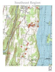
South Central Region

You also want an ePaper? Increase the reach of your titles
YUMPU automatically turns print PDFs into web optimized ePapers that Google loves.
<strong>South</strong> <strong>Central</strong> <strong>Region</strong><br />
95<br />
116<br />
96<br />
107<br />
119<br />
102<br />
120<br />
136<br />
134<br />
135<br />
131<br />
130<br />
129<br />
124<br />
117<br />
118<br />
133<br />
132<br />
125<br />
126<br />
128<br />
127<br />
Return
74º05’<br />
16.002<br />
27.002<br />
27.004<br />
Xx<br />
74º04’<br />
7.004<br />
74º03’<br />
17.005<br />
28.001<br />
74º02’<br />
8.001<br />
8.003<br />
17.001<br />
28.003<br />
17.048<br />
16.004 17.003<br />
74º01’<br />
2.003<br />
17.007<br />
17.051<br />
74º00’<br />
28.002<br />
28.011<br />
8.002<br />
17.002<br />
17.015<br />
28.058<br />
2.004<br />
18.004<br />
17.016<br />
17.004<br />
28.004<br />
73º59’<br />
73º58’<br />
19.001<br />
18.001<br />
29.013<br />
29.003<br />
73º57’<br />
9.003<br />
29.005<br />
29.009<br />
40.001<br />
18.055<br />
29.046<br />
29.047<br />
18.010<br />
73º56’<br />
73º55’<br />
42º10’<br />
42º09’30”<br />
42º09’<br />
42º08’30”<br />
42º08’<br />
42º07’30”<br />
42º07’<br />
42º06’30”<br />
42º06’<br />
42º05’30”<br />
42º05’<br />
42º04’30”<br />
42º04’<br />
42º03’30”<br />
42º03’<br />
42º02’30”<br />
42º02’<br />
42º01’30”<br />
42º01’<br />
42º00’30”<br />
42º00’<br />
© 2004, M. S. Smith<br />
73º54’<br />
370 Fishcreek Road<br />
28.1-3-25<br />
42º03'37"N, 74º00'51"W<br />
2005 Survey Landmark #95<br />
Town of Saugerties, NY<br />
N<br />
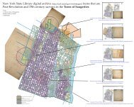
Pages from Town of Saugerties, New York, Historic Resources Survey, March, 2005<br />
Narrative additions:<br />
The hamlet of Fish Creek was variously called Bethel and<br />
Van Akin Mills throughout the 1800’s. Originating as a<br />
small community of farms along the Plattekill Creek it<br />
enlarged with the development of the Laflin and Rand<br />
gunpowder manufacturing mills just below the bridge and<br />
the bluestone quarries to the north and south. 370 Fishcreek<br />
Road is on the side of the creek that relates less to the<br />
hamlet. It appears to be the farmhouse for the fertile fields<br />
that spread south-east from the Plattekill north and south<br />
of the bridge. It backs onto a wooded hillside that has not<br />
been quarried as much as the acres to its south. This would<br />
indicate that the occupants relied little on subsistence<br />
quarrying. The property adjacent to the north where there<br />
are open fields has the footprints of the barn and<br />
outbuildings that must have once been part of this farm.<br />
W<br />
N<br />
S<br />
E<br />
W<br />
S<br />
E<br />
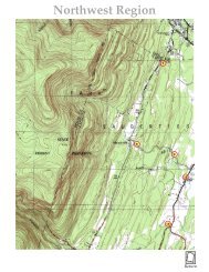
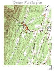
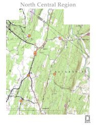
Detail from the revised 1963 Geological Survey overlayed with an Ulster County parcel map scaled section.<br />
0 ¼ ½ ¾ 1 Mile<br />
Photo<br />
2<br />
Photo<br />
0 165 feet<br />
1/8 Mile<br />
Town of Saugerties 2004-2005 Historic Resources Survey<br />
Note: Graphics including outlines of structures and lot lines are schematic. All photo locations are approximate.<br />
1<br />
Locator map from survey documentation<br />
#1 #2<br />
Numbered descriptive photos from survey documentation
74º05’<br />
16.002<br />
27.002<br />
27.004<br />
Xx<br />
74º04’<br />
7.004<br />
74º03’<br />
17.005<br />
28.001<br />
74º02’<br />
8.001<br />
8.003<br />
17.001<br />
28.003<br />
17.048<br />
16.004 17.003<br />
74º01’<br />
2.003<br />
17.007<br />
17.051<br />
74º00’<br />
28.002<br />
28.011<br />
8.002<br />
17.002<br />
17.015<br />
28.058<br />
2.004<br />
18.004<br />
17.016<br />
17.004<br />
28.004<br />
73º59’<br />
73º58’<br />
19.001<br />
18.001<br />
29.013<br />
29.003<br />
73º57’<br />
9.003<br />
29.005<br />
29.009<br />
40.001<br />
18.055<br />
29.046<br />
29.047<br />
18.010<br />
73º56’<br />
73º55’<br />
42º10’<br />
42º09’30”<br />
42º09’<br />
42º08’30”<br />
42º08’<br />
42º07’30”<br />
42º07’<br />
42º06’30”<br />
42º06’<br />
42º05’30”<br />
42º05’<br />
42º04’30”<br />
42º04’<br />
42º03’30”<br />
42º03’<br />
42º02’30”<br />
42º02’<br />
42º01’30”<br />
42º01’<br />
42º00’30”<br />
42º00’<br />
© 2004, M. S. Smith<br />
73º54’<br />
962 Glasco Turnpike<br />
28.1-4-12<br />
42º02'45"N, 74º01'02"W<br />
2005 Survey Landmark #96<br />
Town of Saugerties, NY<br />
N<br />
Pages from Town of Saugerties, New York, Historic Resources Survey, March, 2005<br />
Narrative additions<br />
The house’s location where the turnpike road climbs a ridge<br />
and passes through quarries gives it a relationship to both.<br />
There is little pasture land or tillable fields around it. The<br />
slope of the salt-box shed roof faces north-west into the<br />
weather. Much of the land below the ridge this house sits<br />
on contains the many small foundations of a temporary<br />
camp of quarryman’s families. (Lloyd Loop - 1989). Since<br />
this house and that cluster are found on the same<br />
Commons Lot 55 the reason this house is here may be as a<br />
residence of an overseer or a foreman. :<br />
W<br />
S<br />
E<br />
Photo<br />
Photo<br />
2<br />
3<br />
Detail from the revised 1963 Geological Survey overlayed with an Ulster County parcel map scaled section.<br />
0 ¼ ½ ¾ 1 Mile<br />
Photo<br />
1<br />
N<br />
W<br />
E<br />
S<br />
0 165 feet<br />
1/8 Mile<br />
Town of Saugerties 2004-2005 Historic Resources Survey<br />
Note: Graphics including outlines of structures and lot lines are schematic. All photo locations are approximate.<br />
Locator map from survey documentation<br />
#1 #2<br />
#3<br />
Numbered descriptive photos from survey documentation
74º05’<br />
16.002<br />
27.002<br />
27.004<br />
Xx<br />
74º04’<br />
7.004<br />
74º03’<br />
17.005<br />
28.001<br />
74º02’<br />
8.001<br />
8.003<br />
17.001<br />
28.003<br />
17.048<br />
16.004 17.003<br />
74º01’<br />
2.003<br />
17.007<br />
17.051<br />
74º00’<br />
28.002<br />
28.011<br />
8.002<br />
17.002<br />
17.015<br />
28.058<br />
2.004<br />
18.004<br />
17.016<br />
17.004<br />
28.004<br />
73º59’<br />
73º58’<br />
19.001<br />
18.001<br />
29.013<br />
29.003<br />
73º57’<br />
9.003<br />
29.005<br />
29.009<br />
40.001<br />
18.055<br />
29.046<br />
29.047<br />
18.010<br />
73º56’<br />
73º55’<br />
42º10’<br />
42º09’30”<br />
42º09’<br />
42º08’30”<br />
42º08’<br />
42º07’30”<br />
42º07’<br />
42º06’30”<br />
42º06’<br />
42º05’30”<br />
42º05’<br />
42º04’30”<br />
42º04’<br />
42º03’30”<br />
42º03’<br />
42º02’30”<br />
42º02’<br />
42º01’30”<br />
42º01’<br />
42º00’30”<br />
42º00’<br />
© 2004, M. S. Smith<br />
73º54’<br />
32 High Bank Road<br />
28.3-6-9<br />
42º02'34"N, 74º01'07"W<br />
2005 Survey Landmark #116<br />
Town of Saugerties, NY<br />
N<br />
Pages from Town of Saugerties, New York, Historic Resources Survey, March, 2005<br />
Narrative additions:<br />
W<br />
S<br />
E<br />
Detail from the revised 1963 Geological Survey overlayed with an Ulster County parcel map scaled section.<br />
0 ¼ ½ ¾ 1 Mile<br />
Photo<br />
1<br />
N<br />
Photo<br />
2<br />
W<br />
E<br />
S<br />
0 165 feet<br />
1/8 Mile<br />
Town of Saugerties 2004-2005 Historic Resources Survey<br />
Note: Graphics including outlines of structures and lot lines are schematic. All photo locations are approximate.<br />
Locator map from survey documentation<br />
#1 #2<br />
Numbered descriptive photos from survey documentation
74º05’<br />
16.002<br />
27.002<br />
27.004<br />
Xx<br />
74º04’<br />
7.004<br />
74º03’<br />
17.005<br />
28.001<br />
74º02’<br />
8.001<br />
8.003<br />
17.001<br />
28.003<br />
17.048<br />
16.004 17.003<br />
74º01’<br />
2.003<br />
17.007<br />
17.051<br />
74º00’<br />
28.002<br />
28.011<br />
8.002<br />
17.002<br />
17.015<br />
28.058<br />
2.004<br />
18.004<br />
17.016<br />
17.004<br />
28.004<br />
73º59’<br />
73º58’<br />
19.001<br />
18.001<br />
29.013<br />
29.003<br />
73º57’<br />
9.003<br />
29.005<br />
29.009<br />
40.001<br />
18.055<br />
29.046<br />
29.047<br />
18.010<br />
73º56’<br />
73º55’<br />
42º10’<br />
42º09’30”<br />
42º09’<br />
42º08’30”<br />
42º08’<br />
42º07’30”<br />
42º07’<br />
42º06’30”<br />
42º06’<br />
42º05’30”<br />
42º05’<br />
42º04’30”<br />
42º04’<br />
42º03’30”<br />
42º03’<br />
42º02’30”<br />
42º02’<br />
42º01’30”<br />
42º01’<br />
42º00’30”<br />
42º00’<br />
© 2004, M. S. Smith<br />
73º54’<br />
47 Powder Mill Road<br />
28.2-5-20<br />
42º02'41"N, 73º59'49"W<br />
2005 Survey Landmark #107<br />
Town of Saugerties, NY<br />
N<br />
W<br />
E<br />
Detail from the revised 1963 Geological Survey overlayed with an Ulster County parcel map scaled section.<br />
S<br />
0 ¼ ½ ¾ 1 Mile<br />
Photo<br />
Photo<br />
1 2<br />
Pages from Town of Saugerties, New York, Historic Resources Survey, March, 2005<br />
Narrative additions:<br />
April 9th, 1669, permit was given to construct a mill at a place called “Dead Men’s<br />
Bones” that was a mile above the “footpath leading to Albany” crossing of the<br />
Plattekill. At this same session the farm fields below this place at “a certain neck of<br />
land five miles distance from Kingston and over the Kill near the footpath leading to<br />
Albany containing about 54 acres of good and clear land”was also granted provided<br />
that all the grantees build their houses together “on the other side of the kill due<br />
north from the land of Thomas Chambers” so as to make a “township within the<br />
precinct of Kingston”.<br />
The stone houses built close to each other and adjacent to the Vlykill mill stream and<br />
the remains of any other houses in the vicinity of the “neck” of land are likely<br />
descendants of this grant to the petitioners Tjerck Claus deWitt and William<br />
Montania at Dead Men’s Bones, and the petitioners Thomas Chambers, Jan<br />
Oosterhout, Jan Burhans and Cornelius Vernoy at the “good and clear land”.<br />
Good and clear land likely meant that this 54 acres was an Indian plantation. The<br />
reference to bones may have been to an Indian burial ground. If this is the case there<br />
is probably the site of an Indian village near the location of these stone houses.<br />
This house’s original relationship was to the expanse of level fields that lie between<br />
the north side of the Plattekill and the steep incline of Mount Marion. It was<br />
originally a bank house facing southeast toward a ravine and brook. Sometime after<br />
the traffic along Powder Mill Road developed it was expanded into its level plane<br />
design facing the road.<br />
Powder Mill Road is named after the gun powder mill on the Plattekill at Bethel. It is<br />
likely that this road was active before this manufacturing began. This road up the<br />
break between the Hoogeberg below Mount Marion was the most direct route to the<br />
long fertile fields that stretched along the Plattekill from Bethel up to Blue Mountain.<br />
Farms on these fields were active long before the gun powder and bluestone<br />
quarrying that made extensive use of this road.<br />
The stone for the final building stage of this house is from the Kalkberg limestone<br />
found on the opposite side of the Churchland fields. This relates the building to the<br />
Brink and Myer houses on that side. The stone is block cut and laid in straight seams<br />
making it possible to build thinner walls resting on the broad original courses as a<br />
foundation. The earlier stone construction is the bluestone of Mount Marion.<br />
The original house is thought to relate to lands of “Mattyse Mattise”, one of the first<br />
twelve Trustees of the Kingston Commons in 1687. The land this house sits on is<br />
granted early in the life of the Kingston Commons.<br />
W<br />
N<br />
S<br />
E<br />
0 165 feet<br />
1/8 Mile<br />
Town of Saugerties 2004-2005 Historic Resources Survey<br />
Note: Graphics including outlines of structures and lot lines are schematic. All photo locations are approximate.<br />
Locator map from survey documentation<br />
#1 #2<br />
Numbered descriptive photos from survey documentation
74º05’<br />
16.002<br />
27.002<br />
27.004<br />
Xx<br />
74º04’<br />
7.004<br />
74º03’<br />
17.005<br />
28.001<br />
74º02’<br />
8.001<br />
8.003<br />
17.001<br />
28.003<br />
17.048<br />
16.004 17.003<br />
74º01’<br />
2.003<br />
17.007<br />
17.051<br />
74º00’<br />
28.002<br />
28.011<br />
8.002<br />
17.002<br />
17.015<br />
28.058<br />
2.004<br />
18.004<br />
17.016<br />
17.004<br />
28.004<br />
73º59’<br />
73º58’<br />
19.001<br />
18.001<br />
29.013<br />
29.003<br />
73º57’<br />
9.003<br />
29.005<br />
29.009<br />
40.001<br />
18.055<br />
29.046<br />
29.047<br />
18.010<br />
73º56’<br />
73º55’<br />
42º10’<br />
42º09’30”<br />
42º09’<br />
42º08’30”<br />
42º08’<br />
42º07’30”<br />
42º07’<br />
42º06’30”<br />
42º06’<br />
42º05’30”<br />
42º05’<br />
42º04’30”<br />
42º04’<br />
42º03’30”<br />
42º03’<br />
42º02’30”<br />
42º02’<br />
42º01’30”<br />
42º01’<br />
42º00’30”<br />
42º00’<br />
© 2004, M. S. Smith<br />
73º54’<br />
675 Churchland Road<br />
28.4-2-1.100<br />
42º02'38"N, 73º59'28”W<br />
2005 Survey Landmark #119<br />
Town of Saugerties, NY<br />
N<br />
W<br />
E<br />
Detail from the revised 1963 Geological Survey overlayed with an Ulster County parcel map scaled section.<br />
S<br />
0 ¼ ½ ¾ 1 Mile<br />
Pages from Town of Saugerties, New York, Historic Resources Survey, March, 2005<br />
Narrative additions:<br />
This is one of several brick homes built during a period of<br />
agricultural prominence after 1840. Lore has placed a date<br />
of occupation of this site at 1742. This is unlikely for the<br />
style and position of the present structure. The main thesis<br />
is that this is the homestead of the Cockburn family. More<br />
study is necessary to develop this relationship and explain<br />
this date. Placement of the date in this study is based on<br />
information from the Town Historian.<br />
W<br />
N<br />
S<br />
E<br />
Photo<br />
1<br />
Photo<br />
0 165 feet<br />
1/8 Mile<br />
Town of Saugerties 2004-2005 Historic Resources Survey<br />
Note: Graphics including outlines of structures and lot lines are schematic. All photo locations are approximate.<br />
2<br />
Locator map from survey documentation<br />
#1 #2<br />
Numbered descriptive photos from survey documentation
74º05’<br />
16.002<br />
27.002<br />
27.004<br />
Xx<br />
74º04’<br />
7.004<br />
74º03’<br />
17.005<br />
28.001<br />
74º02’<br />
8.001<br />
8.003<br />
17.001<br />
28.003<br />
17.048<br />
16.004 17.003<br />
74º01’<br />
2.003<br />
17.007<br />
17.051<br />
74º00’<br />
28.002<br />
28.011<br />
8.002<br />
17.002<br />
17.015<br />
28.058<br />
2.004<br />
18.004<br />
17.016<br />
17.004<br />
28.004<br />
73º59’<br />
73º58’<br />
19.001<br />
18.001<br />
29.013<br />
29.003<br />
73º57’<br />
9.003<br />
29.005<br />
29.009<br />
40.001<br />
18.055<br />
29.046<br />
29.047<br />
18.010<br />
73º56’<br />
73º55’<br />
42º10’<br />
42º09’30”<br />
42º09’<br />
42º08’30”<br />
42º08’<br />
42º07’30”<br />
42º07’<br />
42º06’30”<br />
42º06’<br />
42º05’30”<br />
42º05’<br />
42º04’30”<br />
42º04’<br />
42º03’30”<br />
42º03’<br />
42º02’30”<br />
42º02’<br />
42º01’30”<br />
42º01’<br />
42º00’30”<br />
42º00’<br />
© 2004, M. S. Smith<br />
73º54’<br />
801 King’s Highway<br />
28.4-2-35<br />
42º02'24"N, 73º59'04"W<br />
2005 Survey Landmark #120<br />
Town of Saugerties, NY<br />
N<br />
Pages from Town of Saugerties, New York, Historic Resources Survey, March, 2005<br />
Narrative additions:<br />
W<br />
S<br />
E<br />
Detail from the revised 1963 Geological Survey overlayed with an Ulster County parcel map scaled section.<br />
0 ¼ ½ ¾ 1 Mile<br />
Photo<br />
1<br />
W<br />
N<br />
E<br />
Photo<br />
2<br />
S<br />
0 165 feet<br />
1/8 Mile<br />
Town of Saugerties 2004-2005 Historic Resources Survey<br />
Note: Graphics including outlines of structures and lot lines are schematic. All photo locations are approximate.<br />
Locator map from survey documentation<br />
#1 #2<br />
Numbered descriptive photos from survey documentation
74º05’<br />
16.002<br />
27.002<br />
27.004<br />
Xx<br />
74º04’<br />
7.004<br />
74º03’<br />
17.005<br />
28.001<br />
74º02’<br />
8.001<br />
8.003<br />
17.001<br />
28.003<br />
17.048<br />
16.004 17.003<br />
74º01’<br />
2.003<br />
17.007<br />
17.051<br />
74º00’<br />
28.002<br />
28.011<br />
8.002<br />
17.002<br />
17.015<br />
28.058<br />
2.004<br />
18.004<br />
17.016<br />
17.004<br />
28.004<br />
73º59’<br />
73º58’<br />
19.001<br />
18.001<br />
29.013<br />
29.003<br />
73º57’<br />
9.003<br />
29.005<br />
29.009<br />
40.001<br />
18.055<br />
29.046<br />
29.047<br />
18.010<br />
73º56’<br />
73º55’<br />
42º10’<br />
42º09’30”<br />
42º09’<br />
42º08’30”<br />
42º08’<br />
42º07’30”<br />
42º07’<br />
42º06’30”<br />
42º06’<br />
42º05’30”<br />
42º05’<br />
42º04’30”<br />
42º04’<br />
42º03’30”<br />
42º03’<br />
42º02’30”<br />
42º02’<br />
42º01’30”<br />
42º01’<br />
42º00’30”<br />
42º00’<br />
© 2004, M. S. Smith<br />
73º54’<br />
545 Glasco Turnpike<br />
28.4-11-19<br />
42º02'14"N, 73º58'59"W<br />
2005 Survey Landmark #129<br />
Town of Saugerties, NY<br />
N<br />
Pages from Town of Saugerties, New York, Historic Resources Survey, March, 2005<br />
Narrative additions:<br />
Today it is hard to imagine the relationship communities<br />
like Mount Marion Station had to the railroad when it first<br />
arrived in the 1880’s. This house is a typical example of a<br />
commercial building used to attract rail passengers while<br />
on layovers waiting for the carriages that would take them<br />
on to their next destination. The character of its entry<br />
would have related to the station directly across the road.<br />
It’s turret would have mimicked the switching tower with<br />
its broad view up and down the tracks. This is the only<br />
examples of this genre in Saugerties.<br />
(Demolished by controlled fire in 2010)<br />
N<br />
W<br />
S<br />
E<br />
Detail from the revised 1963 Geological Survey overlayed with an Ulster County parcel map scaled section.<br />
0 ¼ ½ ¾ 1 Mile<br />
Photo<br />
1<br />
Photo<br />
2<br />
W<br />
E<br />
S<br />
0 165 feet<br />
1/8 Mile<br />
Town of Saugerties 2004-2005 Historic Resources Survey<br />
Note: Graphics including outlines of structures and lot lines are schematic. All photo locations are approximate.<br />
Locator map from survey documentation<br />
#1 #2<br />
Numbered descriptive photos from survey documentation
74º05’<br />
16.002<br />
27.002<br />
27.004<br />
Xx<br />
74º04’<br />
7.004<br />
74º03’<br />
17.005<br />
28.001<br />
74º02’<br />
8.001<br />
8.003<br />
17.001<br />
28.003<br />
17.048<br />
16.004 17.003<br />
74º01’<br />
2.003<br />
17.007<br />
17.051<br />
74º00’<br />
28.002<br />
28.011<br />
8.002<br />
17.002<br />
17.015<br />
28.058<br />
2.004<br />
18.004<br />
17.016<br />
17.004<br />
28.004<br />
73º59’<br />
73º58’<br />
19.001<br />
18.001<br />
29.013<br />
29.003<br />
73º57’<br />
9.003<br />
29.005<br />
29.009<br />
40.001<br />
18.055<br />
29.046<br />
29.047<br />
18.010<br />
73º56’<br />
73º55’<br />
42º10’<br />
42º09’30”<br />
42º09’<br />
42º08’30”<br />
42º08’<br />
42º07’30”<br />
42º07’<br />
42º06’30”<br />
42º06’<br />
42º05’30”<br />
42º05’<br />
42º04’30”<br />
42º04’<br />
42º03’30”<br />
42º03’<br />
42º02’30”<br />
42º02’<br />
42º01’30”<br />
42º01’<br />
42º00’30”<br />
42º00’<br />
© 2004, M. S. Smith<br />
73º54’<br />
495 Glasco Turnpike<br />
28.4-9-6<br />
42º02'11"N, 73º58'47"W<br />
2005 Survey Landmark #124<br />
Town of Saugerties, NY<br />
N<br />
Pages from Town of Saugerties, New York, Historic Resources Survey, March, 2005<br />
Narrative additions:<br />
This house is similar in construction to the quarryman’s<br />
cottages found further up the Glasco Turnpike at High<br />
Woods.<br />
W<br />
S<br />
E<br />
Photo<br />
1<br />
Detail from the revised 1963 Geological Survey overlayed with an Ulster County parcel map scaled section.<br />
0 ¼ ½ ¾ 1 Mile<br />
Photo<br />
2<br />
N<br />
W<br />
E<br />
S<br />
0 165 feet<br />
1/8 Mile<br />
Town of Saugerties 2004-2005 Historic Resources Survey<br />
Note: Graphics including outlines of structures and lot lines are schematic. All photo locations are approximate.<br />
Locator map from survey documentation<br />
#1 #2<br />
Numbered descriptive photos from survey documentation
74º05’<br />
16.002<br />
27.002<br />
27.004<br />
Xx<br />
74º04’<br />
7.004<br />
74º03’<br />
17.005<br />
28.001<br />
74º02’<br />
8.001<br />
8.003<br />
17.001<br />
28.003<br />
17.048<br />
16.004 17.003<br />
74º01’<br />
2.003<br />
17.007<br />
17.051<br />
74º00’<br />
28.002<br />
28.011<br />
8.002<br />
17.002<br />
17.015<br />
28.058<br />
2.004<br />
18.004<br />
17.016<br />
17.004<br />
28.004<br />
73º59’<br />
73º58’<br />
19.001<br />
18.001<br />
29.013<br />
29.003<br />
73º57’<br />
9.003<br />
29.005<br />
29.009<br />
40.001<br />
18.055<br />
29.046<br />
29.047<br />
18.010<br />
73º56’<br />
73º55’<br />
42º10’<br />
42º09’30”<br />
42º09’<br />
42º08’30”<br />
42º08’<br />
42º07’30”<br />
42º07’<br />
42º06’30”<br />
42º06’<br />
42º05’30”<br />
42º05’<br />
42º04’30”<br />
42º04’<br />
42º03’30”<br />
42º03’<br />
42º02’30”<br />
42º02’<br />
42º01’30”<br />
42º01’<br />
42º00’30”<br />
42º00’<br />
© 2004, M. S. Smith<br />
73º54’<br />
655 Glasco Turnpike<br />
28.11-2-20.5<br />
42º02'23"N, 73º59'37"W<br />
2005 Survey Landmark #102<br />
Town of Saugerties, NY<br />
N<br />
W<br />
E<br />
Detail from the revised 1963 Geological Survey overlayed with an Ulster County parcel map scaled section.<br />
S<br />
0 ¼ ½ ¾ 1 Mile<br />
Photo<br />
1<br />
Photo<br />
2<br />
Pages from Town of Saugerties, New York, Historic Resources Survey, March, 2005<br />
Narrative additions:<br />
April 9th, 1669, permit was given to construct a mill at a place called “Dead Men’s<br />
Bones” that was a mile above the “footpath leading to Albany” crossing of the<br />
Plattekill. At this same session the farm fields below this place at “a certain neck of<br />
land five miles distance from Kingston and over the Kill near the footpath leading to<br />
Albany containing about 54 acres of good and clear land”was also granted provided<br />
that all the grantees build their houses together “on the other side of the kill due<br />
north from the land of Thomas Chambers” so as to make a “township within the<br />
precinct of Kingston”.<br />
The stone houses built close to each other and adjacent to the Vlykill mill stream and<br />
the remains of any other houses in the vicinity of the “neck” of land are likely<br />
descendants of this grant to the petitioners Tjerck Claus deWitt and William<br />
Montania at Dead Men’s Bones, and the petitioners Thomas Chambers, Jan<br />
Oosterhout, Jan Burhans and Cornelius Vernoy at the “good and clear land”.<br />
Good and clear land likely meant that this 54 acres was an Indian plantation. The<br />
reference to bones may have been to an Indian burial ground. If this is the case there<br />
is probably the site of an Indian village near the location of these stone houses.<br />
This house is obviously related to the Plattekill and 50 foot drop it begins where this<br />
house is built. The land east from the Plattekill can be traced to a 1686 survey of<br />
William deMyer and adjacent that to the south to Peter Winne the same year. The<br />
only names in these early grants that can be associated with the west side of the<br />
Plattekill are Matias and John Mattison who William deMyer claims half ownership<br />
to the mill and Plattekill with in 1680.<br />
“Mattyse Mattise” is one of the first twelve Trustees of the Kingston Commons in<br />
1687. The land this house sits on is granted early in the life of the Kingston Commons<br />
and since William deMyer gained large holdings it is likely that the other founders<br />
did also.<br />
Looking back at the mill reference it is logical to trace this and other stone houses on<br />
the west of these fertile flats of Saugerties to Mattyse Mattise just as all those on the<br />
east are traced to William deMyer.<br />
This house should be studied further for its utility as a mill house. The short distance<br />
to the natural “head” of water where the Plattekill breaks over a level ledge to begin<br />
its cascade makes the position of this house perfect for a side sluice underthrust<br />
operated wheel. This type of mill is described in the wood sluice fed early mills<br />
below the falls at Saugerties village. The construction of the house is obviously very<br />
early and this may well make it the mill being referenced in the 1680 citation. Along<br />
with the mill on the Vlykill to the south this industry would have been very<br />
important to the building needs of the growing Kingston population.<br />
W<br />
N<br />
S<br />
E<br />
0 165 feet<br />
1/8 Mile<br />
Town of Saugerties 2004-2005 Historic Resources Survey<br />
Note: Graphics including outlines of structures and lot lines are schematic. All photo locations are approximate.<br />
Locator map from survey documentation<br />
#1 #2<br />
Numbered descriptive photos from survey documentation
74º05’<br />
16.002<br />
27.002<br />
27.004<br />
Xx<br />
74º04’<br />
7.004<br />
74º03’<br />
17.005<br />
28.001<br />
74º02’<br />
8.001<br />
8.003<br />
17.001<br />
28.003<br />
17.048<br />
16.004 17.003<br />
74º01’<br />
2.003<br />
17.007<br />
17.051<br />
74º00’<br />
28.002<br />
28.011<br />
8.002<br />
17.002<br />
17.015<br />
28.058<br />
2.004<br />
18.004<br />
17.016<br />
17.004<br />
28.004<br />
73º59’<br />
73º58’<br />
19.001<br />
18.001<br />
29.013<br />
29.003<br />
73º57’<br />
9.003<br />
29.005<br />
29.009<br />
40.001<br />
18.055<br />
29.046<br />
29.047<br />
18.010<br />
73º56’<br />
73º55’<br />
42º10’<br />
42º09’30”<br />
42º09’<br />
42º08’30”<br />
42º08’<br />
42º07’30”<br />
42º07’<br />
42º06’30”<br />
42º06’<br />
42º05’30”<br />
42º05’<br />
42º04’30”<br />
42º04’<br />
42º03’30”<br />
42º03’<br />
42º02’30”<br />
42º02’<br />
42º01’30”<br />
42º01’<br />
42º00’30”<br />
42º00’<br />
© 2004, M. S. Smith<br />
73º54’<br />
158 Snyder Lane<br />
28.58-1-22<br />
42º02'17"N, 73º00'02"W<br />
2005 Survey Landmark #136<br />
Town of Saugerties, NY<br />
N<br />
W<br />
E<br />
Detail from the revised 1963 Geological Survey overlayed with an Ulster County parcel map scaled section.<br />
S<br />
Photo<br />
0 ¼ ½ ¾ 1 Mile<br />
3<br />
Photo<br />
2<br />
Photo<br />
1<br />
Pages from Town of Saugerties, New York, Historic Resources Survey, March, 2005<br />
Narrative additions:<br />
April 9th, 1669, permit was given to construct a mill at a place called “Dead Men’s Bones” that was<br />
a mile above the “footpath leading to Albany” crossing of the Plattekill. At this same session the<br />
farm fields below this place at “a certain neck of land five miles distance from Kingston and over<br />
the Kill near the footpath leading to Albany containing about 54 acres of good and clear land”was<br />
also granted provided that all the grantees build their houses together “on the other side of the kill<br />
due north from the land of Thomas Chambers” so as to make a “township within the precinct of<br />
Kingston”.<br />
The two stone houses built close to each other and adjacent to the Vlykill mill stream and the<br />
remains of any other houses in the vicinity of the “neck” of land are likely descendants of this<br />
grant to the petitioners Tjerck Claus deWitt and William Montania at Dead Men’s Bones, and the<br />
petitioners Thomas Chambers, Jan Oosterhout, Jan Burhans and Cornelius Vernoy at the “good and<br />
clear land”.<br />
Good and clear land likely meant that this 54 acres was an Indian plantation. The reference to bones<br />
may have been to an Indian burial ground. If this is the case there is probably the site of an Indian<br />
village near the location of these stone houses.<br />
This house is obviously related to a farm that occupied this level ground west of the Plattekill. The<br />
land east from the Plattekill can be traced to a 1686 survey of William deMyer and adjacent that to<br />
the south to Peter Winne the same year. The only names in these early grants that can be associated<br />
with the west side of the Plattekill are Matias and John Mattison who William deMyer claims half<br />
ownership to the Plattekill with in 1680.<br />
“Mattyse Mattise” is one of the first twelve Trustees of the Kingston Commons in 1687. The land<br />
this house sits on is granted early in the life of the Kingston Commons and since William deMyer<br />
gained large holdings it is likely that the other founders did also.<br />
Looking back at the mill reference it is logical to trace this and other stone houses on the west of<br />
these fertile flats of Saugerties to Mattyse Mattise just as all those on the east are traced to William<br />
deMyer.<br />
This house has a lower half below grade access on one side so it is technically a bank house. The<br />
look of the house is level to the plane of the fields that it faces to the southeast. This resembles all of<br />
the Myer houses.<br />
A concept worth exploring is that the names of these early settlers were that of their profession.<br />
Myer would be a stone cutter and Mattise would be a thatcher. The houses may be similar because<br />
they were all designed by the same person.<br />
Another idea worth exploring is that the smaller houses built into the bank were year round and<br />
the larger level plane houses were used during the growing season. The smaller houses would be<br />
built into the bank because they were built over a spring and the water would be accessible in the<br />
winter months. The larger houses would be used to board the field workers (slaves) needed to till<br />
the thousands of acres of land located a distance from the main habitation center of Kingston.<br />
W<br />
N<br />
S<br />
E<br />
0 165 feet<br />
1/8 Mile<br />
Town of Saugerties 2004-2005 Historic Resources Survey<br />
Note: Graphics including outlines of structures and lot lines are schematic. All photo locations are approximate.<br />
Locator map from survey documentation<br />
#1 #2<br />
#3<br />
Numbered descriptive photos from survey documentation
74º05’<br />
16.002<br />
27.002<br />
27.004<br />
Xx<br />
74º04’<br />
7.004<br />
74º03’<br />
17.005<br />
28.001<br />
74º02’<br />
8.001<br />
8.003<br />
17.001<br />
28.003<br />
17.048<br />
16.004 17.003<br />
74º01’<br />
2.003<br />
17.007<br />
17.051<br />
74º00’<br />
28.002<br />
28.011<br />
8.002<br />
17.002<br />
17.015<br />
28.058<br />
2.004<br />
18.004<br />
17.016<br />
17.004<br />
28.004<br />
73º59’<br />
73º58’<br />
19.001<br />
18.001<br />
29.013<br />
29.003<br />
73º57’<br />
9.003<br />
29.005<br />
29.009<br />
40.001<br />
18.055<br />
29.046<br />
29.047<br />
18.010<br />
73º56’<br />
73º55’<br />
42º10’<br />
42º09’30”<br />
42º09’<br />
42º08’30”<br />
42º08’<br />
42º07’30”<br />
42º07’<br />
42º06’30”<br />
42º06’<br />
42º05’30”<br />
42º05’<br />
42º04’30”<br />
42º04’<br />
42º03’30”<br />
42º03’<br />
42º02’30”<br />
42º02’<br />
42º01’30”<br />
42º01’<br />
42º00’30”<br />
42º00’<br />
© 2004, M. S. Smith<br />
73º54’<br />
694 Schoolhouse Road<br />
28.4-1-25<br />
42º01'51"N, 74º00'15"W<br />
2005 Survey Landmark #117<br />
Town of Saugerties, NY<br />
N<br />
W<br />
E<br />
Detail from the revised 1963 Geological Survey overlayed with an Ulster County parcel map scaled section.<br />
S<br />
0 ¼ ½ ¾ 1 Mile<br />
Pages from Town of Saugerties, New York, Historic Resources Survey, March, 2005<br />
Narrative additions: W<br />
E<br />
1<br />
April 9th, 1669, permit was given to construct a mill at a<br />
place called “Dead Men’s Bones” that was a mile above the<br />
“footpath leading to Albany” crossing of the Plattekill. At<br />
this same session the farm fields below this place stretching<br />
south were also granted provided that all the grantees<br />
build their houses together “on the other side of the kill”<br />
so as to make a “township within the precinct of Kingston”.<br />
The two stone houses built close to each other and adjacent<br />
to the Vlykill mill stream are likely descendants of this<br />
grant to its petitioners, Tjerck Claus deWitt and William<br />
Montania. The rest of the petitioners, including Thomas<br />
Chambers, Jan Oosterhout, Jan Burhans and Cornelius<br />
Vernoy were the founding settlers of “Dutch Settlement”<br />
(Ruby on the Ulster side and Plattekill on the Saugerties<br />
side of the crossing.) At this time this settlement is on the<br />
northern frontier of Kingston and pre-dates the formation<br />
of both the Counties and the Commons by many years. The<br />
grant as a “Precinct of Kingston” presages the future<br />
bounds of both of these political entities up and into The<br />
Sagiers (Saugerties).<br />
Though this house and its close neighbors may not actually<br />
have been built at the early date of these grants, their<br />
location marking the expansion of the Kingston Colony and<br />
the early date placed on their construction of before 1730<br />
makes them and this “precinct” important as historical<br />
landmarks.<br />
S<br />
165 feet<br />
N<br />
Photo<br />
Photo<br />
0 1/8 Mile<br />
Town of Saugerties 2004-2005 Historic Resources Survey<br />
Note: Graphics including outlines of structures and lot lines are schematic. All photo locations are approximate.<br />
2<br />
Locator map from survey documentation<br />
#1 #2<br />
Numbered descriptive photos from survey documentation
74º05’<br />
16.002<br />
27.002<br />
27.004<br />
Xx<br />
74º04’<br />
7.004<br />
74º03’<br />
17.005<br />
28.001<br />
74º02’<br />
8.001<br />
8.003<br />
17.001<br />
28.003<br />
17.048<br />
16.004 17.003<br />
74º01’<br />
2.003<br />
17.007<br />
17.051<br />
74º00’<br />
28.002<br />
28.011<br />
8.002<br />
17.002<br />
17.015<br />
28.058<br />
2.004<br />
18.004<br />
17.016<br />
17.004<br />
28.004<br />
73º59’<br />
73º58’<br />
19.001<br />
18.001<br />
29.013<br />
29.003<br />
73º57’<br />
9.003<br />
29.005<br />
29.009<br />
40.001<br />
18.055<br />
29.046<br />
29.047<br />
18.010<br />
73º56’<br />
73º55’<br />
42º10’<br />
42º09’30”<br />
42º09’<br />
42º08’30”<br />
42º08’<br />
42º07’30”<br />
42º07’<br />
42º06’30”<br />
42º06’<br />
42º05’30”<br />
42º05’<br />
42º04’30”<br />
42º04’<br />
42º03’30”<br />
42º03’<br />
42º02’30”<br />
42º02’<br />
42º01’30”<br />
42º01’<br />
42º00’30”<br />
42º00’<br />
© 2004, M. S. Smith<br />
73º54’<br />
650 Schoolhouse Road<br />
28.4-1-27<br />
42º01'46"N, 74º00'11"W<br />
2005 Survey Landmark #118<br />
Town of Saugerties, NY<br />
N<br />
W<br />
E<br />
Detail from the revised 1963 Geological Survey overlayed with an Ulster County parcel map scaled section.<br />
S<br />
0 ¼ ½ ¾ 1 Mile<br />
Photo<br />
1<br />
Pages from Town of Saugerties, New York, Historic Resources Survey, March, 2005<br />
Narrative additions:<br />
April 9th, 1669, permit was given to construct a mill at a<br />
place called “Dead Men’s Bones” that was a mile above the<br />
“footpath leading to Albany” crossing of the Plattekill. At<br />
this same session the farm fields below this place stretching<br />
south were also granted provided that all the grantees<br />
build their houses together “on the other side of the kill”<br />
so as to make a “township within the precinct of Kingston”.<br />
The two stone houses built close to each other and adjacent<br />
to the Vlykill mill stream are likely descendants of this<br />
grant to its petitioners, Tjerck Claus deWitt and William<br />
Montania. The rest of the petitioners, including Thomas<br />
Chambers, Jan Oosterhout, Jan Burhans and Cornelius<br />
Vernoy were the founding settlers of “Dutch Settlement”<br />
(Ruby on the Ulster side and Plattekill on the Saugerties<br />
side of the crossing.) At this time this settlement is on the<br />
northern frontier of Kingston and pre-dates the formation<br />
of both the Counties and the Commons by many years. The<br />
grant as a “Precinct of Kingston” presages the future<br />
bounds of both of these political entities up and into The<br />
Sagiers (Saugerties).<br />
Though this house and its close neighbors may not actually<br />
have been built at the early date of these grants, their<br />
location marking the expansion of the Kingston Colony and<br />
the early date placed on their construction of before 1730<br />
makes them and this “precinct” important as historical<br />
landmarks.<br />
W<br />
N<br />
S<br />
E<br />
Photo<br />
2<br />
0 165 feet<br />
1/8 Mile<br />
Town of Saugerties 2004-2005 Historic Resources Survey<br />
Note: Graphics including outlines of structures and lot lines are schematic. All photo locations are approximate.<br />
Locator map from survey documentation<br />
#1 #2<br />
Numbered descriptive photos from survey documentation
74º05’<br />
16.002<br />
27.002<br />
27.004<br />
Xx<br />
74º04’<br />
7.004<br />
74º03’<br />
17.005<br />
28.001<br />
74º02’<br />
8.001<br />
8.003<br />
17.001<br />
28.003<br />
17.048<br />
16.004 17.003<br />
74º01’<br />
2.003<br />
17.007<br />
17.051<br />
74º00’<br />
28.002<br />
28.011<br />
8.002<br />
17.002<br />
17.015<br />
28.058<br />
2.004<br />
18.004<br />
17.016<br />
17.004<br />
28.004<br />
73º59’<br />
73º58’<br />
19.001<br />
18.001<br />
29.013<br />
29.003<br />
73º57’<br />
9.003<br />
29.005<br />
29.009<br />
40.001<br />
18.055<br />
29.046<br />
29.047<br />
18.010<br />
73º56’<br />
73º55’<br />
42º10’<br />
42º09’30”<br />
42º09’<br />
42º08’30”<br />
42º08’<br />
42º07’30”<br />
42º07’<br />
42º06’30”<br />
42º06’<br />
42º05’30”<br />
42º05’<br />
42º04’30”<br />
42º04’<br />
42º03’30”<br />
42º03’<br />
42º02’30”<br />
42º02’<br />
42º01’30”<br />
42º01’<br />
42º00’30”<br />
42º00’<br />
© 2004, M. S. Smith<br />
73º54’<br />
599 King’s Highway<br />
28.4-10-2.113<br />
42º01'41"N, 73º59'23"W<br />
2005 Survey Landmark #125<br />
Town of Saugerties, NY<br />
N<br />
Pages from Town of Saugerties, New York, Historic Resources Survey, March, 2005<br />
Narrative additions:<br />
This address has two houses. The dominant house is the large 1863<br />
federal-style residence. The most important is the “Second Brink House”,<br />
a stone house in extreme disrepair that is hidden in the trees behind the<br />
main residence. There is also a Brink family cemetery north of the stone<br />
house. The date of this house is from an inscribed stone on the east end<br />
reading “HB 1743”. The HB is for Henry Brink according to the DAR “Old<br />
Stone Houses of Saugerties Township” (1976).<br />
The structuring of this stone house within the second generation of the<br />
Brink family’s occupation of this land grant from the Kingston Commons<br />
in 1688 and this cemetery close by makes the Second Brink House the<br />
main house of the Brink family and an important landmark on the King’s<br />
Highway for over a hundred years. The flavor of the early history of the<br />
southern part of the town of Saugerties would be lost if this house were<br />
lost.<br />
When the Kingston Commons north extent was made the south bounds of<br />
Albany County in 1687 the wagon road that became the King’s Highway<br />
became the main transit route for every use of the part of Kingston that<br />
later became the town of Saugerties. These were all common fields,<br />
pastures and woodlots. The population of the tightly settled areas farmed,<br />
grazed and gathered firewood for subsistence and for trade in the<br />
commons and each of their droving and carting activities back and forth<br />
passed the door of the Second (and First) Brink stone house along the<br />
King’s Highway.<br />
All land communication and commerce between Albany to the north and<br />
Philadelphia to the south also passed on this highway. The location of the<br />
Second Brink House would make it, similar to the Wynkoop house just to<br />
the north of the early Albany County line, a likely inn of the time. The<br />
similarity between these two houses in their width and division would<br />
have their sizes intended for both residential and inn use within the same<br />
structure.<br />
It may be presumed that the large brick Federal-style residence presently<br />
occupied at this address was also a Brink house. This is now called the<br />
Boice Farm and Boices have occupied this farm for generations now. The<br />
bulk of the farm is over 170 acres and involves the outbuildings and<br />
farmstands that are related to this brick house. The Boice farm may define<br />
the north extent of the original Brink lands.<br />
Immediately south of the present farm bounds is another Brink house of<br />
an earlier Federal-style dated to 1851. In the area of the original Kingston<br />
Commons grant of 1688 to the founder Brink, then, there are the First,<br />
Second, Third and the brick house on this site, the Forth Brink house.<br />
W<br />
N<br />
S<br />
E<br />
W<br />
S<br />
E<br />
Detail from the revised 1963 Geological Survey overlayed with an Ulster County parcel map scaled section.<br />
0 ¼ ½ ¾ 1 Mile<br />
Photo<br />
0 165 feet<br />
1/8 Mile<br />
Town of Saugerties 2004-2005 Historic Resources Survey<br />
Note: Graphics including outlines of structures and lot lines are schematic. All photo locations are approximate.<br />
2<br />
Photo<br />
Locator map from survey documentation<br />
#1 #2<br />
1<br />
Numbered descriptive photos from survey documentation
74º05’<br />
16.002<br />
27.002<br />
27.004<br />
Xx<br />
74º04’<br />
7.004<br />
74º03’<br />
17.005<br />
28.001<br />
74º02’<br />
8.001<br />
8.003<br />
17.001<br />
28.003<br />
17.048<br />
16.004 17.003<br />
74º01’<br />
2.003<br />
17.007<br />
17.051<br />
74º00’<br />
28.002<br />
28.011<br />
8.002<br />
17.002<br />
17.015<br />
28.058<br />
2.004<br />
18.004<br />
17.016<br />
17.004<br />
28.004<br />
73º59’<br />
73º58’<br />
19.001<br />
18.001<br />
29.013<br />
29.003<br />
73º57’<br />
9.003<br />
29.005<br />
29.009<br />
40.001<br />
18.055<br />
29.046<br />
29.047<br />
18.010<br />
73º56’<br />
73º55’<br />
42º10’<br />
42º09’30”<br />
42º09’<br />
42º08’30”<br />
42º08’<br />
42º07’30”<br />
42º07’<br />
42º06’30”<br />
42º06’<br />
42º05’30”<br />
42º05’<br />
42º04’30”<br />
42º04’<br />
42º03’30”<br />
42º03’<br />
42º02’30”<br />
42º02’<br />
42º01’30”<br />
42º01’<br />
42º00’30”<br />
42º00’<br />
© 2004, M. S. Smith<br />
73º54’<br />
599 King’s Highway<br />
28.4-10-2.11<br />
42º01'41"N, 73º59'23"W<br />
2005 Survey Landmark #126<br />
Town of Saugerties, NY<br />
N<br />
W<br />
E<br />
Detail from the revised 1963 Geological Survey overlayed with an Ulster County parcel map scaled section.<br />
S<br />
0 ¼ ½ ¾ 1 Mile<br />
Photo<br />
1<br />
Pages from Town of Saugerties, New York, Historic Resources Survey, March, 2005<br />
Narrative additions:<br />
This address has two houses. The dominant house is the large 1863 federal-style<br />
residence. The most important is the “Second Brink House”, a stone house in extreme<br />
disrepair that is hidden in the trees behind the main residence. There is also a Brink<br />
family cemetery north of the stone house. The date of this house is from an inscribed<br />
stone on the east end reading “HB 1743”. The HB is for Henry Brink according to the<br />
DAR “Old Stone Houses of Saugerties Township” (1976).<br />
The structuring of this stone house within the second generation of the Brink family’s<br />
occupation of this land grant from the Kingston Commons in 1688 and this cemetery<br />
close by makes the Second Brink House the main house of the Brink family and an<br />
important landmark on the King’s Highway for over a hundred years. The flavor of<br />
the early history of the southern part of the town of Saugerties would be lost if this<br />
house were lost.<br />
When the Kingston Commons north extent was made the south bounds of Albany<br />
County in 1687 the wagon road that became the King’s Highway became the main<br />
transit route for every use of the part of Kingston that later became the town of<br />
Saugerties. These were all common fields, pastures and woodlots. The population of<br />
the tightly settled areas farmed, grazed and gathered firewood for subsistence and<br />
for trade in the commons and each of their droving and carting activities back and<br />
forth passed the door of the Second (and First) Brink stone house along the King’s<br />
Highway.<br />
All land communication and commerce between Albany to the north and<br />
Philadelphia to the south also passed on this highway. The location of the Second<br />
Brink House would make it, similar to the Wynkoop house just to the north of the<br />
early Albany County line, a likely inn of the time. The similarity between these two<br />
houses in their width and division would have their sizes intended for both<br />
residential and inn use within the same structure.<br />
It may be presumed that the large brick Federal-style residence presently occupied at<br />
this address was also a Brink house. This is now called the Boice Farm and Boices<br />
have occupied this farm for generations now. The bulk of the farm is over 170 acres<br />
and involves the outbuildings and farmstands that are related to this brick house.<br />
The Boice farm may define the north extent of the original Brink lands.<br />
Immediately south of the present farm bounds is another Brink house of an earlier<br />
Federal-style dated to 1851. In the area of the original Kingston Commons grant of<br />
1688 to the founder Brink, then, there are the First, Second, Third and the brick house<br />
on this site, the Forth Brink house.<br />
W<br />
N<br />
S<br />
E<br />
0 165 feet<br />
1/8 Mile<br />
Town of Saugerties 2004-2005 Historic Resources Survey<br />
Note: Graphics including outlines of structures and lot lines are schematic. All photo locations are approximate.<br />
Locator map from survey documentation<br />
#1<br />
Numbered descriptive photos from survey documentation
74º05’<br />
16.002<br />
27.002<br />
27.004<br />
Xx<br />
74º04’<br />
7.004<br />
74º03’<br />
17.005<br />
28.001<br />
74º02’<br />
8.001<br />
8.003<br />
17.001<br />
28.003<br />
17.048<br />
16.004 17.003<br />
74º01’<br />
2.003<br />
17.007<br />
17.051<br />
74º00’<br />
28.002<br />
28.011<br />
8.002<br />
17.002<br />
17.015<br />
28.058<br />
2.004<br />
18.004<br />
17.016<br />
17.004<br />
28.004<br />
73º59’<br />
73º58’<br />
19.001<br />
18.001<br />
29.013<br />
29.003<br />
73º57’<br />
9.003<br />
29.005<br />
29.009<br />
40.001<br />
18.055<br />
29.046<br />
29.047<br />
18.010<br />
73º56’<br />
73º55’<br />
42º10’<br />
42º09’30”<br />
42º09’<br />
42º08’30”<br />
42º08’<br />
42º07’30”<br />
42º07’<br />
42º06’30”<br />
42º06’<br />
42º05’30”<br />
42º05’<br />
42º04’30”<br />
42º04’<br />
42º03’30”<br />
42º03’<br />
42º02’30”<br />
42º02’<br />
42º01’30”<br />
42º01’<br />
42º00’30”<br />
42º00’<br />
© 2004, M. S. Smith<br />
73º54’<br />
452 King’s Highway<br />
28.4-10-33<br />
42º01'17"N, 73º59'45"W<br />
2005 Survey Landmark #127<br />
Town of Saugerties, NY<br />
N<br />
W<br />
E<br />
Detail from the revised 1963 Geological Survey overlayed with an Ulster County parcel map scaled section.<br />
S<br />
0 ¼ ½ ¾ 1 Mile<br />
Photo<br />
3<br />
Photo<br />
4<br />
Pages from Town of Saugerties, New York, Historic Resources Survey, March, 2005<br />
Narrative additions:<br />
The south portion of this house is the original Brink Homestead house.<br />
April 9th, 1669, permit was given to construct a mill at a place called “Dead Men’s Bones” that was<br />
a mile above the “footpath leading to Albany” crossing of the Plattekill. At this same session the<br />
farm fields below this place at “a certain neck of land five miles distance from Kingston over the<br />
Kill near the footpath leading to Albany, containing about fifty-four acres good and clear land”were<br />
also granted provided that the grantees build their houses together “on the other side of the kill”<br />
so as to make a “township within the precinct of Kingston”.<br />
The “neck of land” directly across the kill and on the footpath to Albany is the same land said to<br />
have been deeded in 1688 to Cornelius Lambertse Brink by the Kingston Commons immediately<br />
after its founding. The Brink lands and the two stone houses that define its extent occupy this neck.<br />
This neck is defined by the backwash low fields of the Plattekill on its west and the low fields at the<br />
confluence of the Plattekill and Esopus Kills on its east. It runs level to the northeast and terraces<br />
down to the northwest at a low flat field that diverts the King’s Highway in a broad “S”-curve.<br />
The King’s Highway has its name by Act of the colonial assembly, 1703. It is first mentioned in the<br />
early Dutch Settlement grant of 1669 as the “footpath to Albany”. In the 1677 formalizing of the<br />
treaty of 1663 it is called “the road from Katskill”. Sometime between these dates it progressed from<br />
an Indian path to a wagon road. From Kingston southwestward it is called the “Old Mine Road”<br />
before the 1703 Act made it the King’s Highway for its entire length.<br />
The land of the Brink deed has long been claimed as the second oldest land transaction in<br />
Saugerties after the Meals and Hays patents of May 31, 1687. It may be the oldest if it is derived<br />
from the 1669 grants since this precedes the Kingston patent from which the 1688 Brink deed is said<br />
to be granted. The house and the homestead may date to an even earlier time. Just as the Meals<br />
and Hays patent deeded back to John and Hannah Wood who had occupied this land way before<br />
the 1687 date of that patent, the earlier “Dutch Settlement” grant and the confirmative Kingston<br />
Commons deed may have been recognizing a much earlier occupation of the Brink land since it is<br />
described as “clear and good land”.<br />
This “clear and good land” comment may also mean that this land was an Indian plantation<br />
abandoned after the end of the Second Esopus War in 1663. If so, the “Dead Men’s Bones” location<br />
could mark a burial ground and this would indicate that an Indian village was here also.<br />
The date 1701 on an inscription in the stone of the house is a logical year for placing its<br />
construction. The provision of the 1669 grant that settlement must be in a close grouping on the<br />
Kingston side of the Kill means that the land was worked and the houses were remote from it<br />
between 1669 and around 1701.<br />
W<br />
N<br />
S<br />
E<br />
Photo<br />
2<br />
Photo<br />
0 165 feet<br />
1/8 Mile<br />
Town of Saugerties 2004-2005 Historic Resources Survey<br />
Note: Graphics including outlines of structures and lot lines are schematic. All photo locations are approximate.<br />
1<br />
Locator map from survey documentation<br />
#1 #2<br />
#3<br />
#4<br />
Numbered descriptive photos from survey documentation
74º05’<br />
16.002<br />
27.002<br />
27.004<br />
Xx<br />
74º04’<br />
7.004<br />
74º03’<br />
17.005<br />
28.001<br />
74º02’<br />
8.001<br />
8.003<br />
17.001<br />
28.003<br />
17.048<br />
16.004 17.003<br />
74º01’<br />
2.003<br />
17.007<br />
17.051<br />
74º00’<br />
28.002<br />
28.011<br />
8.002<br />
17.002<br />
17.015<br />
28.058<br />
2.004<br />
18.004<br />
17.016<br />
17.004<br />
28.004<br />
73º59’<br />
73º58’<br />
19.001<br />
18.001<br />
29.013<br />
29.003<br />
73º57’<br />
9.003<br />
29.005<br />
29.009<br />
40.001<br />
18.055<br />
29.046<br />
29.047<br />
18.010<br />
73º56’<br />
73º55’<br />
42º10’<br />
42º09’30”<br />
42º09’<br />
42º08’30”<br />
42º08’<br />
42º07’30”<br />
42º07’<br />
42º06’30”<br />
42º06’<br />
42º05’30”<br />
42º05’<br />
42º04’30”<br />
42º04’<br />
42º03’30”<br />
42º03’<br />
42º02’30”<br />
42º02’<br />
42º01’30”<br />
42º01’<br />
42º00’30”<br />
42º00’<br />
© 2004, M. S. Smith<br />
73º54’<br />
501 King’s Highway<br />
28.4-10-46<br />
42º01'32"N, 73º59'42"W<br />
2005 Survey Landmark #128<br />
Town of Saugerties, NY<br />
N<br />
W<br />
E<br />
Detail from the revised 1963 Geological Survey overlayed with an Ulster County parcel map scaled section.<br />
S<br />
0 ¼ ½ ¾ 1 Mile<br />
Pages from Town of Saugerties, New York, Historic Resources Survey, March, 2005<br />
Photo<br />
Narrative additions:<br />
1<br />
W<br />
E 2<br />
This Federal-style brick house is associated with the Brink<br />
family and their ownership of the lands along the King’s<br />
Highway on the southern boundary of the Town of<br />
Saugerties since 1688.<br />
Along with the original Brink homestead house to the<br />
south, the Second Brink House to the north and the grand<br />
Federal-style structure that overshadows it these four<br />
structures show the transition of dwelling types as a family<br />
goes from frontier necessities to a prosperous identity as<br />
their housing priorities. These four houses all within sight<br />
of each other on the King’s Highway uniquely illustrate<br />
Saugerties’ economic and cultural growth over its first 200<br />
years in the homes of a single founding family.<br />
This house appears to have been updated to be more<br />
expansive and stylish. The date engraved in its porch<br />
stepping stone of 1851 would signal the completion of this<br />
stage.<br />
S<br />
165 feet<br />
N<br />
Photo<br />
0 1/8 Mile<br />
Town of Saugerties 2004-2005 Historic Resources Survey<br />
Note: Graphics including outlines of structures and lot lines are schematic. All photo locations are approximate.<br />
Locator map from survey documentation<br />
#1 #2<br />
Numbered descriptive photos from survey documentation
74º05’<br />
16.002<br />
27.002<br />
27.004<br />
Xx<br />
74º04’<br />
7.004<br />
74º03’<br />
17.005<br />
28.001<br />
74º02’<br />
8.001<br />
8.003<br />
17.001<br />
28.003<br />
17.048<br />
16.004 17.003<br />
74º01’<br />
2.003<br />
17.007<br />
17.051<br />
74º00’<br />
28.002<br />
28.011<br />
8.002<br />
17.002<br />
17.015<br />
28.058<br />
2.004<br />
18.004<br />
17.016<br />
17.004<br />
28.004<br />
73º59’<br />
73º58’<br />
19.001<br />
18.001<br />
29.013<br />
29.003<br />
73º57’<br />
9.003<br />
29.005<br />
29.009<br />
40.001<br />
18.055<br />
29.046<br />
29.047<br />
18.010<br />
73º56’<br />
73º55’<br />
42º10’<br />
42º09’30”<br />
42º09’<br />
42º08’30”<br />
42º08’<br />
42º07’30”<br />
42º07’<br />
42º06’30”<br />
42º06’<br />
42º05’30”<br />
42º05’<br />
42º04’30”<br />
42º04’<br />
42º03’30”<br />
42º03’<br />
42º02’30”<br />
42º02’<br />
42º01’30”<br />
42º01’<br />
42º00’30”<br />
42º00’<br />
© 2004, M. S. Smith<br />
73º54’<br />
694 King’s Highway<br />
28.4-11-21<br />
42º02'03"N, 73º59'17"W<br />
2005 Survey Landmark #130<br />
Town of Saugerties, NY<br />
N<br />
Pages from Town of Saugerties, New York, Historic Resources Survey, March, 2005<br />
Narrative additions:<br />
A 1680 ownership to half the Platte Kill and a mill is<br />
certified as belonging to William deMyer by the<br />
Corporation of Kingston along with a later 1686 survey of<br />
two pieces of meadow totaling 89 acres upon its founding<br />
in 1687. This land commenced at the falls at the corner of<br />
the Plattekill and extended eastward to the location of this<br />
stone house.<br />
The land immediately south was that of Peter Winne with<br />
his stone house to the west. Further south extending to the<br />
lower reach of the Plattekill before it enters the Esopus was<br />
the tract of Cornelious Lambertse Brink. Together these<br />
three made up the founding settlers of Saugerties.<br />
W<br />
N<br />
E<br />
W<br />
S<br />
E<br />
Photo<br />
Photo<br />
1<br />
2<br />
Photo<br />
Detail from the revised 1963 Geological Survey overlayed with an Ulster County parcel map scaled section.<br />
0 ¼ ½ ¾ 1 Mile<br />
4<br />
Photo<br />
3<br />
S<br />
0 165 feet<br />
1/8 Mile<br />
Town of Saugerties 2004-2005 Historic Resources Survey<br />
Note: Graphics including outlines of structures and lot lines are schematic. All photo locations are approximate.<br />
Locator map from survey documentation<br />
#1 #2<br />
#3<br />
#4<br />
Numbered descriptive photos from survey documentation
74º05’<br />
16.002<br />
27.002<br />
27.004<br />
Xx<br />
74º04’<br />
7.004<br />
74º03’<br />
17.005<br />
28.001<br />
74º02’<br />
8.001<br />
8.003<br />
17.001<br />
28.003<br />
17.048<br />
16.004 17.003<br />
74º01’<br />
2.003<br />
17.007<br />
17.051<br />
74º00’<br />
28.002<br />
28.011<br />
8.002<br />
17.002<br />
17.015<br />
28.058<br />
2.004<br />
18.004<br />
17.016<br />
17.004<br />
28.004<br />
73º59’<br />
73º58’<br />
19.001<br />
18.001<br />
29.013<br />
29.003<br />
73º57’<br />
9.003<br />
29.005<br />
29.009<br />
40.001<br />
18.055<br />
29.046<br />
29.047<br />
18.010<br />
73º56’<br />
73º55’<br />
42º10’<br />
42º09’30”<br />
42º09’<br />
42º08’30”<br />
42º08’<br />
42º07’30”<br />
42º07’<br />
42º06’30”<br />
42º06’<br />
42º05’30”<br />
42º05’<br />
42º04’30”<br />
42º04’<br />
42º03’30”<br />
42º03’<br />
42º02’30”<br />
42º02’<br />
42º01’30”<br />
42º01’<br />
42º00’30”<br />
42º00’<br />
© 2004, M. S. Smith<br />
73º54’<br />
736 King’s Highway<br />
28.4-11-22<br />
42º02'10"N, 73º59'21"W<br />
2005 Survey Landmark #131<br />
Town of Saugerties, NY<br />
N<br />
Pages from Town of Saugerties, New York, Historic Resources Survey, March, 2005<br />
Narrative additions:<br />
A schoolhouse and a church were the public face of every<br />
hamlet community in early Saugerties. The school in<br />
Plattekill was closed in 1963 when the district was<br />
consolidated into the Mount Marion school. This is one of<br />
the few one-room schoolhouses that remains intact.<br />
W<br />
S<br />
E<br />
Photo<br />
Detail from the revised 1963 Geological Survey overlayed with an Ulster County parcel map scaled section.<br />
0 ¼ ½ ¾ 1 Mile<br />
3<br />
N<br />
Photo<br />
1<br />
Photo<br />
2<br />
W<br />
E<br />
S<br />
0 165 feet<br />
1/8 Mile<br />
Town of Saugerties 2004-2005 Historic Resources Survey<br />
Note: Graphics including outlines of structures and lot lines are schematic. All photo locations are approximate.<br />
Locator map from survey documentation<br />
#1 #2<br />
#3<br />
Numbered descriptive photos from survey documentation
74º05’<br />
16.002<br />
27.002<br />
27.004<br />
Xx<br />
74º04’<br />
7.004<br />
74º03’<br />
17.005<br />
28.001<br />
74º02’<br />
8.001<br />
8.003<br />
17.001<br />
28.003<br />
17.048<br />
16.004 17.003<br />
74º01’<br />
2.003<br />
17.007<br />
17.051<br />
74º00’<br />
28.002<br />
28.011<br />
8.002<br />
17.002<br />
17.015<br />
28.058<br />
2.004<br />
18.004<br />
17.016<br />
17.004<br />
28.004<br />
73º59’<br />
73º58’<br />
19.001<br />
18.001<br />
29.013<br />
29.003<br />
73º57’<br />
9.003<br />
29.005<br />
29.009<br />
40.001<br />
18.055<br />
29.046<br />
29.047<br />
18.010<br />
73º56’<br />
73º55’<br />
42º10’<br />
42º09’30”<br />
42º09’<br />
42º08’30”<br />
42º08’<br />
42º07’30”<br />
42º07’<br />
42º06’30”<br />
42º06’<br />
42º05’30”<br />
42º05’<br />
42º04’30”<br />
42º04’<br />
42º03’30”<br />
42º03’<br />
42º02’30”<br />
42º02’<br />
42º01’30”<br />
42º01’<br />
42º00’30”<br />
42º00’<br />
© 2004, M. S. Smith<br />
73º54’<br />
618 King’s Highway<br />
28.4-11-27<br />
42º01'47"N, 73º59'21"W<br />
2005 Survey Landmark #132<br />
Town of Saugerties, NY<br />
N<br />
W<br />
E<br />
Detail from the revised 1963 Geological Survey overlayed with an Ulster County parcel map scaled section.<br />
S<br />
0 ¼ ½ ¾ 1 Mile<br />
Photo<br />
2<br />
Photo<br />
1<br />
Pages from Town of Saugerties, New York, Historic Resources Survey, March, 2005<br />
Narrative additions:<br />
This is the Plattekill Reformed Church built in 1834 on a lot<br />
donated from Brink land and Winne land. The donated<br />
land is from parts of the Peter Winne grant of 1686 and the<br />
Cornelius Lambertse Brink grant of 1688. These names<br />
were associated with the New Dorp (Hurley) settlement of<br />
1663 and the Dutch Reformed Church of Wiltwyck<br />
(Kingston). Their descendants were still following this<br />
traditional relationship a hundred and fifty years later.<br />
The strong relationship of the farming population to the<br />
Dutch Reform Church relates to the area of the<br />
“Churchland” of Saugerties. In addition to their own farms<br />
the part of the Kingston Commons north of the early land<br />
grants that immediately surround the Plattekill Reformed<br />
Church were overseen by these farmers. The crop yield<br />
from these lands was long used for support of the Dutch<br />
Reformed Church of Kingston.<br />
With the division and sale of all of the Kingston Commons<br />
and the forming of the town of Saugerties in 1811 the<br />
Plattekill Reformed Church soon after was necessary for<br />
the new identity this change brought to this community.<br />
These two sturdy and impressively aesthetic structures on<br />
this highly visible stretch of the King’s Highway are<br />
representative of this new community’s pride and their<br />
continuance of their Dutch culture in this part of<br />
Saugerties.<br />
W<br />
N<br />
S<br />
E<br />
0 165 feet<br />
1/8 Mile<br />
Town of Saugerties 2004-2005 Historic Resources Survey<br />
Note: Graphics including outlines of structures and lot lines are schematic. All photo locations are approximate.<br />
#1<br />
Locator map from survey documentation<br />
#2<br />
Numbered descriptive photos from survey documentation
74º05’<br />
16.002<br />
27.002<br />
27.004<br />
Xx<br />
74º04’<br />
7.004<br />
74º03’<br />
17.005<br />
28.001<br />
74º02’<br />
8.001<br />
8.003<br />
17.001<br />
28.003<br />
17.048<br />
16.004 17.003<br />
74º01’<br />
2.003<br />
17.007<br />
17.051<br />
74º00’<br />
28.002<br />
28.011<br />
8.002<br />
17.002<br />
17.015<br />
28.058<br />
2.004<br />
18.004<br />
17.016<br />
17.004<br />
28.004<br />
73º59’<br />
73º58’<br />
19.001<br />
18.001<br />
29.013<br />
29.003<br />
73º57’<br />
9.003<br />
29.005<br />
29.009<br />
40.001<br />
18.055<br />
29.046<br />
29.047<br />
18.010<br />
73º56’<br />
73º55’<br />
42º10’<br />
42º09’30”<br />
42º09’<br />
42º08’30”<br />
42º08’<br />
42º07’30”<br />
42º07’<br />
42º06’30”<br />
42º06’<br />
42º05’30”<br />
42º05’<br />
42º04’30”<br />
42º04’<br />
42º03’30”<br />
42º03’<br />
42º02’30”<br />
42º02’<br />
42º01’30”<br />
42º01’<br />
42º00’30”<br />
42º00’<br />
© 2004, M. S. Smith<br />
73º54’<br />
620 King’s Highway<br />
28.4-11-27<br />
42º01'48"N, 73º59'22"W<br />
2005 Survey Landmark #133<br />
Town of Saugerties, NY<br />
N<br />
W<br />
E<br />
Detail from the revised 1963 Geological Survey overlayed with an Ulster County parcel map scaled section.<br />
S<br />
0 ¼ ½ ¾ 1 Mile<br />
Photo<br />
1<br />
Pages from Town of Saugerties, New York, Historic Resources Survey, March, 2005<br />
Narrative additions:<br />
This is the Plattekill Reformed Church stone house parsonage.<br />
The Plattekill Reformed Church was built in 1834 on a lot donated<br />
from Brink land and Winne land. The parsonage was later built in<br />
1845 with the stone for its construction and its hauling to the site<br />
donated by the parishioners. The donated land is from parts of the<br />
Peter Winne grant of 1686 and the Cornelius Lambertse Brink<br />
grant of 1688. These names were associated with the New<br />
Dorp(Hurley) settlement of 1663 and the Dutch Reformed Church<br />
of Wiltwyck (Kingston). Their descendants were still following<br />
this traditional relationship a hundred and fifty years later.<br />
The strong relationship of the farming population to the Dutch<br />
Reform Church relates to the area of the “Churchland” of<br />
Saugerties. In addition to their own farms the part of the Kingston<br />
Commons north of the early land grants that immediately<br />
surround the Plattekill Reformed Church were overseen by these<br />
farmers. The crop yield from these lands was long used for<br />
support of the Dutch Reformed Church of Kingston.<br />
With the division and sale of all of the Kingston Commons and<br />
the forming of the town of Saugerties in 1811 the Plattekill<br />
Reformed Church soon after was necessary for the new identity<br />
this change brought to this community. These two sturdy and<br />
impressively aesthetic structures on this highly visible stretch of<br />
the King’s Highway are representative of this new community’s<br />
pride and their continuance of their Dutch culture in this part of<br />
Saugerties.<br />
W<br />
N<br />
S<br />
E<br />
Photo<br />
0 165 feet<br />
1/8 Mile<br />
Town of Saugerties 2004-2005 Historic Resources Survey<br />
Note: Graphics including outlines of structures and lot lines are schematic. All photo locations are approximate.<br />
2<br />
Locator map from survey documentation<br />
#1 #2<br />
Numbered descriptive photos from survey documentation
74º05’<br />
16.002<br />
27.002<br />
27.004<br />
Xx<br />
74º04’<br />
7.004<br />
74º03’<br />
17.005<br />
28.001<br />
74º02’<br />
8.001<br />
8.003<br />
17.001<br />
28.003<br />
17.048<br />
16.004 17.003<br />
74º01’<br />
2.003<br />
17.007<br />
17.051<br />
74º00’<br />
28.002<br />
28.011<br />
8.002<br />
17.002<br />
17.015<br />
28.058<br />
2.004<br />
18.004<br />
17.016<br />
17.004<br />
28.004<br />
73º59’<br />
73º58’<br />
19.001<br />
18.001<br />
29.013<br />
29.003<br />
73º57’<br />
9.003<br />
29.005<br />
29.009<br />
40.001<br />
18.055<br />
29.046<br />
29.047<br />
18.010<br />
73º56’<br />
73º55’<br />
42º10’<br />
42º09’30”<br />
42º09’<br />
42º08’30”<br />
42º08’<br />
42º07’30”<br />
42º07’<br />
42º06’30”<br />
42º06’<br />
42º05’30”<br />
42º05’<br />
42º04’30”<br />
42º04’<br />
42º03’30”<br />
42º03’<br />
42º02’30”<br />
42º02’<br />
42º01’30”<br />
42º01’<br />
42º00’30”<br />
42º00’<br />
© 2004, M. S. Smith<br />
73º54’<br />
198 Dussol Road<br />
28.4-11-40.100<br />
42º01'58"N, 73º59'35"W<br />
2005 Survey Landmark #134<br />
Town of Saugerties, NY<br />
N<br />
W<br />
E<br />
Detail from the revised 1963 Geological Survey overlayed with an Ulster County parcel map scaled section.<br />
S<br />
0 ¼ ½ ¾ 1 Mile<br />
Photo<br />
1<br />
Photo<br />
2<br />
Pages from Town of Saugerties, New York, Historic Resources Survey, March, 2005<br />
Narrative additions:<br />
April 9th, 1669, permit was given to construct a mill at a place called “Dead Men’s Bones” that was<br />
a mile above the “footpath leading to Albany” crossing of the Plattekill. At this same session the<br />
farm fields below this place at “a certain neck of land five miles distance from Kingston and over<br />
the Kill near the footpath leading to Albany containing about 54 acres of good and clear land”was<br />
also granted provided that all the grantees build their houses together “on the other side of the kill<br />
due north from the land of Thomas Chambers” so as to make a “township within the precinct of<br />
Kingston”.<br />
The two stone houses built close to each other and adjacent to the Vlykill mill stream and the<br />
remains of any other houses in the vicinity of the “neck” of land are likely descendants of this<br />
grant to the petitioners Tjerck Claus deWitt and William Montania at Dead Men’s Bones, and the<br />
petitioners Thomas Chambers, Jan Oosterhout, Jan Burhans and Cornelius Vernoy at the “good and<br />
clear land”.<br />
Good and clear land likely meant that this 54 acres was an Indian plantation. The reference to bones<br />
may have been to an Indian burial ground. If this is the case there is probably the site of an Indian<br />
village near the location of these stone houses.<br />
This house is designated the “Winne House” in the DAR directory of stone houses of Saugerties<br />
(1976). This likely references a document of May 3, 1686 registering a survey of “87 acres in<br />
Kingston upon ye north side of Esopus Kill, and fronts on ye Platte Kill” laid out for Peter Winne.<br />
Ownership by grant is not necessarily meant by a survey. The fields were mostly leased at this time.<br />
The lease would have been a reserve later made into a grant once the Kingston Commons patent<br />
placed title transfer in this area in the Trustees. The earliest of the deeds in the lettered books of the<br />
Trustees’ are to such surveys.<br />
The names on these early documents are the founding settlers of “Dutch Settlement” (Ruby on the<br />
Ulster side and Plattekill on the Saugerties side of the crossing.) At this time this settlement is on<br />
the northern frontier of Kingston, the earliest pre-dating the formation of both the Counties and the<br />
Commons by many years. The concept of a “Precinct of Kingston” presages the future bounds of<br />
both of these political entities up and into The Sagiers (Saugerties).<br />
Though this house and its close neighbors may not actually have been built at the early date of<br />
these 1686 documents, their location marking the expansion of the Kingston Colony and the early<br />
date placed on their construction of before 1730 makes them and this “precinct” important as<br />
historical landmarks.<br />
This house is a modern re-construction made utilizing the stone walls of the original house that<br />
burned to the ground in 1976. It is a good example of the use of physical historic remains in a way<br />
that they can be saved for just this purpose of locating events from the distant past.<br />
At the same time as the Winne reference for the location of this house there is a recorded grant to<br />
William Haines and another to John Tyson, both within the present town of Saugerties and both on<br />
the Hudson, the former referencing “Maudlin Island” and the latter ”Callicoon Hooke” but there is<br />
no physical or record trace as in this house to know where these are today. Physical remains that<br />
can be used to locate early documentation of references to Indian villages and burial grounds, such<br />
as “Dead Men’s Bones”, are essential for a complete understanding of the early history of the town.<br />
W<br />
N<br />
S<br />
E<br />
0 165 feet<br />
1/8 Mile<br />
Town of Saugerties 2004-2005 Historic Resources Survey<br />
Note: Graphics including outlines of structures and lot lines are schematic. All photo locations are approximate.<br />
Locator map from survey documentation<br />
#1 #2<br />
Numbered descriptive photos from survey documentation
74º05’<br />
16.002<br />
27.002<br />
27.004<br />
Xx<br />
74º04’<br />
7.004<br />
74º03’<br />
17.005<br />
28.001<br />
74º02’<br />
8.001<br />
8.003<br />
17.001<br />
28.003<br />
17.048<br />
16.004 17.003<br />
74º01’<br />
2.003<br />
17.007<br />
17.051<br />
74º00’<br />
28.002<br />
28.011<br />
8.002<br />
17.002<br />
17.015<br />
28.058<br />
2.004<br />
18.004<br />
17.016<br />
17.004<br />
28.004<br />
73º59’<br />
73º58’<br />
19.001<br />
18.001<br />
29.013<br />
29.003<br />
73º57’<br />
9.003<br />
29.005<br />
29.009<br />
40.001<br />
18.055<br />
29.046<br />
29.047<br />
18.010<br />
73º56’<br />
73º55’<br />
42º10’<br />
42º09’30”<br />
42º09’<br />
42º08’30”<br />
42º08’<br />
42º07’30”<br />
42º07’<br />
42º06’30”<br />
42º06’<br />
42º05’30”<br />
42º05’<br />
42º04’30”<br />
42º04’<br />
42º03’30”<br />
42º03’<br />
42º02’30”<br />
42º02’<br />
42º01’30”<br />
42º01’<br />
42º00’30”<br />
42º00’<br />
© 2004, M. S. Smith<br />
73º54’<br />
71 Dussol Road<br />
28.4-11-42<br />
42º02'07"N, 73º59'31”W<br />
2005 Survey Landmark #135<br />
Town of Saugerties, NY<br />
Pages from Town of Saugerties, New York, Historic Resources Survey, March, 2005<br />
Narrative additions:<br />
This is one of the last estate-type houses built in Saugerties.<br />
Beginning in the 1880’s wealthy individuals began to buy<br />
up farmlands in Saugerties to create private retreats. This<br />
house was built to overlook the steep Plattekill gorge on the<br />
west and the broad pastures to the northeast. The lawns<br />
were cut off from the house when they fell under the right<br />
of way for the New York State Thruway.<br />
W<br />
N<br />
S<br />
Photo<br />
1<br />
E<br />
Detail from the revised 1963 Geological Survey overlayed with an Ulster County parcel map scaled section.<br />
0 ¼ ½ ¾ 1 Mile<br />
W<br />
N<br />
E<br />
Photo<br />
2<br />
S<br />
0 165 feet<br />
1/8 Mile<br />
Town of Saugerties 2004-2005 Historic Resources Survey<br />
Note: Graphics including outlines of structures and lot lines are schematic. All photo locations are approximate.<br />
Locator map from survey documentation<br />
#1 #2<br />
Numbered descriptive photos from survey documentation