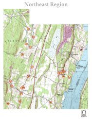
North Central Region

You also want an ePaper? Increase the reach of your titles
YUMPU automatically turns print PDFs into web optimized ePapers that Google loves.
74º05’<br />
16.002<br />
27.002<br />
27.004<br />
Xx<br />
74º04’<br />
7.004<br />
74º03’<br />
17.005<br />
28.001<br />
74º02’<br />
8.001<br />
8.003<br />
17.001<br />
28.003<br />
17.048<br />
16.004 17.003<br />
74º01’<br />
2.003<br />
17.007<br />
17.051<br />
74º00’<br />
28.002<br />
28.011<br />
8.002<br />
17.002<br />
17.015<br />
28.058<br />
2.004<br />
18.004<br />
17.016<br />
17.004<br />
28.004<br />
73º59’<br />
73º58’<br />
19.001<br />
18.001<br />
29.013<br />
29.003<br />
73º57’<br />
9.003<br />
29.005<br />
29.009<br />
40.001<br />
18.055<br />
29.046<br />
29.047<br />
18.010<br />
73º56’<br />
73º55’<br />
42º10’<br />
42º09’30”<br />
42º09’<br />
42º08’30”<br />
42º08’<br />
42º07’30”<br />
42º07’<br />
42º06’30”<br />
42º06’<br />
42º05’30”<br />
42º05’<br />
42º04’30”<br />
42º04’<br />
42º03’30”<br />
42º03’<br />
42º02’30”<br />
42º02’<br />
42º01’30”<br />
42º01’<br />
42º00’30”<br />
42º00’<br />
© 2004, M. S. Smith<br />
73º54’<br />
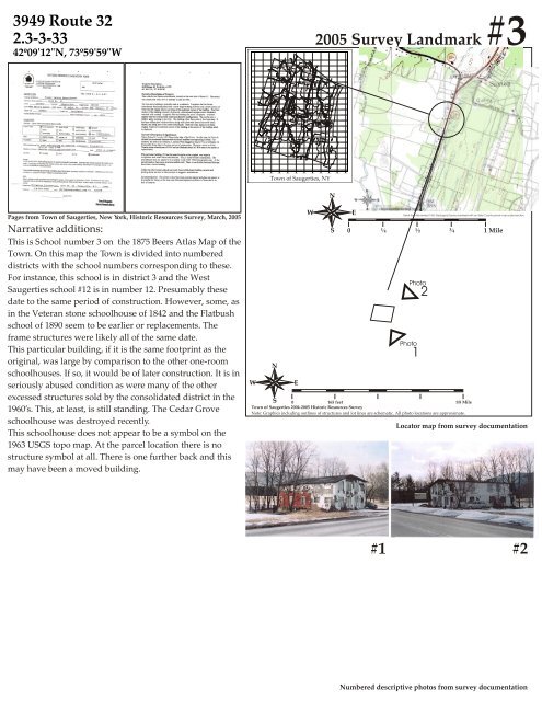
3949 Route 32<br />
2.3-3-33<br />
42º09'12"N, 73º59'59"W<br />
2005 Survey Landmark #3<br />
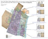
Town of Saugerties, NY<br />
N<br />
Pages from Town of Saugerties, New York, Historic Resources Survey, March, 2005<br />
Narrative additions:<br />
This is School number 3 on the 1875 Beers Atlas Map of the<br />
Town. On this map the Town is divided into numbered<br />
districts with the school numbers corresponding to these.<br />
For instance, this school is in district 3 and the West<br />
Saugerties school #12 is in number 12. Presumably these<br />
date to the same period of construction. However, some, as<br />
in the Veteran stone schoolhouse of 1842 and the Flatbush<br />
school of 1890 seem to be earlier or replacements. The<br />
frame structures were likely all of the same date.<br />
This particular building, if it is the same footprint as the<br />
original, was large by comparison to the other one-room<br />
schoolhouses. If so, it would be of later construction. It is in<br />
seriously abused condition as were many of the other<br />
excessed structures sold by the consolidated district in the<br />
1960’s. This, at least, is still standing. The Cedar Grove<br />
schoolhouse was destroyed recently.<br />
This schoolhouse does not appear to be a symbol on the<br />
1963 USGS topo map. At the parcel location there is no<br />
structure symbol at all. There is one further back and this<br />
may have been a moved building.<br />
W<br />
N<br />
S<br />
E<br />
W<br />
S<br />
E<br />
Detail from the revised 1963 Geological Survey overlayed with an Ulster County parcel map scaled section.<br />
0 ¼ ½ ¾ 1 Mile<br />
Photo<br />
Photo<br />
0 165 feet<br />
1/8 Mile<br />
Town of Saugerties 2004-2005 Historic Resources Survey<br />
Note: Graphics including outlines of structures and lot lines are schematic. All photo locations are approximate.<br />
1<br />
2<br />
Locator map from survey documentation<br />
#1 #2<br />
Numbered descriptive photos from survey documentation