Urban Street Design Guidelines - (CSS) National Dialog 2
Urban Street Design Guidelines - (CSS) National Dialog 2
Urban Street Design Guidelines - (CSS) National Dialog 2

You also want an ePaper? Increase the reach of your titles
YUMPU automatically turns print PDFs into web optimized ePapers that Google loves.
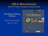
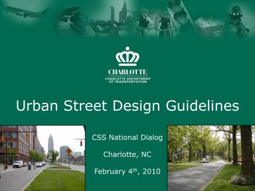
<strong>Urban</strong> <strong>Street</strong> <strong>Design</strong> <strong>Guidelines</strong><br />
<strong>CSS</strong> <strong>National</strong> <strong>Dialog</strong><br />
Charlotte, NC<br />
February 4 th , 2010
Transportation Action Plan (TAP)<br />
and <strong>Urban</strong> <strong>Street</strong> <strong>Design</strong><br />
<strong>Guidelines</strong> (USDG)<br />
• TAP is Charlotte’s longrange<br />
comprehensive<br />
transportation plan<br />
• TAP describes policies,<br />
projects and programs<br />
• USDG are applied to<br />
design streets and blocks
The TAP and the USDG<br />
• TAP Goal 2 – provide<br />
more and better travel<br />
choices<br />
• “More” (quantity)<br />
specified in TAP policies<br />
and TAP programs<br />
• “Better” (quality)<br />
defined by the USDG
TAP Policy 2.1.4<br />
The City will promote context-sensitive streets (i.e., by<br />
designing transportation projects within the context of<br />
adjacent land uses, to improve safety and neighborhood<br />
livability, promote transportation choices and meet land use<br />
objectives), consistent with the City’s <strong>Urban</strong> <strong>Street</strong> <strong>Design</strong><br />
<strong>Guidelines</strong>.
The USDG<br />
• (17) policy statements<br />
• (6-step) planning and design process<br />
• (land-use based) street options<br />
• design requirements and expectations<br />
(dimensions, tradeoffs)
Example of Policy Statement<br />
By adopting the USDG, the City Council declares<br />
that it is the policy of the City of Charlotte to:<br />
#5: Apply the appropriate USDG street<br />
classifications and cross-sections, as<br />
described in Chapter 4 of the USDG, to new<br />
local and non-local streets built through the<br />
land development process by either the<br />
private sector or public agencies.
Existing and Future<br />
Conditions<br />
Goals and<br />
Objectives<br />
Decision-Making<br />
1. Define Land<br />
Use Context<br />
2. Define<br />
Transportation<br />
Context<br />
The Six-Step<br />
Process<br />
3. Identify<br />
Deficiencies<br />
4. Describe<br />
Future Objectives<br />
5. Define<br />
<strong>Street</strong> Type<br />
and Initial<br />
Cross-Section<br />
6. Describe<br />
Tradeoffs<br />
and Select<br />
Cross-Section
Example of Questions in<br />
6-Step Process<br />
Step 2: Existing and Future Transportation<br />
• Daily and hourly traffic volumes?<br />
• Posted and operating speeds?<br />
• Bicycle lanes or routes?<br />
• Bus stops or transit services?<br />
• Sidewalks and crossings?<br />
• Relationship to street network?<br />
• Changes in connectivity and capacity?
Intent of the USDG<br />
1. Context-based<br />
streets – reflect a<br />
variety of urban<br />
contexts<br />
2. “Complete” streets<br />
– safety and<br />
functionality for all<br />
modes – expanded<br />
choices<br />
3. “Complete” street<br />
network – variety<br />
of ways to create<br />
and maintain<br />
capacity
Context-Based<br />
Prescriptive <strong>Design</strong>
Context-Based<br />
“Not Prescriptive” <strong>Design</strong>
Planning for<br />
“Complete” <strong>Street</strong>s<br />
• “Quality” design<br />
creates long-lasting<br />
value<br />
• Strive for mobility,<br />
safety, and<br />
convenience for:<br />
– Motorists<br />
– Bicyclists<br />
– Pedestrians<br />
– Transit riders<br />
– Neighborhood residents<br />
– Property owners
<strong>Design</strong>ing<br />
“Complete” <strong>Street</strong>s<br />
• Six-step process<br />
encourages tradeoffs<br />
among all users (and<br />
design elements and<br />
dimensions)<br />
• Process will affect<br />
products (outcomes)
USDG - A Variety of<br />
<strong>Street</strong> Types<br />
Main <strong>Street</strong> Avenue Avenue Boulevard Boulevard<br />
Parkway<br />
Local <strong>Street</strong>s<br />
Local <strong>Street</strong><br />
Pedestrian-<br />
Oriented<br />
Land Uses and<br />
<strong>Street</strong> <strong>Design</strong>s<br />
Auto-<br />
Oriented
Applications of the USDG<br />
• CIP projects<br />
– Major Roadways<br />
– Farm-to-Market Roads<br />
– Intersections<br />
– Sidewalks<br />
– Neighborhood Improvement<br />
– Connectivity<br />
– Traffic Calming<br />
• Area plans<br />
• Rezonings
CIP Projects (Since 2005)
Rozzelles Ferry & West Trade
Kenilworth Avenue &<br />
Romany Road
Cindy Lane
Rozzelles Ferry Road
East Boulevard
Stonewall <strong>Street</strong>
West Morehead <strong>Street</strong>
Charlottetowne Avenue
Morris Field Drive
Pearl Park Way bridge
Area Plans
Old Pineville Road
DeWitt Lane
Creating Better<br />
<strong>Street</strong> Network
400’ blocks<br />
500’ blocks
Rezonings
Past “Problems at<br />
Intersections”<br />
• Congestion/delay<br />
occurs at<br />
intersections<br />
• Capacity/travel lanes<br />
added<br />
• Pedestrians/bicyclists<br />
often not considered
USDG - Intersections<br />
• New analysis<br />
methods for planning<br />
and designing<br />
signalized<br />
intersections<br />
• Bicycle and<br />
pedestrian level-ofservice<br />
measures<br />
• <strong>Design</strong> details for all<br />
intersections<br />
(signalized or not)
USDG - Intersections<br />
Transportation Research Record<br />
No. 1878<br />
Methodology to Assess <strong>Design</strong><br />
Features for Pedestrian and Bicyclist<br />
Crossings at Signalized Intersections<br />
Norm Steinman and David Keith Hines
USDG - Sidewalks<br />
and Planting Strips<br />
• Better street tree canopy with<br />
wider planting strips and street<br />
trees<br />
• Sidewalk dimensions that vary<br />
by land use
USDG - Provisions for<br />
Cycling<br />
• Bike lanes on higher<br />
volume/speed streets<br />
• Bike routes on lower<br />
volume/speed streets<br />
• Advantages for all users
USDG - “Built-In”<br />
Traffic Calming<br />
• Safer/more<br />
appropriate speeds<br />
• Enhanced livability<br />
• Expected with more<br />
connections<br />
• Can avoid future<br />
retrofits
USDG Accomplishments<br />
(Part 1)<br />
Completed<br />
Anticipated<br />
/Underway<br />
9 Thoroughfares rebuilt/extended 17<br />
19 <strong>Street</strong>scapes and road-conversions 8<br />
11 Intersections 8<br />
37 Sidewalks 66<br />
9 Area Plans 6
USDG Accomplishments<br />
(Part 2)<br />
• North Carolina APA Outstanding Planning Award<br />
(2008)<br />
• US EPA <strong>National</strong> Award for Smart Growth<br />
Achievement (2009)<br />
• NCDOT begins process to implement Complete<br />
<strong>Street</strong>s Policy<br />
• City staff are modifying subdivision and zoning<br />
ordinances to affect private-sector land<br />
development projects (2-3 year effort)
Charlotte’s <strong>Urban</strong> <strong>Street</strong><br />
<strong>Design</strong> <strong>Guidelines</strong><br />
For further information, contact:<br />
Tracy Newsome<br />
tnewsome@charlottenc.gov<br />
or<br />
Norm Steinman<br />
nsteinman@charlottenc.gov