PDF 5 MB - Harrow Council
PDF 5 MB - Harrow Council
PDF 5 MB - Harrow Council

Create successful ePaper yourself
Turn your PDF publications into a flip-book with our unique Google optimized e-Paper software.
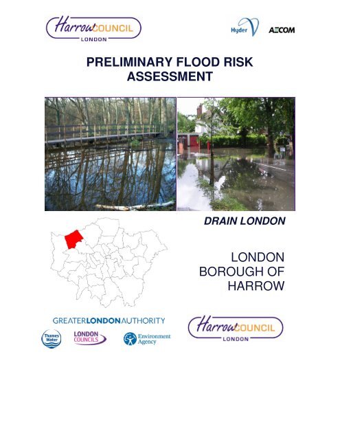
PRELIMINARY FLOOD RISK<br />
ASSESSMENT<br />
DRAIN LONDON<br />
LONDON<br />
BOROUGH OF<br />
HARROW
DOCUMENT INFORMATION<br />
Title<br />
Preliminary Flood Risk Assessment – Preliminary Assessment Report<br />
Owner<br />
AECOM Ltd<br />
Version 01<br />
Status<br />
Final<br />
Project Number 60165086<br />
File Name<br />
<strong>Harrow</strong>_PFRA<br />
REVISION HISTORY<br />
Summary of Changes Completed By Date of<br />
Issue<br />
Version<br />
AUTHOR<br />
Name<br />
A Perryman<br />
Organisation and Role<br />
AECOM Ltd, Consultant<br />
APPROVALS<br />
Name Title Signature Date<br />
R Lobley<br />
Project Manager - AECOM Ltd<br />
A Palmer<br />
Project Director – AECOM Ltd<br />
M Arthur<br />
Tier 1 PM<br />
K Reid<br />
GLA PM<br />
M Bradshaw<br />
<strong>Harrow</strong> <strong>Council</strong><br />
DISTRIBUTION<br />
Name<br />
P Calver<br />
D Harding<br />
R Sharma<br />
Organisation and Role<br />
Environment Agency<br />
Thames Water Utilities Limited<br />
Transport for London<br />
RELATED DOCUMENTS<br />
Doc Ref Document Title Author Date of<br />
Issue<br />
Version<br />
This document has been prepared by AECOM Limited for the sole use of our client (the “Client”) and in<br />
accordance with generally accepted consultancy principles, the budget for fees and the terms of reference<br />
agreed between AECOM Limited and the Client. Any information provided by third parties and referred to<br />
herein has not been checked or verified by AECOM Limited, unless otherwise expressly stated in the<br />
document. No third party may rely upon this document without the prior and express written agreement of<br />
AECOM Limited.
CONTENTS<br />
Executive Summary ........................................................................................ vi<br />
1 Introduction ........................................................................................... 1<br />
1.1 What is a Preliminary Flood Risk Assessment? ................................... 1<br />
1.2 Background .......................................................................................... 1<br />
1.3 Objectives ............................................................................................. 2<br />
1.4 Study Area – Geographic Extent .......................................................... 2<br />
1.5 Study Area – Demographics ................................................................. 3<br />
2 Lead Local Authority Responsibilities ................................................... 4<br />
2.1 Legislative Background ........................................................................ 4<br />
2.2 Leadership and Partnership.................................................................. 6<br />
2.3 Stakeholder Engagement ..................................................................... 6<br />
2.4 Public Engagement .............................................................................. 7<br />
2.5 Other Responsibilities ........................................................................... 7<br />
3 Methodology and Data Review ............................................................ 9<br />
3.1 Information Sharing & Data Sources .................................................... 9<br />
3.2 Availability ........................................................................................... 10<br />
3.3 Limitations .......................................................................................... 10<br />
3.4 Security, Licensing and Use Restrictions ........................................... 11<br />
3.5 Quality Assurance .............................................................................. 11<br />
4 Past Flood Risk .................................................................................. 12<br />
4.1 Summary of Past Floods .................................................................... 12<br />
4.2 Significant Harmful Consequences ..................................................... 22<br />
4.3 Interactions with Other Flooding Sources ........................................... 22<br />
5 Future Flood Risk ............................................................................... 22<br />
5.1 Summary of Future Flood Risk ........................................................... 23<br />
5.2 Locally Agreed Surface Water Information ......................................... 29<br />
5.3 Impact of Climate Change .................................................................. 29<br />
5.4 Impact of Future Development ........................................................... 30<br />
6 Review of Indicative Flood Risk ......................................................... 31<br />
6.1 Extent of FRA ..................................................................................... 32<br />
6.2 Review of FRA .................................................................................... 32<br />
7 Identification of Flood Risk Areas ....................................................... 33<br />
7.1 Amendments to FRA .......................................................................... 33<br />
7.2 New FRA ............................................................................................ 33<br />
8 Next Steps .......................................................................................... 33<br />
8.1 Scrutiny and Review ........................................................................... 33<br />
8.2 Data Collection and Management ...................................................... 34<br />
8.3 Other FRR Requirements ................................................................... 36<br />
9 References ......................................................................................... 37<br />
60165086 – Drain London – London Borough of <strong>Harrow</strong> PFRA i
List of Figures<br />
Figure 1-1 London Borough of <strong>Harrow</strong> Boundary ....................................... 3<br />
Figure 1-2 Area for Intensification ............................................................... 4<br />
Figure 4-1 Significant Historical Flood Incidents ....................................... 17<br />
Figure 4-2 Historic Fluvial Flood Incidents ................................................ 18<br />
Figure 4-3 Historic Groundwater Flood Incidents ...................................... 20<br />
Figure 4-4 Thames Water DG5 Records ................................................... 21<br />
Figure 5-1 Areas Susceptible to Surface Water Flooding ......................... 23<br />
Figure 5-2 Flood Map for Surface Water ................................................... 24<br />
Figure 5-3 Flood Zones ............................................................................. 25<br />
Figure 5-4 Groundwater Susceptibility Maps ............................................. 26<br />
Figure 6-1 London Indicative Flood Risk Area .......................................... 32<br />
Figure 8-1 Stage 1 – Basic flood event data collection ............................. 34<br />
Figure 8-2<br />
Figure 8-3<br />
Stage 2 & 3 – Entry of more detailed flood event information<br />
and initial investigation log ....................................................... 35<br />
Stage 4 – Allows for the inclusion of more detailed flood<br />
event investigation/ information or follow up ............................ 35<br />
List of Tables<br />
Table 1-1<br />
Summary of stages of activity required as part of the<br />
European Floods Directive ......................................................... 1<br />
Table 2-1 Stakeholders involved in the developing PFRA process ........... 6<br />
Table 2-2<br />
LLFA Responsibilities under the FRR and FWMA (Grey<br />
boxes indicate duties that have yet to be commenced into UK<br />
law) ............................................................................................. 8<br />
Table 3-1 Stakeholders contacted and the information provided ............. 10<br />
Table 4-1 Significant Flood Events London Borough of <strong>Harrow</strong> .............. 15<br />
Table 5-1 Summary of properties at risk of surface water runoff ............. 27<br />
Table 5-2 Summary of properties at risk of groundwater flooding ........... 27<br />
Table 5-3<br />
Table 5-4<br />
Summary of properties at risk of future flooding from multiple<br />
sources ..................................................................................... 28<br />
Flood risk threshold used to identify future consequences of<br />
flooding ..................................................................................... 28<br />
Table 5-5 Regeneration areas in <strong>Harrow</strong> ................................................. 30<br />
Table 5-6 Areas for intensification ............................................................ 31<br />
60165086 – Drain London – London Borough of <strong>Harrow</strong> PFRA ii<br />
AECOM Ltd
Term<br />
Aquifer<br />
Definition<br />
A source of groundwater comprising water bearing rock, sand or gravel capable of<br />
yielding significant quantities of water.<br />
Asset Management A plan for managing water and sewerage company (WaSC) infrastructure and other<br />
Plan, (AMP) assets in order to deliver an agreed standard of service.<br />
AStSWF<br />
Catchment Flood<br />
Management Plan,<br />
(CFMP)<br />
CIRIA<br />
Civil Contingencies<br />
Act<br />
CLG<br />
Climate Change<br />
Critical Drainage<br />
Area, (CDA)<br />
Culvert<br />
Defra<br />
DEM<br />
DG5 Register<br />
DTM<br />
EA<br />
FAS<br />
FCERM<br />
Indicative Flood Risk<br />
Areas<br />
FMfSW<br />
Flood defence<br />
Flood Risk Area<br />
Areas Susceptible to Surface Water Flooding<br />
A high-level planning strategy through which the Environment Agency works with their<br />
key decision makers within a river catchment to identify and agree policies to secure the<br />
long-term sustainable management of flood risk.<br />
Construction Industry Research and Information Association<br />
This Act delivers a single framework for civil protection in the UK. As part of the Act,<br />
Local Resilience Forums must put into place emergency plans for a range of<br />
circumstances including flooding.<br />
Government Department for Communities and Local Government<br />
Long term variations in global temperature and weather patterns caused by natural and<br />
human actions.<br />
Areas of significant flood risk, characterised by the amount of surface runoff that drains<br />
into the area, the topography and hydraulic conditions of the pathway (e.g. sewer, river<br />
system), and the receptors (people, properties and infrastructure) that may be affected.<br />
A channel or pipe that carries water below the level of the ground.<br />
Department for Environment, Food and Rural Affairs<br />
Digital Elevation Model<br />
A water-company held register of properties which have experienced sewer flooding<br />
due to hydraulic overload, or properties which are 'at risk' of sewer flooding more<br />
frequently than once in 20 years.<br />
Digital Terrain Model<br />
Environment Agency<br />
Flood Alleviation Scheme<br />
Flood and Coastal Erosion Risk Management (FCERM)<br />
Areas determined by the Environment Agency as indicatively having a significant flood<br />
risk, based on guidance published by Defra and WAG and the use of certain national<br />
datasets. These indicative areas are intended to provide a starting point for the<br />
determination of Flood Risk Areas by LLFAs.<br />
Flood Map for Surface Water<br />
Infrastructure used to protect an area against floods as floodwalls and embankments;<br />
they are designed to a specific standard of protection (design standard).<br />
An area determined as having a significant risk of flooding in accordance with guidance<br />
published by Defra and WAG.<br />
60165086 – Drain London – London Borough of <strong>Harrow</strong> PFRA iii<br />
AECOM Ltd
Term<br />
Flood Risk<br />
Regulations<br />
Floods and Water<br />
Management Act<br />
Fluvial Flooding<br />
FRR<br />
IDB<br />
IUD<br />
LB<br />
LBH<br />
LDF<br />
Lead Local Flood<br />
Authority, (LLFA)<br />
LiDAR<br />
Local Resilience<br />
Forum, (LRF)<br />
LPA<br />
Main River<br />
NRD<br />
Definition<br />
Transposition of the EU Floods Directive into UK law. The EU Floods Directive is a<br />
piece of European Community (EC) legislation to specifically address flood risk by<br />
prescribing a common framework for its measurement and management.<br />
Part of the UK Government's response to Sir Michael Pitt's Report on the Summer 2007<br />
floods, the aim of which is to clarify the legislative framework for managing surface<br />
water flood risk in England.<br />
Flooding resulting from water levels exceeding the bank level of a main river<br />
Flood Risk Regulations<br />
Internal Drainage Board<br />
Integrated Urban Drainage<br />
London Borough<br />
London Borough of <strong>Harrow</strong><br />
Local Development Framework<br />
Local Authority responsible for taking the lead on local flood risk management<br />
Light Detection and Ranging<br />
A multi-agency forum, bringing together all the organisations that have a duty to<br />
cooperate under the Civil Contingencies Act, and those involved in responding to<br />
emergencies. They prepare emergency plans in a co-ordinated manner.<br />
Local Planning Authority<br />
A watercourse shown as such on the Main River Map, and for which the Environment<br />
Agency has responsibilities and powers<br />
National Receptor Dataset – a collection of risk receptors produced by the Environment<br />
Agency<br />
Ordinary Watercourse All watercourses that are not designated Main River, and which are the responsibility of<br />
Local Authorities or, where they exist, IDBs<br />
PAR<br />
Partner<br />
PFRA<br />
Pitt Review<br />
Pluvial Flooding<br />
PPS25<br />
Preliminary Assessment Report<br />
A person or organisation with responsibility for the decision or actions that need to be<br />
taken.<br />
Preliminary Flood Risk Assessment<br />
Comprehensive independent review of the 2007 summer floods by Sir Michael Pitt,<br />
which provided recommendations to improve flood risk management in England.<br />
Flooding from water flowing over the surface of the ground; often occurs when the soil<br />
is saturated and natural drainage channels or artificial drainage systems have<br />
insufficient capacity to cope with additional flow.<br />
Planning and Policy Statement 25: Development and Flood Risk<br />
60165086 – Drain London – London Borough of <strong>Harrow</strong> PFRA iv<br />
AECOM Ltd
Term<br />
Definition<br />
Resilience Measures Measures designed to reduce the impact of water that enters property and businesses;<br />
could include measures such as raising electrical appliances.<br />
Resistance Measures Measures designed to keep flood water out of properties and businesses; could include<br />
flood guards for example.<br />
Risk<br />
Risk Management<br />
Authority, (RMA)<br />
Sewer flooding<br />
SFRA<br />
Stakeholder<br />
In flood risk management, risk is defined as a product of the probability or likelihood of a<br />
flood occurring, and the consequence of the flood.<br />
As defined by the Floods and Water Management Act<br />
Flooding caused by a blockage or overflowing in a sewer or urban drainage system.<br />
Strategic Flood Risk Assessment<br />
A person or organisation affected by the problem or solution, or interested in the<br />
problem or solution. They can be individuals or organisations, includes the public and<br />
communities.<br />
Sustainable Drainage Methods of management practices and control structures that are designed to drain<br />
Systems, (SuD)s surface water in a more sustainable manner than some conventional techniques.<br />
Surface water<br />
SWMP<br />
TfL<br />
TWUL<br />
WAG<br />
WaSC<br />
Rainwater (including snow and other precipitation) which is on the surface of the ground<br />
(whether or not it is moving), and has not entered a watercourse, drainage system or<br />
public sewer.<br />
Surface Water Management Plan<br />
Transport for London<br />
Thames Water Utilities Ltd<br />
Welsh Assembly Government<br />
Water and Sewerage Company<br />
60165086 – Drain London – London Borough of <strong>Harrow</strong> PFRA v<br />
AECOM Ltd
Executive Summary<br />
This Preliminary Assessment Report (PAR) is a key document informing the preparation of future Local<br />
Flood Risk Management Strategies as required by the Flood and Water Management Act 2010 (FWMA) i .<br />
This PAR identifies key flood risk areas within the London Borough of <strong>Harrow</strong> (LBH). This document fulfils<br />
the LBH’s obligations as a Lead Local Flood Authority (LLFA) under the requirements of the Flood Risk<br />
Regulations 2009 (FRR) ii .<br />
The PAR along with the supporting Annex spreadsheets and figures fulfil the first stage Preliminary Flood<br />
Risk Assessment (PFRA) requirements of the Regulations. The PFRA is a high level screening exercise that<br />
brings together easily available information from a number of sources to assess local flood risk. As LLFA,<br />
LBH are required to submit their PFRA to the Environment Agency by the 22nd June 2011.<br />
The Department for Environment, Food and Rural Affairs (DEFRA) and the Welsh Assembly Government<br />
(WAG) have established a series of significance and threshold criteria to define flood risk areas in the UK.<br />
Guidance on applying these thresholds has been provided by DEFRA iii . The Environment Agency used the<br />
DEFRA criteria to develop a national dataset which identified Indicative Flood Risk Areas. The LBH falls<br />
within the Greater London Indicative Flood Risk Area.<br />
For the PFRA all readily available data was collated from key stakeholders within the LBH. This allowed for<br />
the identification of significant historic flood events within the borough. A number of the older records were<br />
found to be inconsistent and incomplete; however LBH does have significantly more up to date records than<br />
most other Boroughs. These have been summarised in Annex 1 of the Preliminary Assessment spreadsheet.<br />
Future flood risk within LBH has been assessed by looking at the borough as a whole and assessing<br />
potential risk areas based on a variety of local flooding sources. The Environment Agency’s Areas<br />
Susceptible to Surface Water Flooding (AStSWF), Flood Map for Surface Water (FMfSW), Fluvial Flood<br />
Zones and the British Geological Society’s Groundwater Susceptibility Maps were used to identify areas at<br />
risk. Based on the FMfSW approximately 40,051 properties are at risk of flooding to a depth of 0.3 metres in<br />
a 1 in 200 year rainfall event. Future flood risk has been summarised in Annex 2 of the Preliminary<br />
Assessment spreadsheet.<br />
60165086 – Drain London – London Borough of <strong>Harrow</strong> PFRA vi<br />
AECOM Ltd
1 Introduction<br />
1.1 What is a Preliminary Flood Risk Assessment?<br />
The Preliminary Flood Risk Assessment (PFRA) is a high level screening exercise that brings<br />
together easily available information from a number of sources to assess local flood risk. The<br />
key stages of PFRA involve:<br />
<br />
<br />
<br />
Collecting information on past (historic) and future (potential) floods and flood risk.<br />
Assembling the information into a Preliminary Assessment Report (PAR).<br />
Identification of Flood Risk Areas by reviewing the national indicative areas produced<br />
by the Environment Agency alongside local information from the Preliminary<br />
Assessment Report.<br />
This PAR is a key document informing the preparation of future Local Flood Risk Management<br />
Strategies as required by the Flood and Water Management Act 2010 (FWMA) iv . This PAR<br />
identifies key flood risk areas within the London Borough of <strong>Harrow</strong> (LBH). This document fulfils<br />
the LBH’s obligations as a Lead Local Flood Authority (LLFA) under the requirements of the<br />
Flood Risk Regulations 2009 (FRR) v .<br />
1.2 Background<br />
The FRR came into force in December 2009 with the aim of implementing the requirements of<br />
the European Floods Directive vi in England and Wales. The aim of the Directive is to provide a<br />
consistent approach to managing flood risk across Europe. It establishes four stages of activity<br />
within a six year flood management cycle (Table 1-1).<br />
Stages<br />
Delivery Date<br />
Preliminary Assessment Report (PFRA) 22 nd June 2011<br />
Develop Flood Risk Areas based on the PFRA findings 22 nd June 2011<br />
Derive Flood Hazard and Risk Mapping for each Flood Risk Area 22 nd June 2013<br />
Develop an effective Flood Risk Management Plan for each Flood Risk Area 22 nd June 2015<br />
Table 1-1<br />
Summary of stages of activity required as part of the European Floods Directive<br />
The FRR define new responsibilities for flood risk management based on the recommendations<br />
of the Pitt Review vii and included within the FWMA. Under these legislative items, all Upper Tier<br />
Authorities (including the London Boroughs) are designated a LLFA. As such, LBH has been<br />
allocated a number of key responsibilities with respect to local flood risk management. A fuller<br />
description of these responsibilities is given in Chapter 2.<br />
The scope of the PFRA is to consider past flooding and possible future flooding from surface<br />
water runoff, groundwater and ordinary watercourses in LBH.<br />
The PFRA must consider floods which have SIGNIFICANT harmful consequences for human<br />
health, economic activity and the environment. The work will also assess the existing Indicative<br />
60165086 – Drain London – London Borough of <strong>Harrow</strong> PFRA 1<br />
AECOM Ltd
Flood Risk Areas as designated by the EA and determine if any amendments should be made<br />
to this dataset.<br />
As identified in Part 2 of the FRR, flooding associated with the sea, main rivers and reservoirs is<br />
the responsibility of the Environment Agency and does not need to be considered by the LLFA<br />
as part of the PFRA process, unless it is considered that it may affect flooding from local flood<br />
sources.<br />
1.3 Objectives<br />
The aim of this document is to fulfil LBH’s obligations as the LLFA under the requirements of the<br />
FRR. The PFRA aims to locate areas in which the risk of surface water and groundwater<br />
flooding is significant and warrants further examination through the production of maps and<br />
management plans.<br />
The aim of this PFRA is to provide an assessment of local flood risk across the study area,<br />
including information on past floods and the potential consequences of future floods. The key<br />
objectives can be summarised as follows:<br />
<br />
<br />
<br />
<br />
<br />
<br />
<br />
<br />
Identify relevant partner organisations involved in future assessment of flood risk; and<br />
summarise means of future and ongoing stakeholder engagement;<br />
Describe arrangements for partnership and collaboration for ongoing collection,<br />
assessment and storage of flood risk data and information;<br />
Provide a summary of the systems used for data sharing and storing, and provision for<br />
quality assurance, security and data licensing arrangements;<br />
Summarise the methodology adopted for the PFRA with respect to data sources,<br />
availability and review procedures;<br />
Assess historic flood events within the study area from local sources of flooding<br />
(including flooding from surface water, groundwater and ordinary watercourses), and<br />
the consequences and impacts of these events;<br />
Establish an evidence base of historic flood risk information, which will be built up on in<br />
the future and used to support and inform the preparation of LBH’s Local Flood Risk<br />
Strategy;<br />
Assess the potential harmful consequences of future flood events within the study area;<br />
Review the provisional national assessment of indicative Flood Risk Areas provided by<br />
the Environment Agency and provide explanation and justification for any amendments<br />
required to the Flood Risk Areas.<br />
1.4 Study Area – Geographic Extent<br />
The <strong>Harrow</strong> PFRA study area covers approximately 5,046 hectares of North West London<br />
covering the administrative boundary for LBH (Figure 1-1). The study area includes the urban<br />
area of <strong>Harrow</strong>, consisting of 21 Wards.<br />
60165086 – Drain London – London Borough of <strong>Harrow</strong> PFRA 2<br />
AECOM Ltd
Figure 1-1<br />
London Borough of <strong>Harrow</strong> Boundary<br />
<strong>Harrow</strong> is bordered to the east, south and west by the London Boroughs of Barnet, Brent,<br />
Ealing and Hillingdon. To the north, <strong>Harrow</strong> is bordered by Hertfordshire County <strong>Council</strong>.<br />
The study area falls within the Thames River Basin District and is served by two water<br />
companies – Veolia Water Central Limited who provides potable drinking water and collects<br />
sewage rates on behalf of Thames Water Utilities Limited who are the Sewerage Authority. The<br />
study area is served by the Environment Agency South East Region and is part of the South<br />
East Regional Flood and Coastal Committee.<br />
1.5 Study Area – Demographics<br />
The population of <strong>Harrow</strong> in 2009 was approximately 228,100, an increase of 8.6% since<br />
2001 viii . There are approximately 79,112 households in the borough ix , this is expected to<br />
increase as regeneration in Wealdstone and South <strong>Harrow</strong> gets under way (Figure 1-2).<br />
60165086 – Drain London – London Borough of <strong>Harrow</strong> PFRA 3<br />
AECOM Ltd
Figure 1-2<br />
Area for Intensification<br />
2 Lead Local Authority Responsibilities<br />
One of the main responsibilities of the LLFA is to produce a PFRA. They are also responsible<br />
for the coordination of flood risk management.<br />
2.1 Legislative Background<br />
The Flood Risk Regulations 2009 transposes the requirements of the European Floods<br />
Directive into UK law in England and Wales. The aim of the Directive is to provide a consistent<br />
approach to managing flood risk across Europe. It establishes four stages of activity within a six<br />
year flood risk management cycle.<br />
The Flood and Water Management Act, (FWMA) 2010 defines new responsibilities for flood risk<br />
management based on the recommendations of the Pitt Review. As the LLFA, <strong>Harrow</strong> <strong>Council</strong><br />
is responsible for managing risk from the following local flood sources in the LBH: surface water,<br />
60165086 – Drain London – London Borough of <strong>Harrow</strong> PFRA 4<br />
AECOM Ltd
groundwater and ordinary watercourses. (The Environment Agency is responsible for managing<br />
risk from main rivers, the sea and large raised reservoirs)<br />
The aim of this PFRA is to fulfil <strong>Harrow</strong> <strong>Council</strong>’s obligations as the LLFA, to meet their duties to<br />
manage local flood risk and deliver the requirements of the Flood Risk Regulations.<br />
2.1.1 Links to other Legislative Background<br />
The FWMA aims to improve flood risk management and the way we manage our water<br />
resources. The Act gives the Environment Agency the responsibility for producing a national<br />
strategy for Flood and Coastal Erosion Risk Management (FCERM). The Welsh Assembly<br />
Government (WAG) are responsible for producing the national strategy in Wales.<br />
The national strategies will provide the framework for local strategies which LLFAs are to<br />
develop and implement under the Act. These will be based on an assessment of risk which<br />
should incorporate evidence gathered as part of the PFRA process.<br />
SWMP’s consider flood risk from surface runoff, groundwater and ordinary watercourses and<br />
the interaction with flooding from main rivers, the sea and sewers. The aim of a SWMP is to<br />
provide a greater understanding of local flood risk and to develop action plans to manage the<br />
risks. This will help inform development, detail where more detailed work is required and assist<br />
in the preparation of flood risk management plans. There is a Surface Water Management Plan<br />
currently underway for the LBH area as part of the Drain London Tier 2 works, where all 33<br />
London Boroughs are undertaking the development of SWMPs. The outputs from both of these<br />
studies will be used to support and inform the next stages of the requirements of the FRR and<br />
the FWMA.<br />
The Strategic Environmental Assessment (SEA) Directive (2001/42/EC) is implemented in the<br />
UK by ‘The Environmental Assessment of Plans and Programmes Regulations 2004. Its<br />
objective is ‘to provide for a high level of protection of the environment and to contribute to the<br />
integration of environmental considerations into the preparation and adoption of plans and<br />
programmes with a view to promoting sustainable development’.<br />
The flood risk management plans required under the Flood Risk Regulations fall under the<br />
scope of the SEA Directive. The Flood Risk Regulations to a large extent build in the<br />
consideration of the environment as the preliminary assessment report and the selection of<br />
Flood Risk Areas must consider significant consequences of flooding on the environment.<br />
Information collected during the PFRA can be used to develop the SEA documentation later in<br />
the process.<br />
The INSPIRE Directive (2007/2/EC) is implemented in the UK by the INSPIRE Regulations<br />
2009. Its main aim is to improve the quality, consistency and accessibility of spatial data sets<br />
and services for environmental data to ensure they can be shared and integrated seamlessly<br />
into applications with minimal manual intervention. The PFRA should be carried out in<br />
accordance with the general principles of INSPIRE.<br />
60165086 – Drain London – London Borough of <strong>Harrow</strong> PFRA 5<br />
AECOM Ltd
2.2 Leadership and Partnership<br />
As the designated LLFA, <strong>Harrow</strong> <strong>Council</strong> is responsible for leading local flood risk management<br />
across the borough. Much of the local knowledge and technical expertise necessary for the LBH<br />
to fulfil their duties as LLFA lies with partner organisations. It is therefore crucial that <strong>Harrow</strong><br />
<strong>Council</strong> works alongside these partner organisations to ensure effective and consistent<br />
management of local flood risk throughout the borough, which contributes to the provision of a<br />
coordinated and holistic approach to flood risk management across the borough.<br />
As the LLFA, <strong>Harrow</strong> <strong>Council</strong> is responsible for forging effective partnerships with Thames<br />
Water and the Environment Agency, as well as other key stakeholders and risk management<br />
authorities.<br />
Ideally the working arrangements should be formalised to ensure clear lines of communication,<br />
mutual co-operation and management through the provision of Level of Service Agreements<br />
(LoSA) or Memorandums of Understanding (MoU).<br />
Currently LBH have internal relationships across a number of departments to deal with surface<br />
water flooding issues. As part of the SWMP process they intend to formalise their influence on<br />
external groups.<br />
2.3 Stakeholder Engagement<br />
As part of the PFRA, the Drain London Group 2 sought to engage stakeholders representing the<br />
following organisations and authorities.<br />
Stakeholders<br />
Contact Number<br />
<strong>Harrow</strong> <strong>Council</strong> 020 8863 5611<br />
British Waterways 01923 201120<br />
Environment Agency 08708 506 506<br />
Highways Agency 0300 123 5000<br />
London Fire Brigade 020 8555 1200<br />
Network Rail 0845 711 4141<br />
Thames Water 0845 9200 800<br />
Transport for London 0845 330 9876<br />
Table 2-1<br />
Stakeholders involved in the developing PFRA process<br />
All the above stakeholders were made aware of the study and were encouraged to provide input<br />
into the study where possible. There have been regular meetings which involved the group 2<br />
borough councils and key stakeholders to keep them up to date with progress and to encourage<br />
discussions between the stakeholders.<br />
60165086 – Drain London – London Borough of <strong>Harrow</strong> PFRA 6<br />
AECOM Ltd
2.4 Public Engagement<br />
It is important to incorporate public engagement into local flood risk management planning. The<br />
public can provide invaluable information which can aid the development of more effective<br />
management strategies. By keeping the public informed of future flood risk management plans<br />
trust can be built between the public and the local government.<br />
Subsequent stages of this process, will require increasing levels of public engagement,<br />
particularly during the formulation of the local flood risk management plans (for the Flood Risk<br />
Areas within LBH) as this will help to inform future levels of public engagement. It is<br />
recommended that <strong>Harrow</strong> <strong>Council</strong> follow the guidelines outlined in the Environment Agency’s<br />
‘Building Trust with Communities’ document x which provides a useful process of how to<br />
communicate risk including the causes, probability and consequences to the general public and<br />
professional forums such as local resilience forums.<br />
2.5 Other Responsibilities<br />
Aside from forging partnerships and coordinating and leading on local flood management, there<br />
are a number of other key responsibilities that have arisen for LLFA from the FWMA and FRR.<br />
These responsibilities include:<br />
60165086 – Drain London – London Borough of <strong>Harrow</strong> PFRA 7<br />
AECOM Ltd
Responsibility<br />
Asset Register<br />
Details<br />
LLFAs have a duty to maintain a register of structures or features<br />
which are considered to have an effect on flood risk, including details<br />
on ownership and condition as a minimum. The register must be<br />
available for inspection and the Secretary of State will be able to<br />
make regulations about the content of the register and records.<br />
LBH already has in place a well developed, digitally based system for<br />
managing drainage assets.<br />
Designation powers<br />
Investigating flood incidents<br />
LLFAs, as well as the Environment Agency have powers to designate<br />
structures and features that affect flooding or coastal erosion in order<br />
to safeguard assets that are relied upon for flood or coastal erosion<br />
risk management.<br />
LLFAs have a duty to investigate and record details of significant<br />
flood events within their area. This duty includes identifying which<br />
authorities have flood risk management functions and what they have<br />
done or intend to do with respect to the incident, notifying risk<br />
management authorities where necessary and publishing the results<br />
of any investigations carried out. Further information with respect to<br />
this duty is provided in Chapter 7.<br />
Local Strategy for Flood Risk<br />
Management<br />
LBH intend to further develop its MS Access Flood Defence Register<br />
to include the reporting of and investigating all future flood events.<br />
This will also include the transfer and rationalizing of previous flood<br />
event data from internal sources.<br />
LLFAs are required to develop, maintain, apply and monitor a local<br />
strategy for flood risk management in its area. The local strategy will<br />
build upon information such as national risk assessments and will use<br />
consistent risk based approaches across different local authority<br />
areas and catchments<br />
SUDS Approval Body<br />
Works powers<br />
LLFAs are designated the SUDS Approving Body (SAB) for any new<br />
drainage system, and therefore must approve, adopt and maintain<br />
any new sustainable drainage systems (SUDS) within their area once<br />
SuDs guidance is published.<br />
LLFAs have powers to undertake works to manage flood risk from<br />
surface runoff and groundwater, consistent with the local flood risk<br />
management strategy for the area<br />
LBH have their own Land Drainage Bylaws made using the powers in<br />
the Land Drainage Act 1991.<br />
Table 2-2<br />
LLFA Responsibilities under the FRR and FWMA (Grey boxes indicate duties that have yet to be<br />
commenced into UK law)<br />
60165086 – Drain London – London Borough of <strong>Harrow</strong> PFRA 8<br />
AECOM Ltd
3 Methodology and Data Review<br />
The approach for producing this PFRA was based upon the Environment Agency’s PFRA Final<br />
Guidance xi , which was released in December 2010, and as required within the guidance this<br />
PFRA is based on readily available or derivable data.<br />
3.1 Information Sharing & Data Sources<br />
A number of stakeholders were consulted and provided information used to inform this PFRA. A<br />
list of the stakeholders is below along with a summary of the data provided:<br />
Stakeholder<br />
Information Provided<br />
Publicly Available<br />
Not Publicly Available<br />
British Geological Society<br />
British Waterways<br />
Susceptibility to ground water flooding<br />
maps, permeability maps<br />
BW canals network<br />
<strong>Harrow</strong> <strong>Council</strong> <strong>Harrow</strong> SFRA (June 2009),<br />
North London SFRA (August<br />
2008),<br />
North Brent IUD Study (May<br />
2008)<br />
Kenmore Avenue Initial Report<br />
(November 2010)<br />
River Brent FAS (May 1982)<br />
Ordinary watercourses, critical<br />
infrastructure (fire stations, schools<br />
etc), historical flooding locations,<br />
transport infrastructure<br />
London Fire Brigade<br />
London Underground<br />
Flood incident database<br />
Pump site data, station flood risk<br />
summary<br />
Greater London Authority Administrative boundaries, OS<br />
Mapping ,Master Maps, LiDAR,<br />
London Plan data including proposed<br />
regeneration and intensification areas<br />
Highways Agency<br />
Asset data, flood hot spot locations<br />
Environment Agency National Receptor Databases,<br />
historical flood outlines, modelled flood<br />
event outlines, flood affected<br />
properties, main rivers, detailed river<br />
network, groundwater flooding<br />
incidents<br />
Natural England<br />
SACs, SSSIs, SPAs, Ancient<br />
woodland, LNRs, NNRs,<br />
RAMSARs, woodland, agricultural<br />
land classifications<br />
60165086 – Drain London – London Borough of <strong>Harrow</strong> PFRA 9<br />
AECOM Ltd
National Health Service<br />
Network Rail<br />
Health Trust Maps<br />
National Rail Network map<br />
Thames Water<br />
Transport for London<br />
Sewerage networks, asset information,<br />
DG5 sewers database<br />
Main transport links within the Greater<br />
London area<br />
Table 3-1<br />
Stakeholders contacted and the information provided<br />
3.2 Availability<br />
All relevant stakeholders within the LBH were contacted to collate as much readily available<br />
information as possible about the borough. There were several limitations with the available<br />
data which are outlined below.<br />
3.3 Limitations<br />
There are a number of limitations with the data provided for this PFRA. The intention of the<br />
report is to collect readily available data which has been used in this PAR. It is recommended<br />
that the issues identified below will act as a reminder to those involved in local Flood Risk<br />
Management to improve the quality of flood risk information going forward. A number of issues<br />
that are common across London Boroughs are summarised below:<br />
3.3.1 Incomplete and inconsistent recording of data<br />
The most significant limitation relates to the lack of specific event information provided within the<br />
older flood incident records. There was a lack of consistency regarding the amount of detail<br />
provided across all the stakeholders involved with Flood Risk Management for the study area.<br />
The amount of detail provided regarding each incident is not consistent.<br />
Specifically:<br />
<br />
<br />
<br />
There is limited knowledge related to flooding from ordinary watercourses within the<br />
borough boundary.<br />
Information regarding the source of flooding.<br />
Information regarding the dates of flood events<br />
As such, it is felt that the evidence collated to date is not complete and that they are unlikely to<br />
accurately represent the whole picture for flood risk issues across the study area. This will have<br />
a follow on effect of hindering the identification or alteration of the indicative flood risk areas<br />
proposed by the Environment Agency.<br />
3.3.2 Quality of data recorded<br />
As a result of the inconsistent recording of data, the quality of data varied within the datasets<br />
collated during the PFRA process. For example, a comprehensive dataset was received from<br />
60165086 – Drain London – London Borough of <strong>Harrow</strong> PFRA 10<br />
AECOM Ltd
the London Fire Brigade containing dates of call outs from a ‘Flood’. However, this dataset was<br />
of little use in its current format as the dataset does not provide any detail about each recorded<br />
event and ‘flood’ could refer to a multitude of causes ranging from minor internal flooding from<br />
domestic appliances to a major flood event.<br />
The EA groundwater flooding incident database contained a lot of isolated incidents of<br />
groundwater flooding. Within the LBH a majority of the events logged related to<br />
waterlogging/ponding in peoples gardens. It is difficult to determine if this is a localised<br />
drainage issue or a genuine groundwater flooding incident.<br />
A number of the older records were found to be inconsistent and incomplete, however LBH<br />
does have significantly more up to date records than most other Boroughs.<br />
3.3.3 Consequences<br />
Very few details were provided as to the consequences of specific historic flood events, making<br />
the assessment of the past significant events difficult to undertake.<br />
3.4 Security, Licensing and Use Restrictions<br />
A majority of the data has been specifically provided for this study (for use by the LLFA and their<br />
consultants) is not publicly available; therefore there are restrictions on data use. A number of<br />
specific agreements have been put in place for the PFRA and SWMP to facilitate the sharing of<br />
data between partners:<br />
<br />
<br />
<br />
<br />
<br />
GIS licences for mapping and data supplied by <strong>Harrow</strong> <strong>Council</strong><br />
British Geological Society (BGS) licence for geological data supplied by GIS<br />
Environment Agency Standard data licence<br />
Environment Agency surface water susceptibility maps licence<br />
Environment Agency LIDAR licence.<br />
3.5 Quality Assurance<br />
Flood historical data was assessed for its data quality and suitability for use in the Assessment<br />
of Significant Risk as per the Environment Agency’s PFRA Guidance. Further quality checks<br />
were undertaken as part of the SWMP in accordance with DEFRA guidance xii .<br />
60165086 – Drain London – London Borough of <strong>Harrow</strong> PFRA 11<br />
AECOM Ltd
4 Past Flood Risk<br />
Information provided by the stakeholders in Section 3 was collated and assessed to identify<br />
significant past flood events. The information was reviewed to establish the economic,<br />
environmental and cultural consequences of each event. This section summarises past floods<br />
with significant harmful consequences within LBH.<br />
Existing datasets, reports and anecdotal information from the stakeholders listed above were<br />
collated and reviewed to identify details of major past flood events and associated<br />
consequences including economic damage, environmental and cultural consequences and<br />
impact on the local population.<br />
It was anticipated that information would be provided in a geo-referenced format. However,<br />
where this was not the case for some datasets, this data was geo-referenced where possible.<br />
This made it possible to display this information using GIS software and overlay layers to<br />
identify the spatial distribution of historic flood events and relate these datasets to receptor<br />
information, in order to assess the overall flood risk.<br />
4.1 Summary of Past Floods<br />
In a majority of locations there was either property or critical infrastructure reportedly affected<br />
however little to no detail was given regarding property numbers or flood extent. The table<br />
below summarises reported significant past flooding events in the LBH.<br />
Location<br />
Kenmore Avenue<br />
(Daintry Close and<br />
Cullington Close)<br />
High street<br />
Wealdstone,<br />
Headstone Drive.<br />
Date<br />
(month/year)<br />
1900, 1927,<br />
1928, 1939,<br />
1944, 1947,<br />
1952, 1953,<br />
1956, 1957,<br />
1958, 1963,<br />
1970, 1971,<br />
1977, 1979,<br />
1981, 1982,<br />
1987, 1988,<br />
1992, 2000<br />
(above), 2004,<br />
2006, 2007<br />
Property<br />
Affected<br />
(number)<br />
Critical<br />
Infrastructure<br />
Affected (name)<br />
Source of<br />
Flooding<br />
Yes (up to 420) No Foul/Surface<br />
Water sewer<br />
network + Main<br />
River<br />
Annex 1<br />
Flood ID<br />
1, 2, 3,<br />
9,10<br />
Numerous roads in<br />
Pinner<br />
08/1977 Yes (over 375) Unknown Surface runoff 4<br />
Lawn Vale, Pinner 1987 Yes Unknown Surface runoff 5<br />
60165086 – Drain London – London Borough of <strong>Harrow</strong> PFRA 12<br />
AECOM Ltd
Honeypot Lane,<br />
Wolverton Road,<br />
Golf Close and<br />
Courtens MS<br />
Avenue Road,<br />
Bridge Street,<br />
Marsh Road,<br />
Eastcote Road,<br />
Cannon Lane,<br />
Vale Court,<br />
Ashridge Gardens<br />
and Howell Place<br />
Bentley Way,<br />
Wolverton Road,<br />
Golf Close,<br />
Belmont Lane,<br />
Abercorn Road,<br />
Buckingham<br />
Gardens,<br />
Buckingham Road<br />
and Chandos<br />
Crescent<br />
05/1988 Yes (76) Unknown Fluvial/Surface<br />
runoff<br />
05/1988 Yes (398) Unknown Fluvial/Surface<br />
runoff<br />
09/1992 Yes (295) Unknown Fluvial/Surface<br />
runoff<br />
6<br />
7<br />
8<br />
Hillview Road 08/2008 Yes (unknown) No Culvert and<br />
Main River<br />
Honeypot Lane 07/2007 Yes (unknown) No Stored Water<br />
System<br />
problem<br />
(Thames<br />
Water)<br />
Kenton Lane 07/2007 No Yes (Kenton<br />
Road)<br />
Unknown<br />
Kenmore Avenue 10/2000 Yes (>25) No Surface Water,<br />
fluvial and<br />
sewer network<br />
Hillview Close, 10/2000 Yes (unknown) No Culvert and<br />
Main River<br />
60165086 – Drain London – London Borough of <strong>Harrow</strong> PFRA 13<br />
AECOM Ltd
Kenton Lane 10/2000 Yes (unknown) No Surface water<br />
and sewer<br />
network<br />
(Thames<br />
Water)<br />
Felbridge Avenue<br />
Unknown<br />
(Frequent)<br />
Yes (4) No Surface water<br />
and sewer<br />
network<br />
Ashburnham<br />
Gardens,<br />
Unknown Yes (2) No Surface water<br />
and sewer<br />
network issue<br />
(Thames<br />
Water)<br />
Berry Hill Unknown Yes (unknown) Yes (A4040) Surface water<br />
and sewer<br />
network<br />
Yeading Avenue Unknown Yes (1) No Surface water<br />
and Main River<br />
Prestwood Close Unknown Yes (1) No Surface water,<br />
highway drain<br />
Willows Close Unknown Yes (unknown) No Surface water,<br />
culvert and<br />
watercourse<br />
Brockley Hill Unknown No Yes (Brockley<br />
Hill)<br />
Highway<br />
ditch/pipe<br />
reconstructed<br />
2009/10<br />
Honeypot Lane<br />
(junction with<br />
Crowshott Avenue)<br />
Unknown Yes (unknown) Yes (A4140) Surface water<br />
and sewer<br />
network<br />
Bentley Way Unknown Yes (1) No Surface water<br />
and Main River<br />
60165086 – Drain London – London Borough of <strong>Harrow</strong> PFRA 14<br />
AECOM Ltd
Uxbridge Road Unknown No Yes (Junction of<br />
A4008, A410 and<br />
Uxbridge Road)<br />
Surface water.<br />
(TWUL<br />
resolved)<br />
St Michaels<br />
Crescent<br />
Unknown Yes (1) No Sewer network<br />
and Main River<br />
Belmont Road Unknown Yes (1) No Sewer network<br />
foul and<br />
surface water.<br />
High Street,<br />
Wealdstone<br />
Unknown Yes (unknown) No Foul/Surface<br />
water, sewer<br />
network<br />
capacity<br />
problems +<br />
Wealdstone<br />
Brook<br />
Kenton Lane Unknown Yes (unknown) No Foul/Surface<br />
water<br />
* Repairs have been undertaken in Brockley Hill at the manhole junction with Julius Caesar Way. Area still rated as<br />
‘significant’.<br />
Table 4-1<br />
Significant Flood Events London Borough of <strong>Harrow</strong><br />
More detailed records of past floods with significant harmful consequences are contained in<br />
Annex 1.<br />
There have been a number of studies which have assessed the flood risk within the borough.<br />
These have predominantly focussed on fluvial flood risk from the main rivers, rather than looking<br />
at flooding from other sources. These include:<br />
<strong>Harrow</strong> Strategic Flood Risk Assessment (SFRA), June 2009, Volumes 1-3 xiii ,<br />
North London SFRA, August 2008 xiv ,<br />
North Brent Integrated Urban Drainage (IUD) Study, May 2008 xv ,<br />
Kenmore Avenue Initial Report, November 2010 xvi ,<br />
River Brent Flood Alleviation Scheme (FAS), May 1982 xvii ,<br />
Colindale SWMP xviii .<br />
60165086 – Drain London – London Borough of <strong>Harrow</strong> PFRA 15<br />
AECOM Ltd
Surface Water Runoff<br />
Surface water flooding occurs when heavy rainfall exceeds the capacity of local drainage<br />
networks and water flows across the ground. Figure 4-1 summarises the historic surface water<br />
flooding incidents for LBH. The mapped incidents were provided by a number of different<br />
sources including LBH’s Drainage Department records, the Environment Agency and anecdotal<br />
information. The recorded incidents were predominantly the result of drainage issues leading to<br />
surface water ponding. The majority of the surface water incidents are located at road<br />
intersections.<br />
The LBH SFRA tabulates a number of historic surface water flood events however specific<br />
roads are not detailed. The SFRA pays particular attention to Wealdstone Brook which<br />
frequently surcharges causing flooding to properties at Headstone Drive, Kenton Lane,<br />
Kenmore Avenue and Daintry Close. General records of surface water flooding are reported in<br />
Wealdstone, Stanmore, Pinner, Kenton and Hatch End, with frequent links to fluvial surcharging<br />
notably along the Wealdstone Brook, River Pinn, Yeading Brook and Edgware Brook,<br />
The River Brent FAS details that fluvial and surface water flooding contributed to 13 flood<br />
events between 1928 and 1981 caused by Wealdstone Brook overflowing. Very little<br />
information is provided about specific locations affected.<br />
The North Brent IUD study highlights 11 major floods in the catchment which correlates well with the<br />
River Brent FAS noted incidents. Major floods are recorded between 1900 and 2007; however<br />
specific roads and areas affected are not divulged. The IUD notes that the most serious flood event<br />
occurred in August 1977 with over 420 homes affected.<br />
An Initial Report into the causes of flooding at Kenmore Avenue specifies properties 1-24 have<br />
experienced flooding between 2004 and 2007 and the infilling of an old sewage treatment works<br />
left Kenmore Avenue in a topographical Basin and prone to flooding from surface water runoff.<br />
Daintry Close and Cullington Close which cross with Kenmore Avenue would also be affected<br />
by repeated flooding by raw sewage mixed with surface water.<br />
Assuming that Kenmore Avenue, High Street Wealdstone and Headstone Drive are the main<br />
locations for all past historical flood events associated with Wealdstone Brook, an entry has<br />
been added to Table 4-1 detailing the frequency of flood events.<br />
60165086 – Drain London – London Borough of <strong>Harrow</strong> PFRA 16<br />
AECOM Ltd
Figure 4-1<br />
Significant Historical Flood Incidents<br />
Ordinary Watercourses<br />
The North London SFRA mentions several fluvial flooding events within the London Borough of<br />
<strong>Harrow</strong>, notably along Silk Stream and Edgware Brook, however very little information is<br />
provided about surface water events in <strong>Harrow</strong> or specific locations affected.<br />
The Colindale SWMP report also stated that there was significant property flooding in the area<br />
in 1947, 1963, 1977, 1982, 1992, 1999, 2007 and 2008. Even though Colindale is in the<br />
London Borough of Barnet, the flooding associated with Edgware Brook that falls within the LBH<br />
could contribute to the flooding along Silk Stream. It is difficult to establish if any of the flooding<br />
reported came from the ordinary watercourses that connect to Edgware Brook and the Silk<br />
Stream system.<br />
The Environment Agency historic fluvial flood outline maps are displayed in Figure 4-2. The EA<br />
historic maps contain flooding records for the Edgware Brook in the north east of the catchment<br />
and the River Pinn and associated tributaries to the west.<br />
60165086 – Drain London – London Borough of <strong>Harrow</strong> PFRA 17<br />
AECOM Ltd
The largest flood extent on Edgware Brook was recorded in June 1992 flooding woodland<br />
downstream of The Summerhouse, at a culvert inlet affecting properties along Bentley Way, a<br />
culvert outlet (upstream) and culvert inlet (downstream) affecting properties in between along<br />
Wolverton Road, Golf Close, Belmont Lane and Abercorn Road, at a culvert outlet flooding a<br />
football ground and properties along Buckingham Road and Chandos Crescent before feeding<br />
into Silk Stream. The properties around Wolverton Road and Golf Close were also affected by<br />
a smaller flood event in 1988.<br />
The largest flood extent on the River Pinn was recorded in 1977 where there was widespread<br />
flooding along the length of the watercourse. The 1987 was a small event that affected<br />
properties beside Woodridings Stream and at the confluence with the River Pinn. The 1988 was<br />
a larger extent affecting properties along the stretch of the River Pinn downstream of<br />
Woodridings Stream.<br />
No historic outlines were available in GIS for the Wealdstone Brook where frequent historic<br />
flood events are well documented.<br />
Figure 4-2<br />
Historic Fluvial Flood Incidents<br />
60165086 – Drain London – London Borough of <strong>Harrow</strong> PFRA 18<br />
AECOM Ltd
Groundwater<br />
Groundwater flooding occurs as a result of water rising up from the underlying aquifer or from<br />
water flowing from abnormal springs. This tends to occur after long periods of sustained high<br />
rainfall, and the areas at most risk are often low-lying where the water table is more likely to be<br />
at shallow depth. Groundwater flooding is known to occur in areas underlain by major aquifers,<br />
although increasingly it is also being associated with more localised floodplain sands and<br />
gravels.<br />
The solid geology of LBH is underlain by a thick layer of London Clay which makes the majority<br />
of the borough impermeable and is situated in the geological area known as the ‘London Basin’,<br />
which creates ideal conditions for runoff and surface water flooding during storm conditions.<br />
The London clay is about 100m to over 125m in depth across the <strong>Harrow</strong> borough. The<br />
geology surrounding the River Pinn and parts of Pinner and North <strong>Harrow</strong> consist of Lambeth<br />
clay, silts and sands. These localised areas may be susceptible to groundwater flooding along<br />
with the majority of the borough. There is a sand outcrop within the solid geology at <strong>Harrow</strong> on<br />
the Hill which lies close to the surface surrounded by a Claygate bed of sand, silt and clay which<br />
has a high permeability and at less risk from groundwater flooding.<br />
The Environment Agency historic ground water flood incidents are displayed in Figure 4.3. The<br />
dataset shows a number of ground water incidents spread across the LBH with one cluster of<br />
five incidents in the Stanmore area. There is no particular correlation between the flooding<br />
incidents, and the majority seem to be individual instances of flooding. This makes it difficult to<br />
tie the ground water incidents in with any of the other historic flooding incident records.<br />
60165086 – Drain London – London Borough of <strong>Harrow</strong> PFRA 19<br />
AECOM Ltd
Figure 4-3<br />
Historic Groundwater Flood Incidents<br />
Sewer Flooding<br />
Sewer flooding is often caused by excess surface water entering the drainage network. Thames<br />
Water have provided their DG5 database for this area which shows the total number of internal<br />
and external flood records for each postcode and these are shown on Figure 4-4. The DG5<br />
register is a performance indicator used by Water Companies to report the number of properties<br />
at risk of flooding due to overloaded sewers to Ofwat. The database records flooding if it falls<br />
within one of the following two categories:<br />
<br />
<br />
Once every ten years<br />
Twice or more every ten years.<br />
Once a property is identified on the water companies DG5 register it typically means that the<br />
water company can put funding in place to take properties off the DG5 register and the property<br />
may not be at risk of future flooding.<br />
60165086 – Drain London – London Borough of <strong>Harrow</strong> PFRA 20<br />
AECOM Ltd
LEGAND<br />
No of Sewer Flood<br />
Records<br />
1 – 5<br />
6 – 10<br />
11 – 20<br />
21 – 50<br />
51 – 100<br />
101+<br />
<strong>Harrow</strong><br />
Boundary<br />
Figure 4-4<br />
Thames Water DG5 Records<br />
60165086 – Drain London – London Borough of <strong>Harrow</strong> PFRA 21<br />
AECOM Ltd
4.2 Significant Harmful Consequences<br />
For the purpose of reporting past floods; a flood is deemed significant if it:<br />
• caused internal flooding to five or more residential properties, or<br />
• flooded two or more business premises, or<br />
• flooded one or more items of critical infrastructure, or<br />
• caused a transport link to be totally impassable for a significant period.<br />
The definition of “significant period” is dependent on the transport link affected as follows<br />
(Highway categories are as set out in Table 1 of the UKRLG Code of Practice for Highway<br />
Maintenance).<br />
• Category 1 highways (motorways) and major rail links – 2 hours or more<br />
• Category 2 and 3a highways and other railway links – 4 hours or more<br />
• Category 3b and 4a highways – 10 hours or more<br />
• Category 4b highways – 24 hours or more<br />
As a result of the issues discussed in section 3.3, insufficient data is available to draw definitive<br />
conclusions on the impacts and consequences of historic flood events on people, the economy<br />
and the environment. There was no requirement to record such data at that time.<br />
4.3 Interactions with Other Flooding Sources<br />
Insufficient data was available to draw definitive conclusions at this point and due to the<br />
complex nature of flooding that occurs in the study area it is considered impossible to solely<br />
attribute flooding on these scales to single sources. Anecdotally, there is significant evidence to<br />
suggest that surface water flooding is exacerbated in some areas of LBH during periods of high<br />
water levels within the main rivers as the surface water system is unable to freely discharge<br />
water. An integrated and holistic approach to assessing flood risk from multiple sources has not<br />
been undertaken in the LBH as there has been no requirement to undertake such work.<br />
5 Future Flood Risk<br />
Future flood risk within LBH has been assessed as part of the PFRA. This involved looking at<br />
the borough as a whole and assessing potential risk areas based on flooding from a variety of<br />
local sources. The key aim of this assessment is to identify areas which are not currently known<br />
from past flood incidents.<br />
60165086 – Drain London – London Borough of <strong>Harrow</strong> PFRA 22<br />
AECOM Ltd
5.1 Summary of Future Flood Risk<br />
The following datasets were used to determine the Future Flood Risk in LBH.<br />
1. Areas Susceptible to Surface Water Flooding (AStSWF) including 200 year more,<br />
intermediate and less susceptible outlines (Figure 5-1)<br />
2. Flood Map for Surface Water (FMfSW) including 200 year and 30 year deep and shallow<br />
outlines (Figure 5-2)<br />
3. Fluvial Flood Zone 2 & 3 (Figure 5-3)<br />
4. British Geological Society Groundwater Susceptibility Maps (Figure 5-4).<br />
Figure 5-1<br />
Areas Susceptible to Surface Water Flooding<br />
60165086 – Drain London – London Borough of <strong>Harrow</strong> PFRA 23<br />
AECOM Ltd
Figure 5-2<br />
Flood Map for Surface Water<br />
60165086 – Drain London – London Borough of <strong>Harrow</strong> PFRA 24<br />
AECOM Ltd
Figure 5-3<br />
Flood Zones<br />
60165086 – Drain London – London Borough of <strong>Harrow</strong> PFRA 25<br />
AECOM Ltd
Figure 5-4<br />
Groundwater Susceptibility Maps<br />
60165086 – Drain London – London Borough of <strong>Harrow</strong> PFRA 26<br />
AECOM Ltd
Surface Water Runoff<br />
The Environment Agency has produced a series of mapping based on a national assessment of<br />
surface water flood risk. The AStSWF are a series of maps made up of three probability<br />
bandings for a 1 in 200 year rainfall event (Less, Intermediate and More). The AStSWF was<br />
released in August 2008. The FMfSW are the second generation maps which were generated<br />
using improved modelling techniques in November 2010. The FMfSW represents two return<br />
periods the 1 in 30 year and 1 in 200 year. The mapping for each return period has been split<br />
based on depth of flooding: shallow (0.1m-0.3m) and deep (>0.3m). Table 5-1 summarises<br />
surface water runoff in LBH.<br />
Source Residential Property Non-Residential<br />
Affected<br />
property Affected<br />
AStSWF - Less 18,000 2,400<br />
AStSWF - Intermediate 7,600 1,300<br />
AStSWF - More 600 200<br />
FMfSW - 1 in 30 shallow 2,400 0<br />
FMfSW - 1 in 30 deep 400 0<br />
FMfSW - 1 in 200 shallow 23,700 2,800<br />
FMfSW - 1 in 200 deep 8,400 1,300<br />
Table 5-1<br />
Summary of properties at risk of surface water runoff<br />
Groundwater<br />
There is no local information available which provides evidence on future groundwater flood risk<br />
across LBH and groundwater rebound is not believed to be an issue in this particular area. The<br />
Environment Agency, Areas Susceptible to Groundwater Flooding, is a national dataset which<br />
highlights areas at risk of groundwater flooding. This dataset has been used to assess future<br />
flood risk in <strong>Harrow</strong>. Table 5-2 below summarises the number of properties at risk of<br />
groundwater flooding in LBH.<br />
Source Residential Property Non-Residential<br />
Affected<br />
Property Affected<br />
Areas Susceptible to Groundwater Flooding<br />
(AStGWF)<br />
3168 806<br />
Table 5-2<br />
Summary of properties at risk of groundwater flooding<br />
60165086 – Drain London – London Borough of <strong>Harrow</strong> PFRA 27<br />
AECOM Ltd
Ordinary Watercourses<br />
The Environment Agency national fluvial flood map has been used to assess future flood risk<br />
from ordinary watercourses in <strong>Harrow</strong>. Table 5-3 below summarises the number of properties<br />
at risk of fluvial flooding.<br />
Source Residential Property Non-Residential<br />
Affected<br />
Property Affected<br />
Flood Map (for rivers and sea) - flood zone 3 1039 285<br />
Flood Map (for rivers and sea) - flood zone 2 2525 489<br />
Table 5-3<br />
Summary of properties at risk of future flooding from multiple sources<br />
Detailed records of future floods and their possible consequences are given in Annex 2. Note<br />
that some properties fall within areas at risk of multiple sources of flooding so may have been<br />
double counted.<br />
A majority of the surface water mapped risk is similar to that outlined by the flood zones. There<br />
are isolated patches of surface water flooding predicted in other areas of the borough but these<br />
are small pockets of risk.<br />
5.1.1 Potential Consequences of Future Flooding<br />
The Environment Agency has used the Flood Map for Surface Water mapping and the National<br />
Receptor Database to identify a number of areas across the country that exceed a given<br />
threshold, described in Table 5-4 below.<br />
’Significant harmful consequences’ defined as greater<br />
than…<br />
200 people or<br />
20 businesses or<br />
1 Critical service<br />
Description<br />
Flooded to a depth of 0.3m<br />
during a rainfall event with a 1<br />
in 200 chance of occurring (or<br />
0.5%)<br />
Table 5-4<br />
Flood risk threshold used to identify future consequences of flooding<br />
This assessment was carried out based on 1km² national grid squares, and the grid squares<br />
that exceed this criterion were identified. The grid squares within London where flood risk is<br />
considered to exceed this threshold are illustrated on Figure 6-1. These areas represent where<br />
flood risk is considered to be the most severe across LBH.<br />
The potential consequences on key flood risk indicators (as discussed in Table 3-1) have been<br />
assessed by the Environment Agency; this information has been included in Annex 2 of the<br />
Preliminary Assessment Spreadsheet.<br />
60165086 – Drain London – London Borough of <strong>Harrow</strong> PFRA 28<br />
AECOM Ltd
5.2 Locally Agreed Surface Water Information<br />
Locally agreed surface water information is defined as surface water flood risk data that has<br />
been reviewed and discussed by the LLFA in conjunction with the Environment Agency,<br />
Thames Water and any other interested parties. The locally agreed surface water information<br />
being used for this PFRA is the Environment Agency FMfSW.<br />
Where coverage was available the surface water mapping generated as part of the Drain<br />
London project has been used to verify the FMfSW outlines.<br />
The LBH does not have any records of the local drainage capacity.<br />
5.3 Impact of Climate Change<br />
The impact of climate change on local flood risk is poorly understood. Several national flood<br />
maps have informed the preliminary assessment report – specifically the Flood Map for Surface<br />
Water (surface runoff), Areas Susceptible to Surface Water flooding (surface runoff), Areas<br />
susceptible to Groundwater Flooding (groundwater) and Flood Map (ordinary watercourses).<br />
These do not show the impact of climate change on local flood risk.<br />
There was a consensus amongst climate model projections presented in the IPCC fourth<br />
assessment report for northern Europe suggesting that in winter high extremes of precipitation<br />
are very likely to increase in magnitude and frequency. These models project drier summers<br />
with increased chance of intense precipitation – intense heavy downpours interspersed with<br />
longer, relatively dry periods (Solomon et al., 2007) xix .<br />
UKCP09<br />
United Kingdom Climate Projections 2009 (UKCP09) provides the most up to date projections of<br />
future climate change for the UK (http://ukclimateprojections.defra.gov.uk/). In terms of<br />
precipitation, the key findings are:<br />
By the 2080s, under Medium emissions, over most of lowland UK<br />
<br />
Central estimates are for heavy rain days (rainfall greater than 25mm) to increase by a<br />
factor of between 2 and 3.5 in winter, and 1 to 2 in summer.<br />
By the 2080s, under Medium emissions, across regions in England & Wales<br />
<br />
The central estimate (50% probability) for winter mean precipitation % change ranges<br />
from +14 to +23.<br />
Central estimate for summer mean precipitation % change from -18 to -24.<br />
Certain key processes such as localised convective rainfall are not represented within this<br />
modelling so there is a still considerable uncertainty about rarer extreme rainfall events for the<br />
UK. We can be more certain that heavy rainfall will intensify in winter compared to summer.<br />
The proportion of summertime rainfall falling as heavy downpours may increase. The impact of<br />
these changes on local flood risk is not yet known.<br />
60165086 – Drain London – London Borough of <strong>Harrow</strong> PFRA 29<br />
AECOM Ltd
Appraisal Guidance<br />
Current project appraisal guidance (DEFRA, 2006) xx provides indicative sensitivity ranges for<br />
peak rainfall intensity, for use on small catchments and urban/local drainage sites. These are<br />
due to be updated following the UKCP09 projections above. They describe the following<br />
changes in peak rainfall intensity; +5% (1990-2025), +10% (2025-2055), +20% (2055-2085) and<br />
+30% (2085-2115). This was reviewed by the Met Office in 2008 using UKCP09 models<br />
(Brown et al., 2008) xxi . They suggest that, on the basis of our current understanding, these<br />
levels represent a pragmatic but not a precautionary response to uncertainty in future climate<br />
impacts. In particular for a 1 in 5 year event, increases in precipitation intensity of 40% or more<br />
by the 2080s are plausible across the UK at the local scale.<br />
5.4 Impact of Future Development<br />
It is possible that long term developments might affect the occurrence and significance of<br />
flooding. However current planning policy aims to prevent new development from increasing<br />
flood risk.<br />
In England, Planning Policy Statement 25 (PPS25) xxii on development and flood risk aims to<br />
“ensure that flood risk is taken into account at all stages in the planning process to avoid<br />
inappropriate development in areas at risk of flooding, and to direct development away from<br />
areas at highest risk. Where new development is, exceptionally, necessary in such areas,<br />
policy aims to make it safe without increasing flood risk elsewhere and where possible, reducing<br />
flood risk overall. “<br />
Adherence to the Government policy by the Local Planning Authority should ensure that new<br />
development does not increase local flood risk, although decisions can be overridden by the<br />
Planning Inspectorate at appeal. However, in exceptional circumstances the Local Planning<br />
Authority may accept that flood risk can be increased contrary to Government policy, usually<br />
because of the wider benefits of a new or proposed major development. Any exceptions would<br />
not be expected to increase risk to levels which are “significant” (in terms of Governments<br />
criteria), but should be recorded here so that they can be reviewed in future.<br />
Within LBH there is 1 regeneration area, listed in the table below along with a summary of flood<br />
risk based on three of the datasets listed in Section 5.1 of this report.<br />
ID Location Area<br />
(km2)<br />
Flood<br />
Risk<br />
(FZ2)<br />
Flood<br />
Risk<br />
(FZ3)<br />
FMfSW<br />
shallow<br />
FMfSW<br />
deep<br />
AStGWF<br />
<strong>Harrow</strong> 028D Roxbourne 0.15 N N Y N Y<br />
Table 5-5<br />
Regeneration areas in <strong>Harrow</strong><br />
As can be seen in the table above the Roxbourne regeneration area is at risk of flooding from<br />
surface water and groundwater. This analysis highlights the importance of ensuring that any<br />
new development takes flood risk into account to prevent exacerbating the situation. This<br />
regeneration area provides an opportunity to reduce the flood risk in the local vicinity and the<br />
downstream Hillingdon Borough in which The Roxbourne watercourse crosses into.<br />
60165086 – Drain London – London Borough of <strong>Harrow</strong> PFRA 30<br />
AECOM Ltd
Table 5-6<br />
ID Location Area (km2)<br />
38 <strong>Harrow</strong> & Wealdstone N/A<br />
Areas for intensification<br />
The Wealdstone area is notoriously known as a surface water flood risk area, notably along<br />
Kenmore Avenue, therefore mitigation measures should be incorporated into the intensification<br />
plans in this area and <strong>Harrow</strong> and Wealdstone generally, to minimise the impact of future<br />
development.<br />
6 Review of Indicative Flood Risk<br />
In order to ensure a consistent national approach, DEFRA and WAG have established a series<br />
of significance and threshold criteria to define flood risk areas in the UK. Guidance on applying<br />
these thresholds has been provided from DEFRA xxiii . The Environment Agency used the DEFRA<br />
criteria to develop a national dataset which identified Indicative Flood Risk Areas. An Indicative<br />
Flood Risk Area was defined in areas where more the 30,000 people are at risk of flooding.<br />
The Indicative Flood Risk Area for Greater London incorporates a majority of the administrative<br />
area of LBH. There is an area to the north of the borough which falls just outside of the Flood<br />
Risk Area boundary. This is a rural area to the south of Bushey and South Oxhey and is at low<br />
risk of flooding from surface runoff, ordinary watercourse, groundwater and sewers.<br />
60165086 – Drain London – London Borough of <strong>Harrow</strong> PFRA 31<br />
AECOM Ltd
6.1 Extent of FRA<br />
The Greater London Indicative Flood Risk Area extent is shown in Figure 6-1 below.<br />
Figure 6-1<br />
London Indicative Flood Risk Area<br />
6.2 Review of FRA<br />
Although there are several areas within the borough that have been identified as being at a high<br />
level of risk from a variety of sources no further Flood Risk Areas were identified as the<br />
threshold criteria was not met. Flood risk in these smaller areas will be managed most<br />
effectively at a local scale using Local Flood Risk Management Strategies.<br />
No changes are proposed to the Greater London Indicative Flood Risk area as the area will be<br />
managed as a whole rather than on a London Borough basis. There is a Surface Water<br />
Management Plan currently underway for the LBH area as part of the Drain London Tier 2<br />
works, where all 33 London Boroughs are undertaking the development of SWMPs. The outputs<br />
from both of these studies will be used to support and inform the next stages of the<br />
requirements of the FRR and the FWMA.<br />
60165086 – Drain London – London Borough of <strong>Harrow</strong> PFRA 32<br />
AECOM Ltd
7 Identification of Flood Risk Areas<br />
7.1 Amendments to FRA<br />
No amendments are required to the Greater London FRA.<br />
7.2 New FRA<br />
None proposed.<br />
8 Next Steps<br />
8.1 Scrutiny and Review<br />
The scrutiny and review procedures that are to be undertaken during the production of the<br />
PFRA outputs are set out by the European Commission to assist in allowing the identification of<br />
the level of flood risk across the UK and EU and for the identification of the most significant<br />
flood risk areas. The scrutiny process will comprise two steps for this iteration of the PFRA:<br />
Local Authority Review.<br />
The first element is for LBH to undertake an internal review of the PFRA, in accordance with<br />
LBH’s review procedures, to both ensure the quality and accuracy of the output. In addition, this<br />
process will signal, as identified in the FRR, for LBH to deliver further requirements up to 2015.<br />
This is associated with being within the Indicative Flood Risk Area of London.<br />
The PFRA was approved by the LBH Cabinet in May 2011<br />
Environment Agency Review<br />
Under the FRR, the Environment Agency has been given a role in reviewing, collating and<br />
publishing all of the PFRAs once submitted.<br />
The Environment Agency will undertake a technical review (area review and national review) of<br />
the PFRA, which will focus on instances where Flood Risk Areas have been amended and<br />
ensure the format of these areas meets the required standard. If satisfied, they will recommend<br />
submission to the relevant Regional Flood Defence Committee (RFDC) for endorsement.<br />
RFDCs will make effective use of their local expertise and ensure consistency at a regional<br />
scale. Once the RFDC has endorsed the PFRA, the relevant Environment Agency Regional<br />
Director will sign it off, before all PFRAs are collated, published and submitted to the European<br />
Commission.<br />
Future Iterations<br />
To aid the review of the PFRA in six years time the LLFAs within the Greater London Flood Risk<br />
Area should form a committee to provide an active forum for discussion. Regular discussions<br />
between LLFAs will aid the development of a comprehensive flood risk strategy which is<br />
achievable and addresses risk at all levels across London.<br />
60165086 – Drain London – London Borough of <strong>Harrow</strong> PFRA 33<br />
AECOM Ltd
LBH should review what is needed to assist future PFRAs based on the key findings of this<br />
Preliminary Assessment Report, emerging SWMPs and Local Flood Risk Management<br />
Strategies for the borough. The key findings and observations of the LLFAs, the Environment<br />
Agency and the National Scrutiny Committees across the UK as part of the 1st cycle of the<br />
PFRA process over the next few months will be vital in determining future requirements.<br />
8.2 Data Collection and Management<br />
In order to continue to fulfil their role as LLFA, LBH are required to investigate future flood<br />
events and ensure continued collection, assessment and storage of flood risk data and<br />
information.<br />
8.2.1 Incident Recording<br />
As such, it is recommended that LBH develop and maintain an incident register, recording future<br />
flood records as per the Annex 1 PFRA spreadsheet. This will ensure a consistent level of<br />
detail is recorded for each significantly harmful event and will aid the next PFRA in six years<br />
time. At the very least for each flood event with significant consequences, provision should be<br />
made to record:<br />
• Flood location<br />
• Flood type<br />
• Date of each flood<br />
• Duration of flood<br />
• Estimated adverse consequences on the population, economic damage, cultural heritage<br />
and environment.<br />
Below is an example data collection spreadsheet that could be used by LBH to collate flood<br />
event data. The spreadsheet is split into four stages; the first two stages allow the LBH to record<br />
basic flood event data. Stage 3 outlines the event review process undertaken by the LBH.<br />
Stage 4 should only be used where further investigation into an event has taken place.<br />
Figure 8-1<br />
Stage 1 – Basic flood event data collection<br />
60165086 – Drain London – London Borough of <strong>Harrow</strong> PFRA 34<br />
AECOM Ltd
Figure 8-2<br />
Stage 2 & 3 – Entry of more detailed flood event information and initial investigation log<br />
Figure 8-3<br />
Stage 4 – Allows for the inclusion of more detailed flood event investigation/<br />
information or follow up<br />
It is important that all partners in Local Flood Risk Management keep more detailed records of<br />
significant future asset flooding incidents. It is critical at this stage that the records of flood<br />
events are documented consistently and in accordance with the INSPIRE Directive (2007/2/EC).<br />
It is advised that LBH maintains a centralised database, receiving regular updates from<br />
members of the partnership. This data can then be used to help inform future assessments and<br />
reviews and for input into the mapping and planning stages of the FRR requirements.<br />
8.2.2 Asset Registers<br />
Additionally, although not yet required as part of the FWMA, it is advised that LBH maintain and<br />
develop a simple asset register in accordance with the FRR and the DEFRA SWMP guidance.<br />
The asset register should contain records of all existing assets within the borough and should<br />
be updated as more data becomes available.<br />
Stakeholders and partners should be encouraged to use GIS formats to store their data in order<br />
to facilitate exchange and management of data. A data management plan would be valuable in<br />
ensuring data sets were kept up to date and consistent across all stakeholders. A future<br />
consideration could be the development of an online GIS asset register database. This would<br />
enable a wider range of organisations to contribute information.<br />
60165086 – Drain London – London Borough of <strong>Harrow</strong> PFRA 35<br />
AECOM Ltd
Responsibility for the overall management of the data should lie with LBH, as the LLFA, who<br />
should coordinate updating the databases either using internal systems or via a web based<br />
interface.<br />
8.3 Other FRR Requirements<br />
Local Flood Risk Management Strategies came into force as part of the FWMA. As LLFA, LBH<br />
must develop a strategy for local flood risk management. The strategy must be consistent with<br />
the National Flood and Coastal Erosion Risk Management Strategy for England, and should be<br />
developed and maintained with consultation from other stakeholders, such as the public and<br />
other risk management authorities.<br />
The strategy must specify:<br />
<br />
<br />
<br />
<br />
<br />
<br />
<br />
<br />
<br />
the risk management authorities in the authority's area,<br />
the flood and coastal erosion risk management functions that may be exercised by those<br />
authorities in relation to the area,<br />
the objectives for managing local flood risk (including any objectives included in the<br />
authority's flood risk management plan prepared in accordance with the FRR),<br />
the measures proposed to achieve those objectives,<br />
how and when the measures are expected to be implemented,<br />
the costs and benefits of those measures, and how they are to be paid for,<br />
the assessment of local flood risk for the purpose of the strategy,<br />
how and when the strategy is to be reviewed, and<br />
how the strategy contributes to the achievement of wider environmental objectives.<br />
The <strong>Harrow</strong> Local Flood Risk Management Strategy should involve ongoing and future activities<br />
of a Flood Risk Management Partnership (FRMP) (including SWMPs above and improved data<br />
collection and management). This will help to better coordinate and manage local flood risk in<br />
the borough and will help with the preparation of the 2nd PFRA cycle in six years time.<br />
60165086 – Drain London – London Borough of <strong>Harrow</strong> PFRA 36<br />
AECOM Ltd
9 References<br />
i Defra, 2010, Floods and Water Management Act 2010<br />
http://www.legislation.gov.uk/ukpga/2010/29/pdfs/ukpga_20100029_en.pdf<br />
ii Defra, 2009, Flood Risk Regulations 2009 - http://www.legislation.gov.uk/uksi/2009/3042/contents/made<br />
iii Defra / WAG, 2010, Selecting and reviewing Flood Risk Areas for local sources of flooding – Guidance to<br />
Lead Local Flood Authorities. Available from<br />
http://www.defra.gov.uk/environment/flooding/documents/research/flood-risk-method.pdf<br />
iv<br />
Defra, 2010, Floods and Water Management Act 2010<br />
http://www.legislation.gov.uk/ukpga/2010/29/pdfs/ukpga_20100029_en.pdf<br />
v Defra, 2009, Flood Risk Regulations 2009 - http://www.legislation.gov.uk/uksi/2009/3042/contents/made<br />
vi European Parliament, <strong>Council</strong>, Directive 2007/60/EC EU Flood Directive<br />
http://ec.europa.eu/environment/water/flood_risk/index.htm<br />
vii Sir Michael Pitt, 2008. Lessons Learnt from the 2007 Summer Floods.<br />
http://www.preventionweb.net/files/2935_250608floodssummary.pdf<br />
viii London Borough of <strong>Harrow</strong>, 2009,<br />
http://www.harrow.gov.uk/info/200088/statistics_and_census_information/1004/population_estimates/1<br />
ix Office for National Statistics, <strong>Harrow</strong>, 2011, http://www.statistics.gov.uk/census2001/profiles/00aq.asp<br />
x Environment Agency, Building Trust with Communities,<br />
http://www.ncl.ac.uk/ihs/research/environment/rehmarc/pdfs/workingwithothers.pdf<br />
xi Environment Agency, 2010 - Preliminary Flood Risk Assessment (PFRA) Final Guidance.<br />
www.publications.environment-agency.gov.uk/pdf/GEHO1210BTGH-e-e.pdf<br />
xii Defra, 2010, Surface Water Management Plan (SWMP) Guidance March 2010<br />
http://www.defra.gov.uk/environment/flooding/documents/manage/surfacewater/swmp-guidance.pdf<br />
xiii MWH, June 2009, Strategic Flood Risk Assessment<br />
(http://www.harrow.gov.uk/info/856/local_development_framework__policy/1720/harrow_strategic_flood_risk_assessmen<br />
t/1)<br />
xiv MWH, August 2008, North London SFRA. www.nlwp.net/downloads/north_london_sfra_final_august_08.pdf<br />
xv Mouchel, August 2008, North Brent IUD Pilot Study.<br />
www.defra.gov.uk/environment/flooding/documents/manage/.../nbrenta.pdf<br />
xvi<br />
ATPEC, November 2010, Kenmore Avenue Property – Level Flood Protection. Initial report into the causes of<br />
flooding.<br />
xvii Minister of Agriculture Fisheries and Food, May 1982, River Brent Flood Alleviation Scheme, Wealdstone Brook.<br />
60165086 – Drain London – London Borough of <strong>Harrow</strong> PFRA 37<br />
AECOM Ltd
xviii Scott Wilson, June 2009, Colindale SWMP. www.barnet.gov.uk/<br />
xix Solomon, S., Qin, D., Manning, M., Chen, Z., Marquis, M., Avery, K.B., Tignor, M. And Miller, H.L (eds),<br />
Summary for Policy Makers, Climate Change 2007: The Physical Science Basis, Contribution of Working<br />
Group 1 to the Fourth Assessment Report of the Intergovernmental Panel on Climate Change, Cambridge<br />
University Press, Cambridge UK and New York, USA.<br />
xx Defra, 2006, Flood and Coastal Defence Appraisal Guidance, FCDPAG3 Economic Appraisal, Supplementary Note to<br />
Operating Authorities – Climate Change Impacts October 2006.<br />
(http://www.defra.gov.uk/environment/flooding/documents/policy/guidance/fcdpag/fcd3climate.pdf)<br />
xxi Brown, S.J., Beswick, M., Buonomo, E., Clark, R., Fereday, D., Hollis, D., Jones, R.G, Kennett, E.J., Perry, M., Prior, J<br />
and Scaife, A.A., 2008, Met Office Submission to the Pitt Review – Executive Summary, The extreme rainfall of Summer<br />
2007 and future extreme rainfall in a changing climate<br />
xxii Communities and Government, Revised March 2010, Planning Policy Statement 25: Development and Food Risk<br />
xxiii<br />
Defra / WAG, 2010, Selecting and reviewing Flood Risk Areas for local sources of flooding – Guidance to<br />
Lead Local Flood Authorities. Available from<br />
http://www.defra.gov.uk/environment/flooding/documents/research/flood-risk-method.pdf<br />
North London Times, 2009, http://www.timesseries.co.uk/news/4767430.Flooding_again_causes_disruption_on_the_roads/<br />
BBC News, 2002, http://news.bbc.co.uk/1/hi/england/2179611.stm<br />
60165086 – Drain London – London Borough of <strong>Harrow</strong> PFRA 38<br />
AECOM Ltd