

Report Cover Vol I - Clare County Library
Report Cover Vol I - Clare County Library
Report Cover Vol I - Clare County Library

Create successful ePaper yourself
Turn your PDF publications into a flip-book with our unique Google optimized e-Paper software.
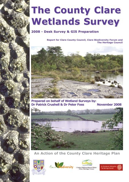
The <strong>County</strong> <strong>Clare</strong><br />
Wetlands Survey<br />
2008 - Desk Survey & GIS Preparation<br />
<strong>Report</strong> for <strong>Clare</strong> <strong>County</strong> Council, <strong>Clare</strong> Biodiversity Forum and<br />
The Heritage Council<br />
Prepared on behalf of Wetland Surveys by:<br />
Dr Patrick Crushell & Dr Peter Foss November 2008<br />
An Action of the <strong>County</strong> <strong>Clare</strong> Heritage Plan
The <strong>County</strong> <strong>Clare</strong> Wetlands Survey<br />
Desk Survey & GIS Preparation<br />
<strong>Report</strong> prepared for <strong>Clare</strong> <strong>County</strong> Council<br />
An Action of the <strong>County</strong> <strong>Clare</strong> Heritage Plan<br />
Prepared on behalf of<br />
by<br />
Dr Patrick Crushell & Dr Peter J. Foss<br />
Wetland Surveys<br />
e-mail: wetland.surveys@gmail.com<br />
November 2008
The <strong>County</strong> <strong>Clare</strong> Wetlands Survey Patrick Crushell & Peter Foss 2008<br />
_______________________________________________________________<br />
Authors: Crushell, P. & Foss, P.J. 2008 Title: The <strong>County</strong> <strong>Clare</strong> Wetlands Survey<br />
Desk Survey & GIS Preparation, <strong>Report</strong> prepared for <strong>Clare</strong> <strong>County</strong> Council, Ireland<br />
An Action of the <strong>County</strong> <strong>Clare</strong> Heritage Plan<br />
Copyright <strong>Clare</strong> <strong>County</strong> Council 2008<br />
Authors: Dr Peter Foss Patrick Crushell<br />
33 Bancroft Park Bell Height<br />
Tallaght<br />
Kenmare<br />
Dublin 24<br />
Co Kerry<br />
e-mail: peterjfoss@gmail.com patrick@crushell.com<br />
All rights reserved. No Part of this publication may be reproduced, stored in a retrieval system<br />
or transmitted in any form or by any means, electronic, mechanical photocopying, recording or<br />
otherwise without the prior permission of <strong>Clare</strong> <strong>County</strong> Council.<br />
Views contained in this report do not necessarily reflect the views of <strong>Clare</strong> <strong>County</strong> Council.<br />
Photographic Plate Credits<br />
All photographs by Peter Foss 2008 unless otherwise stated. Copyright <strong>Clare</strong> <strong>County</strong> Council.<br />
<strong>Report</strong> cover images:<br />
Left: Solution cups in limestone pavement, Fisherstreet, Co <strong>Clare</strong><br />
Top: Limestone pavement and lakeshore communities, Lough Mask, Co. Mayo<br />
Bottom: Turlough, Co. <strong>Clare</strong>
The <strong>County</strong> <strong>Clare</strong> Wetlands Survey Patrick Crushell & Peter Foss 2008<br />
____________________________________________________________________________________<br />
CONTENTS<br />
1 ACKNOWLEDGEMENTS ............................................................................................................. 2<br />
2 EXECUTIVE SUMMARY .............................................................................................................. 3<br />
3 PROJECT AIMS.......................................................................................................................... 7<br />
3.1 BACKGROUND............................................................................................................................ 7<br />
3.2 MAINS AIMS OF PROJECT ............................................................................................................... 7<br />
4 IMPORTANCE OF WETLANDS IN COUNTY CLARE..................................................................... 8<br />
4.1 DEFINITION .............................................................................................................................. 8<br />
4.2 WHY CONSERVE WETLANDS? .......................................................................................................... 9<br />
4.3 WETLAND VALUES ..................................................................................................................... 10<br />
5 COUNTY CLARE WETLANDS.................................................................................................... 12<br />
5.1 COUNTY CLARE AN INTRODUCTION ................................................................................................. 12<br />
5.2 COUNTY CLARE’S NATURAL WEALTH ................................................................................................ 12<br />
5.2.1 Geology ......................................................................................................................... 13<br />
5.2.2 Soils .............................................................................................................................. 14<br />
5.2.3 Climate .......................................................................................................................... 15<br />
5.2.4 Geographic Location........................................................................................................ 15<br />
5.2.5 Habitat Diversity and Wetlands ........................................................................................ 16<br />
5.3 WETLAND HABITATS IN COUNTY CLARE – A BRIEF DESCRIPTION.............................................................. 16<br />
5.4 PROTECTION OF CLARE WETLANDS................................................................................................. 37<br />
5.5 CWS WETLAND TYPES ............................................................................................................... 38<br />
6 COMPILATION OF THE COUNTY CLARE WETLAND SURVEY GIS AND DATABASE OF SITES.. 40<br />
6.1 BACKGROUND AND PROJECT SET-UP ............................................................................................... 40<br />
6.2 MATERIALS & METHODS ............................................................................................................. 41<br />
6.2.1 Data acquisition .............................................................................................................. 41<br />
6.2.2 CWS Site identification and background research .............................................................. 42<br />
6.2.3 GIS Data compilation and GIS wetland identification ......................................................... 42<br />
6.2.4 Data Transfer and Mapping of CWS Database sites ............................................................ 43<br />
6.2.5 Data Analysis and presentation of results (GIS and CWS site database) .............................. 43<br />
6.2.6 CWS Site Database – structure and content ...................................................................... 45<br />
7 RESULTS ................................................................................................................................. 46<br />
7.1 CWS DATA LIMITATIONS ........................................................................................................... 46<br />
7.1.1 Wetland site identification................................................................................................ 46<br />
7.1.2 Wetland habitat type classification ................................................................................... 46<br />
7.1.3 Estimation of the extent of wetland habitats on sites identified........................................... 46<br />
7.1.4 Time constraints ............................................................................................................. 47<br />
7.2 CWS SITE DATABASE ............................................................................................................... 47<br />
7.3 CWS GIS DATABASE ............................................................................................................... 47<br />
7.4 DISTRIBUTION AND EXTENT OF WETLANDS IN COUNTY CLARE.................................................................. 49<br />
7.5 WETLAND SITE CONSERVATION EVALUATION ...................................................................................... 62<br />
7.6 DAMAGE TO COUNTY CLARE WETLANDS ........................................................................................... 65<br />
8 CONCLUSIONS & RECOMMENDATIONS.................................................................................. 67<br />
8.1 DISTRIBUTION AND EXTENT OF THE CLARE WETLAND RESOURCE............................................................... 67<br />
8.2 KNOWLEDGE OF THE CLARE WETLAND RESOURCE ................................................................................ 67<br />
8.3 CLARE WETLAND SURVEY RECOMMENDATIONS................................................................................... 70<br />
9 CWS BIBLIOGRAPHY & DATA SOURCES................................................................................. 71<br />
10 APPENDICES ......................................................................................................................... 75<br />
1
The <strong>County</strong> <strong>Clare</strong> Wetlands Survey Patrick Crushell & Peter Foss 2008<br />
____________________________________________________________________________________<br />
1 Acknowledgements<br />
The <strong>County</strong> <strong>Clare</strong> Wetlands Survey 2008 was made possible through the generous support of <strong>Clare</strong><br />
<strong>County</strong> Council, The Heritage Council, the <strong>Clare</strong> Biodiversity Group and the <strong>County</strong> <strong>Clare</strong> Heritage Forum.<br />
The authors of this report wish to thank Brigid Barry <strong>County</strong> <strong>Clare</strong> Biodiversity Officer, Congella McGuire<br />
<strong>County</strong> <strong>Clare</strong> Heritage Officer, and Stephen Ward <strong>Clare</strong> Biodiversity Group for invaluable discussions and<br />
comments throughout the period of compilation of the wetlands database and preparation of this report.<br />
We would also like to thank the assistance of Padraig McManus, GIS Officer of <strong>Clare</strong> <strong>County</strong> Council for<br />
help with mapping issues.<br />
The authors especially wish to thank the following individuals and groups for their feedback, and<br />
assistance during the collection of wetland site and habitat data used in the preparation of this report:<br />
Brigid Barry, Andy Bleasdale, Ken Bond, Rory Callan, Michael Collins, John Conaghan, John Cross,<br />
Stephen Curran, Caitríona Douglas, Jerry Dunne, John Evans, Julie Fossitt, Nathy Gilligan, Tom Gittings,<br />
Brid Higgins, Fran Igoe, Paddy Kavanagh, Naomi Kingston, Neil Lockhart, Liam Lysaght, Rachel Lowe,<br />
Sarah Malone, Marie Mannion, Eleanor Mayes, Myles McDonagh, Congella McGuire, Padraig McManus,<br />
Richard Moles, Pat Neville, Daniel O’Brien, Fiona O’Rourke, Sharon Parr, Jim Ryan, Michael Sheehy,<br />
Micheline Sheehy Skeffington, Stephen Ward, Gemma Weir, John Wilson and John Pygott.<br />
And finally, thanks to Stephen Ward, Brigid Barry and Deaglán Ó Caoimh for editorial comments during<br />
the preparation of the final report.<br />
2
The <strong>County</strong> <strong>Clare</strong> Wetlands Survey Patrick Crushell & Peter Foss 2008<br />
____________________________________________________________________________________<br />
2 Executive Summary<br />
1. <strong>County</strong> <strong>Clare</strong> contains a wide range of wetlands of high international and national importance (An<br />
Foras Forbartha 1981; Anonymous 2008c; NPWS 2008 inter alia). Due to the varying topography,<br />
hydrology, climate, coastline and soils present it has wetland habitats ranging from raised bogs, blanket<br />
bogs, fens, marshes, coastal lagoons, large riverine systems, variety of lakes, springs, wet woodlands<br />
and many more. <strong>Clare</strong> is likely to contain some of the finest examples of calcareous fens, springs and<br />
turloughs that occur in Ireland and Northwest Europe.<br />
2. The aim of the <strong>County</strong> <strong>Clare</strong> Wetlands Survey (CWS) was to prepare a GIS map data layer and<br />
associated database of all known freshwater wetland sites in <strong>County</strong> <strong>Clare</strong>. The wetland sites were<br />
identified following an extensive review of literature and third party data sources. Information stored on<br />
these sites included details of previous surveys and general site characteristics. In addition to the known<br />
wetland sites, a GIS dataset was established to record all mapped wetland habitat within the county by<br />
incorporating map data provided from third parties along with wetland identified by an analysis of aerial<br />
photography of all wetland habitat within the county. Together these datasets facilitated an assessment<br />
of the wetland resource of the entire county. Wetland habitats on sites were classified according to the<br />
Guide to Habitats published by the Heritage Council (Fossitt 2000). For the purposes of this study, 34<br />
different habitat types are regarded as wetland habitats, as listed below.<br />
3. This study addressed the following main research objectives:<br />
• collect and amalgamate data on known wetland sites within <strong>County</strong> <strong>Clare</strong> from data sources<br />
following consultation with State authorities, third party research groups and individuals;<br />
• produce a map and associated database of all wetland sites to include key data on each site,<br />
including the specific wetland habitat type(s) present; the extent of each wetland type; and<br />
compile an inventory of available published and survey information on each site;<br />
• undertake an aerial photography wetland survey of the county to identify sites of potential<br />
interest occurring outside of existing data sources and surveys;<br />
• evaluate each site in terms of its conservation status, known habitat and area information,<br />
known survey information and threats;<br />
• identify the main information gaps and make recommendations to guide future policy and<br />
research priorities towards the conservation of the wetland resource in <strong>County</strong> <strong>Clare</strong>.<br />
4. The present study focused on the identification of 34 wetland types (22 of which are listed in Annex 1<br />
of the EU Habitats Directive, and nine of these are priority habitats) in <strong>County</strong> <strong>Clare</strong>, plus one generic<br />
wetland type entitled CWS Unknown wetland type, where the specific wetland habitat present could not<br />
be assigned with certainty to one of the recognised habitat types. The 34 Fossitt freshwater wetland<br />
types recorded during the CWS include:<br />
Fossitt Level 3<br />
Habitat Code and Name<br />
Fossitt Level 3<br />
Habitat Code and Name<br />
FL1 Dystrophic lakes * HH3 Wet heath *<br />
FL2 Acid oligotrophic lakes * PB1 Raised bogs **<br />
FL3 Limestone/marl lakes PB2 Upland blanket bog **<br />
FL4 Mesotrophic lakes PB3 Lowland blanket bog **<br />
FL5 Eutrophic lakes * PB4 Cutover bog *<br />
FL6 Turloughs **<br />
PB5 Eroding blanket bog<br />
FL7 Reservoirs PF1 Rich fen and flush **<br />
FL8 Other artificial lakes and ponds<br />
PF2 Poor fen and flush<br />
FW1 Eroding/upland rivers * PF3 Transition mire and quaking bog *<br />
FW2 Depositing/lowland rivers * WN4 Wet pedunculate oak-ash woodland **<br />
FW3 Canals<br />
WN5 Riparian woodland<br />
FW4 Drainage ditches<br />
WN6 Wet willow-alder-ash woodland<br />
FP1 Calcareous springs ** WN7 Bog woodland **<br />
FP2 Non-Calcareous springs WS1 Scrub *<br />
FS1 Reed and large sedge swamps CW1 Lagoons and saline lakes **<br />
FS2 Tall herb swamps * CD5 Dune slacks *<br />
GS4 Wet grassland *<br />
GM1 Marsh *<br />
CWS Unknown wetland type<br />
* EU Habitats Directive listed Annex 1 habitat; ** EU Habitats Directive Priority habitat<br />
3
The <strong>County</strong> <strong>Clare</strong> Wetlands Survey Patrick Crushell & Peter Foss 2008<br />
____________________________________________________________________________________<br />
5. In relation to the individual wetland habitat types recognised within the <strong>County</strong> <strong>Clare</strong> Wetlands Survey,<br />
the following number of sites and estimated area (ha) or Length (km) of habitats have been recorded:<br />
Habitat Code and Name<br />
FL Lakes & Ponds<br />
Number of<br />
Sites recorded<br />
in CWS Site<br />
Database<br />
165<br />
Number of<br />
discrete<br />
habitat areas<br />
mapped in<br />
CWS GIS<br />
dataset 557<br />
Total area (ha)<br />
or Length (km)<br />
of habitat types<br />
recorded in<br />
CWS*<br />
8204 2.57<br />
FL1 Dystrophic lakes 13 15 45.4 0.01<br />
FL2 Acid oligotrophic lakes 16 216 1650.2 0.51<br />
FL3 Limestone/marl lakes 23 211 6032 1.89<br />
FL4 Mesotrophic lakes 15 73 204.2 0.06<br />
FL5 Eutrophic lakes 8 18 2.2 -<br />
FL6 Turloughs 50 19 267.7 0.08<br />
FL7 Reservoirs 3 0 0 -<br />
FL8 Other artificial lakes and ponds 3 4 3.4 -<br />
FW Watercourses 119 2834 5740.5 km<br />
FW1 Eroding/upland rivers 28<br />
FW2 Depositing/lowland rivers 40<br />
FW3 Canals 3<br />
FW4 Drainage ditches 79 76 2.5 km<br />
FP Springs 23 137<br />
FP1 Calcareous springs 20 58 NA<br />
FP2 Non-Calcareous springs 0 NA<br />
FS Swamps 115 110<br />
FS1 Reed and large sedge swamps 99 108 309 0.10<br />
FS2 Tall herb swamps 28 2 3.7 -<br />
G Grassland & Marsh 150 627 2658 0.83<br />
GS4 Wet grassland 103 596 2586 0.81<br />
GM1 Marsh 62 31 70.7 0.02<br />
HH3 Wet heath 26 42 1935 0.61<br />
PB Bogs 96 364 6097 1.91<br />
PB1 Raised bogs 21 28 551.4 0.17<br />
PB2 Upland blanket bog 19 198 1555 0.49<br />
PB3 Lowland blanket bog 11 28 167.8 0.05<br />
PB4 Cutover bog 60 104 3796 1.19<br />
PB5 Eroding blanket bog 1 0 0 -<br />
PF Fens & Flushes 117 115 483 0.15<br />
PF1 Rich fen and flush 81 51 182 0.06<br />
PF2 Poor fen and flush 19 40 142.5 0.05<br />
PF3 Transition mire and quaking bog 26 24 158.4 0.05<br />
WN Semi-natural woodland 88 45 155 0.05<br />
WN4 Wet pedunculate oak-ash<br />
1 1 2.9 -<br />
woodland<br />
Percentage of <strong>County</strong><br />
<strong>Clare</strong> covered by CWS<br />
habitat<br />
WN5 Riparian woodland 4 9 4.1 -<br />
WN6 Wet willow-alder-ash woodland 32 21 105.7 0.03<br />
WN7 Bog woodland 19 14 42.2 0.01<br />
WS1 Scrub 91 13 7.2 -<br />
CW1 Lagoons and saline lakes 19 4 32.1 0.01<br />
CD5 Dune slacks 4 2 0.2 -<br />
Non-Fossitt Mosaic Habitat Types 98<br />
HH_PB Heath - bog mosaic NA 10 143.1 0.05<br />
PB4_HH3 Cutover bog - Wet heath<br />
NA 1 1.2 -<br />
mosaic PB_HH Bog - Heath mosaic NA 3 0.8 -<br />
HH3_PB3 Wet heath - Blanket bog<br />
NA 14 72.2 0.02<br />
mosaic HH3_GS4 Wet heath - Wet grassland<br />
NA 2 0.2 -<br />
mosaic HH1_HH3 - Dry - wet Heath mosaic NA 30 211 0.07<br />
CWS Unknown wetland type NA 131 3127 0.98<br />
*The area / length of habitat should be regarded as being a best minimal estimate, as many wetland habitats within<br />
sites were not mapped due to an absence of reliable information on their distribution and extent.<br />
4
The <strong>County</strong> <strong>Clare</strong> Wetlands Survey Patrick Crushell & Peter Foss 2008<br />
____________________________________________________________________________________<br />
6. These wetland habitat types can be found as discrete communities in their own right, or in association<br />
with (or within) larger semi-natural complexes such as blanket bog, raised bog, turlough, dune slack,<br />
machair, wet heathland, wet grassland, woodland, karst areas, lacustrine and riverine habitats and<br />
systems.<br />
7. A variety of data sources (reports, publications, databases and inventory lists), groups and individuals<br />
were consulted in the compilation of information of the CWS database, over a 3 month period in 2008.<br />
Those contacted, are listed in Appendix 2, while published research and GIS data sources provided and<br />
consulted in the CWS are listed in Appendix 1 and referenced in full in the Bibliography.<br />
8. The total wetland area in <strong>County</strong> <strong>Clare</strong> has been estimated at 23,440 ha based on this study, which<br />
represents 7.4 % of the entire county (this should be interpreted as a minimum area as wetland<br />
habitats within many sites were not mapped due to information deficit). A total of 2069 discrete wetland<br />
habitat units have been collated and mapped within the county in the CWS GIS dataset, while<br />
information on 300 wetland sites and sub-sites is held in the CWS site database.<br />
In terms of the main habitat types in <strong>County</strong> <strong>Clare</strong> the results suggest that on a county basis, the 23,440<br />
ha of wetland recorded, cover the following percentage of the county: lakes 2.57% , bogs and wet heaths<br />
2.52%, fens & flushes, marsh, reedbeds and wet grassland cover 1%, while the remaining 1% has been<br />
assigned to the CWS unknown wetland type.<br />
9. It is very probable that additional wetland sites exist outside of the sites which have been identified in<br />
the present <strong>County</strong> <strong>Clare</strong> Wetlands Survey (see Results section 6.1 for further clarification).<br />
10. In relation to the 2069 wetland habitat units identified in the CWS, one key result to emerge is that<br />
significant gaps exist in relation to our knowledge of this resource, due primarily to a lack of detailed<br />
habitat surveys. Specifically, the following issues have been identified:<br />
Wetland type identification: our knowledge in relation to the specific wetland habitat type(s)<br />
present, is considered lacking or inadequate (confusion over one or more types) of many sites identified<br />
in the present CWS.<br />
Wetland type distribution: it is clear from our results that information is lacking on many<br />
important wetland habitats that occur throughout the county. Apart from raised bogs, blanket bogs, and<br />
lagoons, few other wetland habitats have been systematically surveyed in <strong>Clare</strong>. Without a full<br />
appreciation of the extent and condition of these wetland habitats it is not possible to set realistic<br />
conservation objectives or make informed decisions on their relative importance in relation to biodiversity<br />
and in the provision of other ecosystem services.<br />
Exact extent of wetland types: our knowledge in relation to the extent of wetland type(s)<br />
present on sites, is considered lacking or inadequate for many sites identified in the CWS.<br />
11. One of the key findings to emerge from a conservation evaluation of wetland sites recognised in the<br />
CWS is that 152 site records or 50% of the sites listed (300 sites in total) have no protection although<br />
their conservation value has been recognised or proposed by third parties.<br />
12. Based on the results of this analysis of wetlands, the following habitat types within the county should<br />
be prioritised as part of any future CWS Field Surveys: Turloughs, Fens, Lakes, Tall Herb Swamp,<br />
Springs and Wet Grassland inter alia.<br />
13. Sites identified during the CWS which could not be assigned to a Fossitt category should be included<br />
in any future wetland survey.<br />
14. Based on the results of this survey the following geographic areas within the county should be<br />
surveyed for potential wetland sites:<br />
• South western part of the county – the area between Inagh, Cooraclare and Kilmurry<br />
• Eastern part of the county – area between Tulla, Broadford and Scarriff<br />
5
The <strong>County</strong> <strong>Clare</strong> Wetlands Survey Patrick Crushell & Peter Foss 2008<br />
____________________________________________________________________________________<br />
15. Our incomplete knowledge of many of the wetland areas in <strong>County</strong> <strong>Clare</strong> makes a systematic<br />
survey of existing and newly recorded sites a priority, if conservation worthy sites are to be<br />
identified and the best examples put forward for conservation under <strong>County</strong> conservation programmes<br />
such as the <strong>Clare</strong> Biodiversity Programme, or the NPWS national Natural Heritage Area (NHA) or<br />
European Habitats Directive Natura 2000 (SAC) network.<br />
16. Other recommendations from the study included:<br />
• The habitat mapping and research methodology developed during the <strong>Clare</strong> Wetland Survey,<br />
should be formalised by the Heritage Council, and a standard Phase I desk based wetland survey<br />
manual should be prepared, and made available to other local authorities so that similar wetland<br />
habitat inventories can be undertaken in their counties following standard guidelines.<br />
• Extra resources should be put towards enforcing regulations preventing damage to wetland sites<br />
throughout <strong>Clare</strong>;<br />
• A public awareness campaign should be run to inform the people of the county of the diverse<br />
wetland resource of the county and the value of this resource through amongst other things the<br />
provision of important ecosystem services (see section 4.3).<br />
6
The <strong>County</strong> <strong>Clare</strong> Wetlands Survey Patrick Crushell & Peter Foss 2008<br />
____________________________________________________________________________________<br />
3.1 Background<br />
3 Project Aims<br />
In July of 2008 <strong>Clare</strong> <strong>County</strong> Council commissioned the production of a map and associated database<br />
holding information on all freshwater wetlands in <strong>County</strong> <strong>Clare</strong>. This study has been part-funded by the<br />
Heritage Council and forms an important element of the <strong>County</strong> <strong>Clare</strong> Heritage Plan (Anonymous 2003).<br />
Prior to this project no complete inventory of wetland areas existed for <strong>County</strong> <strong>Clare</strong>, although the county<br />
is exceptionally rich in wetland types, with over 48 fen sites and 500 lakes alone reported for the county<br />
(Foss 2007), as well as being recognised as the headquarters for certain important wetland types such as<br />
turloughs. The wetlands of the county are not only important from a biodiversity perspective but also<br />
provide many important ecosystem services such as flood prevention, provision of clean water and<br />
carbon storage.<br />
The lack of a county wetland inventory has resulted in an incomplete picture of the distribution and<br />
extent of wetlands in <strong>Clare</strong>. The lack of data on wetlands, their distribution and extent when taken<br />
together with the threat faced by these habitats from infilling and drainage may lead to the future loss of<br />
sites which have a county, national or even international value for biodiversity protection, and makes the<br />
development of wetland conservation programmes at a <strong>County</strong> level difficult.<br />
3.2 Mains aims of project<br />
To overcome the information deficit, the main aim of the <strong>County</strong> <strong>Clare</strong> Wetlands Survey (CWS) was to<br />
prepare a GIS data layer and associated site database of all previously recorded freshwater wetland sites<br />
in <strong>County</strong> <strong>Clare</strong>. The wetland habitats to be mapped included lakes and ponds, watercourse, springs,<br />
freshwater swamps, wet grassland, freshwater marsh, lagoons, peat bogs, fens and flushes, wet oak-ash<br />
woodland, wet willow-alder-ash woodland, riparian woodland and bog woodland.<br />
The sites identified were characterised and mapped as far as possible in terms of the wetland habitat(s)<br />
present. This allowed an assessment of the extent of each habitat type(s) within the county.<br />
Wetland habitats on sites were to be classified according to the Guide to Habitats published by the<br />
Heritage Council (Fossitt 2000) to at least Level 2 and Level 3 where information was available that made<br />
such classification possible.<br />
No field survey was undertaken in relation to this proposed data gathering and amalgamation project,<br />
which aimed to consolidate all known information on wetlands in <strong>Clare</strong>, based on GIS and published<br />
information held by Government and State agencies, non-governmental organisations and private<br />
individuals, and published in previous reports and surveys. In addition, other as yet unidentified wetlands<br />
recognised from an aerial photographic survey of the county were also to be mapped, so as to produce a<br />
GIS wetland data set and associated map(s) for <strong>County</strong> <strong>Clare</strong> which was as complete as possible based<br />
on our current knowledge.<br />
The final report from the first phase of the <strong>County</strong> <strong>Clare</strong> Wetlands Survey (CWS), makes<br />
recommendations on priorities for future surveys based on critical or endangered habitats and<br />
geographical areas within the county where site data is particularly lacking, based on the findings from<br />
the 2008 CWS desk study.<br />
The methodologies developed and employed in the survey are documented in this report, together with a<br />
description of the importance of wetlands, the main wetland habitats present in <strong>County</strong> <strong>Clare</strong> and key<br />
findings from the current study.<br />
Finally it was envisaged that the methodologies developed during this project, would provide a valuable<br />
blueprint to other counties where identification and mapping of the wetland resource and wetland surveys<br />
are also required.<br />
7
The <strong>County</strong> <strong>Clare</strong> Wetlands Survey Patrick Crushell & Peter Foss 2008<br />
____________________________________________________________________________________<br />
4 Importance of Wetlands in <strong>County</strong> <strong>Clare</strong><br />
4.1 Definition<br />
Wetland is a collective term for ecosystems (habitats and their associated species) whose formation has<br />
been dominated by water, and whose processes and characteristics are largely controlled by water. A<br />
wetland is a place that has been wet enough for a long enough time to develop specially adapted<br />
vegetation and other organisms (Maltby 1986).<br />
Wetlands are areas where water is the primary factor controlling the environment, local processes and<br />
the associated plant and animal life that occur there. They occur where the water table is at or near the<br />
surface of the land, or where the land is covered by a layer of shallow water, for some or all of the year.<br />
The 1971 Ramsar Convention on Wetlands of International Importance defines wetland as:<br />
“areas of marsh, fen, peatland or water, whether natural or artificial, permanent or temporary,<br />
with water that is static or flowing, fresh, brackish or salt, including areas of marine water the<br />
depth of which at low tide does not exceed six meters”.<br />
In addition, for the purpose of protecting coherent sites, Article 2.1 of the Ramsar Convention, to which<br />
Ireland is a signatory, provides that wetland sites be included in the Ramsar List of internationally<br />
important wetlands:<br />
“may incorporate riparian and coastal zones adjacent to the wetlands, and islands or bodies of<br />
marine water deeper than six meters at low tide lying within the wetlands”.<br />
Five major wetland types are generally recognized:<br />
• marine (coastal wetlands including coastal lagoons, rocky shores, and coral reefs);<br />
• estuarine (including deltas, tidal marshes, and mangrove swamps);<br />
• lacustrine (wetlands associated with lakes);<br />
• riverine (wetlands along rivers and streams); and<br />
• palustrine (meaning “marshy” – wet grassland, marshes, swamps and bogs).<br />
In addition to naturally occurring wetlands produced as a result of natural environmental processes, there<br />
are artificial wetlands such as fish ponds, farm ponds, irrigated agricultural land, reservoirs, gravel pits,<br />
sewage farms, treatment facilities, drainage ditches and canals (see Chapter 5 for additional details on<br />
wetland types).<br />
Even in certain, so called “natural” wetland systems, human-kind has played a major factor in wetland<br />
formation since pre-historic times. In Ireland, forest clearance in the uplands helped trigger soil and<br />
vegetation changes, which altered the hydrology and led in some places to bog formation. And today,<br />
since some of these bogs have been harvested for fuel and their peat deposits removed, the flooding of<br />
the abandoned peat diggings has created new shallow lakes, with marginal fens and marsh areas.<br />
In contrast to some other habitat types (e.g. woodlands), wetlands are therefore often young and<br />
dynamic ecosystems, changing in a relatively short period of time as vegetation changes, sediments are<br />
laid down, and local hydrological conditions are altered.<br />
One other concept that should be born in mind when considering wetlands is that a specific wetland area<br />
is often composed of many different wetland types, which form a mosaic. So a cutover bog wetland, may<br />
in fact be composed of small regenerating fen and bog communities, pools, drainage ditches, and even<br />
deeper water pools or small lakes.<br />
In the classification system of wetlands used in the context of CWS, which is outlined in the next chapter,<br />
these wetland mosaic elements are defined in greater detail based on the habitat classification system of<br />
the Heritage Council (Fossitt 2000).<br />
On a global scale wetlands occur everywhere, from the tundra to the tropics. How much of the earth’s<br />
surface is presently composed of wetlands is not known exactly. The UNEP-World Conservation<br />
8
The <strong>County</strong> <strong>Clare</strong> Wetlands Survey Patrick Crushell & Peter Foss 2008<br />
____________________________________________________________________________________<br />
Monitoring Centre has suggested an estimate of about 570 million hectares (5.7 million km 2 ) of wetland –<br />
roughly 6% of the Earth’s land surface – of which 2% are lakes, 30% bogs, 26% fens, 20% swamps, and<br />
15% floodplains.<br />
In the context of the <strong>County</strong> <strong>Clare</strong> Wetlands Survey the project focused on the occurrence of freshwater<br />
wetlands within the county, which preliminary results suggest cover a minimum of some 7.4 % of the<br />
county, both of natural and artificial in origin, with the additional inclusion of coastal lagoons which may<br />
have a variable degree of both salt and freshwater influence.<br />
Of the 7.4% (or 23,440 ha) of the land area of the county covered by wetlands, lakes comprise 35% ,<br />
bogs and wet heaths 36%, fens & flushes, marsh, reedbeds and wet grassland cover 15%, wet<br />
woodlands cover 1% while the remaining 13% has been assigned to the CWS unknown wetland type.<br />
4.2 Why conserve wetlands?<br />
As with many other natural environments humanity has generally looked on wetlands as an economic<br />
resource to be used for short term economic gain, and has often not recognised the long terms gains<br />
(both economic and non-economic) of functioning wetlands (Anonymous 2008d). Three examples of such<br />
actions in Ireland include:<br />
• the national and local drainage schemes, or the embankment of rivers which can result in<br />
catastrophic floods during high rainfall periods when the drained land results in rapid surface<br />
water run-off;<br />
• past afforestation schemes on bogs, which often did not produce the timber crop envisaged at<br />
the start of the afforestation project;<br />
• overgrazing of blanket bogs which continues to have a detrimental effect on the western blanket<br />
bog habitats and is unsustainable.<br />
Functional wetlands are among the world’s most productive environments. They are cradles of biological<br />
diversity, providing the water and primary productivity upon which countless species of plants and<br />
animals depend for survival. They support high concentrations and diversity of birds, mammals, reptiles,<br />
amphibians, fish and especially invertebrates. Wetlands are also important storehouses of plant genetic<br />
material.<br />
The multiple roles of wetland ecosystems and their value to humanity have been increasingly understood<br />
and documented in recent years, as in the Irish Government report on the Economic & Social Aspects of<br />
Biodiversity (Anonymous 2008). Internationally, this has led to large expenditures to restore the lost or<br />
degraded hydrological and biological functions of wetlands. But it is not enough – the race is on to<br />
improve practices on a significant global scale as the world’s leaders try to cope with the accelerating<br />
water crisis and the effects of climate change. And this at a time when the world’s population is likely to<br />
increase by 70 million every year for the next 20 years (Anonymous 2008d).<br />
Global freshwater consumption rose six fold between 1900 and 1995 – more than double the rate of<br />
population growth. One third of the world’s population today lives in countries already experiencing<br />
moderate to high water stress. By 2025, two out of every three people on Earth may well face life in<br />
water stressed conditions.<br />
The ability of wetlands to adapt to changing conditions, and to accelerating rates of change, will be<br />
crucial to human communities and wildlife everywhere as the full impact of climate change on our<br />
environment is felt. Small wonder that there is a worldwide focus on wetlands and their services to us.<br />
In addition, wetlands are important, and sometimes essential, for the health, welfare and safety of<br />
people who live in or near them. They are amongst the world’s most productive environments and<br />
provide a wide array of benefits (Ramsar website).<br />
9
The <strong>County</strong> <strong>Clare</strong> Wetlands Survey Patrick Crushell & Peter Foss 2008<br />
____________________________________________________________________________________<br />
4.3 Wetland values<br />
Wetlands range from ponds to rivers, reedbeds to bogs, and are home to a large diversity of plants and<br />
animals and are a haven for wildlife lovers. However, they are not just important for biodiversity. They<br />
also play a major role in storing flood water and can reduce flooding in built-up areas, vital given the<br />
changing weather patterns associated with global climate change.<br />
Wetlands therefore provide tremendous economic benefits, for example: water supply (quantity and<br />
quality); fisheries (over two thirds of the world’s fish harvest is linked to the health of coastal and inland<br />
wetland areas); agriculture, through the maintenance of water tables and nutrient retention in<br />
floodplains; timber and agricultural production; energy resources, such as peat and plant matter; wildlife<br />
resources; transport; and recreation and tourism opportunities.<br />
• Wetlands improve water quality by removing and sequestering pollutants and sediments in the<br />
water.<br />
• Wetlands store floodwaters, acting like natural sponges and slowing down the force of flood and<br />
storm waters as they travel downstream. Far from posing a flood threat, wetlands should be<br />
viewed as buffers, to protect areas where people live (Anonymous 2008d).<br />
• Wetlands offer habitat for wildlife. Many migratory birds and other wildlife depend on the<br />
ecological setting of wetlands for their survival.<br />
• Wetlands support biodiversity. The variety of living organisms found in wetlands contributes to<br />
the health of our planet and our own lives possible by ensuring our food supply, regulating the<br />
atmosphere and providing raw materials for industry and medicine.<br />
• Wetlands provide valuable open space and create wonderful recreational opportunities. Hiking,<br />
fishing, boating and bird watching are just a few of the activities people can enjoy in wetland<br />
areas. The scenic vistas of wetlands make them an ideal area for nature photographers or<br />
painters.<br />
• Wetlands are vital in preventing further climate change by acting as a store of carbon. Until<br />
recently this has not been fully appreciated, and in Ireland it has still not been adequately<br />
communicated to the general public. For example, peatlands are known to store 20-30% of the<br />
worlds soil carbon exceeding by three times the amounts stored in tropical rainforests (Bragg and<br />
Lindsay 2003).<br />
In addition, wetlands have special attributes as part of the cultural heritage of humanity: they are related<br />
to religious and cosmological beliefs, constitute a source of aesthetic inspiration, provide wildlife<br />
sanctuaries, and form the basis of important local traditions.<br />
These functions, values and attributes can only be maintained if the ecological processes of wetlands are<br />
allowed to continue functioning. Unfortunately, and in spite of important progress made in recent<br />
decades, wetlands continue to be among the world’s most threatened ecosystems, owing mainly to<br />
ongoing drainage, conversion, pollution, and over-exploitation of their resources.<br />
Putting an economic value on something as abstract as the ecological services of a wetland is a difficult<br />
idea for most people, but is becoming a more accepted economic tool. More commonly, the open market<br />
puts monetary values on society's goods and services. In the case of wetlands, there is no direct market<br />
for services such as clean water, maintenance of biodiversity, and flood control. There is, however, a<br />
growing recognition that such natural benefits do have real economic value and that these values need to<br />
be included in decision-making processes (see Table 4.1).<br />
In a recent report by the Biodiversity Unit of the Department of the Environment, Heritage and Local<br />
Government (Anonymous 2008d) the biodiversity value of wetlands in Ireland was estimated to be worth<br />
€385 million per year to the Irish economy. In addition a further proportion of the €330 million assigned<br />
by this study to the economic value of the nature and eco-tourism value of all Irish habitats can be<br />
assigned to wetlands.<br />
One other stark fact to emerge from this report is that “it is clear that the benefits of biodiversity far<br />
exceed the costs of the current levels of biodiversity protection” in Ireland, an indication that we still do<br />
not value the functions and services provided by wetlands to our well being as a society.<br />
10
The <strong>County</strong> <strong>Clare</strong> Wetlands Survey Patrick Crushell & Peter Foss 2008<br />
____________________________________________________________________________________<br />
Numerous other reports exist in the literature that give clear examples of the economic value of<br />
wetlands. The UK Environment Agency has a wealth of literature showing the value of intact functioning<br />
wetlands in the control and alleviation of flooding episodes (Anonymous 2008d). In addition a number of<br />
reports exists which show that intact wetland systems provide excellent value for money in the provision<br />
of water services when compared to the costs that would accrue if these services had to be supplied by<br />
artificial systems. An illustration is the example from the USA where the State of New York purchased a<br />
watershed area at a cost of 1.5 billion dollars, rather than spend 3 to 8 billion dollars it estimated it would<br />
cost for artificial waste water treatment facilities to do the same job (Anonymous 2008d).<br />
In many ways, the economic benefits received from wetlands are comparable to the benefits received<br />
from things such as public schooling, health care and municipal infrastructure.<br />
Unfortunately, to date, society has generally only realized the benefit of wetland services after they have<br />
disappeared or been seriously degraded. Problems with flooding, lost recreational opportunities, reduced<br />
fish populations and more costly water treatment are examples of costs understood only after a wetland<br />
ecosystem has been degraded or destroyed.<br />
The idea behind putting an economic value on some of these wetland benefits before ecosystem-altering<br />
decisions are made is to recognize these potential costs up front and thereby put wetland-related<br />
decisions on a more economically sound footing.<br />
Table 4.1. Examples of the economic benefits that wetland provide<br />
USE BENEFITS<br />
Direct Use<br />
Benefits<br />
recreation<br />
- boating<br />
- birding<br />
- wildlife<br />
viewing<br />
- walking<br />
- angling<br />
Indirect Use Benefits<br />
nutrient retention<br />
water filtration<br />
flood control<br />
shoreline protection<br />
Option Benefits<br />
potential future uses (as per<br />
direct and indirect uses)<br />
future value of information, e.g.,<br />
pharmaceuticals, education<br />
NON-USE<br />
BENEFITS<br />
Existence<br />
Benefits<br />
biodiversity<br />
culture<br />
heritage<br />
archaeology<br />
trappinghunting<br />
commercial<br />
harvest<br />
- nuts<br />
- berries<br />
- grains<br />
- fisheries<br />
- peat<br />
- forestry<br />
groundwater recharge<br />
external ecosystem<br />
support<br />
micro-climate<br />
stabilization<br />
erosion control<br />
associated expenditures,<br />
e.g., travel, guides, gear,<br />
etc.<br />
non-use<br />
bequest value<br />
(Modified from Barbier et al. 1997)<br />
11
The <strong>County</strong> <strong>Clare</strong> Wetlands Survey Patrick Crushell & Peter Foss 2008<br />
____________________________________________________________________________________<br />
5.1 <strong>County</strong> <strong>Clare</strong> an introduction<br />
5 <strong>County</strong> <strong>Clare</strong> Wetlands<br />
<strong>County</strong> <strong>Clare</strong>, is situated on the West Coast of Ireland in the province of Munster covering an area of<br />
some 318,784 hectares. It is bounded by counties Galway to the north, Limerick and Kerry to the south<br />
and Tipperary to the East. Its natural boundaries comprise Galway Bay to the north, the River Shannon<br />
and Lough Derg to the east, the Shannon Estuary to the south and the Atlantic to the west.<br />
The population of <strong>Clare</strong> based on the 2006 census is 110,950 (54,902 female & 56,048 male). The<br />
distribution of population is uneven with an increasing trend towards the south east of the county and in<br />
particular the urban area of Ennis. Notwithstanding this, <strong>Clare</strong> is a relatively rural county in population<br />
terms.<br />
<strong>Clare</strong> has an extremely diverse economy. Agriculture and agriculture-related activities still form an<br />
important element of the county's economic base but industrial development is of great importance in the<br />
Ennis and Shannon Areas, with the Shannon Free Zone being one of the biggest Regional Industrial<br />
Centres in the country.<br />
5.2 <strong>County</strong> <strong>Clare</strong>’s natural wealth<br />
The <strong>County</strong> is recognised as having some of the most exceptional natural environments in the country,<br />
notably the Burren, the coastline and Lough Derg. <strong>Clare</strong> has a coastline of 360 km in length. This consists<br />
of 192 km of Atlantic seaboard and an estuarial freshwater coastline of approximately 168 km. Although<br />
<strong>County</strong> <strong>Clare</strong> is internationally renowned for the karst landscape of the Burren, which is underlain by<br />
karstified limestone, which is highly water permeable, the county displays an abundance and rich<br />
diversity of wetlands types.<br />
The <strong>County</strong> can be divided into 3 main regions as follows (see Figure 5.1):<br />
Uplands (A): The upland areas of Slieve Aughty and Slieve Bernagh occur in the eastern part of the<br />
<strong>County</strong> and are associated with older Silurian and Devonian rock.<br />
Intermediate Region (B): This region includes much of the western side of the <strong>County</strong> including the<br />
Burren. The topography is gently sloping and includes peaks at Slieve Elva (343 m) in the<br />
northwest and Slievecallan (391 m) in the west.<br />
Lowlands (C): The areas immediately north, south and east of Ennis are low-lying. Similarly, the<br />
Kilkee to Kilrush area, stretching south-westerly to Loop Head, is a lowland region.<br />
The main river in the county is the River Fergus, which follows a course southward across the lowland of<br />
the county through a series of lakes until it becomes tidal below the town of Ennis. The Fergus drains the<br />
centre of <strong>County</strong> <strong>Clare</strong> and is 1,043 km 2 in area; springs associated with the river constitute important<br />
water supplies for the town. The largest lake on the Shannon, Lough Derg, forms the eastern boundary of<br />
the county. While in the west a number of smaller rivers drain from the uplands, the short distance<br />
westwards, into the Atlantic or to the south into the Shannon Estuary.<br />
12
The <strong>County</strong> <strong>Clare</strong> Wetlands Survey Patrick Crushell & Peter Foss 2008<br />
____________________________________________________________________________________<br />
Figure 5.1. Relief and drainage map of <strong>County</strong> <strong>Clare</strong> showing uplands (A); intermediate<br />
regions (B) and lowlands (C).<br />
Adapted from the Royal Irish Academy – Atlas of Ireland, Anonymous 1979. (Copyright RIA)<br />
5.2.1 Geology<br />
The county is based on only three major rock types (see Figure 5.2), each occurring over large areas,<br />
namely Early Carboniferous limestone (in the Burren and centre of the county referred to as Courceyan<br />
limestone in Figure 5.2), Late Carboniferous sandstone and shales (extending from Ennis west and south<br />
westwards to Loop head referred to as Namurian sandstones and shales in Figure 5.2) and Caledonian<br />
sedimentary and metamorphic rocks (in the eastern half of the county and extending towards Lough Derg<br />
referred to as Upper Devonian – Lower Carboniferous old red sandstone and Silurian sandstones in Figure<br />
5.2) (Anonymous 1979). Consequently the basic geology is relatively uniform with a few exceptions and<br />
the geological interest is derived from the structural forces that have acted on the carboniferous<br />
limestones and grits, including glaciation, solution and marine erosive action.<br />
The basic alkaline nature of the limestone that occurs near the surface throughout much of <strong>Clare</strong> means<br />
that the ground-water is enriched with Calcium leading to the development of a rich diverse flora present<br />
in the ground-water fed wetlands in the county such as fens, turloughs and marshes. This is in total<br />
contrast to the bog ecosystems of the county dependant on acid (calcium poor) conditions provided by<br />
non-alkaline rock types and rainfall as their main water supply.<br />
13
The <strong>County</strong> <strong>Clare</strong> Wetlands Survey Patrick Crushell & Peter Foss 2008<br />
____________________________________________________________________________________<br />
Figure 5.2. The solid geology of <strong>County</strong> <strong>Clare</strong> showing the main rock types occurring in the<br />
county. Source: Geological Survey of Ireland 1:500000 bedrock map.<br />
5.2.2 Soils<br />
Over much of the county the parent material of the soils is glacial drift (see Figure 5.3), which was<br />
deposited during the last (Midlandian) glaciation, except for the area from Milltown Malbay to Loop head<br />
where glacial deposits, referred to as Till derived from Namurian Sandstones and shales (TNSSs) in<br />
Figure 5.3 were laid down during the earlier Munsterian glaciation (Anonymous 1979).<br />
The soils derived from the Munsterian and Midlandian glacial deposits are generally wet, poorly draining<br />
gleys which occur west of Ennis and south westwards to Loop Head. The remainder of the county is<br />
defined by a mosaic of better drained podzolics and brown earths, with poorer draining soil types in the<br />
upland areas in the east of the county adjoining Lough Derg.<br />
A notable exception to the soil map is found in the Burren, where glacial activity exposed a bare<br />
limestone rock landscape, referred to as Karstified Rock (KaRck) in Figure 5.3, with pockets of deposited<br />
till derived from limestone (TLs in Figure 5.3). This is one of the factors that has resulted in this area<br />
developing such a unique flora in this region in the north of the county.<br />
14
The <strong>County</strong> <strong>Clare</strong> Wetlands Survey Patrick Crushell & Peter Foss 2008<br />
____________________________________________________________________________________<br />
Figure 5.3. Sub-soil (parent material) map of <strong>County</strong> <strong>Clare</strong>.<br />
Source: Teagasc subsoil map (Meehan 2004).<br />
Abbreviations to major deposits in Figure 5.3: KaRck, Karst Rock; TLs, Limestone Till; BktPt, Blanket Peat; FenPt, Fen<br />
Peat; Cut, Cutover Bog; TNSSs, Till derived from Namurian Sandstones and shales; TDSs, Till derived from Devonian<br />
Sandstone; TLPSsS, Till derived from Lower Palaeozoic Sandstones and Shapes; TDSs, Till derived from Devonian<br />
Sandstones and Shales<br />
5.2.3 Climate<br />
In common with most areas along the western seaboard of Ireland, <strong>County</strong> <strong>Clare</strong> has a climate that can<br />
be described as wet and windy, with relatively cool summers and mild winters. It should be noted,<br />
however, that <strong>Clare</strong> receives less rainfall than many other areas along the western seaboard, probably<br />
due to the absence of significant mountainous areas on the coast. The mean annual rainfall varies from<br />
1,000 mm to 1,400 mm (Anonymous 1979) with the higher amounts falling in the uplands around Slieve<br />
Elva and Slieve Callan (1,400 mm) with slightly less rain falling in the more inland Slieve Aughty<br />
Mountains and Slieve Bernagh upland range (1,200 mm). The lowland areas of the county and the<br />
peninsula extending towards Loop Head receive mean annual rainfall of approximately 1,000 mm.<br />
Again the climatic variation of <strong>Clare</strong> and the microclimatic conditions present contributes to the presence<br />
of the unusual floral diversity of the Burren (Aalen et al. 1997). In addition, the abundance of rainfall<br />
contributes to high water-tables thus facilitating the development of wetlands. Furthermore, the yearround<br />
high rainfall of the upland areas has facilitated the development of blanket bogs.<br />
5.2.4 Geographic Location<br />
Situated at Latitude: 53° 8' 48 N, Longitude: 9° 4' 32 W, <strong>Clare</strong> is located at the western extremity of<br />
Ireland, which itself lies at the western extremity of Europe. Due to this situation many of the<br />
ecosystems with their range in North-western Europe, take on a slightly different form in this part of<br />
Ireland, than elsewhere within their range. This puzzled many of the early botanists who first came to the<br />
Burren and found species growing together that in their view and experience should never occur in such<br />
an association. Another example, is the clear geographic gradient in bog vegetation that been shown to<br />
occur between the west and east of Ireland (Schouten 1984), a gradient that has been shown to continue<br />
across Europe. Some of the factors responsible for this include the proximity of the expansive Atlantic<br />
Ocean and the maritime influences present being unique to this part of the World.<br />
15
The <strong>County</strong> <strong>Clare</strong> Wetlands Survey Patrick Crushell & Peter Foss 2008<br />
____________________________________________________________________________________<br />
5.2.5 Habitat Diversity and Wetlands<br />
The varying geological, climatic and soil conditions referred to above have all contributed to a rich and<br />
diverse landscape within the county. The variety of wetland habitats found within <strong>Clare</strong> is explored in<br />
more detail in section 5.3.<br />
The most well-known and studied part of <strong>County</strong> <strong>Clare</strong> is without a doubt the Burren, renowned for its<br />
unique flora (and fauna). Plants occur here in abundance that are almost or totally unknown in the rest of<br />
Ireland. Alpine species are mixed with arctic-alpines and purely arctic types, and amidst these groups,<br />
Mediterranean species also find a suitable climate. The invertebrate fauna has also been examined, and<br />
the same trends have been discerned in it. It includes several species unknown in Great Britain. It is the<br />
mixture of geographical types that makes the Burren unique in Europe and of the greatest biological<br />
interest.<br />
The <strong>Clare</strong> coastline is also punctuated by areas of natural and scientific interest. These include the shore<br />
south of Spanish Point for its marine biology. The Cliffs of Moher and to a lesser extent of Loop Head<br />
support large nesting populations of seabirds, while on the south coast several estuaries, most notably<br />
the Fergus, are visited by huge numbers of wildfowl and wading birds. Inland there are also wildfowl<br />
resorts, Loughs Atedaun and Cleggan are good examples.<br />
Many of the limestone lakes of <strong>Clare</strong> contain and are surrounded by an interesting flora. Two of these are<br />
in the south, Ballycar Lough and Dromoland Lough, and as one goes north, elements of the Burren flora<br />
appear in the community. This is best developed at Lough Bunny.<br />
To the east, the old red sandstone stretches over to Lough Derg and above the drift is much covered by<br />
blanket bog, except where natural woodland has persisted. Lough Derg itself has an interesting flora, well<br />
shown at the mouth of the Scarriff River and including some juniper scrub (Goodwillie 1972).<br />
5.3 Wetland Habitats in <strong>County</strong> <strong>Clare</strong> – a brief description<br />
<strong>Clare</strong> contains a wide range of wetlands of high international and national importance. Due to the varying<br />
topography, hydrology, climate, coastline and soils present it has wetland habitats ranging from raised<br />
bogs, blanket bogs, fens, marshes, coastal lagoons, large riverine systems, variety of lakes, springs, wet<br />
woodlands and many more. <strong>Clare</strong> is likely to contain some of the finest examples of calcareous fens,<br />
springs and turloughs that occur in Ireland and Northwest Europe.<br />
In the section which follows, a brief description and illustration of each of the main wetland habitat types<br />
occurring in <strong>Clare</strong>, and being mapped as part of the <strong>County</strong> <strong>Clare</strong> Wetland Survey (CWS), are presented.<br />
In addition to the general habitat descriptions this summary introduction to habitats includes some<br />
additional information on the wildlife value of these habitats. An indication is also provided of the main<br />
threats faced nationally by the more ‘natural’ of these habitats deemed to be of high conservation<br />
importance, which is based on the NPWS report entitled ‘The Status of EU Protected Habitats and Species<br />
in Ireland’ (Anonymous 2008d).<br />
For a more detailed description of the wetland habitat types, the main floral species that occur in them,<br />
and detailed relationship of the Heritage Council classification system for habitats to the habitat<br />
classification system used in the EU Habitats Directive the reader is referred to Appendix 6a and 6b at<br />
the end of this report. The detailed habitat accounts in this Appendix are based on the Heritage Council<br />
Guide to Habitats in Ireland (Fossitt 2000).<br />
For further information on best practice management guidelines for many of the wetland habitats listed,<br />
the reader is referred to “The Living Farmland – A Guide to Farming for Nature in <strong>Clare</strong>” (Anonymous<br />
2008c) which provides practical advice on habitat maintenance and improvement for landowners and<br />
farmers. In addition the NPWS website (www.npws.ie) provides a range of guidelines to help with the<br />
protection, management and wise use of conservation worthy habitats and protected species including<br />
information on the Rural Environment Protection Scheme (REPS), Farm Plan Schemes, Notifiable actions<br />
inter alia. Furthermore the Irish Peatland Conservation Council have published a Management Handbook<br />
for Peatland which provides practical advice on habitat restoration (see www.ipcc.ie).<br />
16
The <strong>County</strong> <strong>Clare</strong> Wetlands Survey Patrick Crushell & Peter Foss 2008<br />
___________________________________________________________<br />
Dystrophic lakes<br />
Natural dystrophic lakes<br />
are an Annex 1 habitat<br />
under the EU Habitats<br />
Directive.<br />
Natural lakes and ponds<br />
that are highly acidic (pH<br />
range 3.5-5.5), base-poor<br />
and low in nutrients, and<br />
where the water is brown<br />
in colour owing to inputs of<br />
humic and other acids from<br />
peat.<br />
These lakes are important habitats for insect life.<br />
They are usually associated<br />
with blanket bogs, mainly<br />
the lowland type, raised<br />
bogs, cutover bogs and wet<br />
heathland areas and are<br />
characterised by peaty<br />
rather than rocky margins<br />
and substrata. The<br />
transition from bog to open<br />
water is often abrupt.<br />
The principal threats to natural dystrophic lakes and ponds are peat cutting, overgrazing and afforestation of<br />
peatland habitats.<br />
Relatively common in upland blanket bog areas throughout the county such as within the Lough Atorick Bogs<br />
NHA.<br />
Acid oligotrophic lakes<br />
Annex 1 habitat under the EU Habitats Directive.<br />
Lakes and ponds that are low in nutrients,<br />
base-poor and acidic. Most acid oligotrophic lakes<br />
are associated with areas of acidic bedrock and<br />
many have rocky margins. The substrate in shallow<br />
water is either rock, organic lake sediment, or<br />
coarse mineral material (sand and gravel). Water is<br />
often brownish in colour as a result of inputs from<br />
peaty soils or bogs in the catchments. These lakes<br />
support communities of submerged and floating<br />
aquatic plants.<br />
These lakes are important habitats for insect life.<br />
The principal threats to acid oligotrophic lakes<br />
include nutrient enrichment arising from<br />
agricultural practices such as overgrazing and<br />
excessive fertilisation, as well as afforestation, and<br />
waste water from housing developments in rural<br />
areas. Lakes may also be negatively affected by<br />
the introduction of invasive alien species, and their<br />
utilization for an increasing number of sport and<br />
leisure activities.<br />
This habitat type is relatively common in areas with<br />
a non-calcareous bedrock. An example is Doo<br />
Lough in West <strong>Clare</strong>.<br />
17
The <strong>County</strong> <strong>Clare</strong> Wetlands Survey Patrick Crushell & Peter Foss 2008<br />
___________________________________________________________<br />
Limestone and<br />
marl lakes<br />
Hard water lakes and<br />
ponds of limestone<br />
areas that are base-rich<br />
and poor to moderately<br />
rich in nutrients<br />
(oligotrophic to<br />
mesotrophic).<br />
The water is typically<br />
clear and the lake<br />
sediment usually has a<br />
high proportion of marl,<br />
a white clay<br />
precipitate of calcium<br />
carbonate. Marl-forming<br />
Stoneworts (Chara spp.)<br />
are often abundant and<br />
may form dense carpets<br />
in unpolluted waters.<br />
V a r i o u s - l e a v e d<br />
P o n d w e e d<br />
(Potamogeton gramineus) is also characteristic. These lakes are frequently fringed by rich fen and flush<br />
vegetation. These lakes are important habitats for insect and birds.<br />
Hard water lakes are often shallow and have a natural high capacity to buffer the effects of enrichment from<br />
phosphorus. However, build up of phosphorus in the sediment of these lakes can lead to rapid shifts in<br />
ecosystem quality. There is a continued threat from nutrient enrichment in these lowland lakes arising from<br />
intensification of agriculture and urban developments.<br />
A good example of this habitat type is Lough Bunny located in the Burren region.<br />
Mesotrophic<br />
lakes<br />
Lakes and ponds that are<br />
moderately rich in<br />
nutrients, and where the<br />
water is sometimes<br />
discoloured by algae.<br />
Characteristic aquatic<br />
plants include White<br />
Water-lily (Nymphaea<br />
alba), Yellow Water-lily<br />
(Nuphar lutea), and a large<br />
number of Pondweeds,<br />
Stoneworts (Chara spp.)<br />
may also be present. The<br />
fringing and aquatic plant<br />
communities are typically<br />
more lush than those<br />
associated<br />
with<br />
oligotrophic lakes.<br />
These lakes are important habitats for insect and birds.<br />
The principal threats to mesotrophic lakes include nutrient enrichment arising from agricultural practices such<br />
as overgrazing and excessive fertilisation, as well as afforestation, and waste water from housing developments<br />
in rural areas. Lakes may also be negatively affected by the introduction of invasive alien species, and their<br />
utilization for an increasing number of sport and leisure activities.<br />
Many of the lakes surrounding Ennis such as Ballyallia Lake fit into this category as reported by Tubridy (2006).<br />
18
The <strong>County</strong> <strong>Clare</strong> Wetlands Survey Patrick Crushell & Peter Foss 2008<br />
___________________________________________________________<br />
Eutrophic lakes<br />
Natural Eutrophic lakes are an<br />
Annex 1 habitat under the EU<br />
Habitats Directive.<br />
Eutrophic lakes and ponds that are<br />
high in nutrients and base-rich<br />
and the water is usually<br />
discoloured or turbid, often grey<br />
to green in colour, from the<br />
abundant algae and suspended<br />
matter present.<br />
Some water bodies are naturally<br />
eutrophic but most Irish lakes are<br />
eutrophic as a result of<br />
enrichment and high levels of<br />
nutrients entering the water.<br />
Characteristic aquatic plants of<br />
eutrophic lakes and ponds include<br />
Duckweeds (Lemna spp.), Pondweeds (Potamogeton spp.) and Spiked Water-milfoil (Myriophyllum spicatum).<br />
Submerged aquatics are usually rare or are restricted to shallow waters owing to poor light penetration. Reed<br />
beds on sheltered shores and dense stands of fringing vegetation are characteristic of eutrophic lakes and ponds.<br />
The main threat to this lake type is further nutrient enrichment caused by human activities.<br />
Some small field ponds in the area surrounding Ennis were categorised as Eutrophic by Tubridy (2006).<br />
No natural eutrophic lakes have been recorded from <strong>County</strong> <strong>Clare</strong>.<br />
19
The <strong>County</strong> <strong>Clare</strong> Wetlands Survey Patrick Crushell & Peter Foss 2008<br />
___________________________________________________________<br />
Turloughs<br />
Priority habitat under the<br />
EU Habitats Directive.<br />
Turloughs are seasonal lakes<br />
that occupy basins or<br />
depressions in limestone<br />
areas, and where water<br />
levels fluctuate markedly<br />
during the year. They are<br />
virtually unique to Ireland<br />
and their greatest<br />
concentration is in counties<br />
<strong>Clare</strong>, Galway and<br />
Roscommon.<br />
The general pattern is to<br />
flood in winter and dry out in summer, but there may be other sporadic rises in<br />
response to periods with high rainfall levels. Turloughs normally fill through underground passages and sinkholes<br />
in the limestone, but some also have inflowing rivers or streams. Some turlough basins retain standing water in<br />
channels, pools or small lakes when flooding subsides. All areas within the normal limit of flooding are<br />
considered as part of the turlough habitat. The presence of the distinctive dark moss, Cinclidotus fontinaloides,<br />
on stone walls or rocks can help to establish the flooding level within a turlough.<br />
Soils of turlough basins can include marls, peat, clays or loams. Large boulders or exposures of bedrock may<br />
also be present.<br />
Nutrient enrichment and<br />
inappropriate grazing<br />
regimes are the main<br />
threats to turlough habitats<br />
in Ireland.<br />
A well known example of this<br />
habitat type is Carran<br />
Turlough located in the<br />
Burren.<br />
20
The <strong>County</strong> <strong>Clare</strong> Wetlands Survey Patrick Crushell & Peter Foss 2008<br />
___________________________________________________________<br />
An example of this habitat occurs at Ballymacaula, East of Kilmaley Village, <strong>County</strong> <strong>Clare</strong>.<br />
Reservoirs<br />
Open water bodies that are<br />
used for the storage and<br />
supply of water. It includes<br />
natural lakes where water<br />
levels fluctuate significantly<br />
and unnaturally as a result<br />
of water abstraction, in<br />
addition to modified lakes<br />
with dams or retaining walls<br />
or banks or entirely artificial<br />
water bodies, some lined<br />
with concrete and that are<br />
used as reservoirs.<br />
Redshank (Polygonum<br />
persicaria) is often common<br />
along the draw-down zone<br />
of reservoirs in lowland<br />
areas.<br />
Other artificial<br />
lakes and ponds<br />
Includes farm ponds,<br />
artificial or ornamental<br />
bodies of standing water<br />
that may be found in parks,<br />
demesnes, gardens or golf<br />
courses as well as flooded<br />
quarries, tailings ponds and<br />
water treatment plants (with<br />
open water). The nutrient<br />
status of these artificial<br />
water bodies is variable and<br />
may be high as in the case<br />
of hypertrophic lakes in<br />
urban parks.<br />
These water bodies are often<br />
important habitats for<br />
invertebrates<br />
and<br />
amphibians as they<br />
represent a more ‘natural’<br />
habitat within otherwise<br />
highly managed environments. They may also have a high educational value in urban areas as a first contact<br />
point for people with a wetland habitat and its wildlife.<br />
The main threats faced by such habitats include water pollution, habitat destruction caused by changes in<br />
farming practice or abandonment and infill by encroaching vegetation.<br />
An example of this habitat can be seen at Kilbrecken Silver Mines.<br />
21
The <strong>County</strong> <strong>Clare</strong> Wetlands Survey Patrick Crushell & Peter Foss 2008<br />
___________________________________________________________<br />
Eroding/upland rivers<br />
Annex 1 habitat under the EU Habitats Directive.<br />
Natural watercourses, or sections of these, that are actively<br />
eroding, unstable and where there is little or no deposition of fine<br />
sediment. Eroding conditions are typically associated with the<br />
upland parts of river systems where gradients are often steep, and<br />
water flow is fast and turbulent. For some rivers on the seaward<br />
side of coastal mountains, particularly in the west of Ireland,<br />
eroding conditions persist to sea level because of comparatively<br />
steep gradients over short distances, and high rainfall. Small<br />
sections of other lowland rivers may also be eroding where there<br />
are waterfalls, rapids or weirs. The beds of eroding/upland rivers<br />
are characterised by exposed bedrock and loose rock. Pebbles,<br />
gravel and coarse sand may accumulate in places, but finer<br />
sediments are rarely deposited. These rivers vary in size but are<br />
usually smaller and shallower than depositing/lowland rivers.<br />
The unstable rocky channels of eroding/upland rivers<br />
usually support little vegetation cover. Submerged rocks and<br />
boulders may be colonised by aquatic mosses. Exposed rocks and<br />
wet shaded banks may also support extensive cover of lichens and<br />
liverworts. Higher plants are generally rare or absent except in<br />
places where fine sediments are trapped.<br />
Pressures from eutrophication, overgrazing, excessive<br />
fertilisation, afforestation and the introduction of invasive alien<br />
species are the main threat to this habitat. Almost two thirds of the<br />
rivers assessed by the Environmental Protection Agency (EPA) are<br />
at risk of failing to meet their environmental objectives.<br />
Many of the streams and rivers of <strong>County</strong> <strong>Clare</strong> fit this category.<br />
One such example is the upper reaches of Annageeragh River in West <strong>Clare</strong>.<br />
Depositing/lowland rivers<br />
Annex 1 habitat under the EU Habitats<br />
Directive.<br />
Watercourses, or sections of these, where fine<br />
sediments are deposited on the river bed.<br />
Depositing conditions are typical of lowland areas<br />
where gradients are low and water flow is slow and<br />
sluggish. These rivers vary in size but are usually<br />
larger and deeper than those above. In a natural<br />
state these rivers erode their banks and meander<br />
across floodplains.<br />
Plant and animal communities are influenced by<br />
numerous factors including substratum type, water<br />
force, nutrient status, water quality, channel size,<br />
water depth, human impact, disturbance and<br />
shade. Within a river channel there may be deep<br />
pools, backwaters, banks or mid-channel bars of<br />
gravel, sand or mud, in addition to vegetated<br />
islands and fringing reed beds. The substratum of<br />
depositing/lowland rivers comprises mainly fine<br />
alluvial or peaty sediments. Vegetation may include<br />
floating and submerged aquatics, with fringing<br />
emergents in shallow water or overgrowing the<br />
banks.<br />
Due to their location in lowland areas, where agricultural activities are prevalent and with increased population pressures,<br />
most of these rivers have been modified to some extent to control water flow, facilitate navigation or prevent flooding and<br />
erosion. Canalised or walled sections of rivers, dredged or deepened sections, and artificial earth banks may occur. These<br />
activities all alter the natural river bank and adjacent vegetation occurring along such rivers.<br />
The principal threats to these rivers include nutrient enrichment arising from agricultural practices, human<br />
developments along river banks and the introduction of invasive alien species, and utilization for sport and leisure activities.<br />
There are some examples of this habitat occurring in <strong>County</strong> <strong>Clare</strong> such as the Lower River Shannon and Lower River Fergus.<br />
22
The <strong>County</strong> <strong>Clare</strong> Wetlands Survey Patrick Crushell & Peter Foss 2008<br />
___________________________________________________________<br />
Canals<br />
Canals are artificial linear<br />
bodies of water that were<br />
originally constructed for<br />
the purpose of navigation.<br />
They typically lack strong<br />
currents and any significant<br />
channel or bank erosion.<br />
This means that canals tend<br />
to have closer affinities with<br />
ponds than rivers. They are<br />
readily colonised by aquatic<br />
plants and frequently<br />
support<br />
floating,<br />
submerged or emergent<br />
vegetation.<br />
Locks that are used to<br />
control water levels are<br />
considered as part of the<br />
canal habitat.<br />
Canals are important<br />
habitats for fish, insect and<br />
bird life.<br />
All canals require management and maintenance to keep them open and operational. Where canals are<br />
abandoned they rapidly become choked with aquatic vegetation.<br />
Headrace Canal which runs from O'Briensbridge to Ardnacrusha is an example of this habitat type.<br />
Drainage ditches<br />
These are linear water bodies or wet channels that are<br />
entirely artificial in origin, and some sections of natural<br />
watercourses that have been excavated or modified to<br />
enhance drainage and control the flow of water. Drainage<br />
ditches may be intimately associated with a range of other<br />
wetland types, including wet grassland, and modified marsh,<br />
bog and fen habitats.<br />
Drainage ditches are generally not used for navigation and<br />
are typically narrower than canals. Drainage ditches either<br />
contain water (flowing or stagnant) or are wet enough to<br />
support wetland vegetation. Water levels are also likely to<br />
undergo seasonal fluctuations.<br />
Drainage ditches must be maintained and cleared in order to<br />
keep them open. Those that are overgrown with vegetation<br />
are likely to be cleared intermittently.<br />
Common habitat type throughout <strong>County</strong> <strong>Clare</strong>, examples of<br />
the habitat can be seen at most wetland sites such as Tullagher<br />
Lough Bog.<br />
23
The <strong>County</strong> <strong>Clare</strong> Wetlands Survey Patrick Crushell & Peter Foss 2008<br />
___________________________________________________________<br />
Calcareous springs<br />
Priority habitat under the<br />
EU Habitats Directive.<br />
Calcareous spring fens<br />
develop around permanent<br />
freshwater springs or areas of<br />
water seepage that are<br />
especially rich in calcium. The<br />
upwelling of water is often<br />
associated with an interface<br />
between permeable and<br />
impermeable rock or soil<br />
layers.<br />
The water supply may be<br />
from upwelling groundwater<br />
sources, or from seepage<br />
sources or sometimes from<br />
geo-thermal sources.<br />
Petrifying springs may be<br />
closely associated with<br />
Alkaline fens but with less fluctuations in water. A key requirement is a steady flow of water, though this may<br />
dry up for short periods.<br />
Springs are often very small features covering no more than some tens of metres. Petrifying springs occur on<br />
shallow peaty or skeletal mineral soils.<br />
On contact with the atmosphere at the spring head, carbon dioxide is lost from the water or is depleted by<br />
photosynthetic activities of plants growing in the spring, which results in the precipitation of a calcium<br />
bicarbonate marl or tufa crust. The vegetation in such areas, and especially mosses may be coated in a thick<br />
crust of lime. Larger petrifying springs may form tufa cones that constitute a singular habitat.<br />
Springs occur in lowland and upland areas, are often very limited in extent and may be associated with a<br />
variety of different habitats such as alkaline fen, woodland, heathland, grassland, limestone rich boulder clay or<br />
gravel deposits or on exposed rock.<br />
Spring vegetation is characterized by an abundant or dominant moss cover and may or may not be<br />
peat-forming.<br />
Calcareous spring fens are rare in Ireland.<br />
As calcareous spring sites are often small in extent they are threatened by a range of land reclamation, turf<br />
cutting, and drainage activities, which can rapidly degrade their structure and function. Damage to this habitat<br />
type is likely to have increased in severity since the 1990’s due to these activities, which adversely impact on<br />
these small scale habitats.<br />
Examples of this habitat can be seen throughout much of the karst landscape of the Burren, often in association<br />
with fens or turloughs. An example is Fahee Spring found at Carran (Fahee) Turlough.<br />
24
The <strong>County</strong> <strong>Clare</strong> Wetlands Survey Patrick Crushell & Peter Foss 2008<br />
___________________________________________________________<br />
Non-Calcareous springs<br />
Non-calcareous springs that are irrigated and kept<br />
permanently moist by acidic to neutral water that is<br />
base-poor and typically oligotrophic. They may be<br />
associated with skeletal mineral or peaty soils.<br />
Vegetation is typically dominated by mosses and a<br />
few higher plant species.<br />
Non-Calcareous Springs occur in lowland and upland<br />
areas, are often very limited in extent and may be<br />
associated with a variety of different habitats such<br />
as woodland, heathland, grassland, bogs, wet clay<br />
banks or gravel deposits or on exposed bare rock.<br />
As these spring sites are often small in extent they<br />
are threatened by a range of land reclamation, turf<br />
cutting, afforestation and drainage activities, which<br />
can rapidly degrade their structure and function.<br />
Damage to this habitat type is likely to have<br />
increased in severity since the 1990’s.<br />
To date this habitat type has not been reported from<br />
<strong>County</strong> <strong>Clare</strong> although it is likely to occur in the<br />
non-limestone region of the county.<br />
Reed and large<br />
sedge swamps<br />
Swamps are commonly<br />
found around lakes, on slow<br />
flowing river banks and<br />
estuaries.<br />
They are usually<br />
species-poor stands of<br />
vegetation that are<br />
dominated by Reeds and<br />
other large grasses or large,<br />
tussock-forming Sedges.<br />
Most reed and large sedge<br />
swamps are overwhelmingly<br />
dominated by one or a small number of species, as in the case of reed beds. Stands of vegetation can range from<br />
very dense to open.<br />
Unlike tall-herb swamps below, in reed and large sedge swamp the broad-leaved herb component is a minor<br />
element in the vegetation.<br />
Swamps support a number of EU protected species including Otter, Sedge Warbler, Water Rail, Moorhen and<br />
other water fowl.<br />
The principal threats to this habitat include nutrient enrichment and damage arising from agricultural practices<br />
(overgrazing, mowing and drainage), human developments around lakes and utilization of lakes for increased<br />
sport and leisure activities.<br />
Examples of this habitat are evident throughout <strong>Clare</strong>, an example of the habitat can be seen within Oysterman's<br />
Marsh NHA.<br />
25
The <strong>County</strong> <strong>Clare</strong> Wetlands Survey Patrick Crushell & Peter Foss 2008<br />
___________________________________________________________<br />
Tall herb swamps<br />
Annex 1 habitat under the EU Habitats Directive.<br />
Tall-herb swamps are comparatively species-rich<br />
stands of vegetation dominated by herbs that occur<br />
in wet areas where the water table is above the<br />
ground surface for most of the year, or where water<br />
levels fluctuate regularly as in the case of tidal<br />
sections of rivers. Tall herb swamps are not<br />
dominated by reeds.<br />
Swamps support a number of EU protected species<br />
including Otter, Reed Warbler, Water Rail, Moorhen<br />
and other water fowl.<br />
The principal threats to this habitat include nutrient<br />
enrichment and damage arising from agricultural<br />
practices (overgrazing, mowing and drainage),<br />
human developments around lakes and utilization<br />
of lakes for increased sport and leisure activities.<br />
<strong>Report</strong>ed from area adjacent to Clonlea Lough,<br />
<strong>County</strong> <strong>Clare</strong> by Tubridy (2006).<br />
Wet grassland<br />
Annex 1 habitat under the<br />
EU Habitats Directive.<br />
Rushy fields or wet<br />
grassland can be found on<br />
flat or sloping ground in<br />
upland and lowland areas. It<br />
occurs on wet or<br />
waterlogged mineral or<br />
organic soils that are<br />
poorly-drained or, in some<br />
cases, subjected to seasonal<br />
or periodic flooding. On<br />
sloping ground, wet<br />
grassland is mainly confined<br />
to clay-rich gleys and loams,<br />
or peaty soils that are wet<br />
but not waterlogged. Wet<br />
grassland occurs on areas of<br />
poorly-drained farmland that<br />
have not recently been<br />
improved, seasonally<br />
flooded alluvial grasslands such as the River Shannon callows, and wet grasslands of turlough basins.<br />
Agricultural intensification over the past century, drainage, increased fertilisation and more recently,<br />
abandonment of pastoral systems, which contributes to rank vegetation and scrub encroachment, all lead to the<br />
loss of some typical flora and to a reduction in the area of the habitat nationally.<br />
Common throughout <strong>Clare</strong>, can be seen throughout the lowlands of the county.<br />
26
The <strong>County</strong> <strong>Clare</strong> Wetlands Survey Patrick Crushell & Peter Foss 2008<br />
___________________________________________________________<br />
Marsh<br />
Annex 1 habitat under the EU<br />
Habitats Directive.<br />
Marsh is found on level ground<br />
near slow-flowing river banks,<br />
lake shores, and in other places<br />
where mineral or shallow peaty<br />
soils are waterlogged, and where<br />
the water table is close to ground<br />
level for most of the year.<br />
Unlike swamps, standing water is<br />
not a characteristic feature<br />
except, perhaps, during very wet<br />
periods or in winter months.<br />
Marshes tend to be comparatively<br />
species-rich especially with herbs.<br />
It can be an ideal breeding ground<br />
for waders such as Snipe.<br />
The main threats to this habitat<br />
include the spread of invasive species, arterial drainage and agricultural improvement at the edge of rivers and<br />
lakes.<br />
Marsh has been reported widely from <strong>County</strong> <strong>Clare</strong>. The habitat has been reported from Ballycar Lake by<br />
Conaghan and Fuller (2004).<br />
Wet Heath<br />
Annex 1 habitat under the<br />
EU Habitats Directive.<br />
Wet heaths include<br />
vegetation with at least 25%<br />
cover of dwarf shrubs such<br />
as Ling Heather, on peaty<br />
soils and shallow wet peats<br />
that typically have an<br />
average depth of 15-50 cm<br />
(where deeper peat deposits<br />
occur the habitat is usually<br />
classified as bog).<br />
Wet heath can occur in<br />
upland and lowland areas<br />
and is widespread on the<br />
lower slopes of hills and<br />
mountains that are either<br />
too dry or too steep for deep<br />
peat accumulation. Wet heath can grade into, or form intimate mosaics with upland blanket bog, or lowland<br />
blanket bog with minor changes in slope and topography.<br />
Wet heath is typically dominated by Ling Heather (Calluna vulgaris) and Cross-leaved Heath (Erica tetralix), or<br />
by Purple Moor-grass (Molinia caerulea) and/or Sedges. Moss and Lichen cover may be high in areas of<br />
undamaged wet heath. Wet heaths and adjacent blanket bog areas support a number of EU protected species<br />
including Red Grouse, Curlew, Golden Plover and Hen Harrier.<br />
Reclamation, afforestation and burning have resulted in extensive loss of wet heath. Overstocking of land with<br />
sheep has also degraded large areas of the habitat, especially in western regions, through overgrazing and<br />
trampling. This has depleted heather and other plant cover and allowed invasion by non-heath species, or<br />
exposure of peat to severe erosion. Although various schemes to initiate recovery of damaged habitat through<br />
more sustainable stocking rates have been in operation for a number of years, recovery has been slow.<br />
Examples of this habitat are often in mosaic with Blanket Bog in the uplands of the county such as at Woodcock<br />
Hill NHA.<br />
27
The <strong>County</strong> <strong>Clare</strong> Wetlands Survey Patrick Crushell & Peter Foss 2008<br />
___________________________________________________________<br />
Raised bogs<br />
Priority habitat under the EU Habitats Directive.<br />
Raised bogs are accumulations of deep acid peat (3-12<br />
m) that originated in shallow lake basins or topographic<br />
depressions at the end of the last glaciation 10,000<br />
years ago. The name is derived from the elevated<br />
surface, or dome, that develops as raised bogs grow<br />
upwards from the surface accumulating organic<br />
material; the domed effect is often exaggerated when<br />
the margins of a bog are damaged by turf cutting or<br />
drainage, and are drying out.<br />
The surface of a relatively intact raised bog is<br />
typically wet, acid and deficient in plant nutrients (as<br />
bogs receive most of nutrients through rainfall), and<br />
supports specialised plant communities that are low in<br />
overall diversity. The vegetation is open and colourful<br />
Sphagnum mosses dominate the ground layer. Raised<br />
bogs are most abundant in the lowlands of<br />
central and mid-west Ireland.<br />
Intact actively growing raised bog is extremely rare,<br />
having decreased in area by over 35% in the last 10<br />
years. Ongoing deterioration of the<br />
hydrological conditions of raised bogs at current rates<br />
caused by peat cutting, drainage, forestry and burning<br />
severely threatens the viability of the habitat at most<br />
locations in Ireland.<br />
Examples of this habitat type include Tullagher Lough and Bog SAC and Red Bog - O'Briensbridge cNHA.<br />
Upland blanket bog<br />
Priority habitat under the EU Habitats Directive,<br />
provided that active peat accumulation is occurring<br />
within a site.<br />
Upland blanket bog occurs on flat or gently sloping<br />
ground above 150 m and is widespread on hills and<br />
mountains throughout Ireland. The 150 m limit serves<br />
to distinguish upland from lowland blanket bog but is<br />
loosely applied. Peat depths vary and normally fall in the<br />
range of 1-2 m, but can be much deeper in pockets.<br />
Upland blanket bog can be extremely wet where it<br />
occurs on level terrain and may have surface drainage<br />
features that are typical of lowland blanket bog.<br />
Blanket bog areas support a number of EU species including<br />
Irish Hare, Red Grouse, Curlew, Golden Plover<br />
and Hen Harrier.<br />
Current pressures and threats include overstocking by<br />
grazing animals (especially sheep), peat erosion,<br />
drainage, burning and infrastructural developments (i.e.<br />
windfarms).<br />
Good examples of this habitat occur within the Lough<br />
Atorick Bogs NHA in the eastern part of the <strong>County</strong>.<br />
28
The <strong>County</strong> <strong>Clare</strong> Wetlands Survey Patrick Crushell & Peter Foss 2008<br />
___________________________________________________________<br />
Lowland blanket bog<br />
Priority habitat under the EU<br />
Habitats Directive, provided that<br />
active peat accumulation is<br />
occurring within a site.<br />
Depressions on peat substrates<br />
(found within blanket bog areas)<br />
are an Annex 1 habitat under the<br />
EU Habitats Directive.<br />
Lowland blanket bog, also known<br />
as Atlantic or oceanic blanket<br />
bog, is more restricted in its<br />
distribution than the upland type<br />
and is largely confined to wetter<br />
regions along the western<br />
seaboard where the annual<br />
rainfall exceeds 1250 mm.<br />
Blanket formation started 4,000<br />
years ago as the climate became<br />
wetter. Described as a climatic<br />
peat type, it occurs on flat or<br />
gently sloping ground below 150<br />
m. Peat depths vary considerably (1.5-7 m) depending on the underlying topography, and are usually<br />
intermediate between those of raised bog and upland blanket bog. The vegetation of lowland blanket bog is<br />
typically 'grassy' in appearance. This habitat includes important breeding grounds for a number of EU Bird<br />
Directive species including Merlin, Golden Plover, Hen Harrier and Red Grouse.<br />
Blanket bogs depend to a large degree on maintenance of surface water flow patterns at a landscape scale and<br />
hence are dependent on sensitive land management practices. Extensive areas have been destroyed or highly<br />
modified (chiefly through reclamation, peat extraction, conifer afforestation but also via erosion and even<br />
landslides triggered by human activity). Current pressures include overstocking with grazing animals, peat<br />
extraction, drainage, burning and infrastructural developments, and in the past unsuitable afforestation projects.<br />
An example of this habitat occurs within Oysterman's Marsh NHA.<br />
Cutover bog<br />
Depressions on peat substrates<br />
(found within cutover<br />
bog areas) are an Annex 1<br />
habitat under the EU<br />
Habitats Directive.<br />
Cutover bog is a variable<br />
habitat, or complex of<br />
habitats, that can include<br />
mosaics of bare peat and<br />
re-vegetated areas with<br />
woodland, scrub, heath, fen<br />
and flush or grassland<br />
communities. It occurs<br />
where part or all of the<br />
original peat has been<br />
removed through turf<br />
cutting, by the traditional<br />
hand method or<br />
mechanically, for either<br />
domestic or commercial<br />
purposes.<br />
The nature of the recolonising vegetation depends on numerous factors including the frequency and extent of<br />
disturbance, hydrology, the depth of peat remaining, and the nature and soil chemistry of the peat and the underlying<br />
rock or soil. Standing water is usually present in drains, pools or excavated hollows. Some large areas<br />
of cutover bog have been reclaimed as farmland or planted with trees, particularly conifers.<br />
The full extent of the cutover may be difficult to establish as it frequently grades into other marginal habitats or<br />
farmland.<br />
Common throughout the peatland areas of <strong>Clare</strong> such as Monmore Bog in the western part of the county.<br />
29
The <strong>County</strong> <strong>Clare</strong> Wetlands Survey Patrick Crushell & Peter Foss 2008<br />
___________________________________________________________<br />
Eroding blanket bog<br />
This habitat occurs on blanket bogs (upland and<br />
lowland) where part of the original peat mass has<br />
been lost through erosion, and where sizeable<br />
areas of bare peat are exposed. Eroding blanket<br />
bog is most commonly associated with upland<br />
areas, and mountain peaks and ridges in particular.<br />
The causes of erosion are numerous; some erosion<br />
may have occurred as a natural process but, over<br />
the last two decades, overgrazing by livestock<br />
(particularly sheep) has been a major contributory<br />
factor.<br />
Eroding blanket bog is often characterised by<br />
networks of channels and gullies that have cut<br />
down through the protective layer of vegetation to<br />
expose the underlying peat. As erosion continues,<br />
these channels widen, deepen and coalesce until<br />
eventually the rocky substratum is reached. Some<br />
small blocks of the original bog, known as peat<br />
haggs, may remain.<br />
To be categorised as eroding blanket bog, a<br />
substantial proportion of the original bog surface<br />
should be missing and peat should have eroded<br />
below the rooting zone of the surface vegetation.<br />
In such situations, the process is likely to be<br />
irreversible, or recovery very slow, even if<br />
damaging activities cease. Eroding blanket bog also<br />
occurs on peatlands damaged by bog bursts when<br />
sizeable areas of bare peat are exposed.<br />
In <strong>Clare</strong> this habitat is recorded from Maghera<br />
Mountain Bogs NHA.<br />
30
The <strong>County</strong> <strong>Clare</strong> Wetlands Survey Patrick Crushell & Peter Foss 2008<br />
___________________________________________________________<br />
Rich fen and flush<br />
Alkaline (rich) fen is an<br />
Annex 1 habitat under the<br />
EU Habitats Directive. Saw<br />
sedge (Cladium mariscus)<br />
fen, a particular type of rich<br />
fen, is a priority habitat<br />
under the EU Habitats<br />
Directive.<br />
Rich fen and flush are<br />
peat forming wetlands that<br />
receive mineral nutrients<br />
from sources other than<br />
rainfall, usually groundwater<br />
or flowing surface waters<br />
that are at least mildly<br />
base-rich or calcareous, and<br />
are usually found over areas<br />
of limestone bedrock. The<br />
substratum is waterlogged<br />
peat and this usually has a<br />
high mineral content.<br />
Fens differ from bogs because they are less acidic and have relatively higher mineral levels. They are therefore<br />
able to support a much more diverse plant and animal community.<br />
They occur in a variety of situations including valleys or depressions, valley head fens, within transition mire and<br />
tall reed beds, on the landward side of hard-water oligotrophic lakeshore communities, calcium-rich flush areas<br />
in blanket bogs, dune slack areas, fens adjacent to raised and blanket bogs, in turlough sites, depressions in<br />
limestone pavement and wet hollows in machair, and spring fed habitats including cliffs, and even saltmarsh.<br />
Alkaline fen may also occur as a secondary regenerating habitat on mined out bog sites which have been<br />
excavated to the fen peat layer.<br />
Vegetation is typically dominated by Black Bog-rush (Schoenus nigricans) and/or small to medium Sedges (grass<br />
like plants). Rich fen and flush can be important for orchids. A well-developed layer of brown moss is also<br />
characteristic.<br />
Rich fen are also important habitats insects and for a number of rare snail species.<br />
Like most peatland types in<br />
Ireland, fens have declined<br />
in extent mostly as a result<br />
of activities such as peat<br />
mining, agricultural<br />
drainage, infilling, and<br />
fertiliser pollution and<br />
eutrophication. Only limited<br />
measures have been<br />
introduced to address these<br />
damaging activities, which<br />
are likely to have increased<br />
in severity since the 1990’s.<br />
The habitat is relatively<br />
widespread throughout the<br />
limestone region of the Burren.<br />
An example of the<br />
habitat has been reported<br />
from Ballycullinan Lake SAC.<br />
31
The <strong>County</strong> <strong>Clare</strong> Wetlands Survey Patrick Crushell & Peter Foss 2008<br />
___________________________________________________________<br />
Poor fen and flush<br />
Poor fen and flushes include<br />
peat-forming communities that<br />
are fed by groundwater or<br />
flowing surface waters that are<br />
acid. In most cases the<br />
substratum is acid peat which<br />
has a higher nutrient status<br />
than that of surrounding acid<br />
bogs. The vegetation of poor<br />
fens and flushes is typically<br />
dominated by sedges and<br />
extensive carpets of mosses, in<br />
particular, Sphagnum moss.<br />
Poor fens occur in a variety of<br />
situations including areas<br />
flushed by moving water in<br />
upland and lowland blanket<br />
bogs, flushed depressions in<br />
grassland areas, cutover bogs<br />
and wet heath areas.<br />
Like most peatland types in Ireland, poor fens have declined in extent mostly as a result of activities such as<br />
peat cutting and mining, afforestation, agricultural drainage, infilling, and fertiliser pollution and eutrophication.<br />
Present throughout many of the upland bog sites within the county such as Lough Acrow Bogs NHA.<br />
Transition mire and quaking bog<br />
Annex 1 habitat under the EU Habitats Directive.<br />
Transition mires and quaking bogs are peat-forming<br />
communities developed at the surface of waters with<br />
little or moderate amounts of nutrients, with<br />
characteristics intermediate between rich (alkaline)<br />
and poor (acidic) fen types. For this reason, they are<br />
considered as a separate habitat but they may occur<br />
within, or on the fringes of other peat-forming<br />
systems.<br />
They present a large and diverse range of plant<br />
communities. In large peaty systems, the most<br />
prominent communities are swaying swards, floating<br />
carpets or quaking mires formed by medium-sized or<br />
small Sedges, associated with Sphagnum or brown<br />
mosses.<br />
Transition mires and quaking bogs are usually<br />
associated with the wettest parts of a bog or fen and<br />
can be found in wet hollows, infilling depressions, or<br />
at the transition to areas of open water.<br />
The vegetation frequently forms a floating mat or<br />
surface scraw over saturated, spongy or quaking<br />
peat. Standing water may occur in pools or along<br />
seepage zones. The vegetation typically comprises<br />
species that are characteristic of bog, fen and open<br />
water habitats.<br />
In some cases the mire occupies a physically<br />
transitional location between bog and fen vegetation,<br />
for example on the margin of a raised bog, or may<br />
be associated with certain valley and basin mires.<br />
Like most peatland types in Ireland, transition mire have declined in extent mostly as a result of activities such<br />
as peat cutting and mining, afforestation, agricultural drainage and reclamation, infilling, and fertiliser pollution<br />
from adjacent farmland.<br />
Extensive patches of this habitat were recorded from the area around Oystermans Marsh NHA.<br />
32
The <strong>County</strong> <strong>Clare</strong> Wetlands Survey Patrick Crushell & Peter Foss 2008<br />
___________________________________________________________<br />
Riparian woodland<br />
Riparian woodlands are wet<br />
woodland habitats of river<br />
margins (gallery woodland)<br />
and low islands that are<br />
subject to frequent flooding,<br />
or where water levels<br />
fluctuate as a result of tidal<br />
movement (in the lower<br />
reaches of rivers).<br />
Wet pedunculate oak-ash woodland<br />
Priority habitat under the EU Habitats Directive.<br />
This type of woodland is associated with areas that<br />
are flooded or waterlogged in winter but which dry<br />
out in summer. It occurs on periodically-flooded<br />
alluvial sites that are well above the limits of regular<br />
inundation, and on drumlins and other sites with<br />
heavy, poorly-drained clay soils that are subject to<br />
waterlogging.<br />
The woodland is dominated by Pedunculate Oak<br />
(Quercus robur) and/or Ash (Fraxinus excelsior), with<br />
other common components including Alder (Alnus<br />
glutinosa), Willows (Salix spp.) can be locally<br />
abundant.<br />
They occur widely throughout the country usually as<br />
small and isolated stands with the most extensive<br />
areas in the south-west. When flooding subsides in<br />
alluvial sites, exposed channels and depressions may<br />
remain wet or waterlogged.<br />
The area of alluvial forests has declined in Ireland and<br />
this, taken together with their fragmented nature,<br />
abundance of alien invasive species and sub-optimal<br />
grazing regimes and drainage continues to threaten<br />
the habitat.<br />
Rare habitat type in <strong>Clare</strong>, has been reported from<br />
Lough O'Grady cNHA.<br />
Riparian woodland is<br />
dominated by stands of<br />
Willows that may include<br />
native and non-native<br />
species. Alder (Alnus<br />
glutinosa) is occasional.<br />
Stands of Reed Canary-grass<br />
(Phalaris arundinacea) are<br />
common. Indian Balsam<br />
(Impatiens glandulifera), an<br />
introduced species, is locally<br />
abundant. These woodlands<br />
often reveal an accumulation of river borne debris, including dead vegetation and plastic, when water levels are<br />
low. A fine coating of grey mud on vegetation and tree bases that are regularly submerged and emersed is also<br />
characteristic.<br />
Their fragmented nature, abundance of alien invasive species and sub-optimal grazing regimes and drainage<br />
continues to threaten the habitat.<br />
Habitat is known to occur within the Lower River Shannon SAC.<br />
33
The <strong>County</strong> <strong>Clare</strong> Wetlands Survey Patrick Crushell & Peter Foss 2008<br />
___________________________________________________________<br />
Wet willow-alderash<br />
woodland<br />
Includes woodlands of<br />
permanently waterlogged<br />
sites that are dominated by<br />
willows (Salix spp.), Alder<br />
(Alnus glutinosa) or Ash<br />
(Fraxinus excelsior), or by<br />
various combinations of<br />
some or all of these trees.<br />
It includes woodlands of<br />
lake shores, stagnant<br />
waters and fens, known as<br />
carr, in addition to<br />
woodlands of spring-fed or<br />
flushed sites. Carr occurs<br />
on organic soils and fen<br />
peats that are subject to<br />
seasonal flooding but<br />
remain waterlogged even<br />
when flood waters recede.<br />
As the area of fen has declined<br />
so has the area of<br />
wet woodland, mostly as a<br />
result of activities such as<br />
peat cutting and mining,<br />
conifer afforestation, agricultural drainage and reclamation, infilling, and fertiliser pollution from adjacent farmland.<br />
Although drainage of fens may in some cases have led to a local short term increase in the cover of wet<br />
woodland in some areas.<br />
Likely to be the most common wet woodland type in <strong>County</strong> <strong>Clare</strong>, examples of the habitat can be seen within<br />
Dromore Woods and Loughs SAC.<br />
Bog woodland<br />
Priority habitat under the<br />
EU Habitats Directive.<br />
Woodlands found on intact<br />
ombrotrophic bogs (raised or<br />
blanket), bog margins and<br />
cutover bog. Bog woodland<br />
typically occurs on deep acid<br />
peat that is relatively<br />
well-drained in the upper<br />
layers and is commonly<br />
associated with former turf<br />
cutting activity or drainage<br />
or where internal raised bog<br />
drainage patterns allow the<br />
development of woodland<br />
stands (i.e. soak systems on<br />
bogs). It may also occur in<br />
areas of cutover bog where<br />
most of the peat has been<br />
removed. Downy Birch<br />
(Betula pubescens) is the<br />
usual dominant and may<br />
form pure stands. Willows (Salix spp.) may also occur.<br />
A characteristic feature is the ground cover of Sphagnum moss species which often form deep carpets, usually<br />
with Polytrichum mosses and occasional Lichens.<br />
Woodland of waterlogged acid peats in hollows or depressions in areas of upland woodland on siliceous rocks may<br />
also be included in this habitat category.<br />
Bog woodlands are closely associated with raised bogs, occurring either on intact bogs, on cutaway or on<br />
transition mires (transition between fen and bog). They are found mostly in the central and north midlands.<br />
Their total area is uncertain.<br />
They are threatened by drainage, peat cutting, burning and development; although in the long term it is believed<br />
that they will expand as cutaway re-floods.<br />
A relatively rare habitat in <strong>Clare</strong>, an example has been reported from Loughanilloon Bog Bog NHA.<br />
34
The <strong>County</strong> <strong>Clare</strong> Wetlands Survey Patrick Crushell & Peter Foss 2008<br />
___________________________________________________________<br />
Scrub<br />
Annex 1 habitat under the<br />
EU Habitats Directive.<br />
Found on a variety of<br />
habitat types, scrub<br />
includes areas that are<br />
dominated by at least 50%<br />
cover of shrubs (e.g.<br />
Gorse), stunted trees or<br />
brambles. The canopy<br />
height is generally less than<br />
5 m, or 4 m in the case of<br />
wetland areas.<br />
Scrub frequently develops<br />
as a precursor to woodland<br />
and is often found in<br />
inaccessible locations, or on<br />
abandoned or marginal<br />
farmland. In the absence of<br />
grazing and mowing, scrub can expand to replace grassland or heath vegetation. Trees are included as<br />
components of scrub if their growth is stunted as a result of exposure, poor soils or waterlogging. If tall trees<br />
are present, these should have a scattered distribution and should not form a distinct canopy.<br />
Examples of this habitat can be seen within Cloonloum More Bog NHA.<br />
Lagoons and<br />
saline lakes<br />
Priority habitat under the<br />
EU Habitats Directive.<br />
Coastal lagoons are enclosed<br />
bodies of standing brackish<br />
water that are wholly or<br />
partially separated from the<br />
sea by banks of sand,<br />
shingle or rock, or by land<br />
barriers of rock or peat. Tidal<br />
influence is much reduced<br />
by these physical barriers or<br />
is totally absent.<br />
Salinity (the salt content of<br />
the water) is highly variable<br />
both within and between<br />
different lagoonal systems.<br />
It fluctuates on a daily and seasonal basis, depending on tides and inputs of freshwater or salt water following<br />
storms and, in some situations, may exhibit the full range from sea water to freshwater conditions. Water<br />
levels in lagoons generally undergo seasonal fluctuations (high in winter and low in summer) unless strictly<br />
controlled by pumping. Strong water currents are absent and this is a key feature which distinguishes lagoons<br />
from other marine water bodies.<br />
In addition to typical sedimentary lagoons, this habitat may also occur where brackish waters has become<br />
impounded behind artificial barriers (usually as a result of construction), coastal lakes with natural outlets to the<br />
sea that experience some tidal exchange at high tide or during storm conditions, and other lakes that are<br />
isolated from the sea but which are slightly saline as a result of percolation of sea water or inputs from salt spray<br />
and storm waves or surges.<br />
There is no evidence of any significant loss of coastal lagoon habitat range in the last 100 years. The most<br />
damaging activity has been the deliberate drainage of the largest lagoon (Tacumshin Lake, Co. Wexford) for<br />
agricultural reasons and a smaller lagoon (Shannon airport, Co. <strong>Clare</strong>) for safety reasons. Further loss of<br />
habitat has occurred as a result of natural silting-up. The quality of the habitat has been impacted by water<br />
pollution in the form of excessive nutrient enrichment mostly from agricultural sources, but also due to<br />
domestic effluents due to an increase in urbanization, commercial and industrial activities adjacent to lagoons.<br />
An example of this habitat includes Farrihy Lough situated on the western coast of <strong>County</strong> <strong>Clare</strong>.<br />
35
The <strong>County</strong> <strong>Clare</strong> Wetlands Survey Patrick Crushell & Peter Foss 2008<br />
___________________________________________________________<br />
Dune slacks<br />
Annex 1 habitat under the EU Habitats Directive.<br />
Dune slacks are nutrient-enriched wet areas that<br />
occur in hollows or depressions either behind or<br />
between dune ridges, or in blow-outs in sand<br />
dunes. The water table is either at, or close to<br />
the surface for much of the year and dune slacks<br />
may or may not dry out in summer.<br />
Vegetation typically comprises Creeping Willow<br />
(Salix repens), Common Reed (Phragmites<br />
australis), Sedges, Rushes and broadleaved wetland<br />
herbs. A range of orchids are common<br />
found. Dune slacks that remain permanently wet<br />
are characterised by Mare's-tail (Hippuris vulgaris)<br />
and Water Horsetail (Equisetum fluviatile).<br />
This habitat is under serious threat from a range<br />
of impacts including overgrazing, undergrazing,<br />
over-stabilisation of dunes, water abstraction and<br />
drainage, golf course developments, forestry and<br />
coastal protection works.<br />
Few examples occur in <strong>Clare</strong>, they have been<br />
reported from Carrowmore Dunes SAC.<br />
36
The <strong>County</strong> <strong>Clare</strong> Wetlands Survey Patrick Crushell & Peter Foss 2008<br />
____________________________________________________________________________________<br />
5.4 Protection of <strong>Clare</strong> Wetlands<br />
Due to their recognised ecological importance, many wetland sites in <strong>Clare</strong> are offered legislative<br />
protection under various site conservation designations. The main nature conservation designations that<br />
afford protection to wetland sites are summarised below.<br />
NP – National Park<br />
National parks are defined as areas where one or several ecosystems are not materially altered by<br />
human exploitation and occupation; where plant and animal species, geomorphological sites and habitats<br />
are of special scientific, educational and recreational interest or which contain a natural landscape of<br />
great beauty (www.NPWS.ie). The Burren National Park is the only such site in <strong>County</strong> <strong>Clare</strong> and contains<br />
a small proportion of wetland habitats.<br />
NNR - National Nature Reserve<br />
National Nature Reserve are areas set aside for their conservation value by the Minister for the<br />
Department of Environment, Heritage and Local Government. These sites are usually State owned, in<br />
cases where these areas are privately owned, land-owners enter into a management agreement with the<br />
National Parks and Wildlife Service. There are three designated National Nature Reserves located in<br />
<strong>County</strong> <strong>Clare</strong> (Dromore Woods and Loughs; Ballyteige (<strong>Clare</strong>); and Slieve Aughty Mountains) that contain<br />
wetland habitats recorded in the CWS site database.<br />
SAC – Special Area of Conservation<br />
Special Areas of Conservation have been selected from the prime examples of wildlife conservation areas<br />
in Ireland. The legal basis from which selection is derived from the EU Habitats Directive (92/43/EEC of<br />
the 21st May 1992) (CEC 1979). SACs that are undergoing the formal designation process but have not<br />
finally been submitted to Europe are called cSACs which stands for “candidate Special Areas of<br />
Conservation”.<br />
Actions that may affect the ecological integrity of sites are not to be permitted except in circumstances of<br />
overriding public interest or safety. Land-owners require permission from the Minister of the Environment<br />
to carry out certain ‘notifiable actions’ such as drainage or fertiliser application, depending on the<br />
habitats in question.<br />
To date a total of 99 sites and sub-site SACs in <strong>County</strong> <strong>Clare</strong> containing wetland habitats (as classified by<br />
the <strong>Clare</strong> Wetland Survey) are recorded in the CWS site database (see Table 7.4 in results section 7.5<br />
below and Appendix 8).<br />
SPA - Special Protection Area<br />
Special Protection Areas for Birds are areas which have been designated to ensure the conservation of<br />
certain categories of birds. Ireland is required to conserve the habitats of two categories of wild birds<br />
under the European Birds Directive (Council Directive 79/409/EEC of the 2nd April 1979) (CEC 1979).<br />
The NPWS is responsible for ensuring that such areas are protected from significant damage.<br />
In <strong>County</strong> <strong>Clare</strong> a total of 23 sites and sub-site SPAs containing wetland habitats (as classified by the<br />
<strong>Clare</strong> Wetland Survey) are recorded in the CWS site database (see Table 7.4 in results section 7.5 below<br />
and Appendix 8).<br />
NHA – Natural Heritage Area<br />
The basic designation for wildlife conservation is the Natural Heritage Area (NHA). This is an area<br />
considered important in a national context for the habitats present or which holds species of plants and<br />
animals whose habitat needs protection. Some of these sites are small, such as roosting areas for rare<br />
bats; others can be large such as a blanket bog or a sand dune system.<br />
To date in Ireland, 75 raised bogs have been given legal protection, covering some 23,000 ha. A further<br />
73 blanket bogs, covering 37,000 ha are also designated as NHAs throughout the country<br />
(www.NPWS.ie). Under the Wildlife Amendment Act (2000), NHAs are legally protected from damage<br />
from the date they are formally proposed for designation. The protection afforded to Natural Heritage<br />
Areas is similar to that afforded to Special Areas of Conservation as described above.<br />
To date in <strong>County</strong> <strong>Clare</strong> a total of 15 sites and sub-site NHAs containing wetland habitats (as classified by<br />
the <strong>Clare</strong> Wetland Survey) are recorded in the CWS site database (see Table 7.4 in results section 7.5<br />
below and Appendix 8).<br />
37
The <strong>County</strong> <strong>Clare</strong> Wetlands Survey Patrick Crushell & Peter Foss 2008<br />
____________________________________________________________________________________<br />
pNHA - proposed Natural Heritage Areas<br />
Proposed Natural Heritage Areas were published on a non-statutory basis in 1995, but have not since<br />
been statutorily proposed or designated. These sites are of significance for wildlife and habitats. Some of<br />
the pNHAs are tiny, such as a roosting place for rare bats. Others are large - a woodland or a lake, for<br />
example.<br />
Nationally pNHAs cover approximately 65,000 ha and NPWS has indicated that designation will proceed<br />
on a phased basis over the coming years (www.NPWS.ie). Prior to statutory designation, pNHAs are<br />
subject to limited protection being considered in afforestation grants, REPS and recognition by planning<br />
authorities.<br />
Within <strong>County</strong> <strong>Clare</strong> a total of 39 pNHAs sites containing wetland habitats (as classified by the <strong>Clare</strong><br />
Wetland Survey) are recorded in the CWS site database (see Table 7.4 in results section 7.5 below and<br />
Appendix 8).<br />
cNHA – candidate Natural Heritage Area<br />
Candidate Natural Heritage Area is the name given to wildlife sites that are proposed to NPWS by third<br />
parties for consideration as NHAs. Prior to designation these sites require survey and evaluation for their<br />
conservation value. If they are considered of national conservation value they may then enter the formal<br />
NHA designation process. These sites have no legal protection until they are taken up into the formal<br />
NHA designation process.<br />
A total of 88 site and sub-site cNHAs containing wetland habitats are recorded in <strong>County</strong> <strong>Clare</strong> in the<br />
CWS site database.<br />
5.5 CWS Wetland types<br />
The <strong>County</strong> <strong>Clare</strong> Wetland Survey (CWS) set out to map the distribution and extent of all freshwater<br />
wetland habitat types as defined by the Fossitt habitat classification system of the Heritage Council Guide<br />
to Habitats (Fossitt 2000).<br />
The Heritage Council Guide to Habitats in Ireland sets out a standard hierarchical scheme for the<br />
identification of habitats in Ireland. The guide is a practical tool to allow identification and recording of<br />
habitat types.<br />
The guide lists the main terrestrial wetland and wetland related habitats in Ireland under the main level 1<br />
categories of freshwater, grassland and marsh, heath and dense bracken, peatlands, woodland and scrub<br />
and coastland. Table 5.1 adapted from Fossitt (2000) lists the main wetland habitat types being recorded<br />
and mapped as part of the CWS.<br />
The level 1 wetland habitat categories are further divided to level 2 and subsequently level 3 as shown in<br />
Table 5.1. These levels provide progressively more detail of the specific wetland habitat(s) recognised.<br />
It was the aim of the CWS to categorise as many of the wetland sites identified in <strong>County</strong> <strong>Clare</strong> as<br />
possible in terms of the occurrence of the 34 level 3 wetland habitat types. Identification to this level was<br />
of course only possible where specific habitat information on sites was available or where aerial<br />
photography allowed identification of a particular level 3 habitat type (see Materials and Methods, for a<br />
discussion of limiting factors in relation to habitat recognition and identification encountered during the<br />
CWS).<br />
Where a site could not be identified to level 3, the Fossitt classification scheme has the advantage that it<br />
allowed identification of habitats on sites to level 1 or level 2 in most cases.<br />
See Appendix 6a of this report for a more detailed description of the individual level 3 habitats, and the<br />
relationship of the Fossitt habitat types to those listed on Annex 1 of the EU Habitats Directive. Detailed<br />
descriptions of each wetland habitats is presented in Appendix 6b. These descriptions are taken from<br />
Fossitt (2000) with some minor modifications to the text.<br />
38
The <strong>County</strong> <strong>Clare</strong> Wetlands Survey Patrick Crushell & Peter Foss 2008<br />
____________________________________________________________________________________<br />
Table 5.1. The 34 level three Fossitt (2000) wetland habitat types being recorded as part of<br />
the <strong>County</strong> <strong>Clare</strong> Wetlands Survey 2008. Level 3 Fossitt habitats with an equivalent habitat under<br />
Annex 1 of the EU Habitats Directive are marked with an *, while priority habitats under the EU Habitats<br />
Directive are marked with **.<br />
Fossitt Level 1<br />
Habitat Code and Name<br />
Fossitt Level 2<br />
Habitat Code and Name<br />
Fossitt Level 3<br />
Habitat Code and Name<br />
F Freshwater FL Lakes and Ponds FL1 Dystrophic lakes *<br />
FL2 Acid oligotrophic lakes *<br />
FL3 Limestone/marl lakes<br />
FL4 Mesotrophic lakes<br />
FL5 Eutrophic lakes *<br />
FL6 Turloughs **<br />
FL7 Reservoirs<br />
FL8 Other artificial lakes and ponds<br />
FW Watercourses FW1 Eroding/upland rivers *<br />
FW2 Depositing/lowland rivers *<br />
FW3 Canals<br />
FW4 Drainage ditches<br />
FP Springs FP1 Calcareous springs **<br />
FS Swamps<br />
FP2 Non-Calcareous springs<br />
FS1 Reed and large sedge swamps<br />
FS2 Tall herb swamps *<br />
G Grassland and Marsh GS Semi-natural grassland GS4 Wet grassland *<br />
GM Freshwater marsh GM1 Marsh *<br />
H Heath & dense bracken HH Heath HH3 Wet heath *<br />
P Peatlands PB Bogs PB1 Raised bogs **<br />
W Woodland and scrub<br />
PB2 Upland blanket bog **<br />
PB3 Lowland blanket bog **<br />
PB4 Cutover bog *<br />
PB5 Eroding blanket bog<br />
PF Fens and Flushes PF1 Rich fen and flush **<br />
WN Semi-natural woodland<br />
WS Scrub/transitional<br />
woodland<br />
PF2 Poor fen and flush<br />
PF3 Transition mire and quaking bog *<br />
WN4 Wet pedunculate oak-ash<br />
woodland **<br />
WN5 Riparian woodland<br />
WN6 Wet willow-alder-ash woodland<br />
WN7 Bog woodland **<br />
WS1 Scrub *<br />
C Coastland CW Brackish waters CW1 Lagoons and saline lakes **<br />
CWS Unknown wetland<br />
type<br />
CD Sand dune systems CD5 Dune slacks *<br />
na<br />
na<br />
39
The <strong>County</strong> <strong>Clare</strong> Wetlands Survey Patrick Crushell & Peter Foss 2008<br />
____________________________________________________________________________________<br />
6 Compilation of the <strong>County</strong> <strong>Clare</strong> Wetland Survey GIS and<br />
Database of Sites<br />
6.1 Background and Project set-up<br />
This <strong>County</strong> <strong>Clare</strong> Wetlands Survey was undertaken over a 3 month period from the end of July 2008.<br />
The study was primarily a desk study not involving any field survey of sites or ground truthing of habitat<br />
information.<br />
Information on known and potential wetlands in <strong>County</strong> <strong>Clare</strong>; as well as key areas where wetlands might<br />
be likely to occur was abstracted from a variety of existing third party GIS datasets, previous surveys of<br />
particular wetland types, published and other research information sources, personal communication with<br />
ecological practitioners and staff in <strong>Clare</strong> <strong>County</strong> Council and from a desk-based survey of colour aerial<br />
photographs of the entire county.<br />
The project depended on the co-operation and assistance of the many groups and individuals who<br />
provided data to the project (see Appendix 2 for a list of all groups and individuals who were consulted).<br />
The main challenge of this project was to abstract a list of sites containing one of the 34 wetland types<br />
being recorded (see above) and obtain area information for the different wetland types present on the<br />
sites recognised in <strong>County</strong> <strong>Clare</strong>.<br />
As part of the CWS mapping project two main databases were created to hold site information.<br />
The first was a CWS GIS dataset (created using ArcView 9.2 GIS software package and subsequently<br />
converted for use with MapInfo) to hold site related information on each wetland site identified. The<br />
dataset is in the form of an ESRI shapefile (point dataset) with numerous attributes containing data on<br />
each site such as, area, designation (where relevant), habitats recorded etc.<br />
The second was a CWS Site Database (Filemaker Pro 8.0 software database package supporting data<br />
export to Excel format spreadsheets) which held the same information as in the GIS database, plus some<br />
additional site specific data unsuitable for storing in GIS format. The site database allowed for easier<br />
sorting of site records, data input of site information and subsequent data analysis.<br />
Data from both of these databases was readily exported into an Excel spreadsheet which allowed data<br />
exchange between the CWS GIS dataset and main CWS Site database, and accessibility to data for third<br />
parties without the appropriate GIS or database software.<br />
40
The <strong>County</strong> <strong>Clare</strong> Wetlands Survey Patrick Crushell & Peter Foss 2008<br />
____________________________________________________________________________________<br />
6.2 Materials & Methods<br />
The data collection period for information on sites held within the CWS GIS and associated site database<br />
was undertaken from the 27 July 2008 to 20 October 2008. See Appendix 1 for details of data sources<br />
used during the project period and Appendix 3 for the methodologies used in importing site data.<br />
The methodology employed during the course of the study is illustrated in Figure 6.1. The main stages<br />
involved were: data acquisition; design and set-up of CWS Site database and CWS GIS database; site<br />
identification and background research; data entry (and mapping) and data transfer between databases;<br />
data analysis and result presentation.<br />
Figure 6.1. Flow chart illustrating the various steps undertaken during the course of the<br />
<strong>Clare</strong> Wetland Survey 2008.<br />
6.2.1 Data acquisition<br />
The first stage of the CWS involved identifying potential wetland site data sources which included<br />
published literature, unpublished reports, scientific publications, digital data-sets, and information held by<br />
State agencies, non-governmental organisations and ecological practitioners.<br />
Data acquisition involved gathering published and unpublished literature and requesting data from as<br />
wide a range of relevant third parties as possible. The list of data sources consulted in the compilation of<br />
the county <strong>Clare</strong> wetland site list is provided in Appendix 1.<br />
The requested information was held in a variety of formats including GIS data sets, habitat and site<br />
records in databases and speadsheets, and in published reports, surveys and scientific publications.<br />
41
The <strong>County</strong> <strong>Clare</strong> Wetlands Survey Patrick Crushell & Peter Foss 2008<br />
____________________________________________________________________________________<br />
Within these sources wetlands have been identified and assigned to a particular wetland category using a<br />
variety of classification schemes, including the Annex 1 Habitats Directive system; Fossitt classification<br />
system; the CORINE wetland classification system; together with other classification systems used in<br />
relation to specific habitat studies (e.g. NHA survey, fens & flushes, fen classification system of Crushell<br />
2000) and raised and blanket bog surveys.<br />
A list of sites containing various “wetland” categories identified by these research groups, was produced<br />
from the data sources that existed, to compile a comprehensive list of all sites that contain at least one of<br />
the 34 wetland habitats being mapped as part of the CWS.<br />
6.2.2 CWS Site identification and background research<br />
On project commencement an extensive literature review was carried out on the amalgamated datasets<br />
with the aim of identifying previously reported wetland sites throughout <strong>County</strong> <strong>Clare</strong>. Following the<br />
literature review each site found to contain, or believed to contain one of the 34 wetland types being<br />
recorded in this study, was added to the CWS site database and an individual site record was created.<br />
Basic site data (county, grid reference etc.) and data in relation to the occurrence and extent of one or<br />
more of the wetland types was recorded in relation to each site record.<br />
Where more than one individual site occurred within a larger NHA or SAC complex, a record was created<br />
for both the site complex and the individual sub-sites within the main site recognised by previous<br />
researchers (see Appendix 3 for further details).<br />
Following completion of the data recording process, any of the sites included within the CWS database for<br />
which no wetland type had been recorded, were examined on aerial photographs. Where no wetland<br />
areas were recorded within the site boundary the site was marked as a non-wetland site, and transferred<br />
out of the CWS site database and stored in a non-wetland site database (a list of the non-wetland sites in<br />
<strong>County</strong> <strong>Clare</strong> is presented in an Excel file on the CD rom accompanying this report).<br />
For an explanation of the specific data recorded on sites see Appendix 3. This information was stored in<br />
the CWS site database within a series of database fields thus enabling effortless searches, dataexamination<br />
and creation of site lists during the data analysis stage of the study.<br />
6.2.3 GIS Data compilation and GIS wetland identification<br />
ArcView 9.2 GIS software package on a Windows Operating System was used throughout the CWS for all<br />
mapping purposes. During the same period as the site database was being developed, GIS data-sources<br />
were incorporated into the CWS Geographical Information System (GIS). Following the acquisition of the<br />
relevant base-maps and aerial photographs from <strong>Clare</strong> <strong>County</strong> Council other data-sets were entered as<br />
they became available (see Appendix 1 for list of all GIS datasets used during the CWS). See Appendix 3<br />
for further details of methodology employed in compiling the GIS.<br />
Soon after commencement of the survey it became apparent that the literature review would identify<br />
principally the sites that had been previously surveyed or reported in any detail. Therefore, GIS data<br />
compilation work was concentrated on identifying sites that may occur outside of the existing network of<br />
designated sites (which are a major proportion of previously reported sites). The county was<br />
systematically surveyed on a 10km x 10km basis using Colour Aerial Photographs (Ordnance Survey of<br />
Ireland, 2007 series) avoiding existing designated sites and known lakes and rivers (which were<br />
contained in data-sources obtained from the EPA). A minimum area of circa 1 hectare was set in the<br />
identification of new wetland sites by GIS. As new sites were identified they were noted and a polygon<br />
drawn encircling all identifiable contiguous wetland habitats.<br />
Where possible, habitat types were recorded in the associated attribute table, although in many cases<br />
this was not possible due to difficulty in determining differences between such habitats as wet grassland,<br />
fen and marsh. In the cases where it was not possible to definitively determine the wetland type from<br />
aerial photographic examination, the site was entered into the ‘CWS unknown wetland type’ habitat<br />
category. In other cases a mosaic category was created to map habitat types that are impossible to<br />
differentiate due to their close spatial association (e.g. HH3_PB3 Wet heath - Blanket bog mosaic;<br />
HH1_HH3 - Dry - wet Heath mosaic inter alia).<br />
It is important to note that aerial photographic surveying is a relatively crude exercise and should not be<br />
used for any more than identifying ‘potential’ wetland types. Habitats can only be assigned (especially to<br />
level 3 of Fossitt) by field survey and ground-truthing.<br />
42
The <strong>County</strong> <strong>Clare</strong> Wetlands Survey Patrick Crushell & Peter Foss 2008<br />
____________________________________________________________________________________<br />
Data-sets added from third party sources were transformed where necessary (and possible) to comply<br />
with the Fossitt classification used during the CWS. Details on how these datasets were dealt with and<br />
incorporated into the GIS are presented in Appendix 3 and 4.<br />
6.2.4 Data Transfer and Mapping of CWS Database sites<br />
The sites identified from the literature review were exported from the site database and imported into the<br />
GIS as individual points by using the grid co-ordinates reported in the literature. Each of the sites was<br />
examined in the GIS and the exact location confirmed. This took considerable time as many of the<br />
reported grid references were inaccurate, therefore, other means such as townland searches had to be<br />
used to aid in the identification of site locations. Once sites were confirmed, corrected data was exported<br />
back into the CWS site database. Following this, boundaries of CWS sites were identified. In the case of<br />
designated sites, boundaries previously drawn by NPWS were used, however where sites occurred<br />
outside of designated sites, draft boundaries were drawn around the area that appeared to contain the<br />
wetland site in question (see Appendix 3 for further details).<br />
Due to time constraints, it was not possible to systematically attempt to map the habitats of all of the<br />
CWS sites. From the existing information on these sites, their potential to hold wetland habitats is known<br />
and aerial survey would have been of very limited further value, as sites would need to be groundtruthed<br />
in any case to confirm habitat identification. Furthermore, much of the existing digital habitat<br />
data-sets that became available during the course of the CWS tended to be biased towards these sites.<br />
The specific mapping considerations employed in the CWS are outlined in Table 6.1 below. This table<br />
gives an indication of the particular mapping rules applied in relation to each of the 34 wetland types<br />
being mapped in the CWS.<br />
6.2.5 Data Analysis and presentation of results (GIS and CWS site database)<br />
Following the compilation of the GIS, area calculations were carried out on each habitat type, including<br />
the category ‘CWS unknown wetland type’. This allowed a minimum estimate of the extent of each<br />
habitat type within the county to be prepared. These calculations were also carried out at Level 1 and<br />
Level 2 of Fossitt, as some areas were only identified to these levels.<br />
Maps were drawn showing the distribution of CWS wetland sites throughout the county. The GIS<br />
shapefiles emanating from the survey were transformed into MapInfo Format as required by <strong>Clare</strong> <strong>County</strong><br />
Council (CCC). A legend was drawn to match the requirements of CCC, which was similar to that used in<br />
previous habitat maps produced in the county. Both ESRI shape-file and MapInfo Table formatted files<br />
are included on the CD accompanying this report.<br />
Due to the scale of mapping used, it was not possible to display the entire habitat map of the county in<br />
printed format to be included in this final report. As an alternative two random 10km x 10km squares<br />
were selected to display the approximate coverage and appearance of the final habitat map. The<br />
complete CWS wetland GIS dataset is included on the report CD.<br />
Various site lists and tables were drawn up using a combination of the CWS site database and the GIS<br />
database. This together with the area data allowed a provisional assessment to be made of the diversity<br />
and extent of different wetland habitats in <strong>Clare</strong>. Other details of sites were summarised using the CWS<br />
site database based on the fields such as damage, threats and conservation status thus allowing overall<br />
conclusions to be drawn concerning the status of the wetland resource in <strong>County</strong> <strong>Clare</strong>.<br />
43
The <strong>County</strong> <strong>Clare</strong> Wetlands Survey Patrick Crushell & Peter Foss 2008<br />
____________________________________________________________________________________<br />
Table 6.1. Habitat Mapping considerations from the <strong>County</strong> <strong>Clare</strong> Wetlands Survey 2008.<br />
Fossitt Level 3<br />
Habitat Code and Name<br />
FL1 Dystrophic lakes<br />
FL2 Acid oligotrophic lakes<br />
FL3 Limestone/marl lakes<br />
FL4 Mesotrophic lakes<br />
FL5 Eutrophic lakes<br />
FL6 Turloughs<br />
FL7 Reservoirs<br />
FL8 Other artificial lakes and<br />
ponds<br />
FW1 Eroding/upland rivers<br />
FW2Depositing/lowland rivers<br />
FW3 Canals<br />
FW4 Drainage ditches<br />
FP1 Calcareous springs<br />
FP2 Non-Calcareous springs<br />
FS1 Reed and large sedge<br />
swamps<br />
FS2 Tall herb swamps<br />
GS4 Wet grassland<br />
GM1 Marsh<br />
HH3 Wet heath<br />
PB1 Raised bogs<br />
PB2 Upland blanket bog<br />
PB3 Lowland blanket bog<br />
PB4 Cutover bog<br />
PB5 Eroding blanket bog<br />
PF1 Rich fen and flush<br />
PF2 Poor fen and flush<br />
PF3 Transition mire and<br />
quaking bog<br />
WN4 Wet pedunculate oakash<br />
woodland<br />
WN5 Riparian woodland<br />
WN6 Wet willow-alder-ash<br />
woodland<br />
WN7 Bog woodland<br />
WS1 Scrub<br />
CW1 Lagoons and saline lakes<br />
CD5 Dune slacks<br />
CWS Unknown wetland<br />
type<br />
Comments on Habitat Mapping<br />
Systematic recording of all lakes undertaken. Assignment to this habitat<br />
type where data available.<br />
Systematic recording of all lakes undertaken. Assignment to this habitat<br />
type where data available.<br />
Systematic recording of all lakes undertaken. Assignment to this habitat<br />
type where data available.<br />
Systematic recording of all lakes undertaken. Assignment to this habitat<br />
type where data available.<br />
Systematic recording of all lakes undertaken. Assignment to this habitat<br />
type where data available.<br />
Systematic recording of all turloughs identified in third party GIS files and<br />
paper based maps undertaken.<br />
Not mapped unless identified in third party GIS data sets.<br />
Not mapped unless identified in third party GIS data sets.<br />
All rivers were identified in third party GIS data set but not possible to<br />
definitively determine Level 3.<br />
All rivers were identified in third party GIS data set but not possible to<br />
definitively determine Level 3.<br />
Not mapped unless identified in third party GIS data sets.<br />
Only mapped where third party GIS data sets include this habitat type.<br />
Only mapped where third party GIS data sets include this habitat type.<br />
Only mapped where third party GIS data sets include this habitat type.<br />
Not possible to determine from Aerial Photographs. Only mapped where<br />
third party GIS data sets include this habitat type.<br />
Not possible to determine from Aerial Photographs. Only mapped where<br />
third party GIS data sets include this habitat type.<br />
Not possible to determine from Aerial Photographs. Only mapped where<br />
third party GIS data sets include this habitat type.<br />
Not possible to determine from Aerial Photographs. Only mapped where<br />
third party GIS data sets include this habitat type.<br />
Not possible to determine from Aerial Photographs. Only mapped where<br />
third party GIS data sets include this habitat type.<br />
Mapped to level 2 from Aerial Photographs. Also mapped where third party<br />
GIS data sets include this habitat type.<br />
Mapped to level 2 from Aerial Photographs. Also mapped where third party<br />
GIS data sets include this habitat type.<br />
Mapped to level 2 from Aerial Photographs. Also mapped where third party<br />
GIS data sets include this habitat type.<br />
Mapped to level 2 from Aerial Photographs. Also mapped where third party<br />
GIS data sets include this habitat type.<br />
Mapped to level 2 from Aerial Photographs. Also mapped where third party<br />
GIS data sets include this habitat type.<br />
Not possible to determine from Aerial Photographs. Only mapped where<br />
third party GIS data sets include this habitat type.<br />
Not possible to determine from Aerial Photographs. Only mapped where<br />
third party GIS data sets include this habitat type.<br />
Not possible to determine from Aerial Photographs. Only mapped where<br />
third party GIS data sets include this habitat type.<br />
Not possible to determine from Aerial Photographs. Only mapped where<br />
third party GIS data sets include this habitat type.<br />
Not possible to determine from Aerial Photographs. Only mapped where<br />
third party GIS data sets include this habitat type.<br />
Not possible to determine from Aerial Photographs. Only mapped where<br />
third party GIS data sets include this habitat type.<br />
Not possible to determine from Aerial Photographs. Only mapped where<br />
third party GIS data sets include this habitat type.<br />
Not possible to determine from Aerial Photographs. Only mapped where<br />
third party GIS data sets include this habitat type.<br />
Not possible to determine from Aerial Photographs. Only mapped where<br />
third party GIS data sets include this habitat type.<br />
Not possible to determine from Aerial Photographs. Only mapped where<br />
third party GIS data sets include this habitat type.<br />
Areas mapped under this category where habitat could not be assigned to<br />
one wetland habitat types above or where habitats occurred in a complex<br />
mosaic within a site.<br />
44
The <strong>County</strong> <strong>Clare</strong> Wetlands Survey Patrick Crushell & Peter Foss 2008<br />
____________________________________________________________________________________<br />
6.2.6 CWS Site Database – structure and content<br />
A specific CWS site database was created at the outset of this project to hold data on the wetland sites<br />
recorded during the course of this study. The database was created in Filemaker Pro Version 8.0v2 which<br />
runs on both PC and Mac platforms. Site information from this database is readily exported to Excel<br />
spreadsheets (see Appendix 8 and the associated total database export Excel spreadsheet included on<br />
the CD Rom containing this report).<br />
In summary the main CWS database held information on CWS site name and code, site provenance, size<br />
(area in ha or length in km), third party site name and code codes, national grid reference, site<br />
conservation designations, habitat information on the specific wetland vegetation type(s) present and the<br />
area of each (or an estimate where no accurate data was available), information on rare species of note,<br />
and a summary of published reports holding information on the site and the nature of same.<br />
A second database, holding a list of references relating to the GIS data sources, and scientific reports and<br />
publications referring to wetlands in <strong>County</strong> <strong>Clare</strong>, make up the complete CWS database. Each of these<br />
sources was given a unique code which was recorded with the CWS site database.<br />
An overview of the data fields used to record information on sites, in the CWS GIS and site database are<br />
provided in Appendix 4. The main data entry layouts within the CWS site database are illustrated in<br />
Appendix 5.<br />
45
The <strong>County</strong> <strong>Clare</strong> Wetlands Survey Patrick Crushell & Peter Foss 2008<br />
____________________________________________________________________________________<br />
7 Results<br />
7.1 CWS Data Limitations<br />
A number of difficulties and limitations with respect to the compilation of the CWS list of wetland sites<br />
were encountered, which the reader should be aware of, before interpretation of the data is undertaken<br />
and to provide an estimate of the level of confidence that can be applied to the data from the current<br />
study.<br />
7.1.1 Wetland site identification<br />
Although every effort was made to compile a complete map of all wetland sites in <strong>County</strong> <strong>Clare</strong>, from an<br />
examination of aerial photographs, and from data held by external sources, it is very probable that<br />
additional smaller wetland sites do occur which have not been mapped within the CWS GIS and database.<br />
Therefore the list of sites presented here should not be regarded as definitive.<br />
Primarily this lack of site identification is due to: the small nature of some wetland types making mapping<br />
impractical (e.g. drains); it was not possible to include all areas of common habitat type such as wet<br />
grassland, which may occur in a mosaic within other habitats including improved grassland; the<br />
occurrence of wetland areas that cannot be identified from aerial photographs; and because detailed<br />
habitat maps do not exist for certain areas identified as being of conservation value.<br />
7.1.2 Wetland habitat type classification<br />
During the selection of wetland sites, it was not always possible to ascertain with complete certainty,<br />
which of the wetland types recognised by this survey, occurred on a given site.<br />
In other cases, where more than one wetland type occurred within a site, in a complex mosaic of<br />
habitats, the habitat was recorded as ‘CWS Unknown Wetland Type’. To ascertain the level 3 Fossitt<br />
category (or even level 1 in the case of wet grassland, reed-swamp, marsh or fen) present on these sites<br />
ground truthing via field surveys will be required.<br />
The data-sets which contributed to the habitat map came from a variety of sources (as recorded within<br />
GIS). This has meant that it is of varying quality, much of it originates from detailed field surveys while<br />
other data may originate from Satellite Imagery (in the case of degraded raised bog from Corine<br />
dataset). Therefore, it must be emphasised that the habitat map should be treated with care and used<br />
only as an indicative map of habitat distribution.<br />
7.1.3 Estimation of the extent of wetland habitats on sites identified<br />
Where a detailed GIS habitat map existed, with wetland habitats mapped and characterised to Fossitt<br />
level 3, the information was incorporated into this study, and the area data was used in final estimation<br />
of level 3 Fossitt habitat extent within <strong>County</strong> <strong>Clare</strong>. The habitat extent data covers the entire county<br />
(with patchy distribution) and although somewhat biased towards previously recorded sites was not<br />
restricted to these areas.<br />
In the case where wetland habitats could only be characterised to Fossitt level 1 or 2, the area data was<br />
used to this level only.<br />
As a result of these limitations the area data results provided here should be regarded as provisional.<br />
Only with future surveys and ground truthing by experienced ecologists will level 3 habitat identification<br />
be possible. It is envisaged that the habitat map is a ‘work in progress’ and should improve as new data<br />
becomes available. The calculated habitat area data are a useful guide towards the relative abundance of<br />
different habitat types in the county and we believe provide a good indication of minimum area estimates<br />
for each habitat type.<br />
46
The <strong>County</strong> <strong>Clare</strong> Wetlands Survey Patrick Crushell & Peter Foss 2008<br />
____________________________________________________________________________________<br />
7.1.4 Time constraints<br />
In general all data provided to the CWS was incorporated in the GIS dataset prepared during the course<br />
of this study.<br />
However, due to the time constraints some data provided by third party sources has not been<br />
incorporated into the GIS, nor has all relevant site data been transferred to the CWS site database. A list<br />
of potentially useful data sources that have not been consulted during the CWS due to unavailable data<br />
or late submission by third parties are presented at the end of Appendix 1. Due to time constraints, it<br />
was also not possible to systematically assess the threats and damage to all CWS wetland sites by aerial<br />
photograph analysis.<br />
7.2 CWS Site Database<br />
The CWS site database version 1.0 holds information on 300 wetland sites (sites and sub-sites) in county<br />
<strong>Clare</strong>. The report CD includes a copy of the original Filemaker Pro CWS site database. In addition to the<br />
wetland sites recorded in the CWS site database a further 63 site records which were found not to<br />
contain wetlands but do occur in <strong>County</strong> <strong>Clare</strong> is also provided in a separate non-wetland database on the<br />
report CD.<br />
A list of the wetland sites recorded in the CWS database and the specific wetlands recorded on each is<br />
provided in Appendix 8 in this report (an Excel version of this spreadsheet is included on the report CD).<br />
The data on wetland habitats occurring on sites is summarised in Table 7.1 below.<br />
The list of all information (with the exception of detailed site descriptions) held on the various site<br />
records in the CWS database is provided on the Excel spreadsheet file<br />
(CWS_total_dbase_site_data_export.xls) included on the report CD.<br />
7.3 CWS GIS Database<br />
In all, approximately 45 datasets were incorporated into the GIS (see Appendix 1 for full list of GIS<br />
sources). Data was extracted from many of these sources while others were used as base maps to<br />
indicate the likely occurrence or otherwise of wetland habitats.<br />
In all 1932 habitat polygons (excluding sliver polygons) were imported from other datasets and a further<br />
137 were created during the course of the CWS. The total area of wetland in county <strong>Clare</strong> within the CWS<br />
GIS dataset is 23,440 ha in a total of 2069 mapped wetland units.<br />
The outputs from the CWS GIS includes six individual ESRI shape-files and equivalent MapInfo Tab files.<br />
These are summarised in Table 7.1 below and further details are presented in Appendix 3 and 4. Copies<br />
of these files can be found on the report CD.<br />
47
The <strong>County</strong> <strong>Clare</strong> Wetlands Survey Patrick Crushell & Peter Foss 2008<br />
____________________________________________________________________________________<br />
Table 7.1. Final GIS output files from the CWS wetland survey. Further details of output files<br />
are presented in Appendix 4.<br />
File Name<br />
CWS Site Locations<br />
CWS Site Boundaries<br />
CWS Polygon Habitats<br />
CWS Spring Sites<br />
CWS <strong>Clare</strong> Rivers<br />
CWS Drainage Ditches<br />
Brief Description<br />
Point file showing the location of each CWS site<br />
stored in the CWS site database. Contains much of<br />
the data contained in the CWS site database within<br />
the file attribute table.<br />
Polygon file showing the boundary of each CWS<br />
site stored in CWS site database. Standard<br />
attributes include area, site name, area, source,<br />
designation etc.<br />
Polygon file showing the boundary of each CWS<br />
site stored in CWS site database. Standard<br />
attributes include area, Fossitt code and source.<br />
Point file showing the location of spring sites<br />
identified during the course of the CWS. Standard<br />
attributes include Fossitt code, townland name,<br />
source and grid co-ordinates.<br />
Line file showing rivers throughout county <strong>Clare</strong> as<br />
identified from third party sources. Attributes<br />
include name, length, order, source, and unique<br />
segment code.<br />
Line file showing drainage ditches throughout as<br />
identified from third party sources. Attributes<br />
include length, source and Fossitt code.<br />
48
The <strong>County</strong> <strong>Clare</strong> Wetlands Survey Patrick Crushell & Peter Foss 2008<br />
____________________________________________________________________________________<br />
7.4 Distribution and extent of wetlands in <strong>County</strong> <strong>Clare</strong><br />
The <strong>County</strong> <strong>Clare</strong> Wetlands Survey has identified more than 2069 discrete wetland mapped areas within<br />
the county, with an area of 23,440 ha, which represents 7.4 % of the area within the entire county.<br />
In terms of the main habitat types in <strong>County</strong> <strong>Clare</strong> the results suggest that on a county basis, the 23,440<br />
ha of wetland recorded, cover the following percentage of the county: lakes 2.57% , bogs and wet heaths<br />
2.52%, fens & flushes, marsh, reedbeds and wet grassland cover 1%, while the remaining 1% has been<br />
assigned to the CWS unknown wetland type.<br />
The average area of each habitat unit was 11.3 hectares, which comprised the following size categories:<br />
• 37% of all habitat units were less than 1 hectare<br />
• 46% were between 1 and 10 hectares in extent<br />
• 17% were between 10 and 60 hectares<br />
Less than 0.1% were more than 60 hectares in extent<br />
Therefore the vast majority (81%) of habitat units were less than 10 hectares in extent. While generally<br />
speaking the larger habitat areas would be of higher conservation value, a large number of smaller sites<br />
are especially important as they can offer connectivity at the landscape scale between the larger habitat<br />
patches. Furthermore, some important habitat types typically occur as small discrete sites such as poor<br />
fen, dune slack and spring habitats.<br />
Detailed information is stored on 300 wetland sites in the CWS Site database. These wetland sites occur<br />
within and outside of recognised conservation worthy areas. Figure 7.1 below shows the location of CWS<br />
sites identified, represented as points, in <strong>County</strong> <strong>Clare</strong>. The boundaries (where they have been drawn,<br />
see Appendix 4) of these sites are included in Figure 7.2. Extensive data that has been extracted from<br />
existing data sources for each of these sites is stored in the CWS site database and the GIS database.<br />
It is clear from Figure 7.2 that a considerable number of wetland sites have been surveyed in <strong>County</strong><br />
<strong>Clare</strong>, although the distribution of sites tends to be biased towards the region of the Burren in the<br />
northern part of the county. In contrast there are areas of the county that appear to be poorly<br />
represented most notably the South western part of the county (area between Inagh, Cooraclare and<br />
Kilmurry) and the Eastern part of the county (area between Tulla, Broadford and Scarriff). It is possible<br />
that these areas contain less wetlands of conservation importance due to topographical and hydrological<br />
conditions.<br />
However, from an analysis of the detailed habitat distribution map of the county (not shown), there<br />
appears to be an abundance of unsurveyed wetlands in these parts of the county. The true value of these<br />
areas for wetland biodiversity will remain unknown until systematic field surveys are carried out.<br />
The <strong>County</strong> <strong>Clare</strong> Wetlands Survey has identified more than 2069 discrete wetland habitat areas (total<br />
extent 23,440 ha), mainly by collating existing mapped data but also through the identification of<br />
unknown wetland sites by aerial photograph analysis. Due to resolution difficulties created by the scale of<br />
the county no large scale complete high resolution wetland habitat map of the county is presented in this<br />
report, although an example of the final CWS GIS layout with the various CWS shape-files presented is<br />
shown in Figure 7.3. This map is only for illustration purposes therefore the habitat polygons are all<br />
indicated by the same colour (red).<br />
Two 10km squares representing two different parts of the county (R17 and R58, see Figure 7.4 below for<br />
details of their location) were selected to illustrate the extent of the habitat mapping within the CWS GIS.<br />
Figure 7.5a shows the overall habitat distribution for the 10km square R17 and Figure 7.5b shows the<br />
south-eastern part of this square in greater detail. Similarly Figure 7.6a and 7.6b show the same habitat<br />
maps for the 10km square R58.<br />
To obtain a complete overview of the wetland distribution in county <strong>Clare</strong> based on the results of this<br />
study, the reader is asked to consult the GIS map file contained on the CD accompanying this report. It is<br />
envisaged that the GIS will be primarily used as an exploratory and research tool in future biodiversity<br />
inventories of the county, as mentioned earlier this should only be used as a crude indicative habitat<br />
map.<br />
By analysing the GIS, it is clear that most of the bog sites occur in the upland areas in the east and west<br />
of the county, with a significant number of raised bogs (at the south western extremity of their range)<br />
occurring in the low-lying areas of South <strong>Clare</strong>. Unsurprisingly bogs are largely absent from the limestone<br />
49
The <strong>County</strong> <strong>Clare</strong> Wetlands Survey Patrick Crushell & Peter Foss 2008<br />
____________________________________________________________________________________<br />
area around the Burren. Lakes are distributed throughout the county, although again unsurprisingly are<br />
absent from the limestone regions, being largely replaced by ephemeral lakes or turloughs.<br />
The lakes of <strong>County</strong> <strong>Clare</strong> are varied in character, depending on the hydrogeology of the area in question.<br />
Limestone / marl lakes are of high conservation importance and are well represented in <strong>Clare</strong> compared<br />
to the remainder of the country. However, from literature sources, it is clear that these lakes are<br />
becoming increasingly endangered due to nutrient enrichment. Other internationally important wetlands<br />
include dune slacks, lagoons and fens. Only two dune slacks were identified during CWS and considering<br />
the abundance of dune systems are likely to be under-represented in this survey. The <strong>Clare</strong> coastline is<br />
relatively well endowed with the uncommon lagoons or saline lake habitat which occurs mainly in the<br />
northern and southern parts of the coast.<br />
In contrast to the bogs, fens were most widely reported from the limestone region; however the true<br />
distribution of this habitat remains largely unknown due to the absence of targeted survey work.<br />
Table 7.2 and 7.3 summarises the extent of each wetland habitat type recorded during the course of the<br />
<strong>Clare</strong> Wetland Survey. Because there has been extensive digital mapping of lakes and rivers the total<br />
number of sites appearing in the CWS GIS database is likely to be very accurate. We can see from table<br />
7.2 that of the 557 open water lakes in the county, the ecology of some 165 has been reported in the<br />
past (based on CWS site database review). The breakdown of the lakes into the trophic categories<br />
identified by Fossitt was based on desktop work by NPWS and is therefore only for indicative purposes. It<br />
is most likely that many of the oligotrophic lakes in the GIS would actually fall towards the mesotrophic<br />
category based on the results of Tubridy (2006) where most of the lakes they surveyed on the ground<br />
actually fitted into this category.<br />
A national desk-based study aimed at collating all existing information on turloughs and identifying<br />
potential sites is currently being undertaken on behalf of NPWS (E. Mayes, pers. comm.). A draft subset<br />
of <strong>County</strong> <strong>Clare</strong> of this study was made available to the CWS. From this study and the CWS, it is clear<br />
that there are a large number of potential turlough sites in the county that need to be systematically<br />
surveyed as a priority. These habitats have been much impacted by land-use in the past and are most<br />
sensitive to nutrient enrichment.<br />
Natural Watercourses<br />
Natural watercourses are abundant throughout <strong>Clare</strong>, totalling over 5,700 km in length. It is of interest to<br />
note the absence of water courses in the Burren region, due to the Karst landscape, where the rivers<br />
tend to flow below the surface. It is most likely that the majority of the water courses identified would fit<br />
into the Upland Eroding river category due to the steep terrain and proximity of the sea. However, there<br />
are some major depositing rivers also in the county (River Fergus and River Shannon) which hold some<br />
of the richest ecological diversity and provide excellent habitat for flora and fauna.<br />
Springs<br />
It is most likely that springs are under represented in the current survey. Most of the sites originated<br />
from the Geological Survey of Ireland karst database. Calcareous Springs (*with Tufa formation) are of<br />
international ecological importance and from anecdotal evidence are most common throughout the<br />
limestone region in <strong>Clare</strong>. However, such features are often small and extremely local and to date have<br />
not been identified or surveyed in any systematic way.<br />
Swamps<br />
Swamps often occur around the margin of open water lakes. Again, it is likely that this habitat is<br />
underrepresented in the survey, especially the tall herb variant, which was only previously mapped at<br />
two sites. As can be seen from Table 7.2, swamps have been quite widely reported from known sites<br />
(115 sites recorded). It is not possible to identify this habitat from aerial photography therefore it is likely<br />
some of the ‘CWS Unknown wetland category’ may in fact hold this habitat type.<br />
Wet Grassland<br />
Wet grassland is one of the more common wetland types throughout Ireland. However, partly due to its<br />
widespread distribution, it has not been surveyed in detail. There are likely to be many species rich wet<br />
grasslands throughout <strong>Clare</strong>, considering the mainly basic nature of much of the soils and parent<br />
material. Again it is difficult to distinguish this habitat from marsh and other wetland habitats from aerial<br />
photography, but also because of its widespread and common occurrence it would prove difficult to map.<br />
Bogs<br />
Bogs are probably the most widely surveyed habitats in <strong>County</strong> <strong>Clare</strong>. They are also relatively easy to<br />
distinguish (to Fossitt level two) from aerial photography. Many of the bogs in <strong>County</strong> <strong>Clare</strong> have been<br />
heavily impacted by afforestation, drainage and peat cutting although there are a number of excellent<br />
50
The <strong>County</strong> <strong>Clare</strong> Wetlands Survey Patrick Crushell & Peter Foss 2008<br />
____________________________________________________________________________________<br />
examples of Blanket Bog (although restricted in extent) identified in recent surveys (Derwin et al. 2004).<br />
<strong>Clare</strong> also holds some of the most south-western raised bogs in the country in the south-western part of<br />
the county. For this reason these raised bogs although heavily degraded are of considerable interest<br />
(Foss and O’Connell 1991).<br />
Fens & Flushes<br />
When it comes to Fens and Flushes <strong>Clare</strong> is certainly one of the richest counties in Ireland for these<br />
diverse wetland ecosystems. Although 483 ha of Fens and Flushes have been mapped in <strong>County</strong> <strong>Clare</strong><br />
and 117 sites have been reported in the literature, it is very difficult to get an accurate estimate of the<br />
resource due to an absence of targeted survey work (Foss 2007). Recent surveys carried out in<br />
Monaghan have highlighted the rarity of this ecosystem and also highlighted the absence of reliable<br />
information on their distribution and extent (Foss and Crushell 2007 & 2008).<br />
Wet Woodland<br />
Wet woodlands were sparsely recorded during the mapping process with a total area of only 155 ha, the<br />
habitat is likely to be under-represented in the GIS. Unfortunately, the GIS data from the National Survey<br />
of Native Woodlands (NSNW) was not available on time to be incorporated into this study. However,<br />
some relevé data that was reviewed indicates that a significant number of wet woodland sites have been<br />
identified by the NSNW.<br />
Coastal Wetlands<br />
Coastal freshwater wetlands that occur in <strong>Clare</strong> include lagoons and dune slacks. As mentioned previously<br />
dune slacks are very rare in the county despite some spectacular dune systems being present. These<br />
dune slacks are of high ecological interest where they occur, however in <strong>Clare</strong> some have probably been<br />
degraded or destroyed in the past by recreational use, including for example golf course developments.<br />
Lagoons are rich habitats for birds and other fauna and have been reported from the northern and<br />
southern coastline of <strong>Clare</strong>. They have been surveyed in the past and the 19 sites reported in the CWS<br />
database is likely to be an accurate reflection of the occurrence of this habitat in the county.<br />
51
The <strong>County</strong> <strong>Clare</strong> Wetlands Survey Patrick Crushell & Peter Foss 2008<br />
___________________________________________________________<br />
Figure 7.1: Location of wetland sites throughout <strong>Clare</strong>, represented as point sources, and labelled according<br />
to CWS site code recorded during the <strong>County</strong> <strong>Clare</strong> Wetlands Survey 2008.<br />
Note: some site locations appear to have two site codes due to multiple designation and therefore duplication in the site database.<br />
Furthermore, some sites appear off-shore because the central grid reference of these estuarine, coastal and marine<br />
complexes is situated off-shore. For example, the Galway Bay Complex (CWS Site Code: 122) appears off the north coast of<br />
<strong>Clare</strong> although it contains lagoon habitat along the <strong>Clare</strong> coast.<br />
52
The <strong>County</strong> <strong>Clare</strong> Wetlands Survey Patrick Crushell & Peter Foss 2008<br />
___________________________________________________________<br />
Figure 7.2. The location and extent of wetland boundary areas, and unmapped areas (without a<br />
boundary) represented as point sources, in <strong>County</strong> <strong>Clare</strong> based on the <strong>County</strong> <strong>Clare</strong> Wetlands<br />
Survey 2008.<br />
Note: the boundary of one site, Slieve Aughty SPA has been excluded from the figure for illustration purposes.<br />
53
The <strong>County</strong> <strong>Clare</strong> Wetlands Survey Patrick Crushell & Peter Foss 2008<br />
___________________________________________________________<br />
Figure 7.3. Example of final CWS GIS layout with the various CWS shape-files presented. This map<br />
is only for illustration purposes therefore the habitat polygons are all indicated by the same colour<br />
(red). For a detailed example of habitat maps see Figures 7.5 & 7.6 below.<br />
54
The <strong>County</strong> <strong>Clare</strong> Wetlands Survey Patrick Crushell & Peter Foss 2008<br />
___________________________________________________________<br />
Figure 7.4. The location within <strong>County</strong> <strong>Clare</strong> of the two representative areas selected to illustrate<br />
habitat coverage within the CWS GIS (see Figures 7.5a;b & 7.6a;b below). R17 is in the western part<br />
of the county while R58 is in the eastern part of the county.<br />
55
The <strong>County</strong> <strong>Clare</strong> Wetlands Survey Patrick Crushell & Peter Foss 2008<br />
___________________________________________________________<br />
Figure 7.5a. Indicative wetland habitat distribution within 10km R17 in western <strong>Clare</strong> compiled as<br />
part of the <strong>Clare</strong> Wetland Survey 2008.<br />
56
The <strong>County</strong> <strong>Clare</strong> Wetlands Survey Patrick Crushell & Peter Foss 2008<br />
___________________________________________________________<br />
Figure 7.5b. A subset of Figure 7.5a above showing the detail of habitats in the south-eastern part<br />
of Square R17. Habitats are labelled according to Fossitt code. For legend see Figure 7.5a. Compiled<br />
as part of the <strong>Clare</strong> Wetland Survey 2008.<br />
57
The <strong>County</strong> <strong>Clare</strong> Wetlands Survey Patrick Crushell & Peter Foss 2008<br />
___________________________________________________________<br />
Figure 7.6a. Indicative wetland habitat distribution within 10km R58 in western <strong>Clare</strong> compiled as<br />
part of the <strong>Clare</strong> Wetland Survey 2008.<br />
58
The <strong>County</strong> <strong>Clare</strong> Wetlands Survey Patrick Crushell & Peter Foss 2008<br />
___________________________________________________________<br />
Figure 7.6b. A subset of Figure 7.6a above showing the detail of habitats in the south-eastern part<br />
of Square R58. Habitats are labelled according to Fossitt code. For legend see Figure 7.6a. Compiled<br />
as part of the <strong>Clare</strong> Wetland Survey 2008.<br />
59
The <strong>County</strong> <strong>Clare</strong> Wetlands Survey Patrick Crushell & Peter Foss 2008<br />
____________________________________________________________________________________<br />
Table 7.2. The number of discrete sites of each Fossitt wetland level recorded in <strong>County</strong> <strong>Clare</strong><br />
as part of the <strong>County</strong> <strong>Clare</strong> Wetlands Survey 2008.<br />
Individual sites under 0.025 ha in extent were omitted as their occurrence is usually due to GIS mapping irregularities<br />
(i.e. inclusion of slivers). Fossitt habitat levels shown: Level 1 - bold italics; Level 2 - bold and Level 3 – plain text.<br />
Habitat Code and Name<br />
Number of Sites<br />
Recorded in CWS Site<br />
Database<br />
FL Lakes & Ponds 165 557<br />
FL1 Dystrophic lakes 13 15<br />
FL2 Acid oligotrophic lakes 16 216<br />
FL3 Limestone/marl lakes 23 211<br />
FL4 Mesotrophic lakes 15 73<br />
FL5 Eutrophic lakes 8 18<br />
FL6 Turloughs 50 19<br />
FL7 Reservoirs 3 0<br />
FL8 Other artificial lakes and ponds 3 4<br />
FW Watercourses 119 2834<br />
FW1 Eroding/upland rivers 28<br />
FW2 Depositing/lowland rivers 40<br />
FW3 Canals 3<br />
FW4 Drainage ditches 79 76<br />
FP Springs 23 137<br />
FP1 Calcareous springs 20 58<br />
FP2 Non-Calcareous springs 0<br />
FS Swamps 115 110<br />
FS1 Reed and large sedge swamps 99 108<br />
FS2 Tall herb swamps 28 2<br />
G Grassland & Marsh 150 627<br />
GS4 Wet grassland 103 596<br />
GM1 Marsh 62 31<br />
HH3 Wet heath 26 42<br />
PB Bogs 96 364<br />
PB1 Raised bogs 21 28<br />
PB2 Upland blanket bog 19 198<br />
PB3 Lowland blanket bog 11 28<br />
PB4 Cutover bog 60 104<br />
PB5 Eroding blanket bog 1 0<br />
PF Fens & Flushes 117 115<br />
PF1 Rich fen and flush 81 51<br />
PF2 Poor fen and flush 19 40<br />
PF3 Transition mire and quaking bog 26 24<br />
WN Semi-natural woodland 88 45<br />
WN4 Wet pedunculate oak-ash woodland 1 1<br />
WN5 Riparian woodland 4 9<br />
WN6 Wet willow-alder-ash woodland 32 21<br />
WN7 Bog woodland 19 14<br />
WS1 Scrub 91 13<br />
CW1 Lagoons and saline lakes 19 4<br />
CD5 Dune slacks 4 2<br />
Non-Fossitt Mosaic Habitat Types 98<br />
HH_PB Heath - bog mosaic NA 10<br />
PB4_HH3 Cutover bog - Wet heath mosaic NA 1<br />
PB_HH Bog - Heath mosaic NA 3<br />
HH3_PB3 Wet heath - Blanket bog mosaic NA 14<br />
HH3_GS4 Wet heath - Wet grassland mosaic NA 2<br />
HH1_HH3 - Dry - wet Heath mosaic NA 30<br />
CWS Unknown wetland type NA 131<br />
Number of discrete<br />
habitat areas mapped in<br />
CWS GIS dataset<br />
60
The <strong>County</strong> <strong>Clare</strong> Wetlands Survey Patrick Crushell & Peter Foss 2008<br />
____________________________________________________________________________________<br />
Table 7.3. The total area (ha) or length (km, for linear features) of the different wetland types<br />
recorded in <strong>County</strong> <strong>Clare</strong> as part of the <strong>County</strong> <strong>Clare</strong> Wetlands Survey 2008.<br />
Fossitt habitat levels shown: Level 1 - bold italics; Level 2 - bold and Level 3 – plain text.<br />
Habitat Code and Name<br />
Total area (ha) or Length (km) of<br />
habitat types recorded in <strong>County</strong><br />
<strong>Clare</strong> during the CWS<br />
Percentage of <strong>County</strong> <strong>Clare</strong><br />
covered by CWS habitat<br />
FL Lakes & Ponds 8204 2.57<br />
FL1 Dystrophic lakes 45.4 0.01<br />
FL2 Acid oligotrophic lakes 1650.2 0.51<br />
FL3 Limestone/marl lakes 6032 1.89<br />
FL4 Mesotrophic lakes 204.2 0.06<br />
FL5 Eutrophic lakes 2.2 -<br />
FL6 Turloughs 267.7 0.08<br />
FL7 Reservoirs 0 -<br />
FL8 Other artificial lakes and ponds 3.4 -<br />
FW Watercourses<br />
5740.5 km<br />
FW1 Eroding/upland rivers<br />
FW2 Depositing/lowland rivers<br />
FW3 Canals<br />
FW4 Drainage ditches<br />
2.5 km<br />
FP Springs<br />
FP1 Calcareous springs<br />
NA<br />
FP2 Non-Calcareous springs<br />
NA<br />
FS Swamps<br />
FS1 Reed and large sedge swamps 309 0.10<br />
FS2 Tall herb swamps 3.7 -<br />
G Grassland & Marsh 2658 0.83<br />
GS4 Wet grassland 2586 0.81<br />
GM1 Marsh 70.7 0.02<br />
HH3 Wet heath 1935 0.61<br />
PB Bogs 6097 1.91<br />
PB1 Raised bogs 551.4 0.17<br />
PB2 Upland blanket bog 1555 0.49<br />
PB3 Lowland blanket bog 167.8 0.05<br />
PB4 Cutover bog 3796 1.19<br />
PB5 Eroding blanket bog 0 -<br />
PF Fens & Flushes 483 0.15<br />
PF1 Rich fen and flush 182 0.06<br />
PF2 Poor fen and flush 142.5 0.05<br />
PF3 Transition mire and quaking bog 158.4 0.05<br />
WN Semi-natural woodland 155 0.05<br />
WN4 Wet pedunculate oak-ash<br />
2.9 -<br />
woodland WN5 Riparian woodland 4.1 -<br />
WN6 Wet willow-alder-ash woodland 105.7 0.03<br />
WN7 Bog woodland 42.2 0.01<br />
WS1 Scrub 7.2 -<br />
CW1 Lagoons and saline lakes 32.1 0.01<br />
CD5 Dune slacks 0.2 -<br />
Non-Fossitt Mosaic Habitat<br />
Types HH_PB Heath - bog mosaic 143.1 0.05<br />
PB4_HH3 Cutover bog - Wet heath<br />
1.2 -<br />
mosaic PB_HH Bog - Heath mosaic 0.8 -<br />
HH3_PB3 Wet heath - Blanket bog<br />
72.2 0.02<br />
mosaic HH3_GS4 Wet heath - Wet grassland<br />
0.2 -<br />
mosaic HH1_HH3 - Dry - wet Heath mosaic 211 0.07<br />
CWS Unknown wetland type 3127 0.98<br />
61
The <strong>County</strong> <strong>Clare</strong> Wetlands Survey Patrick Crushell & Peter Foss 2008<br />
____________________________________________________________________________________<br />
7.5 Wetland site conservation evaluation<br />
As discussed in section 5.4 above, many wetland sites in <strong>Clare</strong> are offered some degree of legislative<br />
protection under a variety of national and international site conservation designation schemes.<br />
Within the CWS site database information on conservation designations or status of sites was recorded in<br />
relation to the following conservation categories:<br />
NHA - Natural Heritage Area – provides legal protection<br />
cNHA - candidate Natural Heritage Area - no legal protection<br />
pNHA - proposed Natural Heritage Area as advertised in 1995 - some legal protection<br />
SAC - Special Area of Conservation – provides legal protection<br />
cSAC - candidate Special Area of Conservation open to appeal/ transmitted to EU<br />
SPA - Special Protection Area – provides legal protection<br />
cSPA - candidate Special Protection Area<br />
NP - National Park – provides legal protection<br />
WHS - World Heritage Site<br />
NNR - National Nature Reserve – provides legal protection<br />
BIO - Unesco Biosphere Reserve<br />
RAM - Ramsar Site<br />
EDS - Eurodiploma Site<br />
ASI - Area of Scientific Interest - no legal protection<br />
BGR - Berne Convention Biogenetic Reserve<br />
COR - Corine site<br />
WS - Wildfowl Sanctuary<br />
RFF - Refuge for Flora or Fauna<br />
CBA - Coillte Biodiversity Area<br />
Undesignated site - no known designation - no legal protection<br />
The number of sites listed in the CWS database with a nature conservation designation and the degree of<br />
protection offered are summarised in Table 7.4 below. A list of the 300 wetland sites recorded in the CWS<br />
database and the specific conservation designations on each site is provided in Appendix 8 in this report<br />
(the Excel version of this spreadsheet is included on the report CD).<br />
In the case of known wetland sites in <strong>County</strong> <strong>Clare</strong>, many fall within a designated site (SAC, NHA or<br />
SPA), which should in the long term provide a degree of protection for these sites. This optimism must,<br />
however, be tempered by the fact that habitat loss in terms of extent and quality of habitats is still<br />
occurring within candidate SACs and NHAs due to human interference (see section 7.8 below).<br />
The NPWS is planning to produce Conservation Management Plans for each SAC, SPA and NHA in Ireland.<br />
Each plan will list the wildlife resources of the area, the current human uses, any conflicts between the<br />
two, and strategies for retaining the conservation value of sites. The draft plans will be given to a liaison<br />
committee and other interested parties for discussion and consultation. The NPWS will then prepare a<br />
final version of the conservation plan. Consultation on draft consultation plans has begun. Conservation<br />
Plans, once complete, will be reviewed on a 5 year cycle.<br />
Data provided by the Management Planning Services Unit (MPSU) section in NPWS (dated 21 February<br />
2007) indicates that 382 conservation plans are presently planned for wildlife sites in Ireland. In total<br />
274 plans are in preparation, 64 plans are completed and ready to go to consultation, while 44 are in<br />
consultation or have gone through this process.<br />
Within the NPWS Fen Study database (Foss 2007) of the 808 fen sites listed a total of 219 sites have<br />
management plans in preparation, 38 plans are completed and ready to go to consultation, while 40 are<br />
in consultation or have gone through this process. Implementation of the recommendations in these<br />
plans will provide additional conservation protection to fens within the listed sites.<br />
To provide increased conservation protection under the Habitats Directive to SACs from damaging<br />
activities, a series of Notifiable Actions have been drawn up by the Department of the Environment on<br />
these areas (see www.npws.ie). A landowner must obtain a written consent before performing any such<br />
operations on, or affecting the land or waters within an SAC or fully designated NHA.<br />
62
The <strong>County</strong> <strong>Clare</strong> Wetlands Survey Patrick Crushell & Peter Foss 2008<br />
____________________________________________________________________________________<br />
Table 7.4: The number of discrete wetland sites (and sites and sub-sites) recorded in the CWS<br />
Site database with their conservation designation and protection.<br />
Conservation Designation<br />
Protected Status<br />
Number of<br />
discrete sites<br />
in the CWS<br />
database with<br />
this<br />
conservation<br />
designation<br />
Number of<br />
sites and subsites<br />
in CWS<br />
database with<br />
this<br />
conservation<br />
designation<br />
Total area of<br />
designated<br />
sites (ha)<br />
(inclusive of<br />
non-wetland<br />
habitats)<br />
from CWS GIS<br />
NP - National Park Protected 1 8 1,380<br />
NHA - Natural Heritage Area Protected 13 * 15 3,046<br />
pNHA - proposed Natural<br />
Heritage Area Partially Protected 39 na 46,500<br />
cNHA – candidate Natural<br />
Heritage Area Not Protected 88 na Unknown<br />
SAC - Special Area of<br />
Conservation Protected 30 * 99 85,300<br />
cSAC - candidate Special Area of<br />
Conservation Protected 0 na 0<br />
SPA - Special Protection Area Protected 8 * 23 54,300<br />
NNR - National Nature Reserve Protected 3 6 536<br />
ASI - Area of Scientific Interest Not protected 41 na Unknown<br />
Other (e.g. Wildfowl Sanctuary;<br />
Refuge for Flora and Fauna;<br />
Wildfowl Sanctuary) Limited Protected 5 na Unknown<br />
Undesignated sites Not protected 85 na 3,765**<br />
* Data on the current number of sites designated as NHA, SAC and SPA is confirmed by information on the NPWS<br />
website dated 30 October 2008.<br />
** Based mainly on provisional site boundaries drawn during CWS 2008.<br />
Although these data indicate a positive outlook for the protection of wetlands within conserved areas in<br />
the county, one of the key findings to emerge from the conservation evaluation in the CWS site database<br />
is that 152 site records (of the 300 sites recorded or 50% of sites) have no protection although their<br />
conservation value has been recognised and proposed by third parties who provided data to the current<br />
project.<br />
63
The <strong>County</strong> <strong>Clare</strong> Wetlands Survey Patrick Crushell & Peter Foss 2008<br />
___________________________________________________________<br />
Figure 7.7. The location of CWS sites in relation to designated sites (NHAs; pNHAs; SAC and SPAs)<br />
throughout <strong>County</strong> <strong>Clare</strong> recorded during the <strong>County</strong> <strong>Clare</strong> Wetlands Survey 2008.<br />
Source of designated site boundaries: NPWS, June 2008.<br />
64
The <strong>County</strong> <strong>Clare</strong> Wetlands Survey Patrick Crushell & Peter Foss 2008<br />
____________________________________________________________________________________<br />
7.6 Damage to <strong>County</strong> <strong>Clare</strong> wetlands<br />
The majority of, if not all, Irish wetland sites have been subject to some degree of human damage or<br />
modification from their natural state in the past, and continue to be threatened by such activities.<br />
Wetlands, and bog, fen and marsh areas in particular have historically been regarded as less productive<br />
than adjacent agricultural land and measures have been taken to ‘improve’ their quality for agriculture.<br />
The principal method of land improvement has usually involved some form of drainage, burning clearance<br />
or addition of nutrients so as to facilitate the removal of peat, the planting of trees, or the creation of<br />
new grazing areas, pasture or farmland.<br />
In addition, a more recent trend has been the use of wetlands as areas to illegally dispose of rubbish and<br />
landfill materials.<br />
Reclamation and drainage works are an ongoing agricultural management tool which affect the<br />
hydrological condition of wetland habitats.<br />
During the course of the CWS, past and existing damage to wetlands were noted when these were<br />
reported in third party reports, surveys and data sources, and an overall assessment of the severity was<br />
undertaken where data was provided. The scale for the severity of damage used was: Not serious;<br />
Serious; Very Serious and Unknown.<br />
The damaging operation (based on the list of damaging operations recorded as part of the NHA surveys<br />
by NPWS (Lockhart et al. 1993), and the main habitats likely to be affected are detailed in Table 7.5<br />
below. This list of damaging operations on wetlands is by no means exhaustive (i.e. wind farm<br />
developments and their impact on upland bog and wet heath areas are not included) and might be<br />
expanded in the future should a detailed survey of damage to wetland sites be undertaken or based on<br />
the results of field surveys.<br />
Although insufficient time was available to undertake any detailed aerial photographic survey to record<br />
damage on sites recorded in the CWS, published reports indicate that 28 of the sites recorded in the CWS<br />
site database (see CWS Site Database on the report CD) were being damaged. It was clear from the GIS<br />
survey that extensive damage has been caused to the <strong>Clare</strong> wetland resource by past planting of conifers<br />
in upland bog areas, peat cutting throughout the bog areas and drainage activities across most wetland<br />
types.<br />
It is likely that the final number of sites being negatively affected by damaging activities will be much<br />
higher, as the 2008 NPWS report on the conservation status of EU Habitat Directive sites in Ireland<br />
(NPWS 2008), many of which are wetlands, found that the conservation status of these habitats is far<br />
from satisfactory. In fact the overall assessment for wetland habitat types listed under the EU Habitats<br />
Directive (see Appendix 6a) found that only 4 habitats were in favourable conservation status, while 7<br />
were poor and 16 habitat types were deemed to have a bad conservation status overall.<br />
Included in the latter bad conservation status category were priority habitats such as Lagoons,<br />
Calcareous springs, Raised bogs, Blanket bogs, Rich fens and Wet woodland; while habitats defined as<br />
poorly conserved included Dune slacks, Turloughs, Tall herb swamps, Marsh, Bog woodland and Scrub.<br />
These habitats account for a significant part of the wetland habitat resource in <strong>County</strong> <strong>Clare</strong>.<br />
65
The <strong>County</strong> <strong>Clare</strong> Wetlands Survey Patrick Crushell & Peter Foss 2008<br />
____________________________________________________________________________________<br />
Table 7.5: Damaging operations recorded on sites as part of the CWS. The damaging<br />
operations marked with an * are especially associated and likely to impact negatively on<br />
wetland sites.<br />
Damaging<br />
Operation<br />
Code<br />
Damaging Operation<br />
001 Coastal Infilling or Reclamation * Lagoons, Dune slacks<br />
Broad Wetland habitats most at threat from<br />
damaging operation<br />
002 Wetland Infilling * Fens, Marsh, Bog, Reed Swamp<br />
003 Agricultural Improvement * Fen, Marsh, Wet Grassland<br />
004 Clearance of scrub * Wet woodland, Bog Woodland<br />
005 Hedgerow removal<br />
006 Felling of native or mixed<br />
woodland<br />
007 Drainage * Bogs, Fens, Marsh, Reedbed, Lakes, Wet<br />
Grassland<br />
008 Modifications to Watercourses * Rivers, Drainage channels<br />
009 Grazing * Bogs, Lake margins, Fen, Marsh, Reedbed,<br />
Turloughs<br />
010 Mowing / Cutting<br />
011 Burning * Wet heath, Bogs<br />
012 Application of Fertilizers * Lakes, Rivers, Turloughs<br />
013 Application of Pesticides<br />
014 Bait Digging<br />
015 Hunting and Fishing * Lakes, Rivers<br />
016 Golfing<br />
017 Camping / Caravaning Lagoons, Dune Slacks<br />
018 Other Recreational<br />
019 Littering<br />
020 Dumping * Bog, Fen, Marsh<br />
021 Building / Civil Engineering<br />
022 Water Polluting Operations * Lakes, Rivers<br />
023 Aquaculture<br />
024 Peat Cutting / Hand * Bogs, Dystrophic lakes<br />
025 Peat Cutting / Mechanical * Bogs, Dystrophic lakes<br />
026 Inland Mineral Extraction<br />
027 Removal of Beach Material * Lagoons, Dune slacks<br />
028 Collection of Biological Material<br />
029 Collection of Geological Material<br />
030 Introduction of Exotic Species<br />
031 Natural Spread of Unwanted<br />
Species<br />
032 Afforestation * Bogs, Wet Heaths, Wet Grassland<br />
66
The <strong>County</strong> <strong>Clare</strong> Wetlands Survey Patrick Crushell & Peter Foss 2008<br />
____________________________________________________________________________________<br />
8 Conclusions & Recommendations<br />
8.1 Distribution and extent of the <strong>Clare</strong> wetland resource<br />
The aim of the <strong>County</strong> <strong>Clare</strong> Wetlands Survey (CWS) was to prepare a CWS GIS dataset and maps with<br />
an associated CWS site database of all the freshwater wetland sites in <strong>County</strong> <strong>Clare</strong>. Through the<br />
inclusion of data on sites and their habitats, provided by other groups, it has been possible to create a<br />
provisional summary wetland habitat map for the county, incorporating a large number of disparate data<br />
sets.<br />
In total some 2069 mapped wetland habitat units with a total wetland area of 23,440 ha has<br />
been identified in the <strong>County</strong> <strong>Clare</strong> wetland GIS, representing 7.4 % of the area within the county. In<br />
addition the CWS site database contains additional site information on 300 discrete wetland sites that<br />
have been previously reported in the literature. All of the 34 wetland habitat categories were recorded<br />
during the course of the survey illustrating the diversity of the wetland resource within <strong>County</strong> <strong>Clare</strong>.<br />
The wetland sites identified were characterised and mapped as far as possible in terms of the wetland<br />
habitat(s) present (using Fossitt 2000) and the extent of each habitat type(s) within the county was<br />
estimated. The accuracy of this data and the detail of information on sites was very much dependent on<br />
the level of detail recorded by previous surveys and reports.<br />
A significant number (131 sites) of previously unrecorded wetland totaling over 3,000 ha were<br />
identified through a survey of aerial photographs. In some instances habitats on these sites were<br />
identified to level 2 of the Fossitt classification although in most cases the sites could only be positively<br />
identified as belonging to the ‘CWS unknown wetland types’ category.<br />
Additional wetland sites are sure to exist within the county that have not been incorporated into the CWS<br />
dataset due to time constraints, ongoing surveys in the county which have yet to be completed, some<br />
additional reference data sets that were not made available during the survey (see Appendix 1) or due to<br />
a lack of mapped habitat data particularly within recognised conservation areas (i.e. NHAs, SACs and<br />
SPAs).<br />
Figure 7.1 shows the location of the various discrete wetland sites identified, represented as point<br />
sources, in <strong>County</strong> <strong>Clare</strong> mapped from the CWS GIS.<br />
The most valuable outcomes of the CWS are the two databases that have been developed<br />
during the course of the survey. These contain a vast array of information on the extent, distribution,<br />
previous studies carried out and characteristics of the entire wetland resource in the county. They should<br />
prove most useful as information sources for any future investigations into the biodiversity contribution of<br />
<strong>Clare</strong> wetlands.<br />
8.2 Knowledge of the <strong>Clare</strong> wetland resource<br />
From the results of the present <strong>County</strong> <strong>Clare</strong> Wetlands Study it has been possible to assemble a list of<br />
sites, which in all probability contain wetland habitats.<br />
It is likely that other sites with wetland habitats do exist in <strong>County</strong> <strong>Clare</strong> outside of these sites which<br />
await discovery following a systematic wetland survey of the county and following inclusion of additional<br />
data sources which could not be incorporated into the CWS GIS at this time, due to time constraints,<br />
ongoing surveys or because data in digital format was not forthcoming.<br />
In relation to the sites which have been identified to date, significant gaps exist in relation to our<br />
knowledge of this wetland resource. Specifically, the following information deficits have been identified:<br />
• Confusion over the wetland type that exists on many of the CWS sites. This confusion arises<br />
principally due to the fact that wetlands often occur as a mosaic of different types within a single<br />
site and no detailed habitat maps exist that make area estimation on such sites possible. In<br />
addition due to the limitations associated with habitat identification from aerial photography it<br />
was not possible to identify the exact habitat type present within many sites. Therefore these<br />
areas were mapped in a ‘CWS Unknown wetland type’ in this project.<br />
67
The <strong>County</strong> <strong>Clare</strong> Wetlands Survey Patrick Crushell & Peter Foss 2008<br />
____________________________________________________________________________________<br />
• There is a significant lack of information on the true extent of wetland habitat types occurring on<br />
many sites, making it difficult to assign more than estimated area data to many sites, and<br />
limiting our knowledge of the exact extent of the complete wetland resource in <strong>County</strong> <strong>Clare</strong>.<br />
• Improvements in our knowledge of the wetland resource in <strong>County</strong> <strong>Clare</strong>, will only be achieved<br />
when a systematic wetland survey of the county, where classification of wetland type follows<br />
strict criteria, where extent of wetland type(s) is accurately mapped, and where previously<br />
unsurveyed areas identified as being potentially important for wetlands are surveyed. Any future<br />
wetland surveys of the county should prioritise key habitats that are deemed most threatened<br />
and for which information is lacking.<br />
To this end, Table 8.1 is an overall appraisal of the necessity to carry out further research or surveys on<br />
the various wetland habitats in <strong>Clare</strong> based on the results of this survey and with reference to previous<br />
experience of wetland habitat conservation. Habitats are scored according to their requirement for future<br />
survey.<br />
The scoring system applied is based on a priority scale: low priority (1) – medium priority (2) – high<br />
priority (3). Scores are applied to three different criteria including conservation importance of the habitat,<br />
the occurrence of an information deficit and perceived threat and sensitivity of the habitat (see caption of<br />
Table 8.1). These scores are then summed for each habitat type and ranked from highest to lowest.<br />
Those habitats with a higher score are deemed to be of the highest priority for future research or<br />
investigation using a ‘traffic light’ system. Red being high priority (score 11-15), orange being medium<br />
(score 6-10) and green being of low priority (score 1-5). This ranking system has been developed for use<br />
in the CWS and should be considered provisional. We believe however, that it is a relatively robust<br />
objective means of determining survey priorities.<br />
Those habitats that came out with the highest priority include fens, turloughs, lakes and springs. In<br />
the case of raised bogs they came out high due to their high conservation importance and threatened<br />
status. However since surveys have been carried out on these habitat type before it scored low for<br />
information gaps. We believe in this case the high ranking indicates that restoration or management<br />
measures should be applied to safeguard the habitat from future loss.<br />
68
The <strong>County</strong> <strong>Clare</strong> Wetlands Survey Patrick Crushell & Peter Foss 2008<br />
____________________________________________________________________________________<br />
Table 8.1: Assessment of survey priority for <strong>County</strong> <strong>Clare</strong> wetland habitats recorded during the<br />
<strong>County</strong> <strong>Clare</strong> Wetlands Survey 2008.<br />
Conservation interest is based on the following scale: Very High (5) = habitat listed as priority on EU Habitats<br />
Directive; High (4) = habitat listed on EU Habitats Directive; Medium (3) = Semi-natural habitats; Low (1) = Artificial<br />
or heavily modified habitats.<br />
Information Deficit is based on the following scale: High (5) = Major information gaps, no previous systematic survey<br />
carried out; Medium(3) = Habitats well reported but no systematic survey carried out; Low (1) = Habitats Surveyed<br />
systematically throughout county.<br />
Perceived Threat (sensitivity) is based on the following scale. High (5) = Habitat currently threatened and highly<br />
sensitive; Medium (3) = Habitat under threat but not overly sensitive; Low (1) = Habitats not threatened and resilient.<br />
Fossitt Level 3<br />
Conservation<br />
interest<br />
Information<br />
deficit<br />
Perceived<br />
threat<br />
CWS Unknown wetland type Unknown 5 Unknown High<br />
FP1 Calcareous springs 5 5 5 15<br />
PF1 Rich fen and flush 5 5 5 15<br />
FL3 Limestone/marl lakes 5 5 5 15<br />
FL6 Turloughs 5 5 5 15<br />
PF3 Transition mire and quaking bog 4 5 5 14<br />
FL2 Acid oligotrophic lakes 4 5 5 14<br />
FP2 Non-Calcareous springs 3 5 5 13<br />
PF2 Poor fen and flush* 5 5 3 13<br />
FS2 Tall herb swamps 4 5 3 12<br />
GS4 Wet grassland 3 5 3 11<br />
PB1 Raised bogs 5 1 5 11<br />
WN5 Riparian woodland 5 1 5 11<br />
CD5 Dune slacks 5 1 5 11<br />
FL4 Mesotrophic lakes 3 5 3 11<br />
HH3 Wet heath 4 3 3 10<br />
GM1 Marsh 4 3 3 10<br />
FW1 Eroding/upland rivers 4 3 3 10<br />
FW2 Depositing/lowland rivers 4 3 3 10<br />
FS1 Reed and large sedge swamps 3 3 3 9<br />
PB2 Upland blanket bog 5 1 3 9<br />
WN6 Wet willow-alder-ash woodland 3 1 5 9<br />
PB3 Lowland blanket bog 5 1 3 9<br />
WN7 Bog woodland 5 1 3 9<br />
PB5 Eroding blanket bog 4 1 3 8<br />
FL1 Dystrophic lakes 4 1 3 8<br />
FW4 Drainage ditches 1 5 1 7<br />
WN4 Wet pedunculate oak-ash woodland 5 1 Unknown 6<br />
CW1 Lagoons and saline lakes 5 1 Unknown 6<br />
PB4 Cutover bog 3 1 1 5<br />
WS1 Scrub 1 1 3 5<br />
FL5 Eutrophic lakes 1 1 1 3<br />
FL8 Other artificial lakes and ponds 1 1 1 3<br />
FW3 Canals 1 1 1 3<br />
FL7 Reservoirs 1 1 1 3<br />
Overall Priority<br />
for survey and<br />
assessment<br />
*Poor fen, although not listed as being on the Habitats Directive is an almost unique to Ireland and is recognised as<br />
being of high conservation importance.<br />
69
The <strong>County</strong> <strong>Clare</strong> Wetlands Survey Patrick Crushell & Peter Foss 2008<br />
____________________________________________________________________________________<br />
8.3 <strong>Clare</strong> Wetland Survey Recommendations<br />
From the results of the <strong>County</strong> <strong>Clare</strong> Wetlands Study the following recommendations in relation to future<br />
surveys, additional data acquisition and project development are suggested:<br />
1. Both datasets should be maintained and updated regularly. Additional sources of information on<br />
wetlands in <strong>County</strong> <strong>Clare</strong> should be incorporated into them as these become available. Appendix 1 details<br />
reports which may contain additional wetland information which were not examined as part of this<br />
project. In addition NPWS are likely to produce additional detailed habitat maps of sites (i.e. NHAs, SACs<br />
and SPAs) which should be incorporated into the CWS dataset.<br />
2. The CWS GIS and site database provides a useful reference source on the identification of sites for<br />
future wetland survey in <strong>County</strong> <strong>Clare</strong> and should be developed further. A significant number of sites<br />
have been identified for which site boundaries, and detailed survey information and associated<br />
habitat maps is lacking. These sites should be examined as part of any future <strong>County</strong> <strong>Clare</strong> wetland<br />
field survey. Clusters of these sites occur especially in the south western part of the county, (between<br />
Inagh, Cooraclare and Kilmurry) and the eastern part of the county (between Tulla, Broadford and<br />
Scarriff).<br />
3. A number of wetland habitat types have been identified in <strong>County</strong> <strong>Clare</strong>, for which habitat data,<br />
information on habitat extent, site boundaries and conservation status is lacking in many cases. These<br />
should be a priority for surveyed as part of the ongoing development of a wetland inventory for the<br />
county. These habitats include: turloughs, rich fen and flush, tall herb swamp, spring sites and<br />
wet grassland (see Table 8.1).<br />
4. Within the CWS GIS a number of wetland sites have been newly identified for which habitat data is<br />
currently rather rudimentary. These should be surveyed to improve our knowledge of this resource, in<br />
terms of the habitat types and extent present and assess their potential as conservation worthy areas.<br />
5. Future phases of the CWS should aim to provide the following information on the wetland sites being<br />
surveyed:<br />
• A detailed site description highlighting the wetland habitat types (classified according to Fossitt)<br />
present on each site;<br />
• Detailed mapping of the extent of each of the wetland type(s) within each site;<br />
• Mapping of general site boundaries of the overall site to ensure conservation of a hydrologically<br />
intact unit;<br />
• Recording of threats to the conservation and future protection of the site; to include restoration<br />
suggestions and management priorities and needs;<br />
• Evaluation of each site on a national scale and ranking of each site in terms of its suitability and<br />
priority for designation within the NHA and/or SAC process.<br />
6. The following habitats should be targeted and prioritised in any future surveys: fens, turloughs,<br />
lakes and springs. In addition, previously unsurveyed sites recorded during the course of the CWS<br />
should be prioritised for survey (see Table 8.1).<br />
7. The protection of <strong>Clare</strong>’s diverse wetland resource depends on strict enforcement of national<br />
conservation legislation by the NPWS, and planning laws to ensure unauthorised damaging activities<br />
(such as those identified during the CWS) are prevented.<br />
8. Restoration of threatened and degraded wetland habitats should be encouraged such as the heavily<br />
degraded and unique raised bogs of south <strong>Clare</strong>, and the highly modified blanket bogs of the upland<br />
areas where forestry has caused significant losses. Funding opportunities for such initiatives should be<br />
investigated and pursued.<br />
9. A public awareness campaign should be undertaken to inform the people of <strong>Clare</strong> of the value of<br />
the county’s wetland resource and the ecosystem services they provide.<br />
10. A standard methodology / approach should be developed by the Heritage Council for Phase I desk<br />
based wetland surveys that may be undertaken in the future throughout Ireland. The methodology used<br />
during the CWS could be refined further and improved upon to provide a useful template.<br />
70
The <strong>County</strong> <strong>Clare</strong> Wetlands Survey Patrick Crushell & Peter Foss 2008<br />
____________________________________________________________________________________<br />
9 CWS Bibliography & Data Sources<br />
408 Aalen, F.H.A., Whelan, K. & Stout, M., 1997, Atlas of the Irish Rural Landscape, Cork University<br />
Press.<br />
12 An Foras Forbartha, 1981, National Heritage Inventory. Areas of Scientific Interest in Ireland,<br />
An Foras Forbartha, Dublin, pp. 166.<br />
356 Anonymous, 1974, <strong>Report</strong> on wetlands of international and national importance in the Republic<br />
of Ireland, Forest and Wildlife Service, Dublin.<br />
46 Anonymous, 1979, The Atlas of Ireland, Royal Irish Academy, Dublin.<br />
81 Anonymous, 1991, Corine Biotopes Manual. Habitats of the European Community. A method to<br />
identify and describe consistently sites of major importance for nature conservation. Data<br />
Specifications - Part 2, Commission of the European Communities. EUR 12587/3 EN<br />
78 Anonymous, 1994, Use of Corine biotopes data base for the Implementation of the Directive<br />
on the conservation of the natural habitats of wild fauna and flora (92/43/EEC). List of Corine<br />
sites for which habitats, listed under Annex 1 of the Habitats Directive, have been reported,<br />
Habitats Committee, European Commission, <strong>Vol</strong>ume 1.<br />
361 Anonymous, 2002, Habitat Survey Guidelines - A Standard Methodology for Habitat Survey<br />
and Mapping in Ireland (Draft), The Heritage Council, Kilkenny.<br />
351 Anonymous, 2003, <strong>County</strong> <strong>Clare</strong> Heritage Plan 2003-2007, <strong>Clare</strong> <strong>County</strong> Council, Ennis.<br />
399 Anonymous, 2005, Alkborough Flats Project Summary Phase 2 modelling studies, Environment<br />
Agency UK, North East Region.<br />
392 Anonymous, 2006c, Wetlands: protecting life and property from flooding, United States<br />
Environmental Protection Agency, pp. 4.<br />
402 Anonymous, 2006d, N18 Gort to Crusheen Road Scheme: Environmental Impact Statement,<br />
<strong>Report</strong> prepared by Baptie Pettit Consultants on behalf of Galway <strong>County</strong> Council.<br />
403 Anonymous, 2006e, N18 Gort to Crusheen Road Scheme: Route Selection <strong>Report</strong>, <strong>Report</strong><br />
prepared by Baptie Pettit Consultants on behalf of Galway <strong>County</strong> Council.<br />
404 Anonymous, 2006f, N18 Gort to Crusheen Road Scheme: Constraints Study, <strong>Report</strong> prepared<br />
by Baptie Pettit Consultants on behalf of Galway <strong>County</strong> Council.<br />
391 Anonymous, 2007b, Review of 2007 summer floods, Environment Agency, UK. pp. 60.<br />
393 Anonymous, 2007c, Living on the edge. A guide to the rights and responsibilities of riverside<br />
occupation, Environment Agency, UK. pp. 18.<br />
398 Anonymous, 2007d, Ennis main drainage: Lower Fergus floodplain storage areas, White Young<br />
and Green, <strong>Report</strong> prepared for Ennis Town Council.<br />
335 Anonymous, 2008a, NPWS (2008) Various Digital habitat maps originating from regional and<br />
national ecological surveys carried out by NPWS, Dublin submitted to CWS, (GIS Dataset).<br />
National Parks & Wildlife Service, Dublin.<br />
348 Anonymous, 2008b, South <strong>Clare</strong> Habitat Map, (GIS Dataset). RPS Group<br />
388 Anonymous, 2008c, The Living Farmland. A Guide to Farming with nature in <strong>Clare</strong>, Rural<br />
Resource Development, Shannon, <strong>Clare</strong> and <strong>Clare</strong> <strong>County</strong> Council.<br />
401 Anonymous, 2008d, The economic and social aspects of biodiversity. Benefits and costs of<br />
biodiversity in Ireland, Department of Environment, Heritage and Local Government, Ireland.<br />
pp. 195.<br />
251 Barbier, E.B., M. Acreman, and D. Knowler., 1997, A Guide for Policy Makers and Planners,<br />
Ramsar Convention Bureau, Gland, Switzerland.<br />
27 Bassett, J.A., 1983, <strong>Report</strong> on the Conservation of Irish Coastal Sites. Machair in Ireland,<br />
Unpublished <strong>Report</strong>. Wildlife Service. Dublin.<br />
406 Bragg, O. & Lindsay, R., 2003. Strategy and action plan for mire and peatland conservation in<br />
Central Europe. Wetlands International, Wageningen, the Netherlands.<br />
390 Callan, R., 2008, Role of wetlands and floodplains for flood prevention, Oral presentation at<br />
Wise Use of Wetland Conference, Monaghan <strong>County</strong> Council February 2008.<br />
148 CEC, 1979, Council Directive of 2 April 1979 on the conservation of wild birds (79/409/EEC),<br />
Official Journal of the European Communities, No. L103/1, 25 April 1979.<br />
149 CEC, 1992, Council Directive of 21 May 1992 on the conservation of natural habitats and of<br />
wild fauna and flora (92/43/EEC), Official Journal of the European Communities No. L 206/35,<br />
22 July 1992.<br />
396 Coillte, 2008, Coillte Teoranta Biodiversity Areas in <strong>County</strong> <strong>Clare</strong> – Digital Habitat Map, Internal<br />
Communication, Coillte Teoranta.<br />
108 Conaghan, J., 2000a, The distribution, ecology and conservation of blanket bog in Ireland,<br />
Internal report, National Parks and Wildlife Service, Dublin.<br />
283 Conaghan, J. & Fuller, J., 2004, An ecological survey of habitat cover in the<br />
Shannon/Newmarket-on-Fergus region of south Co. <strong>Clare</strong>, Unpublished report and GIS<br />
commissioned by <strong>Clare</strong> <strong>County</strong> Council.<br />
71
The <strong>County</strong> <strong>Clare</strong> Wetlands Survey Patrick Crushell & Peter Foss 2008<br />
____________________________________________________________________________________<br />
245 Coxon, C.E., 1986, A study of the hydrology and geomorphology of turloughs, Ph.D. Thesis,<br />
National University of Ireland, UCD, Dublin.<br />
38 Cross, J., 1989, Ireland Former and Present Extent of Raised Bogs (map), Wildlife Service,<br />
Office of Public Works, The Stationery Office, Dublin.<br />
39 Cross, J., 1990, The Raised Bogs of Ireland, their ecology, status and conservation. <strong>Report</strong> to<br />
the Minister of State at the Department of Finance, The Stationery Office, Dublin.<br />
1 Crushell P., 2000, Irish Fen Inventory - A review of the status of fens in Ireland, Irish Peatland<br />
Conservation Council, Dublin, pp. 100.<br />
106 Crushell P., 2002, SACs IN IRELAND - NGO REVIEW 2002. A report prepared for An Taisce,<br />
Birdwatch Ireland, Coastwatch Ireland, Irish Peatland Conservation Council and the Irish Wildlife<br />
Trust, Published by Irish Peatland Conservation Council, Dublin.<br />
6 Curtis, T. & McGough, N., 1981, A Survey of the Wetlands of the Fergus Catchment and<br />
adjoining areas, National Parks & Wildlife Service Internal <strong>Report</strong>, Dublin.<br />
89 Derwin, J., Dunnells, D., Dwyer, R., Wilson, F., Wann, J., Fanning, M., Mc Kee, A.M. and<br />
Laszlo, N., 2004, Survey and evaluation of blanket bogs for proposal as Natural Heritage Areas<br />
in the Republic of Ireland, Internal <strong>Report</strong>, National Parks and Wildlife Service, Department of<br />
Environment, Heritage and Local Government, Dublin.<br />
154 Derwin, J., Gabbett, M., Keane, S. Long, M. and Martin, J., 2002, Raised bog Natural<br />
Heritage Areas (NHA) Project, Internal <strong>Report</strong>, National Parks and Wildlife Service, Department<br />
of Environment, Heritage and Local Government, Dublin.<br />
42 Douglas, C. & Grogan, H., 1987, Survey to locate raised bogs of Scientific interest in<br />
Counties <strong>Clare</strong> and Kerry, Internal <strong>Report</strong>, Wildlife Service, Dublin.<br />
86 Emblow, C., 2003, Development of a baseline ecological data set for selected warm springs in<br />
Ireland, Ecoserve Consultancy Services, Dublin.<br />
255 EPA, 1997, Catchments All Island, (GIS Dataset) Environmental Protection Agency, Wexford.<br />
253 EPA, 2006a, Lakes Water Quality of Ireland, (GIS Dataset). Environmental Protection Agency,<br />
Wexford.<br />
253 EPA, 2006b, River Water Quality of Ireland, (GIS Dataset). Environmental Protection Agency,<br />
Wexford.<br />
333 EPA, 2006c, Teagasc National Subsoils Data, (GIS Dataset) see Meehan (2004). Environmental<br />
Protection Agency, Wexford.<br />
345 EPA, 2006d, Teagasc National Soils Data, (GIS Dataset). Environmental Protection Agency,<br />
Wexford.<br />
247 EPA, 2008a, Shannon River Basin District Lake Segments, (GIS Dataset). Environmental<br />
Protection Agency, Wexford.<br />
341 EPA, 2008b, Western River Basin District - River Segments, (GIS Dataset) Environmental<br />
Protection Agency, Wexford.<br />
342 EPA, 2008c, Shannon River Basin District - River Segments, (GIS Dataset) Environmental<br />
Protection Agency, Wexford.<br />
343 EPA, 2008d, Western River Basin District - Lake Segments, (GIS Dataset) Environmental<br />
Protection Agency, Wexford.<br />
352 Finch, T. F., 1971, Soils of <strong>County</strong> <strong>Clare</strong>, Soil Survey Bulletin no. 23. An Foras Talúntais,<br />
Dublin.<br />
280 Finch, T.F. & Synge, F.M., 1966, The drifts and soils of West <strong>Clare</strong> and adjoining parts of<br />
counties Kerry and Limerick, Irish Geography, 5, 161-172.<br />
103 Flanagan, P.J. & Toner, P.F., 1975, A preliminary survey of Irish Lakes, An Foras Forbartha,<br />
Dublin.<br />
155 Foss, P.J., 2007, National Parks & Wildlife Service Study of the Extent and Conservation Status<br />
of Springs, Fens and Flushes in Ireland 2007, Internal report for the National Parks and Wildlife<br />
Service, Department of the Environment, Heritage and Local Government, Ireland.<br />
34 Foss, P.J. & O’Connell, C.A., 1991, Tullaher Lough & Bog Wetlands Heritage Zone,<br />
Unpublished <strong>Report</strong>, Irish Peatland Conservation Council, Dublin.<br />
2 Foss, P.J. & O’Connell, C.A. (eds.), 1999, A Survey of Cutover & Cutaway Bog Habitats of the<br />
Irish Midlands, Irish Peatland Conservation Council, Dublin, pp. 57.<br />
3 Foss, P.J., O'Connell C.A. & Crushell P. (eds.), 2001, Bogs and Fens of Ireland Conservation<br />
Plan 2005, Irish Peatland Conservation Council, Dublin, pp. 144.<br />
33 Fossitt, J., 2000, A Guide to Habitats in Ireland, The Heritage Council, Ireland.<br />
346 Gittings, T., 2007, Odontomyia angulata (Panzer, 1798) a soldierfly (Diptera, Stratiomyidae)<br />
new to Ireland, Irish Naturalists Journal, 28 (10) pp. 419.<br />
359 Gittings, T., 2007a, Fen sites in <strong>County</strong> <strong>Clare</strong> Surveyed by Biochange WP 1.1, Draft report.<br />
Final report due December 2008.<br />
347 Gittings, T. & Speight, M., in press, Colobaea pectoralis (Zetterstedt, 1847) and Pherbellia<br />
dorsata (Zetterstedt, 1846) snail-killing flies (Diptera, Sciomyzidae) new to Ireland, Irish<br />
Naturalist Journal<br />
72
The <strong>County</strong> <strong>Clare</strong> Wetlands Survey Patrick Crushell & Peter Foss 2008<br />
____________________________________________________________________________________<br />
353 Goodwillie, R., 1972, A preliminary report on areas of scientific interest in <strong>County</strong> <strong>Clare</strong>, An<br />
Foras Forbartha, Dublin.<br />
276 Goodwillie, R., 1992, Turloughs over 10 ha. Vegetation Survey & Evaluation, <strong>Report</strong> for the<br />
NPWS, Dublin.<br />
82 Goodwillie, R., 2003, Vegetation of Turloughs. In: Otte, R. (ed.) Irish Wetlands: Distribution,<br />
ecology, uses and economic value, University College Dublin, Press.<br />
235 Goodwillie, R. & Reynolds, J.D., 2003, Turloughs. In: Otte, R. (ed.) Irish Wetlands:<br />
Distribution, ecology, uses and economic value, University College Dublin Press.<br />
226 Goodwillie, R., Heery, S. & Keane, S., 1997, Wetland vegetation on the Gort lowlands. In:<br />
An Investigation of the Flooding Problems in the Gort–Ardrahan Area of South Galway. Ecology<br />
Baseline Study <strong>Vol</strong>. I (Southern Water Global and Jennings O’Donovan and Partners eds.), The<br />
Office of Public Works, Dublin. pp. 1–131.<br />
256 GSI, 1998, Karst features Dataset, (GIS Dataset). Geological Survey of Ireland.<br />
246 GSI, 2003, National Bedrock Map of Ireland 1:500,000 Scale, (GIS Dataset). Geological Survey<br />
of Ireland, Dublin.<br />
4 Hammond R.F., 1979, The Peatlands of Ireland, Soil survey Bulletin No 35, An Foras Talúntais,<br />
Dublin.<br />
161 Hammond, R.F., 1984, The Classification of Irish peats as surveyed by the National Soil<br />
Survey of Ireland, 7th International Peat Congress, Dublin.<br />
355 Healy, B., 1999, Survey of Irish Coastal Lagoons 1996 to 1998. Background, Description and<br />
Summary of the Surveys, Internal <strong>Report</strong>, Dúchas.<br />
101 Heuff, H., 1984, The vegetation of Irish Lakes, Internal report, Wildlife Service, Dublin.<br />
357 Heuff, H., 1987, The Vegetation of Irish Rivers, Internal <strong>Report</strong>, Wildlife Service, Dublin.<br />
220 Higgins, G.T., Martin, J.R., Perrin P.M., 2004, National Survey of Native Woodland in<br />
Ireland. A report submitted to National Parks & Wildlife Service, Department of the<br />
Environment, Heritage & Local Government, <strong>Report</strong> for National Parks & Wildlife Service, Dublin,<br />
pp. 242<br />
285 Hurley, C., 2003, Habitat mapping, evaluation of semi natural grassland and marsh and<br />
conservation recommendations for the north-west region of Ennis and environs, MSc thesis,<br />
Ecosystem Conservation and Landscape Management, NUI Galway.<br />
340 Igoe, F., 2008, Submission to CWS on Irish Char Lakes in <strong>Clare</strong>, Irish Char Conservation<br />
Group.<br />
31 Ivimey-Cook, R.B. & Proctor, M.C.F., 1966, The plant communities of the Burren, Co. <strong>Clare</strong>,<br />
Proceedings of the Royal Irish Academy, B64, pp. 211-301.<br />
286 Keegan, E., 2003, Habitat mapping, evaluation of semi natural woodland and proposal of<br />
conservation strategies: Ennis Co. <strong>Clare</strong>, MSc thesis, Ecosystem Conservation and Landscape<br />
Management, NUI Galway.<br />
147 Kirby, E. N. & MacGowran, B.A., 1979, A Vegetation survey of the proposed National Park<br />
area in The Burren, Co. <strong>Clare</strong>, Unpublished <strong>Report</strong> to the Office of Public Works. Galway:<br />
University College Galway, Dept. of Botany.<br />
360 Lockhart, N., 2008, NPWS list of conservation worthy sites in <strong>Clare</strong> with Fossitt Habitat<br />
Classification. Data submission to <strong>County</strong> <strong>Clare</strong> Wetland Survey, Internal <strong>Report</strong>, NPWS, Dublin.<br />
75 Lockhart, N., Madden, B., Wolfe-Murphy, S., Wymer, E. and Wyse Jackson, M., 1993,<br />
National ASI Survey. Guidelines for ecologists, Unpublished <strong>Report</strong>. National Parks and Wildlife<br />
Service, Dublin.<br />
237 Lynn, D. & Waldren, S., 2003, The turlough form of Ranunculus repens. In: Otte, R. (ed.)<br />
Irish Wetlands: Distribution, ecology, uses and economic value, University College Dublin Press.<br />
244 MacGowran, B., 1985, Phytosociological and ecological studies on turloughs in the west of<br />
Ireland, Ph.D. Thesis, National University of Ireland, Galway.<br />
354 Madden, B. & Conaghan, J., 2002, Baseline Survey of Blanket Bog Site at Slieve Bernagh, Co.<br />
<strong>Clare</strong>, Internal <strong>Report</strong>, NPWS, Dublin.<br />
358 Malone, S., 2008, IPCC <strong>County</strong> <strong>Clare</strong> Wetland Site List. Submission made to the <strong>County</strong> <strong>Clare</strong><br />
Wetland Survey, Unpublished report, Irish Peatland Conservation Council, Kildare.<br />
265 Maltby, E., 1986, Waterlogged Wealth, An Earthscan Paperback, International Institute for<br />
Environment and Development, Washington DC. pp. 200.<br />
405 Mayes, E. , 2008, A national survey of potential turlough sites, Draft report prepared for NPWS.<br />
316 McGough, H. N., 1984, A report on the grasslands and closely related vegetation types of the<br />
Burren Region of western Ireland, Unpublished report to The Wildlife Service, Dept. of Forest<br />
and Fisheries, Dublin.<br />
212 Meehan, R., 2004, Soils Parent Material Map. Forest Inventory and Planning System –<br />
Integrated Forestry Information System (FIPS-IFS), Teagasc, Ireland.<br />
287 Meehan, R., 2006, <strong>Clare</strong> <strong>County</strong> Council Vulnerable Landscape Heritage Study: The outline<br />
geology of the Ennis area, Unpublished report, Tubridy Associates<br />
199 Mitchell, F. & Ryan, M. , 1996, Reading the Irish Landscape, Country House, Dublin.<br />
288 Moles, R. & Travers, I., 1981, Mullach Mor habitat map. , Office of Public Works, Dublin.<br />
73
The <strong>County</strong> <strong>Clare</strong> Wetlands Survey Patrick Crushell & Peter Foss 2008<br />
____________________________________________________________________________________<br />
389 Monaghan <strong>County</strong> Council, 2008, Monaghan’s Wonderful Wetlands, Monaghan <strong>County</strong><br />
Council, pp. 10.<br />
87 Mooney, E., 1991, Mountain blanket bog survey, Internal report, National Parks and Wildlife<br />
Service, Dublin.<br />
263 NPWS, 2008a, Natural Heritage Areas (NHA) Boundaries, (GIS Dataset). National Parks &<br />
Wildlife Service, Dublin.<br />
264 NPWS, 2008b, Special Areas of Conservation (SAC) Boundaries, (GIS Dataset). National Parks<br />
& Wildlife Service, Dublin.<br />
225 NPWS, 2008c, NPWS Official Website including site lists, conservation management plans,<br />
summary information and site descriptions on selected NHAs/SACs. www.npws.ie,<br />
266 NPWS, 2008d, The Status of EU Protected Habitats and Species in Ireland, National Parks and<br />
Wildlife Service, Ireland. pp. 135.<br />
344 NPWS, 2008e, Special Protection Areas (SPA) Boundaries, (GIS Dataset). National Parks &<br />
Wildlife Service, Dublin.<br />
334 NPWS, 2008f, Proposed Natural Heritage Areas (pNHA) Boundaries, (GIS Dataset). National<br />
Parks & Wildlife Service, Dublin.<br />
259 OSI, 2000, Corine Landcover in Ireland, (GIS Dataset). Ordnance Survey of Ireland.<br />
258 OSI, 2007, OSI Colour Orthophotos of Ireland, (GIS Dataset). Ordnance Survey of Ireland.<br />
248 OSI, 2008a, Seasonal Lakes (Turloughs) on 1830s Six Inch map series, (GIS Dataset).<br />
Ordnance Survey of Ireland.<br />
249 OSI, 2008b, Marshes on 1830s Six Inch map series, (GIS Dataset). Ordnance Survey of<br />
Ireland.<br />
250 OSI, 2008c, Historic floodplains: areas liable to flood on 1830s Six Inch map series, (GIS<br />
Dataset). Ordnance Survey of Ireland.<br />
257 OSI, 2008d, Spring on 6 inch map series, (GIS Dataset). Ordnance Survey of Ireland.<br />
261 OSI, 2008e, OSI 1:5000 OS vector maps of Ireland. , (GIS Dataset). Ordnance Survey of<br />
Ireland.<br />
262 OSI, 2008f, OSI 6 Inch Map series of Ireland, (GIS Dataset). Ordnance Survey of Ireland.<br />
331 OSI, 2008g, OSI 1:50000 Discovery Map series, (GIS Dataset). Ordnance Survey of Ireland.<br />
332 OSI, 2008h, OSI Townlands, (GIS Dataset). Ordnance Survey of Ireland.<br />
241 Otte, M.L., 2003, The value of wetlands. In: Otte, R. (ed.) Irish Wetlands: Distribution,<br />
ecology, uses and economic value, University College Dublin Press.<br />
30 Otte, R., 2003a, Irish Wetlands: Distribution, Ecological Uses and Economic Value, University<br />
College Dublin Press, Dublin.<br />
291 Parr, S., O’Donovan, G. & Finn, J., 2006, Mapping the Broad Habitats of the Burren using<br />
Satellite Imagery. Unpublished report and digital dataset produced by Teagasc/University<br />
College, Dublin, Copyright University College Dublin.<br />
222 Perrin, P.M., Barron, S.J. and Martin, J.R., 2006, National Survey of Native Woodland in<br />
Ireland. Second Phase <strong>Report</strong>, <strong>Report</strong> for National Parks & Wildlife Service, Dublin.<br />
350 Regan, E.C., Sheehy Skeffington, M. & Gormally, M.J., 2007, Wetland plant communities of<br />
turloughs in southeast Galway/north <strong>Clare</strong>, Ireland in relation to environmental factors, Aquatic<br />
Botany, 87, pp. 22-30.<br />
236 Reynolds, J.D., 2003, Fauna of Turloughs and other wetlands. In: Otte, R. (ed.) Irish<br />
Wetlands: Distribution, ecology, uses and economic value, University College Dublin Press.<br />
409 Schouten, M.G.C., 1984, Some aspects of the ecogeographical gradient in Irish ombrotrophic<br />
bogs. Proceedings of the 7th Int. Peat Congress, Dublin. <strong>Vol</strong>. I, 414-432.<br />
349 Sheehy Skeffington, M., Moran, J., O Connor, A., Regan, E., Coxon, C.E., Scot, N.E. &<br />
Gormally, M., 2006, Turloughs - Ireland’s unique wetland habitat, Biological Conservation,<br />
133, pp. 265-290.<br />
277 Tubridy, M., 2006, Heritage Surveys of Vulnerable Landscape 2006, <strong>Report</strong> for <strong>Clare</strong> <strong>County</strong><br />
Council. pp. 119<br />
395 Ward, S. & Parr, S., 2008, BSBI draft plant distribution data for <strong>County</strong> <strong>Clare</strong> , Unpublished<br />
data set.<br />
328 Webb, D. A. & Scannell, M. J. P., 1983, Flora of Connemara and The Burren, Royal Dublin<br />
Society and Cambridge University Press.<br />
74
The <strong>County</strong> <strong>Clare</strong> Wetlands Survey Patrick Crushell & Peter Foss 2008<br />
____________________________________________________________________________________<br />
10 Appendices<br />
In the report appendices which follow, the PDF layouts (produced from Excel or Word files) have been<br />
formatted and reduced to allow printing of tables at A4 page size. The original Excel spreadsheets from<br />
which some of these PDF’s were produced are included on the CD rom included with this report.<br />
List of Appendices<br />
1. <strong>Report</strong>s & information sources consulted during the compilation of the CWS GIS & Site<br />
Database<br />
2. Groups & individuals contacted in the compilation of data for the CWS<br />
3. Data import methodology for the CWS GIS and Site Database<br />
4. Key to data fields in the CWS GIS and Site Database<br />
5. CWS Site, Bibliography & GIS database layouts<br />
6. CWS habitat classification scheme used for wetlands<br />
7. CWS Glossary of Terms<br />
8. The <strong>County</strong> <strong>Clare</strong> Wetlands Survey Site List held within the CWS site database<br />
75
The <strong>County</strong> <strong>Clare</strong> Wetlands Survey Patrick Crushell & Peter Foss 2008<br />
_______________________________________________________________<br />
Appendix 1: <strong>Report</strong>s & information sources consulted during<br />
the compilation of the CWS GIS & Site Database<br />
Sorted by information source code. A full citation to the data sources used can be found in the CWS<br />
<strong>Report</strong> Bibliography.<br />
Information<br />
Source title and author Source Code<br />
IPCC Irish Fen Inventory<br />
(Crushell) 01<br />
Irish Peatland Conservation<br />
Council Action Plan (Foss et al.) 03<br />
Fergus Catchment <strong>Report</strong><br />
(Curtis et al.)<br />
AFF Areas of Scientific Interest<br />
(An Foras Forbartha)<br />
Raised Bog <strong>Report</strong><br />
(Douglas et al.) 42<br />
NPWS Blanket bog Evaluation<br />
report (Derwin et al.)<br />
Information<br />
type<br />
Published<br />
report<br />
Published<br />
report<br />
06 Published<br />
report<br />
12 Published<br />
89<br />
Vegetation of Irish Lakes<br />
(Heuff) 101<br />
Shadow SAC Project (Crushell)<br />
NPWS Blanket bog report<br />
(Conaghan) 108<br />
NPWS Fen Study Database<br />
(Foss)<br />
report<br />
Published<br />
report<br />
Published<br />
report<br />
Published<br />
report<br />
106 Published<br />
report<br />
155<br />
GSI National Bedrock Map of<br />
Ireland 1:500,000 Scale (GSI) 246<br />
SRBD (2008) Lake segments.<br />
EPA, Wexford (EPA) 247<br />
OSI (2008) Seasonal Lakes on<br />
1830s Six Inch map series<br />
(OSI)<br />
OSI (2008) Marshes on 1830s<br />
Six Inch map series (OSI)<br />
OSI (2008) Historic floodplains:<br />
areas liable to flood on 1830s<br />
Six Inch map series (OSI)<br />
EPA (2006) Lakes Water<br />
Quality. EPA, Wexford (EPA)<br />
EPA (1997) Catchments All<br />
Island. EPA, Wexford (EPA)<br />
248<br />
249<br />
250<br />
253<br />
Published<br />
report<br />
Database and<br />
Excel<br />
Spreadsheet<br />
GIS Dataset<br />
GIS Dataset<br />
GIS Dataset<br />
GIS Dataset<br />
GIS Dataset<br />
GIS Dataset<br />
255 GIS Dataset<br />
Data Content Comments<br />
Used to abstract information on<br />
sites<br />
Used to abstract information on<br />
34 sites<br />
Used to abstract information on<br />
the wetland habitats on 29 sites;<br />
9 new sites added to CWS<br />
database<br />
Used to abstract information on<br />
the wetland habitats etc. on 65<br />
sites recognised in <strong>Clare</strong> by AFF<br />
Used to abstract information on<br />
3 sites<br />
Used to abstract information on<br />
the wetland habitats and rare<br />
species; 1 new sites added to<br />
database. <strong>Report</strong> also contains<br />
specific areas of blanket bog on<br />
sites (not abstracted)<br />
Used to abstract information on<br />
7 sites<br />
Data import of wetland sites<br />
proposed by NGOs outside of<br />
NHA/SAC network; 1 new site<br />
added to CWS database<br />
Used to abstract information on<br />
1 site<br />
Used to abstract information on<br />
the fen habitats etc. present on<br />
48 sites recognised in <strong>Clare</strong><br />
Used to determine the<br />
underlying solid geology of sites.<br />
Used in Identifying lakes and<br />
water-bodies.<br />
Shapefile extracted from OSI 6<br />
Inch series of maps. Of limited<br />
use during CWS due to<br />
incomplete data.<br />
Shapefile extracted from OSI 6<br />
Inch series of maps. Of limited<br />
use during CWS due to<br />
incomplete data.<br />
Shapefile extracted from OSI 6<br />
Inch series of maps. Used during<br />
the current study to identify<br />
historic floodplains.<br />
Selection of 23 lakes for which<br />
trophic status has been<br />
monitored. Used to establish<br />
level three of Fossitt for those<br />
lakes that have been monitored.<br />
Used as base-map in site and<br />
habitat mapping and wetland<br />
site identification.<br />
76
The <strong>County</strong> <strong>Clare</strong> Wetlands Survey Patrick Crushell & Peter Foss 2008<br />
_______________________________________________________________<br />
Source title and author<br />
Geological Survey of Ireland<br />
(1998) Karst features dataset<br />
(GSI)<br />
OSI (2008) Springs on 6 Inch<br />
series (OSI)<br />
Information<br />
Source Code<br />
Information<br />
type<br />
256 GIS Dataset<br />
257<br />
GIS Dataset<br />
OSI Color orthophotos (OSI) 258 GIS Dataset<br />
Data Content Comments<br />
Used to locate known turlough<br />
and spring sites.<br />
Shapefile extracted from OSI 6<br />
Inch series of maps. Of limited<br />
use during CWS due to<br />
incomplete data.<br />
Used as base-map in site and<br />
habitat mapping and wetland<br />
site identification.<br />
EPA Corine Land-cover in<br />
Ireland (CLC2000) (OSI)<br />
259<br />
GIS Dataset<br />
Used in the production of habitat<br />
and site maps.<br />
OSI 1:5000 OS vector maps<br />
(OSI)<br />
261 GIS Dataset<br />
OSI 6 Inch Map series (OSI) 262 GIS Dataset<br />
NPWS (2008) NHA Boundaries<br />
(NPWS) 263<br />
NPWS (2008) SAC Boundaries<br />
(NPWS) 264<br />
Turloughs over 10 ha<br />
(Goodwillie)<br />
Heritage surveys of vulnerable<br />
landscape 2006 habitat map<br />
(Tubridy et al.)<br />
An ecological survey of habitat<br />
cover in the Shannon/<br />
Newmarket-on-Fergus Region<br />
of south Co. <strong>Clare</strong><br />
(Conaghan et al.)<br />
Habitat mapping, evaluation of<br />
semi-natural grassland and<br />
marsh and conservation<br />
recommendations: Ennis, Co<br />
<strong>Clare</strong> (Hurley)<br />
Habitat mapping, evaluation of<br />
semi-natural woodland and<br />
proposal of conservation<br />
strategies: Ennis, Co <strong>Clare</strong><br />
(Keegan)<br />
276<br />
GIS Dataset<br />
GIS Dataset<br />
Published<br />
report &<br />
Habitat Maps<br />
277 Published<br />
report & GIS<br />
Dataset<br />
283<br />
285<br />
286<br />
Published<br />
report & GIS<br />
Dataset<br />
GIS Dataset<br />
GIS Dataset<br />
Used as base-map in site and<br />
habitat mapping and wetland<br />
site identification.<br />
Used as base-map in site and<br />
habitat mapping and wetland<br />
site identification.<br />
Used in site and habitat mapping<br />
and wetland site identification.<br />
Used in site and habitat mapping<br />
and wetland site identification.<br />
Used to abstract information on<br />
the wetland habitats on 7 sites<br />
Used to abstract information on<br />
18 sites;<br />
Habitats mapped within the<br />
Ennis environs in GIS.<br />
Used to abstract information on<br />
4 sites; 1 new site added to<br />
CWS database.<br />
Habitats mapped within the<br />
Ennis environs in GIS.<br />
Habitats mapped within the<br />
Ennis environs.<br />
Habitats mapped within the<br />
Ennis environs.<br />
Mullach Mor Habitat Map 1981<br />
(Moles et al.)<br />
288<br />
Habitat Map<br />
Used to abstract wetland habitat<br />
information<br />
OSI 1:50000 Discovery series<br />
(OSI)<br />
OSI Townlands (OSI)<br />
331 GIS Dataset<br />
332<br />
GIS Dataset<br />
Used as base-map in site and<br />
habitat mapping and wetland<br />
site identification.<br />
Used as base-map to identify<br />
townlands.<br />
Teagasc (2006) National<br />
Subsoils Data (EPA)<br />
333<br />
GIS Dataset<br />
Identification of subsoil types<br />
77
The <strong>County</strong> <strong>Clare</strong> Wetlands Survey Patrick Crushell & Peter Foss 2008<br />
_______________________________________________________________<br />
Information<br />
Source title and author Source Code<br />
NPWS (2008) pNHA Boundaries<br />
(NPWS) 334<br />
NPWS (2008) Various Digital<br />
habitat maps originating from 335<br />
regional and national ecological<br />
surveys carried out by NPWS,<br />
Dublin submitted to CWS<br />
Information<br />
type<br />
GIS Dataset<br />
GIS Datasets<br />
Data Content Comments<br />
Used in site and habitat mapping<br />
and wetland site identification.<br />
Used in the production of habitat<br />
and site maps.<br />
See additional information<br />
below<br />
Irish Char Conservation Group<br />
(Igoe)<br />
WRBD (2008) River segments<br />
(EPA) 341<br />
SRBD (2008) River segments<br />
(EPA) 342<br />
WRBD (2008) Lake segments<br />
(EPA) 343<br />
NPWS (2008) SPA Boundaries<br />
(NPWS) 344<br />
Teagasc (2006) National Soils<br />
Data (EPA) 345<br />
Turlough <strong>Report</strong><br />
(Sheehy Skeffington et al.)<br />
Turlough <strong>Report</strong> (Regan et al.)<br />
AFF Preliminary Areas of<br />
Scientific Interest in <strong>County</strong><br />
<strong>Clare</strong> (Goodwillie)<br />
Coastal Lagoon Survey 1996-<br />
1998 (Healy)<br />
<strong>Report</strong> Wetlands of<br />
International and National<br />
Importance (Anonymous)<br />
Vegetation of Irish Rivers<br />
(Heuff)<br />
340 Site list<br />
349<br />
350<br />
GIS Dataset<br />
GIS Dataset<br />
GIS Dataset<br />
GIS Dataset<br />
GIS Dataset<br />
Published<br />
report<br />
Published<br />
report<br />
353 Published<br />
355<br />
356<br />
357<br />
Irish Peatland Conservation<br />
Council 2008 (Malone) 358<br />
Biochange WP 1.1 2008<br />
(Gittings)<br />
NPWS Fossitt Habitat<br />
Assignment on Conservation<br />
Areas (Lockhart)<br />
BSBI draft Plant Distribution<br />
Data for <strong>County</strong> <strong>Clare</strong> 2008<br />
(Ward et al.)<br />
359<br />
360<br />
395<br />
report<br />
Published<br />
report<br />
Published<br />
report<br />
Published<br />
report<br />
Wetland Site<br />
submission<br />
Wetland Site<br />
submission<br />
Excel<br />
Spreadsheet<br />
Draft Dataset<br />
Used to abstract information on<br />
5 sites; 2 new sites added to<br />
CWS database<br />
Used in Identifying lakes and<br />
water-bodies.<br />
Used in Identifying rivers.<br />
Used in Identifying lakes and<br />
water-bodies.<br />
Used in site and habitat mapping<br />
and wetland site identification.<br />
Identification of soil types<br />
Used to abstract information on<br />
27sites; 18 new sites added to<br />
CWS database<br />
Used to abstract information on<br />
7 sites<br />
Used to abstract information on<br />
the wetland habitats etc. on 53<br />
sites recognised in <strong>Clare</strong> by AFF<br />
Used to abstract information on<br />
6 sites; 4 new site added to<br />
CWS database<br />
Used to abstract information on<br />
2 sites<br />
Used to abstract information on<br />
3 sites; 2 new sites added to<br />
CWS database<br />
Used to abstract information on<br />
42 sites<br />
Used to abstract information on<br />
41 sites; 34 new sites added to<br />
CWS database<br />
Used to abstract information on<br />
the wetland habitats present on<br />
225 conservation worthy sites<br />
recognised in <strong>Clare</strong> by NPWS<br />
and added to CWS database; 58<br />
non-wetland sites finally<br />
discarded<br />
Used to abstract habitat<br />
information on 60 wetland sites;<br />
Information on 67 new sites<br />
added to CWS database<br />
Coillte Biodiversity Areas in<br />
<strong>Clare</strong> – Digital Habitat Map 2008<br />
(Coillte)<br />
396<br />
Data table and<br />
GIS Dataset<br />
Wetland habitat occurrence<br />
Coillte biodiversity areas in<br />
<strong>Clare</strong>.<br />
78
The <strong>County</strong> <strong>Clare</strong> Wetlands Survey Patrick Crushell & Peter Foss 2008<br />
_______________________________________________________________<br />
Information<br />
Source title and author Source Code<br />
Environment Agency UK<br />
(Anonymous) 399<br />
N18 Gort to Crusheen Road<br />
Scheme: Environmental Impact 402 403 404<br />
Statement; Route Selection<br />
<strong>Report</strong>; Constraints Study<br />
(Anonymous)<br />
A national survey of potential<br />
turlough sites. Draft report<br />
prepared for NPWS 2008<br />
(Mayes)<br />
Information<br />
type<br />
Published<br />
<strong>Report</strong><br />
Published<br />
<strong>Report</strong><br />
405 Draft GIS<br />
dataset<br />
Data Content Comments<br />
Wetland and flood control<br />
information case studies<br />
Used to abstract information on<br />
wetland habitat occurrence in<br />
vicinity of proposed routes.<br />
Used to identify potential<br />
turlough sites in county <strong>Clare</strong><br />
and to cross-reference known<br />
Turlough sites.<br />
NPWS Individual Data Sets Received in 2008 and included under data source code 335 above.<br />
Source code is referenced in the source attribute field of the polygon habitat shapefile in the<br />
CWS GIS.<br />
NPWS Survey / Habitat Type<br />
GIS<br />
Source<br />
Code<br />
Shape-file Name<br />
Shoreline Habitats (driftlines and stony banks) 335a 1210_1220_Moore&Wilson1999_Bleasdale<br />
_etal_1996_<strong>Clare</strong><br />
Lakes 335b 3110_3130_lwseg_0207_CLARE<br />
3140_lwseg_0207_CLARE<br />
3160_lwseg_0207_CLARE<br />
Turloughs 335c CA_3180_records_2007_<strong>Clare</strong><br />
Calaminarian Grasslands 335d CA_6130_records_2007_<strong>Clare</strong><br />
Dunes from Coastal Monitoring Project (Ryle et al 2007) 335e CA_dunes_CMP_Tim_Ryle_<strong>Clare</strong><br />
Upland habitats from Commonage Framework Plans and<br />
Red Grouse Habitat Survey (2008)<br />
335f<br />
Commonage_<strong>Clare</strong><br />
RGHS_habitats_Ce<br />
Fens (Foss 2007) 335g FEN_COMP_<strong>Clare</strong><br />
Calcareous Grasslands from Grassland Monitoring Project 335h Gmp2006_6210_CLARE<br />
Raised Bogs 335i Intactrb_surv_indesign_othersurv_CLARE<br />
2dary_degraded_unsurv_othersources_CL<br />
ARE<br />
rb_unsurv_indesign_othersources_CLARE<br />
rb_unsurv_outdesign_othersources_CLARE<br />
Limestone Pavement 335j Limestone_Pavement_Occurence_CLARE<br />
Management Planning and Support Unit Mapping 335k MPSU_all_habitats_<strong>Clare</strong> (draft data)<br />
National Survey of Native Woodlands 335l non-fips_osow_<strong>Clare</strong><br />
NSNW_native_woodland_CLARE<br />
NSNW_Woodland_releves_<strong>Clare</strong><br />
Saltmarshes 335m potential_national_saltmarsh_2007_<strong>Clare</strong><br />
Designated Site Inspection reporting 335n SIRdata_<strong>Clare</strong><br />
Survey of potential Blanket bog NHA’s (Derwin et al.<br />
2004)<br />
335p<br />
Habitat shapefiles for all new Blanket bog<br />
NHAs identified in <strong>Clare</strong>.<br />
79
The <strong>County</strong> <strong>Clare</strong> Wetlands Survey Patrick Crushell & Peter Foss 2008<br />
_______________________________________________________________<br />
Data sources on wetland habitats in county <strong>Clare</strong> that were not consulted in the CWS<br />
Title Data Type Comments<br />
Ennis by-pass EIA, <strong>Clare</strong><br />
<strong>Report</strong>s and Figures<br />
Not made available to CWS<br />
<strong>County</strong> Council<br />
Mapping the Broad Habitats<br />
of the Burren using Satellite<br />
Published report & GIS Data Not made available to CWS;<br />
Reference Bibliography 291<br />
Imagery (Parr et al.)<br />
RPS Group (2008) South<br />
<strong>Clare</strong> Habitat Map<br />
<strong>Report</strong> & GIS data set<br />
Survey not yet completed;<br />
Reference Bibliography 348<br />
(Anonymous)<br />
SAC boundary appeal files <strong>Report</strong> data Not made available to CWS. No<br />
easily accessible format;<br />
Gort Lowlands Flood <strong>Report</strong>.<br />
Southern Water Global 1998<br />
(Goodwillie et al.)<br />
<strong>Report</strong><br />
Not made available to CWS;<br />
Reference Bibliography 226<br />
NPWS National Survey of<br />
Native Woodland in Ireland<br />
(Perrin et al.; Higgins et al.)<br />
<strong>Report</strong> & GIS data set<br />
<strong>Report</strong> not yet completed; partly<br />
made available to CWS;<br />
Reference Bibliography 222; 220<br />
80
The <strong>County</strong> <strong>Clare</strong> Wetlands Survey Patrick Crushell & Peter Foss 2008<br />
_______________________________________________________________<br />
Appendix 2: Groups and individuals contacted in the<br />
compilation of data for the CWS<br />
* Sorted by organisation<br />
Individual Organisation Date Contacted<br />
Tom Gittings Biochange Project, University College Cork September 2008<br />
Brigid Barry Biodiversity Officer, <strong>Clare</strong> <strong>County</strong> Council July 2008<br />
John Murphy BirdWatch Ireland September 2008<br />
Stephen Ward, Sharon Botanical Society of Britain and Ireland (BSBI) September 2008<br />
Parr<br />
Micheline Sheehy<br />
Botany Department, NUI Galway August 2008<br />
Skeffington<br />
Sharon Parr Burren Life September 2008<br />
Congella McGuire <strong>Clare</strong> <strong>County</strong> Council September 2008<br />
Padraig McManus <strong>Clare</strong> <strong>County</strong> Council August 2008<br />
Stephen Ward <strong>Clare</strong> Heritage Forum September 2008<br />
Daniel O’Brien, Pat<br />
Coillte Teoranta September 2008<br />
Neville & Myles<br />
McDonagh<br />
Frank Barrett Department of Agriculture (Forest Service) September 2008<br />
Rory Callan, John Evans, Environment Agency, UK September 2008<br />
John Pygott<br />
Eleanor Mayes Environmental Consultant August 2008<br />
Geoff Oliver Environmental Consultant September 2008<br />
Fiona O’Rourke Environmental Protection Agency August 2008<br />
John Conaghan Enviroscope Environmental Consultants August 2008<br />
Brid Higgins Galway county Council August 2008<br />
Marie Mannion Galway <strong>County</strong> Council July 2008<br />
Jerry Dunne Galway <strong>County</strong> Council October 2008<br />
Michael Sheehy Geological Survey of Ireland August 2008<br />
Congella McGuire Heritage Officer, <strong>Clare</strong> <strong>County</strong> Council July 2008<br />
Fran Igoe<br />
Irish Char Conservation Group & Shannon September 2008<br />
Regional Fisheries Board<br />
Sarah Malone Irish Peatland Conservation Council September 2008<br />
Gemma Weir MPSU, National Parks and Wildlife Service August 2008<br />
Liam Lysaght National Biodiversity Data Centre September 2008<br />
Andy Bleasdale National Parks and Wildlife Service August 2008<br />
John Cross National Parks and Wildlife Service July 2008<br />
Caitríona Douglas National Parks and Wildlife Service July 2008<br />
Julie Fossitt National Parks and Wildlife Service August 2008<br />
Naomi Kingston National Parks and Wildlife Service August 2008<br />
Neil Lockhart National Parks and Wildlife Service July 2008<br />
Jim Ryan National Parks and Wildlife Service July 2008<br />
John Wilson National Parks and Wildlife Service August 2008<br />
Rachel Lowe<br />
National Roads Design Office, Galway county October 2008<br />
Council<br />
Nathy Gilligan & Michael Office of Public Works September 2008<br />
Collins<br />
Stephen Curran Ordnance Survey of Ireland September 2008<br />
Paula Kearney RPS Group August & October 2008<br />
Ken Bond University College Cork September 2008<br />
Richard Moles University of Limerick September 2008<br />
Paddy Kavanagh Western River Basin District August 2008<br />
81
The <strong>County</strong> <strong>Clare</strong> Wetlands Survey Patrick Crushell & Peter Foss 2008<br />
____________________________________________________________________________________<br />
Appendix 3: Data import methodology for the<br />
CWS GIS & Site Database<br />
A variety of data sources were used in the compilation of the list of sites included within the <strong>County</strong> <strong>Clare</strong><br />
Wetlands Survey site database. The sources that were used are listed in Appendix 1.<br />
In the case of one off sites provided by individuals or groups, data was entered directly from the<br />
information provided to the CWS database.<br />
The following import methodologies were applied to the import of site information from more extensive<br />
electronic data set sources.<br />
1 CWS Site Database<br />
1.1 Natural Heritage Area & Special Area of Conservation NPWS Site<br />
Data and Fossitt habitat types<br />
An electronic list of the sites provided by NPWS containing all recognised NHA, cNHA, SAC, cSAC and SPA<br />
sites was supplied by Dr. Neil Lockhart of NPWS in July 2008. The site list included the Fossitt habitat<br />
types present on the majority of the sites, together with site designation information.<br />
Allowing for sites with multiple records (i.e. one site with two different designations is recorded twice)<br />
created by the NHA and/or SAC designation process a total of 225 unique site records were created<br />
from this data set and information on these sites was imported.<br />
The data for the sites provided was imported from a series of Excel spreadsheets.<br />
Imported data included: Site code number; Site name; Site designation; Fossitt habitats present on<br />
sites; National Grid reference E & N.<br />
1.2 NPWS Fen Study Database<br />
An electronic list of the sites listed by NPWS with fen habitat types recorded was approved for use on the<br />
CWS project by Dr. Neil Lockhart of NPWS in July 2008.<br />
Allowing for sites with multiple records created by the occurrence of sub sites within larger conservation<br />
worthy sites a total of 48 unique site records were located in Co. <strong>Clare</strong>. Data on these sites was<br />
imported into the existing site records held within the CWS database.<br />
The data for the sites provided was imported from a series of Excel spreadsheets created from within the<br />
NPWS National Fen Survey Database.<br />
Imported data included: Fen types present on sites; Scientific interest on sites (Botanical; Zoological<br />
etc.); Previous reports and survey holding site information; Additional Site designation; Grid reference<br />
data where this data was missing on sites; Fossitt habitats present on sites.<br />
1.3 Foras Forbartha ASI Site Lists for <strong>County</strong> <strong>Clare</strong><br />
Site data from both the AFF Preliminary ASI <strong>County</strong> <strong>Report</strong> (1972) and the final report on Areas of<br />
Scientific Interest in Ireland (1981) were abstracted for sites listed within the CWS database.<br />
The data for these sites was imported manually from the published reports. Two additional site records<br />
were added to the CWS database from these reports.<br />
Imported data included: Scientific interest on sites (Botanical; Zoological etc.); Previous reports and<br />
survey holding site information; Grid reference data where this data was missing on sites; a provisional<br />
list of Fossitt habitats present on sites were added to database on any sites lacking Fossitt data.<br />
82
The <strong>County</strong> <strong>Clare</strong> Wetlands Survey Patrick Crushell & Peter Foss 2008<br />
____________________________________________________________________________________<br />
1.4 Other reports holding wetland information on <strong>Clare</strong><br />
A series of other reports holding information on a limited number of wetland sites in <strong>County</strong> <strong>Clare</strong> were<br />
consulted. A full list of these reports, studies and surveys can be seen in CWS Appendix 1.<br />
In the case of each report the sites listed in <strong>County</strong> <strong>Clare</strong> were screened against the existing sites in the<br />
CWS database. If a site was not located within the CWS database, a new database site record was<br />
created.<br />
In the case of both new and existing site records, data on the scientific interest present on the site,<br />
previous research source, habitats present, and basic site information was recorded within the CWS<br />
database.<br />
The data for these sites was imported manually from the various published reports.<br />
2.1 Sites from CWS site database<br />
2 CWS GIS Database<br />
A shapefile was created from an Microsoft Excel spreadsheet exported from the CWS site database. This<br />
dataset contained point information showing the location of each CWS site recorded from the extensive<br />
literature search and input from third parties.<br />
Each point denoting a site had basic site information (originating from CWS site database) associated<br />
with recorded in various attribute fields including CWS site name, CWS site code, designation etc. The<br />
location of each point was subsequently checked using GIS to ensure that grid references were correct.<br />
2.2 Designated sites – NHA/SAC/SPA<br />
Site boundary files for all existing NHA, SAC and SPA site in <strong>County</strong> <strong>Clare</strong> were obtained from NPWS and<br />
directly imported into the CWS GIS. These boundary files were subsequently used to denote the<br />
boundaries of many CWS sites (those lying within designated sites). Where a CWS site was found to lie<br />
within a designated site, the boundary of the appropriate designated site was exported into a CWS site<br />
boundary shape-file. This shapefiles has a number of attributes including; source of the boundary, CWS<br />
site Code(s), calculated area, X_coord (easting), Y_coord (northing) of the polygon centroid.<br />
In many cases, CWS sites had no existing boundaries associated with them especially in the cases where:<br />
they lay within a large designated site complex; or sites that had never been previously mapped<br />
(including many cNHA’s). In the case where sites were contained within much larger designated sites,<br />
individual boundaries were not drawn, but the subsites were recorded in the attributes of the larger<br />
boundary. In the case where sites were outside of existing boundaries, a boundary was generated where<br />
on inspection the site was clearly visible on the aerial photograph and other base-maps.<br />
Unfortunately, in some cases, CWS sites do not have boundaries associated with them as it was not<br />
possible to confirm the wetland area by referring to the relevant base-maps and background site data<br />
available.<br />
2.3 Habitat type datasets<br />
Many existing datasets (as listed in Appendix 1) were imported directly into the CWS GIS. Each habitat<br />
unit was then exported from its source into a CWS habitat (polygon) shapefile. This shapefile had a<br />
number of attribute fields associated with it including source, area and habitat type recorded as the alpha<br />
numeric code assigned by Fossitt (2000). Due to the different sources of the data it was often necessary<br />
to transform the habitat data into an appropriate Fossitt category. Where it was not possible to attain<br />
level 1 in Fossitt, then the habitat was assigned into a category ‘CWS unknown wetland type’.<br />
In the case of rivers, data was extracted from one primary source and imported into a separate CWS<br />
(linear) shapefile. Similarly with springs, the data was displayed in a separate (point) shapefile. The<br />
same attributes were assigned to these shapefiles as the polygon one above.<br />
83
The <strong>County</strong> <strong>Clare</strong> Wetlands Survey Patrick Crushell & Peter Foss 2008<br />
____________________________________________________________________________________<br />
2.4 Paper based mapped sites<br />
Due to time constraints a limited number of habitat maps available on paper were incorporated into the<br />
CWS GIS as part of this study. The appropriate wetland habitat types were identified on these sites,<br />
assigned to the relevant Fossitt wetland habitat and new wetland habitat polygons were drawn within the<br />
CWS habitat shapefile.<br />
Specifically, this exercise was undertaken in relation to a habitat map of the Burren National Park in the<br />
Mullaghmore area (Moles and Travers 1981), maps of Turloughs produced by Goodwillie (1992) and an<br />
EIS habitat map for the Gort by-pass (Galway <strong>County</strong> Council 2006).<br />
84
The <strong>County</strong> <strong>Clare</strong> Wetlands Survey Patrick Crushell & Peter Foss 2008<br />
_______________________________________________________________<br />
Appendix 4: Key to data fields in the<br />
CWS GIS and Site Database<br />
As part of the CWS mapping project two main databases were created to hold site information.<br />
The first was the CWS GIS Database (ArcView 9.2 GIS software package) to hold site related information<br />
on each polygon, point or linear feature mapped. Data held in this database was transformed into<br />
MapInfo format at the end of the project period for use by <strong>Clare</strong> <strong>County</strong> Council.<br />
The second was the CWS Site Database (Filemaker Pro 8.0 software package) which held some of the<br />
information in the GIS database, but allowed for easier sorting of site records, additional data input on<br />
sites and data analysis of records.<br />
This main CWS site database was supported by a second smaller Bibliography database which held<br />
information on reports, survey and GIS data sets which were consulted during the project. This database<br />
was used to create the report bibliography.<br />
Data from both the GIS and Site database is readily exported into an Excel spreadsheet which allowed<br />
data exchange between the CWS GIS database and main CWS site database.<br />
A series of database layouts, containing related site data, form the main structure and content of the<br />
CWS site database. These layouts were used when adding site related data to the database. These<br />
layouts (indicated by green buttons along the top of the CWS database window) and the site information<br />
they hold are:<br />
Title layout: Opening title page layout of database displayed when FileMaker Pro application is launched,<br />
with title copyright statement and enter button.<br />
Main Data Entry Layout: Layout containing basic site details including site names and codes (i.e. CWS<br />
name and code; other names and codes used by third party groups for site), total site area, location data<br />
and information on site designations.<br />
Habitat, Species & Threats Layout: Layout containing site details on the wetland habitat type(s)<br />
present; Biological interest and rare species data on sites and where this information has been published.<br />
This layout additionally recorded information on site damaging operations recorded with an overall<br />
severity scale.<br />
Habitat Area Layout: Layout containing site details on the extent of the different wetland habitat<br />
type(s) present on the site (recorded in ha or length (km) for linear features).<br />
Site Description Layout: Layout containing site descriptions obtained from various third party sources<br />
(e.g. NPWS, IPCC etc.).<br />
An explanation of the data fields used in both the GIS database and CWS site database are provided<br />
below. Name in bold is the name applied to database field and seen when accessing the database in<br />
browse mode, the underlined name is the actual field name within database (used when exporting data).<br />
The appearance of the CWS GIS, site and bibliography databases is presented in Appendix 5.<br />
4.1 Data fields in the CWS Site database<br />
Main Data Entry Layout<br />
CWS Site Code (CWS Site Code)<br />
A unique site code created for the site as part of the CWS project.<br />
CWS Site Name (CWS Site Name)<br />
The name of the wetland site, based on specific name for site proposed by third party sources.<br />
Total Site Area (ha) from Literature (Total Site Area (ha) from Literature)<br />
The total site area in hectares as reported in Literature source.<br />
85
The <strong>County</strong> <strong>Clare</strong> Wetlands Survey Patrick Crushell & Peter Foss 2008<br />
_______________________________________________________________<br />
Total Site Extent (ha) from GIS (Total Site Extent (ha) from GIS)<br />
The total site area in hectares as calculated from the GIS.<br />
Total Site Length (km) from GIS (Total Site Length (km) from GIS)<br />
The total site length in km as calculated by the GIS for linear features such as rivers; ditches etc.<br />
Easting Centre (Easting Centre)<br />
The grid reference of the E co-ordinate of the site is recorded, where this is given in the new format of a<br />
6 digit number.<br />
Northing Centre (Northing Centre)<br />
The grid reference of the N co-ordinate of the site is recorded, where this is given in the new format of a<br />
6 digit number.<br />
Grid Reference (Grid ref old)<br />
The grid reference of the site is recorded, where this is given in the old format of a letter followed by 4 or<br />
6 digit number.<br />
Ortho photo number (ortho photo number)<br />
Aerial photograph number of OSI ortho photo.<br />
Six Inch map number (six inch map number)<br />
The number(s) of the Ordnance Survey six inch to one mile scale map(s) in which the site is located.<br />
1:5000 map number (one to 5000 map number)<br />
The number(s) of the Ordnance Survey one to 5000 scale map(s) in which the site is located.<br />
Discovery map number (discovery map number)<br />
The number(s) of the Ordnance survey 1:50,000 map(s) in which the site is located.<br />
Site Source (site source)<br />
Details of who proposed the site as a site containing wetland types being recorded in CWS and where<br />
appropriate a reference to the study or report where the site was recorded.<br />
Other Groups Site Code (Other Group Site Code)<br />
The code number for the site used by third party groups (e.g. NPWS inter alia).<br />
Other Groups Site Name (Other Group Site Name)<br />
The name of the site used by third party groups in other studies or surveys.<br />
Site Designations (site designations)<br />
If the site has or was designated under one of the various conservation initiatives the appropriate<br />
designation is recorded, together with explanatory key.<br />
Options: NHA - Natural Heritage Area with legal protection<br />
cNHA - candidate Natural Heritage Area no legal protection<br />
pNHA - proposed Natural Heritage Area as advertised in 1995 no legal protection<br />
SAC - Special Area for Conservation with legal protection<br />
cSAC - candidate Special Area for Conservation open to appeal/ transmitted to EU<br />
pcSAC - proposed candidate Special Area for Conservation open to appeal/ not yet transmitted to EU<br />
SPA - Special Protection Area<br />
cSPA - candidate Special Protection Area<br />
NP - National Park with legal protection<br />
WHS - World Heritage Site<br />
NNR - National Nature Reserve with legal protection<br />
BIO - Unesco Biosphere Reserve<br />
RAM - Ramsar Site<br />
ESA - Environmentally Sensitive Area<br />
EDS - Eurodiploma Site<br />
ASI - Area of Scientific Interest<br />
BGR - Berne Convention Biogenetic Reserve<br />
COR - Corine site<br />
WS - Wildfowl Sanctuary<br />
RFF - Refuge for Flora or Fauna<br />
CBA - Coillte Biodiversity Area<br />
Undesignated site - no known designation<br />
86
The <strong>County</strong> <strong>Clare</strong> Wetlands Survey Patrick Crushell & Peter Foss 2008<br />
_______________________________________________________________<br />
Townland Name(s) (Townland)<br />
The name of the townlands in which the GIS or site occurs. Obtained from the GIS.<br />
Solid Geology (Solid Geology)<br />
The solid geology underlying the site. Obtained from the GIS.<br />
Subsoil Type (Subsoil Type)<br />
Subsoil (quaternary deposit) underlying the site. Obtained from the GIS.<br />
River Catchment (River catchment Name)<br />
River catchment in which the site occurs. Obtained from the GIS.<br />
Corine Landuse (Corine Landuse)<br />
Corine habitat type within site based on Corine GIS classification.<br />
Liable to Flood (Liable to Flood)<br />
Whether the site occurred within a Liable to Flood area as mapped on the OS six inch map. Yes/no<br />
option. Obtained from the GIS.<br />
Site background/research/previous survey data (Site Background data)<br />
List of publications and reports holding habitat information on the site. Code used to identify report in<br />
related CWS Bibliography database.<br />
Type of Information held on site in literature (Type of Information Source available on site)<br />
A list of information categories under which data has been recorded on the site, including:<br />
Vegetation Type Data (relevé data); Species Data (both general and on rare species); Habitat Data<br />
(Fossitt format); Habitat Map available; Hydrochemical Data; Site Size (from published sources);<br />
Ownership Data; Detailed Site Description; Site Management; Conservation Designation.<br />
Wetland Area on Site (Wetland Areas on site)<br />
Check box system to record whether a CWS wetland type occurred on site, was likely to occur or was<br />
absent.<br />
Polygon Source Comment (Polygon Source Comment)<br />
Source of the GIS polygon used to describe the site. Options: NPWS Existing - shape file obtained from<br />
NPWS source; CWS new - polygon created as part of the current project; Other – shape file obtained<br />
from other third party study.<br />
GIS Shapefile Source (GIS shapefile data reference)<br />
Code number relating to the report or data source, as per Appendix 1, which contained the GIS shapefile<br />
for the site in question.<br />
Comment Box (Comment box) (not exported to GIS site database)<br />
Text field to hold temporary comments on site, queries on site etc. Used during data compilation phase.<br />
Temporary flag record (Temporary flag record) (not exported to GIS site database)<br />
Check box allowing the temporary flagging of selected site records.<br />
Habitat, Species & Threats Layout<br />
Main Fossitt Habitat Present (Main Fossitt habitat present)<br />
A list of all Fossitt habitat types present within the site, based on the classification system of Fossitt was<br />
recorded (excluded Marine habitat types).<br />
Rare/Noteworthy Species data source (Species data source)<br />
List of publications and reports holding species information on rare and threatened species on the site.<br />
Code used to identify report in related CWS Bibliography database.<br />
Rare/Noteworthy Species interest present on site (Site rare species present)<br />
A list of species categories (for both flora and fauna)of interest which occur on the site; including:<br />
87
The <strong>County</strong> <strong>Clare</strong> Wetlands Survey Patrick Crushell & Peter Foss 2008<br />
_______________________________________________________________<br />
Botanical<br />
Zoological<br />
Invertebrates<br />
Zoological<br />
Vertebrates<br />
Higher Plant<br />
Fern<br />
Bryological<br />
Lichen<br />
Algae<br />
Invertebrates Mollusc<br />
Invertebrates Insect<br />
Invertebrates Arachnid<br />
Birds<br />
Mammals<br />
Bats<br />
Amphibian<br />
Fish<br />
Site damaging operations (Site damaging operations)<br />
List of site codes for damaging operations recognised by NPWS with explanatory key.<br />
Overall severity of site damage (Severity of damage)<br />
Four point damage severity scale. Based on NPWS scale.<br />
Habitat Area Layout<br />
Habitat Area in ha fields (Fossitt code plus the word Area e.g. PF1 Area)<br />
A list of the extent of the Fossitt wetland habitat types occurring within the site, was recorded. Areas<br />
were calculated from the GIS and were entered against the appropriate habitat type.<br />
Length present in km fields (Fossitt code plus the word Length e.g. FW2 Length)<br />
A list of the length of the linear wetland habitat types occurring within the site, was recorded. Lengths<br />
were calculated from the GIS and were entered against the appropriate habitat type.<br />
Site Description Layout<br />
Site Description (Site description) (not exported to GIS site database)<br />
Text field to hold third party site descriptions for site record.<br />
Site Description Source (Site description source) (not exported to GIS site database)<br />
Text field to hold name of the third party source who provided site description e.g. NPWS, IPCC etc.<br />
4.2 Data fields in the CWS Bibliography database<br />
Bibliog Number: Unique number created by Filemaker Pro application when new publication record is<br />
added to database. This is subsequently used in the main NPWS Fen Study database to relate back to<br />
reference in the Bibliography database.<br />
Authors: Author(s) of report, surname and initial format.<br />
Year: Year in which report/publication was published.<br />
Title: Title of report/publication and where relevant title of book this appeared in.<br />
Journal, Publisher, Location, No. Pages: further details of publication.<br />
A series of check boxes indicating whether this reference was cited in the final fen study report; provided<br />
information to the study database and or was a NPWS blanket bog or raised bog survey report. These<br />
check boxes were subsequently used to generate lists of publication.<br />
88
The <strong>County</strong> <strong>Clare</strong> Wetlands Survey Patrick Crushell & Peter Foss 2008<br />
_______________________________________________________________<br />
4.2 Data fields in the CWS GIS database<br />
Six different GIS shapefiles (MapInfo Tab files) were created during the course of the CWS each<br />
containing a number of different attribute fields as described below.<br />
4.2.1 CWS Site Locations<br />
This file was created from an exported Excel document from the main CWS site database (section 4.1<br />
above). All of the CWS sites and much of the information relating to each site are included within this file.<br />
The information relating to the sites are stored in columns of an Excel spreadsheet known as attribute<br />
fields. The title of the various attribute fields (columns) differ somewhat from the corresponding titles<br />
used in the CWS site database as detailed in Table 4.1 below. Due to time constraints, data was not<br />
entered into a number of fields.<br />
Table 4.1. Data field labels from the CWS site database and corresponding labels from the CWS<br />
GIS site locations database.<br />
CWS Site Database Label<br />
(see details in section 4.1<br />
above)<br />
CWS Site Code<br />
CWS Site Name<br />
Wetland Areas on Site<br />
Total Site Extent ha from GIS<br />
Total Site Length km from GIS<br />
Northing Centre<br />
Easting Centre<br />
Grid Ref Old<br />
Site Source<br />
Ortho Photo Number<br />
Six Inch Map Number<br />
One to 5000 Map Number<br />
Discovery Map Number<br />
Other Groups Site Name<br />
Other group Site Code<br />
Site designations<br />
Townland<br />
Solid Geology<br />
Subsoil Type<br />
River Catchment Name<br />
Corine Landuse<br />
Liable to Flood<br />
Site Background Data<br />
Type of information source on<br />
site<br />
Site Rare Species Present<br />
Species Data Source<br />
Site Damaging Operations<br />
Severity of Damage<br />
GIS Shapefile Data Reference<br />
Polygon Source Comment<br />
Main Fossitt Habitat Present<br />
Total site area ha from<br />
literature<br />
Total site length km from<br />
literature<br />
CWS GIS Database<br />
Label<br />
CWS_CODE<br />
CWS_NAME<br />
WETLAND<br />
AREA_GIS<br />
LENGTH_GIS<br />
Y_COORD<br />
X_COORD<br />
PREV_G_REF<br />
SITE_SOURCE<br />
ORTHO_NUMB<br />
SIX_INCH_N<br />
1to5000no<br />
1to50000no<br />
OTHER_NAME<br />
OTHER_CODE<br />
DESIGNATIO<br />
TOWNLAND<br />
SOLID_GEOL<br />
SUBSOIL<br />
CATCHMENT<br />
CORINE<br />
LIAB_TO_FL<br />
BACKGROUND<br />
INFO_TYPE<br />
RARE_SPP<br />
SPP_BACKGR<br />
DAMAGE<br />
DAM_SEV<br />
GIS_BACKG<br />
POLYGON_SO<br />
FOSSITT_HABS<br />
AREA_LIT<br />
LENGTH_LIT<br />
89
The <strong>County</strong> <strong>Clare</strong> Wetlands Survey Patrick Crushell & Peter Foss 2008<br />
_______________________________________________________________<br />
4.2.2 CWS Site Boundaries<br />
This file shows the boundaries of known wetland sites in <strong>County</strong> <strong>Clare</strong>, where such boundaries were<br />
available in digital format or could be drawn with confidence. The various attributes fields associated with<br />
this file are as follows:<br />
CWS NAME<br />
CWS CODE(s)<br />
AREA<br />
SOURCE<br />
DESIGNATIO<br />
X_COORD<br />
Y_COORD<br />
OTHER_NAME<br />
OTHER_CODE<br />
MERGED_BOU<br />
This contains the site name as recorded in the CWS site database.<br />
The site code according to that recorded in the CWS site database. In the case of<br />
larger sites there may be a number of site codes referring to numerous sub-sites.<br />
A calculation field which automatically calculates the area contained within the site<br />
boundary.<br />
The source of the boundary is given in this field, this relates to the source of the<br />
boundary feature.<br />
Nature conservation designations of the site are recorded within this attribute field<br />
(i.e. NHA, SAC, SPA etc.).<br />
Automatically generated field giving the central (X) coordinate of the shape.<br />
Automatically generated field giving the central (Y) coordinate of the shape.<br />
In some cases the site may be known by a different name depending on the source<br />
of the boundary.<br />
In some cases the site may be known by a different code depending on the source<br />
of the boundary.<br />
Boundary was compiled from a merge of more than one boundary feature.<br />
4.2.3 CWS Polygon Habitats<br />
This file shows the distribution and extent of the various wetland habitats recorded during the CWS<br />
throughout the county. Much of the information has been imported from third part sources. It is not<br />
possible to definitively confirm many habitat types by aerial photography therefore much of the wetland<br />
recorded during the CWS falls within the ‘unknown wetland habitat’ category, unless third party sources<br />
provided level 3 Fossitt habitat assignment data. The following attributes are associated with this<br />
shapefile:<br />
FOSSITT<br />
Full name and code of habitat according to Fossitt (2000). There is an additional<br />
category ‘unknown wetland type’, where it is possible to identify a wetland but not<br />
possible to assign it to a Fossitt category.<br />
FOS_CODE_1 Alphanumeric code according to Fossitt (2000) to level 1.<br />
FOS_CODE_2 Alphanumeric code according to Fossitt (2000) to level 2.<br />
FOS_CODE_3 Alphanumeric code according to Fossitt (2000) to level 3.<br />
AREA<br />
A calculation field which automatically calculates the area covered by the habitat.<br />
SOURCE<br />
The source of the habitat shape is given in this field, this relates to the dataset<br />
from which the habitat information originates. The code used within this field<br />
identifies bibliographic and GIS records as presented in the main report and<br />
Appendix 1.<br />
NAME<br />
Where the habitat area had a name associated with it in the origin file this has<br />
been retained. This is the case with many lakes.<br />
SEG_CD<br />
Individual code assigned to lakes from EPA lake dataset.<br />
90
The <strong>County</strong> <strong>Clare</strong> Wetlands Survey Patrick Crushell & Peter Foss 2008<br />
_______________________________________________________________<br />
4.2.4 <strong>Clare</strong> Rivers<br />
Due to the complexity of mapping rivers accurately these are presented within a separate (linear)<br />
shapefile. The river dataset originates from the EPA and has the following attributes associated with it:<br />
SEG_CD<br />
NAME<br />
SOURCE<br />
LEN<br />
ORDER<br />
Unique segment code which identifies the segment of river.<br />
Name of river segment.<br />
The source of the habitat shape is given in this field, this relates to the dataset<br />
from which the habitat information originates.<br />
Refers to the length of river segment.<br />
Refers to a classification system known as the ‘Strahler’ stream order. It ranges<br />
from 1 upwards. 1 refers to first order streams, 2 refers to second-order stream<br />
which form when two first-order streams come together. When two second-order<br />
streams come together, they form a third-order stream etc. While the rivers have<br />
not been classified to level three in Fossitt, it generally follows that lower order<br />
streams fit into the upland eroding streams category (FW1) while higher order<br />
rivers fit into the lowland depositing streams (FW2).<br />
4.2.5 CWS Spring Sites<br />
Springs are mapped separately as points in an individual file. These sites are mainly extracted from the<br />
Geological Survey of Ireland Karst Features dataset. The following attributes are associated with this file:<br />
NAME<br />
Name of spring site.<br />
TOWNLAND<br />
Townland name.<br />
FOSSITT<br />
Fossitt habitat code.<br />
FOS_CODE_1 Alphanumeric code according to Fossitt (2000) to level 1.<br />
FOS_CODE_2 Alphanumeric code according to Fossitt (2000) to level 2.<br />
FOS_CODE_3 Alphanumeric code according to Fossitt (2000) to level 3.<br />
SOURCE<br />
Dataset from which site originated.<br />
X_COORD<br />
Automatically generated field giving the (X) coordinate of the shape.<br />
Y_COORD<br />
Automatically generated field giving the (Y) coordinate of the shape.<br />
4.2.6 Drainage Ditches<br />
Drainage ditches are presented within a separate (linear) shapefile. Such a ubiquitous habitat type is<br />
often not mapped during habitat mapping exercises due to scale. There are occasional records of<br />
drainage ditches mapped in <strong>County</strong> <strong>Clare</strong> and these are contained within this file. The following attribute<br />
fields are attached to the file:<br />
LENGTH<br />
Calculation field which calculates the length of the feature.<br />
SOURCE<br />
Dataset from which site originated.<br />
FOSSITT<br />
Fossitt habitat code.<br />
FOS_CODE_1 Alphanumeric code according to Fossitt (2000) to level 1.<br />
FOS_CODE_2 Alphanumeric code according to Fossitt (2000) to level 2.<br />
FOS_CODE_3 Alphanumeric code according to Fossitt (2000) to level 3.<br />
91
The <strong>County</strong> <strong>Clare</strong> Wetlands Survey Patrick Crushell & Peter Foss 2008<br />
_______________________________________________________________<br />
Appendix 5: CWS Site, Bibliography & GIS Database Layouts<br />
Title Layout – CWS Site Database<br />
92
The <strong>County</strong> <strong>Clare</strong> Wetlands Survey Patrick Crushell & Peter Foss 2008<br />
_______________________________________________________________<br />
Main Data Entry Layout – CWS Site Database<br />
93
The <strong>County</strong> <strong>Clare</strong> Wetlands Survey Patrick Crushell & Peter Foss 2008<br />
_______________________________________________________________<br />
Habitat , Species & Threats Layout – CWS Site Database<br />
94
The <strong>County</strong> <strong>Clare</strong> Wetlands Survey Patrick Crushell & Peter Foss 2008<br />
_______________________________________________________________<br />
Habitat Area Layout – CWS Site Database<br />
95
The <strong>County</strong> <strong>Clare</strong> Wetlands Survey Patrick Crushell & Peter Foss 2008<br />
_______________________________________________________________<br />
Site Description Layout – CWS Site Database<br />
96
The <strong>County</strong> <strong>Clare</strong> Wetlands Survey Patrick Crushell & Peter Foss 2008<br />
_______________________________________________________________<br />
Bibliography Layout – CWS Bibliography Database<br />
97
The <strong>County</strong> <strong>Clare</strong> Wetlands Survey Patrick Crushell & Peter Foss 2008<br />
_______________________________________________________________<br />
Attributes Layout – CWS GIS Database<br />
98
The <strong>County</strong> <strong>Clare</strong> Wetlands Survey Patrick Crushell & Peter Foss 2008<br />
_______________________________________________________________<br />
Appendix 6: CWS habitat classification scheme used for<br />
wetlands<br />
Within the context of 2008 county <strong>Clare</strong> Wetlands Survey the following wetland habitat types as defined<br />
by the Guide to Habitats published by the Heritage Council (Fossitt 2000) were mapped and recorded<br />
when they occurred and could be identified within sites in the county (see Appendix 6a).<br />
This Appendix also includes a description of each of these wetland habitat types, reproduced from Fossitt<br />
2000 (see Appendix 6b). Copyright The Heritage Council 2000.<br />
99
Fossitt<br />
Classification<br />
Level Fossitt Category Code and Name EU Habitats Directive Annex 1 habitats & Natura 2000 Code<br />
EU Habitats<br />
Directive Status<br />
Level 1 F Freshwater<br />
Level 2 FL Lakes & Ponds<br />
Level 3 FL1 Dystrophic lakes Natural dystrophic lakes and ponds (3160) Annex 1 Habitat<br />
Appendix 6a. The <strong>County</strong> <strong>Clare</strong> Wetlands Survey Wetland Habitat Types recorded<br />
and their relationship to the EU Habitats Directive.<br />
Adapted from Fossitt (2000). level 3 = 34 habitat types; of which 8 are priority<br />
Level 1 Dunes with Salix repens ssp. argentea (Salicion arenariae) (2170);<br />
C Coastland<br />
Level 2 CW Brackish water<br />
Level 3 CW1 Lagoons and saline lakes *Coastal lagoons (1150) Priority Habitat<br />
Level 2 CD Sand dune systems<br />
Level 3 CD5 Dune Slacks<br />
Humid dune slacks (2190) Annex 1 Habitat<br />
Level 3 FL2 Acid oligotrophic lakes<br />
Level 3 FL3 Limestone/marl lakes<br />
Level 3 FL4 Mesotrophic lakes<br />
Oligotrophic waters containing very few minerals of sandy plains<br />
(Littorelletalia uniflorae) (3110); Oligotrophic to mesotrophic<br />
standing waters with vegetation of the Littorelletea uniflorae<br />
and/or of the Iso‘to-Nanojuncetea (3130) Annex 1 Habitat<br />
Hard oligo-mesotrophic waters with benthic vegetation of Chara<br />
spp. (3140)<br />
Natural eutrophic lakes with Magnopotamion or Hydrocharitiontype<br />
Level 3 Hydrophilous tall herb fringe communities of plains and of the<br />
FL5 Eutrophic lakes<br />
vegetation (3150) Annex 1 Habitat<br />
Level 3 FL6 Turloughs Turloughs (3180) Priority Habitat<br />
Level 3 FL7 Reservoirs<br />
Level 3 FL8 Other artificial lakes and ponds<br />
Level 2 FP Springs<br />
Level 3 FP1 Calcareous springs Petrifying springs with tufa formation (Cratoneurion) (7220) Priority Habitat<br />
Level 3 FP2 Non-Calcareous springs<br />
Level 2 FS Swamps<br />
Level 3 FS1 Reed and large sedge swamps<br />
Level 3 FS2 Tall herb swamps<br />
montane to alpine levels (6430) Annex 1 Habitat
EU Habitats<br />
Directive Status<br />
Level 1 H Heath & Dense Bracken<br />
Level 2 HH Heath<br />
Level 3 HH3 Wet heath Northern Atlantic wet heaths with Erica tetralix (4010) Annex 1 Habitat<br />
Level 3 PB4 Cutover bog Depressions on peat substrates of the Rhynchosporion (7150) Annex 1 Habitat<br />
Level 3 PB5 Eroding blanket bog<br />
Level 2 PF Fens & Flushes<br />
Fossitt<br />
Classification<br />
Level Fossitt Category Code and Name EU Habitats Directive Annex 1 habitats & Natura 2000 Code<br />
Level 2 FW Watercourses<br />
Level 3 FW1 Eroding/upland rivers<br />
Level 3 FW2 Depositing/lowland rivers<br />
Level 3 FW3 Canals<br />
Level 3 FW4 Drainage ditches<br />
Level 1 G Grassland & Marsh<br />
Level 2 GM Freshwater Marsh<br />
Level 3 GM1 Marsh<br />
Level 2 GS Semi-natural grassland<br />
Level 3 GS4 Wet grassland<br />
Watercourses of plain to montane levels with the Ranunculion<br />
fluitantis and Callitricho-Batrachion vegetation (3260) Annex 1 Habitat<br />
Rivers with muddy banks with Chenopodion rubri p.p. and<br />
Bidention p.p. vegetation (3270) Annex 1 Habitat<br />
Hydrophilous tall herb fringe communities of plains and of the<br />
montane to alpine levels (6430) Annex 1 Habitat<br />
Molinia meadows on calcareous, peaty or clayey-silt-laden soils<br />
(Molinion caeruleae) (6410) Annex 1 Habitat<br />
Level 1 Active raised bogs (7110); Degraded raised bogs still capable of<br />
natural regeneration (7120); Depressions on peat substrates of<br />
Blanket bog (*if active bog) (7130); Depressions on peat<br />
Priority Habitat;<br />
P Peatlands<br />
Level 2 PB Bogs<br />
Level 3 PB1 Raised bogs<br />
the Rhynchosporion (7150) Priority Habitat<br />
Level 3 PB2 Upland blanket bog Blanket bog (*if active bog) (7130) Priority Habitat<br />
Level 3 PB3 Lowland blanket bog<br />
substrates of the Rhynchosporion (7150)<br />
Annex 1 Habitat
Fossitt<br />
Classification<br />
Level Fossitt Category Code and Name EU Habitats Directive Annex 1 habitats & Natura 2000 Code<br />
EU Habitats<br />
Directive Status<br />
Calcareous fens with Cladium mariscus and species of the Caricion<br />
Level 3 PF1 Rich fen and flush<br />
davallianae (7210) - Priority habitat; Alkaline fens (7230) Priority Habitat<br />
Level 3 PF2 Poor fen and flush<br />
Level 3 PF3 Transition mire & quaking bog Transition mires and quaking bogs (7140) Annex 1 Habitat<br />
Level 1 Alluvial forests with Alnus glutinosa and Fraxinus excelsior (Alnopadion,<br />
Juniperus communis formations on heaths or calcareous<br />
W Woodland and scrub<br />
Level 2 WN Semi-natural woodland<br />
Level 3 WN4 Wet pedunculate oak-ash woodland<br />
Alnion incanae, Salicion albae) (91E0) Priority Habitat<br />
Level 3 WN5 Riparian woodland<br />
Level 3 WN6 Wet willow-alder-ash woodland<br />
Level 3 WN7 Bog woodland Bog woodland (91D0) Priority Habitat<br />
Level 2 WS Scrub/transitional woodland<br />
Level 3 WS1 Scrub<br />
grasslands (5130) Annex 1 Habitat<br />
N/A CWS Unknown wetland type
The <strong>County</strong> <strong>Clare</strong> Wetlands Survey Patrick Crushell & Peter Foss 2008<br />
_______________________________________________________________<br />
Appendix 6b: Freshwater habitat types descriptions<br />
Reproduced from a Guide to Habitats published by the Heritage Council (Fossitt 2000). Copyright The<br />
Heritage Council.<br />
In the case of each wetland type the relevant level 1, 2 and 3 Fossitt habitat type code and descriptive<br />
information for the wetland habitats is presented.<br />
C Coastland<br />
This section includes habitats of the coast that are either above the level of high tides but have a strong<br />
marine influence, or those in the littoral (intertidal) zone that are dominated by terrestrial vascular plant<br />
communities. Vegetated strandlines are an exception as they are considered as part of the seashore<br />
under littoral sediment in the marine littoral section. Brackish water systems are included here.<br />
CW Brackish Waters<br />
CW1 Lagoons and saline lakes<br />
This category includes all enclosed bodies of standing brackish water that are wholly or partially<br />
separated from the sea by banks of sand, shingle or rock, or by land barriers of rock or peat. Tidal<br />
influence is much reduced by these physical barriers or is totally absent. Water levels in lagoons<br />
generally undergo seasonal fluctuations (high in winter and low in summer) unless strictly controlled by<br />
pumping. Strong water currents are absent and this is a key feature which distinguishes lagoons from<br />
other marine water bodies. Salinity is highly variable both within and between different lagoonal systems.<br />
It fluctuates on a daily and seasonal basis, depending on tides and inputs of freshwater and, in some<br />
situations, may exhibit the full range from sea water to freshwater conditions. In addition to typical<br />
sedimentary lagoons, this category also includes brackish waters that have become impounded behind<br />
artificial barriers (usually as a result of construction), coastal lakes with natural outlets to the sea that<br />
experience some tidal exchange at high tide or during storm conditions, and other lakes that are isolated<br />
from the sea but which are slightly saline as a result of percolation of sea water or inputs from salt spray<br />
and storm waves or surges. The latter are mainly associated with fixed dunes - CD3 and machair -<br />
CD6.<br />
For a body of water to be classified as a lagoon or saline lake, there should be detectable salinity in the<br />
water (>1%o) and, if there are fluctuations in water levels associated with tides, these are always much<br />
less than in nearby marine areas. Communities of submerged aquatic plants are characteristic.<br />
Tasselweeds (Ruppia spp.) are usually present and occur together with marine algae at high salinities,<br />
and with Fennel Pondweed (Potamogeton pectinatus), Brackish Water-crowfoot (Ranunculus baudotii)<br />
and Spiked Water-milfoil (Myriophyllum spicatum) at low salinities. Green algae (Enteromorpha spp.,<br />
Cladophora spp., Chaetomorpha linum) are common. Horned Wrack (Fucus ceranoides), and dense beds<br />
of eelgrasses (Zostera spp.) and stoneworts (including the lagoonal specialists, Chara canescens and<br />
Lamprothamnion papulosum) may also be present. A faunal community of brackish water species, some<br />
of which are lagoonal specialists, is joined or replaced by marine species at high salinity, and by insects,<br />
especially beetles and water bugs, at low salinity. Fringing salt marshes (most likely upper salt marsh -<br />
CM2) and reed and large sedge swamps - FS1 may be present and should be recorded as separate<br />
habitats.<br />
Links with Annex I: Corresponds to the priority habitat, '*coastal lagoons (1150)'.<br />
CD Sand Dune Systems<br />
CD5 Dune slacks<br />
Dune slacks are nutrient-enriched wet areas that occur in hollows or depressions either behind or<br />
between dune ridges, or in blow-outs in the sand dunes. The water table is either at, or close to the<br />
surface for much of the year and dune slacks may or may not dry out in summer. Vegetation typically<br />
comprises Creeping Willow (Salix repens), Creeping Bent (Agrostis stolonifera), Common Reed<br />
103
The <strong>County</strong> <strong>Clare</strong> Wetlands Survey Patrick Crushell & Peter Foss 2008<br />
_______________________________________________________________<br />
(Phragmites australis), sedges (Carex spp.), rushes (Juncus effusus, J. maritimus) and broadleaved<br />
wetland herbs such as Common Marsh-bedstraw (Galium palustre), Water Mint (Mentha aquatica),<br />
Silverweed (Potentilla anserina) and Bog Pimpernel (Anagallis tenella). Orchids such as Dactylorhiza<br />
incarnata, Gymnadenia conopsea and Epipactis palustris are common. Dune slacks that remain<br />
permanently wet are characterised by Mare's-tail (Hippuris vulgaris) and Water Horsetail (Equisetum<br />
fluviatile). Note that open bodies of standing brackish water should be considered under lagoons and<br />
saline lakes - CW1.<br />
Links with Annex I: This category corresponds to the annexed habitat, 'humid dune slacks (2190)'; those<br />
with Creeping Willow (Salix repens) may also fit in a second annexed category, 'dunes with Salix repens<br />
ssp. argentea (Salicion arenariae) (2170)'.<br />
F Freshwater<br />
This section includes all bodies of freshwater that may be either natural, modified or entirely artificial,<br />
and that are either permanent or seasonal. Areas of land that flood temporarily in winter or during very<br />
wet periods are excluded if there is no differentiation or evidence of a shoreline or draw-down zone, and<br />
if there are no aquatic plants. Springs that are maintained by a more or less continual supply of moving<br />
water are included in this section, as are swamps. Swamps are an integral part of many freshwater<br />
bodies but may also occur in brackish waters and tidal situations. Note, however, that apart from<br />
swamps, all other brackish water and tidal habitats are excluded.<br />
FL Lakes and Ponds<br />
Lakes and ponds include all bodies of open or standing freshwater that lack a strong unidirectional flow of<br />
water. These can be either natural, modified or entirely artificial, as in the case of some reservoirs,<br />
ornamental lakes, or flooded quarries and gravel pits, and may be either temporary or seasonal as in the<br />
case of turloughs and some ponds. Artificial linear water bodies with no obvious connection to a wider<br />
drainage network are also included here. To distinguish a lake from a wide stretch of river, most of the<br />
water in the former should be either standing, moving imperceptibly or circulating within the basin, as<br />
opposed to moving with a strong unidirectional flow. Note that no distinction is made between lakes and<br />
ponds.<br />
Only the area of open water, with or without floating or submerged aquatic vegetation, is included here.<br />
This is taken as the area normally occupied by a water body in situations where water levels fluctuate, or<br />
as the normal limit of flooding in the case of seasonal or temporary lakes and ponds. Swamps (FS1-2),<br />
which may include floating mats or surface scraws of vegetation, and any other peripheral wetland<br />
habitats, are excluded. Note that some tall reeds die back in winter and have a late but vigorous growing<br />
season; their full extent may not be evident before about mid-May. Any fish farming operations should be<br />
categorised separately under fish cages and rafts - CC2.<br />
The classification of most open water bodies is largely based on the trophic, or nutrient status of the<br />
water. The concentrations of phosphorus and phytoplankton, which require measurements in the<br />
laboratory, have well defined categories to recognise oligotrophic, mesotrophic and eutrophic water<br />
bodies. Because the present classification is based on vegetation and not actual values of water quality<br />
parameters, this approach is only loosely applied here. Turloughs - FL6, reservoirs - FL7 and other<br />
artificial lakes and ponds - FL8 are considered separately but may also differ in terms of their trophic<br />
status.<br />
FL1 Dystrophic lakes<br />
This category includes lakes and ponds that are highly acidic (pH 3.5-5.5), base-poor and low in<br />
nutrients, and where the water is brown in colour owing to inputs of humic and other acids from peat.<br />
They are usually associated with blanket bogs, mainly the lowland type, and are characterised by peaty<br />
rather than rocky margins and substrata. The transition from bog to open water is often abrupt. Among<br />
the aquatic plants that colonise these lakes are bladderworts (Utricularia spp.), pondweeds (Potamogeton<br />
natans, P. polygonifolius) and Bogbean (Menyanthes trifoliata). Aquatic Sphagnum mosses such as S.<br />
auriculatum and S. cuspidatum may also be present.<br />
Links with Annex I: Corresponds to the annexed habitat, 'natural dystrophic lakes and ponds (3160)'.<br />
FL2 Acid oligotrophic lakes<br />
104
The <strong>County</strong> <strong>Clare</strong> Wetlands Survey Patrick Crushell & Peter Foss 2008<br />
_______________________________________________________________<br />
This category includes lakes and ponds that are low in nutrients, base-poor and acidic; those that are<br />
oligotrophic and base-rich should be considered under limestone/marl lakes - FL3. Most acid oligotrophic<br />
lakes are associated with areas of acidic bedrock and many have rocky margins. The substratum in<br />
shallow water is either rock, organic lake sediment, or coarse mineral material (sand and gravel). Water<br />
is often brownish in colour as a result of inputs from peaty soils or bogs in the catchments. These lakes<br />
support communities of submerged and floating aquatic plants. Small submerged aquatics such as<br />
Shoreweed (Littorella uniflora), Water Lobelia (Lobelia dortmanna) and Bulbous Rush (Juncus bulbosus)<br />
occur in shallow water. Quillworts (Isoetes spp.) may be abundant but are rarely visible as they colonise<br />
lake sediments in deep water. Floating aquatics include Bog Pondweed (Potamogeton polygonifolius),<br />
Alternate Water-milfoil (Myriophyllum alterniflorum) and Floating Club-rush (Eleogiton fluitans). Fringing<br />
emergent vegetation may include open stands of Common Reed (Phragmites australis); if extensive, reed<br />
beds should be considered under reed and large sedge swamps - FS1.<br />
Links with Annex I: Acid oligotrophic lakes correspond to two annexed habitats, 'oligotrophic waters<br />
containing very few minerals of sandy plains (Littorelletalia uniflorae) (3110)' and 'oligotrophic to<br />
mesotrophic standing waters with vegetation of the Littorelletea uniflorae and/or of the Isoto-<br />
Nanojuncetea (3130)'.<br />
FL3 Limestone/marl lakes<br />
This category includes lakes and ponds of limestone areas (other than turloughs - FL6) that are baserich<br />
and poor to moderately rich in nutrients (oligotrophic to mesotrophic). The water is typically clear<br />
and the lake sediment usually has a high proportion of marl, a white clayey precipitate of calcium<br />
carbonate. Marl-forming stoneworts (Chara spp.) are often abundant and may form dense carpets in<br />
unpolluted waters. Various-leaved Pondweed (Potamogeton gramineus) is also characteristic. These lakes<br />
are frequently fringed by rich fen and flush - PF1 vegetation.<br />
Links with Annex I: Corresponds to the annexed habitat, 'hard oligo-mesotrophic waters with benthic<br />
vegetation of Chara spp. (3140)'.<br />
FL4 Mesotrophic lakes<br />
This category includes lakes and ponds that are moderately rich in nutrients, and where the water is<br />
sometimes discoloured by algae. Characteristic aquatic plants include White Water-lily (Nymphaea alba),<br />
Yellow Water-lily (Nuphar lutea), and a large number of pondweeds (Potamogeton gramineus, P.<br />
obtusifolius, P. perfoliatus). Stoneworts (Chara spp.) may also be present. The fringing and aquatic plant<br />
communities are typically more lush than those associated with oligotrophic lakes.<br />
FL5 Eutrophic lakes<br />
This category includes lakes and ponds that are high in nutrients and base-rich and where the water is<br />
usually discoloured or turbid, often grey to green in colour, from the abundant algae and suspended<br />
matter. Some water bodies are naturally eutrophic but most Irish lakes are eutrophic as a result of<br />
enrichment and high levels of nutrients entering the water. This category can also include hypertrophic or<br />
highly-enriched (polluted) waters. Characteristic aquatic plants of eutrophic lakes and ponds include<br />
duckweeds (Lemna spp.), pondweeds (Potamogeton pectinatus, P. crispus) and Spiked Water-milfoil<br />
(Myriophyllum spicatum). Submerged aquatics are usually rare or are restricted to shallow waters owing<br />
to poor light penetration. Reed beds on sheltered shores and dense stands of fringing vegetation are<br />
characteristic of eutrophic lakes and ponds; if reed beds are extensive they should be considered under<br />
reed and large sedge swamps - FS1.<br />
Links with Annex I: Only those lakes that are naturally eutrophic are recognised as the annexed habitat,<br />
'natural eutrophic lakes with Magnopotamion or Hydrocharition-type vegetation (3150)'.<br />
FL6 Turloughs<br />
Turloughs are ephemeral lakes that occupy basins or depressions in limestone areas, and where water<br />
levels fluctuate markedly during the year. They are virtually unique to Ireland and their greatest<br />
concentration is in counties <strong>Clare</strong>, Galway and Roscommon. The general pattern is to flood in winter and<br />
dry out in summer, but there may be other sporadic rises in response to high rainfall. Turloughs normally<br />
fill through underground passages and sinkholes but some also have inflowing rivers or streams. Some<br />
turlough basins retain standing water in channels, pools or small lakes when flooding subsides. All areas<br />
within the normal limit of flooding are considered as part of the turlough habitat. The presence of the<br />
distinctive dark moss, Cinclidotus fontinaloides, on stone walls or rocks can help to establish this level.<br />
105
The <strong>County</strong> <strong>Clare</strong> Wetlands Survey Patrick Crushell & Peter Foss 2008<br />
_______________________________________________________________<br />
Soils of turlough basins can include marls, peat, clays or loams. Large boulders or exposures of bedrock<br />
may also be present.<br />
Turloughs support a range of different plant communities that comprise a mixture of aquatic, amphibious<br />
and terrestrial species. Plant communities typically form a concentric pattern around the basin; the<br />
different zones reflect differences in the extent<br />
and duration of flooding. Wet grassland usually dominates and characteristic species include Creeping<br />
Bent (Agrostis stolonifera), small sedges (particularly Carex nigra and C. panicea), Silverweed (Potentilla<br />
anserina), Meadowsweet (Filipendula ulmaria), Creeping Buttercup (Ranunculus repens), Marsh<br />
Pennywort (Hydrocotyle vulgaris) and Amphibious Bistort (Polygonum amphibium). Permanent pools,<br />
channels and lakes may also be present and may support Common Spike-rush (Eleocharis palustris),<br />
Water-plantain (Alisma plantago-aquatica), pondweeds (Potamogeton spp.), and tall reeds such as<br />
Common Club-rush (Schoenoplectus lacustris).<br />
Links with Annex I: Corresponds to the priority habitat, '*turloughs (3180)'.<br />
FL7 Reservoirs<br />
This category incorporates all open water bodies that are used for the storage and supply of water. It<br />
includes natural lakes where water levels fluctuate significantly and unnaturally as a result of abstraction,<br />
in addition to modified lakes with dams or retaining walls or banks. Entirely artificial water bodies, some<br />
lined with concrete, that are used as reservoirs are also included here (See also other artificial lakes<br />
and ponds - FL8). Other lakes where there is evidence of water abstraction (pumps, pump houses or<br />
out flowing pipes) but where there are no indications of significant water level changes are not included<br />
here. Redshank (Polygonum persicaria) is often common along the draw-down zone of reservoirs in<br />
lowland areas<br />
FL8 Other artificial lakes and ponds<br />
This category should be used for artificial or ornamental bodies of standing water that may be found in<br />
parks, demesnes, gardens or golf courses. Flooded quarries, tailings ponds and water treatment plants<br />
(with open water) should also be included. The nutrient status of these artificial water bodies is variable<br />
and may be high as in the case of hypertrophic lakes in urban parks. Moats can also be included here if<br />
there is no obvious connection to a wider drainage network.<br />
FW Watercourses<br />
This section includes linear channels of freshwater that are primarily associated with drainage and the<br />
movement or transport of water on the land surface. Sections of watercourses that flow underground are<br />
not considered in this classification unless they feature as part of non-marine caves - EU1. Linear<br />
water bodies with no obvious links to a wider drainage network (some moats and ornamental water<br />
bodies) are excluded (See other artificial lakes and ponds - FL8). The main subdivision in this section<br />
is between watercourses that are primarily natural (rivers) and those that are primarily artificial (canals<br />
and drainage ditches). Rivers are divided into watercourses that are mainly eroding, as in the case of<br />
upland streams, and those that are mainly depositing, as in the case of lowland rivers. No distinction is<br />
made between streams and rivers.<br />
Rivers differ from most artificial watercourses in that they have a strong unidirectional flow of water.<br />
They are dynamic systems where water levels and flow rates can fluctuate markedly. The entire channel<br />
is included as part of the river habitat, irrespective of water levels at the time of the survey. Natural<br />
watercourses may flood beyond the limits of their banks but note that floodplains are excluded. Tidal<br />
sections of rivers that are influenced by brackish waters should be considered under tidal rivers - CW2,<br />
while the freshwater tidal sections should be included under depositing/lowland rivers - FW2. Note<br />
that large fringing swamps or reed beds should be recorded separately (See reed and large sedge<br />
swamps - FS1). Any mid-channel islands should be noted and classified on the basis of the habitats<br />
present.<br />
Links with Annex I: Clear unpolluted rivers can contain the annexed habitat, 'watercourses of plain to<br />
montane levels with the Ranunculion fluitantis and Callitricho-Batrachion vegetation (3260)'. The<br />
annexed habitat, 'rivers with muddy banks with Chenopodion rubri p.p. and Bidention p.p. vegetation<br />
(3270)' can occur in association with rivers but stands are typically small and fragmented in Ireland.<br />
FW1 Eroding/upland rivers<br />
106
The <strong>County</strong> <strong>Clare</strong> Wetlands Survey Patrick Crushell & Peter Foss 2008<br />
_______________________________________________________________<br />
This category includes natural watercourses, or sections of these, that are actively eroding, unstable and<br />
where there is little or no deposition of fine sediment. Eroding conditions are typically associated with the<br />
upland parts of river systems where gradients are often steep, and water flow is fast and turbulent.<br />
Rivers in spate are included. For some rivers on the seaward side of coastal mountains, particularly in the<br />
west of Ireland, eroding conditions persist to sea level because of comparatively steep gradients over<br />
short distances, and high rainfall. Small sections of other lowland rivers may also be eroding where there<br />
are waterfalls, rapids or weirs. The beds of eroding/upland rivers are characterised by exposed bedrock<br />
and loose rock. Pebbles, gravel and coarse sand may accumulate in places, but finer sediments are rarely<br />
deposited. These rivers vary in size but are usually smaller and shallower than depositing/lowland<br />
rivers - FW2. Small mountain streams that dry out periodically can be included if an obvious channel<br />
persists or wetland plants are present.<br />
The unstable rocky channels of eroding/upland rivers usually support little vegetation cover. Submerged<br />
rocks and boulders may be colonised by aquatic mosses such as Fontinalis spp. and Racomitrium<br />
aciculare. Exposed rocks and wet shaded banks may also support extensive cover of lichens and<br />
liverworts. Higher plants are generally rare or absent except in places where fine sediments are trapped.<br />
Typical species include water-crowfoots (Ranunculus penicillatus, R. aquatilis), Alternate Water-milfoil<br />
(Myriophyllum alterniflorum) and the aquatic form of Bulbous Rush (Juncus bulbosus). Plant and animal<br />
communities of eroding/upland rivers are influenced by a range of factors including bedrock and<br />
substratum type, nutrient status, water force, water quality, shade and human impact. Habitat conditions<br />
also vary along different stretches of a river where there are riffles, runs, pools, waterfalls and<br />
backwaters.<br />
FW2 Depositing/lowland rivers<br />
This category includes watercourses, or sections of these, where fine sediments are deposited on the<br />
river bed. Depositing conditions are typical of lowland areas where gradients are low and water flow is<br />
slow and sluggish. These rivers vary in size but are usually larger and deeper than those above. In a<br />
natural state these rivers erode their banks and meander across floodplains. Because of this, most have<br />
been modified to some extent to control water flow, facilitate navigation or prevent flooding and erosion.<br />
Canalised or walled sections of rivers are included here, as are natural watercourses that have been<br />
dredged or deepened, and those with artificial earth banks. If channels have been excavated to divert<br />
water away from the main watercourse, these should be considered under canals - FW3. Tidal sections<br />
of rivers with brackish water influence are excluded (See tidal rivers - CW2). Rejuvenated sections of<br />
lowland rivers associated with rapids, waterfalls and weirs should be considered under eroding/upland<br />
rivers - FW1 if eroding conditions predominate.<br />
Plant and animal communities are influenced by numerous factors including substratum type, water<br />
force, nutrient status, water quality, channel size, water depth, human impact, disturbance and shade.<br />
Within a river channel there may be deep pools, backwaters, banks or mid-channel bars of gravel, sand<br />
or mud, in addition to vegetated islands and fringing reedbeds. The substratum of depositing/lowland<br />
rivers comprises mainly fine alluvial or peaty sediments. Vegetation may include floating and submerged<br />
aquatics, with fringing emergents in shallow water or overgrowing the banks. Floating aquatics can<br />
include water-lilies (Nuphar lutea, Nymphaea alba), pondweeds (Potamogeton spp.), water-starworts<br />
(Callitriche spp.) and Unbranched Bur-reed (Sparganium emersum). Tall emergents such as Common<br />
Club-rush (Schoenoplectus lacustris), Common Reed (Phragmites australis) and Yellow Iris (Iris<br />
pseudacorus) may also be present. Large areas of fringing reedbed should be considered under reed and<br />
large sedge swamps - FS1.<br />
FW3 Canals<br />
Canals are artificial linear bodies of water that were originally constructed for the purpose of navigation.<br />
They typically lack strong currents and any significant channel or bank erosion. This means that canals<br />
tend to have closer affinities with ponds than rivers. Canals can normally be distinguished from drainage<br />
ditches - FW4 by a combination of width and function. Channels that have been excavated to divert water<br />
away from the main watercourse are included in this category but canalised sections of rivers are<br />
excluded (See depositing/lowland rivers - FW2). Locks that are used to control water levels are<br />
considered as part of the canal habitat, but note that any built stone structures, including bridges and<br />
banks that are faced with stone, are excluded (See stone walls and other stonework - BL1). All<br />
canals require management and maintenance to keep them open and operational. They are readily<br />
colonised by aquatic plants and frequently support floating, submerged or emergent vegetation. Typical<br />
aquatics include water-milfoils (Myriophyllum spp.), water-lilies (Nuphar lutea, Nymphaea alba),<br />
Amphibious Bistort (Polygonum amphibium), bur-reeds (Sparganium spp.) and duckweeds (Lemna spp.).<br />
Canals with standing water are included here even if they are overgrown with swamp-like vegetation.<br />
Disused dry canals are excluded and should be classified on the basis of habitats they now support.<br />
107
The <strong>County</strong> <strong>Clare</strong> Wetlands Survey Patrick Crushell & Peter Foss 2008<br />
_______________________________________________________________<br />
FW4 Drainage ditches<br />
This category includes linear water bodies or wet channels that are entirely artificial in origin, and some<br />
sections of natural watercourses that have been excavated or modified to enhance drainage and control<br />
the flow of water. Drainage ditches are generally not used for navigation and are typically narrower than<br />
canals - FW3, but there may be exceptions. To be included here, drainage ditches should either contain<br />
water (flowing or stagnant) or be wet enough to support wetland vegetation. Dry ditches that lack<br />
wetland plants are not included. As with canals - FW3, drainage ditches must be maintained and cleared<br />
in order to keep them open. Those that are overgrown with vegetation are likely to be cleared<br />
intermittently. Note that water levels are also likely to undergo seasonal fluctuations. Drainage ditches<br />
may be intimately associated with hedgerows and should be recorded as a separate habitat if they meet<br />
the criteria outlined above.<br />
FP Springs<br />
Springs are usually very small local features that are maintained by a more or less continual supply of<br />
water from upwelling groundwater sources, or along seepage zones. They occur in upland and lowland<br />
areas and may be associated with a variety of different habitat groups such as woodland, heath,<br />
grassland or exposed rock. Springs are characterised by abundant mosses and may or may not be peatforming.<br />
FP1 Calcareous springs<br />
This category is used for springs that are irrigated and kept permanently moist by water that is<br />
calcareous and oligotrophic. These springs may be associated with shallow peaty or skeletal mineral soils.<br />
There may be some precipitation of marl, or tufa formation. Calcareous springs are typically dominated<br />
by mosses, and by Cratoneuron spp. in particular; Bryum pseudotriquetrum is also characteristic. Other<br />
common components of the vegetation include grasses (Festuca rubra, Briza media), sedges (Carex<br />
dioica, C. pulicaris, C. flacca, C. nigra), Common Butterwort (Pinguicula vulgaris) and Marsh Horsetail<br />
(Equisetum palustre). The relatively rare Yellow Saxifrage (Saxifraga aizoides) can occur in calcareous<br />
springs and is diagnostic of this habitat.<br />
Links with Annex I: Calcareous springs with tufa formation are recognised as the priority habitat,<br />
'*petrifying springs with tufa formation (Cratoneurion) (7220)'.<br />
FP2 Non-calcareous springs<br />
This category is used for springs that are irrigated and kept permanently moist by acidic to neutral water<br />
that is base-poor and typically oligotrophic. They may be associated with skeletal mineral or peaty soils.<br />
Vegetation is typically dominated by mosses (particularly Sphagnum auriculatum, Calliergon<br />
sarmentosum and Polytrichum commune), grasses (Agrostis spp., Deschampsia caespitosa, Nardus<br />
stricta), Bulbous Rush (Juncus bulbosus), and wetland species such as Marsh Violet (Viola palustris),<br />
Lesser Spearwort (Ranunculus flammula) and Marsh Pennywort (Hydrocotyle vulgaris).<br />
FS Swamps<br />
Swamps are stands of emergent herbaceous vegetation that generally occupy a zone at the transition<br />
from open water to terrestrial habitats. Water levels may fluctuate but swamps typically remain wet with<br />
the water table above ground level for most of the year. They can be associated with freshwater or<br />
brackish systems, and the water may be stagnant, slow-moving or tidal. Swamps occur along the<br />
margins of rivers, lakes, canals, lagoons and estuaries, but may also occupy more extensive flooded<br />
areas or infilling basins. Some swamps occur as floating mats of vegetation.<br />
FS1 Reed and large sedge swamps<br />
This category includes species-poor stands of herbaceous vegetation that are dominated by reeds and<br />
other large grasses or large, tussock-forming sedges. Most reed and large sedge swamps are<br />
overwhelmingly dominated by one or a small number of species, as in the case of reedbeds. Stands of<br />
vegetation can range from very dense to open. Typical components include Common Reed (Phragmites<br />
australis), Common Club-rush (Schoenoplectus lacustris), Reed Sweet-grass (Glyceria maxima),<br />
Branched Bur-reed (Sparganium erectum), Reed Canary-grass (Phalaris arundinacea), Great Fen-sedge<br />
(Cladium mariscus), Greater Tussock-sedge (Carex paniculata), Bulrush (Typha latifolia) and Water<br />
Horsetail (Equisetum fluviatile). Stands of Sea Club-rush (Bolboschoenus maritimus) may also occur in<br />
brackish waters. Note that a number of the possible dominants have a late growing season and their full<br />
108
The <strong>County</strong> <strong>Clare</strong> Wetlands Survey Patrick Crushell & Peter Foss 2008<br />
_______________________________________________________________<br />
extent may be difficult to determine before mid-May. Unlike tall-herb swamps - FS2 below, the<br />
broadleaved herb component is minor. Vegetation typically lacks stratification as there is little or no<br />
development of an understorey element. In some situations there may be a mixture of other species such<br />
as Common Marsh-bedstraw (Galium palustre), Water Mint (Mentha aquatica), forget-me-nots (Myosotis<br />
spp.), Bogbean (Menyanthes trifoliata), Marsh Cinquefoil (Potentilla palustris), Wild Angelica (Angelica<br />
sylvestris), Meadowsweet (Filipendula ulmaria) or Fool's Water-cress (Apium nodiflorum).<br />
FS2 Tall-herb swamps<br />
Tall-herb swamps are comparatively species-rich stands of herbaceous vegetation that occur in wet areas<br />
where the water table is above the ground surface for most of the year, or where water levels fluctuate<br />
regularly as in the case of tidal sections of rivers. Tall or robust broadleaved herbs dominate and common<br />
components include Lesser Water-parsnip (Berula erecta), Fool's Water-cress (Apium nodiflorum),<br />
Gipsywort (Lycopus europaeus), Brooklime (Veronica beccabunga), Hemlock Water-dropwort (Oenanthe<br />
crocata), Hemp-agrimony (Eupatorium cannabinum) and Water Forget-me-not (Myosotis scorpioides).<br />
These swamps may also support Yellow Iris (Iris pseudacorus), Water-plantain (Alisma plantagoaquatica)<br />
and Water Horsetail (Equisetum fluviatile), in addition to occasional reeds, large grasses<br />
(Glyceria maxima, Festuca arundinacea) and sedges. <strong>Cover</strong> of the latter should, at most, be patchy or<br />
dispersed; swamps that are dominated by reeds, and other large grasses or sedges should be considered<br />
under reed and large sedge swamps - FS1 above. Tall-herb swamps may have an understorey element<br />
with a range of smaller wetland plants.<br />
Links with Annex I: Tall-herb swamps can include pockets of the annexed habitat 'hydrophilous tall herb<br />
fringe communities of plains and of the montane to alpine levels (6430)'. In Ireland, however, stands of<br />
the latter are usually fragmented and poorly developed.<br />
G Grassland and Marsh<br />
This section includes habitats where the vegetation is either dominated by grasses, or is 'grassy' in<br />
appearance with abundant small sedges or rushes. Freshwater marshes are also considered here since<br />
they are difficult to distinguish, on floristic grounds, from some types of grassland.<br />
There are few, if any, natural grasslands in Ireland, particularly in the lowlands, as most have been<br />
modified or managed to some degree by grazing, mowing, fertiliser application or drainage. In the<br />
absence of such management, most grasslands would revert to scrub, woodland or heath. The key<br />
distinction being made in this classification is between grasslands that are improved, defined here as<br />
species-poor and intensively managed grasslands, and those that are unimproved or semi-improved.<br />
Improved grassland is by far the most widespread type and makes up a large proportion of Ireland's<br />
productive farmland. Much of it is reseeded, fertilised or heavily grazed with the result that species<br />
diversity is low. It is of comparatively little conservation interest. Grass leys that are planted as part of an<br />
arable rotation are included in this section, as are areas of amenity grassland that are improved and<br />
managed specifically for recreation, amenity or sport, as opposed to agriculture. 'Semi-natural'<br />
grasslands may receive some inputs of fertiliser (organic or artificial), but they are not intensively<br />
managed and have not recently been reseeded. Low levels of improvement and high levels of grazing can<br />
influence sward composition, reduce species diversity and lead to increased representation of<br />
'agricultural' herbs. These are listed below in the improved agricultural grassland - GA1 category.<br />
Coastal grasslands, other than those of salt marshes (CM1-2) and sand dune systems (CD1-6), are<br />
included in this section. Grassland vegetation should be primarily herbaceous. If cover of dwarf shrubs<br />
exceeds 25%, the habitat should be considered under heath. If scattered trees are prominent in areas of<br />
grassland but canopy cover is less than 30%, the habitat should be recorded as scattered trees and<br />
parkland - WD5.<br />
GS Semi-natural Grassland<br />
GS4 Wet grassland<br />
This type of grassland can be found on flat or sloping ground in upland and lowland areas. It occurs on<br />
wet or waterlogged mineral or organic soils that are poorly-drained or, in some cases, subjected to<br />
seasonal or periodic flooding. On sloping ground, wet grassland is mainly confined to clay-rich gleys and<br />
loams, or organic soils that are wet but not waterlogged. This category includes areas of poorly-drained<br />
farmland that have not recently been improved, seasonally-flooded alluvial grasslands such as the River<br />
Shannon callows, and wet grasslands of turlough basins (See also turloughs - FL6).<br />
109
The <strong>County</strong> <strong>Clare</strong> Wetlands Survey Patrick Crushell & Peter Foss 2008<br />
_______________________________________________________________<br />
Species composition varies considerably. Wet grassland often contains abundant rushes (Juncus effusus,<br />
J. acutiflorus, J. articulatus, J. inflexus) and/or small sedges (Carex flacca, C. hirta, C. ovalis), in addition<br />
to grasses such as Yorkshire-fog (Holcus lanatus), Creeping Bent (Agrostis stolonifera), Marsh Foxtail<br />
(Alopecurus geniculatus), Rough Meadow-grass (Poa trivialis) and Tufted Hair-grass (Deschampsia<br />
caespitosa). Purple Moor-grass (Molinia caerulea) may also be present but should not dominate. The<br />
proportion of broadleaved herbs is often high; those that commonly occur in wet grassland include<br />
Creeping Buttercup (Ranunculus repens), Marsh Thistle (Cirsium palustre), Silverweed (Potentilla<br />
anserina), Meadowsweet (Filipendula ulmaria), Water Mint (Mentha aquatica), Common Marsh-bedstraw<br />
(Galium palustre), Devil's-bit Scabious (Succisa pratensis), Lesser Spearwort (Ranunculus flammula) and<br />
Cuckooflower (Cardamine pratensis). Other common broadleaved herbs that occur on drier grasslands<br />
may also be present, depending on the degree of wetness. Wet grassland may be important for orchids<br />
such as Spotted-orchid (Dactylorhiza maculata). Horsetails (Equisetum spp.), Yellow Iris (Iris<br />
pseudacorus), Floating Sweet-grass (Glyceria fluitans) and clumps of tall reeds may be locally abundant.<br />
Wet grassland frequently grades into marsh - GM1 and there are many similarities in the range of<br />
species present in both habitats. To be included in the wet grassland category, the cover of grasses<br />
should exceed 50%, except in areas where rushes or small sedges predominate, and the total cover of<br />
reeds, large sedges and broadleaved herbs should be less than 50%. Among the suite of broadleaved<br />
herbs that are present, there should be a significant proportion of drier grassland species in addition to<br />
those that are more commonly associated with wetlands.<br />
Links with Annex I: Wet grassland may contain examples of the annexed habitat, 'Molinia meadows on<br />
calcareous, peaty or clayey-silt-laden soils (Molinion caeruleae) (6410)'.<br />
GM Freshwater Marsh<br />
Marsh GM1<br />
Marsh is found on level ground near river banks, lakeshores, and in other places where mineral or<br />
shallow peaty soils are waterlogged, and where the water table is close to ground level for most of the<br />
year. Unlike swamps, standing water is not a characteristic feature except, perhaps, during very wet<br />
periods or in winter months. Marsh is comparatively species-rich and supports a high proportion of<br />
wetland species in addition to the typical dominants: rushes (Juncus spp.), sedges (Carex spp.) and<br />
Meadowsweet (Filipendula ulmaria). Grasses such as Creeping Bent (Agrostis stolonifera), Tall Fescue<br />
(Festuca arundinacea) and Purple Moor-grass (Molinia caerulea) may be present but not abundant. To be<br />
considered as marsh, the proportion of sedges and grasses should not exceed 50%. The broadleaved<br />
herb component may include Water Mint (Mentha aquatica), Marsh Thistle (Cirsium palustre), Wild<br />
Angelica (Angelica sylvestris), Marsh Pennywort (Hydrocotyle vulgaris), Marsh-marigold (Caltha<br />
palustris), Common Valerian (Valeriana officinalis), Ragged-robin (Lychnis flos-cuculi), Purple-loosestrife<br />
(Lythrum salicaria), Marsh Woundwort (Stachys palustris) and Marsh Cinquefoil (Potentilla palustris).<br />
Marsh may also support horsetails (Equisetum spp.), Yellow Iris (Iris pseudacorus), reeds and other large<br />
grasses and sedges but these should not dominate. Herbs that are characteristic of drier ground are rare<br />
or absent in marshes. Mosses, particularly Calliergon and Climacium spp., may be plentiful.<br />
Marsh differs from swamps in that the vegetation is usually more species-rich, standing water is absent<br />
for much of the year, and reeds and other tall or bulky grasses and sedges, and tall herbs are not<br />
overwhelmingly dominant in the former. The distinction between marsh and wet grassland - GS4 is less<br />
clear but, in marsh, wetland herbs should be prominent, and species of drier ground should generally be<br />
absent. If there is greater than 50% cover of grasses and sedges, the habitat should be considered under<br />
grassland or, if it is a peat-forming system, under fens and flushes. Marsh is not a peat-forming habitat.<br />
Links with Annex I: Marsh may contain pockets of the annexed habitat, 'hydrophilous tall herb fringe<br />
communities of plains and of the montane to alpine levels (6430)'.<br />
H Heath & Dense Bracken<br />
HH Heath<br />
Heath includes areas where the vegetation is open and there is at least 25% cover of dwarf shrubs, or<br />
where mosses dominate in the case of some montane areas. If the underlying soil is peat, peat depths of<br />
less than 0.5 m are usually, but not always, indicative of heath. Trees and larger shrubs may be present<br />
but should not be abundant; low-growing Western Gorse (Ulex gallii) and Juniper (Juniperus communis)<br />
are exceptions as they may be components of heath. Note that any areas of heath on sand dunes should<br />
be considered under fixed dunes - CD3 in the coastland section; all other types of heath in coastal areas<br />
110
The <strong>County</strong> <strong>Clare</strong> Wetlands Survey Patrick Crushell & Peter Foss 2008<br />
_______________________________________________________________<br />
are included here.<br />
HH3 Wet heath<br />
Vegetation with at least 25% cover of dwarf shrubs on peaty soils and shallow wet peats that typically<br />
have an average depth of 15-50 cm. Wet heath can occur in upland and lowland areas and is widespread<br />
on the lower slopes of hills and mountains that are either too dry or too steep for deep peat<br />
accumulation. It can grade into, or form intimate mosaics with upland blanket bog - PB2, lowland<br />
blanket bog - PB3 or dry siliceous heath - HH1 with minor changes in slope and topography. Wet<br />
heath is typically dominated by Ling (Calluna vulgaris) and Cross-leaved Heath (Erica tetralix), but can<br />
also be dominated by Purple Moor-grass (Molinia caerulea) and/or sedges. Other common species include<br />
Bell Heather (Erica cinerea), Crowberry (Empetrum nigrum), Deergrass (Trichophorum caespitosum),<br />
Heath Rush (Juncus squarrosus) and Green-ribbed Sedge (Carex binervis). Moss and lichen cover may be<br />
high in areas of undamaged wet heath. Typical mosses include Hylocomium splendens, Dicranum<br />
scoparium, Rhytidiadelphus loreus and Polytrichum commune. Sphagnum mosses (particularly S.<br />
papillosum, S. subnitens and S. capillifolium) may also be present.<br />
Wet heath differs from dry siliceous heath - HH1 in that Cross-leaved Heath (Erica tetralix), Purple Moorgrass<br />
(Molinia caerulea) and Deergrass (Trichophorum caespitosum) are usually abundant in the former.<br />
Wet heath differs from upland blanket bog - PB2 in that Heath Rush (Juncus squarrosus), Greenribbed<br />
Sedge (Carex binervis) and mosses other than Sphagnum are usually present in the former. The<br />
absence of Black Bog-rush (Schoenus nigricans) distinguishes wet heath from lowland blanket bog -<br />
PB3. The depth of peat can also be used to differentiate these habitats, particularly when they occur in a<br />
degraded condition. Peat, or peaty soils, are either absent or very shallow (
The <strong>County</strong> <strong>Clare</strong> Wetlands Survey Patrick Crushell & Peter Foss 2008<br />
_______________________________________________________________<br />
similar vegetation communities. The category cutover bog - PB4 is mainly associated with bogs but<br />
should also be used in situations where peat has been extracted from fens. Any peatland areas that are<br />
dominated by trees or shrubs, including conifer plantations, are excluded.<br />
Note that intertidal or subtidal peat deposits are not included in this section of the classification but<br />
should be considered under the littoral or sublittoral rock categories in the marine section or, in the case<br />
of salt marshes that have developed on intertidal peats, in the coastland section.<br />
PB Bogs<br />
This section includes ombrotrophic (rain-fed) bogs where acid, oligotrophic peat has accumulated in areas<br />
of impeded drainage and/or high rainfall and humidity. The two main types are raised bog and blanket<br />
bog. Blanket bog is further subdivided into upland and lowland (Atlantic) types and the boundary<br />
between the two is taken as 150m above sea level. However, this should be loosely applied as the<br />
distinction is also based on vegetation and other characteristics, including geographical location; lowland<br />
blanket bog in Ireland is confined to Atlantic seaboard counties.<br />
Comparatively few raised bogs remain intact and in good condition in Ireland. A large proportion of the<br />
original raised bog resource has been damaged or destroyed by peat extraction, drainage and burning.<br />
The same is true of upland and lowland blanket bog where large expanses of the habitat resource have<br />
also been lost or degraded through overgrazing and afforestation. Damaged and degraded areas of bog<br />
are not distinguished as separate categories in this classification, except in the case of cutover bog -<br />
PB4 and eroding blanket bog - PB5. Note that in relation to overgrazing, damage is considered severe<br />
if 5-10% of an area is bare or eroding, or very severe if this figure exceeds 10%. Peat depths can be<br />
used to differentiate blanket bog and heath in situations where the vegetation cover has been altered or<br />
removed (e.g. overgrazed or burnt). As a general rule, peat depths of greater than 0.5 m are indicative<br />
of blanket bog while those of less than 0.5 m are indicative of heath, but there are exceptions. Charred<br />
woody remains of dwarf shrubs provide evidence of recent fires. Any areas of bogs that have been<br />
planted with conifers should be classified as conifer plantation - WD4.<br />
PB1 Raised bog<br />
Raised bogs are accumulations of deep acid peat (3-12 m) that originated in shallow lake basins or<br />
topographic depressions. The name is derived from the elevated surface, or dome, that develops as<br />
raised bogs grow upwards from the surface; the domed effect is often exaggerated when the margins of<br />
a bog are damaged by turf cutting or drainage, and are drying out. Raised bogs are most abundant in the<br />
lowlands of central and mid-west Ireland. Exploitation has been extensive and no Irish raised bogs<br />
remain completely intact. Excavated face banks, whether active or inactive, are a common feature<br />
around the margins. Only the areas of high bog are included in this definition of the habitat, raised bog,<br />
and the condition of the high bog can range from very good to poor. Any areas where part of the bog has<br />
been removed should be considered under cutover bog - PB4. In a natural state, raised bogs are circled<br />
by a wetland fringe, known as the lagg zone, which is usually characterised by fen communities. In<br />
Ireland, most laggs have been lost through drainage and land reclamation; any remnants should be<br />
categorised separately on the basis of the habitats present.<br />
The surface of a relatively intact raised bog is typically wet, acid and deficient in plant nutrients, and<br />
supports specialised plant communities that are low in overall diversity. The vegetation is open and<br />
Sphagnum mosses dominate the ground layer. Small-scale mosaics of plant communities are<br />
characteristic and reflect the complex microtopography of hummocks and hollows on the bog surface.<br />
Raised bogs are driest at the margins and wetness generally increases towards the centre of the peat<br />
mass where well-developed pool systems are most likely to occur. Dry areas and hummocks usually<br />
support Ling (Calluna vulgaris), Hare's-tail Cottongrass (Eriophorum vaginatum), Deergrass<br />
(Trichophorum caespitosum), Cross-leaved Heath (Erica tetralix), lichens (Cladonia spp.), and Sphagnum<br />
(S. capillifolium, S. imbricatum, S. papillosum) and other mosses (Dicranum scoparium, Leucobryum<br />
glaucum). Wet areas and pools are characterised by Common Cottongrass (Eriophorum angustifolium),<br />
White Beak-sedge (Rhynchospora alba), Bog Asphodel (Narthecium ossifragum), sundews (Drosera<br />
spp.), Bogbean (Menyanthes trifoliata), bladderworts (Utricularia spp.) and Sphagnum mosses (S.<br />
cuspidatum, S. auriculatum). Raised bogs may also contain soaks and flushed areas (wet or dry) where<br />
the supply of nutrients over time is increased through concentrated surface flows, or where there are<br />
links with groundwater or the underlying mineral substratum. Slight mineral enrichment enhances habitat<br />
and species diversity. Flushed areas can be recorded separately on the basis of the habitats present, or<br />
as an integral part of the raised bog habitat.<br />
When damaged by peat extraction or drainage, the bog surface is relatively dry, pools are rare or<br />
absent, cover of Sphagnum is greatly reduced and Ling (Calluna vulgaris) increases in abundance. The<br />
112
The <strong>County</strong> <strong>Clare</strong> Wetlands Survey Patrick Crushell & Peter Foss 2008<br />
_______________________________________________________________<br />
effect is normally greatest around the margins and wetness may increase towards the centre of the bog.<br />
Trees such as Downy Birch (Betula pubescens) and Scots Pine (Pinus sylvestris) frequently invade the<br />
drier cut margins, but may also occur in flushed areas.<br />
Links with Annex I: Raised bogs correspond to the priority habitat, '*active raised bogs (7110)' if they<br />
are still capable of peat formation, or if peat formation has temporarily ceased. 'Degraded raised bogs<br />
still capable of natural regeneration (7120)' are also listed as an annexed habitat. These are damaged<br />
bogs where it is judged that the peat-forming capability can be restored within 30 years. The annexed<br />
habitat, 'depressions on peat substrates of the Rhynchosporion (7150)' occurs in pockets as a sub-habitat<br />
of raised bog.<br />
PB2 Upland blanket bog<br />
Upland blanket bog occurs on flat or gently sloping ground above 150 m and is widespread on hills and<br />
mountains throughout Ireland. The 150 m limit serves to distinguish upland from lowland blanket bog but<br />
is loosely applied. Peat depths vary and normally fall in the range of 1-2 m, but can be much deeper in<br />
pockets. Vegetation is typically dominated by Deergrass (Trichophorum caespitosum), cotton grasses<br />
(Eriophorum spp.) and dwarf shrubs such as Ling (Calluna vulgaris), Cross-leaved Heath (Erica tetralix)<br />
and Bilberry (Vaccinium myrtillus). Purple Moor-grass (Molinia caerulea) and Crowberry (Empetrum<br />
nigrum) may be locally abundant. <strong>Cover</strong> of Sphagnum mosses is usually high in areas of undamaged bog.<br />
Upland blanket bog can be extremely wet where it occurs on level terrain and may have surface drainage<br />
features that are typical of lowland blanket bog - PB3, but without any abundance of Black Bog-rush<br />
(Schoenus nigricans). Upland blanket bog may be difficult to distinguish from wet heath - HH3 as a<br />
number of key species are common to both habitats. They may also grade from one to the other, or form<br />
intimate mosaics with changes in slope or topography. Peat depths in excess of 0.5 m are usually<br />
indicative of blanket bog. Heath Rush (Juncus squarrosus) and Green-ribbed Sedge (Carex binervis) may<br />
occur in wet heath - HH3 but not in upland blanket bog.<br />
Only the area of uncut bog should be included here; cutover bog - PB4 is considered as a separate<br />
habitat. The uncut bog may include areas that are severely damaged or degraded from overgrazing.<br />
Levels of damage are not assessed in this classification. Note, however, that damage is considered<br />
severe if over 5% of an area of bog is bare or eroding. Areas of bog that are heavily eroded (below the<br />
rooting zone of plants) should be considered under eroding blanket bog - PB5.<br />
Links with Annex I: Blanket bogs that are still capable of peat formation correspond to the priority<br />
habitat, 'blanket bogs (*if active bog) (7130)'. The annexed habitat, 'depressions on peat substrates of<br />
the Rhynchosporion (7150)' occurs in pockets as a sub-habitat of blanket bog.<br />
PB3 Lowland blanket bog<br />
Lowland blanket bog, also known as Atlantic or oceanic blanket bog, is more restricted in its distribution<br />
than the upland type and is largely confined to wetter regions along the western seaboard where the<br />
annual rainfall exceeds 1250 mm. Described as a climatic peat type, it occurs on flat or gently sloping<br />
ground below 150 m. Peat depths vary considerably (1.5-7 m) depending on the underlying topography,<br />
and are usually intermediate between those of raised bog - PB1 and upland blanket bog - PB2. The<br />
vegetation of lowland blanket bog is typically 'grassy' in appearance and is characterised by abundant<br />
Black Bog-rush (Schoenus nigricans), Purple Moor-grass (Molinia caerulea), cotton grasses (Eriophorum<br />
spp.), Deergrass (Trichophorum caespitosum) and White Beak-sedge (Rhynchospora alba). Heathers<br />
(Calluna vulgaris, Erica spp.) are common but cover is generally less extensive than in upland blanket<br />
bog - PB2. <strong>Cover</strong> of dwarf shrubs is reduced in areas that are overgrazed. Broadleaved herbs can<br />
include sundews (Drosera spp.), Heath Milkwort (Polygala serpyllifolia), Lousewort (Pedicularis sylvatica)<br />
and Pale Butterwort (Pinguicula lusitanica). Bog-myrtle (Myrica gale) may be locally abundant. Sphagnum<br />
mosses and mucilagenous algae, collectively known as Zygogonium ericetorum, may also be present; the<br />
latter increases in abundance in overgrazed areas where Sphagnum mosses are rare or absent. Wet<br />
areas of intact lowland blanket bog are characterised by a variety of surface drainage features which may<br />
include scattered pools and channels, small peat-basin lakes, streams, peat gullies and swallow holes<br />
that lead to underground drainage systems. Many of these support aquatic plants such as bladderworts<br />
(Utricularia spp.), Water Lobelia (Lobelia dortmanna) and, locally, Pipewort (Eriocaulon aquaticum).<br />
Lowland blanket bog may form intimate mosaics with areas of wet heath - HH3 and dry siliceous<br />
heath - HH1.<br />
As is the case with upland blanket bog, only the areas of uncut bog are included in this category; where<br />
part of the bog has been removed through turf cutting or any other form of peat extraction, this should<br />
be recorded as cutover bog - PB4. Areas of bog that are eroding should be considered under eroding<br />
blanket bog - PB5.<br />
113
The <strong>County</strong> <strong>Clare</strong> Wetlands Survey Patrick Crushell & Peter Foss 2008<br />
_______________________________________________________________<br />
Links with Annex I: As for upland blanket bog - PB2 above.<br />
PB4 Cutover bog<br />
This category should be used in situations where part of the original mass of peat has been removed<br />
through turf cutting or other forms of peat extraction. Areas of high bog that have been exploited using<br />
Difco cutters, or 'sausage' machines, are included only if the surface vegetation has been removed.<br />
Cutover can be associated with all peat-forming systems, including fens and some areas of wet heath -<br />
HH3. Turf cutting activity is characterised by vertical face banks or rectangular peat ramparts where the<br />
cutover section is at a distinctly lower level than the uncut high bog. These banks vary in height,<br />
depending in part on the depth of peat, and remain in evidence for a long time after turf cutting ceases.<br />
Old turf banks may be overgrown with vegetation. Cutover bog occurs on a much larger scale in the case<br />
of industrial or commercial peatlands where peat is harvested mechanically (sod, milled or moss peat<br />
production). Areas of bog that are actively being worked are included in this category, as are areas of<br />
abandoned or exhausted cutover.<br />
Cutover bog is a variable habitat, or complex of habitats, that can include mosaics of bare peat and<br />
revegetated areas with woodland, scrub, heath, fen and flush or grassland communities. The nature of<br />
the recolonising vegetation depends on numerous factors including the frequency and extent of<br />
disturbance, hydrology, the depth of peat remaining, and the nature of the peat and the underlying<br />
substratum. Standing water is usually present in drains, pools or excavated hollows. Some large areas of<br />
cutover bog have been reclaimed as farmland or planted with trees, particularly conifers. If the<br />
regenerating habitats of cutover bog cover a sizeable area and can easily be fitted elsewhere in the<br />
classification, this should be done. The full extent of the cutover may be difficult to establish as it<br />
frequently grades into other marginal habitats or farmland.<br />
Links with Annex I: The annexed habitat, 'depressions on peat substrates of the Rhynchosporion (7150)'<br />
can occur in pockets on cutover bog, mostly in association with areas of cutover raised bog.<br />
PB5 Eroding blanket bog<br />
This category should be used in situations where part of the original peat mass has been lost through<br />
erosion, as opposed to extraction (See cutover bog - PB4), and where sizeable areas of bare peat are<br />
exposed. Eroding blanket bog is most commonly associated with upland areas, and mountain peaks and<br />
ridges in particular. Causes are numerous; some erosion may have occurred as a natural process but,<br />
over the last two decades, overgrazing by livestock (particularly sheep) has been a major contributory<br />
factor. Eroding blanket bog is often characterised by networks of channels and gullies that have cut down<br />
through the protective layer of vegetation to expose the underlying peat. As erosion continues, these<br />
channels widen, deepen and coalesce until eventually the rocky substratum is reached. Some small<br />
blocks of the original bog, known as peat haggs, may remain.<br />
To be categorised as eroding blanket bog, a substantial proportion of the original bog surface should be<br />
missing and peat should have eroded below the rooting zone of the surface vegetation. In such<br />
situations, the process is likely to be irreversible, or recovery very slow, even if damaging activities<br />
cease. If erosion has occurred to such an extent that large areas of the rocky substratum are exposed,<br />
the habitat should be considered elsewhere in the classification. This also applies to formerly eroded<br />
areas where most of the peat has been removed but where the underlying mineral or peaty substratum<br />
has been extensively recolonised by vegetation. Peatlands damaged by bog bursts can be included here if<br />
sizeable areas of bare peat are exposed.<br />
PF Fens and Flushes<br />
Fens are peat-forming systems that differ from bogs in that they are fed by groundwater or moving<br />
surface waters. They occur in river valleys, poorly-drained basins or hollows, and beside open stretches<br />
of water (lake margins or river floodplains). Fens may also be associated with the fringes or other parts<br />
of acid bogs where there is enrichment of the water supply. Any areas of fen that have been modified by<br />
turf cutting should be considered under cutover bog - PB4. Flushes are usually smaller features that are<br />
maintained by the movement or seepage of water. They occur on slopes and may or may not be peatforming.<br />
Some flushes feed into fens while others may be associated with a range of different habitat<br />
types including bogs, woodlands and grasslands. Flushes in bogs are usually characterised by changes in<br />
the vegetation that are brought about by an enhanced supply of nutrients. Note that springs are<br />
considered in the freshwater section (FP1-2).<br />
114
The <strong>County</strong> <strong>Clare</strong> Wetlands Survey Patrick Crushell & Peter Foss 2008<br />
_______________________________________________________________<br />
Fens and flushes are divided into 'rich' (basic) and 'poor' (acid) types depending on the origin and nature<br />
of the water supply. A third category, transition mire and quaking bog - PF3, is also distinguished<br />
because it has vegetation characteristics that are intermediate between rich and poor fen categories.<br />
PF1 Rich fen and flush<br />
Rich fens and flushes are fed by groundwater or flowing surface waters that are at least mildly base-rich<br />
or calcareous, and are usually found over areas of limestone bedrock. The substratum is waterlogged<br />
peat (except in the case of some flushes) and this usually has a high mineral content. Vegetation is<br />
typically dominated by Black Bog-rush (Schoenus nigricans) and/or small to medium sedges such as<br />
Carex viridula, C. nigra, C. dioica and C. panicea. Other prominent components of the vegetation include<br />
rushes, particularly Blunt-flowered Rush (Juncus subnodulosus), Purple Moor-grass (Molinia caerulea),<br />
Marsh Pennywort (Hydrocotyle vulgaris), Lesser Spearwort (Ranunculus flammula), Water Mint (Mentha<br />
aquatica), Common Marsh-bedstraw (Galium palustre), Grass-of-parnassus (Parnassia palustris),<br />
Common Butterwort (Pinguicula vulgaris) and Devil's-bit Scabious (Succisa pratensis). Rich fen and flush<br />
can be important for orchids such as Epipactis palustris and Dactylorhiza spp. A well-developed moss<br />
layer with Campylium stellatum, Scorpidium scorpioides and Drepanocladus revolvens is also<br />
characteristic. The tops of Black Bog-rush (Schoenus nigricans) tussocks are relatively dry and may<br />
support plants such as heathers (Calluna vulgaris, Erica tetralix), Tormentil (Potentilla erecta), Bogmyrtle<br />
(Myrica gale) and Bog Asphodel (Narthecium ossifragum).<br />
Rich fens and flushes may have some patchy cover of Common Reed (Phragmites australis), Bulrush<br />
(Typha latifolia), or tussock-forming species such as Great Fen-sedge (Cladium mariscus) and Greater<br />
Tussock-sedge (Carex paniculata). If large areas are dominated by species-poor or monodominant stands<br />
of tall herbaceous plants, they should be considered under reed and large sedge swamps - FS1. Fens<br />
may contain patches of scrub or woodland, or bodies of open water with aquatics such as Bogbean<br />
(Menyanthes trifoliata). If the surface is quaking and very wet, and the vegetation comprises some<br />
species that may also be found in acid bogs, consider the category transition mire and quaking bog -<br />
PF3.<br />
Links with Annex I: This category corresponds to two annexed habitats, 'alkaline fens (7230)' and<br />
'*calcareous fens with Cladium mariscus and species of the Caricion davallianae (7210)'. The latter is a<br />
priority habitat that describes stands of species-rich alkaline fen vegetation in which Great Fen-sedge<br />
(Cladium mariscus) is dominant.<br />
PF2 Poor fen and flush<br />
This category includes peat-forming fens and flushes that are fed by groundwater or flowing surface<br />
waters that are acid. Flushes that are acidic but not peat-forming should also be considered here. In most<br />
cases the substratum is acid peat which has a higher nutrient status than that of ombrotrophic bogs. The<br />
vegetation of poor fens and flushes is typically dominated by sedges (particularly Carex rostrata, C.<br />
nigra, C. curta, C. lasiocarpa and C. echinata) and/or rushes (Juncus effusus, J. articulatus, J.<br />
acutiflorus). Other common components include Common Cottongrass (Eriophorum angustifolium),<br />
Velvet Bent (Agrostis canina), Purple Moor-grass (Molinia caerulea), Yorkshire-fog (Holcus lanatus) and<br />
broadleaved herbs such as Marsh Violet (Viola palustris), Bogbean (Menyanthes trifoliata), Heath<br />
Bedstraw (Galium saxatile), Tormentil (Potentilla erecta) and Marsh Cinquefoil (Potentilla palustris).<br />
There may be some limited cover of dwarf shrubs. Extensive carpets of mosses including, in particular,<br />
Sphagnum palustre, S. recurvum, S. auriculatum, Calliergon stramineum and Polytrichum commune, are<br />
characteristic.<br />
Although poor fen and flush is not listed in Annex I of the Habitats Directive, it is very limited in extent in<br />
Ireland and should be regarded as being of special conservation importance (C. Ó Críodáin, pers.<br />
comm.).<br />
PF3 Transition mire and quaking bog<br />
Transition mires and quaking bogs are extremely wet peat-forming systems with characteristics that are<br />
intermediate between poor and rich fens. For this reason, they are considered as a separate habitat but<br />
they may occur within, or on the fringes of other peat-forming systems. Transition mires and quaking<br />
bogs are usually associated with the wettest parts of a bog or fen and can be found in wet hollows,<br />
infilling depressions, or at the transition to areas of open water. Vegetation frequently forms a floating<br />
mat or surface scraw over saturated, spongy or quaking peat. Standing water may occur in pools or<br />
along seepage zones. The vegetation typically comprises species that are characteristic of bog, fen and<br />
open water habitats. Small to medium sedges, mainly Carex spp. (particularly Carex diandra, C.<br />
lasiocarpa, C. limosa and C. viridula), usually dominate and may occur together with White Beak-sedge<br />
115
The <strong>County</strong> <strong>Clare</strong> Wetlands Survey Patrick Crushell & Peter Foss 2008<br />
_______________________________________________________________<br />
(Rhynchospora alba), cotton grasses (Eriophorum angustifolium, and the much rarer E. gracile), Creeping<br />
Bent (Agrostis stolonifera), Purple Moor-grass (Molinia caerulea), and a range of broadleaved wetland<br />
herbs such as Bogbean (Menyanthes trifoliata), Marsh Pennywort (Hydrocotyle vulgaris), Lesser<br />
Spearwort (Ranunculus flammula), Marsh Cinquefoil (Potentilla palustris) and Marsh Lousewort<br />
(Pedicularis palustris). Extensive moss cover is characteristic; Sphagnum spp., Calliergon spp. and<br />
Scorpidium scorpioides are usually abundant.<br />
Links with Annex I: Corresponds to the annexed habitat, 'transition mires and quaking bogs (7140)'<br />
W Woodland and Scrub<br />
This section groups habitats in which the predominant structural element of the vegetation is provided by<br />
trees, shrubs or brambles. It includes almost all types of woodland and scrub - natural, semi-natural or<br />
planted - in urban and rural situations, with the exception of woodland or scrub associated with sand<br />
dunes (See dune scrub and woodland - CD4) and commercial orchards or tree nurseries (See<br />
horticultural land - BC2). Linear boundary features that are dominated by trees and shrubs are also<br />
included in this section.<br />
Woodland is defined here as any area that is dominated by trees, as opposed to shrubs, and where the<br />
canopy height is greater than 5 m, or 4 m in the case of woodland in wetland areas or on bogs. The<br />
canopy may be open but should be distinct. Scrub or transitional woodland includes areas that are<br />
dominated by shrubs, brambles and stunted or immature trees, and where the canopy height is less than<br />
that outlined above for woodland. Note that birches (Betula spp.), Hazel (Corylus avellana) and some<br />
willows (Salix spp.) can occur both as trees and shrubs. Sessile Oak (Quercus petraea) may also occur in<br />
stunted form in exposed locations. Areas that are dominated by young or sapling trees (with the<br />
exception of most stands of planted conifers) are categorised as immature woodland - WS2. The<br />
categories, hedgerows - WL1 and treelines - WL2, should be used for any linear strips of woodland or<br />
scrub that are less than 4 m wide.<br />
The main subdivision in the woodland section is between semi-natural woodlands and all other woodland<br />
types, including commercial plantations. Natural or 'ancient' woodland vegetation is now very rare in<br />
Ireland and most stands of trees have been modified and managed to some extent by humans over<br />
centuries. Because of this, the term 'semi-natural' is generally used for stands that resemble the<br />
potential natural woodland cover. To be considered as semi-natural, woodland should be dominated by<br />
native trees, the understorey should be reasonably well-developed, and there should be no systematic<br />
removal of timber, dead wood or fallen trees. Stands that originate from planting in the past may be<br />
included if they are now regenerating naturally, as may stands that were formerly coppiced. Some<br />
common non-native broadleaved trees that occur in Irish woodlands include Beech (Fagus sylvatica),<br />
Sycamore (Acer pseudoplatanus), limes (Tilia spp.), Horse Chestnut (Aesculus hippocastanum), Spanish<br />
Chestnut (Castanea sativa) and Hornbeam (Carpinus betulus). Yew (Taxus baccata) and Scots Pine<br />
(Pinus sylvestris) are the only conifers that can be considered native to Ireland; the latter has been<br />
widely re-introduced following a major decline and possible extinction in prehistoric times.<br />
Seven types of semi-natural woodland are recognised. Most other woodland stands, except conifer<br />
plantations, can be classified in three general woodland categories that are subdivided on the basis of the<br />
different proportions of broadleaved trees and conifers that are present. They include various stands of<br />
native and non-native trees that were planted for a variety of reasons including commercial timber or<br />
energy production, landscaping, shelter or conservation in rural and urban areas. Broadleaved and mixed<br />
plantations are included, as are other stands of trees that may have originated naturally but do not meet<br />
the criteria for semi-natural woodland above. In the case of broadleaved or conifer woodland categories,<br />
the term 'mixed' should be used in the title if a number of different species contribute significantly to the<br />
canopy. Conifer plantations are considered separately and are defined here as dense stands of planted<br />
conifers where the overriding influence is commercial timber production. The proportion of conifers<br />
should exceed 75%. All other plantations should be considered in the general woodland categories.<br />
WN Semi-natural Woodland<br />
WN4 Wet pedunculate oak-ash woodland<br />
This type of woodland is associated with areas that are flooded or waterlogged in winter but which dry<br />
out in summer. It occurs on periodically-flooded alluvial sites that are well above the limits of regular<br />
inundation, and on drumlins and other sites with heavy, poorly-drained clay soils that are subject to<br />
waterlogging. Woodland is dominated by Pedunculate Oak (Quercus robur) and/or Ash (Fraxinus<br />
excelsior); other common components include Hazel (Corylus avellana), Hawthorn (Crataegus<br />
116
The <strong>County</strong> <strong>Clare</strong> Wetlands Survey Patrick Crushell & Peter Foss 2008<br />
_______________________________________________________________<br />
monogyna), Holly (Ilex aquifolium) and willows (Salix spp.). Alder (Alnus glutinosa) can be locally<br />
abundant. The ground flora typically comprises Meadowsweet (Filipendula ulmaria), Primrose (Primula<br />
vulgaris), Enchanter's-nightshade (Circaea lutetiana), Ivy (Hedera helix), Bramble (Rubus fruticosus<br />
agg.), Remote Sedge (Carex remota), Golden-saxifrage (Chrysosplenium oppositifolium) and Ramsons<br />
(Allium ursinum). When flooding subsides in alluvial sites, exposed channels and depressions may remain<br />
wet or waterlogged. Alder (Alnus glutinosa) is often prominent in these situations.<br />
Links with Annex I: On alluvial sites, this type of woodland corresponds to the priority habitat, '*alluvial<br />
forests with Alnus glutinosa and Fraxinus excelsior (Alno-padion, Alnion incanae, Salicion albae) (91E0)'.<br />
The term 'residual' means that only small stands remain in Europe; these need not be of ancient origin.<br />
WN5 Riparian woodland<br />
This category includes wet woodlands of river margins (gallery woodland) and low islands that are<br />
subject to frequent flooding, or where water levels fluctuate as a result of tidal movement (in the lower<br />
reaches of rivers). Riparian woodland is dominated by stands of willows that may include native (Salix<br />
cinerea, S. purpurea, S. triandra) and non-native (Salix fragilis, S. alba, S. viminalis) species. Alder<br />
(Alnus glutinosa) is occasional. The field layer is characterised by broadleaved herbs such as Nettle<br />
(Urtica dioica), Creeping Buttercup (Ranunculus repens), Wood Dock (Rumex sanguineus), Meadowsweet<br />
(Filipendula ulmaria), Wild Angelica (Angelica sylvestris), Hemlock Water-dropwort (Oenanthe crocata)<br />
and Hedge Bindweed (Calystegia sepium). Stands of Reed Canary-grass (Phalaris arundinacea) are<br />
common. Indian Balsam (Impatiens glandulifera), an introduced species, is locally abundant. These<br />
woodlands often reveal an accumulation of river borne debris, including dead vegetation and plastic,<br />
when water levels are low. A fine coating of grey mud on vegetation and tree bases that are regularly<br />
submerged and emersed is also characteristic. Willows were widely coppiced and used for basket-making<br />
in the past; old Osier (Salix viminalis) beds are included in this category but any actively coppiced areas<br />
should be considered under short rotation coppice - WS4.<br />
WN6 Wet willow-alder-ash woodland<br />
This broad category includes woodlands of permanently waterlogged sites that are dominated by willows<br />
(Salix spp.), Alder (Alnus glutinosa) or Ash (Fraxinus excelsior), or by various combinations of some or all<br />
of these trees. It includes woodlands of lakeshores, stagnant waters and fens, known as carr, in addition<br />
to woodlands of spring-fed or flushed sites. Carr is dominated by Rusty Willow (Salix cinerea ssp.<br />
oleifolia) and Alder (Alnus glutinosa). The field layer comprises Creeping Bent (Agrostis stolonifera),<br />
Meadowsweet (Filipendula ulmaria), Common Marsh-bedstraw (Galium palustre), Purple-loosestrife<br />
(Lythrum salicaria) and Skullcap (Scutellaria galericulata). Mosses such as Climacium dendroides,<br />
Calliergon cordifolium and Homalia trichomanoides are characteristic. Carr occurs on organic soils and fen<br />
peats that are subject to seasonal flooding but remain waterlogged even when flood waters recede.<br />
Woodlands of flushed or spring-fed sites are typically dominated by Alder (Alnus glutinosa) or Ash<br />
(Fraxinus excelsior) and the ground flora is often 'grassy' in appearance with abundant Remote Sedge<br />
(Carex remota) and Creeping Bent (Agrostis stolonifera). Other common components of the field layer<br />
include Bramble (Rubus fruticosus agg.), Creeping Buttercup (Ranunculus repens), Meadowsweet<br />
(Filipendula ulmaria), Common Marsh-bedstraw (Galium palustre), Yellow Pimpernel (Lysimachia<br />
nemorum) and Lady-fern (Athyrium filix-femina). This type of woodland occurs on mineral soils or fen<br />
peats, and may occasionally be associated with river banks or lakeshores. Note that riparian woodland<br />
- WN5 is treated as a separate category.<br />
Also included in this category are woodlands of calcareous spring-fed hollows that are characterised by a<br />
mixture of trees including willows (Salix spp.), Alder (Alnus glutinosa), Ash (Fraxinus excelsior) and<br />
Downy Birch (Betula pubescens). Greater Tussock-sedge (Carex paniculata) dominates the field layer and<br />
tussocks may support species of drier land. Common Reed (Phragmites australis) may be abundant in<br />
open wet areas. The ground surface is often treacherous and water-filled hollows and channels typically<br />
support aquatic plants.<br />
WN7 Bog woodland<br />
This category includes woodlands of intact ombrotrophic bogs, bog margins and cutover bog. Bog<br />
woodland typically occurs on deep acid peat that is relatively well-drained in the upper layers and is<br />
commonly associated with former turf cutting activity or drainage. It may also occur in areas of cutover<br />
bog where most of the peat has been removed. Downy Birch (Betula pubescens) is the usual dominant<br />
and may form pure stands. Other trees and shrubs can include Holly (Ilex aquifolium), Rowan (Sorbus<br />
aucuparia), Scots Pine (Pinus sylvestris), oaks (Quercus spp.) and willows (Salix spp.). Dwarf shrubs such<br />
as Ling (Calluna vulgaris) or Bilberry (Vaccinium myrtillus) may occur in the field layer, usually in<br />
117
The <strong>County</strong> <strong>Clare</strong> Wetlands Survey Patrick Crushell & Peter Foss 2008<br />
_______________________________________________________________<br />
association with Bracken (Pteridium aquilinum), Bramble (Rubus fruticosus agg.), Ivy (Hedera helix),<br />
Purple Moor-grass (Molinia caerulea) and Honeysuckle (Lonicera periclymenum).<br />
Woodland of waterlogged acid peat in hollows or depressions in areas of upland woodland on siliceous<br />
rocks should also be included in this category. Downy Birch (Betula pubescens) and/or willows (Salix<br />
spp.) dominate and the ground flora is characterised by extensive cover of mosses (Sphagnum and<br />
Polytrichum spp.), in addition to grasses (Molinia caerulea, Anthoxanthum odoratum), Star Sedge (Carex<br />
echinata), Soft Rush (Juncus effusus) and ferns (Dryopteris dilatata, Blechnum spicant).<br />
Links with Annex I: Since the Annex I habitat, '*bog woodland (91D0)', refers to woodland of intact<br />
raised bog, examples of this priority habitat are very rare in Ireland.<br />
WS Scrub/Transitional Woodland<br />
WS1 Scrub<br />
This broad category includes areas that are dominated by at least 50% cover of shrubs, stunted trees or<br />
brambles. The canopy height is generally less than 5 m, or 4 m in the case of wetland areas. Scrub<br />
frequently develops as a precursor to woodland and is often found in inaccessible locations, or on<br />
abandoned or marginal farmland. In the absence of grazing and mowing, scrub can expand to replace<br />
grassland or heath vegetation. Trees are included as components of scrub if their growth is stunted as a<br />
result of exposure, poor soils or waterlogging. If tall trees are present, these should have a scattered<br />
distribution and should not form a distinct canopy. This category does not include areas that are<br />
dominated by young or sapling trees (
The <strong>County</strong> <strong>Clare</strong> Wetlands Survey Patrick Crushell & Peter Foss 2008<br />
_______________________________________________________________<br />
Appendix 7: CWS Glossary of Terms<br />
ABIOTIC - Of or relating to the non-living components of a habitat or ecosystem.<br />
ACIDIFICATION - The detrimental effect of acid rain on soils and freshwater.<br />
AFFORESTATION - The planting of trees (usually conifers) over an area of previously unplanted round.<br />
ALTITUDE - Vertical height above sea level.<br />
ALLUVIAL - Of or relating to silty deposits transported by water, or occurring on river flood plains.<br />
AMPHIBIANS – A vertebrate group whose members spend part of their life cycle in water and part on<br />
land e.g. Frog.<br />
ANNEX 1 - of the EU Habitats Directive, lists habitats including priority habitats for which SACs have to<br />
be designated.<br />
ANNEX 2 - of the EU Habitats Directive is a list of species for which SACs have to be designated.<br />
ANNUAL PLANT - Plant that completes its life cycle within a single growing season.<br />
AQUATIC ENVIRONMENT – Rivers, streams, lakes, ponds, springs and features that depend on natural<br />
waters e.g. marsh, bogs and wetlands.<br />
ArcGIS A comprehensive desktop Geographic Information System (GIS) software package developed by<br />
ESRI used to carry out many GIS operations.<br />
ASIs - Areas of Scientific Interest. Areas that were identified in the 1970s as being of conservation<br />
interest. The NHA designation developed from ASIs.<br />
ATTRIBUTE – Non-spatial information about a geographic feature in a GIS, usually stored in a<br />
table (or spreadsheet) and linked to the feature by a unique identifier. For example, attributes of a<br />
wetland site might include its name, area, and soil type.<br />
ATTRIBUTE FIELD – A column on an attribute table containing specific data such as area or site name<br />
on a number of features (rows).<br />
ATTRIBUTE TABLE - Tabular file containing rows and columns. In GIS, attribute tables are associated<br />
with a class of geographic features, such as wells or roads. Each row represents a geographic feature,<br />
such as a river, a wetland site etc.<br />
BASE POOR SOILS - Soils that only slowly release the dissolved chemicals or minerals contained within<br />
them.<br />
BASIN - A depressed area of the Earth’s surface, in which sediments accumulate.<br />
BIODIVERSITY – A general term used to describe all aspects of biological diversity, including: the<br />
number of species present in a given environment; the genetic diversity present within a species; the<br />
number of different ecosystems present within a given environment.<br />
BIOTOPE - An environmental region, defined by certain conditions characteristic organisms that typically<br />
inhabit it. Combination of the physical habitat and its recurring community of animals and plants.<br />
BIOTIC - Of or relating to the living components of a habitat or ecosystem.<br />
BIRDS DIRECTIVE (Council Directive 79/ 409/ 2nd April 1979) - Under this Directive Ireland is required<br />
to conserve the habitats of two categories of wild birds: 1) Listed rare and vulnerable species and 2)<br />
Regularly occurring migratory species. The Directive also obliges Ireland to conserve wetlands, especially<br />
those of international importance and regulates the hunting and trading of wild birds. It was transposed<br />
into Irish legislation by the EU (Natural Habitats) Regulations, 1997.<br />
BLANKET BOG - Bogs which carpet the landscape, following the underlying topography. They can cover<br />
extensive areas along the west coast and on uplands throughout the country.<br />
119
The <strong>County</strong> <strong>Clare</strong> Wetlands Survey Patrick Crushell & Peter Foss 2008<br />
_______________________________________________________________<br />
BOG - General term for ombrotrophic mire or peatland (but sometimes used colloquially for other<br />
wetland type e.g. marsh, fen). A peat filled or covered area.<br />
BORD NA MÓNA - Irish peat extraction board, founded by the Irish state in 1946.<br />
BOULDER - Large rock that is greater than 256 mm in diameter.<br />
BRACKISH - Where salinity is intermediate between that of freshwater and sea water.<br />
BRYOPHYTES - A group of simple non-vascular spore-bearing green plants comprising the mosses,<br />
liverworts and hornworts.<br />
CALCAREOUS - Rich in calcium salts (lime-rich), or pertaining to limestone or chalk.<br />
CALCICOLOUS - Organisms that have an affinity for habitats that are rich in calcium (lime-loving).<br />
CALLOW - Wetland areas at edge of large rivers, that were or are still seasonally regularly flooded. May<br />
contain fen vegetation, but often with a peat layer less than 40 cm deep.<br />
CATCHMENT - An area of land draining to a defined point. The term river catchment refers to the area of<br />
land that drains into a particular river system.<br />
CENTROID – The central point of an shape such as a polygon.<br />
CLAY - Very fine sediment particles that are less than 0.004 mm in diameter - component of mud.<br />
COLONISATION - The entry and spread of a species into an area, habitat or population from which it<br />
was formerly absent.<br />
COMMONAGE – An area of land which are undivided but are owned by more than one person / or the<br />
rights to use the land are owned by more than one person.<br />
COMMUNITY - a well-defined assemblage of plants and/or animals, clearly distinguishable from other<br />
such assemblages.<br />
CONSERVATION STATUS - The sum of the influences acting on a habitat and its typical species that<br />
may affect its long term distribution, structure and functions. Also refers to the long-term survival of its<br />
typical species within the European territory of the Member States.<br />
CORINE - An information and mapping system, developed within the context of the Commission of the<br />
European Communities biotope project, which is used as a tool for the description of sites of importance<br />
for nature conservation in Europe. It catalogues recognisable communities of flora and fauna. The<br />
primary objective of this catalogue is to identify all major communities whose presence contributes to the<br />
conservation significance of a site. Included in this list of communities are interesting but rare natural or<br />
near-natural communities as well as the more widespread semi natural ones.<br />
CUTAWAY BOG – Areas of bog which have been systematically cut, by mechanical means. Any peat<br />
remaining has no economic value. Underlying mineral soil or marl layer or bedrock often exposed.<br />
Cutaway areas are normally a mosaic of cut areas, drainage ditches, flooded area, uncut higher banks of<br />
peat, scrub, grassland etc.<br />
CUTOVER BOG – Areas of bog which have been previously cut, although not down to the marl layer or<br />
bedrock. Often using traditional hand-cutting methods. Cutover areas are normally a mosaic of cut areas,<br />
face banks, pools, drainage ditches, uncut areas of peat, scrub, grassland etc.<br />
DRAW-DOWN ZONE - Area exposed when water levels are reduced, normally as a result of abstraction<br />
in the case of reservoirs, or of drying out in the case of ponds.<br />
DIVERSITY - see biodiversity.<br />
DOMESTIC PURPOSES - Used in relation to the cutting of peat. Peat that is cut for domestic purposes is<br />
not for commercial sale and is cut at the rate of one year’s supply for a household per year.<br />
DRUMLIN - Streamlined, oval-shaped hill formed by glacial activity and usually comprising unsorted<br />
sediment, or till.<br />
120
The <strong>County</strong> <strong>Clare</strong> Wetlands Survey Patrick Crushell & Peter Foss 2008<br />
_______________________________________________________________<br />
DYSTROPHIC – shallow lake that is a dark brown colour due to the presence of organic material, and<br />
are of low biological productivity and have poor light penetration.<br />
ECOLOGY - The study of the interactions between organisms, and their physical, chemical and biological<br />
environment.<br />
EDAPHIC - Of the soil, or influenced by the nature of the soil.<br />
ENVIRONMENT – The biological and physical conditions in which an organism lives.<br />
EPA – Environmental Protection Agency.<br />
EMERSED - Above the level of the water, or exposed to air.<br />
EPIBIOTA - Surface-dwelling animals and plants.<br />
EPIFAUNA - Surface-dwelling animals.<br />
EROSION - The processes whereby the materials of the Earth’s crust are dissolved, or worn away and<br />
simultaneously moved from one place to another by natural agencies which include weathering, solution,<br />
corrosion and transportation.<br />
EUROPEAN BIRDS DIRECTIVE (79/ 409/ 2nd April 1979) - See Birds Directive.<br />
EUTROPHIC – Biological effects of an increase in plant nutrients on aquatic systems.<br />
ESKER - Long, sinuous, steep-sided ridge, comprising layers<br />
gravels) laid down by glacial melt waters.<br />
of sediments (cross-bedded sands and<br />
ESRI - Environmental Systems Research Institute. ESRI is the company that makes Arc/INFO, Arc/View<br />
and many other related software for GIS.<br />
EUTROPHIC - Having high levels of primary productivity or nutrients.<br />
FAUNA - Animal life.<br />
FAVOURABLE CONSERVATION STATUS - The conservation status of a natural habitat will be taken as<br />
“favourable” when: its natural range and areas it covers within that range are stable or increasing, and<br />
the specific structure and functions which are necessary for its long term maintenance exist and are likely<br />
to continue to exist for the foreseeable future, and the conservation status of its typical species is<br />
favourable.<br />
FEN - General term for minerotrophic mires, formed under the influence of groundwater.<br />
FLORA - plant life.<br />
FORMATION – A geological term for a body of rocks having easily recognised boundaries that can be<br />
traced in the field, and large enough to be represented on a geological map as a practical and convenient<br />
unit for mapping and description.<br />
GEOGRAPHIC INFORMATION SYSTEM (GIS) - GIS is a system of hardware and software used for<br />
storage, retrieval, mapping, and analysis of geographic data. Practitioners also regard the total GIS as<br />
including the operating personnel and the data that go into the system. Spatial features are stored in a<br />
coordinate system (latitude/longitude, state plane, UTM, etc.), which references a particular place on the<br />
earth. Descriptive attributes in tabular form are associated with spatial features. Spatial data and<br />
associated attributes in the same coordinate system can then be layered together for mapping and<br />
analysis. GIS can be used for scientific investigations, resource management, and development<br />
planning.<br />
GEOMORPHOLOGY – The study of the form and structure of the landscape, which is shaped by the<br />
underlying geology.<br />
GIS – see Geographic Information System (GIS)<br />
121
The <strong>County</strong> <strong>Clare</strong> Wetlands Survey Patrick Crushell & Peter Foss 2008<br />
_______________________________________________________________<br />
GLEY - Soil type subject to water logging because of the high content of impermeable clays.<br />
GRAVEL - Sediment particles that are between 4-16 mm in diameter.<br />
HABITAT - Refers to the environment defined by specific abiotic and biotic factors, in which a species<br />
lives at any stage of its biological cycle. In general terms it is a species home. In the Habitats Directive<br />
this term is used more loosely to mean plant communities and areas to be given protection.<br />
HABITATS DIRECTIVE - (Council Directive 92/43/EEC). The Directive on the conservation of Natural<br />
Habitats and of Wild Flora and Fauna. This Directive seeks to legally protect wildlife and its habitats. It<br />
was transposed into Irish legislation by the EU (Natural Habitats) Regulations, 1997.<br />
HAND CUTTING OF PEAT - Refers to traditional cutting of peat using a slean or spade.<br />
HERBACEOUS - Of or relating to non-woody plants or vegetation.<br />
HUMIC ACID - Dark brown acid derived from humus or partially decomposed organic material in soils,<br />
particularly peats.<br />
HUMMOCK - A small hillock/mound. Often used to describe the surface of active bogs where the ground<br />
forms a pattern of mounds, hollows and pools. Such hummocks commonly comprise bog mosses.<br />
HYDROLOGY - The movement of water through a catchment area including freshwater and seawater<br />
inputs, water level changes and drainage mechanisms which are all influenced by the underlying geology.<br />
HYPERTROPHIC - Over-enriched with nutrients, polluted.<br />
IMMERSED - Submerged by water.<br />
IPCC - Irish Peatland Conservation Council. Non-governmental organisation established in 1982<br />
promote the protection of Irish bogs and fens.<br />
to<br />
LAGG - Fringing wetland area around raised bogs where groundwater mixes with bog water, and where<br />
vegetation communities are transitional between bog and fen.<br />
LATITUDE – The angular distance measured in degrees north or south of the equator.<br />
LICHENS – An organism that consists of a fungus growing in close association (symbiosis) with an alga.<br />
LINES – A feature that is linear such as a river or a hedgerow, which are difficult to map spatially due to<br />
scale are often stored in the GIS in this format.<br />
LOAM - Friable or crumbly soil comprising sand, silt, clay and organic matter.<br />
MANAGEMENT - a) Controlling processes within a site (this can be actively carrying out work or can be<br />
doing nothing), preferably in accordance with a conservation plan. - b) The practical implementation of<br />
the management plan. - c) Undertaking any task or project identified in the management plan, including<br />
the identification of new opportunities.<br />
MapInfo - A commonly used desktop GIS software package produced by the MapInfo Corporation.<br />
Similar basic functionality and capabilities as ArcGIS.<br />
MapInfo TABLE – Similar to the shapefile concept but used with MapInfo.<br />
MARGINAL VEGETATION - At or near the margin or border, often used to describe the vegetation at<br />
the edge of a lake or river.<br />
MARL - White calcareous clay or precipitate with a high proportion of soft calcium carbonate, usually<br />
found as an alluvial deposit.<br />
MARSH - Wet grassy habitats, with more or less permanent standing water at or near ground level, with<br />
little or no peat formation. Generally quite species rich.<br />
MECHANICAL PEAT EXTRACTION - Refers to the use of machinery to cut peat. This includes extrusion<br />
cutting such as by sausage machine (e.g. Difco) or any other type of mechanical cutter (e.g. Hopper).<br />
122
The <strong>County</strong> <strong>Clare</strong> Wetlands Survey Patrick Crushell & Peter Foss 2008<br />
_______________________________________________________________<br />
MESOTROPHIC – freshwater lake systems containing moderate concentrations of mineral nutrients,<br />
such as phosphorous, calcium and nitrogen. Having moderate levels of primary productivity or nutrients<br />
(intermediate between oligotrophic and eutrophic).<br />
MICROTOPOGRAPHY - Very small-scale variations in the height and roughness of the ground surface.<br />
MINEROTROPHIC MIRE - A peatland system that is fed by ground water.<br />
MIRE - A general term applied to peat producing ecosystems. cf. bog, peatland.<br />
MONITORING – A repeat or repeats of a survey using the same methodology. Designed to look for or<br />
measure specific changes and the rate or extent of change. Used to check the “health” quantity or quality<br />
of a habitat or species.<br />
MONTANE - Of or relating to mountains.<br />
MOOR - Shallow acid peatland less than 40 cm peat depth, often resting on iron pan and podzol; and<br />
dominated by ericaceous vegetation.<br />
MOR HUMUS - Organic soil that is acid and comprises layers of plant litter.<br />
MORAINE - Ridge or mound of unsorted mineral material deposited by glaciers.<br />
MOSAIC - Used to describe habitats that occur together and cannot easily be mapped separately.<br />
Complex pattern or patchwork of habitats or species occurring in intimate associations.<br />
MUD - Silt/clay fraction where sediment particles are less than 0.063 mm in diameter.<br />
MULTIPLE PRIVATE OWNERSHIP- Lands that are divided into areas which are privately owned. There<br />
must be more than one private landowner under this heading. (lands in commonage are not described<br />
under this heading).<br />
NATIONAL PARKS AND WILDLIFE SERVICE (NPWS) – the section of the Environment Infrastructure<br />
and Services division of the Department of Environment, Heritage and Local Government with<br />
responsibility for nature conservation and implementation of Government conservation policy as<br />
enunciated by the Minister for the Environment, Heritage and Local Government.<br />
NATURA 2000 - A network of sites across the European Community, selected for the purpose of<br />
conserving natural habitats and species of plants and animals which are rare, endangered or vulnerable<br />
in the European Community. SACs and SPAs form the Natura 2000 network.<br />
NATURAL HABITAT - Can be aquatic or terrestrial areas distinguished by geographic, abiotic and biotic<br />
features, whether entirely natural or semi-natural.<br />
NATURAL HERITAGE AREA (see also NHA types below) - The basic designation for wildlife<br />
conservation is the Natural Heritage Area (NHA). This is an area considered important for the habitats<br />
present or which holds species of plants and animals whose habitat needs protection. Some of these sites<br />
are small, such as roosting areas for rare bats; others can be large such as a blanket bog or a sand dune<br />
system. To date, 75 raised bogs have been given legal protection, covering some 23,000 hectares. A<br />
further 73 blanket bogs, covering 37,000ha are also designated as NHAs. Under the Wildlife Amendment<br />
Act (2000), NHAs are legally protected from damage from the date they are formally proposed for<br />
designation.<br />
pNHA - Proposed Natural Heritage Areas which were published on a non-statutory basis in 1995, but<br />
have not since been statutorily proposed or designated. These sites are of significance for wildlife and<br />
habitats. Some of the pNHAs are tiny, such as a roosting place for rare bats. Others are large - a<br />
woodland or a lake, for example. The pNHAs cover approximately 65,000ha and designation will proceed<br />
on a phased basis over the coming years.<br />
Prior to statutory designation, pNHAs are subject to limited protection, in the form of:<br />
Rural Environment Protection Scheme (REPS) plans which require conservation of pNHAs and<br />
operate for a period of 5 years<br />
Forest Service requirement for NPWS approval before they will pay afforestation grants on pNHA<br />
lands<br />
123
The <strong>County</strong> <strong>Clare</strong> Wetlands Survey Patrick Crushell & Peter Foss 2008<br />
_______________________________________________________________<br />
Recognition of the ecological value of pNHAs by Planning and Licensing Authorities.<br />
cNHA - Candidate Natural Heritage Area is the name given to wildlife sites that are proposed to NPWS by<br />
third parties for consideration as NHAs. Prior to designation these site require survey and evaluation for<br />
their wildlife value. If they are considered of national conservation value they may enter the formal NHA<br />
designation process. These sites have no legal protection until they are taken up into the formal NHA<br />
designation process.<br />
NNR - National Nature Reserve. Areas set aside for their conservation value by the Minister for the<br />
Department of Environment, Heritage and Local Government.<br />
NOTABLE SPECIES - Plants or animals which are worthy of mentioning either because they are<br />
particularly typical of a habitat, or because they are rare/ scarce/ atypical.<br />
NPWS - National Parks and Wildlife Service (see above).<br />
OLIGO – Prefix denoting few or little.<br />
OLIGOTROPHIC - Applied to waters that are relatively low in nutrients, as in lakes which are low in<br />
dissolved minerals and which can only support limited plant growth. Having low levels of primary<br />
productivity or nutrients.<br />
OMBROTROPHIC - Rain-fed, of or relating to vegetation<br />
nutrients from precipitation.<br />
or ecosystems that receive most of their<br />
OSI – Ordnance Survey of Ireland.<br />
PEAT - Organic soil material saturated by water, composed of the partial decomposed remains of plants<br />
and mosses.<br />
PEAT CUTTING BY HAND - See hand cutting of peat.<br />
PEAT CUTTING BY MACHINE - See mechanical peat extraction.<br />
PEBBLE - Sediment particle, or stone, that is between 16-64 mm in diameter.<br />
PERIPHERY - Distant from the centre, on the fringe/edge.<br />
pH - A quantitative expression for the acidity or alkalinity of a solution or soil. The scale ranges from 0-<br />
14: pH 7 is neutral, less than 7 is acidic and greater than 7 is alkaline.<br />
PLATEAU - A wide, mainly level area of elevated land.<br />
PHYTOSOCIOLOGY - Study and classification of plant communities<br />
considerations.<br />
based primarily on floristic<br />
PODZOL - Acid soil with an organic layer over a highly leached mineral layer.<br />
POINTS – Some features such as freshwater springs or a site location are represented by a point. are<br />
difficult to map spatially due to scale and are often stored in the GIS in this format.<br />
POLYGON - An feature that closes on itself to make a circle or any closed irregular shape. An example of<br />
a set of data that would be stored in the GIS in this format would be a bog, a lake or a field.<br />
PRECIPITATION - Water moving from the atmosphere to the ground in the form of rain, fog, mist,<br />
snow or hail.<br />
PRIORITY HABITAT - A subset of the habitats listed in Annex I of the EU Habitats Directive. These are<br />
habitats which are in danger of disappearance and whose natural range mainly falls within the territory of<br />
the European Union. These habitats are of the highest conservation status and require measures to<br />
ensure that their favourable conservation status is maintained.<br />
RARE - An ecological term applied to distribution of species when assessed on a national grid reference<br />
system. The assessment is made on the basis of the number of occupied 10 km National Grid squares. A<br />
species is described as rare if has been recorded in to 3-10, 10 km squares.<br />
124
The <strong>County</strong> <strong>Clare</strong> Wetlands Survey Patrick Crushell & Peter Foss 2008<br />
_______________________________________________________________<br />
RED DATA BOOK – A register of threatened species that includes definitions of degrees of threat.<br />
RED DATA BOOK (lower plants) - This Red Data Book deals with Stoneworts which are recognised as a<br />
separate class, Characea, of the Green Algae Chlorophyta). Many of these species are threatened by loss<br />
of habitat or pollution.<br />
RED DATA BOOK 1 (vascular plants) This Red Data Book deals with rare and threatened flowering<br />
plants and ferns of Ireland with an account of their present distributions and conservation status.<br />
RED DATA BOOK 2 (mammals, birds, amphibians and fish) - identifies those species threatened in<br />
Ireland or those species whose populations are considered to be of international importance, though not<br />
necessarily threatened in Ireland. It details the current state of Irish vertebrates and provides a concise<br />
summary of the various legislation for each species.<br />
RIPARIAN - Of or relating to a river bank.<br />
SACs - Special Areas of Conservation have been selected from the prime examples of wildlife<br />
conservation areas in Ireland. Their legal basis from which selection is derived is The Habitats Directive<br />
(92/43/EEC of the 21st May 1992). SAC’s have also been known as cSAC’s which stands for “candidate<br />
Special Areas of Conservation”, and pcSAC’s which stands for “proposed candidate Special Areas of<br />
Conservation.”<br />
SCIENTIFIC MONITORING - this is carried out by the monitoring section of the NPWS, whose function<br />
here is to ensure that the favourable conservation status of the site is maintained and where possible<br />
improved.<br />
SEDIMENT - Solid particles that can originate by the weathering and erosion of pre-existing rock, by<br />
chemical precipitation from water, or by the breakdown of organisms.<br />
SEDIMENTARY - Formed by the deposition of sediment, i.e. rock particles or chemical precipitate, or<br />
pertaining to the process of sedimentation.<br />
SHAPEFILE - A set of files that contain a set of points, arcs, or polygons (or features) that hold tabular<br />
data and a spatial location. The tabular data makes up the attribute table (see below). This file format is<br />
used in ArcGIS software.<br />
SILICEOUS - Of or relating to rocks or sediments that contain silica and are acid.<br />
SILT - Fine sediment particles that are between 0.004-0.063 mm in diameter - component of mud.<br />
SINKHOLE - Steep-sided, enclosed depression linking to underground drainage systems in a limestone<br />
region.<br />
SLACK - Wet depression in a sand dune system or, in the case of rivers, a backwater.<br />
SLIVER POLYGON - A extremely small polygon, usually of elongated shapes, that results from errors in<br />
data capture and overlay analysis when identical linear objects fail to register. It is also known as a<br />
spurious polygon.<br />
SPAs - Special Protection Areas for Birds are areas which have been designated to ensure the<br />
conservation of certain categories of birds. Ireland is required to conserve the habitats of two categories<br />
of wild birds under the European Birds Directive (Council Directive 79/ 409/ 2nd April 1979). The NPWS is<br />
responsible for ensuring that such areas are protected from significant damage.<br />
SPECIES - the lowest unit of classification normally used for plants and animals.<br />
STRATEGY - A course of action or a broad approach towards achieving an objective. It is the general<br />
thrust of management towards achieving an objective. It is a description of how the objective is to be<br />
achieved.<br />
SUBMERSED - Submerged or covered by water.<br />
SURVEY - a) Study/visit to produce an inventory of what is present / record a situation.- b) Establishing<br />
a baseline (study).<br />
125
The <strong>County</strong> <strong>Clare</strong> Wetlands Survey Patrick Crushell & Peter Foss 2008<br />
_______________________________________________________________<br />
SUSTAINABLE - The highest rate at which a renewable resource can be used without reducing its supply<br />
(without causing damage to the resource).<br />
TILL - Unsorted sediments laid down directly by glacier ice without the intervention of water.<br />
TRANSITION MIRE – Acidophilous vegetation intermediate between poor fen and ombrotrophic (rainfed)<br />
bog.<br />
TROPHIC - Of or relating to nutrient levels or nutrition.<br />
TUFA - Deposit or precipitate of calcium carbonate around calcareous springs.<br />
TURBARY – Refers to the right to harvest turf.<br />
VASCULAR PLANTS - Higher plants with specialised conducting<br />
(flowering plants), ferns and clubmosses.<br />
tissue, including angiosperms<br />
VERTEBRATES - Animals with backbones.<br />
VERY RARE - an ecological term which is applied to distribution of species when assessed on a national<br />
grid reference system. The assessment is made on the basis of the number of occupied 10 km National<br />
Grid squares. Very Rare applies to 1-2, 10 km squares in this context.<br />
126
The <strong>County</strong> <strong>Clare</strong> Wetlands Survey Patrick Crushell & Peter Foss 2008<br />
_______________________________________________________________<br />
Appendix 8: The <strong>County</strong> <strong>Clare</strong> Wetlands Survey<br />
Site List held within the CWS Site Database<br />
The list is sorted alphabetically by site name and formatted so as to print on A4 page.<br />
Data presented for each site includes: CWS site code, CWS Site name, Grid reference, Site designation,<br />
NHA/SAC/SPA site code and Fossitt wetland types recorded on the site.<br />
For a complete list of all data held on each site (with the exception of detailed site<br />
descriptions) within the CWS site database see the Excel file<br />
(CWS_total_dbase_site_data_export.xls) included on the CWS Project CD Rom. For an<br />
explanation of the data columns in the Excel file see CWS <strong>Report</strong> Appendix 4.<br />
127
Appendix 8. The <strong>County</strong> <strong>Clare</strong> Wetlands Survey Site List held within the CWS Site Database<br />
For a complete list of all data held on each of the sites within the CWS Site Database see the Excel file (CWS_total_dbase_site_data_export.xls) included on the CWS Project CD Rom.<br />
In alphabetical order by site name.<br />
CWS Site<br />
ER; BL3; BL1; BL; B; GS4; GM1; GM; G; FW4; FW2; FW; FS1; FS; FL5; FL; F<br />
ER2; GA; GA1; GA2; GS; W; WD; WD5; WL; WL1; WN2; WN; WS1; WS<br />
ER2; GA; GA1; GA2; GS; W; WD; WD5; WL; WL1; WN2; WN; WS1; WS<br />
BL3; E; ED; ED1; GA; GA1; GS; GS1; H; HD; HD1; W; WD; WD1; WS; WS1<br />
FW4; F; FW; G; GM; GS4; P; PB; PF; B; BL; E; ER; GA; W; WD; FL3; FS2<br />
CWS Site Name Site designations Easting Northing<br />
Code<br />
Centre Centre Main Fossitt Habitat Present<br />
4 AILLE RIVERBANK cNHA cNHA 113000 198000 F; FW<br />
5 ANNAGEERAGH RIVER - LOWLAND Undesignated site 105500 171080 F; FW; WN; GS; GS4; WS; WS1; WN6<br />
6 ANNAGEERAGH RIVER - UPLAND Undesignated site 114000 175000 F; FW; FW1<br />
7 ARDSOLLUS RIVER Undesignated site 139248 171169 F; FL<br />
8 ARDUAN LOUGH Undesignated site 148709 170972 PF1; PF3; PF; P; FL3; FL4; FS1; FS; FL; F; PB<br />
9 ATTYQUIN LAKE COMPLEX cNHA cNHA; SPA 141888 190458 GM1; PF; PF1; F; FL; G; GM; GS4; P; GA; GA1; GS; W; WN; WS1; WS<br />
10 AUGHINISH BAY ASI; cNHA; SAC 131000 212000 CW1; CW; C<br />
11 AUGHINISH LAGOON SAC; cNHA 131000 212000 C; CW; CW1<br />
12 AYLE LOWER BOG NHA NHA 154112 183141 F; FL; FL1; FW; FW2; FW4; G; GS4; P; PB; PB1; PB4; PF; PF2; WN7; GA; GA1;<br />
GS; GS1; W; WD4; WN; WS; WS1<br />
13 BALLEEN LOUGH Undesignated site 123532 175320 FL4; FL; F; FS1; FS; FS2; GM; GM1<br />
14 BALLYALLIA LAKE cNHA cNHA; ASI; COR; WS 134000 181000<br />
WS1; WS; WN2; WN; WL1; WL; WD5; WD1; WD; W; GS; GA2; GA1; GA; ER2;<br />
15 BALLYALLIA LAKE SAC SAC; ASI; COR 134000 181000<br />
PF1; F; FL; FL5; FS; FS1; FW; FW2; FW4; G; GM; GM1; GS4; B; BL; BL3; E; ER;<br />
16 BALLYALLIA LOUGH SPA SPA; ASI 133775 180892<br />
PF1; F; FL; FL5; FS; FS1; FW; FW2; FW4; G; GM; GM1; GS4; B; BL; BL3; E; ER;<br />
17 BALLYBAN TURLOUGH cNHA cNHA 120800 194100 BL3; BL; B; GS4; G; FW; FL6; FL; F<br />
18 BALLYBEG LOUGH cNHA cNHA 133200 173900 PF; PF1; P; F; FL; FS; GM; FS2; FS1<br />
19 BALLYCAR LOUGH cNHA cNHA; ASI; COR 141418 169129<br />
GM1; PF1; PF3; F; FL; FL3; FS; FS1; FW4; FW; G; GM; GS4; P; PF; B; BL; BL1;<br />
20 BALLYCULLINAN LAKE cNHA cNHA; ASI; COR 128979 186085 GM1; PF1; FP1; FS; FS1; FS2; F; FL; FL3; FW; FW2; FW4; G; GM; GS4; P; PF; B;<br />
BL; BL1; E; ER; ER2; GA; GA1; GS; GS1; W; WN; WN2; WS; WS1<br />
21 BALLYCULLINAN LAKE SAC SAC; ASI; COR 128979 186085 GM1; PF1; FP1; FS; FS1; FS2; F; FL; FL3; FW; FW2; FW4; G; GM; GS4; P; PF; B;<br />
BL; BL1; E; ER; ER2; GA; GA1; GS; GS1; W; WN; WN2; WS; WS1<br />
22 BALLYCULLINAN, OLD DOMESTIC BUILDING cNHA cNHA 129864 185629 G; B; BL; BL3; GS; W; WL; WL1; WS; WS1; PF1; PF; P<br />
23 BALLYCULLINAN, OLD DOMESTIC BUILDING SAC SAC 129864 185629 G; B; BL; BL3; GS; W; WL; WL1; WS; WS1; PF1; PF; P<br />
24 BALLYCUNNEENN LOUGH Undesignated site 143235 163354 PF3; PF; P<br />
25 BALLYDOORA Undesignated site 123000 199000 F; FL<br />
26 BALLYEIGHTER LOUGHS pNHA; SAC 134711 192096 F; FL; PF; P; GM; PF1; GM1; G; FS; FS1; PB; PB4<br />
27 BALLYLEANN LOUGH Undesignated site 124906 159301 PF3; PF; P; FL4; FL; F; FS1; FS; PB<br />
28 BALLYMACAUGH LOUGH SAC 128291 191302 FS1; FS; F; PF1; PF; P<br />
29 BALLYMACHILL LOUGH cNHA cNHA 137043 180100 PF1; P; PF; F; FL; GS; PB4; FS<br />
30 BALLYMACLOON LOUGH Undesignated site 143498 173726 PF1; PF; P; FL; FS1; FS; F<br />
31 BALLYMULCASHEL LOUGH cNHA; pNHA 149342 170114 PF1; PF; P<br />
33 BALLYOGAN LOUGH cNHA cNHA; ASI; COR; SAC 137000 190000<br />
PF1; PF3; BL1; BL3; GA1; GM1; GS; PB4; WD4; WS; WS1; ER2; FL; FS; FS1;
Appendix 8. The <strong>County</strong> <strong>Clare</strong> Wetlands Survey Site List held within the CWS Site Database<br />
For a complete list of all data held on each of the sites within the CWS Site Database see the Excel file (CWS_total_dbase_site_data_export.xls) included on the CWS Project CD Rom.<br />
In alphabetical order by site name.<br />
CWS Site<br />
BL; BL1; BL3; C; CD3; CD2; CD5; CS; CS1; E; ER; ER2; EU; EU1; GA; GA1; GA2;<br />
GS; GS1; GS2; GS3; H; HD; HD1; HH; HH2; L; LR; LR1; LR5; LS; LS1; LS2; W;<br />
WD; WD1; WD4; WN; WN2; WS; WS1<br />
BL; BL1; BL3; C; CD3; CD2; CD5; CS; CS1; E; ER; ER2; EU; EU1; GA; GA1; GA2;<br />
GS; GS1; GS2; GS3; H; HD; HD1; HH; HH2; L; LR; LR1; LR5; LS; LS1; LS2; W;<br />
WD; WD1; WD4; WN; WN2; WS; WS1<br />
CWS Site Name Site designations Easting Northing<br />
Code<br />
Centre Centre Main Fossitt Habitat Present<br />
34 BALLYOGAN LOUGH SAC SAC; ASI; COR 137470 191284 PF1; PF3; BL1; BL3; GA1; GM1; GS; PB4; WD4; WS; WS1; ER2; FL; FS; FS1;<br />
FW4; F; FW; G; GM; GS4; P; PB; PF; B; BL; E; ER; GA; W; WD<br />
35 BALLYTEIGE (CLARE) cNHA cNHA; NNR 115109 197944 PF2; WS1; WS; WL1; WL; W; HH; H; GS; PF; P; GS4; G; FW4; F<br />
36 BALLYTEIGE (CLARE) SAC SAC; NNR 115109 197944 PF2; WS1; WS; WL1; WL; W; HH; H; GS; PF; P; GS4; G; FW4; F<br />
37 BALLYVAUGHAN TURLOUGH cNHA cNHA; ASI 122300 207200 F; FL; FL6; G; B; BL; BL1; E; ER; ER2; GA; GA1; GS; GS1; W; WN; WN2; WS;<br />
WS1<br />
38 BALLYVAUGHAN TURLOUGH SAC SAC 122300 207200 F; FL; FL6; G; B; BL; BL1; E; ER; ER2; GA; GA1; GS; GS1; W; WN; WN2; WS;<br />
WS1<br />
39 BALLYVELAGHAN TURLOUGH SAC 127990 211400 FL6; FL; F<br />
40 BALLYVORGAL SOUTH EXPOSURE cNHA cNHA 150991 169005 WS1; WS; WD4; WD; W; GS; ER; E; GS4; G; FW1; FW; F<br />
41 BLACK HEAD-POULSALLAGH COMPLEX cNHA cNHA; COR 111116 205965 F; FP; FP1; FS; FS1; FS2; FW; FW4; G; GM; GM1; GS4; P; PB; PB4; PF; PF1; B;<br />
42 BLACK HEAD-POULSALLAGH COMPLEX SAC SAC; COR 111116 205965 F; FP; FP1; FS; FS1; FS2; FW; FW4; G; GM; GM1; GS4; P; PB; PB4; PF; PF1; B;<br />
43 BLANE BRIDGE BOG Undesignated site P; PB; PB4<br />
44 BOOLYNAKNOCKAUN Undesignated site 116780 169554 P; PB; PB2; PB4<br />
45 BOW RIVER BRIDGE Undesignated site 166574 187000 F; FW<br />
47 BUNAHOW LOUGH cNHA cNHA; SPA 144200 192800 PF1; P; PF; F; FL; FS; FS1; FS2<br />
48 BURREN NATIONAL PARK NP 133436 195543<br />
49 CAHER RIVER pNHA; SAC 117315 207000 F; FW<br />
50 CAHER RIVER - LOWLAND SAC; pNHA 114000 208465 F; FW; FS; FP; FS1<br />
51 CAHER RIVER - UPLAND pNHA; SAC 117237 206000 F; FW; FW1; FS; W; FP<br />
52 CAHERFADDA pNHA 124770 193520<br />
53 CAHERKINALLIA WOOD cNHA cNHA; ASI 112446 195532 P; PB; PB3; E; ED; ED1; ER; ER1; WN; WN1; W<br />
54 CAHIRCALLA WOOD cNHA cNHA 131724 175387 WS1; WS; WN; WD1; WD; W; GS1; GS; GA; GA1; ER2; ER; ED1; ED; E; BL1;<br />
BL; B; WN6; GS4; G; FL; F<br />
55 CAIRNHILL COMPLEX cNHA cNHA 131500 178820 G; GS4; B; BL; BL3; E; ED; ED1; ER; ER2; EU; EU1; GS; GS1; W; WL; WL1;<br />
WS; WS1<br />
56 CANCREGGA SPA 100882 187866 G; GS4; GM<br />
57 CAPPANEASTA Undesignated site 140795 191868 PF1; PF; P; PB<br />
58 CARRAN TURLOUGH pNHA; SAC 128200 198560<br />
WS; WN; W; GS; ER2; ER; E; PB4; PB; GS4; G; FS; FL6; FL; F; PF; PF1; FP1; FP<br />
59 CARROWMORE DUNES SAC SAC 98896 168339 L; LR; LR1; LR2; LR4; LS; LS2; GS; CS3; CS; CD5; CD3; CD2; CD1; CD; CB1; CB;<br />
C; G; F; CW2; CW<br />
60 CARROWMORE POINT TO SPANISH POINT AND<br />
ISLANDS cNHA<br />
SPA; cNHA 100000 175000 CW; CW1; CW2; F; FP; FP1; FS; FS1; FW; FW2; FW4; G; GM; GM1; GS4; B; BL;<br />
BL1; BL3; C; CB; CB1; CD; CD1; CD2; CD3; CS; CS1; CS2; CS3; E; ER; GA; GS1;<br />
GS; H; HH; HH1; L; LR; LR1; LS; LS2
Appendix 8. The <strong>County</strong> <strong>Clare</strong> Wetlands Survey Site List held within the CWS Site Database<br />
For a complete list of all data held on each of the sites within the CWS Site Database see the Excel file (CWS_total_dbase_site_data_export.xls) included on the CWS Project CD Rom.<br />
In alphabetical order by site name.<br />
CWS Site<br />
Code<br />
CWS Site Name Site designations Easting<br />
Centre<br />
61 CARROWMORE POINT TO SPANISH POINT AND<br />
ISLANDS SAC<br />
Northing<br />
BL1; BL3; C; CB; CB1; CD; CD1; CD2; CD3; CS; CS1; CS2; CS3; E; ER; GA; GS1;<br />
GS; H; HH; HH1; L; LR; LR1; LS; LS2<br />
Centre Main Fossitt Habitat Present<br />
SAC 100000 175000 CW; CW1; CW2; F; FP; FP1; FS; FS1; FW; FW2; FW4; G; GM; GM1; GS4; B; BL;<br />
62 CASTLE LAKE TURLOUGH cNHA 149194 169643 GS; W; WD; WD1; WN; WN2; WS; WS1; WS2; BL3; BL1; BL; B; WN6; GS4;<br />
GM1; GM; G; FW4; FW2; FW; FS1; FS; F; FL<br />
63 CASTLE LOUGH TURLOUGH pNHA; SAC 134470 198180 F; FL; FL6; FS; FW; G; GS4; P; PB; E; ER; ER2; GS; H; HH<br />
64 CASTLEQUARTER SAC; pNHA 138000 191400 PF1; PF; P; PB3; PB; FS1; FS; F; FL3; FL<br />
65 CASTLETOWN LOUGH Undesignated site 138692 177803 PF1; PF; P; FL; F; FS1; FS; FS2; GM; G<br />
66 CLIFDEN HOUSE (COROFIN) pNHA 126400 188900 WN; WD; W; BL3; BL; B; F; FL<br />
67 CLIFFS OF MOHER cNHA cNHA; ASI; RFF 103000 191000 F; FW; FW2; G; GM; GM1; HH3; P; PB; PB4; B; BL; BL1; BL3; C; CS; CS1; CS2;<br />
E; ED; ED1; GS; GS2; GS3; H; HH; L; LR; LR1; LS; LS1<br />
68 CLIFFS OF MOHER SPA SPA; ASI; RFF 103000 191000 F; FW; FW2; G; GM; GM1; HH3; P; PB; PB4; B; BL; BL1; BL3; C; CS; CS1; CS2;<br />
E; ED; ED1; GS; GS2; GS3; H; HH; L; LR; LR1; LS; LS1<br />
69 CLOGHER - FORTANEBEG Undesignated site 152995 179262 PF2; PF; P<br />
70 CLONBRICK LOUGH & CASTLE BOG Undesignated site 149700 171800 FS; FS1; F; FL; P; PB; PB4; GM<br />
71 CLOON RIVER Undesignated site 116735 157742 F; FW<br />
72 CLOONAMIRRAN WOOD cNHA cNHA; ASI 172483 187390 F; FW; FW4; P; PB; PB3; WN7; BL; BL3; B; W; WN<br />
73 CLOONAWEE LOUGH Undesignated site 137509 178308 PF1; PF; P<br />
74 CLOONCONEEN POOL SAC 83597 149737 C; CW; CW1<br />
75 CLOONCOOSE LOUGH Undesignated site 150758 181751 PF; P<br />
76 CLOONDANNAGH LOUGH cNHA cNHA; SPA 150200 183000 PF1; PF3; P; PF; F; FL; FS; FS1; PB; PB4<br />
77 CLOONEY LOUGH Undesignated site 142200 178700 F; FL; FS; FS1; GM; GM1<br />
78 CLOONLOUM MORE BOG NHA NHA 152612 176725<br />
F; FL; FL1; G; GM; GM1; GS4; GS; P; PB; PB1; PB4; W; WD; WD4; WS; WS1<br />
79 CLOONSNAGHTA LOUGH cNHA cNHA 121500 159400 W; WL; WL1; WN; WS; WS1; HH; H; GA; GA1; E; ED; ED1; BL; BL1; BL3; B;<br />
WN7; P; PB; HH3; GS4; GM1; GM; G; FW4; FS1; FS; FL2; FL; F<br />
80 CLOONTEEN LOUGH Undesignated site 134107 182510 F; FL; FS; FS1; G<br />
81 COOLAGH RIVER cNHA cNHA F; FW; FW1; G; GS4; GS; P; PB; B; BL; BL3; E; EU; EU1; GA; GA1; W; WD;<br />
WD4; WS; WS1<br />
82 COOLNATULLAGH Undesignated site 131200 203000 PF; P<br />
83 COOLORTA TURLOUGH Undesignated site 134000 196000 F; FL; FL6<br />
84 COOLREASH LOUGH SAC; NP 132960 194522 PF1; PF; P; FL3; FL; F; FL6; FS1; FS<br />
85 COOLREASH LOUGH Undesignated site 132000 194000 F; FL<br />
86 COROFIN WETLANDS SPA SPA WS; WS1; WD4; W; WD; GS; G; GA1; GA; PF; P; PB; PB4; GS4; GM; FW2; FW;<br />
FS; FS1; F; FL<br />
87 CORRACLOON MORE (WATERFALLS) Undesignated site 159419 190997 F; FW; FW1<br />
88 CRAGGAN WEST SAC 119350 203300 P; PB<br />
89 CRAGMURNIA LOUGH Undesignated site 154462 180579 P; PB; F; FL<br />
90 CRAGNASHINGAUN BOGS NHA NHA 113166 168337 PF3; PB2; PB3; F; FL; FL1; FL2; FW; FW4; GS4; GS; G; HH3; HH; P; PB; PB1;<br />
PB4; PF; E; ED; ED1; ER; ER1; H; HH1; W; WS<br />
91 CRATLOE CREEK pNHA; ASI; SAC 151538 158841 L; LR; LS; FW4; FW; F<br />
92 CREEHAUN TURLOUGH SAC 132938 194224 FL6; FL; F
Appendix 8. The <strong>County</strong> <strong>Clare</strong> Wetlands Survey Site List held within the CWS Site Database<br />
For a complete list of all data held on each of the sites within the CWS Site Database see the Excel file (CWS_total_dbase_site_data_export.xls) included on the CWS Project CD Rom.<br />
In alphabetical order by site name.<br />
CWS Site<br />
PB4; PB; P; GS4; GM1; GM; G; FW4; FW; FS1; FS; F; FL; PF3; PF; FL2; FL4<br />
WN6; WN; B; BL; BL1; BL3; GA; GA1; W; WD; WD1; WD2; WS; WS1<br />
WD1; WD2; WN2; WS; WS1<br />
WD1; WD2; WN2; WS; WS1<br />
GS; HH4; HH; H; P; PB; PB4; PF; PF1; WN6; WN; W; BL; B; BL1; BL3; E; ED;<br />
ED1; ED3; ER; ER2; ER4; EU1; EU; GA; GA1; GS1; GS2; GS3; HD; HD1; HH2;<br />
WD; WD2; WD4; WN2; WS; WS1<br />
GS; HH4; HH; H; P; PB; PB4; PF; PF1; WN6; WN; W; BL; B; BL1; BL3; E; ED;<br />
ED1; ED3; ER; ER2; ER4; EU1; EU; GA; GA1; GS1; GS2; GS3; HD; HD1; HH2;<br />
WD; WD2; WD4; WN2; WS; WS1<br />
CWS Site Name Site designations Easting Northing<br />
Code<br />
Centre Centre Main Fossitt Habitat Present<br />
93 CREEVOSHEEDY BOG cNHA cNHA F; FW; FW4; G; GS4; P; PB; PB4; WN7; BL; BL3; GS; W; WD; WD4; WN; WS;<br />
WS1<br />
94 CREGG LOUGH cNHA cNHA 174491 189173 WS1; WS; WN; W; F; FL<br />
95 DANES HOLE, POULNALECKA cNHA cNHA 152978 171892 F; FW; FW2; FW4; G; GS4; B; BL; BL3; E; EU; EU1; GA; GA1; GS; W; WL; WL1;<br />
WL2; WN; WN1; WS; WS1; WS2; WS5<br />
96 DANES HOLE, POULNALECKA SAC SAC 152978 171892 F; FW; FW2; FW4; G; GS4; B; BL; BL3; E; EU; EU1; GA; GA1; GS; W; WL; WL1;<br />
WL2; WN; WN1; WS; WS1; WS2; WS5<br />
97 DERRYFADDA Undesignated site 160837 161097 P; PB; PB1<br />
98 DERRYGEEHA LOUGH cNHA cNHA 115298 156615<br />
W; WL; WL1; WN; WN2; WS; WS1; GS; ER; ER2; E; BL3; BL; B; WN7; WN6;<br />
99 DOBHACH BHRAININ Undesignated site 116000 210000 P; PB<br />
100 DOON LOUGH cNHA cNHA 143630 190164 PF1; PF; P<br />
101 DOON LOUGH NHA NHA 155086 174250<br />
F; FL; FL1; FS; FS1; FW4; FW; FW2; G; GM; GM1; GS4; GS; P; PB; PB1; PF; PF1;<br />
102 DOONAGORE LOUGH Undesignated site 107599 194521 F; FL<br />
103 DROMOLAND LOUGH cNHA cNHA; ASI 138688 170853 PF1; GM1; PF3; FS1; F; FL; FL4; FS; G; GM; P; PF; W; WS; WS1; FL3; WN6; WN;<br />
FW4; FW<br />
104 DROMORE WOODS AND LOUGHS cNHA cNHA; COR; NNR 135832 186810 F; FL; FL5; FL6; FS; FS1; FW; FW4; FW2; G; GM; GM1; GS4; GS; P; PB; PB4; PF;<br />
WN6; WN; W; BL; B; BL1; BL3; E; ER; ER2; GA; GA1; GS1; H; HD; HD1; WD;<br />
105 DROMORE WOODS AND LOUGHS SAC SAC; COR; NNR 135832 186810 F; FL; FL5; FL6; FS; FS1; FW; FW4; FW2; G; GM; GM1; GS4; GS; P; PB; PB4; PF;<br />
WN6; WN; W; BL; B; BL1; BL3; E; ER; ER2; GA; GA1; GS1; H; HD; HD1; WD;<br />
106 DRUMCAVAN LOUGH SAC 129837 186671 PF1; PF; P<br />
107 DRUMCLIFF Undesignated site 131960 179630 F; FL; FL6<br />
108 DRUMCULLAUN LOUGH Undesignated site 119000 182000 F; FL<br />
109 EAST BURREN COMPLEX cNHA cNHA; COR 130000 200000 F; FL; FL3; FL4; FL6; FP; FP1; FS; FS1; FS2; FW; FW2; FW4; G; GM; GM1; GS4;<br />
110 EAST BURREN COMPLEX SAC SAC; COR 130000 200000 F; FL; FL3; FL4; FL6; FP; FP1; FS; FS1; FS2; FW; FW2; FW4; G; GM; GM1; GS4;<br />
111 FAHEE TURLOUGH SAC; cNHA 129530 190380 FL6; FL; F<br />
112 FARRIHY LOUGH cNHA cNHA 91000 164000 CW; CW1; F; FS; FS1; FW; FW4; G; GM; GM1; GS4; GS; B; BL; BL1; C; CS; CS3;<br />
GA; GA1; L; LR; LR3; LS; LS2; W; WS; WS1<br />
113 FAUNRUSK LOUGH SAC; cNHA 135003 183825 PF1; PF; P<br />
114 FEENAGH Undesignated site 119000 206000 P; PB<br />
115 FENLOE LAKE Undesignated site F; FL<br />
116 FERGUS ESTUARY AND INNER SHANNON, NORTH<br />
SHORE<br />
pNHA 133500 160000 WS; WN; WL; W; L; LR; LS; GS; GA1; GA; G; ER; ED3; ED; E; C; BL3; BL1; BL;<br />
B; GS4; FW4; FW; F; FS
Appendix 8. The <strong>County</strong> <strong>Clare</strong> Wetlands Survey Site List held within the CWS Site Database<br />
For a complete list of all data held on each of the sites within the CWS Site Database see the Excel file (CWS_total_dbase_site_data_export.xls) included on the CWS Project CD Rom.<br />
In alphabetical order by site name.<br />
CWS Site<br />
GS4; GS; P; PF; WN6; WN; W; B; BC; BC1; BL; BL1; BL3; C; CB; CB1; CD; CD1;<br />
CD2; CD3; CS3; E; ED; ED1; ED3; ED5; ER; ER2; GA; GA1; GA2; GS1; GS2; H;<br />
HD; HD1; HH; HH2; L; LR; LR2; LR3; LR4; LS; LS1; LS2; LS3; WD; WD1; WL;<br />
WL1; WL2; WN2; WS; WS1<br />
GS4; GS; P; PF; WN6; WN; W; B; BC; BC1; BL; BL1; BL3; C; CB; CB1; CD; CD1;<br />
CD2; CD3; CS3; E; ED; ED1; ED3; ED5; ER; ER2; GA; GA1; GA2; GS1; GS2; H;<br />
HD; HD1; HH; HH2; L; LR; LR2; LR3; LR4; LS; LS1; LS2; LS3; WD; WD1; WL;<br />
WL1; WL2; WN2; WS; WS1<br />
LS2; LS3; W; WD; WD1; WL; WL1; WN; WS; WS1; CB1<br />
LS2; LS3; W; WD; WD1; WL; WL1; WN; WS; WS1<br />
CWS Site Name Site designations Easting Northing<br />
Code<br />
Centre Centre Main Fossitt Habitat Present<br />
117 FERGUS RIVER pNHA; SAC 133904 179983 F; FW; PF; P; PF3<br />
118 FIN LOUGH (CLARE) cNHA cNHA; ASI 143000 169000 PF1; GM1; FS; FS1; F; FL; FL3; FW; FW4; G; GM; GS4; GS; HH3; HH; H; P; PB;<br />
PB1; PF; WN7; WN; W; B; BL; BL1; BL3; E; ER; ER2; GA; GA1; WD; WD1; WS;<br />
WS1; WN6; GS1<br />
119 FINAVARRA-BALLYVAUGHAN COAST pNHA 126000 211000 WS; W; LS2; LS; LR; L; HD1; HD; H; GS; GA1; GA; G; ER2; ER; ED3; ED; E; CS2;<br />
CS; CS3; CD; C; BL3; BL1; BL; B; CW; CW1; CM<br />
120 FIR LOUGH Undesignated site 162967 183200 PF3; PF; P; FL4; FL5; FL; F; FS1; FS; PB<br />
121 FORMOYLE Undesignated site 116000 207000 F; FW<br />
122 GALWAY BAY COMPLEX cNHA cNHA; COR 130000 220000 GM1; PF1; FS; FS1; CM; CM1; CM2; CS; CS2; F; FL; FL6; FW; FW2; FW4; G; GM;<br />
123 GALWAY BAY COMPLEX SAC SAC; COR 130000 220000 GM1; PF1; FS; FS1; CM; CM1; CM2; CS; CS2; F; FL; FL6; FW; FW2; FW4; G; GM;<br />
124 GARRANNON WOOD cNHA cNHA; ASI 149437 160729 W; WD; WD1; WL; WN; WN1; WN2; WS; WS1; WS2; WS4; BL; B; BL1; WN6;<br />
FW4; FW; F<br />
125 GARVILLAUN LOUGH Undesignated site 124837 182922 F; FL; FL2; GS4; GS; G<br />
126 GLENDREE BOG cNHA cNHA; SPA 151000 188000 PF2; PF1; FS; FS1; F; FL; FL2; FW; FW1; P; PB; PB2; PB4; PF; E; ED; ED1; ER;<br />
ER1; H; HH; HH1; W; WS; WS1<br />
127 GLENDREE BOG SAC SAC 151000 188000 PF2; PF1; FS; FS1; F; FL; FL2; FW; FW1; P; PB; PB2; PB4; PF; E; ED; ED1; ER;<br />
ER1; H; HH; HH1; W; WS; WS1<br />
128 GLENINAGH SPRING 117303 211455 FP1; FP; F<br />
129 GLENOMRA WOOD cNHA cNHA; ASI; SAC 161011 167605 W; WL; WN; WN1; WS; WS1; WS5; GS; H; HD; HD1; BL3; BL; B; WN7; P; PB;<br />
PB1; GS4; GM1; GM; G; FW; FW1; F<br />
130 GLENOMRA WOOD SAC SAC; ASI 161011 167605 W; WL; WN; WN1; WS; WS1; WS5; GS; H; HD; HD1; BL3; BL; B; WN7; P; PB;<br />
PB1; GS4; GM1; GM; G; FW; FW1; F<br />
131 GLENQUIN TURLOUGH NP; SAC 131860 196050 FL6; FL; F<br />
132 GORTACULLIN BOG NHA NHA 155376 170706 PF2; PB2; PB4; F; FW; FW1; FW4; G; GS4; GS; HH3; HH; H; P; PB; PF; HH1; W;<br />
WS; WS1<br />
133 GORTAVRULLA Undesignated site 159627 189995 F; FW<br />
134 GORTGLASS LOUGH cNHA cNHA; ASI 122371 159766 F; FL; FL2; FS; FW; FW4; G; GM; GM1; GS4; GS; P; PB; PB3; PB4; W; WN; WS;<br />
WS1<br />
135 GORTLECKA TURLOUGH NP; SAC 131900 195000 FL6; FL; F<br />
136 INAGH RIVER ESTUARY cNHA cNHA; WS 110140 189065 CM; CM1; CM2; CW; CW2; F; FS; FS1; FW; FW2; FW4; G; GS4; GS; WN6; B;<br />
BL; BL1; BL3; C; CD; CD1; CD2; CD3; E; ED; ED4; GA; GA1; GA2; L; LR; LS; LS1;<br />
137 INAGH RIVER ESTUARY SAC SAC; WS 110140 189065 CM; CM1; CM2; CW; CW2; F; FS; FS1; FW; FW2; FW4; G; GS4; GS; WN6; B;<br />
BL; BL1; BL3; C; CD; CD1; CD2; CD3; E; ED; ED4; GA; GA1; GA2; L; LR; LS; LS1;
Appendix 8. The <strong>County</strong> <strong>Clare</strong> Wetlands Survey Site List held within the CWS Site Database<br />
For a complete list of all data held on each of the sites within the CWS Site Database see the Excel file (CWS_total_dbase_site_data_export.xls) included on the CWS Project CD Rom.<br />
In alphabetical order by site name.<br />
CWS Site<br />
W; B; BL; BL1; BL2; BL3; E; ED; ED5; ER; ER2; GA; GA1; GS2; WN2; WS; WS1<br />
GM1; GS; GS4; P; PF; PF1; WN6; WN; W; B; BC; BC1; BL; BL1; BL3; C; CB;<br />
CB1; CD; CD1; CD2; CD3; CS; CS2; CS3; E; ED; ED1; ED3; ED5; ER; ER2; GA;<br />
GA1; GA2; GS1; GS2; H; HD; HD1; HH2; L; LR; LR2; LR3; LR4; LS; LS1; LS2; LS3;<br />
WD; WD1; WL; WL1; WL2; WN2; WS; WS1<br />
CWS Site Name Site designations Easting Northing<br />
Code<br />
Centre Centre Main Fossitt Habitat Present<br />
138 INCHICRONAN LOUGH cNHA cNHA; ASI; COR 139000 186000<br />
PF1; GM1; FS; FS1; F; FL; FW; FW4; G; GM; GS4; GS; P; PB; PB4; PF; WN6; WN;<br />
139 INCHIQUIN LAKE pNHA; ASI; SAC 127000 189800 W; WD; H; HD; HD1; GS; GA; GA1; G; GS4; FW; FS; F; FL; PF; PF3; FS1; FL3;<br />
PF1<br />
140 INGHID (LOUCID) BRIDGE Undesignated site 140000 191000 PB; P<br />
141 INISHDEA SAC 129666 165727 GM; GS4; G<br />
142 INISHMORE Undesignated site 135239 184549 PF1; PF; P<br />
143 INNER GALWAY BAY SPA SPA 130000 220000 CM; CM1; CM2; CW; CW1; CW2; F; FL; FL6; FS; FS1; FW; FW2; FW4; G; GM;<br />
144 KEEVAGH - RINNEEN Undesignated site 140778 175130 PF1; PF; P; FS1; FS; F; GS4; GS; G<br />
145 KENNEDY’S LOUGH Undesignated site 137805 185632 PF1; PF; P; GS4; GS; G; FL4; FL; F<br />
146 KILBRECKAN LOUGH cNHA cNHA 136640 176124 PF1; PF3; P; PF; F; FL; FS; FS1<br />
147 KILCORNEY TURLOUGH Undesignated site 122340 199400 FL6; FL; F<br />
148 KILFENORA Undesignated site 118000 192000 P; PB<br />
149 KILGORY LOUGH Undesignated site 154100 178000 F; FL<br />
150 KILLEANY TURLOUGH Undesignated site 116550 200930 FL6; FL; F<br />
151 KILLEENMACOOG TURLOUGH Undesignated site 135320 201300 FL6; FL; F<br />
152 KILLIAN SAC; cNHA 136303 185533 PF1; PF; P<br />
153 KILMACDUAGH pNHA; SAC 139500 200700<br />
155 KILONE LOUGH NEAR ABBEY SAC 132000 173000 F; FL<br />
157 KNOCKALISHEEN MARSH pNHA; SAC 156523 160480 F; FL; FS; FW; FW4; G; GS4; GS; B; BL; BL3; GA; GA1; W; WL; WS<br />
158 KNOCKAUNROE TURLOUGH I pNHA; SAC 131400 194180 F; FL; FL6; FS; G; GS4; GS; P; PB; PB4; E; ER; ER2; PF; PF1<br />
159 KNOCKAUNROE TURLOUGH II SAC 130700 193450 F; FL; FL6<br />
160 KNOCKAUNS MOUNTAIN pNHA 112291 203011 GS; ER; ER2; E; BL3; BL1; BL; B; P; PB; FW4; FW; F<br />
161 KNOCKAVOARHEEN cNHA cNHA 118500 198500 F; FW; FW2; G; GS4; GS; HH3; HH; H; P; PB; PB4; PB1; B; BL; BL3; GA; GA1;<br />
W; WD; WD4; WS; WS1<br />
162 KNOCKNAGROAGH TURLOUGH Undesignated site 122800 206850 FL6; FL; F<br />
163 KNOCKNALARABARNAGH Undesignated site 108000 194000 P; PB<br />
164 LACKAREAGH TURLOUGH SAC 131561 196472 FL6; FL; F<br />
165 LATOON BRIDGE Undesignated site 138000 172000 CW2; CW; C<br />
166 LICKEEN LOUGH Undesignated site 117590 190994 F; FL<br />
168 LISKET TURLOUGH cNHA cNHA 120500 194000 GA; G; GA1; GS; BL3; BL; B; GS4; GM1; GM; FL6; F; FL<br />
169 LOCH AN TEASCTHA Undesignated site 141000 171000 F; FL<br />
171 LOCH NACALLY SAC 150897 188121 P; PB<br />
172 LOOP HEAD pNHA; ASI; SPA 68720 147120 CM; F; FL; FS; G; B; BL; BL1; C; CS; CS1; CS2; GA; GA1; H; HH; HH3<br />
173 LOOP HEAD SPA SPA; ASI 68000 140000 CM; F; FL; FS; G; B; BL; BL1; C; CS; CS1; CS2; GA; GA1; H; HH; HH3<br />
174 LOUGH ACROW BOGS NHA NHA 120174 169105 PF2; PF3; PB2; PB3; F; FL; FL1; FL2; FW; FW1; FW4; G; P; PB; PB4; PF; B; BL;<br />
BL3; E; ER; ER1; GS; GS3; H; HH; HH1; W; WD; WD4; WS; WS1
Appendix 8. The <strong>County</strong> <strong>Clare</strong> Wetlands Survey Site List held within the CWS Site Database<br />
For a complete list of all data held on each of the sites within the CWS Site Database see the Excel file (CWS_total_dbase_site_data_export.xls) included on the CWS Project CD Rom.<br />
In alphabetical order by site name.<br />
CWS Site<br />
HH3; HH; H; P; PB; PB1; PB4; PF; PF1; WN7; WN; W; B; BL; BL1; BL3; E; ED;<br />
ED1; ER; ER1; ER2; GA; GA1; GA2; HD; HD1; HH2; WD; WD1; WD2; WD4; WL;<br />
HH3; HH; H; P; PB; PB1; PB4; PF; PF1; WN7; WN; W; B; BL; BL1; BL3; E; ED;<br />
ED1; ER; ER1; ER2; GA; GA1; GA2; HD; HD1; HH2; WD; WD1; WD2; WD4; WL;<br />
CWS Site Name Site designations Easting Northing<br />
Code<br />
Centre Centre Main Fossitt Habitat Present<br />
175 LOUGH ALEENAUN TURLOUGH pNHA; SAC 124740 195440 WS; WN; W; GS; ER2; ER; E; GS4; G; FW; FL6; F; FL<br />
176 LOUGH ALEWNAGHTY COR; pNHA; cNHA; SPA 176000 191400 PF1; PF; P; FS1; FS; F<br />
177 LOUGH ARDNAMURRAY Undesignated site 138199 179855 PF1; PF; PF3; FL3; FS1; FS; FL; F; FS2<br />
178 LOUGH ATEDAUN pNHA; ASI; SAC 129649 188472<br />
F; FL; FL6; FS; FW; FW4; G; GS4; GS; B; BL; BL1; E; ER; W; WL; PF; PF1; P<br />
179 LOUGH ATORICK AND BLEACH RIVER cNHA cNHA 161911 196587 W; WD; WD4; FW; FW1; FL2; FL; F<br />
180 LOUGH ATORICK DISTRICT BOGS NHA NHA 161972 194078 PF3; F; FL; FL1; FL2; FS; FS2; FW4; FW; HH3; HH; H; P; PB; PB3; PB4; PF; B; BL;<br />
BL3; W; WS; WS1<br />
181 LOUGH BRIDGET Undesignated site 156000 180000 F; FL; FS; FS1; GM; FS2; W; WN6; WN<br />
182 LOUGH BUNNY pNHA; ASI; NP; SAC 137000 196200 F; FL; PF; PF1; P; G; GS; GS1; FS; FS1; FS2; FL3<br />
183 LOUGH CAUM Undesignated site 118704 181618 P; PF<br />
184 LOUGH CLEGGAN cNHA cNHA; ASI 131775 180682 F; FL; FS; FS1; FW; FW2; FW4; G; GM; GM1; GS4; GS; B; BL; BL1; BL3; GA;<br />
GA1; GA2; W; WN; WN2; WS; WS1<br />
185 LOUGH CULLAUN SAC 131400 190700 F; FL; GS; GS1; FS; FS1; PF; PF1; P; G; PB4; PB; PF3<br />
186 LOUGH CULLAUNYHEEDA cNHA cNHA 148500 174500 PF1; GM1; FS; FS1; F; FL; PF; P; WN; WN6<br />
187 LOUGH DERG (SHANNON) SPA SPA 178000 192000 F; FL; FL3; FL4; FP; FP1; FS; FS1; FS2; FW; FW2; FW4; G; GM; GM1; GS4; GS;<br />
WN1; WN2; WS; WS1<br />
188 LOUGH DERG cNHA cNHA; COR 178000 192000 F; FL; FL3; FL4; FP; FP1; FS; FS1; FS2; FW; FW2; FW4; G; GM; GM1; GS4; GS;<br />
WN1; WN2; WS; WS1<br />
189 LOUGH DERG, SOUTH WEST AREA pNHA 169000 184000<br />
190 LOUGH DONNELL ASI; SAC; pNHA 100000 171000 F; FL; FS; FW; FW4; G; GM; GM1; GS4; GS; L; LR; LS; C; CW; CW1<br />
191 LOUGH EA Undesignated site 149850 188624 F; FL<br />
192 LOUGH EENAGH Undesignated site 125950 182390 F; FL<br />
193 LOUGH GASH TURLOUGH cNHA cNHA 139210 167820 F; FL; FL6; FS; FS2; FW; FW2; G; GM; GM1; GS4; GS; E; ER; GA; GA1; W; WD;<br />
WD1; WS; WS1<br />
194 LOUGH GASH TURLOUGH SAC SAC 139210 167820 W; WD; WD1; WS; WS1; GS; GA1; GA; G; E; ER; GS4; GM1; GM; FW4; FS2; FS;<br />
FL6; F; FL<br />
195 LOUGH GEALAIN TURLOUGH SAC; NP 131450 194730 FL6; FL; F<br />
196 LOUGH GEORGE SAC 134250 191400 F; FL; GS; GS1; FS; FS1; PF; PF1; P; PB; PB4; W<br />
197 LOUGH GIRROGA cNHA cNHA; SAC 134800 179700 PF1; P; PF; F; FL; FS; FS1; G<br />
198 LOUGH GOLLER cNHA cNHA 112367 196247 F; FL; FS; FS1; FW<br />
199 LOUGH GORTEEN, CRATLOE Undesignated site 148865 161926 F; FL<br />
200 LOUGH GRANEY cNHA cNHA 155596 193161 F; FL; G; GS4; GS<br />
201 LOUGH GRANEY WOODS cNHA cNHA; ASI 155529 193090 FP; F; FW; FW4; G; WN6; WN; W; WL; WN1<br />
202 LOUGH KEAGH Undesignated site 110009 181094 P; PB<br />
203 LOUGH KEAGH TURLOUGH SAC 132018 188245 F; FL; FL6<br />
204 LOUGH LUACH Undesignated site 106080 193650 P; PB<br />
205 LOUGH LUIRK SAC 128000 207000 F; FL
Appendix 8. The <strong>County</strong> <strong>Clare</strong> Wetlands Survey Site List held within the CWS Site Database<br />
For a complete list of all data held on each of the sites within the CWS Site Database see the Excel file (CWS_total_dbase_site_data_export.xls) included on the CWS Project CD Rom.<br />
In alphabetical order by site name.<br />
CWS Site<br />
W; WD; WD1; WD4; WL; WL1; WN; WN1; WN2; WS; WS1; L; LR; LR1; LR2;<br />
LR5; LS; LS1; LS2; LS4; HH; H; HD; HD1; HH1; GS3; GS; GA2; GA1; GA; G; ER2;<br />
ER1; ER; ED5; ED4; ED3; ED2; ED1; ED; E; CS3; CS2; CS1; CS; CD3; CD2; CD1;<br />
CD; CC; CC1; CB1; CB; C; B; BL; BL1; BL3; WN7; WN6; WN5; PF; PB4; PB1; PB;<br />
P; HH3; GM1; GM; FW4; FW3; FW2; FW1; FW; FS2; FS1; FS; FL8; FL7; F; FL<br />
GA1; GS1; H; HH; HH1; L; LR; LR1; LS; LS2<br />
FS1; FS; FP1; FP; FL6; FL; F; CW1; CW; CM; CM2<br />
FS1; FS; FP1; FP; FL6; FL; F; CW1; CW; CM; CM2<br />
CWS Site Name Site designations Easting Northing<br />
Code<br />
Centre Centre Main Fossitt Habitat Present<br />
206 LOUGH MURREE & FINAVARRA ASI; SAC; cNHA 126000 211000 F; FL; C; CW; CW1<br />
207 LOUGH NAMINNA BOG NHA NHA 117755 171026 PF2; HH1; HH3; PB2; PB4; WS; WS1; W; H; HH; PB; P; FL2; FL; F; FL1<br />
208 LOUGH NANILLAUN Undesignated site 145954 170350 PF1; PF; P; GS4; GS; G<br />
209 LOUGH O'GRADY cNHA cNHA 161500 183500 F; FL; FS; FS1; FS2; FW; FW2; FW4; G; GM; GM1; GS4; GS; P; PB; PB4; WN4;<br />
WN5; WN6; WN7; B; BL; BL1; BL3; GA; GA1; W; WD; WD1; WL; WL1; WN;<br />
WN2; WS; WS1<br />
210 LOUGH RAHA Undesignated site 126630 185965 F; FL<br />
211 LOUGH RASK EAST Undesignated site 124012 208135 C; CW; CW1<br />
212 LOUGH RASK WEST Undesignated site 122922 208056 C; CW; CW1<br />
213 LOUGH SKEARDEEN SAC 138896 199053 PF1; PF; P; FL3; FL6; FL; F; FS1; FS; GS4; GS; G<br />
214 LOUGHANILLOON BOG NHA NHA 156000 182000 W; WD; WD2; WL; WN; WS; WS1; GS; B; BL; BL3; WN7; PF2; PF; PB4; PB; P;<br />
PB1; GS4; G; FW4; FW; FW2; FS1; FS; FL4; FL; F<br />
215 LOUGHATORICK SOUTH COR; NHA ; SPA; SAC 168000 193000 PF2; PF; P; PB2; PB; FS1; FS; F; HH; H<br />
216 LOUGHATORICK SOUTH BOG cNHA COR; cNHA; SPA; SAC 167000 194000 F; FS; FS1; FW; FW1; G; GM; GM1; HH3; HH; H; P; PB; PB2; PB4; PF; PF2; B; BL;<br />
BL3; HH1; W; WD; WD4; WS; WS1<br />
217 LOUGHATORICK SOUTH BOG SAC SAC; COR 167000 194000 F; FS; FS1; FW; FW1; G; GM; GM1; HH3; HH; H; P; PB; PB2; PB4; PF; PF2; B; BL;<br />
BL3; HH1; W; WD; WD4; WS; WS1<br />
218 LOUGHOUNROE SAC 136710 185319 PF1; PF; P; FL3; FL4; FS1; FS2; FS; FL; F<br />
219 LOWER RIVER SHANNON cNHA cNHA 130000 160000<br />
220 LOWER RIVER SHANNON SAC SAC 130000 160000<br />
221 MAGHERA MOUNTAIN BOGS NHA NHA 146251 187949 PF2; PF3; PB2; HH3; F; FL; FL1; FL2; FW; FW4; G; GS4; GS; HH; H; P; PB; PB1;<br />
PB5; PB4; PF; B; BL; BL1; E; ED; ED4; ED5; ER; GS3; HH1; W; WD; WD4; WS;<br />
WS1<br />
222 MID-CLARE COAST SPA SPA 100000 175000 CW; CW1; CW2; F; FP; FP1; FS; FS1; FW; FW2; FW4; G; GM; GM1; GS4; GS; B;<br />
BL; BL1; BL3; C; CB; CB1; CD; CD1; CD2; CD3; CS; CS1; CS2; CS3; E; ER; GA;<br />
224 MONEEN MOUNTAIN cNHA cNHA; COR 126500 207500 W; WN; WN2; WS; WS1; LS4; LS; L; HH2; HH; HD1; HD; H; GS1; GS; GA1; GA;<br />
G; EU1; EU; ER2; ER1; ER; E; ED3; ED2; ED; C; BL3; BL; B; BL1; HH4; GS4;<br />
225 MONEEN MOUNTAIN SAC SAC; COR 126500 207500 W; WN; WN2; WS; WS1; LS4; LS; L; HH2; HH; HD1; HD; H; GS1; GS; GA1; GA;<br />
G; EU1; EU; ER2; ER1; ER; E; ED3; ED2; ED; C; BL3; BL; B; BL1; HH4; GS4;<br />
226 MONMORE BOG SAC; pNHA 94682 163340 P; PB; PB1; PB4<br />
227 MONREAGH - RATHWILLADOON Undesignated site 140372 193487 PF1; PF; P
Appendix 8. The <strong>County</strong> <strong>Clare</strong> Wetlands Survey Site List held within the CWS Site Database<br />
For a complete list of all data held on each of the sites within the CWS Site Database see the Excel file (CWS_total_dbase_site_data_export.xls) included on the CWS Project CD Rom.<br />
In alphabetical order by site name.<br />
CWS Site<br />
F; FL; FS; FS1; FS2; FW; FW2; FW4; G; GM; GM1; GS4; GS; P; PB; PB4; PF;<br />
PF1; PF3; WN6; WN; W; B; BL; BL1; BL3; E; ER; ER2; EU; EU1; GA; GA1; GS1;<br />
H; HD; HD1; HH; HH2; WD; WD4; WL; WL1; WL2; WN2; WS; WS1; WS2<br />
F; FL; FS; FS1; FS2; FW; FW2; FW4; G; GM; GM1; GS4; GS; P; PB; PB4; PF;<br />
PF1; PF3; WN6; WN; W; B; BL; BL1; BL3; E; ER; ER2; EU; EU1; GA; GA1; GS1;<br />
H; HD; HD1; HH; HH2; WD; WD4; WL; WL1; WL2; WN2; WS; WS1; WS2<br />
HH1; W; WD; WD4; WN; WN1; WS; WS1<br />
CWS Site Name Site designations Easting Northing<br />
Code<br />
Centre Centre Main Fossitt Habitat Present<br />
228 MOOGHAUN LOUGH Undesignated site 141219 171473 PF1; PF; P; FL3; FL4; F; FL; FS1; FS<br />
229 MOUNT CALLAN OAKWOOD, INAGH cNHA cNHA F; FW; FW1; W; WN; WN1<br />
230 MOYREE RIVER SYSTEM cNHA cNHA; COR 138000 190000<br />
231 MOYREE RIVER SYSTEM SAC SAC; COR 138000 190000<br />
232 MOYRIESK - FINANAGH LOUGHS Undesignated site 139769 178034 PF1; PF; P<br />
233 MUCKANAGH LOUGH SAC 137000 193000 F; FL; FS; FS1; PF; PF1; P; PB4; GS; G; GS4<br />
234 MUCKINISH LAGOON SAC 127291 210445 C; CW; CW1<br />
235 MUCKINISH LOUGH TURLOUGH SAC 127560 208750 FL6; FL; F<br />
236 MULLAGH MORE pNHA; ASI; NP; SAC 131000 194000 FL6; FL; F<br />
237 MUTTON ISLAND (CLARE) pNHA; ASI 97000 174000 GS; G; F; FL<br />
238 MUTTON ISLAND (CLARE) SPA SPA; ASI 97000 174000 F; FL; GS; G<br />
239 NEWGROVE HOUSE cNHA cNHA 145000 180700 W; WD; WL; EU; EU2; GA; GA1; GS; E; BL3; BL; B; GS4; G; FW4; FW; F<br />
240 NEWGROVE HOUSE SAC SAC 145000 180700 W; WD; WL; EU; EU2; GA; GA1; GS; E; BL3; BL; B; GS4; G; FW4; FW; F<br />
241 NEWHALL AND EDENVALE COMPLEX cNHA cNHA; COR 132000 173000 F; FL; FL5; FP; FP1; FS; FS1; FW; FW1; FW4; G; GS4; GS; WN6; B; BL; BL3;<br />
BL1; E; ER; ER2; EU; EU1; GA; GA1; H; HD; HD1; W; WD; WD1; WL; WL1; WN2;<br />
WN; WS; WS1<br />
242 NEWHALL AND EDENVALE COMPLEX SAC SAC; COR 132000 173000 F; FL; FL5; FP; FP1; FS; FS1; FW; FW1; FW4; G; GS4; GS; WN6; B; BL; BL3;<br />
BL1; E; ER; ER2; EU; EU1; GA; GA1; H; HD; HD1; W; WD; WD1; WL; WL1; WN2;<br />
WN; WS; WS1<br />
243 NEWQUAY Undesignated site 126000 212000 C; CM<br />
244 NEWTOWN Undesignated site 126000 212000 P; PF<br />
245 NOOAN TURLOUGH & FEN Undesignated site 132270 185310 FL6; FL; F; PF1; PF; P<br />
246 O'BRIEN'S BIG LOUGH cNHA cNHA 141000 182500 PF1; P; PF; FS; FS1; F; GM; GM1<br />
249 OLD DOMESTIC BUILDING, RYLANE cNHA cNHA 143580 182508 B; BL; BL3; FP1; FP; F<br />
250 OLD DOMESTIC BUILDINGS, RYLANE SAC SAC 143580 182508 B; BL; BL3; FP1; FP; F<br />
251 OUTER SHANNON ESTUARY pNHA<br />
252 OWENAGARNEY/RATTY RIVER SAC 146000 161000 FS; FS1; F; CM; C<br />
253 OYSTERMAN'S MARSH NHA NHA 141332 185339 PF1; HH3; PB3; FS1; FL2; F; FL; FL1; FS; FW; FW4; G; GS; GS4; HH; H; P; PB;<br />
PB4; PF; PF3; WN7; B; BL; BL1; BL3; E; ER; ER1; EU; EU2; GA; GA1; HD; HD1;<br />
254 PARTEEN Undesignated site 157700 160200 C; CW; CW2<br />
255 POLL AN IONAIN CAVE cNHA cNHA B; BL; BL3; E; F; FW; FW1; G; EU; EU1; W; WL; WL1; WS; WS1<br />
256 POLLAGOONA BOG cNHA cNHA; SPA 164175 196088 W; WD; WD4; WS; WS5; PB4; PB2; PB; P; FW1; FW; F<br />
257 POLLAGOONA BOG SAC SAC 164175 196088 W; WD; WD4; WS; WS5; PB4; PB2; PB; P; FW1; FW; F<br />
259 POULADATIG CAVE cNHA cNHA 130191 176158 F; FW; FW2; FW4; G; GS4; GS; B; BL; BL1; E; EU; EU1; GA; GA1; W; WL; WL1;<br />
WS; WS1
Appendix 8. The <strong>County</strong> <strong>Clare</strong> Wetlands Survey Site List held within the CWS Site Database<br />
For a complete list of all data held on each of the sites within the CWS Site Database see the Excel file (CWS_total_dbase_site_data_export.xls) included on the CWS Project CD Rom.<br />
In alphabetical order by site name.<br />
CWS Site<br />
CWS Site Name Site designations Easting Northing<br />
Code<br />
Centre Centre Main Fossitt Habitat Present<br />
260 POULADATIG CAVE SAC SAC 130191 176158 F; FW; FW2; FW4; G; GS4; GS; B; BL; BL1; E; EU; EU1; GA; GA1; W; WL; WL1;<br />
WS; WS1<br />
261 POULAHOYLE LOUGH Undesignated site 143134 172314 PF1; PF; P<br />
262 POULAVALLAN AND GLEN OF CLAB pNHA; ASI; SAC 129000 202291 W; WN; GS; ER; E; BL3; BL1; BL; B; G; FW; F<br />
263 POULEENACOONA TURLOUGH SAC 136610 202210 FL6; FL; F<br />
265 POULNASHERRY BAY pNHA; ASI 94000 157000 LS; LS2; L; GS; C; GS4; G; CM1; CM<br />
266 POULROE TURLOUGH SAC 138024 196280 FL6; FL; F<br />
267 RANNAGH WEST SAC 127215 201165 PF1; PF; P<br />
269 RATTY RIVER CAVE cNHA cNHA 148028 168438 F; FW; G; B; BL; BL3; E; EU; EU1; GA; GA1; W<br />
270 RATTY RIVER CAVE SAC SAC 148028 168438 F; FW; G; B; BL; BL3; E; EU; EU1; GA; GA1; W<br />
271 RED BOG - O'BRIENSBRIDGE cNHA cNHA 165893 167848 P; PB; PB1<br />
272 RINECAHA SAC 136622 193867 PF1; PF; P; FL3; FL; F; FS1; FS; PB<br />
273 RINNAMONA LOUGH AND FEN pNHA; SAC 129630 194240 FL6; FL; F; FP; FP1; FL3; FS; FS1; P; PF; PF1<br />
274 RINROE HOUSE Undesignated site 132000 192000 PF; P<br />
275 RINSKEA SHORE, LOUGH DERG pNHA; ASI 178343 190097 PF1; PF; P<br />
276 RIVER FERGUS ESTUARY pNHA; ASI; SAC 135000 170000 GS4; GS; G<br />
277 RIVER SHANNON pNHA<br />
278 RIVER SHANNON AND RIVER FERGUS ESTUARIES<br />
SPA<br />
SPA 130000 160000 C; CM; CM1; CM2; CW; CW1; CW2; F; FL; FL7; FL8; FS; FS1; FS2; FW; FW1;<br />
FW2; FW3; FW4; G; GM; GM1; GS4; GS; HH3; HH; H; P; PB; PB4; PB1; PF; WN5;<br />
WN6; WN7; WN; W; B; BL; BL1; BL3; CB; CB1; CC; CC1; CD; CD1; CD2; CD3;<br />
CS; CS1; CS2; CS3; E; ED; ED1; ED2; ED3; ED4; ED5; ER; ER1; ER2; GA; GA1;<br />
GA2; GS3; HD; HD1; HH1; L; LR; LR1; LR2; LR5; LS; LS1; LS2; LS4; WD; WD1;<br />
WD4; WL; WL1; WN1; WN2; WS; WS1<br />
279 WL2; WN1; WS; WS1; FL3; PB; PB1; WN7<br />
B; PF2; PF; PB4; PB2; PB; P; HH3; FW4; FW1; FW; FS1; FS; FL2; FL1; FL; F<br />
B; PF2; PF; PB4; PB2; PB; P; HH3; FW4; FW1; FW; FS1; FS; FL2; FL1; FL; F<br />
ROADFORD Undesignated site 108222 197180 F; FW<br />
280 ROSLARA LOUGH Undesignated site 152500 182300 F; FL; FS; FS1<br />
281 ROSROE LOUGH cNHA cNHA 145000 170000 PF1; GM1; FS; FS1; F; FL; FW; FW2; FW4; G; GM; GS4; GS; P; PF; WN6; WN;<br />
W; B; BL; BL1; E; ER; ER2; GA; GA1; GS1; H; HD; HD1; HH; WD; WD4; WL; WL1;<br />
282 SCARRIF RIVER MOUTH pNHA 166126 183687 GM; PF; P; G; F; FL<br />
283 SCATTERY ISLAND pNHA 97000 152000 L; LS; C; CW1; CW<br />
284 SHANDANGAN LOUGH SAC 130012 190830 F; FL<br />
285 SHANNON AIRPORT LAGOON SAC; SPA; cNHA 135000 162000 C; CW; CW1<br />
286 SHANVALLY LOUGH SAC 129615 186369 PF1; PF; P<br />
287 SKAGHVICKINCROW Undesignated site 117243 181404 P; PB<br />
288 SKEHEEN LOUGH Undesignated site 147009 169475 PF1; PF; P<br />
289 SLIEVE AUGHTY MOUNTAINS cNHA cNHA; NNR; SPA 149671 183667<br />
WS5; WS1; WS; WD4; WD; W; HH1; HH; H; GS3; GS; G; ER1; ER; E; BL3; BL;<br />
290 SLIEVE AUGHTY MOUNTAINS SPA SPA; NNR 149671 183667<br />
WS5; WS1; WS; WD4; WD; W; HH1; HH; H; GS3; GS; G; ER1; ER; E; BL3; BL;
Appendix 8. The <strong>County</strong> <strong>Clare</strong> Wetlands Survey Site List held within the CWS Site Database<br />
For a complete list of all data held on each of the sites within the CWS Site Database see the Excel file (CWS_total_dbase_site_data_export.xls) included on the CWS Project CD Rom.<br />
In alphabetical order by site name.<br />
CWS Site<br />
CWS Site Name Site designations Easting Northing<br />
Code<br />
Centre Centre Main Fossitt Habitat Present<br />
291 SLIEVE BERNAGH BOG cNHA cNHA 164539 178934 F; FL; FW; FW1; FW4; G; GS4; GS; HH3; HH; H; P; PB; PB2; PB3; PB4; B; BL;<br />
BL3; E; ER; GS3; HH1; W; WD; WD4; WL; WL1; WS; WS1<br />
292 SLIEVE BERNAGH BOG SAC SAC 164539 178934 F; FL; FW; FW1; FW4; G; GS4; GS; HH3; HH; H; P; PB; PB2; PB3; PB4; B; BL;<br />
BL3; E; ER; GS3; HH1; W; WD; WD4; WL; WL1; WS; WS1<br />
293 SLIEVE ELVA Undesignated site 115058 204402 P; PB<br />
294 SLIEVECALLAN MOUNTAIN BOG NHA NHA 114156 177329 PF2; PB2; F; FW4; G; HH3; HH; H; P; PB; PB4; PF; PF1; B; BL; BL3; GS; GS3;<br />
W; WD; WD4; WS; WS1<br />
295 ST.SENAN'S LOUGH cNHA cNHA; ASI 104840 154250 PF3; GM1; FS; FS1; W; WL; WL1; WS; WS1; H; HD; HD1; GS; B; BL; BL1; PF;<br />
PB; P; PB4; GS4; GM; G; FW4; FW; FL2; FL; F<br />
296 STONEPARK LOUGH Undesignated site 135760 181773 PF1; PF; P; PF3; FL; FS1; FS; F; GM; FS2; FL4; GS4; GS; G<br />
297 TEMPLEBANNAGH LOUGH & BOG Undesignated site 138000 194000 P; PB; F; FL<br />
298 TERMON LOUGH cNHA cNHA; SAC 140448 196974 F; FL; FL6; FS; G; GM; GM1; GS4; GS; B; BL; BL3; E; ER; ER2; GA; GA1; W; WS;<br />
WS1; FS1<br />
299 TERMON LOUGH SAC SAC 140448 196974 F; FL; FL6; FS; G; GM; GM1; GS4; GS; B; BL; BL3; E; ER; ER2; GA; GA1; W; WS;<br />
WS1; FS1<br />
3 TOMEENS CAVE cNHA cNHA W; WL; WL1; WL2; EU; EU1; GA; GA1; G; E; B; BL; BL3; FW; F<br />
300 TOWN LOUGH Undesignated site 146313 168757 PF1; PF; P; FL; F; FS1; FS; FS2; GM; G; GS4<br />
301 TRAVAUN-SKAGHARD TURLOUGH SAC; NP 135550 196770 FL6; FL; F<br />
302 TULLAGHABOY Undesignated site 116064 173353 P; PB<br />
303 TULLAHER LOUGH AND BOG cNHA cNHA; ASI; COR 94671 162770 F; FL; FL1; FS; FS1; FW; FW4; G; GM; GM1; GS4; GS; P; PB; PB1; PB4; PF; PF2;<br />
PF3; WN6; WN; W; WN7; B; BL; BL1; BL3; GA; GA1; GS1; H; HD; HD1; WS;<br />
WS1<br />
304 TULLAHER LOUGH AND BOG SAC SAC; ASI; COR 94671 162770 F; FL; FL1; FS; FS1; FW; FW4; G; GM; GM1; GS4; GS; P; PB; PB1; PB4; PF; PF2;<br />
PF3; WN6; WN; W; WN7; B; BL; BL1; BL3; GA; GA1; GS1; H; HD; HD1; WS;<br />
WS1<br />
305 TURKENAGH NHA 166000 192000 P; PB<br />
306 TURLOUGH Undesignated site 128500 205100 FL6; FL; F<br />
307 TURLOUGHMORE pNHA; SAC 134751 199804 W; WL; WS; GS; ER2; ER; E; G; FL6; F; FL<br />
308 TURLOUGHMORE II Undesignated site 147480 176360 FL6; FL; F<br />
309 TURLOUGHNAGULLAUN cNHA cNHA 128161 204586 F; FL; FL6; G; GS4; GS; E; ER; ER2; W; WN; WS<br />
310 UNNAMED LOCH SAC; cNHA 151067 188587 F; FL<br />
311 WATT’S LAKE, MULLACH MOR Undesignated site 132000 195000 F; FL; FL3<br />
312 WHITE HALL CREEK Undesignated site 157400 159800 GM; G<br />
313 WHITE STRAND/CARROWMORE MARSH cNHA cNHA 99500 168500 F; FS; FW; FW4; G; GM; GM1; GS4; GS; B; BL; BL1; BL3; C; CD; CD2; CD3; CD5;<br />
E; ED; ED1; ED4; L; LR; LR1; LS; LS2<br />
314 WOODCOCK HILL BOG NHA NHA 152140 163187<br />
W; WL; GS; GS3; HH; H; BL3; BL; B; PB3; PB2; PB; P; HH3; G; FW1; FW; F
The <strong>County</strong> <strong>Clare</strong> Wetlands Survey Patrick Crushell & Peter Foss 2008<br />
____________________________________________________________________________________<br />
The <strong>County</strong> <strong>Clare</strong> Wetlands Survey 2008 CD ROM<br />
by Patrick Crushell & Peter Foss<br />
Contents<br />
1. The <strong>County</strong> <strong>Clare</strong> Wetlands Survey 2008 final report by P. Crushell & P.J. Foss (In PDF<br />
format, requires Adobe Acrobat to view) Size: 16.5 mb; 139 pages<br />
2. CWS Wetland Site Database Version 1.0 & Bibliography database (Requires Filemaker Pro<br />
8.0v2). Wetland sites list from the CWS 2008 for which site information exists recorded by third party<br />
sources. Size: 2 mb<br />
3. CWS Non-wetland Site Database (Requires Filemaker Pro 8.0v2)<br />
List of sites containing non-wetland sites recorded by third parties in <strong>County</strong> <strong>Clare</strong>. Size: 600 kb<br />
4. Selected Excel tables to accompany the <strong>County</strong> <strong>Clare</strong> Wetlands Survey <strong>Report</strong> including<br />
appendices; Size: 300 kb<br />
1. Summary list of Wetlands in <strong>County</strong> <strong>Clare</strong> held in the CWS Site Database<br />
2. List of Non-wetlands in <strong>County</strong> <strong>Clare</strong> held in separate non-wetland site database<br />
3. Total data export from the list of wetland sites held in the CWS Site Database<br />
5. GIS Shape files from the <strong>County</strong> <strong>Clare</strong> Wetlands Survey 2008; Size: 16 mb<br />
a. ArcView GIS dataset with Heritage Council mapping convention (Requires ArcView 8.1 GIS<br />
Software, total of 3 mb size for all files)<br />
b. MapInfo GIS dataset with <strong>Clare</strong> <strong>County</strong> Council mapping convention (Requires MapInfo GIS<br />
Software, total of 3 mb size for all files)<br />
6. CD box cover for the <strong>County</strong> <strong>Clare</strong> Wetlands Survey 2008 (PDF format)<br />
139


