DEER CREEK RESERVOIR - Division of Water Quality
DEER CREEK RESERVOIR - Division of Water Quality
DEER CREEK RESERVOIR - Division of Water Quality

Create successful ePaper yourself
Turn your PDF publications into a flip-book with our unique Google optimized e-Paper software.
<strong>DEER</strong> <strong>CREEK</strong> <strong>RESERVOIR</strong><br />
<strong>DEER</strong> <strong>CREEK</strong> <strong>RESERVOIR</strong><br />
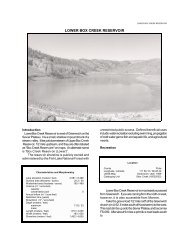
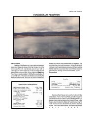
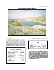
Introduction<br />
Deer Creek Reservoir is a large reservoir at the top<br />
<strong>of</strong> Provo Canyon in northern Utah. Much <strong>of</strong> the Wasatch<br />
fronts and Salt Lake City's water comes from this<br />
reservoir, and it is a popular destination for year-round<br />
recreation. The Heber Creeper, a tourist passenger<br />
railroad, follows the reservoir's northern shore, and US-<br />
189 follows the southern shore. It impounds spring run<strong>of</strong>f<br />
from the western Uintas, storing it for use throughout the<br />
year. Deer Creek Reservoir was created in 1941 by the<br />
construction <strong>of</strong> an earth-fill dam. The reservoir shoreline<br />
is publicly owned, and public access is unrestricted. It is<br />
named after Deer Creek, which flows into the Provo River<br />
Characteristics and Morphometry<br />
Lake elevation (meters / feet) 1,651 /5,417<br />
Surface area (hectares / acres) 1,200 / 2,965<br />
<strong>Water</strong>shed area (hectares / acres) 187,000 / 462,000<br />
Volume (m 3 / acre-feet)<br />
capacity 2.38823 x 10 8 / 193,614<br />
conservation pool 1.850 x 10 8 / 149,700<br />
Annual inflow (m 3 / acre-feet) 4.930 x 10 8 / 254,700<br />
Retention time (years) 1.3<br />
Drawdown (m 3 / acre-feet) 8.6854 x 10 7 / 70,413<br />
Depth (meters / feet)<br />
maximum 42 / 137<br />
mean 20 / 65<br />
Length (km / miles) 9.2 / 5.7<br />
Width (km / miles) 1.9 / 1.2<br />
Shoreline (km / miles) 29.6 / 18.4<br />
Location<br />
County<br />
Wasatch<br />
Longitude / Latitude 111 32 58 / 40 24 45<br />
USGS Maps Aspen Grove, 1948, Charleston, 1966<br />
DeLorme's Utah Atlas & GazetteerPage TM 53 C-6, 54, C-1<br />
Cataloging Unit Provo River (16020203)<br />
immediately downstream from the dam. In addition to<br />
recreational usage the reservoir water is used for irrigation<br />
(38%), and culinary (62%). As urban sprawl continues to<br />
cover farmland, the amount consumed for culinary<br />
purposes is expected to increase.<br />
Recreation<br />
Deer Creek Reservoir is easily accessible from US-
LAKE REPORTS<br />
189
<strong>DEER</strong> <strong>CREEK</strong> <strong>RESERVOIR</strong><br />
File Contains Data for<br />
PostScript Printers Only
LAKE REPORTS<br />
between Provo and Heber. The highway crosses the dam<br />
and follows the shore for about five miles. There are<br />
several resorts and one state park along the route. The<br />
road will be in the process <strong>of</strong> reconstruction from about<br />
1995 to 2000, rerouting the highway further from the<br />
reservoir and providing improved access and parking.<br />
Cross-country skiing, fishing, boating, windsurfing,<br />
swimming, camping, picnicking, ice fishing, and water<br />
skiing are all popular. Fishing is generally good to<br />
excellent, and strong canyon winds create fine sailing<br />
conditions. Mount Timpanogos and the rest <strong>of</strong> the<br />
southern Wasatch Front provide a spectacular backdrop.<br />
Timpanogos itself is discernable from the north end <strong>of</strong> the<br />
reservoir, with her head and flowing hair at the south end<br />
<strong>of</strong> the mountain.<br />
Recreational facilities at the reservoir include Deer<br />
Creek State Park as well as private recreational facilities<br />
and marinas. The state park has a concrete boat launch,<br />
modern rest rooms with showers, sewage disposal, a 31<br />
unit campground, and fish cleaning stations. The park is<br />
located two miles north <strong>of</strong> the dam on US-189 (milepost<br />
20) with well-marked entrances.<br />
Private facilities include Snow's Marina in Wallsburg<br />
Bay (milepost 21), the Deer Creek Island Resort (milepost<br />
24) with a restaurant, boat rentals, boat launch areas,<br />
picnic areas, swimming areas, gasoline and sundries. An<br />
additional state-owned beach facility with swimming areas<br />
and public rest rooms are just north <strong>of</strong> the resort.<br />
There are numerous USFS campgrounds up the<br />
North Fork up Provo Canyon on U-92, and Wasatch State<br />
Park in Midway (north <strong>of</strong> the reservoir and US-189 in the<br />
Heber Valley) also <strong>of</strong>fers camping.<br />
<strong>Water</strong>shed Description<br />
Deer Creek Reservoir an impoundment <strong>of</strong> the Provo<br />
River. The river has a long narrow watershed, from the<br />
Trial Lake area in the extreme western Uintas down into<br />
the southern end <strong>of</strong> Kamas (Rhodes) Valley, then down<br />
upper Provo Canyon into the Jordanelle Reservoir, across<br />
Heber Valley and into Deer Creek Reservoir, which is<br />
located where Heber Valley narrows into Provo Canyon.<br />
The area around the reservoir is sage-grass<br />
vegetation, with agricultural crops where the reservoir<br />
borders Heber Valley.<br />
The inclusion <strong>of</strong> the western Uintas into the Provo<br />
River's watershed is a result <strong>of</strong> several natural and manmade<br />
diversions. In fairly recent geological times, the<br />
Provo River only drained the Heber Valley. Upper Provo<br />
Canyon was an east-flowing tributary <strong>of</strong> the Weber River,<br />
and what is now the headwaters <strong>of</strong> the Provo River<br />
drained across Kamas Valley and down the Weber. As<br />
geologic tilting and faulting occurred, the Heber Valley<br />
became topographically lower then Kamas Valley, and<br />
tributaries <strong>of</strong> the Provo River began capturing drainage<br />
from the Weber Basin. One <strong>of</strong> these tributaries began<br />
capturing the east flowing, present- day Upper Provo<br />
Canyon. It eventually captured that entire canyon (its east<br />
flowing tributaries are testament that the stream once<br />
flowed east) and reached the southern Kamas Valley and<br />
diverted the stream which is now called the Provo River<br />
into the Provo River drainage. Presently, the Provo River<br />
and Weber River both flow through Kamas Valley. The<br />
Provo has cut a narrow channel within the otherwise flat<br />
valley, but no further drainage has been captured. It<br />
appears that at the moment <strong>of</strong> human's brief presence in<br />
geologic time, the more difficult part <strong>of</strong> the capture (tough<br />
bedrock underlying Upper Provo Canyon) has occurred,<br />
but the Provo drainage has not made progress in<br />
capturing the remainder <strong>of</strong> the Weber River tributaries in<br />
Kamas Valley (underlaid by s<strong>of</strong>t alluvial deposits), a<br />
process that should be nearly instantaneous. It has taken<br />
at least 10,000 years, however, because the width <strong>of</strong><br />
Upper Provo Canyon clearly indicates it has carried glacial<br />
run<strong>of</strong>f.<br />
Since Europeans arrived in the area, they have made<br />
two additional diversions to the headwaters <strong>of</strong> the Provo<br />
River. The first was the relatively simple diversion <strong>of</strong><br />
Weber water across Kamas Valley to the Provo. This<br />
approximately doubled the watershed in the Uintas. Only<br />
a relatively small fraction <strong>of</strong> the Weber River is diverted,<br />
though. The second diversion involved tunnelling through<br />
the mountains between the Duchesne River and the Provo<br />
River. This diverts water from the Colorado River<br />
watershed to the Wasatch Front.<br />
The natural watershed high point, Bald Mountain, is<br />
3,640 m (11,943 ft) above sea level, thereby developing a<br />
complex slope <strong>of</strong> 3.7% to the reservoir (although higher<br />
points exist in the Duchesne River watershed). The<br />
average stream gradient above the reservoir is 3.2% (170<br />
feet per mile). The inflows are the Provo River, Main<br />
Creek and Daniels Creek. The outflow is the Provo River.
<strong>DEER</strong> <strong>CREEK</strong> <strong>RESERVOIR</strong><br />
Culinary water stored in the reservoir is diverted from the<br />
river several miles downstream at the Olmstead Diversion<br />
into the Salt Lake Aqueduct, while irrigation water is<br />
diverted near the mouth <strong>of</strong> the canyon at the Murdock<br />
Diversion. The newly completed Jordanelle Reservoir is<br />
the only significant upstream impoundment.<br />
The watershed is made up <strong>of</strong> high mountains, low<br />
mountains, and valleys. The soil associations that<br />
compose the watershed are listed in Appendix III.<br />
The vegetation communities consist <strong>of</strong> pine, sprucefir,<br />
oak-maple, alpine tundra, and sagebrush-grass. The<br />
watershed receives 41 - 102 cm (16 - 40 inches) <strong>of</strong><br />
precipitation annually. The frost-free season around the<br />
reservoir is 80 - 100 days per year.<br />
Land use is primarily multiple use in USFS and BLM<br />
owned lands, and grazing <strong>of</strong> domestic livestock on<br />
privately owned lands. Private lands in the Heber Valley,<br />
however, are primarily agricultural, suburban, and urban.<br />
The headwater area <strong>of</strong> the Duchesne River is in the High<br />
Uintas Wilderness.<br />
Limnological Assessment<br />
The water quality <strong>of</strong> Deer Creek Reservoir is good. It<br />
is considered to be hard with a hardness concentration<br />
value <strong>of</strong> approximately 180 mg/L (CaCO3). The only<br />
parameters that have exceeded State water quality<br />
standards for defined beneficial uses are phosphorus,<br />
dissolved oxygen and on rare occasion total coliforms.<br />
Although the average surface concentrations <strong>of</strong> total<br />
phosphorus have not exceeded the State pollution<br />
indicator for phosphorus <strong>of</strong> 25 ug/L it is not unusual for the<br />
concentration throughout the water column to exceed is<br />
value several times due in large part to the higher<br />
concentrations that develop in the hypolimnion after the<br />
reservoirs stratifies and anoxic conditions develop. These<br />
types <strong>of</strong> conditions allow for the reintroduction <strong>of</strong><br />
phosphorus previously stored in the sediments.<br />
Dissolved oxygen concentrations in late summer<br />
consistently substantiate the fact that water quality<br />
impairments do exist. Concentrations dropped<br />
dramatically in the hypolimnion to a low <strong>of</strong> 0.5 mg/L as<br />
depicted by the July 14, 1992 pr<strong>of</strong>ile. Historically the<br />
reservoir has exhibited fairly high eutrophic conditions.<br />
During the late 70's and early 80's the reservoir was<br />
characterized as a highly eutrophic system with heavy<br />
algal blooms and the problems associated with them. The<br />
TSI values during that period averaged over 50 with<br />
reported values <strong>of</strong> 53.5, 54.2 and 54.2 in 1975, 1981 and<br />
1982 respectively. This deterioration <strong>of</strong> water quality<br />
became the catalyst for joint activity by several agencies,<br />
groups and private land owners to study the problems and<br />
find acceptable solutions to alleviate the problems and<br />
restore water quality. These efforts have been ongoing<br />
since the 1980's. Projects have been implement to control<br />
Limnological Data<br />
Data sampled and averaged from STORET sites on a yearround<br />
schedule: 591322, 591323, 591324, 591343,<br />
591345.<br />
Surface Data 1980 1990 1991* 1992*<br />
Trophic Status E M M M<br />
Chlorophyll TSI 52.18 48.12 53.92 45.13<br />
Secchi Depth TSI 48.00 41.98 47.15 44.71<br />
Phosphorous TSI 56.72 50.28 47.73 46.48<br />
Average TSI 52.30 46.79 49.60 45.44<br />
Chlorophyll a (ug/L) - 6.5 14.0 4.2<br />
Transparency (m) 2.57 3.5 2.7 3.1<br />
Total Phosphorous (ug/L) 25 24 20 25<br />
pH 8.2 8.2 8.1 8.4<br />
Total Susp. Solids (mg/L)
LAKE REPORTS<br />
D o C pH DO<br />
Cond<br />
0 18.5 8.1 8.2 393<br />
1 18.5 8.1 8.1 393<br />
2 18.5 8.1 8.0 394<br />
4 18.5 8.1 8.0 394<br />
5 18.4 8.1 7.9 394<br />
6 18.4 8.1 7.8 394<br />
8 18.3 8.1 7.8 394<br />
10 18.3 8.1 7.8 394<br />
11 17.7 7.8 5.8 394<br />
12 17.4 7.6 5.1 394<br />
13 17.0 7.5 4.8 395<br />
14 16.2 7.4 4.1 393<br />
15 16.0 7.4 3.9 391<br />
16 15.3 7.3 3.7 392<br />
17 15.0 7.3 3.5 392<br />
18 14.1 7.2 3.3 394<br />
20 13.3 7.2 3.1 402<br />
22 12.5 7.2 2.6 405<br />
24 11.5 7.1 1.7 416<br />
26 11.2 7.1 1.3 417<br />
28 11.1 7.1 1.2 418<br />
30 10.9 7.1 0.8 417<br />
32 10.8 7.1 0.6 422<br />
34 10.8 7.1 0.5 422<br />
35 10.7 7.0 0.5 420<br />
Temp<br />
conditions are<br />
deleterious to not<br />
only to the fishery by rendering some <strong>of</strong> the water column<br />
unsuitable for a fishery, but water downstream from the reservoir<br />
unsuitable for a cold water fishery until the dissolved<br />
oxygen concentrations increase to a point when they can<br />
sustain a fishery. According to DWR no fish kills have<br />
been reported in recent years. The reservoir supports<br />
populations <strong>of</strong> rainbow trout (Oncorhynchus mykiss),<br />
cutthroat trout (Oncorhynchus clarki), largemouth bass<br />
(Micropterus salmoides), smallmouth bass<br />
(Micropterus dolomieui), yellow perch (Perca<br />
flavescens), brown trout (Salmo trutta), carp<br />
(Cyprinus carpio) and chubs (Gila atratia). Walleye<br />
(Stizostedion vitreum) and crayfish have been illegally<br />
introduced into the reservoir. DWR typically stocks the<br />
reservoir with fry, fingerling or subcatchable rainbow and<br />
cutthroat trout and smallmouth bass.<br />
Macrophytes are not typically present and are not a<br />
problem. Traditionally, the DWR has stocked 100,000<br />
fingerling Smallmouth Bass in the spring and nearly<br />
100,000 subcatchable Rainbow Trout in both the spring<br />
and the fall. By the early 1990's, the Walleye population<br />
(illegally introduced) had become so dominant in the<br />
reservoir that<br />
it wiped out most <strong>of</strong> the trout fishery. In 1992, the DWR<br />
ceased to stock trout, and now stocks only the 100,000<br />
Smallmouth Bass. Fish populations are very dynamic<br />
from year to year, with Walleye being the predominant<br />
predator in the early 1990's.<br />
The reservoir has not been chemically treated by the<br />
DWR to eliminate rough fish competition, so populations<br />
<strong>of</strong> native Provo River fish may be present. Intensive<br />
stocking and angling for over 50 years have probably<br />
DO<br />
driven native fish populations to very small numbers.<br />
Phytoplankton in the euphotic zone include the<br />
following taxa (in order <strong>of</strong> dominance)<br />
Species<br />
Cell Volume% Density<br />
(mm 3 /liter) By Volume<br />
Aphanizomenon flos-aquae 12.888<br />
68.84<br />
Stephanodiscus niagarae 3.914<br />
20.91<br />
Anabaena spiroides<br />
var. crassa 1.557 8.32<br />
Oocystis sp. .175 0.94<br />
Melosira granulata .109 0.58<br />
Asterionella formosa .069 0.37<br />
Pennate diatoms .004 0.02<br />
Ankistrodesmus falcatus .004 0.02<br />
Total 154.917<br />
Shannon-Weaver 0.89<br />
Species Evenness 0.43<br />
Species Richness 0.30<br />
This sampling <strong>of</strong> the phytoplankton is representative <strong>of</strong><br />
July 14, 1992 and is not typical <strong>of</strong> the decreasing trend for<br />
dominance by blue-green algae.<br />
According to Rushforth (1992) the algal plankton flora<br />
<strong>of</strong> Deer Creek Reservoir, Wasatch County, Utah was<br />
studied throughout the 1991 calendar year. Quantitative<br />
net plankton and total plankton samples were examined.<br />
A total <strong>of</strong> 45 taxa was identified in the plankton flora. In<br />
addition, the two common categories, centric diatoms and<br />
pennate diatoms, each contain many additional taxa.<br />
The most important plankters as determined by<br />
calculating Important Species Indices (Isis) from all Deer<br />
Creek Reservoir combined net and total plankton samples<br />
collected during 1991 were Fragilaria crotonensis,<br />
Aphanizomenon flos-aquae, Stephanodiscus<br />
niagarae, Sphaerocystis schroeteri, Melosira<br />
granulata, pennate diatoms, Pandorina morum and<br />
Ankistrodesmus falcatus. These taxa all had Isis<br />
greater that 1.0. These eight taxa comprised 92.7% <strong>of</strong> the<br />
phytoplankton flora (as determined by calculating sum<br />
importance value) <strong>of</strong> Deer Creek Reservoir for the 1991<br />
year. This measurement is an assessment <strong>of</strong> algal<br />
standing crop and distribution through the year as<br />
reflected in our samples.<br />
Algae with ISI's greater that 0.10 included centric<br />
diatoms, Microcystis aeruginosa, Staurastrum<br />
gracile, Anabaena spiroides var. crassa, Dinobryon<br />
divergens, Asterionella formosa, Ceratium hirundinella,<br />
Chlamydomonas species, and Pediastrum duplex.<br />
Bluegreen algae together comprised approximately<br />
17.2% <strong>of</strong> the flora when measured by summing ISI's. This
<strong>DEER</strong> <strong>CREEK</strong> <strong>RESERVOIR</strong><br />
total represents a significant increase over the past few<br />
years. For example, bluegreen algae comprised only<br />
1.5% <strong>of</strong> the flora for the 1990 year. Aphanizomenon<br />
flos-aquae was the most important cyanophyte in the<br />
reservoir for 1991 with an important species index <strong>of</strong> 6.77<br />
(up from an ISI <strong>of</strong> 1.79 for the 1990 year). A. flos-aquae<br />
was also the second most important organism in the<br />
reservoir after the diatom Fragilaria crotonensis. The<br />
increase in abundance <strong>of</strong> A. flos-aquae continues a trend<br />
<strong>of</strong> rebound <strong>of</strong> this organism during the past two years.<br />
Deer Creek, historically is a meso-eutrophic to<br />
eutrophic ecosystem. The reservoir has responded well<br />
to the nutrient limitation program established several years<br />
ago. The presence <strong>of</strong> noxious, poor water quality indicator<br />
species continues to be reduced compared to their<br />
abundance in the reservoir prior to nutrient limitation<br />
although the rebound in Aphanizomenon flos-aquae<br />
is noteworthy. It will be important to follow the<br />
development <strong>of</strong> this organism in the reservoir system<br />
during the 1992 year.<br />
Pollution Assessment<br />
Nonpoint pollution sources include the following:<br />
Sedimentation and nutrient loading from grazing. Human<br />
wastes, chemicals and nutrients from urban areas.<br />
Herbicides and nutrients from cropland. Human wastes,<br />
litter and toxins from recreation. Siltation from road<br />
construction during the late 1990's.<br />
Point sources <strong>of</strong> pollution in the watershed include<br />
the following:<br />
Midway Fish Hatchery<br />
Kamas Fish Hatchery<br />
Beneficial Use Classification<br />
The state beneficial use classifications include:<br />
culinary water (1A), recreational bathing (swimming) (2A),<br />
boating and similar recreation (excluding swimming) (2B),<br />
cold water game fish and organisms in their food chain<br />
(3A) and agricultural uses (4).<br />
Information<br />
Management Agencies<br />
Mountainlands Association <strong>of</strong> Governments 377-2262<br />
<strong>Division</strong> <strong>of</strong> Wildlife Resources 538-4700<br />
<strong>Division</strong> <strong>of</strong> <strong>Water</strong> <strong>Quality</strong> 538-6146<br />
Recreation<br />
Mountainland Travel Region (Provo) 377-2262<br />
Heber Chamber <strong>of</strong> Commerce 654-3666<br />
Provo-Orem Chamber <strong>of</strong> Commerce 224-3636<br />
Deer Creek State Park 654-0171<br />
Concessionaire --------<br />
Reservoir Administrators<br />
Department <strong>of</strong> the Interior 538-1467<br />
Central Utah <strong>Water</strong> Conservancy District 226-7100
LAKE REPORTS