Volume 11, 1958 - The Arctic Circle - Home
Volume 11, 1958 - The Arctic Circle - Home
Volume 11, 1958 - The Arctic Circle - Home

Create successful ePaper yourself
Turn your PDF publications into a flip-book with our unique Google optimized e-Paper software.
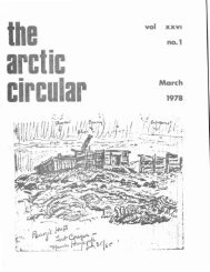
VOL XI No.4<br />
THE ARCTIC CIRCULAR<br />
63<br />
Blackadar and Murphy returned to Cape Dorset on<br />
September 18 and left on September 23 aboard the C.G.S.<br />
C.D. Howe,reaching Quebec on September 30. It is expected<br />
that mapping will be continued in the Amadjuak area in 1959.<br />
Southeast District of Mackenzie. A reconnaissance<br />
survey of an L-shaped area in southeast District of Mackenzie,<br />
0<br />
between latitudes 60 0 and 62 north and extending from Nonacho<br />
Lake in the west to Wholdaia Lake in the east, was carried out by<br />
F.5:. Taylor thus completing mapping in this part of the Precambrian<br />
Shield except for a small area west of Wholdaia Lake. A party of<br />
ten was in the field from the first week in June, when ice covered<br />
all the larger lakes, until the first week in September. Canoe<br />
parties, consisting of two men. were supplied from Uranium City<br />
by Otter aircraft. Glacial deposits, such as eskers, drumlinoid<br />
ridges, and morainal ridges, cover much of the area. In these<br />
parts a float-equipped Cessna 180 aircraft was used for a period<br />
of three weeks and proved valuable in moving ground parties and<br />
in making spot observations.<br />
<strong>The</strong> area lies athwart the tree-line and small black spruce<br />
trees are dominant. Game is scarce except during the caribou<br />
migration. Lake trout is common in the lakes and most streams<br />
contain grayling.<br />
Western District 9..f Mackenzie. :!..~ Jeletzky continued<br />
the study of the stratigraphy and palaeontology of the Cretaceous and<br />
uppermost Jurassic strata southwest of the Mackenzie River delta<br />
initiated in 1955. Field work was carried out on the eastern flank<br />
of the Richardson Mountains between the latitudes of Alclavik and<br />
Fort McPherson. A few days were also spent on parts of the<br />
Porcupine River in the Yukon. J.V. Ross and R.D. Lawrence,<br />
seasonal employees, completed detailed mapping in the Mesa Lake<br />
and Rodriques Lake map-areas north of Great Slave Lake.<br />
I<br />
Northern Ellesmere Island. R.L. Christie made<br />
reconnaissance studies in the Lake Hazen region of northern<br />
Ellesmere Island and was attached to the Defence Research Boardls<br />
"Operation Hazen" for administrative and logistical purposes. This<br />
work had been started in 1957 and was continued this year with the<br />
assistance of~•..!:. Walker.<br />
Field work began on May 4 with a flight to Ward Hunt<br />
Island by Dakota aircraft. <strong>The</strong> valleys tributary to Disraeli Bay