Road Network Strategy - Devonport City Council
Road Network Strategy - Devonport City Council
Road Network Strategy - Devonport City Council

Create successful ePaper yourself
Turn your PDF publications into a flip-book with our unique Google optimized e-Paper software.
CLIENTS PEOPLE PERFORMANCE<br />
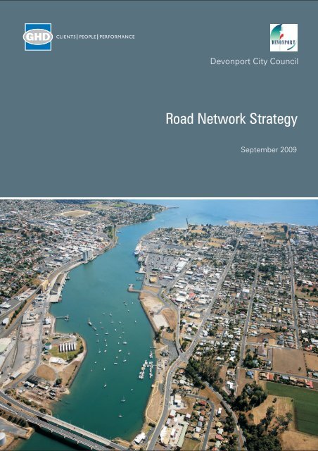
<strong>Devonport</strong> <strong>City</strong> <strong>Council</strong><br />
<strong>Road</strong> <strong>Network</strong> <strong>Strategy</strong><br />
September 2009
Contents<br />
1. Introduction 3<br />
1.1 Overview of <strong>Devonport</strong> <strong>City</strong> <strong>Council</strong> 3<br />
1.2 Key Objective of the <strong>Road</strong> <strong>Network</strong> <strong>Strategy</strong> 4<br />
1.3 Acknowledgements 4<br />
2. Background 5<br />
2.1 Overview of <strong>Devonport</strong>’s Transport <strong>Network</strong> 5<br />
2.2 Previous Traffic Studies 5<br />
2.3 Related <strong>Council</strong> Documents 6<br />
3. Key Issues 7<br />
3.1 Key Access Points into the Municipality 7<br />
3.2 Intersection and <strong>Road</strong> Link Capacity 9<br />
3.3 <strong>Road</strong> Safety 10<br />
3.4 Economic and Regional Development 12<br />
3.5 Mobility and Sustainable Transport 14<br />
3.6 Parking 15<br />
3.7 <strong>Road</strong> Standards and Maintenance 16<br />
4. Community Engagement 17<br />
5. <strong>Road</strong> <strong>Network</strong> Hierarchy 18<br />
5.1 Importance of a <strong>Road</strong> Hierarchy 18<br />
5.2 State <strong>Road</strong> Hierarchy 18<br />
5.3 A <strong>Road</strong> Hierarchy Framework 19<br />
5.4 <strong>Devonport</strong>’s Redefined <strong>Road</strong> Hierarchy 19<br />
6. The <strong>Strategy</strong> 28<br />
6.1 Bass Highway Access 28<br />
6.2 Key Modifications to the <strong>Road</strong> Hierarchy 29<br />
6.3 Improved Access to CBD 29<br />
6.4 <strong>Devonport</strong> ‘Ring <strong>Road</strong>’System 30<br />
6.5 Improve Traffic Management Arrangements 33<br />
6.6 Address <strong>Road</strong> Safety Concerns 33<br />
6.7 Regional Connectivity 34<br />
6.8 Provide Comprehensive Transport Facilities and Services 35<br />
32/14516/46398 <strong>Devonport</strong> <strong>Road</strong> <strong>Network</strong> <strong>Strategy</strong><br />
<strong>Road</strong> <strong>Network</strong> <strong>Strategy</strong>
6.9 Develop and Implement a Parking Plan for <strong>Devonport</strong> 36<br />
6.10 Asset Management and Maintenance 37<br />
Figure Index<br />
Figure 1 Formby <strong>Road</strong> OffRamp 7<br />
Figure 2 Steele Street / William Street Intersection 9<br />
Figure 3 Fourways on William Street 10<br />
Figure 4 High Frequency Crash Locations 11<br />
Figure 5 Regional and Economic Development Map 13<br />
Figure 6 Cycle ways 14<br />
Figure 7 Car Park Locations and Capacity 15<br />
Figure 8 Gunn Street access to supermarket parking 16<br />
Figure 9 Urban versus Rural <strong>Road</strong>s Map 21<br />
Figure 10 <strong>Devonport</strong>’s <strong>Road</strong> Hierarchy Map 22<br />
Figure 11 <strong>Devonport</strong>’s Urban <strong>Road</strong> Hierarchy Map 23<br />
Figure 12 Proposed Ring <strong>Road</strong> System 32<br />
Figure 13 DCC Cycleway Master Plan 35<br />
Table Index<br />
Table 1 <strong>Road</strong> Hierarchy Desirable Performance Criteria <br />
Urban <strong>Road</strong>s 24<br />
Table 2 <strong>Road</strong> Hierarchy Desirable Performance Criteria <br />
Rural <strong>Road</strong>s 25<br />
Table 3 <strong>Road</strong> Hierarchy Acceptable Design Solutions <br />
Urban <strong>Road</strong>s 26<br />
Table 4 <strong>Road</strong> Hierarchy Acceptable Design Solutions <br />
Rural <strong>Road</strong>s 27<br />
32/14516/46398 <strong>Devonport</strong> <strong>Road</strong> <strong>Network</strong> <strong>Strategy</strong><br />
<strong>Road</strong> <strong>Network</strong> <strong>Strategy</strong>
1. Introduction<br />
The <strong>Devonport</strong> <strong>Road</strong> <strong>Network</strong> <strong>Strategy</strong> is aimed<br />
at providing and maintaining a road network<br />
suitable for the <strong>Devonport</strong> municipality and its<br />
road users. In particular, the strategy addresses<br />
a series of key issues identified through analysis<br />
of the existing road network and consultation<br />
with key stakeholders, <strong>Council</strong>, and the general<br />
public.<br />
The <strong>Strategy</strong> provides a longterm vision for the<br />
use of <strong>Devonport</strong>’s road network to meet the<br />
needs of the community, business, tourism and<br />
industry. Coupled with this is the shorter term<br />
Action Plan that sets the 3 to 5 year goals that<br />
assist in meeting the longer term aims of the<br />
<strong>Strategy</strong>. The <strong>Strategy</strong> is a ‘high level’<br />
document that assists in longterm planning and<br />
prioritisation of land use and transportation<br />
needs for the community. Implementation of the<br />
<strong>Strategy</strong> is undertaken with the associated<br />
Action Plan. The Action Plan provides the<br />
shortterm focus that is linked directly to<br />
<strong>Council</strong>’s Strategic Plan and annual budget.<br />
The <strong>Strategy</strong> aims to assist <strong>Council</strong> with the<br />
following:<br />
» Asset management planning;<br />
» Tool to assist land use development;<br />
» Making traffic management decisions – road<br />
safety, transport efficiency, and amenity;<br />
» Deciding traffic calming priorities in<br />
residential streets; and<br />
» Providing direction for road network<br />
planning within <strong>Devonport</strong> and the<br />
surrounding region.<br />
1.1 Overview of <strong>Devonport</strong> <strong>City</strong><br />
<strong>Council</strong><br />
<strong>Devonport</strong> is a city with a population in excess<br />
of 25,000 people and is situated in the centre of<br />
Tasmania’s North Coast. Population projections<br />
prepared by Essential Economics indicate that<br />
the population of <strong>Devonport</strong> is forecast to<br />
continue to experience modest growth of 0.4%<br />
per annum between 2006 and 2021. <strong>Devonport</strong><br />
is the central hub of northern Tasmania,<br />
providing services for residents of the immediate<br />
area and surrounding regions. <strong>Devonport</strong> is a<br />
focus of tourist activity, with the Spirit of<br />
Tasmania ferries linking the city to Melbourne.<br />
<strong>Devonport</strong> airport also has services to and from<br />
the mainland.<br />
<strong>Devonport</strong>'s industry is focussed on a number of<br />
key sectors comprising retail trade,<br />
manufacturing, health & community services,<br />
property & business services and education.<br />
Given <strong>Devonport</strong>'s geographical location and<br />
natural resources, other important sectors are<br />
agriculture, transport & logistics and tourism.<br />
The Port is <strong>Devonport</strong>'s most important<br />
economic asset as it provides one of<br />
Tasmania's key gateways for imports, exports<br />
and tourism. This leads to the need for a strong<br />
transport system that will allow <strong>Devonport</strong> to<br />
continue to prosper into the future<br />
<strong>Devonport</strong> <strong>City</strong> <strong>Council</strong>’s Vision is to develop as<br />
the professional, industrial, social and cultural<br />
hub of the North Coast of Tasmania; a<br />
predominately residential <strong>City</strong> set in parklands,<br />
with a broad commercial and industrial base<br />
where residents can enjoy a balanced family<br />
lifestyle with appropriate and fulfilling<br />
employment together with educational, sporting,<br />
recreational and cultural opportunities.<br />
The key goals of the <strong>Devonport</strong> <strong>City</strong> <strong>Council</strong><br />
include:<br />
» Initiate and maintain programs and services<br />
which will meet the aspirations of its<br />
residents;<br />
» Ensure that the programs and services are<br />
provided in an effective, efficient and<br />
equitable manner;<br />
32/14516/46398 <strong>Devonport</strong> <strong>Road</strong> <strong>Network</strong> <strong>Strategy</strong><br />
<strong>Road</strong> <strong>Network</strong> <strong>Strategy</strong><br />
3
» Provide sufficient and appropriate financial<br />
and human resources to enable the<br />
programs and services to be undertaken;<br />
» Promote the physical, economic, social and<br />
political well being of the city and its<br />
residents; and<br />
» Improve communications with, and<br />
encourage the participation of the<br />
community in <strong>Council</strong> activities.<br />
1.2 Key Objective of the <strong>Road</strong><br />
<strong>Network</strong> <strong>Strategy</strong><br />
Recently, <strong>Council</strong> prepared a Draft Strategic<br />
Plan 2009 – 2030 for the <strong>City</strong> of <strong>Devonport</strong>.<br />
The third strategic outcome of this document<br />
provides the basis for the key objective of the<br />
<strong>Road</strong> <strong>Network</strong> <strong>Strategy</strong> as follows:<br />
Access in to, out of and around the city is<br />
well planned and managed<br />
The implementation of the <strong>Road</strong> <strong>Network</strong><br />
<strong>Strategy</strong> should be assessed at periodic<br />
intervals against key performance indicators and<br />
the progress of this objective.<br />
– Ald Fred Konetschnik – Alderman<br />
– Ald Jeff Matthews – Alderman<br />
– Ald Jarrod Nasiukiewicz – Alderman<br />
– Ald Annette Rockliff – Alderman<br />
– Ald Bill Wilson – Alderman<br />
» <strong>Devonport</strong> <strong>City</strong> <strong>Council</strong> Officers.<br />
» Stakeholder groups involved in consultation.<br />
– Mark Williams – Tasmania Police<br />
– Kay Kidd – RACT<br />
– Ian Day – RACT<br />
– Ian Garth – Phoenix Coaches<br />
– David Mahoney Phoenix Coaches<br />
– Helen Plaister – NW Recreational<br />
Cycling<br />
– Kevin Maynard – Spirit of Tasmania<br />
– MaryAnn Edwards – TasPorts<br />
– <strong>Devonport</strong> Chamber of Commerce and<br />
Industry<br />
» GHD Pty Ltd<br />
1.3 Acknowledgements<br />
<strong>Council</strong> acknowledges and appreciates all those<br />
community members and stakeholders who<br />
have participated and contributed to the<br />
development of this <strong>Road</strong> <strong>Network</strong> <strong>Strategy</strong>,<br />
including:<br />
» Community members who participated in<br />
the consultation workshop.<br />
» <strong>Devonport</strong> <strong>City</strong> <strong>Council</strong> <strong>Council</strong>lors.<br />
– Ald Lynn Laycock – Mayor<br />
– Ald Maurice Hill – Deputy Mayor<br />
– Ald Brian Cole – Alderman<br />
– Ald Gabrielle Gavralas – Alderman<br />
– Ald Grant Goodwin – Alderman<br />
– Ald Peter Hollister – Alderman<br />
– Ald Graham Kent – Alderman<br />
32/14516/46398 <strong>Devonport</strong> <strong>Road</strong> <strong>Network</strong> <strong>Strategy</strong><br />
<strong>Road</strong> <strong>Network</strong> <strong>Strategy</strong><br />
4
2. Background<br />
2.1 Overview of <strong>Devonport</strong>’s<br />
Transport <strong>Network</strong><br />
<strong>Devonport</strong> consists of a series of key activity<br />
areas that require efficient and safe transport<br />
through and around them. Identifying Activity<br />
Areas is a first step in determining the<br />
associated transport needs within and through<br />
these areas. The key Activity Areas in<br />
<strong>Devonport</strong> are as follows:<br />
» The CBD;<br />
» Bluff;<br />
» West <strong>Devonport</strong> Fringe;<br />
» East <strong>Devonport</strong>;<br />
» Stony Rise; and<br />
» Spreyton.<br />
Each of these key activity areas have different<br />
transport requirements. These are summarised<br />
as follows:<br />
» CBD Activity Area. Customer and<br />
commuter traffic into and out of the CBD<br />
area, as well as a need for freight traffic<br />
associated with the CBD and neighbouring<br />
port areas. Traffic within the CBD Activity<br />
Area is typically associated with the Centre<br />
(i.e., searching for a parking space, etc).<br />
Unnecessary through traffic should be<br />
minimised, and traffic management and<br />
control should be consistent and kept as<br />
simple as possible.<br />
» Bluff Activity Area. This area has a strong<br />
residential traffic requirement, as well as<br />
tourist and recreational traffic. Through<br />
traffic can be promoted through the Bluff<br />
Activity Area as recreational or tourist traffic<br />
to enjoy the scenic qualities of the area.<br />
» West <strong>Devonport</strong> Fringe Activity Area.<br />
This area, situated to the west of the CBD<br />
and Bluff areas, is predominantly residential<br />
in nature. Traffic management in this area<br />
should encourage low vehicle speeds and<br />
clearly specified traffic priority.<br />
» East <strong>Devonport</strong> Activity Area. This area<br />
is dominated by freight and tourist traffic<br />
(Spirit of Tasmania) associated with the<br />
Port. Industrial and commercial traffic also<br />
has a key role in this area.<br />
» Stony Rise Activity Area. This area is<br />
predominantly residential in nature however<br />
some future commercial development is<br />
proposed. Traffic management in this area<br />
should encourage low vehicle speeds and<br />
clear traffic priority.<br />
» Spreyton. This area is predominantly<br />
residential in nature. Traffic management in<br />
this area should encourage low vehicle<br />
speeds and clearly specified traffic priority.<br />
2.2 Previous Traffic Studies<br />
It is important to recognise previous studies that<br />
have investigated traffic and transport issues in<br />
and around the <strong>Devonport</strong> local government<br />
area.<br />
The following relevant studies have been<br />
undertaken, with key issues that relate to this<br />
<strong>Road</strong> <strong>Network</strong> <strong>Strategy</strong>:<br />
» Draft <strong>Road</strong> <strong>Network</strong> <strong>Strategy</strong>, DCC, 2007.<br />
This internal draft document investigated<br />
many of the traffic issues and potential<br />
methods of overcoming them.<br />
» Quoiba Spreyton Land Use <strong>Strategy</strong>, GHD,<br />
2006. This document investigated future<br />
land use needs of the Quoiba Spreyton area<br />
and was incorporated into <strong>Devonport</strong>’s<br />
Planning Scheme.<br />
» Stony Rise <strong>Road</strong> Strategic <strong>Road</strong> <strong>Network</strong><br />
Plan. This document was prepared as part<br />
of the <strong>Devonport</strong> and Environs Planning<br />
Scheme to integrate road and land use<br />
planning for Stony Rise <strong>Road</strong> and the<br />
adjacent land so as to balance transport<br />
requirements with land use and<br />
32/14516/46398 <strong>Devonport</strong> <strong>Road</strong> <strong>Network</strong> <strong>Strategy</strong><br />
<strong>Road</strong> <strong>Network</strong> <strong>Strategy</strong><br />
5
development. The <strong>Strategy</strong> provided highlevel<br />
guidance on the location of property<br />
access to Stony Rise <strong>Road</strong> in order to<br />
preserve the arterial and freight functions of<br />
Stony Rise <strong>Road</strong>.<br />
» <strong>Devonport</strong> Eastern Shore Traffic<br />
Management Study, Pitt and Sherry, 2006.<br />
This study investigated various traffic<br />
management options to ensure efficient<br />
traffic arrangements for the Eastern Shore<br />
Port area.<br />
» <strong>Devonport</strong> CBD Traffic Study – Analysis of<br />
One Way Street Options, 2002. The<br />
analysis of oneway street options,<br />
undertaken as an extension to the 2001<br />
<strong>Devonport</strong> CBD Traffic Study, identified that<br />
all of the 10 options tested created<br />
significant adverse impacts on traffic access<br />
and permeability within the CBD. The<br />
options tested either generated network<br />
difficulties either by the production of<br />
unacceptable levels of service, or the<br />
introduction of unwanted through traffic into<br />
the King Street or Rooke Street road links.<br />
» <strong>Devonport</strong> CBD Traffic Study, GHD, 2001.<br />
This study investigated various traffic<br />
management options for <strong>Devonport</strong>’s CBD<br />
area to improve efficiency and safety for the<br />
area. Some of the recommendations from<br />
this report have been implemented.<br />
A detailed overview of the work undertaken in<br />
these studies can be found in the <strong>Road</strong> <strong>Network</strong><br />
<strong>Strategy</strong> Background Paper.<br />
» Draft <strong>Road</strong>s and Stormwater Service Level<br />
Agreement;<br />
» <strong>City</strong> of <strong>Devonport</strong> – <strong>Devonport</strong> and Environs<br />
Planning Scheme 1984;<br />
» Stony Rise <strong>Road</strong> Strategic <strong>Road</strong> <strong>Network</strong><br />
Plan;<br />
» <strong>City</strong> of <strong>Devonport</strong> Future Planning Zones;<br />
» <strong>Devonport</strong> <strong>City</strong> <strong>Council</strong> Cycleway Master<br />
Plan, March 2009;<br />
» <strong>Devonport</strong> CBD Parking Survey Data,<br />
March 2009;<br />
» CBD Redevelopment Plans, December<br />
2008; and<br />
» Fourways Shopping Precinct<br />
Redevelopment Plans, February 2009<br />
2.3 Related <strong>Council</strong> Documents<br />
The following <strong>Council</strong> documents have been<br />
referred to in this <strong>Road</strong> <strong>Network</strong> <strong>Strategy</strong>:<br />
» <strong>City</strong> of <strong>Devonport</strong> Draft Strategic Plan 2009<br />
– 2030;<br />
» Footpaths Policy (1997);<br />
» “Did You Know”Fact Sheet – Footpaths<br />
(2004);<br />
32/14516/46398 <strong>Devonport</strong> <strong>Road</strong> <strong>Network</strong> <strong>Strategy</strong><br />
<strong>Road</strong> <strong>Network</strong> <strong>Strategy</strong><br />
6
3. Key Issues<br />
The key issues relating to the operation of<br />
<strong>Devonport</strong>’s road network were identified<br />
through review of relevant previous<br />
documentation; analysis of existing traffic and<br />
crash data; existing and future land use and<br />
consultation with the <strong>Devonport</strong> <strong>City</strong> <strong>Council</strong>,<br />
key stakeholders and the general public. A<br />
summary of the key access, traffic capacity,<br />
safety, economic and regional development,<br />
mobility and parking issues are provided below.<br />
3.1 Key Access Points into the<br />
Municipality<br />
The main accesses to the <strong>Devonport</strong>, Spreyton<br />
and Quoiba areas via the Bass Highway are<br />
from interchanges at Don <strong>Road</strong>, Stony Rise<br />
<strong>Road</strong>, Middle <strong>Road</strong> and Formby <strong>Road</strong>. The<br />
main access to East <strong>Devonport</strong> is via the<br />
Tarleton Street interchange. Figure 1 illustrates<br />
the Formby <strong>Road</strong> westbound offramp.<br />
Figure 1<br />
Formby <strong>Road</strong> OffRamp<br />
3.1.1 Role and Current Operation of<br />
Existing Interchanges<br />
The role and current operation of the existing<br />
interchanges is briefly discussed below:<br />
» Victoria Bridge (Tarleton Street) – This<br />
interchange is the key access into East<br />
<strong>Devonport</strong> to the north of the Highway and<br />
Ambleside to the south. The eastbound offramp<br />
and westbound onramp of the<br />
interchange are highly utilised but the<br />
eastbound onramp and westbound offramp<br />
are operating at only around 10% of the<br />
other off/on ramp traffic volumes. While<br />
there have been no significant concerns<br />
raised regarding the operation of this<br />
interchange in previous reports or through<br />
consultation undertaken as part of the<br />
development of this <strong>Strategy</strong>, it is<br />
recognised that future changes in terms of<br />
traffic volumes and vehicle types may<br />
impact on the current operation. Therefore,<br />
given the proposed industrial area in East<br />
<strong>Devonport</strong>; the promotion of tourism and<br />
use of the Spirit of Tasmania; and the<br />
encouragement of higher density residential<br />
development, a review of the operation and<br />
adequacy of the interchange is likely to be<br />
required in the future.<br />
» Formby <strong>Road</strong> – This interchange provides<br />
the key access into the <strong>Devonport</strong> CBD and<br />
the areas of Quoiba and Spreyton to the<br />
south of the Highway. It was identified that<br />
this was the most heavily utilised access<br />
point, with an average of 918 vehicles per<br />
hour during the AM peak. This interchange<br />
will always be highly utilised due to its close<br />
proximity to East <strong>Devonport</strong> residential, port<br />
and ferry activities, as well as the access it<br />
provides between the <strong>Devonport</strong> CBD and<br />
port area to the areas south of the Highway.<br />
The key issue identified for the interchange<br />
relates to the delays and queuing on the<br />
Bass Highway westbound offramp onto<br />
Formby <strong>Road</strong>.<br />
Formby <strong>Road</strong> itself provides the most direct<br />
route to the <strong>Devonport</strong> CBD, however a<br />
number of issues have been identified:<br />
o Poor signage and delineation for<br />
vehicles travelling along Formby <strong>Road</strong><br />
wishing to access the CBD;<br />
32/14516/46398 <strong>Devonport</strong> <strong>Road</strong> <strong>Network</strong> <strong>Strategy</strong><br />
<strong>Road</strong> <strong>Network</strong> <strong>Strategy</strong><br />
7
o Access issues to and from various sites<br />
along Formby <strong>Road</strong> due to poor turning<br />
traffic separation and high traffic<br />
volumes; and<br />
o Capacity issues observed at the Stewart<br />
Street and Steele Street intersections<br />
with Formby <strong>Road</strong>.<br />
Formby <strong>Road</strong> between Elizabeth and Steele<br />
Streets is in the process of being upgraded<br />
and this is seen as critical to improve access<br />
to the CBD. However, the interchange also<br />
requires review to ensure efficient and safe<br />
access at this point, as this will complement<br />
and add value to the Formby <strong>Road</strong> upgrade.<br />
» Middle <strong>Road</strong> – This interchange is not as<br />
highly utilised as Formby <strong>Road</strong>, despite also<br />
providing an alternative access point to the<br />
CBD. Importantly though, it is a convenient<br />
access point from the south (off Stony Rise<br />
<strong>Road</strong>) and as such it is also likely to attract<br />
traffic from future developments such as the<br />
proposed Northwest Homemaker Centre.<br />
Hence, while the interchange is not<br />
operating at capacity throughout the day,<br />
there are known peak hour capacity issues<br />
on some ramps as well as future traffic<br />
generation impacts that need to be<br />
considered.<br />
North of the interchange, there is an<br />
accumulation of traffic on Middle <strong>Road</strong> from<br />
Stony Rise <strong>Road</strong>, the Miandetta residential<br />
area and the interchange itself. This traffic<br />
is currently directed to William Street, which<br />
leads to the very busy ‘Fourways’shopping<br />
hub. It is also very close to the<br />
supermarkets on Best Street in <strong>Devonport</strong><br />
CBD and hence is likely to be a popular<br />
route to these key destinations for many<br />
people. Steele Street (connecting to the<br />
Don <strong>Road</strong> interchange and commercial<br />
area) adds to this traffic only one block to<br />
the south of the ‘Fourways’.<br />
The key issue is the current traffic<br />
management arrangement whereby all<br />
traffic is directed onto William Street<br />
(regardless of intended destination) causing<br />
a range of congestion, efficiency and safety<br />
issues along the length of this road and<br />
within the immediate vicinity of the<br />
‘Fourways’.<br />
» Stony Rise <strong>Road</strong> – This interchange<br />
consists of one westbound offramp, which<br />
provides access to the area of Stony Rise,<br />
as well as Don <strong>Road</strong> (north of the Highway)<br />
and Mersey Main <strong>Road</strong> (south of the<br />
Highway) via Stony Rise <strong>Road</strong>. It is not<br />
highly utilised, which may relate to the<br />
concerns regarding the substandard design<br />
of the interchange. It currently provides<br />
limited connectivity with the rest of the road<br />
network due to the simple interchange<br />
arrangement.<br />
» Don <strong>Road</strong> – This interchange connects with<br />
the Don <strong>Road</strong> / Stony Rise <strong>Road</strong><br />
roundabout. Eastbound traffic along Bass<br />
Highway would most likely use this<br />
interchange to access <strong>Devonport</strong> and this is<br />
supported by a much higher traffic volume<br />
on the eastbound offramp than the other<br />
eastbound offramps located this side of<br />
Victoria Bridge. The key issues associated<br />
with this interchange include the poor<br />
delineation for traffic travelling towards the<br />
CBD and substandard design. A further<br />
issue relates to the safety concerns<br />
associated with interaction with commercial<br />
properties along this road.<br />
In summary, all five interchanges play key roles<br />
in providing access to <strong>Devonport</strong>’s local road<br />
network and subsequently a broad range of<br />
destinations across the municipality. However,<br />
it is clear from the above discussion that there<br />
are issues with the potential substandard<br />
design of most interchanges, including both<br />
ramps and intersections. It is also clear that<br />
while the interchanges are not operating at<br />
capacity throughout the day for existing traffic<br />
volumes, there are current peak hour capacity<br />
issues and future development traffic generation<br />
32/14516/46398 <strong>Devonport</strong> <strong>Road</strong> <strong>Network</strong> <strong>Strategy</strong><br />
<strong>Road</strong> <strong>Network</strong> <strong>Strategy</strong><br />
8
impacts where infrastructure improvements to<br />
the design are likely to improve traffic efficiency<br />
and safety.<br />
A number of issues are also present on the local<br />
road network that connect to the interchanges,<br />
that will require an innovative approach to<br />
alleviate congestion and improve traffic<br />
efficiency and safety for all road network users.<br />
The Strategic Directions outlined in Sections 6.1<br />
through to 6.5 unite to contribute strategies to<br />
address these issues in a multifaceted<br />
approach.<br />
Figure 2<br />
Steele Street / William Street<br />
Intersection<br />
3.2 Intersection and <strong>Road</strong> Link<br />
Capacity<br />
Through consultation and site investigations,<br />
various intersections were identified, which, due<br />
to high traffic volumes, experienced capacity<br />
issues with entering traffic or right hand<br />
manoeuvres.<br />
These intersections included:<br />
» William Street/ Best Street;<br />
» William Street/ Oldaker Street;<br />
» Steele Street/ William Street;<br />
» Formby <strong>Road</strong>/ Stewart Street;<br />
» Formby <strong>Road</strong>/ Steele Street;<br />
» Victoria Bridge OffRamp/ Formby <strong>Road</strong>;<br />
» Steele Street/ Fenton Street;<br />
» Griffith Street/ Best Street; and<br />
» Mersey Main <strong>Road</strong>/ Kelcey Tier <strong>Road</strong>.<br />
Several commercial properties such as Coles,<br />
Woolworths, and various service stations<br />
experience access difficulties during peak times<br />
into and out of the property. Generally the<br />
larger developments are located on busy roads,<br />
which reduce capacity of their accesses. Key<br />
roads identified with access issues due to high<br />
volumes were:<br />
» Best Street;<br />
» Steele Street;<br />
» Oldaker Street;<br />
» King Street;<br />
» Don <strong>Road</strong>; and<br />
» Formby <strong>Road</strong>.<br />
32/14516/46398 <strong>Devonport</strong> <strong>Road</strong> <strong>Network</strong> <strong>Strategy</strong><br />
<strong>Road</strong> <strong>Network</strong> <strong>Strategy</strong><br />
9
Figure 3<br />
Fourways on William Street<br />
The central element to the intersection and road<br />
link capacity issues in the West <strong>Devonport</strong><br />
urban network is the lack of dedicated roads to<br />
provide a predominantly traffic carrying function<br />
between Bass Highway and key areas such as<br />
the CBD, commercial precincts and residential<br />
zones. For example:<br />
» The William Street Fourways shopping zone<br />
is clearly an attractive destination for the<br />
local community. However, its location is<br />
problematic due to the key distribution<br />
function that William Street plays in the<br />
transport network.<br />
» Don <strong>Road</strong> is a key access from Bass<br />
Highway into various parts of <strong>Devonport</strong><br />
including the CBD, however it provides<br />
access to commercial properties as well as<br />
functioning as a local collector and<br />
distributor road.<br />
A further consideration relates to future<br />
development in the Stony Rise area and the<br />
Don <strong>Road</strong> commercial precinct. Without<br />
targeted road network strategies, the issues on<br />
William and Steele Streets will be exacerbated.<br />
Sections 6.4 and 6.5 consider strategies for<br />
these issues.<br />
3.3 <strong>Road</strong> Safety<br />
3.3.1 Crash Data<br />
Analysis of crash data for the 5 years 2003 to<br />
2008 has highlighted several sections of road<br />
that have a high density of crashes reported to<br />
Police. These areas of the road network<br />
include:<br />
» William Street between Steele Street and<br />
Oldaker Street, including<br />
– The intersection of William Street and<br />
Steele Street which recorded the highest<br />
number of crashes (33 crashes over 5<br />
years), including 5 casualty crashes.<br />
Rear end and cross traffic crashes<br />
comprised nearly 90% of the crashes.<br />
– The intersection of William Street and<br />
Best Street recorded the second highest<br />
number of crashes, with a total of 29<br />
crashes over 5 years, including 4<br />
casualty crashes; and<br />
– The Oldaker Street to Best Street link<br />
recorded 16 crashes, with 50% involving<br />
parking movements.<br />
» The Gunn Street and Steele Street<br />
intersection recorded 15 crashes in the five<br />
year period, including five casualty crashes.<br />
32/14516/46398 <strong>Devonport</strong> <strong>Road</strong> <strong>Network</strong> <strong>Strategy</strong><br />
<strong>Road</strong> <strong>Network</strong> <strong>Strategy</strong><br />
10
Two of these were serious injuries, both<br />
involving a bicycle and light vehicle.<br />
» Eight of the 11 crashes recorded on the<br />
Gunn Street to Oldaker Street link of<br />
Formby <strong>Road</strong> were between through traffic<br />
and traffic turning right. The locations of all<br />
eight crashes were in close proximity to the<br />
right turn lane provided for southbound<br />
traffic entering the McDonalds car park.<br />
Stakeholder and public consultation<br />
feedback also identified this turning<br />
movement as an issue.<br />
3.3.2 Community Concerns<br />
The following road safety issues were identified<br />
through consultation with the community and<br />
<strong>Devonport</strong> <strong>City</strong> <strong>Council</strong>:<br />
» Speeding issues identified by Police along<br />
Lovett Street, Steele Street and near<br />
schools;<br />
» Spreyton Primary School area and Kelcey<br />
Tier <strong>Road</strong> access difficulties;<br />
» Ramp access to the Bass Highway at Don<br />
<strong>Road</strong> is a concern; and<br />
» Numerous railway crossings throughout<br />
<strong>Devonport</strong> with uneven or damaged surface.<br />
Section 6.6 considers strategies for these road<br />
safety issues.<br />
Figure 4 High Frequency Crash Locations 1<br />
1 © 2008. While GHD has taken care to ensure the accuracy of this product, GHD and DATA CUSTODIAN(S), make no representations or warranties about its accuracy,<br />
completeness or suitability for any particular purpose. GHD and DATA CUSTODIAN cannot accept liability of any kind (whether in contract, tort or otherwise) for any<br />
expenses, losses, damages and/or costs (including indirect or consequential damage) which are or may be incurred as a result of the product being inaccurate, incomplete<br />
or unsuitable in any way and for any reason.<br />
32/14516/46398 <strong>Devonport</strong> <strong>Road</strong> <strong>Network</strong> <strong>Strategy</strong><br />
<strong>Road</strong> <strong>Network</strong> <strong>Strategy</strong><br />
11
3.4 Economic and Regional<br />
Development<br />
Economic and regional development is<br />
important to the future prosperity of <strong>Devonport</strong>,<br />
particularly as the <strong>City</strong> is well placed to build on<br />
its existing reputation as a tourist and regional<br />
services hub with port and industrial facilities.<br />
The proposed future developments within and/or<br />
adjacent to the <strong>Devonport</strong> local government<br />
area that have been identified as likely to impact<br />
the operation of the road network are:<br />
» Proposed rezoning of land north of Brooke<br />
Street between Teatree Lane and the<br />
Airport for industrial use;<br />
» Proposed development of a commercial<br />
Homemaker centre;<br />
» Residential development adjacent to the<br />
<strong>Devonport</strong> <strong>City</strong> <strong>Council</strong> boundary in Kentish,<br />
near Sheffield <strong>Road</strong>; and<br />
» Potential for future residential development<br />
in Latrobe and Central Coast areas that may<br />
utilise the services provided within<br />
<strong>Devonport</strong>.<br />
These future developments and other relevant<br />
points are considered below in context of a road<br />
network that supports industry and freight<br />
transport, tourism and regional links.<br />
3.4.1 Industry and Freight Transport<br />
The <strong>Devonport</strong> Port handles approximately 20%<br />
of Tasmania’s total freight import and export<br />
(TasPort, 2008) and generally specialises in the<br />
export of wheat grain, cement, fertilizers and<br />
fuels. The Port facilities are split across both<br />
sides of the Mersey River. The Spirit of<br />
Tasmania terminal and freight terminal are<br />
located on the eastern side of the river, with<br />
vehicular access gained through East<br />
<strong>Devonport</strong>. The Port facilities that are located<br />
on the western side of the river include:<br />
» Australian Cement Terminal;<br />
» Tas Grain Elevators;<br />
» LPG Terminal; and<br />
» TasPorts workshops.<br />
Specific routes have been designated for<br />
access to the facilities on the eastern and<br />
western side of the river. Separate routes are<br />
signposted for heavy vehicle and Spirit of<br />
Tasmania passenger vehicle access to the<br />
eastern Port area.<br />
The existing port operations and proposed<br />
industrial areas in East <strong>Devonport</strong> and Spreyton<br />
offer additional economic development<br />
opportunities. However, heavy vehicle and rail<br />
movements must be managed appropriately to<br />
ensure safety and amenity are not<br />
compromised. For example, while access to the<br />
proposed East <strong>Devonport</strong> industrial area will be<br />
largely from the Latrobe municipality, there is<br />
likely to be an increase in heavy vehicle<br />
movements that will need consideration through<br />
actions associated with this strategy.<br />
3.4.2 Tourism<br />
The operation of the Spirit of Tasmania ferries<br />
from <strong>Devonport</strong> places the city in an excellent<br />
position for expanding tourism in the State and<br />
benefiting locally from directing visitors to key<br />
areas of <strong>Devonport</strong>. This requires a welldefined<br />
road hierarchy to support the use of the<br />
road network and clear access points that<br />
function in a safe manner. There are currently<br />
two key issues that need to be addressed:<br />
» Queuing for the Spirit of Tasmania ferries in<br />
East <strong>Devonport</strong>; and<br />
» Improving the Formby <strong>Road</strong> access to the<br />
CBD to encourage more visitors.<br />
Visitors also come to the area via other means<br />
of transport such as driving from other regions,<br />
public transport, cycling and use of the local<br />
airport. Regardless of transport mode, the road<br />
network and key access points need to provide<br />
a positive and safe experience for visitors to<br />
encourage return visits.<br />
32/14516/46398 <strong>Devonport</strong> <strong>Road</strong> <strong>Network</strong> <strong>Strategy</strong><br />
<strong>Road</strong> <strong>Network</strong> <strong>Strategy</strong><br />
12
3.4.3 Regional Links<br />
The convergence of the Bass Highway and<br />
other strategic access roads at <strong>Devonport</strong> act to<br />
promote the city as the regional services hub for<br />
the north coast. The road network strategy<br />
needs to consider shared industrial and rural<br />
living zones and proposed developments such<br />
as the homemaker centre.<br />
Section 6.7 considers strategies for these<br />
issues.<br />
Figure 5 Regional and Economic Development Map 2<br />
2 © 2008. While GHD has taken care to ensure the accuracy of this product, GHD and DATA CUSTODIAN(S), make no representations or warranties about its accuracy,<br />
completeness or suitability for any particular purpose. GHD and DATA CUSTODIAN cannot accept liability of any kind (whether in contract, tort or otherwise) for any<br />
expenses, losses, damages and/or costs (including indirect or consequential damage) which are or may be incurred as a result of the product being inaccurate, incomplete<br />
or unsuitable in any way and for any reason.<br />
32/14516/46398 <strong>Devonport</strong> <strong>Road</strong> <strong>Network</strong> <strong>Strategy</strong><br />
<strong>Road</strong> <strong>Network</strong> <strong>Strategy</strong><br />
13
3.5 Mobility and Sustainable<br />
Transport<br />
Various modes of transport are used in<br />
<strong>Devonport</strong>, including car, bus, bicycle, walking<br />
and local ferry, however private vehicles<br />
remains the dominant mode. The key<br />
characteristics of various transport modes are<br />
provided below.<br />
3.5.1 Bus Transport<br />
Four bus companies provide public transport<br />
and school bus services in <strong>Devonport</strong>.<br />
Currently, the bus companies operate out of<br />
individual terminal/interchange facilities in the<br />
CBD and service different areas.<br />
3.5.2 Cycling Facilities<br />
There are two existing cycle ways provided in<br />
<strong>Devonport</strong> as shown in Figure 6. <strong>Council</strong> has<br />
sought funding to provide an off road shared<br />
path along Formby <strong>Road</strong> with plans to extend<br />
down to Spreyton and across Victoria Bridge.<br />
3.5.3 Pedestrian Facilities<br />
The main locations for public recreation are<br />
Mersey Bluff reserve, Don Reserve and the East<br />
<strong>Devonport</strong> foreshore. The two existing cycle<br />
ways pass through these areas, also serving as<br />
walking tracks.<br />
The main pedestrian area within the CBD is the<br />
Rooke Street Mall, located between Best Street<br />
and Stewart Street.<br />
» There is no combined bus terminal facility<br />
near the city centre to service existing<br />
Merseylink, Redline and Tassielink coach<br />
services and expanding Phoenix coach<br />
services commencing in 2009;<br />
» No cycle link between East <strong>Devonport</strong> and<br />
the CBD;<br />
» Lack of onroad cycling facilities within the<br />
CBD;<br />
» No cycling facilities to connect to regional<br />
areas, such as Latrobe and Port Sorell;<br />
» Potential to improve the utilisation of the<br />
local ferry service across the Mersey River;<br />
and<br />
» Pedestrian crossing opportunities/ facilities<br />
lacking in the Fourways shopping precinct.<br />
Improving facilities and services for all modes of<br />
transport ensures mobility opportunities exist to<br />
accommodate diverse individual travel patterns<br />
and varied user needs. Furthermore, promotion<br />
of alternative modes of transport to the private<br />
vehicle obviously provides the <strong>Devonport</strong><br />
community with the opportunity to embrace the<br />
principles of sustainable transport.<br />
Section 6.8 considers strategies for these<br />
issues.<br />
Figure 6<br />
Cycle ways<br />
Existing<br />
Proposed<br />
3.5.4 Local Ferry<br />
The Torquay Ferry provides a smallscale ferry<br />
service from the <strong>Devonport</strong> Port. The service<br />
provides a link between East <strong>Devonport</strong> with the<br />
<strong>Devonport</strong> CBD throughout the day, and has the<br />
capacity to carry passengers and bikes.<br />
The following issues have been identified<br />
relating to the mobility and movement of<br />
pedestrians/cyclists/people with disabilities<br />
throughout <strong>Devonport</strong>:<br />
32/14516/46398 <strong>Devonport</strong> <strong>Road</strong> <strong>Network</strong> <strong>Strategy</strong><br />
<strong>Road</strong> <strong>Network</strong> <strong>Strategy</strong><br />
14
3.6 Parking<br />
All trips by private motor vehicle end in a<br />
parking space. The nature and location of<br />
parking therefore is an important consideration<br />
for a <strong>Road</strong> <strong>Network</strong> <strong>Strategy</strong>, as access to<br />
parking associated with land uses must have<br />
appropriate road links.<br />
The <strong>Devonport</strong> <strong>City</strong> <strong>Council</strong> maintains seven offstreet<br />
car parks within the <strong>Devonport</strong> CBD, as<br />
illustrated in Figure 7, offering both all day<br />
parking and 3 hour restricted parking. The static<br />
capacity of these car parks is 1079 spaces, of<br />
which 88 spaces are reserved. Supermarket<br />
parking is also shown but not included in the<br />
capacity count. There are also 461 onstreet<br />
meter controlled parking spaces available within<br />
the CBD, all restricted to one hour parking.<br />
Consultation undertaken during the<br />
development of this <strong>Strategy</strong> identified several<br />
parking related issues that are perceived by the<br />
community. These include:<br />
» General lack of parking availability in the<br />
CBD area;<br />
» High turnover and lack of parking in the<br />
Fourways commercial area;<br />
» Availability of shortterm parking near the<br />
Post Office;<br />
» Commuter parking intruding onto residential<br />
areas;<br />
» Availability of commuter parking;<br />
» General lack of policing of time restricted<br />
parking zones resulting in overstay of<br />
parking, particularly by commuters; and<br />
» Parking in some residential areas where<br />
older style houses have narrow driveways,<br />
and therefore access into an out of<br />
properties becomes difficult when vehicles<br />
are parked hard up against driveways.<br />
Recent parking survey data collected by <strong>Council</strong><br />
indicates that the average utilisation of both car<br />
parks and metered spaces is around 59%.<br />
Figure 7<br />
Car Park Locations and Capacity<br />
5<br />
Supermarket<br />
Parking<br />
2<br />
1<br />
7<br />
8<br />
6<br />
Car parks Reserved<br />
Total<br />
Spaces<br />
1 Rooke 0 177<br />
2 Fenton 6 34<br />
3 Payne 74 133<br />
4 Wenvoe 0 244<br />
5 Fourways 4 91<br />
6 Formby 4 175<br />
7 Best 0 144<br />
8 Edward 0 48<br />
TOTAL 88 1079<br />
3<br />
4<br />
32/14516/46398 <strong>Devonport</strong> <strong>Road</strong> <strong>Network</strong> <strong>Strategy</strong><br />
<strong>Road</strong> <strong>Network</strong> <strong>Strategy</strong><br />
15
Some key findings from this parking survey<br />
include:<br />
» The Formby <strong>Road</strong> and Edward Street car<br />
parks are highly utilised at 81% and 80%<br />
respectively; Fourways car park is also<br />
highly utilised at 74% but still has some<br />
spare capacity;<br />
» The Best Street, Rooke Street, Fenton<br />
Street and Payne Street car parks are<br />
moderately utilised with good spare<br />
capacity; and<br />
» The Wenvoe Street car park is poorly<br />
utilised at 30%.<br />
These results suggest there is adequate parking<br />
provision in the <strong>Devonport</strong> CBD, although<br />
clearly a number of factors need to be<br />
considered when using these results including<br />
the day of the week, time of day, location and<br />
primary use of the car park.<br />
However, the considerable variation in utilisation<br />
across the car parks and community<br />
perceptions of parking issues in <strong>Devonport</strong><br />
indicate the need to review and/or develop<br />
parking policies to improve management of this<br />
asset.<br />
Section 6.9 considers strategies for parking<br />
issues.<br />
Figure 8<br />
Gunn Street access to<br />
supermarket parking<br />
3.7 <strong>Road</strong> Standards and<br />
Maintenance<br />
3.7.1 Community Concerns and<br />
Standards<br />
The <strong>Road</strong> <strong>Network</strong> <strong>Strategy</strong> consultation<br />
workshop identified a range of largely safetyrelated<br />
features that the community considered<br />
to be important aspects of urban roads. These<br />
features included:<br />
» Provision and maintenance of linemarking;<br />
» Standard of pavement construction;<br />
» Safer intersections; and<br />
» Number and condition of rail level crossings.<br />
Addressing these concerns can involve<br />
relatively lowcost programs that may achieve<br />
major safety benefits and community<br />
satisfaction. Furthermore, establishment of and<br />
adherence to standards for roads and traffic<br />
management will enhance driver safety and<br />
assist in more efficient and effective asset<br />
management.<br />
3.7.2 Maintenance<br />
<strong>Road</strong>s and bridges must be maintained in a<br />
condition that allows safe travel. Trucks have a<br />
major impact on the condition of road surfaces<br />
and bridges, while poor drainage or other<br />
environmental factors such as high groundwater<br />
can cause damage to roads and thus add to<br />
maintenance costs.<br />
Poorly maintained roads can have a variety of<br />
adverse consequences including damaging<br />
goods being transported, being potentially<br />
unsafe and simply providing an uncomfortable<br />
journey.<br />
Section 6.10 considers strategies for these<br />
issues.<br />
32/14516/46398 <strong>Devonport</strong> <strong>Road</strong> <strong>Network</strong> <strong>Strategy</strong><br />
<strong>Road</strong> <strong>Network</strong> <strong>Strategy</strong><br />
16
4. Community<br />
Engagement<br />
Consultation with the community and key<br />
stakeholders during the development of the road<br />
network strategy was identified as an important<br />
aspect for development of a successful strategy.<br />
Therefore input and feedback obtained from the<br />
community and key stakeholders formed an<br />
integral part of the process of identifying the key<br />
issues and forming the strategic directions for<br />
the road network.<br />
A consultation workshop was held in December<br />
2008 with key stakeholders and the general<br />
public were also invited to attend. The<br />
workshop provided the attendees with an<br />
introduction to the development of the road<br />
network strategy and a summary of the existing<br />
issues identified within the road network. The<br />
workshop was used to obtain feedback on a<br />
range of issues from the community and key<br />
stakeholders.<br />
The feedback obtained from the community<br />
covered a wide range of topics including road<br />
safety, the performance of the road network,<br />
mobility issues and parking issues. Some of the<br />
main issues and comments obtained from the<br />
consultation process are summarised below:<br />
» Insufficient parking, in particular near the<br />
Fourways commercial area and the CBD;<br />
» Recommendation of speed limit reduction in<br />
the CBD to 40 km/h;<br />
» Safety issues associated with rail level<br />
crossings including uneven and damaged<br />
road surface at some crossings;<br />
» Consideration of onroad cycle paths;<br />
» Incorporate cycling on arterial roads around<br />
the CBD more effectively;<br />
» Support for a cycle link across Victoria<br />
Bridge, and regional links to Latrobe and<br />
Port Sorell;<br />
» No formal bus interchange. There was<br />
support for an interchange from Phoenix<br />
Coaches;<br />
» Support for a regional park and ride facility;<br />
and<br />
» Larger trucks will be operational for the<br />
Spirit of Tasmania in future, with reduced<br />
demand for rail.<br />
Since the consultation workshop in December,<br />
there have been ongoing meetings/ feedback<br />
from <strong>Council</strong> regarding the <strong>Strategy</strong> and two<br />
workshops with <strong>Council</strong> Aldermen.<br />
A 28day public comment period was initiated<br />
prior to final endorsement by <strong>Council</strong>, to provide<br />
the community and key stakeholders with an<br />
opportunity to comment on the final <strong>Strategy</strong><br />
document.<br />
32/14516/46398 <strong>Devonport</strong> <strong>Road</strong> <strong>Network</strong> <strong>Strategy</strong><br />
<strong>Road</strong> <strong>Network</strong> <strong>Strategy</strong><br />
17
5. <strong>Road</strong> <strong>Network</strong><br />
Hierarchy<br />
5.1 Importance of a <strong>Road</strong><br />
Hierarchy<br />
<strong>Road</strong>ways serve a variety of functions, with<br />
many roads serving more than one function and<br />
to varying degrees. Many roads carry high<br />
volumes of traffic through an evolutionary<br />
process rather than through design. That is,<br />
they have a direct route between key<br />
destinations and have been progressively<br />
upgraded to cater for the needs of high traffic<br />
demands. However, it is clear that mixing of<br />
incompatible functions can lead to problems.<br />
A road hierarchy is the classification of roads<br />
according to increasing or decreasing<br />
importance of their traffic carrying and/or access<br />
function. Once defined, it enables appropriate<br />
objectives for these roads to be set and<br />
appropriate design criteria to be implemented.<br />
<strong>Council</strong> has undertaken some work to define<br />
and formalise a road hierarchy for <strong>Devonport</strong>,<br />
however further work is required to finalise the<br />
configuration to enable it to form the basis of<br />
ongoing planning and system management. For<br />
example, some local roads may be carrying a<br />
substantial amount of unnecessary through<br />
traffic, while other roads may be carefully<br />
redesigned to cater for increased traffic<br />
demands. A wellformed road hierarchy will<br />
provide the framework by which road authorities<br />
can plan and implement construction,<br />
maintenance and management projects to<br />
reduce the overall impact of traffic.<br />
However, it is important to also note that gradual<br />
changes in population and industry can have<br />
significant impacts on road use and road<br />
function. Therefore, a road hierarchy should not<br />
be considered permanent, as there is a need to<br />
allow for periodic review to ensure the hierarchy<br />
adequately reflects the changes in land use,<br />
population trends and community concerns.<br />
The benefits of a well designed road hierarchy<br />
to the community include improved transport<br />
efficiency, improved amenity, and improved<br />
accessibility.<br />
5.2 State <strong>Road</strong> Hierarchy<br />
Tasmania’s total road network covers<br />
approximately 24,000 km. Of this, the<br />
Department of Infrastructure, Energy and<br />
Resources (DIER) is responsible for a stateowned<br />
road network consisting of 3,650 km.<br />
This includes a number of different types of<br />
roads with a variety of functions.<br />
The Tasmanian State <strong>Road</strong> Hierarchy 2006 is<br />
based primarily on the need to provide<br />
connectivity at a State level for key corridors<br />
between cities, major towns, ports and rural<br />
catchments. The hierarchy defines five<br />
categories of stateowned roads, including:<br />
Category 1 – Trunk <strong>Road</strong><br />
Category 2 – Regional Freight <strong>Road</strong><br />
Category 3 – Regional Access <strong>Road</strong><br />
Category 4 – Feeder <strong>Road</strong><br />
Category 5 – Other <strong>Road</strong><br />
Within the <strong>Devonport</strong> local government area,<br />
DIER is responsible for the following roads:<br />
» Bass Highway (Category 1);<br />
» Stony Rise <strong>Road</strong> (Category 3);<br />
» Mersey <strong>Road</strong> (Category 3); and<br />
» Sheffield <strong>Road</strong> (Category 4).<br />
The majority of all other roads are considered to<br />
be <strong>Council</strong> managed roads, with a small number<br />
of privately owned roads.<br />
32/14516/46398 <strong>Devonport</strong> <strong>Road</strong> <strong>Network</strong> <strong>Strategy</strong><br />
<strong>Road</strong> <strong>Network</strong> <strong>Strategy</strong><br />
18
5.3 A <strong>Road</strong> Hierarchy Framework<br />
<strong>Devonport</strong>’s redefined road hierarchy is<br />
developed from the application of a four level<br />
road hierarchy framework 3 . The functional<br />
objective of each element in the hierarchy is<br />
identified in the framework to allow consistent<br />
network planning and management. The four<br />
levels of the framework are as follows:<br />
» Level 1 – Purpose. This relates to the<br />
primary objective of the element; to carry<br />
through traffic or to provide direct property<br />
access.<br />
» Level 2 – Function. This relates to the<br />
relationship between the roadway and the<br />
land use it serves.<br />
» Level 3 – Management. This relates to the<br />
emplacement of policies to achieve the<br />
envisaged function based upon the<br />
attributes of the element and of the adjacent<br />
land uses.<br />
» Level 4 – Design. This relates to the<br />
specification of the form of the element in<br />
order to achieve its functional objectives.<br />
The framework provides the objectives,<br />
performance criteria and acceptable solutions<br />
for each road element type within the hierarchy.<br />
5.4 <strong>Devonport</strong>’s Redefined <strong>Road</strong><br />
Hierarchy<br />
<strong>Devonport</strong>’s road network consists of urban and<br />
rural roads as illustrated in Figure 9. The redefined<br />
road hierarchy for urban roads consists<br />
of five road category levels, from sub arterial<br />
roads to local streets and accesses. Only four<br />
of these categories relate to rural roads<br />
including sub arterial, major and minor collector<br />
roads and local road. Note that DIER controlled<br />
roads are acknowledged in <strong>Devonport</strong>’s road<br />
hierarchy as arterial roads.<br />
3<br />
Ref: Eppell, V.A.T, Bunker, J.M. & McClurg, B.A. (2001) A<br />
four level road hierarchy for network planning and<br />
management. In Jaeger, Vicki, Eds. Proceedings 20 th<br />
ARRB Conference, Melbourne.<br />
Each road category covers a different road<br />
function, and therefore varying levels of road,<br />
safety and appearance characteristics relating<br />
to the performance of the road are detailed in<br />
each category. The road hierarchy ranks the<br />
road network according to the purpose and<br />
function of each road to match the five<br />
categories. Adequate maintenance of each<br />
road can then be determined to allow the road<br />
to meet the characteristics outlined in the road<br />
hierarchy.<br />
The <strong>Devonport</strong> <strong>Road</strong> Hierarchy consists of the<br />
following categories and functions:<br />
» Arterial <strong>Road</strong> – A road that predominantly<br />
carries high volumes of through traffic from<br />
one region to another, e.g. Bass Highway<br />
(DIER controlled).<br />
» Sub Arterial <strong>Road</strong> – <strong>Road</strong> connecting<br />
arterial roads to areas of development, and<br />
carry traffic from one part of a region to<br />
another, e.g. Formby <strong>Road</strong> and <strong>Devonport</strong><br />
<strong>Road</strong>.<br />
» Major Collector Street/<strong>Road</strong> – Provides the<br />
principal link between the residential street<br />
network and the arterial road network.<br />
Collects and distributes traffic in an area,<br />
e.g. Middle <strong>Road</strong> and Forbes Street.<br />
» Minor Collector Street – Has residential<br />
/access function but carries a higher volume<br />
of traffic than local streets. A reasonable<br />
level of amenity and safety is maintained but<br />
it is lower than that of a local street, e.g.<br />
Ronald Street and James Street.<br />
» Local Street/<strong>Road</strong> – Are primarily used by<br />
vehicles accessing properties. Amenity and<br />
safety is a dominant feature and are<br />
generally low speed environments, e.g. Ellis<br />
Street and Clarke Street.<br />
» Local Accesses – As per local streets, but<br />
without any through access. These streets<br />
are characterised by the lowest speeds and<br />
minimal traffic volumes. Pedestrians can<br />
typically utilise the road carriageway in a<br />
32/14516/46398 <strong>Devonport</strong> <strong>Road</strong> <strong>Network</strong> <strong>Strategy</strong><br />
<strong>Road</strong> <strong>Network</strong> <strong>Strategy</strong><br />
19
safe manner. These are generally culdesacs<br />
and courts, e.g. Brinkman Court and<br />
Caringa Place.<br />
<strong>Devonport</strong>’s road hierarchy is illustrated in<br />
Figure 10, followed by a close up version of the<br />
urban road hierarchy in Figure 11.<br />
The following sections describe the desirable<br />
performance criteria and acceptable design<br />
solutions developed for the road hierarchy<br />
categories. A limited number of road hierarchy<br />
categories have been provided for practical<br />
reasons, hence there may be times when roads<br />
in the network do not satisfactorily fit the<br />
specified performance criteria or design<br />
requirements. Therefore, the information<br />
provided should be applied with discretion to<br />
achieve the best outcome for the road network<br />
within the constraints identified.<br />
5.4.1 Desirable Performance Criteria<br />
In order for the hierarchy to be an effective<br />
planning tool, means of achieving the functional<br />
objectives of each category need to be<br />
identified. This has been done by specifying<br />
desirable performance criteria for each<br />
classification in level 3 of the hierarchy<br />
framework. These desirable performance<br />
criteria are subdivided into three groups:<br />
» Functional characteristics;<br />
» Frictional characteristics; and<br />
» Impact characteristics.<br />
The desirable performance criteria for urban and<br />
rural roads in <strong>Devonport</strong> are provided in Table 1<br />
and Table 2 respectively.<br />
5.4.2 Acceptable Design Solutions<br />
The strategy has also established the<br />
acceptable design treatments and solutions for<br />
each category of the road hierarchy. This aids<br />
in the road planning process to meet the desired<br />
level of service.<br />
The acceptable design solutions for urban and<br />
rural roads in <strong>Devonport</strong> are provided in Table 3<br />
and Table 4 respectively.<br />
5.4.3 CBD Commercial Zone<br />
Due to the high levels of pedestrian and parking<br />
movements and amenities, different levels of<br />
service will apply to the roads in the CBD<br />
compared to those stated in the road hierarchy.<br />
While the relevant road hierarchy classification<br />
will still apply for the purpose of identifying the<br />
type of road within the road network, different<br />
characteristics will be applied.<br />
In general all roads within the commercial zone<br />
will provide:<br />
» Onstreet parking regulation and restrictions;<br />
» Pedestrianisation, including full width<br />
footpaths (no nature strips);<br />
» Higher levels of service;<br />
» Higher levels of street lighting;<br />
» Asphalt wearing surface; and<br />
» Higher quality streetscape.<br />
The performance criteria and design solutions<br />
applicable to the CBD commercial zone is<br />
provided in Table 1 and Table 3 respectively.<br />
32/14516/46398 <strong>Devonport</strong> <strong>Road</strong> <strong>Network</strong> <strong>Strategy</strong><br />
<strong>Road</strong> <strong>Network</strong> <strong>Strategy</strong><br />
20
440,000<br />
450,000<br />
Bass Strait<br />
Central<br />
Coast<br />
5,440,000<br />
5,440,000<br />
<strong>Devonport</strong><br />
Latrobe<br />
5,430,000<br />
Kentish<br />
5,430,000<br />
440,000<br />
450,000<br />
LEGEND<br />
Rural<br />
<strong>Devonport</strong><br />
Water<br />
Urban<br />
Kentish<br />
DIER<br />
Latrobe<br />
Not DCC<br />
Central Coast<br />
1:50,000 (at A3)<br />
0 235 470 940 1,410 1,880<br />
Metres<br />
Map Projection: Transverse Mercator<br />
Horizontal Datum: Australian Geodetic Datum 1966 (AGD66)<br />
Grid: Australian Map Grid (AMG), Zone 55<br />
o<br />
Job Number 3214516<br />
Revision G<br />
Date 7/5/2009<br />
Figure 9<br />
C L I E N T S P E O P L E P E R F O R M A N C E<br />
Urban and Rural <strong>Road</strong> <strong>Network</strong><br />
3214516_RH_002g.mxd<br />
2 Salamanca Square Hobart TAS 7000 T 61 3 6210 0600 F 61 3 6210 0601 E hobmail@ghd.com.au W www.ghd.com.au<br />
© 2009. While GHD has taken care to ensure the accuracy of this product, GHD and DATA SUPPLIER(S) make no representations or warranties about its accuracy, completeness or suitability for any particular purpose.<br />
GHD and DATA SUPPLIER(S) cannot accept liability of any kind (whether in contract, tort or otherwise) for any expenses, losses, damages and/or costs (including indirect or consequential damage) which are or may be incurred as a<br />
result of the product being inaccurate, incomplete or unsuitable in any way and for any reason.<br />
Data source: <strong>Devonport</strong> <strong>Council</strong>. Created by: I Balzer
440,000<br />
450,000<br />
Bass Strait<br />
BLUFF RD<br />
WATKINSON ST<br />
NIXON ST<br />
SORELL ST<br />
OLDAKER ST<br />
BEST ST<br />
PERCY ST<br />
NICHOLLS ST<br />
MADDEN ST<br />
RONALD ST<br />
JAMES ST<br />
N FENTON ST<br />
VICTORIA PARD<br />
BROOKE ST<br />
5,440,000<br />
Central<br />
Coast<br />
DON RD<br />
LOVETT ST<br />
LAWRENCE DR<br />
TASMAN ST<br />
VALLEY RD<br />
MORRIS AVE<br />
STEELE ST<br />
WILLIAM ST<br />
GUNN ST<br />
FORBES ST<br />
MIDDLE RD<br />
STEWART ST<br />
FORMBY RD<br />
WENVOE ST<br />
WRIGHT ST<br />
TARLETON ST<br />
JOHN ST<br />
TORQUAY RD<br />
CAROLINE ST<br />
5,440,000<br />
FORTH RD<br />
TUGRAH RD<br />
BERRIGAN RD<br />
RIVER RD<br />
BASS HWY<br />
PIPING LN<br />
DURKINS RD<br />
DEVONPORT RD<br />
RIVER RD<br />
KELCEY TIER RD<br />
WOODRISING AVE<br />
CLAYTON DR<br />
<strong>Devonport</strong><br />
Latrobe<br />
MELROSE RD<br />
Kentish<br />
5,430,000<br />
5,430,000<br />
440,000<br />
450,000<br />
LEGEND<br />
DIER - Category 1<br />
Sub Arterial<br />
Local<br />
<strong>Devonport</strong><br />
DIER - Category 3<br />
Major Collector<br />
Water<br />
Kentish<br />
DIER - Category 4<br />
Minor Collector<br />
Latrobe<br />
Central Coast<br />
1:50,000 (at A3)<br />
0 265 530 1,060 1,590 2,120<br />
Metres<br />
Map Projection: Transverse Mercator<br />
Horizontal Datum: Australian Geodetic Datum 1966 (AGD66)<br />
Grid: Australian Map Grid (AMG), Zone 55<br />
o<br />
Job Number 3214516<br />
Revision K<br />
Date 25/9/2009<br />
Figure 10<br />
C L I E N T S P E O P L E P E R F O R M A N C E<br />
<strong>Devonport</strong> <strong>Road</strong> Hierarchy Map<br />
3214516_RH_004k.mxd<br />
2 Salamanca Square Hobart TAS 7000 T 61 3 6210 0600 F 61 3 6210 0601 E hobmail@ghd.com.au W www.ghd.com.au<br />
© 2009. While GHD has taken care to ensure the accuracy of this product, GHD and DATA SUPPLIER(S) make no representations or warranties about its accuracy, completeness or suitability for any particular purpose.<br />
GHD and DATA SUPPLIER(S) cannot accept liability of any kind (whether in contract, tort or otherwise) for any expenses, losses, damages and/or costs (including indirect or consequential damage) which are or may be incurred as a<br />
result of the product being inaccurate, incomplete or unsuitable in any way and for any reason.<br />
Data source: <strong>Devonport</strong> <strong>Council</strong>. Created by: I Balzer
BLUFF RD<br />
RIVER RD<br />
Bass Strait<br />
JAMES ST<br />
NIXON ST<br />
MADDEN ST<br />
PERCY ST<br />
NICHOLLS ST<br />
RONALD ST<br />
N FENTON ST<br />
SORELL ST<br />
LOWER MADDEN ST<br />
WATKINSON ST<br />
BEST ST<br />
OLDAKER ST<br />
VICTORIA PARD<br />
BROOKE ST<br />
DON RD<br />
STEELE ST<br />
STEWART ST<br />
NORTON WAY<br />
MURRAY ST<br />
TASMAN ST<br />
LOVETT ST<br />
WILLIAM ST<br />
GUNN ST<br />
CHARLES ST<br />
TURTON ST<br />
WENVOE ST<br />
WRIGHT ST<br />
TARLETON ST<br />
JOHN ST<br />
LAWRENCE DR<br />
VALLEY RD<br />
TORQUAY RD<br />
5,440,000<br />
TUGRAH RD<br />
MORRIS AVE<br />
MIDDLE RD<br />
FORBES ST<br />
BERRIGAN RD<br />
ELIZABETH ST<br />
LYONS AVE<br />
FORMBY RD<br />
DEVONPORT RD<br />
BASS HWY<br />
RIVER RD<br />
BRIDGE RD<br />
BASS HWY<br />
5,440,000<br />
RIVER RD<br />
RIVER RD<br />
LEGEND<br />
DIER - Category 1<br />
Sub Arterial<br />
Local<br />
<strong>Devonport</strong><br />
DIER - Category 3<br />
Major Collector<br />
Water<br />
DIER - Category 4<br />
Minor Collector<br />
1:16,000 (at A3)<br />
0 45 90 180 270 360<br />
Metres<br />
Map Projection: Transverse Mercator<br />
Horizontal Datum: Australian Geodetic Datum 1966 (AGD66)<br />
Grid: Australian Map Grid (AMG), Zone 55<br />
o<br />
Job Number 3214516<br />
Revision D<br />
Date 25/9/2009<br />
Figure 11<br />
C L I E N T S P E O P L E P E R F O R M A N C E<br />
<strong>Devonport</strong>'s Urban <strong>Road</strong> Hierarchy Map<br />
3214516_RH_005d.mxd<br />
2 Salamanca Square Hobart TAS 7000 T 61 3 6210 0600 F 61 3 6210 0601 E hobmail@ghd.com.au W www.ghd.com.au<br />
© 2009. While GHD has taken care to ensure the accuracy of this product, GHD and DATA SUPPLIER(S) make no representations or warranties about its accuracy, completeness or suitability for any particular purpose.<br />
GHD and DATA SUPPLIER(S) cannot accept liability of any kind (whether in contract, tort or otherwise) for any expenses, losses, damages and/or costs (including indirect or consequential damage) which are or may be incurred as a<br />
result of the product being inaccurate, incomplete or unsuitable in any way and for any reason.<br />
Data source: <strong>Devonport</strong> <strong>Council</strong>. Created by: I Balzer
Table 1<br />
<strong>Road</strong> Hierarchy Desirable Performance Criteria Urban <strong>Road</strong>s<br />
<strong>Road</strong> Street CBD<br />
Criterion<br />
Major Minor<br />
Sub Arterial<br />
Collector Collector<br />
Local Street Culdesac Commercial<br />
Functional Characteristics<br />
Traffic carrying 6,000 – 10,000 3,000 – 6,000<br />
function vpd<br />
vpd<br />
750 – 3,000 vpd 150 – 750 vpd
Table 2<br />
<strong>Road</strong> Hierarchy Desirable Performance Criteria Rural <strong>Road</strong>s<br />
Criterion<br />
Functional Characteristics<br />
Sub Arterial<br />
Rural Major<br />
Collector<br />
<strong>Road</strong><br />
Rural Minor<br />
Collector<br />
Traffic carrying function >1,000 501 1000 201 500 51 200<br />
Traffic speed environment 80 100 km/h 70 80 km/h 60 50 km/h 50 km/h<br />
Residential access function Individual Individual Individual Individual<br />
Rural Local<br />
Commercial access function Individual Individual Individual Individual<br />
Industrial access function Individual Individual Individual Individual<br />
Heavy vehicle movement Access only Access only Access only Access only<br />
Dangerous good movement<br />
Nominated routes<br />
only<br />
Inappropriate except<br />
for access<br />
Inappropriate except<br />
for access<br />
Inappropriate except<br />
for access<br />
Public transport facilities Bus Route Bus Route Bus Route Bus Route<br />
Cycle facilities Share with road Share with road Share with road Share with road<br />
Pedestrian movement facilities No footpath No footpath No footpath No footpath<br />
Frictional Characteristics<br />
Access control<br />
Parking provision<br />
Bus stopping provision<br />
Selective access<br />
control<br />
Selective access<br />
control<br />
Individual sites<br />
Individual sites<br />
No specific provision No specific provision No specific provision No specific provision<br />
Indented bays where<br />
appropriate<br />
No provision No provision No provision<br />
Pedestrian crossings No provision No provision No provision No provision<br />
Preferred intersection spacing 300m 100m 60m 40m<br />
Intersection treatments<br />
Cross section<br />
Impact Characteristics<br />
Abutting land use types<br />
Grade separation,<br />
RAB or priority<br />
2 or 4 lanes could be<br />
divided<br />
As specified under<br />
zoning<br />
RAB or priority RAB or priority Priority<br />
2 lanes 2 lanes 1 or 2 lanes<br />
As specified under<br />
zoning<br />
As specified under<br />
zoning<br />
As specified under<br />
zoning<br />
NOTES<br />
1. RAB = roundabout<br />
2. Priority = give way or stop control<br />
3. LATM = Local Area Traffic Management<br />
32/14516/46398 <strong>Devonport</strong> <strong>Road</strong> <strong>Network</strong> <strong>Strategy</strong><br />
<strong>Road</strong> <strong>Network</strong> <strong>Strategy</strong><br />
25
Table 3<br />
Criterion<br />
Design<br />
speed<br />
Reserve<br />
width<br />
Carriageway<br />
form<br />
Through<br />
lanes or<br />
carriageway<br />
width<br />
Shoulder<br />
width<br />
Nature strip<br />
width<br />
<strong>Road</strong> Hierarchy Acceptable Design Solutions Urban <strong>Road</strong>s<br />
Units<br />
<strong>Road</strong> Street CBD<br />
Sub Arterial<br />
Major<br />
Collector<br />
Minor<br />
Collector<br />
Local Street<br />
Local Place Commercial<br />
km/h 60 80 50 60 50 50 50 40 50<br />
metres 20 20 18 15 15 15<br />
form<br />
metres<br />
2 to 4 lanes <br />
Could be<br />
divided<br />
3.5 m through<br />
lanes<br />
2 to 4 lanes 2 lanes 1 or 2 lanes 1 or 2 lanes 1 or 2 lanes<br />
12 m<br />
carriageway<br />
10 m<br />
carriageway<br />
8 m<br />
carriageway<br />
6 m<br />
carriageway<br />
metres 2.5 1.2 nil nil nil nil<br />
metres 4 varies varies varies varies varies<br />
8 m carriageway<br />
Median<br />
metres 2 minimum 2 minimum nil nil nil 2 minimum<br />
width<br />
Overtaking % of road nil nil nil nil nil nil<br />
Kerb type type barrier barrier barrier<br />
Offstreet<br />
path width<br />
Bicycle lane<br />
width<br />
Bus stop<br />
Grade –<br />
longitudinal<br />
Wearing<br />
surface<br />
metres<br />
metres<br />
Pedestrian 1.5,<br />
shared 2.5<br />
2 to 3<br />
(depending on<br />
usage)<br />
Clear of the<br />
carriageway<br />
Pedestrian 1.5,<br />
shared 2.5<br />
2 to 3<br />
(depending on<br />
usage)<br />
Bus bay or in<br />
carriageway<br />
1.2 one side<br />
only<br />
barrier or<br />
mountable<br />
1.5 one side<br />
only<br />
barrier or<br />
mountable<br />
1.5 one side<br />
only<br />
In carriageway In carriageway In carriageway<br />
In carriageway In carriageway nil<br />
barrier<br />
Pedestrian 1.5<br />
min; wider if<br />
available<br />
In carriageway<br />
unless separate<br />
provision as part<br />
of cycle route<br />
Bus bay or in<br />
carriageway<br />
% 6% (10% max) 10% (16% max) 16% max 16% max 16% max 16% max<br />
type<br />
Asphalt or site<br />
specific<br />
Asphalt or Two<br />
Coat seal<br />
Asphalt or Two<br />
Coat seal<br />
Asphalt or Two<br />
Coat seal<br />
Asphalt or Two<br />
Coat seal<br />
Asphalt<br />
Noise<br />
attenuation<br />
Appropriate<br />
ness of<br />
LATM<br />
Street<br />
Lighting<br />
Signing<br />
Delineation<br />
Site specific nil nil nil nil nil<br />
Not appropriate Acceptable Acceptable Acceptable Acceptable Acceptable<br />
level High Moderate Moderate Low Low High<br />
Clear/<br />
As per relevant<br />
consistent<br />
standard<br />
signing<br />
Centre<br />
line<br />
marking<br />
Edge<br />
Lines<br />
As per relevant<br />
standard<br />
As per relevant<br />
standard<br />
As per relevant<br />
standard<br />
As per relevant<br />
standard<br />
Yes Site specific Site specific No No Yes<br />
As per relevant<br />
standard<br />
Site specific Site specific Site specific No No Site specific<br />
Reflectors Site specific Site specific Site specific No No Site specific<br />
32/14516/46398 <strong>Devonport</strong> <strong>Road</strong> <strong>Network</strong> <strong>Strategy</strong><br />
<strong>Road</strong> <strong>Network</strong> <strong>Strategy</strong><br />
26
Table 4<br />
<strong>Road</strong> Hierarchy Acceptable Design Solutions Rural <strong>Road</strong>s<br />
Criterion Units Sub Arterial Major Collector Minor Collector Local <strong>Road</strong><br />
Design speed (1) km/h 80100 6080 60 50<br />
Reserve width metres 30 25 20 20<br />
Carriageway form (2)<br />
form<br />
2 to 4 lanes Could<br />
be divided<br />
2 lanes 2 lanes 1 or 2 lanes<br />
Pavement seal width (3) metres 8 6 6 3.5 or 6<br />
Shoulder width metres 1 to 3 1 to 2 1 to 2 1 to 2<br />
Shoulder seal (4) metres 0.5 to 1 nil nil nil<br />
Overtaking % of road 30% nil nil nil<br />
Drainage Design, 1 in... (5) 20/50 20/50 20/50 5/20<br />
Design Traffic ESA (6) type 1 x 10 6 5 x 10 5 2 x 10 5 1 x 10 5<br />
Offstreet path width (7) metres nil nil nil nil<br />
Bicycle lane width (8) metres nil nil nil nil<br />
Bus stop<br />
Bus bay or clear of<br />
the carriageway<br />
In carriageway In carriageway nil<br />
Grade – longitudinal (9) % 3 to 9% 3 to 11% 3 to 11% 4 to 11%<br />
Wearing surface<br />
type<br />
Asphalt or site<br />
specific<br />
Asphalt or Two Coat<br />
seal<br />
Asphalt or Two Coat<br />
seal<br />
Two Coat seal<br />
Noise attenuation<br />
Design/ barriers/<br />
landscape<br />
nil nil nil<br />
Street Lighting (10) level Site specific Site specific Site specific Site specific<br />
Signing<br />
Delineation<br />
Clear/<br />
consistent<br />
signing<br />
Centre<br />
line<br />
marking<br />
Edge<br />
Lines<br />
Guide<br />
posts and<br />
reflectors<br />
As per relevant<br />
standard<br />
As per relevant<br />
standard<br />
As per relevant<br />
standard<br />
Yes Yes Yes No<br />
Yes No No No<br />
Yes Yes Yes No<br />
As per relevant<br />
standard<br />
NOTES<br />
1. The design speeds used will depend on the type of terrain.<br />
2. Specific criteria has not been provided for divided rural roads.<br />
3. Minimum seal requirements shall be a two coat flush bitumen seal (14 mm/7 mm). Pavement – minimum depth of approved<br />
road base shall be 225 mm and constructed in accordance with IPWEA (TAS) standard.<br />
4. Shoulders on rural roads are normally unsealed however they may be wholly or partially sealed as traffic volumes increase.<br />
5. 5/20 – design shall cater for a 1 in 5 year flow beneath the road and a 1 in 20 year trafficable flow; and<br />
20/50 – design shall cater for a 1 in 20 year flow beneath the road and 1 in 50 year trafficable flow.<br />
6. ESA = Equivalent Standard Axle<br />
7. Normally provision is not made for pedestrians on undivided rural roads however separate facilities may be provided under<br />
exceptional circumstances.<br />
8. Normally provision is not made for cyclists on undivided rural roads however separate facilities may be provided under<br />
exceptional circumstances.<br />
9. Grades steeper than those specified may be justified in situations such as difficult terrain.<br />
10. The benefits of a high level of street lighting are well documented with a strong correlation to night time accident reduction.<br />
Therefore, the provision of street lighting on rural roads will be considered on a casebycase basis.<br />
11. LATM = Local Area Traffic Management<br />
32/14516/46398 <strong>Devonport</strong> <strong>Road</strong> <strong>Network</strong> <strong>Strategy</strong><br />
<strong>Road</strong> <strong>Network</strong> <strong>Strategy</strong><br />
27
6. The <strong>Strategy</strong><br />
This <strong>Road</strong> <strong>Network</strong> <strong>Strategy</strong> provides ten<br />
strategic directions to support the achievement<br />
of <strong>Devonport</strong>’s <strong>Road</strong> <strong>Network</strong> Objective.<br />
6.1 Bass Highway Access<br />
As described in Sections 3.1 and 3.4, this<br />
<strong>Strategy</strong> investigated the potential future traffic<br />
demands for Bass Highway and adequacy of<br />
the existing access onto and off the Bass<br />
Highway within the <strong>Devonport</strong> Municipality. A<br />
number of specific concerns relating to potential<br />
design deficiencies and capacity issues at the<br />
Formby <strong>Road</strong>, Middle <strong>Road</strong>, Stony Rise <strong>Road</strong><br />
and Don <strong>Road</strong> interchanges were raised in<br />
Section 3.1.<br />
The forecast population growth, predicted future<br />
land use development, and potential traffic<br />
growth due to the promotion of <strong>Devonport</strong> as a<br />
regional and tourism hub are not considered to<br />
be so significant that major modifications to the<br />
existing Bass Highway access arrangements<br />
are warranted and indeed, able to be justified in<br />
the short to mediumterm (i.e. 510 years).<br />
However, potential design deficiencies and<br />
capacity issues have been identified with many<br />
of the existing interchanges, and it is considered<br />
these should be addressed first to ensure they<br />
are operating as efficiently and safely as<br />
possible. In particular, the Formby <strong>Road</strong><br />
interchange requires attention in terms of a<br />
review of the signal operation and adequacy of<br />
ramp design to ensure efficient and safe access<br />
at this point, as this will complement and add<br />
value to the Formby <strong>Road</strong> upgrade.<br />
Future development in the municipality,<br />
particularly south of the Bass Highway, has the<br />
potential to exacerbate the existing congestion,<br />
efficiency and safety issues on William Street.<br />
However, changes to existing Bass Highway<br />
access arrangements are unlikely to alleviate<br />
traffic issues on William Street and associated<br />
areas. It is for this reason that this <strong>Strategy</strong><br />
recommends an innovative approach to alleviate<br />
congestion and improve traffic efficiency and<br />
safety for all road network users on the affected<br />
local road network. Changes to the road<br />
hierarchy and the Ring <strong>Road</strong> System to be<br />
implemented in the shortterm to address the<br />
issues identified on William Street and within the<br />
Fourways area, are described in Section 6.2<br />
and 6.4 respectively. These recommendations<br />
are costeffective solutions and should be given<br />
the opportunity to make a positive impact on<br />
traffic issues before considering changes to or<br />
bypassing the existing Bass Highway access<br />
arrangements to improve connectivity.<br />
In the medium to longterm (1020 years), it is<br />
recognised that traffic volumes may be such that<br />
the issues identified on William Street and within<br />
the Fourways area may persist and/or the<br />
development in the Stony Rise area (i.e.<br />
residential growth along Tugrah <strong>Road</strong> and the<br />
proposed Homemaker Centre) requires the<br />
review of alternative Bass Highway access<br />
/bypass options (such as an overpass or<br />
upgrade of an existing interchange) to provide<br />
greater connectivity, and more efficient and safe<br />
movement between suburbs north and south of<br />
the Highway.<br />
In summary, a staged approach is<br />
recommended for the management of Bass<br />
Highway access within the <strong>Devonport</strong><br />
municipality, as follows:<br />
1. Review existing interchange design and<br />
where possible, implement required<br />
changes in the short to mediumterm to<br />
improve capacity and safety issues. In the<br />
shortterm implement the recommendations<br />
of this <strong>Strategy</strong> including the road hierarchy<br />
changes and proposed Ring <strong>Road</strong> system;<br />
and<br />
2. In the mediumterm, assess the<br />
performance of the Bass Highway<br />
interchanges and <strong>Devonport</strong> road network<br />
in conjunction with development that is<br />
32/14516/46398 <strong>Devonport</strong> <strong>Road</strong> <strong>Network</strong> <strong>Strategy</strong><br />
<strong>Road</strong> <strong>Network</strong> <strong>Strategy</strong><br />
28
occurring to determine the need to consider<br />
alternative Bass Highway access options<br />
(such as an overpass or upgrade of an<br />
existing interchange) to provide greater<br />
connectivity and improved efficiency on the<br />
road network. This should include a costbenefit<br />
analysis to enable a thorough<br />
investigation of whether changes to Bass<br />
Highway access and/or improved<br />
connectivity through a major infrastructure<br />
project such as an overpass can be<br />
financially justified for the likely benefits that<br />
will be achieved.<br />
6.2 Key Modifications to the <strong>Road</strong><br />
Hierarchy<br />
The existing road hierarchy provides a good<br />
starting point for providing safe and efficient<br />
transport in and around <strong>Devonport</strong>. In order to<br />
overcome some of the transport issues<br />
identified in previous sections of this report, it is<br />
necessary to modify the <strong>Road</strong> Hierarchy to<br />
provide the framework for which physical works<br />
to the network can be achieved, as well as<br />
longer term maintenance and land use planning<br />
can be prioritised.<br />
The Hierarchy modifications will enable actions<br />
such as intersection priority changes, road<br />
design standards and the like to be prioritised.<br />
The recommended <strong>Road</strong> Hierarchy changes<br />
also more accurately reflect the changing needs<br />
of transport in <strong>Devonport</strong>.<br />
The main changes to the <strong>Road</strong> Hierarchy<br />
include the following:<br />
» Upgrading Gunn Street to a Major Collector.<br />
This is aimed at relieving some congestion<br />
from areas of William Street, including<br />
Fourways and the Steele Street roundabout.<br />
» Upgrading Victoria Parade to a Major<br />
Collector. This reflects the changing<br />
function of this road as a tourist/ recreational<br />
route, which is likely to carry more traffic as<br />
changes to the Mersey Bluff area take<br />
effect. This also provides improved defined<br />
access into the northern end of <strong>Devonport</strong>.<br />
» Downgrading several roads from Minor<br />
Collector <strong>Road</strong>s to Local Streets in the<br />
residential area of <strong>Devonport</strong> to the west of<br />
William Street and north of Oldaker Street.<br />
This area currently has a poorly defined<br />
hierarchy that can be improved by provision<br />
of defined access corridors within and<br />
around the area.<br />
6.3 Improved Access to CBD<br />
Improved access to the CBD will provide the<br />
following key benefits:<br />
» Improved mobility for all road users into and<br />
out of the CBD;<br />
» Strengthen opportunities for economic<br />
development; and<br />
» Enhance tourism opportunities.<br />
Access to the CBD is primarily via Formby <strong>Road</strong><br />
and Forbes Street from the south, and Steele<br />
Street and Best Street from the west.<br />
Formby <strong>Road</strong> provides the primary access to<br />
the CBD from the Bass Highway. This road is<br />
currently in a poor state of repair, with badly<br />
defined delineation. The upgrade of this road<br />
should include improved delineation, improved<br />
property access (with defined turn lanes and<br />
appropriate median treatments), and improved<br />
pedestrian facilities. Signage from Bass<br />
Highway should be reviewed in consultation with<br />
DIER to ensure that use of this route is<br />
maximised once these changes are in place.<br />
It is also considered important to encourage the<br />
use of Forbes Street to access the CBD via the<br />
Middle <strong>Road</strong> interchange rather than continuing<br />
down William Street. Although already currently<br />
used in this way, the promotion of this<br />
alternative CBD access route to more drivers<br />
will assist in alleviating the congestion,<br />
efficiency and safety issues on William Street,<br />
which flow onto the intersection with Steele<br />
32/14516/46398 <strong>Devonport</strong> <strong>Road</strong> <strong>Network</strong> <strong>Strategy</strong><br />
<strong>Road</strong> <strong>Network</strong> <strong>Strategy</strong><br />
29
Street. A thorough review of the requirements to<br />
upgrade the Middle <strong>Road</strong> /Forbes Street route<br />
to emphasise this as an alternative route will be<br />
undertaken and implemented.<br />
Undertaking the various measures outlined in<br />
Section 6.2 of this <strong>Strategy</strong> will also enhance<br />
access to the CBD from other main roads.<br />
6.4 <strong>Devonport</strong> ‘Ring <strong>Road</strong>’System<br />
Ring <strong>Road</strong> definition: “An approximately<br />
circumferential road around an area (often an<br />
urban shopping centre) that permits traffic to<br />
bypass that area.”<strong>Road</strong>s and Traffic Authority,<br />
NSW, December 1989.<br />
In order to promote improved vehicle circulation<br />
and improved accessibility to key activity areas<br />
of <strong>Devonport</strong>, three ‘Ring <strong>Road</strong>’routes are<br />
proposed. The Ring <strong>Road</strong> concept is designed<br />
to work in conjunction with the revised road<br />
hierarchy to provide improved access within and<br />
through key activity areas. The concept of a<br />
ring road is to promote specific outer roads<br />
around a key area, so that access and<br />
circulation is improved from all directions. It<br />
also helps to manage traffic around a key<br />
activity area that may wish to simply pass<br />
through. The ring roads are not advertised as<br />
such, but work through careful management of<br />
the road hierarchy, directional signage at key<br />
locations and traffic management control. When<br />
implemented successfully, the ring roads will<br />
assist in improving transport efficiency into and<br />
around the three key activity areas.<br />
All three Ring <strong>Road</strong>s are connected and provide<br />
an outer loop around <strong>Devonport</strong>’s main activity<br />
areas on the western shore of the Mersey River.<br />
In order to make the Ring <strong>Road</strong>s work<br />
effectively, physical modifications to the road<br />
network will be required, as well as installation<br />
of direction signage. The basic physical<br />
network modifications required are outlined in<br />
the following sections. The completion of an<br />
Urban Design study, which suggests innovative<br />
and creative design ideas, would further<br />
compliment the proposed changes to the road<br />
network.<br />
The Fringe and CBD Ring <strong>Road</strong>s share Gunn<br />
Street as a common link. Gunn Street was<br />
selected to reduce the pressure on William<br />
Street (with delay points that include Fourways<br />
and the Steele Street roundabout). Whilst Gunn<br />
Street is promoted in the Ring <strong>Road</strong> system,<br />
William Street will continue to act as a Sub<br />
Arterial <strong>Road</strong> in the road hierarchy from Middle<br />
<strong>Road</strong> to Best Street. The role of Gunn Street is<br />
to provide improved circulation around the<br />
Fringe and CBD activity areas for traffic that<br />
does not require the use of William Street.<br />
William Street remains as a Major Collector<br />
Street from Oldaker Street to Bluff <strong>Road</strong>,<br />
however traffic wishing to circulate around a key<br />
activity centre will be able to utilise a portion of<br />
Gunn Street to improve overall efficiency.<br />
CBD Ring <strong>Road</strong><br />
The proposed CBD Ring <strong>Road</strong> provides<br />
improved access in and around the CBD activity<br />
area. The CBD Ring <strong>Road</strong> includes Formby<br />
<strong>Road</strong>, Oldaker Street, Gunn Street, and Steele<br />
Street. It has been previously recognised that<br />
unnecessary through traffic should be removed<br />
from the CBD to improve pedestrian road safety<br />
(CBD Redevelopment Traffic Study, GHD,<br />
2001). The CBD Ring <strong>Road</strong> will also serve to<br />
improve vehicular circulation for those vehicles<br />
searching for a parking space around the CBD<br />
area. The CBD Ring <strong>Road</strong> can be defined to<br />
some extent by the use of carefully placed<br />
parking signage that provides information on the<br />
number of parking spaces available at each<br />
parking station, and the location of the next<br />
parking station around the Ring <strong>Road</strong>. This<br />
system could also be made to be dynamic, with<br />
the actual number of parking spaces remaining<br />
displayed within the signs.<br />
The Ring <strong>Road</strong> system supports this by<br />
providing a defined through route around the<br />
perimeter of the CBD area. A oneway traffic<br />
system for the CBD was explored as a potential<br />
32/14516/46398 <strong>Devonport</strong> <strong>Road</strong> <strong>Network</strong> <strong>Strategy</strong><br />
<strong>Road</strong> <strong>Network</strong> <strong>Strategy</strong><br />
30
solution to reducing unnecessary through traffic<br />
in the CBD, but rejected, as it was difficult to<br />
devise a system that met the accessibility needs<br />
of road users in an efficient manner (GHD<br />
Analysis of Oneway Street Options, 2002).<br />
To achieve this, the following modifications to<br />
the road network are required:<br />
» Physical upgrade works of Formby <strong>Road</strong> as<br />
the primary access to <strong>Devonport</strong> CBD from<br />
Bass Highway. Works should include<br />
improved delineation, improved property<br />
access, and improved pedestrian facilities;<br />
and<br />
» Physical modifications to several<br />
intersections along Gunn Street to provide<br />
improved access along Gunn Street. These<br />
changes support the reclassification of Gunn<br />
Street from a Minor Collector <strong>Road</strong> to a<br />
Major Collector <strong>Road</strong>.<br />
Bluff Ring <strong>Road</strong><br />
The Mersey Bluff area currently only has<br />
collector road access from William Street under<br />
the existing road hierarchy. The concept of<br />
providing a ring road around this area<br />
establishes a more formal system of providing<br />
access in and around the Bluff area. It also<br />
acknowledges the existing route taken by<br />
tourists and patrons of the recreation area along<br />
Victoria Parade as a main access to the area.<br />
To some extent, signage is currently in place<br />
that promotes the use of Victoria Parade<br />
however modifications are required at the<br />
William Street / Bluff <strong>Road</strong> intersection.<br />
Fringe Ring <strong>Road</strong><br />
The area to the west of the CBD is a mix of<br />
residential, commercial and industrial property.<br />
The majority of the commercial and industrial<br />
area is accessed from Don <strong>Road</strong>/ Steele Street.<br />
Presently, access to the predominantly<br />
residential area west of the <strong>Devonport</strong> CBD is<br />
poorly defined by the existing road hierarchy.<br />
Several major collector roads also send traffic<br />
directly into built up areas such as Fourways,<br />
which may not be ideal for vehicles seeking to<br />
access the CBD or Bluff areas. The Fringe Ring<br />
<strong>Road</strong> will work in conjunction with the modified<br />
road hierarchy to improve access around this<br />
key activity area.<br />
The proposed ring road includes:<br />
» Oldaker Street. This road is already<br />
classified as a Major Collector <strong>Road</strong> in<br />
<strong>Devonport</strong>’s <strong>Road</strong> Hierarchy. Oldaker<br />
Street will play a key role in providing this<br />
link around the CBD area (as identified in<br />
the <strong>Devonport</strong> CBD Redevelopment Traffic<br />
Study, GHD, 2001);<br />
» Lovett Street. This road does not currently<br />
have access across Don <strong>Road</strong>. The<br />
junction of Don <strong>Road</strong> and Lovett Street will<br />
be required to be upgraded to a signalised<br />
intersection. This will provide continuous<br />
access across Don <strong>Road</strong>, as well as provide<br />
more defined breaks in traffic along Don<br />
<strong>Road</strong> and Steele Street that will improve<br />
accessibility for properties along its length;<br />
» William Street/ Gunn Street. The section of<br />
William Street between Valley <strong>Road</strong> and<br />
Charles Street, Charles Street between<br />
William Street and Gunn Street, and Gunn<br />
Street between Charles Street and Oldaker<br />
Street. As with the CBD Ring <strong>Road</strong> system,<br />
this requires Gunn Street to be upgraded to<br />
a Major Collector <strong>Road</strong>, as well as various<br />
intersection modifications along its length to<br />
provide connectivity; and<br />
» Valley <strong>Road</strong> between Lovett Street and<br />
William Street. This road is already<br />
classified as a Major Collector <strong>Road</strong>.<br />
Figure 12 shows the proposed ring road system.<br />
.<br />
32/14516/46398 <strong>Devonport</strong> <strong>Road</strong> <strong>Network</strong> <strong>Strategy</strong><br />
<strong>Road</strong> <strong>Network</strong> <strong>Strategy</strong><br />
31
BLUFF RD<br />
LOWER MADDEN ST<br />
NIXON ST<br />
JAMES ST<br />
PERCY ST<br />
N FENTON ST<br />
MADDEN ST<br />
NICHOLLS ST<br />
RONALD ST<br />
WILLIAM ST<br />
VICTORIA PARD<br />
BEST ST<br />
OLDAKER ST<br />
SORELL ST<br />
DON RD<br />
GUNN ST<br />
STEWART ST<br />
THE MALL ROOKE ST<br />
STEELE ST<br />
TASMAN ST<br />
LOVETT ST<br />
CHARLES ST<br />
FORBES ST<br />
TURTON ST<br />
WENVOE ST<br />
FORMBY RD<br />
VALLEY RD<br />
5,440,000<br />
MIDDLE RD<br />
5,440,000<br />
LEGEND<br />
Bluff Ring <strong>Road</strong><br />
CBD/Bluff<br />
<strong>Road</strong>s<br />
CBD Ring <strong>Road</strong><br />
Fringe/CBD<br />
Water ways<br />
Fringe Ring <strong>Road</strong><br />
Fringe/Bluff<br />
<strong>Devonport</strong><br />
1:8,500 (at A3)<br />
0 40 80 160 240 320<br />
Metres<br />
Map Projection: Transverse Mercator<br />
Horizontal Datum: Geocentric Datum of Australia (GDA)<br />
Grid: Map Grid of Australia 1994, Zone 55<br />
C L I E N T S P E O P L E P E R F O R M A N C E<br />
3214516_RR_004b.mxd<br />
GHD House, 239 Adelaide Terrace Perth WA 6004 T 61 8 6222 8222 F 61 8 6222 8555 E W www.ghd.com.au<br />
© 2008. While GHD has taken care to ensure the accuracy of this product, GHD and DATA SUPPLIER(S) make no representations or warranties about its accuracy, completeness or suitability for any particular purpose.<br />
GHD and DATA SUPPLIER(S) cannot accept liability of any kind (whether in contract, tort or otherwise) for any expenses, losses, damages and/or costs (including indirect or consequential damage) which are or may be incurred as a<br />
result of the product being inaccurate, incomplete or unsuitable in any way and for any reason.<br />
Data source: <strong>Devonport</strong> council. Created by: Luke Roberts<br />
Job Number<br />
Revision<br />
Date<br />
3214516<br />
A<br />
1/5/2009<br />
Figure 12<br />
Ring <strong>Road</strong> System
6.5 Improve Traffic Management<br />
Arrangements<br />
Several road safety, capacity and accessibility<br />
issues were raised throughout the development<br />
of the <strong>Strategy</strong>. There is an opportunity to<br />
improve traffic management measures along<br />
key routes of <strong>Devonport</strong>’s road network to<br />
achieve the following key benefits:<br />
» Reduce vehicle speeds/ ‘calm’traffic in local<br />
streets to improve road safety and amenity;<br />
» Provide improved mobility and accessibility<br />
at key intersections, where there may be<br />
delays for specific turning movements;<br />
» Provide safety and crossing opportunities for<br />
pedestrians in high activity areas;<br />
» Provide increased capacity at intersections<br />
that are operating at a poor level of service<br />
on collector roads;<br />
» Improve accessibility for other road users<br />
such as bicyclists along identified routes;<br />
and<br />
» Provide better definition for key routes<br />
through <strong>Devonport</strong>’s road network that<br />
reinforce the road hierarchy.<br />
This <strong>Strategy</strong> and associated Action Plan<br />
become the high level framework for prioritising<br />
identified traffic management changes to the<br />
road network. This may include traffic calming<br />
measures in identified local roads carrying too<br />
much traffic and modifying intersection priority to<br />
define Ring <strong>Road</strong> elements.<br />
An example of how this strategic measure is<br />
currently being implemented in <strong>Devonport</strong> is<br />
demonstrated through <strong>Council</strong>’s CBD and<br />
Fourways redevelopment projects. <strong>Council</strong> is<br />
currently exploring options to improve amenity<br />
and safety for pedestrians through improved<br />
crossings, add signage to define areas, and use<br />
paving, parking bays and road threshold<br />
treatments to slow traffic.<br />
These projects demonstrate the importance of<br />
improving traffic management arrangements to<br />
contribute to the overall efficiency and safety of<br />
the road network.<br />
6.6 Address <strong>Road</strong> Safety Concerns<br />
<strong>Devonport</strong> <strong>City</strong> <strong>Council</strong> will demonstrate<br />
leadership and commitment to improving road<br />
safety not only through infrastructure<br />
improvements but also through community<br />
involvement and an active program to educate<br />
drivers, passengers and pedestrians. Such an<br />
approach may also assist <strong>Council</strong> to strive<br />
toward and contribute to the objectives outlined<br />
in the Tasmanian <strong>Road</strong> Safety <strong>Strategy</strong> 2007<br />
2016. To this end, road safety issues will be<br />
addressed through a number of approaches as<br />
described below.<br />
6.6.1 Modifications to the <strong>Road</strong> Hierarchy<br />
Modifications to the road hierarchy will guide<br />
actions such as intersection priority changes<br />
and road design standards. This will improve<br />
accessibility around high congestion areas such<br />
as Fourways, thus improving many of the<br />
current road safety issues.<br />
6.6.2 Infrastructure Standards and<br />
Improvements<br />
New roads and associated facilities will be made<br />
safe through application of appropriate design<br />
and construction standards. However, the use<br />
of infrastructure improvements at identified<br />
locations will also form an important approach to<br />
address road safety concerns, particularly in the<br />
following areas:<br />
» Improved pedestrian crossing facilities in<br />
built up areas;<br />
» Implementation of cycle paths into CBD<br />
linking key areas;<br />
» Known ‘black spot’sites;<br />
32/14516/46398 <strong>Devonport</strong> <strong>Road</strong> <strong>Network</strong> <strong>Strategy</strong><br />
<strong>Road</strong> <strong>Network</strong> <strong>Strategy</strong><br />
33
» Intersection upgrades such as roundabout<br />
installations as part of the Ring <strong>Road</strong><br />
system; and<br />
» Applying uniform standards to road<br />
categories.<br />
6.6.3 Safer <strong>Road</strong> Use Education<br />
The role of driver behaviour, speed and alcohol<br />
in road crashes is significant. Hence, educating<br />
the community in safer road use is an important<br />
component in a road network strategy. A<br />
number of opportunities exist for <strong>Council</strong> to<br />
address road safety from this perspective:<br />
» Allocate resources for a dedicated person in<br />
<strong>Council</strong> to undertake road safety initiatives<br />
to ensure they are implemented and provide<br />
the community with a contact to discuss<br />
road safety concerns.<br />
» Ensure road safety continues to be a focus<br />
of the <strong>Devonport</strong> Community Safety Liaison<br />
Committee and the Traffic Management<br />
Committee. Continue developing new<br />
initiatives to improve road safety through<br />
<strong>Council</strong>’s partnership with DIER’s<br />
“Community <strong>Road</strong> Safety Partnerships”<br />
program (established August 2008).<br />
» Ensure road safety is a priority focus in the<br />
development of the community safety<br />
strategy. This will clearly define objectives<br />
and actions to achieve positive road safety<br />
outcomes. This measure provides the<br />
means to investigate and adopt a number of<br />
road safety initiatives.<br />
» Develop a road safety section on the<br />
<strong>Council</strong> website. This provides the means<br />
to highlight local road safety issues and<br />
communicate initiatives to manage them.<br />
6.6.4 Funding<br />
Funding opportunities exist through both state<br />
and federal government that may be available to<br />
assist in addressing road safety issues.<br />
Programs such as the Auslink Black Spot<br />
Program are available to target problem areas<br />
within the road network and reduce road<br />
trauma. The Blackspot Program aims at lowcost<br />
highreturn schemes, and councils are<br />
encouraged to jointly fund and nominate<br />
projects.<br />
6.7 Regional Connectivity<br />
A good understanding of the issues and<br />
identifying the necessary improvements to the<br />
road network for transport associated with<br />
industry, freight, tourism and regional access<br />
will only add value to economic development in<br />
<strong>Devonport</strong>. Some measures to progress this<br />
element of the strategy are outlined below.<br />
6.7.1 Industrial and Freight Transport<br />
A series of steps is required to improve the road<br />
network for this important sector of the<br />
economy, including:<br />
» Review the existing industrial and freight<br />
routes for adequacy in terms of safe and<br />
efficient movement and access within the<br />
region;<br />
» As part of the development of the proposed<br />
industrial sites, formally designate the routes<br />
to be used by all industrial and freight traffic<br />
through consultation with relevant<br />
stakeholders. The designated routes will be<br />
included on the road hierarchy map;<br />
» Audit the designated routes to identify any<br />
deficiencies associated with the intended<br />
purpose; and<br />
» Implement a program of works to upgrade<br />
and maintain the routes as required.<br />
Improved travel conditions will ensure the<br />
traffic associated with this sector utilises the<br />
designated routes.<br />
6.7.2 Tourism<br />
<strong>Devonport</strong> <strong>City</strong> <strong>Council</strong> works with <strong>Devonport</strong>'s<br />
tourism operators and local, regional and state<br />
tourism organisations to attract tourist business<br />
32/14516/46398 <strong>Devonport</strong> <strong>Road</strong> <strong>Network</strong> <strong>Strategy</strong><br />
<strong>Road</strong> <strong>Network</strong> <strong>Strategy</strong><br />
34
and visitors to <strong>Devonport</strong> through its tourism<br />
unit, Marketing <strong>Devonport</strong>. Furthermore, the<br />
<strong>Devonport</strong> Visitor Centre is owned and operated<br />
by the <strong>Devonport</strong> <strong>City</strong> <strong>Council</strong> thus highlighting<br />
strong commitment to this industry and the<br />
ability to influence growth in this market.<br />
The road network should complement tourism<br />
strategies developed to draw visitors to<br />
<strong>Devonport</strong> CBD and recreational areas. This<br />
will require definition of tourist routes, auditing<br />
road elements such as signage, vehicle<br />
stopping areas and implementing a program of<br />
works to achieve road network outcomes that<br />
promote tourism.<br />
6.7.3 Regional Access<br />
The key measure associated with this element<br />
of the strategy is to define the key access points<br />
into the <strong>Devonport</strong> <strong>City</strong> <strong>Council</strong> area from the<br />
surrounding municipalities, and to ensure they<br />
are maintained at an appropriate standard with<br />
clear signage. This will encourage locals and<br />
visitors to use these roads thus promoting<br />
access of services and facilities in <strong>Devonport</strong>.<br />
6.8 Provide Comprehensive<br />
Transport Facilities and<br />
Services<br />
To manage the issues associated with mobility,<br />
a number of opportunities exist to provide<br />
improved facilities and services for a wider<br />
variety of transport modes. This facilitates a<br />
more comprehensive and sustainable approach<br />
to the transport network.<br />
cycleways and ensures connectivity with any<br />
new facilities to be provided in the future. It also<br />
demonstrates prioritisation to provide the<br />
desired facilities and a commitment to action.<br />
The Master Plan proposes a staged approach to<br />
the delivery of cycleway infrastructure which will<br />
enable better cycling facilities to be provided in<br />
a manageable and achievable manner, and<br />
which can be easily communicated to the<br />
community.<br />
Figure 13 illustrates the existing and proposed<br />
routes in the Cycleway Master Plan. The<br />
infrastructure is a combination of separate<br />
cycleways and shared facilities. The cycleway<br />
stages include:<br />
1. Formby <strong>Road</strong> Upgrade;<br />
2. Finlayson Way Extension to Victoria Bridge;<br />
3. River <strong>Road</strong> Link;<br />
4. East <strong>Devonport</strong> Link (Tarleton/Thomas<br />
Street);<br />
5. Spreyton Link;<br />
6. Don Link to Lillico Straight (Ulverstone);<br />
7. Fourways Link/Loop (William/Best/Steele);<br />
and<br />
8. Upgrading and Widening of Existing<br />
Cycleways.<br />
Figure 13<br />
DCC Cycleway Master Plan<br />
6.8.1 Cycleways<br />
The presence of existing and proposed<br />
cycleways in <strong>Devonport</strong>, combined with<br />
community desire for more cycling facilities,<br />
provides the opportunity to formulate a plan for<br />
the future. <strong>Council</strong> has been working<br />
proactively in this area and recently developed<br />
the DCC Cycleway Master Plan (March 2009).<br />
This Master Plan builds on the existing<br />
32/14516/46398 <strong>Devonport</strong> <strong>Road</strong> <strong>Network</strong> <strong>Strategy</strong><br />
<strong>Road</strong> <strong>Network</strong> <strong>Strategy</strong><br />
35
The Action Plan associated with this <strong>Strategy</strong><br />
will provide the means to prioritise, allocate<br />
budget and responsibility to progress the<br />
implementation of the Cycleways Master Plan.<br />
6.8.2 Public transport<br />
Given the number of bus companies operating<br />
in the <strong>Devonport</strong> area and the proposed future<br />
expansion of regional services, the opportunity<br />
exists to develop an integrated approach to<br />
passenger transport services. This requires<br />
consultation between the key stakeholders and<br />
agreement on services, frequency, routes and<br />
facilities (such as a bus terminal) required to<br />
provide a comprehensive public transport<br />
service for the local community and visitors<br />
arriving by boat, plane or car.<br />
The opportunity also exists to expand the local<br />
ferry service to provide a more comprehensive<br />
alternative transport service to cars travelling<br />
between east and west <strong>Devonport</strong>.<br />
6.8.3 Pedestrians<br />
The key measure associated with pedestrians is<br />
to ensure adequate provision is made for<br />
footpaths in new and upgrading road network<br />
infrastructure projects where practical and<br />
reasonable to the appropriate standard.<br />
The above measure is complemented by<br />
<strong>Council</strong>’s existing Footpaths Policy (1997)<br />
where there is already a clear process to<br />
maintain existing footpaths and construct new<br />
footpaths to a specified amount each year as<br />
part of asset management and maintenance<br />
activities. In general this policy provides for:<br />
1. Priority funding to be provided for<br />
maintenance of existing assets; and<br />
2. New footpath assets to be constructed with<br />
priority generally to ensure that a constructed<br />
footpath is provided on at least one side of<br />
every urban road.<br />
<strong>Council</strong> keep the community informed of this<br />
policy and their responsibilities through their<br />
“Did You Know”Fact Sheet – Footpaths (2004).<br />
6.9 Develop and Implement a<br />
Parking Plan for <strong>Devonport</strong><br />
The parking issues identified in Section 3.6<br />
largely relate to inadequate parking provision<br />
and poor regulation of parking in the <strong>Devonport</strong><br />
CBD. Responding to these parking issues by<br />
simply expanding supply may alleviate the<br />
situation in the shortterm but will not completely<br />
address the fundamental problems in the longterm.<br />
In general, current inefficient parking planning<br />
practices result in poorly integrated parking<br />
supply, increased car traffic and more dispersed<br />
destinations and thus contribute to various<br />
economic, social and environmental problems.<br />
In addition, the current practice of applying<br />
parking ratios may result in far more parking<br />
supply than is usually needed at most<br />
destinations, particularly where land use is<br />
mixed, there are good travel options, or where<br />
parking is time restricted or priced.<br />
This <strong>Strategy</strong> promotes the development of a<br />
longterm parking plan that considers the<br />
parking requirements for the present and future,<br />
while identifying and implementing management<br />
strategies that result in more efficient use of<br />
parking resources. Therefore, the parking<br />
issues raised during consultation will be<br />
acknowledged through a longterm, integrated<br />
approach to the planning and management of<br />
parking in <strong>Devonport</strong>.<br />
The development of an Integrated Parking Plan<br />
will reflect the needs of the <strong>Devonport</strong> CBD now<br />
and in the future, as well as complement other<br />
road network strategies relating to effective and<br />
safe movement of traffic; encouraging the use of<br />
more sustainable transport modes; and<br />
promoting access by tourists and surrounding<br />
regional areas. This approach also ensures<br />
more efficient use of land in the CBD, reflected<br />
32/14516/46398 <strong>Devonport</strong> <strong>Road</strong> <strong>Network</strong> <strong>Strategy</strong><br />
<strong>Road</strong> <strong>Network</strong> <strong>Strategy</strong><br />
36
in appropriate supply of parking for land use.<br />
This can only be achieved through clear aims,<br />
such as:<br />
» To ensure car parking requirements in the<br />
planning scheme reflect the parking<br />
demands of various land uses within the<br />
CBD;<br />
» To encourage sustainable transport modes<br />
(such as walking, cycling and public<br />
transport) and reduce reliance on the private<br />
motor car and/or assist in achieving a mode<br />
shift away from single occupant private<br />
vehicle travel;<br />
» To provide efficient and accessible parking<br />
facilities;<br />
» To promote shared parking arrangements<br />
thus promoting better utilisation of<br />
surrounding parking and more efficient use<br />
of land;<br />
» To provide an enhanced level of connectivity<br />
across the CBD and surrounding areas such<br />
as East <strong>Devonport</strong> and the Mersey Bluff<br />
area;<br />
» To support higher density residential<br />
development within the CBD and recognise<br />
the constraints which exist in providing car<br />
parking on individual sites;<br />
» To provide drivers with parking information<br />
i.e. location and availability, to effectively<br />
manage utilisation of parking areas;<br />
» To promote a CashInLieu policy from<br />
which the funds are used to provide and<br />
maintain additional public parking facilities;<br />
and<br />
» To provide guidance on the principles which<br />
should be adopted when considering and<br />
setting onstreet parking restrictions.<br />
6.10 Asset Management and<br />
Maintenance<br />
The Organisation for Economic Cooperation and<br />
Development (OECD) defines asset<br />
management as:<br />
"A systematic process of effectively maintaining,<br />
upgrading and operating assets, combining<br />
engineering principles with sound business<br />
practice and economic rationale, and providing<br />
the tools to facilitate a more organised and<br />
flexible approach to making decisions necessary<br />
to achieve the public's expectations."<br />
Further to this, Austroads (2009) have defined<br />
the main streams in asset management as<br />
being:<br />
» Identification of need for the asset, in the<br />
light of community requirements;<br />
» Provision of the asset, including its ongoing<br />
maintenance and rehabilitation to suit<br />
continuing needs;<br />
» Operation of the asset; and<br />
» Disposal of the asset when the need no<br />
longer exists or it is no longer appropriate<br />
for the asset to be retained.<br />
The preceding subsections of Section 6 have<br />
dealt with the identification of the need for<br />
assets, in light of <strong>Council</strong>, key stakeholder and<br />
community requirements. A prioritised action<br />
plan has been developed from this asset<br />
management strategic planning process.<br />
However, the importance of reviewing asset<br />
management performance and asset<br />
requirements on a periodic basis is emphasised,<br />
as these may change over time.<br />
This subsection addresses the provision and<br />
operational aspects of asset management. The<br />
primary focus in road asset management is on<br />
the purpose or function of the network and its<br />
components, more than on the administrative or<br />
legal classification. In broad terms, the<br />
Australian road system consists of National<br />
Highways, Arterial <strong>Road</strong>s (variously known as<br />
32/14516/46398 <strong>Devonport</strong> <strong>Road</strong> <strong>Network</strong> <strong>Strategy</strong><br />
<strong>Road</strong> <strong>Network</strong> <strong>Strategy</strong><br />
37
State Highways, State <strong>Road</strong>s, Main <strong>Road</strong>s, etc)<br />
and Local <strong>Road</strong>s. These administrative<br />
classifications indicate the level of government<br />
with primary responsibility. In practice, the<br />
higher levels of government provide limited<br />
funding support for roads in the lower<br />
classifications.<br />
<strong>Devonport</strong> <strong>City</strong> <strong>Council</strong> is responsible for the<br />
operation and management of the local road<br />
network and related assets, which include the<br />
road pavement and wearing course, kerb and<br />
channelling, footpaths, street furniture, road<br />
signage and other associated infrastructure.<br />
To improve the effectiveness of asset<br />
management decisions, <strong>Council</strong> have allocated<br />
their roads to categories. In this way, roads with<br />
similar functions are treated consistently with<br />
respect to decisions on standards and levels of<br />
service, regardless of legal or administrative<br />
classification. <strong>Road</strong>s are allocated to a category<br />
on the basis of indicators such as traffic volume,<br />
numbers of heavy vehicles, travel speed, and<br />
strategic significance. Section 5.4 of this<br />
<strong>Strategy</strong> described the road hierarchy<br />
categories associated with the <strong>City</strong> of <strong>Devonport</strong><br />
road network and the performance and design<br />
criteria of each road category.<br />
hierarchy categories and associated<br />
performance and design criteria, it is the <strong>Road</strong>s<br />
and Stormwater Service Level Agreement that<br />
will detail how the performance and design<br />
criteria will be met in context of economic and<br />
regulatory constraints.<br />
With respect to disposal of the asset when the<br />
need no longer exists or it is no longer<br />
appropriate for the asset to be retained, this<br />
<strong>Strategy</strong> promotes a life cycle approach be<br />
taken to asset management. This approach will<br />
be integrated into <strong>Council</strong>’s asset management<br />
and maintenance systems and processes over<br />
the longterm.<br />
The community expects <strong>Council</strong>’s infrastructure<br />
to be maintained at an acceptable and<br />
affordable level. Hence, asset management is a<br />
process focused on facilitating the delivery of<br />
community benefits such as accessibility,<br />
mobility, economic development and social<br />
justice. However, <strong>Council</strong> must also comply<br />
with relevant industry standards and guidelines<br />
to ensure its Statutory and Risk Management<br />
obligations are met.<br />
To this end, <strong>Council</strong> is in the process of<br />
preparing a <strong>Road</strong>s and Stormwater Service<br />
Level Agreement. The current draft document<br />
sets out the manner in which <strong>Council</strong> will meet<br />
its various obligations and identifies a<br />
benchmark level of service to be provided. In<br />
summary, while this <strong>Strategy</strong> defines the road<br />
32/14516/46398 <strong>Devonport</strong> <strong>Road</strong> <strong>Network</strong> <strong>Strategy</strong><br />
<strong>Road</strong> <strong>Network</strong> <strong>Strategy</strong><br />
38
GHD<br />
2 Salamanca Square Hobart 7000<br />
GPO Box 667 Hobart 7001<br />
T: 03 6210 0600 F: 03 6210 0601 E: hbamail@ghd.com.au<br />
© GHD 2009<br />
This document is and shall remain the property of GHD. The document may only be used for the<br />
purpose for which it was commissioned and in accordance with the Terms of Engagement for the<br />
commission. Unauthorised use of this document in any form whatsoever is prohibited.<br />
Document Status<br />
Rev<br />
No.<br />
Author<br />
0 A.Halley/<br />
K.Midson<br />
1 A.Halley/<br />
K.Midson<br />
2 A.Halley/<br />
K.Midson<br />
3 A.Halley/<br />
K.Midson<br />
Reviewer<br />
Approved for Issue<br />
Name Signature Name Signature Date<br />
E.Driscoll On file E.Driscoll On file<br />
E.Driscoll On file E.Driscoll On file 23/1/09<br />
E.Driscoll On file E.Driscoll On file 6/3/09<br />
E.Driscoll On file E.Driscoll On file 1/5/09<br />
4 A.Halley E.Driscoll E.Driscoll 23/9/09<br />
32/14516/46398 <strong>Devonport</strong> <strong>Road</strong> <strong>Network</strong> <strong>Strategy</strong><br />
<strong>Road</strong> <strong>Network</strong> <strong>Strategy</strong><br />
39