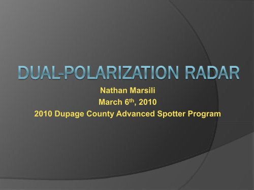
Dual-polarization Radar
Dual-polarization Radar
Dual-polarization Radar

You also want an ePaper? Increase the reach of your titles
YUMPU automatically turns print PDFs into web optimized ePapers that Google loves.
Nathan Marsili<br />
March 6 th , 2010<br />
2010 Dupage County Advanced Spotter Program
TIMELINE OF DUAL-POL IMPLEMENTATION<br />
** KLOT will be part of the Beta-Test period – November 2010<br />
(This timeline may need to be moved back slightly)
HOW DOES DUAL-POL WORK?<br />
Radio waves are simply a series of oscillating electromagnetic fields. These<br />
waves can have different orientation (or <strong>polarization</strong>). From a graphical<br />
standpoint you can imagine two different orientations of these electromagnetic<br />
fields:<br />
Polarization currently used by WSR-88D’s
HOW DOES DUAL-POL WORK?<br />
By transmitting both horizontally and vertically polarized signals, increased<br />
information will be available including information about the shape of the<br />
hydrometeors with dual <strong>polarization</strong> radar.
DUAL-POL BASE DATA<br />
All of the “legacy” products will be available<br />
that are currently being created:<br />
-Base Velocity (V)<br />
- Spectrum Width (SW)<br />
- Reflectivity for Horizontal Polarization (Z)<br />
New products that will be available:<br />
- Differential Reflectivity (ZDR)<br />
- Correlation Coefficient (CC)<br />
We will examine these<br />
more closely in a bit.<br />
- Differential Phase (DP)
DIFFERENTIAL REFLECTIVITY (ZDR)<br />
- A ratio of the reflected horizontal and vertical power returns<br />
ZDR proportional to: Horizontal Power Returned<br />
Vertical Power Returned<br />
- Depends on the median shape and size of hydrometeors
DIFFERENTIAL REFLECTIVITY (ZDR)<br />
Examples of different ZDR values<br />
ZDR > 0 Represents horizontally-oriented mean profile of hydrometeor<br />
E v<br />
E h<br />
ZDR < 0 Represents vertically-oriented mean profile of hydrometeor<br />
E V<br />
E h<br />
ZDR ~ 0 Represents nearly circular mean profile of hydrometeor<br />
E V<br />
E V
WHY LOOK AT ZDR?!<br />
- The shape of the hydrometeors can be inferred, and the presence of<br />
larger drops can be indicated<br />
- Hail shafts can also be more easily identified. Hail often times takes on<br />
a more spherical shape, and ZDR values closer to zero would likely<br />
indicate the presence of hail
WHY LOOK AT ZDR?!<br />
Differential Reflectivity (ZDR)<br />
Reflectivity (Z)<br />
The new differential reflectivity product will allow to more closely<br />
pinpoint location of largest hail in supercells (areas of ZDR near zero)
WHY LOOK AT ZDR?!<br />
ZDR<br />
Z<br />
Note the area of low reflectivity (Z) coincides with high values of<br />
differential reflectivity (ZR). Insects are less reflective than<br />
precipitation targets and usually have more horizontal extent<br />
than vertical when flying through the air.
WHY LOOK AT ZDR?!<br />
ZDR also will be very useful for winter applications, here note the decrease<br />
in ZDR associated with winter precip event indicating transition from liquid<br />
to snow.
WHY LOOK AT ZDR?!<br />
Another case from convective season…a strong updraft shows up on the<br />
ZDR product on the right. ZDR values greater than 1 indicate presence of<br />
liquid water drops, and this is at a level where temperatures are around -10<br />
deg C. This indicates presence of supercooled water drops associated with<br />
strong updrafts in the storm.
ZDR ADVANTAGES<br />
- Based on value of ZDR, radar operator can make inferences as to<br />
hydrometer type<br />
• Small positive values of ZDR up to about 1.5 indicate liquid drops<br />
generally greater than 1-2 mm.<br />
• ZDR values > 3 indicate very large liquid drops with perhaps even ice<br />
core (5 mm drops or greater).<br />
- Convective updrafts and hail shafts can be identified using ZDR<br />
- Winter time applications include identifying melting layer and the<br />
changes in elevation of the melting layer through time<br />
- False echoes (ground clutter) can be more readily identified by using a<br />
combination of Z and ZDR
ZDR LIMITATIONS<br />
- Susceptible to the same data quality limitations as traditional reflectivity<br />
• Attenuation and degraded signal through heavy precipitation areas<br />
• Same VCP’s are used and data still susceptible to range folding
CORRELATION COEFFICIENT(CC)<br />
-A measure of the correlation of the horizontal and vertical back<br />
scattered power within a radar sample volume.<br />
VALUE<br />
0.96 to 1 Small diversity in hydrometeors within the sample<br />
volume<br />
0.85 to 0.95 Large diversity in hydrometeors<br />
Less than 0.85<br />
Non-hydrometeorological targets
CORRELATION COEFFICIENT(CC)<br />
Area of weaker returns west of higher reflectivity, characterized by lower values of CC,<br />
indicating non-meteorological targets (likely insects in this case)
CORRELATION COEFFICIENT(CC)<br />
In this winter precipitation example, the area of high reflectivities on the right side of the<br />
left panel of traditional reflectivity is in an area of high correlation coefficient indicating<br />
hydrometeors of all the same size (likely all snow). The other two areas of higher<br />
reflectivity are characterized by lower values of CC indicated likely mixed precipitation.
CORRELATION COEFFICIENT(CC)<br />
Note at 07z CC values remain high indicating primarily snow aloft. Two hours<br />
later at 09z, ring of lower CC values indicate mixed phase precip with higher<br />
CC values again closer to the radar indicating all rain near the surface.
CORRELATION COEFFICIENT(CC)<br />
A radar signature commonly referred as “Tornado Debris Signature” (TDS) can be<br />
identified with dual-pol radar. Hook echo region of supercell can sometimes be<br />
characterized by area of enhanced reflectivity with low ZDR values and low CC values.
CC ADVANTAGES<br />
- Based on value of CC, you can infer a size distribution of hydrometeors.<br />
- Large values of CC indicate fairly uniform size and shape distribution<br />
of hydrometeors.<br />
- Slightly less large values of CC indicate more hydrometeor diversity<br />
and likely mixed phase precipitation.<br />
- Winter time applications with identification of “bright band”.<br />
- Lower values of CC usually indicate non-meteorological targets,<br />
although low CC can also indicate VERY large hail in some instances.
CC LIMITATIONS<br />
- Susceptible to data limitations of all radar products including range<br />
folding, beam attenuation, etc.<br />
- CC has not performed well in test mode for areas of weak reflectivity.<br />
Affected by low signal to noise ratios.
SPECIFIC DIFFERENTIAL PHASE (KDP)<br />
- Represents the difference in phase shift between horizontal and vertical<br />
polarized returned energy due to forward propagation.<br />
- Horizontal phase shift is greater than vertical phase shift.
SPECIFIC DIFFERENTIAL PHASE (KDP)
SPECIFIC DIFFERENTIAL PHASE (KDP)
SPECIFIC DIFFERENTIAL PHASE (KDP)<br />
The KDP values are highest where this phase shift occurs. Thus, high<br />
values of KDP indicate areas of heavy rainfall with more liquid<br />
precipitation. An example is shown below dealing with greater rainfall<br />
rates associated with a squall line:
KDP ADVANTAGES<br />
- Excellent product to capture higher rainfall rates with certain storms.<br />
- Can be used in conjunction with CC to eliminate areas of ground clutter<br />
(cleaning up precip estimate maps to include primarily meteorological<br />
targets!!).
KDP LIMITATIONS<br />
- Often times can be very noisy product making interpretation<br />
challenging at times.<br />
- Often becomes unreliable at larger distances away from radar.<br />
- Ignores areas with CC values less than 0.87 which sometimes can be<br />
associated with a signature for very large hail. Some areas of<br />
precipitation may thus be missed.
DUAL-POL RADAR INTERPRETATION<br />
What type of hydrometeor properties do you think might be occurring inside<br />
the white circle on these three cross sections of (Z, ZDR, and KDP)
OTHER DERIVED PRODUCTS<br />
Hydrometeor Classification Algorithm (HCA) – attempts to assign a<br />
hydrometeor classification to each radar range bin.<br />
Currently 11 different types of classifications are possible in the<br />
algorithm:<br />
1) GC/AP - ground clutter or AP<br />
2) BS – biological scatterers<br />
3) DS – dry aggregated snow<br />
4) WS – wet snow<br />
5) CR – crystals<br />
6) GR – graupel<br />
7) BD – “big drops”<br />
8) RA – light and moderate rain<br />
9) HR – heavy rain<br />
10)HA – hail (possibly mixed with rain)<br />
11) UK – unknown<br />
- These above classifications are projected onto an output grid and<br />
can be overlaid with base data to help with radar interpretation.
EXAMPLE OF HCA OUTPUT
OTHER DERIVED PRODUCTS<br />
- Melting Layer Detection Algorithm (MLDA) – algorithm developed to<br />
identify melting layers and can be overlaid on base data display to help<br />
with radar interpretation<br />
- QPE – Quantitative Precipitation Estimate will be improved with<br />
dual-pol and instantaneous precipitation rates will be available. Initial<br />
field tests have shown dramatic improvements in radar estimated<br />
precipitation over the traditional Z-R relationships from WSR-88D’s.
OTHER BENEFITS OF DUAL-POL DATA<br />
- Increased lead time for flash flood and winter storm warnings.<br />
- Possible detection of aircraft icing conditions<br />
- Improved rainfall estimation will lead to improve streamflow<br />
forecasts and better hydrologic services.<br />
- It has been estimated that dual-pol radar will have the potential to<br />
save the public approximately 700 million dollars annually based on all<br />
the improvements mentioned.