Document - Worcestershire County Council
Document - Worcestershire County Council
Document - Worcestershire County Council

You also want an ePaper? Increase the reach of your titles
YUMPU automatically turns print PDFs into web optimized ePapers that Google loves.
Environmental Services<br />
Transport Planning<br />
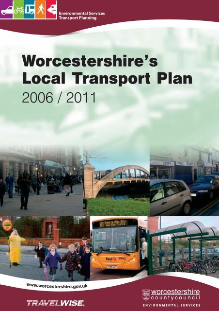
<strong>Worcestershire</strong>’s<br />
Local Transport Plan<br />
2006 / 2011<br />
www.worcestershire.gov.uk<br />
ENVIRONMENTAL SERVICES
PREFACE<br />
In July 2005, <strong>Worcestershire</strong> <strong>County</strong> <strong>Council</strong> published its Provisional Local<br />
Transport Plan for 2006-11, setting out the proposed future transport strategy for the<br />
<strong>County</strong>.<br />
Much has happened since then. We have seen the exciting re-launch of the<br />
Worcester North Park and Ride bus services through the Project Express initiative,<br />
which has been very popular with users, and this can be seen as the future of bus<br />
travel across the <strong>County</strong>. We have also seen the seven local authorities within<br />
<strong>Worcestershire</strong> come together to agree the introduction of a countywide<br />
concessionary travel scheme from April 2006. This has been the first fruit of the Joint<br />
Integrated Passenger Transport Forum, which has brought together senior officers<br />
and Members from each authority with a single aim – to improve the service we<br />
provide to our residents.<br />
The <strong>County</strong> <strong>Council</strong> has also entered into new Contracts for its term consultancy and<br />
highways maintenance services, introducing closer partnership working between<br />
<strong>Council</strong>, consultancy and Contractor staff. I believe that these arrangements will<br />
bring many benefits to <strong>Worcestershire</strong>, and will result in a more efficient delivery of<br />
the schemes and strategies contained in this Local Transport Plan.<br />
The seven local authorities have also combined, with many other public, private and<br />
voluntary sector organisations, in the <strong>Worcestershire</strong> Partnership. The <strong>County</strong><br />
<strong>Council</strong> gratefully recognises the role played by Partnership members in the<br />
development of this Plan. The Local Area Agreement developed through the<br />
Partnership will be an important influence on the further development of the transport<br />
policies contained within the Plan.<br />
We face a number of challenges if the Local Transport Plan is to be fully effective.<br />
Not least of these will be the limited financial resources available to the <strong>Council</strong>.<br />
Many of the elements of the strategy will rely on revenue funding to back up the<br />
capital investment available through the LTP budget. This will fund activities as<br />
diverse as road safety training, marketing of bus services, or advising schools on the<br />
development of Travel Plans. In addition, significant revenue resources are invested<br />
in the support of non-commercial bus services, and in the maintenance of our<br />
highways, footways and public rights of way.<br />
However, the <strong>Council</strong> is likely to face a number of years with relatively low financial<br />
settlements from Government, and careful project management will be required to<br />
ensure that limited funding stretches a long way. I am confident that we will rise to<br />
this challenge, and will build on the successes of the first Local Transport Plan over<br />
the next five years.<br />
John Smith (Cabinet Member with responsibility for the Environment)
<strong>Worcestershire</strong> Local Transport Plan 2006-2011<br />
1 ABOUT THE PLAN ...................................................................................................7<br />
1.1 Why Produce the Plan?.....................................................................................8<br />
1.2 Developing the Plan ...........................................................................................8<br />
1.2.1 Main Influences ...........................................................................................8<br />
1.3 Consultation Process .........................................................................................9<br />
1.4 What Happens Next?.......................................................................................10<br />
2 THE VISION ............................................................................................................11<br />
3 STRATEGY INFLUENCES ....................................................................................15<br />
3.1 <strong>Worcestershire</strong> Overview................................................................................16<br />
3.2 Regional Context..............................................................................................17<br />
3.2.1 Background................................................................................................17<br />
3.2.2 Key RSS Policies.......................................................................................17<br />
3.2.3 Regional Transport Strategy ......................................................................19<br />
3.2.4 Regional Housing Strategy ........................................................................19<br />
3.2.5 RSS Review ...............................................................................................20<br />
3.3 <strong>Worcestershire</strong> Partnership............................................................................21<br />
3.4 <strong>Worcestershire</strong> Economic Strategy 2004-14..................................................25<br />
3.5 Travel to Work Patterns .................................................................................27<br />
3.6 Housing .............................................................................................................32<br />
3.6.1.1 Sustainable and Accessible Development .............................................32<br />
3.6.1.2 Affordability ..........................................................................................33<br />
3.6.1.3 Future Housing Needs ...........................................................................34<br />
3.7 Tourism.............................................................................................................35<br />
3.7.1.1 Regional Visitor Economy Strategy ......................................................35<br />
3.7.1.2 Major Visitor Attractions.......................................................................35<br />
3.7.1.3 Olympic Games - 2012..........................................................................37<br />
3.8 Education..........................................................................................................38<br />
3.8.1.1 University of Worcester.........................................................................38<br />
3.8.1.2 Further Education ..................................................................................39<br />
3.8.1.3 Schools...................................................................................................39<br />
3.9 River Crossings ................................................................................................40<br />
3.10 Health................................................................................................................42<br />
3.10.1.1 Acute Care Facilities..........................................................................42<br />
3.10.1.2 Primary Care Trusts...........................................................................42<br />
3.10.1.3 Hereford and Worcester Ambulance Trust........................................42<br />
3.10.1.4 Transport Issues .................................................................................43<br />
3.10.1.5 Summary............................................................................................43<br />
3.11 Environment.....................................................................................................44<br />
3.11.1 Air Quality .................................................................................................44<br />
3.11.2 <strong>Worcestershire</strong> Climate Change Strategy ..................................................45<br />
3.11.3 Strategic Environmental Assessment.........................................................46<br />
3.12 <strong>Worcestershire</strong> in 2020....................................................................................47<br />
3.13 Cross Boundary Issues ....................................................................................53<br />
3.14 Strategic Transport Network..........................................................................54<br />
1
<strong>Worcestershire</strong> Local Transport Plan 2006-2011<br />
3.14.1 Strategic Highway Network.......................................................................55<br />
3.14.2 Strategic Rail Network...............................................................................59<br />
3.14.3 Air Travel...................................................................................................62<br />
3.15 Consultation Responses...................................................................................62<br />
3.15.1 Public Consultation....................................................................................62<br />
3.15.2 Government Feedback ...............................................................................63<br />
3.16 Summary ..........................................................................................................64<br />
4 THE STRATEGY......................................................................................................65<br />
4.1 Strategy Overview ...........................................................................................66<br />
4.2 ACCESSIBILITY ............................................................................................69<br />
4.2.1 Objectives ..................................................................................................70<br />
4.2.2 Priorities for Investment ............................................................................71<br />
4.2.3 Target Groups ............................................................................................71<br />
4.2.4 Accessibility Mapping ...............................................................................73<br />
4.2.4.1 <strong>Worcestershire</strong> Accessibility Partnership ..............................................78<br />
4.2.4.2 Accessibility and Land Use Planning ....................................................79<br />
4.2.4.3 Accessibility and Passenger Transport Networks..................................80<br />
4.2.4.4 Accessibility and LTP2 Delivery...........................................................80<br />
4.2.5 Mobility Issues...........................................................................................80<br />
4.2.6 Integrated Passenger Transport Strategy ...................................................82<br />
4.2.6.1 Vision.....................................................................................................82<br />
4.2.6.2 Partnership Working..............................................................................87<br />
4.2.6.3 Bus Stops ...............................................................................................89<br />
4.2.6.4 Bus Priority............................................................................................90<br />
4.2.6.5 Other Bus Infrastructure ........................................................................91<br />
4.2.6.6 Information / Marketing.........................................................................92<br />
4.2.6.7 Community Transport............................................................................92<br />
4.2.6.8 Concessionary Fares ..............................................................................93<br />
4.2.6.9 Taxis ......................................................................................................94<br />
4.2.6.10 Coaches..............................................................................................95<br />
4.2.7 Rail Strategy ..............................................................................................97<br />
4.2.7.1 Rail Industry Structure...........................................................................99<br />
4.2.7.2 Route Utilisation Strategies .................................................................100<br />
4.2.7.3 Regional Planning Assessment............................................................100<br />
4.2.7.4 Franchise Changes ...............................................................................101<br />
4.2.7.5 Stations ................................................................................................102<br />
4.2.7.6 Station Improvements..........................................................................104<br />
4.2.7.7 Infrastructure improvements................................................................106<br />
4.2.7.8 Cross-Boundary Schemes....................................................................107<br />
4.2.8 Economic Strategy Support .....................................................................108<br />
4.2.8.1 Market Towns Transportation Initiative..............................................108<br />
4.2.8.2 Tourism................................................................................................109<br />
4.2.9 Sustainable Travel Initiatives...................................................................110<br />
4.2.9.1 Walking Schemes ................................................................................110<br />
4.2.9.2 Cycling Schemes..................................................................................112<br />
4.2.9.3 Quiet Lanes..........................................................................................115<br />
4.2.9.4 Rights Of Way Improvement Plan.......................................................117<br />
4.2.9.5 Employer Travel Plans.........................................................................122<br />
4.2.9.6 School Travel Plans .............................................................................124<br />
4.2.9.7 Motorcycling........................................................................................127<br />
4.2.9.8 Freight..................................................................................................128<br />
2
<strong>Worcestershire</strong> Local Transport Plan 2006-2011<br />
4.3 CONGESTION ..............................................................................................131<br />
4.3.1 Tackling Congestion................................................................................132<br />
4.3.1.1 Managing Demand...............................................................................135<br />
4.3.1.2 Accommodating Demand ....................................................................136<br />
4.3.1.3 Parking Strategy...................................................................................136<br />
4.3.1.4 Intelligent Transport Systems ..............................................................137<br />
4.3.1.5 Network Management..........................................................................140<br />
4.4 ROAD SAFETY.............................................................................................143<br />
4.4.1 Engineering..............................................................................................145<br />
4.4.2 Education .................................................................................................146<br />
4.4.2.1 Schools.................................................................................................146<br />
4.4.2.2 Driver Training ....................................................................................147<br />
4.4.2.3 Promotions and Publicity.....................................................................148<br />
4.4.3 Speed Management..................................................................................148<br />
4.4.3.1 Speed Limits ........................................................................................148<br />
4.4.3.2 West Mercia Safety Camera Partnership .............................................149<br />
4.4.3.3 Speed Awareness Training ..................................................................150<br />
4.4.4 Minor Schemes ........................................................................................150<br />
4.5 AIR QUALITY AND THE ENVIRONMENT ...........................................153<br />
4.5.1 Air Quality ...............................................................................................154<br />
4.5.2 <strong>Worcestershire</strong> Climate Change Strategy ................................................154<br />
4.5.3 Fleet Management / Fuel Policy ..............................................................155<br />
4.5.4 Strategic Environmental Assessment.......................................................157<br />
4.5.5 Transport-related Noise ...........................................................................159<br />
4.6 AREA STRATEGIES - Bromsgrove ...........................................................161<br />
4.6.1 Bromsgrove Town Centre........................................................................162<br />
4.6.2 Bromsgrove Railway Station ...................................................................163<br />
4.6.3 M42 Junction 1 ........................................................................................164<br />
4.6.4 Longbridge...............................................................................................165<br />
4.7 AREA STRATEGIES – Malvern Hills........................................................167<br />
4.7.1 Malvern....................................................................................................168<br />
4.7.1.1 Malvern Railway Stations....................................................................169<br />
4.7.2 Tenbury Wells Area.................................................................................170<br />
4.7.3 Upton-upon-Severn Area.........................................................................170<br />
4.7.4 Malvern Hills Area of Outstanding Natural Beauty (AONB) .................171<br />
4.8 AREA STRATEGIES - Redditch.................................................................173<br />
4.8.1 Redditch Bus Quality Partnership............................................................174<br />
4.8.2 Abbey Stadium Development..................................................................175<br />
4.8.3 Community Safety Strategy.....................................................................175<br />
4.8.4 A435 Studley Bypass...............................................................................176<br />
4.9 AREA STRATEGIES - Worcester ..............................................................177<br />
4.9.1 Worcester Sustainable Travel Town........................................................179<br />
4.9.2 Project Express ........................................................................................181<br />
4.9.3 <strong>Worcestershire</strong> Parkway ..........................................................................185<br />
4.9.4 A4440 Worcester Southern Link Road....................................................186<br />
4.9.5 Worcester City Centre .............................................................................188<br />
4.9.6 Worcester Transportation Study ..............................................................189<br />
4.10 AREA STRATEGIES - Wychavon..............................................................191<br />
4.10.1 Evesham...................................................................................................192<br />
4.10.2 Pershore ...................................................................................................194<br />
3
<strong>Worcestershire</strong> Local Transport Plan 2006-2011<br />
4.10.3 Keytec Industrial Estate Link Road.........................................................194<br />
4.10.4 Droitwich .................................................................................................194<br />
4.10.5 Vale of Evesham Freight Quality Partnership .........................................195<br />
4.10.6 Cotswold Area of Outstanding Natural Beauty .......................................195<br />
4.11 AREA STRATEGIES – Wyre Forest ..........................................................197<br />
4.11.1 Kidderminster ..........................................................................................198<br />
4.11.2 Stourport Road Employment Corridor ....................................................199<br />
4.11.3 Kidderminster Railway Station................................................................200<br />
4.11.4 Bewdley ...................................................................................................201<br />
4.11.5 Stourport-on-Severn.................................................................................202<br />
4.11.6 Wyre Forest Bus Quality Partnership ......................................................203<br />
4.11.7 A456 / A449 Trunk Roads.......................................................................203<br />
4.11.8 Wyre Forest Schools Review...................................................................204<br />
4.12 ASSET MANAGEMENT..............................................................................205<br />
4.12.1 Introduction..............................................................................................206<br />
4.12.1.1 Highways and Footways..................................................................206<br />
4.12.1.2 Footpaths, Cyclepaths and Rights of Way.......................................207<br />
4.12.1.3 Bridges and Structures.....................................................................207<br />
4.12.1.4 Streetlighting....................................................................................207<br />
4.12.1.5 Road Signs and Street Furniture ......................................................207<br />
4.12.1.6 Traffic Signals and Pedestrian Crossings ........................................207<br />
4.12.1.7 Public Transport Infrastructure........................................................208<br />
4.12.1.8 Funding ............................................................................................208<br />
4.12.2 Transport Asset Management Plan (TAMP) ...........................................209<br />
4.12.2.1 Programme of Work ........................................................................209<br />
4.12.2.2 Baseline Data Collection and Highway Condition Monitoring.......210<br />
4.12.2.3 Linkage with Other Service Areas...................................................210<br />
4.12.2.4 Overall Objectives ...........................................................................211<br />
4.12.2.5 Bridges and structures......................................................................211<br />
4.12.2.6 Streetlighting....................................................................................214<br />
4.12.2.7 Road Signs / Markings / Street Furniture ........................................216<br />
4.12.2.8 New Development ...........................................................................217<br />
5 IMPLEMENTATION PLAN .................................................................................219<br />
5.1 Introduction....................................................................................................220<br />
5.2 LTP2 Funding – Planning Guidelines..........................................................220<br />
5.2.1 Indicative Allocations..............................................................................220<br />
5.2.2 Integrated Transport Block ......................................................................221<br />
5.2.3 Structural Maintenance Block .................................................................221<br />
5.2.4 Road Safety Planning Guideline..............................................................221<br />
5.2.5 Indicative Five Year Programme.............................................................222<br />
5.2.6 <strong>County</strong> <strong>Council</strong> Funding..........................................................................222<br />
5.2.7 Supplementary Funding...........................................................................224<br />
5.2.8 Prioritisation of Schemes.........................................................................224<br />
5.3 Transport Innovation Fund ..........................................................................226<br />
5.4 Major Schemes...............................................................................................227<br />
5.4.1 Major Schemes included in LTP2 ...........................................................227<br />
5.4.1.1 <strong>Worcestershire</strong> Parkway Station..........................................................227<br />
5.4.1.2 A441 Bordesley Bypass.......................................................................227<br />
5.4.2 Major Scheme bids to be developed within LTP2...................................227<br />
5.4.2.1 Worcester Transportation Strategy ......................................................227<br />
4
<strong>Worcestershire</strong> Local Transport Plan 2006-2011<br />
5.4.2.2 Wyre Forest Transportation Strategy...................................................228<br />
5.4.2.3 River Bridges .......................................................................................228<br />
5.4.3 Risk Management ....................................................................................228<br />
5.4.3.1 Bordesley Bypass.................................................................................228<br />
5.4.3.2 <strong>Worcestershire</strong> Parkway ......................................................................229<br />
5.4.3.3 A4440 Worcester Southern Link Road................................................229<br />
5.4.3.4 Project Express ....................................................................................230<br />
5.4.3.5 Other Schemes .....................................................................................230<br />
5.4.3.6 Staff Resources ....................................................................................230<br />
5.4.3.7 Financial Resources .............................................................................230<br />
5.4.3.8 Summary..............................................................................................231<br />
5.5 Scheme Delivery.............................................................................................232<br />
5.5.1 Partnering Arrangements .........................................................................232<br />
5.5.2 Project Management ................................................................................234<br />
6 MONITORING .......................................................................................................237<br />
6.1 Targets and Indicators ..................................................................................238<br />
APPENDIX ONE<br />
APPENDIX TWO<br />
GOVERNMENT FEEDBACK ON PROVISIONAL LTP2<br />
STRATEGIC ENVIRONMENTAL ASSESSMENT REPORT<br />
APPENDIX THREE LTP2 IMPLEMENTATION PLAN<br />
APPENDIX FOUR<br />
APPENDIX FIVE<br />
APPENDIX SIX<br />
LTP2 FRAMEWORK APPRAISAL<br />
FINANCE FORMS<br />
MONITORING REPORT<br />
5
<strong>Worcestershire</strong> Local Transport Plan 2006-2011<br />
6
<strong>Worcestershire</strong> Local Transport Plan 2006-2011<br />
1 ABOUT THE PLAN<br />
7
<strong>Worcestershire</strong> Local Transport Plan 2006-2011<br />
1.1 WHY PRODUCE THE PLAN?<br />
The Local Transport Plan for 2006-11 (LTP2) sets out <strong>Worcestershire</strong>’s transport<br />
strategy for the next five years, as well as identifying major longer-term<br />
transportation pressures upon the <strong>County</strong>. It also sets transportation needs<br />
within the <strong>County</strong> in the context of regional and national transport policies, and of<br />
other public services within the <strong>County</strong> such as education, social services, health,<br />
economic development and cultural activities.<br />
LTP2 is a statutory document, and whilst it has been produced by <strong>Worcestershire</strong><br />
<strong>County</strong> <strong>Council</strong> in its role as Local Highway Authority, there has been significant<br />
input from the <strong>Council</strong>’s public, private and voluntary sector partners. The<br />
contribution of these partners is gratefully acknowledged.<br />
Government has produced a wide range of guidance relating to the preparation of<br />
the LTP2 strategy, and links to these documents are available through the LTP2<br />
page on the <strong>County</strong> <strong>Council</strong> website (www.worcestershire.gov.uk/ltp).<br />
It is obviously good practice to publish the forward strategy for transportation<br />
within <strong>Worcestershire</strong> regardless of the statutory requirement, as it presents the<br />
public, and public, private and voluntary sector organisations, with a clear vision<br />
on the way in which the transport needs of the <strong>County</strong> will be met.<br />
1.2 DEVELOPING THE PLAN<br />
1.2.1 Main Influences<br />
A significant influence on the preparation of LTP2 was the guidance issued by<br />
Government, which gave a clear outline of what the LTP2 strategy should<br />
include. This required a focus on four shared priorities for transport agreed by<br />
local and central Government, these being:<br />
• Improving Accessibility<br />
• Improving Air Quality<br />
• Tackling Congestion<br />
• Improving Road Safety<br />
Therefore, the document is structured in a way that clearly sets out the policies<br />
and proposals grouped under these four main headings, with a fifth section<br />
covering Asset Management. There are also District based strategies as outlined<br />
below to reflect local issues.<br />
However, of equal importance was the review of all major policies and strategies<br />
relating to the provision of all services across <strong>Worcestershire</strong>, notably the<br />
Community Strategy and other corporate plans. These external influences on the<br />
LTP2 strategy have been summarised within Chapter 3 of LTP2, which sets the<br />
background to the development of the overall LTP2 strategy.<br />
Potential changes in land use patterns across <strong>Worcestershire</strong> in the next five<br />
years have been identified from Local Plans prepared by District <strong>Council</strong>s, and<br />
through consultation with relevant partners. Similarly, local transport issues and<br />
8
<strong>Worcestershire</strong> Local Transport Plan 2006-2011<br />
needs have been identified through the consultation process. With such a<br />
diverse range of issues applying across <strong>Worcestershire</strong>, it was felt important to<br />
include specific transport strategies outlining the main LTP2 proposals for each<br />
District area, to complement the countywide strategies, which have been grouped<br />
around the Shared Priorities for Transport.<br />
The LTP2 process has also been influenced by the outcome of Best Value<br />
Reviews into various transportation service areas during the first LTP period<br />
(2001-06). The primary outcome of these reviews has been the re-structuring of<br />
the LTP delivery mechanisms, forming the structures outlined in Chapter 5 for<br />
scheme delivery.<br />
Another important area of work was the extensive consultation process, which<br />
sought to engage all sectors of the community in the development of the LTP2<br />
strategy. This process is described below, with the headline results being<br />
presented in Chapter 3.<br />
1.3 CONSULTATION PROCESS<br />
The process of preparing LTP2 started in September 2004 and has involved a<br />
wide-ranging consultation. The programme of work is outlined below:<br />
• September – December 2004: Phase One consultation involving meetings<br />
with a wide range of organisations including the eight Local Strategic<br />
Partnerships (LSPs) operating within the <strong>County</strong>, the umbrella <strong>Worcestershire</strong><br />
Partnership, District <strong>Council</strong>s, and other public and private sector<br />
organisations. The objective of this work was to gain an understanding of<br />
transport issues and priorities across the <strong>County</strong> viewed from a wide range of<br />
perspectives. This phase also involved transport data analysis, and a review<br />
of all relevant policy documents affecting transport needs within<br />
<strong>Worcestershire</strong>.<br />
• February 2005: Publication of the draft LTP2 strategy for consultation.<br />
• February – April 2005: Phase Two consultation, involving public<br />
exhibitions, further meetings with interested organisations, publication of an<br />
LTP2 article and questionnaire in the <strong>Worcestershire</strong> Beacon (the <strong>County</strong><br />
<strong>Council</strong> newspaper distributed to all households), publication of the draft<br />
LTP2 on the <strong>County</strong> <strong>Council</strong> website, and attendance at LSP, District and<br />
Town <strong>Council</strong> meetings.<br />
• July 2005: Submission of Provisional LTP2 to Government.<br />
• September – December 2005: Phase Three consultation on the<br />
Provisional LTP2 strategy. Effectively a repeat of the Phase Two<br />
consultation, including further articles in the <strong>County</strong> <strong>Council</strong> newspaper,<br />
public meetings and workshops, on-line features and a questionnaire on the<br />
LTP page of the <strong>County</strong> <strong>Council</strong> website, and with copies of the Summary<br />
Provisional LTP2 document issued to a wide range of organisations for<br />
comment.<br />
• March 2006: Submission of Final LTP2 to Government.<br />
Early engagement with the Local Strategic Partnerships was absolutely crucial to<br />
this process, as these bring together representatives from the public, private,<br />
voluntary and community sectors with an interest in each area of <strong>Worcestershire</strong>.<br />
9
<strong>Worcestershire</strong> Local Transport Plan 2006-2011<br />
This enabled a picture of local transport priorities across the <strong>County</strong> to be<br />
developed early in the LTP2 process.<br />
In total, approximately 900 representations have been made during the<br />
development of LTP2, either through returned questionnaires, or direct letters and<br />
e-mails. The majority of these have been from individual members of the public,<br />
with other comments received from LSPs and other organisations. All responses<br />
have been published within the LTP2 Consultation Report which has been<br />
published on the <strong>County</strong> <strong>Council</strong>’s website (www.worcestershire.gov.uk/ltp).<br />
These representations have been carefully considered in the preparation of this<br />
LTP2 strategy, although it is recognised that not every respondent will be content<br />
with the results. The often opposing views submitted during the consultation, and<br />
the limited budgets available for LTP2 implementation, mean that it will be<br />
impossible to please everyone!<br />
The result is intended to be a balanced transport strategy meeting the<br />
requirements of <strong>Worcestershire</strong> residents, businesses and visitors, and making<br />
efficient use of those limited resources available for investment in transport within<br />
the <strong>County</strong>. Comments on any aspect of the LTP2 strategy, or requests for an<br />
update on its implementation, can be made through the website or by e-mail to<br />
ltp2@worcestershire.gov.uk.<br />
1.4 WHAT HAPPENS NEXT?<br />
The work does not stop with the submission of the LTP2 to Government in March<br />
2006. Implementation of the LTP2 strategy will involve:<br />
• The development and implementation of a wide range of transport projects,<br />
• A great deal of partnership working to deliver the strategies contained in this<br />
document,<br />
• Influencing the general development of a range of services and land use<br />
developments across <strong>Worcestershire</strong> to deliver transport benefits,<br />
• Constructing transport infrastructure.<br />
There are also a number of areas of ongoing work, and elements of the LTP2<br />
strategy will further evolve during the 2006-11 period. These include the<br />
following:<br />
• Accessibility Strategy<br />
• Integrated Passenger Transport Strategy<br />
• Rights of Way Improvement Plan<br />
• Worcester Transportation Study<br />
• Wyre Forest Transportation Study<br />
• Transport Asset Management Plan<br />
In addition, implementation of the LTP2 strategy will be constantly monitored, with<br />
those areas of the strategy that are not shown to be effective being kept under<br />
review and adjusted as necessary. The Monitoring Strategy described in Chapter<br />
6 will be crucial in this respect.<br />
10
<strong>Worcestershire</strong> Local Transport Plan 2006-2011<br />
2 THE VISION<br />
11
<strong>Worcestershire</strong> Local Transport Plan 2006-2011<br />
The overall vision of the LTP2 strategy is:<br />
To deliver a transport system within <strong>Worcestershire</strong> that is safe to use, and<br />
which allows people to easily access the facilities that they need for their<br />
day-to-day life in a sustainable and healthy way<br />
This vision for LTP2 is consistent with the longer-term strategy for the <strong>County</strong>,<br />
which is encompassed within the Community Strategy and Corporate Plan. It<br />
recognises that transport is almost always a means to an end. With the<br />
exception of specific leisure journeys (for example a trip on the Severn Valley<br />
Railway) the vast majority of journeys have a specific purpose such as travelling<br />
to or from work, school, shopping, the hospital or going on a night out in town.<br />
Table 2.1 sets out the core principles behind this vision.<br />
It is recognised that many of the transport issues faced in <strong>Worcestershire</strong> will not<br />
be resolved within the LTP2 period, and some elements of the LTP2 strategy are<br />
aimed at putting the right conditions in place to meet the longer-term needs of the<br />
<strong>County</strong>. This strategic approach recognises that transport has a major role to<br />
play in the delivery of many other strategies, often the responsibility of other<br />
agencies, and that these other strategies will be reviewed and amended to<br />
different timetables to that of LTP2.<br />
If the LTP2 strategy is to be seen as a success, it will need to contribute to the<br />
achievement of the following core objectives:<br />
• Ensuring that people have access to key services at reasonable cost, in<br />
reasonable time, and with reasonable ease, and in a way that promotes better<br />
health for all.<br />
• To have a world-class passenger transport network that meets the needs of<br />
the people of <strong>Worcestershire</strong> in all their journeys, including work, education,<br />
health, and leisure.<br />
• <strong>Worcestershire</strong> will be a <strong>County</strong> with safe, cohesive, healthy and inclusive<br />
communities, a strong and diverse economy and a valued and cherished<br />
environment.<br />
• The procurement of a transportation system that will support the development<br />
of Worcester into a first class University City with a vibrant visitor economy.<br />
• The refinement of the transport strategy that will be necessary to allow<br />
<strong>Worcestershire</strong> to meet its longer-term contribution to the well-being of the<br />
West Midlands Region.<br />
• Achieving the most efficient use of resources to deliver the LTP2 strategy,<br />
including maximisation of funding from external sources, getting excellent<br />
levels of service from existing assets through the use of efficient management<br />
systems, and obtaining value for money when procuring transport schemes<br />
through robust business systems.<br />
12
<strong>Worcestershire</strong> Local Transport Plan 2006-2011<br />
TABLE 2.1 – VISION STATEMENT<br />
• To support the unique diversity and character of <strong>Worcestershire</strong> by delivering an<br />
efficient, safe and fair transport system that meets the needs of all travellers and allows<br />
the easy movement of goods - good transport infrastructure and services are essential for<br />
a successful society, a thriving economy and an attractive environment.<br />
• To consider all appropriate solutions to transport problems and catering for all<br />
modes of transport - it is clear that there is no single solution to transport problems in<br />
<strong>Worcestershire</strong>, nor is there a single mode of transport that can deliver the solutions.<br />
Only by bringing the different solutions and modes together into a system of integrated<br />
transport will we be able to address the transport problems of <strong>Worcestershire</strong>.<br />
• To work in partnership to deliver LTP2, and recognise that greater benefits can be<br />
achieved by working with all agencies that influence transport behaviour - LTP2 is only<br />
one of the mechanisms through which the vision can be achieved, and we recognise that<br />
success will only truly be achieved through partnerships with other public and private<br />
sector organisations, as well as by forging strong links with other strategies.<br />
• To contribute towards meeting the regional aspirations for the West Midlands -<br />
<strong>Worcestershire</strong> is not an island, and travel within the <strong>County</strong> does not stop at <strong>County</strong><br />
boundaries. There is a high level of interaction with neighbouring authorities across the<br />
West Midlands and beyond, and key elements of the national road and rail networks pass<br />
through <strong>Worcestershire</strong>. Liaison with neighbouring transport authorities within the West<br />
Midlands and the South-west Regions, as well as with those agencies responsible for the<br />
national network, will be crucial to the delivery of the LTP2 strategy.<br />
• To deliver improvements against all of the four shared priorities for transport<br />
agreed by central and local government – these being, in order of priority identified<br />
through the consultation process, improving accessibility, tackling congestion, improving<br />
road safety, and improving air quality..<br />
• To ensure the LTP2 investment programme provides value for money and is<br />
underpinned by a robust and data-led approach to prioritisation of schemes – the LTP2<br />
strategy has been developed using a wide range of data analysis, and robust monitoring<br />
will take place to ensure that the schemes that are progressed do offer value for money.<br />
Transportation studies programmed for 2006/07 will ensure that the preparatory work for<br />
LTP3 (2011-16) and beyond is completed sufficiently early in the LTP2 period to allow a<br />
reasonable lead-in time for the preparation of major transportation projects.<br />
• To recognise, and respond to, the wider impacts of transport – in particular we must<br />
seek to ensure the environmental impacts of our actions are minimised, that quality of life<br />
is enhanced particularly for the most vulnerable sectors of our community, and that we<br />
promote healthy travel that will contribute to the long-term health of our population.<br />
• To promote sustainable development, and ensure economic success is not limited by<br />
transport availability – in particular to support the Regional Economic Strategy, the<br />
delivery of the Central Technology Belt, and supporting regeneration in those areas with<br />
the greatest degree of need.<br />
• To continue to consult the public at every stage of the transport delivery process,<br />
and to continue to improve our performance through challenging the way transport<br />
schemes are prepared and delivered – transport is a dynamic subject, with public<br />
opinions and views rapidly changing. We must seek to embrace this and recognise<br />
change as it happens, and seek to influence<br />
• To monitor and review our progress and challenge the way we work, ensuring our<br />
partners are kept informed on how the LTP2 is progressing – not everything we do will be<br />
right first time. We must therefore learn from how effective our strategies are, monitor<br />
carefully whether each scheme delivered meets its objectives, and whether collectively<br />
the strategy is helping to achieve our vision.<br />
13
<strong>Worcestershire</strong> Local Transport Plan 2006-2011<br />
14
<strong>Worcestershire</strong> Local Transport Plan 2006-2011<br />
3 STRATEGY INFLUENCES<br />
15
<strong>Worcestershire</strong> Local Transport Plan 2006-2011<br />
3.1 WORCESTERSHIRE OVERVIEW<br />
<strong>Worcestershire</strong> is a diverse <strong>County</strong> to the South of the West Midlands<br />
conurbation. It has a population of 542,238 (2001 figure) that is forecast to grow<br />
at a rate of 0.21% per annum over the LTP2 period. This means that by 2011,<br />
the population will have risen to 554,814.<br />
The highest rate of growth will be in the 65+ age band, which will influence future<br />
transport needs. Health issues arising from an ageing population mean that an<br />
increasing reliance upon passenger transport for personal mobility is likely, which<br />
in a <strong>County</strong> like <strong>Worcestershire</strong> will place greater pressure upon the passenger<br />
transport network.<br />
Of particular importance is the trend that older people are more likely to live in the<br />
more rural areas of the <strong>County</strong>, where the passenger transport network is more<br />
limited, as factors such as house prices make it difficult for younger people to<br />
move into such areas. Therefore, those people who are often most likely to<br />
become reliant on passenger transport for their transport needs are likely to be<br />
living in those areas more poorly served. These issues are explored in more<br />
detail as part of the Accessibility Strategy.<br />
Economic activity rates for <strong>Worcestershire</strong>’s population are relatively high, with<br />
83% of the working age population being active, equating to 272,000 people<br />
(2002 figures). With an unemployment rate of 2.2% (January 2006), which is<br />
lower than the regional and national averages, <strong>Worcestershire</strong>’s working<br />
population is relatively well placed. The location of the <strong>County</strong>, with relatively<br />
easy access to many employment opportunities, does mean that work journeys<br />
will not simply be restricted to the local transport network, but will often involve<br />
longer journeys both within the West Midlands and beyond. This is partially<br />
balanced by <strong>Worcestershire</strong> having an above average level of home-workers<br />
amongst its working population.<br />
<strong>Worcestershire</strong>’s population generally have a high standard quality of life, with<br />
80% of residents feeling that they enjoy a good lifestyle (Source: Community<br />
Strategy for <strong>Worcestershire</strong>). However, there are areas of the <strong>County</strong> that are<br />
identified as having a poorer quality of life, with a number of wards being included<br />
within the top 10% nationally when indicators of deprivation are evaluated.<br />
Travel within <strong>Worcestershire</strong> is influenced by a range of factors including the<br />
proximity of the <strong>County</strong> to the West Midlands conurbation, the rural nature of<br />
much of the <strong>County</strong>, and the medium sized towns and cities that house the<br />
majority of the <strong>County</strong>’s population. A range of strategic transport routes cross<br />
the <strong>County</strong>, including the M5 and M42 motorways and the main railway line<br />
linking Birmingham with Bristol and the South-west. The River Severn forms a<br />
significant barrier to east-west movement across the <strong>County</strong>, whilst its tributaries,<br />
the Rivers Avon and Teme, also have limited crossing points concentrating traffic<br />
movements onto small sections of the network.<br />
The <strong>County</strong> has no single dominant urban area. Worcester is the largest<br />
settlement, and is the only one of the main towns to be a net importer of workers<br />
(in other words, more people travel into the city to work there than commute from<br />
the city to work elsewhere). This partly reflects its status as the <strong>County</strong> Town, the<br />
number of larger employers based in the city, its status as a University City, and<br />
16
<strong>Worcestershire</strong> Local Transport Plan 2006-2011<br />
its greater distance from competing employment centres. The other main towns<br />
within the <strong>County</strong> not only compete with Worcester, but also have significant<br />
commuting flows into neighbouring Counties, notably to the West Midlands<br />
conurbation for the North <strong>Worcestershire</strong> towns.<br />
<strong>Worcestershire</strong> also has large rural areas that, particularly to the West of the<br />
River Severn, become increasingly isolated. The rural nature of the <strong>County</strong> plays<br />
an important role in the high quality of life experienced by residents, but can also<br />
form an important part of the economy, either through the agricultural businesses<br />
located in the Vale of Evesham or through visitors to attractions such as the<br />
Malvern Hills.<br />
The remainder of this chapter provides greater detail on the <strong>County</strong>, its role within<br />
the West Midlands region, and the main influences on the transport strategy that<br />
has been developed within LTP2.<br />
3.2 REGIONAL CONTEXT<br />
3.2.1 Background<br />
The Regional Spatial Strategy for the West Midlands (RSS), published in June<br />
2004, has established a vision of an economically successful, outward looking<br />
and adaptable region, with diverse and distinctive cities, towns, sub-regions and<br />
communities. <strong>Worcestershire</strong> is one of those sub-regions and LTP2 is one of the<br />
strategies that will contribute to delivering the regional vision within the <strong>County</strong>.<br />
The overall vision within RSS concerning transport is that the West Midlands will<br />
be a Region:<br />
“With an efficient network of integrated transport facilities and services<br />
which meet the needs of both individuals and the business community in<br />
the most sustainable way”.<br />
Delivery of an efficient transport network will require <strong>Worcestershire</strong> to meet one<br />
of the four challenges identified in RSS; namely, the modernisation of its share of<br />
the region’s transport infrastructure. In turn, an efficient transport network will<br />
make an important contribution to meeting two other RSS challenges:<br />
• Rural renaissance, and;<br />
• The diversification and modernisation of the region’s economy.<br />
The ultimate aim of RSS is to create a region made up of a dynamic network of<br />
places, all important in their own right and with distinctive characteristics, but with<br />
reinforcing economic, cultural and social functions. For the region to develop in<br />
this way, it is also vital that it develops as a “connected” region with these<br />
economic, cultural and social linkages supported by improvements in accessibility<br />
and mobility. This is a key theme embodied within the RSS that <strong>Worcestershire</strong>’s<br />
LTP2 can help to deliver.<br />
3.2.2 Key RSS Policies<br />
For <strong>Worcestershire</strong>, the key policies within RSS that the LTP2 strategy needs to<br />
support are:<br />
17
<strong>Worcestershire</strong> Local Transport Plan 2006-2011<br />
• The city of Worcester will form the sub-Regional focus for development<br />
within the <strong>County</strong> beyond 2011 (Policy CF2).<br />
• The development of the Central Technology Belt (CTB) is the major<br />
economic strategy policy for the <strong>County</strong>, and should provide a focus for<br />
transport improvements especially where these would assist accessibility to /<br />
from Regeneration Zones. This identifies Bromsgrove, Droitwich,<br />
Worcester and Malvern as nodes for the promotion of high technology<br />
industry, along with sites within Birmingham that are easily reached from<br />
<strong>Worcestershire</strong>. (Policy PA3; Policy PA7).<br />
• The construction of a Parkway Station at Worcester is identified as an<br />
element of the strategic Park and Ride strategy for the West Midlands. As<br />
well as fulfilling this regional role, such a station would greatly improve access<br />
to the national rail network for <strong>Worcestershire</strong>, thereby supporting the ability<br />
of Worcester to meet its sub-regional role (Policy T6).<br />
• Kidderminster and Redditch are recognised as local centres where<br />
economic regeneration policies and programmes should be promoted, and<br />
where, along with Worcester, the focus for major retail, leisure and office<br />
developments within the <strong>County</strong> will be placed (Policy UR2, Policy PA11).<br />
• The north western part of the <strong>County</strong> lies within the Rural Regeneration<br />
Zone (RRZ), and improved transport will have a key role to play in improving<br />
access to jobs and services (including education and training) for local<br />
residents within the RRZ (Policy RR2).<br />
• RSS also identifies market towns (settlements with a population between<br />
2,000 and 20,000) as vital to rural renaissance, and LTP2 seeks to recognise<br />
this by promoting transport improvements to ensure access to local facilities<br />
(Policy RR3).<br />
• Improving access to services within rural areas is identified as of<br />
importance within RSS with a requirement that LTPs should identify where<br />
improved public transport services are necessary to achieve this (Policy<br />
RR4).<br />
• Support the further development and success of key Regional tourism and<br />
cultural assets including Worcester city centre, Malvern Hills, Severn<br />
Valley Steam Railway and the West Midlands Safari Park (Policy PA10).<br />
18
<strong>Worcestershire</strong> Local Transport Plan 2006-2011<br />
3.2.3 Regional Transport Strategy<br />
RSS also contains the Regional Transport Strategy (RTS), and this highlights the<br />
need to improve transport and access across the region in a way that supports<br />
the RSS and helps deliver the West Midlands Region’s five transport priorities:<br />
• Promote a change of hearts and minds of the Region’s population<br />
• Make best use of the existing regional transport networks<br />
• Provide a comprehensive public transport system that serves the urban areas<br />
• Improve access to Birmingham International Airport and National Exhibition<br />
Centre<br />
• Ensure that the West Midlands is a reliable hub to serve regional, national<br />
and international connections<br />
RTS core policies to achieve these objectives are:<br />
• Reducing the need to travel (Policy T2)<br />
• Providing greater opportunities for walking and cycling (Policy T3)<br />
• Promoting travel awareness (Policy T4)<br />
• Development of an integrated public transport network where all people have<br />
access to high quality and affordable public transport services across the<br />
Region. (Policy T5)<br />
• Development of a network of Strategic Park and Ride sites to reduce<br />
congestion in major centres, including the <strong>Worcestershire</strong> Parkway station.<br />
(Policy T6)<br />
• Management of car parking to reduce congestion and encourage more<br />
sustainable forms of travel (Policy T7).<br />
• Demand Management – to manage peak demand on congested parts of the<br />
highway network, re-allocate highway space, and consider charging schemes<br />
in more congested centres (Policy T8).<br />
• Local and Regional transport authorities should work together to provide and<br />
maintain a strategic transport system (Policy T9).<br />
• Ensure the reliable movement of goods and services (Policy T10).<br />
• Support the further development of Birmingham International Airport as the<br />
main regional airport, and improve surface access by public transport (Policy<br />
T11).<br />
The Region’s Transport Delivery Plan, published in March 2005, provides<br />
information on the status and progress with implementation of each element of<br />
Policy T12 within RTS. This policy sets out priorities for investment and includes<br />
the <strong>Worcestershire</strong> Parkway railway station proposal that is contained within<br />
LTP2.<br />
3.2.4 Regional Housing Strategy<br />
RSS identifies future housing provision for <strong>Worcestershire</strong> to be 1,200 units per<br />
year for 2007-11, and 1,000 per year for 2011-21. This is a significant reduction<br />
in the current allocation of 1,900 units per year. The target for housing<br />
development on previously developed land is 67% for the LTP2 period (up to<br />
19
<strong>Worcestershire</strong> Local Transport Plan 2006-2011<br />
2011), and therefore on average around 800 residential units can be expected<br />
within predominantly urban areas, and 400 at greenfield sites.<br />
Following the adoption of RSS, the Regional Housing Strategy has been<br />
published (in June 2005), and the main policy links between RHS and LTP2 are<br />
discussed in a later section of this chapter.<br />
3.2.5 RSS Review<br />
Although the RSS was adopted as recently as June 2004, there were a number<br />
of areas of the strategy where the Office for the Deputy Prime Minister (ODPM)<br />
requested the Region to carry out further work. Those areas that are specifically<br />
relevant to LTP2 are:<br />
• Development of Regional Parking Standards<br />
• Review of the potential for Demand Management<br />
• Development of detailed proposals for the Strategic Park and Ride strategy<br />
• Review of Airports policies following publication of a Government White Paper<br />
on air travel<br />
• Appraisal of the proposed Worcester sub-regional role<br />
<strong>Worcestershire</strong> is taking an active role in these reviews. Of particular importance<br />
to the LTP2 strategy are the Strategic Park and Ride review, which includes<br />
<strong>Worcestershire</strong> Parkway and the potential identification of other Park and Ride<br />
sites that could be located within the <strong>County</strong> whilst having the prime function of<br />
promoting access to the West Midlands conurbation by passenger transport, and<br />
the Worcester sub-regional role.<br />
The <strong>County</strong> <strong>Council</strong>, as the strategic planning authority for the <strong>Worcestershire</strong><br />
sub-region, is taking the lead on the review of Worcester’s proposed role as a<br />
sub-regional centre, with support from the three District <strong>Council</strong>s with a key<br />
interest in the review (Worcester City <strong>Council</strong>, Malvern Hills District <strong>Council</strong>, and<br />
Wychavon District <strong>Council</strong>).<br />
Work is underway on the review, with initial conclusions expected by May 2006,<br />
and with further work to be carried out during the remainder of 2006. The<br />
conclusions of this review will be critical to the long-term transport strategy for<br />
<strong>Worcestershire</strong>, and from the analysis already carried out for LTP2 it is clear that<br />
transport constraints will be a major influence on the way in which Worcester can<br />
fulfil the sub-regional role.<br />
The importance of the Worcester Transport Study proposed in Policy WOR6 of<br />
LTP2 is critical to this process, hence the objective of completing this study<br />
during 2006 to contribute to the RSS Review.<br />
20
<strong>Worcestershire</strong> Local Transport Plan 2006-2011<br />
3.3 WORCESTERSHIRE PARTNERSHIP<br />
Overview<br />
The <strong>Worcestershire</strong> Partnership is the countywide Local Strategic Partnership,<br />
with a membership embracing all local authorities, health and learning providers,<br />
police and probation services, other public agencies, voluntary, community and<br />
environmental organisations, and local businesses. The vision of the<br />
Partnership, as outlined in the Community Strategy for <strong>Worcestershire</strong> (2003-<br />
13) and developed through consultation exercises with local residents, is:<br />
A <strong>County</strong> with safe, cohesive, healthy and inclusive communities, a strong<br />
and diverse economy and a valued and cherished environment.<br />
This vision has been incorporated into the <strong>Worcestershire</strong> Local Area<br />
Agreement (LAA), which is currently being negotiated between the <strong>County</strong><br />
<strong>Council</strong>, other strategic partners including the District <strong>Council</strong>s, and the<br />
Government Office for the West Midlands. Whilst the LAA will not be concluded<br />
until April 2006, it is clear that LTP2 will be an important supporting strategy,<br />
particularly with regard to improving accessibility and tackling congestion which<br />
have both been identified within the LAA as priorities for action.<br />
Specific targets within the LAA have been set for increasing bus passenger<br />
numbers within <strong>Worcestershire</strong>, and for reducing traffic congestion within<br />
Stourport-on-Severn. These targets have been set for areas that can be<br />
influenced during the LAA period (2006-2009) whilst being consistent with LTP2<br />
objectives and priorities. Chapter 6 contains the full information on these targets,<br />
how they have been set, how they will be monitored and what interim targets<br />
have been set.<br />
The Community Strategy vision is underpinned by the following values, which will<br />
be incorporated within LTP2:<br />
• Provide for the needs of all groups in society.<br />
• Treat people with equality and value diversity.<br />
• Build strong, cohesive communities and promote good community relations.<br />
• Remove barriers that prevent individuals from reaching their full potential.<br />
• Intervene early to prevent problems from becoming entrenched.<br />
• Take account of the needs of future generations.<br />
• Actively seek ways to improve people’s health and well-being.<br />
• Work in partnership with others.<br />
• Provide high quality and value for money services.<br />
• Involve and listen to local people and local communities (these could be<br />
geographical communities or communities of interest).<br />
• Promote <strong>Worcestershire</strong> on the regional, national, European and international<br />
stage and maximise the opportunities available to the <strong>County</strong>.<br />
The specific themes through which the vision for the <strong>County</strong> will be achieved, and<br />
how LTP2 can contribute to delivering these, are examined below.<br />
21
<strong>Worcestershire</strong> Local Transport Plan 2006-2011<br />
Communities that are healthy, and support vulnerable people<br />
Access to support and health care is a high priority for <strong>Worcestershire</strong>’s<br />
residents, for older people and younger members of the population alike.<br />
Transport provision will be critical to allowing all residents easy access to<br />
healthcare, and this will be a prime consideration for the accessibility strategy<br />
within LTP2. Co-ordination of public and community transport to access health,<br />
education, social, employment and leisure facilities will be improved, and the<br />
work of the proposed <strong>Worcestershire</strong> Accessibility Partnership will be critical to<br />
achieving this, building on the successful work of its predecessor, the Joint<br />
<strong>Worcestershire</strong> Transport and Health Partnership.<br />
Communities that are safe, and feel safe.<br />
<strong>Worcestershire</strong> is a comparatively safe place to live, but reducing crime and the<br />
fear of crime remains a high local priority. Through the Asset Management Plan,<br />
investment in maintenance and improvements to the highway and footpath<br />
network will support initiatives to target specific areas where anti-social behaviour<br />
is an identified problem, working with the Local Strategic Partnerships and<br />
Community Safety Partnerships.<br />
In urban areas, dangerous driving and road safety are of major concern. The<br />
Road Safety Strategy within LTP2 will seek to build upon the significant progress<br />
made in recent years by further reducing road accident casualties and by tackling<br />
speeding within urban areas, as well as seeking to reduce the number of<br />
casualties on the rural road network where specific problems with younger drivers<br />
have been identified.<br />
Learning and skills for everyone, at every age<br />
Learning and education is an important issue for everyone within the <strong>County</strong>, and<br />
the Accessibility Strategy within LTP2 will seek to ensure that access to<br />
education facilities is available for all sectors of the community. A crucial link in<br />
this respect will be the proposed expansion of the University College Worcester<br />
and the development of a joint library facility within central Worcester, which<br />
offers opportunities for linkage with the Sustainable Travel Town project to ensure<br />
that a centre of learning that is accessible to all can be developed.<br />
Economic success that is shared by all<br />
Whilst <strong>Worcestershire</strong> is a prosperous <strong>County</strong>, there are pockets of deprivation,<br />
under-employment in rural areas, issues relating to low pay / low skill jobs, and<br />
an over-reliance upon certain employment sectors. The Community Strategy<br />
states that the partners will ensure, through land use and transportation planning,<br />
that sites and premises need by new investors and companies seeking to expand<br />
are available within the <strong>County</strong>.<br />
LTP2 will support initiatives such as the Central Technology Belt, market town<br />
enhancement, and tourism activity within the <strong>County</strong>.<br />
22
<strong>Worcestershire</strong> Local Transport Plan 2006-2011<br />
A better environment for today and for our children<br />
<strong>Worcestershire</strong>’s environment is valued by its residents, and there is a strong<br />
desire to protect the environment, especially the Green Belt, from development,<br />
and to protect public access to the countryside. There is also a desire to see the<br />
problem of flooding within the <strong>County</strong> addressed. The diversity in character<br />
across the <strong>County</strong> is particularly valued. The direction of new development to<br />
brownfield sites that are accessible by sustainable transport is a key objective, as<br />
is the improvement of air quality. LTP2 will support these objectives, and will link<br />
with the <strong>Worcestershire</strong> Climate Change Strategy that has been developed.<br />
Connecting <strong>Worcestershire</strong><br />
Access to services is a key issue for local residents, with people living in rural<br />
parts of the <strong>County</strong> particularly concerned about this. Inadequate transport has<br />
been cited as a potential barrier to getting to the services and facilities needed for<br />
every day life.<br />
Specific objectives relating to transport are:<br />
• Provide a transport system that is safe, efficient, clean and fair, and improve<br />
bus services along key routes.<br />
• Make use of any sources of funding to develop solutions to transport<br />
problems and recognise the role of “community transport”.<br />
LTP2 will form the main mechanism to secure the improved and integrated<br />
transport system that will serve the needs of people who live and work within the<br />
<strong>County</strong>. Of particular importance to meet the specific objectives outlined above<br />
will be the Accessibility Strategy and the Integrated Passenger Transport<br />
Strategy.<br />
Monitoring<br />
Monitoring progress with the implementation of the Community Strategy is<br />
undertaken by Theme Groups, with transport issues being covered by the<br />
Economy and Transport Theme Group. This recognises the strong links between<br />
the transport and economic development objectives contained within the strategy.<br />
At District Level, there are eight Local Strategic Partnerships covering the <strong>County</strong><br />
and without exception these have identified transport as a key issue for their<br />
communities. These partnerships are:<br />
• Bromsgrove Partnership<br />
• Vision 21 Malvern Hills LSP<br />
• Redditch Partnership<br />
• Worcester Alliance<br />
• Wyre Forest Matters<br />
• Wychavon LSP – embracing Partnerships covering the Droitwich, Evesham<br />
and Pershore areas.<br />
The <strong>Worcestershire</strong> Partnership structure, and relationships between the various<br />
elements, is summarised in the following diagram:<br />
23
<strong>Worcestershire</strong> Local Transport Plan 2006-2011<br />
<strong>Worcestershire</strong><br />
Assembly<br />
<strong>Worcestershire</strong><br />
Partnership<br />
Board<br />
Support Team:<br />
Partnership Co-ordinator<br />
Communications and<br />
Policy Officer<br />
Funding and Resources<br />
Manager (vacant)<br />
Monitoring and<br />
Implementation Manager<br />
(vacant)<br />
Support Officer<br />
All theme groups look at<br />
countywide, strategic issues and<br />
geographic issues (specifically<br />
District LSP activity)<br />
Management Group<br />
Task Groups:<br />
Community Strategy<br />
Steering Group<br />
Funding and Resources<br />
Group<br />
Engaging <strong>Worcestershire</strong><br />
Steering Group<br />
Children &<br />
Young<br />
People’s<br />
Strategic<br />
Partnership<br />
Health<br />
and<br />
Social<br />
Care<br />
Board<br />
<strong>Worcestershire</strong><br />
Partnership for<br />
the Environment<br />
Safer and<br />
Stronger<br />
Communities<br />
Board<br />
Economy<br />
and<br />
Transport<br />
Theme<br />
Group<br />
Culture Theme<br />
Group,<br />
Learning Partnership<br />
and<br />
Other Relevant<br />
Partnerships /<br />
Working Groups<br />
Meeting<br />
the needs<br />
of children<br />
and young<br />
people<br />
Improving<br />
health and<br />
well-being<br />
A better<br />
environment<br />
for today<br />
and<br />
tomorrow<br />
Communities<br />
that are safe<br />
and feel safe<br />
Economic<br />
success<br />
that is<br />
shared by<br />
all<br />
Stronger<br />
Communities<br />
(LAA)<br />
Opportunities<br />
for all (CS)<br />
LAA blocks aligned with<br />
Community Strategy themes<br />
Diverse range<br />
of partnerships<br />
to deliver<br />
outcomes<br />
24
<strong>Worcestershire</strong> Local Transport Plan 2006 - 2011<br />
3.4 WORCESTERSHIRE ECONOMIC STRATEGY 2004-14<br />
Background<br />
The overall vision of the <strong>Worcestershire</strong> Economic Strategy is simply expressed<br />
as:<br />
Economic success that is shared by all<br />
Within <strong>Worcestershire</strong>, the unemployment rate is 2.2% (Source: <strong>County</strong><br />
Economic Summary; January 2006), which compares favourably with the<br />
unemployment rates for the West Midlands region (4.0%) and England & Wales<br />
(3.1%). During 2005, there was an increase in this rate due to the closure of the<br />
Longbridge car plant (MG Rover), which employed 1,325 <strong>Worcestershire</strong><br />
residents (25% of the total workforce made redundant). Whilst by June 2005<br />
around 24% of the workforce had found alternative work, it is clear that the future<br />
re-development of the Longbridge Works as an employment site will be important<br />
for <strong>Worcestershire</strong>, and is likely to generate significant travel demand both within<br />
and through the <strong>County</strong>.<br />
When considering the main urban areas, Redditch has the highest<br />
unemployment rate at 3.3%, and Malvern the lowest (1.6%). This replicates the<br />
District-wide figures, where Redditch Borough has the highest unemployment<br />
rate (3.2%) and Malvern Hills the lowest (1.3%). Despite these relatively low<br />
unemployment rates, there are pockets of deprivation across the <strong>County</strong>, largely<br />
concentrated within Kidderminster, Redditch and Worcester, which highlights the<br />
need to attract new employment opportunities to sites that are easily accessed<br />
from these areas.<br />
The overall health of the <strong>Worcestershire</strong><br />
economy can be identified through the Gross<br />
Added Value (GVA) indicator, which provides<br />
a measure for total economic activity within a<br />
region. Over the period 1995-2003, the GVA<br />
per head of resident population in<br />
<strong>Worcestershire</strong> has declined from 85% of the<br />
national average to 81%. A high level of outcommuting<br />
from the <strong>County</strong>, along with a<br />
relatively high number of elderly, non-working<br />
people, contributes to this relatively low figure.<br />
When specific industrial sectors are<br />
considered, the 1995-2003 period has seen a<br />
decline in the agriculture / hunting / forestry<br />
area, and a major increase in the service<br />
sector, which accounts for 72% of total GVA<br />
for <strong>Worcestershire</strong>.<br />
25
<strong>Worcestershire</strong> Local Transport Plan 2006 - 2011<br />
<strong>Worcestershire</strong> Economic Strategy<br />
Whilst these figures indicate a robust local economy, the <strong>Worcestershire</strong><br />
Partnership recognises a need to develop the economy further. The Partnership<br />
has published The Economic Strategy for <strong>Worcestershire</strong> for 2004-14, which<br />
aims to:<br />
• Deliver the Community Strategy goal of “economic success that is shared by<br />
all”.<br />
• Deliver the Regional Economic Strategy (as contained within the RSS) in<br />
<strong>Worcestershire</strong>.<br />
• Link our local economic strategies to this common purpose.<br />
The ten-year vision outlined within the strategy is:<br />
In ten years time, <strong>Worcestershire</strong> will be an economic driver for the region –<br />
with a prosperous and sustainable economy, driven by technology-led<br />
enterprises, offering well paid skilled jobs and a high quality of life for its<br />
residents.<br />
Achieving this vision will be dependent upon a number of factors, one of which<br />
will be developing the transport infrastructure of the <strong>County</strong>. The four main<br />
objectives within the Strategy, which have been incorporated within the Local<br />
Area Agreement, are:<br />
• Priority One – developing a knowledge driven economy<br />
• Priority Two – developing the infrastructure<br />
• Priority Three – improving the skills base<br />
• Priority Four – ensuring access to the benefits<br />
The role of the LTP2 strategy towards helping achieve these objectives will be<br />
physical, in terms of infrastructure improvements to open up economic<br />
development sites and removing transport constraints, and through improvement<br />
of accessibility to training and to employment opportunities.<br />
A number of key economic regeneration initiatives are identified within the<br />
strategy that will generate significant travel demands and require significant<br />
investment in transport. These include:<br />
• Central Technology Belt.<br />
• Stourport Road Employment Corridor within Wyre Forest (includes British<br />
Sugar site).<br />
• Worcester City Centre (new University campus and library).<br />
• Support for the rural economy.<br />
In addition there are other major development proposals that may progress<br />
during the LTP2 period that will have major transport needs, such as the Abbey<br />
Stadium re-development in Redditch. Local economic regeneration proposals,<br />
26
<strong>Worcestershire</strong> Local Transport Plan 2006 - 2011<br />
such as the Kidderminster Central Area Action Plan, will also have an influence<br />
on LTP2 development.<br />
3.5 TRAVEL TO WORK PATTERNS<br />
Existing Travel to Work patterns (based on 2001 Census data) are shown in the<br />
map below.<br />
The key movement corridors are, in order of magnitude: -<br />
• Bromsgrove ↔ Birmingham<br />
• Malvern Hills ↔ Worcester<br />
• Wychavon ↔ Worcester<br />
• Redditch ↔ Birmingham<br />
• Redditch ↔ Warwickshire<br />
• Bromsgrove ↔ Redditch<br />
• From Wyre Forest to Black Country, Birmingham and Wychavon (equal<br />
movements)<br />
• Bromsgrove → M42 corridor<br />
The implications of these movements are considered below.<br />
Bromsgrove - Birmingham<br />
The Bromsgrove ↔ Birmingham travel to work movement is by far the largest in<br />
the <strong>County</strong> accounting for some 15,000 two-way journeys in total, with nearly a<br />
27
<strong>Worcestershire</strong> Local Transport Plan 2006 - 2011<br />
third of these journeys being made from Birmingham into Bromsgrove. This<br />
corridor also contains the largest number of rail commuters (870 per day in 2001<br />
– but this station has seen significant growth since), but this only accounts for 8%<br />
of all work journeys on this corridor.<br />
Given congestion problems on the A38 route between these centres, and<br />
associated air quality problems at Lickey, the promotion of rail for work journeys<br />
on this corridor will form an important element of the LTP2 strategy. Travel<br />
demand on this corridor is likely to increase during the LTP2 period through<br />
development of the Bromsgrove Technology Park and Central Technology Belt<br />
developments within Birmingham (e.g. Pebble Mill, Longbridge). This will offset<br />
the impact of the MG Rover closure, which has seen around 700 Bromsgrove<br />
residents lose their job at Longbridge.<br />
Malvern - Worcester<br />
The second most significant movement is between Malvern and Worcester with<br />
over 9,000 journeys in each direction. This corridor has seen a recent (June<br />
2005) improvement to bus services providing direct links to employment sites in<br />
eastern Worcester from Malvern. There is a parallel rail route, but poor rail<br />
service reliability and lack of car parking at the Malvern stations act as constraints<br />
for commuting by rail between these centres.<br />
Traffic congestion on the A4440 Worcester Southern Link Road is exacerbated<br />
by significant journey to work movements between Malvern and the employment<br />
sites (including <strong>County</strong> Hall and Worcester Royal Infirmary) on the eastern side of<br />
Worcester. Again, this corridor is likely to see increased demand with the future<br />
development of employment sites within Worcester, including the University<br />
College expansion, and the further development of Malvern Science and<br />
Technology Park programmed for the LTP2 period.<br />
Wychavon – Worcester<br />
This movement is dispersed over a wide number of routes into Worcester, as<br />
Wychavon District effectively covers the surrounding areas to the north, east and<br />
south-east of the city. These areas contain a large number of villages as well as<br />
the towns of Droitwich, Evesham and Pershore, from which the commuters into<br />
Worcester travel. The dispersed nature of this demand means that it is difficult to<br />
provide an attractive alternative to the car simply by investing in improvements to<br />
a single passenger transport route.<br />
Redditch – Birmingham / Warwickshire<br />
Redditch’s location and its recent history as a New Town designed to take<br />
overspill population from Birmingham mean that it inevitably has a strong focus<br />
on travel into the city. The town forms the southern terminus of the Cross-City<br />
railway line that provides services to a number of employment sites in<br />
Birmingham means that it is not surprising that the town has a strong Travel To<br />
Work corridor focussed on the city.<br />
Travel demand on this corridor will potentially grow with the re-development of<br />
the Longbridge Works, and the development of Central Technology Belt sites in<br />
Birmingham. The identified sites such as the University or Pebble Mill are<br />
28
<strong>Worcestershire</strong> Local Transport Plan 2006 - 2011<br />
generally well located for access from the stations served by the Cross-City rail<br />
service, and therefore additional pressure could result on these. The direct road<br />
route between Redditch and Birmingham is the A441, which is single carriageway<br />
through the village of Bordesley to the north of Redditch. Again, additional Travel<br />
to Work journeys on this route will add to existing congestion problems,<br />
especially when added to development traffic from more local land use proposals.<br />
Redditch is also on the boundary with Warwickshire, and easy access to the M42<br />
and the A46 mean that employment opportunities within towns such as Stratfordupon-Avon<br />
and Warwick are relatively convenient to reach from the town, in<br />
addition to more local opportunities in villages such as Studley.<br />
Bromsgrove – Redditch<br />
The proximity of these towns, and the good road links between the two, has<br />
resulted in strong travel to work flows in both directions, with around 5,500<br />
journeys a day being made between the two towns. This reflects the high levels<br />
of employment opportunities in each town, and the short travel time to move<br />
between them.<br />
Wyre Forest – Black Country / Birmingham / Wychavon<br />
There is a relatively even spread between the numbers commuting from the Wyre<br />
Forest into the Black Country and Birmingham, reflecting the proximity of the<br />
District to the conurbation. The demand for travel on these corridors does place<br />
pressure upon local communities such as Hagley where the A456(T) can be<br />
congested at peak periods, as well as on the parallel rail route which can also<br />
experience capacity problems.<br />
The inclusion of Wychavon as a strong Travel to Work corridor for Wyre Forest<br />
residents is due to the location of employment sites that serve Stourport and<br />
Kidderminster primarily, but are within Wychavon District. These sites include the<br />
Hartlebury Trading Estate, as well as other industrial estates between<br />
Kidderminster and Droitwich.<br />
Bromsgrove – M42 Corridor<br />
The easy access from Bromsgrove to the M42 motorway means that the<br />
employment sites around the M42 to the South and East of Birmingham, such as<br />
Blythe Valley Business Park or the National Exhibition Centre, are easily reached<br />
from the town. With recent expansion in housing within Bromsgrove through<br />
developments such as The Oakells the town has become an attractive base for<br />
commuters using this corridor as well as those travelling into Birmingham itself.<br />
This travel demand does, however, add to the pressure on M42 Junction 1<br />
referred to earlier.<br />
Other Issues<br />
As well as identifying the specific Travel to Work Corridors described above, the<br />
Census data does highlight a number of other issues.<br />
Worcester is the only net importer of commuters within the <strong>County</strong>, with more<br />
people travelling into the city to work than are leaving it to work elsewhere. This<br />
29
<strong>Worcestershire</strong> Local Transport Plan 2006 - 2011<br />
reflects its status as the county town. However, other then the strong influx of<br />
commuters from Malvern referred to above, there is no other dominant movement<br />
into the city from outlying areas.<br />
Analysis of the mode of travel to work shows Worcester has the highest<br />
proportion walking (21%) and cycling (6%) to work, reflecting that residents are<br />
able to find work more locally than in other areas of the <strong>County</strong>. Redditch has the<br />
highest proportion of commuters by bus (10.4%).<br />
Rail carries around 20% of commuters from Worcester, Wyre Forest and Malvern<br />
travelling into Birmingham, and the importance of this mode reflects the<br />
opportunities that rail enhancements could bring in achieving further modal shift.<br />
Interaction between towns in the north of the county is far more pronounced, with<br />
significant flows between Kidderminster, Bromsgrove and Redditch as well as to<br />
the Black Country and Birmingham. However, passenger transport networks in<br />
the north of the <strong>County</strong> are very focussed upon providing access to Birmingham,<br />
and do not provide good accessibility form people wishing to travel west – east<br />
(or vice versa) across the southern edge of the conurbation. The M42 and<br />
connecting routes such as the A491 do provide, however, reasonable road routes<br />
for this west – east corridor.<br />
1991-2001 Trend<br />
Comparison between these commuting patterns and those identified in 1991, as<br />
shown in the Table below, indicates that there is now less of a focus on<br />
commuting into Birmingham, and higher levels of commuting to other<br />
neighbouring authorities such as Warwickshire and Gloucestershire. In increase<br />
in people living and working locally is also evident, which is perhaps an indication<br />
of the greater level of home-working (see below).<br />
Change in commuter trips between 1991 and 2001 (Commuters in 2001 - Commuters in 1991)<br />
Live In<br />
Travel to work in: <strong>Worcestershire</strong> Broms Malvern Redd Worc City Wych Wyre For<br />
Birmingham -3195 -3977 97 -869 763 315 476<br />
Coventry 413 122 -46 159 69 139 -30<br />
Dudley 1498 274 92 94 249 197 592<br />
Sandwell 526 -4 37 89 228 78 98<br />
Solihull 1516 506 92 372 171 275 100<br />
Walsall 310 102 18 -1 23 105 63<br />
Wolverhampton 32 54 -9 -49 -19 23 32<br />
Warwickshire 2666 331 123 1016 246 821 129<br />
Gloucestershire 2209 113 -228 20 663 1529 112<br />
Bromsgrove 8605 6748 144 866 305 361 181<br />
Malvern 4077 76 1980 60 1054 493 414<br />
Redditch 3771 -140 -3 3427 143 82 262<br />
Worcester City 9344 428 -395 173 7322 839 977<br />
Wychavon 12892 455 142 368 692 10088 1147<br />
Wyre Forest 6150 39 213 67 228 158 5445<br />
Total 50814 5127 2257 5792 12137 15503 9998<br />
30
<strong>Worcestershire</strong> Local Transport Plan 2006 - 2011<br />
Home-Based Working in <strong>Worcestershire</strong><br />
The Labour Force Survey shows <strong>Worcestershire</strong> to have a relatively high<br />
proportion of people who work mainly from home as the graph below shows:-<br />
16<br />
14<br />
% of all in employment<br />
12<br />
10<br />
8<br />
6<br />
4<br />
2<br />
0<br />
<strong>Worcestershire</strong><br />
West Midlands<br />
UK<br />
2001 2002 2003 2004 2005<br />
The development of communication technologies has increased the opportunities<br />
for people to work from home thus reducing the pressures on the transport<br />
network at peak times. The encouragement through Travel Plans, such as that<br />
being implemented by the <strong>County</strong> <strong>Council</strong>, of the introduction of flexible working<br />
arrangements, including home-working, can only improve this trend even further.<br />
Rural Economy<br />
The <strong>County</strong> has a considerable agricultural industry, notably within the Vale of<br />
Evesham where the intensive agriculture and packing industry generates<br />
significant freight movements. Overall 70% of the <strong>County</strong>’s land is farmed with<br />
the agricultural sector providing 3% of employment (compared with 1%<br />
nationally).<br />
However, the low wages on offer within the agricultural sector result in a number<br />
of accessibility problems that can significantly affect people’s ability to reach<br />
employment opportunities. Car ownership can become a problem, restricting<br />
people’s ability to access employment opportunities within rural areas where<br />
passenger transport services are already limited and coming under increasing<br />
pressure due to reducing commercial services and increasing pressure on<br />
<strong>Council</strong> budgets.<br />
Low wages also restrict people’s ability to purchase or rent homes in rural areas,<br />
where house prices in <strong>Worcestershire</strong> are significantly greater, resulting in<br />
agricultural workers living within towns where property is cheaper, as discussed<br />
below.<br />
Another dimension of this sector of the economy is the increasing reliance on<br />
foreign workers, generally during the peak growing season. This reflects the low<br />
wages, seasonal nature of the work and the low unemployment rate within<br />
31
<strong>Worcestershire</strong> Local Transport Plan 2006 - 2011<br />
<strong>Worcestershire</strong>, making it difficult for farmers to fill these jobs from the local<br />
working population.<br />
These workers are often without private means of transport, with some living onsite<br />
and others being transported to the workplace from the surrounding towns<br />
and cities, including Birmingham. The tragic accident near Evesham in 2003<br />
where a minibus carrying such workers was hit by a train on a private level<br />
crossing highlights a road safety problem where drivers do not have English as a<br />
first language, and therefore do not have the ability to read road signs. This is an<br />
area of road safety education that will be given greater prominence within the<br />
<strong>County</strong>’s Road Safety strategy.<br />
3.6 HOUSING<br />
Overview<br />
The publication of the Regional Housing Strategy (RHS) in June 2005 seeks to<br />
identify how the RSS objectives will be met with regard to future housing needs<br />
across the West Midlands Region. Amongst the core aims of the RHS are:<br />
• To create mixed, balanced and inclusive communities<br />
• To influence the future development of new housing provision to facilitate and<br />
enhance the economic development of the region<br />
• To address the variety of needs across a range of specific sectors of housing<br />
circumstances<br />
• To achieve social and other affordable housing<br />
• To achieve sustainable access to minimise environmental resource<br />
consumption and traffic and improve the quality of the environment<br />
Achieving these aims within <strong>Worcestershire</strong> will be the responsibility of a wide<br />
range of partners through a variety of policy tools, one of which is LTP2. Whilst<br />
the most direct influence that transport policy will have will be through the<br />
promotion of new housing development at sustainable, accessible locations,<br />
success in the other objectives listed above will have an impact upon travel<br />
patterns, not least for work journeys, by influencing people’s decisions on where<br />
they live.<br />
3.6.1.1 Sustainable and Accessible Development<br />
The promotion of sustainable developments will largely be through ensuring that<br />
transport and land use strategies within the <strong>County</strong> integrate with each other, and<br />
a crucial factor in <strong>Worcestershire</strong>, given the coverage of six Local Planning<br />
Authorities, will be the use of accessibility planning to help identify the most easily<br />
accessible sites for housing at the earliest possible stage of the land use planning<br />
process.<br />
LTP2 will therefore set out clearly the transport strategy for <strong>Worcestershire</strong>,<br />
highlighting known major housing developments that will be capable of<br />
contributing to the delivery of the strategy. It will also set out expectations for the<br />
use of accessibility planning techniques when considering where new housing<br />
32
<strong>Worcestershire</strong> Local Transport Plan 2006 - 2011<br />
should be allocated when District <strong>Council</strong>s start the process of producing their<br />
Local Development Frameworks.<br />
Future decisions on the overall housing allocation for <strong>Worcestershire</strong> will be a<br />
major influence on travel patterns, and a crucial aspect of the Worcester subregional<br />
role will be the level of housing growth that the city will be expected to<br />
accommodate over the 2011-21 period. The proposed transportation study for<br />
Worcester will be critical to aid identification of the current transport constraints<br />
and how these could be overcome to permit Worcester to meet the housing<br />
needs of the future.<br />
Another important area of work is the review of the Transportation Design Guide<br />
for New Development, which will be completed during 2006. This document will<br />
outline how the <strong>County</strong> <strong>Council</strong> will, as Local Highway Authority, expect the<br />
transportation impact of new development, including housing, to be considered,<br />
as well as providing general guidance on details such as highway and footway<br />
networks etc.. The <strong>Council</strong>s policies regarding developer funding to support the<br />
implementation of the LTP2 strategy to meet the mutual needs of the Local<br />
Highway Authority, the housebuilder, and the residents of new houses, will also<br />
be set out in the Design Guide.<br />
Within the new Design Guide, a greater emphasis will be placed upon the use of<br />
accessibility planning when considering new housing development, and<br />
developers of larger sites (100 units or more) will be expected to submit an<br />
Accessibility Assessment as part of a wider Transportation Assessment. The<br />
objective is to ensure that all new major housing development is brought forward<br />
with good access to facilities as a core principle, to meet with the aims of the<br />
RHS outlined above.<br />
3.6.1.2 Affordability<br />
The availability of affordable housing is a major issue within <strong>Worcestershire</strong>. The<br />
rural districts of Malvern Hills and Wychavon have significantly higher average<br />
house prices than other districts in the <strong>County</strong>, as indicated below.<br />
District<br />
Average House Price<br />
for Jul - Sept 2003<br />
Malvern Hills £186,739<br />
Wychavon £185,547<br />
Bromsgrove £171,436<br />
Worcester City £137,839<br />
Wyre Forest £129,348<br />
Redditch £127,615<br />
This is a significant contributory factor to the increase in commuting distance that<br />
has been observed between 1991 and 2001 as people need to travel further to<br />
reach their place of work as they often cannot afford to buy new housing close to<br />
their place of employment, or they choose not to re-locate due to the high costs<br />
involved in moving house.<br />
Within <strong>Worcestershire</strong>, this is a particularly significant issue in rural areas, and<br />
can lead to lower paid agricultural workers, for example, commuting out from<br />
towns to their workplace, as the cheaper housing lies within the urban areas of<br />
33
<strong>Worcestershire</strong> Local Transport Plan 2006 - 2011<br />
Worcester, Wyre Forest and Redditch. This trend also affects village life, with<br />
increased pressure on the viability of local facilities such as shops, schools and<br />
healthcare facilities, as young families are priced out of rural communities.<br />
Research undertaken for the RHS has emphasised this issue of affordability of<br />
housing in the <strong>Worcestershire</strong> area. The Southern area of the West Midlands<br />
(which includes <strong>Worcestershire</strong>) has a price to income ratio for housing of 9:1,<br />
which is the highest ratio for any part of the West Midlands and means that<br />
almost three-quarters of new households are unable to purchase new housing at<br />
the standard price: income ratio of 3.5:1. (Source: Table 3.10, Regional Housing<br />
Strategy: June 2005)<br />
3.6.1.3 Future Housing Needs<br />
The RHS identifies the following policies for future housing needs within<br />
<strong>Worcestershire</strong>:<br />
• Worcester should be the focal point for social housing investment in the<br />
short-term (Policy 3.23)<br />
• In Redditch, there is a need to improve the stock and mix of housing on offer<br />
I its older areas of predominantly social housing (Policy 3.24)<br />
• It is important that Bromsgrove achieves a balanced continuity with the<br />
conurbation housing markets by sustaining that range of housing choices<br />
throughout its own housing market.<br />
• The Regional Housing Board expects to see the principle of sustainable<br />
communities incorporated into all Local Development Frameworks across the<br />
Region (Policy 7.1). This includes the promotion of housing that<br />
minimises greenhouse gas emissions, car travel and car dependence<br />
(Policy 7.2) and to promote development and improvements to the housing<br />
stock that support healthy lifestyles (including reducing the need to travel and<br />
encouragement of sustainable forms of transport) (Policy 7.6).<br />
• Housing should promote positive health, in particular by enabling and<br />
encouraging people to walk and cycle as part of their daily routine (Policy<br />
7.20)<br />
LTP2 will therefore seek to support these objectives, and the Worcester transport<br />
Study in particular will be critical to ensuring that Worcester can in future fulfil its<br />
role as a focal point for new housing by identifying the appropriate transport<br />
strategy and investment necessary to remove transport constraints.<br />
These policies also fit neatly with the Worcester Sustainable Travel Town project,<br />
which incorporates a programme of Personalised Travel Planning for residents<br />
aimed at highlighting alternative travel choices that are available. The project<br />
also includes a joint study with the South <strong>Worcestershire</strong> Primary Care Trust and<br />
the University of Worcester aimed at studying the health impact of encouraging<br />
people to walk, cycle and take passenger transport for more journeys. The<br />
results of this research will be of use in further reviewing the aims listed above,<br />
and helping to identify how they can be best achieved.<br />
34
<strong>Worcestershire</strong> Local Transport Plan 2006 - 2011<br />
3.7 TOURISM<br />
3.7.1.1 Regional Visitor Economy Strategy<br />
Advantage West Midlands (AWM) published the Regional Visitor Economy<br />
Strategy in Spring 2004, setting out the vision for the future of tourism within the<br />
region. The strategy identifies the potential for sub-regional partnerships to be<br />
established to promote tourism, and <strong>Worcestershire</strong> forms one of these subregions.<br />
The potential for closer working between local authorities and tourism<br />
businesses within <strong>Worcestershire</strong> is being explored, with the aim of making<br />
tourism (which is <strong>Worcestershire</strong>’s third largest industry worth £422 million each<br />
year) even stronger.<br />
3.7.1.2 Major Visitor Attractions<br />
Worcester<br />
Worcester is one of only eight ‘key destinations’ identified in the Regional Visitor<br />
Economy Strategy and is considered to have growth potential for tourism. The<br />
city has the benefits of a major riverside setting, with the River Severn running<br />
through the city centre itself, and the view of Worcester Cathedral from the<br />
<strong>County</strong> Cricket Ground is one of the iconic images of British sport. Close to the<br />
Cathedral is the Royal Worcester Porcelain factory, which although facing closure<br />
will retain its museum on site. Other historic buildings within Worcester, notably<br />
The Commandery and Greyfriars, are also near to the Cathedral.<br />
The existing road network within Worcester, with its dependence upon the city<br />
centre bridge over the River Severn and its feeder roads, means that those<br />
critical areas of the city that are of greatest interest to the visitor, are also busy<br />
traffic routes. The A44, for example, which separates the Cathedral from the<br />
pedestrianised High Street, has an average daily traffic flow of around 20,000<br />
vehicles a day.<br />
There are also plans, led by Worcester City <strong>Council</strong>, to develop a riverside park<br />
along both banks of the River Severn through Worcester city centre, linking the<br />
Canal Basins at Diglis to the south of the centre with the racecourse to the north.<br />
The ability to easily link this park with the city centre itself is again potentially<br />
constrained by the presence of the feeder routes to the city centre bridge.<br />
Therefore, for Worcester to fulfil its role as a key visitor destination within the<br />
West Midlands, and achieve tourism growth, the level of traffic carried over the<br />
existing city centre bridge would ideally be significantly reduced, and this will<br />
need to be a consideration within the LTP2 strategy.<br />
Wyre Forest Attractions<br />
The West Midlands Safari Park and the Severn Valley Railway (SVR), along with<br />
the Wyre Forest Visitor Centre, form a cluster of tourist attractions in the Northwest<br />
of the <strong>County</strong>. The Safari Park is located between Kidderminster and<br />
Bewdley, whilst the SVR has stations in both towns, and the Wyre Forest itself<br />
stretches for several miles to the North and West of Bewdley, with the Visitor<br />
Centre being just to the West of the town.<br />
35
<strong>Worcestershire</strong> Local Transport Plan 2006 - 2011<br />
On busy days, traffic generated by these attractions can cause traffic congestion<br />
within the neighbouring towns. With the proximity of these attractions, and the<br />
location of the SVR terminus next to the main railway station at Kidderminster,<br />
opportunities to promote sustainable travel to reach these tourist sites and<br />
initiatives such as joint ticketing between the attractions should be feasible.<br />
These could build on investment already made in the National Cycle Network<br />
Route 45, which provides local connections into the Wyre Forest for local and<br />
long distance cyclists.<br />
The Canal network also provides a local tourist attraction within the Georgian<br />
town of Stourport-on-Severn, and plans to re-open a Canal Basin in the town will<br />
further enhance its attraction as a visitor destination. The town already<br />
experiences significant traffic congestion in the peak visitor season due to its<br />
popularity with day-trippers from the Black Country.<br />
Areas of Outstanding Natural Beauty (AONB)<br />
There are two Areas of Natural Outstanding Beauty within <strong>Worcestershire</strong>, these<br />
being the Malvern Hills and the Cotswolds.<br />
The Malvern Hills AONB covers not only the Hills themselves, but a significant<br />
amount of surrounding countryside, and it straddles the <strong>Worcestershire</strong> –<br />
Herefordshire border. There is a substantial population within the various<br />
settlements that make up Malvern that is able to access the Hills directly on foot,<br />
by bike, or on horseback. However, the Hills also attract people from across the<br />
<strong>County</strong> and beyond, and this creates travel demand and pressures upon the local<br />
road network and car parking facilities. The topography of the area, with steep<br />
gradients, mean that junctions are not able to easily cater for large traffic flows,<br />
adding to the difficulties.<br />
The Three Counties Showground, located to the South of Malvern, is a major<br />
venue for agricultural shows and for an increasingly wide range of other events.<br />
Larger events will generate major traffic flows seeking to reach the site from the<br />
M5 motorway using a local road network that is designed for much smaller<br />
volumes. In particular, access from the North relies the A4440 Worcester<br />
Southern Link Road, which is a congestion hotspot within the <strong>County</strong>, whilst<br />
access from the South is via a series of “B” Class roads. Aspirations to make<br />
further use of the Showground as a visitor attraction will therefore be a major<br />
concern in transportation terms.<br />
The Cotswold AONB extends over a broad area of the South Midlands, and only<br />
a small section lies within <strong>Worcestershire</strong>. This includes the village of Broadway,<br />
which is a honeypot visitor attraction and can come under severe pressure at<br />
peak periods. The Gloucestershire and Warwickshire Railway, which currently<br />
operates between Toddington and Cheltenham within Gloucestershire, are<br />
presently working on an extension of the railway northwards to Broadway.<br />
The Cotswold AONB Management Board has established a Transport Working<br />
Group to ensure that a common approach is taken across the AONB on transport<br />
issues.<br />
36
<strong>Worcestershire</strong> Local Transport Plan 2006 - 2011<br />
Inland Waterways<br />
Most of the visitor attractions within <strong>Worcestershire</strong> are located in rural areas,<br />
and therefore offer a challenge to reduce car-dependent tourism. However,<br />
opportunities to promote sustainable tourism exist based on the steam railways<br />
and particularly on the inland waterway network within the <strong>County</strong>. This<br />
comprises the Rivers Severn and Avon, the Staffordshire & <strong>Worcestershire</strong><br />
Canal, and the Worcester & Birmingham Canal.<br />
This network offers an interconnecting system giving routes from <strong>Worcestershire</strong><br />
to the North, East and South, with Basins at Worcester and Stourport-on-Severn<br />
providing the interchange between the Canals and the River Severn.<br />
A £11 million funding package for the restoration of the Droitwich Canals has<br />
recently been secured with a £3 million grant from AWM, to complement funding<br />
from Wychavon District <strong>Council</strong>, the <strong>County</strong> <strong>Council</strong>, British Waterways, and the<br />
National Lottery. Once restored, the Droitwich Canals will complete a 21 mile<br />
canal loop linking the Worcester & Birmingham Canal in the East to the navigable<br />
River Severn in the West. The restored loop will be unique in leisure transport<br />
terms by providing a one-way cruising circuit that can be completed in a long<br />
weekend. Restoration will also enable the completion of attractive cycle and<br />
footpath routes and will generate enhanced land values and the urban<br />
regeneration of canal-side sites in Droitwich that are currently derelict.<br />
Other Visitor Attractions<br />
There are a wide range of visitor attractions throughout the <strong>County</strong>, including<br />
National Trust properties, English Heritage sites and privately operated<br />
attractions. Many of these sites are in rural locations and are relatively<br />
inaccessible by passenger transport, but planning of walking and cycling routes<br />
could easily take these sites into account to ensure that access by these modes<br />
in encouraged. In addition, Travel Plans could be developed by the operators of<br />
the attraction, as has been the case with some National Trust properties, and<br />
these would also be encouraged through the LTP2 strategy.<br />
3.7.1.3 Olympic Games - 2012<br />
The successful bid to hold the Olympic Games in London in 2012 will create a<br />
major opportunity for all regions of the country to market<br />
themselves as a tourist destination. There are two main<br />
areas of opportunity, these being:<br />
• To act as a base for a competing team, by providing training camp facilities.<br />
• To get people visiting Britain for the Olympics to stay in <strong>Worcestershire</strong> for a<br />
time as part of their visit.<br />
Both of these options are currently being considered by the <strong>County</strong> <strong>Council</strong> in<br />
partnership with public sector organisations at a regional and local level. The<br />
Sports Science facilities available at the University of Worcester could prove to<br />
be attractive for competing teams, whilst Worcester Rugby Club is also planning<br />
to improve its facilities.<br />
37
<strong>Worcestershire</strong> Local Transport Plan 2006 - 2011<br />
The role of the LTP2 strategy will be to ensure that the transportation<br />
infrastructure within the <strong>County</strong> can accommodate opportunities to gain benefits<br />
from the Olympic Games over the next five years through supporting the<br />
appropriate development of required facilities.<br />
3.8 EDUCATION<br />
3.8.1.1 University of Worcester<br />
The main higher education facility within the <strong>County</strong> is the University of<br />
Worcester (UoW). UoW achieved full University status in 2005, thereby<br />
achieving the main objective of its Strategic Plan for 2004 - 08. The Plan outlines<br />
five key ambitions for UoW, these being to:<br />
• Be an accessible university of choice.<br />
• Provide excellent, inclusive higher education.<br />
• Produce highly employable, innovative, professional alumni.<br />
• Deliver first class scholarship, applied research and consultancy.<br />
• Make an outstanding contribution to the development of the region.<br />
To fulfil these objectives, UoW is progressing plans to significantly expand by<br />
establishing a new campus within Worcester city centre on the former hospital<br />
site which will allow an increase in the number of students to around 12,000 in<br />
total from its current base of around 8,000.<br />
A feasibility study undertaken for the University expansion has highlighted the<br />
following major benefits:<br />
• Increased participation in higher education, particularly in Herefordshire and<br />
<strong>Worcestershire</strong>.<br />
• The strong development of entrepreneurship and higher level skills.<br />
• A major contribution to the regeneration of Worcester and to the economic<br />
and social development of the region.<br />
• Innovative infrastructure development that will widen participation in higher<br />
education.<br />
• Enhanced institutional financial efficiency and sustainability.<br />
The proposed campus is ideally located for the promotion of sustainable transport<br />
as it is within walking distance of both Worcester Bus Station and Foregate Street<br />
railway station. There is also an opportunity to link the University expansion to<br />
the Worcester Sustainable Travel Town project to maximise the promotion of<br />
sustainable transport. Potential also exists for the inclusion of the University’s<br />
Henwick Campus as an interchange point within the Project Express strategy for<br />
the city, covering the north-western approach to the city as well as assisting with<br />
passenger transport links between the two University sites.<br />
38
<strong>Worcestershire</strong> Local Transport Plan 2006 - 2011<br />
3.8.1.2 Further Education<br />
In addition to the University, there are a number of other further education<br />
establishments across the <strong>County</strong>. Most of the main towns have a further<br />
education facility of some description, with the main sites being as follows:<br />
• Worcester College of Technology<br />
• North East <strong>Worcestershire</strong> (NEW) College<br />
• Pershore Group of Colleges<br />
• Evesham College<br />
• Malvern Hills College<br />
• Worcester Sixth Form College<br />
• Kidderminster College of Further Education<br />
These facilities offer vocational courses and play a major role in getting suitable<br />
training for people to give them an improved chance of obtaining employment.<br />
3.8.1.3 Schools<br />
Schools are major generators of demand for travel and reflecting this the<br />
Department for Education and Science has set a requirement for all state schools<br />
to adopt a Travel Plan by 2010.<br />
Within <strong>Worcestershire</strong>, there are 270 schools with 80,000 pupils, of which 10,858<br />
were entitled to the provision of transport to and from school and college.<br />
Significant progress has been made during the first LTP period to promote the<br />
development of School Travel Plans (STP) at <strong>Worcestershire</strong> schools. By<br />
December 2005, 41 STPs had been adopted, whilst major investment in Safer<br />
Routes to School projects ensured that 139 schools benefited from infrastructure<br />
improvements. These ranged from new pedestrian crossing points to the<br />
provision of cycle parking facilities, and will be fully reported within the LTP1<br />
Delivery Report in July 2006.<br />
Following on from the Redditch Schools Review, implemented during the first<br />
LTP period, the <strong>County</strong> <strong>Council</strong> has undertaken further reviews of school<br />
provision in the Bromsgrove and Wyre Forest areas. In Bromsgrove, a major PFI<br />
building programme has secured approval and this will be implemented over the<br />
LTP2 period. The development of School Travel Plans is integral to this project<br />
to maximise opportunities to promote sustainable travel to schools.<br />
The Wyre Forest Schools Review, which is due to be implemented in September<br />
2007, will result in significant changes to school travel patterns within that area,<br />
and LTP2 will seek to build on the opportunities for achieving more sustainable<br />
travel that this will provide. This will involve working with the Children’s Services<br />
Directorate of the <strong>County</strong> <strong>Council</strong>, and with Wyre Forest District <strong>Council</strong> to<br />
ensure that resources are co-ordinated to support the implementation of School<br />
Travel Plans at each of the schools affected by the Review.<br />
39
<strong>Worcestershire</strong> Local Transport Plan 2006 - 2011<br />
3.9 RIVER CROSSINGS<br />
The River Severn bisects the <strong>County</strong> in a North-South direction and, as shown on<br />
the map below, there are only 9 bridges crossing the river within the <strong>County</strong> that<br />
can be used by vehicular traffic. This is a major constraint on east-west travel<br />
across the <strong>County</strong>, particularly within the Worcester area where 77,000 vehicles<br />
a day cross the two bridges. These are individually busier than the M50 in the<br />
south of the <strong>County</strong>, reflecting the importance of the Worcester bridges for<br />
strategic movements to the west. Maintenance works or flooding can create<br />
major problems where these result in bridge closures in the Worcester area.<br />
The South of the <strong>County</strong> is particularly poorly served, with the Mythe Bridge<br />
(A438) being weight restricted, and Upton Bridge being vulnerable to flooding.<br />
As the M50 motorway is only accessible from the West of the River Severn by<br />
crossing the Malvern Hills or using minor roads to reach Junction 2, any problems<br />
at Upton requires traffic to use the congested Worcester bridges to cross the<br />
Severn.<br />
The limited capacity at river crossings in the south of the <strong>County</strong> act as a<br />
potential constraint on future development at Malvern, and will be a factor in how<br />
well the town can meet its identified role as a key node on the Central<br />
Technology Belt.<br />
In addition, there are limited crossings of the Rivers Avon and Teme, which bisect<br />
the South-east and North-west of the <strong>County</strong> respectively.<br />
The vulnerability of movement across the <strong>County</strong> to problems with any of these<br />
major bridges has been highlighted in 2004 by the three week closure of Holt<br />
Bridge, North of Worcester, for maintenance works, and by the major restrictions<br />
at Upton Bridge when significant maintenance problems were identified requiring<br />
a weight and width restriction whilst a diversion route was constructed. In each<br />
case, the alternative diversion route exceeded 20 miles in length and placed<br />
greater pressure on the bridges at Worcester.<br />
With a total of 870 bridges and structures across the <strong>County</strong>, the Transport Asset<br />
Management Plan will need to ensure that a strategy is put in place to anticipate<br />
and tackle emerging problems with structures.<br />
40
<strong>Worcestershire</strong> Local Transport Plan 2006 - 2011<br />
41
<strong>Worcestershire</strong> Local Transport Plan 2006 - 2011<br />
3.10 HEALTH<br />
Overview<br />
The way in which health services are provided within <strong>Worcestershire</strong> are<br />
currently under review, and the current arrangements are therefore likely to<br />
change over the LTP2 period. These arrangements are outlined below.<br />
3.10.1.1 Acute Care Facilities<br />
There are three acute care hospitals within <strong>Worcestershire</strong>, at Kidderminster,<br />
Redditch and Worcester itself, and since 1999 the National Health Service and<br />
<strong>County</strong> <strong>Council</strong> have placed great emphasis upon improving public transport<br />
access to these sites through investment in bus services. The successful Joint<br />
<strong>Worcestershire</strong> Transport and Health Partnership has been the catalyst for this<br />
work, and has been a model for similar partnerships elsewhere in the country.<br />
3.10.1.2 Primary Care Trusts<br />
Frontline and preventative healthcare activity is led by the three Primary Care<br />
Trusts (PCT) currently operating in <strong>Worcestershire</strong>. These are:<br />
• Redditch and Bromsgrove PCT<br />
• South <strong>Worcestershire</strong> PCT (covering Malvern Hills, Worcester and Wychavon<br />
Districts)<br />
• Wyre Forest PCT<br />
The PCTs are responsible for the operation of Community Hospitals at<br />
Bromsgrove, Evesham, Malvern, Pershore and Tenbury Wells, as well as 80 GP<br />
surgeries that provide the bulk of frontline health services to the community.<br />
South <strong>Worcestershire</strong> PCT currently is progressing an ambitious capital<br />
programme that includes the construction of a new Community Hospital in<br />
Pershore (due to open in September 2006), with similar proposals for Evesham<br />
and Malvern currently at the planning stage. The programme also includes<br />
support for new GP surgeries including the potential for co-location of other<br />
healthcare providers, such as dental surgeries, on the same site.<br />
Wyre Forest PCT is also developing proposals for new GP surgeries within<br />
Kidderminster.<br />
3.10.1.3 Hereford and Worcester Ambulance Trust<br />
The Ambulance Service is currently provided by one agency covering<br />
<strong>Worcestershire</strong> and Herefordshire. The main issue relating to emergency<br />
journeys made by the service is the need to ensure that traffic congestion does<br />
not compromise the journey times that the service needs to achieve in<br />
responding to emergency calls, and in this respect the role of the <strong>Council</strong>’s<br />
Network Control Manager will be crucial.<br />
42
<strong>Worcestershire</strong> Local Transport Plan 2006 - 2011<br />
For non-emergency transport, the key issue will be whether both the Ambulance<br />
Service and the <strong>County</strong> <strong>Council</strong> can secure efficiencies by pooling resources for<br />
journeys to and from healthcare sites, and the Integrated Passenger Transport<br />
Strategy will address this issue.<br />
3.10.1.4 Transport Issues<br />
Access to healthcare facilities is a major local issue that has been highlighted<br />
through the development of the Community Strategy, and will be considered<br />
within LTP2 through the accessibility mapping work.<br />
However, the health aspects of transport cover far more than simply access to<br />
health. LTP2 seeks to promote more journeys by public transport, walking and<br />
cycling, and if this objective can be achieved the outcome should be an<br />
improvement in the overall health of the population. These modes of travel give<br />
people greater exercise than travelling by car, and can help tackle problems such<br />
as obesity and heart disease that are a drain on national resources.<br />
The Rights of Way Improvement Plan will also contribute towards the promotion<br />
of improved health through the encouragement of walking, cycling and horseriding<br />
as a leisure activity, whilst the Sustainable Travel Town project includes a<br />
joint study with the University College Worcester and South <strong>Worcestershire</strong><br />
Primary Care Trust which will explore the health benefits of walking and cycling<br />
more through monitoring the health of Worcester residents participating in the<br />
project.<br />
In addition, the improvement of air quality would help relieve pressure upon the<br />
NHS through the reduction in the number of people suffering from respiratory<br />
diseases such as asthma, whilst improvements in road safety and the continued<br />
reduction in road casualties also mean that continuing pressure on NHS<br />
resources will be reduced.<br />
Therefore, the successful implementation of the LTP2 strategy will have major<br />
benefits for the health service providers within <strong>Worcestershire</strong>.<br />
3.10.1.5 Summary<br />
Whilst the structure of the National Health Service delivery organisation in<br />
<strong>Worcestershire</strong> is under review, the experience of the first LTP period is that an<br />
extremely good working relationship with local healthcare providers has been<br />
established. This has operated through the Joint Transport and Health<br />
Partnership, and it is intended to bring this relationship forward in the LTP2<br />
period under the new Accessibility Partnership. This will enable the links between<br />
the transport and health sectors to be extended to other sectors, notably in the<br />
employment field, building on the experience already gained over the past seven<br />
years.<br />
43
<strong>Worcestershire</strong> Local Transport Plan 2006 - 2011<br />
3.11 ENVIRONMENT<br />
3.11.1 Air Quality<br />
Part IV of the Environment Act 1995 places a statutory duty upon local authorities<br />
to periodically review and assess the air quality within their area. This involves<br />
consideration of present and likely future air quality against national air quality<br />
standards and objectives. Where it appears that the air quality objectives will not<br />
be met by the designated target dates (currently 2005), local authorities must<br />
declare an Air Quality Management Area (AQMA) and develop an action plan to<br />
address the problem.<br />
Within <strong>Worcestershire</strong>, the District <strong>Council</strong>s have this statutory duty, but the<br />
<strong>County</strong> <strong>Council</strong> is represented on the Hereford and <strong>Worcestershire</strong> Pollution<br />
Group to ensure that transport policy and air quality issues are closely linked.<br />
Three Air Quality Management Areas (AQMA) have been declared within the<br />
<strong>County</strong>, as shown on the map below.<br />
Specifically, the declared AQMA’s are at:<br />
44
<strong>Worcestershire</strong> Local Transport Plan 2006 - 2011<br />
• Welch Gate, Bewdley;<br />
• A451 Horsefair, Kidderminster<br />
• M42 Junction 1, north of Bromsgrove<br />
The <strong>County</strong> has worked with the relevant District <strong>Council</strong>s and the Highways<br />
Agency to identify strategies to improve air quality at these locations, involving<br />
traffic modelling, local consultation and feasibility studies. These strategies will<br />
be implemented as part of the LTP2 programme.<br />
The map also shows the locations of sites that are showing borderline air quality<br />
levels that will be sensitive to any significant traffic increases in the future. These<br />
sensitive areas include: -<br />
• Kidderminster Town Centre<br />
• Stourport Town Centre<br />
• Bromsgrove Town Centre<br />
• Worcester City Centre<br />
• Redditch – A441<br />
In general, it is clear that air quality within the <strong>County</strong> is good, and there are few<br />
traffic related air quality problems that need to be addressed through the LTP.<br />
However, it is clear that those centres mentioned above could develop future<br />
problems in the next round of air quality assessments undertaken by the Districts<br />
should traffic levels continue to increase during the LTP2 period.<br />
3.11.2 <strong>Worcestershire</strong> Climate Change Strategy<br />
The Worcester Community Strategy contains a commitment to<br />
“Develop a Climate Change Plan for the <strong>County</strong> that contributes towards<br />
the national and international actions to tackle the causes and effects of<br />
Climate Change”.<br />
The aim is to provide an agreed strategic framework to:<br />
• Raise awareness of the issue of Climate Change<br />
• Reduce Climate Change causing gas emissions across the <strong>County</strong> by 10% by<br />
2010 and 20% by 2020.<br />
• Assist adaptation to the impacts of Climate Change on the <strong>County</strong>.<br />
The transport sector is identified as one of four main sources of climate change<br />
gas emissions, and the LTP2 therefore has a key role to play in ensuring the<br />
success of this strategy.<br />
Research carried out for the <strong>Worcestershire</strong> Partnership has indicated that 73%<br />
of <strong>County</strong> residents believe that Climate Change is a problem about which<br />
everyone can do something. The challenge will be to translate this belief into<br />
positive action, and to bring about behavioural change such as a reduced<br />
demand for travel by car.<br />
45
<strong>Worcestershire</strong> Local Transport Plan 2006 - 2011<br />
<strong>Worcestershire</strong> is particularly vulnerable to the impact of flooding, as has been<br />
seen in the past five years, and a number of highway improvements have been<br />
undertaken in LTP1 to reduce the impact of flooding on the transportation<br />
network. These have included the raising of the A4103 at Bransford and the new<br />
approach viaduct on the A4104 at Upton is higher than the old structure to reduce<br />
the risk of flooding.<br />
The chart below shows the source of carbon dioxide emissions for<br />
<strong>Worcestershire</strong>. It is estimated that transport is responsible for 23% of carbon<br />
dioxide emissions in the <strong>County</strong>, which is above average compared to the<br />
national picture. This illustrates that achieving reduction in car use could<br />
potentially make a significant impact on such emissions.<br />
Transport<br />
23%<br />
Waste/other<br />
2%<br />
Domestic<br />
26%<br />
Domestic<br />
Commercial/ Public service<br />
Industrial consumption<br />
Transport<br />
Industrial<br />
32%<br />
Commercial/service<br />
17%<br />
Waste/other<br />
The promotion of alternative fuels and dual-fuel vehicles will also be a key<br />
objective to bring about a reduction in the impact that transport is having on the<br />
environment.<br />
3.11.3 Strategic Environmental Assessment<br />
The European Union’s Strategic Environmental Assessment (SEA) Directive<br />
came into force in July 2004, and applies to statutory plans and programmes<br />
such as the LTP. The SEA objective is to:<br />
Provide a high level protection of the environment and to contribute to the<br />
integration of environmental considerations into the preparation and<br />
adoption of plans and programmes with a view to promoting sustainable<br />
development.<br />
LTP2 obviously comes under the category of statutory plan for which an SEA will<br />
be required, and therefore a SEA has been carried out.<br />
The programme followed for the development of the SEA is as follows:<br />
• November 2004 – appointment of consultants.<br />
• April 2005 – publication of SEA Scoping Report.<br />
46
<strong>Worcestershire</strong> Local Transport Plan 2006 - 2011<br />
• April – May 2005 – consultation with statutory consultation bodies and with a<br />
range of other interested organisations. This included a workshop event.<br />
• August 2005 – publication of draft SEA.<br />
• October - December 2005 – public consultation, including a further<br />
workshop with various organisations.<br />
• March 2006 – publication of final SEA.<br />
The consultation has involved the Countryside Agency, English Nature, English<br />
Heritage, the Environment Agency, District <strong>Council</strong>s, GO-WM, <strong>Worcestershire</strong><br />
Wildlife Trust, <strong>Council</strong> for the Preservation of Rural England (CPRE), and the<br />
Malvern Hills and Cotswold AONB Boards.<br />
The SEA assessed the transport strategies contained within the Provisional LTP2<br />
submission, identifying a number of issues that required detailed consideration<br />
and has influenced the final LTP2 strategy by highlighting a number of projects<br />
where specific references to the need for an Environmental Impact Assessment<br />
was required, and through the inclusion of an additional section within the Air<br />
Quality and Environment Strategy containing policies confirming that the <strong>County</strong><br />
<strong>Council</strong> will promote sustainable design principles, re-cycling of materials and<br />
other environmental standards in the implementation of the LTP2 strategy.<br />
3.12 WORCESTERSHIRE IN 2020<br />
Overview<br />
The strategic influences upon LTP2 have been outlined above, and it is clear that<br />
there are likely to be many additional pressures upon the transport network<br />
should these aspirations all be met during the LTP2 period and beyond. This<br />
section seeks to identify the local influences on LTP2 at District level, and to<br />
identify how each District is likely to develop up to 2020 based on existing plans<br />
and trends.<br />
It is clear that the transport needs within each part of the <strong>County</strong> will differ, and<br />
the land use proposals contained in Local Plans / Local Development<br />
Frameworks will create varying demands on the transport network. Local<br />
transport priorities will vary as well, as has been clear from the consultation<br />
process. It is also clear from the analysis undertaken that resolving transport<br />
problems within <strong>Worcestershire</strong> is crucial to enable the plans for the future<br />
development of the <strong>County</strong>, as envisaged by the <strong>Worcestershire</strong> Partnership and<br />
the West Midlands Regional Assembly, to be achieved.<br />
Bromsgrove<br />
As highlighted earlier, the transport corridor between Bromsgrove and<br />
Birmingham is the busiest in terms of work trips within the <strong>County</strong>. This remains<br />
the case despite recent events at MG Rover. The development of the<br />
Bromsgrove Technology Park, which is under construction, will increase travel<br />
demand within Bromsgrove, whilst re-development at Longbridge, the Central<br />
Technology Belt proposals for Birmingham University / Queen Elizabeth Hospital,<br />
and re-development of Pebble Mill will all add to travel demand on the A38<br />
corridor. These development proposals are all well located for access to the rail<br />
47
<strong>Worcestershire</strong> Local Transport Plan 2006 - 2011<br />
network, although capacity issues on local rail services will need to be addressed<br />
to maximise the potential for such use. This reinforces the need to improve<br />
Bromsgrove Railway Station to make it more attractive, allied to improved rail<br />
services serving the town.<br />
In addition, the Bromsgrove District Local Plan identifies future development as<br />
being directed towards the western side of the town, in the Perryfields area.<br />
There is no programme for such development at this stage, and this will be<br />
subject to review when the District <strong>Council</strong> considers its Local Development<br />
Strategy. This process is underway and will require the completion of a transport<br />
study, including an accessibility assessment, to assess the best strategy, in<br />
transport terms, for future housing and employment requirements.<br />
A particular consideration will be the impact of new development on the<br />
congested A38 route through the town, and the need to improve the railway<br />
station facilities as well as access to the station.<br />
The District <strong>Council</strong> has also undertaken a Town Centre audit within Bromsgrove,<br />
and this has identified a need for enhancement. The Town Centre Study (April<br />
2004) highlighted that:<br />
• Bromsgrove town centre sits in the shadow of other major shopping<br />
destinations.<br />
• Bromsgrove has an attractive town centre, but this requires enhancement with<br />
improved pedestrian accessibility and improved car parking.<br />
• Specific areas for improvement were identified through stakeholder<br />
consultation, including a workshop. These include the need to improve the<br />
bus station.<br />
• A quantitative need for additional comparison and convenience goods space<br />
was identified.<br />
To assist with the implementation of these conclusions, the LTP2 strategy will<br />
support improvements to Bromsgrove town centre, notably through investment in<br />
better passenger transport facilities at the railway and bus stations.<br />
Malvern Hills<br />
Malvern Hills is a diverse District that forms the western boundary of<br />
<strong>Worcestershire</strong>. The main urban area is Malvern itself, and proposed<br />
development is concentrated on this town, notably on two brownfield sites at<br />
DERA North where a mixed use development is proposed, and at QinetiQ /<br />
Malvern Science and Technology Park where further high technology<br />
employment is being encouraged. The third phase of the Science Park is due to<br />
be completed in early 2007, creating an estimated 130 jobs and providing 44,000<br />
square feet of accommodation for technology companies. Both these sites are<br />
reasonably located with respect to access to public transport and local facilities,<br />
but have constrained highway networks that will mean that traffic generation<br />
could cause local congestion and safety concerns.<br />
Elsewhere, the market towns of Upton-upon-Severn in the South and Tenbury<br />
Wells in the North are focii for wider rural areas. In the case of Tenbury in<br />
48
<strong>Worcestershire</strong> Local Transport Plan 2006 - 2011<br />
particular, this spills out into the neighbouring Counties of Herefordshire and<br />
Shropshire. Access to facilities is a critical issue for these communities.<br />
Strategic access to the Malvern Hills District is constrained by the limitations of<br />
crossing the River Severn, whilst an increasingly elderly population mean that<br />
public and community transport provision is becoming ever more important to<br />
prevent people become housebound.<br />
The Vision 21 Local Strategic Partnership has taken an active interest in<br />
transport issues, and in particular the interaction between transportation, jobs and<br />
housing supply within the District. In particular, high local house prices mean that<br />
younger people are often forced to commute longer distances to access jobs<br />
within the Malvern area, thereby adding to the pressure on the transport network.<br />
A key element of future development plans will be the need to seek to minimise<br />
the need to travel by providing affordable housing nearer to the planned<br />
employment sites within the District.<br />
Malvern Hills District <strong>Council</strong> has recently adopted the following vision for the<br />
future development of the District:<br />
A District which has first class services and facilities, is clean, safe, healthy<br />
and prosperous, and has vibrant and active communities<br />
The objectives supporting this vision include working with partners to achieve “a<br />
connected District” through improved transport and communications<br />
infrastructure, whilst priorities include local transport and town centre<br />
enhancement. LTP2 will seek to support this vision through investment in<br />
improvements within Malvern, the market towns transportation initiative and the<br />
Worcester City package.<br />
Redditch<br />
Redditch suffers from fewer of the constraints on transport than other areas of the<br />
<strong>County</strong>, with generally good public transport networks (but not necessarily<br />
matched with bus services operating throughout the day), walking links, and little<br />
traffic congestion. Much of this is due to its major development in the second half<br />
of the 20 th Century as a designated “New Town”, planned to take overspill<br />
population from the West Midlands conurbation, which resulted in a major<br />
investment in new transportation networks.<br />
Future development is concentrated to the north of the town, with the major<br />
proposals being the commercial leisure development proposed for the Abbey<br />
Stadium site. This was the subject of a Public Inquiry in November 2005, with the<br />
outcome of the Inquiry expected in Spring 2006.<br />
The outcome will have a significant influence on the implementation of the LTP2<br />
strategy for the Redditch area, as the development has been shown to have<br />
significant implications for the local transport network, requiring major investment<br />
in the improvement of the A441 route to the north of Redditch. This would<br />
involve the construction of the Bordesley Bypass, a strategic road scheme<br />
proposed within the <strong>Worcestershire</strong> Structure Plan but not of sufficient priority to<br />
warrant construction within the LTP2 period if the Abbey Stadium development<br />
were not to go ahead. However, Redditch Borough <strong>Council</strong> and the developer of<br />
49
<strong>Worcestershire</strong> Local Transport Plan 2006 - 2011<br />
the Abbey Stadium proposals have committed to provide the bulk of the funding<br />
for the transport strategy should the development be approved.<br />
In the South-east of the town, the implications of the revocation of the Line<br />
Orders for the A435 Studley Bypass will need consideration through the LTP2<br />
strategy, in conjunction with Warwickshire <strong>County</strong> <strong>Council</strong> and the Highways<br />
Agency (HA). The road network in South-east Redditch suffers from traffic<br />
congestion, as well as the A435(T) through Studley and other settlements in<br />
Warwickshire, and there is a need to review these issues and identify an<br />
appropriate way forward now that the Bypass proposal has been dropped by the<br />
HA.<br />
One of the issues to be considered in South-east Redditch is accessibility of the<br />
Alexandra Hospital, and the need to seek to reduce car use for travel to the site.<br />
Worcester<br />
The greatest emerging pressures on the transport network within the <strong>County</strong> are<br />
concentrated upon Worcester. The current Local Plan already contains a number<br />
of development proposals that will add to existing transport pressures within the<br />
city, and other development proposals are coming forward as follows:<br />
• Employment Sites – Worcester Woods, Grove Farm, Tolladine Goods Yard,<br />
Newtown Road corridor<br />
• Housing Developments – Diglis Basin, Earls Court, Worcester Porcelain,<br />
various smaller proposals.<br />
• Retail Development – Lowesmoor<br />
• University College expansion onto former Hospital site<br />
• Library proposals adjacent to new UCW site<br />
These proposals potentially amount to around 1,200 residential units and<br />
significant additional employment land. The developments at Grove Farm and<br />
Earls Court are on the Western side of the River Severn, and will therefore add to<br />
existing traffic pressure on the existing river crossings. The University and<br />
Library proposals will also lead to the creation of an estimated 1,250 jobs in the<br />
centre of Worcester, as well as injecting an estimated £60 million per year into<br />
the local economy.<br />
The greatest opportunity to manage this additional travel demand is through the<br />
Sustainable Travel Town project, which commenced in 2004/05 and has funding<br />
through to 2008/09. This project is described in greater detail within the LTP2<br />
strategy, but the baseline survey work highlights the opportunities that exist for<br />
modal shift for local journeys within the city with suitable investment, through the<br />
LTP2 and developer funding, in the necessary infrastructure in addition to<br />
revenue funding for marketing / promotional activity and public transport services.<br />
Experience from the Sustainable Travel Town project will be used to develop the<br />
approach taken to promotion of sustainable travel across the <strong>County</strong>, and in<br />
particular through the design and marketing of new developments, travel planning<br />
activity and supporting infrastructure.<br />
50
<strong>Worcestershire</strong> Local Transport Plan 2006 - 2011<br />
The city also has great potential as a tourism destination, with the Cathedral,<br />
River Severn and a historic city centre providing many attractions for the visitor in<br />
addition to sporting attractions such as the race course, cricket ground and rugby<br />
club. With the proposed University expansion and library project leading to the<br />
development of a learning quarter in the city centre, it is increasingly desirable to<br />
reduce the impact of traffic on the city centre environment.<br />
Worcester City <strong>Council</strong> has submitted a bid for Landmark funding from the<br />
national lottery for a £25 million project to improve Worcester’s environment by<br />
creating a riverside park that seeks to maximise the public use of this asset. The<br />
project includes the construction of two new bridges over the River Severn for<br />
pedestrians and cyclists, one at Diglis to the south of the city centre, the other to<br />
the north. This proposal would also complement the new University campus and<br />
the new <strong>County</strong> Library referred to above, and would see the creation of new<br />
public space alongside these developments. The City <strong>Council</strong> will know if the bid<br />
has been long-listed in Spring 2006.<br />
Beyond the LTP2 period, the sub-regional role that Worcester has through RSS<br />
will undoubtedly result in further pressure upon the local transport network. A<br />
combined transport and land use study will be required to identify the appropriate<br />
strategy for both the siting of additional housing and employment sites, and the<br />
transport strategy required to manage future travel demand. This study will be<br />
completed by 2007 to fit in with the partial review of RSS, and will result in the<br />
identification of the long-term transport strategy for the Worcester area. This is<br />
likely to require significant future investment in transport within the Worcester<br />
area, and a major scheme funding bid can be anticipated to permit<br />
implementation of the strategy during the LTP3 period (2011-16).<br />
Wychavon<br />
Wychavon is a predominantly rural District with local facilities being focussed on<br />
the three market towns of Droitwich, Evesham and Pershore. Planned future<br />
development is also concentrated on these towns, other than the proposed<br />
employment site at Throckmorton Airfield to the North of Pershore.<br />
The main policy focus within the District is the enhancement and regeneration of<br />
the market towns, and in particular ensuring that the range of facilities to serve<br />
their local communities and rural hinterland are maximised. LTP2 will seek to<br />
support these policies by ensuring that transport improvements are progressed<br />
within these settlements, and that access to facilities is improved.<br />
The further development of the agricultural sector will place potential<br />
environmental pressures upon local communities, with heavy goods traffic<br />
travelling along sub-standard routes, and therefore the LTP2 strategy will seek to<br />
ensure that these impacts are minimised through the implementation of<br />
appropriate policies. The Vale of Evesham Freight Quality Partnership, formed<br />
jointly with neighbouring authorities and seeking to provide links between freight<br />
operators and local communities, will be an important mechanism to achieve an<br />
improved local environment.<br />
Within Wychavon, there are also various visitor attractions such as Hanbury Hall<br />
and the village of Broadway, which lies within the Cotswold AONB area. The<br />
Droitwich Canal re-opening will also bring more tourists into the area, as will the<br />
51
<strong>Worcestershire</strong> Local Transport Plan 2006 - 2011<br />
proposed extension of the Gloucestershire and Warwickshire Railway to<br />
Broadway.<br />
Wyre Forest<br />
The Wyre Forest area contains the three main towns of Bewdley, Kidderminster<br />
and Stourport-on-Severn, which have a high level of interaction due to their<br />
proximity. The main employment site identified through the Local Plan is the<br />
former British Sugar site, which is located between Kidderminster and Stourporton-Severn<br />
and forms part of the Stourport Road Employment Corridor identified<br />
as a priority for re-development within the <strong>Worcestershire</strong> Economic Strategy.<br />
This 24 hectare site is programmed for development during the LTP2 period and<br />
beyond, and will place significant pressure upon the transport network, which<br />
suffers from peak hour congestion in both Kidderminster and Stourport-on-<br />
Severn.<br />
The situation in Stourport-on-Severn has already been the subject of a<br />
transportation study that identified traffic congestion as a major local problem.<br />
The identified solution, the Stourport Relief Road, is costed at £47 million, and<br />
although it demonstrates a positive Benefit to Cost ratio and represents value for<br />
money, it is recognised that this scale of funding is unlikely to be available for<br />
such a scheme in the LTP2 period.<br />
Therefore, a further transportation study will be undertaken for the Wyre Forest<br />
area, to identify the appropriate transport strategy that is necessary to allow the<br />
economic regeneration of the Stourport Road corridor to be achieved. The<br />
outcome of this study is likely to be a major scheme funding bid for the identified<br />
strategy for implementation during the LTP3 period (2011-16).<br />
Wyre Forest District <strong>Council</strong> and AWM have also published an Economic and<br />
Development Regeneration Strategy for Kidderminster, which identifies how<br />
these bodies wish to see the town develop in the future. In addition to the British<br />
Sugar site, key employment sites include the Clensmore Street area to the north<br />
of the town centre, access to which is predominantly via the A451 Horsefair. This<br />
is a designated Air Quality Management Area, and therefore any re-development<br />
of this area will require a transport strategy that will result in a reduction of traffic<br />
within Horsefair.<br />
Further development is also planned for Kidderminster town centre, which has<br />
undergone major changes in recent years. This will seek to enhance the town<br />
centre as a retail and leisure destination, and will place greater demands upon<br />
the local transport network, particularly as evening bus services within the town<br />
are limited at present.<br />
Within Stourport-on-Severn, a number of development sites within the town<br />
centre are coming forward, with a mix of residential, employment and retail uses<br />
proposed. These sites include the Lichfield Basin Canal development which will<br />
see the restoration of one of Stourport-on-Severn’s canal basins alongside a new<br />
housing development. These developments will add pressure to the already<br />
congested local road network, and place greater importance upon the promotion<br />
of sustainable travel for local journeys.<br />
52
<strong>Worcestershire</strong> Local Transport Plan 2006 - 2011<br />
Bewdley and Stourport-on-Severn are both part of the market towns<br />
transportation initiative and a key area for development is the growth of both<br />
towns as visitor destinations.<br />
3.13 CROSS BOUNDARY ISSUES<br />
Analysis of data and the consultation process have identified a wide range of<br />
cross-boundary issues that will influence the LTP2 strategy. Not all of these are<br />
confined within the West Midlands Region, as <strong>Worcestershire</strong>’s links with<br />
Gloucestershire can be equally important for some transport corridors and for the<br />
Southern part of the <strong>County</strong>. The table below summarises the major crossboundary<br />
issues that are relevant to the strategy:<br />
Neighbouring Cross-boundary Issues<br />
Authority<br />
Birmingham City • New Street Station – the need for improvements to the station to tackle<br />
the existing poor environment, limited passenger capacity and to<br />
improve train capacity<br />
• Longbridge – following the demise of MG Rover, the re-development of<br />
the Longbridge area becomes even more important. The MG Rover<br />
works were an important employer for <strong>Worcestershire</strong> residents, and<br />
any re-development of the site will be equally important for<br />
<strong>Worcestershire</strong>. Accessibility to the area is an important issue and the<br />
<strong>County</strong> has worked with the City <strong>Council</strong> and other partners on the<br />
Longbridge Link Road feasibility study.<br />
Gloucestershire<br />
<strong>County</strong> <strong>Council</strong><br />
• Central Technology Belt – the high-technology corridor runs from<br />
Birmingham city centre through to Malvern, and the two authorities are<br />
therefore key players in the delivery of the corridor’s objectives.<br />
• Strategic Park and Ride – Centro (the body responsible for passenger<br />
transport provision within the West Midlands conurbation, are promoting<br />
strategic Park and Ride sites that serve the city. Potential facilities<br />
include a major Park and Ride site at Longbridge Station, which would<br />
undoubtedly be used by <strong>Worcestershire</strong> residents, and potential sites at<br />
Quinton, and near Hollywood.<br />
• Frankley Rail Line extension – Birmingham City <strong>Council</strong> have also<br />
developed proposals for an extension of the Cross-city line to Frankley,<br />
using an existing freight line. This would again be potentially be used by<br />
<strong>Worcestershire</strong> residents, as well as being likely to alter service patterns<br />
which could include Redditch – Lichfield services.<br />
• Birmingham to Bristol Rail Corridor – potential for a new Parkway<br />
Station at Gloucester as well as the <strong>County</strong> <strong>Council</strong>’s own proposal for a<br />
Worcester Parkway station. A jointly funded study has built on previous<br />
work undertaken by the Strategic Rail Authority looking at the<br />
cumulative impact of both stations on existing rail services. Both<br />
authorities will seek to work together to achieve a package of station<br />
and line improvements that will have mutual benefits for both areas.<br />
• Cotswold Line – the Worcester – Oxford – London line serves a<br />
number of different authorities, and this is reflected in the wide<br />
membership of the Cotswold Line Promotion Group. Both authorities<br />
have an interest in seeing improvements to the line.<br />
• Vale of Evesham Freight Quality Partnership – along with<br />
Warwickshire <strong>County</strong> <strong>Council</strong> and a number of District <strong>Council</strong>s,<br />
<strong>Worcestershire</strong> and Gloucestershire are both key members of this<br />
partnership considering the impact of freight movement on local<br />
communities across the Vale of Evesham.<br />
• M5 / A46 / M50 – the management of these strategic routes is obviously<br />
of key interest to both authorities.<br />
• Cotswold AONB – both authorities are Members of the Cotswold<br />
AONB Transport Working Group.<br />
53
<strong>Worcestershire</strong> Local Transport Plan 2006 - 2011<br />
Herefordshire<br />
<strong>Council</strong><br />
• Hereford – Worcester railway – the improvement of services along this<br />
line is a key priority for both authorities.<br />
• Malvern Hills AONB – this area straddles the boundary between the two<br />
authorities.<br />
• Accessibility Strategy – there are important cross-boundary accessibility<br />
issues where residents of one authority are accessing facilities in the other<br />
area. This is particularly important in the Tenbury Wells area, and in the<br />
Ledbury – Malvern area.<br />
• West Mercia Safety Camera Partnership – the organisation responsible<br />
for speed limit enforcement using camera equipment across the West<br />
Mercia police force area, which includes Herefordshire, Shropshire and<br />
Telford & Wrekin as well as <strong>Worcestershire</strong>.<br />
Shropshire<br />
<strong>County</strong> <strong>Council</strong><br />
• Accessibility Strategy – as with Herefordshire, the links between the<br />
Tenbury area, South Shropshire and Herefordshire are important in terms<br />
of access to services, and the authorities need to work together to promote<br />
improved passenger transport services linking key communities such as<br />
Tenbury, Leominster and Ludlow.<br />
• West Mercia Safety Camera Partnership – see above under<br />
Herefordshire.<br />
Warwickshire • Cotswold Line – see above under Gloucestershire.<br />
• Vale of Evesham Freight Quality Partnership – see above under<br />
Gloucestershire.<br />
• A46 Trunk Road – see above under Gloucestershire.<br />
• A435 Studley Bypass – following the decision to drop this scheme, there<br />
is a need for the two authorities to work together with the Highways<br />
Agency to resolve transport problems affecting communities along the<br />
A435 corridor, and on linking routes from the A435 into Redditch.<br />
• Stratford – Cheltenham Railway – this line passes through<br />
<strong>Worcestershire</strong>, although only part of it is currently in use. Any scheme to<br />
re-open this line would require a partnership approach involving the two<br />
authorities alongside Gloucestershire.<br />
• Cotswold AONB – see above under Gloucestershire.<br />
In addition to these specific issues, the <strong>County</strong> <strong>Council</strong> also participates in a wide<br />
range of benchmarking groups, regional working parties etc. to share knowledge<br />
and information on transport issues with other local authorities across the Region<br />
and on a national basis. Within the LTP2 strategy, those policies and schemes<br />
on which joint working with neighbouring authorities is required are highlighted in<br />
the Implementation Plan.<br />
3.14 STRATEGIC TRANSPORT NETWORK<br />
LTP2 identifies the transportation strategy for <strong>Worcestershire</strong>, and will inevitably<br />
have a strong focus upon the local transport network within the <strong>County</strong>.<br />
However, this cannot be considered in isolation from the national transport<br />
networks that pass through the <strong>County</strong> and serve the <strong>County</strong> by providing<br />
national and international connections. The elements of the national network are<br />
as follows:<br />
• Strategic Highway Network – Trunk Roads and Motorways<br />
• Rail Network<br />
• Airports<br />
• Inland Waterways and Ports<br />
54
<strong>Worcestershire</strong> Local Transport Plan 2006 - 2011<br />
The main issues that need to be considered when developing the LTP2 strategy<br />
in relation to these networks are summarised below.<br />
3.14.1 Strategic Highway Network<br />
Within <strong>Worcestershire</strong>, the strategic highway network consists of the M5, M42<br />
and M50 motorways and the A46 (T) Trunk Road that links the M5 near<br />
Tewkesbury with the M40 at Warwick. Responsibility for the management of<br />
these routes lies with the Highways Agency (HA).<br />
The HA is also currently responsible for the management of the A435 (T), A449<br />
(T) and A456 (T) routes within <strong>Worcestershire</strong>, but these have been identified as<br />
non-core Trunk Roads and procedures are already underway to hand<br />
responsibility for these routes to the <strong>County</strong> <strong>Council</strong>. These processes are likely<br />
to be completed within the LTP2 period.<br />
The main issues affecting the Trunk Road network within <strong>Worcestershire</strong> are<br />
summarised below:<br />
M5 motorway<br />
The M5 forms the strategic highway route connecting the Midlands with Southwest<br />
England. It was widened to three lanes in each direction between 1985 and<br />
1993 and is generally free flowing under normal conditions. However, lane<br />
closures due to road works or accidents along any section of the M5 invariably<br />
result in significant congestion both on the motorway and on the local highway<br />
network as traffic seeks to find alternative routes. This can cause particularly<br />
severe problems on those sections of the local network prone to congestion,<br />
notably within Worcester and Bromsgrove.<br />
55
<strong>Worcestershire</strong> Local Transport Plan 2006 - 2011<br />
Therefore, the supply of good information on planned works and unplanned<br />
incidents, and the careful choice of suitable diversionary routes, is critical to<br />
minimising the impact of such incidents on the local highway network. This<br />
emphasises the need for close communications between the Network Control<br />
Manager at the <strong>Council</strong> and their equivalent at the Highways Agency’s Regional<br />
and National Traffic Control Centres.<br />
The HA has identified Junctions 3, 5, 6 and 7 of the M5 as having congestion<br />
problems, especially at the weekday peak periods. At Junction 6 (Worcester<br />
North), the junction was partially signalised in 2005 in a jointly funded scheme<br />
involving the HA and <strong>Worcestershire</strong> <strong>County</strong> <strong>Council</strong>. The twin objective of this<br />
scheme was to ease the congestion at peak periods, and tackle safety problems<br />
on the A4440 arm of the junction.<br />
The potential impact of new development in the Worcester area on the operation<br />
of Junctions 6 and 7 means that the HA will be an essential partner in the further<br />
development of the transport strategy for the city.<br />
Similarly, Junction 4 of the M5 will be potentially affected by the re-development<br />
of the Longbridge Works site, as the A38 from Junction 4 forms the main link into<br />
Longbridge from the motorway network. The HA will again be essential partners<br />
in the development of the access strategy for the Longbridge site.<br />
M42 Motorway<br />
The M42, completed through <strong>Worcestershire</strong> in 1985, provides the Southern<br />
Bypass for the West Midlands conurbation linking the M5 in North <strong>Worcestershire</strong><br />
through to the M40, M6, and the East Midlands. As well as being a major<br />
through route, it has contributed towards making many employment sites and<br />
other trip generators such as the National Exhibition Centre easier to reach by<br />
car from <strong>Worcestershire</strong>.<br />
Junction 1 of the M42 has been designated as an Air Quality Management Area<br />
(AQMA), and consequently there is a clear need to work with the HA and<br />
Bromsgrove District <strong>Council</strong> to identify suitable measures that will reduce vehicle<br />
emissions at this junction, as detailed elsewhere in the LTP2 strategy.<br />
The HA has also identified potential congestion problems at Junctions 2 and 3 of<br />
the M42, and should the Abbey Stadium development at Redditch gain approval,<br />
then junction improvements will be required at Junction 2, involving reconfiguration<br />
of the existing signals and road layout.<br />
The Longbridge Access Strategy work referred to above will also impact on the<br />
M42, as one of the options being investigated involves the construction of a new<br />
Link Road connecting the site to Junction 2 via the A441.<br />
The M42 through <strong>Worcestershire</strong> is also often affected by peak period congestion<br />
on the section of the motorway beyond the M40 Interchange, and the Active<br />
Traffic Management System being introduced by the HA on the M42 is therefore<br />
welcomed by the <strong>County</strong> <strong>Council</strong>.<br />
56
<strong>Worcestershire</strong> Local Transport Plan 2006 - 2011<br />
M50 Motorway<br />
This two lane motorway provides the main route between the Midlands and South<br />
Wales, and generally operates well within capacity. The M50 provides one of the<br />
main crossings of the River Severn within <strong>Worcestershire</strong>, but there is no direct<br />
access to the motorway from the <strong>Worcestershire</strong> highway network to the west of<br />
the river. To reach the M50 at Junction 2 near Ledbury, traffic from the Malvern<br />
area needs to cross the Malvern Hills or use unsuitable minor roads. This can be<br />
a significant problem during flooding incidents, when the alternative bridge at<br />
Upton-upon-Severn can be closed. A study into the construction of a new<br />
motorway junction linking the M50 with the A438 concluded that this proposal<br />
would not provide value for money, and therefore this scheme has not been<br />
included within LTP2.<br />
A46 (T)<br />
This Trunk Road connects the M5 at Junction 9 (Tewkesbury) with the M40 at<br />
Warwick, and provides a strategic connection to the motorway network from the<br />
Vale of Evesham. The A46 bypasses Evesham to the east, and is built to a dual<br />
carriageway standard to the north of the town, and single carriageway to the<br />
south. Consultation on a Route Management Strategy for the A46 took place<br />
during 2004, but the strategy has not yet been formally adopted. Key issues<br />
within <strong>Worcestershire</strong> concern the safety record on the route, particularly at the<br />
roundabouts on the Evesham Bypass.<br />
A449(T)<br />
This route links the M5 at Junction 6 to the <strong>County</strong> boundary north of<br />
Kidderminster, and provides the main route between Worcester and<br />
Kidderminster. The route is predominantly dual carriageway, although north of<br />
Worcester sections have been narrowed to single lane as part of a road safety<br />
strategy for the route. Just south of Kidderminster, the route is of a lower<br />
standard single carriageway, with traffic signal controlled junctions, and peak<br />
hour congestion occurs at these junctions. The A449 passes through the eastern<br />
part of Kidderminster, and congestion also occurs at junctions on this section,<br />
notably that with the A456. The Highways Agency intends to de-Trunk this route<br />
in April 2007, and early discussions have commenced between the HA and<br />
<strong>Worcestershire</strong> <strong>County</strong> <strong>Council</strong> on this process.<br />
A456(T)<br />
This route links Kidderminster with Birmingham and the M5 at Junction 3. It is a<br />
mixture of dual and single carriageway, and passes through the villages of<br />
Blakedown and Hagley. Congestion occurs, particularly within Hagley at the<br />
junctions with the A450 and A491. Proposals were developed for the<br />
construction of the A456 Kidderminster – Blakedown – Hagley Bypass in the<br />
early 1990’s, but this scheme has now been dropped by the Highways Agency<br />
from their roads programme, and it is expected that the HA will seek to promote<br />
revocation orders for the route line orders as part of the de-trunking process as<br />
the HA intend to de-trunk this route in April 2007 as part of the same process for<br />
the A449(T).<br />
57
<strong>Worcestershire</strong> Local Transport Plan 2006 - 2011<br />
A435(T)<br />
The A435(T) provides the direct link from the A46(T) at Alcester and the M42<br />
Junction 3, bypassing Redditch to the East. The southern part of the route runs<br />
in Warwickshire, whilst north of the junction with the A4023 it lies within<br />
<strong>Worcestershire</strong>.<br />
The HA is currently bringing forward plans to de-trunk the A435 (T), and the<br />
<strong>County</strong> <strong>Council</strong> will be involved in discussions with Warwickshire and the HA on<br />
the terms of these plans as they progress.<br />
Summary<br />
Accordingly, there will be close liaison with the Highways Agency on the<br />
development of the following LTP2 strategies:<br />
• Worcester Transport Study<br />
• A4440 Worcester Southern Link Road improvements<br />
• Wyre Forest Transport Study<br />
• A441 Bordesley Bypass and Abbey Stadium development<br />
• Longbridge Access Strategy<br />
• M42 Junction 1 AQMA<br />
In addition, the exchange of real time travel information will continue to be crucial,<br />
and in this respect continuing liaison will be required between the National Traffic<br />
Information Centre, which monitors the Trunk Road network, and the <strong>County</strong><br />
<strong>Council</strong>’s Network Control Unit, responsible for traffic management on the local<br />
highway network.<br />
Finally, the terms of the de-Trunking of the A449 and A456 routes will be<br />
negotiated during 2006 as the Highways Agency wish to formally de-Trunk these<br />
routes in April 2007, and therefore it is likely that the responsibility for the<br />
maintenance of these routes will pass to the <strong>County</strong> <strong>Council</strong> during the LTP2<br />
period.<br />
58
<strong>Worcestershire</strong> Local Transport Plan 2006 - 2011<br />
3.14.2 Strategic Rail Network<br />
Following the 2005 Railways Act responsibility for the overall management of the<br />
rail industry has now passed from the Strategic Rail Authority (SRA), which has<br />
been dissolved, to the Department for Transport (DfT). This means that DfT will<br />
be directly responsible for setting strategic policy in relation to the rail industry,<br />
59
<strong>Worcestershire</strong> Local Transport Plan 2006 - 2011<br />
including directing the way in which rail services are operated and deciding<br />
priorities for major investment in rail infrastructure improvements.<br />
Network Rail, a non-profit making company, has been established by<br />
Government as the body responsible for the management of the rail network<br />
itself, including track, signalling and communications systems, stations and all<br />
other infrastructure associated with the railways, such as bridges and level<br />
crossings. No new rail infrastructure, such as the construction of new railway<br />
stations, can be provided without approval from Network Rail.<br />
Rail services are provided by Train Operating Companies (TOCs), which are<br />
private companies that are awarded rights to operate services on specific<br />
sections of the rail network through the franchising system. DfT are responsible<br />
for the award of franchises, which generally cover geographic areas or specific<br />
routes or types of service.<br />
The Rail Passengers <strong>Council</strong> (RPC) is the national body responsible for<br />
representing rail users, and <strong>Worcestershire</strong> is covered by the South-west region<br />
of the RPC.<br />
Therefore, whilst the <strong>County</strong> <strong>Council</strong> can influence the provision of rail services in<br />
<strong>Worcestershire</strong>, there are no direct powers for providing rail services available to<br />
the authority. LTP2 funding can be used to support the improvement of rail<br />
infrastructure, but the delivery of such improvements will generally be outside the<br />
<strong>County</strong> <strong>Council</strong>’s control.<br />
Recent work undertaken by the SRA and being continued by the DfT will be<br />
crucial to the development of the rail network within <strong>Worcestershire</strong> and includes:<br />
• Route Utilisation Strategies – essentially the ten year investment plan for the<br />
rail network. Within <strong>Worcestershire</strong>, the rail network is covered by two<br />
separate RUS documents, both published during 2005. The Greater Western<br />
RUS includes the Hereford – Malvern – Worcester – London and Worcester –<br />
Gloucester railway lines, whilst the West Midlands RUS covers the Worcester<br />
– Birmingham (via Kidderminster and via Bromsgrove) and the Redditch –<br />
Birmingham routes.<br />
• Regional Planning Assessment – effectively the long term planning document<br />
looking at the 2011 – 2031 period and identifying key land use issues that will<br />
influence the long term development of the rail network. Work on the West<br />
Midlands RPA, which covers <strong>Worcestershire</strong>, commenced in 2005 and is<br />
ongoing.<br />
• Railways for All – a consultation document published by the SRA outlining<br />
actions to improve accessibility and staffing levels at stations across the<br />
country. This was published in 2005, but the post-consultation document is<br />
yet to be published.<br />
The rail franchises that are relevant to service provision within <strong>Worcestershire</strong><br />
are:<br />
• Greater Western – awarded in December 2005 to First Group, this franchise<br />
covers rail services linking Hereford, Malvern and Worcester to London, and<br />
Worcester to Cheltenham, Gloucester and Bristol. The franchisee has<br />
60
<strong>Worcestershire</strong> Local Transport Plan 2006 - 2011<br />
specific responsibility for the management of Pershore, Evesham and<br />
Honeybourne stations.<br />
• Central Trains – this franchise currently runs through to Autumn 2007, and is<br />
operated by National Express Group. The services included are local<br />
services connecting <strong>Worcestershire</strong> stations with the West Midlands<br />
conurbation, as well as inter-urban services passing through the <strong>County</strong><br />
linking Hereford and Cardiff with Nottingham. DfT are currently proposing to<br />
terminate this franchise in 2007, and replace it with a West Midlands<br />
franchise based on local services within the West Midlands area. This<br />
franchise is responsible for all other <strong>Worcestershire</strong> stations other than those<br />
listed above.<br />
• Cross-Country – this franchise, currently operated by Virgin Rail, will also be<br />
terminated in Autumn 2007 and replaced with a new Cross-Country<br />
franchise. This may include services within the <strong>County</strong> such as the Hereford<br />
/ Cardiff to Nottingham services currently operated by Central Trains.<br />
• Chiltern Trains – Chiltern, owned by Laing Rail, currently operate peak hour<br />
trains providing direct connection between Kidderminster and London<br />
Marylebone via Birmingham Snowhill. As part of the re-organisation of the<br />
Central Trains franchise, Chiltern are likely to be given the opportunity to bid<br />
for all rail services connecting Worcester and Kidderminster with Birmingham<br />
Snowhill as an extension of their current franchise.<br />
It is apparent that the current situation relating to the provision of rail services and<br />
management of the rail network is complex within <strong>Worcestershire</strong>, and the<br />
proposed franchise changes are unlikely to simplify the position. This will make<br />
the tackling of constraints to further rail improvements a challenging task.<br />
Issues relating to the <strong>Worcestershire</strong> rail network are comprehensively covered in<br />
the Rail Strategy section of the LTP.<br />
61
<strong>Worcestershire</strong> Local Transport Plan 2006 - 2011<br />
3.14.3 Air Travel<br />
There is no commercial airport within <strong>Worcestershire</strong>, but access to airports is an<br />
important local issue for residents and businesses. The Government White<br />
Paper on Air Travel, published in 2004, identified expansion of Birmingham<br />
International Airport as the preferred strategy for the West Midlands area, and<br />
BIA published it’s draft Masterplan for consultation in November 2005. This<br />
covers a 30 year period and foresees the construction of a second runway as<br />
well as new terminal buildings to provide additional passenger capacity.<br />
The main issue for <strong>Worcestershire</strong> is the provision of direct public transport<br />
services connecting the <strong>County</strong> to the Airport, as at present no direct journey is<br />
possible by rail or bus. Interchange with rail services linking to Birmingham<br />
International station is also difficult for travellers from many parts of the <strong>County</strong>,<br />
as rail services using Snowhill (from Kidderminster) do not provide easy<br />
connections with services from New Street. The improvement of such<br />
connections is something that will be pursued through the re-franchising process<br />
for the new rail franchises. The <strong>County</strong> <strong>Council</strong> will support any measures to<br />
improve surface access, especially by public transport, to the Airport.<br />
Previous proposals for the development of Wolverhampton Business Airport into<br />
a regional facility are not supported within the Government White Paper, and<br />
would have an environmental impact on the north-western area of the <strong>County</strong><br />
through increased flight activity. The Airport is not well located for access to the<br />
strategic road and rail networks, and therefore the commercial development of<br />
this facility would not be supported by the <strong>County</strong> <strong>Council</strong> as an alternative to the<br />
BIA development.<br />
3.15 CONSULTATION RESPONSES<br />
3.15.1 Public Consultation<br />
The LTP2 consultation process is described in detail in the LTP2 Consultation<br />
Report, which has been published separately and can be viewed on the LTP2<br />
website (www.worcestershire.gov.uk/ltp). The process included questionnaire<br />
surveys, distributed to all local households through the <strong>County</strong> <strong>Council</strong>’s free<br />
newspaper, public meetings and specific meetings with interested parties such as<br />
the Local Strategic Partnerships.<br />
The response to the questionnaire survey was reasonable, with 585 returned<br />
questionnaires. Respondents identified a total of 1,264 transport priorities, and<br />
the table below shows these grouped according to the shared priorities. It is<br />
worth noting that these priorities were based on unprompted responses (i.e. the<br />
public were simply asked to list their top three transport priorities rather than<br />
asked to identify these from a prepared list).<br />
62
<strong>Worcestershire</strong> Local Transport Plan 2006 - 2011<br />
Priority Area Number of Comments %age of Total<br />
Accessibility (including 591 47%<br />
buses, rail, walking and<br />
cycling)<br />
Congestion 385 30%<br />
Road Safety 188 15%<br />
Air Quality 25 2%<br />
Asset Management<br />
(Maintenance)<br />
75 6%<br />
This demonstrates that the main concerns expressed related to accessibility, and<br />
in particular the reliability, scope and cost of bus and rail services, and to traffic<br />
congestion.<br />
In addition, the questionnaire asked people to identify the areas where they feel<br />
transport investment should be directed, and the responses were as follows:<br />
Strategy Area %age of total %age of total (exc.<br />
Maintenance)<br />
Improving public transport 25 30<br />
Tackling congestion 20.2 24<br />
Maintenance of roads and 19.3 Not applicable<br />
bridges<br />
Improving Road Safety 13.2 16<br />
Developing walking and 12.8 15<br />
cycling networks<br />
Improving the environment 12.1 15<br />
Collectively, these responses indicate that improving accessibility, particularly<br />
passenger transport, is a local priority for <strong>Worcestershire</strong> residents, followed by<br />
tackling traffic congestion. The lower figures for road safety and air quality /<br />
environmental issues probably reflect the relatively good safety record that<br />
<strong>Worcestershire</strong> has achieved in recent years, and the few air quality problems<br />
within the <strong>County</strong>.<br />
3.15.2 Government Feedback<br />
In the preparation of this final LTP2 strategy, due account has been taken of the<br />
feedback received from the Government Office for the West Midlands (GOWM)<br />
and the Department for Transport (DfT) on the Provisional LTP2. Written<br />
feedback was received in December 2005 with the LTP2 settlement for 2006/07,<br />
but invaluable informal feedback has also been received at various meetings held<br />
during the preparation of this strategy.<br />
63
<strong>Worcestershire</strong> Local Transport Plan 2006 - 2011<br />
The input of GOWM and DfT officials into the preparation of this strategy is<br />
gratefully acknowledged. A summary of the way in which the main comments<br />
provided by these Government Departments has been dealt within this document<br />
is included in Appendix One.<br />
3.16 SUMMARY<br />
The influences upon travel demand within <strong>Worcestershire</strong> have been explored in<br />
this chapter of LTP2, and the table below provides a summary in the form of a<br />
SWOT analysis of current transport issues.<br />
Strengths:<br />
• Safer Roads with fewer casualties<br />
• Successful School Travel Plan<br />
programme resulting in fewer car trips for<br />
school trips<br />
• Strong partnership with the health sector<br />
• A road network that is generally in good<br />
condition<br />
• Good air quality and pleasant<br />
environment<br />
• Uncongested rural roads<br />
• Comprehensive rights of way network<br />
• Good employment base<br />
• Good local partnerships on key projects<br />
such as Evesham High Street<br />
• Freight Quality Partnerships established<br />
for <strong>County</strong> and the Vale of Evesham.<br />
• Increasing rail patronage<br />
Opportunities:<br />
• Sustainable Travel Town project in<br />
Worcester<br />
• Worcester Parkway station gives access<br />
to national rail network<br />
• Rail re-franchising gives chance to review<br />
local rail services<br />
• Rights of Way Improvement Plan<br />
• Integrated Passenger Transport strategy<br />
and joint working with District <strong>Council</strong>s<br />
through the Passenger Transport Forum<br />
• Better use of technology to improve<br />
passenger information and traffic<br />
management<br />
• Central Technology Belt strengthens<br />
employment base<br />
Weaknesses:<br />
• Poor marketing and information on<br />
passenger transport<br />
• Limited access to facilities, particularly in<br />
rural areas<br />
• Congested road network, particularly at<br />
river crossings<br />
• Bridge maintenance backlog<br />
• Unreliable local train services and limited<br />
access to national services<br />
• Gaps in <strong>County</strong>-wide cycle network<br />
• Declining bus patronage<br />
• Poor disabled access at passenger<br />
transport interchanges<br />
Threats:<br />
• Local bus service withdrawals<br />
• Increased congestion at River crossings<br />
constrains ability to fulfil Regional role<br />
(especially Worcester and Malvern)<br />
• Changes within rail industry hamper<br />
strategic vision<br />
• Increasing congestion on the national<br />
road network creates further problems on<br />
the local network<br />
• Closure of strategic bridges resulting in<br />
major local inconvenience<br />
• Reduced walking and cycling leads to<br />
increased health problems<br />
• Limited funding for investment in<br />
transport<br />
• Greater flooding incidence if climate<br />
change continues unchecked<br />
64
<strong>Worcestershire</strong> Local Transport Plan 2006 - 2011<br />
4 THE STRATEGY<br />
65
<strong>Worcestershire</strong> Local Transport Plan 2006 - 2011<br />
4.1 STRATEGY OVERVIEW<br />
The LTP2 strategy is set out in the following section of the document, and is<br />
summarised in the Proposals Map.<br />
The strategy itself is split into two broad areas, those to be applied <strong>County</strong>wide<br />
and those that are area based.<br />
For simplicity, the <strong>County</strong>wide strategies have been grouped according to the<br />
four shared priorities for transport, as follows:<br />
• Improving Accessibility;<br />
• Tackling Congestion;<br />
• Improving Road Safety, and;<br />
• Improving Air Quality.<br />
Policies have been colour coded to reflect the strategy area that they are most<br />
relevant to. The order of presentation of these strategy areas in this Chapter<br />
reflect the relative priority identified against them during the public consultation,<br />
as reported in the previous Chapter.<br />
The area strategies are based upon the six District <strong>Council</strong> areas, as follows:<br />
• Bromsgrove;<br />
• Malvern Hills;<br />
• Redditch;<br />
• Worcester City;<br />
• Wychavon, and;<br />
• Wyre Forest.<br />
A further section of the strategy covers Asset Management.<br />
66
<strong>Worcestershire</strong> Local Transport Plan 2006 - 2011<br />
The basic strategy, adopted following analysis of transportation issues,<br />
consideration of how transport and other strategies interact, and consultation with<br />
a wide range of stakeholders, is to:<br />
• Ensure that all residents, visitors and workers in <strong>Worcestershire</strong> can access<br />
the facilities they need to carry out day-to-day activities by the safest, most<br />
efficient and convenient mode of transport available to them.<br />
• Minimise the impact of all modes of transport upon the local environment, and<br />
seek to reduce vehicle emissions arising from transport activity within<br />
<strong>Worcestershire</strong>.<br />
• Ensure that traffic congestion within <strong>Worcestershire</strong> does not constrain<br />
economic activity within the <strong>County</strong>, reduce the impact of congestion upon<br />
local communities, and ensure that the environmental impact of congestion is<br />
minimised.<br />
• Create a transport network within <strong>Worcestershire</strong> that is even safer for people<br />
to use.<br />
• Ensure that land use decisions take full account of transport issues and that<br />
community facilities are located to minimise the need for travel for their users.<br />
• Support the future development of the <strong>County</strong> through initiatives such as the<br />
Central Technology Belt, and Market Towns Transportation Initiative.<br />
• Undertake major transportation studies for the Worcester and Wyre Forest<br />
areas to identify the most appropriate future transport strategy to allow future<br />
development of these areas.<br />
Table 4.1 demonstrates the relative impact that the individual strategy areas will<br />
have upon national, regional and local transport-related policies.<br />
67
<strong>Worcestershire</strong> Local Transport Plan 2006 - 2011<br />
Table 4.1: Impact of LTP2 Strategy on National, Regional and Local<br />
Policies<br />
STRATEGY RSS WP Acc AQ Cong Safety Health Enviro<br />
Accessibility Strategy<br />
Integrated Passenger Transport<br />
Strategy<br />
Rail Strategy<br />
<strong>Worcestershire</strong> Parkway<br />
Rights of Way Improvement Plan<br />
Sustainable Travel Initiatives<br />
Congestion<br />
Intelligent Transport Systems<br />
A4440 Worcester Southern Link Road<br />
Market Towns Transport Initiative<br />
Bordesley Bypass<br />
Safety<br />
Casualty Reduction Schemes<br />
Air Quality<br />
Bewdley<br />
Kidderminster / Bromsgrove<br />
Other<br />
Minor Schemes<br />
Street Clutter Initiative<br />
Monitoring<br />
Asset Management<br />
Structural Maintenance<br />
Bridges<br />
Streetlighting<br />
Key<br />
Strong Impact<br />
Moderate Impact<br />
Slight Impact<br />
Index to Abbreviations:<br />
RSS = Regional Spatial Strategy; WP = <strong>Worcestershire</strong> Partnership;<br />
Acc = Improving Accessibility; AQ = Improving Air Quality;<br />
Cong = Tackling Congestion; Safety = Improving Road Safety;<br />
Health = Promoting Healthier Communities;<br />
Enviro. = Improving the Environment<br />
68
<strong>Worcestershire</strong> Local Transport Plan 2006 - 2011<br />
4.2 ACCESSIBILITY<br />
69
<strong>Worcestershire</strong> Local Transport Plan 2006 - 2011<br />
Overview<br />
The work of the <strong>Worcestershire</strong> Partnership in developing the Community<br />
Strategy for the <strong>County</strong> has highlighted the importance of easy access to<br />
employment, health, education, leisure, and retail services for all communities,<br />
whether in urban or rural locations. This has been reinforced through the<br />
consultation work undertaken to assist the development of the accessibility<br />
strategy.<br />
The importance of the accessibility strategy is further demonstrated by the wider<br />
public consultation exercise undertaken whilst developing the Provisional LTP2,<br />
with the following graph summarising the relative importance placed upon each of<br />
the shared transport priority areas agreed between central and local government.<br />
Results of Spring 2005 Consultation<br />
15%<br />
6% 2%<br />
47%<br />
30%<br />
Accessibility<br />
Congestion<br />
Road Safety<br />
Maintenance<br />
Air Quality<br />
This clearly shows the extent to which accessibility issues affect the lives of those<br />
that live and work in <strong>Worcestershire</strong>, hence the importance placed upon<br />
improving accessibility through the LTP2 period.<br />
The ability to travel is vital to achieving an inclusive society. Therefore, the overriding<br />
LTP2 objective is to create a transport network that is equitable and fair for<br />
all, and offers all sectors of the community genuine opportunities to travel. The<br />
specific vision for the accessibility strategy, endorsed by the key stakeholders<br />
involved in developing it, is:<br />
To ensure that people have access to key services at reasonable cost, in<br />
reasonable time, and with reasonable ease, and in a way that promotes<br />
better health for all.<br />
The vision was developed through accessibility workshops attended by key<br />
stakeholders, and refined through comments received on draft versions of the<br />
accessibility analysis. Its broad nature ensures ‘buy-in’ from all partners needed<br />
to deliver the strategy. At the heart of the vision statement is a strong focus upon<br />
social inclusion, ensuring all sectors of the <strong>Worcestershire</strong> community have equal<br />
opportunity to access essential services.<br />
4.2.1 Objectives<br />
In addressing the overall vision, a set of specific objectives has been developed<br />
that will enable resources to be targeted towards priority areas. Again, these<br />
70
<strong>Worcestershire</strong> Local Transport Plan 2006 - 2011<br />
have been developed through consultation with key stakeholders, and are<br />
defined as follows:<br />
• To reduce the levels of social exclusion, particularly in the rural areas and the<br />
urban fringes where the problems are most acute.<br />
• To alleviate the impact of deprivation in the most deprived Wards in the<br />
<strong>County</strong>.<br />
• To offer appropriate transport solutions for the young and the elderly to<br />
ensure the needs of all are accounted for in the delivery of transport solutions.<br />
• To work with stakeholders to ensure that all opportunities are grasped to<br />
deliver improvements in accessibility across the <strong>County</strong>.<br />
• To create a delivery framework for the accessibility strategy that truly<br />
encompasses all of the stakeholders that have an influence over people’s<br />
access to services.<br />
• To monitor the performance of the accessibility strategy, and to use the<br />
findings to review the strategy at regular intervals to ensure maximum<br />
advantage is gained from the resources invested.<br />
4.2.2 Priorities for Investment<br />
There is clearly a need to focus the investment of the accessibility strategy to<br />
those areas of most need. Through the consultation process sufficient<br />
information has been available to allow the prioritisation of the issues arising. In<br />
summary, the priorities emerging are as follows:<br />
• Access to employment – in particular to focus upon the need to support the<br />
development of the Central Technology Belt.<br />
• Access to healthcare – in particular to consider healthcare in broad terms (as<br />
defined through the health white paper ‘Choosing Health’), recognising the<br />
role of preventative and local care, and the importance of promoting physical<br />
exercise and access to fresh food.<br />
4.2.3 Target Groups<br />
As defined in the vision statement, the accessibility strategy applies to all sectors<br />
of the community, however, there are certain groups for whom accessibility plays<br />
greater importance in their overall quality of life and well being. Those groups<br />
with specific reference to <strong>Worcestershire</strong> can be defined as:<br />
• Those without access to a car<br />
• Low income groups<br />
• Those living in areas of deprivation<br />
• Less mobile groups (for example disabled persons, those in poor health or<br />
lone parents with pushchairs)<br />
• Those that live in the rural areas with relatively poor levels of bus service<br />
provision<br />
• The young and the elderly<br />
71
<strong>Worcestershire</strong> Local Transport Plan 2006 - 2011<br />
The strategy seeks to ensure that the needs of these specific groups are<br />
addressed, through the appropriate consideration of solutions that target these<br />
specific groups. Given the issues highlighted in the Community Strategy, the<br />
accessibility problems faced by the elderly population, by younger people<br />
(including 16-26 year olds as well as schoolchildren) and by those people without<br />
access to a car are specifically addressed as part of the Accessibility Strategy.<br />
This was confirmed during the consultation process by comments received from<br />
the Older People’s Forum and the <strong>Worcestershire</strong> Youth <strong>Council</strong>.<br />
In achieving accessible communities, the following approaches are being<br />
pursued:<br />
• To improve passenger transport and walk / cycle networks to ensure people<br />
can make essential journeys by bus, rail, on foot and by bike as easily and<br />
cheaply as possible.<br />
• To make passenger transport the mode of choice for all or part of a journey<br />
through improvements to the overall package offered to the public.<br />
• To work in partnership with local planning authorities, health, education and<br />
other service providers and developers to ensure that facilities are located in<br />
places easily accessible by their users, and that good accessibility is<br />
maintained in the future.<br />
The full accessibility strategy is reported separately, as an accompanying<br />
document to LTP2. The strategy sets out a clear programme of investment to<br />
improve accessibility based upon the priorities identified above, including the<br />
tasks required by our partner organisations across a range of sectors to ensure<br />
we consider the wider aspects of accessibility, and deliver value for money in our<br />
investment decision.<br />
Within the LTP2 strategy, the key components are:<br />
• Integrated Passenger Transport Strategy;<br />
• Rail Strategy;<br />
• Market Towns Transportation Initiative;<br />
• Walking Strategy<br />
• Cycling Strategy;<br />
• Rights of Way Improvement Plan;<br />
• Employer and School Travel Plans;<br />
In addition, some elements of the Area Strategies will contribute to improving<br />
local accessibility, notably the Worcester Sustainable Travel Town project and<br />
improvements to local public transport facilities (e.g. Bromsgrove Bus Station).<br />
The Integrated Passenger Transport Strategy, being developed in conjunction<br />
with the Passenger Transport Forum, will also form a key element of the<br />
Accessibility Strategy.<br />
One of the important early actions is the formation of the accessibility partnership,<br />
which will take a lead role in delivering the accessibility strategy, bringing<br />
together the range of partners involved, and continuing to evolve the strategy to<br />
72
<strong>Worcestershire</strong> Local Transport Plan 2006 - 2011<br />
ensure the action plan remains appropriate during the LTP2 period. The first<br />
steps in creating the partnership have been put in place, by expanding the remit<br />
of the successful transport and health partnership.<br />
4.2.4 Accessibility Mapping<br />
The approach to developing the accessibility analysis for <strong>Worcestershire</strong> is briefly<br />
outlined below. Full details are provided in the separate accessibility analysis<br />
report.<br />
Stage 1: Strategic Accessibility Assessment<br />
In order to begin to understand the accessibility issues faced in <strong>Worcestershire</strong>, a<br />
number of countywide (strategic) accessibility analyses have been undertaken.<br />
These initially considered access to:<br />
• Health (hospitals and GP surgeries);<br />
• Education (schools and further education);<br />
• Employment (major sites employing over 500 staff);<br />
• Leisure facilities (leisure centres and open countryside); and<br />
• Fresh food stores.<br />
These initial plots mapped accessibility to each service using public transport<br />
routes (based on the data provided for public bus services), and demonstrated<br />
some important initial findings. Two examples of these outcomes are shown<br />
below.<br />
73
<strong>Worcestershire</strong> Local Transport Plan 2006 - 2011<br />
Accessibility by Passenger Transport to Acute Care Hospitals<br />
The map below shows the areas of <strong>Worcestershire</strong> that are within 60 minutes of<br />
the three main hospitals by passenger transport, and indicates the value of the<br />
investment in improved bus services linking the three Acute Care Hospital sites<br />
that has been jointly made by the National Health Service and the <strong>County</strong><br />
<strong>Council</strong>. (Over the first LTP period, the NHS invested around £1 million to<br />
support these services). The areas of the <strong>County</strong> that have reasonable<br />
passenger transport access to these sites are within the main towns where the<br />
hospitals are located, and within communities along the linking routes.<br />
It is noticeable that there are significant areas of the <strong>County</strong> with poor<br />
accessibility to the main hospitals, including market towns such as Evesham and<br />
Pershore. This highlights the necessity of improving passenger transport access<br />
from these areas to the Acute Care Hospitals, as well as ensuring that a wider<br />
range of healthcare facilities are made locally available where possible to reduce<br />
the need to travel to the three main sites. Community Hospital proposals for<br />
Pershore (due to open September 2006), Evesham and Malvern are being<br />
promoted by the South <strong>Worcestershire</strong> Primary Care Trust, which would provide<br />
improved local facilities that could help to achieve this objective.<br />
74
<strong>Worcestershire</strong> Local Transport Plan 2006 - 2011<br />
Accessibility to Further Education Facilities for 16-19 Year Olds<br />
The accessibility map below shows access to further education facilities for 16-19<br />
year olds, and indicates that outside the main urban areas there is very limited<br />
access to further education facilities for younger people. This could have the<br />
impact of forcing younger people into car ownership if they wish to pursue further<br />
education, or of forcing them out of education. A key part of the accessibility<br />
strategy is aimed at initiatives to tackle problems such as this, for example<br />
through measures such as the introduction of free passenger transport travel for<br />
16-19 year olds as part of the <strong>County</strong>wide Concessionary Fares scheme being<br />
developed by the Joint Passenger Transport Forum that has been established<br />
with the District <strong>Council</strong>s.<br />
75
<strong>Worcestershire</strong> Local Transport Plan 2006 - 2011<br />
Consultation findings<br />
Stakeholder workshops have been an integral part of the development of the<br />
accessibility strategy, involving representatives from a broad range of sectors.<br />
Key issues raised include:<br />
• Evidence of the younger sections of the population (especially 20-24 year<br />
olds) living in the more accessible (urban) locations, with the elderly<br />
population (over 60 and over 75) living in the least accessible (rural) locations.<br />
• With specific regard to health care (and to a lesser extent employment,<br />
education and retail), rural areas to the south, west and central areas of the<br />
<strong>County</strong> have the poorest levels of accessibility to essential services.<br />
• It is recognised by stakeholders that it is unlikely to be viable to provide<br />
conventional public transport services to satisfy the needs of these particular<br />
rural areas, and that the accessibility strategy must offer a blend of longer<br />
term planning measures (bringing people closer to the services they need),<br />
with shorter term innovative solutions (such as the development of mobile<br />
facilities or taxi-buses).<br />
• There are clear concerns about both the distribution of public transport<br />
services (as defined in the accessibility maps), and the cost, convenience,<br />
reliability and quality of service offered by the existing bus network (as<br />
determined through the stakeholder workshops).<br />
• The likely approach to delivering the accessibility strategy will be through the<br />
existing established partnerships, most notably the 8 Local Strategic<br />
Partnerships and the Transport and Health Partnership.<br />
Stage 2: Local Accessibility Assessments<br />
Stage 2 provided the opportunity to undertake more detailed mapping of local<br />
issues, and the investigation of possible solutions arising from the Stage 1 work<br />
and subsequent stakeholder workshop. The specific areas examined in detail<br />
are:<br />
Health care<br />
• Impact of enhancing the network of community hospitals<br />
• Impact of access to Gloucester Hospital<br />
• Impact of the <strong>Worcestershire</strong> Neighbourhood Networks (formerly the Network<br />
for Older People)<br />
• Access to ‘out of hours’ healthcare<br />
Employment<br />
• Impact on Leominster Enterprise Park to the west of the <strong>County</strong> boundary<br />
• Access to Longbridge re-development sites<br />
76
<strong>Worcestershire</strong> Local Transport Plan 2006 - 2011<br />
Social Inclusion<br />
• Accessibility (for all service areas) to/from the Oldington and Foley Park area<br />
in Kidderminster (Neighbourhood Management Pathfinder Project).<br />
Innovation<br />
• The use of accessibility mapping to inform the feasibility of a potential car<br />
club for Worcester.<br />
Stage 3: Option appraisal and identification of resources<br />
Having completed the Stage 2 mapping, and discussed the findings with<br />
stakeholders at the Stage 2 workshop, Stage 3 formally appraised the evolving<br />
options, and identifies the type and level of resources (across all agencies)<br />
necessary to deliver the options.<br />
Stage 4: Accessibility action plan development<br />
Having evaluated the options, Stage 4 sets out an action plan for the delivery of<br />
the accessibility strategy. The action plan is focussed on the high level role of<br />
accessibility planning, and will be further refined with additional detailed schemes<br />
included within the action plan as the accessibility partnership develops. The<br />
action plan can be summarised as:<br />
Task<br />
Lead<br />
responsibility<br />
Stakeholder<br />
involvement<br />
Cost<br />
Timeframe<br />
Formation of<br />
Accessibility<br />
Partnership<br />
WCC / PCT<br />
LSP’s to take<br />
role in wider<br />
dissemination<br />
Revenue<br />
funding for<br />
officer time<br />
to manage<br />
partnership<br />
February<br />
2006<br />
onwards<br />
Use of accessibility<br />
mapping to inform<br />
land-use planning<br />
decisions<br />
WCC<br />
District<br />
Planning<br />
Authorities<br />
Revenue<br />
funding to<br />
undertake<br />
option<br />
appraisal /<br />
modelling<br />
work<br />
On-going<br />
Use of accessibility<br />
mapping to inform<br />
the development of<br />
public transport<br />
networks / review<br />
of public transport<br />
revenue support<br />
WCC<br />
Bus<br />
Operators<br />
Revenue<br />
funding<br />
2006<br />
77
<strong>Worcestershire</strong> Local Transport Plan 2006 - 2011<br />
Task<br />
Lead<br />
responsibility<br />
Stakeholder<br />
involvement<br />
Cost<br />
Timeframe<br />
Use of accessibility<br />
mapping to inform<br />
the LTP2 delivery<br />
programme<br />
WCC Halcrow Revenue<br />
funding<br />
April 2006<br />
onwards<br />
Greater details on these actions are given below.<br />
4.2.4.1 <strong>Worcestershire</strong> Accessibility Partnership<br />
The impetus behind the creation of a new <strong>Worcestershire</strong> Accessibility<br />
Partnership (WAP) has come from two main sources. The first has been the<br />
development of the Accessibility Strategy, as described above, and the clear<br />
need identified for such a Partnership to take the lead role in the implementation<br />
and further development of the Strategy. This need was identified by<br />
stakeholders, but at the same time there was strong concern that the outcome<br />
should not be simply the creation of another Partnership to duplicate the work of<br />
existing Partnerships within <strong>Worcestershire</strong>.<br />
The second source has been the change in funding arrangements for rural<br />
transport projects. Previously, Government funding for rural transport has been<br />
managed by the Countryside Agency, but following structural changes in the way<br />
in which Government agencies for rural affairs operate, this responsibility has<br />
passed to Advantage West Midlands (AWM).<br />
In February 2006, AWM published their proposals for the management of this<br />
responsibility, as part of the Rural Access to Services Programme for 2006-09. A<br />
key element of this programme is the establishment of six sub-regional Rural<br />
Access to Services Partnerships (RASPs) across the West Midlands, with<br />
<strong>Worcestershire</strong> forming a single RASP. It is planned that the <strong>Worcestershire</strong><br />
Accessibility Partnership will logically be the RASP for the <strong>Worcestershire</strong> subregion.<br />
<strong>Worcestershire</strong> <strong>County</strong> <strong>Council</strong> will co-ordinate the WAP, and will enter into a<br />
Contract with AWM for the delivery of certain activity during the three year period<br />
through to 2009. AWM has announced indicative funding levels to assist the<br />
work of the RASP, as well as publishing targets for specific activities. These are<br />
summarised below.<br />
Category 2006/07 2007/08 2008/09 Three Year Total<br />
Funding<br />
Capital Funding £85,000 £105,000 £105,000 £295,000<br />
Revenue Funding £220,000 £210,000 £210,000 £640,000<br />
Total Funding £305,000 £315,000 £315,000 £935,000<br />
Targets<br />
People Assisted 150 280 340 770<br />
Businesses Assisted 4 6 7 17<br />
78
<strong>Worcestershire</strong> Local Transport Plan 2006 - 2011<br />
AWM has specified that a minimum of £95,000 each year must be invested in the<br />
Wheels to Work scheme, whereby people living in rural areas who have difficulty<br />
accessing employment opportunities are given transport assistance where they<br />
have no means of private transport and limited access to passenger transport.<br />
Such assistance can be in the form of a loan of a moped, with appropriate levels<br />
of training in the use of the vehicle, or through assistance with journeys by taxi.<br />
This level of investment will enable the scheme to be expanded within<br />
<strong>Worcestershire</strong>, and there is a desire to extend the scheme to cover those areas<br />
of the <strong>County</strong> classed as the urban fringe, as the accessibility mapping work has<br />
illustrated that people living in such areas can have equally significant difficulties<br />
in accessing employment opportunities.<br />
Other areas that AWM wish to see targeted are rural businesses, which may<br />
need support to develop Travel Plans to help them get employees to their site.<br />
These areas of activity will not form the sole workload of the WAP, however, as<br />
the work completed to date has identified a wide range of other accessibility<br />
issues that need to be tackled.<br />
The membership of the WAP will be drawn from a wide range of organisations<br />
covering the local authority, employment and health sectors in particular,<br />
reflecting the relative priorities identified during the consultation process. The<br />
wider stakeholder meetings held during the consultation process are likely to form<br />
a suitable forum for a reference group to provide two-way feedback on progress<br />
with the implementation and further development of the Accessibility Strategy.<br />
Policy ACC1: Establish a <strong>Worcestershire</strong> Accessibility Partnership to<br />
oversee the ongoing development and implementation of the Accessibility<br />
Strategy. The Strategy will be reviewed on an annual basis.<br />
Policy ACC2: Use accessibility mapping to identify transport problems<br />
experienced by specific sectors of the population, and work with relevant<br />
agencies through the <strong>Worcestershire</strong> Accessibility Partnership to address<br />
those problems.<br />
4.2.4.2 Accessibility and Land Use Planning<br />
The accessibility strategy refers to the need to ensure that land use decisions<br />
that are taken by the Local Planning Authorities will reduce the need to travel by<br />
locating services closer to the people they serve, and vice versa. Whilst such<br />
decisions will generally have an impact on travel patterns that will be slow to<br />
detect over the LTP2 period, they are likely to have a significant effect over the<br />
time-frame of the Regional Spatial Strategy.<br />
Within the <strong>Council</strong>’s Design Guide for Transportation in New Developments,<br />
currently under review and due to be published in 2006, the need for an<br />
Accessibility Assessment, using the Accession software, will be a requirement for<br />
any development proposals likely to generate significant travel demand. This has<br />
been taken as any development exceeding the thresholds identified within<br />
PPG13 Annex D (Maximum Parking Standards) and for housing developments of<br />
100 units or more.<br />
79
<strong>Worcestershire</strong> Local Transport Plan 2006 - 2011<br />
Each of the Local Planning Authorities within <strong>Worcestershire</strong> is at a different<br />
stage with the Local Development Plans. Five of the District <strong>Council</strong>s either have<br />
a recently adopted Local Plan covering the LTP2 period, or are in the final stages<br />
of adoption following Public Inquiries. Bromsgrove District <strong>Council</strong> has<br />
commenced work on a Local Development Framework (LDF) under the new<br />
planning system.<br />
The <strong>County</strong> <strong>Council</strong> will require major land use allocations that are made within<br />
the next round of LDFs to include an Accessibility Assessment to ensure that the<br />
most accessible site is identified for significant new development proposals.<br />
Policy ACC3: Use accessibility mapping as a key element of future land use<br />
planning when assessing transportation needs of future development plans<br />
and of major development proposals.<br />
4.2.4.3 Accessibility and Passenger Transport Networks<br />
The accessibility tools used in the development of the Accessibility Strategy will<br />
also provide supporting analysis for the review of passenger transport networks<br />
across the <strong>County</strong>, as part of the Integrated Passenger Transport Strategy. It is<br />
recognised that this area of work will develop further through the LTP2 period as<br />
the use of the Accession software becomes more reliable, with better informed<br />
and developed database information, and an improve way of dealing with nonroute<br />
specific modes of transport notably Community Transport and Demand<br />
Responsive Transport, which cannot be easily modelled at present.<br />
4.2.4.4 Accessibility and LTP2 Delivery<br />
Accession will also form one of the tools to be used for assessing the overall<br />
impact of the LTP2 strategy upon travel patterns across <strong>Worcestershire</strong>. As<br />
explained in Chapter 6, a specific LTP2 target for accessibility has been set,<br />
which relates to accessibility to employment opportunities, and this will form the<br />
cornerstone of the accessibility strategy monitoring. The main Accessibility<br />
Strategy report, however, contains details of a wide range of other indicators that<br />
will be monitored to track progress with the delivery of the accessibility strategy<br />
element of the LTP2.<br />
4.2.5 Mobility Issues<br />
Overview<br />
The work undertaken for the Accessibility Strategy described above has focussed<br />
upon access to facilities for all sectors of the community. It is recognised that<br />
there are people who are unable to travel easily either through physical or mental<br />
disability, or other factors such as age.<br />
Creating a Barrier-free Transport Network<br />
The barriers to travel for people with disabilities range from the lack of step-free<br />
routes which are suitable for use by wheelchair users or by older people who<br />
have difficulty climbing steps, to having a passenger transport system which is<br />
easy to use by all sectors of society. Achieving the latter will require investment<br />
in infrastructure, such as the installation of lifts or ramped footbridges at railway<br />
80
<strong>Worcestershire</strong> Local Transport Plan 2006 - 2011<br />
stations and the provision of accessible bus stops with higher kerbs. Staff<br />
operating passenger transport services will also need to be highly trained in<br />
dealing with people who have a disability.<br />
The Disability Discrimination Act of 1995 introduces a requirement that all new<br />
transport infrastructure and vehicles should meet certain minimum standards to<br />
ensure that less mobile sectors of the community are not excluded from using<br />
transport services. However, the deadlines for meeting these standards for some<br />
sections of the transport sector are beyond the LTP2 period.<br />
The <strong>County</strong> <strong>Council</strong> will seek to ensure that LTP2 funding is used only to support<br />
transport schemes and strategies that will lead to the enhancement of the<br />
transport network, and will promote improved accessibility for all sectors of the<br />
community.<br />
This means that, for example, new passenger transport facilities will be designed<br />
so as to be fully accessible to all potential users of the service, and new<br />
infrastructure such as pedestrian crossings will be designed so that all people<br />
can use them regardless of the level of their own mobility.<br />
Equally, any vehicles purchased using <strong>County</strong> <strong>Council</strong> funding for passenger<br />
transport purposes will be required to be fully accessible to all potential users.<br />
The <strong>County</strong> <strong>Council</strong> will also work with District <strong>Council</strong>s to ensure that new<br />
developments and existing off-street car parks are provided with an appropriate<br />
level of dedicated car parking for disabled people (those eligible for a Blue<br />
Badge), with the objective of ensuring that 5% of car parking is available for Blue<br />
Badge holders.<br />
Additionally, within the Transportation Asset Management Plan, there will be a<br />
specific requirement that all highway and footway maintenance schemes will<br />
implement improvements to the network to make it more accessible for all users.<br />
An example would be the introduction of dropped kerb crossings where footways<br />
are re-constructed.<br />
Policy ACC4: All transport schemes funded through LTP2 will be designed<br />
to ensure compliance with construction standards to promote accessibility<br />
for all sectors of the community.<br />
Policy ACC5: All passenger transport vehicles purchased using <strong>County</strong><br />
<strong>Council</strong> funding will need to comply with the current standards in relation<br />
to accessibility.<br />
81
<strong>Worcestershire</strong> Local Transport Plan 2006 - 2011<br />
4.2.6 Integrated Passenger Transport Strategy<br />
4.2.6.1 Vision<br />
To have a world-class passenger transport network that meets the needs of<br />
the people of <strong>Worcestershire</strong> in all their journeys, including work,<br />
education, health, and leisure.<br />
Which translates as a passenger transport system that is:<br />
• Easy to use<br />
• Based on reliable and regular services<br />
• A quality alternative to using the car<br />
• Affordable and accessible<br />
• Operated by vehicles and has waiting areas that are modern, comfortable,<br />
safe and which meet public expectations<br />
• Supported by clear information for passengers<br />
• Supported by ticket systems that make sense to passengers, and<br />
• Reflective of modern lifestyles<br />
This can only be achieved in partnership with those involved in all elements of<br />
passenger transport provision, including bus and rail operators, community<br />
transport providers, taxi operators and those responsible for managing passenger<br />
transport infrastructure.<br />
The challenge within LTP2 is to reverse the decline in bus travel experienced<br />
through the first LTP period (2001-06), as indicated in the graph below, and to<br />
attract car users to passenger transport, through the Project Express initiative,<br />
which is summarised in the box below:<br />
82
<strong>Worcestershire</strong> Local Transport Plan 2006 - 2011<br />
• The Project Express concept is based on the development of a network of<br />
high quality, high frequency (minimum 3 buses per hour, inter-urban, 6 buses<br />
per hour in urban areas) Express Bus Services linking key towns, cities,<br />
health, employment, education, retail and tourist facilities and destinations in<br />
<strong>Worcestershire</strong>. Key interchange hubs will be provided on the network<br />
enabling people to access the services by a variety of transport modes,<br />
including feeder bus, taxibus, shared taxi services, on foot and by cycle and<br />
by car (either as a driver or passenger). The aim will be to provide a high<br />
quality travelling experience for users to encourage modal shift from car to<br />
passenger transport. The concept includes;<br />
•<br />
• Customer Service – Friendly, customer focussed staff at interchange sites<br />
and on the buses<br />
• Vehicles – High quality, low floor, single deck buses, with potential use of<br />
articulated buses such as "StreetCar" on high volume routes. The new<br />
vehicles will represent a step-change in quality and image in comparison with<br />
existing buses<br />
• Interchange Facilities – The facilities for passenger and operators at major<br />
interchange hubs must be consistent with the aim of providing a world-class<br />
level of service<br />
• Route Infrastructure – The Project Express bus services will operate on a<br />
limited stop basis between the interchanges and the city centre. The services<br />
will stop only at key locations such as interchange hubs, the <strong>Worcestershire</strong><br />
Royal Hospital and railway stations. High quality facilities and information<br />
systems will be provided for passengers at these key stops<br />
• Information and Marketing – Reliable and accessible information on the<br />
Project Express services, timetables and fares will be provided. The service<br />
will be actively promoted within its target markets<br />
• Simple and Effective Pricing – Easily understandable ticket pricing,<br />
integrated with other passenger transport services, including local bus,<br />
express coach, rail and taxibus/shared taxi services<br />
An early priority will be the development of the new Integrated Passenger<br />
Transport Strategy, based on the Project Express ‘proof of concept’ initiative<br />
within Worcester, which, allied to the Sustainable Travel Town project, is be<br />
aimed at achieving a major improvement in the passenger transport system<br />
within the city and then rolling out to the rest of the county. The map below shows<br />
the major public transport proposals for Worcester.<br />
83
<strong>Worcestershire</strong> Local Transport Plan 2006 - 2011<br />
The Integrated Passenger Transport Strategy will be developed through the Joint<br />
Members Forum and the <strong>Worcestershire</strong> Accessibility Partnership (for information<br />
on partnership see below).<br />
Experience with the introduction of Phase One of Project Express within<br />
Worcester in September 2005 has shown that where investment in high standard<br />
buses and supporting infrastructure has been made, supported by an integrated<br />
approach to car parking with passenger transport and an intensive marketing<br />
campaign, the reversal in bus patronage decline can be achieved. In 2005/06,<br />
bus passenger journeys within <strong>Worcestershire</strong> have stabilised, and it is forecast<br />
84
<strong>Worcestershire</strong> Local Transport Plan 2006 - 2011<br />
that around 13.2 million bus passenger journeys will be made, compared to 13<br />
million in 2004/05.<br />
BVPI 102<br />
14,500,000<br />
passenger numbers<br />
14,000,000<br />
13,500,000<br />
13,000,000<br />
12,500,000<br />
12,000,000<br />
2003/04 2004/05 2005/06 2006/07 2007/08 2008/09 2009/10 2010/11<br />
target passenger numbers with full project express programme and <strong>County</strong> wide concessionary<br />
fares scheme<br />
expected passenger numbers with only <strong>County</strong> wide concessionary fares scheme<br />
The graph below illustrates the increase in passenger journeys on the Worcester<br />
“W routes” operating from the Perdiswell Transport Interchange (formerly the<br />
Worcester North Park and Ride site) in comparison with 2004/2005 over the<br />
September – December period.<br />
BUS PASSENGER JOURNEYS ON 'W' ROUTES<br />
30000<br />
25000<br />
20000<br />
15000<br />
10000<br />
2004/5<br />
2005/6<br />
5000<br />
0<br />
15-Jan<br />
8-Jan<br />
1-Jan<br />
25-Dec<br />
18-Dec<br />
11-Dec<br />
4-Dec<br />
27-Nov<br />
20-Nov<br />
13-Nov<br />
6-Nov<br />
30-Oct<br />
23-Oct<br />
16-Oct<br />
9-Oct<br />
2-Oct<br />
25-Sep<br />
18-Sep<br />
11-Sep<br />
Passenger journeys on Project Express services are currently 110% higher than<br />
for the Park & Ride services over the equivalent period in 2004/05. On an<br />
annualised basis this equates to over 500,000 additional passenger journeys.<br />
85
<strong>Worcestershire</strong> Local Transport Plan 2006 - 2011<br />
Active partnership between the <strong>County</strong> and District <strong>Council</strong>s, operators and<br />
passenger user groups has also delivered growth in bus demand elsewhere. In<br />
Redditch for example, the Bus Quality Partnership established in 2003 led to a<br />
Passenger Journeys Index (April 2004 = 100)<br />
120<br />
100<br />
80<br />
60<br />
40<br />
100<br />
99<br />
108<br />
99<br />
108<br />
101<br />
Redditch Local Bus Passenger Journeys<br />
C i (April 2004 Index = 100)<br />
103<br />
100<br />
99<br />
89<br />
113 111<br />
109<br />
94<br />
90<br />
93<br />
79 80<br />
85<br />
98<br />
20<br />
0<br />
Apr May Jun Jul Aug Sep Oct Nov Dec Jan Feb Mar<br />
Month<br />
2004/5 2005/6<br />
successful Urban Bus Challenge bid which in turn has resulted in the introduction<br />
of new buses, enhanced services and improved information for passengers. This<br />
has supported a reversal in the previous decline in bus passenger journeys as<br />
shown in the graph below.<br />
In the rural areas of the <strong>County</strong>, however, a greater focus on innovative<br />
measures will be required, including the increasing use of shared taxis as a<br />
public transport tool, and a combination of demand responsive and enhanced<br />
community transport services to ensure that maximum flexibility is achieved for<br />
travel opportunities in rural communities.<br />
Within <strong>Worcestershire</strong>, the <strong>County</strong> <strong>Council</strong> has a net budget of around £22 million<br />
for the provision of transport services. This covers:<br />
• Support of public bus services<br />
• Provision of Education transport<br />
• Provision of special needs transport (Adult and Children’s Services)<br />
In addition, the <strong>Council</strong> works with other partners on the delivery of transport in<br />
other service areas, including:<br />
• Concessionary Travel Schemes<br />
• Community Transport<br />
• Health Service – non-emergency transport<br />
• Wheels to Work scheme<br />
86
<strong>Worcestershire</strong> Local Transport Plan 2006 - 2011<br />
The <strong>County</strong> <strong>Council</strong> recognises that there is scope for the delivery of these<br />
strands of transport in a more efficient manner, providing a better level of service<br />
for the user of these services for the same overall cost. Therefore, the objectives<br />
outlined above will only be properly achieved through partnership working with a<br />
range of public sector organisations, passenger transport operators, and with<br />
passengers themselves.<br />
Integrated Passenger Transport Strategy<br />
<strong>Worcestershire</strong> <strong>County</strong> <strong>Council</strong> formally adopted its existing Bus and Information<br />
Strategy in 2003 and implementation is underway, but in the light of continuing<br />
challenges to increase patronage, reduce congestion and meet accessibility<br />
targets it is evident that a new Strategy is required. Bus subsidy (currently<br />
amounting to nearly £5 million each year) is under increasing pressure as the<br />
cost of operating bus services rises at a rate greater than general inflation, and<br />
as service withdrawals create greater demand for subsidised services. In<br />
addition, congestion in key parts of the county is leading to greater operating<br />
costs both for commercial and subsidised services.<br />
The emerging new strategy acknowledges that in many areas of the <strong>County</strong> a<br />
traditional approach to providing bus services may be less appropriate for local<br />
community needs, and it may be better to develop schemes such as demand<br />
responsive transport, shared taxis, and enhanced community transport schemes<br />
as well as improving and mainstreaming other innovative schemes such as the<br />
Workwise and ShareLINK schemes already in existence.<br />
LTP2 will support the review and further development of the passenger transport<br />
network, and the accessibility mapping already undertaken during 2005 will help<br />
identify opportunities to ensure that the limited funding available for subsidy of<br />
bus services as well as capital funding coming from the LTP2 is spent to the best<br />
effect.<br />
Policy IPT1: Review the Bus and Information Strategy and replace it with an<br />
Integrated Passenger Transport Strategy which will then be implemented<br />
across the <strong>County</strong> in partnership with the Integrated Passenger Transport<br />
Joint Members Forum.<br />
4.2.6.2 Partnership Working<br />
The <strong>County</strong> <strong>Council</strong> will continue to work in partnership on the development of<br />
passenger transport improvements across <strong>Worcestershire</strong>. Partnership work is<br />
87
<strong>Worcestershire</strong> Local Transport Plan 2006 - 2011<br />
led through two key groups, the Integrated Passenger Transport Joint Members<br />
Forum, and the <strong>Worcestershire</strong> Accessibility Partnership.<br />
Joint Members Integrated Passenger Transport Forum<br />
The aim of this group is to create a Joint <strong>Worcestershire</strong> Integrated Passenger<br />
Transport Strategy and deliver it for the <strong>County</strong> and District <strong>Council</strong>s and their<br />
partners. The group consists of Members and senior officers from each District<br />
and the <strong>County</strong>. The agreed objectives of this partnership are to:<br />
• To prepare, recommend and have adopted a Joint <strong>Worcestershire</strong> Integrated<br />
Passenger Transport Strategy by constituent authorities, including the<br />
Statutory Bus and Information Strategy required to be produced by the<br />
<strong>County</strong> <strong>Council</strong>;<br />
• To prepare, implement and monitor a Delivery Plan for the Joint<br />
<strong>Worcestershire</strong> Integrated Passenger Transport Strategy;<br />
• To ensure <strong>Worcestershire</strong> has a countywide strategic approach to Passenger<br />
Transport ensuring coordination of the work of the sub groups and<br />
partnerships.<br />
• To act as a focus for strategic liaison, partnership development with key<br />
agencies, and to exert regional influence.<br />
The Joint Members Forum also manages all other partnerships established to<br />
tackle specific passenger transport or accessibility issues across the <strong>County</strong>,<br />
including:<br />
• <strong>Worcestershire</strong> Accessibility Partnership<br />
• Bus Quality Partnerships<br />
• Rural Transport Partnerships<br />
• Worcester Sustainable Travel Town Demonstration Project Reference Group<br />
• Concessionary Fares Partnership<br />
• Post 16 Education Transport Partnership<br />
<strong>Worcestershire</strong> Accessibility Partnership<br />
It is envisaged that the <strong>Worcestershire</strong> Accessibility Partnership will play a key<br />
role in advising the Joint Members Integrated Passenger Transport Forum on the<br />
development and implementation of the Integrated Passenger Transport<br />
Strategy. This group will also ensure that the strategy supports the Accessibility<br />
Strategy.<br />
These partnerships will consult and involve passenger transport user groups<br />
such as ADAPT (a local group promoting improved facilities for the disabled), the<br />
Youth Forum and <strong>Worcestershire</strong> Youth <strong>Council</strong> on the continuing development<br />
of the Accessibility Strategy.<br />
A broad outline of the partnership is demonstrated as follows:<br />
88
<strong>Worcestershire</strong> Local Transport Plan 2006 - 2011<br />
Local Transport Plan 2<br />
LTP2 Delivery<br />
Accessibility Analysis<br />
Community Strategies<br />
Pilot Projects<br />
Accessibility Partnership<br />
(formerly Transport and<br />
Health Partnership)<br />
Local Area Agreement<br />
<strong>Worcestershire</strong> Partnership<br />
Six District Local Strategic Partnerships<br />
Transport and Economy Theme Group<br />
Transport Theme Groups<br />
LTP2 will support the work of these partnerships by providing accessibility<br />
mapping support and funding for infrastructure improvements identified by the<br />
partnerships.<br />
Policy IPT2: Work with partners on the <strong>Worcestershire</strong> Accessibility<br />
Partnership to identify opportunities for the improvement of bus facilities<br />
and services.<br />
4.2.6.3 Bus Stops<br />
The bus stop is generally the first contact that many people will have with the bus<br />
service, and it is important that it provides an attractive first impression. This<br />
includes provision of a high quality shelter, accurate and easily understood<br />
information on services, and that it should actually be easy to board the bus when it<br />
comes. LTP2 funding will be necessary to support the general improvement of bus<br />
stop facilities across the <strong>County</strong>. The emerging Integrated Passenger Transport<br />
Strategy recommends a corridor approach to improving bus stop infrastructure<br />
alongside improvements to specific services.<br />
The Joint Members Forum will agree a county-wide standard for more modern bus<br />
stops, including new shelters and flags where needed. It is possible that <strong>County</strong><br />
<strong>Council</strong> will take on responsibility from the District, Town and Parish councils for all<br />
bus stops in the county to simplify the existing, complex, management arrangements.<br />
Policy IPT3: Ensure a consistent approach to bus stop provision,<br />
management, maintenance and information provision is achieved across<br />
the <strong>County</strong>.<br />
89
<strong>Worcestershire</strong> Local Transport Plan 2006 - 2011<br />
4.2.6.4 Bus Priority<br />
Traffic congestion and on-street parking problems lead to extended and<br />
unreliable bus journey times. This, in turn, increases the costs of operating bus<br />
services, reduces passenger confidence in bus travel and leads to a spiral of<br />
declining bus demand and revenue. The provision of systematic priority<br />
measures designed to protect buses from the effects of traffic congestion and<br />
minimise the difference between peak and off-peak bus journey times is required.<br />
LTP2 funding will be required to support the development and implementation of<br />
priority measures.<br />
Existing bus priority measures within the <strong>County</strong> include:<br />
• A38 Barbourne, Worcester – city-centre-bound bus lanes and priority at<br />
signals on the Perdiswell to city centre corridor.<br />
• Lowesmoor, Worcester – short section of bus-only road available at peak<br />
periods only.<br />
• St Johns, Worcester – short section of bus lanes to give priority through<br />
signals.<br />
• Redditch – extensive section of bus-only route that is segregated from the<br />
main road network within the town. Connects Redditch town centre to the<br />
eastern areas of the town.<br />
During the LTP1 period, feasibility studies were completed into possible bus<br />
priority measures at the following locations:<br />
• St Johns, Worcester – contraflow bus lane on New Road to provide a direct<br />
approach to the bridge over the River Severn.<br />
• London Road, Worcester – studies in conjunction with the proposed Park and<br />
Ride site at Whittington<br />
• Newtown Road, Worcester – accumulation of developer funding from various<br />
developments on this corridor into Worcester.<br />
• Blackwell Street, Kidderminster – bus lane on route within town centre<br />
alongside bus stop enhancements.<br />
90
<strong>Worcestershire</strong> Local Transport Plan 2006 - 2011<br />
None of these schemes has yet been brought forward. However, within<br />
Worcester it is clear that the introduction of bus priority measures to improve the<br />
efficient running of the new network of services is critical to establishing the full<br />
business case for the Project Express initiative. The following priorities have<br />
been identified for the LTP2 period:<br />
• St Johns, Worcester – short sections of bus lanes at signals on the Tybridge<br />
Street gyratory, with a further phase possibly including the contraflow bus<br />
lane on New Road.<br />
• A38 Barborne, Worcester – provision of sections of bus lane in the<br />
northbound direction, where buses currently are delayed in the general traffic<br />
congestion.<br />
• Newtown Road, Worcester – using developer funding from various<br />
developments on this corridor into Worcester to provide bus priority focussed<br />
on the restricted routes under the railway near Shrub Hill Station.<br />
• Urban Traffic Management, Worcester and Kidderminster – implementation of<br />
the Intelligent Transport Systems strategy (see later) will enable the inclusion<br />
of bus priority at traffic signal systems operating within the city and town<br />
centres.<br />
In addition to these specific schemes, opportunities will be taken at other<br />
locations as part of other LTP2 schemes to introduce bus priority measures<br />
where practicable. For example, on the A4440 Worcester Southern Link Road,<br />
the proposed junction improvements on this corridor could incorporate bus<br />
priority in the form of advance signals for buses at Powick Roundabout.<br />
The merits of broadening the categories of vehicles that can use bus lanes to<br />
include other groups such as cyclists, motorcyclists, Heavy Goods Vehicles, or<br />
Multiple Occupancy Vehicles (encouraging car sharers) will be considered on a<br />
case by case basis for each particular scheme. Factors such as safety, the<br />
impact on bus journey times, the impact on traffic flows, and ease of enforcement<br />
will be considered when making decisions on the categories of vehicle to be<br />
permitted to use the facility.<br />
Policy IPT4: Identify key corridors and locations for bus priority, focusing<br />
on areas of greatest congestion and benefit for bus services, and to design<br />
and implement appropriate bus priority schemes.<br />
4.2.6.5 Other Bus Infrastructure<br />
Bus Stations within the <strong>County</strong> are generally located alongside shopping centres,<br />
and are owned and managed by the operators of those facilities. The <strong>County</strong><br />
<strong>Council</strong> would seek to encourage bus operators to make most efficient use of<br />
these interchanges to ensure that passengers have as seamless a journey as<br />
possible, especially where their journey involves the use of more than one bus<br />
service.<br />
It is recognised that existing bus stations do not provide the most attractive<br />
environment for passengers, and often have sub-standard layouts for operators.<br />
Rental charges for the use of these facilities also discourage operators from<br />
using them.<br />
91
<strong>Worcestershire</strong> Local Transport Plan 2006 - 2011<br />
The bus stations do not tend to be located very close to the railway stations, and<br />
therefore the interchange between modes of travel is not always well managed<br />
from the passenger’s perspective.<br />
Therefore, the <strong>County</strong> <strong>Council</strong> will encourage the provision of improved bus / rail<br />
interchanges through appropriate investment in facilities at railway stations, and<br />
will encourage the improvement of bus station facilities within central locations to<br />
provide better interchange points for local bus services.<br />
Policy IPT5: Promote the improvement of existing bus stations and the<br />
provision of better interchange facilities with rail services.<br />
4.2.6.6 Information / Marketing<br />
The <strong>County</strong> <strong>Council</strong> is working with operators to place a greater emphasis on<br />
improving the quality and availability of information on passenger transport<br />
services. The introduction of Real Time passenger information through the<br />
Intelligent Transport Systems strategy is a key element of this approach, as<br />
well as the installation of information kiosks at key locations and the improved<br />
supply of information through websites and via mobile phones.<br />
In addition, the <strong>County</strong> <strong>Council</strong> will work with operators and other agencies to<br />
improve the marketing of passenger transport within the <strong>County</strong>, and to identify<br />
areas where joint marketing initiatives can be undertaken. For example, the<br />
<strong>Council</strong> has recently created a marketing post within the Waste and Passenger<br />
Transport Service with responsibility for the promotion of sustainability in both<br />
these fields of activity.<br />
The Worcester Sustainable Travel Town and Project Express Initiatives have<br />
both launched major marketing campaigns within Worcester during 2005 to<br />
promote sustainable travel, including bus travel, and the benefits of such<br />
intensive marketing has been shown with the increased bus patronage within the<br />
city. The successful techniques used in these campaigns will be used to develop<br />
further campaigns to promote bus travel across the <strong>County</strong>.<br />
Policy IPT6: Provide better information on bus journeys to the public,<br />
including introduction of Real Time Passenger Information on key routes,<br />
at main locations such as bus stations, and through technology such as<br />
mobile phones.<br />
Policy IPT7: Work with operators to improve marketing of services, and<br />
develop joint initiatives with key destinations such as shopping centres<br />
and tourist attractions.<br />
4.2.6.7 Community Transport<br />
There are a wide variety of Community Transport schemes in existence across<br />
the <strong>County</strong>, each with a different scope and remit. These schemes provide an<br />
invaluable service to vulnerable sectors of society who have limited options<br />
available for making crucial journeys, such as to healthcare facilities. However,<br />
the number of schemes can lead to inefficiency, both in terms of geographical<br />
92
<strong>Worcestershire</strong> Local Transport Plan 2006 - 2011<br />
coverage and duplication with public bus services or other transport schemes,<br />
such as <strong>County</strong> <strong>Council</strong> education and social services transport.<br />
Community Transport schemes are also coming under increasing pressure as<br />
commercial bus services are withdrawn from certain areas or times of day,<br />
creating additional demand for their services, and as the recruitment of volunteer<br />
drivers becomes increasingly difficult. The driver shortage is exacerbated when<br />
increasing demands mean that drivers need to do more journeys, which can<br />
erode a volunteers pleasure at assisting with the scheme due to the excess time<br />
demands that it imposes.<br />
There is a clear need for the <strong>County</strong> <strong>Council</strong> to work with many partners through<br />
the Accessibility Partnership to achieve better co-ordination of these different<br />
transport schemes more closely, and identify improvements that will benefit the<br />
travelling public. The objective will be to integrate the Community Transport<br />
operations with those of all other partner agencies to secure the overall benefits<br />
that measures such as a common booking system could have.<br />
Service Level Agreements have been entered into with all Community Transport<br />
providers, and a focus is on modernising service delivery through the use of<br />
technology, such as the Mobimaster route planning software. A pilot Dial-a-Ride<br />
service has commenced in Redditch backed by the Bus Quality Partnership<br />
through the Step Change in Redditch Bus Challenge project.<br />
Policy IPT8: Work with other partners on the <strong>Worcestershire</strong> Accessibility<br />
Partnership to ensure that community transport and voluntary transport<br />
schemes are co-ordinated with wider public transport provision.<br />
4.2.6.8 Concessionary Fares<br />
The provision of Concessionary Travel schemes is a statutory function of the<br />
District <strong>Council</strong>s within <strong>Worcestershire</strong>. Each District has tended to support a<br />
scheme with slightly different rules, and therefore in the past residents in various<br />
parts of <strong>Worcestershire</strong> have had varying travel opportunities as a result. Some<br />
residents might be able to use their concession to travel throughout the <strong>County</strong>,<br />
whereas others could simply travel within a single District.<br />
The Government announced in 2005 that from 1 st April 2006, a new national<br />
concessionary travel scheme would apply giving a standard minimum level of<br />
service for those eligible. This standard effectively gives all people of 60 years<br />
and over the right to free bus travel after 9.30 a.m. on weekdays, and all day at<br />
weekend and Bank Holidays, for journeys made within the District area in which<br />
they live.<br />
In <strong>Worcestershire</strong>, the Joint <strong>Worcestershire</strong> Integrated Passenger Transport<br />
Forum has made the introduction of a countywide concessionary travel scheme a<br />
priority action. As a result, in February 2006, all District <strong>Council</strong>s, supported by<br />
the <strong>County</strong> <strong>Council</strong>, have agreed to introduce a countywide concessionary travel<br />
scheme from April 2006 which:<br />
Gives free bus travel for any resident over 60 years old for journeys made<br />
within <strong>Worcestershire</strong> at any time of day<br />
93
<strong>Worcestershire</strong> Local Transport Plan 2006 - 2011<br />
This extends the national minimum scheme by permitting free peak period bus<br />
travel for this age group, and by enabling countywide journeys to be made rather<br />
than restricting the concession to journeys made within each District only. This<br />
approach, jointly funded by all seven authorities, will provide extra benefits to<br />
local residents qualifying for the concession, and remove some of the anomalies<br />
that would otherwise have existing, especially regarding travel to central facilities<br />
such as the main hospitals where cross-boundary travel would inevitably be<br />
required.<br />
As well as journeys made within the <strong>County</strong>, any single bus journey made which<br />
either starts or finishes within <strong>Worcestershire</strong> is also eligible, allowing residents to<br />
travel to destinations such as Birmingham or Cheltenham if desired.<br />
The scheme is effectively funded by the District <strong>Council</strong>s, with the support of<br />
nearly £500,000 of funding from the <strong>County</strong> <strong>Council</strong>, and will operate initially for a<br />
three year period (2006-09). The policy will be reviewed at the end of the three<br />
year period.<br />
In addition, on the Project Express routes within Worcester, free travel for under<br />
19 year olds has been introduced as a pilot. This will make it easier for younger<br />
people to travel within the city to access workplaces, further education, and for<br />
leisure purposes, and has contributed to the rise in ridership of these services.<br />
This pilot will be reviewed at an earlier date than the wider concessionary travel<br />
scheme.<br />
Policy ITP9: Work with District <strong>Council</strong>s through the Joint Members<br />
Integrated Passenger Transport Forum to establish and maintain a<br />
<strong>County</strong>wide concessionary travel scheme that gives equal journey<br />
opportunities to all eligible residents irrespective of their geographic<br />
location within <strong>Worcestershire</strong>.<br />
4.2.6.9 Taxis<br />
Taxis have a vital role to play in the provision of public transport services across<br />
the <strong>County</strong>, and it is anticipated that this will strengthen further through the<br />
implementation of the Project Express model of passenger transport service<br />
provision. This is based upon the provision of local feeder networks using taxibuses<br />
to support the main network of bus services across the <strong>County</strong>.<br />
This approach will require joint working with the District <strong>Council</strong>s, who are the<br />
licensing authorities for taxi operations, to ensure that a consistent approach to<br />
licensing is carried out across the <strong>County</strong>, and that this permits the development<br />
of innovative solutions to local accessibility problems. Currently, in some Districts<br />
taxi-bus operations would not be possible due to the licensing regulations that<br />
apply. This issue is being taken forward through the Joint <strong>Worcestershire</strong><br />
Integrated Passenger Transport Forum.<br />
The <strong>County</strong> <strong>Council</strong>, through its Road Safety team, provides driver training for<br />
taxi drivers throughout <strong>Worcestershire</strong>, as well as providing this service to other<br />
authorities. This ensures that a consistent standard of safety is set and that<br />
people using a taxi within <strong>Worcestershire</strong> can be assured that the driver is trained<br />
to a minimum standard.<br />
94
<strong>Worcestershire</strong> Local Transport Plan 2006 - 2011<br />
At present taxis are only allowed to use a limited number of bus lanes within<br />
Redditch, where such use was demonstrated to have a major benefit for<br />
passengers through ensuring shorter journeys. Use of other existing bus lanes,<br />
and any new facilities that are introduced, will be considered on a case by case<br />
basis.<br />
The provision of taxi stances is reviewed regularly by the <strong>County</strong> <strong>Council</strong>, as<br />
Highway Authority, in partnership with the District <strong>Council</strong>s, as licensing authority.<br />
The Project Express approach will require the formation of local interchange<br />
points between the main bus service network and the local taxi-buses, and this<br />
includes the provision of suitable facilities.<br />
In summary, the role of the taxi in the passenger transport system within<br />
<strong>Worcestershire</strong> is likely to become increasingly important during the LTP2 period<br />
as a result of the Project Express proposals.<br />
Policy IPT10: Work with other partners and taxi operators to ensure that<br />
taxis play a full role in the delivery of the Integrated Passenger Transport<br />
Strategy.<br />
4.2.6.10 Coaches<br />
Coach transport contributes to the provision of passenger transport facilities<br />
within <strong>Worcestershire</strong> in two ways. The first is by bringing visitors to the <strong>County</strong><br />
on day trips or on holiday, and whilst these services are not available to the wider<br />
travelling public, such visitors do contribute to the local economy.<br />
The second contribution is the national express coach services that serve the<br />
<strong>County</strong>. These are largely focussed on the Trunk Road network and do not<br />
generally call into city or town centres.<br />
Visitor Coaches<br />
Many visitors to <strong>Worcestershire</strong>’s main visitor attractions arrive by coach, with<br />
Worcester Royal Porcelain generating 750 coach trips (carrying 25,178 people)<br />
during 2001 (Source:<br />
Worcester Coach<br />
Parking Study: 2002).<br />
Therefore, it is<br />
important that suitable<br />
facilities are available<br />
for coaches in the form<br />
of drop off / pick up<br />
points, and coach<br />
parking facilities.<br />
The greatest pressure<br />
is in Worcester where,<br />
in addition to<br />
Worcester Royal<br />
Porcelain, the<br />
Cathedral attracts<br />
coach parties and has no specific coach parking facilities. Elsewhere in the<br />
95
<strong>Worcestershire</strong> Local Transport Plan 2006 - 2011<br />
<strong>County</strong>, attractions that have visitors arriving by coach, such as the West<br />
Midlands Safari Park, generally have adequate facilities available.<br />
Therefore, consideration will be given in the further development of Worcester’s<br />
Project Express strategy to the provision of coach parking facilities at proposed<br />
Park and Ride sites. In addition, proposals to re-develop the riverside area of<br />
Worcester should give due consideration to the inclusion of suitable coach<br />
parking facilities where possible.<br />
National Coach Services<br />
Scheduled express coach services such as those operated by National Express<br />
also provide an attractive long-distance alternative to rail travel for people on<br />
limited incomes, and the demand for such travel can be expected to grow within<br />
Worcester itself with the expansion of the University College over the LTP2<br />
period, which will result in more students travelling to / from the city. The existing<br />
small scale Coachway facility is located next to M5 Junction 6 at Warndon<br />
Business Park. This facility takes the form of a simple bus stop, and there are no<br />
passenger facilities and poor interchange with local bus services. The coach<br />
operators, which are operating services along the M5, do not wish to incur the<br />
time penalty involved in travelling into Worcester city centre.<br />
Therefore, there is a need to improve the interchange between scheduled<br />
express coach and local bus services and opportunities to do so as part of the<br />
Project Express initiative within Worcester will be explored and taken where<br />
practical. The feasibility of a combined express coach and Park and Ride facility<br />
is being actively considered as part of the proposed Rugby Club Park and Ride<br />
site next to Junction 6, and it is intended that this facility could act as a hub for<br />
improved Express Coach services serving Worcester, especially with the likely<br />
growth in the student travel market resulting from the University expansion.<br />
Other opportunities to improve interchange between coach and local bus services<br />
may exist as part of the Evesham High Street enhancement, as National Express<br />
services using the A46 (T) route currently stop within the town.<br />
Policy IPT11: Work with operators to improve the interchange between<br />
express coach and local bus services within the <strong>County</strong>, especially in<br />
Worcester where demand for coach travel can be expected to increase over<br />
the LTP2 period, and to improve the range of express coach services<br />
serving Worcester.<br />
96
<strong>Worcestershire</strong> Local Transport Plan 2006 - 2011<br />
4.2.7 Rail Strategy<br />
Overview<br />
Rail has become an increasingly important mode of travel within <strong>Worcestershire</strong><br />
over the past decade, as is indicated in the table below which shows demand for<br />
rail travel between 1994 and 2005:<br />
<strong>Worcestershire</strong> Station Usage – Annual journeys 1994 – 2002<br />
Station 1994 2005 Change (%)<br />
Alvechurch 40,196 107,844 168%<br />
Barnt Green 95,764 156,089 63%<br />
Blakedown 23,894 45,802 92%<br />
Bromsgrove 61,993 309,634 400%<br />
Droitwich Spa 263,376 318,174 21%<br />
Evesham 132,158 238,895 81%<br />
Great Malvern 281,511 401,937 43%<br />
Hagley 154,872 233,857 51%<br />
Hartlebury 8,179 4,707 -42%<br />
Honeybourne 8,666 11,005 27%<br />
Kidderminster 645,517 1,038,129 61%<br />
Malvern Link 146,185 211,079 44%<br />
Pershore 31,060 58,754 89%<br />
Redditch 331,946 756,275 128%<br />
Worcester stations 1,245,040 1,914,590 54%<br />
Wythall 32,380 43,714 35%<br />
TOTAL 3,502,637 5,850,485 67%<br />
The two Worcester stations are the busiest within the <strong>County</strong> with passenger<br />
numbers approaching 2 million a year. Around three-quarters of these use the<br />
more central station, at Foregate Street, which is better served by trains to / from<br />
Birmingham. Shrub Hill is less well used even though it has some car parking<br />
provision as it is less central, and is predominantly served by trains to London<br />
and the South-west.<br />
Kidderminster is the second busiest station, carrying just over a million<br />
passengers a year, with significant growth having been recorded over the 11<br />
years. This increase can be attributed to the continual improvement of services<br />
from Kidderminster to Birmingham operated by Central Trains and the<br />
introduction of peak time train services to London Marylebone by Chiltern<br />
Railways during 2002.<br />
It is also notable that Kidderminster (40) and the Worcester stations (54)<br />
generate more passengers per train than other comparable non – metropolitan<br />
stations within the West Midlands region.<br />
97
<strong>Worcestershire</strong> Local Transport Plan 2006 - 2011<br />
Elsewhere in the <strong>County</strong>, significant growth has been recorded at stations on the<br />
Redditch – Birmingham Cross – City line and on the Cotswold Line (Worcester –<br />
London).<br />
Although Bromsgrove Station has limited passenger facilities, usage has grown<br />
at a higher rate than any other station within <strong>Worcestershire</strong> over the past<br />
decade. With new housing and employment sites being developed within walking<br />
distance of the station, this increasing usage can be expected to continue over<br />
the LTP2 period.<br />
<strong>Worcestershire</strong>’s rail network is shown in the map below, and includes the<br />
Birmingham – Bristol main line, which bypasses Worcester to the east, the<br />
Hereford to London line, which runs through Malvern, Worcester and Evesham<br />
and the local rail network connecting <strong>Worcestershire</strong> with Birmingham.<br />
98
<strong>Worcestershire</strong> Local Transport Plan 2006 - 2011<br />
4.2.7.1 Rail Industry Structure<br />
Following the 2005 Railways Act responsibility for the overall management of the<br />
rail industry has now passed from the Strategic Rail Authority (SRA), which has<br />
been dissolved, to the Department for Transport (DfT).<br />
Recent work undertaken by the SRA and being continued by the DfT will be<br />
crucial to the development of the rail network within <strong>Worcestershire</strong> and includes:<br />
• Route Utilisation Strategies – essentially the ten year investment plan for the<br />
rail network, published during 2005.<br />
• Regional Planning Assessment – effectively the long term planning document<br />
looking at the 2011 – 2031 period and identifying key land use issues that will<br />
influence the long term development of the rail network.<br />
• Railways for All – a consultation document published by the SRA outlining<br />
actions to improve accessibility and staffing levels at stations across the<br />
country.<br />
There are a number of constraints on the rail network in <strong>Worcestershire</strong> that<br />
significantly restrict the potential for increasing commuting by rail. These include:<br />
• The lack of direct access to the Birmingham – Bristol main line<br />
• The bottleneck between Worcester and Droitwich and the poor track layout<br />
between Worcester Shrub Hill and Foregate Street, which adversely affect<br />
service reliability<br />
• Limited capacity at Bromsgrove station<br />
• Lengths of single-track railway on the Hereford to London line, which<br />
adversely affects rail service reliability.<br />
These constraints especially the length of single track on key sections of the<br />
network and the inadequate signalling result in reliability problems with Central<br />
Trains having one of the worst reliability records for punctuality, only 70.9% of<br />
trains arriving within 5 minutes of their scheduled time for period 8 (16 th October –<br />
12 th November 2005) compared to the national score of 79.6%. One of the<br />
impacts of this within <strong>Worcestershire</strong> is that, due to late running, services<br />
operating on the Worcester to Hereford line are often turned short of their<br />
destination.<br />
The capacity constraints on the network also mean that in the short term it will be<br />
difficult to operate additional peak time trains on the <strong>Worcestershire</strong> routes into<br />
the conurbation. Therefore it is important that alternative ways of providing<br />
additional passenger capacity are explored and the most likely option is to<br />
lengthen trains operating on these routes. This approach would require the<br />
lengthening of short platforms at stations such as Bromsgrove and this is a<br />
priority within LTP2.<br />
The National Rail Passenger Survey carried out by the Rail Passengers <strong>Council</strong><br />
(RPC) in Autumn 2005 contained the following general points relating to<br />
<strong>Worcestershire</strong>:<br />
99
<strong>Worcestershire</strong> Local Transport Plan 2006 - 2011<br />
• Satisfaction with facilities and services at <strong>Worcestershire</strong> stations is low.<br />
• Satisfaction with connections with other forms of public transport is low.<br />
• Satisfaction with car parking facilities at <strong>Worcestershire</strong> stations is low<br />
(although higher than the national average).<br />
• Overall satisfaction with train services is very low.<br />
These results emphasise the need for investment in the rail network within<br />
<strong>Worcestershire</strong>.<br />
Over the LTP2 period there will be major changes to the management of the rail<br />
network within <strong>Worcestershire</strong> as summarised on the next page and therefore the<br />
major objective regarding rail is:<br />
Policy RAIL1: To ensure that the rail network is in a fit state to play a full<br />
role in the implementation of a sustainable transport strategy for<br />
<strong>Worcestershire</strong>.<br />
4.2.7.2 Route Utilisation Strategies<br />
The SRA produced the Route Utilisation Strategies (RUS), which set out the<br />
medium term management of the railways, focusing on those parts of the rail<br />
network that are particularly congested. <strong>Worcestershire</strong>’s rail network is covered<br />
by two RUS’s:<br />
• Greater Western RUS – includes the Malverns – Worcester – London railway<br />
and the network linking Worcester to Gloucester and the south – west.<br />
• West Midlands RUS – this covers the rail network connecting <strong>Worcestershire</strong><br />
to the West Midlands conurbation. The RUS recognises the potential case for<br />
a Worcester Parkway station, but appears to link this to the possible closure<br />
of Shrub Hill station.<br />
These strategies will form the framework for the specification of franchises within<br />
the areas the cover, and therefore of particular importance is the West Midlands<br />
RUS, as this will guide the specification of the new West Midlands franchise.<br />
4.2.7.3 Regional Planning Assessment<br />
Work on the Regional Planning Assessment (RPA) for the West Midlands was<br />
started by the SRA, but will now be taken forward by the Department for<br />
Transport (DfT) Rail Division, which has responsibility for forward planning and<br />
policy development. It is anticipated that this work will be carried forward during<br />
the early years of the LTP2 period, given the time period for consideration of<br />
2011-21.<br />
Within <strong>Worcestershire</strong>, it is apparent that longer-term demand for rail travel could<br />
be influenced by Worcester’s future development as a sub-regional focii, with<br />
significant housing and employment growth added to the University expansion,<br />
whilst the Central Technology Belt through the <strong>County</strong> identifies nodes for<br />
employment growth clustered on settlements served by the Birmingham –<br />
100
<strong>Worcestershire</strong> Local Transport Plan 2006 - 2011<br />
Worcester – Malvern rail corridor (Longbridge, Bromsgrove, Droitwich, Worcester<br />
and Malvern). The rail network would be extremely well placed to meet the extra<br />
travel demands placed by these employment nodes, but significant infrastructure<br />
problems would need to be overcome to ensure the provision of sufficient<br />
capacity.<br />
The <strong>County</strong> <strong>Council</strong> will seek to ensure that these factors are fully taken into<br />
account when DfT Rail undertakes the RPA work.<br />
4.2.7.4 Franchise Changes<br />
The franchises that cover rail services within <strong>Worcestershire</strong> have been<br />
restructured and this means the following changes:<br />
• Greater Western – a merger between the previous Great Western, Great<br />
Western Link and Wessex Trains franchises this franchise has been awarded<br />
to First and will begin on 1 st April 2006. Services linking the Malverns and<br />
Worcester with London via the Cotswold Line will be included in this<br />
franchise, along with services linking Worcester with the south – west. Whilst<br />
<strong>Worcestershire</strong> forms the northern boundary of this franchise area, the<br />
<strong>County</strong> <strong>Council</strong> will aim to ensure that the opportunity is taken to secure<br />
improvements to rail services linking the county with London and the south –<br />
west, including securing a commitment to serve the proposed Worcester<br />
Parkway station.<br />
• Central Trains – this franchise effectively covers local services connecting<br />
the <strong>County</strong> to the West Midlands conurbation. The DfT is ending this<br />
franchise with services in <strong>Worcestershire</strong> being distributed to the Cross<br />
Country franchise (held by Virgin Trains) and a new West Midlands TOC,<br />
although there is an option for services from <strong>Worcestershire</strong> to Birmingham<br />
Snow Hill to be taken on by Chiltern Railways if their bid offers the best value<br />
for money. Under that scenario the West Midlands TOC would only operate<br />
the Redditch to Birmingham New Street service in <strong>Worcestershire</strong>. The new<br />
franchises will begin during Autumn 2007.<br />
• Cross Country – the right to operate these services is currently held by<br />
Virgin Trains but the DfT will let a new franchise for these services that will<br />
also begin during Autumn 2007. This new franchise will include the services<br />
from Birmingham New Street to Cardiff Central or Hereford that are currently<br />
part of the Central Trains franchise. Although Cross Country have always<br />
operated through <strong>Worcestershire</strong> their services have not previously stopped<br />
in the <strong>County</strong> and the <strong>County</strong> <strong>Council</strong> will seek to ensure that the<br />
opportunities this change brings will be taken full advantage of.<br />
• Chiltern Trains – Chiltern Trains operate peak period services between<br />
Kidderminster and London Marylebone as part of their existing franchise. As<br />
noted above, Chiltern’s operations within <strong>Worcestershire</strong> could be extended<br />
through the re-franchising of current Central Trains services in 2007.<br />
With the exception of the Greater Western franchise, which formally commenced<br />
at the very start of the LTP2 period (April 2006), the provision of rail services in<br />
the <strong>County</strong> will be in a state of flux over the first two years of LTP2. This means<br />
that the real opportunities to improve rail services within the <strong>County</strong> may not be<br />
available until the latter part of the LTP2 period (2008 onwards).<br />
101
<strong>Worcestershire</strong> Local Transport Plan 2006 - 2011<br />
In 2006/07, the <strong>Council</strong>s efforts will be focussed on the identification of<br />
<strong>Worcestershire</strong>’s needs with respect to the new franchises, influencing the<br />
franchise specification through liaison with DfT Rail, Network Rail and<br />
prospective bidders for those franchises, and finally working with the ultimately<br />
successful bidders to secure the service patterns which best meet the Counties’<br />
needs. Much of this work will be carried out through the <strong>Worcestershire</strong> Rail<br />
Forum, which will bring together industry representatives from all sectors of the<br />
rail industry alongside passenger groups and <strong>Worcestershire</strong> Partnership<br />
representatives to identify the needs of the <strong>County</strong>.<br />
Policy RAIL2: Ensure that train operating companies meet the needs of<br />
<strong>Worcestershire</strong> travellers when planning and delivering rail services, and<br />
seek to influence the new West Midlands and Cross Country franchises to<br />
provide better rail services within <strong>Worcestershire</strong>.<br />
4.2.7.5 Stations<br />
<strong>Worcestershire</strong> Parkway<br />
The only major new station proposal for the <strong>County</strong> is the <strong>Worcestershire</strong><br />
Parkway scheme and it is intended that this will be constructed during the LTP2<br />
period to support the overall Worcester City Transport Package (see Policy<br />
WOR3).<br />
This will be readily accessible from the strategic highway network (the M5<br />
motorway at Junction 7), serving a wide catchment area in South <strong>Worcestershire</strong><br />
covering around 300,000 people. As noted in Chapter 3, the scheme is identified<br />
within the Regional Spatial Strategy as a major element of the Strategic Park and<br />
Ride strategy for the West Midlands, and is <strong>Worcestershire</strong> single transport<br />
scheme specifically identified within RSS.<br />
102
<strong>Worcestershire</strong> Local Transport Plan 2006 - 2011<br />
Since 2002, three feasibility studies have been completed for this project, each<br />
considering the business case for the scheme in slightly greater detail than the<br />
last one. These studies are:<br />
• Halcrow Study, 2002 – study commissioned by <strong>Worcestershire</strong> <strong>County</strong><br />
<strong>Council</strong> to investigate basic business case for the station. Concluded that the<br />
station would bring overall benefits to the rail network, but identified a large<br />
number of issues requiring further analysis.<br />
• Atkins Study, 2004 – study commissioned by the Strategic Rail Authority to<br />
review the feasibility of a Gloucestershire Parkway and a Worcester Parkway.<br />
Concluded that a Gloucestershire Parkway has a slightly better business<br />
case, and that there are timetabling difficulties about providing two additional<br />
stops for existing train services between Birmingham and Bristol. Confirmed<br />
that the siting of the station at the intersection of the Worcester – London and<br />
Birmingham – Bristol railways made the best business sense due to the<br />
ability to provide interchange between services. Ruled out an alternative site<br />
at Spetchley.<br />
• Laing Rail Study, 2006 – study commissioned by <strong>Worcestershire</strong> <strong>County</strong><br />
<strong>Council</strong> to further develop the conclusions of the Atkins Study. Due for<br />
completion in March 2006.<br />
A more detailed summary of these studies is given in the supporting text to Policy<br />
WOR3. However, there is widespread support, expressed through the LTP2<br />
consultation, for the construction of the Parkway proposal, and the <strong>County</strong><br />
<strong>Council</strong> will continue to press for its inclusion in the relevant plans within the rail<br />
industry.<br />
Policy RAIL3: To attain direct access to national rail services through the<br />
construction of a Parkway station at the intersection of the Worcester –<br />
London and Birmingham – Bristol railway lines.<br />
Other New Stations<br />
In the first LTP, a wide range of other new stations were identified within<br />
<strong>Worcestershire</strong>, and some proposals have been identified by Parish <strong>Council</strong>s<br />
through the preparation of Parish Plans (such as a station serving Leigh Sinton<br />
and Bransford to the south-west of Worcester, and one at Eckington to the<br />
south). It is recognised that there is no prospect of any other new stations being<br />
constructed during the LTP2 period.<br />
However, with regard to the longer-term, then opportunities for new stations,<br />
possibly associated with new development, could be considered as part of the<br />
discussions on the development of the RPA.<br />
103
<strong>Worcestershire</strong> Local Transport Plan 2006 - 2011<br />
4.2.7.6 Station Improvements<br />
Existing passenger facilities at most <strong>Worcestershire</strong> stations are generally poor,<br />
as recognised by the RPC survey in 2005, and a wide-scale programme of<br />
station refurbishment and enhancement is required. The <strong>County</strong> <strong>Council</strong> will work<br />
with the rail industry, particularly Network Rail and the new franchisees operating<br />
train services within the <strong>County</strong>, to identify and implement improvements at<br />
stations. Particular areas of concern are lack of booking office facilities at some<br />
busy stations such as Bromsgrove, and a lack of step-free access to station<br />
facilities including platforms, which can result in significant inconvenience to<br />
disabled passengers.<br />
Limited car parking facilities constrain the ability of stations to act as park and<br />
ride facilities for trips within <strong>Worcestershire</strong> and to/from the West Midlands<br />
conurbation. At Wythall, which is a Centro supported station, for example there is<br />
potential to develop the station to include a park and ride site that could relieve<br />
congestion into south Birmingham and Stratford upon Avon. This may be<br />
examined as part of the Regional Spatial Strategy Review of the Strategic Park<br />
and Ride policy for the West Midlands.<br />
The RPC surveys shows some concern about aspects of personal security at<br />
some of the stations in the <strong>County</strong>, with some suffering from poor lighting whilst<br />
others do not have closed circuit television and the <strong>Council</strong> will work with the rail<br />
industry to secure relevant improvements at all stations.<br />
The inclusion of Droitwich Spa and Kidderminster stations within the Railways<br />
for All consultation, indicating the potential for investment to make these stations<br />
fully accessible for disabled people, is welcomed. However, other well used<br />
stations within <strong>Worcestershire</strong>, such as Bromsgrove, Evesham and Worcester<br />
Foregate Street, were not included in the DfT strategy and there was no clear<br />
focus on what the future situation might be in the longer term.<br />
Where possible, the <strong>County</strong> <strong>Council</strong> will support proposals to improve<br />
accessibility for all sectors of the community at all stations within the <strong>County</strong>, and<br />
will seek to support the rail industry in achieving compliance with the<br />
requirements of the Disability Discrimination Act.<br />
104
<strong>Worcestershire</strong> Local Transport Plan 2006 - 2011<br />
In terms of prioritising improvements, the <strong>County</strong> <strong>Council</strong> will generally seek to<br />
ensure that busier stations are brought up to a higher standard at the earliest<br />
possible opportunities, and to link improvements with neighbouring developments<br />
as far as possible. Particular opportunities and early priorities are considered to<br />
exist at the following stations:<br />
• Bromsgrove – general package of improvements required (Policy BROM2)<br />
• Worcester Foregate Street - major enhancement required as this station will<br />
form the gateway to Worcester’s new University campus and Library complex,<br />
as well as the city centre as a whole.<br />
• Malvern Link – opportunity to provide enhanced park and ride facilities and<br />
better links with Malvern – Worcester bus services.<br />
• Evesham – proposed new path to improve disabled access is under design<br />
for possible delivery in 2006/07<br />
• Kidderminster – general enhancement required to bus / rail interchange and<br />
to provide step-free access. Improved walk / cycle link between station and<br />
town centre being developed for possible implementation in 2006/07.<br />
This is not an exhaustive list by any means, and other schemes will be<br />
considered when opportunities exist. It is clear that LTP2 will not be able to fund<br />
these improvements solely, however, and that funding from the rail industry as<br />
well as other sources, such as Districts or developers, will be required to deliver<br />
these much-needed improvements.<br />
Policy RAIL4: To work with the rail industry to upgrade all stations to make<br />
them easier, safer and more attractive for people to use by implementing a<br />
package of measures including additional car parking, platform<br />
lengthening, passenger facilities such as waiting room/booking office and<br />
disabled access.<br />
Policy RAIL5: To improve general accessibility to all stations within the<br />
<strong>County</strong> and work towards achieving full compliance with the DDA at all<br />
facilities.<br />
105
<strong>Worcestershire</strong> Local Transport Plan 2006 - 2011<br />
4.2.7.7 Infrastructure improvements<br />
There are a number of long standing proposals to upgrade rail infrastructure<br />
within the <strong>Worcestershire</strong> area which, if implemented would potentially improve<br />
the capacity and reliability of the rail network. The <strong>County</strong> <strong>Council</strong> wishes to work<br />
with rail industry partners to identify opportunities to progress these works<br />
through the franchising, RUS and RPA processes. These include:<br />
• Improvements to track layout between Worcester Foregate Street and Shrub<br />
Hill – programmed for 2006. This will improve the flexibility of service<br />
connections between these stations.<br />
• Signalling improvements on Worcester – Droitwich section - The inadequate<br />
signalling on this line means that only one train in each direction can be<br />
operating at any time. This has a significant impact upon service reliability if a<br />
single train is running late. Improvements to the signalling on this section of<br />
line are a priority for the <strong>County</strong>, but are currently programmed for as late as<br />
2012 within rail industry plans (West Midlands RUS).<br />
• Cotswold Line – reliability of services on the Cotswold Line can be affected by<br />
the inadequate signalling, as well as the significant length of single track<br />
sections, which restrict the number of locations at which trains can pass.<br />
Studies have identified a range of improvements, including double tracking<br />
the Norton Junction to Pershore section of line. Although there was no<br />
commitment in the Greater Western franchise award to progress this work it is<br />
still considered that signalling improvements and track improvements should<br />
be progressed as a priority to increase capacity on this line.<br />
• Worcester – Malverns – Hereford - This line is restricted by the length of<br />
single track sections, which have a major impact on reliability of services.<br />
Proposals to upgrade this line should be included within the long term plans of<br />
the rail industry and franchise bidders will be pressed to contribute towards<br />
such improvements.<br />
• Barnt Green – Redditch - The potential for a passing loop on the Barnt Green<br />
to Redditch section of the line should be explored to permit the provision of an<br />
increased frequency of service on the Cross City line to Redditch.<br />
• Stratford upon Avon – Cheltenham line - Reopening of this disused line along<br />
it’s full length would provide a strategic route bypassing the existing<br />
Birmingham – Bristol main line, which has existing capacity problems. This<br />
route could potentially be specifically used to divert freight traffic off the main<br />
line, permitting it to avoid the Lickey Incline.<br />
• Signalling improvements between Stourbridge and Hartlebury - offers an<br />
opportunity to improve train service frequency and improve the reliability of<br />
train services in that area.<br />
The <strong>County</strong> <strong>Council</strong> will work with partners on the <strong>Worcestershire</strong> Rail Forum to<br />
make the case for increased investment in the rail network within the <strong>County</strong> to in<br />
turn help secure improvements to rail service reliability.<br />
Policy RAIL6: Work with rail industry partners to identify and implement<br />
infrastructure improvements to increase the capacity of the rail network<br />
and reliability of services.<br />
106
<strong>Worcestershire</strong> Local Transport Plan 2006 - 2011<br />
4.2.7.8 Cross-Boundary Schemes<br />
There are also rail schemes under development in surrounding authorities that<br />
could assist in meeting travel needs for <strong>Worcestershire</strong>. These include the<br />
following pair of schemes being promoted in the West Midlands Local Transport<br />
Plan that could bring benefits to residents in North <strong>Worcestershire</strong>.<br />
• Frankley branch extension - this scheme allows the extension of the<br />
Birmingham Cross City line from Longbridge to Frankley. Rail services will<br />
use the MG Rover freight spur sidings and disused alignment between<br />
Longbridge and Frankley centre. Progression is subject to reinstatement of<br />
the Rail Passenger Partnership fund or an appropriate alternative funding<br />
source.<br />
• People living in the peripheral Frankley area will have access to a direct rail<br />
link to Birmingham city centre and other key facilities (e.g. Queen Elizabeth<br />
Hospital). The scheme proposes a realistic alternative to the congested A38<br />
Bristol Road<br />
• Longbridge Park & Ride - this scheme is for a 980 space multi – storey car<br />
park next to Longbridge station, enabling motorists from <strong>Worcestershire</strong> to<br />
switch to rail for journeys into central Birmingham. Accessibility into central<br />
Birmingham city will be improved with an attractive alternative to the car. The<br />
scheme will also provide for disabled drivers, cyclists and motorcyclists. The<br />
scheme will also assist in reducing congestion along the Birmingham –<br />
<strong>Worcestershire</strong> high technology corridor.<br />
The <strong>County</strong> <strong>Council</strong> will also continue to play a full role in the Regional Rail<br />
Forum, and support regional colleagues in consistent efforts to secure<br />
improvements to the rail network as a whole. In this respect, one of the main<br />
projects to be supported is the proposed re-development of New Street station in<br />
Birmingham, where many <strong>Worcestershire</strong> journeys are made, as the current<br />
conditions for the travelling public are patently poor, and there is a clear need for<br />
improved passenger facilities on both safety and environmental grounds. The<br />
<strong>Council</strong> will therefore support this scheme as one which will bring benefits to<br />
<strong>Worcestershire</strong> travellers.<br />
Policy RAIL7: To recognise our regional role by providing support to<br />
neighbouring authorities in their development of rail schemes where these<br />
will clearly have benefits for <strong>Worcestershire</strong>.<br />
107
<strong>Worcestershire</strong> Local Transport Plan 2006 - 2011<br />
4.2.8 Economic Strategy Support<br />
Overview<br />
The <strong>County</strong> <strong>Council</strong> will ensure that the transport implications of major<br />
development proposals that are developed within <strong>Worcestershire</strong> are fully<br />
assessed and that appropriate transport strategies are put in place for such<br />
developments to ensure that the sites are accessible to all sectors of the<br />
community. This will be done through a variety of means, depending on the<br />
size and scale of the development proposal. Main approaches are:<br />
• Strategic Transportation Studies – this will be undertaken for the largest<br />
developments, or for regional or sub-regional sites. Examples are to<br />
investigate the implications of Worcester’s sub-regional role, the impact of the<br />
British Sugar site in Kidderminster, or the re-development of the Longbridge<br />
Works. These studies will almost always be multi-agency and wide-ranging,<br />
and the outcome will be a major transportation strategy that could significantly<br />
alter the LTP2 strategy.<br />
• District Transportation Studies – these will generally be undertaken with<br />
District <strong>Council</strong>s as part of the process for the review of Local Plans / Local<br />
Development Frameworks. The outcome is likely to be a smaller scale<br />
transport strategy that would generally fit with the LTP2 Strategy without<br />
significant changes.<br />
• Development Sites – these will generally be developer-led, and will involve<br />
the preparation of a Transportation Assessment, supported by an<br />
Accessibility Appraisal and Travel Plan. The outcome will be a site specific<br />
transport strategy that would generally be developer funded. This would need<br />
to comply with the LTP2 strategy, and may involve funding for LTP2 schemes<br />
from the developer.<br />
Policy ECON1: Support the implementation of transport strategies that will<br />
assist the sustainable development of key economic development sites<br />
identified within the <strong>Worcestershire</strong> Economic Strategy.<br />
4.2.8.1 Market Towns Transportation Initiative<br />
<strong>Worcestershire</strong> contains several market towns that have populations between<br />
2,000 and 20,000, and which provide a wide range of facilities for a wider rural<br />
community. These towns are the focus for their rural hinterland, and the<br />
accessibility strategy has highlighted that accessibility to the facilities provided by<br />
the market towns is a significant issue. Some market towns also have a variety<br />
of problems relating to safety, environment, air quality, and asset management<br />
which the LTP2 strategy can help to resolve.<br />
Specific opportunities to secure improvements in market towns are identified<br />
within the Area Strategies that follow later in this strategy. However, the four<br />
priorities for action within the LTP2 period are as follows:<br />
• Evesham – High Street enhancement proposals have been developed<br />
following an extensive consultation process. These are largely based upon<br />
108
<strong>Worcestershire</strong> Local Transport Plan 2006 - 2011<br />
securing an environmental improvement in the town centre. The scheme is<br />
programmed for completion in 2008/09.<br />
• Stourport-on-Severn – the main focus is to reduce the impact of traffic<br />
congestion on the town’s economy and environment. Whilst the solution of a<br />
Relief Road cannot be funded during the LTP2 period, small traffic<br />
management measures could be possible using pump-prime funding secured<br />
through the Local Area Agreement. If this approach is successful, the initial<br />
measures could be implemented during 2006/07.<br />
• Bewdley – the main focus is on removing the air quality problems within a<br />
small part of the town centre, and funding is allocated within LTP2 to<br />
implement a scheme in 2007/08.<br />
• Pershore – the objective is to improve pedestrian safety within the High<br />
Street, and to secure associated environmental improvements. The scheme<br />
should be implemented by 2007/08.<br />
Improvements in other market towns will also be progressed during the LTP2<br />
period where opportunities allow, but there is no specific allocation of LTP2<br />
funding to permit schemes to proceed. Therefore, the initial reliance will be upon<br />
developer or other third party funding to secure any improvements.<br />
Policy ECON2: To support the vitality of market towns within<br />
<strong>Worcestershire</strong> through the implementation of transport measures to<br />
provide a safer and pleasanter town centre environment.<br />
4.2.8.2 Tourism<br />
The major opportunities relating to tourism were outlined in Chapter 3, and it is<br />
clear that the implementation of the LTP2 strategy will play a major role in<br />
securing the benefits for <strong>Worcestershire</strong> of growing the visitor economy. Many<br />
schemes, such as those within the Market Towns referred to above, will help<br />
secure a pleasanter environment for residents and visitors alike.<br />
Some opportunities, such as that in Worcester allied to the proposed riverside<br />
park, will only be fully maximised with the implementation of a wider transport<br />
strategy to remove traffic from the city centre. This would provide the conditions<br />
for a car-free environment around Worcester Cathedral as well as the University<br />
campus, but this will require major investment in transport infrastructure, and is<br />
unlikely during the LTP2 period.<br />
However, the LTP2 strategy will seek to take opportunities to support<br />
<strong>Worcestershire</strong>’s Visitor Destination Strategy through the provision of better local<br />
environments, and through the provision of appropriate infrastructure help<br />
worcestershire secure the maximum benefit from the London 2012 Olympic<br />
Games.<br />
Policy ECON3: To support the promotion of <strong>Worcestershire</strong> as a tourism<br />
destination through relevant investment in transport measures to improve<br />
accessibility to key visitor destinations.<br />
109
<strong>Worcestershire</strong> Local Transport Plan 2006 - 2011<br />
4.2.9 Sustainable Travel Initiatives<br />
Sustainable travel, as a term, covers a wide range of activity within the LTP2<br />
strategy. This specific section of the strategy focuses on walking and cycling as<br />
modes of transport. These modes are the ones that are available to virtually<br />
everyone, and are realistic options for the majority of journeys made. In<br />
particular, they are those modes suitable for younger people, and therefore it is<br />
critical to make a positive impression of making journeys on foot or by bike, as<br />
poor conditions for such journeys could deter people from continuing to walk or<br />
cycle in future life.<br />
4.2.9.1 Walking Schemes<br />
Overview<br />
Virtually all journeys involve an element of walking at some stage, and therefore it<br />
is crucial that good facilities are provided that permit people to walk on the routes<br />
most convenient to them in safety. Good footways and footpaths that are well lit,<br />
wide and linked to safe crossing points of the road network are essential to<br />
encourage people to make local trips predominantly on foot.<br />
Research within Worcester has shown that 20% of trips are less than 1 kilometre<br />
in length, and these could easily be made on foot. However, the same research<br />
shows that 7% of car journeys are less than 1 kilometre in length, thus indicating<br />
that there are many journeys that could easily be made on foot rather than by car.<br />
Infrastructure<br />
Whilst comprehensive footway and footpath networks do generally exist within<br />
urban areas, there remain gaps in these networks, and pedestrian crossings are<br />
not always located on pedestrian desire lines. Therefore, there is a need for<br />
further investment in improved facilities for pedestrians within urban areas.<br />
There has not been a comprehensive review of the facilities available on the<br />
walking network, or network-wide analysis to identify gaps in provision. Typically,<br />
any such gaps are identified on an ad-hoc basis by requests received from the<br />
public. The only specific assessment of a network will tend to come through a<br />
School Travel Plan or when a development proposal is being scrutinised. In<br />
these situations, analysis of the walking routes within the catchment of the school<br />
/ development will take place to identify any specific improvements that could be<br />
funded through the STP, or by the developer.<br />
However, through the Worcester Sustainable Travel Town project, a<br />
comprehensive review of Worcester’s walking network is being undertaken.<br />
Whilst the outcome of this review, to be completed in Spring 2006, will only apply<br />
to Worcester, the experience of this approach could be applied to other parts of<br />
the <strong>County</strong>. In particular, the results might permit the first full analysis of the level<br />
of investment required to upgrade the walking network to a suitable standard to<br />
promote walking as a mainstream mode of transport, and this could provide a<br />
model that could be applied to the other towns across <strong>Worcestershire</strong>, as well as<br />
forming the basis for future funding bids.<br />
110
<strong>Worcestershire</strong> Local Transport Plan 2006 - 2011<br />
With regard to Asset Management, the <strong>County</strong> <strong>Council</strong> is seeking to invest<br />
significantly in the improvement of those footways identified as being the busiest.<br />
During 2004/05, this was a factor in the re-furbishment of Worcester High Street,<br />
and whilst resources aren’t currently available for a £1+ million scheme such as<br />
that, the <strong>County</strong> <strong>Council</strong> is investing additional funds in the maintenance of Class<br />
1 and 2 footways, which tend to be in town centre locations. This is a priority<br />
area within the 2006/07 budget.<br />
In rural areas, provision for pedestrians is often patchier, and there is a need for<br />
investment to ensure that residents within communities can access local facilities<br />
safely on foot. The Rights of Way Improvement Plan (see later) is likely to<br />
identify opportunities for improvements in rural areas that will benefit both users<br />
of the Rights of Way network and people seeking to walk safely within their<br />
communities. The <strong>County</strong> Walking Officer will work closely with the Rights of Way<br />
(ROW) team to identify where the ROW network could provide good pedestrian<br />
access to key facilities.<br />
Policy WALK1: Implement a <strong>County</strong>wide programme of improvements to<br />
the pedestrian network.<br />
Promotion<br />
Dissemination of information on walking routes to key services and the health<br />
benefits of regular walking is a significant part of the role of the county walking<br />
officer. Currently approval is being sought to include average walking times on<br />
fingerpost signs for pedestrian routes rather than the distances as it is thought<br />
this is more meaningful and encouraging to potential walkers. Maps showing<br />
walking routes will be available for all the towns in the county within the LTP2<br />
period.<br />
The county walking officer will give particular attention to the promotion of walking<br />
to shopping and leisure facilities where there is a well defined destination and<br />
lesser time and clothing constraints compared with work journeys.<br />
Again, the success of marketing techniques applied within the Worcester<br />
Sustainable Travel Town project to promote walking will be assessed and the<br />
successful measures applied elsewhere in the <strong>County</strong>.<br />
Policy WALK2: Encourage people to make local journeys on foot by<br />
providing good quality information on walking routes through the<br />
publication of walk / cycle / public transport maps for all areas of the<br />
<strong>County</strong>.<br />
Facilities for the Mobility Impaired<br />
Attention will be given to improving the pedestrian network to meet the<br />
requirements of the Disability Discrimination Act and provide convenient and safe<br />
access to key services for all residents.<br />
Policy WALK3: Improve pedestrian facilities to enable isolated and/or more<br />
vulnerable people safe and convenient access to essential services.<br />
111
<strong>Worcestershire</strong> Local Transport Plan 2006 - 2011<br />
4.2.9.2 Cycling Schemes<br />
At present relatively few journeys within <strong>Worcestershire</strong> are made by cycle,<br />
although where investment has been made in improved cycle facilities then<br />
cycling has increased in importance. Within Worcester city, for example, 3% of<br />
journeys are made by cycle, but 56% of journeys are less than 5 kilometres in<br />
length, this being the standard length of journey that is easily cycled.<br />
There is obviously major potential to increase the amount of cycling within<br />
<strong>Worcestershire</strong>’s main urban areas, with cycle networks already being well<br />
established within Worcester in particular. One of the main objectives within<br />
LTP2 will be to fill the gaps in these networks at the earliest possible opportunity,<br />
working alongside projects such as the Worcester Sustainable Travel Town<br />
partnership and through Cycle Forums in Worcester and Wyre Forest.<br />
Infrastructure<br />
The map below shows the existing cycle network within the <strong>County</strong>, and the<br />
proposed routes that have been identified as desirable. Inter-urban links exist<br />
between Worcester and Pershore / Droitwich, and Redditch and Bromsgrove, but<br />
it can be seen that significant additional links are required across the <strong>County</strong>.<br />
Funding to deliver these additional links will be limited during the LTP2 period.<br />
However, the <strong>County</strong> <strong>Council</strong> will seek to maximise the levels of third party<br />
funding secured to assist with the delivery of the complete cycle network. By<br />
identifying the wider network, opportunities to secure developer funding towards<br />
its development will be easier to take, by making the links between a<br />
development and the network clearer to identify. In Malvern, for example,<br />
significant developer contribution towards the provision of cycle routes in the<br />
Malvern Link area have been secured through the DERA North site (a total of<br />
package of £800,000 covering walking, cycle and traffic management measures).<br />
Policy CYC1: Implement a countywide programme of improvements to the<br />
cycle network.<br />
112
<strong>Worcestershire</strong> Local Transport Plan 2006 - 2011<br />
113
<strong>Worcestershire</strong> Local Transport Plan 2006 - 2011<br />
Inter-urban Routes<br />
In addition, work will continue on the development of inter-urban cycle routes in<br />
partnership with SUSTRANS and District <strong>Council</strong>s. During LTP1, work has<br />
progressed on the delivery of the National Cycle Network through the <strong>County</strong> with<br />
investment in routes such as Pershore to Worcester, and this will again progress<br />
during the LTP2 period. The table below gives an indication of existing routes<br />
completed during the first LTP period and the planned work for this second LTP<br />
period and beyond.<br />
Strategic Cycle Route Development within <strong>Worcestershire</strong><br />
Cycle Route Existing sections Planned Sections<br />
NCN National Route 5 Redditch to Bromsgrove to<br />
(West Midlands Cycle Catshill to Rubery to<br />
Route<br />
Birmingham<br />
NCN National Route 41<br />
Tewkesbury to Evesham<br />
NCN National Route 45<br />
(Severn Valley Cycleway)<br />
NCN National Route 46<br />
NCN National Route 54<br />
NCN Regional Route 46<br />
(Future Regional Route<br />
44)<br />
NCN Regional Route 49<br />
NCN Regional Route 55<br />
Worcester to Droitwich<br />
and Bewdley to Alveley<br />
(Shrops)<br />
Worcester (Pitchcroft) to<br />
Droitwich<br />
Pershore to Worcester<br />
(South Quay)<br />
Redditch to Kings Norton<br />
to Stratford<br />
Tewkesbury to Worcester<br />
and Droitwich to Stourport<br />
to Bewdley<br />
Worcester to Great<br />
Malvern to Hereford<br />
Stourport to Kidderminster<br />
to Stourbridge and Dudley<br />
Worcester (South Quay) to<br />
Worcester (Pitchcroft)<br />
Bewdley to Kidderminster<br />
(via Burlish Top)<br />
Additionally, links and spurs to the National Cycle Network and other separate<br />
routes to workplaces, schools, shops and leisure attractions are also being<br />
developed.<br />
Policy CYC2: Work with SUSTRANS to further develop an inter-urban<br />
network of cycle routes providing strategic links across the <strong>County</strong><br />
including the National Cycle Network.<br />
Cycle Parking and Other Facilities<br />
A further focus will be on improving cycle facilities at destinations, such as<br />
workplaces, schools, transport interchanges, and town / city centres. In<br />
particular, the provision of secure cycle parking will be a major element of<br />
Employer and School Travel Plans. <strong>Worcestershire</strong> <strong>County</strong> <strong>Council</strong> is currently<br />
providing grants in the form of free Sheffield cycle stands to employers who are<br />
interested in promoting cycling to their premises for employees, customers,<br />
clients etc. Companies successful in obtaining stands agree to the installation,<br />
maintenance and monitoring of usage.<br />
114
<strong>Worcestershire</strong> Local Transport Plan 2006 - 2011<br />
Policy CYC3: Provide secure cycle parking facilities at key destinations<br />
such as town centres and retail parks, transport interchanges, and<br />
workplaces / schools.<br />
Promotion<br />
A significant aspect of the <strong>County</strong> Cycling Officer’s role is the dissemination of<br />
information relating to cycling. This includes the production and distribution of<br />
cycle maps (coverage of all towns in the county to be available during this LTP2<br />
period) and the maintenance of the <strong>County</strong> <strong>Council</strong>’s cycling website that<br />
includes:-<br />
• Dates and minutes of cycle forum meetings<br />
• Route information<br />
• <strong>County</strong> <strong>Council</strong> contacts reporting maintenance problems, requesting cycle<br />
training and making suggestions for improvement<br />
• Details for cycle retailers and cycle clubs<br />
• Educational information on the health and environmental benefits of cycling<br />
During this LTP2 period the county cycling officer aims to set up cycle training<br />
opportunities for all ages of cyclist to supplement the current training offered for<br />
school children through the Road Safety team. This recognises that it is crucial<br />
to ensure that younger children are trained properly how to ride a bike, and in<br />
particularly to ensure that they are capable of riding safely on the road.<br />
However, when seeking to encourage older people to start cycling for local<br />
journeys (for example to work), the fear of riding on the road is often a major<br />
barrier, as highlighted by the surveys undertaken for Worcester Sustainable<br />
Travel Town. Adult cycle training, and schemes such as the Cycle Buddy<br />
scheme where an experienced rider will accompany a less experienced rider until<br />
they get their confidence, are therefore an important element of increasing the<br />
numbers of people cycling within <strong>Worcestershire</strong>.<br />
Policy CYC4: Encourage people to make local journeys by bike by<br />
providing good quality information on cycling routes through the<br />
publication of walk / cycle / public transport maps for all areas of the<br />
<strong>County</strong>.<br />
4.2.9.3 Quiet Lanes<br />
In 2004/05, a pilot Quiet Lanes project was completed based on the village of<br />
Inkberrow. The process of introducing the scheme, which was based on a<br />
number of popular walking routes radiating from the village, proved to be a<br />
protracted one, involving an extensive consultation process with the local<br />
community. The usage of the Quiet Lanes will be monitored, and further<br />
schemes will be introduced only where they are identified as meeting a wider<br />
community need and where they have strong local community support.<br />
In particular, where the introduction of a Quiet Lane style treatment on a minor<br />
road would benefit accessibility to local facilities for residents, or where it would<br />
complement the implementation of measures identified through the Rights of Way<br />
115
<strong>Worcestershire</strong> Local Transport Plan 2006 - 2011<br />
Improvement Plan then these could be supported through the LTP2. This could<br />
cover situations where, for example, a short length of country lane provides a link<br />
between two rights of way, and a Quiet Lane scheme would improve safety for<br />
people moving between those rights of way.<br />
Policy QL1: Quiet Lane schemes will only be considered where they have<br />
firm community support and where they will add value to other strategy<br />
areas within LTP2<br />
116
<strong>Worcestershire</strong> Local Transport Plan 2006 - 2011<br />
4.2.9.4 Rights Of Way Improvement Plan<br />
Overview<br />
All Highway Authorities have a statutory duty to prepare a Rights of Way<br />
Improvement Plan (ROWIP) by November 2007, and work is underway on the<br />
development of <strong>Worcestershire</strong>’s ROWIP. A public consultation was carried out<br />
during 2005. Full integration with LTP2 is expected by 2010, although the<br />
Department for Environment Food and Rural Affairs (DEFRA) requires a progress<br />
report on the ROWIP preparation process to be included in the LTP2 submission<br />
in March 2006.<br />
What is the ROWIP?<br />
The ROWIP is a strategic assessment of the adequacy of the rights of way<br />
network to meet current and future need (for walking, cycling and riding for<br />
recreational or utilitarian purposes). It will also provide strategic aims and<br />
objectives for the development and management of the network in the future.<br />
Although the ROWIP is focused on public rights of way, it is also concerned with<br />
the adequacy of other tracts of land that the public might use to complete their<br />
walk, cycle or ride (e.g. canal towpaths, quiet lanes or public open space) insofar<br />
as those tracts of land contribute to a wider network of routes available for<br />
walking, cycling or riding and driving.<br />
The ROWIP and LTP process complement each other through a number of<br />
common objectives as the ROW network provides footpath, cycleway and<br />
bridleway access to key local services as well as for recreational purposes.<br />
Details of the current rights of way network are shown below:<br />
Parish PROW Length (km) Number of Paths<br />
Footpath 3,872.2 13,556<br />
Bridleway 683 2,386<br />
Byway 4.28 13<br />
TOTAL 4,559 15,955<br />
It can be seen that the PROW network is a major component of the overall<br />
transport network, with total distance exceeding that of the highway network.<br />
LTP2 funding will be used to support the ROWIP programme of improvements to<br />
provide safe and pleasant traffic free routes to local services that can be<br />
accessed by all sectors of the community. Encouraging people to use the ROW<br />
network for recreational activities promotes a healthier lifestyle and gives support<br />
to the LTP objectives of increasing walking and cycling as viable alternatives to<br />
the private car.<br />
The table below illustrates the extent to which the ROWIP contributes towards<br />
meeting the objectives contained within the shared priorities for transport as well<br />
as general quality of life and asset management factors:<br />
117
<strong>Worcestershire</strong> Local Transport Plan 2006 - 2011<br />
Priority Area LTP2 Strategy Potential ROWIP<br />
Contribution<br />
Improving Accessibility Accessibility Strategy has<br />
highlighted access to<br />
facilities within rural<br />
areas to be a major issue<br />
PROW network can<br />
provide key local links<br />
between remote housing<br />
and local facilities such<br />
as the village shop or<br />
Improving Air Quality<br />
Tackling Congestion<br />
Improving Safety<br />
Asset Management<br />
Quality of Life<br />
Known air quality<br />
problems within<br />
<strong>Worcestershire</strong> are within<br />
urban areas<br />
Congestion occurs on a<br />
number of key routes<br />
largely within or around<br />
urban centres<br />
Safety issues present<br />
throughout the <strong>County</strong> in<br />
urban and rural areas.<br />
Better management of<br />
the network<br />
NHS objectives to<br />
achieve a healthier<br />
population and tackle<br />
obesity. Environmental<br />
objectives to achieve a<br />
better environment.<br />
school<br />
Limited contribution other<br />
than through general<br />
promotion of walking and<br />
cycling which could then<br />
filter into fewer local<br />
journeys in urban areas<br />
being made by car<br />
ROWIP could contribute<br />
to tackling localised<br />
congestion (e.g. around a<br />
village school) by<br />
encouraging some trips<br />
to be made on foot<br />
Strong contribution by<br />
providing safer walking<br />
routes in rural areas<br />
A major part of the<br />
ROWIP is the<br />
encouragement of better<br />
asset management for<br />
the PROW network. This<br />
is particularly the case<br />
with, for example ROW<br />
bridges, with a need<br />
identified for enhanced<br />
maintenance budgets<br />
The ROWIP has a strong<br />
role to play in<br />
encouraging healthier<br />
lifestyles, and to a more<br />
environmentally aware<br />
population.<br />
118
<strong>Worcestershire</strong> Local Transport Plan 2006 - 2011<br />
Progress to date<br />
Progress with the development of the ROWIP is summarised below:<br />
• The Local Access Forum has endorsed the general approach to developing<br />
the ROWIP.<br />
• <strong>Worcestershire</strong> <strong>County</strong> <strong>Council</strong>lors have been briefed on the ROWIP process.<br />
• Consultation is completed using the Citizen’s Panel, the <strong>County</strong> <strong>Council</strong><br />
website and direct consultation with key interest groups including landowners.<br />
• Preparation work has begun on the adequacy assessment, with a baseline<br />
condition survey being completed for indicative initial financial estimates.<br />
• Secondary research has been collated.<br />
• Further research with under represented groups is planned as well as further<br />
research with land manager and user groups<br />
• A draft document is expected to go out to consultation in Spring 2006<br />
Therefore, at the start of the LTP2 period, the draft ROWIP is at the consultation<br />
stage.<br />
Network improvement project<br />
Recent baseline condition surveys (representing approx 12.5% of the network)<br />
have provided an estimate of the number of issues that need to be resolved<br />
across the whole network and therefore the costs of such improvements.<br />
It is estimated that £330,000 is needed per annum over the next 10 year life of<br />
the first ROWIP to bring the network up to a good standard. However, this level<br />
of funding is not available within the LTP2 period, although some additional<br />
resources are available in 2006/07 from the <strong>County</strong> <strong>Council</strong>’s main budget. This<br />
includes funding for enhancing the main network, and for replacing dangerous<br />
bridges identified on the network (£260,000).<br />
Through the Asset Management Plan, opportunities to secure improvements to<br />
the ROW network as part of LTP2 projects will be identified and taken where<br />
possible. This may involve major maintenance projects or new capital schemes<br />
as appropriate.<br />
Network development and enhancement project<br />
As well as the statutory maintenance works that are undertaken on rights of way,<br />
there are a number of enhancements and further development of the network that<br />
would benefit all users and potential users, which is a key identified element of<br />
the ROWIP. It is estimated that an additional £65,000 will be necessary per<br />
annum to deliver on such improvements.<br />
These would include improvement & enhancement elements of approximately 40<br />
Parish improvement and three development projects. For example, these will<br />
include waymarked circular walking, cycling & horse riding routes and potential<br />
creation of public rights of way where significant gaps have been identified.<br />
119
<strong>Worcestershire</strong> Local Transport Plan 2006 - 2011<br />
Marketing and information programme<br />
A wide variety of information is available on where to go and what to do.<br />
However, this needs more effective coordination and in particular targeting on<br />
key issues such as increasing information on accessibility.<br />
Implications of failure to resource work<br />
There are a number of implications of a failure to effectively resource the work<br />
highlighted above. These include;<br />
• Failure to meet statutory duties on a large percentage of the network in our<br />
management of rights of way in relation to Countryside and Rights of Way Act<br />
2000 and Highways Act 1980.<br />
• Failure to meet in some areas, statutory duties with regard to access, health<br />
and safety and the Disability Discrimination Act.<br />
• An inability to address key elements required in the ROWIP in relation to<br />
improving accessibility and use of the public rights of way network.<br />
Timetable for completion<br />
The following provides an indicative timetable for completion:<br />
• Initial preparation Dec 2004<br />
• Publicise and consult with users, potential users<br />
and landowners Dec 2004 – May 2005<br />
• Further consultation with potential users Jan - May 2006<br />
• Further discussions through focus groups Jan – May 2006<br />
• Adequacy assessment Sep 05 – Jul 06<br />
• Produce draft plan Apr 06<br />
• Consult on draft plan Apr 06 – Aug 06<br />
• Finalise document and produce second draft Jan 07<br />
• Publish final plan Apr 07<br />
Equestrians<br />
In a rural area such as <strong>Worcestershire</strong>, horse riding is a common form of<br />
transport, largely for recreational purposes. Through the ROWIP, the objective<br />
will be to provide suitable facilities for horseriders, and ensure that the bridleway<br />
network is as safe as possible for riders to use. Liaison with organisations such<br />
as the British Horse Society will be coordinated through the Local Access Forum,<br />
and opportunities identified to improve the equestrian network as part of routine<br />
maintenance works undertaken on the highways and footway network or through<br />
the ROWIP.<br />
Conclusions<br />
The ROWIP provides an exciting opportunity to assess the adequacy of the<br />
whole access network to meet the current and future needs of walkers, cyclists<br />
and riders making journeys for recreational or utilitarian purposes. Increased<br />
120
<strong>Worcestershire</strong> Local Transport Plan 2006 - 2011<br />
physical activity brings mental, physical and social health benefits, while an<br />
associated reduction in car use reduces air-pollution, improves road safety and<br />
reduces congestion. It can therefore be seen that the ROWIP can make a major<br />
strategic and ultimately operational contribution to improving the PROW network<br />
& access to <strong>Worcestershire</strong>’s countryside, towns and villages for both local<br />
people and its visitors.<br />
Policy ROW1:Support the development and implementation of the Rights of<br />
Way Improvement Plan, providing an integrated network of utility and<br />
leisure routes for pedestrians, cyclists and horseriders.<br />
Policy ROW2: Manage and promote the development of footpaths,<br />
bridleways and byways for people to walk, cycle and ride on the network.<br />
Policy ROW3: Assess the extent to which local rights of way meet present<br />
and future needs, the opportunities for exercise and recreation as well as<br />
utility journeys, and the accessibility to rights of way for all members of the<br />
community, including those with visibility or mobility problems.<br />
Policy ROW4: Provide the <strong>County</strong> <strong>Council</strong> with the information necessary<br />
to plan how the network should be improved in terms of physical<br />
improvements and the provision of better information.<br />
121
<strong>Worcestershire</strong> Local Transport Plan 2006 - 2011<br />
4.2.9.5 Employer Travel Plans<br />
Overview<br />
Work has been progressing on the introduction of Travel Plans at major<br />
employment sites across the county, and this has been boosted by an increase in<br />
officer resources available to liaise with employers. Where investment in time<br />
and resources is made to work with employers, benefits are apparent with<br />
improved facilities and information for staff resulting in more sustainable travel.<br />
The following map shows the location of employers that have already developed<br />
Travel Plans and it can be seen that these are concentrated in the Worcester and<br />
Malvern areas, with smaller numbers of employers already signed up in other<br />
towns.<br />
Existing Employers<br />
Employer networks have been established in some areas of the <strong>County</strong>, notably<br />
within Worcester, where experience can be shared, and these will be expanded<br />
to other parts of the <strong>County</strong>. In Malvern, the Local Strategic Partnership is<br />
pressing local employers to develop Travel Plans, and working through<br />
partnerships in this way will be invaluable to promoting Travel Plan development<br />
across the <strong>County</strong>.<br />
It is intended that LTP funding will be used to support Travel Plan development<br />
by employers, through match-funding improvements such as cycle parking<br />
provision, installation of showers or lockers, constructing improvements on<br />
walking and cycling routes to a site, such as pedestrian crossings across major<br />
roads, and improvements to bus stops. Further assistance will be given on the<br />
preparation of publicity material and information for employees.<br />
122
<strong>Worcestershire</strong> Local Transport Plan 2006 - 2011<br />
The employer concerned will be expected to contribute towards the Travel Plan<br />
development both by committing staff resources and financial resources to the<br />
project. Evidence of ongoing commitment to the operation of the Plan will also be<br />
required.<br />
All major employers and employment sites will be targeted initially, with the<br />
programme of work rolling out to smaller employers and sites as resources allow.<br />
Within Worcester, this work will be undertaken through the Sustainable Travel<br />
Town project, which has secured funding for a specific Travel Plan co-ordinator to<br />
work with employers based in the city.<br />
Policy ETP1: Support for Employer Travel Plans, including grant support to<br />
assist employers in delivering local travel planning initiatives.<br />
New Developments<br />
The <strong>County</strong> <strong>Council</strong> already requires that major new developments should<br />
produce and implement a Travel Plan, and has received good support from all six<br />
District <strong>Council</strong>s in the enforcement of this policy. Within the Design Guide for<br />
Transportation in New Developments, to be published during 2006, the <strong>Council</strong><br />
will set out clearly when a Travel Pan is required, and what that Plan will be<br />
expected to cover.<br />
In effect, a Travel Plan will be expected for any development for which a<br />
Transportation Assessment is produced. These are essentially those<br />
developments exceeding the thresholds set out in Annex D of PPG13 (table<br />
referring to Maximum Parking Standards). In addition, housing developments<br />
exceeding 100 units will be expected to produce a Travel Plan outlining the<br />
measures that the developer will take to promote sustainable travel to the<br />
residents of the new houses (for example – through the preparation of “welcome<br />
packs” containing information on bus services, walk / cycle routes etc., and<br />
incentives to use these such as a free bus pass or bike per household).<br />
Implementation of the Travel Plan will be monitored and suitable financial<br />
incentives or penalties identified to ensure that such implementation is carried<br />
through with commitment by those responsible for the Plan.<br />
Policy ETP2: Work with District <strong>Council</strong>s to ensure that all new<br />
developments exceeding certain thresholds will be required to prepare and<br />
implement Travel Plans.<br />
<strong>Worcestershire</strong> <strong>County</strong> <strong>Council</strong> Travel Plan<br />
<strong>Worcestershire</strong> <strong>County</strong> <strong>Council</strong> is the largest employer within the <strong>County</strong>, with<br />
19,877 employees in total. These are based at many locations across the<br />
<strong>County</strong>, including the 270 schools. The <strong>Council</strong> recognises that it therefore has a<br />
major role to play in encouraging sustainable travel for work journeys and for<br />
commuting. Action to date has included involving school staff in the development<br />
of School Travel Plans, and in the development of a <strong>County</strong> Hall Travel Plan.<br />
1,400 staff are employed at the <strong>County</strong> Hall complex on the eastern edge of<br />
Worcester, although further expansion to 1,600 staff on site is programmed for<br />
2007, and it is recognised that this site is a major generator of work journeys.<br />
123
<strong>Worcestershire</strong> Local Transport Plan 2006 - 2011<br />
The <strong>County</strong> Hall Travel Plan was established in 2004 following approval from<br />
Cabinet, and during 2005 it was strengthened with the recruitment of a <strong>County</strong><br />
<strong>Council</strong> Travel Plan Officer dedicated to reducing the number of car journeys<br />
made by <strong>County</strong> <strong>Council</strong> employees for work.<br />
In 2004 a car sharing database was established for <strong>County</strong> <strong>Council</strong> staff as part<br />
of the Travel Plan, and this has been widely publicised through events and<br />
information on the Intranet website that is used by staff. The database has<br />
proved popular, with almost 600 members to date. In 2005, the car park at<br />
<strong>County</strong> Hall has been reorganised to give priority parking to car sharers with<br />
enforcement in place. This gives further incentives for staff to car share, given<br />
pressures on car parking capacity at the campus.<br />
Improvements have also been made to shower facilities, lockers and cycle<br />
parking provision at <strong>County</strong> Hall, with 83 spaces now available. Safer walking<br />
and cycling routes to <strong>County</strong> Hall have been identified and some improvement<br />
made to their condition where necessary through better surfacing and lighting on<br />
footpaths, and construction of new cycle routes, notably linking to the Warndon<br />
and St Peter’s residential areas. Public transport routes to <strong>County</strong> Hall have been<br />
widely publicised to staff and visitors, and a direct bus service is now available<br />
from <strong>County</strong> Hall to Malvern, where staff postcode plots have illustrated that a<br />
significant proportion of <strong>County</strong> employees live.<br />
The <strong>County</strong> <strong>Council</strong> is also enhancing flexible working arrangements for staff,<br />
including the introduction of a nine day fortnight , improved flexi-time<br />
arrangements, and better access to home-working including investment in better<br />
information technology to allow staff to work from home more easily.<br />
These measures are intended to demonstrate to local employers that the <strong>County</strong><br />
<strong>Council</strong> is serious about the introduction of Travel Plans and intends to take a<br />
lead to demonstrate that such measures can work with the appropriate<br />
commitment.<br />
Policy ETP3: The <strong>County</strong> <strong>Council</strong> will continue to lead by example by<br />
further development and implementation of a Travel Plan covering all<br />
<strong>Council</strong> employees and buildings.<br />
4.2.9.6 School Travel Plans<br />
Overview<br />
The major single strategy area during the first Local Transport Plan was the<br />
development of the Safer Routes to School (SRtS) programme, which sought to<br />
ensure that all <strong>County</strong> schools had measures identified and implemented to<br />
encourage pupils to walk or cycle to school. Completion of physical<br />
improvements at many schools has enabled a greater focus to be placed upon<br />
the development of School Travel Plans (STP). These place more emphasis<br />
upon publicity, promotion of walking and cycling, car sharing schemes amongst<br />
parents and walking buses, thereby maximising the benefits of physical<br />
infrastructure improvements. The school transport hierarchy is the promotion of<br />
school trips by walking, then cycling and finally by bus, with car trips being the<br />
lowest priority.<br />
124
<strong>Worcestershire</strong> Local Transport Plan 2006 - 2011<br />
The map below shows the distribution of schools within <strong>Worcestershire</strong> that have<br />
developed a STP or have participated within the SRtS programme. This<br />
indicates that the majority of schools have either developed a STP or have had<br />
infrastructure measures implemented as part of the SRtS programme. Most<br />
schools that are still to do either are located within the Wyre Forest area, where<br />
the Schools Review has meant that going ahead with SRtS measures could have<br />
been abortive, and at rural schools where the dispersed nature of catchments<br />
mean that school bus travel is particularly important rather than walking and<br />
cycling to school.<br />
Experience has shown that the STP approach is more successful in encouraging<br />
modal shift and reduced car use for school journeys than the improvements to<br />
infrastructure alone. This is indicated from the survey results reported on through<br />
the Annual Progress Reports for LTP1.<br />
Examples of Schools that have demonstrated modal shift since<br />
developing a School Travel Plan<br />
Percenatge<br />
90%<br />
80%<br />
70%<br />
60%<br />
50%<br />
40%<br />
30%<br />
20%<br />
10%<br />
0%<br />
2001 2005<br />
Year<br />
Walking - Pendock<br />
Primary<br />
Car Use - Pendock<br />
Primary<br />
Walking - Lea Street First<br />
School<br />
Car Use - Lea Street First<br />
School<br />
125
<strong>Worcestershire</strong> Local Transport Plan 2006 - 2011<br />
Travel Plans<br />
Therefore, within LTP2 the approach will be to concentrate upon the development<br />
of STPs at all <strong>County</strong> schools. This is in line with national policy. LTP2 funding<br />
will continue to be used for the physical infrastructure improvements required to<br />
support the introduction of a STP.<br />
In addition, opportunities to link Travel Plan development with other related<br />
initiatives such as Healthy Schools and Eco-schools will be taken to emphasise<br />
the connections between walking, cycling, personal health and environmental<br />
issues. A co-ordinated approach between these initiatives will be developed in<br />
conjunction with Education Services and other agencies.<br />
School transport provision will also be reviewed and opportunities for the<br />
introduction of a pilot project for the introduction of dedicated school buses<br />
(“Yellow” buses) identified. One key opportunity may result from the Wyre Forest<br />
Schools Review, where a number of changes to education provision, including<br />
new schools and catchment area changes, will provide a major chance to<br />
influence travel to school in a positive way.<br />
126
<strong>Worcestershire</strong> Local Transport Plan 2006 - 2011<br />
As part of the proposed <strong>County</strong>-wide concessionary fares scheme, it is planned<br />
to provide concessionary travel for young students in the 16-19 year old age<br />
group. This will assist with travel to colleges and further education facilities, as<br />
well as for leisure and other activities.<br />
Policy STP1: Development of School Travel Plans for all <strong>County</strong> schools<br />
and the implementation of infrastructure improvements where appropriate<br />
to support these plans.<br />
Policy STP2: Review the provision of school transport across the <strong>County</strong>,<br />
and consider the introduction of “Yellow” buses on a pilot basis to assess<br />
their potential role in reducing car use for school travel.<br />
Policy STP3: Identify opportunities to re-organise public transport services<br />
to offer travel to students who don’t currently qualify for specific school<br />
transport provision.<br />
Policy STP4: Develop a greater cohesion between school travel plan<br />
development and other initiatives, such as healthy schools and ecoschools,<br />
including a wider involvement with curriculum-based activities.<br />
4.2.9.7 Motorcycling<br />
The <strong>County</strong> <strong>Council</strong> recognises that the motorcycle offers a sustainable form of<br />
transport which can play a significant role in reducing traffic congestion,<br />
particularly in urban areas where road networks can be constrained. A<br />
Motorcycle Forum has been established within <strong>Worcestershire</strong>, and through this<br />
opportunities to improve conditions for motorcyclists will be identified.<br />
LTP2 funding will be set aside to implement improvements such as secure<br />
parking at major attractions and minor improvements to road layouts to assist<br />
motorcyclists.<br />
The <strong>County</strong> Motorcycle forum will provide the catalyst for:-<br />
• Ideas and actions to encourage more positive thinking towards two wheeled<br />
riders<br />
• Promoting users to make the right choice of motorcycle for their actual day-to<br />
day needs<br />
• Encouraging the take up of further training to show how riding a motorcycle<br />
can be safe and show the benefits of wearing modern safety clothing and<br />
equipment.<br />
A website, newsletter and events will aim to widen the appeal of motorcycling and<br />
other measures such as permitting access for motorcyclists to bus lanes and<br />
advanced cycle lanes will be considered<br />
Policy MC1: To support motorcycling through the provision of secure<br />
motorcycle parking at key locations and through appropriate traffic<br />
management measures.<br />
127
<strong>Worcestershire</strong> Local Transport Plan 2006 - 2011<br />
Policy MC2: To work with partners to develop the Motorcycle Forum and<br />
through the Forum identify and implement measures that will improve<br />
safety and convenience of motorcycling.<br />
Policy MC3: To encourage the take up of motorcycling through the<br />
Motorcycle Forum as a real alternative mode of transport with positive<br />
promotion and education of its benefits<br />
4.2.9.8 Freight<br />
Freight Quality Partnership<br />
The <strong>County</strong>-wide Freight Quality Partnership (FQP) has been successful in<br />
bringing together a range of bodies with an interest in freight issues, and<br />
initiatives such as the <strong>County</strong> Lorry Map (see below) have been developed<br />
through the partnership.<br />
The recently published Regional Freight Strategy also highlights the importance<br />
of the easy movement of goods across the West Midlands to support the local<br />
economy and provide the services that people need for their day to day activities.<br />
Policy FQP1:Support to the Freight Quality Partnership in identifying<br />
solutions to local issues relevant to the improved movement of freight in a<br />
sustainable way.<br />
128
<strong>Worcestershire</strong> Local Transport Plan 2006 - 2011<br />
Lorry Parking<br />
The FQP and the Regional Lorry Parking Study (May 2005) have both highlighted<br />
an inadequate provision of lorry parking facilities within <strong>Worcestershire</strong>. At<br />
present, overnight lorry parking facilities within the <strong>County</strong> are limited to the<br />
following sites:<br />
• M5 – Motorway Service Areas at Strensham (100 spaces northbound, 60<br />
spaces southbound) and Frankley;<br />
• M42 – Motorway Service Area at Hopwood (Junction 2- 45 spaces);<br />
• A46(T) – Vale Truckstop between Evesham and Tewkesbury (40 spaces);<br />
• A38 – Upton-upon-Severn (near M50 Junction 1) – formed in a stretch of<br />
disused road.<br />
• Kidderminster Town Centre (New Road Car Park)<br />
• Worcester City Centre (Croft Road Car Park)<br />
• Upton-upon Severn town centre<br />
The motorway facilities are not well located to meet local needs, and drivers are<br />
discouraged from using them by high charges. The M5 corridor through<br />
<strong>Worcestershire</strong> has been identified within the regional study as requiring<br />
additional lorry parking, with high charges at Strensham and lack of capacity at<br />
Frankley resulting in overnight parking occurring at other less suitable locations<br />
within the <strong>County</strong>.<br />
The regional study has also identified a need for overnight lorry parking on the<br />
following strategic routes:<br />
• A4103 Hereford – Worcester;<br />
• A44 Leominster – Worcester.<br />
Additionally, a need for lorry parking facilities close to a freight generating areas<br />
(e.g. industrial estates, town centres) has been identified for Kidderminster and<br />
Redditch.<br />
The facility at Croft Road within Worcester is used by approximately 25 lorries per<br />
night, but the City <strong>Council</strong> are reviewing the future of this car park and have an<br />
aspiration to close the facility to help form a riverside park as part of a city centre<br />
enhancement project. No replacement facilities have yet been identified, but the<br />
<strong>County</strong> <strong>Council</strong> will support the creation of high quality and secure lorry parking<br />
facilities at suitable locations within the city.<br />
New overnight lorry parking facilities could potentially be co-ordinated with Park<br />
and Ride proposals for Worcester, or with new or existing industrial sites across<br />
the <strong>County</strong>. Priority areas identified by the FQP include Worcester,<br />
Kidderminster and Evesham.<br />
Policy FQP2: Working through the FQP, identify suitable locations for new<br />
lorry parking facilities across the <strong>County</strong> to meet the needs identified<br />
above, using LTP funding to support delivery of these facilities.<br />
129
<strong>Worcestershire</strong> Local Transport Plan 2006 - 2011<br />
Rail / Water Freight Haulage<br />
At present there are no major rail freight facilities located within <strong>Worcestershire</strong>, and<br />
most potential sites for such facilities are located away from the strategic road<br />
network, meaning that use as road / rail freight interchanges would generate HGV<br />
movements on unsuitable roads.<br />
However, opportunities exist for the development of facilities at locations outside<br />
<strong>Worcestershire</strong>, but which would serve operators within the <strong>County</strong>, notably at<br />
Ashchurch near Tewkesbury which has good access to the strategic road and rail<br />
networks, and is convenient for the Vale of Evesham.<br />
The <strong>County</strong> <strong>Council</strong> will support the development of railfreight facilities within the<br />
<strong>County</strong> as well as the use of facilities that are conveniently accessed from the<br />
<strong>County</strong>.<br />
The River Severn is a historic transport corridor which is now used predominantly for<br />
leisure boat traffic. However, there is potential for greater use to be made of the<br />
waterway for freight movement, and a £2.5 million project for the transfer of sand and<br />
gravel by RCM Material in South <strong>Worcestershire</strong> has been developed with the<br />
assistance of a DfT grant. This will enable 2.75 million tonnes of aggregates to be<br />
moved by barge between Ripple and Ryall, saving 340,000 lorry movements on the<br />
local road network. This project highlights the potential that the river has for freight<br />
transfer, and the <strong>County</strong> <strong>Council</strong> will support further such initiatives.<br />
Policy FQP3: To explore the greater use of rail and inland waterways for the<br />
carriage of freight within the <strong>County</strong>.<br />
Location of Freight Generating Activity<br />
Within <strong>Worcestershire</strong>, freight generating activity, particularly related to the<br />
agricultural industry, has often developed in rural areas with poor access to the<br />
strategic road network. This is a particular problem within the Vale of Evesham,<br />
and the establishment of the Vale of Evesham FQP in partnership with<br />
Gloucestershire and Warwickshire <strong>County</strong> <strong>Council</strong>s was a response to the<br />
resulting conflict between local communities and the freight generators over the<br />
impact of heavy goods vehicles.<br />
The <strong>County</strong> <strong>Council</strong> will therefore seek to work with the Local Planning Authority<br />
to ensure that new proposals for freight generating activities such as packhouses<br />
and distribution centres are directed to locations with good access to the strategic<br />
road and / or rail networks. In addition, existing activities will be encouraged to<br />
re-locate from environmentally sensitive locations to more accessible sites.<br />
Policy FQP4: Work with District <strong>Council</strong>s to identify opportunities for the<br />
re-location of freight generators from environmentally sensitive locations to<br />
sites with direct access to strategic road or rail network<br />
130
<strong>Worcestershire</strong> Local Transport Plan 2006 - 2011<br />
4.3 CONGESTION<br />
131
<strong>Worcestershire</strong> Local Transport Plan 2006 - 2011<br />
4.3.1 Tackling Congestion<br />
Overview<br />
Whilst <strong>Worcestershire</strong> may not in general suffer the same level of congestion as<br />
some Major Urban Areas, there are some parts of the <strong>County</strong>’s highway network<br />
that offer a poor level of service to road users due to capacity problems.<br />
The map below indicates the sections of the local highway network within<br />
<strong>Worcestershire</strong> where traffic congestion is at its worst. This data has been<br />
collated using a mixture of traffic flow and speed information, real time journey<br />
time data, and data from traffic signal operations.<br />
Three levels of congestion are identified, as follows:<br />
• Red Routes – roads that are prone to congestion at any time of day, and at<br />
weekends as well as weekdays.<br />
• Amber Routes – roads that are generally congested at peak periods, and are<br />
prone to congestion at off-peak periods on weekdays.<br />
• Yellow Routes – roads that are generally congested during weekday peak<br />
periods.<br />
132
<strong>Worcestershire</strong> Local Transport Plan 2006 - 2011<br />
The routes that are most prone to congestion (the Red Routes) are:<br />
• Worcester – focussed on the river crossings on the A4440 Worcester<br />
Southern Link Road, and in Worcester city centre<br />
• Kidderminster – A456 Kidderminster Ring Road (northern section)<br />
• Bromsgrove – A38 between Bromsgrove and M42 Junction 1<br />
• Evesham – A4184 within the town centre.<br />
Elsewhere in the <strong>County</strong>, the main routes affected by weekday or peak period<br />
congestion (Amber and Yellow Routes) are:<br />
• Bromsgrove – A38 between Bromsgrove and M5 Junction 5.<br />
• Worcester – radial routes into the city centre<br />
• Kidderminster – radial routes into the town centre, particularly the A449 and<br />
A451 to the south<br />
• Stourport-on-Severn- routes within the town centre, notably the A451 and<br />
A4025.<br />
• Malvern – A449 in Malvern Link.<br />
• Evesham – radial routes into the town centre, and A46 (T) Evesham Bypass.<br />
• Redditch – A441 in the southern part of the town.<br />
• Holt Fleet – A4133 route crossing the River Severn between Holt Heath and<br />
Ombersley which provides a major east-west route north of Worcester.<br />
• Rubery – A38 from M5 Junction 4 into Birmingham<br />
Some areas of the <strong>County</strong> also suffer from seasonal congestion resulting from<br />
high visitor numbers during the peak tourist season. This is particularly evident in<br />
the vicinity of key attractions such as the West Midlands Safari Park, which can<br />
result in traffic congestion on approach roads including Kidderminster town<br />
centre, in historic towns and city centres (e.g. Stourport-on-Severn), and at<br />
natural attractions, such as the Malvern Hills.<br />
On the Trunk Road network, traffic congestion is a significant problem at peak<br />
periods at many of the motorway junctions that provide the access points to the<br />
M5 and M42 from the local network. The Highways Agency have identified<br />
specific problems at the following junctions:<br />
• M5 motorway – Junctions 4,5,6 and 7<br />
• M42 Motorway – Junctions 1, 2 and 3<br />
In addition, traffic congestion on the M42 to the east of Junction 3 occurs when<br />
queuing traffic builds up from the merging of traffic at the M42 / M40 interchange.<br />
The Highways Agency has invested heavily in the Active Traffic Management<br />
System which will seek to smooth the traffic flows on the M42 between Junctions<br />
3a (M42) and 6 (M6) through a range of measures including variable speed limits,<br />
better driver information and peak period use of the hard shoulder as a running<br />
lane. The impact of these measures, which are to be fully introduced by Spring<br />
2007, on the M42 in <strong>Worcestershire</strong> will be monitored.<br />
133
<strong>Worcestershire</strong> Local Transport Plan 2006 - 2011<br />
Between 1999 and 2004, traffic flows within <strong>Worcestershire</strong> grew by 1.4%, or an<br />
average of 1% per annum. The table below shows traffic growth from recent<br />
years (2004-05) for a selection of sites across <strong>Worcestershire</strong>.<br />
Ranked Traffic Growth In <strong>Worcestershire</strong><br />
Location 2004 2005 %<br />
1 A44 Wyre Piddle By pass 10393 11589 11.5<br />
2 A491 Hagley 22701 24071 6<br />
3 A4440 Swinesherd Way 20141 20827 3.4<br />
4 A456 Mamble 3458 3531 2.1<br />
5 A441 Bordesley 20640 21039 1.9<br />
6 A4133 Holt Fleet 12203 12407 1.7<br />
7 A38 Lickey End 30994 31277 0.9<br />
8 A422 Spetchley 8650 8720 0.8<br />
9 A44 Broadway By-pass 8417 8486 0.8<br />
10 A456 Kidderminster/Bewdley 21302 21422 0.6<br />
11 A451 Kidderminster Ring Rd 31114 31283 0.5<br />
12 A44 Whittington (m'way) 31543 31382 0.5<br />
13 A449 Powick 20534 20625 0.4<br />
14 A451 Stourport Bridge 15856 15905 0.3<br />
15 A44 Bromyard Rd 10371 10393 0.2<br />
16 A4440 Broomhall Way 25957 25970 0<br />
17 A4440 Temeside Way 32246 32145 0<br />
18 A449 Barbourne Rd 25576 25503 -0.3<br />
19 A451 Minster Rd 18027 17908 -0.7<br />
20 B4084 Pershore (Allesborough) 11121 10997 -1.2<br />
21 A4104 Welland 2616 2567 -1.9<br />
22 B4090 Bewdley Bridge 16886 16505 -2.3<br />
23 B4485 Bransford Rd 4115 4000 -2.8<br />
24 A438 Bushley 4204 4035 -4<br />
25 B4084 Hampton 10415 9888 -5.1<br />
0.7<br />
All figures quoted are 24 hour 7-day 2 way flows (AADT)<br />
It is clear from the LTP2 consultation that traffic congestion is considered a threat<br />
to <strong>Worcestershire</strong> achieving its full economic potential and fulfilling its role as a<br />
Sub-region within the West Midlands. Of 585 respondents to the LTP2<br />
consultation survey, 230 (39%) highlighted tackling congestion as one of their top<br />
three transport priorities. This, along with bus issues, was the most reported<br />
issue and demonstrates that although congestion in <strong>Worcestershire</strong> is not as<br />
heavy as in major urban areas, there are significant localised problems across<br />
the <strong>County</strong>.<br />
In addition, during the consultation process concerns were expressed by the local<br />
business community, through the Chamber of Commerce and Local Strategic<br />
Partnerships, about the impact that congestion is having upon the local economy.<br />
In particular, the role of Malvern as a focus for high technology industry was<br />
questioned if strategic access to the motorway network continues to be<br />
constrained due to congestion on the Worcester Southern Link Road.<br />
134
<strong>Worcestershire</strong> Local Transport Plan 2006 - 2011<br />
Therefore, the need to resolve congestion issues in the Worcester area has been<br />
highlighted as a priority for <strong>Worcestershire</strong> as a whole. The Area Strategy for<br />
Worcester outlines a package of sustainable travel and passenger transport<br />
measures that will seek to reduce congestion during the LTP2 period, but there is<br />
a clear need for a major review of the transport strategy for the city. A<br />
transportation study will therefore be carried out during 2005/06 as the starting<br />
point to identifying the long-term transport strategy for Worcester to fulfil its<br />
regional role, and to ensure that strategic access to Malvern is improved.<br />
Similarly, within the Wyre Forest area, congestion will potentially constrain<br />
economic regeneration activity within the Stourport Road Employment Corridor,<br />
and therefore there is a need to re-assess the transport strategy required in this<br />
area. A transport study for Stourport-on-Severn has identified the Relief Road as<br />
being a worthwhile, but expensive scheme (£47 million), and it is acknowledged<br />
that funding will not to be secured for this major road proposal in the LTP2 period.<br />
Therefore, a transportation study will be undertaken for the Wyre Forest area,<br />
focussing on the Stourport Road Employment Corridor, to identify the appropriate<br />
long-term strategy that will allow economic regeneration in this deprived area of<br />
the <strong>County</strong>.<br />
These two studies are likely to result in the identification of transport schemes<br />
that will require significant investment and it is likely that major scheme bids will<br />
be prepared for these strategies. These will be prepared during the LTP2 period<br />
with a view to constructing the identified schemes during the LTP3 period (2011-<br />
16).<br />
The LTP2 strategy for dealing with congestion, based upon the analysis and<br />
consultation process, is as follows:<br />
4.3.1.1 Managing Demand<br />
• Facilitate more sustainable behaviour<br />
• Long term consideration of the travel implications associated with new<br />
development, and ensuring that due regard is taken on the implications of car<br />
dependence when determining future land-use patterns<br />
• Employer Travel Planning that seeks to reduce the demand for travel by<br />
encouraging home and flexible working<br />
• School Travel Planning, working with the education directorates to consider<br />
the start and finish times of schools to avoid peak periods<br />
• River Crossings. Examining the impacts of the limited crossing points, and<br />
wider solutions as to how demand can be managed across these crossing<br />
points.<br />
• Network Management – better co-ordination of highway works across the<br />
<strong>County</strong> to minimise the impact of such works on traffic movement.<br />
Implementation of the Traffic Management Act and improved systems for<br />
getting travel information to the public.<br />
• Rail Network Management – ensuring that the <strong>County</strong> rail network offers a<br />
true alternative to the car for key journeys, particularly those along the Central<br />
Technology Belt connecting locations such as Malvern, Bromsgrove,<br />
Worcester and Birmingham.<br />
135
<strong>Worcestershire</strong> Local Transport Plan 2006 - 2011<br />
4.3.1.2 Accommodating Demand<br />
• Implementing the proposed Integrated Passenger Transport Strategy, such<br />
that an efficient and effective network of public transport routes exists, with<br />
sufficient priority to ensure such modes offer real advantage over the private<br />
car<br />
• Employer and School Travel Planning, promoting walk, cycle, public transport<br />
and car sharing as means of reducing the impact of individual site operations.<br />
In particular working with health and education sectors to ensure all benefits<br />
associated with such programmes are captured.<br />
• Implementing the walk, cycle and motorbike strategy, to ensure that realistic,<br />
safe and healthy alternatives exist to the private car.<br />
• Implementing the Intelligent Transport System strategy, in particular improved<br />
traffic management and control techniques to improve the flow of traffic in<br />
urban areas.<br />
• Implementing the car parking strategy to ensure spaces are used as a<br />
effective means of managing demand and promoting alternatives to the<br />
private car in urban areas.<br />
Of particular relevance are the opportunities associated with the Sustainable<br />
Travel Town Initiative for Worcester. This revenue supported initiative will be<br />
supported with capital investment during the second LTP to ensure the growth of<br />
the city does not compromise it’s environmental or economic regeneration<br />
objectives, and enables the City to realise it’s potential as a sub-regional focus.<br />
Other specific measures to tackle congestion at individual locations are included<br />
under the relevant District Strategy, with the major project being to improve<br />
capacity along the A4440 Worcester Southern Link Road.<br />
4.3.1.3 Parking Strategy<br />
Car parking management is a shared function between <strong>County</strong> (on-street parking<br />
and Worcester North Park & Ride) and District <strong>Council</strong>s (off-street parking), whilst<br />
the private sector is also responsible for significant amounts of off-street public<br />
parking, notably within Redditch, Worcester and Kidderminster.<br />
Therefore, a co-ordinated countywide parking strategy will need partnership<br />
working, particularly with regard to charging policies and parking enforcement.<br />
The main elements of the parking strategy are:<br />
• The development of a network of Park and Ride sites serving Worcester.<br />
• The introduction of Decriminalised Parking Enforcement throughout the<br />
<strong>County</strong>.<br />
• Joint working with Car Parking Operators and passenger transport operators<br />
to co-ordinate charging regimes with overall transport strategy to promote<br />
best use of the local transport network.<br />
• To encourage the provision of secure parking facilities for cycles and<br />
motorcycles in town centres and at other trip destinations.<br />
• Linkage between parking and integrated passenger transport strategies.<br />
136
<strong>Worcestershire</strong> Local Transport Plan 2006 - 2011<br />
Decriminalised Parking Enforcement<br />
To date, Decriminalised Parking Enforcement (DPE) has been introduced in two<br />
Districts within the <strong>County</strong>, these being Worcester City (in 2002) and Wychavon<br />
(2004).<br />
This has led to an improvement in the resources available to enforce on and offstreet<br />
parking restrictions, with associated benefits for traffic management, road<br />
user safety and bus service reliability. In both cases, DPE has been introduced<br />
through a partnership involving the District <strong>Council</strong>, <strong>County</strong> <strong>Council</strong> and West<br />
Mercia Constabulary.<br />
It is intended that these partnerships will be used as a model for the rollout of<br />
DPE to other District areas within the <strong>County</strong> during the LTP2 period. All other<br />
District <strong>Council</strong>s have carried out initial feasibility work to identify the potential for<br />
DPE within their areas, and the <strong>County</strong> <strong>Council</strong> will encourage all Districts to take<br />
this work forward. In particular, opportunities for joint working across authority<br />
areas, sharing operating systems and gaining efficiencies, will be encouraged.<br />
Policy PARK1:Work with District <strong>Council</strong>s to ensure that Decriminalised<br />
Parking Enforcement is rolled out across the <strong>County</strong> by 2011.<br />
Car Park Management<br />
During the LTP2 period, the <strong>County</strong> <strong>Council</strong> will seek to work with Worcester City<br />
<strong>Council</strong> and other District <strong>Council</strong>s to identify and implement a combined parking<br />
strategy embracing charging regimes, signing and parking information which will<br />
encourage Park and Ride use, and will also co-ordinate with bus services and<br />
fare levels. Elements of such co-ordination will include:<br />
• Co-ordination of charges for city centre car parks and Park and Ride sites to<br />
encourage motorists to use the most appropriate car park facility.<br />
• Improved signing to car parks, including information on availability of spaces,<br />
to ensure that motorists access car parks by the most appropriate routes and<br />
to avoid wasteful circulating traffic.<br />
• Improved information on car parks availability issued by other publicity routes,<br />
including the <strong>County</strong> <strong>Council</strong> website.<br />
Policy PARK2: Work with District <strong>Council</strong>s and private car park operators<br />
to ensure that car parking management is co-ordinated with other<br />
transportation policy, parking charges are co-ordinated to achieve the<br />
objectives of the LTP strategy, and that information on car park occupancy<br />
is shared and disseminated to the public.<br />
4.3.1.4 Intelligent Transport Systems<br />
Technology has significant potential to improve traffic management capability<br />
within the <strong>County</strong>, and improve the quality of information given to the travelling<br />
137
<strong>Worcestershire</strong> Local Transport Plan 2006 - 2011<br />
public. At present, use of technology within the <strong>County</strong> is relatively limited.<br />
There is an Urban Traffic Control (UTC) system in place within Worcester city<br />
centre, but this is not used to its full potential, and elsewhere in the <strong>County</strong> traffic<br />
signals do not tend to be operationally linked.<br />
CCTV systems are available in some town and city centres, but these are<br />
primarily used for public security rather than traffic management. West Mercia<br />
Constabulary has also submitted a bid for Home Office funding for the installation<br />
of Automatic Number Plate Recognition (ANPR) cameras across the <strong>County</strong>.<br />
Whilst the primary purpose of such cameras is to aid crime detection, there is a<br />
clear opportunity for using such installations to aid traffic management through<br />
better monitoring of real time traffic conditions, such as journey time monitoring<br />
on key parts of the road network such as the Worcester Southern Link Road.<br />
Some real time car park information is displayed on roadside signs, but these<br />
tend to be close to the car parks involved and are not located to influence route<br />
choice.<br />
Some information kiosks have been installed within Worcester to give public<br />
transport information to people at key locations, such as Worcester Hospital.<br />
These do not have real-time information, however, and are therefore of limited<br />
use. Similarly, the <strong>County</strong> <strong>Council</strong> website has bus and rail timetable information,<br />
but this is again not on a real time basis.<br />
The <strong>County</strong> <strong>Council</strong> has a partnership with the Highways Agency’s Traffic Control<br />
Centre to exchange information on road conditions and incidents affecting traffic<br />
flow on both the Trunk Road and local road networks.<br />
The <strong>County</strong> <strong>Council</strong> recognises that far more use can be made of technology to<br />
get better and up to date information to the public on travel conditions for all<br />
modes of transport.<br />
The ITS strategy is therefore to:<br />
• Harness technology to improve the flow of travel information to the public by a<br />
variety of means.<br />
• Use the <strong>County</strong> <strong>Council</strong> website as a key tool in the dissemination of real time<br />
travel information to the public.<br />
• Enhance Urban Traffic Control systems, using technology to give us the<br />
capability to respond to prevailing traffic conditions and to keep traffic flowing.<br />
• Provide priority to buses, taxis and emergency service vehicles using<br />
technology to track vehicles and adjusting signal settings appropriately.<br />
• Provide accurate and up to date information on car park occupancy, directing<br />
drivers to the most appropriate car park for their journey.<br />
Urban Traffic Management and Control<br />
The <strong>County</strong> <strong>Council</strong> recognises that better use can be made of technology to<br />
manage traffic within the Counties’ main centres. Accordingly, within LTP2 it is<br />
proposed that an UTMC system be established which would include the following<br />
functions:<br />
138
<strong>Worcestershire</strong> Local Transport Plan 2006 - 2011<br />
• UTMC central system- computer hardware and software that manages<br />
databases, communications between different agencies, and provides the<br />
interface between all ITS elements.<br />
• Network Management Centre – the establishment of a control centre<br />
housing staff responsible for the Traffic Management Act duties. The centre<br />
will be the focal point for traffic and transport information management for the<br />
<strong>County</strong>.<br />
• Development of UTMC system within Worcester – review and upgrade as<br />
necessary the existing SCOOT traffic control system covering Worcester city<br />
centre, with extension to outlying junctions as appropriate. The system would<br />
also allow the provision of bus priority at signals as well as priority for<br />
emergency vehicles.<br />
• Incident Management – inclusion of incident management technology within<br />
the SCOOT system, ensuring that suitable links are made to the CCTV<br />
system and ANPR cameras that are operated and proposed by the City<br />
<strong>Council</strong> and West Mercia Constabulary.<br />
• Introduction of Variable Message signs - within Worcester city centre,<br />
Kidderminster town centre, and at key locations across the <strong>County</strong> to manage<br />
traffic flows during, for example, bridge closures or flooding incidents. These<br />
schemes will link to car park information signs within the town centres to give<br />
real time information on car park occupancy.<br />
• Journey time systems – work with West Mercia Constabulary on the<br />
introduction of ANPR cameras that will enable monitoring of individual<br />
vehicles across the network to establish journey times between fixed points.<br />
This would allow monitoring of network performance and the easier<br />
identification of congestion problems or other unusual traffic patterns.<br />
• Air quality monitoring – the installation of equipment allowing real time<br />
monitoring of air quality indicators. Where poor air quality is detected,<br />
appropriate traffic management measures can be taken through the UTMC<br />
system to manage traffic away from the affected area thereby allowing air<br />
quality to recover.<br />
Policy ITS1: To develop systems using technology to allow proactive<br />
management of traffic within town centres, including the ability to respond<br />
rapidly to incidents on the highway network, and to provide accurate up-todate<br />
information to the travelling public on travel conditions.<br />
Policy ITS2: To ensure that systems are compatible with other databases to<br />
allow rapid exchange of information to assist with traffic management.<br />
Integrated Passenger Transport IT Systems<br />
Getting people the correct and up to date information on travel conditions is<br />
crucial to the ability to manage travel patterns. A number of mechanisms apply,<br />
including:<br />
139
<strong>Worcestershire</strong> Local Transport Plan 2006 - 2011<br />
• Real time passenger information – obtaining accurate, up to date<br />
information on how public transport services are performing, and getting this<br />
information out to the travelling public through variable message signs at bus<br />
stops, travel information on websites, and text messaging services to mobile<br />
phones.<br />
• Travel information systems – the <strong>County</strong> <strong>Council</strong> will consider joining the<br />
MATISSE consortium. This is a partnership of authorities and agencies<br />
responsible for traffic and transport across the West Midlands. The MATISSE<br />
system effectively links databases from all agencies and distributes<br />
information out to participating authorities. This covers the motorway and<br />
local road network, railways and bus services across the West Midlands<br />
conurbation, Warwickshire and Leicestershire.<br />
• Provision of accurate route planning – by giving information to travellers<br />
through the Traveline and Transport Direct information systems.<br />
• SMARTCARD ticketing – work with public transport operators and other<br />
partners to promote the use of Smartcard technology, particularly for multiple<br />
uses such as concessionary fares, car parking, other concessions, and bus<br />
fare payment.<br />
• Demand Responsive Centre – the ITS system would also potentially link to<br />
the call centre for bookings for demand responsive bus services, and to other<br />
forms of public transport such as taxibus services, community transport, nonemergency<br />
patient transport and other health services.<br />
Policy ITS3: To develop with partners systems which permit proper<br />
integration of public transport services and the collation and dissemination<br />
of real time information on public transport services to the travelling public.<br />
Policy ITS4: To develop integrated ticketing and booking systems to give<br />
passengers a seamless journey.<br />
4.3.1.5 Network Management<br />
In response to the Traffic Management Act, the <strong>County</strong> <strong>Council</strong> has set up a<br />
Network Control team within the Highways and Transportation Management<br />
Service. It is the responsibility of this team to ensure that works on the highway<br />
network do not cause undue inconvenience to road users, that they are carried<br />
out in a safe manner, and properly co-ordinated with other activities.<br />
A key objective is to ensure that traffic congestion caused by works on the<br />
highway is kept to a minimum. It is acknowledged that congestion will inevitably<br />
result from works in sensitive locations, such as at bridges where limited<br />
alternative routes are available, but even in these cases congestion can be<br />
minimised by getting good quality and accurate information out to the travelling<br />
public.<br />
Programming of works to avoid planned events such as local festivals or the<br />
Three Counties Agricultural Show, which can generate significant traffic flows is<br />
also a role of the Network Management team, and the success of this approach<br />
was demonstrated with the Upton Viaduct replacement where construction works<br />
were programmed to avoid local events within the town as much as possible.<br />
140
<strong>Worcestershire</strong> Local Transport Plan 2006 - 2011<br />
The Network Management team co-ordinate with all organisations with<br />
responsibility for traffic management or for operations affecting the highway<br />
network. These include:<br />
• Highways Agency – to ensure that road-works on both local and Trunk<br />
Roads are co-ordinated and managed properly. Road works on the motorway<br />
network in <strong>Worcestershire</strong> invariably cause traffic congestion due to the high<br />
traffic flows carried on the motorways. This often leads to severe congestion<br />
on local roads, especially the A38 through Worcester, Droitwich and<br />
Bromsgrove, as drivers seek alternative routes. Similarly, work on local roads<br />
can impact on motorways, particularly at motorway interchanges. Therefore it<br />
is critical that there is an exchange of information between the two highway<br />
authorities.<br />
• National / Regional Traffic Control Centres – the Highways Agency has<br />
established a National Traffic Control Centre, to manage the flow on<br />
information regarding traffic movements on the national motorway network,<br />
and a regional Traffic Control centre to manage traffic flows across the West<br />
Midlands Trunk Road network. The <strong>County</strong> <strong>Council</strong> has an Operating<br />
Agreement with these centres to ensure that information on planned works<br />
and on unplanned incidents (accidents or vehicle breakdown) is exchanged<br />
between the highway authorities and the police. It is hoped that this<br />
partnership will be enhanced further in future years, especially once the ITS<br />
strategy is implemented within <strong>Worcestershire</strong>.<br />
• Public Utilities – liaison with public utility operators is maintained through the<br />
Highways and Utilities Area Co-ordination (HUAC) group, which meets<br />
regularly to share information on planned works that will affect the highway<br />
network. These could be local authority schemes to maintain or improve the<br />
road, a gas main renewal, or cabling works within the footway. The main<br />
objective is to ensure that where possible, these works do not conflict with<br />
each other (e.g. to ensure that where major road works are proposed that will<br />
cause congestion, that a diversion route is identified and kept clear of road<br />
works). Where opportunities for phasing works so that, for example, a utility<br />
scheme is completed prior to a major road re-surfacing scheme, programmes<br />
will be adjusted to minimise disruption to the travelling public. The <strong>County</strong><br />
<strong>Council</strong> has powers to sanction companies that do not co-operate in this<br />
process, or who over-run road works for no good reason.<br />
• West Mercia Constabulary – systems are in place to ensure proper<br />
exchange of information between the <strong>County</strong> <strong>Council</strong> and the police on<br />
planned works and unplanned incidents to ensure that traffic management<br />
issues are properly addressed.<br />
• Travel information – a major effort has been made to ensure close liaison<br />
with the media within <strong>Worcestershire</strong>, with the objective of making sure that<br />
the public get advance warning of planned works, and up to date accurate<br />
information on traffic conditions. The implementation of the ITS strategy will<br />
assist in this process, by enabling the provision of real time information on<br />
traffic and travel conditions via media such as the <strong>County</strong> <strong>Council</strong> website. At<br />
present, much advance information is also provided through the location of<br />
warning signs ahead of planned works to ensure that people can alter their<br />
travel patterns if they are able to.<br />
141
<strong>Worcestershire</strong> Local Transport Plan 2006 - 2011<br />
Policy TM1:<br />
To ensure that systems are in place to allow<br />
proper programming of highway works and management of planned and<br />
unplanned works / incidents to ensure that congestion is minimised.<br />
Policy TM2:<br />
To maintain close liaison with the Highways<br />
Agency, West Mercia Constabulary and other interested organisations to<br />
ensure a continual flow of up to date and accurate information on traffic<br />
and travel conditions, including planned works and unplanned incidents.<br />
142
<strong>Worcestershire</strong> Local Transport Plan 2006 - 2011<br />
4.4 ROAD SAFETY<br />
143
<strong>Worcestershire</strong> Local Transport Plan 2006 - 2011<br />
Overview<br />
The number of people killed or seriously injured on <strong>Worcestershire</strong>’s roads is now<br />
less than 300 each year, which when compared to the 1994-98 baseline of 550<br />
means that the Government target of achieving a 40% reduction in casualties<br />
against this baseline by 2010 has already been achieved.<br />
In addition, the number of children killed or seriously injured on <strong>Worcestershire</strong>’s<br />
roads has reduced from a base of 60 to just over 20 per year, which again means<br />
that the national target of a 50% reduction by 2010 has been met.<br />
These trends represent a major achievement, and demonstrate that the Road<br />
Safety Strategy adopted in the first Local Transport Plan has been extremely<br />
successful.<br />
Number of People Killed or Seriously Injured on <strong>Worcestershire</strong>'s Roads<br />
Number of People Killed or<br />
Seriously Injured<br />
600<br />
550<br />
500<br />
450<br />
400<br />
350<br />
300<br />
250<br />
200<br />
Avg<br />
1994-<br />
1998<br />
1999 2000 2001 2002 2003 2004 2005 2006 2007 2008 2009 2010<br />
Year<br />
Actual Trajectory Target<br />
Number of Children Killed or Seriously Injured on <strong>Worcestershire</strong>'s Roads<br />
Number of Children Killed or<br />
Seriously Injured<br />
60<br />
50<br />
40<br />
30<br />
20<br />
10<br />
0<br />
Avg<br />
1994-<br />
1998<br />
1999 2000 2001 2002 2003 2004 2005 2006 2007 2008 2009 2010<br />
Year<br />
Actual Trajectory Target<br />
144
<strong>Worcestershire</strong> Local Transport Plan 2006 - 2011<br />
To continue this progress into the LTP2 period, it is clear that a far greater<br />
emphasis will need to be placed upon the education and enforcement elements<br />
of the road safety strategy, as the number of single sites where engineering<br />
measures could bring about major reductions in casualties is small. Identifying<br />
those sectors of the community where the greatest impact can be achieved<br />
through education and road safety promotion will be an important element of this<br />
work and the increasingly elderly population within the <strong>County</strong> will need to be<br />
targeted. In addition, motorcyclists are one group where casualty reduction is not<br />
being achieved and where greater efforts will be required.<br />
The <strong>County</strong> <strong>Council</strong> is an active member of the West Mercia Safety Camera<br />
Partnership, which commenced operations in April 2003. Government is<br />
changing the way in which such Partnerships are funded in April 2007, and LTP2<br />
will need to reflect this. LTP2 also contains a Speed Management Strategy that<br />
will seek to ensure that a consistent approach to the setting of speed restrictions<br />
is adopted throughout the <strong>County</strong>.<br />
The <strong>County</strong> <strong>Council</strong> is proud of the progress made in the first LTP period in<br />
reducing road traffic accident casualties on the <strong>Worcestershire</strong> network, and<br />
achieving the 2010 targets by 2005, five years ahead of schedule. The <strong>County</strong><br />
<strong>Council</strong> will seek to continue this trend during LTP2, and will continue to invest<br />
heavily both in engineering measures to tackle accident cluster sites, in road<br />
safety training, education and publicity, and in speed reduction activity.<br />
Policy RS1:To ensure that any activity on the transport network will<br />
improve the safety of all users, irrespective of the prime objective of that<br />
activity.<br />
4.4.1 Engineering<br />
Within <strong>Worcestershire</strong>, the accident trends on the local road network are<br />
consistently monitored, and analysis undertaken to identify cluster sites. A<br />
cluster site is defined as a location on the road network (generally a 50 metre<br />
section) where at least three accidents resulting in personal injury have occurred<br />
over a three year period. These sites are prioritised according to the severity of<br />
the casualties recorded, and by giving a higher weighting to accidents involving<br />
vulnerable road users such as pedestrians, cyclists, the elderly and the young.<br />
Even though there remain around 400 cluster sites on the <strong>County</strong> network, it is<br />
becoming increasingly difficult to identify single sites where a casualty reduction<br />
scheme such as a junction improvement will have a major impact upon casualties<br />
as the numbers involved, even at the worst sites, are generally low. Therefore,<br />
within LTP2 a greater focus will be placed upon route action plans, where a<br />
longer section of road is investigated and a string of casualty reduction schemes<br />
implemented tackling a number of cluster sites. Where possible, these plans will<br />
be co-ordinated with other areas of activity, such as new developments, asset<br />
management (including maintenance works), and other transport improvements<br />
(for example – bus stop improvements as part of a service improvement along a<br />
corridor) to promote an integrated approach and to maximise value for money.<br />
Route Action Plans will primarily apply to rural routes. However, within urban<br />
areas, the approach will be based on the development of Area Action Plans,<br />
where a wider area will be investigated and an area-wide scheme implemented.<br />
145
<strong>Worcestershire</strong> Local Transport Plan 2006 - 2011<br />
Again, this will be co-ordinated with other areas of activity as listed above, along<br />
with Community Safety projects identified by Community Safety Partnerships,<br />
and with other specific projects (for example, projects within areas of deprivation).<br />
Where a cluster site, identified through the accident analysis undertaken by the<br />
<strong>County</strong> <strong>Council</strong>, will be affected by traffic or pedestrian movements generated by<br />
a new development, the developer will be expected to provide funding for the<br />
engineering measures to reduce casualties at that particular location. This could<br />
be through investment in a junction improvement, a new pedestrian crossing or<br />
other similar measures aimed at tackling the specific problem identified through<br />
the analysis.<br />
Accident data will be reviewed on an annual basis through accident analysis,<br />
and a listing produced each year identifying known and any new cluster sites.<br />
Policy RS2: To further reduce casualties through the implementation of<br />
casualty reduction schemes at identified cluster sites, and through the<br />
implementation of Route Action Plans and Area Action Plans to tackle<br />
groups of cluster sites.<br />
Policy RS3: Where an identified cluster site will be affected by traffic or<br />
other travel demand generated by a new development, the developer will be<br />
expected to provide funding to implement schemes to tackle the specific<br />
casualty problem.<br />
4.4.2 Education<br />
Overview<br />
The Road Safety team undertakes road safety education, training and publicity<br />
for the <strong>County</strong> <strong>Council</strong>. This takes a number of forms, as follows:<br />
• Road Safety, pedestrian and cycle training in schools;<br />
• Driver Improvement training for <strong>County</strong> <strong>Council</strong> staff, including minibus<br />
assessment;<br />
• Driver improvement courses for offenders;<br />
• Child Car Seat fitting advice and training for parents;<br />
• Attendance at public events such as the Three Counties Show to promote road<br />
safety;<br />
• Road safety campaigns.<br />
4.4.2.1 Schools<br />
Resources have been allocated to ensure that a dedicated Road Safety Officer is<br />
available to undertake school visits in all schools in each of the six District areas<br />
within the <strong>County</strong>. These officers are locally based to minimise time wasted<br />
travelling, and strong links are built up with individual schools. A full range of<br />
road safety training is available, using locally and nationally produced material,<br />
and there is a strong focus on:<br />
146
<strong>Worcestershire</strong> Local Transport Plan 2006 - 2011<br />
• Pedestrian training and roadcraft – especially crossing the road<br />
• Cycle proficiency training<br />
• Evacuation of a coach / minibus in case of emergency<br />
• Driver training for younger drivers (in High Schools)<br />
Innovative techniques are used to seek to get the road safety message across to the<br />
children in as interesting a way as possible. These include the use of Robee the<br />
Robot, which is a remote-controlled model car and driver that can speak to the<br />
children (voiced by a Road Safety officer via a radio link). In 2006, only two of these<br />
robots were in use across the country, but feedback received from schools has<br />
illustrated its success in grabbing the attention of the children.<br />
In addition, school theatre tours are used to drive home the road safety message, as<br />
well as other performance artists such as a magician. These can be more effective<br />
at promoting road safety by bringing an extra dimension to the event for the children.<br />
Promotional videos have been produced by the <strong>County</strong> <strong>Council</strong>, and these are<br />
marketed nationally as well as being distributed to local schools. Close working with<br />
the School Travel Plan officer takes place to co-ordinate activity within individual<br />
schools, and in particular to identify opportunities for Walking Buses as a means to<br />
promote safer walking to school. At present there are 37 Walking Buses operating<br />
within the <strong>County</strong> serving 30 schools.<br />
The School Crossing Patrol service is also an integral part of the Road Safety<br />
team, and provides an invaluable role in ensuring that children can walk to school in<br />
safety. <strong>Worcestershire</strong> was a major campaigner for the role of the SCP officers to be<br />
extended so that they could assist other vulnerable members of the community, such<br />
as the elderly, to cross the road as well, and the change in the law to permit this was<br />
particularly welcomed.<br />
Currently, there are approximately 130 School Crossing Patrol posts across<br />
<strong>Worcestershire</strong>, although the nature of the job means that there are generally some<br />
vacant posts. Innovative ways of recruiting people to these vacant posts have been<br />
tried in various parts of the <strong>County</strong>, making maximum use of the local children and<br />
parents to identify potential candidates for the posts from within the local community.<br />
4.4.2.2 Driver Training<br />
The <strong>County</strong> <strong>Council</strong> provides a range of driver training to people drawn from a<br />
variety of sources. These include:<br />
• <strong>County</strong> <strong>Council</strong> staff – driver training for those staff seeking to use pool<br />
cars, lease cars, or drive minibuses on <strong>Council</strong> business<br />
• Driver Improvement scheme – this scheme offers training targeted at<br />
drivers convicted of certain driving offences, and offered the course to refresh<br />
their driving skills<br />
• Taxi Drivers – the <strong>Council</strong> undertakes assessments of taxi drivers on behalf<br />
of District <strong>Council</strong>s and other authorities within the West Midlands, with the<br />
aim of ensuring that the taxi drivers employed within the area are trained to<br />
the same high standard.<br />
147
<strong>Worcestershire</strong> Local Transport Plan 2006 - 2011<br />
• Other Groups – driver improvement training is also available to other groups<br />
of people, such as younger drivers (generally those still at High School) and<br />
elderly drivers. With an ageing population, one of the major road safety<br />
challenges will be to ensure that elderly drivers are able to cope with modern<br />
road conditions without causing an increasing safety problem.<br />
In addition, driver training courses have also been held for a range of other groups,<br />
such as Young Offenders and even groups of students from the Blind College in<br />
Worcester, when blind people were given driving experience on the former runways<br />
at Throckmorton Airfield near Pershore.<br />
4.4.2.3 Promotions and Publicity<br />
The <strong>County</strong> <strong>Council</strong> will also undertaken road safety campaigns in partnerships with<br />
a wide range of organisations, notably the West Mercia Constabulary and the<br />
Hereford and Worcester Fire and Rescue Service. This joint working will be<br />
developed further during the LTP2 period.<br />
Attendance at specific events to promote road safety, or general health and safety<br />
issues, is also a common feature of the work, and this includes demonstrating issues<br />
such as the safe fitting of child car seats, evacuation of vehicles, impact of speeding,<br />
and other road safety issues.<br />
Events that are routinely covered by the Road Safety team include:<br />
• Three Counties Show – major agricultural show at the Three Counties<br />
Showground near Malvern, which is well attended by the public and lasts three<br />
days. Other events at the Showground in Spring and Autumn are also often<br />
covered.<br />
• Skills on Show – a major event held at <strong>County</strong> Hall, Worcester showcasing<br />
<strong>Worcestershire</strong> skills.<br />
• Young Citizens Event, Trimpley Reservoir, near Kidderminster – an event to<br />
promote safety in various areas of life to younger people.<br />
Policy RS4: To provide road safety education and training at all schools<br />
and colleges within <strong>Worcestershire</strong>, and to work with other public and<br />
private sector organisations to promote road safety.<br />
Policy RS5: To provide driver training and assessment schemes for <strong>County</strong><br />
<strong>Council</strong> staff and for external organisations, including taxi drivers.<br />
4.4.3 Speed Management<br />
4.4.3.1 Speed Limits<br />
The Village Speeds Initiative introduced during the first LTP period achieved its<br />
aim of reducing vehicle speeds within these communities, with monitoring<br />
showing an average 6% reduction in speeds.<br />
However, the outcome of the Initiative has been a lack in consistency in the<br />
speed limit that applies in similar villages at different parts of the <strong>County</strong>, or on<br />
different routes. Often a motorist will encounter a 30 mph limit in one village, and<br />
148
<strong>Worcestershire</strong> Local Transport Plan 2006 - 2011<br />
a 40mph in the next, where these villages and the road layout may show vary<br />
little difference otherwise. Therefore, within LTP2 there will be a review of all<br />
<strong>County</strong> speed limits, and where appropriate changes will be made. These limits<br />
will be backed by appropriate engineering measures to ensure that the road<br />
layout reflects the target speed at each location.<br />
LTP2 consultation has highlighted strong support for the introduction of 20 mph<br />
speed limits outside schools and in town centres. To date there are relatively few<br />
20 mph limits within <strong>Worcestershire</strong>, but it is intended that a programme of<br />
introducing 20 mph at schools will be implemented within LTP2, where these<br />
limits are identified to be necessary and can be introduced without compromising<br />
the safety of all road users. A pilot project has been introduced in 2005 with<br />
advisory 20 mph speed limits being introduced at 10 schools across the<br />
Bromsgrove and Malvern Hills areas, and the outcome of this will be monitored<br />
prior to roll-out of such limits elsewhere in the <strong>County</strong>.<br />
Policy RS6: To undertake a review of all speed limits within the <strong>County</strong> to<br />
ensure that a consistent approach is taken to the setting of limits, and that<br />
driver’s are educated into driving at the appropriate speed for each limit.<br />
Policy RS7: Introduce 20 m.p.h. speed limits outside schools across the<br />
<strong>County</strong> where such a limit can be introduced without compromising overall<br />
road safety for all road users.<br />
Policy RS8:<br />
Introduce 20 m.p.h. speed limits at other<br />
locations across the <strong>County</strong> where pedestrian safety is a priority, such as<br />
High Streets in town centres, where such a limit can be introduced without<br />
compromising overall road safety.<br />
4.4.3.2 West Mercia Safety Camera Partnership<br />
<strong>Worcestershire</strong> is an active member of the West Mercia Safety Camera<br />
Partnership, which has been operational since April 2003. The Partnership<br />
embraces four local authorities, the Highways Agency, West Mercia<br />
Constabulary, the Magistrates Courts Service, and six Primary Care Trusts. In<br />
the first two years of operation, a 58.4% reduction in casualties (people killed or<br />
seriously injured) was achieved at enforcement sites, with a 6% reduction in<br />
average speed. 35% fewer vehicles exceeded the speed limit at enforcement<br />
sites on average. These figures, derived from the Four Year Evaluation Report<br />
for the National Safety Camera Programme (published by University College<br />
London for the Department for Transport (DfT) in December 2005) compare<br />
favourably with those recorded nationally.<br />
Alongside the publication of the Four Year Evaluation Report, Government<br />
announced changes to the way in which Safety Camera Partnerships will be<br />
funded from 2007/08 onwards. The current arrangement whereby Partnerships<br />
are funded directly from the DfT through the hypothecation of speeding fines will<br />
be replaced after 2006/07 with a Road Safety planning guideline that will be<br />
allocated to local highway authorities as a supplement to LTP2 funding.<br />
Government has made it clear that the local highway authority has flexibility to<br />
use this funding for measures that have the most effective impact on casualty<br />
reduction. The guideline will be a mixture of revenue and capital funding.<br />
149
<strong>Worcestershire</strong> Local Transport Plan 2006 - 2011<br />
It is clear that the West Mercia Safety Camera Partnership has, over the past<br />
three years, made a significant contribution to casualty reduction across<br />
<strong>Worcestershire</strong>, and therefore support for the Partnership’s work will continue<br />
during the LTP2 period as one element of the Road Safety Strategy. Therefore,<br />
the <strong>County</strong> <strong>Council</strong> will support the operation of the Safety Camera Partnership<br />
for 2006/07 and 2007/08 with the aim of ensuring a minimum level of operation<br />
comparable to 2005/06. This will require close working with other partner<br />
agencies, especially the other highway authorities, to ensure that in 2007/08<br />
adequate funding is available to support enforcement activity through the use of<br />
the Road Safety planning guideline.<br />
Arrangements for 2008/09 onwards will, however, be subject to a review of the<br />
Safety Camera Partnership arrangements, with external pressures such as the<br />
new funding arrangements, the proposed re-organisation of the police service,<br />
and the re-organisation of the National Health Service all making this a good time<br />
to carry out such a review. The police re-organisation is critical, as the<br />
Government proposals could result in a merger between West Mercia<br />
Constabulary and neighbouring police authorities, each of which has a separate<br />
Safety Camera Partnership established. Therefore, it is proposed that the review<br />
be completed during 2006/07, and that any changes to partnership arrangements<br />
be introduced in 2008/09.<br />
Policy RS9: Work with partners on the West Mercia Safety Camera<br />
Partnership (and/or a successor Road Safety Partnership) to ensure that<br />
speed enforcement activity is maintained across the <strong>County</strong>.<br />
4.4.3.3 Speed Awareness Training<br />
The <strong>County</strong> <strong>Council</strong> will seek to work towards the introduction of speed<br />
awareness training for offenders as an alternative to speeding fines and penalty<br />
points on a driver’s licence. The Association of Chief Police Officers has<br />
published guidance on the most suitable form that a speed awareness<br />
programme should take to ensure consistency across the country. The<br />
introduction of such a scheme in <strong>Worcestershire</strong> will only take place through a<br />
partnership with other organisations with road safety interests, and therefore the<br />
route to introducing a scheme will be through close working with partners already<br />
involved with the Safety Camera Partnership.<br />
Policy RS10: Work with partners on the Safety Camera Partnership (and/or<br />
a successor Road Safety Partnership) towards the development and<br />
implementation of a Speed Awareness Course as part of the Partnership’s<br />
activity.<br />
4.4.4 Minor Schemes<br />
During the first LTP period, a number of schemes have been proposed by local<br />
communities that have failed to achieve LTP support as they fall between<br />
different strategy areas. These schemes typically will meet a community need,<br />
but never achieve a high enough priority to be implemented under a single<br />
heading. For example, a scheme might tackle a casualty problem, and have<br />
other community benefits, but because the casualty numbers are low, the<br />
150
<strong>Worcestershire</strong> Local Transport Plan 2006 - 2011<br />
problem isn’t great enough at that location for the scheme to get funded from the<br />
casualty reduction programme ahead of other sites with a worse casualty history.<br />
To address this issue, it is proposed that LTP2 funding will be made available for<br />
minor schemes that meet a local community need, but that would otherwise not<br />
be funded from any individual strategy area. Such schemes will need to be<br />
identified by a local community, and that community will generally be expected to<br />
contribute a proportion of the scheme costs.<br />
Typical schemes could include vehicle-activated signs, minor junction<br />
improvements, minor traffic calming schemes, crossing points, and other minor<br />
improvements. This approach will help ensure that real community needs are<br />
addressed, and that community support for any scheme is achieved.<br />
Policy RS11: Implement a programme of minor schemes that will tackle<br />
local problems relating to congestion, safety, accessibility or air quality<br />
identified by the local community but which are not a priority under these<br />
individual strategy headings<br />
151
<strong>Worcestershire</strong> Local Transport Plan 2006 - 2011<br />
152
<strong>Worcestershire</strong> Local Transport Plan 2006 - 2011<br />
4.5 AIR QUALITY AND THE ENVIRONMENT<br />
153
<strong>Worcestershire</strong> Local Transport Plan 2006 - 2011<br />
4.5.1 Air Quality<br />
<strong>Worcestershire</strong> is proud of its clean environment. There are only 3 Air Quality<br />
Management Areas (AQMA) declared within the <strong>County</strong>, where traffic emissions<br />
have been identified as the main contributory factor to the problem. These sites,<br />
identified by District <strong>Council</strong> Environmental Health Departments through air<br />
quality monitoring, are at:<br />
• Welch Gate, Bewdley;<br />
• A451 Horsefair, Kidderminster<br />
• M42 Junction 1, north of Bromsgrove<br />
In each case, the <strong>County</strong> <strong>Council</strong> has worked closely with the relevant District<br />
<strong>Council</strong> (Wyre Forest and Bromsgrove) and other local partners to develop an<br />
Action Plan, which would address the air quality problems by reducing vehicle<br />
emissions. These Plans are described in greater detail within the relevant Area<br />
Strategy (see Policies BROM3, WF1 and WF4).<br />
However, it is clear that unless the impact of traffic growth and congestion in<br />
<strong>Worcestershire</strong>’s urban areas is reduced, a number of additional sites, which are<br />
currently borderline, are likely to exceed air quality thresholds. Hence, our air<br />
quality strategy is intrinsically linked to the strategies already outlined to combat<br />
congestion and improve accessibility by sustainable transport.<br />
Policy AQ1: Implement the measures outlined in Policies BROM3, WF1 and<br />
WF4 to achieve the removal of Air Quality Management Area (AQMA)<br />
designation from the three existing sites identified.<br />
Policy AQ2: Work with District <strong>Council</strong>s and other partners to ensure that<br />
no new AQMA’s are declared during the LTP2 period as a result of<br />
increasing traffic levels.<br />
4.5.2 <strong>Worcestershire</strong> Climate Change Strategy<br />
The <strong>Worcestershire</strong> Community Strategy contains a commitment to:<br />
“develop a Climate Change Plan for the <strong>County</strong> that contributes towards<br />
the national and international actions to tackle the causes and effects of<br />
Climate Change”.<br />
The aim is to provide an agreed framework to:<br />
• Raise awareness of the issue of Climate Change<br />
• Reduce Climate Change causing gas emissions across the <strong>County</strong> by 10% by<br />
2010 and 20% by 2020.<br />
• Assist adaptation to the impacts of Climate Change on the <strong>County</strong>.<br />
154
<strong>Worcestershire</strong> Local Transport Plan 2006 - 2011<br />
The transport sector is identified as one of four main sources of climate change<br />
gas emissions, and LTP2 therefore has a key role to play in ensuring the success<br />
of this strategy by:<br />
• The implementation of a transport strategy that seeks to minimise car use by<br />
providing realistic and attractive alternatives.<br />
• Tackling congestion hotspots to secure freer flowing traffic and maximising<br />
efficient use of fuel.<br />
• Purchasing low emission vehicles or dual fuel vehicles for the <strong>County</strong><br />
<strong>Council</strong>’s own fleet.<br />
• Encouraging public transport operators to purchase and operate low emission<br />
vehicles and to secure a general modernisation of the public transport fleet<br />
across the <strong>County</strong>.<br />
Policy AQ3: Contribute towards the general improvement in air quality, and<br />
towards meeting the targets set in the <strong>County</strong>’s Climate Change Strategy,<br />
through the implementation of the LTP2 strategy.<br />
4.5.3 Fleet Management / Fuel Policy<br />
To complement the <strong>County</strong> Hall Travel Plan described earlier, the <strong>County</strong> <strong>Council</strong><br />
is developing a fuel policy that aims to contribute to local, national and global<br />
environmental care. This will be achieved by:<br />
• Minimising those adverse environmental impacts of transportation over which<br />
it retains some influence, and<br />
• Reducing harmful emissions and, particularly, greenhouse gases that<br />
contribute to climate change.<br />
155
<strong>Worcestershire</strong> Local Transport Plan 2006 - 2011<br />
The areas of transportation that the <strong>Council</strong> can influence include:<br />
• The <strong>Council</strong>’s own vehicle fleet,<br />
• The business and commuter mileage incurred by its staff,<br />
• Mileage incurred by children and staff attending schools or on school<br />
business, and<br />
• The mileage linked to council organised services and contractors.<br />
With regard to the <strong>Council</strong>’s own fleet, 40 vehicles currently operate from the<br />
main depot at Warndon, near Worcester. These vehicles, which comprise mobile<br />
libraries, vans, light utility vehicles and mini-buses, travel approximately 500,000<br />
miles each year, with fuel consumption amounting to around 25,000 gallons a<br />
year.<br />
The embodied energy of the products used by <strong>Worcestershire</strong> <strong>County</strong> <strong>Council</strong><br />
should also include an analysis of transport miles to inform procurement<br />
decisions.<br />
There are three main ways in which emissions can be reduced:<br />
• Changing the fuel on which transport runs<br />
• Increasing, technologically or manually, the fuel economy of vehicles<br />
• Reducing the number of journeys undertaken<br />
Phase II is addressed through vehicle procurement informed by the fuel strategy<br />
and tempered by the requirements of service delivery and cost, and through the<br />
training of drivers. Phase III is addressed through the Travel Plan.<br />
The fuels assessed through the Fuel strategy include:- Petrol, Diesel, Liquified<br />
Petroleum Gas (LPG), Compressed Natural Gas/ Liquified Natural Gas<br />
(CNG/LNG), Hydrogen, Electric & Electric hybrid, Bio-diesel, Bio-ethanol, Water<br />
Diesel Emulsion, Dimethyl Ether (DME), Methanol.<br />
Therefore, the following policies will be adopted in relation to vehicle<br />
procurement, fleet management and fuel policy.<br />
Policy FP1: <strong>Worcestershire</strong> <strong>County</strong> <strong>Council</strong> will use Priority Fuels in its<br />
vehicle fleet, which are chosen according to environmental performance,<br />
their fitness-for-purpose, and cost.<br />
Policy FP2: <strong>Worcestershire</strong> <strong>County</strong> <strong>Council</strong> will procure vehicles for its<br />
vehicle fleet according to which manufacturers and models best fit the fuel<br />
priorities and fitness-for-purpose within each vehicle category.<br />
Policy FP3: To complement the environmental performance of its fuel<br />
priorities, <strong>Worcestershire</strong> <strong>County</strong> <strong>Council</strong> will fit those emission control<br />
technologies, which offer significant environmental benefits at a<br />
reasonable cost.<br />
156
<strong>Worcestershire</strong> Local Transport Plan 2006 - 2011<br />
Policy FP4: <strong>Worcestershire</strong> <strong>County</strong> <strong>Council</strong> will continue to encourage the<br />
uptake of the cleanest cars for its employees through its Company Car<br />
Policy.<br />
Policy FP5: <strong>Worcestershire</strong> <strong>County</strong> <strong>Council</strong> will endeavour to stay up to<br />
speed with vehicle/fuel developments in technologies, costs and<br />
availability. This will direct future actions and the policy will therefore be<br />
reviewed every 4-5 years.<br />
Policy FP6: <strong>Worcestershire</strong> <strong>County</strong> <strong>Council</strong> will encourage partner<br />
organisations, including its contractors, and individuals to adopt the aims<br />
and objectives of this policy on renewable fuel whenever possible and<br />
practical<br />
4.5.4 Strategic Environmental Assessment<br />
The Strategic Environmental Assessment (SEA) undertaken for LTP2 has<br />
assessed all policies in terms of potential environmental effects. It has been<br />
prepared at the same time as the LTP2, and this section of the LTP2 outlines<br />
how the implementation of individual schemes and strategies within LTP2 will<br />
seek to meet the environmental objectives contained within the SEA.<br />
The SEA objectives were developed following an extensive consultation process,<br />
and are contained in detail within the SEA Environmental Report (this can be<br />
viewed at www.worcestershire.gov.uk/ltp) and summarised within the<br />
Environmental Statement (included as Appendix Two).<br />
A major objective of the overall LTP2 strategy is to safeguard and improve<br />
<strong>Worcestershire</strong>’s environment through a package of measures that seek to<br />
reduce the impact of transportation upon the local and global environment.<br />
These include the promotion of modal shift away from car dependency through<br />
measures such as Travel Plans, improvement of passenger transport and better<br />
walking and cycle networks. They also include better traffic management to<br />
reduce traffic congestion, and accessibility planning to ensure that new<br />
developments are located so as to minimise travel demand and car use. The<br />
Asset Management Plan will also develop better maintenance techniques to<br />
minimise the use of natural resources and promote recycling of materials where<br />
possible. As part of the new Term Maintenance Contract which will operate<br />
through the LTP2 period, it is proposed to introduce waste recycling works at the<br />
highways depot at Hartlebury to allow processing of waste and re-use of old<br />
material. This will require an investment of around £1 million, but it is estimated<br />
that this sum would be saved over the LTP2 period.<br />
It is recognised that investment in improved transport facilities will inevitably<br />
result in some schemes that will have some form of environmental impact, and<br />
where this is the case a full Environmental Impact Assessment will be required.<br />
The design of new transport infrastructure will incorporate sustainable design<br />
principles as a matter of course.<br />
The following policies summarise how the <strong>County</strong> <strong>Council</strong>, through the LTP2<br />
strategy, will seek to achieve the SEA objectives.<br />
157
<strong>Worcestershire</strong> Local Transport Plan 2006 - 2011<br />
Policy SEA1: Where new transport infrastructure is required to implement<br />
the LTP2 strategy, schemes will be designed using sustainable design and<br />
construction principles, and an Environmental Impact Assessment will be<br />
produced for larger schemes.<br />
Policy SEA2: Where transport schemes are implemented, every effort will be<br />
made to meet the following environmental objectives:<br />
• Maintain and enhance <strong>Worcestershire</strong>’s biodiversity, flora and fauna;<br />
• Maintain and enhance landscape character;<br />
• Protect and improve the water resource;<br />
• Reduce flood risk;<br />
• Maintain and improve air quality;<br />
• Encourage energy efficiency and reduce contributions to climate change;<br />
• Conserve and enhance the historic and cultural environment;<br />
• Support the sustainable extraction, re-use and re-cycling of minerals and<br />
aggregates;<br />
• Encourage the re-cycling of waste and use of renewable resources;<br />
• Minimise the impact of transport schemes upon the best and most versatile<br />
agricultural land.<br />
158
<strong>Worcestershire</strong> Local Transport Plan 2006 - 2011<br />
Policy SEA3: The Transport Asset Management Plan (TAMP) will set out<br />
how the <strong>County</strong> <strong>Council</strong> will seek to meet the environmental objectives<br />
listed in Policy SEA2 when delivering highways maintenance works across<br />
the <strong>County</strong>. Consultation will be undertaken with relevant organisations<br />
when developing the TAMP to ensure that these objectives are met as<br />
closely as possible.<br />
4.5.5 Transport-related Noise<br />
Transport activity results in noise from a variety of sources, including vehicle<br />
engines, rail infrastructure and road surfaces, and from aircraft. It is recognised<br />
that this noise can be a concern for local communities, and that background<br />
noise from major transport corridors can be a nuisance.<br />
The <strong>County</strong> <strong>Council</strong> will seek to minimise the impact of transport-related noise<br />
through a number of measures, including:<br />
• Ensuring that transportation projects promoted through the Local Transport<br />
Plan are fully assessed for their noise impact as part of the Environmental<br />
Impact Assessment required under Policy SEA1.<br />
• Working with other partners in the rail and freight industries to ensure that<br />
noise from rail and freight activities, such as deliveries to industrial or retail<br />
centres, is kept to an acceptable level to minimise the impact upon local<br />
communities.<br />
• Through the Transport Asset Management Plan, opportunities will be taken to<br />
introduce road surfaces that minimise the amount of vehicle noise at locations<br />
where noisy surfaces are identified as a problem as part of the routine<br />
highway maintenance programme.<br />
• Ensuring that new transportation projects are designed to minimise or reduce<br />
the impact of transport-related noise upon local communities.<br />
Policy NOI1: The <strong>County</strong> <strong>Council</strong> will seek to ensure that the impact of<br />
transport-related noise on local communities is minimised by:<br />
Ensuring that new transport infrastructure is designed to minimise the<br />
impact of transport-related noise, and where possible reduces such impact<br />
on local communities;<br />
Working with partners on relevant Fora, such as the Freight Quality<br />
Partnership, to reduce the impact of noise from various areas of transport<br />
activity.<br />
Introducing road surfaces that reduce traffic noise where appropriate<br />
through the Transport Asset Management Plan;<br />
159
<strong>Worcestershire</strong> Local Transport Plan 2006 - 2011<br />
160
<strong>Worcestershire</strong> Local Transport Plan 2006 - 2011<br />
4.6 AREA STRATEGIES - BROMSGROVE<br />
161
<strong>Worcestershire</strong> Local Transport Plan 2006 - 2011<br />
Summary of Key Issues<br />
Within Bromsgrove the major emphasis within LTP2 will be the improvement of<br />
passenger transport facilities within the town itself, and the need to reduce traffic<br />
on the congested A38 route linking Bromsgrove with the M42 and Birmingham.<br />
Improvements to the Bromsgrove – Birmingham rail corridor will be essential to<br />
ensure that an attractive alternative exists for people currently travelling to<br />
Birmingham by car.<br />
Modal shift on this corridor will also be essential to reduce the level of traffic<br />
passing through the declared Air Quality Management Area (AQMA) at Lickey,<br />
based on the M42 Junction 1. This will require partnership working with the<br />
District <strong>Council</strong> and the Highways Agency.<br />
Re-development of the Longbridge works, following the closure of MG Rover, will<br />
also result in transportation pressures in the northern part of the District,<br />
particularly revolving around the need to improve accessibility between the<br />
Longbridge site and the M42 east, to ensure that the site is an attractive location<br />
for new employers. This is a key employment site for Bromsgrove residents, with<br />
several hundred having been formerly employed at MG Rover, and the<br />
transportation impact of re-development in this area will certainly affect the<br />
District.<br />
4.6.1 Bromsgrove Town Centre<br />
In 2004 Bromsgrove District <strong>Council</strong> led a review of the town centre to identify<br />
problems and opportunities to improve the centre. Following an extensive<br />
consultation, including workshops and town centre audits, three main priorities for<br />
improving the town centre environment were identified.<br />
One of these is the improvement of the Bus Station, which lies between the High<br />
Street and the main town centre supermarket, and is therefore ideally situated to<br />
meet local needs. During 2005, a scheme was completed to improve pedestrian<br />
routes linking the High Street, the bus station and a major supermarket, but<br />
further work remains to be done to improve bus stop facilities in the town centre.<br />
The existing bus station consists of four bus shelters, and there is a clear<br />
opportunity to improve passenger facilities to provide a clear focal point for bus<br />
journeys within the town. The objective will be to provide better facilities,<br />
improved accessibility for all users, and better passenger information and<br />
integration with other modes of travel. LTP2 funding from the Integrated<br />
Passenger Transport budget will be directed to this scheme as part of wider<br />
passenger transport improvements in this area of the <strong>County</strong>.<br />
Another area where the need for enhancement was highlighted was within the<br />
pedestrianised High Street. Opportunities for improving the High Street<br />
environment will be investigated in liaison with the District and Town <strong>Council</strong>s,<br />
but the availability of LTP2 funding from the Structural Maintenance budget will<br />
be dependent upon competing priorities and it can be anticipated that a high level<br />
of partnership funding would be required to develop a scheme.<br />
162
<strong>Worcestershire</strong> Local Transport Plan 2006 - 2011<br />
Another concern raised was congestion problems arising from east-west traffic<br />
movements across the town centre. At present, there are no plans for any new<br />
road infrastructure within the town centres, although this will be reviewed should<br />
any re-development proposals come forward during the LTP2 period.<br />
Policy BROM1: Work with partners to identify and implement improvements<br />
to Bromsgrove Bus Station as part of an overall town centre enhancement<br />
project.<br />
4.6.2 Bromsgrove Railway Station<br />
The railway station is located on the Birmingham – Bristol main line at the eastern<br />
edge of Bromsgrove. Whilst existing and new residential developments are<br />
within walking distance of the station, and the Bromsgrove Technology Park (a<br />
key site within the Central Technology Belt) is being developed just to the south<br />
of the station, the station is poorly located to serve the town centre, and bus<br />
interchange facilities are poor.<br />
In 2003 a new car park was opened at the station as a result of a partnership<br />
between <strong>County</strong>, District and rail industry companies. This 50 space facility is<br />
well used, but overflow parking still occurs on surrounding streets and passenger<br />
facilities at the station are limited. There is no booking office, the station is<br />
unstaffed, there is no disabled access to the eastern platform, and the rail service<br />
is constrained by the short platforms, which limit the type of rolling stock that can<br />
be used. Integration with bus services is poor, and surveys undertaken in 2002<br />
indicate that 60% of rail users drive or are dropped off by car, 29% walk, and 8%<br />
take a taxi. Few people cycle or use the bus to reach the station.<br />
Despite these constraints, the number of passengers using the station increased<br />
fourfold between 1994 and 2005, with 309,634 passenger journeys being<br />
recorded in 2005.<br />
The Bromsgrove – Birmingham corridor is the largest travel to work corridor<br />
within <strong>Worcestershire</strong>, and with the parallel A38 route being congested the<br />
potential for generating additional rail travel is clear. The identified development<br />
sites along the Central Technology Belt are mostly located near to railway<br />
stations on the Malvern – Worcester – Bromsgrove – Birmingham route, and<br />
therefore opportunities exist for promoting travel to these sites by rail.<br />
It is clear that capacity constraints elsewhere on the rail route into Birmingham<br />
will in the short-term prevent new rail services being provided, and therefore any<br />
increase in passenger capacity will need to be in the form of longer trains. At<br />
Bromsgrove this will require platform lengthening works to be undertaken.<br />
This aspiration is recognised in the Route Utilisation Strategy for the West<br />
Midlands (WMRUS) published in August 2005, and there is obvious potential for<br />
a partnership project that will pool local authority and rail industry resources to<br />
deliver improvements at Bromsgrove Railway Station. The package of measures<br />
would comprise:<br />
163
<strong>Worcestershire</strong> Local Transport Plan 2006 - 2011<br />
• Lengthening the platforms to accommodate longer trains thereby providing<br />
additional passenger capacity on services to / from Birmingham – the<br />
feasibility of this has been confirmed by a Network Rail study and the scheme<br />
could proceed subject to funding being confirmed.<br />
• Providing additional car parking on the former oil terminal site next to the<br />
station. This is currently leased from Network Rail to the freight operator<br />
EWS, but no freight operations are being undertaken at present. The site has<br />
been the subject of discussions on re-development, and any such proposals<br />
would need to include an element of car parking for the station. The provision<br />
of a booking office / waiting room to improve passenger facilities and to allow<br />
staffing of the station. This would improve passenger security as well as<br />
access to information and the ability to purchase tickets. A building was<br />
designed by Central Trains but has not been constructed due to lack of<br />
funding.<br />
• The improvement of accessibility, particularly disabled access to the<br />
eastern platform. At present, access is via a stepped footbridge and is not<br />
suitable for use by people with poor mobility. Solutions could include a<br />
ramped footbridge, a ramped footpath onto St Godwalds Road, or a<br />
pedestrian crossing point across the tracks (which would only be permissible<br />
if the station were staffed).<br />
• Bus interchange facilities need to be improved, as buses are unable to turn<br />
within the station forecourt. This could be tackled through the provision of an<br />
improved bus turning point within the oil terminal site, as part of the car<br />
parking improvements highlighted above.<br />
These improvements will only be possible through a partnership with Network<br />
Rail, the relevant Train Operating Company (currently Central trains, but the<br />
franchise will be re-structured during the LTP2 period), EWS, the District <strong>Council</strong>,<br />
and local bus operators, with LTP2 funding being used to support implementation<br />
of the package.<br />
Policy BROM2: Work with rail industry partners to secure a package of<br />
improvements at Bromsgrove Railway Station.<br />
4.6.3 M42 Junction 1<br />
Traffic congestion at this junction has contributed to the declaration of an Air<br />
Quality Management Area covering the surrounding residential area. The A38<br />
between Bromsgrove and this motorway junction has also been identified as one<br />
of the most heavily congested routes within the <strong>County</strong>, with an average daily<br />
traffic flow of 30,900 vehicles between Bromsgrove and the M42.<br />
Whilst it is intended to reduce the traffic pressures at this location through<br />
investment in the parallel rail corridor, it is recognised that traffic management<br />
measures will need to be introduced at this junction to reduce congestion, and<br />
therefore reduce vehicle emissions.<br />
Policy BROM3: The <strong>County</strong> <strong>Council</strong> will work with the Highways Agency<br />
and Bromsgrove District <strong>Council</strong> to identify the most appropriate strategy<br />
to allow removal of the AQMA designation at M42 Junction 1.<br />
164
<strong>Worcestershire</strong> Local Transport Plan 2006 - 2011<br />
4.6.4 Longbridge<br />
Even before the closure of the MG Rover factory in 2005, large areas of the<br />
Longbridge site had been identified for re-development. The closure has made<br />
re-development an even higher priority. Whilst most of the site is physically<br />
located within Birmingham, the southern part of the Works is within Bromsgrove<br />
District, and the works previously employed many people from <strong>Worcestershire</strong>,<br />
generating significant travel demand through the Bromsgrove area.<br />
The improvement of access between the Longbridge area and the M42 at<br />
Junction 2 has been identified as a priority in previous studies, notably the West<br />
Midlands Area Multi-Modal Study (WMAMMS), which investigated travel demand<br />
across the west Midlands conurbation and was published in 2002. Central<br />
Government previously allocated funding to support the implementation of<br />
schemes identified through WMAMMS.<br />
A feasibility study was completed in 2005 investigating options for the<br />
improvement of road access between Longbridge and M42 Junction 1. The<br />
study, commissioned by a partnership including the <strong>County</strong> and District <strong>Council</strong>s,<br />
Birmingham City <strong>Council</strong>, AWM, MG Rover, Centro and the Highways Agency<br />
also considered the implications of Centro proposals for a strategic Park and<br />
Ride site at Longbridge Station, as well as railfreight options at Longbridge.<br />
The study considered a range of options for improving access, ranging from<br />
widening existing routes to new roads linking the A441 at Hopwood with the<br />
B4096 at Longbridge. It concluded that no single option stood out as being<br />
significantly better than any other, with a critical issue being achieving a balance<br />
between the environmental impact upon Longbridge residents and the<br />
environmental impact upon the North <strong>Worcestershire</strong> countryside.<br />
Further work is obviously needed on this issue, and the <strong>County</strong> <strong>Council</strong> will not<br />
be able to support a new road corridor until more detailed examination of options<br />
has been carried out. The need to improve strategic road access to the<br />
Longbridge area is, however, acknowledged.<br />
In addition, the impact of a new Link Road upon the traffic flows at M42 Junction<br />
1 should be investigated in further detail, as a reduction in traffic at this location<br />
could assist with the improvement of air quality at that site in accordance with the<br />
policy outlined above.<br />
Policy BROM4: Work with partners including Birmingham City <strong>Council</strong> and<br />
Bromsgrove District <strong>Council</strong> to identify the appropriate transport strategy<br />
to improve strategic accessibility to the Longbridge area without having a<br />
significant environmental impact upon North <strong>Worcestershire</strong>.<br />
165
<strong>Worcestershire</strong> Local Transport Plan 2006 - 2011<br />
166
<strong>Worcestershire</strong> Local Transport Plan 2006 - 2011<br />
4.7 AREA STRATEGIES – MALVERN HILLS<br />
167
<strong>Worcestershire</strong> Local Transport Plan 2006 - 2011<br />
Summary of Key Issues<br />
The Malvern Hills District forms the western boundary of <strong>Worcestershire</strong>, and is a<br />
particularly rural part of the <strong>County</strong>. Accessibility is the key transport issue for<br />
this area of the <strong>County</strong>, as highlighted by the Local Strategic Partnership (Vision<br />
21) and Malvern Hills District <strong>Council</strong>’s corporate plan. The issue of accessibility<br />
manifests itself in the following ways:<br />
• Access to facilities in the market towns and main centres for residents of rural<br />
villages<br />
• Strategic access from the main town of Malvern to the national road and rail<br />
networks.<br />
The strategic access to and from Malvern is particularly affected by congestion at<br />
the river crossings in Worcester, as well as the limited capacity of the Malvern –<br />
Worcester railway.<br />
4.7.1 Malvern<br />
Malvern itself marks the southern end of the Central Technology Belt, due largely<br />
to the existing high technology industries located in the town building on the<br />
heritage of the former Ministry of Defence research facilities. One of the main<br />
constraints to further development of these facilities is poor access to the M5<br />
motorway and to national rail services. Hence, the delivery of the transport<br />
strategy outlined for Worcester is of equal importance to the ability of Malvern to<br />
meet the RSS role as part of the Central technology Belt.<br />
Two main re-development proposals during the LTP2 period are the further<br />
development of the Malvern Science and Technology Park, and the proposed<br />
mixed use development at the DERA North site in Malvern Link. In both cases, a<br />
package of transport improvements comprising junction improvements,<br />
pedestrian and cycle facilities, bus service enhancements and Travel Plans have<br />
been identified to permit the travel demand generated by these developments to<br />
be accommodated. These packages will be developer funded, with AWM<br />
support in the case of the Malvern Science and Technology Park.<br />
Further phases of development at the Malvern Science and Technology Park are<br />
likely in future years as part of the Central Technology Belt implementation. The<br />
transport implications of this will need careful consideration, and a Malvern<br />
Transportation Study is likely to be required to identify the appropriate transport<br />
strategy. The package of improvements already identified is unlikely to be<br />
sufficient to allow full re-development of the site.<br />
The District and Town <strong>Council</strong>s have also identified a need for enhancement<br />
within Malvern town centre, and a previous study undertaken in 1996 investigated<br />
traffic management options including pedestrianisation of Church Street and oneway<br />
systems. Identifying a suitable traffic management package is made more<br />
difficult within Malvern due to the local topography, which means that east-west<br />
routes across the town centre are limited and the ability to undertake junction<br />
improvements is constrained. Previous work will be reviewed and minor traffic<br />
management measures within Malvern town centre will be considered as part of<br />
LTP2.<br />
168
<strong>Worcestershire</strong> Local Transport Plan 2006 - 2011<br />
Access to the Three Counties Showground has been highlighted in the LTP2<br />
consultation process as a significant local issue, with concern that increasing<br />
numbers of major events held at the site will result in greater traffic problems on<br />
the surrounding highway network. This needs to be balanced with a desire to<br />
maximise the economic benefit that the local area can gain from increased<br />
tourism and visitor numbers resulting from the wider use of the Showground.<br />
The <strong>County</strong> <strong>Council</strong> will work with the District <strong>Council</strong>, Police and the<br />
Showground to identify appropriate traffic management measures which could<br />
allow the Showground to develop in an organic manner with minimal impact on<br />
the local communities. This would include looking at improved public transport<br />
connections to the site, and initiatives such as joint ticketing with public transport<br />
operators.<br />
Policy MH1:To support the improvement of access to the major<br />
development sites within Malvern to allow it to fulfil its role as a key node<br />
on the Central Technology Belt.<br />
Policy MH2:To support the enhancement of Malvern town centre through<br />
the implementation of appropriate traffic management measures.<br />
4.7.1.1 Malvern Railway Stations<br />
There are two railway stations within Malvern, Great Malvern and Malvern Link.<br />
These offer services to Hereford, Worcester, Birmingham and London. There is<br />
currently limited car parking at both stations, and this is a constraint on the<br />
potential for these to operate as strategic park and ride sites for travel to<br />
Worcester and Birmingham. Despite this, both stations saw significant growth in<br />
passenger numbers between 1994 and 2005, with patronage at Great Malvern<br />
increasing by 43% and Malvern Link by 44%. A total of 613,016 passengers<br />
used the two stations in 2005, with two-thirds of this using Great Malvern.<br />
Opportunities exist to improve parking facilities, particularly at Malvern Link where<br />
a substantial area is available to the north of the station, and the <strong>County</strong> <strong>Council</strong><br />
will work with Network Rail and the relevant Train Operating Companies to<br />
improve car parking capacity.<br />
Improvements to bus stop facilities are in hand at Great Malvern station, but<br />
further opportunities will be taken to improve interchange facilities at both<br />
stations. The commitment to extend the staffing coverage at Great Malvern<br />
station as part of the SRA Railways for All strategy, which has been published in<br />
draft, is also welcomed.<br />
Policy MH3:To work with rail industry partners to identify and implement<br />
improvements to Great Malvern and Malvern Link stations, especially<br />
through the improvement of car parking facilities at Malvern Link.<br />
169
<strong>Worcestershire</strong> Local Transport Plan 2006 - 2011<br />
4.7.2 Tenbury Wells Area<br />
The north-western part of Malvern Hills District is extremely rural, a fact that is<br />
recognised through the area’s inclusion in the Rural Regeneration Zone. Malvern<br />
itself plays relatively little role in the provision of day to day services for residents<br />
of this area, with communities such as Kidderminster, Leominster and Ludlow<br />
being of far more importance.<br />
Tenbury Wells itself is a market town providing some local facilities, including a<br />
hospital, but the provision of transport services in this area is complicated by the<br />
complexity of local authority boundaries in this area.<br />
The LTP2 consultation highlighted the provision of bus services to improve<br />
accessibility as a key local concern. Whilst improvements in bus services<br />
connecting Tenbury and neighbouring villages to Worcester and Kidderminster<br />
have been made in recent years, cross-boundary services providing access to<br />
Leominster, Ludlow and Hereford are poor. Accessibility mapping will be used to<br />
investigate this issue further, and the Accessibility Strategy will identify specific<br />
problems and solutions. This work will be undertaken in partnership with<br />
Herefordshire and Shropshire <strong>County</strong> <strong>Council</strong>s.<br />
Tenbury itself will be included within the Market Towns Transportation Initiative,<br />
and consideration will be given to implementing transport improvements as part<br />
of any future town centre enhancement proposals.<br />
Policy MH4:To work with partners including Herefordshire and Shropshire<br />
<strong>County</strong> <strong>Council</strong>s to improve passenger transport links between Tenbury<br />
and neighbouring destinations, using accessibility mapping to identify<br />
major opportunities for service enhancements.<br />
4.7.3 Upton-upon-Severn Area<br />
Upton-upon-Severn is the main market town for South-western <strong>Worcestershire</strong>,<br />
and as with the Tenbury area, accessibility mapping will be used to identify<br />
problems that local communities have in accessing the facilities available in<br />
Upton, Malvern and other main centres. This work will require cross-boundary<br />
working with Gloucestershire and Herefordshire <strong>County</strong> <strong>Council</strong>s.<br />
The <strong>County</strong> <strong>Council</strong> is also working with District and Town <strong>Council</strong> partners to<br />
identify transportation improvements within Upton that will enhancement the town<br />
centre and improve its attractiveness as a tourism destination. The main areas of<br />
attention are on the Riverside and the High Street, and LTP2 funding from the<br />
Market Towns Transportation Initiative will be used to contribute towards<br />
implementation costs for any resulting scheme.<br />
Policy MH5:To work with partners to identify and implement transport<br />
measures that will support town centre enhancement schemes within<br />
Upton-upon-Severn.<br />
170
<strong>Worcestershire</strong> Local Transport Plan 2006 - 2011<br />
4.7.4 Malvern Hills Area of Outstanding Natural Beauty (AONB)<br />
The Malvern Hills AONB covers part of South-west <strong>Worcestershire</strong>, notably the<br />
Malvern Hills themselves, but extending both north and south from the Hills to<br />
cover the outlying areas. The AONB area includes a substantial part of Eastern<br />
Herefordshire as well as <strong>Worcestershire</strong>. The impact of traffic on local<br />
communities particularly focussed on the Hills themselves is a major issue, and<br />
the AONB Management Board wish to promote more sustainable travel to the<br />
Hills. The Malvern Hills Hopper bus service is in place to provide public transport<br />
access to the Hills, with connections to rail services at Great Malvern railway<br />
station. Car park management is also a key issue locally, and potential for<br />
operating Park and Ride services at busiest times from remote car parks, such as<br />
the Three Counties Showground, are options that could be explored.<br />
Policy MH7:To support measures to minimise the impact of traffic upon<br />
local communities within the Malvern Hills AONB area.<br />
171
<strong>Worcestershire</strong> Local Transport Plan 2006 - 2011<br />
172
<strong>Worcestershire</strong> Local Transport Plan 2006 - 2011<br />
4.8 AREA STRATEGIES - REDDITCH<br />
173
<strong>Worcestershire</strong> Local Transport Plan 2006 - 2011<br />
Summary of Key Issues<br />
Redditch, located in the north of the county, has relatively few problems relating<br />
to traffic congestion or air quality, which is in large part due to the highway<br />
network within the town being developed as part of the New Town expansion<br />
from the 1960’s. However, accessibility can be a problem in some areas of the<br />
town, despite a reasonable bus network, and there are significant community<br />
safety concerns regarding use of the footpath and subways network.<br />
There is a proposal for a major commercial leisure development at Abbey<br />
Stadium, to the north of the town, which has significant transport implications.<br />
This was the subject of a Public Inquiry in November 2005, and if planning<br />
approval is granted it is likely to be built during the LTP2 period. This<br />
development would have a major impact on travel patterns within Redditch, as<br />
detailed below.<br />
A Bus Quality Partnership has been established within the town, and this has<br />
successfully secured funding for investment in public transport facilities within the<br />
town. Rail access to the town is via a single-track line from Barnt Green. Whilst<br />
a reasonable service is provided from Redditch to Birmingham as part of the<br />
Cross-city line, interchange with rail services to other parts of the <strong>County</strong> are<br />
poor.<br />
The main concern over traffic congestion relates to the highway network in the<br />
south-eastern area of Redditch, and the confirmation that the A435 (T) Studley<br />
Bypass will not go ahead means that alternative solutions to such congestion will<br />
need to be identified.<br />
4.8.1 Redditch Bus Quality Partnership<br />
This partnership was established in 2003 and has successfully secured Urban<br />
Bus Challenge funding worth £988,000 for a series of bus service improvements<br />
within the town. The Bus Challenge project, “Step Change in Redditch”, is<br />
intended to bring about a step change in the way people think of public transport<br />
in the town, and has been supported by the purchase of 19 accessible buses by<br />
First Group to operate on the improved services within the town.<br />
Total project costs are £3.593 million, and LTP funding of £950,000 has been<br />
allocated to support the scheme. The majority of this funding was provided in the<br />
first LTP period, although some LTP2 funding will be set aside to support further<br />
BQP projects in the town beyond 2006.<br />
Accessibility mapping for the town will be used to highlight further opportunities<br />
for the BQP to improve bus services, community transport, and bus infrastructure<br />
within the town.<br />
Policy RED1: To support the implementation of bus infrastructure<br />
improvements identified through the Redditch Bus Quality Partnership.<br />
174
<strong>Worcestershire</strong> Local Transport Plan 2006 - 2011<br />
4.8.2 Abbey Stadium Development<br />
Redditch Borough <strong>Council</strong> has entered into a public / private sector partnership to<br />
re-develop the existing Abbey Stadium facility into a major commercial leisure<br />
complex. The scale of the development makes it a proposal of regional<br />
significance, and although the Borough <strong>Council</strong> has resolved that it is minded to<br />
grant outline planning approval, the application has been called in by the<br />
Secretary of State. A Public Inquiry was held in Autumn 2005 and a decision on<br />
the development is due in Spring 2006.<br />
If the proposal ultimately secures planning approval, it is programmed for<br />
construction during the LTP2 period. The Transportation Assessment for the<br />
development identified the impact of the additional travel demand upon the local<br />
highway network, and following discussions with the <strong>County</strong> <strong>Council</strong> and the<br />
Highways Agency the following transport strategy was agreed:<br />
• Construction of the A441 Bordesley Bypass along with associated junction<br />
improvements on the A441 at the Riverside Roundabout in Redditch, and at<br />
the M42 Junction 2.<br />
• Development and implementation of a comprehensive site Travel Plan,<br />
including improvements to the local walking and cycling networks to provide<br />
direct access between the site and surrounding residential areas, the town<br />
centre (including bus and rail stations), and the National Cycle Network. Bus<br />
services including a shuttle bus between the site and the town centre would<br />
also be provided.<br />
• Introduction of traffic management measures on the Bypassed section of<br />
the existing A441 through Bordesley village, to deter through traffic, improve<br />
conditions for pedestrians and cyclists, and to improve facilities for bus<br />
passengers.<br />
If the development goes ahead, this package would be primarily funded by a<br />
partnership of Redditch Borough <strong>Council</strong> and the developer. Although the A441<br />
Bordesley Bypass is a recognised new road proposal within the <strong>County</strong> <strong>Council</strong><br />
Structure Plan, it is not a scheme of regional significance, and under current<br />
traffic conditions is not considered a priority for the <strong>County</strong> <strong>Council</strong>. However, the<br />
<strong>County</strong> <strong>Council</strong> has agreed to make a contribution of up to £1 million towards the<br />
construction costs of the Bypass to ensure that the road is built to a dual<br />
carriageway standard as this is considered the most appropriate and safest<br />
standard of road for the forecast traffic flows.<br />
Policy RED2: To support the implementation of the agreed transport<br />
strategy for North Redditch should the Abbey Stadium re-development<br />
proposals gain planning approval during the LTP2 period, including a<br />
contribution towards the Bordesley Bypass element of the package from<br />
the LTP2 budget.<br />
4.8.3 Community Safety Strategy<br />
The Redditch Community Safety Partnership has published a strategy for 2005-<br />
08 that highlights major concern over the safety of the town’s subways and<br />
footpath network. In particular, problems with anti-social behaviour are identified<br />
175
<strong>Worcestershire</strong> Local Transport Plan 2006 - 2011<br />
as a deterrent to the use of the network, and as a barrier to promoting walking<br />
and cycling within the town.<br />
As a new town, Redditch has an extensive segregated footpath network, and this<br />
is a feature that should be used to encourage walking within the town. In<br />
addition, this network could form the basis of a segregated cyclepath network if<br />
relevant Traffic Regulation Orders were put in place, and this will be investigated<br />
as part of the LTP2 strategy. Therefore, in LTP2 it is proposed that the <strong>County</strong><br />
<strong>Council</strong> will work with the Redditch Community Safety Partnership to identify<br />
opportunities to improve the network and to ensure that people feel safer using it.<br />
In addition, the <strong>County</strong> <strong>Council</strong> will work with the Borough <strong>Council</strong> and the<br />
Community Safety Partnership to undertake a programme of Estate Roads<br />
enhancements aimed at ensuring that the footpath and footway network is safe<br />
for all road users, including those who are less mobile.<br />
Policy RED3: To work with the Redditch Community Safety Partnership to<br />
identify opportunities to improve the footpath and subway networks within<br />
Redditch aimed at making people feel safer when using the network.<br />
4.8.4 A435 Studley Bypass<br />
It is clear that the previously identified Studley Bypass proposal, which was<br />
promoted by the Highways Agency in 1993, is now no longer a national or<br />
regional priority. An element of this scheme was the provision of improved road<br />
connections from the Bypass to the A441 in Redditch, which would have<br />
removed traffic from various communities in South-east Redditch. The Highways<br />
Agency has, following a Public Inquiry in 2004, gained approval for its decision to<br />
revoke the Line Orders for this scheme.<br />
The <strong>County</strong> <strong>Council</strong> supports Warwickshire <strong>County</strong> <strong>Council</strong> in its desire to<br />
improve the A435, and will work with Warwickshire and the Highways Agency to<br />
identify an appropriate transport strategy to minimise the impact of traffic on<br />
South-east Redditch and communities in Warwickshire.<br />
Policy RED4: To work with Warwickshire <strong>County</strong> <strong>Council</strong> and the Highways<br />
Agency to identify the appropriate transport strategy that will minimise the<br />
impact of traffic on the environment of South-east Redditch and the<br />
neighbouring communities within Warwickshire.<br />
176
<strong>Worcestershire</strong> Local Transport Plan 2006 - 2011<br />
4.9 AREA STRATEGIES - WORCESTER<br />
177
<strong>Worcestershire</strong> Local Transport Plan 2006 - 2011<br />
Summary of Key Issues<br />
The city of Worcester will be a major focus for investment in transport<br />
infrastructure during the LTP2 period, reflecting the significant transport<br />
constraints that exist within the city and the development pressures that are<br />
forecast to occur. In addition, the Sustainable Travel Town project and Project<br />
Express Initiatives will require support through investment in better transport<br />
facilities.<br />
The constrained local transport network presents real problems in allowing the<br />
city to reach its full potential as a place to live in, work in and to visit for shopping<br />
or leisure purposes. A major constraint is the River Severn, which runs northsouth<br />
through the city and over which there are only three crossing points, these<br />
being:<br />
• A44 Worcester Bridge – the major road crossing within the city centre,<br />
carrying 44,000 vehicles a day.<br />
• A4440 Worcester Southern Link Road – constructed in 1988, the traffic flow<br />
on this single carriageway road (33,000 vehicles per day), far exceeds its<br />
capacity (18,000 vehicles per day).<br />
• Sabrina Bridge – a bridge for pedestrians and cyclists within the city centre,<br />
which forms a vital link to the existing University of Worcester (UoW) campus<br />
in the Henwick area of the city.<br />
During the LTP2 period, UoW will undergo a major expansion, with the opening<br />
of a new city centre campus on the former Hospital site at Castle Street. This site<br />
is extremely well located in terms of access to public transport facilities such as<br />
Foregate Street railway station and Crown Gate Bus Station, but the expansion<br />
will certainly create additional travel demand. The total number of students<br />
attending UoW is expected to increase from the current 8,000 to 12,000 by<br />
2010/11.<br />
In addition, proposed residential developments at Diglis Basin and at the<br />
Worcester Porcelain factory site may result in around 1,000 new homes being<br />
built in the area of Worcester immediately to the south of the city centre during<br />
the LTP2 period. Along with planned employment sites at Worcester Woods (on<br />
the eastern edge of the city) and at Grove Farm (to the west), it is clear that the<br />
existing pressures on the transport network will increase further during the LTP2<br />
period.<br />
Looking to the longer term, a partial review of RSS is underway to examine the<br />
implications for the city of the identified sub-regional role for 2011 and beyond.<br />
This will require a major land use and transportation study, and will involve<br />
transportation modelling to identify the most sustainable ways in which the growth<br />
of Worcester can be accommodated. This work commenced in 2005 and is due<br />
to be completed during 2006 to fit with the timetable for submitting he completed<br />
RSS Review to central Government.<br />
The outcome of this study will be the identification of the transport strategy for<br />
Worcester for LTP3 (2011-2016) and it is likely that this will require significant<br />
investment. Therefore, it is anticipated that a Major Scheme funding bid will be<br />
developed during the LTP2 period for the Worcester Transport Strategy.<br />
178
<strong>Worcestershire</strong> Local Transport Plan 2006 - 2011<br />
4.9.1 Worcester Sustainable Travel Town<br />
Following a rigorous bidding process, Worcester was selected by DfT as one of<br />
three demonstration projects across England to participate in the Sustainable<br />
Travel Town Initiative. A total of £3.5 million was awarded to the <strong>County</strong> <strong>Council</strong><br />
to implement the project over a five-year period running through to 2008/09.<br />
The award, which takes the form of revenue funding, will allow the authority,<br />
working in partnership with the City <strong>Council</strong>, local public transport operators, the<br />
South <strong>Worcestershire</strong> Primary Care Trust (SWPCT), and other partners, to trial a<br />
package of measures aimed at achieving a significant shift to sustainable travel<br />
modes for journeys made within the city.<br />
The main elements of the project are:<br />
• Personalised Travel Planning project covering 60% of the cities’ households;<br />
• Development of Employer and School Travel Plans at all major employers<br />
and for all schools and further education establishments within the city.<br />
• A comprehensive range of marketing initiatives to promote walking, cycling<br />
and public transport.<br />
• A joint project with Worcester University and SWPCT to promote the health<br />
benefits of people adopting more sustainable modes of travel.<br />
• The introduction of a city car club serving Worcester.<br />
• To share best practice with the other two Sustainable Travel Town projects (in<br />
Darlington and Peterborough) and to disseminate this best practice<br />
information to other authorities across the country.<br />
The project commenced in 2004/05 with the recruitment of the project team and<br />
the undertaking of travel behaviour research. The latter, completed in early 2005,<br />
gives comprehensive information on local travel patterns based on 4,125<br />
household travel behaviour surveys and 400 additional interviews covering<br />
perceptions and attitudes and potential for behaviour change.<br />
This research has indicated that leisure (28%), work (22%), and shopping (22%)<br />
are the main reasons for making a journey, with work journeys assuming a<br />
greater importance on weekdays and leisure journeys and shopping at<br />
weekends.<br />
Motorised modes account for two-thirds of all trips, and a quarter of trips are<br />
made on foot. Public transport (6%) and cycling (3%) are lower, even though<br />
179
<strong>Worcestershire</strong> Local Transport Plan 2006 - 2011<br />
Worcester has a reasonably comprehensive bus and cycle network in parts of the<br />
city.<br />
The research also indicates that sustainable transport modes are more likely to<br />
be adopted by younger people, and those not employed. Employed people are<br />
more likely to use the car (although there is a willingness to change behaviour.)<br />
70% of all trips are less than 5 km long, and the car remains a significant mode of<br />
travel for short trips, with 60% of trips made within the city (rather than to / from<br />
destinations outside the city) being made by car. These are the trips that need to<br />
be targeted to encourage modal shift to sustainable modes, and the research<br />
estimates that 46% of journeys made by car within Worcester have a viable<br />
sustainable travel alternative.<br />
When people’s perceptions are considered, 91% favoured making sustainable<br />
transport modes a priority in transport planning, but around half did not have<br />
sufficient information about public transport services, and the main barrier to<br />
mode shift was the perception that walking and cycling would take longer than<br />
the car.<br />
It is clear from this survey evidence that there is much work to be done to<br />
promote sustainable travel within Worcester and encourage behaviour change.<br />
The Sustainable Travel Town project will continue until 2008/09 using the DfT<br />
grant. It is intended that successful elements of the project will continue beyond<br />
that date funded by the partners and through developer contributions. The<br />
project team will work with the developers of new housing and employment sites<br />
within Worcester to ensure that the project helps meet the travel needs of new<br />
developments as well as the existing community.<br />
The project team have already established a close working relationship with the<br />
other two Sustainable Travel Town projects in Darlington and Peterborough, and<br />
a number of joint events have already been held to share best practice with other<br />
local highway authorities. These include:<br />
• Sustainable Travel Town Annual Conferences<br />
• A programme of mode by mode seminars in each of the three towns<br />
• Study Tour of best practice infrastructure in Germany<br />
180
<strong>Worcestershire</strong> Local Transport Plan 2006 - 2011<br />
The national walking charity, Living Streets, has been commissioned to<br />
undertake a strategic review of walking in Worcester to identify key issues,<br />
opportunities and ideas for action. Initial research and fieldwork took place in<br />
early 2006, and initial findings include:<br />
• Space – opportunities exist to allocate more space to pedestrians without<br />
adversely impacting on traffic movement.<br />
• Safety – signage can be improved to aid navigation, but also to reduce street<br />
crime and aid emergency services.<br />
• Comfort – an innovative approach to seating could provide resting places for<br />
older walkers when they shop, without these seats becoming a focus for<br />
disruptive behaviour after dark.<br />
• Permeability – with detailed local consultation and close working with land use<br />
developers, new pedestrian routes can be created where areas of the city are<br />
re-developed.<br />
• Legibility – poor conditions for intuitive navigation are limiting pedestrian<br />
movement, especially in the city centre.<br />
In addition, during 2006 Community Street Audits will be undertaken in areas of<br />
Worcester that have previously participated in the Personalised Travel Planning<br />
programme, notably the Warndon area, to engage the local community in the<br />
identification of improvements to their neighbourhood shopping centres.<br />
LTP2 funding will be used to help ensure that the walking, cycling and public<br />
transport facilities that are required to overcome the barriers identified in the<br />
surveys, in particular by filling gaps in the walk / cycle networks, are provided. Of<br />
particular importance will be ensuring that maintenance works on footways<br />
includes improvements to pedestrian facilities as well as simply being focused on<br />
the re-surfacing of the asset.<br />
Policy WOR1: To continue implementation of the Sustainable Travel Town<br />
project, to improve walking, cycling and public transport infrastructure to<br />
support the project, to share experience gained from the project with other<br />
local highway authorities, and to apply the best practice measures<br />
identified through the project throughout <strong>Worcestershire</strong>.<br />
4.9.2 Project Express<br />
Overview<br />
In Worcester the Project Express proposals centre around the development of a<br />
series of interchange hubs around the city aimed at encouraging car users to<br />
switch to passenger transport to access the city centre and other key destinations<br />
such as the <strong>Worcestershire</strong> Royal Hospital, Shire Business Park, <strong>County</strong> Hall, the<br />
University and library and railway stations.<br />
During the first LTP period, Worcester’s first Park and Ride site was opened in the<br />
northern part of the city at Perdiswell. Patronage of this site has grown year on year,<br />
and in 2004/05 it was used by an average of 2,323 people per week.<br />
In September 2005, major improvements were made to the Park and Ride services<br />
with the introduction of new express bus services from the Perdiswell Transport<br />
181
<strong>Worcestershire</strong> Local Transport Plan 2006 - 2011<br />
Interchange connecting to areas in North Worcester, including the employment and<br />
residential areas of Warndon, and the Royal <strong>Worcestershire</strong> Hospital. These<br />
services have greatly increased the number of destinations that can be accessed<br />
using the Park and Ride facility, and patronage and revenue has grown to reflect this.<br />
The graph below shows the increase in revenue in comparison with the two previous<br />
years operations over the September to December period.<br />
BUS PASSENGER JOURNEYS ON 'W' ROUTES<br />
30000<br />
25000<br />
20000<br />
15000<br />
10000<br />
2004/5<br />
2005/6<br />
5000<br />
0<br />
15-Jan<br />
8-Jan<br />
1-Jan<br />
25-Dec<br />
18-Dec<br />
11-Dec<br />
4-Dec<br />
27-Nov<br />
20-Nov<br />
13-Nov<br />
6-Nov<br />
30-Oct<br />
23-Oct<br />
16-Oct<br />
9-Oct<br />
2-Oct<br />
25-Sep<br />
18-Sep<br />
11-Sep<br />
During the LTP2 period the expansion of Project Express in Worcester will centre<br />
around the development of a series of interchange hubs around the city aimed at<br />
encouraging car users to switch to passenger transport to access the city centre<br />
and other key destinations such as the <strong>Worcestershire</strong> Royal Hospital, Shire<br />
Business Park, <strong>County</strong> Hall, the University and library and railway stations. The<br />
proposed phasing is summarised below.<br />
• Phase 1 (September 2006-2008) - <strong>Worcestershire</strong> Royal Hospital weekend<br />
Transport Interchange (using the staff car park) added to network. Worcester<br />
Rugby Club Transport Interchange added to network with direct and frequent<br />
(10 minutes) services to Perdiswell Transport Interchange via Shires<br />
Business Park, <strong>Worcestershire</strong> Royal Hospital (weekend use as Car Park),<br />
City Centre, railway stations, with a link to <strong>County</strong> Hall and Spetchley Road<br />
Education Sites.<br />
• Phase 2 (2008-2010) - Proposed West Worcester Transport Interchange<br />
implemented with direct and frequent (10 minutes) services to Worcester<br />
Rugby Club Transport Interchange, St Johns area, City Centre, railway<br />
stations, <strong>Worcestershire</strong> Royal Hospital and Shires Business Park.<br />
• Phase 3 (2010 – 2011) - Proposed Transport Interchange at Whittington/M5<br />
Junction 7 (including car and coach parking) implemented with direct and<br />
frequent (10 minutes) services to Perdiswell Transport Interchange via<br />
<strong>Worcestershire</strong> Royal Hospital, railway stations and the City Centre, with a<br />
link to <strong>County</strong> Hall and Spetchley Road Education Sites.<br />
The bus priority and car park infrastructure work for Phases 2 and 3 would<br />
precede the implementation of the new services.<br />
182
<strong>Worcestershire</strong> Local Transport Plan 2006 - 2011<br />
Phase One – Worcester Rugby Club<br />
The proposed Worcester Rugby Club Transport Interchange will utilise existing<br />
parking capacity to provide a sustainable travel interchange to cope with the<br />
following requirements:<br />
• The increased demands of the expanding ground as part of the Premiership<br />
requirements (the rugby club needs to expand to a spectator capacity of<br />
12,000 by season 2007/08);<br />
• The need to intercept car journeys into the City and transfer journeys onto the<br />
Worcester Express Network;<br />
• Act as a hub for National Express Coach services, which currently operate via<br />
the M5 and do not (with a few exceptions) serve Worcester.<br />
There is potential for this to become a small scale Coachway facility (similar to<br />
rail parkway stations), with regular and frequent express coach services between<br />
Worcester and key destinations such as Birmingham. The prospect of a<br />
"Birmingham-Worcester tube", similar to the Oxford-London tube, is made more<br />
real, offering greater choice to the <strong>County</strong>'s major working outflow. The parking<br />
capacity will be upgraded to Park and Ride standards. Rest and food and<br />
beverage facilities will be shared with the Rugby Club. Bus access road is<br />
proposed to avoid Junction 6 of the M5.<br />
Phase Two – Worcester West<br />
UoW will need to operate a shuttle bus linking the Henwick and city centre campuses<br />
providing a connection for staff and students. With an expansion of car parking at<br />
the Henwick campus, there may be potential for dual operation of this site for UCW<br />
staff / students and the public as a combined interchange hub serving the A443<br />
approach to the city. This could be an opportunity for the public and private sector to<br />
work together to share the costs of providing transport facilities in a more cost<br />
effective manner than each could do so separately.<br />
Other opportunities for a Worcester West facility could be the Grove Farm<br />
employment site proposed next to the A4440 / A44 / A4103 Bromyard Road<br />
roundabout on the western approach to the city. As well as providing the business<br />
park with a frequent bus services to the city centre, this location is well placed to<br />
intercept the main traffic flows to the city from the west.<br />
Phase Three – Worcester South-East<br />
There are two main options for the passenger transport interchange to the Southeast<br />
of the city. At Whittington, previous proposals were drawn up for a Park and<br />
Ride facility at the A4440 / A44 Swinesherd Way Roundabout, but these have been<br />
put on hold due to the inability to achieve a consensus on the scheme. However, the<br />
site is well located to serve as a Park and Ride facility for the city, potentially<br />
incorporating a “gateway” visitor centre to make use of the views towards the<br />
Malvern Hills enjoyed from this location.<br />
The second option is for the development of a interchange at the <strong>Worcestershire</strong><br />
Parkway station, two miles south-east of M5 Junction 7. This could form a dual role<br />
as a Strategic Park and Ride facility for Birmingham, and a local Park and Ride<br />
183
<strong>Worcestershire</strong> Local Transport Plan 2006 - 2011<br />
facility for Worcester. Options will be viewed as the Parkway proposals are further<br />
developed (see below).<br />
Overall Approach<br />
It is intended that the interchange hub development will be closely linked to the bus<br />
and parking strategies for the city. Close working between <strong>County</strong> and City <strong>Council</strong>s<br />
has identified opportunities to link parking charges, bus fares and Park and Ride<br />
charges to promote an integrated approach to the provision of bus services and<br />
parking facilities, and the two <strong>Council</strong>s are working towards entering into a formal<br />
compact to support this approach.<br />
The aim of this approach is to get the maximum use out of car parks, buses and the<br />
interchange hubs and to ensure that the most suitable method of entering the city is<br />
available to all those travelling to the city centre. The elements of the strategy<br />
include:<br />
• Transport Interchange hubs on all main approaches to Worcester<br />
• Express bus services linking sites to the city centre, to other major<br />
destinations such as Worcester Royal Infirmary, and to other Transport<br />
Interchange hubs<br />
• Local bus services operating on main commercial routes, and providing local<br />
connections to the Express bus stops (potentially using taxibuses)<br />
• Co-ordinated charging policy for bus services, including Park and Ride, and<br />
car parks to ensure that drivers will use the facility most appropriate for their<br />
trip purpose and destination.<br />
• Incorporate coach parking facilities within the Transport Interchange hubs.<br />
• Link local bus services and express coach services at the Transport<br />
Interchange hubs.<br />
• Potentially provide overnight lorry parking at the Transport Interchange hubs.<br />
The objective is to ensure that the Transport Interchange hubs are used for more<br />
than just alternative car parking for the city centre. Currently, Worcester has<br />
inadequate overnight lorry parking facilities, which are poorly located for the<br />
industrial areas of the city or for access to the M5 motorway. Worcester also has<br />
limited parking for coaches bringing visitors to the city, and this can cause<br />
problems within the city centre through parking in inappropriate locations.<br />
National Express long-distance coach services also currently stop at Warndon,<br />
just off Junction 6 of the M5, rather than entering the city itself. This means that<br />
passenger facilities are limited, and there is poor interchange with local bus<br />
services. A combined facility at the Transport Interchange hubs would assist with<br />
this.<br />
Policy WOR2: To introduce a network of express bus services within<br />
Worcester linking a network of Transport Interchange hubs to key<br />
destinations across the city, supported by connecting local taxibus<br />
services and the implementation of appropriate passenger transport<br />
infrastructure.<br />
184
<strong>Worcestershire</strong> Local Transport Plan 2006 - 2011<br />
4.9.3 <strong>Worcestershire</strong> Parkway<br />
The city of Worcester is currently served by two railway stations, Foregate Street<br />
and Shrub Hill. Foregate Street station is centrally located, within easy walking<br />
distance of the city centre, and is the busier of the two stations having been used<br />
by 1.4 million passengers in 2005, compared to around 500,000 at Shrub Hill.<br />
This reflects the fact that Shrub Hill is located at the edge of the city centre and is<br />
served primarily by the Worcester – London train service and services to<br />
Gloucester and Bristol, whereas the bulk of Birmingham services call at Foregate<br />
Street only.<br />
The track layout between the two stations means that there are many services,<br />
notably the Birmingham bound trains that do not call at both stations. In addition,<br />
no trains on the Birmingham – Bristol inter-city route serve Worcester as the time<br />
penalty of diverting off the main line (which by-passes Worcester to the east) is<br />
too great, and outdated signalling on this route results in a significant risk to<br />
reliability.<br />
There is no car parking available at Foregate Street station, and only limited<br />
parking at Shrub Hill, and therefore there is a significant deterrent for prospective<br />
rail passengers who don’t live within walking distance or on a bus route serving<br />
either station. The bus service from the Worcester North Park and Ride does,<br />
however, call at Foregate Street station.<br />
During the first LTP period two studies have been completed into the feasibility of<br />
a <strong>Worcestershire</strong> Parkway station. The objective of constructing such a station<br />
would be:<br />
• To provide direct access to national long-distance rail services for<br />
<strong>Worcestershire</strong> – currently, to access such services people need to travel into<br />
Birmingham (a 50 minute journey from Worcester) and change trains at New<br />
Street station.<br />
• To contribute to the RSS Strategic Park and Ride strategy by providing a Park<br />
and Ride facility for journeys being made into Birmingham, thereby reducing<br />
the volume of road traffic making this journey.<br />
• To provide improved interchange between rail journeys on the Malvern –<br />
Worcester – Evesham line and journeys on the Birmingham – Bristol line.<br />
• To make rail a more attractive mode of travel for journeys to London as lack<br />
of car parking at existing Worcester stations is a deterrent to making this<br />
journey by rail.<br />
Both feasibility studies, undertaken for <strong>Worcestershire</strong> <strong>County</strong> <strong>Council</strong> in 2002<br />
and for the Strategic Rail Authority (SRA) in 2004, have concluded that there is a<br />
reasonable business case for a Worcester Parkway station. The SRA, however,<br />
has concerns over the impact that an additional station stop on the Birmingham –<br />
Bristol services might have upon existing rail passengers using that route.<br />
Therefore, further study work has been carried out to identify the full impact of the<br />
proposed station upon rail service timetables and operational performance, and<br />
to further develop the business case for the station. This work as completed in<br />
January 2006, and identified some barriers to ensuring that services can call at<br />
the station under existing timetable constraints.<br />
185
<strong>Worcestershire</strong> Local Transport Plan 2006 - 2011<br />
This is particularly a problem for the Cross-Country services travelling north –<br />
south through the station site. However, it is considered that the re-franchising of<br />
the Central Trains and Cross Country rail franchises offers an opportunity to<br />
review service patterns on this route to tackle the identified problems associated<br />
with a Parkway station stop, and the <strong>County</strong> <strong>Council</strong> will work with rail industry<br />
partners to overcome the identified problems.<br />
The Parkway Station is identified as a priority transport scheme within Policy T12<br />
of RSS, and would bring regional as well as local benefits. The station would<br />
form part of the public transport infrastructure required to support Worcester’s<br />
sub-regional role identified in RSS. Crucially, there is interest within the rail<br />
industry in a public – private partnership to deliver the station during the LTP2<br />
period, and the <strong>County</strong> <strong>Council</strong> will continue to work actively to promote the<br />
project.<br />
Accordingly, a contribution of up to £3.25 million will be made from the LTP2<br />
Integrated Transport budget to contribute towards the costs of constructing the<br />
station within the LTP2 period. Total construction costs are estimated at £12.2<br />
million, including allowance for optimism bias.<br />
A site for the station is safeguarded within the Wychavon Local Plan, and support<br />
for the Parkway has been confirmed by a wide range of bodies during the LTP2<br />
consultation, including District <strong>Council</strong>s, the Herefordshire and <strong>Worcestershire</strong><br />
Chamber of Commerce, Local Strategic Partnerships and members of the public.<br />
Policy WOR3: To construct a Parkway station at the intersection of the<br />
Worcester – London and Birmingham – Bristol railway lines at Norton,<br />
South-east of Worcester.<br />
4.9.4 A4440 Worcester Southern Link Road<br />
As noted earlier, this road forms one of two vehicular crossings of the River<br />
Severn in the Worcester area, with the other being within the city centre. This is<br />
the only local route that provides a bypass for the city centre, but carries<br />
significantly less traffic than the central route. This is due in part to the poor level<br />
of service offered by this route due to capacity limitations at the river crossing.<br />
The bridge over the River Severn has a design capacity of 18,000 vehicles per<br />
day, but currently carries 33,000 on an average day. Analysis has shown that<br />
this section of road is the most heavily congested route within <strong>Worcestershire</strong>,<br />
and during the LTP2 consultation strong concern has been expressed by a range<br />
of organisations, including District <strong>Council</strong>s and the Chamber of Commerce, over<br />
the impact of this congestion on the local economy.<br />
The <strong>County</strong> <strong>Council</strong>, working in partnership with a national insurance company,<br />
has obtained real-time journey data from a large sample of vehicles fitted with<br />
GPS monitoring equipment. This data shows that on the Worcester Southern<br />
Link Road average vehicle speeds rarely rise above 30 mph during the day, as<br />
indicated in the following graph. The <strong>County</strong> <strong>Council</strong> intends to explore the<br />
further use of this source of data to provide information for use in further<br />
transportation studies for the city (see below).<br />
186
<strong>Worcestershire</strong> Local Transport Plan 2006 - 2011<br />
Average Speed vs Time of Day<br />
All Sections<br />
AV_SPEED_MPH<br />
Average Speed (mph)<br />
60<br />
50<br />
40<br />
30<br />
20<br />
10<br />
0<br />
MILES_TRAVELLED<br />
500<br />
450<br />
400<br />
350<br />
300<br />
250<br />
200<br />
150<br />
100<br />
50<br />
0<br />
1<br />
3<br />
5<br />
7<br />
9<br />
11<br />
13<br />
15<br />
17<br />
Distance Travelled<br />
(miles)<br />
19<br />
21<br />
23<br />
Time of Day<br />
Automatic Traffic Count data for the Southern Link shows that even though the<br />
route is severely congested traffic has continued to grow on this corridor between<br />
1994 and 200. This continued growth, which has led to peak spreading and a<br />
declining level of service, indicates the importance of this road to east-west<br />
movements within <strong>Worcestershire</strong>. A factor in this continued growth has been<br />
the increase in flow of traffic making work journeys to Malvern, which has<br />
balanced the previous main flow of such traffic commuting from Malvern.<br />
A 4440 Southern Link Annual Volumes<br />
Vehicles<br />
35000<br />
30000<br />
25000<br />
20000<br />
15000<br />
10000<br />
5000<br />
0<br />
1994<br />
1995<br />
1996<br />
1997<br />
1998<br />
1999<br />
Year<br />
2000<br />
2001<br />
2002<br />
2003<br />
2004<br />
Temeside Way<br />
Broomhall Way<br />
Road Capacity<br />
Journey time surveys have been carried out which indicate that at peak times the<br />
journey along the route can take 26 minutes, which is three times as long as the<br />
off-peak journey time of 9 minutes. This indicates the extent to which the level of<br />
service on this route is eroded at peak periods.<br />
JOURNEY TIMES A4440<br />
Eastbound – AM Peak: 26 minutes – PM Peak: 17.15 minutes – Off Peak: 9 minutes<br />
Westbound – AM Peak: 19 minutes – PM Peak: 20.3 minutes - Off Peak: 8.15 minutes<br />
187
<strong>Worcestershire</strong> Local Transport Plan 2006 - 2011<br />
The impact of congestion on this route extends to the Malvern area, as the A4440<br />
forms part of the main road route from Malvern to the strategic road network (M5<br />
motorway). Malvern Hills District <strong>Council</strong>, the Vision 21 Local Strategic<br />
Partnership for Malvern and the Chamber of Commerce have all expressed<br />
concern about the impact of the Southern Link Road upon the capability of<br />
Malvern to fulfil its RSS role as a node for high technology industry.This concern<br />
also extends to the constraint that the Southern Link Road may have to the future<br />
development of Worcester to meet RSS aspirations for the city.<br />
The longer-term improvement of this route will form part of the Worcester<br />
Transportation Study (see below), but a feasibility study completed in 2003<br />
identified a package of junction improvements that would at least provide some<br />
short-term capacity and safety benefits. This package would involve the<br />
following:<br />
• A4440 / A449 Powick Roundabout – signalisation of roundabout to provide<br />
better queue management, bus priority and safer pedestrian and cycle<br />
crossing facilities.<br />
• A4440 / A38 Ketch Roundabout – re-modelling of junction to replace existing<br />
roundabout with signal controlled interchange to give greater priority to the<br />
majority east – west movement and improved pedestrian and cycle crossing<br />
points.<br />
• A4440 Norton Roundabout – replacement of roundabout with a signal<br />
controlled junction<br />
• A4440 / A44 Whittington Roundabout – construction of slip roads to allow two<br />
key left-turn movements to bypass the roundabout. This will help ensure that<br />
queuing on the A44 eastern approach does not extend back to the M5<br />
Junction 7 as currently happens at peak periods. A future phase may see the<br />
signalisation of the roundabout for remaining movements.<br />
Priority within the LTP2 programme will initially be given to the Powick and<br />
Whittington junction improvements, as these schemes will have benefits for<br />
queue management and have fewer risks to delivery. The programming of the<br />
other junction improvements at Ketch and Norton will depend upon the outcome<br />
of the Worcester Transport Study, and therefore these improvements may not be<br />
delivered during the LTP2 period.<br />
Policy WOR4:To implement a package of improvements on the A4440<br />
Worcester Southern Link Road to reduce congestion on this critical route.<br />
4.9.5 Worcester City Centre<br />
It is generally acknowledged that improvements are required to the central area<br />
of Worcester to make it a more attractive place for visitors, and to boost the local<br />
tourism industry. Traffic levels in the city centre are a constraint to achieving this<br />
objective, and whilst limited alternative routes for cross-city movements exist<br />
given the capacity constraints on the existing river crossings, opportunities to<br />
improve the city centre environment will be taken where possible.<br />
188
<strong>Worcestershire</strong> Local Transport Plan 2006 - 2011<br />
Feasibility work has already been undertaken to investigate improvements to the<br />
Cathedral Roundabout, which has the potential to form an open public space in<br />
front of Worcester Cathedral but currently forms a barrier between the Cathedral<br />
and the pedestrianised High Street. Around 22,000 vehicles a day pass through<br />
the roundabout, and existing pedestrian crossings do not reflect desire lines,<br />
resulting in safety problems for pedestrians.<br />
The long-term vision will be to create a city centre environment in which the<br />
pedestrian has priority over traffic from the new UCW site at Castle Street across<br />
to the Cathedral and the River Severn beyond. Achieving this vision will be<br />
dependent upon the outcome of the study work described below, which will<br />
consider various ways of relieving the existing traffic pressure on the city centre<br />
bridge.<br />
This approach will complement the City <strong>Council</strong>’s aspirations for a riverside park,<br />
which is the subject of a bid for Landmark Lottery funding. This would link to the<br />
University campus and <strong>County</strong> library proposals, and would add to the walk /<br />
cycle network by providing two new bridges across the River Severn for<br />
pedestrians and cyclists.<br />
Policy WOR5: To implement measures to support the general improvement<br />
of Worcester city centre and to provide a traffic-free environment at key<br />
locations such as Worcester Cathedral.<br />
4.9.6 Worcester Transportation Study<br />
The measures outlined above will collectively help Worcester meet the challenge<br />
of its expansion over the LTP2 period by improving public transport within the<br />
city, strategic rail access to and from the city, and traffic flow around the bypass.<br />
However, it is clear that the long-term growth of the city to meet the role identified<br />
189
<strong>Worcestershire</strong> Local Transport Plan 2006 - 2011<br />
within RSS may be constrained by continuing transport problems if major<br />
investment in the transport infrastructure is not forthcoming.<br />
Accordingly, it is clear that a major transportation study is required to identify the<br />
likely additional pressures that Worcester’s transport network will face, and the<br />
most appropriate strategy to adopt to tackle these pressures. This study will<br />
need to be completed to the same timetable as the partial review of the RSS<br />
which will investigate the land use issues surrounding the sub-regional role<br />
identified for Worcester. The RSS review needs to be completed by 2007 when it<br />
will be submitted to central Government for consideration.<br />
The need for the study, when identified within the draft LTP2, created a<br />
substantial number of comments from the general public. In particular, many<br />
residents were concerned about reference to the study needing to consider a<br />
potential North-west Bypass for Worcester, linking the A44 to the west of the city<br />
with the A449 to the north, and providing a third vehicular crossing of the River<br />
Severn for the city. Around 250 representations were received on this subject,<br />
with about two-thirds requesting deletion of the North-west Bypass from LTP2<br />
and one-third supporting its inclusion. This response appears to confirm the<br />
need for the study to consider the benefits and disbenefits of this option.<br />
The study will therefore consider the following broad strategies:<br />
• Option One – implementation of the public transport and sustainable travel<br />
town projects outlined above but no new river crossing or road capacity.<br />
• Option Two – as Option One, but with the dualling of the A4440 Worcester<br />
Southern Link Road.<br />
• Option Three – as Option One, but with the construction of a new road linking<br />
the A44 west of the city with the A449 to the north, providing an additional<br />
river crossing to the north of the city.<br />
• Other Options – other variants on these options may be considered where<br />
identified as appropriate by partners in the study. These could include the<br />
location of a new road crossing elsewhere in the Worcester area, the<br />
introduction of demand management measures within the city centre, and<br />
other traffic management schemes within the central area.<br />
These strategies will be considered alongside various land use options that will be<br />
identified through the RSS partial review work and it intended that the two pieces of<br />
work be fully integrated. The future strategy for Worcester for land use and transport<br />
needs to be developed early in the LTP2 period, and it is anticipated that a major<br />
scheme bid for the transport investment necessary to implement the identified<br />
strategy will be developed during the later stages of LTP2 to allow implementation<br />
during LTP3.<br />
Policy WOR6:To undertake a transportation and land use study to identify<br />
the long-term transport strategy for Worcester to enable the city to fulfil its<br />
sub-regional role.<br />
190
<strong>Worcestershire</strong> Local Transport Plan 2006 - 2011<br />
4.10 AREA STRATEGIES - WYCHAVON<br />
191
<strong>Worcestershire</strong> Local Transport Plan 2006 - 2011<br />
Summary of Key Issues<br />
Wychavon District covers a predominantly rural part of <strong>Worcestershire</strong>, with local<br />
facilities being focussed on the three market towns of Droitwich, Evesham and<br />
Pershore. Travel patterns are particularly dispersed, and consultation work from<br />
LTP2 and the accessibility strategy have indicated access to facilities is a major<br />
local concern.<br />
Significant investment in improved roads has been made during the first LTP<br />
period with the completion of the Wyre Piddle Bypass and the Chadbury-Twyford<br />
Link Road, leading to the re-designation of the northern route between Evesham<br />
and Worcester as the new A44. The old A44 through Pershore has been<br />
downgraded.<br />
The agricultural industry within the Vale of Evesham is a major source of local<br />
employment, and generates a significant amount of heavy goods vehicle traffic,<br />
which can have a major environmental impact on local communities. Therefore,<br />
the work of the Vale of Evesham Freight Quality Partnership is crucial to the<br />
improvement of communications between those communities and the haulage<br />
industry.<br />
4.10.1 Evesham<br />
Evesham is the largest market town within Wychavon, and although the opening<br />
of the Chadbury-Twyford Link Road in 2004 means that the town has a bypass<br />
for most through traffic movements the High Street remains one of the most<br />
congested streets within <strong>Worcestershire</strong>. Additionally, a town centre audit<br />
undertaken by the District <strong>Council</strong> highlighted that people feel the High Street<br />
offers a pedestrian unfriendly environment.<br />
192
<strong>Worcestershire</strong> Local Transport Plan 2006 - 2011<br />
Recognising these problems, the <strong>County</strong>, District and Town <strong>Council</strong>s have<br />
undertaken an extensive study to identify the potential for improvements to the<br />
High Street. This project was chosen by the national group Transport 2000 as<br />
one of five national pilot schemes for town centre traffic management<br />
improvements. Extensive consultation has led to the development of a preferred<br />
scheme for the High Street, as shown on the plan below. The estimated cost of<br />
this scheme is £3 million.<br />
The scheme involves the following:<br />
• Rationalise on-street parking provision, including greater disabled parking and<br />
secure motorcycle parking<br />
• On-street cycle lane along High Street and Vine Street<br />
• Improvement of bus stops facilities<br />
• Review of street furniture to minimise street clutter<br />
• Provision for public art<br />
• Replace existing controlled pedestrian crossings with more regular<br />
uncontrolled crossings that reflect desire lines<br />
• Reconfiguration of carriageway to provide smoother traffic flow whilst<br />
promoting pedestrian and cycle safety<br />
Partnership funding for this project is likely to be required from a variety of<br />
sources, including LTP2, Wychavon District <strong>Council</strong>, Section 106 contributions<br />
from developments within Evesham, and Advantage West Midlands. Therefore,<br />
it is proposed that the enhancement of Evesham High Street will be completed<br />
during the LTP2 period.<br />
Policy WYCH1:To work in partnership with Wychavon District <strong>Council</strong>,<br />
Evesham Town <strong>Council</strong> and Advantage West Midlands to implement<br />
transport improvements within Evesham High Street as part of the Market<br />
Towns Transportation Initiative.<br />
193
<strong>Worcestershire</strong> Local Transport Plan 2006 - 2011<br />
4.10.2 Pershore<br />
This market town, on the old A44, has a High Street that is one of the finest<br />
Georgian streets in England. Although the strategic route between Evesham and<br />
Worcester no longer runs through the town, traffic levels on the High Street<br />
remain high. The current flow is 11,400 vehicles per day and traffic surveys show<br />
that 43% of this flow is through traffic. This supports local perception that the<br />
High Street is still heavily as a through route, particularly by Heavy Goods<br />
Vehicles.<br />
An accident problem with pedestrian casualties also exists on the High Street,<br />
and therefore the <strong>County</strong> has worked with District and Town <strong>Council</strong>s to develop<br />
a scheme that will address these safety and environmental concerns.<br />
It is intended that the traffic management scheme for the High Street will be<br />
implemented during the LTP2 period.<br />
Policy WYCH2:To work in partnership with Wychavon District <strong>Council</strong> and<br />
Pershore Town <strong>Council</strong> to implement transport improvements in Pershore<br />
High Street to address safety, environmental and traffic management<br />
issues as part of the Market Towns Transport Initiative.<br />
4.10.3 Keytec Industrial Estate Link Road<br />
To the north of Pershore, LTP2 consultation has identified a strong local desire<br />
for strategic traffic to be diverting away from the A4104 approach to Pinvin<br />
Crossroads, a signal controlled junction with the A44 that can be congested at<br />
times. This could be achieved through the construction of a new Link Road, the<br />
Wyre Piddle Western Link Road, which would connect to the western end of the<br />
Wyre Piddle Bypass.<br />
Funding is currently unavailable for this scheme, but the <strong>County</strong> <strong>Council</strong> will<br />
review this position should proposals to extend the adjacent Keytec employment<br />
site come forward during the LTP2 period.<br />
In the meantime, the A44 / A4104 signals will be reviewed to identify ways in<br />
which traffic congestion at this location could be reduced.<br />
Policy WYCH3:To review the operation of the Pinvin Crossroads to identify<br />
ways to reduce congestion at this location, and work towards the<br />
construction of the Keytec Link Road should developer funding become<br />
available for this scheme.<br />
4.10.4 Droitwich<br />
The <strong>County</strong> <strong>Council</strong> will work with District and Town <strong>Council</strong>s to identify any<br />
necessary transportation improvements within this town centre. Various<br />
improvements have already been undertaken to support residential and retail<br />
developments within the town, and the Droitwich Canal project, which will see the<br />
re-opening to navigation of the Canal through the town, will provide opportunities<br />
for further improvements.<br />
194
<strong>Worcestershire</strong> Local Transport Plan 2006 - 2011<br />
A working group has been established that is focussed on Droitwich town centre<br />
enhancement, and should this identify any strategic transport improvements that<br />
would benefit the town centre these will be considered as part of the Market<br />
Towns Transportation Initiative.<br />
Policy WYCH4:To work with the District <strong>Council</strong> and Droitwich Town<br />
<strong>Council</strong> to identify transport improvements that would benefit the town<br />
centre and implement these through the Market Towns Transport Initiative.<br />
4.10.5 Vale of Evesham Freight Quality Partnership<br />
The FQP was established in 2003 as a response to increasing pressures on local<br />
communities arising from the movement of goods to and from agricultural<br />
establishments within the Vale of Evesham. The FQP embraces six local<br />
authorities including Warwickshire and Gloucestershire <strong>County</strong> <strong>Council</strong>s as well<br />
as representatives of the haulage industry, agricultural industry and local<br />
communities.<br />
The Wychavon Local Plan supports the principle of encouraging the location of<br />
freight generating activities at sites with good access to the strategic road<br />
network, and this approach is supported by the <strong>County</strong> <strong>Council</strong>.<br />
LTP2 funding will be used to support measures identified through the Vale of<br />
Evesham FQP that seek to minimise the impact of heavy goods traffic on local<br />
communities whilst supporting the continuing development of the agricultural<br />
industry within the area.<br />
Policy WYCH5: To implement measures identified through the Vale of<br />
Evesham FQP to minimise the impact of heavy goods vehicles on local<br />
communities whilst supporting the continuing development of the<br />
agricultural industry in the area.<br />
4.10.6 Cotswold Area of Outstanding Natural Beauty<br />
The Cotswold AONB covers part of South-east <strong>Worcestershire</strong>, notably the<br />
Broadway and Bredon Hill areas. The impact of traffic on local communities is a<br />
major concern of the AONB Management Board, and measures to minimise this<br />
impact by promoting sustainable tourism will be supported by the <strong>County</strong> <strong>Council</strong>.<br />
These measures could include promoting use of public transport, improved bus /<br />
rail interchange at Evesham station with feeder services to key tourist<br />
destinations such as Broadway, and improving walking and cycling routes within<br />
the AONB area.<br />
Policy WYCH6: To support measures to minimise the impact of traffic upon<br />
local communities within the Cotswold AONB area.<br />
195
<strong>Worcestershire</strong> Local Transport Plan 2006 - 2011<br />
196
<strong>Worcestershire</strong> Local Transport Plan 2006 - 2011<br />
4.11 AREA STRATEGIES – WYRE FOREST<br />
197
<strong>Worcestershire</strong> Local Transport Plan 2006 - 2011<br />
Summary of Key Issues<br />
Wyre Forest District has an urban core with the towns of Kidderminster,<br />
Stourport-on-Severn and Bewdley, and a rural hinterland that is largely<br />
dependent on these towns for facilities.<br />
The District has strong links with the West Midlands conurbation, as well as with<br />
the other large towns in the north of the <strong>County</strong>, and this is demonstrated by the<br />
strong journey to work movements between these areas.<br />
The A449 and A456 routes are currently Trunk Roads, although these have been<br />
identified as non-core routes by the Highways Agency. Negotiations have<br />
commenced between the HA and <strong>Worcestershire</strong> <strong>County</strong> <strong>Council</strong> regarding the<br />
proposed hand-over of responsibility for these routes to the <strong>Council</strong> (this process<br />
is called de-Trunking) in April 2007.<br />
Two Air Quality Management Areas have been declared within Wyre Forest,<br />
these being within Bewdley and northern Kidderminster. Congestion has been<br />
identified as a significant problem within Kidderminster as well as Stourport, and<br />
this will constraint the development of the British Sugar site on the Stourport<br />
Road employment corridor unless an appropriate transport strategy is put in<br />
place. This site is due for development during the LTP2 period, and forms a<br />
major element of the economic regeneration strategy for this part of<br />
<strong>Worcestershire</strong>.<br />
The District <strong>Council</strong>, in conjunction with AWM, have also published an Economic<br />
and Development Strategy for Kidderminster, which, alongside a Central Area<br />
Action Plan, will form the blueprint for the further regeneration of the town.<br />
Improving transport infrastructure within the area will be crucial to the realisation<br />
of the objectives outlined in this strategy.<br />
A Bus Quality Partnership has been established covering the Wyre Forest area,<br />
and this has been successful in attracting Rural Bus Challenge funding to support<br />
the improvement of local bus services. Meanwhile, the Wyre Forest Schools<br />
Review undertaken by the <strong>County</strong> <strong>Council</strong> will result in a major change to school<br />
provision across the District, which will influence school travel patterns. This<br />
offers an opportunity to introduce a school travel strategy that seeks to promote<br />
sustainable travel. The Schools Review is due to be implemented in 2007.<br />
4.11.1 Kidderminster<br />
Kidderminster is a traditional centre for the carpet industry that has undergone<br />
major changes over the first LTP period. A major re-development of the northern<br />
part of the town centre has now been completed, and attention is turning to the<br />
southern and eastern areas.<br />
Kidderminster Ring Road provides a partial bypass for the town centre, but also<br />
forms a significant barrier for pedestrians and cyclists seeking to access the town<br />
centre from surrounding residential areas. Congestion is also a problem at<br />
various junctions around the town, and this is a contributory factor to the air<br />
quality problems identified in the northern part of the town.<br />
198
<strong>Worcestershire</strong> Local Transport Plan 2006 - 2011<br />
Horsefair AQMA<br />
The District <strong>Council</strong> have declared an Air Quality Management Area (AQMA) at<br />
Horsefair. The air quality problem stems mainly from the queuing traffic along a<br />
short, narrow section of the A451 between the A456 Ring Road junction and the<br />
Horsefair junction. The interaction between the junctions means that queuing<br />
traffic in both directions is often experienced, and the nature of the buildings on<br />
either side of the road mean that emissions result in excessive pollution being<br />
experienced by residential properties.<br />
A traffic management package involving reconfiguration of the junctions at either<br />
end of Horsefair, and the introduction of linked signals to ensure better queue<br />
management, has been identified. This package could be implemented during<br />
the LTP2 period, although discussions with Wyre Forest District <strong>Council</strong> have<br />
made it clear that re-development proposals in the Clensmore Street area of the<br />
town, close to Horsefair, may provide further opportunities for reviewing traffic<br />
management arrangements in this part of the network. Therefore, within the<br />
Implementation Plan, funding for these measures has been allocated for the later<br />
years of the LTP2 programme.<br />
A further benefit of the junction improvements would be to provide at-grade<br />
crossing facilities for pedestrians and cyclists at these junctions and remove the<br />
need to use subways to cross the Ring Road. These issues will also be tackled<br />
as part of any wider development of this part of the town centre.<br />
Policy WF1: To work with Wyre Forest District <strong>Council</strong> to identify and<br />
implement an appropriate traffic management scheme to reduce traffic<br />
emissions on the A451 at Horsefair, and to enable the AQMA designation to<br />
be removed.<br />
4.11.2 Stourport Road Employment Corridor<br />
The Stourport Road employment corridor lies between Kidderminster and<br />
Stourport, and is well located for access to labour catchments, particularly as it is<br />
located within the most deprived ward in <strong>Worcestershire</strong>. Therefore, there is a<br />
strong commitment to developing further employment opportunities within the<br />
corridor, with the now redundant British Sugar site being the main development<br />
opportunity.<br />
This site is 24 hectares in size, and the Wyre Forest Local Plan allocates it for<br />
employment use, with half of the site being programmed for development by<br />
2011, and the remainder beyond 2011. The previous employment use on the<br />
site, as a sugar refinery, generated significant movement of raw materials at peak<br />
processing periods, but relatively small movements of employees. It is<br />
anticipated that the re-development of the site will lead to a more intensive<br />
employment base, which will place greater pressure on the local transport<br />
network at peak periods.<br />
Whilst the site is well located for bus access between Stourport and<br />
Kidderminster, road access is constrained by congestion within both of these<br />
centres. With travel demand to and from the site likely to increase significantly, a<br />
199
<strong>Worcestershire</strong> Local Transport Plan 2006 - 2011<br />
transport assessment of the site is necessary to support any re-development<br />
proposals.<br />
The <strong>County</strong> <strong>Council</strong> will seek to work with the District <strong>Council</strong>, the site owner<br />
(Associated British Foods), AWM, developers, and other agencies to identify the<br />
appropriate access strategy for the site. This will include an investigation into the<br />
feasibility of constructing a new link road connecting the A451 and the A449<br />
across the Stour valley. Such a link would help address congestion problems<br />
within Stourport and Kidderminster, and would remove one of the access<br />
constraints relating to the site, but would also have an environmental impact,<br />
especially upon the Stour Valley SSSI. The SEA produced for the LTP2 has<br />
highlighted the need for a robust Environmental Assessment to be produced as<br />
part of the Wyre Forest Transport Study, and English Nature will be invited to<br />
form part of the Study Steering Group.<br />
Once identified, the appropriate strategy will be implemented during LTP3 (2011-<br />
16) and potentially beyond this date, depending on the phasing of the site redevelopment<br />
and funding availability.<br />
Policy WF2: To undertake a transportation study for the Wyre Forest area<br />
which will result in the identification of the preferred transport strategy to<br />
support the economic regeneration of the Stourport Road Employment<br />
Corridor. This will form the basis for a future major scheme funding bid for<br />
implementation of the strategy within the LTP3 period.<br />
4.11.3 Kidderminster Railway Station<br />
The railway station within Kidderminster lies to the east of the town centre, and is<br />
separated from the centre by the dual carriageway Ring Road. The station is the<br />
second most heavily used station in the <strong>County</strong>, and passenger numbers have<br />
grown significantly in recent years (61% growth between 1994 and 2005)<br />
following the introduction of improved services connecting the town with<br />
Birmingham and peak hour services to London.<br />
Alongside the main line railway station is the terminus of the Severn Valley<br />
Railway, a preserved railway which is one of <strong>Worcestershire</strong>’s greatest visitor<br />
attractions. The location of the SVR offers good opportunities to promote<br />
integration between main line and tourist rail services, and promotion of joint<br />
ticketing arrangements will be supported.<br />
In addition, opportunities to develop the role of SVR as a passenger transport<br />
provider, particularly for utility trips between Bewdley and Kidderminster, will be<br />
investigated. Previous feasibility study work has been undertaken looking at the<br />
potential for ultra light rail operations on this route, but the identified subsidy<br />
requirement to allow this to happen was too great at approximately £250,000 a<br />
year. However, other opportunities may exist to make better overall use of the<br />
SVR and these will be explored.<br />
Improvements to the station to ensure that it offers step-free access for less<br />
mobile sectors of the community are proposed in the SRA Railways for All<br />
strategy, alongside funding to ensure that the station is staffed throughout its<br />
200
<strong>Worcestershire</strong> Local Transport Plan 2006 - 2011<br />
hours of operation. These improvements are welcomed and will be supported<br />
through the LTP2 by implementing associated improvements at the station in<br />
conjunction with Train Operating Companies.<br />
The station is on a hill above the town centre, and the route for pedestrians and<br />
cyclists is not an attractive one involving passage through subways under the<br />
Ring Road. A key opportunity to improve the route will be through the redevelopment<br />
of the Worcester Street site in the town centre, which is adjacent to<br />
the Comberton Hill interchange. Improvements to the pedestrian route, possibly<br />
incorporating a new footbridge over the Ring Road, will be investigated in<br />
conjunction with the District <strong>Council</strong> and the developers of the site.<br />
In addition, potential improvements to the bus / rail interchange at the station will<br />
be developed in partnership with the rail industry and the Bus Quality<br />
Partnership.<br />
Policy WF3: To work with rail industry partners, Wyre Forest District<br />
<strong>Council</strong> and the Severn Valley Railway to undertake improvements at<br />
Kidderminster Railway Station that will improve accessibility within and to<br />
the station, improve the connectivity between the station and the town<br />
centre, and improve bus / rail interchange.<br />
4.11.4 Bewdley<br />
This market town on the River Severn contains the second Air Quality<br />
Management Area (AQMA) declared within Wyre Forest. The site is at Welch<br />
Gate, within the town centre.<br />
Opportunity Bewdley, which manages the market towns initiative within the town<br />
and is a multi-agency partnership with strong local community representation,<br />
has helped to co-ordinate local consultation on transport issues. These<br />
measures will bring associated benefits within the town centre as well as<br />
addressing air quality problems at Welch Gate.<br />
The <strong>County</strong> <strong>Council</strong> has worked closely with the District <strong>Council</strong>, the Town<br />
<strong>Council</strong> and Opportunity Bewdley (the Market Town Partnership) to identify<br />
remedial measures that would reduce traffic emissions, thereby improving air<br />
quality. Traffic modelling has been carried out to test different traffic<br />
management options for the town centre.<br />
At Welch Gate in Bewdley, residential properties are close to the road, which<br />
forms the main access to the town centre from the west. Whilst surveys have<br />
shown that the majority of through traffic uses the Bewdley Bypass, there<br />
remains a substantial traffic flow on Welch Gate as a result of local movements<br />
within the town. As this traffic has to give priority to traffic on Dowles Road,<br />
queuing traffic often extends along Welch Gate contributing to the air quality<br />
problem.<br />
A number of traffic management measures have been assessed, and a package<br />
of measures identified that will cost up to £150,000 to implement. These could<br />
include improvements to pedestrian crossing facilities within the town centre,<br />
altering the junction layout at the Welch Gate junction, and a personalised travel<br />
plan campaign within the town to reduce the number of local trips made by car. It<br />
201
<strong>Worcestershire</strong> Local Transport Plan 2006 - 2011<br />
is intended to implement these measures as part of the Air Quality strategy within<br />
LTP2.<br />
In addition, ways to make better use of the Bewdley Bypass will be investigated<br />
during the LTP2 period recognising that this crossing over the River Severn is<br />
one of the more lightly used crossings within the <strong>County</strong>, and has significant<br />
spare capacity available.<br />
Policy WF4: To implement a package of traffic management measures<br />
within Bewdley to enhance the town centre environment, including the<br />
improvement of air quality and safety within Welch Gate, enabling the<br />
AQMA designation to be removed.<br />
4.11.5 Stourport-on-Severn<br />
A transportation study was completed for Stourport-on-Severn in 2004. The<br />
catalyst for this was the traffic congestion experienced in the town at weekday<br />
peak periods, and at holiday peaks such as Bank Holidays when the town<br />
attracts a significant day-tripper market.<br />
The study involved extensive traffic modelling, and this concluded that a full<br />
Relief Road would be the most effective option for tackling congestion. However,<br />
although the economic appraisal of the scheme returned a positive cost-benefit<br />
figure, the total scheme costs, at £47 million, are considered too great to justify<br />
promoting the scheme at this stage. Government has clearly indicated that no<br />
new bids for Major Scheme funding are anticipated with LTP2, and this would<br />
clearly come into this category.<br />
However, the <strong>County</strong> <strong>Council</strong> considers that a strong case for such a scheme has<br />
been demonstrated, and has ensured that the scheme has been included in the<br />
Regional Prioritisation Framework for Transport, which will be used to advise<br />
Government of those schemes which should be considered for Major Scheme<br />
funding. Under this framework, it is clear that no funding for a scheme of this<br />
scale will be available until the LTP3 period (2011-16) at the earliest. Therefore,<br />
the position of this scheme will be reviewed following the outcome of the Wyre<br />
Forest Transportation Study referred to above.<br />
Given this position, it is considered important that interim traffic management<br />
measures are promoted within Stourport to tackle the worst congestion hotspots,<br />
202
<strong>Worcestershire</strong> Local Transport Plan 2006 - 2011<br />
and improve facilities for pedestrians and cyclists. This package would<br />
potentially involve junction improvements, pedestrian crossings, footway<br />
widening, and a parking strategy involving improved parking enforcement and<br />
potentially new car parking for visitors at locations that intercept traffic before it<br />
reaches the main one-way system in the town centre.<br />
To develop proposals, the <strong>County</strong> <strong>Council</strong> intends to work with the District<br />
<strong>Council</strong>, Stourport Forward (the market towns initiative) and other relevant<br />
partners such as British Waterways and the Town <strong>Council</strong> to identify the detailed<br />
strategy and implementation programme. This is a similar approach to that<br />
successfully used in Bewdley.<br />
Policy WF5: To work with Stourport Forward partners to identify and<br />
implement a package of transportation measures to reduce congestion and<br />
improve the environment within Stourport town centre.<br />
4.11.6 Wyre Forest Bus Quality Partnership<br />
The demand for improved public and community transport within the Wyre Forest<br />
area has been established through a number of consultations, including the<br />
Bewdley Town “health check” carried out for the Market Towns Initiative, the<br />
Bewdley Rural Parishes survey, the Wyre Forest Local Strategic Partnership<br />
community consultation and the Wyre Forest Older Peoples Forum. The Bus<br />
Quality Partnership, formally established in 2003, has been set up partially in<br />
response to these pressures, and involves <strong>County</strong> and District <strong>Council</strong>s, local bus<br />
operators and other agencies such as the police, Wyre Forest Primary Care Trust<br />
and market towns bodies.<br />
The Partnership has successfully promoted a Rural Bus Challenge project, which<br />
seeks to provide improved bus services, especially in the evening, linking<br />
Bewdley and Stourport with Kidderminster railway station and Hartlebury.<br />
Improved bus infrastructure, notably bus stops, and the provision of real time<br />
passenger information also form part of the initiative which is being jointly funded<br />
by local bus operators and the District <strong>Council</strong>.<br />
From LTP2, the <strong>County</strong> <strong>Council</strong> will seek to implement infrastructure<br />
improvements and to improve public transport facilities as identified and<br />
prioritised by the Partnership. These measures will include bus priority, bus stop<br />
improvements, better passenger information, traffic management measures to<br />
improve bus service reliability, and the retention and enhancement of<br />
Kidderminster Bus Station.<br />
Policy WF6: To support the work of the Wyre Forest Bus Quality<br />
Partnership by helping the development of a fully integrated, affordable<br />
public and community transport network for Wyre Forest, providing the<br />
opportunity for seamless multi-modal journeys.<br />
4.11.7 A456 / A449 Trunk Roads<br />
These Trunk Roads connect Kidderminster to the national road network at<br />
Worcester (M5 junction 6), Quinton near Birmingham (M5 Junction 3) and to<br />
Wolverhampton. They have been identified by the Highways Agency (HA) to be<br />
203
<strong>Worcestershire</strong> Local Transport Plan 2006 - 2011<br />
non-core Trunk Roads, and as such the HA will be seeking to pass responsibility<br />
for the management of these routes to the <strong>County</strong> <strong>Council</strong>. This process has<br />
commenced, with discussions between the HA and the <strong>County</strong> <strong>Council</strong><br />
underway. The HA wish to complete this process by April 2007.<br />
There are a number of issues relating to these routes that the <strong>County</strong> <strong>Council</strong><br />
would wish to see addressed before accepting responsibility for them. These<br />
include maintenance and safety issues, as well as the need for improvement of<br />
the routes. Particular concerns relate to congestion on the A449 through<br />
Kidderminster, and on the A456 through Hagley.<br />
The Kidderminster – Blakedown – Hagley Bypass was identified by the Highways<br />
Agency in the early 1990’s as a route improvement but was subsequently<br />
dropped from the national roads programme. No further road improvements<br />
have been identified for this route, other than local safety schemes, and the<br />
<strong>County</strong> <strong>Council</strong> would wish to see route studies undertaken for both routes to<br />
identify issues, improvements and required funding before accepting<br />
responsibility for the routes.<br />
Whilst the Highways Agencies are undertaking Route Management Plans for the<br />
core Trunk network, there are no proposals to do so for the non-core network.<br />
The <strong>County</strong> <strong>Council</strong> would wish to work with the Highways Agency to develop<br />
such strategies for these routes prior to any handover of responsibility.<br />
Policy WF7: To work with the Highways Agency to develop the future<br />
strategy for the management of the A449 and A456 Trunk Road routes.<br />
4.11.8 Wyre Forest Schools Review<br />
The <strong>County</strong> <strong>Council</strong> has undertaken a comprehensive review of education<br />
provision for the Wyre Forest area, and has identified a strategy that will be<br />
implemented from September 2007. This involves some school closures, merges<br />
and new schools, and will obviously alter catchment areas. This will influence<br />
school travel patterns, and provides an opportunity to break existing school travel<br />
patterns and influence more sustainable patterns.<br />
This will require joint working with Children’s Services, the schools themselves<br />
and public transport operators to identify the opportunities for better integration.<br />
In particular, the potential for staggered school operating times, which could<br />
result in more efficient use of school buses, should be investigated, as well as the<br />
potential for the introduction of a US-style Yellow Bus scheme with dedicated<br />
school buses.<br />
A Partnership between different <strong>County</strong> <strong>Council</strong> staff will be established to<br />
examine the impact of the schools review on school transport, and LTP2 will<br />
support the implementation of the measures recommended by this group.<br />
Policy WF8: To undertake a review of all aspects of school transport<br />
provision, including School Travel Plans, as part of the Wyre Forest<br />
schools review, and in particular to identify opportunities for better<br />
integration of school bus services.<br />
204
<strong>Worcestershire</strong> Local Transport Plan 2006 - 2011<br />
4.12 ASSET MANAGEMENT<br />
205
<strong>Worcestershire</strong> Local Transport Plan 2006 - 2011<br />
4.12.1 Introduction<br />
Overview<br />
The transportation network within <strong>Worcestershire</strong> comprises a wide range of<br />
infrastructure, with the main headings being identified as follows:<br />
• Highways and Footways<br />
• Footpaths and Cycle Paths<br />
• Public Rights of Ways<br />
• Bridges and Structures<br />
• Streetlighting<br />
• Road Signs<br />
• Traffic Signals and Pedestrian Crossings<br />
• Street Furniture<br />
• Public transport infrastructure<br />
Collectively, the value of these assets is known to be significant, but at the<br />
present stage of development of the Transport Asset Management Plan (TAMP),<br />
it is acknowledged that the <strong>Council</strong> does not have a reliable valuation for the<br />
transportation network. However, the £3.1 million cost of re-constructing Upton<br />
Viaduct illustrates that the full replacement of an individual asset can be<br />
extremely expensive.<br />
4.12.1.1 Highways and Footways<br />
The local road network within <strong>Worcestershire</strong> comprises almost 4,000 kilometres,<br />
broken down amongst different class of road as indicated in the following table:<br />
Road Class Urban (km) Rural (km) Total (km) %age of Total<br />
“A” class 115.3 374.4 489.7 12.4<br />
“B” class 147.9 243.3 391.2 9.9<br />
“C” class 158.0 908.0 1066.0 26.9<br />
Unclassified Roads 1206.4 805.0 2011.4 50.8<br />
Total 1627.6 2330.7 3958.3 100.0<br />
It can be seen that of <strong>Worcestershire</strong>’s highway network, around three-quarters is<br />
made up of minor roads, and one quarter of “A” and “B” class roads. Around<br />
40% of the network is classed as urban, which effectively means that a speed<br />
limit of 40 m.p.h. or less applies, with the remainder being classed as rural<br />
routes.<br />
The role of “A” and “B” class roads as strategic routes connecting communities is<br />
demonstrated by the preponderance of rural routes. The “C” class routes are<br />
also largely rural in nature, this reflecting the dense network of country roads<br />
connecting smaller rural communities across the <strong>County</strong>. Unclassified roads tend<br />
to be a mixture of country lanes and urban streets on housing and industrial<br />
estates, hence the higher proportion of urban routes.<br />
206
<strong>Worcestershire</strong> Local Transport Plan 2006 - 2011<br />
Footways tend to be provided alongside roads, especially within urban areas.<br />
Virtually all urban roads will have a footway on at least one side of the road, and<br />
generally on both sides. In general, only the major rural roads will have a<br />
footway.<br />
4.12.1.2 Footpaths, Cyclepaths and Rights of Way<br />
In general, footpaths and cyclepaths are provided remote from a road<br />
carriageway, often providing more direct segregated routes for pedestrians and<br />
cyclists as a safer, more attractive alternative to the roadside. Remote footpath<br />
networks will often not be adopted routes, and maintenance would not be a<br />
<strong>County</strong> <strong>Council</strong> function unless the route is also a Public Right of Way.<br />
The Public Rights of Way network in <strong>Worcestershire</strong> is extensive, with a total<br />
length of over 4,500 kilometres comprising footpaths, bridleways and byways.<br />
Whilst these routes tend to be of a lower surfacing standard than the adopted<br />
network, there remains a considerable maintenance burden. On the Rights of<br />
Way, this can also often involve substantial structures.<br />
4.12.1.3 Bridges and Structures<br />
There are around 870 significant bridges and structures on the <strong>Worcestershire</strong><br />
network, including bridges, culverts, major retaining walls, and underpasses. The<br />
nature of <strong>Worcestershire</strong>’s network means that there is a great pressure upon<br />
around 20 of these bridges, which offer the few bridging points across the<br />
Counties’ main rivers.<br />
Some bridges, over railways or Canals, can be the responsibility of the authorities<br />
responsible for those transport corridors, but in general the responsibility rests<br />
with the <strong>County</strong> <strong>Council</strong>.<br />
4.12.1.4 Streetlighting<br />
Within <strong>Worcestershire</strong>, streetlighting is generally restricted to the larger villages,<br />
towns and cities, as the installation of lighting is often resisted when considered<br />
in smaller rural settlements. Despite this, there are still around 51,000 street<br />
lights across the <strong>County</strong>, performing a major function in safety and security<br />
terms, and this is a major asset to manage in terms of both the physical<br />
infrastructure and the electricity consumption necessary to keep the system<br />
operational.<br />
4.12.1.5 Road Signs and Street Furniture<br />
The highway network contains a large number of road signs, and other items of<br />
street furniture such as marker posts and bollards, and it is recognized that the<br />
inventory of such items requires updating. This is an early action within the<br />
TAMP.<br />
4.12.1.6 Traffic Signals and Pedestrian Crossings<br />
There are a significant number of pedestrian crossings and junctions that are<br />
controlled by traffic signals, and this requires specialist knowledge for ongoing<br />
207
<strong>Worcestershire</strong> Local Transport Plan 2006 - 2011<br />
maintenance and further development. With these specialist skills in short supply<br />
nationally, undertaking full management of this asset can be challenging.<br />
The modern systems have features such a self-reporting of problems which make<br />
inspection and trouble-shooting easier for the maintenance teams, but many<br />
<strong>Worcestershire</strong> signals are now out-dated. The overall management systems for<br />
the Urban Traffic Control system in Worcester (SCOOT) has been updated, but<br />
further work will be required as part of the Intelligent Transport Systems project<br />
that is proposed as part of LTP2.<br />
4.12.1.7 Public Transport Infrastructure<br />
As the <strong>County</strong> <strong>Council</strong> does not own or operate any of the Counties’ bus and rail<br />
stations, then there is relatively little public transport infrastructure to be included<br />
within the TAMP. Bus stops, shelters and information flags are generally the<br />
responsibility of the District, Town or Parish <strong>Council</strong>, or the bus operator.<br />
However, it is recognized that this causes inconsistency in the standard of such<br />
facilities, and the <strong>County</strong> <strong>Council</strong> will in future be looking to become actively<br />
involved in the management of bus stop infrastructure.<br />
4.12.1.8 Funding<br />
Maintenance of these assets is funded from the LTP Structural Maintenance<br />
allocation and from the <strong>County</strong> <strong>Council</strong>’s overall budget. The indicative allocation<br />
for the LTP2 period figure is less than that for the LTP1 period, whilst the <strong>County</strong><br />
<strong>Council</strong> is faced with significant financial pressures over the 2006-08 period, and<br />
therefore the emphasis on obtaining value for money when investing in<br />
maintenance works needs to be as strong as ever.<br />
For 2006/07, the overall funding available for highways maintenance activities<br />
can be summarized as follows:<br />
• LTP2 Structural Maintenance Block Allocation - £8.696 million<br />
• LTP2 A38 De-Trunking Allocation - £594,000<br />
• <strong>Worcestershire</strong> <strong>County</strong> <strong>Council</strong> capital programme - £960,000 (towards<br />
Depots and Rights of Way structures)<br />
• <strong>Worcestershire</strong> <strong>County</strong> <strong>Council</strong> revenue programme – £15,457 million<br />
This gives a total sum approaching £29 million for the asset management<br />
programme. Whilst performance indicators can show whether the general<br />
condition of the highway network is improving or worsening, and assist by<br />
allowing investment to be directed towards those areas of the network requiring<br />
most improvement, it is clear that the overall planning of maintenance works over<br />
the longer-term is essential.<br />
Therefore, the early priority is to produce the Transportation Asset Management<br />
Plan early in the LTP2 period to provide strategic direction to the investment<br />
decisions.<br />
208
<strong>Worcestershire</strong> Local Transport Plan 2006 - 2011<br />
4.12.2 Transport Asset Management Plan (TAMP)<br />
Overview<br />
Work is progressing on the development of the Transport Asset Management<br />
Plan (TAMP) for <strong>Worcestershire</strong>. The TAMP has been developed in accordance<br />
with the <strong>County</strong> Surveyor’s Society (CSS) Framework for Highways Asset<br />
Management and in close liaison with other highway authorities in the Midlands,<br />
and greater details on this crucial plan are given below.<br />
The TAMP will provide a framework for the development of systems to manage<br />
transportation assets on a long term basis using whole life costing within the<br />
context of statutory requirements, customer expectation and sustainable funding<br />
4.12.2.1 Programme of Work<br />
The <strong>County</strong> has been working closely with other Midlands authorities to produce<br />
a TAMP in accordance with the CSS Framework for Asset Management<br />
guidance published in 2004, thereby producing a common approach across the<br />
region. The programme for the preparation of the TAMP is as follows:<br />
• June 2004 – CSS Guidance launched<br />
• Spring 2005 – Opus contracted by Midlands Authorities’ to produce a<br />
generic model TAMP to form a common format for use by all Authorities<br />
• Autumn 2005 – baseline information and analysis completed<br />
• Spring 2006 – Opus to launch the generic TAMP<br />
• Autumn 2006 – draft <strong>Worcestershire</strong> TAMP to be produced<br />
The main areas that will be covered by the TAMP are listed below:<br />
• Review current practice and identify areas of improvement to align current<br />
business practices with asset management principles<br />
• Prepare appropriate inventories of assets<br />
• Prepare life-cycle plans for each asset group<br />
• Produce overall valuation of all asset groups<br />
• Undertake risk assessment to identify most vulnerable assets<br />
• Agree the appropriate levels of service for each asset group<br />
• Identify funding levels required to bring asset groups up to the required<br />
standard<br />
• Produce long-term investment plan for transportation assets<br />
It is anticipated that the TAMP will remain in development for the first two years of<br />
the LTP2 period, and that whilst its preparation will yield much useful information<br />
in the interim to assist with the maintenance of individual asset groups, the full<br />
benefits of the TAMP will not be realised until 2008/09 onwards.<br />
Lifecycle plans are being developed throughout the Midlands region by regional<br />
specialist practitioner groups for each of the main asset groups to ensure that<br />
209
<strong>Worcestershire</strong> Local Transport Plan 2006 - 2011<br />
long-term maintenance implications are considered at the creation of a new<br />
asset.<br />
As the elements of the TAMP develop integrated renewal and maintenance<br />
programmes can be developed.<br />
The TAMP will consider all elements of the network, and will seek to identify the<br />
costs to the community of maintenance failure. With <strong>Worcestershire</strong>’s<br />
dependence upon river crossings, a bridge failure, for example, could be<br />
catastrophic to the local community.<br />
4.12.2.2 Baseline Data Collection and Highway Condition Monitoring<br />
The <strong>Council</strong> will fully comply with standard guidance on the collection of data<br />
relating to highway and footway condition, and the indicators used within LTP2<br />
reflect this. In order to be able to fully identify the long-term trend with highway<br />
and footway condition within the <strong>County</strong>, however, the <strong>Council</strong> will retain the old<br />
system of collecting data alongside the new systems introduced in 2005/06.<br />
The targets and indicators are outlined in Chapter 6.<br />
In order to improve the ability to undertake inspections and collect data, the<br />
<strong>Council</strong> is in the process of recruiting additional Maintenance Inspectors to<br />
operate within <strong>Worcestershire</strong> from 2006/07. This is a direct response to the new<br />
inspection requirements introduced under Best Practice guidance.<br />
4.12.2.3 Linkage with Other Service Areas<br />
One area of the TAMP that will be crucial is the identification of those other LTP2<br />
projects that may be proceeding that can be easily linked with maintenance<br />
works that are required for any specific asset group. This is a practice that<br />
already occurs, with one example being the undertaking of a scheme at Holt<br />
Fleet which included the following elements:<br />
• Road re-surfacing along the A4133.<br />
• Bridge repairs and water-proofing work at Holt Fleet Bridge<br />
• The introduction of a 40 m.p.h. speed limit on this section of the A4133<br />
This single scheme brought together these three elements and whilst there was a<br />
three week road closure to allow the works to be completed, the disruption to the<br />
traveling public was minimized when compared to carrying the works out<br />
separately.<br />
The role of the TAMP will be to identify further opportunities for joint working, and<br />
major LTP2 projects where such opportunities may exist include:<br />
• A4440 Worcester Southern Link Road<br />
• Project Express – especially where bus priority measures are being installed<br />
• <strong>Worcestershire</strong> Parkway – site access arrangements<br />
210
<strong>Worcestershire</strong> Local Transport Plan 2006 - 2011<br />
• Market Towns Transportation Initiative – works in the town centers at<br />
Bewdley, Evesham, Pershore and Stourport-on-Severn<br />
• Road Safety schemes<br />
• Sustainable Travel schemes<br />
• A441 Bordesley Bypass<br />
• Bridge replacement / refurbishment schemes<br />
As well as identifying major projects where joint schemes could be implemented,<br />
the TAMP will need to consider the implications of the more detailed programmes<br />
such as Sustainable Travel schemes, as well as opportunities to link to<br />
improvement works being carried out by public utilities (e.g. gas pipe or water<br />
main renewals).<br />
4.12.2.4 Overall Objectives<br />
The overall objective of producing the TAMP will be:<br />
• To allow better informed decision-making on investment programmes<br />
• To identify opportunities to maximize efficient use of resources by<br />
combining schemes<br />
• To allow better informed budget decisions to be made, and provide better<br />
quality of information to support funding bids<br />
• To permit the development of broad long-term investment programmes<br />
• To clearly identify the basis for investment decisions<br />
• To develop robust monitoring regimes across all asset groups<br />
Taken together, these objectives will permit the development of a transportation<br />
network that will meet the demands placed upon it for the movement of people<br />
and goods in a safe and efficient manner.<br />
Policy TAMP1:<br />
Policy TAMP2:<br />
To produce a Transportation Asset Management Plan for<br />
<strong>Worcestershire</strong>, setting out the <strong>County</strong> <strong>Council</strong>’s forward<br />
strategy for the maintenance of transportation assets.<br />
To maintain the highway network and other transportation<br />
assets to a suitable standard that permits the safe<br />
passage of people and goods within <strong>Worcestershire</strong>.<br />
4.12.2.5 Bridges and structures<br />
Bridge Management<br />
There are 870 bridges and smaller structures (culverts, retaining walls, etc.) on<br />
<strong>Worcestershire</strong>’s transport network that are maintained by the <strong>County</strong>.<br />
A review of bridge management practice has been undertaken in response to the<br />
recently published Code of Practice “Management of Highway Structures”. The<br />
211
<strong>Worcestershire</strong> Local Transport Plan 2006 - 2011<br />
<strong>County</strong> will develop its systems to achieve compliance with the code over the<br />
next three years in accordance with the suggested milestones.<br />
A new computerised bridge management system has been purchased in order to<br />
facilitate the management of structures information and will enable detailed<br />
interrogation of the status of the structures stock.<br />
Fully populating the structures database and data verification is expected to take<br />
three years in line with the adoption of the code of practice recommendations.<br />
The <strong>Council</strong> will also be reviewing its bridge inspection resources and practices,<br />
and bringing these into line with the new Code of Practice from 2006/07.<br />
Bridge Condition<br />
The vulnerability of <strong>Worcestershire</strong> transportation network to problems with<br />
strategic river crossings has been highlighted in Chapter 3. An early focus within<br />
LTP2 will be to complete Principle Inspection of the most important river<br />
crossings to allow full information on their condition to be gathered. This is likely<br />
to then lead to the development of a major investment programme in these key<br />
structures, which could form the basis of a bid for Major Maintenance funds.<br />
Forward Programme<br />
The forward programme for bridgeworks in <strong>Worcestershire</strong> is summarized in the<br />
table below. However, it should be emphasised that this is subject to change<br />
once further detailed is information from the programme of Principal Inspections<br />
that is underway. However, a summary of the major projects is given below:<br />
A448 Tardebigge Bridge<br />
Replacement of expansive fill within the bridge abutments, due for completion in<br />
June 2006.<br />
A451 Stourport Bridge<br />
Major re-furbishment of the bridge including renewal of waterproofing and deck<br />
replacement, as well as structural repair. Progammed for completion during<br />
2006/07, the timing of the works are particularly sensitive in this town centre<br />
location, and a specific working group has been established with local<br />
representation to help identify the best period to work in, and to maximize the<br />
flow of information to the community.<br />
A449 Powick New Bridge<br />
Minor repair works programmed for 2006/07.<br />
A4184 Evesham – Abbey Bridge and Viaduct<br />
These structures, which carry the A4184 over the River Avon and the associated<br />
floodplain, are significantly below strength and a temporary 7.5 tonne weight<br />
restriction has been identified as a necessity. Liaison with the local community is<br />
underway to assess the implications of this on issues such as local bus services,<br />
deliveries to Evesham town centre, and local traffic management. .<br />
212
<strong>Worcestershire</strong> Local Transport Plan 2006 - 2011<br />
It is anticipated that strengthening of this river crossing will cost in the order of<br />
£6.5 million. This level of expenditure will not be able to be met through the LTP2<br />
Structural Maintenance allocation without a significant impact upon the overall<br />
highway maintenance programme. Therefore, feasibility studies of strengthening<br />
options will be undertaken in 2006/07 with a view to submitting a major scheme<br />
bid in 2007.<br />
Opportunities to bring the scheme forward in association with the Evesham High<br />
Street proposals under the Market Towns Transport Initiative will be explored to<br />
minimise the disruption of the works upon the town.<br />
Forward Programme<br />
A4133 Holt Fleet Bridge and A4112 Teme Bridge, Tenbury have both been<br />
assessed as being capable of carrying full loading. However both structures are<br />
in need of general refurbishment and this work is programmed for 2007/08.<br />
Recent principal inspections have identified a number of concrete structures built<br />
in the 1960s and 70s that are in need of major maintenance in the near future.<br />
Those identified to date are shown in the table below. The overall programme<br />
adds up to an investment need of over £8 million, but with further detail Principal<br />
Inspections being undertaken, it is anticipated that funding requirements will far<br />
exceed this value.<br />
Network Rail has identified Honeybourne Road (road over rail) as being in need<br />
of strengthening feasibility studies are being carried out in 2006/2007 and a<br />
strengthening contract should be let in 2007/2008.<br />
Structure Name<br />
Route<br />
Number<br />
Strengthening/major<br />
maintenance<br />
Cost<br />
(£’000’s)<br />
Date<br />
Local Authority<br />
Powick New A449 Major maintenance 60 2006<br />
Stourport A451 Strengthening 800 2006<br />
Evesham Viaduct A4184 Strengthening 4,500 2006 – 2009<br />
Evesham Abbey A4184 Strengthening 2,000 2006 - 2009<br />
Bridge<br />
Carrington A4440 Major maintenance 60 2007 – 2008<br />
Holt Fleet A4133 Major maintenance 500 2007 - 2008<br />
Teme Bridge A4112 Major maintenance 150 2007- 2008<br />
Tenbury<br />
New Stanford B4203 Major maintenance 300 2007 – 2008<br />
Knights ford A44 Major maintenance 150 2008-2009<br />
Church Avenue A491 Major maintenance 300 2008-2009<br />
Bromsgrove A491 Major maintenance 300 2008-2009<br />
Road west<br />
Packhorse A435 Major maintenance 80 2008 –2009<br />
Dark Lane A435 Major maintenance 80 2008 -2009<br />
Total 8,380<br />
Rail<br />
Honeybourne<br />
Road<br />
(Network Rail)<br />
C20006 Strengthening 500,000 2007 -2008<br />
213
<strong>Worcestershire</strong> Local Transport Plan 2006 - 2011<br />
Underpasses<br />
The county is working closely with Redditch Borough <strong>Council</strong> in maintaining<br />
subways. The Borough is undertaking regular graffiti inspections as part of their<br />
routine inspection regime and this has resulted in more efficient staff utilisation. A<br />
beneficial adjunct to this arrangement is early reporting of other defects and<br />
vandalism within subways. The first year of operation of this arrangement has<br />
proven to be successful and the potential for working with other District <strong>Council</strong>s<br />
on a similar basis will be explored.<br />
Summary<br />
<strong>Worcestershire</strong> is vulnerable to problems with its main bridges, with major<br />
disruption for the travelling public likely if a structure has to be restricted.<br />
Therefore, a major element of the TAMP will be focussed on the development of<br />
the bridgeworks programme, recognising the overall societal value of these<br />
structures.<br />
Policy TAMP3: To maintain bridges and other structures to ensure the safe<br />
passage of people and goods on the highway and rights of<br />
way network.<br />
Policy TAMP4: To review the current provision of crossing points on the<br />
River Severn through <strong>Worcestershire</strong> and identify<br />
improvements to those crossing points to ensure efficiency<br />
of movement across the <strong>County</strong>.<br />
Policy TAMP 5: To adopt the recommendations of the Code of Practice<br />
“Management of Highway Structures” and achieve<br />
milestone 3 compliance by 2009<br />
4.12.2.6 Streetlighting<br />
Overview<br />
The importance of public lighting operation and maintenance to the integrated<br />
transport network agenda, to public amenity and safety, to crime reduction and<br />
fear of crime, has never been more widely recognised. The inevitable<br />
consequences of significant under-investment over many years are an<br />
increasingly visible deterioration in the infrastructure. An increased programme<br />
of investment in public lighting maintenance will help to address this decline.<br />
<strong>Worcestershire</strong> has recognised the Community safety aspect of lighting by<br />
making this issue a high priority in its Corporate Plan.<br />
New and replacement lighting schemes are normally designed to the appropriate<br />
part of BS EN 13201. The exact category of lighting is carefully selected for each<br />
scheme, bearing in mind the diverse nature of <strong>Worcestershire</strong>’s environment.<br />
214
<strong>Worcestershire</strong> Local Transport Plan 2006 - 2011<br />
Energy / Environmental Issues<br />
In designing new lighting schemes, every effort is made to minimise the<br />
environmental impact of the lighting. Whilst best practice in design, and<br />
advanced luminaries technology is used to achieve these objectives, the desired<br />
benefits of lighting must still be achieved. Also developments in technology are<br />
constantly monitored with the objective of providing, and then implementing, cost<br />
effective technology to reduce the overall lighting electricity load. This will in turn<br />
limit unnecessary CO 2 emissions.<br />
Asset replacement<br />
<strong>Worcestershire</strong> has approximately 51,000 lighting columns across the highway<br />
and footway network. If a service life of 30 years is to be achieved, around 1,700<br />
of these columns should be replaced each year (although there will however be<br />
considerable variation between years to reflect the variation in numbers of<br />
columns installed over time – for example, in Redditch a large number of<br />
streetlights were installed over a relatively short time period as part of the New<br />
Town expansion programme).<br />
The <strong>County</strong> has delivered a budget restricted column replacement programme<br />
whereby some of the column stock has been renewed, but at a rate lower than<br />
that described above. This has meant that in excess of 8,700 columns are<br />
currently beyond their design life and require replacing during the LTP2 period.<br />
In order to address this backlog approximately 1,950 columns per annum should<br />
be replaced over the next 5 years, as illustrated in the graph below. To achieve<br />
this target, a budget of approximately £2 million per annum would be required,<br />
215
<strong>Worcestershire</strong> Local Transport Plan 2006 - 2011<br />
which again cannot be met from the Structural Maintenance budget allocation<br />
without there being a major impact upon other service delivery.<br />
The TAMP will therefore need to identify a realistic way in which this challenge<br />
can be met.<br />
Lighting Columns >30 Years Old<br />
12000<br />
10000<br />
8000<br />
8710 8938 9031 9236 9633<br />
6000<br />
4000<br />
2000<br />
0<br />
Replacement columns over 5 year programme<br />
1950 no per annum<br />
2006 2007 2008 2009 2010<br />
Column >30yrs old if no replacement undertaken<br />
Replacement level if over age stock to be replaced in 5 years<br />
Number of overage columns if replacement programme adopted<br />
Policy TAMP 6: To maintain street lighting to a high standard to ensure<br />
personal security and safety for all travellers and to<br />
minimise the environmental impact of street lighting in the<br />
form of light pollution and energy use.<br />
4.12.2.7 Road Signs / Markings / Street Furniture<br />
Overview<br />
The provision of road signs, carriageway markings and other associated street<br />
furniture is a critical part of ensuring that the highway and footway networks are<br />
safe and easy to user. Motorists, cyclists and pedestrians alike all need clear<br />
guidance on how to reach destinations, as well as clear warning of potential<br />
hazards.<br />
Therefore it is recognized that the provision of signs, markings and street<br />
furniture to the standards set in current guidance will continue to be a major<br />
element of the management of the transportation network.<br />
Street Clutter<br />
• The impact that road signs, markings, and other street furniture items<br />
have upon the environment has, however, been recognised in campaigns<br />
launched in 2004 by English Heritage and the <strong>Council</strong> for the Preservation<br />
of Rural England (CPRE) to reduce street clutter. Generally, these items<br />
have been installed to address a road safety or a traffic management<br />
need. Design standards for highways often require a significant level of<br />
signing to be installed to comply with regulations and cover safety issues.<br />
216
<strong>Worcestershire</strong> Local Transport Plan 2006 - 2011<br />
However, often old signing is not reviewed to assess whether it is still necessary,<br />
and when maintenance works are required the old signs or road markings are<br />
generally replaced without questioning the need for them. Processes within the<br />
TAMP will address this problem by making review of street furniture an important<br />
stage of the highway maintenance process.<br />
The <strong>County</strong> <strong>Council</strong> will also seek to identify opportunities to develop pilot<br />
projects whereby road signs, markings and other street furniture are minimized or<br />
even entirely removed, and the position monitored to assess the impact upon<br />
road accident patterns, pedestrian and driver behavior, and vehicle speeds.<br />
One possible location for such a pilot is the old A44, now the B4084, linking Eve<br />
sham with M5 Junction 7 via Pershore. The attractiveness of this location would<br />
be the ability to test this minimalist approach on a section of road including a<br />
market town high street and a number of smaller villages.<br />
Policy TAMP7: To review signing, road markings and other street furniture<br />
as part of any major maintenance scheme to minimize street<br />
clutter and improve the environment within local<br />
communities and in rural areas.<br />
Policy TAMP8: To undertake a pilot project to reduce street clutter along<br />
the B4084 (old A44) route between Eve sham and the M5<br />
Junction 7 to permit an assessment of the safety impact of<br />
street clutter minimisation to be assessed.<br />
4.12.2.8 New Development<br />
Overview<br />
New development has a major impact upon the transportation network through<br />
the generation of additional trips. This applies to all types of land use, and the<br />
preceding sections of the strategy have highlighted the major land use changes<br />
that are currently identified throughout <strong>Worcestershire</strong>. The <strong>County</strong> <strong>Council</strong> will<br />
working with developers, Local Planning Authorities and other public and private<br />
sector partners to ensure that the transport impact of all new development is<br />
properly considered at all stages of the planning process.<br />
Transportation Design Guide<br />
This will be achieved through the processes outlined in the <strong>County</strong> <strong>Council</strong>’s<br />
Transportation Design Guide. This is programmed for revision during 2006, as<br />
current <strong>County</strong> guidance is outdated and does not properly reflect Government<br />
guidance.<br />
The Design Guide will set out the <strong>County</strong> <strong>Council</strong>’s expectations in terms of the<br />
following:<br />
Where a development proposal will have a significant impact upon the transport<br />
network, or will have a direct impact on the LTP2 strategy, then an appropriate<br />
financial contribution will be expected to tackle a specific problem, or to assist<br />
with the implementation of the LTP2 strategy. In particular, this approach will<br />
apply in the following situations:<br />
217
<strong>Worcestershire</strong> Local Transport Plan 2006 - 2011<br />
• Where a development will place additional traffic onto any part of the<br />
highway network identified as being congested;<br />
• Where a development will result in additional traffic passing through an<br />
identified accident cluster site<br />
• Where a development will generate additional travel demand that will put<br />
additional pressure onto existing passenger transport services, or could<br />
link to LTP2 proposals to improve passenger transport services and<br />
facilities<br />
• Where measures proposed under a Travel Plan for a development will<br />
support the implementation of sustainable travel initiatives identified in the<br />
LTP2 strategy, such as cycling, walking and Travel Plan projects.<br />
• Where a development could place greater pressure onto sections of the<br />
transportation network identified as being sub-standard through the<br />
Transport Asset Management Plan.<br />
The design guide will set out all processes to be followed in meeting this<br />
approach.<br />
Policy TAMP9: To revise the <strong>County</strong> <strong>Council</strong>’s Transportation Design<br />
Guide to set out clearly to developers the requirements in<br />
relation to meeting the transportation impact of new<br />
developments.<br />
Policy TAMP10: To work with developers, Local Planning Authorities and<br />
other public and private sector organizations to ensure that<br />
the transport impact of new development is properly<br />
assessed at all stages of the planning process, and that<br />
appropriate transport strategies are put in place and funded<br />
for each development which are compatible with the LTP2<br />
strategy.<br />
Policy TAMP11: To ensure that funding to support the LTP2 strategy is<br />
secured from developments where clear links are<br />
demonstrated between the travel demand generated by that<br />
development proposal and the schemes and strategies<br />
outlined within LTP2.<br />
218
<strong>Worcestershire</strong> Local Transport Plan 2006 - 2011<br />
5 IMPLEMENTATION PLAN<br />
219
<strong>Worcestershire</strong> Local Transport Plan 2006 - 2011<br />
5.1 INTRODUCTION<br />
The implementation of the strategy outlined in the preceding chapter will depend<br />
upon the availability of funding and the deliverability of individual schemes. This<br />
chapter sets out how the delivery of the LTP2 strategy will be managed by the<br />
<strong>County</strong> <strong>Council</strong>, including the identification of funding sources, identification and<br />
mitigation of risks, the <strong>Council</strong>’s project management approach, and the expected<br />
input from those organisations identified as major partners in the delivery of<br />
individual schemes or the full strategy.<br />
These issues are brought together in the LTP2 Implementation Plan, which is<br />
included as Appendix Three.<br />
The sources of funding available for LTP2 are outlined below, and can be<br />
summarised as:<br />
• LTP2 Integrated Transport Block allocation<br />
• LTP2 Structural Maintenance Block allocation<br />
• LTP2 Road Safety Planning Guideline<br />
• De-trunking Grant<br />
• <strong>Worcestershire</strong> <strong>County</strong> <strong>Council</strong> capital and revenue budgets<br />
• Contributions from District <strong>Council</strong>s<br />
• Other Third Party contributions (e.g. Highways Agency, Network Rail)<br />
• Developer funding<br />
• Other Government Funding (e.g. Sustainable Town Demonstration Project)<br />
• Major Scheme funding<br />
The Implementation Plan clearly sets out those funding sources and partners that<br />
are relevant to each individual project contained within LTP2. Major risks to<br />
delivery of these projects are also outlined, and these are also summarised<br />
below.<br />
5.2 LTP2 FUNDING – PLANNING GUIDELINES<br />
5.2.1 Indicative Allocations<br />
In December 2005, the Government announced the local transport capital<br />
settlement for 2006/07. This settlement included planning guidelines for the<br />
Integrated Transport block for the remaining years of the LTP2 period, whilst<br />
planning guidelines for the Structural Maintenance block had previously been<br />
issued in December 2004. For <strong>Worcestershire</strong>, the allocations are as follows.<br />
Category 2006/07 2007/08 2008/09 2009/10 2010/11 Total<br />
Integrated £4.081 £4.399 £4.845 £5.325 £5.842 £24.492<br />
Transport<br />
Maintenance £8.696 £7.993 £8.392 £8.812 £9.252 £43.145<br />
Road Safety £1.392 £1.442 £1.447 £1.425 £5.707<br />
220
<strong>Worcestershire</strong> Local Transport Plan 2006 - 2011<br />
This sets out clearly the budget limits within which the LTP2 must deliver.<br />
5.2.2 Integrated Transport Block<br />
The Integrated Transport block refers to investment in new transport<br />
infrastructure, from a bus stop to a new road. Schemes that require more than<br />
£5 million of LTP2 funding will be regarded as a Major Scheme, and a separate<br />
funding process applies as described below.<br />
5.2.3 Structural Maintenance Block<br />
The Structural Maintenance block refers to the maintenance of existing transport<br />
infrastructure. For 2006/07, the Government has accepted bids for funding for<br />
major bridgeworks projects at the following locations:<br />
• A451 Stourport-on-Severn<br />
• A449 Powick New Bridge<br />
In addition, £593,845 of additional support for capital maintenance work on<br />
recently de-trunked roads has been granted to the <strong>County</strong> <strong>Council</strong> for the A38.<br />
5.2.4 Road Safety Planning Guideline<br />
In December 2005, Government completed a review of the funding arrangements<br />
for Safety Camera Partnerships, and announced that, from 2007/08, safety<br />
camera activities are to be integrated into the wider road safety delivery process.<br />
This will result in the ending of the current funding arrangement for safety<br />
cameras whereby funding is made available from central Government through<br />
ring-fencing of fines revenue. From 2007/08, funding will be integrated with the<br />
LTP process.<br />
Nationally, £440 million is being made available for road safety activity for the<br />
period 2007-11, with £5.707 million being provisionally allocated for<br />
<strong>Worcestershire</strong>. Of this figure, 18% represents capital expenditure and 82%<br />
revenue expenditure, and the funding takes the form of a direct grant.<br />
Within <strong>Worcestershire</strong>, it is intended that this funding will be used to enhance the<br />
road safety strategy outlined within this LTP by:<br />
• Support speed enforcement activity within <strong>Worcestershire</strong>, including the provision<br />
of safety cameras where appropriate.<br />
• Supporting the review of speed management policies and the implementation of<br />
physical measures as part of the revised policy.<br />
• Enhance road safety education, training and promotion activity in partnership with<br />
current Safety Camera Partnership member organisations.<br />
Priorities for investment will be identified in close consultation with partner<br />
organisations within the Safety Camera Partnership. The availability of this<br />
funding will not result in a reduction of funding for road safety through the main<br />
LTP2 Integrated Transport block, reflecting the <strong>County</strong> <strong>Council</strong>’s view that<br />
continuing casualty reduction is a priority area.<br />
221
<strong>Worcestershire</strong> Local Transport Plan 2006 - 2011<br />
5.2.5 Indicative Five Year Programme<br />
Table 5.1 sets out the budget allocation for each main strategy area for the LTP2<br />
period. This allocation is based on the indicative budget given above, and has<br />
been distributed to generally reflect the relative priority accorded to each strategy<br />
area during the public consultation process. It is, of course, difficult to precisely<br />
quantify the exact spread of expenditure against these strategy areas as many<br />
projects will have benefits across more than one area. A School Travel Plan, for<br />
example, may improve accessibility to a school as well as improving safety.<br />
Some projects will draw on funding from more than one strategy area. For<br />
example, the Worcester Sustainable Travel Town project will identify measures to<br />
improve the walk, cycle and public transport infrastructure within the city and<br />
these will be funded from the overall walking, cycling, rail strategy, intelligent<br />
transport systems or Integrated Passenger Transport budgets.<br />
5.2.6 <strong>County</strong> <strong>Council</strong> Funding<br />
The main LTP2 programme is supplemented by major investment from the<br />
<strong>County</strong> <strong>Council</strong>’s overall budget, and in 2006/07 this will approach £35 million.<br />
This investment is directed towards the maintenance of transport services, with<br />
highways maintenance and the support of passenger transport, education<br />
transport and social needs transport being the main items.<br />
The following table summarises the transport-related items within the 2006/07<br />
budget approved by the <strong>County</strong> <strong>Council</strong> in February 2006.<br />
Item Budget (£’000’s) Notes<br />
Bypasses 189 Compensation payments etc.<br />
for Broadway and Wyre<br />
Piddle Bypasses<br />
Bus Challenge Projects 229 Schemes in Malvern,<br />
Redditch and Wyre Forest<br />
Upton Viaduct 85<br />
Maintenance Depots 700 Maintenance<br />
Rights of Way 260 Structures<br />
Class 1 & 2 Footways 250 Additional funding voted to<br />
footways<br />
Highways Revenue Budget 15,207 To cover routine<br />
maintenance, lighting,<br />
bridges, environmental works<br />
(verges / trees), safety<br />
fencing, traffic management,<br />
drainage and gullies.<br />
Passenger Transport 4,760 Net costs of supporting and<br />
developing public transport<br />
services<br />
Home to School and College 11,836 Children’s services budget for<br />
Transport<br />
Adult & Community Services<br />
Transport<br />
education transport<br />
1,311 Transport needs of older<br />
people, the physically<br />
disabled and the mentally<br />
disabled<br />
222
<strong>Worcestershire</strong> Local Transport Plan 2006 - 2011<br />
Table 5.1: 2006-11 Funding Allocations based on Planning Guideline<br />
Budgets<br />
STRATEGY 2006/07 2007/08 2008/09 2009/10 2010/11<br />
5 YEAR<br />
TOTAL<br />
Accessibility Strategy<br />
Integrated Passenger Transport<br />
Strategy<br />
2000 1200 1500 2350 2000 9050<br />
Rail Strategy 80 50 300 430<br />
<strong>Worcestershire</strong> Parkway 1250 1250<br />
Rights of Way Improvement Plan 50 100 150 100 400<br />
Sustainable Travel Initiatives 900 800 900 1100 900 4600<br />
TOTAL 2980 2100 2500 3900 4250 15730<br />
Congestion<br />
Intelligent Transport Systems 300 335 500 400 1535<br />
A4440 Worcester Southern Link<br />
Road<br />
130 1220 840 (3250) 2190<br />
Market Towns Transport Initiative 250 500 750<br />
Bordesley Bypass 500 250 750<br />
TOTAL 430 1470 1675 500 400 4475<br />
Safety<br />
Casualty Reduction Schemes 610 660 600 840 650 3360<br />
TOTAL 610 660 600 840 650 3360<br />
Air Quality<br />
Bewdley 15 110 125<br />
Kidderminster / Bromsgrove 40 475 515<br />
TOTAL 15 110 40 475 640<br />
Other<br />
Minor Schemes 26 29 25 25 25 130<br />
Street Clutter Initiative 10 25 22 57<br />
Monitoring 20 20 20 20 20 100<br />
TOTAL 46 59 70 45 67 287<br />
INTEGRATED TRANSPORT<br />
TOTAL<br />
4081 4399 4845 5325 5842 24492<br />
Asset Management<br />
Structural Maintenance 6236 6393 6792 7212 7652 34285<br />
Bridges 2360 1500 1500 1500 1500 8360<br />
Streetlighting 100 100 100 100 100 500<br />
STRUCTURAL MAINTENANCE<br />
TOTAL<br />
8696 7993 8392 8812 9252 43145<br />
ADDITIONAL LTP2 FUNDING<br />
A38 De-Trunking 593 593<br />
A449/A456 De-Trunking<br />
Road Safety Enhancement 1392 1442 1448 1425 5707<br />
ADDITIONAL LTP2 TOTAL 593 1392 1442 1448 1425 6300<br />
OVERALL LTP2 TOTAL 13370 13784 14679 15585 16519 74530<br />
Note: Figures in red relate to alternative spend that is currently uncommitted.<br />
223
<strong>Worcestershire</strong> Local Transport Plan 2006 - 2011<br />
5.2.7 Supplementary Funding<br />
In addition, all LTP2 strategies will be supported by funding from other sources,<br />
including developer funding, partnership funding from other public and private<br />
sector agencies, and Prudential Borrowing by the <strong>County</strong> <strong>Council</strong> where<br />
necessary and justified. It is clear that the proposed Park and Ride facilities that<br />
form a major element of the Project Express project cannot be funded from the<br />
Integrated Transport allocation without having a major impact upon the overall<br />
LTP2 strategy, as each Park and Ride site is likely to cost around £2.5 million to<br />
construct. Therefore, alternative funding will be sought for the Park and Ride<br />
sites, with the LTP2 allocation for Project Express being used to support the<br />
implementation of bus priority and other bus infrastructure improvements within<br />
the city.<br />
The following table summarises the main sources of supplementary funding<br />
available to support the LTP2 strategy:<br />
Funding Source<br />
Amount (as at December Notes<br />
2005) (£’000’s)<br />
Developer funding (S106) 885 Covers 17 developments –<br />
funding held by <strong>County</strong> <strong>Council</strong><br />
Developer funding (S38 / S40 /<br />
S278)<br />
450 Covers 48 developments –<br />
funding held by <strong>County</strong> <strong>Council</strong><br />
Trust Funds 219 Trust funds relating to specific<br />
bridges<br />
Redditch Borough <strong>Council</strong> 8,400 Capital funding towards A441<br />
Bordesley Bypass<br />
Abbey Stadium Development 1,250 Developer contribution towards<br />
A441 Bordesley Bypass<br />
(dependent upon Abbey<br />
Stadium proposal securing<br />
planning approval)<br />
Worcester Sustainable Travel<br />
Town<br />
3,500 DfT grant for Sustainable Travel<br />
Town project covering 2004-09<br />
period<br />
Advantage West Midlands 935 Grant funding towards support<br />
of rural transport initiatives<br />
controlled through<br />
<strong>Worcestershire</strong> Accessibility<br />
Partnership (3 year period)<br />
Developer funding (District<br />
<strong>Council</strong>s)<br />
2,061 75 developments across the<br />
<strong>County</strong><br />
District <strong>Council</strong>s –<br />
Concessionary Travel Schemes<br />
4,000 District <strong>Council</strong> support for<br />
concessionary travel schemes<br />
Parish <strong>Council</strong>s 100 Contribution towards the Parish<br />
lengthsman scheme<br />
5.2.8 Prioritisation of Schemes<br />
The relatively limited funding available within the LTP2 allocation has meant that<br />
a degree of prioritisation has been required when developing this programme.<br />
This has been carried out using a broad framework appraisal, identifying how<br />
each strategy area or project contributes towards the following:<br />
224
<strong>Worcestershire</strong> Local Transport Plan 2006 - 2011<br />
• Contribution to the Regional Spatial Strategy<br />
• Contribution to the Local Area Agreement / <strong>Worcestershire</strong> Partnership<br />
• Efficiency Assessment – value for money and deliverability / risk<br />
• Contribution to the Shared Priorities<br />
• Political and Partnership Commitment<br />
• Level of funding requirement / partnership funding availability<br />
The details of this analysis are included in Appendix Four and are summarised in<br />
the following table:<br />
Notes<br />
Funding<br />
CPA<br />
Political<br />
Partnership<br />
Statutory<br />
Shared<br />
Priorities<br />
Efficiency<br />
LAA<br />
RSS<br />
STRATEGY<br />
Integrated<br />
Passenger<br />
Transport<br />
Strategy<br />
H H M H M H H H H Covers P&R,<br />
bus priority,<br />
integrated<br />
passenger<br />
transport<br />
Rail Strategy M M M H L M H L L Contribution to<br />
rail projects<br />
<strong>Worcestershire</strong><br />
Parkway<br />
H M M M H H H M H Contribution to<br />
scheme<br />
ROWIP L M H M H H M H M ROWIP<br />
implementation<br />
Sustainable<br />
Travel Initiatives<br />
M H H H H H H H H Covers Travel<br />
Plans, walk,<br />
cycle and freight<br />
ITS M H H H H H H H H Covers UTC<br />
systems and<br />
RTPI<br />
Worcester<br />
Southern Link<br />
Road<br />
Market towns<br />
transport<br />
initiative<br />
Bordesley By-<br />
Pass<br />
Road Safety<br />
Strategy<br />
Air Quality<br />
Management<br />
Areas<br />
H L M M L H H L H Junction<br />
improvements<br />
on the A4440<br />
M H M H L H H H H Evesham and<br />
Pershore<br />
market towns<br />
improvements<br />
M M M M L H H L H Connected to<br />
Abbey Stadium<br />
development<br />
L H H M H H H H H Road Safety<br />
schemes<br />
implementation<br />
M M H M H H H M H Improve air<br />
quality at three<br />
known sites.<br />
Minor schemes L M M M L M H L L Other schemes<br />
Street clutter L L M L L H M L L Improve road<br />
signing at trial<br />
location<br />
Monitoring<br />
strategy<br />
L L H L L L M H L Monitoring of<br />
success of LTP.<br />
KEY:H = High; M = Medium; L = Low<br />
225
<strong>Worcestershire</strong> Local Transport Plan 2006 - 2011<br />
5.3 TRANSPORT INNOVATION FUND<br />
The Government has also indicated a willingness to support Authorities that are<br />
seeking to implement challenging schemes to tackle local congestion through<br />
innovative demand management measures and/or quality bus contracts. This<br />
support will be through a specific Transport Innovation Fund (TIF), with the<br />
prospect of initial funds during the first 3 years of LTP2 for feasibility work, and<br />
increased funds for implementation during the latter stages of LTP2.<br />
<strong>Worcestershire</strong> <strong>County</strong> <strong>Council</strong> submitted an expression of interest for TIF<br />
funding for Project Express proposals in Worcester, but this was unsuccessful.<br />
The Department for Transport (DfT) issued further guidance on TIF in January<br />
2006, setting out the criteria fir future bidding rounds in 2006 and 2007. It is clear<br />
from the guidance that the emphasis will remain on schemes that will tackle<br />
congestion through the introduction of some form of Road User Charging.<br />
Two of the projects that secured initial TIF funding are in the West Midlands. The<br />
<strong>County</strong> <strong>Council</strong> will closely monitor the progress of the studies proposed to<br />
investigate road user charging potential in the West Midlands conurbation and in<br />
Shrewsbury. In particularly, the Shrewsbury proposal appears to be investigating<br />
Road User Charging in a similar situation to that experienced within Worcester,<br />
and the conclusions of the study are likely to be particularly pertinent to<br />
<strong>Worcestershire</strong>.<br />
Whilst <strong>Worcestershire</strong> was unsuccessful in its initial bid for TIF to support the<br />
Project Express initiative within Worcester, the <strong>Council</strong> remains interested in<br />
bidding within future rounds. Further bids are still likely to be based upon<br />
Worcester, and consideration is being given to potential schemes that might<br />
emerge from the Worcester transportation study. Options for the inclusion of<br />
demand management measures within the city centre, and how these may meet<br />
Governments requirements in respect to TIF bids, will be considered as part of<br />
the study.<br />
Such a bid could potentially involve the use of demand management measures<br />
such as full integration of city centre parking charges, Park and Ride charges,<br />
passenger transport fares and / or road user charging to influence travel demand<br />
for journeys into the city, which allied to the provision of additional capacity<br />
across the city centre could ultimately result in a car-free central area within<br />
Worcester.<br />
226
<strong>Worcestershire</strong> Local Transport Plan 2006 - 2011<br />
5.4 MAJOR SCHEMES<br />
5.4.1 Major Schemes included in LTP2<br />
LTP2 guidance indicates that funding will not be available for major schemes,<br />
over and above those already provisionally accepted (of which there are none in<br />
<strong>Worcestershire</strong>). Within the LTP2 Implementation Plan, the following schemes<br />
have an overall capital cost in excess of £5 million:<br />
5.4.1.1 <strong>Worcestershire</strong> Parkway Station<br />
This scheme has an estimated capital cost of £12.2 million (2006 prices).<br />
However, the scheme will only be delivered through a partnership with rail<br />
industry organisations, and that the bulk of the funding will be found from non-<br />
LTP sources. Accordingly, the LTP2 contribution to the scheme has been set at<br />
£1.25 million, with the potential to increase this sum to £3.25 million if the scheme<br />
is combined with a Park and Ride interchange for the South-eastern approach to<br />
Worcester.<br />
5.4.1.2 A441 Bordesley Bypass<br />
This dual carriageway road is estimated to cost approximately £10 million, with<br />
the majority of this funding coming from third party sources. Redditch Borough<br />
<strong>Council</strong> has approved a funding contribution of £8.4 million, whilst the proposed<br />
developer of the commercial leisure development at Abbey Stadium has agreed<br />
to a Section 106 contribution of £1.25 million. To ensure that the new road is<br />
built to the appropriate standard, the <strong>County</strong> <strong>Council</strong> has agreed to make up any<br />
shortfall in scheme costs, up to a maximum of £1 million, from the LTP2 budget.<br />
5.4.2 Major Scheme bids to be developed within LTP2<br />
The <strong>County</strong> <strong>Council</strong> is aware of the need to continue to identify potential major<br />
schemes during the LTP2 period to tackle identified problems, and there are two<br />
specific areas where major scheme funding bids are likely to be developed during<br />
the LTP2 period. These are:<br />
5.4.2.1 Worcester Transportation Strategy<br />
As described earlier, a transportation study will be completed by 2007 to identify the<br />
most appropriate transport strategy for Worcester to meet the demands on this subregional<br />
centre. Whatever the form of this strategy, it is anticipated that investment<br />
exceeding £5 million will be required, and therefore that a major scheme funding bid<br />
will be necessary. This will be further developed following the submission of the RSS<br />
review to central government in 2007, and will result in a bid for funding to permit<br />
implementation of the preferred strategy in LTP3 (2011-16). As reported above, the<br />
<strong>County</strong> <strong>Council</strong> will consider the preparation of a bid for TIF support for this study as<br />
it is considered that it potentially meets the criteria set for the TIF.<br />
227
<strong>Worcestershire</strong> Local Transport Plan 2006 - 2011<br />
5.4.2.2 Wyre Forest Transportation Strategy<br />
The transportation study proposed for the Wyre Forest area is also likely to result<br />
in the identification of a transport strategy that will cost more then £5 million to<br />
implement, which will require a Major Scheme bid for funding to be submitted.<br />
Again, it is intended that this strategy will be delivered during the LTP3 period<br />
(2011-16).<br />
This study will include a further review of the Stourport Relief Road, which has a<br />
cost estimate of £47 million. This scheme has been included within the Regional<br />
Prioritisation Framework for transport projects, and whilst it is been included in<br />
Band 2 of the framework, it is clear that funding for the scheme would not be<br />
available until the 2001-14 period at earliest. Therefore, it is logical to review the<br />
status of this scheme within the Wyre Forest study.<br />
5.4.2.3 River Bridges<br />
It is apparent from the information provided within the Transportation Asset<br />
Management Plan chapter that a problem exists within <strong>Worcestershire</strong> relating to<br />
the level of service offered by the existing bridges over the River Severn.<br />
Movement within the <strong>County</strong> is particularly vulnerable to problems with these<br />
bridges and those across the Rivers Avon and Teme.<br />
It is known that major maintenance works will be required during the LTP2 period<br />
at a number of key bridges across the <strong>County</strong>. It is likely that a bid for major<br />
scheme funding will be developed for a bridge improvement programme to<br />
ensure that the crossings over the Rivers Severn, Avon and Teme are capable of<br />
providing an improved level of service, and that maintenance works on those<br />
crossings can be properly co-ordinated with other works. This bid will be<br />
developed as part of the preparation of the Transportation Asset Management<br />
Plan.<br />
5.4.3 Risk Management<br />
The management of risk is an increasingly important element of the <strong>Council</strong>’s<br />
processes for the delivery of services, including strategies such as the LTP2.<br />
Key risks associated with each strategy within LTP2 have been considered as<br />
part of the LTP2 Implementation Plan.<br />
The most important risks, along with measures to manage those risks, are<br />
highlighted below:<br />
5.4.3.1 Bordesley Bypass<br />
A £750,00 contribution has been included within the LTP2 Implementation Plan<br />
towards the cost of constructing this Bypass, although the <strong>County</strong> <strong>Council</strong><br />
contribution may rise to a maximum of £1 million if required. This has been<br />
programmed for payment in 2007/08 and 2008/09, to link with the scheme’s<br />
construction programme should the Abbey Stadium development secure planning<br />
approval. Whilst the <strong>County</strong> <strong>Council</strong> is a minority funding partner of the scheme,<br />
it will play a major role in the delivery of the scheme.<br />
228
<strong>Worcestershire</strong> Local Transport Plan 2006 - 2011<br />
A planning application was submitted for the scheme in December 2005, with<br />
determination of the application expected in Spring 2006. Whilst there is a strong<br />
probability that the Bypass will be granted planning approval, as the scheme<br />
previously gained approval in 1995 and consultation with the local community has<br />
indicated strong support for the Bypass, the majority of the funding is coming<br />
from Redditch Borough <strong>Council</strong> and the developer of the Abbey Stadium<br />
commercial leisure development.<br />
This development was the subject of a planning Public Inquiry in November 2005.<br />
The outcome of this Inquiry will not be known until Spring 2006, and therefore the<br />
LTP2 Implementation Plan shows this funding contribution as an alternative item.<br />
This means that should the development gain planning approval, and the Bypass<br />
therefore secure the overall funding package for it to proceed, then there will<br />
need to be a re-distribution of the LTP2 allocation to permit inclusion of the<br />
funding for Bordesley Bypass over the financial years 2007/08 and 2008/09.<br />
The LTP2 allocation for the scheme would be met by re-allocating funds from<br />
other congestion-related schemes, such as the A4440 Worcester Southern Link<br />
Road and Evesham High Street enhancement, with the impact of delaying the<br />
completion of these projects by a further year.<br />
5.4.3.2 <strong>Worcestershire</strong> Parkway<br />
It is clear that the £3.25 million allocation towards the <strong>Worcestershire</strong> Parkway<br />
station and/or the Integrated Passenger Transport Interchange near Junction 7<br />
programmed for 2010/11 is also potentially at risk, as the funding package will<br />
depend upon a robust business case being made, and ongoing uncertainty over<br />
rail industry funding, structures, franchises etc. mean that the delivery of the<br />
scheme within the LTP2 period cannot be guaranteed.<br />
If the scheme slips, then funding will be reallocated to support the implementation<br />
of the improvement of the A4440 Worcester Southern Link through the<br />
construction of additional junction improvements on this congested route.<br />
5.4.3.3 A4440 Worcester Southern Link Road<br />
Major investment is programmed in a series of junction improvements to the<br />
Worcester Southern Link Road. This package involves some improvements that<br />
will require land acquisition, and possible planning approval.<br />
To mitigate the risk involved in this project, it has been decided to concentrate<br />
LTP2 funding initially on those improvements that will involve least land<br />
acquisition, and which can be classed as improvements within the highway<br />
boundary, thereby removing the need for planning approval. These are the<br />
proposed improvements at the Powick and Whittington roundabouts.<br />
Funding will only be allocated to construct the other more complex junction<br />
improvements at the Ketch and Norton roundabouts if it becomes clear that this<br />
approach will be compatible with the conclusions of the Worcester study, and if<br />
other elements of the proposed LTP2 programme slip (as noted above).<br />
Therefore, every effort will be made to ensure that tackling the congestion<br />
problems on the A4440 involves a minimum risk strategy that will have the least<br />
impact possible upon the travelling public.<br />
229
<strong>Worcestershire</strong> Local Transport Plan 2006 - 2011<br />
5.4.3.4 Project Express<br />
The Park and Ride elements of the Project Express proposals involve securing<br />
planning approval, and experience during the first LTP period has shown that this<br />
can be a contentious process. This introduces an element of risk to achieving<br />
delivery of the Park and Ride scheme proposed for the Rugby Club site in<br />
2006/07, due to the tight timetable involved to complete statutory procedures and<br />
construction of the scheme.<br />
Slippage of funding will be re-allocated to bring forward those elements of the<br />
Worcester Southern Link Road improvements that can be delivered without the<br />
need for land-take or planning approval, to support Sustainable Travel measures,<br />
and potentially to support bus purchase and other passenger transport measures.<br />
5.4.3.5 Other Schemes<br />
In general, it is considered that the wider strategy areas that comprise a series of<br />
smaller projects, such as Sustainable Travel Initiatives or Road Safety, will be<br />
less susceptible to risk of non-delivery. The objective with these programmes will<br />
be to ensure that a sufficient number of schemes are developed to allow a<br />
degree of flexibility within the delivery programme. This will ensure that should a<br />
scheme prove more or less costly than anticipated, or should a scheme have to<br />
be dropped from the programme due to specific difficulties, there will always be<br />
other schemes that can be advanced to take its place.<br />
However, with limited funding available for the delivery of sustainable travel<br />
initiatives, the main risk with this programme is ensuring that satisfactory results<br />
can be achieved with that funding. Crucially, ensuring that adequate staffing<br />
resources to deliver schemes against a limited budget will be important.<br />
5.4.3.6 Staff Resources<br />
The general risk that could impact on the delivery of the LTP2 programme is the<br />
scarcity of suitably qualified staff in the engineering and transport planning fields.<br />
A national shortfall of graduates in these areas is well recognised, and<br />
<strong>Worcestershire</strong>’s locations means that it is in a competitive market when it comes<br />
to recruiting such staff.<br />
The <strong>Council</strong> recognises these issues and is introducing recruitment and training<br />
schemes designed to attract suitable staff to <strong>Worcestershire</strong> to minimise the risk<br />
of scheme delivery being adversely affected by staff shortages. The partnering<br />
arrangements with term consultants and Contractors are also designed to enable<br />
secondment of staff where necessary to meet short-term staffing needs.<br />
5.4.3.7 Financial Resources<br />
It is recognised that the LTP2 Planning Guidelines for Integrated Transport and<br />
Structural Maintenance will need to be enhanced as far as possible to ensure the<br />
maximum effectiveness of the LTP2 strategy. Without the securing of additional<br />
funding to supplement the LTP2 allocation, it is clear that there will be a risk of<br />
non-delivery of the LTP2 objectives.<br />
230
<strong>Worcestershire</strong> Local Transport Plan 2006 - 2011<br />
Therefore, the <strong>County</strong> <strong>Council</strong> will work with LTP2 partners to ensure that every<br />
opportunity to secure additional funding for the transport measures included in<br />
the LTP2 strategy will be rigorously pursued<br />
5.4.3.8 Summary<br />
The table below summarises the main risks to LTP2 delivery outlined above, with<br />
strategies to minimise those risks included alongside contingency measures.<br />
Strategy Area Nature of Risk Contingency Measures<br />
A441 Bordesley<br />
Bypass<br />
Abbey Stadium<br />
<strong>Worcestershire</strong><br />
Parkway<br />
development does not<br />
secure planning approval<br />
– resulting in loss of third<br />
party funding<br />
Station proposal does<br />
not secure rail industry<br />
support – resulting in<br />
failure to deliver scheme<br />
A4440<br />
Failure to secure<br />
Worcester necessary planning<br />
Southern Link approvals, land<br />
acquisition or Side Road<br />
Orders<br />
Project Express Delivery of Park and<br />
Ride sites slips through<br />
delays in securing<br />
planning approval<br />
Other Schemes Problems of managing<br />
large programmes of<br />
small schemes results in<br />
under-spend<br />
Staff Resources Inadequate staff<br />
resources to deliver the<br />
LTP2 implementation<br />
plan<br />
Financial<br />
Resources<br />
Inadequate financial<br />
resources to deliver the<br />
LTP2 strategy<br />
Level of Risk<br />
High Medium Low<br />
Funding gap would be too great to<br />
bridge from LTP2, therefore LTP2<br />
allocation re-allocated to other<br />
schemes<br />
WCC would not be able to deliver<br />
scheme itself due to lack of powers to<br />
work on rail network and size of<br />
funding gap – therefore LTP2<br />
contribution would be re-allocated to<br />
other schemes supporting<br />
Worcester’s sub-regional role<br />
Initial priority will be given to delivering<br />
junction improvements requiring<br />
minimal land-take, and with least<br />
impact in planning terms on<br />
neighbouring properties.<br />
Funding re-allocated to other LTP2<br />
strategies that support Worcester subregional<br />
role or that will contribute to<br />
meeting bus patronage targets<br />
Through appropriate project<br />
management, ensure sufficient<br />
schemes developed to cover any<br />
slippage of individual schemes<br />
Seek to ensure adequate supply of<br />
suitable staff through recruitment and<br />
training package, and where<br />
shortages do occur provide cover<br />
through the partnering arrangements<br />
with consultant and contractors<br />
Work with partners to maximise third<br />
party funding, especially funding<br />
secured from development<br />
231
<strong>Worcestershire</strong> Local Transport Plan 2006 - 2011<br />
5.5 SCHEME DELIVERY<br />
Background<br />
Providing a better service to the people of <strong>Worcestershire</strong> through<br />
innovative business processes and collaborative working<br />
<strong>Worcestershire</strong> <strong>County</strong> <strong>Council</strong> has made a conscious effort during the first LTP<br />
period to introduce better project management principles as part of the <strong>Council</strong>’s<br />
culture. This followed the completion of a number of Best Value Reviews during<br />
the first LTP period on a range of transport service areas, which highlighted<br />
problems associated with scheme delivery.<br />
The <strong>Council</strong> recognises the fact that delivering a complex programme of work<br />
such as that contained within the LTP2 strategy requires a high level of project<br />
management skills amongst the staff, both within the <strong>Council</strong> and in delivery<br />
partners, charged with delivering that programme.<br />
The LTP2 strategy contains a large number of projects, largely due to the high<br />
number of smaller schemes contained within the broader strategy areas. The<br />
strategy includes a few larger projects such as Park and Ride and bus priority<br />
schemes proposed as part of Project Express, the <strong>Worcestershire</strong> Parkway<br />
station and the junction improvements on the A4440. These large projects are<br />
complemented by a large number of footway and cycleway schemes, crossing<br />
points or casualty reduction schemes that are in themselves relatively small<br />
projects.<br />
However, many of the preparatory works associated with a scheme, such as<br />
consultation with the public, statutory undertakers, and other bodies, take just as<br />
long to complete for a smaller scheme as for a major scheme. Therefore, the<br />
project management process needs to be equally robust whatever the scale of<br />
scheme being delivered.<br />
A number of factors have influenced the development of the partnering<br />
arrangements and project management structures described below. These<br />
include<br />
• Increased expectations from the public<br />
• Meeting CPA and Best Value objectives<br />
• Aiming for continuous improvement<br />
• Achieving “Gershon” efficiencies<br />
• Taking account of the Latham and Egan principles regarding the way in which<br />
we work<br />
5.5.1 Partnering Arrangements<br />
There are a number of partners involved in the delivery of a LTP2 scheme, and<br />
these can be summarised as follows:<br />
232
<strong>Worcestershire</strong> Local Transport Plan 2006 - 2011<br />
• <strong>Worcestershire</strong> <strong>County</strong> <strong>Council</strong> – responsibility for the management of the<br />
highways network and for overall transport strategy, including scheme<br />
identification, LTP2 strategy overview, commissioning body, management of<br />
funds<br />
• Other Partners – for some schemes, there will be other partners who may<br />
have assisted with scheme identified and who may be providing funding<br />
towards the scheme. These will often be District <strong>Council</strong>s or other public<br />
bodies.<br />
• Design Consultant – <strong>Worcestershire</strong> <strong>County</strong> <strong>Council</strong> has a Contract with<br />
Halcrow for the provision of highway design services and other specialist<br />
support, such as transport modelling, environmental planning, and structural<br />
engineering advice. This role extends to taking the lead in public consultation<br />
on some schemes, as well as representing the <strong>County</strong> <strong>Council</strong> at meetings<br />
when appropriate. The current Contract was awarded to Halcrow in April<br />
2005 and runs for 8 years with options for further extension. Therefore, it is<br />
most likely that Halcrow will remain the term design consultant for the entire<br />
LTP2 period. The Contract has been set up to promote close working<br />
relationships between Halcrow and <strong>County</strong> <strong>Council</strong> staff.<br />
• Term Maintenance Contractor – the <strong>County</strong> <strong>Council</strong> awarded a new Term<br />
Maintenance Contract to Ringway in 2005, with the Contract becoming<br />
operational in October 2005. Ringway are responsible for delivering the<br />
maintenance works programme, including winter maintenance duties and all<br />
aspects of highway and footway maintenance. The Contract has again been<br />
set up to promote close working relationships between <strong>County</strong> <strong>Council</strong> and<br />
Ringway staff, and this includes the co-location of staff from the two<br />
organisations.<br />
• Integrated Transport Schemes Contractor – to improve delivery of LTP<br />
schemes during the first LTP period, the <strong>County</strong> <strong>Council</strong> elected to minimise<br />
time spent on the preparation and award of Contracts for individual schemes<br />
by awarding an overall Contract for LTP Integrated Transport schemes. This<br />
Contract will be renewed in 2007 for a period of four years, with an option to<br />
extend for a further four years. The simplification of Contract arrangements,<br />
and the continuing nature of the LTP2 strategy with a larger number of<br />
smaller scale schemes, means that value for money will again be sought<br />
through the re-letting of this Contract. The major benefits have been the<br />
establishment of a close working relationship with one Contractor on small<br />
schemes of a similar nature, which have resulted in a more efficient process<br />
being provided.<br />
• Streetlighting Contract – the other main Contract that the <strong>County</strong> <strong>Council</strong> in<br />
regard of delivery of the LTP2 strategy is the streetlighting contract. This was<br />
renewed in 2004 with Pirelli securing the Contract for a second term. As with<br />
other Contracts operated by the <strong>Council</strong>, a close working relationship is<br />
encouraged between Pirelli and <strong>County</strong> <strong>Council</strong> staff.<br />
233
<strong>Worcestershire</strong> Local Transport Plan 2006 - 2011<br />
5.5.2 Project Management<br />
Scheme delivery is achieved by <strong>Worcestershire</strong> Highways, a partnership of the<br />
<strong>County</strong> <strong>Council</strong> and term contractors under the NEC form of contract. This form<br />
of contract is promoted by the Office of Government Commerce as satisfying the<br />
“Excellence in Construction” (AEC) principles. The partnership gained<br />
Constructing Excellence Demonstration Project status in October 2005.<br />
Project management is achieved using PRINCE2 processes. Client and designer<br />
staff have been trained in PRINCE2, with 14 staff achieving foundation level and<br />
6 becoming PRINCE2 Practitioners.<br />
The “joined-up” way of working makes best use of limited resources and ensures<br />
that the partnership adopt a holistic approach to training. Training days for the<br />
whole of the <strong>Worcestershire</strong> Highways team have enabled the diverse teams to<br />
come together, appreciate where, how and when they can contribute to excellent<br />
services, and facilitate the clear communication so crucial to successful<br />
operations. The <strong>Worcestershire</strong> Highways team comprises:<br />
• <strong>County</strong> <strong>Council</strong> client officers;<br />
• Term Consultant, and;<br />
• Contractors (Term Maintenance, Integrated Transport Schemes<br />
and Streetlighting Contracts):<br />
234
<strong>Worcestershire</strong> Local Transport Plan 2006 - 2011<br />
Business processes have been put in place through the new term contracts to<br />
promote partnering, setting out processes clearly within a handbook available to<br />
all staff at all partners, introduction automatic invoicing and joint accounting<br />
practices, and streamlining the delivery process.<br />
Project teams also review what went well and what went poorly with all schemes<br />
undertaken by the Partnership, with the objective of properly learning from the<br />
experience and applying the lessons learnt to future projects.<br />
Benefits from these working practices have been identified as:<br />
• Improved business systems<br />
• Ongoing relationships and better integration of teams<br />
• Improved productivity<br />
• Greater cost and programme predictability<br />
• More opportunity for learning and continuous improvement<br />
• Greater public satisfaction with the service<br />
235
<strong>Worcestershire</strong> Local Transport Plan 2006 - 2011<br />
236
<strong>Worcestershire</strong> Local Transport Plan 2006 - 2011<br />
6 MONITORING<br />
237
<strong>Worcestershire</strong> Local Transport Plan 2006 - 2011<br />
6.1 TARGETS AND INDICATORS<br />
The monitoring strategy sets out how the <strong>County</strong> <strong>Council</strong> will measure progress<br />
with the delivery of LTP2 by using a series of targets and indicators. These can<br />
be grouped into three broad categories:<br />
• Mandatory Indicators reported as Best Value Performance Indicators (BVPI)<br />
• Mandatory Indicators required by Government under LTP2 Guidance<br />
• Local Indicators that are relevant to specific areas of the LTP2 strategy and /<br />
or to the Regional Spatial Strategy<br />
The indicators included within the strategy are intended to clearly link to the<br />
overall LTP2 objectives, and the targets set for each indicator have been carefully<br />
considered to ensure that they are meaningful for specific policy areas. Two<br />
targets have generally been set for each indicator, as described below:<br />
• Satisfactory Targets – targets that are realistically achievable given available<br />
resources allocated through the LTP2 settlement<br />
• Stretch Targets – targets that will prove challenging to meet given available<br />
resources, but which if achieved will give significant benefits to that specific<br />
LTP2 strategy area<br />
The need to allocate adequate resources for monitoring is recognised, and<br />
accordingly a small proportion of the LTP2 Integrated Transport block has been<br />
allocated for the Monitoring Strategy. This will complement resources already<br />
available for monitoring from existing revenue budgets.<br />
Appendix Six contains the full Monitoring Strategy including detailed information<br />
on the reasons for choosing specific indicators, data collection methodology, the<br />
role of individual partners where appropriate, the basis for the actual targets, and<br />
the main risks associated with each target.<br />
The indicators and targets are also summarised in the following table:<br />
Ref.<br />
BVPI<br />
223<br />
BVPI<br />
224a<br />
BVPI<br />
224b<br />
BVPI<br />
99a<br />
BVPI<br />
99b<br />
Performance Indicator<br />
Baseline Satisfactory<br />
Target<br />
Year Data Year Data<br />
LTP2 MANDATORY – BEST VALUE PERFORMANCE INDICATORS<br />
Stretched<br />
Target<br />
Principal road condition 2005/06 7% 2010/11 4% 3%<br />
Non-principal classified<br />
road condition<br />
Unclassified road<br />
condition<br />
Total killed or seriously<br />
injured casualties<br />
Child killed or seriously<br />
injured casualties<br />
2005/06 23% 2010/11 17% 16%<br />
2004/05 20.33 2010/11 20.33 19.55<br />
1994-98<br />
2001-04<br />
1994-98<br />
2001-04<br />
548<br />
304<br />
59<br />
28<br />
2010 283 255<br />
2010 25 22<br />
238
<strong>Worcestershire</strong> Local Transport Plan 2006 - 2011<br />
Ref.<br />
BVPI<br />
99c<br />
BVPI<br />
102<br />
BVPI<br />
104<br />
BVPI<br />
187<br />
Performance Indicator<br />
Total slight casualties 1994-98<br />
Public transport<br />
patronage – millions of<br />
trips<br />
Satisfaction with local<br />
bus services<br />
Baseline Satisfactory<br />
Target<br />
Year Data Year Data<br />
2001-04<br />
2177<br />
1996<br />
Stretched<br />
Target<br />
2010 1921 1875<br />
2003/04 13.6m 2010 13.7m 14.3m<br />
2003/04 37% 2009/10 41% 45%<br />
Footway condition 2003/04 60.22 2007/08 60 57<br />
LTP 1a Accessibility –<br />
Percentage of working<br />
age population with<br />
access (by bus) to a<br />
major employment site<br />
in 60 minutes (8am to<br />
9am)<br />
LTP 1b<br />
LTP2<br />
LTP3<br />
LTP4<br />
Accessibility – Number<br />
of registered users of<br />
<strong>Worcestershire</strong> car<br />
share database<br />
Change in area-wide<br />
road traffic mileage<br />
(annualised index)<br />
Cycling trips annualised<br />
index<br />
Mode share of journeys<br />
to school.<br />
LTP5a Bus punctuality –<br />
Percentage of buses<br />
starting their route on<br />
time<br />
LTP5b Bus punctuality –<br />
Percentage of buses on<br />
time at intermediate<br />
timing points<br />
LTP8a<br />
WCC 1<br />
NO 2 Levels µg/m 3 at<br />
AQMA’s<br />
Welchgate (Bewdley)<br />
Horsefair<br />
(Kidderminster)<br />
Junction1 M42<br />
Number of school travel<br />
plans/ Proportion of<br />
state schools with an<br />
approved Travel Plan<br />
LTP2 MANDATORY<br />
2005/06 81% 2010/11 81% 82%<br />
2005/06 574 2010/11 3000 5000<br />
2004 100 2010/11 117 100<br />
2003/04 100 2010/11 100 130<br />
To be set in 2006/07 once baseline data becomes<br />
available<br />
2005/06 86.7% 2010/11 96% 97%<br />
2005/06 74.9% 2010/11 79% 85%<br />
2003/04<br />
55.66<br />
61.79<br />
47.7<br />
REGIONAL INDICATORS<br />
2010/11<br />
40<br />
40<br />
40<br />
2003/04 35/12% 2010/11 294/<br />
100%<br />
40<br />
40<br />
40<br />
294/100% by<br />
2009/10<br />
239
<strong>Worcestershire</strong> Local Transport Plan 2006 - 2011<br />
Ref.<br />
WCC 2a<br />
WCC 2b<br />
WCC 3a<br />
WCC 3b<br />
WCC 4a<br />
WCC 4b<br />
WCC 5a<br />
WCC 5b<br />
Performance Indicator<br />
Number of employers<br />
that have adopted a<br />
travel plan<br />
Proportion of the<br />
workforce that work in<br />
organisations that have<br />
committed to a travel<br />
plan<br />
Number of car parking<br />
spaces at railway<br />
stations<br />
Park and ride for town<br />
centre spaces<br />
(permanent)<br />
Percentage of the<br />
population within 60<br />
minutes (by bus) of a<br />
major healthcare facility<br />
including community<br />
hospitals between<br />
10:00hrs and 16:00hrs<br />
Number of bus fleet<br />
that are low floor<br />
Baseline Satisfactory<br />
Target<br />
Year Data Year Data<br />
LOCAL INDICATORS<br />
Percentage Length of<br />
Principal Road Network<br />
where Strengthening<br />
should be considered,<br />
based on the length of<br />
road meeting the<br />
following criteria :-<br />
Structural Condition<br />
Index >= 70<br />
Percentage Length of<br />
the Non-Principal<br />
Classified Road<br />
Network that has<br />
exceeded the point at<br />
which surface or<br />
structural repair of the<br />
carriageway should be<br />
considered, based on<br />
the length of road<br />
meeting any of the<br />
following 3 criteria:<br />
• Structural Condition<br />
Index >= 85<br />
• Wearing Course<br />
Condition Index >= 60<br />
• Edge Condition<br />
Index >= 50<br />
Stretched<br />
Target<br />
2003/04 30 2010/11 80 90<br />
2003/04 5% 2010/11 20% 30%<br />
2005 1171 2010/11 1561 1757<br />
2003/04 450 2010/11 1050 1950<br />
2005/06 65% 2010/11 80% 84%<br />
2003/04 45 2008/09 60 65<br />
2004/05 7.58 2008/09 7.58 5.97<br />
2004/05 21.35 2008/09 21.35 20.51<br />
240
<strong>Worcestershire</strong> Local Transport Plan 2006 - 2011<br />
Ref.<br />
WCC 6<br />
WCC 7<br />
Performance Indicator<br />
Percentage of<br />
Worcester journeys<br />
made by walk, cycle<br />
and bus (combined)<br />
Congestion – journey<br />
times (peak)<br />
Baseline Satisfactory<br />
Target<br />
Year Data Year Data<br />
Stretched<br />
Target<br />
2003/04 34% 2010/11 34% 41%<br />
2005/06<br />
am/pm<br />
(minutes)<br />
2010/11<br />
A4440 Southern Link<br />
(Worcester) eastbound<br />
26/17.5<br />
26/17.5<br />
23.5/15.5<br />
A4440 Southern Link<br />
(Worcester) westbound<br />
19/20.5<br />
19/20.5<br />
17/18.5<br />
Resolution way to<br />
Stourport Bridge<br />
9.5<br />
10<br />
8.5<br />
Stourport Bridge to<br />
Resolution Way<br />
10.5<br />
11<br />
9.5<br />
WCC 8<br />
WCC 9<br />
WCC 10<br />
Ease of use of rights of<br />
way<br />
Satisfaction with public<br />
transport information all<br />
users<br />
Carbon Dioxide<br />
emissions from traffic<br />
2003/04 54% 2010/11 65% 67%<br />
2003/04 24% 2009/10 39% 43%<br />
2004/05 1.432<br />
million<br />
tonnes<br />
2010/11 1.432<br />
million<br />
tonnes<br />
1.380 million<br />
tonnes<br />
241
APPENDIX ONE – GOVERNMENT FEEDBACK<br />
ON PROVISIONAL LTP2
GOVERNMENT FEEDBACK<br />
Context<br />
Greater linkage required between LTP2<br />
strategy and strategic transport networks<br />
More account needed of the transport<br />
impacts of housing and employment<br />
growth resulting from the Regional<br />
Spatial Strategy<br />
Analysis<br />
No discussion of what the <strong>Council</strong> is<br />
doing on a corporate level to examine its<br />
own employees’ travel behaviour<br />
No evidence of joint working with other<br />
Sustainable Travel Towns<br />
Avoid making assumptions / statements<br />
that are not supported by evidence<br />
More consideration needed of<br />
environmental issues<br />
WORCESTERSHIRE RESPONSE<br />
Section 3.13 added to Chapter 3<br />
outlining main issues on the strategic<br />
road and rail networks, inland waterways<br />
and air travel<br />
Section 3.2 referring to Regional Spatial<br />
Strategy has been strengthened, and<br />
Section 3.5 expanded to cover the<br />
Regional Housing Strategy in greater<br />
detail. Many references to the need for<br />
the Worcester transportation study and<br />
Wyre Forest transportation study to firmly<br />
identify the transport impact of major new<br />
housing and employment sites<br />
throughout the strategy<br />
Section added to Employer Travel Plans<br />
strategy (Section 4.2.13) covering<br />
progress with the implementation of the<br />
<strong>County</strong> <strong>Council</strong>’s Travel Plan, and<br />
section (Section 4.5.3) added to the Air<br />
Quality and Environment Strategy<br />
outlining the <strong>County</strong> <strong>Council</strong> fleet<br />
management and fuels policy<br />
Additional text added to the Worcester<br />
Sustainable Travel Town policy (Section<br />
4.9.2) highlighting best practice work with<br />
Peterborough and Darlington including<br />
seminars etc.<br />
Audit carried out by Integrated Transport<br />
Planning Limited (ITP) as an<br />
independent check to identify any<br />
remaining instances<br />
Strategic Environmental Assessment<br />
section (section 3.10) updated and<br />
extended. New Section (Section 4.5.4)<br />
added to Air Quality and Environment<br />
chapter including new policies on general<br />
principles linking LTP2 scheme delivery<br />
with SEA objectives
GOVERNMENT FEEDBACK<br />
Maximising Value from Resources<br />
Could be stronger on influencing travel<br />
behaviour county-wide<br />
More evidence needed to demonstrate<br />
how Value for Money principles have<br />
been applied to the spend programme<br />
Little detailed consideration of what other<br />
avenues being considered to level in<br />
additional funding<br />
Little direct consideration of the role of<br />
revenue<br />
Maximising the benefit of new or<br />
upgraded infrastructure – how to<br />
convince people to use networks<br />
Involvement<br />
How will <strong>County</strong> work with the bus sector<br />
to achieve challenging bus patronage<br />
targets<br />
Little direct reference to stakeholders<br />
such as Parish <strong>Council</strong>s, local business,<br />
tourist organisations, or special interest<br />
groups<br />
WORCESTERSHIRE RESPONSE<br />
Specific policies added to Walk and<br />
Cycle strategies (Policies WALK2 and<br />
CYC4) which cover promotion and<br />
marketing of these modes, additional<br />
information given on the marketing of<br />
passenger transport (Policies IPT6 and<br />
ITP7), and more detail given on road<br />
safety education / publicity (Policies RS4<br />
and RS5).<br />
Framework appraisal carried out for<br />
LTP2 programme outlining how priorities<br />
have been identified – described in<br />
Section 5.2 and Appendix 5.<br />
Extra section on third party / other<br />
funding sources added within Section<br />
5.2. Also, clearer policies (TAMP9,<br />
TAMP10 and TAMP11) added to cover<br />
developer contributions to meeting the<br />
LTP2 strategy.<br />
Greater detail added on the role of<br />
revenue funding in LTP2 delivery within<br />
Section 5.2<br />
See above – Policies WALK2, CYC4,<br />
IPT6, IPT7, RS4 and RS5.<br />
Targets have been reviewed following<br />
Government advice and experience from<br />
Project Express. Passenger Transport<br />
section has been updated to reflect<br />
Project Express approach to improving<br />
passenger transport (Section 4.2.8).<br />
Reference to partners has been included<br />
where appropriate, especially in delivery<br />
plan. Separate consultation report<br />
produced as a sister document giving<br />
detailed information on consultation<br />
responses.
GOVERNMENT FEEDBACK<br />
Performance Management<br />
More explanation is needed to explain<br />
how bus patronage target will be<br />
achieved<br />
More work is needed on risk<br />
management<br />
Detail is needed on what systems will be<br />
employed to monitor target performance<br />
and manage budgets<br />
Priorities<br />
Better developed accessibility strategy<br />
required<br />
Demonstrate that systems are in place to<br />
monitor the progress that is expected<br />
across the shared priorities<br />
Some consideration of transport-related<br />
noise issues and more on transport links<br />
to healthier communities and measures<br />
to help vulnerable road users<br />
More detail is required to demonstrate<br />
how the target of removing all 3 AQMAs<br />
will be met<br />
WORCESTERSHIRE RESPONSE<br />
Bus patronage targets have been<br />
reviewed as noted above<br />
Section 5.5 added which details major<br />
risks to delivery of the LTP2 strategy, and<br />
outlines how these will be managed<br />
Section 5.6 outlines approach to<br />
Performance Management, whilst<br />
Chapter 6 contains the monitoring<br />
strategy.<br />
Accessibility Strategy has been published<br />
alongside the LTP2 strategy, and is<br />
summarised in Section 4.2 of LTP2<br />
Chapter 6 contains the Monitoring<br />
Strategy.<br />
Section 4.5.5 has been added to cover<br />
transport-related noise, including Policy<br />
NOI1. Section 3.9 and the Accessibility<br />
Strategy refer to the links between<br />
transport and health, whilst the<br />
Accessibility Strategy and Road Safety<br />
Strategy cover vulnerable road users.<br />
Target removed following DfT guidance<br />
from 6 January. NO2 levels now set as<br />
targets for each AQMA. Detail already<br />
contained on the Bewdley and<br />
Kidderminster AQMA sites. Bromsgrove<br />
still requires some further investigation in<br />
partnership with Bromsgrove District<br />
<strong>Council</strong> and the Highways Agency
APPENDIX TWO – SEA ENVIRONMENTAL<br />
STATEMENT
<strong>Worcestershire</strong> Local Transport Plan 2<br />
Environmental Statement<br />
Prepared for <strong>Worcestershire</strong> <strong>County</strong> <strong>Council</strong><br />
March 2006<br />
Introduction<br />
This document has been prepared as an Environmental Statement as part of the<br />
Strategic Environmental Assessment (SEA) of the <strong>Worcestershire</strong> Local Transport<br />
Plan 2 (LTP2) 2006-2011. A full version of the Environmental Report and the LTP2<br />
is available on the <strong>Worcestershire</strong> <strong>County</strong> <strong>Council</strong> (WCC) website:<br />
http://www.worcestershire.gov.uk/ltp.<br />
Consultants Halcrow were appointed to undertake the SEA on behalf of Worcester<br />
<strong>County</strong> <strong>Council</strong>.<br />
Local Transport Plan 2<br />
The purpose of a local transport plan is to provide local authorities with the<br />
opportunity to produce comprehensive integrated transport strategies covering all<br />
forms of surface transport. The <strong>Worcestershire</strong> LTP2 is intended to last for a period<br />
of 5 years from 2006-2011.<br />
The vision of the <strong>Worcestershire</strong> LTP2 is to support the diversity and character of the<br />
<strong>County</strong> by delivering an efficient, safe and fair transport system that meets the needs<br />
of all travellers and allows the easy movement of goods. This Environmental<br />
Statement demonstrates how the assessment of environment effects has been<br />
incorporated into the plan in consultation with the relevant bodies.<br />
Strategic Environmental Assessment<br />
Transport Plans are the subject of SEA according to the EU Directive (42/2001/EC)<br />
on the assessment of effects of certain plans and programmes on the environment.<br />
SEA is the process of protecting the environment and promoting sustainability. SEA<br />
in the formal assessment of plans and programmes and covers a wide range of<br />
sectors including transportation, land use development, energy, industry and<br />
agriculture but to name a few. SEA is an overarching procedure which seeks to<br />
integrate environment assessment at every stage of the decision making process.<br />
The SEA process started in November 2004. To meet the requirements of the SEA<br />
Directive the environmental assessment has been undertaken in parallel with the<br />
transport plan preparation, with critical interfaces occurring at key stages. Table 1<br />
shows the five stages of the SEA methodology used throughout this SEA.
Table 1: The five stages of SEA<br />
A<br />
B<br />
C<br />
D<br />
E<br />
SEA stages<br />
Setting the context and objectives, establishing the<br />
Baseline and deciding on the scope.<br />
Developing and refining alternatives and assessing<br />
effects.<br />
Preparing the Environmental Report.<br />
Consulting on the draft plan and the Environmental<br />
Report.<br />
Monitoring the significant effects of implementing the plan<br />
on the environment.<br />
The initial stage of the project was to gain an understanding of the existing<br />
‘environmental baseline’ of the <strong>County</strong> and the existing programmes and plans which<br />
are relevant to the LTP2. Using the baseline, and in consultation with the consultees,<br />
16 SEA objectives were identified relating to the “likely significant effects on the<br />
environment, including on issues such as biodiversity, population, human health,<br />
fauna, flora, soil, water, air, climatic factors, material assets, cultural heritage<br />
including architectural and archaeological heritage, [and] landscape”, as required by<br />
the SEA Directive.<br />
All policies proposed in the Provisional LTP2 were assessed against the SEA<br />
Objectives as well as the ‘business as usual’ alternative and their effects evaluated.<br />
Proposed policies which had the potential to cause adverse impacts on the<br />
environment were identified and subjected to a further, more detailed assessment of<br />
potential impacts. This was carried out using a comprehensive assessment matrix.<br />
The matrices assess the potential effects of these policies on the SEA objectives,<br />
and focus on probability, duration, frequency, permanence, magnitude, geographic<br />
extent and significance of effect. The Environmental Report also contains an<br />
assessment of cumulative, secondary and synergistic effects.<br />
The Environmental Report suggests possible mitigation measures and indicates how<br />
the LTP2 could maximise positive impacts on the environment. Table 2 below shows<br />
the recommended changes to the LTP2 as a result of the SEA findings, together with<br />
WCC details of whether or not the LTP2 has been amended. If a recommendation<br />
has not been incorporated, the reasoning behind the decision in given.<br />
As required by DfT and ODPM SEA Guidance, consultation on the Environment<br />
Report was undertaken alongside consultation on the provisional LTP2. As part of<br />
the consultation process the Environmental Report was sent to the four statutory<br />
consultees (English Nature, English Heritage, Countryside Agency and Environment<br />
Agency) as well as to twelve relevant non-statutory consultees for comment. It was<br />
also made available at <strong>Council</strong> offices within the <strong>County</strong> and on the WCC website.<br />
Consultation responses and suggested WCC responses are summarised below.<br />
The Environmental Report<br />
The Environmental Report is a key output of SEA. It is a document required by the<br />
SEA Directive as part of an environmental assessment, which identifies, describes<br />
and evaluates the likely significant effects on the environment of implementing the
plan. This Environmental Statement sets out how the findings and recommendations<br />
in the Environmental Report have been included in and affected the LTP2.<br />
The Environmental Statement<br />
This Environmental Statement has been prepared in line with DfT (2004) and ODPM<br />
guidelines (2005) and conforms to the SEA Directive (European Directive<br />
2001/42/EC). The Directive says:<br />
“…when a plan or programme is adopted, the [environmental] authorities… [and]<br />
the public … are informed and the following items [shall be] made available to<br />
those so informed: (a) the plan or programme as adopted, (b) a statement<br />
summarising how environmental considerations have been integrated into the plan<br />
or programme…. [including] the reasons for choosing the plan or programme as<br />
adopted, in light of other reasonable alternatives dealt with, and (c) the measures<br />
decided concerning monitoring” (Article 9(1)).<br />
In response to the requirements of the Directive this Environmental Statement<br />
includes:<br />
• Changes to the plan in response to information in the Environmental Report;<br />
• Ways in which responses to consultation have been taken into account;<br />
• Reasons for choosing the preferred option, and why other reasonable<br />
alternatives were rejected; and<br />
• Suggested monitoring proposals.<br />
Changes to the LTP2 in Response to the Environmental Report<br />
The SEA process has influenced the LTP2 considerably and indeed a major objective<br />
of the overall LTP2 strategy is to safeguard and improve <strong>Worcestershire</strong>’s<br />
environment through a package of measures that seek to reduce the impact of<br />
transportation upon the local and global environment. These include the<br />
promotion of modal shift away from car dependency through measures such as<br />
Travel Plans, improvement of passenger transport and better walking and cycle<br />
networks. They also include better traffic management to reduce traffic<br />
congestion, and accessibility planning to ensure that new developments are located<br />
so as to minimise travel demand and car use. The Asset Management Plan will also<br />
develop better maintenance techniques to minimise the use of natural resources<br />
and promote recycling of materials where possible.<br />
It is recognised that investment in improved transport facilities will inevitably<br />
result in some schemes that will have some form of environmental impact. Where<br />
this is the case, a full Environmental Impact Assessment will be required. Under<br />
circumstances where a project falls outside of the EIA Regulations (SI 1999, No 293)<br />
the design of new transport infrastructure will incorporate sustainable design<br />
principles as a matter of course.<br />
The following policies summarise how the <strong>County</strong> <strong>Council</strong>, through the LTP2<br />
strategy, will seek to achieve the SEA objectives.
Policy SEA1: Where new transport infrastructure is required to implement the<br />
LTP2 strategy, schemes will be designed using sustainable design and<br />
construction principles, and an Environmental Impact Assessment<br />
will be produced for larger schemes.<br />
Policy SEA2: Where transport schemes are implemented, every effort will be<br />
made to meet the following environmental objectives:<br />
• Maintain and enhance <strong>Worcestershire</strong>’s biodiversity, flora and<br />
fauna;<br />
• Maintain and enhance landscape character;<br />
• Protect and improve the water resource;<br />
• Reduce flood risk;<br />
• Maintain and improve air quality;<br />
• Encourage energy efficiency and reduce contributions to<br />
climate change;<br />
• Conserve and enhance the historic and cultural environment;<br />
• Support the sustainable extraction, re-use and re-cycling of<br />
minerals and aggregates;<br />
• Encourage the re-cycling of waste and use of renewable<br />
resources;<br />
• Minimise the impact of transport schemes upon the best and<br />
most versatile agricultural land.<br />
Policy SEA3: The Transport Asset Management Plan (TAMP) will set out how the<br />
<strong>County</strong> <strong>Council</strong> will seek to meet the environmental objectives listed<br />
in Policy SEA2 when delivering highways maintenance works across<br />
the <strong>County</strong>. Consultation will be undertaken with relevant<br />
organisations when developing the TAMP to ensure that these<br />
objectives are met as closely as possible.<br />
Consultation Responses<br />
Sixteen consultation responses were received during the Environmental Report<br />
consultation, which ran from the 24 th October to the 4 th December 2005. Comments<br />
were received from:<br />
• English Nature;<br />
• English Heritage;<br />
• Malvern Hills District <strong>Council</strong>;<br />
• Redditch Borough <strong>Council</strong>;<br />
• <strong>Worcestershire</strong> Wildlife Trust;<br />
• Cotswolds AONB;<br />
• Malvern Hills AONB;<br />
• White Ladies Aston Parish Meeting;<br />
• Private individual - John Devlin;<br />
• Spetchley Parish;
• Cofton Hackett Parish <strong>Council</strong>;<br />
• Dodford with Grafton Parish <strong>Council</strong>;<br />
• Drakes Broughton and Wadborough with Pirton Parish <strong>Council</strong>;<br />
• Chaddesley Corbett Parish <strong>Council</strong>;<br />
• Norton-Juxta-Kempsey Parish <strong>Council</strong>; and<br />
• Bretforton Parish <strong>Council</strong>.<br />
All consultation comments received were carefully considered by <strong>Worcestershire</strong><br />
<strong>County</strong> <strong>Council</strong> and the Environmental consultants and the Environmental Report<br />
was updated where appropriate.<br />
Comments received were helpful and generally complimentary. The consultation<br />
comments were varied but can be summarised into three main groups as follows:<br />
• Comments, particularly those from the Statutory Consultees centred around<br />
the baseline data with updated figures and more recent information sources.<br />
• Many of the comments, particularly those from the Parish <strong>Council</strong>s<br />
highlighted local environmental issues, concerns and desires, such as<br />
concerns over congestion at the Pinvin cross-roads and the associated<br />
environmental impacts of this.<br />
• Other comments were based around more general environmental issues<br />
suggesting best practice and mitigation measures, such as requesting that<br />
the SEA recommend the use of low noise road surfaces.<br />
The comments received and the WCC responses to them are detailed in the<br />
Environmental Report. Comments referring to the LTP2 and not to the SEA but<br />
received as part of the SEA Environmental Report consultation were passed on the<br />
<strong>County</strong> <strong>Council</strong> for inclusion in the LTP2 consultation.<br />
The updated version of the Environmental Report, incorporating consultation<br />
comments where appropriate, has been republished alongside this Environmental<br />
Statement, available to view on the WCC website.<br />
Preferred Alternative Selection<br />
The selection of the preferred alternatives was carried out during the Scoping stage<br />
through the use of preliminary assessment matrices. These matrices provided a<br />
broad understanding of the potential environmental impacts, both adverse and<br />
beneficial, of the various options. Selection of preferred alternatives was then carried<br />
out through a steering group meeting comprised of representatives of <strong>Worcestershire</strong><br />
<strong>County</strong> <strong>Council</strong> and the environmental consultants.<br />
In order to fulfil the requirements of the SEA Directive and to ensure the LTP2<br />
provided benefits to the environment, these options were then appraised against the<br />
‘business as usual’ alternative, i.e. the continuation of the policies within the<br />
preceding LTP. This process revealed which policies were likely to have an adverse<br />
impact on the SEA objectives and required more detailed appraisal.<br />
Fourteen out of the 101 LTP2 policies were assessed using detailed assessment<br />
matrices which considered both the adverse and beneficial impacts on the SEA
objectives in terms of probability, duration, frequency, permanence, magnitude,<br />
geographic extent and significance of effects. Suggested mitigation measures were<br />
suggested for each policy assessed in this way in order to minimise the<br />
environmental impact of the plan.<br />
Suggested Monitoring Proposals<br />
The monitoring requirements typically associated with the SEA process are<br />
recognised as placing heavy demands on authorities with SEA responsibilities. For<br />
this reason, the proposed monitoring framework should focus on those aspects of the<br />
environment that are likely to be negatively impacted upon, or where the impact is<br />
uncertain. Due to the theoretical nature of many of the LTP2 policies, however, this is<br />
not always easily identifiable. Instead, the proposed monitoring programme aims to<br />
give a flavour of progress against each objective. Nonetheless, it will be possible<br />
(and may be necessary) to amend the proposed framework in accordance with, for<br />
example, the information requirements of Environmental Impact Assessments related<br />
to the LTP2 or unanticipated negative effects.<br />
Table 3: Suggested monitoring framework<br />
Objective / Effect<br />
to be Monitored<br />
Indicator /<br />
information<br />
Required<br />
Data Source<br />
Repetition<br />
Trigger for<br />
Remedial Action<br />
Possible Action<br />
1: Maintain and<br />
enhance<br />
<strong>Worcestershire</strong>’s<br />
biodiversity, flora<br />
and fauna<br />
Condition of SSSIs English Nature Annual<br />
Percentage of Sites<br />
classified as<br />
‘Unfavourable and<br />
declining’ exceeds<br />
10%<br />
Review management,<br />
seek funding for<br />
improvement, ensure<br />
nearby development is<br />
appropriate.<br />
2: Maintain and<br />
enhance landscape<br />
character<br />
Land use in<br />
<strong>Worcestershire</strong><br />
(from Character<br />
maps)<br />
State of<br />
Environment<br />
Report,<br />
<strong>Worcestershire</strong><br />
Partnership<br />
Annual<br />
Urban land use<br />
exceeds agreed<br />
percentage<br />
Review land use<br />
policies, seek to<br />
preserve / replace<br />
certain character types<br />
3: Protect and<br />
improve the water<br />
resource and reduce<br />
flood risk<br />
Biochemical<br />
quality of water<br />
bodies and<br />
courses<br />
Percentage of new<br />
development in<br />
flood plain<br />
Environment<br />
Agency<br />
Environment<br />
Agency<br />
Annual<br />
Annual<br />
Misses regional<br />
target<br />
Misses regional<br />
target<br />
Tighten pollution<br />
control, clamp down on<br />
incidents, pursue<br />
remediation measures<br />
Review land use<br />
policies, research<br />
alternative siting for<br />
new developments<br />
Nitrogen dioxide<br />
levels (micrograms<br />
per cubic metre) at<br />
AQMAs<br />
WCC<br />
Annual<br />
Misses regional<br />
targets<br />
Promote cleaner fuels<br />
and technologies,<br />
imposes driving<br />
restrictions and / or<br />
congestion charging<br />
4: Maintain and<br />
improve air quality<br />
Congestion –<br />
journey times<br />
(A4440 southern<br />
link road,<br />
Worcester,<br />
Worcester city<br />
centre,<br />
Kidderminster,<br />
Stourport, A38<br />
Bromsgrove,<br />
Evesham)<br />
WCC<br />
Annual<br />
Congestion and<br />
journey times<br />
increasing.<br />
Consider traffic<br />
management options to<br />
relieve congestion.
5: Encourage<br />
energy efficiency<br />
and reduce<br />
contributions to<br />
climate change<br />
CO 2 emissions NAEI, Defra Annual<br />
Mode share of<br />
journeys to school<br />
(car share, public<br />
transport, walking<br />
and cycling)<br />
WCC<br />
Annual<br />
Misses regional<br />
targets<br />
Mode share does<br />
not increase<br />
Expand renewable<br />
energy production, see<br />
point 4 above<br />
Increase promotion of<br />
mode share of journeys<br />
to school<br />
6: Conserve and,<br />
where appropriate,<br />
enhance the historic<br />
and cultural<br />
environment<br />
Percentage of<br />
conservation<br />
areas lost or<br />
damaged<br />
WCC<br />
Annual<br />
Exceeds 2% per<br />
annum<br />
Taking preventative<br />
measures<br />
7: Reduce crime and<br />
promote community<br />
safety<br />
Percentage of<br />
residents who feel<br />
safe<br />
ONS / census /<br />
British Crime<br />
Survey<br />
Bi-annual<br />
Falls below agreed<br />
level<br />
Address crime, fear of<br />
crime, street lighting,<br />
etc<br />
8: Reduce poverty<br />
and social exclusion,<br />
promote a strong<br />
community and<br />
encourage<br />
accessibility to<br />
services<br />
Access to bus<br />
services<br />
Proportion of bus<br />
fleet that are low<br />
floor<br />
WCC<br />
Annual<br />
Exceeds agreed<br />
levels<br />
WCC Annual Proportion falls<br />
Improve accessibility<br />
(more services, better<br />
links)<br />
Increase procurement<br />
of low floor buses<br />
9: Encourage<br />
buoyant and<br />
sustainable tourism<br />
industry, including<br />
access to<br />
countryside<br />
Footway condition WCC Annual<br />
Ease of use of<br />
rights of way<br />
WCC<br />
Annual<br />
Footway condition<br />
is deemed to be<br />
deteriorating<br />
Footway condition<br />
is deemed to be<br />
deteriorating<br />
Improve existing<br />
network<br />
Improve existing<br />
network<br />
10: Promote,<br />
support and sustain<br />
healthy people, their<br />
lifestyles and<br />
communities they<br />
live in<br />
Percentage of<br />
people who travel<br />
to work by foot or<br />
cycle<br />
Total killed or<br />
seriously injured<br />
casualties<br />
WCC / ONS<br />
WCC<br />
Bi-annual<br />
Annual<br />
Falls below agreed<br />
level<br />
Increasing<br />
incidence of fatal or<br />
seriously injured<br />
casulties<br />
Increase restrictions on<br />
car use, facilitate<br />
healthier, more<br />
sustainable forms of<br />
transport, discourage<br />
decentralisation and<br />
suburbanisation<br />
Consider traffic<br />
management options in<br />
‘accident blackspots’<br />
11: Encourage<br />
economic growth<br />
that does not<br />
compromise future<br />
generations, and<br />
improve access to<br />
employment<br />
Number of<br />
employers that<br />
have adopted a<br />
travel plan<br />
Proportion of the<br />
workforce that<br />
works in<br />
organisations that<br />
have adopted a<br />
travel plan<br />
WCC<br />
WCC<br />
Annual<br />
Annual<br />
Falls below agreed<br />
level<br />
Falls below agreed<br />
level<br />
Improve accessibility to<br />
educational<br />
establishments<br />
Increased promotion of<br />
employer travel plans<br />
12: Ensure the<br />
appropriate use of<br />
previously<br />
developed land and<br />
buildings<br />
Percentage of new<br />
development on<br />
previously<br />
developed land<br />
WCC<br />
Annual<br />
Falls below agreed<br />
level<br />
Favour brownfield sites<br />
when planning new<br />
transport infrastructure
13: Support the<br />
sustainable<br />
extraction, re-use<br />
and recycling of<br />
minerals and<br />
aggregates<br />
Percentage of<br />
transport<br />
infrastructure<br />
materials coming<br />
from recycled<br />
sources<br />
HA / WCC<br />
Annual<br />
Falls below agreed<br />
level<br />
Impose restrictions on<br />
developers<br />
14: Manage waste<br />
according to waste<br />
hierarchy,<br />
encourage recycling<br />
and use of<br />
renewable<br />
resources<br />
Means of waste<br />
transportation<br />
WCC<br />
Annual<br />
Road transportation<br />
exceeds agreed<br />
level<br />
Encourage use of canal<br />
network, expand<br />
regional processing<br />
capacity<br />
15: Promote<br />
sustainable design<br />
and construction<br />
Percentage of new<br />
transport facilities<br />
built to BREEAM<br />
or other<br />
sustainable<br />
standards<br />
WCC<br />
Bi-Annual<br />
Falls below agreed<br />
level<br />
Impose restrictions on<br />
developers, renovate<br />
existing facilities to<br />
better standards<br />
16: Maintain the<br />
best and most<br />
versatile agricultural<br />
land<br />
Percentage loss of<br />
land classified<br />
Grade 1 to 3a<br />
WCC / Defra<br />
Annual<br />
Exceeds agreed<br />
level<br />
Seek to minimise new<br />
transport developments<br />
that destroy high grade<br />
land
APPENDIX THREE – LTP2 IMPLEMENTATION<br />
PLAN
LTP<br />
Strategy<br />
ACC1<br />
ACC2<br />
ACC3<br />
ACC4<br />
ACC5<br />
Policy Timetable Partners Funding Sources LTP<br />
Indicator<br />
Accessibility Strategy<br />
Establish a <strong>Worcestershire</strong> Accessibility<br />
April 2006 – WCC; DC; WCC – Revenue LTP1<br />
Partnership to oversee the ongoing development March 2009 NHS; WP; AWM – Rural Access to<br />
and implementation of the Accessibility Strategy.<br />
AWM<br />
Services programme<br />
The Strategy will be reviewed on an annual basis.<br />
(£935K – capital and<br />
revenue)<br />
Other WAP partners as<br />
Use accessibility mapping to identify transport<br />
problems experienced by specific sectors of the<br />
population, and work with relevant agencies<br />
through the <strong>Worcestershire</strong> Accessibility<br />
Partnership to address those problems.<br />
Use accessibility mapping as a key element of<br />
future land use planning when assessing<br />
transportation needs of future development plans<br />
and of major development proposals.<br />
All transport schemes funded through LTP2 will be<br />
designed to ensure compliance with construction<br />
standards to promote accessibility for all sectors of<br />
the community.<br />
All passenger transport vehicles purchased using<br />
<strong>County</strong> <strong>Council</strong> funding will need to comply with<br />
the current standards in relation to accessibility.<br />
2006-11 WCC; WAP;<br />
NHS; DC<br />
2006-11 WCC; DC;<br />
Developers<br />
appropriate<br />
WCC – Revenue<br />
AWM – Rural Access to<br />
Services programme<br />
(£935K – capital and<br />
revenue)<br />
Other WAP partners as<br />
appropriate<br />
WCC – Revenue;<br />
DC – Revenue (Local<br />
Development<br />
Framework preparation)<br />
Developer (S106)<br />
LTP1<br />
LTP1<br />
Headline Risks<br />
Partnership focuses on some<br />
accessibility issues to the<br />
detriment of others.<br />
AWM funding only guaranteed<br />
for three years.<br />
Accessibility mapping software<br />
does not operate satisfactorily<br />
Funding not sufficient to<br />
implement solutions to<br />
identified problems<br />
Local Planning Authority does<br />
not take account of<br />
accessibility mapping when<br />
reaching final planning<br />
decision<br />
2006-11 WCC WCC – LTP2 None Limited resources mean that<br />
design audits not rigorous,<br />
resulting in infrastructure being<br />
built that is not accessible<br />
2006-11 WCC WCC – LTP2 / Revenue None Breach of DDA through<br />
purchase of inaccessible<br />
vehicles<br />
Notes: WCC = <strong>Worcestershire</strong> <strong>County</strong> <strong>Council</strong>; DC = District <strong>Council</strong>s; NHS = National Health Service partners; WAP = <strong>Worcestershire</strong> Accessibility Partnership;<br />
AWM = Advantage West Midlands; WP = <strong>Worcestershire</strong> Partnership
LTP<br />
Strategy<br />
IPT1<br />
IPT2<br />
IPT3<br />
IPT4<br />
IPT5<br />
IPT6<br />
IPT7<br />
IPT8<br />
Policy Timetable Partners Funding Sources LTP<br />
Indicator<br />
Integrated Passenger Transport Strategy<br />
Review the Bus and Information Strategy and 2006-07 WCC; IPTF; Bus WCC – Revenue; BVPI102<br />
replace it with an Integrated Passenger Transport<br />
operators; BQP; LTP; DC; Bus<br />
Strategy, which will then be implemented across<br />
CT; NHS; WAP Operators<br />
the <strong>County</strong> in partnership with the Integrated<br />
Passenger Transport Joint Members Forum.<br />
Work with partners on the <strong>Worcestershire</strong><br />
Accessibility Partnership to identify opportunities<br />
for the improvement of bus facilities and services.<br />
Ensure a consistent approach to bus stop<br />
provision, management, maintenance and<br />
information provision is achieved across the<br />
<strong>County</strong>.<br />
Identify key corridors and locations for bus<br />
priority, focusing on areas of greatest congestion<br />
and benefit for bus services, and to design and<br />
implement appropriate bus priority schemes.<br />
Promote the improvement of existing bus stations<br />
and the provision of better interchange facilities<br />
with rail services.<br />
Provide better information on bus journeys to the<br />
public, including introduction of Real Time<br />
Passenger Information on key routes, at main<br />
locations such as bus stations, and through<br />
technology such as mobile phones.<br />
Work with operators to improve marketing of<br />
services, and develop joint initiatives with key<br />
destinations such as shopping centres and tourist<br />
attractions.<br />
Work with other partners on the <strong>Worcestershire</strong><br />
Accessibility Partnership to ensure that<br />
community transport and voluntary transport<br />
schemes are co-ordinated with wider public<br />
transport provision.<br />
2006-11 WCC;IPTF; Bus<br />
operators; NHS;<br />
BQP<br />
2006-11 WCC; IPTF;<br />
CALC; Bus<br />
operators<br />
2006-11 WCC; IPTF; Bus<br />
operators; WMC<br />
2006-11 WCC; IPTF; Bus<br />
& Rail operators;<br />
NR<br />
2006-11 WCC; IPTF; Bus<br />
operators<br />
2006-11 WCC; IPTF; Bus<br />
operators; Other<br />
relevant bodies<br />
2006-11 WCC; IPTF; CT;<br />
NHS<br />
WCC – Revenue;<br />
LTP; DC; NHS; Bus<br />
operators<br />
WCC – Revenue &<br />
LTP; DC; CALC;<br />
Bus operators<br />
LTP; Developer<br />
(S106);<br />
LTP; Developer;<br />
NR; Bus operators<br />
WCC; LTP; DC;<br />
Bus operators;<br />
Developer (S106)<br />
WCC (Revenue);<br />
DC; Bus operators;<br />
Visitor destinations<br />
WCC (Revenue);<br />
DC; NHS;<br />
BVPI102<br />
BVPI103<br />
BVPI102<br />
BVPI102<br />
BVPI103<br />
BVPI102<br />
BVPI102<br />
Headline Risks<br />
Failure to secure agreement on<br />
the strategy amongst all partners<br />
Commercial bus services<br />
withdrawals threaten the<br />
establishment of a viable network<br />
Failure to secure agreement of all<br />
partners on the development of<br />
common management approach<br />
Failure to secure relevant Traffic<br />
Regulation Orders to permit bus<br />
lanes to be introduced<br />
High rental charges deter bus<br />
operators from using bus stations,<br />
thereby reducing the potential for<br />
interchange<br />
Limited funding restricts extent to<br />
which Real Time Information can<br />
be rolled out across<br />
<strong>Worcestershire</strong><br />
Failure to agree common<br />
approach to provision of<br />
information and marketing of<br />
services results in continuation of<br />
fragmented approach<br />
Failure to agree integrated<br />
working with individual Community<br />
Transport providers results in lack<br />
of coordination
LTP<br />
Strategy<br />
IPT9<br />
IPT10<br />
IPT11<br />
Policy Timetable Partners Funding<br />
Sources<br />
Integrated Passenger Transport Strategy<br />
Work with District <strong>Council</strong>s through the Joint Members 2006-09 DC; WCC; DC; WCC<br />
Integrated Passenger Transport Forum to establish and<br />
(£500k p.a.<br />
maintain a <strong>County</strong>wide concessionary travel scheme that<br />
until 2008/09)<br />
gives equal journey opportunities to all eligible residents<br />
irrespective of their geographic location within<br />
<strong>Worcestershire</strong>.<br />
Work with other partners and taxi operators to ensure that<br />
taxis play a full role in the delivery of the Integrated<br />
Passenger Transport Strategy.<br />
Work with operators to improve the interchange between<br />
express coach and local bus services within the <strong>County</strong>,<br />
especially in Worcester where demand for coach travel can<br />
be expected to increase over the LTP2 period, and to<br />
improve the range of express coach services serving<br />
Worcester.<br />
2006-11 WCC; IPTF;<br />
DC; Taxi<br />
operators<br />
2006-11 WCC; IPTF;<br />
Coach & Bus<br />
operators<br />
WCC<br />
(Revenue);<br />
DC; Taxi<br />
operators<br />
WCC (LTP);<br />
Coach & Bus<br />
Operators<br />
LTP<br />
Indicator<br />
BVPI102<br />
BVPI102<br />
BVPI102<br />
Headline Risks<br />
Large deficit results from higher<br />
than anticipated ridership levels.<br />
Failure to agree continuation of<br />
scheme beyond 2008/09<br />
Failure to secure common<br />
approach to taxi licensing across<br />
the District <strong>Council</strong>s threatens use<br />
of taxi-bus approach to local<br />
passenger transport provision<br />
Congested networks deters coach<br />
operators from using interchange<br />
points<br />
Notes: WCC = <strong>Worcestershire</strong> <strong>County</strong> <strong>Council</strong>; IPTF = Joint Members Integrated Passenger Transport Forum; DC = District <strong>Council</strong>s; NHS = National Health Service<br />
partners; BQP = Bus Quality Partnership; CT = Community Transport providers; CALC = Town / Parish <strong>Council</strong>s;
LTP<br />
Strategy<br />
RAIL1<br />
RAIL2<br />
RAIL3<br />
RAIL4<br />
RAIL5<br />
RAIL6<br />
RAIL7<br />
Policy Timetable Partners Funding<br />
Sources<br />
Rail Strategy<br />
To ensure that the rail network is in a fit state to play a 2006-11 DfT; NR; TOC;<br />
full role in the implementation of a sustainable transport<br />
WCC; RPC<br />
strategy for <strong>Worcestershire</strong>.<br />
Ensure that train operating companies meet the needs<br />
of <strong>Worcestershire</strong> travellers when planning and<br />
delivering rail services, and seek to influence the new<br />
West Midlands and Cross Country franchises to provide<br />
better rail services within <strong>Worcestershire</strong>.<br />
To attain direct access to national rail services through<br />
the construction of a Parkway station at the intersection<br />
of the Worcester – London and Birmingham – Bristol<br />
railway lines.<br />
To work with the rail industry to upgrade all stations to<br />
make them easier, safer and more attractive for people<br />
to use by implementing a package of measures<br />
including additional car parking, platform lengthening,<br />
passenger facilities such as waiting room/booking office<br />
and disabled access.<br />
To improve general accessibility to all stations within<br />
the <strong>County</strong> and work towards achieving full compliance<br />
with the DDA at all facilities.<br />
Work with rail industry partners to identify and<br />
implement infrastructure improvements to increase the<br />
capacity of the rail network and reliability of services.<br />
To recognise our regional role by providing support to<br />
neighbouring authorities in their development of rail<br />
schemes where these will clearly have benefits for<br />
<strong>Worcestershire</strong>.<br />
2006-11 DfT; TOC; NR;<br />
WCC; RPC<br />
2010/11 DfT; NR; Laing<br />
Rail; WCC;<br />
TOC; WDC<br />
2006-11 DfT; NR; TOC;<br />
WCC; DC;<br />
RPC<br />
2006 –11 DfT; NR; TOC;<br />
WCC; DC;<br />
RPC; Disability<br />
groups<br />
2006-11 DfT; NR; TOC;<br />
RPC; WCC<br />
LTP2<br />
Indicator<br />
Headline Risks<br />
DfT; NR; TOC WCC4 Capacity limitations on<br />
<strong>Worcestershire</strong> rail network<br />
constrains role that rail can play in<br />
LTP2 strategy<br />
DfT; TOC; NR WCC4 Capacity limitations restrict the<br />
extent to which Train Operating<br />
Companies can deliver service<br />
improvements through the new<br />
franchises<br />
LTP; NR; TOC;<br />
Laing Rail;<br />
Developer<br />
(S106)<br />
LTP; NR; TOC;<br />
Developer<br />
(S106)<br />
LTP; NR; TOC;<br />
Developer<br />
(S106)<br />
2006-11 WCC WCC<br />
(Revenue)<br />
WCC4<br />
WCC4<br />
WCC4<br />
Failure to secure approval from DfT<br />
for business case for the new<br />
Station. Omission of station from<br />
rail industry forward plans and<br />
franchise specification.<br />
Failure to secure funding package<br />
Failure to secure approval from DfT<br />
/ NR for station enhancements.<br />
Failure to put funding package<br />
together to deliver improvements.<br />
Failure to put funding package<br />
together to deliver improvements<br />
NR; TOC WCC4 Insufficient funding within rail<br />
industry to permit improvements to<br />
go ahead<br />
N/A<br />
Support for schemes detracts from<br />
case for <strong>Worcestershire</strong> schemes.<br />
Notes: WCC = <strong>Worcestershire</strong> <strong>County</strong> <strong>Council</strong>; DfT = Department for Transport (Rail Division); NR = Network Rail; TOC = Train Operating Companies; RPC = Rail<br />
Passengers <strong>Council</strong>; WDC = Wychavon District <strong>Council</strong>; DC = District <strong>Council</strong>s
LTP<br />
Strategy<br />
ECON1<br />
ECON2<br />
ECON3<br />
Policy Timetable Partners Funding Sources LTP<br />
Indicators<br />
Economic Strategy Support<br />
Support the implementation of transport 2006-11 WCC; DC; WCC (revenue); DC; LTP1;<br />
strategies that will assist the sustainable<br />
Developers; Developers; AWM LTP2;<br />
development of key economic development<br />
AWM<br />
WCC2<br />
sites identified within the <strong>Worcestershire</strong><br />
Economic Strategy.<br />
To support the vitality of market towns within<br />
<strong>Worcestershire</strong> through the implementation of<br />
transport measures to provide a safer and<br />
pleasanter town centre environment.<br />
To support the promotion of <strong>Worcestershire</strong> as<br />
a tourism destination through relevant<br />
investment in transport measures to improve<br />
accessibility to key visitor destinations.<br />
2006-11 WCC; DC; Town<br />
<strong>Council</strong>s; AWM<br />
2006-11 WCC; DC;<br />
Visitor attraction<br />
operators<br />
LTP; DC; AWM;<br />
LAA (pumppriming);<br />
Developer<br />
(S106)<br />
WCC (Revenue);<br />
DC; Attractions;<br />
AWM<br />
LTP1<br />
N/a<br />
Headline Risks<br />
New sites gain approval that<br />
cannot be accessed sustainably<br />
Limited funding means that all<br />
market town schemes cannot be<br />
brought forward<br />
Failure to deliver infrastructure and<br />
services to support visitor<br />
attractions results in fewer visitors<br />
coming to <strong>Worcestershire</strong><br />
Notes:<br />
WCC = <strong>Worcestershire</strong> <strong>County</strong> <strong>Council</strong>; DC = District <strong>Council</strong>s; AWM = Advantage West Midlands; LAA = Local Area Agreement
LTP<br />
Strategy<br />
WALK1<br />
WALK2<br />
WALK3<br />
CYC1<br />
CYC2<br />
CYC3<br />
CYC4<br />
QL1<br />
Policy Timetable Partners Funding Sources LTP<br />
Indicator<br />
Sustainable Travel: Walk / Cycle / Quiet Lanes /<br />
Motorcycling<br />
Implement a <strong>County</strong>wide programme of<br />
2006-11 WCC; DC; CALC LTP; Developer LTP1;<br />
improvements to the pedestrian network.<br />
(S106)<br />
LTP4<br />
Encourage people to make local journeys on foot<br />
by providing good quality information on walking<br />
routes through the publication of walk / cycle /<br />
public transport maps for all areas of the <strong>County</strong>.<br />
Improve pedestrian facilities to enable isolated<br />
and/or more vulnerable people safe and convenient<br />
access to essential services.<br />
Implement a countywide programme of<br />
improvements to the cycle network.<br />
Work with SUSTRANS to further develop an interurban<br />
network of cycle routes providing strategic<br />
links across the <strong>County</strong> including the National<br />
Cycle Network.<br />
Provide secure cycle parking facilities at key<br />
destinations such as town centres and retail parks,<br />
transport interchanges, and workplaces / schools.<br />
Encourage people to make local journeys by bike<br />
by providing good quality information on cycling<br />
routes through the publication of walk / cycle /<br />
public transport maps for all areas of the <strong>County</strong>.<br />
Quiet Lane schemes will only be considered where<br />
they have firm community support and where they<br />
will add value to other strategy areas within LTP2<br />
2006-11 WCC; DC; CALC LTP; LTP1;<br />
LTP4<br />
2006-11 WCC; DC; CALC LTP; Developer<br />
(S106)<br />
2006-11 WCC; DC;<br />
SUSTRANS; Cycle<br />
Forum<br />
2006-11 WCC; DC;<br />
SUSTRANS; Cycle<br />
Forum<br />
2006-11 WCC; DC; Cycle<br />
Forum; NR; TOC;<br />
Developers<br />
2006-11 WCC; DC; Cycle<br />
Forum;<br />
SUSTRANS<br />
LTP; Developer<br />
(S106); DC; DfT;<br />
SUSTRANS<br />
LTP; Developer<br />
(S106); DC; DfT;<br />
SUSTRANS<br />
LTP; Developer<br />
(S106); DC; DfT;<br />
SUSTRANS; NR;<br />
TOC<br />
LTP; DC;<br />
SUSTRANS<br />
LTP1;<br />
LTP4<br />
LTP3<br />
LTP3<br />
LTP3<br />
LTP3<br />
2006-11 WCC; DC; CALC LTP; DC; CALC LTP1;<br />
LTP3;<br />
LTP4<br />
Headline Risks<br />
Limited funding restricts<br />
ability to deliver significant<br />
programme of walking<br />
schemes<br />
Limited funding restricts<br />
ability to publish and update<br />
maps<br />
Limited funding restricts<br />
ability to improve<br />
accessibility of the walking<br />
network<br />
Limited funding restricts<br />
ability to deliver a<br />
comprehensive cycling<br />
network<br />
Limited funding restricts<br />
ability to deliver a<br />
comprehensive cycling<br />
network<br />
Limited funding restricts the<br />
opportunity to install<br />
sufficient parking facilities<br />
Limited funding restricts<br />
ability to publish and update<br />
maps<br />
Failure to identify suitable<br />
opportunities for Quiet Lanes<br />
Failure to secure approval of<br />
local community
LTP<br />
Strategy<br />
MC1<br />
MC2<br />
MC3<br />
Policy Timetable Partners Funding Sources LTP Indicator Headline Risks<br />
Sustainable Travel: Walk / Cycle / Quiet Lanes /<br />
Motorcycling<br />
To support motorcycling through the provision of<br />
secure motorcycle parking at key locations and<br />
through appropriate traffic management measures<br />
To work with partners to develop the Motorcycle<br />
Forum and through the Forum identify and<br />
implement measures that will improve safety and<br />
convenience of motorcycling<br />
To encourage the take up of motorcycling through<br />
the Motorcycle Forum as a real alternative mode of<br />
transport with positive promotion and education of<br />
its benefits<br />
2006-11 WCC; DC;<br />
MCF<br />
2006-11 WCC;<br />
MCF<br />
2006-11 WCC;<br />
MCF<br />
LTP;<br />
Developer<br />
(S106)<br />
LTP;<br />
Developer<br />
(S106)<br />
WCC<br />
(Revenue)<br />
N/A<br />
N/A<br />
N/A<br />
Limited funding restricts the opportunity to<br />
install sufficient parking facilities and traffic<br />
management measures<br />
Limited funding restricts the opportunity to<br />
deliver identified improvements<br />
Limited funding restricts the ability to<br />
produce and update publicity material<br />
Notes:<br />
WCC = <strong>Worcestershire</strong> <strong>County</strong> <strong>Council</strong>; DC = District <strong>Council</strong>s; CALC = Town / Parish <strong>Council</strong>s; NR = Network Rail; MCF = Motorcycle Forum;
LTP<br />
Strategy<br />
ROW1<br />
ROW2<br />
ROW3<br />
ROW4<br />
Policy Timetable Partners Funding<br />
Sources<br />
Rights of Way Improvement Plan<br />
Support the development and implementation of the Rights of Way 2006-11 WCC; DC; WCC; LTP;<br />
Improvement Plan, providing an integrated network of utility and<br />
LAF DC;<br />
leisure routes for pedestrians, cyclists and horseriders.<br />
Manage and promote the development of footpaths, bridleways and<br />
byways for people to walk, cycle and ride on the network.<br />
Assess the extent to which local rights of way meet present and<br />
future needs, the opportunities for exercise and recreation as well<br />
as utility journeys, and the accessibility to rights of way for all<br />
members of the community, including those with visibility or<br />
mobility problems.<br />
Provide the <strong>County</strong> <strong>Council</strong> with the information necessary to plan<br />
how the network should be improved in terms of physical<br />
improvements and the provision of better information.<br />
2006-11 WCC; DC;<br />
LAF;<br />
2006-11 WCC; DC;<br />
LAF<br />
2006-11 WCC;<br />
LAF<br />
WCC; LTP;<br />
DC; Developer<br />
(S106)<br />
WCC<br />
(Revenue)<br />
WCC<br />
(Revenue)<br />
LTP<br />
Indicator<br />
BVPI183<br />
BVPI183<br />
BVPI183<br />
BVPI183<br />
Headline Risks<br />
Failure to publish the<br />
ROWIP by the end of 2007.<br />
Limited funding for the<br />
implementation of the<br />
ROWIP<br />
Limited funding for the<br />
proper management of the<br />
ROW network<br />
Failure to reach agreement<br />
on the priorities for action<br />
within <strong>Worcestershire</strong><br />
Limited resources restrict<br />
the ability to undertake full<br />
assessments<br />
Notes:<br />
WCC = <strong>Worcestershire</strong> <strong>County</strong> <strong>Council</strong>; DC = District <strong>Council</strong>s; LAF = Local Access Forum;
LTP<br />
Strategy<br />
STP1<br />
STP2<br />
STP3<br />
STP4<br />
ETP1<br />
ETP2<br />
ETP3<br />
Policy Timetable Partners Funding Sources LTP<br />
Indicator<br />
Travel Plans<br />
Development of School Travel Plans for all <strong>County</strong> 2006-11 WCC LTP; DfES grant; LTP4;<br />
schools and the implementation of infrastructure<br />
WCC (Revenue) WCC1<br />
improvements where appropriate to support these plans<br />
Review the provision of school transport across the<br />
<strong>County</strong>, and consider the introduction of “Yellow”<br />
buses on a pilot basis to assess their potential role in<br />
reducing car use for school travel<br />
Identify opportunities to re-organise public transport<br />
services to offer travel to students who don’t currently<br />
qualify for specific school transport provision<br />
Develop a greater cohesion between school travel plan<br />
development and other initiatives, such as healthy<br />
schools and eco-schools, including a wider involvement<br />
with curriculum-based activities<br />
Support for Employer Travel Plans, including grant<br />
support to assist employers in delivering local travel<br />
planning initiatives<br />
Work with District <strong>Council</strong>s to ensure that all new<br />
developments exceeding certain thresholds will be<br />
required to prepare and implement Travel Plans<br />
The <strong>County</strong> <strong>Council</strong> will continue to lead by example by<br />
further development and implementation of a Travel<br />
Plan covering all <strong>Council</strong> employees and buildings<br />
2006/07 WCC; Bus<br />
operators<br />
2006-11 WCC; Bus<br />
operators<br />
WCC (Revenue);<br />
LTP; Bus<br />
operators<br />
LTP4;<br />
Headline Risks<br />
Limited funding constrains the<br />
ability to construct supporting<br />
measures for the Travel Plan.<br />
Schools unwilling to participate in<br />
the programme.<br />
Failure to secure agreement on<br />
pilot project following school<br />
transport review.<br />
Limited funding to meet<br />
requirements.<br />
WCC (Revenue) LTP4 Failure to secure agreement on<br />
appropriate way forward on<br />
school transport provision.<br />
Limited funding to implement the<br />
outcome of the review<br />
2006-11 WCC; NHS WCC (Revenue) LTP4 Pressure on the school curriculum<br />
means that links cannot be<br />
properly made<br />
2006-11 Employers;<br />
WCC; DC<br />
2006-11 DC; WCC;<br />
Developers<br />
WCC (Revenue);<br />
LTP; Developer<br />
(S106)<br />
2006-11 WCC WCC (Revenue);<br />
LTP<br />
WCC2<br />
Failure to secure co-operation of<br />
employers in the Travel Plan<br />
process<br />
Developer (S106) WCC2 Failure of Local Planning<br />
Authority to enforce planning<br />
conditions requiring Travel Plans<br />
Failure to ensure that suitable<br />
incentives are in place to<br />
encourage implementation of<br />
Travel Plans<br />
WCC2<br />
Limited funding available for<br />
implementation of <strong>County</strong> <strong>Council</strong><br />
Travel Plan<br />
Notes:<br />
WCC = <strong>Worcestershire</strong> <strong>County</strong> <strong>Council</strong>; NHS = National Health Service; DC = District <strong>Council</strong>s; DfES = Department for Education and Skills
LTP<br />
Strategy<br />
FQP1<br />
FQP2<br />
FQP3<br />
FQP4<br />
Policy Timetable Partners Funding Sources LTP<br />
Indicator<br />
Freight Strategy<br />
Support to the Freight Quality Partnership in identifying 2006-11 WCC; FQP WCC (Revenue); N/A<br />
solutions to local issues relevant to the improved<br />
LTP; FQP;<br />
movement of freight in a sustainable way<br />
Developer (S106)<br />
Working through the FQP, identify suitable locations for<br />
new lorry parking facilities across the <strong>County</strong> to meet the<br />
needs identified above, using LTP funding to support<br />
delivery of these facilities<br />
To explore the greater use of rail and inland waterways<br />
for the carriage of freight within the <strong>County</strong><br />
Work with District <strong>Council</strong>s to identify opportunities for<br />
the re-location of freight generators from environmentally<br />
sensitive locations to sites with direct access to strategic<br />
road or rail networks<br />
2006-11 WCC; FQP;<br />
DC;<br />
Developers<br />
2006-11 WCC; FQP;<br />
BW; NR<br />
2006-11 WCC; DC;<br />
FQP; NR<br />
LTP; FQP;<br />
Developer (S106)<br />
N/A<br />
Headline Risks<br />
Failure to identify suitable<br />
solutions to local issues<br />
through partnership<br />
approach<br />
Failure to secure relevant<br />
planning approvals for<br />
identified sites.<br />
Limited funding constrains<br />
ability to deliver identified<br />
sites.<br />
LTP; FQP; NR; BW N/A Failure to identify suitable<br />
sites for facilities.<br />
Failure to secure market for<br />
movement of goods by rail<br />
or water.<br />
LTP; FQP; NR;<br />
Developer (S106)<br />
N/A<br />
Limited funding constrains<br />
ability to assist with relocation.<br />
Failure to secure planning<br />
approval for new site limits<br />
opportunities for re-location<br />
Notes:<br />
WCC = <strong>Worcestershire</strong> <strong>County</strong> <strong>Council</strong>; FQP = Freight Quality Partnership; DC = District <strong>Council</strong>s; BW = British Waterways; NR = Network Rail
LTP<br />
Strategy<br />
AQ1<br />
AQ2<br />
AQ3<br />
FP1<br />
FP2<br />
FP3<br />
FP4<br />
FP5<br />
Policy Timetable Partners Funding<br />
Sources<br />
Air Quality and Environment<br />
Implement the measures outlined in Policies BROM3, 2006-11 WCC; WFDC; LTP; HA;<br />
WF1 and WF4 to achieve the removal of Air Quality<br />
BDC; HA Developer<br />
Management Area (AQMA) designation from the three<br />
(S106)<br />
existing sites identified<br />
Work with District <strong>Council</strong>s and other partners to<br />
ensure that no new AQMA’s are declared during the<br />
LTP2 period as a result of increasing traffic levels<br />
Contribute towards the general improvement in air<br />
quality, and towards meeting the targets set in the<br />
<strong>County</strong>’s Climate Change Strategy, through the<br />
implementation of the LTP2 strategy<br />
<strong>Worcestershire</strong> <strong>County</strong> <strong>Council</strong> will use Priority Fuels<br />
in its vehicle fleet, which are chosen according to<br />
environmental performance, their fitness-for-purpose,<br />
and cost<br />
<strong>Worcestershire</strong> <strong>County</strong> <strong>Council</strong> will procure vehicles<br />
for its vehicle fleet according to which manufacturers<br />
and models best fit the fuel priorities and fitness-forpurpose<br />
within each vehicle category<br />
To complement the environmental performance of its<br />
fuel priorities, <strong>Worcestershire</strong> <strong>County</strong> <strong>Council</strong> will fit<br />
those emission control technologies, which offer<br />
significant environmental benefits at a reasonable cost<br />
<strong>Worcestershire</strong> <strong>County</strong> <strong>Council</strong> will continue to<br />
encourage the uptake of the cleanest cars for its<br />
employees through its Company Car Policy<br />
<strong>Worcestershire</strong> <strong>County</strong> <strong>Council</strong> will endeavour to stay<br />
up to speed with vehicle/fuel developments in<br />
technologies, costs and availability. This will direct<br />
future actions and the policy will therefore be reviewed<br />
every 4-5 years<br />
2006-11 WCC; DC; HA; LTP; HA;<br />
Developer<br />
(S106)<br />
2006-11 WCC; DC; All<br />
other delivery<br />
partners for LTP<br />
strategy<br />
LTP<br />
Indicator<br />
LTP8<br />
LTP8<br />
Headline Risks<br />
Failure to secure agreement on<br />
appropriate measures to tackle air<br />
quality problems.<br />
External factors influence traffic<br />
flows resulting in worsening air<br />
quality at sensitive locations.<br />
LTP LTP8 External factors influence traffic<br />
flows resulting in worsening air<br />
quality at sensitive locations and in<br />
greater greenhouse gas emissions.<br />
2006-11 WCC WCC N/A Limited availability of priority fuels<br />
restricts ability for their use within<br />
the fleet<br />
2006-11 WCC WCC; LTP N/A Limited availability of vehicles<br />
capable of using priority fuels<br />
constrains purchasing strategy<br />
2006-11 WCC WCC N/A Limited resources available for the<br />
use of emission control technologies<br />
2006-11 WCC WCC N/A Limited resources available to rollout<br />
policy to all employees<br />
2006-11 WCC WCC N/A Limited resources to keep abreast of<br />
new developments
LTP<br />
Strategy<br />
FP6<br />
SEA1<br />
Policy Timetable Partners Funding<br />
Sources<br />
Air Quality and Environment<br />
<strong>Worcestershire</strong> <strong>County</strong> <strong>Council</strong> will encourage partner<br />
2006-11 WCC; DC; WCC; DC;<br />
organisations, including its contractors, and individuals to adopt the<br />
Bus Bus<br />
aims and objectives of this policy on renewable fuel whenever<br />
operators; operators;<br />
possible and practical<br />
TMC; TMC<br />
Where new transport infrastructure is required to implement the<br />
LTP2 strategy, schemes will be designed using sustainable design<br />
and construction principles, and an Environmental Impact<br />
Assessment will be produced for larger schemes<br />
SEA2 Policy SEA2: Where transport schemes are implemented, every<br />
effort will be made to meet the following<br />
environmental objectives:<br />
• Maintain and enhance <strong>Worcestershire</strong>’s<br />
biodiversity, flora and fauna;<br />
• Maintain and enhance landscape character;<br />
• Protect and improve the water resource;<br />
• Reduce flood risk;<br />
• Maintain and improve air quality;<br />
• Encourage energy efficiency and reduce<br />
contributions to climate change;<br />
• Conserve and enhance the historic and<br />
cultural environment;<br />
• Support the sustainable extraction, re-use<br />
and re-cycling of minerals and aggregates;<br />
• Encourage the re-cycling of waste and use<br />
of renewable resources;<br />
• Minimise the impact of transport schemes<br />
upon the best and most versatile<br />
agricultural land.<br />
2006-11 WCC;<br />
Halcrow<br />
2006-11 WCC;<br />
Halcrow<br />
LTP<br />
Indicator<br />
N/A<br />
Headline Risks<br />
Resource implications mean<br />
that partners are unable to<br />
participate in programmes<br />
LTP N/A Failure to ensure that design<br />
teams are fully up to date<br />
with best practice in<br />
sustainable design<br />
LTP N/A Failure to complete best<br />
practice environmental<br />
procedures during scheme<br />
design process results in<br />
environmental impact of<br />
scheme being greater than it<br />
should be.<br />
SEA3<br />
The Transport Asset Management Plan (TAMP) will set out how the<br />
<strong>County</strong> <strong>Council</strong> will seek to meet the environmental objectives listed<br />
in Policy SEA2 when delivering highways maintenance works across<br />
the <strong>County</strong>. Consultation will be undertaken with relevant<br />
organisations when developing the TAMP to ensure that these<br />
objectives are met as closely as possible<br />
2006-07 WCC WCC N/A Failure to include best<br />
environmental practice<br />
within TAMP means that<br />
opportunities to spread such<br />
best practice is missed.
LTP<br />
Strategy<br />
Air Quality and Environment<br />
NOI1 Policy NOI1: The <strong>County</strong> <strong>Council</strong> will seek to ensure that the<br />
impact of transport-related noise on local<br />
communities is minimised by:<br />
Policy Timetable Partners Funding<br />
Sources<br />
• Ensuring that new transport infrastructure is<br />
designed to minimise the impact of transportrelated<br />
noise, and where possible reduces such<br />
impact on local communities;<br />
• Working with partners on relevant Fora, such as<br />
the Freight Quality Partnership, to reduce the<br />
impact of noise from various areas of transport<br />
activity.<br />
• Introducing road surfaces that reduce traffic<br />
noise where appropriate through the Transport<br />
Asset Management Plan;<br />
2006-11 WCC; DC;<br />
FQP;<br />
Halcrow; TMC<br />
LTP<br />
Indicator<br />
Headline Risks<br />
WCC; LTP N/A Limited resources mean that<br />
best practice techniques for<br />
noise reduction are not<br />
properly identified<br />
Notes: WCC = <strong>Worcestershire</strong> <strong>County</strong> <strong>Council</strong>; HA = Highways Agency; DC = District <strong>Council</strong>s; WFDC = Wyre Forest District <strong>Council</strong>; BDC = Bromsgrove District <strong>Council</strong>;<br />
TMC = Term Maintenance Contractor; FQP = Freight Quality Partnership
LTP<br />
Strategy<br />
PARK1<br />
PARK2<br />
ITS1<br />
ITS2<br />
ITS3<br />
ITS4<br />
Policy Timetable Partners Funding<br />
Sources<br />
Tackling Congestion<br />
Work with District <strong>Council</strong>s to ensure that Decriminalised<br />
Parking Enforcement is rolled out across the <strong>County</strong> by<br />
2011.<br />
Work with District <strong>Council</strong>s and private car park<br />
operators to ensure that car parking management is coordinated<br />
with other transportation policy, parking<br />
charges are co-ordinated to achieve the objectives of the<br />
LTP strategy, and that information on car park occupancy<br />
is shared and disseminated to the public<br />
To develop systems using technology to allow proactive<br />
management of traffic within town centres, including the<br />
ability to respond rapidly to incidents on the highway<br />
network, and to provide accurate up-to-date information<br />
to the travelling public on travel conditions<br />
To ensure that systems are compatible with other<br />
databases to allow rapid exchange of information to<br />
assist with traffic management<br />
To develop with partners systems which permit proper<br />
integration of public transport services and the collation<br />
and dissemination of real time information on public<br />
transport services to the travelling public<br />
To develop integrated ticketing and booking systems to<br />
give passengers a seamless journey<br />
LTP<br />
Indicator<br />
Headline Risks<br />
2006-11 WCC; DC WCC; LTP; DC WCC3 Failure to establish a business<br />
case for DPE results in only<br />
partial rollout across<br />
<strong>Worcestershire</strong> being achieved<br />
2006-11 WCC; DC;<br />
Private car park<br />
operators<br />
2006-11 WCC; HA; DC;<br />
Passenger<br />
transport<br />
operators<br />
LTP; WCC; Car<br />
Park operators;<br />
Developer<br />
(S106)<br />
LTP; HA; DC;<br />
Developer<br />
(S106); Bus and<br />
Rail operators<br />
2006-11 WCC; DC; HA LTP; HA; DC;<br />
Developer<br />
(S106);<br />
2006-11 WCC; IPTF;<br />
Passenger<br />
transport<br />
operators<br />
2006-11 WCC; IPTF;<br />
Passenger<br />
transport<br />
operators<br />
LTP; DC;<br />
Developer<br />
(S106); Bus and<br />
Rail operators<br />
WCC; LTP; DC;<br />
Bus and Rail<br />
Operators<br />
WCC3<br />
N/A<br />
N/A<br />
BVPI103<br />
BVPI103<br />
Failure to achieve a consensus<br />
between public and private<br />
sector operators threatens<br />
ability to achieve a co-ordinated<br />
parking policy<br />
Failure to ensure compatibility<br />
between different operating<br />
systems means that full<br />
benefits of information<br />
exchange not achieved.<br />
Limited funding means that full<br />
ITS systems cannot be<br />
procured<br />
Limited funding means that full<br />
county-wide system cannot be<br />
introduced<br />
Limited funding means that full<br />
county-wide system cannot be<br />
introduced.<br />
Failure to agree on a common<br />
system restricts ability to<br />
introduce county-wide scheme
LTP<br />
Strategy<br />
TM1<br />
TM2<br />
Policy Timetable Partners Funding<br />
Sources<br />
Tackling Congestion<br />
To ensure that systems are in place to allow proper 2006-11 WCC; HA; Utility<br />
programming of highway works and management of<br />
companies<br />
planned and unplanned works / incidents to ensure that<br />
congestion is minimised<br />
To maintain close liaison with the Highways Agency,<br />
West Mercia Constabulary and other interested<br />
organisations to ensure a continual flow of up to date<br />
and accurate information on traffic and travel conditions,<br />
including planned works and unplanned incidents<br />
2006-11 WCC; HA; WMC;<br />
Passenger<br />
Transport<br />
operators<br />
WCC; Utility<br />
Companies<br />
WCC; HA;<br />
WMC<br />
LTP<br />
Indicator<br />
BVPI100<br />
BVPI100<br />
Headline Risks<br />
Failure to integrate works<br />
between different organisations<br />
results in additional disruption on<br />
the highway network<br />
Failure to respond adequately to<br />
planned and unplanned incidents<br />
results in greater traffic<br />
congestion that could have been<br />
prevented.<br />
Notes: WCC = <strong>Worcestershire</strong> <strong>County</strong> <strong>Council</strong>; HA = Highways Agency; DC = District <strong>Council</strong>s; IPTF = Joint Members Integrated Passenger Transport<br />
Forum; WMC = West Mercia Constabulary
LTP<br />
Strategy<br />
RS1<br />
RS2<br />
RS3<br />
RS4<br />
RS5<br />
RS6<br />
Policy Timetable Partners Funding Sources LTP Headline Risks<br />
Indicator<br />
Road Safety<br />
To ensure that any activity on the transport 2006-11 WCC WCC BVPI99 Limited resources mean that system of<br />
network will improve the safety of all users,<br />
safety audits fails to monitor all<br />
irrespective of the prime objective of that<br />
activities on the highway network,<br />
activity<br />
resulting in schemes going ahead that<br />
do not contribute to improved safety<br />
To further reduce casualties through the<br />
implementation of casualty reduction<br />
schemes at identified cluster sites, and<br />
through the implementation of Route Action<br />
Plans and Area Action Plans to tackle groups<br />
of cluster sites<br />
Where an identified cluster site will be<br />
affected by traffic or other travel demand<br />
generated by a new development, the<br />
developer will be expected to provide<br />
funding to implement schemes to tackle the<br />
specific casualty problem<br />
To provide road safety education and<br />
training at all schools and colleges within<br />
<strong>Worcestershire</strong>, and to work with other<br />
public and private sector organisations to<br />
promote road safety<br />
To provide driver training and assessment<br />
schemes for <strong>County</strong> <strong>Council</strong> staff and for<br />
external organisations, including taxi drivers.<br />
To undertake a review of all speed limits<br />
within the <strong>County</strong> to ensure that a consistent<br />
approach is taken to the setting of limits, and<br />
that driver’s are educated into driving at the<br />
appropriate speed for each limit<br />
for all road users<br />
2006-11 WCC; WMC LTP BVPI99 Limited funding means that not all<br />
priority sites, routes or areas can be<br />
fully treated<br />
2006-11 WCC; DC;<br />
Developer<br />
2006-11 WCC; WMC;<br />
FRS; NHS<br />
Developer (S106) BVPI99 Limited resources mean that not all<br />
developments are scrutinised resulting<br />
in development going ahead that will<br />
impact on cluster site without specific<br />
improvements being identified.<br />
Local Planning Authority fails to act<br />
upon advice from WCC on a safety<br />
issue, meaning that suitable treatment<br />
for a cluster site is not funded<br />
WCC; WMC; FRS BVPI99 Failure to co-ordinate activities<br />
between partners results in duplication<br />
of message<br />
2006-11 WCC; WMC; DC WCC; DC BVPI99 Failure to provide co-ordinated driver<br />
training results in a mixed message<br />
being sent out to the public.<br />
2006-11 WCC; WMC LTP BVPI99 Failure to secure Traffic Regulation<br />
Orders for new or revised speed limits<br />
means that an inconsistent message<br />
remains for the motorist.<br />
Failure to secure agreement of police<br />
to enforce speed limits.
LTP<br />
Strategy<br />
RS7<br />
RS8<br />
RS9<br />
RS10<br />
RS11<br />
Policy Timetable Partners Funding Sources LTP<br />
Indicator<br />
Road Safety<br />
Introduce 20 m.p.h. speed limits outside<br />
schools across the <strong>County</strong> where such a<br />
limit can be introduced without<br />
compromising overall road safety for all road<br />
users<br />
Introduce 20 m.p.h. speed limits at other<br />
locations across the <strong>County</strong> where<br />
pedestrian safety is a priority, such as High<br />
Streets in town centres, where such a limit<br />
can be introduced without compromising<br />
overall road safety<br />
Work with partners on the West Mercia<br />
Safety Camera Partnership (and/or a<br />
successor Road Safety Partnership) to<br />
ensure that speed enforcement activity is<br />
maintained across the <strong>County</strong><br />
Work with partners on the Safety Camera<br />
Partnership (and/or a successor Road Safety<br />
Partnership) towards the development and<br />
implementation of a Speed Awareness<br />
Course as part of the Partnership’s activity<br />
Implement a programme of minor schemes<br />
that will tackle local problems relating to<br />
congestion, safety, accessibility or air quality<br />
identified by the local community but which<br />
are not a priority under these individual<br />
strategy headings<br />
Headline Risks<br />
2006-11 WCC; WMC LTP BVPI99 Failure to secure Traffic Regulation<br />
Orders for speed limits mean that<br />
limits cannot be enforced<br />
2006-11 WCC; DC; Town<br />
<strong>Council</strong>s; WMC<br />
2006-11 WCC; WMC; HA;<br />
NHS; Partner<br />
LA’S; Magistrates<br />
Service<br />
2007/08 WCC; WMC;<br />
NHS; Partner<br />
LA’s; Magistrates<br />
Service<br />
LTP BVPI99 Failure to secure Traffic Regulation<br />
Orders for speed limits mean that<br />
limits cannot be enforced<br />
WCC; WMC;<br />
Herefordshire;<br />
Shropshire; Telford<br />
& Wrekin; HA<br />
WCC; WMC;<br />
Herefordshire;<br />
Shropshire; Telford<br />
& Wrekin; HA<br />
2006-11 WCC; DC; CALC LTP; DC; CALC;<br />
Developer (S106)<br />
BVPI99<br />
BVPI99<br />
N/A<br />
Failure to reach agreement on shape<br />
of Partnership beyond 2007/08 means<br />
that Partnership collapses, threatening<br />
the level of speed enforcement activity.<br />
Police re-organisation changes shape<br />
of Partnership and ground rules for<br />
speed enforcement.<br />
Failure to reach agreement on the<br />
framework of a common scheme<br />
across the West Mercia area<br />
Limited funding restricts the number of<br />
schemes that can come forward<br />
Notes: WCC = <strong>Worcestershire</strong> <strong>County</strong> <strong>Council</strong>; WMC = West Mercia Constabulary; DC = District <strong>Council</strong>s; NHS = National Health Service;<br />
CALC = Town / Parish <strong>Council</strong>s; HA = Highways Agency
LTP<br />
Strategy<br />
BROM1<br />
BROM2<br />
BROM3<br />
BROM4<br />
Policy Timetable Partners Funding<br />
Sources<br />
Bromsgrove<br />
Work with partners to identify and implement improvements to 2006-11 WCC; BDC;<br />
Bromsgrove Bus Station as part of an overall town centre<br />
Bus<br />
enhancement project<br />
operators<br />
Work with rail industry partners to secure a package of<br />
improvements at Bromsgrove Railway Station<br />
The <strong>County</strong> <strong>Council</strong> will work with the Highways Agency and<br />
Bromsgrove District <strong>Council</strong> to identify the most appropriate<br />
strategy to allow removal of the AQMA designation at M42<br />
Junction 1<br />
Work with partners including Birmingham City <strong>Council</strong> and<br />
Bromsgrove District <strong>Council</strong> to identify the appropriate<br />
transport strategy to improve strategic accessibility to the<br />
Longbridge area without having a significant environmental<br />
impact upon North <strong>Worcestershire</strong><br />
2006-09 WCC; DfT;<br />
NR; TOC<br />
2009-11 WCC; BDC;<br />
HA<br />
2006-11 WCC; BCC;<br />
BDC; HA;<br />
AWM;<br />
LTP<br />
Indicator<br />
Headline Risks<br />
LTP BVPI102 Bus service review of<br />
Bromsgrove area identifies<br />
less need for a central bus<br />
station<br />
LTP; NR; TOC;<br />
Developer<br />
(S106)<br />
WCC3<br />
Failure to secure a funding<br />
package threatens delivery of<br />
wider improvement<br />
Development on adjacent site<br />
threatens ability to deliver car<br />
park improvements<br />
LTP; HA; LTP8 Failure to reach agreement<br />
on appropriate package of<br />
measures to tackle the air<br />
quality problems<br />
Developer<br />
(S106); BCC<br />
(LTP); AWM<br />
LTP1<br />
Failure to reach agreement<br />
amongst all parties on<br />
appropriate solution to access<br />
issues.<br />
Failure to attract new<br />
development to Longbridge<br />
site<br />
Notes:<br />
WCC = <strong>Worcestershire</strong> <strong>County</strong> <strong>Council</strong>; BDC = Bromsgrove District <strong>Council</strong>; DfT = Department for Transport (Rail Division); NR = Network Rail;<br />
TOC = Train Operating Company; HA = Highways Agency; BCC = Birmingham City <strong>Council</strong>; AWM = Advantage West Midlands
LTP<br />
Strategy<br />
MH1<br />
MH2<br />
MH3<br />
MH4<br />
MH5<br />
MH6<br />
Policy Timetable Partners Funding Measure Risk<br />
Malvern Hills<br />
To support the improvement of access to the<br />
major development sites within Malvern to allow it<br />
to fulfil its role as a key node on the Central<br />
Technology Belt<br />
To support the enhancement of Malvern town<br />
centre through the implementation of appropriate<br />
traffic management measures<br />
To work with rail industry partners to identify and<br />
implement improvements to Great Malvern and<br />
Malvern Link stations, especially through the<br />
improvement of car parking facilities at Malvern<br />
Link<br />
To work with partners including Herefordshire and<br />
Shropshire <strong>County</strong> <strong>Council</strong>s to improve<br />
passenger transport links between Tenbury and<br />
neighbouring destinations, using accessibility<br />
mapping to identify major opportunities for<br />
service enhancements<br />
To work with partners to identify and implement<br />
transport measures that will support town centre<br />
enhancement schemes within Upton-upon-Severn<br />
To support measures to minimise the impact of<br />
traffic upon local communities within the Malvern<br />
Hills AONB area<br />
2006-11 WCC; MHDC;<br />
MHSP; QinetiQ;<br />
AWM<br />
2006-11 WCC; MHDC;<br />
Town <strong>Council</strong><br />
2006-11 WCC; MHDC;<br />
DfT; NR; TOC<br />
2006-11 WCC; HC; SCC;<br />
MHDC; Town<br />
<strong>Council</strong>; Bus<br />
operators; CT<br />
2006-11 WCC; MHDC;<br />
Upton Town<br />
<strong>Council</strong><br />
2006-11 WCC; MHDC;<br />
MHAONB<br />
AWM; QinetiQ;<br />
MHSP<br />
MHDC; Town<br />
<strong>Council</strong>; Developer<br />
(S106);<br />
LTP; NR; TOC;<br />
Developer (S106)<br />
WCC; WAP;<br />
Herefordshire;<br />
Shropshire; Bus<br />
operators<br />
MHDC; Upton Town<br />
<strong>Council</strong>; LTP<br />
LTP1<br />
N/a<br />
WCC3<br />
BVPI102<br />
N/A<br />
Failure to secure relevant planning<br />
approval, Traffic Regulation Orders<br />
and land acquisition necessary to<br />
permit full package of<br />
improvements to go ahead<br />
Failure to identify appropriate<br />
measures that can be<br />
accommodated without having a<br />
detrimental impact elsewhere in the<br />
town<br />
Limited funding restricts<br />
opportunities to achieve<br />
improvements at stations<br />
Failure to identify suitable package<br />
of improvements, or obtain funding<br />
to procure improvements<br />
Failure to agree on a package of<br />
improvements within Upton<br />
WCC; MHDC; AONB N/A Failure to secure funding for a<br />
package of improvements<br />
Notes:<br />
WCC = <strong>Worcestershire</strong> <strong>County</strong> <strong>Council</strong>; MHDC = Malvern Hills District <strong>Council</strong>; NR = Network Rail; TOC = Train Operating Company;<br />
HC = Herefordshire <strong>Council</strong>; SCC = Shropshire <strong>County</strong> <strong>Council</strong>; AWM = Advantage West Midlands; MHSP = Malvern Science and Technology Park;<br />
DfT = Department for Transport; CT = Community Transport providers; MHAONB = Malvern Hills Area of Outstanding Natural Beauty
LTP<br />
Strategy<br />
REDD1<br />
REDD2<br />
REDD3<br />
REDD4<br />
Policy Timetable Partners Funding Measure Risk<br />
Redditch<br />
To support the implementation of bus infrastructure<br />
improvements identified through the Redditch Bus Quality<br />
Partnership<br />
To support the implementation of the agreed transport<br />
strategy for North Redditch should the Abbey Stadium redevelopment<br />
proposals gain planning approval during the<br />
LTP2 period, including a contribution towards the Bordesley<br />
Bypass element of the package from the LTP2 budget<br />
To work with the Redditch Community Safety Partnership to<br />
identify opportunities to improve the footpath and subway<br />
networks within Redditch aimed at making people feel safer<br />
when using the network<br />
To work with Warwickshire <strong>County</strong> <strong>Council</strong> and the Highways<br />
Agency to identify the appropriate transport strategy that will<br />
minimise the impact of traffic on the environment of Southeast<br />
Redditch and the neighbouring communities within<br />
Warwickshire<br />
2006-11 WCC; RBC; Bus<br />
operators; NHS<br />
2007-09 RBC; Atlantic<br />
Beacon;<br />
2006-11 WCC; RBC;<br />
WMC; RCSP<br />
2006-11 WCC;<br />
Warwickshire<br />
CC; HA; RBC<br />
LTP; RBC; Bus<br />
operators; NHS<br />
RBC; Developer<br />
(S106); LTP<br />
BVPI102<br />
LTP1<br />
Failure to maintain<br />
partnership or to agree<br />
priorities for action<br />
Abbey Stadium<br />
development failures to<br />
secure planning approval<br />
following Public Inquiry.<br />
Bordesley Bypass fails to<br />
secure planning approval.<br />
LTP; RBC; N/A Limited funding constrains<br />
ability to make wide-scale<br />
improvements to the<br />
network<br />
HA;<br />
Warwickshire;<br />
WCC<br />
N/A<br />
Failure to identify an<br />
appropriate solution to<br />
traffic problems in this area<br />
Notes: WCC = <strong>Worcestershire</strong> <strong>County</strong> <strong>Council</strong>; RBC = Redditch Borough <strong>Council</strong>; NHS = National Health Service; WMC = West Mercia Constabulary;<br />
RCSP = Redditch Community Safety Partnership; HA = Highways Agency;
LTP<br />
Strategy<br />
WOR1<br />
WOR2<br />
WOR3<br />
WOR4<br />
Policy Timetable Partners Funding Sources LTP<br />
Indicator<br />
Worcester<br />
To continue implementation of the Sustainable Travel 2006-09 WCC; Worcester City DfT; LTP;<br />
LTP2; LTP3;<br />
Town project, to improve walking, cycling and public<br />
<strong>Council</strong>; Public transport Developer LTP4;<br />
transport infrastructure to support the project, to share<br />
operators; SWPCT; UoW; (S106);<br />
WCC1;<br />
experience gained from the project with other local<br />
Darlington Borough <strong>Council</strong>; Worcester City WCC2;<br />
highway authorities, and to apply the best practice<br />
Peterborough City <strong>Council</strong>; <strong>Council</strong>; UoW;<br />
measures identified through the project throughout<br />
DfT<br />
SWPCT<br />
<strong>Worcestershire</strong><br />
To introduce a network of express bus services within<br />
Worcester linking a network of Transport Interchange<br />
hubs to key destinations across the city, supported by<br />
connecting local taxibus services and the<br />
implementation of appropriate passenger transport<br />
infrastructure<br />
To construct a Parkway station at the intersection of<br />
the Worcester – London and Birmingham – Bristol<br />
railway lines at Norton, South-east of Worcester<br />
To implement a package of improvements on the<br />
A4440 Worcester Southern Link Road to reduce<br />
congestion on this critical route<br />
2006-11 WCC; Bus operators;<br />
Worcester City <strong>Council</strong>; Taxi<br />
operators;<br />
2010/11 DfT; NR; Laing Rail; WCC;<br />
TOC; WDC<br />
LTP; Bus<br />
operators;<br />
Worcester City<br />
<strong>Council</strong>; WCC;<br />
Developer (S106)<br />
LTP; DfT; NR;<br />
Laing Rail; TOC;<br />
Developer (S106)<br />
LTP2;<br />
BVPI102;<br />
WCC3<br />
Headline Risks<br />
Failure to apply<br />
best practice<br />
learning elsewhere<br />
in the <strong>County</strong><br />
Failure to secure<br />
funding to allow<br />
project to continue<br />
beyond 2009<br />
Limited funding<br />
des not allow full<br />
roll-out of Project<br />
Express across<br />
the city.<br />
Failure to secure<br />
Traffic Regulation<br />
Orders for bus<br />
priority measures.<br />
Failure to secure<br />
planning approval<br />
for Park and Ride<br />
sites<br />
Failure to secure<br />
approval for the<br />
business case for<br />
the Station<br />
Failure to identify<br />
funding package<br />
for the station.<br />
2006-09 WCC; HA LTP; WCC Limited funding<br />
only permits a<br />
partial solution to<br />
be completed.
LTP<br />
Strategy<br />
WOR5<br />
WOR6<br />
Policy Timetable Partners Funding Sources LTP<br />
Indicator<br />
Worcester<br />
To implement measures to support the general 2006-16 WCC; Worcester Regional Transport LTP2<br />
improvement of Worcester city centre and to<br />
City <strong>Council</strong>; City Funds; Developer<br />
provide a traffic-free environment at key locations<br />
Centre Forum; UoW (S106); LTP; Worcester<br />
such as Worcester Cathedral<br />
City <strong>Council</strong><br />
To undertake a transportation and land use study<br />
to identify the long-term transport strategy for<br />
Worcester to enable the city to fulfil its subregional<br />
role<br />
2006-07 WCC; Worcester<br />
City <strong>Council</strong>; MHDC;<br />
WDC; HA<br />
Headline Risks<br />
Failure to reach<br />
agreement on the future<br />
Masterplan for<br />
Worcester<br />
WCC; HA; TIF N/A Failure to complete<br />
initial study by 2007.<br />
Failure to agree<br />
appropriate future<br />
strategy with partners<br />
Notes: WCC = <strong>Worcestershire</strong> <strong>County</strong> <strong>Council</strong>; NHS = National Health Service; HA = Highways Agency; UoW = University of Worcester;<br />
DfT = Department for Transport; NR = Network Rail; TOC = Train Operating Companies; MHDC = Malvern Hills District <strong>Council</strong>;<br />
WDC = Wychavon District <strong>Council</strong>; TIF = Transport Innovation Fund
LTP<br />
Strategy<br />
WYCH1<br />
WYCH2<br />
WYCH3<br />
WYCH4<br />
WYCH5<br />
WYCH6<br />
Policy Timetable Partners Funding<br />
Sources<br />
Wychavon<br />
To work in partnership with Wychavon District <strong>Council</strong>, 2007-09 WCC; WDC; LTP; WDC;<br />
Evesham Town <strong>Council</strong> and Advantage West Midlands to<br />
Evesham Town AWM;<br />
implement transport improvements within Evesham High<br />
<strong>Council</strong>; AWM; Developer<br />
Street as part of the Market Towns Transportation<br />
T2000<br />
(S106)<br />
Initiative<br />
To work in partnership with Wychavon District <strong>Council</strong><br />
and Pershore Town <strong>Council</strong> to implement transport<br />
improvements in Pershore High Street to address safety,<br />
environmental and traffic management issues as part of<br />
the Market Towns Transport Initiative<br />
To review the operation of the Pinvin Crossroads to<br />
identify ways to reduce congestion at this location, and<br />
work towards the construction of the Keytec Link Road<br />
should developer funding become available for this<br />
scheme<br />
To work with the District <strong>Council</strong> and Droitwich Town<br />
<strong>Council</strong> to identify transport improvements that would<br />
benefit the town centre and implement these through the<br />
Market Towns Transport Initiative<br />
To implement measures identified through the Vale of<br />
Evesham FQP to minimise the impact of heavy goods<br />
vehicles on local communities whilst supporting the<br />
continuing development of the agricultural industry in the<br />
area<br />
To support measures to minimise the impact of traffic<br />
upon local communities within the Cotswold AONB area<br />
2006/07 WCC; WDC;<br />
Pershore Town<br />
<strong>Council</strong><br />
2006-11 WCC; WDC;<br />
Developer<br />
2006-11 WCC; WDC;<br />
Droitwich Town<br />
<strong>Council</strong>; BW<br />
2006-11 WCC; WDC;<br />
FQP<br />
2006-11 WCC; WDC;<br />
Cotswold AONB;<br />
CALC<br />
LTP; WDC;<br />
Developer<br />
(S106)<br />
Developer<br />
(S106)<br />
WDC; BW;<br />
WCC;<br />
Developer<br />
(S106)<br />
LTP; FQP;<br />
WDC;<br />
Developers<br />
(S106)<br />
LTP<br />
Indicator<br />
LTP1;<br />
LTP2<br />
LTP1;<br />
BVPI99<br />
N/a<br />
LTP1<br />
N/A<br />
Headline Risks<br />
Limited funding constrains the<br />
scope of the scheme that can<br />
be achieved within the town<br />
Limited funding constrains the<br />
extent of the scheme that can<br />
be implemented<br />
No current plans for further<br />
development at Keytec,<br />
therefore scheme unlikely to<br />
proceed in LTP2 period<br />
Limited funding available to<br />
implement any scheme<br />
Limited funding for the<br />
implementation of large-scale<br />
schemes within the Vale<br />
Failure to agree on necessary<br />
measures within the area<br />
AONB; LTP N/A Limited funding to permit<br />
identified schemes to go<br />
ahead.<br />
Notes: WCC = <strong>Worcestershire</strong> <strong>County</strong> <strong>Council</strong>; WDC = Wychavon District <strong>Council</strong>; AWM = Advantage West Midlands; BW = British Waterways;<br />
FQP = Freight Quality Partnership; CALC = Town / Parish <strong>Council</strong>s; AONB = Area of Outstanding Natural Beauty
LTP<br />
Strategy<br />
WF1<br />
WF2<br />
WF3<br />
WF4<br />
WF5<br />
WF6<br />
Policy Timetable Partners Funding<br />
Sources<br />
Wyre Forest<br />
To work with Wyre Forest District <strong>Council</strong> to identify and 2008-11 WCC; WFDC; LTP;<br />
implement an appropriate traffic management scheme to<br />
Developers Developer<br />
reduce traffic emissions on the A451 at Horsefair, and to<br />
(S106)<br />
enable the AQMA designation to be removed<br />
To undertake a transportation study for the Wyre Forest<br />
area which will result in the identification of the preferred<br />
transport strategy to support the economic regeneration<br />
of the Stourport Road Employment Corridor. This will<br />
form the basis for a future major scheme funding bid for<br />
implementation of the strategy within the LTP3 period<br />
To work with rail industry partners, Wyre Forest District<br />
<strong>Council</strong> and the Severn Valley Railway to undertake<br />
improvements at Kidderminster Railway Station that will<br />
improve accessibility within and to the station, improve<br />
the connectivity between the station and the town centre,<br />
and improve bus / rail interchange<br />
To implement a package of traffic management measures<br />
within Bewdley to enhance the town centre environment,<br />
including the improvement of air quality and safety within<br />
Welch Gate, enabling the AQMA designation to be<br />
removed<br />
To work with Stourport Forward partners to identify and<br />
implement a package of transportation measures to<br />
reduce congestion and improve the environment within<br />
Stourport town centre<br />
To support the work of the Wyre Forest Bus Quality<br />
Partnership by helping the development of a fully<br />
integrated, affordable public and community transport<br />
network for Wyre Forest, providing the opportunity for<br />
seamless multi-modal journeys<br />
2006-07 WCC; WFDC;<br />
British Sugar;<br />
AWM; HA<br />
2006-11 WCC; WFDC;<br />
NR; TOC; SVR;<br />
Developers<br />
2006-08 WCC; WFDC;<br />
OB<br />
2006-11 WCC; WFDC;<br />
Stourport<br />
Forward;<br />
Developers; BW<br />
2006-11 WCC; IPTF;<br />
WFDC; BQP;<br />
WCC; WFDC;<br />
HA; British<br />
Sugar<br />
LTP; NR;<br />
WFDC; TOC;<br />
Developer<br />
(S106)<br />
LTP<br />
Indicator<br />
LTP8<br />
N/A<br />
LTP1<br />
Headline Risks<br />
Failure to identify an appropriate<br />
strategy to reduce traffic<br />
emissions<br />
Failure to complete study in time<br />
to influence regional agenda.<br />
Failure to identify an appropriate<br />
strategy for the Wyre Forest area<br />
Limited funding to implement full<br />
package of improvements<br />
LTP; LTP8 Failure to identify a suitable<br />
package of measures that will<br />
address air quality and road<br />
safety issues at this location<br />
without a detrimental impact<br />
elsewhere in the town<br />
LAA; WFDC;<br />
Developer<br />
(S106)<br />
LTP; WCC;<br />
WFDC; Bus<br />
operators<br />
LTP2<br />
BVPI102<br />
Limited funding constrains the<br />
type of package which could be<br />
implemented within the town<br />
Partnership fails to agree on<br />
suitable improvements within the<br />
Wyre Forest area.<br />
Limited funding constrains the<br />
schemes that can proceed.
LTP<br />
Strategy<br />
WF7<br />
WF8<br />
Policy Timetable Partners Funding<br />
Sources<br />
Wyre Forest<br />
To work with the Highways Agency to develop the future 2006-11 HA;<br />
strategy for the management of the A449 and A456 Trunk<br />
WCC<br />
Road routes<br />
To undertake a review of all aspects of school transport<br />
provision, including School Travel Plans, as part of the<br />
Wyre Forest schools review, and in particular to identify<br />
opportunities for better integration of school bus services<br />
2006-08 WCC WCC;<br />
LTP<br />
LTP<br />
Indicator<br />
Headline Risks<br />
HA LTP2 Failure to agree on the appropriate<br />
management strategy and funding<br />
requirement resulting in an adversarial<br />
approach to the de-Trunking process<br />
LTP4;<br />
WCC1<br />
Limited funding constrains the extent to<br />
which measures can be implemented<br />
Notes:<br />
WCC = <strong>Worcestershire</strong> <strong>County</strong> <strong>Council</strong>; WFDC = Wyre Forest District <strong>Council</strong>; AWM = Advantage West Midlands; BW = British Waterways;<br />
NR = Network Rail; TOC = Train Operating Company; SVR = Severn Valley Railway; OB = Opportunity Bewdley; SF = Stourport Forward; HA = Highways Agency<br />
IPTF = Joint Members Integrated Passenger Transport Forum
LTP<br />
Strategy<br />
TAMP1<br />
TAMP2<br />
TAMP3<br />
TAMP4<br />
TAMP5<br />
TAMP6<br />
TAMP7<br />
TAMP8<br />
Policy Timetable Partners Funding<br />
Sources<br />
Asset Management<br />
To produce a Transportation Asset Management Plan for<br />
<strong>Worcestershire</strong>, setting out the <strong>County</strong> <strong>Council</strong>’s forward<br />
strategy for the maintenance of transportation assets<br />
To maintain the highway network and other transportation<br />
assets to a suitable standard that permits the safe passage of<br />
people and goods within <strong>Worcestershire</strong><br />
To maintain bridges and other structures to ensure the safe<br />
passage of people and goods on the highway and rights of<br />
way network<br />
To review the current provision of crossing points on the River<br />
Severn through <strong>Worcestershire</strong> and identify improvements to<br />
those crossing points to ensure efficiency of movement<br />
across the <strong>County</strong><br />
To adopt the recommendations of the Code of Practice<br />
“Management of Highway Structures” and achieve milestone 3<br />
compliance by 2009<br />
To maintain street lighting to a high standard to ensure<br />
personal security and safety for all travellers and to minimise<br />
the environmental impact of street lighting in the form of light<br />
pollution and energy use<br />
To review signing, road markings and other street furniture as<br />
part of any major maintenance scheme to minimize street<br />
clutter and improve the environment within local communities<br />
and in rural areas<br />
To undertake a pilot project to reduce street clutter along the<br />
B4084 (old A44) route between Eve sham and the M5 Junction<br />
7 to permit an assessment of the safety impact of street clutter<br />
minimisation to be assessed<br />
LTP<br />
Indicator<br />
Headline Risks<br />
2006/07 WCC WCC N/a Limited resources delay<br />
publication of the Plan<br />
2006-11 WCC LTP (SM);<br />
WCC<br />
2006-11 WCC LTP(SM);<br />
WCC<br />
2006-11 WCC LTP (SM);<br />
WCC; LTP<br />
(Major<br />
Scheme)<br />
BVPI 223;<br />
BVPI224;<br />
BVPI187<br />
N/a<br />
N/A<br />
Limited funding constrains<br />
ability to maintain network<br />
adequately<br />
Limited funding constrains<br />
ability to maintain bridges<br />
adequately resulting in<br />
restrictions / closure with<br />
consequential impact on local<br />
economy<br />
Insufficient resources to permit<br />
full review to be undertaken<br />
2006-09 WCC WCC N/A Limited resources mean that<br />
Milestone 3 compliance not<br />
achieved to programme<br />
2006-11 WCC WCC;<br />
LTP(SM)<br />
2006-11 WCC; DC;<br />
Town<br />
<strong>Council</strong>s<br />
2007-09 WCC;<br />
WDC;<br />
N/A<br />
Limited funding means that<br />
lighting upgrades and<br />
replacement not undertaken<br />
quickly enough to maintain<br />
standards<br />
LTP N/A Reducing street clutter causes<br />
consequential safety problems<br />
LTP; WDC N/A Reducing street clutter results<br />
in increased safety problems
LTP<br />
Strategy<br />
TAMP9<br />
TAMP10<br />
TAMP11<br />
Policy Timetable Partners Funding<br />
Sources<br />
Asset Management<br />
To revise the <strong>County</strong> <strong>Council</strong>’s Transportation Design Guide<br />
to set out clearly to developers the requirements in relation to<br />
meeting the transportation impact of new developments<br />
To work with developers, Local Planning Authorities and other<br />
public and private sector organizations to ensure that the<br />
transport impact of new development is properly assessed at<br />
all stages of the planning process, and that appropriate<br />
transport strategies are put in place and funded for each<br />
development which are compatible with the LTP2 strategy<br />
To ensure that funding to support the LTP2 strategy is<br />
secured from developments where clear links are<br />
demonstrated between the travel demand generated by that<br />
development proposal and the schemes and strategies<br />
outlined within LTP2<br />
LTP<br />
Indicator<br />
Headline Risks<br />
2006/07 WCC WCC N/A Failure to reach agreement with<br />
Local Planning Authorities on the<br />
application of the Design Guide<br />
2006-11 WCC; DC;<br />
Developers<br />
2006-11 WCC; DC;<br />
Developers<br />
Developers<br />
(S106)<br />
Developers<br />
(S106)<br />
N/A<br />
N/A<br />
Failure to reach agreement on<br />
appropriate transport strategies<br />
for individual developments.<br />
Failure to get Local Planning<br />
Authority support through<br />
appropriate planning conditions<br />
to ensure suitable contributions<br />
to LTP strategy are made by<br />
developers.<br />
Failure to get Local Planning<br />
Authority support through<br />
appropriate planning conditions<br />
to ensure suitable contributions<br />
to LTP strategy are made by<br />
developers.<br />
Notes:<br />
WCC = <strong>Worcestershire</strong> <strong>County</strong> <strong>Council</strong>; WDC = Wychavon District <strong>Council</strong>; DC = District <strong>Council</strong>s
APPENDIX FOUR – LTP2 FRAMEWORK APPRAISAL
NAME OF PROPOSED INTERVENTION: INTEGRATED PASSENGER TRANSPORT STRATEGY<br />
QUALITATIVE COMMENTS<br />
BAND ASSESSMENT<br />
Contribution to Regional Spatial Strategy:<br />
Economic: Strong - supports Worcester sub-regional role & Central Technology Belt<br />
Social: Strong –likely to improve local accessibility within Worcester through improved<br />
reach of bus services<br />
Spatial Planning: Strong - Links to Worcester Local Plan and the future development<br />
of the city. Specific links to future developments such as Rugby Club expansion and<br />
Grove Farm employment site<br />
Housing: Moderate – supports Worcester housing growth through sub-regional role,<br />
but limited link age to housing growth in the short term<br />
Environment – reduction to Greenhouse Gases: Moderate – early evidence from<br />
Worcester North shows increase in passenger numbers, but no clear evidence on<br />
impact on traffic flows within the city<br />
Contribution to Local Area Agreement:<br />
Safe Communities: Moderate – would provide greater security of passenger<br />
transport network through better bus stops and buses<br />
Better Environment: Strong –improved bus services will assist with achieving modal<br />
shift thereby contributing to a better local environment<br />
Economic success: Moderate - supports future developments such as Rugby Club<br />
expansion and Grove Farm employment site by providing better accessibility by public<br />
transport<br />
Improved Health: Moderate – will encourage walking (to/from bus stops) and seek to<br />
improve air quality (reduced car use for local trips) thereby giving health benefits<br />
Young People: Strong – improved accessibility for younger people by making bus<br />
travel more affordable – as long as concessionary fares schemes for younger people<br />
are supported<br />
Stronger communities: Strong – Project Express is crucial to achieving the specific<br />
LAA target to increase bus patronage<br />
Efficiency Assessment:<br />
BCR or Evidence Base for Effectiveness: No clear evidence – although early<br />
patronage figures for Project Express in Worcester are promising, it is too early to be<br />
sure of overall impact of the improvements<br />
Environment: Strong – compliant with SEA objectives<br />
Individual<br />
Score<br />
High<br />
High<br />
High<br />
Medium<br />
Medium<br />
Individual<br />
Score<br />
Medium<br />
High<br />
Medium<br />
Medium<br />
High<br />
High<br />
Individual<br />
Score<br />
No clear<br />
evidence<br />
High<br />
Overall<br />
Score<br />
HIGH<br />
Overall<br />
Score<br />
HIGH<br />
Deliverability Assessment: Moderate – Rugby Club Park and Ride still requires Medium Overall<br />
planning – could risk delivery in 06/07<br />
Score<br />
Risk Assessment: Moderate – might not secure planning approval or TROs Medium MEDIUM<br />
Overall Individual Assessment (incl. supporting information):<br />
Contribution to Shared Priorities:<br />
Final<br />
Band<br />
68% HIGH<br />
- Air Quality (2%): Limited – no impact on existing AQMAs, only emerging<br />
sites (1%)<br />
- Accessibility (47%): Strong – better access to facilities within Worcester by<br />
public transport (47%)
- Congestion (30%): Potential – transfer of car journeys to bus / Park and<br />
Ride would help tackle congestion in Worcester (15%)<br />
- Safety (15%): Limited – reduction in car journeys within Worcester may result<br />
in some casualty reduction (5%)<br />
- Asset Management (6%): No impact – no significant impact on maintenance<br />
of transport assets (0%)<br />
- Linkages between Projects : Links to Worcester Sustainable Town and<br />
Developments<br />
Political and Partnership Impact<br />
Statutory Function: Moderate – meets national policies to reduce car use and<br />
promote accessibility by passenger transport<br />
Partnership Commitment: Strong - support from City <strong>Council</strong>, NHS, Rugby Club and<br />
AWM.<br />
Regional/Sub-Regional or Local Scheme : Sub-regional – supports Worcester subregional<br />
role<br />
Political Commitment: Strong – support from <strong>County</strong> <strong>Council</strong>lors for promotion of<br />
Project Express<br />
CPA Core Indicators: Strong – direct impact on BVPI’s relating to Bus Patronage and<br />
Bus User Satisfaction<br />
Funding<br />
LTP2: High Level – will require significant investment to have the necessary impact (£<br />
millions)<br />
Partnership: Potential – funding from bus operators into new buses, City <strong>Council</strong> into<br />
new bus shelters etc.. To be confirmed.<br />
Developer: Potential – potential for significant developer funding from Grove Farm,<br />
Worcester Woods, UCW. Some funding already secured for Newtown Road Bus<br />
Priority<br />
Other: Potential – funding from fare box to offset operating costs – aim is for<br />
commercial services that provide surplus for re-investment<br />
Moderate<br />
Strong<br />
Sub-<br />
Regional<br />
Strong<br />
Strong<br />
MEDIUM<br />
HIGH<br />
MEDIUM<br />
HIGH<br />
HIGH
NAME OF PROPOSED INTERVENTION: RAIL STRATEGY<br />
QUALITATIVE COMMENTS<br />
BAND ASSESSMENT<br />
Contribution to Regional Spatial Strategy:<br />
Economic: Strong - Supports Central Technology Belt through improvements at<br />
railway stations close to CTB core sites at Malvern, Bromsgrove and at economic<br />
regeneration site at Kidderminster<br />
Social: Moderate – improves accessibility to facilities at a sub-regional or regional level<br />
by improving attractiveness of rail travel<br />
Spatial Planning: Strong – railway stations form focii for development for housing,<br />
employment and retail / leisure<br />
Housing: Moderate – potential housing developments planned near to Bromsgrove<br />
and Malvern Link stations<br />
Environment – reduction to Greenhouse Gases: Moderate – transfer to rail travel<br />
from car would help reduce vehicle emissions – Bromsgrove to Birmingham corridor is<br />
particularly important<br />
Contribution to Local Area Agreement:<br />
Safe Communities: Moderate – would provide greater security of passenger transport<br />
network through better passenger facilities at rail stations<br />
Better Environment: Strong –improved rail services will assist with achieving modal<br />
shift thereby contributing to a better local environment<br />
Economic success: Strong - supports accessibility to and development of key<br />
employment sites within Central Technology Belt<br />
Improved Health: Moderate – will encourage walking (to/from stations) and seek to<br />
improve air quality (reduced car use for regional trips) thereby giving health benefits<br />
Young People: Slight – rail is a relatively expensive mode of travel for younger people,<br />
therefore likely to have little impact<br />
Stronger communities: Slight – no specific impact on building stronger communities<br />
Efficiency Assessment:<br />
BCR or Evidence Base for Effectiveness: No clear evidence – programme of<br />
schemes, limited evidence for impact<br />
Environment: Strong - Supports SEA objectives by making rail an attractive alternative<br />
to car travel for sub-regional / regional trips<br />
Deliverability Assessment: Moderate – will require partnership funding from rail<br />
industry or other sources, as well as delivery through rail industry partners<br />
Risk Assessment: High – very dependent upon funding and project support from<br />
various rail industry partners. May rely on franchise process which offers uncertainty<br />
Individual<br />
Score<br />
High<br />
Medium<br />
High<br />
Medium<br />
Medium<br />
Individual<br />
Score<br />
Medium<br />
High<br />
Medium<br />
Medium<br />
Low<br />
Low<br />
Individual<br />
Score<br />
No clear<br />
evidence<br />
High<br />
Medium<br />
Low<br />
Overall<br />
Score<br />
MEDIUM<br />
Overall<br />
Score<br />
MEDIUM<br />
Overall<br />
Score<br />
MEDIUM<br />
Overall Individual Assessment (incl. supporting information):<br />
Contribution to Shared Priorities:<br />
Final<br />
Band<br />
68% HIGH<br />
- Air Quality (2%): Moderate – potential for removal of car trips from<br />
Bromsgrove AQMA through transfer to rail (1%)<br />
- Accessibility (47%): Strong – improved accessibility to rail services (47%)<br />
- Congestion (30%): Moderate – potential to transfer trips from car to rail on
key corridors (Malvern – Worcester and Bromsgrove to Birmingham) thereby<br />
contributing to reducing congestion (15%)<br />
- Safety (15%): Limited - transfer of car trips to rail may improve overall safety<br />
by diverting trips to a safer mode of travel (5%)<br />
- Asset Management (6%): No impact - no significant impact on maintenance<br />
of transport assets (0%)<br />
- Linkages between Projects : High – links to other projects such as AQMA,<br />
Project Express, Sustainable Travel Initiatives.<br />
Political and Partnership Impact<br />
Statutory Function: Low – provision of rail services is not a <strong>County</strong> <strong>Council</strong> function Low LOW<br />
Partnership Commitment: Moderate – Network Rail are supportive, but have no<br />
specific budgets for station enhancements. Train Operating Companies are in a state of<br />
flux – re-franchising process for Central and Cross <strong>County</strong> in 2007.<br />
Regional/Sub-Regional or Local Scheme : Sub-regional – schemes primarily will<br />
support sub-regional and regional travel<br />
Political Commitment: Strong – desire for improvement in rail services is strong at a<br />
<strong>County</strong> and District level – especially within Malvern, Worcester and Wyre Forest<br />
CPA Core Indicators: Slight – no BVPI or Mandatory LTP targets relate to rail<br />
patronage<br />
Funding<br />
LTP2: Low Level – partnership funding only as full funding of projects will be prohibitive<br />
(
NAME OF PROPOSED INTERVENTION: WORCESTERSHIRE PARKWAY<br />
QUALITATIVE COMMENTS<br />
BAND ASSESSMENT<br />
Contribution to Regional Spatial Strategy:<br />
Economic: Strong - Supports Worcester sub-regional role & Central Technology Belt<br />
Social: Moderate - improves accessibility to national rail services<br />
Spatial Planning: Strong – specifically included in Wychavon Local Plan and in RSS<br />
Transport Strategy<br />
Housing: Limited – no links to Regional Housing Strategy<br />
Environment – reduction to Greenhouse Gases: Strong – forms specific part of<br />
RSS Strategic Park and Ride proposals for Birmingham aimed at reducing car use for<br />
travel into the conurbation<br />
Contribution to Local Area Agreement:<br />
Safe Communities: Slight – minor road safety benefit from modal shift<br />
Better Environment: Strong –improved access to national rail services will give<br />
greater opportunity to improve local environment by achieving modal shift<br />
Economic success: Strong - supports development of Central Technology Belt by<br />
providing easy access to national rail services for <strong>Worcestershire</strong><br />
Improved Health: Slight – Parkway Station will still encourage local car journeys to<br />
access the facility – relatively limited health benefits from this<br />
Young People: Slight – rail is a relatively expensive mode of travel for younger<br />
people, and the type of traveller attracted is unlikely to be from this group<br />
Stronger communities: Moderate – will promote stronger communities indirectly by<br />
supporting economic growth within the <strong>County</strong><br />
Efficiency Assessment:<br />
BCR or Evidence Base for Effectiveness: 1.5:1<br />
Environment: Strong - Supports SEA objectives by promoting rail for regional /<br />
national journeys<br />
Deliverability Assessment: Moderate - Still requires acceptance from DfT and<br />
partnership funding to be sourced<br />
Risk Assessment: High – vulnerable if support / acceptance from DfT Rail is not<br />
forthcoming, and partnership funding is crucial to scheme.<br />
Individual<br />
Score<br />
High<br />
Medium<br />
High<br />
Low<br />
High<br />
Individual<br />
Score<br />
Low<br />
High<br />
High<br />
Low<br />
Low<br />
Medium<br />
Individual<br />
Score<br />
Medium<br />
High<br />
Medium<br />
Low<br />
Overall<br />
Score<br />
HIGH<br />
Overall<br />
Score<br />
MEDIUM<br />
Overall<br />
Score<br />
MEDIUM<br />
Overall Individual Assessment (incl. supporting information):<br />
Contribution to Shared Priorities:<br />
Final<br />
Band<br />
57% MEDIUM<br />
- Air Quality (2%): Limited – no AQMAs directly benefit (0%)<br />
- Accessibility (47%): Strong – better access to national rail services for<br />
South <strong>Worcestershire</strong> (47%)<br />
- Congestion (30%): Limited – new station will remove some journeys from<br />
M5 corridor, but rail corridor will not have capacity to make significant<br />
difference (5%)<br />
- Safety (15%): Limited – transfer of car trips to a safer mode of travel will<br />
have some casualty reduction potential (5%)
- Asset Management (6%): No impact - no impact on transport asset<br />
management (0%)<br />
- Linkages between Projects : High – complements Project Express strategy<br />
for Worcester, and Rail Strategy<br />
Political and Partnership Impact<br />
Statutory Function: Strong – only transport scheme in <strong>Worcestershire</strong> which is<br />
specifically mentioned in RSS<br />
Strong<br />
HIGH<br />
Partnership Commitment: Strong - support from District <strong>Council</strong>s (Worcester and<br />
Wychavon) and from Laing Rail, as well as WMRA / AWM.<br />
Regional/Sub-Regional or Local Scheme : Regional – scheme specifically named in<br />
Regional Transport Strategy as an element of the Strategic Park and Ride Strategy for<br />
the West Midlands<br />
Political Commitment: Strong – support from <strong>County</strong> and District <strong>Council</strong>lors for<br />
delivery of Parkway<br />
CPA Core Indicators: Moderate – no specific BVPI or mandatory LTP2 targets relating<br />
to rail patronage. Regional targets relating to Park and Ride car parking spaces<br />
Funding<br />
LTP2: High Level – will require significant investment to have the necessary impact (£1<br />
million contribution agreed with Laing Rail)<br />
Partnership: Potential – funding from Laing Rail agreed in principle – full business<br />
case to be established<br />
Developer: Limited – some potential for developer funding if adjacent land developed,<br />
but significant development contrary to Wychavon Local Plan<br />
Other: Potential – funding from Train Operating Companies securing new franchise<br />
could be possible. Also – funding from revenue generated by new trips from the station.<br />
Strong<br />
Regional<br />
Strong<br />
Moderate<br />
HIGH<br />
HIGH<br />
HIGH<br />
MEDIUM
NAME OF PROPOSED INTERVENTION: RIGHTS OF WAY IMPROVEMENT PLAN<br />
QUALITATIVE COMMENTS<br />
BAND ASSESSMENT<br />
Contribution to Regional Spatial Strategy:<br />
Economic: Limited – some potential impact on tourism within <strong>Worcestershire</strong> by<br />
providing more attractive Rights of Way for leisure<br />
Social: Strong - Improves local accessibility especially in rural areas (e.g. better<br />
connections to village shop / school)<br />
Spatial Planning: Limited – general support in Local Plans<br />
Housing: Limited – no specific links to housing proposals<br />
Environment – reduction to Greenhouse Gases: Limited – may reduce some local<br />
car journeys in rural areas<br />
Contribution to Local Area Agreement:<br />
Safe Communities: Moderate – investment in Rights of Way network to make it safer<br />
to use<br />
Better Environment: Strong –improved access to the countryside resulting in a<br />
greater appreciation of the local environment by local communities<br />
Economic success: Slight – some impact on local economy through greater use of<br />
Rights of Way network by tourists and day-trippers<br />
Improved Health: Strong – encouragement of walking, cycling and horse riding<br />
through investment in a better Rights of Way network will lead to a healthier population<br />
Young People: Moderate – encouragement of younger people to make better use of<br />
the countryside through investment in Rights of Way<br />
Stronger communities: Slight – investment in Rights of Way may help to promote<br />
stronger rural communities<br />
Efficiency Assessment:<br />
BCR or Evidence Base for Effectiveness: No clear evidence<br />
Environment: Strong - Supports SEA objectives on encouraging walking and cycling,<br />
promoting health, and sustainable travel<br />
Individual<br />
Score<br />
Low<br />
High<br />
Low<br />
Low<br />
Low<br />
Individual<br />
Score<br />
Medium<br />
High<br />
Low<br />
High<br />
Medium<br />
Low<br />
Individual<br />
Score<br />
No clear<br />
evidence<br />
High<br />
Overall<br />
Score<br />
LOW<br />
Overall<br />
Score<br />
MEDIUM<br />
Deliverability Assessment: High – schemes relatively easy to deliver High Overall<br />
Score<br />
Risk Assessment - Low: Wide programme of minor works likely to be identified as<br />
the ROWIP is developed.<br />
High<br />
HIGH<br />
Overall Individual Assessment (incl. supporting information):<br />
Contribution to Shared Priorities:<br />
Final<br />
Band<br />
36% LOW<br />
- Air Quality (2%): Limited – no AQMAs likely to be affected (0%)<br />
- Accessibility (47%): Moderate – improved access to facilities in rural<br />
areas and to leisure routes (25%)<br />
- Congestion (30%): Limited - Unlikely to have impact on congestion as<br />
largely applies to rural areas (0%)<br />
- Safety (15%): Limited – might result in some safer routes in rural areas<br />
(5%)
- Asset Management (6%): Strong – improved maintenance of ROW network<br />
(6%)<br />
- Linkages between Projects: Moderate – links to Sustainable Travel<br />
Initiatives and Accessibility Strategy<br />
Political and Partnership Impact<br />
Statutory Function: Statutory – Rights of Way Improvement Plan is a statutory<br />
requirement and Government will expect the implementation of the Plan<br />
Statutory<br />
HIGH<br />
Partnership Commitment: Strong - support from District <strong>Council</strong>s and other partners<br />
in Local Access Forum<br />
Regional/Sub-Regional or Local Scheme: Sub-regional – ROWIP covers subregion<br />
of <strong>Worcestershire</strong><br />
Political Commitment: Moderate – general support from <strong>County</strong> <strong>Council</strong>lors for<br />
improvement of Rights of Way<br />
CPA Core Indicators: Strong – direct impact on BVPI relating to ease of use of the<br />
Rights of Way network<br />
Funding<br />
LTP2: Medium Level – will require reasonable investment to have the necessary<br />
impact (£330K a year identified by Countryside Service)<br />
Partnership: Limited – funding from District <strong>Council</strong>s and from Countryside Agency?<br />
Developer: Limited – potential for limited developer funding – generally diversion<br />
costs for Rights of Way directly affected by a development<br />
Other: Limited – other sources of funding difficult to identify<br />
Strong<br />
Sub-<br />
Regional<br />
Moderate<br />
Strong<br />
HIGH<br />
MEDIUM<br />
MEDIUM<br />
HIGH
NAME OF PROPOSED INTERVENTION: SUSTAINABLE TRAVEL INITIATIVES<br />
QUALITATIVE COMMENTS<br />
BAND ASSESSMENT<br />
Contribution to Regional Spatial Strategy:<br />
Economic: Limited – will support sustainable economic development in line with RSS<br />
strategy<br />
Social: Strong – supports community strategies through the implementation of local<br />
schemes to promote sustainable transport<br />
Spatial Planning: Moderate – support sustainable development policies from RSS and<br />
Local Plans<br />
Housing: Limited – supports sustainable housing developments, but limited overall<br />
impact.<br />
Environment – reduction to Greenhouse Gases: Strong – measures will support<br />
reduction in car use for local trips, thereby contributing to reduction in vehicle emissions<br />
Contribution to Local Area Agreement:<br />
Safe Communities: Strong – investment in better walking and cycle networks and<br />
School Travel Plans will contribute to improved community safety through better facilities<br />
for local trips<br />
Better Environment: Strong – improved walking and cycle networks and School Travel<br />
Plan investment will help achieve modal shift for local journeys, contributing to overall<br />
environmental objectives<br />
Economic success: Moderate – will provide better facilities for local trips to<br />
employment sites<br />
Improved Health: Strong – will encourage walking and cycling as modes of travel<br />
thereby seeking to influence local people to adopt a healthier lifestyle<br />
Young People: Strong – investment specifically targeted at School Travel Plans will<br />
directly impact on younger people<br />
Stronger communities: Moderate – investment in local facilities to improve walking and<br />
cycling facilities, particularly based on schools, will promote stronger communities<br />
Efficiency Assessment:<br />
BCR or Evidence Base for Effectiveness: No clear evidence. Some evidence for<br />
effectiveness of School Travel Plans, Employer Travel Plans and in Cycling Strategy for<br />
reduction in car trips and increase in cycling (APR)<br />
Environment: Strong - Supports SEA objectives through promoting sustainable travel<br />
Deliverability Assessment: Strong – large programme of schemes across a range of<br />
strategies means that whilst individual schemes may prove difficult to achieve the overall<br />
programme should be easily delivered<br />
Risk Assessment: Low – whilst individual schemes may require land / planning etc.,<br />
delivery of whole programme is low risk<br />
Individual<br />
Score<br />
Low<br />
High<br />
Medium<br />
Low<br />
High<br />
Individual<br />
Score<br />
High<br />
High<br />
Medium<br />
High<br />
High<br />
Medium<br />
Individual<br />
Score<br />
Medium<br />
High<br />
High<br />
High<br />
Overall<br />
Score<br />
MEDIUM<br />
Overall<br />
Score<br />
HIGH<br />
Overall<br />
Score<br />
HIGH<br />
Overall Individual Assessment (incl. supporting information):<br />
Contribution to Shared Priorities:<br />
Final<br />
Band<br />
73% HIGH<br />
- Air Quality (2%): Limited – small number of schemes may have impact on<br />
AQMA’s (1%)<br />
- Accessibility (47%): Strong – major objective of programme is to implement
schemes that will improve local accessibility (47%)<br />
- Congestion (30%): Potential – may help to tackle local congestion,<br />
particularly in the vicinity of schools, by reducing car trips for local journeys<br />
(15%)<br />
- Safety (15%): Potential – has potential to improve safety for vulnerable road<br />
users by providing improved facilities (10%)<br />
- Asset Management (6%): No impact - no impact on transport asset<br />
management (0%)<br />
- Linkages between Projects : Supports Project Express, Worcester<br />
Sustainable Travel Town, National Cycle Network<br />
Political and Partnership Impact<br />
Statutory Function: Strong – political commitment to implementation of School Travel<br />
Plans, and national support through DfES strategy<br />
Strong<br />
HIGH<br />
Partnership Commitment: Strong – support from District <strong>Council</strong>s, Community<br />
Strategies, and other agencies (e.g. Sustrans)<br />
Regional/Sub-Regional or Local Scheme : Sub-regional – programme covers subregion<br />
of <strong>Worcestershire</strong><br />
Political Commitment: Strong – strong support from <strong>County</strong> <strong>Council</strong>lors for School<br />
Travel Plans, as well as for construction of a joined up cycle network and local measures<br />
such as pedestrian crossings<br />
CPA Core Indicators: Strong – impact on LTP2 Mandatory Indicators relating to modal<br />
share for school trips and the number of cycling trips. Cycle trips a core indicator for<br />
CPA.<br />
Funding<br />
LTP2: High Level – will require significant investment to have the necessary impact (£<br />
millions) across these areas (e.g. (£2.7 million for School Travel Plans would only give<br />
£10K per school). Walk / Cycle schemes need £500K a year to make a significant<br />
difference<br />
Partnership: Potential – funding from DfES for School Travel Plans (£5-10K per<br />
school), partner funding for cycle schemes from Districts and SUSTRANS.<br />
Developer: Potential – potential for developer funding for local walk / cycle schemes<br />
related to development, and for connections to key facilities relevant for that development<br />
Other: Limited – other potential funding sources?<br />
Strong<br />
Sub-<br />
Regional<br />
Strong<br />
Strong<br />
HIGH<br />
MEDIUM<br />
HIGH<br />
HIGH
NAME OF PROPOSED INTERVENTION: INTELLIGENT TRANSPORT SYSTEMS<br />
QUALITATIVE COMMENTS<br />
BAND ASSESSMENT<br />
Contribution to Regional Spatial Strategy:<br />
Economic: Moderate – improved traffic management may make economic<br />
development sites in Worcester and Wyre Forest easier to access, thereby supporting<br />
Worcester’s sub-regional role and Kidderminster regeneration<br />
Social: Limited – better information for the travelling public will make planning journeys<br />
easier<br />
Spatial Planning: Moderate – better traffic management and information supported<br />
through Local Plans<br />
Housing: Limited – improved traffic management may make some housing sites easier<br />
to access, especially in Worcester city centre<br />
Environment – reduction to Greenhouse Gases: Strong – better traffic management<br />
in city / town centres will help reduce congestion and vehicle emissions. Better travel<br />
information will also encourage public transport use rather than car.<br />
Contribution to Local Area Agreement:<br />
Safe Communities: Moderate – more efficient traffic management systems in town<br />
and city centres should lead to improvements in safety for all road users<br />
Better Environment: Strong –better traffic management and travel information will<br />
help to alleviate air quality and environmental problems associated with traffic<br />
congestion<br />
Economic success: Strong – supports town and city centre development within<br />
Worcester and Wyre Forest through better traffic management and bus priority<br />
Improved Health: Moderate – will encourage walking and cycling by providing better<br />
crossing facilities within the UTC centre and by promoting public transport<br />
Young People: Slight – no specific impact on younger people<br />
Stronger communities: Strong – ability to provide bus priority, better traffic<br />
management and better travel information is critical to the achievement of LAA targets<br />
on bus patronage and congestion / highways satisfaction<br />
Efficiency Assessment:<br />
BCR or Evidence Base for Effectiveness: No clear evidence<br />
Environment: Strong - Supports SEA objectives of tackling congestion through better<br />
traffic management and better travel information<br />
Deliverability Assessment: High – technology has been shown to work elsewhere.<br />
Some planning issues over location of base stations for Real Time Passenger<br />
Information.<br />
Risk Assessment : Low - technology has been proven, therefore low risk to<br />
implementation<br />
Individual<br />
Score<br />
Medium<br />
Low<br />
Medium<br />
Low<br />
High<br />
Individual<br />
Score<br />
Medium<br />
High<br />
High<br />
Medium<br />
Low<br />
High<br />
Individual<br />
Score<br />
No clear<br />
evidence<br />
High<br />
High<br />
High<br />
Overall<br />
Score<br />
MEDIUM<br />
Overall<br />
Score<br />
HIGH<br />
Overall<br />
Score<br />
HIGH<br />
Overall Individual Assessment (incl. supporting information):<br />
Contribution to Shared Priorities:<br />
Final<br />
Band<br />
72% HIGH<br />
- Air Quality (2%): Limited – unlikely to affect known AQMAs, but will help<br />
reduce traffic at emerging sites (1%)<br />
- Accessibility (47%): Moderate – better travel information will encourage
people to make more use of passenger transport. Improved traffic<br />
management at signals may give better pedestrian crossing facilities (25%)<br />
- Congestion (30%): Strong – improved traffic management systems will<br />
reduce congestion within city / town centres, whlst better passenger information<br />
may encourage modal shift (30%)<br />
- Safety (15%): Limited – better traffic management systems should make city /<br />
town centre networks safer for all road users (10%)<br />
- Asset Management (6%): Strong– improved traffic information will assist<br />
transport asset management (6%)<br />
- Linkages between Projects: Strong – link to Project Express, Sustainable<br />
Travel Town, Sustainable Travel Initiatives, and Asset Management Plan<br />
Political and Partnership Impact<br />
Statutory Function: Statutory – Traffic Management Act requires authorities to<br />
improve traffic management and incident management on local highway networks<br />
Partnership Commitment: Strong – support from Worcester City <strong>Council</strong> and Wyre<br />
Forest District <strong>Council</strong>, as well as Police (potential partnership funding for ANPR<br />
systems in Worcester) and bus operators.<br />
Regional/Sub-Regional or Local Scheme : Sub-regional – full project will involve<br />
introduction of Real Time Passenger Information across the <strong>County</strong><br />
Political Commitment: Strong – Worcester City and Wyre Forest District <strong>Council</strong>s both<br />
support the introduction of ITS<br />
CPA Core Indicators: Strong – direct impact on BVPI’s relating to Bus Patronage and<br />
Bus User Satisfaction and to LTP2 Mandatory Indicators<br />
Funding<br />
LTP2: High Level – will require significant investment to have the necessary impact (£<br />
millions)<br />
Partnership: Potential – West Mercia Police likely to have additional funding for ANPR<br />
cameras and Worcester City for CCTV<br />
Developer: Potential – potential to secure developer funding from planned<br />
developments in and around Worcester and Kidderminster<br />
Other: Potential – funding from fare box or LAA to offset operating costs – aim is for<br />
commercial services that provide surplus for re-investment<br />
Strong<br />
Strong<br />
Sub-<br />
Regional<br />
Strong<br />
Strong<br />
HIGH<br />
HIGH<br />
MEDIUM<br />
HIGH<br />
HIGH
NAME OF PROPOSED INTERVENTION: WORCESTER SOUTHERN LINK ROAD<br />
QUALITATIVE COMMENTS<br />
BAND ASSESSMENT<br />
Contribution to Regional Spatial Strategy:<br />
Economic: Strong - Supports Worcester sub-regional role & Central Technology Belt<br />
by tackling existing congestion constraints on future development<br />
Social: Limited – limited impact on social issues<br />
Spatial Planning: Strong – significant impact on ability of Worcester to develop west of<br />
River Severn, and on Malvern<br />
Housing: Strong – existing congestion is a constraint on future housing growth within<br />
Worcester, as well as development in Malvern (DERA North)<br />
Environment – reduction to Greenhouse Gases: Moderate – some congestion relief<br />
and reduction in emissions will result from junction improvements to achieve freer flowing<br />
traffic.<br />
Contribution to Local Area Agreement:<br />
Safe Communities: Moderate – safety benefits for travellers using the Southern Link,<br />
including pedestrians and cyclists seeking to cross the road<br />
Better Environment: Limited – will not significantly reduce congestion, therefore<br />
emissions still likely to be a problem<br />
Economic success: Moderate – will assist with the development of some employment<br />
sites e.g. Grove Farm but will not resolve the full congestion issue<br />
Improved Health: Limited – will not significantly reduce emissions or encourage<br />
walking /cycling, therefore no major contribution to health benefits<br />
Young People: Limited – no specific impact on younger people<br />
Stronger communities: Strong – reduction in congestion on Southern Link would help<br />
meet specific targets relating to public perception of highways service and to tackling<br />
congestion (although specific target for congestion relates to Stourport)<br />
Efficiency Assessment:<br />
BCR or Evidence Base for Effectiveness: Moderate - Modelling shows that junction<br />
improvements will improve the existing situation, but will not totally remove congestion<br />
Environment: Moderate – partially supports SEA objectives by reducing congestion and<br />
vehicle emissions, although land-take at some junctions and impact on flood plain could<br />
be issues<br />
Deliverability Assessment: Moderate - Some land required to deliver some<br />
improvements at Whittington and Ketch. Construction will create problems that are<br />
worse than current position – this could erode benefits of the scheme<br />
Risk Assessment: Moderate – potential for planning problems / consultation problems<br />
– especially at the Ketch and Whittington. Land acquisition required for some junctions.<br />
Public utilities may be a problem at Ketch (pylon / oil pipeline)<br />
Individual<br />
Score<br />
High<br />
Low<br />
High<br />
High<br />
Medium<br />
Individual<br />
Score<br />
Medium<br />
Low<br />
Medium<br />
Low<br />
Low<br />
High<br />
Individual<br />
Score<br />
Medium<br />
Medium<br />
Medium<br />
Medium<br />
Overall<br />
Score<br />
HIGH<br />
Overall<br />
Score<br />
LOW<br />
Overall<br />
Score<br />
MEDIUM<br />
Overall Individual Assessment (incl. supporting information):<br />
Contribution to Shared Priorities:<br />
Final<br />
Band<br />
40% MEDIUM<br />
- Air Quality (2%): Limited – unlikely to significantly reduce traffic flows at<br />
emerging AQMA’s within Worcester. (0%)<br />
- Accessibility (47%): Limited – some opportunity for bus priority at Powick and
etter crossing facilities for pedestrians / cyclists across the ring road (10%)<br />
- Congestion (30%): Moderate– will reduce congestion on WSL to a limited<br />
extent but will not resolve overall capacity problem – this requires another river<br />
crossing (15%)<br />
- Safety (15%): Strong – improvements will address safety problems at<br />
existing junctions (most of these are cluster sites) (15%)<br />
- Asset Management (6%): No impact – no impact on transport asset<br />
management (0%)<br />
- Linkages between Projects: Improved access to Worcester Parkway, and<br />
some bus priority and walk / cycle improvements to support Project Express /<br />
Sustainable Travel Town<br />
Political and Partnership Impact<br />
Statutory Function: Limited – function to tackle congestion and meet obligations of<br />
Traffic Management Act as well as tackling casualty reduction<br />
Partnership Commitment: Strong – support from Worcester City <strong>Council</strong>, Malvern Hill<br />
District <strong>Council</strong>, Highways Agency (impact on M5 Junction 7), and economic<br />
development agencies (Chamber of Commerce, AWM, CTB)<br />
Regional/Sub-Regional or Local Scheme : Sub-regional – supports Worcester subregional<br />
role, and access to south-west <strong>Worcestershire</strong> including Malvern<br />
Political Commitment: Strong – support from <strong>County</strong> <strong>Council</strong>lors to be seen to tackle<br />
congestion on the Southern Link Road<br />
CPA Core Indicators: Limited – no CPA or LTP2 Mandatory indicators relate<br />
specifically to congestion<br />
Funding<br />
LTP2: High Level – will require significant investment to have the necessary impact<br />
(£5.4 million to tackle all four junctions)<br />
Partnership: Limited – no source of partnership funding identified<br />
Developer: Potential – potential to secure developer funding from Grove Farm / Earls<br />
Court Farm developments on west side of Worcester<br />
Other: Limited– no prospect of funding from other sources – TIF unlikely pending other<br />
pilot projects<br />
Low<br />
Strong<br />
Sub-<br />
Regional<br />
Strong<br />
Limited<br />
LOW<br />
HIGH<br />
MEDIUM<br />
HIGH<br />
LOW
NAME OF PROPOSED INTERVENTION: MARKET TOWNS TRANSPORT INITIATIVE<br />
QUALITATIVE COMMENTS<br />
BAND ASSESSMENT<br />
Contribution to Regional Spatial Strategy:<br />
Economic: Strong – town centre enhancements support RSS objective to safeguard<br />
role of Market Towns<br />
Social: Moderate – supports local communities by promoting improved town centre<br />
environments<br />
Spatial Planning: Moderate – supports Local Plan aspirations (Wychavon and Wyre<br />
Forest) to enhance market towns<br />
Housing: Limited – would assist limited town centre housing proposals in these<br />
communities<br />
Environment – reduction to Greenhouse Gases: Moderate – will help reduce<br />
congestion in Evesham and Stourport town centres, thereby contributing to reducing<br />
vehicle emissions<br />
Contribution to Local Area Agreement:<br />
Safe Communities: Moderate – would contribute to the provision of safer road layouts<br />
within four Market Towns<br />
Better Environment: Strong – scheme would focus on providing improved physical<br />
environments within the four town centres<br />
Economic success: Strong - supports the role of market towns as part of the<br />
<strong>Worcestershire</strong> economy by making them more attractive places to visit<br />
Improved Health: Moderate – will encourage walking and cycling within the market<br />
towns by providing pleasanter and safer environments for pedestrians and cyclists<br />
Young People: Slight – no specific impact on younger people<br />
Stronger communities: Strong – will assist in the development of market towns and a<br />
specific indicator within the LAA relates to tackling congestion in Stourport<br />
Efficiency Assessment:<br />
BCR or Evidence Base for Effectiveness: No clear evidence<br />
Environment: Strong - Supports SEA objectives of reducing impact of vehicles on town<br />
centre environments and promotion of walking and cycling for local trips<br />
Deliverability Assessment: Moderate – planning / land not required. Main issue –<br />
getting consensus on schemes through consultation. This process further advanced in<br />
Evesham than in Stourport<br />
Risk Assessment: Moderate – main risk is getting consensus for a scheme that fits the<br />
available funding for each community<br />
Individual<br />
Score<br />
High<br />
Medium<br />
Medium<br />
Low<br />
Medium<br />
Individual<br />
Score<br />
Medium<br />
High<br />
High<br />
Medium<br />
Low<br />
High<br />
Individual<br />
Score<br />
No clear<br />
evidence<br />
High<br />
Medium<br />
Medium<br />
Overall<br />
Score<br />
MEDIUM<br />
Overall<br />
Score<br />
HIGH<br />
Overall<br />
Score<br />
MEDIUM<br />
Overall Individual Assessment (incl. supporting information):<br />
Contribution to Shared Priorities:<br />
Final<br />
Band<br />
73% HIGH<br />
- Air Quality (2%): Limited – emerging AQMAs might be tackled in Stourport<br />
and Evesham (1%)<br />
- Accessibility (47%): Strong – improving accessibility within town centres by<br />
making it easier to travel within the town centre (47%)<br />
- Congestion (30%): Moderate – tackles congestion in Evesham and
Stourport but unlikely to fully resolve problems in either town (15%)<br />
- Safety (15%): Moderate – will tackle some cluster sites and improve safety for<br />
vulnerable road users within the market towns (10%)<br />
- Asset Management (6%): No impact – no specific impact on Transport asset<br />
management (0%)<br />
- Linkages between Projects: Strong - Links to Stourport Bridge and Evesham<br />
Station proposals, as well as to Sustainable Travel Initiatives<br />
Political and Partnership Impact<br />
Statutory Function: None – no statutory role, although promotion of market towns is a<br />
regional objective<br />
Partnership Commitment: Strong - support from District <strong>Council</strong>s (Wychavon and<br />
Wyre Forest). Transport 2000 heavily involved in developing the Evesham scheme.<br />
AWM funding being sought for Evesham. Stourport Forward support for scheme in<br />
Stourport.<br />
Regional/Sub-Regional or Local Scheme : Sub-regional – supports Market Towns<br />
Initiative from RSS<br />
Political Commitment: Strong – support from <strong>County</strong> <strong>Council</strong>lors for promotion of<br />
Project Express<br />
CPA Core Indicators: Strong – direct impact on BVPI’s relating to Bus Patronage and<br />
Bus User Satisfaction<br />
Funding<br />
LTP2: High Level – will require significant investment to have the necessary impact (£3<br />
million full cost for Evesham)<br />
Partnership: Potential – funding from AWM is being sought for Evesham – some<br />
District funding may also be available. Limited funding from Wyre Forest District for<br />
Stourport – for Vale Road crossing<br />
Developer: Potential – developer funding identified for measures in Evesham. Also<br />
likely to secure developer funding for some improvements in Stourport (Lichfield Basin<br />
and Carpets of Worth site)<br />
Other: Potential – if meet LAA target relating to congestion in Stourport there is<br />
potential for LAA reward grant to assist in wider stourport scheme<br />
Low<br />
Strong<br />
Sub-<br />
Regional<br />
Strong<br />
Strong<br />
LOW<br />
HIGH<br />
MEDIUM<br />
HIGH<br />
HIGH
NAME OF PROPOSED INTERVENTION: BORDESLEY BYPASS<br />
QUALITATIVE COMMENTS<br />
BAND ASSESSMENT<br />
Contribution to Regional Spatial Strategy:<br />
Economic: Moderate - Supports Redditch re-generation by allowing Abbey Stadium redevelopment<br />
to go ahead without causing traffic problems<br />
Social: Strong - Supports provision of leisure facilities in Redditch which is a high<br />
priority within the Community Strategy<br />
Spatial Planning: Strong - Links to Redditch Local Plan policies on development<br />
proposals for North Redditch<br />
Housing: Limited – no housing implications from provision of Bypass<br />
Environment – reduction to Greenhouse Gases: Moderate – benefits for Bordesley<br />
village, but new road could generate additional traffic therefore a neutral impact on<br />
emissions is likely<br />
Contribution to Local Area Agreement:<br />
Safe Communities: Slight – would help reduce safety problems in Bordesley village<br />
arising from additional traffic, but no specific safety problems current<br />
Better Environment: Strong – Bypass would promote an improved environment within<br />
Bordesley village, removing existing and development traffic<br />
Economic success: Strong – Bypass is crucial to the development of the Abbey<br />
Stadium commercial leisure facility which is seen as important for Redditch<br />
Improved Health: Moderate – the Bypass itself will have limited impact on health, but<br />
by permitting the Abbey Stadium development to go ahead it will encourage healthier<br />
communities within Redditch through improved access to leisure and fitness facilities<br />
Young People: Moderate – again, the Bypass itself will have relatively little impact for<br />
younger people, but will allow the Abbey Stadium to go ahead providing better access to<br />
leisure facilities for younger people in Redditch<br />
Stronger communities: Slight – The Bypass will have a marginal impact on the<br />
promotion of a strong community in Redditch by allowing the improvement of local leisure<br />
facilities to go ahead.<br />
Efficiency Assessment:<br />
BCR or Evidence Base for Effectiveness: Moderate – traffic impact of Bypass outlined<br />
in Traffic Impact Assessment undertaken for the planning application. This shows<br />
Bypass is effective in its objectives (removing traffic from Bordesley Bypass) but does not<br />
contain a BCR calculation<br />
Environment: Moderate – SEA flags up potential impact of scheme on local<br />
environment – this impact is partially offset by environmental benefits for Bordesley<br />
village<br />
Deliverability Assessment: Strong - Planning approval being sought (application<br />
submitted November 2005). Funding package is in place, and as planning was<br />
previously awarded, the scheme has a strong chance of proceeding.<br />
Risk Assessment: High – partnership funding dependent upon Abbey Stadium<br />
development securing planning approval following Inquiry – the outcome will be known in<br />
Spring 2006.<br />
Individual<br />
Score<br />
Medium<br />
High<br />
High<br />
Low<br />
Medium<br />
Individual<br />
Score<br />
Low<br />
High<br />
High<br />
Medium<br />
Medium<br />
Low<br />
Individual<br />
Score<br />
Medium<br />
Medium<br />
High<br />
Low<br />
Overall<br />
Score<br />
MEDIUM<br />
Overall<br />
Score<br />
MEDIUM<br />
Overall<br />
Score<br />
Overall<br />
Score<br />
MEDIUM<br />
Overall Individual Assessment (incl. supporting information):<br />
Final<br />
Band<br />
Contribution to Shared Priorities: 50% MEDIUM
- Air Quality (2%): None – no AQMA impact (0%)<br />
- Accessibility (47%): Moderate – would enable some improvements in<br />
Bordesley village for pedestrians, cyclists and bus users (15%)<br />
- Congestion (30%): Strong – would reduce forecast congestion in Bordesley<br />
village resulting from Abbey Stadium development traffic (30%)<br />
- Safety (15%): Limited – would address minor safety problems on existing<br />
network (5%)<br />
- Asset Management (6%): No impact – no impact on transport asset<br />
management (0%)<br />
- Linkages between Projects : Links to Abbey Stadium development proposals<br />
Political and Partnership Impact<br />
Statutory Function: None Low LOW<br />
Partnership Commitment: Strong - support from Redditch Borough <strong>Council</strong> including<br />
majority funding from RBC and Atlantic Beacon.<br />
Regional/Sub-Regional or Local Scheme : Local – major benefits from scheme would<br />
be experienced at a local level only<br />
Strong<br />
Local<br />
HIGH<br />
LOW<br />
Political Commitment: Strong – support from <strong>County</strong> and Borough <strong>Council</strong>lors for Strong HIGH<br />
construction of Bypass and Abbey Stadium development. Strong support from local<br />
community for the Bypass<br />
CPA Core Indicators: Slight – no relevant CPA or LTP2 Mandatory Indicators Slight LOW<br />
Funding<br />
LTP2: High Level – will require £1 million LTP2 funding to match fund other contributions<br />
in 2007/08<br />
Partnership: Agreed – Redditch BC has approved £8.4 million funding for the<br />
construction of the Bypass<br />
Developer: Agreed – Atlantic Beacon has agreed a £1.25 million contribution towards<br />
the Bypass costs.<br />
Other: Limited – no other funding sources have been identified to date.
NAME OF PROPOSED INTERVENTION: ROAD SAFETY STRATEGY<br />
QUALITATIVE COMMENTS<br />
BAND ASSESSMENT<br />
Contribution to Regional Spatial Strategy:<br />
Economic: Limited – major impact is that safer roads would result in less lost time for<br />
employees etc. through injury<br />
Social: Strong – safer and healthier communities would result from investment in<br />
casualty reduction schemes<br />
Spatial Planning: Limited – tackles existing cluster sites and Route Action Plans rather<br />
than specifically aiding spatial plans.<br />
Housing: Limited – not connected to specific housing proposals<br />
Environment – reduction to Greenhouse Gases: Limited – some casualty reduction<br />
schemes may contribute towards reduction in vehicle emissions by tackling local<br />
congestion, but this is not the main objective of the programme<br />
Contribution to Local Area Agreement:<br />
Safe Communities: Strong – main objective of the strategy is to improve safety for all<br />
road users<br />
Better Environment: Slight – schemes could result in an improved local environment<br />
but this will not be the over-riding drive for each scheme<br />
Economic success: Slight – fewer casualties will result in less time off work for<br />
employees, and fewer costs for NHS etc., but no direct impact on economy<br />
Improved Health: Strong – reducing casualties will have significant benefits for a<br />
healthier community<br />
Young People: Strong – reducing the number of younger people killed or injured on<br />
the road network is a major priority of the road safety strategy<br />
Stronger communities: Moderate – the strategy will seek to support stronger<br />
communities through investment in improved networks<br />
Efficiency Assessment:<br />
BCR or Evidence Base for Effectiveness: Strong - The value for money from<br />
investment in casualty reduction is evidenced by the fact the <strong>Worcestershire</strong> has<br />
achieved its casualty reduction targets for 2010 by 2005.<br />
Environment: Strong - Supports SEA objectives by promoting safer communities<br />
Deliverability Assessment: Strong – individual schemes may be more difficult to<br />
deliver due to land / planning / consultation issues, but the wider programme can be<br />
delivered with careful planning<br />
Risk Assessment: Low – whilst the risk associated with individual schemes will vary,<br />
the overall programme will generally be deliverable with low risks<br />
Individual<br />
Score<br />
Low<br />
High<br />
Low<br />
Low<br />
Low<br />
Individual<br />
Score<br />
High<br />
Low<br />
Low<br />
High<br />
High<br />
Medium<br />
Individual<br />
Score<br />
High<br />
High<br />
High<br />
High<br />
Overall<br />
Score<br />
LOW<br />
Overall<br />
Score<br />
HIGH<br />
Overall<br />
Score<br />
HIGH<br />
Overall Individual Assessment (incl. supporting information):<br />
Contribution to Shared Priorities:<br />
Final<br />
Band<br />
49% MEDIUM<br />
- Air Quality (2%): Limited – impact likely only if cluster site in AQMA (1%)<br />
- Accessibility (47%): Moderate – some positive impact likely where a scheme<br />
may promote better access for other road users, especially vulnerable road<br />
users (20%)
- Congestion (30%): Moderate – there may be limited impact where a scheme<br />
may reduce congestion at a junction (10%)<br />
- Safety (15%): Strong – programmes main objective is improving safety for all<br />
road users (15%)<br />
- Asset Management (6%): Moderate – aim is to design improved infrastructure<br />
that can be safely maintained (3%)<br />
- Linkages between Projects : Underpins all other strategies through safety<br />
audit process<br />
Political and Partnership Impact<br />
Statutory Function: Statutory – statutory duty on the local highway authority to<br />
provide a safe highway network for all road users<br />
Partnership Commitment: Strong – high level of support from police, NHS and<br />
Districts, as well as Safety Camera Partnership. Some partnership funding available for<br />
some schemes – potential for future road safety funding from SCP<br />
Regional/Sub-Regional or Local Scheme : Sub-regional – programme of schemes<br />
implemented on a <strong>County</strong>-wide basis<br />
Strong<br />
Strong<br />
Sub-<br />
Regional<br />
HIGH<br />
HIGH<br />
MEDIUM<br />
Political Commitment: Strong – support from <strong>County</strong> <strong>Council</strong>lors for investment in road Strong HIGH<br />
safety measures<br />
CPA Core Indicators: Strong – direct impact on BVPI’s relating to casualty reduction Strong HIGH<br />
Funding<br />
LTP2: High Level – will require significant investment to have the necessary impact<br />
(15% of budget proposed in line with public consultation in addition to the supplementary<br />
road safety guideline to be announced by Government)<br />
Partnership: Potential – funding from partners such as the police and Safety Camera<br />
Partnership – especially on revenue activity (road safety training etc.)<br />
Developer: Potential – potential for developer funding to tackle cluster sites where<br />
development traffic will potentially add to existing safety problems<br />
Other: Potential – Road Safety Planning Guideline – to be announced by Government –<br />
priority to continuing funding for the Safety Camera Partnership
NAME OF PROPOSED INTERVENTION: AIR QUALITY MANAGEMENT AREAS<br />
QUALITATIVE COMMENTS<br />
BAND ASSESSMENT<br />
Contribution to Regional Spatial Strategy:<br />
Economic: Limited – tackling AQMA’s will support market towns initiative in Bewdley<br />
and regeneration of Kidderminster<br />
Social: Strong – tackling air quality problems will help improve social conditions in local<br />
areas affected<br />
Spatial Planning: Limited – tackling air quality problems may remove one constraint to<br />
development in local areas affected<br />
Housing: Limited – tackling air quality problems may allow residential development to<br />
take place by removing a constraint.<br />
Environment – reduction to Greenhouse Gases: Strong – removing AQMA status<br />
from identified problem sites will assist with the reduction of vehicle emissions<br />
Contribution to Local Area Agreement:<br />
Safe Communities: Slight – measures could result in safer road layouts in AQMA<br />
areas<br />
Better Environment: Strong – schemes will tackle AQMA problems within the <strong>County</strong>,<br />
thereby contributing to meeting environmental targets relating to clean air and climate<br />
change<br />
Economic success: Slight – minimal impact upon the local economy<br />
Improved Health: Strong – removal of AQMA status should give health benefits for<br />
local communities, particularly in relation to respiratory disease<br />
Young People: Slight – little specific impact on younger people<br />
Stronger communities: Moderate – schemes will help support local communities<br />
Efficiency Assessment:<br />
BCR or Evidence Base for Effectiveness: Strong - Modelling has indicated<br />
effectiveness of identified solutions to Air quality problems at 2 of the 3 AQMA’s. Further<br />
work required on the third AQMA.<br />
Environment: Strong - Supports SEA objectives through the improvement of air quality<br />
at identified problem areas<br />
Deliverability Assessment: Moderate – schemes identified for 2 of the 3 AQMAs,<br />
although consensus may still be a problem. Third site – solution still to be identified.<br />
Risk Assessment: Moderate – some potential problems in achieving consensus on<br />
appropriate solutions – especially at Bewdley and Bromsgrove AQMA sites. Potential<br />
development may affect identified solution at Kidderminster<br />
Individual<br />
Score<br />
Low<br />
High<br />
Low<br />
Low<br />
High<br />
Individual<br />
Score<br />
Low<br />
High<br />
Low<br />
High<br />
Low<br />
Medium<br />
Individual<br />
Score<br />
High<br />
High<br />
Medium<br />
Medium<br />
Overall<br />
Score<br />
MEDIUM<br />
Overall<br />
Score<br />
MEDIUM<br />
Overall<br />
Score<br />
HIGH<br />
Overall Individual Assessment (incl. supporting information):<br />
Contribution to Shared Priorities:<br />
Final<br />
Band<br />
47% MEDIUM<br />
- Air Quality (2%): Strong – programme intended to tackle existing AQMAs<br />
(2%)<br />
- Accessibility (47%): Moderate – measures will lead to some improvement in<br />
accessibility within Bewdley town centre, and at Kidderminster by providing<br />
better pedestrian / cycle routes across the ring road (25%)
- Congestion (30%): Moderate – identified measures will help reduce<br />
congestion at localised areas affected by the AQMA designation (15%)<br />
- Safety (15%): Limited – measures will allow some safety improvements<br />
especially through providing better facilities for vulnerable road users (5%)<br />
- Asset Management (6%): No impact – no impact anticipated on transport<br />
asset management (0%)<br />
- Linkages between Projects: Strong – links to Market Towns Initiative,<br />
Sustainable Travel Initiatives, Road Safety strategy and Project Express<br />
Political and Partnership Impact<br />
Statutory Function: Strong – statutory responsibility to work with District <strong>Council</strong>s to<br />
address declared Air Quality Management Areas where these have arisen from traffic<br />
emissions<br />
Partnership Commitment: Strong - support from District <strong>Council</strong>s (Wyre Forest and<br />
Bromsgrove), although Highways Agency yet to fully engage on Bromsgrove site<br />
(although HA response to LTP2 pledges that support will be forthcoming)<br />
Regional/Sub-Regional or Local Scheme : Local – impact of schemes is very much at<br />
a local level<br />
Political Commitment: Strong – support from <strong>County</strong> and District <strong>Council</strong>lors in the<br />
affected areas<br />
CPA Core Indicators: Moderate – LTP2 Mandatory targets relate to improving air<br />
quality in AQMA;s<br />
Funding<br />
LTP2: Medium Level – Bewdley package estimated at £110K, Kidderminster at £500K+<br />
Bromsgrove not yet determined<br />
Partnership: Potential – possible funding from Districts – most likely for monitoring<br />
work. Bromsgrove – potential match funding from Highways Agency<br />
Developer: Potential – potential for developer funding to match fund the Kidderminster<br />
measures.<br />
Other: Limited – no other funding sources identified<br />
Strong<br />
Strong<br />
Local<br />
Strong<br />
Moderate<br />
HIGH<br />
HIGH<br />
LOW<br />
HIGH<br />
MEDIUM
NAME OF PROPOSED INTERVENTION: MINOR SCHEMES<br />
QUALITATIVE COMMENTS<br />
BAND ASSESSMENT<br />
Contribution to Regional Spatial Strategy:<br />
Economic: Limited – schemes unlikely to support RSS Economic Strategy<br />
Social: Strong – programme is intended to fund local schemes which benefit local<br />
communities by meeting their needs<br />
Spatial Planning: Limited – schemes unlikely to be of significance in spatial planning<br />
terms<br />
Housing: Limited – schemes unlikely to have impact on housing strategies<br />
Environment – reduction to Greenhouse Gases: Limited – schemes unlikely to<br />
have significant impact on congestion – at best on a very local level<br />
Contribution to Local Area Agreement:<br />
Safe Communities: Moderate – some schemes might improve road safety at a local<br />
level<br />
Better Environment: Moderate – some schemes might improve the local<br />
environment through minor measures<br />
Economic success: Slight – minor schemes are unlikely to have any significant<br />
economic benefits<br />
Improved Health: Moderate – some schemes might have some benefits through<br />
minor local improvements to promote walking or cycling<br />
Young People: Slight – schemes unlikely to have significant impact on younger<br />
people<br />
Stronger communities: Moderate – these schemes will be identified at a local level<br />
and will therefore support stronger communities through local input<br />
Efficiency Assessment:<br />
BCR or Evidence Base for Effectiveness: Limited – intention of programme is to<br />
allow schemes that do not meet other strategy objectives to a high enough level to<br />
proceed.<br />
Environment: Moderate - supports SEA objectives by tackling local problems,<br />
although at expense of other strategies<br />
Deliverability Assessment: Moderate – programme of smaller schemes should be<br />
reasonably deliverable, but individual schemes may have difficulty achieving<br />
consensus<br />
Risk Assessment: Low – scale of funding and size of likely programme means that<br />
sufficient schemes always likely to ensure full spend achieved<br />
Individual<br />
Score<br />
Low<br />
High<br />
Low<br />
Low<br />
Low<br />
Individual<br />
Score<br />
Medium<br />
Medium<br />
Low<br />
Medium<br />
Low<br />
Medium<br />
Individual<br />
Score<br />
Low<br />
Medium<br />
Medium<br />
High<br />
Overall<br />
Score<br />
LOW<br />
Overall<br />
Score<br />
MEDIUM<br />
Overall<br />
Score<br />
MEDIUM<br />
Overall Individual Assessment (incl. supporting information):<br />
Contribution to Shared Priorities:<br />
Final<br />
Band<br />
36% LOW<br />
- Air Quality (2%): Limited – unlikely to address air quality issues (0%)<br />
- Accessibility (47%): Moderate – some schemes likely to result in local<br />
improvements in accessibility (20%)<br />
- Congestion (30%): Limited – schemes unlikely to tackle significant<br />
congestion hotspots – some local improvements may result (5%)
- Safety (15%): Moderate – schemes are likely to tackle perceived safety<br />
problems rather than identified problems (5%)<br />
- Asset Management (6%): Strong – many schemes likely to be based on<br />
asset management issues – linked to maintenance works? (6%)<br />
- Linkages between Projects : Limited – may link to Sustainable Travel<br />
Initiatives or Project Express<br />
Political and Partnership Impact<br />
Statutory Function: None – desire from Members to see some lower priority areas<br />
targeted<br />
Partnership Commitment: Moderate - some support from District <strong>Council</strong>s and<br />
support from Members<br />
Regional/Sub-Regional or Local Scheme : Local – schemes likely to tackle local<br />
issues only<br />
Political Commitment: Strong – support from <strong>County</strong> <strong>Council</strong>lors for promotion of<br />
local schemes<br />
CPA Core Indicators: Slight – no significant impact on BVPI’s or LTP2 mandatory<br />
indicators<br />
Funding<br />
LTP2: Low Level – relatively low allocation proposed throughout LTP2 period (£50K<br />
per year)<br />
Partnership: Potential – match funding from other bodies such as Parish <strong>Council</strong>s<br />
expected for individual schemes<br />
Developer: Potential – potential for developer funding to support local schemes<br />
Other: Potential – potential funding from other sources such as LAA, Countryside<br />
Agency etc for local schemes<br />
Low<br />
Medium<br />
Local<br />
Strong<br />
Slight<br />
LOW<br />
MEDIUM<br />
LOW<br />
HIGH<br />
LOW
NAME OF PROPOSED INTERVENTION: STREET CLUTTER<br />
QUALITATIVE COMMENTS<br />
BAND ASSESSMENT<br />
Contribution to Regional Spatial Strategy:<br />
Economic: Limited – potential link to Market Towns enhancement through<br />
minimising street clutter<br />
Social: Limited – no specific social considerations<br />
Spatial Planning: Limited – slight link to Local Plan aspirations to improve town<br />
centre environments through minimising street clutter<br />
Housing: Limited – no specific impact<br />
Environment – reduction to Greenhouse Gases: Limited – no specific impact on<br />
vehicle emissions<br />
Contribution to Local Area Agreement:<br />
Safe Communities: Slight – no significant impact on safer communities<br />
Better Environment: Strong –main objective of programme is to reduce the<br />
environmental impact of street signs, markings and furniture<br />
Economic success: Slight – no specific impact on the economy<br />
Improved Health: Slight – no specific health benefits anticipated<br />
Young People: Slight – no specific angle for younger people<br />
Stronger communities: Slight – no specific impact on stronger communities<br />
Efficiency Assessment:<br />
BCR or Evidence Base for Effectiveness: No clear evidence – some information<br />
from pilot projects regarding potential impact on vehicle speeds by removing markings<br />
/ signing<br />
Environment: Strong - Supports SEA objectives through minimising the impact of<br />
roadside infrastructure upon the environment<br />
Deliverability Assessment: Moderate – main barrier would be getting a scheme<br />
accepted through a safety audit<br />
Risk Assessment: Moderate – main risks are associated with safety audit process,<br />
and gaining widespread community acceptance<br />
Individual<br />
Score<br />
Low<br />
Low<br />
Low<br />
Low<br />
Low<br />
Individual<br />
Score<br />
Low<br />
High<br />
Low<br />
Low<br />
Low<br />
Low<br />
Individual<br />
Score<br />
No Clear<br />
Evidence<br />
High<br />
Medium<br />
Medium<br />
Overall<br />
Score<br />
LOW<br />
Overall<br />
Score<br />
LOW<br />
Overall<br />
Score<br />
MEDIUM<br />
Overall Individual Assessment (incl. supporting information):<br />
Contribution to Shared Priorities:<br />
- Air Quality (2%): Limited – no impact on AQMAs (0%)<br />
Final<br />
Band<br />
11% VERY<br />
LOW<br />
- Accessibility (47%): Limited – no specific impact on accessibility (0%)<br />
- Congestion (30%): Limited – no specific impact on congestion (0%)<br />
- Safety (15%): Moderate – potential impact on safety through altering driver<br />
behaviour (5%)<br />
- Asset Management (6%): Strong – significant impact on Asset Management<br />
Plan and processes (6%)<br />
- Linkages between Projects : Moderate - Links to Market Towns Initiative
and Asset Management<br />
Political and Partnership Impact<br />
Statutory Function: Limited – CPRE lobbying to reduce impact of street signings,<br />
furniture and markings on local environment.<br />
Partnership Commitment: Strong - support from District <strong>Council</strong>s (especially<br />
Wychavon – willing to have a joint project) and from CPRE / AONBs<br />
Low<br />
Strong<br />
LOW<br />
HIGH<br />
Regional/Sub-Regional or Local Scheme : Local – likely to be local pilot schemes Local LOW<br />
Political Commitment: Moderate – no significant support from <strong>Council</strong>lors, although<br />
some interest from Districts and AONB Boards<br />
CPA Core Indicators: Slight – no specific impact on BVPI or LTP2 Mandatory<br />
Indicators<br />
Funding<br />
LTP2: Low Level – small amount of funding identified for two pilot projects (
NAME OF PROPOSED INTERVENTION: MONITORING STRATEGY<br />
QUALITATIVE COMMENTS<br />
BAND ASSESSMENT<br />
Contribution to Regional Spatial Strategy:<br />
Economic: Limited – ensuring information available to support future development<br />
of LTP policies<br />
Social: Limited – no specific impact<br />
Spatial Planning: Limited – ensures information available to support future Local<br />
Development Frameworks<br />
Housing: Limited – no specific impact<br />
Environment – reduction to Greenhouse Gases: Limited – no specific impact<br />
Contribution to Local Area Agreement:<br />
Safe Communities: Slight – no specific impact<br />
Better Environment: Slight –no specific impact<br />
Economic success: Slight – no specific impact<br />
Improved Health: Slight – no specific impact<br />
Young People: Low – no specific impact<br />
Stronger communities: Low– no specific impact<br />
Efficiency Assessment:<br />
BCR or Evidence Base for Effectiveness: No clear evidence – but require data to<br />
underpin other study work and justification of policies<br />
Environment: Limited – no specific impact<br />
Individual<br />
Score<br />
Low<br />
Low<br />
Low<br />
Low<br />
Low<br />
Individual<br />
Score<br />
Low<br />
Low<br />
Low<br />
Low<br />
Low<br />
Low<br />
Individual<br />
Score<br />
No clear<br />
evidence<br />
Low<br />
Overall<br />
Score<br />
LOW<br />
Overall<br />
Score<br />
LOW<br />
Deliverability Assessment: Strong – insufficient funding at present to meet<br />
High<br />
Overall<br />
identified needs for adequate monitoring strategy<br />
Score<br />
Risk Assessment: Low – no anticipated problems in achieving spend High HIGH<br />
Overall Individual Assessment (incl. supporting information):<br />
Contribution to Shared Priorities:<br />
- Air Quality (2%): Limited – no specific impact (0%)<br />
Final Band<br />
0% VERY<br />
LOW<br />
- Accessibility (47%): Limited – no specific impact (0%)<br />
- Congestion (30%): Limited – no specific impact (0%)<br />
- Safety (15%): Limited – no specific impact (0%)<br />
- Asset Management (6%): Limited – no specific impact (0%)<br />
- Linkages between Projects : Strong – provides information to underpin<br />
entire LTP2 programme<br />
Political and Partnership Impact<br />
Statutory Function: None – but data collection and monitoring needed to justify<br />
LTP2 strategy<br />
Low<br />
LOW<br />
Partnership Commitment: Limited – no specific partnership arrangements Low LOW<br />
Regional/Sub-Regional or Local Scheme : Sub-regional – data requirement Sub-Regional MEDIUM
applies <strong>County</strong>-wide<br />
Political Commitment: Slight – no specific views on monitoring Slight LOW<br />
CPA Core Indicators: Strong – without adequate investment in monitoring, good Strong HIGH<br />
reporting of LTP2 Mandatory Indicators could be more difficult<br />
Funding<br />
LTP2: Low Level – low level of investment required in monitoring equipment etc.<br />
Partnership: Limited – no specific other funding sources identified to date<br />
Developer: Potential – new monitoring equipment pursued as part of development<br />
proposals as and when opportunities arise<br />
Other: Limited – no specific funding identified to date
APPENDIX FIVE – FINANCE FORMS
FINAL SECOND LOCAL TRANSPORT PLAN<br />
LTP-F11: Summary of support sought from<br />
local transport capital settlement<br />
Plan: <strong>Worcestershire</strong> <strong>County</strong> <strong>Council</strong><br />
Contact Name: John Seddon<br />
Telephone Number: 01905 766793<br />
All figures in<br />
£000<br />
2007-08 2008-09 2009-10 2010-11<br />
Maintenance block expenditure (up to provisional 7993 8392 8812 9252<br />
planning guidelines)<br />
Primary route bridges and emergency works 0 n/a n/a n/a<br />
Individual major schemes 0 0 0 0<br />
Exceptional maintenance schemes each costing less<br />
0 0 0 0<br />
than £5 million<br />
Integrated transport block expenditure (up to final 4399 4845 5325 5842<br />
planning guidelines)<br />
Further integrated transport block expenditure (up to<br />
0 0 0 0<br />
25% of final planning guidelines)<br />
Total (local transport capital settlement) 12392 13237 14137 15094
Notes:<br />
For LTP-F11 and F12<br />
1. All entries should be in cash terms (assuming 2.5% pa<br />
retail price inflation)<br />
2. Enter all financial data in multiples of £1000, e.g. 500<br />
= £500,000. DO NOT use commas or decimal places.<br />
3. All expenditure entries should be for the funding<br />
sought from the local transport capital settlement only.<br />
4. The threshold for major schemes is for the gross cost<br />
(not necessarily the local transport capital settlement<br />
contribution) and is usually £5m, but is less for some<br />
smaller authorities.<br />
5. Maintenance schemes costing more than £5m should<br />
be reported as major schemes.<br />
For LTP-F11<br />
1. The sum of the maintenance block and integrated<br />
transport block expenditure (and not necessarily each<br />
block) rows should sum to the final planning guidelines for<br />
each year.<br />
2. Funding profiles for primary route bridges and<br />
emergency works after 2007/08 are not needed (but can<br />
be included).<br />
For LTP-F12<br />
1. Only schemes for which support is sought during the<br />
2007/08 to 2010/11 period should be included.<br />
2. Schemes should be listed as either a major,<br />
exceptional or supplementary scheme, with their F2 code.
FINAL<br />
SECOND<br />
LOCAL<br />
TRANSPORT<br />
PLAN<br />
LTP-F12:<br />
Summary of<br />
support from<br />
local<br />
transport<br />
capital<br />
settlement<br />
for major<br />
schemes<br />
and<br />
exceptional<br />
schemes<br />
Plan:<br />
<strong>Worcestershire</strong><br />
<strong>County</strong> <strong>Council</strong><br />
Authority<br />
No.<br />
221<br />
All<br />
figures<br />
in £000<br />
Scheme name DfT Start<br />
of<br />
End<br />
of<br />
Type Ref/ main main 2005/06 2006/07 2007/08 2008/09 2009/10 2010/11 2011/12 2012/13 2013/14<br />
works works<br />
Pry mm yyyy mm yyyy and<br />
before<br />
and<br />
after<br />
TOTAL LTP-<br />
0 0 0 0 0 0 0 0 0<br />
F12 - ALL<br />
TOTAL LTP-<br />
0 0 0 0 0 0 0 0 0<br />
F12 - MAJOR<br />
SCHEMES<br />
TOTAL LTP-<br />
F12 -<br />
EXCEPTIONAL<br />
MAINTENANCE<br />
SCHEMES<br />
0 0 0 0 0 0 0 0 0
APPENDIX SIX – MONITORING STRATEGY
Mandatory LTP indicators – Best Value<br />
• Principal road condition (BVPI 223)<br />
• Non-principal classified road condition (BVPI 224a)<br />
• Unclassified road condition (BVPI 224b)<br />
• Total killed and seriously injured casualties (BVPI 99a)<br />
• Child killed and seriously injured casualties (BVPI 99b)<br />
• Total slight casualties (BVPI 99c)<br />
• Public transport patronage (BVPI 102)<br />
• Satisfaction with local bus services (BVPI 104)<br />
• Footway condition (BVPI 187)
Indicator Principal road condition (BVPI 223)<br />
Methodology<br />
As from 2005 BVPI 223 will be derived from SCANNER surveys<br />
of the entire Principal road network in one direction only, carried<br />
out in accordance with the specification detailed in Volume 2 of<br />
the UK Roads Board publication ‘SCANNER Surveys for Local<br />
Roads’. The new SCANNER Road Condition Indicator will give<br />
the percentage of the network in the red zone.<br />
Relationship<br />
BVPI 224a&b, BVPI 187, WCC 5a&b<br />
Baseline Year 2005/06<br />
Baseline Data 3%<br />
At the time of publication it is not possible to report the final<br />
SCANNER Road Condition Indicator value, therefore the figure<br />
published is only an estimated figure yet to be ratified<br />
Target Year 2010/2011<br />
Target Data<br />
4%/3%<br />
Satisfactory/Stretched Due to the evolving nature of the indicator and limited historical<br />
data, the targets are merely indicative and will require further<br />
refinement as and when additional survey information is<br />
accumulated over time.<br />
Trajectory<br />
0.0<br />
2.0<br />
4.0<br />
6.0<br />
8.0<br />
2005 2006 2007 2008 2009 2010<br />
7.0<br />
6.4 5.8 5.2 4.6 4.0<br />
Actual<br />
BVPI 223<br />
Value<br />
Projected<br />
BVPI 223<br />
value<br />
Actions-WCC<br />
Actions-partners<br />
Risks<br />
Comments<br />
Optimise the targeting of maintenance works to achieve<br />
appropriate levels of service<br />
Provide cost effective engineering solutions in order to maximise<br />
carriageway serviceability<br />
Reduction in maintenance budgets<br />
Due to the lack of substantial historical TTS/SCANNER data and<br />
the rather fluid and evolving nature of the new SCANNER Road<br />
Condition Indicator, the <strong>County</strong> <strong>Council</strong> feel that performance<br />
monitoring at a local level should continue to be based on CVI<br />
survey data (see WCC 5a). CVI surveys have been carried out by<br />
an in-house inspection team since 1998. Following a survey of the<br />
entire <strong>County</strong> road network between 1998 and 1999, the <strong>County</strong><br />
<strong>Council</strong> has adopted a survey strategy which entails annual<br />
surveys of all A, B and C class roads and 50% of the unclassified<br />
network. Based on current network lengths this equates to an<br />
average annual inspection length of 2942km out of a possible<br />
total of 3958km.<br />
Up to the year ending March 2006 the total aggregate length of<br />
road surveyed amounts to 21,300 carriageway km. By<br />
comparison TTS/SCANNER coverage is limited to the following<br />
lengths:<br />
Principal<br />
Survey Lane/kms C’way/kms<br />
Year<br />
2004/05 822 475<br />
Roads 2005/06 475 *<br />
* Roads surveyed in one direction only
Indicator Non-principal classified road condition (BVPI 224a)<br />
Methodology<br />
As from 2005 BVPI 224a will be derived from SCANNER surveys<br />
of (in one direction only) all B class roads and 10% of the C class<br />
roads, carried out in accordance with the specification detailed in<br />
Volume 2 of the UK Roads Board publication ‘SCANNER Surveys<br />
for Local Roads’. The new SCANNER Road Condition Indicator<br />
will give the percentage of the network in the red zone.<br />
Relationship<br />
BVPI 223, BVPI 224b, BVPI 187, WCC 5a&b<br />
Baseline Year 2005/06<br />
Baseline Data 23%<br />
At the time of publication it is not possible to report the final<br />
SCANNER Road Condition Indicator value, therefore the figure<br />
published is only an estimated figure yet to be ratified<br />
Target Year 2010/2011<br />
Target Data<br />
Satisfactory/Stretched<br />
17%/16%<br />
Due to the evolving nature of the indicator and limited historical<br />
data, the targets are merely indicative and will require further<br />
refinement as and when additional survey information is<br />
accumulated over time<br />
Trajectory<br />
2005 2006 2007 2008 2009 2010 Actual BVPI 224a<br />
15.0<br />
Value<br />
20.0<br />
25.0<br />
30.0<br />
23.0<br />
21.8<br />
20.6<br />
19.4<br />
18.2<br />
17.0<br />
Projected BVPI 224a<br />
Value<br />
Actions-WCC<br />
Actions-partners<br />
Risks<br />
Comments<br />
Optimise the targeting of maintenance works to achieve<br />
appropriate levels of service<br />
Provide cost effective engineering solutions in order to maximise<br />
carriageway serviceability<br />
Reduction in maintenance budgets<br />
Due to the lack of substantial historical TTS/SCANNER data and<br />
the rather fluid and evolving nature of the new SCANNER Road<br />
Condition Indicator, the <strong>County</strong> <strong>Council</strong> feel that performance<br />
monitoring at a local level should continue to be based on CVI<br />
survey data (see WCC 5a). CVI surveys have been carried out by<br />
an in-house inspection team since 1998. Following a survey of the<br />
entire <strong>County</strong> road network between 1998 and 1999, the <strong>County</strong><br />
<strong>Council</strong> has adopted a survey strategy which entails annual<br />
surveys of all A, B and C class roads and 50% of the unclassified<br />
network. Based on current network lengths this equates to an<br />
average annual inspection length of 2942km out of a possible<br />
total of 3958km.<br />
Up to the year ending March 2006 the total aggregate length of<br />
road surveyed amounts to 21,300 carriageway km. By<br />
comparison TTS/SCANNER coverage is limited to the following<br />
lengths:<br />
B Roads<br />
C Roads<br />
Survey Lane/kms C’way/kms<br />
Year<br />
2004/05 0 0<br />
2005/06 387 *<br />
2004/05 0 0<br />
2005/06 113 *<br />
* Roads surveyed in one direction only
Indicator Unclassified road condition (BVPI 224b)<br />
Methodology<br />
Percentage length of the Unclassified Road Network that<br />
has exceeded the point at which surface or structural repair<br />
of the carriageway should be considered based on the<br />
length of road meeting any of the following criteria:<br />
• Structural Condition Index >= 85<br />
• Wearing Course Condition Index >= 60<br />
• Edge Condition Index >= 50<br />
Relationship<br />
BVPI 223, BVPI 224a, BVPI 187, LTP 5 a&b<br />
Baseline Year 2004/2005<br />
Baseline Data 20.3<br />
Target Year 2008/2009<br />
Target Data<br />
20.3/19.5<br />
Satisfactory/Stretched<br />
Trajectory<br />
0<br />
2000 2001 2002 2003 2004 2005 2006 2007 2008<br />
New Survey<br />
5<br />
10<br />
15<br />
20<br />
25<br />
30<br />
15.91<br />
19.80 18.13 17.04 20.33 21.10 20.90 20.60 20.30<br />
BVPI 97b var length<br />
target<br />
Actions-WCC<br />
Actions-partners<br />
Risks<br />
Comments<br />
Optimise the targeting of maintenance works to achieve<br />
appropriate levels of service<br />
Provide cost effective engineering solutions in order to<br />
maximise carriageway serviceability<br />
Reduction in maintenance budgets<br />
Collated in accordance with Audit Commission guidance for<br />
BVPI, utilising UKPMS automatic pass results of CVI survey<br />
data collected in accordance with the guidance set out in<br />
“UKPMS user manual – Volume 2 Visual data collection for<br />
UKPMS”
Indicator Total killed and seriously injured casualties (BVPI 99a)<br />
Methodology<br />
Collated in accordance with Audit Commission guidance for<br />
BVPI using STATS 19 police accident data<br />
Relationship<br />
BVPI 99b, BVPI 99c<br />
Baseline Year 1994-1998 (2001-2004 LTP2 stretched)<br />
Baseline Data 548 (304)<br />
Target Year 2010<br />
Target Data<br />
283/255<br />
Satisfactory/Stretched<br />
Trajectory<br />
Killed and Seriously Injured<br />
600<br />
500<br />
400<br />
300<br />
200<br />
100<br />
-<br />
Minimum Standard<br />
Stretched<br />
1994-98<br />
2001-04<br />
2005<br />
2006<br />
2007<br />
2008<br />
2009<br />
2010<br />
Actions-WCC<br />
• Delivery of Road Safety Strategy<br />
Actions-partners • Police – Enforcement of Traffic Regulations<br />
• Schools – Continued support for road safety education<br />
and training<br />
• Other Local Authorities – Safety Camera Partnership<br />
Risks • Reduction in resources both locally and nationally<br />
• Weakening of partnership links<br />
Comments<br />
Investment in Road Safety Education together with carefully<br />
targeted casualty reduction measures delivered in<br />
cooperation with the Police, Safety Camera Partnership and<br />
Community Safety Partnership is likely to result in a<br />
significant reduction in casualties.
Indicator Child killed and seriously injured casualties (BVPI 99b)<br />
Methodology<br />
Collated in accordance with Audit Commission guidance for<br />
BVPI using STATS 19 police accident data (3 year floating<br />
average)<br />
Relationship<br />
BVPI 99a, BVPI 99c<br />
Baseline Year 1994-1998 (2001-2004 LTP2 stretched)<br />
Baseline Data 59 (28 LTP2 stretched)<br />
Target Year 2010<br />
Target Data<br />
28/22<br />
Satisfactory/Stretched<br />
Trajectory<br />
Children Killed and Seriously Injured<br />
70<br />
60<br />
50<br />
40<br />
30<br />
20<br />
10<br />
-<br />
1994-98<br />
2005<br />
2007<br />
2009<br />
Minimum Standard<br />
Stretched<br />
Actions-WCC<br />
• Delivery of Road Safety Strategy and training<br />
Actions-partners • Police - Delivery of speed camera partnership<br />
• Schools – Continued support for road safety education<br />
and training<br />
Risks • Reduction in resources both locally and nationally<br />
• Weakening of partnership links<br />
• Failure of 20mph zones adjacent to schools<br />
Comments<br />
Investment in Road Safety Education together with carefully<br />
targeted casualty reduction measures delivered in<br />
cooperation with the Police, Safety Camera Partnership and<br />
Community Safety Partnership is likely to result in a<br />
significant reduction in casualties. Uptake of school travel<br />
plans, and reduced speed limits outside schools offer<br />
additional support to proposed targets.
Indicator Total slight casualties (BVPI 99c)<br />
Methodology<br />
Collated in accordance with Audit Commission guidance for<br />
BVPI using STATS 19 police accident data<br />
Relationship<br />
BVPI 99a, BVPI 99b<br />
Baseline Year 1994-1998 (2001-2004 –LTP2 stretched)<br />
Baseline Data 2177 (1996 – LTP2 stretched)<br />
Target Year 2010<br />
Target Data<br />
1966 /1875<br />
Satisfactory/Stretched<br />
Trajectory<br />
Slight Casualties<br />
2,200<br />
2,100<br />
2,000<br />
Minimum Standard<br />
1,900<br />
Stretched<br />
1,800<br />
1,700<br />
1994-98<br />
2005<br />
2007<br />
2009<br />
Actions-WCC<br />
• Delivery of Road Safety Strategy<br />
Actions-partners • Police - Delivery of speed camera partnership<br />
• Schools – Continued support for road safety education<br />
and training<br />
Risks • Reduction in resources both locally and nationally<br />
• Weakening of partnership links<br />
Comments<br />
Investment in Road Safety Education together with carefully<br />
targeted casualty reduction measures delivered in<br />
cooperation with the Police, Safety Camera Partnership and<br />
Community Safety Partnership is likely to result in a<br />
significant reduction in casualties.
Indicator Public transport patronage (BVPI 102)<br />
Methodology<br />
Carried out in accordance with Audit Commission guidance<br />
for BVPI 102<br />
Relationship BVPI 104, LTP1a, LTP5a, LTP5b, WCC 2a, WCC 2b,<br />
WCC 3b, WCC 4a, WCC 4b, WCC 6, WCC 9<br />
Baseline Year 2003/2004<br />
Baseline Data 13,642,350<br />
Target Year 2010/2011<br />
Target Data<br />
Satisfactory/Stretched<br />
Trajectory<br />
13.7 million /14.3 million<br />
Bus Patronage<br />
Thousand Passengers<br />
15,000<br />
14,000<br />
13,000<br />
12,000<br />
Satisfactory<br />
Stretched<br />
2003/04<br />
2005/06<br />
2007/08<br />
2009/10<br />
Actions-WCC<br />
Actions-partners<br />
Risks<br />
Comments<br />
• Delivery of Integrated Passenger Transport Strategy<br />
• Delivery of ‘Park and Ride’ and ‘Project Express’ for<br />
Worcester<br />
• Implementation of countywide concessionary fares<br />
scheme<br />
• Delivery of sustainable travel town project<br />
• Bus operators - to invest in local networks / active<br />
participation in bus quality partnerships<br />
• District and City <strong>Council</strong>s - investment in bus shelters and<br />
parking policy<br />
• Worcester Royal Hospital – travel plan and weekend park<br />
and ride site<br />
• University of Worcester – travel plan and park and ride<br />
site<br />
• Worcester Rugby Club – park and ride site<br />
• Primary Care Trust – to continue support for essential<br />
service to healthcare<br />
• Employers – to promote travel plans for employees<br />
• Lack of control over commercial operation of services<br />
• Long term political acceptance of car demand restraint /<br />
public transport priority in urban areas<br />
• District car parking policies<br />
Patronage forecasts based upon evidence of improvements<br />
made to specific corridors during LTP1, and the strong<br />
support for public transport enhancements in LTP2<br />
programme (including park and ride and sustainable travel<br />
town). Targets agreed by public transport delivery team<br />
and local bus operators.
Indicator Satisfaction with local bus services (BVPI 104)<br />
Methodology<br />
Carried out in accordance with Audit Commission guidance<br />
for BVPI 104 – random sample of face-to-face interviews<br />
(2200 surveyed, 1102 respondents - baseline)<br />
Relationship BVPI 102, LTP 1a, LTP 5a, LTP 5b, WCC 3b, WCC 4a,<br />
WCC4b, WCC 6, WCC9<br />
Baseline Year 2003/2004<br />
Baseline Data 37%<br />
Target Year 2009/2010<br />
Target Data 41% /45%<br />
Trajectory<br />
Satisfaction with Bus Services<br />
50%<br />
40%<br />
30%<br />
20%<br />
10%<br />
0%<br />
Satisfactory<br />
Stretched<br />
2003/04<br />
2004/05<br />
2005/06<br />
2006/07<br />
2007/08<br />
2008/09<br />
2009/10<br />
2010/11<br />
Surveys in 2006/07 and 2009/10<br />
Actions-WCC<br />
Actions-partners<br />
Risks<br />
Comments<br />
• Delivery of Integrated Passenger Transport Strategy<br />
• Delivery of Project Express including Park and Ride<br />
facilities for Worcester<br />
• Delivery of sustainable travel town project<br />
• Enhanced marketing and promotion<br />
• Bus operators - to invest in local networks / active<br />
participation in bus quality partnerships. Driver training<br />
and customer care initiatives.<br />
• District <strong>Council</strong>s – improvements to bus stops / shelters<br />
and concessionary fares schemes.<br />
• PCT – to continue support for essential service to<br />
healthcare<br />
• Lack of control over commercial operation of services<br />
• Long term political acceptance of car demand restraint /<br />
public transport priority in urban areas<br />
Forecasts based upon evidence of improvements made to<br />
specific corridors during LTP1, and the strong support for<br />
public transport enhancements in LTP2 programme<br />
(including park and ride and sustainable travel town).<br />
Target level agreed by public transport delivery team and<br />
local bus operators.
Indicator Footway condition (BVPI 187)<br />
Methodology<br />
Collated in accordance with Audit Commission guidance for<br />
BVPI, utilising UKPMS automatic pass results of CVI survey<br />
data (Visual Survey Manual July 2001 and subsequent<br />
Technical Note 1 April 2002)<br />
Relationship<br />
BVPI 223, BVPI 224 a&b, WCC 5a&b<br />
Baseline Year 2003/2004<br />
Baseline Data 60.22<br />
Target Year 2007/2008<br />
Target Data<br />
60/57<br />
Satisfactory/Stretched<br />
Trajectory<br />
Maintenance - Footway Condition<br />
64<br />
62<br />
60<br />
58<br />
56<br />
54<br />
Satisfactory<br />
Stretched<br />
Actual<br />
2003/04<br />
2004/05<br />
2005/06<br />
2006/07<br />
2007/08<br />
2008/09<br />
2009/10<br />
2010/11<br />
Actions-WCC<br />
Actions-partners<br />
Risks<br />
Comments<br />
Optimise the targeting of maintenance works to achieve<br />
appropriate levels of service<br />
Provide cost effective engineering solutions in order to<br />
maximise carriageway serviceability<br />
Reduction in maintenance budgets<br />
(none)
Mandatory Indicators – LTP2<br />
• Accessibility – percentage of working age population with access by<br />
bus to a major employment site in 60 minutes (LTP 1a)<br />
• Accessibility – Number of register users of <strong>Worcestershire</strong> car share<br />
database (LTP 1b)<br />
• Change in area-wide road traffic mileage (LTP 2)<br />
• Cycling trips (LTP 3)<br />
• Mode share of journeys to school (LTP 4) – data not available until 2007<br />
• Bus punctuality – percentage of buses starting their route on time (LTP<br />
5a)<br />
• Bus punctuality – percentage of buses on time at intermediate points<br />
(LTP 5b)<br />
• NO 2 Levels at Air Quality Management Areas – AQMA (LTP 8)
Indicator<br />
Methodology<br />
Accessibility – Percentage of working age population<br />
with access (by bus) to a major employment site in 60<br />
minutes (8am to 9am) – LTP 1a<br />
Use of Accession software to model percentage of working<br />
age residents within 1 hour by bus to nearest major<br />
employment site during the am peak<br />
Relationship BVPI 102, BVPI 104, WCC2a&b, WCC 6, WCC 9<br />
Baseline Year 2005/2006<br />
Baseline Data 81%<br />
Target Year 2010/2011<br />
Target Data<br />
Satisfactory/Stretched<br />
Trajectory<br />
82% /83%<br />
80%<br />
75%<br />
70%<br />
65%<br />
60%<br />
Accessibility - Access to hospitals in 60 minutes<br />
(13:00 to 14:00)<br />
2003/04<br />
2004/05<br />
2005/06<br />
2006/07<br />
2007/08<br />
2008/09<br />
2009/10<br />
2010/11<br />
Satisfactory<br />
Stretched<br />
Actions-WCC • Encourage employers to develop Employer Transport<br />
Plans (ETPs)<br />
• Focus new employment developments in accessible<br />
locations<br />
• Improve public transport links to employment sites<br />
Actions-partners • Promote the county car sharing database (for e.g.<br />
through JobCentrePlus), to provide access<br />
opportunities at the point of interview<br />
• Employers to actively promote and develop ETPs<br />
• Employers to provide schemes that enable young<br />
people to gain access to transport (e.g. wheels to work,<br />
loans for travelcards, employee minibus etc)<br />
Risks<br />
Comments<br />
Lack of commitment by employers<br />
The existing accessibility profile is based around the<br />
subsidy of conventional connecting services. The target<br />
requires a more holistic approach to transport provision,<br />
involving other forms of transport e.g. flexibus, taxibus,<br />
employer bus services, rail. This will be delivered through<br />
the accessibility strategy, and may involve more<br />
personalised approach to transport provision that will be<br />
incorporated within the reported indicator.
Indicator<br />
Number of registered users of <strong>Worcestershire</strong> car share<br />
database (LTP1b)<br />
Methodology<br />
To record the number of new users, and to undertake a<br />
benchmarking exercise with individual employers on a 3<br />
yearly basis that compares membership levels with actual<br />
car share activity.<br />
Relationship<br />
WCC 2a, WCC 2b<br />
Baseline Year 2005/2006<br />
Baseline Data 574<br />
Target Year 2010/2011<br />
Target Data<br />
3000/5000<br />
Satisfactory/stretched<br />
Trajectory<br />
6,000<br />
4,000<br />
2,000<br />
-<br />
2004/05<br />
Accessibility – Number of registered users of<br />
<strong>Worcestershire</strong> car share database<br />
2005/06<br />
2006/07<br />
2007/08<br />
2008/09<br />
2009/10<br />
2010/11<br />
Satisfactory<br />
Stretched<br />
Actions-WCC • Implement effectively the <strong>County</strong> Hall Campus<br />
Travel Plan<br />
• Encourage employers throughout the county to<br />
develop and implement an approved Travel Plan for<br />
their sites<br />
• Ensure approved Travel Plans are submitted by<br />
developers as part of the development control and<br />
planning process<br />
• Ensure Travel Plans submitted by developers for<br />
planning approval are adhered to.<br />
Actions-partners • Employers combine encouraging car sharing with<br />
restrictions on single occupancy car travel for work<br />
purposes<br />
• Chamber of Commerce – encourage employers to<br />
embrace the Travel Plan concept and publicise the<br />
countywide car share database<br />
Risks • Approved Travel Plans are not effectively<br />
implemented<br />
• Travel Plans are not monitored<br />
• Misuse of database<br />
Comments<br />
This indicator is closely linked to the number of Employer<br />
Travel Plans as it is the commitment to an ETP that is often<br />
the catalyst to an employer joining and promoting the car<br />
share database
Indicator<br />
Methodology<br />
Change in area-wide road traffic mileage (LTP2)<br />
Data produced from National Road Traffic Survey (reported<br />
as indexed based on baseline year being set at 100)<br />
Relationship BVPI 102, LTP3, LTP4, LTP8b, LTP8c, LTP8d, WCC 1,<br />
WCC 2a, WCC 2b, WCC 3a, WCC 3b, WCC 6, WCC 7,<br />
WCC 9, WCC 10<br />
Baseline Year 2004/05<br />
Baseline Data 100 (6584 million vehicle kilometres)<br />
Target Year 2010/11<br />
Target Data<br />
117(7700 million vehicle kilometres) /100 – stretched<br />
Satisfactory/Stretched<br />
Trajectory<br />
Change in area-w ide road traffic mileage<br />
120.00<br />
110.00<br />
100.00<br />
90.00<br />
2004/05<br />
2005/06<br />
2006/07<br />
2007/08<br />
2008/09<br />
2009/10<br />
2010/11<br />
Satisfactory<br />
Stretched<br />
Actions-WCC<br />
Actions-partners<br />
Risks<br />
Comments<br />
• Delivery of Public transport strategy<br />
• Delivery of sustainable travel initiatives<br />
• Delivery of Worcester Sustainable Towns Initiative<br />
• Planning process to reduce need to travel for work,<br />
education, retail and recreation<br />
• Rail partners to deliver capacity improvements on national<br />
rail network<br />
• Bus operators to support delivery of public transport<br />
strategy<br />
• Schools and Employers to implement approved Travel<br />
Plans<br />
• Increased capacity on strategic highway network results in<br />
greater demands for road traffic on local roads<br />
• Lack of delivery of rail network improvements<br />
The satisfactory target is based on the NRTS traffic growth<br />
forecast for <strong>Worcestershire</strong>.
Indicator<br />
Cycling trips annualised index (LTP3)<br />
Methodology<br />
Sample of 15 Automatic Cycle Counters across the <strong>County</strong><br />
recording Average Annual Daily Cycling Trips (reported as<br />
an index figure)<br />
Relationship LTP4, WCC1, WCC 2a, WCC 2b, WCC 6<br />
Baseline Year 2003/2004<br />
Baseline Data 100 (75 Average monthly daily total/7 day 24 hr)<br />
Target Year 2010/2011<br />
Target Data<br />
100 /130<br />
Satisfactory/Stretched<br />
Trajectory<br />
Cycling Trips<br />
160<br />
150<br />
140<br />
130<br />
120<br />
110<br />
100<br />
90<br />
2003/04<br />
2004/05<br />
2005/06<br />
2006/07<br />
2007/08<br />
2008/09<br />
2009/10<br />
2010/11<br />
LTP2<br />
Stretched<br />
Actual<br />
Actions-WCC • Environmental Services (Delivery & Operations) -<br />
delivery of Cycle Strategy / continual improvements<br />
to existing cycle network/ promotion of school and<br />
employer travel plans Environmental Services<br />
(Development Control) – funding for cycle facilities<br />
from planning gain<br />
• Education – support for site specific travel plans<br />
• Delivery of Sustainable Travel Town Project<br />
Actions-partners • District <strong>Council</strong>s – development of local plan/ cycle<br />
strategy<br />
• Sustrans – planning/ land negotiation for National<br />
Cycle Routes based on continuation of funding<br />
arrangement<br />
• Primary Care Trust – active delivery of site specific<br />
travel plans, promoting/encouraging healthy lifestyle<br />
choices including cycling<br />
• Employers – adopt effective travel plan policies<br />
Risks • Continued growth in car traffic makes cycling less<br />
attractive for journeys to/from work<br />
• Political – re-allocation of road space/ shared-use<br />
paths<br />
Comments<br />
Target levels based upon national predictions for cycle use.<br />
The 30% stretched target over the 5 years takes account of<br />
progress made in LTP1, continued investment in both<br />
infrastructure and promotion and the strong positive<br />
statement made by the ERCDT in their cycle audit of the<br />
<strong>County</strong>.
Indicator<br />
Mode share of journeys to school (LTP4)<br />
Methodology<br />
Hands up survey of at least 50% of children across<br />
<strong>Worcestershire</strong> in each category. Surveys undertaken in<br />
October each year.<br />
Relationship LTP3, WCC 1<br />
Baseline Year 2006/07<br />
Baseline Data<br />
5-10 yr old 11-16 yr old<br />
Car (incl.<br />
van/taxi)<br />
To be updated in 2006/07 interim<br />
monitoring through WCC2<br />
Car share<br />
Public<br />
transport<br />
Walking<br />
Cycling<br />
Total 100% 100%<br />
Total<br />
sustainable<br />
Target Year 2010/2011<br />
Target Data<br />
Satisfactory/Stretched<br />
Trajectory<br />
Actions-WCC<br />
Actions-partners<br />
Risks<br />
Comments<br />
Car (incl.<br />
van/taxi)<br />
Car share<br />
Public<br />
transport<br />
Walking<br />
Cycling<br />
5-10 yr old 11-16 yr old<br />
To be updated in 2006/07 interim<br />
monitoring through WCC2<br />
Total 100% 100%<br />
Total<br />
sustainable<br />
To be updated in 2006/07 interim monitoring through WCC2<br />
• Delivery of school travel strategy<br />
• Delivery of walk, cycle and bus and information strategies<br />
• Education Directorate – support for school travel<br />
• DfT –school travel plan grant support<br />
• Long term commitment to school plan travel grant support<br />
• Staff resources - high early interest from schools results in<br />
long time between initial interest and delivery.<br />
Evidence from LTP1 indicates reduced reliance on private<br />
car for schools with travel plan in place. Safer routes to<br />
schools programme largely completed, with increased focus<br />
on working with schools to increase both uptake and<br />
effectiveness of school travel plans. National target for all<br />
schools to have travel plan in place by 2010 likely o be<br />
achieved in <strong>Worcestershire</strong>. Performance money would<br />
enable pilot of yellow bus services to be launched, having<br />
significant impact on car use.
Indicator<br />
The percentage of buses starting their route on time<br />
(LTP5a)<br />
Methodology<br />
On bus surveys carried out on a sample of routes over a<br />
week long period<br />
Relationship BVPI 102, BVPI 104, LTP 2, LTP5a, WCC 3b , WCC 4b,<br />
WCC 6, WCC 9<br />
Baseline Year 2005/2006<br />
Baseline Data 93.6%<br />
Target Year 2010/2011<br />
Target Data<br />
93.6%/96%<br />
Satisfactory/Stretched<br />
Trajectory<br />
98%<br />
97%<br />
96%<br />
95%<br />
94%<br />
93%<br />
92%<br />
91%<br />
2003/04<br />
Bus punctuality – Percentage of buses starting<br />
their route on time<br />
2005/06<br />
2007/08<br />
2009/10<br />
2011/12<br />
2013/14<br />
Satisfactory<br />
Stretched<br />
Actions-WCC<br />
Actions-partners<br />
Risks<br />
Comments<br />
• To convene the Bus Punctuality Improvement Partnership<br />
• Deliver the Public transport strategy<br />
• Bus Operators – to be actively involved in the Bus<br />
Punctuality Improvement Partnership<br />
• Lack of control over commercial bus operators<br />
Improved relationships with bus operator during later stages<br />
of LTP1, combined with strengthened bus quality<br />
partnership suggest strong opportunity to improve<br />
punctuality of service. Investment in the public transport<br />
strategy will improve reliability, and measures to tackle<br />
congestion in urban areas will ensure easier and more<br />
reliable access for buses.
Indicator<br />
The percentage of buses on time at intermediate timing<br />
points (LTP5b)<br />
Methodology<br />
On bus surveys carried out on a sample of routes over a<br />
week long period<br />
Relationship BVPI 102, BVPI 104, LTP 2, LTP5a, WCC 3b, WCC 4b,<br />
WCC 6, WCC 9<br />
Baseline Year 2005/2006<br />
Baseline Data 75.9%<br />
Target Year 2010/2011<br />
Target Data<br />
79%/85%<br />
Satisfactory/stretched<br />
Trajectory<br />
90%<br />
85%<br />
80%<br />
75%<br />
70%<br />
2003/04<br />
Bus punctuality – Percentage of buses on time<br />
at non-timing points<br />
2005/06<br />
2007/08<br />
2009/10<br />
2011/12<br />
2013/14<br />
Satisfactory<br />
Stretched<br />
Actions-WCC<br />
Actions-partners<br />
Risks<br />
Comments<br />
• To convene the Bus Punctuality Improvement Partnership<br />
• Deliver the Public transport strategy<br />
• Bus Operators – to be actively involved in the Bus<br />
Punctuality Improvement Partnership<br />
• Lack of control over commercial bus operators<br />
Improved relationships with bus operator during later stages<br />
of LTP1, combined with strengthened bus quality<br />
partnership suggest strong opportunity to improve<br />
punctuality of service. Investment in the public transport<br />
strategy will improve reliability, and measures to tackle<br />
congestion in urban areas will ensure easier and more<br />
reliable access for buses.
Indicator Pollution levels at AQMA sites (LTP8)<br />
Methodology Annual NO 2 levels µg/m 3 at AQMA’s<br />
Relationship LTP 2<br />
Baseline Year 2003/2004<br />
Baseline Data Welchgate(Bewdley) – 55.66<br />
Horsefair (Kidderminster) – 61.79<br />
Junction1 M42 – 47.7<br />
Target Year 2010/2011<br />
Target Data All sites – 40<br />
Trajectory<br />
NO2 levels mg/m3 at AQMA’s<br />
Actions-WCC<br />
Actions-partners<br />
Risks<br />
Comments<br />
70<br />
60<br />
50<br />
40<br />
30<br />
20<br />
10<br />
0<br />
2003/04<br />
2004/05<br />
2005/06<br />
2006/07<br />
2007/08<br />
2008/09<br />
2009/10<br />
2010/11<br />
Welchgate<br />
Horsefair<br />
Junction 1 M42<br />
• Agree appropriate strategy solutions for each AQMA<br />
• Seek funding for delivery<br />
• Deliver and monitor package of improvement measures<br />
• Highways agency to deliver speed management on M42<br />
• District <strong>Council</strong>s – monitoring of air quality and agreement to<br />
package of improvement measures<br />
• Modelled solutions do not deliver expected gains<br />
• Lack of control over measures on M42 to alleviate Bromsgrove<br />
AQMA<br />
• Traffic growth / congestion results in more AQMA’s declared<br />
during LTP2 period<br />
Target to reduce number of declared AQMA’s will have a direct<br />
influence on air quality at particular sensitive locations, hence<br />
whilst an output indicator, provides a good measure for air quality<br />
improvements. Indicator also assess the aim to ensure no new<br />
air quality management areas are declared during LTP2.
Local Indicators<br />
• Condition of Principal roads based on BVPI 96 CVI surveys (WCC 5a)<br />
• Condition of Non - Principal roads based on BVPI 96 CVI surveys (WCC<br />
5b)<br />
• Percentage of Worcester journeys made by walk, cycle and bus<br />
combined (WCC6)<br />
• Congestion – peak journey times (WCC 7)<br />
• Ease of use of rights of way (WCC 8)<br />
• Satisfaction with public transport information all users (WCC 9)<br />
• Carbon Dioxide emissions from traffic (WCC 10)
Indicator<br />
Methodology<br />
Condition of Principal roads based on BVPI 96 CVI<br />
surveys (WCC5a)<br />
Percentage Length of Principal Road Network where<br />
Strengthening should be considered, based on the length of<br />
road meeting the following criteria :-<br />
• Structural Condition Index >= 70<br />
Relationship BVPI 223<br />
Baseline Year 2003/2004<br />
Baseline Data 7.58<br />
Target Year 2008/09<br />
Target Data<br />
5.97<br />
Satisfactory/Stretched<br />
Trajectory<br />
BVPI value<br />
0<br />
5<br />
10<br />
15<br />
20<br />
25<br />
30<br />
Condition of Principal roads based on BVPI 96 (CVI)<br />
year<br />
1999<br />
2000<br />
2001<br />
2002<br />
2003<br />
2004<br />
2005<br />
2006<br />
2007<br />
2008<br />
10.2 7.4 5.2 3.4 5.64 7.58 7.17 6.77 6.37 5.97<br />
New Survey<br />
Road Condition<br />
Deteriorating<br />
BVPI 96 var length<br />
target<br />
Actions-WCC<br />
Actions-partners<br />
Risks<br />
Comments<br />
Optimise the targeting of maintenance works to achieve<br />
appropriate levels of service<br />
Provide cost effective engineering solutions in order to<br />
maximise carriageway serviceability<br />
Reduction in maintenance budgets<br />
CVI surveys to be continued alongside SCANNER surveys<br />
see BVPI 223 for more details
Indicator<br />
Condition of non - principal classified roads based on<br />
BVPI 97a CVI surveys (WCC5b)<br />
Methodology<br />
Percentage Length of the Non-Principal Classified Road<br />
Network that has exceeded the point at which surface or<br />
structural repair of the carriageway should be considered,<br />
based on the length of road meeting any of the following 3<br />
criteria:<br />
• Structural Condition Index >= 85<br />
• Wearing Course Condition Index >= 60<br />
• Edge Condition Index >= 50<br />
Relationship<br />
BVPI 224a<br />
Baseline Year 2005/2006<br />
Baseline Data 34%<br />
Target Year 2010/2011<br />
Target Data<br />
34% / 41%<br />
Satisfactory/Stretched<br />
Trajectory<br />
0<br />
5<br />
10<br />
15<br />
20<br />
25<br />
30<br />
2000 2001 2002 2003 2004 2005 2006 2007 2008<br />
20.10 19.55 20.71<br />
26.25<br />
BVPI 97a var length<br />
21.35 21.71 21.31 20.91 20.51<br />
target<br />
Actions-WCC<br />
Actions-partners<br />
Risks<br />
Comments<br />
Optimise the targeting of maintenance works to achieve<br />
appropriate levels of service<br />
Provide cost effective engineering solutions in order to<br />
maximise carriageway serviceability<br />
Reduction in maintenance budgets<br />
CVI surveys to be continued alongside SCANNER surveys<br />
see BVPI 224 for more details
Indicator<br />
Percentage of Worcester journeys made by walk, cycle<br />
and bus, combined (WCC 6)<br />
Methodology<br />
Determined through a travel behaviour survey sample of<br />
4,125 residents of Worcester<br />
Relationship BVPI 102,104, LTP 1a, LTP 3, 5a&b, WCC 3b,<br />
Baseline Year 2004/2005<br />
Baseline Data 34%<br />
Target Year 2010/2011<br />
Target Data<br />
34% / 41%<br />
Satisfactory/Stretched<br />
Trajectory<br />
Actions-WCC<br />
Actions-partners<br />
Risks<br />
Comments<br />
50%<br />
40%<br />
30%<br />
20%<br />
10%<br />
0%<br />
Percentage of Worcester journeys in the peak<br />
hour made by walk, cycle and bus (combined)<br />
2003/04<br />
2004/05<br />
2005/06<br />
2006/07<br />
2007/08<br />
2008/09<br />
2009/10<br />
2010/11<br />
Satisfactory<br />
Stretched<br />
• Promote personalised Travel Planning for Worcester<br />
households<br />
• Improve highway infrastructure to provide a more<br />
attractive journey foot, by bicycle and on the bus<br />
• Promote the health, environmental and financial benefits<br />
of leaving the car at home<br />
• Advise and provide support to schools and employers<br />
developing Travel Plans<br />
• Schools and Employers – develop Travel Plans<br />
• University of Worcester and South West Primary Care<br />
Trust – promotion of the benefits of choosing not to drive<br />
for all journeys<br />
• Darlington and Peterborough Sustainable Travel Towns<br />
project teams – share best practice<br />
• Bus operators cut routes and services into the city<br />
• City centre car parking policy (provision and charges) fails<br />
to support the project by providing sufficient demand<br />
restraint on car travel into the city<br />
(none)
Indicator<br />
Methodology<br />
Relationship<br />
Baseline Year 2005/2006<br />
Baseline Data<br />
Congestion - peak journey times on the county’s<br />
congestion hot spots (WCC 7)<br />
Average journey times taken during peak hour<br />
LTP2, WCC6, WCC3b<br />
am peak<br />
(minutes)<br />
A4440 westbound 19 20.5<br />
A4440 eastbound 26 17.5<br />
Between Stourport 10.5 9.5<br />
Bridge and<br />
Resolution Way<br />
pm peak<br />
(minutes)<br />
Target Year A4440 - 2010/2011; Stourport – 2008/09<br />
Target Data<br />
Satisfactory/Stretched<br />
am peak<br />
(minutes)<br />
pm peak<br />
(minutes)<br />
A4440 westbound 19/17 20.5/18.5<br />
A4440 eastbound 26/23.5 17.5/15.5<br />
Between Stourport<br />
Bridge and<br />
Resolution Way<br />
11/9.5 10/8.5<br />
Trajectory<br />
Actions-WCC<br />
Actions-partners<br />
Risks<br />
Comments<br />
Monitoring of journey times will be carried out once all<br />
disruptions due to the road works has subsided and normal<br />
traffic flows have resumed. Thus for the A4440 after<br />
monitoring will not be possible until the end of the plan<br />
period in 2011. The after monitoring for Stourport is<br />
expected to be 2008/09. There are no trajectories shown as<br />
due to the traffic disruption when road works are being<br />
carried journey times during the period will be very erratic<br />
• Develop and implement traffic management measures to<br />
alleviate congestion<br />
• Contractors – carry out improvement works with the<br />
minimum disruption<br />
• Further increases in traffic levels at these sites due to<br />
repressed demand could outweigh the benefits of the<br />
improvements made<br />
(none)
Indicator Ease of use of rights of way (WCC 8)<br />
Methodology<br />
Relationship<br />
Baseline Year 2005/2006<br />
Baseline Data 54%<br />
Target Year 2010/2011<br />
Target Data<br />
Satisfactory/Stretched<br />
Trajectory<br />
The percentage of total length of footpaths and other rights<br />
of way which were easy to use by members of the public<br />
65% / 67%<br />
70%<br />
65%<br />
60%<br />
55%<br />
50%<br />
Satisfactory<br />
Stretched<br />
45%<br />
40%<br />
2003/04<br />
2004/05<br />
2005/06<br />
2006/07<br />
2007/08<br />
2008/09<br />
2009/10<br />
2010/11<br />
• Parish Improvement Programme will ensure that each<br />
parish in the <strong>County</strong> is surveyed and some<br />
improvements made at least once every five years<br />
• Improvements to signing and waymarking<br />
Actions-partners • Parish and Town <strong>Council</strong>s, Volunteer Organisations<br />
and Community Groups - These groups and individuals<br />
help to deliver improvements to the rights of way<br />
network at a local level through Parish Paths Warden<br />
volunteer scheme and the Parish Paths Partnership<br />
grant scheme<br />
• District <strong>Council</strong>s, Countryside Agency, Environment<br />
Agency and DEFRA may work with us on appropriate<br />
projects, which contribute to improvements to the<br />
network.<br />
• Landowners - compliance with ploughing and cropping<br />
legislation<br />
Risks • Reduction in budget<br />
• Restrictions to countryside due to epidemics etc e.g.<br />
Avian Influenza.<br />
Comments<br />
(none)
Indicator<br />
Satisfaction with public transport information - all users<br />
(WCC 9)<br />
Methodology<br />
BVPI 103 Triennual Survey – Percentage of all respondents<br />
satisfied with local provision of public transport information<br />
(2200 surveyed, 1102 respondents - baseline)<br />
Relationship BVPI 102, BVPI 104, LTP 1a, LTP 5a, LTP 5b, WCC 3b,<br />
WCC 4a, WCC4b, WCC 6, WCC<br />
Baseline Year 2003/2004<br />
Baseline Data 24%<br />
Target Year 2009/2010<br />
Target Data<br />
39%/43%<br />
Satisfactory/stretched<br />
Trajectory<br />
Percentage satisfied with public transport<br />
information<br />
50%<br />
40%<br />
30%<br />
satisfactory<br />
20%<br />
Stretched<br />
10%<br />
0%<br />
2003/04<br />
2004/05<br />
2005/06<br />
2006/07<br />
2007/08<br />
2008/09<br />
2009/10<br />
Actions-WCC • Delivery of Integrated Passenger Transport Strategy<br />
• Delivery of Project Express including Park and Ride<br />
facilities for Worcester<br />
• Delivery of sustainable travel town project<br />
• Enhanced marketing and promotion<br />
• Promotion and marketing of public transport<br />
information in an user friendly format and made easily<br />
available<br />
Actions-partners • Bus operators - to invest in local networks / active<br />
participation in bus quality partnerships. Provide clock<br />
face services where possible and limit timetable changes<br />
• District <strong>Council</strong>s – improvements to bus stops / shelters<br />
and concessionary fares schemes.<br />
• PCT – to continue support for essential service to<br />
healthcare<br />
Risks<br />
• Lack of control over commercial operation of services.<br />
Operators changing timetables, removing services and<br />
not operating on time<br />
Comments Future surveys scheduled for 2006/07 and 2009/10
Indicator CO 2 emissions (WCC 10)<br />
Methodology<br />
Estimated tonnes of CO 2 emitted by road transport based<br />
on a multiplication factor of 0.35 on road mileage<br />
Relationship<br />
LTP2<br />
Baseline Year 2003/2004<br />
Baseline Data 1.432 million tonnes<br />
Target Year 2010/2011<br />
Target Data<br />
1.432 million tonnes/1.380 million tonnes<br />
Satisfactory/Stretched<br />
Trajectory<br />
Carbon Dioxide Emissions from Traffic (million<br />
tonnes per year)<br />
1.44<br />
1.42<br />
1.4<br />
1.38<br />
1.36<br />
1.34<br />
satisfactory<br />
stretched<br />
2003/04<br />
2004/05<br />
2005/06<br />
2006/07<br />
2007/08<br />
2008/09<br />
2009/10<br />
2010/11<br />
Actions-WCC<br />
Actions-partners<br />
Risks<br />
Comments<br />
• Encourage the reduction of car travel in favour of more<br />
sustainable travel means<br />
• Reduce the need to travel<br />
• Where appropriate use biofuels in own fleet vehicles and<br />
promote the use of such fuel by other organisations<br />
• Schools & Employers – develop and implement Travel<br />
Plans<br />
• Companies – use biofuels for fleet vehicles<br />
• Car travel continues to rise<br />
• District parking policies do not support restraint on car<br />
travel<br />
The stretched target for this indicator is from the <strong>County</strong><br />
<strong>Council</strong>s Climate Change Strategy and based on reducing<br />
traffic mileage CO 2 levels to 2001 levels by 2010
Regional Indicators<br />
• Number of school travel plans (WCC 1)<br />
• Number of employers that have adopted a travel plan (WCC 2a)<br />
• Proportion of the workforce that work in organisations that have<br />
adopted a travel plan (WCC 2b)<br />
• Number of car parking spaces at railway stations (WCC 3a)<br />
• Park and ride for town centre spaces (WCC 3b)<br />
• Accessibility – Percentage of population with access by bus to a major<br />
healthcare centre within 60 minutes (WCC4a)<br />
• Accessibility – Number of buses that are low floor (WCC 4b)
Indicator Number of school travel plans (WCC 1)<br />
Methodology<br />
To record number of new school travel plans adopted and<br />
approved each year<br />
Relationship<br />
LTP4, WCC 2a<br />
Baseline Year 2003/2004<br />
Baseline Data 86<br />
Target Year 2010/2011<br />
Target Data 298<br />
Trajectory<br />
Number of school travel plans<br />
300<br />
250<br />
200<br />
150<br />
100<br />
50<br />
-<br />
Actions-WCC<br />
Actions-partners<br />
Risks<br />
Comments<br />
2003/04<br />
2004/05<br />
2005/06<br />
2006/07<br />
2007/08<br />
2008/09<br />
2009/10<br />
2010/11<br />
• Environmental Services – school travel planning support<br />
and promotion<br />
• Education – active engagement with hard to reach<br />
schools<br />
• Schools – to embrace and support the concept of school<br />
travel plans<br />
• Lack of long term funding support through DfT Action Plan<br />
(mitigation: to offer local grant support through challenge<br />
funding)<br />
A strong team of school travel plan advisors is making good<br />
progress, and through the support of the critical mass of<br />
schools it is envisaged that the hard to reach schools will<br />
produce school travel plans during the LTP2 period.
Indicator<br />
Number of employers that have adopted a travel plan<br />
(WCC 2a)<br />
Methodology<br />
To record number of new employer travel plans adopted<br />
and approved each year<br />
Relationship<br />
WCC 1, LTP1b<br />
Baseline Year 2004/2005<br />
Baseline Data 30<br />
Target Year 2010/2011<br />
Target Data<br />
60/100<br />
Satisfactory/Stretched<br />
Trajectory<br />
Number of employers that have adopted a<br />
travel plan<br />
100<br />
80<br />
60<br />
40<br />
20<br />
-<br />
2003/04<br />
2004/05<br />
2005/06<br />
2006/07<br />
2007/08<br />
2008/09<br />
2009/10<br />
2010/11<br />
Satisfactory<br />
Stretched<br />
Actions-WCC<br />
Actions-partners<br />
Risks<br />
Comments<br />
• Environmental Services – promoting and supporting travel<br />
plan activity across the <strong>County</strong><br />
• Economic development – to continue to support the<br />
concept of travel plans, for example through the<br />
<strong>Worcestershire</strong> Partnership<br />
• Employers and developers– adopting Travel Plans<br />
• Chamber of Commerce – promoting Travel Plans<br />
• Lack of <strong>County</strong> <strong>Council</strong> resources to provide adequate<br />
support to a large number of employers developing Travel<br />
Plans and monitoring adopted Travel Plans<br />
• During the early stages of the LTP2 period the more<br />
enthusiastic employers commit to Travel Plans and the<br />
momentum is difficult to maintain in later years<br />
Travel Plans adopted by larger employers more greatly<br />
affect Indicator WCC 3b whereas joint plans between a<br />
number of employers at a single site e.g. industrial estate<br />
more greatly affect indicator 3a
Indicator<br />
Proportion of the workforce that work in organisations<br />
that have committed to a travel plan (WCC 2b)<br />
Methodology<br />
To record number of employees covered by employer travel<br />
plans, and assess compared to total active workforce for the<br />
<strong>County</strong> as a whole<br />
Relationship<br />
LTP 1b, WCC 2a<br />
Baseline Year 2004/2005<br />
Baseline Data 5%<br />
Target Year 2010/2011<br />
Target Data<br />
20% /30%<br />
Satisfactory/Stretched<br />
Trajectory<br />
Proportion of the workforce that work in organisations<br />
that have commited to a travel plan<br />
40%<br />
30%<br />
20%<br />
10%<br />
0%<br />
Satisfactory<br />
Stretched<br />
2003/04<br />
2004/05<br />
2005/06<br />
2006/07<br />
2007/08<br />
2008/09<br />
2009/10<br />
2010/11<br />
Actions-WCC<br />
Actions-partners<br />
Risks<br />
Comments<br />
• Environmental Services – promoting and supporting travel<br />
plan activity across the <strong>County</strong><br />
• Economic development – to continue to support the<br />
concept of travel plans, for example through the<br />
<strong>Worcestershire</strong> Partnership<br />
• Employers and developers– adopting Travel Plans<br />
• Chamber of Commerce – promoting Travel Plans<br />
• Lack of <strong>County</strong> <strong>Council</strong> resources to provide adequate<br />
support to a large number of employers developing Travel<br />
Plans and monitoring adopted Travel Plans<br />
• During the early stages of the LTP2 period the more<br />
enthusiastic employers commit to Travel Plans and the<br />
momentum is difficult to maintain in later years<br />
As larger employers are targeted first it is expected that<br />
there will be a steeper increase earlier in the plan period<br />
levelling off later in the plan period
Indicator<br />
Number of car parking spaces at railway stations (WCC<br />
3a)<br />
Methodology<br />
Total car parking spaces dedicated to rail passengers at<br />
each rail station in the <strong>County</strong><br />
Relationship<br />
Baseline Year 2005/2006<br />
Baseline Data 1171<br />
Target Year 2010/2011<br />
Target Data<br />
1561/1757<br />
Satisfactory/Stretched<br />
Trajectory<br />
2000<br />
1500<br />
1000<br />
500<br />
0<br />
2003/04<br />
2004/05<br />
Number of car parking spaces at railway<br />
stations<br />
2005/06<br />
2006/07<br />
2007/08<br />
2008/09<br />
2009/10<br />
2010/11<br />
Satisfactory<br />
Stretched<br />
Actions-WCC • The <strong>County</strong> <strong>Council</strong> will endeavour to work with the train<br />
operating companies and with district councils to identify<br />
opportunities to expand car parking at rail stations in the<br />
<strong>County</strong>. Opportunities include Bromsgrove, Malvern<br />
Link and Wythall.<br />
• The bidding process for the Cross Country and West<br />
Midlands franchises will be critical and the <strong>County</strong><br />
<strong>Council</strong> will aim to have schemes in place, which the<br />
bidders can take forward in their bids to run the<br />
franchises.<br />
Actions-partners<br />
Risks<br />
Comments<br />
Rail Industry and District <strong>Council</strong>s - The <strong>County</strong> <strong>Council</strong>’s<br />
partners will need to identify sites for car parks through the<br />
development of local planning documents and will need to<br />
identify funding streams to ensure that delivery of the car<br />
park schemes materialise.<br />
Identification of available land at a reasonable cost will be<br />
the premium risk. Demand for car parking could be affected<br />
by the future development of the train service in<br />
<strong>Worcestershire</strong>, e.g. if a half hourly frequency train service<br />
at Wythall is not pursued then demand for car parking would<br />
not be as strong. The parallel development of schemes in<br />
neighbouring authorities can affect demand for parking at<br />
stations in <strong>Worcestershire</strong>. For example demand for car<br />
parking at Kidderminster has fallen since the large car park<br />
extension at Stourbridge Junction opened.<br />
Demand for rail travel continues to increase and new train<br />
franchises covering the <strong>County</strong> have just been let, or will be<br />
let in 2007. These new franchises are required to grow their<br />
revenue substantially, so will be looking for more parking<br />
spaces at the stations they manage to cope with the<br />
increase in demand they will hope to generate
Indicator Park and ride for town centre spaces (WCC 3b)<br />
Methodology<br />
Total number of permanent park and ride spaces in the<br />
county<br />
Relationship BVPI 102 &104, LTP 1a, LTP 5a&b, WCC 4a&b, WCC 6<br />
Baseline Year 2003/2004<br />
Baseline Data 450<br />
Target Year 2010/2011<br />
Target Data<br />
1050 /1950<br />
Satisfactory/Stretched<br />
Trajectory<br />
Park and ride for town centre spaces<br />
Actions-WCC<br />
2500<br />
2000<br />
1500<br />
1000<br />
500<br />
0<br />
2003/04<br />
2004/05<br />
2005/06<br />
2006/07<br />
2007/08<br />
2008/09<br />
2009/10<br />
2010/11<br />
Satisfactory<br />
Stretched<br />
Establish two further Park and Ride facilities for Worcester<br />
firstly at M5 junction 6 and secondly to serve the south east<br />
of the city and M5 junction 7.<br />
Actions-partners • Worcester Rugby club , <strong>Worcestershire</strong> Royal Hospital,<br />
Shire Business Park, University and Rail Companies<br />
working in partnership with WCC to provide interchange<br />
facilities for the Project Express initiative<br />
• District <strong>Council</strong>s – planning approval for Park and Ride<br />
sites within their District area<br />
Risks • Problems with land acquisition and planning approval<br />
could delay implementation.<br />
• Lack of resources<br />
Comments<br />
It is proposed that there be three permanent Park and Ride<br />
Transport Interchange facilities by the end of the LTP2<br />
period (Included in indicator). However, it is also proposed<br />
that there will be up to three part time Park and Ride<br />
facilities at <strong>County</strong> Hall, <strong>Worcestershire</strong> Royal Hospital and<br />
University ( not included in indicator).
Indicator<br />
Methodology<br />
Relationship BVPI 102 &104<br />
Baseline Year 2005/2006<br />
Baseline Data 65%<br />
Target Year 2010/2011<br />
Target Data 84%<br />
Trajectory<br />
Percentage of the population within 60 mins by bus of a<br />
major healthcare facility including community hospitals<br />
between 10:00hrs and 16:00hrs (WCC 4a)<br />
Calculated using the ACCESSION software based on<br />
access to a conventional bus service<br />
100%<br />
80%<br />
60%<br />
40%<br />
20%<br />
0%<br />
Percentage of population within 60 minutes (by bus) of<br />
a major healthcare facility<br />
2003/04<br />
2004/05<br />
Actions-WCC<br />
Ensure a good countywide bus network is available that<br />
serves the hospitals<br />
Actions-partners NHS & PCT’s:-<br />
Provide high quality bus waiting facilities and information at<br />
hospitals<br />
Develop community hospitals to serve local areas<br />
Support the <strong>County</strong> <strong>Council</strong> in providing approporiate bus<br />
services<br />
Risks • Main risk to this indicator relates to how it is measured<br />
using the ACCESSION software. Currently only<br />
conventional bus services are included to calculate the<br />
indicator. <strong>Worcestershire</strong> <strong>County</strong> <strong>Council</strong>’s Integrated<br />
Passenger Transport Strategy promotes the use of<br />
demand responsive transport, shared taxis and<br />
enhanced community transport schemes. If these forms<br />
of transport and rail are not included then the indicator<br />
will not be accurate.<br />
• Delay in the opening of the three community hospitals at<br />
Pershore, Malvern and Evesham<br />
Comments<br />
<strong>Worcestershire</strong> <strong>County</strong> <strong>Council</strong> will be investigating how<br />
forms of passenger transport provision other than the<br />
conventional bus can be accommodated within the<br />
methodology of this indicator.<br />
2005/06<br />
2006/07<br />
2007/08<br />
2008/09<br />
2009/10<br />
2010/11
Indicator<br />
Number/Proportion of bus fleet that is low floor (WCC<br />
4b)<br />
Methodology<br />
Total number of buses in operating within the <strong>County</strong> that<br />
are low floor and fully accessible. Also expressed as a<br />
proportion of the fleet<br />
Relationship<br />
BVPI 102 &104, LTP 5a&b, WCC 3b<br />
Baseline Year 2005/2006<br />
Baseline Data 45<br />
Target Year 2010/2011<br />
Target Data<br />
60/65<br />
Satisfactory/Stretched<br />
Trajectory<br />
Number of Bus Fleet that are Low Floor<br />
Actions-WCC<br />
Actions-partners<br />
Risks<br />
Comments<br />
70<br />
60<br />
50<br />
40<br />
30<br />
20<br />
10<br />
0<br />
2003/04<br />
2004/05<br />
2005/06<br />
2006/07<br />
2007/08<br />
2008/09<br />
2009/10<br />
2010/11<br />
Satisfactory<br />
Stretched<br />
• Ensure low floor vehicles are a contractual part of project<br />
express and quality partnerships<br />
• Make improvements to highway network to favour buses<br />
(e.g. bus priority measures) to improve bus operation and<br />
encourage operators to invest in new vehicles<br />
• Purchase low floor vehicles for use on subsidised routes<br />
• Investment in new low floor fleet<br />
• An operator can withdraw from a route taking the high<br />
quality vehicles<br />
• Operator chooses to move high quality vehicles to more<br />
commercially productive routes outside the <strong>County</strong><br />
The ability to access with ease the bus itself is an important<br />
aspect of ensuring access to key services as monitored by<br />
LTP 1a and WCC 4a although there is not a direct<br />
relationship with these indicators.