
You also want an ePaper? Increase the reach of your titles
YUMPU automatically turns print PDFs into web optimized ePapers that Google loves.
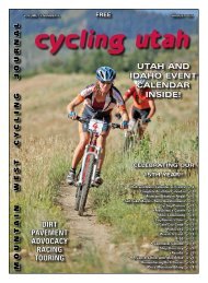
4 cycling utah.com JULY <strong>2003</strong><br />
TRAIL ADVOCACY<br />
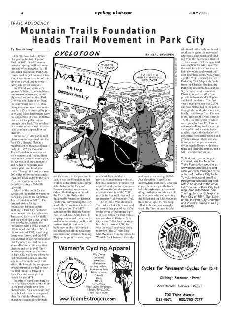
Mountain Trails Foundation<br />
Heads Trail Movement in Park City<br />
By Tim Henney<br />
Oh my, how Park City has<br />
changed in the last 11 years!<br />
Back in 1992 “Slack” season<br />
lasted all spring, well into summer<br />
and often nipped at fall. If<br />
you ran a business in Park City,<br />
it was hard to call summer a season;<br />
it was more a matter of survival<br />
or a good time to close<br />
down and go on vacation.<br />
In 1992 if you considered<br />
yourself a hiker, mountain biker,<br />
trail runner, equestrian, or simply<br />
a trail enthusiast then Park<br />
City was not likely to be found<br />
on your “must do list”. Unlike<br />
many mountain resort communities<br />
Park City is bordered by private<br />
land. Most landowners were<br />
not supportive of a trail initiative<br />
that called for public access<br />
through their land. This resulted<br />
in a dearth of trails and necessitated<br />
a unique approach to trail<br />
creation.<br />
In the early `90’s public trail<br />
plans were incorporated into the<br />
Park City General Plan as a<br />
requirement of the development<br />
code. In 1992 the Mountain<br />
Trails Foundation was created<br />
with support and funding from<br />
local municipalities, developers,<br />
ski resorts, and the community<br />
and began to negotiate easements,<br />
plan, and build new<br />
trails. Through this process, over<br />
200 miles of exceptional singletrack<br />
has been added to the Park<br />
City trail system in the last<br />
decade, creating a 250-mile<br />
labyrinth.<br />
Much of the credit for the<br />
success of the trail movement in<br />
Park City goes to the Mountain<br />
Trails Foundation (MTF). The<br />
original vision for the<br />
Foundation belongs to Jan<br />
Wilking, a Park City publisher,<br />
entrepreneur, and trail advocate.<br />
Jan shared his vision for trails<br />
and his belief that a local group<br />
was needed to facilitate the<br />
movement with a small group of<br />
like-minded individuals. So, in<br />
the summer of 1992, a working<br />
board was formed and the MTF<br />
was created. It was not long after<br />
that the board realized the mission<br />
called for a paid executive<br />
director and so, in 1993 Troy<br />
Duffin was hired. Duffin came<br />
to Park City via Tahoe where he<br />
had practiced land-use law and<br />
was involved in the local trail<br />
effort. He brought the competency<br />
and expertise needed to push<br />
the trail initiative forward in<br />
Park City and was a perfect<br />
match for the MTF.<br />
In spite of significant hurdles<br />
the accomplishments of the MTF<br />
in the past decade have been<br />
phenomenal. As a facilitator they<br />
have helped to create a regional<br />
plan for trail development by<br />
engaging stakeholders throughout<br />
the county in the process. In<br />
fact, it was the Foundation that<br />
worked as facilitator and coordinator<br />
between the City and<br />
County planning agencies to<br />
extend the trail system outside<br />
the City limits. Today, the<br />
Snyderville Recreation District<br />
funds trails surrounding the City<br />
while Duffin continues to facilitate<br />
the process. The MTF<br />
administers the Historic Union<br />
Pacific Rail Trail State Park. It<br />
employs a seasonal trail crew to<br />
maintain the existing public trail<br />
system. And, it continues to<br />
build new public trails once it<br />
has negotiated all the necessary<br />
easements and obtained funding.<br />
They write grant requests, organize<br />
workdays, publish a<br />
newsletter, maintain a website,<br />
host trail seminars, promote trail<br />
etiquette, and sponsor community<br />
trail events. Yet the greatest<br />
accomplishments of the MTF<br />
may be its free trail map and the<br />
spectacular Mid-Mountain Trail.<br />
The 25-mile Mid Mountain<br />
Trail, which links the three local<br />
ski resorts, has placed Park City<br />
on the verge of becoming a premier<br />
destination for trail enthusiasts<br />
worldwide. Historic Park<br />
City sits at 7,000 feet, the ridgeline<br />
above town at 9,500 feet<br />
with the occasional peak rising<br />
to 10,000. The 25-mile long<br />
Mid-Mountain Trail traverses the<br />
Wasatch Back between the ridge<br />
Women’s <strong>Cycling</strong> Apparel<br />
We offer a<br />
complete<br />
selection<br />
of women’s<br />
cycling clothing,<br />
from more than<br />
40 top brands:<br />
Castelli,<br />
Hind,<br />
NEMA,<br />
Primal Wear,<br />
Pearl Izumi, Shebeest,<br />
Sugoi, Terry, ZOIC<br />
and many more!<br />
www.TeamEstrogen.com<br />
and town at an average 8,000-<br />
foot elevation. It appeals to<br />
intermediate trail users, who can<br />
enjoy the scenery as the track<br />
rolls through aspen groves and<br />
old-growth pine forests, as well<br />
as to experts who can now link<br />
the Ridge and the Mid-Mountain<br />
trails for an epic 45-mile loop<br />
filled with spectacular singletrack.<br />
Duffin continues to add<br />
additional miles both north and<br />
south as he gains the necessary<br />
approvals, easements, and funding<br />
from the Recreation District.<br />
As a result of all the new trail<br />
construction, the MTF realized<br />
the need for a first class map to<br />
help the tourist and casual trail<br />
user find these gems. Nine years<br />
ago the MTF produced its first<br />
Park City Trail Map with funds<br />
from the Chamber Bureau, the<br />
Park City restaurant tax, and the<br />
Snyderville Basin Recreation<br />
District, as well as gifts from<br />
private individuals, developers,<br />
and local merchants. The first<br />
year’s map print run was 2,500<br />
and was distributed to the public<br />
through the local bike shops and<br />
hotels…and it was free. The map<br />
is still free and this year’s run is<br />
15,000, the first 5,000 of which<br />
were gone by June 1 st . This is<br />
not your ordinary trail map; it is<br />
a complete and accurate topographic<br />
map with shaded relief<br />
generated from aerial photos and<br />
ground surveys. There are sections<br />
on trail etiquette, events,<br />
recommended loops with elevations<br />
and difficulty ratings, and a<br />
MTF membership cutout.<br />
To find out more or to get<br />
involved, visit the Mountain<br />
Trails Foundation website at<br />
www.mountaintrails.org and<br />
click your way through a virtual<br />
tour of the Park City trails.<br />
To volunteer, send email to<br />
troy@mountaintrails.org and<br />
ask to be added to the email<br />
list. To obtain a Park City trail<br />
map, drop in to White Pine<br />
Touring, Jans, or Colesport in<br />
Park City or REI in Salt Lake<br />
or call the Park City Chamber<br />
and Visitor’s Bureau at (435)<br />
649-6100.