JOTRC Handbook - Kadena Air Base
JOTRC Handbook - Kadena Air Base
JOTRC Handbook - Kadena Air Base

You also want an ePaper? Increase the reach of your titles
YUMPU automatically turns print PDFs into web optimized ePapers that Google loves.
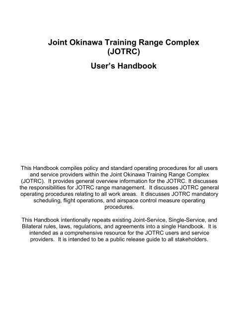
Joint Okinawa Training Range Complex<br />
(<strong>JOTRC</strong>)<br />
User’s <strong>Handbook</strong><br />
This <strong>Handbook</strong> compiles policy and standard operating procedures for all users<br />
and service providers within the Joint Okinawa Training Range Complex<br />
(<strong>JOTRC</strong>). It provides general overview information for the <strong>JOTRC</strong>. It discusses<br />
the responsibilities for <strong>JOTRC</strong> range management. It discusses <strong>JOTRC</strong> general<br />
operating procedures relating to all work areas. It discusses <strong>JOTRC</strong> mandatory<br />
scheduling, flight operations, and airspace control measure operating<br />
procedures.<br />
This <strong>Handbook</strong> intentionally repeats existing Joint-Service, Single-Service, and<br />
Bilateral rules, laws, regulations, and agreements into a single <strong>Handbook</strong>. It is<br />
intended as a comprehensive resource for the <strong>JOTRC</strong> users and service<br />
providers. It is intended to be a public release guide to all stakeholders.
Table of Contents<br />
CHAPTER 1. Introduction 1.1<br />
1.1 General 1.<br />
1.2 Contact Information 1.<br />
1.3 Local Flying Area/Operating Areas (OPAREA) 1.<br />
CHAPTER 2. <strong>JOTRC</strong> Description & Use 2.1<br />
2.1. General 2.<br />
2.2. Type of Activities within <strong>JOTRC</strong> 2.<br />
CHAPTER 3. <strong>JOTRC</strong> Management & Control 3.1<br />
3.1. General 3.<br />
3.2. <strong>Air</strong>space Management and Scheduling Responsibilities 3.<br />
3.3. Scheduling Procedures 3.<br />
3.4. <strong>Air</strong>space Control Measure (ACM) Procedures 3.<br />
3.5. ACM Agencies 3.<br />
3.6. <strong>Air</strong> Traffic Control (ATC) Services 3.<br />
3.7. ATC Agencies<br />
CHAPTER 4. <strong>JOTRC</strong> General Operating Procedures 4.1<br />
4.1. General Complex Information 4.<br />
4.2. Scheduling Process 4.<br />
4.3. Scheduling Priorities 4.<br />
4.4. Special Activities 4.<br />
4.5. Scheduling Special Activities 4.
4.6. Large Force Employment (LFE) Exercise Scheduling 4.<br />
4.7. Flight Planning 4.<br />
CHAPTER 5. <strong>JOTRC</strong> Flying Procedures 5.<br />
5.1. MARSA Procedures 5.<br />
5.2. Special Considerations 5.<br />
CHAPTER 6. Warning Area Operating Procedures 6.<br />
6.1. General 6.<br />
6.2. Specific Procedures<br />
CHAPTER 7. Restricted Area Operating Procedures 7.<br />
7.1 General 7.<br />
7.2 R-177 Military Firing Operation Procedures 7.<br />
7.3 R-177 SIMCAS Operations 7.<br />
CHAPTER 8. Stationary ALTRV Operating Procedures 8.<br />
8.1 Down Under Procedures 8.<br />
8.2 Bubba Procedures 8.<br />
CHAPTER 9. ATCAA Operating Procedures 9.<br />
9.1 General 9.<br />
9.2 Restrictions 9.<br />
9.3 Procedures/Responsibilities 9.<br />
9.4 Standard Procedures for All Parties 9.<br />
CHAPTER 10: Rescue Training Procedures<br />
10.1 General 10.<br />
10.2 Restrictions 10.
10.3 Standard Procedures 10.<br />
10.4 Ridout DZ Procedures 10.<br />
10.5 Known Limiting Factors 10.<br />
CHAPTER 11: EMERGENCY AND SPECIAL PROCEDURES<br />
11.1 General Procedures/Responsibilities<br />
11.2 Specific Procedures<br />
11.<br />
11.<br />
Appendix A: Glossary of Abbreviations, Acronyms & Terms A.<br />
Appendix B: Large Scale Exercise Planning Checklist B.<br />
Appendix C: Mission Planning Checklist C.<br />
Appendix D: <strong>JOTRC</strong> Situation Report D.
CHAPTER 1<br />
INTRODUCTION<br />
1. General. This handbook prescribes policy and general operating procedures for all<br />
user’s operating in the sea, air and land spaces within the Joint Okinawa Training Range<br />
Complex (<strong>JOTRC</strong>).<br />
1.2 CONTACT INFORMATION:<br />
JOINT OKINAWA TRAINING RANGE COMPLEX, (<strong>JOTRC</strong>), JOINT OKINAWA<br />
SCHEDULING CELL (JOSC). Located in Building 3382 on <strong>Kadena</strong>, AB, Okinawa, Japan.<br />
The JOSC maintains a sharepoint site for DoD CAC users. The JOSC plans to implement<br />
the use of Digital Collection and Scheduling Tool (DCAST) as the primary method for<br />
scheduling sea, air and land space within the confines of <strong>JOTRC</strong>. After which, all requests<br />
shall be made via DCAST. For access to this system contact the JOSC via email or phone.<br />
Mail<br />
Chief Wing Scheduling<br />
Joint Okinawa Training Range Complex<br />
<strong>Kadena</strong> <strong>Air</strong> Force <strong>Base</strong><br />
Unit 5177 Box 10<br />
APO, AP 96368<br />
email<br />
18oss_osojosc@kadena.af.mil<br />
Web<br />
https://kadenae.eim.pacaf.af.mil/sites/JOSC/default.aspx (DoD CAC users only)<br />
Phone DSN : 634-4599, 4797, or 4360 Cml : 81-98-961-4599, 4797, or 4360<br />
Radio Callsign At this time the JOSC is solely a scheduling office and can only be contacted by phone<br />
or email.<br />
OKINAWA DOD AVIATION LIAISON AND AIRSPACE MANAGER. Located within the<br />
Naha Radar Approach Control facility. The DoD Aviation Liaison and <strong>Air</strong>space Manager<br />
functions are the single point of contact for DoD aviation airspace requirements for<br />
coordinating mission support services within the existing <strong>JOTRC</strong> design structure, to<br />
request temporary airspace requirements not included in the <strong>JOTRC</strong> design, or to initiate<br />
airspace actions for permanent modifications/additions to the <strong>JOTRC</strong> design.<br />
Mail<br />
<strong>Air</strong> Traffic Manager<br />
18 OSS/OLA<br />
Unit 5177 Box 10<br />
APO, AP 96368<br />
email<br />
Web<br />
https://kadenae.eim.pacaf.af.mil/sites/?????/default.aspx (DoD CAC users only)<br />
Phone DSN : 634-4677 or 4647 Cml : 81-98-961-4677 or 4647<br />
Radio Callsign KADENA ARRIVAL CONTROL – Freq: 255.8 or 135.9<br />
1.3 LOCAL FLYING AREA/OPERATING AREAS (OPAREA). Are areas within the<br />
<strong>JOTRC</strong> that are designated for use by the U.S. <strong>Air</strong> Force, Navy, Marine Corps and JSDF<br />
for air and fleet training, operations and research and development. They are defined by<br />
coordinates, may be further expanded to include airspace and sea depths, and include<br />
<strong>JOTRC</strong> training ranges.
While the majority of these areas exist within Special Use <strong>Air</strong>space (Warning Areas,<br />
Restricted Areas, etc.), it is important to recognize that non-military surface and air<br />
platforms cannot be restricted nor prohibited from operating in or transiting most areas.<br />
Since offshore OPAREAs are located in international waters, normal “Freedom of <strong>Air</strong>/Sea”<br />
principles apply to airborne and surface vessels.<br />
Hazardous Operations affecting airspace shall be conducted within designated SUA or<br />
ALTRV if the planned operation must occur outside aforementioned SUA.<br />
All operations within these areas shall be conducted cautiously and military units shall<br />
maintain vigilant visual/sensor sanitization to ensure safety. Military units shall apply ORM<br />
principles throughout all evolutions conducted in these areas.<br />
ESTABLISHMENT: In accordance with Joint Committee agreements JC-Incl 76 Memo<br />
937, JC-Incl 77 Memo 938, JC-Incl 79 Memo 940, JC-Incl 86, Memo 948, and JC-Incl 89<br />
Memo 951. These areas include the offshore areas contiguous Okinawa, Japan.<br />
JOSC/<strong>JOTRC</strong> OPERATING AREAS. The areas addressed by this handbook are located<br />
in the country of Japan and their contiguous offshore areas.<br />
GUIDANCE. This handbook prescribes general operating instructions and flight and<br />
procedures applicable to the operation of all aircraft, ships, and submarines operating<br />
within designated operating areas.<br />
This handbook is not intended to cover every contingency that may arise nor every rule of<br />
safety and good practice. In the tactical environment, military exigency may require on-site<br />
deviations from handbooks/procedures contained here. The existing risk of deviation must<br />
continually be weighed against the benefit of deviating from this handbook. Deviation from<br />
specific flight and operating instructions is authorized in emergency situations when, in the<br />
judgment of the pilot in command or Commanding Officer, safety justifies such a deviation.<br />
Standard definitions and word use has been adhered to for such phrases as “Warnings”,<br />
“Cautions”, “Notes”, “Shall”, “Should”, “May”, “Will”, etc. It is often not feasible to<br />
completely specify all situations or circumstances under which provisions of this handbook<br />
shall apply; therefore, wording such as “normally,” “etc.,” “usually,” and “such as” is<br />
employed. Words or clauses of that type shall not be used as loopholes nor shall they be<br />
expanded to include a maneuver, situation, or circumstances that should not be performed<br />
nor encountered.<br />
CHANGE RECOMMENDATIONS. Recommended changes to this handbook may be<br />
submitted by anyone. Submit recommended changes to the JOSC via contact information<br />
listed above.<br />
DISTRIBUTION. Automatic distribution of this handbook and revisions is primarily by<br />
electronic means.
CHAPTER 2<br />
<strong>JOTRC</strong> DESCRIPTION AND USE<br />
2.1 General: This chapter provides general overview information for the <strong>JOTRC</strong>. Detailed<br />
information for operations within the SCORE OPAREA may be found on the JOSC<br />
Website at: https://kadenae.eim.pacaf.af.mil/sites/JOSC/default.aspx<br />
The <strong>JOTRC</strong> consists of open ocean areas (outside 12 nautical miles [nm] from land),<br />
offshore areas (within 12 nm from land), and onshore areas geographically situated on<br />
and around the island of Okinawa. Within the <strong>JOTRC</strong> various SUA and ASU fall into one<br />
or more of the makeup areas (open-ocean, offshore ranges and training areas).<br />
Users of the <strong>JOTRC</strong> include both USFJ and JSDF units stationed in Okinawa, visiting<br />
units from mainland Japan, and transit units. The goal of the <strong>JOTRC</strong> is to support training<br />
and operational requirements for military stakeholders as well as (when mission<br />
requirements permit) accommodate training needs, maintenance check flights and aerial<br />
surveying needs of the civil flying community.<br />
Use of the <strong>JOTRC</strong> includes land, sea, and air - space. This combination of training space<br />
is required; however, some types of missions can require a single type (land/sea/air) of<br />
space or a combination of two or even all three types of space.<br />
2.2. Activities within <strong>JOTRC</strong> . The <strong>JOTRC</strong> SUAs, ASUs, and other airspace are<br />
described and charted in the sections that follow. The SUAs includes: Warning Areas and<br />
Restricted Areas. The ASUs includes: Stationary ALTRVs, ATCAAs, JASDF X-Ray<br />
<strong>Air</strong>spaces, Civil Training and Test Areas, and Aero Club Training Areas. Additionally, the<br />
local DZ and MARSA procedures are key elements of the <strong>JOTRC</strong>.
SUA - Warning Areas<br />
Name<br />
Upper<br />
Lower<br />
Limits<br />
Restrictions<br />
Operation<br />
Hours<br />
Remarks<br />
W-172 SOUTH RANGE<br />
251415N/1273453E<br />
241645N/1273453E<br />
241645N/1283953E<br />
250445N/1283953E<br />
251415N/1282953E<br />
W-173 HOTEL HOTEL<br />
262314N/1281953E<br />
270614N/1290952E<br />
270614N/1305952E<br />
261015N/1305952E<br />
W-173A AREA ALFA<br />
UNL<br />
------<br />
SFC<br />
UNL<br />
------<br />
SFC<br />
Warning Area<br />
(USAF air-air)<br />
Warning Area<br />
(USN)<br />
Continuous VMC-<br />
IMC<br />
Daily<br />
2100-1100<br />
VMC-IMC<br />
Sea area 38nm SSE of Naha city,<br />
Okinawa Pref. Headquarters South<br />
Western Composite <strong>Air</strong> Division<br />
JSDF-A (Naha Tel 098-857-1191 Ext<br />
2234,2204) RODERICK (133.9MHz)<br />
Sea area 29nm ENE of Naha city,<br />
Okinawa Pref.<br />
265314N/1285453E<br />
272414N/1291452E<br />
272914N/1293452E<br />
273314N/1295952E<br />
270614N/1301452E<br />
270614N/1290952E<br />
FL600<br />
----------------<br />
3000<br />
Warning Area<br />
(USAF air to air<br />
Training)<br />
Daily<br />
2100-1100<br />
VMC-IMC<br />
Sea area NE of Naha City, Okinawa<br />
Pref.<br />
W-174 IDESUNA JIMA<br />
262714.1N/1265553.3E<br />
262714.0N/1270653.4E<br />
261214.0N/1270653.4E<br />
261214.4N/1265553.2E<br />
Target will be a circle with a radius of 2nm<br />
of lrisuna lsland, centered at<br />
262300N/1270600E.<br />
15000<br />
----------------<br />
SFC<br />
Warning Area<br />
(USAF air ground<br />
firing and bombing)<br />
MON-SAT<br />
2100-1400<br />
VMC-IMC<br />
33nm WNW of Naha<br />
City, Okinawa Pref.<br />
W-174A KUME JIMA<br />
262713.9N/1264753.5E<br />
262714.1N/1265553.3E<br />
261214.4N/1265553.2E<br />
261214.0N/1264753.5E<br />
Target will be centered at<br />
261900N/1265200E<br />
FL150<br />
----------------<br />
SFC<br />
Warning Area<br />
(USAF)<br />
MON-SAT<br />
2100-1400<br />
VMC-IMC<br />
In and around KUMEJIMA and<br />
IDESUNAJIMA.<br />
Contact NAHA APP CON on only freq<br />
for penetration.<br />
W-176 TORI SHIMA<br />
A circle radius of 5nm centered at<br />
263614.3N/1264953.2E.<br />
15000<br />
----------------<br />
SFC<br />
Warning Area<br />
(USAF air-air<br />
firing and bombing)<br />
2100-1500<br />
VMC-IMC<br />
WNW of <strong>Kadena</strong> City, Okinawa Pref<br />
Contact NAHA APP CON<br />
on any freq for penetration.<br />
W-178 IE SHIMA<br />
A circle radius of 5nm centered at<br />
15000<br />
----------------<br />
(USAF <strong>Air</strong>-Ground<br />
firing Range)<br />
MON-FRI<br />
2100-1400<br />
N of <strong>Kadena</strong> City,<br />
Okinawa Pref.
264413.9N/1274553.2E. SFC SAT<br />
2100-0300<br />
&<br />
0800-1400<br />
VMC-IMC
SUA - Warning Areas<br />
Name<br />
Upper<br />
Lower<br />
Limits<br />
Restrictions<br />
Operation<br />
Hours<br />
Remarks<br />
W-178A IE SHIMA<br />
Beginning at 265336.2N/1273245.0E to<br />
265912.0N/1274707.0E<br />
then clockwise along the arc of a circle<br />
radius 15nm centered<br />
on 264413.9N/1274553.2E<br />
to 265209.9N/1280008.1E<br />
to 264848.9N/1275715.1E<br />
to 264014.3N/1273553.0E<br />
to 265114.2N/1273053.0E<br />
then clockwise along the arc of a circle<br />
radius 15nm centered on 264413.9N/<br />
1274553.2E.<br />
13000<br />
----------------<br />
SFC<br />
(USAF <strong>Air</strong>-Ground<br />
firing Range)<br />
MON-FRI<br />
2100-1400<br />
SAT<br />
2100-0300<br />
&<br />
0800-1400<br />
VMC-IMC<br />
N of <strong>Kadena</strong> City,<br />
Okinawa Pref.<br />
W-179 NORTH RANGE<br />
Beginning at 270445N/1263905E to<br />
273014N/1255653E then clockwise along<br />
the arc of a circle radius 120nm centered<br />
on 262214N/1274753E<br />
to 281714N/1270753E<br />
to 273202N/1272535E<br />
then counter-clockwise along the arc of a<br />
circle radius 72nm centered<br />
on 262214N/1274753E<br />
to 270526N/1264259E<br />
UNL<br />
----------------<br />
SFC<br />
(USAF <strong>Air</strong>-<strong>Air</strong><br />
firing Range<br />
Continuous<br />
VMC-IMC<br />
Sea area 34nm NW of <strong>Kadena</strong> City,<br />
Okinawa Pref. Contact NAHA APP<br />
CON on any freq for penetration.<br />
Headquarters South-Western<br />
Composite <strong>Air</strong> Division JSDF-A<br />
(Naha Tel 098-857-1191<br />
Ext 2234,2204)<br />
RODERIC (133.9MHz)<br />
W-181 GOLF GOLF<br />
254115N/1304452E 252615N/1314152E<br />
242315N/1304752E 245315N/1300352E<br />
4000<br />
----------------<br />
SFC<br />
Warning Area<br />
(USN)<br />
by NOTAM<br />
Sea area 140nm ESE of Naha City,<br />
OKINAWA Pref.<br />
W-183A OKINO-DAITO JIMA<br />
The area beyond 3nm to 5nm radius of<br />
Okino-Daito Island,<br />
242815.3N/1311052.0E.<br />
W-184 INDIA INDIA<br />
242315N/1304752E 252615N/1314152E<br />
251315N/1323052E 240016N/1325952E<br />
240015N/1312238E 240733N/1311025E<br />
W-185 MIKE MIKE<br />
254115N/1285153E 254837N/1290219E<br />
254415N/1292552E 254415N/1301052E<br />
254324N/1303552E 254115N/1304452E<br />
245315N/1300352E<br />
UNL<br />
----------------<br />
SFC<br />
UNL<br />
----------------<br />
SFC<br />
UNL<br />
----------------<br />
SFC<br />
Warning Area<br />
(USN)<br />
Warning Area<br />
(USN)<br />
Warning Area<br />
(USN)<br />
Continuous<br />
VMC-IMC<br />
DLY<br />
2100-0900<br />
VMC-IMC<br />
DLY<br />
2100-0900<br />
VMC-IMC<br />
SE of 220nm on the sea from Naha City<br />
OKINAWA Pref.<br />
Exercise will not exceed 180 days per<br />
year.<br />
Sea area 240nm E of Naha City,<br />
Okinawa Pref<br />
Sea area 110nm SE of Naha City,<br />
Okinawa Pref. Headquarters South-<br />
Western Composite <strong>Air</strong> Division<br />
JSDF-A (Naha Tel 098-857-1191<br />
Ext 2234,2204)<br />
RODERIC (133.9MHz
SUA - Warning Areas
SUA - Restricted Areas<br />
Name<br />
Upper<br />
Lower<br />
Limits<br />
Restrictions<br />
Operation<br />
Hours<br />
Remarks<br />
R-177 CAMP HANSEN (EASILY GUNNERY)<br />
262714.0N/1275353.2E<br />
263014.0N/1275753.1E<br />
263114.0N/1275853.1E<br />
263214.0N/1275853.1E<br />
262914.0N/1275153.2E<br />
R-183 OKINO-DAITO JIMA<br />
A circular area including Okino-Daito<br />
Island, 242815.3N/1311052.0E and ocean<br />
area extending 3nm beyond the waters<br />
edge.<br />
R-201 NORTHERN TRAINING AREA<br />
264636N/1281730E 264524N/1281533E<br />
264158N/1281413E 263931N/1281055E<br />
263758N/1281400E 264034N/1281442E<br />
264002N/1281609E 264107N/1281642E<br />
264107N/1281513E 264347N/1281742E<br />
264514N/1281702E 264534N/1281756E<br />
264518N/1281858E 264551N/1281912E<br />
R-195 CAMP SCHWAB<br />
263146N/1275939E 263347N/1280209E<br />
263209N/1280335E 263026N/1280051E<br />
R-202 CENTRAL TRAINING AREA<br />
263342N/1275959E 263132N/1275837E<br />
263003N/1275527E 262835N/1275502E<br />
262958N/1275223E 262918N/1275117E<br />
262753N/1275126E 262720N/1275533E<br />
262858N/1275618E 262932N/1275846E<br />
263053N/1275914E 263119N/1275953E<br />
263127N/1280156E 263104N/1280251E<br />
263159N/1280239E 263234N/1280054E<br />
Excluding CAMP SCHWAB and R-177<br />
R-204 CAMP COURTNEY AREA<br />
262348N/1275134E 262305N/1275101E<br />
262300N/1275111E 262318N/1275128E<br />
262317N/1275140E 262249N/1275144E<br />
262244N/1275200E 262316N/1275206E<br />
R-203 WHITE BEACH AREA<br />
261813N/1275436E 261730N/1275424E<br />
261727N/1275519E 261744N/1275526E<br />
261752N/1275507E 261809N/1275456E<br />
3000<br />
---------------<br />
GND<br />
UNL<br />
---------------<br />
SFC<br />
2000<br />
---------------<br />
GND<br />
2000<br />
---------------<br />
GND<br />
1000<br />
---------------<br />
GND<br />
1000<br />
---------------<br />
GND<br />
1000<br />
---------------<br />
GND<br />
Restricted Area<br />
(US MARINES)<br />
Restricted Area<br />
(USN)<br />
Continuous<br />
VMC-IMC<br />
Continuous<br />
VMC-IMC<br />
Central part of Okinawa<br />
SE of 220nm on the sea from Naha<br />
City, OKINAWA Pref.<br />
Exercise will not exceed<br />
180 days per year<br />
Restricted Area<br />
(USMC) Continuous Northern part of Okinawa Is<br />
Restricted Area<br />
(USN)<br />
MON-SAT<br />
2100-1500 Central part of Okinawa Is.<br />
Restricted Area<br />
(USMC) Continuous Central part of Okinawa Is<br />
Restricted Area<br />
(USMC)<br />
Restricted Area<br />
(USN)<br />
Continuous<br />
Continuous<br />
5.4nm NE of <strong>Kadena</strong> AB, not within<br />
<strong>Kadena</strong> Control Zone (CDSA) Okinawa<br />
Pref.<br />
8 nm SE of <strong>Kadena</strong> AB, Okinawa Pref.
SUA - Restricted Areas
ASU – Stationary ALTRVs<br />
Name Altitudes Remarks<br />
BARNEY<br />
2450N/128556E 2509N/12940E 2455N/13002E 2435N/12915E<br />
BUBBA<br />
2700N/12600E 2728N/12547E 2652N/12450E 2626N/12438E<br />
CONEY<br />
2526N/13142E 2515N/13345E 2337N/13345E 2335N/13140E<br />
2432N/13048E<br />
FL170<br />
---------------<br />
SFC<br />
FL250<br />
---------------<br />
FL200<br />
FL440<br />
---------------<br />
055-<br />
Scheduled by JOSC<br />
Scheduled by JOSC<br />
Scheduled by JOSC<br />
DOWNUNDER<br />
2528N/12816E 2455N/12902E 2509N/12928E 2550N/12841E<br />
FLATTOP<br />
2706N/13130E 2706N/13237E 2606N/13237E 2606N/13130E<br />
GECKO<br />
2542N/13009E 2615N/13000E 2613N/13025E 2542N/13035E<br />
GOLD<br />
2510N/12835E 2520N/12922E 2518N/12826E/2529N/12911E<br />
HOTEL<br />
2623N/12802E 2706N/12910E 2706N/13100E 2610N/13100E<br />
INDIA<br />
2423N/13048E 2526N/13142E 2513N/13231E 2400N/13300E<br />
2400N/13123E 2407N/13111E<br />
MIKE<br />
2541N/12852E 2548N/12902E 2544N/12926E 2544N/13011E<br />
2543N/13036E 2541N/13045E 2453N/13004E<br />
MOBILE 9<br />
2514N/12735E 2531N/12810E 2424N/12927E 2352N/12833E<br />
2416N/12735E<br />
SHOOTER<br />
2541N/13045E 2526N/13142E 2423N/13048E 2453N/13004E<br />
SHOVEL<br />
2830N/12705E 2732N/12726E 2702N/12626E 2659N/12606E<br />
2718N/12524E<br />
SILVER<br />
2612N/12855E 2621N/12845E 2547N/12856E 2546N/12907E<br />
STOUT<br />
2610N/13100E 2706N/13100E 2706N/13130E 2610N/13130E<br />
TRINITY<br />
2733N/12959E 2733N/13059E 2706N/13059E 2706N/13014E<br />
FL290<br />
---------------<br />
FL280<br />
FL200<br />
---------------<br />
SFC<br />
FL240<br />
---------------<br />
FL210<br />
FL250<br />
---------------<br />
FL200<br />
FL400<br />
---------------<br />
055<br />
UNL<br />
---------------<br />
055<br />
FL400<br />
---------------<br />
050<br />
FL400<br />
---------------<br />
050<br />
FL200<br />
---------------<br />
055<br />
FL400<br />
--------------<br />
050<br />
FL240<br />
---------------<br />
FL210<br />
FL400<br />
---------------<br />
050<br />
FL400<br />
---------------<br />
050<br />
Scheduled by JOSC<br />
Scheduled by JOSC<br />
Scheduled by JOSC<br />
Scheduled by JOSC<br />
Scheduled by JOSC<br />
Scheduled by JOSC<br />
Scheduled by JOSC<br />
Scheduled by JOSC<br />
Scheduled by JOSC<br />
Scheduled by JOSC<br />
Scheduled by JOSC<br />
Scheduled by JOSC<br />
Scheduled by JOSC
ASU – Stationary ALTRVs
ASU – ATCAAs<br />
Name<br />
MEUEX CTA<br />
262919N/1274713E<br />
263917N/1274813E<br />
263412N/1275652E<br />
263410N/1280329E<br />
263105N/1280541E<br />
262404N/1275557ES<br />
MEUX NTA<br />
263705N/12759E<br />
2654N/12812E<br />
2644N/12823E<br />
263205N/12804E<br />
SETA<br />
NHC R-120 / 20 DME<br />
NHC R-100 / 42 DME<br />
NHC R-160 / 42 DME<br />
NHC R-160 / 20 DME<br />
Upper<br />
Lower<br />
Limits<br />
9000<br />
---------------<br />
6000<br />
9000<br />
---------------<br />
6000<br />
FL190<br />
---------------<br />
3000<br />
Restrictions<br />
Operation<br />
Hours<br />
Remarks<br />
ATCAA (USMC) See Remarks Scheduled IAW Tab E of 2010<br />
Amendment to 1972 ATC Agreement<br />
ATCAA (USMC) See Remarks Scheduled IAW Tab E of 2010<br />
Amendment to 1972 ATC Agreement<br />
ATCAA (USMC) See Remarks Scheduled IAW Tab E of 2010<br />
Amendment to 1972 ATC Agreement
ASU - X-Ray<br />
ID<br />
Lateral limits<br />
Vertical<br />
limits<br />
Times<br />
Controlling unit<br />
X-24<br />
The area bounded by straight lines connecting following points.<br />
(1)254115N/1304452E (2)252615N/1314152E<br />
(3)242315N/1304752E (4)245315N/1300352E<br />
By NOTAM<br />
By NOTAM<br />
(TEL 098-857-1191<br />
EXT 2234, 2204)<br />
Radio Callsign<br />
RODERIC 133.9MHz<br />
X-25<br />
The area bounded by straight lines connecting following points.<br />
(1)253215N/1280953E (2)251415N/1282953E<br />
(3)251415N/1273453E<br />
By NOTAM<br />
By NOTAM<br />
(TEL 098-857-1191<br />
EXT 2234, 2204)<br />
Radio Callsign<br />
RODERIC 133.9MHz<br />
X-26<br />
The area bounded by straight lines connecting following points.<br />
(1)250445N/1283953E (2)242415N/1292653E<br />
(3)235215N/1283253E (4)241645N/1273453E<br />
(5)241645N/1283953E<br />
By NOTAM<br />
By NOTAM<br />
(TEL 098-857-1191<br />
EXT 2234, 2204)<br />
Radio Callsign<br />
RODERIC 133.9MHz
Drop Zones<br />
Name Location/DZ Center Ceiling Times Lateral Dimensions<br />
Ie-Shima<br />
W178/W178A<br />
Ourwan 263210.63N/1280310.30E FL250<br />
Ridout 262103.30N/1274539.66E FL250<br />
Tsuken-Jima 261529.04N/1275423.52E FL250<br />
Ukibaru 261831.8N/1275734.8E FL250<br />
W178 FL150<br />
W178A 13,000<br />
By JOSC<br />
Schedule<br />
By JOSC<br />
Schedule and<br />
NOTAM<br />
By JOSC<br />
Schedule and<br />
NOTAM<br />
By JOSC<br />
Schedule and<br />
NOTAM<br />
By JOSC<br />
Schedule and<br />
NOTAM<br />
Operations authorized within<br />
confines of W-Area<br />
3 NM Radius<br />
3 NM Radius<br />
3 NM Radius<br />
3 NM Radius
Civil Training and Test Areas<br />
ID Lateral limits Altitude Times Controlling unit<br />
1-1<br />
The airspace bounded by the straight lines and the minor arc<br />
connecting the following points.<br />
(1) 255344N/1252649E (2) 252158N/1252236E<br />
(3) 250302N/1244333E (4) 251729N/1241201E<br />
thence to point (1)<br />
The minor arc connecting point (2) and (3) is a 35NM radius of,<br />
and the minor arc connecting point (4) and (1) is a 67NM radius<br />
of Miyakojima VORTAC (MYC).<br />
FL250<br />
--------<br />
7000<br />
By NOTAM<br />
Controlling<br />
Facility<br />
Naha Control<br />
123.9MHz<br />
276.5MHz<br />
Shimojishima<br />
Area (SM)<br />
1-2<br />
1-3<br />
The airspace bounded by the straight lines and the minor arc<br />
connecting the following points.<br />
(1) 255344N/1252649E (2) 253525N/1252423E<br />
(3) 252128N/1251031E (4) 250302N/1244333E<br />
(5) 251729N/1241201E<br />
thence to point (1)<br />
The minor arc connecting (3) and (4) is a 35NM radius of, and<br />
the minor arc connecting (5) and (1) is 67NM radius of<br />
Miyakojima VORTAC (MYC).<br />
FL350<br />
--------<br />
FL250<br />
FL410<br />
--------<br />
FL350<br />
By NOTAM<br />
Controlling<br />
Facility<br />
Naha Control<br />
123.9MHz<br />
276.5MHz<br />
2<br />
The airspace bounded by the straight lines and the minor arc<br />
connecting the following points.<br />
(1) 242141N/1254418E (2) 240327N/1260303E<br />
(3) 234530N/1255413E (4) 234013N/1245544E<br />
(5) 241343N/1250650E<br />
thence to point (1) The arc connecting (3) and (4) is a 70NM<br />
radius of, and the arc connecting (5) and (1) is 35NM radius of<br />
Miyakojima VORTAC (MYC).<br />
FL200<br />
--------<br />
7000<br />
By NOTAM<br />
Controlling<br />
Facility<br />
Naha Control<br />
123.9MHz<br />
276.5MHz
Aero Club Training Areas<br />
Name Ceiling Description<br />
White Beach<br />
(East)<br />
Nago Bay<br />
(North)<br />
Nago Bay North<br />
(Northeast)<br />
Directed by ATC<br />
Directed by ATC<br />
Directed by ATC<br />
The area bound by TIC R-030 to TIC R-060 between TIC 8 DME and 17 DME, and<br />
indented on the North by the KAD R-080.<br />
The area bound by KAD R-016 from 10 DME to Bizensaki then along the coastline<br />
East to Southwest back to 10 DME remaining in the Nago Bay area over the water.<br />
The area from Bizensaki direct to Okuma then along the coastline Southwest to<br />
Northwest back to Bizensaki remaining in the Nago North area over the water.
CDR (Routes are currently published in AIP-Japan. However prior to operational<br />
implementation further review by legal and facilities personnel is required.<br />
Route designator<br />
(Navigation specification)<br />
Name of significant<br />
points<br />
Coordinates<br />
[Available SENSOR]<br />
Z29<br />
(RNAV5)<br />
[VOR/DME, DME/DME,<br />
INS or IRS, GNSS]<br />
GAKIA<br />
274858N 1272515E<br />
GANEK<br />
270145N 1255347E<br />
Z32<br />
(RNAV5)<br />
[VOR/DME, DME/DME,<br />
INS or IRS, GNSS]<br />
RYUKI<br />
273727N 1321432E<br />
YUSKE<br />
262330N 1281419E<br />
Z34<br />
(RNAV5)<br />
[VOR/DME, DME/DME,<br />
INS or IRS, GNSS]<br />
RYUKI<br />
273727N 1321432E<br />
TETTA<br />
261504N 1285957E<br />
Way-point<br />
IDENT of<br />
VOR/DME<br />
BRG &<br />
DIST<br />
NHC<br />
357°/97.3NM<br />
KXC<br />
316°/59.3NM<br />
NHC<br />
075°/33.9NM<br />
MAG<br />
TRACK<br />
[TRUE<br />
TRACK]<br />
244<br />
[240.2]<br />
063<br />
[059.5]<br />
257<br />
[251.9]<br />
250<br />
[245.3]<br />
Geodetic<br />
DIST<br />
Upper limits<br />
------------<br />
Lower limits<br />
<strong>Air</strong>space<br />
classification<br />
94.0 UNL<br />
------<br />
226.6 UNL<br />
------<br />
192.2 UNL<br />
------<br />
Direction of<br />
MEA cruising level<br />
[MOCA]<br />
(FT or<br />
FL) Odd Even<br />
FL290<br />
[2000]<br />
FL290<br />
[2000]<br />
FL290<br />
[2000]<br />
↑<br />
FL290<br />
FL300<br />
↓<br />
FL300<br />
↓<br />
FL300<br />
↓<br />
Critical DME<br />
MYC<br />
ALC<br />
<br />
TGE<br />
ONC<br />
ALC<br />
TGE<br />
DMEGAP<br />
RYUKI/<br />
221.6nm<br />
to<br />
YUSKE,<br />
INS or<br />
IRS or<br />
GNSS<br />
required.<br />
RYUKI/<br />
191.2nm<br />
to<br />
TETTA,<br />
INS or<br />
IRS or<br />
GNSS<br />
required.<br />
Remarks Controlling<br />
Unit Frequency<br />
For CDR2<br />
Applicable date,<br />
period and minimum<br />
applicable altitude<br />
are notified by<br />
NOTAM.<br />
See ENR 3.5.3.12<br />
Naha ACC<br />
Freq:132.35(132.1)<br />
301.2(276.1)MHZ<br />
Naha ACC<br />
Freq:123.9(132.1)<br />
276.5(276.1)MHZ<br />
For CDR2<br />
Applicable date,<br />
period and minimum<br />
applicable altitude<br />
are notified by<br />
NOTAM.<br />
See ENR 3.5.3.12<br />
Naha ACC<br />
Freq:132.35(132.1)<br />
301.2(276.1)MHZ<br />
Naha ACC<br />
Freq:123.9(132.1)<br />
276.5(276.1)MHZ<br />
For CDR2<br />
Applicable date,<br />
period and minimum<br />
applicable altitude<br />
are notified by<br />
NOTAM.<br />
See ENR 3.5.3.12<br />
Naha ACC<br />
Freq:132.35(132.1)<br />
301.2(276.1)MHZ<br />
Naha ACC<br />
Freq:123.9(132.1)<br />
276.5(276.1)MHZ
CHAPTER 3<br />
<strong>JOTRC</strong> AIRSPACE MANAGEMENT AND CONTROL PROCEDURES<br />
3.1 General: The section discusses responsibilities for the agencies charged with<br />
management and control of <strong>JOTRC</strong> training spaces.<br />
3.2 <strong>Air</strong>space Management and Scheduling Responsibilities: The JOSC serves as the<br />
U.S. Forces Japan representative for airspace management and scheduling of <strong>JOTRC</strong><br />
training areas. The JOSC serves as the DoD/MoD focal point and central clearinghouse<br />
for all Special Use <strong>Air</strong>space (SUA) / Warning Area matters that pertain to any DoD/MoD<br />
airspace-related activity within the AOR. In accordance with the Amendment to the<br />
Okinawa <strong>Air</strong> Traffic Control dated 15 May 1972 (signed 18 Mar 2010), the JOSC is the<br />
single point scheduling agency for all areas except W178/W178A, which is scheduled by<br />
MCB Camp Smedley D. Butler. USFJ J32 is the Office of Primary Responsibility for<br />
oversight on the concept for joint airspace/range scheduling operations IAW USFJI 13-201.<br />
U.S. <strong>Air</strong> Forces Japan (USAFJ), Commander Naval Forces Japan (CNFJ), Marine<br />
Forces, Japan (MARFORJ) Responsible for supporting the joint airspace/range<br />
scheduling concept. They will task subordinate units to develop local procedures to<br />
facilitate joint scheduling operations and ensure units provide manpower as required. The<br />
commands will review procedures annually and provide feedback for proposed<br />
changes/inputs to this handbook to Headquarters United States Forces, Japan as required.<br />
18 WG Will ensure schedulers are trained to schedule all applicable airspace/ranges.<br />
Ensures compliance with AFI 13-212, Range Planning and Operations, and acts as the<br />
scheduling authority delegated by the Range Operating Authority for 18 WG controlled<br />
ranges. Assists CFAO in scheduling USN controlled ranges.<br />
CFAO Will ensure schedulers are trained to schedule all applicable airspace/ranges.<br />
Processes requests for USN controlled ranges for use by USN users and notifies using<br />
agencies of approved schedule. Assists 18 WG in scheduling USAF controlled ranges.<br />
SWCAD Will delegate Liaison officer(s) to request and coordinate the use of<br />
airspace/range for JASDF users. Assembles requests for airspace/range for JASDF users<br />
and submits to the JOSC. Notifies JASDF users of approval/denial of airspace/range<br />
requests.
3.3 SCHEDULING PROCEDURES<br />
JOSC General: 18 WG and CFAO will work together in the same office to produce a joint<br />
schedule. Schedulers from either unit can schedule any airspace/range. All approvals<br />
and denials of airspace/range requests will be made known to 18 WG schedulers, CFAO<br />
schedulers, and SWCAD Liaison and documented through the request database. Any<br />
unresolved disputes will be sent to USFJ/J32.<br />
All requests for Idesuna Jima (W-174) or Tori Shima (W-176) and requests for ordnance<br />
on USAF ranges will be coordinated with the 18 WG Range Operations Officer (ROO) or<br />
delegated JOSC representative before the request is approved.<br />
All requests for Oki Daito Jima (W-183) and requests for ordnance on USN ranges will be<br />
coordinated with the CFAO Range Operations Officer (ROO) or delegated JOSC<br />
representative before the request is approved.<br />
Per US State Department, W-182 (Sekibi Sho) and W-175 (Kobe Sho) are not to be<br />
scheduled or used by any US Forces.<br />
SCHEDULING AUTHORITY.<br />
Duties include: Inputs to be added by appropriate SME<br />
SCHEDULING ACTIVITY.<br />
Scheduling Activity duties include: Inputs to be added by appropriate SME<br />
OFFICER SCHEDULING THE EXERCISE (OSE)/ OFFICER CONDUCTING THE<br />
EXERCISE (OCE)/OFFICER IN TACTICAL COMMAND (OTC).<br />
3.4 <strong>Air</strong>space Control Measures (ACM) in <strong>JOTRC</strong><br />
Introduction. This section is intended to provide background information on current ACM<br />
employment in the <strong>JOTRC</strong>. The information is general in nature in order to cover a wide<br />
range of operational capabilities for airspace control. In addition to the ACMs outlined<br />
here, strict adherence to established regulatory guidance, international agreements, and<br />
standardized operating procedures is vital for safety of all <strong>JOTRC</strong> users.<br />
Purpose. It is understood and acknowledged that future technological advances for both<br />
military and civil aircraft combined with enhancements to the ATC/ATM systems, will<br />
increase user requirements/demands on airspace resources. Furthermore, airspace access<br />
and availability is vital to successful operations for both military and civil entities. This<br />
increased user demand has required the implementation and usage of ACMs. The current<br />
ACMs are baseline operations that create an integrated airspace control system (ACS) that<br />
facilitates mission accomplishment while maintaining the highest level of safety. This annex<br />
provides a basic overview of the framework of the currently used ACS broken down by
organization. Although some ACMs can be executed independently, largely these<br />
organizational entities work in concert.<br />
Coordination. Coordinated airspace/range usage is essential to maximize training<br />
opportunities, enhance SUA /ASU efficiency, improve flight safety, and increase the<br />
capacity of the <strong>JOTRC</strong>. As civil aviation volume increases, civil airspace requirements will<br />
continue to grow. Therefore, it is important for all military forces to be good stewards of<br />
designated training areas. This annex explains the general ACMs for planning,<br />
coordinating, and conducting joint airspace/range scheduling throughout the <strong>JOTRC</strong>.<br />
ACM Operating Principles. ACMs are multifaceted. They range from basic written<br />
procedures, to advanced scheduling, to radio reporting, to entry/exit radar marshalling,<br />
through advanced radar marshalling with monitoring/control functions. In order to operate<br />
safely and effectively in the <strong>JOTRC</strong>, the first two ACMs (basic written procedures and<br />
advanced scheduling) are required processes for <strong>JOTRC</strong> users. Other available ACMs<br />
identified below include a limited range control radio reporting facility, GCI, aerial<br />
surveillance, airborne command and control, and direction control facility with Japan ADIZ<br />
monitoring services.<br />
3.5 Description of ACM Agencies:<br />
Agency CFAO, 18 OSS, MWLK, MCBJ, and SWCAD<br />
Title Joint Okinawa Scheduling Cell (JOSC)<br />
Callsign N/A<br />
Mission Support Services provided:<br />
The JOSC is the central point of contact for all ACM in the <strong>JOTRC</strong> and serves as the<br />
<strong>Air</strong>space Control Authority (ACA). As the ACA the JOSC oversees scheduling for all<br />
airspace and ranges inside the <strong>JOTRC</strong>. Prior to the schedule being made available for<br />
public dissemination, the JOSC shall coordinate with the appropriate ACM agency listed<br />
below to determine monitoring availability. The JOSC is responsible for approval/denials<br />
of all airspace/range requests. If a dispute arises concerning a JOSC decision, it will be<br />
forward to appropriate Commanders for resolution.<br />
Process<br />
<strong>JOTRC</strong> users schedule training land/sea/air-space. The JOSC operates a web-based scheduling<br />
sharepoint that utilizes email notifications; excel tracking, and telephonic verifications.<br />
Users should attend the weekly JOSC <strong>Air</strong>space/Range Scheduling Meeting where<br />
airspace/ranges are scheduled for the next two weeks. By having all users in the same meeting,<br />
the JOSC is better able to deconflict requests and provide everyone with the airspace/ranges they<br />
need.<br />
The JOSC is also responsible for Weapons Danger Zone (WDZ) determinates for W-174<br />
IDESUNA JIMA, W-176 TORI SHIMA, and W-183 OKI DAITO.<br />
Operational Hours:<br />
Normally staffed Monday – Friday from 0730 – 1630L.<br />
For after Hours <strong>Air</strong>space/Range Issues: A JOSC scheduler will always be on-call after hours and<br />
on weekends and holidays. Contact via cell phone at 090-1771-4189. If unable reach us at that<br />
number, call the 18WG Command Post at DSN 634-1800 and have them patch you to one of our
home/cell numbers.<br />
Agency MCBJ/G3<br />
Title Ie Shima Range Control<br />
Callsign (verbiage to be added by appropriate SME)<br />
Mission Support Services provided:<br />
(verbiage to be added by appropriate SME)<br />
Process<br />
(verbiage to be added by appropriate SME)<br />
Operational Hours:<br />
(verbiage to be added by appropriate SME)<br />
Agency MCBJ/G3<br />
Title Hansen Range Control<br />
Callsign<br />
Mission Support Services provided:<br />
(verbiage to be added by appropriate SME)<br />
Process<br />
(verbiage to be added by appropriate SME)<br />
Operational Hours:<br />
(verbiage to be added by appropriate SME)<br />
Agency 623 ACF<br />
The 623rd ACF is responsible for providing rapid response, combat-ready theater control<br />
operations teams integrating battle staff, weapons control, and host-nation command<br />
liaison elements in support of U.S. and bilateral interests throughout the entire Pacific<br />
theater. The 623rd ACF maintains system expertise on an indigenous primary command<br />
and control system at Naha <strong>Air</strong> <strong>Base</strong> south of <strong>Kadena</strong> and may deploy to other sites in<br />
Japan to provide ground-based radar. The 623rd ACF utilizes the callsign(s) listed below:<br />
Title<br />
Callsign Lightsword<br />
Mission Support Services provided:<br />
(verbiage to be added by appropriate SME) Host nation coordination to ensure effective<br />
employment of US air and air defenses operating in a sector, coordination support for US<br />
airborne C2 assets, <strong>Air</strong>space Management, tactical aircraft control<br />
Process<br />
(verbiage to be added by appropriate SME)<br />
Operational Hours:<br />
(verbiage to be added by appropriate SME)<br />
Callsign Samurai<br />
Mission Support Services provided:<br />
(verbiage to be added by appropriate SME)<br />
Process<br />
(verbiage to be added by appropriate SME)<br />
Operational Hours:
(verbiage to be added by appropriate SME)<br />
Agency TACRON 12<br />
Provides air control detachments in support of San Diego-based Expeditionary Strike<br />
Groups (ESG), the forward-deployed USS ESSEX ARG in Sasebo, Japan, and<br />
Commander, Task Force SEVENTY-SIX in Okinawa, Japan. The mission of TACRON 12<br />
is directing combat aircraft to their targets, coordinating Strike Group air operations, or<br />
establishing expeditionary airfields ashore. TACRON-12 utilizes the callsign(s) listed<br />
below:<br />
Title<br />
Callsign<br />
Mission Support Services provided:<br />
(verbiage to be added by appropriate SME)<br />
Process<br />
(verbiage to be added by appropriate SME)<br />
Operational Hours:<br />
(verbiage to be added by appropriate SME)<br />
Agency MACS 4<br />
Marine <strong>Air</strong> Control Squadron. The squadron provides aerial surveillance and air traffic<br />
control services for the III Marine Expeditionary Force. They are based at Marine Corps<br />
<strong>Air</strong> Station Futenma and fall under the command of Marine <strong>Air</strong> Control Group 18 and the<br />
1st Marine <strong>Air</strong>craft Wing.<br />
Title <strong>Air</strong> Traffic Control Detachment<br />
Callsign Witch-Doctors<br />
Mission Support Services provided:<br />
The ATC Detachment is the primary air terminal control agency for the Marine <strong>Air</strong><br />
Command and Control System (MACCS). It provides continuous all-weather radar, nonradar,<br />
enroute, and VFR tower services; and airspace management in support of a<br />
Marine <strong>Air</strong>-Ground Task Force (MAGTF). These services are currently only provided<br />
during exercises and operations in support of the 1st Marine <strong>Air</strong>craft Wing.<br />
Process<br />
The ATC Detachment provides air traffic control services to friendly aircraft. The detachment<br />
utilizes expeditionary control tower and radar approach control facilities to provide positive and<br />
procedural control of aircraft in assigned airspace.<br />
Operational Hours:<br />
0730-1630 Monday-Friday.<br />
Title Tactical <strong>Air</strong> Operations Center (TAOC)<br />
Callsign Vice-Squad<br />
Mission Support Services provided:<br />
The TAOC is the primary air defense agency for the MACCS. It provides air surveillance<br />
and the control of aircraft and surface-to-air weapons for anti-air warfare<br />
Process<br />
The TAOC is capable of providing traffic support within assigned airspace, to include air-to-air<br />
refueling (AAR) operations, Tactical Digital Information Link (TDL) operations and Ground Control
Intercepts (GCI) utilizing positive control through long-range radar systems. <strong>Air</strong>space and weather<br />
updates provided as necessary with support from the MACS-4 ATC and METOC detachments (or<br />
18thWG as needed).Support provided through TAOC Scheduler @ 6363692.<br />
Operational Hours:<br />
0730-1630 (Mon-Fri). Operations between 1630-2200 require scheduling through the TAOC<br />
Scheduler.<br />
Agency 961 AACS<br />
Part of the 18th Wing at <strong>Kadena</strong> <strong>Air</strong> <strong>Base</strong>, Japan. It operates the E-3 Sentry aircraft<br />
conducting airborne command and control missions. Provide airborne command and<br />
control, long-range surveillance, detection and identification information for commanders<br />
in support of U.S. goals.<br />
Title<br />
Callsign Cowboy<br />
Mission Support Services provided:<br />
(verbiage to be added by appropriate SME) Equipped with the airborne warning and<br />
control system (AWACS), the 961st AACS is a combat-ready E-3 squadron providing<br />
airborne command and control, long-range surveillance, detection and identification<br />
information for commanders in support of U.S. goals. The 961st AACS responds to quickalert<br />
mobilization, worldwide deployments and combat employment in support of Pacific<br />
Command operational plans and headquarters-directed contingency operations.<br />
Process<br />
(verbiage to be added by appropriate SME)<br />
Operational Hours:<br />
(verbiage to be added by appropriate SME)<br />
Agency<br />
SWCAD<br />
Title Direction Control<br />
Callsign RodeRick<br />
Mission Support Services provided:<br />
(verbiage to be added by appropriate SME) .<br />
Process<br />
(verbiage to be added by appropriate SME)<br />
Operational Hours:<br />
(verbiage to be added by appropriate SME)<br />
3.6. <strong>Air</strong> Traffic Control (ATC) Operations in the <strong>JOTRC</strong>. ATC organizations/operations<br />
provide positive control and separation of aircraft under their control. This is accomplished<br />
using a variety of methods and/or procedures. (Needs to be added upon)
3.7 ATC AGENCIES<br />
Agency Japan Civil Aviation Bureau (JCAB)<br />
Title Naha Approach Control<br />
Callsign Naha Approach<br />
Mission Support Services provided:<br />
Control of all arriving and departing aircraft within 60nm of Naha VORTAC at or below<br />
20,000 feet, with the exception of <strong>Kadena</strong> Arrival Control (ARC) facility airspace (see<br />
below). (further verbiage to be added by appropriate SME)<br />
Operational Hours:<br />
24 hours/day 365/year<br />
Agency 18 WG/USAF<br />
Title <strong>Kadena</strong> ARC Facility<br />
Callsign <strong>Kadena</strong> Arrival<br />
Mission Support Services provided:<br />
Control of aircraft arriving and conducting multiple approaches into RODN and ROTM<br />
Operational Hours:<br />
2100Z-1300 daily, 365/year
CHAPTER 4<br />
<strong>JOTRC</strong> GENERAL OPERATING PROCEDURES<br />
4.1 GENERAL COMPLEX INFORMATION:<br />
USER BRIEF. Units flying from <strong>Kadena</strong> <strong>Air</strong> <strong>Base</strong> must receive an OPAREA/<strong>JOTRC</strong><br />
Course Rules Brief Make requests by telephone directly to 18 th Operations Group<br />
Standardizations and Evaluations DSN 315-634-6336. Commands desiring a JOSC brief<br />
contact the Lead Scheduler at DSN 315-634-4599.<br />
AREA ASSIGNMENT TIMES. All OPAREA use requiring<br />
air services, exclusive area use (hazardous to non-participants) and shipboard flight<br />
operations shall be scheduled and shall adhere to the time assigned. If a time extension is<br />
required due to operational commitments, submit change requests to the JOSC for real<br />
time coordination.<br />
ALTITUDE RESERVATIONS (ALTRV). <strong>Air</strong>space requiring ALTRVs will be coordinated by<br />
the JOSC in support of flight operations, in accordance with FAAH 7610.4. The JOSC<br />
requires a minimum of 30 days advance notice to properly process requests for all<br />
ALTRVs.<br />
EXIT FIXES AND FREQUENCIES FOR JCAB INTERFACE. See Appendix XX for exit<br />
fixes and frequencies. Every attempt shall be made to utilize the established fixes listed<br />
below for exiting Warning Areas. These fixes are readily identified by ATC facilities and<br />
will expedite handling during normal operations and ensure smoother handling during<br />
emergencies.<br />
Flight leads shall request all ATC clearances from XXXX. Clearances requested more<br />
than 30 minutes prior to proposed times can expect a delay (flight plans are not available<br />
for issue until 30 minutes prior to ETD). All flights shall remain in their assigned areas until<br />
the flight is joined and Controlling Agency has given the approval to transit to the exiting<br />
fix.<br />
Verbiage to be added by appropriate service provider at a later date.<br />
SURFACE AND SUBSURFACE OPERATIONS. Knowledge of the location of all units<br />
facilitates air control, SAR, MEDEVAC’s and area coordination. Units should request<br />
waterspace use from the JOSC.<br />
Unit(s) shall NOT transit the <strong>JOTRC</strong> <strong>Air</strong>space at any time without clearance from the<br />
JOSC.
4.2. <strong>JOTRC</strong> SCHEDULING PROCESS<br />
Scheduling timelines/suspense: All using agencies operating from Okinawa will attend<br />
and request airspace/range time at the weekly Joint <strong>Air</strong>space/Range Scheduling Meeting.<br />
The meetings are generally held on Mondays, and airspace for current week plus two<br />
weeks will be discussed. For using agencies that cannot attend the meeting due to<br />
location, a representative of their unit or service can attend, to include JOSC schedulers.<br />
For example, MWLK can request airspace/range time for all visiting USMC units before the<br />
unit arrives on station.<br />
Requests for airspace/range time should be consolidated and prioritized by operational<br />
echelons at or above squadron/battalion level prior to submittal to the JOSC.<br />
Written requests should be forwarded as far in-advance as possible, but no later than the<br />
Monday of the week of intended use. Requests received after this time (including sameday<br />
requests) will not receive priority (other than Priority 1), but may be honored on a<br />
space available basis.<br />
Scheduling conflicts developed before or during the Scheduling Meeting which cannot be<br />
resolved through user coordination, will be resolved in accordance with the priorities in 4.3.<br />
The following using agencies are highly encouraged to submit requests at least 4 weeks<br />
prior to use.<br />
Units stationed on the Korean peninsula or mainland Japan who are planning to use air-tosurface<br />
ranges.<br />
Units who are planning Joint exercises/training.<br />
Units who are planning large force employment.<br />
Units who are planning missile shoot exercises.<br />
USN vessels<br />
All Navy units will submit OPAREA requests in Okinawa via the Joint Okinawa Scheduling<br />
Cell (JOSC) NIPR or SIPR email account. Standard airspace/range request templates are<br />
located on the CNFJ Collaboration At Sea (CAS) website: http://www.cnfj.navy.smil.mil.<br />
JOSC schedulers will check the SIPR email account (JOSC@kadena.af.smil.mil) daily for<br />
new requests. The JOSC does not accept requests via Message Traffic.<br />
Secondary methods for Okinawa OPAREA requests will be a phone request to JOSC<br />
schedulers (DSN 634-4360).<br />
Requests for airspace/ranges will be submitted via the <strong>Air</strong>space/Range Request e-mail<br />
template, telephone, or classified message which can be found on the JOSC website at
https://kadena.eim.pacaf.af.mil/sites/JOSC/default.aspx or<br />
https://kadenae.eim.pacaf.af.mil/sites/JOSC/default.aspx. The user agency will e-mail the<br />
request to JOSC@kadena.af.mil or JOSC@kadena.af.smil.mil.<br />
Short Notice Request: The JOSC requires 30 minutes minimum to coordinate changes or<br />
amendments to previously scheduled airspace/range times with host nation agencies and<br />
activate most special use airspaces. <strong>Air</strong>-to-surface and surface-to-surface operations<br />
always require written requests. <strong>Air</strong> Traffic Control (ATC) agencies do not have the<br />
authority to change or add airspace/range time.<br />
Range Request format and Specifics: Range requests must include the following<br />
information:<br />
Range Requested<br />
Date and Time Requested. The range period will be commensurate with the training and<br />
type of activity. Units are not permitted to block large periods of range time to support only<br />
a few minutes actual use.<br />
Number and type of aircraft/forces conducting operations during specific time<br />
period (Ex: 4xAV-8B) and TACP (4 personnel), 8xF/A-18C and 2xDDG, mortar platoon<br />
(12 personnel), etc.).<br />
Required Altitudes List the lower and upper altitudes (MSL) required to complete mission.<br />
Description of activities (Ex. Weapons delivery, parachute training, assault landing,<br />
indirect fire coordination and control, live missile shoot, etc.).<br />
Total number and type of ordnance Provide military designation and a general<br />
description. Example: 4xGBU-33, 300 rounds of 50cal, etc. Units must be exact in their<br />
description of ordnance and effects in consideration of EOD operations. The request<br />
should also include WDZ ID numbers as well as whether the ordnance is live or inert<br />
(designated by “L” or “I”).<br />
User agency will provide a Point of Contact(s) (POC) with both normal duty telephone and<br />
emergency 24 hour telephone numbers who is(are) authorized to make changes to<br />
airspace/range requests. If the using agency is in Japan, a cell-phone number is required.<br />
No changes to the original approvals will be made without consent from those listed as<br />
authorized POCs.<br />
Range Reports: All missions expending ordnance on any range or involving the use of<br />
combat lasers require a post mission range report.
Coordination between the using agency and the controlling agency or a scheduling<br />
agency, as required: The JOSC <strong>Air</strong>space/Range Schedule is made available to all DoD<br />
employees with a Common Access Card (CAC) via this website:<br />
https://kadenae.eim.pacaf.af.mil/sites/JOSC/default.aspx<br />
The development of a single source document/file to provide a 100% accurate and<br />
current representation of airspace usage: The JOSC will develop a schedule from a<br />
single source document/file which will provide a 100% accurate and current representation<br />
of the entire Okinawa airspace/range complex. This file will provide all users a graphic<br />
depiction of any airspace/range around Okinawa and reduce conflicts. This file will be<br />
accessible to all DoD users via the internet by accessing the JOSC website:<br />
https://kadenae.eim.pacaf.af.mil/sites/JOSC/default.aspx.<br />
After-hour scheduling/notification procedures: Normal duty hours are 0730-1630L<br />
Monday through Friday, excluding US holidays, and command-directed down days. All<br />
after duty hour requests and/or questions will be made as follows:<br />
JOSC On-Call cell phone: 090-1771-4189 (1630-2300L & 0500-0730L. 2300-0500L<br />
for emergencies only).<br />
Or call 18WG Command Post at 634-1800 and they will contact a JOSC scheduler.<br />
The JOSC will provide this contact information to USFJ/J32.<br />
Ensure changes to AP-3A as required: The JOSC will review Japan AIP and the Flight<br />
Information Publications (FLIP) bi-annually and submit changes to USFJ/J32.<br />
Procedures to temporarily return SUA during extended periods of non-use (e.g.<br />
during significant lulls in daily schedule, end of scheduled flying operations,<br />
holidays) to appropriate military/civilian agency IAW established MOUIs, Facility<br />
and/or Joint Committee Agreements: The JOSC shall notify the using agency and<br />
return SUA to the ATC facility as soon as possible when deemed necessary for safety of<br />
flight such as aircraft emergencies or weather deviation (such as when the Basho Area is<br />
temporarily released to the appropriate ATC facility during the outage of Yaedake ARSR),<br />
and whenever the airspace is not being used for the intended purpose designated.<br />
The JOSC will temporarily release all unscheduled ALTRVs to ATC at the end of the duty<br />
day prior to the day of execution. The ALTRVs may be reactivated by the JOSC with 30<br />
minutes notice to the appropriate ATC agency.<br />
The using agency will notify the JOSC immediately of any cancellations.<br />
EMERGENCY CLEARING OF AIRSPACE: Reference Amendment to the Okinawa <strong>Air</strong><br />
Traffic Control Agreement dated 18 Mar 2010, ANNEX-B, TAB-G, Emergency and Special<br />
Procedures.
4.3. SCHEDULING PRIORITIES.<br />
The demand for <strong>JOTRC</strong> OPAREAS and services often exceeds OPAREAS and services<br />
available. The following priority listing is provided as a guide for preparation of <strong>JOTRC</strong><br />
OPAREA/Services request. This list is not intended to be all-inclusive and should be used<br />
for planning purposes only.<br />
Priority 1 – US Forces and/or Japan Self Defense Forces (JSDF) conducting active air<br />
defense scrambles, active anti-submarine warfare missions, Higher Headquarters (HHQ)<br />
directed operational launches, and all search and rescue operations take priority over<br />
training or exercise events.<br />
Priority 2 – HHQ tasked training exercises involving any combination of US Forces,<br />
JASDF, and Japan Maritime Self Defense Force (JMSDF). Tasking authorities shall<br />
schedule airspace/range time with the JOSC as soon as possible.<br />
Priority 3 – Planned exercises or large force employments scheduled at a minimum of<br />
three weeks prior to execution. This includes, but is not limited to, 18 WG Operational<br />
Readiness Inspection (ORI), Operational Readiness Exercises (ORE), JASDF Inspections,<br />
JASDF Exercises, Large Force Employments (LFE) and missile shoots. Requires O-6 or<br />
higher recommendation for priority.<br />
Priority 4 – Controlling Agency as listed in AP/3A will take priority in their service’s<br />
airspace. In the event of a conflict between United States <strong>Air</strong> Force (USAF) activities, 5th<br />
<strong>Air</strong> Force (5AF/A3) will determine priority. In the event of a conflict between United States<br />
Navy (USN) activities, Commander Naval Forces Japan (CNFJ/N3) will determine priority.<br />
Changes inside one week may cause significant training loss to other prior scheduled<br />
users. Therefore, regardless of service, an O-6 or higher from the controlling agency shall<br />
coordinate with an O-6 or higher from the using agency before change of prior scheduled<br />
airspace occurs within one week of use.<br />
Priority 5 – JASDF, JMSDF, and other US Forces to include Marine Wing Liaison <strong>Kadena</strong><br />
(MWLK).<br />
Priority 6 – Japan Coast Guard
4.4 SPECIAL ACTIVITIES<br />
COMMERCIAL AIR SERVICES (CAS) Verbiage to be added at a later date by appropriate<br />
SME.<br />
CAS AIRCRAFT TYPES AND PERFORMANCE. Verbiage to be added at a later date by<br />
appropriate SME.<br />
TARGETS. Verbiage to be added at a later date by appropriate SME.<br />
PRE-EXERCISE (PRE-EX) MESSAGE. Verbiage to be added at a later date by<br />
appropriate SME.<br />
ADJUSTING/CANCELLING SERVICES. Verbiage to be added at a later date by appropriate<br />
SME.<br />
REMOTELY PILOTED AIRCRAFT (RPA). Verbiage to be added at a later date by appropriate<br />
SME.<br />
Unmanned Surface Systems (USS). Verbiage to be added at a later date by appropriate<br />
SME.<br />
Unmanned Underwater Systems (UUS). Verbiage to be added at a later date by<br />
appropriate SME.<br />
OPAREA CLEARANCE. It is the responsibility of individual unit commanders to ensure<br />
OPAREAs/targets are clear before commencing hazardous operations. <strong>Air</strong>craft shall avoid<br />
populated areas as much as possible when carrying ordnance to and from ranges, targets,<br />
etc.<br />
HAZARDOUS OPERATIONS. The following general rules apply to OPAREA clearances<br />
within the <strong>JOTRC</strong> OPAREAs.<br />
Any OPAREA request involving ordnance expenditure and operations hazardous to<br />
submarines must be info addressed to the JOSC. Approval of the OPAREA request will<br />
not be granted without concurrence from JOSC.<br />
Ships and aircraft conducting gunnery, rocket, missile or other exercises hazardous to<br />
non-participants, shall not start the exercises before, nor continue the exercise past, the<br />
scheduled times without permission from the JOSC. Units shall receive permission from<br />
the JOSC prior to COMEX.<br />
<strong>Air</strong>craft and targets shall remain in the assigned area ensuring all ordnance impacts within<br />
the area(s) specifically assigned and firing is in accordance with current safety instructions.<br />
Supersonic Restriction for Training Flights: DoD <strong>Air</strong>craft shall avoid supersonic flights<br />
below FL300 within 30 miles of the coastline or any land mass. (To be verified by
appropriate SME) JASDF will avoid supersonic flight within 25 miles of the coastline.<br />
Every effort shall be made to orient such flight away from land
CHAPTER 5<br />
<strong>JOTRC</strong> FLYING PROCEDURES<br />
5.1 MARSA 18 OG aircraft (permanently stationed or temporarily assigned to <strong>Kadena</strong> <strong>Air</strong><br />
<strong>Base</strong>/RODN) departing RODN enroute to W173A/D/E/F currently utilize MARSA IFR<br />
stereo route procedures. The procedures are defined in a LOA between 18 OG/NACC<br />
and Naha Approach. 18 OG aircraft file local stereo Hotel-One (HTL1) IFR flight plans.<br />
HTL1 utilizes the following entry/exit/gateway fixes: runway 5 entry – ELSOL<br />
(KAD075/40), Gateway – KAD076/45, runway 5 exit – Gateway – KAD093/45, exit –<br />
ZIDEN (KAD097/40), runway 23 entry – ZIDEN (KAD097/40), Gateway – KAD093/45, exit<br />
gateway – KAD076/45, Exit – ELSOL (KAD075/40). The figure below lists each of the<br />
aforementioned points.
CHAPTER 6<br />
WARNING AREA OPERATING PROCEDURES<br />
6.1 General: The JOSC is the single point Scheduling Agency for all areas; except W-<br />
178/W-178A which is scheduled by MCB Camp Smedley D. Butler<br />
ATC Facilities will only consider previously coordinated and approved times/altitudes/areas<br />
to be valid. <strong>Air</strong>crews will not request time/altitude extensions or area activations directly<br />
with the ATC Facility.<br />
Communal Use by Other Agencies: The JOSC and MCB Camp Smedley D. Butler may<br />
authorize the use of an area by another agency; and shall accomplish all required<br />
coordination specified in this TAB.<br />
Separation: ATMC, Naha ACC, and Naha APP shall separate non-participating aircraft<br />
from the lateral boundary or the vertical limit of Warning Areas within their areas of<br />
jurisdiction by providing appropriate radar or non-radar separation.<br />
Entry: The Mission/Participating aircraft can enter and use areas while operating on a IFR<br />
or VFR flight plans.<br />
6.2 Specific Procedures:<br />
W-178/W-178A: The following procedures are necessary in order to provide safe and<br />
expeditious transition through Naha ACA:<br />
MCB (Range Control Facility Ie-Shima) will: Provide Naha APP with the actual<br />
times/altitudes/areas prior to 1800L on the preceding day, Coordinate with Naha APP for<br />
any changes to the daily times/altitudes/areas at least 30 minutes prior to the start of daily<br />
operations, Coordinate any changes to the times/altitudes/areas as required. Operations<br />
will not continue beyond previously coordinated times without the approval of Naha APP,<br />
Ensure Naha APP is advised of the landline communications failure between Ie-Shima and<br />
Naha APP by alternate means of communication.<br />
W-174/W-174A/W-176: The following procedures are necessary in order to provide safe<br />
and expeditious transition through Naha ACA.<br />
The Mission/Participating aircraft will: Contact Naha APP on 119.1/335.8 MHz to report<br />
activation/deactivation of the area, Exit the area to the north (for W-174/W-174A) or to the<br />
east (for W-176) with 5 minute prior notice unless otherwise instructed or approved by<br />
Naha APP.<br />
Note: Exiting the area in other directions may result in conflict with non-participating<br />
aircraft. In the event of radio communications failure between the aircraft and Naha APP<br />
after initial contact being established, the aircraft will exit the area and follow lost<br />
communications procedures for landing at the destination
CHAPTER 7<br />
RESTRICTED AREA OPERATING PROCEDURES<br />
7.1 General. R-177 is normally operated at or below 1,000 feet MSL, if higher altitudes<br />
are necessary for U.S. operations the following procedures will be used.<br />
7.2 R-177 Military Firing Operation Procedures:<br />
<strong>Kadena</strong> ARR ATC Liaison shall ensure that Naha APP/<strong>Kadena</strong> ARR receives prior notice<br />
of any scheduled firing by email notification normally at least seven days prior. This will be<br />
followed-up via memo no later than 24 hours prior to scheduled operation.<br />
MCB Camp Smedley D. Butler shall ensure that: Firing above 1,000 feet MSL during<br />
<strong>Kadena</strong> Runway 23 operations will normally be scheduled for only a 3 day period, once a<br />
month.<br />
A US Marine representative will be located at Naha APP/<strong>Kadena</strong> ARR with direct<br />
communications line to the artillery unit, which must be established prior to and maintained<br />
throughout the time firing.<br />
Any loss of communications will result in an immediate “Check Fire.”<br />
Prior to commencing fire, positive communications must exist between Range Control and<br />
Naha APP/<strong>Kadena</strong> ARR. Primary communications will be via the Naha APP/<strong>Kadena</strong><br />
ARR/Range Control direct line. Secondary communications via DSN 634-4641(APP)/634-<br />
4647(ARR)/623-7705(Range Control).<br />
NOTE: Firing must be conducted solely within the confines of R-177, to a maximum<br />
altitude of 3,000 feet MSL, maximum ordinate not to exceed 914 meters MSL.<br />
Naha APP/<strong>Kadena</strong> ARR is advised when firing is completed or terminated and R-177<br />
altitude is returned to 1,000 feet MSL.<br />
Naha APP/<strong>Kadena</strong> ARR is notified when the FDC is not manned and verifies that firing is<br />
restricted to 1,000 feet MSL and below.<br />
CHECK FIRE: Check Fire is immediately in effect whenever:<br />
“Check Fire” is passed from Naha APP/<strong>Kadena</strong> ARR to US Marine representative and<br />
confirmation is received from the artillery unit.<br />
Landline communications between Range Control and Naha APP/<strong>Kadena</strong> ARR are lost.<br />
The Ground Using Agency shall: Activate the FDC any time firing is to be conducted above<br />
1,000 feet MSL, Provide positive coordination link between the FDO at the firing site and<br />
Range Control, Provide lookouts at each gun position to visually ensure that no aircraft are<br />
operating within R-177.
Immediately check fire whenever: “Check Fire” is passed from Range Control,<br />
Communications between the FDC and Range Control are lost, <strong>Air</strong>craft sighted within R-<br />
177 that are not under FDC control.<br />
7.3 R-177 SIMCAS Operations:<br />
NOTE: SIMCAS missions described herein are restricted to helicopter operations due to<br />
internal U.S. regulations; accordingly no high performance jet aircraft will operate within R-<br />
177.<br />
MCB Camp Smedley D. Butler shall ensure the <strong>Air</strong> Using Agency: Establishes direct<br />
two-way radio communication between the FAC and Naha APP/<strong>Kadena</strong> ARR.<br />
Ensures a visual check that R-177 is clear of aircraft prior to commencing SIMCAS<br />
operations.<br />
Drops no ordnance in R-177 (live or dummy).<br />
Does not attempt to fly SIMCAS missions when the reported ceiling and visibility are less<br />
than 3,000 feet and/or 5 miles.<br />
Ensures separation between aircraft operating within R-177 and that no aircraft exceed the<br />
lateral/vertical limits of R-177.<br />
Operates at or below 1,000 feet MSL, except when a higher altitude is specifically<br />
authorized by Naha APP/<strong>Kadena</strong> ARR.<br />
Enters and exits R-177 via one of two points to preclude conflict with <strong>Kadena</strong> traffic. The<br />
Northeast entry/exit point is the Ginoza Dam training site (N26.5059/E127.9649 MGRS:<br />
52RCQ96853213). The Northwest entry/exit point is the road junction of Highway 58 and<br />
Highway 71 (Kyoda Interchange of Okinawa Expressway) (N26.5333/E127.9676 MGRS:<br />
52RCQ97153517). Both locations are easily identified from the air and provide adequate<br />
clearance from the <strong>Kadena</strong> CTR (Class D <strong>Air</strong>space).<br />
All other restricted areas, R-195, 201, 202, 203, 204, have been established for military<br />
security reasons not involving aircraft operations. <strong>Air</strong>craft do transition into and from the<br />
landing zone.
CHAPTER 8<br />
STATIONARY ALTRV PROCEDURES<br />
8.1 DOWN UNDER:<br />
961 AACS shall ensure that:<br />
The type and number of 961 AACS aircraft operating within the airspace is E3 and one<br />
aircraft for each operation.<br />
<strong>Air</strong>craft maintains its IFR while in the DOWN UNDER despite the flight plan format in<br />
paragraph 3.a.2) (The format is for operational convenience in Naha ACC).<br />
While operating in DOWN UNDER, 961 AACS aircraft shall monitor 124.5MHz or an<br />
assigned frequency and follow ATC clearance or instruction, issued on traffic situation, to<br />
change altitude and/or flight course, to transmit assigned beacon code.<br />
Flight to/from DOWN UNDER shall be made under IFR.<br />
AMOPS shall utilize standard flight plan procedures for DOWN UNDER flights using the<br />
following format:<br />
RVSM compliant aircraft : <br />
Non-RVSM compliant aircraft: <br />
Note: YM: Filed instead of “IM” for operational convenience in Naha ACC. 961 AACS aircraft will<br />
maintain IFR.<br />
Naha ACC may:<br />
Temporarily deactivate DOWN UNDER at any times as traffic situation requires by direct<br />
communication with a pilot of 961 AACS operating in DOWN UNDER.<br />
Temporarily deactivate DOWN UNDER as 961 AACS aircraft is not operating in it, despite<br />
the approved time-frame of DOWN UNDER.<br />
8.2 BUBBA<br />
18 WG ensures that AMOPS shall utilize standard flight plan procedures for BUBBA flights<br />
using the following format: <br />
Note: YM: Filed instead of “IM” for operational convenience in Naha ACC. <strong>Air</strong>craft operating in<br />
BUBBA will maintain IFR.
CHAPTER 9<br />
ATCAA OPERATING PROCEDURES<br />
9.1 General: The use of the MEUEX/SETA airspaces, depicted in Attachment 1, is to<br />
increase the readiness capability of airborne and ground personnel.<br />
The MEUEX CTA airspace is the primary training area and every effort possible must be<br />
made to make it available.<br />
The MEUEX NTA airspace is intended to be the alternate training area in the event the<br />
MEUEX CTA airspace is not available.<br />
Procedures defined are intended to ensure flight safety of all mission aircraft and nonparticipating<br />
aircraft.<br />
9.2 Restrictions<br />
MEUEX/SETA airspaces are only available during the following hours:<br />
Monday thru Friday – 0600L to 2200L<br />
Saturday – 0800L to 1800L<br />
Special missions requiring other times will be considered, but must be pre-coordinated and<br />
approved by Naha APP well in advance of event.<br />
Maximum number of aircraft allowed to simultaneously operate within the MEUEX/SETA<br />
airspaces is:<br />
MEUEX CTA airspace – 4 aircraft.<br />
MEUEX NTA airspace – 4 aircraft.<br />
SETA airspace – 2 aircraft.<br />
SETA airspace is only available for non-tactical operations.<br />
9.3 Procedures/Responsibilities.<br />
The Using Agency shall:<br />
Coordinate USMC use of the MEUEX airspaces at least 48 hours prior to usage by<br />
appropriate means to Naha APP ATC Liaison. Coordination shall include: call sign of<br />
aircraft, number/type aircraft, airspace/s, requested altitudes, and times of usage.<br />
Not request any simultaneous use of both the MEUEX CTA and MEUEX NTA airspaces.<br />
Ensure all aircrews scheduling to use the MEUEX/SETA airspaces have received the local<br />
area brief to include procedures and requirements to operate in the respective airspace.
18 OG and Naha APP will provide local area and MEUEX airspace briefs as requested by<br />
the Using Agency.<br />
Mission aircraft shall:<br />
Operate under VFR within the confines of the MEUEX/SETA airspaces, and not request IFR<br />
operations within these airspaces.<br />
Remain within the confines of the MEUEX/SETA airspaces, and not request extensions to<br />
the lateral boundaries or the vertical limits of these airspaces.<br />
Assume responsibility for separation of their own aircraft by following MARSA procedures<br />
while operating within the confines of the MEUEX/SETA airspaces.<br />
Not use chaff within the confines of the MEUEX/SETA airspaces.<br />
Not conduct any air refueling missions within MEUEX/SETA airspaces.<br />
Monitor assigned ATC frequencies at all times while in the MEUEX/SETA airspaces.<br />
Remain on ATC assigned IFF/SIF code.<br />
Acknowledge receipt of restrictions to Naha APP.<br />
Notify Naha APP 5 minutes prior to departing the airspace, and not exit the MEUEX/SETA<br />
airspaces until authorized by Naha APP.<br />
9.4 Standard Procedures For All Parties<br />
Clearances issued to the MEUEX/SETA airspaces will use the following clearance limit as<br />
entry/exit points unless otherwise directed by Naha APP.<br />
MEUEX CTA airspace: CAMRY - <strong>Kadena</strong> VORTAC (KAD) R-010/15DME.<br />
MEUEX NTA airspace: NISMO - <strong>Kadena</strong> VORTAC (KAD) R-040/30DME.<br />
SETA airspace: SHOWA - Naha VORTAC (NHC) R-100/20DME.<br />
Altitude assignment within the MEUEX/SETA airspaces constitutes a clearance to enter the<br />
Naha PCA (Class B <strong>Air</strong>space).<br />
Lost Communications Procedures:<br />
If an aircraft loses radio contact with Naha APP while operating within the confines of the<br />
MEUEX/SETA airspaces, they will descend to the lowest assigned altitude, squawk the<br />
appropriate emergency IFF/SIF code and exit the airspace as follows:
MEUEX CTA airspace: Exit at CAMRY.<br />
MEUEX NTA airspace: Exit at NISMO.<br />
SETA airspace: Exit at SHOWA.<br />
Once clear of the MEUEX/SETA airspaces, the aircraft will proceed to their filed destination<br />
via the most direct route and comply with the destination airfield established lost<br />
communications procedures.
CHAPTER 10<br />
RESCUE TRAINING<br />
10.1 General: This chapter provides information on rescue training opportunities in<br />
<strong>JOTRC</strong>. The procedures specified are intended to maintain DoD mission readiness<br />
capability. The procedures contained herein do not grant or otherwise authorize the use of<br />
associated land and/or water training areas not otherwise granted to the U.S. Forces. This<br />
chapter does not apply to rescue training conducted solely within the Class E and G<br />
<strong>Air</strong>spaces. This chapter does not address actual rescue operations and they will be<br />
handled according to appropriate regulatory guidance.<br />
10.2 Restrictions<br />
All mission aircraft operating within the confines of parajump airspace for rescue training<br />
will normally operate under VFR weather conditions.<br />
To the maximum extent possible rescue training should be scheduled during Naha <strong>Air</strong>port,<br />
<strong>Kadena</strong> AB, and MCAS Futenma’s off-peak traffic periods.<br />
A maximum of one aircraft shall be allowed to operate within the designated parajump<br />
airspace. The required holding track for aircraft may extend beyond the parajump airspace.<br />
Parajump Operators shall comply with all restrictions/information listed in applicable DZ<br />
Surveys.<br />
The restrictions listed above may be waived by the 18 OG Commander. Such waivers<br />
include, but are not limited to, the use of designated parajump airspace 24 hours a day<br />
and operations during IFR weather conditions.<br />
Rescue training at RIDOUT DZ shall not be available when aircraft are parked on Taxiway<br />
Bravo (Hazardous Cargo parking) at <strong>Kadena</strong> AB.<br />
10.3 Standard Procedures<br />
The Using Agency shall:<br />
Coordinate use of parajump airspace for rescue training at least 48 hours (72 hours when<br />
the parajump airspace activated above FL200) prior to usage by appropriate means to Naha<br />
APP ATC Liaison. Coordination shall include: call sign of aircraft, number/type aircraft,<br />
parajump airspace, type of parajump activity (free fall or static line), requested altitudes, and<br />
times of usage.<br />
Ensure all aircrews scheduling the designated parajump airspace have received the local<br />
area brief to include procedures and requirements to operate in the designated parajump.<br />
Not request any simultaneous use of two (2) designated parajump airspaces. Except W-<br />
178/178A (Ie Shima) may be scheduled simultaneously with any other single designated<br />
parajump airspace.
18 OG and Naha APP will provide local area and designated parajump airspace briefs as<br />
requested by the Using Agency.<br />
Note: Any two (2) designated parajump airspace areas will not be approved to be active<br />
simultaneously. Except W-178/178A (Ie Shima) may be approved simultaneously with any<br />
other single designated parajump airspace.<br />
Mission aircraft shall:<br />
Advise Naha APP, <strong>Kadena</strong> ARR or <strong>Kadena</strong> TWR, as appropriate, of desired route and<br />
holding track.<br />
Ensure a safe designated parajump airspace area exists prior to release.<br />
Advise Naha APP, <strong>Kadena</strong> ARR or <strong>Kadena</strong> TWR, as appropriate, of the requested start<br />
time at least 10 minutes before.<br />
Monitor applicable Naha APP, <strong>Kadena</strong> ARR or <strong>Kadena</strong> TWR frequencies for traffic<br />
advisories.<br />
Acknowledge receipt of restrictions from Naha APP, <strong>Kadena</strong> ARR or <strong>Kadena</strong> TWR.<br />
Notify Naha APP or <strong>Kadena</strong> ARR, as appropriate, when all Parajump Operators are on the<br />
ground/in the water, except for RIDOUT DZ.<br />
Notify Naha APP, <strong>Kadena</strong> ARR or <strong>Kadena</strong> TWR, as appropriate, 10 minutes prior to<br />
departing designated parajump airspace area.<br />
Not exit the designated parajump airspace area until authorized by Naha APP, <strong>Kadena</strong><br />
ARR or <strong>Kadena</strong> TWR.<br />
In the event of lost communications and in addition to standard lost<br />
communications procedures mission aircraft shall:<br />
While operating within the confines of the Naha PCA (Class B <strong>Air</strong>space) descend to the<br />
minimum safe altitude for VFR operations, exit the airspace, and remain clear of the Naha<br />
PCA.<br />
While in the <strong>Kadena</strong> CTR (Class D <strong>Air</strong>space), execute VFR lost-communication<br />
procedures IAW CFRs and local directives.<br />
Parajump Operators shall:<br />
Ensure a safe designated DZ exists prior to the release.<br />
Assume responsibility for safety and security of the DZ during operations to include<br />
immediate removal of wind check streamers, other equipment, and FOD from the DZ after<br />
each jump.<br />
Not control non-participating aircraft movement through any DZ.<br />
Maintain a current DZ survey and provide a copy to 18 OSS <strong>Air</strong>field Operations Flight and<br />
Naha APP.
10.4 Specific Procedures For RIDOUT DZ<br />
Naha APP and/or <strong>Kadena</strong> ARR (as appropriate):<br />
Shall authorize parajump airspace as requested by <strong>Kadena</strong> TWR based on known traffic<br />
or safety of flight.<br />
<strong>Kadena</strong> TWR shall:<br />
Requisition airspace above 3,000 feet AGL from Naha APP and/or <strong>Kadena</strong> ARR, as<br />
appropriate, when required for proposed parajump activity.<br />
Direct Entry/exit points, route of flight, and holding track for parajump airspace based on<br />
known traffic to ensure the most efficient use.<br />
Upon receiving the 10-minute call from mission aircraft, sterilize the parajump airspace.<br />
Impose flight/altitude restrictions on the mission aircraft as necessary based on scheduled<br />
or known flights. Advise mission aircraft entering the designated parajump airspace areas<br />
of imposed flight restrictions prior to area entry.<br />
Immediately terminate all designated parajump operations when:<br />
Safety of flight dictates.<br />
Priority traffic and/or weather conditions dictate.<br />
10.5 Known Limiting Factors<br />
High-density civilian and military VFR fly-ways exist within the all of the designated<br />
parajump airspace. Mission aircraft and parajump operators are cautioned to be extremely<br />
vigilant of other aircraft. Mission aircraft and parajump operators may request Naha APP,<br />
<strong>Kadena</strong> ARR or <strong>Kadena</strong> TWR, as appropriate, for traffic advisories or weather information<br />
to assist with ensuring a safe designated parajump airspace exists prior to the release of<br />
jumpers.
CHAPTER 11<br />
EMERGENCY AND SPECIAL PROCEDURES<br />
11.1 General Procedures/Responsibilities:<br />
The Using Agency shall allow transition through any SUA/Stationary ALTRV for safety of<br />
flight. Excluding scramble missions the common scenarios for invoking the release or<br />
transition of a SUA/Stationary ALTRV include but are not limited to:<br />
IFE aircraft<br />
SAR aircraft performing a SAR mission<br />
Medical Evacuation or Medical Transport requiring special handling<br />
JASDF aircraft scrambled on an active intercept mission<br />
JMSDF aircraft on an active Ocean Patrol and Surveillance mission<br />
<strong>Air</strong>craft requiring weather deviation for safety<br />
ATMC, Fukuoka ACC, Naha ACC, Naha APP, <strong>Kadena</strong> ARR and/or DC will make all<br />
reasonable efforts to accommodate the safe transition.<br />
The pilot-in-command of a non-participating aircraft remains responsible for the transition.<br />
If a non-participating aircraft elects to transition through any SUA/Stationary ALTRV<br />
without confirmation, they do so at their own risk and accept responsibility for the safety of<br />
their aircraft as well as the Mission/Participating aircraft. Additionally, the non-participating<br />
aircraft assumes responsibility for all coordination and communications with Using<br />
Agencies and/or Mission/Participating aircraft.<br />
11.2 Specific Procedures:<br />
The agency in communication with the aircraft requiring transition shall at a minimum and<br />
as specifically as possible relay to the following agencies as appropriate: the nature of the<br />
situation and time, position, and altitude for the transition before attempting to contact the<br />
user (either Mission/Participating aircraft or ships) in a SUA/Stationary ALTRV. The<br />
following agencies will attempt to coordinate access to the required SUA/Stationary<br />
ALTRV and advise the agency in communication with the aircraft if access is granted or<br />
not granted.<br />
JASDF: DC (RODE RICK).<br />
JMSDF: The point of contact listed on the schedule.
USAF: AWACS/GCI (LIGHTSWORD) if those functions are being utilized at the time. If<br />
there is no AWACS/GCI, then the SOF for fighter units, or the 18 WG CP for non-fighter<br />
units.<br />
USMC: If USMC aircraft are jointly utilizing a SUA/Stationary ALTRV with USAF or USN<br />
units, utilize para c) above or e) below. Utilize range control for R-177/W-178/W-178A.<br />
When USMC units are the sole users of any other SUA/Stationary ALTRV, use the<br />
procedures in para 3.b.2).<br />
USN: The point of contact listed on the schedule for all users.<br />
In the event the Specific Procedures in 1) above do not apply or are unsuccessful at<br />
gaining access to the required SUA/Stationary ALTRV use the following procedures:<br />
Fukuoka ACC, Naha ACC, Naha APP, <strong>Kadena</strong> ARR, and/or DC shall attempt to contact<br />
the user in a SUA/Stationary ALTRV on 243.0 MHz and/or 121.5 MHz. When direct<br />
contact is attempted via radio, the following standardized phraseology shall be used:<br />
“ATTENTION ALL AIRCRAFT IN (Name of SUA/Stationary ALTRV), (Facility<br />
Call Sign) ON GUARD. AN EMERGENCY AIRCRAFT NEEDS TO TRANSIT<br />
(Name of SUA/Stationary ALTRV), CONTACT (Facility Call Sign) ON (frequency)<br />
IMMEDIATELY.”<br />
ATMC, Fukuoka ACC, Naha ACC and Naha APP shall follow the procedures IAW the<br />
ALTRV MOU between JCAB and PACMARF to request the user to clear a Stationary<br />
ALTRV.<br />
Naha ACC will request the following from the user for a SUA in question.<br />
For Scramble Mission: Clear the entire SUA, and when the users are clear of the SUA<br />
issue instructions/clearances to destination or a holding fix.<br />
For other than Scramble Mission: Deconflict the SUA by recommending a transition<br />
altitude to the entering aircraft and a recommended altitude block or geographic restriction<br />
to the users already in the SUA.<br />
Naha APP shall provide the following for the user in W-174/W-174A/W-176/W-178/W-<br />
178A, and will request the user to clear other SUA as required.<br />
For Scramble Mission: Instructions to clear the entire SUA, and instructions/clearances for<br />
all users to destination or a holding fix.<br />
For other than Scramble Mission: Instructions to deconflict the SUA by assigning a<br />
transition altitude to the entering aircraft and an altitude block or geographic restriction to<br />
the users already in the SUA.<br />
Naha APP and <strong>Kadena</strong> ARR shall follow the procedures IAW TAB-C for R-177.
DC shall provide the following for the user in SUA/Stationary ALTRV in question as<br />
required.<br />
For Scramble Mission: Instructions to clear the entire SUA/Stationary ALTRV, and<br />
instructions for all users to destination or a holding fix.<br />
For other than Scramble Mission: Instructions to deconflict the SUA/Stationary ALTRV by<br />
assigning a transition altitude to the entering aircraft and an altitude block or geographic<br />
restriction to the users already in the SUA/Stationary ALTRV.<br />
Fukuoka ACC, Naha ACC, Naha APP, <strong>Kadena</strong> ARR, and/or DC shall advise the user or<br />
the project officer the approximate amount of time that the SUA/Stationary ALTRV will be<br />
of limited or restricted use, and the termination of the restriction.<br />
The user will:<br />
Upon receipt of the radio message on 243.0 MHz and/or 121.5 MHz, contact Fukuoka<br />
ACC, Naha ACC, Naha APP, <strong>Kadena</strong> ARR, and/or DC as appropriate.<br />
For Scramble Mission: Vacate the entire SUA/Stationary ALTRV, request a clearance if<br />
desired, and follow appropriate instructions/clearances to destination or holding fix.<br />
Follow the assigned altitude block or geographic restriction.<br />
Advise when all users in the affected SUA/Stationary ALTRV are aware of the restriction.<br />
ATMC, Fukuoka ACC, Naha ACC, Naha APP, <strong>Kadena</strong> ARR, and/or DC WILL NOT<br />
authorize aircraft to enter an active SUA/Stationary ALTRV until it receives positive contact<br />
from any user or the project officer that can account for ALL of the users in that<br />
SUA/Stationary ALTRV. If there is a question about whether ALL users have been<br />
contacted, Fukuoka ACC, Naha ACC, Naha APP, <strong>Kadena</strong> ARR, and/or DC shall query the<br />
user with the following phraseology:<br />
“(<strong>Air</strong>craft Call Sign), (Facility Call Sign), VERIFY THAT ALL USERS IN (Name of<br />
SUA/Stationary ALTRV) ARE AWARE OF THE RESTRICTION.”<br />
As the situation requires, Fukuoka ACC, Naha ACC, Naha APP, <strong>Kadena</strong> ARR, and/or DC<br />
may broadcast the type, route and altitude of the aircraft requiring to fly through a<br />
SUA/Stationary ALTRV on 243.0 MHz and/or 121.5 MHz. Naha ACC may also broadcast<br />
at the request of ATMC. When broadcasting the information concerning the aircraft<br />
requiring to enter the SUA/Stationary ALTRV, the following standardized phraseology shall<br />
be used:<br />
“ATTENTION ALL AIRCRAFT IN (Name of SUA/Stationary ALTRV), (Facility Call<br />
Sign) ON GUARD. AN EMERGENCY AIRCRAFT (Type of aircraft) WILL TRANSIT<br />
(Name of SUA/Stationary ALTRV) VIA (Route) AT (Altitude).”
Temporary Release. The following areas may be required to be released for ATC purposes<br />
as described below. The affected ATC Facility will request release through the JOSC.<br />
The JOSC shall coordinate and confirm release of the area(s).<br />
The Basho Area due to Yaedake ARSR outage.<br />
Naha ACC shall inform the JOSC of Yaedake ARSR scheduled outages at least two (2)<br />
weeks in advance or immediately in the event of unscheduled outage.<br />
JOSC shall ensure all Mission/Participating aircraft using W-173A/W-173D are aware that<br />
the Basho Area is in effect (has been released to Naha ACC).<br />
Mission/Participating aircraft shall avoid the Basho Area when effective.<br />
Naha ACC shall inform the JOSC when the scheduled maintenance is completed or<br />
unscheduled outage is corrected.<br />
W-178/W-178A, W-174/W-174A, and W-176 due to Naha APP radar outages.<br />
Naha APP shall inform the JOSC and MCB of Naha APP radar scheduled outages at least<br />
two (2) weeks in advance or immediately in the event of unscheduled outage.<br />
JOSC and MCB shall ensure all Mission/Participating aircraft using W-178/W-178A, W-<br />
174/W-174A, and W-176 are aware of Naha APP radar outages.<br />
Mission/Participating aircraft shall not utilize W-178/W-178A, W-174/W-174A, and W-176<br />
during Naha APP radar outages.<br />
Naha APP shall inform the JOSC and MCB when the scheduled maintenance is completed<br />
or unscheduled outage is corrected.
APPENDIX A<br />
GLOSSARY OF ABBREVIATIONS, ACRONYMS & TERMS<br />
This appendix lists various abbreviations, acronyms, common terms, definitions<br />
communications, and airspace control terminology utilized by all stakeholders of the<br />
<strong>JOTRC</strong>. The aforementioned items will be used in both verbal, written communications<br />
pertaining to <strong>JOTRC</strong> operations.<br />
Term<br />
5thGEN<br />
AACS<br />
ACA<br />
ACC<br />
ACM<br />
ADIZ<br />
AGL<br />
AIP<br />
ALTRV<br />
APP<br />
APREQ<br />
ARR<br />
ARSR<br />
ASU<br />
ATC<br />
ATCAA<br />
ATMC<br />
ATM<br />
ATS<br />
AWACS<br />
CAS<br />
CDR<br />
CFAO<br />
CFR<br />
CNFJ<br />
CONOPS<br />
CTR<br />
DARP<br />
DC<br />
DME<br />
DoD<br />
DZ<br />
DZSO<br />
FAA<br />
FAC<br />
FDC<br />
FDO<br />
FL<br />
FPL<br />
FR<br />
FUA<br />
Meaning<br />
Fifth Generation <strong>Air</strong>craft<br />
<strong>Air</strong>borne <strong>Air</strong> Control Squadron<br />
Approach Control Area<br />
Area Control Center<br />
<strong>Air</strong>space Control Measure<br />
<strong>Air</strong> Defense Identification Zone<br />
Above Ground Level<br />
Aeronautical Information Publication<br />
Altitude Reservation<br />
Approach Control<br />
Approval Request<br />
Arrival Control<br />
<strong>Air</strong> Route Surveillance Radar<br />
<strong>Air</strong>space for Special Use<br />
<strong>Air</strong> Traffic Control<br />
<strong>Air</strong> Traffic Control Assigned <strong>Air</strong>space<br />
<strong>Air</strong> Traffic Management Center<br />
<strong>Air</strong> Traffic Management<br />
<strong>Air</strong> Traffic Service Provider<br />
<strong>Air</strong>borne Warning and Control System<br />
Civil Aeronautics Subcommittee<br />
Conditional Route<br />
Commander Fleet Activities Okinawa<br />
Code of Federal Regulations<br />
Commander Naval Forces Japan<br />
Concept of Operations<br />
Control Zone<br />
Dynamic <strong>Air</strong>borne Reroute Procedures<br />
Direction Center<br />
Distance Measuring Equipment<br />
Department of Defense<br />
Drop Zone<br />
Drop Zone Safety Officer<br />
Federal Aviation Administration<br />
Forward <strong>Air</strong> Controller<br />
Fire Direction Center<br />
Fire Direction Officer<br />
Flight Level<br />
Flight Plan<br />
Flexible Route<br />
Flexible Use of <strong>Air</strong>space<br />
GCI Ground Control Intercept<br />
GoJ Government of Japan<br />
IATA International Aviation Transport<br />
Association<br />
ICAO International Civil Aviation<br />
Organization<br />
IFE In Flight Emergency<br />
IFF Identification Friend or Foe<br />
IFR Instrument Flight Rules<br />
IMC Instrument Metrological Conditions<br />
IPACG Informal Pacific ATC Coordination<br />
Group<br />
JASDF Japan <strong>Air</strong> Self Defense Force<br />
JC Joint Committee<br />
JCAB Japan Civil Aviation Bureau<br />
JMSDF Japan Maritime Self Defense Force<br />
JOSC Joint Okinawa Scheduling Cell<br />
<strong>JOTRC</strong> Joint Okinawa Training Range<br />
Complex<br />
LFE Large Force Employment<br />
MARFORJ Marine Forces Japan<br />
MARSA Military Authority Assumes<br />
Responsibility For Separation of<br />
<strong>Air</strong>craft<br />
MAW<br />
MCAS<br />
MCB(J)<br />
MEF<br />
MEUEX<br />
MGRS<br />
MOD<br />
MOU(I)<br />
MRU<br />
MSL<br />
NGA<br />
NM<br />
NOTAM<br />
OG<br />
OSS<br />
ORD<br />
Marine <strong>Air</strong>craft Wing<br />
Marine Corps <strong>Air</strong> Station<br />
Marine Corps <strong>Base</strong> (Japan)<br />
Marine Expeditionary Force<br />
Marine Expeditionary Unit Exercise<br />
Military Grid Reference System<br />
Ministry of Defense<br />
Memorandum of Understanding<br />
(International)<br />
Military Reporting Unit<br />
Mean Sea Level<br />
National Geospatial-Intelligence<br />
Agency<br />
Nautical Mile<br />
Notice to <strong>Air</strong>men<br />
Operations Group<br />
Operations Support Squadron<br />
Operational Requirements Document
PACAF Pacific <strong>Air</strong> Force<br />
PACMARF Pacific Military Altitude Reservation<br />
Function<br />
PACOTS Pacific Organized Track System<br />
PCA Positive Control Area<br />
PEPI Personnel Point of Impact<br />
POC Point of Contact<br />
RAPCON Radar Approach Control<br />
RMK Remark<br />
RPA Remotely Piloted <strong>Air</strong>craft<br />
RQS Rescue Squadron<br />
RVSM Reduced Vertical Separation Minimum<br />
SAR Search and Rescue<br />
SIF Selective Identification Feature<br />
SIMCAS Simulated Close <strong>Air</strong> Support<br />
SOF Supervisor of Flying<br />
SOG Special Operations Group<br />
SOP Standard Operating Procedure<br />
STS<br />
SUA<br />
SWCAD<br />
TACP<br />
TWR<br />
UPR<br />
USAF<br />
USFJ<br />
USG<br />
USMC<br />
USN<br />
VFR<br />
VMC<br />
VORTAC<br />
WG<br />
Special Tactics Squadron<br />
Special Use <strong>Air</strong>space<br />
Southwestern Composite <strong>Air</strong> Division<br />
Tactical <strong>Air</strong> Control Party<br />
Control Tower<br />
User Preferred Route<br />
United States <strong>Air</strong> Force<br />
United States Forces Japan<br />
United States Government<br />
United States Marine Corps<br />
United States Navy<br />
Visual Flight Rules<br />
Visual Metrological Conditions<br />
VOR (VHF Omnidirectional Radio<br />
Range) and TACAN (Tactical <strong>Air</strong><br />
Navigational Aid)<br />
Wing
DEFINITIONS:<br />
<strong>Air</strong>space Control: The process used to increase operational effectiveness by promoting<br />
the safe, efficient, and flexible use of airspace.<br />
ACM: Measures employed to facilitate the efficient use of airspace to accomplish<br />
missions and simultaneously provide safeguards for all users of the <strong>JOTRC</strong>.<br />
ALTRV: <strong>Air</strong>space utilization under prescribed conditions normally employed for the mass<br />
movement of aircraft or other special user requirements that cannot otherwise be<br />
accomplished.<br />
ASU: These designations are in either FAAO 7610.4 or in military regulations and<br />
documents. ASU designations are not rulemaking actions and some (contained solely in<br />
military documents) may not require coordination with the FAA for establishment. ASU is<br />
used to collectively identify non-SUA assets. ASU is airspace of defined dimensions<br />
wherein activities must be confined because of their nature and where limitations may be<br />
imposed upon aircraft operations that are not a part of those activities. ASU includes Aerial<br />
Refueling (AR) Tracks/Anchors, <strong>Air</strong> Traffic Control Assigned <strong>Air</strong>space (ATCAA), Low<br />
Altitude Tactical Navigation (LATN) areas, TFR, Cruise Missile Routes, Local Flying Area,<br />
Military Training Routes (Instrument Routes [IR]/Visual Routes [VR], and Slow Routes [SR]).<br />
ATCAA: <strong>Air</strong>space of defined vertical/lateral limits, assigned by ATC, for the purpose of<br />
providing air traffic segregation between the specified activities being conducted within the<br />
assigned airspace and other IFR air traffic. MEUEX CTA, MEUEX NTA, and SETA<br />
airspaces are types of ATC assigned airspace.<br />
ATC Facility: The agency responsible for the safe movement of air traffic in its area of<br />
jurisdiction.<br />
ATS: A facility that provides air traffic services to aircraft operating in the <strong>JOTRC</strong>.<br />
Controlling Agency: The agency that constantly tracks the status of respective SUA,<br />
ATCAA, Stationary ALTRV and DZ, and has control jurisdiction over the airspace when it is<br />
not in use by the using agency.<br />
DC: The Japan <strong>Air</strong> Self Defense Force Direction Center of Southwestern Composite <strong>Air</strong><br />
Division that is responsible for the control of air defense missions and provides monitoring<br />
in/outside the ADIZ.<br />
DZ: The surveyed surface area with an approved DZ survey document.<br />
IFE <strong>Air</strong>craft: <strong>Air</strong>craft in a condition of being threatened by serious and/or imminent danger<br />
and of requiring immediate assistance.<br />
Medical Transport or Medical Evacuation: <strong>Air</strong>craft or its mission transporting patients,<br />
vital organs, or urgently needed medical materials/personnel.<br />
Mission <strong>Air</strong>craft: <strong>Air</strong>craft performing training within the confines of the SUA/Warning
Non-participating <strong>Air</strong>craft: <strong>Air</strong>craft which ATC has separation responsibility and which<br />
have not been authorized by the using agency to operate in/through the SUA, ATCAA,<br />
Stationary ALTRV or DZ in question.<br />
Ocean Patrol and Surveillance Mission: Patrol and surveillance of sea areas surrounding<br />
Japan, and responses to violations and intrusion of armed special operation vessels and<br />
other vessels.<br />
Parajump <strong>Air</strong>space: The predetermined “cylinder” of airspace associated with a DZ based<br />
on release altitude and type of rescue training activity.<br />
Parajump Operators: Those agencies requiring rescue training.<br />
Participating <strong>Air</strong>craft: <strong>Air</strong>craft which ATC does not have separation responsibility and<br />
which have been authorized by the using agency to operate in/through the SUA, or<br />
Stationary ALTRV.<br />
Restricted Area: <strong>Air</strong>space within which the flight of aircraft, while not wholly prohibited, is<br />
subject to restriction. Most restricted areas are designated joint use and IFR/VFR operations<br />
in the area may be authorized by the controlling ATC facility when it is not being utilized by<br />
the using agency.<br />
RVSM <strong>Air</strong>craft: <strong>Air</strong>craft that are approved and equipped to operate under reduced vertical<br />
separation minimum.<br />
SAR Mission: A service which seeks missing aircraft and assists those found to be in need<br />
of assistance. It is a cooperative effort using the facilities and services of available GOJ and<br />
USG agencies.<br />
Scheduling Agency: The agency responsible for scheduling so as not to overlap the use<br />
of respective SUA, ATCAA, Stationary ALTRV and DZ requested by multiple using<br />
agencies. The JOSC is the agency responsible for these functions in the <strong>JOTRC</strong>.<br />
Scramble Mission: Departure of aircraft for the purpose of participating in air defense<br />
missions.<br />
Stationary ALTRV: ALTRV which encompass activities in a fixed area.<br />
SUA: <strong>Air</strong>space of defined dimensions identified by an area on the surface of the earth<br />
wherein activities must be confined because of their nature and/or wherein limitations may<br />
be imposed upon aircraft operations that are not a part of those activities.<br />
Warning/Restricted areas are types of special use airspace.<br />
UPR: Routes designed for each individual flight in order to meet the specific needs of the<br />
aircraft for that flight. These needs include fuel optimization, cost-index performance or<br />
military mission requirements. Routes are calculated based on factors such as forecasted<br />
winds, aircraft type/performance, convective weather and scheduling requirements.<br />
Using Agency: The agency, organization, or military command whose activity within SUA,<br />
ATCAA, Stationary ALTRV and DZ necessitated the area being so designated.
Warning Area: <strong>Air</strong>space of defined dimensions that contains activity that may be<br />
hazardous to non-participating aircraft. The purpose of such warning area is to warn nonparticipating<br />
pilots of the potential danger. A warning area may be located over domestic<br />
or international waters or both.
References:<br />
1952 ATC Agreement JCAB New Okinawa <strong>Air</strong>space PPT<br />
1972 ATC Agreement MOD <strong>Air</strong>space Requirements PPT<br />
1975 ATC Agreement DOD <strong>Air</strong>space Requirements PPT<br />
2010 Amendment to 1972 ATC Agreement Civil Users <strong>Air</strong>space Requirements PPT<br />
Aeronautical Information Publication - Japan<br />
IPACG Documents<br />
ATC Procedures Japan<br />
Central Agreement between MLIT & MOD<br />
USFJI 13-201<br />
PANS/ATM Doc 4444 AFI 13-201<br />
FAAO 7110.65 AFI 13-204<br />
FAAO 7210.3 CNFJI 3500.3T<br />
FAAJO 7610.4 18 WGI 13-201<br />
Joint Publication 3 -52
APPENDIX B<br />
LARGE SCALE EXERCISE PLANNING CHECKLIST
APPENDIX C<br />
MISSION PLANNING CHECKLIST
APPENDIX D<br />
<strong>JOTRC</strong> SITUATION REPORT