South Truckee Meadows General Improvement District
South Truckee Meadows General Improvement District
South Truckee Meadows General Improvement District

Create successful ePaper yourself
Turn your PDF publications into a flip-book with our unique Google optimized e-Paper software.
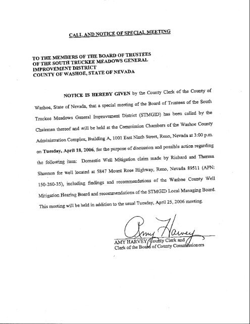
TO T}tE MEMBERS OF THE BOARD OF TRUSTEES<br />
oF THE sourn inucrcE MEADows GENERAL<br />
IMPROVEMENT -coulrv DISTRICT<br />
oF wAsEoE' STATE OF NEVADA<br />
NoTIcEISI{EREBYGfvENbytheCountyClerkoftheCounryof<br />
wasboe, State of Nevada, thar a special meeting of the Board of rrustees of the south<br />
Tnrckee<strong>Meadows</strong><strong>General</strong>lmprovemerrtDistict(STMGID)hasbeencailedbythe<br />
chairman rtrereof and will be held ar the commission chambers of the washoe county<br />
Adminisration complex, Building A, 1001 EastNinth sEeet', Reno' Nevada at 3:00 p'm'<br />
on Tuesday, Aprit 18, 2006, for the Purpose of discussion and possible action regarding<br />
rhe following item:<br />
Domestic weil Mitigation claim made by Richard and Theresa<br />
Shannon for well locared at 5841Morrnt Rose Highway' Reno' Nevada 8951I (APN:<br />
150-260-35),includingfindingsandrecommendationsoftheWashoeCountyWe}I<br />
Mitigation Hearing Board and recorrmendations of the STMGID Local Managing Board'<br />
ThismeetingwillbeheldinadditiontotheusualTuesday,Aprii25,20Q6meeting-<br />
A\'IY IIARVEY<br />
Clerk and
April 10,2006<br />
<strong>South</strong> <strong>Truckee</strong><br />
<strong>Meadows</strong><br />
<strong>General</strong><br />
<strong>Improvement</strong><br />
<strong>District</strong><br />
(sTMGrD)<br />
Local<br />
Managing<br />
Board<br />
TO:<br />
Board of Trustees<br />
<strong>South</strong> <strong>Truckee</strong> <strong>Meadows</strong> <strong>General</strong>mprovement <strong>District</strong><br />
Bob Larkin, Chairman<br />
Bonnie Weber, Vice Chairman<br />
Jim Galloway, Trustee<br />
David Humke, Trustee<br />
Pete Sferrazza, Trustee<br />
Steve Cohen<br />
Chairman<br />
Gerald Schumacher<br />
Vice Chairman<br />
Ellen Allman<br />
Secretary<br />
Lisa Cady<br />
Member<br />
Birnie McGavin<br />
Member<br />
Steve Cohen, Chairman, STMGID Local Managing Board<br />
Gerald Schumacher, Vice Chairman, STMGID Local Managing Board<br />
Ellen Allman, Secretary, STMGID Local Managing Board<br />
Lisa Cady, STMGID Local Managing Board<br />
Birnie McGavin, STMGID Local Managing Board<br />
Katy Singlaub, County Manager<br />
Michelle Poch6, Assistant County Manager<br />
Amy Harvey, County Clerk<br />
John Sherman, Director, Finance Department<br />
Ron Steele, Fiscal Analyst II, Finance Division<br />
John Rhodes, Deputy <strong>District</strong> Afforney, Civil Division<br />
Melanie Foster, Deputy <strong>District</strong> Attorney, Civil Division<br />
Steve Bradhurst, Director, Department of Water Resources<br />
NOTICE<br />
The Board of Trustees of the <strong>South</strong> <strong>Truckee</strong> <strong>Meadows</strong> <strong>General</strong> <strong>Improvement</strong><br />
<strong>District</strong> will hold a special meeting on Tuesdayo April 18' 2006. The meeting<br />
will be held at 3:00 p.m. in the Commission Chambers, Administration Building,<br />
1001 East Ninth Street, Reno, Nevada.<br />
Administration<br />
c/o Washoe County<br />
Dept. of<br />
Water Resources<br />
4930 Energy Way<br />
Reno. NV 89502<br />
(775) 9s4-4600<br />
FAX 954-4610<br />
SBiPOAT
AGENDA<br />
SOUTII TRUCKEE MEADOWS GENERAL IMPROVEMENT<br />
DISTRICT (STMGID)<br />
BOARD OF TRUSTEES<br />
BOARD OF TRUSTEES<br />
Bob Larkin, Chairman<br />
Bonnie Weber, Vice Chairman<br />
Jim Galloway, Trustee<br />
David Humke, Trustee<br />
Pete Sferrazza.Trustee<br />
COUNTY CLERK<br />
AmyHarvey<br />
Washoe Countv Commission Chambers - 1001 E. 9th Streef Reno, NV<br />
April18,2006<br />
3:00 p.m.<br />
NOTE: The Washoe County Commission Chambers are accessible to the disabled. If you<br />
require special arrangements for the meeting, please call the County Manager's Office, 328-<br />
2000, 24 hours prior to the meeting.<br />
Pursuanto NRS 241.020, the agenda for the Board of Trustees meeting has been posted at the<br />
following locations: Washoe County Administration Building (1001 E. 9'n Street), Washoe<br />
County Courthouse (Court and Virginia Streets), Washoe County Central Library (301 <strong>South</strong><br />
Center Street), Washoe County Department of Water Resources (4930 Energy Way), Sparks<br />
Justice Court (650 Greenbrae Dr.), Galena Market (19990 Thomas Creek Road), Galena High<br />
School (3600 Butch Cassidy Way), Steamboat Post Office (75 McCabe Dr.), and <strong>South</strong> Valleys<br />
Library, (15650A Wedge Parkway). The agenda has also been posted on the internet at<br />
http://www.washoecounty.us/water/stmgid. The meeting will be held at 3:00 p.m.' April 180<br />
2006, in the Commissioners' Chambers, Administration Building, 1001 E. Ninth St', Reno,<br />
Nevada.<br />
Supporting documentation provided to the Board of Trustees for items on the agenda is available<br />
for review to members of the public at the Washoe County Water Resowces Department (4930<br />
Energy Way, Reno, NV 89502).<br />
Unless otherwise indicated by asterisk (*), all items on the agenda are action items upon which<br />
the Board of Trustees mav take action.<br />
3:00 p.m.<br />
1. *Determination of Quorum.<br />
2. Approve agenda for the Board of Trustees meeting of April 18, 2006'
Board of Trustees Agendafor April 18, 2006<br />
3. Consideration and possible action on the recommendation of the STMGID Local<br />
Managing Board regarding Richard and Terri Shannon's claim for well mitigation<br />
(APNrs0-260-3s).<br />
4. *Public Comments: Two-minute time limit per person and limited to items not listed on<br />
the agenda. Public comment of two minutes per person will be taken on action items on<br />
the agenda.<br />
5. *Board, LMB, and Staff Comments (limited to announcements, requests for information,<br />
statements relating to items not on the agenda or issues for future agendas.)<br />
6. Emergency ltems.<br />
7. Adjournment.
SOUTH TRUCKEE MEADOWS GENERAL IMPROVEMENT<br />
DISTRICT (STMGID)<br />
DATE:<br />
TO:<br />
Sra.rF Rnponr<br />
BOARD MEETING DATE: APril 18, 2006<br />
April 10,2006<br />
Board of Trustees<br />
<strong>South</strong> <strong>Truckee</strong> <strong>Meadows</strong> <strong>General</strong> <strong>Improvement</strong> <strong>District</strong><br />
FROM: Paul Orphan, Engineering Manager, Deparhraent - of Water Resources<br />
g54-46i4,porphan@washoecount),.us<br />
{/r4>"<br />
THROUGH: Steve Bradhurst, Director, Department of Water Resourceslf-Vfi<br />
SUBJECT: Consideration and possible action on the recommendatioil of the<br />
STMGID Local Managing Board regarding Richard and Terri<br />
Shannon's claim for domestic well mitigation (APN150-260-35).<br />
Finance-Ql<br />
DAff-<br />
RiskMgt. D/A<br />
HR_n/q_<br />
Other_p4_<br />
SUMMARY<br />
On March 16,2006,the Well Mitigation Hearing Board (WMHB) made a finding<br />
(Attachment A) that the STMGID Production Well #6 (PW#6) caused 32 feet af<br />
unreasonable drawdown in the Shannon domestic well, and therefore recommended that<br />
STMGID reimburse 67%o of the mitigation costs. The cost of the hook-up fees to the<br />
Washoe County's water system is $8,352.80.<br />
County Priorities/Goals supported by this item: Preserve and Enhance Our Quality of<br />
Life - Effectively plan and manage use of our natural assets including water, air and open<br />
space. The Department of Water Resources will manage and protect regional water<br />
resources in a sustainable, cost-effective maruler.<br />
PREVIOUS ACTION<br />
SfVtCn aAopted a well mitigation policy (Attachment B) that considers each well<br />
mitigation claim individually. fn" policy calls for a claim for mitigation to be first<br />
submitted to the WMHB. Then the WMHB recommendation is submitted to the<br />
STMGID Local Managing Board (LIvIB). The LMB reviews the claim and WMHB<br />
reconrmendation and forwards a recommendation to the STMGID Board of Trustees.<br />
BACKGROUND<br />
On Novemb er 7,2005, the Shannons submitted a reimbursement claim against<br />
STMGID's PW#6. On March 16,2006, the WMHB determined that there was an<br />
unreasonable drawdown in the Shannon well to the extent of 67Yo due to municipal<br />
pumping. (See minutes - Attachment C). The Shannons attest that 48 feet (37'<br />
documented) of drawdown was caused by STMGID PW#6. The WMIIB finding stated<br />
that 10 feet of drawdown from the production well was reasonable,that 6 feet of<br />
drawdown was attributable to drought and other domestic well pumping, and that32 feet<br />
was attributable to unreasonable municipal pumping.<br />
Item 3<br />
Page 1
STMGID Board of Trustees Meeting of April 18, 2006<br />
Page 2 of 2<br />
FISCAL IMPACT<br />
The Shannons have decided to hook-up to the County's municipal water system rather<br />
than deepening their domestic well. The hook-up fees are $8,352.80. Sixty-seven<br />
percent of this cost is $5,596.38. Budget authority is located in cost center 674310'<br />
RECOMMENDATION<br />
tt is recommended that the STMGID Board of Trustees consider and take possible action<br />
on the recommendation of the STMGID Local Managing Board regarding Richard and<br />
Terri Shannon's claim for domestic well mitigation (APN150-260-35).<br />
POSSIBLE MOTION<br />
Should the Board wish to implementhe recommendation, a simple motion to approve<br />
would suffice.<br />
SB:JMC:PO:lr<br />
Attachments<br />
cc:<br />
Kathy Garcia, Comptroller<br />
Jim Jeppson, Risk Manager<br />
Ron Steele, Fiscal Analyst II<br />
Jerry McKnight, Finance and Customer Service Manager<br />
Ted Rolfs, Fiscal Compliance Officer<br />
Wendy Bennett, Accountant II<br />
Item 3<br />
Page2
Attachment A<br />
WASHOE COUNTY<br />
"Dedicated To Excellence in Public Seruice"<br />
www.co.washoe.nv.us<br />
Washoe County<br />
Well Mitigation<br />
Hearing Board<br />
4930EnerryWay<br />
Reno,NV 895024106<br />
Tel: (775) 954-4600<br />
Fax: (775)9544610<br />
Board Members:<br />
Roger Jacobson<br />
Pete Morros<br />
Karen Rosenau<br />
Greg Pohll<br />
David Carlson<br />
Legal Counsel:<br />
John Rhodes<br />
March 17,2006<br />
Mr. Steve Cohen, Chairman<br />
<strong>South</strong> <strong>Truckee</strong> <strong>Meadows</strong> GID Local Managing Board<br />
c/o Washoe CountyDepartment of Water Resources<br />
4930 Energy Way<br />
Reno, Nevada 89520<br />
Re: Washoe County Well Mitigation Hearing Board Findings of March 16'2006<br />
On March 16,2006, the Washoe County Well Mitigation Hearing Board evaluated the<br />
mitigation request of Richard and Theresa Shannon, 5847 Mt. Rose Hwy, Reno, Nevada.<br />
The Board acknowledged that the domestic well at this address is adjacent to the <strong>South</strong><br />
<strong>Truckee</strong> <strong>Meadows</strong> <strong>General</strong> <strong>Improvement</strong> <strong>District</strong> (STMGID) water utility service area.<br />
The Board made the following findings:<br />
The total drawdown in the domestic well is 48 feet. A reasonable lowering of the static<br />
water level due to municipal pumping is 10 feet. Unreasonable lowering attributable to<br />
municipal pumping at STMGID well #6 is 32 feet (67% of the total lowering) and the<br />
remaining 6 feet (I2% of the total) is attributable to drought and other domestic well<br />
pumping.<br />
According to program documentation, Board determinations are forwarded to responsible<br />
municipal water purveyors, domestic well owners and the Regional Water Planning<br />
Commission. Negotiation and final agreement on any mitigation measures are between the<br />
water purveyor and the domestic well owner. Please be advised that the program<br />
acknowledges the Nevada State Engineer's statutory authority and the parties' rights to<br />
refer the matter to the State Engineer at any time.<br />
Please contact me at 954-4657 with any questions or concerns.<br />
Sincerely,<br />
Jim Smitherman<br />
Water Resources Program Manager<br />
cc:<br />
Richard and Theresa Shannon<br />
STMGID Board of Trustees<br />
Regional Water Planning Commission<br />
Nevada State Engineer<br />
Steve Bradhurst<br />
Jeanne Ruefer<br />
John Rhodes Item 3<br />
Page 3
Attachment B<br />
POLICY FOR THE<br />
REIMBURSEMENT OF COSTS FOR<br />
DEEPENING DOMESTIC WELLS<br />
SOUTH TRUCKEE MEADOWS<br />
GENERAL IMPROVEMENT DISTRICT<br />
The <strong>South</strong> <strong>Truckee</strong> <strong>Meadows</strong> <strong>General</strong> <strong>Improvement</strong> <strong>District</strong> (STMGID) recognizes that the groundwater<br />
resources of the <strong>South</strong> <strong>Truckee</strong> <strong>Meadows</strong> are shared with domestic weil owners. If the Washoe County<br />
Wett Mitigation Hearing Board determines that the long-term pumping of a STMGID ptoduction well<br />
has causid deleterious water level decline in a domestic well, STMGID may compensate the owner a<br />
portion of the cost of deepening the well. The compensation will be for the drilling and construction cost<br />
only. The STMGID Board reserves the right to pay equivalent costs of well-deepening or an alternative<br />
water supply source.<br />
The policy is:<br />
1. A claim for reimbursement must lirst be submitted to the Washoe County lVell Mitigation<br />
Hearing Board The Hearing Board must make a determination that a STMGID production<br />
well has deleteriously impaired the pumping rate and duration of the impacted domestic well.<br />
2. STMGID will be responsible for up to 100 feet of well deepening unless conditions warrant<br />
otherwise as defined bv STMGID.<br />
3. Costs associated with the replacement of pump, pump column, electrical cables or other pump<br />
material will be the responsibility of the domestic well owner.<br />
4. Each claim for reimbursement will be reviewed independent of previous claims and will include<br />
the age of the well and its method of construction.<br />
5. STMGID will only compensate for the well deepening below the bottom of the existing domestic<br />
well.<br />
6. The well owner may be required to sign a hold harmless agreement releasing the <strong>District</strong> against<br />
any future claims by the owner.<br />
7. This policy does not apply if the well is illegally drilled or located improperly.<br />
8. Pursuant to N.A.C. 534.315, if a public supply water main is in reasonable proximity, the<br />
domestic well owner will be required to hook up to this water main.<br />
Approved by Local Managing Board on November 21,2005.<br />
Approval by Board of Trustees on December 20,2005.<br />
P:\STMGID\LMB\LMB Agenda ltems\2006\04-17-06\#7 ShannonVttach B well deepening-doc<br />
Item 3<br />
Prge 4
Attachment C<br />
Minutes of the Washoe County Well Mitigation Hearing Board<br />
Thursdav. March 16. 2006<br />
Members Present<br />
Pete Morros<br />
Roger Jacobson<br />
Members Absent<br />
Karen Rosenau<br />
StaffPresent<br />
Jim Smitherman<br />
John Rhodes, Legal Counsel<br />
Public Present<br />
Theresa Shannon<br />
Birnie McGavin<br />
David Carlson<br />
Mike Widmer<br />
Jeanne Ruefer<br />
Richard Shannon<br />
Greg Pohll<br />
Paula Valentin<br />
Gail hockish<br />
Michael DeMartini<br />
DETERMINATION OF QUORIIM - Chairman Jacobson called the meeting to order at 6:07 p.m.<br />
There was a quorumpresent. He introduced the newest Board member, David Carlson.<br />
APPROVAL OF THT AGENDA - Mr. Morros made a motion to approve the agenda as posted. Mr.<br />
Pohll seconded the motion, which carried unanimously.<br />
REVIEW, AMENDMENT AND APPROVAL OF MINUTES - The minutes of the December 6,2005<br />
and the February 7, 2006 meetings were submitted for approval. Michael DeMartini referred to the<br />
December meeting and reported that he had reviewed the minutes and tapes, which he added were very<br />
difficult to understand. He referred to page 2, paragraph 4 and other paragraphs and requested that he be<br />
referred to as an individual. He referred to a comment and clarified it should say "Mr. DeMartini stated<br />
that his concern is that when the Board was recommended for approval by the RWPC to the BCC...".<br />
He next referred to page 3, paragraph 4 and referred to the comment, "some exhibits that showed<br />
wastewater use on some one-acre lots was less than 0.2 acre-feet per year". He stated that he would like<br />
to see more detail in the minutes and offered to provide his comments in writing in the future.<br />
Chairman Jacobson clarified that the minutes are a sumrnary of what occurred at the meeting; they are not<br />
meant to be a court record or verbatim. He added that the intention is that the final recommendations are<br />
captured accurately. Mr. Morros suggested that if anyone requires more detail than the minutes provide,<br />
they could borrow the tapes from the meeting. Mr. Morros made a motion to approve the minutes of the<br />
December 6, 2005 and the February 7, 2006 meefings as submitted. I{r. Pohll seconded the motion,<br />
which carried unanimously.<br />
PIIBLIC<br />
COMMENT<br />
None.<br />
Item 3<br />
Page 5
Minutes of the Washoe County Well Mitigation Hearing Board, March 16,2006 Page 2 of 12<br />
BUSINESS OF TIIE DAY<br />
1. Review and possible approval of revised criteria and procedure for determining what<br />
constitutes a reasonable lowering of the water level, and what constitutes an unreasonable affect<br />
on a domestic well caused by municipal uses, and possible direction to staff.<br />
Chairman Jacobson reported that this item had been postponed until Mr. Carlson could be present. John<br />
Rhodes distributed handouts. He apologized for not providing the documents in advance and summarized<br />
the details. He referred to the "Role of the Well Mitigation Hearing Board" and explained it was created<br />
as a result of the workshop held during the October meeting with Hugh Ricci, State Engineer. The three<br />
main points of the Board's role are:<br />
r To hear and consider evidence regarding whether there are unreasonable adverse affects on a<br />
domestic well caused by municipal pumping<br />
. To determine the portion of the total lowering of the static water level caused by municipal<br />
pumping that is reasonable and if applicable, to consider what portion is considered<br />
unreasonable considering what portions of the total are due to drought, other domestic wells,<br />
other permitted pumping and other causes<br />
o To make findings and provide recommendations to the water purveyor as to the percentage of<br />
unreasonable adverse affects beyond a reasonable lowering of the static water level that is<br />
atbibutable to municipal pumping<br />
Mr. Modes next referred to the o'Factors to Consider", which he explained are factors determined by this<br />
Board in organizational meetings as items to be reviewed in terms of evidence. He next referred to<br />
"Analysis", which he prepared as requested by this Board to provide assistance with defining what is<br />
"reasonable". The next document is entitled, "Forms of Motions" that could be used by the Board. Mr.<br />
Rhodes explained that it is a revised document that the Board has not yet seen.<br />
Mr. Rhodes referred to the handout on motions and explained the changes that were made. He explained<br />
that the Role of the Board is the document that needs approval; the remaining documents are to provide<br />
informational assistance. Mr. Morros stated he would be comfortable adopting the document as a<br />
guideline rather than being locked into it. Mr. Rhodes clarified that the document had been approved by<br />
this Board previously; however, the document was revised based on the workshop with the State<br />
Engineer. He added that the document could be adopted as a guideline if desired and the name could be<br />
changed to "Guidelines of the Well Mitigation Hearing Board". Chairman Jacobson stated he thought the<br />
document was a good modification.<br />
Mr. Morros stated he would never be comfortable with identifoing specifically by number the<br />
unreasonable lowering of the water table. Mr. Morros made a motion to adopt the guidelines as general<br />
guidelines while allowing the Board to make independent judgments on each case. Mr. Carlson seconded<br />
the motion.<br />
Theresa Shannon stated she is speaking as a member of the public and added that in the past she<br />
represented domestic well owners through a group called the Mt. Rose Well and Water Protection. She<br />
reported that she is an applicant on tonight's agenda. She stated she is not uncomfortable with the<br />
language; however, she was concerned that the policies of this Board (even though it was approved well<br />
over a year ago) are still in the process of being defined on the very night that a decision would be made<br />
on her particular issue. She stated she hoped there would be some consistency and added that if you read<br />
through the minutes, it appears that the policies regarding mitigation have changed almost monthly. She<br />
went on to say that she hopes if this document is adopted, that the Board finds medium ground and is able<br />
to use the guidelines consistently on a case-by-case basis.<br />
Item 3<br />
Page 6
Minutes of the Washoe County Well Mitigation Hearing Board, March 16,2006 Page 3 of 12<br />
Mr. Pohll agreed and added that consistency is the main reason behind the guidelines. He added that it<br />
would help the Board to determine what their role is and to form their opinions. Mr. Morros stated he<br />
agreed with Ms. Shannon's comments and feels it is time to "tighten the screws down" and try to be as<br />
consistent as possible. He added that he has a lot of years of experience but it can still be confusing.<br />
Chairman Jacobson stated he felt the policy has always been the same; however, the way the factors have<br />
been considered has changed from the beginning. Mr. Morros stated the hardest issue is "What is the<br />
reasonable lowering of the water table?" Chairman Jacobson stated it would be appropriate to review the<br />
guideline document prior to any motion being made.<br />
Chairman Jacobson called for the vote on Mr. Morros'motion, which carried uranimously.<br />
2. Hearings on applications for well mitigation, including possible decision and direction to staff:<br />
a. Wendy Pierce, APN 049-090-12'15992 Mt. Rose Ilighway<br />
(Utility Service Area: Washoe County Department of Water Resources)<br />
Wendy Pierce was not present. Chairman Jacobson requested this item be tabled and move to the second<br />
applicant as he wanted Ms. Pierce to have an opportunity to speak to the Board. This will appear at a<br />
future WMIIB meeting.<br />
b. Richard and Theresa Shannon, APN 150-260-35,5847 Mt. Rose Highway ptility<br />
Service Area: Washoe County Department of Water Resources and <strong>South</strong> <strong>Truckee</strong><br />
<strong>Meadows</strong> <strong>General</strong> <strong>Improvement</strong> <strong>District</strong> (STMGID)<br />
Jim Smitherman gave an overview of the packet information for the Shannon's well. He reported that the<br />
Groundwater Data Center (GDC) had developed a summary. The original well was drilled in March 1980<br />
to a depth of 297 feet, with a static water level of approximately 248 feet below land surface. The well<br />
had 49 feet in the casing at the time of conskuction. There are two homes serviced by the well.<br />
According to the Assessor's database, the primary home was built in 1963 and the second was built in<br />
1982. In 1988, the Shannons were granted a special use permit to convert a mother-inlaw unit to a<br />
detached accessory dwelling. A meter was installed on the well and the Shannons were regulated to not<br />
use more than 1,800 gallons per day by Statute as well as the Washoe County <strong>District</strong> Health Department<br />
and later by the Community Development department.<br />
Mr. Smitherman reported the permit from the Health Department stated that the well owners would allow<br />
the State Division of Water Resources to read the meter, although when he contacted them, they stated<br />
they had no record of a request to read the well meter. He stated that in March 2002 McKay Drilling<br />
performed a pump test on the well. The static water level was measured at 263 feet below land surface.<br />
The well was pumped for one hour at 9.5 gallons per minute (gpm) and the pumping level in the well<br />
dropped three feet to 266 feet below land surface. The static water level in 1980 was recorded at248 feet<br />
below land surface. He summarizedthatthe total drop in the static water level was approximateb 15 feet<br />
in22years, or an average of 0.68 feetperyear.<br />
Mr. Smitherman reported that included in the packet was a document titled, "Richard and Theresa<br />
Shannon Supplemental Information", which includes service records and a letter from Washoe County'<br />
Mr. Smitherman reported that in the Govemment Lots, very few wells were drilled before the 1980s. The<br />
GDC located a well log for an irrigation well located at 5852 Mt. Rose Highway, which is approximately<br />
2,300 feet north of the subject properfy. The irrigation well was drilled in 1959 to a depth of 120 feet in<br />
volcanic and granitic sand. The static water level at that time was 98 feet below land surface and an<br />
Item 3<br />
Pzgel
Minutes of the Washoe County Well Mitigation Hearing Board, March 16, 2006 Page 4 of 12<br />
adjacent well was 148 feet below land surface; therefore, from 1959 to 1989 the water table dropped<br />
approximately 50 feet, or approximately L66 feet per year.<br />
Mr. Smitherman stated that the water table in the subject area has fluctuated over time and was declining<br />
during the thirty years prior to construction of STMGID well numbers 5 and 6 and Tessa wells I and 2.<br />
He added that most of the welis in the Government Lots were drilled between 1985 and 1995, many of<br />
which were drilled in bedrock. The average static water level for wells drilled in bedrock in the southern<br />
portion of the Govemment Lots in the early 1990s was approximately 240 to 250 feet below land surface,<br />
which is consistent with the information on the applicant's well.<br />
Mr. Smitherman reported the Tessa wells began service in 2003. He added that the hydrograph for Tessa<br />
I shows no decline and the hydrograph for Tessa 2 shows a fluctuation in the pumping level.<br />
Hydrographs for STMGID wells 5 and 6 between 2002 and 2005 show pumping level fluctuations in the<br />
water table, with a decline of approximately 19 feet in number 5 and 7.5 feet in number 6. He reported<br />
that STMGID 6 is the closest production well to the subject well, which is approximately 3,100 feet to the<br />
northeast. Tessa 2 and ArrowCreek 3 wells are also within one mile of the subject parcel.<br />
Mr. Smitherman reported that the applicants claim their well failed in August 2005. The applicants also<br />
stated that at that time, their pump was lowered to the bottom of the well but they were still unable to<br />
pump water. Mr. Smitherrnan continued that in August 2005, the static water level in the well was 284<br />
feet below land surface and the total depth of the well was297 feet for a saturated thiclness in the well of<br />
13 feet.<br />
Mr. Smitherman next reviewed the general information for the subject area. There are approximately 530<br />
domestic wells in the Government Lots, of which approximately 45 have been converted to municipal<br />
water in the last three years. The average metered home in the area uses approximately .84 acre-feet per<br />
year. Septic system recharge for the area is estimated at .22 acre-feet per year. The State Engineer's<br />
office estimates a total water use for domestic well owners at I.l2 acre-feet per year. The total amount of<br />
water withdrawn by 490 domestic wells using that estimate is 548.8 acre-feet per year. The same number<br />
of homes estimated by using a .62 acre-feet estimate equals about 303-304 acre-feet per year.<br />
Mr. Smitherman reported that monitoring wells in the Government Lots that appear to have the highest<br />
rate of decline are located closer to STMGID 6. The Melarkey well, which is located close to STMGID 6<br />
has been measured since 1989 and shows an average decline in the water table from 1989 to 2002 of L67<br />
feet per year. He reported that two of the wells that show a decline in the water table of less than one foot<br />
per year (similar to the Shannon's well) showed an increase in the water level during the years with above<br />
average precipitation.<br />
Mr. Morros asked about two homes being served by a single well. He added that State water law requires<br />
a permit if more than one single-family dwelling is to be served by one well. Ms. Shannon reported she<br />
would address that issue in her comments.<br />
Chairman Jacobson stated that in general he prefers to see for example 0.84 as opposed to .84 because it<br />
is sometimes difficult to read the copies. He also recommended rounding the number of feet rather than<br />
using decimals. He referred to the comment that the applicant was required to not use more than 1,800<br />
gallons per day although the meter had not been read. Mr. Smitherman explained that there was not a<br />
requirement that the meter had to be read. He clarified the permit was issued by the Washoe County<br />
<strong>District</strong> Health Department.<br />
Mike Widmer, Hydrogeologist with Washoe County Deparknent of Water Resources (DWR), stated he is<br />
representing the water purveyor, STMGID. He noted that Birnie McGavin, a member of the STMGID<br />
Local Managing Board was present if anyone had questions. Mr. Widmer stated in his opinion the<br />
Item 3<br />
Page 8
Minutes of the Washoe County Well Mitigation Hearing Board, March 16,2006 Page 5 of 12<br />
Shannon well was affected more by drought than municipal pumping. He distributed a memo (and<br />
apologized that is was not included in the packets). He reported that the State Engineer's office had<br />
provided precipitation data. He referred to the first graph, which shows four curves, the first three of<br />
which are average precipitation volumes from three different gages for the period of 1970 through 2004.<br />
The fourth curve calculates the five-year moving average. He explained the other graphs, of which the<br />
goal was to show the water level measurement data from the past. He summarizedthat the water levels<br />
were very representative of the annual precipitation in the form of groundwater recharge. He explained<br />
that the final graph is the SNOTEL data, which he stated showed excellent correlations befween<br />
groundwater levels and precipitation.<br />
Mr. Widmer distributed another document that will be included in the record that shows water levels for<br />
the First Aid Well, the Timberline Well and the Schuerman well (which is a domestic well located across<br />
the street from the Shannon well). He summarizedthat he thought the graphs show good correlation<br />
between the three wells, which he feels are totally related to drought conditions. He added that he thought<br />
the Schuerman well was similar to the Shannon well although it is 40 to 50 feet deeper. He went on to<br />
say that using the Schuerman well measurements he compared it to the Shannon well and synthetically<br />
reproduced a curye that could represent water levels over a four to five-year period for the Shannon well'<br />
He summarized thathe felt that most of the decline in water level in the Shannon well was related to the<br />
precipitation levels and not municipal pumping.<br />
Discussion ensued over the location of the monitoring wells in relation to the subject well and the<br />
municipal wells and associated water levels. Chairman Jacobson stated he was not sure how to handle the<br />
new information that Mr. Widmer provided as it was different from what was presented in the packet.<br />
Chairman Jacobson asked the applicants to state their case. Ms. Shannon distributed copies of her<br />
comments for the record and then reviewed them for the WMHB. She stated there were some minor<br />
word issues in the County summary that she might take exception to. She stated that they are living<br />
without running water in their home. She explained that water supplied to her well prior to the first<br />
required recording of their comrnunity well agreement filed with the County Recorder even though<br />
recorded in 1980, does not mean that it only began to exist at that time. The agleement called for its<br />
provision of water to several homes; the number changed each time a new home dug its own well and<br />
became self-sufficient.<br />
Ms. Shannon reported that copies of all documentation were included in her packet. She agreed that the<br />
well was drilled in 1980 to a depth of 297 feet, with a static water level of 248 feet with two homes using<br />
that water source, prior to current legislation that says that two homes cannot be served by the same well.<br />
She added that the well had 49 feet of sustainable static water supply at the time of construction. She<br />
went on to say that all the systems on their property were brought into conformance when they purchased<br />
the home and it was approved by the Board of County Commissioners July 13, 1998. She continued that<br />
per that order, a meter was installed on her well, which indicates usage of .58 acre-feet annually since it<br />
was installed. She reported that the meter indicates a total usage of 1,146,550 gallons, which equates to<br />
4.09 acre-feet over the entire seven years, which equates to .58 over the seven-year period being used by<br />
both homes. She added that number does not take into consideration the septic recharge of .22, which<br />
would put their actual usage at .36 acre-feet taken from the aquifer. She summarized that her property<br />
with the two homes has used less water than the average home countywide'<br />
Ms. Shannon mentioned the resale value of the water when she signed the well credit form and asked<br />
what it really means. She reported that she has already signed and had notarized the well credit form and<br />
provided copies, although it was signed provisional that they would actuaily receive the water' She<br />
ieiterated that her property has two homes, yet she is allocated for private domestic use of 2.02 acre-feet'<br />
She stated that issues have come up this week with their local Citizens Advisory Board (CAB)<br />
representative that say that since there are two houses on one parcel, the allocation could be for 4.04 acre-<br />
Item 3<br />
Page 9
Minutes of the washoe county well Mitigation Hearing Board, March 16,2006 Page 6 of 12<br />
feet. She added she has not had time to research that issue with the State Engineer's office. She went on '<br />
to say that water rights are currently selling for up to $80,000 and the water purveyors in the area are<br />
buying them. She urrca if it only takes a dedication of .62tobuild a subdivision home, doesn't that mean<br />
ttrat oir county is going to be a6le to serve three more homes with the signing 9f<br />
tl,rat well oredit form.<br />
She asked doisn't that mean that there would be an additional $180,000 with the hookup fee for each<br />
home bringing in an additional $16,000 plus the charges for water use at approximately $60 per month.<br />
She asked by selling the water and hooking her up, doesn't the County stand to bringln close to $200'000<br />
plus a *otrthly residual of close to $240 pir month for water usage. She stated she thinks this more than<br />
covers the infrastructure oost to bring them water'<br />
Ms. Shannon referred to monitoring well statistics and stated they have numerous times requested to have<br />
Washoe County DWR regularly r"ud h"r meter as part of their monitoring program. She quoted within<br />
many letterr pttrrid.d in ttre pactet and STMGID Local Governing Board minutes,-they were declined to<br />
have their meter read by D-wR and STMGID. She quoted a DWR Hydrogeologist, "Our office is<br />
currently measuring Mafy Schuerman's well across the street from your home. This well provides us<br />
adequate information ott tit" water level in your immediate area." Ms. Shannon stated that it was further<br />
substantiated on April 16, zOO2 in a letter containing data thus far on all the monitoring wells in their<br />
area. The letter reassured them that they would not be held umesponsive for a lack of properly<br />
documented well readings when the mitigation time came. She added that along with Schuerman,<br />
Stephens, Melarkey, Quinn, Shepard, Nixon, Hunt, Kitchen, Brokaw, Rummler, Moassessi, they expect<br />
to be mitigated.<br />
Ms. Shannon referred to the County's report and stated she assumes that if they approved mitigation, they<br />
proved a deleterious impact on those domestic wells. She added that later she would provide a map<br />
showing that those wells circle her properly. She referred to the County's report, which states "Water<br />
levels have declined over twenty years ten to twenty feet. Several other neighbors were on the monitoring<br />
system, such as Mr. Kitchen." She stated that the August 20,2001 STMGID minutes state, "It is the<br />
domestic well owner's responsibility to continuously monitor their wells but that only 10 to 20%o actually<br />
do this." She stated she thinls that since 1995, she has paid just about every other year to have their well<br />
monitored in order to come to this meeting prepared. She added that in addition to monitoring, the meter<br />
should prove what water they have been t sittg- She explained that they believe that DWR and STMGID<br />
had an idequate sampling of their area and accepted their declination to monitor their well. She went on<br />
to say that of the wetts tttat failed, 15 of the 16 have been mitigated and paid for well failure. She stated<br />
that per the STMGID minutes, Mr. Dowling was declined due to "moving too quickly" without following<br />
the correct steps to be mitigated. She added that the minutes also said, "He had not waited to have his<br />
well fail." She stated that there was a ruckus at the meeting over discussion of whether a well owner had<br />
to actually wait for his/her well to fail before requesting mitigation.<br />
Ms. Shannon stated it is highly dishessing to have a final sunmary for their mitigation hearing, which<br />
cites statistics for wells in a parameter including areas of their aquifer, which are responding to pumpage<br />
completely different from their area. She addedthat in the old Government Lots there are not 530 homes.<br />
She iead hom the packet, "There are approximatdy 26 wells measured twice a year in the Government<br />
Lots.,' In 2001 a DWR point person .nt-itt"d a list to the STMGID Local Managing Board showing 40<br />
wells that were thought io eventually need to be deepened or replaced due to impact from STMGID well<br />
6. She stated that tire statistics being used are in a completely different hydrobasin when Callahan Ranch<br />
is iumped with the oid Government tract. She explained those wells tend to be 30 feet deep and have a<br />
complitely different reaction to pumpage. She added it is upsetting to see those wells cited rather than<br />
those agreed-upon during negotiations for their specific area when this Board was created.<br />
Ms. Shannon next referred to a diagram of where their home is situated in the center of the monitoring<br />
and ..the wells which have been miiigated". She stated that the STMGID Board compiled a list, which<br />
shows 30 of the approximately 40 homes affected by STMGID 6 pumpage. She added that in further<br />
Item 3<br />
Page 10
Minutes of the Washoe County Well Mitigation Hearing Board, March 16,2006<br />
PageT of12<br />
meeting minutes, it has been stated that her well was situated in the middle of the wells and it was left off<br />
because the driller's logbook did not have any record of their well. She stated they were led to believe<br />
that after providing all the records of the well and statistics of all their neighbors, it would be the same<br />
used to mitigate their case. She continued that she believes the County has put forth valor attempts to<br />
deal with budgetzry impacts and administrative prices caused by all the pumpage in the <strong>South</strong> <strong>Truckee</strong><br />
<strong>Meadows</strong> regarding private domestic well owners once they learned that the actual mitigation policies<br />
were going to have to be revised. She stated the policies have been changed so often that there has never<br />
been a sense of reliability of relief to the impacted well owner. She stated the only reason some of the<br />
well owners have been able to continue to live in the area is the belief that truth will prevail and that right<br />
will be done and that there is fairness in government.<br />
Ms. Shannon refened to a chart that shows that from 1980 to 1994 their well had sustainable recharge and<br />
a static water level of 248 feet over a fifteen-year period in and out of drought times. She added this<br />
shows that they had a sustainable water supply that was recharging with a zero rate of decline in their<br />
well. She reported that most of the increase in private domestic wells in their area took place during that<br />
period (prior to 1995) of time with little or no affect on her static water level. From 1994 to 2005, she<br />
reported that her well lost a documented 48 feet of static water level while during the same period;<br />
STMGID 6 increased their pumpage seven-fold. She stated that caused a rate of decline in her well of 4.8<br />
feet annually over the last ten years. She went on to say in2004, the budget was approved and the Phase<br />
2 extension to the Govemment Lots was approved.<br />
Ms. Shannon reiterated that up until 2004, she was a member of the Groundwater Task Force and it was<br />
their belief that when the STMGID Local Managing Board approved the acceptance of the bid to bring<br />
the pipe to their home, that their job was done. She stated that they were told there was no need to<br />
reapply since the County knew they wanted water. She added that her packet included a copy of a letter<br />
from Mr. Widmer stating that it had been approved.<br />
Ms. Shannon reported that to date, their out of pocket expenses are $850 to trench, $306 for sand, $6,400<br />
for the refitting of the well abandonment, $145 for the permit to the Health Department, the cost for<br />
lowering the pump fwice, the loss of rent because they lost their tenants in December when they no longer<br />
had water. She stated they were led to believe they would have water within a week or two. She added<br />
the Counfy is asking that they pay $8,352.80 to hook up to the water system. She went on to say if the<br />
pipe had been provided in 2004, that hookup fee would have been substantially less. She stated that<br />
living without water from December 4,2005 to March 16,2006 is priceless. She summarized that the<br />
total expenses to be mitigated are $22,936.03. She included what the fan looked like when they moved to<br />
the property in 1995. She stated the lawn for their rental is gone and now rock. She added that they<br />
survived droughts for thirty years prior to STMGID 6 going in. She stated she would be happy to<br />
entertain any questions.<br />
Chairman Jacobson stated the Board appreciates the Shannon's issue and clarified that the WMHB's<br />
charge does not relate to the hookup fee but rather the impact from the municipal well. He asked what<br />
her fifteen neighbors had done to hook up to the system. Ms. Shannon clarified they were mitigated; they<br />
may have deepened their wells.<br />
Mr. Morros asked if they could defer a decision to the next meeting in two weeks due to the additional<br />
information received tonight. Richard Sharu:on stated that they have been without water for three months<br />
and would like a decision tonight. Ms. Shannon added they do not have the money to hook up and stated<br />
this Board's decision is critical as to whether they receive mitigation. Mr. Rhodes clarified that this<br />
Board makes a determination of responsibility for unreasonable drawdown based on municipal pumping,<br />
not mitigation amounts. Ms. Shannon stated she believes the equipment has been sitting at the end of her<br />
road with the pipes pending a decision by this Board. Mr. Rhodes stated that the equipment moving in<br />
Item 3<br />
Page 11
Minutes of the Washoe County Well Mitigation Hearing Board, March 16,2006 Page 8 of 12<br />
has nothing to do with the decision of the WMIIB. Mr. Smitherman stated he checked with the engineer,<br />
who stated they were waiting for the weather to clear and the connection fee in order to proceed.<br />
Mr. Morros asked Mr. Widmer if there was a resolution. Mr. Widmer stated the issue as he sees it is,<br />
"Has there been any municipal impact from STMGID 6 on the Shannon well?" He added that based on<br />
the information on the water levels and the Shannon well, it needs to be determined what drawdown is<br />
due to STMGID pumping, what is a reasonable lowering due to municipal pumping, and whether drought<br />
has played alarge part in affecting the private wells.<br />
Chairman Jacobson refered to the data provided by the Shannons tonight and asked if Mr. Widmer feels<br />
the information is consistent with that of other wells in the area. Mr. Widmer stated he would like to see<br />
the actual water level measurements that were taken. He added that having very little experience with the<br />
Shannon well, that a pump contractor has the means to measure water levels; however, they would need<br />
to physically pull the pump out of the casing a few feet in order to get a probe down. He added that a few<br />
years ago, he'd sent someone out to measure the Shannon well that was unable to get a measurement but<br />
he was unsure why. He stated it is his opinion that there are four representative water levels that have<br />
been taken on the Shannon well. He stated he would refer the Board to the measurements taken by<br />
McKay Drilling. He added that the four measurements would include the first one from 1980, the April<br />
2001 level of 252 feet, the March 2A02 level of 263, and the July 2005 level of 285 feet. Ms. Shannon<br />
stated the last level was296 feet when the pump was lowered to the bottom of the well (later in 2005).<br />
Chairman Jacobson referred to the pump test that showed the well pumping 9.5 gallons per minute with a<br />
drawdown of three feet. He stated that it is a pretty good well to do that, especially if it is located in<br />
bedrock.<br />
Mr. Widmer stated he finds it difficult to believe the well would have dropped another 11 feet in a couple<br />
of months because in the Schuerman well, which was measured recently, the water level had acfually<br />
increased.<br />
Mr. Carlson asked how much impact should be seen from STMGID 6 and if a cone of depression had<br />
been studied for impact. Mr. Widmer stated that DWR does not normally run that particular calculation.<br />
Mr. Carlson asked if we could go back and run those numbers in an effort to clear up some of the<br />
questions. Mr. Widmer stated he hesitated to do that because STMGID 6 is in the alluvial layer and the<br />
Shannon well is in the hard rock aquifer.<br />
A ten minute recess was heldfrom 7:49 p.m. to 7:59 p.m.<br />
Chairman Jacobson referred to the well log, which indicates that the material at the bottom of the well is<br />
brown clay and granitic boulders. Mr. Carlson explained that you could argue the case either way as to<br />
whether the well is located in fractured bedrock/volcanic or alluvial material.<br />
Mr. Morros referred to the Nevada Revised Statutes, NRS 534.185 regarding more than one home being<br />
connected to a domestic well and stated there is a waiver. He read, "The State Engineer shall upon<br />
written request and receipt of a written agreement between the affected properfy owners waive the<br />
requirements of this chapter regarding permits for the use and development of trnderground water from a<br />
well if the well existed on July 1, 1983 or prior to that," He added it is to be used solely for domestic<br />
purposes by not more than three single-family dwellings and each does not draw more than 1,800 gallons<br />
of water per day. He stated he assumes that under the Statute, the agreement was between the Shannons;<br />
therefore, if they decided to sub-divide the property he recommended they make sure to enter such an<br />
agreement with the new owner. Ms. Shannon explained that she was told she did not need to get a waiver<br />
and summarizedthatthey had followed all the legal processes.<br />
Item 3<br />
Parge12
Minutes of the Washoe County Well Mitigation Hearing Board, March 16,2006 Page 9 of 12<br />
Ms. Shannon requested that Board members review page 35 of their application packet where the gravel<br />
pack for the well is discussed. Mr. Carlson explained that water was hit at 250 feet and the well was<br />
perforated at 257 feet. He stated that the well should have been drilled deeper than 300 feet. Ms.<br />
Shannon stated that in 1996 and 1997 she spoke with DWR about the depth of the well and how long it<br />
would last. She stated she was told it depended on the history of the well from 1965 to 1980. She stated<br />
she reviewed it with DWR staff and the assumption was that 50 feet of water in the well was pretty good.<br />
Mr. Carlson stated their well was probably one of the first wells drilled in the area and as more wells are<br />
drilled in the area, 50 feet was probably not deep enough.<br />
Chairman Jacobson stated that the diagram shows the pump at 11 feet from the bottom of the well' Ms.<br />
Shannon explained that was an early diagram and the new handout she provided shows the pump had<br />
been relocated to one foot from the bottom of the well.<br />
Mr. Widmer requested going back to the hard rock issue and stated some of the other well logs indicate<br />
that they were in volcanic rock/fractured bedrock. He added that Ms. Shepard redrilled her well, as did<br />
Mike Dowling. He stated the volcanic layers could vary in depth because they were formed by lava<br />
flows. Chairman Jacobson summarized that whether the Shannon well is in fractured bedrock or not,<br />
STMGID 6 is located in the alluvium.<br />
Mr. Pohll referred to page 74 inthe packet and the Kitchen well and asked Mr. Widmer if they could use<br />
the information from the Theis equation as a calculation of drawdown since it is three parcels away from<br />
the subject well. Mr. Widmer stated in this case he would be uncomfortable using the equation due to the<br />
different materials. Mr. Carlson referred to page 97 and the Schuerman well and stated that the test on<br />
that well shows that there could be more alluvial material than what is thought for the Shannon well area.<br />
He summarizedthat the Theis equation could be applicable.<br />
Mr. Widmer suggested that Board members could refer to Figure 2 on page 2, which shows the<br />
determinations made by the WMHB at prior meetings. He referred to the Melarkey, Meyers and<br />
Rummler wells, which are in close proximity to STMGID 6. He reported that recommendations for<br />
mitigation on those wells were 100% of the drilling costs or hookup fees. He added that on the<br />
Minnaberry well, this Board recommended that 75% of the drilling costs be reimbursed. He went on to<br />
say that south of the Shannon's property is the Winnard property, for which this Board recently found<br />
there was no unreasonable drawdown due to municipal pumping. Ms. Shannon stated that she would like<br />
to include documentation that the Stephens have been mitigated; however, they are not listed on the map.<br />
She added that Mr. Quinn was paid in full but not shown on the map. She clarified they were mitigated;<br />
however, Mr. Widmer stated they did not come before this Board. Ms. Shannon then reviewed her<br />
handout, which showed all the wells in her neighborhood that were mitigated through STMGID' She<br />
summarized that 14 people around their property have received some mitigation.<br />
Chairman Jacobson commented on the pumping from STMGID 6, which stayed pretty level until about<br />
1995, when they started increasing the pumping notably in 1996. He stated it looks like it then started to<br />
affect the private wells. He added that the aquifer was not rebounding like it should have been. He stated<br />
the calculations showed potentially 20 feet of drawdown (1982 to 2002) and although STMGID does<br />
have the right to some drawdown, the impact looks to be above what it should have been.<br />
Birnie McGavin referred to STMGID 6 and a State Engineer's report from February 2002, which goes<br />
into detail on the well. He stated the report could probably answer any questions. Ms. Shannon made a<br />
comment that the document was included in her packet. Mr. McGavin reported that the State Engineer<br />
summarized at the end of the report that the well is only being pumped at about 70% of what the water<br />
rights provide for and essentially, it is not being overpumped. Chairman Jacobson stated there are two<br />
definitions of what constitutes overpumping; one that pumping is not exceeding the water right, the other<br />
being the impact to the local area. He added that this Board's charge is to determine the impact to others<br />
Item 3<br />
Page 13
Minutes of the Washoe County Well Mitigation Hearing Board, March 16,2006<br />
Paee 10 of 12<br />
from municipal pumping. Ms. Sharmon clarified that she only referred to the report in her packet;<br />
however, she did not include it. Mr. Morros stated that the report is four years old and things could have<br />
changed since that time.<br />
Michael DeMartini reported that procedurally in the past Mr. Smitherman would present the summary of<br />
information on the case; the water purveyor would then spealg followed by the applicant, and then public<br />
comment. He stated he thought Ms. Shannon's calculations were very acctrate and conservative' He<br />
mentioned her earlier comment regarding 2.02 acre-feet versus 4.04 based on there being two homes on<br />
the well. He added that the consumptive impact would be 0.14 acre-feet of water, which is very small as<br />
far as her well is concerned. He stated these are the fypes of numbers he comes up with in his studies,<br />
which makes the 500 acre-foot domestic well impact that staff mentioned or 303 acre-feet could possibly<br />
be only half that number or 150 or so. He added that when a person is looking at relative impacts, they<br />
need to consider the possibility that the actual domestic wells are using much less water.<br />
Mr. DeMartini commented on the supplemental graph submitted by Mr. Widmer tonight and stated that in<br />
reviewing the five year moving average, in looking at the peak levels the groundwater levels dropped<br />
rather than responding to the increased precipitation levels in 1999 as they did in 1984. He stated he<br />
thought it was important to examine why the groundwater levels responded differently.<br />
Ms. Shannon summarized that it is important for members to remember the earlier mitigation decisions,<br />
which included the charts and the hydrological impacts. She stated she hoped the Board would be able to<br />
conclude their thoughts faster based on that history. She added that her hope is that the Board would find<br />
in her favor. Ms. Shannon again referred to the letter from the State Engineer and reported it was an<br />
outcome from a meeting between domestic well owners, the State Engineer, and DWR to encourage the<br />
State Engineer to define what is a "reasonable lowering of the water table". She explained that he<br />
declined to define that as a general rule and instead stated that it had to be decided on a case-by-case<br />
basis. She added that he did acknowledge there is a problem in the subject area.<br />
Chairman Jacobson referred to the letter and a comment that the State Engineer noted he has concluded<br />
that recent drought cycles and other groundwater development has contributed at least ten feet of static<br />
water level decline in the eastem Sierra range front.<br />
Mr. Carlson referred to the attachment to the letter from February 14,2002, which projected water level<br />
drops based on pumping from STMGID 6 and stated that it shows scenarios using one set of criteria of<br />
19.5 feet, another showing around thirty-something feet of drawdown to a worst case scenario being 55 to<br />
60 feet of drawdown. He added that the State Engineer probably used it as his guesstimate. Ms. Shannon<br />
stated they were not attachments to the letter; they were in addition to the letter. Mr. Rhodes stated the<br />
letter referenced the at|achments on page three and on the signature page.<br />
Chairman Jacobson stated it does not matter what attachments were included with her letter but that it<br />
provides information for the Board to make decisions. He added that he is looking for a motion to<br />
determine whether there is some impact to the subject well to start the process. Mr. Pohll asked if they<br />
could discuss numbers without a motion, to which Chairman Jacobson replied yes.<br />
Mr. Morros stated he would like to make some calculations and then put that in the form of a motion. Mr.<br />
Pohll stated we should determine the impact from STMGID 6. He estimated it at 15 to 25 feet from 1982<br />
through 2002 fromthe pumping of STMGID 6. He referred to the graphs on drought presented by Mr.<br />
Widmer and stated he thought Figure 8 on page 15 might be a good representation of the drawdown<br />
without the drought. He reiterated that the drawdown at the subject well, based on pumping from<br />
STMGID 6, looks to be approximately 15 to 25 feet. Ms. Shannon reiterated that the drawdown in their<br />
well did not begin until 1997 and continued to 2005, during which time they lost at least 45 feet of water<br />
level. Mr. Carlson reported that an average should be determined. Mr. Widmer added that the water level<br />
Item 3<br />
Page 14
Minutes of the Washoe County Well Mitigation Hearing Board, March 16,2006<br />
Page 1l of12<br />
measurements reported by Ms. Shannon have not been verified by supporting documentation. He added<br />
that four measurements are confirmed. He also stated that historical water level measurements from drill<br />
logs in the area have shown declines since the first well was drilled in the 1960s, which has previously<br />
been discussed by this Board.<br />
Mr. Morros asked what is a reasonable lowering of the static water level due to municipal pumping in the<br />
subject area, to which Mr. Widmer stated in his opinion anywhere from 20 to 30 feet was reasonable'<br />
Chairman Jacobson stated that he sees a fairly notable increase in the activity of STMGID 6, which he felt<br />
resulted in extra drawdown. He added that his motion for reasonable drawdown would certainly not be<br />
more than 10 feet. Mr. Rhodes referred to the NRS and referenced the condition of each appropriation of<br />
groundwater and quoted, "the right of the appropriator relates to a specific quantity of water and that right<br />
allows for a reasonable lowering of the static water level." He summarized that pumpers are allowed a<br />
reasonable lowering based on the amount allowed by their permit; however, the Board is basing that<br />
decision on the amount being pumped.<br />
Mr. Pohll made a motion to determine a reasonable lowering of the static water level due to municipal<br />
pumping in this matter is 10 feet (or 20%). Mr. Morros seconded the motion, which carried unanimously.<br />
Mr. Morros clarified the total drawdown is 50 feet or better. Chairman Jacobson asked if any portion of<br />
the remaining amount (40 feet or 80%) of lowering is attributable to other causes (drought, other domestic<br />
well pumping or other permitted pumping). Mr. Carlson recommended that 2o/o of the 50 foot drawdown<br />
is due to other private domestic wells. Chairman Jacobson stated he did not feel the drought and recharge<br />
had much affect on the water level decline and suggested assigning a number of 5Yo.<br />
Mr. Shannon asked if the drought were going to be factored in, wouldn't there have to be a downward<br />
trend, versus up and down. Chairman Jacobson stated there has been a slight downward trend from 1980<br />
to present.<br />
Mr. Widmer stated the utility objects to the 50 feet of water level decline in the subject well. He added<br />
they calculated with actual measurements 37 feet of decline since the well was drilled in 1980.<br />
Chairman Jacobson closed the public comment period. He stated that based on the percentages assigned,<br />
lt is 27%o. Mr. Morros stated the well log shows a static water level of 248 when it was drilled in 1980<br />
and it is now down to 297 feet. Mr. Widmer stated he does not see any water level measurement that<br />
recognizes a static water level of 297 feet. He reiterated the last measurement made of the Shannon well<br />
was in July 2005, which was at 285 feet. He added that since then, the neighbor's well showed an<br />
increase in the water level. Mr. Carlson rounded it off to 50 feet of drawdown. Ten feet (20%) is<br />
considered reasonable based on STMGID 6 pumping. The Board then agreed that 2Yo of 50 feet is due to<br />
private wells and 5% is due to drought. The remaining amount is 73o/o.<br />
Mr. Morros made a motion that the amount of drawdown attributable to municipal pumping is 32 feet of<br />
the 48 feet (67%). Chairman Jacobson summarized we began with 50 feet of total drawdown at the<br />
subject well. We then agreed that 10 feet of that drawdown is considered reasonable based on municipal<br />
pumping,leaving 40 feet of unreasonable pumping. Mr. Pohll disagreed. Mr. Morros statedthat 10 feet<br />
of the 50 feet would be 2Ao/o of the total drawdown. Chairman Jacobson suggested that we use a total<br />
drawdown of 48 feet. Mr. Pohll stated that when STMGID 6 came online the subject well level decreased<br />
from252 to 296 or 297 . Mr. Pohll stated that two different time periods are being considered.<br />
Chairman Jacobson explained the earlier discussion that drought was attributable to maybe 2%o and other<br />
domestic well pumping was 5olo. He stated the remaining number would be what is considered<br />
unreasonable lowering attributed to STMGID 6 pumping. Mr. Pohll reiterated that he thinks that number<br />
should be in the 15 to 25 foot range, with the remaining number being attributable to drought, domestic<br />
Item 3<br />
Page 15
Minutes of the Washoe County Well Mitigation Hearing Board, March 16,2006 Page 12 of 12<br />
well pumping, decreased irrigation and other factors. Discussion ensued over the numbers and previous<br />
mitigation hearings.<br />
Members agreed to base their recommendations on a total drawdown of 48 feet. Chairman Jacobson<br />
stated that in subtracting the 10 feet, which is considered reasonable, the remainder is 38 feet. Mr. Pohll<br />
recommended that 18 feet of that amount be considered due to drought, other domestic wells in the area<br />
and other factors, leaving 20 feetattributable to STMGID pumping. Chairman Jacobson stated he did not<br />
see documentation of 18 feet being atfibutable to other factors, such as drought. Further discussion<br />
ensued over the numbers.<br />
Mr. Morros made a motion that the unreasonable lowering of the water table, taking into account the<br />
amount attributed to drought, and other domestic well pumping is 32 feet. Mr. Carlson seconded the<br />
motion. Mr. Morros clarified his motion; 10 feet is considered reasonable lowering, leaving 38 feet, then<br />
taking off another 6 feet for drought and domestic wells, leaving 32 feet of lowering of the water table (or<br />
67%) considered unreasonable lowering. The motion carried unanimously.<br />
3. Scheduling the next meeting of the Well Mitigation I{earing Board, and possible direction to<br />
staff.<br />
Chairman Jacobson reported the next meeting is scheduled for April 4,2006. Mr. Smitherman reported<br />
there are two applicants, Wendy Pierce and one other.<br />
BOARD ITEMS<br />
None.<br />
STAFF ITEMS<br />
Mr. Smitherman reported that a representative of the geothermal plant would be invited to the next<br />
meeting.<br />
Mr. Rhodes asked for clarification that both sets of minutes @ecember and February) were included in<br />
the motion for approval, which members agreed was the intention'<br />
ADJOtIRh[MENT<br />
The meeting was adjourned at 10:00 p.m.<br />
Minutes submitted by:<br />
Niki Linn<br />
Recording Secretary<br />
Item 3<br />
Page 16
SOUTH TRUCKEE MEADOWS GENERAL IMPROVEMEN].<br />
DISTRICT (STMGID)<br />
Board Meeting Date: APril t7,2A06<br />
DATE:<br />
TO:<br />
FROM:<br />
THROUGH:<br />
STJBJECT:<br />
April7,2006<br />
Local Managing Board<br />
<strong>South</strong> <strong>Truckee</strong> <strong>Meadows</strong> <strong>General</strong> <strong>Improvement</strong> <strong>District</strong><br />
Paul Orphan, P.8., Engineering Manager<br />
Steve Bradhurst, Director, Department of Water Resources-<br />
Provide staff Direction and Possible Recommendation Regarding<br />
Terri and Richard shannon well Mitigation (APN150-260-35)<br />
SUMMARY<br />
ffiitigation Hearing Board (WMIIB) has made a finding (Attachment A) that<br />
the STMGID production welt #6 (pw#6) has caused 32 feet of unreasonable drawdown<br />
in the Shannon domestic well and therefore has recommended that STMGID reimburse<br />
670/of themitigation costs. The cost of the hook-up fees to the washoe county's water<br />
system is $8,352.80.<br />
County Priorities/Goalsupported by this item: Preserve and Enhance Our Quality of<br />
Life - Effectively plan and manage use of our natural assets including water, air and open<br />
space. The Departnaent of Water Resources will manage and protect regional water<br />
resources in a sustainable, cost-effective manner'<br />
PREVIOUS ACTION<br />
STMGID has adopi6ld a well mitigation policy (Attachment B) that considers each well<br />
miti gation request individually.<br />
BACKGROUND<br />
dN"""*b"t ?J005, the Shannonsubmitted a reimbursement claim against<br />
STMGID's PW#6. On March 16,2o06,the wMIIB detennined that there was an<br />
unreasonable drawdown in the Shannonwell to the extent of 67% due to municipal<br />
pumping (Attachment c). The shannons attesthat 48 feet (37' documgnted)9f<br />
drawdown was caused by STMGID PW#6. The finding stated that 10 feet of drawdown<br />
from the production weli was reasonable,that6 feet of drawdown was attributable to<br />
drought *d oth"r domestic well pumping, and that3} feetwas attributable to<br />
unreasonable municiP al PumPing'<br />
Item 3<br />
Page 17
STMGID LMB of APril t":,:yi<br />
FISCAL IMPACT<br />
The WMFIB has recommended that STMGID pay 670/of the costs for mitigating the<br />
drawdown in the Shannon well. The Shannons have decided to hook-up to the County's<br />
municipal water system rather than deepening their domestic well. The hook-up fees are<br />
$8,352.80. Sixty-seven percent of this cost is $5,596'38'<br />
RECOMMENDATION<br />
It is recommended 6it-m" STMGID Local Managing Board provide staffdirection and a<br />
possible recommendation to the STMGID Board of Trustees as to which altemative<br />
should be pursued<br />
POSSIBLE MOTION<br />
Should the Local M[-aging Board agree with staff s recommendation, a simple motion to<br />
approve the recommendation would suffice'<br />
SB:PO:MW:lr<br />
Attachments<br />
Item 3<br />
Page 18
ATTACIIMENT.A-<br />
WASHOE COUNTY<br />
"Dedicated To Excetlence in Public Sevice"<br />
www.co.washoe'nv'us<br />
Washoe CountY<br />
Well Mitigation<br />
Hearing Board<br />
4930EnegrWaY<br />
Reno,NV 89502'4106<br />
Tel: (775)954-4600<br />
Far (775)9544610<br />
Board Members:<br />
Roger Jacobson<br />
Pete Morros<br />
Karen Rosenau<br />
Greg Pohll<br />
David Carlson<br />
Legal Counsel:<br />
John Rhodes<br />
March 17,2006<br />
Mr. Steve Cohen' Chairman<br />
<strong>South</strong> <strong>Truckee</strong> <strong>Meadows</strong> GID Local Managing Board<br />
c/o Washoe County Departnent of Water Resources<br />
4930 EnergY WaY<br />
Reno, Nevada 89520<br />
Re: washoe county well Mitigation Hearing Board Findings of March 16' 2006<br />
OnMarch16,2006,theWashoeCountyW-ellMitigationHearingBoardevaluatedthe<br />
mitigationr"qorrt otRichard and Th#sa Shannori llggzMt' Rose Hwy' Reno' Nevada'<br />
The Board acknowledged that tn" ao-",ti" *ar at this address is adjacent to the <strong>South</strong><br />
<strong>Truckee</strong> <strong>Meadows</strong> <strong>General</strong>roproo"*Lotbirttirt (srMGID) water utility service area'<br />
The Board made the following findings:<br />
The totar drawdown in the domestic we'l is 4g feet. A reasonabre rowering of the static<br />
water level due to municipal puu ping it ro unreasonable lowering attibutable to<br />
19"1<br />
municipal pumping at STMGID *1u"+o is 32 feet (67% of the total lowering) and the<br />
lgpaining6feet(|z%ofthetotal)isattibutabletodrougltandotherdomesticwell<br />
pumping.<br />
Accordingtoprogramdocumentation,Boarddeterminationsare-forwardedtoresponsible<br />
municipal water pu*"yorr, domestic'iveir o*"ro Regional Water planning<br />
T13:<br />
. commission. Negotiation and fillal agreem*t-o-" any mitigation measures are between the<br />
water purveyor JJ th; domestic *r11'o*rr"r. Please be advised that the program<br />
acknowledg", tU" N*"aa State E"dt;J; 'tutotory authority and the parties' rigbts to<br />
refer the matter to the State Engineer at any time'<br />
Please contact me at 954-4657 with any questions or concerns'<br />
:KW<br />
Water Resources Prograrn Manager<br />
ce:<br />
Richard and Theres" Sttaonoo/<br />
STMGID Board of Trustees<br />
Regional Water Planning Commission<br />
Nevada State Engineer<br />
Steve Bradhurst<br />
Jeanne Ruefer<br />
JohnRhodes<br />
Item 3<br />
Page 19
ATTACI{MENT<br />
-B-<br />
POLICY FOR THE<br />
REIMBURSEMENT OF COSTS FOR<br />
DEEPENING DOMESTIC WELLS<br />
SOUTH TRUCKEE MEADOWS<br />
GENERAL IMPROVEMENT DISTRICT<br />
The <strong>South</strong> <strong>Truckee</strong> <strong>Meadows</strong> <strong>General</strong> <strong>Improvement</strong> Disftict (STMGID) recognizes that the groundwater<br />
resources of the <strong>South</strong> <strong>Truckee</strong> MeadowJare shared with domestic well owners. If the Washoe Coanty<br />
Wett Mitigation Hearing Board determines that the long-term pumping of a STMGID production well<br />
has causid deleterious-water level decline in a domestic weII, STMGID may compensate the owner a<br />
portion of the cost of deepening the well. The compensation will be for the drilling and construction cost<br />
Ldy. The STMGID Board ,"rou"r the right to pay equivalent costs of well-deepening or an alternative<br />
water supply source.<br />
The policy is:<br />
1. A claim for reimbursement ntust frrst be sabmitted to the lYashoe County Well MWation<br />
Hearing-Board- The Hearing Boird mast make a determination that a STMGID production<br />
well has deleteriously impaired the pumping rate and duratiop of the impacted domestic well.<br />
Z. STMGID will be responsible for up to 100 feet of well deepening unless conditions warrant<br />
otherwise as definedbY STMGID<br />
3. Costs associated with the replacement of pump, pump column, electrical cables or other pump<br />
material will be the responsibility of the domestic well owner.<br />
4. Each claim for reimbursement will be reviewed independent of previous claims and will include<br />
the age of the well and its method of construction.<br />
5.<br />
STMGID will only compensate for the well deepening below the bottom of the existing domestic<br />
well.<br />
The well owner may be required to sign a hold harmless agreement releasing the <strong>District</strong> against<br />
any future claims bY the owner'<br />
7 . This policy does not apply if the well is illegally drilled or located improperly.<br />
8. Pursuant to N.A.C. 534.315, if a public supply water main is in reasonable<br />
domestic well owner will be required to hook up to this water main.<br />
the<br />
Approved by Local Managing Board on November 2I,2005'<br />
Approval by Board of Trustees on December 20,2005.<br />
C:Doc-uments and Setings\trose.WAsHoE.00lvpcal SettingslTemporary Intertet Files\OlX24A\well deepening 12-05 FINAL APPROVED I 2-<br />
20-05.doc<br />
Item 3<br />
Page 20
ATTACHMENT -C-<br />
Minutes of the washoe county well Mitigation Hearing Board<br />
Thursday, March 16, 2006<br />
Members Present<br />
Pete Morros<br />
Roger Jacobson<br />
Members Absent<br />
Karen Rosenau<br />
Staff Present<br />
Jim Smitherman<br />
John Rhodes, Legal Counsel<br />
Public Present<br />
Theresa Shannon<br />
Birnie McGavin<br />
David Carlson<br />
Mike Widmer<br />
Jeanne Ruefer<br />
Richard Shannon<br />
Greg Pohll<br />
Paula Valentin<br />
Gail Prockish<br />
Michael DeMartini<br />
DETERMINATION OF QUORUM - Chairman Jacobson called the meeting to order at 6:07 p.m'<br />
There was a quorum present. He introduced the newest Board member, David Carlson'<br />
APPROVAL OF THE AGENDA - Mr. Monos made a motion to approve the agenda as posted. Mr'<br />
Pohll seconded the motion, which carried unanimously'<br />
REVIEW, AMENDMENT AND AppRovAL oF MINU'TES - The minutes of the Decembet 6'2005<br />
and the February 7, 2006 meetings were submitted for approval. Michael DeMartini referred to the<br />
December meeting and reported that he had reviewed the minutes and tapes, which he added were very<br />
difficult to understand. H; referred to page 2, paragraph4 and other paragraphs and requested that he be<br />
referred to as an individual. He referred io u-ro--"nt and clarified it should say "Mr. DeMartini stated<br />
that his concern is that when the Board was recommended for approval by the RWPC to the BCC"'"'<br />
He next referred to page 3, pangraph 4 and referred to the comment, "some exhibits that showed<br />
wastewater use on ,o*" orr"-*re lots was less than 0.2 acre-feet per year". He stated that he would like<br />
to see more detail in the minutes and offered to provide his comments in writing in the future'<br />
Chairman Jacobson clarified that the minutes are a summary of what occurred at the meeting; they are not<br />
meant to be a court record or verbatim. He added that the intention is that the final recommendations are<br />
captured accurately. Mr. Morros suggested that if anyone requires more detail than the minutes provide,<br />
they could borowthe tapes from the meeting. Mr. Monos made a motion to approve the minutes of the<br />
December 6, ZO05 arra iire February 7, 20i6 meetings as submitted. Mr. Pohll seconded the motion,<br />
which earried ruranimouslY.<br />
PIJBLIC COMMENT<br />
None.<br />
Item 3<br />
Page2l
Minutes of the Washoe County Well Mitigation Hearing Board, March 16,2006 Page 2 of 12<br />
BUSINESS OF TIIE DAY<br />
1. Review and possible approval of revised criteria and procedure for determining what<br />
constitutes a reasonable lowering of the water level, and what constitutes an unreasonable affect<br />
on a domestic well caused by municipal uses, and possible direction to staff.<br />
Chairman Jacobson reported that this item had been postponed until Mr. Carlson could be present. John<br />
Rhodes distributed handouts. He apologized for not providing the documents in advance and summarized<br />
the details. He refened to the "Role of the Well Mitigation Hearing Board" and explained it was created<br />
as a result of the workshop held during the October meeting with Hugh Ricci, State Engineer. The three<br />
main points of the Board's role are:<br />
r To hear and consider evidence regarding whether there are unreasonable adverse affects on a<br />
domestic well caused by municipal pumping<br />
o To determine the portion of the total lowering of the static water level caused by municipal<br />
pumping that is reasonable and if applicable, to consider what portion is considered<br />
unreasonable considering what portions of the total are due to drought, other domestic wells,<br />
other permitted pumping and other causes<br />
o To make findings and provide recommendations to the water purveyor as to the percentage of<br />
unreasonable adverse affects beyond a reasonable lowering of the static water level that is<br />
attributable to municipal pumping<br />
Mr. Rhodes next referred to the "Factors to Consider", which he explained are factors determined by this<br />
Board in organizational meetings as items to be reviewed in terms of evidence. He next referred to<br />
"Analysis", *tti"tt he prepared as requested by this Board to provide assistance with defrning what is<br />
"reasonable". The next document is entitled, "Forms of Motions" that could be used by the Board' Mr.<br />
Rhodes explained that it is a revised document that the Board has not yet seen.<br />
Mr. Rhodes referred to the handout on motions and explained the changes that were made. He explained<br />
that the Role of the Board is the document that needs approval; the remaining documents are to provide<br />
informational assistance. Mr. Morros stated he would be comfOrtable adopting the document as a<br />
gUideline rather than being locked into it. Mr. Rhodes clarified that the document had been approved by<br />
this Board previously; however, the document was revised based on the workshop with the State<br />
Engineer. He added that the document could be adopted as a guideline if desired and the name could be<br />
changed to "Guidelines of the Well Mitigation Hearing Board". Chairman Jacobson stated he thought the<br />
document was a good modification.<br />
Mr. Morros stated he would never be comfortable with identiffing speoifically by number the<br />
unreasonable lowering of the water table. Mr. Moros made a motion to adopt the guidelines as general<br />
guidelines while allowing the Board to make independent judgments on each case. Mr. Carlson seconded<br />
the motion.<br />
Theresa Shannon stated she is speaking as a member of the public and added that in the past she<br />
represented domestic well owners through a group called the Mt. Rose Well and Water Protection. She<br />
reported that she is an applicant on tonight's agenda. She stated she is not uncomfortable with the<br />
language; however, she was concerned that the policies of this Board (even though it was approved well<br />
orrt u y"* ago) are still in the process of being defined on the very night that a decision would be made<br />
on her particular issue. She stated she hoped there would be some consistency and added that if you read<br />
through the minutes, it appears that the policies regarding mitigation have changed almost monthly. She<br />
went on to say that she hopes if this document is adopted, that the Board finds medium ground and is able<br />
to use the guidelines consistently on a case-by-case basis.<br />
ftem S<br />
Page22
Minutes of the washoe county well Mitigation Hearing Board, March 16,2006 Page 3 of 12<br />
Mr. pohll agreedand added that consistency is the main reason behind the guidelines- He added that it<br />
would help the Board to determine what thlir role is and to form their opinions' Mr- Moros stated he<br />
agreed wiitr tvts. Shannon's comments and feels it is time to "tighten the screws do-gvn" and try to be as<br />
clnsistent as possible. He added that he has a lot of years of experience but it can still be confusing'<br />
Chairman Jacobson stated he felt the policy has always been the same; however, the way the factors have<br />
been considered has changed from the beginning. idt. Mottot stated the hardest issue is "What is the<br />
reasonable lowering of the water table?" druirtn* Jacobson stated it would be appropriate to review the<br />
guideline document prior to any motion being made'<br />
Chairman Jacobson called for the vote on Mr. Morros' motion, which carried unanimously'<br />
Z. Hearings on applications for well mitigation, including possible decision and direction to staff:<br />
z. Wendy Pierce, APN 049-09 0-l2,15gg2Mt' Rose Highway<br />
(Utili6 Service Area: Washoe County Department of Water Resources)<br />
Wendy pierce was not present. Chairman Jacobson requested this item be tabled and move to the second<br />
applicant as he wantedMs. Pierce to have an opportunity to speak to the Board. This will appear at a<br />
future WMIIB meeting.<br />
b. Richard and Theresa Shannon, APN 150-260-35, 5847 Mt. Rose Highway (Utility<br />
Service Area: Washoe County Department of Water Resources and <strong>South</strong> <strong>Truckee</strong><br />
<strong>Meadows</strong> <strong>General</strong> <strong>Improvement</strong> <strong>District</strong> (STMGID)<br />
Jim Smitherman gave an overview of the packet information for the Shannon's well. He reported thatlhg<br />
Groundwater Data Center (GDC) had developed a summary. The original well was drilled in March 1980<br />
fo a depth of 29i feet, with a static water level of approximately 248 feetbelow land surface' The well<br />
had 4g feet in the casing at the time of construction. There are two homes serviced by the well'<br />
According to the Assessoi's database, the primary home was built in 1963 and the second was built in<br />
Igg2. In 1988, the Shannons were granted a special use permit to convert a mother-inlaw unit to a<br />
detached accessory dwelling. A meter was installed on the well and the Shannont *T-e regulated to noJ<br />
use more than 1,800 gallons-per day by Statute as well as the Washoe County <strong>District</strong> Health Department<br />
and later by the Community Deveiopment department'<br />
Mr. Smitherman reported the permit from the Health Deparknent stated that the well owners would allow<br />
the State Division of Water Resources to read the meter, aithough when he contacted thern" they stated<br />
they had no record of a request to read the well meter. He stated that i+ lutq.! 2002 MicKay Drilling<br />
performed a pump test on the well. The static water level was measured at263 feet below land surface'<br />
The well was pumped for one hour at 9.5 gallons per minute (gpm) and the prrmping level in the well<br />
dropped three feet io 266 feet below land sr.riface. The static water level in 1980 was recorded at248 feet<br />
below land surface. He summari zedfhatthe total drop in the static water level was approximately 15 feet<br />
in22 years, or an average of 0.68 feet per year'<br />
Mr. Smitherman reported that included in the packet was a document titled' "Richard and Theresa<br />
Shannon Supplemental Information", which includes service records and a letter from Washoe County'<br />
Mr. Smitherman reported that in the Government Lots, very few wells were drilled before the 1980s' The<br />
GDc located a weli log for an irrigation weil located at 5852 Mt. Rose Highway, which is approximately<br />
2,300 feet norftr of the subject property. The irrigation well was drilled in 1959 to a depth of 120 feet in<br />
volcanic and granitic sand. ft it"tir water level at that time was 98 feet below land surface and an<br />
"<br />
Item 3<br />
Page23
Minutes of the washoe county well Mitigation Hearing Board, March 16,2006 Page 4 of 12<br />
adjacent well was 148 feet below land surface; therefore, from 1959 to 1989 the water table dropped<br />
approximately 50 feet, or approximately 1'66 feet per year'<br />
Mr. Smitherman stated that the water table in the subje ct areahas fluctuated over time and was declining<br />
during the thirty years prior to construction of STMGID well numbers 5 and 6 and Tessa wells I and 2'<br />
He added that most ofitre weils in the Government Lots were drilled between 1985 and 1995' many of<br />
which were drilled in bedrock. The average static water level for wells drilled in bedrock in the southern<br />
portion of the Government Lots in the early 1990s was approximately 240 to 250 feet below land surface,<br />
which is consistent with the information on the applicant's well'<br />
Mr. Smitherman reported the Tessa wells began service in 2003. He added that the hydrograph for Tessa<br />
-f*<br />
I shows no decline and the hydrograph T"su 2 shows a fluctuation in the pumping level.<br />
Hydrographs for STMGID wells i *a o u"ttreen2002 and 2005 show pumping level fluctuations in the<br />
*ut", tubi", with a decline of approximately 19 feet in number 5 and 7 '5 feet in number 6. He reported<br />
that STMGID 6 is the closest production *"11 to the subject well, which is approximately 3,100 feet to the<br />
northeast. Tessa 2 and A:rowbreek 3 wells are also within one mile of the subject parcel'<br />
Mr. Smitherman reported that the applicants claim their well failed in August 2005. The applicants also<br />
stated that at that time, their pump was lowered to the bottom of the well but they were still unable to<br />
pump water. Mr. Smithermun ,orrtirrn"d that in August 2005, the static water level in the well was 284<br />
feet below land surface and the total depth of the well was 297 feetfor a saturated thickness in the well of<br />
13 feet.<br />
Mr. Smitherman next reviewed the general information for the subject area. There are approximately 530<br />
domestic wells in the Govemment Lots, of which approximately 45 have been converted to municipal<br />
water in the last three years. The average metered home in the area uses approximately .84 acre-feet per<br />
year. Septic system recharge for the area is estimated at .22 acre-feet per year. The State Engineer's<br />
office estimates a total water use for domestic well owners at l.l2 acre-feet per year. The total amount of<br />
water withdrawn by 490 domestic wells using that estimate is 548.8 acre-feet per year. The same number<br />
of homes estimated by using a .62 acre-feet estimate equals about 303-304 acre-feet per year'<br />
Mr. Smitherman reported that monitoring wells in the Government Lots that appeat to have the highest<br />
rate of decline are located closer to STMGID 6. The Melarkey well, which is located close to STMG-ID-9<br />
has been measured since 1989 and shows an average decline in the water table from 1989 to 2002 of L'67<br />
feet per yqar. He reported that two of the wells thai show a decline in the water table of less than one foot<br />
per year-(similar to ihe Shannon's well) showed an increase in the water level during the years with above<br />
average precipitation.<br />
Mr. Morros asked about two homes being served by a single well. He added that State water law requires<br />
a perm:it if more than one single-family iweliing is to be served by one well. Ms. Shannon reported she<br />
would address that issue in her comments.<br />
Chairman Jacobson stated that in general he prefers to see for example 0.84 as opposed to .84 because it<br />
is sometimes difficult to read the -opies. He also recommended rounding the number of feet rather than<br />
using decimals. He referred to the commenthat the applicant was required to not use more than 1,800<br />
gail;ns per day although the meter had not been read. Mr. Smitherman explained that there was not a<br />
Iequirement that the meter had to be read. He clarified the permit was issued by the Washoe County<br />
<strong>District</strong> Health Department'<br />
Mike Widmer, Hydrogeologist urith Washoe County Department of Water Resources (DWR), stated he is<br />
represanting the wateip*i"yo., STMGID. He noted that Birnie McGavin, a member of the STMGID<br />
Local Managing Board was-present if anyone had questions. Mr. Widmer stated in his opinion the<br />
Item 3<br />
Ptge24
Minutes of the washoe county well Mitigation Hearing Board, March 16, 2006 Page 5 of 12<br />
Shannon well was affected more by drought than municipal pumping. He distributed a memo (and<br />
apologized that is was not included in thJpackets). He reported that the State Engineer's office had_<br />
proviJed precipitation data. He referred to the first graph, which shows four curves, the first three of<br />
which ar" urnerag" precipitation volumes from three different gages for the period of 1970 through 2004'<br />
The fourth curve calculut". th" five-year moving average. He explained the other graphs, of which the<br />
goal was to show the water level measurement data from the past. He summarizedthat the water levels<br />
were very representarive of the annual precipitation in the form of groundwater recharge. He explained<br />
that the -frnal graph is the SNOTEL data, which he stated showed excellent correlations between<br />
groundwater levels and precipitation'<br />
Mr. Widmer distributed another document that will be included in the record that shows water levels for<br />
the First Aid Well, the Timberline Well and the Schuerman well (which is a domestic well located across<br />
the sheet from the Shannon well). He summarized that he thought the graphs show good correlation<br />
between the three wells, which he feels are totally related to drought conditions. He added that he thought<br />
the Schuerman well was similar to the Shannon well although it is 40 to 50 feet deeper' He went on to<br />
say that using the Schuerman well measurements he compared it to the Shannon well and synthetically<br />
reiroduced rtr*" that could represent water levels over a four to five-year period for the Shannon well.<br />
Hi summari " z.ed thathe felt that most of the decline in water level in the Shannon well was related to the<br />
precipitation levels and not municipal pumping'<br />
Discussion ensued over the location of the monitoring wells in relation to the subject well and the<br />
municipal wells and associated water levels. Chairman Jacobson stated he was not sure how to handle the<br />
new iniormation that Mr. Widmer provided as it was different from what was presented in the packet'<br />
Chairman Jacobson asked the applicants to state their case. Ms. Shannon distributed copies of her<br />
comments for the record and thJn reviewed them for the WMHB. She stated there were some minor<br />
word issues in the County summary that she might take exception to. She stated that they are living<br />
without running water in their home. She explained that water supplied to her well prior to m: fu{<br />
required ,""ordirrg of their community well agreement filed with the County Recorder even though<br />
recorded in 1980, does not mean that it only bigan to exist at that time. The agreement called for its<br />
provision of water to several homes; the nurnbeichanged each time a new home dug its own well and<br />
became self-suffi cient.<br />
Ms. Shannon reported that copies of all documentation were included in her packet. She agreed that the<br />
well was drilled in l9g0 to a depth of 297 feet, with a static water level of 248 feet with two homes using<br />
that water source, prior to current legislation that says that two homes cannot be served by the same well'<br />
She added that thi well had 49 feei of sustainable static water supply at the time of construction. She<br />
went on to say that all the systems on their properly were brought into conformancg_when they purchased<br />
the home and it was approved by the Board of County Commissioners July 13, 1998. She continued that<br />
per that order, a metei was instalied on her well, which indicates usage of .58 acre-feet annually since it<br />
was installed. She reported that the meter indicates a total usage of 1,146,550 gallons, which equates to<br />
4.09 acre-feet over thl entire seven years, which equates to .58 over the seven-year period being usedty<br />
both homes. She added that number does not taki into consideration the septic recharge of -22, which<br />
would put their actual usage at .36 acre-feet taken from the aquifer. She summarize'dthat her properfy<br />
with the two homes has used less water than the average home countywide.<br />
Ms. Shannon mentioned the resale value of the water when she signed the well credit form and asked<br />
what it really means. She reported that she has aJready signed and had notarized the well credit form and<br />
provided although ii was signed provisional that they would actually receive the water. She<br />
ieiterated "opi"r, that her ptop"4y has two homes, yet she is allocated for private domestic use of 2.02 acte-feet.<br />
She stated that iisues have come up this week with their local Citizens Advisory Board (CAB)<br />
representative that say that since there are two houses on one parcel, the allocation could be for 4.04 acre-<br />
Item3<br />
Page 25
Minutes of the washoe county well Mitigation Hearing Board, March 16,2006 Page 6 of 12<br />
feet. She added she has not had time to research that issue with the State Engineer's office' She went on<br />
to say that water rights are currently selling for up to $80,000 and the water purveyors in the area are<br />
buyrng them. She uirca if lt only takes a dedication of .62 to build a subdivision home, doesn't that mean<br />
tnat oL county is going to be aLle to serve three more homes with the signing of that well credit form.<br />
She asked doesn't that mean that there would be an additional $180,000 with the hoolarp fee for each<br />
home bringing in an additional $16,000 plus the charges for water use at approximately $60 per month'<br />
She asked by ielling the water and hooking her up, doesn't the County stand to bring rn close to $200,000<br />
plus a -orrtirly resibual of close to $240 per month for water usage. She stated she thinks this more than<br />
covers the infrastructure cost to bring them water.<br />
Ms. Shannon referred to monitoring well statistics and stated they have numerous times requested to have<br />
Washoe County DWR regularly tod h"t meter as part of their monitoring program. She quoted within<br />
many letters prbrria"a in ine pattet and STMGID Local Governing Board minutes,-they were declined to<br />
have their meter read by D-WR and STMGID. She quoted a DWR Hydrogeologist, "Our offrce is<br />
currently measuring Mari Schuerman's well across the street from your home. This well provides us<br />
adequate information on tir" water level in your immediate areal' Ms. Shannon stated that it was further<br />
substantiated on April 16,2002 in a letter containing data thus far on all the monitoring wells in their<br />
atea. The letter reasswed them that they would not be held unresponsive for a lack of properly<br />
documented well readings when the mitigation time carne. She added that along with Schuerman,<br />
Stephens, Melarkey, Q,ti*, Shepard, Nixon, Hunt, Kitchen, Brokaw, Rummler, Moassessi, they expect<br />
to be mitigated.<br />
Ms. Shannon referred to the County's report and stated she assumes that if they approved mitigation, they<br />
proved a deleterious impact on those domestic wells. She added that later she would provide a map<br />
,ho*ing that those wells circle her property. She referred to the County's report, which states "Water<br />
levels have declined over twenty years ren to twenty feet. Several other neighbors were on the monitoring<br />
systenr, such as Mr. Kitchen." She stated that the August 2O,2O0l STMGID minutes state, "It is the<br />
domestic well owner's responsibility to continuously monitor their wells but that only 10 to 20Yo actually<br />
do this." She stated she thinks that since 1995, she has paid just about every other year to have their well<br />
monitored in order to come to this meeting prepared. She added that in addition to monitoring, the meter<br />
should prove what water they have been *i"g. She explained that they believe that DWR and STMGID<br />
had an adequate sampling of their area and accepted their declination to monitor their well. She went on<br />
to say that of the *"tis ttiut failed, 15 of the 16 have been mitigated and paid for.rygll faiiure. She stated<br />
that ier the STMGID minutes, Mr. Dowling was declined due to "moving too quickly'' without following<br />
the coneci steps to be mitigated. She added that the minutes also said, "He had not waited to have his<br />
well fail.,' She stated that there was a ruckus at the meeting over discussion of whether a well owner had<br />
to actually wait for his/her well to fail before requesting mitigation.<br />
Ms. Shannon stated it is highly distressing to have a final summary for their mitigation hearing, which<br />
cites statistics for wells in a parameter including areas of their aquifer, which areresponding to pumpage<br />
completely different from thiir area. She added that in the old Government Lots there are not 530 homes.<br />
She iead from the packet, "There are approximately 26 wells measured twice a year in the Government<br />
Lots.,' In 2001 a DWR point person submitted a list to the STMGID Local Managing Board showing 40<br />
wells that were thought io eventually need to be deepened or replaced due to impact from STMGID well<br />
6. She stated that thE statistics being used are in a completely different hydrobasin when Callahan Ranch<br />
is lumped with the old Governmentract. She explained those wells tend to be 30 feet deep and have a<br />
completely different reaction to pumpage. She added it is upsetting to see those wells cited rather than<br />
those agreed-upon during negotiations for their specific area when this Board was created.<br />
Ms. Shannon next referred to a diagram of where their home is situated in the center of the monitoring<br />
and ,.the wells which have been miiigated". She stated that the STMGID Board compiled a list, which<br />
shows 30 of the approximately 40 homes affected by STMGID 6 pumpage. She added that in further<br />
Item 3<br />
Page26
Minutes of the washoe county well Mitigation Hearing Board, March 16,2005<br />
PageT of12<br />
meeting minutes, it has been stated that her well was situated in the middle of the welis and it was left off<br />
because the driller's logbook did not have any record of their we1l. She stated they were led to believe<br />
that after providing att-ttre records of the weli and statistics of all their neighbors, it would be the same<br />
used to mitigate th"i, She continued that she believes the County has put forth valor attempts to<br />
"ur".<br />
deal with budgetary impacts and adminishative prices caused by all the pumpage in the <strong>South</strong> <strong>Truckee</strong><br />
<strong>Meadows</strong> t"g*aing private domestic well owners once they leamed that the actual mitigation policies<br />
were going to have to be revised. She stated the policies have been changed so often that there has never<br />
been a sense of reliability of relief to the impacied well owner. She stated the only reason some of the<br />
well owners have been able to continue to live in the area is the belief that truth will prevail and that right<br />
will be done and that there is fairness in government.<br />
Ms. Shannon refened to a chart that shows that from 1980 to 1994 their well had sustainable recharge and<br />
a static water level of 248 feet over a fifteen-year period in and out of drought times. She added this<br />
shows that they had a sustainable water supply Aui was recharging with a z-ero rate of decline in their<br />
well. She ,.port"d that most of the increase in-private domestic wells in their area took place during that<br />
period (prioito 1995) of time with little or no affect on her static water level. From 1994 to 2005, she<br />
reported that her weil lost a documented 48 feet of static water level while during the same Ptlgdl<br />
STMGID 6 increased their pumpage seven-fold. She stated that caused a rate of decline in her well of 4'8<br />
feet annually over the last ten y;a;. She went on to say in 2004, the budget was approved and the Phase<br />
2 extension to the Govemment Lots was approved.<br />
Ms. Shannon reiterated that up until 2004, she was a member of the Groundwater Task Force and it was<br />
their belief that when the STMGID Locai Managing Board approved the acceptance of the bid to bring<br />
the pipe to their home, that their job was done. She stated that they were told there was no need to<br />
reapply since the County knew they wanted water. She added that her packet included a copy of a letter<br />
from Mr. Widmer stating that it had been approved'<br />
Ms. Shannon reported that to date, their out of pocket expenses are $850 to hench, $306 for sand, $6,400<br />
for the refitting of the well abandonment, $t4S for the permit to the Health Department, the cost for<br />
lowering the pump twice, the loss of rent because they lost their tenants in December when they no longer<br />
had water. She stated they were led to believe they would have water within a week or two' She added<br />
the County is asking that they pay $8,352.80 to hook up to the water system. She went on to say if the<br />
pipe had been proJded in Zboa, that hookup fee would have been substantially less. She stated that<br />
living without water from December 4, ?jOOi to March 16, 2006 is priceless. summarized that the<br />
lhe<br />
total-expenses<br />
be mitigated are522,9t36.03. she included what the fan looked like when they moved to<br />
the property in 1995. Jhe stated the lawn for their rental is gone and now rock. She added that they<br />
survivei dioughts for thirty years prior to STMGID 6 going in. She stated she would be happy to<br />
entertain any questions.<br />
Chairman Jacobson stated the Board appreciates the Shannon's issue and clarified that the WMHB's<br />
charge does not relate to the hookup fei but rather the impact from the municipal well. He asked what<br />
her fifteen neighbors had done to hook up to the system. Ms. Shannon clarified they were mitigated; they<br />
may have deepened their wells.<br />
Mr. Morros asked if they could defer a decision to the next meeting in two weeks due to the additional<br />
information received tonight. Richard Shannon stated that they have been without water for tl[ee months<br />
and would like a decisionlonight. Ms, Shannon added they do not have the money to hook up and stated<br />
this Board,s decision is critiial as to whether they receive mitigation. Mr. Rhodes clarified that this<br />
Board makes a determination of responsibility for unreasonable drawdown based on municipal pumping,<br />
not mitigation amognts. Ms. Shannon stated she believes the equipment has-been sitting at the end of her<br />
road with the pipes pending a decision by this Board. Mr. Rhodes stated that the equipment moving in<br />
Item 3<br />
Prge21
Minutes of the washoe county well Mitigation Hearing Board, March 16,20a6 Page 8 of 12<br />
has nothing to do with the decision of the WMIIB. Mr. Smitherman stated he checked with the engineer,<br />
who stated they were waiting for the weather to clear and the connection fee in order to proceed.<br />
Mr. Morros asked Mr. Widmer if there was a resolution. Mr. Widmer stated the issue as he sees it is,<br />
,,Has there been any municipal impact from STMGID 6 on the Shannon well?" He added that based on<br />
the information on the watei levels and the Shannon well, it needs to be determined what drawdown is<br />
due to STMGID pumping, what is a reasonable lowering due to municipal pumping, and whether drought<br />
has played alargepart in affecting the private wells.<br />
Chairman Jacobson referred to the data provided by the Shannons tonight and asked if lv[r. Widmer feels<br />
the information is consistent with that of other wells in the area. Mr. Widmer stated he would like to see<br />
the actual water level measurements that were taken. He added that having very little experience with th!<br />
Shannon well, that a pump contractor has the means to measure water levels; however, they would need<br />
to physically pull the ;"-p out of the casing a few feet in order ta get a probe down. He added that a few<br />
y.-, ugo, heid sent someone out to measure the Shannon well that was unable to get a measurement but<br />
ir" *ur-.ro.*e why. He stated it is his opinion that there are four representative water levels that have<br />
been taken on the Shannon well. He stated he would refer the Board to the measurements taken by<br />
fuf"f"V nriUiog. He added that the four measurements would include the first one from 1980, the April<br />
2001 Gvel of isz feet, the March 2002level of 263, and the July 2005 level of 285 feet- Ms- Shannon<br />
stated the last level was 296 feetwhen the pump was lowered to the bottom of the well (later in 2005).<br />
Chairman Jacobson referred to the pump test that showed the well pumping 9.5 gallons per minute with a<br />
drawdown of three feet. He stated that it is a pretty good well to do that, especially if it is located in<br />
bedrock.<br />
Mr. Widmer stated he finds it difficult to believe the well would have dropped another l1 feet in a couple<br />
of months because in the Schuerman well, which was measured recently, the water level had actually<br />
increased.<br />
Mr. Carlson asked how much impact should be seen from STMGID 6 and if a cone of depression had<br />
been studied for impact. Mr. Widmer stated that DwR does not normally run that particular calculation.<br />
Mr. Carlson asked if we could go back and run those nurnbers in an effort to clear up some of the<br />
questions. Mr. widmer stated hohesitated to do that because STMGID 6 is in the alluvial layer and the<br />
Shannon well is in the hard rock aquifer.<br />
A ten minute recess was heldfrom 7:49 p.m. to 7:59 p.m'<br />
Chairman Jacobson referred to the well log, which indicates that the material at the bottom of the well is<br />
brown ciay and granitic boulders. Mr. Carlson explained that you could argue the case either way as to<br />
whether the well is located in fractured bedrock/volcanic or alluvial material.<br />
Mr. Morros referred to the Nevada Revised Statutes, NRS 534.185 regarding more than one home being<br />
connected to a domestic well and stated there is a waiver. He read, "The State Engineer shall upon<br />
written request and receipt of a written agreement between the affected property owners waive the<br />
requirements of this chapter regarding permils for the use and development of underground water from.a<br />
well if the well existed ln luly t, ti83 or prior to that." He added it is to be used solely for domestic<br />
purposes by not more than three single-family dwellings and each does not draw more than 1,800 gallons<br />
of water pir day. He stated he assumes that under the Stahrte, the agreement was between the Shannons;<br />
therefore, if they decided to sub-divide the properly he recommended they make sure to enter such an<br />
agreement with ihe new owner. Ms. Shannon explained that she was told she did not need to get a waiver<br />
and summarizndthatthey had followed allthe legal processes.<br />
Item 3<br />
Page 28
Minutes of the washoe county well Mitigation Hearing Board March 16,2006 Page 9 of 12<br />
Ms. Shannon requested that Board members review page 35 of their application pagket where the gravel<br />
pack for the weil is discussed. Mr. Carlson explained that water was hit at 250 feet and the well was<br />
perforated at 257 feet. He stated that the weli should have been drilled deeper than 300 feet' Ms'<br />
shannon stated that in 1996 ard 1997 she spoke with DwR about the depth of the well and how long it<br />
would last. She stated she was told it depended on the history of the well from 1965 to 1980' She stated<br />
she reviewed it with DWR staff and the assumption was that 50 feet of water in the well was pretty good'<br />
Mr. Carlson stated their well was probably one of the first wells drilled in the area and as more wells are<br />
drilled in the area, 50 feet was probably not deep enough'<br />
Chairman Jacobson stated that the diagram shows the pump at 11 feet from the bottom of the well' Ms'<br />
Shannon explained that was an early diugrurn and the new handout she provided shows the pump had<br />
been relocated to one foot from the bottom of the well'<br />
Mr. Widmer requested going back to the hard rock issue and stated some of the other well logs indicate<br />
that they were in volcaiic rJck/fractured bedrock. He added that Ms. shepard redrilled her well, as did<br />
Mike Dowling. He stated the volcanic layers could vary depth because they were formed by lava<br />
in<br />
flows. Chairman Jacobson summarized that whether the Shannon well is in fractured bedrock or not,<br />
STMGID 6 is located in the aliuvium.<br />
Mr. Pohll referred to page 74 inthepacket and the Kitchen well and asked Mr. Widmer if they could use<br />
the informatio' aom *rJ Theis equaiion as a calculation of drawdown since it is t}ree parcels away from<br />
the subject well. Mr. Widmer staied in this case he would be uncomfortable using the equation due to the<br />
different materials. Mr. Carlson refened to page 97 and the Schuerman well and stated that the test on<br />
that well shows that there could be more alluvial material than what is thought for the Shannon well area'<br />
He summarizedthatthe Theis equation could be applicable'<br />
Mr. Widmer suggested that Board members could refer to Figure 2 on page which shows the<br />
-2,<br />
determinations made by the WMHB at prior meetings. He referred to the Melarkey, Meyers and<br />
Rummler wells, which are in close proximity to STMGID 6. He reported that for<br />
-recommendations<br />
mitigation on those wells were 100i/o of the drilling costs or hoolarp fees' IIe added that on the<br />
Miniaberry well, this Board recommended that 75% of the drilling costs be reimbursed- He went on to<br />
say that south of the Shannon's property is the Winnard property, for which this Board recently found<br />
there was no unreasonable drawdown due to municipal pumping. Ms' Shannon stated that she would like<br />
tq include documentation that the Stephens have bein mitigated; however, they are not listed on the map'<br />
She added that IW. q"ir" was paid in n ft but not shown on the map. She clarified they were mitigated;<br />
however, Mr. Widmir stated ihey did not come before this Board. lvf' S$r-r::on then reviewed her<br />
handout, which showed all the wells in her neighborhood that were mitigated through STMGID' She<br />
summarized rkat l4people around their properly have received some mitigation.<br />
chairman Jacobson commented on the pumping from sTMGID 6, which stayed pretfy level turtil about<br />
1995, when they started increasing ttre pompirrg notably in 1996. He stated it looks like it then started to<br />
affect the private wells. He added that tft" ai"ifer was not re.lgrmdine like it shoul{ have been' He stated<br />
the calculations showed potentially 20 feet of drawdown (1982 to 2002) and although STMGID does<br />
havE the right to some drawdo*o, ih" impact looks to be above what it should have been'<br />
Birnie McGavin referr-ed to STMGID 6 and a State Engineer's report from February 2002, which goes<br />
into detail on the well. He stated the report could probably answer any questions' Ms' Shannon made a<br />
comment that the document was included in her packet. Mr. McGavin reported that the State Engineer<br />
summarized at the end of the report that the well is only being pumped at aboyt 70o/ of what the water<br />
rights provide for and essentially, it is not being overpumped' Chairman Jacobson stated there are two<br />
definitions of what constitutes overpumping; oo" that pumping is not exceeding the water right, the other<br />
being the impact to the local area. He added that this board's charge is to determine the impact to others<br />
Item 3<br />
Page29
Minutes of the washoe county well Mitigation Hearing Boar4 March 16,2006<br />
Page 10 of12<br />
from municipal pumping. Ms. Shan:ron clarified that she only referred to the report in her gagket;<br />
however, she didnotinclude it. Mr. Morros stated that the report is four years old and things could have<br />
changed since that time.<br />
Michael DeMartini reported that procedurally in the past Mr. Smitherman would present the summary of<br />
information on the caie; the water purveyor would then spealg followed by the applicant, and then public<br />
comment. He stated he thought Ms. Shannon's calculations were very accurate and conservative. He<br />
mentioned her earlier comment regarding 2.02 aqe-feet versus 4.04 based on there being two homes on<br />
the well. He added that the consumptivaimpact would be 0.14 acre-feet of water, which is very small as<br />
far as her well is concerned. He stated these are the types of nurnbers he comes up with in his studies,<br />
which makes the 500 acre-foot domestic well impact that staff mentioned or 303 acre-feet could possibly<br />
be only half that number or 150 or so. He added that when a person is looking at relative impacts, they<br />
need to consider the possibility that the actual domestic wells are using much less water.<br />
Mr. DeMartini commented on the supplemental graph submitted by Mr. Widmer tonight and stated that i1<br />
reviewing the five year moving auJtuge, in looking at the peak levels the groundwater levels dropped<br />
rather than responding to the increased precipitation levels in 1999 as they did in 1984. He stated he<br />
thought it was rmportant to examine why the groundwater levels responded differently.<br />
Ms. Shannon summarized that it is important for members to remember the earlier mitigation decisions,<br />
which included the charts and the hydrological impacts. She stated she hoped the Board would be able to<br />
conclude their thoughts faster based on thit history. She added that her hope is that the Board would find<br />
in her favor. Ms. Shannon again referred to the letter from the State Engineer and reported it was an<br />
outcome from a meeting betrveen domestic well owners, the State Engineer, and DWR to encourage the<br />
State Engineer to define what is a "reasonable lowering of the water table". She explained that he<br />
declined to define that as a general rule and instead stated that it had to be decided on a case-by-case<br />
basis. She added that he did acknowledge there is a problem in the subject area.<br />
Chairman Jacobson referred to the letter and a comment that the State Engineer noted he has concluded<br />
that recent drought cycles and other groundwater development has contributed at least ten feet of static<br />
water level decline in the eastem Sierra range front.<br />
Mr. Carlson referred to the attachmento the letter from February 14,2002, which projected water level<br />
drops based on pumping from STMGID 6 and stated that it shows scenarios using one set of criteria of<br />
19.3 feet, another strowing around thirty-something feet of drawdown to a worst case scenario being 55 to<br />
60 feet oi drawdown. He aaaea that the State Engineer probably used it as his guesstimate. Ms' Shannon<br />
stated they were not attachments to the letter; they were in addition to the letter. Mr. Rhodes stated the<br />
letter referenced the attachments on page three and on the signature page.<br />
Chairman Jacobson stated it does not matter what attachments were included with her letter but that it<br />
provides information for the Board to make decisions. He added that he is looking for a motion to<br />
determine whether there is some impact to the subject well to start the process. Mr. Pohll asked if they<br />
could discuss numbers without a motion, to which Chairman Jacobson replied yes.<br />
Mr. Morros stated he would like to make some calculations and then put that in the form of a motion' Mr'<br />
pohll stated we should determine the impact from STMGID 6. He estimated it at 15 to 25 fent from i982<br />
through 2002 from the pumping of STMGID 6. He referred to the graphs on drought presented by Mr.<br />
Widmer and stated ne inougtriFigure 8 on page 15 might be a good representation of the drawdown<br />
without the drought. He riiterated that the drawdown at the subject well, based on pumping from<br />
STMGID 6, looks to be approximately 15 to 25 feet. Ms. Shannon reiterated that the &awdown in their<br />
well did not begin until tiiZ and continued to 2005, during which time they lost at least 45 feet of water<br />
level. Mr. Carlson reported that an average should be determined. Mr. Widmer added that the water level<br />
Item 3<br />
Page 3O
Minutes of the Washoe County Well Mitigation Hearing Board, March 16,2006<br />
Page l1 of12<br />
measurements reported by Ms. Shannon have not been verified by supporting documentation' He added<br />
that four measurements are confirmed. He also stated that historical water level measurements from drill<br />
logs in the area have shown declines since the first well was drilled in the 1960s, which has previously<br />
been discussed bY this Board.<br />
Mr. Morros asked what is a reasonable lowering of the static water level due to municipal pumping in-the<br />
subject area, to which Mr. Widmer stated in his opinion any',rhere from 20 to 30 feet was reasonable'<br />
Chairman Jacobson stated that he sees a fairly notable increase in the activity of STMGID 6, which he felt<br />
resulted in extra drawdown. He added that his motion for reasonable drawdown would certainly not be<br />
more than 10 feet. Mr. Rhodes referred to the NRS and referenced the condition of each appropriation of<br />
groundwater and quoted, "the right of the appropriator relates,to a specific quantity of water and that right<br />
allows for a reasonable iowerin-g of the static water level." He summarized that pumpers are allowed a<br />
reasonable lowering based on the amout allowed by their permit; however, the Board is basing that<br />
decision on the amount being pumped.<br />
Mr. pohll made a motion to determine a reasonable lowering of the static water level due to municipal<br />
pumping in this matter is 10 feet (or 20%). Mr. Morros seconded the motion, which carried rmanimously'<br />
Mr. Morros clarified the total drawdown is 50 feet or better. Chairman Jacobson asked if any portion of<br />
the remaining amount (40 feet or 80%) of lowering is attributable to other causes (drought, other domestic<br />
well pumpin! or other permitted pumping). Mr. Carlson recommendedthat2o/o of the 50 foot drawdown<br />
is due to otrrer private domestic wells. chairman Jacobson stated he did not feel the drought and recharge<br />
had much affect on the water level decline and suggested assigning a number of 5o/o.<br />
Mr. Shannon asked if the drought were going to be factored in, wouldn't there have to be a downward<br />
trend, versus up and down. Chairman Jacobs6n stated there has been a slight downward trend from 1980<br />
to present.<br />
Mr. Widmer stated the utility objects to the 50 feet of water level decline in the subject well. He added<br />
they calculated with actual measurements 37 feet of decline since the well was drilled in 1980'<br />
Chairman Jacobson closed the public comment period. He stated that based on the percentages assigned,<br />
it is 27%o. Mr. Monos stated the well log shows a static water levei of 248 when it was drilled in 1980<br />
and it is now down to 2g7 feet. Mr. wi*dmer stated he does not see any water level measurement that<br />
recognizes a static water level of 297 feet. He reiterated the last measurement made of the Shannon well<br />
was in July 2005, which was at 285 feet. He added that since then, the neighbor's well showed an<br />
increase in the water level. Mr. Carlson rounded it off to 50 feet of drawdown. Ten feet (20%) is<br />
considered reasonable based on STMGID 6 pumping. The Board then agreed tlmrt 2% of 50 feet is due to<br />
private wells and 5% is due to drought. The remaining amount is13oh'<br />
Mr. Morros made a motion that the amount of drawdown athibutable to municipal pumping is 32 feetof<br />
the 4g feet (67%). Chairman Jacobson summarized we began with 50 feet of total drawdown at the<br />
subject well. We then agreed that 10 feet of that drawdown ii considered reasonable based on mturicipal<br />
pumping, leaving 40 feetof unreasonable pumping. Mr. Pgtlll disagreed. Mr. Morros stated that 10 feet<br />
of the 50 feet would be 20% of the total drawdo*t. Chuir-* Jacobson suggested that we use a total<br />
drawdown of 4g feet. Mr. pohll stated that when STMGID 6 came online the subject well level decreased<br />
from252 to 296 or 297. Mr. Pohll stated that two different time periods are being considered'<br />
Chairman Jacobson explained the earlier discussion that drought was attributable to maybe 2o/o and other<br />
domestic well pumping was 5%. He stated the remaining number woll{ be what is considered<br />
unreasonable lowering utt iU,rt"A to STMGID 6 pumping. Mr. Pohll reiterated that he thinks that number<br />
should be in the $ t; ZS foot range, with the rimaining number being attributable to drought, domestic<br />
Item 3<br />
Page 3l
Minutes of the washoe county well Mitigation Hearing Board, March 16,2006<br />
Page 12 of12<br />
well pumping, decreased irrigation and other factors. Discussion ensued over the numbers and previous<br />
mitigation hearings.<br />
Members agreed to base their recommendations on a total drawdown of 48 feet' Chairman Jacobson<br />
stated that in subtracting the l0 feet, which is considered reasonable, the remainder is 38 feet. Mr. Pohll<br />
recommended that 18 fiet of that amount be considered due to drought, other domestic wells in the area<br />
and other factors, leaving Z0 feetatfibutable to STMGID pumping. Chairman Jacobson stated he did not<br />
see documentation of tS feet being attributable to other factors, such as drought' Further discussion<br />
ensued over the numbers.<br />
Mr. Morros made a motion that the unreasonabie lowering of the water table, taking into account the<br />
amount atbibuted to drought, and other domestic well pumping is 32 feet. Mr' Carlson seconded the<br />
motion. Mr. Morros clarified his motion; 10 feet is considered reasonable lowering, leaving 38 feet, then<br />
taking off another 6 feet for drought and domestic wells, leaving 32 feetof lowering of the water table (or<br />
67%f considered unreasonable lowering. The motion carried unanimously.<br />
3. Scheduling the next meeting of the Well Mitigation Hearing Board, and possible direction to<br />
staff.<br />
Chairman Jacobson reported the next meeting is scheduled for April 4,2A06. Mr. Smitherman reported<br />
there are two applicants, Wendy Pierce and one other.<br />
BOARD ITEMS<br />
None.<br />
STAF'F ITEMS<br />
Mr. Smitherman reported that a representative of the geothermal plant would be invited to the next<br />
meeting.<br />
Mr. Rhodes asked for clarification that both sets of minutes (December and February) were included in<br />
the motion for approval, which members agreed was the intention.<br />
ADJOURNMENT<br />
The meeting was adjourned at 10:00 p.m.<br />
Minutes submittedby:<br />
Niki Linn<br />
Recording Secretary<br />
Item 3<br />
Page32
h4arclr 76-2406<br />
\\'ashoe Coung,<br />
Departn-rent of<br />
Water ftesourees<br />
.1930 Eneicv \\/av<br />
Reno. N\r 89501-.1.I05<br />
Tel: {?7-s) S5.4- .j600<br />
Far: (71-q) qj4-4610<br />
TO:<br />
FROM:<br />
Jim Smitherman<br />
Michael WiO*", tbN<br />
SUBJECT:<br />
Comparison of precipitation to groundwater levels, Mt. Rose alluvial fan<br />
I would like to share some data with you that illustrate tire coffelation between<br />
pr""ipitatioll and groundwater levels. I recently received precipitation dafa that staff from<br />
[tt" dtutr Eogitteei's Office put together and compared tb grorgdwa]er levels of the Mt.<br />
Rose alluviuT fan area. I would like to use this ^data<br />
to piovide a basis to support the<br />
*urno" Co""tV Utiiity Division's claim that the recent .itot$t lut gytry reason to be<br />
factored into diicussions and recommendations of the Well Mitigation Hearing Board.<br />
The first graph shows a Zl-year record of precipitation from thlee ar-ea precipitation<br />
gug"r, Re;o,'Glenbrook and Tahoe City, ptotied alainst the three sites' five-year trailing<br />
|r:"tig". It is apparent that precipitatibn- gages corr-elate -well<br />
with each other, as you<br />
would'expect. T'G use of a 5-year iverage tEnds to reduce the noise in the data.<br />
The next three graphs plot this precipitation 5-year moving auetage tlt" ?gqqtl.<br />
Timberline and piist'Aid inonitor w6[s. Vou will note the additional curve (solid black<br />
ii""ii, an attempt to synthesizewater level measurement data to the precipitation back to<br />
1970. Also note that ihe fourth graph plots the First Aide measurements to Mt. Rose<br />
SNOTEL data.<br />
If you have any questions or if I can provide you any other information, including the raw<br />
data, please do not hesitate to contact me.<br />
attch<br />
MCW<br />
c: Steve Bradhurst<br />
Jeanne Ruefer<br />
Paul Orphan, P.E.<br />
Dan Dragan<br />
Department of<br />
Water Resources<br />
Item 3<br />
Page 33
6^"oe<br />
Ạ OOC<br />
% a o3i<br />
8E<br />
"v<br />
t%t<br />
,(5€<br />
[8<br />
6=<br />
"%2<br />
%,<br />
o^L<br />
"zo o<br />
%€ co<br />
""e, I<br />
""r,<br />
%<br />
%<br />
%<br />
+r,<br />
,.q,<br />
+ o
'.1')<br />
of)<br />
NN<br />
e<br />
(teel)rolEn ol tndeg<br />
99.un/a<br />
tovnr<br />
76.Uof<br />
66-ta|f<br />
O6-unn<br />
g<br />
(E<br />
o<br />
o<br />
{r,<br />
E cLo<br />
q6<br />
^E=<br />
E-<br />
=.Y<br />
E<<br />
(! +r<br />
,f,<br />
L<br />
io >.cr<br />
trE<br />
o.=<br />
gF<br />
o<br />
|t,<br />
(g<br />
o<br />
0)<br />
J<br />
L<br />
co)<br />
.96<br />
E= '6-<br />
';i c<br />
o<br />
EE<br />
o-d;<br />
Eu<br />
5<<br />
'4, 6<br />
o.=<br />
EL!<br />
rl<br />
+*<br />
ll<br />
g6vof<br />
p6-tthf<br />
76-tnla<br />
06-Uor<br />
eevnr<br />
fr<br />
gg-rrnt,o<br />
b0-unr<br />
de-uq.<br />
gg.arl\<br />
tr o o<br />
g1vq,<br />
e4ury,<br />
s o(o<br />
sssSs<br />
ERHBE<br />
i.uer"^o ro i. rn s gur^o-nt uollqldloard lEuot6eu<br />
Item 3<br />
Page 35
o<br />
ar)<br />
'r)<br />
cr)<br />
qe*83E<br />
ts'<br />
;€<br />
(lEag) relEM ot qtdef,<br />
fu-unn<br />
h-,<br />
gg.uh/\<br />
(!<br />
(!<br />
o<br />
o<br />
I<br />
E cLo<br />
9E g=<br />
A- a><br />
lp E<<br />
(E +r<br />
tL<br />
50<br />
>lt<br />
rFE<br />
o.=<br />
gF<br />
o<br />
.9,<br />
L<br />
G<br />
E o 96-UDr<br />
4-,<br />
%w,<br />
nr.un^<br />
E<br />
bg-uDll<br />
es-qU,<br />
Oe-unr<br />
gq'th?<br />
9q-Uof<br />
e
90-anf<br />
bo-(rnr<br />
eo-uar<br />
0o-(Jr,f<br />
- OocU)<br />
o)<br />
o<br />
t<br />
E<br />
o<br />
iI<br />
(!<br />
r!<br />
o<br />
o<br />
E{J<br />
cto<br />
q6<br />
E><br />
a-<br />
=p -<<br />
(! rr<br />
dl-<br />
=o<br />
>tt<br />
E.E<br />
sF<br />
o o<br />
(g<br />
aa<br />
tr o o<br />
96-(rnr<br />
96-(hf<br />
b6-(rOf<br />
4-,<br />
96-tth?<br />
gg-tthr<br />
fl o<br />
^(!<br />
vg-uor o<br />
2g.thr<br />
4-n<br />
gg-ttO/1<br />
g1-ttof<br />
9q.ttOlr<br />
pq-Uof<br />
71-ttnr<br />
gq.aDli<br />
s o(o<br />
s<br />
o$<br />
ssSf<br />
RB83<br />
(e6ereny.rrt 9 6u;loul) letous esou ll,I<br />
G n*'n<br />
s<br />
Item 3<br />
Page 37
I-<br />
0)<br />
L<br />
og<br />
?<br />
o<br />
?F<br />
q-<br />
o<br />
F -<br />
o<br />
t- L(ga.<br />
tr ō<br />
O<br />
6002/ vV4<br />
8007,17,v17,<br />
Ljjzlzv17,<br />
900zlzllz<br />
900zlzl.lz<br />
v007,levrc<br />
tjjzlEl17,<br />
z00ztEllz<br />
l)jzltVz<br />
000zlvllz<br />
666VlVl,lZ<br />
866VlVllZ<br />
L66VVltZ<br />
966l19llz<br />
966l.19wz<br />
v66ll9llz<br />
t66ll9llz<br />
z66Vl9llz<br />
t 66llgvz<br />
066V19llz<br />
686V9llZ<br />
886llLllz<br />
LS6V LLIZ<br />
9g6U Lllz<br />
986ll LVZ<br />
vSiugllz<br />
tg6vl9llz<br />
ze6llgllz<br />
oo o o o o<br />
N $ (o @<br />
t<br />
f.<br />
t<br />
q)<br />
o<br />
-o<br />
F<br />
f<br />
t<br />
(E<br />
tra<br />
9E<br />
o5<br />
-C \-?<br />
o<br />
a<br />
o<br />
N<br />
o Nc{<br />
(g) rale^ ol qldog<br />
Item 3<br />
Page 38
(o<br />
Ọ<br />
J<br />
O<br />
O<br />
L<br />
o<br />
(E<br />
rF,<br />
-<br />
e<br />
ōFē(6<br />
ro<br />
O<br />
o<br />
N<br />
a<br />
@<br />
N<br />
LO<br />
E aE<br />
o<br />
@<br />
E<br />
o<br />
cl<br />
$<br />
O oc{<br />
(o<br />
a<br />
a-<br />
*r<br />
o<br />
'ict<br />
e o -(g<br />
tr0,<br />
G-<br />
F<br />
F<br />
- L<br />
oE<br />
!t<br />
N<br />
o<br />
oN<br />
o)<br />
o<br />
c<br />
(g<br />
o<br />
+,<br />
a o<br />
I<br />
)<br />
o ]<br />
- (J<br />
n<br />
o<br />
F-<br />
o<br />
t-<br />
L<br />
ct<br />
CL<br />
F F<br />
-<br />
o<br />
O<br />
o<br />
c{<br />
o)<br />
s<br />
o)<br />
o)<br />
o)<br />
(o<br />
N<br />
SEssERFEEEHB<br />
'N<br />
dt ni c.l c'l N<br />
(U).relern<br />
ol qldap<br />
h"l c'l e{ N c{ cr)<br />
c (r<br />
E<br />
o)<br />
o<br />
o<br />
a<br />
I<br />
+ I<br />
Item 3<br />
Page 39
Summary of WeIl Mitigation information for Richard and Theresa Shannon<br />
1. The original well was drilled in March 1980. The well was297 feet deep and<br />
the static water level in 1980 was approximately 248 feet below land surface'<br />
The well had 49 feet of water in the casing at the time of construction.<br />
2. There are two homes serviced by one well. According to the Assessors<br />
database, the primaryhome was built in 1963. The second home was buiit in<br />
1982. In 1998, The Shannon's were granted a special use permit to convert<br />
the mother-in-law unit (second home) into a detached accessory dwelling. A<br />
meter was installed on the well and the Shannon's could not use more than<br />
1800 gallons per day. There are no recorded readings for this meter.<br />
3. In March 2002,McKay Drilling performed a pumping test on the well. The<br />
static water level was measured at263 feet below land surface. The well was<br />
pumped for one hour at 9.5 gallons per minute. The pumping level in the well<br />
dropped tbree feet to 266 feet below land surface.<br />
4. The static water level in 1980 was recorded at248 feet below land surface and<br />
the static water level in 2002 was recorded at263 feet below land surface'<br />
The total decline in the static water level for this well was approximately 15<br />
feet in 22 years. This is an average decline of .68 feet per year. There are no<br />
other service records for this well.<br />
5. In the Government Lots very few wells were drilled prior to the 1980's. The<br />
Groundwater Data Center located a well log for an irrigation well located at<br />
5852 Mt Rose Highway. This property is approximately 2300 feet to the<br />
north of the Shannon's property. The irrigation well in 1959 was drilled to a<br />
depth of 120 feet in volcanic and granitic sands.<br />
6. The static water level in 1959 was 98 feet (measured in the irrigation well).<br />
The static water level within a well with similar lithology adjacento the<br />
irrigation well was 148 feet below land surface in 1989. From 1959 to 1989,<br />
the water table dropped approximately 50 feet. This is equal to an average<br />
decline of approximately 1.66 feet per year. The water table in this area was<br />
declining prior to constuction of the STMGID production wells #5 and #6<br />
and Tessa Wells #l and#2.<br />
7. Most of the wells in the Government Lots were drilled between 1985 and<br />
1995. Many of these wells were drilled in bedrock. The average static water<br />
level for wells drilled in bedrock in the southem portion of the Government<br />
Lots in the early 1990s's was approximately 240-250 feet below land surface.<br />
8. The Tessa wells began service in 2003. The hydrograph for Tessa #1 shows<br />
no decline. The hydrograph for Tessa #2 shows a flucflration in the pumping<br />
level due to increased a:nounts of pumping. Hydrographs for STMGID wells<br />
#5 and #6 between the years 2002 - 2005 show pumping level fluctuations in<br />
the water table with a decline in the water table in STMGID #5 of<br />
approximately 19 feet and the decline in STMGID #6 of approximately 7.5<br />
feet.<br />
Item 3<br />
Page 40
g. STMGID #6 is the closest production wells to the Sharuron's property. It is<br />
approximately 3100 feet to the northeast. Tessa #2 andArrowCreek #3 are<br />
aiJo within one mile of the Shannon's parcel. Tessa #2 is approximately 4000<br />
feet south and went into production in 2003. ArowCreek #3 is<br />
approximately 470A feet to the north.<br />
10. The Shannon's claim the well failed in August 2005 The Shannon's also<br />
stated that, at that time, they had the pump lowered to the bottom of the well<br />
and were still unable to pump water.<br />
11. The Groundwater Data Center did not receive any supporting documentation<br />
or informaticin from a driller or pump supply company regarding the August<br />
2005 lowering of the pump.<br />
12. There are 530 Domestic wells in the Govemment l,ots and Callatran Ranch<br />
area. Approximately 45 homes have been converted to municipal water in the<br />
last 3 years. The average home on metered water in the Galena Tenace<br />
Estates uses approximately.S4 AFA. The soil types are the same and the<br />
amount of natural vegetation and landscaping is proportional between the<br />
larger lots and the 1 acre lots.<br />
a. If the .84 AFA averagewater use in Galena Terrace Estates is assumed<br />
to approximate domestic well usage and septic system recharge of -22<br />
AF.A is asromed, net water usage per domestic well in this area is<br />
estimated tobe .62 AFA. The State Engineers Office estimates total<br />
water usage for a domestic well equal to 1.12 AFA. The total amount<br />
of water withdrawn by 490 domestic wells in the Government<br />
Lots/Callahan Ranch area at 1.12 AFA is equal to 548.80 AFA. The<br />
total amount of water withdrawn by 490 homes on domestic wells<br />
using approximately .62 AFA totals approximately 303'8 AFA'<br />
13. The monitoring wells within the Government Lots that appear to have the<br />
highest rate of decline per year are located closer to STMGID #6. One<br />
domestic well, near STMGID #6 (Melarkey Well), has been measured<br />
since 1989 and shows an average drop in the water table from 1989 to 2002<br />
of 1.67 feet per year. Two of the wells that show a decline in the water table<br />
of less than 1 foot per year (similar to the Shannon's well) also show an<br />
increase in the water level during the years that had above average<br />
precipitation (1995-<br />
t 999).<br />
Iterir 3<br />
Erge 41
Groundwater Resource Data Center<br />
Washoe County Well Mitigation Program<br />
APPLICANT<br />
Richard and Theresa Shannon<br />
5847 Mt Rose llighway<br />
Reno, NV 89511<br />
WELL MITIGATION MARING BOARD<br />
January 3, 2006<br />
6:00 - 9:00 PM<br />
Washoe County Department of TVater Resources<br />
4930 Energy Way, Reno, Nevada<br />
Community Meeting Room<br />
Item 3<br />
Prge 42
zF( Lg<br />
Groundwater Ressu rce Data Center-Weil Mitigatio n Prog ra m<br />
Well Mitigation Request Form<br />
A. Aoplicant Inforrnation<br />
rn F'?%-er* \qa1+<br />
flen"<br />
Address.. -f .<br />
Pi.\s ica-\ '. 6e41 nfr<br />
Requffi Reimbursement Amounh $ {,OOO -z<br />
oftre mitigation requesbd<br />
C-s\s' \. tJe,il<br />
Identiff water PurveYor and paftiailar wdl<br />
impact on your well. g1-yy1$ \ D.s("<br />
youE-tieve is causing unreasonable<br />
B, Well Information<br />
be used in the determination of vou,r reouest'<br />
Total<br />
atthe time the wellwas<br />
of Well<br />
Groundwabr Resource Data CenterWell Mitigation Prcgram<br />
Welt Mitigation Request Form<br />
Page 1of 2<br />
Item 3<br />
Page 43
indude iha fioitor"ring inforrnation if availab{e.<br />
and Maintenance<br />
Levd Data and Meazurement of Total Well<br />
and Resits<br />
Test Dab<br />
C, Othbr Information<br />
If you do not tmre any d the docrxnents li#d abve or have additjonal infunnatton<br />
yoir f,inf will be us*it in your mi[gation requesq flease indicafie below. Additional<br />
D. Contactlnfurmation<br />
grbmit well miEgation request dourmenB b:<br />
GRDC-Well Mi6gation P rognm<br />
€30 Ensgy Way<br />
Reno, tW 89502<br />
Telephons 954-4550 '<br />
Fac 95,14610<br />
Gi'orndtrrcbr Resure Data GnEF.frye[ !fidgatson Prograrn<br />
Wdl llidgnHon Request Form<br />
Paga 2 of2<br />
28.<br />
Item 3'<br />
Page 44<br />
^[[ a<br />
L4VU
Table of Contents<br />
LOCAL INFORMATION<br />
WELL INFORMATION<br />
PRODUCTION WELL INFORMATION<br />
MONITOR WELL INFORMATION<br />
t.<br />
10.<br />
14.<br />
Figure 1.<br />
Figure 2.<br />
Figure 3.<br />
Figure 4.<br />
Figure 5.<br />
Figure 6.<br />
Figure 7.<br />
Figure 8.<br />
Figure 9.<br />
Figures<br />
Location Map<br />
Domestic Well Locations<br />
Drill log for 5847 Mt Rose HighwaY<br />
Parcel Map 150-25<br />
Parcel Map 150-26<br />
Replacement Welis and Well Deepening<br />
Production Well Locations<br />
Potentiometric Surface Difference Map<br />
Monitor Well Locations<br />
1.<br />
2.<br />
4.<br />
6.<br />
1<br />
q<br />
10.<br />
15.<br />
16.<br />
Tables<br />
Table 1. Pumping Records for STMGID Municipal Wells<br />
Table 2. Pumping Records for Tessa Municipal Wells<br />
11.<br />
11.<br />
APPENDD( A. DATA SUPPLIED BY APPLICANT<br />
APPENDX B. DRILL LOG INFORMATION<br />
Item 3<br />
Page 45
LOCATION<br />
INFORMATION<br />
The appiicant's domestic well is iocated in the <strong>Truckee</strong> <strong>Meadows</strong> hydro basin in the<br />
Government Lots. The Government Lots are located north of State Route 431 (Mt Rose<br />
Highway) approximately 3.75 miles west of the junction of State Route 431 and US 395<br />
(Figure 1).<br />
Figure I<br />
Item 3<br />
Page 46
Richard and Theresa Shannon frled a mitigation request on their domestic rveli located at<br />
5847 Mt Rose Highway, Assessor's plcel number 150-26A45 (Figure 2)' The<br />
Govemment Lots w-ere land patents recorded by Bureau of Land Management between<br />
1957 ndl965.<br />
Figure 2.<br />
Item 3<br />
Prge47
\4'ELL INFORMATION<br />
The Shannon's provided infomration about the properfy easements, deepening costs and<br />
several additionil documents concerning their mitigation claim. Al1 this information is<br />
located in Appendix A of this packet. According to the Washoe County's Assessor<br />
information database, the primary residence was built in 1963. Watel service to the<br />
primary residence *ur ptouided by a single well that serviced a total of 7 homes in the<br />
borr"*-.nt Lots. Theiesa and Richard Sharuron supplied information that referred to a<br />
water easement agreement drafted in 1971 for the 7 homeowners (page 18 of 68 in<br />
Appendix A). The Groundwater Data Center was unable to furd any infonnation about<br />
this older well that serviced these 7 homes.<br />
The Shannon' submitted a hand written well detail of the domestic well located on their<br />
properfy. This infomration was provided to Theresa and Richard Shannon by the<br />
prwious homeowners, Ken and Sharon Bumett (page 13 of 68 Appendix A)' The<br />
origi"ut well on this property was drilled in 1980. The Groundwater Data Center located<br />
the-original drill 1og foi this weil, drill log number 20853 (Figure 3). The information<br />
providJd to the Shinon's was very similar to the actual drill 1og. The Shannon's well<br />
detail had no record of the original static water level at the time the well was drilled and<br />
the report states that there was 100 feet of perforations in the casing. According to the<br />
drill 1og, the total depth of the weil was recorded at 297 feet, the static water level in the<br />
well in 1980 was rectrded at248 feet below land surface, and there were actually 40 feet<br />
of perforations in the casing. This well had approximately 49 feet of water in the well<br />
when it was drilled.<br />
The Washoe County Assessors information records one home constructed in 1963 and<br />
the second home ionstructed in 1982. Theresa Shannon states that both homes<br />
functioned on the one well &om 1980 - Lgg6 with minimal draw down in the well (page<br />
12 of68 Appendix A). Both homes were on the property when the Shannon's purchased<br />
it in 1995. In 1998, the Shannon's were granted a special use permit by Washoe County<br />
Community Development to converthe one home classified as a mother-in-law unit to a<br />
. single detached ur"rrrory dwelling. Both homes would be serviced by the one well on<br />
this-property. The permit stated that, 'the applicant shall install a meter on the existing<br />
wetl^and p".tit thJ Nevada DMsion of Water Resources to read and record the meter<br />
annually. If the water exceeds 1800 gailons per day, a second well will be required'.<br />
the pernait also addressed the leach fiild for this property, which wa.s uqtersized and<br />
needed to be enlarged. The terms of the permit were met and the Certificate of<br />
occupancy for the second home was granted on october 14, 1998.<br />
Mrs. Shannon states in her documentation (page 72 of 68) that the pump needed to be<br />
lowered in 1998. The pump was'set at286 feet below land surface according to the<br />
infomration supplied by Ken and Sharon Bumett. There is no documentation as to how<br />
much the pump was lowered in 1998. Theresa Shannon also states that 'Far more rapidly<br />
and seriously than experience during the prior 20 years and the life of the well it<br />
experienced substantiuidt"* down from 1997 to 2005'. Mrs. Shannonotes that in the<br />
3. Item 3<br />
Page 48
ij! iiiTE* J l\' !s I{i l{ oF -}Y-iTtrp- F-ES'3 UqCt;5<br />
rj a]*.,i ts:a'--cl] r--'{ris coF Y<br />
ir qi;!i--v!: El-i- D nii'l.Ea'S (]OF\j<br />
ff:iEE 'iF }EV'1'fiA<br />
lf,i*/ig3*N SF -.u'"Ot* F"ESp.}{JTCES<br />
,.<br />
WELF, I}RJ.T-"LERE REn]ftX{E ini,<br />
Ples.c€, ertmplcle Eiiis Forui iri its ei!d:5tf}' ,Fi<br />
sE?,'teei ugH EIfiY<br />
icstia.-.,9#.A 53-"-<br />
@,<br />
:--'1{!-li0u BURtl t:lT<br />
c\'",).'R....-4g.!..ar,<br />
?n.c;1.,e<br />
(-.A'nrv<br />
J.,<br />
'TYPE 5, T1'}E WELL<br />
OF \VORI( 4-. PROPOSED USE<br />
Cable g RotanxE<br />
i.lew Wel[ :'E]<br />
Recoadition tr<br />
Domcstic 6 Icrigadoa tr Tcat D<br />
Orbcr E<br />
ili'r<br />
n+L!? -<br />
It{unjcipal I Industrisl E Stock tr<br />
LTTHOLOGIC<br />
LOG<br />
l..lat!FEl<br />
I<br />
Srata<br />
_t<br />
Frod<br />
I<br />
: rr l]1- San0-v Di6etct<br />
b: cl<br />
-.----.-isches<br />
---inchx<br />
..-----*..---.---,---.f.et<br />
'-''"--""-"""""'l*t<br />
q<br />
.g/ATER<br />
LEVFL<br />
D&sc $li{,rted--.,<br />
Drte tomp[oted-..-.--.-.<br />
a<br />
esePR*q<br />
i-2--Sn ro<br />
summer of 2005, 'rhe rvater rvent below the pump setting and tb.e pump is now placed at<br />
the bottom of ih.e well. The bottom of the v/ell is 297 feet below land surface. No<br />
documentation for the lowering of the pump in 2005 was supplied to the Groundwater<br />
Data Center.<br />
In March 2}02,the Shannon's contracted with McKay Drilling to perfomt a pump test on<br />
their well. McKay Drilling recorded the initial static water level for the well prior to the<br />
pump test at 263 ieetbelow land surface. McKay pumped the well for one hour and the<br />
pr*pi"g level in the well declined a total of 3 feet to a depth of 266 feet. On the invoice<br />
ior t1. p"-p test submitted by McKay Drilling, Theresa Shannon noted that the water<br />
level in the well went from an original static water level of 13 feet to 263 feet in 2042.<br />
According to the original driil 1og, the static water level in 1980 was recorded at248 feet- "<br />
If the static water level in 2A02, recorded at263 feet below land surface, then the 1980<br />
water level are considered, a decline of 15 feet in 22 years is indicated. This is an<br />
a\erage decline in the water level of .68 feet per year. No other water ievel<br />
measurements were submitted by the Shannon's for this well. Washoe County attempted<br />
to measwe the well rn 2002, however no measurement could be collected at that time.<br />
The Groundwater Data Center has no record of any meter readings for the well located at<br />
5847 MtRose Highway.<br />
Theresa and Riohard Shannon are requesting reimbursement for the total oosts to install<br />
the physical connection for municipal water service from the meter to the home, well<br />
abandonment, removal of the holding tank associated with the existing well.<br />
Additionally, they are requesting the purveyor waive all connection fees and all costs<br />
associated with the conniction of the homes to the STMGID water system. They<br />
estimate that the costs range from $9,000 - $20,000. A11 of the documents and costs were<br />
provided by Theresa and Richard gfuannon and are located in Appendix A. STMGID is<br />
unable to service the Shannon's parcel due to restricted access across Forest Service land.<br />
The Shannon's two homes will have to be servicedby the Washoe County Deparhent of<br />
Water Resources Utility Division.<br />
The Grogndwater Data Center located information on parcels adjacent to Theresa and<br />
Richard Shannon's parcel. Included in Appendix B is the original drill log for the well<br />
drilled in 1980 at S-\ry Mt Rose Highway €igure 4) and additional drill iogs for wells<br />
located nearby. The first well, log number 19484, is for a well located at 15875 Mt Rose<br />
Highway, APN 150-250-32 (Figure 5). The original well on this properfy was drilled in<br />
March lg7g. Itwas drilled to a depth of 310 feet and the static water level was 200 feet<br />
below land surface. The well was replaced in October 200l,log number 85074, and the<br />
total depth of the well was 445 feet and the static water level was 154 feet below land<br />
surface. The existing well was abandoned in 2003. The second drill 1og, log number<br />
39205, is located at:5475 Mountain Ranch Road APN 150-250'35 (Figure 5). The<br />
original well was drilled in April 1992. \\e depth of the well was 310 feet and the static<br />
*aier level was measured at238 feet below land swfac e tn 1992. The third weIl, log<br />
l.<br />
Item 3<br />
Page 50
wt/a coi<br />
sEc 26<br />
49-04<br />
| 52-43<br />
3a<br />
th! H d ttf, WEhor Cornty Asr$or for<br />
posrs only. lt dols not cprwrt I sjr€y ot<br />
a<br />
F:::<br />
t---<br />
i- - -':<br />
J:<br />
ii zJl:<br />
1-\<br />
tl<br />
tl<br />
r--r<br />
f<br />
>+<br />
--.1<br />
| -r.j<br />
tt<br />
{t:<br />
IL<br />
I<br />
;sz€Ggr<br />
L$l<br />
I<br />
'lfiA I PARI I<br />
It t99ill PM tsdl<br />
1 PARA<br />
iPM3t73<br />
,-_-|<br />
I rsczeot<br />
t5G280-20<br />
a!<br />
lrsu___i<br />
;Ani;---l'<br />
PORFAR2 i<br />
FM242O i<br />
r5G25G2r I<br />
L22t i<br />
I<br />
i<br />
15G280-08<br />
UT<br />
1E025&.19<br />
ilI<br />
_[0[D___i<br />
PORPAS 2<br />
w24m<br />
t5G28$28<br />
un<br />
_nqng$g_____Dd$Y__ -MD--------." At'<br />
IAR I<br />
PM t38l<br />
n<br />
16S2CS2!<br />
ut!<br />
sw 1/4 sEcTloN 26, T18N - R19E<br />
PAfi C<br />
ru t389<br />
PARA.I<br />
PM 15Zt<br />
r6G28G2a<br />
15G2€G2t<br />
LET<br />
n.et<br />
w<br />
oK<br />
PARD<br />
PM 1389<br />
a<br />
/z<br />
nx<br />
15G260€0<br />
{ r0{<br />
| 52-43 *TfH.':ffi<br />
i<br />
160.25G0?<br />
w<br />
IARA I<br />
ru11?4 |<br />
t60.280-l? !<br />
I<br />
t tn|<br />
.l<br />
I<br />
PAFE<br />
PM ll?t<br />
I<br />
I<br />
r6s2otrrs I<br />
L!3!<br />
--ir!r---<br />
150-10<br />
t5&28G11<br />
u!<br />
t5eat0-4tt<br />
L!!<br />
I<br />
I<br />
EASBGTJT<br />
'E----1<br />
I<br />
.T PARA :<br />
I<br />
^l *ttt i<br />
I<br />
i 15S260-00 |<br />
I<br />
I ",La i<br />
1 tl<br />
II<br />
I<br />
IIII<br />
i/<br />
\\/<br />
I<br />
I I t6s28&16<br />
lw<br />
I<br />
II<br />
t6G28032<br />
i 5-u<br />
I<br />
I<br />
I<br />
I<br />
I<br />
I<br />
i<br />
I<br />
'tco-26e3t<br />
w!<br />
i PARB<br />
iPMrl6o I<br />
i t'",f" il<br />
il<br />
L------J<br />
Ll!<br />
l5s28L3il<br />
w<br />
I<br />
15C26G38<br />
u!<br />
i<br />
I<br />
-l<br />
I<br />
I<br />
I<br />
180.26G11 r<br />
ut! I<br />
I<br />
I<br />
______)<br />
PARA i<br />
PMr4or<br />
i<br />
. 15G280-te r,<br />
:Lili,<br />
'i<br />
lpane<br />
I<br />
I<br />
I<br />
I<br />
I<br />
I<br />
I FMt404 |<br />
I rsGz6&rr I<br />
i* i<br />
L-----.--l<br />
I<br />
tl<br />
| ,,t.. I<br />
i PARA I<br />
i PM207s i<br />
it 15s260€6 |<br />
,t. ztw I<br />
rl<br />
ll<br />
L--.-.,t--J<br />
ll<br />
I rs*za"ac I<br />
tt L!!<br />
I<br />
ll<br />
tl<br />
I<br />
I<br />
I<br />
I<br />
Thb rns $Bvbusly shown ofl<br />
C€NTN<br />
sEc 26<br />
l-rrnT---l<br />
iruzoze i<br />
it t5G2so€4 l:<br />
il z- li<br />
E<br />
i-l'ip:::jr<br />
J<br />
o<br />
150-25<br />
s 1A COi<br />
sEc 2l<br />
344- rs/ET 0/65<br />
;tmri;i;tit$'nd;nitin;cancv }ffneafwadnecounlyrssessol Nenda-Bobuty|,,ltlhftown l,?$#,1'g'ff#"*bha'rsthBn2Esn<br />
| 50-26<br />
I<br />
1'-3W<br />
fi<br />
Figure 4.<br />
6.<br />
Item 3<br />
Page 51
50-26<br />
cffTm<br />
g<br />
>:<br />
ol<br />
s t4 cod<br />
sEC2l.<br />
150.250.1 |<br />
5.000 w.<br />
------,1<br />
I<br />
I<br />
I<br />
I<br />
I<br />
tEs2EFlZ :<br />
I<br />
5.000 oc. q,<br />
l'<br />
I<br />
-____-J<br />
I<br />
I<br />
16G28q30<br />
1,000 cc.<br />
;l tso-zsost<br />
ii 4J560 tl<br />
;*- -,;;--<br />
fisGEElf<br />
il 't<br />
1J560 tl<br />
JJo.t!<br />
IleRA "''to<br />
I PM 2l lil<br />
:l ree6e$r<br />
i 85169 tt<br />
I<br />
urrr<br />
iPAR!<br />
iPM21r4<br />
I rsoesou<br />
1 85215 sl<br />
r! dthr WaSlo! Coun8Asssorf[<br />
odv, lt dors not |lpns!il | s,rNsy ot<br />
las to tlx srffEhncTdthe accl,ncl<br />
J<br />
o<br />
,J;,,1<br />
tril ac. 3<br />
,,r--] 16G250-08<br />
5,000 tt.<br />
tB025G0<br />
J.000 tt.<br />
-----aT<br />
;PAB'! A i<br />
iPM2287.t i<br />
t<br />
/pmzl<br />
i<br />
puzPt<br />
| 1FG26r0l1<br />
I lo ro, )"<br />
:il.<br />
'PEoll<br />
't.l8e ufi<br />
ll<br />
lt-" l--*t<br />
r<br />
I<br />
I<br />
I<br />
i<br />
I<br />
I<br />
15S2B&29<br />
I<br />
5.000 oc.<br />
I<br />
I<br />
I<br />
r------<br />
I<br />
I<br />
I<br />
I<br />
| 15G250.35<br />
5.000 cc,<br />
sE 1/4 SECTIoN 26, T18N - Rl gE<br />
__Jfii.a8tr_<br />
PARA<br />
PM 2130<br />
t5s25G1E<br />
2.500 n.<br />
PAR I<br />
PM 2139<br />
15S25&.|8<br />
2.500 oc.<br />
f-----<br />
-l<br />
I<br />
I<br />
r5c2ES28 ! I<br />
1,500<br />
I<br />
I<br />
I<br />
I'G2ES27l<br />
2.500 t. I<br />
I<br />
I<br />
------ -1<br />
150.2E0.0?<br />
5.000 tc.<br />
o<br />
E<br />
16S25tr17<br />
5,000 oc.<br />
=<br />
ec, i<br />
v,<br />
I<br />
I<br />
I<br />
i<br />
15G250€6 |<br />
s.000 oc. i<br />
I<br />
I<br />
I<br />
I<br />
ItoJl{ulil.i<br />
800[ 1,52<br />
4<br />
u<br />
F<br />
o<br />
1E&2E0.28<br />
5.040 oc,<br />
r l5G2F0-3?<br />
I<br />
1 5.000 oc.<br />
I<br />
I<br />
I<br />
I<br />
i PARz<br />
IFM2096<br />
I 180-280-08<br />
| 2.5t! oc.<br />
I<br />
t--..^<br />
I pnnr<br />
I Pr42os5<br />
I<br />
I r5S25S05<br />
| 2-512 oc.<br />
I<br />
L-------<br />
LOT 1<br />
PM 2449<br />
1EG25GI8<br />
1.506 oc.<br />
| rcrz<br />
I PM2/t4g<br />
I<br />
i lrs250.rs<br />
| 2,t!9 cc.<br />
I<br />
15S25G0{<br />
5,001 oc.<br />
__ultl____<br />
t50.25G2t<br />
2.500 oc.<br />
160-280.20<br />
'2.500<br />
oc,<br />
t----------------<br />
I<br />
I<br />
I rsozsors<br />
| 5.00e oc.<br />
t'<br />
I<br />
i<br />
I<br />
I<br />
i__ruerr<br />
rooeroro<br />
| 5.000 tc,<br />
I<br />
L___rurlu__<br />
r<br />
I<br />
I<br />
I<br />
I<br />
I<br />
1BG2ES39<br />
L0A0 oc.<br />
I rE&zE$sB<br />
l 5.000 tc.<br />
! ROAD<br />
| 50-10<br />
}ffrce of W adne0onrty Issesoa llevada - frohert W. lhftow an<br />
1E0.25G03<br />
5.000 tc.<br />
t5G25SZ2<br />
5.000 oc.<br />
ROffi IARll|<br />
tEF6S2|<br />
5,000 ct,<br />
tEGZ'o4l<br />
J.00J oc,<br />
PARA<br />
PM2840<br />
i<br />
i<br />
r5G250.01<br />
l:<br />
2.5J1 oc. 1<br />
!<br />
FffiS* gi<br />
i *"**, i!<br />
2.526 oc: !<br />
---i-n-r--i'<br />
Fl<br />
number 42738, rffas in driiled in June i993 and is located at 5925 Carl Dr., APN 150-<br />
250-33 (Figure 5). This well was driiled to a depth of 320 feet and the static<br />
''rater level<br />
was 240 f..t brlo* land surface in 1993. There are two additional drill logs for wells<br />
drilled in 2001. The first we|l, 1og number 84231, is located at 15925 Mt Rose Highway,<br />
APN 150-250-34 (Figure 5). Th. well was drilled to a depth of 498 feet'-The static<br />
water level in Augusi2001 was measured at284 feet below land surface. The second<br />
dri1l 1og, log number 84232, is for a deepened well located at 5795 Carl Dr', APN 150-<br />
250-31-(Figure 5). The original drill log was not located by the gloundwater data center'<br />
1'he deepeied drill log, shoivs a depth of gtO feet and a fural depth of 500 feet. The static<br />
water lJvel in this wJi was 274 feet below land surface in September 2001. AIl of these<br />
dri1l logs are located in Appendix B.<br />
Additional drill logs located northeast of the applicant in the Government Lots show a<br />
north to south downward gradient in the staticiater table. The oldest of the drill logs<br />
was an irrigation weil locited at 5852 Mt Rose Highway, APN 150-250-06' This well<br />
was drilled in 1959 and was 120 feet deep. The statio water level in i959 was<br />
approximately 98.5 feet below land surface. A domestic well at the same address was<br />
drilled in 1990. The drill log number for the domestic well is 34189. The depth of the<br />
well was 250 feet and the staiic water level in 1990 was 173 feetbelow land surface. The<br />
last drill log is log number 43133. This drill 1og is for a well located at 5837 Stephens<br />
Rd, ApN t5O-ZSO--tg. This well was drilled in iggg. The well is 295 feet deep and tbe<br />
static water level in 1993 was 204 feetbelow land swface.<br />
Most of the wells in the Goven:ment Lots were drilled to depths gteater than 200 feet'<br />
Within the Govemment Lots, the wells in the northem portion had an average static water<br />
level in the late 1980's of approximately 150 feet below land surface. The wells located<br />
further south, closer to the Mt Rot" Highway, had an average static water level between<br />
240-270 feet below land. surface. The Shannon's well drilled in 1980 had a static water<br />
level of248 feet below land surface.<br />
Ir{ost of theweils inthis areawere driiledbetween 1985 and 1995. The average static<br />
water level near the applicant in the southern portion of the Government Lots in the early<br />
1990's vras approxi*ut.ty 240-250 feet below land surface. Two of the wells that were<br />
drilled or deepened in 2001 had static water level measurements recorded at<br />
approximatety ilS-Zts feet below land swface. The static water level in the Shannon's<br />
wJtt io 2002 was approximately 263 feet belo'w land surface. Some of the wells in the<br />
Government Lots have declined on the average of 35 feet from 1990 to 2001 depending<br />
on the location of the we1l. This is equal to an average overall decline in the water table<br />
of 3.18 feet per year. Other wells have declined at a rate of less than one foot per year'<br />
The only dril1 log available for this area prior to 1970 is the irrigatiol well located at<br />
5g52 Mi Rose Hi-ghway, ApN 150-250-06. The static water level for this area prior to<br />
1970 was tOO feet below land surface. Within the Govemment Lots, the<br />
GroundwatJi "ppro*ii*trty Oat" Cenier was unable to located any drill logs or historical records that<br />
have static water levels recorded hig[er than 98.5 feet below land surface'<br />
8. Item 3<br />
Page 53
hr the past 10 years, 13 ivells have been deepened or replaced in tire Government Lots.<br />
Five of the wells that have faiied in this area have been plugged and the homeowner has<br />
hooked up to the municipal water system. The locations of the deepened wells are<br />
mapped in Figure 6.<br />
jtw<br />
: (i/F<br />
Ht tr{.<br />
Lt\rr,\<br />
H\E]<br />
I Richard and Theresa Sbannon<br />
| 5847 Mt Rose Highway<br />
GOVERNMENT LOTS<br />
REPLACEMENT WELLS AND WELL DEEPENINGS<br />
MqJorSt|€eA O Domeatcvlbll lsatlon3<br />
Deepad tlbUs t PFduc0on Wbll LGaUms<br />
RedffitUHls<br />
STMGND l,tr&r Servlce Customet<br />
Departrnent of \A/ater<br />
Resources 6ar<br />
wnsnoecousrv \;f<br />
NEVADA F<<br />
.s tulrub i !'<br />
b.M.&<br />
miF,"@<br />
kifr<br />
Figur 6.<br />
9.<br />
Item 3<br />
Page 54
PRODUCTION W-ELL INFORI\{ATION<br />
-within<br />
There are 3 production weils located approximately 1 mile of the applicant's<br />
property. The closest production well is -Sf\zICm #6, approximately 3100 feet away'<br />
The other two wells are A:rowcreek #3 and Tessa #2. Tessa #2 is approximately 4000<br />
feet southwest of the Shannon's parcel and Arrowcreek #3 is approximatqV 4700 feet'<br />
northwest of the applicant. Othei wells in the area over 1 nrile away are Tessa #1 and<br />
STMGID #5 (Figure 7).<br />
ffi-ffi<br />
wrt Rose *s---'i<br />
=-an*W,#[$irel# RosE *4<br />
a<br />
L.]<br />
<strong>South</strong> <strong>Truckee</strong> Meadous<br />
PRODUCTION WELL LOCATIONS<br />
A1<br />
M4dstFC6<br />
IW<br />
irl$gdilWbllt<br />
r Dom€tevvt l lGtloE<br />
. Prcdu(fimvlrcllo€ationl<br />
E|G**@@dwffi<br />
Department of \nFater<br />
Resources rf,il<br />
WASHOECOUNW !+,"<br />
NA/ADA<br />
dB@E<br />
hxd.@<br />
m*d<br />
l:r<br />
Figure 7.<br />
10.<br />
Item 3<br />
Page 55
STMGID -wells #5 and#6 began water service in i989. The STMGD rvater system h.as<br />
a totai of 9 wells. Both STMGID #5 and#6 were drilled in December 1988. The water<br />
rights for STMGID #5 are equal to 539.52 AFA. The water rights for STMGID #6 arc<br />
equal to 1479.46 AFA. The water rights for Arrowcreek #3 are equal to 437.38 AFA.<br />
The Tessa wells were drilled in 1999 and did not start pumping until 2003. The<br />
summarized pumping records for the STMGID wells, Tessa wells and ArrowCreek #3<br />
are located in Tables | &,2.<br />
fable 1.<br />
Pum ping Records For <strong>South</strong> <strong>Truckee</strong> M eadows M unicipal W ells<br />
W ell #4 W ell #5<br />
AF ANNUAL AF ANNUAL<br />
YEAR PUMPAGE PUMPAGE<br />
1985 0.14 0.00<br />
1986<br />
16 .32<br />
0.00<br />
1987<br />
49.44<br />
0.00<br />
1988<br />
37.40<br />
0.00<br />
1989<br />
32.65<br />
4 .51<br />
't990<br />
42.77<br />
120.39<br />
1991<br />
36.40<br />
78.74<br />
1992<br />
32.61<br />
129.08<br />
1993<br />
64.60<br />
75.09<br />
1994<br />
120 .'t 5<br />
199.95<br />
1995<br />
158.97<br />
126 .07<br />
1996<br />
143.67<br />
222 .34<br />
1997<br />
124 .'t 6<br />
219 .31<br />
1998<br />
120 .25<br />
233.30<br />
1999<br />
72.51<br />
345.12<br />
2000<br />
58.27<br />
450.38<br />
2001<br />
23.30<br />
407 .73<br />
2002<br />
26.25<br />
384.31<br />
2003<br />
30.73<br />
344.92<br />
2004<br />
13.07<br />
286.83<br />
W ell #6<br />
AF ANNUAL<br />
PUMPAGE<br />
0.00<br />
0.00<br />
0.00<br />
0.00<br />
4.89<br />
116.70<br />
49.01<br />
230.68<br />
153.52<br />
447.42<br />
297 .97<br />
534.55<br />
621.45<br />
549.43<br />
785.83<br />
837.67<br />
1081.78<br />
988.72<br />
950.98<br />
1145.87<br />
W ell #7<br />
AF ANNUAL<br />
PUMPAGE<br />
0.00<br />
0.00<br />
0.00<br />
0.00<br />
0,00<br />
7.30<br />
4.60<br />
6.00<br />
6.28<br />
7,80<br />
9.46<br />
18.07<br />
32.86<br />
27 .17<br />
23.02<br />
38.43<br />
11 .25<br />
18.98<br />
25.25<br />
39.65<br />
Table 2.<br />
Pumping Records For Arrowcreek Municipal Wells<br />
fessa #f Tessa #2 Arr #3 Total<br />
AF ANNUAL AF A,NNUAL AF ANNUAL AF ANNUAL<br />
YEAR PUMPAGE PUMPAGE PUMPAGE PUMPAGE<br />
1998 0.00<br />
1999 0.00<br />
2000 0.00<br />
2001 221.43 22',t.43<br />
2002 336.75 336.75<br />
2003 11 .43 103.21 313.34 427.98<br />
2004 1.58 18.78 316.70 337.06<br />
11.<br />
Item 3<br />
Page 56
In 2004 the Tessa wells pumped a total of 2A.63 acre feet. As of Novembet 21,2005 tiie<br />
Tessa production wells pumped a total of 284.A5 acre feet' Tessa well#2 pumped 255'30<br />
acre feet and Tessaweti+t pumpea 28.75 acre feet. As of November 21, 2005' STMGID<br />
#6 pumped a total of 878.68 acfe feet and STMGID #5 pumped a totai of 357'56 acre<br />
feet.<br />
Static water levels have been monitored on the Tessa and STMGID production wells<br />
since 2002. The water levels are recorded as either the pump was on or off' These values<br />
have been put into a single file and graphed below to show the changes in the water table<br />
at the production wells.<br />
Tessa #1 (West)<br />
-+-Tessa #1 (lNest)<br />
o<br />
o<br />
o<br />
(5<br />
E<br />
IJ<br />
a!<br />
u,<br />
cc<br />
360<br />
,-t-<br />
"-..<br />
"-t*<br />
-t. ^"t. ^"t. ,-t. *.-t.<br />
.,"t* -"e<br />
"-t-<br />
^"t-<br />
-"t-<br />
"-t"<br />
12. Item 3<br />
Page 57
Tessa #2 {East}<br />
*+*Tessa #2 (East)<br />
100<br />
200<br />
300<br />
400<br />
500<br />
600<br />
oe{,.ne-. "--".-.<br />
.e-os"ed --"^o-. --os5,-. ot,'.$ -"-"* "--- ^--- --os5,tu.<br />
Date<br />
STMGID #6<br />
0<br />
50<br />
100<br />
150<br />
200<br />
250<br />
300<br />
o.r'${,$,'$a$^ $.,'$'"_t"r$"r$$^${'$"r'"llr$('$
sTi*GD#5<br />
**.*STMGID #5<br />
FNc\r$rcrc!c!o)(f,cqq€€<br />
383.Q-e333tE-F<br />
*sgg."s?E*..sgBgEF<br />
-Egg<br />
ss3<br />
_€gg<br />
sE$<br />
|f)<br />
:<<br />
Nf9<br />
NS<br />
ro<br />
€€€<br />
3.EE<br />
MONITORING WELL INFORI\{ATION<br />
Detailed groundwater level studies in the <strong>South</strong> <strong>Truckee</strong> <strong>Meadows</strong> began tn 1977 with a<br />
study by-th" USGS covering the southem end of the Mt Rose Fan' Since 1991' the<br />
Washoe County Deparfinent 6f Wut* Resources has conducted a regular well monitoring<br />
progam. Cunentiy, 120 weils are measured two times per year. I" ft9 Mt- Rose Fan'<br />
changes in the groundwater level of 20 feet due to variations in natural recharge have<br />
been documented. A twenty-year potentiometric surface difference map (Figure 8)<br />
shows how water levels have chaoged since 1982 in the <strong>South</strong> <strong>Truckee</strong> <strong>Meadows</strong><br />
(Felling, 2002). Water levels have generally declined 10 to 20 feet' The well on the<br />
iU*ooo', parcel is located between the -10 foot contour and the -20 foot contour' The<br />
water level in this well actually declined approximately 15 feet in the 20 years of record'<br />
Theresa Shannon submifted u iirt of p*".ls thut were approved for STMGIDs mitigation<br />
progr* (page 50 of 69). The Rummler and Kitchen rcllt *et" appro191l-for-mitigation<br />
because both wells had experienced more that 30 feet of decline since STMGID well #6<br />
went on line in 1989. This is consistent with STMGID's mitigation policy' The<br />
shannon,s well is not part of the monitoring program set up by Washoe county<br />
9e<br />
Department of Water Rlsources. The only available documented information is that the<br />
*ier level in their well declined approximately 15 feet from 1980 to 2002'<br />
t4. Item 3<br />
Page 59
Figure 8.<br />
15.<br />
Item 3<br />
Page 60
There are approximately 26 we1ls measured twice a year in the Government Lots.<br />
Several of fie weils have been measured by Washoe County since the late 1980's'<br />
Hydrographs for the wells measured more than 10 years are available in this packet. Two<br />
of t6r weis that have been measured for long durations of time are designated monitoring<br />
wells and the rest are domestic wells (Figllre 9).<br />
Figure 9.<br />
16. Item 3<br />
Page 61
Many of the long term monitoring wells have the sa:ne trend in tire Govemntent Lots<br />
area. The hydrographs show a continual decline in the water table from start date to<br />
present. The averigJ arop in the water table in the past 14 years is approximately Il2 a<br />
foot to 4 feetper year depending on the location of the well.<br />
Kitchen Domestic Well<br />
270<br />
280<br />
^ 290<br />
.9 300<br />
(!<br />
=<br />
9 sro<br />
€ 320<br />
330<br />
(o cO<br />
t<br />
o)<br />
o<br />
in Water Eevation - 32.3' in 15 Years = 2.15 Feet per Year<br />
N<br />
v c{<br />
F<br />
o(\<br />
o,<br />
s<br />
N<br />
g<br />
o No<br />
Kitchen and Brokaw domestic wells were both deepened and reimbursed by STMGID.<br />
There is no additional data avaiiable for these wells.<br />
Brokaw Domestic Well<br />
190<br />
(o<br />
({)<br />
N<br />
o<br />
v<br />
c!<br />
F<br />
N<br />
{<br />
s<br />
N<br />
v<br />
(o<br />
o<br />
N<br />
200<br />
^ z1o<br />
I 220<br />
o<br />
3<br />
.9 zgo<br />
€ z+o<br />
250<br />
Change in Water Eevation - 53.6' in l5 Years = 3'57 Feet per Year<br />
t7.<br />
Item 3<br />
Ptge 62
E o o 190<br />
Meiarkey Dornestic We[!<br />
160<br />
f; rzo<br />
= o!<br />
ieo<br />
200<br />
Change in water Elevation - 44-15 ' in 'l6.5 years = 2.67 feet per )tear<br />
STMGID MW#6<br />
O<br />
N<br />
o<br />
90<br />
110<br />
g 130<br />
S rso<br />
=<br />
z 170<br />
E<br />
€ rgo<br />
Change in Water Elevation - 102'8f in 17 Years = 6'04 Feet per Year<br />
STMGID monitoring well #6 was measured in April 2005 before heavy use in the<br />
srunmer due to inigation for lawns and trees. The static water level in April 2005 was<br />
measured at L47.15 feet below land surface. This represents the recovery of the well for<br />
2004 pumping, the actual static water level in this well dropped approxinaately 44.95 feet<br />
in 16.5 years or 2.72 feet Per Year.<br />
18.<br />
Item 3<br />
Page 63
Chanrpelovier Domestic We El<br />
110<br />
t-<br />
00<br />
f-<br />
tr)<br />
o,<br />
c{<br />
s N<br />
l\<br />
N<br />
o,<br />
rf<br />
.
Dewns Domestic Well<br />
200<br />
$<br />
.o<br />
$<br />
@<br />
cf)<br />
F<br />
cr)<br />
-<br />
N<br />
N<br />
N<br />
O)<br />
I<br />
C.l<br />
o<br />
NO<br />
U\<br />
-o)<br />
-F<br />
-<br />
N<br />
210<br />
220<br />
f, zso<br />
tE<br />
7 zqo<br />
o<br />
e<br />
Eq 250<br />
o<br />
E<br />
260<br />
270<br />
Change in Water Elevation - 12.1in 20 Years = '61 Feet per Year<br />
200<br />
210<br />
o 220<br />
;<br />
€ zso<br />
Murray Well<br />
E 3E B3 Fg BE aE Bs BE PE g<br />
=<br />
: 240<br />
E<br />
€ zso<br />
260<br />
Change in Water Etevation from 1989 to 1995 -16.62' in 6 years = 2.77 feet per year<br />
Change in Water Elevation from 1989 to 1997 - 5.56 in 8 years = .79 feet per year<br />
Neither of these homeowners have not requested any mitigation for these wells-<br />
20.<br />
Item 3<br />
Page 65
The wells in ihis area fluct$ate in their anrou:rts of decline over the years. The wells that<br />
were measured near STMGID #5 appew to have a higher rate of decline than the wells<br />
that are farther from this well. Mrs. Melarkey's weil has been measured every 1-6<br />
months from the time that STMGID #6 began production. The first 12 years of<br />
measnrements showed a decline in the water table of 20 feet. This is equal to a drop in<br />
the water table of about I.67 feetper year. Based on the irrigation drill log from 1959,<br />
the water table was around 100 feet. Mrs. Melarkey's well was approximately 148 feet in<br />
1989. The average drop in the water table before STMGID #6 came on line was about<br />
1.6 feet per yezu.<br />
The two wells that show a decline in the water table of less than one foot per year<br />
@owns and Munay) also show an increase in the water level during the years that had an<br />
above average precipitation (1995 - 1999). The last four years of measurements have<br />
shown a sig;ificant io"r.ase in the rate of decline in the water table. The rate of decline<br />
may be relited to, eithei or both, drought conditions and increased a:nounts of pumping<br />
from STMGID #6 since 2000. The increase in precipitation from 1995 - 1999 appears<br />
to have recharged some of the wells in the southern area of the subdivision. The<br />
hydrographs foimany other wells in this area appear to have the water levels remaining<br />
-during<br />
constant wet years with the exception of the Kitchen well located closest to<br />
STMGID production well #6.<br />
21.<br />
Item 3<br />
Page 66
APPENDX A<br />
Item 3<br />
Page 67
fv'lr. Dan Dragon<br />
RHtrEIVHD<br />
J,{0U X sr 2CI05<br />
or".$fffiEP#[6[tQ6rembe r 12, zoas<br />
W.C.D. of Water Resources<br />
PO Box 11130<br />
Reno Nevada 89520<br />
Mr. Dragon,<br />
We are requesting that the County proceed with connecting our property at 5847<br />
Mt. Rose fiwy. fJtne STMGID water line which was recently completed up Carl<br />
Drive which is where our home is located.<br />
As you are aware, STMGID has committed to providing and funding all aspects<br />
of connecting our homes to the STMGID water main system and the proper<br />
abandonment of our existing wells at no cost to the homeowners rather than<br />
deepening our domestic weils. Since 1999 we have worked with STMGID and<br />
the bept. of Water Resources to insure that- Since our well has been impacted<br />
by both STMGID #6 and Tessa Wells: lf we could and were to deepen our well<br />
(not feasible) it would not be further adversely affected by the same impacting<br />
wells. We believe that there is substantivevidence that the same impact would<br />
take place and lowering our depth would be a waste of a great deal of money<br />
and effort.<br />
Per your written correspondences it is our understanding and expectation that<br />
STMGID will:<br />
o Installthe physical connection fron the new water meter at<br />
the edge of our property to our home.<br />
o Properly abandone our existing well per all State and Local<br />
ordinances.<br />
o Remove the holding tank associated with the existing well.<br />
o Waive or cover any and/ or allfees and or all costs<br />
associated with the connection of our homes to the STMGID<br />
water system and all expenses associated with the proper<br />
abandonment of our existing wells.<br />
We are bringing this matter to your attention at this time because our well's<br />
pump has been lowered to the very bottom of our well within the last two months<br />
and we are experiencing lack of water to our home. We are making you aware<br />
that time is of the essence and we are no longer able to wait for your connection.<br />
We do not believe that we can 'Wait for Spring" as has been suggested by your<br />
department. We are concerned that our well will go completely dry given the<br />
County's most recent water level report indicating that the ground water level is<br />
decreasing at an exponential rate and the newly constructed homes added to the<br />
system will become occupied rapidly increasing demand prior to spring.<br />
Item 3<br />
Page 68<br />
n'2<br />
L)'<br />
i ,s-L Aq
we requesthat you confirm in writing reeeipt ef tl'ris request, provide an outline<br />
of the process to be follcwed, and a timeline for the completien gt^tf is.g1UeavCIr'<br />
Through out the process, please use the following address: PO BOX 19277<br />
-Nevada<br />
Reno 89511- rai* 775.831-1833 or Telephone : 849-3873 to<br />
correspond with us.<br />
q$rtuf cc't.,g.,'\-'<br />
Richard and Theresa Shannon<br />
Item 3<br />
Page 69<br />
2 ,"JLt g
GroundwaterResource.DabCenter-Wel|MitiEationFrogram<br />
Wetl Mitigation Request Form<br />
A. AoPlicant Information<br />
Address.. rr<br />
'<br />
rn F'?nf,eo*<br />
[en"<br />
City, State' ZiP 12eru0<br />
\qa++<br />
p '.<br />
l"r,s ica-\ 5e 4l rnr<br />
@ounu +<br />
-. , ,r<br />
If reimbursement ls not requesteO, state the nahlre of the miti'<br />
-JafloflieciuEilii_cr-<br />
iaenHfy water purveyor anO paftianlar well<br />
impacton Your well. fr'fR6 \ D+(o<br />
f-iGiieve is caGng unreasonable<br />
B, Well Information<br />
IMPORTAT\ff: f,re information v-ou Drovide to the well Mitiqation Hearind Boad will<br />
L-Eli thE?etermination of vour request'<br />
The<br />
)llowing information is reggileq.. .. - - i<br />
ffisrewdlwasdrilledt<br />
e.*z:<br />
ffi...-.-<br />
f'""<br />
e r+v<br />
ffiperminr/te\ .- .... l.-.<br />
Observationrs on \tVell Constructlon ang (.onotuon L t t.<br />
Groundwater Resource Data Center'Well Mitigation Program<br />
Welt Miugation Request Form<br />
Page 1 of 2<br />
Item 3<br />
Page 70<br />
+ -f. ("9
Include the foilowtng ir'furnration if availabie'<br />
( Oreck<br />
ffiiaFon ana uann'er'afe<br />
G (Xher Information<br />
=,,o rr{r{iri-nal infon<br />
Ifyoudonothweanyofthedocurnents|istedaboveor|aveadditionalinfiormation<br />
vo.r thinkwll be r*frrlil vgur.gnie=u; **t"t ' pr"tt"incicate below' Additional<br />
I'"'l;;;L-iuacrtea roi settion c<br />
'<br />
ffiesrdoarmen*ro:<br />
GRDC-Well Mitigation P'rognm<br />
4930 EnergYWaY<br />
Reno, lW 89502<br />
Td+hone: 954:4650<br />
Fac 95414610<br />
GiorlnfiraEr Resouree Data CenteF'Wett FfitigaHon ProEnrn<br />
ui"rilmUg"tion RequestForm<br />
LQ,<br />
Page 2of 2<br />
W-<br />
. Item3<br />
'Page 71<br />
.l f I ttl<br />
4 c( taD
41<br />
'|L.1<br />
':!<br />
tr:<br />
/au<br />
g, t'l l./<br />
LrJ Lrl<br />
cr oT-l -i<br />
.J7 [j't LJ -<br />
Lbb<br />
4rJ<br />
('J<br />
O=.<br />
$)<br />
'\.<br />
,=<br />
u?<br />
i.<br />
t--<br />
!\<br />
i*<br />
gEga g=3sg ?HHH-2=hBhHE Ea.} E<br />
limlllr'i:ffi<br />
iri:Fil,i<br />
ui<br />
c]<br />
lY<br />
.:1:il<br />
:,t<br />
i*<br />
ii{<br />
iti<br />
i<br />
i:.!:?::T:l<br />
iii;it':i<br />
*:'ff<br />
r:4F.*<br />
ftff<br />
'H#<br />
.i;i..<br />
h t<br />
i{#<br />
,i=1Is<br />
*li,8<br />
!<br />
lq I I<br />
F<br />
i.Fl.+ i i.il<br />
:'r'"{i?:'<br />
:r+'
Well Construetion Permit Applieation<br />
Washoe Counfy <strong>District</strong> Eealth Department<br />
1001 East Ninth Street<br />
Reno NV 89512<br />
Q7s) 328-2434<br />
Permit#<br />
Fee paid<br />
Date<br />
Initid<br />
PropertY owner's name:<br />
Mailing "dAr"ssF<br />
Home address:<br />
-1-7<br />
Homephonenumber: 6-<br />
g'+q"3613 Workphonenumber:<br />
Address of well sife:<br />
{L€.e-<br />
Nearestcrossstreettowellsite: Ci+'r\ gt<br />
i'}1f' Z\+rrc-}\<br />
tl'<br />
GeograPnrcal area'. :<br />
> 3l-t_L_zJ__<br />
L/qs<br />
Type of well:<br />
Use of well:<br />
Well drilling comPany (must include):<br />
State contractor's license uumber:<br />
Business license number:<br />
Any state waiver, county variance or special conditions?<br />
If yes, attach a copy to this.appli".do?' ,,? ?€-a<br />
Applicant:<br />
zurui$<br />
t u'Jcl(<br />
i 6-i<br />
v., X<br />
No<br />
rl<br />
u,, !t [n{<br />
Plot plan<br />
i;; ;"pi"t of the plot plan must be attached to this application'<br />
]f,n<br />
\( c.-<br />
H-713.5;l<br />
.r\.r<br />
Pt\ cV*-*<br />
' v - E--<br />
L*trrp,lf/ ce=+ e-<br />
9[e\t'l-e^"t<br />
o.,;f;ip"<br />
A..P'^)^q ovf u/atl<br />
cc
l{OV ST,3005 L5:37 I"!CI{AY<br />
82?5953<br />
T*rva 4<br />
&4GKAY trRlt-LgfllG, lru*'<br />
Lie'14170, limit s350,000 &AS-SGS?<br />
,SfarfCA rd Fsm Drittiag G*ntralf s*-ner=**t rttu<br />
$chedule #{<br />
fhis agreement made and entered into this 1l clay of frlcvernber ZS05<br />
by and betneen steve McK-ay of McKay Dritting. lnc., (DrillinE Contractor) and<br />
Tertl$harnnon of (Purcfuser)'<br />
WITNESSETH:<br />
A. TERMS OF THE AGREEMENT<br />
L The PurDhassr herEbY efigases and ernploys the Ddlling ContractOrwho agfees fOr gnd in<br />
consideration ot 11re termi p-*iitiont, conOitibns, anO agreenlents herein contained' and for the<br />
pti"r t'"*i. listed for tfre wi,* specified, to attemptto drill a well lvells) 0n that certain lard<br />
'rrilned by or under the iegat of Purchaser- The legal clesaiption of the prCIpelty where<br />
"oni*r<br />
fre work will occur is;<br />
2. The ssid well shall be sPecifically located as follows:<br />
Parcel # t..<br />
:t,<br />
rwell shalt bc i00 asspecified in Part B of thisAgreement except<br />
as hereinafter set fodh in this peregraph; ThisAgreirnerrt will be cortsidered csmplete vrhen:<br />
a. Sufiicittlt weter is obteided; , .t<br />
b. Puruhaser requesb that drilling be stoffi;<br />
c. The Drilling Contractor fras CrNed to.gfna*imum deiln of 500 feet<br />
'rt i*"{i<br />
rl, At the discf,Ftion of irilrnng iltt"S#, he leels thet continiratlbn oldrilling operations<br />
wqutd be impractical. ."{*' : ti<br />
Upon reaching the\wel{'s nt"Xffi'u* depth or at any time.prior as set fortfr in a through d ebove'<br />
Drilline Contra-ctoi ihAUri"piiiiffi"g and remove his casi* materiats afi{ propertv and be entitled<br />
'+'<br />
t0 $ZSiperfoot es cornpensaliott- tli<br />
4. The weltwill be termirlsted at or above the top of the gfiund in cot{ipfiance with State<br />
regulations with casing of<br />
The nominal diameter ol thp weff shaf. be: 5" '*<br />
g*i:*<br />
E. purc*reser hereby grafits Drifting Corrrectorg+ecuiily irrttiFest in thc msterislsnd equiprnent<br />
il*irh;q bJ fne Oriffing Contractor, to sectre$ayment'if all money whefl due, and agrees lhet<br />
Dritling Cofttrector nai'afiii*eAiet provide! ny.iqw irr.th evenl of the Purchasels deiault on peyment.<br />
Furdrar", aA6'SSuiomegf remain personal pruperty and do not becon6<br />
fixtures "gt=-"Jitiit;iiuu"iry .," " :1,'i -,:. i<br />
-ii<br />
B, The Dritling Contratto=<br />
s. ls an independcnt coptra6or and 191 an employee.or agent of Purcheser'<br />
b. Shgtl determine the.-Sri.re, nranneii'ineans and method of doing worL<br />
c. $ha1 tumish aff faffi.loi$ and jn%chinerr necec$ary to cany out his pflIt of lhis contract'<br />
,,td;;llft;;1gfi"<br />
*rr un*ddr this ctinlrad cliligently and in good wprkmanlike rnanner'<br />
O, Agrees'that ttre prircfreser En{ not be responsible in case of any acpident or injury i0 Persons<br />
or employees i" *n"Ld"n *tA tn. drilling opergtions, antl turther agrcgs to cnny tlw<br />
neces$ary insurance to cover such situations'<br />
u. ng** t" sive the Purchaser hannless fiom any and all iiens for msterial srtd labor supplied<br />
by the Ddlling Gontrador.<br />
l, Agree3 to keep an accurale rccord ot the chnrs{:ter Of all strata pessed through in the<br />
iriliirig. rf".toievels. 0f ;$ing us6d, of pedorations mad€ (if any), and of the size and location<br />
of any and other rnaterias and equipment installed, and to turnistr the Purdraserwi$ a copy of<br />
seft€ upon cornPletion,<br />
g. Wenints ttratne well (wells) shall be servjcea$y straight,.round,.all within generelly AC'<br />
cepted tolerances, ano ofiun size, so ss to allow nL institation and openation of pllnOinq ugyip'<br />
rint Ooign.d tor a nole of that nominal diameter. The pump and other equipmenl instellecl by<br />
Drlllhg tuntrsctor are covered by rnanufacturere wananties ivtrictr ere suPflied t0 Furehaser.both<br />
bafore sele and st the time of insiellatiod and Drillirrg contrsdor malces no wansnties other than set<br />
ftrrth in vrnitirrg in lftis contracL<br />
$eller-<br />
Purchaser-<br />
t
l{Ctr 07.2005 L5:37 b{CKAY s2?5863<br />
Page 3<br />
I H?I#lilJ,i,?rhat he has rsil righi and aurhoeity ro eliter into rlris conrracr and Lo aurhcrize<br />
,6u pdtttng Coiltrsctor to drllt upon the sbove descrlbed lsttd'<br />
b. Does hereby grani to tne Driitirrg Contrador, his offlcers, agents and employees' iull right<br />
to ingness and egress to ana imm'iai4 BreviOuiyit""tiU-l lind,ferihe FurFgse sf peformifig fhie<br />
contract and doing su*r acts i*cidenialthereto Jr *ui *uronably be necessary in connection with<br />
::*,ffiT;f;Xllff;" charse to the Drurins. Dgnk'dT:=',:L'J:":."i,-tle dritr site and its<br />
Frcximity, as the Drilling i*ir*totmay losire fli pG. O-*pt. maehirtery' and the storege of<br />
maierial and equipmeni wtrictr may be required unO"i 6tit contract' and save the Dritling Contraa<br />
tor hermless in the evert of accidentsl damage to **p=. buildings' trees' fenceg' walks or grty other<br />
property upon aolaceni;;;il;ir crops, uuitoingr, t,ir*;, fences, walks or any otber ProPerty upon<br />
::l#::{{ildfrii^o.r':':1.":;Tr.g.r:ffi<br />
'nork, ar.ougd il#[#$lf;<br />
anrl e.bout the :'ffi dnll l"#xtf<br />
sfte al sucn :il',lflill,fll,,.<br />
Pr,'etr] I'rru '<br />
oitfre noir during the progds of the<br />
ilh;;;;;r-tl',e D'ttifi;-#tteJo, *rv contra{or shal-f rtot be called<br />
*tf=*-ruS*b'iirinq<br />
upon fo remove the sartle until conrpletion ol the wglt$i<br />
ffi #,t.Tf; ?Hlff ;,Jiffi ffi l''fl-l'Frffi'Tlt{}i"F';gft ffiffi #ffi :'vT'er<br />
or picked by the otvner orrvner in<br />
T coniulttill<br />
conjundion withJF Drilting corltraLtor' ano]glgunttrtrg<br />
1t*rgt"-"^Tl1s^:fl'#flL,."-"#-En-*-ii t'J.iii;;;;;<br />
t/'JrrlrErbfvl<br />
finds * necessery io *Jil,T'#;il"dlJiiiifi{!-*itji't'onJitionn, rhe pdd#h"iii[b'e ar the same<br />
rate as herein rnerrri".;l]}'tl;'ire-i"'tr;"piiti n* ru price rorlhe.new?oa'ifion and the hole'<br />
the move shatl be treated as s.llew fibie f6iall purposes' I ne.urlrrng<br />
suggesrions as he ceem*JftifiAt*"gilbtiion ttl* tn* vgvpoint Bd sanitation fsncem$ and to be in<br />
comptiance *,n ,".p*iifti.;d''1ff#{;;il;;;i;ns,gfourg'Ens<br />
or recommendations' Anv<br />
rhemoveshaube,"*ilJT"i'##iilldiitry+-=-i::,flg;g**:g^**J1[";"9<br />
,rrtirrne made by r{$:"i{t:titJf-Fnllg*ffisgfuosuooestions ortrr and shalrnot be<br />
f#*;;i,-J:#;f,*l'*,',X1't$tr.t:ii:li#$fffi {!f":,-s(10}da,eorpurcr,asers<br />
detEul in payment as herein above provi@d, #titiiil'iiilhi unq etryoion to go upon the premisee<br />
wtthout guitt of trespass and re{aim ang*;ffigdrffimaierists instatpa b'r'the Drilting Contraetor<br />
in the hole, incluclins casins. lt is specili-c'arrt'F#i#;'ii';i;i^-n-::1:ll^g::*1t--:?lt"tHitl-iJfi<br />
the hole by the Drilling Contractor shall be ;;;;i p*p"t y unatlached to the realty until<br />
tully pald for as herein Provlded,<br />
Lrffi:fiffi;lrup"rirrt* n"guratiorrs ttt" sost of the abafldofftrerilwitlbe the PurchaseCs<br />
res Ponsibi I'ttY.<br />
"iJ<br />
6. ft is Understood and Agreed by Eoth Parties: ,.! .L- -..*,<br />
e, That neither cen telt exactly whet will be fourrd undemeeth the surfac€ of the earth and<br />
thst the work of the Drilling Gontractor hereunder is subject io those conditiong rrhich he nray Frnd<br />
undemeatfi the sudace: therefore:<br />
i. The Driilirrg contra#iflel not egtet to fird ordevelop vrster' nor.
:?1r\17.i-i ?flnq ",4.?J<br />
-LI1UV<br />
qtFLvwJ 4r.4<br />
$cr.aY<br />
8275s63 Paqe 2<br />
b. Thathe *tading date shail be A.S.A.F. This date [s an approximaie deie an!y, it beirrg<br />
egreed that if the d'ritting eguipmeni necessary for the work hereln conternplated is' without<br />
fault of the Drll[ng conir"Aor, detained 0n od]er j0b5, then the Drllling Eontrador shall not be responsible<br />
or lieble tCI t* Purohaser for any damages of any nature ocoasioned by any de{ay in<br />
cornmencing peffqrm8nce hereunder. ln tie eventhe commFntrFment of performane by. .<br />
the Drilling Contractor is so OetayeO for a perioi ot thirty (30) days, thc Purchaser may' at his option'<br />
terminate this contrect by giving written notice to the Drillin0Csntractor on the day next succeeding the<br />
irtf Ori of ne aforeseid pirioUl anO neitfier party shall in stch event be liable tc the other tor eny<br />
demages of snY nature whatsoeuer'<br />
c. That if the performance of any of the Drillinq Contractot's obligations hereunder is materi*lly<br />
h*mpered, intlrrupted, deleyed, Lr intedered wittt try recsoJl qf fir9, c*suelty, lockout, strike'<br />
labor corrtlitioils. unavoidsute accloent. riot. war twhether declared or undeclared), 8ot 0f God<br />
or bV the enac,tmertt 0f any Munisigal, State of Fedeffil Ordhrance or Layv' or by the issuance of any<br />
exetxrtive or judiciet otdiioi aioie, whether Municipal, $tate or Federal, or by any other legally<br />
constituted public authority.<br />
by any other czuse beyond the reas.onable control of the Dritting<br />
Contrador, then during tni'continuance of any such eyenl, the Drilllng Sgflractor' at his sole<br />
option, shall be relieved of the performance of his obligations herunder.<br />
d. Thet this egreement shell iniure to the benefit 0f End be bineling upon the helrs, legal<br />
representatives, successolE and assigns ol the padies respectively'<br />
e. Thst this instrument contains the irrtire agreement between the ptfies hereto and that no<br />
wBffanty, exprcss 0r irnplied, repEsetltation, prorni$e, tlstentent or<br />
irrUucar;eil rnade by uittto p*tty hereto sr by any agent or cmplqyee bf ehher<br />
party, which is not contained<br />
inis written Agreement shall be binding or valid'<br />
i. I'toti"e td Purchsser You are entitled to s coPy of the coritrsct you signed'<br />
Purcheser-<br />
$eller-<br />
3;::t<br />
? 6q
i+OV tr?, ?005 15:37 !{CKAY<br />
tz I SvoJ<br />
qlrge 1<br />
B. I4IORK AND ESTIMATED FRICE Ten'i Sherrrnofl 2005<br />
Guttdrfler **PPiiee<br />
1. Well end purnP*nnit.'-.-.-.-.<br />
We eart not'dee'pin the *del[, if theFe is n*et*|, eet ifl the rt€[t'<br />
2, Test dtilling.estimated feet at<br />
pFr fooL<br />
wel! tteepenmg lrilted S minimurn'100'<br />
i-WAidrilting Atf estimated depth {eet at $34 perfoot<br />
Well drilling MUD estimatecl deptl l$0 iect at $SE per foot<br />
brttllng efter 600' lncr6eses $? P*r foot every 1&b'to ?00'. Afier ?0r tr |ncrEEEA $l Per loor every {0S'"<br />
lf we heve tq switch to muql , the wett i: bitted as a mud hole lrom 0 feet to battom<br />
4. Well casing<br />
$e.OO Per foot {or 5"<br />
5, Facfory peffomted PiPe 20 feet @ $18.00 Perfoot for 5-<br />
Screen is $45.$0 Per foot tor 5"<br />
6- well developing and surging 3 hours €l$tG0'00 Fer hour<br />
?, Retrack hcmmer is $900, After the first z-hours it is $300 per h0ur.<br />
There is rlo grlfiranty thnt the Iinner cail be Fulled'<br />
8- Buim or dem- if needed<br />
3d<br />
9. Chemtcal and bacterlologlcal lsboratory test<br />
10. Remove & reinstallPumP<br />
*_<br />
tt. Mud OrillinE:<br />
&$'€<br />
Fortable mud pit (SET UP), required for rnud tlritling. $1,0s0'00<br />
McKay to supply 5 bags of mud per'hundred teet. ---*r'<br />
Anything over that, $10.00 per bag. Diamopd sesl; $75 per bucket'<br />
14. Well abandonment is $18.o0 per foot<br />
14. lf we have to use en air pedorator' $1000 rent S" $275 per hour'<br />
15. Mobilization and demobilization '6i. ,:F;<br />
Gustc,iltEr reepomiblc for dl rpst il*urred for att dfrripnnnt f,Eies! urrU egresE<br />
16. Other water+upply equipnrent and instsllefion<br />
17. Area cleanup. inclrrcting dritl fuidts anl pfbOuct;od weter.<br />
18. Bsckhoe uort<br />
All wells should be chlorinated before using.<br />
1g. Total eslimated cash priee (finel price depende upon actual depth)<br />
Do'wn Payment<br />
en eguiprnent move in<br />
12 lf drilling rate stov{s<br />
12 feet en hour or less due to formation corrl{itiorrs<br />
or lost cireulation houry rate SZ?$-00 per hqrr plus footage' .ji<br />
tf formatiort requircs cenEntins, t*t.-ElU{F,t0o/6 & hourly rate'<br />
. ' '<br />
,-<br />
ts. weitsest<br />
lf well reguires 100 sesl i<br />
lf well seal requires PunrPhq<br />
s0,s0<br />
$o<br />
$fi,4S0<br />
included<br />
included<br />
irtcluded<br />
tru$tolTlgfE exBense<br />
$ ItlfA<br />
$900.00<br />
€ ${,000:00<br />
':<br />
irtcluded<br />
!:5rr:.'<br />
1!.,=<br />
. _..<br />
${'50[.oo<br />
$ NIA<br />
custemefs expen$s<br />
$ N/A<br />
sg,g00-0s<br />
$4,4oo.oo<br />
Estimsted Balance Due<br />
$4'400'00<br />
Intercst et the rete of 20% per annum is due upon all amourts not paid within 10 days<br />
tnt invoice is rentlerecl. lf legal actton is neeessary to collect a delinquent account,<br />
"d* purchaset agtees to pay ressonable Efiomefs fee and coud eost'<br />
brining Contractor Purcheser Item 3<br />
Page77<br />
-date<br />
2"r<br />
JCe<br />
ta ort{<br />
D
Attachment<br />
DIAGRAM OF WELL<br />
$ Detalls from Prior ovdners '<br />
$ Provided in 1995 as part of the purchase of Property<br />
$ Contains from PAST OWNER'S<br />
$ Documentation prior to1982 lost due to forest fire burning the home'<br />
ATTACHMENT 1.4<br />
PERM|TDRAWN|N1980ToREBU|LDTHEWELL<br />
ATTACHMENT 1.B<br />
This'TypicalWell Construction" diagram provided to the RWP commission in 2002<br />
depicts the same construction metndOs Obing used in a typical well and our well' ThiS<br />
well was buirt to standards eontinuinjro be rised in today's normal construction. There<br />
are not anv depiiiabte differencis. The physicalwellwith proper maintenance<br />
shauld last the life af the hame.<br />
PRaPERLYPLANNEDGR)WTHWITHF1RETH)|JGHTANDSTUDYWjULD<br />
HAVE EITHER PRETAXED TO ANTICIPATE AND MITIGATE ANY POTENTIAL<br />
DAMAGEI on xdi iui rne pnooicrroN wELLs tN AN ARFA so FRAGILE tN<br />
POTENTIAL WATER SUPPLY. PNWETE DOIITESTIC WELL OWNERS IN OUR AREA<br />
ilPECTED THAT PROTECTION FROM THEIR GOYERNMENT PRIOR TO<br />
APPROVING THE -NEW PRODUCTION WEILS" PLACED 'N SERYfCE AND OR TI+E<br />
APPLICATION OF WETENRIGHTS TO THE PRODUCTION WELLS.<br />
THE FOLLOWING ATTACHED DOCUMENIS SHOKY THAT THERE WAS<br />
t
were not reqr.Iired to rnove out of easernents. The piaceri'rent of 'rhe weils required and<br />
inspecfed by prior giu****nt agencies were grandfaihered in'<br />
The weil was buirt at this time to meet the cunent known demands for vuater and be<br />
completely up to date as to reason"or" of water usage on the alluvial fan<br />
"ipuctations<br />
i"iif," rii" otine home'<br />
The PRIoR owner verbally cjted contaciing sierra Pacific who owned the first<br />
',i<br />
production weils and was tord they to t"ri" good forty years if he went to<br />
"*p""t"a<br />
this depth. At th; iir"-ii *as giu"n=;?;;ry<br />
"-""T"t". Lnd a new pump, piping, and<br />
wiring system was put in. t13 *"1'OrJoiO"O<br />
"''tuOy Oy a gub3onir?:tot demonstrating<br />
there was an *"r"hiiat 'endless J;p';;;tel in tfi" So' <strong>Truckee</strong> <strong>Meadows</strong> Water<br />
Basin.'<br />
our well functioned serving two homes from 1980 to 1996 with minimal drawdown<br />
whieh recharge during good w.at9iV""r=. The domestic well's average drawdown<br />
durins rhis periodlieo&E*""*oeo n{Jrl;nJ;f""t ioi inr"" vears' tt besan to decline<br />
rapidry in 1997_1b6';Jri"s continu-ei t"i"eiov o"Jin" sinie that rirne in conjunction<br />
with the increase of pumpag" nrst.iiom diftnblO'*ell #6' Prior to 1997 when the pump<br />
was lowereo tnspriJr ownei coula'ie"o tn" well dropping a line. In 1997-1998 it was<br />
crear the pump nliilri"'iil;;: after this it was n"L"Jr"ry to pulr.the pump eact'r time<br />
to read the well due to constructio":F; il; rapiorvlnJseriou"ty than experienced<br />
during the prior 20 years and theliie'oi tn" well ii experienced substantial drawdown<br />
from 1997-2005. ln these nnaf moitnu-oiZOW-ZoOS witn the pump^3ge from Tessa<br />
wells combined with the continualitrain trom tne pumpage of- STMGI? # 6 it began to<br />
fail. In the summer of 2005 it agaii w;nt belory tfie p'imF setting and the purnp has now<br />
been placed in" tartnest poinl po"iOi" in the Uottom u:tn" *6tt' W" are in need of<br />
water suPPlY "t immediatelY'<br />
ATTAGHMENT l.D<br />
WATER QUALIW TEST['!G --<br />
LATEST IS IN 1995 B'i.ENENT BA6ili iTTENC WERE THREE TOTAL<br />
Item 3<br />
Page 79<br />
34. rz4t
fr -i- "," *.<br />
ug l_&"$L<br />
:wdAli*Lh-,W!4&\ [Puff^ W--k"q't 1tt'M-Waa't<br />
{1^pU lrt*w, X,* //S r<br />
-{l# fio?-z/u/r,a St4? ,n*Rou-. }+-"?<br />
r##ry;<br />
a.<br />
,k<br />
- -T<br />
ryffi<br />
a86'%w<br />
, /ilfkqtu ,<br />
ffifrH<br />
-lrk. / /'<br />
l.tl | //'fu'ffir#<br />
[|f\,, -fu.*i8,6ffi,<br />
n,4<br />
fill-J<br />
f .o.n<br />
^ I'.^;r- ,l 'tt'tt tY<br />
*t-/i^ .<br />
Qti*4ff<br />
6" @-l&'Ln Y " v -<br />
-L-.-<br />
9,m' {3,1*,,4<br />
, ---r'l |<br />
#lortW\^u.y_*,<br />
i 44P,W<br />
fu"*\,.? tut*r,pfu-\<br />
t<br />
5k4r^ )
FR0M i4:Kav Drilti-ns 8ZE53B5 03-ZS-IE 12r57Pt4 T0<br />
---Ksy frrt$fu4, fne<br />
2290 Pisnesr Dfive<br />
Reno, Nevffia 89509<br />
002]'825-8692<br />
Fw,82e5365<br />
Ernail w a er@ nte rt*Tnn ewfl<br />
fn]etwet: qserc.intercwnm'co4wler .,."-.<br />
Se ft tng Norllrr,m Neve&l Eincq I 964<br />
Ltc. ill4170,#72763<br />
T<br />
Date gngi*ffiz --<br />
h^\'o a vDekd.dqo-<<br />
Nerne- Ketr & Shatort Burnett<br />
Address 5847 Mt. Rose Reno,lW 995l I<br />
Phone 84q-3873<br />
Well Cap Freesure tenk - Popoff - Fretsure Geuge<br />
frs1A<br />
Pressure swltclt -<br />
8453824 i73 P.3/3<br />
rd a-tr.^q- 't g. !o u)afr^ J<br />
vbzt * ffi&<br />
Tft*'I'^ uwJe'6<br />
Well Depth 297<br />
F:[ow Test:<br />
fhos<br />
9:45<br />
10:00<br />
l0:15<br />
l0:30<br />
10:45<br />
Water Level<br />
261 static.<br />
265<br />
266<br />
?fi6<br />
266<br />
Gallons Per Minutc<br />
l0<br />
9.5<br />
9.5<br />
9,5<br />
9,.5<br />
3r-.<br />
Item 3<br />
Page 81<br />
t1*l
. IE|LC#ErEnolFesfiaEFglFCllEoltgf<br />
?l.^l<br />
FdsrF. lt35<br />
te6sdlaii lBtftt$tt tr€ tG<br />
1. Ptsgtttf Lftla{ a Ati('!6b't<br />
z sEr*rg=€rrsrar+ ts tr@<br />
3- !r'|r.rEFd-Fr.tiF-Gr<br />
t Hrrtui<br />
5.eqE<br />
a ErciraiF!1h<br />
zarnrbild DE<br />
oril'tm t ??2-z{z{<br />
'' -^<br />
O-udtenwF@<br />
neoJS<br />
Lrtcststa<br />
tdlh'r<br />
- -- -- --==-::=:<br />
*.*!*<br />
'+'9"-Fe++-<br />
)--f ." =
GROUND<br />
SURFAGE<br />
GRAVEL PACK<br />
WELLCASING<br />
_AULFEB<br />
.slAl!-clry4lEiffL-<br />
WELL SGREEN<br />
WELL BORE<br />
Item 3<br />
Page 84<br />
ffi$fg'iliJ::4$<br />
TYPICAL WELL CONSTRUCTION
208{31<br />
€<br />
F<br />
'g)<br />
.
iI.:<br />
.'{.{t I<br />
tii<br />
i.F c?.<br />
qr{<br />
f<br />
a €r<br />
}f<br />
ea<br />
1<br />
2<br />
t!<br />
'l .l<br />
il<br />
6l<br />
al I<br />
rl<br />
9<br />
10<br />
It<br />
L2<br />
"'.<br />
t4<br />
l6<br />
L7<br />
18<br />
19<br />
a<br />
zl<br />
n<br />
a<br />
e4<br />
e5<br />
26<br />
n<br />
a<br />
a,<br />
s<br />
3l<br />
3<br />
A L OCFETRAI'<br />
mFrtstilldtlii<br />
tmoa.g.'<br />
t'ot$ltn|lDlpm<br />
rrcmhwl-BSF<br />
luto rEvaDl rtsol .<br />
(t!tt !!t{!zt<br />
CHABLES D. I4ANLEY end SH$RON I ' MANLEY:<br />
ii,;:tiiZo-cifiSltwlll of the swlrl.{-qr the SEL/A<br />
. S;;. ze',i.- iaN.' {' rse-, }Pg&M.<br />
Exeeptiug thErefrom tlre Bouttrl r'JJ-' :<br />
i : Wrt. H. ROEINSON:<br />
T#Ei7t"-t tt'JllEil4 or the SEllof.rhe swl/4<br />
s;;-. -26,-T.- ie H. , f,. is P- , MDB&M'<br />
. . TOM BROWNELL and NORlii!{ B_RO-W{ELL:<br />
fi;:'E?Ilii in. sel/a oiit'. Ne-V-+-or ihe swL/4<br />
. S;;-td,-T. i8 N., iu tc E-, MDB&M'-'<br />
WHSREASy rtrere is presently owned by Granrcrd and siruated<br />
upon *retr said tracl of land a cenain well, eguipment and water system used<br />
ia.'connection therewirh and wirh which Graumrs for a price have been<br />
funiishtng rraEer to each and all of the above-nated Grantees for domestic<br />
usesatthei.rrespectiYgandabove-describedindividualtracLeoflaud'asd<br />
WHERE.A'S' rbe GrEntors are legotiaiiag the sale of ttreir said<br />
Froperty'to another but, nevertheless, inrend to make euch sale and conveyance<br />
drerefor subject to aDd r.s"rvLg<br />
upon the ternra ind canditions hereinafter snted;<br />
dd rhrougtr no fautt of Gra$tore, the'n Grandre are<br />
redpcnrsibility aud llability m turnish same'<br />
'J<br />
such'water rtghts unto each Graatee<br />
NOVf ; THEREFORE, in consideration of the foregoing and the<br />
,teirng,. eonditlons sod mueral covesaflts of the Parties hereinafter coaeined'<br />
TEIE CRANTORS AGREE aq follows:<br />
To rnEirateid Bald well, eguipment and water system<br />
*faLa.A within the eonfinee oi thetr eaid traet qf 1and"<br />
2. To turaieh each of Eaid Eraateea water es in ttre pa'et'<br />
inrajoofy ae long ss seid wetl contains water'<br />
THE GRANTEES AGREE as follows:<br />
If and wheo the well becomes<br />
l. Ttrat tbey wt{ esg| Pay unto Grantore for such waEer as<br />
te avat[ebte che suir of TWE|.VE DOLLAP\.S ($12. q0] Fet mogth' due and pay-<br />
-'i'<br />
eble on the.ftrst day of each ani every.month hereefter e'nd thie Agree-<br />
"P.t:1<br />
meff iE rerinlnated aE hereinaftei stated. : .: . ' , :' . ''<br />
'*l...-<br />
relieved of anY and*all<br />
..: .: .i<br />
ir<br />
$<br />
!!<br />
fi<br />
ii<br />
It<br />
F(<br />
;,<br />
i!<br />
fr<br />
li<br />
ll<br />
-' Item3<br />
Page 86<br />
t1+6t
wscer EyBtem off Grentorei satd rract of land.<br />
3. ThEt in the event & Grantee si.nks his own welL,'then<br />
$rle Water Easement Agreement vill terminate aE to hiro.<br />
PARTiES ae followe:<br />
. IT LS MUTUALLY COVEb{ANTED AND AGREED BY THE<br />
: . ' 1. That rhts Water Easement Agreerneat shall continue irr<br />
tuIl force and effect and shall termineEe abSolurely the 4d da. y o! June' 1972.<br />
L is dxpresely understood and agreed thet from and after sald ternination<br />
date Graators! EheLr Bucceesors and assigas shalt be reli.eved of.all responsibi.li.cy<br />
or liabiliii<br />
them.<br />
trom furnishing such water to said GraEtees or either of<br />
.2. Ttat this Water EasAmat Agreement shall be<br />
reCorded [n the records of said Counry of Washoe; and the covenanta herei:r<br />
contatrted shaLl run with ttre land and be binding upon and iq,rre !o the betefit<br />
of the succ'essor€, beirs and +sstgps of the Parties herero.<br />
IN WITNESS WHEREOF, the Partiee bave hereunp set *reir<br />
bends as of che year and the day hereinabove wrltten.<br />
'Erbari &ry.a NeweY |<br />
tr<br />
Annte E.<br />
'r" D. grxErEii<br />
' HrfrrmrdF<br />
'<br />
|mad.6r<br />
amtn'|llruEa<br />
tlrtmir*r4qilE<br />
'ltr16<br />
rttlel rtacl<br />
(tt!l tgl.lell<br />
Ore.Qubn<br />
li.t<br />
*l l--<br />
Lo<br />
-'Page ._. Ifem3<br />
87<br />
of 6
3-'<br />
e z.<br />
$ U.<br />
{<br />
.,,<br />
@<br />
a9<br />
,rf */aiJ't<br />
. Wm. tL<br />
D*<br />
-q<br />
€-<br />
crr<br />
Hr<br />
En!<br />
s<br />
a cl<br />
6<br />
r)<br />
:.. Item 3<br />
Page 88<br />
:. . LQ.<br />
> -l Fl'v"<br />
vl<br />
,<br />
'-1)
*i ro..-.lt:-=-.*o--;:"::iu*ori--1i'----S*1"'t'i-*'t'"' tt ;'*€<br />
r I<br />
srere oF NEvADA ]' ss.<br />
z ! C6xJIffY oF wAs#tqe*- )<br />
3 I On rhis .-<br />
of May, t971. personelly eppeared beforl<br />
Afr.,<br />
F,", t Notary Public, TOM BROWNE'LL and I'IORMA BROY{NELL' who<br />
5 | echowledfed-ilrat,fhey<br />
executed the ebove in$Eumeilt'<br />
l<br />
7<br />
10<br />
11 --I<br />
l:t<br />
a €<br />
.t-l<br />
rF{<br />
!.c<br />
C',<br />
.!rf<br />
rf,l<br />
-<br />
11 I<br />
.14fi<br />
15[<br />
t6 [ .*-<br />
Fl .<br />
17 I<br />
181<br />
iAraElcr !, BogBlful<br />
lLr.'.l tsr€ L '|at { l4f/$l<br />
Er Erdt<br />
Ra-ii-E#CAt{'l.H!<br />
z^I 4+azc.<br />
-<br />
Norary Nocarv Public<br />
1e<br />
ul ;<br />
19<br />
'?pN<br />
+ i<br />
zl<br />
2.1<br />
'o I<br />
Yj | -<br />
us84Al<br />
d!r's:-t{il,E:iFr} }<br />
:l - "'*ivHml<br />
;l :lPts"J;o;$<br />
:.<br />
E<br />
. sl<br />
.':'311<br />
'&,<br />
L D. EEHETRAS<br />
Faer6'fr<br />
!m alt'g<br />
' m6!6&t!lur'<br />
. iiarffiilLnnmff<br />
i rcraticralrcrspl<br />
i' tttt lruoer<br />
.Item 3<br />
Page 89<br />
zz46g D
l<br />
Ge.ear<br />
E!.qsmi E ,qBORAEGRSE'S> AF{c"<br />
Et*vtRoNuexreu Senvtces / CeariF'iED W;'y- rfr/eree AfiAI-Ysls<br />
1.479 S.'Weus AvE, RENo' NV 89502<br />
ii oz)- szs-c822' F xx (7 oz) 32;3-49 68<br />
Narne:<br />
TERRY ANDERSON<br />
Addreas: 5847 MT. ROSE'F{V\ry<br />
Crty:<br />
Tebphone:<br />
Authorized bY:<br />
RENO, NEVADA<br />
$ampled: 0&1&95 Submitted:03'16-95<br />
Source:<br />
tlo. of Sarnples:<br />
DOMESTIC WELL<br />
Sampled bY ( )Client<br />
ONE<br />
GBL Control No. 039+0M<br />
{X} GBL<br />
co3<br />
HCO3<br />
.cl<br />
s04<br />
NOIN03<br />
F<br />
sio2<br />
TotalAn'ton<br />
Meq. Ratb<br />
AIk (as GaCO3)<br />
0.0<br />
191.2<br />
1.0<br />
3.1<br />
4.3<br />
ATTACFiMEN TWO-<br />
2.A MAP OF PROPERTY<br />
rAKEN BY rF{d wC assrsoRs oFFICE<br />
STARINDICATESHoPEFt-jLPLACEMENToFWATERHooK-UP.<br />
ATTACHMENT TWO A<br />
US EASEMENT FoR P'WEN. CNfrliO?ON iNOILCT 1191 WHICH STATES<br />
THE Usage is for a particutal,eo*91nil; tii, to' "n'"o" within this project for as<br />
long as the power Co' hotds the easement'<br />
ATTACHMENT TWO B<br />
_<br />
rHts sHows sIERRA PA;Fil;Bnr'roortlrr'rc THEIR EASEMENT'<br />
ATTACHMEN TWO C<br />
THIS SHOWS NEVAfr ;?IL.NEAN'DONING THEIR EASEMENT'<br />
The county workers in various departments are. to state that our property has a<br />
F:]l<br />
33, easem"n, or,-"ii ,lALr tii r"9:. fnit it not true' These easements were<br />
abandoneduring the 1980's to tgbO;s' We have on numerous occasions shown this<br />
paperwork to "otfLilts" telling u, ou"'-nltl' tocateJin easements"' Or' that our<br />
"'"<br />
homes are ittegal. We have done il" Oifig"ry. th*t" homes conect and up to<br />
Pdk"<br />
comptiance<br />
"no *"r"!i"nGo ou|. nilr spl"iar use Permits on July 13' 1998'<br />
These documents were included in the purchase gjour property theyshow the dates<br />
tn'" 1980's and 1990's<br />
they were nreo witn'washoe coun,v'ti#';;;<br />
"ffdil;irb<br />
prior to our ownershiP'<br />
IreU 3<br />
Page 91
u g-"8ffiftF * mTgk<br />
/ l{u<br />
10<br />
;a<br />
1s<br />
.THCMAS CREEK.<br />
EASEMENT\<br />
;)<br />
:T/<br />
:"--l<br />
I<br />
:4r */<br />
I<br />
-,1 I<br />
7,\ I<br />
'/l I<br />
n0 | I<br />
F)<br />
7i<br />
i'<br />
!!- i-<br />
---J<br />
+ r)<br />
l/tq<br />
/)<br />
\(\<br />
I \l<br />
ie)<br />
t s.ooo I<br />
io" I<br />
rEI<br />
Z',<br />
il @ is<br />
I t-rtti<br />
"7 t'oo *--rils,rs--- I<br />
Hre<br />
i@<br />
I I ,-x!-oti<br />
It<br />
ll<br />
lr<br />
"t7;;;''\'<br />
I pmrroo !<br />
ii @'\"rlE<br />
-i<br />
z.leo<br />
gl<br />
I t7!-la I<br />
i Fnne I<br />
I ptutteo ^ t<br />
-i<br />
I<br />
'll'rt l*<br />
dDAl 1tD{-<br />
@l@<br />
z.soo | ?J!!-<br />
r __-]<br />
_--------l<br />
ri @<br />
hh<br />
g<br />
L, l<br />
TAIN<br />
Hurl<br />
@<br />
5.000<br />
*DA<br />
(ilt<br />
I<br />
I<br />
I<br />
I<br />
I<br />
I<br />
I<br />
i<br />
I<br />
i<br />
\/i<br />
5.00a i<br />
II<br />
.l<br />
1<br />
I<br />
,2?.60 |<br />
r0l.tl<br />
PARA<br />
ll<br />
____Bo3U__<br />
I l<br />
i<br />
'"'Trbe<br />
i<br />
=@i=<br />
2.s00 i<br />
I<br />
I -JD,!l-r<br />
i pane !<br />
CEf.ITER<br />
c=l ?A<br />
I<br />
I<br />
IIIIIIlI<br />
I<br />
II<br />
t<br />
i*'6t"4,<br />
| ?-WL I<br />
-rl<br />
r------'l<br />
: PARB I<br />
I enazozs i<br />
ii ^@ i:<br />
"'rHD?fls<br />
I<br />
t ns-ss I<br />
iPARA<br />
: PM2079 r<br />
+i -{Pa i=<br />
=r (.ifl lv<br />
l\-/l<br />
| 2,500 I<br />
---'uTrTt---<br />
I<br />
I<br />
IIIII<br />
I<br />
rl-l<br />
=<br />
a<br />
E<br />
(J<br />
3o*-tw ssr A"ea<br />
F - E.<br />
E WV<br />
t--f E E<br />
E@w<br />
A-3-<br />
@<br />
L<br />
[)<br />
I<br />
1'= 300'<br />
;F<br />
lE<br />
:.lr<br />
ul<br />
-i<br />
'1i<br />
r-i<br />
T<br />
ri<br />
pA<br />
D<br />
vl<br />
HPrL<br />
@<br />
5.000<br />
HDA<br />
@<br />
5.000<br />
HDR<br />
@<br />
1.000<br />
s<br />
I<br />
:<br />
5<br />
r JZl.'l I<br />
T_\9_r_)l<br />
?r ---\.<br />
This area prariotslY shovm on --<br />
NOTE<br />
s 1/4COR<br />
SEC 26<br />
4 [.<br />
- -----^a'- 6r ^Fr;n rrrErEE Q elrr|v.lN lN FLLIPSES<br />
REMAPPEDFROM<br />
BOOK4g PG 4<br />
Item 3<br />
Ptge92<br />
[Or.*nby LS/BT5/65 [<br />
n^x<br />
\ro<br />
-l
Item 3<br />
Page 93<br />
/s<br />
2G d/o.<br />
I\
Item 3<br />
Page 94<br />
46?"<br />
.a
fl?4416<br />
4-l15 csnn<br />
,{<br />
co<br />
.
. I<br />
.. :.: ..r q i .;i:.i iii-i .<br />
j I ir. ;l<br />
I +,ir ir;it,,:i,;l.;;tfi1+i,iltii<br />
.,:<br />
i . j'r<br />
:.. : " .. -.ii.<br />
'. .-;i.:<br />
. .i::".,i,': -:,.:. -'.,:."<br />
' '.<br />
..<br />
.i, . .<br />
i ' ,. i,ii:,::j i<br />
' '.<br />
' -' '<br />
..-ijgF:'<br />
. ' . i., i' .-ijgF:' '<br />
1. :' i. .. t.:i.'-'.tf-:;hii"!<br />
.,rrJir4t{r,.<br />
. ... :. .. .,:r|'.ti.!.;ii;jr,:<br />
',". ,.,i<br />
'<br />
- , ..,i<br />
,i:i:-*F.li ijf&Bir fl<br />
t,-{.ii.,. - ,<br />
.::;.,.." ;;t+i*i<br />
,<br />
.:."t:,ili;:.1 ..<br />
i :/;i",... -<br />
i:.'ir^S.:: .rr .<br />
,r4,fu;iili;,<br />
lirr:;it ,<br />
,fi'.b*r'.,;<br />
'lj.t:a,.i.i:.<br />
,<br />
.'l'.i"ir-l'<br />
'<br />
7774476<br />
.<br />
,tr;t'i*^i'.t"..^,n" /V t ;<br />
I i"d oFFtcut REcoBDs 6 rt<br />
IYASHOE COUNTY. NEV. T :!.
A-1t<br />
' l( ..:<br />
I r' r{:<br />
- '.<br />
Qurrcrs,rll<br />
', 4"",<br />
..,tili;€'.,, :, ;il. i,i<br />
": . rr '' : .<br />
=ri#iili , r, 'lia t' :<br />
',',,.<br />
'!.'i. ; .'1 1':<br />
..:,,;;.. .',1i'1 ' ', i,i{. :' -<br />
ffi$it;rtr,' " t"',,'i3.i90"'*tlgLij*:l:r ParEv does herebv<br />
,;<br />
ffil*r9" ",,a q'it'iT"ifit""t"-t'li.;p11n;;' or' t!9 underlvlng ree"<br />
ii;$ffi*rty, or Eh"'ri"' o"t;,;"]t"t'<br />
and.prlvileBes in and<br />
EeqtJlru rye! uJ t , 4--<br />
"rr<br />
:.""Fi'#irsEerlv t$entv-thr"? .f 23:oo),0'f.1e,5 of chat cartain chircviir$gt*1;;t;"<br />
",<br />
;" "", l- *nu' n"o<br />
" ;ilfili i, "",".e1<br />
E arcn g Ehe<br />
three|.(33. 00.) toos. 49".",.?r."ii]*. v*j'--*,--.i:'--J:-l ' -<br />
*"ffi*tff;rti" or Parcel $..as,,il?* q",tl" ofricial -p,Iat'<br />
of GLenn<br />
I !s E<br />
).ts..D<br />
*rffiltr<br />
T'Sl';ir;r", riril" il' '""o'q. fi, 'tt= .rrrce<br />
lor th" Recorder l;<br />
-l[*: aasi*.''.. .':':" --.'ri<br />
fithe.County of Washoe, SEaEe of Nevada' on January 15' 1987'<br />
.@-<br />
.9.<br />
.J<br />
o-<br />
co"<br />
F
lr,<br />
9-<br />
CO<br />
ls'<br />
tD<br />
c..,<br />
Item.3<br />
Page 98.<br />
'.,j i",'b
-"' 'r,<br />
",t<br />
;<br />
;tt''.q<br />
2<br />
.i<br />
eri<br />
LQ<br />
,'..: t'<br />
:1i<br />
,..,;ir<br />
';:'iJ<br />
t'M.<br />
i'ri5l<br />
'. lfe<br />
,F,,&<br />
ij.-!a<br />
"-T{f
^f r,<br />
ATTACHMENTHREE<br />
A FINAL ORDER FOR SPECIAL USE<br />
On JulY 13, 1998'<br />
ATTACHMENTHREE A<br />
A LETTER FRoM THE HEA,Lin oeer (Part of the Final order w.c'c')<br />
Requires the installation of a meter on tn" well' we are to allow the Nevada Division of<br />
Water Resources to read and recori'ihe meter annually' Wg them to<br />
lqY-"-tequested<br />
comq and do this. They have delegateJtnat to the county. wcwR has declined,<br />
Stating, "thathey nav6 all the'6"t";-in"V nee-o; to-mitigaie any poteltial damages from<br />
rocar "monitoring weils" and that tnev ml'nitir*rKitch6n's weil which is the closest to<br />
*i*.; iSfMGld local minutes-1999-2001- Mr' Wdrnere')'<br />
ATTACHMENT THREE B<br />
Mr. \Mdmere wc Hydrologist *"r oy tn" wc Board of commissioners to read<br />
"r["J<br />
my meter anO weti.'hesultlng nu"t tni= f"tt"-t addressing that they already had enough<br />
.monitoring wells" in my area and *orfO not need the Jata"' Letting me know that I can<br />
direct future qr"rti*r?or well reaOing dat" to tn" 'Groundwater Task Force"<br />
ATTACHMENT THREE C<br />
We paid to have a driller test our *"fi- O"tpite having the meter installed' The results<br />
showed us again there had been<br />
oi water and we needed to find out<br />
"lildd;,tppaqe<br />
where the water was going since ** il"r" ndi uuing it on site. The question became<br />
;thT" was water soins to come from if thev drie.d.y: !l,b1'1l-T3,11o-if*,:i?fl:10"t<br />
us? At tllis time tnev Qenlqt arteysrru o"- -'' "o "-' "- '<br />
;i;es<br />
!+u-!=!:.n?.ie,fl;$B+e:L levelwas going to go<br />
down some 60+ over a ten year perioi- nn"n it hadn't done that during its last twenty<br />
years prior to that. we were u"ry *n."t"a 35 fs- how deep would we have to go?<br />
Even the production welts they had used to suck our water outfrom under us began to<br />
go dry and they nal to lower tit" pr*pt. (STMGID 6 was failing Saddlehom well was<br />
distressed)<br />
Item 3<br />
Page 100
F'INAL ORDER<br />
Washoe CountY<br />
Department of<br />
'CommunitY<br />
DeveloPment<br />
1001 ENirftSt,BldgA<br />
Post Ofrce Box I 1130<br />
Rsno,NV 895204027<br />
TeL ?02-328-3500<br />
Fa* ?02'328-3648<br />
July i3, 1998<br />
Richard and Theresa Shannon<br />
5847 Mt. Rose HigbwaY<br />
Reno, ItV 895II<br />
Dear Mr. and Mrs. Shamon:<br />
As filed with the Departoirent of community Developmen! at its resular meeting of July 2"<br />
.1998, the washoe county Board of Adjusml# *iaitiorirriy appr-wed (9 conditions) the<br />
following:<br />
Special Use Permit Case No. SPB4.7'98: To convert an existing mother in laq<br />
u*t uoitt p;o, to"iq6il"';;"t".hra **rtoty dwelling. The oropertv is locatect<br />
at5847Mt. Rose i{ighway. Thg 2.5 is desifuated Higb Densrtv Rural<br />
";;;*t<br />
in the <strong>South</strong>wesr TrJckee'Meadowl At;; F*ru' srdted -iAPN in portions of Section<br />
26, T2 8N, Rt gE,'ffiil W;rh"; a"*b,, lG;"d".<br />
t I 5 b-260-3 5 )<br />
The conditional approval for the special use permit was based on the following fi:rdings:<br />
1. That tbe proposed use is co':isted with the action proErarns' policies' standalds<br />
and maps of-th, co*prehensive pr'" *a,n. <strong>South</strong>weJ <strong>Truckee</strong> <strong>Meadows</strong> Area<br />
Flan;<br />
Thattheexistrngstnrctureisphysicallysuitedforthesite,as.le}tastheS'peand<br />
iurersity of fu proposed use as i secold a-*ili"u ',init. In a'ididor" si"e conce:'s<br />
are adequately aaaresfrTy tur prqr"iry *oatio* of approval, and the<br />
"rtuE<br />
il*;ffifrw*uol-co*tv<br />
i"a tnt State of Nevada;<br />
That tbc issuaace of tbe permit-will- not.be sjpfganlv dryT,t:t"l to the public<br />
health irl that tbe site is alieaay qg"t]gpS *J"*iU U" improved in accorda:rce with<br />
ttttq"lt**tt of the Disrict Health Deparunent;<br />
That the iss'ance of tbe permit will no-t be significantly to the public<br />
*H*"d<br />
safety or welfare. Lnprovements to th9 tank as well as installation of a<br />
"pfr'<br />
water meter for the t#"a'a*tUi"g*iU i**t public health;<br />
Thattbepfoposedusewillno!.beinjuriolltoadjacentP.t"pe::ordetrimentalto<br />
thecharacterofthesurroundingareaslnceooo,witructuresoradditionsare<br />
proposed; and<br />
That the Board members gave reasgned consideratign t9 the info;rration contained Item 3<br />
withinthe st"trrepoi rod-iofgrmation received during the meefing' Page 101<br />
1L- - t rwfbQ
5 t. r f.0<br />
Richard and Theresa Sba-nnon<br />
R-e:, SFB4-7-98<br />
iuly 13, 1998 - ?ageZ<br />
As no appeals have been filed in- 4: tu:<br />
in the Washoe Countv<br />
P?ti,9d,n?ll1*i^<br />
il;fi;tcode, ths decision by the'Board of Adjusrnenr is final.<br />
Yours truly,<br />
rr c*o*!*(-<br />
W. Dean Diederich, AICP<br />
planning Manager and<br />
Acting Secretary to the Board of Adjusfrnent<br />
WDD/CDR/rna (58798)<br />
Attachments: conditions, Disffict Health Departrnent letber dated May 14, 1998<br />
xc:RustyNasb"DA'sOffice;JudyRamos,Assessor's-oF""iiol"Faullner,chief<br />
Appraiser, A";;r;";t cjm"q r"rti-'so"ti"t, utility Divisioq Engineering<br />
Division; T;l; Mtadows fit" ptot""tioo pittti"t;- Reeionat Jlansportation<br />
commission,<br />
p.o. Box 30002, R;",-Irv igszo; soutuwJst <strong>Truckee</strong> <strong>Meadows</strong><br />
CitizenAdvisory Board'<br />
Item 3<br />
Page 102
DATE:<br />
TO:<br />
FROM:<br />
Dtsrntcr HEnnn DePAKTMENT<br />
May 14, 1998<br />
-r€rVED<br />
R E t., '- '<br />
Current Planning Program $A\ t *T<br />
...nc<br />
ffi;t:*fl***tyDeveropmentDepartment ,J$R[\*WS-,",'<br />
Bryan W. TYre, P.E'<br />
SIJBJECT: Richard and Theresa Shannon<br />
SPeciaI Use Permit #SPB4-7-98<br />
E98-077 :<br />
This Deparfinent has reviewed the reflrenced proposar-with regrd to sewage disposal, domestic<br />
water supply, solid waste, vector ,";;i;;;ei quatity *J tit pollution' Approval by this<br />
ii.e-tt*!t is sutject to the fotlowing conditioss:<br />
l.TbeapplicantshatlinstallameterontheexistingwellaodpermittheNevadaDivisionof<br />
water Resor:rces to read and record the meter *"o"uv' If water usage exceeds an<br />
averageoflS00gallonsperday,asecondwellwiltberequired.<br />
z. The existing leach field serving the a,qartrnent is inadequately sized- The field<br />
-gT3g:<br />
. shall b, ,"tL;H^r'rirr"i'J"& *il0ieet'ro_ng. This work requires a septic svstem<br />
repair p"*it ilo- the Washoe iounty <strong>District</strong> Healtb Department<br />
Ifyouhaveanyquestionsregardingtheforegoiog,pleasecontactmeat32S.T430.<br />
BWT:sw<br />
cc:<br />
Richard and Theresa Shannon<br />
5t'<br />
1001 EAST N|NTH STREET / P.o. BoX 1 130, RENo, **lr<br />
s'j] |7a2| ger.-2400 FAX ,2'r'<br />
"#fti<br />
ff 63
c;<br />
I IIIII<br />
'€<br />
oO<br />
tr<br />
HE<br />
=oO<br />
a)<br />
o<br />
o<br />
(ll<br />
3<br />
*h o)<br />
E<br />
d 3*<br />
U9<br />
oa<br />
k2 LJ3<br />
HE<br />
U4<br />
Fg<br />
tsEl<br />
iE9<br />
tll 6<br />
o-g<br />
o<br />
o<br />
L. I<br />
g)\<br />
Er<br />
|(l.<br />
(J<br />
O1<br />
*-1"<br />
1l<br />
0l<br />
()l<br />
3l<br />
1l<br />
5<br />
g<br />
E Or<br />
ot<br />
a<br />
-q,<br />
G'<br />
tJ\<br />
.E<br />
q,<br />
U<br />
.9<br />
F<br />
I<br />
51<br />
*l<br />
t-ltnl<br />
i.:<br />
q)<br />
c 3<br />
o<br />
t)<br />
(,)<br />
a)<br />
L<br />
Ẹo<br />
4<br />
's.;<br />
q)<br />
E<br />
a<br />
I<br />
q)<br />
o<br />
-o (6<br />
s,<br />
-c {^t<br />
|{{\<br />
o\<br />
> u<br />
ro<br />
Ut<br />
ut<br />
?'<br />
z{<br />
IlI<br />
Zr<br />
4.<br />
co ac<br />
IrI<br />
A.<br />
q)<br />
'1.<br />
\ll<br />
o\<br />
I<br />
J<br />
d ql<br />
dt<br />
0l<br />
t-l<br />
I\I<br />
\JI<br />
el<br />
E<br />
tl<br />
k<br />
..9-<br />
+El<br />
q) "<br />
(d<br />
t<br />
I<br />
E =aca<br />
u (D q)<br />
-d<br />
a<br />
r+<br />
r-l<br />
\f<br />
c\l<br />
tf)<br />
co<br />
,>r<br />
Eg'<br />
i<br />
(uttt<br />
('J=<br />
d><br />
trl9<br />
L.=<br />
€P<br />
co<br />
h<br />
=8<br />
rI cI<br />
ot c\<br />
OFD<br />
€e<br />
{6 5E<br />
;<br />
o,<br />
E! €<br />
EI<br />
Etl<br />
EI<br />
E:il<br />
EI<br />
GI<br />
GI<br />
o<br />
e<br />
o<br />
IE<br />
o cl<br />
E<br />
EI<br />
*<br />
E!E<br />
EI<br />
EI<br />
EI<br />
EI<br />
Ffr<br />
ffit.<br />
€5t<br />
ffil<br />
E<br />
Eltl<br />
Egl<br />
HI<br />
Item 3<br />
Page 104<br />
.E<br />
0) (6<br />
-o<br />
ts tnr6<br />
(o gr<br />
z ..E<br />
c g<br />
E. -'"<br />
L. :-6- =.<br />
a) crt .l)<br />
A tr E<br />
cD ist<br />
c<br />
iQ) i-o<br />
io. r't<br />
ruelfi<br />
l.<br />
5q-<br />
--) nIA
- /-ii<br />
Address: 5847 IvIOI]NT ROSE Inf SWTM<br />
irocation:<br />
Parcel No: C49-040-44<br />
OccuPancY:0028<br />
Zot:.in.E:<br />
Area: C<br />
Sewer: SEPTIC<br />
Special Use:<br />
Variance No:<br />
M.P'R' No:<br />
APPTJICA}TT<br />
OWNER<br />
j<br />
\ I<br />
NJ r"'-<br />
Use Code:<br />
v, , -., il ,"i ,'i<br />
*iJ i ll l-'{-''- 'l<br />
'<br />
.-.+, 1<br />
+?'b' "<br />
"<br />
Water: WELL<br />
Census z 434<br />
# Units: 0O1<br />
# Bldgs: ooL<br />
SHANINON RIC}IARD & TI{ERESA<br />
Eeal MoIINT RosE I{Y, RENo NV 895L1-<br />
SIIANNON RTCHAR.D & TIIERESA<br />
le& Moi.ilcr RosE HY, RENo rw B9sl-1<br />
Permit No: 98-43L3<br />
TYPe: BLD-R'ES<br />
CategorY: RSAD<br />
Applied:<br />
Issued:<br />
Status:<br />
To ExPire:<br />
08/05/teel<br />
PESIDING<br />
Phone; 849-3873<br />
Phone z 849-3873<br />
* * ***** ** *** * *** * ** * ****** * ** * ** ** * *** * *** * *** *** ** ** * ** * ** ** * ** * *** * **** *****<br />
Permit DescriPtion:<br />
TWo sroRy eiiiii--irousE<br />
colrirERsroN L BR/]-BATH<br />
VALUATION:<br />
Factor Sq. Feet' Valuation<br />
occupancY<br />
firPe<br />
34.t9. 958 29 ,676.92<br />
il7;-:;eiidential<br />
Dwelling<br />
Total Valuation:<br />
29,676.92<br />
Tabl-e Date z l.j-/20/1992<br />
TABIJE Vef,UetfONt 29 ' 6'76 '92<br />
+':"xtL+'t-*'k-t-*t'*****t-t-*l-t*-*-tL*'**********<br />
*************t**.*****\******.********-*a****i*<br />
^ :-:-'::';;.:--- * *=*1i*= 316 . GB Calculated Fee: ee6 's7<br />
FEES: Building Fee' ' ' ':<br />
Electrical Fee' ': 33'gz edditional Feest '00<br />
'42'37<br />
Plumbing Fee' " ':<br />
58.25 TOTAT', FEES 996 '51<br />
Mechanical Fee": >6'''o<br />
"<br />
'00<br />
n"i""p"ctions..':<br />
' parrments: .00<br />
R1 -- ^1^^^1, Eraa l-8 B . 34 1<br />
Pa)rments :<br />
;I;;-G""i r"". .,<br />
1q9'11 <<br />
part< Tax Fee. . ' - :<br />
297 '0o<br />
.,^r.artrr-E: TITT]=-<br />
aq6.57<br />
nn BALANCE DUE: 2>c<br />
;;;r";i;n Fee-. -: 'oo<br />
nn<br />
Renewal Fee. -. ' '':<br />
' vv<br />
,cF-\ nn \IA]TIDATED BY: P'f<br />
;6;;t Fee lREsl '<br />
ImiacL Fee (CoM)<br />
' oo<br />
Item 3<br />
Page 105<br />
&0.<br />
zsole s
-, -:].',l. Ja<br />
C'1..ATE ELECT-RIC<br />
-ilt I 5lL('.EF; =rn'L<br />
Pr-ioi'.lE l'lg'<br />
'|i{2.<br />
?itr};5-t ??23<br />
-l ct.{ ),<br />
'<br />
l--i-'at<br />
:'!'<br />
a-<br />
t?87 BEiss Gi<br />
t*-tl*t<br />
-}i".Y, EdV S$?0{ -<br />
FH...rr *o! roe-sss'?'933<br />
L}CEf{SES B*F{FEO EI'BSUREil<br />
F{V LlC6r i+'ifi'!<br />
v,rsRK ro EFlggi$tryF si<br />
SHEI'f i'l{: 1 of 1<br />
Fpirfl 1_?5-9s<br />
FR#F#s4<br />
FtAIvtE<br />
*---
A^ NEg<br />
rs ro o^r*ff*fl"ffFflTJff$ff *oou A coRREOr DEerstoN<br />
;'s ro *ETHER ro "DEEPt5?fi;f=;ffik#,Eft"*-p<br />
we 'qrrEh4FrED ro<br />
ANACHNNENT FOUR A<br />
*wHO |I|IPACTS wHo?",MAPs -^'- tt<br />
This became a tono telqfhirv,prr"r'ii":ring; rllit edi houo a w'9ek for several<br />
months. We ream;d of the tnel ex.stiiiie'1J1"1i9i^*,tilt'tu"ounding us' $ince we live<br />
on a faurted nssurtaLa of volgani"tai we came to JJr'"u" that cones of depression<br />
from these sunoundns piody{?.1,^dil;;fO corraps'Joi tltiouuly re reroute water<br />
Sourcesundertheground.negativ*ilii*p"aingourwatersupp|y.<br />
ATTACHMENT FOUR B<br />
The prans for some 275 more subdivisions in our area in the ftrture with \rvaterightd for<br />
homes not even buitt came to rio11 and we became il;;;ilJin n" bng drawn out<br />
bat e of existing homeowners asN'iii u" r*p*"t*itv n"* growth during the<br />
"Resional pran uiii]e: sinru rt 'ii*=";;';;;ars Lbardins oul aquifer were not<br />
readiry ava*abre 5.i **pi"t" tn"'iu*uers crrang"i ;;? seJmeo rirb once a week as<br />
to how muctr actuai wateiwe !a!, *ft;ith" impa&.*ouiO t" *ft?t the resulting<br />
'<br />
"nO<br />
impacr to our *;iffiil;1". on" tninE *"-"-JJ"r ur.ii';"i" dine to build more wells<br />
and pump n'g; amount of water from under our Tan'<br />
"<br />
the <strong>South</strong> <strong>Truckee</strong> <strong>Meadows</strong><br />
The out come was this s'irnulatg$.d3*qgyfloj':ot<br />
showing tne impiA vnicfr tatce ptace * iJ**=ii" **11."' W" have since<br />
Ao^uld *iu#<br />
committed to a?ar higher.AFn uuiii'o,irtnere tore, it =""rn* crear there is no reeson<br />
for a private oom*uiif w*lt owner to deepen a well in this area'<br />
ATTACHMENT FOUR C<br />
we asked our representatives.to ini"rpr"r tne.new llw p'ot""ting.9Yl*"t"t suppty and<br />
tet us know.if th&" un"=."ny 9i"'."<br />
li f*o*r"r uuy= i*1*"ting *it"r supplies and<br />
aquifers_<br />
", *"rIJ, iri i"oirloual frivate domestic well.<br />
ThislistwasprovidedbyMr.WdmereHydro|ogistofWCWRwhenaskedbythe<br />
srMGrD Board how many no*#ioi,r,ih;"" io uJr"**e""sed in the tuturre in our<br />
area. we were tord thatwe *";ffi;; tni= rirt o"ii"r"iney had no record of our<br />
well. Even though qe h.ad prwided it on numeto":offitions ano the permit had been<br />
iluunJv nled ini98o when drilled'<br />
we were dumbfounded to reatize our Govemment we trusted to proted dnd serve us<br />
was sud
Z<br />
H t\<br />
1 l\sl<br />
HHRE<br />
6e*R<br />
s.H<br />
ul<br />
A-<br />
J<br />
-.l<br />
c4<br />
EE'\<br />
Ele<br />
\nF.F<br />
'<br />
Item 3<br />
Page 108<br />
r'r r r.--f f^{
JehEr & Patti F'4lnaberry<br />
58?1 Mt Rose HighwaY<br />
IlltR&e#5<br />
fvfiRose #3<br />
iljit aose'*e<br />
/V<br />
h/<br />
O<br />
Sosth Truclr-ee Meadoxs<br />
2002 Potentiometric Surface Contour F#ap<br />
S<br />
E<br />
FaEdBilndltlE<br />
cmtorlntrml5oFld<br />
D!$rnldlaDDbngwatlt<br />
Prolbrdouwetb<br />
APPrhdtb PFPclty sl$ tooo Fost Bus'r<br />
s,:3ta$ngtt t"lortre-<br />
4Ie J6' 2@5<br />
r:<br />
il#tuddcdt9ffiddkffi6<br />
ffilffiGoPl|@dtdn:B<br />
ddB. 16 t.@ntW.E:-.<br />
*ffi**#ff'Fffi<br />
+<br />
NOTTOSCALE<br />
Deoartment of Water<br />
Reiources ffi<br />
I,|ASHOE COUNTY Eaf<br />
NB/ADA TT*1<br />
ffiEiFrd$ry<br />
tawasE RRwaasE<br />
ot9ssH$<br />
l:!ii.: '.'jq<br />
.'lY,,<br />
Erc<br />
Figure 3 #. -i<br />
-rh,-s<br />
-f h,-s<br />
*a rya 1\ ft P a€-F lt-rtrb' r'-' ' t-#<br />
I --*:l:t .m'ff- #<br />
'ro^o!^l<br />
fe+eo-ute-ils<br />
\ei-:X'r-- \i- t--'' ,ff,f:*t<br />
g hD*-jE aiei-r,-f ifiae-{' F^lt<br />
t,i<br />
+'Yn1{oii)b+<br />
Item 3<br />
J- n lso r*ii,i<br />
' -L-:,"1<br />
-l *L,g<br />
rt\'t H-{ '<br />
4 746y.<br />
F " 1/, \r- ^_,tt^ij<br />
^^nP-r(Yrl lltl
I<br />
JJ<br />
o/<br />
-<br />
{<br />
('<br />
trts.<br />
(o; o<br />
+: o,<br />
.E<br />
.E<br />
o-9o<br />
o<br />
ai o( x'tX<br />
o( 6uLrJ<br />
oiEt<br />
E.: ;.rc 7l ('):<br />
F; h! 3o<br />
(/)i6!<br />
qi 9i<br />
.*l trl{J- I th<br />
ol 6l<br />
(, o( 6',<br />
(rl 3rft'<br />
o<br />
U): @<br />
c 5i<br />
-o<br />
.E -l c<br />
cu.<br />
(!. a<br />
o;'6.<br />
'5<br />
tL<br />
=<br />
._-<br />
U<br />
;:li<br />
,=<br />
c ;='<br />
5r'><br />
'm<br />
r.i4<br />
-=<br />
r<br />
J', X<br />
.Y<br />
1!<br />
i<br />
:-<br />
)0<br />
l3 ' ;iii il<br />
L-C<br />
nE<br />
i'J<br />
tV i'*<br />
=w<br />
-\f ;F<br />
I-<br />
IE l-l<br />
io<br />
r=<br />
r<br />
't<br />
iE<br />
)u<br />
'ta r3<br />
:I<br />
-il<br />
ll<br />
F<br />
HI<br />
3Ei<br />
6<br />
E<br />
.\+<br />
*<br />
c v<br />
(-!<br />
t]<br />
+<br />
d'<br />
€<br />
/t,<br />
gd<br />
{sa<br />
c- \J<br />
F3<br />
\4 \r1<br />
H<br />
8&<br />
i('?vg<br />
l.+(.<br />
ILJ,<br />
r \Jisl<br />
i \-..,-<br />
EY<br />
f,*<br />
EC<br />
Esl<br />
*,Y<br />
fis-<br />
Ss)<br />
*E;<br />
HF x<br />
Fy€<br />
B<br />
2+<br />
tt+<br />
,7'.<br />
? t')<br />
i4<br />
i.<br />
+dtefl3<br />
rag6it0<br />
IJ<br />
t.,<br />
N<br />
t.<br />
t<br />
T<br />
(
vj'I. hi<br />
John & Patti Minaberry<br />
5871 llt Rose Highway<br />
A*.*tfitlarL't<br />
GO\TERNI{ENT "WEU- LOTS<br />
REP LAE EM ENT WEiiS A.I-!O DEEPENI NGS<br />
sRc€<br />
flr/<br />
r,tot*sn-*<br />
EESI *crs.dwrtE<br />
@<br />
ReP|lcds*Wdls<br />
c DooEtlswEs LoGfqE<br />
6<br />
FEdrtJon<br />
NddrsEnsh*Iglag=<br />
WaB Itdqi<br />
xs*;ffi'sm<br />
wciaesd4""1"1-: -<br />
il5fri*.**to*<br />
d!r:*hbFrn@<br />
b+rmcerrc<br />
*<br />
T.IOTO SCALE<br />
Department of Water<br />
ResouEes 6,-5e<br />
WASHOFCOUNTY .siatz"<br />
[I6fAFf ryr<br />
g_*'%<br />
.:!riil<br />
ffim* ;'*<br />
Frgure 5.<br />
11.<br />
Item 3<br />
Page 111
q<br />
:t<br />
E<br />
lT<br />
t\{<br />
Itr)<br />
l=1<br />
5p<br />
t&<br />
I'L<br />
I<br />
Ig (D<br />
L+<br />
$<br />
r.<br />
4<br />
rtlIitc<br />
}19.";l-'<br />
t<br />
'-:r'<br />
-i.:&<br />
i:.i _.,l<br />
z.<br />
fil<br />
!t<br />
$G-<br />
'.<br />
o E<br />
fg<br />
F<br />
e<br />
9rn<br />
^=EE<br />
HFJS<br />
ryrr'-<br />
4?g<br />
FS E<br />
L/v<br />
eE$<br />
'*'&<br />
qL"-5.<br />
Lg<br />
t-<br />
tft<br />
..f *<br />
,*t 3<br />
t;liE8n ll<br />
:EE Eb<br />
39!se<br />
tilii<br />
;EtIi<br />
^t>tA=i<br />
3?o e<br />
$<br />
=lJ<br />
E€gEA r*!<br />
gE-EE5<br />
It<br />
-tllt\<br />
vfr<br />
II<br />
Fb<br />
Item 3<br />
Pagelli
fitu?v<br />
,oer')<br />
,ta<br />
r<br />
qi<br />
:\<br />
I<br />
I<br />
II<br />
I<br />
|,'l<br />
3l<br />
o:l<br />
E']<br />
tg]<br />
o<br />
i= ,o<br />
'..:< ';o<br />
1l':l<br />
t-<br />
o<br />
rt<br />
o<br />
e {r<br />
=<br />
EI<br />
EI<br />
=l<br />
El<br />
tri<br />
>o<br />
EI<br />
3<br />
{E<br />
o<br />
o<br />
.g<br />
6<br />
FT I<br />
lf<br />
g^cl<br />
r5<br />
t-<br />
E (}.<br />
€<br />
o<br />
!<br />
Ei<br />
T=<br />
-@<br />
3:<br />
gE€<br />
- P-t<br />
E=c<br />
=gEE<br />
gPE<br />
*58<br />
:. E<br />
€EE<br />
Ee=.<br />
EEe.<br />
EEE<br />
-*EE; sE?=<br />
EEe€<br />
33E+<br />
:!s:<br />
e59E<br />
P s:*<br />
E-EEtr<br />
EEEg<br />
EEEE<br />
ti€c<br />
E E!€<br />
U o=<br />
z<br />
.:i<br />
'l5lr<br />
ffi<br />
H<br />
-Lt l<br />
t3<br />
F\<br />
l<br />
.n<br />
\JI<br />
\f*<br />
,:<br />
g<br />
G-<br />
\t,<br />
\*)<br />
fi<br />
f<br />
J, co<br />
i;*<br />
-) {-<br />
-<br />
4 te<br />
/'l<br />
*t, .<br />
r')<br />
\-./<br />
47*f6x<br />
-.__js srJ r,ffiE{Ereg F d#c"<br />
J290 -t"isrceer ilrive<br />
Reno, Nevad* 8P509<br />
{7il2}823-8692<br />
Fm,83e5365<br />
Enu,ilwaefi]jnlrlw,rutaowt<br />
InleW: aseasJnlerr;wEr*,corw-funter . -.- - .-<br />
,Scnrrng ftrorlAera ffeps&I S;npe l9rt0<br />
t.tc. ili,4170,#72163<br />
.: .r x . . ln :. \^)
e$ti \<br />
A F *Ec'ul€<br />
s8 y B<br />
HAR-I3-gZ 0F:39 FR0[{-HS BSR fiFi eE4-46$0<br />
T*F,86 F.0l1Ut F*1TI<br />
W1lhot COEEIy<br />
Dr4ertmeot of<br />
WEtrr FsousEes<br />
4t30 ftlrlywst<br />
RcI4 Nv EBro?4toF<br />
Td.tn5t95i-ffi<br />
.Psr: t??*) Yjr4eld<br />
ld*rcb 13,2002' '<br />
Th*eSa gfiealon<br />
POBsx 19277<br />
Reco, HV g95ll<br />
SIIBIECT; ,, Domesricweil monitcriag .<br />
J<br />
Dca lvts. $natno4<br />
On rle fifth of Macb rs per ],iour request, Rick Felline from our office anemuted ro<br />
measiue_your doaesric well. I had *ked hiq rc fiy t6 cqnracr you UeforeUaii[ tui<br />
EpPareaflY he *as unshle rc do so. Rick nsed e Eleei tapa iE voui oanesriJGiisda<br />
was uaable ro get- a rcadiug. This was eitlg because *ii watjr level was temilrhrn<br />
rbe steel F.e gr because -rLe steel tape arcountered an obstnrctim rrctr * i til"i<br />
are$or' This is a freguerr.rlcurrcoci with domesric weus-arfbe[eui-Rick gfoG;;;<br />
to.y-ourh.asbaod- I-m srrre that Fjck used ercy 'Ee rre ra get a r.rdng, frciifo* 'til<br />
will not be atteupting !0 measure your well in rire firnue. -<br />
Since Bruc.e Pt"K"v hes beea able p Euasue ycur well ir rhe psst" I woutd<br />
reconmead that. you eoartiaue to use Bnrce to minitor yo* l*"1!. '*ri om"* i,<br />
c'rrrcrnly p.eenuing h48rty. Yheuewran's wetl scross &e sdeet frsm yoqr home.<br />
u'ell provrdes<br />
ftis<br />
us adequate infornraEion on rbe warer level la ]roqr iwrlediat.F Rree<br />
If ynu have any questions, Fleace do not hesitae to courscrse €r (T?f) gs4465s.<br />
MiebaelWiduer<br />
Hy&ogeotogisr<br />
MC\v<br />
#3 6:q' ,<br />
Item 3<br />
Page 116<br />
4.q * 6g
HMEN7 iffi Fi<br />
. ATTA6<br />
#*<br />
' APFRovALoT n nhiiresnoru FRoGRAM<br />
APROVALS OF PAYMENT TO PARCELS WITHIN PROXTdITY AND<br />
-CIOSE<br />
ETVNTIONAL SIMILARIW TO T'ilFiNCTI' WITH SIMILAR IMPACT'<br />
Rummler<br />
Kitchen<br />
This well was cited as the one that -t'1Q.1+9^t:"::t'ie<br />
oftlirJ-.:il.-fiLr?'iJtrr; St"tr u".ksround on Mr- Kitchen's well'<br />
A.r!.rrr|.r EI,,/$A qarl ? 87<br />
impact to mv well bv Mr'<br />
Heika<br />
MurraY<br />
Ronko<br />
ShePPard<br />
StePhans<br />
Turk<br />
MelarkY<br />
Brokaw<br />
Quinn<br />
Nixon<br />
RYan<br />
Savage<br />
Rua<br />
ChamPelovier<br />
Velardi<br />
Mcneall<br />
MYers<br />
Minnaberry<br />
Wnnard (Pending)<br />
Brokaw denied<br />
Dowling denied<br />
Schuerman (UPcoming)<br />
Geniusz- Tessa Well lrnPact<br />
Item 3<br />
Page 117<br />
't,4 "<br />
I C't<br />
rn<br />
4,n el bb<br />
JvIT<br />
t)
.rrs
:G@PY<br />
Tfern 16<br />
<strong>South</strong><strong>Truckee</strong><br />
<strong>Meadows</strong><br />
G€neral<br />
Improvenrent<br />
<strong>District</strong><br />
(sTMGrD)<br />
Local<br />
Managing<br />
Board<br />
Gerald Schurna&er<br />
Chairman<br />
August 10,2004<br />
VIA:<br />
SIIBJECT:<br />
LocalManegng Board<br />
<strong>South</strong> Tnrcfee tot"Jo*r <strong>General</strong> <strong>Improvement</strong> Distict (STMGID)<br />
Michael Widmer, HYdrogeolod't t$'"d<br />
Paul C. OrPban, P. E-, Engineering Mnzeer6?4ra<br />
-l fut)^<br />
Steve Bradhurs! Director, Deparhe'nt of Water Xex;owcerfl p/<br />
Iocal Managing Board Agenda Item<br />
Approve *a oto.-end that tbe Board of 'Trustees approve a<br />
domestic well deepening reiEbulsemetrt of $8,772'85 to BiIl and Pat<br />
Kitchen<br />
BarryWinzder<br />
ViceCtairman<br />
BiruieMcGavin<br />
SecretarY<br />
EeidiOleson<br />
l\fiember<br />
'lVilliamVance<br />
nde,n*rcr<br />
RECOMMENDATION<br />
The Engineering Manager recommends that the Local ldnnnsin$-Board. approve lrnd<br />
recommend that tbe Board of Trustees approve a domestic well deepeninq - -<br />
reim.bgrse,ment of $8,77i.gS to BiU aod b"t fircrco' APN 150-260-18, 5655 Mt Rose<br />
Ifi.gbway.<br />
BACKGROI.IND<br />
domestic well<br />
STMGD FW#6 and$iqfeet<br />
Theweil has more fhan 30<br />
mouitoredthis well since 1989.St"ffb"tit"* thtt PW#6 bas caused more than ?0<br />
feet ofwater<br />
ustng<br />
y PIIEPIn9<br />
Mr. And Mrs. Kitchen subnitted invoices for $11,846.41. staff'recomnends that<br />
ig,ZiZSS be reimbursed- The additional costs were for new trenching a tr€-s' PlMp<br />
and related o**G tu"t ao not quali$ for reimbursement per STMGID policy'<br />
Administration<br />
doWashoe<br />
CormtYDePt'of<br />
\ilaterResources<br />
,1930Enerry\llbY<br />
Reno,ItV89502<br />
(??1lIJfI<br />
FISCAT IMPACT ,<br />
Sufficient cash exists in the STMGID operations accounto pay tbe reimbursementItem 3<br />
. Page 119<br />
-I<br />
11,<br />
',5Lq*{tr.To
ft /^?
I\[O}.{M ORING WELL ${FORMATIO N<br />
Detailed gror:ndwater level str:-cies j:r tbe south Tnrckee <strong>Meadows</strong> began )nl9'i7 wrth a<br />
st[dy by the uscs covering tu" ,ootil* end of'the Mt Rose Fan- washoe county<br />
increased. t5e coverage to include w"[, ;;; ;;rr tlg south rruckee <strong>Meadows</strong> in<br />
""titt<br />
lggz- since 1991, tf,, w"rto. couotv}rp*rt*ent of waierResources has conducted a<br />
resular well monitoring program. crJ;;:;;";;iv<br />
198 wells are rneasured two<br />
tiies per year. I" th, Mt {ose Fan' ;[!; io tn" gro-undwatet level of 20 feet due to<br />
variatioss in naruar recbarge uu.r, il# Jo"u-rol"d. A turenty-year- gqtentiometric<br />
south<br />
surrace difference map Ehows ryy' d' ]ili*:{*f:*,i#:tlt:';"rff<br />
il***:"ff;#;:fftt#iliHd;il;;";*erarvEecrinedl0toZ'reeL<br />
s<br />
rrcducc m=;a- f-Jge-dec-Ene oliEr gFthcr![-l res<br />
:-j-:-=-dt ='*-'- t-J*-tl-t*d't= * t}'it =o#o<br />
A<br />
Dsort'lrerrtcf<br />
,ffi<br />
BiarRrsouEls<br />
Feet<br />
fro rn<br />
mifrqn'*istn<br />
Br"".d rlea'e-inq<br />
*ll e f -<br />
Tnk*n<br />
Figure 10. Item 3<br />
Page 121<br />
20' '" -fezl7oh'en7f<br />
t e-=P i k- a.- " q"^.":*-<br />
I<br />
t d - *' -O.., R qJe, t t ie ;rrrlgan-r-*q-cl sto e-<br />
s a b>at ** t o-*i.rmd u"r i:[_j-t t''t- f [
Thgreareapproximaialy26weilsgeasuredtwiceayearintheGoveri:mentLots'<br />
Several of tbe v,reils have been *.r"*Jity *usho" Co;ty si:ree ibe' laie 1980's' Two<br />
of the wells that uur" i""omeasured rJ"rig i*J"* of t#e are ciesignated moitoring<br />
wells and the rest are domestic wells (Figure 1i)'<br />
^r2:!':.=;i!<br />
Lif:.rri!3rr<br />
Govemment Lots<br />
MONITORWELL LOCATIONS<br />
/<br />
EErtEootltt6<br />
S<br />
H![sdftFdtsirfltd'<br />
6 fr$ir,ra rfcnfchg u"IB- teisvd!4 @0<br />
?. ttd.t|tllt $4idftD $'f}3' Srs|r.lt fEEOsttOtE<br />
A<br />
@w<br />
fr*#Fffi* 9"<br />
Deoartment of Witer<br />
@BEsry iii '<br />
HffifP-<br />
*i1]<br />
oue<br />
\rJ e-L\<br />
Figure 1{.<br />
is<br />
21.<br />
rlel+<br />
?-1.<br />
s<br />
[e*-O n<br />
-r-?<br />
a*1o.\ r- '. { -<br />
Item 3<br />
Ptge122<br />
Cq"A6
oI<br />
JE<br />
833<br />
depth to'water (fr)<br />
HgHH<br />
|\}<br />
S'<br />
gl<br />
h}<br />
O<br />
+ B/1111987<br />
1028/1995<br />
4Fir<br />
o<br />
rF<br />
J<br />
@ --<br />
:<br />
4119EOA1<br />
\ .'<br />
a (<br />
4<br />
{<br />
.r<br />
/t\<br />
\2<br />
I<br />
a<br />
Item 3<br />
10/10/2006 p"g" rzs<br />
?!,<br />
c<br />
5<br />
k'<br />
sG'-#
?n<br />
€\<br />
4T<br />
:b<br />
\a\<br />
7.*<br />
IF<br />
SD<br />
I<br />
1 q<br />
F}<br />
dePth to water {ft}<br />
(,,)9?qcrlIgts\<br />
Egd885o<br />
I$ FJ<br />
cD tJ|<br />
c)(><br />
o a=.<br />
3 0)<br />
o<br />
F<br />
3 3o<br />
o<br />
fr<br />
3 3_<br />
il1111987<br />
5,ftn994<br />
1131/1 993<br />
10128/1995<br />
o.<br />
712411998<br />
4t1ei2001<br />
.:<br />
1l14lzoo4<br />
r<br />
A<br />
H o<br />
J<br />
Item 3<br />
pzry3el24<br />
10110/2006<br />
o<br />
Et<br />
J<br />
st<br />
rl<br />
J<br />
nl-<br />
-<br />
J<br />
3<br />
o- = q<br />
&<br />
=<br />
c<br />
r-,] A6'
i-'te-i l{ 'n<br />
<strong>South</strong> <strong>Truckee</strong><br />
<strong>Meadows</strong><br />
<strong>General</strong><br />
bnprovement<br />
Bistriet<br />
(STMGID<br />
Loeal<br />
Managing<br />
Board<br />
5*l-216 $ghnrnacher<br />
Ctrairman<br />
Bar"rYWinzeler<br />
VieeChairman<br />
BiraieMeGavio<br />
SecretarY<br />
IIeidiOleson<br />
I\der&€r<br />
WilliamVance<br />
Merdler<br />
DATE:<br />
TO:<br />
FROM:<br />
Srarp Fsroer<br />
BO.{RD r"frst$lC DATE: JTILY 77'7804<br />
Juty 13,2004<br />
Board of Trustees<br />
<strong>South</strong> Tnrckee <strong>Meadows</strong> Geueral bnprovement Disfrict<br />
Yfrv*<br />
JobnM. Col1ins, Manager' Utiliby Serviceq<br />
paurorphan,rgrniem.?Y?:::^Ty,ry!]xerwe"';:;<br />
I3l+H<br />
.E4urr_zryer-*--<br />
'6cP<br />
g {ra{C F<br />
gi ++si q,ilgmban@m ail' co'washo e'nv<br />
"FpsteveBradhurst,<br />
Director, Departnent of water Resources N $J-<br />
THROUGET:<br />
Aep**I\'ti9=h?'lH"il'!";i:'-if<br />
leerovl ltti:,n?gtlelK4 '"qt"':"i}'i -;il<br />
SUBJECT:<br />
" f ?'f *;iffif#:::E:H#y1<br />
flose HiEtway (A-PN<br />
;ffi;ttt. *tll deepeuing located at:o^^<br />
iiuieursl, in the of $7'870'00'<br />
"tioot<br />
SU\4N4ARY<br />
rhesouthrruckeey"d:*^G:11*.Hil"gf,#:5"1ff'f"X*il*'"ff "<br />
Reimbursementof Costs forDeepen:ng<br />
;;;;;r,<br />
Local Managrng il;;l; zi'zoaa and Julv 19' 2004 n<br />
glven for this reimbursement'<br />
approvalwas<br />
gI\4/ACM_N/A_<br />
Fio"oc. 45<br />
DA-4-<br />
RiskMel.ff<br />
I{R-N/A-<br />
Other-N/A-<br />
CountyPriority/Gouf'opPol*O]H,i'"*:Planning:Manageandprotectregional<br />
water resources 'o u 'o'iuioable' cost-effective mallner'<br />
PREVIOUS ACTION<br />
on october 73,20alJhe Board. of Trustees approved the Policy for the Reimbursement<br />
of costs for Deepening Domestic ii"iliil""h"u). zooo' the Board of<br />
.since<br />
Tnrstees Uas<br />
"pprovfffiu, io*"rti, *"U;;;p';"idtri*b*tt-euts<br />
for the <strong>South</strong><br />
<strong>Truckee</strong><strong>Meadows</strong><strong>General</strong>lmprovement<strong>District</strong>.<br />
BACKGROI.IND .:<br />
Administration<br />
c/oWashoe<br />
CountYDePLof<br />
WaterResources<br />
4930EnergtlilaY<br />
ReaorlW89502<br />
(77$ 95445S0<br />
onApril2s,2o04lvlr.IleikftacontactedtbeDeparmentofWatelResourcesaboutt]re<br />
condition of his a"Jrtir-*.if, locate{ in the "&vemmqrt l-ots" at 5605 M' Rose<br />
-s<br />
Hi glway (ApN r s o-i?i- i s j. - rrryu""1 ilttdd enior Hvdro geo 1o grst with the<br />
Deparlmen! i"rri;"e t#war d;c zowTa concuaea ttiat water level<br />
""<br />
declines rru o""#;i;rhtr ;;t t" ",,ffi;irhtttJ'<br />
!"1'<br />
rc' Heikka proceeded with<br />
the deepening oir,i, *;r-and request.Jtrr"trr" south rnrckee <strong>Meadows</strong> <strong>General</strong><br />
rtem 3<br />
. Page 125<br />
68
STI'.4GD Boarti of Trustees N[eetiag of iuiy Z7 '2004<br />
?aee2 of2<br />
I:aprovement <strong>District</strong> leimburse tbe $7,8?0.00 cost of deepening the vrell' staff<br />
o".*.uoe"A,nL,;.ii"ilLig"!A-aq,Tiotlrgt"li-i5L&etb*"u09**"tPt-l""d<br />
;""i1"* *ttl*nti:rue frone STMGD #6 puaplng'<br />
Mr. Heikka'* o""Uy *ighbor is Bili Kitchen' whose $/ell water level has been<br />
measuredbystarrJ;'fi t'rn"oPfit"lt:::f,n":1"::*:::";"i#:l#ff "<br />
T:trJi$Ji,lTJd;;. ii i, ,rrr, opi"ro" tnuit feer or more orthe decline<br />
""oty<br />
Mr.Heil&a,swelli'a".t"tn'p..,*pi"gofSTMGIDProductionWell#6and<br />
tberefore the Heikka request meets STdCil *Jr a"tp*i"g reimbursement criteria'<br />
Backup ts this itr*"*!" found in attachJ Local Managing Board agenda items'<br />
._<br />
FlscAL ri\'r8ACT<br />
sufficient cash exists in the STMGID operations aocounto pay the reimbursement'<br />
RECC[4]!@NFATISN<br />
The Local Managrng Board recorn:neads that the Board of Trustees approve Michael<br />
Heilka,s request roii.i*t*rement fo, u Jo*"stic weil deepening located at 5505 Mt'<br />
il"* meh*.v (APN tio-zOO-ts), in the amount of $7'870'00'<br />
POSSIELE MOTION<br />
should the Board agrcewith stafrs recommendation' a possible motion would be:<br />
..Approve Mchael fi"iH."', req*est flioi*u*t"*ent for a domestic well deepening<br />
located ar 5605 Mt. Rose Highway (APNG0-260-15), in the amount of $7,870'00'"<br />
SB:JMC:PO:Ird\ff:sr<br />
c: KathY Garcia' ComPtoller<br />
Jim JePPson" Risk M"nager<br />
Ron Steele, Fiscal AnaiYsttr<br />
JerryMcKlligbt Finance and Operations Manager<br />
TedRolfs, Flscal Compliance Officer<br />
WendY Bennet! Accountant Il<br />
'<br />
P : I S TM GIDI Tr aste sAg en daltemslC uni-II-I nterlo c olWeeling<br />
9i<br />
Eq */<br />
Item 3<br />
Page126<br />
T4<br />
r6
The cbange in tbe. static rnater level from 1959 to i990 when tbe domestic well vras<br />
drilied was approxmately ?5 feet. rhe iJu ioi, *at"* *:aitue water iabie &opped"lS<br />
il; 31 v#s ru =;::*:t l,.jd;;#[F.*:J:t*H ffi:I&T<br />
;*Hffiili::?nffiHffi1?"u<br />
*ug". washoe"countv D eparment or vrater<br />
Resor:roes *-*,t"i-*U"'r*iric water b; fJhis sarne domestic well at 5852 Mt Rose<br />
giglway in octobei ioo+. The staiic *J"i rt""r in October 2004'was 223'85 feet below<br />
land surface. Tbe change in th9 LUr' to* 1990 to 2004 is approximatety 50'85<br />
Y"t"-t<br />
feet in 14 years. The;rater table in '!t- ;; declined * *"'"g" of approximately 3'63<br />
feet Per Year since 1990'<br />
The other drill togs for fhis area include drill 1og num-ber 50191' This &ill log is for a<br />
welt tocated<br />
"t sdil"M;R;; t{i$;v, APN iio-zso-03 (Fig*e a)' This weil was<br />
deepened in 199tio a a"p* 9t<br />
Z{|i#'U"fo* hnd surfaee' fhe static- water level in<br />
1995 was 131 feet iel,ow land ,*f"";:-TL;"*gi""r atiU tog is not availab-le' The last*<br />
drill log is log nuoaU"r+f 133. Tbis a'itt tog is ?o1a *tU ili"t"a at 5837 Stephens Rd'<br />
ApN 150_250_r9.*{-his *"ir ** dd'"d in t-ggs. The wet is 295 feet deep andthe statrc<br />
water level in i99i;; 2A4 feetU"f"* f*a sr:rface' The static water levels show a<br />
general decline over time in tbe *"^ Jru u" of the deepeaed weil<br />
"*".ption<br />
Most of the wells i:rthe Government Lots were drilled to depths-gr:*t: {t* 200 feet' lt<br />
would appear mta" *"rs in the *"u o"u, the appticants uua gs]ro' feet of water i:r the<br />
well casing at th; ti-, oi*ortntttt;;' I"{"Jof ihe wells in tbis area were drill between<br />
1985 and 1995. Tbe majority ot*ie-weUs are less At* iO V"ars old'^ The3vera*e static<br />
water levels in the late 1980's *"n. 150 feet btl#I*d surface' The only drill<br />
"ouoa<br />
log availabt" r* trri* area prior to rg7-0 i- the inigation well located at 5852 Mt Rose<br />
Hig[way. ru. ,t"ti" *uto t".r"t f* rb; ;;J";t tgzo was probably 100feetbelow<br />
the land surface'<br />
f"*:'"f L:-J:,tr'#fff:ffi :uT"#Tqpf jHr-'*T"JiHffiLli*:<br />
-i"<br />
iffi :"*y,"#H#::iil";E'f,'*'F*.r':::::"H,"-3;,ffig<br />
Ant area that have had #t w9ils<br />
rn the past 10 vears, 13 weils F:.P*^d::ryTt.":j?:T:*,f$j"Tff#J:lfrf;<br />
Centerjoqq<br />
ifu-to* of the d*P="d*tlltg<br />
-F \"Ji 5 I<br />
l^* f 1.tf<br />
G- hi tlte,r<br />
i v1^-t u& i-o<br />
""*.b*^<br />
PDd<br />
inFi<br />
- + Yj<br />
Lar-,.t i<br />
O Lt saAE_+ '<br />
\o ts*-i<br />
10.<br />
Item 3<br />
Pagel2T<br />
e 0 *ft"(
static water Levels have been eonitored on the sTIvfGID production weils si:rce 2002'<br />
The water levels'*" o"o'aed as o'0"ll as wbether or not the pu:rp is on or off' These<br />
values have been put into a single fle ; *."nnra t: tbe change in tbe waler table<br />
:9*<br />
at the production *"U Aig*. b;. -I.n" **!trt" pumpTg records' drill lcgs' static rvater<br />
level tables for the irodu"iioo o'.il, *"rJ*t; Mi,o]*,,y's are locafed in Appendix C'<br />
ST}IIGID T5<br />
g 200<br />
J<br />
5 3oo<br />
G<br />
3<br />
=<br />
!D 400<br />
EH EEEEEffi=EngegE<br />
$s<br />
REE<br />
STIIIGID F6<br />
3<br />
I c<br />
B<br />
o<br />
o<br />
100.<br />
't50,<br />
200<br />
250<br />
HEEgE<br />
EsEE<br />
SEES<br />
Datr<br />
Figure 9.<br />
----<br />
| --c-srMGlD#6<br />
I<br />
#f'6]t<br />
(" til"lt_l<br />
-J rP<br />
E E
1h€O}WT SRTN G WELL INF ORIVIATION<br />
*;"J#l;*"r"Y'#n:"ff#"i',if ,*"i"n'#*ffi 3ii';';,fr:f ffi i*;:ff T<br />
sinceleel,thewashoeco'untvD.-p*:-'ll,f^Y'T1*?:T:TJff"ffi|r;"1;*';ilfi<br />
ff H;ff "ffi :Tlff H'#]--tr'i*?'I'lioT"[1":f":*l*:#*Un*:*;<br />
*ffi YJ"ffi:ffi ;:ffi<br />
*ff<br />
"Lff"?^y:{*tt"'"$1"S5;Hffi fffiH:<br />
rss:T5KT!L:i:l.ii"ffi:"*r,+:}H",g,r*;'"l "'#1f v'<br />
notgagfi- n'*g-P.<br />
\+c,r---- ri^-^ .x<br />
A<br />
rn€s *1c- *-*"f,. E ucj^- as m''{n-4<br />
'<br />
T
;4 n\,.+1 u*"T" u*- "fh,s-^.ij*.,{; k-e i-r F<br />
o$!*' , .! ,^&41'^.,.*<br />
rlf<br />
*l"e-s44* '<br />
't'<br />
'7uia<br />
Thereareapproxitaately26-ll,elislaea-qwedtwiceayear-intheGovelExtentLots.<br />
Several oi the weils have beea *"**JJU' WasUo" Corlf' sfurce<br />
"be late 1980's' Two<br />
of the we1ls thath#;;;basurea qt-f"ie a*utt* of are designated nonitoriag<br />
"#"<br />
wel1s and the rest ase domestic wells @igtlre 11)'<br />
4 '<br />
fvL.<br />
lP<br />
Government<br />
Lots<br />
MONffOCWELL LOCATIONS<br />
/\/<br />
hr*lEdr'fiE<br />
. &<br />
DcrEF dftodftintwr&<br />
t99a<br />
O Feddldbldodtdtigvr&'Llstyffi<br />
d, Rcfd.ddd ltslt'orbt w€tr3' llrstrd lGffittatffi<br />
{g|<br />
fEdD&nwe<br />
[ffif:8'.*<br />
@ffiW<br />
I;+r--4<br />
Departrnent af Water<br />
H:m*<br />
Figiure 11.<br />
21.<br />
;'-<br />
Tf-<br />
Item 3<br />
Page 130<br />
L1 ,!-69
e 4 "{"CK<br />
a n*c-I*-r*'J/.-^ :l:fi I,"J' iE zt "0.*?<br />
+J et\* { \'nj1<br />
ao*US"-; -*q"<br />
*;'#;;";P-i'4i}\+'i1'Y<br />
tu<br />
Tbre long term mo*i'."'"! t=*.<br />
rT4 '"]W:<br />
fU. gttpb" for all of dre moni'uor:::g wel<br />
show a conti:rual declioe in rhe water sturt a4e"il?i"* zoo+' The average A'':il<br />
"b;;;;<br />
drop in the warer ,rti, ln rhe pasr to ,ril'i *nto*i*"t"rv ll2 afootto 4 feetper year' ; ** .<br />
4WllSge<br />
140<br />
MelarkeY DorneSic<br />
g14rzo01<br />
5/18/2004<br />
150<br />
|I<br />
o<br />
rg<br />
160<br />
|<br />
I<br />
170 II<br />
180<br />
190<br />
Change in Water Eevation<br />
- 46'85' in 15 Years = 3'12 feet per year<br />
= o<br />
@<br />
cl<br />
1I31/1e93<br />
200<br />
210<br />
?20<br />
sTnfiGID F.fiw#6<br />
10/28/1995 71?.411998<br />
1t14l2OO4 10/10/2006<br />
Change in Water Elevation<br />
- 66'9 ' in 16 years = 4'18 feet per year<br />
9F<br />
6<br />
B o<br />
-ro<br />
o<br />
tl<br />
,,<br />
Item 3<br />
Page 131
{iichen'rffeli<br />
o<br />
(!<br />
7<br />
o<br />
o<br />
:Et<br />
sI1 1'1 SB7<br />
280 ,<br />
9RE<br />
290<br />
295<br />
300<br />
305<br />
310<br />
315<br />
320<br />
1028/1995 7t2+11s98<br />
Change in V\bter Eevation - 32'3'in 15 years = 215 feet per year<br />
MurraY domestic well<br />
41192OA1 1t14t2c,c4 10/10/2008<br />
.Tfu<br />
//<br />
t\<br />
u-l e- Lt<br />
c[ose={<br />
+.c><br />
P!-yre=el<br />
W\t n8-"<br />
-t-.9<br />
1?J8188<br />
205<br />
1a8tg1 1?J7t92 1?J7193<br />
12l7tg4<br />
1w195<br />
210<br />
2; 215<br />
622.0<br />
rE<br />
> ?25<br />
-- o<br />
73Q<br />
9ot<br />
240<br />
245<br />
Ronkos Domestic We[l<br />
1028/1995 712411998<br />
1t141?oo4 10/10/2005<br />
lo<br />
o<br />
o<br />
6<br />
a<br />
o<br />
o<br />
tt<br />
|ft<br />
ct<br />
c\I<br />
ro<br />
c{<br />
o d)<br />
rrl<br />
(D<br />
Change in Water Elerration<br />
- 33'4 in 14 years = 238 feet Per year Lq4bg<br />
o<br />
24.<br />
81.<br />
Item 3<br />
Page 132
25. Item 3<br />
. Page 133<br />
w<br />
^ r/<br />
G6*Lab<br />
The welrs is this area flirctuate i:e their amo'nts of decpe over years' Tbe *rells that<br />
"he<br />
-ffere measo-a *"*-slMGID #6 -pp-;;;;;a hi-ehe1t-i- -t decbne tban the weils<br />
that are farrber fi."* rh;;;[ ditfi##; ;tid*<br />
9;;; t**ured every 6 months<br />
fron the time that in rcp +e u"g* pii"'"d"i n" first 12 years of aeasuremefls<br />
showed a decti:re * d;;", tabt:of #H;-il* it atop in the table -water<br />
"q;-t"l<br />
equal to abo*t tel'iJro-, V"", g^an" *",.. table was *""ta i00 feet ir 1959 and the<br />
water table was t+8 feelin 198t then $rat ";;t"g; atip T the water table<br />
"pp;;*;"r"'y<br />
;i;;"srMcrDou-;ff :13;:tT,sjl:ffi S{::ni;ffi t.<br />
ffi'"<br />
ff-";;;a;;E"i*t?qq9'<br />
i gsq6r99g.=T', ffi pr""#d;'fi;i<br />
the warer rable as ,#"'Jrur-*""irdri"J;r#<br />
soutn of tbe Govemment Lots'<br />
g9i-. r q ee did not appear to inctease<br />
rur .arr*" Terrace Estates zubdivision<br />
Th:.ffi" a'pears to have a ru''1t !&v vr *--<br />
WATER QUALITY<br />
There are Do known sipificant water quaiity problems in the Government Lots'
Board of Tn$tees Agenda for Special Meet'rlg on Gctobar 9'2041<br />
2:00 p.m.<br />
*1. Roli Call<br />
z.ApproveareimbursementofSI32T2.00tolgs]eySheppardforredrillingadomestic<br />
w-eli at 1592;ffi;' R"t" Highwav leru $a-zsa4q<br />
*3. pubiic cornments *d oir"*sion thereo n (trree ndnute time limit per person dnd limited<br />
to items not listed on the agenda)<br />
,r4.Board.andStaffComments(Iimitedtoannouncernentsorissuesforfuareagenda)<br />
5. EmergencY Items<br />
6. Adjourn<br />
unless otherwise indicated b_y asterisk (*), ali items on the agenda are action items upon which<br />
the Board of Tnrstees may take acuon'<br />
P : E TM GID\has teeB a ar dA gm'daslt 0-9 -0 I Sp eeialMtgAgatda<br />
CT;<br />
o t-<br />
Item 3<br />
Page 134<br />
Lt *{b6
fo.<br />
t|l'<br />
o<br />
a6a'<br />
as<br />
sE<br />
=4.<br />
$g<br />
o?<br />
3g<br />
ts5<br />
5<br />
6<br />
Etr<br />
o-<br />
ie -q(!l<br />
c<br />
EFE<br />
'<br />
{4<br />
'ttlr<br />
E<br />
EC<br />
Ei/<br />
Hi'E*<br />
E;EEE<br />
iEi83 -g,igii<br />
EsEEi<br />
i+=:l<br />
G#766<br />
iAits
A}PENDD( B
wFsIE-DrvrsioN oF TilATER REsoURcEs brars u' rrsrry--<br />
JifiiFl.a;erns<br />
sNr-wsLL<br />
t. owNER.....<br />
co*v^--<br />
DRILI,ER'S coPY<br />
sraTE sF NEYA}}A qqnce:e13Y<br />
I<br />
FEV[S''N oF *ATER RESstrR^cES I Loe<br />
vr!&urvrr v-<br />
sErr DRILLERS REPST ft<br />
Ptease cornpleie this fotm in ttg enfirqry<br />
'fS'<br />
I j***-""-" "- " """ " ' """" " "' "' "'<br />
.'i<br />
Nr.-.-gi_8-__5-3....-..,....--..--<br />
..,, i-"i [ ..eennitNo._-<br />
ql.*+.:*:i-1--.9*r"-*r^9:!'v-"IF"Yj'-"8"e-7'-0'1"-<br />
-l!-i+i:"alaa5.yft3sfgil:::'--;:::-:--:;:;-:':-"-"::-1t:t;trt:;;::-::: -:viiiiji::--:;*o<br />
;;;i;_4i*#1.4*sIs.4F*-.i.?............r.'..--1.9.---.'-'....''.....N<br />
TYPE OF WORK<br />
New'ffell 4l<br />
Recooditiou tr<br />
Deepen tr<br />
IXTHOLOGIC LOG<br />
tr<br />
1. PROPOSED USE<br />
Po-oti. E Irrigation D Test tr<br />
*Jana g Industrial tr Stock tr<br />
5. TYPE WELL<br />
Cable ! Rotaatsfl<br />
Otber [<br />
/\ir<br />
Matqrrrl<br />
Soil<br />
te Bldrs-sano<br />
c'l a<br />
for<br />
wat<br />
Gravel Pacted: Yes:{f No t-l<br />
Gravet packerl fros-.--'--'--'-'']"5Q-tt"'<br />
to-'--29?--"'--'--tet<br />
'':*-"--*---<br />
Fro--------------*'Jcet<br />
!--1 ia to--*----*-" -----------.Jeet<br />
:---<br />
WATBR LB\EL<br />
Static x,ater level------?3&'---'Feet<br />
below laad surfacc'--'-"-"''-'--'-<br />
;il--.:-..*-------------ao--'- G'P'M "w'lt'h'-d'n-'-*"""---------<br />
Water tcnlterature---*"*"o F Quality-'-'-"::::-*-<br />
1<br />
(D<br />
G.P.<br />
WEIJ- TEST DATA<br />
10. DRIiTERS CERTIFICATION<br />
This weil wag ddtled uoder my eopcrvision aod tho rcport is tflrc to<br />
the best of mY kaowledge'<br />
AddrEsc..--.--*<br />
G,P,M.----.-...'.'.---'.. ----'::1:::= BAILER TEST<br />
Signed-r-r.-il<br />
Drarr dovn------Jeet ----hours<br />
Draw down .....-..-Jcct ,---.."hours<br />
Draw down.--.""-'feet ---.*....bsurs<br />
USE IDDTTIONAL ETTEET8 IT I{ECEESATT<br />
L.<br />
*,--- wAYtrE DRr-I-IlL9r....I{.9:-.-*-...<br />
Name-..-.----.-<br />
..,--- P. o ^ Box lli?9..13.'-:..i.:.Y.19.1-...9?.?l-- --.'-<br />
. 140\,<br />
Nevads coatractof's license nunber-----'-<br />
Nevada drille.r's liccoss nunber "'2"A"1""""""' "<br />
o*n<br />
@
G<<br />
:vEfiTp-DrvrsroN oF wATER xr:gdlthlis<br />
CAI{ARY_CI,IE}NPS COPY<br />
PTNi(-\9ELL DRN.LER'S CS"Y<br />
'e ,. o**"*d#ss QttJrvlu-<br />
ST'ATE SF NEVA&A<br />
DIVTSION OF l.ryATER<br />
WEI,L DRILLEE.S<br />
Pleare conplete thie forn iitr lts<br />
'<br />
NewWell<br />
Deepen<br />
TYPE<br />
X tr<br />
OF WORK<br />
Rccondition<br />
Other<br />
IJTIiOLOGIC LOG<br />
tr<br />
tr<br />
4. PROPOSED USE<br />
Domestic 4 Irrigation tr Tegt D<br />
Municipal tr Irrdustrial tr Stocl D<br />
5. TYPE WELL<br />
Cable ft RotarY.H:<br />
Othcr tr<br />
sloFTo fd' wsLt- eoNsrRUcrIoN<br />
pium-ut"rhobt-?.(f:----....--.inchesTotaldeptb-Sl'-O*".--tnt<br />
iffhes<br />
Frm<br />
------8----*lnt<br />
9. WATER LBVEL<br />
'A<br />
Static wats larcL/'O-Q----Feet below land surfuce------.-<br />
w"to'eJp.""toofuzlz-'<br />
F QualitvAcr'oD<br />
W3,LL TEST DATA<br />
Datc comlilctcd-<br />
F__, "2?- $29-<br />
10, DRILLERS CERTMCATION<br />
Tbig well war drilled uadcr my supervision aud the report i8 truc to<br />
thc best of my kaowlcdgs.<br />
x"'",fu grQ-ffi ltlt"aafusz*.r&r.:'tt.Le*-/.[k<br />
Puap RFM<br />
G.PTd"<br />
N&ada contractor's liccnsc vr/-frf-L-<br />
"n<br />
G.P.M.-.--<br />
G.P.M........-.--<br />
BAILER TEST<br />
Draw down-..-....,..Jeet -.---.-hour<br />
Xhaw down-.-*-.Ject ---.hou$<br />
Draw down-.-.,.,--.Jcet .,.-...-..houn<br />
p.,"..3--:*#-.2.2..<br />
U8A ADDMOI{AL gHEETS Itr ICE|CEESATX<br />
Item 3<br />
-Puge'13tr-<br />
s17r €i'
wASfroE# wL030152<br />
STATE OF I'IEVADA<br />
D|VISION OF WATER RE$OURCES<br />
WELL DRILLER'S REPORT<br />
1. OWNER<br />
$nrr-rr.ro<br />
ADDREss<br />
ffitj ill<br />
Date started<br />
Date completed<br />
Russ Quinn<br />
15E75 Mt Rose HwY<br />
ADDRESS AT WELL LOCATION<br />
2. Location sw 1/4 $e 1A sec 26 T t8N R 19E Washoe county<br />
PERMIT NO.<br />
PARCEL NO. 150.250.32<br />
SUBDIVISIONAME<br />
-===========-5=========================-==================a=============================s<br />
3. WoRKPERFORMED | 4- PROPOSEDUSE | 5' WELLTYPE<br />
NewWell Reptacr Recondltlon i Oor*Uo lnlgation T"'t I CaUto Rotary RVC<br />
Deepen X Abandon other I MunicipaUtndustriat Monhor --t]:1----l---]T--====T:=====Sl<br />
===:::::===;::==::==========-===a====-================================================<br />
6. LITHOLOGIC LOG | 8. - WELL CONSTRUCTION<br />
E -,rL ^---i n {A^l<br />
l===================lj=:::;:=;;========= i Depth Dritled<br />
:ntontti 'l i i li sst4 lnches 0 feet 310 feet<br />
-.t-r - {a=l<br />
-.-J.{-. *l-. .-l- ----+-.i ---l- . -<br />
l' { 0<br />
i i i i oi c19lry.9,qqH:?",'<br />
I | | | A^UFnttlE<br />
o isir" o.D. I WeighuFt. I WallThickness<br />
From To<br />
dUmpedneatcementtOsuffacel | | 0lSEe().U. lWelgnvrt'lYYarrrrrrehr'e9g I "vrl I '<br />
I I I i 0i(lnches)'l (Pounds) I (tnches)<br />
'<br />
lq9:!ll::t<br />
i i i oibrya" 12's4 188 +11t2 310<br />
tt ll0<br />
PerTimHunt I I I I 0<br />
R-390 0 | Perforations::<br />
O I TyPe Perforatlon Factory<br />
0 i Size Perforation 3132 r 3"<br />
0 i From feetto feet<br />
o i From feet to feet<br />
i i i oi From feetto feet<br />
i i i oi From feetlo l":l<br />
o i From feet to feet<br />
0<br />
cD E i i i i oi $urrace€-eal.LIEs No sealrvpe:<br />
6 't 'l I i i ol Depthof Seal3t0feet<br />
xNeatcement<br />
= L b i i i i oi PumPed cementGrout<br />
l-jj q t2 i f I I 0l xPOUred conoreteerort<br />
l:,:. o- ',i<br />
i i i t 0l GravelPacked: Yes No<br />
'J I | | I<br />
[.: rn :.i i i I I 0l From 310 feetto 0 feet<br />
* : '2 i i i i 0l============================E::::-:=<br />
.'r .5 I | | I Y I<br />
:lt = iI i r I r gle WATERLEVEL<br />
feet -*-pegJlc-1tjj<br />
0 feel<br />
Materiat waterl Fr.rn I ro I rni"ti HOLEDIAMETER(BITSIZE)<br />
str.ti I I n*l Ftot,--^ l:<br />
; i j-. -i oi --inohes --{eet -'feeth-o!eplqschip.-c.--.<br />
i r I I oi inches feet feet<br />
U = H i I i I i i oistaticwaterleveS00 feetbelowlandsurface<br />
V ersrrvrrsrer retevvli<br />
5 i i i i otArtesianflow 0 GPM 0 P's'l'<br />
| |<br />
I<br />
't^t<br />
i i I I 0lwaterTemperature cold DegreesF Quality<br />
================================<br />
10.<br />
DRILLER'S CERTIFICATI ON<br />
7-15 -03<br />
7-15 -03<br />
7. WELLTEST DATA<br />
TEST METHOD: Bailer PumP<br />
GlP.M.<br />
Draw Dc$rn<br />
(Feet Bald|r Static)<br />
x<br />
Alr Lift<br />
Tnre OouIE)<br />
Ttlis Mre[ was ddlled undef rfiy supewision erd the rePort is tsw to the<br />
b€t of rny l$o\nledge.<br />
Name McKaY Drilling' Inc.<br />
2290 Pioneer Drive<br />
Reno' NV 89509<br />
NV Contractors No. 14170<br />
l.W Dritlefs Llc (on site) l261Ti<br />
;;<br />
Date 7-30 -03<br />
NT NO 45830<br />
-<br />
,'i-., qtot2<br />
By driller performtng aatual drilling on site or co$tractor<br />
Item 3<br />
Page 139
wAsHoE# wL010177<br />
STATE OF I'IEVADA<br />
DIVISION OF WATER RE$OURCES<br />
WELL DRILLER'S RFPORT<br />
1. OWNER Russ Quinn<br />
ADDRESS AT WELL LOCATION<br />
MAILING ADDRESS 15875 itt Rose Hwy<br />
Reno NV 89511<br />
2. Location sW 114 aE U4 Sec 26 T 16N R 1sE Washoe County<br />
PERMIT NO.<br />
PARCEL N0. 150-250-32 SUBDIVISION NAME<br />
================================================================<br />
3. WORK PERFORMED 4. PROPOSED USE 5. W ELL TYPE<br />
Nen Wetl X Rapbce Reconditlon X Domestic<br />
lrigation Test Cabte X nAary RvC<br />
Abanclon Othel<br />
Municipal/lndustrhl Monltor Stock Air Other x Mud<br />
6. LlrHoLoclc LoG | 8.<br />
WELL CONSTRUCTION<br />
============$================s============= I Dgpth Dfilled 443 feet DePth Cased 443 feet<br />
Msterial Waterl From I To I nr*-l<br />
HOLE DIAMETER (BIT SIZE)<br />
stratal I I nessl<br />
From To<br />
Fill top soil, boulders.<br />
I g___L_qq-l--59.1<br />
. feet .... E0<br />
_..J ...<br />
.- -.._1.1-_.. __ ."inshea..-a<br />
feet<br />
I I150 | 0l 81t2 inches 50 feet 443 feel<br />
Sand, pee gravel,<br />
195 145 |<br />
inches<br />
feet feet<br />
0l<br />
CASING SCHEDULE<br />
Fractured rock, sand.<br />
t95 235 100 lSize O.D. I WeighUFt. I WallThickness I From I To<br />
(lnches) | (Pounds) | (lnches) | (Feet) | Feet<br />
Drilled blind.<br />
295 45<br />
55/8<br />
12.94 188 +1 llT 443<br />
'<br />
jj:.:<br />
'-)<br />
0<br />
150<br />
0<br />
0<br />
0<br />
0<br />
0<br />
0<br />
0<br />
0<br />
0<br />
0<br />
0<br />
0<br />
0<br />
0<br />
0<br />
0<br />
0<br />
Date started 9-21 '01<br />
DstB completed 10-3 -01<br />
Th'rs<br />
==============--==============================<br />
7. WELL TEST DATA<br />
TEST METHOD: Baller PumP x Air Llft<br />
G.P.M.<br />
75<br />
Drsw Oorvtl<br />
(Feet Below Stat'ro)<br />
Time (hours)<br />
2.5<br />
================================== 3==========:<br />
Perforations::<br />
Type Perforation<br />
Slze perforation<br />
From 372<br />
From<br />
From<br />
From<br />
From<br />
Factory<br />
3/32 x 3"<br />
feetto 432<br />
feet to<br />
feet to<br />
feet to<br />
feet to<br />
Surface Seal X YES No<br />
Depth of Seal 50 feet<br />
PumPed<br />
x Poured<br />
Gravel Packed: X Yes No<br />
From 50 feetto 443 feet<br />
feet<br />
feet<br />
feet<br />
feet<br />
feet<br />
l=====================-======================<br />
Seal Type:<br />
Neat Cement<br />
x Cement Grout<br />
Concreie Grout<br />
' WATER LEVEL<br />
Statlc water leve154 fdet below land surface<br />
Artesian flow 0 GPM 0 P'S.|.<br />
WaterTemperature cold Degrees F Quality<br />
10, DRILLER'S CERTIFICATION<br />
r{rdltirds drilled under nry supeMsim and the rcport ls tue to th€<br />
bcst of rny knowledgc,<br />
Name McKayDrilling,Inc.<br />
2290 Ploneer Drive<br />
Reno, NV 89509<br />
NV Contractorc No. 14170<br />
NV Drillefs Lic<br />
Slgned<br />
i oatb 10-10 -ol<br />
By driller perlonnlng sctual drflllng gn sile or contrector<br />
3==<br />
[==============-======================I*gE<br />
Page 140
Ql^<br />
wr{ITlr,-DrvrsxsN OF WATER RESOURCES<br />
CANARY-CLJENT'S COPY<br />
rTNT_WU.I, I'RILLER'S COPY<br />
PRINT OR TYPE QNLY<br />
l*i"'T"*il;,,<br />
Elraft<br />
547<br />
;.;ffir.-----1tr--',.---1il--<br />
v' s' -.lf =;rj<br />
PERMIT No.--fra'n;<br />
E New Well<br />
E Deepen<br />
ied rock<br />
:nrl<br />
frac<br />
STATE OF'HEVADA<br />
DrvTsrol,r oF wArER REsouRcEs t ihTi;<br />
WELL DRTLLER'S REPSRT<br />
Please cornplete this form in its entirety in<br />
*iitr uns 534.170 snd NAc s34'340<br />
"";;;;;";<br />
r,A NOTICE<br />
onsonYd'ffffii!'!ffi8'6<br />
895II<br />
WELL TYPE<br />
WORK PERFORMED<br />
4. PROPOSED USE<br />
E cautc El norarY D nvc<br />
D Rcolacc D Recondition El Domestic ! l"icf i* E ::-": Ei eir O ottrerndustrial<br />
D Monitor tr S19t!<br />
! Abandon ! other- ----<br />
WELL coNSTRUcrIoN -rA<br />
LIII{OLOGIC LOG<br />
nrilrca-- 4-0-*-'Feet oepru cased--i}9--Fcet<br />
Sir: O.D.<br />
(Inchcs)<br />
Eot-e nu'urrER GIr sI7'E)<br />
From<br />
To<br />
:uif,::mS"'-"i:iihl;:<br />
CASINC SCHEDULE<br />
'Wcigbt/Ft. Wsll<br />
Frcm<br />
(Fcct)<br />
Perforations:<br />
Type<br />
Size<br />
tsfom.._;#- !1n f^d<br />
Frorr-290-.--*'--feet<br />
to--J*il--_<br />
From-.--- ----fc* to --feet<br />
*il""-t-, ,HJ," ! No<br />
ttll3i;.".*,<br />
Depth of Scal--lYi-..- 6ce*eot Otout<br />
placement Mctbod: Q eurnped<br />
E Concrote Grout<br />
trl Poured<br />
Gravel Packed,:,.,,., El Ycs<br />
? i-: 310 _rccr<br />
Datc srartcd-----ff-<br />
Datc<br />
WELL TEST DATA<br />
TEST METHOD:<br />
c.P.M.<br />
__. tg.-\?<br />
Air Lift<br />
Timc (ItouE)<br />
'l;ild Nevada contractor's liccnsc numbcr 117\2<br />
byiil statc contracror's Board-'i:':i-<br />
Ncvada driller's license number ftf-,,--<br />
'--di*isoo 1*ud 9I<br />
orwaEr Rcsourcci' the on-sItp odler-<br />
112<br />
"€<br />
WA1ER LI]VSL<br />
218- fect bclow land surface<br />
i,o,l, r,u,", l"n"r<br />
Artesian flow -- ----- -G'1,*{;;;;---P's'l'<br />
.r:=- 1=-r3rslr,eg9_"f elupJftY--Y:-=:-<br />
PN.TUIEX'S CERTIFICATION<br />
10, DruLLErs '<br />
Thisweltwasdrillcdundcrmysupervisionandthereportistructothc<br />
best of mY knowledgc'<br />
naa*.r-3'9: Jea-99L I*-<br />
FaIIon, Ilv 99199<br />
USE ADDMONAL SHEETS IF NECESSARY<br />
roxa<br />
|l,<br />
TEIITE_9IVISIGN<br />
OF WATER EESOURCF^S<br />
hliffi;:lHT".5$'?'oo"'<br />
PRINT OR fiPE ONLY<br />
DO NOT WRITE ON BACK<br />
MAILINC<br />
,.- ioao",n"<br />
PF,,RMIT NO<br />
lvlarty<br />
sw --v.-lE-'L<br />
CTATE OF'NEVADA<br />
FWTSIGN OF iqATER' RESOURCES<br />
INTELL DRILLER.'S REFORT<br />
Please complete this form in ils entirefy iu .-<br />
NR^s s34.1?o and NAC s34'340 NOTICE OF INTENT<br />
"*;;;;;l'rh<br />
Scheuerman<br />
ADDRESS WELL LOCA<br />
coa Dr<br />
s'"'* zo<br />
WORK PERFORMED<br />
a New Wcll D Replacc E Rccoudition<br />
il E ebanaon D other.-<br />
LITHOTDGIC<br />
LOG<br />
59 [.Qarl_Dt-<br />
Rose<br />
E Domestic fl Irrigation D test<br />
E il""ii"p.'rt"ousnial D uo-nitor. E sock<br />
5. TfELL TYPE<br />
E cabte EknotarY tF*5lvc<br />
D eir u other-=:*--'<br />
*'<br />
l"o* o*"u--i-i{*.F91 L?f,'I'3jl*--9?-9*--'*'<br />
with<br />
semL<br />
oulders<br />
Lders<br />
Wcishl/Ft'<br />
(Po-uods)<br />
tffrll Thicknss<br />
(lnchcl<br />
To<br />
(F@o<br />
Garse<br />
sands &<br />
Sizc Perfqglion- 2' I --)' +-<br />
Emm---.4i1----.*.--fect<br />
JUU -feet<br />
iffi_-_:<br />
Srr.to. S"uf, Et Vc.s ,p<br />
No<br />
Depth of ScaL.-----_-..*<br />
Placement Method: El PumPed<br />
Li Poured<br />
Seal Type:<br />
f,tNcat Ccment<br />
El Cement Grout<br />
D Concretc Grout<br />
.,1<br />
Gravel ?acked:-, E Yes [l no .)1-t<br />
;;-:_J!-.*@<br />
ONNTSN'S CERTIFICATION<br />
10. ut(tLl-r:K o eENrr' 'v t"v ' '<br />
Datc<br />
Da|e<br />
1<br />
6/7le3<br />
WELL TEST DATA<br />
TEST METHOD: D Bailcr E tumP<br />
DnwDom<br />
G.P.M. Bdw Sutlc)<br />
:El eir lin<br />
Time GIdB)<br />
Thiswellwasdrilleduode'mysupervisionandthcrePortistnretotbe<br />
.. 625 SPrCE rSLAI{DS DR SUrIE-.L--<br />
Addrcss --------;iil;i;-<br />
SPARKS, NV 89431<br />
Nevada contractor's liceosc number<br />
issued bY Se S*t" Contractor's<br />
L529L<br />
1511<br />
USE ADDMONAL SSEETS TT NECESSART<br />
,Ifiern&'<br />
Prge142
wasHo'r 6931<br />
1. OWNER Lesley sheppard<br />
srArE oF NE'ADA<br />
rrllfUfr'fe ADDRESS 15925 Mount Rose Hwy<br />
Rcno NV<br />
Z. Location sW 1it sE '!/4 Sec ?E<br />
T 18N R ttE<br />
t, rffffifr"st<br />
DlvlsloN ON oi Ur wnien VVA I c'rr REsouRcEs rsEevunvLv ' -<br />
,;'* i<br />
-ff<br />
--. \<br />
Wf f-f- DRILLER'S REPORT<br />
r Pnnnirf$o'e<br />
I. Uasln. F+tv '. '<br />
NOTICE OF II.ITENT'+IB' 4,<br />
ADDRESS A,T wELL LocATloN r59zs MduqRose<br />
AuuKtrub A I vvELL Lvvn ' 'v! r - q"".f<br />
Washoe County<br />
bEc'r'rr PEP.MIT hrr'r ttO.<br />
PAP.CEL<br />
PAu.(-trL l'10. |.lU' 150-250-3+<br />
l?u-:Jv-r-<br />
SUBDtVlslol'l I'[A'ME<br />
t================s=====
H#fu:ffihl?Hffi.-ouRcEs<br />
PRIHT ORTYPE ONLY<br />
DO }IOT WRITE ON BACK<br />
STATE OF I{EVADA<br />
DMI$lCtr{ CIF WATER RESOUR.CES<br />
WELL DRILLER'S REFORT<br />
Pleese c*npldethis form tn its entirdy in<br />
*;ro--;-$tf, Nis ssa'rzo hlAc 534'340<br />
"t'd<br />
LcgNo...,<br />
Permii NE.<br />
Basiil<br />
NOTICE OF INTENT<br />
A' '- t ADDRF'' AT *ELL L'.ATEN 5795 carl Dr'<br />
El. owHee Mik€'Dowling<br />
- - ---' - I<br />
vMTuHGADDRESS 5795 Carl Dr.<br />
_-l-_<br />
nN6rWdl<br />
EDoepon<br />
WORKPERFORMED<br />
DReplace ln'econaliot<br />
Deuanaon Llohet -<br />
LITHOLOGIC LOG<br />
pERMrrNo,<br />
_yrcffi#-4-<br />
;.'- *ELL co*srRusrlA" -^^ Feot<br />
i"ptr omreo<br />
ffieree(BrstrE)<br />
Ea*<br />
To<br />
e,!q-<br />
r'*'"" --iio l*1<br />
50o :3<br />
_ t*,]l"- t_t<br />
s'€E O.o.<br />
lnches<br />
--#<br />
Feet r@1 --<br />
CASING SGHE9ULE<br />
W,*5' | *"['lHS*'<br />
Foet<br />
Frcm<br />
(F6e0<br />
Grqvel Pacl€d: []ves filNo<br />
Fetb<br />
From<br />
WATERLEA'EL<br />
Sls$cwaletfclel 2L4-"<br />
.-G,p.ir.<br />
ht bslo r hnd lurbc€<br />
OsErbrisd 9lt{t200l'<br />
oar csnpteteo gttcxzoot<br />
, ----------.<br />
7,<br />
!trLl-rFlrlll!--<br />
TESTIJETHOD: lgdl"r EPUnP<br />
Draw Dovrn<br />
G,P.l[ Geet Sdox<br />
Bnrrui<br />
Time (Houfs)<br />
HameEnrceltiacKaYJueL-Welk?endceJoc'<br />
Cot*rfclof<br />
Address 1600.ML Ro.ee-tlWy..<br />
Cdtrta|or<br />
Beno,-t{Vl9!11-*--'<br />
-#Sffn$il'ffiiil*'rl*<br />
*ffio"e,"111[Tr'J$ffi &HSH'*TF'*<br />
17.19<br />
ffiFler.-stte;rs<br />
qq<br />
FNEcEssA'RY<br />
Item 3<br />
Prgel44
i r\l\<br />
WETTE-DTVISION OF \ryATER RESO{JBCES<br />
CANANY-CLIEM'S COPY<br />
PTI{K_\T'EI.L DRILLER'S CT}PY<br />
oR TYPE<br />
q;"*<br />
1. owNER---<br />
MAILING<br />
ADDR<br />
ONLY<br />
KEN NIXON<br />
i. rccnrto N..-'--.-Nl{-.---- vo -."'-'Sx'-"' t/o scc ""<br />
PERMTT N o. --*.i,&.i.ifi<br />
Rcsortce$<br />
Ncw Well<br />
Decpen<br />
TYPE<br />
d<br />
tr<br />
OF WQRK<br />
Recondition<br />
Other<br />
UTHOLOGIC LOG<br />
STATE GF NEVADA<br />
BIVTSION OF WATER RESOUR.CES<br />
WELL DRILLER'S REPORT<br />
Pleaec complete thls form in its entirety<br />
NoncE oq<br />
ADDRESS AT WELL t,ocA<br />
O<br />
tr<br />
-l-i-.llF-u..-..-...I/sn!9---'--"r*-'=-'-::':.<br />
#u''-t.*P<br />
.County<br />
5. TYPE WELL<br />
v<br />
Cable E RoarY E<br />
odrcr E Air<br />
&<br />
WELL coNsTRUCTloN rEn<br />
J,*or, -'-'<br />
tn"n",<br />
9^5/8<br />
[otar<br />
agg,trr=f3*-reet<br />
u - )u rE'<br />
__19-in"h*<br />
-inches<br />
I<br />
4. PROPOSED USE<br />
oo-oc, 6 lrrigation tr Tcst tr<br />
Mudcipal D lndust'ial n-----jg-<br />
c"ri^r."Il'25d'-s!ec1Jegrle-':er-crt:e$50-**-<br />
Weight per foot- ' "*--Thickness--'--<br />
Fm<br />
T-^<br />
sollle c<br />
zone,<br />
ro1'ln c<br />
f zooe, anL<br />
nr_c<br />
own to black<br />
ilrr.o.J' v"t E No tr Tvpc---c9[l9rrt-glo'ut-<br />
Depth of scd+**'---*---50'..*-._-f""t<br />
:"*lo'":1'--Y 6 {d o--.r*, .o-_<br />
Gravel Packed ftom.-*-/-\<br />
250 .s""t<br />
DaE<br />
Dat€<br />
o-1 -<br />
19....-.<br />
l9-_<br />
WAI'ER LEVEL<br />
io,i" *oo, 1*"r 11? - - -- feet belorp land surfacc<br />
;;;--- --2=l .. o.p't't'-----_----rs''<br />
Flow.---*?T-----<br />
n.l aar<br />
water temperanrreJ9r-o'-'r QuilV--<br />
IO,<br />
DRILLER'S CERTIFICATION<br />
ft'l$ wiil was drilled under my suporvision and Sre report is truc to thc<br />
.1<br />
WELL TEST DATA<br />
BAILER TEST<br />
Ncvada conrractor's license<br />
""f,lT*ro-_?E_a9--<br />
issued bY drc Sotc Contract(<br />
Nevadr conraaor's &iller's number 908<br />
";;;<br />
t tht Division of water Rcsourccs*-<br />
923<br />
Item 3<br />
145<br />
USE ADI'MONAL SEEETS IT NBCESSARY
\ f)\.<br />
WIIITE-Dr1TSION OF WATER E.ES@UF.CES<br />
CAI.IARY-CLIEM'S COF'1<br />
FINK_WELL DRILLER'S COPY<br />
PRINT OR TYPE ONLY<br />
DO NOT WR,ITE ON B.ACK<br />
STATE OF NEVADA<br />
trIVmICIN OF WATER RESOTIR.CES<br />
WELL DRILLER'S REPORT<br />
Log<br />
FErmir No<br />
Ptessc comptctc this form il its entirety in<br />
accordance with NRS 534.170 and NAC 534.340<br />
NOTICE<br />
AT WELL LOCA<br />
r{}f3<br />
2.LocArIoN-fUE-'r,--^.5*E:us'"..-A-6-r--13-....-d)s<br />
PERMIT NO.<br />
Water Rcsourc<br />
ffi",<br />
Well<br />
tl Desr<br />
WORK PEMORMED<br />
E Reotace E Recondition<br />
fl Abandon E othcr-<br />
LITHOLOGIC I.OG<br />
5Jh-o.-
o<br />
3, TYPE OF WORK<br />
New Well 6 Recondition tr<br />
DeePeu El Other tr<br />
I.TTHOI'GIC<br />
lop soil<br />
?rown cl<br />
Votoanic l.' i:ranite bo<br />
cercr:tei Y/oigttE<br />
'ooul'lers<br />
rite<br />
olconlc & granite<br />
ienented lr./bronn c<br />
.',or:e fine sand<br />
jjireai:e of dark br<br />
:'iofi zoner rig j{eter<br />
"/olcanic<br />
& GraEl!e-bo<br />
g./'cigie: E:'a're:l- lt<br />
brou'n i n color<br />
\:^ a'+ .r ^h a<br />
irani. i-.e &<br />
r::i->leq tonether<br />
LOG<br />
4. PROPOSED USE<br />
Domestie8 Irrigation tr Teet<br />
MuaicipalO Industrial tr StocL<br />
Ceble tr<br />
Other g<br />
Rotary E<br />
air<br />
WELL CONSTRUCTION<br />
itorn"*, hole...-'----6--'-""'.-'inches Total depth""'5-? 5"-*"'feet<br />
Casing recoril- -------""""'ie5-<br />
Weieht Per fooL-*'--.'--"<br />
Disrlotsr Fr('r 'I;.<br />
' I<br />
'-"-"'feetl<br />
-'-'inchcg -..*-*-:*"tg'lt'<br />
d;T---<br />
Surtace seah Yes gl No El lvPe----'-'-'T87-*--;:-;'-'<br />
pE.F w-- -<br />
+tJ. ? fDr<br />
Depth of seal-------.'-'-<br />
GravetPac;Led: Yes fitr ].19 F 7,?..<br />
il;<br />
;acrea t,o'--.*--...i'.Li"?""'--'reet to"*---'/i::'-'-reet<br />
WATER LEVEL<br />
Water trmlrerature----c-gld.-' F<br />
Quality-*"""--;------'--'----'<br />
Datc complctcd-<br />
LZ---LJ*E-J,"'-<br />
WELL TEST DATA<br />
t9--...<br />
19*'<br />
10. DRILLBR'S CERTIFICATION<br />
ThiswellwasdrilledoadermyrupervisionandtherePortistrueto<br />
the bEst of mY kaowledgP.<br />
N.-*.-..-13-S.I-E --FlLiii:'IJi 9-JI'9''---"""""-""'--""'-"--""'-<br />
PTEDRPM<br />
eaar"ss......]L:.-O-.'.-<br />
Nwada costractods licenss number---..--"Llf'9'AJ"'"--""-<br />
Nevada driler's liceosc nurrber-'-** "*''-2'?L"'<br />
G.P, M........-..--.----*::::::=:=<br />
BAIIJB, TEST<br />
Dras donm.*..Jcct<br />
DrBrY dowtr------.Jcct<br />
Draw down--.Ject<br />
-.--.hours<br />
-.---.bours<br />
--.-.-.--hours<br />
UsE AI'DNTOilAL SIIEETT IA NE]DE88ARY<br />
\02.<br />
oot<br />
@F
Richard and Theresa Shannou<br />
Supplemental Information<br />
December 28,2005<br />
Washoe County<br />
Department of<br />
Water Resources<br />
4930 EnergyWay<br />
Reno, NV 89502-4106<br />
TeL (775) 95e1-4600<br />
Far (775) 9544610<br />
Richard and Theresa Shannon<br />
PO Box 19277<br />
Reno,NV 89511<br />
Dear Mr. and Mrs. Shannon:<br />
The Departnent of Water Resources has reviewed the application packet you submitted for<br />
a hearing with the Washoe Counfy Well Mitigation Hearing Board CWI,fiD). We ask that<br />
you provide clarification and backup information on a few issues. In yow phone message<br />
to Steve Bradhurst on Decemb er 20,2005, you provided information that we were not able<br />
to verify with the information supplied in yow packet. We are requesting clarification on<br />
those items as well.<br />
Department of<br />
wWaterResources<br />
Ouestions from the Shannon Information Packet<br />
1. In your information packet (Attachment 1C), you stated that the pump was lowered<br />
in 1998 and again in the surlmer of 2005. Ws were unable to locate any<br />
documentation from a driller or pump company to verify this work. Work of this<br />
nature typically provides water-level measureme,nts that would be valuable<br />
information for the WMIIB. If you have this documentation available, please<br />
provide copies for considerationbythe WMHB.<br />
2. In.Attacbnient 3C from your packet, you state that the water level has dropped 60<br />
feet in the last 10 years. According to the well log dated March 25,1980 (attached),<br />
the well had 49 feet of water in the casing whe,n it was driiled. In your<br />
conversations with Washoe County staff, you conveyed that your well was<br />
measured by a well driller for six years in a row. It would be helpful to have this<br />
measrusment information.<br />
3. Page 14 of the 68 pages you submitted is a pump test report with a hand written<br />
note stating<br />
'by 2002 we had gone from water at 13 feet to water at263 feet, a250<br />
foot drop." Do you have any water level measwements to support this statement?<br />
4. Attacbmed 34 states that tbe Washoe County Board of Counfy Commissioners<br />
CBCC) asked Mike Widmer to read the meter on the Shannon's well. We could find<br />
no documentation from the BCC to verifrthis request. Do you have any<br />
docurne,:rtation to support this statemelrt?<br />
5. Attachmelrt 5 lists 24 homeowners you describe as having received approval of<br />
palmre,lrt from the water purveyor for either well deepening or hookup to the water<br />
system. A search of our records show 14 of the 24received some form of<br />
reimburseme,lrt, either for well deepening or connection to the municipal system'<br />
Six on your list have appeared before the Well Mitigation Hearing Board 0M\4HB),<br />
two of which were denied reimburse,ment and ttre other four were granted some<br />
reimbursement either for hookup orwell deepening. Of the remaining eighteen, ten<br />
received some reimbursement directly from the <strong>South</strong> <strong>Truckee</strong> <strong>Meadows</strong> <strong>General</strong><br />
Improve,ment<strong>District</strong> (STMGID) priorto the formation of the WMHB. The<br />
rernaining eigbt (8) were either denied reimbursement or have not appeared before<br />
the WMHB. rtem 3<br />
Page 148
Richard and Theresa Shannon<br />
December 28,2006<br />
PageZ of2<br />
Ouestions from December 20. 2005. phone messaee to Steve Bradhurst<br />
1. In your December 20,2005,phone message to Steve Bradhurst, you stated that you<br />
could not deepen your well blcause it had already beelr deepened in 1996- We<br />
could not find *y iofor-ation in your packet to verify the well had besr deepened.<br />
We searched the i.trevada Division of Water Resource records and could not find<br />
verification of the deepening of your well in 1996 or anytime in the 1990's- Can<br />
you provide information refarding the dee,pening of your well il 1996?<br />
Z. efso, in your phone message youitut"d a neighbor drilled a we11,450-feet and it<br />
was dry. Our search of Nevada Division of Water Resource records could not<br />
verify a +SO-foot well that matched your description. Could you please specify the<br />
address and approximate date the well you are referring to was drilled?<br />
Steve Bradhurst reported to me that you informed him you were unaware you had been<br />
scheduled for the January 2006 WMIIB meeting. In the past you wrote asking me to<br />
oufline the procedure foi the WMIIB process. I responded with a letter to you dated<br />
November tg, ZOOS (attached). The first paragraph of that letter states "This letter is to<br />
acknowledge receipt of your application for review before the Well Mitigation Hearing<br />
Board CWfrrtml. Your case wilt Ue placed on the agenda for the meeting in January 2006.<br />
Usually the meeting is the first Tuesday of the month but may be delayed {ue<br />
to the New<br />
years bay holiday.- You will receive notification and a packet of information at least a<br />
week before the meeting."<br />
Based upon your requesto have your case heard by the WMHB as soon as possible, we<br />
had anticip#a scneauUng yol]r case for the January 3,2006,hearing date. However, in<br />
light of yow comments to lune Davis yesterday wherein you voiced your concem with the<br />
amountf ti-" yoq your legal counsal and hydrologist would have to review your agenda<br />
packet material, togJhrt *itn tn" additional information requested in this letter, I urill<br />
schedule yo* uppli"ation for the WMHB meeting on February 7,2006. A copy of your<br />
agenda packet mat"riul is enclosed wifh this letter for your review in advance of the<br />
fibruary 7,2}A6,hearing date. If you disagree with my decision, please contact me as<br />
soon as possible<br />
Please call me at954-4653 if you have any questions or comments.<br />
Sincerely,<br />
A-^o.t*.N-".-<br />
Dan Dragan<br />
DDjd<br />
Attachments<br />
Steve Bradhurst<br />
Jeanne Ruefer<br />
Jim Smitherman<br />
Item 3<br />
Page 149
Terrri and Richard shannon PO Box 19277 Reno NV 89511<br />
APN 150-260-35 775.849'3873<br />
Response to euestions from our Packet in Letter of December 28. 2005 From Water Resources<br />
1. (Answer) Data missing regarding pump lowering is prior to my purchase. I have supplied ample data showing<br />
the original well permit isiuea to the Burnets on g-26-1980 | have supplied the copy of the original drawing of my<br />
well which from the prior owner Terry Anderson. This owner may have done the work himself as I watched him<br />
work on this prior to my buying the property. The electrical went out to the pump.not long after this when I owned<br />
the property resulting iir eruciNlc fay'doing the eiectrical-f1.e_s (receipt attached). I have and you may contact<br />
either Wayne,s or Burroughs for any other iiformation, WCWD staff during meetings when this issue was raised<br />
pDW owners were assured by Board members and staff that a particutar PDW owner need not have all their<br />
individual information since the determinations oi irpa"t would be based on the monitoring wells in.the area' We<br />
requested to be on the monitoring program- that request was denied as UN necessary due to sufficient data base<br />
afready existing. The data on thJ original well log ,i,orr a static water level of 248'which by 2o02had only gone<br />
down io 263' which is a lowering of 15 feet over a 22 year period.<br />
euestion 2&3. (Answer) At thls level of decline with both houses existing on the well I could surmise that at the<br />
current level of natural decline surviving droughts (several times during th-t period) my well would last at least<br />
another forty years. This information was aslieo and verified verhallruh"-l.ly9nt to DWR to get the permit<br />
waiving in 1gg5 to lggg and placed the mandatory meter on my wellihat DWR has been unprepared to read"'<br />
We were very shocked when many of our neighboring long, term surviving PDW's began to go dry contradicting<br />
the advice wL nao Ueen given. This is what plompted our involvement to curb the impact'<br />
As documented attached we were at 250'of water in 1995 which went to 263' by 2002 and then the well needed<br />
to have the pump reset from ZBI' totne uoitom in August of 2005 (receipt enclosed)at which time we formally<br />
notified the DWR that we needed to either redrill sinc6 it had already been deepened or hook-up to the approved<br />
three years earlier pipe extension of STMGID. Since, we were a*are of the rapid decline due to the combined<br />
impact of srMGlD 6 and rESSA 1&2 on our pDW. We knew we could not trust our water source availability and<br />
stability any longer for a pDW and needed to hook up to the system. This was further demonstrated during the<br />
process by the following factors: 1. Growth and the issuance or furtner permits to. bu.ild have in no way abated off<br />
our water source. Rather, there is thousands more AFA expected to be pumpedin the next 10 years- much of this<br />
from the very production wells which have impacted us. furtner the permeation for our water source is being<br />
seriously impeded by the diversion of creek waters and the growth using ground water and not returning it to the<br />
Galena Fan Aquifer through natural orainafe. z,The DPW iroduction weils have experienced strain larger than<br />
the original planners enviJioned at the beginning of this proce-ss and their own wells have failed causing lowering<br />
of pumps and deepening of their o*n produ"tioi wells. i. Drillers having to go to depths of 400+ feet to find viable<br />
water (at this time?) How long will that last at what cost to pump? 4. Th; data provided by the Eco Logic and<br />
DWR reports indicates that pbw in this region will have to be hooked up due to impact from production pumpage<br />
within the next twenty years Uy the statistiJs used for the report of production pu.mpage' These numbers have<br />
been accelerated byihe increise in allowed pumpage since the report was made'<br />
euestion 4 (answer) the minutes for these iorririion meetings are available you. at the County website'<br />
.t'o<br />
Question 5 (answer). we submitted accurate information alon! with copies. of the minutes of any appropriate<br />
board (at the time of the mitigation) which mitigated with the neighboring well owners- We remind you that the<br />
Mitigation Board has not been in existence torine duration of this issue. ln some instances this information was<br />
available at the Local STMGID Board Minutes or The Governing Board Minutes, or if one did even further<br />
research it would show that the county mitigated on an individual basis through other approval means on a case<br />
by case basis. As we understand it th6 prip"*" of the NE_UTRAL MITIGATION BOARD is to determine if<br />
hydrological impact exists. This was why Private Citizen Representation of Domestic Well Owners was not<br />
invited to be on the board. The board was to consist strictly of hydro geologists to determine water availability<br />
impact- not determine amounts of mitigation or policy'<br />
Sincerely,<br />
Terri and Richard Shannon<br />
Item 3<br />
Page 150
WASHOE COUNTY UTIUTY DIVISION<br />
4930 ENERGYWAY, RENO, NEVADA 89502<br />
l.n<br />
\"'\;(<br />
. It<br />
ffi wnren , fl sEwER sERvlcE npPLlcATloN AND AGREEMENT<br />
_ tl t\ . tt<br />
.-*--+ ' /\ i t'e i\ f-t c , r r' r i.kti r\J- in il '-t+ e'ftutl<br />
"Jlr-l'.;<br />
lt\,t(l(i\t-tc-<br />
e { ( r'<br />
. . .,1 .._r^_,_^..rAF,<br />
wAsHoE eorlr,ri i, nur.uy requested bv Applicanr T9-9::::::.t:tjltl^T*"j.":j,1il,,tJ1f;'ii<br />
*lJffiBXf<br />
ffi3,f5,f;3Hl.Tl'*i13ff3H.[ffi:ffi'6iil.:'^"^'r:.'^':i'itlx*i*<br />
::lrTiif; :'di?,i".:Tt':JJu{i:ix'"f'ri+x#isiinryi:#:::,:r:*:yf<br />
y':SfitVf&6Edbi\ry.el'lgiq#l*ru:ifggf e+nffi [;.gg<br />
+T1"'"ri{'^<br />
3"^1t?l'$:'?!TE#,"'l'fi,8:ffi1:',i:ffi;"idrt'iit'fy^*;i::t?.T:I:it<br />
DMISION, 4930 Energy W€y' Kero' j)""n1u1' [2, I rrs vve'rrt '- ';;6ner<br />
in tniE Apptieatioll.are swom to<br />
piJmio.-i"rservice piirposis...{3)-1t11*T-"lf:tt*,*|]1T:rnnriara civitand **uilftii.!| in"ruoins<br />
f."f;'jf :ff;HTffl<br />
n*:;-J?';iffi:l;;;;*oi"-ti:^"ry:i-ll-"'",1$il1T*fl"R<br />
li1*<br />
3:#:';H,ffi*en:iift[:XTJ,':tffiX]#'lilllt=dili<br />
Applicant and Orner and the County' "il;ildiv'<br />
constitutes a contracthetweenthe<br />
t<br />
_F<br />
i,i<br />
dj<br />
NAME OF APPLICANT<br />
SERVICE ADDRESS<br />
MAILING ADDRESS<br />
APPLICANT EMPLOYMENT<br />
SOCIAL SECURITY NUMBER<br />
ASSESSOR'S PARCEL NUMBER<br />
FROPERTY OWNER<br />
OWNER ADDRESS<br />
""*.+rz' t *,n : j''-<br />
APPLICATION DATE<br />
DoES THts pRoPERTY cuRRENTLY HAVE A wELL Sves<br />
I t'to<br />
PHONE<br />
BIRTH DATE<br />
PHONE<br />
'.<br />
than APPlicent)<br />
'roin oFHce usBoNlY<br />
ACCEPTANCE DATE<br />
ACCEPTED BY<br />
AMOUNT OF DEPASIT<br />
SERVIEE AREA<br />
ACCOIJNTNUMBER<br />
CASHTCHECK<br />
REFUND DATE<br />
NQTES<br />
K wEu ABANDoNMENT PERMIT REcEIPTElcneor FoR DoMEsrlc wELL<br />
P€ILLI ]G'APruCANON.DOC<br />
Item 3<br />
Page 151
Theresa A and Richard A Shannon<br />
5947 Mt Rose HwY.<br />
Mailing Address: P.O. Box 19277<br />
Telephone: 849-3873<br />
Parcel# 150-260-35<br />
Reno Nevada 89511<br />
Email: rolv001 @truin,qom<br />
February 17,2006<br />
Fagetwo of our:Application forWater Setvice<br />
?r{,.:*};''<br />
We will not ne'[oopeo up uitiil we pay $8305.20 to our Gounty'<br />
As you knowwe have been without anywater iri our'.well since November 2005<br />
;;tilg ;l"ss otrenis in our second ftot" of more than $5,0ffi' We have been<br />
waiting for the enension of yourwater lineto be available to our parcel' w9<br />
must hooR up to your e{ension tfrrougn the STMGID service due to the facts that<br />
we are not able t" &#n oui weil an-d to redrill is not financially feas.ible in our<br />
area. (Neighbors nbt findingwater 35M00 feet and your own wells are<br />
having water sour@ "* issues)'<br />
It is clear that the production wells (sTMGlD 6 ) will-be. drawing the overall water<br />
table down to a Oegrl" iu n"u" a ;deleterioui" affect [per Mike Wdmer your<br />
hydro geologistl on1tn" ",<br />
tri""t" Oomestic wells in our particular area' Studies bY<br />
Mr. Widmer and ecO logt" have shown that the in the future to the point where<br />
u"ry t"*t healthy private domestic wells will survlve'<br />
The Water Mitigation Board will determine if oWell Mitigation" approved P.Y th"<br />
Gqverning Board .i siurein will help us. negardless of the outcome oJ this<br />
board (to determine ("impacf,J We aui tnuto-ttowing due to financial hardship.<br />
The estof $8,350. to hook-up to the STMGID lVst9t Charged Uy !l*<br />
Department of Water Resources creates an unduefinancial hardship oli uS<br />
We will have the additional costs or our side of the property line created by the<br />
deteteiious affect of dr:awdown by our counties water pump age.<br />
we will/have paic:ovJr tn" p"tunexttws mohths $85O' to trench the land to<br />
accepthe hook+rp, fi,300 to abandon the well, over $1,170' for piping supplies<br />
to hook+.rp,g1,b00. to re plumb to accepithe pifed water costs ry1d-1b^out<br />
$200'<br />
in permit fees foryour service, lmpacted costs on 6ur side was $8,020'<br />
The total actual required amount of money is-$-16,370' to get the water to our<br />
home. We requesiy'o, *"iu* your fees ($3,SOS.ZO1 allowing usto hook-up to<br />
your system. We niilf iign the wetl cre6ii tgiuing you access to then apply water<br />
usage to two more new-homes in the areiJ and wewill give you a@ess to our<br />
easEment to seMce the people on the other side of our property. ,1<br />
We spent over $7,8gfn fee! to'aur countv t""tla V"tu.39:-?!nii'g ffie prcperty up to<br />
standards andan a1l{rtioriat 8,9Nton ury;eing wrwellOelyouiadvisement-atthetime<br />
we were ftordq ttlurliild last anathet 4d years by the same ffiff/,<br />
'<br />
Ji;{,..r'r, ('{t &r'o\[ .--<br />
Please consider t[r;q reqqest" We need water to our home'<br />
Sincerely,<br />
Richard and Theresa Shannon<br />
-\-<br />
Item 3<br />
Page 152
when recltded, rolum to:<br />
Wa$hoe Counly Depadment ofwater Resouroes<br />
4gStlEnergyw€y<br />
Reno. NV 8*-5O2<br />
f LEAgq$G llor ErAi|tIp. $ESL sl-q*$eg4$rsE<br />
franx our*melxE eLAcK eeggeas<br />
CREDIT FOR DOMESTIC WELL<br />
t.t"+ er'.t f*[ol-.l}"ti5<br />
NTYASSESSO.R'SPARCELNO: ?" tit4- i 4O '-<br />
A,TER COMPANY S.ERVING EOUSE OR LOT:<br />
ON SAME ASSESSOR'S PARCEL: j<br />
DRILLSR'S LOG AVAILABLE: -:l<br />
TEDATETORBOOK-IIF:<br />
'r<br />
DRILLER WEO WILL PLUG WELL: i1\ i<br />
.TEWELLPLUGGED:<br />
r f*.*i l.iz-i-l t)a r\r u vt 54 5 /<br />
I l{i> --? ltr-, * ir.lJ 6"1<br />
MrilingArllrtrr<br />
CitY, sJab ZIP<br />
i =i%/<br />
ggnaiurc<br />
Name (Prlat)<br />
)**<br />
LaVO.NNE $CFIEFFLER<br />
Notary.Publh - Stat€ ot Navada<br />
lfpoirtmenl Rsctdad iin $rashoe.County<br />
llo:9$3922$2- Erykes Janualy lq 2008<br />
scrlbed md svorn to bcforc me . R,<br />
Ff oayot M.at'c&- '!o tr{e-'<br />
PI]BIJC<br />
tmdr$ of udercomltany Purrtyorto scrve sddparrel:<br />
Compeny orPurveYo.n<br />
ol Water Rerourcet<br />
-dayof<br />
.. iA -(ll ^. .-i^'L'qi**-<br />
.2ll-<br />
Item 3<br />
Page 153
BEcEIFI 7 6159<br />
I'JA$i'l0E C0'<br />
IIlSTRICT<br />
I HEALITI DEPARTMENT OF RENOSPARKS.WASHOE C,OUNTY<br />
HHAITH IIEFfiRT, DIVISION OF ENVIRONMEI{TAL HEALTH SERI/ICES<br />
1001 Easl Nintr $reet ' PO. Bo( 11 30<br />
H1TTAF! 145'00<br />
IHECfi 145'00 Reinspec'lion Fee<br />
fi{i'iw,, .g?<br />
Swimming Poot/SPa Permit<br />
SWS Permit<br />
Dale:3 /i lo u<br />
I +q*-s}+e<br />
Foodseryice EsL Permlt<br />
HoteWlolel Permit<br />
lrwasive Body Decoration Permil<br />
Lab Fee<br />
Tempoary Foodservice Permit<br />
Test Hole Fee<br />
VARIANCE FEES:<br />
Foodservice<br />
SWS/Wells<br />
Loan Fequest Senice Charye<br />
Property<br />
Phn Heview - Foodservice Est<br />
plan Review . Hotel/l/tobl<br />
Plan Review - Swimming<br />
Poot/Spa<br />
Hffirailer Park Permlt<br />
Waste Release Pennit<br />
Wasb Hauler Permil' Solidll-iquld<br />
-<br />
q tlc-n ds'Y) fh.11 '' i<br />
1{ffiWAiP';r';ir<br />
*r,<br />
/.{0- 2,6o<br />
l+gx'<br />
cash f--l crrlr*lY--R<br />
Money Order I<br />
H.71S89 (R6v. 1289)<br />
-7\<br />
L-qS--<br />
,o^ "rrL-{--L----<br />
&J<br />
ff+? 0E/S101St TllT*L 145.#J No' @
.<br />
KENIff C. GUTNN<br />
Gooenor<br />
.}.SV,L<br />
Lv<br />
--:ii,7,r<br />
,aOV.r.*{<br />
I^''<br />
1 ,?-o t<br />
Yt.<br />
Attachment 10<br />
STATE OF NEVADA<br />
@<br />
R. MICTIAEL TURNIPSEED. P-L<br />
DiEctot<br />
HUGH RICCI, P.L<br />
State Engineer<br />
DEPART},GI{T OF CONSERVATION AND NATURAL RESOURCES<br />
DTVTSION OF WATER RESOURCES<br />
123 W:. Nye [ane, Suiie 246 l:<br />
. Carcon City, Nevada 8970ffi818<br />
(775) 687-4380 ' Fax 17751687-6972<br />
http ://ndurr.state.nv. us<br />
February 14.2002<br />
' i ''<br />
:' ,':';'<br />
'<br />
Theresa A and Richard A. Shannon<br />
P O BOX 19277<br />
Reno, Nevada 8951 I<br />
Re:<br />
Your letter of concem regarding domestic welts in the <strong>South</strong>west <strong>Truckee</strong><br />
<strong>Meadows</strong>, Washoe CountY, Nevada<br />
Dear Mr. and Mrs. Shannon:<br />
I have revieweO your letter of August 29,2OO1and I want to commend you on<br />
the focus and energy you t"u" shown in iesearching the lrVdroloSV<br />
of the Mt' Rose Fan'<br />
I understand your -cielr motivation is to find somelotutions to the issues of declining<br />
;;ft*"dr levels in the local domestic wells. You have raised many questions for<br />
&arifir"tion and I will attempt to answer them the best way I can and I will also address<br />
the suggested actions that may be pursued by this office'<br />
\Afithin a designated area such as the <strong>Truckee</strong> <strong>Meadows</strong> Groundwater Basin' the<br />
State Engineer is be The Stiate<br />
Engineer is authorized and<br />
orders as maY be<br />
essential for the wetfare of the area involved, (Nevada Revised Statutes (NRS) S<br />
si+.rioj. inis omce is continuing to examin" of n" information available regamiihg<br />
the condition of the groundwateresource in your "il area.<br />
ESTIMATES OF RECHARGE<br />
The average annuat natur:al recharge to the <strong>Truckee</strong> <strong>Meadows</strong> Groundwater<br />
Basin is estimated at 27,000 acre-feet of waler. Twenty-six thousand (261000) acre-feet<br />
of this is said to ocanr in'the west side of the valiey as a rcsult of infilhtion of<br />
pi""ipit"Uon in the Carson Range. This potential recharge e9tiry3je.1vas generated<br />
from the relationship between elEvation and precip'rtation, a method that has long been<br />
used in evaluating groundwateresources in Nevada and elsewhere- ln addition to this<br />
estimate, r""ff"rgJ has also occuned historically due to the. infilfatign of applied<br />
i"ig"Uon't tei aiO some seepage that occurs @1ntilUer and the system of ditches'<br />
The water infiltrates<br />
and northeast, wnere it rltit"t"ty is discharged to the vatley floor. This underflow of<br />
grounO*ater througlt the Mount F{ose Fan area is probably on thg. o.t9"t.of at least a<br />
fiirJ or nis (8,600 icre-tlet), tint" tnit t"pt t"ntt<br />
"t"" "boi<br />
Item 3<br />
Page 155
Teni and Richard Shannon<br />
February 12.2O0?<br />
Page 2<br />
Carson Range above the <strong>Truckee</strong> <strong>Meadows</strong>, where the precipitation and recharge<br />
originates.<br />
Another general method of estimating this nafurat underflow from annual<br />
rechai'ge is obtai-ned by multiplying ihe pie
Terri and Richard Shannon<br />
February 12,2002<br />
Page 3<br />
2001). The.maximum to date and total for last yeal (2001), of groundwater pumped from<br />
this well was 1082 acre-feel The last permit for this location was approved on tularch<br />
ZZ 2OOA. for the 565 acre-feethat broucht the total to 1,488 acre-feet. The amount of<br />
nf- The total<br />
cumulative groundwatei pumped from this well is approximately 5,700 acre-feet of water<br />
over the twelve-year period of 1990-2001.<br />
I ha're attached a summary sheet of the STMGID pumpage data that was<br />
compiled frorn records submitted bi the operator. I have also atiached an abstract of<br />
active groundwaterights NE NE in section 26 STMGID #6, the area of concem. lt<br />
should be noted that one permit (51332) has been removed on this abstract, as<br />
compared to the one that you presently have, as the conect location for that well is in<br />
section 19 and the database has been updated.<br />
poMFSTtC WELL RIGHTS<br />
Under the appropriative system of water rights in Nevada, and in most of tHe<br />
westem states, a waier'right is e!+abrished on a phority basis, i.e., first in tile. first.in<br />
right. This means that thoie w<br />
r first, established the<br />
ffi ie ri' ;; h;.' d*e or the pa rti cu lar- wit; ;; ht" g1.w? shee-c-ou tW<br />
ly*PJ"Y,9.<br />
acquired and later transfened to these locations have<br />
earlier. These priority dates remain in effect on<br />
when the water was originally diverted and beneficially used.<br />
Neyada Revised Statrbs (NRS) section 534.020 provides in part, that all<br />
underqQglld uat?ru!'vrtr!!.ilg.bou:nddries d,f tre sateFf.ong to the oublic. and are subjedtr<br />
appropnaoon ror oeneficial use only undFfiffi oTEG sraFredf@fte appropriation<br />
and use of water and not otherwise. h otrer words, a stab water right permit is requiredlo<br />
appropriate water from a welt for any purpose. Domestic us.e of \^ta!9l fi''om a w:ell<br />
l.:. onry.?<br />
fuw exemptions to tl'ris rule. A person must have a wateright p-ermit to use water trom a well<br />
for any other purpose, gtherthan domestic use.<br />
NRS 534.013'.Domestic use" defined. "Domestic use" or "domestic purposes"<br />
extends to culinary and household purposes directly related to a single-family dwelling,<br />
including, without limitation, the waterinb of a famity larden and lawn and the watering of<br />
livestoc[ and any other domestic animats or household pets, if the amount of water<br />
drawn does not exceed the threshold daily maximum amount set in NRS 534'180 for<br />
exemption from the application of this chapter.<br />
or<br />
f,to z 4,F- I<br />
NRS S34.lS0Applicability of chapter to wells used for domestic purPoses;<br />
registratibn and plugging of wells used for domestic purPoses.<br />
1. . . . this cfraptertces not apply in the matter of obtaining permits for the<br />
development and use of underground water from a well for domestic PurPoses<br />
where the draught does not exceed a daily maximum of 1,800 gallons.<br />
Domestic wells are therefore exe<br />
--Demit Domestic wells are a 'given' in the staMe, for the crafters of the law prou0eO<br />
'ffiryone<br />
has the right to have a wellwherever a dwelling could be established.<br />
Item 3<br />
Page 157
Ten'i and Richard Shannon<br />
February 12,2OA2<br />
Page 4<br />
The legislafure further crafted language in the statute that prwided some flexibility<br />
for the Stite Engineer to grant p"-It io appropriators later in time, even where the<br />
proposed later appropriatio.-ns may cause the water level to be lowered at the point of<br />
Civersion of the'prioi appropnator, "...so long as any protectible- interests in existing<br />
ccmestlc weils as set fcrih in NRS' 533.024 and ihe riEhls of holders of existing<br />
appropnations can be satisfied undersuch expr.ess conditions." (NRS S 534'110 (5))' lt<br />
nlrtn"i established as a specific condition of each appropriatiol of grourldwater that the<br />
right must allow for a reasonable lowering of the siitic water level in a particular area<br />
(NRS S 534.110 (4)).<br />
The State Engineer czrn approve permits, to divert water not previously- appropti"t".9<br />
and generalty up to the average annuat replenishment even if water level declines will<br />
occui, as tong'as everyone can get tniir ryatel -<br />
withorX -=^--<br />
-gc"lil":<br />
And that is where we are now. The addition of new language in the 2001 statute, as<br />
a resutt of SB 159, and in response to real @ncems about what protections were<br />
pt*iOi by hw for domestic weil owners, the State Engineer is directed to include an<br />
bxpress condition of a permit for municipat or public supply well operators' t!3t Pumpage<br />
'...-ay<br />
be limited or prohibited to prevent any unreasonable adverse effects on an<br />
within 2,500 feet of the well...'(NRS S 534.110 (5))'<br />
. The State Engineer is cfrarged with determining the extent (if any)3f water level<br />
impacts on dorneitic well users-that are caused by Fublic supply *!?, -T:n<br />
the State<br />
Engineer must use his discretion to determine ufiether the- vlatef level' impacts are<br />
"reisonable". The State Engineer must then decide whether the rights of existing<br />
domestic wetl owners, in fr" sarne way as the rights of hglders. of existing<br />
appropriations, can be satisfied under suci, express conditions. The intent of this<br />
Ujistdtion was to attempt to establish the rights of some domestic well owners as not<br />
unlike those rights of the prior appropriators.<br />
The State Engineer cannot analyze 'rl're impacts pupfic supply wells may have.on<br />
.domestic wells in a vacuum. ThA age.'ahd'condifronlof doriibstic wells, including<br />
conosion or breaks'in Wetl casing, andlhe qapacity or limitation of perforations across<br />
tne saturated iniervai, to csnfinle to produie witer without excessive drawdowns,<br />
""*"infy must be judged and weighed as carefulty as we examine the effect of the<br />
pumpage of thq public supply wells.<br />
To some there certainty remain sorne questions regarding what priority dates are<br />
associated with domestic well owners but generally, a! in westem states law, those<br />
priorities for domestic users may be determiried to bi when the diversion and.use of the<br />
dornestic well water wai first istablished. The intent of 'fie legislature aPpears to be<br />
obvious with the inclusion of the word "existing" before domestic well, that only those<br />
using those wells for domestic purpose can be considered<br />
Item3<br />
Page 158
Teni and Richard Shannon<br />
February 12.240?<br />
Page 5<br />
STATIC WATER LEVEL CHANGES IN THE AFEA<br />
I have re,riewed ait of ihe daia submitted by the Washoe County to date. I have<br />
already discussed the amounts of water pumped since 1990 and I find no grounds to<br />
dispute any of the data. Neither do I have any reason to believe that the water level data<br />
submiited by the Counhy is less than accurate. l understand that it may appear that the<br />
'operator is guarding the pump house" but this office must rely on some element of .trust<br />
in monitoring and reviewing all sorts of pumpage and water level data all over Nevada.<br />
It is not realistic that this office be staffed to the extent that would be necessary to<br />
closely read fiow meters and water levels all over the state. I will commit to increasing<br />
_-some level of verification in these areas of concem, as budgets will allow.<br />
It is in the best interest of the operator of any well field to<br />
water levets and pumpage. These data are used constantly to calibrate """ur"[monitor<br />
the groundwater<br />
model that is in place for any operation of this'magnitude. The,more data input to the<br />
comptrter modelqenerallv, the more useful a tool it becomes for groundwater managers.<br />
I have closely examined the water level data submitted by Washoe County, and<br />
have reviewed the accompanying memo dated August 30, 2001. lt is apparent that a<br />
trend in water levels declines became evident on a regional basis as early as 1987. This<br />
decline continued at a steady rate of about 2 feet per year (at least 16 feet total) until<br />
1995 when, in the two monitored wells closest to the rElnge front, and the wells least<br />
likely to be impacted by pumping, the water levels rose qapidly in-resp-g11se to ? very wet<br />
cycti Of wiirfers of tggSth';orgh- 1998, and ibcovereO ti;-niartt-tfie tge6 i6vel. Since<br />
1998, it appears the range front wells are again on the decline on the order of-ahout 3<br />
(ee!_t€r yeat (at le_ast nine fe<br />
WELLS-that was submited by the well field operator.<br />
"F<br />
x,<br />
It is essential to c.onsider the background or preexisting condition that may have<br />
been in place prior to the start of the pumping of STMGID Well#6 in 1990. lt is dfficult<br />
to find water level data that is reflective of the annual recharge conditions and that is not<br />
impacted by pumping. The wells known as Timberline and First AiC (on the Carson<br />
Range Frcnt) ai'e probabiy ihe besi iniicators as weil as the STMGID [/[W#3, with the<br />
firsfRiO well the best of those three. I have also included a graph of water levels from a<br />
wetl that this office has monitored for many years on nearly a quarterly basis. The graph<br />
is from a well in Lemmon Valley on the north side of Peavine Mountain and well above<br />
the valley floor. The graph demonstates both large changes in water levels throughout<br />
each year and the trend in drought and high water<br />
that recent<br />
ht cvcles and other qroundwater development has<br />
ftnge<br />
PROJECTED WATER LEVEL IMPAGTS<br />
This ofiice has projected water level declines at various distances from the<br />
STMGTD Well # 6, and they are based on a number of assumptions. lt is assumed the<br />
confined aquifer is an idealized orie, infinite in areal extent, and isctropic and<br />
homogenous throughout lt is also assumed that water is derived solely from storage<br />
and that no recharge occurs. Incorporated in these estimates are the aquifer.hydraulic<br />
conductivity or transmissivity (T) and the aquifer storage coefficient (S) that were<br />
obtained from the flow testing conducted on the STMGID Well # 6. These values<br />
Item 3<br />
Page 159
Terri and Richard Shannon<br />
February 12,2OAz<br />
Page 6<br />
represent the hydraulic characteristics of the aquifer in the vicinity of the well, are a<br />
result of the flow testing, and are reported as fansmissivity T = 42,000 gallons per day<br />
per foot and the storage coefficient S = 0.042.<br />
STMGID Well # 6 was completed entirely in the alluvium that overlies the<br />
volcanic bedrock, and these vatues may reflect more unccnfined conditions than<br />
confined. The values are higher than what can be estimated ftom specific capacity data<br />
on the domestic well logs in section 26, probably the result of limited flow testing time<br />
and methods on the domestic welts. The lower vatues for thetransmissivity derived from<br />
the domestic wetl logs is probably also due the effects of partial penetration, wfiere<br />
verticat flow gradients are created in the vicinity of the pumping well, and due to the fact<br />
that many are completed in the Tertiary volcanic bedrock<br />
The effect of the assumptions of course is to ignore the known faults that trend<br />
generally north and that may tend to impede the lateLl flow of groundwater. Using a_<br />
lower vitue for fanEmissMty maf be riioie rediesentative of the overalt flow capacity of<br />
the rock, especially over the long tirne.. For the purposes of these projections, a<br />
transmissivity of about 20,000 gallons per day per foot is used, and a storage coefficient<br />
more representative of confined conditions of 0.0001 is used,<br />
Conversely, the assurnption of no recharge tends to over estimate water level<br />
declines, and these estirnates ignore the known g:roundwater flow through the area and<br />
the leakage that rnay be derived from etsewherqin the rock, For projections over long<br />
time however, this -omce believes these estimated water tevel impacts are realistic,<br />
assuming that no groundwater underflow is captured<br />
Tiie first scenario desqibes the operation of the well over the last twelve years at<br />
an average annual flow rate of 475 acre feet per year, this rate derived by dMding the<br />
total water produced from the well by twelve years. This is equivalent to producing the<br />
well round the clock at 295 gallons per minute (gpm). The next scenario uses the<br />
average flow rate from the well from the last six years and projects this continued use at<br />
735 aire feet per year (456 gpm). Next is the totat permitted flonrv rate from this well of<br />
1,488 acre-feet per year (923 gpm).<br />
The water levet declines at various digtances from the producing well are<br />
tabulated and graphed in the attactred sheets. The radius of 50 fq{ represents the<br />
drawdown immeOiitely adjacent to the STMGID Well ft6 and ffil'Ts<br />
tocated. Then draMowls at distanes of onequarter mile, 2,500 feet and one mile are<br />
tabulated and are shown graphically as wellas in tabularform.<br />
The projected water level declines are the greatest at the producing well and are<br />
everywhere les!. I water level dectine of about 17feet at the end of 5 years is indicated<br />
ai a radius oi 2,500 feet at tlre ov:rall average rate of 475 acre-feet icr the past 12<br />
years. lf the welt is produced at the cunent total perrnitted rate (1488 acre-feet per<br />
year1, a water level dedine of about 52 feet may be expected at that distance after five<br />
yearJ. Again, these water tevels assume that no grcundwater underflow is captured a-nd<br />
ihat all Gter produced is frorn storage. Tfre estimaies are intended for comparaUve<br />
purposes based on the information to date.<br />
Item 3<br />
Page 160
Terri and Richard Shannon<br />
February 12,2002<br />
Page 7<br />
FUTURE ACTIONS<br />
As I indicated before, t will commito increasing some level of verification of<br />
water level and flow meter readings in these areas of Joncem, as budgets will allow'<br />
Due to the preliminary nature of the projected waler level estimates' and due to<br />
the fact that very tow values ?or T and S weie used, I will defer a final ruling at this time<br />
as to whether the actuat or projected water level dectines within the 2.500 foot radius are<br />
reasonable or unreasonable. Ona case-by*ase basis; however, l-am fully prepared to<br />
consider atl of tn"- il# regarding a specific well within the 2,500 foot radius, including<br />
the age. and condition of he well itself.<br />
The State Engineer will be requesting that Washoe County provide a specific<br />
time table regardin! ihe availaUility of'the gr[trndwater model results, a cunent water<br />
level elevation (potEntiomekic surflce) t"i.<br />
"= well as a rime table regarding cunent<br />
plans for additional groundwater development jn the.area' In close contact with this<br />
office, they have indicated that they are'analyzing water level data on a regional basis<br />
and are looking rfn" potential eifects of Turther developing the well fietd in this<br />
area. "loi"fy<br />
I hope that I have addressed your concems and I took forward to working with all<br />
of the parties involved, with the focui on solutions to what are very solvable problems' lf<br />
you have any questions please call me atT75S87'4037 or send a fax to T1ffi87-697Z<br />
', /1:<br />
Hhrltkg<br />
Attachments<br />
Cc:<br />
Washoe County Departnent of Water Resources/<br />
WashoeCountyDeparfnentofComprehensiveP|anning
l9<br />
lol<br />
lo)<br />
ls)<br />
iN<br />
lo,<br />
f-<br />
co<br />
o<br />
O)<br />
?CD@<br />
aqq<br />
@O-<br />
OlJ'r<br />
fF<br />
ID<br />
q<br />
.0<br />
O<br />
scr)<br />
-\<br />
ro('<br />
r- e)<br />
;(o<br />
so<br />
O)(o{<br />
l-tr)NO<br />
l'- |-- e.l O<br />
(D (')<br />
F l-- l.() F<br />
qq-q<br />
roro9<br />
c{F<br />
(o@to<br />
q-o?o<br />
NtO<br />
t l'-<br />
O, I<br />
ool<br />
riol<br />
:(e I<br />
33<br />
|<br />
N(D(oI<br />
*l<br />
aqel<br />
co o o)t<br />
>€o<br />
>e,<br />
DF<br />
+r0<br />
to-<br />
-CD<br />
+o<br />
-ag<br />
Nco<br />
to)<br />
NF<br />
OF<br />
orD<br />
+l\<br />
QC)<br />
ar:t<br />
g)<br />
cc<br />
\ cc<br />
(D<br />
@to<br />
u?q<br />
C\I<br />
(?) (\l<br />
:fO<br />
c"d<br />
c,t rf,<br />
*H II<br />
o(o<br />
Dro<br />
+t\<br />
DtD<br />
!to<br />
ci<br />
+<br />
C'<br />
@<br />
B<br />
o uJ<br />
E<br />
uJ<br />
tu<br />
o<br />
:)<br />
tr<br />
F<br />
F<br />
f<br />
o<br />
u><br />
vt<br />
z<br />
o<br />
(,<br />
l!<br />
o<br />
lD<br />
z<br />
9<br />
!<br />
E<br />
=<br />
o<br />
IIJ<br />
o-<br />
=<br />
o.<br />
'i<br />
U)?<br />
..-<br />
-J<br />
.?<br />
z<br />
;<br />
: .=<br />
6<br />
h<br />
5<br />
=<br />
l-f<br />
=<br />
vFd<br />
J<br />
D<br />
f<br />
v<br />
!<br />
/:<br />
v t-l<br />
2a h :<br />
1. Iva.=<br />
ctl lt q<br />
,Ua<br />
E- u ;.<br />
F < = .+<br />
lAt=<br />
-; t :<br />
=I t :<br />
A 'jr f! itr<br />
>2 6 7<br />
oFa X ir<br />
-r-z<br />
!4 ;i<br />
- -<br />
'H<br />
>f-i..=<br />
= < J' =<br />
1-=<br />
AL)A<br />
=rt=<br />
-?F<br />
.-t<br />
'7<br />
{<br />
.6<br />
E<br />
'€<br />
rl<br />
U<br />
q<br />
I<br />
= o.<br />
'ct =<br />
6<br />
ci\<br />
.=<br />
10<br />
I<br />
E otr<br />
.5<br />
z<br />
'<br />
E<br />
I<br />
E.<br />
z<br />
.;ti<br />
rl;li<br />
,jiiii<br />
:i,:i',<br />
':!: i::i<br />
liliiii<br />
:rl<br />
. : rii<br />
:i,Z', ;<br />
i : iL'<br />
zl<br />
i ; zr<br />
'r't !<br />
i i i>i ! | i|lti ,. i<br />
! I io! | :<br />
ii,ii;<br />
,:::<br />
;i'ii:<br />
.!irl<br />
;iiiii<br />
',7t l>! ;>l i:<br />
;tl iL! .,_t it-: tr<br />
ii' lfi iei lal ,2i,<br />
I<br />
i*i iZi !siieieiAi<br />
i<br />
lrl lJ: iJt !,<br />
, i8i i8l i8i il<br />
!<br />
I<br />
I<br />
i€l i'eiEi iZl I ifl iBiiEi<br />
iH: iHi<br />
iHl iai i'i<br />
:6'. iii :61 I<br />
I<br />
,ti F; Fi i<br />
l-l<br />
!-l<br />
;V:l rr/!l larrl Fl iti l;l i<br />
I<br />
!t I<br />
iaisiei ln ll 'li"il'ii' iEl iFi iFrl iEl iEl iE<br />
et !<br />
i',i'ii'ii'<br />
tl<br />
tl<br />
tiiilt tl<br />
liiiiii lilili<br />
itrtii<br />
it<br />
Item 3<br />
Page 163
'# ,k<br />
,!:<br />
#"#,<br />
#,<br />
e *3"<br />
s;%<br />
E ;dt<br />
E t"$<br />
,r;<br />
. oe_'n<br />
#"<br />
F" '#,<br />
*<br />
ooo<br />
o.qq<br />
ooo<br />
(p) aupep le^alrqE/vl<br />
c{<br />
Item 3<br />
Page 164
EB<br />
:l<br />
I ffi<br />
I<br />
s9<br />
::-<br />
4'<br />
{)<br />
>.<br />
g)<br />
u,<br />
c)<br />
1u<br />
Fl<br />
I<br />
TJ<br />
q)<br />
lu<br />
rt,<br />
3<br />
U'<br />
E<br />
cl<br />
L<br />
o<br />
I<br />
L<br />
l(<br />
E'r<br />
(,<br />
E<br />
Fr<br />
V)<br />
t<br />
1'<br />
L<br />
DO<br />
Frr<br />
Item 3<br />
Page 165
#r<br />
E<br />
I<br />
.E LIet<br />
cr<br />
TefsT ees efioqs lseJ uT 'Terte-I JstPll Jo efnlTXTH<br />
loElnc!Er@n<br />
EEotfiEFI\<br />
il$1<br />
ili{dr.ld<br />
lr? E? Kl rst Ft ln rt<br />
I<br />
L<br />
-|<br />
rL<br />
E<br />
o<br />
a<br />
L<br />
t<br />
lr E<br />
fE<br />
r{<br />
tr<br />
ET<br />
cl<br />
cl<br />
ql<br />
C'<br />
IE<br />
r{<br />
EI<br />
C}<br />
ql<br />
=<br />
G<br />
qt<br />
rr<br />
.ct<br />
-l<br />
C'<br />
rr<br />
C}<br />
llt<br />
Et<br />
ET<br />
-t<br />
r{<br />
E<br />
-l<br />
F<br />
.EI<br />
trr<br />
G'<br />
E<br />
ET<br />
trt<br />
=<br />
E lt? cg lft o ult<br />
gltt\lmtr'lftf<br />
e3E#ns noTag xaal uT rTerra-l Je?sH-FunoJg<br />
c!<br />
E<br />
CD<br />
s{<br />
lft<br />
gt=<br />
gP<br />
;<br />
F<br />
Etr E<br />
sr Gl<br />
gH F<br />
Et<br />
HB fr dE<br />
a<br />
fie<br />
gH E<br />
H{ cr<br />
FfP.i<br />
5e<br />
Irf trt<br />
g<br />
Hfr {<br />
EF<br />
crf,<br />
Hg)<br />
F{<br />
Eif<br />
€<br />
g'<br />
d<br />
Item 3<br />
Page 166
TION : STMGID WELL #<br />
*iT WELL TEST. PROJECTED WATER LEVEL DROP<br />
**<br />
Standard The's Non-Equilibrium Equalion<br />
CooPer-Jacob Straight Une Approximalion<br />
w1u02<br />
p. 113<br />
lkg<br />
{Y"<br />
te f'{t<br />
TIME<br />
1l<br />
2<br />
5<br />
1o<br />
15<br />
30<br />
60<br />
90<br />
120<br />
180<br />
240<br />
300<br />
365<br />
548<br />
73t)<br />
'to95<br />
tB25<br />
sEEq<br />
9475<br />
7300<br />
9125<br />
toESI)<br />
AVtr9AGEFLOW RAIE 199G'2002<br />
dqzs.t u AF/YE'€.s0,704.s q<br />
Drawdown (ft) Drawdorn (lt) Drawdoiln (ft) Drawdown (ft) DrawdoMl (ft)<br />
t=l n @ @ r=1 @<br />
3023 17.02 I<br />
|<br />
'.<br />
sr.4o<br />
18.1e I<br />
I<br />
7.14<br />
I<br />
32-es I<br />
&69 | I<br />
34.11 I<br />
34.80<br />
3s.97<br />
37.14<br />
i.<br />
37.82<br />
3B3l<br />
I<br />
38.99I<br />
39.48<br />
)<br />
3936<br />
|<br />
ito.19<br />
1e.74 |<br />
2o.el<br />
I<br />
215e<br />
I<br />
?276li<br />
23.s3<br />
I<br />
| 24s2<br />
zsto<br />
zs.zs<br />
o-n<br />
. 26.6s<br />
| 26.e8<br />
4p.-57I<br />
zzit<br />
41.36I<br />
42:04| . zl.d4<br />
4?s<br />
29-m<br />
u-a7 30.87<br />
u.76<br />
3155<br />
4524<br />
3e0'l<br />
45.62 tu41<br />
45.93 3e'72<br />
za.rs<br />
MDIUS FBOM WELLVARIED<br />
s.8g ]<br />
to54<br />
1lJl<br />
. 1ZB8<br />
1e57<br />
14.O5<br />
14.74<br />
$.n<br />
'1 5-50<br />
ls.ss<br />
15.62<br />
17.10<br />
17:t9<br />
18-65<br />
19.82<br />
2050<br />
' 20.99<br />
2136<br />
21,57<br />
3.82<br />
4.99<br />
6.s3<br />
7.70<br />
8.39<br />
9.58<br />
10-73<br />
11.41<br />
11.e0<br />
12.58<br />
.13.07<br />
13-45<br />
1&78<br />
1,1.46<br />
1/t.95<br />
.'is.e3<br />
16.49<br />
17.66<br />
18s5<br />
18.&1<br />
1921'<br />
ilil<br />
s87 |<br />
2.04 |<br />
821<br />
'839<br />
MULTIPLY SFD BY7.4805 TO OBTAIN IGPD/FT GPD/I<br />
:<br />
.938<br />
10.d6<br />
10.9<br />
10.92<br />
,1125<br />
11.9/t<br />
1L42<br />
13"i1<br />
13.97<br />
. ' ' 15-1'l<br />
la82<br />
1631<br />
16.69<br />
1&9S<br />
\*-. rrrdft. /<br />
DlSTAl.lCE, r(ft) =<br />
STOMTMTY' S =<br />
TBANSMISS.,(SFD),T =<br />
FLOW RATE (CFD)'Q =<br />
:==::<<br />
1 so 1,320 2Foo 5,280<br />
o.oool 0.000{ 0-0001 0-0001 0.0001<br />
2,674 2,674 2,e;i4 2,674 2,674<br />
56.705 56,705 56,705 56'705 56J05<br />
Coo'per-Jacob Semilog method torr Theis Sglulion<br />
Badfus trom ProducingWell 'ts Varied<br />
25.00<br />
.+-<br />
-.-<br />
tt''<br />
a't"t--<br />
o<br />
9 zo.oo<br />
B o<br />
E<br />
I 15.00<br />
,"'-'<br />
o<br />
10.00<br />
Trne (days)<br />
Item 3<br />
Page 167<br />
drsidoln = rc{4sDl.({.5j.12-h(F?sy{4Tt)D<br />
values atr besi lor stt€l rand b|g lk8€ I
*<br />
wElJ#6<br />
WELL TEST. PROJECTED WATER LEVEL DROP ***<br />
Standad Theis Non'Equilibtium Equatton<br />
oa1ioT<br />
p.a3<br />
tkg<br />
NME<br />
I<br />
2<br />
5<br />
10<br />
15<br />
30<br />
60<br />
90<br />
1n<br />
't80<br />
24<br />
300<br />
36s<br />
548<br />
7g<br />
1095<br />
1825<br />
3650<br />
547s<br />
7300<br />
9125<br />
TOTAIIEBMNTED WATEF DUTY<br />
-'7t15 AF|YR @\87.686.7 cfD<br />
Dnwdoun (ft) Drawdom (ft) Dnwdorrm (ft) Drawdown (ft) Draradown (ft)<br />
@ r=1 @ r=5o @ r=1 @ @<br />
46.75<br />
4855<br />
s.95<br />
52.75<br />
53.81<br />
5s.62<br />
57.43<br />
58.49<br />
5921<br />
60.30<br />
61.05<br />
51.63<br />
6?-14<br />
6320<br />
63.95<br />
65-0l<br />
q6.34.<br />
68.1s<br />
6921<br />
69.96<br />
70.9<br />
71-42<br />
26.3(t<br />
28.t3<br />
3053<br />
32,C3<br />
33.39<br />
3520<br />
37.01<br />
38-07<br />
38.82<br />
39.88<br />
40.6[]<br />
4121<br />
41.72<br />
12,78<br />
4353<br />
4459<br />
45.n<br />
. 47is<br />
48.79<br />
.. '1954<br />
.50.12<br />
50.60<br />
FADIUS FFPM WELL VARIED<br />
924<br />
11-O5<br />
13-44<br />
1525<br />
16.31<br />
18.12<br />
1s.92<br />
20-b8<br />
?1.73<br />
?279<br />
-a"v<br />
24.12<br />
21.U<br />
?570<br />
26AF<br />
n.fi<br />
'18.84<br />
30.65<br />
31.70<br />
32.rt6<br />
3304<br />
3351<br />
5-90<br />
7.71<br />
10.11<br />
11.91<br />
lzn<br />
11.78<br />
1qss<br />
17.65<br />
18.40<br />
1'9.46<br />
20.2l<br />
?o'-79<br />
21.&<br />
2.36<br />
.4.11<br />
21-17<br />
.255'<br />
?Es7<br />
. N.12<br />
: zg-m<br />
, 30.rb<br />
zno<br />
3.81<br />
620<br />
8.01,<br />
9.07<br />
. : 10.88<br />
.12.C9<br />
'<br />
., . ti.zs<br />
.!450<br />
'.1 1556<br />
.'163..1<br />
:' 16.89<br />
i, 17.'o<br />
: .' 18.46<br />
'i..<br />
r92t<br />
'<br />
.. 21.6q<br />
,,..: nil<br />
.?1.47<br />
4+<br />
E.8A<br />
2628<br />
MULNPLY SFD BY 7.4805 TO OBTAIN { GPD/FT<br />
DISTAI,ICE r(ft) =<br />
STORATIVITY. S =<br />
TFANSMISS-,(SFD).T =<br />
FLOW BATE {CFD),Q=<br />
:::::<br />
I 50 1,@O<br />
0.0001 0.0001 0.0001<br />
2674 2.674 1674<br />
87,6C1 87.687 87,687<br />
2,500<br />
0-0001<br />
5,N<br />
0.0001<br />
2674 2674<br />
87,687 87,687<br />
Cooperrlaoob Semilog nethod icr Theb Solntion<br />
Radus trom Poctr.rcing Well is Varied<br />
60-00<br />
50.00<br />
.*-ttn<br />
o<br />
g<br />
tt0.O0<br />
E<br />
E 30.00<br />
E 3E<br />
o 20.00<br />
.- -/u'<br />
.a'<br />
-J'<br />
t"'''<br />
1'-'J"i<br />
*'--<br />
'.<br />
{-''<br />
"'O<br />
t<br />
5#<br />
10.00<br />
0-00<br />
10 ldt 1000 10@ 100000<br />
Itrne (days)<br />
Item 3<br />
Page 168<br />
clras',rloo,n j (o/(4f,T,)'(45f nn(t^?€X4nll Velres arE best t6snd rg|d lorig tirlg t
LOCATION : STIiGID WELL * 6<br />
.** WELL TEST. PROJECTED WATER LEVEL DROP<br />
*"<br />
Standard Theis Non-Equilibdum Equa$on<br />
CooperJacob Straight Line Approximation<br />
0a1aoz<br />
p.3ts<br />
tkg<br />
TIME<br />
,il<br />
*l<br />
30r<br />
60<br />
90<br />
120<br />
180<br />
240<br />
300<br />
365<br />
548<br />
730<br />
' Drawdowt (ft)<br />
Drawdov,tn (tt) Drawdoutn (lt) Drawdown (ft) Drawdown (fr)<br />
@r=1 ft @ r=1 @ @<br />
94.69 | s3.3? 18.71 11.e6<br />
|<br />
4.06 |<br />
98.3s I<br />
l<br />
*.''<br />
10320 l<br />
I<br />
I<br />
z3a iees I<br />
.l ,7-nl<br />
'6r.83 272<br />
p.47 | 12.58<br />
'I<br />
|<br />
|<br />
106.86 6..10 30.89 24.13 , 16.23 I<br />
|<br />
109.m 57.ef 33.03 24.8 tist<br />
I<br />
112.tt<br />
7131 r be.ss 2S.94 ?2:04<br />
116.33 71.97 ..f0.36 3A51 " ?s30<br />
118.48 n.ir<br />
1LW., 3$7s ''''?x,sl .'z?Bi<br />
'c7.q<br />
120.00 78.63 a.o2<br />
1?2*14 80.78 4g:17 39./+l 3151<br />
123.66 8230 47.59 40.94 . 33"b3<br />
''<br />
124.U<br />
8a4E aiaz. *tz u.Lt<br />
125.88 . u.52<br />
49.$<br />
.'43.15 ,.. qa5<br />
128.03 86.66 seoS as.bo .t,t gi.lg<br />
'68.r8<br />
12954<br />
'55.71 53-57 46.62<br />
"t I sa.gt<br />
:+a.gs<br />
1095 131.69 90.32<br />
- 4t.os<br />
'..43.7.6<br />
1g?5 13439<br />
981.02<br />
58.41 .. 51.66<br />
t:1t.iz<br />
36C) 138.ds<br />
e6.69<br />
6208<br />
s532<br />
5475 140.19 98.83 .6422 ' 57.47 , 4956<br />
7300 141:7? 100.35 6s.74<br />
58-99 .'51'oa<br />
9',|?s 142.W iorss<br />
66.92<br />
' 60.17<br />
.52.%<br />
'<br />
10950 1i|ll.B6 10250<br />
67-89 . 6t:13<br />
53.23<br />
TOTAUEBMTTTED WATEB DUTY<br />
zle ) RADIUS FROM WELL VABIED MULTIPLY<br />
SFD BY 8Y7.4805 TO OBTAINGPD/FT<br />
r.€a.s-ls Arrvn o 12,619.s cF<br />
VARIASLE INPUT:<br />
DISTAIICE T (ft) =<br />
STOMTIVIW, S =<br />
TMNSMTSS-,(SFD)J=<br />
FLOW RATE (CFD)'Q=<br />
t 50 1,320<br />
0.0001 0-0001 0.0m1<br />
2674 2,674 4674<br />
1Tt,6m 1Tt,820 1n,6n<br />
2500 s380<br />
0.0001 0.0001<br />
4674 2,674<br />
1?;7,e,20 1Tl,6n<br />
r20.00<br />
Cooper.Jacob Semtrog method brThe's Solution<br />
Radrus from Producing We[ is Varied<br />
r00.00<br />
t""'+'O'l*}<br />
o<br />
80.00<br />
E 60.00<br />
E<br />
; oo<br />
.a''1'-<br />
-.a<br />
-tt'<br />
ji"'<br />
4{l.00<br />
20.00<br />
-a''<br />
-zS"<br />
-**<br />
000<br />
10 100 1o@ 10000 100000<br />
Time (days)<br />
Item 3<br />
Page 169<br />
drarrdmar = (O44Cfrfl-05lan(.f SX4DI Vdue€ dc best tor stns! t and long linre I
WASHOE COUNTY<br />
'Dedicated To Excellence in Public Service"<br />
www.washoecounty.us<br />
Washoe County<br />
Well Mitigation<br />
Hearing Board<br />
4930 Energ5r WaY<br />
RenqNV 895024106<br />
Tel: (775) 9544600<br />
Fax (775) 9544610<br />
Board Members:<br />
Roger JacobsorL Chair<br />
Pete Morros<br />
Greg Pohll<br />
Karen Rosenau<br />
David Carlson<br />
Legal Counsel:<br />
John Rhodes<br />
Washoe County Well Mitigation Hearing Board<br />
Status Report<br />
March 16.2406<br />
The Washoe County Well Mitigation Hearing Board $MHB) was created by the<br />
Washoe County Board of Commissioners (BCC) on September 14,20A4. The Board<br />
held its first hearing on November 17,2004. To date, the WMHB has held three<br />
administrative meetings and 12 hearings, during which 23 cases were reviewed and 20<br />
determinations made. ln 12 cases the WMHB determined that municipal well<br />
production did not cause an unreasonable lowering of the water table at the applicant's<br />
well. The WMHB found tha! in 9 cases, municipal well pumping was partly<br />
responsible for an unreasonable water table lowering at the applicant's well. Two<br />
determinations were deferred to the water purveyor (Meyers and Melarkey) and one<br />
case was denied a hearing because the applicant's well was producing adequate water<br />
(Riker).<br />
Name:<br />
Address:<br />
Area:<br />
Rebecca Volle<br />
12705 Valley Springs Road<br />
Whites Creek Estates<br />
Hearing Date: 217106<br />
Determination: No unreasonable drawdown due to municipal pumping<br />
Purveyor: STMGID<br />
Post Hearing No purveyor action necessary<br />
Status:<br />
Name: Kurosh Moassessi<br />
Address: 12755 Valley Springs Road<br />
Area: Whites Creek Estates<br />
Hearing Date: 217106<br />
Determination: No unreasonable drawdown due to municipal punping<br />
Purveyor: STMGID<br />
Post Hearing No purveyor action necessary<br />
Status:<br />
Item 3<br />
Page 170
Washoe County Well Mitigation.Hearing Board<br />
Status Report<br />
March 16, 2006<br />
Name: Robert J. Watters<br />
Address: 5565 Tannerwood Drive, Reno, Nevada<br />
Area: Mt Rose/Callahan/Galena<br />
Hearing Date: U03t06<br />
Determination: There have been no unreulsonable adverse effects on this domestic well<br />
Purveyor:<br />
Post Hearing<br />
Status:<br />
caused by municipal pumping.<br />
Washoe County<br />
No purveyor action necessary<br />
Name:<br />
Address:<br />
Area:<br />
Hearing Date:<br />
Detennination:<br />
Purveyor:<br />
Post Hearing<br />
Status:<br />
Mr. Bob Phillips<br />
I1505 Overland Road, Reno, Nevada<br />
Lemmon Valley (northeast)<br />
12t06t05<br />
A reasonable lowering of the static water level due to municipal<br />
pumping is 10 feet Q3% of the 43-foot total water level lowering).30%<br />
of the total drawdown is attributable to unreasonable municipal<br />
pumping and the remainder (47%) is attributable to other domestic well<br />
pumping.<br />
Washoe County<br />
County DWR has met internally and is making a mitigation offer to the<br />
applicant.<br />
Name:<br />
Address:<br />
Area:<br />
Hearing Date:<br />
Detemrination:<br />
Purveyor:<br />
Post Hearing<br />
Status:<br />
Scott and Susan Smith<br />
475 Oregon Blvd., Reno, Nevada<br />
Lemmon Valley (northeast)<br />
r2l0610s<br />
A reasonable lowering of the static water level due to municipal<br />
pumping is 10 feet (14% of the 71-foot total water table lowering.30%<br />
of the total drawdown is athibutable to unreasonable municipal<br />
pumping and the remainder (56%) is attributable to other domestic well<br />
pumping.<br />
Washoe County<br />
Washoe County DWR met and negotiated with the Smiths. The County<br />
believes that by securing grant funding to reduce the connection fee by<br />
approximately 50%o, it has provided reasonable mitigation. The Smiths<br />
were notified bv letter dated 2121106.
Washoe County Well Mitigatiott Hearing Board<br />
Status Report<br />
March 16.2006<br />
Name: Deanna Winard<br />
Address: 15950 ML Rose Hwy, Reno, 89511<br />
Area: Mt Rose/Callahan/Galena<br />
Hearing Date: Illl5l05<br />
Determination: No unreasonable decline due to municipal pumping<br />
Purveyor: Washoe County & STMGID<br />
Post Hearing No purveyor action necessary<br />
Status:<br />
Name: Barbara Halen<br />
Address: 15920 Thompson Lane, Reno, 89511<br />
Area: Mt Rose/Callahan/Galena<br />
Hearing Date: 9ll3l05<br />
Determination: Unreasonable decline due to multiple factors; i.e., domestic well<br />
ptrmping, municipal pumping, climatic change (particularly drought) and<br />
specific problems with the construction and performance of the well.<br />
The Board finds that, of the total drawdown, approximately one third is<br />
attributed to County municipal pumping.<br />
Purveyor: Washoe County<br />
Post Hearing The purveyor declined any reimbursement as the municipal impact was<br />
Status: minimal (8 feeO. Purveyor considers this to be a reasonable lowering.<br />
The applicant was informed by telephone.<br />
Name: John and Patti Minaberry<br />
Address: 5871 Mt. Rose Hwy Reno, NV 89511<br />
Area: Mt Rose/Callahan/Galena<br />
Hearing Date: 812105<br />
Determination: There is an unreasonable adverse affect on the subject well and 75% of<br />
the impact is related to STMGID 6 (or municipal pumping)<br />
Purveyor: STMGID<br />
Post Hearing STMGID Local Managing Board, on9ll9l05, recommended that the<br />
Status: Board of Trustees reimburse 70o/of the well deepening costs, STMGID<br />
Board of Trustees approved LMB recommendation on70125105-<br />
Applicant referred matter to State Engineer on 11/0705.<br />
Page 3 of 7<br />
Item 3<br />
Pagell2
Washoe County Well Mitigation Hearing Board<br />
Status Report<br />
March 16, 2006<br />
Name: Scott and Pamela Stahl<br />
Address: 15866 Fawn Lane Reno, NV 89511<br />
Area: Mt Rose/CallaharVGalena<br />
Hearing Date: 715105<br />
Determination: No unreasonable decline due to municipal pumping<br />
Purveyor: Washoe County<br />
Post Hearing No purveyor action necessary<br />
Status:<br />
Name: Marvin Spiker<br />
Address: 12935 Valley Springs Rd., Reno, Nevada 89511<br />
Area: Whites Creek Estates<br />
Hearing Date: 715105<br />
Determination: Due to the special circumstances in looking at the drawdown and<br />
contours, the Board finds there is unreasonable drawdown due to<br />
municipal pumping. The Board clarified that it is unreasonable to the<br />
extent of about 60%.<br />
Purveyor: STMGID<br />
Post Hearing STMGID Local Managing Board discussed mitigation onlIl2ll05 and<br />
Status: it was explained that the Spiker reimbursement request had been delayed<br />
until the WMHB makes a recommendation on surrounding neighbors.<br />
Name: Chet Geniusz<br />
Address: 15345 Cherrywood Dr., Reno, NV 89511<br />
Area: Mt Rose/Callahan/Galena<br />
Hearing Date: 6114/05<br />
Determination: Pumping from public supply did not cause an unreasonable drawdown<br />
Purveyor: Washoe County<br />
Post Hearing No purveyor action necessary.<br />
Status:<br />
Name: Ramsdell Familv Trust<br />
Address: 7299 Franktown Rd., 155 View Crest Ct., Reno, 89511<br />
Area: Washoe Valley<br />
Hearing Date: 513105<br />
Determination: No unreasonable adverse effects on well caused by municipal pumping<br />
Purveyor: Washoe County<br />
Post Hearing No pwveyor action necessary.<br />
Status:<br />
Page 4 of 7<br />
Item 3<br />
Page 173
Washoe County Well Mitigation Hearing Board<br />
Status Report<br />
March 16.2006<br />
Name:<br />
Address:<br />
Area:<br />
Hearing Date:<br />
Determination:<br />
Purveyor:<br />
Post Hearing<br />
Status:<br />
Monte D. Geidl<br />
9885 N. Virginia St., Reno, NV 89506<br />
Lemmon Valley (southeast)<br />
715105<br />
No unreasonable adverse affect on this well due to municipal pumping<br />
Washoe County<br />
No purveyor action necessary<br />
Name:<br />
Address:<br />
Area:<br />
Hearing Date:<br />
Determination:<br />
Purveyor:<br />
Post Hearing<br />
Status:<br />
Bruce & Eileen McNeall<br />
4760Mt. Rose Hwy, Reno,8951l<br />
Mt Ro se/Callahan/Galena<br />
4tst05<br />
l5o/o to 20Vo fromthe water purveyor for municipal impact to the<br />
applicant's water level<br />
Washoe County & STMGID<br />
STMGID Local Managing Board on7ll8/05 denied any reimbursement<br />
as their policy states the WMHB must find unreasonable drawdown.<br />
Name:<br />
Address:<br />
Area:<br />
Hearing Date:<br />
Determination:<br />
Purveyor:<br />
Post Hearing<br />
Status:<br />
Rosemary Melarkey<br />
5849 Mt. Rose Hwy, Reno,895ll<br />
Mt Rose/Callahan/Galena<br />
4t5t05<br />
STMGID offered to negotiate direct costs for hook up & abandonment<br />
STMGID<br />
STMGID Board of Trustees on 06/08/05 approved connection to<br />
STMGID system waiving all fees and paying well abandonment costs in<br />
lieu of well deepening reimbursement<br />
Name:<br />
Address:<br />
Area:<br />
Hearing Date:<br />
Determination:<br />
Purveyor:<br />
Post Hearing<br />
Status:<br />
Thomas Meyers<br />
5853 Mt. Rose Hwy, Reno, 89511<br />
Mt Ro se/Callahan/Galena<br />
4tslos<br />
STMGID offered to negotiate direct costs for hook up & abandonment<br />
STMGID<br />
STMGID Board of Trustees on 06/08/05 approved connection to<br />
STMGID system waiving all fees and paying well abandonment costs in<br />
lieu of well deepening reimbtrsement<br />
Item 3<br />
PagelT4<br />
Page 5 of 7
Washoe County Well Mitigation Hearing Board<br />
Status Report<br />
March 16.2006<br />
Name:<br />
Address:<br />
Area:<br />
Hearing Date:<br />
Determination:<br />
Purveyor:<br />
Post Hearing<br />
Status:<br />
Ronald A. Squatrito<br />
15465 Callahan Ranch Rd., Reno, 89511<br />
Mt Ro se/Callahan/Galena<br />
31U05<br />
No unreasonable lowering of water table<br />
Washoe County & STMGID<br />
No purveyor action necessary<br />
Name:<br />
Address:<br />
Area:<br />
Hearing Date:<br />
Determination:<br />
Purveyor:<br />
Post Hearing<br />
Status:<br />
Keith L. Jorgensen<br />
5605 Englewood Cir, Reno, 89511-901<br />
I<br />
Mt Ro seiCallahan/Galena<br />
3lUls<br />
25Yo dueto municipal pumping,25yo<br />
50% drought<br />
Washoe County & STMGID<br />
WCDWR referred to State Eneineer for reasonable<br />
deterrnination<br />
due to other area domestic wells;<br />
drawdown<br />
Name:<br />
Address:<br />
Area:<br />
Hearing Date:<br />
Determination:<br />
Purveyor:<br />
Post Hearing<br />
Status:<br />
Kay Nyswonger<br />
15446 Callahan Ranch Rd., Reno, 895 I I<br />
Mt Ro se/Callahan/Galena<br />
3/r/05<br />
No unreasonable lowering of water table<br />
Washoe County & STMGID<br />
No purveyor action necessary<br />
Name:<br />
Address:<br />
Area:<br />
Hearing Date:<br />
Determination:<br />
Purveyor:<br />
Post Hearing<br />
Status:<br />
John Riker<br />
15920 Cherrywood Dr., Reno,8951l<br />
Mt Ro se/Callahan/Galena<br />
3^/0s<br />
No determination made, well still producing plenty of water<br />
Washoe County & STMGID<br />
No purveyor action necessary<br />
Page 6 of 7<br />
Item 3<br />
Page 175
Washoe County Well Mitigation Hearing Board<br />
Status Report<br />
March 16. 2006<br />
Name:<br />
Address:<br />
Area:<br />
Hearing Date:<br />
Determination:<br />
Purveyor:<br />
Post Hearing<br />
Status:<br />
Kenneth & Denise Sims<br />
15280 Cherrywood Dr., Reno 89511<br />
Mt Ro se/Callahan/Galena<br />
3lt/05<br />
No unreasonable lowering of water table<br />
Washoe County & STMGID<br />
No purveyor action necessary<br />
Name:<br />
Address:<br />
Area:<br />
Hearing Date:<br />
Determination:<br />
Purveyor:<br />
Post Hearing<br />
Status:<br />
Russ Price<br />
11600 Overland Dr., Reno, 89506<br />
Lemmon Valley (northeast)<br />
rut7t04<br />
50% domestic wells; 50% municipal wells<br />
Washoe County<br />
WCDWR refened to State Engineer for reasonable drawdown<br />
determination. WCDWR paid to have well cleaned out and pump<br />
lowered. Well silted-in immediately after cleanout and seized pump.<br />
WCDWR concluded that the well has water, but is constructed such that<br />
silt is not prevented from entering the casing and damaging the pump.<br />
Additionally, WCDWR is extending water service to Overland Dr.,<br />
which should be in place by fall of 2006.<br />
Name:<br />
Address:<br />
Area:<br />
Hearing Date:<br />
Determination:<br />
Purveyor:<br />
Post Hearing<br />
Status:<br />
Janis Rummler<br />
5675Mt. Rose Hwy, Reno, 89511<br />
Mt Rose/Callahan/Galena<br />
tur7l04<br />
Major impact by STMGID #6 well; minor amount<br />
from Arrow Creek<br />
#3; local domestic well impact extremely low<br />
STMGID<br />
STMGID Board of Trustees on0ll25l05 approved Janis Rummler's<br />
request for reimbursement for a domestic well deepening located at 5675<br />
Mt. Rose Hovy in the amount of $5605.97<br />
Item 3<br />
PrgetT6<br />
Page 7 of 7
Groundwater Resource Data Center<br />
Washoe County Well Mitigation Program<br />
<strong>General</strong> Information Packet<br />
Callahan Ranch<br />
Galena Terrace Estates<br />
WELL IVIITIGATION HT'ARING BOARD<br />
Washoe County Department of Water Resources<br />
, 4930 BnergY WaY' Reno, Nevada<br />
CommunitY Meeting Room<br />
Item 3<br />
PagelTT
Table of Contents<br />
SOUTT{ TRUCKEE MEADOWS TIYDROGRAPHIC SETTING<br />
LOCALGEOI.OGY<br />
CLIMATOLOGY<br />
RECIIARGE AND DISCHARGE<br />
cnienar- vICINITY GROUI.IDWATER AND WATER USE INFORMATION<br />
WATER RIGHTS FOR PRODUCTION WELLS<br />
WATERQUAIITY<br />
l.<br />
1.<br />
,)<br />
7.<br />
13.<br />
16.<br />
Figures<br />
Figure I<br />
Figure 2.<br />
Figure 3.<br />
Figure 4.<br />
Figure 5.<br />
2002 Potentiometric Surface Contour Map<br />
Domestic Well Locations<br />
DigtizedAreas of Grass andNonNative Strubs<br />
Accumulative Growth and Water Usages<br />
Water Senrice Lines<br />
6.<br />
8.<br />
10.<br />
12.<br />
15.<br />
Table 1.<br />
Table2.<br />
Table 3.<br />
Table 4.<br />
Tables<br />
Climatology Data<br />
Heppner Subdivision Water Usage<br />
Galena Estates Water Usage<br />
Water Rights<br />
.,<br />
9.<br />
13.<br />
APPENDD( A.<br />
APPENDD( B.<br />
PRODUCTION WELL INFORMATION<br />
WATER QUALITY INFORMATION<br />
Item 3<br />
Page 178
SOUTH TRUCKEE MEADOWS HYDROGRAPHIC SETTING<br />
The <strong>South</strong> <strong>Truckee</strong> <strong>Meadows</strong> is located on the western edge of the Great Basin in the<br />
Basin and Range Province. North to south tendi:rg mountains andvalleys that formed as<br />
a result of extensional tectonics and uplift characterized the Basin and Range Province.<br />
Tectonic activity began in the mid Tertiary and continues, to a lesser exten! to the<br />
present day. .<br />
LOCAL GEOLOGY<br />
The geology of the area has been well studied and is described in detail by White et al-<br />
(1964), tho-proo and White (1964), Tabor and Ellen (1975\, Silberman et aI. (1979),<br />
go"h;n and Rogers (1983), snd Bsnham and Bell (1993). The Carson Range borders<br />
the <strong>Truckee</strong> <strong>Meadows</strong> to the west- It is cored by Cretaceous granodiorite of the Sierra<br />
Nevada batholith and Tertiary andesitic flows, breccias, and tuffs of the Kate Peak<br />
formation. East of the valley, the Virginia Range is composed primarily of Kate Peak<br />
andesitic volcanics and Mesozoic metavolcanic and metasedimentary rocks. To the<br />
soutb, low hills'of granitic, volcanic, and metavolcanic rocks form a topographic and<br />
hydrologic boundary between the Tnrckee <strong>Meadows</strong> and Washoe Valley. The south<br />
<strong>Truckee</strong> <strong>Meadows</strong> is partially enclosed at the northem margin at Windy Hill and the<br />
Huffaker Hills, where flow-dome complexes of the Kate Peak formation rise above the<br />
valley floor.<br />
These same granitic, volcanic, and metasedimentary rocks form the bedrock basement of<br />
the valley. fUr Ut Rose Fan is a pediment. Alluvial deposits are relatively thin and the<br />
bedrock basement slopes roughly parallel to the land surface from the range front to t}e<br />
valley floor. Sertiments on the fun at" high energy fluvial and glacial outwash deposits<br />
derived from the Carson Range. They consist of poorly sorted sands and gravels with<br />
few clay lenses and common cobble to boulder-size clasts of andesitic and granitic<br />
Sediments attain a maximum thickness of approrimately !!0<br />
feet just north<br />
"o-poritioo. of the Mt Rose Highway, but are generally between 300 and 500 feet thick On the east<br />
side of the valley, sediments derived from the Virginia Range are poorly sorted sand"<br />
gravel, and clay skeam deposits with cobble and boulder-size clasts of andesitic<br />
lomposition. Flroodplain deposits of sandy clay cover the valley floor, and are underlain<br />
by fie Tertiary <strong>Truckee</strong> Formation, a weakly indurated sequence of sand and clay<br />
lucrustrine and alluvial sedi.ments @onham and Bell; 1993; Bonham and Rogers; 1983).<br />
Sediments in the eastem and central portions of the valley are estimated to be less than<br />
500 feet thick (Skalbeck, 2001).<br />
l.<br />
Item 3<br />
PrgelT9
CLII{ATOLOGIC DATA<br />
Tbe western Regron climate center at DRI has been collecting long-term precipitation<br />
data of the climatic divisions of Nevada- The NW regiol for Nevada is mostly data from<br />
stations located in washoe county. The data in this packet is from the Northwest Nevada<br />
Precipitation ladex in Table 1.<br />
Table l.<br />
YEAR PRECIP % of AVE<br />
1895 8.11 94<br />
1895 11.46 133<br />
1897 8.94 104<br />
189.8 5.44 63<br />
1899 9.85 115<br />
19OO 8.19 95<br />
19Ol 10.03 117<br />
1902 8.38 97<br />
1903 7.78 90<br />
1904 11.1 8 130<br />
1905 5.16 60<br />
1906 14.19 165<br />
't907 '1<br />
12.52<br />
46<br />
t9o8 5.54 64<br />
1909 11.04 128<br />
1910 5.77 67<br />
1911 9.10 106<br />
1s12 7.39 86<br />
1913 11.37 132<br />
1914 10.16 118<br />
1915 7'30 85<br />
1916 10.5 1 122<br />
1917 5.89 68<br />
1918 8.54 99<br />
1919 6-32 73<br />
1920 8.94 104<br />
1921 7.87 91<br />
1s22 9.18 107<br />
1923 7.43 86<br />
1924 5.48 64<br />
1925 9.43 110<br />
1926 6.72 78<br />
1927 7.39 86<br />
1928 5.11 59<br />
1929 6.18 72<br />
1930 8.30 96<br />
1931 7.1 0 83<br />
1932 6.41 75<br />
1933 6.76 79<br />
1934 7.1 5 83<br />
1935 8.18 95<br />
1936 9.22 107<br />
1937 8.83 103<br />
1938 11.94 139<br />
1939 6.67 78<br />
1940 12.7 5 148<br />
1941 10.94 127<br />
1942 9.03 105<br />
1943 10.3 1 12O<br />
1944 9.99 116<br />
DEPARTURE CUM<br />
-0.492<br />
2.8 5I<br />
0 .3 3 B<br />
-3.162<br />
1.248<br />
-0.4',| 2<br />
'l .428<br />
-0.222<br />
-o .8 2.2<br />
2.578<br />
-3.442<br />
5.5 8I<br />
3.91 I<br />
-3.0 6 2<br />
2.438<br />
-2.832<br />
0.4 9I<br />
-1 .2 12<br />
2.768<br />
1 .5 5 8<br />
-1 .3 0 2<br />
LI0I<br />
-2.7 12<br />
-0 .0 6 2<br />
-2.282<br />
0.3 3 I<br />
-0 .7 3 2<br />
0 .57I<br />
-1 .1 7 2<br />
.-3.122<br />
0 .8 2 8<br />
-1 .8I2<br />
-1 .2 12<br />
-3.492<br />
-2.422<br />
-0.3 0 2<br />
-1 .5 0 2.<br />
-2.1 9 2<br />
-1 .8 4 2<br />
-1.452<br />
-0.422<br />
0 .6 't 8<br />
0.228<br />
3 .3 3 I<br />
-1.932<br />
4.1 48<br />
2 .3 3 I<br />
0.428<br />
1 .7 0I<br />
1 .3 8 I<br />
DEPT<br />
-0.492<br />
2 .3 6 6<br />
2.704<br />
-0.4 5I<br />
. 0 .7 9 0<br />
0 .3 7 I<br />
't .8 0 6<br />
I .5 I4<br />
o-762<br />
3 .3 4 0<br />
-0.1 0 2<br />
5 .4 I6<br />
9.404<br />
6.342<br />
I .7I0<br />
5 .9 4 8<br />
6 .4 4 6<br />
5.234<br />
8.0 0 2<br />
9 .5 6 0<br />
L2 5I<br />
1 0.1 6 6<br />
7.454<br />
7.392<br />
5.1 1 0<br />
5 .4 4 I<br />
4.71 6<br />
5.294<br />
4.1 22<br />
1 .0 0 0<br />
't.828<br />
-0 .0 5 4<br />
- 1 .2 6 6<br />
-4 .7 5 8<br />
-7.1 I0<br />
-7.482<br />
-8 .9 I4<br />
-1 1 .1 7 6.<br />
-1 3.018<br />
-14.470<br />
-14.892<br />
-14.27 4<br />
-t 4.0 4 6<br />
-1 0.7 0 E<br />
- 1 2 .6 4 0<br />
-8.492<br />
-6 .1 5 4<br />
-5.7 26<br />
-4.0 1 8<br />
-2.6 3 0<br />
2.<br />
Item 3<br />
Page 180
YEAR<br />
1945<br />
1946<br />
't I47<br />
1948<br />
949<br />
950<br />
951<br />
I52<br />
1953<br />
1 9 5.4<br />
1955<br />
1956<br />
1957<br />
1958<br />
1959<br />
1960<br />
1961<br />
1962<br />
1963<br />
1964<br />
1965<br />
1966<br />
1967<br />
1968<br />
1969<br />
970<br />
97',l<br />
972<br />
973<br />
1974<br />
1975<br />
1976<br />
1977<br />
1978<br />
1979<br />
1980<br />
981<br />
982<br />
983<br />
s84<br />
985<br />
986<br />
1987<br />
1988<br />
1989<br />
1990<br />
1991<br />
1992<br />
1993<br />
1994<br />
1995<br />
1996<br />
1997<br />
1998<br />
1999<br />
2000<br />
2001<br />
2002<br />
2003<br />
2004<br />
P R E C IP<br />
1 1 .16<br />
B .2 0<br />
3.91<br />
6.7 5<br />
6 .0I<br />
9.8 4<br />
LI2<br />
10.22<br />
6.10<br />
5 .4 6<br />
8.44<br />
7.53<br />
B .6 3<br />
9 .3 3<br />
5.0I<br />
7.9 5<br />
7.84<br />
9 .9 5<br />
1 1 .31<br />
10.27<br />
1 0.8 3<br />
5.18<br />
9.41<br />
7 .9I<br />
1 3 .4 5<br />
1 0.2 0<br />
1 0 .6 3<br />
7 .1 4<br />
L3 0<br />
7.2 1<br />
9.9 6<br />
7.48<br />
I .2 6<br />
9.31<br />
9 .0I<br />
1 0 .3 0<br />
9.81<br />
13.10<br />
1 6 .3 6<br />
8.12<br />
7 .1 1<br />
I .2I<br />
8.5 5<br />
6 .5 9<br />
7 .6I<br />
6.24<br />
7.94<br />
6 .4 9<br />
L36<br />
7.23<br />
12.80<br />
1 2 .0 0<br />
7 .9 3<br />
1 5 .0 2<br />
5 .4 5<br />
I .2 6<br />
5 .7 6<br />
5 .6 2<br />
6 .5 6<br />
I .0 8<br />
Yo<br />
OfAVE<br />
130<br />
95<br />
45<br />
78<br />
71<br />
114<br />
'1 04<br />
119<br />
71<br />
63<br />
98<br />
88<br />
100<br />
108<br />
59<br />
92<br />
91<br />
116<br />
131<br />
119<br />
126<br />
60<br />
109<br />
93<br />
156<br />
119<br />
124<br />
83<br />
108<br />
84<br />
116<br />
B7<br />
96<br />
108<br />
106<br />
120<br />
1't4<br />
152<br />
190<br />
94<br />
83<br />
96<br />
99<br />
77<br />
89<br />
73<br />
92<br />
75<br />
97<br />
84<br />
149<br />
146<br />
92<br />
175<br />
63<br />
' 96<br />
67<br />
65<br />
70<br />
94<br />
DEPARTURE CUM<br />
2 .5 5I<br />
-o.402<br />
-4.692<br />
-1.852<br />
-2.522<br />
1.238<br />
0.31 I<br />
1 .61 I<br />
-2.502<br />
-3.1 42<br />
-0.1 6 2<br />
-1 .072<br />
0.0 2I<br />
0.7 z8<br />
-3.5 12<br />
-0.6 5 2<br />
-o .7 6 2<br />
1 ,3 4I<br />
2.708<br />
1 .6 6 8<br />
2.228<br />
-3.422<br />
0.8 0I<br />
-0.622<br />
4.8 4I<br />
1 .5I I<br />
2.028<br />
-1.462<br />
0.6I I<br />
-1.392<br />
1 .3 5 8<br />
-1 .1 2 2<br />
-0.342<br />
0.7 0I<br />
0.478<br />
1 .6 9I<br />
1 .2 0I<br />
4.498<br />
7.7 5 8<br />
-0 .4I2<br />
-1 .4I2<br />
-0-322<br />
-0.0 5 2<br />
-2.0 12<br />
-0.9 1 2<br />
-2.362<br />
-0.6 6 2<br />
-2.1 12<br />
-0.242<br />
-1 .3 7 2<br />
4.198<br />
3.9 9I<br />
-0.6 7 2<br />
6.4 1 I<br />
-3.152<br />
-0.342<br />
-2.842<br />
-2.982<br />
-2.042<br />
-0.s22<br />
DEPT<br />
-0.07 2<br />
-0 .4 7 4<br />
-5,1 6 6<br />
-7.01 I<br />
-9.5 4 0<br />
-8.3 0 2<br />
-7.984<br />
-6.3 6 6<br />
-8.8 6I<br />
-12.010<br />
-12.17 2<br />
-13 .2 4 4<br />
-13.2 16<br />
-12 .4I I<br />
-16.000<br />
-16.652<br />
-17 .4 1 4<br />
-16.0 6 6<br />
-13.3 5I<br />
-1 1 .6 9 0<br />
-9.462<br />
-12.884<br />
-'t2.076<br />
-12.6 9I<br />
-7 .8 5 0<br />
-6.252<br />
-4.224<br />
-5 .6 I6<br />
-4.9I I<br />
-6.3 8 0<br />
-5.022<br />
-6.144<br />
-6.4I6<br />
-5.778<br />
-5.3 0 0<br />
-3.6 0 2<br />
-2.394<br />
2.1 04<br />
9.8 0 2<br />
9.3I0<br />
7.8 8I<br />
7.5 6 6<br />
7 .5 1 4<br />
5.5 0 2<br />
4.5 9 0<br />
2.228<br />
1 .5 6 6<br />
-0.5 4 6<br />
-0.7I I<br />
-2.1 6 0<br />
2.0 3I<br />
6.0 3 6<br />
5 .3 6 4<br />
11 .7 82<br />
8.6 3 0<br />
8.2I I<br />
5.4 4 6<br />
2.464<br />
o.422<br />
-0.1 0 0<br />
3.<br />
Item 3<br />
Page 181
INCFIES OF PRECTP ITATIO'{<br />
o(rrda<br />
.'.<br />
4.<br />
Item 3<br />
Page 182
RECHARGE AND DISCHARGE<br />
Groundwater recharge to the Mt Rose Fan is estimated to average between 9,000 and<br />
15,000 aselfeet p.iy"ut (Jamison and Ruefer, 1991)- Three methods were used to<br />
recharge: Mucey Eakin, Arteaga-Durbr:l and a method based on cross-sectional<br />
"rii-"t,<br />
area of creek canyon -o,tttr. Lrigation was estimafed at 4.0 feet/year for alfalfa and 2'5<br />
feeUyear for pasture. For modeling purposed, 25o/o of trlgation watel was assumed to<br />
,"*h the aquifer. Evapohanspiraiion was estimated at 0.0116 feetlday (4-2 feetlyeat)<br />
with an extinction depih of six feet. The ET rate was modeled as varying linearly<br />
betweer zero and six feet. Widmer (1991) estimated 9,280 aqelfeetper year of recharge<br />
to the Mt Rose Fan from the mountain block underflow, irrigation, and stream<br />
infilratioq and septic sYstems-<br />
The hydrology of the <strong>South</strong> Tnrckee <strong>Meadows</strong> is similar to the other valleys in the Basin<br />
and Range. Groundwater recharge is sourced primarily in the mountain block'<br />
Additional recharge is obtained through infrltration along streatns, canals, and inigated<br />
lands. Direct pr"iipitrtion on the valley floor averages less that one foot' and provides<br />
little or oo'r""f"rge to the aquifer. Potential evapobanspiration rates are on tbe order of 4<br />
feet/year. wateiis lost from the aquifer by extaction wells, evapohanspiratiorl and<br />
discharge to Steamboat Creelc<br />
water level contours show that groundwater flows generally northeasterly, from the<br />
_and<br />
Carson and Virginia Ranges toward the center of the valley (Felling, 2002) Figure 1'<br />
Numerous faults of Quatemary a+e are present in the alluvium, which to a greater or<br />
lesser extent will imiede grounJwater flow. North trending faults strikc across the<br />
d.irection of flow, *d -r likely to have a more significant effect on flow than northeast<br />
trending faults. The Steambo"i HiUt act as a ba:rier to groundwater flow in the alluvium<br />
due to the lower coaductivity of crystalline rocks that make up the hills. The flat<br />
hydraulic gradient at the valley floor indicates that little groundwater is lost through<br />
gnderflow to the nortb but rather is lost by discharge to Steamboat Creek and tbrough<br />
evapotanspiration.<br />
3.
RcEe #5<br />
tr'ffi<br />
/V<br />
Galena Terrace Estates<br />
2AO2 Potentiometric Surface Contour Map<br />
ParEd Bomdlrl6<br />
ccnb$lilcntJ3oFc€<br />
g H[Ft tlloDldhtvthIt<br />
o<br />
F'Dr'|ldmwltE<br />
sOURCg V{rrtr Cory DcAltliiri olf b RetE<br />
Frfr|! Rcpdt - Jtdt 2@<br />
Oro.rdrnbrlad St !8, Sqtd| Tr&*49 freadorc. Wh$€ Cqnty, Nsd.<br />
bEtr*-oiFntEfid!ffi<br />
hh'EDrFffidtdmd<br />
ffi.lrt&Ft6-.ryr6<br />
RffihdEffiJffFTfu<br />
..;btuhhbbBaEP6d<br />
+<br />
NOTTO SCALE<br />
Department of \Afater<br />
Resources ffi<br />
WASHOECOUNTY \iry<br />
NF/ADA H{<br />
1El0 B|mrlttt'<br />
RGI6dlon<br />
cr9rE+.8D<br />
Figure 1<br />
6.<br />
Item 3<br />
Page 184
GENERAL VINICITY GROTINDWATER & WATER USE INFORI\4ATION<br />
For purposes of this information packe! the Callahan Ranch Area includes the parcels<br />
ootti and south of the Mt Rose Highway shown in Figure ?. he Callahan Ranch area<br />
includes the Govenrment Lots north of Mt Rose Highway, parcels along State Route 431<br />
from STMGID Production Well #7 to Fawn Lane, and Galena Terrace Estates. The<br />
average size parcel is approximately 1 acre in the Galena Terrace Estates. The lots<br />
adjacento Galena Tenace Estates range from 1 acre lots to approximately 5 acre lots.<br />
According to the Washoe County Assessors database, there were approximately 530 total<br />
domestic wells in the Callahan Ranch area before the Washoe County water system<br />
expanded service into this area. There are 17 residences that were fonnerly on domestic<br />
wells that are now being serviced by Washoe County.<br />
A small number of parcels that are recorded as having a domestic well do not have a<br />
dwelling. These lots are currently vacant. There are approximately 508 dwelling units<br />
in the Cuttutr* Ranch area that are on a domestic well. State Law allows each domestic<br />
well 2.02 acrelfeet amually. The Nevada Division of Water Resources estimates a<br />
domestic well actually uses 1.72 aqelfeet annually.<br />
Table 2. Sr:rnmarizes water use data for the Heppner Subdivision in East Lelrmon<br />
Valley. .Some of the customers in this area are on a meter but pay a flat rate while ottrer<br />
customers pay ametered rate for the amount of water they use. The customers who pay a<br />
flat rate use approximately twice the amount of water as compared to the customers who<br />
pay a meterJrate. Metered data from Hidden Valley water system shows that the<br />
average household uses approximately .94 Acre Feet Annually.<br />
Lemmon Valley Water System<br />
Table 2.<br />
2003 (gallons)<br />
January<br />
February<br />
March<br />
April<br />
May<br />
June<br />
July<br />
August<br />
September<br />
October<br />
November<br />
December<br />
TOTALS<br />
Average Metered Rate ConsumPtion<br />
5988<br />
7222<br />
7302<br />
8421<br />
11126<br />
21368<br />
19739<br />
17971<br />
15912<br />
11457<br />
6703<br />
5557<br />
138766<br />
(0.43 acre feet)<br />
Average Ftat Rate Metered Consumption<br />
8384<br />
7156<br />
7730<br />
9309<br />
19220<br />
51660<br />
52818<br />
45575<br />
37020<br />
27409<br />
10151<br />
7322<br />
283754<br />
(0.87 acre feet)<br />
,f<br />
Item 3<br />
Page 185
Soutlr <strong>Truckee</strong> <strong>Meadows</strong><br />
DOMESTIC WELL LOCATIONS<br />
A/ nairsnllB .<br />
ffiHlil*t*rH,ffi<br />
FEa $bthoaolunvAwDd.rdcwtolo€.iloE A Flodurdilw'nloElotr<br />
h:bdd.*dDd-ffi<br />
imi.EFFff-rdrhfl<br />
ffi-.trek6lnrryrc<br />
ffildF#ffFFfi<br />
tsLbhbhhrry<br />
DrdJWl@<br />
t<br />
NOTTOSCALE<br />
Department of Water<br />
Resources ffi<br />
WASHOECOUNTY W<br />
NEVADA M(<br />
ffiffi?..<br />
Er9r3a€<br />
i-iH["{<br />
b|g
The Groundwater Data Center summarized data for metered honaes in the Galena Terrace<br />
Estates Subdivision There were 45 homes with metered service'data for the year 2004<br />
and 42 homes with metered service data for the year 2003. The total amount of gallons<br />
per household was summed and divided by the total number of homes in order to<br />
calculate an average amount of water used. Gallons were then converied to acre feet for<br />
each home. The average annual amount of water used per household in the metered area<br />
of Galena Terrace Estates Subdivision is .84 Acre Feet (Table 3). The soils tlrougbout<br />
this area are well-drained soils, on mountainous uplands.<br />
Address ofMetered<br />
Table 3.<br />
G alena Terrace Subdivislon W ater Consum ption<br />
ilt etered W ater U ses for Years 2003 - 2004<br />
Wetl<br />
15320 CHERRYW OOD DR 8951<br />
15340 BRUSHWOOD WAY 8951<br />
15341 BRUSHWOOD WAY 8951<br />
15342 BRUSHW OOD W AY 8951<br />
15345 BRUSHWOOD WAY 895'I 1<br />
15346 BRUSHW OOD W AY 89511<br />
5347 BRUSHWOOD WAY 89511<br />
5348 BRUSHW OOD W AY 8951<br />
5349 BRUSHW OOD W AY 8951<br />
5350 CHERRYW OOD DR 8951<br />
5352 BRUSHWOOD WAY 895I<br />
5356 BRUSHW OOD W AY 89511<br />
5358 BRUSHWOOD WAY 8951'I<br />
5360 BRUSHW OOD W AY 89511<br />
5440 CHERRYW OOD DR 89511<br />
5480 CHERRYW OOD DR 89511<br />
5520 CHERRYW OOD DR 8S511<br />
15540 CHERRYW OOD DR 89511<br />
15560 CHERRYW OOD DR 89511<br />
15600 CHERRYW OOD DR 89511<br />
15620 CHERRYW OOD DR 89511<br />
15625 CHERRYW OOD DR 89511<br />
15795 CALLAHAN RANCH RD 895'I 1<br />
5200 cEDARW O O D DR 89511<br />
5210 CEDARWOOD DR 89511<br />
s220 c EDARWOOD DR 89s11<br />
5220 SHAWNA LN 89511<br />
5225CEDARWOODDR89511<br />
5225 SHAWNA LN 89511<br />
5230 CEDARW O O D DR 89511<br />
5230 GOLDENROD DR 89511<br />
5235 CEDARWOOD DR 89511<br />
5245CEDARWOODDR89511<br />
5245 GOLDEN ROD.DR 89511<br />
5245 SHAW NA LN 89511<br />
s2so ceolRwooD DR 89511<br />
5250 SHAWNA LN 89511<br />
5255 SHAW NA LN 89511<br />
5260 GOLDENROD DR 89511<br />
5265 GOLDENROD DR 89511<br />
5275 CEDARWOOD DR 89511<br />
5290 GOLDENROD DR 89511<br />
5590 W INTERGREEN LN 89511<br />
5794 TANNERW OOD DR 89511<br />
5808 TANNERW OOD DR 89511<br />
Average am ount of W ater Gonsum Ption<br />
Average am ount of W ater Gonsum ption<br />
(Gallons)<br />
(Acre Feet)<br />
Total<br />
2003<br />
15 3,00 0<br />
44200 0<br />
208000<br />
48000<br />
248000<br />
30000<br />
24200 0<br />
265000<br />
6 9,00 0<br />
288000<br />
354000<br />
152000<br />
291000<br />
349000<br />
147000<br />
551000<br />
264000<br />
398000<br />
528000<br />
547000<br />
21 4000<br />
493000<br />
74000<br />
287000<br />
112000<br />
323000<br />
59000<br />
298000<br />
25000<br />
262000<br />
89000<br />
24200 0<br />
200000<br />
356000<br />
877000<br />
203000<br />
461000<br />
214000<br />
719000<br />
77000<br />
99000<br />
227 000<br />
27 3,452<br />
0.8392254<br />
2004<br />
108,000<br />
438000<br />
233000<br />
42000<br />
211000<br />
190004<br />
43000<br />
27 2000<br />
291000<br />
61,000<br />
316000<br />
340000<br />
266000<br />
356000<br />
273000<br />
155000<br />
578000<br />
282000<br />
356000<br />
539000<br />
601000<br />
2240 00<br />
477000<br />
68000<br />
392000<br />
123000<br />
371000<br />
189000<br />
298000<br />
43000<br />
128000<br />
123000<br />
118000<br />
332000<br />
219000<br />
255000<br />
972000<br />
177000<br />
373000<br />
215000<br />
716000<br />
80000<br />
110000<br />
24'1 000<br />
238000<br />
27 6,2.89<br />
0.8479309
The landscaped area around the homes is rouglly equal between the metered customers<br />
and the homes that are on domestic wells. fhe squar" footage of landscaping associated<br />
with each home is very similar between the metered water customers and the one acre<br />
lots on domestic wells @igure 3).<br />
Galena Tenac€ Estates<br />
DIGITIZED AREAS OF GRASS & NON NATIVE SHRUBS<br />
7ar/<br />
/\{<br />
raertocoaat<br />
tt*r-tlr<br />
E dltEltcda|E.id hx.t€&tb<br />
@l<br />
hrqbour*oodqntrt,fo'tLf<br />
4Emu<br />
|-:bdd-blfrlaffi<br />
-lr--dd.dtdn!-<br />
ffi!.*l-FrE+<br />
iffii-tdffFa<br />
tuHihfiW<br />
ffidbhd<br />
+<br />
NOTTOSGAI.E<br />
Deparunent of Water<br />
Resources &<br />
*ASHOECOUNTv<br />
NEVADA<br />
@bEE<br />
idlde<br />
'6i|K<br />
q&p<br />
1!F*:{<br />
!S+-\:<br />
lc!':..F.rij<br />
bh<br />
Frgure 3.<br />
10.<br />
Item 3<br />
Page 188
Most of the parcels in the Mt Rose Fan area that are on domestic we1ls are also on septic<br />
tanks. Data supplied by the Lemmon Valley Waste Water Treafinent Plant and the Reno-<br />
Stead Waste Water Treahent Plant show that the average flow from a bome with a<br />
family of four is .22 AFA. Therefore, if the recharge from septic tarfr;s (-22 AFA for a<br />
famili of four) is subtracted from the total water consunption of .84 AFA, the estimated<br />
net consumption for each household in this area is approximately .62 AFA'<br />
The Groundwater Data Center qeated a graph tluit summarizes the water consumption<br />
data for the 508 homes and the year that thry *.t" built (Figure 4). The highest grourth<br />
rate for the Callahan Ranch area occurred between the years 1974 and 1980. State Law<br />
allows a domestic .well2.02 AFA of water consumption. The State Engineers office<br />
estimates the average amount of water used by a domestic well owner is acfually 1.12<br />
AFA The total amount of water used by the metered water customer in the Callahan<br />
Ranch area equals .84 AFA. As explained above, the net a:nount of water consumption<br />
per household is estimated to be .62 AFA. If the Groundwater Data Center assumes that<br />
a domestic well owner uses twice as much water as a metered customer as demonstrated<br />
in the Heppner Subdivision, then the total water consumption would equal l-68 AFA.<br />
Subtact thi recharge of .22 AFA from the septic tanl(s the net water consumption per<br />
household for this areawouldbe 1.46 A-FA.<br />
Water Use for the year 2002 was compiled by Eco:Logic Engineers for the Washoe<br />
Counfy Deparhent of Water Resources and is expressed as Gallons per Capital per Day<br />
by Area (Fig,rt. 4). The water system that services the Mt Rose area delivers water in a<br />
higher amonnt per capita than most of the other areas in the <strong>Truckee</strong> <strong>Meadows</strong>.<br />
11.<br />
Item 3<br />
Page 189
By Growth in <strong>South</strong> <strong>Truckee</strong> <strong>Meadows</strong><br />
Accumulated Acre/Ft of Water Use<br />
-+ Accumulatiw 2. O2AF/home<br />
1016.00 AFA<br />
-eAccumulatirc 1.12 AFiHome<br />
568.96 AFA<br />
Accumulatirc 0.84 AF/Home<br />
426.72 AFA<br />
-:+- Accumulative 0.62 AF/Home<br />
314.96 AFA<br />
+Accumulatiw 1.46 AF/Home<br />
741.68 AFA<br />
0.00<br />
.-"." e* c ."e c -dPrl-C c C C .r"" C ^ge *rS..*<br />
Borth byYear Built<br />
"** "at" "-"" "a&<br />
Comparison of Gallons perCapita per Day by Area<br />
6<br />
o<br />
o<br />
g<br />
CL<br />
6<br />
(,<br />
o<br />
EL<br />
|'<br />
e<br />
E<br />
o<br />
700<br />
600<br />
s00<br />
400<br />
300<br />
200<br />
100<br />
0<br />
"cftp{""\$$:.5$"t";,$"$ff<br />
Gallons per CaPita per Day by Area - 2002<br />
Source: ECO:LOGlC, 2003 and TMWA. Data represents year 2002 consumption only.<br />
Figure 4.<br />
12.<br />
Item 3<br />
Page 190
WATER RIGHTS FOR PRODUCTION WELLS<br />
The complete pumping records and drill logs for the Production wells in the Galena Fan<br />
are located in Appindix A. All Water Rights associated with the Production wells are<br />
summarized in Table 4.<br />
Table 4.<br />
Water Rights For MuniciPal Wells<br />
M ount Rose Production Well #2ll<br />
35147 - Filed on March 17.1978 from Base Right 28424<br />
2.8424 - Filed on June 13, 1974<br />
Mount Rose Production Well #3 @sg5 : Tot"lAFA' 1893.64 Ac<br />
ffi7,tste<br />
28246 - Filed on June 'l 3, 1974<br />
from Base Right28426<br />
irom Base Right 51326<br />
51326 -Tiled on Sept2'1. 1987 from Base Right35455<br />
15455 - Filed on May 22,1978<br />
trl|ount Rose Production Well #4 @FA-56.25AcrelFt<br />
ffifrom<br />
28427 - Filed on June 13,1974<br />
Mount Rose Production Well #5<br />
iotal AFA - 2089.485 Acre/Ft<br />
Base Right28427<br />
,62259, 63328' 63329 and 6446<br />
ffi3from<br />
BaseRight57749<br />
577as - Filed on June 11,1992 from Base Right 3t 805<br />
35865 -FIiEd on August 23,1978 from Base Right 35279<br />
35279 - Unsure of Filing date.<br />
t8926 -Fned on July 16, 1993 from Base Right 35 48<br />
f 5148 - Filed on March 17,1978 from Base Right 28425<br />
28425 - Filed on June 13, 1974<br />
;0710- Filed on December 16, 19 3 from Base Risht 58807<br />
Se80Z - FileO on Mav 4, 1993 from Base Right 35152<br />
35152: F'rled on March 17, 1978 from Base Right 28430<br />
28430 - Filed on June 13,1974<br />
ffis, 1996 from Base Right35148<br />
ffi7,1978 from Base Right 28425<br />
28425 - Flled on June 13, 1974<br />
03328 - F-led on August 15, 1997 from Base RigN 42645<br />
42645 - Filed on October 14, 198t<br />
ffis,'1997<br />
from Base Ri9ht41571<br />
13.<br />
Item 3<br />
Page 191
tvtount Rose Production Well<br />
Table 4. contt<br />
ffitAFA- 1830.53 Acre/Ft<br />
' F'rled on July 29, 1999 from Base Right 35150<br />
o4 lssq xE!!?912<br />
ZgqZl - Filed on June '13,1974<br />
Ot ZOZ - fi6a on ntay 31 , 1995 trern Begg-Right 47129<br />
ffiie8g<br />
from Base E!9!! t!1€<br />
- Fifed on June 13,1974<br />
ffi , 1995 from Base R'rght 47130<br />
ffi 5, 1983 fro!! te!e8!g!$g] !q<br />
ffifromBaseRishL?q1Z<br />
on June 13,1974<br />
ffi<br />
2ooo ftom Bae Right 47129<br />
129 - Filea on August 5, 1983 from Base Right 35149<br />
ffiEfromBaseRight2M26<br />
28426 - Filed on June 13,1974<br />
66654 -Filed on August 9, 2000 frql lgE<br />
ffi8,<br />
1989ftom Base Right49324<br />
g3A - Filed on February7, 1986<br />
Tessa Production Well #2<br />
- 61269, 61270, 65960, 65961, 70261and 70262 z<br />
ffimBaseRight47131<br />
ffis,<br />
1983from Base Right35151<br />
ffigz8 from Base Right 28429<br />
28429 - Filed on June 13,1974<br />
1270 - Filed on 31 , 1995 from Base Right 47132<br />
7132- Filed on August 5, 1983<br />
713ilFileA on August 5, 1983 from Base Right 35151<br />
- Filed on June 13,1974<br />
7132 - Filed on August 5, 1983<br />
Item 3<br />
Page192
Washoe Counfy Deparhrent has been expanding the water system in the Galena Terrace<br />
Estates. Approximately 45 homes in this arca akeady have water service from tbe Mt<br />
Rose Wells and the Tessa Wells (Figue 5). Approximately 15 of these homes were<br />
previously on wells. Expansion of the water system will continue as demands and firnds<br />
b"co-e available. The next phase for expansion is to put a new iine the length of<br />
Tannerwood Dr.<br />
MT ROSE #5<br />
r,/lT.RosE #3<br />
MT ROSE *I<br />
Callamont #2<br />
ra{6ffi<br />
W*|fu<br />
a Don.dcw.l lrldoDl<br />
e<br />
haud4wdll.*E<br />
GALENA TERRAGE ESTATES<br />
WATER SERVIGE LINES<br />
brbdd#J-ffi<br />
rdb-6#*-Dr<br />
ffi-rE-4tE*<br />
ffiiddfrfff<br />
F*bbh*<br />
H&16<br />
+<br />
NOTTO SCALE<br />
Department of Water<br />
Resources ffi<br />
WASHOECOUNTY<br />
NEVADA<br />
ehEst<br />
r4bdE<br />
@aw<br />
lg6g<br />
.rliif<br />
;l+'.fi<br />
Ld-it:i<br />
bh<br />
Frgure 5.<br />
15.<br />
Item 3<br />
Page 193
WATERQUALMY<br />
The Callaban ranch area has approximately 500 homes on septic sewer. Most of the<br />
bomes that are on wells are'also on a septic system. Washoe County Deparbaent of<br />
Water Resources has been collecting routine bacteia samples on the production wells<br />
since 1998. These samples are all absent in total coliform, fecal coliform, and e-coli.<br />
Washoe Counly Department of Water Resources also collects water qualify samples on<br />
productions wells. Mt Rose wells 2 and 3 had elevated nitrates starting in 2000. Nitates<br />
were also sampled on some of the domestic wells in the Galena Terrace Estates. Some of<br />
the shallow wells showed elevated nitrates. The spreadsheets with this data are located in<br />
Appendix B. <strong>District</strong> Health Deparbaent is aware of the increasing nitrates, however<br />
they have not taken any action at this time.<br />
Item 3<br />
Page 194
A}PENDD( A<br />
' Item3<br />
Page 195
Pumping Records For STMGID Municipal Wells<br />
STMGID Production Well #7<br />
NDWR Drillers Log # 25246<br />
Date Of ComPletion 'APril 4,1984<br />
Total Depth = 240 Feet<br />
Water Rights - 46958' 58806 : Totaf AFA - 41.44 Acre/Ft<br />
WELL ID<br />
STMGID #7 May - Dec 1990<br />
1991<br />
1992<br />
1993<br />
1994<br />
1995<br />
1996<br />
1997<br />
1998<br />
1999<br />
2000<br />
2001<br />
2002<br />
2003<br />
2004<br />
A,F<br />
ANNUAL<br />
PUMPAGE<br />
7.30<br />
4.60<br />
6.00<br />
6.28<br />
7.80<br />
9.46<br />
18.07<br />
32.86<br />
27.17<br />
23.O2<br />
38.43<br />
11.25<br />
18.98<br />
25.25<br />
39.65
'#"-ffi#arER<br />
EEsouEcEs<br />
O o*toN<br />
srAEE oF'NEVADA<br />
#<br />
oF waTER BEsoTtRcr<br />
*1 WELL DBtr,LEBS REPOR:r<br />
5fr,*6tO<br />
;; comPtete 6is form ir itr eufbe.tY<br />
,4 r'J<br />
'r/" ed"<br />
6*,fro"<br />
oliFrcE I]CF -olu'Y<br />
w"xo*252ik-=--<br />
TTPE OF WORK<br />
/ Rttooditioo<br />
Ncw Wdl P ' Other<br />
Deepcs tr "<br />
LTTHOI'GIC<br />
I'OG<br />
tr'<br />
tr<br />
5. TY?E VJET'<br />
Cable f1 RotarYfi<br />
Otbcr g<br />
r><br />
aate<br />
Wai&t Pct<br />
-ff1<br />
ffi:;<br />
- --iuOce<br />
-<br />
^6o<br />
in&es<br />
itcbrs<br />
s** *"1 Yes[ -PA<br />
Depth d<br />
Nod<br />
"*tr<br />
Gravel ParJoil:<br />
Gnvel 4r*ed<br />
Pedu'atims<br />
.<br />
TYPE<br />
' Sitze<br />
Fro<br />
1! +*t<br />
-------tez.t<br />
TD<br />
,<br />
/EO ,od<br />
ffi<br />
€;rl<br />
€-r'<br />
.tsr<br />
fIE<br />
r a:i<br />
'j<br />
- .+;-<br />
-r.:?"s:.f.'<br />
WAXER ISTEL<br />
*=<br />
o* t-v:_jW<br />
watct' tcupnmtnrc-<br />
;. DR'rILE''s 'EBmSAI?I<br />
3eThis wc-II qras drilleil Y&r<br />
rny srPlrvili-oD aail thc FPort is tr<br />
PageL9T
Pumping Records For Mount Rose Municipal Wells<br />
Mount Rose Production Well #2<br />
NDWR Drillers Log # 15663<br />
Date Of GomPletion - June 19' 1976<br />
Total DePth =200 Feet<br />
Water Rights ' 35147: Total AFA - 1413'02 Acre/Ft<br />
AF<br />
ANNUAL<br />
WELL ID YEAR PUMPAGE<br />
Mt Rose#z May - Dec 1990 13.7<br />
1991 25.1<br />
1992 2.9<br />
Aug - Dec 1993 0.7<br />
1994 0.0<br />
1995 0<br />
1996 26<br />
1997 0<br />
1998 0<br />
1999 0<br />
2000 0<br />
2001<br />
0<br />
2002<br />
0<br />
2003 0<br />
2004<br />
0<br />
Item 3<br />
Page 198
,. ,! /')<br />
[t)cfl E A)<br />
F1r-R'r-"<br />
DI\TS}ON OF \I'ATEFI I-:LST}L'!F:TLS<br />
ftELL DRILLERS REPORT<br />
Plcesc complett th.h fora ln its catire$<br />
L LOC TtoN-./u-{<br />
-PERMIT NO-_- -#-<br />
5. TYPE OF WORIC<br />
NcwWeIt {<br />
Dcapcn D<br />
Recooditioo<br />
Otbcr<br />
tr<br />
tr<br />
4.<br />
PROPOSEDUSE<br />
Domestic D Irigarioo D<br />
Muuicipal p}--lndustrial E]<br />
Test<br />
Stocl<br />
5. T}?E WELL<br />
Cable fii--ou:--'<br />
Otbar I<br />
Mrtcrid<br />
IJTHOLOGIC I-,OG<br />
*lls lr,.- l'ro I g'<br />
SELL CONSTRUCT]ON<br />
Diamctcr t olr----.d-..-..--..---incb:s Total d:pth.. A.{1{:.-- r:<br />
-_..-.-iachas<br />
Sr:rface *rl: Ycs g-No g r y?r<br />
Deptb of rcal<br />
Gravcl paclcd:<br />
Gravd<br />
Ycs<br />
paclcd hoa-.<br />
D }iot'<br />
^._---__-_Jcct<br />
FF<br />
Perfo'aliour:<br />
Tpc<br />
Sizepct'orEtiqo.-.-<br />
Fraa---ACG---*-set<br />
Froo--.---.._--.**---.<br />
Jcet<br />
Fro-*------ - - fcct<br />
Emm<br />
Froru.--...------..-..*.-_<br />
I-E<br />
frrr<br />
Jeet<br />
G^ ,/ p/"<br />
tD..-*----*---**----<br />
to---*----.---.-<br />
f-''<br />
f.t<br />
Th'rs rdl urrs drill=d undcr my nrpcrvisiou and t.be rcpor.t ir rnr. ts<br />
tbc bcsr of my tnowlcdgce.<br />
i.r.{ERLEvEL<br />
t0. DRILLERS CERTIRCATION<br />
Drr:Dorl I rrurHsnrrPuap<br />
BAILER TEST<br />
Drae dcrra--Jer<br />
Dras dowa--fed<br />
Drae. dcer:--.-Jsr<br />
N cvada coD t..astor's Ii ccnsc uumbe r -.-U /-3*2 -<br />
NcvsCa Crillcr'r licro.r: nurnb:r.<br />
/.f .(<br />
Stetic *'atrr trrrt---/:!<br />
rcct bclo* la.u,d nrferc-<br />
Florr* - --.-, G-P.Ii---.-<br />
warrr rcmp
Pumping Records For Mount Rose MunicipalWells<br />
Mount Rose Production Well#3<br />
NDWR Drillers Log # 35074<br />
Date Of Completion - December 21, 1990<br />
Total Depth=223Feet<br />
Water Rights - 35149, 55565 : Total AFA ' 1893.64 Acre/Ft<br />
WELL ID<br />
Mt Rose #3<br />
vrnn<br />
May-Dec 1990<br />
1991<br />
1992<br />
1993<br />
1994<br />
1995<br />
1996<br />
1997<br />
1998<br />
1999<br />
2000<br />
2001<br />
2042<br />
2003<br />
2004<br />
AF<br />
ANNUAL<br />
PUMPAGE<br />
16.98<br />
5.93<br />
110.10<br />
126.33<br />
179.13<br />
168.91<br />
221.94<br />
212.89<br />
72.62<br />
105.69<br />
144.31<br />
140.06<br />
140.60<br />
117.09<br />
118.90<br />
Item 3<br />
Page 200
#!l;ili''"T.l:iisii..,:ouRcEs<br />
PRINT OR TYPE ONLY<br />
MAIIING A<br />
STATE OT'NEVADA<br />
DIVISIO}{ OF WATER RESOURCES<br />
WELL DRTLLER'S REPORT<br />
Please comptete this form in its entirety<br />
*-.".--i?'-6-djd't'Aer)-<br />
Permit No.<br />
Basi<br />
NOTICE OF<br />
ADDRESS AT WELL LOCATION@<br />
PERMIT NO.<br />
6.<br />
TYPE OF WORK<br />
New Well g<br />
Recondition<br />
Decpen D Othcr<br />
Matcdal<br />
LITIIOLOGIC LOG<br />
D<br />
tr<br />
Subdiv'rsiot<br />
5. TYPE WELL<br />
Cable D RourYSl<br />
Other D<br />
WELL CONSTRUCTION<br />
"<br />
Toal depth-Z3-ieet<br />
Diuneter-32----jnches<br />
?7 inches<br />
-i,,<br />
tF.<br />
Datc<br />
1.<br />
' l9n-<br />
6 ?r =.-. 1990-<br />
WELL TEST DATA<br />
Perforadons:<br />
'-<br />
iyp. P"tforation<br />
- !ffild<br />
Size perforatio" fl-to t<br />
* n 710=----feet<br />
f.<br />
Fro#to<br />
rr#<br />
Fro#<br />
-<br />
g- wATER LEvEL<br />
at "'<br />
ii# -"uifla"<br />
Wateremperanrrc--(If,F,-"F au"Ig<br />
s't'<br />
feet below land'surfacc<br />
10.<br />
DRILLER'S CERTIFICATION<br />
riri, .,""u was drilled unda my supervision anil the report is tnre.o the<br />
best ofnry lrrowledge'<br />
Nevacla conuactor's Utt*""lHS<br />
issued bY thc Sute Conr oW<br />
Nevada.confactor's ^';iJJ;<br />
driller's-oumber .'?
Pumping Records For Mount Rose Municipal Wells<br />
Mount Rose Production Well#4<br />
NDWR Drillers Log # 17113<br />
Date Of ComPletion -MaY25'1977<br />
Total Depth = 235 Feet<br />
Water Rights - 35150: Total AFA - 56.25 AcrelFt<br />
WELL ID YEAR<br />
Mt Rose #4 1990<br />
1991<br />
1992<br />
1993<br />
1994<br />
1995<br />
1996<br />
1997<br />
1998<br />
1999<br />
2000<br />
2001<br />
2002<br />
2003<br />
2004<br />
AF<br />
ANNUAL<br />
PUMPAGE<br />
30.3<br />
44.6<br />
3.2<br />
0.0<br />
0.0<br />
0.0<br />
0.0<br />
0.0<br />
0.0<br />
0.0<br />
0.0<br />
0.0<br />
0.0<br />
0.0<br />
0.0<br />
Item 3<br />
Page202
trll'tsrO\; OF t ATfri Brsoili'r:( sT4Tr. or \TvAnL<br />
v*"<br />
DI\'IS}O\ OI- T\'ATLI| IiI.5I'LTRCIS<br />
I\ELL T}RII-LERS ITEI'ORT<br />
Plc.usc complck {his loro [n lts eotirert<br />
orrit? 1'SI. o\1'r<br />
New Well<br />
Dccpcu<br />
TEE<br />
E<br />
D<br />
OF TVOR.K<br />
Rrcondition<br />
Othcr<br />
5. LITHOLOGIC LOG<br />
-__--_<br />
l.{rtcrid<br />
t \4'rrc: i<br />
S:rB'r<br />
D<br />
D<br />
Fra-<br />
: Jo<br />
Domcstic tr<br />
lrtunicipal D,<br />
l. owNER--.----f;r..--.jla l'eneY*Ne-v'-<br />
Los r.. o...-.i.-.? . J.l - J ..----.<br />
--_-<br />
Pcrrit No.-.?. .€./ 9''7---- ---<br />
B asin-......-.-....<br />
TlriElnBl<br />
PROPOSED USE<br />
Irrigatioo tr Tcsl<br />
Industrial D Stoct<br />
D<br />
D<br />
5.. TYPE WEI=.<br />
Cable Jf1 Rotar-r<br />
ODcr P<br />
8. WELL CONSTRUCT]ON<br />
Diamctcr bole-------...-8---.-----iacbcs Totaj dcpt'b-" ""?3'5"_'<br />
Casing rccord<br />
\\,eight pcr fooL.-.----.-<br />
..---.--.----.Thjcloass.'----]-E<br />
--<br />
E-avel<br />
.,"y<br />
- ad-:aalef---<br />
'<br />
tt= j-<br />
-+FayeL-=r'al€+5r<br />
E -frnj<br />
?'l ( i ??<br />
Dcpt! of<br />
Gravcl packcd: Yes g No E<br />
G ravet pacLed fron.------"-"Jcet<br />
to--"--'-'-'-'----l<br />
n<br />
Pcrforations:<br />
Type pcrf reti- *---f -e-9--!9IY-<br />
t"-irt -60 -G.^P-yco'untercd---.-f*]<br />
- f f-:--'<br />
::::=lb<br />
TEST DATA<br />
hBEp RPl.t I Gl:Y. i Drn'Dorrr I Af trr Hourr PUEIP<br />
9. WATER LEVEL<br />
gr rti g walir level-.---.-,.-------.---.--f cet bclow leld surf acc-""'- --<br />
Flow--.-.--.-.-<br />
.--.--""'G'P'M<br />
S'arcr rempcrangc--.-.-._'_.' F. QuaLrf----.--.<br />
10. DRILLERS CERTMCATION<br />
This wcll rms drilled undcr my supcnisioo and tbe rcPon b rs<br />
tbc bcst of urY tnowlcdgc.<br />
N au,c--MABCIN-DSILIIliG-re.<br />
A d drcss-.L3-!*.0-!ftf'J.9* -E<br />
BAILER TEST<br />
Dran' dcs:D--.-.-- J*t<br />
Dra* dcsr...-.... .-J*t<br />
Dras dcut.... ---...-fcc;<br />
N cvada c€tnuaEtdr's licenrc auabct--'l'6p<br />
1Afr,6<br />
N e vad-a dril I r.r'r li ctus rusrb--r - --'- " "! "/-' A' :-<br />
sign'd---.---<br />
Date----*-.<br />
Item 3<br />
Pase 2E-
Pumping Records For Mount Rose MunicipalWells<br />
Mount Rose Production Well#5<br />
NDWR Drillers Log # 35075<br />
Date Of Completion - December 11 ' 1990<br />
Total DePth = 802 Feet<br />
Water Rights - 58870, 58925, 60710, 62269, 63328, 63329 and 64461:<br />
Total AFA, - 2089.485 Acre/Ft<br />
WELL ID<br />
YEAR<br />
Mt Rose #5 1 991<br />
1992<br />
1993<br />
1994<br />
1 995<br />
1996<br />
1997<br />
1998<br />
1999<br />
2000<br />
2001<br />
2002<br />
2003<br />
200/l<br />
A,F<br />
ANNUA.L<br />
PUMPAGE<br />
0.00<br />
0.00<br />
0.00<br />
0.00<br />
0.00<br />
0.00<br />
82.09<br />
207.18<br />
306.92<br />
387.65<br />
497.83<br />
2M.77<br />
341.39<br />
448.59<br />
Item 3<br />
Page 204
1+'HITE-DIVISION OF \{',ATgR RESOURCES<br />
CANARY_CIIE\*T'S COPY<br />
PINK-\'''ELL DRTLLER'S COPY<br />
PRIJ{T OR T}'PE ONLY<br />
.MAILING<br />
NEVADA<br />
RESOURCES<br />
REPORT<br />
in its entiretY<br />
Permit No<br />
DRESS AT WELL LOCATION-.lY@<br />
rt<br />
NOTIiE OF INTENT NO..1528&*_<br />
TYPE OF WORK<br />
New Well g<br />
Rccondition<br />
Deepen tr Other<br />
LITHOI-OGiC I-OG<br />
D<br />
D<br />
4. PR.OPOSED USE<br />
Domestic D lrrigarion tr Test D<br />
Municipal El Industriat D' Stock D<br />
5. TYPE WELL<br />
Cablc D Rorary)€<br />
Othcr E<br />
8. WELL CONSTRUCTTON<br />
Diamerar-32-inchcs<br />
Toral dcpth-fl02-:feet<br />
77 inchcs<br />
\TBtrC-EIIE-<br />
Surhcc scal: Yes FX<br />
No D Type<br />
\W tElENl-<br />
Depth of s-'l lCn - feet<br />
Graval packed: Yes E No tr<br />
Gravel pacted from fl f'eet to ': R!'yl fe*<br />
Perforations:<br />
Typc perforatio<br />
Sizc perforario<br />
rro#ro<br />
Fro#to<br />
f#to<br />
Fro#to<br />
fpn<br />
feet<br />
7ff1<br />
f""r<br />
feet<br />
feet"<br />
feet<br />
Datcs<br />
'-Darc<br />
:<br />
"- comulerc,r lFFLffiR 11<br />
WELL TEST DATA<br />
' l9-s'<br />
; l9-S.<br />
WATER LEVEL<br />
Sraric water tevel<br />
?4d rdt betow land surfrce<br />
n"*--+fa--G-P"'t\{<br />
}{A P's'L<br />
Water rernperarure-CEEf,*oF Qualiry<br />
'..<br />
t0. .r--- : DRILLER'S ien#rcenoN ' ':' ::"-'-<br />
This well was drilled under my supervisiou and tlre rcpon is mre ro rbe<br />
ba{ of rn-v knowlcdgc-<br />
Pump RPM G-P.M. I<br />
Drarv Dowr<br />
l.ievada conEactorrs tccnse number<br />
' issued by thc Stae Contractor's Boara<br />
t t' I I t - rn<br />
Nevada contractor's driller's number<br />
.^+<br />
issuedbyr}reDivisionofWarcrResourccs-..!-1Df+<br />
G.P.T[<br />
G.P.M.-_.-<br />
'G.P.M---<br />
BAILER TEST<br />
Draw down----Jeet<br />
Draw dova-----Jeer<br />
Draw dowl---Jeet<br />
--bours<br />
----ious<br />
-bours<br />
USE ADDTNONAL S}IEETS IF NECESSARY
Pumping Records For Mount Rose Municipal Wells<br />
Mount Rose Production Well#6<br />
NDWR Drillers Log # 78770<br />
Date Of Completion 'February 3' 2000<br />
Total Depth = 755 Feet<br />
Water Rights - 65364 : TotatAFA'1830.53 Acre/Ft<br />
AF<br />
ANNUAL<br />
WELL ID YEAR PUMPAGE<br />
Mt Rose #6 2000 0.0<br />
2001 0.0<br />
20a2 221.4<br />
2003 118.2<br />
2004 104.3<br />
Item 3<br />
Page 206
ff '$!i:,ii"*$;iss!'ill,**ou*'*<br />
PRII.{T OR TYPE ONLY<br />
OO XOt IYRITE ON BACK<br />
MAILING<br />
&(1, _l\.v 9-z-r r. ,-<br />
LocArroN -yy=r"1--s"I^ t"'.;';t;i'l,<br />
.'.<br />
EJ New Well<br />
D Deepen<br />
WORK PERFORMED<br />
Ll Rcplace E Recondirion<br />
El ,rrbandon tr o,lttt..--<br />
lvhterial<br />
LITHOLOGIC LOG<br />
MolrEREcx--#4-<br />
A /f. n'o s.c<br />
STATE OF NEVADA<br />
DIVISION OF WATER RESOURCES<br />
WELL DRILLER'S REPORT<br />
Please completc th'u form t" iq :*t:t:{ i". ."<br />
*ittr XRS 5!l'170 l ru and anq l'iAC rr.5L 53J'340 J5-r'w<br />
NOTICE oF INTENT No.__aa€!._u_4__<br />
""*.lnn".<br />
ADDRESS AT wELL LOcAIoNJRO'S'L-'STREHI--IAKE<br />
:nwnvl--aNn-SOpDEAnX - =-_-----:-<br />
g<br />
ffi;<br />
*(O<br />
i. PRoPoSED usE<br />
D Domcsric E lrrigation E Ttt'<br />
Affi;:';;*ndustriat Dtuol;tot B sttr<br />
I<br />
oFPqE gFqolilY<br />
I ', x" --ji-K-fJ-g-<br />
I Pcrmit No. -<br />
I<br />
l;asi-<br />
WELL CONSTRucrtoN<br />
pri11.,, .755--- o"J- D.P6c#<br />
INTENT No.:a23.=62--<br />
5. WELL TYPE<br />
E cable D RourY E nvc<br />
Et eir El orhcr-<br />
HOLE DIAMETER (BIT S[ZE)<br />
From To :<br />
^-,<br />
38,rn=h:s-*Fca-----l-Feet<br />
?trn<br />
S'Ee O.D.<br />
(lnchcs)<br />
$/eiehlFr.<br />
(Fdun&)<br />
CASING SCHEDULE<br />
Wall Thictncss<br />
0nchas)<br />
Fmm<br />
(Fe0<br />
To<br />
(Fet)<br />
t'n?frt"f;*rario<br />
Sizc ocriorario<br />
e,"ffito<br />
Fro#<br />
Fro#ettora-ti^<br />
Fro#<br />
F.o#<br />
Surfacc Scal: El Y.s . El No<br />
D:othof534 100'<br />
Placcment Method: E fumPcd<br />
D Pourcd<br />
Gravel Packed: E[ Y.s E llo<br />
r'"f"t"--Jg+ruL*<br />
l4u<br />
-fect<br />
feet<br />
t--'<br />
Scal TYPe:<br />
F Ncat Cement<br />
D Ccmcnt Grout<br />
E Concrete Groul<br />
Date comPl<br />
WELL TEST DATA<br />
TEST I'IETHOD: E Boit.t E rumP<br />
G.P.II.<br />
Drrr Dos'n<br />
(Fcct Bclot Sutic)<br />
E[ e.ir lirt<br />
Tirn (Hoursl<br />
oruLlen's' cERTrFlcATloN<br />
10. lJKtLLcla J LEn I r'<br />
This welt was drilled under my superv'sion and the repon is tnrc to the<br />
best of mY hno*ledge'<br />
Na,nc----LA.Ng -EXPI,oRt*o#l# D'R I Lt I'NG<br />
Nevada d;illcr's liccnsc numbcr issued by thc<br />
Div'rsion pf 1*hur'Rcsgurccs. tbe gn-site driller<br />
Addrcss-J-:9' -P'OI-S27*mm .:-<br />
_ -. ELFOr- NV- 898q2-<br />
Nevada contnctor's license number<br />
issued by S. Sr.r. Contrrctor's Boarrl#<br />
0i.21-PJS-<br />
PERlvttT I"O-<br />
--21'lt8rr*-<br />
0r conlilctor<br />
UsE ADDTTIONAL SHEETS IF }{ECESS.{RY<br />
,g*::<br />
@<br />
D."T'
Pumping Records For Tessa Municipal Wells<br />
Tessa Production Wett #1<br />
NDWR Drillers Log # 78529<br />
Date Of ComPletion - August 20 , 1999<br />
Total DePth = 795 Feet<br />
Water Rights .61267,61268, 65958, 65959, and 56654 : Tota| AFA .359.68 Acre/Ft<br />
WELL ID<br />
Tessa #1<br />
2000<br />
2001<br />
2002<br />
2003<br />
2AO4<br />
AF<br />
ANNUAL<br />
PUMPAGE<br />
0.0<br />
0.0<br />
0.0<br />
11.4<br />
1.6<br />
Item 3<br />
Page 208
ieee r" oF lI<br />
l*ffifrffi*<br />
d<br />
L<br />
4\ -l<br />
-a<br />
t'il<br />
FEIlri ox' Tt?E Olit.f<br />
ilo nm E'RrtE oN BAcK<br />
}r{AIIJNO ADDBSSS<br />
P r.-' J<br />
,.lrur- t-'tl( F I<br />
TATE OF NEVADA<br />
Dr\ilSION OF WATER RESOURSES<br />
WELL DRTLLER'S REPORT<br />
Plcosc cornpletc thir lorm in i*- TtIg-L<br />
J* NRs s3{'1?o NAc ss,,3ta<br />
"".oil-ti*<br />
"od<br />
TSSSa -ru- I V'ou)<br />
. orrl;EFnv!p--9<br />
L"og No.<br />
PcrmitNo----<br />
NOTICE OF<br />
Ar wEtt r,ocrnory-Li<br />
395 oa l4ouat Kgl-9-<br />
4r>)o<br />
J<br />
g<br />
H<br />
H<br />
PERII4IT NO<br />
D.<br />
B Ncr.'Wetl<br />
El Oecpaa<br />
SIORK YERFORITEiP<br />
E R"pl.". Q ruconuitio"<br />
tr.ebsndEn LI otblf,<br />
Mrtldd<br />
LITBOLOCIC LOG<br />
!r!trt<br />
SuEr<br />
1. PROPOSSD USE<br />
E Domotic<br />
E lrrigadon E Tcer-<br />
E -r'i*iolp"rn"a*u"t E uunr<br />
3l2a O.D.<br />
Qmb.r)<br />
E smr<br />
CASING SCHEDULE<br />
Wslt ThbbEE!<br />
gbchB)<br />
WELL T}?E<br />
D caute D nor"rY E rvc<br />
D ..jr E Othar-<br />
fmu<br />
(FE!0<br />
To<br />
trEe0<br />
€<br />
#<br />
Frorn--Tr*l<br />
i==ru<br />
Fron - -_.---ici<br />
_ _ fFri<br />
gurface Sesl: IXI Yes El Xo<br />
'l<br />
Deor.! of $-qt OO I<br />
Plaecmeor Met}rDdl E fotfg<br />
D Poured<br />
GrevelPecbd:. El Y"s<br />
DNo<br />
lo<br />
h--<br />
t^<br />
-^----<br />
'--<br />
..----feet<br />
Srsl TYPe:<br />
D N.u Ceoot<br />
E Ccmcot Grsut<br />
D Coacrcta 6rout<br />
?qq r*<br />
WELL TESI DATA<br />
TEST METIIOD: O gailcr Furnp<br />
o,?-M.<br />
Dnr Deql<br />
Fcrr Bda, SE<br />
Air Lift<br />
Tine (gEut:)<br />
te 99<br />
le-99<br />
9. WATER LSVEL<br />
belov had mrface<br />
l,',i. *rr" lnr<br />
artcsieo flow ' G'P'M' - P'Si'<br />
Waer wrnperaurc-T---a"dtqY<br />
10. DRILLER'S Dtu"lJEr CERIIEICATION<br />
pon iu mre ro rhc<br />
This ,relt wu driled under ray supervision and tbe rc;<br />
ben of mY knowtedga<br />
n-*<br />
Layne Chrisreose-n--9o:r-paoy -<br />
I{ood.Land, cA-9-:-E9.5<br />
.ffiTxS:HHHl"f*<br />
oo r e r' 01<br />
' Ne;vadr drlller's liccnsc arrmbcr issucd by r}e<br />
' 'bi"-itioo<br />
or wtEf R'esourees' thc oo-sitc drilleri<br />
6*>9ll<br />
USE A.DDITIONAL STIEETS IT NECESSART<br />
p6:l<br />
@
E.II OF II<br />
rE-DrwSIoFt or gf,TEB RlESoUtcEs<br />
Ax.Y4EJE!.rg COrC<br />
7:itBJ- DRILLEI.'S col{<br />
}TT OB TYPE ONLY<br />
NOT WRITE ON BACK<br />
ILING<br />
STATE OF }TEVADA<br />
DTYI,S[ON OF IYATER. RESOURCES<br />
WELL.DRILLER'S REPORT<br />
Plcese completc r.Lb lgrra'm ita autirety h<br />
eccordaoce wkh l{RS sec.I70 ud l{AC 5J1'3cJc<br />
AT $/ELL<br />
NOTICE OF I}.ITEI{T NO-<br />
1<br />
J<br />
l<br />
New Tlell<br />
lil/ORK PERFORJYTED<br />
tr ntpl""" E Recondirion<br />
fl eu-anoon E otrer-<br />
MrrErid<br />
IJTHOLOGIC LOC<br />
0.. PROPoSED'USE<br />
D Dooestic E tnie"tior ! f*<br />
g -tq;;ip"lr1"u*"i"t tr uo-niu tr soct<br />
WELL T']'PE<br />
D c"ute E Rotary tr nvc<br />
tr air D otber-<br />
WELL CONSTRUCTION<br />
Dritted-Jcct<br />
D;ptb Cased------Jeel<br />
HoIE bI.AMETER GN SEE)<br />
PrDE<br />
To<br />
Sizc O.D.<br />
(lDchssl<br />
clcirbt/n<br />
F;undd<br />
CASING SCI{EDUIJ<br />
rilin Tl&ttt!,<br />
tlttcberl<br />
Prorr<br />
fFe4<br />
Perfontioos:<br />
TYPe<br />
Sbc pcdoratiou-<br />
Fror*--*---Jtet kr fFGt<br />
Sprn -- bct - 'fod<br />
Fm#st<br />
Fro#et<br />
--,fu<br />
Surface SesI: El Yes D xo Scal Typa<br />
E xcgr Crmcot<br />
Depth of<br />
fl cement 6rorn<br />
Placrarnerrt Mcthod: E frxopa<br />
D Cungtctc C'rotrt<br />
D Po"ra<br />
Gravel Prched: B Yqa E No<br />
frtt-<br />
WATER LEVEL<br />
fFet<br />
H<br />
'r<br />
WELL TEST DATA<br />
TEST METTIOD: D B:ilg tr nmp<br />
G,P.M.<br />
DntDo}l<br />
(Fca EclDs Stsdcl<br />
D .A,ir un<br />
nrbc (tlDuE)<br />
no@d.9"1 -<br />
CoDrBcIDr<br />
1{oodl*d..--CA J5595-<br />
t9-<br />
t9_<br />
Yy'eErtEflperanrre-oF<br />
aEUrY<br />
IO.<br />
DRIL!,ER'S CERTTFICATION<br />
Thfu u,Dlt lras drilled uultr nt suPervision urd 6e repon is tnrc to tbc<br />
besr of my tnowledgc.<br />
Nsnrda cootraclor's liccnrc number<br />
nnt or nl<br />
issued by 6" Str. Conmctor's Boar{-q<br />
lln'ade driller's licexe llE llurllDcr numbcr lssueq issucd by uJr the uE<br />
? 1 | ?<br />
Divisioo of Ressurc*. tbe on-r1. driiler..'-:-<br />
3<br />
Page 210<br />
USE ADDMONAL SIIEETS IF I{ECESSAI'Y
Pumping Records For Tessa Municipal Wells<br />
Tessa Production Well #2<br />
NDWR Drillers Log # 79967'<br />
Date Of Completion'October 13 , 1999<br />
Total Depth = 725 Feet<br />
Water Rights - 61269, 61270,65960, 65961, 66655, 70251and 70262 =<br />
Total AFA - 550.90 AcrelFt<br />
AF<br />
ANNUAL<br />
WELL ID YEA,R PUMPAGE<br />
ffi zooo 0.0<br />
2001 0.0<br />
2002 0.0<br />
2003 103.2<br />
2OO4 18.8<br />
Item 3<br />
Prge2ll
EEIITE_DTVISIOH OT WTTEN. E.ESOURCES<br />
cAr{AxY-€LlE{T'3 COPY<br />
PII{K-TTELL DNII.I.En'S COPY<br />
PRINT OR TTPE ONLY<br />
DO HOT WRITE ON BACK<br />
STATE OF NEVADA<br />
DTVISTON OF \ryATER RESOURCES<br />
WELL DRILLER'S REFORT<br />
Please complete this form in its eltirety in<br />
rccordance tdft I{RS 534.170 and ltAC 534.3411<br />
Pu) -t (9 rT,sn Pts-<br />
I,og No.<br />
yol*uo.'<br />
'7 91 U'l<br />
G.s<br />
\,{AiLING<br />
io Box L2926<br />
I. WORK PER-FORMED<br />
E Neu Wcll El ncpUce D R.econdition<br />
D ueepen D Abandon tl ooer-<br />
UTHOI-OGIC I'G<br />
4. PROPOSED USE<br />
E Domestic E lrrigarion D ta*<br />
E uu*cipaniausuiat D Monitor E stoct<br />
WELL T'I'PE<br />
E cablc tr notary ts nvc<br />
EJ,q.ir E otber-<br />
8. wELL coNsrRucrloN<br />
oep*tr orinca---7J,Lfeet Depth C'sed 715 eeet<br />
HOLE DIAMETER (BIT SIZE)<br />
SASD<br />
ERA<br />
Szc O-D.<br />
(tDchcr)<br />
Weigh/Fr<br />
(Pounds)<br />
Fnra<br />
(ftct)<br />
To<br />
(Fcc$<br />
VOLCANIC<br />
\5<br />
Perforatiotrs:<br />
TyPe<br />
Sizc<br />
Pro#to.<br />
rtoGt<br />
Fro#<br />
Fro#<br />
Fro#<br />
540+ct<br />
Tl0reet<br />
Surface Se.il: El<br />
Deptb of e-,r 157 | Yes DNo Sel Typa'<br />
D Neat Cerrent<br />
E Ccment Grout<br />
Ptacement Mcthod: EI fumpeO<br />
D Concrete<br />
D Po.t a<br />
Grout<br />
GravelPacted, EYo BNo<br />
Fron 0 teer ro 735rra<br />
9. wATER I.Eir4^^<br />
Sratic *aterg*"#bdow<br />
laad srhce<br />
Arteian flow. :M. P.S.l.'<br />
Water terrperatrrc-oF<br />
Onality<br />
atc sta<br />
ate coropl<br />
WEIJ, TEST DATA<br />
TEST METTIOD: D aatr E rurrp<br />
G.P-M.<br />
Dnw Dryr<br />
(FEcn Bdory SEds)<br />
,<br />
E air Lin<br />
Tirr (lloon)<br />
10. DRIITER'S CERTIEICATION<br />
This well war drill.ed undcr my supcrnision aad $c rcport is tnre to The<br />
besr of rry Lnowlcdge.<br />
ea<br />
woopl,ar{p._cA 95695<br />
Costracts<br />
Nerzda contraclot's license uumbcr nn r 6 r A<br />
issued by the 0019101<br />
statc co"-tr"ct";:;-;*d<br />
Nevada driller's license nurnbcr issued by the<br />
3<br />
D"I. APRTT, 17.<br />
2NDO<br />
USE ADDITIO}TAL SHEETS IF NECESSARY |D}.6, i'L-
APPENDIX B<br />
Item 3<br />
Page 213
System Name<br />
lvlt Rose<br />
lvlt Rose<br />
lvlt Rose<br />
lr4t Rose<br />
tvlt Rose<br />
Nft Rose<br />
Mt Rose<br />
Mt Rose<br />
MtRose<br />
lvlt Rose<br />
Mt Rose<br />
[/lt Rose<br />
lfr Rose<br />
htlt Rose<br />
MtRose<br />
Mt Rose<br />
Mt Rose<br />
Mt Rose<br />
Mt Rose<br />
Nft Rose<br />
lvlt Rose<br />
Mt Rose<br />
bft Rose<br />
Mt Rose<br />
Mt Rose<br />
Mt Rose<br />
Mt Rose<br />
Mt Rose<br />
Mt Rose<br />
lvlt Rose<br />
Mrt Rose<br />
Mt Rose<br />
Mt Rose<br />
MtRose<br />
MtRose<br />
Mt Rose<br />
Mt Rose<br />
Mt Rose<br />
MtRose<br />
MtRose<br />
Mt Rose<br />
Mt Rose<br />
lvlt Rose<br />
Mt Rose<br />
Mt Rose<br />
Mt Rose<br />
Mt Rose<br />
Mt Rose<br />
Mt Rose<br />
Mt Rose<br />
MRose<br />
Well Narne<br />
Mt Rose 2<br />
Mt Rose 2<br />
Mt Rose 2<br />
Mt Rose 2<br />
tvlt Rose 2<br />
Mt Rose 2<br />
Mt Rose 2<br />
Mt Rose 2<br />
Mt Rose 2<br />
Mt Rose 2<br />
Mt Rose 2<br />
Mt Rose 2<br />
Mt Rose 2<br />
Mt Rose 2<br />
Mt Rose 2<br />
Mt Rose 2<br />
Mt Rose 2<br />
Mt Rose 2<br />
Mt Rose 2<br />
Mt Rose 2<br />
Mt Rose 2<br />
Mt Rose 2<br />
Mt Rose 2<br />
Mt Rose 2<br />
Mt Rose 2<br />
Mt Rose 2<br />
Mt Rose 2<br />
MtRose 2<br />
Mt Rose 3<br />
Mt Rose 3<br />
Mt Rose 3<br />
Mt Rose 3<br />
Mt Rose 3<br />
Mt Rose 3<br />
Mt Rose 3<br />
Mt Rose 3<br />
Mt Rose 3<br />
Mt Rose 3<br />
Mt Rose 3<br />
Mt Rose 3<br />
Mt Rose 3<br />
lvlt Rose 3<br />
Mt Rose 3<br />
Mt Rose 3<br />
lvlt Rose 3<br />
Mt Rose 3<br />
lvlt Rose 3<br />
Mt Rose 3<br />
Mt Rose 3<br />
Mt Rose 3<br />
Mt Rose 3<br />
'DS<br />
PWS lD Date (mglt NitraJe Nitrite Ammonia<br />
soJoar 6/10/2004<br />
s'1<br />
5'2
Mt Rose<br />
Mt Rose<br />
kft Rose<br />
Mt Rose<br />
Mt Rose<br />
Mt Rose<br />
Mt Rose<br />
Mt Rose<br />
Mt Rosd 3<br />
Mt Rose 3<br />
lvft Rose 3<br />
Mt Rose 3<br />
Mt Rose 3<br />
Mt Rose i<br />
lvft Rose 3<br />
Mt Rose 3<br />
303042 411411999<br />
3030-02 1112611997<br />
3030-02 10/17l1996<br />
3030-02 1/4/1996<br />
3030-02 1230/1994<br />
3030-02 5/19/1993<br />
3030-02 3/13/1993<br />
3030-02 1/10/1991<br />
164<br />
1M<br />
162<br />
6.7<br />
0.8<br />
2.6<br />
0.4 0<br />
0.8<br />
2.9<br />
3.1<br />
Item 3<br />
Page 215
. wHrTurrlrs<br />
EI^ECTRICAT SffiVgtr<br />
380 Frwort Bc4*e€rd #19<br />
SFARKS- T{EVAOA 8€'431<br />
ui. #17@<br />
-eiszY:er€?ga<br />
FAX {tsz) 331{tit57<br />
{;+"';,.o'*<br />
''..:t '',-*' l-L,-iiji:Yii-i'<br />
i-i il<br />
3 L882<br />
qzsl n on"*onx n ooxrRRcr n exrnn<br />
5r o &la-45}"<br />
DATE COIJIPLEIED<br />
Work ordered bY<br />
Signailre<br />
ffirtr'hV*,
i:-;:?<br />
-:-<br />
:.:-;-:.: :-.::r.:-:i.:-'; ---:-:..-]-.-.:i-:'-..--.:j<br />
f--w<br />
.tst,!<br />
Bruce MacKay Pump & WeIl Serviger Inc"<br />
1600 Mount Rose Highway<br />
RENO, NEVADA89511<br />
:I,STOMER'S ORDEA NO H9ME Ft'for\E<br />
'J€fftt<br />
l7o2l851-15OO<br />
Ktlrro-<br />
#lq -3873<br />
tsrr.L t{J .5<br />
-i L;<br />
a<br />
.t.<br />
,-<br />
..f"-.Ji<br />
SAannbn<br />
{,,<br />
f-; i- .".<br />
-)<br />
Ret NcG 315ru2893<br />
INMOIGE<br />
Ne 70,G81<br />
l/sft7<br />
uffivs ffi. F}IONE<br />
. :i"<br />
tua 6<br />
'''<br />
fh^itiez- , cfl q/'55: ?onnoaf<br />
,OB NAJVIE AND LOCATJON<br />
8&Lt? A fn*,Q.le-Hu, rt-s^o #?9/ /<br />
qArEvutffBlEr<br />
//<br />
FLJttlF SETTING I<br />
PFE SF D<br />
//<br />
stEaot +qij<br />
' 4/+uF<br />
va\dal- *a,F2<br />
Jill-lhur'r.er<br />
eq8-4/a<br />
sTAllcwArERlPUtvFFlctEt/ELl GFM UIRE *-TYPE P[A[FilOTL<br />
€i{*a<br />
rlrc*- 4 lat<br />
c03t &&8'z 7a7F<br />
- f-c/7 /:7-q7<br />
'/z €&5 lzt &{<br />
PLEASE PAY FROM THIS II\IVOICE<br />
TERMS: DUE UPON RECEIPT<br />
9po-l .!ry{t -tgl11r Q gev in til within I o da!6, buyer aerees ro pay a<br />
Ffl.lAt{cE cHaRcE oF 216 pER MONTH, 24%pER ruVnUHA, ruU5 iny<br />
other collection costs incurred.<br />
lOuioment to remairi fie property of Bruci MacKay pump & Wetl<br />
Service; lng" until such time as,said equipment and 6bor iipaid for.<br />
Ttere is a S25,ff) charee for rebrned checks.<br />
q<br />
'a5<br />
8'<br />
i@<br />
o[ lhe ahcn e @itaDed worls<br />
'J-_.<br />
Item 3<br />
Page217<br />
6
JUSIUMHS OruH N9 r|rJw?F'tJNel!/.t+<br />
.,?cl4: t'P??<br />
KaJ t,<br />
lr4tGttANl{5<br />
flo,r' n<br />
/t7 ni //<br />
FEI-P.ER'<br />
-+t<br />
lprnt Shnnn,ah /<br />
5 t{7 A- .fi/}, Pote /Ju-+ :.. .,. -i- Eti<br />
6L,o ar u d?sl /<br />
,J._""-:" ' :<br />
PHONE.<br />
.rh u{2<br />
;i6\Ftt tttl.z<br />
€4ctF<br />
Z.* l-=<br />
Ji /t 4/,te//rr a fi.21/2<br />
1ryllff&%*ql rTffiil ,Hfi,lyl BW,+ zh=,a<br />
lrruEwruslF|ryrcu.<br />
DESCRFnON.OFWORIC<br />
!'*L,<br />
v-l<br />
._<br />
Jit<br />
ffi u[RE$-1tpg '<br />
in<br />
I D,itl<br />
t<br />
I<br />
PIJUPMooEL<br />
kp,p tii lr*<br />
Ne ?075<br />
at
t -Y-<br />
- b<br />
.1<br />
", -r-.-. '!<br />
,<br />
l/:<br />
-.. .-,i<br />
v<br />
To R*rr{ ca! NEBS CUSTgM-prlnSng reflie ToLL FREE r-8m"8a8.Elt ,VEBq bB. Pet€tbo@otl Ng 03454 ief. t'lo: G 315702893<br />
Bruce MacKay Pump & WeIl Service;-Inc.<br />
1600 Mount Rose Highway<br />
RENO, NEVADA 89511<br />
BILL TO<br />
'<br />
-f'<br />
I€f ft . ;>fifittitol<br />
lto2l 851=1600<br />
-F"/a'<br />
HCIME PHONE<br />
qgq'| rt /11+,Rorc<br />
\/c tn\/- 2154, &??-z*zS<br />
I<br />
INV@[GE<br />
Ne T834.<br />
tt / lt /qi tll(t fr<br />
TwL<br />
ru6<br />
T€M<br />
lrd/<br />
ADJRESS'<br />
ARRTVE JOEI'<br />
8**<br />
LEAVFJOB<br />
7;ffi<br />
ffilvE snuF<br />
ioBffiLocAnqN<br />
}DESCRIFTION OF WORIC<br />
P|,,MFDIGIS/ELI.' . GPM. WNE *-TYFE<br />
r'G<br />
MrDEr=<br />
?"uMF<br />
LJ#<br />
f^l I a.i Llmn 6A<br />
LABOR &TBAVEL:<br />
PLEASE PAY FROM THIS INVOICE'<br />
'TERMS:<br />
DUE UPON RECEIPT<br />
Upon bq/e/s failure to p4, in full within 10 d4|s, buyer agrees b pay a<br />
rinmcE clnRcE of 2% PER MoNTH, 24% Pfr Al'lNuM, PLus anv<br />
ofrer qollection costs inqrred.<br />
Equipment to remain the property of Bruce.MacKay Pump & Well<br />
'Senice,.lnc. unlil'such lime as said equipment and labor is paid fur-<br />
There.b a 525.00 charge for r€tumed checks.<br />
I hemby a*norladge hs edkiladotycorplefion<br />
of th€ aborD dascrlbod utotg<br />
__i____<br />
-_-
i. -.--- '<br />
" --':: ,<br />
Ti<br />
i-<br />
P<br />
".o*e MacKay Pump & WeIl Service,Inc. [NV@[GE ]<br />
'<br />
..I<br />
1600 Mount Rose Highway<br />
RENO, NEVADA 89511 Ns 8607<br />
17021851-1600<br />
Shaa nrv:r<br />
t rtrf $q; tl<br />
DEscRfPnoN"""*Tnsirrii<br />
l" Floae *t*f+p it *-/<br />
iisers<br />
au'e* esl,)oj'P<br />
'' ''<br />
LABOR &TRAVEL:<br />
vPv.r<br />
wr6<br />
HRS. @-/HR<br />
PLEASE PAY FROM THIS TNVOICE<br />
TERMS: DUE UPON RECEIPT<br />
,r {ailrra *n nav in Crll .!;+hin tfl '|*re }nnrar aomac tn<br />
niuence CHARGE oF z% PER MoNTtt, 24l* PER AllNurl. Pl-Lls aru<br />
odrer collection costs incurred.<br />
Fouiomant to remain lfie orooertv of Bruce MacKav.Purnp & Well<br />
Seruice, lnc. und slrch tirne as seid equipmert and Jabor C paid for.<br />
Therc'rs a S25.0O charge for retmed checks.<br />
TUTAL<br />
LABOH<br />
TOTAL<br />
MATERIAI_S<br />
TAX<br />
TOTAL<br />
AIIIOUNT * *x6, B<br />
I h6r€by adooudadgB lhe saliEhciory cot|Flddl<br />
d rhs abore descrbgd lYodc<br />
Item 3<br />
Page220<br />
,zAr<br />
(tr\<br />
v
-ri<br />
Bruce MacKay prrrnp & Well Servieer hrc.<br />
1600 Mount Rose HighwaY<br />
RENO, NEVADA 89511<br />
l7o2l851-1600<br />
INV@[GE<br />
Ne 8785<br />
Terr"r sl'wnn<br />
DESCRIPTION OF IIVOR|C<br />
€ruict<br />
€e wA<br />
LABOR &TRAVEL:<br />
HRS. @-/<br />
HR.<br />
PLEASE PAY FROnI THTS IT{\'OICE<br />
TERMS: DUE UPON RECEIPT<br />
n lrt nror +n<br />
vFvr. vsrv.<br />
FNANCE CTiARGE ff ?% ftR MONTH. 24% reR A'{M,IM, PLUS ANY<br />
other collection cosis incuned.<br />
Equipment to remain the property of Bruce MacKay Pump &Well<br />
Service, lnc. und soch time as said eguhment and labor is paid fs.<br />
There is a S25.OO charEe for retumed checks.<br />
TOTAI:<br />
LABOH<br />
TOIAL<br />
MATEHTAIS<br />
TAX<br />
TOTAL<br />
AMOUNT $<br />
I hsreby adsFu,ledg€ tlg safstactory com9lglion<br />
ol lhs aborts alsscribsd notk<br />
t______:--____-_<br />
Item 3<br />
Page22l<br />
7:<br />
la)<br />
\y
:. :<br />
i;'<br />
Bruce MaeKay Pump & Well Servicer lnc;,"'<br />
1600 Mount Rose Highway<br />
RENO, NEVADA 89511<br />
(77518s1-1600<br />
DATE OF ORDER<br />
?/ z /ot<br />
*]otl/lEFrs9**N: vt,ORK FHONE TECHNICIAN.<br />
JtrP<br />
'BILL TO<br />
, ! ef trV bt4qn n an<br />
. !# -t<br />
INVOIGE ..<br />
t:;<br />
i'"<br />
:;:.<br />
r F .l<br />
fhTi ilos e #,rtY'<br />
AP<br />
::.:!<br />
i..<br />
i_i.<br />
'::.'. ;i...<br />
ARRIVE SHOP ...<br />
t:5a<br />
i 1.-<br />
rli<br />
i':...<br />
WELL SIZE/DEPTH --. I PtFiP SETI${G | ... FIFE st4E<br />
b:tt Z+7 :l: $*tt<br />
.l<br />
=tT"JEi*<br />
l', 6e!.t.<br />
I ffi?F* 1..<br />
T #.9#n ew,f-!vt^*<br />
P.o*P M.DEL<br />
|<br />
-"'* " "::<br />
DESCRIPTIONOFWORK: - ,t t ! -''. J<br />
,--<br />
tlo *i4 # {}e<br />
nns. e-lzd-trrnn.<br />
P!EASE PAY FROM THIS II\'\IOICE<br />
TERMS: DUE UPON REGEIPT<br />
f,i Seil*. fu seenitv pumoses. retalns tiUe O'Oescrbea eoods mtil FAID N ruLL li case of &rrds deFarlt in<br />
.i.-.oanni:nt Sdler drhb'agert! rray take.oossession of,-and rcmoe descrbed goods.tom Butre/s prcmises<br />
.'ri Willrn.t ritiqr .e" E+,er uuahda d riilt.cf adbn fq tespess dam€es c-dier cause resulting fror.n<br />
"<br />
id.repossesslon.<br />
..<br />
_..: f,,<br />
r_..<br />
ItieEry ac*noxteoge lhe saushclofy completion of the abov€ de.scrbed wotlq<br />
and agfiBe to lhe tsfmE ard cdduonq setbrlh above.<br />
Item 3<br />
Page222
DS2#69t<br />
iaffi<br />
ss-T-54b3<br />
A! -4<br />
rirrg l{orl&anr lgermda'$acs I t60<br />
,il1t7t.*2t 63<br />
ffilh#:<br />
v.Jlcsp _ Frs{}<br />
Wdt,rrWk 2s7<br />
-€rer'& d-ot4o-r'j.E'W<br />
Prcss:re e\Eilch -<br />
T1-/^lt^ oJ-elt*'<br />
Flo*Tenn<br />
ISne<br />
9:45<br />
10:00 '<br />
t0:15<br />
10:30<br />
10'45<br />
Urt€rL€FreI<br />
?5! stlts<br />
265<br />
w<br />
?fi6<br />
266<br />
CntlogPerErfinrttE<br />
lo<br />
9.5<br />
9.5<br />
q.5<br />
9.5<br />
Item 3<br />
vryez:a^:.,<br />
@
FROi'| libKav 0r illing 8265365<br />
s3-29-10 l2:5DPl4 I0<br />
8,193824<br />
*73 P.L/3<br />
J<br />
llcl(,AY DHLUNG' INC'<br />
*qrr -E-iutrrcuELkanfifl?o<br />
g|Itnc' Pmf sdlr I gctYbfr<br />
2290 Flonoot Dtit'E<br />
, F3no,Net'sd86e509<br />
IrrttolcE No.<br />
I$VOICE DATE<br />
TA)(PAYSR ID<br />
Ftono(??UE {t32<br />
Frr(|?El|e+Ce6r<br />
00002075<br />
a3/29102<br />
88-b146113<br />
bn lr'.:<br />
'."1F.' *i*n.'6 Sharon Burnett<br />
" ' F*Q. BPx 1927?<br />
. lRsbor,' !w 895'rl<br />
s}llP<br />
TOc<br />
584? [rt.<br />
Rerror lW<br />
Rose EwY.<br />
9951X<br />
1,0<br />
1.0 hour ilcw LesL<br />
l 00, oo<br />
100 .00<br />
kr n<br />
2 7+'<br />
MESSAGE:<br />
trnl:<br />
$€7r<br />
@<br />
ve rtr*c<br />
80$€1F03S or netaasa<br />
ffi*llJ F 9$A ,fO
R@der FEfr NEBS cusTlgM'-printlng<br />
'<br />
seryice r €oGsB8-63 n<br />
n Jt.t r..i<br />
rlu-"rd.<br />
o*uu *w.Gbs.@m<br />
"$.,{"-y(n, ""<br />
/l ..c<br />
Ret. No: G 233612705<br />
Bruce MacKay Pump & Well Service, Inc.<br />
1600 Mt. Rose Hwy, Reno,'Nevada 89511<br />
775-851-1600<br />
NV Lic.#23095<br />
CUSTOT/IERS ORDER NO. HOME PHONE<br />
INVOIGE<br />
Ns 19231<br />
& 23096 CA Lic.#595616 -1/ r t/as 7 / /t/o9<br />
WORK PHONE TECHNICIAN<br />
tq ?- q*72<br />
,I{FF<br />
LEAVE SHOP<br />
*l"e.rr,,<br />
Shannnn<br />
n<br />
BRUCE MACI(AY<br />
PUMP & WELL SERVICE, INC.<br />
1600 bTT. ROSEHIGHWAY<br />
RENO, NEVADA 89511<br />
(77O 8s1-1600<br />
STATEMEITT<br />
CUSTOMER NO,<br />
SHANNOT<br />
STATEMENT DATE<br />
8t1712005<br />
PAGENUMBER<br />
1<br />
lVls. Terry Shannon<br />
Shannon, Terry<br />
P. O. Box 19277<br />
Reno, Nevada 89511<br />
PLEASE DETACHAND RETURN THIS PORTION WITH YOUR PAYMENT<br />
AMOUNT ENCLOSED: $ .-<br />
Aecou nt Activity fiom 3l I I 2005 th rou g h 8 17 l2OASz<br />
DATE I TRANSACTIONWPE INVOICE NUMBER CHARGE PAYIUENT I BALANCE DUE<br />
3/1/2005 Beginning Balance<br />
7l18l2OO5 Charge - lowered pump 19231<br />
Totals:<br />
$0.00<br />
s132.23<br />
$132.23 $0.00<br />
$0.00<br />
$13223<br />
Cunent 31€0 DAYS 61-90 DAYS 91-120 DAYS OVER 120 DAYS TOTALDUE<br />
$0.00 $0.00 $0.00<br />
vn.23<br />
Item 3<br />
page226<br />
( f
.|600<br />
Mt. Rose Hwy.<br />
Reno, NV 89511<br />
February 17,2006<br />
Bruce lvtacKay<br />
Pump & WeIt $ervite,lnc'<br />
professional"<br />
NV Lic. #23095 & #23096'CA Lic. #595616<br />
"Your complete water systern<br />
Office: (77s) 851 -l 500<br />
Fox: (77s\ 851 -1602<br />
Terry & Richard Shannon<br />
P.O. Box 19277<br />
Reno, NV 89511<br />
RE: 5847 Mt. Rose Hwy. Reno, NV<br />
Terry & Richard,<br />
We are pleased to submit the following estrmate to abandon domestic well and<br />
furnish trttiogs to make connections at each end of customers I.25" poly wlter lin- e<br />
from County-water meter to house main line. Remove pressure tank from closet in<br />
house and connest the house lines together.<br />
2 mancrew 5 to l0 hours @ $135.00 perlhr $675.00 - $1,35'0.00<br />
lMaterials $300.00 to $500.00<br />
Abandon 6" X 297' damestis well @ 914.50 per/ft. $4,306.50<br />
Trencb, sand and installation of sand for trench, poly water line, and back filling of<br />
ffench by customer.<br />
Well abandon permit by others,<br />
If you have questions, please call.<br />
Sincerely z I<br />
n#7ii"t-<br />
Item 3<br />
Prge227<br />
l>
Pumping Recordb For Mount Rose MunicipalWells<br />
Mount Rose Production Well#6<br />
NDWR 'O"t" Drillers Log # 78770<br />
Of ComPletion 'February 3' 2000<br />
Total DePth = 755 Feet<br />
Water Rights '65364 : TotatAFA - 1830'53 Acre/Ft<br />
YEAR<br />
2000<br />
2001<br />
2002<br />
. 2003<br />
2004<br />
AF<br />
ANNUAL<br />
,AGE<br />
0.0<br />
0.0<br />
?21.4<br />
118.2<br />
104.3<br />
GAL<br />
ANNUAL<br />
PUMPAGE<br />
0.00<br />
72,139,000.00<br />
38,528,000.00<br />
33,981,000.00<br />
CU FT<br />
ANNUAL<br />
PUMPAGE<br />
0.0000<br />
0.0000<br />
9,644,984.3000<br />
5,151,193.6000<br />
4,543,259.7000<br />
Item 3<br />
\><br />
-t1 Ptge228
Richard and Theresa Shannon<br />
P.O. Box 19277 775-849-3873<br />
Reno Nevada 89511<br />
We||MitigationSummaryFinatVersionMarchll,2a06<br />
1. water had been supplied by well onthis land prior to the first required recording of our<br />
community welt agreement filed with the County Recorder'l fhe agreement called for<br />
it's provision of water to several homes- the number changing as each home dug it's<br />
own well and became self su*icient. As each home created.a water toul'.tl-1..,-<br />
agreement would fall aside to allow for the remaining homes to have a water provlslon<br />
agreement.<br />
Current well 2 was drilled in 1980. The depth of the well is 297' with water a static<br />
water level at 248',with two homes using the water source' well had 49 feet of<br />
watersustainab|estaticwatersupplyattimeofconstruction.<br />
All of the systems on the shannon property-were brought into.99f9tru"ce upon the<br />
2.<br />
Shannon's purchase and app.roved via ttre Final orderlf the WCBC final order July 13'<br />
;9#.i-p;r-thi, order m"i", was installed on the well.a This meter indicates a usage<br />
;H #X. ;iniJ'ir wett " within tne z.oiArA allocated to the propertv which is also<br />
substantially betow the state water Engineers average usage of 1'12 AFA; WC<br />
carcurated average usage of .g4 for our"areand/or the Garena Estates example of '62<br />
AFA. The meter lndicales a total usage of 1,146,55! Oal =.to 4'09 AfA or '58 over<br />
the 7 year period for all water useO ny"bot homes' Taking into consideration our<br />
septic recharge 22far our septic which indicates an actual usage of '36 AFA taken<br />
i*,L in" Our property rvith two homes has used less water than the average<br />
"quifut.u.<br />
iTffijilY#,1ii.e resate vatue or the water when we sisn our well credit rorm7'<br />
?<br />
-domestic .^<br />
our property has 2 homes yet we are ailocated for private use z.oz AFAsl. to<br />
our understanding. There ,o*"lourtocat C-AB.Rep.) that t"v it.<br />
is.actually 4'04<br />
"r"<br />
since there are two homes per the state water Engineer's office' water rights are<br />
currently selling for up to $80,000 and the water purveyors in our area are buying them<br />
as fast as they come on the market. lf it only takes a dedication of '62 to build a<br />
subdivision home doesn'that mean that oui county will be able to serve our homes<br />
and 3 more with the signing of the well credit form? Doesn'that mean that our county<br />
will be at the u".y i"tti"n iOOitional $180,000 and the hook-up fees for those homes<br />
bringing in an additional $16,000. plus the charges for the actual water used at approx<br />
1on<br />
June 8,1g71book 549 page 104' Copy provided'<br />
2 per driller log 20853) Copy provided'<br />
t bopy provided.<br />
. ;;;i 6t pnoto of meter reading provided_at the end of this document'<br />
" Meter was installed 918/98. There were 7 years of full usa,ge and 3 months in 1998 with one month less in<br />
2005.. \Mth a reading of 1,146.550 gailons irom tne time oiinstallation until the time of failure on 1213/05 our<br />
actuar usage for both homes during this time was 4.g AF over seven yearsjor two homes. lf you divide that by<br />
7 it equals .58 AFA. And if you count recharge our usage was negligible' ' This uses the calculation of 43'560<br />
cu ft. = 1 afa and that 6.428512 gallons equal 1 cu' Ft'<br />
llfinat order & receipt for meter copy provided)<br />
, Sioned provisionally to be in effect at time oi'actual water provision. Notarized copy provided'<br />
t CJov provided of ad in big nickelt<br />
F;##J copy ot Letter frim Hugh Ricci State water eng, Citing this'<br />
,o These stats are listed on the (non tetterhead) summary of facti provided by WCWR to our Mitigation packet'<br />
Item 3<br />
Prge229
$60.00 per month? By selling the water from under our homes and hooking us up"'<br />
doesn't our County stand to bring in close to $200,000. plus a monthly residual of<br />
close to $240.00? | believe this should more than cover the infrastructure costs to<br />
bring us water.<br />
4. Monitoring and Wells STATS.<br />
We requested upon numerous occasions to have the WCWR read this meter regularly as<br />
part of ttreir monitoring program.ttWhich within many letters and STMGTD (Local &<br />
'Governing)<br />
minutes anO we were declined by WCWR and STMGID. This is best<br />
summarized in a letter from WCWR Hydrologist responsible for the monitoring<br />
documentation, "Our office is currently measuring Marty Scheuerman's well across the<br />
street from your home. This well prouider us adequate information on the water level in<br />
your immedjate area." This was further substantiated on April 16,2002 in the letter when<br />
he sent all the data thus far for the monitoring wells in our specific area'"<br />
This letter reassured us that we would not be held unresponsive for a lack of "properly'<br />
documented well readings when mitigation time came.<br />
'3Along with Mr. Schuerman - The<br />
Stephens, Melarky, Quinn, Sheppard,Nixon, Hunt, Kitchen, Brokaw,<br />
Rumrnler, May61z61{1sper the counties report on page 54 of 68 water levels have declined<br />
over 20 years 1}-z}feet several other neighbors were on the monitoring system. The<br />
August iOtn 2aOl minute say, "... it is the domestic well owner's responsibility to<br />
continuously moniior their weils, but that only 10-20 percent actually do this." We not only<br />
monitored our well we had a meter on it to prove what is used. We believed that WCWR<br />
and STMGID had an adequate sampling for our area and accepted the declination to<br />
monitor our well. Of these wells- all ihat-haue failed 15 of the '16 have been mitigated with<br />
and paid for well failure. Mr. Dowling was decline due to "Moving too quickly" without .<br />
following the correct steps to be miiigated. The STMGID minutes reflecthat he was told<br />
he had not "waited to have his well fail'.16. lt is highly distressing to have a final summary<br />
for our Mitigation Hearing which cites statistics from wells in a parameter including areas<br />
of our aquiier which are iesponding to pump-age completely different than our area. The<br />
wells and statistics are in a different hydro-basin rather than citing the "agreed upon<br />
during negotiations of the Mitigation Board inception" monitoring wells that are in our<br />
speciic aiea.'7tu<br />
t, Copy of Letters from WCWR April 16, 2002. Reflected in WCBCC minutes from 1999-2002 as well as within<br />
4 meetinos of the WC STMGID Local Board Minutes 2001-2003'<br />
j1 copv Jt oist< provided.<br />
,, Wlthin the minutes and tape of the WCWR and State Water Engineer Meeting held at Galena High School<br />
when a member of the public asked, " What if we don't have all the documentation of our well?"<br />
to Maitoza STMGID PnM Page2;Sheppard 1 Olgl2OOl page 37; Meyers 612812015;Heika7l27l2AO4 Page 2'<br />
Rummler 1112312A04;1urk6l25t2o02; Page 43 of 68 shows previous reimbursement deepenings Stephens,<br />
Brokaw, Quinn, Rua, Ronkos Page 45 of 68 Nixon, Hunt, Melarky, Kitchen. One refusal Dowling.<br />
tu" There are approximately 26 wblls measured twice a year in the Government Lots." Page 55 of 68 per<br />
WCWR. Water levels generally declined in our area 10-20 feet over 20 years.<br />
16 Minutes provided- this caused concerns for PDW which is anothereason the Groundwater Task Force was<br />
convened to begin to create a "neutral" system for PDW owners to follow for mitigation'<br />
tTThis criteria-nd issuewas a primaryissue listed by Private DomesticWellownersduringthe minutes.and<br />
tapes of the Groundwater Task Force. lt became a primary reason for the dual recommendation of a public<br />
access and input data base as well as a mitigation board consisting of Private domestic well owners as well as<br />
hydro-geologists.<br />
tdMafproviled . ^ -,!L^^<br />
byWCWRto STMGID Local Board -red dots and additions have been made by us of those<br />
voied'to be approved in the meeting minutes of the STMGID Local Board all noted parties minutes were Item3<br />
Page 230
'I<br />
_r. l<br />
i<br />
'I<br />
I<br />
t<br />
I<br />
I<br />
I<br />
., a.<br />
1<br />
I<br />
=1r,tP.&$<br />
ttErrs I''g'lt{GIII fouduelien usd .Huurtq {Y4ll4tt $elEci+d lholgtic*elk<br />
W.g.#<br />
provided in our packet. lnclusive of the minutes showing that the Nixon property was hooked up waiving fee's<br />
and the Copy attached.<br />
'" Copy attached.<br />
Item 3<br />
Page 231
Throughout our County's valor attempts to deal with its budgetaryl lmpacU Administrative<br />
Crisisiegarding privafe Domestic Well Owners throughout the years the actual Mitigation<br />
policies have changed so often that there has never been a true sense of reliability of<br />
relief to an impacted PDWO. The only reason that some of us PDWO's have been able to<br />
continue to live in the area is the belief that that truth will prevail, the RIGHT will be done<br />
and there is fairness in government.<br />
The chart below.shows that from 1980 to 1994 our well had a sustainable rechargeable<br />
static water level of 248 feelover a 15 year( in drought out of drought) period of time. This<br />
shows we had a sustainable water supply recharging with a -0- rate of decline in our well-<br />
As a matter of fact, most of the increase in new (documented by county) private domestic<br />
wells in our immediate area took place during that period of time. With little or no affecto<br />
our static water level.<br />
From 1994 to 2OO5 our well lost a documented 48 feet of static water level. While<br />
during that same period of time STMGID # 6 increased their production pumpage from<br />
50,02-3,000.00 to more than 373,370,000.00 a more than 7 fold increase- This caused a<br />
rate of decline in our well of 4.8 feet annually over the last 10 years attributable to<br />
srMGlD # 6'<br />
ii-n;;il ,\di;;<br />
---- -lpncr-<br />
| ;;i-"=il;;;;;7'ner,rr<br />
- --<br />
,.- i96o' 297 ' 248' s:<br />
Y!-ry---€[-wstt-Q!t![W-?re+Itr1-][€e'-""{*rreqee--s1ut9!Pl--uJ-----<br />
--::*Jee-r-.<br />
:-H:-" - -Ni : -.*?:"q:-::-<br />
-2AB --"----- 9,- ---l'P-'qo-ogg<br />
,---- tgeA.-<br />
oj 50,023,000.00<br />
'rgsidr- .--. ------h7^ -248', -- - --<br />
---:1ee7 --*-tw:-*-"-*-<br />
0 -q.qggr9-o-[F<br />
-<br />
r52:--- +--_4P:g!o.O!<br />
zoal;-------<br />
'--ffi----<br />
--* -2w: zw:----z6t-* Trlli_aigl_,qq0,"0."9,<br />
- -' io;,t z1-{,szq@.99-<br />
,* -"tbot - '"--- *_-rls'' -- *-ZTECtual.ilt-ul9<br />
i<br />
unk;wn:<br />
2005 297 296<br />
-11<br />
Total level decline<br />
-48 feet of water.<br />
ln 2004 the budget was approved and Phase 11 extension to the Government lots was<br />
approved on thJagenda ior February 27th 2AO4.<br />
'o Maps showing our hook-up were<br />
distributed. We were told there was no need to "reapply" since our County certainly knew<br />
we wanted water. We would never have run out of water and lived without water for 5<br />
months if this had been done when we were told it was accomplished.<br />
to Copy of map and minutes attached. Letter from WCV/R attached.<br />
Item 3<br />
Page232
*ur crat cf 6:o*k*t ex6:*r'i*e* to date are:<br />
Trenching<br />
$ 850.0021<br />
Sand<br />
$ 306.0022<br />
Refitiing : F i ping :'fi/el I Abondonment<br />
$6,400.0023<br />
Health Permit<br />
145.C024<br />
Lowering of Pump 8!17145<br />
132.2925<br />
Loss of Rents<br />
6,750.0CI26<br />
Hook Up requested fees<br />
8,352.80- We request You waive this<br />
and get us water. PLEASE!lll<br />
Living without water 12l4lA5 to 3/16106 PRICELESS!<br />
Total expenses to be mitigated<br />
$22,936.03<br />
Please remit ASAP and get us water!!!!l!!!!l!!!!!.<br />
Sincerely,<br />
Richard and Terri Shannon<br />
This is what odr area looked like 10 years ago when we bought.<br />
Figure 23. P,lltJ/ial larrs h[rder the mautttahts at the ,-]u'tlEt* rf<br />
skea.rn chani'Elo and rnntain mcretly roarse-grained sedirneriis.<br />
Mountain- How could a reasonable citizen expect this?<br />
Plants are brown! Lawn is rock. This is our rental.<br />
iEgbq&j.4i;rair:i.;-.1,!!,;:::i;".. I :' "<br />
:r"'ri4re<br />
This is aur home. Our Chickens and dogs are fed with bottted<br />
wabr. aur pipes are laid we are ready the water is a mere 300<br />
feet away- get us water -We are told itwould take I day!<br />
li Copy aitached<br />
^^ Copy Attached<br />
:] Copy Attached<br />
il Copy Attached<br />
1] copy Attached<br />
'" Copy atiached<br />
Item 3<br />
Page 233
Lt.-*{-<br />
(-,-\<br />
>>J- rvLG t tS<br />
Theresa and Richard Shannon<br />
PO Box 19277<br />
Reno Nevada 8951 1<br />
775.84s-3873<br />
Dept. of Water Resources<br />
l-<br />
V<br />
od- {D<br />
W\r; i,.r- t e t'1<br />
RECE.I VED<br />
MAR 09 2006 0^b i\ eJ +D<br />
*t HfiffiffiW,*r* eac n Lrnr><br />
March 9, 2006<br />
Tn
mitigated with in an impartial manner. Primarily, allthe data that had been<br />
freJenteO by the many entities during the pasffouryears the WCRWC, WC<br />
Commissioners as the STMGID Goveming Board, the STMGID Local Board and<br />
the Groundwater Task Force was being either ignored, re'written or simply<br />
discarded. The facts were being distilled into a partial presentatign.of reality of<br />
i*p".t causing PDW owners tobe denied the mitigation. I was distressed to be<br />
told that the board was not sticking to the function of determining<br />
'Hydrological<br />
irp"A, on an impartial basis- but iather, was in fact making determinations and<br />
decisions outside of that scope based on information whicl'r was not pertinento<br />
f,VOrologiol impact and at times even making "policf decisions or<br />
recommendations.<br />
I choose not to become further involved due, to the fact that I knew that I needed<br />
to do my best to save money for the inevitable wellfailure at my own home-<br />
My wellwas a healthy well, with new electrical lines, good healthy water and flow<br />
anO tne flow was test,ed on a regular basis. lt was a legal well. I bought the<br />
;r"p;rty jnd had gone throughhany steps to bring it up to conform3nce which is<br />
bne reason the eniire well issue was so "demanding" to us. We had already<br />
dealt with our county trying to make sure all was 'perfect with our home- In<br />
doing so we had been ;veibally told not ten years ago thewgll would last the<br />
sam6 ZO4O years it had before. lt was particularly GALLING to know that this<br />
"reassuran@" was not true. lt became a life changing, consuming problem as to<br />
where our home was going to get water- and would we survive living in our home<br />
to see this haPPen.<br />
Our well recl'rarged and remained consistent in its water supply from_,it's inception<br />
in 1980 to approx. 1995. Sometime during this time it was 'redrilled" and the<br />
pump reptaceO (l have the pump book) by the prior owners to provide fortwo<br />
hombs not one iiving off the water supply and to provide for long term future<br />
water stability- (they were building the second home and apparently preparing to<br />
sell the prop6rtyl.wb have provided the originalwellog and all receipts we could<br />
find regarding this inclusive of three main items we were provided at our<br />
purchale- lwhen we went to WCWR- in the beginning and were reassured).<br />
1. A map of where all the lines were placed with a diagram of the well.<br />
(Provided in our packet.)<br />
2. A test of the water determining it to be of great quality. (ln our packet).<br />
3. A flow test showing the depth and reassuring depth and flow had not<br />
cl-ranged substantialty over the existing 15 years of the well.<br />
\Mth this knowledge we reptaced all the electrical lines to the pump, moved the<br />
pressure tank to a closet, and re-plumbed many of the lines at our initial<br />
purchase in order to service our water supply to be of the highest maintenance.<br />
We OiO all this with no knowledge of any "water issues' in our area. We did this<br />
so that we could have a mortgage consistent-for 30 years. (Receipts tumed in).<br />
Item 3<br />
Page 235
(ln 1995-1999 we had many surging problems with our Power Provider due to a<br />
iaulty transformer whicl't may have attributed to the following)<br />
Suslainable water level is betwen 242' and 248' dropping historically<br />
only 6' during droughts over a period of trme_bgtween 1980 and 1999.<br />
Neirly 20 yelrs and only ever dropping the Q<br />
feet. We believed our<br />
watersource to be sustainable for another 40 years aS we were<br />
reassured.<br />
In 1997 we had the wires go bad to our well. (Receipts turned in)<br />
In 1998 we had a wire go bad at the well. (Receipts turned in)<br />
ln 199g we had a metei installed on our well per WC Commissioners requesto<br />
get our permitting into conforman@. ($825. Receipt turned in).<br />
In 2001 we had a bleeder go bad and replaced it' (Receipts turned in)<br />
an3l29t2O02 after going through a long process of attempting to get the meter<br />
read, or become part otlne WC monitoring program we paid !o fgve 9ur<br />
well<br />
read. wcwR sent a worker to read it who stated they couldn't. Yet, the paid<br />
drillers could with no Problem.<br />
2(n2- We were no longer at 248' but had lowered a rapid rate of only 3<br />
years to 266,. ThE inirease in decline would dramatically shorten the life<br />
of our well. A drop of 78' of water in 3 yearc is three times what we<br />
dectined aver a neiar 2O year period of time. (Receipts tumed in)<br />
Conespondingly STMGTD lti tocated in ctose proximity to our PDy<br />
increaid n's plumpage from approx-o-&N in zou' to pumpage of<br />
4,543,259.7O0b cubic-feet. Annual pumpage. This well was competed on<br />
Fehruary 3,20(n at a depth of 755 feet which would draw off the same<br />
water sippty. (Receipts tumed in) page 77 ot SMGID Minutes- and STMGID<br />
Map showing distance to our well.<br />
Between 2OO2 and 2OC4 Even the STMGID well had to lower its own pump due<br />
to the water declination. \Mrich shows that with all the "planningfl which goes into<br />
the production well being drilled it even did not initially account for the<br />
honendous deleterious iffed the drawdown would inflict on the aquifer' (Stated<br />
by the WG hydrologist in the STMGID Minutes.) Wfren re@mmending slowing<br />
the pumpage from this well and (rest) the well-<br />
By 7/2005 the water in our well had droppd from 266' to 285' and<br />
atditional drop of 19 feet of water over a 3 year period. This is a total<br />
dectine of 37 ieet over a 7 year period. The impact of STMGID # 6 is very<br />
clear.<br />
Item 3<br />
Page 236
tn August 2(n5 we lowered the pump and notifrd wcDwR that we needd<br />
watei ln November we applied for mitigation. On December 4, 2(n5 we ran<br />
out of water comptetely. We tost our tenants that wee;k and have<br />
experienced a $i,ggO i month toss of income. We have lived without water<br />
for four months. We are being totd to turn in $8,UNt+ or we will not get<br />
water. We are paying a driltei$6,(Nn + b prepare our property for hook up'<br />
we have paid $SOO* for sand to filt a 375 foot trench required to hook up on<br />
our side-of the land, we have paid $ASO. To have that trench dug, and we<br />
have paid $145. To the hstth Department for a well abandonment permit.<br />
This is a total of $7,295 we have alrady spent out af pocket.<br />
We do not have the eash to give WCWR $8,N0+ and get reimburcd. We<br />
neexJ to have the well abandoned or we will be taken to court by the<br />
Washoe @unty Halth Dept. Please reimhurce us for what we have<br />
already outkyed and waive our fees so that we can have water today- They<br />
are taying the pipe in front of our home and we could have water by next<br />
week it your board taks emergency action-<br />
We have provided minutes which show:<br />
1. That other members of our neighborhood were hooked up without<br />
having to udo the work on their side of the hook-up" or outlaying funds.<br />
That other memher of our neighborhood was hooked up waiving any fe*.<br />
2. That other members of our neighborhood were reimbursd for all their<br />
expenses.<br />
That other memberc of our communityr were not left without water or loss<br />
of income for 4 months and hook ups were completed in a far more timely<br />
fashion.<br />
g. That the map and proposal and bidding process tor the line ertension<br />
was appnoved and on frre "books'with maps providd to us in 2002.<br />
4. We ask you to consider the financial hardship of loss of rental income<br />
totaling morc than $5,ON) as part of the '\raiving of fees"; that we have<br />
spent $l,ZgS mare out of pocket tokling cosfs of $12,295 to date.<br />
Our County requirtng an additional $8,352.80. Prior to delivering us water<br />
that is in i pipe in frant of our home is tudicraus when your production well<br />
suckd the water out of our well and you sold that water to other water<br />
users.<br />
PLEASE GET THEWATER IN MY HOME.<br />
S'NCERELY,<br />
TERRI AND RICHARD SHANNON
Theresa & Richard Shannon<br />
P.O. Box 19277 Reno NV 89511<br />
5847 (Carl) Mt. Rose Hwy.<br />
849-3873<br />
Presentation to STMGID<br />
Local and Managing Board<br />
Agenda's April 16, 17, 2006.<br />
Summary lncludes:<br />
Pages 1-15 of Summary of entire process with all documents embedded.<br />
Copies of Receipts embedded.<br />
Transcription of WCBCC and STMGID "Mitigation" Board Minutes<br />
Request:<br />
We have asked that the STMGID Local and Managing Board<br />
approve our mitigation as they have the neighbors surrounding<br />
US. GET US WATER!<br />
whv?<br />
Because Mitigation Board found STMGID 6 to have impacted us at 660/0.<br />
Because Seldom if ever has any mitigation request been scrutinized to the<br />
degree ours has.<br />
Noi a mitigant required to "Provide' so much proof-requested by WCWR.<br />
We have lived since 12l5t2OO5 without water due to our County's lmpact.<br />
That is:<br />
140 showers taken somewhere other than at home each person.<br />
280 times boiling water to wash and rinse dishes.<br />
20 weeks of hailing laundry and payinV $15.00; while machines sit<br />
idle.<br />
140 days of watering domestic livestock with hottled water.<br />
280 times of using bottled water to brush your teeth.<br />
Thousands of attempts to wash hands in sinks without running<br />
water,<br />
Christmas, New Years, Richard's Birthday, Grandchild Alysha's<br />
Birthday, Grandchild Angela's Birthday, GrandchildTaylor's<br />
Birthday, Daughter in Law Mollies Birthday, All fhese celebrations<br />
affected by no running water!!!<br />
The tenants moving- 3 months info a 2 year lease right before<br />
Christmas! When our next door neighbor fook less than 1 week to<br />
hook upl Why should we have expected longer time frame?
Exhibit A<br />
Fhurc ?3. Allullalhm bodd be mq/nlains d he out8b 0l<br />
stratn channeh ad contah ms1y coarPgrahed $dlnsrh<br />
3<br />
: jj ri*<br />
ufrmtRcHAsE No IDEA srMGtD UNDEROURHOME<br />
WEHAVENA<br />
4<br />
o6r,"H?'li,3ri"#K#iyftttf fSSfwithout any impacr !g-oyr wer rrom Drousht, new Private Domestic wells'<br />
6 ourwell,s water level stayed atz+tfeet to 2S?feetfor more than 30 years'<br />
7I9<br />
From 1960 to 1995 "on=i"'te,ntit1<br />
we had a reliabl<br />
Water had been supplied by well on this land<br />
well agreement was filed with the County Rec<br />
10 homeJ. Obviously, since our home and the otl<br />
11 since 1960 the well existed prior to County ret<br />
12 the agreement would fall aside to allow for the<br />
13 agreJment. Cunent well2 was drilled in 1980'<br />
14 wlter levelat 248'with two homes using the u<br />
15 sustainable static water supply at time of conl<br />
16 sustainable water drawdown' This recorde d<br />
17<br />
EXHIBIT D -,.-- EXHIBIT E<br />
1g<br />
20<br />
21<br />
22<br />
23<br />
24<br />
25<br />
26<br />
27<br />
28<br />
29<br />
30<br />
31<br />
32<br />
WATER AGREEMENT<br />
1on<br />
June 8,1971 book 549 page 104. Copy provided'<br />
2 per driller log 20853) Copy provided'<br />
3 copies provided.<br />
] copy provided.<br />
" Copy provided.<br />
Item 3<br />
Page 239
I<br />
33<br />
34<br />
35<br />
36<br />
37<br />
38<br />
The Meter was instailed on our weil on grls/rggg. This meter has measured atr use of warer by both<br />
homes from that time until the well went Jry in1ztstzoos. The total use of water measured in gallons<br />
during that time is 1,461 ,5fy'.4gallons. our attoweo and allocated use per NRS is 4'599'000' 'we have<br />
used ress than 30% of the afiocated or water for both of aur homes during the lasl<br />
"iiiii<br />
seven years..<br />
EXHIBIT K<br />
EXHIBIT H<br />
EXHIBIT I<br />
EHIBIT J<br />
.*h<br />
/_-<br />
td-rl<br />
e8<br />
41<br />
42<br />
43<br />
44<br />
45<br />
46<br />
47<br />
: - ,:*,<br />
I{:r.,#r-iE::-:'J-1i*<br />
i:FF:i:i::i':':i::<br />
==l=;1!r:'-!-)t=<br />
- +-:}r-:: "'t'-"'<br />
5:'--.:ij3-':--<br />
r|'<br />
ry -;-,t--f rnrnt rlmoe for 7.4 Years<br />
had suruive4 without substantive change it<br />
concurrently.<br />
AUIBITM<br />
ftg 50<br />
51<br />
52<br />
53<br />
g6<br />
56<br />
57<br />
58<br />
59<br />
60<br />
61<br />
62<br />
63<br />
sHows Moutrohtna wELLg KlrcHEN ts IHERE<br />
@lnqtrarce(AER,AGE')<br />
sttows onop ot JvrtQscrrrre,r, w' qed wb'^--',<br />
AND SCllltERMAwrs irofl<br />
The washoe County Commissioners were wamed by severaistudies that if they proceeded to pump<br />
in this particular area it could have n"g"tiu" impaA' Studies ordered by WCBCC'<br />
EXHlBlr P EXHlBlr " o EXHllBlr P<br />
€t;mt:E*<br />
'"' '<br />
. ir: i:<br />
:.::5+f+rE;::<br />
ai:<br />
_ '!;_:!l<br />
ii -i:; ::i:<br />
:',1,::ili:'ili:=<br />
f'.#rg::":;::r'- -:::l:i<br />
-1" ;;, :; 1"ll<br />
_ if i i'-]<br />
"ll-lai"'<br />
-':=:l<br />
-':-:l-:i:-"T=-i::':''::-'<br />
: :;r<br />
as the area of Fawn Lane"'<br />
Item 3<br />
Pzge240
oz+<br />
65<br />
66<br />
67<br />
68<br />
69<br />
70<br />
71<br />
72 EXHIBIT Q<br />
ffi+#Hffi*ffi -<br />
.d!s,;q-'rr..{ I -.-*rd*<br />
di.dct- E?r t<br />
'St |6.<br />
EXHIBIT R<br />
^ir#.T,:""Jffiff'fs,:g<br />
"*:'i'ffi,il'g&ffiliH#l'q<br />
ffi#ffiffii<br />
^<br />
Hi,f1#'ii*5;rn:"3.ti#;;ilx,;fi'15i9<br />
rdd!Lol<br />
llr..,';ili.i; ii.li.rii*r- - m.a t olm. I !4 h.'sr d'F@ rdd .-<br />
-{ ;;;--.r'tu'b'*m<br />
rh 4!#.r ra, s<br />
dddtd drlr '<br />
.. o.'-a ''+ dil<br />
li*aiiiiJiiii;-.u 'a risd d b tn k.-d{<br />
*-d' -!<br />
-;'*d -roE - '4urry<br />
"*'<br />
"rt<br />
t.r -Er.lq.dUb '# M<br />
t- rrd.htu.|sffililhddldt.||e'r<br />
':5C.:3"T.;UF'*-dor'dEd'lq'E<br />
11<br />
75<br />
76<br />
77<br />
78<br />
79<br />
80<br />
81<br />
82<br />
83<br />
84<br />
85<br />
86<br />
87<br />
88<br />
89<br />
90<br />
91<br />
92<br />
93<br />
94<br />
95<br />
96<br />
97<br />
98<br />
99<br />
100<br />
i;;iai.FEq'F<br />
' Tisa*:*;-<br />
{N!,'bd-sd,!.,@<br />
**;;..j.*s:.':l:;<br />
STMGID WOULD DEEPEN 50' NEXT YEAR<br />
yffis;n1ffi:f#Y#R{*i's"'?f"ff#<br />
w"?Hr".ted uponumerous o"lTlion, to have the wg.)l[.l:Xq^tT'-T:$1?"s:':i'.?irKB"<br />
their monitori.g;;;g;#JG-;;iiiled to make this requestwithinmanv letters and STMGID<br />
(Local& Governing) minutes a1d ye were JeOineO by WCWR and STMGID' This is best<br />
summarized in a letter from wcwR Hydrologist responsible for the monitoring documentation'<br />
.our office is cunentry measuring n/I"riv s"n"u"*"n'" weil across the street from your home'<br />
This well provides us adequate intormition on the water level in your immediate area'" This was<br />
further substantiated on April ro, zo6'z N tn" r"tt"r when he sent ail the data thus far for the<br />
monitoring wells in our specific atea' t<br />
ln 2000 a memo to commissioners from steve Bradhurst stated, "lt is anticipated that two to three<br />
domestic wells per year will br<br />
These costs may be $5'000 to<br />
$1O,OOO pr fiscal year. lt is v€<br />
impact; however' based upon<br />
curTently available informatior<br />
ual domestic wells that may need<br />
to be deepened. sufficient fu<br />
authority exists in Key org 6737''€<br />
The washoe county commissloners asked a "Groundwater Task Force" to examine the issues<br />
about Ground water in the south r;ckd<strong>Meadows</strong>. The result was to the citizen's knowledge a<br />
Mitigation Program that was approved'<br />
One primary reason private Domestic Well owners stayed involved and kept questioning the<br />
numbers is due to what is happening tigni nowl The cost analysis w-1s s! far off it is outrageousbecause,<br />
the facts were availaOfe aiO JuUt,tt"O back in ZOOf io 2OO2' Private Domestic well<br />
owners knew the numbers were off on costs for the amount of wells projected impacted' and<br />
actual rePlacement costs.<br />
EXHIBIT<br />
EXHIBIT U<br />
pri|16,2002.ReflededinWCBcCminutesfrom1999.2002aswe]|aswithin4<br />
rr,""ti,igi of the wc STMGID Local Board Minutes<br />
' 2001-2003.<br />
CooY of Disk Provided.<br />
I lrlemo of Oa6ber 15, 2OOO' part of STMGID Minutes'
4<br />
,, -i .L -tt-i ,lt-'!.':":'--.i".;,,,rr;.a-<br />
'!iJ<br />
'/'a:":'<br />
.-:.'i"r-':,ad;-l-g!-'t'j:L-<br />
:L*'+'<br />
{i.Irr ili rrl ltrssru.J<br />
tiLtr lrrnrK i\fi Gx: tt'?!5J f' tf I t"r d i1'r i :<br />
, -.!..1\ ?. - ! | :,r -isi ik rd ,+-- L.-' i: iJl hj." Ff c { !+!-zL- ir- --<br />
..,.,rr',t.r"l r-_1. r.al .a.kT.;gEtl:!r (,fla! '6r'Jl'rLrl:lr:lr lrr J<br />
..*:-.-.i x,sr, - | '.'. '.t l$141+rtir'rll?'r"iall it'r !'"'r<br />
itllr qr, liii;l; li t:il+ tlr r'il i' lr'l &J<br />
101<br />
102<br />
103<br />
104<br />
105<br />
106<br />
107<br />
108<br />
109<br />
-!,'alatEr)r':<br />
nlt].a-! r'<br />
:r?G7ti r: ', tf; Jrrrn' t:Y. l{! ! lli'<br />
la!iit.fsr.l..,-..<br />
1tl:<br />
|<br />
This | 1ll5 ltiLtitl letter lEclDDlJl reassured s us that we would not be held unresOonsive for a lack of "properly"<br />
documented well readings when mitigation time<br />
lcument.<br />
^<br />
1"-'.n'"<br />
EXHIBITW<br />
'-ii<br />
r'lt'1'<br />
ia'<br />
, Jl,<br />
ffiPHAtl$ iYE$ :zmruq<br />
110<br />
111<br />
fl ltt tsri<br />
lbrt 0ll ll{hlr<br />
F20 feet over 20 Years'<br />
Item 3<br />
Pege242
5<br />
112<br />
113<br />
114<br />
115<br />
116<br />
117<br />
118<br />
119<br />
120<br />
121<br />
122<br />
123<br />
124<br />
125<br />
126<br />
127<br />
128<br />
129<br />
Per the counties own reports water levels hav<br />
Hydrologists own reports there was a 10-20 foot <<br />
2001 minutesay, "...it is the domestic well owne<br />
12This is wellwithin the 2'02 AFA allocated to<br />
the property which rs a/so substantially belov<br />
of 1.12 AFA;WC calculated average usage c<br />
the hearing.<br />
ENilB'TY<br />
ras used less water than the average home<br />
t Board Heaing shows actual usage a<br />
ion makes the ictuat usage less than during<br />
13?<br />
132<br />
131<br />
1EE<br />
EXTI'B'T Z<br />
Year th. WellDePthWater Level increastECcreaseSTiIIGIP PUMPAGE<br />
{ q8n 297 248 0<br />
1988 297 248<br />
() 1,592,000.OO<br />
1994 297 248 0 50,02;t,u99.u!<br />
1995 297 248 0 97,090,000,0c<br />
1997 297 252 4 zuzr+v.},uuv'uu<br />
2001 297 252 0 592 +or.ugLr.uv<br />
2002 2s7 263 ^11 322,165,000.00<br />
2004 297 ltl9,;'/u,uuu.uu<br />
2005 297 285 -22puMpnce ururc<br />
2005 297 296 -11puMpRce urur<br />
TOTAL LEVEL DECLINE 48 OF WATER<br />
12<br />
Meter was installed 9/8/98. There were 7 yearc of ful<br />
2005.. V\frth a reading of 1,461,564.4 gallons from the t<br />
actual usage for both homes during this time was 4.9 A<br />
7 it equals .74 fCA. And if you count recharge to the aq<br />
This uses the calculation of 43,560 cu ft. = 1 afa and thl<br />
131Final<br />
order & receipt for me{er copy provided)<br />
Item 3<br />
Page243
137<br />
138<br />
139<br />
140<br />
141<br />
142<br />
143<br />
144<br />
145<br />
146<br />
147<br />
148<br />
149<br />
150<br />
151<br />
152<br />
153<br />
154<br />
155<br />
156<br />
157<br />
We believed that WCWR and STMGID had a<br />
The chart shows that from 1980 to 1994 our t<br />
level of 24Steetover a 15 year( in drought out of<br />
sustainable water supply recharging with a -0- ra<br />
As a matter of fact, most of the increase in nt<br />
wells in our immediate area took place during tht<br />
static water level.<br />
From 1994 to 2005 our well lost a documented 48 feet of static water tevel' While during<br />
that same period of time STMGID # 6 increased their production pumpage from 50,023,000'00 to<br />
more than 373,370,000.00 a more than Z tofO increase. Tfris causeO'a rite of decline in our well<br />
of 4.8 feet annuari-ovei tne last 10 years attributable to STMGID # 6'<br />
BITAA<br />
158<br />
159<br />
160<br />
The drought was found<br />
EXHIBTT BB<br />
@<br />
by your mitigation Board to play only a 10olo paft in the impact'<br />
vvAstslcDE COt N-rY<br />
'Mbotod To Etdtdco tn Pubk Ste6'<br />
\r. s.d. coh.n. CltdtF n<br />
iJ.i,''iii-.i.. il";as^ GrD I c'r Mon!€rdF Bodd<br />
Jo w""re contv fplndctr otq'rd F.euEoi<br />
4O3O f,ncry W.Y<br />
Edo. Nc'trJtr ret20<br />
R.: w$Uo. Cotnry w.lr MltlFrlon H'ctlrg Eo&rd FlDdtnB' 6f Murth t6' 206<br />
w'll MlllStlb Hqrlna B6td dthrnrdl Ur'<br />
iili"iJJi iii"";, dcri.tr.d .nd rh'; sr'arren] snaz vr' r'i'.rtq'.Fcno' N*06''<br />
on M!rcb | 6- 2fft, rh. w.ih@ Cdudv<br />
fr! tu.nr .cwlde tt'.t,tJii'-*Ji u' ,tor inl"<br />
io 'dlEcnr b thc $6vu'<br />
(sTMGD' "oc*G rvddr urllilv tcfticc @tr'<br />
TEcr* Mcdddr O""-"r wp'e"-.ii ol'r'lci<br />
trc Bod !F!dG rhc fol16{na rDdbF:<br />
t'sonrhl' lowGrDE otdro .Etc<br />
fd<br />
nr..or.t dEvdM In (h! dotdrlc e'll l! -u''-*"ql' A<br />
bwdtB lrtih'rablc ro<br />
w^'.r<br />
nsnfcro.,<br />
rp.l du. ro du'i.iD'r<br />
p6pbs !t c:MGF<br />
r",.pt'e'i'<br />
*'rt'r6<br />
i-o " ili<br />
ii'li-i-t-ri'ii of th' 6i'l l#'rnB) nDd dr'<br />
.d6lnlns 6 f.d (12% ot u'. ,arl ri-"iii'l'Jr orc"Ur e6d olr'5r donddc w(rl<br />
io<br />
Plcu @!r!d ntc 'r ts"ol? wllh noy qtr'irln'<br />
sl|'€!rclY'<br />
h< E;"+_<br />
VJts-rocmtwnlE<br />
Ro.ouEc PFI''D M'D!'rcr<br />
161<br />
Fi'hdd !d DoE! shrrunxl<br />
sruODEdof<br />
Trutt{'b<br />
tGSlonrl w'F ?ltnalni'_'6drnrin''o{<br />
Na,.d. Sh.. Enah4'<br />
stdc Brdh$nr<br />
i*?"1'l""fi,"<br />
,o Minutes provided- this caused concems for PDW whiclr is another reason the Groundwater Task Force was<br />
convened to begin to create a "neutral' system for PDW owners to follow for mitigation'<br />
Item 3<br />
Pzge244
I<br />
164 increase<br />
165 lt is highly distressing to have a final su<br />
166 from wells in a parameter including areas ol<br />
172 #6ll The Kitchen Well is the monitoring well<br />
173 determine our mitigation over the years"' v<br />
174 STMGID Minutes from 2001 show Mr' F<br />
175 asked for clarification regarding the waiver<br />
176 "100 feet of deepening now would not be st<br />
177 of the waiving of the hook-up fees since he<br />
178 reported that his wellwater level has been<br />
179 concem that he has been unable to obtain<br />
180 outside the 2,500 foot radius' Mr' Orphan 1<br />
181 policy only requires one bid, and that a wel<br />
182 preciude reimbursement for deepening if tf<br />
183 When Mr Rua inquired that the 50 feet<br />
184 within six months a plan for remediation wt<br />
185 govemment lots would hopefully be approt<br />
186 Construction could begin' Mr' Rua enquire<br />
187 capping ' allthe wells in the govemment lot<br />
188 The STMGID board then stated that th<br />
189 allowed by the Stiate..'" which was then pt<br />
190 filing a protest againsthe further increasir<br />
191 STMGID 6. In his letter and during his met<br />
192 Water Engineer has stated that no matter<br />
193 the water if it does not deleteriously impac<br />
194 unreasonablY.<br />
195 lt also prompted a letter from Washoe<br />
196 him to make a determination of what "reas<br />
197 declined recognizing that Private Domestir<br />
198 and each impact would be considered on<br />
199 This set of questions is why the Washr<br />
2OO determine the impact pumpage of the futu<br />
2O1 <strong>Truckee</strong> <strong>Meadows</strong>.<br />
202<br />
203<br />
204<br />
205<br />
15<br />
This criteri and issue was a primary issue risted by Private Domesticwellowners during the minutes.and<br />
tapes of the Groundwater Task Force. tt Oecame a primary reasgn for the dual recommendation of a public<br />
aooess and input data base as weil .s a miiig;iidr;;rd c'onsisting of Private domestic well owners as well as<br />
frydro4eologists.<br />
.o Map provided bywG\rvR to srMGlD Local Board -red dots and additions have been made by us of those<br />
voted to be approved in the meeting minutes of the STMGID Local Board all noted parties minutes were<br />
provided in our packet. lnclusive or tne minutet showing that the Nixon property was hooked up waiving fee's<br />
and the Copy attached.<br />
lt June 6, 2003 copy Provided. Item 3<br />
Pa;ge245
14<br />
206<br />
z86<br />
7?E<br />
dornestic wells in So. <strong>Truckee</strong> <strong>Meadows</strong><br />
ExHlBlr DD<br />
ffi<br />
xHlBlT EE<br />
*-'az*r"*r.'lFfi<br />
ffi -'i#Iil:f l"l:;Hiii'ft1#S*#i35#F'"";*ii'r"*;r*'-""'-<br />
by Eco r_"gi"<br />
"h;ffiE'ir<br />
fiE o;fru n"+! 'itlp".iii'i"t"r * wourdeteteriouslv impact all private<br />
i.T:,.$.FSJJ-<br />
711<br />
213<br />
214<br />
215<br />
216<br />
217<br />
218<br />
219<br />
220<br />
221<br />
222<br />
223<br />
F]<br />
-<br />
.';:!idrptz.<br />
) a4,a-Ftalked<br />
about in the tr/tt. Rose Hwy area that one area !<br />
with annual precipitation recharge like the ones you sl<br />
udonntn category. I thank you for this additional inform<br />
Because in that area I dont see with three wells arout<br />
that point forwad the discussion retumed to the drout<br />
deliberation and each time it was voted down''" This t<br />
EXHrBrr FF<br />
mgfl+,lg+l, "<br />
&:=riF,1'Sflir.ll'i"'iafi,is:;il'#,:fi<br />
EXHlBlr GG -<br />
G<br />
rn'#rMfrr<br />
F@rdFFq<br />
'.Jrx w,""u<br />
Lli E iil.*'-<br />
:.J-,;;---,; ,n ,it' ". *a ,; -<br />
d'<br />
,.'"-l*wir.-'-u,s<br />
*@-"!?.<br />
- ^.-.;;;-",a, i h ri F<br />
it"tr:iffik.qli'#if#u*r.<br />
EEM<br />
'|d'.fr*|rfi,d4<br />
nil,lr5t**1.g"ru*;"s":<br />
#*,ffiSf;S#,'*trlli<br />
ffi<br />
tnFn@<br />
ffi<br />
fiet!b-f<br />
.J"*rwpdd.r'.F4<br />
1r|6Mhd*ct.ld<br />
d'b'&*D<br />
fllE<br />
77t<br />
LETTER FROM STATEWATER ENGINEER 2I14I2OO2<br />
sdrFd-r*<br />
Ta=g;tH;ffi*-*'-<br />
F;ndc...wG<br />
IJF*rJr*.*"*atno<br />
'6bdF'*d<br />
ffi=";"'"*::=.:issl;r<br />
ts We have included a typed transcript of the majority of the meeting. Tape lost last fifteen minutes.<br />
le Transcribed minutes from tape provided.<br />
Item 3<br />
Page 246
225<br />
227<br />
228<br />
229<br />
234<br />
231<br />
232<br />
233<br />
234<br />
235<br />
236<br />
237<br />
238<br />
239<br />
240<br />
tr,ere,vas:i,e argur'leni :'fougr,t'ciln li:ai it'* r1'&*' an lllegal seil ;ue io nevinq iwo<br />
hcmes. This was coriecte,l by bo[n a board i'nembrer in the nrinuies arrcj the appiicant'<br />
TheStateWaterEngineerhadc|arifiedthisin2002per<br />
.,NRS.<br />
534.180 Applicability of chapter to wells used for domestic FurPoses; registration and plugging cf wells<br />
used for domestic PurPoses.<br />
1. ...This chapter does not apply in the matter of oMalning permits for the developrnent and use of<br />
underground water from d w{U tor Oom"iirc purposes ivtrere the draught does not exceed a daily<br />
maximium of 1,800 gallons'"20<br />
And was not neeOiO by the Shannon'since they owned and retained both homes on<br />
one parcel and the well had serviced both those homes prior to 1984 orland the<br />
shannon ownership. Any application for a waiver would be signed between the<br />
applicant and the applicant creating a moot point.. Further several members of the<br />
mitigation board pointed out that thi metered and documented water usaoe provided<br />
substantial proof that the drawdown was not due to usage on the property:'21'<br />
EXHIB]T HH<br />
.-il<br />
TtL<br />
243<br />
244<br />
245<br />
246<br />
247<br />
248<br />
249<br />
250<br />
251<br />
COST PER HOME ESTIMATE CHART- THESE PRICES HAVE DC<br />
for the remaining 29 unoccupied, build-able lots v<br />
$12O,OOO from hookup fees' An additional benefi<br />
flow problems in the upper ' ' zones of Saddlehom'<br />
EXHlBlr ll<br />
EXHlBlr JJ<br />
72 t 5<br />
3 4<br />
E=_r:.-<br />
\._-/l<br />
MAFFunusxED<br />
I<br />
tN 2004 sHowlNG NEW PIPE<br />
LETTER PIPE APPROVED AND COMING<br />
20 Februarv 12.2OO2 Letter from State Water Engineer- provided copy.<br />
2t Tapes o? the hearlng held by State Water Eng. Contain this information.<br />
Item 3<br />
Page241
10<br />
255<br />
256<br />
257<br />
258<br />
259<br />
260<br />
26;1<br />
262<br />
263<br />
264<br />
265<br />
266<br />
267<br />
268<br />
269<br />
270<br />
271<br />
272<br />
273<br />
274<br />
275<br />
276<br />
277<br />
278<br />
279<br />
280<br />
281<br />
282<br />
283<br />
284<br />
285<br />
286<br />
287<br />
288<br />
289<br />
290<br />
291<br />
292<br />
293<br />
294<br />
295<br />
296<br />
297<br />
298<br />
299<br />
300<br />
301<br />
302<br />
303<br />
The board inspected maps furnished by Paul Orp<br />
He stated that the line from the Tessa wells to the<br />
made by WCWR Hydro- Geologist Mike Widmer;<br />
could take one of three forms: 1. the pumping of t<br />
production well owner could pay the cost of deept<br />
owner could be hooked upt o a municipal system'<br />
This statement is a primary motivationalfacto<br />
<strong>South</strong> <strong>Truckee</strong> <strong>Meadows</strong> to take action and prote<br />
According -and to those Minutes of the 2001 meeti<br />
construction pumping in the area in question<br />
drilled in 1964. PWo/o and PW 6 went into produt<br />
hydraulics. This included an illustration of a "con<br />
diawdown effect on domestic wells as a function<br />
stated that the prediction of drawdown effects in<br />
difficult by the geology of the area. He then shol<br />
histories of a number o f wells in the area that ha<br />
and Brokaw wells. He then reported that staff w<br />
assessing the drawdown problem in the area wit<br />
assisting owners with remediation' In contrast<<br />
mandates from the State Engineer. He stated tl<br />
have dropped three feet in one year, almost unif<br />
foot drop in the water tiable, Mr. Widmer projecte<br />
would need to be deepened within the next two<br />
$3,500. perwell each for 100 feet of deepening'<br />
23 more wells to be deepened' This would enc<<br />
Mitigation Board.<br />
oactive stance with Siena Pacific's failure to<br />
affected by one of its production wells' a position<br />
J that the domestic wellwater level declines of<br />
o extensive fracturing in the volcanic layer<br />
cussions further subitantiate the findings of your<br />
22<br />
STMGID minutes oci. 15, 2001<br />
23<br />
srMGlD minutes od. 9, 2001.<br />
24<br />
STMGID minutes Aug. 20, 2001. Item 3<br />
Pege248
44 tl<br />
304 EXHIBIT KK<br />
;XHiBIT LL<br />
\<br />
305<br />
306<br />
307<br />
308<br />
309<br />
310<br />
311<br />
312<br />
List compiled by those to be mitigated with in the Government Lots'<br />
In August of 2OO4 Ms. Melarky and Mr. Meye<br />
and we stopped monitoring the mitigation progral<br />
day our well went dry. We saw the letter they se<br />
approved- it would only be logical that we would<br />
time in an appropriate mannel PRIOR TO HAVING THEIRWELLS GO DRY!!!<br />
EXHIBIT MM<br />
3t AUAS 2OO4<br />
Ivk. Do DragE<br />
vGb@ coustY Dclrffi@t df sro@ Rcfficd<br />
P-o. Bor 1113O<br />
Rem N-v 4952()<br />
Mr.Dtaaa<br />
!/a .$ raqudiEg tbs ib. Cost,r ptDca.d *itb @EEEtftB oE !om€' 5849 €d-5e53<br />
M; R*. ilry., ; rto grr*oroiia lb. lbd w r@dlv @loPlct'd t+) MDtd@y<br />
way.<br />
k tEE cr r.lc STDTCIID bE @itEd b Frcpidia'Dd fidi4'l1 t5Fe4 of<br />
;#i;;iJJt--o tlo srruoo wrrcimrln avm @dtbo Pmrraabodoan@t<br />
o1 * 6;a;ng wolL d @ €d b tbd b@B iltla tu d+E6g @ @o<br />
sEUe<br />
P6 yN wrt6 @ErsIFDd@,it it or rsdffi'llE3 Dd 6q*rt6 rbd STMGID<br />
will: '--a<br />
IDrhU 6o FbtEfdf @16 Eoe tbo rrcw @ ffi G lto Gdgp of @<br />
Fofffi4EoElr@s<br />
'g-_*fv<br />
ft-<br />
ntaaobod ffi didi!8 qou! r 6tt gd6 6!d LFcal ordie€<br />
iqiiei.to toldlDa.@tq stocidod eirh tbt ddatb8 eollt ' "- -<br />
-w"rrc<br />
"- e<br />
;;* uty-"oar& A"s !Ed/s .ll @G a56d!bd witra dro o@dl@<br />
-<br />
"u<br />
.f t*- G in sralioo w eyrta od dl opao Bso€ldo t wtlh 6c<br />
progtt "* aouarem of dr EldDS rclls<br />
vc @ tdDgiDI lhlt EdE b !'oE ffilto'q d$tE qTD<br />
wo .E tul]/<br />
e|E<br />
orm"a.i -- *ant giig, ty glt@ fba cort/t Fol@t wtq lwor FPdt<br />
iod,.Gc tle O. grud @ towol tt dooaCD3 er E €q'oDE$ar @<br />
q'c #tbaf@ffiflq foedrfqr -ra FoodPtof tbtt Fqrst'Fssidq @ oEliF otr@<br />
iJ;=-G:t"-f.f it*"a .tta . raoue to mplaio of rti- oraavc' Tb't*ld<br />
6;Fea ;i;'rrir.L t o oe* b'rr @b6d6@ mai+ drc abwo<br />
EG.<br />
Rcq'acrfdly.<br />
313<br />
314<br />
315<br />
316<br />
317<br />
318<br />
319<br />
320<br />
321<br />
322<br />
323<br />
RlgidEyMdrfc/Y<br />
5a49 LIr Ro& Hwff<br />
Ram lilV 8951I<br />
-rhoEs'y'qgil<br />
:.
324 EXHIBIT NN<br />
Mr Oan DFqon<br />
AECEIVED<br />
NOV | 4 m05<br />
,*. 5i",ffiEf"'43tneerra mbpr 1 2. 2oos<br />
W C D, of WtG. Re6our*3<br />
PO Box 11130<br />
Rcno Nevada 89520<br />
Mr.<br />
OFgon,<br />
Hr"Ef"f; fi l;:iXn,llyL'+?3io"liL"fr ffi *'T,iT;"":":fg?''":!ff ;'ts?SJ'?;2""7<br />
Oavo wntoh l; whor€ our hom€ lC lootbo'<br />
tu you rra ryeE. STMGTD ha3 @mmitbd lg Provlding ers fundlFg 6ll arpeoB<br />
of codn€ctlng ou, hom-" to tto-giMoro wai -!ln<br />
snd lhc prop6r<br />
Ebdndonment ol ou. oxlBflng !;oiis -6L* coet ro ttro homeown6r6 rcther thcn<br />
"iHJ<br />
"tlen<br />
dspanlng ou. domoitlc wcl'".<br />
19gg we hovo wotkod wlth STMGIo and<br />
thc o@t. of wrt.t nrrct.o-" tJiiiJi"i-ticr:-5rti"io''iw€lr ha3 b6€n lmpoct6d<br />
bw both sTMGtD ffi .ns I ooe; wtrrl ti we ooul.l 6nd @G to deePen out wcll<br />
r;ot fcErtbtc) ft wourd noi oo r,jx-tiiio.r'i""t;tr;c(ad. by tho 3am@ lmpacdnd<br />
;etlu. w. Flleve lhrri thtp 'l'i'ildtitiin*-i-iaeirce tnai rtre eemo lmpact rculd<br />
iitiiir-*-"-"t iowglng our aepin;culd ba q @ote of t gt€et do6l of moncv<br />
and 6tud<br />
Pcr yout wlnon corcspondoneo lt 14 our unctlrBFndln0 Bnd exFcEtlon th't<br />
STMGTD WII:<br />
pltyolc.l connodlon {ron tho ncw walcr Ineter et<br />
o tnsbll th€<br />
- FffSffiJ#iii:%""?.11"?'l'oTlii";cr art sroro and Lo@r<br />
ordin-n@6.<br />
- amovo rno holdlng lank uEoclattd wlth tho oxlEtlng rcll'<br />
;[:y!,:'":";a:,gjg#"":'"' j'"':?? jrsJ;S:'e"ffi srv-g'o<br />
-*"iiJ"i.-<br />
a[ cxPanctt 's-oclalcd wlth tho ProPGr<br />
Ebchdonmonl ""a of out oxlttlng wcllB.<br />
w. ar. bdnglng lhl. man.r lo your aflorrtlon at lhlt tlmo . bFi.uto our walt''<br />
oump hat bcon lMfr to ut" J-J'w-riLiiJii'i:iliriiralt wmn tlre ItFt Mo months<br />
:;;-;;'-";;;.donclng lack of w;t.r lo out ho|ff' \A/G oro mDklns vou nwareiri"-t<br />
ir-. i" in. eo.rie anct s ar' no loneg-r ablc lo.Elt fc' your @nhcotlon'<br />
\Nc do nd balltw "r thd wo oan 'wolt for spanig'6G hoo bcsn ougc|ssted by-vour<br />
&;;n;;il we !€ con@tDc
,l .J<br />
331<br />
Iuhr. ,,* r#A. lo ilorruP (<br />
336 EXHIBIT RR<br />
EXHIBIT SS<br />
EXHIBIT TT<br />
rl<br />
I.<br />
EXHIBIT UU<br />
1,,<br />
i<br />
337<br />
338<br />
Item 3<br />
Page 251
382<br />
383<br />
384<br />
385<br />
386<br />
387<br />
388<br />
389<br />
390<br />
391<br />
392<br />
393<br />
394<br />
9e5<br />
396<br />
397<br />
398<br />
399<br />
400<br />
401<br />
402<br />
403<br />
404<br />
405<br />
406<br />
407<br />
408<br />
409<br />
410<br />
411<br />
Our expenses are:<br />
Trenching<br />
$ 850'00?!-rXHter W<br />
sand<br />
$ 306'0027-EXHlBlr xx<br />
Refitting:Piping:Well Abondonment<br />
$4,306.0d8^-ZXUlAf ZZ<br />
Health Permit<br />
14s'Oc,9-EXHlBlr FFF<br />
Lowering of Pump 8t17l}5<br />
^<br />
132.n:.0 rxnlgtt Hnn<br />
Re-piping to home $1,600.0031 EXHIBIT \ M/<br />
TRENCHTNG AND REMOVE PR TANK $2,300.0032 ^ EXHIBIT Ann<br />
VAULT AND METER MOVE AND REUSE $ 825.00<br />
33 EXHIBIT JJJ<br />
Sand to filt trench (additional)<br />
99.83 il^-EXHIBIT DDD<br />
sand to fill rrench'(additional) 99.83<br />
3S-eX-SRNKTNG Nor up yEr<br />
eRESSURE TANKREM FIXED (LOWES) 44.% ^-sEXHlBtT CCC<br />
PERMIT BLDG. DEPT.<br />
28'OO il -TXNIBT III<br />
NEVADA BLUE FOR PERMIT 9'76 ..38EXHIBIT GGG<br />
NEVADA BLUE FOR PERMIT<br />
3'22 3l- exnlelr GGG<br />
PERMIT FEE<br />
21O.OO € TXHIeT TEE<br />
COst of Water while Sour@ compromised 560.00 ($28'oo x 20 weeks)EAcH wK<br />
GROC BILL TOO MUCH TO EMBED.)TOO LONG<br />
Loss of Rents<br />
Hook Up requested fees<br />
part of settlement.<br />
Liuing without water 12t4tOS<br />
6'750'oo4t- copv oF BRoKEN LEASE<br />
8,352.80-We request you waive as<br />
to 3/16/06 PRICELESS!<br />
Total: $ 25,666,80<br />
660/o= 16,940.88 Due the Shannon's<br />
credit for waiving hook-up 8,352.80 Pay direct or waive<br />
Balance due the shannon's 8,587.88 Remito shannon's<br />
Please expidite paymento the Shannon's and hook-up to water fee waived'<br />
Sincerely,<br />
Richard and Terri Shannon<br />
412 EXHIB]TW<br />
EXHIBITVT'W<br />
s coPY AfiAcHED<br />
s coPYAttRcHED<br />
s coPYATTAcHED<br />
s coPYRfiRcHED<br />
37 coPYATTAoHED<br />
* coPYATTAcHED<br />
o coPYATTAcHED<br />
4 copYRrrRcHED<br />
ot copy attached
4tr<br />
376 EXHIBITW<br />
R|cIUnD Sttrr{Hox<br />
TH'TES A Sr|^Nl{Or{<br />
mFhsi6<br />
?14 i@H*<br />
EXHIBIT XX<br />
RAINBOVY ROCK, INC,<br />
21gl<br />
--flJ-*/oQ*wf,<br />
tr 4tfr'<br />
cCn()<br />
-f4}-4<br />
EXHIBIT YY<br />
EXHIBIT<br />
REffiA!ffiTOH<br />
IHEEIA ErutsOT<br />
B@,d<br />
dll{all<br />
!@"Tf;<br />
L?.r,-dF<br />
EXHIBITTZ<br />
*W-<br />
].lq /:4tg<br />
, t* 11.0O@<br />
dltt'.<br />
wreEff -<br />
ECDlftUffi4bs<br />
*'3.:!at#'<br />
Tj<br />
ftffiAsmd<br />
ffitlal f,ilxtrcl<br />
-:-!a/a4-'ffi,:<br />
21e6 =.;:==*--<br />
&',*"<br />
368<br />
@r*<br />
EXHIBITBBB<br />
Cp<br />
n|-t-/ .-.<br />
EXHIBIT CCC<br />
LEhE' :<br />
EXHIBIT DDD<br />
.rf)rr.-a7r!<br />
RArfllOW ROCK, l{C<br />
a1:-': l:: *i" -<br />
.et! rr srrrilr r.r(.9<br />
IEADAl|NI<br />
t@1ffi<br />
3r-8,-<br />
4n1<br />
:lfilR'r'r/r?'t'<br />
illt lfluil l|tc lt llll<br />
. :::<br />
..orr M it tnr ./o !. 2! 6<br />
. .dh ,a-ro .<br />
dorr r-ilr. aE mrlti<br />
nr.e Ffl frrd .4rr<br />
aoril 'r- 6nr.4 rny<br />
llt<br />
lfDlll<br />
It# ----I<br />
|<br />
.r^<br />
Q.sd<br />
EXHIB]T FFF<br />
- 16159<br />
r"--1."<br />
"'*"*r.rwci<br />
nrotcr drF r..nrr<br />
EXHIBIT GGG<br />
,l<br />
ltll to<br />
"-5i:-/t---+<br />
ag<br />
3g? EXHIBIT III<br />
EXHIBIT JJJ<br />
e_<br />
=*-<br />
W.sb@ Cornty<br />
n@'tffdrflnaEgr<br />
EEIE<br />
gif;-,.<br />
385<br />
Item 3<br />
Page 253
1<br />
2<br />
345678I<br />
10<br />
11<br />
12<br />
13<br />
14<br />
15<br />
16<br />
17<br />
18<br />
19<br />
2A<br />
21<br />
22<br />
23<br />
24<br />
25<br />
26<br />
27<br />
28<br />
29<br />
30<br />
31<br />
32<br />
33<br />
34<br />
35<br />
36<br />
37<br />
38<br />
39<br />
40<br />
41<br />
42<br />
43<br />
44<br />
45<br />
46<br />
47<br />
48<br />
49<br />
50<br />
51<br />
52<br />
53<br />
54<br />
55<br />
56<br />
57<br />
58<br />
This was taken word for word from the tape made by applicant. Any loss of Names or such is unintentional as<br />
transcription is an art. The new board Member's name was not available at time of transcription.<br />
March 16, 2006 Well Mitigation Board Meeting Transcription<br />
Prepared by Applicant Terri Shannon<br />
Meeting opened at approximately 6:10 PM with the Chair and three additional members presento create a<br />
qroruli. Mr. Rhodes b.R. for Wlshoe County sat in the center to advise the panel. Mr. Smitherman and the<br />
Secretary sat at a table at the side of the panel for technical support.<br />
The following was not taped as the meeting start was abrupt and the machine was not on. lt is summarized as:<br />
1. Official opening of the meeting.<br />
2. Review and discussion regarding the acceptance of the agenda. Then a motion was made and carried to<br />
accepthe agenda.<br />
3. Review and discussion regarding the past minutes. After public comment by Mr. Michael De Martini as a<br />
private citizen making s"u"rilcorrJctions to the past minutes the board held discussion, made a motion and<br />
accepted the minutes.<br />
4. Review and discussion regarding the "Role of the Mitigation Board" paper presented by the D.A.'s office-was<br />
held. A motion to accepthiJas a jrio"tin" was made and passed. Review and discussion regarding the form,<br />
" Findings Report of the Mitigation Board" was held. There was public comment- The board held extensive<br />
discussion which inctuOeO th-e points, "lt is important to use this form as a guideline and tool not an end where<br />
;<br />
with all".(Mr. Morro Board member). lt is important to remember that we are here to look at each case<br />
individually with ail of it's 'anomalies" (board member) and the idea was expressed that it would hopefully lend<br />
to some..consistency in findings" which had been mentioned in the Public Comment.- A motion was made to<br />
use the form as a tool to report its findings in a guideline fashion and passed'<br />
5. The board called for the first applicants on the agenda who were not present. A motion to table the first<br />
mitigation for a future date was made and passed.<br />
6. Shannon Application for Mitigation'<br />
The Shartnon Apptication for Mitigation was calted and the applicants came forward- Mr. Widmere was fo<br />
representne W[ter purveyor- SiUAD. ft was explained that the summary in the packet would be<br />
piesented by Mr. Smitherman (which was prepared by WCWR);then the Water Purueyor would present<br />
their "case" and the then applicant would presentheir case'<br />
Mr. Smitherman read the Washoe County Summary of facts into the record. (Attached inseft ttem A')<br />
The remaining portion of the Shannon Mitigation Hearing is summarized from Tape:<br />
Mr. Widmer: "1 have prepared a graph model showing the drought impact on the Shannon Well. I believe that<br />
most of the decline in the Shannon well is from the drought."<br />
He then proceeds to provide three pages of graphs to the board and applicant, as well as some members of the<br />
public (attached insert item B).<br />
Mr. Widmer:..So, very good correlation between the Schuerman's water leveldecline and the water level decline<br />
in First Aid Timberline which I believe are entirely related to the drought. The final graph then is because.we<br />
didn't have determinated water level measurements from the Shannon well, but, because they are completed in<br />
fairly similar depth as the Shuerman being 40 to 50 feet deeper than the Shannon well' But, because they are<br />
Item3<br />
1<br />
Page254
J Ootn essentially drawing from the same aquifer they are comparable. So, I made some comparisons between<br />
J actual measurements in the Shannon well and the Shuerman well and then synthetically reproduced a curve<br />
1 tnat could represent a good approximation of water levels over a four or five year period of the Shannon well.<br />
2 RnO there are some yellow dots there if you see that there are three of them and those are actual<br />
3----measuremenlsjnthe-Shannotrare-il-and-(Bruce Mc Kay h a d ta ken<br />
4 basic information and there is a good basis for my first remarks that I think that most of the water level decline in<br />
5 tne Shannon well is attributable to drought. "(014)<br />
6<br />
7 From a Board Member: " Hello-Could you please show me where those are- I can't see them. Could I request<br />
I tnat in the future you not use yellow as it is not showing up. Please.'<br />
I<br />
0 Mr. Widmere: "l am sorry the machine does that automatically- lwilltry not to in the future' "<br />
1<br />
2 Board Member "Could you help me the first packet I receivedoesn't have this". And, I can't get proximity of the<br />
3 wells we are discussing. The First Aid doesn't have those Highs right? "<br />
4<br />
5 Mr. Widmere: "lf you were to look at figure 2 page2." lf you were to look at the Tessa #1 well and follow the Mt.<br />
6 Rose Highway to ihe west you can see the big well is the second blue parcel on the North side of the Highway-<br />
T . the seco-nd oitniro. The Timberline monitor well is on the North side of the highway is probably off the margin of<br />
B the map."<br />
I<br />
0 Board Member: "l see in figure 9 that on the North side of the Highway it says "monitoring well. I can't see if it is<br />
1 tne Timberline or First Aid. "<br />
2<br />
3 Mr. Widmere: "Probably the First Aid."<br />
4<br />
5 Mr. Demartini " I am having some trouble because when I look at the figure 9 you refer to I see monitoring wells-<br />
6 I can't tell if these are what you are referring to. I wonder if that is one or the other that you used the data from?<br />
7<br />
I Mr. Widmere: "Probably the first one."<br />
I<br />
rQ Mr. De Martini: Yes, well on Figure 9 neither one of those wells are showing here. However, if you look at the<br />
r1 Kitchen well you have data on ii and it paints a different picture that what you are showing us which is why I was<br />
t2 wondering?<br />
r3<br />
t4 Board Chair: "lf you look for example at the Kitchen well it is very close to where the Shannon well is located.<br />
15 Either that or the data that is missing in the one long stretch is different than the picture I am looking at with the<br />
fG Kitchen well. The data you prepared for the Kitchen well shows that if this had followed the same pattern you<br />
17 have used now you woutO have seen at least a rise in the water level during that same period of time. This data<br />
18 is complete brought up from basically 1989 to 2004. The same thing is true with the Brokaw Well it doesn't<br />
|9 show any rise.<br />
)0 So, when I look at the data you are presenting tonight I am thinking that the well in question falls into the area<br />
)1 we had classified as, " Doesn't show precip recharge area". We had classifieduring those prior meetings' As<br />
12 opposed to the ones you are showing us tonight which we clearly all agree does show the affect of recharge. I<br />
)3 nbb tnoughthat theiiwell (the Shannon's) was sitting in that area classified as, 'Doesn't show annual precip<br />
14 recharge; area. Tell me what is wrong with that assessment? I am not saying that this couldn't be the case. But,<br />
)5 it seeml like their well is sitting in the area we have talked about in the past as not showing the (with a slight<br />
)O timeline) impact of recharge.<br />
,7<br />
)8 Widmere: "The Kitchen well is significantly closer to STMGID 6 and the chances are I think that they are<br />
)g between the Kitchen and Melarky well although the Melarky well was the closesto STMGID #6.<br />
t0<br />
I 1<br />
t2<br />
l3<br />
t4<br />
Board Member: "1 am looking at figure 9 page 16 and it looks to me like Brokaw is the closesto STMGID 6.<br />
Mr. Widmere:<br />
'Give or take a bit it looks the same.<br />
Item3<br />
Page 255<br />
2
115 Board Member: "To me that looks the same. The Brokaw is the closest, Murry is a bit closer. In looking at the<br />
116 Kitchen, Brokaw and the Melarky well none of those show any indication of the change in water levels related to<br />
117 the precip highs and lows like you were showing us on the data from the additional handout you gave us'" (037)<br />
118 Mr. Widmere: "l think if anything you will see the Melarky hydrograph showing during the wet years showing the<br />
119 general flatness of the curve. But, it has no significant rise in water"'<br />
-12<br />
121 Mr. Widmere: "lt shows no significant rise in water levels."<br />
122 Board Member:"Like I said my initial notes on this case before I got the additional data from you indicated that I<br />
123 thoughthis was - I look at as two regimes here that we have talked about.in the Mt. Rose Hwy. area that 'one<br />
124 area where there are wells that do show a deflnite impact with annual precip recharge like the ones you show us<br />
125 versus the ones that don't. I put this well in the "don't" category. " I thank you for this additional information-<br />
126 although I am not clear how it applies exactly. Because in that area (l don't see) with three wells around it I do<br />
127 not see the same pattern as you are presenting. "<br />
128<br />
129 Mr. Widmere:" Well it is flat... look at the end of it though.."<br />
130 Board Membe/' I see that and I am wondering if you have a hydrogeoligist measuring that; that was having a<br />
131 little trouble that day. You know it is just one point. (045)<br />
132 Mr. Widmere:" Well that reading was in 1997 during a wet period.<br />
133 Board Member: The graph shows a bit of increase right after the 1996 event. But the next one really does show<br />
134 it. But, it doesn't follow through on a curve as I can see it. I am not sure I would use this when there are the<br />
135 Kitchen, Brokaw and Melarky wells that we have good readings on right before, during and after.<br />
136<br />
137 The Chair asked if there were any other questions for Mike at this time. (052).<br />
138<br />
139 Other Board member stated they would like to reserve their questions for later.<br />
140<br />
141 Board Chair: " At this time lwould like to request our applicant to make comments... Are you Theresa the one<br />
142 making comments?"<br />
143<br />
144 Applicant Theresa: " Yes, and I have written my comments as well so that in fact board members can do as they<br />
145 did with their comments and take notes and follow along. I would like to suggesthat you hold your questions<br />
146 for the end as I am nervous.<br />
147<br />
148 Board Chair: " lf it makes you feel any better I am nervous too looking at the size of this documentation.<br />
149<br />
150 Applicant Theresa:: " I hope that I have made enough for everyone to be able to read from and if there aren't<br />
151 enough for the back of the room- | would hope that perhaps Water Resources can make a few if needed'." " Um<br />
152 I would like to say that there are just a couple of weird things I take exception to in the WCWR summary and I<br />
153 hope t have addressed them in our summary (Attached item C insert). We would like to apologize for any odor<br />
154 that may prevail... however, we would like to point out that we are living without water. No Running water in our<br />
155 home. Water has been sustained in our well and on this land prior to the required recording of well in our packet<br />
156 and you will see that there is a footnote to see exactly where that is. That will be true with all the footnoteso<br />
157 that you will be able to go through your packet and find the recordedocumentso the fact that our well was<br />
158 onlyiecorded in 1980 doesn't mean the well didn't exist prior to that but the requirement for record may have<br />
159 come into existence at that time.<br />
160<br />
161 1. The agreement called for it's provision of water to several homes- the number changing as each home<br />
162 dug it's own well and became self sufficient. That was the idea of a community well. As each home<br />
163 created a water source the agreement would fall aside to allow for the remaining homes to have a water<br />
164 provision agreement. The entire agreement we were required to sign upon buying our property is<br />
165 included within our Packet.<br />
166 The Current well 1 was drilled in 1980 according to the State Water Engineers records. The depth of<br />
167 the well is 297'with water a static water level at that time of 248'with two homes using the water source<br />
168 prior to apparently the current legislation that requires one well for each home. To our understanding<br />
169 we do not need a waiver- we are not supposed to have to do that and that was clarified for us at the<br />
17O October Meeting with the State Water Engineer at the Galena High School held by STMGID when that<br />
1 per driller log 20853) Copy provided.<br />
Item 3<br />
Page 256
1 issue first came up The Well had 49 feet of water sustainable static water supply at time of<br />
7 construction<br />
3+5<br />
7<br />
8<br />
9012345678901234'$<br />
r$<br />
rf<br />
r$<br />
r$<br />
r0<br />
l1<br />
t2<br />
r3<br />
t4<br />
t5<br />
l6<br />
t7<br />
t8<br />
|9<br />
2. All of the systems on the Shannon property were brought into conformance upon the Shannon's<br />
ourchase and it was approved via ti're Finai order of tne WCBC final order^July 13'<br />
provided a copy of this.' Per this a meter was on our well. a usage<br />
4This<br />
of .5g AFA since it was instatted. is well within the 2.02 AFA allocated to our property which is also<br />
substantially below the State Water Engineers average usage of 1.12 AFA; WC calculated average<br />
usage of .gi for our area and/or the Gaiena Estates exampte of .62 AFA. This meter indicates a total<br />
,r"!e of 1,146,550 gal. = to 4.09 AFA or .58 over the 7 year period for all qater used by both homes'<br />
Taking into considerltion our septic recha rye .22 that the-county allows for for our septic which<br />
indicates ari actual usage of .36 AFA takerifrom the aquifer.s. Our property with two homes has used<br />
less water than the average home county wide.<br />
3. iaiu"i"i'r uuout the resale value of the wbter when we sign our well credit formoTwhat does that really<br />
mean? . Our property has (and I included a copy of the signed and notarized well credit form'we have<br />
already done'that-provisional<br />
we are actualiy given water). Our property has 2 homes yet we are<br />
allocatld for privaie domestic use 2.02 AFA now that is tt to our understanding. This week there are<br />
some (our local CAB Rep.) that say it is actually 4.04 since there are two homes even though it is only<br />
one parcel per some one at the Siate Water Ehgineer's office which I have not had time to research'<br />
Water rights are currently selling for up to $8O,O0O and the water purveyors in our.are are buying them'<br />
lf it only takes a dedication of .62 to build a subdivision house in our hydro basin doesn'that mean that<br />
our county will be able to serve our homes and 3 more with the signing of the well credit form- when<br />
they are maxed out of their actual available water? Doesn'that mean that our county will be at the-very<br />
least an additional $1g0,000 and the hook-up fees for those homes bringing in an additional $16,000.<br />
plus the charges for the actual water used -i appto" $60.00 per month? By selling the water and<br />
hooking us up... doesn't our County stand to Uiiirg in close to $200,000. plus a monthly residual of close<br />
to $240.00 a month for water usage? | think this r"nore than covers the infrastructure costs to bring us<br />
water. That is it for moneY<br />
4. Monitoring and Wells STATS.<br />
We reouested upon numerous occasions to have the WCWR read this meter regularly as part of their<br />
rt"it"li"g ;iog;5r.ttf wittquote within many letters which have been provided to y9! in your packet and<br />
STMGTD ir-b"a] & Governing) minutes and we were declined byWCWR and STMGID. This is best<br />
summarized in a letter trom-wcwR Hydrologist responsible toi.tne monitoring documentation, "Our office is<br />
currenly measuring Marty Scheuerman's we-ll across the street from your home. .This<br />
well provides us<br />
adequaie information on ine water level in your immediate area." That letter was included in your Plcke-t'<br />
This was further substantiated on April rc,2002 in the letter when they sent us all the data thus far for the<br />
monitoring wells in our area.<br />
tt<br />
This letter reassured us that we would not be held unresponsive for a lack of "properlf' documented well<br />
t2Along<br />
readings when mitigation time Game. with Mr. Schuerman - The Stephens, Melarky, Quinn'<br />
'copy provided.<br />
t Copy of photo of meter reading provided at the end of this document.<br />
. M;[Jr;;; init"rr"o 9/8/98. There were 7 years of futt usage and 3 months in 1998 with one month less in<br />
2005.. With a reading of 1,146.550 gallons irom the time oflnstallation until the time of failure on 1213/05 our<br />
actual usage for both homes during lnis time was 4.9 AF over seven years for<br />
two homes. lf you divide tlqlOV<br />
i it equalslsg AFA. And if you recharge our usage was negligible. . This uses the calculation of 43,560<br />
cu ft. = 1 afa and that 6.428512 "ou-nt gallons equal 1 cu. Ft.<br />
s(Final<br />
order & receipt for meter copy provided)<br />
.'sig;"d frovisionatiy to be in eneit-ai time of actual water provision. Notarized copy provided.<br />
t Copy provided of ad in big nickel-<br />
I provideO copy of Lefter frorn Hugh Ricci State water eng. Citing this.<br />
t inlr" ri"ir L?" iirt"o on the (no-n tetterhead) summary ot tactJ provided by wcwR to our Mitigation packet'<br />
rc'a6t;il;tt"ir'i.r wcwR Aprit 16, zo0l. Reflected in wcBcc minutes from 1999-2002 as well as within<br />
4 meetings of the WC STMGID Local Board Minutes 2001-2003'<br />
t' Copy of Disk provided.<br />
t, wi[riin in! miiutes and tape of the wcwR and state water Engineer Meeting held at Galena High school<br />
when a member of the public asked, " What if we don't have all the documentation oJ our well?"<br />
Item 3<br />
Pzge257
21O Sheppard,Nixon, Hunt, Kitchen, Brokaw, Rummler,Maitozal3la We expecto be mitigated with. Per the<br />
211 counties report on page 54 (and on each one of those I included in the footnotes the dates that mitigation<br />
212 was approved) and I would assume if the County approved mitigation they proved a deleterious impact on<br />
213 those domestic wells. Later in my notes here you will see a map that shows that those wells circle my<br />
214 propertv. I would assume that our county just didn't pay people. Per the counties report on page 54 of 68<br />
215 their own report says that water ieveti nave Oedtined over 20 y_esrs 10-20 feet several other neighbors were<br />
216 on the moniioring iystem. Such as Mr. Kitchen. The August 20tn 2001 minutes of STMGID say, "...it is the<br />
217 domestic well owner's responsibility to continuously monitor their wells, but that only 10-20 percent actually<br />
218 do this." I think that you will find that since 1995 we have paid just about every other year to have our well<br />
219 monitored to come to this meeting prepared. We not only monitored our well we had a meter on it to prove<br />
220 what is used. We believed that WCWR and STMGID had an adequate sampling for our area and accepted<br />
221 the declination to monitor our well. Of these wells- all that have failed 15 of the 16 have been mitigated with<br />
222 and paid for wellfailure. Mr. Dowling was declined due to "Moving too quickly''(that is within the STMGID<br />
223 Meeiing Minutes) without following the correct st_eps to be mitigated. The STMGID minutes reflect that he<br />
224 was told he had not "waited to have his wellfail".15. Which was a raucous meeting at STMGID because<br />
225 then there was a huge discussion about wether a well owner had to wait for the well to fail before going on<br />
226 to mitigation. lt is highly distressing to have a final summary for our Mitigation Hearing which cites statistics<br />
227 from wells in a parameter including areas of our aquifer which are responding to pump-age completely<br />
228 different than our area. In the Old Government Tract there are not 530 Homes. Page 16 says " there are<br />
229 approximately 26 wells measured twice a year in the government lots." In 2001 there is a list made by the<br />
230 point person ior WCWR which shows 40 wells that were thought to need to be deepened or redrilled due to<br />
231 impact from STMGID #6. The wells and statistics that are being used in a different hydro-basin such as<br />
232 Callahan Ranch and those wells tend to be 30' deep and have a completely different reaction to the<br />
233 pumpage. lt is upsetting to see them citing those wells rather than the "agreed upon during negotiations of<br />
234 ine Mitigation Board inception" monitoring wells that ar.e in our specific area and that is reflected in the<br />
235 letters from Washoe County included in your packet.'""<br />
236<br />
237 5. Below is a diagram of our home situated in the center of the monitoring and (132-TAPE)'Wells which<br />
238<br />
have been mitigated with" allof whom were shown to have been deleteriously been impacted. ln 1991<br />
239<br />
when asked bythe STMGID Board how many "government lot homes would be affected and need to be<br />
240<br />
mitigated with WCWR compiled a list and tnat tiit is in my packetl8. This list showed 30 of the<br />
241<br />
appioximately 40 homes being affected by STMGID Well #6 pumpage. In further Minutes of Meetings it<br />
242<br />
been stated that our well situated in the middle of all these wells was left off because the Drillers log<br />
243<br />
book didn't have any record of our well. We were led to believe that after having provided all records of<br />
244<br />
our well the statistics and information used to substantiate the mitigation of our neighbors - it would be<br />
245<br />
the same statistics and information used to substantiate payment of our mitigation.<br />
246<br />
" Maitoza STMGID 12t7lO1 Page2;Sheppard 101912001 page 37; Meyers 6128120A5;HeikaTI27l20O4 Page 2;<br />
Rummler 11123120O4;Turk612512A02; Page 43 of 68 shows previous reimbursement deepenings Stephens,<br />
Brokaw, Quinn, Rua, Ronkos Page 45 of 68 Nixon, Hunt, Melarky, Kitchen. One refusal Dowling.<br />
tt" There are approximately 26 wells measured twice a year in the Government Lots." Page 55 of 68 per<br />
WCWR. Water levels generally declined in our area 10-20 feet over 20 years.<br />
ls Minutes provided- this caused concerns for PDW which is another reason the Groundwatet: Task Force was<br />
convened to begin to create a "neutral" system for PDW owners to follow for mitigation.<br />
tu This criteria and issue was a primary issue listed by Private Domestic Well owners during the minutes and<br />
tapes of the Groundwater Task Force. lt became a primary reason for the dual recommendation of a public<br />
access and input data base as well as a mitigation board consisting of Private domestic well owners as well as<br />
hydro-geologists.<br />
t7 Map-provided by WCWR to STMGID Local Board --red dots and additions have been made by us of those<br />
voted to be approved in the meeting minutes of the STMGID Local Board all noted parties minutes were<br />
provided in our packet. Inclusive of the minutes showing that the Nixon property was hooked up waiving fee's<br />
and the Copy attached.<br />
tu Copy attached.<br />
Item 3<br />
Page 258
ffi<br />
rrllffi<br />
iii;.i<br />
I ''-'<br />
:f;:i"*;<br />
,l: 1";:i<br />
ri#.,'i<br />
?',:.<br />
lr:::<br />
[***,<br />
d#<br />
'<br />
[';i'i<br />
.t<br />
::: r<br />
:l:1-:<br />
l.. tlrt.';,t I {i<br />
w,<br />
,7<br />
8I<br />
;0<br />
;1<br />
;2<br />
;3<br />
't4<br />
i5<br />
;6<br />
i7<br />
i8<br />
;9<br />
i0<br />
;1<br />
i2<br />
i3<br />
i4<br />
i5<br />
I believe that our County has made valor attempts to dealwith its budgetary/ lmpacU Administrative Crisis<br />
caused by all the pumpige in the <strong>South</strong> <strong>Truckee</strong> <strong>Meadows</strong> regarding Private Domestic Well Owners. Once<br />
they learned throughoutlhe years the actual Mitigation Policies have changed so often that there has never<br />
been a true sense of reliability of relief to an impacted PDWO. The only reason that some of us PDWO's<br />
have been able to continue to live in the area is the belief that that truth will prevail, the RIGHT will be done<br />
and there is fairness in government.<br />
The chart below shows that from 1980 to 1994 our well had a sustainable recharge and a sustainable static<br />
water level of 248 feet over a 15 year( in drought out of drought) period of time. This shows we had a<br />
sustainable water supply recharging with a -0--rate of decline in our well. Each Statistic is actually taken off<br />
a documented item in your Packet.<br />
As a matter of fact, most of the increase in new (documented by county) private domestic wells in our<br />
immediate area took place during that period of time which is also documented in the minutes from our<br />
County. With litfle or no affect on our static water level. Most of the Private domestic wells were put in prior<br />
to 1995 in this area.<br />
Item 3<br />
Page259
266 From 1gg4 to 2005 our well lost a documented 48 feet of static water level. While during that sameperiod<br />
267 of time STMGID # 6 increased their production pumpage from 50,023,000.00 to more than 373,370,000'00<br />
268 a more than 7 fold increase. This caused a rate of dectine in our well of 4.8 feet annually over the last 10<br />
269 years. We need to look at the last ten years to really see what happened. And that is attributable to<br />
zJL ____ STMGID # 9- in our-humble-o-pqlq!-<br />
271<br />
272<br />
O-la : Z-IJ\J\): 4e r t<br />
Z-t \)<br />
274 2oo5 297 296 -11<br />
275 Total level decline 48 feet of water.<br />
276<br />
277 In 2004 the budget was approved and phase 11 extension to the Government lots was approved on the<br />
ilA -genoa(which<br />
ii included in your packet) for February zlth 7091.<br />
That is.the pipe to our house' up until<br />
2Zg tnin I nao been a member oithe Groundwater Task Force that is where this board and the data center were<br />
28O incepted.<br />
281<br />
2g2 lt was our belief in 2004 when the Local Board approved the acceptance of the bid to bring the pipe to our<br />
2BA home that our job was done. That pipe was coming. The map showing the pipe is identicalto<br />
il" TnuP,1-^<br />
,g4 oeing oistributeo tnis year for the current approved oid. tnere was going to be water to our house' '" Maps<br />
2AS snoriing our hook-up were distributed. we were told there was no need to "reapply''since our county<br />
ig1 certainf knew we wanted water. I had been a pain. we would never have run out of water and lived<br />
287 without water for 5 months if this had been done when we were told it was going to be accomplished'<br />
288<br />
Zgg lncluded in your packet is a letter from Mr. widmer letting us know the bid had been approved and the pipe<br />
29O<br />
291<br />
292<br />
2g3<br />
was coming. That letter is in your packet.<br />
our out of pocket expenses are by the graciousness of Mr. Bowling only $850. because I was trying to hand<br />
igq trench the 375 feet on our side otine pfuperty line for the pipe for water. $306. for sand, although I must<br />
ZgS now order another 6 yards to sand in ihe'trench. The refitting and the well abandonment will be $6'400' We<br />
296 have already taken out tn" Health Dept. permito abandon our well for $145. There is a copy of all that in<br />
,01 your packet. Th" lo*"ring of our pump - it wasn't-lowered just once- it was lowered twice and that is why<br />
2gA *u ruy come up with a different figure as to how far our pump went_down' The loss of rent - you see we<br />
,gg p"y oui Mortgaje by renting out thl second and obviousiy on 12t4112005 by the graciousness of Water<br />
SOO iRuiour"", we lost our water and our tenants when our water went away. Realistically we never thought it<br />
301 would take this amount of time. You know our next door neighbor had water in 3 days' We never<br />
SOZ envisioned that water would be 300 feet away from my home and I would not have water within a week or<br />
303 two. Yeah. (in response to groans from the crowd and board.)<br />
304<br />
305 We are being asked by the County to pay $8,352.80 to hook up. lf this pipe had been.provided back in<br />
306 2004 when iiwas first approved tiat hboi< up fee was substantially less. The cost would be substantially<br />
307 lower. Living without water from 12t4 until March 16, 2006 | would like to tell you that is-priceless- | couldn't<br />
g0g list anything-there. The total expenses to be mitigated are $22,936.03. I have included for you what our fan<br />
30g looked like when we moved in in 1995. I have inituoeo for you that we were right below this beautiful<br />
gi O mountain with snow all year that reminded me of my family home in ltaly. And the lawn on the rental home is<br />
tt Copy of map and minutes attached. Letter from WCWR attached'<br />
Item 3<br />
Page 260
1<br />
2<br />
3<br />
4<br />
5<br />
o<br />
7<br />
I<br />
I<br />
0<br />
1<br />
2<br />
3<br />
4<br />
5o78I012345678901<br />
gone it is rock now. We haven't wasted water--- that water was taken from under us. We survive droughts<br />
for 30 years prior to #6 going in without any problem or affect on our well. The other thing to take into<br />
account is that if you look at an arial map and where our home and STMGID #6 is that the well is situated in<br />
a gully which at night I believe when the snow is melting I can actually hear the underground water running.<br />
Ihetegt !q!ha!_thq<br />
sql iq elfgqteQ!y_ST-MGID_#6_; it s_ogs |shtpgsllhe llitchels thgn qgst us to STMGID<br />
*6. So thinga aie netei Abing ib Ue'6(uai. i hope thaf my footnotes and summary hblp to make things<br />
simplier as t,o why all that paper is in our packet. lf you have any questions I would be happy to entertain<br />
them. (tape 190)<br />
Board Chair:. Thank you for your testimony. We certainly appreciate your situation here. I guess we are in<br />
a bit different situation than looking at the hook up or not hookup our charge as you saw earlier does not<br />
relate to that particular part. But it does relate to the impact from ..... what I guess I don't understand<br />
because I guess we have heard these situations come up before... is that what you are saying a lot of your<br />
neighbors were already hooked onto the system.<br />
Theresa : (interrupting) Mitigated. Deepened, they may have hooked up or they may have had to drill a new<br />
well. Mitigation has come in many forms.<br />
Chair: Okay. We don't know exactly how many were hooked up vs. deepened"<br />
Theresa: That depended on impact. We don't know if they chose to deepen...if they chose to drill a new<br />
well..or if the power lines made a situation where a new well was needed. Many times they were told a pipe<br />
would not be available prior to 2004 so people were deepening'<br />
,2<br />
,3<br />
,4<br />
5<br />
.6<br />
7<br />
8<br />
.9<br />
;0<br />
i1<br />
t2<br />
i3<br />
i4<br />
;5<br />
;6<br />
;7<br />
iB<br />
i9<br />
i0<br />
;1<br />
i2<br />
i3<br />
i4<br />
i5<br />
)o<br />
i7<br />
Chair: So the nearest pipe is about 300 feet away you say.<br />
Theresa: The letter from the county is included which shows us at about 300 feet away.<br />
Chair: So it already is running to your street...where is it exactly?<br />
Richard Shannon: lt runs up Mt. Ranch Rd. to Carl and is at the end of Carl which is one parcel away from<br />
US,<br />
Theresa: There is a map in your packet that shows it. lt is the same map that was used in 2004 to get the<br />
bid for expansion 11 of the pipeline and has gone out to bid again this year.<br />
Richard Shannon: This pipe will go from Mt Ranch along Carl to Melarky.<br />
Board member Morro: When is our next board meeting? There is a lot of information here and I am not<br />
sure we can deliberate now. Are we going to go back to the Regular Schedule?<br />
Mr. Smitherman: I think that it is three weeks.<br />
Theresa Shannon: You realize that means we would be without water for three weeks?<br />
Board Member Morro: Wellthis is a lot of information and I am seeing it for the first time tonight.<br />
Board Chair: I am concerned about delaying if we don't have to. What I am still unclear about is the<br />
procedure.<br />
Richard Shannon: We will be without water for another three weeks'<br />
Chair: I don't think what we do here will affecthat. We just make recommendations we are not in the<br />
position to tell people to hook you up.<br />
Thresa: Your decision is critical to this.<br />
Chair: I know but we don't get people hooked up.<br />
Item 3<br />
?age26l
368<br />
369<br />
370<br />
371<br />
372<br />
373<br />
374<br />
375<br />
376<br />
377<br />
378<br />
379<br />
380<br />
381<br />
382<br />
383<br />
384<br />
385<br />
386<br />
387<br />
388<br />
389<br />
390<br />
391<br />
392<br />
393<br />
394<br />
395<br />
396<br />
397<br />
398<br />
399<br />
400<br />
401<br />
402<br />
403<br />
404<br />
405<br />
406<br />
407<br />
408<br />
409<br />
410<br />
411<br />
412<br />
413<br />
414<br />
415<br />
416<br />
417<br />
418<br />
419<br />
420<br />
421<br />
422<br />
423<br />
424<br />
425<br />
Theresa: Well yes but your decision is critical and I would get this clear on the record. The fact is that we<br />
are being told that unless we pay $8,352.80 they are not bringing that pipe to us. And as you see in your<br />
packet we are out of money. We don't have it. That equipment is sitting at the end of the road. I find it<br />
ludicrous that in our County and that in our United States the equipment would sit at the end of the road<br />
wa,i!!r,rg fo1 your decision. In my opinion that pipe would come down the road hook us up a1d Jhen w9 would<br />
find out who needs to pay for it and settle the matter. But, The reality is that'we bre beinQ-tolil that unless<br />
we can pay the money they will bring it down the road and by pass our hook up. Unless we can prove<br />
impacthey are not going to give us water hook up. I don't have $8,350 and we have made that clear.<br />
Mr. Rhodes: They are waiting for a decision from this board. That is an entirely different matter. They are<br />
deciding the impact on your well caused by Municipal Pumpage. Then that decision - you take that to the<br />
County. There is no correlation to what the water purveyor does. This board makes recommendations to<br />
the water purveyor based on what it finds is the impact at your well.<br />
Theresa: In this case that decision determines weather or not I drink water, can do my laundry, can flush<br />
my toilet, or take a shower tomorrow. That equipment has been sitting at the end of the road for a week<br />
with the pipes waiting I believe for an answer from this board.<br />
Chair: I didn'think that we were in that position.<br />
Mr. Rhodes: " and I don't want you to think that you are."<br />
Theresa:<br />
' Well if we are not can we have clarification from staff? From the County''<br />
Chair: I understand.<br />
Mr. Rhodes: The county told you what their requirements are for Hook-up"<br />
Theresa: "$8350.80 which I do not have and which you impacted me. "<br />
Mr. Rhodes: " That may affect your ability to hook up but that has nothing to do with the equipment moving<br />
in. I don't want the issues to become confused. "<br />
Theresa: I am confused and I am not understanding your answer.<br />
(tape 214)<br />
Mr. Smitherman: Mr. Chairman. I spoke with the contractor and he says they have been on hold due to<br />
weather.<br />
Chair: So if the weather clears they will start the trench?<br />
Smitherman: I can't say that because I understand the hook up fee has not been paid.<br />
Chair: Okay. Now I am concerned.<br />
Mr. Widmere: The issue here is not politics between Mrs. Shannonand Water Resources it is simply " What<br />
has been impact if any from STMGI"D # 6 and the Shannon well?"<br />
Mr. Rhodes: " That is the issue before you tonight."<br />
Mr. Widmere: " With that all the information that I see that is related to water levels and the Shannon well.<br />
From the packethere appears to be four water levels taken. The first one when the well was drilled in 1980.<br />
Mc Kay measured three water levels in April of 2OO1 , March 2002 and July of 2005. Relating that to the<br />
Schuerman well I believe the rest of the data shows it is the drought. The question that the Chair brought<br />
up about why other wells in the area are not responding the same as the Schuerman well and I don't know<br />
why that is. That would mean it has to be related to a hard rock aquifer which I believe most of these wells<br />
in the Upper Government lots are drilled into. That is allthat I have been trying to tell you. But, the issue<br />
here is what has been the Municipal impact on the Shannon wellfrom STMGID #6 and the<br />
Drought and I believe there has been some recently. lt is our position that weather these droughts. That<br />
drought has affected wells in these upper Government Lots. Secondly, you have heard that it has been<br />
determined by this board and other wells that have gone through the mitigation process that 50% of<br />
drawdown in domestic wells is acceptable. For example the Minnibery well which you can compare to the<br />
Kitchen well helps to make a determination of impact from drawdown from STMGID #6. So, I see evidence<br />
available by comparison. I think you are in a position to make a determination tonight. (tape 232)
3<br />
7<br />
3<br />
I<br />
l<br />
1<br />
2<br />
3<br />
+<br />
5<br />
67I9012345<br />
o<br />
789012345678o<br />
0<br />
1234<br />
o<br />
78I01234567BI0,1<br />
Board Member: "One of the things I hadn't seen until tonight was the line by line comparison of the well<br />
reading of the Shannon well as compared to the pumpage of STMGID #6."<br />
Mr. Widmer: " I would like to see verification of those readings of the Shannon well a pump contractor has<br />
Ihe means to mdke a water level medsurement. lf they haVb to pull the pump to get past the feW feet to get<br />
a probe down because quite frankly I sent a intern out to try and measure the Shannon well a few years ago<br />
and this person mechanically inclined and could not get a measurement. I don't know the reason why. I<br />
can't tell you why that is. But, it is my feeling that there are four representative water level measurements<br />
that have been taken on that well.<br />
Board: The one that is different is the last measurement.<br />
Widmere: According to this chart. I haven't seen any. I See the very first one in 1980. Then the next one<br />
for 2001 which is in the information<br />
the packet. Then, the March 2002 is in the packethat is before a<br />
static water fevel taken before a one hour pumping test. And then another measurement in july 2005 of 285.<br />
I don't know about this other 2005 when it dropped another 11 feet in December.<br />
Theresa: That is also included in your packet showing they then lowered the pump to the "bottom" of the<br />
well. lt says bottom of the well.<br />
Mr. Widmere: And that reading was 285.<br />
Theresa: No you are looking at the one before in August of 2005. After that they came and took it to the<br />
bottom of the well. The bottom of the well is at 296 feet.<br />
Chair: So they pulled the pump.<br />
Theresa: Yes to lower it. Yes they pulled the pump every time.<br />
Chair: and there was basically no water in the hole.<br />
Theresa: yes. They lowered the pump to the bottom. Then there was no water we sucked air... dirt not<br />
water.<br />
Chair: From the pump test they did earlier at least from my notes here lt looked to me to be a fairly good.<br />
Well. There was somewhere around what 3 feet of drawdown during the pump tests. For one hour 9.55<br />
and dropped 3 feet to me at least at this area at this rate in bedrock makes it a very good well. lt was a<br />
healthy well so this well would not be like some where they were at a very low yield and they were pumping<br />
at a high rate then went dry- this well was healthy, at least at the early stages in 2002.<br />
Mr. Widmer: So I find it hard to believe that in a span of a couple of months the level dropped enough<br />
especially 11 feet - we measured the Schuerman well recently and the water level came up. I am at a loss<br />
to explain how the Shannon well could have lost 11 feet especially in the fall.<br />
Chair: That is why I was stating that this well is a healthy well. lt wasn't showing much drawdown when<br />
tested in the past.<br />
Mr. Widmere; I would suggesthat 296 feet is where the pump is at.<br />
Chair: Yes but if the well is dry and they pulled the pump out and didn't measure any water in there.<br />
Theresa: We wouldn't be living without water unless the well was dry.<br />
,2<br />
i3<br />
Chair: " There are only a certain amount of standing feet of water. lf you turn a well on very quickly it may<br />
drawdown below your pump.<br />
Theres: Yes, I understand. But, the history of our well is that it has been a healthy well not having these<br />
problems.<br />
Richard: We believed and hoped we would survive longer and prayed that the last few wet years would<br />
help us to recharge.<br />
Item3 10<br />
Page 263
484<br />
485<br />
486<br />
487<br />
488<br />
489<br />
490<br />
491<br />
492<br />
493<br />
494<br />
495<br />
496<br />
497<br />
498<br />
499<br />
500<br />
501<br />
502<br />
503<br />
504<br />
505<br />
506<br />
507<br />
508<br />
509<br />
510<br />
511<br />
512<br />
513<br />
514<br />
515<br />
516<br />
517<br />
518<br />
519<br />
524<br />
521<br />
522<br />
523<br />
524<br />
525<br />
526<br />
527<br />
528<br />
529<br />
530<br />
531<br />
532<br />
533<br />
534<br />
535<br />
536<br />
537<br />
538<br />
539<br />
540<br />
541<br />
Chair: You are in an area where in my mind at least during the last few years the aquifer has ceased to<br />
replenish. And in this well I didn't see that evidence. Sometimes you can't overcome hydrology. Have<br />
any measurements been looked at since this December time frame.<br />
- Theresa: I h-Ven-t puf $300.lntoliavlng sorneb-ne eirrne-oUtErTd}-d|ETfiipafd measu-sure a drywe=ll-lf1h-A<br />
is what you are asking.<br />
Chair: That's right. Your document states that the pump is set right at the bottom.<br />
Theresa: Yeah. And, now we can't. In preparation for the pipe we have had the pressure tank removed.<br />
Richard: I have not pulled the pump. But, in hopes that perhaps there was recharge I did about four or five<br />
times go and turn on the system to see if I could get water in the tank. The pump was still sucking air. I was<br />
trying to let the well recharge naturally to see if it could recharge. My attempts over the last weeks didn't<br />
get me any water.<br />
Chair: and as far as you know the pump is set to the very bottom of the well.<br />
Richard: yes. lt think there is a short gap because you don't want to dry dirt if it works. But, clearly if there<br />
were any water in our well we would have used it prior to removing the pressure tank.<br />
Chair: We don't have our well expert here tonight. She was playing hooky so we have to pretend like we<br />
understand the operations of a well.<br />
Mr. Widmer: STMGID 6 is entirely in alluvium and the calculations on storability for alluvium are very<br />
different.<br />
New Board Member- and it looks like you are saying that these wells are mostly completed in bedrock not<br />
in any kind of an alluvium? Yet, if I look at these charts the State Water Engineer provided it appears like the<br />
well is responding the opposite.<br />
Mr. Widmer: Well I believe that is the case for most of the wells in the upper Govemment tract.<br />
Richard: I think we might have something different in our paperwork. Just one minute. (Paper shuffling).<br />
(Tape 271).<br />
Chair: The board members are asking for a short break. So let's take a five minute break. Then we will<br />
recover our thoughts and we will reconvene in 10 minutes.<br />
(Tape one ends at the break.)<br />
Meeting reconvened (Tape 221 back side).<br />
While break was still on Applicant asked the chair what the last question was to prepare for reconvening.<br />
He reminded the discussion was abouthe soil content or typography the well was drilled in. The applicant's<br />
answer is given in part as:<br />
Chair How many of the neighbors wells are no longer pumping from the aquifer in your area?<br />
Theresa: "That's a great question. lnstead of as has been claiming that the pumpage has increased by<br />
Private well's it has decreased in our particular area. There are less people pumping not more people.<br />
Look at the map here's Tessa and here's STMGID #6. Each time they began initially or increase pumpage<br />
from each of these wells there is a corresponding affect on the levels of the neighboring private wells.<br />
Chair: Can we get the meeting back to order (realizing folks are still talking in the audience and around<br />
him.)<br />
Theresa: You wanted to address the make up of the land is that corect?<br />
Item 3<br />
Page264<br />
11
Z<br />
]<br />
I<br />
t<br />
chair: Yes.<br />
Yes Sir. I will find the documents. That would be on the wetl drillels reports. Let me find the right one.<br />
i Chair: We left this with a question as to what the material was like where the water source is derived, I<br />
- -<br />
Z lliink on page ft-Zwha[T See Rere ir5'llie Sh-an-non-welflogWhiehaislntereSting b-Lifl-e]m-natf Suielt hrelps me<br />
3 too much. lt says brown clay and granitic boulder.<br />
I t am not sure that is representative- it appears that depending on how the driller was drilling we were getting<br />
) some granitic cuttings coming up with brown clay involved.<br />
I<br />
2 Richard: In great experience in working and digging and because our land is not flat it is sloped we have for<br />
3 instance a rock in our back that is the size of a Volkswagon. lt is pretty much granite, boulders and dirt.<br />
4 That is what lwould call it.<br />
5<br />
3 Theresa: And then in the area were the well is it goes into sand. Because the well is situated in this little<br />
7 gully it is in an almost creek like sand but of course the well is 300 feet down and things change.<br />
3<br />
9 Chair: Yes 300 feet down and it appears that you are in a more bedrock like condition at that point.<br />
D<br />
1 goard Member Morro: Let me clarify something on more than one house on a domestic well. I went back<br />
2 and did some research in my water law and in NRS 534.185 There is a waiver, the State Water Engineer<br />
3 may with a written request and receipt of a written agreement from the owners waive the requirements from<br />
4 this chapter for the use development of underground water. The well existed and was used prior to July<br />
5 1983. lt is used by and solely for the purpose of more than one but not more than three single family<br />
6 dwellings.<br />
7<br />
8 Theresa: May I respond?<br />
I Morro: (continuing) and each of those dwellings does not draw more than 18,000 gallons of water per day.<br />
0 Now I assume that under section 1 of this statue this requires an agreement. And, since you own more than<br />
1 one home you don't need an agreement. You would be making an agreement with yourself. lf you ever<br />
2 decided to sell the home; lf, you are only one of the dwellings you would need the agreement and waiver.<br />
3 So if you ever do sell you might need it. I don't know that you have to have it now since you would be both<br />
4 parties to the agreement.<br />
5 Theresa: That was addressed in the hearing we had with the State Water Engineer Hugh Ricci.<br />
6 Morro: Well, that isn't done by the State Water Engineer it is done by the Statue.534.185. lt is up to Hugh<br />
7 Riccito enforce this statue.<br />
B Theresa: Yes, we went to the hearing through the Groundwater Task Force in Oct. of 2004 because this<br />
I issue kept being bantered about, that "our well was illegal". This is not our first mitigation hearing. During<br />
0 that hearing and time I offered to go get a waiver and I was told that wasn't necessary . that I didn't need to<br />
1 tnat I was not breaking the law. I had gone through allthe proper steps to bring my home legalwhen I<br />
2 bought it in 1995. We went through all the processes. We came to Water Resources and they signed off.<br />
3 We spent a great deal of money to bring our property up to current conforming statues.<br />
4<br />
5 Morro: I understand that there is no question with that now. The reason that he probably told you what he<br />
6 did is because you have two homes and the well existed prior to 1983 and the current law. The statue is<br />
7 directed at two homes on one parcel and as long as you only draw 1,800 per day the well existed prior to<br />
B 1983.<br />
I<br />
0 Theresa: Thank you.<br />
4<br />
tl New Board Member: To go back to the issue of composition. The well logs show ... down to five feet then<br />
rl from five to I feet it's got brown clay. Then it goes to boulders. lt seems that sometimes when you are<br />
tQ drilling boulder, lt may be that when they were drilling they came to alluvial material.<br />
i5 Richard: lf you look at the geo physical studies of that area they call it the alluvial fan.<br />
rO Theresa: if you look at page 13 of our documents, when I negotiated buying the property. That is were the<br />
17 other reading or measurements of our well. The numbers have changed. This is the detail along with the<br />
rB warranty of the new pump installed- which I have with me. This is the detailthat back then when I was so<br />
t9 naive about wells I thought was very detailed that they (the prior owners) had provided at the sale. lt does<br />
12<br />
Item3<br />
Page 265
600<br />
601<br />
602<br />
603<br />
-605 604<br />
606<br />
607<br />
608<br />
609<br />
610<br />
611<br />
612<br />
613<br />
614<br />
615<br />
616<br />
617<br />
618<br />
619<br />
620<br />
621<br />
622<br />
623<br />
624<br />
625<br />
626<br />
627<br />
628<br />
629<br />
630<br />
631<br />
632<br />
633<br />
634<br />
635<br />
636<br />
637<br />
638<br />
639<br />
640<br />
641<br />
642<br />
643<br />
644<br />
645<br />
646<br />
647<br />
648<br />
649<br />
650<br />
651<br />
652<br />
653<br />
654<br />
655<br />
656<br />
have some notes about gravel packed entire depth and concrete seal. I don't know if this helps you. This is<br />
what we have. (tape 270)<br />
Mr. Widmer: I don't know why this the first time we see these documents.<br />
Theresa: That is not true. I actually came to Water Resources in 1996-1997 during the permit process' lt<br />
Was the firsf time f came into the-bUildin-0-' I Wbn-t-do-Wd all$e-Corriclois to a room ilack-iil th-e corner dver<br />
there and as I was being asked to get a meter and get an initialing off on it from every department in the<br />
County on my final order. I asked just that question. "How long will this water source last?" I asked that<br />
question because I still hadn't finished buying the property. So I asked the Department of Water Resources<br />
because I was under the delusion at that time that the Department of Water Resources was also sort of like<br />
there to protect Private Domestic Well owners and provide service to us... and not just to create beneficial<br />
use water. So, I asked " How do I determine how long will this depth to water last? And the answer lwas<br />
given was to look at the history of the well. And the person sat down and did figures at the desk. We<br />
looked at the readings from 30 years from 1965 to 1980 and we hadn't drawn down. So, the natural<br />
assumption was that near 50 feet of water was pretty good. We had never gone down more than 4 or 5 feet<br />
during a thirty year period. Now, how ignorant was that because the freeway ended at Pink Scolaris there<br />
was no Galena High, we had no idea all of that was coming. How ignorant was I not to be aware all of that<br />
was coming. This brought us to the whole regional plan and all the water usage development that was<br />
going to take place.<br />
New Board Member: I think that your water level should have lasted looking at the data.<br />
Theresa: Thinking about it there is actually less private domestic wells drawing from that part of the aquifer.<br />
And , they haven't put in more private domestic wells since 1995. The huge majority of development has<br />
been through water systems.<br />
New Board Member: What I am talking about is that looking at the history 50 feet is enough if you have a<br />
good producing well and the records show you did.<br />
Theresa: I know what you are saYing.<br />
Chair: I think looking at the diagram of the well is what they did was to put the pump 11 feet off the bottom.<br />
Which would mean that even though you may have a few feet of water in the bottom of the hole your pump<br />
can't reach that.<br />
New Board Member: lt may be that a dry well for you is284-286 feet as opposed to if they had set the pump<br />
another 11 feet down. lt may be that in reality there may be a little bit of water in the bottom of the hole'<br />
Buq the water is not usable to you; because, the water isn't reachable by pump. This could answer the 11<br />
foot drop all of a sudden. The driller may have realized by really pushing it down to only a few feet off the,<br />
bottom he would put you in danger of damaging your pump making it unserviceable. Have you thought of<br />
doing that?<br />
Theresa: The reason that we applied for mitigation in November prior to the well going dry was to offer the<br />
County the opportunity to ask and make any tests needed while we still had water. We were prepared to do<br />
that. Now in preparation for water pipes we have removed the pressure tank and all the equipment to test<br />
that.<br />
Chair: Well we were just trying to answer Mr. Widmer regarding that last 11 feet of water.<br />
Theresa: However, after that diagram that you are looking at the pump has been lowered. Please be sure<br />
to look at the chart provided because that reflects the readings made by Both Mc Kay's. The pump was<br />
fater lowered to "bottom" and,we had no water. We at 20A2we were at 263.<br />
Richard: I spoke to him the last time he was out and he said that the pump was set at the very bottom or<br />
about a foot above. Because he moved it down and he didn't get any good water so then he placed it at the<br />
position up just raised lt up a foot.<br />
Chair: So it may have recovered a bit but we don't know because we can't read it right now. This happens.<br />
Mr Widmere: ihairman I would like to get back. In looking at the drill logs and what the wells are drilled in<br />
the logs indicate to me that they are in fractured rock. ln view of what the drillers have written I see this.<br />
Somsof the drillers do a prefty good job of writing their detail in the drillers log. Look at Mike Dowling he<br />
redrilled and he started at 310 and mind you there are lava flows and in between the lava flows there could<br />
be several layers of material.<br />
Item 3<br />
Ptge266 13
7<br />
I<br />
I<br />
0<br />
1<br />
2-<br />
3<br />
4<br />
5<br />
6<br />
7<br />
8<br />
9<br />
01234567II0123456<br />
,7<br />
New Board Member: I am showing in the logs you mentioned there in some kind of alluvium and then they<br />
go into volcanic. Of course the Nixon well is close to the Shannon well. Their log doesn't show what you<br />
are describing Mike. In looking at the production well that you are talking about here alluvium at the bottom<br />
and this indicates to me the small producers may also be in alluvium. This well the Shannon well was a<br />
good producer- | don't think any of us have any question about that. However, Mike, it looks like there could<br />
be an iSSUO iegbiding lithology herd arid that there-might be Sorile qUdStiOn With yoUr daleulatidns hgre.<br />
Regarding your point earlier.<br />
Mr. Rhodes: I was just going to point out that perhaps this is the time to use the forms you approved earlier<br />
in your packet regarding the impact. See page 74 . This was a modeling exercise with item 13 copy on the<br />
top.<br />
Mr. Widmere: lam uncomfortable with this interpretation.<br />
Chair: This map shows drawdown potential it was done by you - is this your primary concern?<br />
Theresa: Would you explain that to us because I am not understanding what is being said-please. I<br />
always assumed that we would be compared to Kitchen and Brokaw because the County had stated that<br />
their wells were the closest to ours in proximity to STMGID 6 and composition.<br />
Chair: I think he (Mike) didn't disagree with that. I think that the (new Board Member) said that running the<br />
theis equation when you go from fractured bedrock and that the equations are not really valid when you do<br />
that. They are an approximation but you loose something and the question really is ......and you had a point<br />
....(new board member).<br />
New Board Member: lf you look at the Dowling well they went to 325 feet and they hit volcanic material. I<br />
doubt if the driller was being exact. We have a case here that is close to the shannon's.<br />
8<br />
I<br />
r0<br />
r1<br />
t2<br />
r3<br />
t4<br />
r5<br />
r6<br />
t7<br />
r8<br />
r9<br />
l0<br />
t1<br />
t2<br />
t3<br />
t4<br />
f5<br />
)6<br />
t7<br />
t8<br />
)9<br />
012<br />
'3<br />
i4<br />
Chair : Let's assume that ... we are trying to look at the numbers that Greg Pohl brought up here of 20 feet<br />
being acceptable drawdown. And we will go back to that in a little bit. Let's suppose that you had alluvium<br />
through the whole thing and the other scenario you had fractured bedrock. My guess would be that the<br />
drawdown would be faster if you go across the interface. The fractured bedrock would actually show an<br />
accelerated drawdown than if you had alluvium there. But that this would be a conservative estimate of the<br />
drawdown at their well.<br />
New Board Member: Show me the alternative when you did the other calculations (directed to Mike<br />
Widmer).<br />
Mr. Widmer: I don't have that. I believe that these wells are in fractured volcanic. When I tested that on the<br />
Kitchen well your find storitivity value of 50% but.....<br />
Chair: So between those two wells there is an interface in the model that you ran? What type of lithology if<br />
any did you enter?<br />
Mr. Widmer: We take these in a case by case basis. So in the interest of moving on. They are in fractured<br />
volcanic. You could refer back to figure two page two. Look at the domestic wells that this board has made<br />
a determination on. There are three domestic wells close that are shown. Myers and Rummlers and there<br />
was 100% of drilling or hook up fees that were mitigated.<br />
Chair: I am sorry which are those?<br />
Mr. Widmer: There are three close together. From North to south they are Melarky, Myers and Nixon I think<br />
STMGID paid to hook up. Next is Minniberry where they recommended paying the drilling costs to 75%.<br />
And to the West is a lot Rummler paid 100% of drilling was reimbursed. And there is Richard and Theresa<br />
Shannon and to the right is the Winard property where there was no unreasonable drawdown attributed to<br />
that. There is that option available. I guess I am not allthat enthusiastic about using the theis equation in<br />
this particular area. By the way that equation does not account for recharge.<br />
Chair: ln my opinion that (recharge) is not what we are seeing in this area.<br />
Theresa: On this Mitigation Map I would like to include the fact and in my speech I included the Stephans<br />
have been mitigated with and they are not on this, Mr. Quinn was paid in full he is not on this.<br />
Item 8<br />
Pzge267<br />
14
715<br />
716<br />
717<br />
718<br />
719<br />
720<br />
721<br />
722<br />
723<br />
724<br />
725<br />
726<br />
727<br />
728<br />
729<br />
730<br />
731<br />
732<br />
733<br />
734<br />
735<br />
736<br />
737<br />
738<br />
739<br />
740<br />
741<br />
742<br />
743<br />
744<br />
745<br />
746<br />
747<br />
748<br />
749<br />
750<br />
751<br />
752<br />
753<br />
754<br />
755<br />
756<br />
757<br />
758<br />
759<br />
760<br />
761<br />
762<br />
763<br />
764<br />
765<br />
766<br />
767<br />
768<br />
769<br />
770<br />
771<br />
772<br />
Chair: Did they come in front of this board.<br />
Theresa: No They were mitigated with.<br />
Chair: Do you have a copy of this?<br />
Theresa: Certainly. They are on the handout I gave you in Red.<br />
unatr: I nts ts naro to reao.<br />
Theresa: I understand these were hard to impose on the County provided map and make clear copies.<br />
Let's start on the left hand side. That would be Kitchen right there, Hunt above them, then Brokaw,<br />
Sheppard, Quinn, Shannon, Winard, Dowling. Then Stephans.<br />
Richard: Dowling was'denied not because of a mitigation problem but, he chose to drill deeper without<br />
following their system or waiting to dry up. No matter what. So he never went through the process as it<br />
were.<br />
Theresa: Melarky, Champoliever, Rua, and Ronkos, I just wanted to say that there are 14 people that have<br />
been mitigated with.<br />
Richard: They pretty much surround us.<br />
Theresa: That is right. So we never envisioned that geologically there would actually be an argument.<br />
Chair: Okay let's go back to the Shannon well. At their rate of pumping they were doing pretty well with<br />
their pumping and their drawdown up until around 1995 then the county put in the production well and<br />
increased it's pumping pretty dramatically. lt looks to me like it has stressed the aquifer in a way that it<br />
hasn't been stressed before and it went into a new regime. My concern is that that well is being pumped too<br />
hard in that particular location. lt seems clear that in your particular area although it is not being pumped<br />
too hard it is still having some impact. lt looks like from other wells there at it seems that we were granting<br />
between 75To and 100% and certainly the maps show there is a pretty good cone of depression from that<br />
well. lt encourages me to say that I would expect impact at this particular location. I don't think speculation<br />
that there is only 20 feet of drawdown at this location. In the worst situation as far as the drop in water level<br />
in your well. I realize that STMGID has a right to pump to do some drawdown. Can we take some Public<br />
Comment at this stage since we are scratching our heads anyways.<br />
My name is Mr. Bemie Gavin representing the STMGID Local Board: as to what - well it goes into great<br />
detail and anwers most of your questions on STMGID 6. I have broughthis paper from the State Water<br />
Engineer that basically goes into great detail regarding STMGID well# 6 as to what is the allowed pumpage.<br />
Chair: I am not going to read 16 pages real quick is there a quick. ls there a some help that you mn give us<br />
from this?<br />
Theresa Shannon: That letter was included in my packet.<br />
Chair: I guess we already have that. I didn't notice it in my original reading. ls there any summar you can<br />
give us on this (speaking to Mr. Cohen).<br />
Mr. Cohen: I believe the letter lets you know that STMGID is found not to be overpumping.<br />
Chair: There are two definitions of over-pumping- to my understanding. One is that you have a water right<br />
to pump a certain amount. The other one is the impacthat pumping has in the local area. Our charge is<br />
not to worry about what your pumping right is as I understand it. lt is to determine what your pumping<br />
impact is.<br />
Mr. Cohen: I understand that but I think this tells you things about what you are talking about.<br />
Theresa: Just one minute and I will find the original of that letter- it seems to look different than what is<br />
being presented.<br />
Paper shuffiing.<br />
Theresa: I had originally included the letter but this letter looks different. I apologize I must have referred to<br />
it instead since it is part of public record. lt was the response to the hearing that we had.<br />
Chair: I hadn't seen it either. Yes, that is what it does is to summarize that the pumping is at 50 feet per<br />
year. And they haven't quite made that yet - the highest I saw was 11 AFA. But, it goes on to say that there<br />
is some usage of the lateral flow of groundwater so there may be condtions here that can also affect how<br />
that flow and cone of depression works.<br />
Theresa: Are we still on public comment or should I speak?<br />
Chair: I stitl had one more public requesto speak and' I can't seem to find the card. lt got into my papers- |<br />
apologize. Ah here it is . I have two cards here. Michael De Martini.<br />
Mr. De Martini: One I would like to say that the procedure about a year ago before your.arrival Mr. Chair<br />
was determined that Mr. Smitherman would go first with the summary, then the water purveyor and then I<br />
would speak next in line as the Representative of Private Domestic Wells from the Regional Water Planning<br />
Commission- then the applicant but prior to the deliveration.<br />
Item 8<br />
Page 268<br />
15
3<br />
4<br />
5<br />
o78I012345<br />
o<br />
7B901234567I9012,3<br />
i4<br />
i5<br />
ro<br />
t7<br />
r8<br />
r9<br />
0<br />
1<br />
2<br />
3<br />
4<br />
5678I<br />
:0<br />
,.1<br />
t-2<br />
r3<br />
t4<br />
l5<br />
r6<br />
t7<br />
l8<br />
l9<br />
!0<br />
I have a couple of quick comments. I felt that Terri's calculations were very accurate and conservative' I<br />
want to point out that (and most people probably caught it) on paragraph two of her letter she gives a .44<br />
total calculation that would be a very small impact as far as her well as she stated. "These are the 500 foot<br />
domestic well impact numbers that staff is using are highly over stated. lf anything they would be only half<br />
that. And, if you consider the possibility those domestic wells are using much less water than the staff is<br />
SLigOeStinE. lh ieviewing the flve year moving average there are a couple of peaks in Michael Widmer's<br />
charts that I would like to point out. First it is difficult to review this material during the meeting. However<br />
looking at graph two and on that graph. He is showing the First Aid water station as the red in this graph.<br />
Well I think that during about 1983 there is a peak shown for the five year moving average and on the<br />
following graph there is a peak measured at the first aid at 1988 and the water levels seem to lag<br />
consideianly behind this.. And yet if you look at 1990 you will find a similar increase in precipitation and the<br />
water levels did not respond. And so I wonder what the cause is that the groundwater levels dropping.<br />
Chair: Yes I see that the graphs can be deceiving since the groundwate response seems to lag<br />
considerably. Theresa did you have a comment?<br />
Theresa: I am sorry | wasn't prepared. I would like to say and sum up to refocus. lt seems to me that it is<br />
important to remember that although there are statistics you are here to deal with I guess the reason I kept<br />
citing the earlier mitigations is that they included these charts. They included what we understood to be<br />
impact hydro logically. And, I would hope that you would be able to conclude your thoughts based on the<br />
fact that ihere is that history. I am encouraged by the fact that you have read the Kitchen material and in<br />
there it did say that All of these past mitigations are in the back of the packet. I would encourage that this<br />
board will find in my favor.<br />
Chair: I am at the stage where I am looking for a motion from the board'<br />
New Board Member: (to Theresa) can you expand on the letter- is it addressed to you?<br />
Theresa: I will try to respond about- to the letter presented I would like to give a little history- since that is not<br />
really hydrologically based and I tried to alleviate such in trying to limit the material I submitted from the<br />
room full of documentation I have. Other than the numbers and water I tried to stay focused. That letter was<br />
the outcome from a hearing that we had with the State Water Engineer- Hugh Ricci. Were we were, being<br />
the private domestic well owners and water resources with different points of view were both pushing for the<br />
State Water Engineer to define for us what the "reasonable lowering" of the water table was. What<br />
happened was that he declined to do that as a general rule or making any one statement that "this is what it<br />
was" and basically came back to the premises that you had to do it on a case by case one by one<br />
hydrological .<br />
Chair: Guestamate<br />
Theresa: Yes, Guess ta mate. And I believe that it must be reasonable in that particular area. He does<br />
acknowledge that in our particular area there seems to be a problem. lf you read through it, I believe that<br />
this is the letter where he does that.<br />
Chair: He does note in here one number though if you look at page five at the top. He does note that "l<br />
have concluded that recent drought cycles and groundwater development has contributed to at least 10 feet<br />
of static water level decline in the eastern Sierra Rangefront." So he does give one number there. That is<br />
highlighted in this report. He lumps things together that we as a board cannot lump together. That is pretty<br />
nice. But, he does give us that one number here to work with.<br />
Mr. Rhodes: You have a copy of this don't you.<br />
Theresa: Yes, I have it here in my binder- | have the original. I didn't think you wanted me to copy this entire<br />
binder (Huge) for youl<br />
New Board Member: Mike I see here that on this letter there is a chart with three scenarios for drawdown<br />
numbers. He gives us some samples based on ..... do you Mike know where the original input for these<br />
came from?<br />
Theresa: Who gave those numbers? That chart is not part of my letter?<br />
Those must be some addition to that letter.<br />
New Board Member: This is a seven page letter.<br />
Theresa: No. our letter ends on Page 3 and it is the original.<br />
Several Board Members at once: Yes, I do see where the page numbering is different. And then there are<br />
attachements behind it.<br />
Theresa:What date is that letter?<br />
New Board Member: I see several dates Feb. 12 and then 14th well it looks like it was redone with<br />
attachments.<br />
Theresa: No. I have the original letter hand signed and it had no changes or attachments.<br />
New Board Member: Okay- well I think that these may be valuable guidelines to use.<br />
nemS<br />
Prge269<br />
16
831<br />
832<br />
833<br />
834<br />
835<br />
836<br />
837<br />
838<br />
839<br />
840<br />
841<br />
842<br />
843<br />
844<br />
845<br />
846<br />
847<br />
848<br />
849<br />
850<br />
851<br />
852<br />
853<br />
854<br />
855<br />
856<br />
857<br />
858<br />
859<br />
860<br />
861<br />
862<br />
863<br />
864<br />
865<br />
866<br />
867<br />
868<br />
869<br />
870<br />
871<br />
872<br />
873<br />
874<br />
875<br />
876<br />
877<br />
878<br />
879<br />
880<br />
881<br />
BB2<br />
883<br />
B84<br />
885<br />
886<br />
887<br />
BB8<br />
Theresa: That is not the letter I got and those attachments have been done at a later date- they were not<br />
part of my letter. They were done at a later date.<br />
Mr. Rhodes: Just for clariflcation those attachments were referenced in the second paragraph on page<br />
three.<br />
Theresa: I have a copy of what that pumpage data is and that pumpage data is not the charts that you are<br />
referring to. That is a different chart entirely. I have that chart in my packet. lt shows what STMGID#6<br />
pumps. lt is right there- pointing to it in the packet. That chart you are looking at is made this year.<br />
New Board Member::lt runs from 1990 to ... Can we run some numbers from this that we have.<br />
Theresa: Yes. Just so we know it is not from the letter and I don't know that it is from the State Water<br />
Engineer.<br />
Mr. Rhodes: Either way it is a piece of information.<br />
New Board Member: This is a valuable piece of information for us where they have run pumping scenarios<br />
where they show there could be quite a bit of drawdown.<br />
Mr. Morro: Weather it was attached to the letter is immaterial as long as it done honestly.<br />
New Board Member: lt shows what the pumping and the drawdown would be in different conditions over 5<br />
to 10 years I think we can utilize this tool - it goes from 20 feet to over 50,000 feet. I am assuming they ran<br />
them correctly. We can argue back and forth as to how accurate they are.<br />
Mr. Widmer: Mr. Chairman.<br />
New Board Member: I am seeing that it went over a very wide range of values.<br />
Mr. Morro: I wonder what assumptions were used.<br />
New board Member: lt seems to take in account recharge and certain conditions between the two wells.<br />
Mr. Morro: Yes, and this map here that is attached to the letter shows the location of all of those wells.<br />
Theresa: Oh, I don't have any of that since it wasn't part of the letter I got.<br />
Chair: I would like to entertain a motion from one of you guys.<br />
Mr. Rhodes: Here is where wherever you would like to on there you can use the form. You would determine<br />
weather you think there is an impact or not. Then, how many feet due to the different portions of impact.<br />
You have to say that it is... then what it is. Then we go from there.<br />
Due to some discussion between board members the Chair: You guys huddling isn't good.<br />
Mr. Morro:We are trying to form a motion for you Mr. Chairman.<br />
Greg: Can I have the floor- I don't think we can talk numbers without a motion.<br />
Chair: I think Greg is asking for the floor.<br />
Greg: I thihk we should talk numbers. I think there is 20 feet of drawdown.<br />
Chair: Do you have anything to substantiate that? I would talk about that in the abstract. But, I think first we<br />
must determine if there was an adverse impact from STMGID 6. and then what you think the impact is.<br />
Chair: Do you have something to add to that?<br />
Greg: Well I think the first thing is that there is only 2O feet of drawdown. lt is impossible to do that. I think<br />
the drought may be filtered out. I don't think there is a good representation of the drawdown without the<br />
drought.<br />
Chair; So you are saying that the 15 feet of drawdown would be normal for drought. Yet, it looks like in their<br />
welf we saw a more rapid decline after 2002. But, I hear your comment.<br />
Greg: To take that further I know that using the theis equation we would see things differently. I mean we<br />
are talking about numbers .....<br />
Chair: Precisely these drops are higher than that figure.<br />
Greg; According to the statistics they went down 20 feet.<br />
Chair: Okay let's say they have "some" drawdown.<br />
Greg;Well lam confused. Go ahead and take a motion.<br />
Richard: lsn't there a rather simple comparison from before 1995 when there wasn't any drawdown inclusive<br />
of droughts; and STMGID 6 isn't pumping at all. And then if you look at after 1996 when STMGTD 6 began<br />
to pump.<br />
Greg: Yes but the problem is that you haven't determined what the drought drawdown is.<br />
Richard: Yes we have the well went through drought and non drought and maintained sustainable water<br />
level at 248 feel.<br />
Greg: Your point is well taken but there had to be drawdown prior to STMGID 6 being turned on.<br />
Theresa: Our chart in tonight's presentation shows you the readings and there is no drawdown. Our well<br />
remains stable right up to 1997. Then when STMGID 6 pumped between 1997 and 2005 during which time<br />
we didn't loose 15 feet of water we lost at least 45 feet of water.<br />
Richard: You are trying to average something when the only affect was the last five or six years. lf I have a<br />
huge drop in a small period you can't go back over 20 years and average it.
i9<br />
r0<br />
t1<br />
12<br />
r3<br />
t4<br />
,5<br />
6<br />
7<br />
8<br />
I<br />
0<br />
1<br />
2<br />
3<br />
4<br />
Theresa: Right, when you do that it belitfles the affect.<br />
Chair: We weren'trying to do that.<br />
New Board Member: That is a very important fact though that we must consider.<br />
Mr. Widmer: I don't know that there are measurements that supporthis. That data should be provided.<br />
Theresa: Each measurement is provided in our packet.<br />
Mr. Widmer: There are only four water levels in your packet. Four.<br />
Theresa: The only reason there are more than four entries on the chart is because correspondingly there<br />
were increases of pumpage on STMGID 6 so there needed to be a line for each of those. The rea-dings are<br />
accurate. The water level of our well is right there. Pointing and reading 252,252,263. lt is clear and<br />
substantiated with the receipts in the back of our packet. (tape 390)<br />
Mr. Widmer: I also wanted to recall that we have discussed some of these water levels from the drillers log.<br />
And the water level decline has been acknowledged by this board at previous hearings has been a decline<br />
of water level. In fact I have heard up to 20 feet being acceptable.<br />
The tape turned off at this point. However, the applicant does not dispute the outcome that the Mitigation<br />
Board mailed to applicant with their findings.<br />
Item 3<br />
Pzge2711g