Download - Northland Resources
Download - Northland Resources
Download - Northland Resources

You also want an ePaper? Increase the reach of your titles
YUMPU automatically turns print PDFs into web optimized ePapers that Google loves.
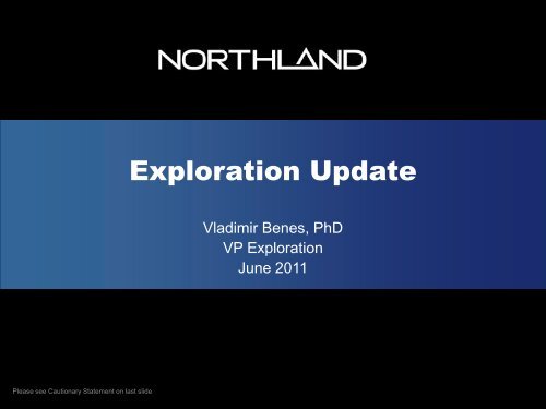
Exploration Update<br />
Vladimir Benes, PhD<br />
VP Exploration<br />
June 2011<br />
Please see Cautionary Statement on last slide
Exploration Strategy 2011<br />
• Focus on an increase of Fe-Cu-<br />
Au resources for Hannukainen<br />
• Support to DFS on Hannukainen<br />
• Upgrade resources for<br />
Pellivuoma<br />
• Advancing the most promising<br />
targets through the Pipeline<br />
• Focus on near mine targets<br />
6/20/2011 Exploration Update 2
PRIORITY<br />
Exploration Project Pipeline<br />
Grassroot<br />
Target Delineation<br />
Drill Testing<br />
Advanced<br />
Drilling<br />
Resource<br />
Development<br />
Kelontekemä<br />
Salmivaara Cu<br />
Mannacorpi East<br />
Tuulijoki<br />
Vitikkuvoma<br />
Käymäjärvi<br />
Kelontekemä<br />
Jolhikko<br />
Jaaravinsa<br />
Aarearova<br />
Salmivaara Fe<br />
Mannakorpi Fe<br />
Karhujärvi<br />
Marjarova<br />
Sivakkalehto<br />
Cu-Rautuvaara<br />
Rautuoja<br />
Hannukainen<br />
Pellivuoma<br />
Kuervitikko<br />
PEA<br />
PFS/FS<br />
ADVANCEMENT<br />
3
Exploration Project Location<br />
4
Claim and Project Location SWE<br />
Pajala (4.3.2011)<br />
Granted claims: 33,479.69 hectares<br />
Granted exploitation concessions: 254.261 hectares<br />
Pending claims: 20,295.61 hectares<br />
Lannavara / Saarijärvi<br />
Granted claims: 11,931 hectares<br />
Salmivaara<br />
Granted claims in Salmivaara area: 6,891.16 hectares<br />
Aarearova<br />
Salmivaara<br />
Käymäjärvi<br />
Pellivuoma<br />
Marjarova<br />
Karhujärvi<br />
6/20/2011 Sidfot 5
Claim and Project Location FIN<br />
Finland, Lapland (4.5.2011)<br />
Granted claims: 12,816.2 hectares<br />
Claim reservation: 12,393.02 hectares<br />
Pending claims: 9,051.21 hectares<br />
Applied exploitation concessions: 6,026.58<br />
hectares<br />
Jolhikko<br />
Kelontekemä<br />
Rautuoja<br />
Kuervitikko<br />
Mannakorpi<br />
Hannukainen<br />
Cu Rautuvaara<br />
6/20/2011 Sidfot 6
• Fennoscandian Shield<br />
Tectonic Setting<br />
• Archean Nucleus 3.2 - 2.5 Ga<br />
• Rifting at 2.5-2.05 Ga<br />
• Proterozoic crustal growth<br />
1.95 – 1.79 Ga (Svecofennian<br />
Orogeny)<br />
• Sveconorwegian Orogeny 1.10<br />
- 0.92 Ga<br />
• Hosts numerous important<br />
metallic deposits<br />
Norrbotten Craton<br />
Karelian Craton<br />
Kola Craton<br />
Geological map<br />
7
Regional Endowment<br />
Kiruna<br />
Kiruna<br />
Kittila<br />
Malmberget<br />
Kevitsa<br />
Aitik<br />
8
Regional Geology<br />
9
Kaunisvaara Camp<br />
Geology<br />
10
Tapuli –<br />
Summary of Activities<br />
History<br />
• Discovered in 1918<br />
• SGU exploration (1965-1969) - 24 DH’s (5,597m) and ground geophysics<br />
<strong>Northland</strong>’s operations<br />
• 2006-2009: 76 EXP DH’s (12,178m)<br />
37 MET DH’s (7,679m)<br />
18 Tech DH’s (5,571m)<br />
68 CDM DH’s (8,601m)<br />
• Airborne geophysics (mag, radiometric and EM) by GTK<br />
• 24 ton bulk sample from drill core in central part of deposit in 2008<br />
• Geotechnical and hydrogeological studies; MET testwork processing<br />
• NI-43 101 compliant Resource Estimate for Tapuli in 2009 by Geovista/Micon<br />
• Updated Resource Estimate by SRK April 2010<br />
• Feasibility Study reported October 2010<br />
11
Tapuli –<br />
Geology<br />
Strike 200m @ av.<br />
thickness 30m<br />
(max 45m)<br />
Strike 1100m @<br />
av. thickness<br />
10m (max 20m)<br />
Strike 500m @ av.<br />
thickness 100m<br />
(max 200m)<br />
Strike 400m @<br />
av. thickness<br />
40m<br />
12
Tapuli –<br />
Geology<br />
Hangingwall<br />
Quartzite<br />
Magnetite<br />
Mineralization<br />
Footwall<br />
Phyllite<br />
13
Tapuli –<br />
Geological Section<br />
Hangingwall<br />
Quartzite<br />
Magnetite<br />
Mineralization<br />
Footwall<br />
Phyllite<br />
Profile XS-0700<br />
14
Tapuli – Resource Estimate<br />
(SRK 2010)<br />
Mineral<br />
Resource<br />
Category<br />
10% cut off<br />
Tonnes<br />
(Mt)<br />
Fe Total<br />
%<br />
S<br />
%<br />
SiO 2<br />
%<br />
MgO<br />
%<br />
Al 2 O 3<br />
%<br />
Measured 52.8 27.02 0.23 25.31 17.90 2.10 6.31 0.07 0.08<br />
Indicated 54.6 25.04 0.24 28.63 17.05 2.05 8.72 0.05 0.11<br />
Meas+Ind 107.4 26.01 0.23 26.99 17.47 2.08 7.53 0.06 0.09<br />
Inferred 24.7 24.58 0.23 28.53 17.75 2.00 7.80 0.06 0.10<br />
CaO<br />
%<br />
P<br />
%<br />
Mn<br />
%<br />
• Green = Measured;<br />
• Blue = Indicated;<br />
• Red = Inferred;<br />
• Pink = Potential<br />
• Whittle pit shell (based on a metal price of<br />
110 US¢/dmtu)<br />
15
Sahavaara –<br />
Summary of Activities<br />
History<br />
• Discovered in 1918<br />
• SGU exploration in the 60’s - 59 DH’s, shaft, and ground geophysics (mag<br />
and gravity)<br />
<strong>Northland</strong>’s operations<br />
• 2005-2008: 75 EXP DH’s (14,177m) + 40 MET DH’s (5,629m)<br />
• Airborne Geophysics (mag, radiometric and EM) by GTK<br />
• NI-43 101 compliant Resource Estimate by Chlumsky, Armbrust and Meyer,<br />
LLC (CAM) in 2006<br />
• 2,000 ton bulk sample in central part of Stora deposit in 2007<br />
• Updated Resource Model, including the Södra Sahavaara in 2009<br />
• Updated Resource Estimates by SRK April 2010<br />
• Feasibility Study October 2010<br />
16
Sahavaara – Geology<br />
• Strike 1,400m<br />
• Average thickness at surface 52m<br />
• Mineralization traced 600m along the dip<br />
• Simple geometry<br />
• 1 main lens and few small lenses<br />
Quartzite<br />
Graphitic<br />
Phyllite<br />
Hangingwall<br />
Quartzite-Phyllite<br />
Footwall<br />
Graphitic Phyllite<br />
Phyllite<br />
Greenstone<br />
17
Sahavaara Resource Estimated<br />
(SRK 2010)<br />
Resource<br />
Category<br />
10%Fe<br />
cut off<br />
Tonnes<br />
(MT)<br />
Fe<br />
Total<br />
%<br />
S<br />
%<br />
SiO 2<br />
%<br />
MgO<br />
%<br />
Al 2 O 3<br />
%<br />
Measured 30.2 42.96 2.66 14.85 14.43 1.32 1.61 0.07 0.10<br />
Indicated 56.6 38.14 1.55 20.08 14.73 1.32 4.02 0.05 0.12<br />
Meas+Indic 86.8 39.82 1.93 18.26 14.63 1.32 3.18 0.06 0.11<br />
Inferred 34.7 37.28 1.44 20.99 15.21 1.20 4.13 0.04 0.11<br />
CaO<br />
%<br />
P<br />
%<br />
Mn<br />
%<br />
Green = Measured;<br />
Blue = Indicated;<br />
Red = Inferred;<br />
Pink = Potential<br />
Whittle pit shell (based on a metal<br />
price of 110 US¢/dmtu)<br />
18
Pellivuoma<br />
19
Pellivuoma<br />
Summary of Activities<br />
• Ground magnetic and gravity survey 1963- 65<br />
• SGU 1969-71 - 13 DH 2,493m<br />
• <strong>Northland</strong> 2006-2010<br />
• Airborne geophysical survey GTK 2006<br />
• Ground geophysical survey GeoVista 2008<br />
• Geophysical modeling Astrock 2009<br />
• NRI drilled 56 DH, a total of 11,631m (2008-2009)<br />
• Initial resource estimates GeoVista/Micon 2009 (41DH)<br />
• Geotechnical and hydrogeological studies 2010<br />
• MET testwork processing 2010<br />
• Updated resource estimates SRK April 2010<br />
• Drilling to upgrade resources 2011<br />
20
Pellivuoma –<br />
Regional Geology<br />
21
Pellivuoma – Geology<br />
Profile XS 0800<br />
• Meandering ore lenses<br />
conformable with the<br />
footwall granite contact<br />
• 20 to 100-m thick<br />
• Dip 50 degrees SW<br />
• Area 700m x 600m<br />
22
Pellivuoma Geological<br />
Cross-section<br />
Profile XS-0800<br />
23
Pellivuoma Resource<br />
Classification (SRK 2010)<br />
Resource<br />
Category<br />
10%cut off<br />
Tonnes<br />
(MT)<br />
Fe<br />
Total<br />
%<br />
S<br />
%<br />
SiO 2<br />
%<br />
MgO<br />
%<br />
Al 2 O 3 %<br />
CaO<br />
%<br />
P<br />
%<br />
Mn<br />
%<br />
Measured 38.54 30.13 0.36 22.90 21.46 1.12 3.41 0.03 0.17<br />
Indicated 18.80 29.86 0.52 25.07 20.18 1.06 4.04 0.03 0.29<br />
Meas+ 57.34 30.04 0.41 23.61 21.04 1.10 3.62 0.03 0.21<br />
Inferred 37.81 29.28 0.77 25.99 18.66 1.21 4.96 0.02 0.37<br />
• Green = Measured;<br />
• Blue = Indicated;<br />
• Red = Inferred;<br />
• Pink = Potential<br />
• Whittle pit shell (based on a metal<br />
price of 110 US¢/dmtu)<br />
24
Additional <strong>Resources</strong> for Kaunisvaara<br />
Pellivuoma deposit<br />
Marjarova prospect<br />
9 DH, 1,708m<br />
25
Hannukainen<br />
• Hannukainen consists of five ore bodies<br />
• Laurinoja and Kuervaara partially mined<br />
by Rautaruukki and Outokumpu (1978-<br />
1992)<br />
• Produced 4.5 Mt ore @ 43% Fe,<br />
0.88% Cu<br />
• <strong>Northland</strong> became active in 2005<br />
• NRI exploration drilling 306DH -<br />
46,474.40 m<br />
• Metallurgical drilling 36 DH<br />
• 30 CDM holes<br />
• Metallurgical test work<br />
• PEA May 2010<br />
• DFS in progress<br />
26
Hannukainen Geological<br />
Cross-section<br />
Monzonite<br />
Diorite<br />
Diorite<br />
Mica Schist<br />
Amphibolite<br />
27
HANNUKAINEN – KUERVITIKKO<br />
TREND<br />
Elevation and Ore Body Model<br />
28
HANNUKAINEN – KUERVITIKKO<br />
MINERALIZATION<br />
Kuervitikko<br />
Iron equivalent<br />
(10-15-20-30-40% envelope)<br />
Hannukainen<br />
29
HANNUKAINEN – KUERVITIKKO<br />
MINERALIZATION<br />
Kuervitikko<br />
Copper<br />
(0.05- 0.1- 0.2- 0.3 % envelope)<br />
Hannukainen<br />
30
<strong>Resources</strong> Estimates Hannukainen<br />
and Kuervitikko (WGM 2010)<br />
Hannukainen<br />
WGM, May 10, 2010<br />
Categories after JORC 2004 guidelines<br />
Category Mt Fe Cu Au<br />
Measured 101 33.8% 0.17% 0.07 g/ton<br />
Indicated 9 35.0% 0.13% 0.02 g/ton<br />
Infererred 88 31.7% 0.13% 0.04 g/ton<br />
Global tonnage<br />
Kuervitikko<br />
198 Mt<br />
WGM, May 10, 2010<br />
Category Mt Fe Cu Au<br />
Measured<br />
Indicated 26 23.8% 0.17% 0.18 g/ton<br />
Infererred 19 21.7% 0.15% 0.17 g/ton<br />
Pit Optimized<br />
Underground <strong>Resources</strong><br />
Not Pit Optimized<br />
Global tonnage<br />
45 Mt<br />
31
Additional <strong>Resources</strong> for<br />
Hannukainen<br />
Hannukainen<br />
Mannacorpi<br />
Rautuoja<br />
Cu Rautuvaara<br />
32
Regional Exploration Finland<br />
Aakenus-Jolhikko<br />
Jaaravinsa-Mannakorpi<br />
Hannukainen<br />
KITTILÄ<br />
Tuulijoki<br />
Luosu<br />
Kelontekemä<br />
Äkäsjoki shear zone<br />
KOLARI<br />
Vitikkovuoma-Rito-oja<br />
33
Exploration Track Record<br />
600<br />
500<br />
400<br />
300<br />
200<br />
Historic<br />
Inferred 43-101<br />
M&I 43-101<br />
100<br />
0<br />
2005 2006 2007 2008 2009 2010<br />
34
Cautionary Statement<br />
This PowerPoint presentation contains certain forward-looking statements within the meaning of the Private Securities Litigation<br />
Reform Act of 1995, and applicable Canadian Securities laws. We have tried, whenever possible, to identify these forward-looking<br />
statements using words such as “anticipates”, “believes”, “expects”, ”plans”, ”intends”, “potential” and similar expressions. These<br />
statements reflect our current belief and are based on currently available information. Accordingly, such forward-looking<br />
statements involve known and unknown risks, uncertainties and other factors which could cause the Company’s actual results,<br />
performance or achievements to differ materially from those expressed or implied by such statements.<br />
Readers are cautioned that forward-looking information involves known and unknown risks, uncertainties and other factors which<br />
may cause the actual results, performance or achievements of the Company and/or its subsidiaries to be materially different from<br />
any future results, performance or achievements expressed or implied by the forward-looking information. Such factors include,<br />
among others, those factors discussed in the section entitled “Risk Factors” in the Company’s preliminary short form prospectus<br />
dated November 17, 2010, its annual information form dated February 22, 2011, and the management’s discussion and analysis<br />
of results of operations and financial condition for the year ended April 30, 2011.<br />
Except as required by law, we undertake no obligation to update or advise in the event of any change, addition, or alteration to the<br />
information contained in this PowerPoint presentation, including such forward-looking statements. This PowerPoint presentation<br />
does not constitute an offer of the securities described herein.<br />
<strong>Resources</strong> Quoted in This Presentation<br />
Vladimir Benes, Ph.D., Vice President of Exploration for <strong>Northland</strong> <strong>Resources</strong> Inc., is the Qualified Person in accordance with<br />
National Instrument 43-101 responsible for overseeing the execution of <strong>Northland</strong>'s exploration programs and for verifying that the<br />
information presented in this presentation is an accurate summary. Dr. Benes is a fellow member of the Australasian Institute of<br />
Mining and Metallurgy (Member #300308).<br />
Metallurgical Test-Work<br />
Mr. Paul Marsden, VP Marketing and Corporate Development for <strong>Northland</strong>, is a member of the IMMM, a Chartered Engineer and<br />
a Chartered Scientist and is the Qualified Person as defined in NI 43-101 responsible for the metallurgical test work programs for<br />
<strong>Northland</strong>. Mr. Marsden has verified that the results presented in this presentation have been accurately summarized from the<br />
results reported to <strong>Northland</strong>.<br />
35<br />
35