Sample - Waukesha County
Sample - Waukesha County
Sample - Waukesha County

Create successful ePaper yourself
Turn your PDF publications into a flip-book with our unique Google optimized e-Paper software.
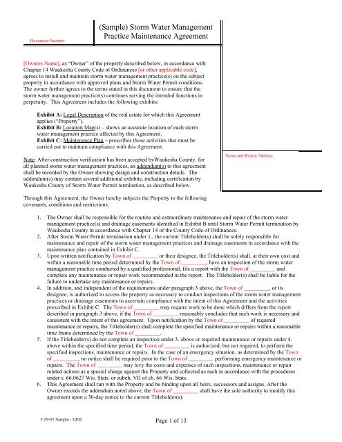
Document Number<br />
(<strong>Sample</strong>) Storm Water Management<br />
Practice Maintenance Agreement<br />
[Owners Name], as “Owner” of the property described below, in accordance with<br />
Chapter 14 <strong>Waukesha</strong> <strong>County</strong> Code of Ordinances [or other applicable code],<br />
agrees to install and maintain storm water management practice(s) on the subject<br />
property in accordance with approved plans and Storm Water Permit conditions.<br />
The owner further agrees to the terms stated in this document to ensure that the<br />
storm water management practice(s) continues serving the intended functions in<br />
perpetuity. This Agreement includes the following exhibits:<br />
Exhibit A: Legal Description of the real estate for which this Agreement<br />
applies (“Property”).<br />
Exhibit B: Location Map(s) – shows an accurate location of each storm<br />
water management practice affected by this Agreement.<br />
Exhibit C: Maintenance Plan – prescribes those activities that must be<br />
carried out to maintain compliance with this Agreement.<br />
Note: After construction verification has been accepted by<strong>Waukesha</strong> <strong>County</strong>, for<br />
all planned storm water management practices, an addendum(s) to this agreement<br />
shall be recorded by the Owner showing design and construction details. The<br />
addendum(s) may contain several additional exhibits, including certification by<br />
<strong>Waukesha</strong> <strong>County</strong> of Storm Water Permit termination, as described below.<br />
Name and Return Address<br />
Through this Agreement, the Owner hereby subjects the Property to the following<br />
covenants, conditions and restrictions:<br />
1. The Owner shall be responsible for the routine and extraordinary maintenance and repair of the storm water<br />
management practice(s) and drainage easements identified in Exhibit B until Storm Water Permit termination by<br />
<strong>Waukesha</strong> <strong>County</strong> in accordance with Chapter 14 of the <strong>County</strong> Code of Ordinances.<br />
2. After Storm Water Permit termination under 1., the current Titleholder(s) shall be solely responsible for<br />
maintenance and repair of the storm water management practices and drainage easements in accordance with the<br />
maintenance plan contained in Exhibit C.<br />
3. Upon written notification by Town of _________ or their designee, the Titleholder(s) shall, at their own cost and<br />
within a reasonable time period determined by the Town of _________, have an inspection of the storm water<br />
management practice conducted by a qualified professional, file a report with the Town of _________ and<br />
complete any maintenance or repair work recommended in the report. The Titleholder(s) shall be liable for the<br />
failure to undertake any maintenance or repairs.<br />
4. In addition, and independent of the requirements under paragraph 3 above, the Town of _________, or its<br />
designee, is authorized to access the property as necessary to conduct inspections of the storm water management<br />
practices or drainage easements to ascertain compliance with the intent of this Agreement and the activities<br />
prescribed in Exhibit C. The Town of _________ may require work to be done which differs from the report<br />
described in paragraph 3 above, if the Town of _________ reasonably concludes that such work is necessary and<br />
consistent with the intent of this agreement. Upon notification by the Town of _________ of required<br />
maintenance or repairs, the Titleholder(s) shall complete the specified maintenance or repairs within a reasonable<br />
time frame determined by the Town of _________.<br />
5. If the Titleholder(s) do not complete an inspection under 3. above or required maintenance or repairs under 4.<br />
above within the specified time period, the Town of _________ is authorized, but not required, to perform the<br />
specified inspections, maintenance or repairs. In the case of an emergency situation, as determined by the Town<br />
of _________, no notice shall be required prior to the Town of _________ performing emergency maintenance or<br />
repairs. The Town of _________ may levy the costs and expenses of such inspections, maintenance or repair<br />
related actions as a special charge against the Property and collected as such in accordance with the procedures<br />
under s. 66.0627 Wis. Stats. or subch. VII of ch. 66 Wis. Stats.<br />
6. This Agreement shall run with the Property and be binding upon all heirs, successors and assigns. After the<br />
Owner records the addendum noted above, the Town of _________ shall have the sole authority to modify this<br />
agreement upon a 30-day notice to the current Titleholder(s).<br />
5-29-07 <strong>Sample</strong> - LRD Page 1 of 13
Dated this ___ day of ____________, 200_.<br />
Owner:<br />
____________________________________________<br />
(Owners Signature)<br />
(Owners Typed Name)<br />
Acknowledgements<br />
State of Wisconsin:<br />
<strong>County</strong> of <strong>Waukesha</strong><br />
Personally came before me this day of , 200_, the above named ___[Owners name]_____ to me<br />
known to be the person who executed the foregoing instrument and acknowledged the same.<br />
[Name]<br />
Notary Public, <strong>Waukesha</strong> <strong>County</strong>, WI<br />
My commission expires: .<br />
.<br />
This document was drafted by:<br />
____________________________<br />
Approved for recording: __________<br />
[Initials of Municipal staff]<br />
____________________________<br />
[Name and address of drafter]<br />
5-29-07 <strong>Sample</strong> - LRD Page 2 of 13
(<strong>Sample</strong>)<br />
Exhibit A – Legal Description<br />
The following description and reduced copy map identifies the land parcel(s) affected by this Agreement. For a larger<br />
scale view of the referenced document, contact the <strong>Waukesha</strong> <strong>County</strong> Register of Deeds office.<br />
[Note: An example legal description is shown below. This exhibit must be customized for each site, including the<br />
minimum elements shown. It must include a reference to a Subdivision Plat, Certified Survey number, or<br />
Condominium Plat, and a map to illustrate the affected parcel(s).]<br />
Project Identifier: Highland Preserve Subdivision Acres: 40<br />
Date of Recording: October 22, 2002<br />
Map Produced By: Baudhuin, Inc., P.O. Box 105, Sturgeon Bay, WI<br />
Legal Description: Lots 1 through 22 of Highland Preserve Subdivision, located in all that part of the<br />
Southwest Quarter (SW ¼) of Section 4, Township 8N, Range 19E (Town of Lisbon) <strong>Waukesha</strong> <strong>County</strong>,<br />
Wisconsin.<br />
Highland Preserve Subdivision<br />
N<br />
Drainage Easement Restrictions: Shaded area on map indicates a drainage easement for<br />
storm water collection, conveyance and treatment. No buildings or other structures are<br />
allowed in these areas. No grading or filling is allowed that may interrupt storm water<br />
flows in any way. See Exhibit C for specific maintenance requirements for storm water<br />
management practices within this area. See subdivision plat for details on location.<br />
5-29-07 <strong>Sample</strong> - LRD Page 3 of 13
(<strong>Sample</strong>)<br />
Exhibit B - Location Map<br />
Storm Water Management Practices Covered by this Agreement<br />
[An example location map and the minimum elements that must accompany the map are shown below. This exhibit<br />
must be customized for each site. Map scale must be sufficiently large enough to show necessary details.]<br />
The storm water management practices covered by this Agreement are depicted in the reduced copy of a portion of<br />
the construction plans, as shown below. The practices include one wet detention basin, two forebays, two grass<br />
swales (conveying storm water to the forebays) and all associated pipes, earthen berms, rock chutes and other<br />
components of these practices. All of the noted storm water management practices are located within a drainage<br />
easement in Outlot 1 of the subdivision plat, as noted in Exhibit A.<br />
Subdivision Name: Highland Preserve<br />
Storm water Practices: Wet Detention Basin #1, Forebays (2), Grass swales (2)<br />
Location of Practices: All of Outlot 1 of Highland Preserve Subdivision:<br />
Titleholders of Outlot 1: Each owner of Lots 1 through 22 shall have equal (1/22) undividable interest in<br />
Outlot 1<br />
Figure 1<br />
Plan View of Storm Water Practices<br />
Access Lane (15 feet wide)<br />
Forebays (2) Grass Swales (2)<br />
Wet Detention<br />
Basin #1<br />
N<br />
5-29-07 <strong>Sample</strong> - LRD Page 4 of 13
(<strong>Sample</strong>)<br />
Exhibit C<br />
Storm Water Practice Maintenance Plan<br />
This exhibit explains the basic function of each of the storm water practices listed in Exhibit B and prescribes the<br />
minimum maintenance requirements to remain compliant with this Agreement. The maintenance activities listed<br />
below are aimed to ensure these practices continue serving their intended functions in perpetuity. The list of<br />
activities is not all inclusive, but rather indicates the minimum type of maintenance that can be expected for this<br />
particular site. Access to the stormwater practices for maintenance vehicles is shown in Exhibit B. Any failure of a<br />
storm water practice that is caused by a lack of maintenance will subject the Titleholder(s) to enforcement of the<br />
provisions listed on page 1 of this Agreement by the Town of _________.<br />
[<strong>Sample</strong> maintenance language is listed below. This exhibit must be customized for each site. The minimum elements<br />
of this exhibit include: a description of the drainage area and the installed storm water management system & best<br />
management practices, a list of BMP maintenance requirements and a reference to future as-built drawings and<br />
design summaries to be recorded as an addendum(s) to this agreement.]<br />
System Description:<br />
The wet detention basin is designed to trap 80% of sediment in runoff and maintain pre-development downstream<br />
peak flows. The basin has two forebays (smaller ponds) located at the low end of two grass swales. In addition to<br />
runoff conveyance, the grass swales also allow infiltration and filtering of pollutants, especially from smaller storms.<br />
The forebays are each 4 feet deep. They are connected to the main pool by 18 and 24-inch metal pipes that outlet<br />
onto a rock chute. The forebays will trap coarse sediments in runoff, such as road sands, thus reducing maintenance<br />
of the main basin. The main pool will trap the finer suspended sediment. To do this, the pond size, water level and<br />
outlet structures must be maintained as specified in this Agreement (see Figures 1, 2 and 3).<br />
The main basin receives runoff from a 67.1 acre drainage area (41.2 acres within the subdivision and 25.9 acres offsite<br />
drainage coming from the east). During high rainfall or snow melt events, the water level will temporarily rise<br />
and slowly drain down to the elevation of the control structure. The water level is controlled by a 12-inch concrete<br />
pipe extending through the berm in the northwest corner of the basin (see Figures 1 and 3). On the face of the 12-<br />
inch pipe, there is metal plate with a 3-inch drilled hole (orifice) with stone in front of it. This orifice controls the<br />
water level and causes the pond to temporarily rise during runoff events. Washed stone (1-2” diameter) is placed in<br />
front of the orifice to prevent clogging. High flows may enter the grated concrete riser or flow over the rock lined<br />
emergency spillway. “As-built” construction drawings of the basin, showing actual dimensions, elevations, outlet<br />
structures, etc. will be recorded as an addendum(s) to this agreement within 60 days after <strong>Waukesha</strong> <strong>County</strong> accepts<br />
verification of construction from the project engineer.<br />
Minimum Maintenance Requirements:<br />
To ensure the proper long-term function of the storm water management practices described above, the following<br />
activities must be completed:<br />
1. All outlet pipes must be checked monthly to ensure there is no blockage from floating debris or ice,<br />
especially the washed stone in front of the 3-inch orifice and the trash rack on the riser in the main basin.<br />
Any blockage must be removed immediately. The washed stone must be replaced when it becomes<br />
clogged.<br />
2. Grass swales shall be preserved to allow free flowing of surface runoff in accordance with approved<br />
grading plans. No buildings or other structures are allowed in these areas. No grading or filling is allowed<br />
that may interrupt flows in any way.<br />
3. Grass swales, inlets and outlets must be checked after heavy rains (minimum of annually) for signs of<br />
erosion. Any eroding areas must be repaired immediately to prevent premature sediment build-up in the<br />
downstream forebays or basin. Erosion matting is recommended for repairing grassed areas.<br />
4. NO trees are to be planted or allowed to grow on the earthen berms. Tree root systems can reduce soil<br />
compaction and cause berm failure. The berms must be inspected annually and any woody vegetation<br />
removed.<br />
5. If floating algae or weed growth becomes a nuisance (decay odors, etc.), it must be removed from the basin<br />
or the forebay and deposited where it cannot drain back into the basin. Removal of the vegetation from the<br />
water reduces regrowth the following season (by harvesting the nutrients). Wetland vegetation must be<br />
maintained along the waters edge for safety and pollutant removal purposes.<br />
5-29-07 <strong>Sample</strong> - LRD Page 5 of 13
6. When sediment in the forebays or the basin has accumulated to an elevation of three feet below the outlet<br />
elevation, it must be removed (see Exhibit D). All removed sediment must be placed in an appropriate<br />
upland disposal site and stabilized (grass cover) to prevent sediment from washing back into the basin. The<br />
forebays will likely need sediment removal first. Failure to remove sediment from the forebays will cause<br />
resuspension of previously trapped sediments and increase downstream deposition.<br />
7. No grading or filling of the basin or berm other than for sediment removal is allowed, unless otherwise<br />
approved by the Town of _________.<br />
8. Periodic mowing of the grass swales will encourage rigorous grass cover and allow better inspections for<br />
erosion. Waiting until after August 1 will avoid disturbing nesting wildlife. Mowing around the basin or<br />
the forebays may attract nuisance populations of geese to the property and is not necessary or<br />
recommended.<br />
9. Any other repair or maintenance needed to ensure the continued function of the storm water practices or as<br />
ordered by the Town of _________ under the provisions listed on page 1 of this Agreement.<br />
[Note: Other examples of maintenance plans for infiltration practices are available from <strong>Waukesha</strong> <strong>County</strong>.]<br />
5-29-07 <strong>Sample</strong> - LRD Page 6 of 13
Document number<br />
Addendum Document 1 (<strong>Sample</strong>) Number<br />
Storm Water Management Practice<br />
Maintenance Agreement<br />
The purpose of this addendum is to record verified “as-built” construction<br />
details, supporting design data and permit termination documentation for the<br />
storm water management practice(s) located on Outlot 1 of the Highland<br />
Preserve Subdivision, described as being all that part of the Southwest<br />
Quarter (SW ¼) of Section 4, Township 8N, Range 19E (Town of Lisbon)<br />
<strong>Waukesha</strong> <strong>County</strong>, Wisconsin. This document shall serve as an addendum to<br />
document # _____________, herein referred to as the “Maintenance<br />
Agreement”. This addendum includes all of the following exhibits:<br />
Exhibit D: Design Summary – contains a summary of key engineering<br />
calculations and other data used to design the wet detention basin.<br />
Exhibit E: As-built Survey – shows detailed “as-built” cross-section<br />
and plan view of the wet detention basin.<br />
Exhibit F: Engineering/Construction Verification – provides verification<br />
from the project engineer that the design and construction of the wet<br />
detention basin complies with all applicable technical standards and<br />
<strong>Waukesha</strong> <strong>County</strong> ordinance requirements.<br />
Exhibit G: Storm Water Permit Termination – provides certification by<br />
<strong>Waukesha</strong> <strong>County</strong> that the Storm Water Permit for the above noted site<br />
has been terminated.<br />
Name and Return Address<br />
Dated this ___ day of ____________, 200_.<br />
Owner:<br />
____________________________________________<br />
[Owners Signature – per the Maintenance Agreement]<br />
____________________________________<br />
Parcel Identification Number(s) – (PIN)<br />
____________________________________________<br />
[Owners Typed Name]<br />
State of Wisconsin<br />
<strong>County</strong> of <strong>Waukesha</strong><br />
Acknowledgements<br />
Personally came before me this day of , 200_, the above named ___[Owners name]_____ to me<br />
known to be the person who executed the foregoing instrument and acknowledged the same.<br />
This document was drafted by:<br />
____________________________<br />
[Name]<br />
Notary Public, <strong>Waukesha</strong> <strong>County</strong>, WI<br />
My commission expires: .<br />
.<br />
____________________________<br />
[Name and address of drafter]<br />
Approved for recording: __________<br />
[Initials of Municipal staff]<br />
5-29-07 <strong>Sample</strong> - LRD Page 7 of 13
(<strong>Sample</strong>)<br />
Exhibit D<br />
Design Summaries for Wet Detention Basin #1<br />
Project Identifier: Highland Preserve Subdivision Project Size: 40 Acres No. of Lots: 22<br />
Number of Runoff Discharge Points: 1 Watershed (ultimate discharge): Pewaukee Lake<br />
Watershed Area (including off-site runoff traveling through project area): 67 acres (26 acres off-site)<br />
Watershed Data Summary. The following table summarizes the watershed data used to determine peak<br />
flows and runoff volumes required to design wet detention basin #1.<br />
Summary Data Elements<br />
Watershed Areas (in acres)<br />
(see attached map)<br />
Subwatershed A<br />
Subwatershed B (off-site)<br />
Pre-develop Post-develop Pre-develop Post-develop<br />
41 acres 41 acres 26 26<br />
Average Watershed Slopes (%) 2-8% 2-8% 3-6% 3-6%<br />
Land Uses (% of each)<br />
(see attached map)<br />
75 ac. cropland<br />
15 ac. brush<br />
10 ac. woodland<br />
110 ac. ½ ac. lots<br />
5ac. brush<br />
5 ac. woodlands<br />
50% cropland<br />
50% 1 acre lots<br />
50% cropland<br />
50% 1 acre lots<br />
Runoff Curve Numbers<br />
68 x 75ac.= 5100<br />
30 x 25ac.= 750<br />
Net 5850\100 ac.<br />
RCN = 59<br />
70 x 110 ac.= 7700<br />
10 x 10 ac.= 100<br />
Net 7800\120ac<br />
RCN = 65<br />
RCN = 68<br />
(state standard)<br />
RCN = 70<br />
Conveyance Systems Types<br />
Grass waterway<br />
50% grass swale<br />
50% storm sewer<br />
100% bare<br />
channel<br />
100% grass<br />
swale<br />
Summary of Average<br />
Conveyance System Data<br />
8’ bottom/4:1 ss<br />
2’ depth/3% grade<br />
2’ depth swale/3%<br />
30” r/c sewer/2%<br />
(see calcs.)<br />
15’ (w) top<br />
1’ (d) parabolic<br />
2% grade<br />
2’ deep standard<br />
road ditch<br />
2% grade<br />
Time of Concentration (Tc)<br />
(see attached map & worksheets)<br />
25% of 2-yr 24-hr post-dev<br />
runoff volume<br />
1-year/24 hour Runoff Volume<br />
2-yr./24 hour Peak Flow<br />
(see attached hydrographs)<br />
1.1 hrs. .97 hrs. .74 hrs. .65 hrs.<br />
N/A 2.29 ac. ft. N/A .19 ac. ft.<br />
N/A<br />
(.2” x 60 ac.)<br />
1.0 ac. ft. N/A<br />
(.34” x 10 ac.)<br />
.28 ac. ft.<br />
11.2 cfs 14.3 cfs 5.1 cfs 3.2 cfs<br />
10-yr./24 hour Peak Flow 21 cfs 32 cfs 18.4 cfs 11.3 cfs<br />
100-yr./24 hour Peak Flow 78 cfs 91 cfs 53 cfs 21 cfs<br />
5-29-07 <strong>Sample</strong> - LRD Page 8 of 13
Exhibit D (continued)<br />
Practice Design Summary. The following table summarizes the data used to design wet<br />
detention basin #1.<br />
Design Element<br />
Design Data<br />
Site assessment data: (see attached maps)<br />
Contributing drainage area to basin (subwatershed A & B)<br />
70 acres<br />
Distance to nearest private well (including off-site wells)<br />
> 100 feet<br />
Distance to municipal well (including off-site wells)<br />
> 1200 feet<br />
Wellhead protection area involved?<br />
No<br />
Ground slope at site of proposed basin average 3%<br />
Any buried or overhead utilities in the area?<br />
No<br />
Proposed outfall conveyance system/discharge (w/ distances)<br />
35 ft. to CTH “U” Road ditch<br />
1000 ft. to wetland<br />
Any downstream roads or other structures? (describe)<br />
Yes – 36” cmp road culvert<br />
Floodplain, shoreland or wetlands?<br />
No<br />
Soil investigation data (see attached map & soil logs):<br />
Number of soil investigations completed<br />
Do elevations of test holes extend 3 ft. below proposed bottom?<br />
Average soil texture at pond bottom elevation (USDA)<br />
Distance from pond bottom to bedrock<br />
Distance from pond bottom to seasonal water table<br />
General basin design data (see attached detailed drawings):<br />
3 (in basin area)<br />
Yes (see map)<br />
Clay loam<br />
> 5 feet<br />
Pond bottom 2 ft. below mottling<br />
No water observed in test holes<br />
Permanent pool surface area<br />
1.5 acres<br />
Design permanent pool water surface elevation elev. 900.0<br />
Top of berm elevation (after settling) and width<br />
elev. 905.0 / 10 feet wide<br />
Length/width (dimensions/ratio) 445 ft. (L) x 145 ft. (W) = 3:1<br />
Safety shelf design (length, grade, max. depth)<br />
10 ft. @ 10% slope/1.5’ deepest<br />
Ave. water depth (minus safety shelf/sediment)<br />
5 ft. (in center)<br />
Sediment forebay size & depth<br />
.16 acres (13% pool size)/5 feet<br />
Sediment storage depth & design maintenance<br />
2 ft. depth for forebay & pool<br />
15 year maintenance schedule<br />
Inflow Peak/Volume<br />
Design Basin Inflow, Outflow & Storage Data<br />
(see attached hydrographs and detail drawings)<br />
Maximum<br />
Outflow Rate<br />
Max. Water<br />
Elevation<br />
Storage Volume<br />
at Max. Elev.<br />
(above perm. pool)<br />
Outflow<br />
Control<br />
Structures*<br />
1-yr./24 hr.<br />
.7 cfs<br />
(volume) (34 hr. drawdown)<br />
901.3 ft. 2 acre feet #1<br />
24.3 cfs<br />
(Post 2-yr./24 hr. peak)<br />
11 cfs 902.0 ft. 3.1 acre feet #1 and #2<br />
72 cfs<br />
(Post 10-yr./24 hr. peak)<br />
35 cfs 903.0 ft. 4.5 acre feet #3<br />
171 cfs<br />
(Post 100-yr./24 hr. peak)<br />
143 cfs 904.0 ft. 6.0 acre feet #3 and #4<br />
* #1 = 6 inch orifice in water level control weir plate – flow line elev. @ 900.0 (1.3 ft. max. head)<br />
#2 = 2 foot wide rectangular weir – flow line elev. @ 901.3 (.7 ft. hydraulic head)<br />
#3 = 30 inch diameter smooth wall pvc pipe – flow line elev. @ 900.0 (3.0 ft. max. hydraulic head)<br />
#4 = 30 foot wide earthen/grass emergency spillway – flow line elev. @ 903.0 (1.0 ft. max. depth)<br />
5-29-07 <strong>Sample</strong> - LRD Page 9 of 13
Exhibit D (continued)<br />
Watershed Map. The watershed map shown below was used to determine the postdevelopment<br />
data contained in this exhibit. The post-developed watershed areas are the same as<br />
the pre-development watershed areas for this project.<br />
[Map scale must be sufficiently large enough to show necessary details, but page size should not exceed 11” x 17”.]<br />
5-29-07 <strong>Sample</strong> - LRD Page 10 of 13
(<strong>Sample</strong>)<br />
Exhibit E<br />
As-built Survey for Wet Detention Basin #1<br />
The wet detention basin constructed on Outlot #1 is depicted below in reduced copies of the as-built plans.<br />
Project Identifier: Highland Preserve Subdivision<br />
Storm water Practice: Wet Detention Basin #1<br />
Location of Practice: All of Outlot 1 of Highland Preserve Subdivision:<br />
Titleholders of Outlot 1: Each owner of Lots 1-22 shall have equal (1/22) undividable interest in Outlot 1.<br />
Cross-Section A – A’<br />
[Note: Show plan view of BMP with cross-section location clearly labeled and cross-referenced. On cross-section<br />
and plan view, clearly label all key components and elevations of the BMP. Also show outlet details. Map scale<br />
must be sufficiently large enough to show necessary details, but page size should not exceed 11” x 17”.]<br />
Elevation = 962.5<br />
(normal water/outlet elevation)<br />
Elevation = 959.5<br />
(sediment removal)<br />
Elevation = 956.0<br />
(bottom of pond)<br />
Outlet Structure Detail<br />
Elevation = 967.0<br />
Elevation = 964.5<br />
Elevation = 965.0<br />
(rock lined chute)<br />
Elevation = 962.5<br />
(Bottom of 3” hole,<br />
covered with stone)<br />
5-29-07 <strong>Sample</strong> - LRD Page 11 of 13
Exhibit “F”<br />
Engineering/Construction Verification<br />
DATE:<br />
TO:<br />
FROM:<br />
RE:<br />
______________________<br />
Land Resources Division<br />
<strong>Waukesha</strong> <strong>County</strong> Department of Parks and Land Use<br />
__________________________________________[Project Engineer’s Name/Company]<br />
Engineering/Construction Verification for the following project:<br />
Project Name: ________________________________________<br />
Section _________________, Town of ____________________<br />
Storm Water Permit # ________________________<br />
Storm Water Management Practices: ________________________________________<br />
_______________________________________________________________________<br />
For the above-referenced project and storm water management practices, this correspondence shall serve<br />
as verification that: 1) all site inspections outlined in approved inspection plans have been successfully<br />
completed; and 2) the storm water management practice design data presented in Exhibit D, and the “asbuilt”<br />
construction documentation presented in Exhibit E comply with all applicable state and local<br />
technical standards, in accordance with the <strong>Waukesha</strong> <strong>County</strong> Storm Water Management and Erosion<br />
Control Ordinance.<br />
[Must include one of the following two statements:]<br />
1. Any variations from the originally approved construction plans are noted in Exhibit E. These<br />
variations are considered to be within the tolerances of standard construction techniques and do not affect<br />
the original design as presented in Exhibit D in any way.<br />
[Note: The <strong>County</strong> may request additional documentation to support this statement depending on the<br />
extent of deviations from the approved plans.]<br />
Or<br />
2. Any design or construction changes from the originally approved construction plans are documented in<br />
Exhibits D and E and have been approved by <strong>Waukesha</strong> <strong>County</strong>.<br />
[Note: If warm season and wetland planting verification<br />
is required, it may be included in this exhibit.]<br />
5-29-07 <strong>Sample</strong> - LRD Page 12 of 13<br />
(Signed P.E. stamp must be included)
(<strong>Sample</strong>)<br />
Exhibit G<br />
Storm Water Permit Termination<br />
Project Identifier: Highland Preserve Subdivision<br />
Location: All that part of the Southwest Quarter (SW ¼) of Section 4, Township 8N, Range 19E (Town<br />
of Lisbon)<br />
Storm Water Permit Holder’s Name: _____________________________________________________<br />
Storm Water Permit #: ________________________<br />
Chapter 14 – Article VIII of the <strong>Waukesha</strong> <strong>County</strong> Code of Ordinances (“Storm Water Ordinance”)<br />
requires that all newly constructed storm water management practices be maintained by the Storm Water<br />
Permit Holder until permit termination, after which maintenance responsibilities shall be transferred to the<br />
responsible party identified on the subdivision plat [or CSM] and referenced in this Maintenance<br />
Agreement.<br />
Upon execution below, this exhibit shall serve to certify that the Storm Water Permit Holder has satisfied<br />
all requirements of the Storm Water Ordinance and that <strong>Waukesha</strong> <strong>County</strong> has terminated the Storm<br />
Water Permit for the property covered by this Maintenance Agreement.<br />
Dated this ___ day of ____________, 200_.<br />
<strong>Waukesha</strong> <strong>County</strong> representative:<br />
____________________________________________<br />
(Signature)<br />
__________________________________________________________<br />
(Typed Name and Title)<br />
State of Wisconsin<br />
<strong>County</strong> of <strong>Waukesha</strong><br />
Acknowledgements<br />
Personally came before me this day of , 200_, the above named ___[Owners name]_____ to me<br />
known to be the person who executed the foregoing instrument and acknowledged the same.<br />
[Name]<br />
Notary Public, <strong>Waukesha</strong> <strong>County</strong>, WI<br />
My commission expires: _________<br />
.<br />
5-29-07 <strong>Sample</strong> - LRD Page 13 of 13