Understanding Historic Buildings - HELM
Understanding Historic Buildings - HELM
Understanding Historic Buildings - HELM

Create successful ePaper yourself
Turn your PDF publications into a flip-book with our unique Google optimized e-Paper software.
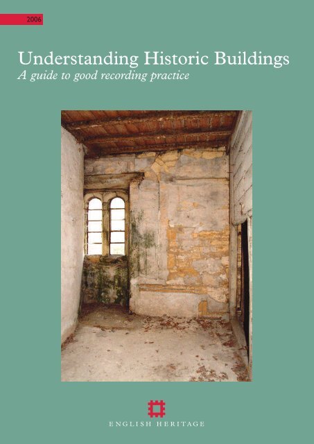
2006<br />
<strong>Understanding</strong> <strong>Historic</strong> <strong>Buildings</strong><br />
A guide to good recording practice
Contents<br />
Acknowledgements . . . . . . . . . . . . 2<br />
1 Introduction . . . . . . . . . . . . . . . . 2<br />
2 Forms and levels of<br />
recording . . . . . . . . . . . . . . . . . . 3<br />
3 When to record . . . . . . . . . . . . . 5<br />
4 Creating a record . . . . . . . . . . . 6<br />
4.1 Documentary research . . . . . . . 6<br />
4.2 Investigation . . . . . . . . . . . . . . . . 7<br />
4.3 Survey and drawings . . . . . . . . . 8<br />
4.4 Photography . . . . . . . . . . . . . . . 10<br />
4.5 The written account . . . . . . . . 12<br />
5 Recording levels:<br />
a description. . . . . . . . . . . . . . . 13<br />
5.1 Level 1 . . . . . . . . . . . . . . . . . . . 14<br />
5.2 Level 2 . . . . . . . . . . . . . . . . . . . 14<br />
5.3 Level 3 . . . . . . . . . . . . . . . . . . . 14<br />
5.4 Level 4 . . . . . . . . . . . . . . . . . . . 14<br />
5.5 Photographic survey . . . . . . . . 14<br />
5.6 Other levels . . . . . . . . . . . . . . . 14<br />
6 Selecting the level and form<br />
of record . . . . . . . . . . . . . . . . . . 15<br />
7 Preserving the record . . . . . . . 15<br />
7.1 Materials and identifying<br />
information. . . . . . . . . . . . . . . . 15<br />
7.2 Dissemination and<br />
publication . . . . . . . . . . . . . . . . 17<br />
7.3 Archiving and signposting . . . . 18<br />
8 Architectural drawing<br />
conventions. . . . . . . . . . . . . . . . 18<br />
8.1 Objectives . . . . . . . . . . . . . . . . 18<br />
8.2 Drawing conventions . . . . . . . . 18<br />
8.3 CAD layering conventions. . . . 18<br />
8.4 Sample drawings. . . . . . . . . . . . 22<br />
9 Further reading . . . . . . . . . . . . 38<br />
10 Contact addresses and other<br />
sources of information . . . . . . 38<br />
2<br />
Acknowledgements<br />
The text has been prepared by Adam Menuge<br />
and incorporates material from an earlier<br />
document written by Nicholas Cooper and last<br />
revised by Robert Hook.The graphic materials<br />
have been edited by Nigel Fradgley and include<br />
drawings by Allan T Adams, Anthony Berry, Andy<br />
Donald, Nigel Fradgley, Adam Menuge, Mike<br />
Williams and Nicola Wray. The photographs<br />
are by Steve Cole (Fig 5), Nigel Corrie (Figs 1<br />
and 2), David MacLeod (Fig 4), Patricia Payne<br />
(Figs 3, 11 and 12) and Bob Skingle (Front<br />
cover, back cover and Figs 6–10, 13 and 14).<br />
This document is the outcome of consultation<br />
with ALGAO, CBA, IFA, IHBC and the National<br />
Trust, whose logos appear on the back cover,<br />
and with a wide spectrum of professional<br />
opinion within and outside English Heritage.<br />
Special thanks are offered to Kenneth Aitchison,<br />
David Baker OBE, John Cattell, Martin Cherry,<br />
Steve Cole,Tom Cromwell, Mike Evans, Philip<br />
Grover, Beryl Lott, Bob Meeson,Veronica Smith,<br />
Lynne Walker and Sarah Woodcock.<br />
The nation’s historic buildings, spanning more than a thousand years of<br />
history, have much to tell us about the ordinary lives of past generations –<br />
how people of all classes and creeds lived and worked, worshipped and<br />
spent their leisure time.We can also learn from them how buildings were<br />
constructed and adorned, the traditions they embodied and the aspirations<br />
they expressed.They are a living record of our social, economic and artistic<br />
history, as well as being powerful contributors to our sense of place and to<br />
feelings of local, regional and national identity.This document is the<br />
outcome of extensive consultation among practitioners with many years’<br />
experience in the field. It provides clear, practical guidance on the ways in<br />
which the wealth of historical evidence embodied in buildings can be<br />
gathered and disseminated for the lasting benefit and enjoyment of all.<br />
1 Introduction<br />
1.1 The historic environment is a<br />
precious and irreplaceable resource from<br />
which a large and growing section of the<br />
population derives enjoyment, instruction<br />
and inspiration. Unless we take steps to<br />
understand the historic environment we<br />
are unlikely to manage it appropriately for<br />
the benefit of future generations. <strong>Historic</strong><br />
buildings form a conspicuous component<br />
of the urban and rural scene, and<br />
constitute a rich store of information<br />
about the past, some of it unique.<br />
Unlocking that store calls upon concepts,<br />
skills and techniques from a range of<br />
historical and archaeological disciplines as<br />
well as those long associated with the<br />
architectural and surveying professions. A<br />
fundamental activity is the gathering,<br />
analysis and interpretation of evidence<br />
embodied in the fabric of extant buildings<br />
and in a range of documentary sources.<br />
The resulting understanding underpins<br />
our appreciation and stewardship of<br />
individual buildings and of the historic<br />
built environment as a whole. It may be<br />
presented in single-building studies or in<br />
works of synthesis, but the essential units<br />
of information in either case are records of<br />
single buildings or complexes. An<br />
informed approach to the management of<br />
the historic environment therefore places<br />
heavy demands upon the quality of those<br />
records.<br />
1.2 This document sets out guidance on<br />
the recording of historic buildings for the<br />
purposes of historical understanding, and<br />
is a revised and expanded version of<br />
Recording <strong>Historic</strong> <strong>Buildings</strong>: A Descriptive<br />
Specification (RCHME 1996). It aims to<br />
assist professional practitioners and<br />
curators, managers of heritage assets,<br />
academics, students and amateurs in<br />
compiling or procuring records that are<br />
reliable and suited to the purposes for<br />
which they are intended. For those<br />
undertaking recording themselves it<br />
provides practical advice on approaches,<br />
techniques and conventions. It is also<br />
designed to assist those engaged in the<br />
management of the built environment in<br />
setting appropriate specifications for the<br />
recording of historic buildings by<br />
others. Finally, for all those who use<br />
Figure 1 The benefits of an understanding of historic buildings are widely spread, enhancing public<br />
enjoyment and appreciation. (Carlisle Castle, Cumbria)
Figure 2 <strong>Understanding</strong> is also a key component<br />
of the planning and conservation processes.<br />
historic-building records but may not be<br />
familiar with their creation, it provides<br />
information on their nature and on the<br />
circumstances of their compilation.<br />
1.3 Records of historic buildings are<br />
generally compiled for one or more of the<br />
following reasons:<br />
• to promote the understanding and<br />
appreciation of historic buildings,<br />
individually and collectively;<br />
• to inform the day-to-day and long-term<br />
management and use of individual<br />
buildings;<br />
• to secure an understanding of a building<br />
and its significance sufficient to inform<br />
the preparation of a scheme of<br />
conservation, repair or alteration, or<br />
decisions relating to such a scheme as<br />
part of the planning or conservation<br />
process;<br />
• to document buildings, or parts of<br />
buildings, which may be lost as a result<br />
of demolition, alteration or neglect;<br />
• to assess the significance of groups of<br />
buildings, settlements and landscapes,<br />
and provide a basis for strategic heritage<br />
management;<br />
• to provide underpinning data for<br />
thematic, topographic or period-specific<br />
works of synthesis by recording a sample<br />
of surviving structures;<br />
• to inform academic research across a<br />
range of disciplines;<br />
• to deposit a permanent record in an<br />
established archive.<br />
1.4 Recording undertaken for such<br />
widely differing purposes will inevitably<br />
vary in scope, emphasis and level of detail,<br />
but at any level above the most basic the<br />
outcome will be a mixture of description,<br />
analysis and interpretation, providing<br />
information about the building’s design,<br />
construction, function, evolution and<br />
context.<br />
1.5 <strong>Historic</strong>-building records must provide<br />
information that is accessible and readily<br />
intelligible to a range of professional,<br />
academic and lay users. In producing and<br />
curating them certain guiding principles<br />
should be borne in mind:<br />
• a record should chart the historical<br />
development of the building or site,<br />
explaining and illustrating what is<br />
significant and providing dates for<br />
significant parts or phases of<br />
development wherever possible;<br />
• a record should aim to be accurate, clear<br />
and concise;<br />
• the scope and level of the record and its<br />
limitations should be stated;<br />
• a record should make a clear distinction<br />
between observation and interpretation,<br />
thereby allowing data to be reinterpreted<br />
at a later date;<br />
• wherever practicable a record should<br />
take account of the site’s context,<br />
including its wider archaeology, known<br />
and potential, whether in terms of<br />
below-ground deposits or of landscape<br />
archaeology;<br />
• a record should include an indication of<br />
any sources consulted;<br />
• a record should identify its compilers<br />
and give the date of creation, and any<br />
subsequent amendments should be<br />
similarly endorsed;<br />
• a record should seek to embody the<br />
benefits of peer review;<br />
• the report and supporting material<br />
should be produced in a medium which<br />
can be copied easily and which ensures<br />
archival stability;<br />
• a record should be made accessible<br />
through deposit in a permanent archive<br />
and signposting in a recognised internet<br />
finding aid.<br />
1.6 In addition it is important that those<br />
creating a record should be mindful at all<br />
times of:<br />
• the rights and sensitivities of owners and<br />
occupants;<br />
• the health-and-safety implications of<br />
working in historic buildings.<br />
1.7 This document is not intended to be<br />
definitive. Circumstances will often arise<br />
when those involved with the care, repair<br />
or understanding of an historic building<br />
require records with an emphasis or<br />
content which may differ from those<br />
described below. It is expected, however,<br />
that the forms of record outlined here will<br />
fulfil the requirements of the majority of<br />
those for whom historical understanding is<br />
the principal objective. Those seeking<br />
more detailed guidance on particular<br />
topics should consult the sources listed<br />
under Further Reading (see Section 9).<br />
The role of recording within the planning<br />
process is the subject of a separate English<br />
Heritage document, <strong>Understanding</strong> <strong>Historic</strong><br />
<strong>Buildings</strong>: Policy and Guidance for Local<br />
Planning Authorities (EH, forthcoming).<br />
Note Throughout this document, the<br />
word ‘building’ denotes, where<br />
appropriate, not only individual buildings,<br />
but complexes, sites and wider groupings<br />
of buildings.<br />
2 Forms and levels of<br />
recording<br />
2.1 The compilation of any but the most<br />
cursory building record requires a<br />
significant commitment of time. No<br />
recording should be undertaken,<br />
therefore, without first establishing<br />
whether relevant information already<br />
exists and assessing its merits. An<br />
appropriate form and level of recording<br />
will build upon existing knowledge, and<br />
will be shaped both by the nature and<br />
perceived significance of the building and<br />
by the circumstances prevailing at the<br />
time, including the intended purpose of<br />
the record and the needs of its likely<br />
users. A clear understanding of these<br />
issues will help to determine the format in<br />
which the resulting information is<br />
presented, and will also enable an estimate<br />
to be made at the outset of the resources<br />
needed to carry out the work.<br />
2.2 Recording will often take place as a<br />
requirement of the planning process. In<br />
these cases the required form and level of<br />
recording will be set out in a brief,<br />
produced or agreed by the local planning<br />
authority or other regulatory body, and<br />
based on the best information available at<br />
the time. The brief will indicate what is<br />
currently known about the building,<br />
describe the circumstances (typically<br />
proposals for change) which make<br />
3
ecording desirable, identify the main<br />
areas in which understanding or<br />
information are lacking (referring<br />
particularly to parts of the building which<br />
may be affected by the proposals) and<br />
specify the detailed elements of recording<br />
needed to make good the deficiency.<br />
Outside the planning system recording<br />
may be governed by a similar brief from a<br />
commissioning body or individual, by a<br />
project design or by a looser set of<br />
research aims and objectives. Briefs and<br />
project designs are important ways of<br />
focusing recording activity on needs and<br />
priorities, but they should also be flexible<br />
enough to allow for modification as<br />
understanding of a subject develops or<br />
circumstances change.<br />
2.3 Most records will incorporate some<br />
form of written description and analysis,<br />
drawing on either an investigation of the<br />
building’s fabric, or research in<br />
documentary sources, or both. They will<br />
also typically include a visual record<br />
made by photography and/or drawing.<br />
However, the time devoted to each<br />
activity, and consequently the content of<br />
the record, will vary considerably<br />
according to the nature of the building<br />
and the circumstances of the recording<br />
project.<br />
2.4 Most records aiming at historical<br />
understanding will correspond broadly to<br />
one of four main levels of record,<br />
described more fully below (see Sections 5<br />
and 6). They range from Level 1, the<br />
simplest, consisting of photographs and<br />
brief notes, to Level 4, containing a full<br />
historical and architectural analysis,<br />
supported by a comprehensive drawn and<br />
photographic record. The benefits of<br />
these levels may be summarised as<br />
follows:<br />
• they provide published, easily accessible<br />
and clearly defined terms of reference,<br />
giving those compiling records guidance<br />
about how they are expected to work;<br />
• they define a common standard,<br />
allowing records which may vary<br />
considerably in detail and content to be<br />
categorised, grouped and compared in<br />
broad terms;<br />
• they provide guidance to those<br />
commissioning, procuring or specifying<br />
work by others with a checklist of what<br />
may be included in the record of a<br />
building, and in what circumstances;<br />
• they enable users of the completed<br />
record to know the intensity of<br />
4<br />
Figures 3 and 4 The methods and approaches needed to deal efficiently with a large number of buildings<br />
are generally quite different from those appropriate to the detailed understanding of a single building or<br />
complex.<br />
Fig 3 (above) Oxburgh Hall, Oxborough, Norfolk. (BB032383)<br />
Fig 4 (below) Aerial view of Nelson, Lancashire. (NMR 17502/10 SD 8537/54)<br />
recording employed and to understand<br />
the survey methods upon which<br />
conclusions have been based.<br />
2.5 Section 3 of this document offers<br />
guidance on the optimum timing of<br />
recording activity. The principal activities<br />
that may be combined to create a record<br />
are set out in Section 4 under the<br />
following headings:<br />
• documentary research<br />
• investigation<br />
•<br />
survey and drawings<br />
• photography<br />
• the written account
Section 5 describes ways in which<br />
drawings, photographs and text may be<br />
combined to form records at each of the<br />
above-mentioned four levels of detail.<br />
Although these levels are broadly<br />
applicable across a range of<br />
circumstances, the precise form which a<br />
record takes should represent an informed<br />
response to both the nature of the<br />
building and the purpose of the record.<br />
Advice on selecting the most appropriate<br />
level and form of record will be found in<br />
Section 6. Archiving and related issues are<br />
discussed in Section 7, and architectural<br />
drawing conventions (illustrated with<br />
sample drawings) are set out in Section 8.<br />
3 When to record<br />
3.1 The value of recording undertaken in<br />
association with changes to the fabric of a<br />
building may be very significantly<br />
enhanced if it is appropriately timed.<br />
Recording that precedes change to a<br />
building’s fabric often documents features<br />
that no longer exist once work has been<br />
completed. It can also help to guide the<br />
process of change by drawing attention to<br />
the significance of the building as a whole<br />
or of those parts of the building liable to<br />
damage or loss. By identifying the<br />
likelihood of survival of hidden features it<br />
can help to steer proposals away from<br />
potentially damaging interventions, or<br />
highlight the need for further recording as<br />
building work progresses. In the planning<br />
and conservation processes an early record<br />
is invaluable even though it may<br />
subsequently require amplification.<br />
3.2 Where possible, the timing of a<br />
record should also take other factors into<br />
consideration. <strong>Buildings</strong> typically yield<br />
more information in certain situations<br />
than in others, although the conditions<br />
best suited to one form of recording or<br />
one type of building may not be the same<br />
as those best adapted to another. An<br />
empty building will facilitate fabric<br />
analysis but may produce lifeless<br />
photographs, whereas one cluttered with<br />
contents will be more difficult to<br />
investigate and survey but may result in a<br />
richer photographic record (which may<br />
also document a significant episode in the<br />
building’s history). Similarly, scaffolding<br />
may permit access to areas normally<br />
inaccessible, but is a hindrance to all but<br />
detailed photography. In such<br />
circumstances compiling the optimum<br />
record may require a number of visits;<br />
where time and resources are limited the<br />
Figure 5 Industrial buildings are peculiarly vulnerable to the removal of machinery and other fixtures,<br />
which give meaning and purpose to otherwise often plain interiors. A photographic record compiled before<br />
removal is invaluable. (Stott Park Bobbin Mill, Colton, Cumbria)<br />
best balance of advantages must be<br />
sought.<br />
3.3 Particular building types will benefit<br />
from particular approaches. Where<br />
industrial buildings house processes which<br />
are of intrinsic historic interest they are<br />
best recorded when plant is still intact and<br />
preferably when processes are still active,<br />
safety considerations permitting. The<br />
documenting of industrial processes can<br />
in itself form a valuable component of the<br />
record. In many historic buildings,<br />
alterations connected with later uses<br />
obscure much of the earlier fabric. While<br />
later features are in themselves frequently<br />
of interest and worthy of record, their<br />
removal during a scheme of conservation<br />
or repair sometimes affords valuable<br />
opportunities to examine earlier fabric.<br />
It should be emphasised, however, that<br />
features should not be removed until an<br />
appropriately qualified inspection has<br />
been carried out and any necessary<br />
permissions have been obtained. In<br />
certain circumstances the removal of<br />
fabric may need to be monitored to<br />
ensure that significant features are not<br />
damaged or lost.<br />
3.4 Records inevitably reflect the state of<br />
knowledge prevailing at the time they are<br />
made, and the completion of even a<br />
detailed record does not preclude<br />
re-examination of the building, or its<br />
record, at a later date. New evidence may<br />
come to light and may need recording.<br />
Both new evidence and more general<br />
advances in understanding may prompt a<br />
reappraisal of existing interpretations.<br />
5
Figure 6 Pitchford Hall was photographed prior to the dispersal of its contents, assembled over many<br />
generations. (Pitchford Hall, Pitchford, Salop; BB92/09259)<br />
Figure 7 Photographs of empty interiors may depict architectural forms and decoration with valuable<br />
clarity, but contribute little to our understanding of the social context of architecture. (Townhead,<br />
Slaidburn, Lancs; DP003063)<br />
4 Creating a record<br />
In all but the simplest cases, creating a<br />
record of an historic building embraces a<br />
range of activities. These are described<br />
separately below, but in reality they are<br />
often – and ideally should be –<br />
overlapping and mutually informing.<br />
Some practitioners will aim to be<br />
proficient in many or all of these<br />
activities, but often collaboration will be<br />
required and here it is important that the<br />
6<br />
insights generated by different<br />
specialisms are shared promptly and<br />
are fully integrated in the final record.<br />
In many circumstances choices will<br />
need to be made: is a feature best<br />
captured by drawing, photography or<br />
written description, or by a<br />
combination of the three? The guiding<br />
principles should be accuracy,<br />
intelligibility and efficiency, together<br />
with a view of the purpose of the<br />
record.<br />
4.1 Documentary research<br />
4.1.1 At a basic level documentary<br />
research should form a component of<br />
every recording project. As a preliminary,<br />
reasonable steps should always be taken to<br />
establish whether there is an existing<br />
record, and if so, whether it is sufficiently<br />
detailed, comprehensive, accurate and<br />
up-to-date either to make further<br />
recording unnecessary or to influence the<br />
form it should take. The likeliest<br />
repositories for historic-building records<br />
(as opposed to historic plans etc) include<br />
the National Monuments Record (where<br />
records created by English Heritage and<br />
the former Royal Commission on the<br />
<strong>Historic</strong>al Monuments of England<br />
(RCHME) are deposited), local <strong>Historic</strong><br />
Environment Records (formerly known as<br />
Sites and Monuments Records), record<br />
offices, local-studies libraries, archives of<br />
county and local societies, and local<br />
buildings records where they exist. In<br />
addition many buildings have been<br />
discussed in periodical and other<br />
literature. All relevant, readily available<br />
material, including historic Ordnance<br />
Survey maps, should normally be<br />
reviewed before embarking on recording.<br />
While there are certain advantages in<br />
investigating a building with one’s mind<br />
unclouded by existing (and possibly<br />
erroneous) interpretations, it is equally<br />
true, especially where time is limited, that<br />
preliminary research can expedite<br />
investigation and reduce the risk of<br />
significant features being overlooked. It<br />
may also identify individuals associated<br />
with the building, who can be pursued if<br />
further research is undertaken.<br />
4.1.2 The extent to which more detailed<br />
research is necessary or desirable will<br />
depend on the intended level of record,<br />
the extent to which an understanding of<br />
the existing fabric would benefit from<br />
research, and the merits of any surviving<br />
documentary sources. The range, scope<br />
and survival of these sources vary<br />
considerably from one period to another,<br />
from one building type to another and<br />
from place to place: they survive in greater<br />
abundance for later historical periods, and<br />
higher-status buildings are generally better<br />
documented, and more easily identified in<br />
the documentary record, than lower-status<br />
buildings. Nearly all buildings leave some<br />
documentary or cartographic trace.<br />
However, many record types, such as<br />
Hearth Tax records, can be matched to<br />
individual structures only if the historic<br />
ownership or tenure of the building has
een established, while others can be<br />
made to illuminate the history of<br />
individual buildings only after lengthy<br />
analysis. Economies of scale typically<br />
result from the study of groups of<br />
buildings. The use of rate books, for<br />
example, or the records of the 1910<br />
National Property Valuation, may be<br />
warranted when a number of buildings are<br />
being studied in the same area, but may<br />
be too costly in respect of a single<br />
building.<br />
4.1.3 In many circumstances exhaustive<br />
research will not be possible or costeffective,<br />
and attention is likely to focus<br />
on those sources which most readily lend<br />
themselves to an understanding of the<br />
design, construction, ownership, use and<br />
development of buildings. These include<br />
historic maps, plans and views, building<br />
accounts, title deeds, inventories, sale<br />
particulars, census records, trade<br />
directories and literary references (for<br />
example, in topographical literature). For<br />
buildings of the later 19th and 20th<br />
centuries, surviving Building Control<br />
Plans are an invaluable source, although it<br />
is important to bear in mind that schemes<br />
were not always executed as planned.<br />
Most Building Control Plans will be<br />
found either in record offices or other<br />
archives, or in the offices of local planning<br />
authorities. The full range of potentially<br />
useful sources is vast, but each requires<br />
critical evaluation. Whichever class of<br />
document is selected for consultation, it is<br />
important to be aware of its original<br />
purpose, scope and limitations.<br />
4.2 Investigation<br />
4.2.1 The field investigation of a building<br />
will normally follow preliminary<br />
documentary research. At its simplest,<br />
investigation involves identifying address<br />
details and reconciling the building with a<br />
National Grid map base so that a grid<br />
reference can be obtained. In all other<br />
cases it will involve direct observation of<br />
the building in order to ascertain what<br />
information it provides about its origins,<br />
form, function, date, development and so<br />
on. For the lowest level of record,<br />
investigation may be limited to external<br />
observation, although this does not<br />
preclude the drawing of reasonable<br />
inferences about a building’s internal<br />
layout. For all other levels, internal<br />
inspection will invariably be required, its<br />
extent dependent on the purpose of the<br />
record, the complexity of the building and<br />
the resources available. An initial aim of<br />
this internal inspection will be the<br />
clarification of what an appropriate record<br />
should consist of, if this is not already<br />
apparent from external observation.<br />
4.2.2 Detailed investigation entails a<br />
thorough examination of the building’s<br />
external and internal fabric, with<br />
particular attention to stratigraphic<br />
relationships, architectural styles, plan<br />
elements, decorative schemes, fixtures and<br />
fittings, and other details which help to<br />
date the building or its various stages of<br />
evolution. The objective is not only to<br />
break the building down into a series of<br />
intelligible phases of development, but to<br />
analyse how it was used at any given point<br />
in its history, and how contemporaries<br />
would have understood the arrangement,<br />
form and decoration of its various parts.<br />
Investigation, which will normally be<br />
accompanied by structured note-taking<br />
and often by photography, will also help<br />
to identify whether a drawn record is<br />
appropriate, and if so, which drawings will<br />
make the most useful contribution to a<br />
record. Wherever possible, all parts of the<br />
exterior and interior should be examined,<br />
and a note should always be made of any<br />
areas that are inaccessible.<br />
4.2.3 Strict rules for the manner in<br />
which a building is investigated cannot be<br />
laid down. The working practices of<br />
individuals will vary, and constraints of<br />
time and access will frequently impose<br />
Figure 8 Investigation – the examination of<br />
physical evidence provided by the fabric of a<br />
building – relies upon good observation, analytical<br />
skills, thoroughness and methodical note-taking.<br />
(Baguley Hall, Manchester)<br />
arbitrary variations on ideal practice.<br />
Where possible, however, it is preferable<br />
to commence with a quick overview,<br />
identifying functions and establishing the<br />
main phases, their physical limits and their<br />
defining characteristics. Using this<br />
preliminary framework (which may need<br />
to be revised) it is then generally helpful<br />
to analyse each phase in chronological<br />
order and in more detail. The advantage<br />
of this method is that it encourages<br />
consideration of the building as a<br />
functioning and evolving whole, not as an<br />
assemblage of discrete parts. It expedites<br />
investigation by prompting a sequence of<br />
questions and directing attention to where<br />
answers may be found, thus allowing<br />
developing interpretations to be tested at<br />
once against the evidence of the building’s<br />
fabric. It also draws attention to the fact<br />
that localised alterations to a building’s<br />
fabric are frequently an indication of more<br />
profound changes in the way the building<br />
was used. The noting of individual<br />
features, room by room and regardless of<br />
date, is no substitute for a chronological<br />
analysis. If pursued in isolation it can<br />
result in the deferral of much necessary<br />
analysis and interpretation until later, by<br />
which time access to the building – to test<br />
hypotheses – may no longer be possible.<br />
4.2.4 In certain situations separate<br />
specialist investigations may be desirable.<br />
These may include dendrochronology<br />
(tree-ring dating) and analyses of<br />
decorative schemes (either art-historical or<br />
scientific in focus) or particular building<br />
materials. The full potential of such<br />
investigations is unlikely to be realised<br />
unless they are informed by and<br />
integrated with more broadly based<br />
investigation and research.<br />
4.2.5 In the investigation of historic<br />
buildings, as in other areas of building<br />
conservation and archaeology, there is a<br />
general presumption in favour of nondestructive<br />
techniques, since these<br />
minimise the erosion of irreplaceable<br />
historic fabric. In most circumstances<br />
such an investigation, based on careful<br />
and informed observation and analysis, is<br />
entirely non-destructive. Moreover, the<br />
range of information potentially<br />
obtainable without damage to building<br />
fabric is likely to expand with<br />
developments in remote-sensing<br />
technology. Where destructive techniques<br />
offer a means of extending understanding<br />
– typically through sampling materials or<br />
revealing hidden fabric – it is vital to<br />
7
consider the resulting losses, known and<br />
potential. Even procedures which entail<br />
only minimal loss, such as<br />
dendrochronological sampling or the<br />
lifting of floorboards, can cause<br />
unnecessary damage if carried out<br />
negligently. More extensive physical<br />
investigations, such as the removal of areas<br />
of plaster or the opening up of blocked<br />
features or inaccessible voids, are by their<br />
very definition destructive, even if the<br />
materials are later reinstated. In listed<br />
buildings such operations require specific<br />
consent. They should never be justified<br />
purely on the grounds of ‘finding out<br />
more’, seductive though this may appear.<br />
4.2.6 Keeping historic buildings in<br />
continued beneficial use will entail<br />
periodic repairs and alterations, and these<br />
will inevitably result in some loss of fabric.<br />
Where a qualified assessment determines<br />
that significant fabric cannot, by virtue of<br />
its condition, be saved, or where its<br />
removal is formally approved as part of a<br />
scheme of alterations, it is appropriate to<br />
seize the opportunity afforded by the loss<br />
for recording and enhanced<br />
understanding. Among materials that<br />
would otherwise be irrevocably lost may<br />
be objects accidentally or ritually<br />
deposited in a building, which may<br />
themselves merit analysis, recording or<br />
even preservation.<br />
4.3 Survey and drawings<br />
4.3.1 Besides their illustrative value,<br />
drawings are an efficient way of conveying<br />
the evidence on which an interpretation is<br />
based, and a powerful analytical tool in<br />
their own right. Drawings derived from<br />
accurate measured survey have the<br />
additional virtue of facilitating<br />
interpretations based on metric analysis<br />
(for example of bay lengths, wall<br />
thicknesses and alignments etc). They are,<br />
however, relatively time-consuming to<br />
produce, and care is therefore needed in<br />
determining whether drawings are<br />
required and, if so, which drawings will<br />
best address the nature of the building<br />
and the needs of the recording project.<br />
Existing plans made by architects or<br />
surveyors for purposes of design or<br />
alteration may form a satisfactory basis for<br />
understanding, but their accuracy will<br />
need to be ascertained and they may need<br />
to be adapted or annotated to show a<br />
greater range of historical evidence. In<br />
certain circumstances, for example where<br />
severe time constraints apply, it may be<br />
8<br />
appropriate to produce annotated sketch<br />
drawings. Indeed it may not be necessary<br />
to produce any drawings at all of simple<br />
or repetitive building types, for which a<br />
photograph, or the incorporation of key<br />
dimensions in the written account, may<br />
suffice. Even with such buildings,<br />
however, drawings may be useful for<br />
purposes of illustration or of comparison<br />
with other buildings. Furthermore, the act<br />
of measuring up for drawings imposes a<br />
salutary discipline, requiring methodical<br />
observation of all parts of a structure, and<br />
generally results in additional information<br />
coming to light.<br />
4.3.2 A set of drawings may contain one<br />
or more of the following:<br />
1 Sketched plan, section, elevation or<br />
detail drawings (if a more thorough<br />
drawn record is not made). Sketches<br />
may be roughly dimensioned.<br />
2 Measured plans (to scale or fully<br />
dimensioned) as existing. These may<br />
extend to all floors, or may be limited<br />
to one or a few. The latter option may<br />
be appropriate, for example, in a towncentre<br />
building where upper floors<br />
have been little altered but modern<br />
retail use has obscured evidence for an<br />
earlier form of the ground floor.<br />
<strong>Buildings</strong> with a repetitive structure<br />
(such as some industrial buildings)<br />
may also be planned on one floor only,<br />
but a note or sketch plan should<br />
indicate the arrangement of other<br />
floors. Plans should show the form and<br />
location of any structural features of<br />
historic significance, such as blocked<br />
doors, windows and fireplaces,<br />
masonry joints, ceiling beams and<br />
other changes in floor and ceiling<br />
levels, and any evidence for fixtures of<br />
significance, including former<br />
machinery.<br />
3 Measured drawings recording the form<br />
or location of other significant<br />
structural detail, such as timber or<br />
metal framing.<br />
4 Measured cross-sections, long-sections<br />
or elevational sections illustrating the<br />
vertical relationships within a building<br />
(floor and ceiling heights or the form<br />
of roof trusses, for example).<br />
5 Measured drawings showing the form<br />
of any architectural decoration (the<br />
moulding profiles of door surrounds,<br />
beams, mullions and cornices, for<br />
example) or small-scale functional<br />
detail not more readily captured by<br />
photography. A measured detail<br />
drawing is particularly valuable when<br />
the feature in question is an aid to<br />
dating.<br />
6 Measured elevations, where these are<br />
necessary to an understanding of the<br />
building’s design, development or<br />
function and not more readily obtained<br />
by photography.<br />
7 A site plan, typically at 1:500 or<br />
1:1250, relating the building to other<br />
structures and to related topographical<br />
and landscape features.<br />
8 A plan or plans identifying the location<br />
and direction of accompanying<br />
photographs.<br />
9 Copies of earlier drawings throwing<br />
light on the building’s history.<br />
10 Three-dimensional projections when<br />
these are of value in understanding the<br />
building. If these are to be considered<br />
as components of the record they must<br />
always be supported by measured<br />
plans, sections and elevational details.<br />
11 Reconstruction drawings and phased<br />
drawings, when these are of value.<br />
Since these are by their nature<br />
interpretative, the evidence on which<br />
any reconstruction or phasing is based<br />
must always be given. Successive<br />
phases of a building’s development<br />
may be shown by graded tone (dark to<br />
light, with the darker being the<br />
earlier), by colour, by sequential<br />
diagrams or by annotation. Whenever<br />
phased drawings are included in a<br />
record, they must be accompanied by<br />
the unmarked drawings on which they<br />
are based.<br />
12 Diagrams interpreting the movement<br />
of materials (process flow) or people<br />
(circulation), or the segregation of<br />
people or activities (eg permeability<br />
diagrams), where these are warranted<br />
by the complexity of the subject. As<br />
with items 10 and 11, the evidence<br />
supporting the interpretations must be<br />
provided.<br />
4.3.3 Plans and sections are particularly<br />
valuable in that they show, at a glance, a<br />
range of features which are not visible<br />
simultaneously and which therefore<br />
cannot be shown in a single photograph.<br />
They can also highlight structural<br />
relationships and decorative hierarchies,<br />
and clarify the movement of people or<br />
industrial processes through a building.<br />
Plans conventionally adopt a cut-line at a<br />
height which provides the maximum<br />
information (doorways, windows,<br />
fireplaces). Detail above and below the<br />
cutting plane is also included, and is
distinguished by line styles and weights.<br />
Section lines are similarly chosen to<br />
convey the maximum information, and for<br />
this reason may be ‘joggled’. Sections are<br />
especially useful for elucidating the<br />
structural and decorative form of timber<br />
or metal frames, including roof<br />
construction, and wherever vertical<br />
relationships are important to an<br />
understanding of the building or have<br />
been obscured (for example, where an<br />
upper floor has been inserted in a<br />
medieval open hall). Roof trusses and<br />
machinery parallel to the cutting plane are<br />
shown in elevation.<br />
4.3.4 Elevational information can often<br />
be obtained by photography at a fraction<br />
of the cost of a drawn record, but<br />
elevational drawings (including full<br />
elevational sections) may be justified<br />
where they incorporate important<br />
information that cannot be captured in a<br />
single photograph, or where the<br />
stratigraphy is so complex as to render<br />
features difficult to interpret in a<br />
photograph. Where architectural details<br />
are concerned a similar judgement is<br />
required as to whether drawing,<br />
photography or written description is the<br />
most effective method of capture.<br />
4.3.5 Surveys are made by direct<br />
measurement using tapes and rods, but<br />
may be supported by Electronic Distance<br />
Measurement (EDM, including its<br />
reflectorless successor, REDM). The<br />
Figure 9 Site constraints may make it impossible<br />
to render elevational information photographically,<br />
and in such cases a drawn record might be<br />
considered. (130a High St, Oxford)<br />
Figure 10 Where the view of an elevation is unimpeded an elevational photograph, taken in good light,<br />
may make an elevational drawing superfluous. (Whorlton Castle,Whorlton, N Yorks)<br />
Figure 11 EDM or REDM theodolites can confer immense benefits in both time and accuracy, in surveys<br />
of large, complex or irregular buildings, although they cannot make up for poor observation or a lack of<br />
understanding. (Apethorpe Hall, Apethorpe, Northants; AA044523)<br />
EDM survey is particularly valuable on<br />
larger or more complex sites, where it may<br />
save time as well as improving accuracy.<br />
Hand-held laser-measurement devices are<br />
also available as a supplement to direct<br />
measurement. The technical precision of<br />
most modern surveying instruments is<br />
formidable, but their accuracy in use<br />
depends on the skill and judgement of the<br />
operator. Measured surveys may be<br />
augmented by other techniques designed<br />
to record detail, such as photogrammetry,<br />
rectified photography and<br />
orthophotography. The advantages and<br />
disadvantages of each of these methods,<br />
including relative costs, must be<br />
understood before they are employed in<br />
recording. All survey methods in<br />
widespread use rely on human selection of<br />
suitable points for measurement;<br />
consequently a survey is only as good as<br />
the critical observation on which it is<br />
based.<br />
4.3.6 Where dimensioned site-sketches<br />
are produced for drawing up off-site they<br />
form part of the primary record; as such<br />
they should be made in a durable<br />
medium and should remain unaltered.<br />
Any subsequent amendments should be<br />
clearly distinguished from the original<br />
record.<br />
9
Figure 12 Traditional hand-surveying methods are necessary even where electronic equipment is<br />
available.With care they can produce highly accurate results in all but the most difficult conditions.<br />
(Apethorpe Hall, Apethorpe, Northants; AA044522)<br />
4.3.7 Drawings derived from a measured<br />
survey are produced by hand, using pen<br />
and ink, or in a computer-aided design<br />
(CAD) medium. For hand drawings the<br />
scale must be appropriate to the building,<br />
typically 1:100 or 1:50 for plans, and 1:50<br />
or 1:20 for sections. A complex structure<br />
or one with much fine detail may<br />
occasionally merit drawing at a suitable<br />
larger scale, but in most cases enlarged<br />
details will suffice. Conversely, scales<br />
smaller than 1:100 may be appropriate for<br />
plans of very large buildings or complexes.<br />
In either case it is preferable that the<br />
finished drawing is of a size which can be<br />
easily photocopied. Where an individual<br />
building record forms part of a wider<br />
project, particularly where publication is<br />
envisaged, the same scales should so far as<br />
possible be adhered to throughout, to<br />
allow for easy comparison. Line weights<br />
should be chosen so that drawings and<br />
their labelling will be legible when<br />
reduced for publication, the degree of<br />
reduction often depending on the amount<br />
of detail required.<br />
4.3.8 CAD drawings are produced in a<br />
virtual 1:1 environment and can be<br />
plotted at any required scale. They must<br />
nevertheless be produced with regard to<br />
the intended scale of the final plots, and<br />
this in turn must reflect the level of detail<br />
of the original site measurements. Level or<br />
layer conventions allow different versions<br />
of the same drawing to be plotted from<br />
the same computer file, so that, for<br />
example, fine detail can be omitted from<br />
10<br />
small-scale plots where it might be<br />
illegible and prone to ‘blocking in’. Levels<br />
or layers should be allotted so as to ensure<br />
clarity of detail and appropriate line<br />
weights at the scales at which plots will be<br />
required. English Heritage observes a<br />
layering protocol in the production of<br />
architectural CAD drawings to ensure<br />
consistency (see 8.3).<br />
4.3.9 It is recommended that drawings<br />
aiming to convey historical understanding<br />
or to support historical interpretation<br />
adopt the drawing conventions set out in<br />
Section 8. These supplement well-known,<br />
long-standing architectural drawing<br />
conventions with a range of additional<br />
symbols dealing with features of particular<br />
relevance to historical interpretation. They<br />
will be found applicable to most of the<br />
purposes outlined in this document,<br />
although very large-scale drawings may<br />
tend to adopt a more representational, less<br />
conventional, approach.<br />
4.4 Photography<br />
Like drawings, photographs amplify and<br />
illuminate a record. In many cases they<br />
are a more efficient way of capturing data<br />
than either drawings or written<br />
description, but they also valuably<br />
supplement and verify drawn or written<br />
records. This section provides general<br />
guidance on the relative merits of<br />
conventional and digital media and<br />
formats (although it should be appreciated<br />
that digital media are subject to rapid<br />
technical development) and outlines the<br />
principal applications of photography to<br />
record-making.<br />
Film<br />
4.4.1 Conventional photographic film is<br />
a very cost-effective way of capturing and<br />
storing images for record purposes, and<br />
may still be stipulated by some archives.<br />
When properly processed and stored,<br />
silver-based black-and-white film remains<br />
the most stable archiving format.<br />
Chromogenic black-and-white film offers<br />
attractive flexibility in use, but its dyebased<br />
processing results in inferior<br />
archival performance. The archival<br />
performance of colour photography is<br />
inferior for the same reason, although it<br />
can be extended by careful handling and<br />
storage. However, colour photography<br />
captures an additional layer of information<br />
and is now the primary medium of record.<br />
Even where black-and-white images are<br />
preferred for archival reasons,<br />
supplementary colour photography will be<br />
required for certain subjects (stained<br />
glass, for example). Film can also be<br />
scanned to produce digital image files, in<br />
which case the advice below on digital<br />
data should be noted.<br />
4.4.2 The popular 35mm (135-format)<br />
film is adequate for many purposes, and is<br />
ideally suited to rapid note-taking<br />
photography. There will be occasions,<br />
however, when a higher-quality image is<br />
necessary. The quality of images captured<br />
on the larger formats favoured by<br />
professional photographers (such as 120format<br />
roll film or 5in x 4in sheet film)<br />
will greatly exceed those captured on<br />
35mm film, allowing for enlargements of<br />
specific areas without major loss of image<br />
quality. Large-format cameras also provide<br />
the benefit of ‘camera movements’, which<br />
avoid the distortion caused by converging<br />
verticals.<br />
Digital images<br />
4.4.3 The development of still digital<br />
cameras in recent years has presented the<br />
possibility of capturing images of a quality<br />
once obtainable only with film. While film<br />
images currently contain more<br />
information than most digital images, and<br />
have a proven longevity, digital capture<br />
can deliver good quality provided a highresolution<br />
camera – with a field exceeding<br />
about five megapixels – is used.<br />
4.4.4 Of the many available formats for<br />
digital image files, two – TIFF and JPEG
– are in particularly widespread use, being<br />
easily transferable and readable on most<br />
computers. TIFF files are uncompressed<br />
and therefore large. JPEG files, being<br />
compressed, are relatively much smaller,<br />
although compression results in the loss of<br />
some information, and repeated opening<br />
and saving of JPEG files leads to further<br />
degradation. While JPEG is well-adapted<br />
to the incorporation of digital images in<br />
word-processed documents,<br />
uncompressed formats such as TIFF are<br />
preferred by most archives that accept<br />
digital data. RAW (camera-specific) file<br />
types are of high resolution, but they<br />
should not be used for images intended<br />
for transferral, as special software from the<br />
camera manufacturer is needed to open<br />
them. Neither is the use of in-camera<br />
processing software recommended, as<br />
changes to images at this stage cannot<br />
subsequently be reversed.<br />
4.4.5 In view of the currently unproven<br />
archival performance of digital data it is<br />
always desirable to create hard copies of<br />
images on paper of appropriate archival<br />
quality. When creating prints from digital<br />
files, greater clarity and longevity can be<br />
obtained through the use of photographic<br />
printing paper. More commonly available<br />
outputs via inkjet and laser printers have a<br />
limited life, sometimes only months if<br />
stored incorrectly. Many agencies and<br />
photographic laboratories will produce<br />
suitable prints at minimal cost. When<br />
preparing files for printing, a resolution of<br />
300dpi at the required output size is<br />
appropriate.<br />
The selection of images<br />
4.4.6 Photography is generally the<br />
most efficient way of presenting the<br />
appearance of a building, and can also be<br />
used to record much of the detailed<br />
evidence on which an analysis of historic<br />
development is based. It is also a powerful<br />
analytical tool in its own right,<br />
highlighting the relationships between<br />
elements of a building and sometimes<br />
bringing to light evidence which is barely<br />
registered by the naked eye.<br />
4.4.7 Site photography may include:<br />
1 A general view or views of the building<br />
(in its wider setting or landscape, if the<br />
views noted in 2 below are also<br />
adopted).<br />
2 The building’s external appearance.<br />
Typically a series of oblique views will<br />
show all external elevations of the<br />
building, and give an overall<br />
impression of its size and shape.<br />
Where an individual elevation<br />
embodies complex historical<br />
information, views at right angles to<br />
the plane of the elevation may also be<br />
appropriate.<br />
3 Further views may be desirable to<br />
indicate the original design intentions<br />
of the builder or architect, where these<br />
are known from documentary sources<br />
or can be inferred from the building or<br />
its setting. In the case of building<br />
elevations which have been conceived<br />
as formal compositions, views at right<br />
angles to the plane of the elevation<br />
may again be appropriate.<br />
4 The overall appearance of the<br />
principal rooms and circulation areas.<br />
The approach will be similar to that<br />
outlined in 2 above.<br />
5 Any external or internal detail,<br />
structural or decorative, which is<br />
relevant to the building’s design,<br />
development or use and which does<br />
not show adequately on general<br />
photographs. When photographing<br />
details it can be helpful to include a<br />
clearly marked and suitably sized scale<br />
next to the subject and parallel to one<br />
edge of the photograph.<br />
6 Any machinery or other plant, or<br />
evidence for its former existence.<br />
7 Any dates or other inscriptions, any<br />
signage, makers’ plates or graffiti<br />
which contribute to an understanding<br />
of the building or its fixtures or<br />
machinery, if not adequately captured<br />
by transcription. A contemporaneous<br />
transcription should be made wherever<br />
characters are difficult to interpret.<br />
8 Any building contents or ephemera<br />
which have a significant bearing on the<br />
building’s history (for example, a<br />
cheese press or a malt shovel), where<br />
not sufficiently treated in general<br />
photographs.<br />
9 Copies of maps, drawings, views and<br />
photographs, present in the building<br />
and illustrating its development or that<br />
of its site. The owner’s consent may be<br />
required.<br />
4.4.8 In record photography the needs<br />
of the record should be paramount, but<br />
pictorial qualities, which often give life<br />
and meaning to architectural forms,<br />
should not be neglected. Photographs<br />
which aim to convey the ‘atmosphere’<br />
of a building, typically using available<br />
light, can be especially evocative, but<br />
should form a supplement to, not a<br />
substitute for, a series of well-lit images.<br />
An analytical, or narrative, approach to<br />
photography can also be valuable, helping<br />
to explain features by relating them to<br />
each other rather than photographing<br />
them in isolation.<br />
Photographic techniques and<br />
equipment<br />
4.4.9 All photographs forming part of a<br />
record should be in sharp focus, with an<br />
appropriate depth of field. They should be<br />
adequately exposed in good natural light<br />
or, where necessary, sufficiently well-lit by<br />
artificial means.<br />
4.4.10 Site photography should be<br />
scheduled to take advantage of<br />
variations in natural light. A northfacing<br />
elevation, for example, may be<br />
best photographed early or late on a<br />
bright summer’s day when sunlight falls<br />
across it or, if this is impracticable, on a<br />
bright overcast day.<br />
4.4.11 Photography requires careful<br />
attention to rules governing composition<br />
and viewpoint. The use of a tripod is<br />
recommended, not only to avoid the<br />
effects of camera shake but because the<br />
act of placing the tripod and levelling the<br />
camera imparts a helpful discipline to<br />
image composition. For the most truthful<br />
and least distorted exterior images a<br />
standard (50mm) or slightly telephoto<br />
(>50mm) lens is recommended. Even<br />
with careful use a wide-angle lens can<br />
distort the image, and may tempt its user<br />
to approach the subject too closely, with<br />
the result that roofline information can be<br />
lost. However, the use of wide-angle<br />
lenses (preferably 28mm or less) is almost<br />
always necessary for interior photography.<br />
Care in camera placement and the<br />
removal of nearby objects will help to<br />
minimise distortions. A perspectivecontrol<br />
or ‘shift’ lens – particularly<br />
valuable for eliminating converging<br />
verticals – should be used with a tripod<br />
for reliable results. With digital images,<br />
similar corrections can be made after the<br />
event.<br />
4.4.12 For interior photography, the<br />
most commonly used source of artificial<br />
light is electronic flash. Being similar in<br />
colour to daylight, it is the preferred<br />
choice for most colour image capture.<br />
Colour film is calibrated to record<br />
accurate colour either with daylight or<br />
electronic flash, or with other types of<br />
artificial light, and using the wrong film<br />
11
Figure 13 Conventional photographic media and equipment continue to deliver effective and economical<br />
results in a range of formats. Here a 35mm SLR camera is tripod-mounted, levelled and fitted with a rising<br />
front or ‘shift’ lens to minimise distortion of verticals.<br />
will result in colour-distorted images.<br />
Inclusion in the composition of standard<br />
colour cards, available from professional<br />
photographic suppliers, will assist the<br />
photographic laboratory to achieve the<br />
correct colour balance during image<br />
reproduction. (Digital capture is more<br />
flexible than film in that the light-sensitive<br />
cell can be adjusted for light of varying<br />
‘colour temperature’.)<br />
4.4.13 Camera-mounted electronic flash<br />
produces harsh shadows and has a<br />
flattening effect, diminishing the<br />
perception of surface modelling. An ‘offcamera’<br />
light source will generally produce<br />
greater relief and a more pleasing result.<br />
Light bounced from a reflector or a white<br />
ceiling will produce a softer, more even<br />
illumination than a direct source will.<br />
Integral flash, as supplied with many<br />
compact cameras, is rarely powerful<br />
enough to meet the demands of<br />
architectural work.<br />
4.4.14 There are many suitable cameras<br />
in both conventional and digital format.<br />
The most appropriate models will be<br />
those allowing manual override of<br />
automatic features, incorporating a tripod<br />
bush and a synchronisation socket (for<br />
off-camera flash), and accepting a range of<br />
lenses. For the best image quality, and<br />
wherever conditions are technically<br />
12<br />
challenging, professional expertise will be<br />
required. Professional photographers will<br />
have a range of equipment, including<br />
specialist lighting, appropriate scales and<br />
colour cards, and the skills required to<br />
achieve high-quality results.<br />
Specialist photography<br />
4.4.15 In some circumstances special<br />
photographic techniques may be needed.<br />
Rectified photographs allow accurate<br />
measurements to be derived, and are often<br />
used as a basis for elevational drawings,<br />
although the technique is only suitable for<br />
subjects without major projections or<br />
indentations. Photogrammetric image<br />
capture also allows for the production of<br />
scaled drawings, and has the additional<br />
virtue of enabling three-dimensional<br />
surface modelling. Such work must be<br />
undertaken by specialist contractors.<br />
4.5 The written account<br />
4.5.1 The written account underpins all<br />
other elements of the record by providing<br />
locational information, together with<br />
context, description, analysis and<br />
interpretation not readily communicable<br />
by other means. In all but the simplest<br />
records it gathers together insights derived<br />
from the full spectrum of activities<br />
described above, sifting and interpreting a<br />
wide range of evidence. The importance of<br />
the written account can hardly be<br />
exaggerated, as drawings and photographs<br />
on their own present evidence but seldom<br />
convey understanding.<br />
4.5.2 The main components of the<br />
account will generally be selected from the<br />
following list, according to the level of<br />
record adopted:<br />
1 The building’s precise location, as a<br />
National Grid reference and in address<br />
form.<br />
2 A note of any statutory designation<br />
(listing, scheduling or conservation<br />
area). Non-statutory designations<br />
Figure 14 Digital photography offers attractive flexibility in use. Falling costs and rapid technical advances<br />
mean that it is likely to be more and more widely adopted, although the archiving of digital images poses<br />
particular problems. (Chalgrove Manor, Chalgrove, Oxon)
(historic parks and gardens registers,<br />
local lists etc) may be added.<br />
3 The date of the record, the name(s) of<br />
the recorder(s) and, if an archive has<br />
been created, its location.<br />
4 A summary (if no further details are<br />
called for) of the building’s type or<br />
purpose, historically and at present, its<br />
materials and possible date(s), in so far<br />
as these are apparent from a superficial<br />
inspection.<br />
5 A table of contents and a list of<br />
illustrations or figures.<br />
6 An expansion of 4, if appropriate,<br />
summarising the building’s form,<br />
function, date and sequence of<br />
development. The names of architects,<br />
builders, patrons and owners should be<br />
given if known. The purpose of such an<br />
expansion is to describe the building<br />
when no fuller record is necessary, to<br />
serve as an introduction to the more<br />
detailed body of the record that may<br />
follow, and to satisfy those users who<br />
may need no more than a summary of<br />
the report’s findings.<br />
7 An introduction, setting out the<br />
circumstances in which the record was<br />
made, its objectives, methods, scope<br />
and limitations, and any constraints<br />
which limited the achievement of<br />
objectives. Where appropriate the brief<br />
for the work or the project design<br />
should be stated or appended.<br />
8 Acknowledgements to all those who<br />
made significant contributions –<br />
practical, intellectual or financial – to<br />
the record or its analysis, or who gave<br />
permission for copyright items to be<br />
reproduced.<br />
9 A discussion of published sources<br />
relating to the building and its setting,<br />
an account of its history as given in<br />
published sources, an analysis of<br />
historic map evidence (map regression)<br />
and a critical evaluation of previous<br />
records of the building, where they<br />
exist.<br />
10 An expansion of 9, if appropriate,<br />
drawing additionally on primary<br />
documentary sources.<br />
11 An account of the building’s overall<br />
form (structure, materials, layout) and<br />
its successive phases of development,<br />
together with the evidence supporting<br />
this analysis.<br />
12 An account of the past and present<br />
uses of the building and its parts, with<br />
the evidence for these interpretations.<br />
An analysis of any circulation pattern<br />
or decorative, iconographic or liturgical<br />
scheme. An account of any fixtures,<br />
fittings, plant or machinery associated<br />
with the building, and their purposes.<br />
For an industrial building, a sequential<br />
account of the ways in which materials<br />
or processes were handled.<br />
13 Any evidence for the former existence<br />
of demolished structures or removed<br />
plant associated with the building.<br />
14 A summary of the findings of any<br />
specialist reports (dendrochronology or<br />
paint analysis, for example).<br />
15 A discussion of the building’s past and<br />
present relationship to its setting: for<br />
example its relationship to local<br />
settlement patterns, to a field system,<br />
to a park, garden, moat, graveyard or<br />
other artificial landscape; its part in<br />
any larger architectural or functional<br />
group of buildings; its visual<br />
importance as a landmark.<br />
16 An assessment of the potential for<br />
further investigative or documentary<br />
work, and of the potential survival of<br />
below-ground evidence for the history<br />
of the building and its site.<br />
17 A discussion of the architectural or<br />
historical context or significance of the<br />
building locally, regionally or<br />
nationally, in terms of its origin,<br />
purpose, form, construction, design,<br />
materials, status or historical<br />
associations.<br />
18 Copies of historic maps, drawings,<br />
views or photographs illustrating the<br />
development of the building or its site<br />
(the permission of owners or copyright<br />
holders may be required).<br />
19 Copies of other records of the<br />
building, including specialist reports<br />
(again with any necessary<br />
permissions), or a note of their<br />
existence and location.<br />
20 Any further information from<br />
documentary sources, published or<br />
unpublished, bearing on any of these<br />
matters, or bearing on the<br />
circumstances of its building, designer,<br />
craftsmen, ownership, use and<br />
occupancy, with a note on the sources<br />
of the information.<br />
21 Relevant information from owners,<br />
builders, architects or others who may<br />
be acquainted with the building,<br />
including oral history. The sources of<br />
the information must be given and it is<br />
important that the particular strengths<br />
and weaknesses of oral information are<br />
weighed.<br />
22 Full bibliographic and other<br />
references, or a list of the sources<br />
consulted (in long reports it is<br />
preferable to include both). Websites<br />
which may prove to be ephemeral<br />
should be avoided as references<br />
wherever possible; where their use is<br />
unavoidable the date on which the site<br />
was consulted should be noted.<br />
23 A glossary of architectural or other<br />
terms likely to be unfamiliar to readers.<br />
If few in number, terms may be<br />
explained more economically within<br />
the text or in foot or endnotes.<br />
4.5.3 Whatever the chosen level of<br />
record, items 1–3 plus either 4 or 6 should<br />
always appear as identifying or<br />
introductory material, in a form which<br />
will be determined by existing practices<br />
and formats, any requirement for<br />
compatibility with an existing database,<br />
the circumstances of the record and the<br />
uses for which it is intended. The choice<br />
of other items will similarly vary with the<br />
nature of the building and the purpose of<br />
the exercise. Items 11–13 (the detailed<br />
historical analysis of the building) provide<br />
the range of description and analysis<br />
required at Levels 3 and 4, but the way in<br />
which this information is presented may<br />
vary from building to building: clarity in<br />
the record is more important than a rigid<br />
structure. The items in the list above are<br />
those most relevant to furthering historical<br />
understanding; other elements may be<br />
added as necessary, for example to meet<br />
the wider needs of a conservation project.<br />
4.5.4 A well-structured, well-written<br />
report will convey more information in<br />
fewer words than one which is poorly<br />
constructed and badly expressed.<br />
Throughout the written account it is<br />
important to use words precisely and<br />
economically, and to aim at clarity even<br />
when presenting complex information or<br />
arguments. Unnecessary description of<br />
features that are clearly shown in drawings<br />
or photographs should be avoided, and<br />
information that might be included in a<br />
written account may sometimes be more<br />
effectively conveyed by annotated<br />
drawings.<br />
5 Recording levels: a<br />
description<br />
This section describes the four main<br />
recording levels, setting out guidelines for<br />
their use. A further level, the photographic<br />
survey, is also described. Each level<br />
represents a minimum specification, to<br />
which additional elements may be added.<br />
Each is distinguished primarily by the<br />
13
intensity of its analysis, which correlates<br />
closely with the scope and detail of the<br />
written account. In broad terms there is<br />
usually also a correlation between intensity<br />
of analysis and the need for supporting<br />
graphic or photographic material, although<br />
there are instances – for example, buildings<br />
with highly decorated elevations or interiors<br />
but no complex history of development –<br />
which demand a high degree of graphic or<br />
photographic recording but may require<br />
only modest analysis.<br />
In selecting the level of record it is<br />
important to consider both the nature of<br />
the building and the purpose for which<br />
the record is intended. Section 6 therefore<br />
offers advice on the levels of record<br />
appropriate to a range of generic<br />
circumstances.<br />
Note The following descriptions refer to the<br />
numbered lists in sections 4.3.2 (Survey<br />
and drawings), 4.4.7 (Photography) and<br />
4.5.2 (The written account).<br />
5.1 Level 1<br />
Level 1 is essentially a basic visual<br />
record, supplemented by the minimum of<br />
information needed to identify the<br />
building’s location, age and type. This is<br />
the simplest record, not normally an end<br />
in itself but contributing to a wider aim.<br />
Typically it will be undertaken when the<br />
objective is to gather basic information<br />
about a large number of buildings – for<br />
statistical sampling, for area assessments<br />
or historic landscape characterisation, for<br />
a pilot project, to identify buildings for<br />
planning purposes, or whenever resources<br />
are limited and much ground has to be<br />
covered in a short time. It may also serve<br />
to identify buildings requiring more<br />
detailed attention at a later date.<br />
Level 1 surveys will generally be of exteriors<br />
only, although they may include superficial<br />
interior inspection for significant features.<br />
Only if circumstances and objectives allow<br />
will any drawings be produced, and these<br />
are likely to take the form of sketches.<br />
A Level 1 record will typically consist of:<br />
drawings sometimes 1<br />
photography 1, sometimes 2<br />
written account 1–4<br />
5.2 Level 2<br />
This is a descriptive record, made in<br />
circumstances similar to those of Level 1<br />
but when more information is needed. It<br />
14<br />
may be made of a building which is<br />
judged not to require any fuller record,<br />
or it may serve to gather data for a<br />
wider project. Both the exterior and the<br />
interior will be viewed, described and<br />
photographed. The record will present<br />
conclusions regarding the building’s<br />
development and use, but will not<br />
discuss in detail the evidence on which<br />
these conclusions are based. A plan<br />
and sometimes other drawings may be<br />
made but the drawn record will<br />
normally not be comprehensive and<br />
may be tailored to the scope of a wider<br />
project.<br />
A Level 2 record will typically consist of:<br />
drawings sometimes 1,<br />
sometimes one or<br />
more of 2–7<br />
photography 1, 2, 4<br />
written record 1–3, 6<br />
5.3 Level 3<br />
Level 3 is an analytical record, and<br />
will comprise an introductory<br />
description followed by a systematic<br />
account of the building’s origins,<br />
development and use. The record will<br />
include an account of the evidence on<br />
which the analysis has been based,<br />
allowing the validity of the record to be<br />
re-examined in detail. It will also include<br />
all drawn and photographic records that<br />
may be required to illustrate the<br />
building’s appearance and structure and<br />
to support an historical analysis.<br />
The information contained in the<br />
record will for the most part have been<br />
obtained through an examination of the<br />
building itself. If documentary sources<br />
are used they are likely to be those<br />
which are most readily accessible, such<br />
as historic Ordnance Survey maps,<br />
trade directories and other published<br />
sources. The record will not normally<br />
discuss the building’s broader stylistic<br />
or historical context and importance at<br />
any length. It may, however, form part<br />
of a wider survey – thematic or<br />
regional, for example – of a group of<br />
buildings, in which additional source<br />
material contributes to an overall<br />
historical and architectural synthesis. A<br />
Level 3 record may also be appropriate<br />
when the fabric of a building is under<br />
threat but time or resources are<br />
insufficient for detailed documentary<br />
research, or where the scope for such<br />
research is limited.<br />
A Level 3 record will typically consist of:<br />
drawings normally 2; sometimes<br />
one or more of 3–12<br />
photography 1–9<br />
written account 1–3, 6–9, 11–13, 22;<br />
sometimes 5, 14–16,<br />
18–20, 23<br />
5.4 Level 4<br />
Level 4 provides a comprehensive<br />
analytical record and is appropriate for<br />
buildings of special importance. Whereas<br />
Level 3 analysis and interpretation will<br />
clarify the building’s history in so far as it<br />
may be deduced from the structure itself,<br />
the record at Level 4 will draw on the full<br />
range of available resources and discuss<br />
the building’s significance in terms of<br />
architectural, social, regional or economic<br />
history. The range of drawings may also be<br />
greater than at other levels.<br />
A Level 4 record will typically consist of:<br />
drawings 2; sometimes one or<br />
more of 3–12<br />
photography 1–9<br />
written account 1–3, 5–8, 10–22;<br />
sometimes 23<br />
5.5 Photographic survey<br />
A photographic survey differs from other<br />
surveys in that it provides a very full visual<br />
record, accompanied by a brief written<br />
account, but without an analytical or drawn<br />
survey at a comparable level of detail. A<br />
comprehensive photographic survey may be<br />
appropriate for a building which has complex<br />
and important decoration or historic<br />
furnishing but which is under no threat, and<br />
for which there is no immediate need for<br />
detailed analysis. It may also be appropriate<br />
for a building of a well-known type which is<br />
under threat but for which existing<br />
documentation is in other respects adequate.<br />
A photographic survey will consist of:<br />
photography 1–9<br />
written account 1–3<br />
5.6 Other levels<br />
No record is ever complete. While the levels<br />
specified above cover most eventualities<br />
when a building is recorded for historical<br />
purposes, there will be circumstances in<br />
which more detailed records are desirable.<br />
The type of record required by an<br />
architect, builder or engineer to monitor a<br />
conservation project or to reconstruct a<br />
fire-damaged historic building will be very<br />
different from those described here. The<br />
purpose of the record must always<br />
determine its nature and content.
6 Selecting the level and<br />
form of record<br />
6.1 The four levels outlined above are<br />
intended as a rough guide only. Records<br />
will often tend towards one level or<br />
another rather than being precisely<br />
classifiable. Other things being equal, the<br />
intensity of the record may vary with the<br />
degree of threat, actual or potential, to<br />
historic fabric. Since destruction is<br />
irremediable a more detailed record may<br />
be required when fabric will be lost than<br />
when it will be preserved. The intensity of<br />
the record should nevertheless remain<br />
proportionate to the significance both of<br />
the fabric at risk and of the building of<br />
which it forms part.<br />
6.2 It is not possible to prescribe forms<br />
and levels of record for all circumstances.<br />
It is often necessary to adjust the content<br />
of a record to provide elements which<br />
supplement existing surveys or which give<br />
due weight to particular aspects of the<br />
building. Nonetheless the usefulness of a<br />
record will always be enhanced if the<br />
purpose for which it was made and the<br />
level to which it most closely corresponds<br />
are made clear.<br />
6.3 Those defining the content of a<br />
record should be familiar in general terms<br />
with the type, form, materials and<br />
historical period of the building<br />
concerned. If possible they should inspect<br />
it before arriving at firm conclusions or, if<br />
this is not practicable, should be prepared<br />
to modify the proposed form of the record<br />
in light of subsequent inspection or advice.<br />
6.4 In general, recording which is publicly<br />
funded, or which is privately funded in<br />
fulfilment of planning requirements, should<br />
adopt the most economical path consistent<br />
with the principal needs which the record is<br />
intended to satisfy. Table 1 (see page 16)<br />
indicates the kind of record likely to be<br />
appropriate in certain generic<br />
circumstances.<br />
6.5 The circumstances presented in Table<br />
1 may be regarded as a dynamic range. For<br />
example, while lower levels of record may<br />
be appropriate for the management of a<br />
property portfolio, proposed alterations to<br />
a building within the portfolio may require<br />
more detailed recording if significant fabric<br />
might be lost.<br />
6.6 The content of a record can be varied,<br />
although any substantial departure should be<br />
noted. For example, it may be appropriate to<br />
record a whole building at the simplest level,<br />
but to undertake a detailed analysis of a part<br />
of the structure. In surveying a group of<br />
buildings it may be appropriate to record<br />
some at one level and some at another,<br />
depending on their intrinsic interest; in such<br />
circumstances the value of the individual<br />
records may be materially enhanced by an<br />
account of the history and evolution of the<br />
complex as a whole.<br />
7 Preserving the record<br />
If a record is worth making, it is worth<br />
securing its long-term survival,<br />
accessibility and intelligibility. This entails:<br />
• considering the physical properties of<br />
the materials of which it is composed;<br />
• including sufficient information that the<br />
record and all its constituent parts<br />
(which may become separated) are<br />
clearly identifiable;<br />
• ensuring that copies of the report are<br />
deposited with appropriate local bodies;<br />
• arranging for the deposit of the full<br />
record in a permanent archive;<br />
• making use of emerging internet<br />
‘signposting’ mechanisms, so that<br />
information about the record and its<br />
location is widely available;<br />
• in appropriate cases, publishing the<br />
report or an abbreviated version of it.<br />
7.1 Materials and identifying<br />
information<br />
The following notes provide guidance on<br />
various components of a record, including<br />
those held in digital formats. Further<br />
advice can be obtained from the National<br />
Monuments Record (see Section 10).<br />
Drawings<br />
7.1.1 Drawings represent a considerable<br />
investment of time and other resources,<br />
and final copies should therefore be made<br />
in an archivally permanent medium.<br />
Polyester-based film has been used for<br />
many years (although the widespread<br />
adoption of CAD has led to a decline in<br />
its use). It is chemically and physically<br />
very stable. The minimum recommended<br />
thickness for long-term dimensional<br />
stability is 150 microns (0.005in). More<br />
expensive alternatives are acid-free paper<br />
and rag paper.<br />
7.1.2 Water-based permanent black ink<br />
should be used. Etching inks are unsuitable<br />
for use on polyester film. Any of the technical<br />
pens produced by major manufacturers<br />
(Rotring, Staedtler or Faber-Castell, for<br />
example) are adequate in producing final<br />
copies of inked survey drawings.<br />
7.1.3 Dry-transfer lettering and tones<br />
are not archivally permanent, nor are<br />
most products which rely on pressuresensitive<br />
adhesives to maintain contact<br />
with film or paper. They are therefore<br />
unsuitable for use on final drawings<br />
intended for the archive, and particularly<br />
unsuitable for use in carrying locational<br />
or scale information.<br />
7.1.4 CAD drawings are subject to the<br />
same considerations as other digital data<br />
(see below). The production of hard copies,<br />
using stable materials, is therefore<br />
recommended in addition to digital storage.<br />
7.1.5 Every drawing should include the<br />
following basic information:<br />
• The name and address of the building,<br />
the civil parish and county, London<br />
Borough or unitary authority, and a<br />
National Grid reference;<br />
• The name of the individual(s)<br />
responsible for the drawing (and for the<br />
survey, if different), the survey date, and<br />
the name of the originating body or<br />
institution;<br />
• Drawn metric and imperial scales rather<br />
than, or in addition to, a stated scale (for<br />
example, 1:50), as the former remain<br />
accurate if the drawing is subsequently<br />
reduced;<br />
• A grid north point on all plans. Plans of<br />
single buildings normally place the<br />
principal entrance at the bottom, and<br />
plans of churches are conventionally<br />
oriented with ritual east to the right<br />
(adherence to these rules assists<br />
comparison but for the same reason may<br />
sometimes need to be varied); plans of<br />
building complexes should place grid<br />
north at the top;<br />
• All sections should give directional<br />
indications. The locations of section<br />
lines, including any ‘joggles’, should be<br />
shown on the plan (as A–A1 or B–B1,<br />
for example, not as A–B or C–D).<br />
Sections or elevations not<br />
accompanied by a plan should be<br />
titled more fully;<br />
• A drawn frame, to indicate the area of<br />
data for copying and so prevent the loss<br />
of titling, scale and north point;<br />
• Drawings forming a set must be crossreferenced<br />
to one another (‘drawing 1 of<br />
3’, for example).<br />
15
Table 1<br />
Circumstance Principal need Level of record Form of record<br />
Strategic heritage planning at<br />
national, regional or local level;<br />
studies of landscapes, common<br />
building types, areas and larger<br />
settlements; pilot projects.<br />
Management planning for<br />
property portfolios and for<br />
individual buildings or sites.<br />
Proposed alterations to a<br />
significant building.<br />
Extensive repairs or alterations<br />
to a significant building with<br />
complex stratigraphy.<br />
Catastrophic damage to a<br />
significant building (a major fire,<br />
for example).<br />
16<br />
Information on distribution,<br />
variation, significance and survival<br />
of large building populations,<br />
defined geographically,<br />
typologically or chronologically,<br />
and an understanding of their<br />
evolution, to inform national or<br />
local policy initiatives, to<br />
underpin heritage-management<br />
decisions or as a contribution to<br />
academic knowledge.<br />
Baseline information on the<br />
nature and significance of<br />
buildings, providing a foundation<br />
for long-term decision-making<br />
and identifying where further<br />
information is required.<br />
An understanding of the fabric at<br />
risk within the context of the<br />
building as a whole, and an<br />
assessment of its significance,<br />
allowing proposals to be<br />
formulated and evaluated, and<br />
loss minimised; also a record of<br />
what is to be lost, where<br />
significant.<br />
In addition to the above, detailed<br />
information on the nature and<br />
development of the building’s<br />
fabric, in the context of its<br />
significance and that of its<br />
various parts.<br />
Where not a prelude to<br />
demolition (see below), an<br />
understanding of the nature and<br />
development of the building’s<br />
fabric, in the context of its<br />
significance and that of its<br />
various parts.<br />
Generally low-level record.<br />
Building-specific information may<br />
be highly selective or variable<br />
(typically Level 1 or 2, but in<br />
some cases 3 or 4).<br />
For portfolios, a medium-level<br />
record (2 or 3), which may vary<br />
with the perceived significance of<br />
the building; for single buildings<br />
or sites the level may be higher<br />
(3 or 4).<br />
Variable, depending on the<br />
significance of the fabric at risk,<br />
and both the complexity and<br />
current understanding of the<br />
building as a whole and of the<br />
class to which it belongs (Level<br />
2–4).<br />
May make extensive use of<br />
external photography,<br />
supplemented by written<br />
accounts of individual buildings<br />
and/or synthetic text providing<br />
background or context. Drawn<br />
element may be omitted,<br />
simplified, limited to maps or<br />
restricted to key examples.<br />
Measured drawings may form an<br />
important and cost-effective<br />
component, meeting a range of<br />
non-historical as well as<br />
historical needs.Where buildings<br />
form a tight geographical group,<br />
or belong to an historic estate,<br />
more extensive documentary<br />
research may be practicable.<br />
An account of the building as a<br />
whole (summary for minor<br />
alterations, more detailed for a<br />
major intervention), with detailed<br />
discussion of affected areas.<br />
Measured drawings are more<br />
likely to be required for major<br />
alterations.<br />
Medium to high (Level 3 or 4). The drawn record may be more<br />
detailed than the norm, to<br />
inform step-by-step decisionmaking.<br />
Variable, depending on the<br />
significance of the building, the<br />
extent of loss and safety<br />
considerations.<br />
Attention will focus initially on<br />
areas most vulnerable to loss<br />
(debris, charred timber, water-<br />
damaged plaster etc), which may<br />
be recorded in greater detail<br />
than normal to assist<br />
reconstruction.<br />
Dismantling prior to re-erection. Detailed understanding of the Medium to high (Level 3 or 4). The drawn and photographic<br />
fabric of the building, and of the<br />
craft processes which shaped it.<br />
Proposed demolition. Assessment of the significance of<br />
the building and a record of what<br />
is to be lost.<br />
Variable, depending on the<br />
significance of the building. Other<br />
things being equal, the level will<br />
be higher than for buildings of<br />
comparable significance which<br />
are not similarly at risk.<br />
record is likely to be extensive,<br />
and will be made both prior to,<br />
and during, dismantling. Any<br />
proposed reconstruction,<br />
including departures from<br />
traditional practices and<br />
materials, may also be<br />
documented. In special<br />
circumstances and where<br />
resources permit, it may be<br />
appropriate to undertake<br />
additional recording (including<br />
the application of excavationderived<br />
‘finds’ techniques) during<br />
dismantling, or to elucidate the<br />
site’s context or earlier history<br />
through excavation.
Photographs<br />
7.1.6 Each record print should be clearly<br />
labelled with the subject, the orientation<br />
and the date taken, and cross-referenced to<br />
its negative or digital file. In the case of a<br />
photographic-only survey the prints should<br />
be accompanied by a brief written<br />
account, setting out the circumstances in<br />
which the record was made and the basis<br />
on which buildings or shots were selected.<br />
Negatives should be placed in appropriate<br />
archival-quality enclosures and stored<br />
separately from prints. Black-and-white<br />
prints should be made on fibre-based (not<br />
resin-coated) paper. For digital data, see<br />
below.<br />
Reports<br />
7.1.7 Paper used for reports should be of<br />
good quality. Recycled paper has a very<br />
short lifespan and should be avoided for<br />
any document intended for archiving.<br />
Acid-free paper represents an ideal, but<br />
expensive, alternative to standard papers.<br />
7.1.8 Reports should contain the name<br />
and address of the body or individual(s)<br />
responsible for producing the report.<br />
The dates of the survey or investigation,<br />
and of the report’s compilation, should be<br />
indicated. Illustrations should be titled<br />
with subject and, where appropriate,<br />
orientation. Where possible a unique<br />
identifier should allow cross-reference to<br />
the original negative or digital file. The<br />
inclusion of a contents list, and of headers<br />
or footers on every page identifying the<br />
building in question, guard against the<br />
accidental dispersal of parts of the report,<br />
for example if a binding fails or when<br />
loose leaves are being photocopied. The<br />
copyright of the report, and of any images<br />
or other material included by permission,<br />
should be clearly stated.<br />
7.1.9 Where graphic and photographic<br />
images are integrated in the body of the<br />
report, as is often the case with desktoppublished<br />
(DTP) reports, it is likely that<br />
the images will be of relatively low<br />
resolution in order to keep file sizes<br />
manageable. In this case additional hard<br />
copies should be provided with the images<br />
at an appropriate size and resolution.<br />
7.1.10 DTP reports are commonly<br />
converted to PDF files for electronic<br />
dissemination. While PDF is likely to<br />
remain a stable format for as long as the<br />
existing software continues to be supported,<br />
in the longer term it is subject to the same<br />
risks as any digital data format (see below).<br />
Digital data<br />
7.1.11 Records are now often produced<br />
wholly or partially in digital form, whether<br />
as a word-processed computer file, an<br />
EDM (or REDM) site survey, a CAD<br />
drawing or a digital photographic image.<br />
Various elements may be combined in a<br />
single format, such as PDF, for convenient<br />
dissemination, but for archiving purposes<br />
the separate storage of each element is<br />
recommended. Furthermore, whilst in<br />
theory it is possible to store all such<br />
material in digital form in perpetuity,<br />
experience shows that the storage media<br />
themselves can be rapidly superseded by<br />
technical developments, and mechanisms<br />
for the long-term preservation of magnetic<br />
and digital data are still in development.<br />
7.1.12 It is necessary to distinguish<br />
between data stored in an active computer<br />
system (on-line) and those stored in other<br />
media such as floppy discs, compact discs<br />
or DVDs (off-line). In the case of on-line<br />
data, curation problems are reduced if the<br />
system is regularly backed up, and the<br />
data adequately migrated when the system<br />
is itself upgraded, but it is important to<br />
appreciate that the advent of new software<br />
and hardware platforms may result in<br />
restricted access or functionality.<br />
7.1.13 Where digital data are to be<br />
deposited as part of the archive record it is<br />
imperative that the intended repository be<br />
consulted before a decision is taken to rely<br />
on the archiving of digital formats. This<br />
will help to ensure that the repository is<br />
willing and able to accept and access the<br />
data in the hardware and software<br />
configurations used. While some national<br />
archive repositories can store data in online<br />
systems, most local repositories are<br />
likely – at least in the short term – to store<br />
material in off-line formats.<br />
7.1.14 Where records are written to offline<br />
storage media it is recommended that<br />
at least two copies be created, preferably in<br />
different media, and that these be stored in<br />
different locations. The long-term storage<br />
of off-line data presents a number of<br />
maintenance and curation problems. It<br />
requires stable conditions, regular copying<br />
to ensure that magnetic-based information<br />
is not lost, and regular upgrading in line<br />
with software upgrades. Additionally, the<br />
pace of change in computer hardware<br />
means that some early storage formats<br />
have already become obsolete, and it may<br />
be necessary to transfer data between<br />
different media to ensure continued use.<br />
7.1.15 At present, therefore, it is always<br />
advisable to include a hard copy of all data<br />
deposited in digital form. Whilst digital<br />
records may hold information which<br />
cannot be reproduced adequately in hard<br />
copy (such as three-dimensional views or<br />
extremely fine detail), the paper archive at<br />
least ensures the currency and accessibility<br />
of most of the information. Further<br />
guidance on digital data issues can be<br />
obtained from the Archaeology Data<br />
Service (for contact details see Section 10).<br />
7.2 Dissemination and<br />
publication<br />
7.2.1 The practical utility of records<br />
depends on their being available to anyone<br />
with a legitimate interest in the building<br />
concerned. Copies of reports should be<br />
sent to owners and occupants, not only as<br />
a matter of courtesy but as a means of<br />
fostering understanding, appreciation and<br />
stewardship of the historic environment.<br />
Many records will be created in<br />
connection with changes which are subject<br />
to control through the planning process. In<br />
such cases it will be normal to circulate the<br />
report to the relevant officers of the local<br />
planning authority, to a range of statutory<br />
consultees, and to architects and others<br />
directly engaged in the project. While these<br />
recipients can make immediate use of the<br />
report’s findings they cannot be expected<br />
to provide public access to it, so it is also<br />
important to ensure that copies are sent to<br />
the local <strong>Historic</strong> Environment Record<br />
and the appropriate local-studies library, at<br />
a minimum. It may also be useful to<br />
furnish copies to the relevant record office,<br />
local archaeological and historical societies<br />
and selected universities (those with<br />
regional-studies centres, for example).<br />
7.2.2 When planning a record it is<br />
important to consider the possibility of<br />
publication, and to make appropriate<br />
provision of time and resources. <strong>Buildings</strong> of<br />
regional or national significance – particularly<br />
those where important discoveries have been<br />
made, insights gained or established<br />
interpretations challenged – may merit<br />
publication in county, regional or national<br />
journals as a way of disseminating knowledge<br />
and fostering debate. In exceptional cases the<br />
intrinsic interest or celebrity of a building, or<br />
the adoption of an innovative approach to<br />
understanding it, may justify publication in<br />
the form of a monograph. For buildings not<br />
commanding sufficiently wide interest,<br />
publication may consist of a brief notice in a<br />
roundup of recent work (these now appear in<br />
17
a number of county archaeological journals).<br />
Thus signposted, the records of these lesser<br />
buildings will not be overlooked and may<br />
materially assist others in the production of<br />
works of synthesis.<br />
7.3 Archiving and signposting<br />
7.3.1 The recording archive, including<br />
master copies of the report, together with<br />
photographs, drawings, research notes etc,<br />
should be deposited in a local repository<br />
which has suitable arrangements for the<br />
long-term preservation of such material.<br />
This may be the relevant record office, the<br />
local museums service or a local-studies<br />
library or local-history centre. Where the<br />
record is part of a regional or national<br />
study an institution with a wider remit,<br />
such as the National Monuments Record,<br />
may be more appropriate. The proposed<br />
repository should be contacted in advance<br />
of deposit to ensure that any guidelines on<br />
acceptable formats and documentation<br />
can be adhered to. Where records are<br />
compiled in fulfilment of a planning<br />
condition, the local planning authority<br />
must ensure that this condition includes<br />
deposit of the record in a public archive.<br />
7.3.2 Archived reports, drawings,<br />
photographs etc incur a year-on-year cost<br />
for storage and curation, and should not<br />
be needlessly bulky or difficult to handle<br />
and reproduce. Each generation must try<br />
to judge, as well as it can, what future<br />
generations may wish to know about the<br />
past, and not burden archives with masses<br />
of unrewarding material.<br />
7.3.3 Record creators should where<br />
possible take advantage of new initiatives<br />
such as OASIS (Online Access to the<br />
Index of Archaeological Investigations; see<br />
Section 10 for contact details) to publicise<br />
recorded sites and the location of archives<br />
and reports. This will allow wider<br />
professional and research communities to<br />
identify, via the Excavation Index of the<br />
NMR, the local <strong>Historic</strong> Environment<br />
Record and the on-line catalogue of the<br />
Archaeology Data Service, what recording<br />
work has been carried out.<br />
8 Architectural drawing<br />
conventions<br />
8.1 Objectives<br />
The endorsement of a set of drawing<br />
conventions is intended to:<br />
18<br />
• promote standard practice within the<br />
heritage sector in the preparation of<br />
architectural drawings for planning and<br />
conservation purposes, for research,<br />
publication and the archive;<br />
• facilitate the exchange of graphicallybased<br />
historical information within the<br />
planning and conservation processes;<br />
• indicate a minimum level of information<br />
that should be included in a record<br />
drawing;<br />
• indicate to recorders the level of<br />
information and the preferred<br />
conventions for drawings acceptable for<br />
the NMR archive;<br />
• promote a set of standard conventions<br />
adapted to the peculiar problems of<br />
recording and interpreting historic<br />
buildings;<br />
• facilitate the comparison of different<br />
buildings through a uniform system for<br />
recording common features.<br />
There will be many occasions when it is<br />
not appropriate to use conventions and<br />
where a direct representation or an<br />
Table 2<br />
annotation will be preferable. The<br />
conventions given here are therefore a<br />
minimum, to be used when they are<br />
sufficient for the purpose in hand.<br />
8.2 Drawing conventions<br />
See page 19<br />
8.3 CAD layering conventions<br />
The following layering protocol (see<br />
Table 2) has been adopted by English<br />
Heritage for architectural survey<br />
drawings. It represents a core of<br />
fundamental layers or levels, which can<br />
be supplemented as required. The prefix<br />
‘0A’ in the layer name identifies the<br />
source discipline as architectural survey.<br />
Each layer belongs to a group which<br />
defines the style of representation<br />
(‘wall’ means a solid line).<br />
8.4 Sample drawings<br />
See page 22<br />
Layer name Description Group No.<br />
0A-Point Control EDM Survey detail point cross 1 (point) 1<br />
0A-Point Number EDM Index number detail point 1 (point) 2<br />
0A-Point Height EDM Height of detail point 1 (point) 3<br />
0A-Point Code EDM Feature code of point 1 (point) 4<br />
0A-Annotation Text annotation for final prints 2 (text) 7<br />
0A-Grid Grid crosses, and indexing text 2 (text) 8<br />
0A-Titles Titles, scales, north point etc 2 (text) 9<br />
0A-Wall Ground floor outlines, steps, details etc 3 (wall) 10<br />
0A-Wall-1F First floor outlines as for 0A-Wall (10) 3 (wall) 14<br />
0A-Wall-Roofline Roof line 3 (wall) 17<br />
0A-Wall-Detail20 Details less than 40mm wide 3 (wall) 20<br />
0A-Wall-Detail50 Details less than 75mm wide 3 (wall) 50<br />
0A-Wall-Ground Ground line at battered walls 3 (wall) 60<br />
0A-Overhead Details behind cutting plane 4 (dashes) 11<br />
0A-Overhead-1F Details behind cutting plane 1F 4 (dashes) 19<br />
0A-Reconstruct Reconstruction or conjectural 4 (dashes) 12<br />
0A-Hidden Info masked by other details 4 (dashes) 13<br />
0A-Inserted Ceil Inserted ceiling and beams 5 (inserted) 16<br />
0A-Inserted Wall Inserted walls and details 5 (inserted) 15<br />
0A-Construction Construction lines and text 0 5<br />
0A-Traverse Traverse lines and survey stations 0 6<br />
0A-Supplementary Modern or superfluous details 0 18<br />
0A-Source Other existing or digitised surveys 0 63