Archaeology in Newfoundland and Labrador 1986 - Tourism ...
Archaeology in Newfoundland and Labrador 1986 - Tourism ...
Archaeology in Newfoundland and Labrador 1986 - Tourism ...

Create successful ePaper yourself
Turn your PDF publications into a flip-book with our unique Google optimized e-Paper software.
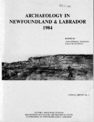
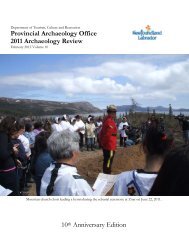
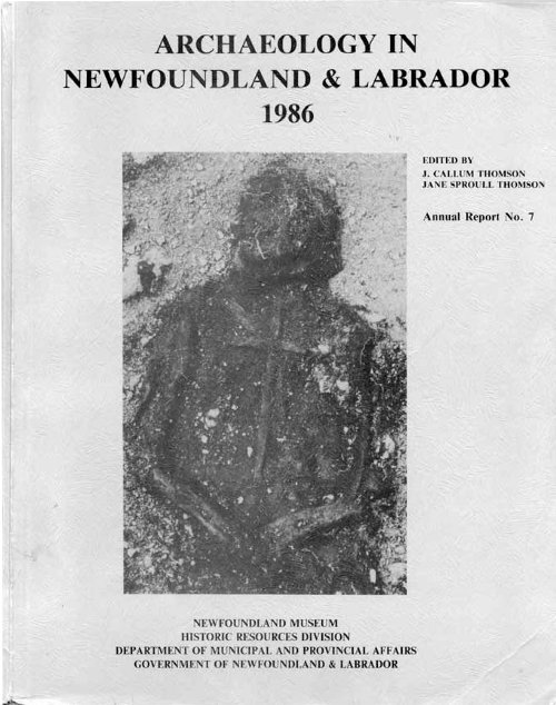
ARCHAEOLOGY IN NEWFOUNDLAND AND LABRADOR <strong>1986</strong><br />
Annual Report 7<br />
Edited by: J. Callum Thomson<br />
Jane Sproull Thomson<br />
<strong>Newfoundl<strong>and</strong></strong> Museum<br />
Historic Resources Division<br />
Department of Municipal <strong>and</strong> Prov<strong>in</strong>cial Affairs<br />
St. John's, NF<br />
April, 1989
Cover: Burial 57, Red Bay Basque Whal<strong>in</strong>g site, southern <strong>Labrador</strong><br />
(see James Tuck report).<br />
All publications of the <strong>Newfoundl<strong>and</strong></strong> Museum <strong>and</strong> Historic Resources Division,<br />
Department of Municipal <strong>and</strong> Prov<strong>in</strong>cial Affairs, St. John's are also available<br />
on microfiche from<br />
Micromedia Ltd.<br />
158 Pearl St.<br />
Toronto, Ontario<br />
Canada, M5H 1L3<br />
ISSN 0715-2086
Archaeological research <strong>in</strong> <strong>Newfoundl<strong>and</strong></strong> <strong>and</strong> <strong>Labrador</strong> - <strong>1986</strong>..............1<br />
J. Callum Thmon<br />
NLA3 Inc. report of the year's activities - <strong>1986</strong>.. ..................... .10<br />
Mark Allston<br />
Results of six historic resources uverview assessnents <strong>in</strong> Newfcnmlhd<br />
<strong>and</strong> <strong>Labrador</strong> - <strong>1986</strong>.....................................................12<br />
Gerald Penney<br />
The caribou trail cont<strong>in</strong>ues: a survey of =te<br />
<strong>and</strong> Hebrm .27<br />
J. Callum Thmon<br />
Po<strong>in</strong>t, between Saglek<br />
Tikkoatokak (HdCl-1): a late prehistoric Indian site near Na<strong>in</strong>.. ........ .52<br />
Stephen Lor<strong>in</strong>g<br />
<strong>Archaeology</strong> <strong>in</strong> western <strong>Labrador</strong>..........................................72<br />
Moira T. McCaffrey<br />
An archaeological recannaissame of the Seal Lake region, <strong>in</strong>terior<br />
<strong>Labrador</strong>................................................................114<br />
Moira T. McCaffreyr Stephen Lor<strong>in</strong>g <strong>and</strong> William W. Fitzhugh<br />
Hamilton Inlet <strong>and</strong> CartWright recormaissanoe............................164<br />
William W. Fitzhugh<br />
A late 18th century settlement <strong>in</strong> southern <strong>Labrador</strong>: Capta<strong>in</strong> George<br />
Cartwright's "Stage Cove' .181<br />
Kev<strong>in</strong> McAleese<br />
1985 archaeological surwey of swrthern <strong>Labrador</strong>: guebec/<strong>Labrador</strong> to<br />
Cape Charles .198<br />
Reg<strong>in</strong>ald Auger <strong>and</strong> Marianne Stopp<br />
Brcavatiozls at IW Bay, <strong>Labrador</strong> - <strong>1986</strong>................................213<br />
James A. Tuck<br />
Field report: 1985 survey <strong>in</strong> Strait af Belle Isle regi on................ 238<br />
Robert McGhee
Ma<strong>in</strong> River/Sapls Isl<strong>and</strong> emrirorrmentdl -................. 242<br />
James A. Tuck<br />
Maritime Archaic <strong>and</strong> Middle Dorset oaapaticns at Fleur de Lys: pre<br />
lim<strong>in</strong>ary results of <strong>1986</strong> <strong>in</strong>vestigaticns on the Baie Verte Pen<strong>in</strong>sula.. .. .250<br />
J. Callum Thomson<br />
Report for Permit No. 86-16: Inspector Isl<strong>and</strong> (DilQ-1) .................. 260<br />
Ralph T. Pastore<br />
17th century settlenents <strong>in</strong> ccmeption Bay. ............................. 270<br />
Peter Pope<br />
Skeletal material retrieved fran Faxtrap. ............................... 290<br />
Sonja M. Jerkic<br />
A report an constNCtion activities <strong>in</strong> the George Street<br />
John's, wenber - Dxdxr <strong>1986</strong>......................................292<br />
Ralph T. Pastore<br />
Brcavatims at Ferryl<strong>and</strong>, Newfoudl<strong>and</strong> - <strong>1986</strong>..........................296<br />
James A. Tuck<br />
The mrt Kim Project <strong>1986</strong> .308<br />
Janette M. G<strong>in</strong>ns<br />
St.
ARCHAEOLOGY IN<br />
NEWFOUNDLAND AND<br />
LABRADOR<br />
<strong>1986</strong><br />
ATLANTIC<br />
OCEAN<br />
c-- McCAFFREY<br />
AUGER & STOPP<br />
QUEBEC<br />
NEWFOUNDLAND
-CAL<br />
RISENUX IN M AM) IXWWlR - <strong>1986</strong><br />
J. Callum Thomson<br />
<strong>Newfoundl<strong>and</strong></strong> Museum<br />
FIHD #ESEAEE(B<br />
Note: The summary of fieldwork dras upon a prelim<strong>in</strong>ary compilation by Gerald<br />
Penney dur<strong>in</strong>g his temporary assignment as Curator of <strong>Archaeology</strong> at the Newf<br />
oundl<strong>and</strong> Museum (Penney 1987) .<br />
Field research <strong>in</strong> <strong>Newfoundl<strong>and</strong></strong> <strong>and</strong> <strong>Labrador</strong> cont<strong>in</strong>ued the trerd toward<br />
<strong>in</strong>creas<strong>in</strong>g activity <strong>in</strong> historic archaeology <strong>and</strong> emiromntal impact assess-<br />
ments noted over the past few years. Of the twenty-four<br />
archaeological re-<br />
search permits issued <strong>in</strong> <strong>1986</strong> to fourteen researchers sixteen were for<br />
specific research projects -- n<strong>in</strong>e concentrat<strong>in</strong>g on the historic period --<br />
while eight were to assess potential development impacts on historic<br />
resources. Additionally, Parks Canada sponsored fieldwork at the Port au<br />
Choix National Historic Site.<br />
In <strong>Labrador</strong> , Gerald Penney assessed the impact by the Deparbnent of Na-<br />
tional Defence on historic resources of the construction of two long range<br />
radar facilities at Saglek <strong>and</strong> Cartwright. A survey of the Cartwright project<br />
area failed to locate any sites. A brief excursion outside the study area lo-<br />
cated a large stone house relat<strong>in</strong>g to Major George Cartwright's st* on the<br />
south <strong>Labrador</strong> coast (1770-86). Six prehistoric sites were <strong>in</strong>spected near the<br />
project area at Saglek <strong>and</strong> were judged not to require any mitigation.<br />
A one-day survey by Callurn Thomon <strong>and</strong> Penney of the area between Cape<br />
Uivak <strong>and</strong> White Po<strong>in</strong>t, south of the Saglek developnent, recorded 18 new sites.<br />
Maritime Archaic longhouses, other boulder features <strong>and</strong>/or surface lithics<br />
were found at ten sites, Middle Dorset material at two, <strong>and</strong> Neo-Eskim rema<strong>in</strong>s<br />
at thirteen.<br />
A coastal survey by William Fitzhugh between Goose Bay <strong>and</strong> Cartwright lo-<br />
cated new <strong>and</strong> revisited formerly-recorded Groswater, Intermediate Indian,<br />
Middle Dorset <strong>and</strong> Neo-Eskimo sites on the ma<strong>in</strong>l<strong>and</strong> <strong>and</strong> offshore isl<strong>and</strong>s.
Stephen Lor<strong>in</strong>g spent several weeks excavat<strong>in</strong>g a Late Po<strong>in</strong>t Revenge site at<br />
Tikkoatokak Bay near Na<strong>in</strong> to clarify the relationship between the late prehis-<br />
toric Po<strong>in</strong>t Revenge complexr its antecedents, <strong>and</strong> the succeed<strong>in</strong>g Innu groups<br />
of the historical record. In addition, Lor<strong>in</strong>g sought to underst<strong>and</strong> the<br />
mechanisms of ma<strong>in</strong>tenance of social boundaries <strong>and</strong> ethnic identities among<br />
prehistoric <strong>and</strong> historic Indian groups <strong>in</strong> <strong>Labrador</strong>.<br />
A survey at Seal Lake, northwest of Goose Bay, by Fitzhugh, Moira<br />
McCaffrey, <strong>and</strong> Lor<strong>in</strong>g resulted <strong>in</strong> the location of historic Naskapi camps <strong>and</strong><br />
several large Innu w<strong>in</strong>ter camps but disappo<strong>in</strong>t<strong>in</strong>gly little evidence of prehis-<br />
toric activity.<br />
Efforts failed to del<strong>in</strong>eate the source of Seal Lake cherts,<br />
abundant at coastal sites dur<strong>in</strong>g the prehistoric period. It is now suspected<br />
that the source locations must lie east of Seal Lake.<br />
McCaffrey surveyed three lakes <strong>in</strong> Western <strong>Labrador</strong> for lithic sources <strong>and</strong><br />
located five sites on Menihek Lake with raw material of the Wishart chert<br />
formation. McCaffrey <strong>in</strong>cludes <strong>in</strong> her report a well-deserved chastisement of<br />
Thmon <strong>and</strong> Penney for their (separate) generalizations on the paucity of<br />
prehistoric rema<strong>in</strong>s <strong>in</strong> western <strong>Labrador</strong>.<br />
A survey of Petitsikapau Lake by<br />
McCaffrey <strong>in</strong>cluded a visit to the site of Fort Nascopie, a Hudson's Bay Com-<br />
pany post (1830-60).<br />
Kev<strong>in</strong> McAleese <strong>in</strong>vestigated the vernacular architecture of a late 18th<br />
century fish<strong>in</strong>g/seal<strong>in</strong>g/fur trapp<strong>in</strong>g settlement at Stage Cove, 80 km northeast<br />
of Red Bay.<br />
George Cartwright's Journal vaguely describes his construction of<br />
a dwell<strong>in</strong>g <strong>and</strong> store house, servants1 quarters <strong>and</strong> various shore facilities.<br />
McAleese's excavations revealed seven features represent<strong>in</strong>g these structural<br />
rema<strong>in</strong>s <strong>and</strong> 1000 artifacts <strong>in</strong>clud<strong>in</strong>g fragments of bottle, lantern <strong>and</strong> beverage<br />
glass, ceramics, various iron <strong>and</strong> copper items <strong>and</strong> such organic materials as<br />
leather, feathers <strong>and</strong> a small faunal sample.<br />
James Tuck's team from Memorial University of <strong>Newfoundl<strong>and</strong></strong> , aided by the<br />
Canadian Conservation Institute , cont<strong>in</strong>ued excavations at the Basque whal<strong>in</strong>g<br />
site at Red Bay. On Organ's Isl<strong>and</strong> a large, but little used, tqnmrks of six<br />
fireboxes was excavated, while on Saddle Isl<strong>and</strong> a second tryworks was pr-<br />
tially exposed.<br />
The render<strong>in</strong>g ovens hme not been exposed but post molds of a<br />
30 by 32 foot structure =re established. Near this structure are a number of<br />
Recent Indian hearths conta<strong>in</strong><strong>in</strong>g Little Passage <strong>and</strong> Po<strong>in</strong>t Revenge style
projectile po<strong>in</strong>ts as well as roof tiles, nails, cut baleen <strong>and</strong> Europan<br />
leather.<br />
Dur<strong>in</strong>g the excavation of a Middle Dorset site, near the whalers'<br />
cemetery, several additional 16th century graves were encountered.<br />
unusually deep burial produced the rema<strong>in</strong>s of an <strong>in</strong>dividual upon whose chest<br />
rested a large wooden cross, the first item of grave goods <strong>in</strong> more than 60<br />
burials excavated to date (see cover illustration).<br />
Reg<strong>in</strong>ald Auger <strong>and</strong> Marianne Stopp conducted a survey <strong>in</strong>itiated by the<br />
Historic Resources Division with partial D.R.I.E.<br />
An<br />
fund<strong>in</strong>g to assess site at-<br />
trition <strong>and</strong> the potential for further research, protection <strong>and</strong> tourism<br />
developnent <strong>in</strong> southern <strong>Labrador</strong>. Their team surveyed the north shore of the<br />
Strait of Belle Isle from the Quebec/<strong>Labrador</strong> border to Cape Charles.<br />
Seventy-five new sites were located.<br />
Archaic through early <strong>and</strong> late Palaeo-Eskimo,<br />
<strong>Labrador</strong> Inuit, Basque, <strong>and</strong> other European.<br />
Site distribution ranges frm Marit<strong>in</strong>-e<br />
Recent Prehistoric Indian,<br />
A rectangular, sod block Inuit<br />
house of the late 18th century was excavated on Seal Isl<strong>and</strong>s near Henley<br />
Harbour, where 11 other Inuit sites were discoverd <strong>in</strong> close proximity to<br />
European shore stations.<br />
Robert McGhee's report on a 1985 survey <strong>in</strong> southern <strong>Labrador</strong>, <strong>in</strong>adver-<br />
tently omitted by the editors from the 1985 Annual Report, is <strong>in</strong>cluded this<br />
year, McGhee revisited the L'Anse Amour site, not<strong>in</strong>g new boulder structures<br />
similar to longhouses <strong>and</strong>, .perhaps, a "roadway" like those reported by other<br />
<strong>in</strong>vestigators <strong>in</strong> Maritime Archaic sites <strong>in</strong> central <strong>and</strong> northern <strong>Labrador</strong>.<br />
On the Isl<strong>and</strong>, Priscilla Renouf cont<strong>in</strong>ued her Parks Canada-sponsored ex-<br />
cavations at Phillips Garden, Port au Choix; her surveys resulted <strong>in</strong> the dis-<br />
covery of sixteen previously undiscovered sites.<br />
The Po<strong>in</strong>t Riche site with<br />
some thirteen house depressions is about one third the size of Phillips<br />
Garden.<br />
Radiocarbon dates from Po<strong>in</strong>t Riche (2000-1200 BPI are contemporaneous<br />
with Phillips Garden <strong>and</strong> there is similar material culture.<br />
At Phillips Gar-<br />
den East, Brenda Kennett excavated a Gromter site which yielded a large<br />
faunal sample <strong>and</strong> three types of harpoon heads. This site, dat<strong>in</strong>g to ca 2600<br />
BPI shows typological similarities to the Early Dorset sites of <strong>Labrador</strong> <strong>and</strong><br />
Independence I1 sites of the Arctic, Reports on the Port au Choix <strong>in</strong>vestiga-<br />
tions can be obta<strong>in</strong>ed from the <strong>in</strong>vestigators or from Parks Canada, Halifax.<br />
Tuck completed an earlier environmental impact assessnent of the Ma<strong>in</strong>
River area with a survey of selected areas. An <strong>in</strong>spection of the Pittman site<br />
on Sop's Isl<strong>and</strong>* <strong>in</strong>cluded <strong>in</strong> the orig<strong>in</strong>al terms of reference for this tirrber<br />
management project* found that this significant Dorset <strong>and</strong> Maritime Archaic<br />
site has stabilized well s<strong>in</strong>ce the orig<strong>in</strong>al <strong>in</strong>vestigation by L<strong>in</strong>namae (1975)<br />
<strong>and</strong> is <strong>in</strong> no danger from this developnt.<br />
Penney conducted three historic resources overview assessnents <strong>in</strong>clud<strong>in</strong>g<br />
a jo<strong>in</strong>t-venture survey with the Historic Resources Division <strong>in</strong> connection with<br />
BP/Selco's new gold m<strong>in</strong>e near Gr<strong>and</strong> Bruit on <strong>Newfoundl<strong>and</strong></strong>'s southwest coast.<br />
Two Recent Prehistoric Indian sites were discovered <strong>in</strong> Couteau Bay near the<br />
dock<strong>in</strong>g facility for the Hope Brook Gold M<strong>in</strong>e.<br />
These sites* one of which has<br />
a historic Beothuk component, are be<strong>in</strong>g monitored. The routes of <strong>Newfoundl<strong>and</strong></strong><br />
Hydro's transmission l<strong>in</strong>e to the m<strong>in</strong>e <strong>and</strong> to the town of Burgeo were assessed<br />
for historic resources. The l<strong>in</strong>e to the m<strong>in</strong>e parallels a 19th century<br />
telegraph route belong<strong>in</strong>g to the New Yorkr <strong>Newfoundl<strong>and</strong></strong>r <strong>and</strong> London Telegraph<br />
Campany <strong>and</strong> its ancillary facilities. Penney also surveyed the coastl<strong>in</strong>e of<br />
White Bear Bayr east of Burgeor for possible impacts on historic resources<br />
result<strong>in</strong>g from its designation as a remote cab<strong>in</strong> developnent area.<br />
At Fleur de Lysr on the Baie Verte Pen<strong>in</strong>sula, Thamson directed excava-<br />
tions by Scott Bigg<strong>in</strong> <strong>and</strong> a crew of local students at the habitation site as-<br />
sociated with a Dorset soapstone quarry.<br />
The quarry has long been a place of<br />
<strong>in</strong>terest to local residents, tourists <strong>and</strong> students of archaeology, be<strong>in</strong>g <strong>in</strong>itially<br />
recorded by Howley (1915). The Middle Dorset occuptionr dated <strong>in</strong> 1985<br />
at AD 400-700 was further delimited; new evidence <strong>in</strong>dicates extensive ex-<br />
ploitation of the area by Maritime Archaic peoples.<br />
The quarry site is be<strong>in</strong>g<br />
developed for tourists with the construction of a board walk, placement of <strong>in</strong>-<br />
terpretive signs <strong>and</strong> exhibits, <strong>and</strong> visitor tours given by local residents. A<br />
Middle Dorset site was found on Granby Isl<strong>and</strong>* White Bayr <strong>and</strong> three loci were<br />
del<strong>in</strong>eated at the extensive Nippers Harbour Maritime Archaic site.<br />
Ralph Pastore cont<strong>in</strong>ued his <strong>in</strong>vestigation of Beothuk occupation <strong>in</strong> Notre<br />
Dame Bay where he re-visited the Inspector Isl<strong>and</strong> site previously tested <strong>in</strong><br />
1982. Initial excavations revealed an extensive Little Passage occupation (AD<br />
1300) below a Beothuk level. It was found that serious erosion has occur red<br />
along the western edge of the site. A future salvage excavation <strong>and</strong> a stabilization<br />
project are planned.
Peter Pope carried out an archaeological survey of older comrmnities <strong>in</strong><br />
Conception Bay with the aim of document<strong>in</strong>g early occuptions. At Bristol 's<br />
Hoper an assemblage of North Devon coarse earthenware, t<strong>in</strong>-glazed earthenware1<br />
case bottles <strong>and</strong> clay pipes is typical of a mid-17th century occuption.<br />
Similar material from Clown's Cove appears slightly later.<br />
At Foxtrap, Sonja Jerkic responded to a police request for identification<br />
of skeletal rema<strong>in</strong>s.<br />
adult female <strong>and</strong> child.<br />
The burials appear to be of a pre-1900 European young<br />
Renovation of the George Street area of St. John's was monitord by Pas-<br />
tore for any disturbance or destruction of historic resources. The project,<br />
<strong>in</strong>volv<strong>in</strong>g street <strong>and</strong> sidewalk pav<strong>in</strong>g renwations, did not go beneath what was<br />
apparently fill, as most artifacts dated to the mid-19th century <strong>and</strong> later.<br />
Tuck cont<strong>in</strong>ued his research at the site of George Calvert's (later the<br />
first Lord Baltimore) Colony of Avalon at Ferryl<strong>and</strong>, about 80 km south of St.<br />
John's.<br />
Excavations at the orig<strong>in</strong>al forge, which was campletd <strong>in</strong> the summer<br />
of 1622, produced a variety of associated material dat<strong>in</strong>g prior to 1650.<br />
this time the forge apparently fell <strong>in</strong>to disuse <strong>and</strong> the hillside excavation <strong>in</strong><br />
which it was built filled with refuse. Work at a second area closer to the<br />
<strong>in</strong>ner harbour revealed evidence of a large stone foundation built at the t<strong>in</strong>-e<br />
of the orig<strong>in</strong>al settlement <strong>and</strong> destroyed same time <strong>in</strong> the late 17th oentury,<br />
possibly <strong>in</strong> a Dutch raid of 1673. Belaw this structure is a deeply stratified<br />
deposit conta<strong>in</strong><strong>in</strong>g smok<strong>in</strong>g pipes1 ceramics <strong>and</strong> glass from the late 16th/early<br />
17th century. An underly<strong>in</strong>g layer of fire cracked rock yielded flakes of<br />
coarse chert <strong>and</strong> a broken biface <strong>in</strong>dicat<strong>in</strong>g an Indian occuption of the 16th<br />
century, the first good evidence of Indian expansion to the extrene east coast<br />
of the Isl<strong>and</strong>.<br />
A basal stratum of North Devon ceramics suggests a seasonal<br />
occupation prior to the 1570s.<br />
The <strong>Newfoundl<strong>and</strong></strong> Mar<strong>in</strong>e <strong>Archaeology</strong> Society (NUS) undertodc a survey of<br />
a wreck site at Port Kirwan, about 90 km south of St. John's (see G<strong>in</strong>ns<br />
paper). The site's depth of 26 m limited divers' bottom times <strong>and</strong> a 1 m<br />
visibility <strong>and</strong> an average water temperature of 4'~ presented additional<br />
problems; however, a substantial data base was established. The rema<strong>in</strong>s of<br />
the vessel appear flattened <strong>and</strong> lie <strong>in</strong> a thick deposit of biogenous rmd, The<br />
extent of the hull <strong>and</strong> the dimensions of exposed structural elements, together<br />
At
with the location of ballast, guns <strong>and</strong> a varied <strong>in</strong>ventory of artifacts <strong>in</strong>dicate<br />
a comparatively large, armed, 17th century vessel. Volunteer divers<br />
provided <strong>in</strong>formation about other wrecks <strong>in</strong> Fermeuse Harbour, one of which appears<br />
to date from the 17th century.<br />
With the exception of the Port au Choix <strong>in</strong>vestigations, these projects<br />
are reported upon <strong>in</strong> this volume; <strong>in</strong> mst cases papers are of a prelim<strong>in</strong>ary<br />
nature. Other permits which were issued are as follows: Tuck (86-12) had no<br />
f<strong>in</strong>d<strong>in</strong>gs to report from a survey on the east coast of the Great Northern<br />
Pen<strong>in</strong>sula. Perry Moulton's survey (86-19) of Notre Dame Bay has not been<br />
reported upon. Copies of the orig<strong>in</strong>al <strong>and</strong> more detailed f<strong>in</strong>al reports on environmental<br />
impact assessments, <strong>and</strong> the NMAS <strong>and</strong> Jerkic projects may be obta<strong>in</strong>ed<br />
upon application to this office. Further details on projects such as<br />
those by Thomson at White Po<strong>in</strong>t, Lor<strong>in</strong>g, McCaffrey, McAleeser <strong>and</strong> Kennett are<br />
<strong>in</strong>cluded <strong>in</strong> theses <strong>and</strong> dissertations completed or <strong>in</strong> progress <strong>and</strong> may be<br />
sought from the authors. A major volume on Tuck's Red Bay <strong>in</strong>vestigations is<br />
also <strong>in</strong> progress. The f<strong>in</strong>al report of the Auger <strong>and</strong> Stopp survey of the Strait<br />
of Belle Isle has been received by the Historic Resources Division; copies may<br />
be obta<strong>in</strong>ed from this office. Auger is complet<strong>in</strong>g a dissertation on Inuit <strong>and</strong><br />
other historic occupations of the Strait of Belle Isle. The Fleur de Lys <strong>and</strong><br />
other cont<strong>in</strong>u<strong>in</strong>g work on the Baie Verte Pen<strong>in</strong>sula is be<strong>in</strong>g compiled <strong>in</strong> a f<strong>in</strong>al<br />
report of <strong>in</strong>vestigations <strong>in</strong> the area by Thmon. Pastore's work at Inspector<br />
Isl<strong>and</strong> <strong>and</strong> Tuck's at Ferryl<strong>and</strong> are ongo<strong>in</strong>g projects which will be reported on<br />
<strong>in</strong> f<strong>in</strong>al form <strong>in</strong> due course.<br />
The orig<strong>in</strong>al Annual Report fomt of papers geographically ordered from<br />
north to south has been preserved for the sake of uniformity. The editors<br />
regret the delay <strong>in</strong> produc<strong>in</strong>g this volume; <strong>in</strong> the past the Annual Report has<br />
been made available with<strong>in</strong> a year or so of the field season through the excellent<br />
cooperation of contributors. Pressure on the editors of other commitments<br />
throughout 1987 <strong>and</strong> 1988, especially the plann<strong>in</strong>g <strong>and</strong> curat<strong>in</strong>g of exhibits for<br />
the newly-opened Mary March Museum <strong>in</strong> Gr<strong>and</strong> Falls prevented the ma<strong>in</strong>tenance of<br />
this schedule, through no fault of the contributors. The appo<strong>in</strong>tment of L<strong>in</strong>da<br />
Jefferson to the separated position of Resource Archaeologist with<strong>in</strong> the Historic<br />
Resources Division <strong>in</strong> early 1988, <strong>and</strong> the transfer of responsibility for
compil<strong>in</strong>g <strong>and</strong> edit<strong>in</strong>g this report series to L<strong>in</strong>da should permit nnre timly<br />
production of the report on 1987, 1988 <strong>and</strong> subsequent seasons' fieldwork.<br />
This rwiew has revealed a trerd also notd <strong>in</strong> a recent review of the<br />
1985 Annual Report (McGhee 1987). Of the 16 problem oriented research<br />
projects, most had a largely historic period focus. While <strong>in</strong>formation was collected<br />
by several researchers on nearly all of the prehistoric groups to have<br />
<strong>in</strong>habited the prov<strong>in</strong>ce dur<strong>in</strong>g the past 5000 years, mst sites reported date<br />
from the past two millennia. However, most of the research <strong>in</strong> <strong>1986</strong> was<br />
directed at <strong>in</strong>vestigat<strong>in</strong>g early European <strong>and</strong> historic native occupations of<br />
the prov<strong>in</strong>ce £ram the 16th to 20th centuries. This is <strong>in</strong> sharp contrast to the<br />
first version of this series, published <strong>in</strong> 1981, <strong>in</strong> which only two of the n<strong>in</strong>e<br />
papers dealt with the archaeology of the past five centuries. It can be hoped<br />
that field <strong>in</strong>vestigators, government agencies, <strong>and</strong> local developent associations<br />
will cont<strong>in</strong>ue this focus <strong>and</strong> provide educators with a broader <strong>and</strong> more<br />
accurate culture history for use <strong>in</strong> classrooms <strong>and</strong> text books, <strong>and</strong> the public<br />
with important ties to their immediate <strong>and</strong> more distant past.<br />
EIIslmIc REsmRas DIVISION lMxmmnES<br />
The Historic Resources Division cont<strong>in</strong>ued its other progrms throughout<br />
<strong>1986</strong>, despite the <strong>in</strong>terruptions of two work stoppages dur<strong>in</strong>g contract<br />
disputes. A total of 46 development registrations was received from the<br />
Department of Environment for review under the Ehvironmental Assessment Act,<br />
an <strong>in</strong>crease of twelve from the previous year. N<strong>in</strong>eteen of these were judged to<br />
have potential for impact on archaeological sites. In n<strong>in</strong>e cases, <strong>in</strong>vestigations<br />
were carried out by the Division; for the rena<strong>in</strong><strong>in</strong>g ten the proponents<br />
were advised to conduct same level of historic resources assessment. Sixty-one<br />
quarry permit applications <strong>and</strong> five Crown l<strong>and</strong> applications were exam<strong>in</strong>ed <strong>in</strong><br />
order to ensure that these operations would not disturb known archaeological<br />
sites. Seventeen were field checked. The Division rwiewed 90 projects brought<br />
before the Interdepartmental L<strong>and</strong> Use Camnittee, <strong>and</strong> thirteen Municipal Plans<br />
<strong>and</strong> Plan Reviews. The Regional Advisor Programme, coord<strong>in</strong>ated by the <strong>Newfoundl<strong>and</strong></strong><br />
<strong>and</strong> <strong>Labrador</strong> Association of Amateur Archaeologists (~d), cont<strong>in</strong>ued<br />
to exp<strong>and</strong> its site watch <strong>and</strong> other activities. For the last two months of the<br />
year, Gerald Penney was hired to replace Callum Thomon as Curator of
<strong>Archaeology</strong> <strong>and</strong> Ethnology dur<strong>in</strong>g the latter's leave to complete doctordl<br />
coursework.<br />
A new exhibit featur<strong>in</strong>g Museum research <strong>in</strong>to Palae-Eskim<br />
cultures <strong>in</strong><br />
northern <strong>Labrador</strong> was <strong>in</strong>stalled on the Native Peoples' floor of the Duckworth<br />
Street Museunit St. John's.<br />
Each of the exhibits on this floor, <strong>in</strong>stalled <strong>in</strong><br />
1977, will be upgraded or replaced to reflect more recent research results. We<br />
also began work on the designr storyl<strong>in</strong>er graphics? text panels <strong>and</strong> artifact<br />
selection for the Native Peoples' section of the Mary March Regional Museum?<br />
Gr<strong>and</strong> Falls? scheduled to open <strong>in</strong> Augustt 1988.<br />
Many hours of volunteer assistance with catalogu<strong>in</strong>g <strong>and</strong> collection<br />
management were once aga<strong>in</strong> contributed to the Museum by Julia Mathieson of<br />
m3. In addition? Joy Skanes worked under contract to enter recent site<br />
records to the Canadian Heritage Information Network -- the site <strong>in</strong>ventory <strong>in</strong><br />
the prov<strong>in</strong>ce totalled 1700 by late <strong>1986</strong> -- <strong>and</strong> Scott Bigg<strong>in</strong> was hired to<br />
catalogue artifacts from Museum field projects <strong>in</strong> <strong>1986</strong>.<br />
GRANIS<br />
The Historic Resources Division was pleas& to be able to provide $20r450<br />
<strong>in</strong> grants to researchers <strong>in</strong> <strong>1986</strong> to help defray fieldwork costs with<strong>in</strong> the<br />
prov<strong>in</strong>ce.<br />
William W. Fitzhugh Srnithsonian Institution $2000.00<br />
Stephen Lor<strong>in</strong>g University of Massachusetts $1150.00<br />
Kev<strong>in</strong> McAleese<br />
Memorial University of<br />
<strong>Newfoundl<strong>and</strong></strong> (M.U.N.) $4600.00<br />
Moira McCaffrey McGill University $2200.00<br />
<strong>Newfoundl<strong>and</strong></strong> Mar<strong>in</strong>e <strong>Archaeology</strong> Society $4000.00<br />
Gerald Penney St. John's $1500.00<br />
Peter Pope M.U.N. $2000.00<br />
James A. Tuck M.U.N. $3000.00<br />
Among other funds contributed to the projects reported upon below?<br />
$73r000 was provided on a cost shared basis by the federal <strong>and</strong> prov<strong>in</strong>cial<br />
governments to cover the cost of work at the Red Bay Basque whal<strong>in</strong>g site <strong>in</strong><br />
<strong>1986</strong>. This br<strong>in</strong>gs total spend<strong>in</strong>g on archaeological projects <strong>in</strong> the prov<strong>in</strong>ce to<br />
over $250r000 for the year.
Carbright, George<br />
1792 A journal of transactions events, dur<strong>in</strong>q a residence of nearly<br />
sixteen years on the coast of <strong>Labrador</strong>, 3 vols. All-<strong>in</strong> <strong>and</strong> Pidge,<br />
Newark , Engl<strong>and</strong>.<br />
Hwleyr James P.<br />
1915 Beothucks or Red Indians. Cambridge University Press.<br />
L<strong>in</strong>namae , Urve<br />
1975 The Dorset Culture. Technical Papers of the <strong>Newfoundl<strong>and</strong></strong> Museum 1.<br />
St. John's.<br />
McGhee, Robert<br />
1987 Review of Archaeolosv <strong>in</strong> <strong>Newfoundl<strong>and</strong></strong> <strong>Labrador</strong> 1985, Callum<br />
Thomson <strong>and</strong> Jane Sproull Thornson, Editors. In <strong>Newfoundl<strong>and</strong></strong><br />
Quarterly 83 (2): 37.<br />
Penney, Gerald<br />
1987 <strong>Archaeology</strong> <strong>in</strong> rJewfoundl<strong>and</strong> <strong>and</strong> <strong>Labrador</strong> <strong>1986</strong>. In Canadian<br />
Archaeolosical Association Newsletter, Spr<strong>in</strong>g 1987.
T E l E ~ A M ) L A E W m o R ~ m O N<br />
OFArwlEm-ISrS<br />
m.:<br />
RERXT OF TEE YWR'S ZXTMTIES - <strong>1986</strong><br />
Mark Allston<br />
President<br />
N<strong>in</strong>eteen eighty-six saw the association receive its legal <strong>in</strong>corporation.<br />
Our thanks to lawyer Bill Crosbie <strong>and</strong> the guid<strong>in</strong>g h<strong>and</strong> of Frances Puglisevich<br />
for add<strong>in</strong>g "Inc." to our letterhead. Besides charitable status, which is still<br />
pend<strong>in</strong>g, this is really the last step towards fulfill<strong>in</strong>g our aims. Now, we<br />
must build on our accomplishments <strong>and</strong> the directions we have to set to become<br />
a stronger association,<br />
This year, the site watch programme was activated<br />
to help with protec-<br />
tion of sites <strong>in</strong> key areas of the prov<strong>in</strong>ce. Advisors have been recruited from<br />
Cape Ray, on the southwest coast, Fleur de Lysr on the Baie Verte Pen<strong>in</strong>sula ,<br />
Millertmr on Red Indian Lake, <strong>and</strong> Fermeuse on the east coast of the Avalon<br />
Pen<strong>in</strong>sula. Other recammendations are now be<strong>in</strong>g considered from other regions,<br />
<strong>in</strong>clud<strong>in</strong>g <strong>Labrador</strong>. A set of guidel<strong>in</strong>es has been drafted <strong>and</strong> approved by the<br />
NLA~ executive to def<strong>in</strong>e the roles <strong>and</strong> responsibilities of the Historic<br />
Resources Division, the NLA~, <strong>and</strong> Regional Advisors. Anyone <strong>in</strong>terested <strong>in</strong> be-<br />
com<strong>in</strong>g a Regional Advisor should contact Steve Colman-Sadd at 754-1127 or 576-<br />
2769, or the Historic Resources Division at 576-2460.<br />
The films we have sham <strong>in</strong> cooperation with the <strong>Newfoundl<strong>and</strong></strong> Museum -- a<br />
BBC TV series on the Vik<strong>in</strong>gs <strong>and</strong> a Parks Canada production on LtAnse aux<br />
Meadows - have aga<strong>in</strong> proved their popularity with local audiences. It is un-<br />
fortunate that the films have become so expensive to rent. I shall endeavour<br />
to help the new executive get archaeological <strong>and</strong> anthropological films from<br />
new sources. Perhaps we should broaden our topics to <strong>in</strong>clude more<br />
anthropological <strong>and</strong> archaeological subject matter.<br />
General meet<strong>in</strong>gs held <strong>in</strong> <strong>1986</strong> <strong>in</strong>cluded an illustrated talk <strong>in</strong> January by<br />
Callurn Thomson <strong>and</strong> Mark Allston on their fieldwork <strong>in</strong> Saglek Bay <strong>in</strong> the smr<br />
of 1985, followed by a presentation of summary reports for the past year <strong>and</strong>
the re-election of the exist<strong>in</strong>g executive for a second year. In February, Cal-<br />
lum presented an overview of the newly-proclaimed m Respect<strong>in</strong>q the Preserva-<br />
tion of the Historic Resources of the Prov<strong>in</strong>ce (The Historic Resources Act)<br />
---<br />
<strong>and</strong> fielded questions from the audience on topics relat<strong>in</strong>g to the Act. Ralph<br />
Pastore gave a fasc<strong>in</strong>at<strong>in</strong>g lecture on his work at the Boyd's Cove site <strong>in</strong><br />
March <strong>and</strong>, the follow<strong>in</strong>g month, Priscilla Renouf presented data on her recent<br />
work at Port au Choix.<br />
Three issues of the Newsletter were distributed to members dur<strong>in</strong>g the<br />
year, conta<strong>in</strong><strong>in</strong>g items on ar&aeological <strong>in</strong>vestigations with<strong>in</strong> the prov<strong>in</strong>ce<br />
<strong>and</strong> abroad, progress with the site watch programmer news of sister<br />
organizations, <strong>and</strong> members' activities. The association has cont<strong>in</strong>ued to offer<br />
a variety of volunteer services to help further the cause of archaeology <strong>in</strong><br />
the prov<strong>in</strong>ce. I salute those members <strong>in</strong>volved for their devotion. Our growth<br />
this past year has not been as great as it should have been but we must be<br />
patient with our development so that we can protect the resource that we have<br />
taken upon ourselves to help protect. My thanks to Julia Mathieson, Bruce Ryan<br />
<strong>and</strong> Steve Colman-Sadd for contribut<strong>in</strong>g to this report.<br />
NLA~'S new address is: P.O. Box 13912, Stn. A, St. John's, NF, A1B 4G7
Gerald Penney<br />
Gerald Penney Associates Limited<br />
St. John's<br />
llmuxumrn<br />
Six historic resources assessments were carried out <strong>in</strong> <strong>Newfoundl<strong>and</strong></strong> <strong>and</strong><br />
<strong>Labrador</strong> <strong>in</strong> <strong>1986</strong> for a variety of clients: four on the Isl<strong>and</strong> portion of the<br />
prov<strong>in</strong>ce <strong>and</strong> two <strong>in</strong> <strong>Labrador</strong>. These were to establish whether commercial or<br />
other developnents would adversely impact historic or prehistoric sites. Basic<br />
<strong>in</strong>formation about the assessments <strong>in</strong>clud<strong>in</strong>g clients <strong>and</strong> the dates of fieldwork<br />
are sumnarized <strong>in</strong> Table 1.<br />
1 1 Projectsr clients <strong>and</strong> field dates.<br />
proiect Client nateS<br />
Hope Brook M<strong>in</strong>e BP Resources Canada 25/06 - 02/06<br />
Wlrgeo Road to Hope Brook <strong>Newfoundl<strong>and</strong></strong> Hydro 06/06 - 11/06<br />
transmission l<strong>in</strong>e<br />
Cartwrightr <strong>Labrador</strong><br />
long range radar site<br />
New North Consultants 18/06 -- 24/06<br />
Saglekr <strong>Labrador</strong><br />
long range radar site<br />
New North Consultants 25/06 - 28/06<br />
White Bear Bay coastal<br />
survey<br />
NF Department of Forest 28/08 - 01/09<br />
Resources <strong>and</strong> L<strong>and</strong>s<br />
Bottom Brook to Burgeo<br />
transmission l<strong>in</strong>e<br />
<strong>Newfoundl<strong>and</strong></strong> Hydro 18/09 - 20/09
All four Isl<strong>and</strong> <strong>in</strong>vestigations took place <strong>in</strong> the southwestern comer of<br />
the prov<strong>in</strong>ce <strong>and</strong> have added to the <strong>in</strong>formation concern<strong>in</strong>g Micmac <strong>and</strong> Beothuk<br />
cultures. In all cases fieldwork was supplemented by documentary research <strong>and</strong>,<br />
<strong>in</strong> same cases, by personal <strong>in</strong>terviews <strong>and</strong> <strong>in</strong>formation-gather<strong>in</strong>g from local<br />
residents <strong>and</strong> other knowledgeable people.<br />
pFcuEX2-0635<br />
Hape Brook M<strong>in</strong>e<br />
As part of its environmental responsibilities <strong>in</strong> develop<strong>in</strong>g a gold<br />
m<strong>in</strong>e on the C<strong>in</strong>q Cerf River, BP Resources Canada contracted a study of the<br />
area to determ<strong>in</strong>e if any historic resources would be affected (Penney <strong>1986</strong>a).<br />
This <strong>in</strong>cluded a ground survey of the area planned for a road from the m<strong>in</strong>e to<br />
the waterside, a foot survey of the area planned for a new dock, <strong>and</strong> the<br />
shorel<strong>in</strong>es around Boat Hole Brook. The area of the m<strong>in</strong>e <strong>and</strong> approaches was<br />
also overflown by helicopter.<br />
A research grant from the Historic Resources Division made possible a<br />
coastal survey of C<strong>in</strong>q Cerf Bay <strong>and</strong> parts of Couteau Bay which fell outside<br />
BP1s study area. This extension was aimed at sett<strong>in</strong>g possible prehistoric <strong>and</strong><br />
historic activity with<strong>in</strong> the BP study area <strong>in</strong>to a larger picture of events on<br />
this coast. While considerable amounts of EuroFean activity was observed at<br />
Duck Isl<strong>and</strong>, on the east coast of Couteau Bay, <strong>and</strong> <strong>in</strong> the ab<strong>and</strong>oned cmnity<br />
of C<strong>in</strong>q Cerf, little else appears to have taken place. The shallowness of C<strong>in</strong>q<br />
Cerf Bay <strong>and</strong> its open exposure may have made it unpopular with prehistoric<br />
peoples.<br />
Two prehistoric Indian sites were located <strong>in</strong> Couteau Bay (Figure 1). The<br />
first, a small site (CkBm-2) r<br />
would have been destroyed by the proposed dock<br />
facility as orig<strong>in</strong>ally planned; however, the dock was subsequently scaled down<br />
to accdte a more specialized vessel. Mitigative measures consist<strong>in</strong>g of<br />
complete excavation <strong>and</strong> documentation of the site were recammended. The site<br />
assemblage from test<strong>in</strong>g was small, consist<strong>in</strong>g of a few chert flakes. The loca-<br />
tion may have been a lookout or auxiliary usage site for a larger site.<br />
The second site at Boat Hole Brook is considered to be of Recent Indian<br />
orig<strong>in</strong>. This site (CkBnh), located near the mouth of Boat Hole Bro&r may be<br />
affected by the dock facility <strong>and</strong> road construction; further <strong>in</strong>vestigation <strong>and</strong>
site protection were recammended to the client (Penney <strong>1986</strong>b). Further test<strong>in</strong>g<br />
revealed 35 stone artifacts (Plate 1) <strong>in</strong>dicat<strong>in</strong>g that the Boat Hole Brook site<br />
Mas occupied by three cultural groups: Beaches complexr Little Passage cmplex<br />
md Beothuk Indians. Charcoal, one piece of Ehropan pottery? <strong>and</strong> evidence of<br />
iron sta<strong>in</strong><strong>in</strong>g <strong>and</strong> bone rema<strong>in</strong>s <strong>in</strong>dicate site usage dur<strong>in</strong>g the historic period.<br />
A radiocarbon age determ<strong>in</strong>ation of 450+100 B.P. (Beta-17854) <strong>in</strong>dicates a late<br />
prehistoric occupation.<br />
Burgeo Road to Hope Brook trananissicm l<strong>in</strong>e<br />
As part of the Hope Brook m<strong>in</strong><strong>in</strong>g developnentr <strong>Newfoundl<strong>and</strong></strong> <strong>and</strong><br />
<strong>Labrador</strong> Hydro will build a 138 kv transmission l<strong>in</strong>e from Wooden Tilt Brook on<br />
the Burgeo Road to the m<strong>in</strong>e site. The 34 km l<strong>in</strong>e crosses three major<br />
waterways: Gr<strong>and</strong>y's Brook r Northwest Arm Brook <strong>and</strong> Coutea Brook. Survey<br />
methodology <strong>in</strong>cluded a foot survey of the river cross<strong>in</strong>gs (Figure 2) r a<br />
helicopter overflight of the proposed l<strong>in</strong>e router <strong>and</strong> ground <strong>in</strong>spctions of<br />
the proposed substation areas (Penney <strong>1986</strong>~).<br />
While no prehistoric sites were discovered along the l<strong>in</strong>e's router river<br />
cross<strong>in</strong>gs showed considerable usage by hunters? prospectors <strong>and</strong> others. Sumr<br />
cab<strong>in</strong>s were found near Gr<strong>and</strong>y ' s Brook <strong>and</strong> Couteau Brook. The New York r <strong>Newfoundl<strong>and</strong></strong><br />
<strong>and</strong> London Telegraph Campany (ca. 1855-1935) l<strong>in</strong>e <strong>in</strong> many areas<br />
parallels the transmission l<strong>in</strong>e route. The l<strong>in</strong>e was a vital 19th century l<strong>in</strong>k<br />
to carry cmercial <strong>and</strong> news data from the old world to the new. The route was<br />
surveyed <strong>in</strong> 1851 <strong>and</strong> the telegraph l<strong>in</strong>e <strong>in</strong>stalled shortly thereater. The<br />
river cross<strong>in</strong>gs often became l<strong>in</strong>e shack sites <strong>and</strong> depots mark<strong>in</strong>g l<strong>in</strong>e crew<br />
territories. A l<strong>in</strong>e shack reported at Couteau Brook was not located dur<strong>in</strong>g the<br />
survey. Dur<strong>in</strong>g the transmission l<strong>in</strong>e survey old telegraph l<strong>in</strong>e pole founda-<br />
tions were discovered. Recammendations were made to the client that further<br />
<strong>in</strong>vestigations be undertaken of the telegraph l<strong>in</strong>e facilities at Couteau<br />
Brook.<br />
Another historic site possibility at the brook cross<strong>in</strong>gs was reported to<br />
the client. In 19th century <strong>Newfoundl<strong>and</strong></strong> transhumance was the econmic rule.<br />
Fishemn <strong>and</strong> seafarers moved <strong>in</strong>to the heads of the bays <strong>and</strong> fjords to weather<br />
the w<strong>in</strong>ters <strong>and</strong> to cut wood for boat <strong>and</strong> house build<strong>in</strong>g as well as to hunt <strong>and</strong><br />
trap. Many w<strong>in</strong>terhouse sites are known to exist but no effort has been made to
date to discover <strong>and</strong> <strong>in</strong>vestigate than. Many w<strong>in</strong>terhouse sites have been taken<br />
over <strong>in</strong> modern times as summer cab<strong>in</strong>s.<br />
CartWright long range radar site<br />
The National Defence Department of the Government of Canada is<br />
upgrad<strong>in</strong>g the early warn<strong>in</strong>g radar system <strong>in</strong> Canada's north. aree of these<br />
radar sites <strong>in</strong> the eastern Arctic are at Cartwright <strong>and</strong> Saglek, <strong>Labrador</strong>, <strong>and</strong><br />
at Breevort Isl<strong>and</strong>r off the southeast coast of Baff<strong>in</strong> Isl<strong>and</strong>. An historic<br />
resources assessment of the Cartwright <strong>and</strong> Saglek sites was requird by the<br />
<strong>Newfoundl<strong>and</strong></strong> government while the Government of the Northwest mrritories<br />
required an assessment of the Breevort site.<br />
Cartwright, on the east side of S<strong>and</strong>wich Bay, is located <strong>in</strong> an area of<br />
rugged hills <strong>and</strong> cliffs near the open ocean. Further <strong>in</strong>l<strong>and</strong> the bays <strong>and</strong><br />
fjords become sheltered <strong>and</strong> wooded. S<strong>and</strong>wich Bay is rich with avian, mar<strong>in</strong>e<br />
<strong>and</strong> terrestrial wildlife <strong>and</strong> would have been an ideal place for<br />
huntedgatherer peoples. Six cultural groups have used the coastl<strong>in</strong>es <strong>in</strong> <strong>and</strong><br />
around S<strong>and</strong>wich Bay over the past 7,000 years: Maritime Archaic <strong>and</strong> Shield Ar-<br />
chaic Indian, early Palaeo-Eskimo, Dorset Eskimo, Po<strong>in</strong>t Revenge Indian, <strong>and</strong><br />
Neo-Eskimo. European settlement <strong>in</strong> S<strong>and</strong>wich Bay similarly subsisted on its<br />
rich flora <strong>and</strong> fauna.<br />
Aside from a foot <strong>and</strong> helicopter survey of the actual radar site <strong>and</strong> as-<br />
sociated roads <strong>and</strong> build<strong>in</strong>g areas (Figure 3 )r where no historic resources were<br />
found, a survey of the comrmnity of Cartwright itself was conducted. Personal<br />
<strong>in</strong>terviews with residents <strong>and</strong> documentary research aided <strong>in</strong> the location of<br />
two Maritime Archaic tradition sites <strong>and</strong> the rema<strong>in</strong>s of George Cartwright's<br />
house on Great Isl<strong>and</strong> (Figure 4). With<strong>in</strong> the cmnity, a Maritime Archaic<br />
site appears to have been destroyed by road construction. A survey at Paradise<br />
River for a second of Cartwright's houses was not successful due to reoent activity<br />
<strong>in</strong> the area. Recommendations were made regard<strong>in</strong>g the future discovery<br />
of any historic resources <strong>and</strong> are now part of the project's emiromntal<br />
protection plan (Penney <strong>1986</strong>e).
Saglek Pomj range radar site<br />
The Saglek <strong>in</strong>stallation is be<strong>in</strong>g rebuilt on the site of an earlier<br />
United States DEW L<strong>in</strong>e radar facility. A history of occuption of Saglek Bay<br />
<strong>in</strong>cludes most of the cultural groups mentioned above <strong>in</strong> the Cartwright<br />
section, with the exception of the Shield Archaic. Six prwiously-recorded<br />
sites were known to exist on the raised beach area below the radar site. These<br />
sites, of Maritime Archaic, Palaeo-Eskimo, Neo-Eskimo <strong>and</strong> possible Po<strong>in</strong>t<br />
Rwenge orig<strong>in</strong> had not received any visible disturbance dur<strong>in</strong>g the American<br />
<strong>and</strong> subsequent Canadian use of the Saglek base. Their location, on the other<br />
side of a deep stream which cuts the terrace <strong>in</strong> two, will likely cont<strong>in</strong>ue to<br />
protect them from modern <strong>in</strong>terference (Penney <strong>1986</strong>f).<br />
Saglek Bay has been the subject of <strong>in</strong>tense <strong>in</strong>vestigations <strong>in</strong> the past by<br />
Canadian- <strong>and</strong> American-F-xed archaeologists. About 200 sites have been discovered<br />
<strong>in</strong> the bay to date, rang<strong>in</strong>g across 5-6000 years. At the actual area<br />
likely to be disturbed by construction activities, on the western side of the<br />
brook, sites would have been destroyed long ago. No sites were fourd <strong>in</strong> the<br />
actual radar site site area although many sites are present with<strong>in</strong> a couple of<br />
kilometres of the radar site. Recammendations were made to declare the closest<br />
sites to the radar station off limits to any activity by construction or<br />
operat<strong>in</strong>g personnel <strong>and</strong> form part of the project EPP.<br />
V?hite Bear Bay coastal survey<br />
White Bear Bay (Figure 5) is a forested fjord on the otherwise<br />
bleak, rocky south coast of the Isl<strong>and</strong>. It has been used <strong>in</strong>tensively by residents<br />
of Ramear Burgeo <strong>and</strong> other cormunities as a hunt<strong>in</strong>g, fish<strong>in</strong>g, logg<strong>in</strong>g<br />
<strong>and</strong> recreational area for 200 years or so <strong>and</strong> is naw be<strong>in</strong>g put under the con-<br />
trol of the Department of Forest Resources <strong>and</strong> L<strong>and</strong>s as a ranote cottage area.<br />
The possibility of such cottage areas impact<strong>in</strong>g historic resources was the<br />
rationale beh<strong>in</strong>d the coastal survey. One site of Palaeo-Eskimo orig<strong>in</strong> was al-<br />
ready known, <strong>and</strong> Micmac use of the head of the bay is documented.<br />
The shores were surveyed by boat; test pits were dug at the sites pro-<br />
posed for cab<strong>in</strong> developnent. Documentary research shows Micmac use of White<br />
Bear Bay dur<strong>in</strong>g the past 150 years. At the head of the bay was an important
telegraph station for the New York, <strong>Newfoundl<strong>and</strong></strong> <strong>and</strong> London Telegraph Cmpany.<br />
European sites were <strong>in</strong>vestigated on Deer Isl<strong>and</strong>, at the mouth of the bay.<br />
While cab<strong>in</strong> developnent <strong>in</strong> White Bear Bay will not <strong>in</strong>volve bulldoz<strong>in</strong>g<br />
<strong>and</strong> earthmov<strong>in</strong>g, the <strong>in</strong>creased recreational use of the area may create adverse<br />
impacts through site v<strong>and</strong>alism. A system of report<strong>in</strong>g site discovery <strong>and</strong> an<br />
educational programme for cab<strong>in</strong> owners were recommended as mitigative<br />
measures.<br />
Only one known site (Penney 1985) may be impacted adversely by further<br />
cab<strong>in</strong> developnent. Other areas along the shores of the bay are either without<br />
sites or else cab<strong>in</strong> developnent is not practicable. The head of White Bear<br />
Bay, the most likely area for cab<strong>in</strong> dwelopnent <strong>and</strong> the area with the greatest<br />
potential for prehistoric <strong>and</strong> historic sites, is of sane concern <strong>and</strong> more work<br />
was recommended to adequately <strong>in</strong>vestigate <strong>and</strong> document such potential<br />
resources.<br />
me mouth of the bay, especially Deer <strong>and</strong> Bear Isl<strong>and</strong>s, shows extensive<br />
European usage <strong>and</strong> cont<strong>in</strong>u<strong>in</strong>g summer cab<strong>in</strong> <strong>and</strong> fish<strong>in</strong>g station use. Any ar-<br />
chaeological sites on these isl<strong>and</strong>s would long ago have been destroyed, Human<br />
occupation of these isl<strong>and</strong>s is limited <strong>in</strong> area <strong>and</strong> modern use has obliterated<br />
evidence of use even 100 years or so ago.<br />
Bottan Brook to Burgeo transmission l<strong>in</strong>e<br />
<strong>Newfoundl<strong>and</strong></strong> <strong>and</strong> <strong>Labrador</strong> Hydro plans to extend a 138 kv transmis-<br />
sion l<strong>in</strong>e f ram Bottan Brook , near Bay St. Goerge r<br />
to Burgeo. Fourteen rivers<br />
<strong>and</strong> brooks will be crossed by the l<strong>in</strong>e <strong>in</strong>clud<strong>in</strong>g waterways which are known to<br />
have been used by Beothuk <strong>and</strong> Micmac. No historic resources were located along<br />
the route of the l<strong>in</strong>e or at the river cross<strong>in</strong>gs, but a strong recanmendation<br />
was made to exercise care dur<strong>in</strong>g construction of the l<strong>in</strong>e <strong>in</strong> order that any<br />
sites discovered may be <strong>in</strong>vestigated <strong>and</strong> documented (Penney <strong>1986</strong>d). In this<br />
regard, two sem<strong>in</strong>ars were given to Hydro field personnel.<br />
The three major physiographic areas of the transmission l<strong>in</strong>e route are<br />
the Southwest Brook valley, the highl<strong>and</strong>s from Lloyd's River to Burnt Pordr<br />
<strong>and</strong> the barrens between Burnt Pond <strong>and</strong> the coast (Figure 6). The Southwest<br />
Brook valley was a route for Micmac migration <strong>and</strong> for exploitation of the<br />
<strong>in</strong>terior, connect<strong>in</strong>g Bay St. George <strong>and</strong> the <strong>in</strong>terior forests <strong>and</strong> rivers.
Documentary research shows areas at the head of Southwest Brodc as be<strong>in</strong>g<br />
"awnedn by Micmac families who either lived <strong>in</strong> the <strong>in</strong>terior or had settlement<br />
bases at Bay St. George. Prior to Micmac expansion the waterways through the<br />
highl<strong>and</strong>s around Lloyd's River, Victoria Lake <strong>and</strong> K<strong>in</strong>g George IV Lake were<br />
used by the Beothuk on an annual migration from the <strong>in</strong>terior to the Notre Dame<br />
Bay coast. The south coast barrens were used by both Indians <strong>and</strong> Palaeo-<br />
Eskimos as hunt<strong>in</strong>g grounds for caribou, birds <strong>and</strong> small fur-bear<strong>in</strong>g animals.<br />
SmlMRY<br />
The four <strong>in</strong>vestigations conducted <strong>in</strong> the southwest corner of the Isl<strong>and</strong><br />
have added to the knowledge of the history <strong>and</strong> prehistory of the area. 'Ihe ad-<br />
ditional sites discovered <strong>in</strong> White Bear Bay, Couteau Bay <strong>and</strong> at Boat Hole<br />
Brook are <strong>in</strong>terest<strong>in</strong>g <strong>in</strong> as mch as they confirm use of the coastal areas by<br />
prehistoric people. The documentary research <strong>in</strong>to Micmac <strong>and</strong> Beothuk use of<br />
the <strong>in</strong>terior <strong>and</strong> the details of the telegraph l<strong>in</strong>e which once extended along<br />
the south coast shed light on a little knm aspect of Newfoundlard Isl<strong>and</strong><br />
history.<br />
The need for more detailed work on the European <strong>and</strong> Micmac occuption of<br />
the south coast has been stressed; further work is planned at K<strong>in</strong>g George IV<br />
Lake <strong>in</strong> 1987. The m<strong>in</strong><strong>in</strong>g operation at Hope Brook, the transmission l<strong>in</strong>es, <strong>and</strong><br />
the open<strong>in</strong>g up of White Bear Bay for authorized cab<strong>in</strong> developnt are all <strong>in</strong>-<br />
dicative of the <strong>in</strong>creased pressure to which this area will be subjected <strong>in</strong> the<br />
next few years. The need is great for education programmes <strong>and</strong> systems to<br />
report <strong>and</strong> mitigate aga<strong>in</strong>st destruction of historic resources <strong>in</strong> the area. The<br />
two <strong>Labrador</strong> studies underl<strong>in</strong>e the necessity for careful assessment of the<br />
potential of <strong>Labrador</strong>'s historic resources.
Penney, Gerald<br />
1985 A prehistory of the southwest coast of <strong>Newfoundl<strong>and</strong></strong>. M.A. thesis,<br />
Department of Anthropology, Memorial University of <strong>Newfoundl<strong>and</strong></strong>.<br />
<strong>1986</strong>a Historic resources overview assessnent of the Hope Brodt Gold<br />
M<strong>in</strong>e. Prepared for BP Resources Canada. Copy on file, Historic<br />
Resources Division, St. John's.<br />
<strong>1986</strong>b Mitigative impact management, Hope Brook M<strong>in</strong>e. Prepared for BP<br />
Resources Canada. Copy on file, Historic Resources Division, St.<br />
John' s.<br />
<strong>1986</strong>c Historic resources overview assessnent of the Burgeo Road to Hope<br />
Brook M<strong>in</strong>e transmission l<strong>in</strong>e. Prepared for <strong>Newfoundl<strong>and</strong></strong> <strong>and</strong> <strong>Labrador</strong><br />
Hydro. Copy on file, Historic Resources Division, St. John's.<br />
<strong>1986</strong>d Historic resources overview assessment of the Bottom Brook to<br />
Burgeo transmission l<strong>in</strong>e. preparedifor <strong>Newfoundl<strong>and</strong></strong> <strong>and</strong> Labridor<br />
Hydro. Copy on file, Historic Resources Division, St. John's.<br />
<strong>1986</strong>e Historic resources overview assessment of the long range radar<br />
<strong>in</strong>stallation at Cartwright, <strong>Labrador</strong>. Prepared for New North<br />
Consultants. Copy on filer Historic Resources Division, St.<br />
John's.<br />
<strong>1986</strong>f Historic resources overview assessment of the long range radar<br />
<strong>in</strong>stallation at Saglek, <strong>Labrador</strong>. Copy on file, Historic Resources<br />
Division, St. John's.
Figure 1 : Boat Hole Brook site
M Survey Slte Locations<br />
-a-<br />
Whlte Bear 8ay Remote<br />
Cottage Area Boundary<br />
Figure s : White Bear Bay
Figure 6: Location of river cross<strong>in</strong>gs - Burgeo transmission l<strong>in</strong>e
Plate .1 : Lithics at Boat Hole Brook
l3rnammrn<br />
J. Callurn Thomson<br />
<strong>Newfoundl<strong>and</strong></strong> Museum<br />
A report on a 1985 survey of the <strong>in</strong>ner am of Saglek Fjord (Figure 1) ,<br />
<strong>in</strong> which little evidence was found of prehistoric utilization of resources <strong>in</strong><br />
this area compared with the large numbers of sites on the outer coast <strong>and</strong> is-<br />
l<strong>and</strong>s of Saglek Bay (Thomson <strong>1986</strong>1, concluded that a focus of future research<br />
<strong>in</strong> the Saglek Bay/Fjord area would be north on the coastal marg<strong>in</strong> tcwards<br />
Nachvak <strong>and</strong> south towards Hebron.<br />
The purpose of the expansion would be to<br />
test the hypothesis that <strong>in</strong> prehistoric times hunt<strong>in</strong>g groups <strong>in</strong> Saglek may<br />
have felt more attachment to neighbour<strong>in</strong>g groups, outer coastal resources, <strong>and</strong><br />
fast travel routes than to the neat geqraphic unit of a bay/fjord complex<br />
such as Saglek which penetrates far <strong>in</strong>l<strong>and</strong> <strong>and</strong> crosses several ecological<br />
zones, <strong>and</strong> that the abundant resources of the fjord am , <strong>in</strong>clud<strong>in</strong>g char <strong>and</strong><br />
caribou, may only have been attractive to the more mobile <strong>and</strong> numerous Neo-<br />
Eskimos <strong>and</strong> Inuit.<br />
In historic times,. each of <strong>Labrador</strong>'s major bay/fjord complexes seems to<br />
have been occupied by a local group or b<strong>and</strong>, the members of wfiich referred to<br />
themselves by a cammon local name (Taylor 1974: 78-79) . But there was con-<br />
siderable fluidity among the members, with cont<strong>in</strong>uous <strong>in</strong>- <strong>and</strong> ex-migration<br />
from <strong>and</strong> to other territories, <strong>and</strong> considerable geographic division among sub-<br />
groups <strong>in</strong> each local b<strong>and</strong>. If territoriality was also a feature of prehistoric<br />
groups, if paucity of prehistoric sites <strong>in</strong> the <strong>in</strong>ner reaches of fjords is cam-<br />
mon on the north coast <strong>and</strong> not just a result of <strong>in</strong>vestigators' biases, <strong>and</strong> if,<br />
therefore, sites predom<strong>in</strong>ate on the l<strong>in</strong>ear outer coast <strong>and</strong> isl<strong>and</strong>s it may be<br />
difficult to assign particular sites other than arbitrarily to local bay/fjord<br />
complexes.<br />
<strong>in</strong> <strong>1986</strong>.<br />
A brief opportunity to exam<strong>in</strong>e this problem <strong>in</strong> the field was presentd<br />
In late June, Gerald Penney (<strong>1986</strong>, this volume) was contracted to<br />
assess potential impact on the area's historic resources of the North Warn<strong>in</strong>g
Systan Long Range Radar Installation at Cape Uivakr Saglek. As I had pre-<br />
viously surveyed part of the study area (Thomson 1981 , 1984) , I offered to ac-<br />
campany <strong>and</strong> assist Penney.<br />
When a survey of the knm sites on the former DEW L<strong>in</strong>e station <strong>and</strong> adjacent<br />
areas with potential for impact from new <strong>in</strong>stallations had been com-<br />
pleted we had a day to spare before our departure south so set out to <strong>in</strong>ves-<br />
tigate the long headl<strong>and</strong>, coves <strong>and</strong> flat beach terraces around White Po<strong>in</strong>t.<br />
This area had long <strong>in</strong>trigued me as we flew over it each year en route to<br />
Saglek; as it lay adjacent to the southern boundary of Penney's study area,<br />
any sites present were now somewhat at risk from casual or deliberate van-<br />
dalism (Note: = Historic Resources = [Government of <strong>Newfoundl<strong>and</strong></strong> <strong>and</strong><br />
<strong>Labrador</strong> 19851 prohibits unauthorized artifact collect<strong>in</strong>g or any other form of<br />
site disturbance). White Po<strong>in</strong>t protrudes 1 km <strong>in</strong>to the <strong>Labrador</strong> Sea to act as<br />
an anchor for the l<strong>and</strong>-fast ice edge on the north side of the mouth of Hebron<br />
Fjord (Kaplan 1983: Figure 14a) r<br />
<strong>and</strong> shelters coves to the north <strong>and</strong> south<br />
from w<strong>in</strong>ds, seas <strong>and</strong> ice. The po<strong>in</strong>t is the first or last safe l<strong>and</strong>fall south<br />
of 500 m high Cape Uivakr provid<strong>in</strong>g a term<strong>in</strong>us for portages over the lw pass<br />
to <strong>and</strong> from Saglek Bay, avoid<strong>in</strong>g the Cape. A large pond just west of the head-<br />
l<strong>and</strong> <strong>and</strong> several small ponds on the valley floor offer good habitat for<br />
wildfwl. White Po<strong>in</strong>t <strong>and</strong> the flat h<strong>in</strong>terl<strong>and</strong> therefore ofger many attractions<br />
for hunters <strong>and</strong> travellers.<br />
b<br />
I'Qmwmm<br />
We trekked through '1 m deep snowdrifts for 4 km southeast through the<br />
pass from the end of the station runway to a larger freshwater pond north of<br />
White Po<strong>in</strong>t (Figure 1) where a previous survey term<strong>in</strong>ate3 <strong>in</strong> 1980 (Thanson<br />
1981). Much of the north side of the pond was still buried under the snaw<br />
which had fallen the previous week, but we were able to survey the coast <strong>and</strong><br />
imnediate near-<strong>in</strong>terior 3 km south from the pond to the southward-fac<strong>in</strong>g shore<br />
west of White Po<strong>in</strong>t, f<strong>in</strong>d<strong>in</strong>g a variety of site types spnn<strong>in</strong>g several thous<strong>and</strong><br />
years.<br />
We ran out of time to walk out onto the po<strong>in</strong>t itself, or west along the<br />
shore twards Tigigakyuk Inlet but assume that other sites are situated there<br />
as well as beneath the snow on the north side of the pond.<br />
Dur<strong>in</strong>g our travels
we saw dozens of Canada geese, sane with young, several caribou, many deep<br />
caribou trails, <strong>and</strong> flights of eider ducks out to sea. We assured ourselves<br />
that most or all of the sites we recorded are sufficiently <strong>in</strong>visible or unattractive<br />
to the untra<strong>in</strong>ed eyes of any construction workers, radar base<br />
employees or visitors who might venture that far from the base, then returned<br />
to Saglek <strong>and</strong> left by plane the next day.<br />
S[]RVEY RESULTS<br />
Eighteen new sites were found on a 3 km long strip of coast <strong>and</strong> im<br />
mediate h<strong>in</strong>terl<strong>and</strong> north of White Po<strong>in</strong>t, lend<strong>in</strong>g sore support to Thomson's<br />
(<strong>1986</strong>) hypothesis about the importance of the outer coast <strong>in</strong> the Saglek area,<br />
at least dur<strong>in</strong>g the Maritime Archaic period.<br />
Sites of Maritime Archaic, Dor-<br />
set <strong>and</strong> Neo-Eskimo affiliation were recorded; due to time limitations, <strong>in</strong>ves-<br />
tigations were limited to very rough field sketches, photographs of features<br />
<strong>and</strong> sufficient surface collection of artifacts to identify cultural<br />
affiliation. No excavations were attempted.<br />
Maritime Archaic<br />
Several sites were found at the eastern comer of the large pord<br />
north of White Po<strong>in</strong>t. The pond is fairly shallow, surrounded by narrow,<br />
gently slop<strong>in</strong>g or flat terraces sprsely vegetated with lichens, dwarf willow<br />
<strong>and</strong> ground-hugg<strong>in</strong>g bexry plants. Between the pond <strong>and</strong> the sea, at the<br />
southeast side, is a 400 m wide rocky barrier topped by a barren, bouldercovered<br />
former beach, now 30-40 m above sea level. The first site encountered<br />
as we followed a prom<strong>in</strong>ent caribou trail along the north side of the pond was<br />
a 7 x 4 m, two segment Maritime Archaic longhouse fix9ga few metres frun<br />
the pond on a flat gravelly terrace covered with a th<strong>in</strong> soil <strong>and</strong> light<br />
vegetation. Several flakes, a Rattlers Bight Ramah chert stemmed po<strong>in</strong>t base<br />
<strong>and</strong> a tan chert core (Figure 2) were found <strong>in</strong>side the structure. Flakes of<br />
Ramah, b<strong>and</strong>ed <strong>and</strong> black cherts were noted<strong>in</strong> an amorphous boulder structure 10<br />
m north of the longhouse.<br />
/ I<br />
A second probable Maritime Archaic site \(1cCp--22~lis ccanposed of a 3 x 3<br />
m boulder house pit similar to two found on a high boulder beach on the<br />
seaward side of Big Isl<strong>and</strong> ~Thamson 1983) <strong>and</strong> an associatd 1 x 1 m cache pit
on the southern edge of the boulder terrace.<br />
Both pits are about 1 m deep <strong>and</strong><br />
l<strong>in</strong>ed with carefully placed rocks; no other <strong>in</strong>ternal features or cultural<br />
material were noted. [wq may also be a Maritime Archaic site; it is a<br />
large, isolated cache or small house pit on a small spit at the edge of the<br />
pond, 200 m from 1-22. About 250 m southwest of 1-23, another 3 x 3 x 1<br />
m boulder house pit <strong>and</strong> associated 1 x 1 x 1 m cache pit were found at the<br />
edge of the beach ridge, overlook<strong>in</strong>g the sea.<br />
Tne walls of the house have<br />
colla sed <strong>in</strong>to its <strong>in</strong>terior, but this is probably also a Maritime Archaic site<br />
+-7<br />
Another small longhouse <strong>and</strong> two associated cache pits were found 0.5 km<br />
south of the pond on a level terrace about 40 m a.s.1.r<br />
300 m from the present<br />
shore l<strong>in</strong>e r m. The ma<strong>in</strong> structure is divided <strong>in</strong>to two sections or<br />
roams surrounded by raised gravel <strong>and</strong> boulder walls.<br />
of larger rocks, leav<strong>in</strong>g a flat, relatively smooth floor.<br />
The <strong>in</strong>terior is cleared<br />
On the same boulder terrace, one hundred metres south of 1-29,<br />
sixth Maritime Archaic<br />
was recorded, camposed of a two segment<br />
longhouse, three tent r<strong>in</strong>gs <strong>and</strong> four cache pits. All of these features were<br />
scooped out of the boulder matrix.<br />
lithic material was noted on the surface.<br />
As with most of the previous sites, no<br />
A large site /(1c~p3g 1.5 km south of the pond, at 10 m a.s.1.r appears<br />
to have been re-used by several cultural groups. Among the 15 or more structures<br />
are a possible Maritime Archaic boulder house pit, 3 m <strong>in</strong> diameter, <strong>and</strong><br />
two caches.<br />
Near the surmnit of a pass between the south coast of the Cape Uivak <strong>and</strong><br />
White Po<strong>in</strong>t to the east , we located a well-vegetated - Maritime Ar&aic long-<br />
house, three associated caches <strong>and</strong> four tent r<strong>in</strong>gsLa7. The lorghouse<br />
(Figure 3) conta<strong>in</strong>ed many fragments of Saglek quartzite <strong>and</strong> measured 15 x 4 m,<br />
which is slightly longer than most others found <strong>in</strong> the White Po<strong>in</strong>t area. It<br />
is divided <strong>in</strong>to four roams separated by raised boulder walls. Traces of Ramah<br />
chert, <strong>in</strong>clud<strong>in</strong>g one biface medial section (Figure 21, were found elsewhere on<br />
the terrace. This site holds great promise for future <strong>in</strong>vestigation.<br />
On the south side of the 30 m high pass, w came across another rela-<br />
tively large Maritime Archaic site i z 3 3<br />
situated on three mnsecutive<br />
beach terraces downslope from an Inuit burial area. Each of the three loq-<br />
a
houses is dug slightly <strong>in</strong>to the beach terrace above it? creat<strong>in</strong>g a shelter<strong>in</strong>g<br />
reta<strong>in</strong><strong>in</strong>g wall? while the lower side wall is built up with boulders from <strong>in</strong>-<br />
side the cleared structure <strong>and</strong> elsewhere.<br />
<strong>in</strong>to four segments <strong>and</strong> measures 13 x 4 m.<br />
biface fragments (Figure 2) r<br />
The lowest structure is divided<br />
Rarnah chert retouched flakes <strong>and</strong><br />
Saglek quartzite <strong>and</strong> slate were found <strong>in</strong> <strong>and</strong><br />
around the longhouse. The other two lorqhouses measure 12 x 4 m <strong>and</strong> have the<br />
same lithic material associated. A tent r<strong>in</strong>g is located at either end of<br />
House 3, the highest structure; no caches were noted.<br />
Although adequate room exists on each of the terraces for all three<br />
longhousest they are <strong>in</strong>stead situated on consecutive terraces,<br />
Fitzhugh has<br />
previously noted this pattern elsewhere? for example at Aillik 2 where the<br />
Maritime Archaic component is spred over at least five terraces <strong>and</strong> may spn<br />
as much as 1500 years from ca. 6000-4500 B.P. (Fitzhugh 1984: 31). It seems<br />
likely that camps would have been set up on the terrace closest to the active<br />
beach <strong>in</strong> order to m<strong>in</strong>imize haul<strong>in</strong>g of household accoutrements <strong>and</strong> game <strong>and</strong> to<br />
provide the best view. The three longhouses a t IcCp-34 therefore may also spn<br />
several centuries.<br />
About 600 m north of the coastl<strong>in</strong>e west of White Po<strong>in</strong>t? between a small<br />
pond <strong>and</strong> a steep hillsidet we came across another Maritime Archaic longhouse<br />
<strong>in</strong> possible association with a caribou fence &-.<br />
The longhouse<br />
1--<br />
measures 12 x 5 m <strong>and</strong> canta<strong>in</strong>s abundant Ramah chert flakes <strong>and</strong> a fire-altered<br />
Rarrrah chert biface fragment (Figure 2).<br />
At the north end of the terrzcet<br />
about 100 m from the longhouse? several caribou trails converge between a rock<br />
outcrop <strong>and</strong> stream which runs <strong>in</strong>to the pond.<br />
Several rws of boulders are ar-<br />
ranged <strong>in</strong> a series of short fences across or adjacent to the caribou trails<br />
<strong>and</strong> would have concealed hunters <strong>in</strong>tent upon <strong>in</strong>tercept<strong>in</strong>g caribou (Figure 4).<br />
No lithic material was found here <strong>in</strong> a hasty search; therefore it may be that<br />
this is of later construction <strong>and</strong> use than the Maritime Archaic period? <strong>and</strong><br />
may date from the NeeEskimo<br />
--<br />
priod. ? A<br />
-<br />
- - --<br />
Sumnarv. Dur<strong>in</strong>g this halfday survey we recorded 10 sites with Maritime<br />
Archaic components r<br />
<strong>in</strong>clud<strong>in</strong>g 8 longhouses with approximately 23 <strong>in</strong>ternal<br />
divisions? 13 cache pits? 9 tent r<strong>in</strong>gs? 4 house pits? 1 unidentified structure<br />
<strong>and</strong>? possibly, 1 caribou trap. The few diagnostic artifacts recovered <strong>in</strong>dicate<br />
a period of occupation late <strong>in</strong> the Maritime Archaic sequencer around 4000
B.P.r<br />
but the presence of Saglek quartzite, the house pitsr <strong>and</strong> the small size<br />
of some of the longhouses suggest an additional occuption, perhaps extend<strong>in</strong>g<br />
to 5000 B.P.<br />
or more.<br />
Identification of the tent r<strong>in</strong>gs as Maritime Archaic is tentative; no<br />
excavations were attempted <strong>and</strong> surface lithics <strong>in</strong>. some of these features may<br />
have derived from other structures. More careful analysis of Maritime Archaic<br />
<strong>and</strong> "probable Maritime Archaicn house pitsr longhousesr cachesr burialsr fox<br />
traps, caribou fences, "roadsnr tent r<strong>in</strong>gs, possible boat rests <strong>and</strong> other<br />
boulder features <strong>in</strong> the Saglek region <strong>and</strong> elsewhere <strong>in</strong> <strong>Labrador</strong> is an <strong>in</strong>ter-<br />
est<strong>in</strong>g prospect for the future (cf. Auger <strong>and</strong> ,Stopp <strong>1986</strong>: 232-235r 1987: 65-<br />
73, 80).<br />
i<br />
A scatter<strong>in</strong>g of Ramah chert was noted at a NewEskirm site (IcCp-<br />
3 3 close to the shore at the north end of the bay north of White Po<strong>in</strong>t. The<br />
presence of Ramah chert to the apprent exclusion of other materials <strong>and</strong> the<br />
lack of diagnostic artifacts presents a problem for cultural identificationr<br />
as late Maritime Archaicr Dorset <strong>and</strong> Po<strong>in</strong>t Revenge all had a particular<br />
predilection for Ramah chert as a raw material for chipped stone tools.<br />
Hwever, the elevation of this site a few metres above sea level <strong>and</strong> its<br />
proximity to the present shorer <strong>and</strong> the c mn occurrence <strong>in</strong> the Saglek region<br />
of mixed Dorset <strong>and</strong> NeeEskim components <strong>in</strong> locations similar to this one<br />
suggest a brief Dorset occupation.<br />
A second Dorset site rGq was found 100 m south of IcCp-31, aga<strong>in</strong><br />
associated with a Neo-Eskimo occupation <strong>and</strong> a possible Maritime Archaic house<br />
~-p ..<br />
pit. This site is adjacent to a p~ndr on either side of a stream empty<strong>in</strong>g<br />
<strong>in</strong>to the sea <strong>in</strong> the shelter of a small isl<strong>and</strong>.<br />
Middle Dorset artifacts<br />
(Figure 2) were found on a paved area at the south end of the site; two tent<br />
r<strong>in</strong>gs near the stream conta<strong>in</strong>ed Ramh chert <strong>and</strong> flakes of schist! a material<br />
conunonly used by the Dorset for abraders. No evidence was found of Pre-Dorset<br />
or Groswater occupation.<br />
Swmarv.<br />
In contrast to the heavy concentration of Maritime Archaic <strong>and</strong><br />
Neo-Eskimo sites, Palaeo-Eskimos seem not to have favoured this stretch of the<br />
outer coast. The outer <strong>and</strong> central isl<strong>and</strong>s <strong>and</strong> a few key ma<strong>in</strong>l<strong>and</strong> locations <strong>in</strong>
Saglek Bay are heavily populated with Dorset sites <strong>and</strong>, less abundantly, with<br />
Pre-Dorset <strong>and</strong> Groswater sites. This distribution will be returned to <strong>in</strong> the<br />
discussion section.<br />
Eleven or twelve out of the 18 sites conta<strong>in</strong> evidence of Neo-<br />
Eskimo or <strong>Labrador</strong> Inuit occupation (after Kaplan 1983: vir Inuit is used to<br />
refer to the 20th century population). Thirty-one of 49 structures are tent<br />
r<strong>in</strong>gs, which are mostly circular but occasionally rectangular; they are rarely<br />
of more than one course of boulders. One is semi-circular <strong>and</strong> open at one<br />
side (possibly v<strong>and</strong>alized) with a hearth at<br />
-<br />
the west side of the open<strong>in</strong>g<br />
/<br />
p-24 Besides habitation structures, other sites or features <strong>in</strong>clude a<br />
an exterior hearth f(=, __- a s<strong>in</strong>gle p<strong>in</strong>nacle/~g<br />
- a long, rectangular slab, visible from a considerable distance, jammed vertically<br />
<strong>in</strong>to a rock crevice -- <strong>and</strong> two stone bl<strong>in</strong>ds. The bl<strong>in</strong>ds -' (1-26 -- ,<br />
-2 built out of loosely-f itt<strong>in</strong>g boulders with the <strong>in</strong>terstices still filled<br />
with sod, are each about 1 m square <strong>and</strong> 1.5 m high <strong>and</strong> <strong>in</strong>corporate a large<br />
boulder as one side. These probably represent Inuit exploitation <strong>in</strong> fall of<br />
geese <strong>and</strong> ducks as they stream d m the coast or fly <strong>in</strong> to the pond. Sites<br />
range <strong>in</strong> size from s<strong>in</strong>gle structures to those conta<strong>in</strong><strong>in</strong>g .as many as 6-8 tent<br />
--<br />
--7 -<br />
r<strong>in</strong>gs E-21 , -32, -35) ; caches were surpris<strong>in</strong>gly rare [(I-31, -35) num-<br />
ber<strong>in</strong>g only five. The caribou fence system [ vescribed <strong>in</strong> the Mariti~<br />
Archaic section may also be of Neo-Eskimo<br />
---.-,<br />
orig<strong>in</strong>.<br />
Seven <strong>Labrador</strong> Inuit graves/(1~34)<br />
. _ -- /were noted at the top of a ples<br />
look<strong>in</strong>g southward over Maidmonts ~~l<strong>and</strong><br />
the mouth of Hebron Fjord to the<br />
Bishops Mitre <strong>and</strong> the Kaumajet Mounta<strong>in</strong>s. All are s<strong>in</strong>ple boulder rectangles<br />
enclos<strong>in</strong>g clean gravel on the surface of a s<strong>and</strong>y terrace; five aligned<br />
together are small <strong>and</strong> appear to be children's burials. Wlve metres to the<br />
west of this l<strong>in</strong>ear group is a sixth child's grave, <strong>and</strong> a few metres dawnhill<br />
from the group we found a s<strong>in</strong>gle adult-sized grave. One of the five is marked<br />
at its head with a wooden cross bear<strong>in</strong>g the weathered <strong>in</strong>scription:<br />
PITAK LUKASIK. AN1<br />
LUKASI.......ASIAK
Sumry. None of the Neo-Eskim sites conta<strong>in</strong>s structures su as scd<br />
9<br />
houses or substantial tent r<strong>in</strong>gs <strong>in</strong>dicative of w<strong>in</strong>ter occugation.' Brice-<br />
Bennett (1977: 110 1 138) records two pre-1960 spr<strong>in</strong>g camps <strong>and</strong> one post-1960<br />
_1<br />
spr<strong>in</strong>g camp <strong>in</strong> this area. We visited only one of these, 1c~pl7b<br />
i<br />
-&<br />
consist<strong>in</strong>g of<br />
a group of eight tent r<strong>in</strong>gs <strong>and</strong> four caches on a grassy terrace above a shel-<br />
tered southward fac<strong>in</strong>g cove.<br />
Scattered seal bones support a spr<strong>in</strong>g ice or<br />
s<strong>in</strong>a hunt<strong>in</strong>g focus. A plastic toy tra<strong>in</strong> <strong>in</strong> one of the tent r<strong>in</strong>gs attests to<br />
its recent occupation. Most of the sites which we recorded are set back frm<br />
the shore, sheltered frm w<strong>in</strong>ds off the sea <strong>and</strong> sea ice. It is probable that<br />
spr<strong>in</strong>g seals <strong>and</strong> walrus <strong>and</strong> late smr/fall birds <strong>and</strong> caribou were sought at<br />
these sites. Some may also have been occupied by people await<strong>in</strong>g suitable<br />
weather <strong>in</strong> which to round Cape Uivak or proceed south across stretches of<br />
ocean exposed to the very strong w<strong>in</strong>ds which funnel out of the valleys <strong>and</strong><br />
fjords on the north coast.<br />
DIscussION<br />
The survey was successful <strong>in</strong> that we were able to record 18 new prehis-<br />
toric <strong>and</strong> historic sites <strong>in</strong> the 3 km of shorel<strong>in</strong>e <strong>and</strong> adjacent <strong>in</strong>terior<br />
walked. These range <strong>in</strong> age from at least ca. 4000 B.P. Maritime Archaic to<br />
recent Inuit.<br />
Most sites are similar <strong>in</strong> that a s<strong>in</strong>gle family or more likely a<br />
very few small families occupied than for a brief period of time, probably<br />
dur<strong>in</strong>g warmer weather seasons such as spr<strong>in</strong>g <strong>and</strong> late smr/fall. Same may<br />
have served only as travel stops.<br />
The proximity of modern caribou trails to<br />
many of the sites <strong>and</strong> the presence of a caribou ambush set-up <strong>in</strong>dicate this<br />
species as one focus of subsistence attention, as is the case at Nulliak Cwe<br />
a few kilametres south (Fitzhugh 1984). Caribou arrive on the outer coast <strong>in</strong><br />
spr<strong>in</strong>g <strong>and</strong>, although they are not <strong>in</strong> the best of shape at this tim of year,<br />
they offer a possible alternative to mar<strong>in</strong>e resources.<br />
me Inuit bird bl<strong>in</strong>ds<br />
<strong>and</strong> our own observations suggest that geese <strong>and</strong> ducks were also obta<strong>in</strong>ed here,<br />
after the advent of firearms, at least; faunal rema<strong>in</strong>s <strong>in</strong>dicate that seals<br />
were the probable ma<strong>in</strong> subsistence source, available on the sea ice, at<br />
breath<strong>in</strong>g holes, or at the ice edge.<br />
Among the Maritime Archaic sites, the small longhouses could possibly be<br />
l<strong>in</strong>ked with Fitzhughls (1984: 10) 5000-6000 B.P.<br />
period. The presence of
Saglek quartzite is also usually associated with the earlier Maritime Archaic<br />
period <strong>in</strong> northern <strong>Labrador</strong>. The earliest radiocarbon date from the Saglek<br />
area came from a small lithic manufactur<strong>in</strong>g station at the mouth of EJachvak<br />
Brook: charcoal from a hearth was dated to 5020+100 B.P.<br />
(Beta-15672). With<br />
the exception of a t<strong>in</strong>y flake of Ramah chert, the debitage <strong>and</strong> 30 preforms<br />
were made exclusively of Saglek quartzite (Thornson <strong>1986</strong>: 18-19). In the later<br />
Rattlers Bight phase Ramah chert was almost exclusively favoured for chipped<br />
stone tools (Fitzhugh 1978) <strong>and</strong> quartzites are rare.<br />
The s<strong>in</strong>gle Rattlers<br />
Bight stemned po<strong>in</strong>t base frmiw<strong>in</strong>dicates - - an occupation <strong>in</strong> the 3700-4000<br />
B.P. period. However, this two segment longhouse is very small, at 7 x 4 m,<br />
suggest<strong>in</strong>g that smallerr 1-3 segment longhouses formerly attributed to the<br />
early northern Maritime Archaic period (Fitzhugh 1984: 10) actually cont<strong>in</strong>ued<br />
to be used seasonally as extended family temporary hunt<strong>in</strong>g camps <strong>in</strong>to the Rat-<br />
tlers Bight period.<br />
Until the Maritime Archaic sites at White Po<strong>in</strong>t are more thoroughly <strong>in</strong>-<br />
vestigated it can not be determ<strong>in</strong>ed whether the longhouse, house pit <strong>and</strong> tent<br />
r<strong>in</strong>g features were re-occupied over several seasons, or whether they represent<br />
brief, s<strong>in</strong>gle occupations. The variety of locations on terraces fac<strong>in</strong>g north,<br />
south <strong>and</strong> east perhaps is <strong>in</strong>dicative of a desire to be closer to resources <strong>in</strong><br />
chang<strong>in</strong>g w<strong>in</strong>d, ice or open water conditions, or may simply be a case of the<br />
closest port <strong>in</strong> a storm.<br />
No Pre-Dorset or Groswater Eskim sites were noted.<br />
tifacts collected are from the Middle Dorset period.<br />
The few Dorset ar-<br />
It seems likely that<br />
there was little use of this part of the outer coast by Palae~Eskirrr, groups<br />
for hunt<strong>in</strong>g; a similar situation was found on a several kilometre-long system<br />
of terraces on the ma<strong>in</strong>l<strong>and</strong> west of Kangalasiorvik Isl<strong>and</strong> on the north side of<br />
the entrance to Saglek Bay (Thomson 1983). In contrast, however, are the sub-<br />
stantial Middle <strong>and</strong> Late Dorset sites <strong>in</strong> Itigaiyavik ~ o v e - a ~ few w<br />
kilmtres north of Kangalasiorvik Isl<strong>and</strong> (Fitzhugh 19841, <strong>and</strong> on Shuldham Is-<br />
l<strong>and</strong> -$<br />
(Fitzhugh 1980b; Thomson 1985, 1988a,b). These sites are shel-<br />
tered from the north, <strong>and</strong> located for easy access to open water where the pack<br />
ice gr<strong>in</strong>ds past Cape Itigaiyavik <strong>and</strong> Big Isl<strong>and</strong> (Kaplan 1983: 76).<br />
The opn<br />
water between the l<strong>and</strong> or l<strong>and</strong>-fast ice <strong>and</strong> the pack ice conoentrates walrus,<br />
small whales, seals, polar bears <strong>and</strong> sane bird species <strong>and</strong> was an <strong>in</strong>portant
seasonal subsistence focus for the Dorset throughout late w<strong>in</strong>ter <strong>and</strong> spr<strong>in</strong>g<br />
(cf. Cox <strong>and</strong> Spiess 1980).<br />
Major Pre-Dorset <strong>and</strong> Groswater sites are, for the<br />
most part, found on the <strong>in</strong>ner. isl<strong>and</strong>s (Tuck 1975) <strong>and</strong> sheltered ma<strong>in</strong>l<strong>and</strong> coves<br />
(Thomson <strong>1986</strong>) .<br />
Neo-Eskimo sites were not <strong>in</strong>tensively exam<strong>in</strong>ed due to time limitations.<br />
Few of the structures are built of multiple courses or vegetation-covered <strong>and</strong><br />
no nephrite or ground slate was noted (cf. Raplan 1985); it seens likely,<br />
therefore, that most of the White Po<strong>in</strong>t sites are from the late Neo-Eskimo or<br />
<strong>Labrador</strong> Inuit periods.<br />
Unfortunately, we did not have time <strong>in</strong> our one available day to survey<br />
either White Po<strong>in</strong>t itself , much of the coastl<strong>in</strong>e west <strong>and</strong> south towards<br />
Tigigakyuk Inlet, or alternative <strong>in</strong>terior travel routes <strong>and</strong> hunt<strong>in</strong>g <strong>and</strong> fish-<br />
<strong>in</strong>g areas.<br />
The ccmb<strong>in</strong>ation of ponds, narrow valleys <strong>and</strong> saddles, <strong>and</strong> steep<br />
hill slopes north <strong>and</strong> west of Tigigakyuk<br />
towards St. John's Harbour offer<br />
good caribou hunt<strong>in</strong>g situations, <strong>and</strong> the pond <strong>and</strong> river system is used by<br />
spawn<strong>in</strong>g <strong>and</strong><br />
u<br />
w<strong>in</strong>ter<strong>in</strong>g char (Brice-Bennett 1977: Map 37).<br />
Site -36, consist<strong>in</strong>g of a longhouse <strong>and</strong> possibly-associated caribou<br />
bl<strong>in</strong>d systmr is the third caribou fence found <strong>in</strong> the Saglek area; like the<br />
others its orig<strong>in</strong>al builders have not yet been identified. A stone fence<br />
(1d~r-38) on the ma<strong>in</strong>l<strong>and</strong> west of Kangalasiomik Isl<strong>and</strong> (Thomson 1983: 16) was<br />
utilized if not constructed by Middle <strong>and</strong> Late Dorset Eskimos,<br />
endblades found <strong>in</strong> association.<br />
judg<strong>in</strong>g by<br />
This systm is quite elaborate, encompass<strong>in</strong>g<br />
steeply slop<strong>in</strong>g ground fall<strong>in</strong>g off <strong>in</strong>to the sea, very large <strong>in</strong>-situ boulders<br />
<strong>and</strong> man-made boulder bl<strong>in</strong>ds <strong>in</strong> two sets 100 m apart to constrict <strong>and</strong> conf<strong>in</strong>e<br />
caribou travell<strong>in</strong>g on the several deep trails.<br />
The second is a simple, sani-<br />
circular boulder bl<strong>in</strong>d on Shuldham Isl<strong>and</strong> adjacent to a well-used caribou<br />
trail on a 100 m wide ridge between a pond <strong>and</strong> the sea. It is situated 30 m<br />
- --<br />
away from an Early Dorset site 6~-35$ but is not necessarily associatd<br />
\ I -<br />
with it (Thamson 1981: 12) .<br />
Fitzhugh (1984: 18-20, Figure 5) recorded a small caribou fence west of<br />
Nulliak Pond, &TJ which is quite similar <strong>in</strong> nature to the White Po<strong>in</strong>t<br />
system <strong>and</strong> appears to be connected (Fitzhugh 1984: 18) to the Nulliak Maritime<br />
__ --<br />
.<br />
Archaic occupation. A larger fence, ,1cCq-a - was found northwest of Nulliak<br />
'cu<br />
near Mikkitok Lake (Fitzhugh 1984: 18). Either or both may have been built by
Maritime Archaic although IcCq-2 was at least utilized by Neo-Eskims. Several<br />
caribou fences were identified (Fitzhugh 1984: Figure 4) adjacent to the deep<br />
trails runn<strong>in</strong>g through the Nulliak Cwe site fm observations <strong>in</strong> 1983<br />
L/<br />
of the timidy of caribou circl<strong>in</strong>g the Nulliak pond, <strong>in</strong> close proximity to excavat<strong>in</strong>g<br />
archaeologists, <strong>and</strong> the presence of fences <strong>and</strong> many suitable natural<br />
places of concealment for hunters confirm that caribou would hwe been an<br />
easily-taken resource at this extensive site.<br />
Another caribou fence recorded by Fitzhugh (1980a) 200 km north on Cape<br />
Kakkiviak is almost certa<strong>in</strong>ly of Middle Dorset construction.<br />
Thusr <strong>in</strong> Saglek<br />
<strong>and</strong> elsewheref we are presented with the <strong>in</strong>trigu<strong>in</strong>g problem of assign<strong>in</strong>g cultural<br />
affiliation to caribou fence construction, <strong>in</strong>vestigat<strong>in</strong>g adoption of the<br />
features or the idea by successive cultural groups, establish<strong>in</strong>g the related<br />
social <strong>and</strong> economic structures which permitted or encouraged the use of<br />
caribou fences on the outer coast, <strong>and</strong> <strong>in</strong>vestigat<strong>in</strong>g for each culture whether<br />
or not the larger aggregations of caribou <strong>in</strong> the far <strong>in</strong>terior *re<br />
exploited<br />
as additional, alternative, emergency or regular seasonal resources. Our ob-<br />
servations over a decade of archaeology <strong>in</strong> Saglek of fearless, curious caribou<br />
<strong>in</strong> groups of a few to several thous<strong>and</strong> <strong>in</strong>dicate that this would be an easy<br />
prey to secure, especially with the aid of bl<strong>in</strong>ds <strong>and</strong> natural topographic<br />
features. It seems <strong>in</strong>conceivable that such a fairly dependable resource essen-<br />
tial for the manufacture of w<strong>in</strong>ter cloth<strong>in</strong>g as well as for its meat <strong>and</strong> other<br />
materials would have been ignored by any of the cultural groups occu~<strong>in</strong>g this<br />
coast from spr<strong>in</strong>g to early fall.<br />
While little should be firmly concluded from a s<strong>in</strong>gle day's survey, the<br />
results do seem to confirm earlier f<strong>in</strong>d<strong>in</strong>gs <strong>in</strong> the Saglek area that the<br />
Maritime Archaic were well adapted to exploitation <strong>in</strong> the outer coastal region<br />
at least, most likely, <strong>in</strong> the spr<strong>in</strong>g months. The ten Maritime Archaic sites <strong>in</strong><br />
the White Po<strong>in</strong>t area, comb<strong>in</strong>ed with the more extensive sites at Nulliak Cwer<br />
W<strong>in</strong>dy Cwe K K a <strong>and</strong> W<strong>in</strong>dy Terraces mz (Fitzhugh 1984) <strong>and</strong> the longhouse<br />
sites on Big Isl<strong>and</strong> PR-mtnson 1983 t 1984, <strong>1986</strong>) 1 fit the preda<strong>in</strong>antly<br />
outer coast distribution of known sites elsewhere on <strong>Labrador</strong>'s north coast<br />
(Fitzhugh 1984: Figure 6). This contrasts quite sharply with the paucity of<br />
major Maritime Archaic sites <strong>in</strong> <strong>in</strong>ner Saglek Fjord, but does little to solve<br />
the problem of association of local groups with particular bay/fjord complexes
or north <strong>and</strong> south along the coast, b<strong>and</strong> membership, or other <strong>in</strong>dications of<br />
territoriality.<br />
~ I O N<br />
The half-day survey of the coastl<strong>in</strong>e <strong>and</strong> near <strong>in</strong>terior around White<br />
Po<strong>in</strong>t resulted <strong>in</strong> the record<strong>in</strong>g of 18 new sites rang<strong>in</strong>g from Maritime Archaic<br />
through Dorset to Neo-Eskimo. The presence of so many Maritime Archaic sites<br />
on the outer coast <strong>and</strong> isl<strong>and</strong>s (Tuck 1975; Fitzhugh 1980b; Thornson 1981, 1982,<br />
1983, 1984, <strong>1986</strong>) <strong>and</strong> their paucity <strong>in</strong> the <strong>in</strong>ner reaches of Saglek Fjord (Tuck<br />
1975; Thmon <strong>1986</strong>) support the hypothesis that <strong>in</strong> this region the ma<strong>in</strong> subsistence<br />
focus of Maritime Archaic people was tawards outer coastal resources,<br />
<strong>and</strong> that travel <strong>and</strong> <strong>in</strong>ter-group connections were effected along the coastal<br />
marg<strong>in</strong>.<br />
Until more <strong>in</strong>vestigations are conducted at the PalaeeEskim ard Nee<br />
Eskimo sites described, little can be said about their temporal positions<br />
other than that at least some of the Inuit sites date from the very recent<br />
period. Access to <strong>and</strong> possession of firearms <strong>and</strong> mach<strong>in</strong>e-powered<br />
transportation, the need or desire to supply non-traditional markets with<br />
resources such as char, cod, seals <strong>and</strong> furs <strong>in</strong> addition to provid<strong>in</strong>g subsistence<br />
needs, <strong>and</strong> the lack of competition with other cultural groups for food<br />
<strong>and</strong> other raw materials <strong>in</strong> the last century or so account <strong>in</strong> prt for the ubiquitousness<br />
of Inuit sites here <strong>and</strong> elsewhere <strong>in</strong> northern <strong>Labrador</strong>. Hawever,<br />
a great deal of work has yet to be done to identify functional, seasonal <strong>and</strong><br />
temporal differences <strong>in</strong> Inuit , Neo-Eskimo (<strong>and</strong> Maritime Archaic) boulder<br />
structures (cf. Allison <strong>1986</strong>; Kaplan 1985).<br />
Future <strong>in</strong>vestigations <strong>in</strong> this area should <strong>in</strong>clude near-<strong>in</strong>terior trmel<br />
routes <strong>and</strong> food resource areas <strong>and</strong> more of the coastl<strong>in</strong>e north <strong>and</strong> south from<br />
White Po<strong>in</strong>t to provide further <strong>in</strong>formation on prehistoric settlement <strong>and</strong> subsistence<br />
patterns <strong>and</strong> <strong>in</strong>ter-region contacts between the Nachvak/Ramah region,<br />
Saglek <strong>and</strong> Hebronr <strong>and</strong> beyond. From our observations of caribou <strong>and</strong> well-worn<br />
caribou trails <strong>in</strong> <strong>1986</strong> <strong>and</strong> previous years <strong>and</strong> the accumulat<strong>in</strong>g evidence of<br />
caribou hunt<strong>in</strong>g technology, it seems likely that this animal was an important,<br />
if secondary focus for subsistence on the coast frm late spr<strong>in</strong>g to early fall<br />
<strong>in</strong> addition to other migratory <strong>and</strong> local species such as birds, their eggs,
fish <strong>and</strong> sea mammals. Identification of areas likely to conta<strong>in</strong> boulder<br />
fences <strong>and</strong> natural features <strong>in</strong>volved <strong>in</strong> the exploitation of caribou can<br />
provide concrete evidence of subsistence foci <strong>and</strong> hunt<strong>in</strong>g methods not<br />
preserved for other species. Investigation of the technology <strong>in</strong>volved <strong>in</strong><br />
caribou hunt<strong>in</strong>g <strong>and</strong> the relative importance of this species <strong>in</strong> various seasons<br />
-<br />
<strong>and</strong> cultures still rema<strong>in</strong>s (cf. Fitzhugh 1979r 1981) a largely untapped area<br />
of research <strong>in</strong> <strong>Labrador</strong>.<br />
This brief survey was made possible through logistical support provided<br />
by Mr. Stephen Fudge <strong>and</strong> New North Consultants. Research was conducted under<br />
Permit 86-24. My thanks to Gerald Penney <strong>and</strong> Jane Sproull Thanson for critical<br />
cants on an earlier draft of this paper.<br />
=IX - Sites recorded <strong>in</strong> <strong>1986</strong><br />
White Po<strong>in</strong>t 1<br />
White Po<strong>in</strong>t 2<br />
White Po<strong>in</strong>t 3<br />
White Po<strong>in</strong>t 4<br />
White Po<strong>in</strong>t 5<br />
White Po<strong>in</strong>t 6<br />
White Po<strong>in</strong>t 7<br />
White Po<strong>in</strong>t 8<br />
White Po<strong>in</strong>t 9<br />
White Po<strong>in</strong>t 10<br />
White Po<strong>in</strong>t 11<br />
White Po<strong>in</strong>t 12<br />
White Po<strong>in</strong>t 13<br />
White Po<strong>in</strong>t 14<br />
White Po<strong>in</strong>t 15<br />
White Po<strong>in</strong>t 16<br />
White Po<strong>in</strong>t 17<br />
White Po<strong>in</strong>t 18<br />
Maritime Archaic<br />
Neo-Esk imo<br />
Neo-Eskim<br />
Maritime Archaic<br />
probable Maritime Archaic<br />
Neo-Eskimo<br />
Maritime Archaic<br />
<strong>Labrador</strong> Inuit<br />
<strong>Labrador</strong> Inuit<br />
NeeEskimo<br />
Maritime Archaic<br />
Maritime Archaic<br />
Neo-Eskimo; probable Dorset<br />
Maritime Archaic; Middle Dorset; Neo-Eskimo<br />
Maritime Archaic; NeeEskim<br />
Maritime Archaic; Neo-Eskimo<br />
<strong>Labrador</strong> Inuit<br />
Maritime Archaic; possible Neo-Eskimo
Allisonr Rochelle F.<br />
<strong>1986</strong> RhTq-6: a prelim<strong>in</strong>ary report of the 1985 field season. Unpublished<br />
report (Permit 85-571) on file with the Archaeological Survey of<br />
Canadar Ottawa.<br />
Auger r Reg<strong>in</strong>ald <strong>and</strong> Marianne Stop<br />
<strong>1986</strong> Archaeological survey of southern <strong>Labrador</strong>: Gb_lebec/<strong>Labrador</strong> border<br />
to Cape St. Charles. Prelim<strong>in</strong>ary report on filer Historic<br />
Resources Division* St. John's.<br />
1987 Archaeological survey of southern <strong>Labrador</strong>: Quebec/<strong>Labrador</strong> border<br />
to Cape Charles. F<strong>in</strong>al report on filer Historic Resources<br />
Divisionr St. John's.<br />
Brice-Bennett, Carol<br />
1977 L<strong>and</strong> use <strong>in</strong> the Na<strong>in</strong> <strong>and</strong> Hopedale regions. Our Footpr<strong>in</strong>ts<br />
Evervwherer C. Brice-Bennett 4.r pp. 97-204. <strong>Labrador</strong> Inuit<br />
Associationt Na<strong>in</strong>.<br />
COX* Stwen L. <strong>and</strong> Arthur Spiess<br />
1980 Dorset settlement <strong>and</strong> subsistence <strong>in</strong> northern <strong>Labrador</strong>. Arctic<br />
33 (3 : 659-669.<br />
Fitzhugh, William W.<br />
1978 Maritime Archaic cultures of the central <strong>and</strong> northern<br />
<strong>Labrador</strong> coast. Arctic Anthropolos~ 15(2): 61-95.<br />
1979 Les modes d'adaptation bases sur le caribou dans les regions<br />
centrale et septentrionale du <strong>Labrador</strong>. Recherches amer<strong>in</strong>diennes<br />
au Quebec M (1-2) : 55-70. -
Fitzhughr William W.<br />
1980a A prehistoric caribou fence from Williams Harbour, northern<br />
<strong>Labrador</strong>. Mmaliths medic<strong>in</strong>e wheels: boulder structures<br />
- <strong>in</strong> archaeoloqy, M. Wilson, K. Road <strong>and</strong> K. Hardy eds. pp. 187-206.<br />
Proceed<strong>in</strong>gs of the Eleventh Annual Cham1 Conferencer<br />
Department of <strong>Archaeology</strong>, University of Calgary.<br />
1980b Prelim<strong>in</strong>ary results of the Torngat Archaeological Project.<br />
Arctic 33 (3): 585-606.<br />
1984 Residence pattern developnent <strong>in</strong> the <strong>Labrador</strong> Maritime Archaic:<br />
longhouse models <strong>and</strong> 1983 field surveys. Archaeolow <strong>in</strong> Newfound-<br />
-- l<strong>and</strong> <strong>and</strong> <strong>Labrador</strong> 1983, J. Sproull Thomson <strong>and</strong> C. Thmon eds.r<br />
Annual Report 4: 48-85.<br />
Government of <strong>Newfoundl<strong>and</strong></strong> <strong>and</strong> <strong>Labrador</strong><br />
1985 The Historic Resources Act. Queen's Pr<strong>in</strong>ter, St. John's.<br />
Kaplanr Susan A.<br />
1983 Economic <strong>and</strong> social change <strong>in</strong> <strong>Labrador</strong> Neo-Eskim culture. Ph.D.<br />
dissertation, Department of Anthropologyr Bryn Mawr College.<br />
University Microfilms, Ann Arbor, Michigan. .<br />
1985 Early Neo-Eskimo sites <strong>in</strong> central <strong>Labrador</strong>. Archaeolow <strong>in</strong><br />
<strong>Newfoundl<strong>and</strong></strong> <strong>Labrador</strong> 1984, J. Sproull Thomson <strong>and</strong> J. C.<br />
Thamson eds.r Annual Report 5: 13-47.<br />
Penney, Gerald<br />
<strong>1986</strong> Historic resources overview assessment of the Long Range Radar<br />
site at Saglek. Report prepared for New North Consult<strong>in</strong>g<br />
through Fudger Lane <strong>and</strong> Associates Ltd.r St. John's.<br />
1989 Results of six historic resources overview assessments <strong>in</strong><br />
<strong>Newfoundl<strong>and</strong></strong> <strong>and</strong> <strong>Labrador</strong>. Archaeolosv <strong>in</strong> <strong>Newfoundl<strong>and</strong></strong><br />
- <strong>and</strong> <strong>Labrador</strong> <strong>1986</strong>, J.C. Thornson <strong>and</strong> J. Sproull Thomon<br />
eds. r Annual Report 7.
Taylor, J. Garth<br />
1974 <strong>Labrador</strong> Eskimo settlements of the Early Contact Period.<br />
National Museums of Canada Publications <strong>in</strong> Ethnolosv 9.<br />
National Museum of Man, Ottawa.<br />
Tkmson, J. Callum<br />
1981 Prelim<strong>in</strong>ary archaeological f<strong>in</strong>d<strong>in</strong>gs from Shuldham Isl<strong>and</strong>,<br />
<strong>Labrador</strong>, 1980. Archaeolosv <strong>in</strong> <strong>Newfoundl<strong>and</strong></strong> <strong>Labrador</strong><br />
- 1980, J. Sproull Thamson <strong>and</strong> B. Ransan eds.r Annual<br />
Report 1: 5-25.<br />
1982 Archaeological f<strong>in</strong>d<strong>in</strong>gs from Saglek Bay, 1981. Archaeolosv<br />
- <strong>in</strong> <strong>Newfoundl<strong>and</strong></strong> <strong>Labrador</strong> 1981,' J. Sproull Thmon <strong>and</strong><br />
J.C. Thmon eds., Annual Report 2: 5-31.<br />
1983 Maritime Archaic longhouses <strong>and</strong> other survey results from<br />
outer Saglek Bay, northern <strong>Labrador</strong>. Archaeolosv &I<br />
<strong>Newfoundl<strong>and</strong></strong> <strong>Labrador</strong> 1982, J. Sproull Thmon <strong>and</strong><br />
J.C. Thmon eds., Annual Report 3: 3-31.<br />
1984 Maritime Archaic occupation of Big Isl<strong>and</strong>, Saglek Bay: a<br />
prelim<strong>in</strong>ary report. Archaeolosv <strong>in</strong> <strong>Newfoundl<strong>and</strong></strong> @ <strong>Labrador</strong><br />
1983 r J. Sproull Thmon <strong>and</strong> J. C. Thomon eds: r Annual Report<br />
4: 48-54.<br />
1985 Dorset shamanism: excavations <strong>in</strong> northern <strong>Labrador</strong>. Expedition<br />
27(1): 37-49. The University Museum Magaz<strong>in</strong>e of <strong>Archaeology</strong>/<br />
Anthropology, University of Pennsylvania, Philadelphia.<br />
<strong>1986</strong> Caribou trail archaeology: 1985 <strong>in</strong>vestigations of Saglek Bay<br />
<strong>and</strong> <strong>in</strong>ner Saglek Fjord. Archaeolosv &I <strong>Newfoundl<strong>and</strong></strong> @ <strong>Labrador</strong><br />
1985, J. Sproull Thomson <strong>and</strong> J.C. Thmon eds., Annual Report<br />
6: 9-53.<br />
1988a Late Dorset shmism at Shuldham Isl<strong>and</strong> 9, northern <strong>Labrador</strong>.<br />
M.A. thesis, Department of Anthropology, Bryn Mawr College, Pa.<br />
1988b Prehistory of <strong>Labrador</strong>: archaeological <strong>and</strong> environmental<br />
evidence for 8500 years of human adaptation. Inuktitut 69: 14-34.<br />
Ottawa.
Tuck, James A.<br />
1975 Prehistory of Saglek Bay: Archaic <strong>and</strong> Palaeo-Eskimo<br />
occupations. Archaeolwical Survey of Canada Mercury Series<br />
Paper 32. National Museum of Man, Ottawa.
Figure 1.<br />
White Po<strong>in</strong>t, Saglek Bay/Fjord, <strong>and</strong> other places<br />
mentioned <strong>in</strong> text.
Figure 2. Artifacts £ram White Po<strong>in</strong>t sites. Actual size.<br />
Maritime Archaic biface medial section, Ramah chert, 1-33: 1<br />
Maritime Archaic biface distal section, Ramah chert, 1-34: 1<br />
Maritime Archaic retouched flake, Ramah chert, IcCp34: 3<br />
Maritime Archaic sterraned biface proximal section, Ramah chert,<br />
1-34: 2<br />
Dorset flake endscraper, Ramah chert, 1-32: 1<br />
Dorset uniface medial section, Ramah chert, 1-32: 2<br />
Dorset tipflut<strong>in</strong>g spall fragment, Ramah chert, 1-32: 3<br />
Core, tan chert, 1-19: 2<br />
Maritime Archaic stemmed biface proximal section, Ramah chertr<br />
1-19: 1<br />
Maritime Archaic biface medial section, fire-altered Ramah chert,<br />
1-36: 1
Figure 3.<br />
Maritime Archaic four segment longhouse (IcCp33)<br />
measur<strong>in</strong>g 15 x 4 mr view east. Tent r<strong>in</strong>g <strong>in</strong> foreground.
Figure 4. Caribou fence systm (1-36) <strong>in</strong> foreground, Maritime<br />
Archaic longhouse <strong>in</strong> boulder field mid-centre; IcCp-33 on<br />
beach terrace rear-centre; Inuit burial area <strong>and</strong> Maritime<br />
Archaic three-longhouse site (1-341<br />
left-centre.<br />
over flat passt
TIKK-<br />
(BdC1-1): A LATE PREBISlORIC IN)IAN SITE NEAR NKIN<br />
Stephen Lor <strong>in</strong>g<br />
University of Massachusetts: Amherst<br />
"The view was gr<strong>and</strong> but strange; everyth<strong>in</strong>g the eye<br />
enbraced was typical <strong>Labrador</strong>." (Durg<strong>in</strong> 1908:95)<br />
A research project was begun <strong>in</strong> 1982 which sought to clarify the nature<br />
of the social <strong>and</strong> economic changes experienced by the Indian people of<br />
<strong>Labrador</strong> dur<strong>in</strong>g the late prehistoric <strong>and</strong> early historic periods.<br />
Initial sur-<br />
vey work along the central <strong>Labrador</strong> coast <strong>and</strong> adjacent <strong>in</strong>terior river valleys<br />
(Lor<strong>in</strong>g 1983) was followed by excavations at several <strong>in</strong>portant prehistoric<br />
sites <strong>in</strong> 1984 (Lor<strong>in</strong>g 1985).<br />
Two pr<strong>in</strong>cipal goals have structured this<br />
research: 11 the project seeks to establish the relationship mq the late<br />
prehistoric Po<strong>in</strong>t Revenge culture, its antecedents, <strong>and</strong> the succeed<strong>in</strong>g<br />
Montagnais-Naskapi Indian groups (the Innu) of the historical records, <strong>and</strong> 21<br />
it seeks to underst<strong>and</strong> how <strong>and</strong> why social boundaries <strong>and</strong> ethnic identities are<br />
ma<strong>in</strong>ta<strong>in</strong>ed by the prehistoric <strong>and</strong> historic Indian groups <strong>in</strong> <strong>Labrador</strong> despite a<br />
nunber of dramatic culture-contact situations which resulted <strong>in</strong> pronounced<br />
changes <strong>in</strong> settlement-subsistence patterns.<br />
Dur<strong>in</strong>g the 1984 field seasonr excavations wre conducted at several late<br />
prehistoric Indian sites. The most <strong>in</strong>portant of these sites, at Daniel Rattle<br />
(GlCg-1) r just west of Davis Inlet, is the earliest site <strong>in</strong> the sequence with<br />
radiocarbon dates of 1500L120 B.P. (SI-6714) <strong>and</strong> 1890k50 B.P. (SI-6712).<br />
Faunal analysis of calc<strong>in</strong>ed bone fragmnts from hearths excavated at Daniel<br />
Rattle attest to the successful exploitation of both terrestrial resources,<br />
pr<strong>in</strong>cipally caribou, as well as mritime resourcesr <strong>in</strong>clud<strong>in</strong>g seals <strong>and</strong> --<br />
surpris<strong>in</strong>gly -- walrus.<br />
In <strong>Labrador</strong>, foml stylistic charges apprent on projectile po<strong>in</strong>ts,<br />
from types characterized by broad sidenotches to types with deep, narrow<br />
corner-notches to notched flake po<strong>in</strong>ts <strong>and</strong> "micropo<strong>in</strong>ts", <strong>and</strong> radiocarbon
dat<strong>in</strong>g provide a typological <strong>and</strong> chronological framwork with which to observe<br />
social <strong>and</strong> economic changes among the prehistoric Indian groups. In many<br />
respects these typological changes <strong>in</strong> projectile po<strong>in</strong>ts <strong>and</strong> associated<br />
radiocarbon dates parallel similar changes observed <strong>in</strong> late prehistoric Indian<br />
cultures <strong>in</strong> <strong>Newfoundl<strong>and</strong></strong> (Aust<strong>in</strong> 1984). Howevert there are a number of diff<br />
erences between the <strong>Labrador</strong> <strong>and</strong> <strong>Newfoundl<strong>and</strong></strong> collectionst significantly <strong>in</strong><br />
the choice of raw materialst so that it w ill prove useful to ma<strong>in</strong>ta<strong>in</strong> dist<strong>in</strong>ct<br />
regional sequences although both populations share a similar cultural<br />
tradition.<br />
Despite the <strong>in</strong>creased pace of archaeological work <strong>in</strong> <strong>Labrador</strong> t late<br />
prehistoric <strong>and</strong> protohistoric Indian sites have rema<strong>in</strong>ed elusive. Although a<br />
few deeply corner-notched projectile po<strong>in</strong>ts have been rezove red as isola ted<br />
f<strong>in</strong>ds at Saglek (Thornon 1982) at Nulliakt Oakes Bay near Na<strong>in</strong>r <strong>and</strong> Davis In-<br />
let (Fitzhugh 1978)r <strong>and</strong> <strong>in</strong> the village of Na<strong>in</strong> dur<strong>in</strong>g construction of the new<br />
school <strong>in</strong> <strong>1986</strong>, only a s<strong>in</strong>gle small canpsite of this period north of Hamiltan<br />
Inlet has been excavated to date. This sitet Utalik-5 (HdCg-22) t is<br />
situated on an outer isl<strong>and</strong> <strong>in</strong> the Na<strong>in</strong> archipelago (Fitzhugh 1978: 164) a t a<br />
location convenient for late w<strong>in</strong>ter-spr <strong>in</strong>g, ice-edge hunt<strong>in</strong>g ; it has been<br />
radiocarbon dated at 735k60 B.P.<br />
(SI-2985).<br />
Dur<strong>in</strong>g the early summer of 1978, ' Torngat Archaeological Project crew<br />
rnen'hrs discovered <strong>and</strong> tested a late prehistoric Indian site (HdC1-1) <strong>in</strong> Tikkoatokak<br />
Bay northwest of Na<strong>in</strong> (Figure 1) . Tikkoatdtak Bay is one of a pair<br />
of deep fiord-like valley troughs that extend <strong>in</strong>l<strong>and</strong> from the coast <strong>and</strong> which<br />
provide a means of access to the <strong>in</strong>terior <strong>and</strong> the barrenl<strong>and</strong>s platea country<br />
between the <strong>Labrador</strong> coast <strong>and</strong> the George River valley.<br />
In 1978r research priorities did not allow for more than a cursory <strong>in</strong>vestigation<br />
of the site dur<strong>in</strong>g which several diagnostic comer-notched projectile<br />
po<strong>in</strong>t fragments were recovered from a pair of partially deflated hearths<br />
that were found erod<strong>in</strong>g along the front of a high terrace.<br />
Given the paucity of late prehistoric Indian sites <strong>in</strong> <strong>Labrador</strong> a return<br />
to the site at Tikkoatokak was made a priority of the <strong>1986</strong> field season.<br />
Dur<strong>in</strong>g the first week of Augustt the authort accompanied by John Terridc from<br />
Na<strong>in</strong>r relocated the site <strong>and</strong> spent four days there mapp<strong>in</strong>g <strong>and</strong> excavat<strong>in</strong>g.
SITE REmm<br />
ation: Tikkoat- is located approximately 20 km northwest of<br />
Na<strong>in</strong> at the mouth of Tikkoatdtak Bayt just south of Cape Toski <strong>and</strong> Conch Bay.<br />
The site is on the east side of the bay adjacent to a conspicuous rattle (a<br />
tidal rip) caused by the constriction of the bay. An unusual glacial feature1<br />
a pile of massive erractic boulders form<strong>in</strong>g a small offshore isl<strong>and</strong>1 marks the<br />
vic<strong>in</strong>ity of the site. Accord<strong>in</strong>g to John Terriakt the Inuit place name is<br />
-1 "the big1 strong tidey place". Wheeler (who visited the area at<br />
the beg<strong>in</strong>n<strong>in</strong>g of a w<strong>in</strong>ter caribou hunt <strong>in</strong> 1928) has recorded this as<br />
"Ingerarnialuk" (Wheeler 1930) .<br />
From the shore1 the terra<strong>in</strong> rjses sharply to a first terrace at 10 m<br />
above sea level. The rema<strong>in</strong>s of four circular tent-r<strong>in</strong>gst not of any apparent<br />
antiquity1 <strong>and</strong> some recent fox-trap berths are situated along the edge of this<br />
first terrace.<br />
The late prehistoric Indian conponent is located on the second<br />
terrace which is between 15-16 m above sea level. The second terrace is 30 m<br />
wide <strong>and</strong> rises gently through hurmnocky ground to a broad st<strong>and</strong> of spruce which<br />
covers much of the flank<strong>in</strong>g hillside.<br />
. .<br />
: Erosion has significantly altered the shape of this second<br />
Desc r iwt<br />
ion<br />
terrace which runs parallel to Tikkoatokak Bay.<br />
Investigators wre <strong>in</strong>itially<br />
drawn to the vic<strong>in</strong>ity by an exposed section of the terrace 100 m east of the<br />
site location.<br />
Although mst of the terrace is presently stabilized1 due to a<br />
thick luxuriant carpet of crowberryt <strong>Labrador</strong> tea <strong>and</strong> caribou moss1 past<br />
erosional episodes <strong>and</strong> active meltwater channels have transformed the terrace<br />
<strong>in</strong>to a series of segmental l<strong>and</strong> form of which the one on which the site is<br />
located is nearly 50 m long.<br />
diameter1 have occurred along the terrace edge.<br />
Two small blowoutst each roughly 3 m <strong>in</strong><br />
Both of these blowouts con-<br />
ta<strong>in</strong>ed the rema<strong>in</strong>s of partially deflated hearths as evidenced by fire-bumed<br />
cobblest fire-cracked rock1 calc<strong>in</strong>ed animal bone fragmentst Ramah chert<br />
debitage <strong>and</strong> a few tool fragments.<br />
After relocat<strong>in</strong>g the site1 a grid was established parallel to the ter-<br />
race edge to facilitate excavation <strong>and</strong> mapp<strong>in</strong>q.<br />
The rema<strong>in</strong>s of the hearths<br />
which were found erod<strong>in</strong>g <strong>in</strong>to the blowouts were excavated first. A s<strong>in</strong>gle<br />
cobble hearth was found partially eroded <strong>in</strong> the western blowout.<br />
Feature 11 had been discovered by Torngat Project personnel <strong>in</strong> 1978.<br />
This heartht<br />
After
mapp<strong>in</strong>g <strong>and</strong> collect<strong>in</strong>g the material exposed <strong>in</strong> the blowout we exp<strong>and</strong>ed our excavations<br />
to expose the hearth <strong>and</strong> adjacent liv<strong>in</strong>g floor which was still <strong>in</strong><br />
&. The rema<strong>in</strong>s of an oval hearth, 1.5 m <strong>in</strong> diameter, was found composed of<br />
small beach cobbles, charcoal <strong>and</strong> ash (Figure 2). The hearth was situated im-<br />
mediately below the surface vegetation on the top of the white beach s<strong>and</strong>s<br />
that compose the terrace.<br />
A light scatter of Ramah chert flakes <strong>and</strong> fragments<br />
of calc<strong>in</strong>ed animal bones were found <strong>in</strong> the immediate vic<strong>in</strong>ity of the hearth<br />
<strong>and</strong> a small collection of tools (3 small corner-notched projectile po<strong>in</strong>ts, 2<br />
biface fragments <strong>and</strong> 4 utilized flakes) was recovered adjacent to the hearth's<br />
southeast corner.<br />
A somewhat smaller, but more elongat&, blowout occurs 20 m to the east<br />
of Feature 1. This blowout is situated along the southeast edge of the ter-<br />
race adjacent to a small seasonal meltwater stream that has deeply <strong>in</strong>cised a<br />
bed through the terrace s<strong>and</strong>s.<br />
Researchers <strong>in</strong> 1978 had disco=red a second<br />
hearth feature, Feature 2, erod<strong>in</strong>g out from the terrace. We exposed the<br />
rema<strong>in</strong>der of the hearth that was <strong>in</strong> sifv <strong>and</strong> opened up the adjacent 2 n-?<br />
unit<br />
to the north <strong>in</strong> an effort to locate activity areas <strong>and</strong> artifacts that might<br />
have been adjacent to the feature.<br />
Three broken corner-notched projectile<br />
po<strong>in</strong>ts, a utilized flake, two large leaf-shaped bifaces which ha3 been frac-<br />
tured by exposure to fire, a biface fragment, <strong>and</strong> a sparse scatter<strong>in</strong>g of Ramah<br />
chert <strong>and</strong> quartz debitage were recovered from the immediate vic<strong>in</strong>ity of the<br />
hearth.<br />
Charcoal <strong>and</strong> calc<strong>in</strong>ed animal bone fragments =re also present.<br />
A third hearth, Feature 3, was located while clear<strong>in</strong>g back sane of the<br />
vegetation cover <strong>in</strong> the eastern blowout.<br />
located on the terrace (Figure 3).<br />
f ire-cracked stone pavements, each about 1 m <strong>in</strong> diarreter.<br />
Feature 3 was the easternmost hearth<br />
It consisted of two overlapp<strong>in</strong>g ci~ular<br />
Only the proximal<br />
portion of a stemmed biface of Rmh chert was found asscciatd with the<br />
hearth; neither debitage nor calc<strong>in</strong>ed bone fragments *re<br />
recovered.<br />
In order to determ<strong>in</strong>e the extent of the occupltion at Tikkoatckak a<br />
series of test-pits was excavated along the front of the terrace <strong>in</strong> an effort<br />
to locate additional hearth features.<br />
This proved to be a laborious undertak-<br />
<strong>in</strong>g as the 20 cm thick vegetation carpet, which completely covered all the<br />
terrace with the exception of the fortuitous blowouts, was very time consum<strong>in</strong>g<br />
to remove.<br />
John Terriak, disgruntled with the traditional test-pit procedure,
had removed the harpoon head from his harpoon <strong>and</strong> used the long steel<br />
foreshaft as a probe to locate hearth stones beneath the vegetation.<br />
Walk<strong>in</strong>g<br />
back <strong>and</strong> forth along the terrace edge he systematically probed out the loca-<br />
tion of an additional four hearths.<br />
excavated.<br />
Feature 4, 4 m to the east of Feature 1, was the most substantial hearth<br />
It consisted of an oval arrangement of fire-cracked rocks <strong>and</strong><br />
small beach cobbles 50 cm wide <strong>and</strong> 1 m loq which rested on a 5 cm thick bed<br />
of charcoal-sta<strong>in</strong>ed s<strong>and</strong>s, ash, <strong>and</strong> calc<strong>in</strong>ed bone fragrrents.<br />
A large flat<br />
hearth-stone, 30 cm <strong>in</strong> diameter form one end of the hearth; its broad flat<br />
surface could have served as a place to put th<strong>in</strong>gs next to the fire to be<br />
heated or dried, or as a cleared work<strong>in</strong>g area. A biface fragment <strong>and</strong> portions<br />
of two small comer-notched projectile po<strong>in</strong>ts were found beside the hearth-<br />
stone <strong>and</strong> a scatter of small biface th<strong>in</strong>n<strong>in</strong>g flakes was recoverd from one<br />
side of the hearth.<br />
Ramah chert.<br />
All of the flakes, as well as the artifacts, were made of<br />
John Terriak locatd two hearth features west of the blowout conta<strong>in</strong><strong>in</strong>g<br />
Feature 1. Feature 5, 9 m west of Feature 1, was a Small oval hearth, ap-<br />
proximately 70 cm <strong>in</strong> diameter, composed of fire-cracked <strong>and</strong> heat-shatterd<br />
rocks. No artifacts or debitage were associated. At the western end of the<br />
terrace, 21 m from the Feature 1 blowout, another circuiar cobble-stone <strong>and</strong><br />
fire-cracked rock feature was discovered.<br />
Feature 6 was almost 1 m <strong>in</strong><br />
diameter <strong>and</strong> also had no artifacts or debitage associated with it. John also<br />
discovered a f<strong>in</strong>al feature, Feature 7, situated approximately half way between<br />
the two blowouts which we did not have time to excavate.<br />
The seven hearth features at Tikkoatokak are spaced between 5-10 m apart<br />
<strong>and</strong> are all with<strong>in</strong> 5 m of the terrace edge. A series of test pits placed be-<br />
tween the hearth features failed to locate any additional activity areas <strong>and</strong><br />
excavations around the hearths did not reveal any structural features like<br />
tent-r<strong>in</strong>gs or earthen walls.<br />
Artifacts <strong>and</strong> debitage: When the various fragments recoverd from the<br />
1978 <strong>and</strong> <strong>1986</strong> excavations were fitted together approximately tenty tools,<br />
from 4 hearths, were represented <strong>in</strong> the Tikkoatckak collection (Figure 4). Of<br />
these there were four pr<strong>in</strong>cipal tool types: comer-notched projectile po<strong>in</strong>ts<br />
(8 more-or-less complete specimens, 4 fragments) r large broad-bladed trian-
gular bifaces (2) r a stemmed biface (1) arrd utilized flakes (4). As has been<br />
documented at other late prehistoric Indian sites, Rmh chert, whose nearest<br />
source near Rmh Bay is at least 300 km to the north of Na<strong>in</strong>r is the over-<br />
whelm<strong>in</strong>gly dom<strong>in</strong>ant lithic choice.<br />
With the exception of one of the large<br />
broad-bladed bifaces which was made from a black chert -- probably from an<br />
outcrop <strong>in</strong> the Kaumajets near Cape Mugford (165 km north of Na<strong>in</strong>) -- all of<br />
the tools at Tikkoatokak were made of Rarrrah chert. A few very small resharpen<strong>in</strong>g<br />
flakes of the translucent green chert <strong>and</strong> sane black <strong>and</strong> brown chert<br />
flakes were collected from the hearth features <strong>and</strong> are attributable to Cape<br />
Mugford sources.<br />
There is a s<strong>in</strong>gle small pressure flake of mottled brm<br />
chert which appears to be from one of the west coast of <strong>Newfoundl<strong>and</strong></strong> sources<br />
(Nagle <strong>1986</strong>: 100-101).<br />
Corner-notched projectile po<strong>in</strong>ts are one of the hallmrks of the late<br />
prehistoric Indian manifestation <strong>in</strong> northern <strong>Labrador</strong>.<br />
Three varieties are<br />
apparent <strong>in</strong> the Tikkoatokak collection: 11 A small, bifacially-retouched flake<br />
po<strong>in</strong>t was recovered from Feature 2. It has m<strong>in</strong>ute comer-notches <strong>and</strong> <strong>in</strong> cop<br />
parison with the other projectile po<strong>in</strong>ts may be consider& as a class of ex-<br />
pedient tools easily <strong>and</strong> quickly manufactured.<br />
A h<strong>in</strong>ge fracture at the base<br />
may have <strong>in</strong>hibited haft<strong>in</strong>g <strong>and</strong> resulted <strong>in</strong> its be<strong>in</strong>g discarded.<br />
21 A second<br />
projectile po<strong>in</strong>t variety is represented by the three specimens from Feature 1<br />
<strong>and</strong> a s<strong>in</strong>gle specimen from Feature 4.<br />
tween 2.5-3.5<br />
These bifacially worked po<strong>in</strong>ts are be-<br />
cm <strong>in</strong> length, with straight to slightly excurvate base <strong>and</strong><br />
sides. Three of the four spimens have either one or both of the basal tangs<br />
broken off <strong>and</strong> two have impact fractures at their distal ends (breakage pit-<br />
terns that are remarkably similar to those <strong>in</strong>duced experimntally by Flenniken<br />
<strong>and</strong> Raymond 1<strong>1986</strong>: 607 <strong>and</strong> Figure 61 ) . The po<strong>in</strong>t of orig<strong>in</strong> of the stress<br />
result<strong>in</strong>g <strong>in</strong> the basal fractures comes from the side of the blader or one of<br />
the faces, imply<strong>in</strong>g that the fractures resulted from tool usage <strong>and</strong> not from<br />
problem <strong>in</strong> manufactur<strong>in</strong>g.<br />
31 The third variety of corner-notched projectile<br />
po<strong>in</strong>ts is represented by three specimens from Feature 2. This variety is rmch ,<br />
larger (man = 6.0 cm) <strong>and</strong> broader than the other types.<br />
bifaces have rounded r<br />
These corner-notched<br />
slightly excurvate bases <strong>and</strong> generally straight edges.<br />
At least one of the specimens reta<strong>in</strong>s a pronounced curvature hav<strong>in</strong>g been<br />
manufactured from a large flake. Although recovered <strong>in</strong> their entiretyr all of
the specimens had been broken <strong>in</strong> antiquity.<br />
Unlike the smaller projectile<br />
po<strong>in</strong>ts, which evidenced extensive damage to their tips <strong>and</strong> to their haft<strong>in</strong>g<br />
elements, these specimens suf ferd from breakage <strong>in</strong> the middle of the blade<br />
above the po<strong>in</strong>t where they would have been hafted. Apprentiy these tools<br />
were used for butcher<strong>in</strong>g or other cutt<strong>in</strong>g activities.<br />
Two of the specimns<br />
had been discarded by be<strong>in</strong>g placed <strong>in</strong> the hearth while a fire was burn<strong>in</strong>g <strong>and</strong><br />
as a consequence suffered numerous transverse fractures.<br />
Two large straight-based broad-bladed bi faces we re rezoverd from the<br />
Feature 2 hearth. his class of tool is regularly encountered at late prehistoric<br />
Indian sites <strong>in</strong> <strong>Labrador</strong>. Both specimens had been placed <strong>in</strong> the hearth<br />
<strong>and</strong> had been shattered by their exposure to heat.<br />
The proximal portion of a straight-sided stemmed biface was the only ar-<br />
tifact recovered from Feature 3.<br />
utilized flakes complete the Tikkoatokak assdlage.<br />
Two additional biface fraqmnts <strong>and</strong> four<br />
Faunal m: Both cultural <strong>and</strong> bioenvironmental processes figure <strong>in</strong><br />
the paucity of faunal material recoverd from late prehistoric Indian sites <strong>in</strong><br />
<strong>Labrador</strong>.<br />
Sites situated on raised rnar<strong>in</strong>e beaches are frequently exposed, or<br />
at best covered by a th<strong>in</strong> vegetation mantle.<br />
Deleterious climatic corditions<br />
<strong>and</strong> acidic beach soils coupled with the transient nature of these Indian hnt-<br />
<strong>in</strong>g camps have not been conducive to the presenration of faunal materials.<br />
The late prehistoric Indian sites that have ken excavated are not charac-<br />
terized by the rich midden accunulations found at coeval Dorset <strong>and</strong> Neoeskirm<br />
w<strong>in</strong>ter sites.<br />
Furthermore, Algonkian ethnography amply testifies to the per-<br />
vasive belief practices surround<strong>in</strong>g the disposal of animal rema<strong>in</strong>s; it seems a<br />
fair assumption that similar practices were prevalent <strong>in</strong> the past.<br />
To date,<br />
the only evidence of late prehistoric Indian subsistence strategies has come<br />
from the cultural practices of dispos<strong>in</strong>g of animal bones <strong>in</strong> camp fires<br />
(Henriksen 1973; Speck 1935; Tanner 1979). At Tikkoatokak, numerous t<strong>in</strong>y calc<strong>in</strong>ed<br />
bone fragments were recovered from the excavation of Features l, 2 <strong>and</strong><br />
4. All of the faunal material was submittd to Arthr Spiess whose analysis<br />
(Spiess <strong>1986</strong>: personal comnication) forms the basis of the follow<strong>in</strong>g:<br />
Feam L Approximately 837 small calc<strong>in</strong>ed bone fragments<br />
were recovered <strong>and</strong> for the mst part appear to be derived<br />
front the long bones of large marmnals. The only skeletal
elements to reta<strong>in</strong> some senblance of their size <strong>and</strong> shape <strong>and</strong><br />
thus facilitate identification were the small <strong>and</strong> compact toe<br />
<strong>and</strong> foot bones of a caribou (Wgifer tar<strong>and</strong>us). The 15<br />
phalangesr 2 sesamoidsr carpal <strong>and</strong> tarsal bones could be<br />
attributed to a s<strong>in</strong>gle <strong>in</strong>dividual.<br />
Feature Approximtely 200 small calc<strong>in</strong>ed bone fragments<br />
were recovered of which a s<strong>in</strong>gle distal phalange I1<br />
attributed to an unspecified species of seal (phoca sp. was<br />
identified.<br />
Feature L 165 calc<strong>in</strong>ed bone fragments were recovered, half<br />
of which were identifiable as mam~longbone. Four phalangesr a<br />
metatarsal <strong>and</strong> a metapdial attributable to caribou were identified.<br />
All of the bones could be from a s<strong>in</strong>gle <strong>in</strong>dividual.<br />
Padiocarbon dat<strong>in</strong>g: Between the exposed outer isl<strong>and</strong>s with their tundra<br />
vegetation <strong>and</strong> the dense st<strong>and</strong>s of spruce at the heads of the <strong>in</strong>ner baysr is<br />
an open boreal forest parkl<strong>and</strong> that characterizes much of the shelterd<br />
coastl<strong>in</strong>e <strong>in</strong> the bla<strong>in</strong> region.<br />
The dom<strong>in</strong>ant plant species <strong>in</strong> this ecotone <strong>in</strong>-<br />
clude spruce, alder <strong>and</strong> thick carpets of caribou moss. Dur<strong>in</strong>g the s m r when<br />
this moss dries out it is very prone to wildfires.<br />
The pr<strong>in</strong>ciple source of<br />
fires is most likely of human orig<strong>in</strong> although electrical stormsr while<br />
uncormnr do occur dur<strong>in</strong>g hot muggy spells <strong>in</strong> the sumner.<br />
In light of this<br />
possibility care must be taken when collect<strong>in</strong>g charcoal from shallow beach<br />
ridge sites <strong>in</strong> <strong>Labrador</strong> as evidence of prior forest fires is ubiquitous. At<br />
Tikkoatokak, some charcoal was apparent <strong>in</strong> the overly<strong>in</strong>g moss <strong>and</strong> peat<br />
vegetation; c s a consequence charcoal for radiocarbon dat<strong>in</strong>g was carefully<br />
collected from the lower levels of the hearths.<br />
consisted of a layer1 or pavement,<br />
The hearths at Tikkoatckak<br />
of small stones <strong>and</strong> fire-cracked rocks<br />
which had accumulated over a bed of ash <strong>and</strong> cha~oal which varied from 3 to 5<br />
cm <strong>in</strong> thickness. Charcoal collected from with<strong>in</strong> the ash lens was least likely<br />
to be contam<strong>in</strong>ated by later events. Pretreabent of the radiocarbon samples<br />
<strong>in</strong>cluded removal of rootlets <strong>and</strong> an acid treatrrent to remove carbonates <strong>and</strong><br />
humic acids.<br />
The follow<strong>in</strong>g dates were received from Beta Analytic:<br />
F m JL (Beta 20124) : 1030 + 130 B.P.<br />
Feature 2 .~(Beta 20125) : 1450 + 60 B.P.<br />
F;lg<br />
4; (Beta 20126) : 1180 + 80 B.P.
These dates are approximtely 300 radiocarbon years earlier than had<br />
been anticipated. The Tikkoatdtak asserblage is mst similar to the collection<br />
from Koliktalik-5 <strong>and</strong> a similar age (735 B.P.) was expected. The concordance<br />
of the Tikkoatokak dates makes a strong case for their veracity.<br />
However, this <strong>in</strong>vestigator refra<strong>in</strong>s from endors<strong>in</strong>g the dates wholeheartedly; a<br />
possible source for the dat<strong>in</strong>g discrepancy may be derived from the extraneous<br />
charcoal orig<strong>in</strong>at<strong>in</strong>g from forest fires, as previously referred to. The implications<br />
of this problem are discussed further below.<br />
CONCUJSIONS<br />
In March of 1980 I was fortunate to be able to accompany a small party<br />
of Inuit hunters from Na<strong>in</strong> on a caribou hunt<strong>in</strong>g trip to Siam<strong>in</strong>ik <strong>and</strong> the barrenl<strong>and</strong>s<br />
about the headwaters of the K<strong>in</strong>gurutik River. The route to the <strong>in</strong>te<br />
rior led down to the head of Tikkoatokak Bay <strong>and</strong> up the deeply <strong>in</strong>cised<br />
glacial-trough valley of the K<strong>in</strong>gurutik . Access to the barrenl<strong>and</strong>s plateau<br />
country north <strong>and</strong> west of Na<strong>in</strong> is difficult due to the nearly cont<strong>in</strong>uous cliff<br />
walls which front the sea. Only by follow<strong>in</strong>g the beds of rivers <strong>and</strong> tributary<br />
stream can the caribou hunt<strong>in</strong>g grounds <strong>in</strong> the <strong>in</strong>terior be rezhed.<br />
It is an<br />
hour or SO, depend<strong>in</strong>g on the roughness of the ice, for snow mach<strong>in</strong>es from Na<strong>in</strong><br />
to reach the "snlok<strong>in</strong>g water" at the muth of Tikkoatckak Bay.<br />
Because the<br />
strong tidal current keeps this area open throughout the w<strong>in</strong>ter, a slight<br />
detour up on the shore is necessitated <strong>and</strong> the opportunity is usmlly granted<br />
to stop for a few moments, stretch, check komtik lash<strong>in</strong>gs <strong>and</strong> look over the<br />
open water.<br />
Such ice-free leads as the one at Tikkoatckak are scattered about<br />
the Na<strong>in</strong> archipelago <strong>and</strong> are always looked over by pass<strong>in</strong>g Inuit hunters.<br />
open water can be a trap for same species of seals as well as for pelagic<br />
birds (especially the little "boo1 birds" , a.k.a. Bull Birds or Dovekie,<br />
Plautus U -1 which are on occasion blown <strong>in</strong>l<strong>and</strong> by w<strong>in</strong>ter storm.<br />
Situated on the high terrace above the rattle, the late prehistoric Indian<br />
site at Tikkoatokak commmds an excellent view of the open water, yet it<br />
is situated far enough away not to disturb any game that might be <strong>in</strong> the<br />
vic<strong>in</strong>ity. Comnt<strong>in</strong>g on the resources of the area, John Terriak writes it is<br />
a "good place to hunt seals on new ice because the harp seals are still around<br />
then <strong>and</strong> they congregate <strong>in</strong> the holes arourd INHWAILUK <strong>and</strong> Pardy Isl<strong>and</strong> ard<br />
The
are very easy to get at.<br />
if you want.<br />
In the w<strong>in</strong>ter same tims you can get Jar seals there<br />
When there are Ptarmigan around you can get them too because<br />
they seem to like the hill sides <strong>and</strong> woods there" (Terriak 1987: persoml<br />
comnication) .<br />
The hearth features, without any evidence of more substantial<br />
structures, <strong>and</strong> the sparse tool asserblage, with its limited repertoire of<br />
hunt<strong>in</strong>g <strong>and</strong> butcher<strong>in</strong>g tools, strongly suggest that the site was a briefly oc-<br />
cupied hunt<strong>in</strong>g camp used while en route to more substantial base canps on the<br />
seaward isl<strong>and</strong>s or at the heads of the bays. No evidence of seasonality can<br />
be derived from the faunal rema<strong>in</strong>s so it is only the circmtantial evidence<br />
of the appropriateness of the spot as a canp established on account of the<br />
open water lead that supports the contention of a w<strong>in</strong>ter/spr<strong>in</strong>g occupation.<br />
Accord<strong>in</strong>g to Pep Wheeler (1953: 86-87) Tikkoatoqaq means "the old po<strong>in</strong>-<br />
ter f<strong>in</strong>ger", but whether this refers to a personification of local l<strong>and</strong>forms<br />
or to the direction of travel, with the promise of g m <strong>in</strong> the <strong>in</strong>terior, or on<br />
the outer isl<strong>and</strong>s, is unknown to this <strong>in</strong>vestigator.<br />
The stone tool assemblage from Tikkoatokak is significant.<br />
similarities <strong>in</strong> stylistic attributes, <strong>in</strong> raw material preferences, <strong>and</strong> <strong>in</strong> the<br />
spatial arrangements of hearths, all suggest that the various features are es-<br />
sentially coeval.<br />
The<br />
It is doubtful that the hearths were all used<br />
simltaneously; rather they probably represent the reoccuption of the site by<br />
the same party or parties over the span of a few years.<br />
The transient nature<br />
of the site occupation is further suggested by the very low density of<br />
debitage found with the features; several hearths <strong>in</strong> fact had no associated<br />
flakes at all.<br />
The debitage is almost entirely characterized by m<strong>in</strong>ute<br />
resharpen<strong>in</strong>g flakes with a few bifacial th<strong>in</strong>n<strong>in</strong>g flakes <strong>and</strong> <strong>in</strong>dicates that<br />
stone tools were be<strong>in</strong>g repaired <strong>and</strong> rejuvenated at the site but were not be<strong>in</strong>g<br />
manufactured there.<br />
A f<strong>in</strong>al, samewhat speculative, note about the stone tools from Tik-<br />
koatokak ponders the significance of the relatively large nurrber of artifacts .<br />
from Feature 2 that were deliberately placed <strong>in</strong> the fire <strong>and</strong> destroyed.<br />
same practice has been observed at other late prehistoric Indian sites with<br />
some regularity (e.g. W<strong>in</strong>ter Cove-4, miel Battle-1, R S <strong>and</strong> HXdy<br />
Tickle). Given the deep pervasive spirituality of Northern Algonkian btersr<br />
The
especially <strong>in</strong> all regards perta<strong>in</strong><strong>in</strong>g to the capturer kill<strong>in</strong>gr <strong>and</strong> process<strong>in</strong>g<br />
of animals <strong>and</strong> animal spirits, it seems possible that sane symbolic act is<br />
represented by the destruction of the stone tools.<br />
For the Innu (the<br />
Montagnais-Naskapi) fire plays an <strong>in</strong>portant ritual role <strong>in</strong> the D Q Q r a<br />
comnity thanksgiv<strong>in</strong>g feast to celebrate successful hnt<strong>in</strong>g.<br />
The bones of<br />
the honoured animal (usually a bear or caribou) are carefully, ritually<br />
disposed,<br />
frequently by plac<strong>in</strong>g them <strong>in</strong> the tent stove along with serv<strong>in</strong>g<br />
utensils <strong>and</strong> any cloth<strong>in</strong>g or bedd<strong>in</strong>g which might have come <strong>in</strong> contact with the<br />
animal rema<strong>in</strong>s.<br />
cient traditions.<br />
It seems likely that these contemporary practices mirror an-<br />
% Jate prehistoric Wian perid h Jabrador. Careful readers of this<br />
paper will note that I have avoided us<strong>in</strong>g the term Po<strong>in</strong>t Revenge conplex for<br />
the late prehistoric Indian occuption <strong>in</strong> <strong>Labrador</strong>.<br />
The work of the last<br />
several years has considerably exp<strong>and</strong>ed our knowledge of the late Indian cul-<br />
tural mifestations that were orig<strong>in</strong>ally discoverd <strong>and</strong> described by William<br />
Fitzhugh (1972, 1978). At the time of Fitzhugh's work there wre very little<br />
comparative materials available.<br />
light <strong>and</strong> there are now a n&r<br />
However, <strong>in</strong> the last decade mch has come to<br />
of late prehistoric Indian sites which are<br />
well documented ir, the Straits region (Lor<strong>in</strong>g 1985; P<strong>in</strong>tal pers. cornm.;<br />
Levesque m) <strong>and</strong> on the isl<strong>and</strong> of Newfounc3l<strong>and</strong> (Aust<strong>in</strong> 1981, 1984; Pastore<br />
1983r 1984). Stylistic similarities <strong>and</strong> the distribution of rw materials --<br />
pr<strong>in</strong>cipally cherts but undoubtedly birch bark <strong>and</strong> other less tangible<br />
materials -- evidence some fom of <strong>in</strong>teraction <strong>and</strong> comnication throughout<br />
the Atlantic region.<br />
Recent research has also shed light on the formative aspects of the late<br />
Indian traditions <strong>in</strong> both <strong>Newfoundl<strong>and</strong></strong> <strong>and</strong> <strong>Labrador</strong>.<br />
Radiocarbon dated cow<br />
ponents at the Cape Cove/Cape Freels site at Bonavista Bay, <strong>Newfoundl<strong>and</strong></strong> have<br />
enabled Aust<strong>in</strong> <strong>and</strong> Tuck to postulate a tripartite division of the late prehis-<br />
toric Indian occupation of the Isl<strong>and</strong> (Aust<strong>in</strong> 1984) : Cow Head complex - A.D.<br />
100-800; Beaches complex - A.D. 800-1200; Little Passage complex - A.D. 1200<br />
to historic period. Stylistic <strong>and</strong> morphological changes <strong>in</strong> stone tool as-<br />
senblages occur throughout this sequence.<br />
In <strong>Labrador</strong>, radiocarbon dated late<br />
prehistoric Indian components now span nearly a 1500 year period. In order to<br />
ma<strong>in</strong>ta<strong>in</strong> the <strong>in</strong>tegrity of the now well entrenched term<strong>in</strong>ology it is proposed
to divide <strong>Labrador</strong>'s late prehistoric Indian cultures <strong>in</strong>to two phases: the<br />
Po<strong>in</strong>t R m g e comlex rema<strong>in</strong>s essentially as described by Fitzhugh <strong>in</strong> his 1978<br />
reportr dat<strong>in</strong>g from approxirmtely A.D. 1000 to circa A.D. 1650; while the antecedent<br />
I2miel. BalAk cowlex dates from circa A.D. 200 to A.D. 1000. Pr<strong>in</strong>cipal<br />
Po<strong>in</strong>t Revenge corrponents <strong>in</strong>clude the type site at Biq Isl<strong>and</strong>-l <strong>and</strong> W<strong>in</strong><strong>in</strong><br />
the Na<strong>in</strong><br />
region. The most significant diagnostic artifact is the deeply comer-notched<br />
- -<br />
Cove4 <strong>in</strong> Hamilton Inlet r <strong>and</strong> Koliktalik-5 <strong>and</strong><br />
projectile po<strong>in</strong>t.<br />
The Daniel Rattle comlex is named after the site from which the pr<strong>in</strong>-<br />
cipal component of this period has been derived (Lor<strong>in</strong>g 1983: 42-43r 1985:<br />
129-130). Other componentst as yet not fully reportdr <strong>in</strong>clude the series of<br />
small sites at Postville (Fitzhugh 1978: 160-163) r<br />
Hillsbury Isl<strong>and</strong> <strong>in</strong> the Na<strong>in</strong> archipelago.<br />
as well as a site on<br />
Diagnostic material from Daniel<br />
Rattle complex sites <strong>in</strong>cludes projectile po<strong>in</strong>ts with broad s ide-notches<br />
(Fitzhugh 1978: Figure llarb; Lor<strong>in</strong>g 1983: Figure 2c) r lancedate bifaces <strong>and</strong><br />
large unifacial cutt<strong>in</strong>g <strong>and</strong> scrap<strong>in</strong>g tools.<br />
Throughout the late prehistoric Indian period <strong>in</strong> <strong>Labrador</strong> there is a<br />
nearly exclusive reliance on Eumh chert for the manufacture of chipped stone<br />
tools.<br />
At the Daniel Rattle siter impressive quantities of Rmmh chert<br />
debitage evidence that by this early date cultural mechanisms ere well <strong>in</strong><br />
place to facilitate the. distant transportation of large munts of that raw<br />
material.<br />
Travel to the northern chert quarriesr by either l<strong>and</strong> or sear would<br />
have been a formidable undertak<strong>in</strong>g, not only because of the stark mounta<strong>in</strong>ous<br />
regions which would have to be traversedr but because of the potential for<br />
contact with Palaeoeskim <strong>and</strong> later Neoeskim groups. The social mechanisms<br />
that <strong>in</strong>sured access to Ramah chert by the dispersed Indian populations nust<br />
have functioned <strong>in</strong> a strongly cohesive manner <strong>and</strong> played a prom<strong>in</strong>ent role <strong>in</strong><br />
the successful adaptation of the prehistoric <strong>and</strong> protohistoric Indian pople<br />
of <strong>Labrador</strong>.<br />
-:<br />
As mentor <strong>and</strong> guider John Terriak has put up with a lot of foolishness<br />
on behalf of this kabloonaat. Over the last n<strong>in</strong>e years! his k<strong>in</strong>dness <strong>and</strong><br />
generosity have made Na<strong>in</strong> a home of sorts for an it<strong>in</strong>erant archaeologist; his
hospitality <strong>and</strong> that of his family is 1egex-d. John greatly facilitated all<br />
aspects of this field project while endur<strong>in</strong>g the ceaseless onslaught of<br />
mosquitoes, photographs <strong>and</strong> measurements.<br />
Susan Kaplan <strong>and</strong> Mary Whelan, members of the Torngat Archaeological<br />
Project, discovered the site at Tikkoatokak <strong>in</strong> 1978 while <strong>in</strong> the Na<strong>in</strong> area<br />
prepar<strong>in</strong>g for their northern departure. Their field maps made relocat<strong>in</strong>g the<br />
site possible <strong>and</strong> their notes facilitated subsequent excavations <strong>and</strong> analysis.<br />
William Fitzhugh at the Smithsonian Institution arranged for the radiocarbon<br />
dat<strong>in</strong>g of the Tikkoatokak hearths. Christopher Nagle contributed his op<strong>in</strong>ions<br />
on the derivation of the few odd pieces of debitage that were recoverd.<br />
Authur 'Spiessr at the Ma<strong>in</strong>e Historic Preservation Comission - a man who has,<br />
I suspect, fondled more faunal ra<strong>in</strong>s from <strong>Labrador</strong> than anyone liv<strong>in</strong>g or<br />
dead -- graciously exam<strong>in</strong>ed yet another batch of t<strong>in</strong>y calc<strong>in</strong>ed bone fragments.<br />
The Historic Resources Division, Department of Culture, Recreation <strong>and</strong> Youth,<br />
Government of <strong>Newfoundl<strong>and</strong></strong> <strong>and</strong> <strong>Labrador</strong> provided both permission <strong>and</strong> fund<strong>in</strong>g<br />
for a cont<strong>in</strong>uation of the research at Tikkoatokak.
RlmmmaScITB)<br />
Aust<strong>in</strong>, Shaun J.<br />
1981 Cape Cove Reach (DhAi-5,6,7), <strong>Newfoundl<strong>and</strong></strong>: prehistoric cultures.<br />
M.A. thesis, Department of Anthropology, Memorial University of<br />
<strong>Newfoundl<strong>and</strong></strong>.<br />
1984 Maritime Archaic <strong>and</strong> recent Indian evidence from Cape Cove Beach,<br />
<strong>Newfoundl<strong>and</strong></strong>. Canadian Journal d &chaeolcuv 8 (2) : 115-126.<br />
Durg<strong>in</strong>r George Francis<br />
1908 Jetta -rn mradoc. Rumiord, Concord, NH.<br />
Fitzhughr William<br />
1972 Environmental archeology <strong>and</strong> cultural systems <strong>in</strong> Hamilton Inlet,<br />
<strong>Labrador</strong> r Smiths- Contributions LQ 16.<br />
1978 W<strong>in</strong>ter Cove4 <strong>and</strong> the Po<strong>in</strong>t Revenge occuption of the central<br />
<strong>Labrador</strong> coast. Arctic Anthrorx>loav 15 (2) : 146-174.<br />
Flenniken, J. Jeffrey <strong>and</strong> Anan W.<br />
Raymond<br />
<strong>1986</strong> Morphological projectile po<strong>in</strong>t typology: replication experimnte<br />
. .<br />
tion <strong>and</strong> technological analysis. 51 (3) : 603-<br />
614.<br />
Henriksen, Georg<br />
1973 Hunters <strong>in</strong> Lk Barrens: Lk NaskixA m Lbe a e d Lbe F7hite<br />
Man's World. <strong>Newfoundl<strong>and</strong></strong> Social <strong>and</strong> Economic Studies 12,<br />
Institute of Social <strong>and</strong> Economic Research. Memorial. University<br />
of <strong>Newfoundl<strong>and</strong></strong>.<br />
Levesquer Rene<br />
ms Les Premiers Quebecois, archeologie de la region de Blanc Sablon.<br />
Unpblished manuscript.
Lor<strong>in</strong>g , Stephen<br />
1983 An archaeological survey of the <strong>in</strong>ner bay region between Na<strong>in</strong> <strong>and</strong><br />
Davis Inlet, <strong>Labrador</strong>: a report of 1982 fieldwork. &chaeolqj,n<br />
Newfoutxilmd ad <strong>Labrador</strong>, 1982, J. Sproull Thomson <strong>and</strong> C. Thomon<br />
eds., Annual Report 3: 32-56.<br />
1985 Archaeological <strong>in</strong>vestigations <strong>in</strong>to the nature of the late prehistoric<br />
Indian occupation <strong>in</strong> <strong>Labrador</strong>: a report on the 1984 field<br />
season. <strong>Archaeology</strong> <strong>in</strong> Newfounal<strong>and</strong> <strong>and</strong> m ador, 1984, J. Sproull<br />
Thomson <strong>and</strong> C. Thomon eds., Annual Report 5: 122-153.<br />
Nagle, Christopher<br />
<strong>1986</strong> Flaked stone procurment <strong>and</strong> distribution <strong>in</strong> Dorset culture sites<br />
along the <strong>Labrador</strong> coast. Weo-FW,m Culture h New£-<br />
<strong>Labrador</strong> & Ynaava. Reports <strong>in</strong> <strong>Archaeology</strong> No. 1, Memorial<br />
University of <strong>Newfoundl<strong>and</strong></strong>.<br />
Pastore, Ralph<br />
1983 A prelim<strong>in</strong>ary report of <strong>in</strong>vestigations at Boyd's Covelr a<br />
Beothuk <strong>and</strong> Recent Indian site <strong>in</strong> Notre Dame Bay, <strong>Newfoundl<strong>and</strong></strong>.<br />
Archaeolocrv Newfounalana <strong>and</strong> I ~x~~QK m r J. Sproull Tbmon<br />
<strong>and</strong> C. Thomon eds., Annual Report 3: 133-160.<br />
1984 Excavations at Boyd's Cover Notre Dame Bay 1983: Archaeoloqy<br />
<strong>in</strong> Newfound<strong>and</strong> <strong>Labrador</strong> 1983, J. Sproull Thomon <strong>and</strong><br />
C. Thomson eds.r Annual Report 4: 98-125.<br />
Reichel r L.T.<br />
1863 <strong>Labrador</strong>, Bemerkungen uber L<strong>and</strong> und Leute. petem I<br />
t t e m 9: 121-127.<br />
Speck, Frank G.<br />
1935 llzkgz Lhe savaue hunters af the <strong>Labrador</strong> -. University<br />
of Oklahoma Press, Nom.
Tanner, Adrian<br />
1979<br />
. . a a m. Social <strong>and</strong> Economic Studies 23 ,<br />
Institute of Sbcial <strong>and</strong> Economic Research, Memorial University<br />
of <strong>Newfoundl<strong>and</strong></strong>.<br />
Thornson, J. Callum<br />
1982 Archaeological f<strong>in</strong>d<strong>in</strong>gs from Saglek Bay 1981. Archaeolocrv <strong>in</strong><br />
New£ oudlxd<br />
eds., Annual Report 2: 5-31.<br />
<strong>Labrador</strong>, J. Sproull Thomon <strong>and</strong> C. Thomon<br />
Wheeler, Everett P.<br />
1930 Journeys about Na<strong>in</strong>, w<strong>in</strong>ter hunt<strong>in</strong>g with the <strong>Labrador</strong> Eskimo,<br />
Review 20: 454-468.<br />
1953 List of <strong>Labrador</strong> Eskim place names. National Museum Canada<br />
Bullet<strong>in</strong> 131.
\<br />
,,*ar<br />
Tik<br />
Figure 1: The location of Tikkotoakak-1 plotted on a mp by<br />
the Moravian L.T. Reichel (1863). Inportant char<br />
fish<strong>in</strong>g stations for the Inuit affiliated with the<br />
Na<strong>in</strong> mission are <strong>in</strong>dicated by the small fish s-1.
Figure 4:<br />
Tikkoatokak-1 Po<strong>in</strong>t Revenge componentr top to b~ttmr<br />
left to right:<br />
Comer-notched bifaces<br />
Comer-notched projectile po<strong>in</strong>ts<br />
Large broad-bladed bifaces; st& biface (proximal)
Moira T. McCaffrey<br />
McGill University<br />
~ ( ] N<br />
The study of lithic resource procurement has ga<strong>in</strong>ed <strong>in</strong> popularity over<br />
the past few years as a method for-exam<strong>in</strong><strong>in</strong>g many questions of archaeological<br />
import. Data derived £ran lithic source <strong>and</strong> distribution analyses have been<br />
used <strong>in</strong> discussions of cultural affiliation, settlement pattermst social<br />
dynamics, <strong>and</strong> exchange networks.<br />
This approach appears to hold particular<br />
pramise for the analysis of prehistoric sites <strong>in</strong> the <strong>in</strong>terior of northern<br />
Quebec-<strong>Labrador</strong>. Much of this region is composed of rocks form<strong>in</strong>g the<br />
Precambrian Shield, a l<strong>and</strong>scape that is generally devoid of high quality silicious<br />
stone, although quartz <strong>and</strong> coarse-gra<strong>in</strong>ed quartzites are present<br />
throughout. In northern Quebec-<strong>Labrador</strong>, f<strong>in</strong>e-gra<strong>in</strong>ed, silicious mterials<br />
with good fracture properties are concentrated with<strong>in</strong> specific, well-def<strong>in</strong>ed<br />
geological prov<strong>in</strong>ces.<br />
!Fwo of these lithic materials, Ramah chert orig<strong>in</strong>at<strong>in</strong>g on the northern<br />
<strong>Labrador</strong> coast <strong>and</strong> Mistass<strong>in</strong>i quartzite from the Mistass<strong>in</strong>i-Albanel Lakes<br />
region of south-central Quebec, are found on prehistoric sites across the<br />
eastern subarctic.<br />
Archaeological surveys <strong>in</strong> part of the <strong>Labrador</strong> Trough<br />
region of north-central Quebec dur<strong>in</strong>g the summer of 1984 <strong>and</strong> 1985 revealed ad-<br />
ditional source localities for same of the f<strong>in</strong>e-gra<strong>in</strong>ed cherts found on <strong>in</strong>te-<br />
rior prehistoric sites (Denton <strong>and</strong> McCaffrey 1985; McCaffrey n.d.1.<br />
The archaeological survey work described below is part of a long-term<br />
project to identify <strong>and</strong> characterize lithic source localities <strong>in</strong> the <strong>in</strong>terior<br />
eastern subarctic. This is seen as a first step towards explor<strong>in</strong>g lithic raw<br />
material distributions both spatially <strong>and</strong> chronologically, <strong>in</strong> order to exam<strong>in</strong>e<br />
the role of mobility <strong>and</strong> exchange <strong>in</strong> subarctic adaptive strategies.<br />
Also,<br />
this project is designed to beg<strong>in</strong> compensat<strong>in</strong>g for the emphasis on coastal re-<br />
search that has characterized <strong>Labrador</strong> archaeology to date.
PASTlusmmiINTBE~ON<br />
Interior <strong>Labrador</strong> has received as yet little archaeological attention.<br />
Surveys were conducted <strong>in</strong> the region of Michikamau Lake prior to the flood<strong>in</strong>g<br />
of the Churchill reservoir (MacLeod 1967, 1968); however, weather <strong>and</strong> logistical<br />
problems prevented the recovery of much data. Brief reconnaissance<br />
projects l<strong>in</strong>ked to the construction of the Trans-Labridor Highway also failed<br />
to recover much evidence of prehistoric occupation (Penney <strong>1986</strong>; Thornon 1984,<br />
1985).<br />
The situation <strong>in</strong> subarctic Quebec is different <strong>in</strong> that recent<br />
hydroelectric projects were preceded by a decade of archaeological survey<br />
work <strong>and</strong> excavation.<br />
Ongo<strong>in</strong>g analyses of prehistoric sites from across the<br />
Quebec subarctic zone have led to a prelim<strong>in</strong>ary culture-history of the reyion.<br />
Although Archaic period sites have been found at Lac de la Hutte Sauvage<br />
(Samson 1978, 1981) <strong>and</strong> on the Middle <strong>and</strong> Lmr North Shore (Archeotec 1983;<br />
Chwrier 1977 , 1978; Jean-Yves P<strong>in</strong>tal , pers. cm. , early sites <strong>in</strong> the iar<br />
<strong>in</strong>terior are still few <strong>in</strong> number.<br />
ca. 3500-3000 B.P.<br />
Those which have been discovered date to<br />
This time period is followed by a stretch of about 200C to<br />
1500 years that sees evidence of fairly cont<strong>in</strong>uous occupation <strong>in</strong> sane zonesr<br />
such as Caniapiscaur <strong>and</strong> lighter or sporadic occuption <strong>in</strong> other <strong>in</strong>terior<br />
regions to the west (Denton 1985).<br />
It is possible, however, that difficulty<br />
<strong>in</strong> locat<strong>in</strong>g sites <strong>and</strong> the frequent lack of datable organic rema<strong>in</strong>s have<br />
coloured our perception of this period. By about 1500 B.P., dated sites from<br />
across the Quebec subarctic attest to the <strong>in</strong>creas<strong>in</strong>gly widespread, <strong>in</strong>tensive<br />
<strong>and</strong> cont<strong>in</strong>uous use of this territory (Denton 1985; Segu<strong>in</strong> 1985).<br />
Analyses of prehistoric artifact collections from this region noted pattern<strong>in</strong>g<br />
<strong>in</strong> the varieties of lithic raw materials present on sites (Denton et<br />
al. 1984). This factor suggested that an attempt to identify <strong>and</strong> to charac-<br />
terize lithic sources could contribute greatly to our underst<strong>and</strong><strong>in</strong>g of <strong>in</strong>te-<br />
rior subarctic prehistory.<br />
~ I N T B E ~ ~<br />
The <strong>Labrador</strong> trough, or geosyncl<strong>in</strong>e, is a folded belt of Precambrian<br />
sedimentary, volcanic <strong>and</strong> metamorphic rocks. It is up to 95 km wide <strong>in</strong> places<br />
<strong>and</strong> extends southeast for 1100 krn from Ungava Bay through northeastern Quebec
<strong>and</strong> western <strong>Labrador</strong>, to with<strong>in</strong> 300 km of the St. Lawrence River (Figure 1).<br />
The iron ranges along the western <strong>and</strong> central parts of the <strong>Labrador</strong><br />
geosyncl<strong>in</strong>e form one of the major sedimentary iron belts of the world. The<br />
early Proterozoic rocks of the <strong>Labrador</strong> Trough <strong>in</strong>clude a number of chert-<br />
bear<strong>in</strong>g formations (Dimroth 1978; Gross 1968).<br />
Evidence that one of these formations was exploited <strong>in</strong> prehistoric times<br />
was acquired dur<strong>in</strong>g a brief archaeological survey <strong>in</strong> the summer of 1984<br />
(Denton <strong>and</strong> McCaffrey 1985). Workshop sites <strong>and</strong> quarry localities were found<br />
near Schefferville, <strong>in</strong> association with the Flem<strong>in</strong>g chert formation (Figure<br />
2). Flem<strong>in</strong>g chert is a f<strong>in</strong>e-gra<strong>in</strong>ed, homogeneous material that ranges <strong>in</strong><br />
colour from light to dark grey, green, <strong>and</strong> tan.<br />
The different colour<br />
varieties can co-occur <strong>in</strong> h<strong>and</strong> samples.<br />
Although few diagnostic tools were recovered from these sites, one<br />
workshop locality (GfDs-1) was tentatively affiliated with the Intermediate<br />
Indian period (ca. 3500-2500 B.P.) , based on the morphology of a "curated tool<br />
kit" that had been discarded at the site.<br />
The follow<strong>in</strong>g summer, further research north of Schefferville provided<br />
additional evidence of the prehistoric use of Flem<strong>in</strong>g chert, <strong>in</strong> the form of a<br />
small habitation site with a hearth.<br />
Though the site conta<strong>in</strong>ed large numbers<br />
of flakes attest<strong>in</strong>g to a range of knapp<strong>in</strong>g activities, few formal tools <strong>and</strong> no<br />
organic materials were recovered (McCaffrey n.d.1.<br />
The <strong>1986</strong> field season was geared toward explor<strong>in</strong>g chert-bear<strong>in</strong>g<br />
localities on prm<strong>in</strong>ent waterways south of Schefferville.<br />
These <strong>in</strong>cluded the<br />
Flem<strong>in</strong>g formation, along with a number of previously unexam<strong>in</strong>ed chert-bear<strong>in</strong>g<br />
strata: <strong>in</strong> particular, the Sokaman, IUth <strong>and</strong> Wishart formations. The survey<br />
was conducted <strong>in</strong> four stages, us<strong>in</strong>g the McGill Subarctic Research Station <strong>in</strong><br />
Schefferville as a base of operations (Figure 2).<br />
SuImZY RESIlZlTS<br />
1. Petitsikapau Lake<br />
The first part of the survey was a boat trip to the site of Fort<br />
Nascopie, a long-ab<strong>and</strong>oned Hudson's Bay Company post located approximately 20<br />
km southeast of Schefferville. Though this visit deviated sanewhat fran the<br />
primary goal of my research, I thought it might be a useful start<strong>in</strong>g po<strong>in</strong>t for
document<strong>in</strong>g Montagnais-Naskapi l<strong>and</strong> use <strong>in</strong> the region, <strong>and</strong> I also wanted to<br />
determ<strong>in</strong>e the area's potential for prehistoric occupation.<br />
Fort Nascopie represented the culm<strong>in</strong>ation of the Hudson's Bay Company's<br />
efforts to exploit fur resources <strong>in</strong> the far <strong>in</strong>terior by engag<strong>in</strong>g the northern<br />
caribou hunters, the Naskapi, <strong>in</strong> the fur trade.<br />
H.B.C.'s<br />
The steps lead<strong>in</strong>g up to the<br />
decision to pursue this route have been described by a nmhr of re-<br />
searchers (Cooke 1964, 1979; Davies <strong>and</strong> Johnson 1963; Mattox 1964); therefore,<br />
I <strong>in</strong>clude only a brief sumrnary.<br />
In 1830, a canoe brigade headed by Nicol F<strong>in</strong>layson left Moose Factory,<br />
to build Fort Chirno on the Koksoak River about 30 km above its mouth (Cooke<br />
1979: 99). The establishment of fur trad<strong>in</strong>g posts <strong>in</strong> the far <strong>in</strong>terior of<br />
Quebec-<strong>Labrador</strong> was an expensive undertak<strong>in</strong>g. However, furs (especially<br />
martens) traded by the Naskapi dur<strong>in</strong>g the early days of Fort Chim brought<br />
very high prices at auction <strong>in</strong> London, suggest<strong>in</strong>g that the venture could prove<br />
extremely profitable (Cooke 1979: 101; Davies <strong>and</strong> Johnson 1963: lxxi).<br />
Consequently, Erl<strong>and</strong> Erl<strong>and</strong>son was sent overl<strong>and</strong> from Fort Chim to M<strong>in</strong>gan<br />
both to look for good fur country <strong>in</strong> the <strong>in</strong>terior? <strong>and</strong> to explore travel<br />
routes. He s<strong>in</strong>gled out Petitsikapau Lake as the best spot for an <strong>in</strong>l<strong>and</strong> post,<br />
for two reasons: the l<strong>and</strong> around Petitsikapau lake was flat <strong>and</strong> densely<br />
forested, factors that <strong>in</strong>dicated a prime habitat for fur-bearers; <strong>and</strong> this<br />
lake was knm as the locality where the northern Indians separated on their<br />
way to different posts on the Gulf of St. Lawrence (Dwies <strong>and</strong> Johnson 1963:<br />
240 r 257-2581 .<br />
Therefore, <strong>in</strong> 1838 John McLean (F<strong>in</strong>layson's successor) sent Erl<strong>and</strong>son<br />
with a party of men to establish Fort Nasoopie (Cooke 1979: 101). Problems<br />
f<strong>in</strong>d<strong>in</strong>g a supply route to the post kept it from o~erat<strong>in</strong>g until 1842, when the<br />
H.B.C. accepted McLean's suggestion to use a supply route he had explored £ram<br />
Hamilton Inlet (Mattox 1963: 7) . Subsequently, Fort Chim was closed.<br />
Naskapi were then "attachedn to the post on Petitsikapau Lake.<br />
The journals from Fort Nascopie abound <strong>in</strong> descriptions of the misery <strong>and</strong><br />
privation caused by the ma<strong>in</strong>tenance of this <strong>in</strong>terior post.<br />
The<br />
Canmunicationsr<br />
first with Fort Chim then via North West River requird arduous undertdc<strong>in</strong>gs<br />
that were at times impossible. As a result? tremendous problems were encoun-<br />
tered both tak<strong>in</strong>g out furs <strong>and</strong> br<strong>in</strong>g<strong>in</strong>g <strong>in</strong> supplies <strong>and</strong> trade gods.<br />
The
chronic shortage of bark , canoes <strong>and</strong> manpower aggravated this situation.<br />
F<strong>in</strong>ally, hunger <strong>and</strong> starvation were cmnplace even <strong>in</strong> the best of years, <strong>and</strong><br />
took a heavy toll among the Native population (Cooke 1979). Post journals<br />
state that fish fluctuated dramatically <strong>in</strong> number, forc<strong>in</strong>g post employees <strong>and</strong><br />
Natives to travel extensive distances <strong>in</strong> search of better-stocked lakes. Furbearers<br />
were also subject to cyclical decl<strong>in</strong>es, <strong>and</strong> caribou never appear to<br />
have frequented the area <strong>in</strong> large numbers.<br />
To make matters worse as far as the H.B.C. was concerned, the Naskapir<br />
to a certa<strong>in</strong> degree, ma<strong>in</strong>ta<strong>in</strong>ed the lifestyle that had frustrated traders at<br />
Fort Chimo - eschew<strong>in</strong>g fur trapp<strong>in</strong>g for caribou hunt<strong>in</strong>g, <strong>and</strong> visit<strong>in</strong>g posts<br />
on the North Shore, at North West River, <strong>and</strong> <strong>in</strong> regions located further west.<br />
At times, Indians attached to these coastal posts reciprocated the visits.<br />
In consideration of these problems <strong>and</strong> after numerous periods of tem-<br />
porary shut-down, the H.B.C.<br />
f<strong>in</strong>ally decided to close Fort Nascopie <strong>in</strong> about<br />
1870. They had reopened Fort Chimo <strong>in</strong> the meantime (Mattox 1964: 13).<br />
GeDpl (Fort Nascopie)<br />
The site of Fort Nascopie can be reached from Schefferville by a<br />
five-hour truck <strong>and</strong> boat ride. Our visit was facilitated by directions <strong>and</strong><br />
aerial photographs conta<strong>in</strong>ed <strong>in</strong> Mattox's 1964 report.<br />
The geologist A.P. Lowr who stopped at the ab<strong>and</strong>oned post dur<strong>in</strong>g the<br />
summer of 1894, wrote one of the only surviv<strong>in</strong>g descriptions of Fort Nascopie:<br />
... The ru<strong>in</strong>s of Fort Nascaupe st<strong>and</strong> <strong>in</strong> a small<br />
clear<strong>in</strong>g, close to the shore of the lake, <strong>and</strong> only a<br />
short distance above the high-water mark, The houses<br />
were built of small, squared logs, with board roofs.<br />
When visited, the dwell<strong>in</strong>g-house was <strong>in</strong> a fair state of<br />
repair, with the w<strong>in</strong>dow sashes <strong>and</strong> some of the glass<br />
still <strong>in</strong> place. The doors <strong>and</strong> movables <strong>in</strong>side had been<br />
broken up <strong>and</strong> used for firewood by Indians; the roof was<br />
nearly unbroken, <strong>and</strong> leaked <strong>in</strong> only a few places. This<br />
build<strong>in</strong>g is about twelve by eighteen feet, <strong>and</strong> has a low<br />
room under the attic roof above. Adjo<strong>in</strong><strong>in</strong>g the ma<strong>in</strong><br />
build<strong>in</strong>g on each side are two smaller build<strong>in</strong>gs,<br />
evidently used for a kitchen <strong>and</strong> a store; the roofs of<br />
both have fallen <strong>in</strong>. Traces about twenty yards to the<br />
east of these ru<strong>in</strong>s, probably represent the rema<strong>in</strong>s of<br />
some out-build<strong>in</strong>gs. About fifty yards beh<strong>in</strong>d, the powder
house covered with earth was seen? with broken roof <strong>and</strong><br />
partly filled up with earth. Adjo<strong>in</strong><strong>in</strong>g this is a mall<br />
bury<strong>in</strong>g place with a large wooden cross <strong>in</strong> its centre<br />
but without any marks on the gravest which are probably<br />
those of Indians. In the attic a fragment of "The<br />
Albion"? of March 7thr 1846r was found. Close to the<br />
house were several patches of rhubarb eighteen <strong>in</strong>ches<br />
high? while a number of <strong>in</strong>troduced plants still<br />
flourished <strong>in</strong> the door-yard. (Low 1896: 154)<br />
Water levels on Petitsikapau lake fluctuate a great deal? espcially<br />
s<strong>in</strong>ce the creation of the Smallwood reservoir. Dur<strong>in</strong>g our visit? the wter<br />
level was particularly l ~ <strong>and</strong> r a cobble beach about 14 m <strong>in</strong> width fronted the<br />
site. On the beach? below a thick tangle of dead alders <strong>and</strong> driftwoodr lay an<br />
assortment of early 19th century artifacts (Figure 3).<br />
Same 100 artifacts ere mapped <strong>and</strong> surface-collected fran the beach.<br />
They consist primarily of nails <strong>and</strong> sundry iron scraps <strong>and</strong> fragments. Also<br />
found were ceramic <strong>and</strong> glass sherdsr kaol<strong>in</strong> pipe S t m r gun-pirtsr a t<strong>in</strong> con-<br />
diment jar lid? kettle fragments? an iron <strong>and</strong> brass padlock? a fold<strong>in</strong>g knife<br />
<strong>and</strong> toolssuch as files <strong>and</strong> chisels (Figure 4).<br />
At the <strong>in</strong>ner edge of the beach stood a wall of 2 to 3 m high alders?<br />
about 13 m deep.<br />
A passageway led through the middle of this brush to five<br />
large clear<strong>in</strong>gs. No house walls could be detected. The rhbarb <strong>and</strong> wild<br />
raspberry described by Low have cont<strong>in</strong>ued to flourish.<br />
Located well beh<strong>in</strong>d<br />
the clear<strong>in</strong>gs was a small rectangular depression? prcbably the rena<strong>in</strong>s of the<br />
puwder house.<br />
No Native encampnents were found <strong>in</strong> the vic<strong>in</strong>ity of the post.<br />
After mapp<strong>in</strong>g the site? we crossed the lake <strong>and</strong> surveyed the arm of l<strong>and</strong><br />
near the rapids. The post journals refer frequently to this spot as a<br />
locality where Native groups would camp <strong>and</strong> fish while visit<strong>in</strong>g.the post. In<br />
a brutal testimony to the low visibility of subarctic sites? our tests <strong>and</strong><br />
walkover of the rocky terra<strong>in</strong> failed to produce any evidence of occu~ation.<br />
In fact? the only sign of a Native presence <strong>in</strong> the area was located to the<br />
south of the post? where we found two recent Native camps that had been built<br />
on high l<strong>and</strong> well back frm the water (Figure 5).<br />
On our return trip to Schefferviller we <strong>in</strong>vestigated a portage route<br />
shown on a map made by the Oblate missionary? Pere Babel? who travelled to<br />
Petitsikapau Lake <strong>in</strong> 1867 <strong>and</strong> 1868 (Carriere 1969; Tranblay 1977). Approach<strong>in</strong>g
the location from the southern side, we found a blazed tree mark<strong>in</strong>g the start<br />
of a cleared passageway across this neck of l<strong>and</strong> (Figure 5). The portage did<br />
not show signs of recent ma<strong>in</strong>tenance, but was certa<strong>in</strong>ly cont<strong>in</strong>ued to be used<br />
s<strong>in</strong>ce the turn of the century. It may now be ma<strong>in</strong>ta<strong>in</strong>ed as a snmbile<br />
route. Aga<strong>in</strong> our tests failed to produce widence of prehistoric or Historic<br />
period occupation, as did spot surveys carried out on the return trip to<br />
Schefferville.<br />
2. Astray Lake<br />
Follow<strong>in</strong>g a brief stay <strong>in</strong> Schefferville to reprovision, we set out<br />
for Astray lake. The lake was aptly named by A.P. Low <strong>in</strong> the course of his<br />
geological surveys at the turn of the century.<br />
It consists of a maze of<br />
waterways, separated by many pen<strong>in</strong>sulas <strong>and</strong> a jumble of small <strong>and</strong> large<br />
isl<strong>and</strong>s.<br />
I had already visited one locality <strong>in</strong> the southern part of Astrw<br />
Lake dur<strong>in</strong>g the summer of 1985, thanks to a fortuitous plane ride prwided by<br />
two <strong>Labrador</strong> M<strong>in</strong><strong>in</strong>g Company geologists based <strong>in</strong> Schefferville.<br />
While they<br />
worked <strong>in</strong> a neighbour<strong>in</strong>g locality, we tracked <strong>in</strong>l<strong>and</strong> to exam<strong>in</strong>e chert deposits<br />
<strong>in</strong>dicated on their very detailed maps.<br />
The Flem<strong>in</strong>g chert formation we eventually encountered consisted of ex-<br />
tensive rows of large, elongated boulders of massive, homogeneous grey chert.<br />
In general, the boulders were very rounded by glacial action, though sane had<br />
been split <strong>and</strong> cracked by erosion.<br />
An extremely thick bed of mss clung to<br />
the base of the boulders mak<strong>in</strong>g it impossible, given time constra<strong>in</strong>ts, to<br />
identify chipp<strong>in</strong>g debris or other cultural material.<br />
On our way back to the shore for our rendezvous with the plane, we<br />
stepped <strong>in</strong>to a small clear<strong>in</strong>g about 1000 metres fran the shorel<strong>in</strong>e, <strong>and</strong> ap<br />
proximately 300 metres northeast of a small body of water called Fryer lake on<br />
geology maps (Figure 6). Here we saw large flakes pok<strong>in</strong>g through a bare patch<br />
<strong>in</strong> the caribou moss cover<strong>in</strong>g the forest floor.<br />
There was little tire left to<br />
do anyth<strong>in</strong>g but record the site <strong>and</strong> flag the area <strong>in</strong> hope of return<strong>in</strong>g.<br />
GcDo-1 (Fryer Lake Site)<br />
We revisited the Fryer Lake site <strong>in</strong> <strong>1986</strong>. Our excavation revealed<br />
a small wal-shaped concentration of 252 flakes, primarily biface reduction
flakes, cover<strong>in</strong>g about two square metres - probably the result of a brief<br />
knapp<strong>in</strong>g episode by one <strong>in</strong>dividual.<br />
two edge fragments f ram bifacial preforms.<br />
In the centre of the cluster we recovered<br />
The exclusive rw material found<br />
on the site was the very f<strong>in</strong>e-gra<strong>in</strong>ed grey <strong>and</strong> green Flem<strong>in</strong>g chert that out-<br />
crops nearby.<br />
Although most of the cultural material was conta<strong>in</strong>ed <strong>in</strong> the<br />
th<strong>in</strong> organic layer below the moss, a young spruce tree was grow<strong>in</strong>g <strong>in</strong> the cen-<br />
ter of the site <strong>and</strong> many flakes had follwed its root network <strong>in</strong>to deeper soil<br />
horizons.<br />
A number of rocks were found with<strong>in</strong> the excavation units; however,<br />
there was no charcoal <strong>and</strong> no evidence of thennal alteration to suggest the<br />
presence of a hearth.<br />
The Fryer Lake site, though limited <strong>in</strong> size <strong>and</strong> <strong>in</strong>terpretive potential,<br />
nevertheless provides sane valuable data on a prehistoric presence <strong>in</strong> the<br />
region of Astray lake.<br />
It confirm that the Flem<strong>in</strong>g chert deposits were<br />
visited <strong>in</strong> prehistoric times. Also, it prwides a rare opportunity to docu-<br />
ment a site location <strong>in</strong> an <strong>in</strong>terior zone, far from water.<br />
Further surveys <strong>in</strong> the region of Astray lake did not lead to the discovery<br />
of additional prehistoric sites; however, three recent Montagnais-<br />
Naskapi camps were noted (Figure 6). Two of these, recorded <strong>in</strong> the course of<br />
the 1985 visit, were small campsites <strong>in</strong>dicated only by a slight charge <strong>in</strong><br />
vegetation <strong>and</strong> rott<strong>in</strong>g stove stakes.<br />
close to the shore of Fryer Lake,<br />
Lake.<br />
One was located near a small stream<br />
The second was on high l<strong>and</strong> fac<strong>in</strong>g Astray<br />
We also located a recent site <strong>in</strong> the dense brush, belw the terrace on<br />
which we camped <strong>in</strong> <strong>1986</strong>. The terrace itself had many signs of brief occuption<br />
<strong>in</strong> the form of stone hearth r<strong>in</strong>gs <strong>and</strong> cut trees, but no evidence of a<br />
prehistoric presence.<br />
3. Menihek Lake<br />
The third part of my survey took place directly south of<br />
Schefferville, on Menihek Lake.<br />
This body of water is, <strong>in</strong> fact, comprised of<br />
three elongated , connect<strong>in</strong>g lakes flow<strong>in</strong>g north out of the Ashuanipi River ,<br />
<strong>and</strong> dra<strong>in</strong><strong>in</strong>g to the east through Astray <strong>and</strong> Petitsikapau Lake, to eventually<br />
jo<strong>in</strong> the Hamilton River.<br />
Consequently, Menihek Lake forms part of the very<br />
important travel route frm the North Shore, via the Moisie River, to Lake<br />
Michikarnau (now Smallwood Reservoir).<br />
In 1924 Speck <strong>and</strong> Eisley (1942) r e
corded the follow<strong>in</strong>g travel narrative from chief Sylvestre Mackenzie concern-<br />
<strong>in</strong>g the movements of a group identified as "the Michikamau Indians".<br />
Punctually on August 1st the b<strong>and</strong> leaves "salt water"<br />
(Seven Isl<strong>and</strong>s) ascend<strong>in</strong>g Moisie River, pass<strong>in</strong>g through<br />
Kaopasho Lake <strong>and</strong> then across the Height of L<strong>and</strong>,<br />
reach<strong>in</strong>g Menihek Lake by about October 5th. Here they<br />
camp to fish <strong>and</strong> hunt for a few days. Thence they move<br />
along by easy stages to Michikaumaur hunt<strong>in</strong>g <strong>and</strong> fish<strong>in</strong>g<br />
<strong>and</strong> reach<strong>in</strong>g their dest<strong>in</strong>ation at Michikamau by the erd<br />
of October. From here they plan to separate <strong>in</strong>to family<br />
groups for a season of trapp<strong>in</strong>g to accumulate<br />
fur...About the end of March or the cmncemnt of<br />
April the entire "gang" (a traders1 term) comes together<br />
aga<strong>in</strong> at the customary rendezvous on Menihek Lake. Here<br />
an extensive encampnent of tented families soon<br />
congregates as it k.s for many generations - <strong>in</strong>cidentally a<br />
promis<strong>in</strong>g place for stratigraphic archaeological work<br />
when an opportunity is afforded. From then until the<br />
commencement of May the conven<strong>in</strong>g of hunters <strong>and</strong> their<br />
families goes on <strong>and</strong> the horde prepares to descend to the<br />
coast with the harvest of fur. Early <strong>in</strong> May the flotilla<br />
gets under way mov<strong>in</strong>g southward over the Height of L<strong>and</strong>,<br />
through Ashuanipi Lake <strong>and</strong> down the Moisie River,<br />
arriv<strong>in</strong>g at the Moisie Post almost punctually on the 25th<br />
of June. The completes the cycle of the annual<br />
migration from <strong>in</strong>terior to coast. It should be noted<br />
that some families as well as <strong>in</strong>dividuals, who for<br />
various reasons are unable to undertake the trek, rema<strong>in</strong><br />
at the Menihek gather<strong>in</strong>g place wer the summer until the<br />
return trip of the southbound flotilla is due the first<br />
week of October. They subsist chiefly upon fish. A few,<br />
we are toldr may refra<strong>in</strong> from the coast migration for<br />
many years, sane never go<strong>in</strong>g down (Speck <strong>and</strong> Eisley<br />
1942: 234-2351.<br />
A visitor to the Menihek region cannot help but be impressed by the<br />
gr<strong>and</strong>eur of the lakes.<br />
Although the eastern shore is generally law <strong>and</strong><br />
swampy, <strong>and</strong> naw supports the railway track frc<strong>in</strong> Sept-Iles to Schefferville,<br />
the western shore is a series of high, drift terraces <strong>and</strong> long s<strong>and</strong> beaches.<br />
Parts of the region are densely forested with black sprucer <strong>in</strong>terspersed with<br />
much smdller st<strong>and</strong>s of larch, balsam, <strong>and</strong> birch.<br />
In 1953, a dam was built at the outlet of Menihek Lake <strong>in</strong> order to<br />
supply electricity to the then prosper<strong>in</strong>g m<strong>in</strong><strong>in</strong>g town of Schefferville.<br />
Nth
to the detriment of Menihek's prehistoric record, the dam construction<br />
resulted <strong>in</strong> an appreciable <strong>in</strong>crease <strong>in</strong> the lake's water level. At the time of<br />
my survey, water levels were aga<strong>in</strong> l ~ though r not yet at their natural level,<br />
he to the decreased paver needs of Schefferville s<strong>in</strong>ce m<strong>in</strong><strong>in</strong>g operations shut<br />
dawn.<br />
We launched our boat close to the dam, <strong>and</strong> proceeded straight across the<br />
outlet <strong>in</strong> a southwesterly direction, l<strong>and</strong><strong>in</strong>g on a wide s<strong>and</strong> beach on the western<br />
shore (Figure 2) . Evidence of f locd<strong>in</strong>g could be seen everywhere, <strong>in</strong> the<br />
overturned trees, dead alders, <strong>and</strong> heavily eroded shorel<strong>in</strong>es. No sign of<br />
prehistoric occupation was found along the shore of this northern bay, although<br />
recent Montagnais-Naskapi camps were numerous along the northern half<br />
of the bay. Most campsites appeared to date from with<strong>in</strong> the last fifty years.<br />
We cont<strong>in</strong>ued boat<strong>in</strong>g south, tak<strong>in</strong>g advantage of a spte of excellent<br />
weather <strong>in</strong> order to reach our southern dest<strong>in</strong>ation of Esker Po<strong>in</strong>t. Just over<br />
half way frm the dam to the junction of the McPhadyen River we found a<br />
prehistoric site, or rather what rema<strong>in</strong>ed of a site.<br />
Gb-1<br />
(Menihek Beach Site)<br />
We had stopped to test a s<strong>and</strong> terrxe on the northern side of the<br />
outlet of a mall tributary. Two recent (with<strong>in</strong> the last few decades) Native<br />
camps stood just beh<strong>in</strong>d the erod<strong>in</strong>g s<strong>and</strong> bank above the beach. Little<br />
rema<strong>in</strong>ed of the canps except rott<strong>in</strong>g tent poles <strong>and</strong> stove stakes. Although<br />
test pits along the length of this s<strong>and</strong> terrace revealed no prehistoric<br />
material, we found a th<strong>in</strong> scatter of flakes at the water's edge <strong>in</strong> a small bay<br />
to the west of the recent camps.<br />
The artifacts were conta<strong>in</strong>ed with<strong>in</strong> a three metre wide b<strong>and</strong> that<br />
stretched <strong>in</strong> a semi-circle around the entire length of the bay - about 90 m.<br />
Approximately 50 mall flakes of grey, green <strong>and</strong> black chert, <strong>and</strong> speckled <strong>and</strong><br />
striated grey silicious shale were collected. All the flakes have rounded<br />
edges from water tumbl<strong>in</strong>g <strong>and</strong> w<strong>in</strong>d erosion. Included <strong>in</strong> the collection was<br />
one mall endscraper <strong>and</strong> a number of large core fragments.<br />
Apprentlyr the site had been destroyed by the rise <strong>in</strong> water level <strong>and</strong><br />
the accorrrpany<strong>in</strong>g damage caused by wave erosion <strong>and</strong> w<strong>in</strong>ter ice push. There was<br />
no sign of hearths or other structures. At the westernmost edge of the siter
unaltered blocks of chert <strong>and</strong> silicious shale lay strewn along the beach, at-<br />
test<strong>in</strong>g to the presence of nearby chert fonations.<br />
-1 (McPhadyen Waltz Site)<br />
Upon reach<strong>in</strong>g the junction of the McPhadyen River, we located more<br />
elaborate evidence of a prehistoric presence <strong>in</strong> the region. The first site we<br />
<strong>in</strong>vestigated was located just to the north of the McPhdyen River, on a small<br />
bay sheltered from the predom<strong>in</strong>ant north <strong>and</strong> north-west w<strong>in</strong>ds. Lithic<br />
material was found scattered along approximately 125 m of the pebble beazh.<br />
The site appears to have been a chert-work<strong>in</strong>g station; hawevert erosion caused<br />
by waves <strong>and</strong> ice had taken a toll, as all flakes were heavily water-rolled.<br />
In fact, the artifacts tended to lie along 3 successive ridges of s<strong>and</strong> <strong>and</strong><br />
gravel, probably mark<strong>in</strong>g water levels dur<strong>in</strong>g a previous s m r storm.<br />
artifacts were <strong>in</strong> the shallaws.<br />
No features were noted.<br />
Scme<br />
The 400 lithic artifacts that make up the surface collection consist of<br />
large primary reduction flakes <strong>and</strong> core fragments, along with a smaller number<br />
of biface reduction flakes.<br />
The f<strong>in</strong>ished tools consist of 10 small bifaces.<br />
Of theser 4 specimens are complete <strong>and</strong> have rounded bases. Three larger bifacial<br />
f raqments along with same modified flakes were also recovered (Figure 7) .<br />
The lithic raw materials are the same light to dark grey <strong>and</strong> green cherts<br />
found on the Menihek Beach site (-1).<br />
A series of test pits <strong>in</strong> the low, bushy ground beh<strong>in</strong>d the pebble beach<br />
proved negative, with the exception of the discovery of an old Native canpsite<br />
barely visible <strong>in</strong> the brush.<br />
Its existence was signalled only by the presence<br />
of a t<strong>in</strong> can on the surface <strong>and</strong> a button <strong>in</strong> one of our test pits.<br />
Next we surveyed the high esker on the northern side of the McPhdyen<br />
River outlet, overlook<strong>in</strong>g the rapids.<br />
which may be l<strong>in</strong>ked to geological exploration.<br />
presence of prehistoric sites.<br />
Three recent camps were noted, 2 of<br />
Tests did not reveal the<br />
-2 (McPhadven South Bank Site)<br />
We then crossed the McPhadyen River to the southern shore <strong>and</strong> exam<strong>in</strong>ed<br />
the po<strong>in</strong>t of l<strong>and</strong> at the junction of the river <strong>and</strong> Menihek Lake. The<br />
cobble <strong>and</strong> s<strong>and</strong> beach was very eroded from higher water levels. Many trees
along the shorel<strong>in</strong>e had been pushed over <strong>and</strong> jarmned <strong>in</strong>to the bank at the edge<br />
of the forest.<br />
Lithic artifacts <strong>and</strong> debris covered sections of the shore from<br />
the rapids of the McPhadyen River to the junction of a small brook south of<br />
the river's outlet. The greatest concerikration of material lay on the po<strong>in</strong>t<br />
(here<strong>in</strong> called Flagpo<strong>in</strong>t) <strong>and</strong> extended to the brook, a distance of ap-<br />
proximately 250-300 m (Figure 8). This locality was designated as Op2.<br />
Other lithic concentrations located closer to the rapids are described below<br />
as separate sites.<br />
In contrast to the prehistoric sites previously described on Menihdc<br />
lake! GaDp2 was significantly different <strong>in</strong> a number of ways.<br />
First, the<br />
lithic artifacts on the beach appeared less disturbed than those on other<br />
sites. For example, same well-def<strong>in</strong>ed zones where <strong>in</strong>dividual flak<strong>in</strong>g episodes<br />
had taken place could be discerned by clusters of chert blocks <strong>and</strong> asscciated<br />
debitage. In general, the artifacts <strong>and</strong> flakes did not appear to have been<br />
water-rolled or otherwise modified by post-depositional processes. F<strong>in</strong>ally, 7<br />
test pits dug <strong>in</strong> the dense brush back from the shore all produced flakes, at-<br />
test<strong>in</strong>g to the presence of <strong>in</strong>tact sub-surface cultural rena<strong>in</strong>s cover<strong>in</strong>g at<br />
least 300 m2 of the terrace. As a result, only a snall surface collection of<br />
flakes <strong>and</strong> artifacts ly<strong>in</strong>g on the beach was made <strong>and</strong> the site was slated for<br />
further research the follow<strong>in</strong>g summer.<br />
The surface collection conta<strong>in</strong>s a number of f<strong>in</strong>ished tools, such as 3<br />
small biface bases of dark grey chert, <strong>and</strong> a larger biface fragrrent with con-<br />
tract<strong>in</strong>g sides <strong>and</strong> straight base, manufactured of dark grey <strong>and</strong> green chert.<br />
Also, an <strong>in</strong>trigu<strong>in</strong>g bifacial fragment of maroon, f<strong>in</strong>e-gra<strong>in</strong>ed quartzite<br />
(thought to be a local raw material) was collected. The specimen appears to<br />
be a large stem, although only slight evidence for shoulders is present on the<br />
fragment. bUmerous other bifacial fragments! cores, <strong>and</strong> retouched flakes cam-<br />
plete the tool sample (Figure 9).<br />
The 200 flakes recovered represent the entire range of lithic reduction<br />
from primary to f<strong>in</strong>e-retouch. A wide range of raw materials is applrentr <strong>in</strong>clud<strong>in</strong>g<br />
many shades of grey to green chert, translucent <strong>and</strong> mottled grey<br />
flakes, plus one flake of jasper.<br />
All are local rawmaterials.
GaDp-3 (McPhadyen Preform Site)<br />
Three additional prehistoric sites were recorded along the<br />
shorel<strong>in</strong>e between Flagpo<strong>in</strong>t <strong>and</strong> the rapids. The first of these was situate3<br />
about 50 m west of the South Bank site. Lithic material was found scatter&<br />
over an area of approximately three square metresf almst entirely <strong>in</strong> the<br />
shallows of the river. Test pits on l<strong>and</strong> above the site proved negative.<br />
Six large core-biface preforms <strong>and</strong> numerous biface preform fragments<br />
were recovered, along with about 80 flakes, rag<strong>in</strong>g from primary reduction to<br />
f<strong>in</strong>e biface reduction flakes (Figure lG1. Four bifacial fragmnts =re frm<br />
f<strong>in</strong>ely crafted specimens that must have been close to completion when they<br />
fractured <strong>and</strong> were discarded. Also recovered was a small oblong biface<br />
manufactured of a very coarse qrzy <strong>and</strong> black quartzite. The raw material used<br />
at the site was local grey.? <strong>and</strong> green chert. The site had apparently been a<br />
small knapp<strong>in</strong>g station where large blocks of chert were flaked <strong>in</strong>to preforms.<br />
GaDp4 (McPhadyen Toss Site)<br />
Approximately 200 m further west along the shore another concentration<br />
of lithic debris was encountered. Once aga<strong>in</strong> flakes, approximately<br />
200, of grey <strong>and</strong> green chert covered about 20 m2 of the beach <strong>and</strong> shallows.<br />
Test<strong>in</strong>g along the bank revealed no <strong>in</strong>tact cultural rema<strong>in</strong>s.<br />
The flakes are largef result<strong>in</strong>g from primary core reduction, but a number<br />
of mall biface reduction flakes suggests that a f<strong>in</strong>er level of knapp<strong>in</strong>g<br />
was also conducted at this site. Also recovered was a large, humpbacked<br />
endscraper of extremely homogenous, f<strong>in</strong>e-gra<strong>in</strong>ed brown chert (Figure 9). This<br />
chert is unique both <strong>in</strong> colour <strong>and</strong> texture, <strong>and</strong> may not have orig<strong>in</strong>ated with<strong>in</strong><br />
the <strong>Labrador</strong> Trough. A biface preform with a rounded base <strong>and</strong> two bifacially<br />
retouched flakes complete the collection.<br />
GaDp-5 (McPhadyen Outcrop Site)<br />
F<strong>in</strong>ally, a brief visit to a small bay just before the rapids<br />
resulted <strong>in</strong> the discovery of five small grey chert flakes ly<strong>in</strong>g on the erod<strong>in</strong>g<br />
shorel<strong>in</strong>e. Lack of time prevented a more thorough <strong>in</strong>vestigation of this<br />
locale. Of particular <strong>in</strong>terestr howeverr was the large outcrop located just<br />
to the west of the site, fac<strong>in</strong>g the rapids. Here we found the source of sane
if not all the chert conta<strong>in</strong>ed on the nearby sites. The chert-bear<strong>in</strong>g formation<br />
with<strong>in</strong> the outcrop was currently at water-level, but once prabably had<br />
been more accessible. The rise <strong>in</strong> water level had submerged whatever widence<br />
of a talus or other debris that may once have existed.<br />
4. Esker m<strong>in</strong>t on Henihek Lake<br />
We reluctantly left the sites at the junction of the McPhdyen<br />
River <strong>in</strong> order to reach Esker Po<strong>in</strong>t, about 25 krn further south, while the good<br />
weather lasted.<br />
It quickly became apparent that damage caused by flood<strong>in</strong>g was<br />
much greater <strong>in</strong> this region than had been the case further north.<br />
Shorel<strong>in</strong>es<br />
were obliterated by high water, <strong>and</strong> <strong>in</strong> many places the comb<strong>in</strong>ation of high<br />
water level <strong>and</strong> dense spruce forest made it virtually irrpossible to l<strong>and</strong> the<br />
boat. Although Esker Po<strong>in</strong>t sounds like a pranis<strong>in</strong>g location for sites, the<br />
construction of a l<strong>and</strong><strong>in</strong>g strip on the esker dur<strong>in</strong>g the 1950s completely al-<br />
tered the l<strong>and</strong>scape.<br />
A trip further south to the outlet of the Tamarack River prwed very <strong>in</strong>-<br />
terest<strong>in</strong>g for document<strong>in</strong>g recent l<strong>and</strong>-use <strong>in</strong> the region (Figure 2).<br />
On high,<br />
s<strong>and</strong>y terra<strong>in</strong> on the north shore of the Tamarack River, just back from the<br />
railroad tracks, we found the rema<strong>in</strong>s of many Montagnais camps dat<strong>in</strong>g to<br />
with<strong>in</strong> the last few decades. A statue of St. Joseph had been erected nearby,<br />
with a plaque proclaim<strong>in</strong>g the importance of the Tamarack River site as a meet-<br />
<strong>in</strong>g place for Montagnais groups from Matimekosh near Schefferville, <strong>and</strong> those<br />
frcnn Sept-Iles <strong>and</strong> other parts of the North Shore.<br />
Despite a careful search of the s<strong>and</strong> blowouts on which the recent camps<br />
were built, no prehistoric rema<strong>in</strong>s were located.<br />
It seems likelyr however,<br />
that had prehistoric groups once occupied the same region, they might have<br />
built their camps closer to the lake <strong>in</strong> an area now greatly disturbed by the<br />
construction of the rail l<strong>in</strong>e <strong>and</strong> a culvert through which the Tamarack River<br />
dra<strong>in</strong>s.<br />
On leav<strong>in</strong>g this site, we were f<strong>in</strong>ally avenged for the unusually warm,<br />
sunny <strong>and</strong> calm weather that had accompanied us s<strong>in</strong>ce the onset of the project.<br />
The next 4 days were spent hold<strong>in</strong>g down our tents <strong>and</strong> eat<strong>in</strong>g Lipton's Cupa-<br />
Soup on a t<strong>in</strong>y s<strong>and</strong>pit <strong>in</strong> Liv<strong>in</strong>gston Bay while a bad storm blew itself outr at
which po<strong>in</strong>t tire (<strong>and</strong> food!) constra<strong>in</strong>ts forced us to boat straight back to<br />
Schefferville.<br />
GcDs-1<br />
(Menihek Inl<strong>and</strong> Site)<br />
Upon return<strong>in</strong>g from the field, I received a letter (redirected by<br />
Dr. William Fitzhugh) from Dr. John Percival of the Geological Survey of<br />
Canada. Percival found a large square-based biface of grey-green chert at a<br />
locality 23 km <strong>in</strong>l<strong>and</strong> £ran the northern end of Menihek Lake, <strong>and</strong> about 8 km<br />
west of Po<strong>in</strong>t Lake, which connects to Menihek by a mall river dotted with<br />
rapids (Figure 9). Percival was conduct<strong>in</strong>g a geological reconnaissance <strong>and</strong><br />
mapp<strong>in</strong>g project at the time.<br />
DIxusSIoN<br />
He described the f<strong>in</strong>d as follows:<br />
The artifact was found on a flat outcrop area with a<br />
th<strong>in</strong> veneer of gravel-sized overburdenr surrounded by<br />
moss-covered ground. The outcrop is at the crest of a<br />
lowr barren hill. To the north <strong>and</strong> the west are treed,<br />
swampy valleys ... I had a quick look around the site but<br />
saw noth<strong>in</strong>g else to suggest human presence (John<br />
Percival , pers. comm. .<br />
The surveys described over the last few pages have provided the first<br />
substantial evidence of prehistoric occupation <strong>in</strong> <strong>in</strong>terior <strong>Labrador</strong>r though it<br />
should be reiterated that sites are well-documented for nearby regions <strong>in</strong> <strong>in</strong>-<br />
terior Quebecr such as Caniapiscau <strong>and</strong> Lac de la Hutte Sauvage.<br />
Although<br />
water level variations <strong>and</strong> the concomitant effects of erosion have greatly<br />
damaged the archaeological record of Menihek Lake, enough material was<br />
recovered to beg<strong>in</strong> elaborat<strong>in</strong>g a tentative culturehistory of the region.<br />
Datable organic material was not recovered from any of the sites;<br />
hawever, sane artifacts <strong>in</strong> the surface collections show aff<strong>in</strong>ities to certa<strong>in</strong><br />
cultural <strong>and</strong> chronological periods documented <strong>in</strong> nearby regions.<br />
For example,<br />
the red quartzite fragment found on the beach at the McPhadyen South Bank site<br />
(-2: 31, if correctly identified as a stem, might relate to a late Archaic<br />
time period. Large stemmed bifaces have been found <strong>in</strong> the Moisie region of<br />
the Quebec North Shore.<br />
These collections rema<strong>in</strong> undated; however, Chevrier<br />
(1977) has suggested an Archaic period affiliation for the sites with stemmed
forms.<br />
The red quartzite stem has no specific parallels <strong>in</strong> Labrdor coast<br />
collections thought <strong>in</strong> gross morphology it may be compared to sane Maritim<br />
Archaic specimens.<br />
Many of the artifacts recovered from the Menihek Lake sites resemble<br />
forms found on Intermediate Period Indian sites on the <strong>Labrador</strong> coast<br />
(Fitzhugh 1972; Nagle 1978) . Examples are the large humpbacked scraper from<br />
the McPhadyen Toss site (-4: 3) r <strong>and</strong> the range of biface styles recovered<br />
from many of the sites -- such as contract<strong>in</strong>g, straight-based specimens, lan-<br />
ceolate forms <strong>and</strong> the mall, convex-based bifaces or projectile preforms. If<br />
this tenuous l<strong>in</strong>k with the Intermediate Period proves to be well-founded, sme<br />
of the Menihek sites may date with<strong>in</strong> the time range of 3500 to 2500 R.P.<br />
Until further research, <strong>in</strong>clud<strong>in</strong>g excavation, is conducted <strong>in</strong> the<br />
region, these suggestions concern<strong>in</strong>g the age of the sites must rema<strong>in</strong><br />
speculative.<br />
It is worthwhile to note, however, that previously analyzed col-<br />
lections from the Schefferville region also were thought to date to an Inter-<br />
mediate Indian time period (Denton <strong>and</strong> McCaffrey 1985).<br />
The sites located <strong>in</strong> western <strong>Labrador</strong> provide ample widence of the ex-<br />
ploitation of a number of different chert formations <strong>in</strong> the <strong>Labrador</strong> Trough.<br />
At the Fryer Lake site (GcDo-1)<br />
toric use of grey-green Flem<strong>in</strong>g chert was acquired.<br />
on Astray Lake, docmntation for the prehis-<br />
The sites on Menihek Lake<br />
<strong>in</strong>cluded same Flem<strong>in</strong>g chert, .but conta<strong>in</strong>ed ma<strong>in</strong>ly multicoloured herts <strong>and</strong><br />
silicious shales from the Sokoman, Ruth <strong>and</strong> Wishart formations.<br />
Geological<br />
maps <strong>and</strong> descriptions <strong>in</strong>dicate that these formations form a north-south b<strong>and</strong><br />
along the western side of the lake.<br />
The jasper <strong>and</strong> maroon quartzite are al-<br />
most certa<strong>in</strong>ly local materials, though they have not yet been p<strong>in</strong>po<strong>in</strong>ted to a<br />
specific formation.<br />
No nnon-localn raw materials were recovered on the sites.<br />
In fact, most<br />
of the sites appear to have been chert-work<strong>in</strong>g stations where blocks of raw<br />
material collected either on the beach or from nearby outcrops were turned<br />
<strong>in</strong>to bifacial preforms, or used as cores to produce large flakes.<br />
McPhadyen Preform site (GaDp-3<br />
The<br />
<strong>in</strong> particular , documents quite well the<br />
manufacture of large bifaces which could be transported from this location to<br />
be used eventually both as tools <strong>in</strong> <strong>and</strong> of themselves, <strong>and</strong> as cores for a<br />
ready supply of usable flakes.<br />
Analyses of sites <strong>in</strong> the Caniapiscau region
have shown that this practice was an effective means of ensur<strong>in</strong>g a highly<br />
portable <strong>and</strong> economic raw material supply (McCaffrey 1983).<br />
An exception to the identification of sites as related ma<strong>in</strong>ly to chert<br />
exploitation occurs with the McPhadyen South Bank site (-2).<br />
Clearly, the<br />
location, size <strong>and</strong> appearance of the site suggest that this area was was<br />
revisited by many groups <strong>and</strong> potentially occupied for relatively long periods<br />
of time.<br />
The previously quoted travel acco~nt recorded by Speck <strong>and</strong> Eiseley<br />
(1942) strengthens this assumption. Also, at the junction of Menihek Lake <strong>and</strong><br />
the McPhadyen River are to be found both high quality lithic materials <strong>and</strong><br />
virtually all faunal resources knm to be exploited by subarctic hunters.<br />
Fish, <strong>in</strong> particular, abound - lake trout <strong>and</strong> pike <strong>in</strong> Menihek Lake, ouananiche<br />
(l<strong>and</strong>locked salmon) <strong>in</strong> the McPhadyen rapids, <strong>and</strong> brook trout <strong>in</strong> the small<br />
stream at the northern extremity of the site. Caribou, bear, <strong>and</strong> a variety of<br />
waterfowl <strong>and</strong> small furbearers are also currently found <strong>in</strong> the region (Harper<br />
1961; personal observation; reports by Natives <strong>and</strong> White occupants of<br />
Schefferville) .<br />
An additional way to glean <strong>in</strong>formation about prehistoric occumtion <strong>in</strong><br />
the <strong>Labrador</strong> Trough is to determ<strong>in</strong>e if cherts frcan the fomtions under study<br />
appear <strong>in</strong> archaeological sites located outside of the Trough.<br />
This research<br />
has only just begun; nevertheless, a few observations can be made on the basis<br />
of visual exam<strong>in</strong>ations of collections.<br />
Cherts resembl<strong>in</strong>g those found <strong>in</strong> the<br />
Flem<strong>in</strong>g, Sokomonr Ruth <strong>and</strong> Wishart Fomtions occur on many sites located to<br />
the west <strong>in</strong> the Caniapiscau region; however, precise identifications of the<br />
materials, the quantities <strong>and</strong> the time range <strong>in</strong>volved rema<strong>in</strong> to be undertaken.<br />
Collections frm sites <strong>in</strong> the Fort McKenzie (Archeologie Ill. 1984; Des-<br />
rosiers 1985) <strong>and</strong> Fort Chimo (Lee 1966) regions to the north of Schefferville<br />
consist primarily of local raw materials.<br />
These are almst certa<strong>in</strong>ly <strong>Labrador</strong><br />
Trough cherts, but they may come from outcrops located farther north than<br />
Schefferville.<br />
An exam<strong>in</strong>ation of prehistoric collections frm the <strong>Labrador</strong> coast housed<br />
at the Smithsonian Institution revealed virtually no materials that resemble<br />
the Trough cherts.<br />
In other words, despite the small but consistent ap-<br />
pearance of Ramah chert on sites across the Quebec subarctic, <strong>Labrador</strong> Trough<br />
cherts do not appear to have travelled to the Atlantic coast. Future research
will <strong>in</strong>clude an exam<strong>in</strong>ation of collections fran Lac de la Hutte Sauvage, the<br />
mebec North Shore <strong>and</strong> the western mebec subarctic <strong>in</strong> order to delimit both<br />
the spatial <strong>and</strong> chronological distribution of <strong>in</strong>terior cherts.<br />
In contrast to the amount of prehistoric data acquired dur<strong>in</strong>g the<br />
surveys, little evidence for Historic period occupation <strong>in</strong> western <strong>Labrador</strong><br />
was collected, despite the survey of Fort Nascopie <strong>and</strong> its environs. This is<br />
almost certa<strong>in</strong>ly due more to poor conservation of organic materials, <strong>and</strong> the<br />
difficulty of identify<strong>in</strong>g small campsites, than to an actual lack of Historic<br />
period occupation.<br />
Indications of contemporary Native l<strong>and</strong>-use <strong>in</strong> the region abound, par-<br />
ticularly for the period s<strong>in</strong>ce the construction of Schefferville <strong>in</strong> the 1950sr<br />
<strong>and</strong> the establishment of the Montagnais <strong>and</strong> Naskapi cormunities nearby. Small<br />
campsites were noted <strong>in</strong> virtually all areas surveyed, but only the regions<br />
with large camps or clusters of camps will be discussed here.<br />
Three localities were visited which were (<strong>and</strong> <strong>in</strong> sane <strong>in</strong>stances may<br />
still be) "gather<strong>in</strong>g placesn (Figure 2). The first was on the road lead<strong>in</strong>g to<br />
the dam at Menihekt about 20 krn south of Schefferville.<br />
recent, large camps had been built just back from the road.<br />
Here a number of very<br />
A similar<br />
locality was identified just across from the dam, on the s<strong>and</strong>y terraces flank<strong>in</strong>g<br />
a bay on Menihek Lake. Here the stzte of decay of the camps comb<strong>in</strong>ed with<br />
the age of artifacts suggest the area was popular about 30 to 50 years ago.<br />
F<strong>in</strong>ally, the contemporary site located at the Tamrack River has already been<br />
described.<br />
Logistical considerations, more than any other factor, probably deter-<br />
m<strong>in</strong>ed the location of these meet<strong>in</strong>g places.<br />
In two of the above cases, modern<br />
transportation networks (both road <strong>and</strong> rail) facilitated travel to <strong>and</strong> frm<br />
the sites.<br />
axzmION<br />
A number of researchers have stated recently that '<strong>in</strong>terior <strong>Labrador</strong> may<br />
have been occupied only sporadically, not <strong>in</strong>tensively utilized <strong>and</strong> may have<br />
had a high cultural replacement rate. They suggest that only with the measure<br />
of security offered by trade goods <strong>and</strong> permanent settlements did the <strong>in</strong>terior<br />
see <strong>in</strong>creased exploitation (Penney <strong>1986</strong>: 67-68; Thomson 1985: 162-1631.
Consider<strong>in</strong>g the small amount of fieldwork that actually has been carried<br />
out <strong>in</strong> <strong>in</strong>terior <strong>Labrador</strong>, it may be premature to draw such conclusions.<br />
lack of archaeological survey work <strong>and</strong> excavation <strong>in</strong> the <strong>in</strong>terior should not<br />
be equated with a lack of prehistoric occupation, particularly <strong>in</strong> an area<br />
where traces of settlement may be small, dispersed, ephemeral? <strong>and</strong> unrelated<br />
to the summer l<strong>and</strong>scape viewed by archaeologists.<br />
In addition, the amount of lithic raw material frm the ,coast (Ramah<br />
chert) <strong>and</strong> from more densely populated regions to the south (Mistass<strong>in</strong>i<br />
quartzite) that cirulated <strong>in</strong> the far <strong>in</strong>terior, despite the availability of<br />
high quality <strong>in</strong>terior cherts, suggests the complexity of <strong>in</strong>terior adaptive<br />
strategies <strong>and</strong> the existence of l<strong>in</strong>ks between coastal <strong>and</strong> southern regions <strong>and</strong><br />
-<br />
the northern <strong>in</strong>terior. Future research will be geared tmard document<strong>in</strong>g <strong>and</strong><br />
underst<strong>and</strong><strong>in</strong>g the implications of these lithic procurement patterns.<br />
Fund<strong>in</strong>g for this project came from a Northern Scientific Tra<strong>in</strong><strong>in</strong>g Grant,<br />
Department of Indian Affairs <strong>and</strong> Northern Developnt, a grant frm the Historic<br />
Resources Division of the Government of <strong>Newfoundl<strong>and</strong></strong> <strong>and</strong> <strong>Labrador</strong>? <strong>and</strong> a<br />
Doctoral Fellowship frun the Social Sciences <strong>and</strong> Humanities Research Council<br />
of Canada.<br />
Logistics were organized <strong>in</strong> conjunction with the McGill Subarctic<br />
Research Station <strong>in</strong> Schefferville.<br />
I wish to thank the station's Scientific<br />
Director? Dr. Tim Moore <strong>and</strong> the Station Manager, Doug Barr.<br />
A<br />
I was very ably<br />
assisted <strong>in</strong> the field by Steven Watts, <strong>and</strong> was jo<strong>in</strong>ed at times by the follaw-<br />
<strong>in</strong>g volunteers; Oksana Choulik, Michael Sharper Rob Barrr Michael Bissonr <strong>and</strong><br />
Marilyn Steeley. I am grateful to these friends for their unfail<strong>in</strong>g good<br />
humour <strong>and</strong> long hours of hard work.<br />
Steven Watts also helped catalogue the<br />
collections. Dr. Bruce Sirnonsen of Oberl<strong>in</strong> College, Ohio, was k<strong>in</strong>d enough to<br />
answer my many questions about the chert-bear<strong>in</strong>g formations of the <strong>Labrador</strong><br />
Troughr <strong>and</strong> cmnted on the archaeological collections.<br />
ton provided much helpful advice at the onset of the project.<br />
F<strong>in</strong>ally, David Den-
Archeologie Illimitee<br />
1984 Analyse du material archeologique recueilli a Fort McKenzie;<br />
site HeEf-lb/stations lr2r3 et 4. SEaTt Direction Environnentr<br />
Montreal.<br />
Archeotec Inc.<br />
1983 Analyse de collection des sites de la region Manicouagan-<br />
Outardes. Ms.r Direction du Nouveau4uebec et service aux<br />
autochtonesr M<strong>in</strong>istere des Affaires culturellesr Quebec.<br />
Carrierer Gaston, 0.m.i.<br />
1964 L'oeuvre des Oblats de Marie-ImMculee dans le Nord canadien<br />
oriental. In & Nouveau4uebec. Contribution lFetude de 1'<br />
occupation huma<strong>in</strong>er ed. J. Malaurie <strong>and</strong> J. Rousseaur pp. 395-<br />
425r Mouton, The Hague.<br />
Chevrier r Daniel<br />
1977 Prehistoire de la reqion de la Moisie. Les Cahiers du Patrim<strong>in</strong>e<br />
5, m<strong>in</strong>istere des Affaires culturellesr Quebec.<br />
1978 La Cote Nord du Sa<strong>in</strong>t-Laurent. In Imaqes de la Prehistoire<br />
Qlclebecr ed. Claude Chapdela<strong>in</strong>er Recherches amer<strong>in</strong>diennes 7(1-2).<br />
Cooker Alan<br />
1964 The Exploration of New Quebec. In & Nouveau-QIebec. Contribution<br />
- a lFetude & lFoccupation huma<strong>in</strong>er ed. J. Malaurie <strong>and</strong> J.<br />
Rousseaur pp. 137-179, Moutonr The Hague.<br />
1979 LF<strong>in</strong>dependance des Naskapi et le caribou. Recherches<br />
amer<strong>in</strong>diennes 9 (1-2): 99-104<br />
Daviesr Kenneth G. <strong>and</strong> A.M. Johnson (eds.1<br />
1963 Northern Quebec <strong>Labrador</strong> Journals Correspondencer<br />
1819-35. The HudsonFs Bay Record Societyr London.
Denton, David<br />
1985 An update on the culture-chronological sequence for the<br />
Caniapiscau area, Nouveau-GUebec. I??., English language<br />
version of a paper presented at the annual meet<strong>in</strong>g of the<br />
Association des Archeologues du Quebec, March, Quebec.<br />
Denton, David <strong>and</strong> Moira T. McCaff rey<br />
1985 Prehistoric utilization of chert <strong>in</strong> the Schefferville region<br />
of northern Quebec. Paper presented at the annual meet<strong>in</strong>g<br />
of the Canadian Archaeological Association, W<strong>in</strong>nipeg.<br />
Denton, David, Moira T. McCaffrey <strong>and</strong> Pierre Desrosiers<br />
1984 Analyse des collections archeologiques de la region du<br />
reservoir Caniapiscau (Phase I) . Ms. r SEBJt Direction<br />
Environnement, Montreal.<br />
Desrosiers, Pierre<br />
1985 Le site de Fort McKenzie: les matieres premieres lithiques.<br />
Paper presented at the Colloque sur les Matieres Premieres<br />
Lithiquest U.Q.A.M., Montreal.<br />
Dimroth, Eric<br />
1978 Region de la fosse du <strong>Labrador</strong> entre les latitudes 54 30' et<br />
56 30'. Direction general de la recherche geologiqueet m<strong>in</strong>erale,<br />
Rapport qeoloqique 193, M<strong>in</strong>istere des Richesses naturelles,<br />
Ottawa.<br />
Fitzhugh, William W.<br />
1972 Environmental Archeolow Cultural Systems <strong>in</strong> Hamilton Inlet,<br />
<strong>Labrador</strong>. Smithsonian Contributions to Anthropology 16, Wash<strong>in</strong>gton,<br />
D.C.
Gross, G.A.<br />
1968 Geolosv of iron dewsits Canada. Volume 111, Iron ranges of<br />
the <strong>Labrador</strong> geosyncl<strong>in</strong>e. Econcanic Geology Report No. 22,<br />
Geological Survey of Canadar Ottawa.<br />
Harper, Francis<br />
1961 L<strong>and</strong> <strong>and</strong> Fresh-water Mamnals of the Unqava Pen<strong>in</strong>sula. University<br />
of Kansas, Museum of Natural History, Miscellaneous Publication<br />
No. 27, Lawrence, Kansas.<br />
Leer Thanas E.<br />
1966 Archaeological traces at Fort Chimo, Quebec, 1964.<br />
Anthropolosical Journal of Canada 4(1):33-44.<br />
Law, Albert P.<br />
1896 Report on explorations <strong>in</strong> the <strong>Labrador</strong> Pen<strong>in</strong>sula alons the<br />
Eastma<strong>in</strong>, Koksoak, Hamilton, Manicouaqan Portions of<br />
Other Rivers <strong>in</strong> 1892-93-94-95. Geological Survey of Canada<br />
Annual Report No. 8, Ottawa.<br />
MacLe~dr Donald<br />
1967 Field season report - 1967. Ms., Archaeological Survey of<br />
Canada, National Museum of Man, Ottawa.<br />
1968 Field trip report - 1968. Ms., Archaeological Survey of<br />
Canada, National Museum of Man, Ottawa.<br />
Mattox, W.G.<br />
1964 Fort Naswpie on Petitsikaupu Lake. McGill Subarctic<br />
Research Papers 18: 1-24, Montreal.<br />
McCaffreyt Moira T.<br />
nod. A report on archaeological research <strong>in</strong> the Sche£ferville<br />
region, summer 1985. Ms., Department of Anthropologyt McGill<br />
University, Montreal.
McCaffrey~ Moira T.<br />
1983 Lithic analysis <strong>and</strong> the <strong>in</strong>terpretation of two prehistoric sites<br />
from the Caniapiscau region of Nouveau-Guebec. M.A. thesis?<br />
Department of Anthropology? McGill University.<br />
Naglet Christopher<br />
1978 Indian occupations of the Intermediate period on the central<br />
<strong>Labrador</strong> coast: a prelim<strong>in</strong>ary synthesis. Arctic Anthropoloqy<br />
15 (2) : 119-145.<br />
Penney 1 Gerald<br />
<strong>1986</strong> Results of four historic resources assessments <strong>in</strong> <strong>Newfoundl<strong>and</strong></strong> <strong>and</strong><br />
<strong>Labrador</strong> 1985. In Archaeoloay <strong>in</strong> NaJfoundl<strong>and</strong> <strong>Labrador</strong> 1985r<br />
J.Sproul1 Thamson <strong>and</strong> C. Thomson eds.1 Annual Report 6: 66-80?<br />
St. John's.<br />
Samson? Gilles<br />
1978 Prelim<strong>in</strong>ary cultural sequence <strong>and</strong> paleo-environmental reconstruction<br />
of the Indian House Lake Region? Nouveau42uebec.<br />
Arctic Anthro~olosv 15 (2) :186-205.<br />
1981 Prehistoire du Mushua Nipit Nouveau-Quebec. Ms.? Direction<br />
du Nouveau-Guebec et service aux autochtonesr M<strong>in</strong>istere des<br />
Affaires culturellest Quebec.<br />
Segu<strong>in</strong>r Jocelyne<br />
1985 Reflexions sur les societes predatrices. L1eloge de llhamnie<br />
ou 1 'archeologie du rire. Recherches amer<strong>in</strong>diennes 15 (3) : 58-76.<br />
Speck? Frank G. <strong>and</strong> Loren C. Eiseley<br />
1942 Montagnais-Naskapi B<strong>and</strong>s <strong>and</strong> Family Hunt<strong>in</strong>g Districts of the<br />
Central <strong>and</strong> Southeastern <strong>Labrador</strong> Pen<strong>in</strong>sula. Proceed<strong>in</strong>qs of<br />
the American Philosophical Society 85(2):215-242. -
Thamson~ Callum<br />
1984 A sumnary of four contract archaeology projects <strong>in</strong><br />
<strong>Newfoundl<strong>and</strong></strong> <strong>and</strong> <strong>Labrador</strong>r 1983. In Archaeoloqy <strong>Newfoundl<strong>and</strong></strong><br />
- <strong>and</strong> <strong>Labrador</strong> 1983r J.Sproul1 Wnnson <strong>and</strong> C. Thamson eds.r<br />
Annual Report 4: 82-97r St. John's<br />
1985 A smry of three environmental impact evaluations <strong>in</strong><br />
<strong>Newfoundl<strong>and</strong></strong> <strong>and</strong> <strong>Labrador</strong>, 1984. In Archaeolm <strong>in</strong> <strong>Newfoundl<strong>and</strong></strong><br />
- <strong>and</strong> <strong>Labrador</strong> 1984r J-Sproull Thomson <strong>and</strong> C. Thamson eds. Annual<br />
Report 5: 154-165r St. John's.<br />
Trdlayr Huguette<br />
1977 Journal des Voyases de Louis Babel 1866-1868. Les Presses de<br />
lfUniversite du Quebec, Quebec.
Figure 1.<br />
Places mentioned <strong>in</strong> the text.
amah Quarries
Figure 2.<br />
Archaeological sites <strong>in</strong> the Schefferville region. The<br />
prehistoric sites located north of Schefferville were<br />
discovered dur<strong>in</strong>g the 1984 <strong>and</strong> 1985 field seasons.
Figure 3. The site of Fort Nascopie (GeDp-1) on Petitsikapau Lake,<br />
western <strong>Labrador</strong>. The clear<strong>in</strong>gs where the post build<strong>in</strong>gs<br />
once stood are located beh<strong>in</strong>d the dense gruwth of alders.<br />
Early 19th century artifacts were found <strong>in</strong> the shallcwst<br />
on the cobble beach <strong>and</strong> under the dead alders.
Figure 4.<br />
A sample of historic period artifacts from the site of<br />
Fort Nascopie. From top to bottom these are transferpr<strong>in</strong>ted<br />
whiteware ceramics, English creamware sherds,<br />
kaol<strong>in</strong> pipe stems <strong>and</strong> a bawl fragment, a copper kettle<br />
lug, <strong>and</strong> a padlock.
Figure 5. Map show<strong>in</strong>g the location of Fort Nascopie (-1) I <strong>and</strong><br />
the portage route used by Pere Babe11 the Oblate Missionary<br />
who travelled to Petitsikapau Lake <strong>in</strong> 1867 <strong>and</strong> 1868.
Figure 6. Location of GcDo-1<br />
western <strong>Labrador</strong>.<br />
(Fryer Lake site) on Astray Lake,
Figure 7. A sample of artifacts from GaDp-1 (McPhadyen Waltz site).<br />
The bifaces <strong>and</strong> biface frapnts are all manufactured of<br />
grey <strong>and</strong> green cherts from the Sokoman-Ruth-Wishart for-<br />
mations <strong>in</strong> the <strong>Labrador</strong> Trough.
Figure 8. View of GaDp2 (McPhadyen South Bank site). F<strong>in</strong>ished<br />
artifacts <strong>and</strong> flak<strong>in</strong>g debris were recovered fran the<br />
shallows <strong>and</strong> along nu& of the eroded shorel<strong>in</strong>e. Test<br />
excavations <strong>in</strong> the dense brush beh<strong>in</strong>d the shore attested<br />
to the presence of <strong>in</strong>tact cultural rena<strong>in</strong>s cover<strong>in</strong>g at<br />
least 300 m2.
Figure 9.<br />
A sample of artifacts frm sites on <strong>and</strong> near Menihek Laker<br />
western <strong>Labrador</strong>. The 5 artifacts <strong>in</strong> the top two raws were<br />
surface-collected at GaDp2 (McPhadyen South Bank site).<br />
With two exceptions the artifacts are manufactured of dark<br />
grey <strong>and</strong> green local cherts. The bifacial fragment <strong>in</strong> the<br />
centre of the top raw may be a large stem, <strong>and</strong> is manufactured<br />
of a locally-available f<strong>in</strong>e-gra<strong>in</strong>ed red quartzite.<br />
The first two artifacts <strong>in</strong> the bottom raw are from<br />
GaDp4 (McPhadyen Toss site). They are a hunghacked endscraper<br />
of an extremely f<strong>in</strong>e-gra<strong>in</strong>ed tan chert (of unknawn<br />
orig<strong>in</strong>), <strong>and</strong> a biface preform fragment. The contract<strong>in</strong>gr<br />
straight-based biface <strong>in</strong> the bottom right h<strong>and</strong> comer is<br />
f rm GcDs-1 (Menihek Inl<strong>and</strong> site) .
ESgure 10. A sample of early-stage biface preionns from GaDp-3<br />
(McPhadyen Preform site). Most of the spechns recovered<br />
from the site appear to have been rejected when<br />
large impurities *re encountered <strong>in</strong> the cfiert blocks.
Moira T. McCaffrey<br />
Mill University<br />
Stephen Lor <strong>in</strong>g<br />
University of Massachusetts<br />
William W.<br />
Fitzhugh<br />
Smithsonian Institution<br />
Of the <strong>in</strong>terior of this vast plateau little or noth<strong>in</strong>g is<br />
known. The. blackflies <strong>and</strong> msquitoes form an almst<br />
impassable (sic) barrier to <strong>in</strong>vestigation; try it once<br />
<strong>and</strong> you will thoroughly believe it (last sentence <strong>in</strong><br />
W.A. Stearns <strong>Labrador</strong>, 1884).<br />
No rrratter how little a man may add to the furd of human<br />
knowledge it's worth the do<strong>in</strong>g, for it's by little bits<br />
that we've learned to knaw so nuch of our world. There's<br />
some hard work before us though, up there <strong>in</strong> those hills...<br />
(Leonidus ~ubbard to Dillon Wallace on the shore of<br />
Gr<strong>and</strong> Lake, 1903 [Wallace 1907:231).<br />
The past few years have seen considerable effort devoted to the idew<br />
tification <strong>and</strong> characterization of lithic material used by prehistoric groups<br />
<strong>in</strong> northern Quebec-<strong>Labrador</strong> (Allen et al. 1978, 1984; Denton <strong>and</strong> McCaf frey<br />
1985; Denton et al. 1984; Fitzhugh 1972, 1977; Gramly 1978; Lazenby 1980,<br />
1984; Nagle 1982, 1984, 1985). This reseamh has been conducted for a nunber<br />
of reasons.<br />
First, survey results showed that many of the prehistoric Indian<br />
<strong>and</strong> Eskimo groups that occupied this vast region developed dist<strong>in</strong>ctive<br />
"signatures" <strong>in</strong> the raw materials they employed. In the case of sites with<br />
few diagnostic implements, the presence of these characteristic lithic<br />
materials often assists <strong>in</strong> determ<strong>in</strong><strong>in</strong>g cultural affiliation.
Also, lithic materials are studied <strong>in</strong> order to identify the source<br />
deposits from which they were obta<strong>in</strong>ed. This allows us to trace the mvement<br />
of stone from its source to the location of its loss or discard. Although we<br />
must still learn these mvements occurrd, once source locations are knm<br />
an important key <strong>in</strong> reconstruct<strong>in</strong>g prehistoric economy, population mverrents,<br />
group <strong>in</strong>teraction, <strong>and</strong> exchange networks becomes available.<br />
The study of lithic resource procurerent has been emphasized <strong>in</strong> the on-<br />
go<strong>in</strong>g analysis of prehistoric collections from the area that nclw lies under<br />
the Caniapiscau reservoir <strong>in</strong> central Quebec. Surveys <strong>and</strong> excavations carried<br />
out <strong>in</strong> this region over a ten year period have produced evidence of Indian occupation<br />
beg<strong>in</strong>n<strong>in</strong>g approxhtely 3500 years ago (Denton 1985; Denton et al.<br />
1984). The rocks present' <strong>in</strong> the Caniapiscau region are part of the<br />
Prhrian Shield, <strong>and</strong> do not <strong>in</strong>clude high quality silicious stone. Quartz<br />
<strong>and</strong> coarse-gra<strong>in</strong>ed quartzites were available locally, however, <strong>and</strong> were used<br />
<strong>in</strong>tensively for tool manufacture dur<strong>in</strong>g most periods of occupation.<br />
Nevertheless, many sites also conta<strong>in</strong>ed f<strong>in</strong>egra<strong>in</strong>ed cherts <strong>and</strong> quartzites<br />
presumed to come from distant sources.<br />
Thus far, three source areas for these f<strong>in</strong>egra<strong>in</strong>ed materials hme been<br />
identified on the basis of petrographic analyses (Denton et al. 1984: 7-32).<br />
They are the Ramah quarries on the northern <strong>Labrador</strong> coast (Gramly 1978;<br />
Lazenby 1980, 1984) , the Mistass<strong>in</strong>i quarries located on the Temiscamie River<br />
near Lakes Mistass<strong>in</strong>i <strong>and</strong> Albanel (Martijn <strong>and</strong> Rogers 1969) <strong>and</strong> several exten-<br />
sive chert-bear<strong>in</strong>g formations with<strong>in</strong> the <strong>Labrador</strong> Trough (Denton <strong>and</strong> McCaffrey<br />
1985; McCaff reyr this volume) . In addition, same of the lithic materials <strong>in</strong><br />
the Caniapiscau collections resenble "Saunders chert", the nulti-colouredt<br />
dom<strong>in</strong>ant raw material found on sites of the Intermediate Indian period on the<br />
<strong>Labrador</strong> coast (Fitzhugh 1972; Nagle 1978).<br />
szamDE CEERC<br />
A nunber of different stone types have been grouped under the general<br />
head<strong>in</strong>g "Saunders chert". They are a grey b<strong>and</strong>ed lava, <strong>and</strong> a range of opaque<br />
f<strong>in</strong>egra<strong>in</strong>ed bedded cherts <strong>and</strong> felsites vary<strong>in</strong>g from purple to p<strong>in</strong>k, lavender,<br />
green-black, <strong>and</strong> tan <strong>in</strong> colour. At times, these mterials can be fairly
coarse-gra<strong>in</strong>ed, <strong>and</strong> they often conta<strong>in</strong> small light-coloured <strong>in</strong>clusions<br />
(Fitzhugh 1972: 39; Nagle 1978).<br />
Saunders chert is associated almst exclusively with the Indian cultures<br />
of the 3500-2500 BP period on the <strong>Labrador</strong> coast. Although sites with<br />
Saunders chert have been found as far north as Okak <strong>and</strong> Naprtok Bays, mst<br />
are concentrated <strong>in</strong> western Lake Melville (Hamilton Inlet) , <strong>and</strong> <strong>in</strong> the Na<strong>in</strong>-<br />
Davis Inlet region of the central <strong>Labrador</strong> coast. These are areas that the<br />
ethnographic Naskapi Indians <strong>and</strong> presumably also Intermediate period Indians,<br />
found convenient for travell<strong>in</strong>g between coast <strong>and</strong> <strong>in</strong>terior, as there are a<br />
n&r of large river <strong>and</strong> lake systems that form ideal east-west corridors.<br />
The lack of Saunders chert <strong>in</strong> coastally-oriented cultures like the<br />
Maritime Archaic, PreDorset, Groswater, Dorset <strong>and</strong> late prehistoric Indian<br />
groups has been one of the irrpprtant l<strong>in</strong>es of evidence po<strong>in</strong>t<strong>in</strong>g toward an <strong>in</strong>terior<br />
orig<strong>in</strong> of this material. When the first Intermediate period sites were<br />
found <strong>in</strong> North West River, a Br<strong>in</strong>ex Company geologist named Murray Piloski<br />
suggested that similar cherts (as well as native coppr) could be found at<br />
Seal lake? an expansion of the Naskaupi River located 125 km northwest of<br />
North West River (Fitzhugh 1972: 72-77).<br />
R E s m I a ~<br />
Prior to the summer's <strong>in</strong>vestigation there had been few endeavours to<br />
survey the forested <strong>in</strong>terior of central <strong>Labrador</strong> even though similar research<br />
<strong>in</strong> Quebec, beg<strong>in</strong>n<strong>in</strong>g with the Rogers' survey <strong>in</strong> the Mistasshi district<br />
(Rogers <strong>and</strong> Rogers 1948, 1950; Martijn <strong>and</strong> Rogers 1969) demnstrated the archaeological<br />
potential of the boreal forest zone. The massive salvage<br />
projects necessitated by hydroelectric developnt <strong>in</strong> Nouveau Quebec have considerably<br />
exp<strong>and</strong>ed our awareness <strong>and</strong> underst<strong>and</strong><strong>in</strong>g of the settlementsubsistence<br />
patterns of both prehistoric <strong>and</strong> historic northern Algonkian hunt<strong>in</strong>g<br />
<strong>and</strong> fish<strong>in</strong>g groups. Unfortunatelyr the flood<strong>in</strong>g of Michikamau caused by<br />
the Churchill Falls hydroelectric project was not preceeded by the same<br />
rigorous <strong>in</strong>vestigations. Cursory surveys <strong>in</strong> 1967 <strong>and</strong> 1968 (MacLeod 1967,<br />
1968) found traces of prehistoric sites <strong>and</strong> a nunber of historic sites, but<br />
these leads were not followed up <strong>and</strong> the sites are now under water.<br />
Given the
importance of the Michikamau region <strong>in</strong> historic Innu accounts, the loss of its<br />
archaeological data base is very larentable.<br />
The pr<strong>in</strong>cipal objective of our ten day survey was to exam<strong>in</strong>e geological<br />
formations <strong>in</strong> the Seal Lake region to determ<strong>in</strong>e their suitability for to I<br />
manufacture <strong>and</strong> to look for evidence of their exploitation <strong>in</strong> prehistor-LC<br />
times. We hoped both to p<strong>in</strong> down the orig<strong>in</strong> of Interrrrediate Indian periad<br />
lithics <strong>and</strong> to establish a possible po<strong>in</strong>t of orig<strong>in</strong> for visually similar<br />
materials found on sites <strong>in</strong> <strong>in</strong>terior Quebec. We also wanted to determ<strong>in</strong>e if<br />
native copper found on Maritime Archaic mortuary sites came from depsits <strong>in</strong><br />
the Seal Lake region.<br />
In addition, the Seal Lake region (Figure 1) is located adjacent to the<br />
open parkl<strong>and</strong> <strong>and</strong> barrens of the plateau country to the north, <strong>and</strong> the rela-<br />
tively rich mar<strong>in</strong>e ecosystems of Hamilton Inlet <strong>and</strong> the <strong>Labrador</strong> coast to the<br />
east.<br />
As this locality was used extdnsively by Montagnais-Naskapi grcups<br />
dur<strong>in</strong>g the late 19th <strong>and</strong> early 20th centuries, it appeared to be a very<br />
promis<strong>in</strong>g area <strong>in</strong> which to look for evidence of previous l<strong>and</strong>-use <strong>in</strong> the<br />
densely-forested lake region of the <strong>Labrador</strong> <strong>in</strong>terior.<br />
-c FMxGKmD<br />
Seal Lake is on the irrportant canoe route between Hamilton Inlet, Davis<br />
Inlet, <strong>and</strong> Lake Michikamau, at@ thus has figured prom<strong>in</strong>ently <strong>in</strong> the history of<br />
Native l<strong>and</strong> use <strong>and</strong> early White exploration of <strong>in</strong>terior <strong>Labrador</strong>. Currently,<br />
Innu groups from the Quebec North Shore <strong>and</strong> Sheshatshiu (the Native camunity<br />
at North West River) visit the area to trap, hunt, <strong>and</strong> fish (Mailhot 1985;<br />
Speck <strong>and</strong> Eiseley 1942; Tanner 1944).<br />
The earliest written descriptions of the region come from M<strong>in</strong>a Hubbad<br />
(1908) <strong>and</strong> Dillon Wallace (1907) , who <strong>in</strong> 1905 traversed Seal Lake on their<br />
separate expeditions to Ungava Bay. Although M<strong>in</strong>a Hubbard clairned to be the<br />
first White traveller to explore the Naskaupi River, she was <strong>in</strong> face preceded<br />
by Erl<strong>and</strong> Erl<strong>and</strong>son, a Hudson's Bay Company factor who <strong>in</strong> 1834 was sent across<br />
the <strong>in</strong>terior to assess the possibility of eventually establish<strong>in</strong>g an <strong>in</strong>l<strong>and</strong><br />
trad<strong>in</strong>g post (Davies <strong>and</strong> Johnson 1963: 247). Other traders <strong>and</strong> many mis-<br />
sionaries followed this well-established route <strong>in</strong>l<strong>and</strong>; however, no docurrents<br />
rema<strong>in</strong> to con£ irm their it<strong>in</strong>eraries (Cooke 1964: 149) .
At the turn of the century, when fur prices were at a praniumr the Seal<br />
Lake region was used by White trappers liv<strong>in</strong>g at North West River <strong>and</strong> on the<br />
coast.<br />
Men such as Duncan McLeant <strong>and</strong> Gilbert <strong>and</strong> Donald Blake made the long<br />
canoe <strong>and</strong> sled journey up the rivers before freezeup, tended their trap l<strong>in</strong>es<br />
all w<strong>in</strong>ter, then returned to their homes on the coast (Mann 1959: 8; Wallace<br />
1905: 29) .<br />
Over the past few decades, the region has been of particular <strong>in</strong>terest to<br />
geologists.<br />
As early as 1843, a reference to copper <strong>in</strong> the area was made by<br />
W. H.A. Davies, post-manager for the Hudson's Bay Company at North West River.<br />
A specimen of native copper found by Inuit on the <strong>Labrador</strong> coast 15 miles<br />
south of Hopedale was brought to Davies who reported it to be part of a nuch<br />
larger piece of water-worn float (Davies 1843: 83). Apparently no one con-<br />
sidered the <strong>in</strong>formation of sufficient <strong>in</strong>terest to make a search <strong>in</strong>l<strong>and</strong> to lock<br />
for the source of the float.<br />
In fact it was not until 1946 that <strong>in</strong>tensive<br />
geological exploration of the area began, ma<strong>in</strong>ly <strong>in</strong> the hope of f<strong>in</strong>d<strong>in</strong>g an<br />
iron formation similar to that of the <strong>Labrador</strong> Trough.<br />
Instead, evidence of<br />
copper m<strong>in</strong>eralization was found <strong>in</strong> a nLrmber of localities, though none have<br />
proved to be of economic importance (Mann 1959: 9).<br />
EwlsI-mTBE=IAKE-m<br />
The Seal Lake district lies on the northern boundary of the conikrous<br />
forest zone. Much of the country, except the ridges <strong>and</strong> mounta<strong>in</strong> tops, is<br />
covered by thick st<strong>and</strong>s of black spruce <strong>and</strong> balsam with occasional patches of<br />
birch <strong>and</strong> poplar. Tamarack is found sporadically <strong>in</strong> the valleys, while willows<br />
<strong>and</strong> alders are profuse along shorel<strong>in</strong>es (Mann 1959: 17).<br />
Seal Lake acquired its name from the presence of a population of<br />
l<strong>and</strong>locked seals that have been reported to live <strong>in</strong> the lake. Erl<strong>and</strong>son on<br />
his 1834 voyage stated that, "In descend<strong>in</strong>g a river, which falls <strong>in</strong>to Archiconopy<br />
Lake [Seal Lake1 t we met many seals ascend<strong>in</strong>g it" (Davies <strong>and</strong><br />
Johnson 1963: 254). Seventy-one years later, M<strong>in</strong>a Hubbard (1906: 537, 1908:<br />
75) also encountered seals at the po<strong>in</strong>t where the Naskaupi River enters Seal<br />
Lake, <strong>and</strong> her sight<strong>in</strong>g rema<strong>in</strong>s the only reported eyewitness account. Her<br />
journal entry for July 17, 1905 reads <strong>in</strong> part:
George [Elsonl shot two nuskrats com<strong>in</strong>g up the lake this even<strong>in</strong>g <strong>and</strong><br />
almost shot a seal. Gilbert [Blake, a trapper from North West River<br />
who guided the Hubbard party through to Michikamaul pleased that we saw<br />
one. Said lots of people do not believe the trappers when they say<br />
there are seals here. The one we saw tonight was a good big one too.<br />
<strong>and</strong> for the next day, July 18th:<br />
Saw another seal tonight. George took a shot at him with his rifle<br />
but shot high. Seal swam off to southwest <strong>and</strong> men met him <strong>and</strong> near<br />
po<strong>in</strong>t Joe shot at him with pistol. Also missed. Legend has it they<br />
are <strong>in</strong>vulnerable.<br />
Elson is much more laconic <strong>in</strong> his journal entry for July 17th:<br />
Seal Lake is so very pretty.<br />
<strong>and</strong> had a shot at a seal.<br />
Nice scenary [sic]. I killed two rats<br />
Additional references to the seals of Seal Lake are provided by A.P. Law<br />
(1896: 316) who was told of them by native <strong>in</strong>fomtsr by Wallace (1905: 49) ,<br />
<strong>and</strong> by William Duncan Strong (1930: 10). By the 1950sr Mann (1959: 18-19)<br />
reported that "Only an occasional seal has been noted <strong>in</strong> the lake <strong>in</strong> recent<br />
years <strong>and</strong> none was observed by the recent geological prospct<strong>in</strong>g parties" --<br />
nor by subsequent archaeologists for that matter.<br />
Grenfell (1909: 370 <strong>in</strong> Mann 1959: 18) ma<strong>in</strong>ta<strong>in</strong>ed that hahour seals<br />
(Phoca vit- concolor) lived <strong>and</strong> bred <strong>in</strong> Seal Lake, but left <strong>in</strong> w<strong>in</strong>ter for<br />
small isl<strong>and</strong>s off the <strong>Labrador</strong>-coast where the sea does not freeze. It seens<br />
likely, however, that the seals once found at Seal Lake belonged to a non-<br />
migratory, l<strong>and</strong>locked popllations of same form of Phoca (Harper 1961:<br />
127) . As expla<strong>in</strong>ed by Harper (1961: 127) :<br />
The best known case is that of the Ungava Fresh-water Seal, described<br />
by Doutt <strong>in</strong> several excellent papers (1939: 233, 1942, 1954: 239) as<br />
<strong>in</strong>habit<strong>in</strong>g Lower Seal Lake <strong>and</strong> Upper Seal Lake, on the u p r waters of<br />
the Nastapoke <strong>and</strong> Little Whale Rivers. Here, <strong>in</strong> fomr years, the<br />
Indians killed annually more than 30 (Low 1898:13).<br />
Arthur Twomey (1942: 177) t who accompanied J. Kenneth Doutt on the Carnegie<br />
Museum expedition to the Seal Lakes of Ungava, reported that the <strong>in</strong>l<strong>and</strong><br />
seals did not use blwholes dur<strong>in</strong>g the w<strong>in</strong>ter. With freezeup the seals<br />
would concentrate at rapids <strong>and</strong> falls where the water rema<strong>in</strong>ed open <strong>and</strong>, as
the w<strong>in</strong>ter progressed <strong>and</strong> the lake levels fell, they would gravitate to air<br />
pockets that f o d along the shore. Here the seals.could haul themselves out<br />
on the exposed ledges <strong>and</strong> be protected by an icy roof. Twmey was told by his<br />
Richmond Gulf <strong>in</strong>formants that the seals were hunted dur<strong>in</strong>g the summer on<br />
beaches where they came ashore; that a group of eleven had once been taken;<br />
<strong>and</strong> that the use of nets to catch seals had preceeded the use of guns. The<br />
Seal Lake located on the Naskaupi River was the only location known to<br />
Harper's Montagnais <strong>in</strong>f ormantr Jerome St. Onge , where a l<strong>and</strong>locked seal<br />
population occurred <strong>in</strong> the pen<strong>in</strong>sula (Harper 1961: 127).<br />
Strong (1930: 9-10) collected an oral history account that has scme<br />
bear<strong>in</strong>g on the question of freskwater seals <strong>in</strong> Seal Lake. His Naskapi <strong>in</strong>-<br />
formants professed belief <strong>in</strong> two k<strong>in</strong>ds of hugh otters said to live <strong>in</strong> certa<strong>in</strong><br />
large <strong>in</strong>terior lakes:<br />
TWO old men of the Davis Inlet b<strong>and</strong> claimd to have seen one of these<br />
animals, called wen-tsuk - ah-mes-etev-qh r <strong>in</strong> Seal Lake. The body was<br />
said to be blackish brown with white lower legs <strong>and</strong> feet, large ears,<br />
<strong>and</strong> the animl was of great size. It whistled &u-u-U, on a very low<br />
note...This animal has not been seen for many years, but an old story<br />
tells of an Indian who killed the young of this species <strong>and</strong> was pursued<br />
by the mother otter who could swim under l<strong>and</strong> as well as water. Accord<strong>in</strong>g<br />
to the story, she killed the rn who destroyed her young, but his<br />
companion<br />
. .<br />
escaped to tell about it. The other mythical otter is called<br />
- sukr be<strong>in</strong>g about ten feet long <strong>and</strong> built almst exactly like a<br />
seal. It is said not to be dangerous unless attacked. One Davis Inlet<br />
mm claims to have seen this animal <strong>in</strong> ataa~ll- or Little Seal<br />
Lake (a short distance northeast of Seal Lake.<br />
Strong (1930: 10) concluded by po<strong>in</strong>t<strong>in</strong>g out that while the Naskapi had often<br />
killed seals <strong>in</strong> this region, no one had ever killed one of these giant otter.<br />
A diversity of fauna is currently available <strong>in</strong> the Seal Lake region,<br />
particularly fish, small fur-bearers, <strong>and</strong> woodl<strong>and</strong> caribou.<br />
Dur<strong>in</strong>g our visit<br />
we saw two moose, several flocks of geese, mergansers, as well as occasional<br />
ptarmigan <strong>and</strong> spruce grouse. Moose, whose tracks were ubiquitous, are recent<br />
immigrants <strong>in</strong> central Labralor, hav<strong>in</strong>g exp<strong>and</strong>ed <strong>in</strong>to the region over the last<br />
twenty years.<br />
Bear <strong>and</strong> wolf tracks, though less numerous, were also noted.
GExmmr<br />
Seal Lake is conta<strong>in</strong>ed with<strong>in</strong> a geological syncl<strong>in</strong>e dat<strong>in</strong>g to the late<br />
Precanbrian (Proterozoic) period (Brurnrner <strong>and</strong> Mann 1961 : 1380 ; Gh<strong>and</strong>i <strong>and</strong><br />
Brown 1975: 146) . The syncl<strong>in</strong>e is shaped like an overturned canoe <strong>and</strong> cc-,r<br />
posed of well-stratified sediments? lavasr <strong>and</strong> diabase sills. The danhnt<br />
physiographic features of the area are 10qr<br />
persistent? homocl<strong>in</strong>al ridges<br />
separated by gently curv<strong>in</strong>g strike valleys <strong>and</strong> elongated lakes. The ridges<br />
have prom<strong>in</strong>ent cliffs averag<strong>in</strong>g heights of 550 metres above sea level, <strong>and</strong><br />
steep talus slopes <strong>in</strong> the northern sector (Brurraner <strong>and</strong> Mann 1x1: 1363; Mann<br />
1959: 23).<br />
The general geology of the area can be described as an elorgated bas<strong>in</strong><br />
of folded Precanbrian sediments which rests unccanfortably on a basement cow<br />
posed of granite, granitic gneiss, <strong>and</strong> anorthosite. The rocks of the sedimew<br />
tary bas<strong>in</strong> are divided <strong>in</strong>to two groups: the younger, <strong>and</strong> by far the rrost extensive<br />
Seal Lake group; <strong>and</strong> the older Letitia Lake group which form the<br />
southwest flank of the bas<strong>in</strong>.<br />
To the east the Seal Lake rocks are cut off<br />
along the north-south trend<strong>in</strong>g Pocketknife Lake fault <strong>and</strong> abut aga<strong>in</strong>st older<br />
sediments <strong>and</strong> volcanics known as the Croteau Lake group (Mann 1959: 44).<br />
Frobisher geologists work<strong>in</strong>g <strong>in</strong> the area dur<strong>in</strong>g the 1950s identified six<br />
separate formations <strong>in</strong> the Seal Lake group of rocks.<br />
These fomtions <strong>in</strong>clude<br />
metasedimentary rocks? volcanic flows, <strong>and</strong> <strong>in</strong>trusive diabaser <strong>and</strong> total at<br />
least lor500 m <strong>in</strong> thickness. Red <strong>and</strong> white quartzite, red slates, <strong>and</strong> argil-<br />
lite predom<strong>in</strong>ate; greywacke, conglomerate? <strong>and</strong> calcareous rocks are also<br />
present (Brwraner <strong>and</strong> Mann 1961: 1368; Mann 1959: 123). The Letitia Lake group<br />
crops out along the southwestern flank of the Seal Lake syncl<strong>in</strong>e. It consists<br />
of <strong>in</strong>terbedded schistoser porphyritic volcanic, <strong>and</strong> metasedimntary rocks, <strong>in</strong>-<br />
clud<strong>in</strong>g quartz-feldspar porphyry? rhyolite? tuffaceous rhyolite, dense<br />
argillitet <strong>and</strong> m<strong>in</strong>or agglomerate beds (Brumner <strong>and</strong> Mann 1961: 1366).<br />
More than 250 show<strong>in</strong>gs of copper m<strong>in</strong>eralization have been discovered <strong>in</strong><br />
the area surround<strong>in</strong>g Seal Lake.<br />
Most occurrences ~f tabular to platey nuggets<br />
have been found <strong>in</strong> the volcanic rocks or <strong>in</strong> the red shales <strong>in</strong> contact with<br />
these basalt flows. At the Ma<strong>in</strong> Copper Show<strong>in</strong>g, the occurrences are<br />
spectacular? with irregular masses up to 10 x 60 x 100 cm <strong>in</strong> size hav<strong>in</strong>g been<br />
found (Mann 1959: 226).<br />
The copper is of excellent grade but never occurs <strong>in</strong>
sufficient quantities to warrant further developent (Brumr <strong>and</strong> Mann 1961:<br />
1370; Mann 1959: 178).<br />
S[)ZNBI RlsaTS<br />
We travelled from Goose Bay to Seal Lake by float plane <strong>and</strong> esthlished<br />
a base camp at the northern end of the Narrows where the stream (which Wallace<br />
119071 named the Babewendigash River dra<strong>in</strong><strong>in</strong>g Namaycush Lake enters Seal<br />
Lake. From this location, we planned surveys to four parts of the region,<br />
plac<strong>in</strong>g particular emphasis on the historic travel route up the Naskaupi<br />
River, through the Narrows to Seal Lake, then west to Wuchusk Lake. Although<br />
one day was lost due to high w<strong>in</strong>ds <strong>and</strong> ra<strong>in</strong>, an extraord<strong>in</strong>ary stretch of cle-<br />
ment weather greatly facilitated canoe travel.<br />
The artificially low hater<br />
level of Seal Lake result<strong>in</strong>g from the creation of the Churchill reservoir ew<br />
sured that the canoes, on occasionr had to be pushed <strong>and</strong> poled over shallaws.<br />
I - Ekxwendigash River <strong>and</strong> the Harraws<br />
It had been Leonidas Hubbard's plan <strong>in</strong> 1903 to follow the old Indian<br />
trail from Gr<strong>and</strong> Lake to Michikamau on his overl<strong>and</strong> expedition to the<br />
George River.<br />
That he ent astray <strong>and</strong> subsequently died of coqlications<br />
result<strong>in</strong>g from starvation <strong>and</strong> exposure is a frequently-told story, very mch a<br />
feature of <strong>Labrador</strong>'s mystique (Davidson <strong>and</strong> Rugge 1988; Wallace 1905). In<br />
1905 both Hubbard's widow - M<strong>in</strong>a Hubbard - d his companion on the ill-fated<br />
trip - Dillon Wallace - returned to <strong>Labrador</strong> to head sewrate expeditions,<br />
& determ<strong>in</strong>ed to conplete the work that Hubbard had begun. By tacit agree<br />
ment M<strong>in</strong>a Hubbard <strong>and</strong> Wallace studiously avoided each other. Thus while<br />
Hubbard's party followed the Naskaupi River valley despite the obstacles iw<br />
posed by the strong current <strong>and</strong> dangerous rapids, Wallace opted for the longer<br />
Indian portage trail that left the Naskaupi River opposite the mouth of the<br />
Red W<strong>in</strong>e River, <strong>and</strong> followed a convoluted course overl<strong>and</strong> to the Crooked River<br />
headwaters <strong>and</strong> Lake Nipishish. From Nipishish the portage route led through a<br />
nwber of small ponds to Otter Lake <strong>and</strong> Portage Lake. The route that Wallace<br />
followed then went north <strong>and</strong> west from Portage Lake through jmbled k m <strong>and</strong><br />
kettle topography, to the shores of Namycush Lake, whose outlet, the Babewendigash<br />
was followed to Seal Lake.
All along this route Wallace's party found the rema<strong>in</strong>s of Innu canp<br />
sites, caches, <strong>and</strong> graves (Figure 2). Although Wallace claim4 that the route<br />
had not been traversed <strong>in</strong> the ten years preceed<strong>in</strong>g his cross<strong>in</strong>g, this seems<br />
unlikely given its importance <strong>in</strong> historical accounts. For exanple, W.H. ..<br />
Davies (1943: 79-80) described the route as it was known <strong>in</strong> the 1840s; <strong>and</strong> the<br />
Boston Algonkianistr William Brooks Cabot (Lor<strong>in</strong>g 1987) r<br />
made two trips over a<br />
portion of the trail with Innu families from North West River <strong>in</strong> 1921 <strong>and</strong> 1923<br />
(Figures 3-51 .<br />
The Gr<strong>and</strong> Lake <strong>and</strong> lower Naskaupi River portion of this old route as far<br />
as the confluence of the Red W<strong>in</strong>e River was briefly surveyed by William<br />
Fitzhugh dur<strong>in</strong>g his <strong>in</strong>itial <strong>Labrador</strong> field season <strong>in</strong> 1968.<br />
As this work has<br />
not been previously reportedr an account is made here. In addition to not<strong>in</strong>g /11 '<br />
evidence of contemporary Innu camps <strong>and</strong> trapper's tilts, Fitzhugh tested the<br />
old Crooked River Portage site on the east bank of the Naskaupi River opposite<br />
the mouth of the Red W<strong>in</strong>e (Figure 5) , about twenty-five kilometers up from<br />
Gr<strong>and</strong> lake. Accord<strong>in</strong>g to North West River trappers, this site had been used<br />
for many years by Innu groups as a way-station for preprations before go<strong>in</strong>g<br />
<strong>in</strong>to <strong>and</strong> out of the bush.<br />
North West River was their usual summer<strong>in</strong>g spot for<br />
trade, visit<strong>in</strong>g, <strong>and</strong> contact with Catholic priests who visited or resided<br />
there (see Fitzhugh 1972: 47-51; Mailhot <strong>and</strong> Michaud 1965; McGee 1961; Tanner<br />
1944). In recent years the Innu have been charter<strong>in</strong>g ai~raft <strong>in</strong>to the <strong>in</strong>te<br />
rior <strong>and</strong> have ab<strong>and</strong>oned old canoe routes <strong>and</strong> sites.<br />
In 1968 the campsite consisted of numerous clear<strong>in</strong>gs <strong>in</strong> the broken<br />
spruce, aspen, birch <strong>and</strong> shrub cover, <strong>in</strong>terspersed with small blowouts <strong>and</strong><br />
s<strong>and</strong>y exposures, cover<strong>in</strong>g an area sane 200 m lorq. Vestiges of nearly f i£ty<br />
tent sites could be detected as grassy clear<strong>in</strong>gs with surface rema<strong>in</strong>s of<br />
decay<strong>in</strong>g spruce poles <strong>and</strong> boughs, log floors <strong>and</strong> foundations, hearths, t<strong>in</strong><br />
cans I wood chips, <strong>and</strong> other materials. Sub-surface test<strong>in</strong>g revealed the<br />
presence of cutlery, toys, wire, iron, glass, <strong>and</strong> other item of Native <strong>and</strong><br />
European manufacture.<br />
In one area flakes of chipped green siltstone were<br />
found, but they occurred together <strong>in</strong> the profile with historic objects <strong>and</strong> no<br />
further suggestion of a prehistoric corrponent was seen.<br />
Most of the historic<br />
artifacts dated to the 20th century, with same from the 19th century.<br />
At that<br />
time the Hudson's Bay Company m<strong>in</strong>ta<strong>in</strong>ed an outpost near the muth of the Nas-<br />
,& 1 -
kaupi River, on the east bank opposite the head of Long Isl<strong>and</strong>.<br />
It is likely<br />
that the site conta<strong>in</strong>s a full range of historic components dat<strong>in</strong>g back to the<br />
establishment of Louis Fornel's trad<strong>in</strong>g post at North West River <strong>in</strong> 1743.<br />
Study of the site <strong>in</strong>cluded a walk up the portage trail for several hndr&<br />
metres to a po<strong>in</strong>t where the path became overgrwn <strong>and</strong> difficult to follwr<br />
suggest<strong>in</strong>g at least several decades of disuse.<br />
The Naskaupi Portage site represents an important stage <strong>in</strong> the settle-<br />
ment pattern <strong>and</strong> socioeconomic change of the Innu from their former<br />
predom<strong>in</strong>antly <strong>in</strong>terior adaptation to their present semisettled life <strong>in</strong> North<br />
West River. In the past, the Naskaupi Portage site appears to hmre been oc-<br />
cupied for considerable periods of time <strong>in</strong> the fall <strong>and</strong> spr<strong>in</strong>g mnths. It<br />
lies between the geographic <strong>and</strong> seasonal extremes represented by their<br />
w<strong>in</strong>tedspr<strong>in</strong>g occupations <strong>in</strong> the Michikamau region <strong>and</strong> their summer encamp<br />
ments at North West River.<br />
Further study of this site might produce an hpr-<br />
tant archaeological record of chang<strong>in</strong>g Innu lifeways, no longer available at<br />
either of their other primary occuption areas (due to the flood<strong>in</strong>g of the <strong>in</strong>-<br />
l<strong>and</strong> sites <strong>and</strong> damage to North West River sites by recent tm expansion).<br />
Upon arriv<strong>in</strong>g at Seal Lake, we first paddled about one third of the way<br />
up the Babewendigash River toward Namaycush Lake.<br />
Although we tested a n&r<br />
of likely-look<strong>in</strong>g localities, particularly the high, s<strong>and</strong>y northern bank near<br />
the mouth of the river, we found no evidence of prehistoric cccuption.<br />
This<br />
proved to be a scenario that was frequently repeated dur<strong>in</strong>g the course of our<br />
sues. A small, recent (with<strong>in</strong> the last 20 year) Innu canp (mi-2) was lo-<br />
cated near the mouth of the river, on the south shore.<br />
lapsed tent poles, stove pegs, <strong>and</strong> many chopped tree sturrps.<br />
There we found col-<br />
This was prob-<br />
ably a fall or w<strong>in</strong>ter occuption judg<strong>in</strong>g from the shelter& location of the<br />
site <strong>and</strong> the 1.5 m high axe-cut spruce sturrps.<br />
Dur<strong>in</strong>g this first phase of the survey a large cobble hearth was dis-<br />
covered on a small terrace on the eastern shore, at the head of the Narrows.<br />
At the timer we were unable to <strong>in</strong>vestigate further this locality; however,<br />
Lor<strong>in</strong>g <strong>and</strong> Rwley spent a few hours test<strong>in</strong>g the site at the conclusion of our<br />
(~CI- l<br />
survey. It proved to be an Innu camp (Wi-1) consist<strong>in</strong>g of a s<strong>in</strong>gle circular<br />
tent-r<strong>in</strong>g with a central cobble hearth, probably dat<strong>in</strong>g from just before, or<br />
not long after, the turn of the century.
A number of artifacts were recovered from a test-pit that exposed the<br />
cobble hearth: a copper snowshoe needle, the bottan of a small t<strong>in</strong> can, a<br />
s<strong>in</strong>gle blue seed bead, a primer cap, <strong>and</strong> a carefully folded birch-bark burdle<br />
which conta<strong>in</strong>ed three wooden matches (Figure 6) . The structure is very<br />
similar to the well described circular earthen-wall tent-r<strong>in</strong>gs of the historic<br />
Indian groups <strong>in</strong> <strong>Labrador</strong> (Lor<strong>in</strong>g 1983) r Indian House Lake (Conrad 1972; Samson<br />
19751, <strong>and</strong> Fort Chh (Lee 1966). Clifford Easton, who accompanied Wal-<br />
lace on the f<strong>in</strong>al dash to Ungava Bay <strong>in</strong> 1905, noted that only a few of the<br />
Naskapi tents he saw had t<strong>in</strong> stoves, the majority still used a circular plat-<br />
form of rocks as a base for cook<strong>in</strong>g <strong>and</strong> heat<strong>in</strong>g fires (Easton 1908: 297).<br />
The circular tent r<strong>in</strong>g was adjacent to a large boulder or bedrock exposure<br />
that stood at the edge of the terrace between the tent site <strong>and</strong> the<br />
Narrows.<br />
M<strong>in</strong>a Hubbard observed that frequently the "wigwam polesn at aban-<br />
doned Indian camps were leaned aga<strong>in</strong>st boulders to <strong>in</strong>sure their availability<br />
when return<strong>in</strong>g to the site <strong>in</strong> subsequent years (Hubbard 1908: 66).<br />
I1 - !l%auas River<br />
Leav<strong>in</strong>g our basecamp we paddled south through the Narrows <strong>in</strong>to<br />
Naskaupi Lake. The pr<strong>in</strong>cipal dra<strong>in</strong>age that enters the western shore of the<br />
lake is the Thomas River which we ascended 5 km to Salmn lake. This country<br />
is well-known to John <strong>and</strong> Leslie Michel<strong>in</strong>, trappers <strong>in</strong> North West River, who<br />
ranged widely over the region <strong>in</strong> the late twenties, thirties* <strong>and</strong> forties.<br />
The Michel<strong>in</strong>s told us of an ab<strong>and</strong>oned Innu camp situated at the "first rapidsn<br />
on the Thomas River.<br />
An excellent salmn pool lay at the base of the rapids<br />
<strong>and</strong> Michel<strong>in</strong> recalled f<strong>in</strong>d<strong>in</strong>g leisters <strong>and</strong> torches cached <strong>in</strong> the trees.<br />
Thomas River was also the denouement of the cross-country portage route that<br />
the trappers (<strong>and</strong> to a lesser degree the Innu) from North West River used to<br />
avoid the particularly treacherous section of the Naskaupi River as it works<br />
through the munta<strong>in</strong>ous terra<strong>in</strong> south of Naskaupi Lake.<br />
The<br />
The portage route<br />
passes to the west of the Naskaupi River; it ascerds the Wapustan River (named<br />
by M<strong>in</strong>a Hubbard) before turn<strong>in</strong>g off <strong>and</strong> follow<strong>in</strong>g a small tributary <strong>and</strong> a n w<br />
ber of short portages to Dorothy Lake. The outlet of Dorothy Lake £om a<br />
confluence with the Thomas River with<strong>in</strong> a kilometre of Naskaupi Lake. This is<br />
the route that Gilbert Blake followed when he led M<strong>in</strong>a Hubbard's party to
',<br />
,$h~i-<br />
Michikmu <strong>in</strong> 1905 (Hubbard 1908) , <strong>and</strong> which Leslie Michel<strong>in</strong> used when br<strong>in</strong>g-<br />
<strong>in</strong>g supplies to the Br<strong>in</strong>ex (British-<strong>Newfoundl<strong>and</strong></strong> Exploration Company)<br />
geologists at Seal Lake <strong>in</strong> the late 1940s.<br />
There is an open, s<strong>and</strong>y terrace slightly higher than the surround<strong>in</strong>g<br />
ground on the south shore of the confluence of the Dorothy Lake stream <strong>and</strong> the<br />
Thomas River. Survey<strong>in</strong>g this terrace we located three hearths conta<strong>in</strong><strong>in</strong>g<br />
firecracked rocks (GtCj-1) , pertially visible under the carpet of mss. Area<br />
1 conta<strong>in</strong>ed two adjacent hearths splced 2 m apart, 10-15 m <strong>in</strong> from the front<br />
of the terrace.<br />
Area 2, located 75 m west of Area 1, consisted of one hearth.<br />
No artifacts or faunal rema<strong>in</strong>s were found <strong>in</strong> any of the hearths.<br />
Charcoal as-<br />
sociated with these features was not collected due to the likelihood of forest<br />
fire contam<strong>in</strong>ation. These hearths are similar to those found <strong>in</strong> 19th <strong>and</strong> 20th<br />
century Innu camps, but without the assurance of diagnostic cultural ra<strong>in</strong>s<br />
the identity of this site rema<strong>in</strong>s open for speculation.<br />
Just to the east of this locality, on the south shore of the mouth of<br />
the Thomas River, we found what eventually amounted to the only sign of a<br />
?, prehistoric presence <strong>in</strong> the Seal Lake region, site GtCj-2. Ly<strong>in</strong>g on the<br />
j<br />
s<strong>and</strong>bank 15 an above the then current slmorer water level , one mtre from the<br />
water's edge, <strong>and</strong> about two metres below the junction between the forest duff<br />
<strong>and</strong> the m<strong>in</strong>eral soil <strong>in</strong> the <strong>in</strong> situ bank above, was a large core of red<br />
quartzite <strong>and</strong> thirty-two small red <strong>and</strong> grey quartzite flakes. These artifacts<br />
were all found with<strong>in</strong> an area of two square metres.<br />
They appeard to have<br />
recently eroded from the river bank, but subsurface tests were unproductive.<br />
A possible deflated or eroded hearth was found 200 m further downstream on the<br />
s<strong>and</strong> flats where the Thomas River enters Lake Naskaupi.<br />
Considerable attention was given to a survey of the large salmn pool<br />
marg<strong>in</strong>s at the first rapid ascend<strong>in</strong>g Thomas River. This site has been men-<br />
tioned for many years by North West River trappers John, Leslie <strong>and</strong> Herbert<br />
Michel<strong>in</strong>, <strong>and</strong> John Montague as the best place for spear<strong>in</strong>g salmon <strong>in</strong> the Nas-<br />
kaupi dra<strong>in</strong>age <strong>and</strong> the location where Naskapi Indians gathered annually for<br />
night fish<strong>in</strong>g with leisters <strong>and</strong> torches. The shores border<strong>in</strong>g the rapids <strong>and</strong><br />
the deep pool below it have numerous ideal camp<strong>in</strong>g spots, <strong>and</strong> our brief experimental<br />
programme with modern rods <strong>and</strong> lures produced large trout.<br />
Nevertheless, careful subsurface test<strong>in</strong>g of the terraces <strong>and</strong> open wocdl<strong>and</strong>s
produced conplet.ely negative results, quite to our surprise. We attribtit; ti-:ir;<br />
to severe erosion of the terrxe bank at the lower end of the pool, ?lie ;<strong>in</strong>s:<br />
promis<strong>in</strong>g site locale. Despite our lack of success, salmn Ck,k~<strong>in</strong>c sess ?a<br />
have been an important subsistence activity of the Innu <strong>in</strong> the Naskaur;i ?iver<br />
region. Herbert llichel<strong>in</strong> reported hav<strong>in</strong>g found a leister at the larqe Tznz (-cs 6- 1<br />
camp we have designate3 GcCj-1 (below), an3 John Montague reported fks.di?g a ",<br />
similar specimen at Lady Marion Falls on the upper IJaskaupi River.<br />
While fly<strong>in</strong>g <strong>in</strong>to our basecamp, Fitzhugh had spotted tents on the ter-<br />
race above the second rapid on the Thomas River.<br />
Ciirb<strong>in</strong>g 'he bank %neat>,<br />
this spot we discovered a deserted camp that did not appear to be of Icnu<br />
rmufacture. We soon realized that it had been built by ri-rs of Cerm<br />
Air Force as part of a survival tra<strong>in</strong><strong>in</strong>g exercise.<br />
The "Gem Stirvivai<br />
Campnr as we came to call it, consisted of three small tents mde from cut<br />
parachutes.<br />
In the centre of the canp was a hearth area, well-shelterd by a<br />
w<strong>in</strong>d-break also manufactured from parachute silk. The follow <strong>in</strong>^ Zay p on<br />
higher l<strong>and</strong> above the site, we found an area that had been clear& to sere<br />
for helicopter pick-ups.<br />
The camp probably cont<strong>in</strong>ues to be visits? L~t-nnit-<br />
tently dur<strong>in</strong>g fish<strong>in</strong>g out<strong>in</strong>gs, as attestd to by a number of Heii&er; 'mtli?fis<br />
m, we suspect, st<strong>and</strong>ard-issue survival gear.<br />
The high terrace on which the German camp was built woulci have L7enr:<br />
well-suited to &cupation <strong>in</strong> the past as it was an excellent fish<strong>in</strong>c spt:<br />
however, our tests revealed no evidence of prehistoric or, for that retterr<br />
recent Innu utilization of the area.<br />
In fact, <strong>in</strong>tensive surveys on 503 banks<br />
above <strong>and</strong> below the first <strong>and</strong> second rapids fail& to locate any ctk: caltural<br />
rena<strong>in</strong>s .<br />
130 sites were not& dur<strong>in</strong>g a hike to the eastern end of Salmn Lakel k11k<br />
on our wzy back, we located another Gemn camp, though this one wzs lecc<br />
elaborate or heavily litter* with Gem.-manufacturd itens.<br />
T5k caz . ?P ~<br />
pared to have been established first, before Lle larger <strong>and</strong> better-zi?.ste?<br />
site across t3e river was selected.
c$'<br />
I11 - bJuchusk Lake<br />
Hav<strong>in</strong>g reprovision& at our basecamp, we headed across the eastern<br />
-A<br />
..; of Seal Lake <strong>and</strong> up the Naskaupi Fiver to Wuchusk Lake (Figure 7). There<br />
= 3 prom<strong>in</strong>ent s<strong>and</strong> beach on the north shore of Sea Lake imediately west of<br />
\ ~~'-,c:e the Naskaupi River enters the lake. The beach proved to be the location<br />
-5 3 1xqe contmporary Innu canpsite (GcCj-11 consist<strong>in</strong>g of four tent struc<br />
t. -ns with their associated activity areas, caches, mat-dry<strong>in</strong>g scaffolds,<br />
i-,~r-stretcnir.g franes, wd tilts (Figure 8-11).<br />
The site hid last been oc-<br />
,.lied dur<strong>in</strong>g the late w<strong>in</strong>ter <strong>and</strong> early spr<strong>in</strong>q mnths by several families from<br />
K-ct-shatshiu who had chartered <strong>in</strong>to Seal Lake for an exterded period of hunt-<br />
Ilcj <strong>and</strong> trapp<strong>in</strong>g.<br />
Idorris Chaulk, a trapper from C-oose Bay, also camped at the<br />
jte while hunt<strong>in</strong>g <strong>in</strong> the area dur<strong>in</strong>g the 1985-86 w<strong>in</strong>ter mnths.<br />
K<strong>in</strong>a Hubbard<br />
:t_c;tpd to camp here when she passed throuqh <strong>in</strong> 1905, hav<strong>in</strong>g taken twenty days<br />
"_I<br />
:?ach Seal Lake from North West River.<br />
37e spent two days rapp<strong>in</strong>g the contmporary carp <strong>and</strong> test<strong>in</strong>g for prehis-<br />
"$)-:c zorpnents.<br />
The site, with its comm<strong>and</strong><strong>in</strong>g view over the eastern expa-<br />
Seal lake, is centrally located to provide access to most lakes <strong>and</strong><br />
LLT t?rs of the regicn. Despite this promise, no prehistoric conponents were<br />
1 ck dt&.<br />
Indeed, a peculiar feature of this site was the total absence of<br />
evidence of occupation earlier than the modern Innu camp.<br />
Erod<strong>in</strong>g shore loca-<br />
tions <strong>and</strong> extensive beach exposures held no trace of earlier Innu or prehis-<br />
toric material, <strong>and</strong> extensive test<strong>in</strong>g <strong>and</strong> <strong>in</strong>spection of rnany treethraws from<br />
s recent violent w<strong>in</strong>dstorm ~rdilced only a s<strong>in</strong>gle possibly man-made lithic<br />
flakn.<br />
The absence of archaeolcqical traces at the mst prom<strong>in</strong>ent camp loca-<br />
i n <strong>in</strong> the Seal Lake rqion must be considerd a sip-if icant <strong>in</strong>dication of<br />
+<br />
. ,;k.c prehistoric <strong>and</strong> early historic period occupation or of a predilection<br />
i-~- choos<strong>in</strong>g immediate shcre-side campsites that would be destroyed by spr<strong>in</strong>g<br />
c<br />
I I &s, a possibility further considered below.<br />
spent a day explor<strong>in</strong>g a series of prabolic dunes located on the s<strong>and</strong><br />
Yats of the Naskaupi River valley, 3 km west of Wuchusk Lake (Figure 12). Fo<br />
rigns of occumtion were s p t t d r nor were any sites discovered <strong>in</strong> test<strong>in</strong>g the<br />
hiqh s<strong>and</strong>y terraces near the rapids at the outlet of Wuchusk Lake.
IV - Seal Lake<br />
We spcnt four days survey<strong>in</strong>g the eastern half of Seal Lake.<br />
hike to the Eastern Copper Show<strong>in</strong>g proved to no avail as the area ha been<br />
heavily blasted dur<strong>in</strong>g geological trenchirq <strong>and</strong> stripp<strong>in</strong>q owraL'<br />
- -<br />
~cns . 'ie<br />
eventually did locate a small ve<strong>in</strong> of coppr <strong>in</strong> rocks on the north shore of<br />
central Seal Lake, <strong>and</strong> were able to obta<strong>in</strong> samples.<br />
/'<br />
/T[ < '7<br />
We visited another recent Innu camp (GcCj-2) , located beside a %.all<br />
streal;; at the base of a waterfall on the north shore of Seal Lake.<br />
had been built on a two metre high bank, on thickly mss-ccvered,<br />
-<br />
&<br />
me camp<br />
uneven<br />
ground. TWO large square tents had stood <strong>in</strong> an area cleared of trees. The<br />
camp's location conb<strong>in</strong>ed with the height of sawed tree stumps <strong>and</strong> the presence<br />
of a sled suggest occupation dur<strong>in</strong>g the w<strong>in</strong>ter or spr<strong>in</strong>g.<br />
On our way back to the basecamp, surveys on the long, s<strong>and</strong>y esker wt-lick,<br />
juts <strong>in</strong>to Seal Lake <strong>and</strong> on the po<strong>in</strong>t of l<strong>and</strong> directly west of thx msker<br />
revealed additional signs of recent Innu utilization.<br />
In both localities we<br />
found two look-out po<strong>in</strong>ts where a fan of spruce k~ughs had been laid on +he<br />
ground, presumably to provide a comfortable seat <strong>in</strong> snowy weather.<br />
probably observation stations used <strong>in</strong> hunt<strong>in</strong>g moose cr caribou.<br />
%ese *re<br />
In one<br />
<strong>in</strong>stance, a campfire had been built nearby. Cabot (1920: 144-1451 observed<br />
similar "mats" while travell<strong>in</strong>g <strong>in</strong> the Mistast<strong>in</strong> River region iz i904.<br />
F<strong>in</strong>ally, two recent Innu camps (witk<strong>in</strong> the past 20 years) were locat& <strong>in</strong> tfie<br />
dense brush well back from the shore, just to the north of our basecw.<br />
GlxmGICAL !wlPLEs<br />
One of the primq7 objectives of our survey was to evaluate the lithic<br />
resources avzilable <strong>in</strong> the Seal Lake rqion. with *.e hei~ of<br />
detailed geological maps ( f ron; the old Er itish-l?ewfoundl<strong>and</strong> Ex~lor aecn Caw<br />
pany records, courtesy of R-onald Wc'tts of North West Fiver) , we phymir.t& the<br />
formations most likely to conta<strong>in</strong> flakeable materials.<br />
Ziscoveredr however,<br />
We ~~adualiy<br />
that nrany outcrops could not be visited due to 3eiz<br />
elevations <strong>and</strong> the thick forest growth protect<strong>in</strong>g then from archaeolcqists.<br />
Nevertheless r we rout<strong>in</strong>ely exam<strong>in</strong>ed outcrops that were accessible teske5<br />
cobbles ly<strong>in</strong>g <strong>in</strong> streams <strong>and</strong> on beaches. Fs a result, a god view wzs x-<br />
quired of the k<strong>in</strong>ds of stone that would have Seen availale to rre:iEtorlc
knapl~rs visit<strong>in</strong>q the Seal Lake region. The only lithic materials we encoun-<br />
kered that would have been of particular <strong>in</strong>terest to prehistoric peoples were<br />
red quartzite1 f<strong>in</strong>e-gra<strong>in</strong>ed basalt1 slate1 <strong>and</strong> native copper.<br />
Samples of vitreous rec! to mauve quartzite were collected from a nurrber<br />
of localities <strong>in</strong> the course of our survey. The mterial is available <strong>in</strong> large<br />
blocks1 displays excellent conchoidal fracture, <strong>and</strong> produces extrenely sharp<br />
edges. These samples mst likely come from the Upper Red Quartzite Formation<br />
that forms the youngest member of the Seal Lake succession. The formation is<br />
composed entirely of massive <strong>and</strong> beddec? glassy quartzites. The rocks are<br />
well-sorted <strong>and</strong> generally medium-gra<strong>in</strong>ed, but variations from f<strong>in</strong>e-gra<strong>in</strong>ed to<br />
coarser-gra<strong>in</strong>ed lam<strong>in</strong>ations can occur. The formation has a characteristic red<br />
colourr but m<strong>in</strong>or variations from bright re3 <strong>and</strong> maroon to pale p<strong>in</strong>k <strong>and</strong><br />
reddiskgrey are typical (Mann 1959: 186-7).<br />
Evidence that this material was used dur<strong>in</strong>g prehistoric times comes from<br />
~ite WJ-21 described above. Similar red quartzites have been found on sites<br />
from a nurrber of different time periods on the Labrdor coast <strong>and</strong> the Quebec<br />
North Shore; however1 numerous source locations for f<strong>in</strong>e-gra<strong>in</strong>ed red<br />
quartzites exist <strong>in</strong> east central <strong>Labrador</strong> (Fitzhugh 1972: 39) r thereby<br />
dim<strong>in</strong>ish<strong>in</strong>g the likelihood that Seal Lake was an exclusive or preferred source<br />
of this material.<br />
In similar manner1 the red <strong>and</strong> maroon slates which outcrop at Seal Lake<br />
would have been well-suited to prehistoric needs. In the absence of evidence<br />
of quarry<strong>in</strong>g <strong>and</strong> utilizationt however1 it is <strong>in</strong>possible to determ<strong>in</strong>e if this<br />
<strong>in</strong>terior source of slate was exploited <strong>in</strong> prehistoric times. F<strong>in</strong>dllyr native<br />
copper also was available <strong>in</strong> the Seal Lake region, but detailed chemical<br />
analyses of many copper sources from the Northeast will be necessary before<br />
one can determ<strong>in</strong>e if Maritirre Archaic copper pendants orig<strong>in</strong>atd from this<br />
source.<br />
alwxnzrn<br />
Although this survey project was of short duration1 the results allow us<br />
to make some suggestions concern<strong>in</strong>g the possible source location of S<strong>and</strong>ers<br />
chert1 <strong>and</strong> the prehistoric utilization of the Seal Lake rqion. None of the<br />
geological samples collected permits us to conclude that the Seal Lake area
conta<strong>in</strong>s sources for the cherts <strong>and</strong> volcanic rocks employed by Indians of the<br />
Intermediate period.<br />
Red quartzite <strong>and</strong> high quality slates were widely avail-<br />
able <strong>in</strong> the glacial drift throughout the central <strong>Labrador</strong> coastal zone.<br />
Therefore, the lack of prehistoric sites terds to suggest that these lithlc<br />
materials were not specifically sought out <strong>in</strong> the Seal lake region.<br />
Similarly, although native copFer occurs at Seal Lake, we found no <strong>in</strong>dication<br />
that it was be<strong>in</strong>g quarried there.<br />
F<strong>in</strong>allyr no Saunders cherts =re found <strong>in</strong><br />
the sediments along the shores <strong>and</strong> rivers of Seal, Wuchuskr Naskaupi, <strong>and</strong> Sal-<br />
mon Lakes.<br />
S<strong>in</strong>ce these sediments have been derived <strong>in</strong> part by glacial<br />
transport from regions farther to the west, we can be reasonably certa<strong>in</strong> that<br />
the source of Saunders chert does not lie <strong>in</strong> this direction.<br />
With Seal Lake <strong>and</strong> po<strong>in</strong>ts west elim<strong>in</strong>ated, the next mst likely source<br />
locale for Saunders chert lies just to the east, <strong>in</strong> the Pocket Knife Lake<br />
area.<br />
Geological maps of this region <strong>in</strong>dicate that the Crotem Group of<br />
rocks, '<strong>in</strong> particular, may conta<strong>in</strong> sources of flakeable stone:<br />
Most rocks. of the Croteau Group...are volcanic <strong>and</strong> are rhyolitic to<br />
<strong>and</strong>esitic <strong>in</strong> composition. They are generally purpler p<strong>in</strong>k, dark green,<br />
or light grey-green. Almost all conta<strong>in</strong> phenocrysts of feldspr, <strong>and</strong><br />
locally mll quartz "eyesn are present as well ...Anyg daloidal <strong>and</strong> flw<br />
breccia layers are cormn <strong>in</strong> the volcanic rocks southeast of Pocket<br />
Knife Lake (Geological Survey of Canada 1958).<br />
In this regard, it is <strong>in</strong>terest<strong>in</strong>g to reonsider one of the previously<br />
described travel routes used to avoid the rapids on the Naskaupi River.<br />
consisted of portag<strong>in</strong>g to the east, through a series of small lakes <strong>and</strong><br />
rivers.<br />
This was the route follcwed by Erl<strong>and</strong>son <strong>in</strong> 1834 <strong>and</strong> by Wallace <strong>in</strong><br />
1905 (Wallace 1908). As Davies <strong>and</strong> Johnson (1963: 255) expla<strong>in</strong>:<br />
[Erl<strong>and</strong>sonl reached the "Mechikamaun (Naskaupi) on 21 June after a day<br />
<strong>and</strong> a half's travell<strong>in</strong>g overl<strong>and</strong> <strong>and</strong> through small lakes. Possibly he<br />
left Seal Lake at the Narrows (Mrs. Hubbard's map locates an Indian<br />
portage route lead<strong>in</strong>g <strong>in</strong> here) <strong>and</strong> struck eastwards. "Pestish Lake"<br />
shown on the maps of Erl<strong>and</strong>son's journey might be rnodern Portage Lake<br />
[located to the southeast of Namaycush Lake].<br />
Perhaps future reconnaissance work <strong>in</strong> the Pocket Knife Lake region will<br />
demonstrate that the direction of this portage route was l<strong>in</strong>ked, <strong>in</strong> the past,<br />
to the availability of lithic materials <strong>in</strong> that region, as well as to a<br />
It
greater abundance of wildlife (as report& to us by North West River trqprs<br />
<strong>and</strong> Innu <strong>in</strong>formants).<br />
Even if we eventually discover that areas to the west conta<strong>in</strong> irrportant<br />
lithic resources, the paucity of sites <strong>in</strong> the Seal Lake region rema<strong>in</strong>s<br />
surpris<strong>in</strong>g.<br />
CertairJy a brief survey does not provide sufficient time to<br />
adequately test all localities.<br />
Therefore, we may have overlooked sane<br />
prehistoric sites, particularly if they were small w<strong>in</strong>ter season encanpmnts<br />
or habitations located far from the shore <strong>in</strong> densely forested areas. Alsor<br />
the rate of erosion along the banks of the Babewendigash <strong>and</strong> Thomas Rivers<br />
suggests that some sites may have been destroyed, as was the case with GbCj-2.<br />
The practice of plac<strong>in</strong>g sumr camps on the exposed, low water beaches<br />
of river <strong>and</strong> lake shores may have contributed to the lack of a~haeological<br />
rema<strong>in</strong>s. Shoreside camps would be open to the w<strong>in</strong>d <strong>and</strong> breezes, provid<strong>in</strong>g<br />
relief from the swam of mosquitoes <strong>and</strong> blackflies for which the region has<br />
long been justly famous. Exactly such a camp is documented <strong>in</strong> a photograph<br />
taken by Henry Bryant of Philadelphia <strong>in</strong> July of 1891 (Figure 13).<br />
Bryant<br />
(1894: 13) spent a fruitless week <strong>in</strong> North West River endeavor<strong>in</strong>g to hire In-<br />
dian guides to take him up the Hamilton River to the Gr<strong>and</strong> Falls.<br />
All traces<br />
of the Innu camp, on the shores of Gr<strong>and</strong> Lake above North West River, would<br />
have been destroyed by high water ad ice action dur<strong>in</strong>g the subsequent spr<strong>in</strong>g<br />
break-up. River<strong>in</strong>e sites would be even more susceptible to destructive<br />
natural processes. Fitzhugh (1972: 48) has coriunented on the perishable nature<br />
of northern Flgonkian material culture; this would be especially true with the<br />
rema<strong>in</strong>s of s m r fish<strong>in</strong>g emanpnents. Thus, our <strong>in</strong>ability to elaborate on<br />
the human history of this area may reflect more on the materialist biases of<br />
archaeology itself than on the reality of the human experience <strong>in</strong> <strong>in</strong>terior<br />
<strong>Labrador</strong>.<br />
F<strong>in</strong>allyr the survey at Seal Lake was hampered by the lowered water<br />
levels <strong>in</strong> the bkskaupi River system. Dur<strong>in</strong>g our visit water levels were 3-4 m<br />
belw presmallwood Reservoir days, caus<strong>in</strong>g large expanses of lake bottan to<br />
emerge. The encroachnt of dense alder growth down these exposed flats has<br />
effectively bushed <strong>in</strong> former banks. The erod<strong>in</strong>g faces of such banks are often<br />
the primary means for locat<strong>in</strong>g prehistoric sites <strong>in</strong> the boreal forest zone.
In sum, our survey results suggest that the Seal Lake region began to be<br />
frequented on a regular basis <strong>in</strong> the late 19th <strong>and</strong> early 20th centuries by<br />
both llontagnais-Naskapi groups <strong>and</strong> White trappers.<br />
This phenmenon my have<br />
been related <strong>in</strong> part to the location of fur trde posts <strong>and</strong> the <strong>in</strong>stallation<br />
of Native consnunities at North West River <strong>and</strong> Davis Inlet.<br />
Earlier travel<br />
routes, now to some degree obscured by the flood<strong>in</strong>g of Michikamag, my well<br />
have avoided the essentially east-west corridor of the Naskaupi River for a<br />
north-south route that provided access to the larger popitations <strong>and</strong> the<br />
resources of the St. Lawrence estuary.<br />
Seal Lake cont<strong>in</strong>ues to be visited regularly by &rs<br />
of the ~hesha*<br />
shui b<strong>and</strong>, <strong>and</strong> judg<strong>in</strong>g by the sight<strong>in</strong>gs <strong>and</strong> by the nunber of tracks observed<br />
dur<strong>in</strong>g our visit , appears to be a propitious locale for moose hunt<strong>in</strong>g <strong>and</strong> for<br />
salmon, trout, <strong>and</strong> namaycush fish<strong>in</strong>g. Additional surveys will be required to<br />
determ<strong>in</strong>e if regions further to the east such as Pocket Knife Lake conta<strong>in</strong><br />
-<br />
better 'lithic <strong>and</strong> faunal resources <strong>and</strong>, consequently, =re preferred camp<strong>in</strong>g<br />
localities for prehistoric groups <strong>in</strong> <strong>in</strong>terior <strong>Labrador</strong>.<br />
This field research was made possible by a grant from the Historic<br />
Resources Division, Department of Culture, Recreation <strong>and</strong> Youth,<br />
Govemnt<br />
of <strong>Newfoundl<strong>and</strong></strong> <strong>and</strong> <strong>Labrador</strong>, <strong>and</strong> a Northern Scientific Tra<strong>in</strong><strong>in</strong>g Grant from<br />
the Department of Indian Affairs <strong>and</strong> Forthern Development.<br />
Dr. Susan Rawley,<br />
as the fourth member of our survey party, is owed a conspicuous note of<br />
appreciation. Not only was she <strong>in</strong>strumental <strong>in</strong> the success of the fieldwork<br />
at Seal lake, but her disregard for the clouds of mosquitoes <strong>and</strong> blackflies<br />
<strong>and</strong> the seem<strong>in</strong>gly endless daylight work hours was projected with all the<br />
aplorb of an old <strong>Labrador</strong> h<strong>and</strong>.<br />
Stuart Luttich at the Wildlife Division of<br />
the <strong>Newfoundl<strong>and</strong></strong> <strong>and</strong> <strong>Labrador</strong> Department of Culture, Recreation <strong>and</strong> Youth, <strong>and</strong><br />
Sam Brmfield of Goose Bay lent us canoes for the survey.<br />
Wayne Tuttler<br />
Leslie Michel<strong>in</strong>, <strong>and</strong> Morris Chaulk (<strong>and</strong>, <strong>in</strong> earlier years, Henry Blake, John<br />
Michel<strong>in</strong>, <strong>and</strong> Stewart Michel<strong>in</strong>) provided additional materials <strong>and</strong> <strong>in</strong>fomtion<br />
that were greatly appreciated.<br />
Carolyn Maybeer Charlie Veitchr <strong>and</strong> Paul Waye<br />
were all exceed<strong>in</strong>gly generous hosts while we were <strong>in</strong> Goose Bay-Happy Valley.<br />
James Davidson very graciously made available the extracts from M<strong>in</strong>a Hubbard's
<strong>and</strong> Gebrge Elson's journals which are at the National Archives of Canada.<br />
F<strong>in</strong>allyr there should be some acknowledgement to the role that REPEX has<br />
playedi for over two decades now# <strong>in</strong> mak<strong>in</strong>g <strong>Labrador</strong>' s past accessible.
Allen, R.0.r K.K. Allen, C.G. Holl<strong>and</strong>, <strong>and</strong> W. Fitzhugh<br />
1978 Utilization of soapstone <strong>in</strong> <strong>Labrador</strong> by Indians, Eskims, <strong>and</strong><br />
Mrse. Nature 271: 237-239.<br />
Allen, R.0.r H. Hamroush, C. Nagle, <strong>and</strong> W. Fitzhugh<br />
1984 Use of rare earth element analysis to study the utilization <strong>and</strong><br />
procurement of soapstone along the <strong>Labrador</strong> coast. In -1-i -<br />
ssl GhahUy m r ed. J.B. Lankert, pp. 3-18, ACS Advances <strong>in</strong><br />
Chemistry Series 205, American Chemical Society, Wash<strong>in</strong>gton, D.C.<br />
Brummert J.J. <strong>and</strong> E.L. Mann<br />
1961 Geology of the Seal lake area, <strong>Labrador</strong>. m - p f<br />
America Bullet<strong>in</strong> 72: 1361-1382.<br />
Bryantr Henry G.<br />
1894 A journey to the Gr<strong>and</strong> Falls of Labrcdor. -mPf<br />
-, Bullet<strong>in</strong> No. 2 (repr<strong>in</strong>t).<br />
Cab~tr William B.<br />
1920 <strong>Labrador</strong>. Small Maynard <strong>and</strong> C q y r Boston.<br />
Conrad, Geoffrey W.<br />
1972 Les ressources archeologiques du lac de la Hutte Sauvage, au<br />
Nouveau-Quebec. Recherches amerlndlennes<br />
. .<br />
gu Qllebec 2(2): 52-67.<br />
Cooker Alan<br />
1964 The Exploration of New Quebec. In I,e Contributiqn<br />
a llet& & l 'occum m, ed. J. Nalaurie <strong>and</strong> J. Bus-<br />
seau, pp. 137-179, Mouton, The Hague.
Davidsonr James West <strong>and</strong> John Rugge<br />
1988 Great Heart: &he -tom Pf <strong>Labrador</strong> Adventure. Vik<strong>in</strong>g Press,<br />
New York.<br />
Davies, Kenneth G. <strong>and</strong> A.M. Johnson (eds.1<br />
1963 NorthernQuebecd<strong>Labrador</strong>JournalsdCorresnondencer1819-35.<br />
The Hudson's Bay Record Societyr London.<br />
Daviesr W.H.A.<br />
1843 Notes on Esquimaux Bay <strong>and</strong> the Surround<strong>in</strong>g Country. ~msactiom<br />
nf a<br />
B i s t a u g & Quebec 4(I): 70-94.<br />
Denton, David<br />
1985 An update on the culture-chronological sequence for the Caniapiscau<br />
arear Nouveau4uebec. Ms., English language version of a<br />
paper presented at the annual meet<strong>in</strong>g of the Association des<br />
Archeologues du Quebecr March, alebec.<br />
Denton, David, Moira T. McCaffreyr <strong>and</strong> Pierre Desrosiers<br />
1984 Analyse des collections archeologiques de la region du reservoir<br />
Caniapiscau (Phase I). MS., SE&Sr Direction Environnementr<br />
Montreal.<br />
Doutt, J. Kenneth<br />
1939 The expedition to Hudson Bay. Magaz<strong>in</strong>e 12(8): 227-236.<br />
1942 A review of the genus Phoca. Annals g& & _Carneaie meum<br />
29(4) : 61-125.<br />
1954 Observations on mamrrals along the east coast of Hudson Bay <strong>and</strong> the<br />
<strong>in</strong>terior of Ungava. Annals pf Lhe Gxnegie Weum 33 (14) : 235-249.<br />
Easton, Clifford H.<br />
1908 Indian tribes of <strong>Labrador</strong>, -dim plauaz<strong>in</strong>e 31: 291-299.
Fitzhughr William W.<br />
19'72 EZlvironmental Archeology g@ Cultural Systems <strong>in</strong> Hamilton Inlet?<br />
<strong>Labrador</strong>. Smithsonian Contributions to Anthropology 16,<br />
WWh<strong>in</strong>gtonr D.C.<br />
1977 Population movement <strong>and</strong> culture charge on the central <strong>Labrador</strong><br />
coast. Annals of the New York Academy of Sciences 288: 481-497.<br />
Gh<strong>and</strong>ir S.S. <strong>and</strong> A.C. Brown<br />
1975 Cuperiferous shales of the Adel<strong>in</strong>e Isl<strong>and</strong> Formationr Seal Lake<br />
Group? <strong>Labrador</strong>. Econcmic Geolow 70W: 145-163.<br />
Geological Survey of Canada<br />
1958 Snegamook Lake? Geological Series? Map sheet 13K (west half).<br />
Oeological Survey of,Canadar Deprtrnent of M<strong>in</strong>es <strong>and</strong> Technical<br />
Surveys r Ottawa.<br />
Graanlyr R. Michael<br />
1978 Lithic source areas <strong>in</strong> northern <strong>Labrador</strong>. Arctic Anthromlw<br />
15(2) : 36-47.<br />
Grenfellr Wilfred T.<br />
1909 <strong>Labrador</strong>: the Country <strong>and</strong> the People. Macmillanr New York.<br />
Harper? Francis<br />
1961 L<strong>and</strong> <strong>and</strong> Fresh-water -1s of the Unuava Pen<strong>in</strong>sula. University<br />
of Kansas? Museum of Natural History? Miscellaneous Publication<br />
No. 27 r Lawrence r Kansas.<br />
Holm? R.F.<br />
1888 Journey <strong>in</strong> the <strong>in</strong>terior of <strong>Labrador</strong>? 1887. Royal Geosraphical<br />
Society Proceed<strong>in</strong>qs 10: 189-205.<br />
Hubbard r<br />
M<strong>in</strong>a Benson<br />
1906 My explorations <strong>in</strong> unknown <strong>Labrador</strong>. Harpers 112: 813-823.
Hubbard, M<strong>in</strong>a Benson<br />
1907 A man's way through unknown Labraor. Journal of the Manchester<br />
Geosraphical Society 23 (4) : 169-182.<br />
1908 A W m ' s Way Throush Unknown <strong>Labrador</strong>: =Account of the Explo-<br />
ration of the Nascaupee <strong>and</strong> Georqe Rivers. McLure Company, New<br />
York .<br />
Lazenby I Colleen M. E.<br />
1980 Prehistoric sources of chert <strong>in</strong> northern <strong>Labrador</strong>: fieldwork <strong>and</strong><br />
prelim<strong>in</strong>ary analyses. Arctic 33 (3) : 628-645.<br />
1984 Ramah chert use patterns dur<strong>in</strong>g the Maritime Archaic Period <strong>in</strong><br />
<strong>Labrador</strong>. M.A. thesis, Departmnt of Anthropology, Bryn Maw<br />
College .<br />
Leer Thamas E.<br />
1966 Archaeological traces at Fort C hhr 5ebecr 1964. Anthrornlosical<br />
Journal of Canada 4(1): 33-44.<br />
Lor<strong>in</strong>gr Stephen<br />
1983 An archaeological survey of the <strong>in</strong>ner bay region between Na<strong>in</strong> <strong>and</strong><br />
Davis Inlet, <strong>Labrador</strong>: a report of 1982 fieldwork. Archaeolosy<br />
- <strong>in</strong> <strong>Newfoundl<strong>and</strong></strong> <strong>Labrador</strong> l982, J. Sproull Thanson <strong>and</strong> C.<br />
Thomn eds., Annual Report 3: 32-56.<br />
1987 William Brooks Cabot (1858-1949). Arctic 40(2): 168-169.<br />
Law, Albert P.<br />
1896 Report on explorations <strong>in</strong> the <strong>Labrador</strong> Pen<strong>in</strong>sula alonq the<br />
Eastma<strong>in</strong>, Koksoak, Hamilton, Manicouaqan<br />
Portions of Other<br />
Rivers h1892-93-94-95. Geological Survey of Canada, Annual<br />
Report No. 8, Ottawa.<br />
1898 Report on a Traverse of the Northern part of the <strong>Labrador</strong> Pen<strong>in</strong>sula<br />
from Richmond Gulf to Unsava BY. Geological Survey of --<br />
Canada, Annual Report No. 9, Ottawa.
MacLeod, Donald<br />
1967 Field season report -- 1967. Ms. r Archaeological Survey of<br />
Canada, National Museum of Man, Ottawa.<br />
1968 Field trip report -- 1968. Ms. , Archaeological Survey of Canada I<br />
National Museum of Man, Ottawa,<br />
milhot, Jose<br />
1985 La mbilite territoriale chez les Montagnais-Naskapis du <strong>Labrador</strong>.<br />
Recherches amer<strong>in</strong>diennes mebec 15(3): 3-11.<br />
Mailhot, Jose <strong>and</strong> Andree Michmd<br />
1965 North west River. Etude ethnosrafiisue. Centre dletudes nordiquest<br />
Universite Lava18 Quebec.<br />
Mannr E.L.<br />
1959 The geology of the Seal Lake area, central <strong>Labrador</strong>. Ph.D. disser-<br />
tation, Deplrtment of Geol~gyr McGill University.<br />
Martijn, Charles A. <strong>and</strong> Edward S. Rogers<br />
1969 Mistass<strong>in</strong>i-Albanel: Contributions to the Prehistory of Gbebec.<br />
Centres dlEtudes Nordiquesr Travaw Divers 25, Universite Laval,<br />
Quebec.<br />
Meet John T.<br />
1961 Cultural Stability <strong>and</strong> Chanqe Among the Montaqnais Indians of the<br />
Lake Melville mion of <strong>Labrador</strong>. Catholic University of mrica<br />
Press, Wash<strong>in</strong>gton.<br />
Nagle , Christomer<br />
1978 Indian occu~tions of the Intermediate Period on the central<br />
<strong>Labrador</strong> coast. Arctic Anthromlm 15(2): 119-145.
Nagle, Christopher<br />
1982 1981 field <strong>in</strong>vestigations at the Fleur de Lys soapstone quarry,<br />
Baie Verte, <strong>Newfoundl<strong>and</strong></strong>. Archaeoloqy <strong>in</strong> <strong>Newfoundl<strong>and</strong></strong><br />
<strong>Labrador</strong> 1981, J. Sproull Thomson <strong>and</strong> C. Thomson eds., Annual<br />
Report 3: 102-129.<br />
1984 Lithic raw materials procurement <strong>and</strong> exchange <strong>in</strong> Dorset culture<br />
along the <strong>Labrador</strong> coast. Ph.D. dissertation, Department of<br />
Anthropology, Br<strong>and</strong>eis University.<br />
1985 Lithic raw materials resource studies <strong>in</strong> <strong>Newfoundl<strong>and</strong></strong> <strong>and</strong> <strong>Labrador</strong>.<br />
Archaeoloqy <strong>in</strong> <strong>Newfoundl<strong>and</strong></strong> <strong>Labrador</strong> 1984, J. Sprmll<br />
Thamson <strong>and</strong> C. Thomson eds.r Annual Report 5: 86-121.<br />
Rogers, Edward S. <strong>and</strong> Murray H. Rogers<br />
1948 Archaeological reconnaissance of Lakes Mistass<strong>in</strong>i <strong>and</strong> Albanel,<br />
prw<strong>in</strong>ce of Quebec, 1947. American Antiquity 14(2): 81-90.<br />
1950 Archaeological <strong>in</strong>vestigations <strong>in</strong> the region about Lakes Mistass<strong>in</strong>i<br />
<strong>and</strong> Albanelr prw<strong>in</strong>ce of Quebec, 1948. American Antiquity<br />
15 (4) : 322-337.<br />
Samson, Gilles<br />
1975 Contribution to the Study of the Mushuau Innuts <strong>and</strong> Their<br />
Territory, Nouveauaebec. M.A. thesis, Dept. of Anthropology,<br />
Universite Laval, Quebec.<br />
Speck, Frank G. <strong>and</strong> Loren C. Eiseley<br />
1942 Montagnais-Naskapi b<strong>and</strong>s <strong>and</strong> family hunt<strong>in</strong>g districts of the<br />
central <strong>and</strong> southeastern <strong>Labrador</strong> pen<strong>in</strong>sula. Proceed<strong>in</strong>qs of the<br />
American Philosophical Society 85(2): 215-242.<br />
Stearns1 W.A.<br />
1884 <strong>Labrador</strong>: A Sketch of its Peopler Industries, <strong>and</strong> its<br />
Natural History. Lee <strong>and</strong> Shepard, Boston.
Strong, William D.<br />
1930 Notes on mammals of the <strong>Labrador</strong> <strong>in</strong>terior. Journal of Mamndlow<br />
2 (1) : 1-10.<br />
Tanner r V.<br />
1944 Outl<strong>in</strong>es of the geography, life <strong>and</strong> custans of <strong>Newfoundl<strong>and</strong></strong>-<strong>Labrador</strong><br />
(the eastern part of the <strong>Labrador</strong> pen<strong>in</strong>sula). Acta<br />
Geosraphica 8 (1) , Hes<strong>in</strong>ki .<br />
Womey, Arthur C.<br />
1942 Needle to the North. Oberon Press Repr<strong>in</strong>t, Canada.<br />
Wallace, Dillon<br />
1905 The Lure of <strong>Labrador</strong> Wild. Flem<strong>in</strong>g H. Well C-yt New York.<br />
1907 The Lonq <strong>Labrador</strong> Trail. Out<strong>in</strong>g Publish<strong>in</strong>g Campany, New York.
Figure 2. Innu camp <strong>in</strong> the vic<strong>in</strong>ity of Portage Lake, on the Indian<br />
trail to Seal Lake. Photograph by Dillon Wallace,<br />
July 1905. (Photograph courtesy of <strong>Labrador</strong><br />
Heritaqe Society, Happy Valley, <strong>Labrador</strong>.)
figure 3.<br />
A group of Montagnais-Naskapi from North West River be<strong>in</strong>g<br />
transported to the head of Gr<strong>and</strong> Lake. In 1921, William<br />
Brooks Cabot accompanied this party wer part of the<br />
Indian portage trail to Seal Lake. Photograph by William<br />
Brooks Cabotr August 1921. (Photogragh courtesy of Smithsonian<br />
Institution, National Anthropological Archives,<br />
Cabot Collection WBC 1921: 12.)
Figure 4.<br />
Innu family on the portage trail between Naskaupi River<br />
<strong>and</strong> the headwaters of the Crooked River. Note the<br />
t<strong>in</strong> stwe <strong>and</strong> stwe pipes off to one side. By the<br />
1920s t<strong>in</strong> stoves had replaced central stone hearths<br />
<strong>in</strong> the Indian tents. Photograph by William Brooks<br />
Cabotr August 1921. (Photograph courtesy Smithsonian<br />
Institutionr National Anthropological Archivest<br />
Cabot Collection WBC 1921: 30.)
Figure 5.<br />
Montagnais-Naskapi camp opposite the mouth of the Red<br />
W<strong>in</strong>e W<strong>in</strong>e River. The high hill on which the camp is situuated<br />
was well known to the early Hudson's Bay Company<br />
traders <strong>in</strong> the region who called it the "Mont a<br />
Pe<strong>in</strong>e Portagew (Davies 1843: 79). It marks the<br />
beg<strong>in</strong>n<strong>in</strong>g of the overl<strong>and</strong> portage trail to Seal<br />
Lake? a trail followed by Dillon Wallace <strong>in</strong> 1905 <strong>and</strong><br />
by William Brooks Cabot <strong>in</strong> 1921 <strong>and</strong> 1923. Photograph<br />
by William Brooks Cabotr August 1921. (Photograph<br />
courtesy Smithsonian Institution, National<br />
Anthropological Archives? Cabot Collection WBC 1921: 20.)
Figure 6. Artifacts recovered from the earthen-wall tent r<strong>in</strong>g at<br />
the Seal Lake Narrows (Wi-1): copper snowshoe weav<strong>in</strong>g<br />
needle, portion of cut t<strong>in</strong> can, prims fir<strong>in</strong>g cap,<br />
birchbark bundle conta<strong>in</strong><strong>in</strong>g wooden matches (a small<br />
pale blue seed bead was also recovered but is not<br />
<strong>in</strong>cluded <strong>in</strong> the photograph).
Figure 7. Naskaupi River just west of Wuchusk Lake. The dark vegetation<br />
b<strong>and</strong> above the shorel<strong>in</strong>e on the left shows the<br />
higher river level prior to the Churchill Falls<br />
hydroelectric project.
Figure 8. Contemporary Innu camp at Seal Lake (GcCj-1). View to<br />
southeast across the eastern end of Seal Lake toward<br />
the Narraws. Debouchment of the Naskaupi River <strong>in</strong>to<br />
Seal Lake is to left.
Figure 9. Sketch map of the recent Innu camp at Seal Lake (GcCj-1).<br />
Several Innu families spent the late w<strong>in</strong>ter/early<br />
spr<strong>in</strong>g of <strong>1986</strong> camped at this location.<br />
Key: A. frame for stretch<strong>in</strong>g bear sk<strong>in</strong><br />
B. charred t<strong>in</strong>-stwe supports, site of a more ephemeral tent<br />
structure than the four pr<strong>in</strong>cipal tent sites<br />
C. low storage rack<br />
D. low storage scaffold conta<strong>in</strong><strong>in</strong>g a dozen spruce logs (next<br />
year's firewood) <strong>and</strong> a cache of the follow<strong>in</strong>g items: t<strong>in</strong><br />
stwe pipe, canoe paddles, t<strong>in</strong> platter, craw bar, steel<br />
grates<br />
E. poles for radio antenna<br />
F. stumps sullport<strong>in</strong>g a low platform of spruce logs (next<br />
year's firewood)<br />
Cache 1: (<strong>in</strong> tree) 3 t<strong>in</strong> stwes, 1 oil drum stwe, stwe pipes,<br />
plastic bucket, large camp kettle<br />
Cache 2: (<strong>in</strong> tree) bag of 12 ga. shotgun shells (84 load) , tcbacco<br />
t<strong>in</strong>, tent tablet stretch<strong>in</strong>g boards<br />
Cache 3: (scattered about <strong>in</strong> several trees) old snowshoes, beaver<br />
sk<strong>in</strong> stretch<strong>in</strong>g frame, lead weight
Figure 10. A-frame log meat cache, Innu camp at Seal Lake (GcCj-1).
Pigure ll. Tilt belong<strong>in</strong>g to Duncan McLean <strong>and</strong> Donald Blake at Seal<br />
Lake. These small log tilts, spread out along a trap<br />
l<strong>in</strong>e, were the only shelter used by the trappers dur<strong>in</strong>g<br />
their w<strong>in</strong>ter hunt. Note the Native-style toboggan cached<br />
beside the structure. Photograph by Dillon Wallace,<br />
August 1905. (Photograph courtesy me <strong>Labrador</strong> Heritase<br />
Society, Goose Bay, <strong>Labrador</strong>.
figure 12. Parabolic s<strong>and</strong> dunes west of Wuchusk Lake on the north<br />
bank of the Naskaupi River.
Figure l3. View of the Montagnais-Naskapi camp on Gr<strong>and</strong> Lake near<br />
North West Riverr July 1891. Three bark <strong>and</strong> cloth<br />
lodgesr four birch-bark canoes <strong>and</strong> a stretched<br />
beaver sk<strong>in</strong> are visible. The large canoe <strong>in</strong> the<br />
centre of the picture belonged to Henry Bryant who<br />
visited the camp <strong>in</strong> an effort to hire guides to<br />
take him to the Gr<strong>and</strong> Falls. The cut planks <strong>and</strong> a<br />
partially visible frame to the far left of the camp<br />
suggest that a canoe is be<strong>in</strong>g constructed. (Photograph<br />
courtesy Smithsonian Institution, National<br />
Anthropological Archivesr A72-3209.)
ElnMILmINLETmcARIwIu~-<br />
William W. Fitzhugh<br />
Smithsonian Institution<br />
llvnmumON<br />
Follow<strong>in</strong>g surveys <strong>in</strong> the Seal Lake region, described elsewhere <strong>in</strong> this<br />
volume, archaeological reconnaissance was conducted <strong>in</strong> Hamilton Inlet <strong>and</strong><br />
Cartwright dur<strong>in</strong>g the first week of August, <strong>1986</strong>. The purpose of these sur-<br />
veys was to test possible Groswater phase w<strong>in</strong>ter sites noted previously on<br />
Ticoralak Isl<strong>and</strong>, to exp<strong>and</strong> surveys <strong>in</strong> Hamilton Inlet, <strong>and</strong> to make an <strong>in</strong>itial<br />
reconnaissance of the Cartwright isl<strong>and</strong> region. Work was conducted between 30<br />
July <strong>and</strong> 8 August dur<strong>in</strong>g transit between Goose Bay <strong>and</strong> Port Saunderst<br />
<strong>Newfoundl<strong>and</strong></strong>, Accompany<strong>in</strong>g the author were Susan Rowley of the Smitkonian<br />
Institution, Mark Allston of Tr<strong>in</strong>ity Bay, <strong>and</strong> Carolyn Maybee of Goose Bay.<br />
S<strong>in</strong>ce the results of the survey were modest <strong>and</strong> are largely unrelated to on-<br />
go<strong>in</strong>g publication projects, the follow<strong>in</strong>g account is a complete report of the<br />
data gathered.<br />
SuRWY RESULTS \<br />
-&j&<br />
stone structures abound, but vegetation <strong>and</strong> sod cover precluded specific idew<br />
tification of all but a few structures.<br />
Of special note was a large cracked<br />
bedrock outcrop with a 10 cm wide fissure <strong>in</strong> which were found butchered seal,<br />
<strong>and</strong> caribou bones <strong>and</strong> teeth, <strong>and</strong> fragments of 19/20th century ceramics <strong>in</strong> a<br />
20-30 cm deep midden. The bones represent numerous <strong>in</strong>dividuals <strong>and</strong> are well<br />
preserved.<br />
This is the first "rock crevicen type deposit found <strong>in</strong> Hamilton<br />
Inlet. Similar crevice bone caches have been noted at northern <strong>Labrador</strong> Dor-<br />
set <strong>and</strong> Neoeskimo sites.<br />
Etagaulet cache was extracted <strong>and</strong> collected.<br />
A small sample of the bones <strong>and</strong> teeth from the<br />
Surveys for about 100 m along the shore east of the po<strong>in</strong>t (L2) produaed<br />
evidence of numerous tent r<strong>in</strong>gs <strong>and</strong> partially buried stone features, some of<br />
which, based on the size of super<strong>in</strong>posed spruce growth, are older than one<br />
hundred years.<br />
No tests were made <strong>in</strong> these structures.<br />
Etagaulet Po<strong>in</strong>t might be an <strong>in</strong>terest<strong>in</strong>g site to excavate. It is the<br />
most prom<strong>in</strong>ent location on the south shore of Lake Melville <strong>and</strong> has excellent<br />
spr<strong>in</strong>g seal<strong>in</strong>g <strong>and</strong> access to caribou hunt<strong>in</strong>g <strong>in</strong> the Mealy Mounta<strong>in</strong>s.<br />
Be<strong>in</strong>g<br />
halfway between the Narrows <strong>and</strong> North West River, the area has been accessible<br />
to both Indian <strong>and</strong> Inuit people <strong>and</strong> may have been <strong>in</strong>portant <strong>in</strong> territorial<br />
relationships between these groups.<br />
- ,,,): 7 4 - 1 , ! - : - - .<br />
3icora.U<br />
In 1968 several rock structures were identified on raised sh<strong>in</strong>gle<br />
f -i 2<br />
LSbndl +.',7i I I<br />
beaches south of the eastern cove at Ticoralak Isl<strong>and</strong> 1 (Fitzhugh 1972: 86).<br />
The presence of conical cache pits, Ramah chert flakes, <strong>and</strong> mid-level site<br />
elevations suggested possible Groswater Paleoeskimo affiliation. The site was<br />
revisited <strong>in</strong> 1984, <strong>and</strong> four structures (L 1-41<br />
were sketched <strong>and</strong> <strong>in</strong>s~ectd<br />
(Figure la). L1 lies at the lowest, southern end of the exposed sh<strong>in</strong>gle beach<br />
<strong>and</strong> consists of a cluster of slabs hav<strong>in</strong>g a mid-passage hearth appearance <strong>and</strong><br />
a conical cache pit located a few mtres to the west on the same beach ridge.<br />
L2r located at the highest part of the exposed beach, appears to be associated<br />
with two conical cache pits 20 m to the south of the dwell<strong>in</strong>g structure, which<br />
has a mid-passagelike feature oriented at right angles to the beach ridge.<br />
Test pits <strong>in</strong> the centre of this structure <strong>in</strong> 1968 <strong>and</strong> 1984 failed to produce<br />
artifacts or flakes that might aid <strong>in</strong> its identification.<br />
low outcrop below L2 about midway up the beach series.<br />
L3 lies east of a<br />
As at the other
,<br />
aJ<br />
Y' -.<br />
,?>,<br />
L??)<br />
\<br />
/'<br />
locales, a conical cache pit is associated with this structure.<br />
L4 lies at<br />
10.1 m elevation between L1 <strong>and</strong> L2 at approximately the sam elevation as L3<br />
<strong>and</strong> consists of two stone structures. No conical cache pits were noted at L4.<br />
In <strong>1986</strong> we returned to excavate L4, which was deemed the most promis<strong>in</strong>g<br />
of the group. This locale was found to consist of three dist<strong>in</strong>ct structures<br />
/ (Figure lb) : Structure 1 , a circular 2.5 m diameter arrangement of fire-<br />
cracked ccbbles rest<strong>in</strong>g on top of the ccbblesh<strong>in</strong>gle beach surface; Structure<br />
2r a 2.10 by 1.60 m feature of similar type; <strong>and</strong> Structure 3, a 0.5 m cluster<br />
of placed rocks. S1 <strong>and</strong> S2 occupied the rear portion of a low beach ridge; S3<br />
:><br />
was slightly <strong>in</strong> front of the L4 beach ridge crest. The similarity <strong>and</strong> placement<br />
of S1 <strong>and</strong> S2 suggests they were occupied contenporaneouslyt while S3 is<br />
more likely to have been a separate occuption.<br />
Excavation of S1 revealed the structure to be copsed of a 4-6 cm thick<br />
pavement of f irecracked cobbles <strong>and</strong> slabs rest<strong>in</strong>g on sterile beach sh<strong>in</strong>gle<br />
(Figures la, 2). The central portion of the feature had the largest amount of<br />
firecracked material <strong>and</strong> was underla<strong>in</strong> by a 2-6 cm thick stratum of tan s<strong>and</strong>r<br />
probably the eroded residue of heat-spalled hearth rock. This deposit was <strong>in</strong><br />
turn underla<strong>in</strong> by a th<strong>in</strong> layer of charcoal-sta<strong>in</strong>ed sh<strong>in</strong>gle <strong>and</strong> s<strong>and</strong> matrix.<br />
Although this charcoal seemed to date the structure <strong>and</strong> was collected, the<br />
presence of charcoal mixed with soil hums around the perirreter of the structure<br />
suggested that contam<strong>in</strong>ation was possible from forest fires which had<br />
produced the charred stumps <strong>and</strong> patchy moss growth noted <strong>in</strong> the area. No <strong>in</strong>ternal<br />
rock arrangerrent was evidentr nor any perimeter structure of hold-down<br />
rocks or tool rema<strong>in</strong>s. Rather than resenbl<strong>in</strong>g axial hearths of Paleoeskim<br />
structures, as suspected at L1 <strong>and</strong> L2, the L4 structure was rem<strong>in</strong>iscent of<br />
hearth features from Intermediate Indian (Saunders conplex) sites from the<br />
nortkcentral coast (Nagle 1978). Subsequent f<strong>in</strong>ds of red quartzite flakes<br />
<strong>and</strong> a s<strong>in</strong>gle broad stemmed red quartzite biface (Figure Id) three metres to<br />
the northeast of S1 strengthen this <strong>in</strong>terpretation. Structures 2 <strong>and</strong> 3 wre<br />
mapped but were not excavated.<br />
The broad stemmed po<strong>in</strong>t from L4 suggests several typological dat<strong>in</strong>g<br />
possibilities. This po<strong>in</strong>t cannot be considered as be<strong>in</strong>g Maritime Archaic, but<br />
bears some similarity to broad stemmed forms of the Little Lake complex<br />
(Fitzhugh 1972: Plate 38). Its closest resefilance, howevert is with stesnmed
po<strong>in</strong>ts of the David Michel<strong>in</strong> complex from North West River which is dated by<br />
elevation seriation to ca. 2200 B.P. (Fitzhugh 1972: 115, Plate 38). At 10 m<br />
elevation, L4 is roughly the same elevation as the series of Groswater<br />
Paleoeskim sites ly<strong>in</strong>g between 8-12 m above sea level less than a kilometre<br />
from L4 at the north end of Ticoralak Isl<strong>and</strong> <strong>and</strong> dat<strong>in</strong>g to ca. 2400-2800 B.P.<br />
(Fitzhugh 1972: 123). Based on these dat<strong>in</strong>g <strong>and</strong> typological comparisons, we<br />
suggest a David Michel<strong>in</strong> affiliation <strong>and</strong> age for L4. This is the first site<br />
of this complex to be found <strong>in</strong> Groswater Bay.<br />
As this report goes to press, a<br />
charcoal sample (coniferous) from the central hearth <strong>in</strong> Structure 1 has been<br />
dated at 1850f60 B.P.<br />
(Beta-22401).<br />
~eIsl<strong>and</strong>l Gbfp-<br />
George Isl<strong>and</strong> has never been surveyed for archaeological sites <strong>and</strong><br />
to my knowledge has rarely, if ever, been subject to scientific <strong>in</strong>vestigation<br />
of any sort. Local fishermen <strong>in</strong> Groswater Bay speak of it as a place conta<strong>in</strong>-<br />
<strong>in</strong>g buried pirate treasure.<br />
S<strong>in</strong>ce stories of blood-sta<strong>in</strong>ed soil lured us to<br />
the large Maritime Archaic site at Rattlers Bight, our survey of George Islard<br />
was begun with keen anticipation.<br />
Survey was limited to the <strong>in</strong>ner portion of the eastern cover which<br />
receives heavy ocean swell.<br />
rema<strong>in</strong>s were found.<br />
Perhaps for this reason few archaeological<br />
Most of the raised beach deposits here were heavily<br />
vegetated (grassr mss, shrub,. <strong>and</strong> patches of dwarf spruce) , <strong>and</strong> no sign of<br />
sites, such as partially buried tent r<strong>in</strong>gs, were noted.<br />
The only site fourd<br />
was an oval tent r<strong>in</strong>g structure, 2.5 by 4 m <strong>in</strong> dimension, with a central<br />
hearth.<br />
This site was located on a raised gravel beach part way out the<br />
northeastern arm of the cove at an elevation of 8.75 m above sea level,<br />
r<strong>in</strong>g was immediately below a small pond, a typical Groswater Paleoeskim<br />
sett<strong>in</strong>g, <strong>and</strong> <strong>in</strong> fact flakes of Groswater chert were found <strong>in</strong> the hearth area<br />
(Figure 3).<br />
The structure is unusual for Groswater <strong>in</strong> hav<strong>in</strong>g a well-def<strong>in</strong>ed<br />
enclos<strong>in</strong>g r<strong>in</strong>g of heavy cdbles <strong>and</strong> no discernible axial passage feature,<br />
Large, high rocks had been conspicuously placed <strong>in</strong> the gaps of the wall region<br />
at the front <strong>and</strong> rear ends of the dwell<strong>in</strong>g.<br />
The<br />
Overall, the site appears to have<br />
been a briefly occupied --oriented spr<strong>in</strong>g hunt<strong>in</strong>g carrp. No tools were<br />
found, <strong>and</strong> the few flakes recovered seemed to represent a s<strong>in</strong>gle episode of<br />
tool sharpen<strong>in</strong>g.<br />
Groswater designation is based solely on the presence of
Groswater chert, which is rarely found <strong>in</strong> any other type of site. Small cache<br />
features <strong>and</strong> stone alignments on the seaward bedrock outcrop my relate to<br />
this occupation, but noth<strong>in</strong>g def<strong>in</strong>itive was noted. Prospects for further work<br />
here are not promis<strong>in</strong>g.<br />
u cove 1 ( 6<br />
L-<br />
Doris Saunders of Goose Bay had asked us to check for "old Indian"<br />
sites at Baird Cove near the ab<strong>and</strong>oned Mart<strong>in</strong> <strong>and</strong> Mesher places on the south<br />
shore of <strong>Newfoundl<strong>and</strong></strong> Isl<strong>and</strong> opposite Dumpl<strong>in</strong>g Isl<strong>and</strong>.<br />
A cursory <strong>in</strong>spction<br />
revealed two circular boulder houses, two boulder caches, one (<strong>and</strong> possibly a<br />
second) disturbed graver <strong>and</strong> a stone Inuit-type fox trap situated alolq the<br />
boulder beach outcrop 5-6 m above sea level.<br />
cavation were done.<br />
No detailed mapp<strong>in</strong>g <strong>and</strong> no ex-<br />
Evidence of sod-walled w<strong>in</strong>ter dwell<strong>in</strong>gs was not notd.<br />
The impression of the site was of a small fall or spr<strong>in</strong>g <strong>Labrador</strong> Inuit camp<br />
dat<strong>in</strong>g probably to the 17th or 18th century.<br />
In form, the boulder structures<br />
resenbled those of the Black Isl<strong>and</strong> 3 site <strong>in</strong> Hamilton Inlet.<br />
~sl<strong>and</strong> 5-1 BG 3<br />
Doris Saunders also mentioned that fl<strong>in</strong>ts used to be collectd<br />
from Flat Isl<strong>and</strong>, a small isl<strong>and</strong> at the south side of the harbour between N e<br />
foundl<strong>and</strong> <strong>and</strong> Independent Isl<strong>and</strong>s.<br />
Surveys here failed to note fl<strong>in</strong>ts or<br />
other evidence of prehistoric activity. However r we recorded three uniden-<br />
tifiable features.<br />
L1 is a 5 m square sod- <strong>and</strong> boulder-walled structure from<br />
which we obta<strong>in</strong>ed a s<strong>in</strong>gle piece of black mica. L2 is an apparently sterile 4<br />
x 2 m trench with a small circular pit 4 m to the north, excavatd dur<strong>in</strong>g the<br />
past century. L3 is a shallow depression at the south end of the uppr beach<br />
with a central core of boulders <strong>and</strong> sane possibly firecracked rock, aga<strong>in</strong><br />
perhaps a recent disturbance.<br />
suspicious quartz fragments.<br />
None of these features conta<strong>in</strong>ed fl<strong>in</strong>ts or even<br />
The isl<strong>and</strong> is coverd with thick peat, ad our<br />
<strong>in</strong>vestigations concentrated only on obvious surficial features.<br />
-<br />
snackcQZ21-<br />
More substantial rema<strong>in</strong>s were found <strong>in</strong> the very hospitable en-<br />
virons of Snack Cover loated at the southeastern extremity of Hunt<strong>in</strong>gdon<br />
Isl<strong>and</strong>. The area is known to Doris Saunders as an "arrowhead hunt<strong>in</strong>gn<br />
location.<br />
Several important sites were found here dur<strong>in</strong>g our brief visit<br />
(Figure 4) , <strong>in</strong>clud<strong>in</strong>g a series of three <strong>Labrador</strong> Inuit rectax-qular tent house
locales: A l r 2 <strong>and</strong> 3.<br />
These sites are found on the flat cobble beaches at the<br />
southern extremity of the cove form<strong>in</strong>g the western side of the cove. Our surveys<br />
were limited to the beaches fac<strong>in</strong>g Snack Cove, <strong>and</strong> other excellent survey<br />
locales were noted to the west. Bert Davis, who salmwfishes <strong>in</strong> Snack Cover<br />
told us of reports of f<strong>in</strong>ds of Inuit artifacts from graves <strong>and</strong> stone £eatures<br />
<strong>in</strong> the area.<br />
Each of the three locales at Snack Cove 1 consistd of sets of two tent<br />
structures (Figures 4, 5).<br />
dimension.<br />
The Al structures were 5 by 10 m <strong>and</strong> 4 by 6 m <strong>in</strong><br />
Each had two U-shaped hearths with hearth pavements at opposite<br />
ends of the structure, obviously for dual-family use.<br />
closely spaced.<br />
Hold-down rocks were<br />
No artifact rema<strong>in</strong>s were found, nor were excavations made.<br />
However, a charcoal sample was obta<strong>in</strong>ed from under a slab <strong>in</strong> the central<br />
hearth feature of House 1. The A2 structures resenbled those of Al but had<br />
smaller dimensions; likewise for A3 structures, which were partly covered by a<br />
large stack of spruce t<strong>in</strong>-bers to be used for future stage construction. These<br />
houses most closely resenble the rectangular 4 by 8 m <strong>Labrador</strong> Inuit struc-<br />
tures knm as the Sculp<strong>in</strong> Isl<strong>and</strong> type, which have been studied most carefully<br />
<strong>in</strong> the Na<strong>in</strong> area where they have been dated to the Early Neoeskimo Period, 15-<br />
17th centuries A.D. (Kaplan 1983: 226, 500-5081. Sculp<strong>in</strong> Isl<strong>and</strong> type structures<br />
occur <strong>in</strong> two variants, a nulti-tiered boulder walled form which s m<br />
times conta<strong>in</strong>s slate artifacts of prehistoric Thule form <strong>and</strong> an absence of<br />
European trade goods, <strong>and</strong> a ccbble<br />
conta<strong>in</strong>s European trade goods.<br />
tent r<strong>in</strong>g variant that lacks slate <strong>and</strong><br />
Snack Cove 1 structures resenble the later<br />
form, <strong>and</strong> have the U-shaped hearths also found <strong>in</strong> early historic period<br />
structures.<br />
Hence, the Snack Cove 1 structures seem likely to date <strong>in</strong> the<br />
historic period, probably <strong>in</strong> the 17th or 18th centuries.<br />
snack-2<br />
Snack Cove 2 was a small Ramah chert station found erod<strong>in</strong>g out of<br />
a footpath where it descends from the terrace seprat<strong>in</strong>g Snack Cove from the<br />
small cove to the east. As this material is found with<strong>in</strong> the peat zone rather<br />
than on sterile s<strong>and</strong> <strong>and</strong> is located on a 20-degree slope without reference to<br />
nearby structures, the location may be a d q<br />
hunt<strong>in</strong>g activity reported by Doris Saunders.<br />
result<strong>in</strong>g from the artifact-<br />
Possibly a w<strong>in</strong>ter Dorset site<br />
exists nearby. A modified, s<strong>in</strong>gle eared Ramah chert biface (Figure 4) of prcb-
able Middle Dorset type <strong>and</strong> a possible flake of nephrite were recoverd.<br />
though the site does not warrant further work, its presence suggests that Dorset<br />
sites, while not comn <strong>in</strong> south-central coast regions, my occasionally<br />
be found.<br />
Probably the Snack Cove 2 rema<strong>in</strong>s resulted from artifact collect<strong>in</strong>g<br />
activities <strong>in</strong> the vic<strong>in</strong>ity of the Snack Cove 3 beaches, perhaps <strong>in</strong> the several<br />
former garden plots cultivated by the summer residents over the years.<br />
snack-3<br />
In the grassy area between Bert Davis's house <strong>and</strong> an old vegetable<br />
garden <strong>in</strong> the bottom l<strong>and</strong>s of Snack Cove we found a Fair of well-preserved<br />
sod-walled <strong>Labrador</strong> Inuit w<strong>in</strong>ter dwell<strong>in</strong>gs (Figure 4).<br />
Al-<br />
These structures are<br />
of typical sub-rectangular form with lateral <strong>and</strong> rear benches <strong>and</strong> entrance<br />
tunnels. House 1 was the largest, measur<strong>in</strong>g 6.8 by 4.3 m <strong>and</strong> had a 6 m<br />
entrance passage; House 2 was 5 by 6 m <strong>and</strong> had a 4 m entrance tunnel.<br />
excellent, undisturbed condition, the houses were found to conta<strong>in</strong> presemed<br />
roof tiers <strong>and</strong> carefullylaid floor pav<strong>in</strong>g slabs. Our several testpits<br />
recovered a small sample of artifacts from House 1, <strong>in</strong>clud<strong>in</strong>g pipe bowl <strong>and</strong><br />
crockery fragments <strong>in</strong> a lower deposit associated with the house floor; twn-<br />
tieth century glass shards <strong>and</strong> nails <strong>in</strong> an upper, post-Inuit, deposit repre-<br />
sent 20th century trash dump<strong>in</strong>g.<br />
Bone preservation seem to be poor because<br />
of the s<strong>and</strong>y soils. No trace of bone middens were found outside either house,<br />
<strong>and</strong> only a s<strong>in</strong>gle bone (seal) was recovered from the outer entrance passage of<br />
House 1. The absence of middens <strong>and</strong> sporadic artifact f<strong>in</strong>ds suggest that<br />
these houses were occupied briefly, perhaps for only a s<strong>in</strong>gle w<strong>in</strong>ter season.<br />
It seems likely that Snack Cove 1 <strong>and</strong> 3 are corponents of a s<strong>in</strong>gle settlement<br />
system, occupied by the same Inuit group.<br />
Typologically, the Snack Cove w<strong>in</strong>-<br />
ter houses resenble Eskimo Isl<strong>and</strong> 3 structures, which date to the 17th century<br />
(Jordan <strong>and</strong> Kaplan 1980; Kaplan 1983: 231).<br />
In<br />
However, they are smaller <strong>in</strong><br />
size, have fewer artifacts <strong>and</strong> lack the extensive bone middens of the Eskim<br />
Isl<strong>and</strong> site series.<br />
They probably represent a chronological priod post-<br />
dat<strong>in</strong>g the Eskimo Isl<strong>and</strong> sites, possibly early 19th century.<br />
As a complex the Snack Cove 1 <strong>and</strong> 3 sites <strong>and</strong> the nearby seasonally dis-<br />
t<strong>in</strong>ct settlement at Baird Cove 1 extend mlti-season <strong>Labrador</strong> Inuit settlement<br />
locations south of Hamilton Inlet. Although apprently briefly occupied, they<br />
provide irportant <strong>in</strong>fomtion on southern Inuit settlement <strong>and</strong> its relatiow
ship with Europeans. Whether occupied as way-stations used by northern Inuit<br />
groups <strong>in</strong>volved <strong>in</strong> trad<strong>in</strong>g expeditions to southern <strong>Labrador</strong> (unlikely <strong>in</strong> tern<br />
of the proposed 19th century date <strong>and</strong> the limited amount of trade gocds) r or<br />
as an <strong>in</strong>cipient permanent settlement expansion attempt, further study of these<br />
sites would be useful, especially <strong>in</strong> relation to <strong>Labrador</strong> Inuit sites found<br />
recently <strong>in</strong> Chateau Bay by Reg<strong>in</strong>ald Auger <strong>and</strong> Marianne Stopp (this volume) <strong>and</strong><br />
<strong>in</strong> Red Bay by James Tuck. It now seem likely that <strong>Labrador</strong> Inuit sites will<br />
eventually be identified elsewhere <strong>in</strong> <strong>in</strong>terven<strong>in</strong>g regions between Hamilton Inlet<br />
<strong>and</strong> the Strait of Belle Isle.<br />
scHmFa<br />
Our brief survey <strong>in</strong> <strong>1986</strong> was limited to selected locales <strong>in</strong> Hamilton<br />
Inlet, Groswater Bay, <strong>and</strong> the Cartwright isl<strong>and</strong>s.<br />
south of Cartwright were not available.<br />
Opportunities for survey<br />
On the basis of our limited work*<br />
further surveys should be conducted <strong>in</strong> Cartwrightr <strong>and</strong> an effort should be<br />
made to survey the essentially unknown region between Cartwright <strong>and</strong> Chateau<br />
Bay. A brief visit at Battle Harbour confirmed the cont<strong>in</strong>u<strong>in</strong>g erosion of a<br />
large nulti-component Groswater-Paleoeskim site previously reported <strong>and</strong> suggests<br />
the likelihood of other important sites with possibilities of organic<br />
-<br />
preservation. All collections obta<strong>in</strong>ed on this survey have been deposited at<br />
the <strong>Newfoundl<strong>and</strong></strong> Museum.<br />
I wish to thank the <strong>Newfoundl<strong>and</strong></strong> Museum <strong>and</strong> the Srnithsonian Institution<br />
for f<strong>in</strong>ancial support, <strong>and</strong> field companions Susan Rwleyr Mark Allstonr <strong>and</strong><br />
Carolyn Maybee for their efforts.<br />
samples which were run by Beta Analytic.<br />
data, <strong>and</strong> Julie Perlrmtter prepared the illustrations.<br />
Dosia Laeyendecker processed the charcoal<br />
L<strong>in</strong>da Hanna processed the field
Fitzhugh, William W.<br />
1972 Environmental archeology <strong>and</strong> cultural systems <strong>in</strong> Hamilton Inlet,<br />
<strong>Labrador</strong>. Smitksonian Cmtributim i~ -1-t 16 r<br />
Wash<strong>in</strong>gton.<br />
1975 Population <strong>and</strong> culture change on the Central <strong>Labrador</strong> Coast.<br />
Annals pf a l&y York Bcademv Pf Sciences, 288: 481-497.<br />
Jordan, Richard <strong>and</strong> Susan A. Kaplan<br />
1980 An archaeological view of the Inuit/European contact period <strong>in</strong><br />
central <strong>Labrador</strong>. Etudes/t/Su 4 (1-2) : 35-45.<br />
Kaplanf Susan A.<br />
1983 Economicmdsocialchanae<strong>in</strong>LabraaorN-Eskimoc=ulture.<br />
Ph.D. dissertation, Department of Anthropology, Bryn Mawr<br />
Collegef Bryn Mawrr Pennsylvania.<br />
Nagle, Christopher<br />
1978 Indian occupations of the Intermediate Period on the central<br />
<strong>Labrador</strong> Coast: a preiim<strong>in</strong>ary synthesis.<br />
15 (2): 119-145.<br />
Arctic -1oav
N<br />
exposed sh<strong>in</strong>gle beach<br />
,'--\ A<br />
swale<br />
flake cluster<br />
-- 2 N<br />
Figure 1. a. Tikoralak Isl<strong>and</strong> 1 site map b. L4 excavation area c. Structure 1 plan d. stemned biface<br />
I<br />
e w 6 W 4 W 2 W<br />
1b<br />
1 4 N<br />
fire-cracked /<br />
Qdatum<br />
cas 50 meters<br />
-<br />
ridge ILL + ridge<br />
k Y<br />
--2 S<br />
-4 S fire-cracked<br />
L ILL A L L East Ticoralak Bl~ht<br />
moss<br />
k h L r ' fire-cracked<br />
I r ~ L k bIr rock pavement<br />
k & ?A 4<br />
h L " . L A l A<br />
L L l k-CL4L<br />
L h J,<br />
Ir IL<br />
Y g k l<br />
Ticoraiak Isl<strong>and</strong> 1 L4<br />
7 W 6 W 5 W<br />
4 S<br />
---. ---- path<br />
@ cache Pit<br />
A axial structure<br />
limit of FCR 6 charcoal boulder pavement<br />
FCR, charcoal 6 tan s<strong>and</strong><br />
Ticoralak 1 , L4, S1<br />
5 s<br />
A ground .?Ihrub<br />
Ticoralak Isl<strong>and</strong> 1 (Sketch Map)
Figure 2.<br />
Tikoralak Isl<strong>and</strong> It L4t Structure 1 before excavation.<br />
View to north with Susan Rowleyt Carolyn Maybee <strong>and</strong><br />
Mark Allston.
I<br />
George<br />
Isl<strong>and</strong> 1 (Sketch map)<br />
N<br />
A<br />
Cove Shore<br />
Hearth Feature<br />
-<br />
O 0 1<br />
High Rock8 meters<br />
Figure 3. George Isl<strong>and</strong> 1 site plan. View to southeast.
Snack Cove Sites (Sketch map)<br />
SC 3 <strong>in</strong>set<br />
rock outcrop<br />
to terrace<br />
Figure 4.<br />
Snack Cove l r 2r 3 survey arear <strong>and</strong> Snack Cove 2 artifact.
Figure 6.<br />
Northwest Comers site from 1985 survey [see 1985 Annual<br />
Report]. View to east show<strong>in</strong>g L1 locality at centre left.<br />
When W.D. Strong visited this locality (confirmd by<br />
correspondence with his field notes <strong>and</strong> photographs <strong>in</strong> the<br />
Smithsonian' s Anthropological Archives) forest fire ha3<br />
burned mst of the vegetation off this site area.
Figure 7. Northwest Corners 2 site from 1985 survey, L2 area.<br />
View east.
Figure 8.<br />
Northwest Corners 2 site from 1985 survey, L3 area.<br />
View north.
Kev<strong>in</strong> McAleese<br />
Department of Anthropology<br />
Memorial University of <strong>Newfoundl<strong>and</strong></strong><br />
llmmmlTON<br />
This paper compares a journal account of life at a late 18th century<br />
settlement <strong>in</strong> southern <strong>Labrador</strong> with the results of the first archaeological<br />
<strong>in</strong>vestigation conducted at the site.<br />
Capta<strong>in</strong> George Cartwright's famous<br />
<strong>Labrador</strong> Journal (1792) <strong>and</strong> the date obta<strong>in</strong>ed from the excavation of build<strong>in</strong>g<br />
<strong>and</strong> midden rema<strong>in</strong>s at Stage Cover one of his late 18th century fish<strong>in</strong>gr seal-<br />
<strong>in</strong>g <strong>and</strong> fur trapp<strong>in</strong>g settlements <strong>in</strong> the Strait of Belle Isler are used <strong>in</strong> con-<br />
junction <strong>in</strong> an attempt to reconstruct life at this settlement.<br />
Cartwright records adm<strong>in</strong>istrative <strong>and</strong> econcnnic activities that he <strong>and</strong><br />
his servants undertook dur<strong>in</strong>g their seasonal occuption of the site from June<br />
1771 - October 1776. These often vague accounts of build<strong>in</strong>g constructionr<br />
seal<strong>in</strong>g <strong>and</strong> trapp<strong>in</strong>g are compared with the results of the archaeological <strong>in</strong>-<br />
vestigation <strong>in</strong> order to evaluate the Journal record <strong>and</strong> offer a more corn-<br />
prehensive <strong>in</strong>terpretation of life at the settlement.<br />
This first <strong>in</strong>vestigation of a late 18th century southern <strong>Labrador</strong><br />
"frontiern settlement <strong>in</strong>habited by British <strong>and</strong> Irish settlers as well as a few<br />
Inuit <strong>and</strong> Indiansr <strong>in</strong>cludes an analysis of artifacts, architectural rm<strong>in</strong>s<br />
<strong>and</strong> faunal rema<strong>in</strong>s. Cartwright's dwell<strong>in</strong>g house, the site structure which has<br />
the greatest amount of documentary evidence of any of his build<strong>in</strong>gsr was ex-<br />
cavated to the greatest degree <strong>and</strong> is therefore the source of mch of the ar-<br />
chaeological data.<br />
The excavation of a midden <strong>and</strong> four other architectural<br />
features provides the balance of the data.<br />
Comparisons with the archaealogy<br />
of this nulti-purpose r resource exploitat ion set tlerrent <strong>in</strong> southern <strong>Labrador</strong><br />
with artifacts <strong>and</strong> build<strong>in</strong>g rema<strong>in</strong>s of other sub-arctic <strong>and</strong> north Atlantic<br />
settlements of the periodr provides the regional context for this study.<br />
In May <strong>1986</strong>r follow<strong>in</strong>g approval of my thesis proposal, I agreed with the<br />
faculty of the Memorial Universityr Anthropology Department to concentrate on
an <strong>in</strong>vestigation of the architecture of Cartwright's build<strong>in</strong>gs for my thesis.<br />
Known as Stage _Cove, the site is located near Cape Charles <strong>in</strong> the eastern end<br />
of the Strait of Belle Isle approximately 80 km east of the 17th century<br />
Basque whal<strong>in</strong>g site at Red Bay.<br />
The archaeological rema<strong>in</strong>s of the frontier architecture which Cartwr ight<br />
<strong>and</strong> his site's servants developed is the ma<strong>in</strong> focus of the research. I will<br />
also discuss all the features <strong>and</strong> artifacts that represent the amhaealogical<br />
rema<strong>in</strong>s of the Stage Cove settlement, whose occupation is documented for a few<br />
years <strong>in</strong> the 1770s.<br />
The major part of Cartwright's frontier architecture is represented by<br />
the rema<strong>in</strong>s of his household. Of any of his build<strong>in</strong>gs, the dwell<strong>in</strong>g house has<br />
received the greatest munt of documentary account<strong>in</strong>g both by Cartwright <strong>in</strong><br />
his Journal <strong>and</strong> by 20th century visitors. Dr. John Kennedy, an anthropologist<br />
from the Department of Anthropology at Memorial University, had visited the<br />
site prior to the <strong>1986</strong> fieldwork. He described to me hat he believed to be<br />
the foundation of a long, rectangular structure with external <strong>and</strong> <strong>in</strong>ternal<br />
wall divisions, barely visible <strong>in</strong> a s<strong>and</strong>/gravel blow-out l<strong>and</strong>scape (<strong>1986</strong>: personal<br />
corratunication) . Prior to Kennedy, Townsend, a medical doctor <strong>and</strong><br />
naturalist from New Engl<strong>and</strong>, -visited the site on 30 July 1906 <strong>and</strong> described<br />
the feature as well. His description follows:<br />
Here is the evidence of an ancient house site.<br />
There is a small depression <strong>in</strong> the ground, a<br />
n&r of large stones, some of them flat, bits<br />
of what might have been mortar, <strong>and</strong> some portions<br />
of rough bricks, some red, some yellow, same<br />
particoloured. The clay of the red bricks is<br />
rough, with small conta<strong>in</strong>ed pebbles ... On<br />
either side of this depression, <strong>and</strong> extend<strong>in</strong>g<br />
back some thirty paces, two low parallel<br />
mounds of earth overgrown with curlew berry<br />
<strong>and</strong> re<strong>in</strong>deer moss can be d<strong>in</strong>ily traced. These<br />
low earthworks, not over a foot high, are n<strong>in</strong>e<br />
paces apart, <strong>and</strong> a flat gravel floor, mosscovered,<br />
separates them. The end of one of them<br />
turns squarely at right angles, <strong>and</strong> extends<br />
three yards <strong>in</strong> front of the depression where the<br />
bricks are found. (<strong>in</strong> Story 1980: 10111)
Consider<strong>in</strong>g this descr iptionr as well as Cartwr ight ' s Journal accounts<br />
of his houser which this feature presumably representsr this feature seemed to<br />
be the best on on which to concentrate at this time.<br />
In broad temr I w ill try to reconstruct the livirlg ard work<strong>in</strong>g codi-<br />
tions of the site's <strong>in</strong>habitants through analysis of the site artifacts <strong>and</strong><br />
features represent<strong>in</strong>g the build<strong>in</strong>gs. S<strong>in</strong>ce Cartwright describes build<strong>in</strong>g a<br />
variety of structures at the site <strong>in</strong> order to house his servants <strong>and</strong> corduct<br />
his mercantile activitiesr the <strong>in</strong>vestigation of these structures might not<br />
only reflect build<strong>in</strong>g technology <strong>and</strong> architectural designr but also : :.sonal<br />
economic <strong>and</strong> social activities. Architectural comparisons with other similar<br />
sites will be undertaken as part of the thesis research.<br />
HImCAL REvIm<br />
Born <strong>in</strong> 1739 <strong>in</strong> Nott<strong>in</strong>ghamshirer Engl<strong>and</strong> <strong>in</strong>to a once wealthy familyr<br />
Cartwright's first career choice was the army. Through active service <strong>in</strong> India<br />
<strong>in</strong> the 1750s <strong>and</strong> Germany <strong>in</strong> the 1760s he advanced to a capta<strong>in</strong>'s rank. He<br />
made two visits to <strong>Newfoundl<strong>and</strong></strong> <strong>in</strong> 1766 <strong>and</strong> 1768 dur<strong>in</strong>g which he journey&<br />
<strong>in</strong>to the northeast <strong>in</strong>terior of the Isl<strong>and</strong> with his brotherf Major John<br />
Cartwright.<br />
John Cartwrightf an official <strong>in</strong> the adm<strong>in</strong>istration of Governor<br />
Hugh Palliserr was directed by Palliser to attempt to establish commnication<br />
with the surviv<strong>in</strong>g Beothuk Indiansr <strong>and</strong> George Cartwright accompanied him<br />
dur<strong>in</strong>g these attempts.<br />
These <strong>in</strong>itial journeys to the New Worldr coupled with<br />
a lack of career prospects <strong>in</strong> a peacetime army! considerable personal debtr a<br />
love of hunt<strong>in</strong>g1 <strong>and</strong> an <strong>in</strong>terest <strong>in</strong> Indians <strong>and</strong> Inuitt persuaded Cartwright to<br />
choose a second career as a merchant-trader <strong>in</strong> <strong>Labrador</strong>.<br />
In partnership with<br />
other merchants or relativest Cartwright spent sixteen years seal<strong>in</strong>gr fish<strong>in</strong>g<br />
<strong>and</strong> trapp<strong>in</strong>g <strong>in</strong> southeastern <strong>Labrador</strong> <strong>in</strong> the company of British, Irish <strong>and</strong><br />
<strong>Newfoundl<strong>and</strong></strong> labourersr fishermen <strong>and</strong> trzdesmen. On occasionr espcially <strong>in</strong><br />
his early years <strong>in</strong> <strong>Labrador</strong>r he also traded with or employed a few Inuit <strong>and</strong><br />
Indians .<br />
Between 1770 <strong>and</strong> 17861 he recorded his mercantile activities <strong>and</strong> relations<br />
with Inuit <strong>and</strong> Indians <strong>in</strong> his journal, A Journal af =ansactiom<br />
EventsRur<strong>in</strong>q~ResidencenfNearlvUYearsm-Coastaf<strong>Labrador</strong>f<br />
pub-
lished <strong>in</strong> 1792.<br />
In the journal he records his observations on weather<br />
conditions , daily activities , bus<strong>in</strong>ess transactions <strong>and</strong> <strong>in</strong> excessive detail<br />
his love for hunt<strong>in</strong>g <strong>and</strong> other sport<strong>in</strong>g pursuits.<br />
However, the descriptions<br />
of the construction of the build<strong>in</strong>gs on his sites, as well as his servants'<br />
trapp<strong>in</strong>g, fish<strong>in</strong>g <strong>and</strong> seal<strong>in</strong>g activities, are generally vague.<br />
He <strong>and</strong> his servants lived at Stage Cove on a full time basis from June<br />
1774 to May 1775. In addition to this period, they also used the site for<br />
resource exploitation activities on a part-time basis from June 1771 to June<br />
1774 <strong>and</strong> from May 1775 to October 1776. In the w<strong>in</strong>ter they netted seals <strong>and</strong><br />
trapped furs, <strong>and</strong> <strong>in</strong> surmner fished for cod <strong>and</strong> salmn. Occasionally they also<br />
traded with Inuit <strong>and</strong> rarely with Indians (Cartwright 1792, Vol. 1: 119,142,<br />
246,285; Vol. 2:8-11r17~18-26). Throughout the year they hunted caribou, bear<br />
<strong>and</strong> sea <strong>and</strong> shore birds (Vol. 1: 128,196;<br />
Vol. 2: 12r57r61).<br />
Although this economic activity to& place <strong>in</strong> relative isolation, Stage<br />
Cove was still l<strong>in</strong>ked with <strong>in</strong>ternational economic activities via yearly supply<br />
ship visits from Brita<strong>in</strong>, <strong>Newfoundl<strong>and</strong></strong> or Quebec plus the occasional visit<br />
from a British naval vessel (Vol. 1: 283; Vol. 2: 16) . All of his supplies<br />
were traded for, or purchased with the profits from whale bone, seal oil,<br />
pickled salmon, dried cod <strong>and</strong> furs (Vol. 1: 151,282; Vol. 2: llr18r26r44).<br />
As Stage Cove is located on the relatively treeless outer coastal edge<br />
of <strong>Labrador</strong>, build<strong>in</strong>g materials such as t<strong>in</strong>ter <strong>and</strong> clay were rafted to the<br />
site from the heads of nearby <strong>in</strong>lets approximately 10-15 miles to the west<br />
(Vol. 1: 129; Vol. 2: 11). Accord<strong>in</strong>g to Cartwright's journal, his dwell<strong>in</strong>g<br />
house had a wocden chirrney rest<strong>in</strong>g on a brick base. The house was divided<br />
<strong>in</strong>to a kitchen, d<strong>in</strong><strong>in</strong>g room, six bedrooms <strong>and</strong> a hallway, <strong>and</strong> measured 70 ft. x<br />
25 ft. (Vol. 2: 24). A shoremen's house, a married servant's house, a<br />
carpenter's house <strong>and</strong> a cooper's shop are also mntioned, though no dimensions<br />
or location descriptions are <strong>in</strong>cluded. In addition, the build<strong>in</strong>g of the<br />
stage, a storehouse, a house for the sealers, fish<strong>in</strong>g flakes, Fens for domstic<br />
animals <strong>and</strong> a fenced garden are also briefly described (Vol. 2:<br />
14 r40 , 27 , 30) . (Note: these dimensions rema<strong>in</strong> <strong>in</strong> Imperial measurements as<br />
given <strong>in</strong> the Journal.)
FIlmxm<br />
Follow<strong>in</strong>g the grant<strong>in</strong>g of Archaeological Research Permit 86-7, field research<br />
for the Stage Cove Project was conducted from July 5, <strong>1986</strong> to Septenber<br />
10, <strong>1986</strong> by two full-time assistants, one part-tim assistant <strong>and</strong> myself. The<br />
field work consisted of survey<strong>in</strong>g, mapp<strong>in</strong>g <strong>and</strong> partially excavat<strong>in</strong>g the area<br />
assumed to be Capta<strong>in</strong> George Cartwright's late eighteenth century settlement<br />
at Stage Cove. The site is located on a SEillr relatively exposed pen<strong>in</strong>sula<br />
approximately midway between the <strong>in</strong>ner bays <strong>and</strong> the outer coast isl<strong>and</strong>s.<br />
The cove is located on the northeast side of White Bear Po<strong>in</strong>t, 8 km west<br />
of the present seasonal comnity of Cape Charles, on the north shore of the<br />
Strait of Belle Isle. Four of the site features, three of which represent<br />
build<strong>in</strong>g foundations, are positioned on a low, relatively level ridge that<br />
comprises part of an isthmus jo<strong>in</strong><strong>in</strong>g White Bear Po<strong>in</strong>t to the ma<strong>in</strong>l<strong>and</strong>. Two of<br />
these overlook Stage Cove <strong>and</strong> the three others, none of which have visible<br />
build<strong>in</strong>g foundation rema<strong>in</strong>s, are positioned along the shore edge. The<br />
orig<strong>in</strong>al site grid, measur<strong>in</strong>g 105 m north-south by 95 m east-west, was a<br />
provisional one established early <strong>in</strong> the field season on the basis of the<br />
positions of the <strong>in</strong>itial four features (see Figure 1).<br />
This grid proved to be too small to conta<strong>in</strong> the shore edge features 1-<br />
cated later <strong>in</strong> the field season. The total site area, as bounded by the location<br />
of the seven features, eventually covered an area 200 m on its nortk<br />
south axis by 150 m on its east-west. It actually may be larger, but only future<br />
research will be able to determ<strong>in</strong>e this.<br />
The site terra<strong>in</strong> is relatively flat, although a few d l gullies break<br />
the fairly level topography of the isthmus. The gullies are generally<br />
oriented east-west, <strong>and</strong> ascend <strong>in</strong> elevation from the east, or Stage Cove side,<br />
towards the west, or White Bear Sound side.<br />
Upon arriv<strong>in</strong>g at the site, we quickly noticed surficial evidence for a<br />
rimer of historic structures. This evidence took the form of soil, brick <strong>and</strong><br />
rock alignments both above <strong>and</strong> below the surround<strong>in</strong>g surfacer lush grassy<br />
spots, <strong>and</strong> items of historic mterial culture ly<strong>in</strong>g on the ground surface.<br />
Some of those alignments <strong>and</strong> artifact concentrations were clearly archaeological<br />
features represent<strong>in</strong>g structural rema<strong>in</strong>s. It is the rema<strong>in</strong>s of those features<br />
that were mapped, photographed <strong>and</strong> partially excavated.
The largest of these featurest def<strong>in</strong>ed by 2 pardllel rows of soil anif<br />
rock <strong>and</strong> a substantial brick <strong>and</strong> cobble-l<strong>in</strong>ed depressionr measured a p<br />
proximately 25 m by 11 m overall. The brick-edged depression positioned at<br />
the feature's east end <strong>and</strong> measur<strong>in</strong>g approximately 3 m <strong>in</strong> diameter, was &-<br />
viously a chimney foundation. These aligmnts of soilr rock <strong>and</strong> brick, designated<br />
as Feature l r were excavated to the greatest degree of all the site<br />
features. Docmntary detail, conb<strong>in</strong>ed with the large size <strong>and</strong> relatively undisturbed<br />
state of this feature, made it the best source for provid<strong>in</strong>g architectural<br />
data.<br />
Excavation of this feature consisted of various conb<strong>in</strong>ations of 1 x 1 m<br />
<strong>and</strong> 1 x .50 m units placed on a subjective basis at various locations with<strong>in</strong><br />
<strong>and</strong> around the feature (see Figure 2). This was done <strong>in</strong> order to obta<strong>in</strong> as<br />
mch architectural <strong>and</strong> artifactual <strong>in</strong>formation as possible dur<strong>in</strong>g the field<br />
season. N<strong>in</strong>e 1 x .50 m units were either located <strong>in</strong> the ch<strong>in</strong>ney area or positioned<br />
to bisect the parallel rws of raised soil <strong>and</strong> rock. These prdlel<br />
rms are part of the north <strong>and</strong> south wall foundation rema<strong>in</strong>s. Besides square<br />
<strong>and</strong> rectangular excavation units, two trenches were excavated. One trencht<br />
measur<strong>in</strong>g 11.5 x .50 mr bisected the long axis of the feature while the second<br />
masured 3 x .50 m <strong>and</strong> was positioned parallel to the long axis. This second<br />
trench bisected a 1.5 m diameter depression <strong>in</strong> the east erd of the feature. A<br />
large 2 x 2.5 m unit <strong>in</strong> the feature's west end was also excavatedr <strong>and</strong> a nm<br />
ber of <strong>in</strong>forml, shovel tests were placed <strong>in</strong> various locations around it.<br />
F<strong>in</strong>ally, a cor<strong>in</strong>g device was employed on numerous occasions <strong>in</strong> order to <strong>in</strong>vestigate<br />
the soil stratigraphy. This stratigraphic cor<strong>in</strong>g procedure was conducted<br />
on a non-systematic basis <strong>in</strong> every site feature as well as <strong>in</strong> a multitude<br />
of locations around the site.<br />
Similar to Feature 1, Feature 2 was def<strong>in</strong>ed by rock an3 brick alignments<br />
as well as historic material culture concentrations. This featurer like mny<br />
of the others, was also marked by the presence of lush grass <strong>and</strong> tall berry<br />
bushes with<strong>in</strong> <strong>and</strong> around the feature's boundaries. This was <strong>in</strong> contrast to<br />
the shrubs, caribou moss, short berry bushes, such as crowberry, <strong>and</strong> stunt&<br />
trees that comprised rrost of the site vegetation. The field work conducted <strong>in</strong><br />
this feature which measured approximately 14 x 12 m consisted of one 1 x 1
m excavation unit <strong>and</strong> the non-systematic surface collection of all items of<br />
historic material culture.<br />
The surface collection was deemed necessary as a nurfber of unauthorized<br />
holes had been dug with<strong>in</strong> this <strong>and</strong> other feabres prior to the arrival of the<br />
Stage Cove excavation crew. Some of the holes seemed no wre than a few years<br />
old while others were clearly 'historic', <strong>and</strong> many items of historic material<br />
culture were strewn about them.<br />
I decided that this damage to the site had to<br />
be addressed by surface collect<strong>in</strong>g as well as clearly <strong>in</strong>dicat<strong>in</strong>g to local<br />
people who visited the site the difference between 'pot-hunt<strong>in</strong>g' <strong>and</strong> profes-<br />
sional archaeology. Although these artifacts from a disturbed cultural context<br />
will provide less <strong>in</strong>formation than those from our formal excavation <strong>and</strong><br />
shovel test units, they will still be useful for determ<strong>in</strong><strong>in</strong>g general char=-<br />
teristics of the artifact assertblage for the site. They also provided us with<br />
a preview of part of the range of material culture <strong>and</strong> cultural stratigraphy<br />
that we were later to encounter <strong>in</strong> our foml excavation units.<br />
Feature 3, located on slop<strong>in</strong>g ground <strong>and</strong> measur<strong>in</strong>g approximately 4 m <strong>in</strong><br />
diameter, was def<strong>in</strong>ed by a concentration of lush grass <strong>and</strong> historic artifacts<br />
strewn about a hole of the type described ab've. A 1 x 1 m excavation unit <strong>and</strong><br />
the surface collection of artifacts comprised the work <strong>in</strong> this feature.<br />
A somewhat pentqonal alignment of rocks <strong>and</strong> raised earth, measur<strong>in</strong>g<br />
approxirrately four metres across, with a patch of lush grass outside this rim,<br />
def<strong>in</strong>ed Feature 4. The field work <strong>in</strong> this feature consistd of a 1 x 1 m excavation<br />
unit <strong>and</strong> a shovel test hole <strong>in</strong> the grass patch.<br />
An unusual concentration of vegetation def<strong>in</strong>ed Culture Feature 5.<br />
This<br />
vegetation was located along a portion of the cove's shore edge, <strong>and</strong> consisted<br />
of lush grass <strong>and</strong> a green, leafy plant tentatively identified as "alex<strong>and</strong>er",<br />
a plant that can be used <strong>in</strong> salads or as a boiled vegetable (William Fitzhugh;<br />
local <strong>in</strong>formants, August <strong>1986</strong>: personal communication). This veqetation<br />
concentration, measur<strong>in</strong>g approximately 4 rn north-south by 2 m east-west , was<br />
positioned <strong>in</strong> a notch on the l<strong>and</strong>ward edge of a slab bedrcck ledge, a ledge<br />
which seemed suitable for build<strong>in</strong>g flakes <strong>and</strong>/or other fish<strong>in</strong>g-related<br />
structures.<br />
Excavation with<strong>in</strong> a 1 x .50 m excavation unit, <strong>and</strong> numerous<br />
probes with the cor<strong>in</strong>g tool <strong>in</strong> the vegetation area, comprised the field work<br />
for this feature.
Another grassyr shoreedge area of slab bedrock <strong>and</strong> boulder concentre<br />
tions similar to the above <strong>and</strong> measur<strong>in</strong>g approximately 30 m north-south by 10<br />
m east-west1 was <strong>in</strong>vestigated via a 1 x 0.50 m excavation unit1 numerous<br />
shovel tests <strong>and</strong> by probe tests.<br />
A specific locale with<strong>in</strong> the bourdaries of<br />
this feature, def<strong>in</strong>ed by a substantial concentration of fragmented brick <strong>and</strong><br />
pieces of cut1 broken <strong>and</strong> twisted wood1 pitch, <strong>and</strong> lead pieces, was given the<br />
designation of Feature 6.<br />
Hawevert s<strong>in</strong>ce some of the historic mterial was<br />
clearly on the bedrock shore edge, while additional material was located fur-<br />
ther <strong>in</strong>l<strong>and</strong>1 I have given a provisional designation of Feature 7 to the shore<br />
area.<br />
Based on the recovered artifacts this areal division also seemed<br />
necessary1 as the shore area produced our only clear evidence of aborig<strong>in</strong>al<br />
presence at the site <strong>in</strong> the form of a few stone tools.<br />
~ a F F I ~ ~ ~ ~ S I S<br />
Seven features represent<strong>in</strong>g structural rema<strong>in</strong>s <strong>and</strong>/or late 18th century<br />
occupation <strong>and</strong> refuse disposal were <strong>in</strong>vestigated at Stage Cove. Approximtely<br />
1000 artifacts were recovered1 <strong>in</strong>clud<strong>in</strong>g about 500 nails1 numerous bottler<br />
lantern <strong>and</strong> beverage glass fragments <strong>and</strong> pieces of ceramics, The balance of<br />
the artifact asserrblage <strong>in</strong>cluded gun fl<strong>in</strong>ts, various iron <strong>and</strong> coppr items,<br />
organic mterial such as leather1 feathers <strong>and</strong> a small quantity of faunal<br />
material. With<strong>in</strong> this artifact assemblage1 nails <strong>and</strong> glass fragments comprise<br />
the mjority. A few special artifacts such as a surface munted door lock1 a<br />
key, a shoe with heel1 <strong>and</strong> a h m r head were also recovered. The presence<br />
of a few pieces of retouched chert <strong>and</strong> 149 trade beads supports Cartwright's<br />
accounts of employment ofr <strong>and</strong> limited trad<strong>in</strong>g with1 Inuit <strong>and</strong> Indians at the<br />
site. Soilr charcoal <strong>and</strong> wood samples from the structure rema<strong>in</strong>s were<br />
collectedr <strong>and</strong> the site features were mapped <strong>and</strong> photograped with the two<br />
project cameras1 us<strong>in</strong>g color slide <strong>and</strong> black <strong>and</strong> white film.<br />
The faunal material recovere has been sent to the University of Toronto<br />
faunal labratory for analysis. A nmber of small <strong>and</strong> large ma1 species<br />
seem to be represented1 as well as some avian species. Analysis of the wod<br />
sarrp?les <strong>in</strong> order to determ<strong>in</strong>e tree species1 will shortly be undertaken by<br />
technicians at the Canadian Forestry Service labratory <strong>in</strong> St. John's, Reports<br />
on this analysis should be available early <strong>in</strong> 1987.
Analysis of the soil <strong>and</strong> charcoal samples will be undertaken deperd<strong>in</strong>g<br />
on priorities <strong>and</strong> on expenses.<br />
This avenue of research, aloq with all the<br />
rest described <strong>in</strong> this report, will be pursued <strong>in</strong> consultation with my supr-<br />
visor Dr. Stuart Brown, <strong>and</strong> with other appropriate faculty &rs <strong>in</strong> the<br />
Anthropology Department.<br />
I am also cont<strong>in</strong>u<strong>in</strong>g with my documntary research<br />
<strong>in</strong>to Cartwright's activities at Stage Cove <strong>in</strong> particular <strong>and</strong> <strong>in</strong> the historic<br />
context <strong>in</strong> general.<br />
various faculty m r s .<br />
This research is be<strong>in</strong>g facilitated by discussions with<br />
Certa<strong>in</strong> <strong>in</strong>formation <strong>in</strong> Cartwright's Journal. suggests further dirsctions<br />
for <strong>in</strong>vestigation <strong>in</strong>to the style of the build<strong>in</strong>gs. For exampler Cartwight<br />
mentions that two British naval vessels, the But ilus <strong>and</strong> the ,S<strong>and</strong>wich r were<br />
anchored <strong>in</strong> Stage Cove for brief periods of 1774.<br />
If the ship's log or<br />
capta<strong>in</strong>1 s log for those ships still exist, then they might conta<strong>in</strong> descrip<br />
tions of Cartwright's build<strong>in</strong>gs. However, my prelim<strong>in</strong>ary <strong>in</strong>quiries with the<br />
Public Record Office <strong>in</strong> Brita<strong>in</strong> have not proven too fruitful <strong>in</strong> this regard.<br />
The only items that the Capta<strong>in</strong> <strong>and</strong> Master of the Butilus thought worthy to<br />
record are the brew<strong>in</strong>g of spruce beer ad the o~en<strong>in</strong>g of casks of beef.<br />
-m<br />
Although artifact recovery <strong>and</strong> architectural data from the various fea-<br />
tures varied <strong>in</strong> quantity <strong>and</strong> quality, based on artifact style I th<strong>in</strong>k it can<br />
be safely assumed that most, <strong>and</strong> probably all the features, represent a s<strong>in</strong>gle<br />
contemporaneous late 18th century occupation. In general terms this prelim<strong>in</strong>ary<br />
conclusion is supportd by the overall compatibility of the site's ar-<br />
chaeological record with Cartwright's descriptions of the number <strong>and</strong> function<br />
of certa<strong>in</strong> site build<strong>in</strong>gs, <strong>and</strong> their associated material culture <strong>in</strong>ventory.<br />
In specific tern, there is often a good nlatch between the archaeological data<br />
<strong>and</strong> Cartwright's build<strong>in</strong>g descriptions <strong>and</strong> dimnsions.<br />
The presence of coarse brown earthenware r<br />
salt-glazed stoneware <strong>and</strong><br />
ceramic fragments knm as cremre, comn <strong>in</strong> the 1770s through 1790s plus<br />
what I have tentatively identified as pearlware, colrcmon from the 1790s onward,<br />
supports the documentary dat<strong>in</strong>g of the site. This date range is further sup<br />
ported by what I have tentatively identified as both h<strong>and</strong> <strong>and</strong> mach<strong>in</strong>e cut
nails <strong>in</strong> the assenblage. The former are common up to <strong>and</strong> dur<strong>in</strong>g the late 18th<br />
century, with the latter <strong>in</strong>troduced post 1790s.<br />
Structural features<br />
With regard to specific features, Feature 1 is very probab1.y<br />
Cartwright's dwell<strong>in</strong>g houser based on the relatively close match of the out-<br />
side <strong>and</strong> <strong>in</strong>side dimnsions recorded <strong>in</strong> the journal <strong>and</strong> <strong>in</strong> the ground.<br />
dimensions <strong>in</strong> the journal are 70' x 25'1 with a 24' square kitchen <strong>and</strong> a 24' x<br />
16' d<strong>in</strong><strong>in</strong>g roomr plus bedrooms <strong>and</strong> a passage. The archaeological dimensions<br />
from the outside edges were 78' x 28'r with rema<strong>in</strong>s of an <strong>in</strong>terior wall a p<br />
proximately 24' west of the east end of the feature, This <strong>in</strong>terior wali is<br />
probably part of the divid<strong>in</strong>g wall between the kitchen <strong>and</strong> d<strong>in</strong><strong>in</strong>g room, although<br />
it might relate to some k<strong>in</strong>d of hearth area enclosure.<br />
The discrepancy <strong>in</strong> the docmntary <strong>and</strong> archaeological dimnsions of the<br />
feature may be due to <strong>in</strong>terior versus exterior masur<strong>in</strong>g po<strong>in</strong>ts, or to later<br />
additions to the structure.<br />
discrepancy.<br />
The<br />
Further analysis of the data should clarify this<br />
Other archaeological evidence <strong>in</strong> support of this feature1 s prelim<strong>in</strong>ary<br />
<strong>in</strong>terpretation is the verification of the s<strong>in</strong>gle doorway as described by<br />
Cartwright.<br />
This is <strong>in</strong>dicated by the gap <strong>in</strong> the south wall, the substantial<br />
quantity of tight-fitt<strong>in</strong>g cobbles <strong>in</strong> this location <strong>and</strong> the f<strong>in</strong>d<strong>in</strong>g of a key<br />
ard surface mounted door lock on both sides of this gap.<br />
The large, won-<br />
built chimney at the east end of the house has also been verified through<br />
excavation.<br />
Although the bricks used <strong>in</strong> the chirmey could have been <strong>in</strong>portedr they<br />
lacked an identify<strong>in</strong>g stamp or maker's mark that mass-produced bricks might be<br />
expected to have.<br />
In addition, the presence of a Mson dur<strong>in</strong>g build<strong>in</strong>g con-<br />
struction <strong>and</strong> the references Cartwright makes to transport<strong>in</strong>g s<strong>and</strong> <strong>and</strong> clay<br />
prior to the construction of the chirmey, suggest that some, if not all of the<br />
bricks were made <strong>in</strong> <strong>Labrador</strong>.<br />
F<strong>in</strong>ally, the yellowish-brm, paper-like material recovered from the<br />
southwest end of the feature may be either the wall paper or 'pitched1 roof<strong>in</strong>g<br />
paper material he used as a build<strong>in</strong>g material.<br />
Features 2 <strong>and</strong> 4 represent structural rema<strong>in</strong>s, though their specific<br />
function is not clear at this time. Frm only a s<strong>in</strong>gle 1 x 1 m excavation
unit , Feature 2 produced the largest quantity of clay pipe f ragments, 46 out<br />
of a total of 97.<br />
generally small site sample,<br />
Although this fact could s<strong>in</strong>ply be the result of our<br />
or the effect of differential breakage<br />
characteristics, the large n W r of pipe fragments suggests that the struc-<br />
ture was <strong>in</strong>habited by a nmber of <strong>in</strong>dividuals, or ~>ossibly used as a store<br />
house. In support of a dwell<strong>in</strong>g house function versus a store house one, the<br />
artifacts from this feature <strong>in</strong>cluded fragments of coarse earthenware, These<br />
are not generally considered an aborig<strong>in</strong>al-European trade item which one would<br />
keep <strong>in</strong> a store house, or the type of conta<strong>in</strong>er that products from seal<strong>in</strong>g,<br />
fish<strong>in</strong>g or fur trapp<strong>in</strong>g would be stored <strong>in</strong> for shipment back to market.<br />
though this pottery sample was recovered from the backdirt of a n&r<br />
potholes with<strong>in</strong> the feature, znd therefore not b situr its general location<br />
implies an association with it <strong>and</strong> suggests use of the orig<strong>in</strong>al vessels by the<br />
<strong>in</strong>habitants.<br />
Few fragments of this coarse earthenware were recoverd from Feature 1,<br />
the feature represent<strong>in</strong>g Cartwright's house.<br />
Alof<br />
S<strong>in</strong>ce this type of pottery is<br />
generally not considered a high-status <strong>in</strong>dicator, its abundance <strong>in</strong> Feature 2<br />
suggests the presence of <strong>in</strong>dividuals lack<strong>in</strong>g the purchas<strong>in</strong>g power of a mer-<br />
chant like Cartwright. F<strong>in</strong>ally, when the best boat-l<strong>and</strong><strong>in</strong>g shore area where<br />
one might expect a store house to be located is 75 m downslop from the<br />
feature, a store house function also seems unlikely. Feature 2 then would<br />
seem to better reflect a dwell<strong>in</strong>g house than a store house.<br />
Of the features with foundation rema<strong>in</strong>s, number 4 had the least visible<br />
munt. With only a slightly raised rim of earth <strong>and</strong> stones enclos<strong>in</strong>g a rela-<br />
tively mall space measur<strong>in</strong>g approximtely 16 rrf! this pentagonally shaped fea-<br />
ture looked more aborig<strong>in</strong>al than European.<br />
A substantial m n t of bedrock<br />
encountered with<strong>in</strong> its south half restricted excavation, such that the s<strong>in</strong>gle<br />
1 x 1 m unit produced only a few brick fragments. In contrastr the half rnetre<br />
ware shovel test <strong>in</strong> the grassy patch 3 m outside of <strong>and</strong> to the northwest of<br />
the feature's rim, produced a fair quantity of nails, faunal mterial <strong>and</strong> pipe<br />
fragments.<br />
Hmeverr no stone tool rema<strong>in</strong>s were located.<br />
The lush grassy patch, like others on the site, was <strong>in</strong>dicative of buried<br />
organic material. The faunal material <strong>in</strong> this feature's artifact assemblage,<br />
<strong>and</strong> the specific location of the lush grass patch <strong>in</strong> relation to a possible
doorway gap <strong>in</strong> the northeast corner of the feature's rim suggest a midden or<br />
privy function for the patch.<br />
-structural features<br />
Located on slop<strong>in</strong>g ground, Feature 3 is very prabably a midden.<br />
This midden <strong>in</strong>terpretation is based on both the difficult build<strong>in</strong>g terra<strong>in</strong> <strong>and</strong><br />
the archaeological assenblage of this feature. Granted, slop<strong>in</strong>g ground is not<br />
impossible to build on if a foundation is constructed compensat<strong>in</strong>g for the<br />
slope. Hawever, the substantial munt of faunal rema<strong>in</strong>s, nails, trade beads<br />
<strong>and</strong> ceramic pieces, the presence of a reasonably level spot mre suitable for<br />
build<strong>in</strong>g irmnediately to the east of this feature, <strong>and</strong> the lack of any visible<br />
or subsurface foundation evidence, support this <strong>in</strong>terpretation.<br />
This midden may be associated with Feature 2, 30 m north, or more posssibly<br />
with an assumed build<strong>in</strong>g located to the east. Historic artifacts wre<br />
recovered just under the sod <strong>in</strong> the level spot to the east, <strong>and</strong> these seen to<br />
be associated with a small rock cairn nearby that may represent prt of a<br />
build<strong>in</strong>g foundation. This locale is ma<strong>in</strong>ly exposed bedrock with a th<strong>in</strong> cover<strong>in</strong>g<br />
of sod an6 seems a rmch more suitable build<strong>in</strong>g location. At the very<br />
least the evisence implies a nowarchitectural function for Feature 3 <strong>and</strong> suggests<br />
a midden function <strong>in</strong> association with an assumed build<strong>in</strong>g <strong>in</strong> the area.<br />
Features 5, 6 <strong>and</strong> 7 along the shoreedge produced an artifact assemblage<br />
<strong>in</strong>clud<strong>in</strong>g concentrations of brick <strong>and</strong> glass fragments, <strong>and</strong> pieces of wood,<br />
lead <strong>and</strong> pitch. This assenblage <strong>and</strong> the shore-edge location of the features,<br />
imply functions of build<strong>in</strong>g mterial construction <strong>and</strong> equiprent m<strong>in</strong>tenance ,<br />
especially for Features 6 <strong>and</strong> 7. The tremendous concentration of crushed <strong>and</strong><br />
fragmented brick with<strong>in</strong> <strong>and</strong> around the s<strong>in</strong>gle 1 x 0.50 m unit <strong>in</strong> Feature 6<br />
def<strong>in</strong>itely supports a build<strong>in</strong>g material storage function , if not actual<br />
mufacture.<br />
A trade bead, the few pieces of retcuched chert, <strong>and</strong> a s<strong>in</strong>gle piece of<br />
chipped, green bottle glass which certa<strong>in</strong>ly reserrbles stone tool edge retouch<br />
found <strong>in</strong> Feature 7, all imply the presence of aborig<strong>in</strong>al groups at the site.<br />
However, s<strong>in</strong>ce most of these artifacts =re located along the immediate shore<br />
edge <strong>and</strong> distributed along the bedrock shore itself they were not truly <strong>in</strong><br />
s i t u r <strong>and</strong> therefore they cannot be assumed to be contemporaneous with<br />
Carb~right's occupation of the site. A representative sample of the beads has
een studied by Karlis Karkl<strong>in</strong>sr a Parks Canada researcherr <strong>and</strong> his report on<br />
them will greatly help with their analysis.<br />
With the help of senior ar-<br />
chaeologists <strong>in</strong> the Anthropology Department I will be analys<strong>in</strong>g the glass <strong>and</strong><br />
lithics from the feature. Further research on the site <strong>and</strong> surround<strong>in</strong>g area<br />
is needed before a more specific <strong>and</strong> detailed <strong>in</strong>terpretation can be offered<br />
for these features.<br />
axccmIONS<br />
Ten weeks of fieldwork at Stage Cove <strong>in</strong> Southern <strong>Labrador</strong> have produced<br />
specific data on the archaeology of a late 18th century f ish<strong>in</strong>g/seal<strong>in</strong>g/fur<br />
trapp<strong>in</strong>g post. This <strong>in</strong>formation is now be<strong>in</strong>g processed <strong>and</strong> analysis of<br />
specific parts of the site's artifact assenblage has begun. Vpon completion<br />
this <strong>in</strong>formation will be <strong>in</strong>corporated <strong>in</strong>to my thesis.<br />
Despite a month of bad weather <strong>and</strong> the harrassment of the ubiquitous<br />
blackfly1 I believe this first archaeological research at one of Capta<strong>in</strong><br />
George Cartwright's settlements can be described as reasonably successful.<br />
This assessment is based on the variety <strong>and</strong> quantity of the data collectedr<br />
especially the archaeological rema<strong>in</strong>s of a nmkr of features represent<strong>in</strong>g<br />
build<strong>in</strong>gs1 <strong>and</strong> on the conjunctive study of Cartwright's journal with the archaeological<br />
record. The thesis describ<strong>in</strong>g this research will hopefully <strong>in</strong>-<br />
-<br />
clude new detail on the architectural1 econanic <strong>and</strong> settlement history of<br />
Southern <strong>Labrador</strong>.<br />
I gratefully acknowledge the substantial f<strong>in</strong>ancial support <strong>and</strong> equipnent<br />
loan from the Historic Resources Division1 Departrent of Culture1 Recreation<br />
<strong>and</strong> Youth. Along with additional fund<strong>in</strong>g from the federal Northern =ientifk<br />
Tra<strong>in</strong><strong>in</strong>g Program1 <strong>and</strong> the Institute of Social <strong>and</strong> Economic Research at<br />
Memorial University this research was able to get off the ground1 or to be<br />
more precise1 <strong>in</strong> it.<br />
The excavation at Stage Cove was a team effort that <strong>in</strong>cluded the work of<br />
Scott Bigg<strong>in</strong> <strong>and</strong> Phil Woodleyr <strong>and</strong> to a lesser extent! Darryl Pyer our assi&<br />
tant from Cape Charles.<br />
<strong>in</strong>g conditions.<br />
I thank them all for a god job under difficult work-
Cartwrightr George<br />
1792 A JournaldT~~~.actio~l~&EventsDur<strong>in</strong>aaResidencepfNearlv<br />
Sixteen Years pn Coast & -r 3 vols. All<strong>in</strong> <strong>and</strong> Ridge,<br />
Newark.<br />
Storyr George M.<br />
1980 Old <strong>Labrador</strong>: George Cartwrightr 1738-1819. Lecture delivered to<br />
the <strong>Newfoundl<strong>and</strong></strong> Historical Societyr October, 1980. On file at the<br />
Centre for <strong>Newfoundl<strong>and</strong></strong> Studies, Memorial University.
FbAw--1 STAGE- COVE<br />
,., 0<br />
BOUNDAHY OF<br />
LUSH GRASS<br />
,<br />
".I<br />
EOGt<br />
i>F 8AlS tll<br />
PtAl, 10881 1 S<br />
AND 41 ONC11 r(<br />
' , , . \ I<br />
CULTURAL FEATURE<br />
NUMBER - 4<br />
CUl-TLJRAL FEATURE NUMBER-2<br />
BLJI~ DING FOUNDATION<br />
PIT FEATURE WITH RIM<br />
CULTURAL FEATURE<br />
NUMBER - 3<br />
' -,<br />
BOllNUAkl OF<br />
REFUSE DEPOSIT :- \ LUSH GHASS<br />
.<br />
1,-<br />
0,'<br />
C UL-TURAL FEATURE<br />
NUMBER -I<br />
BUILDING FOUNDATION<br />
EDGE OF RAISCD<br />
PEAT, GRAVEL<br />
1':<br />
_> -<br />
EDGE Ot<br />
RAISED PEAT<br />
LlllUNEY FOUNDATION<br />
I '<br />
84 5"":"<br />
!.., "I<br />
i ,'i 0 1 , . 5<br />
L<br />
!.><br />
(.><br />
Figure 1.<br />
Stage Cove (FbAw-1) Features 1-4, prior to excavation.
FbAw-l STAGE COVE<br />
I,,, "...,(,.<br />
1<br />
c<br />
, d <<br />
,,".OI. to., -- ,- \<br />
4.." I..<br />
- - 1 , 0<br />
I -**:a<br />
5.<br />
,*<br />
- *<br />
txrar.rvo.<br />
'\ (Q$,i. "<br />
On\ - 43 ,1;. '"""'<br />
* :a,- , -<br />
, I - ,<br />
I \ ,,-, 0'*<br />
I<br />
, .C."."-<br />
t -1 1 r x so"A.r ~<br />
FEATURE NUMBER- 2<br />
".@C. I...<br />
FEATURE NUMBER- 4<br />
PIT WITH RIM<br />
BUILDING FOUNDATION<br />
FEATURE NUMBER- 3<br />
REFUSE DEPOSIT<br />
FEATURE NUMBER-I<br />
BUILDING FOUNDATION<br />
Figure 2.<br />
Stage Cove (FbAw-1) Features 1-4, follow<strong>in</strong>g excavation.<br />
-<br />
-- -- -
Reg<strong>in</strong>ald Auger<br />
University of Calgary<br />
Marianne P. Stopp<br />
Waterloor Ont.<br />
Bd. note: This sununary is abstracted by the Editors from Auger <strong>and</strong> Stopp's 120<br />
page f<strong>in</strong>al muscript (1987) <strong>and</strong> their 278 page prelim<strong>in</strong>ary report (<strong>1986</strong>).<br />
Both volmsr <strong>in</strong>clud<strong>in</strong>g site reports, plates <strong>and</strong> slides, are on file at the<br />
Historic Resources Division, St. John's.<br />
llmmmcnrn<br />
The archaeological survey of the <strong>Labrador</strong> coast of the Strait of Belle<br />
Isle was conducted through the <strong>in</strong>itiative of staff at the Historic Resources<br />
Division <strong>and</strong> with fund<strong>in</strong>g provided by that <strong>in</strong>stitution <strong>and</strong> the federal Depart-<br />
ment of Regional <strong>and</strong> Industrial Expansion. The project's pr<strong>in</strong>cipal aims were<br />
to compile a complete <strong>in</strong>ventory of archaeological sites between the Quebec<br />
border <strong>and</strong> Cape Charles, to record their present status, <strong>and</strong> to assess their<br />
condition with regard to erosion1 encroach<strong>in</strong>g or past developnentr <strong>and</strong> poten-<br />
tial for future <strong>in</strong>vestigation <strong>and</strong>/or tour ism development. These f<strong>in</strong>d<strong>in</strong>gs<br />
would, it was hopedr help to m<strong>in</strong>imize further cultural loss <strong>and</strong> provide a bet-<br />
ter underst<strong>and</strong><strong>in</strong>g of the history of the region.<br />
The north shore of the Strait of Belle Isle has been a conduit or focus<br />
for mltiple cultural groups over the last 9000 years. The area is blessed<br />
with ecological advantages created by the coastal tundra belt r<br />
accessibility<br />
of more wooded zones, <strong>and</strong> the offshore mix<strong>in</strong>g of the warm wter of the Gulf<br />
<strong>and</strong> cold <strong>Labrador</strong> Current favour<strong>in</strong>g mar<strong>in</strong>e life. The region can be divided<br />
<strong>in</strong>to three zones accord<strong>in</strong>g to enviromntal characteristics. Zone 1 <strong>in</strong>cor-<br />
porates the area from the Quebec/<strong>Labrador</strong> border (henceforth referrd to as<br />
"the border") to the east shore of the P<strong>in</strong>ware River. This coastl<strong>in</strong>e is<br />
typified by deep bays <strong>and</strong> vastly abundant mar<strong>in</strong>e resources which have at-
tracted maritime-adapted peoples throughout the prehistoric an3 historic<br />
periods. The Strait of Belle Isle ("the Strait")<br />
is at its narrowest heret<br />
thus bear<strong>in</strong>g implications for the peopl<strong>in</strong>g of <strong>in</strong>sular Newfoundlard. Geologi-<br />
cally this zone is dist<strong>in</strong>ct from the rest of the survey area: Lower Carrbrian<br />
<strong>Labrador</strong> series arkoset conglomeratet red to grey s<strong>and</strong>stonet limestonet shalet<br />
<strong>and</strong> basalt flows are <strong>in</strong>terrupted by Recent Quaternary unconsolidatd saMst<br />
gravels <strong>and</strong> boulder deposits (Christie 1951: 1) represented today by extensive<br />
s<strong>and</strong> beaches <strong>and</strong> dunes.<br />
Zone 1 has received a considerable amount of attention by archaeologists<br />
over several decadest <strong>in</strong> part because of its accessibility by road <strong>and</strong> ferry<br />
as well as the concentration <strong>and</strong> diversity of sites (Harp 19511 1963; Keep<br />
lyside 1984; Madden 1976; McGhee <strong>and</strong> Tuck 1975; Renouf 19761 1977). These <strong>in</strong>vestigators<br />
have mapped out a cultural sequence for the Palaeo-Indian to late<br />
Maritime Archaic cont<strong>in</strong>uum <strong>and</strong> tied the limited Palaeo-Eskimo occuptions to<br />
those of other regions.<br />
Zone 2 extends from the P<strong>in</strong>ware to York Po<strong>in</strong>t. It is composed of<br />
Precanbrian granite <strong>and</strong> granitoid gneisses (Christie 1951: 2) t ris<strong>in</strong>g through<br />
tundra vegetation to w<strong>in</strong>dswept highl<strong>and</strong>s. The river systems are less welldeveloped<br />
than <strong>in</strong> Zone It result<strong>in</strong>g <strong>in</strong> less coastal <strong>in</strong>dentation. Except for<br />
the small bays of Red Bayt Black Bayr Barge Bay <strong>and</strong> Green Bay this zone is<br />
judged the least <strong>in</strong>habitable due to a lack of protection <strong>and</strong> poor access<br />
routes <strong>in</strong>to the <strong>in</strong>terior.<br />
In contrast to Zone It archaeological <strong>and</strong> archival <strong>in</strong>vestigations <strong>in</strong> Zone<br />
2 have concentrated on the historic occupationt most prom<strong>in</strong>ently as repre<br />
sented by the Basques (Barkhat M. 1981; Barkham S. 1978; Barkham an3 Grenier<br />
1979; Curbaa 19811 1983; Kennedy 1985; Mar<strong>in</strong>e Excavation Unitt Parks Canada<br />
1982; R<strong>in</strong>ger 19831 1985; Ross 19801 1985; Stwens 19811 1985; Tuck 1981at<br />
1981br 19821 1983 t 1984 r 1985; Tuck <strong>and</strong> Grenier 1981) . Traces of Inuit<br />
presence <strong>in</strong> this region were also found by Pastore <strong>and</strong> Auger (1984).<br />
Zone 31 from York Po<strong>in</strong>t to Cape Charles represents the southern extent<br />
of the <strong>Labrador</strong> Sea coastl<strong>in</strong>e <strong>and</strong> the beg<strong>in</strong>n<strong>in</strong>g of the many coastal ar-<br />
chipelagoes which cont<strong>in</strong>ue north of Cape Charles. This zone is characterized<br />
by deep bays where spruce forests reach to the shore <strong>and</strong> isl<strong>and</strong>s shelter the<br />
mouths of these bays. The rivers at the bottom of the bays are pthways <strong>in</strong>to
the <strong>in</strong>terior while the isl<strong>and</strong>s provide locations from which to exploit mar<strong>in</strong>e<br />
resources. The high cliffs of Zone 2 are cont<strong>in</strong>ued <strong>in</strong>to Zone 3t but with<br />
habitable beaches at their bases.<br />
This region had received little attention by archaeologists prior to<br />
this project. Fitzhugh (1982: 52) <strong>and</strong> Tuck (1981a: 77) reported Maritime Archaic<br />
material <strong>in</strong> the Chateau Bay areat <strong>and</strong> Vera .& A. (<strong>1986</strong>) recorded Basque<br />
rema<strong>in</strong>s at Henley Harbour <strong>and</strong> elsewhere.<br />
In summaryr archaeological <strong>in</strong>vestigations a1or-q the southern <strong>Labrador</strong><br />
coastl<strong>in</strong>e have concentrated on the earliest Indian cccupations <strong>and</strong> the Basque<br />
whal<strong>in</strong>g period. Little attention had been paid to Palaec-Eskim <strong>and</strong> Norse<br />
movements through the area, Recent Prehistoric Indian <strong>and</strong> Inuit cccuptionst<br />
<strong>and</strong> the historic seal <strong>and</strong> cod fisheries which brought other early Europeans to<br />
the Strait. No systematic survey had ventured north of Red Bayt an area with<br />
great potential given the supposed coastal travel routes north <strong>and</strong> south. In<br />
addition, the status of sites previously found required updat<strong>in</strong>g for manage-<br />
ment purposes.<br />
METB0009XX;Y<br />
Three survey methods were used to cover the 272 km of coastl<strong>in</strong>e from the<br />
border to Cape Charles: helicoptert helicopter <strong>and</strong> foot, <strong>and</strong> foot -- mostly<br />
with bat or van assistance. The helicopter survey allowed for schedul<strong>in</strong>g <strong>and</strong><br />
prelim<strong>in</strong>ary assessmnt of potential; any sites noted from the air such as sod<br />
houses <strong>and</strong> large boulder beach depressions were visited <strong>in</strong>mdiately. The value<br />
of helicopter <strong>in</strong>terpretation of potential was later dim<strong>in</strong>ished when several<br />
sites were found on raised beaches <strong>in</strong> small coves dur<strong>in</strong>g closer <strong>in</strong>s~ection by<br />
boat. Only 15.8% of the coast was omittedt either because of other ongo<strong>in</strong>g or<br />
recent surveys or because of the low potential (e.g. high, steep cliffs<br />
without beaches) for human occupation.<br />
Due to logistical restrictions , equipment carried was limited. Site<br />
elevations <strong>and</strong> positionst therefore, were measured without the benefit of accurate<br />
<strong>in</strong>struments. Cultural affiliation <strong>and</strong> areal extent of sites were mostly<br />
determ<strong>in</strong>ed by surface collections <strong>and</strong> m<strong>in</strong>or test-pitt<strong>in</strong>gt to limit disturbance<br />
<strong>and</strong> the amount of material to be carried. Several of the knm sites <strong>in</strong> Zone 1<br />
could not be located due to destruction or <strong>in</strong>correctly-recorded coord<strong>in</strong>ates.
FEWLTS CF TBE <strong>1986</strong> !ZJRVEX<br />
Seventy-four new sites were added to the exist<strong>in</strong>g <strong>in</strong>ventory of 67 ar-<br />
chaeological sites. They are summarized below accord<strong>in</strong>g to their cultural a£-<br />
filiation or prom<strong>in</strong>ent but undiagnostic feature. Some sites are multi-<br />
component so will be discussed <strong>in</strong> several sections.<br />
Basque sites: Gilbert-1 r Seal Isl<strong>and</strong>s-1 r West St. Mcdeste-1 r Capstan<br />
Isl<strong>and</strong>-lr Rocketts Cove-lr Temple Bay Saddle-1. All of these sites yielded<br />
evidence of Basque presence such as roof tilesr burnt fatr coarse red<br />
earthenware, <strong>and</strong> render<strong>in</strong>g ovens. While no <strong>in</strong>dividual sites appear to have the<br />
~i~ificance of the Red Bay areat the mixture of rerder<strong>in</strong>g areasr haitation<br />
sitesr a possible cemetery <strong>and</strong> whale carcasses <strong>in</strong> both ma<strong>in</strong> stations <strong>in</strong> shel-<br />
tered harbours <strong>and</strong> exposed satellite carps has the potential for plac<strong>in</strong>g the<br />
Red Bay f<strong>in</strong>d<strong>in</strong>gs <strong>in</strong> a broader geographical <strong>and</strong> cultural context. The sites <strong>in</strong><br />
the Chateau Bay area hold particular promise.<br />
Other European sites: Po<strong>in</strong>te St. Charles-1, Camp Bayl, P<strong>in</strong>ware West-9r<br />
P<strong>in</strong>ware West-lot Carrol Cover Overfall Br&-2r Soldier Covel. These European<br />
sites post-date the Basque ocupation of the Strait <strong>and</strong> can not be attributed<br />
def<strong>in</strong>itively to any particular Europan group. Sod house sites are discussed<br />
elsewhere. Features found <strong>in</strong>clude one or more of the follow<strong>in</strong>g: dry-stoner<br />
sometimes partially semi-subterranean foundation r plank seal<strong>in</strong>g hut r sod<br />
house-foundation, cobble fiskdry<strong>in</strong>g platformr <strong>and</strong> circular depression with or<br />
without a raised wall. Artifacts collected <strong>in</strong>clude ceramics, glassr nailsr<br />
beadsr smok<strong>in</strong>g apparatus, cutleryr gun shot <strong>and</strong> fl<strong>in</strong>tsr bricksr fish hooks <strong>and</strong><br />
stove partst dat<strong>in</strong>g between the late 18th <strong>and</strong> late 19th centuries. Seal<strong>in</strong>g<br />
seems to have been the pr<strong>in</strong>cipal subsistence focus of the occupants of these<br />
sitesr who may have <strong>in</strong>cluded Newfoundlarders <strong>and</strong> English.<br />
<strong>Labrador</strong> Inuit sites: Bad Bay-lr -4 r Ragged Po<strong>in</strong>t-4r Black Bay4 r Whale<br />
Isl<strong>and</strong>-9r Edison-2r Pitts Harbour-lr Ragged Po<strong>in</strong>t-2r Bad Bay-21 -3, Deer<br />
Isl<strong>and</strong>-lr Seal Isl<strong>and</strong>s-1. <strong>Labrador</strong> Inuit sites were provisionally def<strong>in</strong>ed! for<br />
the most part, by the presence of one or more scd houses. By ad large, the<br />
temporally diagnostic artifacts of these sites <strong>in</strong>clude f<strong>in</strong>e earthenware dat<strong>in</strong>g<br />
from the second half of the 18th centuryr such as creamware, <strong>and</strong> other f<strong>in</strong>e<br />
earthenware from the first half of the 19th century like whitemre. The time<br />
period represented by the artifacts corresponds to the period <strong>in</strong> which the
<strong>Labrador</strong> Inuit were <strong>in</strong>teract<strong>in</strong>g with people stationed at European-managed<br />
posts <strong>in</strong> southern <strong>Labrador</strong> (cf. Taylor 1974, 1980). It also corresponds to the<br />
peopl<strong>in</strong>g of the Strait by <strong>Newfoundl<strong>and</strong></strong> <strong>and</strong> English fishemn (cf. Thornton<br />
1974). The cultural affiliation of the occupnts of the sod houses is there<br />
fore not always clear: it is possible that some of the sod houses sampled<br />
dur<strong>in</strong>g this survey were of European construction <strong>and</strong> occupncy while others<br />
are of Inuit orig<strong>in</strong>. This problem is be<strong>in</strong>g addressed <strong>in</strong> a forthcom<strong>in</strong>g disser-<br />
tation by Auger.<br />
Three of the sites were def<strong>in</strong>ed on the basis of stone fox traps; their<br />
construction, size <strong>and</strong> proximity to sod house sites supports an Inuit orig<strong>in</strong>.<br />
Furs result<strong>in</strong>g from the capture of foxes <strong>in</strong> these traps were prcbably traded<br />
to Europeans <strong>in</strong> the vic<strong>in</strong>ity of Chateau Bay <strong>in</strong> the late 18th century. Other<br />
sites conta<strong>in</strong> well-def<strong>in</strong>ed rectangular or subrectangular sod houses with<br />
entranceways cut <strong>in</strong>to one wall or a comer generally on the shore side. Size<br />
varied considerably from 12 m x 6.5 m to 4.4 m x 3.2 m. Internal features were<br />
rarely noted other than one rear sleep<strong>in</strong>g platform <strong>and</strong> floor joists <strong>in</strong> the<br />
largest house, <strong>and</strong> buried t<strong>in</strong>ters <strong>in</strong> another.<br />
Other than ceramics, c m n artifacts recovered <strong>in</strong>clude pane <strong>and</strong> bottle<br />
glass, wrought iron <strong>and</strong> cut nails <strong>and</strong> other iron fragments? cutlery, lead slag<br />
<strong>and</strong> shot, English gunfl<strong>in</strong>ts, smk<strong>in</strong>g mterial, a th<strong>in</strong>-ble,<br />
stove prts, <strong>and</strong><br />
copper fragments. In the large Seal Isl<strong>and</strong>s-1 house with its sleep<strong>in</strong>g<br />
platform? additional artifacts which more readily identified the site as of<br />
Inuit affiliation <strong>in</strong>cluded a soapstone vessel fragment mended with iron, a<br />
harpoon with a mtal <strong>in</strong>set, <strong>and</strong> four trade beads. The early wrought iron nails<br />
<strong>and</strong> cremare argue for a late 18th century occuption by Inuit trad<strong>in</strong>g lo-<br />
cally with English fishermen.<br />
Went Prehistoric Indian# Post-Archaic <strong>and</strong> Archaic sites. Synthesiz<strong>in</strong>g<br />
the post-Archaic Indian data for the Strait is ~articularly difficult for<br />
there exist few elements of comparison (Fitzhugh 1972, 1978). The Archaic<br />
sequence is relatively straightforward (McGhee <strong>and</strong> Tuck 1975) <strong>and</strong> conta<strong>in</strong>s<br />
diagnostic elements such as raw material preferences <strong>and</strong> sites a t a high<br />
elevation often on s<strong>and</strong>y terraces.<br />
Raw material preferences generally correlated well with elevations, as
the follow<strong>in</strong>g table of predorn<strong>in</strong>ant raw mterialsr averaae site elevationt <strong>and</strong><br />
site nunbers suggests:<br />
Quartz White chert Green chert P<strong>in</strong>k quartzite Ramah chert<br />
m as1 21.8 17.5 8 6 4.3<br />
sites 11 5 1 3 3<br />
The sixteen sites at the highest elevations represent Maritirre Archaic<br />
occupations while the rem<strong>in</strong>derr for the most partr correspond with the Po<strong>in</strong>t<br />
Revenge complex <strong>in</strong> <strong>Labrador</strong> or the Recent Prehistoric complexes <strong>in</strong><br />
<strong>Newfoundl<strong>and</strong></strong>.<br />
Sites with Ranrah chert: Barge Bay Brodc-lr Pleasure Harbour Bight-lr<br />
L'Anse au Diable-4. The site at Barge Bay Brook-1, orig<strong>in</strong>ally def<strong>in</strong>ed as of<br />
Po<strong>in</strong>t Revenge affiliationr was later perceived as belong<strong>in</strong>g to the Rattlers<br />
Bight complexr dat<strong>in</strong>g to 4000-3700 B.P.<br />
on the basis of a RaMh chert stemmed<br />
biface <strong>and</strong> flakes of other cherts. The other two sites conta<strong>in</strong>ed large nlnrbers<br />
of Ramah chert flakes <strong>and</strong> seemed to fit well with<strong>in</strong> the Po<strong>in</strong>t Revenge complex.<br />
Site with green chert: Overfall Brodc-1.<br />
A radiocarbon date of 1170B0<br />
(Beta 21249) r <strong>and</strong> a side-notched po<strong>in</strong>t fragment <strong>in</strong>dicate a Recent Prehistoric<br />
Indian occupation. This site has well-presenred faunal material 30-40 cm b.s.<br />
<strong>and</strong> has the potential to help clarify this period <strong>in</strong> southern <strong>Labrador</strong>.<br />
Sites with p<strong>in</strong>k quartzite: L' Anse au Clair-3, P<strong>in</strong>ware West-8r P<strong>in</strong>ware<br />
West-7. P<strong>in</strong>k quartzite represents over 90% of the asserrblages found at these<br />
sites. The paucity of f<strong>in</strong>ished tools or other diagnostic features prevent the<br />
determ<strong>in</strong>ation of clear cultural affiliation.<br />
Sites with white chert: Dynamite, Pitts Harbour-2r Hancock, L'Anse au<br />
Clair-2r L'Anse au Diable-3. All of these sites conta<strong>in</strong> pat<strong>in</strong>ated white chert;<br />
the first two share a similar technological trait <strong>in</strong> the form of use of l<strong>in</strong>ear<br />
flakesr observed by Carignan (1975) <strong>in</strong> the Maritime Archaic conponent at the<br />
Beaches site. Site elevation ranges from 5-46 m.<br />
The Dynamite site, at 46 m a.s.1.r<br />
is the highest site exam<strong>in</strong>ed <strong>and</strong> was<br />
probably located for exploitation of nest<strong>in</strong>g birds at the two nearby pords.<br />
Based on comparison of a side-notched po<strong>in</strong>t fra~nt with mterial from the<br />
Beaches (Carignan 1975) , the Graveyard <strong>and</strong> Forteau Po<strong>in</strong>t sites (McGhee <strong>and</strong>
Tuck 1975: Plates 14-16) <strong>and</strong> Black Isl<strong>and</strong> (Fitzhugh, cited <strong>in</strong> McGhee <strong>and</strong> Tuck<br />
1975) , occupation of the white chert sites between 3500-4500 seems reasonable.<br />
Elevations, with the exception of the Dynamite site, range from 5-20 m a.s.1.<br />
Sites with quartz: New Church, L'Anse au Clair School-1, Beal, Potato<br />
Garden-1, P<strong>in</strong>ware West-1 , Barge Bay-1 r Whale Isl<strong>and</strong>-8, Stone, Temple Bay<br />
Saddlel, Islet Bay-1, Castlel. The elevation of these sites ranges from 10-<br />
40 m, with an average of 21.8 m. It is assumed that the eleven sites <strong>in</strong> this<br />
series belong to the time period from ca. 8500-6000 B.P. McGhee <strong>and</strong> Tuck's<br />
(1975) Table 2 shows that their five sites <strong>in</strong> that time period conta<strong>in</strong> almst<br />
exclusively crystal , hyal<strong>in</strong> <strong>and</strong> milky quartz. Among the sites lis td above,<br />
only two have additional materials: Mew Church has some p<strong>in</strong>k quartzite, <strong>and</strong><br />
L'Anse au Clair School-1 yielded a grey chert flake.<br />
Boulder feature sites: East Po<strong>in</strong>t 2, Kenny's Covel, Howell-1, Mary's<br />
Nest-1, East Po<strong>in</strong>t-1, Respitel, Chateau-2, Little Dark Isl<strong>and</strong>-1, Barge Bay-2,<br />
Man of War Cove-1 , Ragged Po<strong>in</strong>t-1, L' Anse au Clair-4 , Pleasure Harbour B-1 r<br />
Henley Isl<strong>and</strong>-2, Cape Diable-1, Barge Bay-2, St. Peter Bay-1, Black Bay-5,<br />
Pleaure Harbour Cove Soutkl, -1, Shoal Cove-1, Steamer Cove-1. The dis-<br />
tribution of sites conta<strong>in</strong><strong>in</strong>g boulder features, generally at relatively high<br />
elevations, ranges from Saglek Bay (Thornon 1983, 1984) to Brador Bay (Groison<br />
& a. <strong>1986</strong>) <strong>and</strong> beyond. Fitzhugh's prelim<strong>in</strong>ary Maritime Archaic boulder fea-<br />
ture chronology (1984, 1985) traces an evolution from round pit houses <strong>and</strong><br />
small rectangular surface dwell<strong>in</strong>gs at ca. 6500-6000 B.P.r<br />
to 8 m long 2 seg-<br />
ment structures <strong>and</strong> 12-16 m long 3-4 segmnt structures betvieen 6000-5500<br />
B.P., to 25-30 m long 7 segment structures at 4500 B.P.,<br />
50 m long 12-13 seg-<br />
ment structures at 4200 B.P. <strong>and</strong>, by 3700-4200 B.P., 60-100 m long 20-25 seg-<br />
ment structures.<br />
menty-three sites with boulder features were located dur<strong>in</strong>g the <strong>1986</strong><br />
survey; none conta<strong>in</strong>ed artifacts or other dateable raterial. Elevation above<br />
sea level <strong>and</strong> structural form rema<strong>in</strong> the only diagnostic data. No features<br />
resenbled the longhouse foundations common mng Maritime Archaic sites fur-<br />
ther north: n<strong>in</strong>e sites conta<strong>in</strong>ed pit houses, five had tent features, sixteen<br />
conta<strong>in</strong>ed caches <strong>and</strong> at two sites unidentifiable boulder features *re found.<br />
Pit houses were separated from the similar caches on the basis of width above<br />
or below 2 m. Some of the pit houses were noted as hav<strong>in</strong>g raised partitions
isect<strong>in</strong>g them. The larger pit houses tended to occur above 9.9 m a.s.1 (from<br />
East Po<strong>in</strong>t-2 to Man of War Cove-1 on above list) <strong>and</strong> are <strong>in</strong>terpreted as<br />
Maritime Archaic w<strong>in</strong>ter structures associated with scnne of the lithic scatters<br />
found on open, s<strong>and</strong>y terraces. Those features found below this level are<br />
thought to relate to more recent occupations.<br />
Palaeo-Eskimo sites: Griff<strong>in</strong>, Rocketts Cove-1 t Deer Isl<strong>and</strong>-1. F<strong>in</strong>e-<br />
gra<strong>in</strong>ed colourful cherts were found at these three sites <strong>and</strong>, together with<br />
the few diagnostic artifacts, cultural affiliations of Early Dorset, Middle<br />
Dorset <strong>and</strong> Groswater are assigned, respectively. The paucity of sites from<br />
these cultures is puzzl<strong>in</strong>g <strong>in</strong> view of the spreal of Palaeo-Eskim peoples<br />
through this region <strong>in</strong>to <strong>Newfoundl<strong>and</strong></strong> <strong>and</strong> at least limited contact between the<br />
two regions thereafter.<br />
Undeterm<strong>in</strong>ed cultural a£ f iliation sites: Edisorr-1, Kelpy' s Bro&-1<br />
Po<strong>in</strong>te Amour-1, Barrier Po<strong>in</strong>t-1, Ragged Po<strong>in</strong>t-3. Site elevations range between<br />
5-25 m a.s.1.; raw mterials are mixed <strong>and</strong> varied; most of the sites are<br />
disturbed.<br />
Revisited sites: Thirty-four of the 67 rezorded sites <strong>in</strong> the Historic<br />
Resources Division site <strong>in</strong>ventory were relocated. Of the others, some here<br />
impossible to f<strong>in</strong>d due to <strong>in</strong>correct coord<strong>in</strong>ates, same have been destroyedt<br />
some are under active <strong>in</strong>vestigation by other researchers (e.9. around Red Bay)<br />
<strong>and</strong> a few are located <strong>in</strong> Quebec <strong>and</strong> hence outwith the parameters of this<br />
project. Surface collections were made where erosion had brought artifacts<br />
<strong>in</strong>to view. Sites were assessed for their potential for further <strong>in</strong>vestigation,<br />
evidence of ongo<strong>in</strong>g or threatened disturbance, stabilityt <strong>and</strong> need for salvage<br />
or consolidation.<br />
-rn<br />
Auger <strong>and</strong> Stopp (<strong>1986</strong>) present <strong>in</strong> their prelim<strong>in</strong>ary report a thorough<br />
analysis of all sites visited <strong>in</strong> terms of research <strong>and</strong> tourism potential,<br />
present condition, <strong>and</strong> salvage/protection requirements. Five new sites <strong>and</strong> six<br />
previously-recorded sites need immediate attention to deal with encroach<strong>in</strong>g<br />
developnent <strong>and</strong> erosion. menty of the new sites were deemed to have sane<br />
potential for tourism development <strong>and</strong> elucidation of key elemnts of the his-<br />
tory of the Strait area. The follow<strong>in</strong>g themes were thought to represent the
most important research avenues (Auger <strong>and</strong> Stopp <strong>1986</strong>: 80-82):<br />
- A research project should be designed that will meet the rcmndations<br />
put forward <strong>in</strong> the prelim<strong>in</strong>ary report (Auger <strong>and</strong> Stopp <strong>1986</strong>: 232-237) .<br />
This concerns the systematic sampl<strong>in</strong>g <strong>and</strong> surface collection of various sites<br />
recorded for the area between Blanc Sablon <strong>and</strong> Cape Charles. The project<br />
should also locate <strong>and</strong> evaluate private collections.<br />
-- Some of the Basque sites reported for the Henley Harbour region<br />
should be <strong>in</strong>vestigated to see how they relate to the rest of the Basque<br />
presence <strong>in</strong> the Strait of Belle Isle.<br />
-- The historic seal<strong>in</strong>g stations should be <strong>in</strong>vestigated <strong>in</strong> order to<br />
record this little-known facet of the history of <strong>Newfoundl<strong>and</strong></strong> <strong>and</strong> <strong>Labrador</strong>.<br />
-- The Recent Prehistoric Indian period is poorly represented <strong>in</strong> the<br />
Strait. Overfall Brook-1 should be looked at more closely <strong>in</strong> order to estab-<br />
lish its relationship to <strong>Newfoundl<strong>and</strong></strong> <strong>and</strong> <strong>Labrador</strong>'s late prehistoric era.<br />
- Those sites referred to <strong>in</strong> the prelim<strong>in</strong>ary report which consist of<br />
quartz scatters <strong>and</strong> are badly eroded should be salvagedt particularly the<br />
sites with <strong>in</strong>-situ cultural levels.<br />
-- The boulder feature sites have not previously been rcorded <strong>in</strong> the<br />
Strait of Belle Isle. While they are not e~dangered by erosion they do present<br />
an <strong>in</strong>trigu<strong>in</strong>g research problem.<br />
-- F<strong>in</strong>ally, the f<strong>in</strong>d<strong>in</strong>gs of the <strong>1986</strong> survey warrant the suggestion that<br />
a survey should be pursued north of Cape Charles to cover the coast as far as<br />
-<br />
Hamilton Inlet. This survey should be corrb<strong>in</strong>ed with excavation at type sites<br />
that could document some of the problems raised <strong>in</strong> the present report.<br />
It was through the <strong>in</strong>itiatives of Jane Sproull-Thomson <strong>and</strong> Callum Tho*<br />
son that this archaeological survey of southern <strong>Labrador</strong> was corr3ucted. Faced<br />
<strong>in</strong> their work with the prosFect of sites be<strong>in</strong>g destroyed by natural factors<br />
<strong>and</strong> economic developmentt they hoped that the survey would present them with<br />
data by which to better control the archaeological heritage of the Strait of<br />
Belle Isle. This would serve to m<strong>in</strong>imize futher cultural losses <strong>and</strong> develop a<br />
better underst<strong>and</strong><strong>in</strong>g of the history of the area. We wish to thank them for<br />
their effort <strong>in</strong> obta<strong>in</strong><strong>in</strong>g the necessary fund<strong>in</strong>g for this research <strong>and</strong> for
their discussions on various aspects.<br />
The survey was jo<strong>in</strong>tly funded by the federal Department of Regional <strong>and</strong><br />
Industrial Expansion <strong>and</strong> the prov<strong>in</strong>cial Historic Resources Division, Deparb<br />
ment of Culture, Recreation <strong>and</strong> Youth. Assistance with ceramic <strong>and</strong> glass i d e ~<br />
tification was k<strong>in</strong>dly provided by Gerard Gusset, Anne Smith, Lynne Sussman <strong>and</strong><br />
Virg<strong>in</strong>ia Myles of Parks Canada, Ottawa. F<strong>in</strong>ally, we wish to thank our crew of<br />
William Gilbert, Gregory O'Brienr Edison Ryan <strong>and</strong> Mary Woodrow for their excellent<br />
work throughout the summer.
Augert R. <strong>and</strong> M.P. Stopp<br />
Barkhamt M.<br />
Barkhamt S.<br />
<strong>1986</strong> <strong>1986</strong> archaeological survey of southern Labrdor: Quebec/<strong>Labrador</strong><br />
border to Cape St. Charles. Prelim<strong>in</strong>ary report on file Historic<br />
Resources Divisiont St. John's.<br />
1987 <strong>1986</strong> archaeological survey of southern <strong>Labrador</strong>: Quebec/<strong>Labrador</strong><br />
border to Cape Charles. F<strong>in</strong>al report on file Historic Resources<br />
Division, St. John's.<br />
1981 Report on 16th century Spanish Basque shipbuild<strong>in</strong>g ca. 1550 to<br />
1600. Manuscript 422t Parks Canada.<br />
1978 The Basques: fill<strong>in</strong>g a gap <strong>in</strong> our history between Cartier <strong>and</strong><br />
Champla<strong>in</strong>. Canadian -a~hical Journal 96 (1) : 8-19.<br />
Barkhamt S. <strong>and</strong> R. Grenier<br />
Carignan, P,<br />
1979 Divers f<strong>in</strong>d sunken Basque galleon <strong>in</strong> <strong>Labrador</strong>. Canadian Geoa-<br />
Decenber 1978/January 1979: 60-63.<br />
1975 The Beaches: ?s multi-cownent habitation site b Emvista Bay.<br />
Christiet A.M.<br />
Cunbaar S.<br />
Mercury Seriest Archaeological Survey of Canada Paper 39t Ottawa.<br />
1951 Baba~Eihesoutherncoastaf<strong>Labrador</strong>-mForteauWb<br />
S2g~ P o r c e Newfo~udl<strong>and</strong>. Geological Survey of Canada<br />
Paper 51-13.<br />
1981 Prelim<strong>in</strong>ary analysis of bones from a 16th century Spanish Basque<br />
shipwreck <strong>and</strong> whal<strong>in</strong>g station <strong>in</strong> Red Bayt <strong>Labrador</strong>. Paper presen-<br />
ted at the 12th annual rneet<strong>in</strong>gt Conference on Underwater Archaeo-<br />
logy, New Orleans.<br />
1983 Archaeological evidence of 16th century Basque whal<strong>in</strong>g fishery at<br />
Red Bayt <strong>Labrador</strong>. Proceed<strong>in</strong>gs of the right whale workshopt Inter-<br />
national Whal<strong>in</strong>g Comissionr Bostont June 1983t Doc. 35-RW-11.
Fitzhughr W.W.<br />
1972 Environmental archeoloav ad cultural -. Bn -Hamiltan met,<br />
L,&rado~;. Smithsonian Contributions to Anthropology 16.<br />
1978 W<strong>in</strong>ter Cove 4 <strong>and</strong> the Po<strong>in</strong>t Revenge occuption of the central<br />
<strong>and</strong> northern <strong>Labrador</strong> coast. Arctic Anthroxx>lcqy 15(2) : 61-95.<br />
1982 Smithsonian surveys <strong>in</strong> central ard southern <strong>Labrador</strong> <strong>in</strong> 1981.<br />
Archaeolcqy <strong>Newfoundl<strong>and</strong></strong> md <strong>Labrador</strong> J.!XU, J. Sproull Thomon<br />
<strong>and</strong> C. Thomson eds., Annual Report 2: 32-55.<br />
1984 Residence pattern development <strong>in</strong> the <strong>Labrador</strong> Maritime Archaic:<br />
longhouse models <strong>and</strong> 1983 field surveys. Archaeoloav b p wfo~~&<br />
<strong>Labrador</strong> 1983, J. Sproull Thomon <strong>and</strong> C. Thomon eds.r<br />
Annual Report 4: 6-47.<br />
1985 Early Maritime Archaic settlement studies <strong>and</strong> central coast surveys.<br />
Archawlow Newfoyndl<strong>and</strong> mi <strong>Labrador</strong> JLWI J. Sproull<br />
Thomson <strong>and</strong> C. Thomson eds., Annual Report 5: 48-85.<br />
Grois<strong>in</strong>, D.r L. Litw<strong>in</strong>ionekr J.Y. P<strong>in</strong>tal <strong>and</strong> S. Perras<br />
Harp, E. Jr.<br />
<strong>1986</strong> Programme de recherches archeologiques mnicipalite de la Cote<br />
Nord du Golfe Sa<strong>in</strong>t-Laurent, activites 1984-1985. Manuscript on<br />
f ile, Cote-Ibrd municipality.<br />
1951 An archaeological survey <strong>in</strong> the Strait of Belle Isle. Ameriu<br />
. .<br />
muity 16 (3) : 203-220.<br />
1963 Evidence of Boreal Archaic culture <strong>in</strong> southern <strong>Labrador</strong> <strong>and</strong> New-<br />
Keenlyside, D.L.<br />
Kennedy, B.V.<br />
foundl<strong>and</strong>. rJatid meurn Q6. Canada Bullet<strong>in</strong> 193, Contribution<br />
to Anthropology, Ottawa.<br />
1984 An archaeological survey of Schooner Cove, <strong>Labrador</strong>.<br />
<strong>Newfoundl<strong>and</strong></strong> md <strong>Labrador</strong> 1984, J. Sproull Thomon <strong>and</strong> C.Th0n-ison<br />
eds.r Annual Report 5: 248-271.<br />
<strong>1986</strong> A sixteenth century Bassque cemetery from Red Bay, <strong>Labrador</strong>. Paper<br />
presented to the 18th Annual Meet<strong>in</strong>g of the Canadian Archaeologi-<br />
cal Association, W<strong>in</strong>nipeg.
Madden, M.M.<br />
1976 A late Archaic sequence <strong>in</strong> southern <strong>Labrador</strong>. M,A. thesis, Depart-<br />
mnt of Anthropology, Memorial University of <strong>Newfoundl<strong>and</strong></strong>.<br />
Mar<strong>in</strong>e Excavation Unit, Parks Canada<br />
1982 The excavation of a sixteenth century Spanish Basque whal<strong>in</strong>g galleon<br />
<strong>in</strong> Red Bay, <strong>Labrador</strong>: a summary of the 1981 field .season.<br />
McGhee, R. <strong>and</strong> J.A.<br />
Pastore, I?.<br />
Brchaeom j.n <strong>Newfoundl<strong>and</strong></strong> d Jabrador W, J. Sproull Thomson<br />
<strong>and</strong> C. Thomson eds., Annual Report 2: 68-87.<br />
Tuck<br />
1975 AnArchaicseg~ence~fromLheStraitpfiBelleIsler<strong>Labrador</strong>.<br />
Mercury Series, Archaeological Survey of Canada Paper 34, Ottawa.<br />
<strong>and</strong> R. Auger<br />
1984 Archaeological <strong>in</strong>vestigations at Red Bay <strong>and</strong> Black Bay, <strong>Labrador</strong>.<br />
Renoufr M.A.P.<br />
R<strong>in</strong>ger, J.A.<br />
&&aakgy <strong>in</strong> N e w f o ~ Wrado~ m r<br />
<strong>and</strong> C. Thomson eds., Annual Report 4: 55-69.<br />
J. Sproull Thorrson<br />
1976 A late Palaeo-Indian <strong>and</strong> early Maritime Archaic sequence <strong>in</strong> the<br />
Strait of Belle Isle, M.A.<br />
Memorial University of <strong>Newfoundl<strong>and</strong></strong>.<br />
thesis, Department of Anthropology,<br />
1977 A late Palaeo-Indian <strong>and</strong> early Maritime Archaic sequence <strong>in</strong><br />
southern <strong>Labrador</strong>. b a Wtheast 13: 35-44.<br />
1983 Progress report on the mar<strong>in</strong>e excavation of the Basque whal<strong>in</strong>g<br />
vessel Sm Juan (1565): a smry of the 1982 field season.<br />
Archaeoloav h <strong>Newfoundl<strong>and</strong></strong> <strong>and</strong> <strong>Labrador</strong> m r<br />
<strong>and</strong> C. Thomson eds.r Annual Report 3: 76-94.<br />
J. Sproull Thomson<br />
1985 A smry of mar<strong>in</strong>e archaeological work conducted at Red Bay,<br />
<strong>Labrador</strong>: the 1984 field season. Brchaeology A N e w f o & ~<br />
Lcbradoc1984r J. Sproull Thomson <strong>and</strong> C. Thomson eds., Annual<br />
Report 5: 190-223.
ROSSI L.<br />
Stevens1 W.<br />
Taylor, J.G.<br />
Thomsonr C.<br />
1980 Sixteenth century Basque coopr<strong>in</strong>g technology: a report of the<br />
staved conta<strong>in</strong>ers found <strong>in</strong> 1978-79 on the wreck of the whal<strong>in</strong>g<br />
galleon ~~I sunk <strong>in</strong> Red bay^ <strong>Labrador</strong>1 A.D. 1565. Manuscript<br />
Report 4081 Parks Canada1 Ottawa.<br />
1985 16th century Spanish Basque coop r<strong>in</strong>g. a s ! Archaeoloclv<br />
19 (1) : 1-31.<br />
1981 The application of stratigraphic analysis <strong>in</strong> maritime archaeology:<br />
a case study from a sixteenth century Basque whal<strong>in</strong>g site. Paper<br />
presented at the 14th Annual Meet<strong>in</strong>g of the Canadian Archaeologi-<br />
cal association^ Edmonton.<br />
1985 Progress report on the mar<strong>in</strong>e excavation at Red Bay1 <strong>Labrador</strong>: a<br />
summary of the 1983 field season. b <strong>Newfoundl<strong>and</strong></strong><br />
<strong>Labrador</strong> 19841 J. Sproull Thomson <strong>and</strong> C. Thomon eds.1 Annual<br />
Report 5: 166-189.<br />
1974 Labador. Eskimo settlements of Lk earlv =tact period. Publica-<br />
tion <strong>in</strong> Ethnology 91 National Museums of Canada1 Ottawa.<br />
1980 The Inuit of southern Quebec-<strong>Labrador</strong>. Ftudes/Inuit/StW<br />
4 (1-2) : 185-193. -<br />
1983 Maritime Archaic longhouses <strong>and</strong> other survey results from outer<br />
Saglek Bayr northern <strong>Labrador</strong>. <strong>Archaeology</strong><strong>in</strong> NewfowdJ<strong>and</strong> <strong>and</strong><br />
mrad~~; 1982, J. Sproull Thomson ard C. Thomson eds.r Annual<br />
Report 3: 3-38.<br />
1984 Maritime Archaic occupation of Big Isl<strong>and</strong>, Saglek Bay: a prelimi-<br />
Thornton, P.A.<br />
nary report. IUcbeoloav N e w f o ~<br />
<strong>and</strong> <strong>Labrador</strong> 1983, J.<br />
Sproull Thomson <strong>and</strong> C. Thomon eds.1 Annual Report 4: 48-54.<br />
1974 The evolution of <strong>in</strong>itial pement settlement on the Strait of<br />
Belle Isle. Paper presented to the Harlaw Sem<strong>in</strong>ar on N<strong>in</strong>eteenth<br />
Century <strong>Newfoundl<strong>and</strong></strong> Settlementr May 27-29.
T~ckr J.A.<br />
1981a <strong>Archaeology</strong> <strong>in</strong> southern <strong>Labrador</strong> -- 1980. &chaeolcqy b NewfoW<br />
l<strong>and</strong> <strong>Labrador</strong> 19801 J. Sproull Thomon <strong>and</strong> B. Ransm eds.,<br />
Annual Report 1: 69-77.<br />
1981b Basque whalers <strong>in</strong> southern <strong>Labrador</strong>r Canada. &rJy<br />
d L~E northern -tic,<br />
800 - 1700 . Arctisch Centrum<br />
Rijksuniversitet van Grcn<strong>in</strong>gen: 69-77.<br />
1982 Fieldwork at Red Bayr <strong>Labrador</strong>. <strong>Archaeology</strong> b W~OIX&ZUX~ d<br />
I,i&rador19811 J. Sproull Thomon <strong>and</strong> C. Thonson eds.~ Annual<br />
Report 2: 56-67.<br />
1983 Excavations at Red Bayt <strong>Labrador</strong> -- 1982. Archaeolwb Newfoundkad<br />
imd J- 1982, J. Sproull Thorrson <strong>and</strong> C. Thonson eds. ,<br />
Annual Report 3: 95-117.<br />
1984 1983 excavaticns at Red Bayr <strong>Labrador</strong>. Archaeo1oq.y a P Jewfom<br />
<strong>Labrador</strong> 1983, J. Sproull Thomon <strong>and</strong> C. Thornson eds.~ Annual<br />
Report 4: 70-81.<br />
1985 1984 excavations at Red Bayr <strong>Labrador</strong>. &-chaeolwv ~JI Newfound<strong>and</strong><br />
Iabrador 1984, J. Sproull Thmon <strong>and</strong> C. Thorrson eds. I Annual<br />
Report 5: 224-247.<br />
rZlckt J.A. <strong>and</strong> R. Grenier<br />
1981 A sixteenth century Basque whal<strong>in</strong>g station <strong>in</strong> <strong>Labrador</strong>.<br />
. .<br />
America 245 (5) : 180-190.<br />
Verar J.A.H.r J.J. Calvcr J.N. Marcenr I.Z. Igartua<br />
<strong>1986</strong> Basque expedition to <strong>Labrador</strong>t 1985. &&aeolcqy <strong>in</strong> <strong>Newfoundl<strong>and</strong></strong><br />
md Ubrado~ 1985, J. Sproull Thomon <strong>and</strong> C. Thomon eds. I Annual<br />
Report 6: 81-98.
James A. Tuck<br />
<strong>Archaeology</strong> Unit<br />
Memorial University<br />
Excavations at the 16th century Basque whal<strong>in</strong>g stations at Red Bay, <strong>in</strong><br />
southern <strong>Labrador</strong>, nloved <strong>in</strong>to their tenth season <strong>in</strong> <strong>1986</strong>.<br />
The project began<br />
with a survey of the area <strong>in</strong> 1977 <strong>and</strong> excavations have cont<strong>in</strong>ued ea=h s m r<br />
s<strong>in</strong>ce.<br />
The <strong>1986</strong> season demonstrated that the sites around Red Bay Harbour are<br />
far from exhausted despite the <strong>in</strong>tensive excavations which have taken place<br />
there, as the follow<strong>in</strong>g description demnstrates. In addition to the con-<br />
struction of a small visitors' centre which provided a modest exhibit of<br />
material recovered thus far from the site as well as additional laboratory<br />
space for the registrars <strong>and</strong> conservators assist<strong>in</strong>g <strong>in</strong> the process<strong>in</strong>g of<br />
material recovered from the sites, work concentrated upon four areas, three of<br />
which had not previously been explored.<br />
i ' b i<br />
%d-fthwest of saddle :slam3 where the bulk of our excava-<br />
s u;<br />
tions have been carried out, was the site of a large fish<strong>in</strong>g premises dat<strong>in</strong>g<br />
from the late 19th century <strong>and</strong> <strong>in</strong> use until the mid-20th century. This small<br />
isl<strong>and</strong> was known for some years to conta<strong>in</strong> evidence of Basque utilization <strong>in</strong><br />
the form of what appeared to be several small tryworks on the shelterd north-<br />
ern shore. Surface <strong>in</strong>dications suggested that these tryworks were smaller than<br />
the majority of those on Saddle Isl<strong>and</strong>.<br />
Low rock walls, visible through the<br />
surface vegetationr suggested small structures perhaps capable of support<strong>in</strong>g<br />
only a s<strong>in</strong>gle cauldron.<br />
The walls themselves were perpendicular to the<br />
shorel<strong>in</strong>er <strong>in</strong> contrast to those on Saddle Isl<strong>and</strong>r which <strong>in</strong>variably prallel<br />
the shorel<strong>in</strong>e.<br />
It was suspected that these structures, different <strong>in</strong> form from<br />
those reported elsewherel might relate to whal<strong>in</strong>g activities either before or<br />
after the peak decades of the 1560s through 1580s Or, alternatively, might<br />
represent the activities of French Basques who carried out whal<strong>in</strong>g <strong>in</strong> the<br />
Strait of Belle Isle but whose shore stations do not appear to have been docu-<br />
mented archaeologically <strong>in</strong> the Red Bay area.<br />
Unfortunately, neither of these<br />
hypotheses appears to have been correctr as the discussion below <strong>in</strong>dicates.
The surface features of the site proved to be of 19th century orig<strong>in</strong>r<br />
despite the presence of £ragrents of red roof<strong>in</strong>g tiler burned whale fat, fire<br />
broken stoner <strong>and</strong> other <strong>in</strong>dications typical of tqmorks excavatd elsewhere.<br />
They consisted of three parallel rows of large r~~ksr perpexdicular to the<br />
beachr for which it is possible to offer only a tentative <strong>in</strong>terpretation.<br />
Nails <strong>and</strong> other material from the 19th century suggest that wocd was smhow<br />
also <strong>in</strong>volved <strong>in</strong> the construction of whatever structures stood there.<br />
relative paucity of domestic refuse-ceramicsf glass, <strong>and</strong> even tobacco pipes--<br />
typical of most 19th century sites around Red Bay suggest some use not related<br />
to domestic activities.<br />
The<br />
The best guess is that we may have exposed a boat<br />
haul-out where small fish<strong>in</strong>g boats were removed from the water at the end of<br />
each season, perhaps for storage on a nearby stone fish flaker constructed at<br />
some unknown time <strong>in</strong> the past.<br />
That some of these rocks were removed from an earlier tryworks at the<br />
same location was <strong>in</strong>dicated by traces of both burned fat <strong>and</strong> firespall<strong>in</strong>g on<br />
a few of the rocks which comprised the haul-out.<br />
When this recent structure<br />
was removed the fireboxes of a large tryworks similar to those on Saddle Is-<br />
l<strong>and</strong> soon emerged.<br />
As is usualr the back wallr <strong>in</strong> this case excavatd <strong>in</strong>to<br />
the shelv<strong>in</strong>g beach, paralleled the shore a few metres <strong>in</strong> front of it (see<br />
Plate 1). The structure proved to be slightly more than ten metres <strong>in</strong> leqth<br />
<strong>and</strong> some of the six fireboxes reta<strong>in</strong>ed walls upwards of a rretre <strong>in</strong> height.<br />
Although no traces of post molds were foundr quantities of tile were present!<br />
<strong>in</strong>dicat<strong>in</strong>g t.hat the structure mst have been covered by a framework of posts<br />
<strong>and</strong> beamst <strong>in</strong> turn surrrounted by a tiie roof.<br />
Despite these elements shared with tryworks elsewhere at Red Bayr the<br />
exanple from Organ's Isl<strong>and</strong> displays sane significant differences which allow<br />
us to suggest its placement <strong>in</strong> time relative to other shore stations <strong>and</strong><br />
provide some <strong>in</strong>dications of how such features were used.<br />
Excavations arourd<br />
the structure failed to produce any evidence of associated structures, which<br />
are comn at most other shore stations. Except for a few small sherds of<br />
. .<br />
coarse earthenware <strong>and</strong> malollcar artifacts were extremely scarce.<br />
fireboxes themselves appear to have suffered very little from the effects of<br />
constant hea-t<strong>in</strong>g which characterize most other such structures excavated to<br />
date.<br />
The entire impression is one of a shore station which was little u~edr<br />
The
perhaps hav<strong>in</strong>g served for only a s<strong>in</strong>gle season.<br />
Why such a large <strong>and</strong> obviously costly (at least <strong>in</strong> term of labor) fea-<br />
ture should have been constructed <strong>and</strong> ab<strong>and</strong>oned after only a s<strong>in</strong>gle season's<br />
use is not at once apparent but the location of the shore station offers us<br />
another clue.<br />
In contrast to other whal<strong>in</strong>g stations the tidal zone <strong>in</strong> front<br />
of the Organ's Isl<strong>and</strong> tryworks is flat <strong>and</strong> shallow. The preferred location<br />
appears to have been one where deep water was irnnediately off the shore, prob-<br />
ably so that whales could be moeuvered as close to the shore station as pos<br />
sible to facilitate the transportation of blubber to the tryworks. Many such<br />
areas exist along the sheltered side of Saddle Isl<strong>and</strong> as well as on the ma<strong>in</strong>-<br />
l<strong>and</strong> <strong>and</strong> each of these appears to have been utilized extensively. F<strong>in</strong>ally,<br />
the location of the Organ's Isl<strong>and</strong> shore station subjects it to the effects of<br />
the extreme northeast w<strong>in</strong>dst the only dangerous weather situation <strong>in</strong> Red Bay<br />
Harbour. The conb<strong>in</strong>ation of a little-used shore station <strong>in</strong> an unsuitable area<br />
might suggest simply a poor choice for the establishment of a station <strong>and</strong> one<br />
of which its builders soon thought better.<br />
No doubt it was a poor location,<br />
for the factors mentioned above, but it seems doubtful whether even newcomers<br />
to southern <strong>Labrador</strong> would have failed to realize its disadvantages. More<br />
likely, I th<strong>in</strong>k, is the possibility that this shore station was constructed<br />
<strong>and</strong> briefly used dur<strong>in</strong>g the peak of the whal<strong>in</strong>g <strong>in</strong>dustry~ that is at a tirw<br />
when pressure on the harbour was great <strong>and</strong> no more suitable locations =re<br />
available.<br />
The Organ's Isl<strong>and</strong> twrksr therefore, would have been <strong>in</strong> use<br />
sometime dur<strong>in</strong>g the three decades between about 1560 <strong>and</strong> 1590.<br />
F<strong>in</strong>allyr the differential heat damage to the <strong>in</strong>dividual fireboxes which<br />
comprise the tryworks suggests that not all fireboxes ere used to the same<br />
extent; those near the centre display considerably mre damage than those at<br />
the ends. It seems likely that orig<strong>in</strong>al construction prcduced more fireboxes<br />
than were necessary at any one time; some served as spres or reserves to be<br />
used only when those first fired became unusable because of heat damage.<br />
Judg<strong>in</strong>g frorr~ the tryworks excavated elsewhere such damage rmst have been an<br />
endless problem. Whether all six fireboxes ere orig<strong>in</strong>ally equipped with the<br />
large copper cauldrons <strong>in</strong> which the render<strong>in</strong>g actually took place is not<br />
certa<strong>in</strong>. They may have been1 but it seems equally likely that once a firebox<br />
became unserviceable the cauldron it supported was s<strong>in</strong>ply removed to an <strong>in</strong>tact
I<br />
y \.I<br />
firebox <strong>and</strong> the render<strong>in</strong>g process cont<strong>in</strong>ued un<strong>in</strong>terrupted.<br />
The latter tech-<br />
nique would have lowered the <strong>in</strong>itial <strong>in</strong>vestment <strong>in</strong> large <strong>and</strong> expensive copper<br />
cauldrons to at least a certa<strong>in</strong> extent.<br />
The Organ's Isl<strong>and</strong> excavations1 therefore, while not successful <strong>in</strong> dis-<br />
cover<strong>in</strong>g evidence of either early or late whal<strong>in</strong>g activities, or evidence of<br />
French Basquesr did succeed <strong>in</strong> provid<strong>in</strong>g <strong>in</strong>fomtion about the peak period of<br />
the whal<strong>in</strong>g <strong>in</strong>dustry1 for example that latecomers ere will<strong>in</strong>g to locate <strong>in</strong><br />
areas s<strong>in</strong>gularly unsuited to the operation of a shore station1 as well as <strong>in</strong>-<br />
formation about the operation of the tryworks themelvesr somth<strong>in</strong>g entirely<br />
lack<strong>in</strong>g <strong>in</strong> the documentary evidence published to date.<br />
SaddleIsl<strong>and</strong> West appears to have been another shore station used only<br />
r briefly1 at least as far as present evidence admits. Itr tool is locatd adjacent<br />
to a shallowwater area where moeuver<strong>in</strong>g the carcass of a whale would<br />
jd have been difficult. In addition1 it appars to lack the asscciatd structures<br />
<strong>and</strong> refuse which characterize most other shore stations. The Saddle Is-<br />
l<strong>and</strong> West tryworks also differs from all others <strong>in</strong> that it was built on a<br />
fairly level s<strong>and</strong> <strong>and</strong> gravel terrace with none of the boulder <strong>and</strong> bedrock<br />
obstructions found at other locations.<br />
It therefore promises to provide a<br />
model of what tryworks were expected to look like: no acco~ations needed to<br />
be made to local topography. Indeed1 prelim<strong>in</strong>ary <strong>in</strong>vestigations <strong>in</strong>dicate that<br />
the Saddle Isl<strong>and</strong> West site will provide the most extensive evidence of such a<br />
structure yet rec~vered. While the stone construction compris<strong>in</strong>g the walls of<br />
the fireboxes has still to be expose21 the post holes <strong>and</strong> molds of the build<strong>in</strong>g<br />
which shelterel the tryworks have been revealed. At least ten large<br />
postst some greater than 25 cm <strong>in</strong> d<strong>in</strong>terr were placed to £om a rectangle<br />
measur<strong>in</strong>g approximately n<strong>in</strong>e by ten metres. Three form the back wall1 three<br />
others supported the ridge parallel to the shorel<strong>in</strong>e1 <strong>and</strong> four posts comprised<br />
the front (waterside) wall.<br />
The position<strong>in</strong>g of the posts1 <strong>in</strong> a slightly stag-<br />
gered fashion1 suggests that the horizontal menbers ere attached to them by<br />
means of half lap jo<strong>in</strong>ts on alternat<strong>in</strong>g sides of the beans, a construction<br />
technique comn <strong>in</strong> the Basque country.<br />
Follow<strong>in</strong>g excavation, a series of<br />
smaller posts was placed <strong>in</strong> the post molds, as a result of which it becam<br />
much easier to visualize the dixlensions of such a structure (see Plate 2) .<br />
The fireboxes appear to be locatd <strong>in</strong> the forward half of the structure while
the back half displays a l<strong>in</strong>ear depression which might prove to have been <strong>in</strong>-<br />
volved <strong>in</strong> some way <strong>in</strong> the cool<strong>in</strong>g of oil.<br />
Hopefullyr excavations dur<strong>in</strong>g the<br />
1987 season will provide us with a mch more complete picture of one of these<br />
early <strong>in</strong>dustrial structures.<br />
While no associated build<strong>in</strong>gs were discovered r<br />
tryworks did provide ample evidence of occupation--not<br />
excavations outside the<br />
but by Indian people contemporaneous with the 16th century whalers.<br />
by Basquest howevert<br />
Scattered<br />
over an area of several hundred square metres (at least as far as <strong>in</strong>dicated by<br />
test excavations) are small cobble hearths conta<strong>in</strong><strong>in</strong>g both native ard European<br />
material.<br />
The position of these hearths is stratigraphically irrpossible to<br />
dist<strong>in</strong>guish from the Basque utilization of the area. The material conta<strong>in</strong>ed<br />
with<strong>in</strong>r <strong>and</strong> scattered aroundr the hearths <strong>in</strong>cludes small stemmed or comer-<br />
notched projectile po<strong>in</strong>ts (Plate 3) made both from high quality green arid grey<br />
cherts <strong>and</strong> from Ramah chert.<br />
Stylistically those made from the two types of<br />
raw material are impossible to dist<strong>in</strong>guish from one another.<br />
The colourd<br />
chert examples reserrble those from sites around Elanc Sablonr Quebecr <strong>and</strong>t if<br />
found on the Isl<strong>and</strong> of EJewfoundl<strong>and</strong>t would probably be referrfd to the Recent<br />
Indian Little Passage complex (c.f. Penney 1984).<br />
The Rmh chert specirrensr<br />
if found further north on the <strong>Labrador</strong> coastt would be equate3 with the Recent<br />
Indian Po<strong>in</strong>t Revenge complex (c.f.<br />
Fitzhugh 1978) . Other item of native<br />
manufacture <strong>in</strong>clude small triangular bi faces t thrrbnail scrapers manuf actured<br />
on flakest <strong>and</strong> a s<strong>in</strong>gle sherd of coarse native pottery.<br />
European material<br />
found with<strong>in</strong> <strong>and</strong> around the hearths <strong>in</strong>cludes iron nailsr bits of coarse<br />
earthenwarer textilet leathert <strong>and</strong> baleen which almost certa<strong>in</strong>ly was a product<br />
of the European whale hunt.<br />
There seems little doubt that these represent the first Indian rema<strong>in</strong>s<br />
contemporaneous with the 16th century Basque utilization of the Red Bay area.<br />
Just what sort of relations might have existd between the two groups is a<br />
long way from obvious but a few prelim<strong>in</strong>ary <strong>in</strong>dications are afforded by the<br />
meagre evidence at hard.<br />
been but briefly used.<br />
The hearths themselves are smaJ-1 <strong>and</strong> appear to have<br />
They do not seem to be substantial enough to have been<br />
used by the natives who are reported by Richard Whitbourne (from Prowse 1895:<br />
63) <strong>and</strong> Lope de Isasti (from Barkharn 1980: 54) to have assisted the Basques<br />
with the process<strong>in</strong>g of whales.<br />
It seems more likely that they were used only
temporarily by natives who visited the Basque premises seasonallyt perhaps to<br />
obta<strong>in</strong> European goods. There is a suaaestion that these visits may have taken<br />
place when the stations were ab<strong>and</strong>oned dur<strong>in</strong>g the w<strong>in</strong>ter monthsf for the only<br />
refuse bone recovered from the hearths, all of it <strong>in</strong> a calc<strong>in</strong>ed state, derives<br />
from harp seals (Stephen Currbaat personal communication) which would most<br />
easily have been taken from the pack ice dur<strong>in</strong>g the seasons when the Basques<br />
were not present <strong>in</strong> southern <strong>Labrador</strong>. The evidence mayt thereforet po<strong>in</strong>t to<br />
a period of native exploitation of Europan premises dur<strong>in</strong>g which short visits<br />
were made to Red Bay to obta<strong>in</strong> European objects by s<strong>in</strong>ply help<strong>in</strong>g themselves<br />
to what had been left beh<strong>in</strong>d by the whalers. Aga<strong>in</strong>, further research is<br />
necessary to <strong>in</strong>vestigate this hypothesis more thoroughlyr but prelim<strong>in</strong>ary <strong>in</strong>-<br />
dications are that the evidence is there.<br />
&,egt h where previous <strong>in</strong>vestigations had <strong>in</strong>dicated former activities by<br />
several cultural groups, was further <strong>in</strong>vestigated dur<strong>in</strong>g the <strong>1986</strong> season.<br />
large traskfilled pit conta<strong>in</strong><strong>in</strong>g a wealth of 19th century material was fully<br />
excavated.<br />
The stratigraphy <strong>in</strong>dicates that a pit was dug through an earlier<br />
depression to bedrock <strong>and</strong> was then filled with ceramics, glass, metalst ad<br />
organic objects dat<strong>in</strong>g to the mid-to late 19th century. The function of this<br />
nost recent pit rema<strong>in</strong>s uncerta<strong>in</strong>, although the presence of domestic material<br />
suggests that some sort of dwell<strong>in</strong>g mst have been associated with it.<br />
The orig<strong>in</strong>al depressiont although its edges were samewhat blurred by the<br />
more recent activity, appears to have been dug somet<strong>in</strong>e dur<strong>in</strong>g the Basque<br />
utilization of the area.<br />
The pit <strong>and</strong> a large area surround<strong>in</strong>g it are covered<br />
with a deposit of wood charcoal, <strong>in</strong> places up to ten centimters deep.<br />
ta<strong>in</strong>ed with<strong>in</strong> the charcoal are ceramics, fragments of glass, <strong>and</strong> a few nailsr<br />
all of which have counterparts <strong>in</strong> nearby deposits from the 16th century. Of<br />
soroe <strong>in</strong>terest are a n&r of sherds of Norm<strong>and</strong>y stoneware# a dist<strong>in</strong>ctive hard<br />
gre~-~ii+: ceramic produced <strong>in</strong> northwestern Francet <strong>in</strong>clud<strong>in</strong>g fragmnts of<br />
several m<strong>in</strong>ute o<strong>in</strong>tment or condiment jars, which occur <strong>in</strong> much higher<br />
frequency than they do <strong>in</strong> other 16th century assenblages. It is conceivable<br />
that this depositt despite its resemblance to 16th century material collected<br />
elsewhere <strong>in</strong> Red Bayt represents a somewhat more recent depositt although the<br />
evidence is not at h<strong>and</strong> to say so with any degree of certa<strong>in</strong>ty. It is also<br />
possible that the relatively large proportion of Norrr<strong>and</strong>y stoneware <strong>in</strong>dicates<br />
A<br />
Con-
not exchange between Spanish Basques <strong>and</strong> potters <strong>in</strong> Norm<strong>and</strong>y but, <strong>in</strong> fact, a<br />
French presence <strong>in</strong> southern <strong>Labrador</strong>.<br />
Aga<strong>in</strong>, it is presently <strong>in</strong>possible to<br />
decide which, if either, of these alternatives is correct. S<strong>in</strong>ce the area has<br />
now been virtually conpletely excavated it seems doubtful whether any r:ew<br />
evidence is likely to emerge.<br />
The work at Area M also confirmed the presence of a large Middle Dorset<br />
occupation, rmch larger than previous test excavations <strong>in</strong>dicated.<br />
A large<br />
asenblage was recovered, scattered over an area of mre than 450 IT?. The<br />
material recovered (Plate 4) <strong>in</strong>cludes tipfluted harpoon erd blades, trian-<br />
gular end scrapers, side-notched <strong>and</strong> unnotched bifaces, completely polished<br />
tabular bur<strong>in</strong>-like tools, microblades <strong>and</strong> cores, various £om of ground slate<br />
tools <strong>and</strong> weapons, <strong>and</strong> a variety of soapstone lanps <strong>and</strong> bowls <strong>in</strong>clud<strong>in</strong>g one<br />
example repaired with an <strong>in</strong>set "butterfly" of flaked chert.<br />
In addition to<br />
soapstone, raw materials <strong>in</strong>clude a relatively low grade mttled chert with<br />
numerous fracture planes, a variety of higher quality cherts, Ramah chert, <strong>and</strong><br />
quartz crystal.<br />
Despite the large nurrber of chipped stone artifacts, features<br />
were notably lack<strong>in</strong>g <strong>and</strong> <strong>in</strong>clude only a s<strong>in</strong>gle scatterd cabble hearth which<br />
produced wood charcoal, not yet dated.<br />
No house features such as those which<br />
characterize Middle Dorset w<strong>in</strong>ter settlements were apparent, nor was there any<br />
discernible evidence of tent r<strong>in</strong>gs.<br />
The site probably represents a number of<br />
sequential occupations by small Dorset b<strong>and</strong>s, perhaps for the purpose of<br />
spr<strong>in</strong>g seal<strong>in</strong>q, although faunal rema<strong>in</strong>s are almst entirely lack<strong>in</strong>g.<br />
however, this is the case, it seems likely that there exists an as yet undis-<br />
covered Middle Dorset w<strong>in</strong>ter village somewbere along the southern coast of<br />
<strong>Labrador</strong> unless the settlement pattern of these people was radically different<br />
from that for Middle Dorset people elsewhere <strong>in</strong> the prov<strong>in</strong>ce.<br />
As excavations at Area M exp<strong>and</strong>ed tward the fr<strong>in</strong>ges of the Middle Dor-<br />
set habitation area several unexpected features perta<strong>in</strong><strong>in</strong>g to the Basque<br />
utilization of Saddle Isl<strong>and</strong> emerged.<br />
If,<br />
Five human burials <strong>and</strong> one pit identi-<br />
cal <strong>in</strong> all respects to graves previously recorded but lack<strong>in</strong>g any evidence of<br />
an <strong>in</strong>terment were discovered dur<strong>in</strong>g the latter stages of the field season.<br />
Although near the cemetery excavated dur<strong>in</strong>g the 1982-1985 seasons, these<br />
burials are clearly outside the cemtery which is bounded by a large natural<br />
bedrock ridqe.<br />
Their positions outside the cemetery are not the only features
which set these burials apart from the more than 50 burials excavatd <strong>in</strong> pre<br />
vious seasons.<br />
encountered.<br />
The apparently errp?ty grave is a type of feature not previously<br />
The profile adjacent to the pit conta<strong>in</strong>s the same gravel fill<br />
s<strong>and</strong>wiched between sod layers which for& before ard after its excavationr as<br />
did most other burials. The relative position of the fill layer suggests that<br />
the pit was excavated dur<strong>in</strong>g the Basque occu~ation of the area.<br />
Sods thrown<br />
or shoveled <strong>in</strong>to the pit at the time it was filled are also identical to those<br />
recorded <strong>in</strong> true graves. Conditions for preservation <strong>in</strong> this area were no<br />
worse than <strong>in</strong> m y other areas of the cemeteryr hence dis<strong>in</strong>tegration of the<br />
hurm bone cannot account for the absence of any trace of human rema<strong>in</strong>s.<br />
Whether the grave was refilled without be<strong>in</strong>g used or whether its occupant was<br />
removed for reburial elsewhere we shallt unfortunately~ probably never kncw.<br />
A second burial1 found at the considerable depth of nearly one mtre<br />
below present ground surface was unusual <strong>in</strong> this res~ect; most other burials<br />
were found at depths averag<strong>in</strong>g about 30 cm. While the burial position1 extended<br />
on the backr head to the westt <strong>and</strong> hards folded over the abdomenr was<br />
the same as the vast majority of the other burials1 this was the first of more<br />
than 50 to conta<strong>in</strong> deliberate grave offer<strong>in</strong>gs. A few centimeters above the<br />
chestr <strong>and</strong> perpendicular to the long axis of the skeleton1 rested the rema<strong>in</strong>s<br />
of a hardwood (?I board measur<strong>in</strong>g about 45 by 15 cm. Removal of the boardr<br />
which conta<strong>in</strong>ed no mrk<strong>in</strong>gs of any k<strong>in</strong>d despite our hopes to the contraryr <strong>and</strong><br />
a. few more centimtres of loose soil revealed a large wocden crossr about 34<br />
cm high <strong>and</strong> 15 cm wider which had been placed squarely on the chest of the<br />
deceased (Plate 5) . textile^ <strong>in</strong> a very poor state of preservationr appeard<br />
to underlay the skeleton^ also very poorly preservedr <strong>and</strong> what appear to be<br />
braided str<strong>and</strong>s of fabric lead from the neck downwards on either side of the<br />
cross. The impression is one of somone buried war<strong>in</strong>g a cloak or caper mst<br />
likely of woo11 tied at the neck. No evidence of any means of suspnsion for<br />
the cross itself are visible <strong>and</strong>r <strong>in</strong> any caser it seems too large to have been<br />
worn regularly.<br />
The conb<strong>in</strong>ation of the unusual nature of this burial <strong>and</strong> its poor state<br />
of preservation posed considerable problems. Ord<strong>in</strong>arily skeletons <strong>in</strong> such<br />
poor condition as this one were drawnr photqraphedf such observations as were<br />
possible were mader <strong>and</strong> the skeleton reburied <strong>in</strong> sifted shell <strong>and</strong> s<strong>and</strong> beneath
gravel <strong>and</strong> sod. In this case! however1 the presence of the cross <strong>and</strong> fabric<br />
suggested that closer <strong>in</strong>spection of the burial1 particularly the underside1<br />
might have produced useful <strong>in</strong>formation. Normal blocklift<strong>in</strong>g techniques<br />
clearly would not have been suitable given the fragile <strong>and</strong> th<strong>in</strong> nature of the<br />
compressed skeleton <strong>and</strong> textile. We determ<strong>in</strong>ed, therefore1 to experimnt with<br />
block lift<strong>in</strong>g by freez<strong>in</strong>g the entire skeleton <strong>and</strong> associated material us<strong>in</strong>g<br />
dry ice. The ice was flown from St. John's by comrcial airl<strong>in</strong>e <strong>and</strong> arrived<br />
<strong>in</strong> good condition, with little loss of volume dur<strong>in</strong>g the trip. The follow<strong>in</strong>g<br />
day the feature was saturated with water1 ice placed directly upon the<br />
skeleton, <strong>and</strong> with<strong>in</strong> 45 m<strong>in</strong>utes the feature was solidly frozen. The underly<strong>in</strong>g<br />
s<strong>and</strong> <strong>and</strong> gravel substrate, which did not reta<strong>in</strong> water, rema<strong>in</strong>ed unfrozen,<br />
could be easily rmved~ <strong>and</strong> the entire feature was li£ted <strong>in</strong>to a specially<br />
constructed crate for transport to the field laboratory. Excess gravel was<br />
removed, the upper surface covered with foil <strong>and</strong> a layer of foam<strong>in</strong>g<br />
polyurethane poured to provide support. The block was then <strong>in</strong>verted <strong>and</strong> the<br />
process repeated on the underside1 thereby provid<strong>in</strong>g shockproof padd<strong>in</strong>g for<br />
transport to the Canadian Conservation Institute headquarters <strong>in</strong> Ottawa. Further<br />
exam<strong>in</strong>ation1 <strong>in</strong>clud<strong>in</strong>g X-radiography failed to reveal any additional<br />
<strong>in</strong>fomtion~ but the technique of dry ice blocklift<strong>in</strong>g was to serve us <strong>in</strong> god<br />
stead for a second burial to be described below. The skeleton is now at the<br />
Canadian Conservation Institute where an attenpt to consolidate the entire<br />
feature will be mde as soon as analysis has been completed <strong>and</strong> tests of a<br />
variety of consolidants are made.<br />
The <strong>in</strong>terpretation of the feature1 as appears to be the case all too<br />
frequently, is still doubtful. That the cross was a deliberate grave offer<strong>in</strong>g<br />
seems clear. This together with the cloak-like garmentt suggests the burial<br />
of a priest1 but aga<strong>in</strong> it probably will be ipssible to be mre def<strong>in</strong>ite<br />
about this conjecture.<br />
Three other burialsr two s<strong>in</strong>gle <strong>in</strong>temnts flank<strong>in</strong>g the burial of three<br />
<strong>in</strong>dividuals, were discovered while work on the first burial was still <strong>in</strong><br />
process. The s<strong>in</strong>gle <strong>in</strong>terments were unrerrarkable~ be<strong>in</strong>g <strong>in</strong> shallow graves,<br />
positioned on the back with their heads to the west <strong>in</strong> the fashion of mst<br />
other burials. The triple burial between these two1 on the other h<strong>and</strong>, was<br />
quite a different matter. Not. only was it deeper than either of the s<strong>in</strong>gle
urials, but the <strong>in</strong>dividual <strong>in</strong> the centre proved to be head<strong>in</strong>g east while the<br />
other two <strong>in</strong>dividuals were headed west <strong>in</strong> the normal fashion. Prelim<strong>in</strong>ary ex-<br />
posure of the skeletons revealed traces of textile <strong>and</strong> leather as well as what<br />
appeared to be unidentifiable iron objects associated with all three<br />
skeletons.<br />
Aga<strong>in</strong> the unusual occurrence of grave 900dsr or at least objects<br />
accompany<strong>in</strong>g the skeletons, <strong>in</strong>dicated that further <strong>in</strong>sption of the features<br />
might be profitable. Once aga<strong>in</strong> the block was frozen with dry ice <strong>and</strong> the entire<br />
feature1 measur<strong>in</strong>g about two metres loqr a metre <strong>in</strong> width, <strong>and</strong> weigh<strong>in</strong>g<br />
an estimated 250 kgr was successfully removedr cleaned, <strong>and</strong> packed for ship<br />
ment to the Canadian Conservation Institute.<br />
In this case the exam<strong>in</strong>ation by X-ray<br />
revealed some unexpected<br />
<strong>in</strong>formation. In addition to two low, <strong>and</strong> apparently po<strong>in</strong>ted iron objects,<br />
three other masses of metal proved to be corroded iron keys, <strong>in</strong> one case accompanied<br />
by what appear to be slightly bent nails. Two of the keys are lo-<br />
cated near the marg<strong>in</strong>s of the centre skeleton while the third rests of the<br />
chest of that <strong>in</strong>dividual. It is not clear whether all three keys are associated<br />
with this <strong>in</strong>dividual or whether one key orig<strong>in</strong>ally accompanied each<br />
skeleton.<br />
This burial is naw undergo<strong>in</strong>g further excavation at the Canadian<br />
Conservation Institute, where<strong>in</strong> gentle wash<strong>in</strong>g should remove the soil leav<strong>in</strong>g<br />
the iron objects, as well as the rema<strong>in</strong><strong>in</strong>g leather, textile1 <strong>and</strong> whatever<br />
other material might be conta<strong>in</strong>ed with<strong>in</strong> the feature <strong>in</strong> their orig<strong>in</strong>al<br />
positions.<br />
Despite the success of the techniques of recovery <strong>and</strong> exam<strong>in</strong>ation, we<br />
are no closer to underst<strong>and</strong><strong>in</strong>g the significance of this feature than we are<br />
for the described previously.<br />
enigmatic.<br />
In fact, if anyth<strong>in</strong>g, this feature is mre<br />
At least the cross <strong>and</strong> cloak suggest a priest -- the significance<br />
of the keys <strong>and</strong> other iron objects rema<strong>in</strong>s a complete mystery.<br />
F<strong>in</strong>ally, the fifth burial discovered dur<strong>in</strong>g the <strong>1986</strong> season proved, if<br />
anyth<strong>in</strong>g1 to be more of a surprise than the previous four. Locatd a few<br />
metres to the north of the other burials1 it was marked on the surface by<br />
several small boulders protrud<strong>in</strong>g through the surface of a d l<br />
peat bog.<br />
St<strong>and</strong><strong>in</strong>g water was visible among the rocks <strong>and</strong> we orig<strong>in</strong>ally began excavations<br />
there with the notion that the depression may have represented a small bas<strong>in</strong><br />
built to collect dr<strong>in</strong>k<strong>in</strong>g water.<br />
No trace of a grave or other pit outl<strong>in</strong>e was
visible as excavatioil proceeded, although a number of smaller rocks ard<br />
cobbles with<strong>in</strong> the peat <strong>in</strong>dicatd human activity.<br />
F<strong>in</strong>ally, the edge of a<br />
large piece of textile appeared, rest<strong>in</strong>g on the bedrock which underlay the<br />
peat deposit.<br />
Further excavation revealed <strong>in</strong>creas<strong>in</strong>g amounts of textile<br />
folded <strong>and</strong> compressed <strong>in</strong>to a narrow b<strong>and</strong> not more than 30 cm wide <strong>and</strong> upwards<br />
of two metres <strong>in</strong> length, <strong>and</strong> covered by rocks of various sizes.<br />
We ra<strong>in</strong>ed<br />
unsure of what this might be, although we suspected (optimistically) that it<br />
might be a burial. When excavation reached the extreme eastem portion of the<br />
textile <strong>and</strong> a pair of leather shoes, with textile runn<strong>in</strong>g <strong>in</strong>to them, all<br />
doubts were allayed.<br />
As f<strong>in</strong>al <strong>in</strong> s,iLu clean<strong>in</strong>g progressed f <strong>in</strong>gemails were found near where<br />
the right h<strong>and</strong> mst have been,<br />
although all trace of bone had long s<strong>in</strong>ce<br />
disappeared. The textile, when fully e~posedr proved to be <strong>in</strong> such a god<br />
state of preservation, except for loose frawnts below the area where the<br />
st<strong>and</strong><strong>in</strong>g water was <strong>in</strong>itially visible, that it was rmved by slid<strong>in</strong>g the ew<br />
tire mass on to a support.<br />
Follow<strong>in</strong>g removal of the costume from its burial place a small pool of<br />
water which rema<strong>in</strong>ed beneath it was dra<strong>in</strong>ed <strong>and</strong> explored for any small pieces<br />
of textile which my have rema<strong>in</strong>ed.<br />
None was found, but at the bottcm of the<br />
pool was a small, roughly made iron lance or dagger no mre than 15 cm <strong>in</strong><br />
length.<br />
It appears to have been part of the orig<strong>in</strong>al grave furniture <strong>and</strong> rep-<br />
resents still another case of a deliberate grave <strong>in</strong>clusion.<br />
Three of the five<br />
burials found <strong>in</strong> <strong>1986</strong>, therefore, conta<strong>in</strong>ed objects other than those which<br />
might have been worn by the dead at the time that they ere <strong>in</strong>terred.<br />
this should contrast so sharply with the burials made with<strong>in</strong> the cemetery,<br />
only a few metres to the south, rem<strong>in</strong>s a mystery.<br />
Why<br />
Equally mysterious is the<br />
fact that these <strong>in</strong>dividuals were not <strong>in</strong>terred <strong>in</strong> the ma<strong>in</strong> cemetery which was<br />
not only close by these <strong>1986</strong> b~lrials but also conta<strong>in</strong>ed ample unused ground<br />
for a nurber of <strong>in</strong>dividual <strong>in</strong>terments.<br />
Prelim<strong>in</strong>ary clean<strong>in</strong>g <strong>in</strong> the field laboratory allowed the gamnts to be<br />
separated <strong>and</strong> identified (Plate 6).<br />
The mass ultimately resolved itself <strong>in</strong>to<br />
a knitted cap conta<strong>in</strong><strong>in</strong>g human hair, another mass of the same material which<br />
must have been a beard, a long sleeved shirt <strong>and</strong> jacket or overshirt, both<br />
with what I th<strong>in</strong>k are called "polo" necks, at least <strong>in</strong> &ern parlance. Both
shirt <strong>and</strong> jacket are made from rather coarsely wwen wool.<br />
The trousersf also<br />
of w ~ l r are of a much heavier material <strong>and</strong> appear to have been brushed or<br />
teazledr on the exterior surface at leastr which resulted <strong>in</strong> an almst felt-<br />
like appearance.<br />
They are pleated at the waist but the legsr which end at the<br />
kneer are not gathered as was the case with a gamnt recovered <strong>in</strong> 1984.<br />
From<br />
the knees down the legs were covered by socks or leg wrapp<strong>in</strong>gs which term<strong>in</strong>ate<br />
<strong>in</strong> a pair of anklehigh leather shoesr tied at the front with f<strong>in</strong>e leather<br />
ties.<br />
It is impossible to date this costume preciselyr but the shoes are identical<br />
to same recovered by Parks Canada divers from a 16th century shipwreck<br />
<strong>in</strong> Red Bay Harbourr probably the Spanish Basque vessel the Jumr <strong>and</strong> the<br />
rest of the garments are consistent with what little we know about 16th cen-<br />
tury work<strong>in</strong>g class costume. Very littler <strong>in</strong> factr is knm about the dress of<br />
fishermen <strong>and</strong> whalers from this period; hence the discovery of a virtually<br />
complete costume represents an important advance <strong>in</strong> our reconstruction of day<br />
to day life of the whalers.<br />
The costume is naw undergo<strong>in</strong>g analysis <strong>and</strong> treatment at the Canadian<br />
Conservation Institute.<br />
fibre will be submitted for dye analysis.<br />
Fibers <strong>and</strong> weave will be <strong>and</strong>ysed <strong>and</strong> samples of<br />
It will be possible to reproduce<br />
the entire costume <strong>and</strong> may be possible to reassenble the orig<strong>in</strong>al <strong>in</strong> a three<br />
dimensional fashion.<br />
Ps mentioned abover these five burials <strong>and</strong> the presumed empty grave cow<br />
prise a series of features quite unlike the burials conta<strong>in</strong>ed with<strong>in</strong> the ra<strong>in</strong><br />
cemetery a few metres to the south. Not only do they appear to have been excluded<br />
from the usual burial area but three of the five graves'are unusual <strong>in</strong><br />
themselves.<br />
The <strong>in</strong>clusion of a wooden cross with an extremely deep burialr<br />
the keys <strong>and</strong> other iron objects with the triple burialf <strong>and</strong> the iron lance or<br />
dagger with an <strong>in</strong>dividual who my s<strong>in</strong>ply have been sunk with rocks <strong>in</strong> a small<br />
hollow <strong>in</strong> a peat bog all represent departures from what we have come to con-<br />
sider "normal" burial practices. Clearly there was someth<strong>in</strong>g about these men<br />
which dist<strong>in</strong>guished them from their companions whose graves were found nearby.<br />
Although it cannot be provedr<br />
s<strong>in</strong>ce the skeletons are too badly degradedr<br />
burial positions <strong>and</strong> styles of dress <strong>in</strong>dicated that they were Europeans. We<br />
might suspectr therefore! that someth<strong>in</strong>g about their status <strong>in</strong> lifer or per-
haps the manner <strong>in</strong> which they met their deaths, sanehow were responsible for<br />
their unusual burials.<br />
Although it does not lo& particularly promis<strong>in</strong>gr <strong>in</strong>-<br />
vestigation of these ra<strong>in</strong>s is still <strong>in</strong> process <strong>and</strong> we may yet be provided<br />
with an answer to this latest mystery.<br />
F<strong>in</strong>ally, excavations at Red Bay were exp<strong>and</strong>ed from the isl<strong>and</strong>s <strong>in</strong> Red<br />
Bay Harbour to the ma<strong>in</strong>l<strong>and</strong> where several promis<strong>in</strong>g areas were tested. They<br />
are part of an extensive occupation <strong>in</strong> the southeastern part of the comnity<br />
which has long been favoured by local fishemn for placerrent of stages <strong>and</strong><br />
stores. Deep water lies only a few metres offshore <strong>and</strong> the area is shelterd<br />
from all w<strong>in</strong>ds.<br />
century whalers.<br />
whal<strong>in</strong>g operations.<br />
These same attributes made the area attractive to the 16th<br />
In fact1 this area may have been the prime location for the<br />
Parks Canada divers have found two shipwrecks <strong>in</strong> the area<br />
an6 roof tiles <strong>and</strong> other evidence of 16th century activities are found aloq<br />
more than 200 m of shorel<strong>in</strong>e.<br />
Our brief excavations revealed mat appears to<br />
be the refuse from an area used partly for domestic purposes -- cermics, ccs'c ' 7<br />
glassr <strong>and</strong> so forth were comn -- <strong>and</strong> which, on the strength of a s<strong>in</strong>gle<br />
auger or gimlet <strong>and</strong> the site's location overlook<strong>in</strong>g a tryworks, may have been<br />
a cooperage.<br />
Several areas along the shore are now waterlogged, <strong>and</strong> appear to have<br />
been dur<strong>in</strong>g the Basque occupationr hence we anticipate that further excava-<br />
tions will reveal organic materials that should add significantly to the grow<strong>in</strong>g<br />
picture of life <strong>and</strong> work<strong>in</strong>g 16th century <strong>Labrador</strong>.
Barkham, Selm<br />
1980 A note on the Strait of Belle Isle dur<strong>in</strong>g the period of<br />
Basque contact with Indians <strong>and</strong> Inuit. Etudes/Inuit/<br />
Studies 4: 51-58.<br />
Fitzhughr William W.<br />
197 8 W<strong>in</strong>ter Cove4 <strong>and</strong> the Po<strong>in</strong>t Reveqe occupition of the cen-<br />
tral <strong>Labrador</strong> coast. Arctic Bnthromloav XV(2):146-174.<br />
Penney, Gerald<br />
1984 ~grehiskz~pdiksouthwestcoastd<strong>Newfoundl<strong>and</strong></strong>. M.A.<br />
thesisr Department of Anthropologyr I1emorial University of<br />
Newfoundlard.<br />
Prmser D.W.<br />
1895 A Historv pd Newfoundl&. MacMillan <strong>and</strong> Co., London <strong>and</strong><br />
New York.
Plate 2:<br />
Reconstruction of the frame of a tryworks at Saddle Isl<strong>and</strong><br />
West. Posts have been placed <strong>in</strong> the orig<strong>in</strong>al post molds <strong>and</strong><br />
conjectural roof t<strong>in</strong>ters added. The vertical &rs are<br />
not as high as the orig<strong>in</strong>als. In the left foreground can be<br />
seen scattered Recent Indian hearths, same contemporaneous<br />
with the Basque occupation.
Plate 3:<br />
Recent Indian artifacts from Saddle Isl<strong>and</strong> West: upper row,<br />
projectile po<strong>in</strong>ts; middle left, flake scrapers; middle<br />
right, bipolar core <strong>and</strong> l<strong>in</strong>ear flakes; bottan row, bifaces.<br />
Photo by Jack Mart<strong>in</strong>, ETV, Memorial University.
Plate 4: Middle Dorset Eskim artifacts from Saddle Isl<strong>and</strong>, Area M:<br />
upper row, harpoon endblades <strong>and</strong> sidenotched knife;<br />
second row, endscrapers; third row, prismatic blades, base<br />
of polished slate lance (?I , <strong>and</strong> two polished slate tools<br />
of unkncrwn function; bottcm row, soapstone bowl or lamp<br />
sherd with chipped stone "butterfly" repair, microblade<br />
core. Photo by Jack Mart<strong>in</strong>, ETVI Memorial University.
Plate 5:<br />
Detail of Burial 57. Clearly visible on the chest of the<br />
nearly completely decayed skeleton is a large wooden cross.<br />
What appear to be braided ties, perhaps for a cloak upon<br />
which the skeleton appears to be rest<strong>in</strong>g, are fa<strong>in</strong>tly<br />
visible on either side of the cross.
Plate 6: Costume preserved with Burial 59. Visible are knitted cap<br />
<strong>and</strong> human hair, outer jacket <strong>in</strong>side of which is a shirt of<br />
similar construction, heavy knee-length breeches, socks or<br />
leg wrapp<strong>in</strong>gs, <strong>and</strong> leather shoes. Photo by Jerimy Powellr<br />
Canadian Conservation Institute.
FIELD-<br />
1985 S a[NBtIN~(P~ISLEREZION<br />
Robert McGhee<br />
Archaeological Survey of Canada<br />
Ed. Note: This report was <strong>in</strong>advertently omitted from the 1985 Annual Report.<br />
The orig<strong>in</strong>al field report <strong>in</strong>cludes a photocopy of a topographic map locat<strong>in</strong>g<br />
the sites <strong>in</strong>vestigated <strong>and</strong> ten colour slides of the LIAnse Amur loqhouse<br />
<strong>and</strong> "road" <strong>and</strong> the Crow Head stone houses. These are not reproduced here. Our<br />
apologies for any <strong>in</strong>convenience caused.<br />
From August 16 to 23, 1985, I visited the Strait of Belle Isle coast of<br />
<strong>Labrador</strong>, with the primary goal of familiariz<strong>in</strong>g myself with the ongo<strong>in</strong>g work<br />
of Memorial University <strong>and</strong> Parks Canada at Red Bay. A secondary cbjective was<br />
to revisit prehistoric sites previously located <strong>in</strong> the general area, <strong>and</strong> to<br />
assess their potential for future excavation. This work was done under Archaeological<br />
Research Permit No. 85-10, issued by the Historic Resources<br />
Division, Government of <strong>Newfoundl<strong>and</strong></strong> <strong>and</strong> <strong>Labrador</strong>.<br />
The archaeological permit arrived by mail <strong>in</strong> Red Bay on August 19, so<br />
only two partial days, August 20 <strong>and</strong> 21, were spent <strong>in</strong> survey. In this work I<br />
was accompanied by Jams Tuck of Memorial University. The first day was spent<br />
<strong>in</strong> the vic<strong>in</strong>ity of the LIAnse Amour site, EiBf-4 (McGhee <strong>and</strong> Tuck 1975: 76-<br />
\<br />
-/-<br />
84). Four occurrences are worth report<strong>in</strong>g:<br />
(1) In the portion of the site prwiously designated as Area 1 (McGhee<br />
<strong>and</strong> Tuck 1975: Figure 3) , a bipo<strong>in</strong>ted biface (134 x 39 x 10 mml of Rarrrah<br />
chert, resembl<strong>in</strong>g Rattler's Bight forms, was surface collected from the<br />
vic<strong>in</strong>ity of an erod<strong>in</strong>g hearth. No other artifacts were apprent, <strong>and</strong> the<br />
specimen (EiBf-4: 609, the only artifact collected dur<strong>in</strong>g the project) was<br />
picked up to forestall local collectors.<br />
(2) The prtion of the site prwiously designated Area 10 is a large<br />
blowout which had produced a mixed collection of surface material. Along the<br />
southern edge of this blowout , <strong>and</strong> partially hidden by s<strong>and</strong> dunes, what had<br />
previously been assumed to be a rather unusual boulder beach feature was<br />
recognized as a possible structure. A rather scattered arrangement of cobbles<br />
<strong>and</strong> small boulders forfi two parallel east-west rows 4-5 m apart <strong>and</strong> ap-
proximately 30 m long; some of the boulders are piled two to three highr <strong>and</strong> a<br />
few flakes of white chert lie on the surface.<br />
This may be the rema<strong>in</strong>s of a<br />
Maritime Archaic longhouse similar to those reported <strong>in</strong> more northerly regions<br />
of <strong>Labrador</strong>1 <strong>and</strong> may merit future excavation.<br />
(3) Near the middle of the large area of boulder beaches ly<strong>in</strong>g across<br />
a creek to the west of Area 10 <strong>and</strong> north of Area 131 was a feature which we<br />
had previously puzzled over <strong>and</strong> guessed to have been the rema<strong>in</strong>s of a Historic<br />
period road.<br />
proximately 3 m apart.<br />
The feature consists of two parallel rows of boulders ap-<br />
It lies roughly north-south ard crosses the gra<strong>in</strong> of<br />
the gently slop<strong>in</strong>g beachesr can be traced def<strong>in</strong>itely for a distance of 45 m <strong>in</strong><br />
a gentle curve1 <strong>and</strong> less def<strong>in</strong>itely for a total length of 95 m <strong>in</strong> a gentle S-<br />
shape.<br />
Boulders hidden <strong>in</strong> the vegetated area between the rows nay represent<br />
cross-walls, <strong>and</strong> two small test pits <strong>in</strong> the <strong>in</strong>terior produced fragments of<br />
charcoal.<br />
Aga<strong>in</strong> there is a possibility that this may be the rema<strong>in</strong>s of a<br />
Maritime Archaic longhouse or perhaps a "road" of the type previously reported<br />
from the Aillik Pen<strong>in</strong>sula of central <strong>Labrador</strong> <strong>and</strong> the Dog Pen<strong>in</strong>sula of<br />
northwestern <strong>Newfoundl<strong>and</strong></strong> (Fitzhugh 1983: 122).<br />
(4) At Crow Head1 approximately 3 kmwestofthe L'Anse Amour site1 we<br />
revisited the site designated by Harp (1963: 193) as Forteau Bay 2 (EiBf-3). -<br />
The seven circular structuresf built of piled rock slabsf rema<strong>in</strong> much as<br />
described by Harp.<br />
Harp's excavations of five of the houses appear to have<br />
been relatively superficialr <strong>and</strong> it is possible that further excavations might<br />
reveal evidence relat<strong>in</strong>g to the proposed attribution of the site to an his-<br />
toric Inuit occupation of the area. No excavation or collect<strong>in</strong>g was done.<br />
On August 21 we visited Mr. Harrison Barney of LIAnse au Loup1 who the<br />
previous day had reported a site which he had just discovered <strong>and</strong> which was<br />
scheduled to be destroyed later <strong>in</strong> the week <strong>in</strong> order to construct a church.<br />
His collection <strong>in</strong>cluded small bifaces <strong>in</strong> red quartzite1 <strong>and</strong> z few fragrrents of<br />
ground red slate. Barney took us to the sitel where we undertook a brief sal-<br />
vage excavation. The site lies on a lot belong<strong>in</strong>g to Levi Barneyr on the west<br />
side of the ma<strong>in</strong> highway through LIAnse au LOUPI <strong>and</strong> across the road from<br />
Cohen's store.<br />
of a blowout.<br />
Material is erod<strong>in</strong>g from the upper 15 cm of s<strong>and</strong> <strong>in</strong> the edge<br />
We excavated an area of five square metresl which appear& to<br />
encompass the core of the siter encounter<strong>in</strong>g numerous flakes <strong>and</strong> chunks of
quartzite ard a few small fragments of red slate, but no f<strong>in</strong>ished conplete or<br />
fragmentary tools; no features or charcoal deposits were found. No spec<strong>in</strong>ens<br />
-<br />
were collected from the site, which was given the prelim<strong>in</strong>ary designation<br />
EjBf-2. The site probably represents the rema<strong>in</strong>s of a small camp which was<br />
occupied towards the early end of the local Maritime Archaic sequence, <strong>and</strong> may<br />
have been related to the nearby Barney site (McGhee <strong>and</strong> Tuck 1975).<br />
This work brought to an end the brief survey undertaken under this archaeological<br />
research permit.
Fitzhughr William<br />
1983 Archaeological surveys <strong>in</strong> the Strait of Belle Isle.<br />
<strong>Archaeology</strong> Newfouridad <strong>and</strong> Labradoc J382 1 Jane Sproull<br />
Thomon <strong>and</strong> Callum Thornson editors, Annual Report 3: 118-32.<br />
Harpr Elmer Jr.<br />
1963 Evidence of Boreal Archaic Culture <strong>in</strong> Southern <strong>Labrador</strong> <strong>and</strong><br />
<strong>Newfoundl<strong>and</strong></strong>. National Museum nf _Canada metis 193: 184-261.<br />
McGheer Robert <strong>and</strong> James A.<br />
Tuck<br />
1975 BnArchaic,%~fromaStraitpfUIsler<strong>Labrador</strong>-<br />
National Museums of Canada Mercury Series, Archaeological<br />
Survey of Canada Paper 34.<br />
Ottawa.
James A. Tuck<br />
<strong>Archaeology</strong> Unit<br />
Memorial University of <strong>Newfoundl<strong>and</strong></strong><br />
-061<br />
On June 12, <strong>1986</strong>, two designated locations along the Ma<strong>in</strong> River <strong>and</strong> two<br />
knm archaeological sites on Sop's Isl<strong>and</strong>, DkBel (Pittman site) <strong>and</strong> Dk-2<br />
were exam<strong>in</strong>ed <strong>in</strong> accordance with the term of reference set by the Department<br />
of Enviromnt for a proposed wood harvest<strong>in</strong>g programne. The Ma<strong>in</strong> River locations<br />
were tested for historical <strong>and</strong> prehistorical rema<strong>in</strong>s. The visit to<br />
Sop's Isl<strong>and</strong> was for the purpose of prepar<strong>in</strong>g photographic <strong>and</strong> written records<br />
of the current status of sites.<br />
I<br />
SJRVm I3ExlLTS<br />
Ma<strong>in</strong> River Locatim 1<br />
This location was designated as a major bridge cross<strong>in</strong>g on the<br />
topographic map provided by the proponent1 the Deprtrent of Forest Resources<br />
<strong>and</strong> L<strong>and</strong>s. At this po<strong>in</strong>t the Ma<strong>in</strong> River flows very swiftly between narrosr<br />
rocky shores.<br />
water.<br />
Dense spruce <strong>and</strong> fir forest grows to with<strong>in</strong> a few metres of the<br />
An exam<strong>in</strong>ation of the imrrediate shorel<strong>in</strong>e showed any occuption to be<br />
unlikely as it is composed of soil deposited by the river1 mch of which is<br />
probably underwater dur<strong>in</strong>g tires of flood<strong>in</strong>g.<br />
be only a few centimetres thick, <strong>and</strong> underla<strong>in</strong> by bedrock.<br />
human activity was observable.<br />
river.<br />
Test<strong>in</strong>g showed this deposit to<br />
No evidence of-<br />
Dense forest is encounterd further from the<br />
Test pits <strong>in</strong> the forest marg<strong>in</strong> along both sides of the river showed<br />
the stratigraphy to consist of a brown, rooty peat werly<strong>in</strong>g a grey or brown<br />
subsoil.<br />
Aga<strong>in</strong>, no evidence of human occupation was observable; no culture<br />
horizons, man-made features, or artifacts perta<strong>in</strong><strong>in</strong>g to either the historic or<br />
prehistoric period were discovered.<br />
It appears unlikely that this section of the Ma<strong>in</strong> River was ever oc-<br />
cupied by human populations - except perhaps <strong>in</strong> pass<strong>in</strong>g -- as it offers no
enticements to ever, tewrary settlement. The swiftness of the river is ~ c t<br />
conducive to salmon fkhkg! nor v7ouli! it be suite3 to a carhu cross<strong>in</strong>q.<br />
These two resources -- salrron <strong>and</strong> caribou -- would undoubtdly have figurd<br />
prom<strong>in</strong>ently <strong>in</strong> the diet of any ppulation <strong>in</strong>habit<strong>in</strong>g this rcgiont <strong>and</strong> their<br />
<strong>in</strong>accessibility at this po<strong>in</strong>t along the Ma<strong>in</strong> River is <strong>in</strong> accordance with what<br />
test pitt<strong>in</strong>q <strong>in</strong>dicates, that this portion of the Ma<strong>in</strong> River v72s not occupied<br />
<strong>in</strong> the past.<br />
Wa<strong>in</strong> River LmakBm 2<br />
The second designated locale along the bqsir,<br />
first ~lanc~r mre promjs<strong>in</strong>q.<br />
2iver anpared, at<br />
Although rapids occur st this po<strong>in</strong>t, the river<br />
flows more slcwly than at the previous location, its course bei~g broken by a<br />
smll isl<strong>and</strong> midstream.<br />
Dawnstream of the isl<strong>and</strong> is a 3.arge~ tramquil pool or<br />
steady which residents of the region describe as an excellent salmn fish<strong>in</strong>g<br />
location. T5e shorel<strong>in</strong>e ?l.o~g p rt of this steady is flat anc! grassy. A<br />
visual <strong>in</strong>spctjon <strong>and</strong> test pitt<strong>in</strong>g of both shores of the river arv3 of the is-<br />
l<strong>and</strong> was perfod.<br />
Strztigraphy essentially the salw es descri5ed above was<br />
observedf namely, brown peat overly<strong>in</strong>g sterile brown or grey subsoil.<br />
Evidence of recert activity w?s obsen~ed on the isIan2 ap.3 along the grassy<br />
shore border<strong>in</strong>g the steady.<br />
T\is consist& of srrdl conc~ntrations of wod<br />
charcoal md partly burnt sticks -- the re~mants cf recent camefires.<br />
Dale<br />
Coldwellr the helicopter pilot <strong>and</strong> an avi? salmn fish~~mn who has fishsd<br />
this part of the Wa<strong>in</strong> River, reprts that the location is -Creql~e~td each year<br />
by sprt salmn fishermen. These campf ires are attributable to them. No<br />
other evidence of hunm activity was 6iscoveredr either elong the immediate<br />
riverbank or <strong>in</strong> test pits <strong>in</strong> the border<strong>in</strong>g forest.<br />
sm4'ImYAN)~rnW<br />
No siqnificant evisence of human activity was discover& at ether location<br />
along the Ma<strong>in</strong> River. T5e major bridqe cross<strong>in</strong>g was, with respect to<br />
cultural rema<strong>in</strong>sf totally barren; the second location yield& e~risence only of<br />
recent sport fisherpen. It is suspected that neither locaticr, was particularly<br />
suited to prehistoric peoples as the major resources of the region<br />
are not readily accessible at these po<strong>in</strong>ts. me pfa<strong>in</strong> River supprts a con-
siderable salmn population <strong>and</strong> the second survey po<strong>in</strong>t is reputedly an excellent<br />
fish<strong>in</strong>g locale, yet that alone was probably <strong>in</strong>sufficient to attract<br />
prehistoric hunters <strong>and</strong> fishemn. No signs of caribou were noted at the<br />
designated locations, <strong>and</strong> the absence of this resource likely precluded any<br />
prehistoric occupation. The peoples who occupied sites at Sop's Isl<strong>and</strong>, White<br />
Bay - the Dorset Eskims -- likely restricted their salmn fish<strong>in</strong>g activities<br />
to locations irrunediately accessible from the coast; extended forays upriver<br />
were probably unneccessary. Developnt at either of the designated locations<br />
will not endanger historic resources, as, <strong>in</strong> the op<strong>in</strong>ion of the author, none<br />
exist.<br />
Sap's Islard: DkBel (Pittman site)<br />
In accordance with the requirements of this project the Pittman<br />
site (Figure 1) on Sop's Isl<strong>and</strong> was exam<strong>in</strong>ed <strong>in</strong> order to assess its current<br />
status.<br />
The site was recorded photographically on 35 mm Kcdachrome 64 from<br />
the air <strong>and</strong> the ground. Selected slides are <strong>in</strong>cluded with the field report<br />
(on file, Historic Resources Division) .<br />
Archaeological research at the Pittman site was conductd by Urve L<strong>in</strong>-<br />
namae <strong>in</strong> 1967.<br />
Excavations showed the site to have been occupied by Dorset<br />
Eskimos <strong>and</strong> before them, Indians of the Maritime Archaic tradition.<br />
L<strong>in</strong>namae<br />
described the location as an area of cleared l<strong>and</strong> covered with a rich growth<br />
of grass (L<strong>in</strong>namae 1975: 51). In 1967 two potato gardens were ma<strong>in</strong>ta<strong>in</strong>ed ard<br />
grass was cut for feed. The situation is considerably altered today.<br />
Gardens<br />
at the Pittman site have been ab<strong>and</strong>oned - for quite a while, apparently --<br />
<strong>and</strong> a new growth of alders, birch <strong>and</strong> spruce has encroached on mch of the<br />
once-cleared l<strong>and</strong>. IYmy of the trees have atta<strong>in</strong>ed a diameter of from five to<br />
twelve centirnetres. Fencel<strong>in</strong>es of the gardens that =re active <strong>in</strong> 1967 are<br />
now decayed, partly fallen, <strong>and</strong> surrounded by yourrg forest growth. Fa<strong>in</strong>t<br />
depressions mark the excavations of 1967. One pit (Trench 8 r L<strong>in</strong>namae 1975:<br />
56) is more readily visible than others as it was apprenuy not backfilled.<br />
A new sod layer has, however, stabilized this excavation.<br />
No cultural material was visible on the surface <strong>and</strong> hence no collections<br />
were made. A s<strong>in</strong>gle test pit was dug to verify that the location under exam<strong>in</strong>ation<br />
was <strong>in</strong>deed the Pittman site -- due to the encroach<strong>in</strong>g forest the
site looked very different than descriptions <strong>and</strong> photographs provided by Urve<br />
L<strong>in</strong>namae.<br />
The test pitr the location of which is <strong>in</strong>dicate3 on the enclosed<br />
photoco~ of Limamae's site planr produced n<strong>in</strong>e chert flakes but no f<strong>in</strong>ished<br />
artifacts.<br />
These flakes were replaced <strong>and</strong> the test pit filled. No mater:.al<br />
was removed from the site.<br />
L<strong>in</strong>namae makes mention of erosion along the bank <strong>in</strong> front of the site<br />
Limamae 1975: 55~57) but none was observed dur<strong>in</strong>g this visit.<br />
layer covers the slope which extends down to the rocky beach.<br />
A good sod<br />
It appears<br />
quite unusual for erosion of a bank front to ceaser unless a significant sea<br />
level change occurred. As sea level fluctuations usually occur over a greater<br />
time than n<strong>in</strong>eteen yearsr other factors rrust be <strong>in</strong>volved.<br />
It is possible that<br />
the erosion noted by L<strong>in</strong>namae was <strong>in</strong>itiated by pedestrian traffic along the<br />
bank dur<strong>in</strong>g the time that hay <strong>and</strong> potatoes were gram at the site <strong>and</strong> remved<br />
by boats at the beach below.<br />
Constant travel over the bank may have partly<br />
collapsed it <strong>and</strong> left it susceptible to particularly high tides or storm seas.<br />
This erosion was apparently not constantr as the bank has reovered now that<br />
traffic over it has ceased.<br />
It may be said with assurance that no natural<br />
factors are act<strong>in</strong>g to destroy the Pittman site. Indeedr quite the opposite is<br />
occurr<strong>in</strong>g: with the ab<strong>and</strong>omnt of garden<strong>in</strong>gr new growth is cover<strong>in</strong>g <strong>and</strong> sta-<br />
biliz<strong>in</strong>g the site.<br />
In SUtRWryr the Pittman site is <strong>in</strong> as good <strong>and</strong> perhaps better shape nm<br />
than it was <strong>in</strong> 1967. Human activity at the siter ongo<strong>in</strong>g <strong>in</strong> 1967r has ceased.<br />
New forest has cover& much of the site <strong>and</strong> erosion of the bank along the<br />
beach has stopped.<br />
The site is not <strong>in</strong> danger of any disturbance <strong>in</strong> the<br />
foreseeable futurer unless garden<strong>in</strong>g activity is resumedl <strong>and</strong> therefore it<br />
might be advi,sable to monitor for this.<br />
No steps need be taken to protect the<br />
site from natural impacts as it appears to have successfully recovered from<br />
sea erosion <strong>and</strong> suffers no w<strong>in</strong>d erosion.<br />
site should be limited to probleworiented research.<br />
Further archaeological work at the<br />
Sap's Isl<strong>and</strong>: -2 ,<br />
The requirements of this surveyr as present& to the authorr <strong>in</strong>-<br />
clude a " foot survey of Punbley Cove Burial siter Sop' s isl<strong>and</strong> (Dkl3e2) ". No<br />
such site exists. There a -ley Cove burial site, but it is not locate3
on Sop's Isl<strong>and</strong> nor is it DkBe-2. DkBe-2 is a small habitation <strong>and</strong>/or quarry<br />
site on Sop's Isl<strong>and</strong>, occupied by Oorset Eskims <strong>and</strong> possibly Maritime Archaic<br />
Indians. The site wa.s visited dur<strong>in</strong>g this survey; colour slides taken from<br />
the air <strong>and</strong> the ground accompany the orig<strong>in</strong>al report.<br />
DeBk-2 is accorded only a pragraph of Urve L<strong>in</strong>namae's report on the<br />
sop's Isl<strong>and</strong> archaeology. Flak<strong>in</strong>g debris was found at the base of <strong>and</strong> on top<br />
of a talus slope, <strong>in</strong> a small cove about onequarter n:ile from the Pittam site<br />
(L<strong>in</strong>namae 1975: 51). L<strong>in</strong>namae notes no recent occupation at the site.<br />
Cultural material is not visible on the surface at the bottan of the<br />
talus. Three flakes \ere located at the top of the slop, but were not<br />
collected. Indications of past excavations are clearly visible here, as the<br />
tundra-like vegetation has been slow to recover from the explorations of<br />
L<strong>in</strong>namae's team. No erosion is ongo<strong>in</strong>g at either the uppr or lower location.<br />
No human disturbance, other than that attributable to archaeology, is<br />
observable; the site is devoid of any sign of (historic) human activity.<br />
No measures to salvage or stabilize this site appear necessary. In tim<br />
the ground cover will recover from the m<strong>in</strong>or excavations prformed. No significant<br />
portion of the site lies exposed. Future excavations should, aga<strong>in</strong>,<br />
be restricted to structure2 archaeological research.<br />
!muARY<br />
This survey exam<strong>in</strong>ed two proposed bridge cross<strong>in</strong>gs on the Ma<strong>in</strong> River <strong>and</strong><br />
two previously-knm archaeological sites on Sop's Isl<strong>and</strong>, White Bay. Foot<br />
surveys of the bridge cross<strong>in</strong>gs disclosed no evidence of prehistoric or historic<br />
occupation other than recent campfires of salmon fishermen at one<br />
proposed cross<strong>in</strong>g. Consequently, no objections to developnent at either location<br />
can be made from an archaeological perspective.<br />
The two archaeological sites on Sop's Isl<strong>and</strong> are quite stable <strong>and</strong> appear<br />
<strong>in</strong> no imnediate danger. The Pittrran site is quickly be<strong>in</strong>g covered by forest<br />
now that garden<strong>in</strong>g has ceased, <strong>and</strong> its bank front is no lower erod<strong>in</strong>g. Dk*<br />
2 has changed little s<strong>in</strong>ce archaeological excavations *re performed <strong>in</strong> 1967,<br />
<strong>and</strong> no active erosion was observeil. Both sites appear stable <strong>and</strong> require no<br />
protective or salvage measures. The Pittman site may be mnitored for a<br />
resumption of garden<strong>in</strong>g by local <strong>in</strong>habitants, although this appears unlikely.
L<strong>in</strong>namae~ Urve<br />
1975 The Dorset Culture: a comparative study <strong>in</strong> <strong>Newfoundl<strong>and</strong></strong> <strong>and</strong> the<br />
Arctic. Technical Parers of the <strong>Newfoundl<strong>and</strong></strong> Museum 11 St.<br />
John' s.
Figure 1. Pittnan site (DkBe-1) r Sop's Islad. After L<strong>in</strong>namae <strong>1986</strong>.
~ ~ c A N D M I D D T 6 S ~ ~ A T I m A T P L P X ] R D E L Y s :<br />
PRELlMlXiRY RSULTS (F <strong>1986</strong> lNVESIT42VlTa35 ON TBE BAIE -.<br />
J. Callum Thornson<br />
<strong>Newfoundl<strong>and</strong></strong> Museum<br />
-ON<br />
Archaeological <strong>in</strong>vestigations by the Historic Resources Division at the<br />
Fleur de Lys Dorset Eskimo soapstone quarry <strong>and</strong> associated habitation site at<br />
the tip of the Baie Verte Pen<strong>in</strong>~ula, <strong>Newfoundl<strong>and</strong></strong> (Figure 1) r<br />
cont<strong>in</strong>ued for a<br />
second year <strong>in</strong> <strong>1986</strong>. Fund<strong>in</strong>g from the Federal Challenge 86 programme was ob-<br />
ta<strong>in</strong>ed by the Dorset LEAD Committee <strong>and</strong> the Baie Verte Pen<strong>in</strong>sula Task Force<br />
through the efforts of Charley Ehnis. Eight university <strong>and</strong> college students<br />
work<strong>in</strong>g for a period of six weeks <strong>in</strong> May <strong>and</strong> June under the supervision of<br />
Scott Bigg<strong>in</strong> excavated 34 m2 by the shore of Fleur de Lys harbour <strong>in</strong> an at-<br />
tempt to identify habitation structures associated with the surface artifacts<br />
previously collected <strong>in</strong> this area (Thornson <strong>1986</strong>). Two centuries of natural <strong>and</strong><br />
human disturbance <strong>in</strong> this location made such identification extremely<br />
problematic; howevert site plans were dram of the disturbed rena<strong>in</strong>s of what<br />
may have been structural features <strong>and</strong> a large collection of Middle Dorset <strong>and</strong><br />
Maritim Archaic lithic artifacts <strong>and</strong> waste material <strong>and</strong> sane early European<br />
objects was recovered. Quantitative <strong>and</strong> spatial analyses have not yet been<br />
completed; as a consequence, this report is necessarily brief.<br />
A programme of site tours for visitors to the quarry <strong>and</strong> habitation<br />
sites was ma<strong>in</strong>ta<strong>in</strong>ed throughout the summer. A small exhibit of artifacts <strong>and</strong><br />
prelim<strong>in</strong>ary f<strong>in</strong>d<strong>in</strong>gs was prepared <strong>and</strong> <strong>in</strong>stalled at the Baie Verte Craft Shop.<br />
Dur<strong>in</strong>g the course of surveys elsewhere on the pen<strong>in</strong>sula, operat<strong>in</strong>g on <strong>in</strong>forma-<br />
tion received from members of the public, a new Middle Dorset site was found<br />
on Granby Isl<strong>and</strong>, off Westport, extensive evidence of Maritime Archaic occup-<br />
tion was discovered <strong>in</strong> Nippers Harbourt <strong>and</strong> early European structures were <strong>in</strong>spected<br />
near Tilt Cove.
s m REPOHlS<br />
Fleur de lys (EaBa-1)<br />
The early history of <strong>in</strong>vestigation at this site was described by<br />
Nagle (1982) <strong>and</strong> Thornson (<strong>1986</strong> . Its identification as a source of soapstone<br />
for manufactur<strong>in</strong>g pots, lamps <strong>and</strong> hls has long been established (Howley<br />
1915). W<strong>in</strong>tanberg (1940: Figure 1, 320-321) first identified the site as of<br />
Dorset Eskimo rather than Beothuk use, based on an analysis of a photograph of<br />
the quarry taken by Jenness <strong>in</strong> 1927 or 1929 (Jenness 1972 119321 : 231) ; Hawley<br />
(1915: Plate XXXII) illustrates several soapstone vessels which had evidently<br />
derived from the site; LeBlanc <strong>and</strong> Carignan (1969) made a small collection of<br />
Dorset material from some unidentified location <strong>in</strong> Fleur de Lys; other <strong>in</strong>vestigators<br />
have periodically collected hammerstones <strong>and</strong> soapstone blocks from<br />
below the cliff face (collection of the <strong>Newfoundl<strong>and</strong></strong> Museum). However, it was<br />
not until the summer of 1985 that surveys further afield <strong>in</strong>dicatd that the<br />
ma<strong>in</strong> habitation area was probably not at the soapstone cliff face, where ex-<br />
cavations had revealed only the results of quarry<strong>in</strong>g operations (Thornson<br />
<strong>1986</strong>). Surface collections <strong>and</strong> subsequent test-pitt<strong>in</strong>g 200 m south of the<br />
quarry delimited a small, relatively level area adjacent to the harbour where<br />
modern house, stage <strong>and</strong> road construction <strong>and</strong> garden<strong>in</strong>g have disturbed a<br />
prehistoric site which extends over at least 600 m2. Efforts <strong>in</strong> <strong>1986</strong> were<br />
directed pr<strong>in</strong>cipally at locat<strong>in</strong>g habitation structures, soapstone reduction or<br />
vessel manufactur<strong>in</strong>g areas <strong>and</strong> other features below the disturbed zone.<br />
Excavation. A grid was set up over Mrs. Genevieve Shelley's vegetable<br />
garden <strong>and</strong> all previous test pits <strong>and</strong> unauthorized excavations were tied <strong>in</strong><br />
(Figure 2). Areas identified through previous test<strong>in</strong>g as the most productive<br />
of artifacts or possess<strong>in</strong>g sane other potential were <strong>in</strong>vestigated. Areas al-<br />
ready planted with vegetable seedl<strong>in</strong>gs were not disturbed, but were surfacecollected.<br />
Prelim<strong>in</strong>ary analysis of the f<strong>in</strong>d<strong>in</strong>gs <strong>in</strong>dicate that there is little<br />
potential for discovery of an undisturbed Dorset component <strong>in</strong> this arear identi£<br />
ied as Locality 6 follow<strong>in</strong>g blagle' s (1982) orig<strong>in</strong>al labell<strong>in</strong>g of two loci.<br />
In most test areas historic debris was found at the same depths as prehistoric<br />
material, as deep as 50 cm below the present surface. While there sew to be<br />
a concentration of Maritime Archaic artifacts <strong>in</strong> the highest, northwest<br />
sector, close to a rock outcrop, this is not exclusively true <strong>and</strong> no
stratigraphic separation was discerned between Maritime Archaic <strong>and</strong> Dorset<br />
material. Unfortunatelyr bulldoz<strong>in</strong>g for the Shelley basement <strong>in</strong> the early<br />
1980s <strong>and</strong> earlier <strong>and</strong> subsequent l<strong>and</strong> levell<strong>in</strong>gr road <strong>and</strong> build<strong>in</strong>g construc-<br />
tion <strong>and</strong> erosive garden<strong>in</strong>g practices <strong>in</strong>clud<strong>in</strong>g the placement of beds <strong>and</strong> fur-<br />
raws perpendicular to the slope seem to have destroyed mst of the orig<strong>in</strong>al<br />
cultural stratigraphy <strong>in</strong> those areas of Locality 6 so far tested.<br />
Results. All test pits were dug either to sterile soil or to apprent<br />
boulder or slab structures. Time did not permit the ranoval of any possible<br />
features; <strong>in</strong> only one case (Test Area 13) was the excavation unit large enough<br />
to <strong>in</strong>clude most of what is probably a badly disturbed boulder feature. Two<br />
thous<strong>and</strong> prehistoric <strong>and</strong> historic artifacts were recovered from the excava-<br />
tions <strong>in</strong> Locality 6 <strong>in</strong> <strong>1986</strong>r <strong>in</strong>clud<strong>in</strong>g several hundred from r<strong>and</strong>om digg<strong>in</strong>g <strong>and</strong><br />
collect<strong>in</strong>g over the preced<strong>in</strong>g year by members of the Shelley family. A<br />
forthcom<strong>in</strong>g report on the prehistory of the Baie Verte Pen<strong>in</strong>sula will <strong>in</strong>clu&<br />
the results of the analysis of the debitager disturbed features <strong>and</strong> 2700 ar-<br />
tifacts collected from this site <strong>in</strong> 1985 <strong>and</strong> <strong>1986</strong>.<br />
Soapstone blocks? small chunks <strong>and</strong> fragments of vessel preforms found <strong>in</strong><br />
the excavations at Locality 6 <strong>in</strong>dicate that at least sane reduction of the<br />
quarried blocks <strong>and</strong> vessel manufacture took place at this location. The Dorset<br />
chipped stone material compares well with other collections <strong>in</strong> the region from<br />
White Bay to western Notre Dame Bay.<br />
Middle Dorset artifacts <strong>in</strong>clud<strong>in</strong>g large<br />
quartz crystalst microblades, endblades <strong>and</strong> small endscrapers of greyr greenr<br />
black <strong>and</strong> b<strong>and</strong>ed tan f<strong>in</strong>e-gra<strong>in</strong>ed chertst <strong>and</strong> thick rectangular soapstone pot<br />
sherds at Fleur de Lys 1 are all very similar to material from the Pittman<br />
site on Sops Isl<strong>and</strong> (L<strong>in</strong>namae 1975) r dated to 1300+100 B.P. (GaK-1904) <strong>and</strong><br />
from Brighton Isl<strong>and</strong> Tickle 1 (Penney 1988). A hardwood charcoal concentration<br />
<strong>in</strong> association with Middle Dorset artifacts from an area of pav<strong>in</strong>g slabs at<br />
-<br />
ca. 25 QTI below surface <strong>in</strong> Test Area 4r on the southern edge of Test Area 13r<br />
was dated <strong>in</strong> 1985 to 1480+100 B.P. (Beta 15674). A sample of spruce charcoal<br />
<strong>in</strong> association with Middle Dorset <strong>and</strong> Maritime Archaic material was recoverd<br />
from 40 cm b.s. <strong>in</strong> Test Area 7r at the northeast comer of Test Area 13; this<br />
was dated at 1270+90 B.P. (Beta-15676) 1 a similar date to spruce charcoal<br />
recovered from 42 cm bas. at Locality l r <strong>in</strong> front of the cliff face. This last<br />
sampler <strong>in</strong> association with quarried soapstone blocks <strong>and</strong> quarry<strong>in</strong>g toolsr was
dated to 12202110 B.P.<br />
(Beta-15675).<br />
It is <strong>in</strong>terest<strong>in</strong>g that the Fleur de Lys dates are very late <strong>in</strong> the Dor-<br />
set sequence for the Isl<strong>and</strong>, which runs frm 1890&100 B.P.<br />
Bonavista Bay (Tuck 1983: 63) to 128060 B.P.<br />
at Shamblers Cove,<br />
at Stock Cove, Tr<strong>in</strong>ity Bay<br />
(Robb<strong>in</strong>s 1985: 123) , <strong>and</strong> 1090+90 B.P. <strong>in</strong> Placentia Bay (L<strong>in</strong>namae 1975: 73).<br />
This helps to support Robb<strong>in</strong>s's (1985: 108) hypothesis that "the period after<br />
- ca. 1600 B.P. (A.D.350) was a time of widespread occupation throughout western<br />
<strong>Newfoundl<strong>and</strong></strong>", although it does little for his suggestion that "the northeast<br />
coast was occupied earlier <strong>and</strong> perhaps for a shorter duration than the west"<br />
(Robb<strong>in</strong>s 1985: 115) .<br />
The Maritime Archaic material from Fleur de Lys is largely<br />
undist<strong>in</strong>ctive: ground slate axes, adzes, gouges <strong>and</strong> preforms, <strong>and</strong> a few chert<br />
bifaces. There is no evidence that the Maritime Archaic knew of <strong>and</strong> exploited<br />
the soapstone quarry; it seems unlikely, however, that they failed to notice<br />
the extensive outcrops 50-250 m distant frcnn Locality 6. Soapstone plurnmts<br />
are present <strong>in</strong> many Maritime Archaic collections from the Isl<strong>and</strong>'s northeast<br />
coast (e.g. Lloyd 1875, 1876).<br />
Gr- Isl<strong>and</strong> -3)<br />
Reports by <strong>in</strong>formants led us to a site on Granby Isl<strong>and</strong>, White<br />
Bay, opposite an ab<strong>and</strong>oned community south of Purbeck 's Cove. The isl<strong>and</strong> is<br />
well wooded except for a few open areas used for gardens <strong>and</strong> sheep graz<strong>in</strong>g. In<br />
one of these clear<strong>in</strong>gs we found evidence of a Middle Dorset occupation <strong>in</strong><br />
three 50 x 50 cm test pits. The wall of a rectangular soapstone pot, a<br />
bifacial, triangular chert endblade <strong>and</strong> a few chert flakes were found <strong>in</strong> the<br />
s<strong>and</strong>y soil beneath a thick turf. The area tested is several metres above sea<br />
level, 50 m back from the present shore, <strong>and</strong> is well-situated for shelter from<br />
northerly w<strong>in</strong>ds, a view over the south end of White Bay, <strong>and</strong> access to seals<br />
<strong>and</strong> birds. It is likely that parts of the site rema<strong>in</strong> <strong>in</strong>tact. We did not see<br />
any other sites on the isl<strong>and</strong> as we walked from our l<strong>and</strong><strong>in</strong>g place on the south<br />
side, but others may be present.<br />
We visited the north end of the town of Westport to check on an area<br />
known locally as "Indian Bury<strong>in</strong>g Place". Mrs. Beulah Jacobs <strong>in</strong>formed us that<br />
three large, stone endblades <strong>and</strong> an iron axe head had been found 30 years pre
viously dur<strong>in</strong>g excavation of a nearby house basement. The present wherebuts<br />
of the artifacts is unknown. We checked the exposed walls <strong>and</strong> backdirt pile of<br />
this unf<strong>in</strong>ished excavation <strong>and</strong> test-pitted the adjacent garden, but found no<br />
traces of archaeological rema<strong>in</strong>s. Mrs. Jacobs <strong>in</strong>formed us of a local tradition<br />
that "the last Indiann was shot here several generations ago.<br />
Nimrs Harbour (DM-2)<br />
On another occasion we spent a day <strong>in</strong> Nippers Harbour, where<br />
public works operations <strong>in</strong> the 1960s had revealed large quantities of Maritime<br />
Archaic artifacts. We <strong>in</strong>spected several areas at the east end of tm <strong>and</strong><br />
found evidence of three separate loci. The ma<strong>in</strong> deposit of artifacts -- chert<br />
bifaces <strong>and</strong> ground stone tools <strong>and</strong> preforms, now <strong>in</strong> the possession of Mr.<br />
Brooklyn Bowers - had been found, apparently at a depth of a mtre or more,<br />
<strong>in</strong> a level(led?)r open area. Our test pits <strong>in</strong> the same location produced sane<br />
chert flakes, charcoal <strong>and</strong> bone.<br />
We also found large munts of ground stone tools <strong>and</strong> preform on a ter-<br />
race about 5 m lower <strong>and</strong> 50 m further east (Locality 2). ~dditional, similar<br />
material had been found <strong>in</strong> a garden plot here by a Mr. Perry. A red slate<br />
bayonet had also been recovered from a garden <strong>in</strong> this location. Thirdly, we<br />
were <strong>in</strong>formed that other ground stone tools <strong>and</strong> soapstone plummets had been<br />
found <strong>in</strong> the town's graveyard <strong>and</strong> <strong>in</strong> other gardens, but we *re unable to con-<br />
f<strong>in</strong> this.<br />
It seems likely that there had been a substantial Maritime Archaic oc-<br />
cupation <strong>in</strong> Nippers Harbour. More extensive surveys <strong>and</strong> test<strong>in</strong>g will be<br />
required to establish whether any deposits are still <strong>in</strong>tact. Considerable<br />
damage has been done by recent excavation for roads, build<strong>in</strong>gs, gardens,<br />
cemeteries <strong>and</strong> water <strong>and</strong> sewer l<strong>in</strong>es.<br />
Tilt Cave<br />
A report of an unusual boulder feature near the town of Tilt Cove<br />
on the east side of the Baie Verte Pen<strong>in</strong>sula was <strong>in</strong>vestigated. The feature has<br />
the appearance of a load<strong>in</strong>g dock. The front is straight, 1-1.5 m high, built<br />
of well-fitted boulders, <strong>and</strong> runs for about 70 m; the top is level, several<br />
metres deep front to back, <strong>and</strong> well vegetated. I was unable to f<strong>in</strong>d any local
<strong>in</strong>formation on the orig<strong>in</strong> or use of this feature, but it may well have been<br />
built <strong>in</strong> the last century or so as a level platform for build<strong>in</strong>gs, or as a<br />
load<strong>in</strong>g ramp.<br />
cxlxLUsIrn<br />
Six weeks of excavations at Fleur de Lys <strong>and</strong> surveys around the pen<strong>in</strong>sula<br />
confirmed conclusions drawn <strong>in</strong> 1985 that the Baie Verte Pen<strong>in</strong>sula is rich<br />
<strong>in</strong> sites from at least 4000-1200 B.P. <strong>and</strong> from several centuries of Europan<br />
occupation. Cont<strong>in</strong>u<strong>in</strong>g <strong>in</strong>vestigations will undoubtedly draw out more local <strong>in</strong>formation<br />
on a variety of sites; other locations not yet visited by boat <strong>and</strong><br />
<strong>in</strong> exist<strong>in</strong>g or ab<strong>and</strong>oned cmunities probably also will be productive.<br />
Cont<strong>in</strong>u<strong>in</strong>g analysis of the Fleur de Lys material <strong>and</strong> field notes may<br />
reveal same distributional or structural trends not currently visible, but it<br />
seems more likely, for nuw, that yet another large prehistoric site on the<br />
northeast coast of <strong>Newfoundl<strong>and</strong></strong> has been extensively damaged by recent<br />
activities. The same conclusion can be drawn for Nippers Harbour. The future<br />
of <strong>in</strong>vestigation, protection <strong>and</strong> development of the Fleur de Lys Dorset<br />
soapstone quarry <strong>and</strong> habitation site, <strong>and</strong> other sites on the Baie Verte<br />
Pen<strong>in</strong>sula, rests with the Historic Sites branch of the Historic Resources<br />
Division. Any <strong>in</strong>formation on sites or artifact collections not known to the<br />
-<br />
Division should be reported as soon as possible <strong>in</strong> order that the long <strong>and</strong> <strong>in</strong>terest<strong>in</strong>g<br />
history of this area can be told <strong>and</strong> the material rena<strong>in</strong>s protected.<br />
Scott Bigg<strong>in</strong> supervised the crew of Ross Chafe, Debbie Hewittr Sherry<br />
Lee Jones, Wallace Osbourner Ron Philpott, Patricia Reid, Shawn Rice <strong>and</strong> Zane<br />
Saunderst <strong>and</strong> catalogued the <strong>1986</strong> artifacts. Mark Allston washed <strong>and</strong> sorted<br />
flakes. Genevieve Shelley put up with our disruption of her garden; I hope<br />
that our peat moss compensated smewhat. Thanks also to Angus Shea for his<br />
hospitality <strong>and</strong> mak<strong>in</strong>g a room available as a workshop. Once aga<strong>in</strong>, Charley Ennis<br />
<strong>and</strong> staff <strong>and</strong> his LEAD <strong>and</strong> Task Force committee colleagues <strong>in</strong> Baie Verte<br />
were <strong>in</strong>strumental <strong>in</strong> fund<strong>in</strong>g this operation. Thanks also to all those residents<br />
of the Pen<strong>in</strong>sula who were so free with <strong>in</strong>formation <strong>and</strong> hospitality.
H~leyr J ~ P. s<br />
1915 Beothucks or Red Indians. Cambridge University Press.<br />
Jennessr Dianond<br />
1972 [I9321 Indians of Canada. National Museums of Canada Bullet<strong>in</strong><br />
65, Anthropological Series 15. Ottawa.<br />
LeBlancr Raymond <strong>and</strong> Paul Carignan<br />
1969 List of 37 artifacts collected <strong>in</strong> Fleur de Lys. On filer<br />
<strong>Newfoundl<strong>and</strong></strong> Museum.<br />
L<strong>in</strong>namae I Urve<br />
1975 Dorset Culture: A Comparative Study <strong>in</strong> <strong>Newfoundl<strong>and</strong></strong> <strong>and</strong> the<br />
Arctic. Technical Papers of the <strong>Newfoundl<strong>and</strong></strong> Museum 1. St. John's.<br />
Lloyd, T.G.B.<br />
1875 On the "J3eothucsnr a Tribe of Red Indians, supposed to be ext<strong>in</strong>ct,<br />
which formerly <strong>in</strong>habited <strong>Newfoundl<strong>and</strong></strong>. Journal of the Royal<br />
Anthropolwical Institute of Great Brita<strong>in</strong> Irel<strong>and</strong> 4:<br />
21-39.<br />
1876 On the stone implements of <strong>Newfoundl<strong>and</strong></strong>. Journal of the<br />
Royal Anthromlosical Institute of Great Brita<strong>in</strong> Irel<strong>and</strong> 5:<br />
233-248.<br />
Nagler Christopher<br />
1982 1981 field <strong>in</strong>vestigations at the Fleur de Lys soapstone quarry,<br />
Baie Verter <strong>Newfoundl<strong>and</strong></strong>. Archaeolosy &I <strong>Newfoundl<strong>and</strong></strong> gr~J <strong>Labrador</strong><br />
1981r J. Sproull Thmon <strong>and</strong> C. Thamson eds.1 Annual Report 2:<br />
102-129.
Penneyr Gerald<br />
1988 An archaeological survey of western Notre Dame Bay <strong>and</strong> Green Bay.<br />
On file, Historic Resources Division, St. John's.<br />
Robb<strong>in</strong>s, Douglas<br />
1985 Stock Cove, Tr<strong>in</strong>ity Bay: the Dorset Eskim occuption of<br />
<strong>Newfoundl<strong>and</strong></strong> from a southeastern perspective. M.A. thesis,<br />
Department of Anthropology, Memorial University of <strong>Newfoundl<strong>and</strong></strong>.<br />
Thmonr J. Callurn<br />
<strong>1986</strong> Investigations on the Baie Verte Pen<strong>in</strong>sula, <strong>Newfoundl<strong>and</strong></strong>.<br />
Archaeolosv <strong>in</strong> <strong>Newfoundl<strong>and</strong></strong> & <strong>Labrador</strong> 1985, J. Sproull Thomon<br />
<strong>and</strong> C. Thamson eds.r Annual Report 6: 196-217.<br />
Tuck, James A.<br />
1983 Contract archaeology at Elemorial University. Archaeolw<br />
<strong>Newfoundl<strong>and</strong></strong> <strong>Labrador</strong> 1982, J. Sproull Thmon <strong>and</strong> C. Thomon<br />
eds. r Annual Report 3: 57-75.<br />
W<strong>in</strong>tembergr W. J.<br />
1940 Eskimo sites of the Dorset culture <strong>in</strong> <strong>Newfoundl<strong>and</strong></strong>, Part 11.<br />
American Antiquity 4: 309-333.
!<br />
E<br />
B<br />
I<br />
BAlE VERTE<br />
PENINSULA<br />
Figure 1.<br />
Locations on Baie Verte Pen<strong>in</strong>sula mentioned <strong>in</strong> text.
. ..: ..<br />
Mrs. G SHELLEY'S<br />
. . .. LOCALITY 6<br />
. . . .<br />
Figure 2. Site plan, Fleur de Lys 1 (EaBa-1).
Ralph T. Pastore<br />
<strong>Archaeology</strong> Unit<br />
Memorial University of <strong>Newfoundl<strong>and</strong></strong><br />
llvmmcmm<br />
Inspector Isl<strong>and</strong> is <strong>in</strong> eastern Notre Dame Bayr 4.6 km north of the cow<br />
nunity of Comfort Cove (Figure 1). The site DiAq-1 is located <strong>in</strong> the first of<br />
two shallow coves on the SE corner of the isl<strong>and</strong>. In 1982 I directed a two<br />
person crew who opned up a total of 33 2 dur<strong>in</strong>g the period from 3 Aulgust to<br />
23 August as part of a project to assess two J3eothk sitesr Inspector Isl<strong>and</strong><br />
<strong>and</strong> Boyd's Cove (Pastore 1983). In the course of that field season we dis-<br />
covered an extensive Little Passage occupation ly<strong>in</strong>g below what appeared to be<br />
a brief Beothuk occupation.<br />
The Little Passage levels revealed diagnostic<br />
stone tools, a small amount of boner <strong>and</strong> two characteristic hearthsr charcoal<br />
from which has been dated at 610 + 60 BP (Beta 6730) r <strong>and</strong> 690 + 40 BP (Beta<br />
3938). The Beothuk occupation was thought to <strong>in</strong>clude two depressions (Figure<br />
2, Features 1 & 2) which were <strong>in</strong>terpreted as house pitsf <strong>and</strong> a U-shaped con-<br />
figuration of rocks (Figure 2, Feature 3) which was thought to be an arrangement<br />
of hold-down rocks (with perhaps the northern perirrreter disturbed) for a<br />
temporary structure.<br />
This feature, although probably perta<strong>in</strong><strong>in</strong>g to a tent rather than a pit<br />
houser has a certa<strong>in</strong> similarity <strong>in</strong> shape <strong>and</strong> d<strong>in</strong>ension to House 4 at Boyd's<br />
Cove. A subsequent treatment of the Inspector Isl<strong>and</strong> iron with NaOH <strong>and</strong><br />
electrolysis has revealed one nail that has been aborig<strong>in</strong>ally modified <strong>and</strong><br />
which is identical to a nmber of Beothuk modified nails from Boyd's Cove. In<br />
additionr a m<strong>in</strong>irnum of six stone tools from Inspector Isl<strong>and</strong> can now be assigned<br />
to the Beothukr rather than the Little Passage culture.<br />
Although Feature 1 was thought to be a house pitr s<strong>in</strong>ce it <strong>and</strong> Feature 2<br />
strongly resenble house pits from Boyd's Cover test-pitt<strong>in</strong>g its <strong>in</strong>terior did<br />
not reveal any cultural material. S<strong>in</strong>ce the feature lies on the edge of an<br />
active beach, the absence of cultural material was thought to 5e the result of<br />
its <strong>in</strong>terior be<strong>in</strong>g flushed out by a high sea.
S<strong>in</strong>ce time did not permit us to complete excavation of all units, we ex-<br />
cavated 10 n? only to Level 2 (the presurd Beothuk level). These units were<br />
reburied <strong>and</strong> the entire excavation was refilled to approximately its orig<strong>in</strong>al<br />
contours <strong>and</strong> re-sodded.<br />
<strong>1986</strong> lNVESTImW<br />
The objectives of the <strong>1986</strong> <strong>in</strong>vestigation were: a. to determ<strong>in</strong>e the<br />
amount (if any) of natural <strong>and</strong> human destruction of the site <strong>and</strong>, b. to deter-<br />
m<strong>in</strong>e if future work at Inspector Isl<strong>and</strong> is warranted.<br />
On 31 July <strong>1986</strong> I revisited Inspector Isl<strong>and</strong> with one field assistant<br />
<strong>and</strong> spent the day at the site. The re-sodd<strong>in</strong>g of the excavated portion of the<br />
site had been quite successful^ <strong>and</strong> there was virtually no evidence that the<br />
site had been excavated. We located our 1981 datum, an X chiseled <strong>in</strong>to a<br />
large rock, 6.05 m NW of N10 E20, <strong>and</strong> also found wooden pegs at NO EOI NO E7,<br />
<strong>and</strong> NO E10. We then replaced the wooden pegs at NO EO <strong>and</strong> NO El0 with 1 m<br />
long steel rods driven <strong>in</strong>to the ground, protrud<strong>in</strong>g ca. 1 cm above the surface<br />
<strong>and</strong> drove another 1 m steel rod at N8 E6.<br />
With the grid reestablished we<br />
laid out a 1 m x 50 cm excavation unit <strong>in</strong> the centre of Feature 2 (Figure 3).<br />
Below the sod we encountered a brown gravelly layer extend<strong>in</strong>g to a depth of 8-<br />
10 cm below the surface. This lay directly above a 4-5 an thick, hard-packed,<br />
black, organic level.<br />
These levels were designated as follows:<br />
Level 1: sod<br />
Level 2: brown, gravelly matrix<br />
Below that lay grey beach gravel to an unknm depth.<br />
Level 3: hard-packed, black organic mtrix<br />
Level 4: sterile beach gravel<br />
Noth<strong>in</strong>g was found <strong>in</strong> Level 1 nor <strong>in</strong> Level 4.<br />
Level 2 produced: 3 sherds of yellow, lead-glazed coarse earthenware<br />
2 fragments of battered iron pyrite<br />
1 vertebra (possibly seal)<br />
Level 3 produced: 6 firecracked rocks, the largest of which was ca.15 x 10<br />
cm, the smallest of which were ca. 5 x 10 cm (these rocks<br />
were left <strong>in</strong> place.)<br />
8 unidentified fragments of iron
31 pcs. of lead shot (4.5 mrn diameter)<br />
1 grey-green chert flake<br />
1 biface th<strong>in</strong>n<strong>in</strong>g flake of grey-brm chert<br />
15 unidentified fragments of calc<strong>in</strong>ed bone<br />
The results of the Feature 2 test pit <strong>in</strong>dicate that this feature is<br />
<strong>in</strong>deed a house pit, one which has apparently escapxl serious disturbance. The<br />
recovery of fire-cracked rock <strong>and</strong> calc<strong>in</strong>ed bone from the Feature 2 test pit is<br />
consistent with a central hearth similar to house pits from Boyd's Cove. The<br />
mix of iron <strong>and</strong> stone debris was also found <strong>in</strong> Boyd's Cove house pits. The<br />
lead shot is pr~blemtical~ but lead shot has been also recovered from the<br />
Boyd's Cove house pits.<br />
After completion of the Feature 2 test pit, we exam<strong>in</strong>ed the rest of the<br />
site for evidence of destruction. When we first located this site <strong>in</strong> 1981r we<br />
noted the presence of a nunber of squarer roundr <strong>and</strong> rectargular excavations.<br />
These excavations were filled with flakes! but no artifacts. We <strong>in</strong>terpreted<br />
these excavations as the work of a pot hunter or pot hunters. On our <strong>1986</strong><br />
visit we found no further evidence of loot<strong>in</strong>g.<br />
More disturb<strong>in</strong>g r however f was evidence of extensive erosion along the<br />
western edge of the site (Figure 4). W<strong>in</strong>d <strong>and</strong> wave action appears to be undercutt<strong>in</strong>g<br />
the bank which rises above the beach. We were told by a fishem<br />
from Comfort Cove thatr <strong>in</strong> w<strong>in</strong>terr ice pans are rafted onto the beach <strong>and</strong><br />
bank r <strong>and</strong> it is our op<strong>in</strong>ion that ice movement has also been responsible for<br />
the destruction of an estimated 15 2.<br />
Inspection of the erod<strong>in</strong>g bank revealed the existence of two buried culture<br />
layers with bone <strong>and</strong> shell protrud<strong>in</strong>g from the bottom level. S<strong>in</strong>ce we<br />
did not th<strong>in</strong>k that the bone would survive another seasonal cycler we recorded<br />
its provenience <strong>and</strong> then collected it. These faunal rema<strong>in</strong>s have not yet been<br />
identified but they appear to <strong>in</strong>clude large bird <strong>and</strong> sea mammal bones.<br />
(xxmusION<br />
S<strong>in</strong>ce Inspector Isl<strong>and</strong> is clearly undergo<strong>in</strong>g some site destruction, we<br />
recommend that future excavation be undertaken there to salvage what my turn<br />
out to be important <strong>in</strong>formation. In our estimation, the <strong>in</strong>terior of Feature 2<br />
should be excavated <strong>and</strong> its walls trenched <strong>in</strong> two places. Experience derived
from Boyd's Cove <strong>in</strong>dicates that this strategy is the most economical means of<br />
determ<strong>in</strong><strong>in</strong>g both the <strong>in</strong>terior configuration <strong>and</strong> the method of house<br />
construction. An area approximately 6 m x 3 m south of Feature 2 <strong>and</strong> a<br />
similar area south of Feature 1 should also be dug to recover <strong>in</strong>formation<br />
which might otherwise be lost due to erosion. Once this excavated area is<br />
back filled <strong>and</strong> resodded it should form a barrier to future erosion. In this<br />
regard, some thought should also be given to erect<strong>in</strong>g a law rock sea wall at<br />
the edge of the bank.
Pastore, Ralph T.<br />
1983 A prelim<strong>in</strong>ary report on excavations at Boyd's Cove-1, a Beothuk<br />
<strong>and</strong> Recent Indian site <strong>in</strong> Notre Dame Bay, <strong>Newfoundl<strong>and</strong></strong>. &&am<br />
loav <strong>in</strong> <strong>Newfoundl<strong>and</strong></strong> &<strong>Labrador</strong> 1982, J. Sproull Thomson <strong>and</strong> C.<br />
eds.r Annual Report 3: 33-160.
Figure 4.<br />
Dm-1, view northeast. Feature 1 <strong>in</strong> right centre.
Peter Pope<br />
Memorial University<br />
~maruTsaRvEy:BA(X~AH)m<br />
Although the seventeenth century English occuption of <strong>Newfoundl<strong>and</strong></strong> was<br />
not <strong>in</strong>tensive, there was by midcentury a core of several hundred permanent<br />
residents, or planters, as well as an annual seasonal occupation by thous<strong>and</strong>s<br />
of transient West Country fishermen (Matthews 1968). The seventeenth century<br />
European occupation of what is ncrw Canada was' sparse <strong>and</strong> English settlement<br />
even sparser.<br />
In this sense <strong>Newfoundl<strong>and</strong></strong> has an historic resource unique <strong>in</strong><br />
Canada <strong>and</strong> comparable only to more extensively developed New Engl<strong>and</strong> <strong>and</strong><br />
Chesapeake sites.<br />
<strong>Newfoundl<strong>and</strong></strong> sites of this period have considerable archaeological<br />
potential that goes beyond prov<strong>in</strong>cial pride <strong>in</strong> a long history.<br />
They are valu-<br />
able as <strong>in</strong>dustrial sites which can help to illum<strong>in</strong>ate the archaeology of the<br />
fishery, they are <strong>in</strong>terest<strong>in</strong>g for what they can tell us about the poorly re-<br />
corded consumption habits of the Early Modern work<strong>in</strong>g population <strong>and</strong>, from the<br />
anthropological po<strong>in</strong>t of view, they are <strong>in</strong>trigu<strong>in</strong>g because they are the<br />
rema<strong>in</strong>s of a complex economy with two dist<strong>in</strong>ct, if <strong>in</strong>terrelated, residence<br />
patterns with<strong>in</strong> one settlement system.<br />
The aim of the <strong>1986</strong> Conception Bay Survey was to further the task of<br />
creat<strong>in</strong>g an <strong>in</strong>ventory of Early Modern settlement sites <strong>in</strong> <strong>Newfoundl<strong>and</strong></strong>.<br />
1675 there were settlements all along the English Shore, that is the coast be-<br />
tween Trepassey <strong>and</strong> Bonavista (Berry 1675). The northern side of Conception<br />
Bay was a reasonable area <strong>in</strong> which to take the next steps tcrwards a complete<br />
<strong>in</strong>ventory. There is good documentary evidence both of early settlement, for<br />
example at Cupids, <strong>and</strong> of cont<strong>in</strong>uous settlement, for example at Bristolls Hope<br />
(Cell 1969, 1982) . Although the area is now well populated, seventeenth century<br />
material may be found <strong>in</strong> relatively undisturbed contexts even with<strong>in</strong><br />
present settlements r as recent excavations at Ferryl<strong>and</strong> have demnstrated<br />
(Tuck 1985).<br />
By
A survey <strong>in</strong> Conception Bay also seemed <strong>in</strong>terest<strong>in</strong>g s<strong>in</strong>ce, despite<br />
documentary evidence, no early settlement sites have been verified <strong>in</strong> the<br />
area.<br />
An attempt was made same years ago to locate the site of John Guy's<br />
colony at Cupids, but even on the most liberal <strong>in</strong>terpretation of the<br />
<strong>in</strong>vestigator' s own identifications (Barakat 1974 : 76ff. r the site could at<br />
best be dated ca. AD 1700.<br />
The eventual excavation of an Early Modern site <strong>in</strong><br />
Conception Bay would certa<strong>in</strong>ly be of some archaeological <strong>in</strong>terest. This Bay<br />
was dom<strong>in</strong>ated commercially by a different part of Engl<strong>and</strong>'s West Country than<br />
Ferryl<strong>and</strong>, where the Memorial University <strong>Archaeology</strong> Unit has been excavat<strong>in</strong>g<br />
under the direction of Dr. James Tuck (this volume) . Because Conception Bay<br />
trade l<strong>in</strong>ks were with Bristolr Dartmuth <strong>and</strong> the Channel Isl<strong>and</strong>s rather than<br />
the North Devon ports that dom<strong>in</strong>ated the southern Avalon (Matthews 1968: 1851,<br />
we might expect a slightly different asseriblage of material culture. The cow<br />
parison is of <strong>in</strong>terestr for the North Devon ports exported ceramics widely<br />
(Grant 1983) <strong>and</strong> it would be useful to have some idea of the proportion of<br />
their wares at a <strong>Newfoundl<strong>and</strong></strong> harbour dom<strong>in</strong>ated commercially by other English<br />
ports.<br />
I'EmXD<br />
Given the limited time we had for the survey, areas to be test& had to<br />
be restricted to those for which there was an <strong>in</strong>dication of prment settle<br />
ment <strong>in</strong> the seventeenth century.<br />
For purposes of the study! recurrence of the<br />
same planter family <strong>in</strong> the same harbour <strong>in</strong> the censuses of 1675 <strong>and</strong> 1676 was<br />
taken to be evidence of cont<strong>in</strong>uity of occuption <strong>and</strong>, therefore, an <strong>in</strong>dicator<br />
of permanent settlement.<br />
Cupids was also <strong>in</strong>cluded because of its cattle, of-<br />
ten an <strong>in</strong>dication of permanent settlement. The harbours selected are listed <strong>in</strong><br />
Table 1, with some data from Berry's detailed census,<br />
The actual survey fell <strong>in</strong>to three phases: 1. <strong>in</strong>itial reconnaissance<br />
trips, 2, <strong>in</strong>tensive surveys at particular harbours with Kelly Nelmes <strong>and</strong> Pat<br />
Wells, rrry excellent crew, xd 3. return visits with the crew to map <strong>and</strong> fur-<br />
ther test the two mst promis<strong>in</strong>g sites. From <strong>in</strong>itial reconnaissance it was<br />
apparent that there were few prorrtis <strong>in</strong>g areas for a limited-budget archaeolog i-<br />
cal survey at Bay Roberts, Clarke's Beach, Carbonear or <strong>in</strong> mst of Harbour<br />
Grace, Modem highways <strong>and</strong> fill<strong>in</strong>g have obliterated the orig<strong>in</strong>al waterfronts,
the focus of seventeenth century maritime-oriented occupations.<br />
We con-<br />
centrated our <strong>in</strong>tensive survey therefore on the rema<strong>in</strong><strong>in</strong>g harbours, s~end<strong>in</strong>g a<br />
day or so at each, <strong>and</strong> proceed<strong>in</strong>g as follows.<br />
We chose areas to be <strong>in</strong>tensively surveyed on the basis of several<br />
factors. Most important was the location of wharves <strong>and</strong> build<strong>in</strong>gs on early<br />
maps of the area, especially Ths: English pilot's map of ca. 1689 <strong>and</strong> van<br />
Keulen's map of ca. 1720 (Figures 1 <strong>and</strong> 2.) We made an effort, usudlly<br />
successful, to locate residents locally rqarded as knwledgeable about the<br />
history of the area <strong>and</strong> then sought their op<strong>in</strong>ion of where was the longest<br />
settled part of the comrmnity. With these factors <strong>and</strong> the lie of the l<strong>and</strong> <strong>in</strong><br />
m<strong>in</strong>d we then sought, <strong>and</strong> almst <strong>in</strong>variably received, permission to shovel<br />
test. We carried out surface surveys of erod<strong>in</strong>g banks <strong>and</strong> other disturbed<br />
areas where these seemed promis<strong>in</strong>g.<br />
the <strong>Newfoundl<strong>and</strong></strong> Museum.<br />
The location of all test<strong>in</strong>g is on file at<br />
The test<strong>in</strong>g of spcific areas was normally systematic <strong>in</strong> the sense that<br />
we assigned survey transects <strong>and</strong> tested at arbitrary <strong>in</strong>tervals (usually 5 or<br />
10 rn) but judgmentally located pits were usually dug as well. We sought <strong>in</strong><br />
particular glass <strong>and</strong> ceramic mterialr <strong>in</strong>clud<strong>in</strong>g clay pipe fragments, because<br />
these mterials are the most useful for dat<strong>in</strong>g purposes.<br />
brick, coal, bone or iron concretions were noted but not collected.<br />
Materials like<br />
!xlRvm RlsuLTS<br />
Good samples of seventeenth century materials were recovered at<br />
Bristol's Hope <strong>and</strong> Clown's Cove. These are discussed <strong>in</strong> detail below' with an<br />
assessment of their significance. Test<strong>in</strong>g at all locations uncovered<br />
n<strong>in</strong>eteenth century material, which will not be further discussed here. I<br />
will, however, briefly assess survey results for each harbour.<br />
Barbour Ma<strong>in</strong> Further test<strong>in</strong>g could be fruitful. Permission to test the<br />
most promis<strong>in</strong>g area was refused.<br />
Brigus Further test<strong>in</strong>g could be fruitful. Shovel tests could not reach<br />
sterile soil <strong>in</strong> one promis<strong>in</strong>g area, while other promis<strong>in</strong>g areas rema<strong>in</strong><br />
untested.
Cupids The site of early seventeenth century Cupids is uncerta<strong>in</strong> an3<br />
will probably rm<strong>in</strong> SO, <strong>in</strong> the absence of contemporary maps, until a systematic<br />
survey can be mounted coord<strong>in</strong>ated with research <strong>in</strong>to rrovement of the<br />
barachois.<br />
Port de Grave In the absence of maps <strong>and</strong> given the uncerta<strong>in</strong>ty of exactly<br />
where is meant by "Port de Grave" test<strong>in</strong>g <strong>in</strong> this area is a hit-<strong>and</strong>-miss<br />
af fair.<br />
Bay lbberts Archaeological test<strong>in</strong>g could best be done as an adjunct to<br />
mach<strong>in</strong>e excavation for other purposes.<br />
Bryant's Cuve Evidence of the seventeenth century occuption has prab-<br />
ably been obliterated by the modern road.<br />
Ebdmur Grace Despite documentary evidence of early use of the Po<strong>in</strong>t of<br />
Beach area <strong>and</strong> despite the Prov<strong>in</strong>cial Historic Sites plaque <strong>in</strong>dicat<strong>in</strong>g that<br />
the Customs House Museum is at the site of Peter Easton's fort of 1611 there<br />
is no <strong>in</strong>dication of early occupation of either site. Further archaeological<br />
test<strong>in</strong>g <strong>in</strong> the tcwn centre could best be accessory to other excavations.<br />
Carbonear Archaeological test<strong>in</strong>g could best be done as an adjunct to<br />
mach<strong>in</strong>e excavation for other purposes.<br />
Cracker's Cave The site of seventeenth century occuption has prabably<br />
been obliterated by the modern highway.<br />
Bay de Verde In the absence of contemporary maps test<strong>in</strong>g here must be<br />
hit-<strong>and</strong>-miss. The town sits on a steep gradient SO, despite a relatively <strong>in</strong>-<br />
tensive early occupation, most archaeological material may have washed<br />
downhill <strong>in</strong>to the ocean.
EaYm!CIOEl RESCILTS<br />
RRIS'IQL'S BOPE<br />
After test<strong>in</strong>g a n&r<br />
of areas <strong>in</strong> this comrmnity, fomrly knm<br />
as Mosquito, our attention was drawn to a massive dry stone ~ l l abviously<br />
r<br />
old, judg<strong>in</strong>g by lichen <strong>and</strong> other vegetable growth.<br />
This wall surrounded a<br />
small modern bungalow; adjacent to it stood the rema<strong>in</strong>s of a recently<br />
demolished house, itself of some age (Figure 3).<br />
Wharves <strong>and</strong> build<strong>in</strong>gs are<br />
shown on early maps <strong>in</strong> this area, near the northern end of the barachois beach<br />
separat<strong>in</strong>g Mosquito Pond from Bristol's Hope Cove.<br />
Test<strong>in</strong>g <strong>in</strong> the garden<br />
enclosed by this substantial wall immediately showed evidence of a seventeenth<br />
century English occupation.<br />
We returned to this site to excavate a 1 m test<br />
square, which proved to be remarkably rich <strong>in</strong> artifacts, produc<strong>in</strong>g about 300<br />
f<strong>in</strong>ds, of which 65% appear to be of seventeenth century manufacture.<br />
Analysis of pipe stem bores (n=99) suggests a median occuption date of<br />
about 1670 (Hanson date range 1620-1750, Oswald 1975: 92). This accords with<br />
the evidence of pipe bowl styles <strong>and</strong> marks as well as with the ceramic<br />
evidence.<br />
The predom<strong>in</strong>ance of case bottle fragments (Figure 4) over rema<strong>in</strong>s<br />
of onion bottles suggests that an <strong>in</strong>portant phase of the occuption occurre3<br />
before the replacement of the former by the latter by about 1675 (Noel Hume<br />
1970: 69) . Together with the dist<strong>in</strong>ctly bimdal distribution of pipe stm<br />
bores this suggests a possible early phase <strong>in</strong> occupation c. 1640 to 1660.<br />
Pipe styles support such an <strong>in</strong>terpretation (see Figures 5-71. The<br />
lower levels of the test square yielded examples of Oswald's Type 5 bw1<br />
(1640-1660) <strong>and</strong> of Type 17 (1640-1670) r while the test pits yielded exarples<br />
of Type 7 <strong>and</strong> 18 (both 1660 - 1680) <strong>and</strong> Type 8 (1680-1710) . One s t e n: i s<br />
marked with an unusual impressed "asterisk" trade mark.<br />
This I hwe not been<br />
able to match but it is of a general type Oswald (1975: 83) dates ca. 1600-<br />
1640. Another bowl shows part of an <strong>in</strong>pressed name or <strong>in</strong>itials "HE" (?I -- a<br />
trait Oswald dates after 1650.<br />
Ceramics recovered are entirely consistent with occuption by seasonal<br />
fish<strong>in</strong>g crews <strong>and</strong> resident planters ca. 1640 to 1700. The test square yielded<br />
rema<strong>in</strong>s of the follow<strong>in</strong>g (for wares, vessel form <strong>and</strong> dat<strong>in</strong>g see Pope <strong>1986</strong>):
1 South Somerset CEW ?Coll<strong>and</strong>er (1450-1800)<br />
1 Iberian CEW Olive Jar (0-1800)<br />
1 Merida CEW Bottle (1300-1975)<br />
1 West Country S<strong>and</strong>y CEW Pot (1550-1650)<br />
1 North Devon Smooth CEW Drug Jar (1600-1700) (Figure 8)<br />
7 T<strong>in</strong> Glazed vessels, 3 decorated <strong>in</strong> bluer 1 a mgenta <strong>and</strong> blue<br />
decorated ?Saucer (1600-1750)<br />
2 Rhenish Brown CSW Bottles (1550-1725)<br />
1 Early London Brown CSW Pot (1650-1750)<br />
Surface collection ard shovel test<strong>in</strong>g yielded comparable f<strong>in</strong>ds.<br />
Besides<br />
miscellaneous North Devonr Merida <strong>and</strong> T<strong>in</strong> Glazed sherdsr a number of vessels<br />
were identified:<br />
1 North Devon Gravel Tempered CEW Pan (1450-1750) (Figure 9)<br />
1 North Devon Gravel Tempred CEW Pipk<strong>in</strong> (1450-1750)<br />
1 North Devon Smooth CEW Tall Pot (1550-1725)<br />
1 West Country S<strong>and</strong>y CEW ? Pot (1550-1650)<br />
1 South Sonerset ?Pot (1600-1800)<br />
1 Westerwald CSW Mug (1650-1750)<br />
The wares are typical of those excavatd at West Country ports (cf. Al-<br />
lan 1984; Fairclough 1979; Gaskell-Brown 1979).<br />
The sanp?le is probably not<br />
large enough to give any <strong>in</strong>dication of supply from a particular port.<br />
Note<br />
that our tests recovered no Bristol-Staffordshire Slipware sherds at all.<br />
This ware is omnipresent along the North American littoral at sites dat<strong>in</strong>g<br />
after 1720.<br />
Its absence <strong>in</strong> the areas sampled is entirely consistent with a<br />
prior clos<strong>in</strong>g date for the occuption.<br />
The reasonably high proportion of T<strong>in</strong><br />
Glazed vessels recovered may suggest the prox<strong>in</strong>city of a substantial planter<br />
household (Pope <strong>1986</strong>: 193ff.l<br />
Vessel £om are typical of those already knm<br />
to have been <strong>in</strong> use among crews <strong>and</strong> planters at <strong>Newfoundl<strong>and</strong></strong> (Pope <strong>1986</strong>: 212<br />
ff.1, with the <strong>in</strong>terest<strong>in</strong>g exception of the Drug Pot.<br />
Stratigraphy <strong>in</strong> the 75 cm deep garden soil is not dist<strong>in</strong>ct <strong>and</strong> mst ar-<br />
tifacts were small <strong>and</strong> f ragmentaryt suggest<strong>in</strong>g repeated cultivation.<br />
Objects
were? however, generally stratified chronologically. It appears that the<br />
soil? which is higher on the uphill or garden side of the ~ l l built r up over<br />
the years so that as time passed successive levels were protectel from cul-<br />
tivation by newly form<strong>in</strong>g upper layers.<br />
We were unable to locate any<br />
features, other than the surround<strong>in</strong>g wall, although it mst be remenbered that<br />
we tested less than 1% of the site.<br />
CLI]WN1s am<br />
Build<strong>in</strong>gs <strong>and</strong> wharves <strong>in</strong>dicate3 on the early mps drew our attention to<br />
one end of the barachois beach at Clown's Cove (Figure 10). We located a<br />
niche cut <strong>in</strong>to a slop<strong>in</strong>g hillside <strong>and</strong> shovel tests <strong>in</strong> this area prciiuced<br />
seventeenth century material. The niche is about the size of a small house,<br />
with its longer side fac<strong>in</strong>g the cove. The Early Mdem artifacts recoverd<br />
seem to be distributed <strong>in</strong> a fan-shaped array spread<strong>in</strong>g out downhill from the<br />
niche. The concentration of artifacts is not nearly as dense as at Bristol's<br />
Hope, nor is the soil nearly as deep. On the other h<strong>and</strong> the artifacts<br />
recovered are generally less worn arm3 fragmnted by cultivation.<br />
The sample of pipe sterns recovered is not large enough to be very per-<br />
suasive statistically (n=41) <strong>and</strong> the mean pipe stem bore date of 1665 (Hanson<br />
date range 1620-1750, Oswald 1975: 92) should be considered very cautiously.<br />
The presence of case bottle sherds suggests that sane k<strong>in</strong>d of occuption did<br />
commence before 1675.<br />
Two of the pipe bwls are identifiable stylistically as<br />
Oswald Type 9 or 20 (1680-1710 or 1690-1730) . One pipe bowl base is marked<br />
with s<strong>in</strong>gle punctate dots on either side of the base (Figures 11 <strong>and</strong> 12).<br />
Such dot-marked bases were produced <strong>in</strong> Exeter ca. 1700-1730 (Fairclough 1978:<br />
115) .<br />
The ceramic asserrblage is? like the Bristol's Hope asserrblager a typical<br />
seventeenth century one which could have been supplied from a nurrber of West<br />
Country Ports. The vessel form are typical of those <strong>in</strong> use <strong>in</strong> Newburdl<strong>and</strong><br />
among planters:<br />
1 North Devon Smoth CEW ?Plate (1600-1725)<br />
1 North Devon or South Somerset CEW ?Plate (1600-1800)<br />
1 North Devon Gravel Temper Milk Pan (1450-1750)
1 South West(?) Micaceous CEW Bawl (1500-?) (Figure 13)<br />
2 Merida Bottles (1300-1950)<br />
1 Iberian(?) T<strong>in</strong> Glazed Bowl (1500-?) (Figure 14)<br />
1 T<strong>in</strong> Glazed Plate, blue <strong>and</strong> magenta decorated<br />
1 T<strong>in</strong> Glazed Cup or Jug, blue decorated (Figure 15)<br />
The artifacts recovered at Clown's Cove do not seem to represent as <strong>in</strong>tensive<br />
or as endur<strong>in</strong>g an occupation as our f<strong>in</strong>ds at Bristol's Hope. With the<br />
exception of the case bottle fragments, what our tests uncovered could be accounted<br />
for by an occupation by a s<strong>in</strong>gle planter household for a few years <strong>in</strong><br />
the period between 1680 <strong>and</strong> 1720.<br />
DI-ON<br />
The location of two Early Modern sites <strong>in</strong> Conception Bay, <strong>in</strong> the course<br />
of a short survey, <strong>in</strong>dicates a n&r of th<strong>in</strong>gs. First the results underl<strong>in</strong>e<br />
the usefulness of early maps <strong>in</strong> locat<strong>in</strong>g historic period sites, even if the<br />
maps somewhat postdate the period under <strong>in</strong>vestigation. There are other maps<br />
which could be used to assist the survey of other portions of the English<br />
Shore.<br />
Second, there is someth<strong>in</strong>g to be learned, I would argue, from the very<br />
comparable situation of these two sites. Each is at one end of a barachois<br />
beach, just <strong>in</strong>side the barachois with<strong>in</strong> a few metres elevation from the water.<br />
Nor is this limited distribution rerely a result of our survey approach: we<br />
tested many other k<strong>in</strong>ds of locations. These sites could even be compared to<br />
the Ferryl<strong>and</strong> sites, which are also located at one end of a beach with<strong>in</strong> a few<br />
metres of salt water. Such sites were, it would seem, the first choice of the<br />
early residents of <strong>Newfoundl<strong>and</strong></strong> -- for very practical reasons.<br />
F<strong>in</strong>ally, the results of the Conception Bay Survey confirm that sane of<br />
<strong>Newfoundl<strong>and</strong></strong>'s Early Modern sites rema<strong>in</strong> relatively undisturbed, especially <strong>in</strong><br />
smaller cormunities. Such comrmnities, co<strong>in</strong>cidentally, might most benefit<br />
from <strong>and</strong> be mst appropriate for suitable developnt of the prw<strong>in</strong>ce's Early<br />
Wern historic resources.
-<br />
I would like to thank the Department of Culture? FWreation <strong>and</strong> Youth<br />
for provid<strong>in</strong>g the permit (86-8) <strong>and</strong> for the grant which made the survey<br />
possible? Dr. Raoul Anderson, Anthropology Department? M.U.N.? for facilitat<strong>in</strong>g<br />
adm<strong>in</strong>istrative arrangements? Dr. Ralph Pastore? History Departrrentr<br />
M.U.N.? for help<strong>in</strong>g with the <strong>in</strong>itial reconnaissance, Dr. Priscilla Renouf <strong>and</strong><br />
Dr. James Tuck of the M.U.N. <strong>Archaeology</strong> Unit for equipnt <strong>and</strong> advice ? Mr.<br />
Alan Cass for shar<strong>in</strong>g his research on the history of Mosquito? Mrs. Patricia<br />
Twomey of Bristol's Hope <strong>and</strong> Mr. Fred Butt of Clown's Cove for permitt<strong>in</strong>g extensive<br />
test<strong>in</strong>g on their properties <strong>and</strong> all the other people <strong>in</strong> Conception Bay<br />
North who helped us with <strong>in</strong>formation or permission to dig. I owe special<br />
thanks to the crammbers Kelly Nelms <strong>and</strong> Pat Wells for their enthusiasm?<br />
patience <strong>and</strong> efficiency <strong>and</strong> to Peggy Barney for her render<strong>in</strong>gs of the pipes<br />
<strong>and</strong> glass.
Allanr J.<br />
1984 Medieval Post - Medieva Fjnds dran! Exeterl JJ71 - 198Q . Exeter<br />
Archaeological Reports 3r Exeter.<br />
Barakat~ R.A.<br />
1974 A Prelim<strong>in</strong>ary Report on Excavations at the Site of the John Guy<br />
Colony at Cupids, <strong>Newfoundl<strong>and</strong></strong>. Ms. on filer Centre for <strong>Newfoundl<strong>and</strong></strong><br />
Studies, M.U.N.<br />
Berry, John<br />
1675 A list of ye Planters Names with an account of their Concerns...<br />
PW3 CO 1/35r 16. On filer Maritime History Archives, M.U.N.<br />
Cell, Gillian<br />
1969 J&gLkh mterprise j,n <strong>Newfoundl<strong>and</strong></strong> 2,577 - 166Q , University of<br />
Toronto Press, Toronto.<br />
1982 <strong>Newfoundl<strong>and</strong></strong> Piscover& BngJJ& Aj&mg&s & Colonisation l610-<br />
3 0 Hakluyt Society, volume 160, London.<br />
Faircloughr G. J. (editor)<br />
1979 SL Wews street D76. Plymouth Museum Archaeological Series<br />
n&r 2, Plymouth.<br />
Gaskell-Brown, C. (editor)<br />
1979 Castle Street: m. Plymouth Museum Archaeological Series<br />
nurrber 1, Plynlouth.<br />
Grantr Alison<br />
1983 Dorth Devon potterv: Seventeenu -. Deter University<br />
Pressr Exeter,
Matthews, Keith<br />
1968 A History Q£ the West, d Ebglad = <strong>Newfoundl<strong>and</strong></strong> Ekkry. D.Phil.<br />
dissertation, Oxford University.<br />
Noel Humer Ivor<br />
1970 A W & * artifacts pf &kahL America. Knopf, New York.<br />
Oswaldr Adrian<br />
1975 p a fPr; &&aeolog&. British Archaeological Reports<br />
14, Oxford.<br />
Pop, Peter<br />
<strong>1986</strong> Ceranks from saenLax&h GenLury lkuykm& <strong>Newfoundl<strong>and</strong></strong> 1CgBf-2~<br />
Locus a. M.A. thesis, Departmnt of Anthropologyr M.U.N.<br />
Tuck, James A. <strong>and</strong> Douglas T. Robb<strong>in</strong>s<br />
1985 Look<strong>in</strong>g for the Colony of Avalon. <strong>in</strong> Newfo- a<br />
Labxa&x E B 5 r J. Sproull Thomon <strong>and</strong> C. Thomon edsr Annual<br />
Report 6: 389-397.
Table 1. Conception Bay North harbours with families resident both <strong>in</strong><br />
1675 <strong>and</strong> 1676.<br />
Harbour 'Ma<strong>in</strong> ca. 1630<br />
Brigus ca. 1630<br />
Cupids 1610<br />
Port de Grave# 1669<br />
Bay Roberts ca. 1630<br />
Bryant' s Cove 1675<br />
Harbour Grace 1612<br />
Muskeet. Cove* ca. 1630<br />
Carbonear 1612<br />
Crockers Cove 1675<br />
Clowns Cove 1675<br />
Bay de Verde 1612<br />
# The or beach referred to is Clarke's Beach.<br />
+ The cattle at Cupids belonged to Mr. Butler of Port de Grave.<br />
* Naw Bristol's Hope. The location of the Bristol's Hop, settled by<br />
Nicholas Guy about 1617r is uncerta<strong>in</strong>.<br />
Sources: Census of 1617 (John Berry)<br />
Census of 1676 (01/38)
Figure 1. Harbour Grace <strong>and</strong> area, ca. 1689, from RgjJJsh Pilot.<br />
Orig<strong>in</strong>al <strong>in</strong> Centre for <strong>Newfoundl<strong>and</strong></strong> Studies (CNS map 23).
Figure 2.<br />
Details of Harbour Grace <strong>and</strong> area, 1720, <strong>in</strong>set from Gerard<br />
van Keulen's af nf<br />
Genaak Terra Neuf. Orig<strong>in</strong>al <strong>in</strong> Centre for <strong>Newfoundl<strong>and</strong></strong><br />
Studies (CNS map 13) .
Figure 3. Bristol's Hop 1 (CkAh-1). The area <strong>in</strong> which tests unco-<br />
vered 17th century material is shaded. Heavy broken l<strong>in</strong>e<br />
<strong>in</strong>dicates the free stone wall. Contours shown at 10 m<br />
<strong>in</strong>tervals.
Figure 4.<br />
Mouth <strong>and</strong> base fragments of olive green Case Bottle from<br />
test squarer Bristol's Hope (Scale 1:2).<br />
Figure 5. Pipe bowl fragment, Oswald Type 17 (1640-1670) r Bristol's<br />
Hope (scale 1:l).<br />
Figure 6. Pipe bowl fragment, Oswald Type 8 with rim parallel to<br />
stem (1680-1710) r Bristol's Hope (scale 1:l) .<br />
Figure 7. Impressed "asterisk" maker's mark on a pipe stem from the<br />
bottom level of the test square at Bristol's Hope (magnified<br />
2x1.
Figure 8. North Devon Smooth CEW Drug Jar. Even dark olive green<br />
glaze. Compare Allan (1984) #2192 from a context of<br />
1660-1680 (scale 1:2) .<br />
Figure 9.<br />
North Devon Gravel Tempered CEW Pan. Greenldark brown<br />
<strong>in</strong>terior glaze. Compare Fairclough (1979) #339 from a<br />
17th century context, (scale 1: 4) .
Figure 10. Clown's Cove 1 (CkAg-1). The area <strong>in</strong> which test<strong>in</strong>g<br />
uncovered seventeenth material is shaded.
Figures llr 12. Two views of pipe bowl base fragment featur<strong>in</strong>g<br />
punctate dots on both sides of the base. Probably<br />
manufactured <strong>in</strong> Exeter ca. 1700-1730. Canpare<br />
Fairclough (1979) Figure 48 #28 (scale 1:l).<br />
Figure U. South West (?I Micaceous CEW Bawl. Unglazed r very hard<br />
s<strong>and</strong>y, micaceous brick red fabric. Compare Allan (1984)<br />
#1717r from a context of 1500-1550 (scale 1:2).<br />
Figure 14.<br />
Iberian (?I T<strong>in</strong> Glazed Earthenware Bawl. Hard cream fabric<br />
with quartz <strong>in</strong>clusionsr cream glaze with slight p<strong>in</strong>k<br />
cast, purple grey decoration. Ccarrpare fabric <strong>and</strong> glaze<br />
with Allan (1984) #1534r 1547 from late 15th century<br />
contexts. Campare form with Fairclough (1979) #548r from<br />
a 16th century context (scale 1:2).
Sonja M. Jerkic<br />
<strong>Archaeology</strong> Unit<br />
Memorial University of <strong>Newfoundl<strong>and</strong></strong><br />
'<br />
Ed, note: Dr. Jerkic was called upon by the Royal <strong>Newfoundl<strong>and</strong></strong> Constabulary to<br />
exam<strong>in</strong>e the skeletal rema<strong>in</strong>s described below. Dr. Jerkic has performed this<br />
service for the Historic Resources Division on a nunter of previous occasionst<br />
for which we rema<strong>in</strong> grateful.<br />
The material recovered from Foxtrap, Conception bay on 15 April 19% r<br />
consists of both fragmentary skeletal <strong>and</strong> cultural rema<strong>in</strong>s.<br />
Together, it a p<br />
pears to <strong>in</strong>dicate the burial <strong>in</strong> a coff<strong>in</strong> or coff<strong>in</strong>s of two <strong>in</strong>dividuals, prcb-<br />
ably prior to A.D. 1900.<br />
The two <strong>in</strong>dividuals represented by the skeletal rema<strong>in</strong>s were a young<br />
adult female <strong>and</strong> a child.<br />
S<strong>in</strong>ce the material for both is <strong>in</strong>complete, deter-<br />
m<strong>in</strong>ation of sex <strong>and</strong> age is somewhat tenuous. However, a female <strong>in</strong>dividual is<br />
<strong>in</strong>dicated <strong>in</strong> the case of the adult by a wide sciatic notch <strong>and</strong> presence of a<br />
preauricular sulcus on the left <strong>in</strong>nan<strong>in</strong>ate. This determ<strong>in</strong>ation is support&<br />
by the short length <strong>and</strong> gracility of the rema<strong>in</strong><strong>in</strong>g bones -- right <strong>and</strong> left<br />
femora, right tibia, right fibula <strong>and</strong> left radius -- females generally be<strong>in</strong>g<br />
smaller <strong>and</strong> lighter than males. An age estimate of 18-20 years is based on x-<br />
rays of the long bones <strong>in</strong> which the epiphyses are nearly completely fused to<br />
the shafts.<br />
The child is represented by fragments of skull, rib <strong>and</strong> vertebrae ard a<br />
nearly complete maxilla.<br />
Sex determ<strong>in</strong>ation of even 5:onplete rema<strong>in</strong>s of<br />
immature <strong>in</strong>dividuals is debatable, so it was not pursued here. Age estimation<br />
based on tooth eruption <strong>in</strong>dicated the child was between 2 <strong>and</strong> 6 years old,<br />
probably around 4 years old at time of death.<br />
Race cannot be determ<strong>in</strong>ed conclusively from this material. However, the<br />
location of the burial <strong>and</strong> presence of coff<strong>in</strong>s would lend credence to the two<br />
be<strong>in</strong>g Europeans.<br />
A date of pre-1900 is based solely on the coff<strong>in</strong> nails which were
ecovered.<br />
After the nails had been cleaned <strong>in</strong> the <strong>Archaeology</strong> labs at<br />
Memorial University? it could be seen that they were h<strong>and</strong>-forged. Accord<strong>in</strong>g<br />
to Dr. James Tuck, this technique ended <strong>in</strong> mch of North America by the late<br />
18th century <strong>and</strong> hard-made nails were replaced by cut nails. In Newfoundla~dr<br />
however? h<strong>and</strong>-forg<strong>in</strong>g cont<strong>in</strong>ued until at least the 1920s. In spite of this,<br />
we give a pre-1900 date to the burials because the proximity of Foxtrap to St.<br />
John's would have made it more likely that pople might have easily acquired<br />
cut nails earlier. Furthermore? the very presence of two isolated burials,<br />
not part of a cemetery, would argue for an even earlier date when there wre<br />
no churches or cemeteries present.<br />
buried on family l<strong>and</strong> <strong>in</strong> small clusters such as this.<br />
The dead would then have been likely to be<br />
ADULT FEMALE<br />
CHILD<br />
right femur<br />
left femur<br />
right tibia<br />
right fibula<br />
left radius<br />
3 metatarsal fragments<br />
left talus<br />
right <strong>and</strong> left <strong>in</strong>nom<strong>in</strong>ate fragn-ents<br />
three rib fragments<br />
miscellaneous fragments<br />
right <strong>and</strong> left maxilla<br />
sphenoid<br />
13 skull fragments<br />
15 neural arch fragrrents of<br />
vertebrae<br />
1 right molar<br />
miscellaneous fragments
A ~ O N ~ O N A C I ~ V I T I E S I N T B E ~ ~ A R L C A I<br />
ST. JOHN' SI - D ~ <strong>1986</strong> I<br />
Ralph T. Pastore<br />
<strong>Archaeology</strong> Unit<br />
Memorial University of <strong>Newfoundl<strong>and</strong></strong><br />
BlYXGEwtm<br />
In early Septefiber of <strong>1986</strong> I it was learned that the City of St. John's<br />
was plann<strong>in</strong>g to renovate the Ceorge Street area. S<strong>in</strong>ce this is one of the<br />
older portions of the city (Figure 1) I it was feard that the planned work<br />
might result <strong>in</strong> the disturbance or destruction of archaeologically significant<br />
<strong>in</strong>formation. To determ<strong>in</strong>e the extent of the proposed work <strong>and</strong> to obta<strong>in</strong> permission<br />
to monitor construction activities, the firm of Frederick Hann Associates<br />
Ltd. was approached. Frederick Hann Associates were extremely helpful<br />
<strong>and</strong> promised their full cooperation. A research permit (86-23) was obta<strong>in</strong>ed<br />
from the Historic Resources Divisiont Department of Culturer Recreation <strong>and</strong><br />
Youth.<br />
(xsmwwIrn<br />
On-site personnel were <strong>in</strong>formed about the nature of our <strong>in</strong>terest <strong>and</strong><br />
agreed to keep us posted about developments of potential significance. In<br />
addition, it was planned to visit the site twice a week until construction<br />
ended.<br />
Dur<strong>in</strong>g the period September-Decenber <strong>1986</strong> I a n-r of renwative efforts<br />
<strong>in</strong>volv<strong>in</strong>g excavation were carried out. Amng the mst <strong>in</strong>portant wre the<br />
repav<strong>in</strong>g of George Street from Adelaide Street to 12 George Street; the cow<br />
struction of the associated sidewalks along George Street from Adelaide Street<br />
to Water Street <strong>in</strong>clud<strong>in</strong>g the east side of Adelaide between Water <strong>and</strong> New<br />
Gower Streets; both sides of Williams Lane between George <strong>and</strong> New Gowr<br />
Streets; <strong>and</strong> the construction of catch bas<strong>in</strong>s along repaved portions <strong>and</strong> foot<strong>in</strong>gs<br />
for light poles.<br />
In only one case did these excavations extend beneath what appeard to<br />
be fill. In that <strong>in</strong>stancer on Septenber 25, the excavation of a sidewalk run-
n<strong>in</strong>g along the west side of Williams Lane revealed the outer edge of a course<br />
of bricks which might represent the wall of a structure. The bricks appard<br />
to date to the 19th century or later. The structure itself, if that is what it<br />
was, seemed to be <strong>in</strong> no danger of serious disturbance. No other artifacts were<br />
seen <strong>in</strong> association with the bricks.<br />
Inspection of excavated material (none of which was collected) from<br />
other excavated areas revealed pieces of sewer pipe, a few cow long bones<br />
show<strong>in</strong>g evidence of butcher<strong>in</strong>g , <strong>and</strong> large quantities of semi-vit reous ceramics<br />
<strong>and</strong> moulded glass bottle fragments. None of this mterial is believed to predate<br />
the middle of the 19th century.<br />
On only one occasion did construction workers come upon anyth<strong>in</strong>g of possible<br />
significance. On October 8, a call was received from Mr. Mark Setter, of<br />
Frederick Hann Associates , who reported that construction workers ha un-<br />
covered a grave marked by a torrbstone dat<strong>in</strong>g to 1866. A threeperson crew<br />
responded to <strong>in</strong>spect the site but found only a tabstone dat<strong>in</strong>g to 1866, <strong>in</strong>-<br />
scribed with the name "Whitteford". The stone was miss<strong>in</strong>g one corner <strong>and</strong> the<br />
break was clearly not recent. The stone had been <strong>in</strong>corporated <strong>in</strong>to the sill<br />
of the Greensleeves Pub at 14 George Street, <strong>and</strong> it is believed that it was a<br />
defective marker that had been discarded by its makers <strong>and</strong> later used <strong>in</strong> cow<br />
struction of the build<strong>in</strong>g where it now rema<strong>in</strong>s.<br />
(XxLJEIm<br />
Dur<strong>in</strong>g the course of our observation of the George Street renwation, no<br />
evidence of the destruction of archaeologically significant <strong>in</strong>format ion was<br />
noted. No artifacts older that the 19th century were observed <strong>and</strong> no serious<br />
disturbance of any structure was found. It is true that the limitations of a<br />
full teach<strong>in</strong>g schedule prevented cont<strong>in</strong>uous monitor<strong>in</strong>g of construction<br />
activities, <strong>and</strong> it is possible that potentially destructive actions did occur,<br />
but the will<strong>in</strong>gness of Frederick Hann Associates to notify us of potential<br />
disturbances was reassur<strong>in</strong>g.<br />
W r n<br />
Accord<strong>in</strong>g to the 3L John's Retail Core ASZA Design<br />
(August 1985) f<br />
prepared by Philip Pratt, Frederick Hann Associates, Ltd., <strong>and</strong> Structural Con-
sultants Ltd., there are a number of proposed sites along George Street<br />
scheduled for <strong>in</strong>fill<strong>in</strong>g. It is believed that the greatest danger to sites of<br />
potential significance will come from such <strong>in</strong>fill construction, rather than<br />
from street <strong>and</strong> sidewalk pav<strong>in</strong>g. Before construction recomnces <strong>in</strong> the spr<strong>in</strong>g<br />
of 19871 therefore, it might be useful to request Frederick Hann Associates to<br />
notify the Historic Resources Division of their start<strong>in</strong>g date <strong>and</strong> to alert the<br />
Division <strong>in</strong> the event that they encounter archaeologically significant struc-<br />
-<br />
tures or artifacts. Given their past record of coo~ration, they should be<br />
will<strong>in</strong>g to do this.<br />
I would like to thank Mr. Frederick Hann <strong>and</strong> Mr. Mark Setter of Frederick<br />
Hann Associates, <strong>and</strong> Mr. Harold Burke, the on-site Contract<strong>in</strong>g super<strong>in</strong>tend ant^<br />
for their cooperation <strong>and</strong> assistance.
James A. Tuck<br />
<strong>Archaeology</strong> Unit<br />
Memorial University<br />
rtnxmcnrn<br />
For six weeks dur<strong>in</strong>g September <strong>and</strong> October 198€ a crew of seven con-<br />
t<strong>in</strong>ued excavations at Ferryl<strong>and</strong>, about 80 km south of St. John's.<br />
Work<br />
resumed at the site of a smithy, believed to date from the early days of the<br />
Colony of Avalon, founded by George Calvert <strong>in</strong> 1621. Excavations were also<br />
begun at a second location, immediately adjacent to the eastern edge of the<br />
<strong>in</strong>ner harbour, knm as "The Pooln, where additional evidence of occuption<br />
dur<strong>in</strong>g <strong>and</strong> before the 17th century was exposed.<br />
Perhaps the outst<strong>and</strong><strong>in</strong>g<br />
result of the <strong>1986</strong> excavations was the realization that the Ferryl<strong>and</strong> site is<br />
far more productive <strong>and</strong> complex than we had previously imag<strong>in</strong>ed.<br />
will became evident <strong>in</strong> the brief discussion which follows.<br />
These facts<br />
<strong>1986</strong> EXCAllRI'IW<br />
As described previously (Tuck <strong>and</strong> Robb<strong>in</strong>s <strong>1986</strong>) r<br />
the smithy discovered<br />
dur<strong>in</strong>g the fall of 1985 was apparently constructed by digg<strong>in</strong>g a roam about 12<br />
feet wide <strong>in</strong>to a gently slop<strong>in</strong>g hillside which parallels the shore of The<br />
Pool.<br />
It appears subsequently to have served as a repository for refuse<br />
dat<strong>in</strong>g to the mid-17th century <strong>and</strong> the rana<strong>in</strong><strong>in</strong>g depression was later capped<br />
with earth.<br />
Excavations dur<strong>in</strong>g the fall of 1985 proceeded <strong>in</strong>to the hillside<br />
to the edge of the property on which the current l<strong>and</strong>owner, Mrs. Veronica<br />
Williams, k<strong>in</strong>dly allowed us to excavate.<br />
A subsequent collapse of the<br />
unstable bank, over the w<strong>in</strong>ter of 1985-86, allowed excavation to proceed further<br />
<strong>in</strong>to the bank but the full extent of the orig<strong>in</strong>al excavation has yet to<br />
be determ<strong>in</strong>ed. Dur<strong>in</strong>g the <strong>1986</strong> season a low wall built across the mouth of<br />
the orig<strong>in</strong>al excavation, also presumably <strong>in</strong> the mid-17th century, was removed<br />
<strong>and</strong> the floor cleared <strong>in</strong> at least sane places to what appears to be sterile<br />
subsoil. Those places where subsoil was not reached are covered by a thick,<br />
<strong>and</strong> virtually impenetrable, deposit of concreted iron, slag, <strong>and</strong> scale clearly
esult<strong>in</strong>g from the activities of the smith.<br />
The forge itself was more fully<br />
exposed? confirm<strong>in</strong>g that it consists of a well-made slate structure measur<strong>in</strong>g<br />
almost exactly four by six feet (Imperial measurements are here employed <strong>in</strong><br />
describ<strong>in</strong>g the orig<strong>in</strong>al constructions s<strong>in</strong>ce that is the system under which the<br />
construction took place). In places the rema<strong>in</strong><strong>in</strong>g structure is upwards of 50<br />
cm high. Fragments found out of place on the top of the forge suggest that<br />
the upper courses of the structure may have been made from brick.<br />
What we believe was the orig<strong>in</strong>al dirt floor of the forge was litterd<br />
with fragments of ceramicst glass? tobacco pipes? <strong>and</strong> slag? iron objects? <strong>and</strong><br />
other refuse from the smith<strong>in</strong>g activities? as well as bits of cowrt led?<br />
<strong>and</strong> chert? the last presumably a result of the local manufacture of gunfl<strong>in</strong>ts.<br />
Datable artifacts have been provisionally assigned to the second quarter of<br />
the 17th century suggest<strong>in</strong>g that the forge may be that campleted by Calvertfs<br />
resident supervisor r Capt. Edward Wynner <strong>in</strong> the s m r of 1622 (Wynne 1622) .<br />
Little rema<strong>in</strong>s of the structure itself? except nails? a few m<strong>in</strong>ute fragrrents<br />
of poorly-preserved wood which may or may not represent structural members?<br />
<strong>and</strong> several small post molds which probably relate to <strong>in</strong>terior brac<strong>in</strong>g or<br />
other constructions rather than to the exterior of the smithy.<br />
Smewhat puz-<br />
zl<strong>in</strong>g is the absence of widencet at least to dater of any well def<strong>in</strong>ed front<br />
wall.<br />
It is conceivable that the structure was open on that erdr <strong>in</strong> the<br />
fashion of at least some other smithies from the same period. Considerable<br />
numbers of roof slates? mostly fragmentary? <strong>in</strong>dicate that a slate roof was <strong>in</strong>-<br />
stalled sometime dur<strong>in</strong>g the second quarter of the 17th century.<br />
Excavations to the north <strong>and</strong> east of the forge at a level? low-ly<strong>in</strong>g<br />
area hediately adjacent to The Pool provided additional widence of the<br />
richness <strong>and</strong> complexity of the Ferryl<strong>and</strong> site.<br />
The l<strong>and</strong>owners? Messrs. Ray<br />
Costello <strong>and</strong> Leo Walsh k<strong>in</strong>dly allawed us to remove several fish flakes from<br />
the area to be excavated as well as to saw through their firewood pile <strong>in</strong> order<br />
to pursue a buried wall. Portions of a large stone foundation were un-<br />
covered <strong>in</strong> the upper levels of the deposit. As shown <strong>in</strong> Figure 1, it measures<br />
at least 50 by 20 feet with the long axis, as presently known, oriented almst<br />
perfectly north-south.<br />
The walls themselves are made from locally available<br />
slate? carefully fitted together, <strong>and</strong> measure approximately two feet <strong>in</strong><br />
thickness.<br />
No buildersf trench was apparent <strong>in</strong> any of the excavated areas.
The walls appear to have been built directly upon a layer of sterile fill<br />
deposited over the entire area, a situation c m n to both areas thus far ex-<br />
plored at Ferryl<strong>and</strong>.<br />
As shuwn <strong>in</strong> Figure 1, the form of the walls is complex<br />
<strong>and</strong> only additional excavation will ultimately reveal the structure's true<br />
form <strong>and</strong> dimensions.<br />
At the extreme north end of the structure there is a<br />
small, deep cellar-like structure <strong>in</strong>corporated <strong>in</strong>to the dry masonry which constitutes<br />
the foundation. It measures four by ten feet <strong>and</strong> appears to be at<br />
least 80 cm deep. The floor of the cellar has not yet been found, s<strong>in</strong>ce the<br />
laver levels of the site are subject to almost cont<strong>in</strong>ual flood<strong>in</strong>g. A mall<br />
masonry tunnel, about a foot wide <strong>and</strong> 18 <strong>in</strong>ches high, leads frc<strong>in</strong> the south erd<br />
of this feature beneath a level stone platform for a distance of at least six<br />
feet.<br />
Camparable features do not seem to have been reported fran other 17th<br />
century sites <strong>in</strong> North America, hence we will have to await further excava-<br />
tions to underst<strong>and</strong> the function of these features <strong>and</strong> their relation to the<br />
larger stone foundation.<br />
The function of the entire structure is, unfortunately, no more under-<br />
st<strong>and</strong>able than that of the small cellar <strong>and</strong> tunnel.<br />
Thus far no trace of<br />
fireplaces has been found, features which would certa<strong>in</strong>ly have been present <strong>in</strong><br />
any dwell<strong>in</strong>g.<br />
It is possible that they are there but that our excavations<br />
have not proceeded far enough to expose them. On the other h<strong>and</strong>, the<br />
ceramics, glass, <strong>and</strong> other domestic refuse apparently associated with the oc-<br />
cupation of the structure do not argue for other than domestic use.<br />
Nor does<br />
the structure fit any of the known descriptions of build<strong>in</strong>gs erected dur<strong>in</strong>g<br />
the first years of activity at the Colony of Avalon.<br />
The largest structure<br />
mentioned by Capt. Wynne is the "mansion house" built for the eventual occupa-<br />
tion of Calvert <strong>and</strong> his family.<br />
(Wynne 1622) r<br />
uncovered.<br />
It is said to have measured 44 by 15 feet<br />
considerably smaller than the portions of foundation thus far<br />
It seems doubtful whether Wynne would have understatel the dirren-<br />
sions of his construction efforts <strong>in</strong> reports to his employer. The structure<br />
does, however, appear to date to the early years of the colony, as the follow-<br />
<strong>in</strong>g description of the stratigraphy <strong>in</strong>dicates.<br />
When we began excavations at this area we expected to discover a fairly<br />
straightforward stratigraphic situation with the 1621 rema<strong>in</strong>s rest<strong>in</strong>g on<br />
sterile subsoil <strong>and</strong> more recent material above then. In fact, no fewer than
13 strata, both post- <strong>and</strong>i predat<strong>in</strong>g what we take to be the rena<strong>in</strong>s of the<br />
Colony of Avalon were discovered (see Figure 2). Admittedly this is based<br />
upon the excavation of only a s<strong>in</strong>gle one-metre trench for a distance of about<br />
ten metres through the site; at least sane of the identified strata may prove<br />
ultimately to be localized lenses rather than occupation or other layers<br />
cover<strong>in</strong>g the entire area. In either case the stratigraphy is extrenely cmplex<br />
although it does offer some suggestions regard<strong>in</strong>g utilization of E'er-<br />
ryl<strong>and</strong> Harbour.<br />
Stratum 1 consists of a mixture of disturbed garden soil which <strong>in</strong>cludes<br />
sediments dredged from the edges of The Pool with<strong>in</strong> the last several decades.<br />
It is a thoroughly mixed deposit conta<strong>in</strong><strong>in</strong>g material dat<strong>in</strong>g between the 17th<br />
<strong>and</strong> 20th centuries, with the 17th century much better represented.<br />
Curiously,<br />
there is a notable lack of material orig<strong>in</strong>at<strong>in</strong>g £ran the 18th century, perhaps<br />
reflect<strong>in</strong>g a change <strong>in</strong> the ma<strong>in</strong> settlement at Ferryl<strong>and</strong> away from The Pool<br />
dur<strong>in</strong>g that time.<br />
Stratum 2 is an <strong>in</strong>termittent layer of garden soil uncontam<strong>in</strong>ated by fill<br />
from The Pool which conta<strong>in</strong>s the same admixture of rrraterial noted <strong>in</strong> Stratum<br />
1. It does not appear <strong>in</strong> the profile reproduced as Figure 2 s<strong>in</strong>ce it was not<br />
present <strong>in</strong> that area.<br />
Stratum IA is somewhat more <strong>in</strong>structive.<br />
It consists of whole <strong>and</strong><br />
broken roof<strong>in</strong>g slates; fragments of the same slate from which the large foun-<br />
dation was constructed; <strong>and</strong> nails, ceramics, glass, tobacco pipes <strong>and</strong> other<br />
material provisionally dated to the mid- to late 17th century.<br />
All of this<br />
material is conta<strong>in</strong>ed <strong>in</strong> a layer of brawn soil with large amounts of wood<br />
charcoal.<br />
Its importance lies <strong>in</strong> the fact that it overlies the ru<strong>in</strong>s of the<br />
large foundation (designated "An on Figure 2).<br />
Therefore the build<strong>in</strong>g must<br />
have been destroyed or dismantled prior to the deposition of this stratum, or<br />
some time <strong>in</strong> the latter half of the 17th century if the prelim<strong>in</strong>ary assessment<br />
of the artifacts is correct. Indeed, many of the objects found <strong>in</strong> Stratum IA<br />
- nails, roof<strong>in</strong>g slates, <strong>and</strong> fragments of the walls thanselves -- appear to<br />
have been part of whatever structure once sumted the rema<strong>in</strong>s of the walls<br />
we have uncovered.<br />
The so-called "cellarn also conta<strong>in</strong>ed a wealth of material which seem<br />
chrono1oc;ically equivalent to Stratum 1A.<br />
This <strong>in</strong>cludes nails, whole <strong>and</strong>
oken roof<strong>in</strong>g slates, North Devon coarse earthemares <strong>and</strong> other ceramics,<br />
square case bottles, tobacco pipes, fragments of textile <strong>and</strong> wood, <strong>and</strong> lumps<br />
of pitch. All appear to date from the third quarter of the 17th century<br />
despite a pipe bore diameter date of about 1643, which is thought to reflect<br />
difficulties with the dat<strong>in</strong>g technique hen applied to samples frm the 17th<br />
century. A 1650 to 1675 date for the destruction of the build<strong>in</strong>g seems more<br />
reasonable. Also found <strong>in</strong> <strong>and</strong> around the cellar were more than two dozen cast<br />
iron cannon shot of five different sizes. It is tempt<strong>in</strong>g to argue that these,<br />
as well as the large amounts of charcoal scattered throughout Stratum 1A, are<br />
related to the destruction of the place. It is further tanpt<strong>in</strong>g to suggest<br />
that they may be evidence of the Dutch destruction of Ferryl<strong>and</strong> <strong>in</strong> 1673 , at<br />
which time Governor Lovelace of New York, a captive aboard one of the Dutch<br />
vessels reported that the settlement was "...plundered, ru<strong>in</strong>ed, fired, <strong>and</strong><br />
destroyed ..." (Lovelace 1673).<br />
Stratum 3 is the upper portion of an otherwise sterile yellow to light<br />
brawn clay fill conta<strong>in</strong><strong>in</strong>g unrolled gravel <strong>and</strong> small fragments of rocks<br />
(Stratum 3A) which resembles the subsoil from other areas of the site.<br />
Stratum 3, however, is dist<strong>in</strong>guished from Stratum 3A by virtue of the presence<br />
of ceramics, glass, tcbacco pipes, <strong>and</strong> other artifacts which appear to date<br />
from the second quarter of the 17th century.<br />
Ir. many places these are ex-<br />
tremely fragmented, apparently by hav<strong>in</strong>g been trampled <strong>in</strong>to the otherwise<br />
sterile stratum 3A, suggest<strong>in</strong>g that Stratum 3 may represent an occupation<br />
floor related to the foundation.<br />
In one area, however, Stratum 3 overlies the<br />
rema<strong>in</strong>s of the foundation. If this is not an ananaly result<strong>in</strong>g samehav frm<br />
wash or same other later mechanical activity it <strong>in</strong>dicates that the structure<br />
was destroyed even earlier than suggested above.<br />
Stratum 3, as mentioned above, is a sterile layer of subsoil which ap-<br />
pears to have been transported to the area as part of a l<strong>and</strong> level<strong>in</strong>g, <strong>and</strong><br />
perhaps reclamation, project.<br />
It may have been carried from excavations made<br />
<strong>in</strong>to the nearby hillside, such as that which conta<strong>in</strong>s the smithy, or to have<br />
resulted from other excavations such as those mentioned by Capt. Wynne (1622)<br />
for a cellar <strong>and</strong> "kitch<strong>in</strong> roomew. It presently seems as though level l<strong>and</strong> immediately<br />
surround<strong>in</strong>g The Pool was at a prenium <strong>and</strong> a considerable amount of<br />
effort was expended <strong>in</strong> cutt<strong>in</strong>g <strong>and</strong> fill<strong>in</strong>g to create suitable build<strong>in</strong>g loca-
tions as the colony exp<strong>and</strong>ed. It is significant that Stratum 3 is banked up<br />
aga<strong>in</strong>st the walls of the large foundation, <strong>and</strong> <strong>in</strong> places underlies it. ~t<br />
seems, therefore, that the construction of the large stone walls was done con-<br />
currently with the l<strong>and</strong> level<strong>in</strong>g or fill<strong>in</strong>g.<br />
Stratum 4 is a layer of wet greasy clay of various colours <strong>in</strong> which<br />
there were preserved fragments of almost cmpletely dis<strong>in</strong>tegrated wood <strong>and</strong><br />
other organic matter. This layer conta<strong>in</strong>ed sherds of coarse eartherwares,<br />
aga<strong>in</strong> mostly or entirely of North Devon orig<strong>in</strong>, <strong>and</strong> some very small tobacco<br />
pipes with bowl forms similar to the "little ladell" styles identified else-<br />
where as of late 16th to early 17th century orig<strong>in</strong> (cf. Noel Hume 1970: 296).<br />
Strata 4A <strong>and</strong> 4B appear to be fill deposits of various clays <strong>in</strong>termixed with<br />
gravel.<br />
They surround <strong>and</strong> underlie a segment of wall (<strong>in</strong>dicated by "BW on<br />
Figure 2) comprised of large unmodified boulders which, from the one-metre<br />
segment exposedr appears to be of a very different character than the overly<strong>in</strong>g<br />
foundation. This segment of wall orig<strong>in</strong>ated at the time that the fills<br />
were deposited <strong>and</strong> appears to have been part of a structure <strong>in</strong> use at the time<br />
the ceramics <strong>and</strong> tobacco pipes from Stratum 4 were deposited, sane time <strong>in</strong> the<br />
late 16th century or early 17th centuries, or prior to the establishment of<br />
the Colony of Avalon. The discovery of such early occuptions should come as<br />
no surprise for Ferryl<strong>and</strong> Harbour was well known to English fishermen dur<strong>in</strong>g<br />
most, if not all, of the 16th century.<br />
Stratum 5 is a layer of what appears to be largely organic material<br />
rang<strong>in</strong>g <strong>in</strong> colour from brawn at the south end of the excavation to grey at the<br />
north. It conta<strong>in</strong>ed sherds of coarse earthenware, <strong>in</strong>clud<strong>in</strong>g several large<br />
fragments of a North Devon storage or cook<strong>in</strong>g pot, <strong>and</strong> tobacco pipe stems but<br />
no bowls or bowl fragnents.<br />
Stratum 6 is a layer of fill similar to that <strong>in</strong> Stratum 3A except that<br />
it appeared to have a somewhat greenish t<strong>in</strong>ge. Itr toor appears to be a fill<br />
or wash s<strong>in</strong>ce it is devoid of cultural material, at least <strong>in</strong> the few square<br />
metres exposed dur<strong>in</strong>g <strong>1986</strong>.<br />
Stratum 6A consists of a water saturated deposit conta<strong>in</strong><strong>in</strong>g fire-broken<br />
rock, charcoal, flakes of a law grade chert, <strong>and</strong> a broken biface, probably of<br />
Indian orig<strong>in</strong>. It appeared at the time of excavation that the material was <strong>in</strong><br />
place, although it is conceivable that it, too, represents a redeposition frcm
some nearby part of the site. .Present evidence, however, <strong>in</strong>dicates that the<br />
deposit is, <strong>in</strong> fact, situ. If this is the case it will be the first<br />
evidence of Indian people on the east coast of the Avalon Pen<strong>in</strong>sula which<br />
seems otherwise virtually devoid of native populations throughout the prehistoric<br />
period. Underly<strong>in</strong>g strata (see below) have produced evidence of prior<br />
European occupation suggest<strong>in</strong>g that the Indian visit to Ferryl<strong>and</strong> may have<br />
been to obta<strong>in</strong> European materials, either through trade Or,<br />
more likely, by<br />
pilfer<strong>in</strong>g from seasonally-ab<strong>and</strong>oned fish<strong>in</strong>g premises.<br />
Stratum 7 consists of a th<strong>in</strong> layer of at appears to be dis<strong>in</strong>tegrated<br />
fish bone, probably the refuse from cod splitt<strong>in</strong>g. In the area excavated the<br />
bone was too poorly preserved to allow identification of either species or<br />
what skeletal elements were present.<br />
Artifacts associated with this deposit<br />
are limited to sherds of North Devon coarse earthenwares. Ferhaps significantly,<br />
no tobacco pipes have been recover&. Aga<strong>in</strong>, the area excavated to<br />
Stratum 7 is small but if pipes are absent from the deposit it suggests that<br />
the ceramics were deposited sane time prior to the 1570s when tobacco smok<strong>in</strong>g<br />
became popular among Europeans (Noel Hume 1970: 296) .<br />
Stratum 8 <strong>and</strong> Stratum 8A are beach gravels. The latter has a sanewhat<br />
higher organic content than the former which may reflect some cultural<br />
activity.<br />
A few sherds of coarse earthenwares were found with<strong>in</strong> these layers,<br />
<strong>in</strong>dicat<strong>in</strong>g that Europeans were present while the beach gravels wre exposed.<br />
cucwsI.~<br />
Complex as it is, the stratigraphy at the Ferryl<strong>and</strong> site does allow a<br />
few tentative conclusions about the sequence of occupation there, <strong>in</strong>clud<strong>in</strong>g<br />
European fishermen <strong>in</strong> the 16th century, visits by native people, the establishment<br />
of the colony of Avalon, <strong>and</strong> perhaps its destruction by the Dutch <strong>in</strong><br />
the latter half of the 17th century. While this is a very bare summary of the<br />
history of the area it does po<strong>in</strong>t out the potential of the site for under-<br />
st<strong>and</strong><strong>in</strong>g saneth<strong>in</strong>g not only about George Calvert's plantation but about sane<br />
of the activities of earlier European visitors to the site <strong>and</strong> perhaps their<br />
relations with native people.<br />
Throughout the <strong>1986</strong> field season it became <strong>in</strong>creas<strong>in</strong>gly clear that the<br />
Ferryl<strong>and</strong> site is not only one of the most pranis<strong>in</strong>g historic sites <strong>in</strong> the
prov<strong>in</strong>ce, but also that it is one of the most prductive.<br />
The number of <strong>in</strong>-<br />
dividual specimens recovered numbers <strong>in</strong> the thous<strong>and</strong>s <strong>and</strong> <strong>in</strong>cludes almst<br />
every material available to Europeans <strong>in</strong> the 16th <strong>and</strong> 17th centuries.<br />
these facts lies a major problem <strong>in</strong> cont<strong>in</strong>u<strong>in</strong>g the excavations. The amount of<br />
material recovered from the <strong>1986</strong> work, <strong>and</strong> that certa<strong>in</strong> to be produced by Cu-<br />
ture excavations, is far beyond our conservation capabilities.<br />
In<br />
We have<br />
decided, therefore, that the mterial is probably safer where it is, <strong>and</strong> where<br />
it has been for the last three or four hundred years.
Lovelace r Dudley<br />
1673 account of the Dutch raid upon the coast of <strong>Newfoundl<strong>and</strong></strong><br />
-- <strong>in</strong> the year 1673. Her Majesty's Statepaper Office Co 1/34.<br />
Copy on file at the Maritime History Archives, Memorial<br />
University of <strong>Newfoundl<strong>and</strong></strong>.<br />
Noel Hume, Ivor<br />
1970 Artifacts of Colonial America. Alfred A. Knopf, New York.<br />
Tuck, James A. <strong>and</strong> Douglas T. Robb<strong>in</strong>s<br />
<strong>1986</strong> A glimpse at the Colony of Avalon. Archaeoloqy<br />
<strong>Newfoundl<strong>and</strong></strong> <strong>and</strong> <strong>Labrador</strong> 1985. J. Sproull Thon-son <strong>and</strong><br />
C. Tmnson eds.r Annual Report 6: 237-249.<br />
m e , Edward<br />
1622 Letter to George Calvert from Ferryl<strong>and</strong>, July 1622. Copy<br />
on file at the Maritime History Archives, Memorial<br />
University.
FERRYLAND AREA C<br />
Figure 1. Plan of excavations at Ferryl<strong>and</strong>, Area C.
Figure 2. North-south profile through Area C. The letter "An<br />
denotes walls thought to date from the first half of<br />
the 17th century. "Bn <strong>in</strong>dicates an earlier construction<br />
of which only a one-metre segment was<br />
exposed dur<strong>in</strong>g <strong>1986</strong>.
FERRYLAND AREA C<br />
I<br />
-I-<br />
A Ld-<br />
1' -J---q<br />
hi24 E74<br />
1 ,J<br />
N2Z C74<br />
N2 1' 71<br />
I<br />
I I<br />
,! 4 I I . 4 I<br />
I !
Janette M.<br />
G<strong>in</strong>ns<br />
<strong>Newfoundl<strong>and</strong></strong> Mar<strong>in</strong>e <strong>Archaeology</strong> Society<br />
ll?nmmmm<br />
Port Kirwan is a small fish<strong>in</strong>g cmnity on the north side of Fernuse<br />
Harbour, located 97 km south of St. John's on the east coast of the Avalon<br />
Pen<strong>in</strong>sula of <strong>Newfoundl<strong>and</strong></strong> (Figure 1). The camrmnity was named <strong>in</strong> honour of<br />
Rev. Mother Mary Bernard Kirwan of the Presentation Convent of Galwayr<br />
Irel<strong>and</strong>, who founded a convent there <strong>in</strong> 1853. Formerly, Port Kirwan was named<br />
Admiral's Cove <strong>and</strong> is recognized to have been the first choice of the best<br />
fish<strong>in</strong>g roams <strong>in</strong> Fermeuse. S<strong>in</strong>ce another Admiral's Cove is to be found nearer<br />
to St. John's, to avoid difficulties <strong>in</strong> postal cunmnications the name was<br />
changed to Port Kirwan.<br />
The people <strong>in</strong> Port Kirwanr population 164 (1981 census) r rena<strong>in</strong> very<br />
close to the fishery. S<strong>in</strong>ce 1978 residents have built a camunity stage, construction<br />
of a new fish plant has been completed <strong>and</strong> the wharf has been ex-<br />
tended <strong>in</strong>to deeper water. This development has altered the cove <strong>and</strong> shipp<strong>in</strong>g<br />
activities have been concentrated near to the fish plant. Only a few stages<br />
rema<strong>in</strong> on the northwest shore <strong>and</strong> small boats are moored <strong>in</strong> the nearby sheltered<br />
anchorage. Most of the stages <strong>and</strong> flakes seen <strong>in</strong> the 1970s have been<br />
pulled d m<br />
from the beach area.<br />
Although divers have explored Admiral's Cove s<strong>in</strong>ce 1976, the wreck at<br />
the entrance to the cove was not located until February 5, 1983. Dr. Jim Mell-<br />
<strong>in</strong>g discovered the site <strong>in</strong> 26 m depth of water, but did not officially report<br />
the matter to the prov<strong>in</strong>cial govermnt until November <strong>1986</strong>. The M<strong>in</strong>ister,<br />
Deparhent of Culture, Recreation <strong>and</strong> Youth, wrote to thank Dr. Elell<strong>in</strong>g for<br />
report<strong>in</strong>g the site. The <strong>Newfoundl<strong>and</strong></strong> Mar<strong>in</strong>e <strong>Archaeology</strong> Society (NMA!.!.) was <strong>in</strong>-<br />
troduced to the wreck at Port Kirwan <strong>in</strong> 1985r when two divers felt that the<br />
potential historical significance of the site should be <strong>in</strong>vestigated <strong>in</strong> a<br />
responsible manner. Although div<strong>in</strong>g conditions were difficult, two dives were<br />
made on the site <strong>and</strong> the NMAS determ<strong>in</strong>ed that a predisturbance survey should<br />
be undertaken.
This paper presents the prelim<strong>in</strong>ary results of the Port Kirwan Project<br />
<strong>1986</strong>. It is apparent that several divers hme visited the site s<strong>in</strong>ce the <strong>in</strong>i-<br />
tial discovery; however, there is little evidence that the site has been<br />
stripped. Some artifacts have been raised by sport divers <strong>and</strong> others have been<br />
disturbed on the seabed. Divers are requested to register artifacts <strong>in</strong> their<br />
possession under the provisions of The Historic Resources Act (1985) . It<br />
should be stressed that the Port Kirwan Project <strong>1986</strong> would not have been pos-<br />
sible without considerable assistance from the div<strong>in</strong>g comrmnity on the east<br />
coast of <strong>Newfoundl<strong>and</strong></strong>.<br />
It was necessary to map the exposed features on the site <strong>in</strong> reduced<br />
visibility by nondestructive means <strong>and</strong> to assess the surround<strong>in</strong>g activity<br />
areas <strong>in</strong> Admiral's Cove. S<strong>in</strong>ce the site is <strong>in</strong> deep water, it was necessary to<br />
establish safe div<strong>in</strong>g rules; on-site tra<strong>in</strong><strong>in</strong>g <strong>in</strong> archaeological mncepts <strong>and</strong><br />
techniques were <strong>in</strong>troduced to all new members on the dive team (see Appendix).<br />
oEulmmm<br />
The primary objectives of the survey were to def<strong>in</strong>e the nature <strong>and</strong> ex-<br />
tent of the wreck site <strong>in</strong> Admiral's Cove, to provide a relevant resource data<br />
base, <strong>and</strong> to exam<strong>in</strong>e the significance of the site <strong>in</strong> relation to early settlement<br />
<strong>and</strong> economic activities <strong>in</strong> Feneuse. A research plan <strong>and</strong> methodology were<br />
-<br />
designed appropriate to the specific requirenents of the site <strong>and</strong> which could<br />
be utilized on other sites to produce comparative data.<br />
FIND=<br />
In the short time allowed for the survey <strong>in</strong> <strong>1986</strong>, a ranarkable amount of<br />
data was collected. The provenience of two wreck sites was determ<strong>in</strong>ed <strong>in</strong> Fer-<br />
meuse Harbour<br />
(Figure 1). The wreck site <strong>in</strong> Admiral's Cave (CfAf-1) lies <strong>in</strong><br />
25-27 m of water, approximately 217 m f rom the public wharf at Port Kirwan.<br />
The second wreck (CfAf-3) lies at 8.6 m, with<strong>in</strong> 20 m of the shore on the south<br />
side at the bottom of Feneuse Harbour. Both wooden wrecks lie <strong>in</strong> a thick<br />
deposit of biogenous mud<br />
Figure 2 is the <strong>in</strong>itial site plan of the wreck at Admiral's Cove (CfAf-<br />
1). The 30 m datum l<strong>in</strong>e is laid on an approximate easthest axis. The ex-<br />
posed hull <strong>and</strong> wreck material appears to exterd over an area of 160 m2.<br />
One
large timber (S2) is at least 14 m <strong>in</strong> length <strong>and</strong> goes beneath the ma<strong>in</strong> ballast<br />
mound. This timbr has a maxim width of 40 cm <strong>and</strong> a depth of 40+ cm. It is<br />
severely abraded <strong>in</strong> places. Near to the ballast mound there is sane <strong>in</strong>dication<br />
that frames pass over S2. Alternatively, these could be riders. No mast<br />
step was located. The dimensions <strong>and</strong> form of S2 suggest the keel, or possibly<br />
the keelson, of the vessel.<br />
At the eastern end of the site are ris<strong>in</strong>g timbers (Sl).<br />
The gra<strong>in</strong> <strong>and</strong><br />
upward turn of the largest structure could <strong>in</strong>dicate a substantial knee or the<br />
turn of the keelson. It is sloped approximately 30' from the horizontal r<br />
twards the rorth side of the site. It was not possible to determ<strong>in</strong>e if S1<br />
was fastened to S2, but prob<strong>in</strong>g <strong>in</strong>dicated that the largest structure could be<br />
cont<strong>in</strong>uous with S2.<br />
This could support the hypothesis that S2 is the keelson.<br />
None of the other ris<strong>in</strong>g t<strong>in</strong>ber <strong>in</strong> S1 appears to be large enough to be the<br />
stern post.<br />
However, S1 does locate the term<strong>in</strong>ation of visible heavy struc-<br />
tural mirmbers of the vessel, <strong>and</strong> could <strong>in</strong>dicate ris<strong>in</strong>g deadwood <strong>in</strong> the stem.<br />
A l<strong>in</strong>e of abraded ends of plank<strong>in</strong>g similarly term<strong>in</strong>ates at the eastern end of<br />
the site.<br />
A l<strong>in</strong>e of frames projects along the northern length of the site <strong>and</strong><br />
another structural timber (S3) became apparent (Figure 2). S3 extends along<br />
the length of the site t almost parallel with Sl/S2, <strong>and</strong> could be <strong>in</strong>ner<br />
wal<strong>in</strong>g. It is separated from Sl/S2 by an area of md. Impressions <strong>in</strong> the<br />
smooth surface of the substrate <strong>in</strong>dicate structural <strong>in</strong>tegrity between both<br />
features .<br />
The predisturbance survey needs to be cont<strong>in</strong>ued to satisfy many ques-<br />
tions <strong>in</strong> relation to the ship's construction.<br />
There are <strong>in</strong>dications that the<br />
stern of the ship is located at the eastern end of the site <strong>and</strong> Sl/S2 is the<br />
keel/keelsonr which may provide the partial length of the vessel. If this is<br />
correct, the vessel is ly<strong>in</strong>g on its starboard side, with the probability that<br />
armament, deck fitt<strong>in</strong>gs r<br />
rema<strong>in</strong>s of superstructure, masts <strong>and</strong> rigg<strong>in</strong>g would<br />
be found on the northern edge of the site. The disposition of the port side<br />
of the vessel is unknm because it is not exposed to the surface. It could<br />
have broken away, or be enveloped <strong>in</strong> mud on the south side of the site.<br />
The ma<strong>in</strong> ballast mound (Figure 2 1 is approximately 1 m high <strong>and</strong> is es-<br />
timated to weigh a m<strong>in</strong>im of 20 to 25 tons.<br />
The location <strong>and</strong> dimensions of
this ballast mound are <strong>in</strong>dications of the heavy construction of the stem of<br />
the vessel. It is possible that ballast could cover the mast step. The size<br />
of the rocks is variable, but they are angular <strong>and</strong> not water-worn. It could be<br />
quarried material? selected to reduce movement <strong>in</strong> the hold of the ship an3 to<br />
support the cargo. Additional rocks are distributed along the length of the<br />
site? between the frames, <strong>and</strong> <strong>in</strong> another concentration of a s<strong>in</strong>gle layer over<br />
ceil<strong>in</strong>g plank<strong>in</strong>g near gun 4.<br />
Seven samples of small rocks were selected from the ma<strong>in</strong> ballast mound.<br />
However, much larger rocks, concreted together with <strong>in</strong>crustations were seen <strong>in</strong><br />
the mound. Thus it is realized that the sample is not representative of the<br />
entire ballast carried. Analysis has shown that all samples are grey, f<strong>in</strong>e-<br />
gra<strong>in</strong>ed limestone not <strong>in</strong>digenous to Fermeuse. Microfossils found by th<strong>in</strong>-<br />
section<strong>in</strong>g the ballast suggest an orig<strong>in</strong> near Plymouth, Engl<strong>and</strong> (Dr. Bob<br />
Stevens personal comnication).<br />
Seven iron guns were located on the site. Most were found partially<br />
buried <strong>in</strong> the md. The provenience of each gun was plotted by triangulation<br />
(Figure 2). The guns are <strong>in</strong>crusted with corall<strong>in</strong>e seawed <strong>and</strong> concretions,<br />
which prevented the divers from tak<strong>in</strong>g accurate basic measurements. However,<br />
it was possible to record the lengths of three guns. Us<strong>in</strong>g comparative<br />
methods, guns 1, 4 <strong>and</strong> 5 were found to be of similar size (7.5 - 8 ft). Guns 6<br />
<strong>and</strong> 7 are concreted together which precluded most measuranents. The guns ap-<br />
peared to have little mould<strong>in</strong>g <strong>and</strong> photography proved to tbe the only method<br />
to show re<strong>in</strong>forcement.<br />
Trunnion could be located on three guns. In each case, the placement of<br />
trunnion is not central to the axis of the bore of the gun. This can <strong>in</strong>fer<br />
17th century gun technology. Three guns were found to have the muzzle exposed<br />
<strong>and</strong> each appeared to be plugged. Tampions could have been <strong>in</strong> place but this<br />
was not tested. Corrosion of the iron, to the po<strong>in</strong>t of graphitization, appears<br />
to have occurred at the ends of the guns. This fact supports recanmendations<br />
that iron guns should not be used as anchorage po<strong>in</strong>ts for dive boats.<br />
One <strong>in</strong>crusted anchor was located <strong>in</strong> the md (Figure 2). The length from<br />
shaft to crown measured 250 cm (8.2 ft) <strong>and</strong> the distance between the flukes<br />
140 cm (4.5 ft). No r<strong>in</strong>g could be found, only two projections at the flattened<br />
end of the shaft. No rana<strong>in</strong>s of the stock could be seen. The fluke of another
anchor was found on the ma<strong>in</strong> ballast mound.<br />
No other anchors were locatd<br />
dur<strong>in</strong>g the survey, but the approximate location of a similar anchor (to the<br />
north of the site) was provided by a diver who had explored the harlsour on<br />
earlier occasions. It is possible that the anchors are <strong>in</strong>trusive to this site.<br />
However, if it is shown that the identified anchors are from the wreck, it<br />
might be <strong>in</strong>ferred that the bow of the vessel is headed to the west.<br />
On the surface of the site a number of arfifacts were identified <strong>in</strong> situ<br />
<strong>and</strong> with<strong>in</strong> the hull. These <strong>in</strong>cluded lead scupper l<strong>in</strong>ers, iron shot, a deep<br />
water sound<strong>in</strong>g lead (Figure 3) r a brass pestle (?I (Figure 4) r a gr<strong>in</strong>dstone, a<br />
lice combr a leather shoe/bootr a clay pipe stan, various earthenwares (Figure<br />
51, <strong>and</strong> a limited quantity of glass (Figures 6 <strong>and</strong> 7). It proved difficult to<br />
relocate artifacts <strong>and</strong> record provenience <strong>in</strong> low visibility. No evidence was<br />
found of rigg<strong>in</strong>cjr cordage, barrel staves, or obvious quantities of fish bones,<br />
Once conservation <strong>and</strong> provenience of selected artifacts could be<br />
assured, a few items were raised. Many of the artifacts that had been iden-<br />
tified could be attributed a 17th century orig<strong>in</strong>. However, the registration of<br />
two t<strong>in</strong>-glazed earthenwares provided clearer chronological <strong>in</strong>dicators.<br />
DISaffSION<br />
Archaeological evidence from this predisturbance survey <strong>in</strong>dicates that a<br />
comparatively larger armed vessel was lost <strong>in</strong> the 17th century at Adniral's<br />
Cove, Fermeuse. In 1600 English migratory fishermen dom<strong>in</strong>ated the area; early<br />
<strong>in</strong> the fishery Fermeuse was favoured by merchants <strong>and</strong> fishermen from Bideford<br />
<strong>and</strong> Barnstable <strong>in</strong> North Devon (Matthws 1973: 274). James Yonge (Poynter 1963:<br />
56) reported seven Barnstable men at Fermeuse <strong>in</strong> 1663 <strong>and</strong> <strong>in</strong> addition prwided<br />
a description <strong>and</strong> map of the area, which gives details of the anchorage po<strong>in</strong>ts<br />
<strong>and</strong> places where Planters established settlement. The Enqlish Pilot of 1689<br />
provides further documentary evidence that a Planter occupied the north side<br />
of Admiral's Cove, <strong>and</strong> locates the Admiral's Place <strong>and</strong> the anchorage po<strong>in</strong>t.<br />
The 1675 <strong>and</strong> 1677 census returns provide comprehensive data of the extent of<br />
English settlement <strong>in</strong> that period, with settled population be<strong>in</strong>g augmented by<br />
men from the English shipp<strong>in</strong>g fJ-eets throughout the century (H<strong>and</strong>cock 1977:<br />
16-17) .
The summer population was considerably higher than that supported <strong>in</strong> the<br />
w<strong>in</strong>ter months. The North Devon ports reduced the migratory fishery by the<br />
1730s (Head 1976: 153) <strong>and</strong> by 1763 the area was dom<strong>in</strong>ated by vessels of<br />
Dartmouth. At the same time there was an <strong>in</strong>crease <strong>in</strong> the Irish Catholic<br />
population. However, there is little <strong>in</strong>dication from the artifactual rema<strong>in</strong>s<br />
that the wreck at Port K i m was of North or South Devon orig<strong>in</strong>. It appears<br />
to be considerably larger than the average fish<strong>in</strong>g ships from North Devon<br />
(1697r 1698 shipp<strong>in</strong>g returns, Blatwayt Papers). It could <strong>in</strong>stead be a sack<br />
ship or privateer. Until closer chronological <strong>in</strong>dicators are found, further<br />
documentary research is undertaken, <strong>and</strong> the predisturbance survey is cont<strong>in</strong>ued<br />
<strong>in</strong> relation to shorel<strong>in</strong>e studies, it is not possible to determ<strong>in</strong>e the<br />
nationality of the vessel. Although the area was knm as the "English Shore",<br />
hostilities with different nationals <strong>and</strong> privateer<strong>in</strong>g was c m n throughout<br />
the 17th century. Thereforer no speculation will be made at this tim.<br />
The location of the wreck at Admiral's Cove, appear<strong>in</strong>g to face to the<br />
southwest, <strong>in</strong>dicates that the vessel could have been at anchorr hav<strong>in</strong>g visual<br />
contact with the entrance to the harbour <strong>and</strong> across to K<strong>in</strong>gman's Cove (Vice<br />
Admiral's Cove) . This is a suitable deep water anchorage, although greater<br />
protection would have been afforded if the vessel were further <strong>in</strong>to Adniral's<br />
Cove as <strong>in</strong>dicated by Yonge <strong>and</strong> <strong>in</strong> the Enslish Pilot. Sane material thrm from<br />
ships at anchor could be <strong>in</strong>trusive to site CfAf-1. Closer to the northwest<br />
shore are quantities of modem glass <strong>and</strong> ceramics <strong>and</strong> coarse eartherwares of<br />
possible North Devon or Mediterranean orig<strong>in</strong>. These items could be debris<br />
thrown from stages close to shore or from the vessels <strong>in</strong> the shallower<br />
anchorage. Information frm divers who have recovered artifacts from the area<br />
could fill <strong>in</strong> these data gaps; registration can be arranged under provisions<br />
<strong>in</strong> Historic Resources (1985).<br />
The earliest reference to Femuse appears <strong>in</strong> Portuguese sources from a<br />
manuscript chart by Pedro Re<strong>in</strong>el <strong>in</strong> 1519 (Seary 1971). It appears that Fermeuse<br />
was knm to English venturers before 1583, s<strong>in</strong>ce it is recorded as the<br />
area for a rendezvous for Sir Hurrrphrey Gilbert's expedition (Qu<strong>in</strong>n 1940: 394).<br />
An early description of Fermeuse is provided <strong>in</strong> 1622 <strong>in</strong> "Richard Whitbourne's<br />
<strong>in</strong>vitation" (Cell 1982: 207). At that time "aboue 20 Saile of English Ships<br />
t<strong>and</strong>l divers Portugal1 Ships" came <strong>in</strong>to that harbour ahnually, for it was a
good place to salt <strong>and</strong> dry fish <strong>and</strong> could be easily defended. It is not until<br />
the 18th century that documentary sources provide accounts of vessels be<strong>in</strong>g<br />
lost at Fermeuse Harbour. However, it is predictable that vessels would have<br />
been lost from earlier times.<br />
Divers have <strong>in</strong>dicated that numerous wrecks have been found <strong>in</strong> Femuse.<br />
One diver reported that a wreck site off the beach at Port Kirwan is likely to<br />
have been destroyed or covered by the extension to the wharf <strong>in</strong> that<br />
community. Other wrecks <strong>in</strong> Lumley Cove are believed to have been disturbed by<br />
dredg<strong>in</strong>g operations <strong>in</strong> the early 1970s. A wreck site located <strong>in</strong> 1984, ncw<br />
registered b: the Blue F<strong>in</strong> Dive Club, was surveyed by the WAS dive team. The<br />
vessel (wreck site CfAf-3) , <strong>in</strong> shallow water, appeard to have been strip~ed.<br />
The vessel may have been lost by fire or p<strong>in</strong>ched <strong>in</strong> the ice <strong>and</strong> ab<strong>and</strong>oned.<br />
Oral tradition <strong>in</strong> the area tells of a battle, <strong>and</strong> sane <strong>in</strong>formants attribute<br />
the loss to lawlessness such as the action of Kerrivan's Masterless Men <strong>in</strong> the<br />
1790s (Horwood <strong>and</strong> Butts 1984: 125-1321, Divers have reported iron shot com<strong>in</strong>g<br />
from the site <strong>and</strong> local people have found other shot <strong>in</strong> their gardens.<br />
!The wreck <strong>in</strong> deeper water at Admiral's Cove, Fernuse, requires further<br />
<strong>in</strong>vestigation. However, this should only be undertaken by an experienced dive<br />
team with much attention placed on diver safety, <strong>and</strong> under permit from the<br />
Historic Resources Division. A systematic survey of wreck sites <strong>in</strong> shallower<br />
water (less than 20 m) r anchorage po<strong>in</strong>ts <strong>and</strong> shorel<strong>in</strong>e activity areas <strong>in</strong> Fer-<br />
meuse will provide <strong>in</strong>dicators on the level of maritime activities that have<br />
been cont<strong>in</strong>uous <strong>in</strong> Fermeuse Harbour from the early 16th century. Until this<br />
timer a paper by John Carter (1982) entitled "Spanish olive jars from Fermeuse<br />
Harbour, <strong>Newfoundl<strong>and</strong></strong>n provides the only reference of material cultural<br />
rema<strong>in</strong>s found <strong>in</strong> other parts of the harbour. The potential for locat<strong>in</strong>g sig-<br />
-<br />
nif icant historical resources is fairly high <strong>in</strong> Fermeuse, on lad , alorg the<br />
shorel<strong>in</strong>e <strong>and</strong> under water.<br />
The Port Kirwan Project <strong>1986</strong> was made possible with a research permit<br />
<strong>and</strong> f<strong>in</strong>ancial assistance from the Historic Resources Division, Deprtmnt of<br />
Culture, Recreation <strong>and</strong> Youth, <strong>and</strong> additional fund<strong>in</strong>g from the NMFS. Mu&<br />
credit for the success of the survey should be given to many volunteer groups
<strong>and</strong> <strong>in</strong>dividuals who supported the project. I have mentioned sane of the people<br />
<strong>in</strong> this report, but f<strong>in</strong>d it difficult to thank everyone adequately for their<br />
generosity; people gave their time to assist <strong>in</strong> the work, expensive equipment<br />
was made available, <strong>and</strong> multidiscipl<strong>in</strong>ary expertise was freely given. I would<br />
like to thank the local citizens of Port Kirwan who provided boats <strong>and</strong> equip-<br />
ment <strong>and</strong> shawed such a great <strong>in</strong>terest <strong>in</strong> the project by sett<strong>in</strong>g up a site<br />
watch progrme; Memorial University's Departments of Chemistry, for analys<strong>in</strong>g<br />
the contents of two earhtenware vessels; Earth Sciences, for th<strong>in</strong> section<strong>in</strong>g<br />
ballast rock samples <strong>and</strong> identify<strong>in</strong>g rnicrofossils; Biology, for identify<strong>in</strong>g<br />
mar<strong>in</strong>e growth on ballast; Geography, for cartqraphic services <strong>and</strong> analys<strong>in</strong>g<br />
economic trade patterns; Folklore, for assistance with the graveyard study.<br />
Additional assistance was supplied by Memorial University's Centre for New-<br />
foundl<strong>and</strong> Studies <strong>and</strong><br />
several oceanogra&ers, geologists, eng<strong>in</strong>eers <strong>in</strong> mtal<br />
corrosion studies, <strong>and</strong> divers from the Mar<strong>in</strong>e Sciences Research Laboratory.<br />
An ecological study was performed by Dr.<br />
produced prelim<strong>in</strong>ary analysis of the condition of two guns;<br />
Derek Keats; Brian McShane<br />
a prelim<strong>in</strong>ary<br />
geological <strong>in</strong>vestigation at Port Kirwan was performed by David Roberts, as-<br />
sisted by Gerard Smith. Despite the poor underwater conditions, David Roberts<br />
<strong>and</strong> Ian Webster produced an excellent photographic record of the wreck on<br />
colour pr<strong>in</strong>t <strong>and</strong> slide film.<br />
Vernon Barber <strong>and</strong> Ed OIReilly to& black <strong>and</strong><br />
white film. I took the photogr-aphic record of surface/l<strong>and</strong> activities <strong>and</strong> of<br />
all artifacts recovered. Film<strong>in</strong>g of the black-<strong>and</strong>-white video record<strong>in</strong>g of the<br />
site was done by Ken Mann<strong>in</strong>g, assisted by Rick Prowse <strong>and</strong> Greg Harvey, with<br />
video-record<strong>in</strong>g equipment provided by Sub-Aqua (1982) Ltd. Capta<strong>in</strong> Eugene<br />
Brothers made the M.V. Kim <strong>and</strong> Lisa available for the video record<strong>in</strong>g <strong>and</strong> Tom<br />
Wright assisted <strong>in</strong> tak<strong>in</strong>g the divers to the site <strong>in</strong> his fish<strong>in</strong>g boat.<br />
Mary Vavasour assisted me <strong>in</strong> all stages of artifact conservation, with<br />
Rose Smart, <strong>Newfoundl<strong>and</strong></strong> Museum Conservator assist<strong>in</strong>g us <strong>in</strong> establish<strong>in</strong>g<br />
suitable procedures. I would like to thank crew chiefs Joe LeClair <strong>and</strong> Cerard<br />
Smith for their ability <strong>in</strong> problem-solv<strong>in</strong>g. Atlantic Mar<strong>in</strong>e Ventures gave out-<br />
st<strong>and</strong><strong>in</strong>g service, provid<strong>in</strong>g tanks <strong>and</strong> air, daily transportation, <strong>and</strong> the<br />
fully-equipped dive boat Venture with its diligent crew who were asked to work<br />
under many adverse conditions. Particular thanks are extended to Capta<strong>in</strong> Joe<br />
Mokry, Div<strong>in</strong>g Officer. His confident <strong>and</strong> responsible comm<strong>and</strong> of div<strong>in</strong>g opera-
tions allowed me to just get grey hairs over the archaeology. Great praise is<br />
due to the dive team, who <strong>in</strong>cluded Vernon C.<br />
Barber, Rodney Fagan, Shirley<br />
Fi<strong>and</strong>er, Brian Flem<strong>in</strong>g, Robert K<strong>in</strong>sellar Sarah-Marie Loupe, John McGreevy, Ed<br />
OIReillyr Cynthia O'Toole, David N.<br />
Webster. Together with Joe =lair,<br />
Roberts, Andrew Ross, Ed Stack, <strong>and</strong> Ian<br />
Gerard Smith, Joe Mokrey <strong>and</strong> the crew of<br />
Venturer the group possessed fortitude <strong>and</strong> will<strong>in</strong>gness to operate under very<br />
difficult div<strong>in</strong>g conditions. The ability of people to adapt quickly to the new<br />
learn<strong>in</strong>g experience, to work as a unit with patience <strong>and</strong> underst<strong>and</strong><strong>in</strong>g, <strong>and</strong><br />
for so many to give commitment to the Port Kirwan Project is a remarkable<br />
achievement. The entire project was a valable contribution to underwater ar-<br />
chaeology <strong>in</strong> <strong>Newfoundl<strong>and</strong></strong>.
~ D I V W ~ O N<br />
On the Port Kirwan Project it was important to have a qualified Div<strong>in</strong>g<br />
Officer/Div<strong>in</strong>g Supervisor, a div<strong>in</strong>g <strong>in</strong>structor who had experience with groups<br />
of divers on deep open water dives. In addition, the Div<strong>in</strong>g Officer needed<br />
qualified dive marshals <strong>and</strong> st<strong>and</strong>-by divers to provide support. This was done<br />
through a collaborative agreement between the NMAS <strong>and</strong> Atlantic Mar<strong>in</strong>e<br />
Ventures, a div<strong>in</strong>g/charter boat bus<strong>in</strong>ess operat<strong>in</strong>g out of Quidi Vidi/St.<br />
John's. This arrangement provided a fully equipped dive boat, dive tanks,<br />
ground transportation <strong>and</strong> the required support personnel. Capta<strong>in</strong> Joe Mokry<br />
was the Div<strong>in</strong>g Officer. Although I had not worked previously with Atlantic<br />
Mar<strong>in</strong>e Ventures, the arrangement worked well with rapid cmnication of ideas<br />
<strong>and</strong> an ability to provide resolutions to problems.<br />
Both archaeological crew chiefs were divers, with degrees <strong>in</strong><br />
anthropology/archaeology from Memorial University. Neither had worked on an<br />
underwater site, but one had field experience with historical rraterial from<br />
the l<strong>and</strong> site at Red Bay, <strong>Labrador</strong>. Both crew chiefs volunteered two weeks of<br />
their time to the Port Kirwan Project.<br />
Sport divers, who formed the volunteer dive team, had diffirent backgrounds<br />
<strong>and</strong> experience. All divers had same experience of div<strong>in</strong>g to the 27 m<br />
level. Three divers had worked on earlier NMAS surveys <strong>and</strong> one other hid<br />
worked with Parks Canada at Red Bay. Unfortunately, the dive team had only one<br />
opportunity to meet before fieldwork started. Each diver hd an orientation<br />
dive on the site which served both as a check out dive <strong>and</strong> as an <strong>in</strong>troduction<br />
to archaeological procedure, which <strong>in</strong>cluded <strong>in</strong>structions to adjust buoyancy on<br />
the ballast mound so as not to disturb the site with excessive f<strong>in</strong>n<strong>in</strong>g action,<br />
<strong>and</strong> not to pick up artifacts unless directed.<br />
Secondly, the divers were given to underst<strong>and</strong> the importance of writ<strong>in</strong>g<br />
<strong>in</strong>dividual field notes <strong>and</strong> to describe the association of artifacts <strong>and</strong><br />
features. This was done <strong>in</strong> the process of brief<strong>in</strong>g/debrief<strong>in</strong>g, both <strong>in</strong>dividually<br />
<strong>and</strong> with group <strong>in</strong>terviews with the Project Director <strong>and</strong> the crew<br />
chiefs. This was done aboard ship, with divers complet<strong>in</strong>g the write-up of<br />
their fieldnotes before they left the site. The second dive was generally a
work dive, to familiarize team members <strong>in</strong> carry<strong>in</strong>g bags <strong>and</strong> equipment <strong>and</strong> to<br />
fulfill a task such as remov<strong>in</strong>g weed, number<strong>in</strong>g the guns, or tagg<strong>in</strong>g<br />
artifacts. After this, a new team member was buddied with a more experienced<br />
person to undertake basic triangulation measurements. Photography was under-<br />
taken first th<strong>in</strong>g <strong>in</strong> the morn<strong>in</strong>g, when visibility was best. Warn members with<br />
skills <strong>in</strong> underwater photography were encouraged to participate.<br />
Although these approaches to tra<strong>in</strong><strong>in</strong>g were time consum<strong>in</strong>g <strong>and</strong> exhaust<strong>in</strong>g<br />
to everyone <strong>in</strong>volved, the response was reward<strong>in</strong>g. Normally, the recommerded<br />
tra<strong>in</strong><strong>in</strong>g procedure would take two weeks. This basic tra<strong>in</strong><strong>in</strong>g was done <strong>in</strong> three<br />
dives. Providd that an explanation of the objectives was outl<strong>in</strong>ed <strong>and</strong> the<br />
results were made available as a develop<strong>in</strong>g process with<strong>in</strong> a day, the divers<br />
worked as a cohesive unit. It was imperative that each dive group had dis-<br />
cussed every move of the proposed dive <strong>and</strong> reached agremnt on who should<br />
record the data before they descended the shot l<strong>in</strong>e. In addition, the Div<strong>in</strong>g<br />
Officer was aware of the complete dive plan <strong>and</strong> could re<strong>in</strong>force safe div<strong>in</strong>g<br />
protocol. Divers learned to work together with speed <strong>and</strong> accuracy, to report<br />
possible <strong>in</strong>accuracies <strong>in</strong> data record<strong>in</strong>g <strong>and</strong> recommend improvements to the<br />
system. This can be consider& quite remarkable from a group of highly <strong>in</strong>-<br />
dividualistic divers. Few personality differences <strong>in</strong>terfered with div<strong>in</strong>g<br />
operations, but great care was taken to match div<strong>in</strong>g partners to ease this<br />
potential difficulty.<br />
In addition to the regular dive team it was possible to accomdate<br />
visit<strong>in</strong>g divers. who could give advance notice of their <strong>in</strong>tention, who wanted<br />
to assist but could not participate for 5-10 day schedules. The Blue F<strong>in</strong> Dive<br />
Club from St. John's was particularly helpful <strong>in</strong> this respect. These divers<br />
removed weed from the site <strong>and</strong> others undertook searches for activity areas <strong>in</strong><br />
Ahiral's Cove. Sub Aqua (1982) Ltd. made an underwater black-<strong>and</strong>-~hite video<br />
record<strong>in</strong>g of the site for the NMAS.<br />
In various ways the three lead<strong>in</strong>g dive<br />
stores <strong>in</strong> St. John's provided services <strong>in</strong> k<strong>in</strong>d to the project. This response<br />
from the div<strong>in</strong>g cmnity was s<strong>in</strong>cerely <strong>and</strong> freely given. Thirty-seven divers<br />
came on the Port Kirwan Project <strong>1986</strong>. A total of 150 person dives were<br />
undertaken, with 19 days spent <strong>in</strong> the field. It appears likely that the selfgovern<strong>in</strong>g<br />
processes with<strong>in</strong> the div<strong>in</strong>g canrmnity on the east coast of New-<br />
foundl<strong>and</strong> will limit disturbance to the site.
~ O F D E E P E R D I V I N G I N U N D ~ ~<br />
The potential problems of deeper div<strong>in</strong>g (20+ m) on archaeological<br />
projects <strong>in</strong> <strong>Newfoundl<strong>and</strong></strong> <strong>and</strong> <strong>Labrador</strong> cannot be underestimatd, The site <strong>in</strong><br />
Admiral ' s Cove (depth 27 m) required div<strong>in</strong>g from a boat that provided a secur e<br />
platform <strong>and</strong> had a moor<strong>in</strong>g system that would not drag. Although the site is<br />
sheltered from most prevail<strong>in</strong>g w<strong>in</strong>ds, southeasterly swells produced at the ed<br />
of a hurricane, comb<strong>in</strong>ed with w<strong>in</strong>ds from the northeast <strong>and</strong> £09, provided additional<br />
difficulties on the project <strong>in</strong> August <strong>1986</strong>, The water temperature<br />
reached a maximum of 14'~ on the surface, However, for the majority of the<br />
time, a dist<strong>in</strong>ct thermocl<strong>in</strong>e was encountered at the 15-20 m level, when consistent<br />
4'~ temperatures were recorded. Most divers had dry suits, but those<br />
with wet suits became chilled which resulted <strong>in</strong><br />
<strong>in</strong>creased air mnsurrption.<br />
This tended to <strong>in</strong>crease the risk of decompression sickness. A d l chang<strong>in</strong>g<br />
area <strong>and</strong> warm beverages were made available <strong>and</strong> no cases of hypothermia were<br />
recorded.<br />
Low visibility <strong>and</strong> reduced light <strong>in</strong>tensity produced apprehension <strong>in</strong> sane<br />
divers. The knowledge that two large wolf fish were resident <strong>in</strong> the area did<br />
not improve the situation. There was a lack of any visible features if divers<br />
left the wreck to explore the perimery of the site; disorientation occurred<br />
easily. It was decided that divers should be conf<strong>in</strong>ed to the wreck area, where<br />
the guns were numbered <strong>and</strong> the-datum l<strong>in</strong>e brought them back to the l<strong>in</strong>e for a<br />
controlled ascent. However, swells <strong>and</strong> cont<strong>in</strong>uous w<strong>in</strong>ds were limit<strong>in</strong>g <strong>in</strong> the<br />
event of a rescue situation. There was one notable non-fatal div<strong>in</strong>g <strong>in</strong>cident.<br />
The responsible action on the part of the dive buddy, an <strong>in</strong>structor, enabled<br />
both divers to reach the surface safely. The ascent rate was undoubtedly<br />
faster than the prescribed limit <strong>and</strong> rescue operations took place <strong>in</strong> less than<br />
ideal conditions. The seriousness of effect<strong>in</strong>g a rescue from deep water, even<br />
if the site is comparatively close to St. John's where there is a reccmpres-<br />
sion chamber, must be considered very carefully for every archaeological<br />
operation on an underwater site.<br />
Dur<strong>in</strong>g the project another disquiet<strong>in</strong>g situation arose. Div<strong>in</strong>g safety<br />
rules had been put <strong>in</strong> place, a copy of the document was provided to each man-<br />
ber of the team <strong>and</strong> the rules were discussed. The divers' times were limited<br />
to a maximum of 25 m<strong>in</strong>utes. In practice, it was suggested that a typical dive
profile would be: 1.5-2 m<strong>in</strong> for descent, 20-21 m<strong>in</strong> on the site, 1.5-2 m<strong>in</strong> ascent<br />
to the 10' safety stop, 1 rn<strong>in</strong> safety stop, <strong>and</strong> ascent to the surface.<br />
Divers were <strong>in</strong>structed to return to the surface with a m<strong>in</strong>im of 400-500<br />
p.s. i. <strong>in</strong> their tanks. There were several occasions when certa<strong>in</strong> "goal-<br />
oriented" divers overextended the time limits. These divers were cautioned <strong>and</strong><br />
warned of the risk to the buddy <strong>and</strong> those who could be obliged to rescue them.<br />
Hawever, one diver persisted <strong>in</strong> extend<strong>in</strong>g the limit <strong>and</strong> it was necessary to<br />
direct that this person not participate <strong>in</strong> div<strong>in</strong>g operations on the follow<strong>in</strong>g<br />
day.<br />
From several years' experience as Project Director for the NMAS,<br />
believe that avocational archaeologists (sport divers) undertak<strong>in</strong>g undermter<br />
archaeological projects should adopt div<strong>in</strong>g practices universally accepted by<br />
the scientific community. It is recaranended that both professional <strong>and</strong> avoca-<br />
tional archarologists who dive implement the Canadian Association for Underwater<br />
Science St<strong>and</strong>ard of Practice for Scientific Div<strong>in</strong>q.<br />
I
Canada Statistics<br />
1982 1981 Census of Canada: selected characteristics* <strong>Newfoundl<strong>and</strong></strong>.<br />
M<strong>in</strong>ister of Supply <strong>and</strong> Sewicest Ottawa.<br />
Canadian Association for Underwater Science<br />
1985 Canadian Association for Underwater Science St<strong>and</strong>ard of Practice<br />
for Scientific Div<strong>in</strong>q. March 1985 edition.<br />
Carterr John<br />
1982 Spanish olive jars from Fermeuse Harbour, <strong>Newfoundl<strong>and</strong></strong>. In<br />
Ceramics <strong>in</strong> Canada* D. Newl<strong>and</strong>s ed. Special issue of The Material<br />
History Bullet<strong>in</strong> 16: 99-108. EJational Museums of Canada, Ottawa.<br />
Cellr Gillian T. (ed.)<br />
1982 <strong>Newfoundl<strong>and</strong></strong> Discovered: Enqlish Attempts & Colonisation<br />
1610-1630. The Hakluyt Society* London.<br />
The Enqlish Pilot<br />
1689 The Fourth Book. The True Description of the Course Distance<br />
-- of the CWS* Bayesr Coves, Ports <strong>and</strong> Harbours New-Found-L<strong>and</strong>*<br />
with Directions how to Sail <strong>in</strong> or out of any Port or Place between<br />
Cape Race <strong>and</strong> Cape Bonavista. Henry Southw~~dr London. Facsimile<br />
edition with <strong>in</strong>troduction by Prof. Coolie Vernerr N.V. Theatrum<br />
Orbis Terrarum Ltd., Amsterdam, 1967.<br />
H<strong>and</strong>cock* W. Gordon<br />
1977 English Migration to <strong>Newfoundl<strong>and</strong></strong>. Peopl<strong>in</strong>q of <strong>Newfoundl<strong>and</strong></strong>:<br />
Essays <strong>in</strong> Historical Geosraphvr John J. Mannion ed.r pp. 15-48.<br />
Institute of Social <strong>and</strong> Econanic Research* Memorial University of<br />
N~foundl<strong>and</strong>r St. John's.
Head , C. Grant<br />
1976 Eiqhteenth Century <strong>Newfoundl<strong>and</strong></strong>: a sewraphers Perspective.<br />
Carlton Library No. 19. McClell<strong>and</strong> <strong>and</strong> Stewart, Toronto.<br />
Ho~Cdr Harold <strong>and</strong> Edward Butts<br />
1984 Pirates Outlaws of Canada 1610-1932. Doubleday Canada<br />
Limited, Toronto.<br />
Matthews, Keith<br />
1973 Lectures on the history of <strong>Newfoundl<strong>and</strong></strong> 1500-1830. Maritime<br />
History Group, Memorial University of <strong>Newfoundl<strong>and</strong></strong>. <strong>Newfoundl<strong>and</strong></strong><br />
History Series 4, Breakwater Books, St. John's,<br />
1988.<br />
Noel Humer Ivor<br />
1961 The glass w<strong>in</strong>e bottle <strong>in</strong> Colonial Virg<strong>in</strong>ia. Journal of Glass<br />
Studies 3: 90-117. Corn<strong>in</strong>g, NY.<br />
Poynter, F.N.L. (ed.)<br />
1963 Journal of James Yonqe (1647-1721) , Plymouth Surqeon.<br />
Longmansr Green & Co. Ltd., London.<br />
Qu<strong>in</strong>n, David Beers (ed. 1<br />
1940 The Vo~aqe <strong>and</strong> Colonis<strong>in</strong>s Enterprises of Sir Humphrey Gilbert<br />
Vol. 2, Second Series, No. LXXXIV. The Hakluyt Society, London.<br />
Searyr E.R.<br />
1971 Place Names of the Avalon Pen<strong>in</strong>sula of the Isl<strong>and</strong> of Newfou.ndl<strong>and</strong>.<br />
University of Toronto Pressr Toronto.
,FERMEUSE<br />
Port Klrw~n<br />
Figure 1. Fermeuse Harbour1 show<strong>in</strong>g the location of the two wreck<br />
sites surveyed <strong>in</strong> <strong>1986</strong> (Map prepared by Student Chapter1<br />
ACSMI Memorial University).
: concretion<br />
I<br />
,<br />
I<br />
1<br />
/' MAIN<br />
Figure 2.<br />
Initial site plan of the Port Kirwan wreck site (CfAf-1).<br />
Datum l<strong>in</strong>e (0-30) lies approximately easthest.
Figure 3.<br />
Octagonal sound<strong>in</strong>g lead (CfAf-1: 22) . Length 41 crnt<br />
weight 5.74 kg (141b 1202) .<br />
Figure 4. Brass pestle (?I (CfAf-1: 13) . Length 18 an.
Figure 5.<br />
Earthenware jug (CfAf-1: 10). P<strong>in</strong>k fabric with white<br />
slip/possible glaze. Height 16 an. Similar form to CfM-1:<br />
11. Height 16.5 QTlr capacity 460 ml.
Figure 6. Clear (?I glass conta<strong>in</strong>err project<strong>in</strong>g ca. 6 cm from mud.<br />
Located close to sound<strong>in</strong>g lead (CfAf-1: 22).<br />
Figure 7. Green blown-glass bottle (CfAf-1: 25) r ,m. 1690-1710<br />
(Noel Hurne 1961).