Archaeology in Newfoundland and Labrador 1984 - Tourism ...
Archaeology in Newfoundland and Labrador 1984 - Tourism ...
Archaeology in Newfoundland and Labrador 1984 - Tourism ...

You also want an ePaper? Increase the reach of your titles
YUMPU automatically turns print PDFs into web optimized ePapers that Google loves.
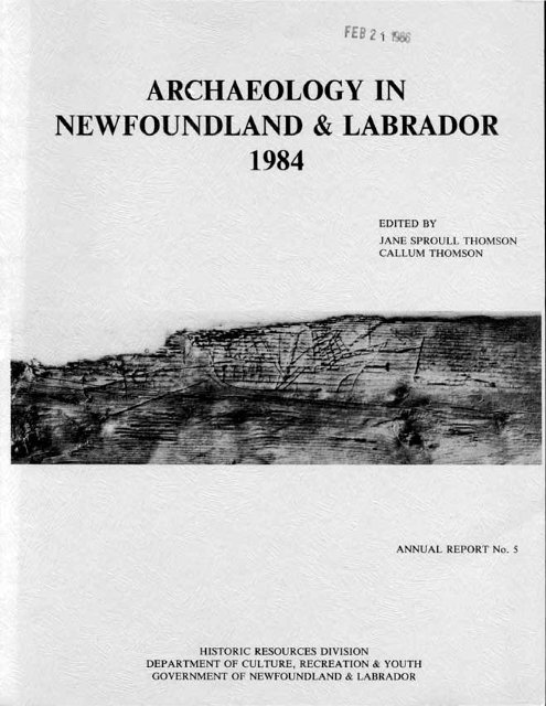
IN NEWFOUNDLAND AND LABRADOR <strong>1984</strong>Annual Report #5Edited by:Jane Sproull ThomsonCallurn Thmon<strong>Newfoundl<strong>and</strong></strong> MuseumSt. John's, <strong>Newfoundl<strong>and</strong></strong>December 1985
Cover photo of an etch<strong>in</strong>g found on the Red Bay underwater wreck site <strong>in</strong> 1983,by Parks Canada. See Stevens article, this volume.All publications of the <strong>Newfoundl<strong>and</strong></strong> Museum <strong>and</strong> Historic Resources Division,Department of Culture, Recreation <strong>and</strong> Youth, St, John's, are also available onmicrof iche f ram:Micromedia Ltd.158 Pearl St.Toronto, OntarioM5H 1L3--ISSN 0715-2086
FOREWORDThis is the fifth volume <strong>in</strong> the <strong>Archaeology</strong> <strong>in</strong> <strong>Newfoundl<strong>and</strong></strong><strong>and</strong> <strong>Labrador</strong> Annual Report series, which wasconceived <strong>in</strong> 1980 to present prelim<strong>in</strong>ary results ofarchaeological fieldwork from researchers hold<strong>in</strong>g prov<strong>in</strong>cialresearch permits <strong>in</strong> that year. On occasion wehave also published unsolicited papers, <strong>and</strong> reports onsites outside of prov<strong>in</strong>cial jurisdiction. While thepr<strong>in</strong>cipal focus of this series will cont<strong>in</strong>ue to be ondissem<strong>in</strong>at<strong>in</strong>g as quickly as possible results of currentarchaeology projects, we would be pleased to considerfor publication <strong>in</strong> another format any paper perta<strong>in</strong><strong>in</strong>gto archaeological research <strong>in</strong> <strong>Newfoundl<strong>and</strong></strong> <strong>and</strong> <strong>Labrador</strong>.
TABLE OF CONTENTSARCHAEXXOGY IN NEWEDUNDLAND AND LABRADOR (map)...............imCTION.......................e.........................lJane Sproull ThomsonCONSEXK4TION AT THE NEWEDUNOLAND MUSEPI...................... 8Rosemary SmartREPORT OF THE YEAR1 S ACTIVITIESI <strong>1984</strong>.. ................I1Julia Mathieson.................EARLY NmESKIM3 SITES IN CENTRAL LABRADOR.. .13Susan A. KaplanEARLY MAFUTIME ARCHAIC SGlTLEMENT STUDIESm cmmm am SUMS.. ................................ .48William W. FitzhughLITHIC RAW MATERIALS RESXJRCE STUDIES IN-LANDAND LABRADOR: A PWX;RESSChristopher NagleREPORT. ............... .8 6ARCHAEOLOGICAL INVESTIGATIONS INIO THE NATUREOF THE LATE PREHISTORIC INDIAN OCCUPATION INLABRADOR: A REPORT ON THE <strong>1984</strong> FIELD SE?WN.. .............. .I22Stephen Lor<strong>in</strong>gA SUMMARY OF THREE ENVIRONMEXFAL IMPACT EVALUATIONSIN IEPEWFDLAND AND LABRADORI <strong>1984</strong> .e 154Callurn Thamson" PRCXRESS REPORT ON THE MARINE EXCAVATION AT RED BAY,LABRADOR: A SUMMARY OF THE 1983 FIELD SEASON...........,..... 166Willis StevensA SUMMARY OF MAF?INE ARCHAEOLOGICAL RESEARCHCONDUCI'ED AT RED BAYI LABRADOR: THE <strong>1984</strong> FIELD SEASON...o.... 190James R<strong>in</strong>ger<strong>1984</strong> EXCAVATIONS AT RED BAYI LABRADOR .e . 224James A. TuckAN AR(3UWXOGICAL SURVEY OF SCHOONER COVE, LABRADOR.......... 248David L.KeenleysidemRESS REFORT ON INUIT INVESTIGATIONS IN THE STRAIT'OF BELLE ISLE................................................ 272Reg<strong>in</strong>ald Auger
REFORT ON THE MAIN BROOK TO FOWE 430 SURVEY . 294M.A.P. RenoufREPORT OF THE ARCHAED1XX;ICAL INVESTIGATIONS AT THEPORT AU CHOIX AND FOINT RICHE PENINSULAS...................... 298M.A.P. RenoufMCAVATIONS AT BOYD'S COVE - <strong>1984</strong>: A PRELIMINAFY REPORT..... ..322Ralph PastoreMICMAC PRCUECT REPORT <strong>1984</strong>; SPANISH ROOM S URW 3984.. .. .338Gerald PenneyARCHAEOLOGICAL RESYXIRCES INVENIDRY, SIGNAL HILL FRTIOIWG. HISrORIC PAFX, ST. JOHN'S, <strong>1984</strong> 344Rob FergusonLOOKING FOR THE COLONY OF AVALON.............................. 378James A. TuckARCHAEOLOGY UNDEWATER AT FERPYLAND: A PRELIMIIWRY !3JRVEX.. ... 398Roy Skanes, Mark Deichmnn
Campiled byJane Sproull ThomsonHistoric Resources DivisionDepartment of Culture, Recreation & YouthArchaeological activity picked up <strong>in</strong> <strong>1984</strong>, with n<strong>in</strong>eteen permits issued,thirteen for research <strong>and</strong> six <strong>in</strong>volv<strong>in</strong>g environmental assessment. A furtherthree projects were undertaken by Parks Canada, not under prov<strong>in</strong>cial prmit,<strong>and</strong> are reported on <strong>in</strong> this volume.On the isl<strong>and</strong>, activity extended around most of the coastl<strong>in</strong>e. At Isleaux Morts, two brief reconnaissance dives were undertaken by members of the<strong>Newfoundl<strong>and</strong></strong> Mar<strong>in</strong>e <strong>Archaeology</strong> Society <strong>in</strong> order to conduct a check to makesure no disturbance was occurr<strong>in</strong>g on the site. Everyth<strong>in</strong>g proved to begenerally <strong>in</strong>tact, although there was same evidence of visitation by otherdivers.At Mortier Bay on the south coast's Bur<strong>in</strong> Pen<strong>in</strong>sula Gerald Penney undertookan assessment survey of a proposed oil rig facility at Cow Head. Al-though some chipp<strong>in</strong>g debris was uncovered, <strong>in</strong>clud<strong>in</strong>g some possible Ramahchert, no further evidence of prehistoric activity was found with<strong>in</strong> theproject area. Historic rena<strong>in</strong>s <strong>in</strong>cluded the foundations of two lgth centuryfarmhouses.At Ferryl<strong>and</strong> on the Avalon Pen<strong>in</strong>sula, Roy Skanes conducted an underwatersurvey <strong>in</strong> the fall of <strong>1984</strong>, to determ<strong>in</strong>e the degree of disturbance by dredg<strong>in</strong>gactivity on a historic midden conta<strong>in</strong><strong>in</strong>g fishbone, wood chips <strong>and</strong> ceramic <strong>and</strong>glass artifacts dat<strong>in</strong>g from possibly as early as the century through tothe present. An <strong>in</strong>tact section of the orig<strong>in</strong>al harbour bottom was loated bySkanes <strong>and</strong> plans are underway for excavation. A survey of the associated l<strong>and</strong>site conducted by James Tuck yielded evidence of an early seventeenth centuryoccuption as well as a possible forge, believed to have been built dur<strong>in</strong>g the
period of orig<strong>in</strong>al settlement at the Avalon colony. Further work is planneddur<strong>in</strong>g the 1985 season.A Parks Canada research team directed by Rob Ferguson carried out an ar-chaeological resources <strong>in</strong>ventory for evidence of the British military occup-tion from 1780 to 1870 at Signal Hill Mtional Historic Park, <strong>in</strong> St. John's.Areas tested <strong>in</strong> <strong>1984</strong> <strong>in</strong>clude: gun batteries of the 1790s on Carronade <strong>and</strong> Gib-bet Hills; a soldiers' barracks, 1800; a workshop complex of the RoyalMilitary Artificers, ca. 1807; officers' <strong>and</strong> soldiers' barracks <strong>and</strong> out-build<strong>in</strong>gs of the 1830s on the edge of the summit, <strong>in</strong>clud<strong>in</strong>g a barracks con-verted to a fever hospital <strong>in</strong> 1870 <strong>and</strong> later used by Guglielm Marconi as abase for receiv<strong>in</strong>g the first transatlantic wireless message <strong>in</strong> 1901; <strong>and</strong> alarge stone barracks for the Royal <strong>Newfoundl<strong>and</strong></strong> Campany, built <strong>in</strong> 1842 <strong>and</strong>later used as a quarant<strong>in</strong>e hospital until its destruction by fire <strong>in</strong> 1892.American gun positions from World War I1 were identified throughout the park.The survey revealed that structural rema<strong>in</strong>s of many of the British build<strong>in</strong>gson the site have been well preserved.Undisturbed cultural deposits relateprimarily to the domestic side of lgth century military life, but also <strong>in</strong>cludemilitary items <strong>and</strong> specialized workshop debris. The success of the survey hasled to recommendations for future excavations to assist site developnent.At Boyd's Cove, Notre Dame Bay, Ralph Pastore's cont<strong>in</strong>u<strong>in</strong>g projectsucceeded <strong>in</strong> elicit<strong>in</strong>g further <strong>in</strong>formation on Beothuk house construction.Past seasons at this site have given us solid evidence for a prehistoricBeothuk culture <strong>and</strong> established the 1 <strong>in</strong>k between the latter <strong>and</strong> Penney sLittle Passage complex, described <strong>in</strong> Archaeolosv <strong>in</strong> <strong>Newfoundl<strong>and</strong></strong> <strong>and</strong> <strong>Labrador</strong>1980. Material <strong>and</strong> faunal evidence was uncovered dur<strong>in</strong>g <strong>1984</strong> which shouldhelp to fill a significant gap <strong>in</strong> the late prehistoric-early historic periodknowledge of the Beothuk.Nearby, at Rattl<strong>in</strong>g Brook, Norris Arm, Gerald Penney conducted a surveyalong a proposed access road right-of-way to a cmunications tower.A pre-viously known Beothuk site near the road will not be disturbed by theconstruction, <strong>and</strong> no further significant rrraterial was discovered.At Port au Choix National Historic Park, Priscilla Renouf undertodc re-search on behalf of Parks Canada to assess the large Dorset Eskimo site ofPhillip's Garden, previously excavated by Elmer Harp, Jr., for potential for
future excavations. Secondary aim of the season's fieldwork were to surveythe Park area for historic <strong>and</strong> prehistoric archaeological sites to provide thebasis for a park developnent plan, <strong>and</strong> to search for caves with<strong>in</strong> the parkwhich may have been suitable for Dorset burials. The fieldwork proved highlysuccessful, <strong>in</strong>dicat<strong>in</strong>g significant potential for further research at thePhillip's Garden site. Besides the well-known Middle Dorset component thesite also conta<strong>in</strong>s mterial from the earlier Groswater Palaeo-Eskimo period.The regional survey, which was not conf<strong>in</strong>ed to the park boundaries, was unsuccessful<strong>in</strong> locat<strong>in</strong>g any evidence of Maritime Archaic habitation areas tocorrespond with a large M.A. cemetery excavated by James Tuck <strong>in</strong> 1968.However, the survey did locate a number of additional small Palaeo-Eskimolocalities <strong>and</strong> several historic French <strong>and</strong> English sites. Eight caves ofvarious sizes were found, none of which yielded any surface evidence of humanactivity, although one known locally as Crow Head Cave is the location of af<strong>in</strong>d made by a local resident of human bone along with <strong>in</strong>cised ivory <strong>and</strong> boneartifacts. The summer's work brought to thirty the total nlrmber of known siteson this attractive <strong>and</strong> rich pen<strong>in</strong>sula. On the opposite side of the GreatNorthern Pen<strong>in</strong>sula, at Ma<strong>in</strong> Brook, Renouf supervised an assessment survey of aproposed 27 km road to St. Anthony. No sites were discovered.Ten projects were conducted <strong>in</strong> <strong>Labrador</strong> <strong>in</strong> <strong>1984</strong>. In the Strait of BelleIsle, Reg<strong>in</strong>ald Auger tested two possible early Inuit houses at Degrat Isl<strong>and</strong>.The results of these excavations illustrate the difficulties <strong>in</strong> attempt<strong>in</strong>g todist<strong>in</strong>guish Inuit habitations of this period <strong>and</strong> <strong>in</strong> this area from the earlyEuropean shelters with their use of similar construction techniques <strong>and</strong>materials. Obviously, further <strong>in</strong>vestigations will be required before the<strong>in</strong>trigu<strong>in</strong>g problems of Inuit contact, seasonality, <strong>and</strong> settlement <strong>and</strong> subsistenceptterns <strong>in</strong> this region are elucidated.At Forteau, on the Strait of Belle Isle, Jane Sproull Thomson <strong>in</strong>vestigateda reported "burial" uncovered dur<strong>in</strong>g excavation of a new water reservoirabove the town. The f<strong>in</strong>d proved to be the extremely well preservedrema<strong>in</strong>s of a walrus. Found at an elevation of 85 m a. s. l., the skeleton isexpected to be dated at approximately 10 - 12,000 years B.P. It is currentlybe<strong>in</strong>g exam<strong>in</strong>ed by Richard Har<strong>in</strong>gton of the National Museum of NaturalSciences, <strong>and</strong> a series of dates are be<strong>in</strong>g run on samples of the bone as well
as on wood <strong>and</strong> shell found <strong>in</strong> association with the skeleton.A few miles north of Forteau, David Keenleyside of the National Museumof Man conducted a survey to assess the impact of a proposed federal project<strong>in</strong>clud<strong>in</strong>g an access road between L'Anse au Loup <strong>and</strong> Schooner Cove <strong>and</strong> the <strong>in</strong>-stallation of a wharf facility at the cove.With the field assistance of PatAllen of New Brunswick's Historical <strong>and</strong> Cultural Resources, Keenlyside iden-tified <strong>and</strong> tested five prehistoric <strong>and</strong> three historic sites <strong>in</strong>clud<strong>in</strong>g DorsetEskimo, Maritime Archaic, Basque <strong>and</strong> other European components, as well asrema<strong>in</strong>s of a lgth/early loth century American whal<strong>in</strong>g station.The entirearea was subsequently del<strong>in</strong>eated as a significant cultural resource, <strong>and</strong> theroad <strong>and</strong> wharf facility was relocated.Further northeast along the coastr at Red Bay, Robert Grenier conductedhis f<strong>in</strong>al season of excavation on the wreck of a Basque galleon for ParksCanada.Disassembly of what is thought to be the San Jaun was completed, ex-cavation below the hull <strong>and</strong> peripheral to the wreck was cont<strong>in</strong>ued, as was theharbour survey, which <strong>in</strong>cluded the total excavation of the sus~ected p<strong>in</strong>azafound <strong>in</strong> 1983.The new shipwreck discovered last year was surveyed more <strong>in</strong>-tensively this year, confirm<strong>in</strong>g that the construction details were similar tothose on the first wreck.the fragmented rema<strong>in</strong>s of an astrolabe.The stern area proved rich <strong>in</strong> artifacts, <strong>in</strong>clud<strong>in</strong>gFurther harbour survey work revealedyet another large ship~reck. Although only briefly <strong>in</strong>vestigated, this too a ppears to date to the sixteenth century <strong>and</strong> is of approximately the same sizeas the other two large wrecks.On the l<strong>and</strong> site at Red Bay, James Tuck cont<strong>in</strong>ued excavation of the im-portant whalers' cemetery discovered towards the end of the 1983 season.summer 's work yielded some well-preserved textile ra<strong>in</strong>s <strong>in</strong>clud<strong>in</strong>g a pair ofpantaloons <strong>and</strong> an upper garment, possibly a shirt.ThisExcavations at other siteareas cont<strong>in</strong>ued to reveal <strong>in</strong>formation on the tryvmrks discovered <strong>in</strong> 1982.Interest<strong>in</strong>gly, <strong>in</strong>formtion from these areas <strong>in</strong>dicates that explosions may nothave been uncommon accidents dur<strong>in</strong>g the render<strong>in</strong>g process <strong>in</strong> 16th century RedBay.F<strong>in</strong>ally, further evidence of possible Inuit occumtions of the area wasdiscovered on nearby Tw<strong>in</strong> Isl<strong>and</strong>, <strong>in</strong> addition to an ancmalous pottery sherdwhich Tuck tentatively identifies as of Iroquoian type.Christopher Nagle conducted geological surveys <strong>in</strong> two arezs of the
prov<strong>in</strong>ce last summer, <strong>in</strong> a cont<strong>in</strong>uation of archaeological research aimed atdiscover<strong>in</strong>g bedrock sources of the different types of stone used prehistorically<strong>in</strong> <strong>Newfoundl<strong>and</strong></strong> <strong>and</strong> <strong>Labrador</strong>. At the beg<strong>in</strong>n<strong>in</strong>g of the season, severallocations where chert beds had been reported <strong>in</strong> Ordovician sedimentary rocksbetween the Port au Port Pen<strong>in</strong>sula <strong>and</strong> Cow Head were visited. Six outcropswere located <strong>and</strong> sampled. Prelim<strong>in</strong>ary results <strong>in</strong>dicate that the visual rangeof chert types from western <strong>Newfoundl<strong>and</strong></strong> is quite substantial, althoughmaterial range from any s<strong>in</strong>gle outcrop tends to be restricted to one or twovarieties. The rema<strong>in</strong>der of the season was spent <strong>in</strong> a reconnaissance fordeposits of nephritic jade along the central <strong>Labrador</strong> coast. Although only as<strong>in</strong>gle jade source is known <strong>in</strong> eastern Canada (at Noddy Bay <strong>in</strong> northern<strong>Newfoundl<strong>and</strong></strong>) , significant amounts of the material have been recovered fromDorset archaeological sites throughout the prov<strong>in</strong>ce, suggest<strong>in</strong>g that other occurrencesare likely to exist. While no jade proper was found <strong>in</strong> areas exam<strong>in</strong>edthis year, geologic conditions at least favourable for its formationwere encountered at two localities. In addition, dur<strong>in</strong>g the course of thework, several new soapstone outcrops were located, <strong>in</strong>clud<strong>in</strong>g one whichprovides the first solid evidence of prehistoric quarry<strong>in</strong>g for stone lamps <strong>in</strong><strong>Labrador</strong>.Callurn Thamson completed three environmental impact assessment-relatedprojects <strong>in</strong> the prov<strong>in</strong>ce dur<strong>in</strong>g <strong>1984</strong>. Known sites of historic significance <strong>and</strong>areas of potential significance, with<strong>in</strong> six regions of the isl<strong>and</strong> of <strong>Newfoundl<strong>and</strong></strong>were outl<strong>in</strong>ed as part of the Mobil Oil Hibernia L<strong>and</strong> Use <strong>and</strong>Resource Use Study be<strong>in</strong>g prepred by CBQ, Limited of St. John's. An assessmentof the historic resources potential of a recreation trail be<strong>in</strong>g built fromNorth West river to the Sebaskachu River <strong>in</strong> western Lake Melville <strong>in</strong>dicatedthat while the trail itself would not result <strong>in</strong> any adverse impact, sameprotection of the town of North West River's archaeological rema<strong>in</strong>s should beconsidered. The third project <strong>in</strong>volved a survey of an 11 km section of theproposed Trans-<strong>Labrador</strong> Highway east of the Ashuanipi River. No significantimpact was predicted follaw<strong>in</strong>g an assessment of the region's resources.Susan Kaplan spent the past season <strong>in</strong>vestigat<strong>in</strong>g <strong>Labrador</strong>'s multi-tieredrectangular stone structures which were first discussed by the Gathorne-Hardycous<strong>in</strong>s (1922, 1963), who <strong>in</strong>vestigated a group of these structures on Sculp<strong>in</strong>
Isl<strong>and</strong>, <strong>in</strong> the Na<strong>in</strong> area.The Gathorne-Hardys proposed that the stone struc-tures were either built by the Norse or by Norse-<strong>in</strong>fluenced Inuit, while Mat-thews argued that they were constructed by Inuit <strong>in</strong>fluenced by the 16th cen-tury European visitors.A number of sites between Hamilton Inlet <strong>and</strong> Okak conta<strong>in</strong><strong>in</strong>g multi-tiered <strong>and</strong> s<strong>in</strong>gle tiered rectangular stone structures were located <strong>and</strong> mapped<strong>in</strong> <strong>1984</strong>, <strong>and</strong> <strong>in</strong>dividual structures were tested or excavated.Excavated ground<strong>and</strong> drilled slate <strong>and</strong> nephrite endblades <strong>and</strong> tool fragments <strong>in</strong>dicated that therectangular structures were built <strong>and</strong> occupied by prehistoric Neoeskimgroups. Sod house villages dat<strong>in</strong>g to the precontact <strong>and</strong> early contact Neoeskimoperiod were also visited by Kaplan. Two sod house forms probably <strong>in</strong> usebetween the lsth <strong>and</strong> 17th centuries were identified <strong>and</strong> chalcoal sanples fromthe structures are be<strong>in</strong>g dated.William Fitzhugh cont<strong>in</strong>ued his surveys along the <strong>Labrador</strong> coast <strong>in</strong> <strong>1984</strong>.Three high Maritime Archaic pithouse structures of the s<strong>in</strong>gle-room type wereexcavated, two of them conta<strong>in</strong><strong>in</strong>g diagnostic material. One, at Karl Oam Isl<strong>and</strong>near Na<strong>in</strong> produced an early M.A. type projectile po<strong>in</strong>t of Fbmh chert <strong>in</strong>a charcoal deposit dat<strong>in</strong>g 6000 B.P.Three small rectangular two-segmentedstructures were also excavated at high sites, <strong>and</strong> it was possible to cross-l<strong>in</strong>k these with one of the pithouse structures. In addition to this early M.A.material, Fitzhugh located several new middle-period Maritime Archaic sites <strong>in</strong>the Na<strong>in</strong> region <strong>and</strong> at Cape Harrigan. One of these, at House Hahour conta<strong>in</strong>sa number of (probably burial) mounds that should augment our <strong>in</strong>formtion onthe Wsak complex, for which the pithouse <strong>and</strong> small rectangular structuresform the settlement base. New data on Paleo-Eskimo settlement ptterns for theDorset, Groswater Dorset <strong>and</strong> Pre-Dorset periods were also compiled by Fitzhughdur<strong>in</strong>g the <strong>1984</strong> season.Stephen Lor<strong>in</strong>g returned to the central <strong>Labrador</strong> near <strong>in</strong>terior <strong>in</strong> <strong>1984</strong> toconduct surveys <strong>and</strong> excavations <strong>in</strong> an area underst<strong>and</strong>ably avoided by mstarchaeologists, for the purpose of f<strong>in</strong>d<strong>in</strong>g <strong>and</strong> evaluat<strong>in</strong>g evidence on the,lateprehistoric, contact <strong>and</strong> historic period Indians of this area. Pr<strong>in</strong>cipal aimsof the project <strong>in</strong>cluded establish<strong>in</strong>g the relationship between the If<strong>in</strong>ut(Naskapi-Montagnais) culture <strong>and</strong> the preceed<strong>in</strong>g pre- <strong>and</strong> proto-historical In-dian occuptions, exam<strong>in</strong><strong>in</strong>g the overwhelm<strong>in</strong>gly car ibou-or iented economy of
these groups, <strong>and</strong> seek<strong>in</strong>g explanations for the boundaries between the Inuit<strong>and</strong> Indian occupnts of the region. Lor<strong>in</strong>g's hard-won results have contributedsignificantly to our knowledge of the prehistory <strong>and</strong> history of this littleknownregion, yield<strong>in</strong>g evidence that the <strong>in</strong>habitants were not as isolated aspreviously assumed; this evidence <strong>in</strong>cludes the first known prehistoric nativeceramics from an undisturbed context <strong>in</strong> <strong>Labrador</strong>.
Rosemary SmartConservator<strong>Newfoundl<strong>and</strong></strong> MuseumOne of the stipulations that must be met before be<strong>in</strong>g awarded an ar-chaeological research permit <strong>in</strong> the Prov<strong>in</strong>ce of <strong>Newfoundl<strong>and</strong></strong> <strong>and</strong> <strong>Labrador</strong> isthat the archaeologist demonstrate that he has access to the f<strong>in</strong>ancial <strong>and</strong>physical resources to enable him to return excavated material <strong>in</strong> a conserved,that is, stable state. When I saw this I was very pleased to see conservationconcerns be<strong>in</strong>g given such precedence (because after all I th<strong>in</strong>k it's the ma<strong>in</strong>concern) <strong>and</strong> it has had the positive effect I th<strong>in</strong>k of rais<strong>in</strong>g the conserva-tion consciousness <strong>in</strong> the archaeological community <strong>and</strong> promot<strong>in</strong>g a responsibleattitude towards these collections.After all, as a general rule, mostmaterial will be much more stable <strong>in</strong> the ground or on the ocean floor than <strong>in</strong>cardboard boxes await<strong>in</strong>g treatment.Therefore, if you want to dig it up, youhave to consider <strong>and</strong> take m e responsibility for tak<strong>in</strong>g care of it.However, to be fair, we recognize that acquir<strong>in</strong>g conservation servicesis no easy matter. F<strong>in</strong>d<strong>in</strong>g money is probably the smaller problem compred tof<strong>in</strong>d<strong>in</strong>g the facilities <strong>and</strong> the services of a tra<strong>in</strong>ed conservator for the oftenextended periods required to conserve material from just one field season.There are few tra<strong>in</strong>ed conservators <strong>in</strong> the Atlantic region as a whole, muchless <strong>in</strong> <strong>Newfoundl<strong>and</strong></strong> <strong>and</strong> <strong>Labrador</strong>.Furthermore, as far as I know, there isonly one private exclusively archaeological conservator presently practis<strong>in</strong>g<strong>in</strong> Canada (Bob Senior, formly of CCI)due to the expense of sett<strong>in</strong>g up <strong>and</strong>operat<strong>in</strong>g the facilities required, especially for water-logged material.conservation could underst<strong>and</strong>ably be seen by the archaeologist as someth<strong>in</strong>g ofa bottleneck.However, at this po<strong>in</strong>t it seems unavoidable because alternativefacilities <strong>and</strong> services simply do not exist.This is only the second year <strong>in</strong> which the position of conservator hasexisted at the <strong>Newfoundl<strong>and</strong></strong> Museum; which is not to say the conservation con-cerns were not addressed previously but rather that an official commitment toSo
the conservation component of the Museum team is quite recent.that this is true to vary<strong>in</strong>g degrees across the country.I might addConservation as amuseum discipl<strong>in</strong>e is only about fifteen years old <strong>in</strong> Canada; the expense<strong>in</strong>volved, <strong>and</strong> the shortage of tra<strong>in</strong>ed people has made the establishment ofconservation facilities an uphill battle.We're at the po<strong>in</strong>t now where thereare many tra<strong>in</strong>ed <strong>and</strong> experienced conservators <strong>in</strong> central Canada where themajority of large museums <strong>and</strong> museum-like facilities exist (mst notably theRoyal Ontario Museum, National Museums, Public Archives, <strong>and</strong> Parks Canada) .Establish<strong>in</strong>g conservation <strong>in</strong> the other regions has been identified by the Na-tional Museums as the current priority.To this end the conservation Assis-tance branch of the Museum Assistance Programmes is support<strong>in</strong>g regionalmuseums <strong>in</strong> sett<strong>in</strong>g up facilities.The pattern is first to fund the conser-vator position, <strong>and</strong> then to aid that person <strong>in</strong> sett<strong>in</strong>g up laboratory <strong>and</strong>storage facilities.There are two ma<strong>in</strong> dimensions to a conservator's responsibilities to theartifacts: treat<strong>in</strong>g them, <strong>and</strong> ma<strong>in</strong>ta<strong>in</strong><strong>in</strong>g them <strong>in</strong> as stablea condition aspossible. Necessarily, the two will overlap to some extent (i.e. sane objectscannot be ma<strong>in</strong>ta<strong>in</strong>ed to any degree <strong>in</strong> a stable state until they are treated) ,but generally, of the two, treatment, especially restoration, is much more ofa luxury, be<strong>in</strong>g more time <strong>and</strong> mterial <strong>in</strong>tensive, <strong>and</strong> focus<strong>in</strong>g more resourceson fewer artifacts.Ma<strong>in</strong>ta<strong>in</strong><strong>in</strong>g the collection as a whole is the <strong>in</strong>itialpriorty <strong>in</strong> a situation like ours. As such, <strong>in</strong> plann<strong>in</strong>g our conservationfacilities at the <strong>Newfoundl<strong>and</strong></strong> Museum,tified as our first concern.upgrad<strong>in</strong>g of storage has been iden-Be<strong>in</strong>g entrusted with hous<strong>in</strong>g all of <strong>Newfoundl<strong>and</strong></strong><strong>and</strong> <strong>Labrador</strong>'s material culture, the Museum is committed to provid<strong>in</strong>g the bestenvironment for it that we can.This will probably take a couple of years,whereupon our attention will be diverted to establish<strong>in</strong>g a comprehensivelaboratory facility <strong>and</strong> treatment programme.Until then, I'm operat<strong>in</strong>g out ofa small converted photo lab; so both time <strong>and</strong> space constra<strong>in</strong>ts will limit theamount <strong>and</strong> types of treatments undertaken <strong>in</strong> the near future.Furthermore,when the lab is built, it w ill have to deal with all areas of collection con-servation - textiles, ethnographic, archival, histor ic component s, <strong>and</strong> a r-chaeological material, as well as preparation for loans <strong>and</strong> exhibits.Granted, much of our collection, once properly stored, will be relatively
stable chemically, <strong>in</strong> that deterioration will have slowed down considerably,so that the needs of the collections will be samewhat less urgent. Recentlyexcavated archaeological material, on the other h<strong>and</strong>, is <strong>in</strong> a much moredynamic state physically <strong>and</strong> chemically, <strong>in</strong> that by remov<strong>in</strong>g it from itsburial context the archaeologist has disturbed such equalibrium as existed betweenit <strong>and</strong> its environment. For this reason, coupled with the fact <strong>Newfoundl<strong>and</strong></strong><strong>and</strong> <strong>Labrador</strong> are so relatively rich <strong>in</strong> archaeological potential <strong>and</strong><strong>in</strong>terest, it seems that emphasis on archaeological material <strong>in</strong> plann<strong>in</strong>g ourlong term conservation activities, is strongly <strong>in</strong>dicated.The Museum can never realistically hope to cope with all the materialexcavated <strong>in</strong> the prov<strong>in</strong>ce - our facility will probably never be large enough<strong>in</strong> the foreseeable future, nor do we anticipate staff<strong>in</strong>g more than one conservationposition. However, tentatively we're th<strong>in</strong>k<strong>in</strong>g that we might be able toestablish a setup for archaeological conservation as one component of the lab,which could be used by <strong>in</strong>terns <strong>and</strong> contract conservators as well as ourselves.This way archaeological conservation could be ongo<strong>in</strong>g without committ<strong>in</strong>g theMuseum resources fulltime. In other words, "you provide the conservator <strong>and</strong>materials, we provide facilities". Even at that, however we probably will notbe able to satisfy all the dem<strong>and</strong>s on Museum resources that could conceivablybe made <strong>in</strong> the future. No doubt the burden of responsibility for provid<strong>in</strong>gconservation services will cont<strong>in</strong>ue to be shared by the archaeologist <strong>and</strong>museum, but with the museum assum<strong>in</strong>g a larger share as time goes on.
Julia MathiesonPresident<strong>1984</strong> has been a busy one for M;A3. In our second year we have ma<strong>in</strong>ta<strong>in</strong>eda high level of <strong>in</strong>terest <strong>in</strong> archaeology <strong>and</strong> have cont<strong>in</strong>ued to grow <strong>and</strong> exp<strong>and</strong>.Our activities <strong>in</strong>cluded seven executive meet<strong>in</strong>gs, twelve general meet<strong>in</strong>gs, twosem<strong>in</strong>ars, one field trip, a television <strong>in</strong>terview, <strong>in</strong>volvertlent <strong>in</strong> cmunityissues <strong>and</strong> the plann<strong>in</strong>g of a "site watchw program.General meet<strong>in</strong>gs <strong>in</strong>cluded lectures by Ralph Pastore, Gerald Penney,Michael Barkham, Rob Ferguson, Birgitta Wallace <strong>and</strong> Marc Deichmam, <strong>and</strong> fiveeven<strong>in</strong>gs of movies.The lectures covered the follow<strong>in</strong>g topics: ~oyd's Cove;Burnt Isl<strong>and</strong>; old Basque sites; Grassy Isl<strong>and</strong>, Nova Scotia; L'Anse auxMeadows; Signal Hill <strong>and</strong> Ferryl<strong>and</strong>.The mavie series were "The Wreck <strong>and</strong>Rais<strong>in</strong>g of the Mary Rose" (three segments), <strong>and</strong> another three on Egyptianantiquities.In March eight members attended a tra<strong>in</strong><strong>in</strong>g sem<strong>in</strong>ar entitled "AppropriateCollection <strong>and</strong> Conservation of Archaeological Materials from UndemterSites." This was a most <strong>in</strong>formative sem<strong>in</strong>ar <strong>and</strong> NLA~ was pleased to send sucha large cont<strong>in</strong>gent.The other sem<strong>in</strong>ar <strong>and</strong> meet<strong>in</strong>g attended by four of ourmembers was the Annual General Meet<strong>in</strong>g of the Museum Association of New-foundl<strong>and</strong> <strong>and</strong> <strong>Labrador</strong>, "Introduction to Basis Museum Functions."MarkAllston spoke about Tr<strong>in</strong>ity Museum where he had worked all swnrner, <strong>and</strong> JuliaMathieson <strong>in</strong>troduced the "site watch" program that NLA~ is <strong>in</strong>itiat<strong>in</strong>g.Throughout the year members attended other lectures <strong>and</strong> one-day sem<strong>in</strong>ars onbehalf of NLA3 <strong>and</strong> Mark <strong>and</strong> Julia were <strong>in</strong>terviewed on CBC television by DougBrophy. Five Newsletters were issued <strong>and</strong> an article appeared <strong>in</strong> Archaeolw <strong>in</strong><strong>Newfoundl<strong>and</strong></strong> <strong>and</strong> <strong>Labrador</strong> 1983.Fact sheets about the Micmac <strong>and</strong> the Beothukwere distributed at meet<strong>in</strong>gs <strong>and</strong> others are be<strong>in</strong>g prepared.One of the aim of NLA~ is to set up a "site watch" program <strong>in</strong> theprov<strong>in</strong>ce. To beg<strong>in</strong>, a letter was written to the Prov<strong>in</strong>cial Archaeologist who
forwarded the <strong>in</strong>formation to the M<strong>in</strong>ister of Culture, Recreation <strong>and</strong> Youth.Approval of the project has been granted <strong>and</strong> it is hoped that the program willgo <strong>in</strong>to effect <strong>in</strong> the spr<strong>in</strong>g of 1985.Dur<strong>in</strong>g the summer, Parks Canada conducted several test excavations onSignal Hill under the direction of archaeologist Rob Ferguson. It was a greatopportunity to see archaeologists at work <strong>and</strong> Rob was always will<strong>in</strong>g to expla<strong>in</strong>what he was do<strong>in</strong>g. Earlier <strong>in</strong> the year NL,A3 had attended the Open Househeld by Parks Canada on the future management of Signal Hill. Follow<strong>in</strong>g theOpen House NLA~ submitted a brief to Parks Canada.On a cold, w<strong>in</strong>dy day <strong>in</strong> October, six members drove to Ferryl<strong>and</strong> whereMark Diechmann conducted a walk<strong>in</strong>g tour of the sites where James Tuck <strong>and</strong> hiscrew from Memorial University were excavat<strong>in</strong>g what is thought to be a dwell<strong>in</strong>ghouse from the time of Lord Baltimore. Mark delivered a follow-up lecture <strong>in</strong>November.All <strong>in</strong> all it has been an excellent year for NLA' <strong>and</strong> we are cont<strong>in</strong>uallygrateful to the professional archaeologists for their support <strong>and</strong>encouragement. One of our members is now happily work<strong>in</strong>g voluntarily on thearchaeology collections at the <strong>Newfoundl<strong>and</strong></strong> Museum.We look forward to 1985 <strong>and</strong> more archaeology.
Susan A. KaplanThe Peary-MacMillan Arctic MuseumBrunswick, Ma<strong>in</strong>eIn 1920 Geoffrey <strong>and</strong> Robert Gathorne-Hardy,adventurers, artists, <strong>and</strong> writers, journeyed to <strong>Labrador</strong>.cous<strong>in</strong>s who wereWhile visit<strong>in</strong>g Na<strong>in</strong>they were taken to see ru<strong>in</strong>s on Sculp<strong>in</strong> Isl<strong>and</strong>, also known as Konaiotok.ru<strong>in</strong>s consisted of mysterious angular structures that had st<strong>and</strong><strong>in</strong>g walls builtwith multiple courses of stones.The Gathorne-Hardys, along with local residents, missionaries, <strong>and</strong> othertravelers, noted that the structures on Sculp<strong>in</strong> Isl<strong>and</strong> were unlike other ru<strong>in</strong>s<strong>in</strong> <strong>Labrador</strong>.Amidst speculation as to who might have built <strong>and</strong> occupied thecurious dwell<strong>in</strong>gs, the Gathorne-Hardys decided they would undertake a sys-tematic <strong>in</strong>vestigation of the ru<strong>in</strong>s.The cous<strong>in</strong>s identified a number of discrete sites on Sculp<strong>in</strong> Isl<strong>and</strong>, <strong>and</strong>mapped <strong>and</strong> excavated a number of rectangular <strong>and</strong> circular structures at thesesites.In addition to dwell<strong>in</strong>gs, the Gathorne-Hardys identified a V-shapedstone arrangement which they <strong>in</strong>terpreted to be a support for a keeled boat,stone walls which they called fortifications, <strong>and</strong> a large stone slab theycalled a table. The two adventurers published sewrate articles propos<strong>in</strong>gdifferent theories concern<strong>in</strong>g the identity of the orig<strong>in</strong>al builders <strong>and</strong> occupantsof the Sculp<strong>in</strong> Isl<strong>and</strong> sites.Geoffrey <strong>and</strong> Robert Gathorne-Hardy were familiar with Norse architecture<strong>and</strong> both men saw a reserrblance between the ru<strong>in</strong>s left by the Norse <strong>and</strong> thoseon Sculp<strong>in</strong> Isl<strong>and</strong>.Geoffrey Gathorne-Hardy concluded that the Sculp<strong>in</strong> Isl<strong>and</strong>stone structures had been built by Greenl<strong>and</strong>ic Inuit who had migrated to<strong>Labrador</strong>.He surmised that while resid<strong>in</strong>g <strong>in</strong> Greenl<strong>and</strong> these Inuit had been<strong>in</strong>fluenced by Norse architecture (1922:165). Robert Gathorne-Hardy (1963)proposed that the structures on Sculp<strong>in</strong> Isl<strong>and</strong> had been erected by Norsecolonists, probably the "lost" group from Greenl<strong>and</strong>.The angular dwell<strong>in</strong>gThe
forms as well as the support for a keeled boat were cited as evidence <strong>in</strong> thisargument.Tanner (1941) <strong>and</strong> Wenner (1947) also visited Sculp<strong>in</strong> Isl<strong>and</strong> <strong>and</strong> cornmented on the unusual sites there, but not until 1971 did the structures aga<strong>in</strong>come under close scientific scrut<strong>in</strong>y. That summer, Barry Phtthews tested anumber of stone structures at Sculp<strong>in</strong> Isl<strong>and</strong> 2 (Matthews 1975). A charcoalsample recovered from the "porch" of one of the rectangular stone structureswas dated 105 +/- 75 B.P. (Japan Isotops Campany-1559). Matthews questionedthe accuracy of the date, suggest<strong>in</strong>g that rootlets <strong>and</strong> organic acids had con-tam<strong>in</strong>ated the sample.Like the Gathorne-Hardys, Matthews was puzzled by the angular forms ofsome of the Sculp<strong>in</strong> Isl<strong>and</strong> structures, <strong>and</strong> he did not believe that Inuit wouldhave built rectangular-shaped shelters without hav<strong>in</strong>g been <strong>in</strong>f luenced byEuropeans. Unlike the Gathorne-Hardys, Mtthews did not th<strong>in</strong>k that there wasa Norse connection with the site. Matthews compared the Sculp<strong>in</strong> Isl<strong>and</strong> struc-tures with stone features found <strong>in</strong> Deception Bay <strong>and</strong> Vallon-des-Ru<strong>in</strong>es,cated at the southwestern end of Hudson Strait.lo-Animal bone from DeceptionBay had been dated 620 +/- 80 B.P. (Gakushiun U. Japan-1036) , while charcoalfrom that site had been dated 330 +/- B.P. (Yale U.-1717). Matthews arguedthat the Sculp<strong>in</strong> Isl<strong>and</strong> <strong>and</strong> related Hudson Strait sites were built <strong>in</strong> the 17thcentury by Inuit <strong>in</strong>fluenced by EuroFeans who visited the eastern Arctic longafter the Norse period.In 1975 a Smithsonian Institution archaeology team, headed by WilliamFitzhugh, briefly surveyed the western end of Sculp<strong>in</strong> Isl<strong>and</strong>. Stone structuresdescribed by the Gathorne-Hardys were relocated, a sod house/site wasfound, <strong>and</strong> the archaeologists noted that the slab once referred to as a tablewas now propped up so as to resemble a chair.In 1978 members of the Torngat <strong>Archaeology</strong> Project surveyed Sculp<strong>in</strong>Isl<strong>and</strong>. They photographed <strong>and</strong> mapped same of the structures on the isl<strong>and</strong> <strong>and</strong>located walls described by the Gathorne-Hardys.Despite this activity, ar-chaeologists were no closer to dat<strong>in</strong>g the Sculp<strong>in</strong> Isl<strong>and</strong> sites or know<strong>in</strong>g what~eople were responsible for build<strong>in</strong>g the rectangular stone structures <strong>and</strong> as-sociated features.
One of the objectives of the 1977-78 <strong>Archaeology</strong> Project was the <strong>in</strong>ves-tigation of the Neoeskimo occupation of <strong>Labrador</strong>.In an effort to underst<strong>and</strong>how Neoeskimo had adapted to the complex environmental, geographical, <strong>and</strong> so-cial conditions of the coast, research <strong>in</strong>volved l) locat<strong>in</strong>g Neoeskimo sitesbetween Hamilton Inlet <strong>and</strong> the Button Isl<strong>and</strong>s, 2) excavat<strong>in</strong>g selectedstructures, 3) reanalyz<strong>in</strong>g archaeological collections recovered before 1977,4) exam<strong>in</strong><strong>in</strong>g envirmntal <strong>and</strong> geographical factors that might affect lifealong the <strong>Labrador</strong> coast, <strong>and</strong> 5) study<strong>in</strong>g ethnohistorical documents relat<strong>in</strong>gto Inuit <strong>and</strong> European activities <strong>in</strong> <strong>Labrador</strong> (Kaplan 1983).The 1977 <strong>and</strong> 1978 field seasons consisted largly of surveys of the<strong>Labrador</strong> coast.Crews cross-cut various ecological zones <strong>in</strong> an effort togather data from sites dat<strong>in</strong>g to different time periods <strong>and</strong> oriented towardthe exploitation of a variety of natural resources.reconstruct subsistence practices <strong>and</strong> settlement patterns.seasons.These data were used toClose to 200 Neoeskimo sites were located dur<strong>in</strong>g the 1977 <strong>and</strong> 1978Sites ranged from clusters of tent r<strong>in</strong>gs <strong>and</strong> caches to sod housevillages, <strong>and</strong> they dated from the isth to the 2oth century. However, the 1977<strong>and</strong> 1978 field seasons failed to produce any tent r<strong>in</strong>gs that could be at-tributed to the prehistoric Neoeskimo period.Initially, the absence of tem-porary structures dat<strong>in</strong>g to the this period was attributed to the pirat<strong>in</strong>g ofthese early structures by later groups who camped <strong>in</strong> the same places.process is visible <strong>in</strong> the archaeological record throughout <strong>Labrador</strong>.ThisEigh-teenth <strong>and</strong> lgth century Inuit tent r<strong>in</strong>gs are built on top of Paleoeskimo pve-rnents associated with Pre-Dorset <strong>and</strong> Dorset stone tools.However, groundslate <strong>and</strong> nephrite implements diagnostic of the prehistoric Neoeskimo periodhave not been found <strong>in</strong> any of the later tent r<strong>in</strong>gs that have been<strong>in</strong>vestigated.Dur<strong>in</strong>g the surveys of the <strong>Labrador</strong> coast archaeology team came uponsites that rema<strong>in</strong>ed a temporal <strong>and</strong> cultural mystery even when they had keenmapped <strong>and</strong> tested.One of the first sites found dur<strong>in</strong>g the 1977 field season,White Bear Isl<strong>and</strong> 4, was such a site. White Bear Isl<strong>and</strong> 4 sits on top of a
mora<strong>in</strong>e between the eastern <strong>and</strong> western coves of the isl<strong>and</strong>, <strong>and</strong> consists oftwenty rectangular <strong>and</strong> circular stone structures as well as five graves. Excavation<strong>and</strong> mapp<strong>in</strong>g (Figure 1) efforts produced little <strong>in</strong>formation concern<strong>in</strong>gthe cultural identity of the sites's occupnts. An exam<strong>in</strong>ation of the reportsof other <strong>Labrador</strong> sites lack<strong>in</strong>g dates <strong>and</strong> cultural attributions revealed thatmany of the sites resemble one another <strong>in</strong> that they conta<strong>in</strong> s<strong>in</strong>gle-tiered <strong>and</strong>multi-tiered rectangular <strong>and</strong> circular structures.THE 1981 FIELD SEASONField work undertaken <strong>in</strong> 1981 had as one of its goals further <strong>in</strong>vestigationof sites conta<strong>in</strong><strong>in</strong>g rectangular <strong>and</strong> circular stone structures similarto those found on Sculp<strong>in</strong> Isl<strong>and</strong> <strong>and</strong> White Bear Isl<strong>and</strong>. In addition to asearch for more of these sites, excavations of some of the Sculp<strong>in</strong> Isl<strong>and</strong>structures were planned.In 1981 Sculp<strong>in</strong> Isl<strong>and</strong> East 1, referred to as the West Site by theGathorne-Hardys, was exam<strong>in</strong>ed (Figure 2) . Seventeen stone structures wereidentified <strong>and</strong> mapped. These structures are built on a rocky surface <strong>and</strong> arefashioned out of thick flat stone slabs. Structures 1 <strong>and</strong> 2 (Figures 3 <strong>and</strong> 4)were mapped <strong>and</strong> excavated. The work revealed that the generally rectangularstructures measure 6 m by 3 m <strong>and</strong> 8 m by 5 m respectively. Multiple coursesof stone slabs form the outside walls of each structure, <strong>and</strong> walls can reach aheight of 47 cm. The southern wall of structure 1 has collapsed. The absenceof slabs <strong>in</strong> the southeeastern corner of the structure suggests that theentrance <strong>in</strong>to what appears to be a dwell<strong>in</strong>g may have been <strong>in</strong> that area. Therear <strong>and</strong> side walls of the structure are well def<strong>in</strong>ed. A stone featuremeasur<strong>in</strong>g 1 m on a side, <strong>and</strong> of unknown function, was exposed <strong>in</strong> the northernsection of the structure.Structure 2 resembles Structure 1 <strong>in</strong> that the rear <strong>and</strong> side walls arewell def<strong>in</strong>ed. An entrance appears to have been located <strong>in</strong> the northern cornerof the dwell<strong>in</strong>g. A low wall divides structure 2 <strong>in</strong> half. Excavations <strong>in</strong> thenorthern section revealed two paved alcoves. Charcoal, badly preserved sealbones, <strong>and</strong> a fragment of ground slate were recovered from the central portionof Structure 2.
<strong>and</strong> dat<strong>in</strong>g.A charcoal sample excavated from structure 2 was submitted for analysisThe sample, 95 per cent coniferous wood <strong>and</strong> 5 per cent hardwood,was dated 1385 +/- 55 B.P. (S.1.-4829) (Laeyendecker n.d.) . This date sug-gests that structure 2 was built dur<strong>in</strong>g the Dorset period.of a fragment of ground slate, the Gathorne-HardysHowever, recoveryreports of whale bone atthe site, the absence of Rmh chert which is commonly associated with Dorsetsites <strong>in</strong> <strong>Labrador</strong>, <strong>and</strong> the sites's low elevation suggests a later date <strong>and</strong> aNeoeskimo affiliation (Kaplan 1983) .Investigators of Scul~<strong>in</strong> Isl<strong>and</strong> East 2, knm by the Gathorne-Hardys asthe East Site, located stone caches, a V-shaped l<strong>in</strong>e of stones, the stone slabplaced to resemble a chair's back, <strong>and</strong> rectangular stone structures similar tothose found at Sculp<strong>in</strong> Isl<strong>and</strong> East 1. The V-shaped l<strong>in</strong>e of stones may havebeen used as a support for a boat as noted by the cous<strong>in</strong>s.need not have been a keeled boat.boat used by Neoeskimo groups.However, the craftIt may have been an umiak, a large sk<strong>in</strong>Dur<strong>in</strong>g the course of surveys a multi-tieredstone wall was located (Sculp<strong>in</strong> Isl<strong>and</strong> East 4) as were two other sites, oneconta<strong>in</strong><strong>in</strong>g three historic period semisubterranean sod houses (Sculp<strong>in</strong>Isl<strong>and</strong> 1) <strong>and</strong> the other consist<strong>in</strong>g of multi-tiered rectangular <strong>and</strong> oval stonestructures (Sculp<strong>in</strong> Isl<strong>and</strong> 2) similar to those already described.Numerous sites conta<strong>in</strong><strong>in</strong>g multi-tiered stone structures were locateddur<strong>in</strong>g the course of the 1981 survey of the Na<strong>in</strong> area.However, aside fromthe ground slate recovered from Structure 2 at Sculp<strong>in</strong> Isl<strong>and</strong> East 1, no ar-tifacts were found associated with rectangular stone structures.Follow<strong>in</strong>g the 1981 field season Kaplan (1983) postulated that thes<strong>in</strong>gle-tiered <strong>and</strong> multi-tiered stone structures found between Na<strong>in</strong> <strong>and</strong> Kil-l<strong>in</strong>ek were prehistoric <strong>and</strong> early contact period Neoeskimo structures. Settlementpattern studies revealed that Sculp<strong>in</strong> Isl<strong>and</strong>-like sites are found <strong>in</strong>every fiord or isl<strong>and</strong> complex that conta<strong>in</strong>s a prehistoric Neoeskimo sod housesettlement. The sod house sites tend to be <strong>in</strong> outer isl<strong>and</strong> locations, or nextto major leads or polynyas.The stone structure sites are <strong>in</strong> two k<strong>in</strong>ds ofenvironments, on outer isl<strong>and</strong>s or capes near the s<strong>in</strong>a, <strong>and</strong> among <strong>in</strong>ner isl<strong>and</strong>sadjacent to rattles <strong>and</strong> leads that rema<strong>in</strong> open <strong>in</strong> the late fall <strong>and</strong> are amongthe first ice free areas <strong>in</strong> the early spr<strong>in</strong>g.Kaplan postulated that thestone structures were prehistoric Neoeskimo spr<strong>in</strong>g <strong>and</strong> fall encampnents.
THE <strong>1984</strong> FIELD SEASONBased on previous archaeological work, as well <strong>and</strong> the 1977, 1978, <strong>and</strong>1981 field seasons, Kaplan (1983, 1985a, 198513) presented an outl<strong>in</strong>e of chang-<strong>in</strong>g subsistence <strong>and</strong> settlement ptterns of the <strong>Labrador</strong> Neoeskimo populationbeg<strong>in</strong>n<strong>in</strong>g approximately 600 years ago. The reconstruction of the prehistoricNeoeskimo subsistence settlement pttern was based on the assumption that theSculp<strong>in</strong> Isl<strong>and</strong>-like structures dated to the earliest Neoeskim period.do<strong>in</strong>g the reconstruction of chang<strong>in</strong>g subsistence practices <strong>and</strong> settlement pt-terns it became clear that the early contact period, the late 16th <strong>and</strong> early17th century, was not well known.However, underst<strong>and</strong><strong>in</strong>g the social,economic, <strong>and</strong> demographic development of this period was critical to any ex-planations of the <strong>in</strong>creased social <strong>and</strong> political complexity that characterizedthe 18th century Neoeskimo occupltion of <strong>Labrador</strong>.The 15th through 17th century occupations of <strong>Labrador</strong> by Neoeskimogroups became the focus of the <strong>1984</strong> field season.InSod house settlements be-tween Hamilton Inlet <strong>and</strong> Okak were revisited <strong>in</strong> an attempt to ref<strong>in</strong>e thedat<strong>in</strong>g of early Neoeskimo sod house forms <strong>and</strong> to identify a site or set ofsites suitable for a long term excavation project that might shed light onchanges <strong>in</strong> house forms.tiered stone structures were also visited.Sites conta<strong>in</strong><strong>in</strong>g rectangular <strong>and</strong> circular multi-Structures were mapped <strong>and</strong> thenexcavated <strong>in</strong> an effort to secure artifacts <strong>and</strong> organic materials that woulddate the structures.Eskimo Isl<strong>and</strong> Sites (GaBpOl, GaBpO2, Ga-03, -04)Sod house sites on Eskimo Isl<strong>and</strong> were revisited with three objectives <strong>in</strong>m<strong>in</strong>d: 1) exam<strong>in</strong>ation of the sites <strong>in</strong> view of close to ten years of work onsimilar structures, <strong>in</strong> an effort to determ<strong>in</strong>e whether the Eskimo Isl<strong>and</strong> sitesdeserve the unique status they have; 2) survey of the isl<strong>and</strong> <strong>in</strong> search ofBasque sites; <strong>and</strong> 3) determ<strong>in</strong>ation of the potential for future research on theisl<strong>and</strong>.Mechanical difficulties set the field season back, two weeks, thereforethe visit to Eskimo Isl<strong>and</strong> was brief. All sites were visited, large sectionsof the isl<strong>and</strong> were resurveyed, <strong>and</strong> photographs of houses <strong>and</strong> the revegetation
process on excavated portions of the site were secured. Slight depressions <strong>in</strong>the area around Eskimo Isl<strong>and</strong> 3 suggest that a program of systematic test<strong>in</strong>gof the midden areas around the sites will probably reveal additional houserema<strong>in</strong>s.In fact a s<strong>in</strong>gle 50 cm square test pit placed <strong>in</strong> a depression <strong>in</strong> theforested area beh<strong>in</strong>d Eskimo Isl<strong>and</strong> 2 produced 18th century glass trade beads,fragments of corroded metal, <strong>and</strong> ceramics. The tall vegetation cover<strong>in</strong>g mstof the houses precluded survey with a metal detector.Black Isl<strong>and</strong> 5 (GcBk-18)Wenty-one structures were located on the southwestern beach of BlackIsl<strong>and</strong>. The structures run north-south just above the present storm beach.Boulder structures <strong>in</strong>clude meat caches, burials, a circular tent r<strong>in</strong>g, rectan-gular stone structures, <strong>and</strong> a crescent-shaped structure.The five rectangular stone structures found at the site a re similar tothose on Sculp<strong>in</strong> Isl<strong>and</strong>. !Fwo of the structures wre mapped. Structure 1measures 8 m by 4 m, Structure 2 measures 9 m by 4 m. Both structures havewalls constructed out of multiple courses of stone.1 is divided <strong>in</strong> half by a low wall.The <strong>in</strong>terior of StructureAlarge boulder field south of Black Isl<strong>and</strong>-4 was not surveyed. In alllikelihood structures similar to those found on the southwest beach will befound <strong>in</strong> that area as well,Black Isl<strong>and</strong> 5 should be <strong>in</strong>vestigated when Eskimo Isl<strong>and</strong> is re-exam<strong>in</strong>ed. If the structures on Black Isl<strong>and</strong> date to the precontact or earlycontact Neoeskim period, the site may be the rema<strong>in</strong>s of a spr<strong>in</strong>g s<strong>in</strong>a hunt<strong>in</strong>gcamp established by the Eskimo Isl<strong>and</strong> 3 population.Anniowaktook(GiCa-02)Anniuwaktook is a sod house settlement consist<strong>in</strong>g of four large semisub-terranean sod houses orig<strong>in</strong>ally <strong>in</strong>vestigated by Junius Bird (1945).The fourhouses are located <strong>in</strong> a cove on the southwestern side of Anniowaktook Isl<strong>and</strong><strong>in</strong> the Hopedale area.The dwell<strong>in</strong>gs are perched on a narrow beach pass, <strong>and</strong>their tall green midden grasses are visible from the water.Four small test pits were placed <strong>in</strong> Houses 1, 3, <strong>and</strong> 4 <strong>in</strong> order todeterm<strong>in</strong>e how productive the houses were <strong>in</strong> comparison to the Eskim Isl<strong>and</strong>
structures, <strong>and</strong> to determ<strong>in</strong>e the nature of preservation at the site. Few artifactswere recovered from the test pits, <strong>and</strong> the traditional <strong>and</strong> historicpieces were not diagnostic of any particular period.The test pits revealedthat the site has a shallow cultural deposit <strong>and</strong> bone preservation is poor.Napatalik North 3 Locus 2(GjCc-06)A s<strong>in</strong>gle rectangular structure was located on the beach three metresabove sea level south of the Mpatalik North 3 Dorset site. The structuremeasures 5 m by 8 m <strong>and</strong> is built on beach gravel <strong>and</strong> bedrock.SirLgle rows ofstones def<strong>in</strong>e the structure which has a slightly waisted appearance.structure, devoid of artifacts, resembles late lgth century structures locatedon Palungitak Isl<strong>and</strong> (Kaplan 1983: 473), <strong>in</strong> the Na<strong>in</strong> region.TheMulta Isl<strong>and</strong> Sites (GkCb-01, GkCb-02, GkCb-03)Tent r<strong>in</strong>gs <strong>and</strong> sod houses were located on Multa Isl<strong>and</strong>. Three lgth centurysod houses were found on the western end of the little isl<strong>and</strong>. Eachhouse was built aga<strong>in</strong>st a bedrock ledge which served as a wall <strong>and</strong> a w<strong>in</strong>dbreak. One of the structures shows signs of hav<strong>in</strong>g been disturbed recently.The small rectangular structures resemble late lgth <strong>and</strong> early 2oth centuryhouses associated with Moravian Mission stations <strong>and</strong> Hudson's Bay Companyposts. The houses are not semisubterranean. Rather, the square <strong>and</strong> rectangularstructures are built on the ground surface <strong>and</strong> are constructed out ofsods <strong>and</strong> wood. W<strong>in</strong>dscreens rather than entrance passages shield the entryways<strong>in</strong>to the dwell<strong>in</strong>gs. Either settlers or Inuit could have built <strong>and</strong> lived <strong>in</strong>the houses. Today the isl<strong>and</strong> is used as a fish camp by Na<strong>in</strong> residents.House Harbour 3 (HbCs-04)Three houses <strong>and</strong> a st<strong>and</strong><strong>in</strong>g tilt were located on the easternmost pass ofIglosiatik Isl<strong>and</strong>. Two of the houses are above-ground sod structures, whilethe third is the rema<strong>in</strong>s of a semisubterranean structure, measur<strong>in</strong>g 6 m by4 rn. The site was not tested but it appears to date to the early <strong>and</strong> mid-2othcentury.
Iqlosiatik Isl<strong>and</strong> 1 (HbCh-01)In 1981 the western beach pass of Iglosiatik Isl<strong>and</strong> was surveyed <strong>and</strong> alarge Neoeskimo sod house settlement was located. That season, fifteen semisubterraneansod houses were identified. THe houses are built <strong>in</strong>to a s<strong>and</strong>yhillside overlook<strong>in</strong>g a fossil cove. Eleven of the houses are small D-shapedstructures with long entrance passages. Two of the houses are clover leafshaped(c.f. Schledemnn 1971). Each has two rooms that share an entrancepassage. The centre section of the site is dom<strong>in</strong>ated by three large houses,one square <strong>and</strong> two rectangular <strong>in</strong> shape.In 1981 test pits revealed that many of the houses conta<strong>in</strong>ed nephrite<strong>and</strong> ground slate, <strong>in</strong>dicat<strong>in</strong>g that Iqlosiatik Isl<strong>and</strong> 1 was once a prehistoricNeceskimo settlement. Charcoal recovered from House 1 was dated 280 +/- 60B.P. (S.1.-4827) (A.D. 1670), <strong>and</strong> suggested an early occupation date as well.Iqlosiatik Isl<strong>and</strong> 1 is the southernmost prehistoric Neoesk<strong>in</strong>m settlement <strong>in</strong><strong>Labrador</strong>. Its presence <strong>in</strong> the southern Na<strong>in</strong> region raises <strong>in</strong>terest<strong>in</strong>g questionsconcern<strong>in</strong>g the dynamics of Po<strong>in</strong>t Revenge Indians <strong>and</strong> Neoeskimo<strong>in</strong>teraction.Iqlosiatik Isl<strong>and</strong> 1 was revisited <strong>in</strong> order to try to establish thelength of occupation at the site, to try ro recover <strong>in</strong>formation that mighthelp date the various house £om represented at the site, <strong>and</strong> to determ<strong>in</strong>ewhether a major excavation of some of the houses would be profitable. Dur<strong>in</strong>gthe course of <strong>in</strong>vestigation a sixteenth semisubterranean sod house waslocated, <strong>and</strong> six houses were identified for further test<strong>in</strong>g. All houses weresurveyed with a metal detector <strong>in</strong> an attempt to discover whether the site hasan historic component.House 1: This 17th century sod house produced a drilled <strong>and</strong> ground redslate fragment <strong>in</strong> 1981. In <strong>1984</strong> a test pit <strong>in</strong> the northeast section of thesmall D-shaped structure uncovered a s<strong>in</strong>gle fragment of slate.House 10: This large structure is <strong>in</strong> the central section of the site.While its size suggests an 18th century date, its square shape is not classicfor that period. The house was tested <strong>in</strong> two locations, <strong>in</strong>side the house <strong>and</strong><strong>in</strong> the entrance passage. Both test pits revealed that the house had been constructedus<strong>in</strong>g timbers <strong>and</strong> that it had a floor made up of tightly fitted flatpav<strong>in</strong>g stones.
The <strong>in</strong>terior test pit produced flakes of slate <strong>and</strong> one flake of Ramahchert <strong>in</strong> the roof<strong>in</strong>g sods. A rusted nail was recovered 5 cm above the pavedfloor. The entrance passage test pit produced a nail <strong>and</strong> a corroded metalfragment <strong>in</strong> the upper 20 cm of deposit.coal were recovered 23 cm below the surface sods.The sk<strong>in</strong>s of mussel shells <strong>and</strong> char-Charcoal recovered from House 10 has been dated 380 +/- 50 B.P. (S.1.-6706) (A.D. 1570). While this ate agrees nicely with the date associatedwith House 1, whether the charcoal dates the present structure is not clear.The slate <strong>and</strong> Ramah chert recovered from roof sods suggest that the mstrecent house to st<strong>and</strong> <strong>in</strong> that part of the site was built us<strong>in</strong>g sods laden withartifacts from earlier occupations. Whether the metal recovered is associatedwith the house or might derive from activities <strong>in</strong> House 11 is not clear.House 11: This large rectangular semisubterrarean house resembles 18thcentury sod houses found throughout <strong>Labrador</strong> that are referred to as "communalhouses".The house was surveyed with the aid of a metal detector, <strong>and</strong> apropeller shaft was located <strong>in</strong> the uppr sods of the wall shared by houses 10<strong>and</strong> 11.A test pit <strong>in</strong> the entrance passage of House 11 exposed a carefully pavedfloor. Charcoal, a seal bulla, <strong>and</strong> slate fragments were recovered. A testpit <strong>in</strong> the northwest corner of the house <strong>in</strong>terior, at the sleep<strong>in</strong>g platformfloorjuncture, yielded feathers, seal bones, <strong>and</strong> a badly corroded metalobject.The test pit was term<strong>in</strong>ated once the paved floor <strong>and</strong> stone-edgedsleep<strong>in</strong>g platform front had been exposed.A f<strong>in</strong>al test pit was placed <strong>in</strong> the northeast corner of the house so thatit cut <strong>in</strong>to the sleep<strong>in</strong>g platform <strong>and</strong> extended <strong>in</strong>to the <strong>in</strong>terior of the house.The excavation revealed that the platform had been built up with s<strong>and</strong>s held <strong>in</strong>place by a reta<strong>in</strong><strong>in</strong>g wall of flat slabs.The platform was covered with wood.Faunal rema<strong>in</strong>s recovered from the <strong>in</strong>terior of the house <strong>in</strong>cluded seal jaws;teeth, <strong>and</strong> bones.House 12: House 12 has two rooms that share an entrance pssage. Atest pit <strong>in</strong> the <strong>in</strong>terior of the house produced mica, slate, <strong>and</strong> a fragment ofschist.well.A slate ulu or a s<strong>in</strong>gle-edged knife blade fragment was recovered as
House 13: House 13 is a D-shaped structure built apart from the othersod houses at Islosiatik Isl<strong>and</strong> 1. A 1.50 m by 0.50 m test pit was placed <strong>in</strong>the entrance passage of the house. The test pit was term<strong>in</strong>ated when a tightlypaved floor was exposed. Slate <strong>and</strong> a sherd of soapstone with blubber encrustationswere recovered.A charcoal sample from House 13 yielded a date of 760 +/- 65 B.P.6708) (A.D.1190). This date is the earliest associated with Neoeskimo ra<strong>in</strong>s<strong>in</strong> <strong>Labrador</strong> <strong>and</strong> raises the possibility that a Neoeskim group may have settled<strong>in</strong> <strong>Labrador</strong> <strong>in</strong> the 12th century. However, flakes of F&mah chert <strong>and</strong> schistfound at Islosiatik Isl<strong>and</strong>-1 <strong>and</strong> the discovery of a Dorset site on the westernside of Iglosiatik Isl<strong>and</strong> raises the possibility that the charcoal recoverdfrom House 13 may relate to <strong>and</strong> date an earlier Dorset occuption of theisl<strong>and</strong>.House 15: House 15 is the second clover leaf-shaped structure at thesite. A test pit was placed <strong>in</strong> the entrance passage <strong>in</strong> an effort to recovermaterial that would shed light on the chronological relationship of cloverleaf <strong>and</strong> D-shaped structures. THe test pit revealed a 25 cm deposit conta<strong>in</strong><strong>in</strong>gcharcoal, slate, nephrite, <strong>and</strong> poorly preserved seal bones.A test pit at the juncture of the sleep<strong>in</strong>g platform edge <strong>and</strong> floor alsoyielded flakes of nephrite <strong>and</strong> slate, as well as a schist preform which wouldfit well <strong>in</strong> a Middle Dorset assemblage. A third test pit <strong>in</strong> the midden eastof the entrance passage of House 15 exposed a 15 cm deposit of s<strong>and</strong>y peat conta<strong>in</strong><strong>in</strong>ga fragment of walrus skull.A poorly preserved metal artifact, possibly a knife blade, was recoveredfrom the test pit at the edge of the sleep<strong>in</strong>g platform when the pit wasenlarged. The metal object was <strong>in</strong> a deposit that also conta<strong>in</strong>ed fragments ofslate. Charcoal recovered from the house was dated 620 +/- 50 B.P. (S.1.-6709) (A.D. 1330). This date suggests an early Neoeskimo occuption ofIglosiatik Isl<strong>and</strong>. In view of the date <strong>and</strong> the total assemblage, the metalrecovered from House 25 should undergo further analysis <strong>and</strong> the structureshould be excavated to determ<strong>in</strong>e whether the house represents a s<strong>in</strong>gle earlyoccupation or was reused.House 16: Dur<strong>in</strong>g the <strong>1984</strong> season a small square semisubterranean sodhouse was located south of House 15, between the spruce trees <strong>and</strong> a small(S.1.-
stream. The dwell<strong>in</strong>g was not tested.The test pits placed <strong>in</strong> Islasiatik Isl<strong>and</strong> 1 houses <strong>in</strong>dicate that faunalpreservation is not good. However, the houses have been carefully constructed<strong>and</strong> <strong>in</strong> some cases appear to be largely undisturbed. Future work at the sitecan profitably focus on changes <strong>in</strong> house forms. The early dates derived fromcharcoal recovered from three of the structures <strong>and</strong> assemblages conta<strong>in</strong><strong>in</strong>gboth ground stone <strong>and</strong> metal tools also call for further <strong>in</strong>vestigation of thesite.Skull Isl<strong>and</strong> 6 (HcCq-06)The po<strong>in</strong>t on the western shore of Skull Isl<strong>and</strong> was surveyed <strong>in</strong> 1981 <strong>and</strong>an unusual site conta<strong>in</strong><strong>in</strong>g a huge oval structure (Structure 1) <strong>and</strong> other oddlyshaped high walled structures was exam<strong>in</strong>ed (Kaplan 1983: 466). The site wasone of the major objectives of the <strong>1984</strong> field season.Dur<strong>in</strong>g two days of <strong>in</strong>vestigation the entire site was mapped <strong>and</strong> close tothirty structures, many multi-t iered rectangular forms, were plotted on amaster map. In addition, a rectangular stone structure (Structure 27) wascompletely mapped <strong>and</strong> excavated , Structure 1 was mapped <strong>and</strong> extensivelytested, <strong>and</strong> Structure 22, a tent r<strong>in</strong>g was tested. What follows is an accountof the structures that were closely exam<strong>in</strong>ed, tested, or excavated.Structure 1: This oval structure measures 8 m by 6 m <strong>and</strong> has an entrancepassage that opens west, fac<strong>in</strong>g the water (Figure 5). The southeastern end ofthe structure conta<strong>in</strong>s the tallest wall, st<strong>and</strong><strong>in</strong>g 1.5 m high, constructed outof multiple courses of small stones, buttressed on the outside by an angledpile of stones.A series of large boulders l<strong>in</strong>e the <strong>in</strong>terior of the southern <strong>and</strong> easternsections of the structure. They appear to be part of a bench or a series ofseats. A section of the western end of the structure was cleared of surfacevegetation, reveal<strong>in</strong>g a concentration of f<strong>in</strong>e gra<strong>in</strong>ed blue <strong>and</strong> green slateflakes <strong>and</strong> some nephrite flakes. Excavation on the northern end of the structureproduced two broken slate endblades with drilled holes, <strong>and</strong> twowhetstones, one of than broken. Slate <strong>and</strong> nephrite flakes were found here aswell. The slate debitage <strong>in</strong> the western section of the structure <strong>and</strong> thewhetstone <strong>and</strong> broken weapons <strong>in</strong> the northern section <strong>in</strong>dicate that people
manufactured <strong>and</strong> repaired irrrplements here. The size of the structure <strong>and</strong> thebeach or seats l<strong>in</strong><strong>in</strong>g its wall suggest that Structure 1 my have served as amen's house. If this was its function, this is the first such structurereported <strong>in</strong> the <strong>Labrador</strong> archaeological record.Structure 2: The walls of this circular cache are fashioned us<strong>in</strong>g fourcourses of stones. A layer of t<strong>in</strong>y pebbles l<strong>in</strong>es the bottom <strong>in</strong>terior of thefeature. A small semicircle of stones abuts the outer wall of the cache. Thefeature was found open <strong>and</strong> empty.Structure 7: Structure 7 was built aga<strong>in</strong>st a raised bedrock ledge thatserves as its north wall. The entrance <strong>in</strong>to the structure is not evident.The 5 m by 4 m structure conta<strong>in</strong>s two alcoves.Structure 10: This unique structure consists of a large circle enclos<strong>in</strong>ga small circle. The outer circle has a 5 m diameter <strong>and</strong> is built of largeboulders placed on the surface of the boulder beach. The <strong>in</strong>ner circle hasbeen dug <strong>in</strong>to the beach <strong>and</strong> has stone slab reta<strong>in</strong><strong>in</strong>g walls. The surface betweenthe outer <strong>and</strong> <strong>in</strong>ner circles has been cleared of large boulders <strong>and</strong> pavedwith small cobblestones. A possible entrance <strong>in</strong>to the structure consists of aramp of cobblestones that leads to the top of one of the outer walls.Structure 17: This small tent r<strong>in</strong>g has a 3 m diameter <strong>and</strong> is def<strong>in</strong>ed bysmall tightly placed stones. The southern <strong>in</strong>terior platform is covered witht<strong>in</strong>y pebbles. No other structure at Skull Isl<strong>and</strong> 6 resembles Structure 17.Structure 22: This tent r<strong>in</strong>g has a 4 m diameter <strong>and</strong> is <strong>in</strong> the easternpart of the site, slightly removed from the ma<strong>in</strong> build<strong>in</strong>g area. Four othertent r<strong>in</strong>gs of similar construction are found at this end of the site. Slate<strong>and</strong> Ramah chert flakes were recovered from a small test pit placed <strong>in</strong> the tentr<strong>in</strong>g's <strong>in</strong>terior. The relationship of this <strong>and</strong> the other four tent r<strong>in</strong>gs tothe rectangular stone structure <strong>and</strong> caches is not clear.Structure 27: Structure 27 is located at the eastern end ofSkull Isl<strong>and</strong> 6. This rectangular stone structure (Figure 6) was excavated becauseit appeared to be undisturbed <strong>and</strong> had a soil deposit <strong>in</strong> its <strong>in</strong>terior.Many of the other rectangular boulder structures at the site, hav<strong>in</strong>g beenbuilt <strong>in</strong> a boulder field, conta<strong>in</strong> no soil. Therefore the chance of recover<strong>in</strong>gartifacts <strong>and</strong> datable materials from these is slim.
Excavation of Structure 27 consisted of stripp<strong>in</strong>g off the little vegeta-tion that covered the <strong>in</strong>terior of the structure <strong>and</strong> clear<strong>in</strong>g away a few cen-timeters of soil.had been exposed.When the work was concluded a rectangular stone structureIt has an entry way <strong>in</strong> the form of a break <strong>in</strong> wall rocks,<strong>in</strong> its southeast end. A low wall divides the structure <strong>in</strong> half. An alcove orkitchen area, def<strong>in</strong>ed by flat pav<strong>in</strong>g stones, was uncovered <strong>in</strong> the northwestcorner. A ground slate endblade with two drilled holes, characteristic ofprehistoric Neoeskimo assemblages, was recovered from the edge of thepavement .The excavation revealed a paved area, semicircular <strong>in</strong> shape, abutt<strong>in</strong>gthe east wall of Structure 27.This paved area may have served as a sleep<strong>in</strong>gplatform <strong>and</strong> br<strong>in</strong>gs to m<strong>in</strong>d Matthews' description of a "porch" he excavatedwhen <strong>in</strong>vestigat<strong>in</strong>g one of the Sculp<strong>in</strong> Isl<strong>and</strong> structures.In addition to the ground slate endblades, slate <strong>and</strong> nephrite flakes,seal bones, charcoal, white limestone possibly used as a whetstone, <strong>and</strong> Ramahchert <strong>and</strong> f<strong>in</strong>e gra<strong>in</strong>ed chert flakes were recovered from Structure 27.Ramah chert <strong>and</strong> f<strong>in</strong>e gra<strong>in</strong>ed chert raise the possibility that a Paleoeskimosite may be located <strong>in</strong> the vic<strong>in</strong>ity.dated.Charcoal recovered from Structure 27 has not yet been analyzed <strong>and</strong>However, the ground slate endblade, diagnostic of a prehistoric Woes-kimo period, adds strength to Kaplan 's suggestion that rectangular stonestructures similar to Structure 27 date to the prehistoric Neoeskimo period.Skull Isl<strong>and</strong> 6 is an important site that needs further <strong>in</strong>vestigation.Excavation of additional rectangular structures should help archaeologistsidentify the time frame <strong>in</strong> which the structures were used <strong>and</strong> possibly theseason of occupation of the site. The relationship of the rectangular stonestructures to the tent r<strong>in</strong>gs at Skull Isl<strong>and</strong> 6 <strong>and</strong> to a group of semisubter-ranean sod houses on the isl<strong>and</strong> may be established as well. Perhaps of s<strong>in</strong>glegreatest <strong>in</strong>terest will be a complete <strong>in</strong>vestigation of Structure 1.TheOakes Bay 1 (HeCs-081Oakes Bav 1, known <strong>in</strong> the 18th century as Parnegnertokh, was revisited<strong>in</strong> efforts to determ<strong>in</strong>e if any of the houses at the site mre built <strong>in</strong> theprehistoric period. Four of the six houses were tested.
The deposit <strong>in</strong> House 6 was shallow <strong>and</strong> unproductive, while quantities ofwell preserved wooden house beams were uncovered <strong>in</strong> House 3. Test pits <strong>in</strong>Houses 4 <strong>and</strong> 5 were term<strong>in</strong>ated when permafrost was encountered. The possibilityof recover<strong>in</strong>g wood <strong>and</strong> bone materials from these houses appearsexcellent.Further work at Oakes Bay 1 was not undertaken as crews were concernedthat the permafrost deposit not be disturbed. These large houses, probablyall dat<strong>in</strong>g to the 18th century, <strong>and</strong> the surround<strong>in</strong>g middens should conta<strong>in</strong>well preserved bone <strong>and</strong> wood, <strong>in</strong>dicat<strong>in</strong>g that the site will yield importantdata on the 18th century Neoeskimo subsistence econuny.Ganq Isl<strong>and</strong> 1 (HeCh-13)Five tent r<strong>in</strong>gs <strong>and</strong> eight rectangular structures were found along theeast end of the western isl<strong>and</strong> <strong>in</strong> the Gang Isl<strong>and</strong> complex. Two of the rectangularstone structures were mapped. They measure 7 m by 5 m <strong>and</strong> 7 m by 6 m.Each conta<strong>in</strong>s a cache <strong>and</strong> alcoves.A number of the stone structures at this site conta<strong>in</strong> fragments of limestonewhich have been imported <strong>in</strong>to the area. Limestone is present <strong>in</strong> otherNeoeskimo sites <strong>in</strong> the Na<strong>in</strong> area <strong>and</strong> may have been used for whetstones. Afragment of Southampton Isl<strong>and</strong> chert was recovered <strong>in</strong> the vic<strong>in</strong>ity of Structures1,2, <strong>and</strong> 3.Orton Isl<strong>and</strong> 2 (HfCs-01)The southeast end of this outer isl<strong>and</strong> <strong>in</strong> the Na<strong>in</strong> area was surveyed <strong>in</strong>hopes of f<strong>in</strong>d<strong>in</strong>g a s<strong>in</strong>a hunt<strong>in</strong>g site. A s<strong>in</strong>gle tent r<strong>in</strong>g was located. Itconta<strong>in</strong>s ch<strong>in</strong>a, metal, <strong>and</strong> glass manufactured <strong>in</strong> the 2oth centuzy. Ap<strong>in</strong>nacle, a stone slab supported upright by a cluster of smaller stones placedat its base, was found on a bedrock ledge overlook<strong>in</strong>g Eastern Harbour.Whether the p<strong>in</strong>nicle relates to the tent r<strong>in</strong>g or to a possible Maritime Archaicburial feature found nearby is not known.Snyder Bay Isl<strong>and</strong> 1 (HqCk-01)Snyder Bay Isl<strong>and</strong> was surveyed <strong>and</strong> a site consist<strong>in</strong>g of six tent r<strong>in</strong>gswas located on the north shore of the isl<strong>and</strong>. The tent r<strong>in</strong>gs are on a cobble
each across from Snyder Pen<strong>in</strong>sula.sites.The rest of the isl<strong>and</strong> is devoid ofIslusuaktalialuk Isl<strong>and</strong> 8(HhCi-09)Seven tent r<strong>in</strong>gs <strong>and</strong> two graves were found on a raised beach north ofSteven Cox's Islusuaktalialuk Isl<strong>and</strong> 4 Pre-Dorset site. The tent r<strong>in</strong>gs havewell def<strong>in</strong>ed stone perimeters, cleared <strong>in</strong>teriors, <strong>and</strong> their sleep<strong>in</strong>g platformsare def<strong>in</strong>ed by rows of small stones.Nuasornak 1 (HhCk-05)Nuasornak 1 is located on the north side of Nuasornak Isl<strong>and</strong>.The siteis visible as a heavily vegetated area <strong>in</strong> the central section of theshorel<strong>in</strong>e. In the 18th century this was one of the larger settlements <strong>in</strong>Okak .Six houses were mapped. A number of then are of considerable size. Atest pit was placed <strong>in</strong> House 2 <strong>and</strong> a th<strong>in</strong> cultural deposit was encountered.metal fragment <strong>and</strong> a concentration of soapstone flakes were recovered. Theseflakes <strong>and</strong> a soapstone pav<strong>in</strong>g stone suggests that a steatite source may be locatednear the site.ANutak 1 (Hick-01)The site of the Nutak trad<strong>in</strong>g post was exam<strong>in</strong>ed. Rema<strong>in</strong>s of stone-edgedwooden floors are visible <strong>and</strong> sections of brick chimneys litter the site. Theshore <strong>in</strong> front of Nutak is covered with tent r<strong>in</strong>gs. A s<strong>in</strong>gle grave sits onthe ridge above the site.Moores Isl<strong>and</strong> 2 (Hick-11)Tent r<strong>in</strong>gs, stone caches, <strong>and</strong> hearth screens were located along theshore of Moores Isl<strong>and</strong>. Many of the tent r<strong>in</strong>gs are large, measur<strong>in</strong>g 11 m by9 m. Some of the tent r<strong>in</strong>gs have three hearth areas, suggest<strong>in</strong>g that theywere occupied by multi-family units. Round headed <strong>and</strong> round shafted nailswere observed <strong>in</strong> the hearths, but were not collected.
Okak 1 (HiC1-01)Okak 1 is the largest sod house village <strong>in</strong> <strong>Labrador</strong>.Historic recordsdetail<strong>in</strong>g the life of Okak people found <strong>in</strong> Moravian Mission archives, alsomake this one of the best documented sites <strong>in</strong> <strong>Labrador</strong>.Okak 1 has been thesubject of <strong>in</strong>vestigation by a number of archaeologists, yet a carefullymeasured map of the site does not exist.Cox's map was adequate for the <strong>in</strong>i-tial report<strong>in</strong>g of this site; however, given the number of people who havetested various portions of the site, <strong>and</strong> the site's scale <strong>and</strong> complexity, fu-ture work should first beg<strong>in</strong> with a mapp<strong>in</strong>g of houses <strong>and</strong> test pits.Test pits <strong>in</strong> the western <strong>and</strong> northern end of the site revealed Dorsetmaterials, suggest<strong>in</strong>g that Dorset structures may be uncovered here if theyhave not been destroyed by later build<strong>in</strong>g activity. Other test pits at Okak 1were associated with Neoeskimo dwell<strong>in</strong>gs.House 2:the entrance passage.This sod house was <strong>in</strong>vestigated when a test pit was placed <strong>in</strong>Chert flakes, nephrite, a flake of soapstone, flakes ofRamah chert, an m rked kaol<strong>in</strong> pipe stem, cut bones, mussels shell sk<strong>in</strong>s, <strong>and</strong>charcoal were recovered.House 4:A test pit <strong>in</strong> the vic<strong>in</strong>ity of House 4 revealed a th<strong>in</strong> culturaldeposit conta<strong>in</strong><strong>in</strong>g bone smears <strong>and</strong> poorly preserved wood.ment was encountered 24 cm below the surface.A flat stone pave-A nephrite drill bit wasrecovered 30 cm belaw the surface <strong>and</strong> under a pavement rock. The drill ispencil-like.Its distal end is a round polished shaft with a beveled tip.The drill's proximal end rema<strong>in</strong>s <strong>in</strong> a roughed out fon <strong>and</strong> bears evidence ofcut <strong>and</strong> groove marks.A grey slate & or knife fragment, a kaol<strong>in</strong> pipe bowl fragment, akaol<strong>in</strong> stem fragment, four white glass beads, flakes of Ramah chert, quartz,<strong>and</strong> black chert were found throughout the test pit. The drill bit, &fragment, <strong>and</strong> slate flakes suggest that a prehistoric Neoeskim component maybe isolated <strong>in</strong> this section of the site.House A: Designated House A by Cox (1977), this is the largest sodhouse at Okak 1. The house sits at the crest of the beach overlook<strong>in</strong>g otherhouses with excellent visibility <strong>in</strong> all directions. Size <strong>and</strong> location suggestthat the house was <strong>in</strong>habited by a prom<strong>in</strong>ent family.A test pit placed <strong>in</strong> House A revealed 35 cm of deposit conta<strong>in</strong><strong>in</strong>2
evidence of charcoal, poorly preserved wood, <strong>and</strong> a s<strong>in</strong>gle corroded nail shaft.The paucity of goods from this test pit is <strong>in</strong> sharp contrast to similar testpits placed <strong>in</strong> Eskimo Isl<strong>and</strong> houses.Okak 1 is not an ideal site <strong>in</strong> which to try to <strong>in</strong>vestigate the prehis-toric part of <strong>Labrador</strong> '~eoeskimo sequence, s<strong>in</strong>ce 18th century constructionprojects disturbed much of the site. A project focus<strong>in</strong>g on 18th century sub-sistence practices <strong>and</strong> social organization can.be developed us<strong>in</strong>g datarecovered from Okak 1 if ethnohistorical data is <strong>in</strong>tegrated <strong>in</strong>to the project.Green Isl<strong>and</strong> 6 (HkCk-01)Green Isl<strong>and</strong> 6 is a Neoeskimo semisubterranean sod house settlement locatedat the east end of a cove on the north end of Green Isl<strong>and</strong>. The sitewas first <strong>in</strong>vestigated by Steven Cox (1977) who concluded that it was a Woeskimosettlement, possibly dat<strong>in</strong>g to the precontact period. Green Isl<strong>and</strong> 6 wasrevisited <strong>in</strong> an effort to recover materials that could be used to date thesite <strong>and</strong> its <strong>in</strong>dividual structures, <strong>and</strong> to determ<strong>in</strong>e whether further work atthe site was warranted.The site consists of thirteen houses built <strong>in</strong>to a s<strong>and</strong>y ridge overlo&-<strong>in</strong>g a cove. The houses are <strong>in</strong> four clusters: House 1 <strong>and</strong> 2 are paired, as areHouses 4 <strong>and</strong> 5. House 3 st<strong>and</strong>s alone. Houses 6 - 13 are clustered together<strong>and</strong> cut <strong>in</strong>to one another. All house entrance passages face away from thewater, an unusual arrangment for Neoeskimo dwell<strong>in</strong>gs. Possibly, this orientationwas chosen so as to avoid exposure to the strong w<strong>in</strong>ds that blow from thenorth.The houses differ from other Neoeskim structures exam<strong>in</strong>ed to date <strong>in</strong>that mny have a s<strong>in</strong>gle sleep<strong>in</strong>g platform placed along a side wall rather thanalong the rear wall of the dwell<strong>in</strong>g. Cold traps are evident <strong>in</strong> many of theentrance passages.House 3: A test pit was placed <strong>in</strong> front of the cold trap <strong>in</strong> theentrance passage of this 4 m by 3 m house. A Middle Dorset nephrite bur<strong>in</strong>liketool was recovered. In all likelihood the tool was brought <strong>in</strong>to thehouse <strong>in</strong> sods cut further down the beach where a Dorset nephrite work<strong>in</strong>g stationis located.House 7: The entrance passage of this structure was tested. A pved
stone floor wasauncovered runn<strong>in</strong>g 27 cm to 42 an below the surface. Poorlypreserved wood <strong>and</strong> flakes of Ramah chert were recovered.House 11: A test pit <strong>in</strong> this clover leaf-shaped structure's entrancepassage, <strong>and</strong> another at the juncture of the sleep<strong>in</strong>g platfom <strong>and</strong> floorsrevealed three layers of humidified peat. Ground green slate fragments wererecovered from House 11.Plans to return to Green Isl<strong>and</strong> 6 to cont<strong>in</strong>ue test<strong>in</strong>g houses were ab<strong>and</strong>onedwhen the crew was conf<strong>in</strong>ed to the boat due to high w<strong>in</strong>ds <strong>and</strong> rough seas.Further <strong>in</strong>vestigations of this site <strong>in</strong> conjunction with excavations atIslosiatik Isl<strong>and</strong> 1 should produce <strong>in</strong>terest<strong>in</strong>g <strong>in</strong>fomtion concern<strong>in</strong>g houseforms by early Neoeskimo groups.Despite a short field season most research objectives of the <strong>1984</strong> fieldseason were met <strong>and</strong> a number of <strong>in</strong>terest<strong>in</strong>g research problems were identified.The Sculp<strong>in</strong> Isl<strong>and</strong> structures <strong>and</strong> structures resembl<strong>in</strong>g then can now be placed<strong>in</strong> a temporal <strong>and</strong> cultural context. Research at Skull Isl<strong>and</strong> 6 has provideddata <strong>in</strong> the form of ground <strong>and</strong> drilled stone tools <strong>and</strong> flakes that place theSculp<strong>in</strong> Isl<strong>and</strong>-like structures <strong>in</strong> the prehistoric Neoeskimo period.Typically, between one <strong>and</strong> two dozen structures are found <strong>in</strong> a site. Thesites are located on outer isl<strong>and</strong>s, near capes, or <strong>in</strong> other areas where thes<strong>in</strong>a is accessible. Site locations suggest that the structures were built bypeople who were hunt<strong>in</strong>g mar<strong>in</strong>e mammals <strong>and</strong> possibly birds at the s<strong>in</strong>a <strong>in</strong> thespr<strong>in</strong>g. Related sites found near rattles <strong>and</strong> tickles <strong>in</strong> <strong>in</strong>ner isl<strong>and</strong> regionsmay have been occupied <strong>in</strong> the fall as well.The dat<strong>in</strong>g of Sculp<strong>in</strong> Isl<strong>and</strong>-like structures to the prehistoric Neoeskimoperiod allows characterization of an early Neoeskimo subsistence focus.Sod houses as well as Sculp<strong>in</strong> Isl<strong>and</strong>-like structures were built <strong>in</strong> outer isl<strong>and</strong>environments, suggest<strong>in</strong>g a strong orientation to this resource zone <strong>in</strong>the fall, w<strong>in</strong>ter, <strong>and</strong> spr<strong>in</strong>g when people hunted large mar<strong>in</strong>e mammals, seals,<strong>and</strong> birds. Whether groups then moved to <strong>in</strong>ner isl<strong>and</strong>s <strong>and</strong> bays to fish, <strong>and</strong>hunt seals <strong>and</strong> caribou is not yet known. Along the central coast the outerisl<strong>and</strong> focus also allowed the pioneer<strong>in</strong>g Neoeskimo to m<strong>in</strong>ta<strong>in</strong> a distance from
Po<strong>in</strong>t Revenge Indians <strong>in</strong>habit<strong>in</strong>g <strong>in</strong>ner isl<strong>and</strong> <strong>and</strong> bay regions.The distribution of Sculp<strong>in</strong> Isl<strong>and</strong>-like structures appears to extendfrom Kill<strong>in</strong>ek to Hamilton Inlet. If the site of Black Isl<strong>and</strong> 5 represents as<strong>in</strong>a hunt<strong>in</strong>g site for Eskimo Isl<strong>and</strong>ers, this raises the possibility that sitesconta<strong>in</strong><strong>in</strong>g Sculp<strong>in</strong> Isl<strong>and</strong>-like structures will be found further south alongthe coast. In this regard, re-exam<strong>in</strong>ation of stone structures that conta<strong>in</strong>edNeoeskimo stone <strong>and</strong> metal tools <strong>in</strong> the St. Paul's River area (Martijn <strong>and</strong>Clermont 1980) is <strong>in</strong> order. This season's f<strong>in</strong>d<strong>in</strong>gs suggest that archaeologistssearch<strong>in</strong>g for evidence of precontact <strong>and</strong> early contact Neoeskimosotes <strong>in</strong> the Strait of Belle Isle region should look for Sculp<strong>in</strong> Isl<strong>and</strong>-likestructures rather than sod houses <strong>and</strong> round or oval tent r<strong>in</strong>gs.When <strong>and</strong> why Neoeskimo ab<strong>and</strong>oned the use of Sculp<strong>in</strong> Isl<strong>and</strong> like structures<strong>and</strong> stopped frequent<strong>in</strong>g these outer isl<strong>and</strong> sites (later period tentr<strong>in</strong>gs are rarely found at these sites) has yet to be determ<strong>in</strong>ed. Whether theadoption of oval <strong>and</strong> circular tent r<strong>in</strong>gs co<strong>in</strong>cides with major changes <strong>in</strong> sodhouse forms <strong>and</strong> subsistence-settlement patterns is not clear. Whether Structure1 at Skull Isl<strong>and</strong> 6 is unique, or whether other large sites similar toSkull Isl<strong>and</strong> 6 conta<strong>in</strong> such structures needs to be <strong>in</strong>vestigated.The re-exam<strong>in</strong>ation of sod house sites located between Hamilton Inlet <strong>and</strong>Okak has been productive. It has became evident that early Neoeskim groupspreferred to build sod houses <strong>in</strong>to s<strong>and</strong>y beaches <strong>and</strong> terraces.Iqlosiatik Isl<strong>and</strong> 1, Green Isl<strong>and</strong> 6 as well as many north coast precontact sodhouses sites have been built <strong>in</strong>to s<strong>and</strong>y banks. Clearly, dra<strong>in</strong>age was good <strong>in</strong>these areas <strong>and</strong> the s<strong>and</strong>s were relatively easy to excavate.The Eskimo Isl<strong>and</strong> houses reta<strong>in</strong> their unique status <strong>in</strong> that they producelarge quantities of European materials. Additional work at these Eskimo Isl<strong>and</strong>sites is possible <strong>and</strong> may clarify questions relat<strong>in</strong>g to the history ofcontact <strong>in</strong> the region.Investigations at Islosiatik Isl<strong>and</strong> 1 <strong>and</strong> Green Isl<strong>and</strong> 6 produced more<strong>in</strong>trugu<strong>in</strong>g questions than answers. Test pits placed <strong>in</strong> Islosiatik Isl<strong>and</strong> 1houses yielded groups of artifacts <strong>and</strong> early radiocarbon dates that raise importantchronological problems. Did Neoeskims occup~ Iglosiatik Isl<strong>and</strong> <strong>and</strong>therefore <strong>Labrador</strong> prior to the 14th century? Or are the carbon sarrplesdat<strong>in</strong>g an earlier Dorset occuption of the isl<strong>and</strong>? Does the recovery of slate
<strong>and</strong> metal <strong>in</strong> the same stratigraphic context represent evidence of early con-tact between Neoeskimos <strong>and</strong> Europeans, or have Iglosiatik Isl<strong>and</strong> houses beenreused <strong>and</strong> their deposits disturbed?Visits to sod houses sites between Hamilton Inlet <strong>and</strong> Okak suggest thata project that ch<strong>in</strong>es excavations at Islosiatik Isl<strong>and</strong> 1 <strong>and</strong> Green Isl<strong>and</strong> 6will produce valuable <strong>in</strong>formation concern<strong>in</strong>g early Neoeskim sod house ar-chitecture <strong>and</strong> chang<strong>in</strong>g house forms.The sod house sites at Okak, Nuasornak,<strong>and</strong> Oakes Bay will provide <strong>in</strong>terest<strong>in</strong>g data on the economy of 18th centurysettlements.The great disappo<strong>in</strong>tment of the summer was not locat<strong>in</strong>g JuniusBird's site of Karmakulluk <strong>in</strong> the Hopedale region, as evidence suggests thatthis site may complement Eskimo Isl<strong>and</strong> 3 <strong>and</strong> represent the early contactperiod <strong>in</strong> the Hopedale region.Throughout the summer f<strong>in</strong>e gra<strong>in</strong>ed slates, nephrite, <strong>and</strong> soapstone wererecovered from Neoeskimo sites. These artifacts jo<strong>in</strong> a grow<strong>in</strong>g body ofspecimens that make a materials analysis project focussed on Neoeskim tradenetworks <strong>and</strong> settlement relations possible.Such a study would complementsimilar research underway relat<strong>in</strong>g to the Dorset period (Nagle 1983, thisvolume) .Field research was\ funded by a grant from the Historic Resources Divisionof the Government of <strong>Newfoundl<strong>and</strong></strong> <strong>and</strong> <strong>Labrador</strong>. Field work was possiblewhen William Fitzhugh, Christopher Nagle, <strong>and</strong> I conb<strong>in</strong>ed our resources <strong>and</strong>energies, Steven Cox, Lawrence Jackson, Rob<strong>in</strong> Goodfellow, <strong>and</strong> Ben Fitzhughvolunteered their services, <strong>and</strong> Rob<strong>in</strong> Goodfellow <strong>and</strong> Dorothy K<strong>in</strong>g gave us ahome base. Jane Sproull Thornson, Prov<strong>in</strong>cial Archaeologist, provided helpdur<strong>in</strong>g various phases of this research. Out of the field William Fitzhugh <strong>and</strong>Callum Thomson were sound<strong>in</strong>g boards for ideas appear<strong>in</strong>g <strong>in</strong> this paper, <strong>and</strong>Aron Crowell sorted out much of the paper work related to record<strong>in</strong>g of sites.Analysis <strong>and</strong> writ<strong>in</strong>g were undertaken at The University Museum, University ofPennsylvania, <strong>and</strong> at The Peary-MacMillan Arctic Museum <strong>and</strong> Artic StudiesCenter, Bowdo<strong>in</strong> College, I am pleased to acknowledge the help <strong>and</strong> f<strong>in</strong>ancialsupport of the above <strong>in</strong>dividuals <strong>and</strong> <strong>in</strong>stitutions.
Bird, Junius1945 <strong>Archaeology</strong> of the Hopedale Area, <strong>Labrador</strong>. Anthro~oloqicalPapers of the American Museum of Natural History 39 (2).Cox, Steven L.1977 Prehistoric Settlement <strong>and</strong> Culture Charme at Okak, <strong>Labrador</strong>. UnpublishedPh.D. dissertation, Deprtment of Anthropology, HarvardUniversity.Gathorne-Hardy, G.1922 A Recent Journey to Northern <strong>Labrador</strong>. The Geosraphical Journal59 (3) : 153-169.Gathorne-Hardy, R.1963 Travellers Trio. Thomas Nelson <strong>and</strong> Sons, Ltd., London.Kaplan, Susan A.1983 Economic <strong>and</strong> Social Chanqe <strong>in</strong> <strong>Labrador</strong> Neo-Eskimo Culture. Ph.D.disseration, Department of Anthropology, Bryn Mawr College.University Microfilms, Ann Arbor, Michigan.1985 Eskimo-European Contact <strong>Archaeology</strong>. British ArchaeolosyReports, International Series 233, pp. 53-76.<strong>in</strong> pressEuropean Goods <strong>and</strong> Socio-Econmic Change <strong>in</strong> Early <strong>Labrador</strong> EskimoCulture. Cultures In Contact, The Impact of EuropeanSocieties on Native Institutions In Eastern North America. W.Fitzhugh, ed., Wash<strong>in</strong>gton D.C. Anthropological Society ofWash<strong>in</strong>gton.Laeyendecker, Dosianod. Identification of Some Wood Samples from Historic Sites fromNorthern <strong>Labrador</strong>. Report on file, Deprtment of Anthropology,Smithsonian Institution.Martijn, C.A. <strong>and</strong> N. Clermont1980 Les Structures de Pierres et la M<strong>and</strong>ibule du Site EBk-3, Basse-Cote-Nord, Quebec. Etudes Inuit Studies 4 (1-2): 127-134.Matthews, Barry1975 <strong>Archaeology</strong> Sites <strong>in</strong> the <strong>Labrador</strong>-Ungava Pen<strong>in</strong>sula: CulturalOrig<strong>in</strong> <strong>and</strong> Climatic Significance. Arctic 28 (1) : 245-262.Nagle, Christopher L.<strong>1984</strong> Lithic Procurement <strong>and</strong> Exchange <strong>in</strong> Dorset Culture along the<strong>Labrador</strong> Coast. Unpublished Ph.D. dissertation, Deprtment ofAnthropology, Br<strong>and</strong>eis University. University Microfilms, AnnArbor, Michigan.
Schledemnn, Peter1971 The Thule Tradition <strong>in</strong> Northern <strong>Labrador</strong>. Unpublished M.A. thesis,Department of Anthropology, Memorial University of <strong>Newfoundl<strong>and</strong></strong>.Tanner, Va<strong>in</strong>o1941 Ru<strong>in</strong>era pa Sculp<strong>in</strong> Isl<strong>and</strong> (Kanayaktok) i Na<strong>in</strong>'s Skagard,<strong>Newfoundl<strong>and</strong></strong>-<strong>Labrador</strong>. Geosrafisk Tidsskrift 44: 129-155.Wenner. C.G.1947 Pollen Diagrams from <strong>Labrador</strong>. Geosraf iska Annaler 29 (1-2) : 5-241.
Fisure 1
WHITE BEAR ISLAND 4STRUCTURE Klm
-SCULPIN ISLAND EAST 1'10mI.... ,. . ..
Fiqure 3
I-SCULPIN ISLAND EAST 1STRUCTURE 1lm#
SCULPIN ISLAND EAST 1STRUCTURE 2M Im<strong>in</strong>cl<strong>in</strong>ed Fiat si~bcharcoalpav<strong>in</strong>g stone+ bone
SKULL ISLAND 6STRUCTURE 1.l----+Lmarea fill ofboulders
Fiqure 6
I/////Jpaved
William W.FitzhughSmithsonian InstitutionDur<strong>in</strong>g the past ten years extensive research has been conducted onMaritime Archaic culture on the central <strong>and</strong> northern <strong>Labrador</strong> coast. Earlierresearch concentrated on chronology, assemblage def<strong>in</strong>ition, <strong>and</strong> regionaldistribution. More recently, work has been directed at analysis of sitesettlement patterns <strong>and</strong> residence structure change through time (Fitzhugh<strong>1984</strong>). The follow<strong>in</strong>g report comments on three aspects of this research:laboratory analysis, <strong>1984</strong> fieldwork, <strong>and</strong> prelim<strong>in</strong>ary conclusions based onthese field studies.LABORATOW SI'UDIES AND CUI,TURAL MODELSRecent laboratory work has been directed at a monographic study ofMaritime Archaic occupations of central <strong>and</strong> northern <strong>Labrador</strong>. This studydescribes all of the Maritime Archaic sites known for this region <strong>and</strong> presentsa chronological, distributional, <strong>and</strong> functional analysis of these rema<strong>in</strong>s,which date to 7000-3500 B.P.Particular attention is be<strong>in</strong>g given to burial<strong>and</strong> habitation rema<strong>in</strong>s for their contributions to underst<strong>and</strong><strong>in</strong>g social <strong>and</strong>economic aspects of the Maritime Archaic society.This work has taken two forms.Aron Crowell is test<strong>in</strong>g the longhousedevelopnent model us<strong>in</strong>g statistical <strong>and</strong> computer-aided studies of sptial datafrom excavated sites like Aillik West <strong>and</strong> mlliak where there is evidence oflonghouse architecture, <strong>and</strong> from sites like Black Isl<strong>and</strong> 2, S<strong>and</strong>y Cove, Rat-tlers Bight <strong>and</strong> others for which direct evidence of longhouse constructiondoes not exist.In these cases we have been study<strong>in</strong>g the distribution of
hearths, tools, debitage, <strong>and</strong> faunal rema<strong>in</strong>s aga<strong>in</strong>st the longhouse mollel.This research is proceed<strong>in</strong>g with the aid of K-rneans analysis <strong>and</strong> various den-sity contour plott<strong>in</strong>g rout<strong>in</strong>es.Prelim<strong>in</strong>ary results support the hypothesisthat the excavated rema<strong>in</strong>s from all of these sites were deposited with<strong>in</strong> nar-row rectangular structures subdivided <strong>in</strong>to small hearth-centered dwell<strong>in</strong>gcompartments.In most cases the assemblage composition with<strong>in</strong> ad betweenthese clusters is m<strong>in</strong>imal, suggest<strong>in</strong>g that the <strong>in</strong>habitants of <strong>in</strong>dividuallonghouses had a relatively "egalitarian" mode of lithic tool production <strong>and</strong>use without obvious craft specialization or difference <strong>in</strong> the types <strong>and</strong> quantitiesof raw materials available, or <strong>in</strong> functional or social segregation oflithic assemblages.A second aspect of the laboratory study relates to density of tools,debitage, <strong>and</strong> hearth deposits.The purpose of this work is to derive measuresof occupation duration <strong>in</strong> <strong>in</strong>dividual houses that could be used to comparehouse occupancy at multi-house sites <strong>and</strong> different sites. Such measuresmight, for <strong>in</strong>stance, provide a means of determ<strong>in</strong><strong>in</strong>g if houses at central coastsites like Rattlers Bight were lived <strong>in</strong> for longer periods than were houses atnorth coast sites like Nulliak.This <strong>in</strong> turn might help resolve such ques-tions as variablility <strong>in</strong> regional settlement pattern cycles, i .e . whetherMaritime Archaic adaptations, settlement patterns, <strong>and</strong> seasonal movements werethe same at Rattlers Bight as they were at Nulliak <strong>and</strong> other north coastsites, or whether there were significant regional differences <strong>in</strong> occupncyduration.Until recently, it has been assumed that separate but relatively similarsettlement systems follow<strong>in</strong>g same variant of the coastal-<strong>in</strong>terior adaptationtype (Fitzhugh 1972: 161-170) characterized the activities of a nllmber ofregional groups on the central <strong>and</strong> north coast.Accord<strong>in</strong>g to this model,these groups theoretically obta<strong>in</strong>ed their irmnediate subsistence needs from acircumscribed local environment like Hamilton Inlet, Cape Harrigan, or Saglek.Their non-local material requirements (Ramah chert, copper, slate, birchbark,etc.) were obta<strong>in</strong>ed through regional exchange systems.Two factors, however,have suggested that expeditionary procurement may also have been undertaken.One is the evidence that Nulliak conta<strong>in</strong>s a very large nLrmber of longhousestructures, more than 25 at last count, whereas known central coast sites have
only one or a few such structures.In addition, many of these northern housesappear from their limited deposits of tools <strong>and</strong> hearth rema<strong>in</strong>s to have beenoccupied for only a short period of time, perhaps only a few weeks. Anotherfactor is the evidence of a Pre-Dorset enclave <strong>in</strong> the Na<strong>in</strong>-Okak region, <strong>in</strong> themidst of the wider Late Maritime Archaic coastal distribution at 3500-4000B.P.Measures of occupation duration would help determ<strong>in</strong>e if central coast<strong>and</strong> north coast sites were used <strong>in</strong> different ways <strong>and</strong> for different periods oftime.Such differences might relate to greater or lesser periods of occupancyat coastal sites <strong>in</strong> different geographic regions, suggest<strong>in</strong>g that regionalvariations existed <strong>in</strong> seasonal settlement patterns. However, the evidence forshort-term occupation of many north coast sites, especially those north of thePre-Dorset enclave, might result from an entirely different pattern of adapta-tion to regional resource variation.Perhaps some of these non-localresources, especially Rarnah chert <strong>and</strong> possibly caribou, which are plentiful onthe coast north of Okak dur<strong>in</strong>g the smer season--theprime time for coastalnavigation--were obta<strong>in</strong>ed directly by central coast groups which made seasonalforays north from their central coast hame bases to acquire them.If thesetrips were for a limited period of time, travel beyond the forest limit wouldnot have been a serious problem, <strong>and</strong> if such trips were undertaken by numbersof regional b<strong>and</strong>s, the potential dangers from Pre-Dorset people <strong>in</strong> Na<strong>in</strong> <strong>and</strong>Okak might also have been a m<strong>in</strong>or difficulty.Accord<strong>in</strong>g to this model theanomalously large late Maritime Archaic sites (Nulliak <strong>and</strong> Saglek Site A [seeTuck 1975: 76; Fitzhugh <strong>1984</strong>1) found on the north coast might be expla<strong>in</strong>ed asmulti-b<strong>and</strong> summer gather<strong>in</strong>g places used for stag<strong>in</strong>g camps for northernresource acquisition.Data from other archaeological periods <strong>and</strong> from recent history providesupport for this northern expeditionary model. Saunders especially <strong>and</strong> Po<strong>in</strong>tRevenge groups acquired Ramah chert even though the lithic source was north oftheir normal settlement areas (Nagle 1978; Fitzhugh 1978a). Conversely, 17thcentury <strong>Labrador</strong> Inuit people travelled far south of their settlement bases toraid <strong>and</strong> trade for European goods from early whal<strong>in</strong>g <strong>and</strong> fish<strong>in</strong>g stations <strong>in</strong>the Strait of Belle Isle (Kaplan 1983, 1985).Likewise, the history of themodern <strong>Labrador</strong>-<strong>Newfoundl<strong>and</strong></strong> fishery provides many examples of southern-based
exploitation, probably for the same reasons that would have motivated earlycultures, i.e. more favorable over-w<strong>in</strong>ter<strong>in</strong>g south of the forest boundary aswell as more abundant food resources here dur<strong>in</strong>g much of the year. Thistravell<strong>in</strong>g form of seasonal adaptation to arctic regions, <strong>in</strong>volv<strong>in</strong>g w<strong>in</strong>ter<strong>in</strong>g<strong>in</strong> the south <strong>and</strong> smr<strong>in</strong>g <strong>in</strong> the north, is characteristic of many animalspecies as well.Such a model may be difficult to prove without the sheerluck of mat<strong>in</strong>g fragmented tools between Rattlers Bight <strong>and</strong> Nulliak.Nevertheless, through such methods as micro-stylistic analysis of tools <strong>and</strong>variations <strong>in</strong> raw material <strong>and</strong> occupancy duration it may be possible to ap-proach these questions <strong>in</strong> a more systematic way.AFCHAB3LOGICAL RESOURCES AND DATA STANDARDIZATIONAs the above discussion <strong>in</strong>dicates, the <strong>in</strong>terpretation of Maritime Archaicrema<strong>in</strong>s <strong>in</strong> <strong>Labrador</strong> becomes more complex as the volume of <strong>in</strong>formation<strong>in</strong>creases. Nevertheless, I would argue that these studies offer potential forunderst<strong>and</strong><strong>in</strong>g the developnent of this particular culture <strong>and</strong> for ref<strong>in</strong><strong>in</strong>gmethods of archaeological analysis. It is obvious that presence of a regionaldatabase is important. One could not <strong>in</strong>vestigate these problems without alarge regional sample, such as that provided <strong>in</strong> <strong>Labrador</strong> by virtue of geologicaluplift, which has removed the sites from coastal erosion <strong>and</strong> dim<strong>in</strong>ishedthe mix<strong>in</strong>g of chronological components. It may also be added that manyMaritime Archaic longhouse sites cmnly appear to have been ab<strong>and</strong>oned aftera s<strong>in</strong>gle brief occupation, never to be re-occupied. Sparse rema<strong>in</strong>s,homogeneity of raw materials, typological consistency, lack of feature disturbance<strong>and</strong> structure cannibalization, <strong>and</strong> other l<strong>in</strong>es of evidence support thisobservation. Hence, these sites are ideally suited for process-related <strong>in</strong>vestigation<strong>in</strong>volv<strong>in</strong>g technological production, functional analysis of assemblagevariation, <strong>and</strong> spatial studies relat<strong>in</strong>g to social <strong>and</strong> econmic factors with<strong>in</strong>residence communities. The existence of comparable units of analysis fromburial assemblages present at many Maritime Archaic sites greatly strengthensthe potential of the site-oriented studies, because burials usually conta<strong>in</strong>the f<strong>in</strong>er artifacts <strong>and</strong> the exotic materials necessary for <strong>in</strong>terpret<strong>in</strong>ghabitation data <strong>in</strong> a larger regional framework.
In addition to the presence of this archaeological resource, however, itis necessary, <strong>in</strong> order to prosecute these studies, to acquire <strong>and</strong> analyzethese data <strong>in</strong> a systematic, st<strong>and</strong>ardized fashion.This applies to sitesurvey, to the primary acquisition of field data, <strong>and</strong> to laboratory analysis.To be comparable, sites must come from similar segments of a seasonal round.They then must be excavate6 <strong>in</strong> the same ways, us<strong>in</strong>g st<strong>and</strong>ardized recoverymethods (backdirt screen<strong>in</strong>g, po<strong>in</strong>t provenience for artifacts, <strong>and</strong> feature <strong>and</strong>quadrant unit record<strong>in</strong>g for artifacts, debitage, faunal rema<strong>in</strong>s).To comparethese data from house to house <strong>and</strong> site to site, similar st<strong>and</strong>ards have to bedeveloped <strong>and</strong> ma<strong>in</strong>ta<strong>in</strong>ed for laboratory analysis. Debitage needs to be sorted<strong>in</strong>to st<strong>and</strong>ard raw material types, <strong>in</strong>to pat<strong>in</strong>ated <strong>and</strong> unpat<strong>in</strong>ated fractions,<strong>and</strong> <strong>in</strong>to weighed <strong>and</strong> counted size classes by pass<strong>in</strong>g through graduatedgeological screens.Whole <strong>and</strong> fragmented artifacts need to be weighed <strong>and</strong>sorted by raw material type <strong>and</strong> typological class.needed for faunal rema<strong>in</strong>s.Similar treatment isAnd although it is more difficult <strong>and</strong> probably hasto be done <strong>in</strong> the field, the type <strong>and</strong> extent of f ire-cracked rock <strong>in</strong> hearthdeposits needs similar quantification.Only by develop<strong>in</strong>g data <strong>in</strong> this way can analyses such as those discussedabove be accomplished.As our studies have progressed us<strong>in</strong>g <strong>Labrador</strong> data, wehave ref<strong>in</strong>ed our field <strong>and</strong> laboratory methods so that comparability could beachieved.We have had the advantage that most sites have been discovered,mapped, excavated, <strong>and</strong> analysed with<strong>in</strong> a s<strong>in</strong>gle program of research <strong>and</strong> with as<strong>in</strong>gle set of st<strong>and</strong>ards <strong>and</strong> goals.chaeological work.This is not always the case <strong>in</strong> ar-Nevertheless, I would urge that as archaeology <strong>in</strong> NW-foundl<strong>and</strong> <strong>and</strong> <strong>Labrador</strong> progresses, with <strong>in</strong>creas<strong>in</strong>g support from governmentfunds for both research-oriented <strong>and</strong> salvage oprations, consideration begiven to develop<strong>in</strong>g <strong>and</strong> adopt<strong>in</strong>g st<strong>and</strong>ard methods wherever possible. This approachshould be considered by those engaged <strong>in</strong> Maritime Archaic studies <strong>in</strong><strong>Newfoundl<strong>and</strong></strong> <strong>and</strong> southern <strong>Labrador</strong> because comparisions between these <strong>and</strong>central <strong>and</strong> north coast data will become <strong>in</strong>creas<strong>in</strong>gly important.Similarmethods, however, should be applied to all archaeological field data, for astime <strong>and</strong> work move forward we must become more concerned with thepreservation, protection, <strong>and</strong> comparability of the dim<strong>in</strong>ish<strong>in</strong>g database at ourdisposal.
NarrativeAs <strong>in</strong> previous years the goals of the <strong>1984</strong> field season <strong>in</strong>cluded avariety of objectives.Among them were resurveys of sites that had beennoted previously but had not been evaluated adequately.These <strong>in</strong>cludedseveral sites between, Hamilton Inlet <strong>and</strong> Na<strong>in</strong> located on high, early mar<strong>in</strong>ebeaches that might now be <strong>in</strong>terpreted as be<strong>in</strong>g early Maritime Archaic sites.In addition, attention was given to locat<strong>in</strong>g new sites of this period, <strong>and</strong> toexcavat<strong>in</strong>g promis<strong>in</strong>g structures that were found.The objective was to <strong>in</strong>-crease the rather small sample presently available for the Early Maritime Ar-chaic period, <strong>and</strong> most specifically, to gather data on the dwell<strong>in</strong>g structures<strong>and</strong> the chronololgy of the proposed shift from s<strong>in</strong>gle-family pithouses tosmall, segmented multi-family rectangular structures, the latter form<strong>in</strong>g thebasis for the subsequent-<strong>and</strong> better understood-longhouse expansion.In addition to concentrat<strong>in</strong>g on Early Maritime Archaic settlement pt-terns <strong>and</strong> chronology, I provided survey <strong>and</strong> logistic assistance to otherprojects:to Christopher Nagle's <strong>in</strong>itial attempt to locate the source(s) ofnephritic jade <strong>in</strong> the central coast region; to Susan Kaplan's Thule <strong>and</strong> Early<strong>Labrador</strong> Eskimo project; <strong>and</strong> to Stephen Lor<strong>in</strong>g's work on Po<strong>in</strong>t Revengeculture.The geographic range of these projects was from Goose Bay to Okak.Fieldwork was conducted from the Tunuvak, with separate field parties be<strong>in</strong>gestablished for various aspects of the work.Lor<strong>in</strong>g's project, <strong>in</strong> the <strong>in</strong>nerbay fly country, was logistically separate for obvious reasons--the flies. Theresults of these projects are presented elsewhere <strong>in</strong> this volume.September.Fieldwork was conducted for a period of two months between 29 June <strong>and</strong> 1Goose Bay until 18 July.Problems <strong>in</strong> prepar<strong>in</strong>g Tunuyak for the sea delayed departure fromThe two weeks lost were to have been spnt <strong>in</strong> Gros-water Bay <strong>and</strong> <strong>in</strong> surveys for Maritime Archaic, Dorset, <strong>and</strong> <strong>Labrador</strong> Eskimosites <strong>in</strong> the poorly surveyed region between Smokey <strong>and</strong> Cape Harrigan. Ourdeparture crew consisted of Rob<strong>in</strong> Goodfellow <strong>and</strong> Lawrence Jackson from GooseBay, Susan Kaplan, Ben Fitzhugh, <strong>and</strong> the author.At various other times <strong>in</strong>the smr we were jo<strong>in</strong>ed by Chris Nagle, Steven Cox, Stan Learn<strong>in</strong>g, Lynne
Fitzhugh, Stephen Lor<strong>in</strong>g, Jereny Koff, Roger Kvist, <strong>and</strong> by Mark Saksagiak <strong>and</strong>Henoch Townley of Na<strong>in</strong>.Work began with an eventful passage out Lake Melville <strong>in</strong> which ourmettle was tested dur<strong>in</strong>g a night-time squall.The next day Susan Kaplanreconnoitered Eskimo Isl<strong>and</strong> with a metal detector, an <strong>in</strong>valuable aid to Neoes-kimo research, <strong>and</strong> re<strong>in</strong>forced her view of the remarkable abundance of Europeantrade goods <strong>in</strong> these sites compared to sites on the northern coast.Visitswere then made to Rigolet <strong>and</strong> to Ticoralak Isl<strong>and</strong>, where we had excavatedGroswater (Dorset) sites <strong>in</strong> 1968-9.Dur<strong>in</strong>g those early days artifacts hadbeen more important to us than structures, <strong>and</strong> though several prcbable Gros-water houses were noted, none were excavated.Today, we recognized thesestructures as remarkably well-preserved Groswater mid-passage dwell<strong>in</strong>gs which,when excavated, will greatly enhance our rather meager data on site settlementpatterns <strong>and</strong> dwell<strong>in</strong>g structures of this period.Humpback whales were aga<strong>in</strong> <strong>in</strong> residence <strong>in</strong> Groswater Bay dur<strong>in</strong>g ourpassage, as <strong>in</strong> the previous year.After photograph<strong>in</strong>g their tails for the MUNidentification project, <strong>and</strong> visits to Black Isl<strong>and</strong> <strong>and</strong> Rattlers Bight, weproceeded directly to Cape Harrison, unable to take time for surveys <strong>in</strong> theHolton-Smokey region.We also decided to postpone work at a potential earlyMaritime Archaic site at Tilt Cove (Seal Cove ~o<strong>in</strong>t/Cape Deus) until later <strong>in</strong>the summer, <strong>and</strong> cont<strong>in</strong>ued on to Hopdale, arriv<strong>in</strong>g on the morn<strong>in</strong>g of the 22nd.E.y even<strong>in</strong>g we had reached Chris Nagle's camp on "Semiak" Isl<strong>and</strong>.The nextseveral days were spent <strong>in</strong>spect<strong>in</strong>g the "lost" Semiak soapstone quarry,sampl<strong>in</strong>g the Napatalik North Dorset middens, mapp<strong>in</strong>g a solitary pithouse ofsuspected Maritime Archaic af filiation, test<strong>in</strong>g the <strong>Labrador</strong> Eskimo site excavatedby Junius Bird at Anniowoktok, <strong>and</strong> attempt<strong>in</strong>g, without the aid ofBird1s map, to relocate the early <strong>Labrador</strong> Eskimo village of Karmakulluk.Depart<strong>in</strong>g Napatalik after a severe three-day storm that leveled our tentcamp, brought ice back onto the coast, <strong>and</strong> stra<strong>in</strong>ed the Tunuyak's hotelfacilities, we proceeded to W<strong>in</strong>dy Tickle <strong>and</strong> to a small cove west of "Devil'sThumb" at Cape Harrigan where several early Maritime Archaic houses <strong>and</strong> a fewDorset sites were found. En route to Davis Inlet, calm seas permitted a surveyat the exposed headl<strong>and</strong>, South Tikigakjuk Po<strong>in</strong>t at the eastern entrance ofthe Big Bay, where we searched for nephrite but succeeded only <strong>in</strong> f<strong>in</strong>d<strong>in</strong>g
early Maritime Archaic structures. We also mapped high boulder cache pits <strong>and</strong>structures at Big Bay Po<strong>in</strong>t. Cross<strong>in</strong>g towards Davis Inlet, we noticed 'the atmosphereclouded by haze from a forest fire <strong>in</strong>l<strong>and</strong> from Sango Bay.Our next call was at Iglosiatik Isl<strong>and</strong> where we tested <strong>and</strong> mapped thelarge multi-component Neoeskimo site <strong>and</strong> conducted a prelim<strong>in</strong>ary metal detectorsurvey. Surveys at House Harbour at the eastern end of the isl<strong>and</strong>produced several large Maritime Archaic sites with burial features, but thescope of work required here was beyond our capabilities this year, <strong>and</strong> aftermapp<strong>in</strong>g these f<strong>in</strong>ds we proceeded <strong>in</strong>to Voisey Bay where we rendezvoused withStephen Lor<strong>in</strong>g at Kamarsuk, <strong>and</strong> the next day reached Na<strong>in</strong>.After a short time <strong>in</strong> Na<strong>in</strong>, we set out for a week's work <strong>in</strong> Okak, zimedprimarily at search<strong>in</strong>g for nephrite <strong>and</strong> test<strong>in</strong>g Neoeskimo sites. Dur<strong>in</strong>g thisperiod surveys were conducted at Snyder Bay, Moores Isl<strong>and</strong>, Nutak, GreenIsl<strong>and</strong>, "Lone Tree" Cove, Kivalekh (Okak), Nuasornak, Iglusmktal ialuk, <strong>and</strong>Illuvektalik. Most of the work at these locations <strong>in</strong>volved visit<strong>in</strong>g sitesthat had been discovered or excavated earlier, but a considerable amount ofnew survey work was also accomplished, <strong>in</strong> addition to geologicalreconnaissance. Of greatest importance were new data from the Thule w<strong>in</strong>tervillage at Green Isl<strong>and</strong> (Cox 1977: 123) , from an early Maritime Archaiclonghouse structure at "Lone Treen Cove (a small cove between Galley Harbor<strong>and</strong> Uivak Po<strong>in</strong>t), <strong>and</strong> from a large complex of Pre-Dorset sites on westernNuasornak Isl<strong>and</strong>.Return<strong>in</strong>g to the Na<strong>in</strong> region on August 7th, we cont<strong>in</strong>ued settlement ptternsurveys <strong>in</strong> the northeastern isl<strong>and</strong>s, search<strong>in</strong>g among other th<strong>in</strong>gs for theelusive Thule w<strong>in</strong>ter village that is suspected to exist <strong>in</strong> this vic<strong>in</strong>ity. OrtonIsl<strong>and</strong>, a large <strong>and</strong> extremely barren location, conta<strong>in</strong>ed traces ofMaritime Archaic <strong>and</strong> Dorset occupation <strong>and</strong> some very f<strong>in</strong>e <strong>Labrador</strong>itedeposits. Akulaitualuk <strong>and</strong> the Gang Isl<strong>and</strong>s were found to have a few small,mostly recent sites, <strong>and</strong> a large early <strong>Labrador</strong> Eskimo encarwent was locatedat the passage between the Gang Isl<strong>and</strong>s. New tests were also made at theOakes Bay <strong>Labrador</strong> Eskimo w<strong>in</strong>ter village <strong>in</strong> a futile attempt to identify aThule culture component here. Small Pre-Dorset <strong>and</strong> Dorset components at Web<strong>and</strong> Henry Isl<strong>and</strong>s were excavated.
From here we travelled to Skull Isl<strong>and</strong> where a very profitable two dayswas spnt sampl<strong>in</strong>g the large Dorset w<strong>in</strong>ter house mound for faunal preservation(little) <strong>and</strong> nephrite debitage (considerable) . In addition, a set of threesmall rectangular structures, <strong>in</strong>itially believed to belong to the earlyMaritime Archaic, were excavated <strong>and</strong> re-assigned to early <strong>Labrador</strong> Eskimo.Meanwhile, Susan Kaplan mapped the large boulder house camp at the northwes-tern end of the isl<strong>and</strong> <strong>and</strong> succeeded <strong>in</strong> identify<strong>in</strong>g it as a large <strong>and</strong> sig-nificant Thule occupation.The two days follow<strong>in</strong>g this were s~ent work<strong>in</strong>g atNatsatuk on a Maritime Archaic site previously tested <strong>in</strong> 1976.Maps, con-trolled surface collections, <strong>and</strong> test pits produced important new data fromthe site.Follow<strong>in</strong>g a crew change, work resumed at outer isl<strong>and</strong> early Maritime Ar-chaic sites on high boulder beaches at Karl Oom, Imilikulik, <strong>and</strong> WhaleIsl<strong>and</strong>s.Important data on pithouse <strong>and</strong> rectangular structure form <strong>and</strong>chronology were recovered.This concluded the planned research <strong>in</strong> the Na<strong>in</strong>region,<strong>and</strong> we proceeded south, jo<strong>in</strong><strong>in</strong>g forces with Stephen Lor<strong>in</strong>g's crew atDaniel's Rattle, extract<strong>in</strong>g them from fly~ountry for the trip to Goose Bay.En route, excavations were conducted at South Tikigakjuk Po<strong>in</strong>t <strong>and</strong> Tilt CovePo<strong>in</strong>t; at the W<strong>in</strong>dsor Harbour <strong>and</strong> Webeck Harbor Po<strong>in</strong>t Revenge sites; at aboulder structure complex at Big Black Isl<strong>and</strong> (Black Isl<strong>and</strong> 4); <strong>and</strong> at theWest Pompey Isl<strong>and</strong> pithouse cluster found <strong>in</strong> 1968 on the crest of this isl<strong>and</strong><strong>in</strong> western Groswater Bay.This work resulted <strong>in</strong> reclassify<strong>in</strong>g the Big BlackIsl<strong>and</strong> 4 <strong>and</strong> Tilt Cove Po<strong>in</strong>t sites as <strong>Labrador</strong> Eskimo <strong>and</strong> the West Pompey Is-l<strong>and</strong> site as early Maritime Archaic. The season came to an end a few dayslater on the first of September with our arrival <strong>in</strong> Goose Bay where the boat<strong>and</strong> gear were to be stored for the w<strong>in</strong>ter.Among the many <strong>in</strong>terest<strong>in</strong>g experiences of the summer, two <strong>in</strong> particularwere unforgettable.On the way south with the comb<strong>in</strong>ed Lor<strong>in</strong>g <strong>and</strong> Fitzhughcrews we stopped for a day to excavate the South Tikigakjuk Po<strong>in</strong>t Maritime Ar-chaic site high on a po<strong>in</strong>t above the sea.weather, an offshore breeze arose.After a long day of warm, calmThe breeze grew stronger, whisk<strong>in</strong>g awaythe flies, <strong>and</strong> as the weather cooled <strong>and</strong> time passed, an urgency to completethe excavation <strong>and</strong> to depart before it became impossible to br<strong>in</strong>g the sped-boat <strong>in</strong> from its off-haul because of <strong>in</strong>creas<strong>in</strong>g surf grew to a fever pitch.
F<strong>in</strong>ally, work was f<strong>in</strong>ished <strong>and</strong> we gathered our gear <strong>and</strong> headed for thespeedboat.Reach<strong>in</strong>g the hilltop that had obscured the Tunuyak from view allday, we found to our horror that she was nowhere <strong>in</strong> sight! Gone! Not draggedashore <strong>and</strong> mangled on the rocks... just gone! Cast<strong>in</strong>g our eyes seaward withpremonitions of disaster, we were rewarded shortly by the sight of a familiarfar-off £om roll<strong>in</strong>g <strong>in</strong> the trough about a mile out <strong>in</strong> Big Bay.Leav<strong>in</strong>g partof the crew ashore <strong>and</strong> hop<strong>in</strong>g that our problems would not be corrrpounded bymotor trouble, we set off <strong>and</strong> were able to re-capture our errant vessel, gether eng<strong>in</strong>e started (there had been recurrent electrical problems all summer),<strong>and</strong> picked up the rema<strong>in</strong><strong>in</strong>g crew.The moral of this story, to paraphrase FJil-liam Brooks Cabot's great coastal canoe<strong>in</strong>g l<strong>in</strong>e ("beware of low shoals <strong>and</strong>ris<strong>in</strong>g seas on a fall<strong>in</strong>g tide") was: beware of anchor<strong>in</strong>g unattended <strong>in</strong> an off-shore breeze on a steeply slop<strong>in</strong>g bottom.The second experience was equally stimulat<strong>in</strong>g but far more pleasant.While round<strong>in</strong>g Cape Harrison we encountered a pack of 6-8 killer whales mov<strong>in</strong>gat a rapid pace northward.smaller animals.The group <strong>in</strong>cluded one large male <strong>and</strong> severalThis is the first direct observation of these sp<strong>in</strong>e-t<strong>in</strong>gl<strong>in</strong>gcreatures we have made <strong>in</strong> our extensive coastal travels <strong>in</strong> <strong>Labrador</strong> waters.PRELIMIW RESULTSThe <strong>1984</strong> season produced important new data on a number of researchgoals that have cont<strong>in</strong>ued to motivate our archaeological work <strong>in</strong> <strong>Labrador</strong>.These results are briefly sumrized here with the exception of Neoeskim <strong>and</strong>geological studies, which are described elsewhere.In all twenty-four newsites <strong>and</strong> forty-one old sites were <strong>in</strong>vestigated dur<strong>in</strong>g the six week period offieldwork .Maritime Archaic ResultsThe follow<strong>in</strong>g work was conducted at Maritime Archaic sites:1) Pampey Isl<strong>and</strong> 1 (GbBm2)This site, consist<strong>in</strong>g of three round or oval boulder pit structures
<strong>in</strong> a boulder beach about 85 m above sea level was previously thought to havebeen occupied by <strong>Labrador</strong> Eskimo (Fitzhugh 1972:89). However, with recentrecognition that pithouses were used by Maritime Archaic people, <strong>and</strong> that they(contrary to former beliefs) sometimes conta<strong>in</strong> diagnostic materials for thosestout-hearted souls will<strong>in</strong>g to excavate <strong>in</strong> boulderfields, an attempt at scien-tific recovery was made.excavated.The <strong>in</strong>teriors of two of the three structures wereThe smaller structure (S-1) was found to conta<strong>in</strong> traces of redochre <strong>and</strong> a s<strong>in</strong>gle flake of Ramah chert. These data, <strong>in</strong> addition to the highelevation <strong>and</strong> sh.ilarity of the house forms to those known from other earlyMaritime Archaic sites, provide the basis for a tentative assignment to thisphase.2) Black Isl<strong>and</strong> 4 (GcBk-17)This site lies on a high mar<strong>in</strong>e terrace on the southwest side of BigBlack isl<strong>and</strong>, above a large Thule or early <strong>Labrador</strong> Eskimo site (GcBk-18) .Previously thought to be Maritime Archaic, the boulder pits were excavatedwith the expectation of f<strong>in</strong>d<strong>in</strong>g early cultural rema<strong>in</strong>s but <strong>in</strong>stead we foundundecayei! bone <strong>and</strong> fox traps of Inuit design.Neoesk imo .This site has been reassigned3) Tilt Cove Po<strong>in</strong>t 1 (GeBn-1)Test excavations were conducted at this site, previously referred toas 'seal Cove Po<strong>in</strong>t', to determ<strong>in</strong>e if the many small rectangular structures onhigh beach l<strong>in</strong>es were early Faritime Archaic, as previously thought (Fitzhugh<strong>1984</strong>:13), or <strong>Labrador</strong> Eskimo as 'pluperfectly' thought. Hopes that the smallrectangular structures, to which circular rooms were sametimes attached, rep-resented a transitional stage of Early Maritime Archaic dwell<strong>in</strong>gs were quashedby the presence of fresh charcoal, bits of undecayed bone, <strong>and</strong> a complete ab-sence of lithic debitage. This site has now been reassigned to its orig<strong>in</strong>aldesignation as <strong>Labrador</strong> Eskimo, to which I hope it rema<strong>in</strong>s.4) Aillik 2 (GhBt-3)New work at the type site established the presence of a new longhouse(Structure 9) on the terrace below S-2. This new structure lies at 15 m above
sea leve1,is 22 m long, <strong>and</strong> has 11 compartments. A test excavation ir, thehighest structure (S-7), a small rectangular structure with a central divider<strong>and</strong> two room segments (Fitzhugh <strong>1984</strong>: Figure 2), produced a flake of Pmhchert.5) Multa Isl<strong>and</strong> 1, 2 (GkCb-1,2)A small amount of Ramah chert <strong>and</strong> quartz debitage found above thePaleoeskimo beach level suggested the possibility of a Maritime Archaic siteat Multa isl<strong>and</strong> 1. Perhaps less equivocal was the discovery of a large groupof boulderfield structures at Multa Isl<strong>and</strong> 2. No diagnostic mterials wererecovered from either site.I-=Kaf," :,+*-;",.s-*J a >,,+ 35G;cb -7 *,s ;s GjCC-1,. - -6) Napktalik North 1 ( G w ) t i ,The high oval pit located at 26 meters above sea level on the beachpassat the south end of this site was mapped, but time did not permitexcavation. A possible Maritime Archaic boulder pavement was found nearby.7) W<strong>in</strong>dy Tickle (GkCc-1)The set of site locales <strong>in</strong> W<strong>in</strong>dy Tickle reported prwiously (Strong1930: Fitzhugh 1978b: 65), was re-visited <strong>in</strong> order to map concentrations ofdeflated f<strong>in</strong>ds that might suggest changes <strong>in</strong> dwell<strong>in</strong>g forms. Longhouse pttern<strong>in</strong>gwas noted <strong>in</strong> several blowouts, but the considerable potential forfurther work here lies with excavations <strong>in</strong> undisturbd areas east of the site.8) Devil ' s Thumb 1 (GlCc-1)Three rectangular structures, each about 8-10 m long <strong>and</strong> 4 m wide <strong>and</strong>conta<strong>in</strong><strong>in</strong>g a central divider, were found on a small perched terrace above thePaleoeskimo levels at the bottom of a small cove west of DevLl's Thumb. No excavationswere made, <strong>and</strong> no diagnostic tools were found.9) South Tikigak juk Po<strong>in</strong>t 1 (GkCc-6)Three small rectangular structures were found at this site, one ofwhich (L2) was excavated entirely. The 10 by 4 m structure had two rooms, eachwith a large central hearth separated by a central divider, <strong>and</strong> an external
cache pit. The high elevation (28 m asl), raw materials (quartz, quartzite,<strong>and</strong> Ramah chert), artifacts, <strong>and</strong> house form all suggest an early Maritime Ar-chaic date.A charcoal-sta<strong>in</strong>ed soil sample returned a date of 1370 +/- 60 BP(B-11088) , but the sample was heavily contam<strong>in</strong>ated by peat. A date <strong>in</strong> the5000-5500 year range is considered probable based on beach level correlationto the 28 m high W<strong>in</strong>dy Tickle A-12 site dated to 5125 +/- 95 BP (SI-1796).10) Big Bay Po<strong>in</strong>t 1-5 (GkCd-3-7)This site was known from earlier work to conta<strong>in</strong> a n&rstructures <strong>in</strong>clud<strong>in</strong>g Maritime Archaic burials.of boulderOur work consisted of mapp<strong>in</strong>g<strong>and</strong> test<strong>in</strong>g a tent r<strong>in</strong>g (L3) of possible Maritime Archaic affiliation <strong>and</strong> mapp<strong>in</strong>ga large group of conical cache pits at L4. Maritime Archaic, Pre-Dorset,<strong>and</strong> Saunders materials have been found at this site. L3 naw seens to havebeen a Neoeskimo structure.11) Iglosiatik Isl<strong>and</strong> 5 (Wg-1)A large Maritime Archaic site was found on the south side of theeast-central beach pass on Iglosiatik Isl<strong>and</strong>. Although it appears large <strong>and</strong>potentially quite important <strong>in</strong> view of the f<strong>in</strong>ds at House Harbour (below), wedid not have time to <strong>in</strong>vestigate this site.12) House Harbour 1-3 (HbCg-2-4)Surveys at the east end of Iglosiatik Isl<strong>and</strong> produced a large amountof Maritime Archaic mterial that appears to date to the middle phase of thistradition. Maritime Archaic materials were found widely scattered <strong>in</strong> blownout exposures, <strong>and</strong> numerous cobble pavements suggested the presence of a largeburial gound. Time did not permit test<strong>in</strong>g at these features, but they representthe largest concentration of such features known <strong>in</strong> the Na<strong>in</strong> area, <strong>and</strong>thei r <strong>in</strong>vestigation should have a high priority consider<strong>in</strong>g our very limitedunderst<strong>and</strong><strong>in</strong>g of burial ptterns at the time this site was probably occupied,ca. 5000-6000 BP.13) Whale Isl<strong>and</strong> 3 South, 3 North (HdCg-44,45)The large blown out upper beaches of this isl<strong>and</strong>, possibly one of
the earliest Maritime Archaic sites <strong>in</strong> northern <strong>Labrador</strong>, produced evidence ofnumerous small early Maritime Archaic loci with tools <strong>and</strong> debitage, but notraces of structures. However, several large stone mounds, pits, <strong>and</strong> chamberedstructures <strong>in</strong> a boulderfield nearby suggest the presence of a variety ofrelated features at this site. Some of these are among the highest <strong>and</strong>largest boulder constructions known <strong>in</strong> central <strong>and</strong> northern <strong>Labrador</strong>.14) Skull Isl<strong>and</strong> 3 (HcCg-6)This site, previously thought to conta<strong>in</strong> three small rectangularstructures similar to early Aillik types was found to have a fourth structure.In addition to mapp<strong>in</strong>g the site, we excavated Structure'l without proliuc<strong>in</strong>g as<strong>in</strong>gle artifact or a piece of lithic debitage; nor were lithics found <strong>in</strong> anyof the other three structures. These structures are now believed to have beenused by early historic Neoeskimos who had large spr<strong>in</strong>g camps on this isl<strong>and</strong>.15) Natsatuk Isl<strong>and</strong> 1 (HdCg-1)Excavations were conducted at this jzrqe site dur<strong>in</strong>g 1976 <strong>and</strong>earlier, before Maritime Archaic dwell<strong>in</strong>g typs became recognized, New workresulted <strong>in</strong> exp<strong>and</strong><strong>in</strong>g former excavation areas, prepar<strong>in</strong>g an overall map withf<strong>in</strong>d clusters, <strong>and</strong> testpitt<strong>in</strong>g additional loci. This work confirmed the earlyMaritime Archaic attribution previously ascribed <strong>and</strong> produced po<strong>in</strong>ts <strong>and</strong> acharcoal sample for radiometric dat<strong>in</strong>g. No evidence of dwell<strong>in</strong>g structures orof other constructions was noticed, nor any conv<strong>in</strong>c<strong>in</strong>g l<strong>in</strong>earity of artifact<strong>and</strong> flake deposits; most f<strong>in</strong>d spots suggest small, discrete encampments bys<strong>in</strong>gle family units.location.16) Karl Oom Isl<strong>and</strong> 2, 3 (HdCg-38, 39)Two previously identified sites were mapped <strong>and</strong> excavated at thisAt Karl O m 2 a shallow rectangular 4 x 8 m two-segment depressionat the top of a boulder beach 18 m above sea level above the bar on the westside of the isl<strong>and</strong> produced a large assemblage of slate, quartz, <strong>and</strong> Ramahchert flakes together with a few relatively undiagnostic tools, Karl Oam 3conta<strong>in</strong>ed a number of small boulder pithouses, cache pits, <strong>and</strong> boulder pave-ments (burials?).Although we were not able to measure the elevation of this
site, it is <strong>in</strong> the 20-30 m range.Two boulder pits were excavated, one ofwhich (S-2) produced a stemmed po<strong>in</strong>t of early Maritime Archaic form embedded<strong>in</strong> a charcoal deposit dated to 6080 +/- 380 BP (B-11002). This date providesus with the first radiometric dat<strong>in</strong>g for pithouse structures <strong>in</strong> <strong>Labrador</strong>.three-segment rectangular structure from Aillik West has been dated to 5210+/- 270 BP (B-5746) .A17) Imilikuluk 5 HdCg-33)This site, found <strong>in</strong> 1975, also conta<strong>in</strong>s a number of small segmentedrectangular structures <strong>and</strong> other rock features. Four two-room structures wererrlapped. One (S-1) conta<strong>in</strong>ed flakes of quartz, slate, grey chert, <strong>and</strong> Ramahchert, as well as an early type of stemmed po<strong>in</strong>t of Ramah chert <strong>and</strong> atransverse scraper of the same material.18) Orton Isl<strong>and</strong> (HfCg-1)A small pssible Maritime Archaic component was found on a highbeach <strong>in</strong> the southern harbour of this exposed but brilliantly jeweled isl<strong>and</strong>.Several constructions resembl<strong>in</strong>g known Maritime Archaic structures were found,<strong>in</strong>clud<strong>in</strong>g a boulder pavement with a depressed centre <strong>and</strong> a small cairn, but nodirect evidence was noted.19) one Tree' Cove 1 (HjC1-12)Surface collections from the Okak site <strong>in</strong> 1978 produced an <strong>in</strong>ter-est<strong>in</strong>g early Maritime Archaic assemblage similar to that from Ballybrack Hill<strong>in</strong> Na<strong>in</strong> (Fitzhugh 1978b374).We returned to determ<strong>in</strong>e whether a dwell<strong>in</strong>gstructure could be discerned from placed rocks or from the distribution of artifacts<strong>and</strong> lithic rema<strong>in</strong>s <strong>in</strong> the largely blown out site. Typically, earlyMaritime Archaic lithics were found to be conta<strong>in</strong>ed <strong>in</strong> a 4 m wide b<strong>and</strong> paral-lel<strong>in</strong>g the front of the 16.5 m above sea level terrace, ly<strong>in</strong>g with<strong>in</strong> a walethat seemed to have been cleared of larger surface rocks. These mterials occurd<strong>in</strong> clusters for a distance of 35 m, suggest<strong>in</strong>g the usual pattern forlonghouse structures. It is difficult however, to know if this structure is as<strong>in</strong>gle longhouse or a l<strong>in</strong>ear arrangement of several smaller structures setclose together.If this should prove to be a s<strong>in</strong>gle structure <strong>and</strong> if this
typological dat<strong>in</strong>g is accurate, it would be the earliest exam~le of a largestructure <strong>in</strong> an early Maritime Archaic context.20) Okak 2 (HjC1-2)This controversial site, which conta<strong>in</strong>s a Pre-Dorset component aswell, has been <strong>in</strong>vestigated by Steven Cox (1977:184) <strong>and</strong> Bryan Hood (personalcmunication).Cox recovered a Maritime Archaic lithic assemblage that wastypologically similar to Rattlers Bight, <strong>in</strong>clud<strong>in</strong>g a plmt that was sub-sequently lost, but several radiocarbon dates have produced dates ca. 4800 BP.I secured a new dat<strong>in</strong>g sample from this site this year.At issue is whether aRattlers Bight type assemblage existed <strong>in</strong> <strong>Labrador</strong> at this early tjrre.Settlement data f ram Cox ' s excavation suggest the presence of multi-segmentedlonghouse structures here.Further work will have to be done to resolve theissue of the size of the structure <strong>and</strong> the nature of the assemblage if theseearly dates are confirmed.Data from this described above greatly exp<strong>and</strong> our <strong>in</strong>formatjon of theearly Maritime Archaic period <strong>in</strong> central <strong>and</strong> northern <strong>Labrador</strong>. Prelim<strong>in</strong>aryanalysis permits a number of general conclusions to be drawn.Perhaps mostimportant is that dat<strong>in</strong>g control is emerg<strong>in</strong>g for the s<strong>in</strong>gle <strong>and</strong> double roomstructure types.Estimates previously determ<strong>in</strong>ed f ram geological upliftcurves have now been given prelim<strong>in</strong>ary verification by the 6000 BP date fromKarl Oom isl<strong>and</strong>.The association of this sample with the early form ofstemmed po<strong>in</strong>t (Figure 6) <strong>in</strong> a small pithouse provides our first control forthis type of structure.Similar early forms of steiruned po<strong>in</strong>ts also were foundwith concave-edged endscrapers at Imilikuluk 5, l<strong>in</strong>k<strong>in</strong>g the Karl Oom s<strong>in</strong>gleroom pithouses with this site, <strong>and</strong> thereby, with other small segmented rectan-gular structures <strong>and</strong> with Naksak complex artifact assemblages dated to 6000 BP<strong>in</strong> the Na<strong>in</strong> area (Fitzhugh 1978b).The conclusion tentatively reached from the association of pithouses <strong>and</strong>small rectangular structures with Naksak materials raises the possibility thatthese structures types are contemporary <strong>in</strong> age, perhaps represent<strong>in</strong>g func-tional or seasonal dwell<strong>in</strong>g variants of this early Maritime Archaic complex.However, pit structures have not been found at sites dat<strong>in</strong>g ca. 5500 BP like
Gull Arm <strong>and</strong> Nukasusutok 5 (Hood 1980). This may <strong>in</strong>dicate that the pithousestructure type was ab<strong>and</strong>oned as a dwell<strong>in</strong>g form <strong>in</strong> the <strong>in</strong>terven<strong>in</strong>g period.This raises the question of whether or not pit structures were everchronologically antecedent to rectangular structures. Perhaps their presenceat high elevations merely reflects local geological settlement factors such asthe existence of suitable boulderfields <strong>in</strong> which to build these structures,rather than age-dependent variables. This.matter cannot be resolved until excavationsare carried on at other high <strong>and</strong> potentially early pithouselocations.Another <strong>in</strong>terest<strong>in</strong>g conclusion is that the early Maritime Archaicmaterials at Natsatuk 1 are distributed <strong>in</strong> small, spatially isolated, 2-4 mdiameter clusters. These data are consistent with settlement pattern datafrom Whale Isl<strong>and</strong>, Allik 2, <strong>and</strong> other early sites, provid<strong>in</strong>g re<strong>in</strong>forcement forthe longhouse developnental model even if its earliest phases are not characterizedstrictly by pithouse forms. A f<strong>in</strong>al conclusion drawn from excavationsat a number of these early boulderfield <strong>and</strong> cobble beach structures is thatsuch structures do, <strong>in</strong> fact, yield archaeological materials, <strong>in</strong>clud<strong>in</strong>gradiocarbon dat<strong>in</strong>g samples, although their recovery sometimes requires the useof unorthodox methods.Research at Paleoeskimo sites <strong>in</strong> <strong>1984</strong> is presented here <strong>in</strong> abbreviatedform as this was not a primary focus of my fieldwork but rather an offshoot ofother projects. menty-three Paleoeskimo sites were visited. N<strong>in</strong>e of thesesites had Pre-Dorset components, two had Groswater components, <strong>and</strong> fifteen hadDorset components. About half of these sites were newly discovered.Early Palaeoeskimo (Pre-Dorset)Of the n<strong>in</strong>e Pre-Dorset sites visited, only three represent new f<strong>in</strong>ds,<strong>and</strong> of these, only one -- Nuasornak 2 -- is a significant discovery.Thissite is located at the northwestern end of Nuasornak Isl<strong>and</strong>, an isl<strong>and</strong> <strong>in</strong> the<strong>in</strong>ner run west of Iglusuaktalialuk Isl<strong>and</strong> <strong>in</strong> Okak. A large number of wellpreserved early Palaeoeskimo structures occurs here on two different beach
levels, the lower of which had structures <strong>in</strong> association with late Pre-Dorsetimplement types. The structural data from these dwell<strong>in</strong>gs <strong>and</strong> the fact thatthey occur at different elevation levels offer potential for ref<strong>in</strong><strong>in</strong>g themeagre <strong>in</strong>formation presently available on early Palaeoeskim settlement types<strong>in</strong> general <strong>and</strong> on late Pre-Dorset complexes <strong>in</strong> particular. This site rankswith Iglusuaktalialuk 4, September Harbour 1, <strong>and</strong> Harp Isthmus as one of thelargest <strong>and</strong> most important Pre-Dorset sites <strong>in</strong> the Na<strong>in</strong>4kak region.Other work on Pre-Dorset culture <strong>in</strong>cluded mapp<strong>in</strong>g <strong>and</strong> controlled collect<strong>in</strong>gfrom the large Iglu 4 site (Cox 1977) <strong>and</strong> excavation of a mall structureat Henry Isl<strong>and</strong> 2 <strong>in</strong> Na<strong>in</strong>. Snall Pre-Dorset components were also foundat a number of other sites listed <strong>in</strong> Appendix I.GroswaterWork at Groswater sites was limited to a brief reconnaissance of theTicoralak Isl<strong>and</strong> beaches on which unidentified structures had been found <strong>in</strong>1968. Although no diagnostic implements were found, the form of these mid-passage structures is clearly Palaeoeskimo, <strong>and</strong> they appear similar to Gros-water structures known from Napatalik <strong>and</strong> Postville. Small conical cache pitswere associated with the Ticoralak dwell<strong>in</strong>gs.It is quite likely that thesestructures were occupied by the same people who left the Groswater implements<strong>and</strong> slab pavements at the northwestern end of the isl<strong>and</strong>.Possibly a rrorecomplete settlement cycle could be demonstrated for Ticoralak, perhaps <strong>in</strong>clud<strong>in</strong>gboth smer <strong>and</strong> w<strong>in</strong>ter habitations. In addition to these sites, Groswatersites at Napatalik <strong>and</strong> St. John's Harbour (Na<strong>in</strong>) were surveyed.Late Palaeoesk imo (Dorset)Most of the Palaeoeskimo sites worked this summer belonged; to the Dorsetperiod. In addition to record<strong>in</strong>g <strong>and</strong> gather<strong>in</strong>g small samples of mterialsfrom new sites at Multa, Devil's Thumb, House Harbour, Web Isl<strong>and</strong>, OrtonIsl<strong>and</strong>, <strong>and</strong> Snyder Bay, our primary objectives were to localize soapstone,schist, <strong>and</strong> nephrite occurrences. For this reason, test pits were excavatdat Napatalik North 1 (which produced a small faunal sample), <strong>and</strong> Skull Isl<strong>and</strong>1 <strong>and</strong> Okak 3 were checked for nephrite <strong>and</strong> soapstone samples.
CONCLUSIONSThe <strong>1984</strong> season met all of its primary goals, of which the most impor-tant was acquisition of chronological <strong>and</strong> material culture data from earlyMaritime Archaic structure contexts.Excavations at high cdble beach <strong>and</strong>boulderfield sites rewarded us with charcoal <strong>and</strong> tools verify<strong>in</strong>g the earlychronological position of pithouse <strong>and</strong> small rectangular structures, <strong>and</strong> sug-gestec! the possibility that these two structure types may be seasonal or func-tional variants with<strong>in</strong> a s<strong>in</strong>gle settlement system.The excavation of threepit structures <strong>and</strong> four two-segment rectangular structures, <strong>and</strong> the discoveryof a number of new sites with these early structures greatly augments our datafor this period, provid<strong>in</strong>g a firmer anchor for the beg<strong>in</strong>n<strong>in</strong>gs of the longhousedevelopnent sequence that follows for the next 2500 years.Questions still rema<strong>in</strong> as to settlement aspects of the earliest MaritimeArchaic components, such as Hound Pond 2 <strong>in</strong> Groswater Bay <strong>and</strong> Whale Isl<strong>and</strong> <strong>in</strong>Na<strong>in</strong> (Fitzhugh 1978b: 69,72).Evidence of structures has not been found atthese sites. However, the non-l<strong>in</strong>ear <strong>and</strong> highly localized nature of depositsat these sites suggests that dwell<strong>in</strong>g units here also were similar to thes<strong>in</strong>gle or double room structures known from the upper Aillik Beach, <strong>and</strong> frmvarious pithouse villages such as those at Aillik 3 <strong>and</strong> west Pompey Isl<strong>and</strong>.These new data, however, allow us to proceed with analysis of the largerMaritime Archaic developnent sequence with confidence that the Ail1 ik modelis, <strong>in</strong> some modest degree, a representation of prehistoric reality.ask for more?Dare weOne of the more important accomplishments was <strong>in</strong> be<strong>in</strong>g able to conduct afield season this year on a very limited budget by pool<strong>in</strong>g resources <strong>and</strong> shar-<strong>in</strong>g field responsibilities.This was made possible <strong>in</strong> part by the generousdonation of time <strong>and</strong> services by a number a number of <strong>Labrador</strong> pople, butespecially by Rob<strong>in</strong> Godfellow, Lawrence Jackson, <strong>and</strong> by the participation ofNark Saksagiak <strong>and</strong> Henoch Townley <strong>in</strong> the Na<strong>in</strong> survey work.I also must s<strong>in</strong>gle
out the very great assistance provided us <strong>in</strong> Goose Bay by Carol<strong>in</strong>e Maybee, whostored our equipnent, by Dorothy K<strong>in</strong>g <strong>and</strong> Rob<strong>in</strong> Goodf ellow wk!c hosted usdur<strong>in</strong>g the grubby preparation days, <strong>and</strong> by Tony Williamson, Sam Broanfielcl,Steve <strong>and</strong> Ralph Tooktosh<strong>in</strong>a, George Shiwak , Enos Baggs, the Na<strong>in</strong> Baikies <strong>and</strong>many others who provided assistance of various k<strong>in</strong>ds dur<strong>in</strong>g the course of thesmr. I also appreciate the assistance provided to the project from Mr. H.K<strong>in</strong>g Cumn<strong>in</strong>gs, the Snithsonian's Fluid Research Grant program, the Governmentof <strong>Newfoundl<strong>and</strong></strong> <strong>and</strong> <strong>Labrador</strong> Historic Resources Division, who also providedthe research permit, <strong>and</strong> the support given to the effort by Chris Nagle, StanLearn<strong>in</strong>g, Susan Kaplan, Steven Cox, <strong>and</strong> Stephen Lor<strong>in</strong>g, <strong>and</strong> our crew membersBen Fitzhugh, Lynne Fitzhugh, Jeremy Koeff, <strong>and</strong> Roger Kvist.thank Dosia Laeyendecker <strong>and</strong> Cather<strong>in</strong>e Cockshutt Smitk, f o~ thej rI also wish toca z(- f~;lprocess<strong>in</strong>g <strong>and</strong> catalogu<strong>in</strong>g of the samples, collections, <strong>and</strong> fieldnotes, <strong>and</strong> tc)Aron Crowell who supervised most of this work <strong>and</strong> who has made major strides<strong>in</strong> the statistical analysis of longhouse data.
Cox, Steven L.1977 Prehistoric settlement <strong>and</strong> Culture Chanqe at Okak, <strong>Labrador</strong>.Unpublished Ph.D. Dissertation, Department of Anthropology, HarvardUniversity.Fitzhugh, William W.1972 Environmental Archeology <strong>and</strong> Cultural Systems <strong>in</strong> Hamilton Inlet,<strong>Labrador</strong>. Smithsonian Contributions to Anthropoloqy 16.1978a W<strong>in</strong>ter Cove <strong>and</strong> the Po<strong>in</strong>t Revenge occupation of the central<strong>Labrador</strong> Coast. Arctic Anthropolw 15(2):146-174.1978b Maritime Archaic cultures of the Central <strong>and</strong> Northern <strong>Labrador</strong>Coast. Arctic Anthropolow 15(2):61-95.<strong>1984</strong> Residence Pattern Developnt <strong>in</strong> the <strong>Labrador</strong> Maritime Archaic.In: Archaeolm <strong>in</strong> <strong>Newfoundl<strong>and</strong></strong> <strong>and</strong> <strong>Labrador</strong> 1983, edited by JaneSproull Thomson <strong>and</strong> Callum Thomson, Annual Report 4: 6-47, HistoricResources Division, Government of <strong>Newfoundl<strong>and</strong></strong> <strong>and</strong> <strong>Labrador</strong>.Hood, Bryan1980 The Maritime Archaic Occupation of Nukasusutok Isl<strong>and</strong>, Na<strong>in</strong>,<strong>Labrador</strong>. Unpublished M.A. thesis, Trent University, Peterborough,Ontario.Kaplan, Susan A.1983 Economic <strong>and</strong> Social Chanqe <strong>in</strong> <strong>Labrador</strong> Neo-eskimo Culture. UnpublishedPh.D. dissertation. Department of Anthropology, BrynMawr college.1985 European Goods <strong>and</strong> Socio-economic Change <strong>in</strong> Early Eskimo Society.In: Cultures <strong>in</strong> Contact: The ImPact of European SocietiesNative Institutions <strong>in</strong> Eastern North America, ed. by William W.Fitzhugh. Anthropological Society of Wash<strong>in</strong>gton Series. SmithsonianInstitution Press (<strong>in</strong> press), Wash<strong>in</strong>gton.Nagle, Christopher1978 Indian Occupations of the Intermediate Period on the Central<strong>Labrador</strong> Coast: a Prelim<strong>in</strong>ary Synthesis. Arctic Anthromlm15 (2) : 119-145.Strong, William Duncan1930 A Stone Culture from <strong>Labrador</strong> <strong>and</strong> its Relation to the Eskim-likeCultures of the Northeast. American Anthropoloqist 32:126-144.Tuck, James A.1975 Prehistory of Saglek Bay, <strong>Labrador</strong> : Archaic <strong>and</strong> Palaeo-EskimoOccupations. National Museum of Man, Mercury Series,Archaeolosical Survey of Canada Paper 32. Ottawa.
Appedix I. Sites Visited <strong>in</strong> <strong>1984</strong>New SitesBlack Isl<strong>and</strong> 5Napakataktalik Isl<strong>and</strong> 1Multa Isl<strong>and</strong> 1Multa Isl<strong>and</strong> 2Multa Isl<strong>and</strong> NorthSouth Tikigakjuk Po<strong>in</strong>t 1Devil's Thumb 1Iglosiatik Isl<strong>and</strong> 5House Harbour 1House Harbour 2House Harbour 3Skull Isl<strong>and</strong> 14Skull Isl<strong>and</strong> 15Club Isl<strong>and</strong> 3Web Isl<strong>and</strong> 1Akulaitualuk Isl<strong>and</strong> 1Gang Isl<strong>and</strong> 1Orton Isl<strong>and</strong> 1Orton Isl<strong>and</strong> 2Snyder Bay Isl<strong>and</strong> 1Iglusuaktalialuk Isl<strong>and</strong> 8Nuasornak 2Nutak Soapstone outcropMoores Isl<strong>and</strong> 2Neoeskimo spr<strong>in</strong>g campsiteNeoeskimo<strong>Labrador</strong> Eskimo, Dorset, MA<strong>Labrador</strong> Eskimo, MA<strong>Labrador</strong> Esk imoEarly Maritime Archaic<strong>Labrador</strong> Eskimo, Dorset, MAMaritime ArchaicMaritime ArchaicGroswater Dorset, Dorset<strong>Labrador</strong> EskimoMaritime ArchaicMaritimr Archaic (?)woeskimoNeoeskimo, DorsetUnknownThuleDorset, Pre-Dorset, MA(?)<strong>Labrador</strong> EskimoNeoeskimo, Dorset<strong>Labrador</strong> EskimoEarly Paleoeskim (PD)Geological site<strong>Labrador</strong> Eskimo
Revisited sitesEskimo Isl<strong>and</strong> 1,2,3,4 GaBp01-04West Pompey Isl<strong>and</strong> GbBrn-02Ticoralak Isl<strong>and</strong> 1 GbBn-01Black Isl<strong>and</strong> 4GcBk-17Tilt Cove Po<strong>in</strong>t 1 GeBn-01Adlatok Bay ss crop GgCd-01Aillik 2Ghl3t-03AnniowaktokGiCa-02Hettasch SiteNapatalik North 1Napatalik North 3Semiak Isl<strong>and</strong> ss outcropW<strong>in</strong>dy Tickle sitesBig Bay Po<strong>in</strong>t 1,2,3,4,5Iglosiatik Isl<strong>and</strong> 1Skull Isl<strong>and</strong> 1Skull Isl<strong>and</strong> 3Skull Isl<strong>and</strong> 6Natsatuk Isl<strong>and</strong> 1Imilikuluk Isl<strong>and</strong> 5G jCb-01c b-T=j€€-%G jCc-07GjCc-14GkCc-01GkCd-03-07HbCh-01HcCg-04HcCg-06HK~-09HdCg-01HdCg-33Karl Oom Isl<strong>and</strong> 2 HdCg-3 8Karl Oom Isl<strong>and</strong> 3 HdCg-3 9Whale Isl<strong>and</strong> 3s, 3n HdCg-44,45Henry Isl<strong>and</strong> 1 HdCh- 30Henry Isl<strong>and</strong> 2HdCh-31Oakes Bay 1HeCg-08St. John's Harbour 2 HeCi-27St. John's Harbour 5 HeCi-30Iglusuaktalialuk Isl<strong>and</strong> 4 HhCj-04Iluvektalik 1HhCk-01Iluvektalik 2HhCk-02moeskimoEarly Maritime ArchaicGroswater Dorset<strong>Labrador</strong> Eskimo<strong>Labrador</strong> EskimoNeoeskimo, SettlerMaritime Archaic<strong>Labrador</strong> EskimoDorsetDorsetNeoesk imoNeoeskimo, Dorset (?)Maritime ArchaicSaunders, Pre-Dorset, MANeoesk <strong>in</strong>nNeoeskimo, DorsetMaritime ArchaicThule, Dorset , Pre-DorsetEarly Maritime ArchaicEarly Maritime ArchaicEarly Maritime ArchaicEarly Maritime ArchaicEarly Maritme ArchaicDorsetPre-DorsetNeoeskimoMaritime ArchaicGroswater DorsetPre-DorsetEarly Dorset<strong>Labrador</strong> Eskim, Dorset
Nuasornak Isl<strong>and</strong> 1 HK~-05 Neoesk imoNutak 1 Hick41 Settler, SaundersNutak 3 Hick-03 Dorset, Pre-DorsetMoores Isl<strong>and</strong> 1 H jck-03 Neoeskimo, Dorset, SaundersMoores Isl<strong>and</strong> ss outcrop HjCk-09 Geological siteOkak 1 HjC1-01 Neoeskimo, DorsetOkak 2 HjC1-02 Pre-Dorset , Maritime ArchaicOkak 3 HjC1-03 Dorsetone Tree' Cove 1 HjC1-12 Maritime ArchaicGreen Isl<strong>and</strong> 1 HkCk-01 Thule, Neoeskimo
Fiaure 1Pithouse village at top of West Pompey Isl<strong>and</strong> 1 (&Bm-2).
Fisure 2West Pompey Isl<strong>and</strong> 1 (GbWn-2) pithouse (structure 1) <strong>in</strong>terior.hold<strong>in</strong>g imag<strong>in</strong>ary meter stick. View to north.Roger Kvist
Fiqure 3Pithouse structure at beach crest at Napatalik North 5 (GjCc-11).are 4 by 5 meters.D<strong>in</strong>ensions
Fiqure 4Ben Fitzhugh mapp<strong>in</strong>g one of group of boulder pavemnts, probably a burial, atHouse Harbour 1 (L4), (HbCg-2) Middle Maritime Archaic site, IglosiatikIsl<strong>and</strong>.
, s=w*-..- I-'
Fiqure 5!&irk Saksagiak (left) <strong>and</strong> Henoch Townley (right) sitt<strong>in</strong>g on far walls of rectangulartwo-segment structure at Karl O m 2 (HdCg-38). Large black rock is <strong>in</strong>center of structure whose <strong>in</strong>ner floor dimensions measure 4 by 6 meters. Considerableamounts of slate <strong>and</strong> Ramah chert debitage *re found upon remov<strong>in</strong>gtwo or three level of cobbles.
Fiqure 6Stone implements from early Maritime Archaic sites <strong>in</strong> the Na<strong>in</strong> area. Left toright, top to bottom: po<strong>in</strong>ts--Karl Oom 3 (HdCg-39:1), Natsatuk 1 (HdCg-1:302),Imilikuluk 5 (HdCg-33:15); transverse end scrapers from Natsatuk 1 <strong>and</strong> Imilikuluk5 (HdCg-1:288; HdCg-33:17); asyrmtetric notched bifacial knife fromNatsatuk 1 (HdCg-1:276). All are made from Rmh chert except for the Natsatukscraper, which is grey chert.
Fisure 7Nuasornak 2 Pre-Dorset site, (HiC1-1)northeast.lower level structures, view to
Christopher NagleSnithsonian InstitutionImWmIONInterest <strong>in</strong> identify<strong>in</strong>g the sources of stone raw materials used byprehistoric populations has been grav<strong>in</strong>g rapidly over the past decade or SO,given the potential that such <strong>in</strong>formation may have for establish<strong>in</strong>g pastspheres of social <strong>in</strong>teraction <strong>and</strong> communications,trac<strong>in</strong>g populationmovements, <strong>and</strong> del<strong>in</strong>eat<strong>in</strong>g commodity flow <strong>and</strong> exchange among various groups<strong>and</strong> even between different societies.With<strong>in</strong> <strong>Labrador</strong>, the <strong>in</strong>itial studies ofGramly (1978) <strong>and</strong> Lazenby (1980) on cherts illustrate this concern, as doesother work by Tuck (1978) <strong>and</strong> Simpson (<strong>1984</strong>) for <strong>in</strong>sular <strong>Newfoundl<strong>and</strong></strong>.Wright(1982) has presented a wider-rang<strong>in</strong>g dicussion of the distribution of ar-chaeological materials throughout the Maritimes,<strong>in</strong>clud<strong>in</strong>g the movement ofRamah chert between <strong>Newfoundl<strong>and</strong></strong> <strong>and</strong> <strong>Labrador</strong> dur<strong>in</strong>g different time periods.More recently, I have been attempt<strong>in</strong>g to <strong>in</strong>tegrate the results ofprovenience studies for several k<strong>in</strong>ds of lithic materials utilized by DorsetPalaeo-Eskimo <strong>in</strong>habitants with<strong>in</strong> the prw<strong>in</strong>ce.The goal of this research isto reconstruct regional strategies of raw materials provision<strong>in</strong>g,togetherwith the nature <strong>and</strong> scope of <strong>in</strong>terregional cmunications <strong>and</strong> exchange - be-tween <strong>Labrador</strong> <strong>and</strong> <strong>Newfoundl<strong>and</strong></strong> populations, as well as between <strong>Labrador</strong> <strong>and</strong>northern Quebec/Central Arctic groups - that is suggested by my data (Nagle<strong>1984</strong>, <strong>in</strong> press) .Concomitantly, a variety of ethnographic <strong>and</strong>/or economic models have ap-peared <strong>in</strong> the anthropological literature, each of which has been advanced toexpla<strong>in</strong>, <strong>in</strong> theory, the pattern<strong>in</strong>g observed <strong>in</strong> the sptial distributions ofarchaeological lithic rema<strong>in</strong>s (see, for example, B<strong>in</strong>ford 1979; B<strong>in</strong>ford <strong>and</strong>OIConnell <strong>1984</strong>; Gould 1980) . Eventual resolution of which model or models is
most appropiate for explication <strong>in</strong> different <strong>in</strong>stances will depend on con-trolled tests of each on data sets <strong>in</strong> which both archaeological <strong>and</strong> geologicuniverses are known well.Perhaps surpris<strong>in</strong>gly, the sizable archaeological data base of the New-foundl<strong>and</strong> <strong>and</strong> <strong>Labrador</strong> region, together with its grow<strong>in</strong>g <strong>in</strong>ventory of geologicresources, can provide one of the better test laboratories for evaluations ofcampet<strong>in</strong>g models of lithic raw materials procurement <strong>and</strong> distribution.reasons for this are partly that our kncwledge of the archaeological recordfor the region is truly regional <strong>in</strong> scope, but also because the spitial pit-tern<strong>in</strong>g of the locations of lithic resources between <strong>Newfoundl<strong>and</strong></strong> <strong>and</strong> <strong>Labrador</strong>vary <strong>in</strong> significant ways (for example, high-quality chert sources are rare <strong>and</strong>widely separated <strong>in</strong> <strong>Labrador</strong> but are more common <strong>and</strong> evenly dispersed <strong>in</strong><strong>Newfoundl<strong>and</strong></strong>).Such systematic variation between the two regionsallows con-trolled comparison tests to be made of the lithic distribitional Fatternswith<strong>in</strong> cultural periods common to the archaeological records of both.l<strong>in</strong>ear nature of the coastal <strong>Labrador</strong> environment, which tended to constra<strong>in</strong>movement to only two directions <strong>in</strong> space, is another factor contribut<strong>in</strong>g toits suitability for tests of -st lithic utilization.TheThePossibly the western<strong>and</strong> southern <strong>Newfoundl<strong>and</strong></strong> coastl<strong>in</strong>es will be shown to share this feature aswell.Most research to date on modes of stone procuranent <strong>and</strong> distribution,<strong>and</strong> on the implications of these patterns for cultural <strong>in</strong>teraction <strong>and</strong>exchange, has been carried out on Dorset culture sites <strong>in</strong> the prov<strong>in</strong>ce. Thereis, hawever, every reason to expect that similar <strong>in</strong>sights could be ga<strong>in</strong>ed ifthis k<strong>in</strong>d of <strong>in</strong>vestigation were extended to other periods of the Paleo-Eskim<strong>and</strong> Indian sequences of the region - the Pre-Dorset <strong>and</strong> Groswater Paleo-Eskimophases, <strong>and</strong> Maritime Archaic <strong>and</strong> other, later Indian traditions.With these <strong>in</strong>troductory remarks as a backdrop, the purpose of thisreport is to provide a concise synopsis of progress made with<strong>in</strong> the last year<strong>in</strong> the area of lithic raw materials resource studies <strong>in</strong> the prw<strong>in</strong>ce of New-foundl<strong>and</strong> <strong>and</strong> <strong>Labrador</strong>, a dicussion which <strong>in</strong>cludes the results not only ofgeologic <strong>and</strong> archaeological surveys conducted dur<strong>in</strong>g the <strong>1984</strong> season, but alsoof ancillary laboratory studies.
FIELD WDF% ORJEmIVESField work <strong>in</strong> the prov<strong>in</strong>ce dur<strong>in</strong>g the past summer was pr<strong>in</strong>cipallydirected at two primary objectives. The first of these was to conduct aprelim<strong>in</strong>ary survey of some of the sedimentary rock sequences along the western<strong>Newfoundl<strong>and</strong></strong> coast to locate <strong>and</strong> sample cherts known to occur <strong>in</strong> the depositsthere. My aims here are to beg<strong>in</strong> to determ<strong>in</strong>e where exploitable deposits ofcherts are found, <strong>and</strong> to <strong>in</strong>itiate an analytical program to assess the visual,m<strong>in</strong>eralogical, <strong>and</strong> geochemical differences with<strong>in</strong> <strong>and</strong> between <strong>in</strong>dividualoutcrops. I have been aided <strong>in</strong> this endeavour by a modest amount of locational<strong>in</strong>fomtion on chert sources <strong>in</strong> western <strong>Newfoundl<strong>and</strong></strong> extracted from thegeologic literature cover<strong>in</strong>g the area. I <strong>in</strong>tend to compile this <strong>in</strong>formation<strong>and</strong> publish it <strong>in</strong> the future, perhaps <strong>in</strong> next year's Annual Report. Geologicliterature will not be systematically cited here, hcrwever.The second major goal of the season was to <strong>in</strong>augurate a search forsources of nephritic jade along the <strong>Labrador</strong> coast. Nephrite is the majorlithic material utilized by the Dorset <strong>in</strong>habitants of <strong>Labrador</strong> for which nosources are presently known there. I was fortunate <strong>in</strong> be<strong>in</strong>g able to enlistthe assistance of former GSC geologist Stan Leam<strong>in</strong>g for this part of the fieldwork. Stan, author of the monograph, Jade <strong>in</strong> Carnda (1978), is an authorityon nephrite <strong>in</strong> Canada, <strong>and</strong> has spent many hours <strong>in</strong> the field <strong>in</strong> British Columbia<strong>in</strong> search of jade deposits.Subsidiary aims, to be pursued as time <strong>and</strong> circumstances permitted, consistedof: 1) revisit<strong>in</strong>g several soapstone outcrops <strong>in</strong> central <strong>Labrador</strong> <strong>in</strong> orderto <strong>in</strong>crease the number of raw material samples f ram than; 2) keep<strong>in</strong>g aneye out for new soapstone sources; 3) test<strong>in</strong>g previously discovered Dorsetsites around Hopedale to augment extant tool <strong>and</strong> debitage collections from thearea; 4) to assist other Tunuvak participants <strong>in</strong> related ongo<strong>in</strong>g fieldprojects (see Fitzhugh, Kaplan, this volume).NARRATIVE<strong>Newfoundl<strong>and</strong></strong> ReconnaissanceAfter a hot night's passage on the ferry from Nova Scotia, the <strong>Newfoundl<strong>and</strong></strong>field party, consist<strong>in</strong>g of the author, Steven <strong>and</strong> Ruth Cox,
disembarked on July 8 at Port aux Basques <strong>and</strong> headed through the early morn<strong>in</strong>gfog to have a look at the Cape Ray Light Dorset site nearby.Our goal was tocheck on the cont<strong>in</strong>u<strong>in</strong>g <strong>in</strong>tegrity of the site s<strong>in</strong>ce L<strong>in</strong>namae's excavationsthere (L<strong>in</strong>namae 1975), <strong>and</strong> to collect a representative sample of tools <strong>and</strong>debitage exposed on the surface or along the shorel<strong>in</strong>e.two hours at the site, we deprted for the Port-au-Portthe north.After a productivePen<strong>in</strong>sula, 125 km toBetween July 8 <strong>and</strong> 9 work concentrated on the north side of the Port-au-Port Pen<strong>in</strong>sula <strong>in</strong> order to locate the two chert outcrops reported by Simpson(<strong>1984</strong>: 130, Figure 1; see also James <strong>and</strong> Stevens 1982: 26, 28), <strong>and</strong> to <strong>in</strong>ves-tigate other reported sources <strong>in</strong> the area.Simpson's first outcrop is locatedalong the shorel<strong>in</strong>e of West Bay, immediately below H<strong>in</strong>k 's store on Route 463(see Figure 1). We spent a total of about one day at this locality, recon-noiter<strong>in</strong>g the outcrop, collect<strong>in</strong>g samples, <strong>and</strong> photograph<strong>in</strong>g the area.low<strong>in</strong>g this, several locations along the shore of West Bay between H<strong>in</strong>k'sstore <strong>and</strong> the community of Lourdes were surveyed for chert deposits, but withlittle success.In the afternoon of July 9, the party broke camp <strong>and</strong> drove to theAguathuna stone quarry, situated 2 km west of The Gravels on the north coastof the Pen<strong>in</strong>sula.Fol-Our objective there was to locate reported "chert nodules"(James <strong>and</strong> Stevens 1982: 24) at the top of the St. George Group dolomites onthe quarry face. The next stop of the day was on the eastern side of EastBay, where Simpson's other seam of high quality chert was reported to liealong the shorel<strong>in</strong>e.north along the shore toward Black Po<strong>in</strong>t.Park<strong>in</strong>g the car at the oil storage tanks, we walkedSmall pieces <strong>and</strong> nodules of chertoccur here <strong>and</strong> there on the beach, steadily <strong>in</strong>creas<strong>in</strong>g <strong>in</strong> frequency as onenears Black Po<strong>in</strong>t.The outcrop itself is located just to the south of thepo<strong>in</strong>t, where we spent several hours <strong>in</strong>spect<strong>in</strong>g material <strong>and</strong> collect<strong>in</strong>gsamples.On July 10, we headed north toward Gros Mome National Park, driv<strong>in</strong>g<strong>in</strong>to Woody Po<strong>in</strong>t where we boarded the ferry to cross Bonne Bay for NorrisPo<strong>in</strong>t.In Rocky Harbour, our permit to collect geologic samples <strong>in</strong> the prkwas secured, <strong>and</strong> a new camp established.Between July 10 <strong>and</strong> 12, we were ableto <strong>in</strong>vestigate more than six different oupcrop localities for evidence of
chert deposits between Rocky Harbour <strong>and</strong> St. Paul's Inlet, mostly right on thecoastl<strong>in</strong>e. The results of the reconnaissance are described below. We werenot able to visit outcrops previously reported on the Cow Head Pen<strong>in</strong>sula(K<strong>in</strong>dle <strong>and</strong> Whitt<strong>in</strong>gton 1958; Tuck 1978; Auger 1982), only a few kilometers tothe north of this year's area.<strong>Labrador</strong> ReconnaissanceFollow<strong>in</strong>g our work <strong>in</strong> <strong>Newfoundl<strong>and</strong></strong>, Steven Cox <strong>and</strong> I flew north fromDeer Lake to Goose Bay on July 13, while Ruth Cox mtored lithic samples backto the United States. We met up with Stan Learn<strong>in</strong>g, the third arm of our<strong>Labrador</strong> crew, <strong>in</strong> Goose Bay <strong>and</strong>, leav<strong>in</strong>g the Tunuvak group to f<strong>in</strong>ish f<strong>in</strong>al <strong>in</strong>stallationof the boat's fuel pump, headed on to Hopdale via floatplane.After a day <strong>and</strong> a half of pa<strong>in</strong>t<strong>in</strong>g, caulk<strong>in</strong>g, <strong>and</strong> fiberglass<strong>in</strong>g on theHopedale dock, we had a freighter canoe ready for service.Six days were spent <strong>in</strong> the vic<strong>in</strong>ity of Hopedale, between Adlatok Bay <strong>and</strong>Napatalik Isl<strong>and</strong>, <strong>in</strong>vestigat<strong>in</strong>g ultramaf ic bodies for signs of nephritem<strong>in</strong>eralization, revisit<strong>in</strong>g two soapstone outcrops <strong>in</strong> the area, <strong>and</strong> test<strong>in</strong>g thes<strong>in</strong>gle semi-subterranean house at the Hettasch Dorset site (GjCb-01), found <strong>in</strong>1975 (FItzhugh 1976: 127-128). The Tunuyak crew eventually jo<strong>in</strong>ed us on theeven<strong>in</strong>g of July 22, after which they assisted us <strong>in</strong> relocat<strong>in</strong>g our tent campto Napatalik Isl<strong>and</strong>. Regretfully, we had to spend the next three days aboardher, <strong>in</strong> a harbour at Multa Isl<strong>and</strong>, sans sleep<strong>in</strong>g bags or other gear, due to asevere nor'easter at the time, while our camp weathered the storm on its own.On July 26, we were f<strong>in</strong>ally able to commence two days of test excavations atthe Middle Dorset site of Napatalik North 1 (GjCc-06), another semisubterraneanhouse site <strong>in</strong> the Hopedale area from which a small surface <strong>and</strong>test-pit collection had been obta<strong>in</strong>ed <strong>in</strong> 1973 (Fitzhugh 1973).On July 27 we departed Napatalik Isl<strong>and</strong> for other work around Davis Inlet<strong>and</strong> the Na<strong>in</strong> area. By August 1 we were enroute to Okak, where we rema<strong>in</strong>edfor six days. As around Hopedale, our time was spent <strong>in</strong>spect<strong>in</strong>g ult rmfic<strong>in</strong>trusions for signs of nephrite, revisit<strong>in</strong>g several soapstone outcrops, <strong>and</strong><strong>in</strong> test<strong>in</strong>g <strong>and</strong> mapp<strong>in</strong>g selected archaeological sites. On August 7, wereturned to Na<strong>in</strong>, where the next eight days'were devoted to sundry archaeologicalduties. Dur<strong>in</strong>g this <strong>in</strong>terval, I had the opportunity to collect a
epresentative sample of lithic materials from Skull Isl<strong>and</strong> 1 (HcCg-04), amound of semi-subterranean houses, thought to be Dorset, <strong>in</strong> which substantialquantities of nephrite debitage had been found <strong>in</strong> 1980 (Fitzhugh 1981:37).The field season was concluded on August 14.=PSISOF FIELD AND LABORA'IORY RESULTS<strong>Newfoundl<strong>and</strong></strong> Cherts - Field StudiesAs a result of our brief reconnaissance, we were able to locate <strong>and</strong>sample six chert outcrop locales.Two of these had previously been reportedby Simpson (<strong>1984</strong>) . I will sidestep for the time be<strong>in</strong>g, the issue of whetheror not each of these locales should be regarded as "discrete" outcrops, orwhether a s<strong>in</strong>gle locale may be said to consist of more than one "discrete"oupcrop.Pen<strong>in</strong>sula.Each locality is provisionally described as a s<strong>in</strong>gle unit below.Two high-quality chert localities were visited on the Port-au-PortThe first, at H<strong>in</strong>k's Store, outcrops irmnediately above the beachs<strong>and</strong> on the southern shore of West Bay for about 75 m,atta<strong>in</strong><strong>in</strong>g a maximthickness of about 6 m (Figure 3). The beach is littered with irregularcobbles of chert from fist-size up to nearly 2 m <strong>in</strong> maximum dimension.Greasygrey <strong>and</strong> green colors predom<strong>in</strong>ate, although some dark brown mterial resembl<strong>in</strong>g that present at the Factory Cove site on Cow Head (Auger 1982) was alsoseen.Virtually no reddish or brownish shades of material were found, al-though these colours sametimes occur as mottl<strong>in</strong>g with<strong>in</strong> grey-green s~ecimens.Two possible quarry pits, or adits, measur<strong>in</strong>g about 1 by 1 m, were spotted byCox at beach level (Plate 2).The second Port-au-Portchert locality visited is situated on the east-ern side of East Bay, just south of chert ly<strong>in</strong>g on the beach <strong>in</strong> front of theactual outcrop, much of which occurs <strong>in</strong> large chunks over 30 cm <strong>in</strong> maximdimension.H<strong>in</strong>k's Store.The outcrop itself is approxhtely the same size as that atUnlike the West Bay deposit, however, the colours of cherts(<strong>and</strong> the beach sediments themselves) on the East Bay beach are chieflyreddish-brawn <strong>and</strong> green, although not much red-brown material was seen <strong>in</strong> theoutcrop. Little truly grey chert was found here.We were unable to locate any knapp<strong>in</strong>g grade "chert nodules" <strong>in</strong> the
dolomites at the Aguathuna stone quarry.We did f<strong>in</strong>d a zone of th<strong>in</strong> (2-3 cm)cherty str<strong>in</strong>gers at the top of the dolomites, but the material was too badlyfractured to be utilized for stone tools.Four chert outcrop localities were discovered with<strong>in</strong> the conf<strong>in</strong>es ofGros Morne National Park.The first of these is located at the base of thecliffs beneath the Lobster Cove Head lighthouse <strong>in</strong> Rocky Harbour, on thenorthern side of the entrance to Bonne Bay. Access to the outcrop lies d meither of two paths which lead to the shorel<strong>in</strong>e from the lighthouse. Thereare two seams of chert along the shore, the smaller of which we did not <strong>in</strong>-spect carefully. The larger seam consists of bedded layers, each between 2-8cm <strong>in</strong> thickness, protrud<strong>in</strong>g a distance of about 6 to 10 m from the cliffbase<strong>in</strong>to the water at low tide. Its total thickness is around 6 m. Another partof this same seam is exposed 20 m offshore, where it would be conpletelycovered at high tide. (Incidentally, the best time to visit this locality [<strong>and</strong>most of the others we surveyed] is a t low tide, both for reasons of access <strong>and</strong>maximal exposure of the outcrop.The beaches themselves are frequentlycovered by s<strong>and</strong> or gravel, while outcrops are uncovered at low water.)Chert a t Lobster Cove Head is almost entirely grey <strong>in</strong> colour, with blackb<strong>and</strong><strong>in</strong>g, although some (rare) pieces of greyish or greenish mterial can befound without the b<strong>and</strong><strong>in</strong>g.This colouration is ran<strong>in</strong>iscent of black-b<strong>and</strong>edgrey chert which occurs at Cow Head, an underst<strong>and</strong>able similarity s<strong>in</strong>ce thecherts at both localities are found <strong>in</strong> the same Cow Head Group sedimentaryunit.The second chert outcrop with<strong>in</strong> Gros Morne is located on the northernside of Green Po<strong>in</strong>t, n<strong>in</strong>e kilometres north of Rocky Harbour, where two orthree seams of medium green chert were found <strong>in</strong>terbedded with green <strong>and</strong> blackshales. Most of the mterial appears not to be of very good quality, s<strong>in</strong>cethe seams are th<strong>in</strong>, of uneven thickness, <strong>in</strong>completely silicified, <strong>and</strong> sanewhatfractured. The chert occurs <strong>in</strong> vertical-st<strong>and</strong><strong>in</strong>g beds, vary<strong>in</strong>g from 2 to 12 cm<strong>in</strong> thickness, <strong>in</strong> small exposures along the shorel<strong>in</strong>e. Individual beds are notalways consistent <strong>in</strong> thickness, tend<strong>in</strong>g to lense <strong>in</strong> <strong>and</strong> out. Even the 12 cmthick seams are generally parted along 2 cm bedd<strong>in</strong>g planes.The third chert locality is situated at Broom Po<strong>in</strong>t, another 19 km northof Green Po<strong>in</strong>t.There we found two, th<strong>in</strong> (2-8 cm thick) seams of slightly
lustrous, light brown chert on the northern side of the po<strong>in</strong>t. Chert from oneof the beds was found to be highly fractured <strong>in</strong>ternally, while that from theother was generally free of fractur<strong>in</strong>g <strong>and</strong> easily freed from its limestonematrix.While <strong>in</strong> the vic<strong>in</strong>ity of Broom Po<strong>in</strong>t, we surveyed the shorel<strong>in</strong>e southfrom there to the mouth of the stream that dra<strong>in</strong>s Western Brook Pond, a distanceof about 1 km. Although no chert outcrops were encountered along thisstretch, nor chert <strong>in</strong> the flwial deposits at the mouth of Western Brook, wedid f<strong>in</strong>d a s<strong>in</strong>gle archaeological site along the shore. Located on a grassyterrace just back from the po<strong>in</strong>t of l<strong>and</strong> that marks the northwest entrance ofWestern Brook <strong>in</strong> to the ocean, a number of chert flakes were found erod<strong>in</strong>gfrom the lip of the terrace, a level area approximately 100 by 106 m <strong>in</strong>extent. No tools were seen which could have given an <strong>in</strong>dication of the culturalaffiliation of the site, <strong>and</strong> no collection was attempted.The fourth chert outcrop locality with<strong>in</strong> the conf<strong>in</strong>es of Gros Morne Parkwas found on the northern shore of the Inner Tickle at St. Paul's Inlet.There we encountered two <strong>in</strong>-situ deposits of material along the beach east ofthe Route 430 bridge spann<strong>in</strong>g the Tickle. The first seam consists of two orthree bedded layers, totall<strong>in</strong>g about 10 cm <strong>in</strong> thickness, that is generally alight bluish-black <strong>in</strong> colour with white speckles. The second, located over-5 km farther along the shore, is nearly 25 cm <strong>in</strong> thickness, madiurn grey <strong>in</strong>colour, but quite fractured <strong>and</strong> exposed for only a metre or so. The entirearea deserves much more attention, s<strong>in</strong>ce we found quite a variety of differentcoloured <strong>and</strong> textured cherts along the beach which were not represented <strong>in</strong> thetwo outcrops, <strong>and</strong> because the disposition of the rock strata <strong>in</strong> the area suggeststhat outcrops on the south shore of the Inlet can also be expected toyield chert deposits.In summary, we were able to survey a number of different rock outcrops<strong>in</strong> Western <strong>Newfoundl<strong>and</strong></strong> for evidence of chert deposits <strong>in</strong> a relatively shortamount of time, <strong>and</strong> to record four new source locales. We ga<strong>in</strong>ed quite a bitof experience <strong>in</strong> terms of the k<strong>in</strong>ds of terra<strong>in</strong> to be encountered, recogniz<strong>in</strong>g<strong>and</strong> document<strong>in</strong>g outcrops, <strong>and</strong> of the variation <strong>in</strong> chert types to be expected<strong>in</strong> the region. In conprison' to coastal <strong>Labrador</strong>, the chert resources ofwestern <strong>Newfoundl<strong>and</strong></strong> appear to be vastly more common <strong>and</strong> accessible, a pattern
that probably <strong>in</strong>fluenced greatly past modes of procurement of this lithicmaterial by prehistoric groups there. It is also clear that much more work isneeded before we will be able to make def<strong>in</strong>itive statements about the sourcesof particular stone types found <strong>in</strong> archaeological sites from <strong>in</strong>sular <strong>Newfoundl<strong>and</strong></strong><strong>and</strong> along the southern <strong>and</strong> central <strong>Labrador</strong> coast.<strong>Newfoundl<strong>and</strong></strong> Cherts - Laboratory WorkLaboratory analysis of <strong>Newfoundl<strong>and</strong></strong> chert materials has been focussed ontwo dist<strong>in</strong>ct, yet partially <strong>in</strong>terrelated problems. The first of these is concernedwith the description <strong>and</strong> characterization of cherts from different outcrops<strong>in</strong> western <strong>and</strong> northern <strong>Newfoundl<strong>and</strong></strong>, with the ultimate goal of establish<strong>in</strong>gfeatures which can serve to discrim<strong>in</strong>ate not only among these sources,but between them <strong>and</strong> those of <strong>Labrador</strong> <strong>and</strong> Quebec. The second is directed atdeterm<strong>in</strong><strong>in</strong>g whether or not Groswater <strong>and</strong> later Paleo-Eskimo groups heattreated<strong>Newfoundl<strong>and</strong></strong> cherts prior to flak<strong>in</strong>g them <strong>in</strong>to f<strong>in</strong>ished tools. S<strong>in</strong>ceoxidiz<strong>in</strong>g methods of heat-treatment have been shuwn frequently to produce substantialcolour <strong>and</strong> texture changes <strong>in</strong> chert (e.g., Coll<strong>in</strong>s <strong>and</strong> Fenwick 1974:Rick <strong>and</strong> Chappell 1983) , we need to know if archaeological specimens have beenso altered before any visual criteria , such as colour <strong>and</strong> lustre, can beemployed to assist <strong>in</strong> establish<strong>in</strong>g their orig<strong>in</strong>al sources.Eight ptrographic th<strong>in</strong>-sect ions of cherts sampled dur<strong>in</strong>g the <strong>1984</strong>season have been prepared, <strong>in</strong> order to compare these with exist<strong>in</strong>g slides ofmaterials from both <strong>Newfoundl<strong>and</strong></strong> <strong>and</strong> <strong>Labrador</strong>. All th<strong>in</strong>-sections exam<strong>in</strong>ed todate, of western <strong>Newfoundl<strong>and</strong></strong> cherts from deep-water, Ordovician sedimenteryrocks, conta<strong>in</strong> vary<strong>in</strong>g numbers of radiolarian fossils <strong>and</strong> sponge spicules(Figure 4), which dist<strong>in</strong>guish <strong>Newfoundl<strong>and</strong></strong> cherts from those occur<strong>in</strong>g <strong>in</strong><strong>Labrador</strong> (Nagle, <strong>in</strong> press). Further study of gra<strong>in</strong> sizes, rock fabric,fossils, <strong>and</strong> accessory m<strong>in</strong>erals <strong>in</strong> the sections is underway.Investigation of the possible heat-t reatment of <strong>Newfoundl<strong>and</strong></strong> cherts byprehistoric knappers is be<strong>in</strong>g approached along three avenues, us<strong>in</strong>g an archaeologicalpiece from the Postville Groswater site (Gfgw-04) <strong>in</strong> <strong>Labrador</strong> asa test specimen. The artifact is made of a lustrous, mttled green-brownchert; a th<strong>in</strong>-section of the piece conta<strong>in</strong>s abundant radiolaria <strong>and</strong> dolomite
hombs, <strong>in</strong>dicat<strong>in</strong>g a likely <strong>Newfoundl<strong>and</strong></strong> orig<strong>in</strong>. Scann<strong>in</strong>g electron microscope(SEM) photos of freshly fractured surfaces of the artifact <strong>and</strong> western <strong>Newfoundl<strong>and</strong></strong>outcrop samples are be<strong>in</strong>g compared for differences <strong>in</strong> lustre, onecharacteristic of heat-treatment (Olausson <strong>and</strong> Larsson 1982) . Prelim<strong>in</strong>aryresults show that the artifact is significantly more lustrous than any rawchert surface sampled to date, suggest<strong>in</strong>g that it may have been heat-treated.Electron sp<strong>in</strong> resonance (ESR) spectroscopy (Rob<strong>in</strong>s, & al. 1978) <strong>and</strong> therrnolurn<strong>in</strong>escent(TL) measurements (Melcher <strong>and</strong> Zimrman 1977) are also be<strong>in</strong>gconducted on the same samples <strong>in</strong> order to provide additional l<strong>in</strong>es of evidencebear<strong>in</strong>g on this question. No results from these latter tests are available asyet.Nephrite Jade - Field StudiesJade is a generic noun, applied to two completely different m<strong>in</strong>eral ag-gregates - jadeite <strong>and</strong> nephrite.In <strong>Labrador</strong>, archaeological specimens ofjade occur predom<strong>in</strong>antly dur<strong>in</strong>g the late Paleo-Eskimo period (Groswaterthrough Late Dorset), although it was also occasionally used dur<strong>in</strong>g Thule <strong>and</strong>later NeeEskimo times.M<strong>in</strong>eralogical analyses (see below) have demonstratedthat probably all archaeological jade <strong>in</strong> <strong>Labrador</strong> is of the nephrite variety.Unfortunately, only two sources of nephrite jade are knm <strong>in</strong> the EasternArctic, both located <strong>in</strong> close proximity to one another on the northern tip ofthe isl<strong>and</strong> of Newfoundalnd (Robert Stevens, personal communication; StanLeam<strong>in</strong>g, personal cmunication) .M<strong>in</strong>eralogically, nephrite is the term used to describe the massive,compact variety <strong>in</strong> the solid solution series of tremolite-act<strong>in</strong>olite-ferroact<strong>in</strong>olite of the amphibole family of m<strong>in</strong>erals (Deer, Howie, <strong>and</strong> Zussnan1966:163-166; Leam<strong>in</strong>g 1978, 1985; Wooley 1983). Chemically, it is a hydrouscalcium magnesium silicate with variable amounts of ferrous iron. As the ironcontent <strong>in</strong>creases, its colour changes from grey to dark green.Nephrite is a metamorphic m<strong>in</strong>eral that may form <strong>in</strong> either of twogeologic environments (Leam<strong>in</strong>g 1985). Its most common genesis occurs throughthe metasmatic alternation of serpent<strong>in</strong>e m<strong>in</strong>erals <strong>and</strong> ultramafic rocks, suchas has occured <strong>in</strong> the western cordillera of North America, Siberia, <strong>and</strong> NewZeal<strong>and</strong>.The second mode of its formation is the regional metamorphism of
silicious dolomites, which produces a tranolite-carbonate rock.The best ex-ample of this mode of orig<strong>in</strong> is the deposits near Cowell <strong>in</strong> South Australia(Nichol 1974).Our strategy dur<strong>in</strong>g the first season <strong>in</strong> the search for nephrite deposits<strong>in</strong> <strong>Labrador</strong> was guided by both archaeological <strong>and</strong> geologic evidence.Analysisof the relative quantities of nephrite manufactur<strong>in</strong>g debris <strong>in</strong> Dorset sitesalong the coast (Nagle <strong>1984</strong>) seemed to <strong>in</strong>dicate that the greatest amounts oc-cured <strong>in</strong> sites between Hopedale <strong>and</strong> Okak, rather than on the northern coast(Figure 5). The presence of manufactur<strong>in</strong>g debitage there, together with thelarge size of many pieces, suggested that it was local, rather than<strong>Newfoundl<strong>and</strong></strong>, outcrops that were. be<strong>in</strong>g exploited as the source of this rawmaterial.On the geologic side, both the Hopedale <strong>and</strong> Okak areas (but notNa<strong>in</strong>) are characterized by the presence of many small ultrabasic or ultramafic<strong>in</strong>trusions, but lack significant dolomite or calc-silicate rock deposits.Therefore, we chose to concentrate our efforts this season on explor<strong>in</strong>g acces-sible ultramafic bodies <strong>in</strong> these two regions for signs of nephritem<strong>in</strong>eralization.In addition, s<strong>in</strong>ce nephrite <strong>and</strong> soapstone m<strong>in</strong>erals can beformed under similar n~etamorphic conditions, we planned to recheck knmsoapstone outcrops when feasible for the possibility that associated nephritedeposits could have been overlooked previously.Eight ultramafic bodies were <strong>in</strong>spected with<strong>in</strong> a 40 km radius of thesettlement of Hopedale.We were search<strong>in</strong>g for sheared contact zones betweenpartly serpent<strong>in</strong>ized ultramafics <strong>and</strong> the country rocks, s<strong>in</strong>ce this is theprimary context of nephrite deposits <strong>in</strong> western Canada.Unfortunately, onlytwo of the ultramafic bodies <strong>in</strong>vestigated were serpent<strong>in</strong>ized <strong>and</strong>, at these, nojade was found.A major soapstone deposit was associated with one, however,<strong>and</strong> it is described below <strong>in</strong> the soapstone section.In the Okak area, another seven ultramafic <strong>in</strong>trusions were visited. As<strong>in</strong> the Hopedate region, neither serpent<strong>in</strong>ization nor deposits of jade werelocated.We were aga<strong>in</strong> rewarded, on the other h<strong>and</strong>, by two additionalsoapstone outcrops which came to light dur<strong>in</strong>g the course of ourreconnaissance.Most of the ultramafic bodies appear to consist of weathered, roundedperidotite (pyroxene <strong>and</strong> oliv<strong>in</strong>e m<strong>in</strong>erals), with little evidence of alteration
to serpent<strong>in</strong>e.Several, however, both around Hopdale <strong>and</strong> Okak, exhibitedtalcose rims around their peripheries.The talc was well enough developd attwo or three <strong>in</strong>trusions such that it could have been utilized as sources forsmall Dorset soapstone vessels.Additionally, one ultramafic body south ofHopedale, on the western shore of Tooktoosner Bay, <strong>in</strong>corporated a sizeble zoneof dark green serpent<strong>in</strong>e, a material which might be used for the local, demcarv<strong>in</strong>g <strong>in</strong>dustry <strong>in</strong> Hopedale <strong>and</strong> elsewhere <strong>in</strong> <strong>Labrador</strong>.In summary, although no jade deposits were located dur<strong>in</strong>g my surveydur<strong>in</strong>g the past season, results cannot be said to be entirely negative, s<strong>in</strong>ceat least the areas searched have been ruled out as possible source locations.In the future, reconnaissance work should be guided by geologic maps whichdepict serpent<strong>in</strong>ized ultramafic bodies, to maximize the time required tocheck <strong>in</strong>dividual <strong>in</strong>trusions for this prerequisite to nephrite m<strong>in</strong>eralization.Clearly, this will require a cooperative effort between geologists familiarwith the region <strong>and</strong> archaeologists conduct<strong>in</strong>g lithic resource surveys. In ad-dition to ultramafic bodies, the few areas of calc-silicate rock present alongthe coast should be <strong>in</strong>vestigated for the potential they hold as nephritesources.Nephrite Jade - Laboratory WorkThe research goals of analytical studies of nephrites deriv<strong>in</strong>g from theprov<strong>in</strong>ce are similar to those for chert <strong>and</strong> soapstone materials (Nagle <strong>1984</strong>),but are hampered by a lack of known source deposits with which to compare ar-tifactual specimens.As a result, most efforts to date have been concentratedalmost solely on the analysis of artifacts, <strong>in</strong> pursuit of three pr<strong>in</strong>cipalobjectives: 1) to subject samples to a range of analytical methods, encompass-<strong>in</strong>g petrographic th<strong>in</strong>-section<strong>in</strong>g, x-ray diffraction (XRD) , electronmicroprobe, <strong>and</strong> neutron activation (M), to determ<strong>in</strong>e which methods are bestsuited to characterize the material <strong>in</strong> a m<strong>in</strong>eralogical or geochemical sense;s<strong>in</strong>ce each technique provides a different k<strong>in</strong>d of <strong>in</strong>formation about samples(th<strong>in</strong>-sect ions <strong>and</strong> XRD yield m<strong>in</strong>eralogical data, microprobe scans give bulkrock composition, <strong>and</strong> NAA can furnish trace elements), each may <strong>in</strong>form on dif-ferent qualities of the m<strong>in</strong>eral necessary to successfully match artifacts tosources when these become known; 2) to build a data base of artifact analyses
which will be available for comprisons when sources are found, <strong>and</strong> which canbe used to establish the range of variability among analyzed samples; <strong>and</strong> 3)to offer clues about the geologic context expected of undiscovered sources onthe basis of the m<strong>in</strong>eralogical <strong>and</strong> whole rock compositions of artifactsamples, <strong>in</strong> order to help direct field reconnaissance <strong>in</strong> the region.Accord<strong>in</strong>gly, 158 nephrite artifacts, rock samples from the season'sfield reconnaissance, <strong>and</strong> a chunk frm the Noddy Bay outcrop <strong>in</strong> northern <strong>Newfoundl<strong>and</strong></strong>have been selected for analysis. Twenty-two of these have been sectionedfor petrographic study <strong>and</strong> electron microprobe analysis of bulk rockcomposition. I have commenced XRD analysis of all samples, a process whichentails considerable time <strong>in</strong> specimen preparation <strong>and</strong> data reduction. Chipsamples for NAA are be<strong>in</strong>g prepared as XRD samples are processed.All x-ray diffraction patterns of purportedly nephrite artifactspresently analyzed confirm that the samples are <strong>in</strong>deed predom<strong>in</strong>ately nephrite.Some are virtually pure tremolite-act<strong>in</strong>olite, while the majority conta<strong>in</strong> vary<strong>in</strong>gamounts of other accessory m<strong>in</strong>erals, usually quartz. The "Haypook Isl<strong>and</strong>"samples from southern <strong>Labrador</strong> returned by Fitzhugh <strong>in</strong> 1983 (Fitzhugh <strong>1984</strong>:12-13) are def<strong>in</strong>itely nephrite, although I have not yet ascerta<strong>in</strong>ed theirprecise m<strong>in</strong>eralogical composition.Electron microprobe analysis (us<strong>in</strong>g defocussed beam scann<strong>in</strong>g) of fiveartifact samples has <strong>in</strong>dicated that all of these are likely to have beenderived from a metavolcanic context, based on their ratios of magnesium toiron, whereas the material from Noddy Bay appears to came frm a metamorphosedultramafic body. The analyses also confirm the presence of quartz detected byZRD analysis <strong>and</strong> noted <strong>in</strong> many th<strong>in</strong>-sections. The number of samples studiedby microprobe analysis is, hwever, currently too small for def<strong>in</strong>itive conclusionsto be drawn from these data. When the rema<strong>in</strong>er of all analyses havebeen completed, <strong>in</strong>clud<strong>in</strong>g th<strong>in</strong>-sections, x-ray diffraction, electronmicroprobe, <strong>and</strong> neutron activation we should have a much better underst<strong>and</strong><strong>in</strong>gof nephrite artifact compositional variability <strong>and</strong> of the different geologicsett<strong>in</strong>gs where we may expect to f<strong>in</strong>d outcrops of the material <strong>in</strong> the field.
Soapstone - Field StudiesDur<strong>in</strong>g the course of nephrite explorations <strong>in</strong> <strong>Labrador</strong> dur<strong>in</strong>g the pastseason, we also had the chance to revisit a ntrmber of soapstone outcrops whichhad been previously documented <strong>and</strong> mpled by Smithsonian-affiliated teams, orwhich had been reported to us by local residents. I wished to secure additionalraw material samples, <strong>and</strong> check for potential nephrite occurrences, atthose we had the opportunity to resurvey dur<strong>in</strong>g the summer. While no nephritewas found, valuable new <strong>in</strong>formation on soapstone deposits was acquired <strong>in</strong> AdlatokBay <strong>and</strong> at "Semiak Isl<strong>and</strong>" <strong>in</strong> the Hopedale area, <strong>and</strong> at two localitieson Okak.The soapstone outcrop <strong>in</strong> Adlatok Bay was orig<strong>in</strong>ally reported to us byW<strong>in</strong>ston White, who provided a sample of material for analysis. This year, wehad the chance to <strong>in</strong>spect the deposit f irst-h<strong>and</strong>, <strong>and</strong> to collect additionalsamples. The source lies on the western side of the unnamed isl<strong>and</strong> at thevery head of Adlatok Bay. The outcrop is 8 to 10 m wide at the water's edge,narrow<strong>in</strong>g over a distance of 50 m as one proceeds <strong>in</strong>l<strong>and</strong> (Figure 6). Thematerial appears to have been m<strong>in</strong>ed by modern methods, as several blocks bearsaw marks, <strong>and</strong> the scatter of debris suggests that the ve<strong>in</strong> had been blastedat one time. No traces of prehistoric quarry<strong>in</strong>g were seen dur<strong>in</strong>g our brief<strong>in</strong>spection, although these could have been obliterated by more recent m<strong>in</strong><strong>in</strong>gefforts.The material from the Adlatok Bay outcrop is massive, <strong>and</strong> of excellentquality. Although the deposit should be rechecked for evidence of prehistoricutilization, <strong>and</strong> the talus exam<strong>in</strong>ed for preform fragments <strong>and</strong> quarry<strong>in</strong>g tools,once the possibility of earlier use is fully discounted there is no otherreason why soapstone from the locality could not be taken for use by themodern carv<strong>in</strong>g <strong>in</strong>dustry <strong>in</strong> the area.Reconnaissance of an ultramafic <strong>in</strong>trusion on "Semiak Isl<strong>and</strong>", apresently unnamed isl<strong>and</strong> <strong>in</strong>anediately to the west of Naptalik Isl<strong>and</strong> north ofHopedale, yielded one of the most important discoveries of the summer. Althoughthe area was <strong>in</strong>spected briefly, but unsuccessfully, for a soapstoneoutcrop by Fitzhugh <strong>in</strong> 1980 (Fitzhugh 1981), we found a substantial depositthere, together with the first concrete evidence of soapstone quarry<strong>in</strong>g <strong>in</strong><strong>Labrador</strong> (illustrat<strong>in</strong>g only the advantages of survey<strong>in</strong>g before it gets dark).
The "Semiak" outcrop consists of scattered pods <strong>and</strong> boulders ofsoapstone on the northwestern cove of the isl<strong>and</strong>, extend<strong>in</strong>g from the shorel<strong>in</strong>eup the western flank of the hill, <strong>in</strong> schists at the contact between theultramafics <strong>and</strong> country rock (Figure 7).The shorel<strong>in</strong>e boulders are quiteconspicous, medium grey <strong>in</strong> colour, vary<strong>in</strong>g from mssive to foliated, <strong>and</strong> rangefrom 0.5 to 2 m <strong>in</strong> diameter. Two or three evidence recent use <strong>in</strong> the form ofm<strong>in</strong>or saw marks, but are otherwise <strong>in</strong>tact. PEiterial away from the beach isweathered an orangeyqrey <strong>in</strong> colour, but is identifiable as soapstone by itsgenerally rounded shape.Two probable Neo-Eskimo triangular lamp preforms were discovered <strong>in</strong>-situabout 30 m from the shore (Figure 8). One is complete, <strong>and</strong> measures 61 by 45by 11 cm <strong>in</strong> size; the second, adjo<strong>in</strong><strong>in</strong>g the first, is similar <strong>in</strong> size butbroken <strong>in</strong> half, possibly at the time of attempted detachmnt from the boulder.It is notable that these preforms provide the first real manifestation ofsoapstone quarry<strong>in</strong>g <strong>in</strong> <strong>Labrador</strong> proper, although such activities are alreadydocumented for the Dorset period at Fleur de Lys <strong>in</strong> northern <strong>Newfoundl<strong>and</strong></strong>(Nagle 1982).Additional search<strong>in</strong>g among the boulders at the Semiak Isl<strong>and</strong>outcrop is likely to produce more examples of preform<strong>in</strong>g, from probably boththe Neo-Eskimo <strong>and</strong> Dorset periods.Two soapstone localities were visited <strong>in</strong> the Okak region. The first ofthese was an occurrence reported by Gilbert Hay of Na<strong>in</strong>, said to lie on theeastern shore of Moores Isl<strong>and</strong> Tickle (referred to <strong>in</strong> Nagle [<strong>1984</strong>] <strong>and</strong> here asthe Nutak outcrop) . The second was discovered by Steven Cox <strong>in</strong> 1974 on thewestern end of Moores Isl<strong>and</strong>.The Nutak soapstone outcrop is located on the northwestern po<strong>in</strong>t of theeastern Okak Isl<strong>and</strong>, opposite Moores Isl<strong>and</strong> at the entrance to Moores Isl<strong>and</strong>Tickle.The deposit is relatively small, extend<strong>in</strong>g for no more than 20 to30 m along the beach, but is easy to spot, s<strong>in</strong>ce its medium grey colour contrastsstrongly with the light brown country rock. The material is goodquality, massive, but moderately hard rock. Although no prehistoric quarry<strong>in</strong>gevidence was noted at this shoreside, wave-washed locale, we found a number ofshot holes drilled <strong>in</strong> several large boulders <strong>and</strong> same blasted rock.It didnot appear, however, as if large quantities of rock had been raved from thearea. While Dorset people could have utilized small chunks of stone ly<strong>in</strong>g on
the shore <strong>in</strong> front of the outcrop, they my not have been able to extractlarger blocks from the deposit itself, s<strong>in</strong>ce its rounded contours <strong>and</strong> lack ofcracks may have forestalled efforts to pry sizable pieces loose.The Moores Isl<strong>and</strong> outcrop, found by Cox <strong>in</strong> 1974 (Cox 1977: 176-178),lies on the southwestern side of the isl<strong>and</strong>, a hundred metres or so to thenortheast of the Moores Isl<strong>and</strong> 1 site (HjCk-01). In <strong>1984</strong> we discovered asecond deposit of soapstone on the northwestern side of Moores Isl<strong>and</strong>, whichwill be described here as Locality 2 of the same outcrop.On the southwestern corner of the isl<strong>and</strong> (Locality l), soapstone occursover a distance of about 100 m <strong>in</strong> two discont<strong>in</strong>uous, parallel ve<strong>in</strong>s exposed atground level. The mterial varies from a slightly greenish to a medium grey<strong>in</strong> colour, although the softest material is grey, The best quality stone isfound <strong>in</strong> only five or six places, each around 3 to 5 m <strong>in</strong> extent, where therock is massive <strong>and</strong> relatively soft. Although no <strong>in</strong>dications of quarry<strong>in</strong>gwere noted, small blocks could have been won from the surficial deposit therewithout leav<strong>in</strong>g much, if any, trace of such extractions,Locality 2 of the Moores Isl<strong>and</strong> outcrop is situated on the northwesternside of the isl<strong>and</strong>, along the side of a hill which overlooks a prom<strong>in</strong>entseries of beach terraces. It consists of several gigantic soapstone boulderserod<strong>in</strong>g out of the slope. The largest boulder is about 3 m <strong>in</strong> diameter <strong>and</strong> isfractured <strong>in</strong> half. The sizes of the others range betwen 1 <strong>and</strong> 1.5 m <strong>in</strong>diameter. A number of the boulders are markedly green <strong>in</strong> colour, but thesofter ones are medium grey. None of the rocks displayed any apprent signsof quarry<strong>in</strong>g.Archaeolwical Field StudiesAlthough most of the summer's objectives were geologic <strong>in</strong> nature,directed at discover<strong>in</strong>g source locations for three of the types of stone usedby past Dorset occuplnts of the prov<strong>in</strong>ce, some strictly archaeological workwas planned as well. I hoped to be able to conduct test excavations <strong>in</strong> Dorsetsites along the central <strong>Labrador</strong> coast around Hopedale <strong>in</strong> order to <strong>in</strong>creasethe sizes of collections already <strong>in</strong> h<strong>and</strong> from the area, Larger assemblagesfrom here would help to strengthen previous <strong>in</strong>ferences made about lithic distributionalpatterns along the length of the coast (Nagle <strong>1984</strong>), prticularly
for chert materials.The Hopedale - Davis Inlet region is an espcially im-portant area for <strong>in</strong>vestigations of the spatial pattern<strong>in</strong>g of chert utilization<strong>in</strong> <strong>Labrador</strong>, s<strong>in</strong>ce it appears t? ~traddle the geographic "break<strong>in</strong>g po<strong>in</strong>t" betweenthe predom<strong>in</strong>ance of Ramah chert from Northern <strong>Labrador</strong> <strong>in</strong> assemblages,<strong>and</strong> <strong>in</strong>creas<strong>in</strong>g relative frequencies of chipped stone raw materials com<strong>in</strong>g from<strong>Newfoundl<strong>and</strong></strong> sources (Nagle, <strong>in</strong> press),Another priorty of archaeological <strong>in</strong>terest was to visit sites where highconcentrations of nephrite debitage had been found.Study of the debitagefrom such sites may help to shed light on Dorset nephrite procurementpractices, through analysis of the reduction <strong>and</strong> manufactur<strong>in</strong>g strategiesemployed to produce nephrite tools.For example, we should be able to deter-m<strong>in</strong>e from size distributions of waste products whether (presumably) local <strong>and</strong>more accessible outcrops were be<strong>in</strong>g exploited, or whether small pieces of rawmaterial obta<strong>in</strong>ed from distant sources were be<strong>in</strong>g worked.As described <strong>in</strong> the narrative section above, we were able to carry outadditional test excavations <strong>in</strong> two sites around Hopedale, at the Hettasch Dor-set site <strong>and</strong> at Napatalik North 1. Observations on, <strong>and</strong> collections of neph-rite debitage were made at another two sites dur<strong>in</strong>g the season - at Skull Is-l<strong>and</strong> 1 southeast of Na<strong>in</strong>, <strong>and</strong> at Green Isl<strong>and</strong> 6 <strong>in</strong> Okak,Work at Napatalik North 1 (GjCc-06) <strong>in</strong> <strong>1984</strong> consisted of both surfacecollections <strong>and</strong>test excavations, <strong>in</strong> part to learn more about the layout <strong>and</strong>structure of the site, but primarily to <strong>in</strong>crease the artifact sample forstylistic <strong>and</strong> raw materials comparisons with Dorset sites elsewhere <strong>in</strong><strong>Labrador</strong> <strong>and</strong> <strong>Newfoundl<strong>and</strong></strong>.Systematic shovel test<strong>in</strong>g undertaken around thetwo semi-subterranean houses at the site located promis<strong>in</strong>g midden depositsonly around House 2, the westermst structure on the terrace.A 1 by 2 mtest square was excavated about 3 m east of the house, produc<strong>in</strong>g abundantstone tools <strong>and</strong> debitage - of chert, nephrite, soapstone, <strong>and</strong> schist --together with an heretofore unexpected, although relatively poorly preservedfaunal sample.A 1 x 1 m test square excavated <strong>in</strong>to the semi-subterranean house at theHettasch Dorset site (GjCb-Ol), unfortunately produced very little <strong>in</strong> the wayof material rema<strong>in</strong>s, with the exception of a 30 cm long schist whetstone.F<strong>in</strong>ally, I had the opportunity to revisit two sites reported earlier
(Cox 1977 : 123-125;tities of nephrite debitage.Fitzhugh personal comrnunica tion) to conta<strong>in</strong> large quan-The sites of Skull Isl<strong>and</strong> 1 (HcCg-04) <strong>in</strong> theNa<strong>in</strong> area, <strong>and</strong> Green Isl<strong>and</strong> 6 (HkCk-01) <strong>in</strong> Okak, were mapped <strong>and</strong> systematicsurface collections made <strong>in</strong> order to further studies of nephrite reduction <strong>and</strong>utilization .Skull Isl<strong>and</strong> 1, a substantial site of at least two semi-subterraneanhouses, was orig<strong>in</strong>ally designated as Middle Dorset, based on abundant Dorsetlithic rema<strong>in</strong>s <strong>and</strong> complete lack of Thule artifacts from both the surface col-lection <strong>and</strong> <strong>in</strong> test pits (Fitzhugh 1981: 37).structures appear to be Thule.Outwardly, however, the houseIn <strong>1984</strong>, another 50 x 50 cm test pit was ex-cavated <strong>in</strong>to the north wall of House 1 a t the site <strong>in</strong> order to attempt toresolve the question of whether the house mounds were Dorset or Thule.Whilethe stratigraphy of the pit was of no help <strong>in</strong> determ<strong>in</strong><strong>in</strong>g if this was a Thulehouse dug <strong>in</strong>to earlier Dorset midden deposits, several dist<strong>in</strong>ctive green slateflakes were recovered <strong>in</strong> the excavation, provid<strong>in</strong>g the first artifactual cluesfor a Thule occupation.Although the evidence is presently slim, the design<strong>and</strong> construction features of the houses, together with the presence of theslate flakes, po<strong>in</strong>t to a Thule orig<strong>in</strong>.This suggestion is also consonant withother emerg<strong>in</strong>g data confirm<strong>in</strong>g Thule occupations on Skull Isl<strong>and</strong> (see Kaplan,this volume).Our new collections of lithic material from the season re<strong>in</strong>force earlierconclusions (Nagle <strong>1984</strong>:271-273;<strong>in</strong> press) that: a) greater quantities of New-foundl<strong>and</strong> cherts are found <strong>in</strong> Dorset sites around Hopedale relative to siteslocated north of Na<strong>in</strong> on the coast; <strong>and</strong> that b) the mean size of nephritedebitage is larger on the central coast, <strong>and</strong> relative munts greater, than <strong>in</strong>sites found north of Okak. This latter f<strong>in</strong>d<strong>in</strong>g leads me to suggest that themost important sources of nephrite exploited by Dorset groups throughout<strong>Labrador</strong> will eventually be found to be localized between Hopedale <strong>and</strong> Okak.It is becom<strong>in</strong>g more <strong>and</strong> more apparent, therefore, that Hopedale Dorsetpopulations obta<strong>in</strong>ed a m<strong>in</strong>or, but significant proportion of their chippedstone supplies from <strong>Newfoundl<strong>and</strong></strong> chert sources, <strong>in</strong> addition to those derivedfrom the Ramah quarries <strong>in</strong> northern <strong>Labrador</strong>.Be that as it may, we are stillfar from underst<strong>and</strong><strong>in</strong>g the mechanisms of procurement underly<strong>in</strong>g such chertutilization ptterns.Did Dorset groups <strong>in</strong> <strong>Labrador</strong> travel long distances to
chert deposits themselves <strong>in</strong> order to acquire raw material? Or, do sptialpatterns reflect wide-rang<strong>in</strong>g networks of communication <strong>and</strong> exchange betweenvarious local groups resident <strong>in</strong> different areas of the coast <strong>and</strong> on<strong>Newfoundl<strong>and</strong></strong>? Answers to these questions will only be forthcom<strong>in</strong>g by cont<strong>in</strong>u<strong>in</strong>gto document the sources of cherts <strong>and</strong> other lithic resources throughoutthe prov<strong>in</strong>ce, <strong>and</strong> by study of the archaeological distributions result<strong>in</strong>g fromtheir use.SUMMAEZY AND FVrURE PFX3SPECTSThe <strong>1984</strong> season can only be judged as partially successful, <strong>in</strong>sofar aslithic source documentation is concerned. Although several new chert outcropswere recorded <strong>in</strong> western <strong>Newfoundl<strong>and</strong></strong>, <strong>and</strong> additional soapstone deposits located<strong>in</strong> central <strong>Labrador</strong>, we were unable to match this record <strong>in</strong> the searchfor sources of nephrite jade. Nevertheless, much valuable experience <strong>in</strong>geologic reconnaissance was ga<strong>in</strong>ed dur<strong>in</strong>g the surruner, which will be useful <strong>in</strong>future field work, <strong>and</strong> a number of locations were struck from the list ofthose which are potential c<strong>and</strong>idates for nephrite m<strong>in</strong>eralization. I am confidentthat cont<strong>in</strong>u<strong>in</strong>g field surveys will succeed <strong>in</strong> locat<strong>in</strong>g nephrite jade <strong>in</strong>central <strong>Labrador</strong>.In the <strong>in</strong>terim, laboratory <strong>in</strong>vestigations of various k<strong>in</strong>ds on lithicmaterials from <strong>Newfoundl<strong>and</strong></strong> <strong>and</strong> <strong>Labrador</strong> are ongo<strong>in</strong>g. The results of thesestudies should eventually enable us to reconstruct the different strategiesused by the Paleo-Eskimo <strong>and</strong> Indian <strong>in</strong>habitants of the prov<strong>in</strong>ce to procure theraw materials necessary to manufacture their stone tool kits. Hopefully, theywill also provide us with evidence of how local groups with<strong>in</strong> these societies<strong>in</strong>teracted with one another, of the nature of exchange networks for materials<strong>and</strong> goods they may have possessed, <strong>and</strong> of the cumulative effects theseprocesses must have had on cultural cont<strong>in</strong>uity <strong>and</strong> change throughout theregion over time.
The success of any <strong>in</strong>terdiscipl<strong>in</strong>ary field <strong>and</strong> laboratory projectdepends upon the assistance <strong>and</strong> support of many people <strong>and</strong> organizations.This one is no different.particular contribution of any one person.I apologize if I have neglected to mention here theAny errors of fact or <strong>in</strong>terpreta-tion are my m. On the field side of the work, Ingo Ermanovics is thankedfor provid<strong>in</strong>g detailed, unpublished geologic maps of the Hopedale area, <strong>and</strong>for discussions of the geology of the region.The welcome assistance of StanLearn<strong>in</strong>g on the project, <strong>in</strong> the field <strong>and</strong> s<strong>in</strong>ce, is gratefully acknmledged.Thanks also go to Steven <strong>and</strong> Ruth Cox for contribut<strong>in</strong>g their time <strong>and</strong> car <strong>in</strong>the field.Bill Fitzhugh volunteered to host his old graduate students on theTunuyak for the season, <strong>and</strong> hardly ever compla<strong>in</strong>ed when all went ashore tolook at rocks.Back <strong>in</strong> the laboratory, Greta Hansen <strong>and</strong> Cathy Valentourhelped me conserve the faunal rema<strong>in</strong>s from Napatalik.th<strong>in</strong>-section photo.Vic Krantz produced theLaboratory work at the mithsonian was made possible by apost-doctoral fellowship <strong>in</strong> the Conservation Analytical Laboratory there, <strong>and</strong>by additional support provided by the Departments of Anthropology <strong>and</strong> M<strong>in</strong>eralSciences.F<strong>in</strong>ancial assistance was provided by grants from the Fluid ResearchFund of the Smithsonian Institution, <strong>and</strong> from the Historic Resources Division,Government of <strong>Newfoundl<strong>and</strong></strong> <strong>and</strong> <strong>Labrador</strong>.issued by Historic Resources <strong>and</strong> Parks Canada.Work was conducted under permits
Auger, Reg<strong>in</strong>ald1982 A Prelim<strong>in</strong>ary report on Early Dorset occuptions on the west coastof <strong>Newfoundl<strong>and</strong></strong>. In: Archaeolm <strong>in</strong> <strong>Newfoundl<strong>and</strong></strong> <strong>and</strong> <strong>Labrador</strong> 1981J.S Thomson <strong>and</strong> C. Thomson, (eds.) , Annual Report 2, 130-151.Historic Resources Division, Government of <strong>Newfoundl<strong>and</strong></strong> <strong>and</strong><strong>Labrador</strong>, St. John's.B<strong>in</strong>ford, Lewis R.1979 Organization <strong>and</strong> formation processes: look<strong>in</strong>g at curatedtechnologies. Journal of Anthropolosical Research 35:255-273.B<strong>in</strong>ford, Lewis R. <strong>and</strong> James F. O'Connell<strong>1984</strong> An Alyawara day: the stone quarry. Journal of AnthropolwicalResearch 40:406-432.Coll<strong>in</strong>s, Michael Be <strong>and</strong> Jason M. Fenwick1974 Heat treat<strong>in</strong>g of chert: methods of <strong>in</strong>terpretation <strong>and</strong> theirapplication. Pla<strong>in</strong>s Anthropolosist 19:134-145.Cox, Stephen L.1977 Prehistoric Settlement <strong>and</strong> Culture Change at Okak, <strong>Labrador</strong>.Unpublished Ph.D disseration, Dept. of Anthropology, HarvardUniversity.Deer, W.A., R.A. Howie <strong>and</strong> J. Zussman1968 An Introduction to Rock Form<strong>in</strong>s M<strong>in</strong>erals. Longman, London.Fitzhugh, William W.1973 Srnithsonian archaeological <strong>in</strong>vestigations on the <strong>Labrador</strong> coast,1973: a prelim<strong>in</strong>ary report. Canadian ArchaeoloqicalAssociation Bullet<strong>in</strong> 5:77-90.1976 Prelim<strong>in</strong>ary Culture history of Na<strong>in</strong>, <strong>Labrador</strong>: Smithsonianfieldwork 1975. Journal of Field Archaeolosv 3:123-142.1981 Smithsonian archaeological surveys, central <strong>and</strong> northern<strong>Labrador</strong>,l980 In: Archaeoloqy <strong>in</strong> <strong>Newfoundl<strong>and</strong></strong> <strong>and</strong> <strong>Labrador</strong> 1980.J.S. Thomson <strong>and</strong> B. Ransom (eds.), Annual Report 1: 26-47. HistoricResources Division, Government of <strong>Newfoundl<strong>and</strong></strong> <strong>and</strong> <strong>Labrador</strong>,St. John's.<strong>1984</strong> Residence pattern development <strong>in</strong> the <strong>Labrador</strong> Maritime Archaicionghouse models <strong>and</strong> 1983 surveys. In: Archaeolw <strong>in</strong> <strong>Newfoundl<strong>and</strong></strong><strong>and</strong> <strong>Labrador</strong> 1983. J . S. Thomson <strong>and</strong> C . Thomson (eds. ) , AnnualReport 4: 6-47. Historic Resources Division, Government of <strong>Newfoundl<strong>and</strong></strong><strong>and</strong> <strong>Labrador</strong>, St. John's.
Gould, Richard A.1980 Liv<strong>in</strong>s Archaeolosv. Cambridge University Press, Cambridge.Gramly R. Michael1978 Lithic sources areas <strong>in</strong> northern <strong>Labrador</strong>. Arctic Anthropolosy15 : 36-47.James, Noel P. <strong>and</strong> Robert K. Stevens1982 Excursion 2B: Anatomy <strong>and</strong> Evolution of a Lower PalaeozoicCont<strong>in</strong>ental Mars<strong>in</strong>. Field Excursion Guidebook, International Associationof Sedimentologists. Memorial Universtiy, St. John's,Newf oundl<strong>and</strong> .K<strong>in</strong>dle, C.H. <strong>and</strong> H.B. Whitt<strong>in</strong>gton1985 Stratigraphy of the Cow Head region, western <strong>Newfoundl<strong>and</strong></strong>.Geolosical Society of America Bullet<strong>in</strong> 69:315-342.Lazenby, M.E.C.1980 Prehistoric sources of chert <strong>in</strong> northern <strong>Labrador</strong>: fieldwork <strong>and</strong>prelim<strong>in</strong>ary analysis. Arctic 33:628-645.Leam<strong>in</strong>g, Stan F.1978 Jade <strong>in</strong> Canada. Geological Survey of Canada Paper 78-19. Ottawa.1985 Jade <strong>in</strong> <strong>Labrador</strong>. Unpublished ms. <strong>in</strong> the possession of theauthor.Lime, Urve1975 The Dorset Culture: a comparative study <strong>in</strong> <strong>Newfoundl<strong>and</strong></strong> <strong>and</strong> theArctic. Technical Papers of the <strong>Newfoundl<strong>and</strong></strong> Museum No. 1. St.John's, <strong>Newfoundl<strong>and</strong></strong>.Melcher, C.L. <strong>and</strong> D.W. Zimmem1977 Themlum<strong>in</strong>escent determ<strong>in</strong>ation of prehistoric heat treatment ofchert artifacts. Science 197:1359-1362.Nagle, Christopher L.1982 1981 field <strong>in</strong>vestigations at the Fleur de Lys soapstone quarry,Baie Verte, <strong>Newfoundl<strong>and</strong></strong>. In: Archaeolosv <strong>in</strong> <strong>Newfoundl<strong>and</strong></strong><strong>and</strong> <strong>Labrador</strong> 1981, J. S. Thomson <strong>and</strong> C. Thomson (eds.) , AnnualReport No.2: 102-129. Historic Resources Division, Government of<strong>Newfoundl<strong>and</strong></strong> <strong>and</strong> <strong>Labrador</strong>, St. John's.<strong>1984</strong> Lithic Raw Materials Procurement <strong>and</strong> Excharme <strong>in</strong> Dorset CultureAlons the <strong>Labrador</strong> Coast. Unpublished Ph.D. disseration, Dept. ofAnthropology, Br<strong>and</strong>eis University.<strong>in</strong> press Flaked stone procurement <strong>and</strong> distribution <strong>in</strong> Dorset culture sitesalong the <strong>Labrador</strong> coast. In: Menorial University Publications <strong>in</strong>Archaeolosv, James A. Tuck (ed.). St. John's, <strong>Newfoundl<strong>and</strong></strong>.
Nichol , D.1974 Nephrite jade deposits near Cowell, Eyre Pen<strong>in</strong>sula.Report Book, No. 74/201, Dept. of M<strong>in</strong>es, South Australia.Olausson, Deborah S. <strong>and</strong> Lars Larsson1982 Test<strong>in</strong>g for the presence of thermal pretreatment of fl<strong>in</strong>t <strong>in</strong> theMesolithic <strong>and</strong> Neolithic of Sweden. Journal of ArchaeoloqicalScience 9:275-285.Rick, John W. <strong>and</strong> Sylvia Chappell1983 Thermal alteration of silica materials <strong>in</strong> technological <strong>and</strong> functionalperspective. Lithic Technolw 12:69-80.Rob<strong>in</strong>s, G.V., N.J. Seeley, D.A.C. McNeil, <strong>and</strong> M.R.C. Symons1978 Identification of ancient heat treatment <strong>in</strong> fl<strong>in</strong>t artefacts by ESRspectroscopy. Nature 276:703-704.Simpson, David N.<strong>1984</strong> The Port-au-Port Pen<strong>in</strong>sula archaeology pro ject: a prelim<strong>in</strong>aryreport. In: Archaeolw <strong>in</strong> <strong>Newfoundl<strong>and</strong></strong> <strong>and</strong> <strong>Labrador</strong> 1983, J.S.Thomson <strong>and</strong> C. Thomson (eds.) , Annual Report 4: 126-141, HistoricResources Division, Government of <strong>Newfoundl<strong>and</strong></strong> <strong>and</strong> <strong>Labrador</strong>, St.John ' s .Tuck, James A.1978 Excavations at Cow Head, <strong>Newfoundl<strong>and</strong></strong>, an <strong>in</strong>terim report.Etudes/Inuit/Studies 2:138-142.Wooley, A.R.1983 Jade axes <strong>and</strong> other artifacts. In: Petrolw of ArchaeoloqicalArtefacts, edited by D.R.C. Kemp <strong>and</strong> A.P. Harvey, pp. 256-276.Clarendon, Oxford.Wright, James V.1982 La circulation de biens archaeologiques dans le bass<strong>in</strong> du St-Laurent au cours de la prehistoire. Recherches amer<strong>in</strong>idiennesdu Ouebec 12:193-205.
Map of western <strong>Newfoundl<strong>and</strong></strong> show<strong>in</strong>g localities mentioned <strong>in</strong> the text.
Fisure 2Relative amounts of nephrite debitage <strong>in</strong> selected Dorset sites along the<strong>Labrador</strong> coast. Dot size on map illustrates approximte difference betweensites.
PORT BURWELLichikarnau Lake
Fiqure 3H<strong>in</strong>k's store chert outcrop, West Bay, Port-au-Port Pen<strong>in</strong>sula. View east atchert nodules on the beach.Ruth Cox st<strong>and</strong>s <strong>in</strong> the foreground for scale.Fiqure 4H<strong>in</strong>k's Store chert outcrop, West Bay, Port-au Port Pen<strong>in</strong>sula. One of two possiblequarry<strong>in</strong>g adits found penetrat<strong>in</strong>g the outcrop at ground level. Open<strong>in</strong>gmeasures roughly 1 x 1 x 1 m.
Petrographic th<strong>in</strong>-section of mottled brown-grey chert from East Bay outcrop,Port-au Port Pen<strong>in</strong>sula. White spherical objects are the silicified rema<strong>in</strong>s ofradiolarian fossils, while the white l<strong>in</strong>ear features are sponge spicules.Crossed polars, scale about 40x.
Fisure 6Adalok Bay soapstone outcrop, central <strong>Labrador</strong>. View northeast at modemquarried blocks (left centre) ly<strong>in</strong>g on soapstone debris 2 m f rm the shore.Outcrop lies perpendicular to the field of view <strong>and</strong> to the right <strong>in</strong> the photo.Scale provided by metre rod.
Semiak Isl<strong>and</strong> soapstone outcrop, central <strong>Labrador</strong>. View southeast of west emside of the cove, shav<strong>in</strong>g soapstone boulders <strong>in</strong> the foreground along theshore. Outcrop extends from the boulders around the cove to the western sideof the dark rock (ultramafic) <strong>in</strong>trusion <strong>in</strong> the left background. The boulders<strong>in</strong> view are about 1.5 m long.
Fisure 8Semiak Isl<strong>and</strong> soapstone outcrop. Two probable Neo-Eskimo lanp preform <strong>in</strong>situon soapstone boulder. Scale extended 20 cm.
yStephen Lor<strong>in</strong>gDepartment of AnthropologyUniversity of Massachusetts<strong>and</strong>Department of AnthropologyUniversity of South Carol<strong>in</strong>aDur<strong>in</strong>g the summer of 1982 an archaeological research project was <strong>in</strong>itiated<strong>in</strong> the Davis Inlet-Voisey Bay region of the central <strong>Labrador</strong> coast(Lor<strong>in</strong>g 1983). A second field season was completed <strong>in</strong> the summer of <strong>1984</strong>.The project was designed to underst<strong>and</strong> the socioeconmic changes that are a pparent <strong>in</strong> the late prehistoric, contact, <strong>and</strong> historic Indian cultural cont<strong>in</strong>uum<strong>in</strong> the region. An ethnographic <strong>in</strong>terpretation of the <strong>in</strong>digenous Indianpeople of the area, the Innu (or Naskapi, as they are known <strong>in</strong> the historical<strong>and</strong> anthropological literature), has long been a favorite source for model<strong>in</strong>gthe settlement <strong>and</strong> subsistence patterns of prehistoric cultures throughoutmuch of the Northeast. This, despite the lack of the very sort of data appropriateto ethnoarchaeological <strong>in</strong>terpretations, namely detailed evidence ofresource procurement strategies <strong>and</strong> l<strong>and</strong>-use.The Innu of the ethnohistorical literature have long been characterizedas <strong>in</strong>terior caribou-hunt<strong>in</strong>g specialists. However, their immediate protohistoricalpredecessors <strong>in</strong> <strong>Labrador</strong>, known <strong>in</strong> the archaeological literature asPo<strong>in</strong>t Revenge (Fitzhugh 1972, 1978), had a major maritime component <strong>in</strong> theireconomy, as do the contemporary Innu of Davis Inlet. The culture history of
<strong>Labrador</strong>, as it is presently revealed, suggests that <strong>in</strong>terior-based adaptationsmay be extremely productive for a short period but disastrous <strong>in</strong> thelong run due to the unpredictable nature of the caribou migration (<strong>and</strong> to thelack of significant alternative resources) <strong>and</strong> to climatic variability. Itnow appears that, beg<strong>in</strong>n<strong>in</strong>g about A.D. 500, the protohistoric Po<strong>in</strong>t Revenge<strong>and</strong> Innu groups ma<strong>in</strong>ta<strong>in</strong>ed a flexible economic strategy, vary<strong>in</strong>g their dependenceon coastal/maritime vs. <strong>in</strong>terior terrestrial resources. Their econamicpolicies were accompanied (as observed <strong>in</strong> historical <strong>in</strong>stances <strong>and</strong> suswted<strong>in</strong> prehistory) by pronounced sociocultural change. Most significantly, thesecultures apparently were able to ma<strong>in</strong>ta<strong>in</strong> the <strong>in</strong>tegrity of their own ethnicity<strong>in</strong> the face of contact with a number of different cultures <strong>in</strong>clud<strong>in</strong>g lateDorset, Neoeskimo, <strong>and</strong> Europan (perhaps commenc<strong>in</strong>g, at an early date, withthe Norse). Dur<strong>in</strong>g the <strong>1984</strong> field season excavations were conducted atseveral late prehistoric Indian sites <strong>in</strong> an effort to shed light on three researchquestions:1. Determ<strong>in</strong><strong>in</strong>g the relationship between the historically recognized In-nut culture <strong>and</strong> the preceed<strong>in</strong>g protohistorical Indian occupations.2. Exam<strong>in</strong><strong>in</strong>g the consequences of ma<strong>in</strong>ta<strong>in</strong><strong>in</strong>g specialized (caribouhunt<strong>in</strong>g) economy <strong>in</strong> contrast to one that is more diversified <strong>in</strong>respect to the implications that each has for social organization.3. Develop<strong>in</strong>g hypotheses to expla<strong>in</strong> the mechanisms beh<strong>in</strong>d the ma<strong>in</strong>tenanceof Indian-Inuit ethnic boundaries. ., In <strong>Labrador</strong> this ethnicdist<strong>in</strong>ction appears to be visible for at least the last thous<strong>and</strong>years of that region's history. The impressive quantities of Ramahchert used <strong>in</strong> the late prehistoric Indian assemblages dramaticallyattest to some sort of Indian-Paleoeskimo contact. With the expansionof Neoeskimo groups <strong>in</strong> the 16th <strong>and</strong> 17th centuries, <strong>and</strong> with the advent ofEuropeans, earlier patterns of behavior must have been drastically changed.
Once you are on the coast of <strong>Labrador</strong>, the pr<strong>in</strong>cipal obstacle to enjoyment<strong>in</strong> the early summer is the mosquito, of which pest much has beenwritten <strong>and</strong> said; but what has been written is <strong>in</strong>adequate, <strong>and</strong> what issaid is unfit for publication, so we may pss this aspect of the questionover <strong>in</strong> silence.G.M Gathorne-Hardy (1922)The <strong>in</strong>itial research party composed of Lor<strong>in</strong>g <strong>and</strong> Koff arrived <strong>in</strong> Na<strong>in</strong>on July 21. After several days of provision<strong>in</strong>g <strong>and</strong> overhaul<strong>in</strong>g canoe <strong>and</strong>equipnent we set out for Kamarsuk (a 45 km run to the south) late <strong>in</strong> the dayunder threaten<strong>in</strong>g skies. With ris<strong>in</strong>g w<strong>in</strong>ds <strong>and</strong> waves we sought shelter whilestill some distance from our dest<strong>in</strong>ation.north shore of Satosoak for two days.with a deep shallow bay along its northern shore.We were conf<strong>in</strong>ed to a camp on theSatosoak is a heavily forested isl<strong>and</strong>We found several recentInuit camps nestled back from the shore of the bay, presumably result<strong>in</strong>g fromthe visits of Inuit hunt<strong>in</strong>g parties <strong>in</strong>terested <strong>in</strong> the migratory waterfowl whofrequent the area.With the calm follow<strong>in</strong>g the storm we broke camp <strong>and</strong> ran down to Kamarsuk<strong>in</strong> the late afternoon of July 25 (Figure 2) . Dur<strong>in</strong>g the 1982 field season aPo<strong>in</strong>t Revenge feature had been excavated at Kamarsuk (Lor<strong>in</strong>g 1983: 42) . Testpitt<strong>in</strong>g had revealed the presence of at least one other coterm<strong>in</strong>ous structure<strong>and</strong> we had hopes that additional features might be located.bright hot weather was with us dur<strong>in</strong>g most of our stay here.A long spell ofThe shelteredqualities of the cove at Kamarsuk may well have figured <strong>in</strong> the choice of thatsite by its prehistoric <strong>in</strong>habitants; it certa<strong>in</strong>ly proved favourable to themosquito <strong>and</strong> blackfly hordes which made shelter, <strong>in</strong> the form of headnets,smudges, <strong>and</strong> tents m<strong>and</strong>atory.The Smithsonian research vessel Tunuvak pulled <strong>in</strong>to the Kamarsuk cove onthe even<strong>in</strong>g of August first.Early the follow<strong>in</strong>g morn<strong>in</strong>g Tunuyak <strong>and</strong> her crewdeparted for northern ports, now however without Benjamim Fitzhugh, who hadarranged to spent the rema<strong>in</strong>der of the summer with us. We spent 11 days atKamarsuk dur<strong>in</strong>g which we excavated a Po<strong>in</strong>t Revenge circular structure <strong>and</strong> asmall activity area which was situated nearby.area was mapped <strong>and</strong> shovel tested.In addition the entire site
We made a pre-dawn departure on the morn<strong>in</strong>g of the 6th of August <strong>in</strong> anattempt to escape the w<strong>in</strong>ds <strong>and</strong> waves which make the Voisey Bay cross<strong>in</strong>g oneof the more difficult <strong>in</strong> the region.Despite these precautions, by the timewe approached the southern shore, Voisey Bay's <strong>in</strong>famous fair-weather westw<strong>in</strong>ds had risen a dangerous sea. We made a grateful l<strong>and</strong>fall near Cape Little<strong>and</strong> spent the rema<strong>in</strong>der of the day survey<strong>in</strong>g (without success) the raisedbeaches <strong>in</strong> the vic<strong>in</strong>ity.We used the even<strong>in</strong>g calm to round Cape Little, camp-<strong>in</strong>g for the night at William Ritchie's cab<strong>in</strong> <strong>in</strong> Takpanayok Bay near Zoar.next morn<strong>in</strong>g we visited the site of the former Moravian mission a t Zoar (1865-1890) (Figure 3) before cont<strong>in</strong>u<strong>in</strong>g to Daniel Rattle.The archaeological sites at Daniel Rattle (approximately 12 km west ofthe community of Davis Inlet) are situated on a prom<strong>in</strong>ent series of raisedbeaches bounded by the shallow water at Daniel Fattle on the east <strong>and</strong> by thebroad reaches of Sango Bay on the south.TheAn important Po<strong>in</strong>t Revenge componenthad been isolated here dur<strong>in</strong>g the 1982 field season (Lor<strong>in</strong>g 1983: 42-43).melve days were spent at Daniel Rattle. The field party was augmentedby the arrival of Sue Rmiser, from Ham Valley, who jo<strong>in</strong>ed the project forthe duration of its stay <strong>in</strong> the Davis Inlet region.Several activity loci,all attributable to an early Po<strong>in</strong>t Revenge component, were discovered.cavations concentrated on expos<strong>in</strong>g the rema<strong>in</strong>s of a longhouse structure whichhad a raised central hearth nearly 4.5 m long. While at the Daniel Rattle sitewe discovered a remarkable cache of artifacts attributable to a previously un-def<strong>in</strong>ed Early or Middle Woodl<strong>and</strong> assemblage partially exposed <strong>in</strong> a path.On August 13 we accompanied an Innut family from Davis Inlet up SangoBrook to the large lake 10 km above the bay. Numerous Innut w<strong>in</strong>ter camps aresituated on the shores of the river's embayments <strong>and</strong> at the head of the riverwhere it leaves Sango Lake.Ex-This latter location is situated on a pronouncedseries of raised beaches where, despite an <strong>in</strong>tensive survey effort, we failedto locate any prehistoric sites. Soon after sunrise on the morn<strong>in</strong>g of August2oth, William Fitzhugh <strong>and</strong> the Tunuwk cautiously probed their way <strong>in</strong>to SangoBay.We had planned to culm<strong>in</strong>ate the <strong>1984</strong> field season by travell<strong>in</strong>g southwith the Smithsonian researchers <strong>in</strong> order to <strong>in</strong>vestigate a number of sites,the accessibility of which was practicable only because of the logistical ad-vantages offered by the Tunuvak.
We left Davis Inlet that afternoon <strong>and</strong> ran down to the Lance Groundsjust west of W<strong>in</strong>dy Tickle where we anchored <strong>in</strong> a sheltered cove for the night.On a brief excursion ashore, <strong>in</strong> the last light of the day, we found a s<strong>in</strong>glecobble hearth partially exposed on the edge of an erod<strong>in</strong>g blowout. Thepresence of numerous small flakes of Ramah chert <strong>and</strong> the low beach elevationmade a Po<strong>in</strong>t Revenge attribution of the feature plausible; however, no ar-tifacts were found.Much of the follow<strong>in</strong>g day was spent at a Maritime Archaic site on a highboulder beach west of Shoal Tickle.In the late afternoon (after fetch<strong>in</strong>g the<strong>in</strong>ptuous Tunuyak, which pulled its anchor <strong>and</strong> was drift<strong>in</strong>g tuwards Engl<strong>and</strong>)we steamed south to an isl<strong>and</strong> anchorage with<strong>in</strong> close proximity of Hopedale.We reached Tickle Arichat the follow<strong>in</strong>g even<strong>in</strong>g where we were able to relocatethe Po<strong>in</strong>t Revenge site that Fitzhugh had discovered <strong>and</strong> tested <strong>in</strong> 1973(Fitzhugh 1978:163).We spent the morn<strong>in</strong>g <strong>and</strong> afternoon of August 23 conduct-<strong>in</strong>g additional napp<strong>in</strong>g <strong>and</strong> excavations at W<strong>in</strong>dsor Harbour.As autumnal stormsfrequently threaten delays, we used the cont<strong>in</strong>ued spate of good weather for alate even<strong>in</strong>g steam to West Turnavik Isl<strong>and</strong> at the head of Kaipokak Bay.Despite our late arrival, we were awake quite early with the fishermen whosesummer fish<strong>in</strong>g stages l<strong>in</strong>e the rocky sides of the harbour.After a visit withfriends from Postville, we crossed to Aillik, to visit the important MaritimeArchaic sites situated on the raised boulder beaches.We stopped a t Makkovikbriefly before push<strong>in</strong>g on to make an anchorage at Rogers Harbour, a t<strong>in</strong>ycliff-bounded nook on the northern tip of Kikkertavak Isl<strong>and</strong>. It was a greatharbour, but the proximity of the pound<strong>in</strong>g surf made for a restless night.The next day after a brief visit to a site near Cape Deus that Fitzhughwas keen to <strong>in</strong>vestigate, we arrived at Steve Todrtash<strong>in</strong>a's place at WebeckHarbour. The Tmktash<strong>in</strong>as live at Grave Bay, a place that has hosted a numberof different occupations (Figure 4). We spent part of the follow<strong>in</strong>g day assess<strong>in</strong>gthe significance of the Po<strong>in</strong>t Revenge component located at Webeck Har-bour before tak<strong>in</strong>g advantage of the afternoon calm to round Cape Harrison.Off the cape we were jo<strong>in</strong>ed by a pack of killer whales (between 5 <strong>and</strong> 7<strong>in</strong>dividuals), the first <strong>in</strong> our <strong>Labrador</strong> experiences.We had a long, latenight steam across Byron Bay to Holton Harbour, then spent the next two days<strong>in</strong> Groswater Bay, which enabled us to visit the Po<strong>in</strong>t Revenge site at W<strong>in</strong>ter
Cove <strong>and</strong> the Maritime Archaic sites at Rattlers Bight, Black Isl<strong>and</strong> <strong>and</strong> WestPompey Isl<strong>and</strong>. We arrived at Goose Bay early on the morn<strong>in</strong>g of August 30,after an all night steam down Lake Melville.While await<strong>in</strong>g our departure from Goose Bay I was able to exam<strong>in</strong>e a collectionof archaeological materials <strong>in</strong> the possession of Lawrence Jackson.Jackson had formerly resided <strong>in</strong> Blanc Sablon on the Quebec North Shore wherehe had located a number of prehistoric sites found erod<strong>in</strong>g out of ancientbeach deposits.Kamarsuk (HbCi-1)In 1982 test excavations established unequivocally the presence of aPo<strong>in</strong>t Revenge component at Kamarsuk. In a portion of the site designated AreaI, a s<strong>in</strong>gle feature, consist<strong>in</strong>g of a circular distribution of Ramah chertdebitage some 2 m <strong>in</strong> diameter, had been excavated. At the end of the 1982field season, test-pits had located a second concentration of debitage 15 mnorth of Area I. Situated along the crest of the raised beach system atKamarsuk, from Area I1 one can see south to Voisey Bay <strong>and</strong> east down the longrun seaward past Kiuvik Isl<strong>and</strong>. In the course of our work at Area I1 eleven 2x 2 m squares were excavated. An oval tent structure approximately 5 m <strong>in</strong>diameter with a raised central cobble hearth was revealed. The hearth,del<strong>in</strong>eated by an oval r<strong>in</strong>g of small rocks <strong>and</strong> cobbles, measured 1 x 0.5 m <strong>and</strong>was situated at the southeastern end of a raised l<strong>in</strong>ear bed of ash <strong>and</strong> s<strong>and</strong>which traversed the central part of the structure. The hearth was full ofcalc<strong>in</strong>ed bone fragments <strong>and</strong> thermally-altered flakes of Ramah chert.The Ramah chert debitage was not equally distributed throughout thestructure. Debitage was found densely spread on the liv<strong>in</strong>g floor on the eastside of the structure <strong>and</strong> <strong>in</strong> front of the hearth fac<strong>in</strong>g the sea. The back ofthe structure <strong>and</strong> the western half had only a small amount of scattereddebitage <strong>and</strong> a few artifacts associated with it. Although copious amounts ofRamah chert debitage were recovered from the excavation of the structure,relatively few artifacts were found. The chipped stone assen-blaqe(approximtely 30 artifacts) from Area I1 <strong>in</strong>cluded the proximal portion of a
s<strong>in</strong>gle side-notched projectile po<strong>in</strong>t, a squarebased biface, a variety ofscrap<strong>in</strong>g tools, (<strong>in</strong>clud<strong>in</strong>g triangular endscrapers, small "thumbnail" endscrapers, end <strong>and</strong> side flake scrapers), <strong>and</strong> assorted biface fragments <strong>and</strong>utilized flakes (Figure 7).Several polished slate flakes that appeared tohave spalled off from a large ground stone tool were also recovered.F<strong>in</strong>ally,the artifact <strong>in</strong>ventory <strong>in</strong>cluded a half-dozen small undecorated grit-taperedea-rthenware sherds found <strong>in</strong> a refuse deposit immediately adjacent to theriortheast wall of the structure.The sherds, all from a s<strong>in</strong>gle vessel, <strong>in</strong>clude one that conta<strong>in</strong>s a prtof the rim, one that. is from the portion of the vessel where the straightsides curve towards the conical base, <strong>and</strong> the rema<strong>in</strong>der which are from the up-per portion of the vessel close to the rim.conical pot with mootk~ straight walls.They appear to be part of a smallThe maximum thickness of the bodysherds is 140 mm; at the rim the vessel's walls have th<strong>in</strong>ned to 88 mrn.Thisis the first <strong>in</strong>cidence of prehistoric ceramics recover& from an undisturbedcontext <strong>in</strong> <strong>Labrador</strong>.Junius Bird found a s<strong>in</strong>gle grit-tempered sherd ly<strong>in</strong>g onthe floor of a Neoeskimo structure (House 4) at Avertok, the old Inuit villageat Hopedale, <strong>in</strong> 1934 (Bird 1945:142-143). Bird reports the presence of asmall Po<strong>in</strong>t Revenge component at Avert& that had been partially destroyed bya another Neoesk imo sod house (House 9) . The Po<strong>in</strong>t Revenge site, which a pparently had once conta<strong>in</strong>ed a structure, was about 125 m north of House 4.The fact that no c~~arnics were found directly associated with the Po<strong>in</strong>tRevenge lithic material makes for a problematic attribution of the specimen.Unlike the Kmrsuk ceramics which are undecorated, Bird's sherd from Avertokhas a complicated dentate stamp impression. It appears to be very similar tothe s<strong>in</strong>gle sherd recovered to date on the isl<strong>and</strong> of <strong>Newfoundl<strong>and</strong></strong>; at theL'Anse a Flamme site on the south coast (Penny 1981), <strong>and</strong> to a sherd that W<strong>in</strong>-temberg recovered from Forteau Bay near Blanc Sablon (Strong 1930: 133).Part of the <strong>1984</strong> field strategy was to determ<strong>in</strong>e the extent of the Po<strong>in</strong>tRevenge occupation at Kamarsuk beach. As nearly the entire area was coveredwith a thick mantle of lichen <strong>and</strong> moss we <strong>in</strong>cluded an <strong>in</strong>tensive test pitt<strong>in</strong>gprogram <strong>in</strong> an effort to locate additional structures <strong>and</strong> activity areas. Asmall dist<strong>in</strong>ct activity area was located 30 m north of the Area I1 structure.Area I11 consisted of amorphous distribution of Ramah chert debitage <strong>and</strong>
several biface fragments <strong>in</strong> an area of 25 m2.The size of the Po<strong>in</strong>t Revengesite at Kamarsuk suggests that the component was derived from a s<strong>in</strong>gle occup-tion by a small residential group, possibly a s<strong>in</strong>gle family, an exterdedfamily, or a small aggregation allied by k<strong>in</strong>ship <strong>and</strong> resource procurementstrategies.CDaniel Rattle-1 (~1~dl)Discovered dur<strong>in</strong>g the 1982 field season, Daniel Rattle-1 was recognizedto have a major earlv Po<strong>in</strong>t Revenge component.Excavations at that time ex-posed an oval tent structure with a pair of raised cobble hearths.Survey<strong>in</strong>g<strong>in</strong>dicated that additional features attributable to a Po<strong>in</strong>t Revenge componentwere present.overlook<strong>in</strong>g Sango Bay.The site is situated on a prom<strong>in</strong>ent series of raised beachesThe excellent location <strong>in</strong>cludes a bubbl<strong>in</strong>g spr<strong>in</strong>g <strong>and</strong>the site is a popular one for people from Davis Inlet.spr<strong>in</strong>g tent<strong>in</strong>g sites litter the hillside.Numerous w<strong>in</strong>ter <strong>and</strong>We were disappo<strong>in</strong>ted to f<strong>in</strong>d thatchildren apparently had discovered the area of our '1982 excavations <strong>and</strong> hadtorn up much of the surround<strong>in</strong>g area.Fortunately we had excavated most ofthe structure previously so that only its marg<strong>in</strong>s had been v<strong>and</strong>alized.beaches.Three areas of Po<strong>in</strong>t Revenge occupation were found on the Daniel RattleArea 11, situated at 15.3 m above sea-level (a.s.1.) , had conta<strong>in</strong>edthe structure excavated <strong>in</strong> 1982. Area 111, approximately 30 m to the southwestof Area 11, conta<strong>in</strong>ed a number of isolated cobble hearths adjacent to at leastone tent structure.Area IV, 30 m west of Area I11 <strong>and</strong> near the western edgeof the beach series, conta<strong>in</strong>ed the rema<strong>in</strong>s of a sha~utuan or longhouse (Figure4) . The Area I11 features were situated between 10 <strong>and</strong> 11 m a.s.1. Area IVwas 12 m a.s.1.Beyond del<strong>in</strong>eat<strong>in</strong>g a small structure <strong>and</strong> several adjacent cobblehearths, excavations <strong>in</strong> Area I11 were unreward<strong>in</strong>g.Test<strong>in</strong>g along theperimeter of the site we located Area IV which appear& to conta<strong>in</strong> both therema<strong>in</strong>s of a structure <strong>and</strong> impressive amounts of Ramah chert tools <strong>and</strong>debitage.Four small cobble hearths, two at each end, were found flank<strong>in</strong>g araised l<strong>in</strong>ear hearth 4.5 m long <strong>and</strong> 1 m wide.Although no walls wereapparent, the distribution of tools <strong>and</strong> debitage suggests that the structurewas about 8 m long <strong>and</strong> 4 m wide.The central hearth was pcked with calc<strong>in</strong>ed
one fragments, ash, thermally-altered flakes of Ramah chert, heat-shatteredbiface fragments, <strong>and</strong> fire-cracked rocks.Over 250 chipped stone tools <strong>and</strong> tool fragments were recovered.but one or two exceptions the entire tool assemblage is made from Ramah chert.WithA few flakes of exotic raw miterials were recovered that may be derived fromlithic sources <strong>in</strong> the Maritimes.The predom<strong>in</strong>ant artifact class consisted oflarge flakes of Ramah chert that had been retouched to produce a wide varietyof bifacial cutt<strong>in</strong>g <strong>and</strong>/or unifacial scrap<strong>in</strong>g implements. Many of these flaketools have retouched edges between 5 <strong>and</strong> 10 cm. <strong>in</strong> length <strong>and</strong> represent sub-stantial <strong>in</strong>vestments <strong>in</strong> raw material.square-sedOther artifacts recovered <strong>in</strong>cludedlanceolate bifaces, small disk-shaped "thumbnail" scrapers, tri-angular end scrapers,(Figure 6) <strong>and</strong> numerous utilized flakes <strong>and</strong> bifacefragments.A small portion of a ground slate object, which could be fromeither an ulu or a gorget, was found next to the hearth.Shaputuar! structures are known from a number of sites <strong>in</strong> the LakeCaniapiscau <strong>and</strong> La Gr<strong>and</strong>e Riviere systems of central Quebec (Denton, personalcommunication, Laliberte 1980) as well as at Indian House Lake on the GeorgeRiver (Samson 1975).period.Most of these structures date to the early historicBased on the similarity between tool assemblages at Daniel Rattle <strong>and</strong>at Postville (Fitzhugh 1978:160-163)believed to be about 1000 years old.type to have been located on the <strong>Labrador</strong> coast.Chance,the shaputuan at Daniel Rattle isTo date it is the only structure of itsit is said, favours the prepared m<strong>in</strong>d, but luck has alwaysplayed a fortuitous role <strong>in</strong> archaeology.The eastern edge of the beach ter-races at Daniel Rattle are bordered by a rocky knoll which provides a f<strong>in</strong>eview of both Daniel Rattle <strong>and</strong> Sango Bay. As the site location is shelteredby higher beaches, the knoll was the nearest place where one might f<strong>in</strong>d breezeenough ,to keep the mosquitoes <strong>and</strong> blackflies at bay.led from the Innut camps to this overlook.A well trampled trailReturn<strong>in</strong>g from a respite on theknoll, we discovered a remarkable cache of tools erod<strong>in</strong>g <strong>in</strong>to the trail (AreaV) . Trowell<strong>in</strong>g back the surface vegetation we uncovered a cache of tenendscrapers, a whetstone, a large corner-notched biface, a smooth pebble <strong>and</strong> asmall chunk of graphite (Figure 5). The biface, whetstone <strong>and</strong> seven scraperswere found to be <strong>in</strong> immediate association, the rema<strong>in</strong>der of the cache was
found loosely grouped 15 cm away.The biface <strong>and</strong> scrapers were made from avariety of purple <strong>and</strong> p<strong>in</strong>k cherts <strong>and</strong> were all <strong>in</strong> prist<strong>in</strong>e condition.The endscrapers can be sorted <strong>in</strong>to two broad classes: one variety consists of large,oval, disk-shaped scrapers, the other of elongated triangular forms with ahigh dorsal ridge.These endscrapers clearly are closely related to thescrapers recovered from a cache of tools at the Piloski Garden site <strong>in</strong> NorthWest River (Fitzhugh 1972:76, Plate 40) . Fitzhugh has assigned the PoloskiGarden material to his Charles Complex (1972: 13, 115, 145-147), which is es-timated to date to ca. 3000 B.P. The Charles Complex sites at North WestRiver did not conta<strong>in</strong> any projectile po<strong>in</strong>ts. The large (13 cm long x 6.5 cmwide) corner-notched biface recovered with the cache at Daniel Rattle isunique: it does not seem to be related to any known projectile po<strong>in</strong>t stylefrom <strong>Labrador</strong> or from the Strait of Belle Isle (McGhee <strong>and</strong> Wck 1975, Harp1964). Closest stylistic aff<strong>in</strong>ities are with the Early Woodl<strong>and</strong> component atLong Sault Isl<strong>and</strong> <strong>in</strong> the St. Lawrence (Ritchie <strong>and</strong> Dragoo 1960) <strong>and</strong> withMiddle Woodl<strong>and</strong> assemblages from the Great Lake regions (Wright 1967, Fitt<strong>in</strong>g1970); however, such an attribution would necessitate revis<strong>in</strong>g the age es-timate of the Piloski Garden site <strong>and</strong> call for a new <strong>in</strong>terpretation on Inter-mediate Indian period assemblages.W<strong>in</strong>dsor Harbour-1 (GhBw-11A brief visit was made to W<strong>in</strong>dsor Harbour-1, a Po<strong>in</strong>t Revenge site dis-covered by Fitzhugh on a pen<strong>in</strong>sula near Tickle Arachat, on the south side ofKanairiktok Bay (Fitzhugh 1979:163).Fitzhugh's 1973 excavations had exposeda partially dismantled oval tent-r<strong>in</strong>g approximately 2 m <strong>in</strong> diameter.vestigations failed to locate any additional structures.Our <strong>in</strong>-Test pits <strong>in</strong> thevic<strong>in</strong>ity of the tent r<strong>in</strong>g located an area of concentrated debitage surround<strong>in</strong>gan isolated hearth. Ramah chert was the only lithic material recovered: ar-tifacts <strong>in</strong>cluded several biface fragments <strong>and</strong> utilized flakes, as well as adiagnostic square-based biface <strong>and</strong> a semilunar knife, which may well be aMaritime Archaic heirloom (Figure 7) .Webeck Harbour (GfEh-1)Cape Harrison is the most exposed headl<strong>and</strong> on the <strong>Labrador</strong> coast; as a
consequence, the Grave Bay anchorage at Webeck Harbour has figured significant].~<strong>in</strong> coastal travel for at least the last two millennia. Severalprevious visits by Smithsonian researchers had demonstrated that the raisedbeaches at the head of the bay have hosted a number of different prehistoric<strong>and</strong> historic pel joii occupations (Fitzhugh 1978: 160, 1982) . Ramah chertdebitage found at low elevations had been attributed to a Po<strong>in</strong>t Revenge componentbut the lack of any diagnostic tools made the attribution uncerta<strong>in</strong>.Dur<strong>in</strong>g the day we spent at the site we conducted excavations at two separateareas where test-pitt<strong>in</strong>g revealed the presence of quantities of Ramah chertdebitage. In one area, along a bedrock ledge above the present beach, flakesof Ramah chert were found concentrated around the rema<strong>in</strong>s of a small cobblehearth. No artifacts were found, nor was evidence of any structures applrent.Another area of concentrated Ramah chert debitage was located near the centreof the beaches at the head of the bay. Five contiguous 2m squares wereexcavated. The disturbed rema<strong>in</strong>s of a Po<strong>in</strong>t Revenge period structure wrerevealed <strong>and</strong> artifacts from several prehistori.c <strong>and</strong> historic componentsrecovered. The apprent popularity of the area as the site of a summer fish<strong>in</strong>gstation <strong>and</strong> the practice of cutt<strong>in</strong>g sods to bank the walls of the houses<strong>and</strong> fish<strong>in</strong>g stages has significantly jumbled the prehistoric components of thesite. A s<strong>in</strong>gle diagnostic Po<strong>in</strong>t Revenge corner-notched projectile po<strong>in</strong>t wasrecovered along with artifacts attributable to both a Groswater Dorset component<strong>and</strong> a lgth century occupltion (Figure 7).W<strong>in</strong>ter Cove-4 (GcBi-4)Still the preem<strong>in</strong>ent late Po<strong>in</strong>t Revenge site <strong>in</strong> <strong>Labrador</strong>, W<strong>in</strong>ter Cove-4(Fitzhugh 1978) was briefly visited to assess the potential for additionalwork at the site. Test pits on the beach level conta<strong>in</strong><strong>in</strong>g the structure locatedsmall discrete activity areas adjacent to the previous excavations butno other structures attributable to a Po<strong>in</strong>t Revenge component.Blanc SablonWhile <strong>in</strong> Goose Bay I was fortunate to be able to exam<strong>in</strong>e material from aPo<strong>in</strong>t Revenge component at L'Anse des Dunes near Blanc Sablon, Quebec, whichhad been collected by Lawrence Jackson, a former resident of the area. The
site was situated on a raised mar<strong>in</strong>e beach near the Blanc Sablon airfield <strong>and</strong>had been partially destroyed by road <strong>and</strong> bridge construction. Mr. Jacksonnoticed at least five cobble hearths which had been exposed by w<strong>in</strong>d erosion<strong>and</strong> left pedestaled on the beach s<strong>and</strong>. He reported that small amounts offlak<strong>in</strong>g debris (mostly Ramah chert) <strong>and</strong> calc<strong>in</strong>ed bone fragments were found adjacentto the hearths. Jackson's surface collection from the site <strong>in</strong>cludesten corner-notched projectile po<strong>in</strong>ts (7 Ramah chert, 3 mottled brown chertswhose source is possibly the Port au Port Pen<strong>in</strong>sula <strong>in</strong> <strong>Newfoundl<strong>and</strong></strong>) (Figure8), a large round celt, an endscraper (black chert), a s<strong>in</strong>gle square-basedbiface (Ramah chert) <strong>and</strong> a distal biface fragment. Both Harp (1964: Plates 1& 2) <strong>and</strong> Fitzhugh (1972: Plates 86 & 87) illustrate archaeolcqical collectionsfrom Blanc Sablon which <strong>in</strong>clude a few Po<strong>in</strong>t Revenge specimens. However, thecollection <strong>and</strong> site <strong>in</strong>formation from L'Anse des Dunes is the first clearnanifestation of the Po<strong>in</strong>t Revenge occuption of the Straits region.While analysis of the data gathered frm the <strong>1984</strong> field season is still<strong>in</strong> a prelim<strong>in</strong>ary stage, it is apparent that research results have the poten-tial to exp<strong>and</strong> our perceptions of the late prehistoric Indian occuption of<strong>Labrador</strong>.Significantly, evidence cont<strong>in</strong>ues to accumulate to suggest that the lateIndian cultures <strong>in</strong> <strong>Labrador</strong> were not isolated frm the broad cultural tradi-tions that prevailed throughout the greater Northeast.Ramah chert cont<strong>in</strong>uesto surface <strong>in</strong> collections from Late Woodl<strong>and</strong> sites <strong>in</strong> northern New Engl<strong>and</strong>(Lor<strong>in</strong>g 1978; Art ~piess <strong>and</strong> Steven Cox: personal communications).And therecovery of grit-tempered ceramics at Kamarsuk <strong>and</strong> exotic cherts at DanielRattle <strong>in</strong>dicate that the flow of <strong>in</strong>formation <strong>and</strong> materials is not just oneway.Documentation of the large Po<strong>in</strong>t Revenge Indian component at L'Anse desDunes further attests to the pervasiveness of the late prehistoric period In-dian traditions <strong>in</strong> the Atlantic Region. It appears that the site at L'Anse desDunes is closely related to both the Little Passage complex <strong>in</strong> <strong>Newfoundl<strong>and</strong></strong>(Penney 1981, Evans 1981, 1982) as well ws to the Po<strong>in</strong>t Revenge sites <strong>in</strong><strong>Labrador</strong> .
Excavations at early Po<strong>in</strong>t Revenge sites, <strong>in</strong>clud<strong>in</strong>g the Postville sites(Fitzhugh 1978), an unreporte6 component at Hillsbury Isl<strong>and</strong> near Na<strong>in</strong>(discovered by Smithsonian researchers <strong>in</strong> 1976) , <strong>and</strong> Daniel Rattle, build astrong case for a long <strong>in</strong> situ developnent for the prehistoric predecessors ofthe Innu (Naskapi).On stylistic <strong>and</strong> morphological grounds some aspects ofearly Po<strong>in</strong>t Revenge assemblages (square-based <strong>and</strong> lanceolate bifaces , trian-gular <strong>and</strong> disk-shaped scrapers) are similar to earlier Intermediate Indiancomplexes.Furthermore, if we <strong>in</strong>terpret the cache from Area V at Daniel Rattle asevidence of an Early or Middle Woodl<strong>and</strong> manifestation, then that conponentalong with the Road Site-2 (FjCa-14) (Fitzhugh 1972: 111, 147-148) from NorthWest River, extend a tenuous bridge between Intermediate Indian <strong>and</strong> the laterPo<strong>in</strong>t Revenge occupations.Dur<strong>in</strong>g the 1982 field season, faunal rema<strong>in</strong>s (albeit &l samples) wererecovered from three Po<strong>in</strong>t Revenge components, Satosoak <strong>and</strong> Daniel Rattle-1,<strong>and</strong> Daniel Rattle-2. Analysis of this material by Arthur Spiess (1983)revealed that even at coastal locations caribou, not seal, were the mstsought after prey.Much larger faunal samples were recovered from thisseascn's research <strong>and</strong> ho~efully more detailed subsistence strategies <strong>and</strong>seasonality determ<strong>in</strong>ations will be forthcom<strong>in</strong>g.F<strong>in</strong>ally, copious amounts of Ramah chert debitage are a ubiquitous fea-ture of most Po<strong>in</strong>t Revenge sites. Consider<strong>in</strong>g that the chert is transportedfor more than 350 km along an extremely rugged coast, we might expect to f<strong>in</strong>devidence of its "value" <strong>in</strong> the form of conservative lithic manufacture <strong>and</strong> usestrategies (Nagle <strong>1984</strong>).The large quantities of Ramah chert debitage atPo<strong>in</strong>t Revenge sites, especially <strong>in</strong> relation to the number of tools recovered,may <strong>in</strong>dicate extensive rework<strong>in</strong>g of the chipped stone tools. However, at samesites, like Daniel Rattle-1: Area IV, the recovery of large numbers of stillfunctional tools <strong>and</strong> concentrated deposits of Ramah chert debitage imply aconspicuous consumption of raw materials.The earliest Po<strong>in</strong>t Revenge com-ponents are almost entirely dependent on Ramah chert for the production ofstone implements.The <strong>Labrador</strong> coast north of Na<strong>in</strong> (<strong>in</strong>clud<strong>in</strong>g the regionwhere Rmh chert is found) was the exclusive doma<strong>in</strong> of Late Dorset Palaeo-eskimo peoples with whorr~ Indian groups must have <strong>in</strong>teracted.I would
hypothesize that the use of Ramah chert by the Po<strong>in</strong>t Revenge Indians suggeststhat the procurement of it was neither "expensive" nor "risky" as would besuggested by more frugal consumption. Economic <strong>and</strong> social <strong>in</strong>teractions apparentlyl<strong>in</strong>k Palaeoeskimo <strong>and</strong> Po<strong>in</strong>t Revenge peoples from an early date. Thesocio-econanic <strong>in</strong>teract ions which facilitate the procuremnt <strong>and</strong> distributionof resources on this scale would serve to def<strong>in</strong>e each group's identity adfacilitate the flow of <strong>in</strong>formation <strong>and</strong> mterials beyond either group's immediateboundaries. It rema<strong>in</strong>s for us to articulate the socioeconcmic featuresof that relationship.<strong>Labrador</strong>'s reputed harshness is only a feature of its rugged terra<strong>in</strong>.Any attempt to convey the depth of appreciation owed to the people of <strong>Labrador</strong>for their hospitality <strong>and</strong> k<strong>in</strong>dness over the years would run to pages; at thevery least it is apparent to me that any def<strong>in</strong>ition of northernwould have to <strong>in</strong>clude the generosity of <strong>Labrador</strong>ians.hospitalitySpecial notice jshowever due the Baikie family <strong>in</strong> Na<strong>in</strong>, who somehow found a few bare corners tohost it<strong>in</strong>erant archaeologists <strong>and</strong> kept them off the streets at night.No lesswere the k<strong>in</strong>dnesses extended by Kev<strong>in</strong> <strong>and</strong> Monica White <strong>and</strong> Jim <strong>and</strong> MaggieSaunders <strong>in</strong> Davis Inlet, <strong>and</strong> Charles <strong>and</strong> Libby Veitch, Doris Saunders, Rob<strong>in</strong>Goodfellow <strong>and</strong> Dorothy K<strong>in</strong>g <strong>in</strong> Happy ~alley/Goose Bay.The success of the summer's research is directly attributable to thededication <strong>and</strong> concern of the field crew, Jeremy Koff, Benjam<strong>in</strong> Fitzhugh <strong>and</strong>Sue Romeiser, who carried through the excavations <strong>in</strong> spite of the <strong>in</strong>cessantonslaught of mosquitoes <strong>and</strong> blackflies.I would also like to acknowledge the support of FJilliam Fitzhugh <strong>and</strong> theSanithsonian Institution <strong>in</strong> mak<strong>in</strong>g a canoe <strong>and</strong> motor available to the project<strong>and</strong> for facilitat<strong>in</strong>g survey <strong>and</strong> test<strong>in</strong>g o~rations at the close of the fieldseason.Fieldwork was supported <strong>in</strong> part by a grant <strong>and</strong> by a permit from theHistoric Resources Division, Department of Culture, Recreation <strong>and</strong> Youth,Government of <strong>Newfoundl<strong>and</strong></strong> <strong>and</strong> <strong>Labrador</strong>.
Bird, Junius1945 <strong>Archaeology</strong> of the Hopedale Area, <strong>Labrador</strong>.Pnthro~olwical Papers of the American Museum of Natural History39(2) .Evans, Clifford 0.1981 1980 Field report of Frenchman's Isl<strong>and</strong> project.Archaeoloqv <strong>in</strong> <strong>Newfoundl<strong>and</strong></strong> <strong>and</strong> <strong>Labrador</strong> 1980, Jane Sproull Thomson<strong>and</strong> Bernard Ransom, eds . , Annual Report 1: 88-94, HistoricResources Division, Department of Culture, Recreation <strong>and</strong> Youth,Government of <strong>Newfoundl<strong>and</strong></strong> <strong>and</strong> <strong>Labrador</strong>, St. John's.1982 Frenchman's Isl<strong>and</strong> site (ClA1-1) 1981 prelim<strong>in</strong>ary field report.Archaeoloqy <strong>in</strong> <strong>Newfoundl<strong>and</strong></strong> <strong>and</strong> <strong>Labrador</strong> 1981, Jane Sproull Thomson<strong>and</strong> Callurn Thomson, eds., Annual Report 2:210-225, HistoricResources Division, Department of Culture Recreation <strong>and</strong> Youth,Government of <strong>Newfoundl<strong>and</strong></strong> <strong>and</strong> <strong>Labrador</strong>, St. John's.Fitt<strong>in</strong>g, James E.1970 The Archaeolosy of Michisan, a suide to the prehistory of theGreat Lakes reqion. Natural History Press, Garden City.Fitzhugh, William1972 Environmental Archeology <strong>and</strong> Cultural Systems <strong>in</strong> Hamilton Inlet,<strong>Labrador</strong>. Srnithsonian Contributions to Anthropolwy 16.1978 W<strong>in</strong>ter Cove 4 <strong>and</strong> the Po<strong>in</strong>t Revenge occupation of the central<strong>Labrador</strong> coast. Arctic Anthro~olosy 15(2): 146-174.Gathorne-Hardy, G.M.1922 A Recent Journey to Northern <strong>Labrador</strong>. The Geoqraphical Journal59 (3) : 153-169.Harp, Elmer1964 Evidence of Boreal Archaic culture <strong>in</strong> southern <strong>Labrador</strong> <strong>and</strong><strong>Newfoundl<strong>and</strong></strong>. National Museum of Canada Bullet<strong>in</strong> 193:184-261.Laliberte, Marcel1980 Rapport sur 1 'adaptation, le mode d'organisation et de subsistancedes populations prehistoriques de la region de Kanaaupscow.Prerented to Service du Patrim<strong>in</strong>e autochtone, M<strong>in</strong>istere des Affa-iresculturelles, Quebec.Lor <strong>in</strong>g , Stephen1978 Private collections of archaeological materials <strong>in</strong> Vemnt. Ms. onfile at the office of the State Archaeologist, Division for HistoricPreservation, Montpellier, Vermont.
1983 An Archaeological Survey of the <strong>in</strong>ner bay region between Na<strong>in</strong> <strong>and</strong>Davis Inlet, <strong>Labrador</strong>: a report of 1982 fieldwork.Archaeolwy <strong>in</strong> <strong>Newfoundl<strong>and</strong></strong> <strong>and</strong> <strong>Labrador</strong>, 1982, Jane Sproull Thomson<strong>and</strong> Callurn Thomson, eds., Annual Report 3: 32-56, HistoricResources Division, St. John's.PkGhee, Robert <strong>and</strong> James Tuck1975 An Archaic Sequence from the Strait of Belle Isle, <strong>Labrador</strong>.Archaeolwical Survey of Canada Paper 34. National Museum of ManMercury Series, Ottawa.Nagle, Christopher<strong>1984</strong> Lithic Raw Materials Procurement <strong>and</strong> Exchaime <strong>in</strong> Dorset Culturealonq the <strong>Labrador</strong> coast. Unpublished Ph.D thesis, Department ofAnthropology, Br<strong>and</strong>eis University.Penney, Gerald1981 A prelim<strong>in</strong>ary report on the excavations of the L'Anse a Flamsite (CjAx-1) . Archaeolwv <strong>in</strong> <strong>Newfoundl<strong>and</strong></strong> <strong>and</strong> <strong>Labrador</strong>, 1980,Jane Sproull Thamson <strong>and</strong> Bernard Ranscan, eds., Annual Report 1:95-101, Historic Resources Division, St, John's.Ritchie, William A. <strong>and</strong> Don W, Dragoo1960 The eastern dispersal of Adena. New York State Museum <strong>and</strong> ServiceBullet<strong>in</strong> 397, Albany.Samson, Gilles1975 Contribution to the Study of the Mushuau Innuts <strong>and</strong> theirTerritory, Nouveau-CNebec. Unpublished MA thesis, AnthropologyDepartment, Lava1 University.Spiess, Arthur1983 Report on 1982 faunal collections from <strong>Labrador</strong>, ms. on file withS. Lor<strong>in</strong>g.Strong, William Duncan1930 A stone culture from northern <strong>Labrador</strong> <strong>and</strong> its relation to theEskimo-like cultures of the Northeast. American Anthropolwist 32:126-144.Wright, J.V.1967 The Laurel tradition of the Middle Koodl<strong>and</strong> period.National Museum of Canada Bullet<strong>in</strong> 217, Ottawa.
Fiqure 1<strong>1984</strong> Research area
Fiqure 2Kamarsuk. Po<strong>in</strong>t Revenge Indian site located on the raised tcmbolo beachat the base of the rocky pen<strong>in</strong>sula. The old Settler's house site can be seenat the right of the photograph. View is to the east overlook<strong>in</strong>g Kiuvik Isl<strong>and</strong><strong>and</strong> characterizes the topography <strong>and</strong> the vegetation of the <strong>in</strong>ner isl<strong>and</strong> regionof the central <strong>Labrador</strong> coast.
Foundation of one of the mission build<strong>in</strong>gs at Zoar. The mission was establishedby the Moravians <strong>in</strong> 1865 <strong>and</strong> ab<strong>and</strong>oned <strong>in</strong> 1890. The site is nowcovered with a dense st<strong>and</strong> of alders <strong>and</strong> protected by vicious hordes ofmosquitoes.
Fiqure 4TOP. Feature 3 at Daniel Rattle-1, Area IV: a long l<strong>in</strong>ear, raised centralhearth associated with the early Po<strong>in</strong>t Revenge component at Daniel mttle.B(IPnm. Grave Bay at Webeck Harbour. View to the west with the Ragged Isl<strong>and</strong>s<strong>in</strong> the far distance. Evidence of numerous historic <strong>and</strong> prehistoric occupationshave been found on the shallow raised beaches here.
The cache from area V Daniel Rattle-1.(From left to right, top to bottom): Large corner-notched biface; whetstone;small hemispherical water-worn pebble; chunk of graphite; all the specimens onthe grd, 4th, <strong>and</strong> 5th rows are endscrapers. (The corner-notched biface is 13cms long, 6.5 cms wide) .
Artifacts from Daniel Rattle-1, Area IV.(From left to right, top to botton.)TDP Lanceolate biface with shallow corner notch<strong>in</strong>g; square-based lanceo-late biface; convex-based lanceolate biface (thermally altered Ramah chert).SECOND EEOW: Large unifacial tool, sidescraper; unifacial tool, side <strong>and</strong>endscraper.THIRD ROW:side scrapers.EtYIlOMLarge square-based lanceoloate biface; 3 large unifacial tool5 endscrapers; 2 perforators or awls (the last three tools on theright are all themally-altered Ramah chert).(All specimens are made from Ramah chert.were recovered from with<strong>in</strong> the Feature 3 hearth.)The thermally-alter& artifacts
Fisure 7TOP ROW:Collections from W<strong>in</strong>dsor Harbour, recovered from Po<strong>in</strong>t Revengecomponent. Leaf -shaped biface (possibly a Maritime Archaic hei rlom) left ;square-based lanceolate biface right.MMDLe mS: Collection from Webeck Harbour. (left to right.): Po<strong>in</strong>t Revengeside-notched biface base; Groswater Dorset side-notched biface; European ar-tifacts <strong>in</strong>clud<strong>in</strong>g a gun fl<strong>in</strong>t, ceramic sherds, <strong>and</strong> kaol<strong>in</strong> pipestems.BOTnm FUXS: Collection from Kamarsuk. (left to right.): Base of small side-notched projectile po<strong>in</strong>t; 3 scrapers; 4 grit-tempered prehistoric pot sherds.
Fisure 8Po<strong>in</strong>t Revenge corner-notched projectile po<strong>in</strong>ts from Blanc Sablon, P.Q.Lawrence Jackson collection.
Callum Thomson<strong>Labrador</strong> Environmental Services,St. John ' s <strong>Newfoundl<strong>and</strong></strong>Dur<strong>in</strong>g <strong>1984</strong>, archaeological <strong>in</strong>vestigations were carried out to exam<strong>in</strong>e<strong>and</strong> predict the impct upon historic resources by two proposed developnentprojects <strong>in</strong> <strong>Labrador</strong>, <strong>in</strong> accordance with the guidel<strong>in</strong>es established by theHistoric Resources Division, Department of Culture, Recreation <strong>and</strong> Youth, <strong>and</strong>the Department of Environment. Research permits (84-9, 84-10) were obta<strong>in</strong>edfor each <strong>in</strong>vestigation frm the Historic Resources Division, evaluations wereconducted as summarized below <strong>and</strong> the results filed with the proponents.While noth<strong>in</strong>g of great archaeological significance was found dur<strong>in</strong>g either ofthe field surveys, the negative evidence as reported might be of same value tofuture research <strong>in</strong> the respective areas. The third evaluation was strictlyarchival, requir<strong>in</strong>g no fieldwork. As it has not yet been released by theproponent it receives only brief mention.Historic Resources Assesanent of the Mokami Maunta<strong>in</strong> Trail,North West River. (Thomson <strong>1984</strong>a) .PROPOSED DEmmPMENT PROJECT.The Mokami Mounta<strong>in</strong> recreation trail was conceived by the MokamiRegional Developnent Association as a method of promot<strong>in</strong>g tourism <strong>in</strong> the west-ern Lake Melville area by provid<strong>in</strong>g a 10 m wide, 50 km long w<strong>in</strong>ter trail fromthe outskirts of Northwest River to the base of Mokami Mounta<strong>in</strong> at the Sebas-kachu River.The direction followed is that previously chosen <strong>and</strong> surveyed asan access road for the proposed Br<strong>in</strong>ex m<strong>in</strong>e at the Michel<strong>in</strong> uranium site southof Kaipokok Bay, 120 km north of North West River.
STUDY AREA.The trail beg<strong>in</strong>s at the north edge of town <strong>in</strong> an area already greatlydisturbed by an airstrip, refuse dumps, s<strong>and</strong> <strong>and</strong> gravel quarries, vegetablegardens, wood cutt<strong>in</strong>g operations, trails, periodic forest fires, <strong>and</strong> houselots, <strong>and</strong> term<strong>in</strong>ates <strong>in</strong> the valley of Sebaskachu River between Micmac Hill <strong>and</strong>Mokami Mounta<strong>in</strong>.For most of its length, the trail ma<strong>in</strong>ta<strong>in</strong>s an elevation ofbetween 30-50 m above sea level, occasionally ris<strong>in</strong>g to 100 m <strong>and</strong> fall<strong>in</strong>g to10 m, <strong>and</strong> runs <strong>in</strong> straight, several kilometre-long segments parallel<strong>in</strong>g theshore of Lake Melville.Apart from an area of muskeg near the south end, mostof the trail runs through thick boreal forest composed of spruce, balsam fir<strong>and</strong> tamarack on a ground cover of caribou moss.Where the trail dips to alower elevation, crosses a stream or boggy area, or where fires have recentlyoccurred, the undergrowth <strong>in</strong>cludes sphagnum moss, thick tangled willow, birch,alder <strong>and</strong> poplar.Among the pr<strong>in</strong>cipal ground-hugg<strong>in</strong>g plants are dwarf birch,willow <strong>and</strong> <strong>Labrador</strong> tea, various flower<strong>in</strong>g weeds <strong>and</strong> vascular plants, <strong>and</strong>berries.West River.The trail hs been cut as far as Old House Brook, about 15 km from NorthAs the cutt<strong>in</strong>g work was done dur<strong>in</strong>g the w<strong>in</strong>ter of 1983-4 whensnow was deep on the ground,straight 10 m width <strong>and</strong> semi-learedthe trail, though highly visible due to itsnature, is now extremely hard to walk.Undergrowth has not been cut, stumps up to 1.5 m high rema<strong>in</strong>, <strong>and</strong> partiallyburned cut timber is piled every 20 m or so.great depth of soft duff act to retard pedestrian progress.wherever tested, glacially deposited s<strong>and</strong> was encountered.In addition, spongy mosses <strong>and</strong> aBeneath the duff,Streams <strong>and</strong> rivers me<strong>and</strong>er slowly down the gentle hillsides <strong>in</strong>to LakeMelville, cutt<strong>in</strong>g easily through the s<strong>and</strong> deposits.The shallow waters justoffshore are dotted with shoals, emerg<strong>in</strong>g isl<strong>and</strong>s <strong>and</strong> scattered boulders,mak<strong>in</strong>g boat progress hazardous close to shore.Local <strong>in</strong>formants state thatthe l<strong>and</strong> has risen relative to sea level perhaps as much as 1 m <strong>in</strong> the past 50years, a belief which is partially verified by <strong>in</strong>accuracies on even 10 yearold NTS maps.Study of the reconstruction of the North West River area paleoenviron-rnent (Fitzhugh 1972) <strong>in</strong>dicates that the proposed route of the Mokami Trailfollows a course which would have been well above the contemporary shoreljne
dur<strong>in</strong>g the earliest period of prehistoric occuption, at about 3500 years ago,<strong>and</strong> therefore rema<strong>in</strong>s above potential subsequent occuptions of the shorel<strong>in</strong>esas the l<strong>and</strong> has risen relative to sea level about 15 m s<strong>in</strong>ce 300 B.P. (beforepresent) .While the mouth of North West River has seen discont<strong>in</strong>uous occuption byseveral unrelated cultural groups <strong>in</strong> the past 3500 years, it is only s<strong>in</strong>ce theearly 18th century that Europeans have resided <strong>in</strong> the region.French (early18th) <strong>and</strong> British (early lgth century) traders set up trad<strong>in</strong>g posts <strong>in</strong> thetown, gradually attract<strong>in</strong>g the Innu population who moved to the south shore ofthe river.Today, the ma<strong>in</strong> subsistence focus has shifted from trapp<strong>in</strong>g backto fish<strong>in</strong>g, <strong>and</strong> many settler families <strong>in</strong> North West River have built summercab<strong>in</strong>s on isl<strong>and</strong>s <strong>and</strong> along the shore of western Lake Melville from whichtomcod, trout <strong>and</strong> salmon are caught, seals can be netted <strong>and</strong>, <strong>in</strong> spr<strong>in</strong>g <strong>and</strong>fall, migrat<strong>in</strong>g geese <strong>and</strong> ducks can be obta<strong>in</strong>ed.Trap l<strong>in</strong>es are still ma<strong>in</strong>-ta<strong>in</strong>ed for small fur bearers, <strong>and</strong> black bear are regularly trapped or shot.In open areas, berries are found <strong>in</strong> great abundance.A picture of where prehistoric <strong>and</strong> historic sites might be located wasformed from a perusal of available site <strong>in</strong>ventories, maps, reports <strong>and</strong> <strong>in</strong>fomant <strong>in</strong>formation.Fieldwork was to be comprised of a boat-assisted survey ofthe shorel<strong>in</strong>e <strong>and</strong> isl<strong>and</strong>s between North West River <strong>and</strong> the Sebaskachu, a footsurvey of the Sebaskachu as far as the po<strong>in</strong>t at which the trail would crossthe river <strong>and</strong> <strong>in</strong>clud<strong>in</strong>g the area around the first rapids, 8 km above the lake.RESULTSL<strong>and</strong> UseDue to technological <strong>in</strong>novations such as rifles, nets, traps <strong>and</strong>motorized transportation means, exploitation of the natural resources <strong>in</strong> west-ern Lake Melville has spread away from the pr<strong>in</strong>cipal location <strong>in</strong> prehistorictimes, at the mouth of the North West River, <strong>in</strong> all directions around the endof Lake Melville. Resources are ncw harvested with a degree of ease <strong>and</strong>
dependability rendered by modern hunt<strong>in</strong>g, fish<strong>in</strong>g <strong>and</strong> trapp<strong>in</strong>g equipment,mechanized transportation, <strong>and</strong> the means thus afforded to move quickly f ronrone resource site to another as the seasons change <strong>and</strong> as/if resources fail.In addition to year-round local foods, our agriculturally knowledgeablesociety has also provided residents of North West Fiver <strong>and</strong> outly<strong>in</strong>g cab<strong>in</strong>swith the ability to grow a wide variety of fruit <strong>and</strong> vegetable crops.Aidedby root cellars, freez<strong>in</strong>g, cann<strong>in</strong>g <strong>and</strong> smok<strong>in</strong>g abilities, <strong>and</strong> cash <strong>in</strong>comes,local residents are able to store a great deal of the spr<strong>in</strong>g, s m r<strong>and</strong> fallharvests of all resources <strong>in</strong>to <strong>and</strong> through the resource-poor w<strong>in</strong>ter <strong>and</strong> canexchange some of the catch for cash or trade items.Prehistoric occupants of western Lake Melville would have been able toexploit most of the resources presently available <strong>in</strong> the region with pssiblythe addition of more abundant <strong>and</strong> more varied sea mammals <strong>in</strong> the early part ofthe period, but they were denied many of the technological <strong>and</strong> economic <strong>in</strong>-novations which make year round residence <strong>in</strong> the North West River area pos-sible <strong>and</strong> desirable. Small seasonal camp sites dat<strong>in</strong>g from 3500 B.P. arenumerous on the north shore of the North West River <strong>and</strong> probably representbrief summer residences of family groups pr<strong>in</strong>cipally engaged <strong>in</strong> exploitationof salmon <strong>and</strong> trout.Other game such as small mammals, birds <strong>and</strong> seals wouldhave played a m<strong>in</strong>or role <strong>in</strong> provid<strong>in</strong>g food <strong>and</strong> other needs at this time ofyear.In fall, w<strong>in</strong>ter <strong>and</strong> spr<strong>in</strong>g, movements would have been made to areas ofgreater resource concentration such as the Mealy Mounta<strong>in</strong>s or west <strong>in</strong>to the<strong>in</strong>terior for caribou <strong>in</strong> fall <strong>and</strong> w<strong>in</strong>ter, eastern Lake Melville for seals <strong>in</strong>w<strong>in</strong>ter <strong>and</strong> spr<strong>in</strong>g, <strong>and</strong> Groswater Bay for harp seals <strong>in</strong> spr<strong>in</strong>g <strong>and</strong> fall <strong>and</strong>other sea mammals <strong>in</strong> w<strong>in</strong>ter (Fitzhugh 1972).While emergency stocks ofsurplus foods may have been stored frozen or smoked, it. is more likely thatfamilies moved from one resource-rich area to the next as the seasonprogressed depend<strong>in</strong>g on expected migrations of mammals, fish <strong>and</strong> birds forfresh food .Survev ResultsThree days were spent survey<strong>in</strong>g various parts of the Mokami trail <strong>and</strong>other selected locations. No prehistoric sites were found <strong>and</strong> the severalInnu camp locations encountered were considered too recent to be recorded as
<strong>in</strong>forn~tive historic sites. That no significant sites were found can be at-tributed to the high level of recent disturbance at the southern term<strong>in</strong>us, al-ready described above, the <strong>in</strong>appropriateness of the elevation of the trail forhabitation or any <strong>in</strong>tensive exploitation which might have left materialrema<strong>in</strong>s, the nature <strong>and</strong> height of vegetation on the trail <strong>and</strong>, less likely ofcourse, an <strong>in</strong>complete survey of the full. length of the trail.An accidentalmeet<strong>in</strong>g between the survey boat <strong>and</strong> a shoal <strong>and</strong> the unforeseen difficulty <strong>in</strong>-volved <strong>in</strong> walk<strong>in</strong>g the trail together with discourag<strong>in</strong>g <strong>in</strong>terviews with <strong>in</strong>fornr-ants <strong>in</strong> the field precipitated a revision of the planned survey.As a result,2-3 km of the trail were walked <strong>and</strong> tested at the North West River <strong>and</strong> OldHouse Brook term<strong>in</strong>i <strong>and</strong> several km of shorel<strong>in</strong>e were walked <strong>and</strong> tested betweenNorth West River <strong>and</strong> the Sebaskachu River.In addition, the first rapids upthe 1at.ter river <strong>and</strong> much of the north end of the town of North West werethoroughly <strong>in</strong>spected, all without results.On this basis <strong>and</strong> given the factthat the trail is designed only for w<strong>in</strong>ter travel, which would not impact anysubsurface archaeological deposits, I reported to the proponent (Thonson<strong>1984</strong>a) tlmt the probability of habitation, hunt<strong>in</strong>g, fish<strong>in</strong>g or any other typesof prehistoric or early historic sites be<strong>in</strong>g situated along the Mokami Trailis extremely low <strong>and</strong> the impact upon any that do exist, given the w<strong>in</strong>ter na-ture of the trail, would be virtually nil.CONCLUSIONNo new sites of any significance were found on the surveyed parts of theYokarni trail <strong>and</strong> vic<strong>in</strong>ity. The terra<strong>in</strong> covered by the trail is unlikely tohave been of <strong>in</strong>terest to any prehistoric or historic residents or visitors towestern Lake Melville as the elevation of the trail has always been consi.derablyhigher than the lake shore <strong>in</strong> the 3500 years s<strong>in</strong>ce <strong>in</strong>itial occuptionof the area. As the most abundant <strong>and</strong> dependable reLsources <strong>in</strong> the region- salmon <strong>and</strong> trout - are most easily taken at the North West River narrows,seasonal habitations would have concentrated there, as they do today on a permanentbasis.A-ssessment of evidence garnered from literature sources, local<strong>in</strong>formants, <strong>and</strong> t-he su.rvey suggests that the trail will not directly impact
any historic resources <strong>in</strong> its present form, i.e. as a w<strong>in</strong>ter trail. While noarchaeological rema<strong>in</strong>s were found <strong>in</strong> the highly disturbed area where the trailexits the town of North West River, Fitzhugh's research (1972) <strong>in</strong>dicates thatspecial attention must be paid to this southern term<strong>in</strong>us should the trail beumraded for all season use. An additional recmndation was made that thetownspeople of North West River should consider undertak<strong>in</strong>g a study to assessthe extent of rema<strong>in</strong><strong>in</strong>g cultural deposits with<strong>in</strong> the town limits - bothprehistoric <strong>and</strong> historic, to devise ways of avoid<strong>in</strong>g further disturbance tothese rema<strong>in</strong>s, <strong>and</strong> to develop a plan for present<strong>in</strong>g the history of North WestRiver to residents <strong>and</strong> tourists through the media of <strong>in</strong>formatior1 parre1 F .rreconstructed habitation sites (particularly as regards the tradi~9establishments) , <strong>and</strong> perhaps a permanent <strong>in</strong>terprets tion facility . The his-toric resources <strong>and</strong> local knowledge of the area present a magnificent opportunityto display <strong>and</strong> compre the ways of life of its <strong>in</strong>habitants over a 3500year span; this opportunity should not be lost.Historic Wsources Evaluation of km 57-68 of the Trans-<strong>Labrador</strong>Highway, Ashuanipi River, western <strong>Labrador</strong>. (Thomson <strong>1984</strong>13).PROPOSED DEVELOPMENT PIU3JECT. The proposed route for 57-69 km is a northeastwardextension of the section of the Trans-<strong>Labrador</strong> highway currentlyunder construction between the city of FTabush <strong>and</strong> the Ashuanipi F.iver (seeThomson 1983) . The term<strong>in</strong>us at km 68 was judged by the Department ofTransportation to be more conveniently located than the orig<strong>in</strong>al term<strong>in</strong>us atkm 57 for eventual cont<strong>in</strong>uation to Tw<strong>in</strong> Falls, either directly eastward(Proposed Route) or north via Esker <strong>and</strong> then east utiliz<strong>in</strong>g the EEIPICO road(Alternative Route). When completed, the highway will l<strong>in</strong>k via 700 roadkilometers the Quebec m<strong>in</strong><strong>in</strong>g town of Fermont, -the western <strong>Labrador</strong> tams of<strong>Labrador</strong> City <strong>and</strong> Wabush, the central <strong>Labrador</strong> cmuni ties around ChurchillFalls <strong>and</strong> the coastal municipalities of Happy Valley, Goose Bay, Mud Lake,North West River <strong>and</strong> Sheshashit at the west end of Lake Melville, <strong>and</strong> providedirect road access to, <strong>and</strong> from the major centres <strong>in</strong> Quebec <strong>and</strong> beyond. Thehighway, <strong>in</strong>clud<strong>in</strong>g the 11 km now under study, will be an all-season dirt roadspann<strong>in</strong>g a 6 m width with<strong>in</strong> a 30 m right-of-way (at the time of prepar<strong>in</strong>g this
summary, construction has actually reached km 68 <strong>and</strong> has halted for thew<strong>in</strong>ter) .PROJECT AREAMany parts of the terra<strong>in</strong> traversed by the km 5768 extension had alreadybeen disturbed by construction of roads, cab<strong>in</strong>s, railroads, airstrips<strong>and</strong> a power transmission l<strong>in</strong>e. Most of these are related to the orig<strong>in</strong>al construction<strong>and</strong> cont<strong>in</strong>u<strong>in</strong>g ma<strong>in</strong>tenance of the Quebec North Shore <strong>and</strong> <strong>Labrador</strong>Railway (Qb!S & LR), built to transport <strong>Labrador</strong> <strong>and</strong> Quebec iron ore to theGulf of St. Lawrence, or have taken aakantage of its presence. The regionthrough which the survey cut passes is generally flat, wooded <strong>and</strong> boggy,climb<strong>in</strong>g gradually from an elevation of about 525 m above sea level at theriver to 570 m at km 68. At the request of the Historic Resources Division, acorridor roughly 3 km on either side of the proposed center l<strong>in</strong>e was to be<strong>in</strong>vestiga-td. This area conta<strong>in</strong>ed a stretch of shorel<strong>in</strong>e of the Ashuanipi,two eskers, <strong>and</strong> some heavily wooded hills up to 630 m a.s.1. Accord<strong>in</strong>g toIves et al. (1976), deglaciation <strong>and</strong> f<strong>in</strong>al dra<strong>in</strong>age of glacial lakes <strong>in</strong> thearea would have been cmpleted by about 6000 years ago, leav<strong>in</strong>g the topgraphy<strong>and</strong> water levels much as they are today. The ma<strong>in</strong> geographical feature with<strong>in</strong>the corridor is the south to north flow<strong>in</strong>g Ashuanipi River system, which rises<strong>in</strong> the extreme southwest corner of <strong>Labrador</strong>, flows through the Ashuanipi <strong>and</strong>Menihek Lakes <strong>in</strong>to Lake Fetitsikapau <strong>and</strong>, ultiroately, <strong>in</strong>to what is now theSmallwood Reservoir which dra<strong>in</strong>s through the Churchill River <strong>in</strong>to LakeMelville. As it rims through the corridor, the Ashuanipi is about 200 m wide,shallow, <strong>and</strong> swift as it drops over three sets of rapids. The banks, ris<strong>in</strong>ggently a few metres from the water, are often wet, prone to flood<strong>in</strong>g, <strong>and</strong>thickly covered with spruce <strong>and</strong> tangled alder, willow <strong>and</strong> birch shrubs. Wherethe l<strong>and</strong> is drier <strong>and</strong> a bit higher, black spruce on a ground cover of cariboumoss predom<strong>in</strong>ates; on burned over eskers, tamarack <strong>and</strong> dwarf shrubs are assert<strong>in</strong>gthemselves; <strong>in</strong> boggy ground, dwarf willow <strong>and</strong> birch, berry plants,<strong>Labrador</strong> tea <strong>and</strong> th<strong>in</strong> black spruce are the ma<strong>in</strong> plants, while on the str<strong>in</strong>gbogs a.nd marshy ground sphagnum moss, low shrubs <strong>and</strong> berries are most comn.Game species <strong>and</strong> other animals <strong>and</strong> birds observed <strong>in</strong> the developientarea dur<strong>in</strong>g the survey <strong>in</strong>cluded black bear, mose, <strong>and</strong> caribou (tracks), fox
(dens), beaver (dams), ptarmigan (dropp<strong>in</strong>gs) <strong>and</strong> osprey.The abundance offishermen, particularly concentrated on the lakes accessible fron the newhighway (km 6-57)? attest to the presence of spckled trout, lake trout, greytrout, l<strong>and</strong>-locked salmon, pike <strong>and</strong> whitefish.Other game which would havebeen sought by pemnemt or migratory residents <strong>in</strong> the area <strong>in</strong> the 6000 or soyears s<strong>in</strong>ce deglaciation <strong>and</strong> glacial lake dra<strong>in</strong>age <strong>in</strong>clude hare, porcup<strong>in</strong>e,spruce grouse, <strong>and</strong> a variety of ducks, geese <strong>and</strong> their eggs for food, whilemuskrat, wolf, erm<strong>in</strong>e, mart<strong>in</strong>, weasel, m<strong>in</strong>k, otter <strong>and</strong> lynx were available fortheir furs.Other food resources available <strong>in</strong>clude berries, some barks,roots, <strong>and</strong> other edible plants <strong>and</strong> fungi.It might seem from this broad <strong>in</strong>ventory that food <strong>and</strong> fur resources mayhave been abundant <strong>in</strong> the pst <strong>and</strong> <strong>in</strong> comb<strong>in</strong>ation with ,the availability ofwater travel routes <strong>in</strong>to, through <strong>and</strong> out of the area, that the study areamight have been attractive to prehistoric <strong>and</strong> historic native peoples <strong>and</strong> toEuropean trappers at certa<strong>in</strong> times of the year.Fmever, both contemporary<strong>and</strong> historic observers have emphasized the volatility of game populations; itmight be more realistic to assume therefore, that because of climaticfluctuation, prolonged periods of <strong>in</strong>clement weather, forest fires, slowregenerations of vegetation, <strong>and</strong> other unknown factors, the <strong>in</strong>terior has neverbeen able to locally susta<strong>in</strong> large numbers of game <strong>in</strong> depndable seasonalpatterns.For this reason people might have tended to avoid or at least nothighly favour this part of the <strong>in</strong>terior.William Fjtzhugh, work<strong>in</strong>g at NorthWest River (1972), found that while that excellent s mr fish<strong>in</strong>g location hadattracted at least 8 different cultural groups over a period of 3500 years,the fact that they were different <strong>and</strong> unrelated suggests a constant drift ofpeople enter<strong>in</strong>g <strong>Labrador</strong> from the south <strong>and</strong> west, replac<strong>in</strong>g those who hadfailed to adapt to the rigours of the <strong>Labrador</strong> <strong>in</strong>terior. This difficulty <strong>in</strong>adapt<strong>in</strong>g to an existence <strong>in</strong> the cul-de-sac created by the <strong>Labrador</strong> Sea <strong>and</strong> Un-gava Bay <strong>and</strong> the arctic tundra border<strong>in</strong>g these waters, would be compoundedfurther <strong>in</strong> western <strong>Labrador</strong> by periodic forest fires, unexpected snow, <strong>and</strong> m-seasonal break-up or early freeze-up,scheduled arrival of a critical game species.thus prevent<strong>in</strong>g the accessibility orIn a part of the country whereseasonal alternatives to the pr<strong>in</strong>cipal food resource are few or non-existent,these hazards could be fatal <strong>and</strong> would lead to extirption of local cultural
groups, avoidance of the area, or migration to more dependable-look<strong>in</strong>gregions. This postulated sporadic <strong>and</strong> light use of the region was noteddur<strong>in</strong>g the survey of km 6-57 of the same highway (Thomson 1983). Only withthe measure of security offered by trade gods <strong>and</strong> permanent settlements didthe <strong>in</strong>terior see <strong>in</strong>creased exploitation dur<strong>in</strong>g the historic period, a1 thoughnew ecological i.mbalances were then <strong>in</strong>t rcduced through overbnt<strong>in</strong>g <strong>and</strong> sl owregeneration.Prior to commenc<strong>in</strong>g the survey, literature sources, site <strong>in</strong>ventories,maps <strong>and</strong> aerial photographs were studied <strong>and</strong> previous <strong>in</strong>fomnt <strong>in</strong>terviews(Thomson 1983) reviewed.While the nature of the project - a narrow road cor-ridor - seemed to preclude the need for a survey of any but the immediateproximity of the highway route, the Historic Resources Division requested thata 6 km wide corridor t~e <strong>in</strong>vestigated <strong>in</strong> case the proposed alignment was lateraltered <strong>and</strong> to ensure that any areas thought likely to conta<strong>in</strong> historicresources <strong>and</strong> made more accessible by the presence of the highway be located.To these ends, the proposed route <strong>and</strong> all territory with<strong>in</strong> the 6 km corridorwere overflown by helicopter several times over three days, approximately halfof the proposed survey cut l<strong>in</strong>e was walked <strong>and</strong> tested, <strong>and</strong> any areas display-<strong>in</strong>g historic resources potential were walked <strong>and</strong> tested.RESULTSL<strong>and</strong> UsePrior to the survey, it was anticipated that such evidence as portageroutes, overnight campsites, lookouts <strong>and</strong> hunt<strong>in</strong>g stations, might be found <strong>in</strong>suitable locations with<strong>in</strong> the developnent area.That few cultural rema<strong>in</strong>swere found can be attributed to the small size of the corridor, possibly tothe extensive recent ground disturbance, <strong>and</strong> most likely to the nature of theregion.With<strong>in</strong> the study area, the feature most likely to have attracted con-sistent utilization is the Ashuanipi E.iver . However, as no major obstaclessuch as falls or unnavigable rapids occur with<strong>in</strong> close proximity, no reason
exists for any users of the river to have halted with<strong>in</strong> the developnent area<strong>and</strong> thus leave cultural material or ab<strong>and</strong>oned structure as proof of theirpass<strong>in</strong>g. M<strong>in</strong>or attractions such as. high prom<strong>in</strong>ences <strong>and</strong> eskers might havebeen used for <strong>in</strong>creased visibility, ease of travel <strong>and</strong> relief from flies.A survey of ethnographic sources confirmed that the study area was marg<strong>in</strong>alto Innu trapp<strong>in</strong>g <strong>and</strong> hunt<strong>in</strong>g territories, although the Ashuanipi was afavoured travel route to <strong>and</strong> from the Michikamau region. Previous <strong>in</strong>vestigations<strong>in</strong>to prehistoric l<strong>and</strong> use have demonstrated that the central<strong>Labrador</strong>/Quebec pen<strong>in</strong>sula does not appear to have been <strong>in</strong>tensively utilized <strong>in</strong>the earlier period either (Maclecd 1967; Samson 1978; Thomson 1983).Survey ResultsOnly one site - a small historic campsite - was found dur<strong>in</strong>g the survey.Lure Creek-1 (FgDn-1) is located on a lightly vegetated ridge 11 m <strong>in</strong> elevationabove the west side of Lure Creek, about 600 m from the creek's exit<strong>in</strong>to the Ashuanipi River. The site is composed of a small cobble <strong>and</strong> rockhearth on a gravel covered blowout overlook<strong>in</strong>g the Lure Creek valley to thenorth, east <strong>and</strong> south, <strong>and</strong> a broad flat pla<strong>in</strong> to the west. The goodvisibility of at least 1 km <strong>in</strong> all directions, the elevation c;f the locationwhere it will catch any breeze <strong>and</strong> thus discourage flies from shar<strong>in</strong>g thecamp, <strong>and</strong> the lack of vegetation probably account for the site's location.The me<strong>and</strong>er<strong>in</strong>g creek <strong>and</strong> broad <strong>in</strong>let probably attract ducks <strong>and</strong> geese <strong>in</strong>spr<strong>in</strong>g <strong>and</strong> fall <strong>and</strong> may have had a trout population, although the exit to theAshuanipi is now constricted by road construction. It is most likely thatthis site results from a s<strong>in</strong>gle occuption dur<strong>in</strong>g the fairly recent period,perhaps dat<strong>in</strong>g to several decades ago. No historic refuse was found <strong>in</strong> thevic<strong>in</strong>ity <strong>and</strong> no lithic or other debitage was found <strong>in</strong> test pits or on thesurface.Other areas foot surveyed <strong>in</strong>tensively <strong>in</strong>cluded the east bank of theAshuanipi <strong>and</strong> its tributary mouths, a recently burned over esker at the northend of the corridor, the summit of Esneril Hill 2 km to the east which offers abroad view of the entire corridor, <strong>and</strong> most of the corridor center l<strong>in</strong>e <strong>and</strong><strong>in</strong>tersect<strong>in</strong>g ridges <strong>and</strong> streams, all without any positive results.
That more sites were not found with<strong>in</strong> the developnent area may be expla<strong>in</strong>edby a variety of circumstances <strong>in</strong>clud<strong>in</strong>g lightness of human occuptionof the region suggested by previous archaeological f<strong>in</strong>d<strong>in</strong>gs <strong>and</strong> ethnographicaccounts, regional undependability of seasonal food resources <strong>and</strong> lack of alternativefoods <strong>in</strong> the case of failure of the pr<strong>in</strong>cipal resource, no physicalreasons such as falls or unnavigable rapids to require overnight or longerresidence on this stretch of river, <strong>and</strong> the marshy or heavily wooded nature ofmuch of the road corridor.The proponent was advised that i.t is extremely unlikely that thedevelopment will have any adverse impact upon historic resources <strong>in</strong> theregion, either directly through construction-related activities or <strong>in</strong>direct]-ythrough access via the highway to historic or prehistoric sites ofsignificance. further studies were recommended.Archaeological <strong>and</strong> Historic Resources with<strong>in</strong> the Hibernia L<strong>and</strong> <strong>and</strong>Resource Use, Study Area (Thomson <strong>1984</strong>~)This report was commissioned by Mobil Oil <strong>and</strong> submitted to CBCL Limited,St, John's. It summarizes f<strong>in</strong>d<strong>in</strong>gs obta<strong>in</strong>ed from archival research for <strong>in</strong>clusionwith<strong>in</strong> the Hibernia L<strong>and</strong> <strong>and</strong> Resource Use Studv regard<strong>in</strong>g historic <strong>and</strong>prehistoric sites <strong>in</strong> six local impact areas be<strong>in</strong>g considered for developrent.As public hear<strong>in</strong>gs have not yet been held <strong>in</strong> connection with these proposeddevelopnent sites, no details can be provided here. It is expected that afterthe hear<strong>in</strong>g process is completed, the full archaeology component study will beavailable to the public from Mobil Oil..
Fitzhugh, William W.1972 Fmvironmental archeology <strong>and</strong> cultural systems <strong>in</strong> Hamilton Inlet,<strong>Labrador</strong>. Snithsonian Contributions to Knowledse 16 . Wash<strong>in</strong>g ton,D.C.Ives, Jack D., Harvey Nichols <strong>and</strong> Susan Short1976 Glacial history <strong>and</strong> paleoecology of northeastern hBuveau-(iuebec<strong>and</strong> northern <strong>Labrador</strong>. Arctic 29 (1): 48-52.Maclecd, Donald1967 Report on an archaeological survey of the Churchill Riverdra<strong>in</strong>age, central <strong>Labrador</strong>. Conducted on behalf of the ArchaeologicalSurvey of Canada, Ottawa, June-September , 1967.Report on file at the <strong>Newfoundl<strong>and</strong></strong> Museum, St. John's.Samson, Gilles197 8 Prel im<strong>in</strong>ary Cultural Sequence <strong>and</strong> Paleo-Environmental reconst ructionof the Indian House Lake region, Nouveau-Quebec. ArcticAnthro~olosv XV(2) : 186-205.Thomson, J. Callurn1983 Historic Resources Evaluation of the Proposed Road Corridor fromWabush to Ross Bay, <strong>Labrador</strong>. Report prepared for the Ijeprtnentof Transportation, Government of <strong>Newfoundl<strong>and</strong></strong> <strong>and</strong> <strong>Labrador</strong>, St.John's.<strong>1984</strong>a Historic Resources Assessment of the Nokami Nounta<strong>in</strong> Trail, v~sternLake Melville, <strong>Labrador</strong>. F-eport prepared for the MokamiRegional Developnent Association, North West River, <strong>Labrador</strong>.<strong>1984</strong>b Historic Resources Evaluation of km 57-68 of the Trans-<strong>Labrador</strong>Highway, Ashuahipi River, Western <strong>Labrador</strong>. Report prepared forthe Department of Transportation, Governmer~t of <strong>Newfoundl<strong>and</strong></strong> <strong>and</strong><strong>Labrador</strong>, St. John ' s .<strong>1984</strong>c Archaeological <strong>and</strong> Historic Resources with<strong>in</strong> the Hibernia L<strong>and</strong><strong>and</strong> Resource Use Study Area. Report for Mobil Oil prepared forCBCL limited, St. John's.
EJlamss REEORT ON TBE BmuNE E2cQWmONm wa BAY, IABlmnRA SJMWW OF1983 FIELD SEZSlNWillis StevensParks CanadaI~WCTIONS<strong>in</strong>ce 1978 Parks Canada's Mar<strong>in</strong>e <strong>Archaeology</strong> Unit has been carry<strong>in</strong>g outthe excavation of a shipwreck thought to be the San Juan, a Spanish Basquegalleon documented to have sunk <strong>in</strong> Red Bay, <strong>Labrador</strong> <strong>in</strong> 1565.The excavationis part of a multidispl<strong>in</strong>ary research project be<strong>in</strong>g undertaken <strong>in</strong> cooperationwith Memorial University of <strong>Newfoundl<strong>and</strong></strong>, where the anthropology department ,under the direction of Dr. James Tuck, is conduct<strong>in</strong>g the excavation of relatedshore station re<strong>in</strong>a<strong>in</strong>s.The 1983 field season was the most ambitious to date.Its objectivesencompassed a wide range of archaeological goals which <strong>in</strong>cluded disassembly ofthe ship's port stern, starboard stern <strong>and</strong> starboard midship areas, as well asexcavation below the hull.Other objectives <strong>in</strong>volved above hull excavation <strong>in</strong>the bow area <strong>and</strong> cont<strong>in</strong>uation of the faunal survey <strong>in</strong> Red Bay harbour.SlXUClWFAL DISASSEMBLYIn 1983 approximately one-third of the uncovered <strong>in</strong>tegral hull was disassembled(Figure 1). Recovery began <strong>in</strong> the stern with the removal of theaft-most futtocks or frames, followed by ceil<strong>in</strong>g plank<strong>in</strong>g, y-shaped floors,external plank<strong>in</strong>g, the stern knee <strong>and</strong> f<strong>in</strong>ally the ship's keel. mst of thesetimbers were quite large <strong>and</strong> heavy <strong>and</strong> could only be freed safely with the aidof specially designed hydraulic jacks. The timbers were then brought to thesurface us<strong>in</strong>g a large lift<strong>in</strong>g crane. Once the stem disassembly was completed
work began on the starboard disassembly. The basic approach was to beg<strong>in</strong> atthe upper extremities of the <strong>in</strong>tegral hull <strong>and</strong> work <strong>in</strong> tcwards the ship's centerl<strong>in</strong>e. The third futtocks were the first timbers recovered, followed by,<strong>in</strong> sequence, the <strong>in</strong>ner hull str<strong>in</strong>ger, the spces, spcer planks, waterwayfragments <strong>and</strong> second futtocks. Removal of the associated external planks campletedthe disassembly.BELX3W HULL EXCAVATIONSThese excavations resulted <strong>in</strong> the recovery of timbers <strong>and</strong> artifacts fromthe ship's upper works <strong>and</strong> of a mall boat or chalupa that was probably usedby the Basques for hunt<strong>in</strong>g whales. The excavations also provided the opportunityto completely record the stratigraphic profile of the bottom as it relatedto the ship's f<strong>in</strong>al deposition.Port SternExcavations below the hull <strong>in</strong> the port stern area revealed very few timbers from the ship's upper works.This was primarily due to the fact that theship was ly<strong>in</strong>g on its starboard side <strong>and</strong> when collaps<strong>in</strong>g began most of thestructure would have fallen to that side.It is also likely that much of theport stern was above water, thus mak<strong>in</strong>g it accessible to imTlediate salvage.Further, the possibility of ice damage cannot be ruled out.all of these factors were responsible,structural elements from the port stern upper works.Whether one orthe result was a def<strong>in</strong>ite lack ofThe number of artifacts found beneath the port stem, <strong>in</strong>clud<strong>in</strong>g faunalrema<strong>in</strong>s, was also extremely limited. Among the total were 19 cast parts, 7whale bones, 2 oyster shells, 1 ceramic sherd <strong>and</strong> 1 complete wooden bowl.paucity of artifacts under the hull <strong>in</strong> this area co<strong>in</strong>cides with the absence ofstructural timbers. It would appear that whatever reasons account for thelack of structure were also responsible for the lack of artifacts.Although lack<strong>in</strong>g <strong>in</strong> structural <strong>and</strong> artifactual <strong>in</strong>formation the portstern excavation did reveal an <strong>in</strong>terest<strong>in</strong>g sequence of stratigraphic development (Figure 2) . Directly below the external plank<strong>in</strong>g was a layer of organicsediments (peat mixed with silt), follawed by a large concentration (60+ cm)The
of barnacle shells. These deposits were ly<strong>in</strong>g directly on top of the prewreckharbour bottom. Such a stratigraphic formation could only have occur&if the barnacles were deposited shortly after the ground<strong>in</strong>g of the ship,thereby prevent<strong>in</strong>g the build up of other deposits on the pre-wreck hottan.This opens the possibility that same of these barnacles may have been attachedto the ship's hull before s<strong>in</strong>k<strong>in</strong>g.In addition to the depositional sequence, an exam<strong>in</strong>ation of thestratigraphic record revealed some <strong>in</strong>terest<strong>in</strong>g observations regard<strong>in</strong>g shipmovement, particularly the ground<strong>in</strong>g sequence. The <strong>in</strong>itial contact with thebottom rocks appears to have been mde by the ship skeg - a short length ofkeel which projected aft beyond the stern post serv<strong>in</strong>g to protect the rudderif the ship went aground (Kenip 1976:807). This resulted <strong>in</strong> a cracked skeg aswell as some damage to the bottom of the rudder. It also appears that theship bounced, at least once, form<strong>in</strong>g a depression <strong>in</strong> the sub-bottom rock. Thebounce caused the ship to pss over a one metre section of harbour silt whichwas subsequently covered by fall<strong>in</strong>g barnacle shell.Starboard Stern <strong>and</strong> MidshipIn contrast to the port stem area the starboard side revealed a sig-nificant number of timbers from the upper works.Many of these were softwoodplanks, which had fallen beneath the side of the list<strong>in</strong>g ship <strong>and</strong> were latercovered by the collaps<strong>in</strong>g hull. Other softwood timbers recovered <strong>in</strong>cludedseveral beams <strong>and</strong> various unidentified timbers.timbers, <strong>in</strong>clud<strong>in</strong>g skids, fenders <strong>and</strong> wales.There were also numerous oakPerhaps the most significantf<strong>in</strong>d <strong>in</strong> regards to structure was a remarkably detailed etch<strong>in</strong>g of a ship atanchor.It had been etched on the <strong>in</strong>terior side of a softwood plank, <strong>and</strong> iscomplete with structural. pers~ective, masts, rigg<strong>in</strong>g, anchor l<strong>in</strong>es <strong>and</strong> a smallboat moored to the stern.The etch<strong>in</strong>g is <strong>in</strong>deed a work of art offer<strong>in</strong>g a rareglimpse of a sixteenth-century ship as seen through the eyes of someone whowas actually there.The ship's rudder, which had fallen beneath the starboard stem, was ex-cavated <strong>and</strong> recovered for detailed study. It was over six metres <strong>in</strong> length<strong>and</strong> was fashioned from a s<strong>in</strong>gle piece of oak. Found near the rudder was a gunport lid which matched the s<strong>in</strong>gle port located <strong>in</strong> the transom.
A large variety of artifacts was also collected, most important of whichwere a number of navigational <strong>in</strong>struments: compass, s<strong>and</strong> glass, possible logreel <strong>and</strong> log chip <strong>and</strong> a b<strong>in</strong>nacle (Figures 3-6). The compass was housed <strong>in</strong> acircular wooden case with brass gimbals around the outside. A circular woodenlid for an outer box was found nearby. Careful excavation of the <strong>in</strong>terior ofthe compass revealed portions of the glass fac<strong>in</strong>g, fragments of the ironneedle, the brass pivot p<strong>in</strong> mounted <strong>in</strong> a lead sheet, <strong>and</strong> a small brass capthat fit over a card on top of the pivot. The s<strong>and</strong> glass, measur<strong>in</strong>g 20 cmhigh <strong>and</strong> 12 cm wide, is likely to be a watch glass. It was complete with theexception of the glass bulbs. A unique <strong>and</strong> as yet unidentified <strong>in</strong>strument mayrepresent an early version of the log chip, used <strong>in</strong> conjunction with the logl<strong>in</strong>e <strong>and</strong> reel to estimate the speed of the ship.All of these <strong>in</strong>struments were found <strong>in</strong> close association with each other<strong>and</strong> with a b<strong>in</strong>nacle, (a small chest to house the <strong>in</strong>struments) . This renarkablef<strong>in</strong>d represents the earliest sunriv<strong>in</strong>g example of a ship's b<strong>in</strong>nacle. Itsoverall dimensions were 60 x 60 cm <strong>and</strong> <strong>in</strong> effect it was like a large woodencube. There were two open<strong>in</strong>gs or doorways, both of which functioned withslid<strong>in</strong>g doors. One of the open<strong>in</strong>gs had a lubber's po<strong>in</strong>t, a small v-shapednotch used to align the campass with the ship's masts or stem.Other artifacts below-hull <strong>in</strong>cluded several complete pulley blocks oftypes not previously found on the site. Three knightsheads <strong>and</strong> seven pairs ofheart blocks with correspond<strong>in</strong>g iron straps <strong>and</strong> rope strops were alsorecovered. Given the total lack of deadeyes it is believed that the heartblocks were used to ma<strong>in</strong>ta<strong>in</strong> tension on the ma<strong>in</strong> shrouds. Numerous leathershoes, rope fragments, glass pieces, ceramic sherds, walnut shells, pewterfragments <strong>and</strong> a s<strong>in</strong>gle co<strong>in</strong> were all retrieved dur<strong>in</strong>g excavation. Two longwooden tool h<strong>and</strong>les, one of which may be from a harpoon, were also found. Themetal ends of these h<strong>and</strong>les had corroded so badly that they could not be identifiedor recovered.One of the largest <strong>and</strong> more significant artifacts recovered below thehull was a small boat. It measured approximately eight metres <strong>in</strong> length <strong>and</strong>was built with a two piece keel scarfed <strong>in</strong> the middle. The stem <strong>and</strong> stempost were scarphed to the ends of the keel <strong>and</strong> both conta<strong>in</strong>ed rabbets to acceptthe hull plank<strong>in</strong>g. The boat was carve1 built with the exception of the
top two strakes which were cl<strong>in</strong>ker built.Internally the boat was framed out with floors <strong>and</strong> futtocks averag<strong>in</strong>geight centimeters square.S<strong>in</strong>gle waterway holes had been cut through thefloors directly over the keel. Risers were found with notches cut out to ac-cept the thwarts <strong>and</strong> a mast step was recovered.Parts of gunnels revealeds<strong>in</strong>gle thole p<strong>in</strong> holes for row<strong>in</strong>g although the exact method of oar attachmentis still uncerta<strong>in</strong>. The entire boat appears to have been made from oak withiron fasteners.Because of its completeness <strong>and</strong> location, directly beneaththe ship's starboard stern, it is thought to have gone down with the largevessel.port side.The starboard side stratigraphic sequence was not unlike that of theThe pr<strong>in</strong>ciple stratum was a layer of barnacle shells; however itwas not as concentrated as on the port side due to the completeness <strong>and</strong> listof the hull. The barnacles were located directly on top of the pre-wreck bottomof silt which was considerably thicker than the port side. This was aresult of the ship's keel push<strong>in</strong>g eastward through the silt, creat<strong>in</strong>g a snowplow effect, prior to ground<strong>in</strong>g.build-up of other deposits below-hull.The accumulation of the silt prevented theBOW EXCAVATIONThe objectives of the bow excavation <strong>in</strong>cluded the rgnoval of casks, theexpos<strong>in</strong>g of the <strong>in</strong>tegral hull structure for mapp<strong>in</strong>g, the recovery of bcw-related artifacts, <strong>and</strong> excavation peripheral to the <strong>in</strong>tegral hull to recoverdisarticulated structural pieces.A total of 25 partial <strong>and</strong> complete barrica cask assemblies were ex-cavated with<strong>in</strong> the bow area.Incomplete rema<strong>in</strong>s of smaller capacity caskswere also recovered as well as a few examples of staves from substantiallylarger casks, tentatively identified as be<strong>in</strong>g frm a pipa.All casks wrestowed horizontally <strong>in</strong> a fore-aft psition with the bung stave uppermost.Contrary to the stern <strong>and</strong> midship areas where three dist<strong>in</strong>ct tiers of caskswere found, only two tiers were found <strong>in</strong> the bow deposit. Whether this meansthat fewer casks were stowed <strong>in</strong> the bow or whether there has been more distur-bance <strong>in</strong> the bow has not been determ<strong>in</strong>ed.The evidence does <strong>in</strong>dicate that the
casks were stacked <strong>in</strong> raws with each successive tier offset <strong>and</strong> between thecasks below it, form<strong>in</strong>g an <strong>in</strong>terlock<strong>in</strong>g network.tern encountered <strong>in</strong> both the midsection <strong>and</strong> stern cask deposits.This was precisely the pt-The ground or bottan tier casks were supported between rows of ballaststones which lay directly on the ceil<strong>in</strong>g plank<strong>in</strong>g <strong>and</strong> the futtocks.Thisserved the two-fold purpose of supply<strong>in</strong>g the needed ballast for the propertrim of the vessel, <strong>and</strong> to prevent the sideward roll<strong>in</strong>g of casks.However,the amount of ballast used was surpris<strong>in</strong>gly large. A two metre by two metreexcavation unit yielded between 645 <strong>and</strong> 854 kg of ballast stone. The mstprobable explanation for the extra ballast is that it was needed to compensatefor the heavy stern structure c m n to vessels of the sixteenth century.Artifacts recovered <strong>in</strong> the bow area <strong>in</strong>cluded the ever present roof<strong>in</strong>gtile fragments, cooper<strong>in</strong>g debris, whale bone, <strong>and</strong> leather shoes.The shoeswere found <strong>in</strong> association with several small spcers located between futtocksjust above the first deck level.These spaces would have made a convenientshelf for the stor<strong>in</strong>g of personal possessions. Similar spces bear<strong>in</strong>g personalpossessions were found on the Tudor Warship Maw Rose (Rule 1982: 198) .Just beyond the solid hull structure on the starboard side a complete <strong>and</strong> ar-ticulated whale flipper was uncovered.Other less c m n artifacts <strong>in</strong>cluded anumber of wooden tool h<strong>and</strong>les, pieces of cork bungs, a wooden scoop, a smallbever cask, <strong>and</strong> ceramic vessel fragments.FAUNAL SURVEYThe faunal survey <strong>in</strong>volved test<strong>in</strong>g areas of Basque artifact concentrationsidentified <strong>in</strong> 1982 <strong>and</strong> cont<strong>in</strong>ued excavation of a small boat <strong>in</strong>itiallyfound <strong>in</strong> 1980 (Figure 7). Additionally, two exploratory trenches were excavatedbetween the wreck site <strong>and</strong> Saddle Isl<strong>and</strong>. These trenches were afollow-up to the study of near shore resources <strong>in</strong>itiated <strong>in</strong> 1980 with the excavationof the shore trench.In 1982 four areas of artifact concentration were identified, two ofwhich were tested <strong>in</strong> 1983 (Area C <strong>and</strong> Area D) . Area D consisted of an <strong>in</strong>tensivebottan cover of ceramic roof<strong>in</strong>g tiles <strong>and</strong> whale bone. It was located onthe north side of the harbour directly across from Saddle Isl<strong>and</strong>. A test
trench measur<strong>in</strong>g five metres by one metre was excavated with the aid of awater dredge.Whale bone was encountered imndiately, just below the bottcmsilt. The entire trench proved to be a pvement of whale bone made up mostlyof skulls <strong>and</strong> sme ribs. The density of the rema<strong>in</strong>s was such that it becameimpossible without mechanical assistance to cont<strong>in</strong>ue the excavation.concentrations of whale bone, particularly complete skulls which are all butabsent on the Saddle Isl<strong>and</strong> side of the harbour, will no doubt help us to bet-ter underst<strong>and</strong> the carcass disposal practices of the Basques.Area C, similar to Area D <strong>in</strong> bottom cover, was also tested.SuchIt was lo-cated several hundred metres north of Area D along the same shorel<strong>in</strong>e (Figure7). Prior to the actual test<strong>in</strong>g a concentration of oak timbers <strong>and</strong> ballastrock was discovered.The timbers <strong>in</strong>cluded what appeared to be <strong>in</strong>tegralfram<strong>in</strong>g, with futtocks similar to those found on the wreck site.prob<strong>in</strong>g <strong>and</strong> fann<strong>in</strong>g of the silt revealed the mast step.FurtherThis new wreck repre-sents what is believed to be a second sixteenth-century galleon very similar<strong>in</strong> size <strong>and</strong> construction to the <strong>in</strong>itial wreck discovery.planned <strong>in</strong> <strong>1984</strong>. (Eds.: see R<strong>in</strong>ger, this volume).Further test<strong>in</strong>g isThe small boat found <strong>in</strong> 1980 was partially excavated this year so thatmeasurements <strong>and</strong> photographs could be taken.than two metres of water.The boat lay upsideitm <strong>in</strong> lessAlthough this boat has not been positively iden-tified its dimensions closely resemble those of a p<strong>in</strong>aza, a small coastalsail<strong>in</strong>g vessel larger than a chalu~a, <strong>and</strong> also used <strong>in</strong> the whale fishery. Itis hoped that further excavation of this boat <strong>in</strong> <strong>1984</strong> will prwide a correctidentification.The two near-shore exploratory trenches were excavated with the objec-tive of collect<strong>in</strong>g data which might supplement the <strong>in</strong>formation obta<strong>in</strong>ed dur<strong>in</strong>gthe excavation of the shore trench <strong>in</strong> 1980-81.These trenches were locatedeast <strong>and</strong> west of the shore trench <strong>and</strong> revealed some <strong>in</strong>terest<strong>in</strong>g comprisons.The east trench was notable not so much for the material recovered but for thelack of it. The trench was virtually free of whale bone (10) , <strong>in</strong> contrast tothe shore trench.This occurrence seems to be directly related to the shorestation activity <strong>and</strong> the position<strong>in</strong>g of ovens or tryworks. The west trench,on the other h<strong>and</strong>, was located off-shore frm a nearby men complex <strong>and</strong> conta<strong>in</strong>ed a large number of whale bones (119), particularly flipper <strong>and</strong> vertebrae
elements.Stratigraphically, both trenches were basically similar to the shoretrench. Hawever, <strong>in</strong> both <strong>in</strong>stances there was a th<strong>in</strong>n<strong>in</strong>g out of the fish bonedeposit (cod-spl itt<strong>in</strong>g discard) which was the predom<strong>in</strong>ant layer <strong>in</strong> the shoretrench strat if ication. This would <strong>in</strong>dicate that the cod-spl itt<strong>in</strong>g was concentrated<strong>in</strong> the area of the shore trench <strong>and</strong> based on the large number ofbillets also recovered, probably on some form of wharf structure. More excavationwill be carried out <strong>in</strong> <strong>1984</strong> to <strong>in</strong>vestigate this possibility.FAUNAL ANALYSISThe analysis of faunal rema<strong>in</strong>s has been ongo<strong>in</strong>g s<strong>in</strong>ce the <strong>in</strong>itiation ofthe Red Bay Project <strong>in</strong> 1978. It is be<strong>in</strong>g conducted by Dr. Stephen Cumbaa, azooarchaeologist with the National Museum of Natural Sciences. For the whalebone rema<strong>in</strong>s the analysis is focus<strong>in</strong>g on the species hunted, the populationproportion of each species, <strong>and</strong> the age <strong>and</strong> size of <strong>in</strong>dividual whales. Forthe non-whale rema<strong>in</strong>s the pr<strong>in</strong>cipal aim is to determ<strong>in</strong>e the types of fauna,both imported <strong>and</strong> local, that the Basques were us<strong>in</strong>g as food-stuffs. Accord<strong>in</strong>gto Cumbaa, nearly 1500 whale bones have been exam<strong>in</strong>ed from surface <strong>and</strong> underwaterdeposits, represent<strong>in</strong>g 45 to 50 <strong>in</strong>dividuals. Two species have beenidentified: the North Atlantic right whale <strong>and</strong> the bowhead. The majority ofwhales were large (40-45 ft.), sexually mature <strong>in</strong>dividuals. There is littleevidence of calf mortality; no more than one or possibly two <strong>in</strong>dividuals a ppear to be <strong>in</strong> the 0-1 year group.An important outcome of the faunal analysis has been the discovery thata significant number of whales (approxbtely half of the sample) taken byBasques were bowheads. This f<strong>in</strong>d<strong>in</strong>g will have a direct bear<strong>in</strong>g on previousestimates of right whales killed by the Basques, s<strong>in</strong>ce most estimates have assumedone species taken <strong>and</strong> are based on numbers extrapolated f ram cargos ofoil. As bowheads produce significantly more oil <strong>and</strong> whalebone (baleen) thanright whales, the estimates of numbers of <strong>in</strong>dividuals killed could be reduced.Furthermore, the apparent regular presence of bowheads <strong>in</strong> the Strait of BelleIsle <strong>in</strong> the mid-16th century helps clarify aspects of their distributionalhistory which were unclear (Cumbaa 1983: 5) .
The 1983 field season was a complete success from the po<strong>in</strong>t of view ofboth disassembly <strong>and</strong> excavation objectives. The entire stern <strong>and</strong> most of thestarboard side were dismantled <strong>and</strong> many timbers raised for record<strong>in</strong>g. Excavationbelm the hull resulted <strong>in</strong> a large number of important artifacts be<strong>in</strong>grecovered as well as record<strong>in</strong>g of significant timbers from the uppr works.The starboard bow was completely excavated <strong>and</strong> mapped as was the rema<strong>in</strong><strong>in</strong>gcargo of casks. The ship's rudder was raised <strong>and</strong> a small boat or chalupa wasalso brought to the surface for record<strong>in</strong>g.The faunal survey of Red Bay harbour was cont<strong>in</strong>wd <strong>and</strong> resulted <strong>in</strong> thediscovery of a second wreck, tentatively dated to the sixteenth-century. Excavationof another small boat, a p<strong>in</strong>aza, was started <strong>and</strong> prelim<strong>in</strong>ary <strong>in</strong>dicationsare that it may also date to the sixteenth-century.Excavation <strong>and</strong> the survey will cont<strong>in</strong>ue <strong>in</strong> <strong>1984</strong> with the major emphasison complet<strong>in</strong>g the dissassembly of the wreck.
Cumbaa, Stephen1983 "Archaeological Evidence of 16th Century Basque Whal<strong>in</strong>g Fishery atRed Bay, <strong>Labrador</strong>n. Proceed<strong>in</strong>gs of right whale workshop, InternationalWhal<strong>in</strong>g Commission, Boston, June 1983, Doc. 35-EW-11. 1976.Kemp, Peter1976 The Oxford Companion to Ships <strong>and</strong> the Sea. Oxford UniversityPress, London.Rule, Margaret1982 The Maw Rose: The Excavation Rais<strong>in</strong>g of Henry VIII'sFlaqship, Conway Maritime Press, London.
Structural plan of wreck site show<strong>in</strong>g bow excavation area <strong>and</strong> area disassembledto 1983. (Draw<strong>in</strong>q bv R. Hellier) .
FIGURE 2Stratigraphic profile along l<strong>in</strong>e 8 of the site grid <strong>in</strong> the stem area of thewreck. (Draw<strong>in</strong>s by W. Stevens <strong>and</strong> R. Hellier) .Layer1 S<strong>and</strong>y siltOrganic siltRock, silt, peat, woodchips, shellPeat, twigs, siltPeat, woodchips, silt, barnacle, shellBarnacle shellSilt, peat, woodchips, shellWoodc h ipsPeatPeat, twigs, siltCrushed shellS<strong>and</strong>y siltRock, crushed shell
Fisure 3Reconstruction of ship's compass. (Draw<strong>in</strong>s by C. Piper).
Fiqure 4Reconstruction of s<strong>and</strong>-glass. (Draw<strong>in</strong>q bv C. Piper).
Fiqure 5'As found1 draw<strong>in</strong>g of a possible log chip. (Draw<strong>in</strong>g by C. Piper) .
Fiaure 6Reconstruction of b<strong>in</strong>nacle. (Draw<strong>in</strong>q& C. Piper) .:
Bi nnacle Reconstruction
Fisure 7Survey map of Red Bay harbour show<strong>in</strong>g location of wreck sites <strong>and</strong> areassurveyed. (Drawim by W. Stevens <strong>and</strong> R. Hellier) .
.. UTILITY POLES@ WHALE @ONE CONCENIRAIIONSADDLE ISLAND
A c x l w w Y O F ~ ~ I m ~aONXICrB)ATHB)BW, IJmwloR:TBE <strong>1984</strong> FIELD !ZMON.James R<strong>in</strong>gerParks CanadaDur<strong>in</strong>g <strong>1984</strong>, Parks Canada's Mar<strong>in</strong>e Excavation Unit, under the directionof Robert Grenier, undertook the last field season of major excavation on thesuspected Basque whal<strong>in</strong>g vessel San Juan.This underwater excavation is Fartof a jo<strong>in</strong>t project with Memorial University of <strong>Newfoundl<strong>and</strong></strong> to <strong>in</strong>vestigate therema<strong>in</strong>s of the sixteenth-century Basque whal<strong>in</strong>g enterprise <strong>in</strong> the southern<strong>Labrador</strong> coastal village of Red Bay.An archaeological team from MemorialUniversity, led by Dr. James Tuck, is currently unearth<strong>in</strong>g the remnants of theBasque whal<strong>in</strong>g station on Saddle Isl<strong>and</strong> <strong>in</strong> Red Bay harbour.focused its work on the submerged rema<strong>in</strong>s of the San Juan,Parks Canada has(Figure 1) whichsank <strong>in</strong> 1565, <strong>and</strong> on other underwater traces of Basque whal<strong>in</strong>g activity.underwater <strong>in</strong>vestigations are conducted under an agreement with the Prov<strong>in</strong>ceof <strong>Newfoundl<strong>and</strong></strong> <strong>and</strong> <strong>Labrador</strong>.The <strong>1984</strong> field season, the f<strong>in</strong>al one of a six year excavation program,was the most ambitious to date. Employ<strong>in</strong>g fifteen full-time divers, 1649dives were made total<strong>in</strong>g 3549 hours.TheThe major thrust of this research wasthe capletion of excavation <strong>and</strong> disassembly of the rema<strong>in</strong>der of the starboardside, followed by excavation below the hull.area around the periphery of the <strong>in</strong>tact hull structure.Also excavated was a substantialAs the work on thewreck site proceeded more quickly than first anticipated, it was decided todisassemble the rest of the port side structure <strong>and</strong> cont<strong>in</strong>ue the excavationbelow this side of the hull.Associated with the excavation of the ship it-self was the cont<strong>in</strong>uation of the survey of Red Bay harbour.Included herewere the excavation of a further trench between the San Juan <strong>and</strong> the shore ofSaddle Isl<strong>and</strong>, test excavation on the large vessel discovered last year, furthertowed searches over the harbour bottc<strong>in</strong>, <strong>and</strong> the excavation of a smallerwooden vessel located near Penny Isl<strong>and</strong>.
THE FO#r BOW AREAThe objectives of the port bow excavation were twofold: first to uncoverthe rema<strong>in</strong>der of the cask deposit <strong>in</strong> this area; <strong>and</strong> secondly, to expose therest of the articulated hull structure. The cask deposit was generally badlydisturbed. Most of the casks were badly broken <strong>and</strong> <strong>in</strong>complete mak<strong>in</strong>g it difficult to determ<strong>in</strong>e <strong>in</strong>dividual cask assemblages. As well, t<strong>in</strong>bers <strong>and</strong> t<strong>in</strong>kerfragments were found on top of <strong>and</strong> mixed <strong>in</strong> with casks. In mst cases casksdid not appear to be <strong>in</strong> their orig<strong>in</strong>al locations. The disturbed condition ofthe cask deposit, it is assumed, resulted from the break<strong>in</strong>g away of the portbow section from the starboard side.TWO types of casks were recovered dur<strong>in</strong>g excavation. The predom<strong>in</strong>anttype was the barrica which was the mst comn cask size found throughout thecask deposit on the rest of the ship. A few examples of a smaller capcitycask were also retrieved. What role this size played <strong>in</strong> the cargo lad<strong>in</strong>g systemis imperfectly understood at this po<strong>in</strong>t.Because of the disturbed nature of the cask deposit, the stowage ptternwas difficult to discern. All that can be said at this time is that, of thecask assemblages uncovered, all appear to be from the ground tier or lowestlayer of casks. It seems reasonable to assume that the lad<strong>in</strong>g pttem herewould resemble the pttern found <strong>in</strong> the rest of the ship. Accord<strong>in</strong>g to thispattern casks were stwed horizontally <strong>in</strong> a fore-aft position <strong>in</strong> rows acrossthe hull. At least three dist<strong>in</strong>ct layers of tiers of casks have been found,with each successive tier offset <strong>and</strong> between the casks below it, thus form<strong>in</strong>gan <strong>in</strong>terlock<strong>in</strong>g network.Belw the casks a great deal of ballast stone was recovered. Far frombe<strong>in</strong>g a simple bed upon which the casks were laid, the ballast formed an <strong>in</strong>tegralpart of the cargo lad<strong>in</strong>g system. In this system the stones were formed<strong>in</strong>to fore-aft rws between which the casks from the bottm layer rested. Theraws of stone prevented the sideward roll<strong>in</strong>g of the casks. Besides the rowsof ballast, stones were also placed between the futtocks beyond the ceil<strong>in</strong>gplank<strong>in</strong>g. The pattern of ballast utilization noted for the port bow area is
identical to that found <strong>in</strong> the rest of the ship's cask deposit.Once the overburden <strong>and</strong> cask deposit was removed, the port bow hullstructure was revealed, (Figure 1) . This consisted predom<strong>in</strong>antly of f uttocks<strong>and</strong> outside hull plank<strong>in</strong>g.ends of the first futtocks.The port bow was extant up to approximately theThis was not as complete as the starboard <strong>and</strong>seems to be due to the more exposed nature of the port side.above, the port bow has broken away fran the starboard side of the ship.As mentionedther evidence of the stress placed on the port bow can be seen <strong>in</strong> the ceil<strong>in</strong>gplank<strong>in</strong>g which had been mostly broken <strong>and</strong> dislodged.At the forward edge of the port bow lay a hull section positionedtransversely to the fore-aft l<strong>in</strong>e of the vessel (Figure 1). The section wascamposed of broken futtocks <strong>and</strong> outside hull plank<strong>in</strong>g.Fur-The plank ends werebevelled to fit <strong>in</strong>to the stem rabbet lead<strong>in</strong>g to the conclusion that this waspart of the upper port bow hull that separated from the rest of the <strong>in</strong>tacthull <strong>and</strong> settled <strong>in</strong> this position.area.Cask parts were the most abundant artifacts recovered from the port bowOther common artifacts <strong>in</strong>cluded ceramic roof<strong>in</strong>g tile fragments, ropefragments <strong>and</strong> pieces of leather.Unusual items consisted of pieces of cork,likely for the mufacture of cask bungs, <strong>and</strong> a cask peg with metal b<strong>and</strong><strong>in</strong>g.Many other cask pegs have been found but this is the only example bound withmetal.A unique f<strong>in</strong>d was a copper-alloy spigot key with the top partfashioned <strong>in</strong>to a fleur-de-lys (Figure 2).Faunal rema<strong>in</strong>s from the port bow excavation <strong>in</strong>cluded a number of whalebones, cod fish bones <strong>and</strong> one unidentified bird bone.STmm mERHUL AREAA major project of the <strong>1984</strong> field season was the cont<strong>in</strong>mtion of thedisassembly of the starboard side <strong>and</strong> excavation below the hull. Prwiously,the starboard side had been disassembled from the stern to the mid-ship area<strong>and</strong> excavation followed.In <strong>1984</strong> the rest of the forward starboard side wasdisassembled up to the keel, followed by underhll excavation. These underhull<strong>in</strong>vestigations have proved exceed<strong>in</strong>gly rich <strong>in</strong> structural pieces <strong>and</strong>artifacts.
Innnediately below the outer hull plank<strong>in</strong>g the excavators encountered amass of structural timbers.These t<strong>in</strong>bers <strong>in</strong>cluded wales, skids or fenders,plank<strong>in</strong>g, deck beams, supports <strong>and</strong> a variety of unidentified pieces.It seemsthat most of these tirbers were orig<strong>in</strong>ally from the upper prts of the shipwhich, subsequent to the s<strong>in</strong>k<strong>in</strong>g, became detached from the vessel <strong>and</strong> *rep<strong>in</strong>ned beneath the starboard side when it collapsed outward.A particularly important discovery consisted of a wale <strong>and</strong> associatedtmrs that appear to have formed the starboard fore channel assembly.wale or channel was a curved plank 4.5 m long, 20 cm wide <strong>and</strong> 8 cm thick.This piece had three notches cut <strong>in</strong>to the <strong>in</strong>ner edge: one near either erd <strong>and</strong>one 1.3 m from the forward end. In situ observations suggest that thesenotches fit over short vertical t<strong>in</strong>ters that presumably were attached to theside of the ship.pieces.TheHorizontal wales passed through notches cut <strong>in</strong> the verticalSmaller triangular supports were attached to the outside face of thevertical t<strong>in</strong>bers <strong>and</strong> fit underneath the channel.Associated with the channel were three metal-b<strong>and</strong>ed heart blocks withaccompany<strong>in</strong>g concretions. The concretions conta<strong>in</strong>ed rema<strong>in</strong>s of cha<strong>in</strong> 1 <strong>in</strong>ksthat would have connected the heart blocks to the side of the ship.metal-b<strong>and</strong>ed heart blocks would have been paired with rope bound heart blocksto ma<strong>in</strong>ta<strong>in</strong> tension on the foremast shrouds.TheThe use of pirs of blocksrather than deadeyes has already been described for the ma<strong>in</strong>mast shrouds.the case of the foremast it seems that only three such pairs of heart blockssupported the shrouds.not recovered.Unfortwtely, the upper rope-bound heart blocks EreOther rigg<strong>in</strong>g elements retrieved from the starboard underlull area <strong>in</strong>-cluded two s<strong>in</strong>gle-sheaved wooden blocks <strong>and</strong> a large toggle.InBoth of thes<strong>in</strong>gle blocks were similar to other s<strong>in</strong>gle-sheaved blocks found on the site.The toggle was unique because of its size.Much smaller toggles have beenfound dur<strong>in</strong>g previous seasons but their size seems to suggest that they werefor use on smaller vessels such as chalupas.The large toggle would be usedwith fairly substantial rigg<strong>in</strong>g which would have been found on the San Juan.Other pieces of recovered rigg<strong>in</strong>g <strong>in</strong>cluded a number of pieces of thick cablelaidrope that passed under the bow of the vessel (Figure 3). These piecesorig<strong>in</strong>ally may have been prt of one long rope.Whether this might have been
a moor<strong>in</strong>g cable or part of the st<strong>and</strong><strong>in</strong>g or runn<strong>in</strong>g rigg<strong>in</strong>g is not known.Besides the structural <strong>and</strong> rigg<strong>in</strong>g elements other artifacts were abun-dant f ram beneath the starboard hull.Cmn types <strong>in</strong>cluded ceramic roof<strong>in</strong>gtile fragments, cask parts, leather pieces <strong>and</strong> rope fragments.ceramic vessel sherds, mostly maiolica, were also recovered here.est<strong>in</strong>g artifact was a bound fibre bundle, possibly a broom or brush.NumerousAn <strong>in</strong>ter-Anotherorganic artifact, a woven mat, found underneath the lower stem piece mighthave been decorative or protective rope work for the rigg<strong>in</strong>g (Figure 4) . A smetal artifacts are rare from the site, the retrieval of a lead shot was an<strong>in</strong>formative addition to the sprse ordnance data.THE POHT UNDERHULL AREABecause excavation proceeded more rapidly <strong>in</strong> the prime areas than expectedit was resolved to disassemble the rema<strong>in</strong><strong>in</strong>g port side structure <strong>and</strong>excavate below the hull (Figure 5). This decision was prqted by the richf<strong>in</strong>ds below the starboard side. Equally productive results were ga<strong>in</strong>ed here.As beneath the starboard hull, a mass of structural t<strong>in</strong>kers was encounteredbelow the port hull. However, due to the more <strong>in</strong>complete nature of theport side, fewer timbers were found here compared to the starboard side. Themost c m n identifiable structural pieces <strong>in</strong>cluded wales, planks <strong>and</strong> skids orfenders. Numerous unidentifiable parts were also present.Found partially below the port side, <strong>and</strong> of significance, was what seemsto be the port side fore channel. This piece, a curved wale, was 50 cm longerthan the channel found on the starboard but had the same thickness <strong>and</strong> width.The port channel apprently possessed only two notches, one at either end, asopposed to three on the starboard channel. Although the suspected channelpiece was found disassociated from its other component parts, discoveries ofvertical supports, heart blocks, triangular supports <strong>and</strong> cha<strong>in</strong> tend to supportthe identification of the piece as a channel.Two metal-b<strong>and</strong>ed heart blocks were recovered from near the channelpiece. Other rigg<strong>in</strong>g elements uncovered nearby <strong>in</strong>cluded fragments of possibleheart block cha<strong>in</strong> <strong>in</strong> concretion, an osier r<strong>in</strong>g <strong>and</strong> numerous rope fragments.Further aft, near the midship area, parts of the rigg<strong>in</strong>g were much more
abundant.unearthed.Here, twelve heart blocks, both with iron <strong>and</strong> rop stropp<strong>in</strong>g, wereThe rope-bound hearts proved extremely <strong>in</strong>formative as preservedwith them were portions of the stropp<strong>in</strong>gs, shrouds <strong>and</strong> rat l<strong>in</strong>es (Figure 6).These f<strong>in</strong>ds are provid<strong>in</strong>g the first <strong>in</strong>formation on shroud sizes, lash<strong>in</strong>gs <strong>and</strong>knots used.Also recovered from the midship area were two double-sheaved long tackleblocks (Figure 7). One of these seemed to be <strong>in</strong>thtely associated with thesystem of shrouds. Both blocks were similar <strong>in</strong> design <strong>and</strong> size to other longtackle blocks raised from the site.As well as rigg<strong>in</strong>g elements <strong>and</strong> structural t<strong>in</strong>ters, the port side under-hull area produced numerous other artifacts.Similar to most areas of thesite, roof<strong>in</strong>g tile fragments, cooper<strong>in</strong>g debris <strong>and</strong> rope fragments wereabundant. Less abundant but numerous, were leather fragments. Additionally,one complete leather shoe was recovered. Only a few ceramic vessel sherdswere found. Individual artifacts <strong>in</strong>cluded a long wooden tool h<strong>and</strong>le, a smalllead pellet <strong>and</strong> a wooden disk, possibly a gam<strong>in</strong>g piece.Besides artifacts, two other <strong>in</strong>terest<strong>in</strong>g features were encountered.of these was a concentration of charcoal.OneWhether this deposit of burnt wood<strong>and</strong> ash resulted from same activity or event on board the vessel or was a fea-ture that orig<strong>in</strong>ated from the shore has yet to be determ<strong>in</strong>ed.The other fea-ture consisted of an association of fish bone with one of the smaller capacitycasks.If the cask parts <strong>and</strong> fish bone were related this would present thefirst <strong>in</strong>stance of the stor<strong>in</strong>g of foodstuffs <strong>in</strong> casks on the ship.Estab-lish<strong>in</strong>g this relationship is difficult due to the numerous other fish bonesfound beneath the hull.Other faunal rema<strong>in</strong>s from beneath this side <strong>in</strong>cluded the ever-presentwhale bones <strong>and</strong> whale bone fragments.recovered.Two other mammal bones were alsoThese are as yet unidentified but were probably food-related.THE PERIPHERAL AREABesides excavation on the <strong>in</strong>tact hull structure, a substantial amount ofwork was carried out around the periphery of the wreck. The purpse of thiswork was essentially twofold: to uncover important architectural pieces that
had become disarticulated from the <strong>in</strong>tact structure; <strong>and</strong> to recover artifactsthat have been dispersed through dis<strong>in</strong>tegration of the ship. The areas ex-cavated <strong>in</strong>cluded sections on either side of the port <strong>and</strong> starboard sides £ramthe midship forward, plus a substantial portion forward of the bow structure.Some of these areas partially excavated dur<strong>in</strong>g previous field seasons werecompleted this year.Numerous structural pieces were excavated from the peripheral area.Many of these pieces consisted of broken hull plank<strong>in</strong>g <strong>and</strong> timbers, some ofwhich ra<strong>in</strong> unidentified. Other pieces, however, were identifiable <strong>and</strong>diagnostic. In this category were a wale <strong>and</strong> same deck beams, one with threemortices perhaps for stanchions. An <strong>in</strong>portant piece was the uppr portion ofthe stem. Although badly abraded, identification could be made based on thecurve <strong>and</strong> traces of the stem rabbet. An <strong>in</strong>trigu<strong>in</strong>g t<strong>in</strong>ter was a short curvedpiece with what appears to be a decorative po<strong>in</strong>t at the top of the curve.Presumably, this piece was meant to be seen but its exact position on the shipis not known.Besides <strong>in</strong>dividual timkrs, a fairly substantial section of articulatedhull structure was uncovered off the port bow (Figure 1). Consist<strong>in</strong>g ofbroken futtocks <strong>and</strong> outer hull plank<strong>in</strong>g, this section likely formed part ofthe upper port bow hull.Rigg<strong>in</strong>g elements from the peripheral area were sprse. They <strong>in</strong>cluded aheart block from the port side <strong>and</strong> a s<strong>in</strong>gle sheaved block from the starboardside. The s<strong>in</strong>gle-sheaved block was unusual <strong>in</strong> that it was larger than othersimilar blocks from this site <strong>and</strong> possessed a long portion of the ropestropp<strong>in</strong>g.Other classes of artifacts proved to be more abundant. While roof<strong>in</strong>gtile fragments, cask parts <strong>and</strong> rope fragments predom<strong>in</strong>ated, ceramic vesselfragments were also plentiful. Same of the latter, it is hoped, will producecomplete or nearly complete vessels. Other artifacts <strong>in</strong>cluded softwoodbillets, coal fragments <strong>and</strong> a number of unidentified wooden objects. Fromforward of the bow came a four-holed wooden button <strong>and</strong> a fragment of agr<strong>in</strong>dstone, both of which may be <strong>in</strong>trusive. The gr<strong>in</strong>dstone fragment, though,bears a strik<strong>in</strong>g resemblance to similar fragments found <strong>in</strong> a Basque deposit onSaddle Isl<strong>and</strong>.Recovered from the starboard side were a section of basketry
as well as another lead shot. The port side produced a large piece of thickleather that may be cloth<strong>in</strong>g-related.Faunal rema<strong>in</strong>s proved prolific around the periphery of the wreck.Aga<strong>in</strong>, complete whale bones, whale bone fragments <strong>and</strong> cod fish bone were themost numerous. TWO other faunal f<strong>in</strong>ds may provide significant <strong>in</strong>fomtion.One of these was a small m<strong>and</strong>ible fragment that might be from a rat, <strong>and</strong> theother was a marrnnalian rib, possibly food-related.An unexpected f<strong>in</strong>d off the port side was the rema<strong>in</strong>s of another smallboat. This boat was badly smashed <strong>and</strong> <strong>in</strong>complete. Recovered pieces <strong>in</strong>cludeda badly broken two-piece scarfed keel, along with the stem piece <strong>and</strong> fragmentsof a similar piece, likely the stempot. A number of floors,<strong>in</strong>clud<strong>in</strong>g a fewY-shaped floors, were also found. Plank<strong>in</strong>g consisted of the two complete garboardsplus several other planks <strong>and</strong> plank fragments. Parts of the gunwalewere also retrieved. A study of the lightly built construction of this boatalong with a camparison with the structural features of the mall bat foundbeneath the starboard side, strongly suggest that the port side boat was achalupa as well. Chalupa were used by the Basque to chase <strong>and</strong> harpoon whales.This whaleboat <strong>in</strong>terpretation is re<strong>in</strong>forced by the recovery of a short plankwith a semi-circular notch. This may be a clumsy cleat - a short plankmounted <strong>in</strong> the front of a whaleboat that supported the harpooner's leg.THE IWtKlUR SURVEYThis field season saw the cont<strong>in</strong>uation of the survey of Red Bay harbour(Figure 8). The harbour survey seeks to locate other submerged traces of theBasque whal<strong>in</strong>g enterprise. A substantial portion of the research time <strong>in</strong> <strong>1984</strong>was devoted to this aspect of the project.This year, further excavation was conducted between the stem of theSan Juan <strong>and</strong> the shore of Saddle Isl<strong>and</strong>. Excavation has been carried out hereto recover material relat<strong>in</strong>g to on-shore or near-shore activity. Includedhere would be rema<strong>in</strong>s associated with butcher<strong>in</strong>g activity, wharf structures,foodways <strong>and</strong> habitation. As <strong>in</strong> the past, the most evident rema<strong>in</strong>s from thisarea cont<strong>in</strong>ued to be whale bones. Among this mass of whale-bone, flipper ele-ments - <strong>in</strong>clud<strong>in</strong>g two articulated flippers - <strong>and</strong> caudal elements predom<strong>in</strong>ate.
This tends to support the hypothesis that the tails <strong>and</strong> flippers of the whaleswere removed near the shore as an <strong>in</strong>itial step <strong>in</strong> the flens<strong>in</strong>g operation. Be-sides these bones, other whale elements <strong>in</strong>cluded a nearly complete rostrum <strong>and</strong>a rare whale ear bone.Other abundant faunal rana<strong>in</strong>s <strong>in</strong>cluded cod fish bone.were composed of bird bone elements <strong>and</strong> one polar bear skull.Uncomn f<strong>in</strong>dsAll of thesefaunal rema<strong>in</strong>s would seem to be food-related.While faunal rema<strong>in</strong>s were prolific, artifacts were not lack<strong>in</strong>g frm thenear-shore area. Common materials were roof<strong>in</strong>g tile fragments, wood chips,billets, cooperage debris, rope <strong>and</strong> leather fragments. A complete leathershoe, two osier r<strong>in</strong>gs <strong>and</strong> a possible belay<strong>in</strong>g p<strong>in</strong> or tool h<strong>and</strong>le make up themost <strong>in</strong>terest<strong>in</strong>g of the complete artifacts. mssible construction mterial<strong>in</strong>cluded a long billet with fasten<strong>in</strong>g holes that may hme been prt of awharf.Further harbour survey research consisted of towed underwater searchesaround the shore of the <strong>in</strong>ner bas<strong>in</strong> of the harbour. This sunrey produced virtuallynoth<strong>in</strong>g relat<strong>in</strong>g to the sixteenth-century Basque occupation. Ananchor, rest<strong>in</strong>g upright on an <strong>in</strong>tact two-piece wooden stock, proved to be anotable discovery. Although only subjected to a cursory exam<strong>in</strong>ation, it appearsnot to date to the Basque period.Towards the end of the 1983 field season, divers discovered anotherlarge shipwreck, possibly dat<strong>in</strong>g to the sixteenth century (Figure 8) . Thisyear, a more <strong>in</strong>tensive survey of the rma<strong>in</strong>s was planned. This survey wouldtake the form of selective test excavations of the stern, bow <strong>and</strong> maststep/pump well areas <strong>in</strong> order to retrieve def<strong>in</strong>itive artifacts <strong>and</strong> reveal comparativestructural details.Excavations <strong>in</strong> the stem have produced significant artifacts <strong>and</strong> struc-tural <strong>in</strong>formation.Most prom<strong>in</strong>ent among the artifacts found was likely theastrolabe , an early navigational <strong>in</strong>strument (Figure 9) . Although fragmented ,enough of the copper alloy pieces were recovered to reconstruct a good portionof the <strong>in</strong>strument. Recovered were most of the body, the sus~ension r<strong>in</strong>g atthe top, <strong>and</strong> a small po<strong>in</strong>t that may be off the alidade. No diate or degreemark<strong>in</strong>gs were visible on the astrolabe at the time of recovery. Other artifactsfrom the stern <strong>in</strong>cluded a number of small calibre cannonballs, lead
shot, rope fragments <strong>and</strong> a great many ceramic vessel sherds.pieces are very similar to these frm the San Juan site.The ceramicStructurally, the stern of this vessel is almst identical to that onthe suspected San Juan site. Both have the L-shaped stern piece which isscarfed to the stern post <strong>and</strong> the keel. These two scarph jo<strong>in</strong>ts are re<strong>in</strong>forcedby an overlapp<strong>in</strong>g stern knee that lodges <strong>in</strong>side the keel <strong>and</strong> sternpost.The arrangement of the Y-shaped floors <strong>and</strong> first futtocks is also similar tothat found on the San Juan. In the midship area, brief excavations exposedthe ma<strong>in</strong> mast step along with the pump well features. The mast step was ofsimilar construction <strong>and</strong> size to the one on the San Juan, but the pump well,on the other h<strong>and</strong>, had structural details that were dissimilar. Here, thewell was more sturdily constructed hav<strong>in</strong>g thicker plank<strong>in</strong>g <strong>and</strong> heavier cornerposts. Also, unlike the San Juan, this ship possessed two sumps (one oneither side of the keelson) rather than one. The two sumps were neatly madeas opposed to the rudely cut one on the San Juan. A portion of the stem wasexcavated <strong>and</strong> briefly exam<strong>in</strong>ed <strong>in</strong>dicat<strong>in</strong>g a similar construction to theSan Juan.The short survey of this new wreck has revealed a large ship of asimilar size to the San Juan. The structural details <strong>and</strong> recovered artifactsseem to po<strong>in</strong>t to a sixteenth-century date. Fram the excavations <strong>and</strong> surfaceexami~tions of other areas of the site no rema<strong>in</strong>s of a cargo of whale oilcasks were evident. There were same <strong>in</strong>dications that this ship may have beenat least partially burnt.This year, while an area of Red Bay harbour was be<strong>in</strong>g surveyed prior tothe <strong>in</strong>stallation of a sewer outfall, the rema<strong>in</strong>s of a third large vessel wereencountered (Figure 8). As only a cursory exam<strong>in</strong>ation of this new wreck wascarried out, little <strong>in</strong>fomtion is available. It appears to be approximtelythe same size as the other two large vessels. The ceramics that were seenwere similar to those on the other two vessels, argu<strong>in</strong>g for a sixteenthcenturydate. Structurally, only the ma<strong>in</strong> mast step was studied carefully.This was similar <strong>in</strong> size <strong>and</strong> construction to the other two. It is hoped thata more <strong>in</strong>tensive reconnaissance can be conducted on this wreck to help clarifythe structural, artifactual <strong>and</strong> historical issues raised by this vessel.Work cont<strong>in</strong>ued this year on the small vessel found near Penny Isl<strong>and</strong>
(Figure 8) . This vessel has provisionally been identif ied as a p<strong>in</strong>aza, asmall two-masted Basque sail<strong>in</strong>g vessel used <strong>in</strong> the whale <strong>in</strong>dustry. Discoveredorig<strong>in</strong>ally <strong>in</strong> 1980, it was more thoroughly <strong>in</strong>vestigated <strong>in</strong> 1983, <strong>and</strong> then totallyexcavated <strong>and</strong> disassembled dur<strong>in</strong>g this field season.When first <strong>in</strong>vestigated the wreck site appeared confus<strong>in</strong>g until it wasnoticed that the vessel was upsidedown. Excavation revealed a vessel approximately10.5 m long with a beam of around 2 m. The recovery of both thestem <strong>and</strong> stern posts <strong>in</strong>dicate a double-ended boat. Steer<strong>in</strong>g was likely accomplishedwith a steer<strong>in</strong>g oar as no rudder or rudder attachments were found.This boat was not as f<strong>in</strong>ely built as the whale-boat, or chalupa, <strong>and</strong> was of aheavier construction. In some cases examples of crude construct ion wereevident. For example, the gunwales were simply made by splitt<strong>in</strong>g a smalldiametertree <strong>in</strong> half, stripp<strong>in</strong>g off the branches <strong>and</strong> nail<strong>in</strong>g it <strong>in</strong> place. Itmay have been similar to the chalupa <strong>in</strong> one respect. Same evidence exists to<strong>in</strong>dicate that this vessel was carvel-built <strong>in</strong> the lower portion <strong>and</strong> cl<strong>in</strong>kerbuiltfor the upper part. A fore mast step was recovered at the bow alongwith a cross-beam for the ma<strong>in</strong> mast, <strong>in</strong>dicat<strong>in</strong>g propulsion by sail, althoughthere were some <strong>in</strong>dications along the gunwales that oars were used as well.The overall appearance of the wreck suggests a utilitarian vessel of sanesort. The recovered timbers will k studied more completely.SI!RU(ZKlRAL REaORDING AND MODELLING PERAMA major aspect of the project at Red Bay has been the rais<strong>in</strong>g to thesurface of the structural elements of the suspected San Juan, amd the subsequentrecord<strong>in</strong>g of the <strong>in</strong>dividual parts. Follow<strong>in</strong>g the rais<strong>in</strong>g, significantpieces were carefully drawn at a 1:10 scale. The purpose of this record<strong>in</strong>gprocedure was twofold: first, to produce a permanent <strong>and</strong> accurate record ofall important structural pieces; <strong>and</strong> second, to provide the raw data for ascale model of the ship. The modell<strong>in</strong>g program was <strong>in</strong>stituted as it was notplanned to either raise the ship as a whole or reassemble the <strong>in</strong>dividualpieces.In actuality there will be two models. One of these will be a 1:25scale as-found site model. This will show a few excavated trenches with the
-- <strong>in</strong> situ timbers, timbers found on the sea-bed surface <strong>and</strong> the sea-bottantopography. The other model, <strong>and</strong> probably the more important of the two, is a1:10 scale reconstruction of the ship. A total reconstruction will not beattempted.Rather, enough will be done <strong>in</strong>clud<strong>in</strong>g most of the starboard side<strong>and</strong> stern, the l<strong>in</strong>es of the vessel, to illustrate important structuraldetails, <strong>and</strong> to see how significant assdlages of pieces fit together (e.g.the transom) (Figure 10). The modell<strong>in</strong>g program will pr<strong>in</strong>cipally be a learn-<strong>in</strong>g process for the archaeologists on sixteenth-century Spanish navalarchitecture, <strong>and</strong> an <strong>in</strong>structional device for associated researchers <strong>and</strong>seasonal div<strong>in</strong>g staff.Substantial progress has been made on the ship model, under construction<strong>in</strong>termittently for two years. The stem, keel <strong>and</strong> sternpost have all beenassembled.In addition, the transam assembly has been produced <strong>and</strong> mounted.The overall length of the reconstructed vessel is now reasonably well def<strong>in</strong>ed.Same of the fram<strong>in</strong>g has been also completed.This <strong>in</strong>cludes the Y-shapedfloors at the bow <strong>and</strong> stern as well as some of the other floors, along withsome of the first <strong>and</strong> second futtocks.With these <strong>in</strong> place the l<strong>in</strong>es of thehull are start<strong>in</strong>g to became apparent.Major contributions to the model this field season came from therecovery of the mister frame <strong>and</strong> the keel.The master frame, consist<strong>in</strong>g of afloor ti&r <strong>and</strong> a complete set of futtocks attached to either face, was nor-mally the first frame erected near the center of a ship.were set up go<strong>in</strong>g forward or aft from the master frame.generally def<strong>in</strong>es the widest prt of the ship.The other framesThe master frameAnother significant piece recorded this year was the keel. The keel wasa massive piece of beech 14 .3 m long, 58 cm wide <strong>and</strong> 45 cm deep (Figure 11) .More renarkable than its size, however, was its shape. At the middle the keelwas roughly T-shaped <strong>in</strong> cross-section. The projections were shaped more <strong>and</strong>more upwards tuwards the bow <strong>and</strong> stem so that the keel was U-shaped at eitherend.The ends appear to have been manufactured much <strong>in</strong> the way a dug-outcanoe might have been made.strakes on either side of the keel.In effect the projections formed the garboard
FUTURE mRKAs this field season was the last one <strong>in</strong>volv<strong>in</strong>g major excavation at RedBay, future plans will be ma<strong>in</strong>ly directed towards the close-down of the site.The major task here will be the permanent reburial of all of the excavatedtimbers. Intertw<strong>in</strong>ed with this will be the completion of the draft<strong>in</strong>g of theship's significant timbers. Also planned is same further survey work on theother two large shipwrecks. Underway now is a dendrochronological study attempt<strong>in</strong>gto date timbers from the large ships as well as £ram the smallerboats.The f<strong>in</strong>alization of field work will lead <strong>in</strong>to the next stage of the research process - the synthesis of the collected data. Included here will bedetailed artifact analyses, artifact distribution studies, stratigraphystudies <strong>and</strong> the analysis of the ship's architecture. The completion of thisphase of the project should provide a sound knawledge of sixteenth-centuryBasque whal<strong>in</strong>g technology, naval architecture, <strong>and</strong> daily life <strong>in</strong> a <strong>Labrador</strong>whal<strong>in</strong>g station.
Fisure 2Copper-alloy spigot key. (Drawn by: J. Farley).
024M18L10-1SECTION 8 814-12 - 84SECTION AA I 5 cm I J.C. FARLEY
FIGURE 3Large diameter rope <strong>and</strong> a s<strong>in</strong>gle-sheaved block found beneath the bow of theship. (Photo by: D. Page).
Fiqure 4Woven rope mat. (Drawn by: C. Piper).
I F l N l S H E D SIDE -1ENDFINISHED SIDE
Fiqure 5Excavator disassembl<strong>in</strong>g a floor timber from the hull. (Photo by: D.Page).
Fisure 6Heart block with an attached portion of the rope shroud. (Drawn by: C. Piper)
Fisure 7Double-sheaved long tackle block, (Drawn by: J. Farley).
24M18K10-104-01- 85J.C. FARLEY
Plan of Red Bay shcw<strong>in</strong>g areas surveyed <strong>and</strong> the locations of major underwaterfeatures. (Drawn by: C, Piper),
.. "TI,*!" P
Fisure 9Draw<strong>in</strong>g of the astrolabe. (Drawn by: C. Piper) .
SECTION AASECTION BBI-ASTROLABE27M8N1-13 an 11.06.84G M
Fisure 10Welled reconstruction of the stern<strong>and</strong> transom. (Photo by: D. Page).
Fiqure 11Draw<strong>in</strong>g of the keel. (Draw<strong>in</strong>g by: C. Piper) .
<strong>1984</strong> EXC2MWTONS XI! RlD BAY, ZABWUX)RJames A. TuckMemorial University of <strong>Newfoundl<strong>and</strong></strong>Bay,Although excavations at the 16th century Basque whal<strong>in</strong>g stations at Redsouthern <strong>Labrador</strong> did not benefit from the unusually f<strong>in</strong>e summer ex-perienced by the rema<strong>in</strong>der of the prov<strong>in</strong>ce dur<strong>in</strong>g July <strong>and</strong> August the resultsof the excavations were of such a nature as to make the endless reports ofsunsh<strong>in</strong>e <strong>and</strong> record high temperatures from such places as St. John's <strong>and</strong>Hopedale less noisome than they otherwise might have been. I should like tothank the field crew <strong>and</strong> laboratory crews who laboured under often try<strong>in</strong>gcircumstances, <strong>in</strong>clud<strong>in</strong>g an outbreak of pirticularly virulent "stornach flu" onJuly lgth (s<strong>in</strong>ce known as "Brown Thursday"), for their unflagg<strong>in</strong>g good humour<strong>and</strong> attention to the task at h<strong>and</strong> throughout the sumrt.Rr. Thanks are also duethe Historic Resources Division, Department of Culture, Recreation <strong>and</strong> Youth<strong>and</strong> the Department of Regional <strong>and</strong> Economic Expansion who cormb<strong>in</strong>ed to providef<strong>in</strong>ances for the <strong>1984</strong> season. F<strong>in</strong>ally, the Canadian Conservation Institute,National Museums of Canada, once aga<strong>in</strong> provided personnel <strong>and</strong> equipnent to as-sist <strong>in</strong> the ranoval f ram the field <strong>and</strong> treatment of the many friable objectsrecovered dur<strong>in</strong>g the season as well as cont<strong>in</strong>u<strong>in</strong>g conservation servicesthroughout the w<strong>in</strong>ter months.Work dur<strong>in</strong>g the past summer was concentrated <strong>in</strong> three areas on SaddleIsl<strong>and</strong>, where most previous excavations have taken place <strong>and</strong> where themajority of undisturbed 16th century deposits are found, <strong>and</strong> on neighbour<strong>in</strong>gW<strong>in</strong> Isl<strong>and</strong> where an <strong>in</strong>novative technique for excavat<strong>in</strong>g small ponds whichserved as receptacles for refuse proved its worth <strong>and</strong> rewarded us with a nunberof organic <strong>and</strong> other artifacts which will be described further below.Saddle Isl<strong>and</strong>The three ma<strong>in</strong> areas to receive attention on Saddle Isl<strong>and</strong> <strong>in</strong>cluded thecemetery (Area L) which was discwered <strong>in</strong> 1982, a large shore station (Area C)partially excavated between 1978 <strong>and</strong> 1982, <strong>and</strong> a second shore station (Area J)on which work was <strong>in</strong>terrupted <strong>in</strong> 1982 because of the accidental discovery of
the nearby cemetery.smrized briefly below.The results of excavations a t each of these areas areArea LUnder the suprvision of Brenda Kennedy, University of Calgary, work onthe 16th century whalers ' cemetery cont<strong>in</strong>ued despite the often <strong>in</strong>clementweather which plagued excavations at this area more than any of the others.More than 25 additional burials were excavated which <strong>in</strong>creased the burialcount to 46 <strong>and</strong> the nLrmber of <strong>in</strong>dividuals to at least 123.These burialschanged the picture somewhat frm that reported for 1983 (c.f. Tuck <strong>1984</strong> fora summary of the 1983 excavations). The n-r of s<strong>in</strong>gle <strong>in</strong>terments dis-covered dur<strong>in</strong>g <strong>1984</strong> was far greater than that revealed by the previousseason's excavations <strong>and</strong> makes the number of s<strong>in</strong>gle <strong>and</strong> multiple burials ap-proximately equal.Several of these burials were marked by three or fourboulders placed atop the grave, a pttern not previously observed.Also thepattern of strict adherence to the compass, with the heads of skeletons to thewest, was broken <strong>in</strong> a number of cases dur<strong>in</strong>g the burials of the <strong>in</strong>dividualsdiscovered dur<strong>in</strong>g <strong>1984</strong>.This sometimes resulted from natural obstacles tograve digg<strong>in</strong>g, such as bedrock outcrops, but <strong>in</strong> several <strong>in</strong>stances there was noamrent natural reason for burials with heads orientated 180 degrees from thenormal pttern.The cemetery also produced the first archaeological evidenceof the presence of <strong>in</strong>dividuals other than adults at Red Bay dur<strong>in</strong>g the 16thcentury.Wo <strong>in</strong>dividuals of very short stature were exposed, one of whichreta<strong>in</strong>ed a second molar show<strong>in</strong>g far less wear than the other teeth, suggest<strong>in</strong>gan age a t death <strong>in</strong> the early teens.In contrast to the 1983 season, most of the skeletons recovered dur<strong>in</strong>g<strong>1984</strong> were <strong>in</strong> an extremely poor state of preservation, hence it was decided notto attar@ to remove them from the ground but make such observations as possible <strong>and</strong> re-cover the skeletons with clean sifted s<strong>and</strong> <strong>and</strong> shell. In prtthe poor preservation resulted from wet conditions, but more importantly froma lack of shell <strong>in</strong> the soil. The former, however, was not entirely withoutbenefit for while it resulted <strong>in</strong> poor bone preservation, <strong>in</strong> at least one <strong>in</strong>-stance it resulted <strong>in</strong> good preservation of textile which accompanied a s<strong>in</strong>gleburial, <strong>in</strong> this case a pir of pntaloons <strong>and</strong> an upper garment which upon
clean<strong>in</strong>g at the Canadian Conservation Institute nuw appears to be a shirt;sleeves meet<strong>in</strong>g near the waist, where the h<strong>and</strong>s of most skeletons werecrossed, are naw visible. Both garments were removed en bloc us<strong>in</strong>g a techniqueof re<strong>in</strong>forc<strong>in</strong>g the material with adhesive-soaked gauze, developed at RedBay by Judith Logan, conservator with the Canadian Conservation Institute;both garments are nuw undergo<strong>in</strong>g treatment at the C.C.I. Test<strong>in</strong>g on the lastday of excavation revealed several other graves, somewhat deeper <strong>and</strong> etterthan the burial with the textiles, <strong>and</strong> hav<strong>in</strong>g even better organicpreservation. It is hoped that excavations <strong>in</strong> 1985 will reveal more evidenceof dress dur<strong>in</strong>g the 16th century whal<strong>in</strong>g episode at Red Bay.Area JDur<strong>in</strong>g the early part of the 1982 season sods were rmved from what a ppeared to be a small tryworks located on a rock outcrop near the shore ofSaddle Isl<strong>and</strong> about 100 m south of a larger tryworks (Area G) which had beenexcavated earlier <strong>in</strong> the summer.of a nearby cemetery <strong>and</strong> was not resumed until <strong>1984</strong>.Work there was <strong>in</strong>terrupted by the discoveryAs excavation proceededthis summer past it became obvious that the feature orig<strong>in</strong>ally thought to be as<strong>in</strong>gle tryworks was samewhat more complex than we had expected.While themajor mound of rubble resolved itself <strong>in</strong>to a very well-preserved "oven" consist<strong>in</strong>gof three firepits (see Figure l), each samewhat smaller than those <strong>in</strong>-vestigated <strong>in</strong> previous years, other smaller deposits proved to be earliertryworks which had been partly dismantled dur<strong>in</strong>g the course of construction ofthe more recent example.While we suspected, from the shattered condition ofthe rocks compris<strong>in</strong>g the previously excavated tryworks, that these featuresmust have required constant ma<strong>in</strong>tenance, the tryworks at Area J provided thefirst evidence of total rebuild<strong>in</strong>g, perhaps on more than one occasion.rema<strong>in</strong>s of a low wall were revealed a few meters beh<strong>in</strong>d the mst recenttryworks <strong>and</strong> five firepits could be traced either by the rema<strong>in</strong><strong>in</strong>g rocks whichformed them or by the absence of oil which had not sta<strong>in</strong>ed the bedrock <strong>in</strong>places where the walls had once stood <strong>and</strong> thereby provided a negative imge ofthe former construction. Additional sta<strong>in</strong>s <strong>and</strong> scattered rocks suggest that athird, still older tryworks may also have once stood there.Still another tryworks was excavated at Area J, this one consist<strong>in</strong>g of1The
only a s<strong>in</strong>gle firepit backed up aga<strong>in</strong>st a near vertical bedrock outcrop whichformed a portion of the walls of the structure. Only a few very small f ragmentsof roof<strong>in</strong>g tile were found associated with this structure; it clearlydid not have a tile roof. In fact a large mass of cloth found on the floor ofthe firepit may <strong>in</strong>dicate that it was roofed with cloth, a fact also mentionedoccasionally <strong>in</strong> documentary sources which forbid the use of sails as roof<strong>in</strong>gmterial. A prelim<strong>in</strong>ary identification suggests that the fibres are wool,which seems to rule out the possibility that it is a fragment of a sail, s<strong>in</strong>ceMichael Barkham, <strong>in</strong> his study of 16th century Basque shipbuild<strong>in</strong>g (Balkham1981), does not mention the use of wool for sails. Whether it will prove tobe a garment, <strong>and</strong> give us another look at costume of the 16th century,hawever, awaits completion of the conservation procedures.As excavation proceeded to the areas immediately surround<strong>in</strong>g thetryworks a large roof fall was exposed. It consisted of poles between about10 <strong>and</strong> 20 cm <strong>in</strong> diameter <strong>and</strong> up to three meters long which had been laidparallel to one another with their edges touch<strong>in</strong>g. This was then covered witha layer of sods, perhaps cut with an iron mattock which was found nearby. Thesods were then covered with strips of baleen held down with rocks. S<strong>in</strong>ce nonails were used <strong>in</strong> this construction the roof must have been flat or of shal-law pitch; scattered other preserved timbers may have been support posts, butwere not preserved <strong>in</strong> sufficient numbers to allow any further reconstruction.Nor are we able to suggest with any certa<strong>in</strong>ty what sorts of activities went onwith<strong>in</strong> this structure. No tools were recovered; a few bits of coarseearthenware, fragments of glass, scattered barrel parts, a cane basket or mt,walnut <strong>and</strong> almond shells, <strong>and</strong> an olive pit suggests domestic, rather than"<strong>in</strong>dustrial" use. The best guess might be that the structure sheltered theworkers responsible for the render<strong>in</strong>g at the nearby trymrks, or perhapsserved as a temporary shelter for men engaged <strong>in</strong> its construction. Furtherwork planned for 1985 <strong>in</strong> other nearby water saturated areas may reveal additionaldetails of construction or function.F<strong>in</strong>ally a Thule or <strong>Labrador</strong> Inuit steatite bowl fragment (see Figure 2)was found with<strong>in</strong> the sod compris<strong>in</strong>g the roof suggest<strong>in</strong>g it was <strong>in</strong>corporated<strong>in</strong>to the roof at the time of construction; it can be <strong>in</strong>ferred, therefore, thatthere was a native occupation of the area prior to the construction of at
least this build<strong>in</strong>g.below.More will be said of the native presence at Red BayArea CThis was one of the first areas tested <strong>in</strong> 1977 <strong>and</strong> subsequently thescene of major excavations dur<strong>in</strong>g the 1978 - 1981 seasons. A large tryworks,probably conta<strong>in</strong><strong>in</strong>g at least five firepits <strong>and</strong> with portions of a wood plat-form from which the cauldrons were tended was exposed as a result of these excavations(see Tuck <strong>and</strong> Grenier 1981). Work was resumed <strong>in</strong> <strong>1984</strong> with the <strong>in</strong>-tention of excavat<strong>in</strong>g completely one shore station <strong>in</strong> an attempt to determ<strong>in</strong>ewhat other structures or activity areas might have existed there.The area is bounded on two sides by steep rock faces upon which habitationwould have been impossible; on the thid side is a cooprage (Area E)previously excavated, <strong>and</strong> the rema<strong>in</strong><strong>in</strong>g side faces Red Bay Harbour. Aboutthree-quarters of this area has been <strong>in</strong>vestigated.Evidence of two additionalstructures was found dur<strong>in</strong>g <strong>1984</strong> <strong>and</strong> one of these was completely exposed.cated <strong>in</strong> a v-shaped terrace a few metres above <strong>and</strong> to the southwest of thetryworks, this structure apprently took advantage of the steep bedrock wallsto support a roof framed with poles, some of which were preserved, <strong>and</strong> coveredwith tile.The preservation of the roof supports resulted from waterloggedconditions which must also have existed at the time the structure was <strong>in</strong> usefor a dra<strong>in</strong> floored with p irs of barrel staves laid end to end <strong>and</strong> covered bysmaller cut staves or boards laid edge to edge was a central feature of thestructure. Rest<strong>in</strong>g on the upper layer of wood was found the rim sherd of acollared ceramic vessel of native manufacture which will be described morefully below.Once aga<strong>in</strong> there is little direct evidence to suggest the function ofthis structure; some circumstantial evidence, however, pruvides a t least a fewh<strong>in</strong>ts. Previous work has suggested that only structures scanehow relateddirectly to the whal<strong>in</strong>g operation (e.g. tryworks <strong>and</strong> cooperages) ere roofedwith tiles. It seems likely, therefore, that the structure revealed at Area Cwas an "official" build<strong>in</strong>g, <strong>in</strong> contrast to the less elaborate dwell<strong>in</strong>gs <strong>and</strong>other structures discovered elsewhere on Saddle Isl<strong>and</strong> <strong>and</strong> Tw<strong>in</strong> Isl<strong>and</strong>. Itslocation, near a tryworks <strong>and</strong> elevated slightly above it, accords well withLo-
the location of at least two cooperages.However, except for a a nmber ofbarrel parts, which are unfortunately ubiquitous wherever conditions forpreservation are favourable, no evidence of cooper<strong>in</strong>g was found; if the placewas occupied by coopers they were renarkably careful with the tools of theirtrade, One large object, about two-thirds of a gr<strong>in</strong>dstone about 110 cm <strong>in</strong>diameter, suggests an area where artisans of some type worked. Althoughsharpen<strong>in</strong>g of harpoons, lances, flens<strong>in</strong>g knives, <strong>and</strong> other whal<strong>in</strong>g implementswas undoubtedly important it seems unlikely that a build<strong>in</strong>g of this size wouldhave been constructed solely to house a gr<strong>in</strong>der. Despite the absence ofdirect evidence, therefore, the <strong>in</strong>terpretation of this structure as acooperage with equipnt <strong>and</strong> space for other artisans seems most reasonable atthis po<strong>in</strong>t. F<strong>in</strong>ally, it is possible that it was used for only a few seasons(its perpetually wet floor would certa<strong>in</strong>ly have been a nuisance) thereby account<strong>in</strong>gfor the lack of coo~ers' tools. After this unsuccessful attempt toestablish a cooperage the work may have been carried on to the northwest ofthe tryworks at Area E where there was both ample roam for several cooprages<strong>and</strong> an amount of refuse to suggest that they once existed there.The second newly-discovered structure at Area C was revealed only a fewdays prior to the close of excavations, Thus far, it consists only of a fewlarge strips of baleen, perhaps part of a roof or wall similar to the collapsedroof from Area J. Hopefully, 1985 excavations will reveal more of thisstructure.Tw<strong>in</strong> Isl<strong>and</strong>Excavations begun by Ralph Pastore <strong>and</strong> Reg<strong>in</strong>ald Auger (<strong>1984</strong>) on Tw<strong>in</strong>Isl<strong>and</strong>, a few hundred meters south of Saddle Isl<strong>and</strong> <strong>and</strong> apprently known tothe Basques as "Isle of Flowers", were cont<strong>in</strong>ued dur<strong>in</strong>g the <strong>1984</strong> season. In-, *-stead of concentrat<strong>in</strong>g on the several small structures, some of which datefrom the Basque period, our excavations centered on the ranoval of materialfrom a small pond adjacent to one of the structures. The water level <strong>in</strong> thepond was lowered to with<strong>in</strong> a few centimeters of the surface of the silt whichhad produced a few artifacts of Basque orig<strong>in</strong> <strong>in</strong> 1983. The suspended upperfew centimeters of silt were then removed us<strong>in</strong>g a system of siphons <strong>and</strong> thewater level ma<strong>in</strong>ta<strong>in</strong>ed by pump<strong>in</strong>g clear water <strong>in</strong>to the pond. Unfortunately
the only available water was sea water at temperatures usually very close toOO C. The outflow at the exhaust of the ma<strong>in</strong> siphon hose was screened throughone-quarter <strong>in</strong>ch mesh. Work<strong>in</strong>g from movable plaffom the crew was able toremove successive layers of silt <strong>and</strong> expose artifacts <strong>in</strong> place which were thenmapped at a scale of 1:10 us<strong>in</strong>g a tape positioned on the permanent map to giveboth distance <strong>and</strong> direction after the fashion of what might be called a"mechanical alidade". Depth below datum were recorded us<strong>in</strong>g a str<strong>in</strong>g, l<strong>in</strong>elevel, <strong>and</strong> three meter tape. In all, the system worked remarkably well; thedifficulties of work<strong>in</strong>g for eight hours <strong>in</strong> near-freez<strong>in</strong>g water were offset bythe unusual material recovered from the pond.Preservation was for the most part excellent, ow<strong>in</strong>g to the apprentlyoxygen free environment of the silt. Lead was recovered uncorroded <strong>and</strong> fourhundred year old wood rema<strong>in</strong>ed as fresh <strong>and</strong> light coloured as the day it wasthrown <strong>in</strong>to the pond.Artifacts recovered from this matrix <strong>in</strong>clude objects ofwood, bone, leather, iron, lead, <strong>and</strong> glass <strong>in</strong> addition to occasional ceramicroof<strong>in</strong>g tile f ragrnents but, strangely, no ceramic vessels which comprise themajority of assemblages from most areas on Saddle Isl<strong>and</strong>.The most obvious wooden artifacts were numerous poles of local softwoodsup to about 15-20 an <strong>in</strong> diameter <strong>and</strong> rang<strong>in</strong>g to three meters <strong>in</strong> length.had been cut with iron axes <strong>and</strong> many show no further modification except thatthe branches have been removed.AllSame had apprently been barked, for thesmall branches are cut flush with the trunk; others were not s<strong>in</strong>ce thebranches protruded a few centimeters from the trunk. Sane were cut on bothends <strong>and</strong> occasional specimens appear to have been th<strong>in</strong>ned near the centreresult<strong>in</strong>g <strong>in</strong> a "waisted" appearance.It seems certa<strong>in</strong> that these are therema<strong>in</strong>s of some sort of temporary structure which once stood near the edge ofW<strong>in</strong> Isl<strong>and</strong> pond but no clues to the types of construction, save for the ab-sence of mils or nails holes, suggest what it might have locked like or, forthat matter, who built <strong>and</strong> occupied it.Other objects <strong>in</strong>clude a number of long po<strong>in</strong>ted spits or skewers (Figure3) made from barrel hoops, staves, <strong>and</strong> small boat planks which, judg<strong>in</strong>g £ranthe burn<strong>in</strong>g at the po<strong>in</strong>ts <strong>and</strong> near where they exp<strong>and</strong> to form a "h<strong>and</strong>le", wereused to roast meat over an open fire. Several appear to have burned com-pletely through at about the po<strong>in</strong>t where the meat must have been skewered,
suggest<strong>in</strong>g that they were propped up extend<strong>in</strong>g over the fire <strong>and</strong> at least occasionallyleft unattended while the meat cooked. The recoverd food bone,presently undergo<strong>in</strong>g analysis at the Zooarchaeological Indentification Centre,Museum of Natural Sciences, seems to <strong>in</strong>clude primarily bird 'species, with afew -1s among which seal <strong>and</strong> walrus are recognizable, <strong>and</strong> a surpris<strong>in</strong>gnear-absence of fish bone. I suspect that chunks of whale meat might alsohave been roasted us<strong>in</strong>g these implements but, for obvious reasons, suchspecies are unlikely to be represented by refuse bone. Whale bone was common<strong>in</strong> the depsit, however. Both ribs <strong>and</strong> veretebrae were recovered <strong>and</strong> it isclear that they were carried to Tw<strong>in</strong> Isl<strong>and</strong> for use as fuel. Many of the vertebraehave the processes removed by chopp<strong>in</strong>g, the bodies show use as chopp<strong>in</strong>gblocks <strong>and</strong> were often <strong>in</strong>tentionally split, <strong>and</strong> thous<strong>and</strong>s of fragments of burntwhale bone were recovered from the lower levels of the deposit where they hadsettled ow<strong>in</strong>g to their density. While still <strong>in</strong>fused with fat <strong>and</strong> oil theydoubtless burned with a hot, if somewhat aromatic, flame. Other pieces of oak<strong>and</strong> beech, some clearly salvaged from a sizeable vessel (see Figure 4), orfrom broken or discarded tools or barrels also apparently were brought to Tw<strong>in</strong>Isl<strong>and</strong> for use as fuel or raw materials for the manufacture of otherimplements .Imported woods were used to fashion a variety of objects <strong>in</strong> addition tothe roast<strong>in</strong>g spits. These <strong>in</strong>clude: a p<strong>in</strong>e (sp.?) "paddlen resembl<strong>in</strong>g a thickp<strong>in</strong>g-pong paddle; another unusual paddle-like object which defies<strong>in</strong>terpretation; a biconical bead made frcan palm wood; a beechwood bowl; whatappears to be a turned c<strong>and</strong>le holder; an unusual h<strong>and</strong>le, possibly of Africanmahogany, which may derive f ram same sort of weapon; beechwood wedges; <strong>and</strong> anumber of other objects.Local materials were also fashioned <strong>in</strong>to a variety of implements<strong>in</strong>clud<strong>in</strong>g, among others, a hone made from leather stretched over a block ofwhale bone <strong>and</strong> the unique carved object shown on Figure 5. Once shaped <strong>in</strong>to arough peg-like form one side was carefully smoothed <strong>and</strong> a series of symbolscarved upon it. While the identification cannot be certa<strong>in</strong> it appears to be atally stick, for two of the carv<strong>in</strong>gs resemble ownership marks of a style wellknown from both Red Bay <strong>and</strong> the Basque country; the carved grid <strong>in</strong> which eachof the boxes has been cut through may be the tally itself. Similar objects
were <strong>in</strong> use <strong>in</strong> Sp<strong>in</strong> <strong>in</strong>to the lgth century; each prticipant <strong>in</strong> a series oftransactions kept one of a pair of identical sticks <strong>and</strong> notches were cut <strong>in</strong>each as transactions were carried out, thereby provid<strong>in</strong>g an unalterable recordof account (Ar r<strong>in</strong>da 1978: 187) .Non-organic material <strong>in</strong>cludes several nails <strong>and</strong> nail fragments, a frag-ment of a large iron duwel or bolt with the head flattened from two oppsitesides, lead shot of various sizes, <strong>and</strong> the sherds of a large one-piece tumblerwith a footr<strong>in</strong>g similar to that carranonly found on stennned w<strong>in</strong>e glasses shmon Figure 6.In addition to this material, which appars to have orig<strong>in</strong>ated <strong>in</strong> theOld World or to have been modified by 16th century European whalers, there isanother group of specimens which provides a new dimension to our<strong>in</strong>vestigations. It <strong>in</strong>cludes a ground slate end blade fragment, a chert (?)drill bit, seal vertebrae strung on ribs (see Figure 2), a carved wood ball<strong>and</strong> a wooden spiral, perhaps a wound plug.With a soapstone pendant found <strong>in</strong>1983 this material prwides undeniable proof of Inuit presence on Tw<strong>in</strong> Isl<strong>and</strong>.It is possible also that some of those objects attributed to the Basque, suchas the roast<strong>in</strong>g spits, could have been fashioned by Inuit; <strong>in</strong> fact, it is con-ceivable that the entire Tw<strong>in</strong> Isl<strong>and</strong> assemblage, despite the European orig<strong>in</strong>of many of the objects <strong>and</strong> most of the raw materials, could have beendeposited by Inuit rather than Europeans.The site is clearly a "contactn site s<strong>in</strong>ce both European <strong>and</strong> nativematerial are represented <strong>in</strong> a context which suggests that they were depositedwith<strong>in</strong> a short time of one another. The problem lies <strong>in</strong> attenpt<strong>in</strong>g to determ<strong>in</strong>eexactly which group deposited which artifacts. Hopefully the analysis ofthe well preserved collection of faunal rema<strong>in</strong>s, ncw be<strong>in</strong>g processed by Dr.Stephen Cumbaa at the Zooarchaeological Identification Centre, National Museumof Natural Sciences, will yield some <strong>in</strong>formation on seasonality or butcher<strong>in</strong>gpractices which may help to solve this puzzle. At present, the evidence <strong>in</strong>dicatesclearly that Inuit were present on the Strait of Belle Isle late <strong>in</strong> the16th or early <strong>in</strong> the follow<strong>in</strong>g century. Although it seans likely that thesepeople were attracted by the presence of Europeans it ra<strong>in</strong>s to be determ<strong>in</strong>edwhether any face to face contacts ever to& place <strong>and</strong>, if so, what form theymight have taken.
As mentioned briefly above, evidence of the presence of another group ofnative people was recovered from a structure overlod
Arr<strong>in</strong>da, Donato1978 "Comercio y Econmian. In Euskaldunak, edited by D. Jose Miguel deBar<strong>and</strong>iaran. San Sebastian.Barkham, Michael1981 Report on 16th Century Basque Shipbuild<strong>in</strong>u c. 1550 to c. 1600.Parks Canada Manuscript Report Number 422. Ottawa.Pastore, Ralph T. <strong>and</strong> Reg<strong>in</strong>ald Auger<strong>1984</strong> "Archaeological Investigations at Red Bay <strong>and</strong> Black Bay,<strong>Labrador</strong>n. In Archaeolouv <strong>in</strong> <strong>Newfoundl<strong>and</strong></strong> <strong>and</strong> <strong>Labrador</strong> 1983, ed.by J. Sproull Thamson <strong>and</strong> C. Thmon, Annual Report 4: pp. 55-69.Historic Resources Division, Department of Culture, Recreation <strong>and</strong>Youth, St. John's.Tuck, James A.<strong>1984</strong> "1983 Excavations at Red Bay, <strong>Labrador</strong>". In Archaeolouv <strong>in</strong><strong>Newfoundl<strong>and</strong></strong> <strong>and</strong> <strong>Labrador</strong> 1983 ed. by J. Sproull Thomson <strong>and</strong> C.Thomson, Annual Report 4: pp. 70-81. Historic Resources Division,Department of Culture, Recreation <strong>and</strong> Youth, St. John's.Tuck, James A. <strong>and</strong> Robert Grenier1981 "A 16th Century Basque Whal<strong>in</strong>g Station <strong>in</strong> <strong>Labrador</strong>n. ScientificAmerican, 145 (5): 180-190. New York .Fiqure 1Tryworks at Area J, Saddle Isl<strong>and</strong>. The most recent construction, which supportedthree coppr cauldrons is <strong>in</strong> the foreground. Rema<strong>in</strong>s of at least oneolder tryworks can be seen just beh<strong>in</strong>d the back wall of this example. The <strong>in</strong>sidedimension of the fireboxes is approximately 1.2 m.
Inuit material from Saddle Isl<strong>and</strong> <strong>and</strong> W<strong>in</strong> Isl<strong>and</strong>. At the upper left are asoapstone pendant, chert drill bit, <strong>and</strong> slate end blade £ram TW<strong>in</strong> Isl<strong>and</strong>-3.The soapstone bowl fragment at the lower left was <strong>in</strong>corporated <strong>in</strong>to the roofof a Basque structure near the tryworks at Area J on Saddle Isl<strong>and</strong>. The sealvertebrae strung on ribs are shm as found <strong>in</strong> the pond at Tw<strong>in</strong> Isl<strong>and</strong>-3.(Photo by Jack Mart<strong>in</strong>)
Fitxist<strong>in</strong>g spits from the pod at W<strong>in</strong> Islad-3. All are manufactured from barrelhoops, staves, or boat planks. Note the burn<strong>in</strong>g on the third from topspecimen. (Photo by Jack Mart<strong>in</strong>)
Fiqure 4Boat parts from the Pond at Tw<strong>in</strong> Isl<strong>and</strong>-3. A knee from a small boat is shownat the upper right. The two other fragments are £ram a much larger vessel.Note the triangular rebates <strong>in</strong>to which the heads of fasten<strong>in</strong>gs were sunk. Allwere apparently brought to W<strong>in</strong> Isl<strong>and</strong> as raw materials for the manufacture ofother objects or for firewood. (Photo by Jack Mart<strong>in</strong>)
Fisure 5"Tally stickn frcxn the pond at W<strong>in</strong> Isl<strong>and</strong>-3.Note the ownership marks at theleft <strong>and</strong> the grid at the right <strong>in</strong> which each box has a l<strong>in</strong>e or l<strong>in</strong>es carvedthrough it. Actual length is 29.5 cm. (Photo by Jeremy Powell, Canadian Con-servation Institute.)
Fiqure 6One piece glass dr<strong>in</strong>k<strong>in</strong>g vessel from the pond at W<strong>in</strong> Isl<strong>and</strong>-3. The height ofthe glass is 15 cm <strong>and</strong> the capacity approximately 340 g. The weight of theglass itself when complete was approximately 85 g. (Photo by W. -man,Canadian Conservation Institute)
Potsherd found above the floor <strong>and</strong> below the roof fall of a Basque structureat Area C. Note the high collar, castellated rim, <strong>in</strong>cised decoration, annularimpressions below the castellation, <strong>and</strong> p<strong>in</strong>ched collar base, all of which arecharacteristic of Iroquoian ceramics. (Draw<strong>in</strong>g by Carol Piper)
yDr. David L, KeenlysideNational Museum of ManOttawaUnder the jo<strong>in</strong>t sponsorship of the Department of Public Works, St.John's Regional Office, <strong>Newfoundl<strong>and</strong></strong>, <strong>and</strong> the National Museum of Man, Ottawa,I spent four days between June 25 <strong>and</strong> June 30, <strong>1984</strong>, <strong>in</strong> an on-site <strong>in</strong>vestigationof L'Anse au Loup <strong>and</strong> Schooner Cove, southern <strong>Labrador</strong>. Assist<strong>in</strong>g <strong>in</strong> thefield survey was Pat Allen, Assistant Prov<strong>in</strong>cial Archaeologist, Culture <strong>and</strong>Historical Resources, New Brunswick Prw<strong>in</strong>cial Government. This survey workwas done mder Archaeological Permit No. 84-4 from the Historic ResourcesDivision, Department of Culture, Recreation <strong>and</strong> Youth, Government of <strong>Newfoundl<strong>and</strong></strong><strong>and</strong> <strong>Labrador</strong>.Archaeological sites discovered dur<strong>in</strong>g the survey are sum~rized <strong>in</strong> thefollow<strong>in</strong>g pages, The potential impct of pro~osed wharf <strong>and</strong> road constructionis assessed. Mitigative actions are spcified.FIELD ME THO DO^Follow<strong>in</strong>g the ME arb our Development Access Road' plan (Project no.322173) the c. 3 km of road right-of-way (r.o.w.) was explored on foot.Shovel test holes were placed at <strong>in</strong>tervals along the r.o.w. to determ<strong>in</strong>e thenature of the underly<strong>in</strong>g stratigraphy <strong>and</strong> evidence of prehistoric or historichabitations. High risk areas adjacent to the r.0.w. were also exam<strong>in</strong>ed wherethe pssibil ity of culverts, access roads or other construction disturbancemight take place. Given the sensitive nature of the terra<strong>in</strong> <strong>in</strong> this areawhich weathers easily on subsurface exposure, this latter consideration wasgiven priority.
All f<strong>in</strong>ds made dur<strong>in</strong>g the survey were recorded relative to the abovementioned survey plan. It was noted dur<strong>in</strong>g the survey that marked stakes,prticularly <strong>in</strong> the last 3 km sections of the route did not correspond tothose <strong>in</strong>dicated on the survey plan. This apgarently arose out of the factthat several l<strong>and</strong> surveys were conducted. Where lack of correspondence occursthis is noted. The aerial photo plan view oblique photographs <strong>in</strong>cluded <strong>in</strong> thereport should be consulted for precise site location.DESCRIF'I'ION OF PREHISIDRIC SITESKilometre 1: (see map 1)A s<strong>in</strong>gle archaeological site was identif id <strong>in</strong> the first kilometre ofthe survey plan (Aerial Photo I, Site EjBf-3)- Approximately 20 m north ofthe r.0.w. overlook<strong>in</strong>g the cmunity of LIAnse au Loup, the surface is scatteredwith large glacial erratic boulders. A small concentration of prehistoricartifacts was exposed <strong>in</strong> test cuts around several of these largeboulders. The extent of the site was difficult to ascerta<strong>in</strong> without considerabletest<strong>in</strong>g 's<strong>in</strong>ce the area is covered with a thick layer of lichengrowth, however at its southern extent cultural deposits probably lie close tothe r.0.w. Of <strong>in</strong>terest at this po<strong>in</strong>t <strong>in</strong> the route was an old trail which moreor less parallels the new highway lead<strong>in</strong>g d m <strong>in</strong>to the cmunity of LIAnse auLoup. An important aspt of this site is its elevation relative to sealevel. Various sites <strong>in</strong>vestigated by McGhee <strong>and</strong> Tuck (1977) at LIAnse au Loupcorrelated elevation with age of occuption. The Barney site (EjBe-18) whichlies less than a kilametre away has been dated to c. 8000 years ago. Higherelevated sites may reflect even earlier occupations (Tuck: personalcmunication) .Exam<strong>in</strong>ation of numerous s<strong>and</strong> blowouts areas along <strong>and</strong> adjacent to ther.0.w. turned up a s<strong>in</strong>gle artifact f<strong>in</strong>d about a hundred metres south of ther.0.w. approximately at the same krn. po<strong>in</strong>t as EjBf-3 on the route (AerialPhoto 1). This small site (EjBf-4) would not likely be affected by.construction.
Kilometre 2:No archaeological evidence for prehistoric or historic occuption areaswas detected <strong>in</strong> this section of the road access. Of concern however is anhistoric trail l<strong>in</strong>k<strong>in</strong>g L'Anse au Loup with Schooner Cove (Aerial Photo 1).The trail <strong>in</strong>tersects the road access r.0.w. <strong>and</strong> follows the same route d m<strong>in</strong>to Schooner Cove. The trail is clearly well established <strong>and</strong> likely has been<strong>in</strong> use over at least the pst three or four centuries as a pth <strong>and</strong> horse <strong>and</strong>wagon route. This trail was probably used <strong>in</strong> prehistoric times as well. Thehighest portion of the trail, which follows a natural levee along the edge ofa several hundred foot high escarpnent provides a no less than spectacularview of L'Anse au Loup Bay <strong>and</strong> Schooner Cove. Road construction would totallyelim<strong>in</strong>ate this section of the trail.Kilometer 3 :The last section of the route <strong>in</strong>cludes both the access r.0.w. throughSchooner Cove <strong>and</strong> the wharf facility. Fbst of the archaeological evidencefound dur<strong>in</strong>g the survey perta<strong>in</strong>s to this section of the route. Sites found <strong>in</strong>the road r.0.w. will be discussed first, followed by those <strong>in</strong> adjacent areas.Road R.O.W. Area: Just west of the me<strong>and</strong>er<strong>in</strong>g freshwater stream which flows<strong>in</strong>to Schooner Cove, (km 2+916), a dense concentration of stone chipp<strong>in</strong>gdetritus lay exposed <strong>in</strong> a s<strong>and</strong> blowout (Aerial Photo 2, Site EiBe-3). Severalsmall exposed hearths <strong>and</strong> fire cracked rock suggest a small prehistoricencampent. Exposed profiles <strong>and</strong> test<strong>in</strong>g around the blowout <strong>in</strong>dicate that onlypart of the site has been exposed.Cultural Affiliation: The predom<strong>in</strong>ant material used here was a f<strong>in</strong>egra<strong>in</strong>edquartzite with also same Ramah chert present. The paucity of diagnos-tic tools <strong>in</strong> the collection precludes satisfactory identification. Whilesimilar materials are frequently found <strong>in</strong> association with Maritime Archaicassemblages, the Ramah Bay material is often associated with more recent occupationsas well.East of the freshwater stream, <strong>in</strong> the flat area beh<strong>in</strong>d the cove, test<strong>in</strong>gproduced two other areas of prehistoric art if act concentrations (Aerial Photo
2, EiBe-2). The first concentration (km 2+880) appears to cover an area c.lOm<strong>in</strong> diameter although without extensive test<strong>in</strong>g this may extend further. About50-60 m east from this po<strong>in</strong>t as the road r.0.w. turns north, prallel to thehill slope, another concentration of prehistoric material shaved up <strong>in</strong> testexcavations at a depth of 30-40 cm. Too little diagnostic mterial was foundto assign an age estimate other than prehistoric. This location had been recordedpreviously by J.A. Tuck as a small Maritime Archaic site.Close to the proposed wharf position at the po<strong>in</strong>t, a th<strong>in</strong> soil horizonconta<strong>in</strong><strong>in</strong>g prehistoric artifacts was encountered <strong>in</strong> test excavations (AerialPhoto 2, EiBe-1; site previously recorded by J.A. Tuck as of Groswater Palaeo-Eskimo affiliation). Beg<strong>in</strong>n<strong>in</strong>g at the first flat area at the base of thehillside <strong>and</strong> follow<strong>in</strong>g the shorel<strong>in</strong>e along 50-75 m tuwards the po<strong>in</strong>t, testholes <strong>in</strong>dicate an underly<strong>in</strong>g cultural horizon. Lithic artifacts were alsofound erod<strong>in</strong>g from the embankment erosional face along most of this section.It appears from the distribution of artifacts that the entire po<strong>in</strong>t was likelyoccupied prehistorically. The stratigraphic position of artifacts relative tomore recent historic materials <strong>in</strong> test holes suggests that at least some prtsof the site rema<strong>in</strong>ed relatively undisturbed despite probably four centuries ofsubsequent historic activity.Cultural Affiliation: Although the assemblage is quite small, lithic artifactshave been tentatively identified as Palaeo-Esk imo <strong>in</strong> orig<strong>in</strong>. Asimilar cultural component has been identified by Tuck less than a kilometreaway on the shore towards LIAnse Amour. (Tuck: personal communication).Area Adiacent to R.0.W: Several prehistoric sites were located <strong>in</strong> closeproximity to the r.0.w. <strong>and</strong> should be regarded as sensitive given the fragilenature of the surface <strong>and</strong> s<strong>and</strong>y subsoil. 'ItJo artifacts produc<strong>in</strong>g areas, hereregarded as part of the same site (Site EiBe-5 on Aerial Photo), were foundalong the erosional face of the stream bank between the road r.0.w. <strong>and</strong>Schooner Cove beach. Exposed <strong>in</strong> soil profiles were a series of alternat<strong>in</strong>glight s<strong>and</strong> <strong>and</strong> dark organic cultural levels <strong>in</strong>dicative of repeatedoccuptions. Although the me<strong>and</strong>er<strong>in</strong>g river is slwly erod<strong>in</strong>g away this site,tests several metres back from the erosional face still produced artifacts.
Cultural Affiliation: Stone flakes of Ramah chert were found exclusivelyat this site suggest<strong>in</strong>g a late prehistoric occuption. Noteworthy was theamount of charcoal erod<strong>in</strong>g from the occuption levels such that the site couldbe easily dated.Approxbtely 50 m to the south of the road r.0.w. (Site EiBe-4 onAerial Photo) a small concentration of chipp<strong>in</strong>g detritus lay exposed <strong>in</strong> as<strong>and</strong> blcrwout . Test<strong>in</strong>g did not turn up additional material around the blowoutalthough organic sta<strong>in</strong>s were visible on exposed soil sections. Wst of thissite has likely weathered away. The presence of Ramah chert once aga<strong>in</strong> suggestsa late Maritime Archaic or other late prehistoric occupttion.HIrnRIC REMAINS:Evidence for historic occupition of Schooner Cove is extensive both <strong>in</strong>time <strong>and</strong> spce. Exam<strong>in</strong>ation of aerial photographs of the Cove show numeroussurficial features <strong>and</strong> provide an <strong>in</strong>dication of the extent of historicoccupttions. Because of the widespread occurrence of historic material perta<strong>in</strong><strong>in</strong>gto various time periods, there is considerable overlapp<strong>in</strong>g of activityareas. Hence it was difficult to isolate activity areas that strictly perta<strong>in</strong>edto certa<strong>in</strong> time periods. Much more extensive test<strong>in</strong>g would be requiredto accomplish this task. At this stage <strong>in</strong> the discussion, suffice it todel<strong>in</strong>eate two areas of historic activity.Area A: (The Po<strong>in</strong>t) :The construction of the proposed wharf facility <strong>in</strong> this area woulddestroy or obscure any surficial deposits through either removal or cover<strong>in</strong>gwith fill. The small amount of available l<strong>and</strong> area between the hillside <strong>and</strong>water has conf<strong>in</strong>ed much of the human activity to this area. In fact, a largecomponent of the surf icial deposits at the po<strong>in</strong>t have been created throughhuman activity-related organic matter be<strong>in</strong>g deposited over centuries. Inplaces this accumulation reaches greater than a metre <strong>in</strong> depth.Sixteenth-Seventeenth Century Basque Rema<strong>in</strong>s (EiBe-1): One of the firstidentified 16th century Basque sites on the Atlantic Coast was Schooner Cove.The Barkham expedition of 1977 recovered a harpoon head f ram erod<strong>in</strong>g deposits
at the po<strong>in</strong>t along with ceramic tiles. Our <strong>in</strong>vestigations support thesef<strong>in</strong>d<strong>in</strong>gs. A wide range of artifacts perta<strong>in</strong><strong>in</strong>g to the Basque period was foundall along the erosional face <strong>in</strong> the area where the wharf is proposed (seeAerial Photo 2). Test<strong>in</strong>g produced extensive organic rema<strong>in</strong>s such as whalebone, <strong>and</strong> cultural debris <strong>in</strong> the form of stoneware, ceramic tiles <strong>and</strong> metalartifacts. As this area accord<strong>in</strong>g to local sources was heavily used <strong>in</strong> recentcenturies, as one might expect the older Basque rema<strong>in</strong>s lie well beneath themore modern accumulated debris. The shorel<strong>in</strong>e edge shows considerableevidence of weather<strong>in</strong>g <strong>and</strong> conceivably the front portion of the orig<strong>in</strong>alBasque site has s<strong>in</strong>ce washed away. Surface depressions situated at the backof the site aga<strong>in</strong>st the hillside may perta<strong>in</strong> to the early period. Similar featuresassociated with the 16th century Basque occuption at Red Bay, 50 kmnorth from Schooner Cove, were wens used <strong>in</strong> the production of whale oil.Other depressions on the site are clearly artificial <strong>and</strong> may be remnants ofbuild<strong>in</strong>g platforms. An <strong>in</strong>terest<strong>in</strong>g feature adjacent to the proposed wharf isa rectangular house constructed of sod. The walls <strong>and</strong> central front entranceare still visible. A more modern trail cuts through the central prt of thehouse suggest<strong>in</strong>g a considerable age. Test<strong>in</strong>g provided details of the sod constructionbut no artifacts which might have <strong>in</strong>dicated cultural identity werefound .Eiqhteenth-N<strong>in</strong>eteenth Century Rema<strong>in</strong>s: Collections of artifactualmaterial from the erosional face <strong>and</strong> test excavations <strong>in</strong>dicate major activitiesdur<strong>in</strong>g this later period. Accord<strong>in</strong>g to local sources this area wasextensively used by whalers <strong>in</strong> the late 1800s <strong>and</strong> first few years of thiscentury. A wharf was built dur<strong>in</strong>g the lgth century just <strong>in</strong>l<strong>and</strong> f ran theproposed wharf construction site. Any evidence of this wharf has s<strong>in</strong>cedisappeared. Immediately beh<strong>in</strong>d the wharf site accumulations of whale bone arevisible protrud<strong>in</strong>g through the soil surface. Local <strong>in</strong>fomnts speak of 'pilesof whalebone' accumulat<strong>in</strong>g back of the old wharf as biproducts of the whal<strong>in</strong>g<strong>in</strong>dustry. Most of this bone was apprently carried away by processors from<strong>Newfoundl<strong>and</strong></strong>.Area 2 (The Cove) :The cultural deposits encountered <strong>in</strong> this area represent an extension
of those found at the po<strong>in</strong>t. However, coastal erosion has weathered away muchof the shorel<strong>in</strong>e embankment between the two areas over the past few centuries.Rema<strong>in</strong><strong>in</strong>g is a rocky beach zone which produced numerous artifacts from thisearly historic period. Perhaps the most spectacular f<strong>in</strong>d was a large shipanchor, 4 m .<strong>in</strong> length by 3 m <strong>in</strong> width. Robert Grenier of Parks Canadabelieves the anchor to be of an early design <strong>and</strong> likely perta<strong>in</strong><strong>in</strong>g to thisearly historic period. The unusually good preservation of the iron is prcbablydue to the brackish nature of the water given the proximity to the outletof the freshwater stream (see Aerial Photo). Due to the considerable weightof the anchor (about 200 kg) recovery was not possible. This unusual f<strong>in</strong>dshould be salvaged as soon as possible.Also clearly del<strong>in</strong>eated <strong>in</strong> this area is the l<strong>in</strong>e of rocks probablyorig<strong>in</strong>ally assembled <strong>in</strong> Basque times as plrt of a wharf foundation to accommodatevessels load<strong>in</strong>g <strong>and</strong> unload<strong>in</strong>g. A local old time fisherman remarkedthat the cove has silted up <strong>in</strong> recent years <strong>and</strong> was markedly deeper earlier <strong>in</strong>the century.Sixteenth-Seventeenth Century Basque Rema<strong>in</strong>s: Def<strong>in</strong>ition of the extentof this material would require considerably more test<strong>in</strong>g <strong>and</strong> excavation.Test<strong>in</strong>g along the hillside back of the cove produced a c. 60 cm deep depositof black organic soil <strong>and</strong> ash. Recovered artifacts <strong>in</strong> this area <strong>in</strong>cludeceramics, metal <strong>and</strong> bone. A number of associated surface depressions were atone time excavated <strong>in</strong>to the hillside <strong>and</strong> may represent oven areas or smallbuild<strong>in</strong>gs of some k<strong>in</strong>d. These extend 30-50 m back from the beach <strong>and</strong> lie <strong>in</strong>the center of the road r.0.w.A major area of historic activity is evident at the outlet of the freshwaterstream. Here, the me<strong>and</strong>er<strong>in</strong>g freshwater stream has cut through the deeps<strong>and</strong> deposits expos<strong>in</strong>g a series of buried organic cultural horizons. Thedeepest organic zone which is well over a metre beneath the surface producedmetal, ceramic <strong>and</strong> some preserved perishable material. The deposit is extensive<strong>and</strong> runs for 60-70 m along the exposed river bank.Eishteenth-N<strong>in</strong>eteenth Century Rema<strong>in</strong>s: The major historical impact onthis area is associated with the whal<strong>in</strong>g station activities dur<strong>in</strong>g the latterpart of the lgth <strong>and</strong> early 2oth century. Remnants of the heavy mach<strong>in</strong>eryused <strong>in</strong> the whale process<strong>in</strong>g still clutter the surface to the east of the
freshwater stream outlet. Sane <strong>in</strong>dication of the extent of this activity isrevealed on an aerial view of the site (see Aerial Photo). Foundations ofearlier build<strong>in</strong>gs are also visible <strong>and</strong> probably relate to 18th <strong>and</strong> lgth centuryoccupations. A number of the build<strong>in</strong>gs still show the outl<strong>in</strong>e of a shallowfoundation <strong>in</strong> flag stones. The richest organic level represented <strong>in</strong> thestream cutbank profile probably relates to this time period. Fragments ofmetal, ceramic, leather, wood <strong>and</strong> other perishables are well preserved <strong>in</strong> thiszone. Also of <strong>in</strong>terest was the ra<strong>in</strong>s of a lgth century shipwreck which ncwlies partially exposed <strong>in</strong> the s<strong>and</strong> along the edge of the freshwater streamoutlet. Only the bottc<strong>in</strong> ribs <strong>and</strong> some of the plank<strong>in</strong>g rena<strong>in</strong> preserved.A three day survey of Schooner Cove <strong>and</strong> access r.0.w. route from LIAnseau Loup has identified at least five prehistoric sites. These range <strong>in</strong> agefrom early to late occuptions possibly spnn<strong>in</strong>g as much as 7000-8000 years.Sites tend to be small <strong>in</strong> size <strong>and</strong> probably reflect repated seasonal occupationsof comparatively short duration. A s<strong>in</strong>gle prehistoric site was located<strong>in</strong> km 1 of the r.0.w. All rema<strong>in</strong><strong>in</strong>g sites were found <strong>in</strong> Schooner Cove.Historical occuption of Schooner Cove was varied <strong>and</strong> extensive. Perhapsmost significant are the rema<strong>in</strong>s of a 16th century Spnish Basque whal<strong>in</strong>gstation. The location of the site falls directly <strong>in</strong> l<strong>in</strong>e of the wharf <strong>and</strong>access r. O.W. Although not <strong>in</strong>vestigated dur<strong>in</strong>g this survey, the possibilityof submerged vessels <strong>and</strong> certa<strong>in</strong>ly other artifactual mterial off the shore atthe wharf location is considered quite probable given what is known of thesimilar Red Bay Basque site situation.Judg<strong>in</strong>g from the archaeological evidence, subsequent occuptions follow<strong>in</strong>gthe Basque period appear quite extensive. Cultural deposits seen <strong>in</strong> almostevery part of the cove reflect this cont<strong>in</strong>ued human activity likely associatedwith fisheries or seal<strong>in</strong>g/whal<strong>in</strong>g <strong>in</strong>dustries. Occuption of the Coveculm<strong>in</strong>ated <strong>in</strong> a late 18th, early lgth century major whal<strong>in</strong>g operation, thephysical rema<strong>in</strong>s of which are still visible on the surface today.
Sites VisitedSchooner CoveLfAnse AmourEiBe-1,-2,-3,-4,-5EiBf-4L 'Anse au Loup EjBf-3, -4LfAnse au Clair EiBg-71. Archaeological sites, historic <strong>and</strong> prehistoric, were found to be extensive<strong>in</strong> the survey area, <strong>in</strong> articular at Schooner Cove (km 3) <strong>and</strong> mitigative actionmust be considered <strong>in</strong> the event construction proceeds:a. The rare nature of the Basque site, the second only of its k<strong>in</strong>d yetfound <strong>in</strong> North America, requires special archaeological attention. Because ofthe location of the proposed wharf <strong>and</strong> approach area, the habitation, Malework<strong>in</strong>g area <strong>and</strong> wharfage would be totally destroyed or covered with fill. Anextensive salvage archaeological project requir<strong>in</strong>g considerable time, manpawer<strong>and</strong> f<strong>in</strong>ancial support would be necessary.b. Prehistoric sites found might require a modest field crew to salvage.The fact that one of the more important components underlies the Basque levelat the wharf site precludes excavation prior to <strong>in</strong>vestigat<strong>in</strong>g the Basque<strong>and</strong> more recent historical occu~tions.2. Given the unique sett<strong>in</strong>g <strong>and</strong> historical nature of the trail lead<strong>in</strong>g fromL'Anse au Loup to Schooner Cove, every effort should be made to preserve thisancient route if possible.3. The possibility of offshore archaeological resources <strong>in</strong> the vic<strong>in</strong>ity of theproposed wharf rema<strong>in</strong>s an important consideration. This area should be exam<strong>in</strong>ed<strong>in</strong> the near future by an experienced underwater team to assess the ex-tent of resources.4. If construction of the access road <strong>and</strong> wharf proceeds accord<strong>in</strong>g toschedule, archaeological personnel should be on-site dur<strong>in</strong>g the constructionphase to salvage <strong>and</strong> record whatever possible of archaeological rema<strong>in</strong>s.
5. Schooner Cove rema<strong>in</strong>s as one of the last bays along the <strong>Labrador</strong> coastwhich has not seen developnent, The spcial natural sett<strong>in</strong>g con-b<strong>in</strong>ed with thewide range of historical resources found here argue strongly for conservationfor future generations. The wharf <strong>and</strong> access road construction, as proposed,is not coqtible with the above considerations. If at all possible, alternatechoice of wharfage location is recormnded.<strong>Labrador</strong> Field Survey, June <strong>1984</strong>Site name Borden No. Catalogued Total recoveredSchooner Cove EiBe-1 : 121 249 specimensSchooner Cove EiBe-2 : 1 4 specimensSchooner Cove EiBe-3 : 21 337 specimensSchooner Cove EiBe-4 : 7 72 specimensSchooner Cove EiBe-5 : 8 39 spimensLIAnse Amour EiBf -4 : 1 specimenL 'Anse au Loup EjBf -3L'Anse au Loup EjBf -417 specimens1 specimenLIAnse au Clair EiBg-7 1 5 specimensGr<strong>and</strong> Total725 specimens
Fisure 1Aerial photograph of survey area <strong>and</strong> sites identified.
Fisure 2Aerial photograph show<strong>in</strong>g Schooner Cove sites.
Fisure 3Schooner Cove look<strong>in</strong>g east.
Fiqure 4Schooner Cove, <strong>Labrador</strong>Prehistoric lithic material erod<strong>in</strong>g from s<strong>and</strong> blowout.Look<strong>in</strong>g northeast.Fiqure 5Schooner Cove, <strong>Labrador</strong>N<strong>in</strong>eteenth century stone basement situated c.100 m <strong>in</strong>l<strong>and</strong> from shorel<strong>in</strong>e.
Fisure 6Schooner Cove, <strong>Labrador</strong>Whalebone rema<strong>in</strong>s found ly<strong>in</strong>g on surface probably left from lgth centurywhal<strong>in</strong>g station. This area also produced abundant rema<strong>in</strong>s of Basque ceramictile <strong>and</strong> other related artifacts. L'Anse au Loup <strong>in</strong> background look<strong>in</strong>g west,Fisure 7Schooner Cove, <strong>Labrador</strong>17th-18th c. iron anchor found ly<strong>in</strong>g <strong>in</strong> <strong>in</strong>ter-tidal zone <strong>in</strong> cove.measures c.4 m <strong>in</strong> length.Anchor
Fisure 8Historic trail between L 'Anse au Loup (background) <strong>and</strong> Schooner Cove.Look<strong>in</strong>gnorth.
Fisure 9Oblique aerial view of Cove look<strong>in</strong>g westerly direction. Historic occuptions<strong>in</strong>dicated (X); prehistoric (Y). Note anchor <strong>in</strong> centre foreground.
yReg<strong>in</strong>ald AugerDepartment of <strong>Archaeology</strong>University of CalgaryVery little archaeological research on the presence of Inuit <strong>in</strong> southern<strong>Labrador</strong> has been conducted. With a few exceptions, research on the Inuitperiod has tended to concentrate on the area north from Hamilton Inlet (Jordan<strong>and</strong> Kaplan 1980) . For southern <strong>Labrador</strong>, Marti jn (1974) reported f<strong>in</strong>d<strong>in</strong>gboulder structures <strong>in</strong> the St. Paul's River area (Figure 1) . The only othermention of Inuit archaeological rema<strong>in</strong>s <strong>in</strong> the Strait of Belle Isle comes fromFitzhugh (1983) who described two houses on Degrat Isl<strong>and</strong> (Figure 1).Fitzhugh suggested that on the basis of their shapes <strong>and</strong> the artifactsrecovered the houses probably relate to an 18th century Inuit occuption.report that folluws summarizes the result of test excavation of these twohouses by the author dur<strong>in</strong>g the summer of <strong>1984</strong>.Before go<strong>in</strong>g <strong>in</strong>to detail on the excavations at Degrat Isl<strong>and</strong>, I shallbriefly consider some recent historical <strong>in</strong>terpretations perta<strong>in</strong><strong>in</strong>g to theInuit <strong>in</strong> the Strait of Belle Isle. Many historic docwnents have been exam<strong>in</strong>edby Martijn (1980), Clermont (1980), <strong>and</strong> Taylor (1980).TheThese contributorshave presented contrast<strong>in</strong>g <strong>in</strong>terpretations of the historical documents, <strong>and</strong>these issues are at the centre of the present research.The most press<strong>in</strong>g issue raised by Clermont <strong>and</strong> Pbrtijn's historical re-search concerns the problem of the timihg <strong>and</strong> nature of Inuit-Euro~pan contacts<strong>in</strong> the Strait of Belle Isle. Clemnt (1980) postulated that the Inuitwere <strong>in</strong> contact with Europeans <strong>in</strong> this area for the purpose of acquir<strong>in</strong>gmetal, probably as early as the end of the 16th century <strong>and</strong> on through the17th century.This view is supported by Martijn (1980) who believes thatthere was a small year-round Inuit population between 1640-1690.Taylor (1980). however, posed the question of whether the 16th <strong>and</strong> 17thcentury documents refer to Inuit or to Indian groups.He ma<strong>in</strong>ta<strong>in</strong>ed, us<strong>in</strong>g
Jordan's <strong>and</strong> Kaplan's (1980) data that the Inuit did not move south of theNa<strong>in</strong>-Okak area until sometime dur<strong>in</strong>g the 17th century, <strong>and</strong> that Hamilton Inletmay have been the southern term<strong>in</strong>us for their expansion (Taylor 1980: 193) .The 1983 fieldwork conducted by Pastore <strong>and</strong> Auger (<strong>1984</strong>) on the northshore of the Strait of Belle Isle has lent temporarily some support toTaylor's <strong>in</strong>terpretation that the Inuit were not attracted this far southbefore the modern period (1760-today). Pastore <strong>and</strong> Auger found late 18th toearly lgth century ra<strong>in</strong>s <strong>in</strong> three sites: material from W<strong>in</strong> Isl<strong>and</strong>s has beententatively <strong>in</strong>terpreted as result<strong>in</strong>g f ram temporary hunt<strong>in</strong>g or trad<strong>in</strong>g Inuitcamps; at Wiseman Cove, another house was dated sanewhat later than the !Tw<strong>in</strong>Isl<strong>and</strong> occuption, circa early lgth century; <strong>and</strong> two scd houses were discoveredat Black Bay. Hcwever, there is still doubt as to whether all thesehouses had really been occupied by the Inuit, as diagnostic artifacts such astrade beads, worked nails, spikes, <strong>and</strong> soapstone were scarce. The purpose ofthe <strong>1984</strong> fieldwork was to identify alternative criteria, architectural as wellas artifactual, for the def<strong>in</strong>ition of an Inuit occuption. Research on thesouthern shore of the Strait of Belle Isle (Figure 1) was fomlated with twoma<strong>in</strong> objectives: to excavate one house at the Degrat Isl<strong>and</strong>-1 site, <strong>and</strong> tosurvey the south shore of the Strait <strong>in</strong> order to determ<strong>in</strong>e the sptial <strong>and</strong>temporal distribution of sites found.Degrat Isl<strong>and</strong> (Figure 1) is a small treeless isl<strong>and</strong>, without any freshwater roughly 0.5 km2 <strong>in</strong> area. It is situated <strong>in</strong> a cove on the seaward sideeast of Quirpon Isl<strong>and</strong>. A shallow tickle not deeper than 1 m at low tideseparates it from Quirpon Isl<strong>and</strong>. On the south side of the isl<strong>and</strong> there is adeep harbour sheltered aga<strong>in</strong>st most w<strong>in</strong>ds. Strong currents go<strong>in</strong>g around CapeBauld 2 km to the north keep the Cape area ice-free for most of the year.Depend<strong>in</strong>g on w<strong>in</strong>d conditions <strong>in</strong> February the edge of the pack ice will varyfrom 1 krn to approximately 10 km off shore when the harp seal herds start tomigrate around White Isl<strong>and</strong>s. The toponym ndegrat" has various mean<strong>in</strong>gs <strong>in</strong>French: one designates a harbour from which the seasonal fishermen work aftermoor<strong>in</strong>g their schooner; it can also mean the state of a boat when it is loaded<strong>and</strong> ready to return to its po<strong>in</strong>t of departure.
DEGRAT ISLAM)-1 SITEAltogether 27 days were spent excavat<strong>in</strong>g at Degrat Isl<strong>and</strong>-1. House 2(Figure 3) was better def<strong>in</strong>ed than the other house <strong>and</strong> <strong>in</strong> more <strong>in</strong>unbent dangerof disturbance from water erosion. House 1 was tanpled only. The follow<strong>in</strong>greport on the fieldwork offers some prelim<strong>in</strong>ary <strong>in</strong>terpretations fromlaboratory analysis.Prior to excavation, House 2 (Figure 4) was rectangular <strong>in</strong> outl<strong>in</strong>e,roughly orientated east-west, <strong>and</strong> measured 7 x 5 m. Topograpkiy was an importantfactor <strong>in</strong> the house location; its length runs parallel to a bedrockoutcrop. A lower ledge was probably used as a sleep<strong>in</strong>g area. The floor ofthe house was camposed of a series of flat stones tightly set together tocreate a pavement. The walls met at right angles <strong>and</strong> the material used tobuild than <strong>in</strong>cludes a mixture of sod blocks <strong>and</strong> rocks; it was <strong>in</strong>possible todeterm<strong>in</strong>e where the doorway was located.St rat iqraphyScrut<strong>in</strong>y of the profile of a test pit made by Fitzhugh (1983) suggesteda s<strong>in</strong>gle occupation. Level I consisted of 8 cm of sod; level 11, below it, of33 cm of gravel <strong>and</strong> stones; level 111, 10 cm of humus, wood chips <strong>and</strong> sterilecoarse s<strong>and</strong>. Further excavation of the house <strong>in</strong> <strong>1984</strong> revealed a rather differentpicture,Stratigraphy of the north wall (Figure 2) prwides a representative pictureof the stratigraphic sequence. Level I is the actual liv<strong>in</strong>g vegetation,essentially grass. Level I1 is very thick <strong>in</strong> sane areas, especially tawardsthe centre of the house. It consists of a mixture of rocks <strong>and</strong> coarse s<strong>and</strong> asthick as 40 cm <strong>in</strong> some areas. The walls of the house were built of similarmaterial, with m e sod; it is assumed that mst of the rubble form<strong>in</strong>g levelI1 came from the roof of the house after it collapsed. Level I11 is presentthroughout the excavation. This floor yielded most of the artifactsrecovered. It is approximately 7 cm thick with sune wood chips <strong>in</strong> it. LevelIIIa is made up of discont<strong>in</strong>uous concentrations of yellow-sta<strong>in</strong>ed pebbles <strong>and</strong>s<strong>and</strong> without any geological counterprts <strong>in</strong> the site vic<strong>in</strong>ity. The apmrentr<strong>and</strong>om distribution of the artifacts with<strong>in</strong> it show<strong>in</strong>g evidence of hav<strong>in</strong>g beenrolled at one time, suggests that the artifacts from level I11 <strong>and</strong> Level IIIa
were subjected to some water action which thus resulted <strong>in</strong> the formation ofLevel IIIa. Level IIIb is a wood chip level present throughout the excavationexcept at the western edge where it is closest to the water (ca 30 cm as1Figure 2). It reaches as much as 12 cm <strong>in</strong> thickness toward the centre of theexcavation <strong>and</strong> it is yelluwish orange when freshly excavated. At places whereit is th<strong>in</strong>ner such as towards the western end it is more cconpact <strong>and</strong> conta<strong>in</strong>ssame pebbles.Aided by observations made on artifacts dur<strong>in</strong>g the excavation, two occupationsare suggested for the House-2 area. Start<strong>in</strong>g with the most obvious,the occupants of House-2 (Figure 4) left a rectangular sod <strong>and</strong> stone-walleddwell<strong>in</strong>g flanked aga<strong>in</strong>st the bedrock outcrop. On the profile, that occuptionrelates to the base of Level 11. The artifacts result<strong>in</strong>g from that last occupationcane frm the surface of the pavement at the base of Level I1 <strong>and</strong>throughout Level I. It rests on the ram<strong>in</strong>s of a previous occuption asevidenced by Level I11 <strong>and</strong> below. The artifact diversity <strong>and</strong> abundance com<strong>in</strong>gfrom House-2 is not surpris<strong>in</strong>g when the results are compred to a lgth centurypicture of a sod house taken <strong>in</strong> <strong>Labrador</strong> <strong>and</strong> shown <strong>in</strong> Packard (1891:207). Itshows a house where the roof was full of currently used <strong>and</strong> if we refer to thepresent house data, probably discarded objects. Furthermore, the elementsthat dist<strong>in</strong>guish the House-2 occupation fran the one earlier <strong>in</strong> time are thepresence of decorated <strong>and</strong> undecorated creamware as well as nmrous decoratedpipe bawls (eg. Figure 5c).In contrast to the most recent occupltion as described above, the earliestoccupation of House 2, represented by level 111, beneath the pavement,shows an absence of the decorated creamware. Instead, there is a red pastetype of ceramic <strong>and</strong> some salt glazed ceramics. These are associated with anolder type of pipe, (Figure 5a), which could date back to the first half ofthe 17th century (James Tuck, personal cmunication). A prelim<strong>in</strong>ary <strong>in</strong>ven-tory of materials is as follows:House 2: Artifact Field InventoryAxe, fold<strong>in</strong>g knifeBarrel hoop, stave, stopper, wooden plugsTrade beads
W<strong>in</strong>e bottle, blue glass bottle, green glassCreamware, red ware, stoneware, salt glazed ceramicRed bricks, roof tileLead scraps, lead shot, gunfl<strong>in</strong>tsFish hooks, nails, spikesPipe stems <strong>and</strong> bowlsNumerous unidentified metal fragmentsHouse 1House 1 (Figure 3) is located 20 m to the east of House 2.~a<strong>in</strong>tly dis-cernible sod walls fonned three sides of the structure; the fourth was camposed of a bedrock outcrop. A gap <strong>in</strong> the southern wall was <strong>in</strong>terpreted as anentrance to the dwell<strong>in</strong>g; an adjacent area of lush vegetation was perceived asthe midden.The eleven one-metre squares opened <strong>in</strong> this area revealed consistentstratigraphy throughout the exposed area of House 1. Levels I <strong>and</strong> 11, the upper two strata (Figure 2), are camposed of sod <strong>and</strong> a mixture of rocks <strong>and</strong>s<strong>and</strong>, respectively. Both strata conta<strong>in</strong>ed artifacts. As with House 2, House1 had a pvement at the base of level I1 <strong>and</strong> all artifacts were found aboveit. This plttern of artifact distribution further supports the argument thatthe material present throughout both levels came frm material discarded onthe house roof as well f ram the liv<strong>in</strong>g floor. Strong similarities were noted<strong>in</strong> artifact assemblages <strong>and</strong> architectural features between the two houses.The House 1 midden was very rich <strong>in</strong> artifacts as well as <strong>in</strong> faunalrema<strong>in</strong>s. Prelim<strong>in</strong>ary analysis <strong>in</strong>dicates seal, bird <strong>and</strong> an abundance of fishbones. A few molars recovered compre well to pig teeth.After observations made of the artifacts dur<strong>in</strong>g the excavation thereseems to be little temporal difference between House 1 <strong>and</strong> House 2 upperlevel. Not only is the artifact content very similar, but architectural featuressuch as flank<strong>in</strong>g the house aga<strong>in</strong>st the bedrock outcrop <strong>and</strong> the presenceof a pv&nt <strong>in</strong> both houses make them very camparable.
House 3House 3, located 136 m to the southwest of House 1, was discovered aftera growth of vegetation attracted our attention. One testpit was excavated <strong>in</strong>its entrance <strong>and</strong> another <strong>in</strong> the midden. It appears to have been a sod housemeasur<strong>in</strong>g 5.2 by 4.6 m. The vegetation distribution with<strong>in</strong> the house suggestedthat there was probably a sleep<strong>in</strong>g platform at the rear of the house.Both test squares show a series of tightly fitted flat stones 15 an below thesurface which compared to the pavements described for the two previous houses.The better-than-usual artifact preservation suggests that the occuption of-House 3 may have been a little later than that of House 1 <strong>and</strong> 2, perhaps <strong>in</strong>the early lgth century.- SITE SURVEYThe unanticipated time-consum<strong>in</strong>g excavation at the Degrat Isl<strong>and</strong> siteshortened the time orig<strong>in</strong>ally allocated for the survey. Nonetheless, sevennew sites were discovered <strong>in</strong> the survey area sham on Figure 1. Based onhouse shapes, <strong>and</strong> the material recovered dur<strong>in</strong>g sampl<strong>in</strong>g, four of these sitesare of direct relevance to the present research. Those sites provisionallyconsidered to perta<strong>in</strong> to Inuit occupations are Grapnel Cove, Wild Cove,Southern Cove, <strong>and</strong> the Irish Rock site. Altogether six sod houses were recordedat these sites. They all yielded artifacts dat<strong>in</strong>g f ran the historicperiod. The first three sites are located on Quirpon Isl<strong>and</strong>, while the IrishFbck site is located <strong>in</strong> the St. Lunaire vic<strong>in</strong>ity.The Grape1 Cove site had two well preserved sod houses with walls 1 mthick. These have corner entrances <strong>and</strong> a raised area to the rear. The firsthouse test-pitted did not yield any cultural rema<strong>in</strong>s but did conta<strong>in</strong> a th<strong>in</strong>humus level. The second house had sane wood chips, glass <strong>and</strong> coal fragments<strong>in</strong> its midden deposits.The two houses discovered at Wild Cove probably also represent s<strong>in</strong>glehistoric occupations. One house, measur<strong>in</strong>g 4 by 3.8 m, was built us<strong>in</strong>g abedrock ledge as its fourth wall <strong>and</strong> has a corner entrance. The other houseis oval <strong>in</strong> aprance <strong>and</strong> has been disturbed by later activities at Wild Cove.Sampl<strong>in</strong>g of the sod house found at Southern Cove yielded a profusion of
nails as well as creamware <strong>and</strong> clay pipe f ra-nts. This house is situatedbetween two cliffs which shelter it from the w<strong>in</strong>ds. The gap <strong>in</strong> the wall prceivedas the entrance oFens tcwards the south. The stratigraphy is essentiallythe same as <strong>in</strong> the other sod houses sampled dur<strong>in</strong>g the surraner: onelevel of sod, one level of humus conta<strong>in</strong><strong>in</strong>g same artifacts, <strong>and</strong> the ma<strong>in</strong> culturallevel. The major visible difference is <strong>in</strong> a level of charcoal, foundjust above the liv<strong>in</strong>g floor. Although this obsenmtion cms from only onetestpit with<strong>in</strong> the house, it is probable that the house burned down withhousehold goods still <strong>in</strong> it. This would expla<strong>in</strong> why it was covered by such animpressive mound of lush vegetation <strong>in</strong> contrast to the surround<strong>in</strong>g surface.The last site of relevance to the present research is the house locatedat the Irish Rock site discovered by J.A. Tuck (personal ccmmnication) <strong>in</strong> theearly 1970s. A rectangular house is located <strong>in</strong> hummocky, damp ground. A gap<strong>in</strong> the wall at the south west corner is <strong>in</strong>terpreted as an entrance to thedwell<strong>in</strong>g. The occuption layer, 15 cm below the surface, did not conta<strong>in</strong> anyceramic or glass, but many nail fragments, some well preserved wood, agunfl<strong>in</strong>t made of what seems to be a local raw material, <strong>and</strong> a musket ball wererecovered.OITER SITESOne day was spent survey<strong>in</strong>g at Noddy Bay, 2 km west of Quirpon Isl<strong>and</strong>./A low quality soapstone outcrop was located but none of the cliffs <strong>in</strong> the areashaJed any sign of hav<strong>in</strong>g been quarried.Another somewhat more <strong>in</strong>terest<strong>in</strong>g site was located <strong>in</strong> the same bay.This site conta<strong>in</strong>s what is pssibly an oven. This feature is circular, 1 m <strong>in</strong>diameter, <strong>and</strong> sunk <strong>in</strong>to the ground. It had been constructed us<strong>in</strong>g locallyavailable flat stones imbricated <strong>in</strong>to each other.The feature preservationdid not allow me to establish whether or not stones had been mortared. In anycase, the soil sample taken between the stones should allow me to determ<strong>in</strong>e ifthe material was available locally or imported. The reddish color on the exposedsurface of the stones suggests that heat<strong>in</strong>g might have been the cause ofthe discoloration. Same nails <strong>and</strong> burnt fat were recovered from this feature<strong>and</strong> iron spikes were noticed on the beach below.The physiography <strong>in</strong> front of
the site, such as the sheltered harbour <strong>and</strong> the slop<strong>in</strong>g bedrock, are featuresrem<strong>in</strong>iscent of other whal<strong>in</strong>g stations <strong>in</strong> the Strait of Belle Isle.The Partridge Po<strong>in</strong>t site was brought to our attention for it conta<strong>in</strong>s animpressive feature measur<strong>in</strong>g 16.5 by 18 m, located on a series of raisedbeaches 3.5 m above sea level, Two circular depressions beh<strong>in</strong>d the feature<strong>and</strong> a mall pond form the rest of the site.Ascrib<strong>in</strong>g this site to a particular culture is problemtic. Although werecovered two middle Dorset tip flut<strong>in</strong>g splls <strong>and</strong> a h<strong>and</strong>ful of flakes <strong>in</strong> atest pit at the back of the feature, <strong>and</strong> another chert chip from one of thedepressions, the ma<strong>in</strong> type of feature is not typically late Paleo-Eskim.Another possible <strong>in</strong>terpretation is that the feature is a garden <strong>in</strong> which allthe stones were pushed to the side thus creat<strong>in</strong>g this raised quadrangle.HaJever, one test pit <strong>in</strong> the eastern wall shcws that its walls are made of arather s<strong>and</strong>y matrix. The absence of a humus level <strong>and</strong> its isolation from thenearest cmunity provide additional reasons for discard<strong>in</strong>g the garden theory.A house foundation is similarly unlikely as fisherman ls houses are generallymuch smaller, <strong>and</strong> associated with others. A f<strong>in</strong>al tentative explanation forthis feature could <strong>in</strong>volve the Norse presence <strong>in</strong> the area, such as was foundat LIAnse aux Meadaws, 7 km to the west, ~c~overn's 1980 research <strong>in</strong> Greenl<strong>and</strong>shows that Norse people used to keep their livestock <strong>in</strong> byres close topsture ground. The area surround<strong>in</strong>g the Partridge Po<strong>in</strong>t site is treeless <strong>and</strong>could have offered same meagre psture l<strong>and</strong> at one time.The last recorded site of <strong>in</strong>terest has been called the Hedderson siteafter a Quirpon resident work<strong>in</strong>g with us. This site was thought for a fewdays to be a <strong>Labrador</strong> Inuit site dat<strong>in</strong>g from the 2oth century s<strong>in</strong>ce we hadfound a centre fir<strong>in</strong>g cartridge <strong>in</strong> a test pit <strong>and</strong> same pieces of a cast ironstove. Even though the houses looked exactly as one would expect of a<strong>Labrador</strong> Inuit house, with massive walls <strong>and</strong> a gap for the entrance, welearned after a few days that they had been used by <strong>Newfoundl<strong>and</strong></strong> sealers atthe turn of the century. The last one had been occupied 40 years ago by aresident of a nearby cmunity, Lewellyn Hillier, who used to be a sealer untilhe got married. Hillier was <strong>in</strong>terviewed at the site <strong>and</strong> provided the follcw<strong>in</strong>gaccount of his house <strong>and</strong> the activities pursued on the White Isl<strong>and</strong>.The first spr<strong>in</strong>g that Hillier decided to try his luck at seal<strong>in</strong>g, he was
accampanied by his friend Ben Smith. They tried at first to stay under a canvastent but found it too cold. Then they decided to refurbish one of the sodhouses (Plate 6, House 1) that had been ab<strong>and</strong>oned a few years earlier when themarket for seal pelts was low. This they accomplished by digg<strong>in</strong>g at thecentre of the structure <strong>and</strong> pil<strong>in</strong>g the sod blocks around it. The house isdescribed as measur<strong>in</strong>g 3 by 3 m, with a board floor, which was confirmeddur<strong>in</strong>g the test<strong>in</strong>g. Furniture was simple: bunk beds, a bench <strong>and</strong> a stove. Nopersonal goods were left beh<strong>in</strong>d after the seal<strong>in</strong>g season except for the stwe<strong>and</strong> the built-<strong>in</strong> furniture. The house had only one w<strong>in</strong>dcw, <strong>and</strong> a s<strong>in</strong>gle doorwith an outside access passage made by pil<strong>in</strong>g sod. When out at this seal<strong>in</strong>gpost, the diet would consist mostly of seal <strong>and</strong> bird meat. Luxuries brought<strong>in</strong> <strong>in</strong>cluded potatoes, salted meat <strong>and</strong> sometimes beef. Limited sampl<strong>in</strong>g of themidden of the six houses revealed same clues regard<strong>in</strong>g the sealer's cloth<strong>in</strong>g:some buttons were recovered, as well as the sole of a creeper (studded shoe)<strong>and</strong> some leather.Hillier <strong>and</strong> Smith quit seal<strong>in</strong>g after the fomr married, <strong>and</strong> the sitewas permanently ab<strong>and</strong>oned. Additional research at this site would yield valuable<strong>in</strong>formation for further document<strong>in</strong>g the <strong>Newfoundl<strong>and</strong></strong> seal<strong>in</strong>g epic.DISCUSSION AND CONCLUSIONTwo major po<strong>in</strong>ts aris<strong>in</strong>g from last surmnerls research deserve prticularattention. As well as a European presence, there was a permanent settlemntwhich can be <strong>in</strong>terpreted as historic Inuit on Degrat Isl<strong>and</strong>, if a w<strong>in</strong>ter housemay be called permanent. If European, this settlement occurred much earlierthan is known for any other European settlement <strong>in</strong> the region. If we acceptThornton's (1974) <strong>in</strong>terpretation, permanent European settlemnt on the southshore of the Strait of Belle Isle did not ccmunence before the turn of the lgthcentury. On the other h<strong>and</strong>, if the house excavated at Degrat Isl<strong>and</strong> <strong>and</strong> theothers recorded are of Inuit orig<strong>in</strong>, they offer a picture rather differentfrom what was knm so far of Inuit history.In very broad terms it can be said there were occupants who leftmaterial dat<strong>in</strong>g from the first half of the 17th century <strong>and</strong> the succeed<strong>in</strong>gcentury. As evidenced from the survey, though, other occupltions of the area
would date from the later period: aga<strong>in</strong>, due reserve is recommended s<strong>in</strong>ce thesampl<strong>in</strong>g of those sites was limited.Pend<strong>in</strong>g laboratory analysis, ideally I should refra<strong>in</strong> from ascrib<strong>in</strong>g acultural affiliation to the material recovered s<strong>in</strong>ce it is comprised ofEuropean-rnanufactured artifacts com<strong>in</strong>g from what appear to be Inuit houses.Nevertheless, it has been demonstrated before by Jordan <strong>and</strong> Kaplan (1980) thatthe lath century Inuit <strong>in</strong> <strong>Labrador</strong> did not have much left <strong>in</strong> terms of traditionalmaterial culture; moreover that phenomenon can be amplified when wedeal with Inuit liv<strong>in</strong>g <strong>in</strong> close relation with Europan fisherman or theirpremises.From the data obta<strong>in</strong>ed last summer, I tend to favour an Inuitoccuption. Except for the fact that we did not recover any soapstone, therest of the artifact <strong>in</strong>ventory compares relatively well with central <strong>Labrador</strong>collections reported by Jordan <strong>and</strong> Kaplan (1980). In terms of house types itrema<strong>in</strong>s to be <strong>in</strong>vestigated if Europeans could have lived <strong>in</strong> sod houses for thetime they spent <strong>in</strong> 'the Strait of Belle Isle, which is presumably the smr.A mixed Inuit-European lgth century poplation is also a possibility.Further clues from site distribution <strong>and</strong> historical accounts exist tosupport an Inuit occupation. Not only are the sites situated <strong>in</strong> areas consideredtoo exposed to elements by European st<strong>and</strong>ards, but there are nevermore than two houses at the same site. Reconnaissance <strong>in</strong> <strong>1984</strong> has revealed aconcentration of sites around Quirpon Isl<strong>and</strong>. There exist <strong>in</strong> the historicalliterature mentions of encounters between Inuit <strong>and</strong> Europeans <strong>in</strong> the Quirponarea <strong>in</strong> 1764. Pallisser was writ<strong>in</strong>g concern<strong>in</strong>g the French disposition towardsthe "Esquemeaux Savagesn. . "the French found means to <strong>in</strong>vite than over toQuerpont where they traffik'd with them" (P.C. 214:933). For that matter therema<strong>in</strong>s excavated at Degrat Isl<strong>and</strong> could very well be from the Inuit the missionaryJens Haven met at Quirpon Harbour <strong>in</strong> September 1764 as it is reported<strong>in</strong> Gosl<strong>in</strong>g (1910:257-259) <strong>and</strong> P.C. (no. 214:933).S<strong>in</strong>ce the settlement concentration <strong>and</strong> the research potential has beendemonstrated for the southern shore of the Strait of Belle Isle, further
esearch is planned for the northern shore. A consideration of <strong>1984</strong> research<strong>in</strong>dicates that more excavations are needed before the ethnic identification ofthe people who left rema<strong>in</strong>s <strong>in</strong> those sod houses dat<strong>in</strong>g from the first half ofthe 17th century onward can be accomplished. Future research should thereforeconcentrate on survey<strong>in</strong>g for new sites from Blanc Sablon to Cape Charles. Inthe eventuality of the discovery of a site be<strong>in</strong>g of def<strong>in</strong>ite Inuit orig<strong>in</strong>s forthe time period concerned by the present research, systematic excavationshould be undertaken.This research would not have been possible without a research pennit <strong>and</strong>f<strong>in</strong>ancial assistance from the Historic Resources Division, De~rtment ofCulture, Recreation <strong>and</strong> Youth, Government of <strong>Newfoundl<strong>and</strong></strong> <strong>and</strong> <strong>Labrador</strong>, aNorthern Scientific Tra<strong>in</strong><strong>in</strong>g Grant frm the Department of Indian <strong>and</strong> NorthernAffairs, <strong>and</strong> the Arctic Institute of North America. Volunteer work dur<strong>in</strong>g theexcavation was provided by Robert Bilodeau from the University of Montreal <strong>and</strong>Nancy Kariel, Memorial University, from whom the expedition greatly benefited.Tom Arnold from the University of Calgary was also a very valuable fieldassistant. Locally, Don Hedderson turned out to be an enthusiastic <strong>and</strong>resourceful person: I am grateful to him <strong>and</strong> his spouse Dorothy for help<strong>in</strong>g us<strong>in</strong> many ways. F<strong>in</strong>ally, I am thankful to J.A. Tuck <strong>and</strong> R.H. Jordan forgenerously discuss<strong>in</strong>g issues of my research. I also acknawledge J. W. Helmer<strong>and</strong> R.G. Forbis for read<strong>in</strong>g a prelim<strong>in</strong>ary version of this report:nevertheless, I rema<strong>in</strong> solely responsible for any shortccan<strong>in</strong>gs.
Clemnt, Norman1980 Les Inuit du <strong>Labrador</strong> ~;ridional avant Cartwright.Etudies Inuit Studies, 4 (1-2):147-166.Fitzhugh, William W.1983 Archaeological Surveys <strong>in</strong> the Strait of Belle Isle. In:Archaeoloqy <strong>in</strong> <strong>Newfoundl<strong>and</strong></strong> <strong>and</strong> <strong>Labrador</strong> 1982 Annual Report 3.Jane Sproull Thamson <strong>and</strong> C.Thmon (eds.) , Annual Report 3: 118-132, Historic Resources Division, Department of Culture, Recreation<strong>and</strong> Youth, Government of <strong>Newfoundl<strong>and</strong></strong> <strong>and</strong> <strong>Labrador</strong>, St.John, s.Gosl<strong>in</strong>g, W.G.1910 <strong>Labrador</strong>: Its Discovery, Exploration, <strong>and</strong> Develoment. AlstonRivers, London.Jordan, Richard H. <strong>and</strong> Susan A. Kaplan1980 An Archaeological View of the Inuit/European Contact Period <strong>in</strong>Central <strong>Labrador</strong>. Etudies Inuit Studies, 4, (1-2): 35-46.Martijn, Charles A.1974 An Archaeological Research on the Lower St. Lawrence North Shore,Quebec. In: Archaeolosical Salvase Projects 1972, William Byrne(ed. ) Archaeological Survey of Canada Mercury Series 15: 112-130.Ottawa.1980 La Presence Inuit sur la Cote-Nord du Golfe St-Laurent a llEpoqueHistorique. Etudes Inuit Studies, 4 (1-2):105-126.McGovern, Thm H.1980 Caws, Harp Seals, <strong>and</strong> Churchbells: Adaptation <strong>and</strong> Ext<strong>in</strong>ction <strong>in</strong>Norse Greenl<strong>and</strong>. Human Ecolow, 8 (3):245-275.Packa rd , Alpheus Spr<strong>in</strong>g1891 The <strong>Labrador</strong> Coast. A Journal of Two Sumr Cruises to that ResionN.D.C. Hodges Publ., New York.Pastore, Ralph <strong>and</strong> R. Auger<strong>1984</strong> Archaeological Investigations at Red Bay <strong>and</strong> Black Bay, <strong>Labrador</strong>.In: Archaeolw <strong>in</strong> <strong>Newfoundl<strong>and</strong></strong> <strong>and</strong> <strong>Labrador</strong> 1983, Annual Report4: 55-69, Jane Sproull Thomson <strong>and</strong> C. Thomson eds., HistoricResources Division, Department of Culture, Recreation <strong>and</strong> Youth,Government of <strong>Newfoundl<strong>and</strong></strong> <strong>and</strong> <strong>Labrador</strong>, St. John's.
Privy Council, The British1923 In The Matter of the Boundarv Between the Dom<strong>in</strong>ion ofCanada <strong>and</strong> the Colony of <strong>Newfoundl<strong>and</strong></strong> <strong>in</strong> the <strong>Labrador</strong> Pen<strong>in</strong>sula.12 volumes, William Cloweb <strong>and</strong> Sons. London.Thorton, Patricia A.1074 The Evolution of Initial Permanent Settlement on the Strait ofBelle Isle. Unpublished report to the Harlow Sem<strong>in</strong>ar onN<strong>in</strong>eteenth Century <strong>Newfoundl<strong>and</strong></strong> Settlement, May 27-29, 1974.
LABRADORSOUTHGULF OFST. LAWRENCENEWFOUNDLAND111,013,760THE INUIT IN THE STRAIT OF BELLE ISLE :RESEARCH AREAArea Surveyed <strong>in</strong> 1983 *. . - - . .Area Surveyed <strong>in</strong> <strong>1984</strong> - - - - -Figure 1
Fisure 2
House 1II GRAVELIll HUMUS & GRAVELIV GRAVEL Scale 1:20House 2,75 cm.a.s.1.lllalllbIVYELLOW GRAVEL WITH PEBBLESWOOD CHIPS & HUMUSBEACH GRAVELDEGRAT ISLAND - 1STRATIGRAPHY OF HOUSES 1 AND 2
Degrat Isl<strong>and</strong>House 1 <strong>and</strong> 2Fisure 4Degrat Isl<strong>and</strong>House 2
Degrat Isl<strong>and</strong>Pipe BawlsFiqure 6Degrat Isl<strong>and</strong>a-Eyeless fishhookb-Stra<strong>in</strong>er for a barrelc-d-nail s
Fiqure 7Degrat Isl<strong>and</strong>a-Stem for a glassb-Green glass h<strong>and</strong>leFiqure 8Hedderson SiteHouses I, 2 <strong>and</strong> 5
yM.A.P. Renouf<strong>Archaeology</strong> UnitMemorial University of fiJwfoundl<strong>and</strong>At the request of the Plann<strong>in</strong>g Division of the Department ofTransportation, Cvermnt of <strong>Newfoundl<strong>and</strong></strong> <strong>and</strong> <strong>Labrador</strong>, a stage 1 HistoricResources Overview Assessment was done of the approximately 27 km roadproposed to connect the settlement of Ma<strong>in</strong> Brook <strong>in</strong> J3are Eay to Route 430,which is the ma<strong>in</strong> road to St. Pnthony (Renouf <strong>1984</strong>) . The objectives of theevaluation were to judge the potential of the route for archaeolcgical sites,to survey the route for sites, <strong>and</strong> to assess the impact that the constructionof the road might have on any sites found wj.th<strong>in</strong> the immediate vic<strong>in</strong>ity.ground survey was undertaken from 8-18 September <strong>1984</strong> by Davicl Simpson asfield director <strong>and</strong> Pat Wells as field assistant.A follow-up overflight ofthe Seal. Bay area was done with David Simpson on 26-28 November <strong>1984</strong>.The survey design was based on manpower <strong>and</strong> time constra<strong>in</strong>ts along withthe prediction of areas of high <strong>and</strong> low potential for arck~aeological sites.Given our knowledge of the prhrily coastal orientation of E:wfoundl<strong>and</strong> 'sprehistoric settlement as well as the rate of post-glacial isostatic uplift ofthe Iarthern Pen<strong>in</strong>sula (Grant 1972) areas of high potential for sites wreconsidered to be those coastal areas below the 15.24 m (50 ft) contour as wel.1as those locations where the proposed route crossed a river or stream. Theseareas were tested <strong>in</strong>tensively with pits dug, surface features sought, mdareas of erosion exam<strong>in</strong>ed.The areas of high potential can be located onFigure 1, although it should be noted that the proposed route has been alteredslightly s<strong>in</strong>ce the figure was drawn such that it runs samewhat farther fromthe coast from Seal Bay to Western Brook.Areas of low potential for sites,that j.s, those areas away from the coast <strong>and</strong> above the 15.24 nl contour, wereexarn<strong>in</strong>ed less <strong>in</strong>tensively where possible.E?o sites were found on the survey.As a qualification of the survey design I would like to merit-ion that ourawn work at Port au Choix <strong>in</strong> <strong>1984</strong> (Renouf, this volume) demonstrated to us notA
that there are necessarily no sites away front t-he coast, hut that they are ex-ceed<strong>in</strong>gly difficult to f<strong>in</strong>d.This is a result of a nunher of factors, tbefirst of which is that s<strong>in</strong>ce most sites on the isl<strong>and</strong> are <strong>in</strong>deed coastal, thenit follows that extant non-coastal sites are fewer <strong>in</strong> number <strong>and</strong> consequentlymore difficult to locate.Secondly, it is likely that <strong>in</strong>terior sites are noreephemeral <strong>and</strong> thus smaller <strong>and</strong> less conspicuous on the l<strong>and</strong>scape.Thirdly,s<strong>in</strong>ce most <strong>in</strong>terior sites <strong>in</strong> Woundl<strong>and</strong> are less subject to erosion thancoastal locations, non-coastal sites my often be concealed under a 3qer ofvery thick eat which not only obscures surface features relat<strong>in</strong>g to sites butn~kes test pitt<strong>in</strong>g diffjcul t <strong>and</strong> time consum<strong>in</strong>g. F<strong>in</strong>al 3 y, <strong>in</strong>terior arcaswhich are wooded are notoriously difficult to ~enetrate, <strong>and</strong> once this is ac-compl ir;hed may allow only very restricted visibility , These caveats expla<strong>in</strong><strong>in</strong> part why non-coastal sites are so few <strong>in</strong> <strong>Newfoundl<strong>and</strong></strong> <strong>and</strong> contributes totire possibly biased <strong>in</strong>terpretation of <strong>Newfoundl<strong>and</strong></strong>'s prehistory az sopredom<strong>in</strong>antly coastal.For future problem orientated research, especiallysettlment stuc'ies, the difficulties of locat<strong>in</strong>g <strong>in</strong>terior sites must beovercome.Hwever, they cannot at present be resolved for a small scale sur-vey done <strong>in</strong> advance of a constructjon project <strong>and</strong> tkus the areas where sitesare most likely to be located <strong>in</strong> this case must be the focus of activity.
C-rant , D. P.3.972 Fostglacial mergence of Northern <strong>Newfoundl<strong>and</strong></strong>. Geoloqical Surveyof Canada, pper 72-1, Part B: 101-102.Renouf, M.A.P.<strong>1984</strong> Stage 1 Historic Resources Overview Assessment of the ProposedFlair, Brook to St. Anthony Road (Route 430). Report prepared forthe Plann j ng Divisiorl, Peparb~ent of Transportation, Govemnlent oi<strong>Newfoundl<strong>and</strong></strong> <strong>and</strong> <strong>Labrador</strong>.Renouf, F'i.24.P.Feymrt oT t2le 1584 Archaeological Survey of the Port au Choix <strong>and</strong>Po<strong>in</strong>t Riche Pen<strong>in</strong>sulas, IBrthern <strong>Newfoundl<strong>and</strong></strong>. Prepared for theArchaeological Division, Parks Canada.
Figure 1Ma<strong>in</strong> Brook to Route 430 Survey area
yM.A.P. Renouf<strong>Archaeology</strong> UnitMemorial University of <strong>Newfoundl<strong>and</strong></strong>On July 4, <strong>1984</strong>, the greater part of the Port au Choix <strong>and</strong> Po<strong>in</strong>t FichePen<strong>in</strong>sulas (Figure 1) was signed over to Parks Canada at an official ceremonywhich was held <strong>in</strong> Port au Choix <strong>and</strong> attended by representatives of the prov<strong>in</strong>-cial <strong>and</strong> federal governments as well as the local council.Already underwaywas an archaeological survey of the area funded by Parks Canada <strong>and</strong> designedto locate <strong>and</strong> identify the historic resources with<strong>in</strong> the prk boundaries (cf.Figure 3) <strong>and</strong> assess their potential for archaeological research <strong>and</strong> parkdevelopnent.A crew of eight, consist<strong>in</strong>g of graduate <strong>and</strong> undergradmte stu-dents from Memorial University of <strong>Newfoundl<strong>and</strong></strong>, under the direction of theauthor, carried out this work from 13 June to 18 August, <strong>1984</strong>.The summer's research <strong>in</strong> this archaeologically rich area had three ma<strong>in</strong>aims: 1) to assess the large Dorset Eskimo site of Phillip's Garden for poten-tial for future excavations. 2) to survey the area with<strong>in</strong> the mrk boundariesfor historic <strong>and</strong> prehistoric archaeol&ical sites thus provid<strong>in</strong>g the basis fora prk developnent plan, <strong>and</strong> 3) to look for caves with<strong>in</strong> the park which mayhave been suitable for Dorset burials.HISrOFtYPREVIOUS ARCHAEDLOGICAL RESEARCH IN THE AREANear the present tam of Port au Choix human bones along with bone <strong>and</strong>ivory artifacts were found <strong>in</strong> 1904 by James Billard, a local resident (cf.Rowley 1915: 328) , <strong>and</strong> Tuck (1976: 4) suggests that this material. is very likelyDorset. W. J. W<strong>in</strong>temberg also mentions these f<strong>in</strong>d<strong>in</strong>gs <strong>in</strong> his 1939 report of
his <strong>and</strong> D. Jenness' archaeological reconnaissance trip along the east <strong>and</strong> westcoasts of <strong>Newfoundl<strong>and</strong></strong>.In addition W<strong>in</strong>temberg reported that they found manyartifacts at What seemed to be an extensive site located on a flat area aboutfive acres <strong>in</strong> extent, known locally as Phillips' Garden" (W<strong>in</strong>temberg 1939:85).They also found many chert <strong>and</strong> quartz flakes at a location not far to the eastof Phillip's Garden which is today a grassy field north <strong>and</strong> east of Mr. HaroldNorthcott's house.In 1949 <strong>and</strong> 1959 <strong>and</strong> 1961 Elmer Harp Jr. <strong>in</strong>vestigated the Port au Choixarea, describ<strong>in</strong>g a number of Dorset Eskimo sites as well as human <strong>and</strong> artifac-tual material belong<strong>in</strong>g to what was than knm as the Boreal Archaic culture(Harp 1951, 1963, 1964; Harp <strong>and</strong> Hughes 1968). Most of Harp's work <strong>in</strong> Portau Choix was directed at excavat<strong>in</strong>g large prts of Phillip's Garden, the ob-ject of which was to connect the Eskimo material <strong>in</strong> <strong>Newfoundl<strong>and</strong></strong> as repre-sented at this site with Dorset Eskimo elsewhere <strong>in</strong> the Canadian north (Harp1964, 1976) .In the fall of 1967 James Tuck was called to Port au Choix when the ex-cavation of a foundation revealed skeletons <strong>and</strong> artifacts of a sort which hadbeen a familiar sight to local residents for many years. Tuck returned thefollcw<strong>in</strong>g smer <strong>and</strong> extensive <strong>and</strong> methodical test<strong>in</strong>g revealed two other loca-tions of Maritime Archaic Indian burials, one of which was particularly largewith 55 burials conta<strong>in</strong><strong>in</strong>g 89 <strong>in</strong>dividuals (Tuck 1970, 1971, 1976) . These ex-cavations yielded numerous <strong>and</strong> elegant grave goods <strong>and</strong> the work stimulated <strong>in</strong>-terest <strong>in</strong> both the public <strong>and</strong> the archaeological cmunities.A portion ofthese f<strong>in</strong>ds, on loan f ram the ~ewfoundl<strong>and</strong> Museum, comprises the basis for thedisplay at the Parks Canada Interpretation Centre at the tm of Port auChoix .Further work was done on the excavated material by Brenda Kennedy whoused the osteological data to suggest a pttern of exogamous marriage <strong>and</strong>virilocal or avunculocal post marriage residence <strong>in</strong> opration amongst theMaritime Archaic <strong>in</strong>habitants of the area (Kennedy 1981).In the sumr of 1981 William Fitzhugh visited Port au Choix for ashort period <strong>and</strong> identified a small Palaeo-Eskimo site on a terrace west ofPhillip's Garden as well as an early French settlement at Barbace Cove on thePort au Choix Pen<strong>in</strong>sula (Fitzhugh 1982).
IIUWSTIGATIONSPHILLIPS GARDENPhillip's Garden is a large <strong>and</strong> well known site which has been ascribedto Middle Dorset (Harp, 1964; L<strong>in</strong>namae, 1975). The site extends over morethan 20,000 m2. Harp observed 36 house depressions spread over two of thethree ma<strong>in</strong> terraces which run from 7.12 to 11.00 m above the high water mark.He excavated twenty of these <strong>and</strong> recovered a large number of stone <strong>and</strong> boneartifacts as well as an enormous amount of faunal material. In the field Harpidentified the bones from House 4 <strong>and</strong> concluded that approximately 98% werebones of harp seal of various ages establish<strong>in</strong>g that the site was occupied atleast dur<strong>in</strong>g the early spr<strong>in</strong>g.He also described what he considered to be twoma<strong>in</strong> forms of house construction, one be<strong>in</strong>g more substantial than the other<strong>and</strong> <strong>in</strong>terpreted these as w<strong>in</strong>ter <strong>and</strong> summer dwell<strong>in</strong>gs (Harp 1976); thus thesite appeared to have been occupied throughout most if not all of the year.Radiocarbon dates from ten house features <strong>and</strong> based on charcoal provide arange of 100 to 640 A.D. (Harp 1976).The first th<strong>in</strong>g that we did at Phil1 ips ' Garden was map the surface f ea-tures (Figure 2).The spr<strong>in</strong>g vegetation was <strong>in</strong> its first stages of growththus enhanc<strong>in</strong>g rather than obscur<strong>in</strong>g snaall differences <strong>in</strong> elevation <strong>and</strong> soilcamposition. The outl<strong>in</strong>es of Harp's excavations <strong>and</strong> backdirt piles were quiteclear <strong>and</strong> identify<strong>in</strong>g <strong>and</strong> mapp<strong>in</strong>g these was an <strong>in</strong>terest<strong>in</strong>g exercise <strong>in</strong> the archaeologyof previous archaeological work. The depressions which Harp notedbut did not excavate were identified <strong>and</strong> located <strong>and</strong> an additio~l twelvedepressions were observed <strong>and</strong> <strong>in</strong>cluded <strong>in</strong> the map.We excavated at Phillip's Garden one metre squares which were chosenr<strong>and</strong>omly with<strong>in</strong> sampl<strong>in</strong>g strata, part of a sampl<strong>in</strong>g strategy designed to giveus an idea of the nature <strong>and</strong> complexity of the site <strong>and</strong> provide us with <strong>in</strong>for-mation which could be used as the basis for decisions regard<strong>in</strong>g future work atthe site.However, soon after excavation of some of the sample unitscmnced, it was apparent that the richness of the f<strong>in</strong>ds precluded work<strong>in</strong>g ata pace that would uncover even a small sample.Nevertheless we cont<strong>in</strong>uedwork<strong>in</strong>g <strong>in</strong> the arbitrarily assigned one metre squares s<strong>in</strong>ce it allowed us to"peek" at features <strong>in</strong> many areas of the site <strong>and</strong> get an idea of its
characteristics. As a result of the excavation of only 34 m2 a numberof observations could be made which can best be summarized as follows: 1) al-though Harp excavated a significant portion of the site a large area is leftundisturbed, 2) the site consists of numerous <strong>and</strong> often overlapp<strong>in</strong>g features,3) activity areas can be found external to the house features, 4) although wedid not test any mound features s<strong>in</strong>ce we assumed that all or most of them wereHarp's backdirt piles, <strong>and</strong> we did not test for middens directly to the northeastof the house features where Harp suggests they are located, we did observethat the highest concentration of faunal material came from areas wherethere were no observable surface features, which suggests the possibility ofmidden material <strong>in</strong>fill<strong>in</strong>g <strong>and</strong> obscur<strong>in</strong>g older structures, 5) although thedates <strong>and</strong> much of the artifactual material from the site correspond withMiddle Dorset it is apparent frm both Harp's collection <strong>and</strong> the mterialwhich we collected this strrrPner that Phillip's Garden had an earlier Eskimooccuption. Figure 5 shaws a range of end blades found at Phillip's Garden,which <strong>in</strong>cludes the triangular, concave based tip-fluted forms typical ofMiddle Dorset <strong>in</strong> <strong>Newfoundl<strong>and</strong></strong>, as well as bifacially worked plano-convex, sidenotched specimens considered characteristic of Groswater Eskimo. Thus thetime span of the site's occuption can be extended back <strong>in</strong> time for perhapsanother 300-800 years, 6) this earlier Eskimo material is found throughout thesite, but a s<strong>in</strong>gle Groswater component has been isolated at the eastern extremeof Phillip's Garden on the second terrace where side-notched po<strong>in</strong>ts,whole <strong>and</strong> broken, are to be found <strong>in</strong> amongst non-structured hearth features(Figure 6). Radiocarbon dates associated with this component will beforthcom<strong>in</strong>g.Future directions at the site will be 1) to excavate a s<strong>in</strong>gle "w<strong>in</strong>tern<strong>and</strong> a s<strong>in</strong>gle "sunnnern house feature <strong>in</strong> order to underst<strong>and</strong> more abut theirconstruction, 2) to <strong>in</strong>fer activity areas <strong>in</strong> the spatial arrangement of thematerial both outside <strong>and</strong> with<strong>in</strong> these houses, 3) to reconstruct the seasonalpattern of the site's occuption through the careful excavation of the middendepsits aimed at, if possible, seprat<strong>in</strong>g out the various components, <strong>and</strong> atrecovery of a representative sample of the faunal rema<strong>in</strong>s, <strong>in</strong>clud<strong>in</strong>g the smallestas well as the larger bones, <strong>and</strong> 4) to focus on the earlier Paleo-Eskimooccupation of the site <strong>in</strong> order to def<strong>in</strong>e <strong>and</strong> underst<strong>and</strong> better the Groswater
Eskimo occupation of this area.Survev DesisnAt the same time that test squares were be<strong>in</strong>g excavated at Phillip'sGarden the survey of the park progressed. Although the area of the plrk isrelatively small at 833.24 hectares, the search for archaeological sites wasmade difficult by the almost complete lack of surface <strong>in</strong>dications of sites.This was because much of the area is overla<strong>in</strong> by a thick layer of largelyuneroded peat.In addition, tucamore, or stunted forest, occurs <strong>in</strong> manyplaces, often form<strong>in</strong>g a dense barrier to penetration. Yet we knew that we hadto look <strong>in</strong> these overgrown areas s<strong>in</strong>ce the Phritime Archaic cemetery had beencovered with this growth before the historic fish<strong>in</strong>g population cleared thearea of trees.The vegetation zones on the pen<strong>in</strong>sula were broken down <strong>in</strong>to 1) tucamore,2) grassy areas, 3) heath, 4) heath <strong>and</strong> bog, <strong>and</strong> 5) areas without vegetation.In order to <strong>in</strong>vestigate all these areas <strong>and</strong> not just limit ourselves to thecoast we divided the Po<strong>in</strong>t Riche <strong>and</strong> Port au Choix Pen<strong>in</strong>sulas <strong>in</strong>to 41 north-south transects 150 m wide crosscutt<strong>in</strong>g the various vegetation zones.Half ofevery fourth transect was walked with a crew spced out 20 m aprt digg<strong>in</strong>gtest pits every 40 m (Figure 3) . The town was not <strong>in</strong>cluded <strong>in</strong> this particularsample s<strong>in</strong>ce we could not dig <strong>in</strong> any systemtic way <strong>in</strong> people's backyards.The transects covered areas outside the park boundaries s<strong>in</strong>ce it was logicalto treat the two pen<strong>in</strong>sulas as a discrete study region. In reality it is un-likely that this area would have been so isolated.Father, it is more likelythat the pen<strong>in</strong>sulas were used along with coastal <strong>and</strong> <strong>in</strong>terior regions of thema<strong>in</strong>l<strong>and</strong> northest coast.Superimposed on this systematic sample was a judgemental sample designedspecifically to locate the historic <strong>and</strong> prehistoric sites at the coast ratherthan provide a representative sample of sites. Thus virtually all theperimeter of the pen<strong>in</strong>sulas was surveyed with <strong>in</strong>tensive test pitt<strong>in</strong>g.A third part of the survey consisted of visit<strong>in</strong>g those areas where caveswere knawn or were likely to be found <strong>in</strong> order to locate any caves that might
have been suitable for Dorset burials.Survev ResultsThe results of the survey can best be smrized <strong>in</strong> Figure 4, <strong>and</strong> thepttern which emerges is the primarily coastal focus of occuption. This isto be expected, yet it is also expected that small no~oastal sites or ac-tivity areas should be present, <strong>and</strong> our sample <strong>in</strong>dicated at least one such ac-tivity area high on the raised beaches (Figure 4, site 816). With the exception of Phillip's Garden (Figure 4, site #4) <strong>and</strong> the Po<strong>in</strong>t Riche site (Figure4, site 810) all the PalaeeEskimo sites are quite small. No Maritime Archaicsettlement sites were found, <strong>and</strong> the only <strong>in</strong>dication we have of theseoccuptions, aside from the cemetery site, is the Maritime Archaic-look<strong>in</strong>gbiface found at site 7A151 (Figure 4, site #16), a similar preform found at7A53 (Figure 4, site #3), <strong>and</strong> a number of characteristically Paritime Archaicartifacts which local residents showed us, <strong>and</strong> which came from the area of thetown.The bulldozer oprator claimed that he had seen more Indian skeletons<strong>and</strong> artifacts that I ever would, <strong>and</strong> unfortunately he is right.Both the 4thmillennium <strong>and</strong> the historic <strong>in</strong>habitants of the area chose to live on the shel-tered shores of the isthus which connects the two pen<strong>in</strong>sulas with each otheras well as with the ma<strong>in</strong> northwest coast.For those <strong>in</strong>terested <strong>in</strong> underst<strong>and</strong><strong>in</strong>g aspects of early European occup-tion of <strong>Newfoundl<strong>and</strong></strong>, the historic settlements <strong>in</strong> this <strong>and</strong> other areas on theisl<strong>and</strong> are of <strong>in</strong>terest <strong>and</strong> importance.The French set up summer fish<strong>in</strong>g sta-tions <strong>in</strong> the Port au Choix region which was prt of the French Shore of 1713to 1904, <strong>and</strong> dur<strong>in</strong>g the same period English fishermen settled <strong>in</strong> the area(Rowe 1980). As can be seen from Figure 4, sites #1,9,25,26, <strong>and</strong> 27, a numberof 18th <strong>and</strong> 19th century French <strong>and</strong> English sites were identified, the most<strong>in</strong>terest<strong>in</strong>g of which is Barbace Cove (#27), a small sheltered cove which wasused by the French dur<strong>in</strong>g this priod <strong>and</strong> possibly even earlier.Two of the more <strong>in</strong>terest<strong>in</strong>g sites deserve mention beyond the list accompny<strong>in</strong>gFigure 4. One is a multi-component PalaewEskim site near what istoday the property of Mr. Harold Northcott. This is the area east ofPhillip's Garden where Jenness <strong>and</strong> W<strong>in</strong>ternberg found a nunhr of flakes, <strong>and</strong>which Harp called Sites 5 <strong>and</strong> 7:because of the orig<strong>in</strong>al separation of what I
prefer to consider a s<strong>in</strong>gle site, the division is ma<strong>in</strong>ta<strong>in</strong>ed (Figure 4, site #23, 24). The site lies outside the park boundary <strong>and</strong> covers about l/2 acre,much of which has been built on, thereby destroy<strong>in</strong>g much if not most of it.The locals know of this spot <strong>and</strong> a number of local residents told us how theydug up large numbers of arrowheads there when they were children. Both Dorset<strong>and</strong> Groswater material was found (Figure 7) <strong>and</strong> we were able to def<strong>in</strong>e six activityareas. What is particularly <strong>in</strong>terest<strong>in</strong>g about the site is that thereappear to be at least three Groswater components <strong>and</strong> one Dorset component,each spatially separated to a certa<strong>in</strong> extent. Thus this site is potentiallyimportant for underst<strong>and</strong><strong>in</strong>g the developnent of the Groswater Eskimo occuptionsof <strong>Newfoundl<strong>and</strong></strong>.The second site of particular <strong>in</strong>terest is the Po<strong>in</strong>t Riche site which islocated well with<strong>in</strong> the park boundary a few hundred metres to the south of thePo<strong>in</strong>t Riche lighthouse. This is a Middle Dorset site with at least 12 possiblehouse depressions rem<strong>in</strong>iscent of Phil1 ips ' Garden. Although we couldnot estimate the size of the site with any degree of certa<strong>in</strong>ty, it sew to be1500 m2 at a m<strong>in</strong>imum. Test trenches <strong>in</strong> what I believe to be two house depressionsyielded bone material as well as large quantities of flakes <strong>and</strong> quite afew triangular, tip fluted end blades. This site is of prticular <strong>in</strong>terests<strong>in</strong>ce it is undisturbed.Eight caves of various sizes were found <strong>and</strong> located on the site locationmap, <strong>in</strong>clud<strong>in</strong>g the locally well kncwn Crow Head Cave from which a local residentfound human bones along with <strong>in</strong>cised ivory <strong>and</strong> bone objects. No evidenceof human activity was found at these caves, aside from a chert core found atCrow Head. However, the constant <strong>in</strong>fil3.<strong>in</strong>g of these limestone caves with fallenrubble means that any burials will be well hidden <strong>and</strong> will require a greatdeal of labour to discover.DIRECTIONS FOR mRVRE RESEARCHThe Port au Choix <strong>and</strong> Po<strong>in</strong>t Riche Pen<strong>in</strong>sulas provide an ideal opportunityfor archaeological research on a number of fronts. The separable GroswaterEskimo components could provide useful data on the def<strong>in</strong>ition of thiscomplex <strong>in</strong> <strong>Newfoundl<strong>and</strong></strong> <strong>and</strong> could provide <strong>in</strong>sights <strong>in</strong>to the developnent with<strong>in</strong>
the category itself. The excellent bone preservation at many of the sites <strong>in</strong>this area would allow a detailed reconstruction of the season(s) of occupation<strong>and</strong> subsistence base represented at than. This would do more than providesubstantiation for the obvious <strong>and</strong> generalized conclusions regard<strong>in</strong>g amaritime based ecamony but, <strong>in</strong> its detailed focus is also a means by which<strong>in</strong>tra-site differences can be exam<strong>in</strong>ed. The results of a detailed study ofDorset settlement <strong>and</strong> subsistence <strong>in</strong> this area, based on large sites such asPhillip's Garden <strong>and</strong> the Po<strong>in</strong>t Riche Site as well as smaller Dorset siteswould also be pert<strong>in</strong>ent to more general studies of coastal occuption.I would like to thank my field crew, David S<strong>in</strong>pson, Carol Krol, PatWells, Kather<strong>in</strong>e Scott, Mary Bigg<strong>in</strong>, Peter Pope, Michael Spencer, <strong>and</strong> GerardLowe who worked cheerfully <strong>and</strong> well. Rita Offrey, our cook, was <strong>in</strong>dispensableto the success of the field season. She fed us, made us laugh, <strong>and</strong> kept ourclothes clean <strong>and</strong> dry dur<strong>in</strong>g a surraner which was generally cold, wet <strong>and</strong> flyridden.The project itself was <strong>in</strong>itiated by Charles L<strong>in</strong>dsay of the <strong>Archaeology</strong>Division of Parks Canada, Atlantic Division, <strong>and</strong> Jim Tuck of Menorial Univer-sity of <strong>Newfoundl<strong>and</strong></strong>, <strong>and</strong> I would like to thank them for encouragement <strong>and</strong>advice.I would also like to thank Brian Gallant, Restoration Officer withParks Canada's Halifax off ice who set up the large Phillip's Garden grid <strong>and</strong>drew the control map of site locations.
Harp, E.1951 An Archaeological Reconnaissance <strong>in</strong> the Strait of Belle Isle Area.American Antiquity 16 (3) : 203-220.1963 Evidence of Boreal Archaic Culture <strong>in</strong> Southern <strong>Labrador</strong> <strong>and</strong><strong>Newfoundl<strong>and</strong></strong>. National Museum of Canada Bullet<strong>in</strong> 193.1964 Cultural Aff<strong>in</strong>ities of the <strong>Newfoundl<strong>and</strong></strong> Darset Eskimo.National Museum of Canada Bullet<strong>in</strong> 200.Harp, E. <strong>and</strong> D.R. Hughes1968 Five Prehistoric Burials from Port au Choix, <strong>Newfoundl<strong>and</strong></strong>.Polar Mtes 8.Hawley, J.P.1915 The Beothuck or Red Indians. Cambridge University Press.Fitzhugh, W.W1982 Smithsonian Surveys <strong>in</strong> Central <strong>and</strong> Southern <strong>Labrador</strong> <strong>in</strong> 1981,Archaeolow <strong>in</strong> <strong>Newfoundl<strong>and</strong></strong> <strong>and</strong> <strong>Labrador</strong>, J. Sproull Thmn <strong>and</strong>C. Thomson eds., Annual Report 2: 32-55. Historic ResourcesDivision, Cvermnt of P7ewfoundl<strong>and</strong> <strong>and</strong> <strong>Labrador</strong>I St. John's.Kennedy, B.1981 Marriage Patterns <strong>in</strong> Archaic Population; A Study of SkeletalRema<strong>in</strong>s from Port au Choix, <strong>Newfoundl<strong>and</strong></strong>. National Museum of ManMercurv Series 104.L<strong>in</strong>nemae, U.1975 A Comparative Study of Dorset <strong>in</strong> <strong>Newfoundl<strong>and</strong></strong> <strong>and</strong> the Arctic.Technical Papers of the <strong>Newfoundl<strong>and</strong></strong> Museum 1.Rowe, F.W.1980 A History of <strong>Newfoundl<strong>and</strong></strong> <strong>and</strong> <strong>Labrador</strong>. Toronto: Mcgraw-HillRyerson, Ltd., Toronto.Tuck, J.A.1970 An Archaic Indian Cemetery <strong>in</strong> <strong>Newfoundl<strong>and</strong></strong>. Scientific Arnerican226 (6) : 112-121.1971 An Archaic Cemetery at Port au Choix, <strong>Newfoundl<strong>and</strong></strong>. American Antiquity36 (3) : 343-358.1976 Ancient People of Port au Choix. <strong>Newfoundl<strong>and</strong></strong> Social <strong>and</strong>Economic Studies 17. Memorial University of <strong>Newfoundl<strong>and</strong></strong>, St.John's.
W<strong>in</strong>temberg, W.J.1939 Eskimo Sites of the Dorset Culture <strong>in</strong> <strong>Newfoundl<strong>and</strong></strong>. AmericanAntiquity 5: 83-102.
Fisure 1Port au Choix <strong>and</strong> Po<strong>in</strong>t Riche Pen<strong>in</strong>sulas
Fiqure 2Surface map of Phillip's Garden*I.IarpRs elevations are used on this map; however, they appear from our ownread<strong>in</strong>gs to be too low if taken from the high water mark.
Fiqure 3Areas surveyed
Fiqure 4Location of Sites <strong>and</strong> Isolated F<strong>in</strong>ds on the Port au Choix <strong>and</strong>Po<strong>in</strong>t Rick Pen<strong>in</strong>sulasSites <strong>and</strong> isolated f<strong>in</strong>d locations <strong>in</strong>clude both those found dur<strong>in</strong>g the <strong>1984</strong>field season <strong>and</strong> those located by W<strong>in</strong>temberg <strong>and</strong> Jenness, Harp, Tuck <strong>and</strong>Fitzhugh. Follow<strong>in</strong>g the site name <strong>and</strong> cultural affiliation is its ParksCanada designation, beg<strong>in</strong>n<strong>in</strong>g with 7A, <strong>and</strong> its Borden number.Old Port au Choix West, English livyers <strong>and</strong> French fishermen (7A1;EeBi-13) .Trike Path, isolated f<strong>in</strong>d of Groswater material (7A!32; EeBi-16).Bluff east of Phillip's Garden, scattered f<strong>in</strong>ds of Palaeo-Eskimo, <strong>and</strong> possibly Maritime Archaic (7A53; EeBi-17).Phillip's Garden, Dorset <strong>and</strong> Groswater Eskimo (7A200-399; EeBi-1).Phillip's Garden West, Palaeo-Eskimo (7A.55; EeBi-11).Cave location, potentially suitable for burial (7A66).Cave location, potentially suitable for burial (7A67).Lighthouse site, Palaeo-Eskimo <strong>and</strong> English livyer (7A57; EeBi-19).Isolated f<strong>in</strong>d of Palaeo-Eskimo material (7A58; EeBi-20).Po<strong>in</strong>t Riche Site, Dorset (7A58; EeBi-20).First Site, scatter<strong>in</strong>g of flakes, unknown cultural affiliation (711145;EeBi-23).Gargamelle Cove Cave, potentially suitable for burial (7A65).Cave location, potentially suitable for burial (7A60).Cave location, potentially suitable for burial (7A61).Crow Head Cave, Dorset burial (7A62; EeBi-21).Isolated f<strong>in</strong>d of core <strong>and</strong> biface, latter possibly Maritime Archaic(7A151; EeBi-24).Harp's Site 6, Dorset (EeBi-6) .Lab Site, isolated flakes, Paleo-Eskimo (EeBi-18).
19. Offrey Site, isolated f<strong>in</strong>d of flakes, unknown cultural affiliationEeBi-1420. Port au Choix cemetery, Maritime Archaic (7A146; EeBi-3) .21. Isolated f<strong>in</strong>ds of human skeletal material reported from site of new house<strong>and</strong> also Jeannie's Beauty Salon, Maritime Archaic.22. Isolated f<strong>in</strong>d of core a t Catholic Church, Palaeo-Eskimo (EeBi-28).23. Northcott Site, formerly Harp's Site 7, Dorset <strong>and</strong> Groswater (711148;EeBi-7) .24. Rumbolt Site, formerly Harp's Site 5, Dorset <strong>and</strong> Groswater (724148;EeBi-5) .25. Old Port au Choix East, English livyers <strong>and</strong> French fishermen (7A129;EeBi-22).26. Laignet Po<strong>in</strong>t, English livyers <strong>and</strong> French fishermen (711126; EeBi-22).27. Barbace Cove, English livyers <strong>and</strong> French fishermen (7A26; EeBi-12).28. Cave location, potentially suitable for burial (7A63).29. Cave location, potentially suitable for burial (7A64).30. Isolated f<strong>in</strong>d of flakes of unknuwn cultural affiliation (EeBi-27).
Artifacts from Phillip's Garden,show<strong>in</strong>g range of end blades.
Fisure 6End blades from Phillip's Garden,eastern extreme.
cms 10
Artifacts from Varp's Site 5 (re-namedthe Northcott Site) <strong>and</strong> Site 7 (nowthe Runkolt Site).
0 cms
EXCAmONS AT BOYD'S CWE-<strong>1984</strong>A-REPOHPRalph Pastore<strong>Archaeology</strong> UnitMemorial University of NewfoundlardBoyd's cove (DiAp-3) was discovered <strong>in</strong> 1981 (Pastore 19821) <strong>in</strong> thecourse of a survey of eastern Notre Dame Bay designed to locate <strong>and</strong> assessBeothuk sites (Figure 1). Extensive test<strong>in</strong>g <strong>in</strong> 1982 revealed 11 depressions<strong>in</strong> Area B, each of which are r<strong>in</strong>ged by low earthen walls (Figure 2). Thesefeatures have been <strong>in</strong>terpreted as the rema<strong>in</strong>s of Beothuk pit houses. Most ofthe <strong>in</strong>terior of House 1 was excavated <strong>in</strong> 1982 as well as 17 m2 outside of thestructure. Considerable test<strong>in</strong>g of Area A revealed evidence of Recent Indianoccupations possibly persist<strong>in</strong>g through the past two millennia.Unfortunately, this area had been thoroughly disturbed by European garden<strong>in</strong>g<strong>and</strong> to date no cultural material has been recovered <strong>in</strong> context (Pastore 1983).In 1983, the <strong>in</strong>terior of House 11 was completely excavated, although 13 mz onthe surfaces of the walls were taken down only to the level of the wall fill.In that same season, the <strong>in</strong>terior of House 3 was excavated to the liv<strong>in</strong>g floor<strong>and</strong> to the surface of the walls. A total of 47 m2 to the east of these structureswas also excavated. This exterior excavation revealed only one feature,which was <strong>in</strong>terpreted as hearth debris. It consisted of a concentration offire-cracked rocks lack<strong>in</strong>g significant amounts of cha.rcoa1 <strong>and</strong> evidence ofsitu burn<strong>in</strong>g. The paucity of historic material <strong>in</strong> the vic<strong>in</strong>ity of this featuresuggests that this portion of Area B was little used by the historicBeothuk (Pastore <strong>1984</strong>). In <strong>1984</strong>, the rema<strong>in</strong>der of the <strong>in</strong>terior of House 1 wasexcavated <strong>and</strong> the walls were trenched at four po<strong>in</strong>ts. The unexcavated prtionsof the House 11 walls were also dug to sterile subsoil as was the <strong>in</strong>teriorof House 3 <strong>and</strong> all but 12 m2 of the House 3 walls. (These units werecovered <strong>in</strong> plastic <strong>and</strong> re-sodded).
A portion of th.e-wa3.-hnf-Houses 3 <strong>and</strong> 11 proved to be rest<strong>in</strong>g on alargely-undisturbed Beaches cang?lex occuption. This con-plex, def<strong>in</strong>ed solelyon the basis of its lithics, is characterized by triangular bifaces, thumbnailscrapers, <strong>and</strong> projectile po<strong>in</strong>ts with side <strong>and</strong> corner notches (Tuck 1982: 211).A Beaches complex po<strong>in</strong>t (Figure 3a) was found <strong>in</strong> association with a hearth,charcoal fran which was been dated at 960 +/- 50 BP (Beta 10235). This representsthe first dated Beaches complex occupation on the isl<strong>and</strong>. Beachesprojectile po<strong>in</strong>ts had long been thought to be prehistoric Beothuk, althoughrecently researchers have suggested that the Little Passage conplex would morelikely qualify as prehistoric Beothuk (Tuck 1982: 211). The Little Passagecmplex is def<strong>in</strong>ed by its triangular bifaces, thwnail scrapers, <strong>and</strong> t<strong>in</strong>y,corner-notched <strong>and</strong> stemmed projectile po<strong>in</strong>ts, frequently made from f<strong>in</strong>egra<strong>in</strong>ed,grey-green cherts. The evidence from Boyd's Cove now clearlydemnstrates that the Little Passage complex is prehistoric Beothuk. The 1983field season produced 14 stone projectile po<strong>in</strong>ts <strong>and</strong> d triangular bifaceseither with or above historic material. These artifacts show dist<strong>in</strong>ct stylisticresemblances to Little Passage triangular bifaces <strong>and</strong> projectile po<strong>in</strong>ts.In addition, a recent attribute analysis of Little Passage/Beothuk projectilepo<strong>in</strong>ts from 18 sites on the isl<strong>and</strong> <strong>in</strong>dicates that there is a clear progressionfrom Little Passage to Beothuk, over time, <strong>in</strong> which projectile po<strong>in</strong>ts"decrease <strong>in</strong> size, their notches became shallower <strong>and</strong> broader, <strong>and</strong> mve frm~corner to base, <strong>and</strong> exhibit less surface retouchn (Schwarz n.d.: 66). At InspectorIsl<strong>and</strong> (DiAq-1), a site also discovered <strong>in</strong> the course of the 1981survey, a Little Passage occuption has been dated at 610 +/- 60 BP (Beta6730) to 690 +/- 40 BP (Beta 3938), plac<strong>in</strong>g this occuption betwen that ofthe Beaches complex <strong>and</strong> the historic Beothuk. It may be premature to concludethat this sequence of Beaches complex - Little Passage complex - Beothuk willrema<strong>in</strong> unchanged, but the model developed at Boyd's Cove <strong>and</strong> Inspector Isl<strong>and</strong>appears to be the best outl<strong>in</strong>e now extant of the last millennium of Recent Indianchronology.
Descriptions of Houses 1 <strong>and</strong> 11 appear <strong>in</strong> previous reports (Pastore1983, <strong>1984</strong>). The <strong>1984</strong> field season revealed more post moulds <strong>in</strong> both houses<strong>in</strong>clud<strong>in</strong>g surpris<strong>in</strong>gly-well preserved wocd from a post <strong>in</strong> House 1. The nearcompleteexcavatior~ of House 3 has revealed a structure very similar to thatof House 1. The crests of the House 3 walls form an irregular six-sided configurationmeasur<strong>in</strong>g ca. 7 m at its maximum <strong>and</strong> averag<strong>in</strong>g 20-30 cm high. The<strong>in</strong>terior was excavated to an average depth of ca. 10-12 cm, <strong>and</strong> at itsgreatest, the <strong>in</strong>terior measures' ca. 5.2 m from the base of one wall to the opposite base. Four, or possibly five, oblong depressions ca. 2-3 cm deep <strong>and</strong>averag<strong>in</strong>g 1.5 by 0.8 m were found around the outer marg<strong>in</strong>s of the <strong>in</strong>terior atthe bases of the walls. It was not clear if these were excavated <strong>in</strong>to thehouse floor. A central hearth was <strong>in</strong>dicated by a shallow (5 cm) pit, burned,red subsoil, <strong>and</strong> an overly<strong>in</strong>g lens of bone msh. A large battered rock on themrg<strong>in</strong> of the hearth was <strong>in</strong>terpreted as an anvil. Two post moulds on theperiphery of the hearth may be evidence of a cook<strong>in</strong>g rack. Four post moulds<strong>in</strong> the walls showed a slight (lo0) angle <strong>in</strong>ward, while the r-<strong>in</strong><strong>in</strong>g postmoulds <strong>in</strong> the walls were vertical. The evidence, <strong>in</strong>clud<strong>in</strong>g one well-preservedportion of a post, <strong>in</strong>dicated posts of ca. 10-15 cm <strong>in</strong> diameter. The entrancewas <strong>in</strong>dicated by a 1.3 m break <strong>in</strong> the north wall <strong>and</strong> what hs been <strong>in</strong>terpretedas two drip l<strong>in</strong>es on either side of the entrance. This entrance also conta<strong>in</strong>eda bone <strong>and</strong> shell midden <strong>and</strong> a small hearth, both obviously createdafter the house had been ab<strong>and</strong>oned by its occupnts. Other <strong>in</strong>dications ofpost-ab<strong>and</strong>ornnent activity were evidenced by a black, greasy deposit, thoughtto be mammal fat, on the eastern wall, <strong>and</strong> a small hearth <strong>in</strong> the eastern portionof the house <strong>in</strong>terior, above the liv<strong>in</strong>g floor.AHTIFACTSS<strong>in</strong>ce so much of the <strong>1984</strong> effort was concentrated upon excavat<strong>in</strong>g thewalls <strong>and</strong> the Beaches complex occuption underly<strong>in</strong>g Houses 3 <strong>and</strong> 11, rela-tively few artifacts ascribed to the historic Beothuks were recovered. Amongthe more <strong>in</strong>terest<strong>in</strong>g of these, however, were Form<strong>and</strong>y stoneware from House 1,previously recover& only from Houses 3 <strong>and</strong> 11, <strong>and</strong> a pipe stem decorated with
a stamped fleur-de-lis <strong>in</strong>side a double diamond--amotif "nnst ppular <strong>in</strong> themid-seventeenth century" (Ncel-Hurne 1974: 305) . More trade beads (Kidd IIal2& IIa56) were found <strong>in</strong> House 1, as well as a brass buckle from House 3.houses yielded more nails, modified nails, <strong>and</strong> projectile po<strong>in</strong>ts made fromnails.In general, the artifacts recovered dur<strong>in</strong>g the <strong>1984</strong> field seasoncon-t<strong>in</strong>ue to suggest an occuption dur<strong>in</strong>g the period ca. A.D.All1650-1720 by apeople <strong>in</strong> sporadic peaceful contact with either Europeans (likely Frenchfishem), or native groups (likely Montagnais) associated with the French.Both French (Roy 1923: 366) <strong>and</strong> English (Howley 1915: 26) sources h<strong>in</strong>t atfriendly <strong>in</strong>tercourse between the Beothuks <strong>and</strong> the PIontagnais , which may ex-pla<strong>in</strong> the orig<strong>in</strong> of the trade beads <strong>and</strong> the small number of fish hooks, knifeblades, <strong>and</strong> the few copper kettle fragments. The high frequency of nails (70%of the metal objects recovered to date) <strong>in</strong>dicate that the ~oyd's Cove Beothuksacquired most of their metal by pilfer<strong>in</strong>g, most likely from seasonally-ab<strong>and</strong>oned fish<strong>in</strong>g premises.Prelim<strong>in</strong>ary faunal analysis suggested the pos-sibility of a fur trade at Boyd's Cove, but this has not been borne out by thef<strong>in</strong>al study (Cumbaa <strong>1984</strong>: 15). The trade axes, varieties of beads, <strong>and</strong> profusionof kettles, knives, <strong>and</strong> fiream characteristic of ma<strong>in</strong>l<strong>and</strong> sites where asignificant fur trade has existed are either lack<strong>in</strong>g or <strong>in</strong> very short supplyat Boyd's Cove (see Appendix 1). If the Boyd's Cove <strong>in</strong>habitants were <strong>in</strong>volved<strong>in</strong> a fur trade, it must have been a relatively m<strong>in</strong>or one.With respect to artifacts mde of <strong>in</strong>digenous material, the recovery <strong>in</strong><strong>1984</strong> of a number of bone tools <strong>and</strong> ornaments has thrown new light on ourknowledge of the bone technology of the Beothuks <strong>and</strong> their predecessors. In-cised bone ornaments, formerly found only <strong>in</strong> graves, have been recovered fromthe <strong>in</strong>teriors <strong>and</strong> walls of House 1 <strong>and</strong> 3. Where wall fills have conta<strong>in</strong>edshell, bone preservation has been remarkable. A perfect bone Little Passageprojectile p<strong>in</strong>t, for example, was recovered from House 3 wall fill. Inaddition, the Beaches occupation under House 3 produced what appears to be abone mattock, a lance tip, <strong>and</strong> a number of awls--the first bone artifacts as-sociated with the Beaches complex.
In 1982, 2900 bones <strong>and</strong> teeth, <strong>and</strong> 12 kg of shell were recovered throughtrowell<strong>in</strong>g as well as the flotation of a 0.5 rn2 midden sample to sterilesubsoil, a depth of ca.10 m.. In 1983-84, <strong>in</strong> addition to recovery <strong>and</strong> conser-vation of all faunal rema<strong>in</strong>s resultant f rm h<strong>and</strong>-trowell<strong>in</strong>g , we mter-sieved(us<strong>in</strong>g 2 rn~ mesh) a 1.25 m2 unit <strong>in</strong> the midden <strong>in</strong> the entrance to House 3, tcsterile subsoil, an average depth of 14 cm.The 1983 material has beencleaned <strong>and</strong> dried, <strong>and</strong> the <strong>1984</strong> material is undergo<strong>in</strong>g the same process.Sephen CWa, of the Zooarchaeological Identification Centre, NationalMuseums of Canada, has cmpleted analysis of the 1982 sample, <strong>and</strong> has reachedme <strong>in</strong>terest<strong>in</strong>g conclusions. The evidence suggests an occuption frm atleast April through to at least November, <strong>and</strong> <strong>in</strong>dicates a generalized subsis-tence pattern that <strong>in</strong>volved hunt<strong>in</strong>g <strong>and</strong> fish<strong>in</strong>g for a wide range of mar<strong>in</strong>e <strong>and</strong>terrestrial species (Cumbaa <strong>1984</strong>).Such a pattern might well result <strong>in</strong> thelocation of base camps at the bottom of bays, <strong>in</strong> protected "<strong>in</strong>nern reaches,<strong>and</strong> along the coast where access to the <strong>in</strong>terior is readily available.Thiswould contrast with settlement on outer isl<strong>and</strong>s, exposed headl<strong>and</strong>s, <strong>and</strong>similar "outern locations <strong>in</strong>dicative of a more <strong>in</strong>tensive maritime orientation.Indeed, Little Passage <strong>and</strong> Beothuk sites (aside from the late 18~~earl~ lgthcentury <strong>in</strong>terior Beothuk sites, which were clearly refuges from a whitepopulation which had displaced the Beothuks from the coast) do tend to be located<strong>in</strong> <strong>in</strong>ner locatiorls on the coast (Pastore 1982b). The Little Passage -Eeothuck subsistence/sett~ement pattern appears to resemble that of the con-temporaneous (<strong>and</strong> possibly related?) Po<strong>in</strong>t Revenge system of Hamilton Inlet,<strong>Labrador</strong>, which Fitzhugh has designated as "Modified-Interiorn-characteriz&by a "generalize6 <strong>in</strong>terior technology for utiliz<strong>in</strong>g summer coastal resources[with] a greater dqree of adaptation to the coast..." (Fitzhugh 1972: 159).The Boyd's Cove fauna contrast very strongly with that of the WigwamBrook site (a late 18~~-earl~ lgth century <strong>in</strong>terior Beothuk camp), whereStewart (1973) found a year-round dependency (90% of the meat) on caribou.The contrast with Boyd's Cove (see Appendix 2) underscores the dramatic dis-location undergone by the Beothuks dur<strong>in</strong>g the perhaps 100 year period betweentheir occupations at Boyd's Cove <strong>and</strong> at Wigwam Brook.With respect to the question of a possible fur trade carried on by the
Boyd's Cove Beothuks, Cumbaa notes that "... furs were used extensively by theBeothuks themselves, <strong>and</strong> the presence of the bones of so many fur bea-r<strong>in</strong>ganimls at Boyd's Cove, some with sk<strong>in</strong>n<strong>in</strong>g cuts, does not require or imply ac-tive participation <strong>in</strong> the European fur trade." Cumbaa also po<strong>in</strong>ts out thatbeaver was a &sirable food, <strong>and</strong> <strong>in</strong>deed, presumably all of the Boyd's Covefur-bearers were edible (Curha <strong>1984</strong>: 15).l?ulmE INVESTIGATIONSA major goal of future research at Boyd's Cove will be to expla<strong>in</strong> thefunction of the features provisionally <strong>in</strong>terpreted as Houses 4 <strong>and</strong> 8 (Figure2). These appear to be oval structures, substantially larger than <strong>and</strong> different<strong>in</strong> shape to the rema<strong>in</strong><strong>in</strong>g structures. It is horn that excavation ofthe <strong>in</strong>terior of House 4 <strong>and</strong> selective trench<strong>in</strong>g of its walls will reveal itsfunction, <strong>and</strong> by analogy, that of House 8. It is also planned to excavate the<strong>in</strong>diate environs of House 4 <strong>in</strong> an attempt to locate associated features <strong>and</strong>activity areas. Three hypotheses will be tested: 1) That House 4 is adwell<strong>in</strong>g. In this regard, the possibility that this structure is larger thanother excavated houses because of socio-econmic changes <strong>in</strong> Beothuk cultureresult<strong>in</strong>g from European contact will be explord. This has been suggested byJordan's work at Eskimo Isl<strong>and</strong>, Hamilton Inlet, <strong>Labrador</strong>. Jordan suggestedthat the "establishment of communal houses is viewed as a direct resultof.. .economic activities [<strong>in</strong>clud<strong>in</strong>g trade] as relatives <strong>and</strong> non-relat ivescoalesced around important hunter-traders <strong>in</strong> order to facilitate access to newitems of European material culture <strong>and</strong> to associate themselves directly withthese status <strong>in</strong>dividuals" (Jordan 1978: 175). 2. That House 4 is an example ofan older, cmunal type of dwell<strong>in</strong>g formerly found only <strong>in</strong> the <strong>in</strong>terior. Oneof the earliest descriptions of Beothuk structures comes from LTOhn Guy <strong>in</strong> 1612who reported small temporary dwell<strong>in</strong>gs on the coast as well as one "mde <strong>in</strong> asquare form with a small roofe.. ."(Hawley 1915: 15-18) . It is possibl-e thatlarger dwell<strong>in</strong>gs were occupied dur<strong>in</strong>g the w<strong>in</strong>ter, <strong>in</strong> the <strong>in</strong>terior, but notkncwn by early European observers. In this regard, Locke (nod.: 32) excavatedtwo "longhouse features" at Red Indian Lake <strong>in</strong> the <strong>in</strong>terior, <strong>and</strong> recoveredlithics stylistically similar to Beaches conplex material. 3) That House 4 is
a storehouse. There are a number of descriptions of storebuses <strong>in</strong> the historicalrecord (Howley 1915: 69,75,85,192,248), one of which is described as40' or 50 ' <strong>in</strong> length. This compares well with House 4 which measures ca. 12 mbetween oppos<strong>in</strong>g wall crests. If the attraction of European goods to be acquiredon the coast resulted <strong>in</strong> a greater corrpnitment to settlement on thecoast, it is possible that such a storehouse would be one of the results.The <strong>1984</strong> field season was f<strong>in</strong>anced by a grant <strong>and</strong> made possible by apermit (<strong>1984</strong>-8) from the Historic R.esources Division, Deprtment of Culture,Recreation <strong>and</strong> Youth, Government of bkwfoundl<strong>and</strong> <strong>and</strong> <strong>Labrador</strong>. In this regardI would like to thank Jane ,qroull Thamson for her support. I would also liketo thank a very f<strong>in</strong>e field crew of L<strong>in</strong>da Jefferson, Laurie Maclean, StweMills, Jeff Webb, <strong>and</strong> volunteers Anne Chafe, Bill Gilbert, Jim Pastore, <strong>and</strong>Ken Reynolds, as well a.s Jim Tuck who provided both advice <strong>and</strong> encouragement.
Cumbaa, Stephen<strong>1984</strong> '~iverse Furres <strong>and</strong> Deeres Flesh1--Animal Use by a 17th CenturyBeothuk Population at Boyd's Cove, Notre Dame Bay, <strong>Newfoundl<strong>and</strong></strong>.Unpublished Report (March, <strong>1984</strong>) Zooarchaeological IdentificationCentre, National Museum of Natural Sciences, Eatioml Museums ofCanada, Ottawa.Fitzhugh, William1972 Environmental Archeology <strong>and</strong> Cultural Systens <strong>in</strong> HamiltonInlet, <strong>Labrador</strong>. Srnithsonian Contributions to Anthropolw 16,Wash<strong>in</strong>gton, D.C.Hawley, James, P.1915 The Beothucks or Red Indians. Cambridge University Press.Repr<strong>in</strong>ted 1974 by Coles Publish<strong>in</strong>g Co., Toronto.Jordan, Richard H.1978 Archaeological Investigations of the Hamilton Inlet <strong>Labrador</strong>Eskimo: Social <strong>and</strong> Economic Responses to European Contact..Arctic Anthropolw XV(2):175-185.Locke, Donn.d. Beothuck Artifacts.Nfld .Rob<strong>in</strong>son-Blackmore Pr<strong>in</strong>ters, Gr<strong>and</strong> Falls,Noel-Hume, Ivor1974 A Guide to Artifacts of Colonial America. Knopf, New York.Pastore, Ralph T.1982a Prelim<strong>in</strong>ary Report of a Survey of eastern Notre Dame Bay. In:Archaeolosv <strong>in</strong> <strong>Newfoundl<strong>and</strong></strong> <strong>and</strong> <strong>Labrador</strong> 1981. Jane Sproull Thornson<strong>and</strong> Callum Thamson (eds.) Annual R-eport 2: 152-173, HistoricResources Division, Government of <strong>Newfoundl<strong>and</strong></strong> <strong>and</strong> <strong>Labrador</strong>.198% Locational Distribution of Aborig<strong>in</strong>al Sites on the Isl<strong>and</strong> of<strong>Newfoundl<strong>and</strong></strong>. Paper delivered to the annual meet<strong>in</strong>g of theCanadian Archaeological Association, 1982, Hamilton.1983 A prelim<strong>in</strong>ary Report on Investigations at Boyd's Cove-1, A Beothuk<strong>and</strong> ~ecent Indian Site <strong>in</strong> Notre Dame Bay, Nfld. In:Archaeolw <strong>in</strong> <strong>Newfoundl<strong>and</strong></strong> <strong>and</strong> <strong>Labrador</strong> 19a. Jane Sproull Thornson<strong>and</strong> Callum Thomson (eds.) Annual Report 3: 133-160, HistoricResources Division, Government of b:ewfoundl<strong>and</strong> <strong>and</strong> <strong>Labrador</strong>.<strong>1984</strong> Excavations at Boyd's Cove, Notre Dame Bay 1983. In:Archaeolosv <strong>in</strong> <strong>Newfoundl<strong>and</strong></strong> <strong>and</strong> <strong>Labrador</strong> 1983. Jane ,%roull Thamson<strong>and</strong> Callum Thmson (eds.) Annual Report 4: 98-125, HistoricResources Division, Government of <strong>Newfoundl<strong>and</strong></strong> <strong>and</strong> <strong>Labrador</strong>.
my, P-G (ed.)1923 Rapport de 1 'Archiviste de la prov<strong>in</strong>ce de Quebec pour 1922-1923.Impr<strong>in</strong>ieur de sa Majest6 le Roi, Quebec.,Schwarz, Frederickn.d. The Little Passage Complex <strong>in</strong> <strong>Newfoundl<strong>and</strong></strong>: A Comparative Study ofAssemblages. Deprtment of Anthropology, Memorial University ofNewf oundl-<strong>and</strong> , St. John ' s .Stewart, Frances L.1973 Faunal Analysis of the Wigwam Brook Site, <strong>Newfoundl<strong>and</strong></strong>. Appndix<strong>in</strong>: Raymond Leblanc, The Wigwam Brook Site <strong>and</strong> the HistoricBeothuk Indian. Unpublished M.A. thesis, Department ofAnthropology, Memorial University of <strong>Newfoundl<strong>and</strong></strong>, St. John's.Tuck, James A.1982 Prehistoric <strong>Archaeology</strong> <strong>in</strong> Atlantic Canada s<strong>in</strong>ce 1975.- Canadian Journal of Archaeolosv 6: 201-218.
AF'ImDM 1Cataloqued European Objects from Beothuk ContextsSheet iron piecesRod iron piecesStrip iron piecesUnidentified iron piecesIron button fragmentIron chisel? (formerly identified as an adze)Trap baseLead shotStrip lead pieceBrass buckleProbable h<strong>in</strong>ge fragmentsBrass or copper kettle fragmentsBrass or copper fragmentsCast iron kettle fragmentsFish hooksKnife blade fragmentsIron projectile po<strong>in</strong>ts (made from nails)Aborig<strong>in</strong>ally modified nailsNailsBeads (manufactured from pipe stems)Pipe stem fragmentsCeramics (Norm<strong>and</strong>y stoneware)Glass fragmentsGlass trade beads (Kidd IIa & IIa56)
Extract from "Divers Furres <strong>and</strong> Deeres Flesh' - Animal Use by a 17th CenturyBeothuck Population at Boyd's Cove, Notre Dame Bay," by Stephen Cumbaa.Camposite Fauna, Known Beothuk Proveniences, Boyd's CoveNo.Taxon Bones TO% - MNI:MAMMALSbeaverblack bearpolar bearsmall bearlarge bearriver ottermartensmall carnivoreharbour sealseal (small)bearded sealseal (large)cf. white whalecaribouunidentified m m lclass subtotal- % %TotalBIRDScomn loondouble-crested connorantcormorantCanada Goosegreater scaupoldsquaweiderbald eaglegreater blacked-backedor glaucous gulllarge s<strong>and</strong>piperjaege rblack guillemotmurreunidentified birdsclass subtotal:FISHra<strong>in</strong>bow smelt 92goosef ish 1
sea raven 6shorthorn sculp<strong>in</strong> 10sculp<strong>in</strong> 4w<strong>in</strong>ter flounder 1unidentified fish 31--class subtotal 145rnERclass uncerta<strong>in</strong> 44--Vertebrate Total 2,030mL,LusCsgast row 4soft-shelled clam 77unidentified mollusc 43 2----Phylum subtotal 513
ho o nm u -. -L
Beaches Complex Projectile Po<strong>in</strong>ts: (a) was found <strong>in</strong> association with a hearth,charcoal from which has been dated at 960 +/- 50 BP; (b) was found <strong>in</strong> a disturbedpotato garden <strong>in</strong> Area A; (c) was recovered from a Beaches occu~ationunderly<strong>in</strong>g House 3; (d) came from the Area A potato garden.
MICMAC PRaSECT REPORT <strong>1984</strong>;SPANISH ROOM SURVEY <strong>1984</strong>Gerald PenneyMICMAC -LOGYResearch cont<strong>in</strong>ued dur<strong>in</strong>g the <strong>1984</strong> summer field season <strong>in</strong>to Micmac use<strong>and</strong> occupancy of the south central <strong>in</strong>terior of <strong>Newfoundl<strong>and</strong></strong>.The area <strong>in</strong>ves-tigated this year is naw referred to as the West Countryn by Conne RiverMicmacs.My assistant, Aloysius Benoit, spent two seasons trapp<strong>in</strong>g here as a boy.His first visit, <strong>in</strong> 1941, was with his father (Paul), his uncle (Frank) <strong>and</strong>his son (Sylvester).They arrived <strong>in</strong> this part of the country via Bay duNord, hav<strong>in</strong>g reached the latter by dory from Conne River.Bay du Nord washane dur<strong>in</strong>g the lgth century to a large Micmac population, many of whan even-tually moved to Conne River after the establishnt of a reserve at ConneRiver by the colonial government <strong>in</strong> 1872, <strong>and</strong> the closure of the telegraphstation at Bay du Nord.From the bottom of Bay du Nord our field party cl<strong>in</strong>ked a high hill todeposit their packs <strong>in</strong> preparation for the next day's journey to Kiskedee(Burnt Hill).The trail to Burnt Hill lies south of Basket Pond, where ear-lier Micmacs might set up camp depend<strong>in</strong>g on the weight of their packs.However, Burnt Hill was the major campsite forGthose enter<strong>in</strong>g or leav<strong>in</strong>g thispart of the country.The first knm occupnt of Burnt Hill was Ned Pollet who construct& aw<strong>in</strong>ter house there sometime dur<strong>in</strong>g the second half of the lgth century.had collasped by the 1940s; however, a pile of stones which formed the founda-tion for its chimney was still visible.Sites were found on the south slope of Burnt Hill <strong>in</strong> a large droke ofblack spruce. Ned Pollet's w<strong>in</strong>ter house is identified by a rock hearth (2 x 1m) some seven metres southwest of a flagged north tree. A test of one cornerrevealed calc<strong>in</strong>ed bone <strong>and</strong> charcoal, as did a test of a raised area to theeast. The w<strong>in</strong>ter house is situated <strong>in</strong> a clear<strong>in</strong>g measur<strong>in</strong>g 28 m by 18.7 m.It
Very few w<strong>in</strong>dfalls obscured the surface, although only one structure -- thew<strong>in</strong>ter house -- is visible <strong>in</strong> the ground. Found on the surface were crackedcaribou bone, some apprently heat-treated, the base of a green glass bottle,<strong>and</strong> a fragmented dish of English made warranted ch<strong>in</strong>a manufactured by Mellor<strong>and</strong> Co.A path some 30 m <strong>in</strong> length leads east from the above site (Area A) toArea B. Three features were observed here: a large charcoal filled rockhearth conta<strong>in</strong><strong>in</strong>g mammal <strong>and</strong> bird bone, a second feature also conta<strong>in</strong><strong>in</strong>gcharcoal; <strong>and</strong> an overturned tree whose roots revealed the plrtial rema<strong>in</strong>s ofthe Benoit wigwam.Burnt Hill appears as a major camp<strong>in</strong>g area frequented by Micmacs enter<strong>in</strong>gthe <strong>in</strong>terior via Bay du Nord. Prelim<strong>in</strong>ary test<strong>in</strong>g <strong>in</strong>dicates four featuresassociated with habitation structures, the oldest be<strong>in</strong>g Ned Pollet's w<strong>in</strong>terhouse. A small excavation, possibly of the w<strong>in</strong>ter house, is tentativelyplanned for early spr<strong>in</strong>g, 1985. Aspects of Micmac ethnography <strong>and</strong> social historyare to be comb<strong>in</strong>ed with archaeological data <strong>in</strong> the f<strong>in</strong>al report.ccw HEAD/SPANISH FCOMAn archaeological contract was obta<strong>in</strong>ed from Marystm Shipyard Limiteddur<strong>in</strong>g the fall of <strong>1984</strong> to <strong>in</strong>vestigate the construction of an oil rig repirfacility at Spanish Room, near Marystown on the Bur<strong>in</strong> Pen<strong>in</strong>sula. One prehistoric<strong>and</strong> three European sites were identified as historic resources with<strong>in</strong>the project area.Archival ResearchThe place name Spanish Room seems to confuse this area's oral <strong>and</strong> writtenhistory. While we know that both French <strong>and</strong> Spnish fishermen once enjoyedprivileges on this coast, we do not knuw if they occupied this particularharbour for any lengthy period.The expedition of the Englishman Capta<strong>in</strong> Charles Leigh to Cape Breton<strong>and</strong> the Magdalen Isl<strong>and</strong>s <strong>in</strong> 1597 (Qu<strong>in</strong>n 1979: 68-75) <strong>in</strong>cludes an account ofSpaniards <strong>in</strong> Placentia Bay. On Leigh's return trip to Engl<strong>and</strong>, after mixedsuccess <strong>in</strong> try<strong>in</strong>g to harvest sea mammals <strong>in</strong> the Gulf, he put <strong>in</strong> at St.Lawrence (S. Laurence), where he "horn to f<strong>in</strong>de a Spanish Shipn (ibid.)
After l<strong>and</strong><strong>in</strong>g at the "harbour of Lano (Lawn), which lieth foure leaguesto the West beyond Cape Laurence" (ibid.), they followed the coast <strong>in</strong> theirshallop. At Little St. Lawrence, they found one Spanish ship <strong>and</strong> at "Great S.Laurence hard by" they also found "certa<strong>in</strong>e Basks of S. John de Luz" (ibid.).Michael Francis Howley <strong>in</strong> his "<strong>Newfoundl<strong>and</strong></strong> Name-Lore " comments onSpanish Room. He suspected the settlement to be "of very ancient orig<strong>in</strong>, asearly perhaps as 1521" (Howley 1912:109). Here he may be quot<strong>in</strong>g Sieza, an"old Spanish writer", quoted <strong>in</strong> an earlier article on settlement <strong>in</strong> Spaniard'sBay. Howley expla<strong>in</strong>s that "There are a few rocks or boulders heaped togetheron a small pla<strong>in</strong> a little to the north of the settlement". These resemble astone wall or an artificial mound, <strong>and</strong> "tradition holds that they are therema<strong>in</strong>s of an old Spanish or Portuguese Chapel".However, it is possible that "Spanishn does not refer to a harbour occupiedby Spaniards at all but to a particular cure of fish. The top grade,Merchantable, was sold <strong>in</strong> Spa<strong>in</strong>, Italy <strong>and</strong> Portugal. This may have been aharbour (rm) well suited to the production of this cure.A cursory check of the map collection <strong>in</strong> the Centre for <strong>Newfoundl<strong>and</strong></strong>Studies at Memorial University did not reveal Spanish Roam on a British Admiraltychart until 1773. It is not named on Cook's 1775 map, even thoughMortier Bay is, on Lane's 1790 map, or on Bonnycastle's 1842 map of<strong>Newfoundl<strong>and</strong></strong>.The 1836 census recorded Spanish Roan as hav<strong>in</strong>g a population of 37, 33of whom were Rwn Catholics. At that time it had four dwell<strong>in</strong>gs. Beau Bois,at the southern entrance to Mortier Bay, had 107 residents. The 1845 censusdid not specifically mention Spanish Room, although the population of MortierBay was given as 291. By 1857 Spanish Roam's population had risen to 138, allRmn Catholics. There were 18 <strong>in</strong>habited houses <strong>and</strong> one house un<strong>in</strong>habitated.Its shorel<strong>in</strong>e was divided <strong>in</strong>to four fish<strong>in</strong>g roams <strong>and</strong> the comnity had onemerchant. Bur<strong>in</strong>'s population was 2020.The 1869 census conta<strong>in</strong>s more settlement detail <strong>and</strong> a pattern emerges <strong>in</strong>Spanish Room. Its population drops slightly (20%) to 115 <strong>in</strong>dividuals, allRoman Catholics. Eighteen families occupy 16 houses. There are 11 stores <strong>and</strong>outbuild<strong>in</strong>gs <strong>and</strong> 10 fish<strong>in</strong>g rooms. Agriculture supplemnts fish<strong>in</strong>g (carriedout <strong>in</strong> 19 boats with 12 nets <strong>and</strong> se<strong>in</strong>es), with 52 acres of cultivated l<strong>and</strong>
produc<strong>in</strong>g 26 tons of hay.Lovell's Directorv of <strong>Newfoundl<strong>and</strong></strong> (1871), based on 1869 census data,does not mention the surname Devereaux, from whom the proponent purchased thedevelopnent l<strong>and</strong> <strong>in</strong> Spanish Roam, however, the surnames Dober, Pike <strong>and</strong> Powerappear. Seary (1976: 135) notes George Dober, from Dorset, as the first set-tler of Beau Bois, while John Dober (1771-1856), also from Dorset, resided atSpanish Roam. He thought "that the Devereauxs were 'first settlers' ? fromFrance, of Spanish Room (Mortier Bay) <strong>in</strong> 1837" (Seary 1976: 131).Keat<strong>in</strong>g(1970: 10) records the marriage of Patrick Devereaux to Mary Farrell of LittleBay <strong>in</strong> 1868.The 1921 census records his son Patrick (b. 1869) <strong>and</strong> his wifeIsabel1 at Spanish Room; it also records Phillip Devereaux Sr. (b. 1843), awidower, as m<strong>in</strong>g a small farm at Spanish Rocm.SitesThree sites are associated with the Devereaux settlement of SpanishRoom. Two are the house rema<strong>in</strong>s of Phillip (b. 1843) <strong>and</strong> Patrick (b. 1869)Devereaux, while the third is the foreshore rema<strong>in</strong>s of the fish<strong>in</strong>g store.A prehistoric site found on Cow Head produced six chert flakes, one ofwhich is a l<strong>in</strong>ear flake.The l<strong>in</strong>ear flake <strong>and</strong> one other are of the same greenchert as found on Recent Indian sites elsewhere on this coast (Penney 1985).A small Ramah chert flake, generally associated with Paleo-Eskimo occuption,was also recovered.It is also possible that this dist<strong>in</strong>ctive raw materialcould associate with Recent Indian occuptions as Ralph Pastore (personal cornmunication <strong>1984</strong>) has found Ramah flakes at the Boyd's Cove site <strong>in</strong> Notre DameBay, where there is no Plaeo-Eskimo component.The prehistoric site, due to erosion or its <strong>in</strong>itial temporary nature,appeared to consist of no more than a scatter<strong>in</strong>g of flakes.The ra<strong>in</strong>s ofthe Devereaux's houses <strong>and</strong> shorel<strong>in</strong>e store were not considered old enough towarrant further <strong>in</strong>vestigation or mitigation.No impact management action, except for monitor<strong>in</strong>g dur<strong>in</strong>g the sitepreparation stage, was recommended.It was cautioned that no additionaldevelopnent of the Spanish Roam Pen<strong>in</strong>sula occur without a full-scale historicresources assessment.Future researchers may be concerned with sites relat<strong>in</strong>g to the <strong>in</strong>ner bay
<strong>and</strong> harbour settlement of first generation European immigrants who arrivedafter the Napoleonic Wars. It was their lgth century European folk culturewhich evolved <strong>in</strong>corporat<strong>in</strong>g the environment <strong>and</strong> economy of <strong>Newfoundl<strong>and</strong></strong>.
Howley, Michael Francis1912 <strong>Newfoundl<strong>and</strong></strong> Name-Lore. (A series of articles orig<strong>in</strong>ally published<strong>in</strong> The <strong>Newfoundl<strong>and</strong></strong> Quarterly, 1901-1914). Indexed byJohanna Sargent, St. John's, 1955.Keat<strong>in</strong>g, J.L.1970 Mortier Bay. Undergraduate student paper, on file Maritime HistoryArchives. Memorial University.Lovell, John1871 Directory of <strong>Newfoundl<strong>and</strong></strong>. John Lovell, Montreal.Penney, Gerald1985 The Prehistory of the Southwest Coast of <strong>Newfoundl<strong>and</strong></strong>. UnpublishedM.A. thesis, Department of Anthropology, MemorialUniversity of <strong>Newfoundl<strong>and</strong></strong>, St. John's.Qu<strong>in</strong>n, David (ed.)1979 New American World. Arno Press, New York.Seary, E.R.1976 Family Names of the Isl<strong>and</strong> of <strong>Newfoundl<strong>and</strong></strong>. Memorial Universityof <strong>Newfoundl<strong>and</strong></strong>, St. John's.
Rob Ferguson, Staff ArchaeologistParks Canada, Atlantic RegionAn <strong>in</strong>ventory of archaeological resources <strong>in</strong> Signal Hill National HistoricPark was undertaken <strong>in</strong> the summer of <strong>1984</strong> to provide <strong>in</strong>put to a newmanagement plan for the park. Signal Hill was made a national historic park <strong>in</strong>1958. Prior to this summer, however, no <strong>in</strong>ventory had been made of the archaeologicalresources relat<strong>in</strong>g to British military occuption from ca. 1780to 1870, subsequent use of the hill for medical quarant<strong>in</strong>e purposes to 1920,<strong>and</strong> its long term function as a communications centre. Reports by Parks Canadahistorians (Ingrarn 1964; Proulx 1978; C<strong>and</strong>ow 1979, 1980a, 1980b) provided thedocumentary background for the survey. C<strong>and</strong>ow (1979) is the most comprehensiveof these reports <strong>and</strong> is the source for most of the uncited historical <strong>in</strong>formationconta<strong>in</strong>ed here<strong>in</strong>. Previous archaeological research <strong>in</strong> the park, <strong>in</strong> 1965-66 (Jelks 1973) <strong>and</strong> 1969 (Karkl<strong>in</strong>s 1971), was largely restricted to Queen'sBattery with additional excavations at Ladies' Lookout.Folded <strong>and</strong> eroded beds of sedimentary rock form three ridges with <strong>in</strong>terven<strong>in</strong>gvalleys runn<strong>in</strong>g north/south through the park. The highest of theseprovides a natural citadel, with steep cliffs fac<strong>in</strong>g the Atlantic <strong>and</strong> theentrance to the harbour. This ridge, <strong>in</strong>clud<strong>in</strong>g Signal Hill proper <strong>and</strong> Ladies'Lookout, conta<strong>in</strong>ed the greatest concentration of military features of theBritish defenses.Although the British garrison had attempted to concentrate itsfacilities on the highest ridge, the complications of rugged topography <strong>and</strong>harsh climate forced the military establishments to be scattered along theridges <strong>and</strong> through the valleys <strong>in</strong> discrete areas of activity. Each of theseareas, with the exception of Queen's Battery, provided a focus for the archaeologicalsurvey. With limited time available, our strategy was to selectrepresentative features with<strong>in</strong> each of the areas <strong>and</strong> excavate m<strong>in</strong>imal test
trenches as a means of estimat<strong>in</strong>g the extent <strong>and</strong> state of preservation of cul-tural rema<strong>in</strong>s- The <strong>1984</strong> survey tested the follow<strong>in</strong>g structures <strong>and</strong>/or areas(Figure 1) :LADIES' LOOKOUTNorth Range Soldiers' Barrackslower terraceSIGN& HILL PROPER1837 soldiers' barracks1836 officers' barrackswash house1806 officers ' barracks (park<strong>in</strong>g lot)AFiTIFICERS' WORKS HOPS/^ YARDamurysubaltern ' s residenceyard & palisadefieldunidentified featureARTIFICER'S RESIDENCE, R3SS'S VALLEYGEDRGE'S BARRAcKS/ST* GEDRGE'S HOSPITALGIBBET HILLgua rdhouse/ba r racksWorld War I1 gun positionCmROIwDE HILLcarronade batteryWorld War I1 gun positionSurface reconnaissance alone was used to <strong>in</strong>vestigate gun battery sites <strong>in</strong>Cuckold's Cove <strong>and</strong> a cholera hospital <strong>in</strong> Ross's Valley.Results of the survey <strong>in</strong>dicate that, <strong>in</strong> most locations, structuralrema<strong>in</strong>s <strong>and</strong> their associated cultural deposits are sufficiently well preservedto provide major resources with<strong>in</strong> the park for the <strong>in</strong>terpretation of military<strong>and</strong> medical themes to the public. Many of the orig<strong>in</strong>al gun batteries,hwever, be<strong>in</strong>g located on rocky promontories, have suffered from erosion <strong>and</strong>f ram displacement by World War I1 activities. The <strong>in</strong>ventory provides a data
ase for recommended future developnents <strong>and</strong> enables the park to p<strong>in</strong>po<strong>in</strong>tareas for protection <strong>and</strong> preservation.LADIES 'Ladiesf Lookout, the highest po<strong>in</strong>t <strong>in</strong> the park at 163 m above sea level,was the site of earliest historical use, <strong>in</strong>clud<strong>in</strong>g pre-garrison signal masts<strong>and</strong> <strong>in</strong>itial garrison fortifications. Most of the rema<strong>in</strong>s of its gun batterieshave disappeared from the rocky summit of the ridge, but substantial traces ofbarracks <strong>and</strong> service build<strong>in</strong>gs are preserved on a series of six terraces belowthe ridge, cl<strong>in</strong>g<strong>in</strong>g to the cliffs fac<strong>in</strong>g the sea. Jelks successfully testedthree of these terraces (1973:41-57), <strong>and</strong> our <strong>in</strong>vestigations <strong>in</strong> a barracksbuild<strong>in</strong>g <strong>and</strong> a terrace midden were equally successful.North Ranqe Soldiersf Barracks: This build<strong>in</strong>g, a wood frame structure onmasonry foundation, 45.7 x 7.3 m, was one of the earliest built on the hill,yet managed to survive <strong>in</strong> its uncomprmis<strong>in</strong>g environment to beyond the erd ofthe military occupation.until 1842.Completed <strong>in</strong> 1800, it served as a barracks a t leastAlthough provid<strong>in</strong>g poor shelter from the strong w<strong>in</strong>ds <strong>and</strong> coldtemperatures, it was home to as many as 144 men, some with their wives <strong>and</strong>children. An illustration of the hill <strong>in</strong> 1884 (C<strong>and</strong>ow 1979: Figure 62) showsthe barracks still st<strong>and</strong><strong>in</strong>g.Test<strong>in</strong>g revealed a well-preserved masonry foundation of roughly cutstone fac<strong>in</strong>g <strong>and</strong> rubble fill at the southeast corner of the build<strong>in</strong>g (Figure2). A deep midden from the military occuption covers the ground beside it,held from slump<strong>in</strong>g onto the terrace below by a later reta<strong>in</strong><strong>in</strong>g wall.The midden deposit reflects the domestic function of the build<strong>in</strong>g, par-ticularly dur<strong>in</strong>g the first half of the 19th century.All ceramic ware typesfound, with creamwares <strong>and</strong> pearlwares predom<strong>in</strong>ant, were <strong>in</strong> use prior to 1850(ceramic <strong>in</strong>formation <strong>in</strong> this report is from Hansen 1985.)Annng the otherf<strong>in</strong>ds were two pairs of scissors, a w<strong>in</strong>e glass stem <strong>and</strong> a fire steel (Figure12 c,g,h), as well as two clay marbles, a Mexican 1/4 real co<strong>in</strong> dat<strong>in</strong>g between1829 <strong>and</strong> 1837, <strong>and</strong> military buttons of the Royal Artillery <strong>and</strong> Royal <strong>Newfoundl<strong>and</strong></strong>Regiment (Figure 11 a, h) .
Over 900 bones were recovered.Species identification <strong>and</strong> analysis byFrances Stewart (1985) <strong>in</strong>dicates a diet that <strong>in</strong>cluded domestic cow, sheep <strong>and</strong>pig, supplemented with locally procured cod <strong>and</strong> other fish, <strong>and</strong> at least oneseal flipper.A buried sod layer caps the British military strata <strong>and</strong> is itselfcovered by a layer from U.S. Army activities <strong>in</strong> World War 11. A largeearthwork for an artillery piece is visible over the far end of the barracksrema<strong>in</strong>s, <strong>and</strong> the deposit may have been used to level the area dur<strong>in</strong>g its use.Lower Terrace: Most of the build<strong>in</strong>gs on the east side of Ladies'Lookout were supported on terraces held <strong>in</strong> place by massive stone reta<strong>in</strong><strong>in</strong>gwalls (Figure 3). Wo lower terraces at the northern end are unrecorded <strong>in</strong>historical documents <strong>and</strong> probably functioned as support for the higherterraces. The uppermost of these two was tested.A British midden deposit of silt, c<strong>in</strong>ders <strong>and</strong> coal, 50 cm thick, lies onthe terrace over a bed of loose rock used to level the terrace beh<strong>in</strong>d thewall. The cultural material appears to have been dumped from the occupiedterraces above. It <strong>in</strong>dicates an early-to-mid 19th century deposition. Creamwares<strong>and</strong> pearlwares aga<strong>in</strong> dom<strong>in</strong>ate the ceramics. Two domed buttons of twopiececonstruction, of the Royal Artillery <strong>and</strong> Royal <strong>Newfoundl<strong>and</strong></strong> Campanies(Figure 11 c,e), support a mid-19th century date. A World War I1 gun positionon top of the midden appears to have caused little disturbance.SIGNAL HILL PROPERWhile the summit of Signal Hill proper is covered by a modern asphaltpark<strong>in</strong>g lot, most of the historical rema<strong>in</strong>s lie along the eastern slope beyondthe edge of the lot (Figure 4). Tests <strong>in</strong> this area <strong>in</strong>dicate little disturbancealong a cont<strong>in</strong>uous range of structural rema<strong>in</strong>s stretch<strong>in</strong>g the entirelength of the summit to Ladies' Lookout. Test<strong>in</strong>g <strong>in</strong> the park<strong>in</strong>g lot was <strong>in</strong>conclusivebut, supported by the evidence <strong>in</strong> 20th century photographs, suggeststhat the limited number of features there had been badly disturbed orremoved prior to the lay<strong>in</strong>g of the lot.
1837 Soldiers' Barracks: Construction of a soldiers' barracks <strong>in</strong> 1837was prompted by directives to concentrate the military force on the smit aswell as by a need to provide improved facilities. The masonry structure was32.6 x 12.5 m <strong>and</strong>, like most of the build<strong>in</strong>gs on the summit, was located onthe edge of the east slope.At the southern end of the build<strong>in</strong>g, a massive stone wall surrounded anopen yard. This area <strong>in</strong>cluded a washhouse, cookhouse, ash pit <strong>and</strong> both men's<strong>and</strong> women's privies. The barracks itself was divided <strong>in</strong>to two houses, one forthe Royal Artillery <strong>and</strong> one for the Royal <strong>Newfoundl<strong>and</strong></strong> Veterans. Faults <strong>in</strong>the chimneys comb<strong>in</strong>ed with the effects of a severe climate created <strong>in</strong>tolerableliv<strong>in</strong>g conditions <strong>in</strong> the build<strong>in</strong>g <strong>and</strong> forced Governor Sir John Harvey to orderthe removal of the troops <strong>in</strong> 1842. Follow<strong>in</strong>g this, the build<strong>in</strong>g was convertedto military stores.After the withdrawal of the garrison from St. John's <strong>in</strong> 1870, the build<strong>in</strong>gserved as a hospital for the city, under the names Fever Hospital, DiptheriaHospital, Fever <strong>and</strong> Diptheria Hospital <strong>and</strong> Signal Hill Hospital orLazarette (C<strong>and</strong>ow 1980a: 3) . It was here that, <strong>in</strong> 1901, Guglielmo Marconireceived the first transoceanic wireless message. On the night of 20December, 1920, the build<strong>in</strong>g caught fire <strong>and</strong> burned to the ground.The outl<strong>in</strong>e of the build<strong>in</strong>g was discovered by excavation <strong>and</strong> surfaceexam<strong>in</strong>ation. The northeast corner of the foundation was uncovered under ashallow layer of overburden. Further evidence of the east wall could betraced on the surface of the slope. A test trench was placed along the exteriorof the north wall, which forms the south wall of an adjacent officers'barracks built <strong>in</strong> the preced<strong>in</strong>g year (1836). This wall, which st<strong>and</strong>s aboveground, is constructed of concrete <strong>and</strong> may have been a later repair to theSignal Hill Hospital (C<strong>and</strong>ow 1980a: 3). The orig<strong>in</strong>al stone foot<strong>in</strong>g was uncoveredbelow 2.25 m of rubble £ram the collapse first of the officers' barracks<strong>and</strong> later of the hospital.Excavations <strong>and</strong> surface evidence <strong>in</strong>dicate <strong>in</strong>tact structural rema<strong>in</strong>s <strong>and</strong>place the soldiers' barracks, based on historical dimensions, almost entirelybeyond the park<strong>in</strong>g lot. The <strong>in</strong>terior of the build<strong>in</strong>g, however, lies prtiallyburied under a heavy fill layer of gravel <strong>and</strong> boulders dumped along the edgedur<strong>in</strong>g lot construction.
Only m<strong>in</strong>or clear<strong>in</strong>g was necessary to reveal surface features <strong>in</strong> the barracksyard at the south end. These <strong>in</strong>clude the southeast corner of the wall,a foundation for the privies, <strong>and</strong> a large cistern (Figure 5) apprently addedafter 1870 for the use of the hospital.The triple role of the barracks as a military facility, civil hospital<strong>and</strong> cmunications l<strong>and</strong>mark make it of particular importance to Signal HillNational Historic Park.Wash-house, ca. 1835: At least ten build<strong>in</strong>gs existed at various times onthe low field north of the barracks <strong>and</strong> below Ladies' Lookout, <strong>in</strong>clud<strong>in</strong>g barracksfor the Royal Military Artificers, ordnance stores, blacksmiths' <strong>and</strong>carpenters' shops <strong>and</strong> a bakehouse. This area has experienced m<strong>in</strong>imal disturbake<strong>in</strong> the 20th century <strong>and</strong> is estimated to conta<strong>in</strong> significant resourcesfrom the full time span of the colonial garrison.A test trench was placed <strong>in</strong> l<strong>in</strong>e with the barracks/hospital at a loca-tion where we believed a wash-house from ca. 1835 might be located. A portion .of mortared stone foundation was located, but neither structural form nor ar-tifact content confirm the build<strong>in</strong>g's identity.Beneath the foundation was alayer of loose rock, 60 cm thick, apprently used to level the field dur<strong>in</strong>g<strong>in</strong>itial occumtion. melve ceramic sherds were found <strong>in</strong> this lower context,eleven of which were of creamware <strong>and</strong> one of pearl-re,date of deposit.suggest<strong>in</strong>g a pre-1820Ceramics <strong>in</strong> the occupition strata of the feature, <strong>in</strong>clud<strong>in</strong>g sherds ofcreamware, pearlware, vitrified white earthenware <strong>and</strong> yellow earthenware, <strong>in</strong>-dicate a general lgth century time frame. One clay tcbacco pipe bowl (Figure12i). however, is anomalous <strong>in</strong> this context. It is of early isth centuryDutch orig<strong>in</strong>, probably disturbed from a lower stratum <strong>and</strong> prcbably a remnantfrom early signall<strong>in</strong>g activities on the hill.1806 Officers' Barracks (park<strong>in</strong>q lot): To evaluate the extent of disturbancecaused by the creation of a prk<strong>in</strong>g lot on the sumnit <strong>in</strong> 1963, a foursquare metre area was cut <strong>in</strong>to the asphalt over the presumed location of theeast foundation of a wood frame officers' barracks erected <strong>in</strong> 1806. A backhoeraved 1 m of gravel fill below the asphalt, <strong>and</strong> a second metre was renoved
y careful excavation of a trench with<strong>in</strong> the hole.This latter was apprentlypart of earlier level<strong>in</strong>g for a park<strong>in</strong>g facility prior to 1955. At the bottcmof the test trench, rest<strong>in</strong>g on bedrock, was a platform of wood beams. Besideit ran a wooden dra<strong>in</strong> with a section of modern ceramic pipe at one end which<strong>in</strong>dicated 2oth construction.Apart from the 1806 barracks, only three auxiliary structures for thepowder magaz<strong>in</strong>e had been built <strong>in</strong> the area under the present prk<strong>in</strong>g lot.two layers of fill for prk<strong>in</strong>g facilities appear to have been placed over thetop of whatever lay on the surface of the smit <strong>and</strong> may have caused rela-tively little damage.ThePrevious activities, however, such as construction ofthe platform <strong>and</strong> World War I1 gun batteries, probably destroyed the rema<strong>in</strong>sof these build<strong>in</strong>gs. Archaeological resources under the asphalt may be consideredof limited value.AKTIFICERS' WDRKSHOPS/ARMOURY YARDIn 1807, a company of Royal Military Artificers was sent to St. John ' sto assist <strong>in</strong> construction of the fortifications on Signal Hill. At scme timebetween their arrival <strong>and</strong> its first appearance on maps <strong>in</strong> 1811, a complex ofworkshops was built below Signal Hill on an open but sheltered field aboveQueen's Battery (Figure 6) . The complex <strong>in</strong>cluded facil'ities for masons,carpenters, smiths, <strong>and</strong> wheelwrights, <strong>and</strong> quarters for a non-cmissionedofficer, An armoury was added ca. 1814 <strong>and</strong> by 1843 a subaltern's residencehad been built <strong>in</strong> the centre of the yard.Follow<strong>in</strong>g withdrawal of the Royal Military Artificers (by then known asthe Royal Sappers <strong>and</strong> M<strong>in</strong>ers) from the colony <strong>in</strong> 1819 (Connolly 1855 , 1: 234n),the area functioned as an amury <strong>and</strong> barracks. The build<strong>in</strong>gs disappeared between1880 <strong>and</strong> 1900, By that time, a residence for the signalman at CabotTwer had been built with<strong>in</strong> the yard. It cont<strong>in</strong>ued <strong>in</strong> use until 1965 when itwas torn dm.Six excavation units were placed <strong>in</strong> the complex, test<strong>in</strong>g the armoury,subaltern's residence, yard, open field beyond the palisade <strong>and</strong> an unidentifieddepression. The result<strong>in</strong>g evidence of cultural rena<strong>in</strong>s affirms thepotential of this area for <strong>in</strong>terpret<strong>in</strong>g to the public the specialized ac-
tivities which took place here <strong>and</strong> which were vital to the growth <strong>and</strong> strengthof the garrison.Amury: The armoury lies to the west of the road to Queen's Battery.Test<strong>in</strong>g revealed a well-preserved roughly coursed stone foundation (Figure 7)with an <strong>in</strong>terior cobblestone floor. While the floor lies under less than 10cm of overburden, the foundation, built down the slope at the edge of thefield, extends to a depth of 128 cm through layers of construction fill <strong>and</strong>midden which had accumulated aga<strong>in</strong>st the back of the build<strong>in</strong>g. Artifactsfound above the floor <strong>and</strong> <strong>in</strong> the upper strata outside the wall <strong>in</strong>cludenumerous architectural pieces left when the build<strong>in</strong>g collapsed.The deeperdebris is more <strong>in</strong>dicative of domestic use for which the build<strong>in</strong>g partlyfunctioned.The present road to Queen's Battery appears to cut a part of the north-east corner.Surface evidence of over 10 m of <strong>in</strong>tact foundation along theback, however, suggests that the <strong>in</strong>~round rema<strong>in</strong>s are substantial.Subaltern's Residence: Less substantial evidence was found of thesubaltern's residence. A trench placed at the edge of a mound correspond<strong>in</strong>gto the structure's location uncovered only a small area of mortared cobbles.This could be part of a hearth, or perhaps a cobbled area along the exteriorof the wall.The feature lay under a cultural stratum 15-40 cm thick, consist<strong>in</strong>g of adark s<strong>and</strong>y silt with charcoal, c<strong>in</strong>ders <strong>and</strong> coal fragments plus domesticdebris. The presence of so thick an accumulation over the feature suggeststhat the area may have been leveled with yard debris when the signalman'shouse was built. Undisturbed strata below this layer, probably predat<strong>in</strong>gconstruction, conta<strong>in</strong> a high proportion of creamwares <strong>and</strong> no ceramicsorig<strong>in</strong>at<strong>in</strong>g after 1850. The dark stratum, on the other h<strong>and</strong>, conta<strong>in</strong>s a mixof mid-to-late 19th century materials suggest<strong>in</strong>g a post-1850 date ofdeposition.Yard <strong>and</strong> Palisade: The same dark stratum which covered the subaltern'sresidence was recorded <strong>in</strong> two trenches on the edge of the yard.Along their
northwestern edge, the pits sectioned part of a ridge which prckmbly correspondsto a palisade. The ridge conta<strong>in</strong>ed loose rocks of vary<strong>in</strong>g size, suggest<strong>in</strong>gthat ground-lear<strong>in</strong>g debris f rom the yard had been pushed up aga<strong>in</strong>stthe palisade. Its mixed ceramic content <strong>in</strong>dicates that this occurred after1850. The yard accumulation shows some evidence of temporal cont<strong>in</strong>uity.Creamwares <strong>and</strong> pearlwares are predom<strong>in</strong>ant <strong>in</strong> the lower level <strong>and</strong> absent fromthe top. A Royal <strong>Newfoundl<strong>and</strong></strong> Campanies button (1842-1862), however, wasfound just above the orig<strong>in</strong>al ground surface while a two-piece, flat Royal Artillerybutton, ca. 1785 to ca. 1802 (Cameron 1985) appeared close to the sodlayer. It seems likely, therefore, that this stratum, like that over thesubaltern's residence, represents a later disturbance of the yardaccumulation, perhaps related to construction of the signalman's house.Field: In an unsuccessful attempt to locate the second well, whichrema<strong>in</strong>ed <strong>in</strong> use up to the 1960s, a test pit was opened over one quadrant of alow earth mound <strong>in</strong> the adjacent field.century deposit.The mound was, however, a recent 20thIn contrast to the amury yard, there was very little cul-tural accumulation <strong>in</strong> the field - ca. 10 cm <strong>in</strong>clud<strong>in</strong>g sod.One artifact ofnote, a shako ch<strong>in</strong>strap plate, probably Royal Artilliary 1816-1829 (Figure11 m), was recovered <strong>in</strong> a badly fractured state (the field had been used forpark<strong>in</strong>g <strong>in</strong> the. 1950 I s <strong>and</strong> 1960s) .Unidentified Feature: To the east of the workshops on the edge of thecliff fac<strong>in</strong>g the Narrows, was a roughly rectangular depression assumed to be aformer structure. Excavation revealed only a stepped stone feature with anoverburden particularly rich <strong>in</strong> c<strong>in</strong>ders <strong>and</strong> small iron fragments. Artifactswere few <strong>and</strong> fragmentary. Ceramics <strong>in</strong> the builders' trench associated with theconstruction of the feature suggest an early date, perhaps predat<strong>in</strong>g themilitary occupation. Sherds <strong>in</strong>clude not only typical early 19th centurycreamares <strong>and</strong> pearlwares (6 pieces), but also one fragment of Ch<strong>in</strong>ese exportporcela<strong>in</strong> <strong>and</strong> approximately 50 sherds of t<strong>in</strong>-glazed earthenware, more likelyof 18th century orig<strong>in</strong>. This may be an area of undocumented activity on thehill prior to the developnent of the fortification.
ARTIFICER'S RESIDENCE, ROSS'S VALLEYWhile the artificers laboured <strong>in</strong> workshops to the west of the heights, anumber of married men established temporary homes for their families <strong>in</strong> Ross'sValley below the eastern cliffs. These dwell<strong>in</strong>gs were set up <strong>in</strong> 1808 at therecommendation of Capta<strong>in</strong> George Ross, Comm<strong>and</strong><strong>in</strong>g Royal Eng<strong>in</strong>eer. Their existenceis noted only once more <strong>in</strong> documents, <strong>in</strong> 1811, when they are listed as12 <strong>in</strong> number (C<strong>and</strong>ow 1979: 48), <strong>and</strong> they were prcbably ab<strong>and</strong>oned when theregiment withdrew <strong>in</strong> 1819.Evidence of fields cleared by the families is readily apparent on lo&-<strong>in</strong>g <strong>in</strong>to the valley from the cliffs (figure 8). Irregular walls of loose rockoutl<strong>in</strong>e semi-rectangular areas of vary<strong>in</strong>g size at the head of Ross's Valley.By the largest of these is a grass-covered rock outcrop which may have supported one of the dwell<strong>in</strong>gs. Sherds of glass <strong>and</strong> ceramics were found aroundthe sides.A small test trench <strong>in</strong> the centre of the knoll revealed no <strong>in</strong>tact structuralrema<strong>in</strong>s but did yield evidence of early lgth century occuption. All ofthe 168 ceramic sherds recovered were of ware types available prior to 1820.Creamwares <strong>and</strong> pearlwares are most prevalent. Of particular <strong>in</strong>terest is a lidfragment from a tea or coffee pot of rosso antico, a red-bodied stonemrewhich had its peak of popularity between 1776 <strong>and</strong> 1786 (Figure 12 k).Presumably it had been <strong>in</strong> family use for three or four decades before reach<strong>in</strong>gSt. John's.Structural rema<strong>in</strong>s of the various residences may be difficult to detectdue to their temporary function. We can surmise from the location of thecleared fields <strong>and</strong> the results of the test pit that the homes had clustered atthe head of the valley where the path from the fortifications descended theprecipitous rock face.GEORGE ' S EW!RACKs/Sl'. GEORGE 'S HOSPITALIn March of 1842, the Board of Ordnance <strong>in</strong> London approved the constructionof a hospital <strong>and</strong> a barracks by George's Pond to provide badly neededfacilities <strong>in</strong> a sheltered location. The hospital, built on a level terrace by
the pond, was completed <strong>in</strong> February of 1843.structure, 42.67 x 12.19 m,the garrison <strong>in</strong> <strong>Newfoundl<strong>and</strong></strong>.It was a two-storey stone<strong>and</strong> was said to be the largest stone build<strong>in</strong>g ofChimney problems, caus<strong>in</strong>g smoke to back up <strong>in</strong>to the rom, rendered thebuild<strong>in</strong>g unsuitable as a hospital.It was, however, considered adequate forbarracks purposes, alleviat<strong>in</strong>g the need for the proposed one.In 1846, it wasoccupied by the Royal <strong>Newfoundl<strong>and</strong></strong> Cammies <strong>and</strong> cont<strong>in</strong>ued <strong>in</strong> use after 1862when the regiment was absorbed <strong>in</strong>to the Royal Canadian Rifle Regiment.In 1871, the recently ab<strong>and</strong>oned build<strong>in</strong>g was used temporarily as ahospital while repairs were made to the General Hospital <strong>in</strong> St. John's. Itwas subsequently upgraded <strong>and</strong> used as a quarant<strong>in</strong>e hospital. Known by thistime as St. George's Hospital, it was ma<strong>in</strong>ta<strong>in</strong>ed, if not cont<strong>in</strong>uouslyoccupied, until 1892.Dur<strong>in</strong>g the Great Fire of 8-9 July, 1892, whichdestroyed much of St. John's, the build<strong>in</strong>g fell victim to embers carried upthe hill by high w<strong>in</strong>ds <strong>and</strong> burned to the ground. Stones from the ru<strong>in</strong>s wereapparently salvaged for use <strong>in</strong> the construction of Cnbot Tower (1898-1900) ,<strong>and</strong> of four residences on Temperance Street.The location of the barracks was apprent from surface evidence on aterrace overlook<strong>in</strong>g the modern park<strong>in</strong>g lot <strong>and</strong> Visitor Reception Centre(Figure 9). The undulat<strong>in</strong>g surface conta<strong>in</strong>s mounds of yellow brick, stone <strong>and</strong>mortar.A trench was located to section the northeast wall <strong>and</strong> extended tothe heart of the build<strong>in</strong>g.The excavation trench crossed the outer foundation of mortared stone, aswell as an <strong>in</strong>ner support wall (Figure 10). This latter stood .90 m high <strong>and</strong>lay <strong>in</strong> .95 m of brick, stone <strong>and</strong> mortar rubble.lens of charcoal from the 1892 fire.Below the rubble was a th<strong>in</strong>Strata below that appear to relate tothe construction period with little evidence of accumulation over the sub-floor dur<strong>in</strong>g occupation.Few artifacts of either military or hospital use were recovered.structure itself appears to be <strong>in</strong> an excellent state of preservation despitethe removal of rubble for build<strong>in</strong>g materials.A second, smaller test trench was placed on the edge of a mound presumedto be part of an outbuild<strong>in</strong>g sham on a military plan of 1848 (C<strong>and</strong>ow 1979:Figure 42).TheThe trench sectioned a stone foundation as broad as that for the
arracks, <strong>and</strong> revealed layers of both charcoal <strong>and</strong> plaster <strong>in</strong> the <strong>in</strong>terior ofthe roam. The present road cut, enlarged from the orig<strong>in</strong>al military road, hasdestroyed a corner of this structure <strong>and</strong> most of an adjacent one.GIBBET HILLGuard<strong>in</strong>g both the harbour <strong>and</strong> the entrance to the park, Gibbet Hillrises to an elevation of 119 m above sea level (Figure 9). By the mid-1700s,a gibbet had been placed on the peak of the hill to display the bodies of ex-ecuted crim<strong>in</strong>als.It cont<strong>in</strong>ued <strong>in</strong> use there until 1794. The follow<strong>in</strong>g year,Wallace's Battery was built on the same spot, its armaments described <strong>in</strong> 1805as two 12-pounders.The battery also <strong>in</strong>cluded a brick powder magaz<strong>in</strong>e <strong>and</strong> awooden guardhouse/barracks for two officers <strong>and</strong> ten privates.the barracks rema<strong>in</strong>ed <strong>in</strong> use.f<strong>in</strong>ally on a plan of 1851.By 1827 onlyIt is referred to aga<strong>in</strong> <strong>in</strong> 1834 <strong>and</strong> appearsDur<strong>in</strong>g World War 11, a 155m anti-aircraft gun position was built overthe site of Wallace's Battery.earlier battery.A concrete base for the gun still covers theGuardhouse/Barracks: A straight ridge runn<strong>in</strong>g through a sheltered depressionbeh<strong>in</strong>d the battery suggested the location of the guardhouse/ barracks.A testtrench was placed at either end of the ridge <strong>in</strong> an effort to determ<strong>in</strong>e the ex-tent of the structure as well as to which side of the ridge the structuremight 1 ie .Excavations did not uncover <strong>in</strong>tact structural rema<strong>in</strong>s. The ridge wascomposed of large stones ly<strong>in</strong>g loosely <strong>in</strong> a soil matrix.There was noevidence of mortar on them <strong>and</strong> no explanation for the ridge has beenformulated.It did seprate strata of differ<strong>in</strong>g composition, however, sug-gest<strong>in</strong>g that a barrier of same k<strong>in</strong>d had stood there.Artifacts gave little<strong>in</strong>dication of a temporal developnent with<strong>in</strong> each test unit but were surpris-<strong>in</strong>gly different between the two, <strong>in</strong>dicat<strong>in</strong>g a horizontal rather than verticaldistribution through the. Both trenches provided large samples of artifactsf rom barracks activities.from the late 18th century to ca. 1825.Ceramics <strong>in</strong> the earlier trench suggest depositionSherds <strong>in</strong> the lowest levels <strong>in</strong>clude
83% creamware with small quantities of pearlware <strong>and</strong> Ch<strong>in</strong>ese export porcela<strong>in</strong>,as well as fragments of a black basalt stoneware teapot ca. 1767-1820 (Figure12j). Among the non ceramic artifacts were two flat, two-piece Royal Artillerybuttons, ca. 1785 to ca. 1802 (Figure 11 a), <strong>and</strong> an Irish George I11halfpenny dated 1766.In the other trench, ceramic ware types <strong>in</strong>clude later lgth century yel-low earthenware <strong>and</strong> vitrified white earthemre.t<strong>in</strong>ued occupation of the build<strong>in</strong>g after ca. 1850.of military artifacts, <strong>in</strong>clud<strong>in</strong>gThe former <strong>in</strong>dicates con-This trench held a variety16 Royal Artillery buttons of variousdesigns (Figure 11 b, c, d), an ammunition pouch attachment (Figure 11 o), ashako ch<strong>in</strong>strap plate, probably Royal Artillery of 1846-1855 (Figure 11 n),two lead musket balls <strong>and</strong> two small pieces of iron shot.Other artifacts <strong>in</strong>-clude bone buttons (Figure 12 a, b), four glass beads (Figure 12 d,e) , a stonemarble, a key <strong>and</strong> a bone cutlery h<strong>and</strong>le (Figure 12 f).While limited test<strong>in</strong>g revealed no extant structural rema<strong>in</strong>s,the ar-tifact yield <strong>in</strong>dicates rich midden deposits spann<strong>in</strong>g the entire period ofBritish military occuption. In this respect, the archaeological resources ofthe guardhouse/barracks must be regarded as significant .An undocumented mound above the guardhouse/barracks was identifiedthrough excavation as a World War I1 small gun position.A th<strong>in</strong> layer belowthe earthwork conta<strong>in</strong>ed an undisturbed British context with creamware,pearlware <strong>and</strong> white earthenware sherds of early to mid lgth centuryascription. This probably represents casual scatter from the adjacentguardhouse/barracks .CAREOWE HILLThe battery on Carronade Hill was placed a t its northern end ca. 1797 toprotect the defences from l<strong>and</strong> attack across Quidi Vidi gut.This had beenthe route by which the British successfully assaulted the French <strong>in</strong> 1762. In1805, the battery was listed as hav<strong>in</strong>g three 18-pounders. It is not sub-sequently listed <strong>and</strong> must have been discont<strong>in</strong>ued shortly thereafter.of the U.S.Dur<strong>in</strong>g World War 11, the south end of the hill was occupied by B BatteryArmy <strong>and</strong> a major gun position, prcbably for a 155m anti-aircraft
gun, was set up <strong>in</strong> the centre of the hill. The concrete pad is still visible.The presence of major U.S. <strong>in</strong>stallations <strong>in</strong> this area was not <strong>in</strong>itially knownto us, <strong>and</strong> our <strong>in</strong>vestigation of features assumed little 20th century<strong>in</strong>trusion. Such was obviously not the case. U. S. Army activities have disturbedvirtually all of the historical resources frcnn the British occuption<strong>in</strong> this area.Test pits were placed <strong>in</strong> low mounds at either end of the hill. Bothwere subsequently shown to be small gun positions of the U.S. Army, probablyfor 50-calibre mach<strong>in</strong>e guns. The northernmost mound is presumed from itslocation to lie over the orig<strong>in</strong>al 18th century carronade battery, although archaeologicalconfirmation was not forthcom<strong>in</strong>g. Scattered ceramic sherds ofporcela<strong>in</strong>, pearlware <strong>and</strong> yellow earthenware, mixed <strong>in</strong> the American occuptionlayers, <strong>in</strong>dicate a former British presence. No <strong>in</strong>tact contexts, however, appearto have survived.CUCXOLD'S COVESurface exam<strong>in</strong>ation <strong>in</strong> Cuckold's Cove failed to locate a British gunbattery dat<strong>in</strong>g to 1780, primarily because of the dense thicket <strong>in</strong> the area.No test<strong>in</strong>g was done, but it is expected that at least one of the two gun platformsmay be <strong>in</strong>tact. The cove is of <strong>in</strong>terest also as the only location ofcommercial activities with<strong>in</strong> the park. Eighteenth century military maps <strong>in</strong>dicatefish flakes <strong>in</strong> the shelter of the south bank. On later maps of the lgthcentury, as well, the area is shown <strong>in</strong> private h<strong>and</strong>s.CHOLERA HOSPITALRema<strong>in</strong>s of the 1892 cholera hospital, which burned down <strong>in</strong> 1911, werelocated at the mouth of Ross's Valley (Figure 8). They suggest a relatively<strong>in</strong>substantial structure.No foundations were evident, <strong>and</strong> the location wasnoted only by concentrations of nails <strong>and</strong> burnt w<strong>in</strong>dow glass on the ground.In situ resources are m<strong>in</strong>imal. --
CONCLUSIONThe <strong>1984</strong> archaeological <strong>in</strong>ventory of Signal Hill National Historic Parkhas confirmed the survival of 19th century rema<strong>in</strong>s <strong>in</strong> many of the areas iden-tified by historical documentation.Substantial structural rema<strong>in</strong>s existalong the entire east slope of Signal Hill proper <strong>and</strong> Ladies' Lookoutcath<strong>in</strong>d, as well as <strong>in</strong> the Armoury Yard <strong>and</strong> at George's ~arracks/~t. George'sHospital.Additionally, significant artifact deposits are found on Gibbet Hill, on thelower terraces of Ladies' Lookout <strong>and</strong> possibly also around the artificers'residences <strong>in</strong> Ross's Valley.<strong>and</strong> the cholera hospital <strong>in</strong> Ross's Valley.undeterm<strong>in</strong>ed.Areas of little potential <strong>in</strong>clude Carronade, H illThe status of Cuckold's Cove isIt is doubtful whether excavation of the above areas could add sig-nificantly to the known history of the park, but it can play a very real <strong>and</strong>valuable role <strong>in</strong> relat<strong>in</strong>g that history to the visit<strong>in</strong>g public.The locationof archaeological rema<strong>in</strong>s highlights the nature of British fortification onthe hill <strong>and</strong> the sense of control which the environment placed on thegarrison.This is perhaps one of the most campell<strong>in</strong>g aspects of the site,marry<strong>in</strong>g the historical themes to an already acclaimed physical sett<strong>in</strong>g. As aresult of the <strong>1984</strong> <strong>in</strong>ventory, archaeological resources will play a key role <strong>in</strong>the formulation of decisions regard<strong>in</strong>g future develoments aimed at <strong>in</strong>creas<strong>in</strong>gthe public's awareness of the history of Signal Hill National Historic Park.A more detail& report on the <strong>1984</strong> <strong>in</strong>ventory <strong>and</strong> excavations is be<strong>in</strong>gprepared for microfiche publication by Parks Canada <strong>in</strong> the Manuscript ReportSeries.ACKNOWLEDGMENTSThe archaeological <strong>in</strong>ventory is the product of <strong>in</strong>put from several <strong>in</strong>dividuals<strong>and</strong> sections with<strong>in</strong> Parks Canada: James C<strong>and</strong>ow, History Unit;Denise Hansen <strong>and</strong> Janet Cameron under the direction of Anita Campbell,Material Culture Research; Gilbert Russell, Interpretation; <strong>and</strong> ConservationDivision laboratories <strong>in</strong> Louisbourg <strong>and</strong> Halifax. Mary Dev<strong>in</strong>e, Area Interpre-
tive Officer, <strong>and</strong> her staff at the park provided assistance <strong>and</strong> encouragementdur<strong>in</strong>g the fieldwork.The field crew consisted of ten students from the Department ofAnthropology, Memorial University, <strong>and</strong> one from the College of Fisheries ,Navigation, Mar<strong>in</strong>e Eng<strong>in</strong>eer<strong>in</strong>g <strong>and</strong> Electronics, funded by a Federal ProjectsStream grant from Employment <strong>and</strong> Immigration Canada.I am particularly grate-ful to William Gilbert as contractor for the crew <strong>and</strong> as my field assistant.Lab space dur<strong>in</strong>g the summer was provided by Memorial University'sDepartment of Anthropology through the support of Dr. James Tuck <strong>and</strong> CliffordEvans.Particular <strong>in</strong>terest was shown by the people of St. John's, <strong>and</strong> I amgrateful for the many who shared their knowledge <strong>and</strong> recollections of eventson the hill.
Cameron, Janet1985 "Glass, Metal, Small F<strong>in</strong>ds <strong>and</strong> Miscellaneous Material from the<strong>1984</strong> Excavations at Signal Hill N.H.P." Manuscript on file, AtlanticRegional Office, Parks Canada, Halifax.C<strong>and</strong>ow James E.1979 Structural <strong>and</strong> Narrative History of Siqnal Hill National HistoricPark <strong>and</strong> Area to 1945. Manuscript Report Series No. 348.ParksCanada, Ottawa.1980a Sicrnal Hill I s Hospitals, 1870-1920. Research Bullet<strong>in</strong> No. 121.Parks Canada, Ottawa.1980b A Structural <strong>and</strong> Narrative History of Queen's Batterv, SiqnalHill National Historic Park. Manuscript Report Series No. 343.Parks Canada, Ottawa.Connolly, T.W.J.1855 The History of the Corps of Royal Sappers <strong>and</strong> M<strong>in</strong>ers. 2 vols.Longman, Brown, Green <strong>and</strong> Longmans, London.Hansen, Denise1985 "Ceramic <strong>and</strong> Pipe Dat<strong>in</strong>g Analysis, Signal Hill". Manuscript onfile, Atlantic Regional Office, Parks Canada, Halifax.Ingram, George C.1964 "Structural History of the Fortifications <strong>and</strong> Military Build<strong>in</strong>gsat Signal Hill". Manuscript on file, National Historic Parks <strong>and</strong>Sites Branch, Parks Canada, Ottawa.
Jelks, Edward B.1973 "Archaeological Explorations at Signal Hill, <strong>Newfoundl<strong>and</strong></strong>, 1965-1956". Canadian Historic Sites: Occasional Papers <strong>in</strong>Archaeoloqv <strong>and</strong> History, No. 7. Ottawa.Karkl<strong>in</strong>s, Karlis1971 The Structure 2 Annex, Signal Hill, <strong>Newfoundl<strong>and</strong></strong>. ManuscriptReport Series No. 39. Parks Canada, Ottawa.Proulx, Jean-Pierre1978 Histoire de St.Johnls et de Siqnal ~ill/~istorv of St. John's<strong>and</strong> Siqnal Hill.Ottawa.Manuscript Report Series No. 339. Parks Canada,Stewart, Frances1985 "Faunal Rema<strong>in</strong>s from excavations <strong>in</strong> <strong>1984</strong> at Signal Hill,<strong>Newfoundl<strong>and</strong></strong>. " Manuscript on file, Atlantic Regional Off ice,Parks Canada, Halifax.
Fiqure 1Signal Hill National Historic Park. Site locations with<strong>in</strong> <strong>and</strong> adjacent to thepark: 1. Ladiest Lookout; 2. Signal Hill proper; 3. ~ssts Valley; 4. Queen'sBattery; 5. artificers' workshops/armoury yard; 6. George's ~arracks/~t.George's Hospital; 7. Gibbet Hill; 8. Carronade Hill; 9. Cuckold's Cove; 10.Cha<strong>in</strong> Rock Battery; 11. Waldegrave Battery; 12. Frederick's Battery; 13. FortAmherst.
F<strong>in</strong>al excavation, southeast corner of North Range Soldiers ' Barracks , built1799-1800: 1. mortared stone foundation; 2. midden deposit; 3. mortared stonereta<strong>in</strong><strong>in</strong>g wall; 4. bedrock.N<strong>in</strong>eteenth century stone reta<strong>in</strong><strong>in</strong>g walls at Ladies' Lookout: 1. location ofexcavation on lower terrace; 2. lowest terrace; 3. reta<strong>in</strong><strong>in</strong>g wall support<strong>in</strong>g19th century British military structures.
Fisure 4East slope of Signal Hill proper: 1. 1837 soldiers' barracks/~ignal HillHospital; 2. 1836 officers' barracks; 3. possible wash-house, ca. 1835; 4.1806 officers' barracks.Fisure 5Yard area of 1837 soldier's barracks: 1. southeast corner ofstone wall around yard; 2. cistern for Signal Hill Hospital.
Fisure 6Town <strong>and</strong> harbour of St. John's, 1 June, 1831, by William Eagar. The amuryyard is <strong>in</strong> the centre foreground <strong>and</strong> shows former workshops, the armourybuild<strong>in</strong>g, a water pump <strong>and</strong> palisaded areas. The subaltern's residence has notyet been built, Queen's Battery lies beyond to the left. (Prov<strong>in</strong>cial Archivesof <strong>Newfoundl<strong>and</strong></strong> <strong>and</strong> <strong>Labrador</strong>, A7-37, St. John's, pre-1846 fire).
Fiqure 7Stone foundation of armoury, constructed ca. 1814.Fiqure 8Features <strong>in</strong> Ross's Valley: 1. artificer's residence, ca. 1808 to 1819(tested); 2. cleared field; 3. cholera hospital, 1892 to 1911.
Fiqure 9Southwest corner of park : 1. George's Barracks/St . George 's Hospital; 2.outbuild<strong>in</strong>g: Gibbet Hill: 3. Wallace's Battery (<strong>and</strong> World War I1 anti-aircraftgun portion) : 4. guardhouse/barracks.Fiqure 10Profile of test trench <strong>in</strong> George's ~arracks/~t. George's Hospital: 1. exteriorfoundation; 2. <strong>in</strong>terior support foundation; 3. sod mixed with rubble; 4.rubble, with mortar, brick <strong>and</strong> stone; 5. brick concentration from chirmeycollapse; 6. charcoal lens, 1892 fire; 7. construction fill <strong>and</strong> foundationfoot<strong>in</strong>gs.
Fiqure 11Military artifacts: Scale 1:l. Metals shown prior to conservation.a-1. regimental buttons: a. Royal Artillery ca. 1785-a.1802; b. RoyalRegiment of Artillery, ca. 1802-ca. 1820; c. Royal Artillery, 1833-1838; d.Royal Artillery, 1838-1855; e. Royal <strong>Newfoundl<strong>and</strong></strong> Companies, 1842-1862;f. <strong>Newfoundl<strong>and</strong></strong> Constabulary, 1871-; g. 15th (York East Rid<strong>in</strong>g) Regiment onFoot; h. probably Royal <strong>Newfoundl<strong>and</strong></strong> Regiment, 1795-1802; i. back of 2-pieceflat button (reverse of a); j. back of 2-piece domed button (reverse of c); k.back of 3-piece button; 1. back of 3-piece button, <strong>in</strong>scribed "P. Tait & Co.!,herick" (reverse of g) .m-q. miscellaneous: m. shako ch<strong>in</strong>strap plate, probably Royal Artillery ,1816-1829; n. shako ch<strong>in</strong>strap plate, probably Royal Artillery, 1846-1855; o.brass attachment for ammunition pouch; p. shako ch<strong>in</strong>strap scale; q. gunfl<strong>in</strong>t.Identification of items f <strong>and</strong> h was provided by Bernard Ransm, New-foundl<strong>and</strong> Museum.
Scale l:l, except j (2:l). Metals shown prior to conservation.a. bone button; b. bone discs, possibly used as buttons; c. scissors; d. blueglass spherical beads; e. blue glass tubular bead; f. bone cutlery h<strong>and</strong>le <strong>in</strong>cisedwith <strong>in</strong>itial 'H;' g. w<strong>in</strong>e glass stem; h. fire steel; i. early 18th centuryDutch tobacco pip bowl; j. black basalt stoneware teapot, ca. 1767-1820;k. 'rosso antico1 red-bodied stoneware tea or coffee pot lid fragment, ca.1762-1786.
h!!
James A. TuckMemorial University of <strong>Newfoundl<strong>and</strong></strong>That George Calvert, later Lord Baltimore, was one of severalproprietors who participated <strong>in</strong> the English attempts to colonize the eastcoast of North America from Virg<strong>in</strong>ia to <strong>Newfoundl<strong>and</strong></strong> is well-knm to bothhistorians <strong>and</strong> the general public. The general location of the colony, atFerryl<strong>and</strong> about 80 km south of St. John's on the east coast of <strong>Newfoundl<strong>and</strong></strong>lsAvalon Pen<strong>in</strong>sula, has never been "lostn to history as have the locations ofsome other early attempts at European settlement. In fact, two letters writtento Calvert from Ferryl<strong>and</strong> <strong>in</strong> 1622 provide descriptions not only of thelocation but of the construction accomplished by the first colonists <strong>in</strong> theirfirst year at Ferryl<strong>and</strong>. Capt. Daniel Powell reported that the manor housebuilt for Calvert by Capt. Edward Wynne,If..st<strong>and</strong>eth very warme, at the foot of an easie ascend<strong>in</strong>ghill on the south east <strong>and</strong> defended with a hill, st<strong>and</strong><strong>in</strong>g on thefurther side of the Haven <strong>in</strong> the North West. The beach <strong>in</strong> thenorth <strong>and</strong> south sides of the l<strong>and</strong> locke it, <strong>and</strong> the seas on bothsides are so neare <strong>and</strong> <strong>in</strong>different to it, that one may shoot aBird's bolt <strong>in</strong>to either sea. No cold can offend it, <strong>and</strong> althoughit be accounted the coldest harbour <strong>in</strong> the L<strong>and</strong>, <strong>and</strong> the seas domake the l<strong>and</strong> beh<strong>in</strong>d it to the South-East be<strong>in</strong>g neere 1000 acresof good ground for Hay, feed<strong>in</strong>g of cattle, <strong>and</strong> plenty of wood, almostan Il<strong>and</strong>, safe to keepe anyth<strong>in</strong>g from ravenous Beasts"(Powell to Calvert, 1622; quoted from Prowse 1895:130).Wynne himself,<strong>in</strong> a letter sent at the same time as Powell's, reportedthat a structure "44 foot of length <strong>and</strong> 15 foot of breadth conta<strong>in</strong><strong>in</strong>g a hall18 foot long, an entry of 6 foot, <strong>and</strong> a cellar of 20 foot <strong>in</strong> length.. ." aswell as a kitchen <strong>and</strong> henhouse had been built before Christmas 1621.In thefollow<strong>in</strong>g summer a "pal izado" , enclos<strong>in</strong>g four acres, a "Parlour, " tenement,
forge, <strong>and</strong> salt works had also been constructed (Wynne to Calvert, 1622;quoted from Prawse 1895: 129).As has been po<strong>in</strong>ted out by a nm-ber of <strong>in</strong>vestigators (c.f . Harper 1960) ,Powell's description of the location of the orig<strong>in</strong>al colony best fits the areato the south of the <strong>in</strong>ner harbour, known as "The Pool,immediately to theeast of the tombolo beach which connects Ferryl<strong>and</strong> Head to the ma<strong>in</strong>l<strong>and</strong>.Despite this evidence controversy still exists as to the location of the early17th century structures built by Capt. Wynne.Dr. S. T. Brooks, who excavatedat Ferryl<strong>and</strong> <strong>in</strong> the late 1930s, identified an area to the west of the tcmbolobeach, near the present school, as the site of Calvert's colony, although themterial recovered by him is not available for <strong>in</strong>spection.Dur<strong>in</strong>g the con-struction of the school, however, a well was encountered <strong>and</strong> a small collec-tion rema<strong>in</strong>s <strong>in</strong> the <strong>Newfoundl<strong>and</strong></strong> Museum.The datable ceramics <strong>and</strong> othermaterial are more typical of the late eighteenth century than the earlyseventeenth, thus, while not disqualify<strong>in</strong>g Brooks' <strong>in</strong>terpretations it seems tothrow some doubt upon them. J. R. Harper, on behalf of the Historic SitesDivision, Department of Northern Affairs, excavated a six by six foot testsquare to the east of the isthmus <strong>in</strong> 1959 where he found evidence of threeoccupations.These he described (Harper 1960) as Victorian, Seven Years War,<strong>and</strong> mid-seventeenth century, all separated stratigraphically <strong>in</strong> about two <strong>and</strong>one-half feet of deposit. The earliest mterial <strong>in</strong>cluded h<strong>and</strong>-forged nailswith attached bits of wood, an early form of door lock, "sqraffito ware"ceramics, square "g<strong>in</strong>" bottles, a mk<strong>in</strong>g pipe with a small "acorn-shaped"bowl, <strong>and</strong> a green glass alley (Harper 1960: ill), all of which could be datedto the mid-seventeenth century.Except for the nails <strong>and</strong> door lock, no struc-tural rema<strong>in</strong>s were encountered but Harper believed that his test square hadrevealed a "w<strong>in</strong>g or outbuild<strong>in</strong>g to the ma<strong>in</strong> Baltimre house" (ibid.).Dur<strong>in</strong>g the 1970s Robert Barakat (nod.) reevaluated the documentary <strong>and</strong>archaeological evidence for the location of the orig<strong>in</strong>al settlement <strong>and</strong> con-cluded that either of the areas identified by Brooks <strong>and</strong> Harper appeared to beequally valid.Barakat conducted no excavations, however, to test eitherhypothesis, apparently s<strong>in</strong>ce the site of Brooks' excavations had s<strong>in</strong>ce beendestroyed by new construction.Dur<strong>in</strong>g the fall of <strong>1984</strong>, faculty <strong>and</strong> students from Memorial University
aga<strong>in</strong> took up the search for the Calvert settlement, not so much to settle thecontroversy surround<strong>in</strong>g the location of "Baltimore 's house," but to f<strong>in</strong>devidence from the early colonial period, when actual settlement wasencouraged, to compare with the slightly earlier Red Bay sites dur<strong>in</strong>g the useof which only the extraction of wealth from eastern Canada's resources wascontemplated. Follow<strong>in</strong>g the same reason<strong>in</strong>g as Harper (1960),selected fortest<strong>in</strong>g two small vacant lots <strong>in</strong>nnediately to the east of the tanbolo beach.The results of excavations a t each area are summarized below. (I did not realizehow closely we had followed Harper's reason<strong>in</strong>g until I noticed the smallarrow <strong>in</strong> a photograph on p.107 of his 1960 article.It po<strong>in</strong>ts almst exactlyto the area where one of our test squares revealed a disturbed area which may,<strong>in</strong> fact, be his orig<strong>in</strong>al test pit .)The western series of test squares, Area A, ccmprised three adjacent <strong>and</strong>one isolated onelnetre square <strong>in</strong> a north-south trench, all of which were ex-cavated to sterile beach gravel.The stratigraphy <strong>in</strong> all was essentiallysimilar although deeper <strong>in</strong> the northern, isolated square.Beneath a shallowsod zone conta<strong>in</strong><strong>in</strong>g material from the last century, a deep deposit (up to 90cm <strong>in</strong> the north) of black soil <strong>and</strong> small beach cobbles conta<strong>in</strong>ed only scat-tered traces of occupation <strong>in</strong>clud<strong>in</strong>g nails, iron fragments, ceramics, <strong>and</strong>glass. Analysis of this material has not yet begun but it does not appear todate to the early seventeenth century.Whether the vertical distribution ofmaterial parallels that from Area B described below rema<strong>in</strong>s to be determ<strong>in</strong>ed.At the base of this deep stratum, rest<strong>in</strong>g upon sterile beach gravel, wasa th<strong>in</strong> dark humus(?)lens conta<strong>in</strong><strong>in</strong>g nails <strong>and</strong> other iron fragments but noclearly datable material.The position of the layer itself suggests some an-tiquity but its precise age awaits further <strong>in</strong>vestigation.Area B, to the east of these excavations (<strong>and</strong> apparently the location ofHarper's excavation) was far more productive. Wnty-ne onemetre squares,<strong>in</strong>clud<strong>in</strong>g a four by four block, were opened <strong>and</strong> at least partially excavated.The presence of features which extended <strong>in</strong>to adjacent sections <strong>in</strong> two levelsprevented their be<strong>in</strong>g excavated to sterile subsoil.Stratigraphy was apparent<strong>in</strong> nearly all sections (except for those which have suffered from recentdisturbance) <strong>and</strong> appeared as follows:Stratum 1 is a loose gray cultivation zone vary<strong>in</strong>g from about 10 to 15
cm thick, at the base of which the rema<strong>in</strong>s of h<strong>and</strong> dug furrows wereoccasionally visible.Residents report that it was once gardened regularly<strong>and</strong> this no doubt accounts for the mix<strong>in</strong>g of cultural material from the 18thcentury to the present.Depths were recorded for each specimen dur<strong>in</strong>g the ex-cavation of the first six squares <strong>and</strong> an analysis of these data revealed norational vertical distribution of artifacts.tered <strong>in</strong> this shallow deposit.Nor were any features encounStratum 2 is a much more compact light brown layer vary<strong>in</strong>g from about 10to more than 30 cm <strong>in</strong> thickness <strong>and</strong> conta<strong>in</strong><strong>in</strong>g small irregular pebbles <strong>and</strong>cobbles which do not appear to be derived from beach gravels.Culturalmaterial, which will be described more fully below, dates almost exclusivelyfrom the seventeenth <strong>and</strong> very early eighteenth centuries.The orig<strong>in</strong> of thisstratum, which Stratum 1 may have resembled prior to garden<strong>in</strong>g, is smewhatdifficult to expla<strong>in</strong>. It was at first believed to be fill deposited at samerelatively recent time with artifacts from some earlier period r<strong>and</strong>omly<strong>in</strong>corporated. However, the discovery of a feature (Feature 2, see below) <strong>and</strong>-- <strong>in</strong> situ refuse deposit dat<strong>in</strong>g from the late seventeenth century <strong>in</strong> the uppermostlevels of the deposit seem to elim<strong>in</strong>ate this possibility. Moreover, thematerial conta<strong>in</strong>ed with<strong>in</strong> Stratum 2 amears to <strong>in</strong>crease <strong>in</strong> age as excavationproceeds downwards giv<strong>in</strong>g the impression that it formed gradually dur<strong>in</strong>g theseventeenth century.Although this cannot be substantiated until a completeanalysis of the present collection is complete, <strong>and</strong> probably not until furtherexcavations are undertaken, it is just possible that garden<strong>in</strong>g activities onthe "easie ascend<strong>in</strong>g hill on the south east," which are reported by Wynne forthe year 1622 resulted <strong>in</strong> relatively rapid erosion of the surface <strong>and</strong>redeposition of the eroded soil on the level l<strong>and</strong> where our excavations to&place. Deforestation of "the Downsn which Powell (cited from Prowse 1895:130)states provided "plenty of wood" may also have been the factor <strong>in</strong> erosion <strong>and</strong>the fomtion of Stratum 2 dur<strong>in</strong>g the late 17th century.The lowermost culture layer, Stratum 3, appears as a grey layer of same-what less campact texture imediately below Stratum 2 <strong>and</strong> rest<strong>in</strong>g on sterilebeach gravels.It is up to 10 cm thick <strong>in</strong> places <strong>and</strong> conta<strong>in</strong>s material fromthe second quarter of the seventeenth century. Artifacts from this stratum <strong>and</strong>from Feature 1, which is associated with it, appear to date from the second
quarter of the seventeenth century.FEATURESTwo features were discovered <strong>and</strong> partially excavated dur<strong>in</strong>g the fall of<strong>1984</strong> <strong>in</strong> addition to which the rema<strong>in</strong>s of a nllmber of stone wall segments icererevealed but not to an extent where they can be assigned feature numbers.Feature 1Feature 1 consists of an <strong>in</strong>tensely black deposit conta<strong>in</strong><strong>in</strong>g a largeamount of coal <strong>and</strong> charcoal which no doubt account for its dist<strong>in</strong>ctive colour,as well as what appears to be ash, an extremely large number of ironfragments, <strong>and</strong> an even greater amount of slag. In places, the entire depositappears to be literally paved with slag <strong>and</strong> amorphous <strong>and</strong> concreted bits ofiron.Although only a portion of the deposit has been exposed (we are notcerta<strong>in</strong> of the southern or eastern limits) <strong>and</strong> the deposit itself has onlybeen sampled <strong>and</strong> not completely excavated, the conclusion that this was aniron work<strong>in</strong>g area seems <strong>in</strong>escapable.A forge must have been a necessary partof any attempt at colonization; tools <strong>and</strong> weapons would have required repir<strong>and</strong> may have been fabricated there.In fact, Wynne reports hav<strong>in</strong>g completed aforge <strong>in</strong> the year 1622 so the discovery of such a structure comes as nosurprise. Whether or not this is the forge mentioned by Wynne, however, can-not be ascerta<strong>in</strong>ed with confidence until the deposit is excavated completely<strong>and</strong> a greater, <strong>and</strong> probably more representative, sample of artifacts isrecovered.The material at h<strong>and</strong>, which itself has not been fully analysed,consists of the slag <strong>and</strong> iron mentioned previously, as well as smok<strong>in</strong>g pipes,ceramics, glass, scraps of copper <strong>and</strong> a few small rema<strong>in</strong>s of wooden objects.The ceramics <strong>in</strong>clude: sherds of at least two cyl<strong>in</strong>drical coarse earthen-ware vessels with a deep green <strong>in</strong>terior lead glaze perhaps similar to the"tall jars" or "baluster jars" produced <strong>in</strong> North Devon dur<strong>in</strong>g the 17th century(Grant 1983: 136-137); sherds of what appear to be a small ssraffito ware jug,pitcher or cup produced <strong>in</strong> the same area; <strong>and</strong> fragments of several other vesselstoo small to classify. None bears any <strong>in</strong>scribed date as is sometimesfound on sqraffito ware, nor can the sherds be dated any more precisely than
the seventeenth century.Glass from Feature 1 <strong>in</strong>cludes a base fragment of a small clear glassvessel, perhaps a bottle or dr<strong>in</strong>k<strong>in</strong>g glass, <strong>and</strong> fragments of several palegreen square "casen bottles, so called because they were shipped <strong>and</strong> stored<strong>in</strong> wooden or wicker cases."onion" type bottles has been found.Thus far no trace of the more recent dark greenThis may be significant, for althoughthe earlier case bottles cont<strong>in</strong>ued to be produced until the eighteenth centurythey began to be supplanted by the more durable onion type dur<strong>in</strong>g the 1640's(Noel Hume 1969: 60-69).Smok<strong>in</strong>g pipes <strong>in</strong>clude a nunber of more or less <strong>in</strong>tact bowls or bowlfragments <strong>and</strong> a greater number of stem fragments.The bawls are of the small"acorn" variety with a bulbous body, <strong>and</strong> constricted rim with roulett<strong>in</strong>garound the exterior surface (see Figure 1). A comparison of the bowls withexamples illustrated by Noel-Hurne(1969:303) <strong>and</strong> Walker (1977) suggests thatthe pipes were produced between about 1620 <strong>and</strong> 1660 which is <strong>in</strong> accordancewith other evidence from Feature 1. Makers marks of two types appar on thelarge flat heels of several bowls. They <strong>in</strong>clude an impressed rosette which itthus far has been impossible to identify, <strong>and</strong> the <strong>in</strong>itials "1.H"not recorded by Walker.which is alsoHowever, there were a number of Bristol pipemakers ofthe seventeenth century who might have been responsible for this mark. They<strong>in</strong>clude: Isaac Hale (1670s <strong>and</strong> 1680s); John Harris (died by 1641); John Har-vey (1698 - early 18th century); John Hask<strong>in</strong>s (apprenticed 1656); John Hennant(apprenticed 1684) ; John Hockaday (apprenticed 1692) ; John Holstead I(apprenticed 1655 - died by 1689); John Holstead I1 (1690s); John Hunt I(freed 1651); John Hunt I1 (freed 1689); <strong>and</strong> John Hunt I11 (1680s to early18th century) (Walker 1977: vol. c). Of the eleven possibilities those work<strong>in</strong>gafter about 1660 would seem to be elimimted by the bawl forms recovered fromFeature 1. This leaves John Harris, John Holstead I, <strong>and</strong> John Hunt I as themost likely c<strong>and</strong>idates for the 1.Hevidence of the date of the forge.mark, but provides no more specificIt would be gratify<strong>in</strong>g to f<strong>in</strong>d that themark is that of John Harris, who died by 1641, but thus far the mark defiesidentification.The pipestem fragments provide a mean date <strong>in</strong> the 1640s(us<strong>in</strong>g B<strong>in</strong>ford's formula from Noel-Hume1969:299) although Noel-Hume(1982: 121-129) <strong>and</strong> others have described difficulties with utiliz<strong>in</strong>g this
technique on assemblages dat<strong>in</strong>g prior to the late seventeenth century.The other material, small hoop <strong>and</strong> cant fragments from what may bestaved conta<strong>in</strong>ers of some sort <strong>and</strong> what appears to be scrap coppr, providesno evidence of chronology but the latter, apprently cut fragments of sheetcopper perhaps <strong>in</strong>tended as patches for kettles, suggests that iron was not theonly metal worked by the smith at Ferryl<strong>and</strong>.Additional support for the admittedly vague date is provided by materialfrom Stratum 3 which has produced virtually identical material, <strong>in</strong>clud<strong>in</strong>gsimilarly marked smok<strong>in</strong>g pipes, coarse earthenware, ssraffito ware (see Figure2), <strong>and</strong> case bottle glass. As is the case with Feature 1 itself, however, nomore precisely datable artifacts have been recovered.In sum, then, Feature 1 appears to be the site of a forge which datesfrom the second quarter of the seventeenth century. This is supported by the.<strong>in</strong>ord<strong>in</strong>ate amount of iron scattered about, the slag, coal, <strong>and</strong> charcoal, <strong>and</strong>scrap copper which can also be <strong>in</strong>terpreted as evidence of metalwork<strong>in</strong>g, Nordo the other artifacts contradict this hypothesis for they <strong>in</strong>clude onlytobacco pipes <strong>and</strong> conta<strong>in</strong>ers for liquid which suggest activities engaged <strong>in</strong> bythe smith dur<strong>in</strong>g moments of relaxation - smok<strong>in</strong>g, eat<strong>in</strong>g, <strong>and</strong> dr<strong>in</strong>k<strong>in</strong>g.Feature 2The second feature recorded dur<strong>in</strong>g the fall of <strong>1984</strong> consists of what appearsto be a portion of a burned structure <strong>and</strong> a small associated midden atthe top of Stratum 2 near the eastern limits of our excavations. It comprisesthe eastern portions of four one-metre squares <strong>and</strong> almost certa<strong>in</strong>ly extends<strong>in</strong>to the adjacent garden to the east. What has been exposed thus far apparsto represent a board or timber runn<strong>in</strong>g north-south <strong>and</strong> several other timbersor boards runn<strong>in</strong>g to the east. All are completely carbonized; no trace of theorig<strong>in</strong>al wood rema<strong>in</strong>s, It is presently impossible, ow<strong>in</strong>g to the limited extentof our excavations, to associate this burned structure with any of thewall segments exposed, but the orientation appears to be about the same,Rrbedded <strong>in</strong> the charcoal was a 6-pound cast iron cannorball <strong>and</strong> about ametre to the south of that a gun lock (see Figure 3), probably an English "doglock", which make it tempt<strong>in</strong>g to attribute the destruction of the structure toother than natural causes. History tells us that the Ferryl<strong>and</strong> colony was
plundered by the Dutch <strong>in</strong> 1673 (Prowse 1895) <strong>and</strong> that the <strong>in</strong>habitants weredriven off at least twice by the French dur<strong>in</strong>g the 1690s (id.). Once aga<strong>in</strong>,the limited extent of our excavations makes it impossible to confirm this suggestionbut the dat<strong>in</strong>g of the associated artifacts <strong>in</strong>dicates that the destructionof this structure took place sametime <strong>in</strong> the latter half of the seventeenthcentury.Although not even catalogu<strong>in</strong>g of the material has yet been completed, aprelim<strong>in</strong>ary study has been made of the smok<strong>in</strong>g pipes <strong>and</strong> some impressionisticdata from the other material may be mentioned. Pipe bowls are considerablylarger than those from Stratum 3 <strong>and</strong> Feature 1 but still do not bear thecharacteristics of those made <strong>in</strong> the eighteenth century (see Figure 2). Exceptfor one example, all bowls reta<strong>in</strong> the constricted <strong>and</strong> rouletted rim ofearlier examples <strong>and</strong> comparisons with dated specimens place them <strong>in</strong> the periodapproximately 1650 - 1680 (cf. Noel-Hume 1969:299). Us<strong>in</strong>g the same techniquedescribed above, a mean date based upon bore diameters falls <strong>in</strong> the early1660s but, aga<strong>in</strong>, such figures should be used with caution. The ceramics associatedwith this structure <strong>in</strong>clude lead glazed coarse earthenware of avariety of forrns, the most notable of which are fragments of h<strong>and</strong>led cook<strong>in</strong>gpots called "pipk<strong>in</strong>s" which were produced by the same gorth Devon potteriesfrom which fragments of several dgraffito ware bowls <strong>and</strong> plates (see Figure 4)may have come. Somewhat surpris<strong>in</strong>g is the large number of t<strong>in</strong> glazed earthenwaresherds, often bear<strong>in</strong>g traces of blue or polychrome decoration, associatedwith this structure. I am not aware of any attempt to provide econunic seal<strong>in</strong>gof seventeenth century ceramics but it certa<strong>in</strong>ly seems likely that suchwares were at least somewhat more expensive than the pla<strong>in</strong> lead glazedearthenwares. If this is the case it <strong>in</strong>dicates times of prosperity at Ferryl<strong>and</strong>dur<strong>in</strong>g the late seventeenth century, at least for the occupnts of thedestroyed structure. Glass <strong>in</strong>cludes two fragments of a stemmed dr<strong>in</strong>k<strong>in</strong>gglass, clear bottle glass fragments, <strong>and</strong> sherds of both early case bottles <strong>and</strong>the more recent "onionn variety.The impressions ga<strong>in</strong>ed from these classes of artifacts are two-fold.First, the material from Feature 2 po<strong>in</strong>ts to a date <strong>in</strong> the second half of theseventeenth century, although this is subject to change, or hopefullyref<strong>in</strong>ement, when analysis of the material is complete. The second impression
is that the material represents refuse differ<strong>in</strong>g <strong>in</strong> composition <strong>and</strong> reflect<strong>in</strong>ga different set of activities from the limited types of material recover&from Feature 1. A far more complete range of ceramics, <strong>in</strong>clud<strong>in</strong>g cod<strong>in</strong>g,storage (?), <strong>and</strong> serv<strong>in</strong>g vessels, glass, which <strong>in</strong>cludes at least one exampleof table glass, a& well as the ubiquituous smok<strong>in</strong>g pipe f ragmnts <strong>and</strong> othermaterial strongly suggests domestic refuse; it might even be suggested tentativelythat the destroyed structure represented by Feature 2 is the rema<strong>in</strong>s ofa dwell<strong>in</strong>g constructed after the ab<strong>and</strong>onment of the underly<strong>in</strong>g forge whichtook place sometime prior to 1650.CONCLUSIONS AND SOME -- SPECULATIONSThe orig<strong>in</strong>al <strong>in</strong>tentions of these prelim<strong>in</strong>ary excavations were to discoverthe rema<strong>in</strong>s of an early settlement with which to conpre the structures<strong>and</strong> material from the somewhat earlier "exploitative period" of Europeanutilizations of <strong>Newfoundl<strong>and</strong></strong> <strong>and</strong> <strong>Labrador</strong>. While we did not discover anyrema<strong>in</strong>s which can be dated unequivocally to the time of Wynne's <strong>in</strong>itialsettlement of Ferryl<strong>and</strong> it appears that we may be very close to do<strong>in</strong>g so.Stratum 3 <strong>and</strong> the associated Feature 1 seem to date to the second quarter ofthe seventeenth century <strong>and</strong> probably represent part of the exist<strong>in</strong>g groundsurface upon which the orig<strong>in</strong>al settlement was planted; the forge may, <strong>in</strong>fact, be that built dur<strong>in</strong>g 1622 but that possibility cannot be addressedproperly until more <strong>in</strong>formation is at h<strong>and</strong>.It is probably <strong>in</strong> order to make a few comments regard<strong>in</strong>g the location of"Baltimore's house", which has been the subject of several searches <strong>and</strong> muchcontroversy over the past century. If the forge discovered dur<strong>in</strong>g the fall of<strong>1984</strong> does date from the orig<strong>in</strong>al settlement or from the time dur<strong>in</strong>g which themanor house was still st<strong>and</strong><strong>in</strong>g (probably until at least 1674), which seemsprobable <strong>in</strong> view of the prelim<strong>in</strong>ary dat<strong>in</strong>g of the material recovered, it seemslikely that it would not have been constructed immediately adjacent to thepr<strong>in</strong>cipal residence of the governor of the colony. It might be suggested,therefore, that rema<strong>in</strong>s of the large (44 by 15 foot) structure will probablybe found <strong>in</strong> one or more of the vacant gardens which probably still conta<strong>in</strong> <strong>in</strong>tactseventeenth century deposits. Aga<strong>in</strong>, only additional excavation, <strong>and</strong> a
good deal of luck, might reveal the rema<strong>in</strong>s of the manor house with its stonefireplaces <strong>and</strong> cellar.Comparisons with the material <strong>and</strong> structures from the earlier exploitativeperiod are still not possible as the data from Ferryl<strong>and</strong> are far fromcomplete <strong>and</strong> those recovered rema<strong>in</strong> to be analysed. One cmrit is possibleat this time, however, for despite extensive test-pitt<strong>in</strong>g at Ferryl<strong>and</strong> <strong>and</strong>previous explorations at other sites known to European fishermen of the previouscentury at Renews, Fermeuse, Cape Broyle, Placentia, Spear Isl<strong>and</strong>, TorsCove, <strong>and</strong> <strong>in</strong> Nova Scotia at Grassy Isl<strong>and</strong> (R. Ferguson, personalcmunication), no trace of sixteenth century material has been found. F1-though this prelim<strong>in</strong>ary <strong>and</strong> completely negative evidence must not be taken tooseriously at this juncture it seems that this apparent absence of evidence accordswell with the historic record. For the most prt the sixteenth centuryfishery was prosecuted by Portuguese, Spanish, <strong>and</strong> French (particularlyBasques from the latter two nations) <strong>and</strong> was essentially a "wet" or "greennfishery <strong>in</strong> which the fish were not dried but were salted directly <strong>in</strong> the holdof the ship <strong>and</strong> returned to market <strong>in</strong> that form (c.f. Matthews 1973: 68-69).Such a fishery could actually be conducted at sea (the "banks fishery") withno need to visit port except perhaps to reprovision. Clean<strong>in</strong>g, cutt<strong>in</strong>g, <strong>and</strong>salt<strong>in</strong>g of fish was done aboard the ma<strong>in</strong> vessel <strong>and</strong> fish were actually caughtby men fish<strong>in</strong>g from the side of the ship which had brought them from Europe.Based upon this description <strong>and</strong> the absence of evidence of sixteenth centuryutilization of l<strong>and</strong> surround<strong>in</strong>g the harbours of the eastern Avalon Pen<strong>in</strong>sulait is possible to propose that the early <strong>in</strong>shore fishery made only limited useof shore stations <strong>and</strong> that the actual work of prepar<strong>in</strong>g the fish was doneaboard ship anchored <strong>in</strong> the various coves <strong>and</strong> harbours well knm to earlyfishermen <strong>and</strong> cartographers. A survey of the bottoms of harbours <strong>and</strong> anchoragesmight well reveal further evidence bear<strong>in</strong>g upon this hypothesis.The contrast between the sites of the early settlement period <strong>and</strong> theprevious exploitative period <strong>in</strong> eastern <strong>Newfoundl<strong>and</strong></strong>, could not be greater.While at least one site of the more recent period appears archaeologicallyrich <strong>and</strong> at least potentially productive of evidence for a variety ofactivities, sites dat<strong>in</strong>g from the previous century appear to be archaeologically<strong>in</strong>visible. This is certa<strong>in</strong>ly not the case when prelim<strong>in</strong>ary results from
Ferryl<strong>and</strong> are compared with the evidence from places such as Red Bay <strong>and</strong> othersixteenth century stations <strong>in</strong> southern <strong>Labrador</strong> where whal<strong>in</strong>g, <strong>and</strong> possiblyother activities which required l<strong>and</strong>-based operations have been explored.Such sites appear to be as archaeologically visible, <strong>and</strong> perhaps as productive(or nearly so) of structures <strong>and</strong> artifacts as is the site at Ferryl<strong>and</strong>, althoughonce aga<strong>in</strong> this impression rema<strong>in</strong>s to be <strong>in</strong>vestigated <strong>and</strong> is offeredhere only as an hypothesis.In conclusion, therefore, it seems as if the <strong>1984</strong> excavations atFerryl<strong>and</strong>, while not hav<strong>in</strong>g revealed undeniable traces of one of the earliest.permanent settlements <strong>in</strong> eastern <strong>Newfoundl<strong>and</strong></strong>, have come very close to it <strong>and</strong><strong>in</strong> so do<strong>in</strong>g have po<strong>in</strong>ted to some directions for research <strong>in</strong> the early Europeanexploitation <strong>and</strong> colonization of the prov<strong>in</strong>ce toward which archaeology maycontribute a few answers.
Barakat, Robert A.n.d. Some comments on Lord Baltimore's House at Ferryl<strong>and</strong>,<strong>Newfoundl<strong>and</strong></strong>. Unpublished paper on file at <strong>Archaeology</strong> Unit,Memorial University, St. John's, <strong>and</strong> at the <strong>Newfoundl<strong>and</strong></strong> Museum.Grant , Alison1983 North Devon Pottery: the Seventeenth Century. University ofExeter .Harper, J.R.1960 In quest of Lord Baltimore's house at Ferryl<strong>and</strong>. CanadianGeoqraphical Journal, vol. 61, pp. 106-113.Matthews, Keith1973 Lectures on the history of <strong>Newfoundl<strong>and</strong></strong>:University, St.Johnls.1500-1830. MemorialNoel-Hume , Ivor1970 Artifacts of Colonial America. Alfred A. Knopf, New York.1982 Mart<strong>in</strong>'s Hundred. Alfred A. Knopf, New York.Prowse, D.W.1895 History of <strong>Newfoundl<strong>and</strong></strong>. Macmillan <strong>and</strong> Co., London <strong>and</strong> NewYork .Walker, Ia<strong>in</strong> C.1977 Clay Tobacco Pipes with Particular Reference to the BristolIndustry. Parks Canada, National Historic Parks <strong>and</strong> Sites Branch,History <strong>and</strong> <strong>Archaeology</strong> No. 11,Ottawa.
Figure 1Ceramics from Feature 1 <strong>and</strong> Stratum 3. At the upper left are two stonewaresherds; the uppermost is a brown-glazed "Rhenishn example, perhaps from a Bellarm<strong>in</strong>ejug, the lower example is grey-bodied stoneware from the same region.The three larger sherds are all coarse earthenware, possible produced <strong>in</strong> oneof the many North Devon potteries operat<strong>in</strong>g <strong>in</strong> the 17th century. The sherdsare from a small jar or bowl (upper right), a "tall jarn (lower left), <strong>and</strong> a"pipk<strong>in</strong>" type cook<strong>in</strong>g vessel (lower right).
29 CM.5
Figure 2Smok<strong>in</strong>g pipes from Stratum 3 (below the nearly <strong>in</strong>tact specimen), <strong>and</strong> Stratum 2(the nearly <strong>in</strong>tact example <strong>and</strong> above). Note the small bowls on the lowerseries which are typical of the early 17th century <strong>and</strong> the much larger bowls,some of which reta<strong>in</strong> the roulett<strong>in</strong>g around the rim; these examples are typicalof the late 17th century. The specimen <strong>in</strong> the centre was associated withthe destruction layer called Feature 2.
C'.
Figure 3Lock plate <strong>and</strong> external mechanism from what is believed to be an English doglock of the 17th century, The cock, which is typical of this type of lock, isrotated backward past its normal cocked position. The dog is not clearlyvisible on this specimen. The small stop or "buffer" between the cock <strong>and</strong>frizzen is also typical of weapons of this type. The battery or frizzen is <strong>in</strong>the open position. The pan is not present <strong>and</strong> was appirently a prt of thebarrel.
Figure 4Ceramics from Stratum 2. These sherds, <strong>in</strong>clud<strong>in</strong>g two "ssraffito ware" ex-amples (upper <strong>and</strong> centre left) , a pipk<strong>in</strong> (top right) , <strong>and</strong> two fragments of alustre ware porr<strong>in</strong>ger were all associated with the destructions layer calledFeature 2. The nsqraffito waren <strong>and</strong> pipk<strong>in</strong> are typical of North Devonpotteries. The orig<strong>in</strong> of the porr<strong>in</strong>ger is not known but it resembles Iberianor Mediterranean examples.
II-I
Roy SkanesMark Deic-The small fish<strong>in</strong>g community of Ferryl<strong>and</strong> is located roughly 80 km southof St. John's on the eastern side of the Avalon Pen<strong>in</strong>sula (Figure 1). Al-though no Europan attempt at permanent settlement was undertaken here until1621, Ferryl<strong>and</strong> harbour was certa<strong>in</strong>ly well known by migratory fishermen(French, Portuguese, Spanish <strong>and</strong> Basque) at least as early as the firstquarter of the 16th century (Barakat n.d. : 1) . There are many reasons for theearly popularity of this harbour.Chief among these is that, like many har-bours <strong>and</strong> coves along the Southern Shore, it is located conveniently close tofish<strong>in</strong>g grounds <strong>and</strong> is deep <strong>and</strong> well protected.Dur<strong>in</strong>g the fall of <strong>1984</strong>, James A.Tuck, aided by students <strong>and</strong> facultyfrom Memorial University, conducted archaeological excavations at Ferryl<strong>and</strong>.His work concentrated primarily on survey <strong>and</strong> excavation of sites locatedalong the south side of the mll <strong>in</strong>ner harbour known as the Pool (Figure 2).The ma<strong>in</strong> objectives of Tuck's research are: 1) to f<strong>in</strong>d evidence from the earlycolonial period at Ferryl<strong>and</strong>, 2) to compare such rema<strong>in</strong>s with mterial from aslightly earlier (16th century) Basque whal<strong>in</strong>g station at Red Bay, <strong>Labrador</strong>(Tuck: this volume) .On at least two occasions over the past fifteen years local Ferryl<strong>and</strong>residents used a crane <strong>and</strong> "clam-shell"of the Pool.bucket to dredge'along the north shoreThis had been done to facilitate the moor<strong>in</strong>g <strong>and</strong> dock<strong>in</strong>g of <strong>in</strong>-shore fish<strong>in</strong>g boats <strong>and</strong> obviously resulted <strong>in</strong> a disturbance of the seabed <strong>in</strong>this area.Sediments pulled up from these operations were later used as fillto support a reta<strong>in</strong><strong>in</strong>g wall that encircles the north side of the Pool.spection of this fill by the Memorial archaeology crew revealed a greatvariety of ceramic wares <strong>and</strong>, <strong>in</strong> some cases, near complete glass artifacts.The follow<strong>in</strong>g is a prelim<strong>in</strong>ary analysis of this cultural debris.In-
The artifacts were, as one might expect, disturbed to the degree thattheir context <strong>and</strong> spatial relationships with one another are quitemean<strong>in</strong>gless.For this reason it was seen to be of little or no value to makea statistical study. Their greatest value is <strong>in</strong> an <strong>in</strong>dication of a) how long aspan of time the Pool has been used by Europeans, <strong>and</strong> b) where these artifactsorig<strong>in</strong>ated <strong>and</strong> which cultural groups they represent.There are a n&rhave not been identified yet as to type,of sherds which are of French or Iberian orig<strong>in</strong> butThey are of a domestic ware <strong>and</strong> maydate from the period of French or Iberian use/occupation of Ferryl<strong>and</strong>.Several types however are identifiable.One of these is a rimherd from astorage/cook<strong>in</strong>g or serv<strong>in</strong>g pot exhibit<strong>in</strong>g a scalloped decoration.Style <strong>and</strong>manufacture of this artifact <strong>in</strong>dicates that its orig<strong>in</strong> is possibly Basque orIberian, s<strong>in</strong>ce it is similar to f<strong>in</strong>ds that have been made at Red Bay, dat<strong>in</strong>gto the 16th century (Figure 3A).Other common wares found are the ubiquitousIberian storage jar (Figure 3B) <strong>and</strong> sherds of French Sa<strong>in</strong>tonage ware.tive dat<strong>in</strong>g of the above outl<strong>in</strong>ed artifacts is presently impossible.Fosi-This isdue to the limited sample size <strong>and</strong> the fact that French <strong>and</strong> Iberian potteryare often products of regional traditions which change very little over longperiods of the.The bulk of the ceramic sample is comprised of the gravel-tempered,lead-glazed earthenware of North Devon manufacture (Figure 3C). This <strong>in</strong>cludesutilitarian wares as well as examples of ssrafitto <strong>in</strong> the form of a dish <strong>and</strong>several small sherds which may be harvest jug fragments (Figure 3D).sqrafitto style camb<strong>in</strong>es the use of different coloured clay bodies <strong>and</strong> slipswhich are then <strong>in</strong>cised to create a graphic decoration.TheAll the North Devonpottery corresponds roughly to the 17th century, which was not only the highpo<strong>in</strong>t <strong>in</strong> North Devon pottery export but was also the period dur<strong>in</strong>g which mer-chants from that region were a central force <strong>in</strong> the English fishery <strong>in</strong> New-foundl<strong>and</strong> (Grant 1983; Watk<strong>in</strong>s 1961).Several other identifiable types have been found, all British, exceptfor a sherd of Westerwald stoneware <strong>and</strong> some possible American tankardfragments, all of which date from the 18th century.In general this century
is well represented by Buckley ware (Welsh), combed <strong>and</strong> trailed slipwaredishes <strong>and</strong> mugs, <strong>and</strong> the stoneware mugs of Nott<strong>in</strong>gham. There is also an <strong>in</strong>-terest<strong>in</strong>g chanber-pot fragment made <strong>in</strong> Staffordshire <strong>in</strong> the style of Wester-wald beer ste<strong>in</strong>s with the <strong>in</strong>itail "G R" on the side (George or Guillaume Rex),an obvious anti-royalist propag<strong>and</strong>a pot, probably med by a merchant (Watk<strong>in</strong>s1961).Apart from the ceramics some attention must be given to the glass artifactsalso recovered <strong>in</strong> the fill. Shaft <strong>and</strong> globe or onion bottles werefound <strong>in</strong> several well-preserved examples which nicely spn the early 18th cen-tury us<strong>in</strong>g Noel-Hurne typology (Noel-Hume 1970).Although no examples ofsealed (i.e. embossed) bottles were found it is suspected that they rema<strong>in</strong> tobe uncovered, have already been found by local divers, or that there were so-cial <strong>and</strong> economic factors at work to determ<strong>in</strong>e what class of bottles was be<strong>in</strong>gused <strong>and</strong> deposited <strong>in</strong> the early years at Ferryl<strong>and</strong>.Of course, the post lgth century period of occuption is also well rep-resented <strong>in</strong> the collection from the Pool.Hawever, it is impossible to knowhow biased the data are consider<strong>in</strong>g the way <strong>in</strong> which they were collected. The<strong>in</strong>mediate impression one gets of the artifact assemblages is that the earlycolonial period of occupation is, by sheer bulk, most strongly represented.The Pool is therefore an important archaeological site of considerablepromise. (e.9. A rather heavy oaken knee or frame member complete withtreenails <strong>and</strong> leather shoe fragments were also dredged from the bottom of thePool.Unfortunately, we are unable to comment on their age or place ofmanufacture at this time.)Based on the above, it appears that the artifacts collected from thePool represent an occupation of Ferryl<strong>and</strong> start<strong>in</strong>g at least as early as the17th century.A prelim<strong>in</strong>ary exam<strong>in</strong>ation of the ceramics f rom underwater <strong>and</strong>those uncovered on l<strong>and</strong> (Tuck: this volume) has revealed that these collec-tions are certa<strong>in</strong>ly conrparable.It was these important facts that stimulatedthe undertak<strong>in</strong>g of a prelim<strong>in</strong>ary underwater survey. This project had two ma<strong>in</strong>objectives: 1) to ascerta<strong>in</strong> the degree of dredg<strong>in</strong>g-related disturbance alongthe north shore of the Pool, <strong>and</strong> 2) to locate, if possible, an undisturbedarea that may prove useful for future archaeological test<strong>in</strong>g.
THESURVEYThe north shore was chosen for <strong>in</strong>spection for two specific reasons.First, this is the shore where the dredg<strong>in</strong>g occured result<strong>in</strong>g <strong>in</strong> the displacedartifact collection.Secondly, <strong>in</strong> recent years the orig<strong>in</strong>al south shore ofthe Pool has been completely covered by backfill<strong>in</strong>g undertaken to facilitatethe construction of wharf <strong>and</strong> stage <strong>in</strong>stallations.Therefore, the <strong>in</strong>spectionof the bottom began at the mouth of the small <strong>in</strong>ner harbour <strong>and</strong> proceeded <strong>in</strong>an easterly direction parallel to, <strong>and</strong> approximately 10 m from shore. A 10 mdistance was selected as this is the maximum extension of the crane boom(Figure 2) .Evidence of dredg<strong>in</strong>g by the tractor is clearly visible throughout themajority of the survey area. This is demonstrated <strong>in</strong> that, approximately 3 mfrom the high water l<strong>in</strong>e, the water depth along the north shore <strong>in</strong>creasessharply from 1 m to 4 m. This drastic <strong>in</strong>crease <strong>in</strong> depth corresponds to areasof severe dredg<strong>in</strong>g (Figure 4) . In places the accumulated bottan sedimentshave been completely removed <strong>and</strong> the bedrock exposed.Luckily, for our purposes, the crane operator <strong>in</strong>volved <strong>in</strong> the dredg<strong>in</strong>gat Ferryl<strong>and</strong> did not complete his job.Located approximtely 60 m east of themouth of the Pool <strong>and</strong> 4 m from the north shore l<strong>in</strong>e is an area that evidentlyescaped dredg<strong>in</strong>g.This <strong>in</strong> situ sedimentary deposit, compact s<strong>and</strong>, gravel,fishbone <strong>and</strong> woodchips, measures 5 m north-south by 1.5 m east-west.Apparently, the operator dug both to the east <strong>and</strong> west of the above mntionedarea <strong>and</strong> a sedimentary wall or balk was created (Figure 2).Careful clean<strong>in</strong>g <strong>and</strong> <strong>in</strong>spection of this <strong>in</strong> situ deposit lead to a very<strong>in</strong>terest<strong>in</strong>g <strong>and</strong> significant discovery.Protrud<strong>in</strong>g from the balk, 20 cm belowthe top, was a red clay brick fragment which, accord<strong>in</strong>g to form <strong>and</strong> mterial,likely dates to the latter part of the lgth century or early part of the 2othcentury. The provenance of this artifact might <strong>in</strong>dicate one of two th<strong>in</strong>gs: 1)the entire <strong>in</strong> situ deposit is contemporaneous <strong>and</strong> dates to no earlier than thelatter part of the lgth century or 2) the upper portion is not earlier thanthe latter part of the 19th century but the conpsition below the artifactscomes from a previous period. As demonstrated, the artifacts collected fromthe Pool <strong>in</strong>dicate that Ferryl<strong>and</strong> Harbour was be<strong>in</strong>g used by Europeans at leastas early as the 17th century <strong>and</strong> through to the present day. The fact that
the collection was dredged from the same general location as the undisturbedarea suggests that the <strong>in</strong> situ deposit may conta<strong>in</strong> evidence of human ac-tivities at Ferryl<strong>and</strong> throughout the entire historic period.RECOMMENDATIONSTo obta<strong>in</strong> a more complete underst<strong>and</strong><strong>in</strong>g of the overall historic utiliza-tion <strong>and</strong> occupation of Ferryl<strong>and</strong> as a fish<strong>in</strong>g outpost <strong>and</strong> settlement we recom-mend that further underwater survey <strong>and</strong> excavation be conducted, particularly<strong>in</strong> the Pool. First, both sides of the balk should be re-ut <strong>in</strong> order to ex-pose a cross section of the <strong>in</strong> situ strata of the seabed.This accomplished,we will then have a profile of sediments <strong>and</strong> cultural debris deposited over aperiod of possibly 400 years.Secondly, a systematic excavation of the balkshould be undertaken to establish if a consistent relationship exists beteenthe antiquity of any artifacts recorded <strong>and</strong> their physical position <strong>in</strong> thesedimentary composition. A correlation of that nature may likely result <strong>in</strong>the dat<strong>in</strong>g of specific economic activities (eg. cod splitt<strong>in</strong>g <strong>and</strong>/or woodwork<strong>in</strong>g) that were undertaken by different cultural groups that occupied Fer-ryl<strong>and</strong> at various po<strong>in</strong>ts <strong>in</strong> time.Of prime <strong>in</strong>terest <strong>in</strong> this proposed study is whether the <strong>in</strong> situ depositlocated on the north side of the Pool is <strong>in</strong> fact stratified <strong>and</strong> conta<strong>in</strong>s adef<strong>in</strong>ite pe-17~~ century component.This is archaeologically an unknamperiod <strong>in</strong> the overall history of Ferryl<strong>and</strong> <strong>and</strong> the Southern Shore <strong>in</strong> general.It is reasonable to assume that data collected hitherto at the harbour'sedge (Tuck: this volume) <strong>and</strong> <strong>in</strong> the dredg<strong>in</strong>g from the Pool over the past fifteenyears barely scratch the surface of what rema<strong>in</strong>s buried on l<strong>and</strong> <strong>and</strong> underwaterat Ferryl<strong>and</strong>. It is evident that archaeological <strong>in</strong>vestigation isnecessary both to recover endangered data (further dredg<strong>in</strong>g or loot<strong>in</strong>g maydestroy what rema<strong>in</strong>s undisturbed under water) as well as to learn more aboutthe history of <strong>Newfoundl<strong>and</strong></strong> from an archaeological po<strong>in</strong>t of view.ACKNJWLEDGEMENTSWe would like to thank Maryann Stopp <strong>and</strong> Joe Leclair for their ptrticipationdur<strong>in</strong>g the survey <strong>and</strong> Shaun Aust<strong>in</strong> for his critical read<strong>in</strong>g of this report.Also, to Dr. James Tuck, our appreciation for his <strong>in</strong>put <strong>and</strong> guidance.
Barakat, Robert A.nod. Some Comments on Lord Baltimore's House at Ferryl<strong>and</strong>,<strong>Newfoundl<strong>and</strong></strong> . Unpublished report, Depariment of Anthropology,Memorial University of <strong>Newfoundl<strong>and</strong></strong>, St. John's.Grant, Alison1983 North Devon Pottery: the Seventeenth Century. University ofExeter .Noel-Hume, Ivor1970 Artifacts of Colonial America. Alfred A. Knopf, New York.Watk<strong>in</strong>s, Malcolm1960 North Devon Pottery <strong>and</strong> its Export to North America <strong>in</strong> the SeventeenthCentury. U. S . National Museum Bullet<strong>in</strong> 225, Wash<strong>in</strong>gton,D.C.
Fiqure 1Area of survey
PROVINCEOFNEWFOUNDLAND
Fisure 2Location of underwater survey <strong>and</strong> of Memorial University excavation
A. Rimsherd from storage/cook<strong>in</strong>g or serv<strong>in</strong>g pot.B. Iberian storage jar fragment.C. North Devon earthenware.D. Ssrafitto ware.
Fisure 4Schematic section of bottm along north shore of Pool.
U* d* E(=5LLJ-ALcr,