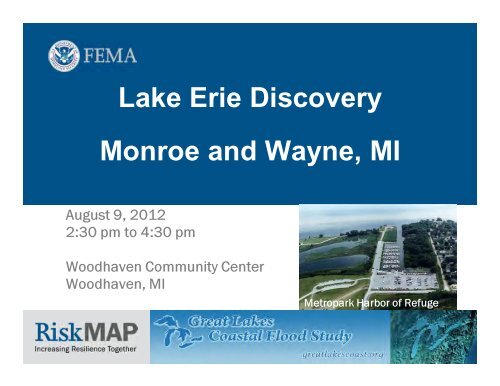
Lake Erie Discovery Monroe and Wayne, MI - State of Michigan
Lake Erie Discovery Monroe and Wayne, MI - State of Michigan
Lake Erie Discovery Monroe and Wayne, MI - State of Michigan

Create successful ePaper yourself
Turn your PDF publications into a flip-book with our unique Google optimized e-Paper software.
<strong>Lake</strong> <strong>Erie</strong> <strong>Discovery</strong><br />
<strong>Monroe</strong> <strong>and</strong> <strong>Wayne</strong>, <strong>MI</strong><br />
August 9, 2012<br />
2:30 pm to 4:30 pm<br />
Woodhaven Community Center<br />
Woodhaven, <strong>MI</strong><br />
Metropark Harbor <strong>of</strong> Refuge
Introductions<br />
Who’s here?<br />
� Risk MAP Project Team<br />
• FEMA<br />
• RAMPP<br />
� Federal<br />
• USACE<br />
� <strong>State</strong><br />
• MDEQ<br />
• <strong>State</strong> Police<br />
� Local Stakeholders<br />
• CEOs<br />
• Floodplain Administrators<br />
• Planners<br />
• Engineers<br />
• Emergency Managers<br />
• Community Leaders<br />
• Regional Planning Agencies<br />
• Coastal Organizations
<strong>Discovery</strong> Meeting Agenda<br />
� Why are we here?<br />
• Risk MAP Program, Great <strong>Lake</strong>s Study, <strong>and</strong> <strong>Discovery</strong><br />
� Coastal mapping <strong>and</strong> flood risk topics<br />
� How does this apply to my community?<br />
� Interactive Session A<br />
• View <strong>and</strong> Discuss Local Coastal Areas <strong>of</strong> Concern Using the <strong>Discovery</strong><br />
� Hazard mitigation opportunities <strong>and</strong> grant funding<br />
� Interactive Session B<br />
• Discuss Mitigation Action Opportunities <strong>and</strong> Introduce Mitigation Action Form<br />
� Wrap Up<br />
� Optional Interactive Stations
Risk Mapping, Assessment <strong>and</strong> Planning<br />
Risk MAP<br />
Through collaboration with <strong>State</strong>, Local, <strong>and</strong> Tribal entities,<br />
Risk MAP aims to deliver quality data that increases public<br />
awareness <strong>and</strong> leads to action that reduces risk to life <strong>and</strong><br />
property
Great <strong>Lake</strong>s Coastal Flood Study
Great <strong>Lake</strong>s Coastal Flood Study<br />
Overview<br />
� Latest models, data, <strong>and</strong> technology<br />
• Includes basin-wide water surface grids <strong>and</strong> storm sampling built from<br />
continuous record <strong>of</strong> 50 years <strong>of</strong> meteorological, water level, <strong>and</strong> ice<br />
field data (1960 - 2009)<br />
• Includes changes to runup computational approach<br />
• Updated version <strong>of</strong> Appendix D.3 (FEMA Guidelines <strong>and</strong> St<strong>and</strong>ards)<br />
• Latest imagery, LiDAR, <strong>and</strong> Bathymetry<br />
• Deliver updated flood maps <strong>and</strong> flood risk datasets<br />
� Equip Federal Agencies, eight <strong>State</strong>s <strong>and</strong> hundreds <strong>of</strong> coastal<br />
communities with data <strong>and</strong> planning tools to facilitate flood risk<br />
actions to enhance resiliency along the Great <strong>Lake</strong>s
<strong>Lake</strong> <strong>Erie</strong> <strong>Discovery</strong><br />
� 13 counties<br />
Ohio<br />
• Ashtabula<br />
• Cuyahoga<br />
• <strong>Erie</strong><br />
• <strong>Lake</strong><br />
• Lorain<br />
• Lucas<br />
• Ottawa<br />
• S<strong>and</strong>usky<br />
<strong>Michigan</strong><br />
• <strong>Monroe</strong><br />
• <strong>Wayne</strong><br />
New York<br />
• Chautauqua<br />
• <strong>Erie</strong><br />
Pennsylvania<br />
• <strong>Erie</strong><br />
� 132 coastal communities
<strong>Discovery</strong> Meeting Objectives<br />
� Continue <strong>and</strong> exp<strong>and</strong> upon stakeholder engagement<br />
� Discuss data inputs from Federal, state <strong>and</strong> local<br />
� Identify local coastal flood hazard needs <strong>and</strong> areas <strong>of</strong><br />
concern<br />
� Identify products <strong>and</strong> datasets that best advance coastal<br />
mitigation action<br />
� NFIP regulatory updates<br />
� <strong>Discovery</strong> schedule <strong>and</strong> deliverables
Stakeholder Engagement
Data Inputs<br />
� Updates to analysis <strong>and</strong> methodology guidance<br />
� Proposed transect locations<br />
� Topographic <strong>and</strong> Bathymetry data collected<br />
� Bare Earth Imagery collected<br />
� Identify reaches requiring special attention <strong>and</strong> data<br />
� Document local data sources that will help improve study
<strong>Discovery</strong> Schedule Overview
<strong>Lake</strong> <strong>Erie</strong> <strong>Discovery</strong><br />
Schedule <strong>of</strong> Activities<br />
� Identify Draft Transect Locations – Completed<br />
� Research available data – Completed<br />
� Information Exchange with Community Stakeholders – July 2012<br />
� Prepare draft <strong>Discovery</strong> Maps <strong>and</strong> Reports – July 2012<br />
� Establish inventory <strong>of</strong> coastal structures based on oblique imagery –<br />
August/September 2012<br />
� Facilitate <strong>Discovery</strong> Meetings – July/August 2012<br />
� Final <strong>Discovery</strong> Report <strong>and</strong> Maps – November 2012<br />
� Create library <strong>of</strong> digital data – November 2012
Great <strong>Lake</strong>s Coastal Flood Study<br />
<strong>Discovery</strong> Products<br />
� Final <strong>Discovery</strong> Report<br />
• Single, comprehensive report for all <strong>of</strong><br />
<strong>Lake</strong> <strong>Erie</strong>, with appendices for each<br />
<strong>Discovery</strong> meeting<br />
• Includes pre-discovery data, meeting<br />
agenda, sign-in sheets, discussion topics,<br />
decisions made, etc.<br />
� Final <strong>Discovery</strong> Maps<br />
• Including feedback from participants<br />
• Visual representation <strong>of</strong> meeting<br />
outcomes<br />
• Delivered in digital format
<strong>Discovery</strong> Outcomes<br />
� Explain the Project<br />
• Regulatory <strong>and</strong> non-regulatory products/datasets<br />
• Analysis, concepts, <strong>and</strong> timelines<br />
� Encourage Community Participation<br />
• Transect Locations<br />
• Areas <strong>of</strong> concern <strong>and</strong> need<br />
• Data to improve upon products <strong>and</strong> datasets<br />
� Introduce Mitigation Action<br />
• Mitigation Action Form<br />
• Mitigation strategies for coastal flood <strong>and</strong> erosion
Data Collected<br />
� Topographic <strong>and</strong> Bathymetric<br />
Data*<br />
� Base data – boundaries,<br />
streams, census blocks, etc.<br />
� Average Annualized Loss data<br />
� Coastal Barrier Resources<br />
System<br />
� Shoreline classification<br />
� Federal <strong>and</strong> <strong>State</strong> disaster<br />
information<br />
� Repetitive loss data<br />
� Letters <strong>of</strong> Map Change cluster<br />
locations<br />
� Dams <strong>and</strong> Levee locations<br />
� Stream, wave, <strong>and</strong> water level<br />
gage locations<br />
* New, high-quality USACE bathy/topo will replace existing data
Data Gaps<br />
� Building footprints<br />
� Critically eroded beach areas<br />
� Beach nourishment <strong>and</strong> dune replacement projects<br />
� Critical Facilities (in GIS format)<br />
� High water marks<br />
� Areas <strong>of</strong> recent or planned development <strong>and</strong> high growth<br />
� Recent l<strong>and</strong> changes due to development or erosion<br />
� Known flooding issues not represented on effective FIRMs or CNMS<br />
� Hazard Mitigation Plans<br />
• <strong>Monroe</strong> County – N/A • <strong>Wayne</strong> County – Expired June 22, 2012
Coastal Mapping <strong>and</strong><br />
Flood Risk Topics<br />
• Draft Transects<br />
• Coastal Guidance Updates<br />
• VE Zone Mapping <strong>and</strong> LiMWA<br />
• Coastal Flood Risk Products
Basic Elements <strong>of</strong> a Coastal<br />
Hazard Analysis<br />
Base Flood Elevation on FIRM includes 4 components:<br />
1. Storm surge stillwater elevation (SWEL)<br />
2. Amount <strong>of</strong> wave setup<br />
3. Wave height above storm surge (stillwater) elevation<br />
Determined from storm<br />
surge model<br />
4. Wave runup above storm surge elevation (where present)
Riverine XS vs Coastal Transect
Transect Placement<br />
� Transects are placed to define representative<br />
pr<strong>of</strong>iles for a shoreline reach<br />
� Transect spacing depends on upl<strong>and</strong><br />
development<br />
• Developed areas – As dense as 1,000 ft<br />
• Rural areas – Spacing can be 1-2 miles<br />
� Transects are:<br />
• Pr<strong>of</strong>iles along which flooding analysis is<br />
performed<br />
• Used to transform <strong>of</strong>fshore conditions to shoreline<br />
• Use to define coastal flood risks inl<strong>and</strong> <strong>of</strong><br />
shoreline
Draft Transect Layout - <strong>Monroe</strong><br />
� 34 miles <strong>of</strong><br />
shoreline<br />
� 47 Proposed<br />
Transects
Draft Transect Layout - <strong>Wayne</strong><br />
� 49 miles <strong>of</strong><br />
shoreline<br />
� 43 miles along<br />
Detroit River<br />
� 4 miles along<br />
<strong>Lake</strong> <strong>Erie</strong><br />
� 2 miles along<br />
Huron River<br />
� 44 Proposed<br />
Transects
Coastal Flood Hazard Zones<br />
� Hazard Zones<br />
• Zone VE – Areas expected to be affected by high velocity wave impact in 100year<br />
event (wave heights or runup depth at or greater than 3 feet)<br />
� Base Flood Elevation established<br />
• Zone AE – Areas expected to be flooded by inundation in 100-year event<br />
� Base Flood Elevation established (wave heights <strong>and</strong> runup depth less than 3 feet)<br />
• Zone X – Areas not expected to be flooded in 100-year event<br />
� Shaded X – Areas expected to be flooded in 500-year event<br />
� Base Flood Elevations not established<br />
• LiMWA – Areas subject to wave heights <strong>of</strong> at least 1.5 feet<br />
� Non-Regulatory<br />
� Gutters<br />
• Internal zone breaks where Base Flood Elevation changes<br />
• VE/AE Gutter - Location where risk <strong>of</strong> damage due to wave action diminishes
VE Zones in the Great <strong>Lake</strong>s<br />
� From the revised Appendix D.3:<br />
• “VE zones may also be mapped where the engineering<br />
analysis indicates their presence“<br />
• “The typical study finding is a narrow VE zone, making its<br />
usefulness uncertain on maps at usual scales“<br />
• “Relatively small numbers <strong>of</strong> existing coastal buildings are<br />
likely to be affected by possible VE zone designations along<br />
some Great <strong>Lake</strong>s”<br />
• “Only with prior approval from the FEMA study<br />
representative should the VE zones be mapped”
How is LiMWA Defined?<br />
� LiMWA is the line mapped to delineate the inl<strong>and</strong> extent <strong>of</strong><br />
wave heights <strong>of</strong> at least 1.5 feet<br />
• Wave heights as small as 1.5 feet can cause significant damage<br />
to structures<br />
� LiMWA alerts people that are not in the high wave hazard zone<br />
(Zone VE) that they may still be affected by wave action in the<br />
Zone<br />
� CRS benefit for communities requiring Zone VE construction<br />
st<strong>and</strong>ards in areas defined by LiMWA or areas subject to<br />
waves greater than 1.5 ft
Wave Action - Structural Risk<br />
� US Army Corps <strong>of</strong> Engineers – 1973<br />
• Breaking wave height <strong>of</strong> 3 feet<br />
• “area subject to high velocity waters,<br />
including but not limited to hurricane<br />
wave wash”<br />
� FEMA – 2000<br />
• Coastal Construction Manual<br />
• Additional post-storm damage<br />
assessments identified 1.5 wave also<br />
can knock a structure <strong>of</strong>f a foundation<br />
http://www.fema.gov/pdf/rebuild/mat/coastal_a_zones.pdf
Limit <strong>of</strong> Moderate Wave Action<br />
(LiMWA)<br />
FEMA Procedure Memor<strong>and</strong>um<br />
No. 50, 2008<br />
� Not a regulatory requirement<br />
� No Federal Insurance<br />
requirements tied to LiMWA
Coastal Flood Risk<br />
Products<br />
• Coastal Depth Grids <strong>and</strong> Hazus<br />
• Changes Since Last FIRM<br />
• Coastal Non-Regulatory Products
St<strong>and</strong>ard Flood Risk Products<br />
� Coastal Depth Grids<br />
� Flood Risk Assessment<br />
(Hazus)<br />
Depth Grid
Coastal Depth Grid<br />
� Should reflect total depth (i.e.<br />
stillwater <strong>and</strong> waves) –<br />
typically only produced for<br />
the 1% annual chance flood<br />
� Created using the regulatory<br />
mapping <strong>and</strong> associated<br />
zone breaks as input<br />
� Depths reflect difference<br />
between wave crest elevation<br />
<strong>and</strong> ground for the 1-percentannual-chance<br />
flood
Coastal Flood Risk Assessments<br />
� Similar to Flood Risk<br />
Assessments for riverine,<br />
but using the coastal<br />
depth grids as input for the<br />
refined analysis<br />
� Hazus analysis <strong>and</strong> data<br />
can support adoption <strong>of</strong><br />
higher regulatory<br />
st<strong>and</strong>ards for structures in<br />
high loss areas<br />
� Provides justification to<br />
fund mitigation actions
Changes Since Last FIRM<br />
Unchanged<br />
SFHA Increase<br />
SFHA Decrease<br />
Data Fields Include Example Data<br />
Values<br />
Old Study Date e.g. 1985<br />
Old Model Type(s) e.g. HEC-1 / HEC-2<br />
Old Unchanged Zone Type e.g. Zone A<br />
Old Topography e.g. USGS 10-ft<br />
SFHA Increase<br />
New Study<br />
Dates, Models, etc.<br />
Info/Methods<br />
New Study Zone e.g. Zone AE<br />
New Topography e.g. LiDAR 2-ft<br />
New Study<br />
Engineering Factors /<br />
Changes<br />
Estimated Structures e.g. 9<br />
Estimated<br />
Unchanged<br />
Population e.g. 27<br />
e.g. new structures,<br />
gages, topo,<br />
l<strong>and</strong>use, etc.
Coastal Non-Regulatory Products<br />
� If <strong>and</strong> when are products produced?<br />
• Operating Guidance for the Selection <strong>of</strong> Enhanced Datasets<br />
• Availability <strong>of</strong> coastal analysis modeling information<br />
• Will the information be beneficial to the communities?<br />
� Increase risk awareness?<br />
� Facilitate mitigation actions?<br />
� Products may be produced for the entire coastline or focused areas<br />
determined to be the most valuable<br />
• <strong>Discovery</strong> process should facilitate these selections<br />
� Additions to Flood Risk Map, Flood Risk Database, & Flood Risk Report<br />
� Datasets will not be recreated from existing data available outside <strong>of</strong><br />
FEMA. Direction to such information will be provided in the Flood Risk<br />
Report.
Coastal Non-Regulatory Products<br />
in Development<br />
Storm Response<br />
Erosion data<br />
Depth Grids,<br />
Hazus (incl. revised<br />
analysis for 1% annual<br />
chance loss) Shoreline Feature Dataset<br />
<strong>Lake</strong> St. Clair, at Anchor Bay<br />
Reference<br />
<strong>Lake</strong> <strong>Michigan</strong>, Indiana shoreline<br />
Red Lantern Restaurant<br />
Upper Peninsula Shoreline<br />
Reference
Shoreline Features Database<br />
Shoreline<br />
Material<br />
Primary L<strong>and</strong> Use Primary Coast Type Primary Vegetation<br />
S<strong>and</strong> High Density Residential High Dune, 10'+ None<br />
Cohesive Moderate Density Residential Dune, 2' - 10' High Density Shrubs/Trees<br />
Cobble Low Density Residential High Bluff, 10'+ Moderate Density Shrubs/Trees<br />
Diamicton* Commercial/Industrial Bluff, 2' - 10' Low Density Shrubs/Trees<br />
Shingle Park L<strong>and</strong> Coastal Wetl<strong>and</strong> Manicured Lawn<br />
Bedrock Farm L<strong>and</strong> Flat Coast Native Vegetation<br />
Artificial Forested<br />
� Contains primary <strong>and</strong> secondary L<strong>and</strong> Use tables – same for coast type <strong>and</strong> vegetation<br />
� Current project collects data at one-mile spacing, for scoping <strong>and</strong> cost<br />
� Current project does not include field-based reconnaissance or sediment/subsurface soils<br />
collection
Coastal Flood<br />
Risk Map<br />
� Similar to riverine map<br />
� Highlights area where<br />
datasets were produced<br />
� Use <strong>of</strong> callout boxes<br />
� Should drive the<br />
conversation towards<br />
mitigation
Areas Affected by Increased<br />
Coastal Inundation<br />
� Highlights areas that would<br />
be inundated if water levels<br />
increased by 1, 2, or 3 ft (or<br />
other user-defined increase)<br />
� Typically created for the 1%<br />
annual chance flood, but<br />
could be done for other<br />
flood events<br />
� Possible causes for higher<br />
flood levels include :<br />
• More severe storm events<br />
• Climate change impacts<br />
such as sea level rise
Wave Hazard Severity Areas<br />
� Highlights areas where wave<br />
hazard are high (V Zone <strong>and</strong><br />
PFD), moderate (between V<br />
Zone <strong>and</strong> LiMWA where wave<br />
heights are between 1.5 –<br />
3ft), <strong>and</strong> minimal (wave<br />
heights less than 1.5ft)<br />
� Dataset can also optionally<br />
store number <strong>of</strong> buildings<br />
within each delineated<br />
polygon (if local building<br />
footprint data is available)
Coastal Wave Height Grid<br />
� Dataset showing wave height<br />
information to greater detail<br />
than the Wave Hazard Severity<br />
Areas dataset by delivering<br />
within a raster dataset<br />
� Represents the full wave height,<br />
not just the portion <strong>of</strong> the wave<br />
crest that lies above the<br />
stillwater elevation<br />
� Wave damage to structures can<br />
be mitigated if they are properly<br />
elevated above predicted water<br />
levels <strong>and</strong> wave heights on<br />
engineered foundations
Erosion Risk Determination<br />
� Polygons depicting the<br />
spatial extent <strong>of</strong> the<br />
regulatory Primary Frontal<br />
Dune (PFD), based on<br />
topography <strong>and</strong>/or shoreline<br />
survey data <strong>and</strong> augmented<br />
with aerial photos as needed<br />
� Polygons can be further<br />
subdivided to show the<br />
spatial extent <strong>of</strong> the eroded<br />
ground as estimated from<br />
the erosion analysis<br />
conducted for the 1%<br />
annual chance flood
Coastal Updates to Flood Risk<br />
Report<br />
� Explanations <strong>of</strong> coastal non-regulatory datasets <strong>and</strong> their use in risk<br />
communication <strong>and</strong> mitigation planning<br />
� References to other publications <strong>and</strong> resources that provide information<br />
on coastal risks<br />
� Captures <strong>and</strong> reports increases <strong>and</strong> decreases in Coastal High Hazard<br />
Areas (VE & V Zones) within the Changes Since Last FIRM tables in the<br />
FRR<br />
Area <strong>of</strong> Study Total Area (mi 2 ) Increase (mi 2 ) Decrease (mi 2 ) Net Change (mi 2 )<br />
Within SFHA 23.8 1.6 0.4 1.2<br />
Within Floodway 1.4 0.2 0.0 0.2<br />
Within CHHA (VE or V<br />
Zone)<br />
7.8 0.9 0.5 0.4
Coastal Updates to Flood Risk<br />
Report<br />
� Captures <strong>and</strong> reports the additional areas that would be inundated,<br />
based on 1, 2, or 3 feet <strong>of</strong> increased inundation<br />
Flood Event<br />
Frequency<br />
1-ft<br />
Increase<br />
Area <strong>of</strong> Additional Inundation (mi 2 )<br />
2-ft Increase 3-ft Increase<br />
Newly<br />
Inundated<br />
Total<br />
Newly<br />
Inundated<br />
Total<br />
1%-annual-chance 0.6 0.8 1.4 1.2 2.6
Coastal Updates to Flood Risk<br />
Report<br />
� Captures <strong>and</strong> reports the total area <strong>and</strong> number <strong>of</strong> structures (if<br />
available) within each <strong>of</strong> the 3 different levels <strong>of</strong> wave hazard (High,<br />
Moderate, <strong>and</strong> Minimal)<br />
Coastal Wave Hazard Severity<br />
Total Area<br />
(mi 2 )<br />
# <strong>of</strong> Structures<br />
High 0.4 15<br />
Moderate 2.6 187<br />
Minimal 3.3 296
Non-Regulatory Product Usage<br />
<strong>and</strong> Action<br />
� Risk MAP Products <strong>and</strong> Datasets help communities make good<br />
decisions to reduce flood risk:<br />
• Hazard Mitigation Planning<br />
• Floodplain Management <strong>and</strong> Community Rating System<br />
• Community Comprehensive or General Planning<br />
• Community Investment - Capital Improvement Planning<br />
• Public Outreach<br />
• Hazard Mitigation Assistance Grant Application Prioritization <strong>and</strong> Support<br />
• Other Non-FEMA Grants to Reduce Flood Risk<br />
• Response <strong>and</strong> Recovery Planning<br />
� Mitigation Action Form
How does this apply to<br />
my community?<br />
• NFIP Compliance<br />
• Local impacts <strong>of</strong> coastal study
National Flood Insurance Program<br />
� Allows property owners to<br />
purchase flood insurance at<br />
reduced rates<br />
� <strong>State</strong> <strong>and</strong> local governments<br />
agree to adopt <strong>and</strong> enforce<br />
floodplain management<br />
ordinances<br />
� Over 20,300 communities<br />
participate in the NFIP
V Zones for <strong>Michigan</strong><br />
� <strong>Monroe</strong> <strong>and</strong> <strong>Wayne</strong> Counties currently do not have V/VE<br />
Zones or Coastal A/AE Zones<br />
� There are several areas with V Zones in <strong>Michigan</strong><br />
� If coastal flood zones are added, all affected communities<br />
must update regulations to include coastal requirements
Coastal Zones <strong>and</strong><br />
NFIP Compliance<br />
� Must meet minimum NFIP <strong>and</strong> community coastal requirements<br />
� NFIP design <strong>and</strong> construction requirements are more stringent in V<br />
zones due to wave, debris, <strong>and</strong> erosion hazards in V zones<br />
� Recommendations for exceeding the minimum NFIP requirements<br />
(Coastal A Zones)<br />
• Can obtain CRS credits for<br />
Coastal A Zone Requirements<br />
� Resources Available
Community Rating System (CRS)<br />
� Flood insurance premium rates discounted to reward community actions<br />
that reduce flood losses, facilitate accurate insurance ratings, <strong>and</strong><br />
promote the awareness <strong>of</strong> flood insurance<br />
� Class rating system from 1 to 10<br />
� Each Class improvement (500 point increments) results in additional 5%<br />
discount, up to 45% in SFHAs for Class 1 communities<br />
� Uniform minimum credits give you points for activities on the state level<br />
(state laws) <strong>and</strong> make achieving a Class 9 relatively easy<br />
� 18 creditable activities organized under four categories:<br />
Public Information Mapping <strong>and</strong> Regulations<br />
Flood Damage Reduction Flood Preparation<br />
� http://training.fema.gov/E<strong>MI</strong>Web/CRS/
CRS Communities<br />
� <strong>Monroe</strong> County<br />
•City <strong>of</strong> Luna Pier - CRS Class 8<br />
� <strong>Wayne</strong> County<br />
•City <strong>of</strong> Gibraltar – CRS Class 8
Interactive Session A<br />
• View <strong>and</strong> Discuss Local Coastal Areas <strong>of</strong> Concern<br />
Using the <strong>Discovery</strong> Map
<strong>Monroe</strong> County, <strong>MI</strong><br />
<strong>Discovery</strong> Map
<strong>Monroe</strong> County, <strong>MI</strong><br />
<strong>Discovery</strong> Map – Coastal Structures <strong>and</strong> Transects
<strong>Monroe</strong> County, <strong>MI</strong><br />
<strong>Discovery</strong> Map – CNMS Status<br />
Coordinated Needs<br />
Management Strategy
<strong>Monroe</strong> County, <strong>MI</strong><br />
<strong>Discovery</strong> Map – AAL <strong>and</strong> CBRS
<strong>Wayne</strong> County, <strong>MI</strong><br />
<strong>Discovery</strong> Map
<strong>Wayne</strong> County, <strong>MI</strong><br />
<strong>Discovery</strong> Map – Flood Hazard Areas
<strong>Wayne</strong> County, <strong>MI</strong><br />
<strong>Discovery</strong> Map – CNMS Status<br />
Coordinated Needs<br />
Management Strategy
<strong>Wayne</strong> County, <strong>MI</strong><br />
<strong>Discovery</strong> Map – AAL <strong>and</strong> CBRS
Hazard Mitigation<br />
• Opportunities<br />
• Grant Funding
Local Hazard Mitigation Plans<br />
Risk MAP<br />
Risk MAP products<br />
<strong>and</strong> Datasets<br />
Hazard Mitigation Plan<br />
• Uses Risk Information<br />
• Identifies<br />
Projects/Actions<br />
• Integrated with Other<br />
Community Plans<br />
Mitigation Actions/Projects<br />
Other Community Plans<br />
• Comprehensive plans<br />
• Capital Improvement<br />
• Stormwater<br />
Management Plans<br />
• Emergency Operations
Mitigation Actions<br />
� Address specific existing assets (e.g.,<br />
elevate critical facility, enlarge a culvert)<br />
� Address future risks (e.g., update building<br />
codes)<br />
� Based on local capabilities<br />
• Build on current strengths, ongoing<br />
efforts (add-on to stormwater<br />
management regulations)<br />
• Coordinate with Federal programs (e.g.,<br />
NFIP, CRS)
Example Mitigation Actions<br />
STRUCTURAL<br />
PROJECTS<br />
Acquisition<br />
Elevation<br />
Retr<strong>of</strong>its<br />
Drainage<br />
PLANNING<br />
MECHANISMS<br />
Zoning<br />
Building Codes<br />
Ordinances<br />
Open Space Plan<br />
EDUCATION<br />
& OUTREACH<br />
Public<br />
Awareness<br />
Outreach<br />
Educational<br />
programs<br />
NATURAL<br />
RESOURCE<br />
PROTECTION<br />
Stream <strong>and</strong><br />
wetl<strong>and</strong><br />
restoration<br />
Erosion control
Mitigation Grant Programs<br />
<strong>and</strong> Funding Sources<br />
� Hazard Mitigation Assistance (HMA)<br />
• Hazard Mitigation Grant Program (HMGP)<br />
� Grants available in the absence <strong>of</strong> a disaster / pre-disaster<br />
• Pre-Disaster Mitigation Grant Program (PDM)<br />
• Flood Mitigation Assistance (FMA)<br />
• Repetitive Flood Claims (RFC)<br />
• Severe Repetitive Loss (SRL)<br />
� Grants are made from FEMA to a <strong>State</strong> (or Tribe/Territory)<br />
• Communities contact <strong>State</strong> Hazard Mitigation Officer (SHMO) if<br />
interested in applying for HMA<br />
� Other<br />
• Community Development Block Grant
<strong>Monroe</strong> County<br />
Mitigation Best Practices<br />
� Village <strong>of</strong> Estral Beach – Flood-Prone<br />
Home Elevations<br />
• Project involves elevating 39 flood-prone homes<br />
a minimum <strong>of</strong> one-foot above the 100-year flood<br />
elevation<br />
• Homes that are subject to wave run up from<br />
<strong>Lake</strong> <strong>Erie</strong> have to be elevated in accordance<br />
with recommendations <strong>of</strong> MDEQ<br />
• 11 homes elevated as <strong>of</strong> May 2011<br />
Before<br />
After
<strong>Wayne</strong> County<br />
Mitigation Best Practices<br />
� City <strong>of</strong> Wy<strong>and</strong>otte Restricted Flow Catch Basin<br />
Covers<br />
• Funded by HMGP under Federal Disaster 1346-DR-<br />
<strong>MI</strong><br />
• Minimize repetitive impacts <strong>of</strong> flooding on<br />
residents <strong>of</strong> Wy<strong>and</strong>otte<br />
• Involved installation <strong>of</strong> approximately 2,300<br />
restricted catch basin covers throughout the city<br />
• Restricted covers allow water during heavy<br />
rainstorms to be detained on the street <strong>and</strong> slow<br />
down the intensity <strong>of</strong> the stormwater entering the<br />
combined sewer system<br />
Pre-construction<br />
Post-construction
Hazard Mitigation<br />
Resources, Strategies & Actions<br />
� The right action (or mix <strong>of</strong> actions) will be based on recent community experiences<br />
<strong>and</strong> level <strong>of</strong> complexity in existing infrastructure<br />
• Public Works<br />
• Building St<strong>and</strong>ards<br />
• Community Planning <strong>and</strong> HM Plan Update / Integration processes<br />
• Communication Processes, GIS, etc.<br />
� Get the right people to the table: Integrated vs. Discipline-specific<br />
� Document ideas <strong>and</strong> actions through the FEMA Mitigation Action Form<br />
L<strong>and</strong> Use<br />
Ordinances<br />
Zoning, Setbacks,<br />
Floodplain<br />
Management, etc.<br />
Local Building<br />
Codes<br />
IBC, IRC, Local<br />
Regulations, etc.<br />
Mitigation<br />
Projects<br />
Acquisition, Elevation,<br />
Floodpro<strong>of</strong>ing, etc.<br />
Community<br />
Identified<br />
Mitigation<br />
Programs<br />
Management<br />
Best Practices<br />
Integration <strong>of</strong> natural<br />
hazards into other<br />
planning mechanisms
Interactive Session B<br />
• Discuss Mitigation Action Opportunities <strong>and</strong><br />
Introduce the Mitigation Action Form
Capturing <strong>and</strong> Tracking<br />
Mitigation Actions<br />
http://fema.starr-team.com/
Capturing <strong>and</strong> Tracking<br />
Mitigation Actions
Questions?
Results from Interactive Sessions<br />
� Review <strong>and</strong> Clarify Communication, Planning, <strong>and</strong><br />
Compliance Needs<br />
• Local coastal areas <strong>of</strong> concern<br />
• Existing local coastal data<br />
• Mitigation Action opportunities<br />
• Mitigation Action form
Next Steps<br />
� Communities will:<br />
• Provide all data <strong>and</strong> Mitigation Action Forms to RAMPP by<br />
August 31, 2012<br />
� RAMPP/FEMA will:<br />
• Assess data <strong>and</strong> information provided<br />
• Email summary <strong>of</strong> today’s <strong>Discovery</strong> Meeting to you within<br />
one month<br />
• Prepare final <strong>Discovery</strong> Maps <strong>and</strong> <strong>Discovery</strong> Report<br />
• Follow-up regarding Risk MAP Project
Optional Interactive Stations<br />
� Draft Transect Map Station<br />
• View draft transect locations <strong>and</strong> oblique imagery in data viewer<br />
• Discuss draft transect locations with technical staff<br />
� Mitigation Resources, Strategies, <strong>and</strong> Actions Station<br />
• Talk with FEMA representative about areas <strong>of</strong> concern <strong>and</strong> potential<br />
mitigation actions to help reduce risk<br />
• Fill out Mitigation Action Form
Contacts<br />
FEMA<br />
Mike Hanke<br />
michael.hanke@fema.dhs.gov<br />
Ken Hinterlong<br />
ken.hinterlong@fema.dhs.gov<br />
RAMPP<br />
Amelia Vincent<br />
amelia.vincent@URS.com<br />
<strong>State</strong><br />
Les Thomas<br />
NFIP Coordinator<br />
thomasl@michigan.gov<br />
Matt Schnepp<br />
<strong>State</strong> Hazard Mitigation Officer<br />
schneppm1@michigan.gov