checklist - Yarriambiack Council
checklist - Yarriambiack Council
checklist - Yarriambiack Council

Create successful ePaper yourself
Turn your PDF publications into a flip-book with our unique Google optimized e-Paper software.
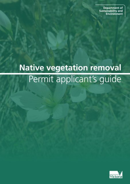
Native vegetation removal<br />
Permit applicant’s guide
Acknowledgement:<br />
This guide was prepared with the guidance and support of a working group with representatives from<br />
the Municipal Association of Victoria and the following local councils: Baw Baw, Buloke, Macedon<br />
Ranges, Manningham, Melton, Moira, Mornington Peninsula, Murrindindi, Wellington, Whittlesea and<br />
Yarra Ranges.<br />
Image credits:<br />
Page 3: grassland (Reto Zollinger)<br />
Page 8: leaves and young nuts, mature nuts, bark and overall view (© PACPIX Robert Gardiner)<br />
Citation:<br />
DSE (2011) Native vegetation removal permit applicant’s guide. State of Victoria, Department of<br />
Sustainability and Environment, East Melbourne.<br />
Published by the Victorian Government Department of Sustainability and Environment,<br />
Melbourne, August 2011<br />
© The State of Victoria Department of Sustainability and Environment 2011<br />
This publication is copyright. No part may be reproduced by any process except in accordance with the<br />
provisions of the Copyright Act 1968.<br />
Authorised by the Victorian Government, 8 Nicholson Street, East Melbourne.<br />
Print managed by Finsbury Green<br />
Printed on recycled paper<br />
ISBN 978-1-74287-119-6 (print)<br />
ISBN 978-1-74287-120-2 (online)<br />
For more information contact the DSE Customer Service Centre 136 186<br />
Disclaimer<br />
This publication may be of assistance to you but the State of Victoria and its employees do not<br />
guarantee that the publication is without flaw of any kind or is wholly appropriate for your particular<br />
purposes and therefore disclaims all liability for any error, loss or other consequence which may arise<br />
from you relying on any information in this publication.<br />
ii<br />
Accessibility<br />
If you would like to receive this publication in an accessible format, such as large print or audio,<br />
please telephone 136 186, or through the National Relay Service (NRS) using a modem or textphone/<br />
teletypewriter (TTY) by dialling 1800 555 677, or email customer.service@dse.vic.gov.au
Getting started<br />
Native vegetation regulation<br />
In Victoria, native vegetation removal is regulated<br />
through the planning system. If you want to<br />
remove native vegetation a planning permit is<br />
generally required, unless the proposal is exempt.<br />
To find out if you need a planning permit contact<br />
your local council.<br />
What is native vegetation?<br />
Native vegetation means plants that are<br />
indigenous 1 to Victoria, including trees, shrubs,<br />
herbs and grasses. This includes areas of bushland<br />
with trees, scattered paddock trees, and treeless<br />
areas of scrub or grassland. In fact, some of the<br />
most rare or threatened vegetation types do not<br />
include trees at all, such as native grasslands,<br />
many wetlands and alpine communities.<br />
It can be difficult for people who are not trained<br />
botanists, horticulturalists or natural resource<br />
managers to identify areas of native vegetation<br />
that don’t include trees. A person would be<br />
required to be skilled at identifying indigenous<br />
plant species, particularly when they are not<br />
flowering and also understand that some plants<br />
are only visible during certain times of the year.<br />
Seek advice from your local council if you are<br />
unsure whether you have native vegetation on<br />
your property and/or require a planning permit for<br />
its removal.<br />
Some of the things to look out for include:<br />
■■<br />
■■<br />
■■<br />
■■<br />
unimproved pasture - this often includes<br />
native grasses and may be a native grassland<br />
areas of ‘bush’ or ‘scrub’ - particularly on<br />
undeveloped blocks, this may include a variety<br />
of native plant species<br />
low-lying areas that fill with water after<br />
rain - these may be wetlands, particularly if<br />
they contain reeds, rushes or sedges<br />
native trees - particularly large old trees, both<br />
live and dead.<br />
What happens if I need a planning<br />
permit to remove native vegetation?<br />
As a first step, you should discuss your proposal<br />
with your local council. They can advise you:<br />
■■<br />
■■<br />
■■<br />
if a permit is required<br />
what information should be included in your<br />
permit application<br />
whether council officers should visit your<br />
property and discuss your proposal with you.<br />
If you need a planning permit to remove native<br />
vegetation you will need to complete the Native<br />
vegetation permit applicant’s form. Depending<br />
on what you are proposing, your local council<br />
or DSE in some cases, may require additional<br />
material. The Native vegetation permit applicant’s<br />
form is not designed to be used when you are<br />
applying for a permit to remove heritage trees<br />
or other non-indigenous vegetation. For further<br />
information on these applications contact your<br />
local council.<br />
The Native vegetation permit applicant’s guide is<br />
not designed to provide advice on meeting fire<br />
protection requirements. If you need help with<br />
this issue, contact the Country Fire Authority.<br />
However, once it has been determined what<br />
vegetation removal is required for fire protection,<br />
you may use the Native vegetation permit<br />
applicant’s form when applying for a permit to<br />
remove native vegetation.<br />
1 occurs naturally in a particular area<br />
1
A guide to completing the Native vegetation permit applicant’s form<br />
1. Proposed works<br />
Section 1 of the Native vegetation permit<br />
applicant’s form asks you to describe what<br />
you are proposing to do that involves native<br />
vegetation removal. For instance, you may be<br />
building a new house or shed, you may be<br />
removing native vegetation to address a fire risk<br />
or to construct a fence.<br />
2. Avoiding and minimising removal of<br />
native vegetation<br />
The planning scheme requires you to avoid<br />
removing native vegetation as far as practical.<br />
If the removal of native vegetation cannot be<br />
avoided, you must minimise the amount of native<br />
vegetation you remove through careful planning,<br />
siting, design and construction. Please note that<br />
by avoiding and minimising native vegetation<br />
removal you will reduce your offset requirement.<br />
This will reduce the costs of meeting any<br />
conditions on your permit relating to offsets. See<br />
5. Offsetting removal of native vegetation.<br />
Section 2 of the Native vegetation permit<br />
applicant’s form asks you to describe any actions<br />
you have taken to avoid or minimise native<br />
vegetation removal. For instance, if you are<br />
building a house you might have chosen a mostly<br />
cleared area, sited the building close to the road<br />
(to reduce native vegetation removed for the<br />
driveway), or you could have designed your home<br />
to minimise native vegetation removal. Figure<br />
1 provides an example of a development that<br />
has not avoided or minimised native vegetation<br />
loss, and the same development redesigned to<br />
better meet these objectives. Please note that this<br />
example does not address vegetation removal for<br />
fire protection.<br />
The following questions may assist you to<br />
complete Section 2 of the Native vegetation<br />
permit applicant’s form:<br />
■■<br />
■■<br />
■■<br />
■■<br />
■■<br />
■■<br />
Are there alternative sites on your property<br />
where you could do the works that would<br />
avoid or minimise native vegetation removal?<br />
If you are building a house, is there an<br />
opportunity to locate it away from vegetation<br />
in an area where the fire risk is reduced?<br />
Can you consolidate the different parts of<br />
your construction or subdivision layout (for<br />
example, grouping buildings together) to<br />
avoid removing native vegetation?<br />
Could you alter the orientation, layout or form<br />
of your works to avoid native vegetation?<br />
Can your works be modified to avoid the<br />
removal of native vegetation?<br />
Can you choose construction methods that<br />
would minimise damage to native vegetation?<br />
In some cases, there may be other factors that<br />
make it difficult to avoid or minimise native<br />
vegetation loss. These should be described<br />
in Section 2 of the Native vegetation permit<br />
applicant’s form.<br />
If you run out of space, please attach a separate<br />
page.<br />
If you need further guidance on how to avoid or<br />
minimise native vegetation loss, contact your local<br />
council.<br />
2<br />
Figure 1: Development that has not avoided and minimised native vegetation removal (left)<br />
and the same development redesigned for minimal vegetation removal (on right)
3. Describe the native vegetation<br />
Section 3 of the Native vegetation permit<br />
applicant’s form asks you to describe the<br />
native vegetation on your property, including<br />
the vegetation that you wish to remove. It is<br />
recommended that you seek advice from your<br />
local council if you are unsure whether or not you<br />
have native vegetation on your property or what<br />
type it is.<br />
Patches of native vegetation<br />
If you think you have a patch of bush or<br />
grassland, the form asks you to estimate how<br />
much native vegetation you propose to remove in<br />
hectares or square metres.<br />
Please note that patches of bushland may include<br />
areas with trees, but it may also include treeless<br />
areas of scrub or grassland. Figure 2 provides<br />
some examples of patches of native vegetation<br />
without trees. Figure 3 provides some examples of<br />
patches of native vegetation with trees.<br />
Figure 2: Patches of treeless native vegetation. Grassland (top left), inland saltmarsh (top<br />
right), inland wetland (bottom left), alpine bog (bottom right).<br />
3
4<br />
Figure 3: Patches of treed native vegetation. Grassy forest (top left), mallee (top right),<br />
creekline grassy woodland (bottom left), forest with bracken (bottom right).
Trees<br />
For each tree you wish to remove, Section 3 of<br />
the Native vegetation permit applicant’s form asks<br />
you to fill in a table with:<br />
■■<br />
■■<br />
■■<br />
■■<br />
■■<br />
the number of the tree on your attached plan<br />
(see 6. Mapping information)<br />
the tree type or species<br />
the circumference OR diameter of each tree<br />
trunk measured at 1.3 metres above ground<br />
level (see Box 1)<br />
a note of whether the tree is going to be<br />
lopped only<br />
a note of whether the tree is dead.<br />
It is important to think about whether your<br />
works will impact on trees outside your specific<br />
construction area. For instance, if you are digging<br />
under the canopy of a tree you may damage or<br />
disturb its roots. In some cases this can lead to<br />
the tree dying. Any trees that you think could be<br />
impacted should be included in the table.<br />
If there are more trees than lines on the table<br />
attach a separate page.<br />
Please note that your local council may request an<br />
arborist report about the trees you are removing<br />
or impacting with your development or works. If<br />
you have an arborist report, please submit it with<br />
the form.<br />
Box 1: Tips on measuring a tree trunk<br />
■■<br />
For trees with multiple trunks, pick the largest trunk and measure it.<br />
■■<br />
■■<br />
■■<br />
■■<br />
■■<br />
Use a tape measure and run it around the tree at chest height (1.3 metres above ground level, on<br />
the high side of sloping ground).<br />
Keep the tape tight.<br />
The circumference is the distance around the tree trunk (see Figure 4, below).<br />
If you are unsure about how to measure the diameter, just include circumference measurements<br />
and note that you have used this measure on the form.<br />
The diameter is the distance “through the trunk” (see figure 4, below). The diameter of a tree<br />
can be estimated by dividing the circumference by 3.14. Alternatively, there are some special<br />
tapes that allow you to measure circumference and read off the diameter.<br />
Figure 4: Diameter (on left), circumference (on right)<br />
4. Water and soil<br />
Native vegetation is important to protect soil<br />
stability, prevent erosion and soil loss.<br />
Section 4 of the Native vegetation permit<br />
applicant’s form provides a <strong>checklist</strong> of potential<br />
issues. If you tick any of the boxes, you are asked<br />
to describe any management or protection<br />
measures you propose to address the issue. For<br />
example, to prevent soil being washed away by<br />
rain you might install sediment fences or use<br />
erosion control mats.<br />
If you are unsure about these issues and/or<br />
how they could be managed, contact your local<br />
council.<br />
5
Box 2: Water and soil guidance<br />
Waterway<br />
A waterway includes rivers, creeks, springs, streams and watercourses where water may occasionally<br />
flow, a lake, lagoon, swamp or marsh. Waterways are often mapped.<br />
Salinity<br />
Soil salinity occurs when the salt in the soil is brought to the surface by rising water tables. There are<br />
two aspects to this problem: recharge and discharge areas.<br />
Water that drains through the soil and reaches the watertable is called recharge. Recharge areas are<br />
generally found on hill tops. High levels of recharge increase the risk of salinity.<br />
Water leaving the groundwater is called discharge. Discharge areas are at break of slope, on or near<br />
waterways, or on flat land. A salty discharge area may have: bare areas; poor growing, stunted or<br />
yellowing plants; salt tolerant plants like sea barley grass or spiny rush; and/or a salty crust.<br />
If you are clearing vegetation in a discharge or recharge area there may be a risk of increased salinity.<br />
Some local councils have identified areas where salinity may be an issue in their planning schemes<br />
through the use of the Salinity Management Overlay (SMO). Contact your local council to see if an<br />
SMO applies to your land.<br />
Erosion<br />
Erosion occurs when soil is lost through rain, wind or the repeated movement of people, animals or<br />
vehicles. It can happen slowly over a number of years, or quickly during a storm or other extreme<br />
weather events. The risk of erosion is higher when there are steep slopes and where soils are<br />
unstable and do not absorb water.<br />
Landslip<br />
A landslip can occur when the ground is not strong enough to support its own weight, causing a<br />
slope to collapse. The risk of landslips is related to rainfall, geology, soil type and land form. Landslips<br />
occur most frequently on steep slopes but can also happen on gentle slopes.<br />
Some local councils have identified areas which are prone to erosion or landslip in their planning<br />
schemes through the use of the Erosion Management Overlay (EMO). Contact your local council to<br />
see if an EMO applies to your land.<br />
20 Percent Slope<br />
Land and water protection issues may arise if vegetation is removed on ground slopes of more than<br />
20%. A 20% slope is 12 degrees or 1 in 5. Slope can be estimated with a spirit level or measured<br />
with a clinometer (see Figure 5).<br />
Alternatively stand facing up the slope, look directly ahead and horizontal. Note the point on the<br />
slope that you see. If the slope at this point is closer than 8 metres from you, it is steeper than 20%.<br />
Figure 5: Calculating<br />
per cent slope<br />
Rise = 10<br />
20%<br />
Run = 50<br />
Percent slope<br />
= (rise / run) x 100<br />
= (10 / 50) x 100<br />
= 20%<br />
12˚<br />
6
5. Offsetting removal of native<br />
vegetation<br />
Permit applicants are generally required to provide<br />
offsets if they remove native vegetation.<br />
Section 5 of the Native vegetation permit<br />
applicant’s form asks you to describe how you<br />
intend to offset the removal of native vegetation.<br />
For more information on offsets, see Box 3 below.<br />
Box 3: What is an offset?<br />
A native vegetation offset is works or other actions to compensate for the loss of native vegetation<br />
by removal. An offset may be an area:<br />
■■<br />
■■<br />
■■<br />
of existing vegetation that is protected and managed<br />
that is protected and allowed to naturally regenerate<br />
that is revegetated with locally indigenous plants.<br />
The amount or type of offset required will depend on how much native vegetation you are<br />
permitted to remove and the conservation significance of the vegetation. Your planning permit will<br />
outline what is required.<br />
All offsets need to be secure and ongoing. This means that the native vegetation cannot be<br />
removed in the future. Offset sites must be managed for conservation.<br />
You can establish an offset on your property, or you can arrange for someone else to do it for you.<br />
If the offset is on your property you will need to prepare an Offset Plan describing what works you<br />
will be doing. Your local council should have an Offset Plan template that you can fill in. Please<br />
note that landscaping is unlikely to be suitable as an offset.<br />
If it is not possible for you to offset on your land, Department of Sustainability and Environment<br />
(DSE) and local councils have programs that help permit applicants find offsets. These include the<br />
BushBroker, Trust for Nature and council offset programs.<br />
All offsets should be located at least 100m from a building used for accommodation.<br />
If you would like any guidance on offsets, contact your local council.<br />
6. Mapping information<br />
Section 6 of the Native vegetation permit<br />
applicant’s form asks you to attach a map or plan<br />
to the form clearly showing:<br />
■■<br />
■■<br />
■■<br />
■■<br />
■■<br />
■■<br />
north point, and property boundaries<br />
dimensions of buildings and distances from<br />
features such as patches of native vegetation<br />
or trees, fences and roads<br />
location of what you intend to do<br />
all areas of native vegetation, clearly showing<br />
the native vegetation proposed to be removed<br />
(including any area that the Country Fire<br />
Brigade has recommended you remove) AND<br />
the native vegetation proposed to be retained<br />
all trees identified with unique numbers<br />
(see 3. Describe the native vegetation)<br />
location where you took photographs<br />
(see 7. Photographs).<br />
If possible, your map should show:<br />
■■<br />
■■<br />
■■<br />
■■<br />
contours and all areas greater than 20% slope<br />
(~12 degrees)<br />
drainage lines, permanent and occasionally<br />
flowing creeks, rivers, wetlands and dams<br />
1:100 year flood level (if applicable)<br />
location of any protection or management<br />
works proposed to offset native vegetation<br />
removal, e.g. areas fenced off with weed<br />
control or replanting.<br />
An aerial photograph provides a good base for<br />
a plan. Your local council may be able to provide<br />
an aerial photograph or mapping information to<br />
assist you in preparing your map.<br />
If you cannot access an aerial photograph, or it is<br />
too unclear, you could provide a hand-drawn map<br />
provided it is legible and includes all the required<br />
information, outlined above.<br />
7
7. Photographs<br />
Section 7 of the Native vegetation permit<br />
applicant’s form asks you to attach photographs<br />
of the native vegetation you wish to remove and<br />
any areas you wish to manage as an offset.<br />
All photographs should be clear and well lit.<br />
To aid identification, it is useful if you provide<br />
photographs that depict different aspects of the<br />
native vegetation: leaves; bark; flowers, fruit or<br />
nuts; as well as an overall view (see Figure 6).<br />
It is useful if your map shows where you took<br />
your photographs from and the direction you<br />
were facing.<br />
Figure 6: Sample photographs of a tree proposed to be removed showing leaves and young<br />
nuts (top left), mature nuts (top right), bark (bottom left) and overall view (bottom right).<br />
8
How is my application assessed?<br />
In most instances, the local council will assess your<br />
application and decide if they will grant you a<br />
planning permit. In some cases, the local council<br />
must refer the application to DSE for assessment.<br />
If your application is not referred, the local<br />
council has 60 days to decide on your application,<br />
although this may be longer if further information<br />
is required or the application needs to be<br />
advertised.<br />
If your application is referred, DSE has 28 days to<br />
assess your application and send a response to the<br />
council, although this may be extended if further<br />
information is required.<br />
When assessing your application, some of the<br />
factors that the local council will consider are:<br />
■■<br />
■■<br />
■■<br />
■■<br />
■■<br />
whether there are any issues for water and soil<br />
and whether they can be managed<br />
the amount and type of native vegetation you<br />
wish to remove<br />
whether native vegetation removal can be<br />
avoided<br />
if native vegetation removal cannot be<br />
avoided, how the loss can be minimised<br />
whether there are appropriate offset options.<br />
The local planning scheme determines what<br />
applications must be referred. The main triggers<br />
for referral to DSE are based on the area of native<br />
vegetation or number of scattered trees to be<br />
removed.<br />
What am I required to do after I get a planning permit?<br />
Once you have been issued a planning permit,<br />
you are required to meet all of its conditions.<br />
If you need to provide an offset for native<br />
vegetation removal, the permit will include<br />
conditions about the amount and type of offset<br />
required as well as the date of commencement.<br />
Please note that your local council may audit<br />
whether you have complied with permit<br />
conditions.<br />
If you would like to know more about permit<br />
conditions, contact your local council.<br />
9
Native vegetation<br />
Permit applicant’s form<br />
This form has been prepared to assist you to apply for<br />
a planning permit to remove native vegetation. Before<br />
submitting an application or starting works, you should<br />
discuss your proposal with your local council. They can<br />
advise you:<br />
• if you need a permit<br />
• what information should be included in your application<br />
• whether a pre-application meeting visit is recommended<br />
• how the proposal can avoid or minimise native<br />
vegetation removal<br />
• whether an offset is required and what might be<br />
suitable<br />
• whether your application will be referred to the<br />
Department of Sustainability and Environment (DSE).<br />
If you need a planning permit to remove native vegetation<br />
you should complete this form and submit it (with a site<br />
plan and photographs attached) to your local council along<br />
with a (general) planning permit application form and any<br />
other documentation required including application fees.<br />
Please note that this form is not designed to provide advice<br />
on meeting fire protection requirements. If you need help<br />
with this issue, please speak to the Country Fire Authority.<br />
However, once it has been decided what native vegetation<br />
removal is required, you may use this form to help you<br />
with your application.<br />
When submitting an application to remove native<br />
vegetation you must complete all sections of this form.<br />
Please note that all the information is required to assess<br />
your application. Depending on what you are proposing,<br />
your local council or DSE in some cases, may require<br />
additional information.<br />
Please print your answers so that they can be easily read.<br />
If you run out of space on this form, please attach<br />
additional pages.<br />
To assist you in completing this form please ensure you<br />
have read and understand the “Native vegetation permit<br />
applicant’s guide”.<br />
1. Proposed works<br />
Why do you need to remove native vegetation? Tick the most relevant box(es):<br />
Fire protection<br />
Construct a new building<br />
Septic tank or water treatment system<br />
Swimming pool or tennis court<br />
Landscaping or views<br />
Access track/crossover or driveway<br />
Other:<br />
(please specify)<br />
Agricultural production<br />
Construct fences<br />
Control weeds or pest animals<br />
Timber harvesting<br />
Firewood<br />
Describe what you propose to do that involves native vegetation removal.<br />
i
Native vegetation Permit applicant’s form<br />
2. Avoiding and minimising removal of native vegetation<br />
Please describe actions you have taken to avoid or minimise native vegetation removal. For more<br />
information please see the “Native vegetation permit applicant’s guide”. Please note that by<br />
avoiding or minimising native vegetation removal you will reduce your offset requirement. This<br />
will reduce the costs of complying with your permit.<br />
Describe all of the actions you have taken to avoid native vegetation removal. If you can’t avoid<br />
native vegetation removal please outline the reasons why.<br />
Describe all of the actions you have taken to minimise native vegetation removal, for instance<br />
through design, siting or construction techniques. If you can’t minimise native vegetation removal<br />
please outline the reasons why.<br />
ii
Native vegetation Permit applicant’s form<br />
Describe how works will be managed to minimise disturbance to native vegetation that is not<br />
proposed to be removed.<br />
3. Describe the native vegetation<br />
Describe the native vegetation (including trees and patches of bush or native grassland) that you<br />
wish to remove.<br />
Tick the most relevant box:<br />
Patch of bush or native grassland with or without trees<br />
Trees only with no native shrubs, grasses or wildflowers underneath<br />
For patches of bush or grassland, please specify how much native vegetation you propose to remove:<br />
hectares OR<br />
square metres<br />
iii
Native vegetation Permit applicant’s form<br />
For each tree you wish to remove, please fill in the table below (or attach an arborist report if you<br />
have one):<br />
Tree<br />
number*<br />
Tree type or species<br />
Lopping<br />
only?<br />
Is the tree<br />
dead?<br />
Trunk dimensions at<br />
1.3 metres<br />
circumference (cm)<br />
diameter (cm)<br />
OR<br />
* as numbered on map submitted with this form (see step 6).<br />
iv
Native vegetation Permit applicant’s form<br />
4. Water and soil<br />
Native vegetation is important to protect soil stability, prevent erosion and soil loss.<br />
The area where native vegetation is proposed to be removed is (please tick if applicable):<br />
less than 30 metres from a waterway or wetland<br />
prone to water logging or at risk of salinity<br />
at risk of erosion or landslip<br />
on a slope more than 20% (~12 degrees)<br />
a recharge/discharge area<br />
Please talk to your local council if you are unsure about any of these issues.<br />
If you have ticked any of these boxes, please outline any management or protection measures you<br />
propose to address the issue(s):<br />
5. Offsetting removal of native vegetation<br />
Describe how you intend to offset the removal of native vegetation. This includes details of any<br />
native vegetation to be fenced off and managed or replanted.<br />
<br />
<br />
<br />
<br />
<br />
<br />
<br />
Tick the most relevant box/es:<br />
Protect and manage existing native vegetation on your property<br />
Replant on property<br />
Protect and manage existing native vegetation on another property<br />
Replant on another property<br />
<strong>Council</strong> offset programs<br />
BushBroker<br />
Trust for Nature<br />
v
Native vegetation Permit applicant’s form<br />
6. Mapping information<br />
Please attach one or more maps or plans clearly marked to show:<br />
• north point, and property boundaries<br />
• dimensions of buildings and distances from features such as patches of native vegetation, trees, fences<br />
and roads<br />
• location of what you intend to do<br />
• all areas of native vegetation, clearly showing the native vegetation proposed to be removed (including<br />
any area that the Country Fire Brigade has recommended you remove) AND the native vegetation<br />
proposed to be retained.<br />
• all trees identified with unique numbers (see 3. Describe the native vegetation)<br />
• location where you took photographs (see 7. Photogrtaphs).<br />
If possible, your map should show:<br />
• contours and all areas greater than 20% slope (~12 degrees)<br />
• drainage lines, permanent and occasionally flowing creeks, rivers, wetlands and dams<br />
• 1:100 year flood level (if applicable)<br />
• location of any protection or management works proposed to offset native vegetation removal, e.g. areas<br />
fenced off with weed control or replanting.<br />
7. Photographs<br />
Please attach photographs of the native vegetation you wish to remove and, if applicable, any<br />
areas you wish to manage as an offset.<br />
All photographs should be clear and well lit. To aid identification, it is useful if you provide<br />
photographs that depict different aspects of the native vegetation. Please see the guide for more<br />
information.<br />
It is useful if your map shows where you took your photographs from and the direction you were<br />
facing.<br />
Citation:<br />
DSE (2011) Native vegetation removal permit applicant’s form.<br />
State of Victoria, Department of Sustainability and Environment, East<br />
Melbourne.<br />
Published by the Victorian Government Department of Sustainability and<br />
Environment, Melbourne, August 2011<br />
© The State of Victoria Department of Sustainability and Environment 2011<br />
This publication is copyright. No part may be reproduced by any process<br />
except in accordance with the provisions of the Copyright Act 1968.<br />
Authorised by the Victorian Government, 8 Nicholson Street, East<br />
Melbourne.<br />
Print managed by Finsbury Green<br />
Printed on recycled paper<br />
ISBN 978-1-74287-115-8 (print)<br />
ISBN 978-1-74287-116-5 (online)<br />
Disclaimer<br />
This publication may be of assistance to you but the State of<br />
Victoria and its employees do not guarantee that the publication<br />
is without flaw of any kind or is wholly appropriate for your<br />
particular purposes and therefore disclaims all liability for any<br />
error, loss or other consequence which may arise from you<br />
relying on any information in this publication.<br />
Accessibility<br />
If you would like to receive this publication in an accessible<br />
format, such as large print or audio, please telephone 136 186,<br />
or through the National Relay Service (NRS) using a modem or<br />
textphone/teletypewriter (TTY) by dialling 1800 555 677, or<br />
email<br />
customer.service@dse.vic.gov.au<br />
For more information contact the DSE Customer Service Centre 136 186<br />
vi
www.dse.vic.gov.au