

LOCAL ENVIRONMENTAL STUDY Tropic Gardens Drive Precinct ...
LOCAL ENVIRONMENTAL STUDY Tropic Gardens Drive Precinct ...
LOCAL ENVIRONMENTAL STUDY Tropic Gardens Drive Precinct ...

You also want an ePaper? Increase the reach of your titles
YUMPU automatically turns print PDFs into web optimized ePapers that Google loves.
<strong>LOCAL</strong> <strong>ENVIRONMENTAL</strong> <strong>STUDY</strong><br />
<strong>Tropic</strong> <strong>Gardens</strong> <strong>Drive</strong> <strong>Precinct</strong> - Smiths Lake<br />
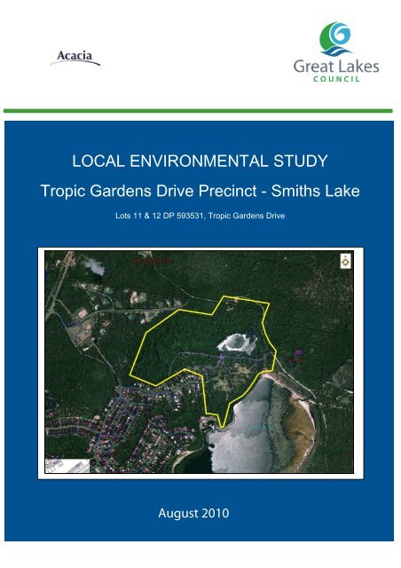
Lots 11 & 12 DP 593531, <strong>Tropic</strong> <strong>Gardens</strong> <strong>Drive</strong><br />
August 2010
Contents<br />
Contents 1<br />
Summary 1<br />
Background 1<br />
Strategic planning 1<br />
Existing and proposed development 1<br />
Constraints and opportunities 2<br />
Development principles 2<br />
1 Introduction 3<br />
1.1 Purpose of this report 3<br />
1.2 Subject land 3<br />
1.3 Zoning 5<br />
1.4 Existing development 5<br />
1.5 Potential development 5<br />
1.6 Surrounding land use 6<br />
2 Rezoning process 9<br />
2.1 Resolution to start the rezoning process 9<br />
2.2 Consultation with public authorities 9<br />
2.3 Responses by public authorities 10<br />
2.4 Onsite meeting in January 2008 10<br />
HUNTER CENTRAL RIVERS CATCHMENT MANAGEMENT AUTHORITY 10<br />
NSW DEPARTMENT OF WATER AND ENERGY 10<br />
NSW DEPARTMENT OF ENVIRONMENT AND CLIMATE CHANGE/GREAT LAKES COUNCIL 10<br />
GENERAL AGREEMENTS 10<br />
2.5 Future steps in the rezoning process 11<br />
3 Strategic context 12<br />
3.1 Mid North Coast Regional Strategy & growth area maps 12<br />
SETTLEMENT AND HOUSING 12<br />
GROWTH AREA MAPS 13<br />
ECONOMIC DEVELOPMENT AND EMPLOYMENT GROWTH 14<br />
ENVIRONMENT AND NATURAL RESOURCES 14<br />
OTHER TOPICS 15<br />
3.2 Forster Tuncurry Conservation & Development Strategy 15<br />
OVERVIEW 15<br />
SMITHS LAKE 15<br />
3.3 Great Lakes Local Environmental Plan 1996 16<br />
3.4 Smiths Lake Estuary Management Plan 16<br />
3.5 Great Lakes Water Quality Improvement Plan 17<br />
3.6 Other strategies, policies and instruments 18<br />
Great Lakes Local Environmental Study - <strong>Tropic</strong> <strong>Gardens</strong> <strong>Drive</strong>
4 Environmental characteristics 19<br />
4.1 Landform and slope 19<br />
4.2 Stormwater and flooding 21<br />
STORMWATER FOR LOT 12 21<br />
STORMWATER FOR LOT 11 22<br />
FLOODING 22<br />
4.3 Sea level rise 23<br />
4.4 Soil and groundwater 24<br />
GEOTECHNICAL INVESTIGATIONS FOR LOT 12 24<br />
GEOTECHNICAL INVESTIGATIONS FOR LOT 11 24<br />
4.5 Water quality 25<br />
ESTUARY MANAGEMENT PLAN 25<br />
WATER QUALITY IMPROVEMENT PLAN 26<br />
DRAFT WATER SENSITIVE DESIGN DEVELOPMENT CONTROL PLAN 27<br />
4.6 Flora and fauna 27<br />
FLORA AND FAUNA ASSESSMENT (2000) 27<br />
FLORA AND FAUNA ASSESSMENT (2007) 28<br />
REVIEW OF THE 2007 ASSESSMENT 29<br />
ADDITIONAL FLORA AND FAUNA ASSESSMENT (2009) 29<br />
COUNCIL’S REVIEW OF THE 2009 ASSESSMENT 31<br />
CONSERVATION OUTCOMES, LOT 12 31<br />
BIODIVERSITY OFFSET ASSESSMENT REPORT 32<br />
CONSERVATION OUTCOMES, LOT 11 33<br />
4.7 Aboriginal heritage 38<br />
4.8 European heritage 38<br />
4.9 Bushfire 39<br />
REQUIREMENTS OF FORSTER/TUNCURRY CONSERVATION AND DEVELOPMENT STRATEGY 39<br />
BUSHFIRE HAZARD ASSESSMENT – LOT 12 43<br />
BUSHFIRE HAZARD ASSESSMENT - LOT 11 43<br />
4.10 Visual amenity 44<br />
VISUAL PROMINENCE OF THE PRECINCT 44<br />
4.11 Summary of environmental constraints 45<br />
5 Development demands and options 50<br />
5.1 Smiths Lake 50<br />
5.2 Settlement pattern 50<br />
5.3 Population 51<br />
NEW SOUTH WALES 51<br />
SYDNEY REGIONAL 51<br />
GREAT LAKES <strong>LOCAL</strong> GOVERNMENT AREA 52<br />
FORSTER/TUNCURRY 53<br />
5.4 Land supply and demand 56<br />
SMITHS LAKE SUPPLY AND DEMAND 58<br />
6 Urban & social infrastructure 61<br />
6.1 Water and sewerage 61<br />
6.2 Traffic and access 61<br />
Great Lakes Local Environmental Study - <strong>Tropic</strong> <strong>Gardens</strong> <strong>Drive</strong>
EVALUATION OF FUTURE INTERSECTION PERFORMANCE 62<br />
PEDESTRIAN AND CYCLISTS 63<br />
6.3 Electricity 64<br />
6.4 Telecommunications 65<br />
6.5 Community services 65<br />
6.6 Transport 69<br />
6.7 Education 70<br />
7 Consistency with planning policies 73<br />
7.1 Mid North Coast Regional Strategy 73<br />
7.2 State Environmental Planning Policies 73<br />
7.3 Regional Environmental Plans 73<br />
7.4 Marine Parks Act 1997 73<br />
7.5 Local planning directions 74<br />
7.6 Hunter Central Rivers Catchment Action Plan 74<br />
7.7 Legislation 74<br />
8 Development principles 76<br />
8.1 Subdivision layout 76<br />
8.2 Water quality management 76<br />
8.3 Water-sensitive urban design 77<br />
8.4 Habitat management 77<br />
ECOLOGICAL CONSIDERATIONS FOR LOT 12 77<br />
ECOLOGICAL CONSIDERATIONS FOR LOT 11 77<br />
MANAGEMENT RECOMMENDATIONS 77<br />
CONSERVATION OUTCOMES 78<br />
8.5 Aboriginal heritage 78<br />
8.6 Visual amenity 78<br />
8.7 Bushfire 79<br />
8.8 Traffic management 79<br />
PEDESTRIANS AND CYCLISTS 79<br />
8.9 Management of potential environmental impacts 80<br />
DEVELOPMENT CONTROL PLAN 80<br />
8.10 Funding and provision of infrastructure 81<br />
PLANNING AGREEMENT 81<br />
References 83<br />
Glossary 85<br />
Great Lakes Local Environmental Study - <strong>Tropic</strong> <strong>Gardens</strong> <strong>Drive</strong>
Appendices 86<br />
Appendix 1 Section 62 responses 87<br />
Appendix 2 Preliminary concept planPreliminary concept plan 93<br />
Appendix 3 Consistency with NSW policies and strategies 95<br />
Local planning (117) Directions 95<br />
Relevant NSW policies 100<br />
NSW Coastal Policy 1997 101<br />
State Environmental Planning Policy No 71 – Coastal Protection 105<br />
Mid North Coast Regional Strategy 108<br />
Hunter Central Rivers Catchment Action Plan 110<br />
Tables<br />
Table 1: Existing development 5<br />
Table 2: Public authorities and corporations consulted under s. 62 9<br />
Table 3: Remaining steps in the rezoning process 11<br />
Table 4: Summary of stormwater quality 21<br />
Table 5: Annual average pollutant export loads 22<br />
Table 6: Smiths Lake water quality summary 26<br />
Table 7: Summary of constraints 46<br />
Table 8: Smiths Lake settlement profile 55<br />
Table 9: Legislation 74<br />
Figures<br />
Figure 1: Locality and study area map 4<br />
Figure 2: Current zoning 7<br />
Figure 3: Surrounding land use 8<br />
Figure 4: Ecological condition - Smith's Lake 17<br />
Figure 5: Slope analysis 20<br />
Figure 6: Vegetation communities 34<br />
Figure 7: Fauna habitat significance 35<br />
Figure 8: Survey locations 36<br />
Figure 9: Threatened fauna 37<br />
Figure 10: Bushfire prone land 41<br />
Figure 11: Proposed bush fire emergency evacuation routes 42<br />
Figure 12: Constraints 49<br />
Figure 13: Regional population projections 52<br />
Figure 14: Population projections Forster/Tuncurry 54<br />
Figure 15: Smiths Lake vacant lots and slope 59<br />
Figure 16: Smiths Lake vegetation 60<br />
Figure 17: Projected traffic volumes 2017 63<br />
Great Lakes Local Environmental Study - <strong>Tropic</strong> <strong>Gardens</strong> <strong>Drive</strong>
References used in this report<br />
References to previous organisations or titles mean their successor and current<br />
organisations or titles, as the case requires. The current names of the organisations and<br />
titles are used in this report.<br />
Reference<br />
<br />
<br />
<br />
<br />
<br />
<br />
<br />
<br />
<br />
<br />
<br />
<br />
<br />
<br />
<br />
<br />
<br />
<br />
<br />
Minister for Urban Affairs and Planning<br />
Minister for Infrastructure and Planning<br />
Department of Urban Affairs and<br />
Planning<br />
PlanningNSW<br />
Department of Infrastructure, Planning<br />
and Natural Resources<br />
Director-General of the Department of<br />
Urban Affairs and Planning<br />
Director-General of PlanningNSW<br />
Director-General of the Department of<br />
Infrastructure, Planning and Natural<br />
Resources<br />
Director-General of National Parks and<br />
Wildlife<br />
National Parks and Wildlife Service<br />
NSW Department of Environment and<br />
Conservation<br />
Commonwealth Minister for the<br />
Environment, Water, Heritage and the<br />
Arts<br />
Commonwealth Minister for the<br />
Environment and Water Resources<br />
Commonwealth Minister for the<br />
Environment and Heritage<br />
Commonwealth Minister for the<br />
Environment<br />
Australian Government Department of<br />
the Environment, Water, Heritage and<br />
the Arts<br />
Australian Government Department of<br />
the Environment and Water Resources<br />
Australian Government Department of<br />
the Environment and Heritage<br />
Environment Australia<br />
Current organisation or title<br />
used in this report<br />
Minister for Planning<br />
Department of Planning<br />
Director-General of the Department of<br />
Planning<br />
Director-General of the Department of<br />
Environment, Climate Change and Water<br />
NSW Department of Environment, Climate<br />
Change and Water<br />
Commonwealth Minister for the Environment<br />
Australian Government Department of the<br />
Environment, Water, Heritage and the Arts<br />
Great Lakes Local Environmental Study - <strong>Tropic</strong> <strong>Gardens</strong> <strong>Drive</strong>
Summary<br />
Background<br />
Great Lakes Council proposes to rezone Lots 11 and 12 in DP 593531 (the <strong>Precinct</strong>) at<br />
<strong>Tropic</strong> <strong>Gardens</strong> <strong>Drive</strong>, Smiths Lake to enable residential development and<br />
conservation outcomes (the proposed rezoning). The proposed rezoning would<br />
amend Council’s current Great Lakes Local Environmental Plan 1996 (LEP 1996).<br />
Under the LEP 1996, the <strong>Precinct</strong> shown in Figure 2, is currently zoned for future urban<br />
investigation. This report is an environmental study that is required by Section 57 of<br />
the Environmental Planning and Assessment Act 1979 when a council proposes to<br />
amend land use zones.<br />
Strategic planning<br />
The proposed rezoning is an outcome of strategic planning policies prepared by the<br />
NSW Government and Great Lakes Council.<br />
Part of the land at <strong>Tropic</strong> <strong>Gardens</strong> <strong>Drive</strong> was identified in the Forster Tuncurry<br />
Conservation and Development Strategy (Council: 2003) (FTCDS) as being suitable for<br />
development. Council adopted the FTCDS in 2003 and it forms the basis for<br />
proceeding with the proposed rezoning.<br />
The NSW Government finalised the Mid North Coast Regional Strategy (Regional<br />
Strategy) and its growth area maps in 2009. It presents a number of themes that will<br />
guide future population growth in the Manning Valley-Great Lakes subregion. The<br />
Regional Strategy is a local growth area strategy that can be used to support the<br />
inclusion of the <strong>Precinct</strong> in LEP 1996. Part of the <strong>Tropic</strong> <strong>Gardens</strong> precinct has been<br />
identified as a Growth Area in the Regional Strategy.<br />
Existing and proposed development<br />
The <strong>Precinct</strong> is comprised of two lots. Lot 11 is about 6ha while Lot 12 is about 36ha,<br />
totalling about 42 hectares. It adjoins residential development in Smiths Lake to the<br />
south and west; land to the north and east is used for rural living or is public land. A<br />
lodge and recreational facilities are located on Lot 11; Lot 12 is not developed.<br />
A preliminary concept plan has been prepared for the <strong>Precinct</strong>. While Council has not<br />
rejected or endorsed the concept plan, it gives an indication of the locations where<br />
development, access and conservation areas could be located, and an indicative<br />
development yield.<br />
Great Lakes Local Environmental Study - <strong>Tropic</strong> <strong>Gardens</strong> <strong>Drive</strong>Page 1
Constraints and opportunities<br />
Council has reviewed environmental assessments prepared by the applicant,<br />
undertaken a review of the applicant’s flora and fauna assessment, and engaged<br />
consultants to prepare environmental assessments for cultural heritage and traffic. The<br />
assessments identify important environmental characteristics of the <strong>Precinct</strong>.<br />
There are four key environmental features that constrain development in the <strong>Precinct</strong>:<br />
the presence of high conservation value vegetation and habitat; the management of<br />
water quality in the freshwater lagoon, and a suitable interface between private and<br />
public land use on the foreshore of Smiths Lake and emergency bushfire<br />
access/egress.<br />
The <strong>Precinct</strong> provides an opportunity for residential development in a location that is<br />
an extension to the village of Smiths Lake Village without causing significant harm to<br />
these key environmental values or creating land use conflicts commonly associated<br />
with air, noise or odour.<br />
The proposed rezoning would be consistent with a range of NSW Government policies<br />
and statutory planning instruments, including the Mid North Coast Regional Strategy,<br />
various State Environmental Planning Policies, local planning directions issued by the<br />
Minister for Planning, the Hunter Central Rivers Catchment Action Plan, and relevant<br />
NSW legislation.<br />
Development principles<br />
To ensure that measures to reduce or avoid harmful environmental impacts discussed<br />
in this environmental study are implemented, Council will prepare a Development<br />
Control Plan (DCP) for the <strong>Precinct</strong>. The DCP will regulate development aspects,<br />
including subdivision and development layout, vegetation and habitat management,<br />
water quality management, and traffic and access.<br />
Great Lakes Local Environmental Study - <strong>Tropic</strong> <strong>Gardens</strong> <strong>Drive</strong>Page 2
1<br />
Introduction<br />
1.1 Purpose of this report<br />
Great Lakes Council proposes to rezone Lots 11 and 12 in DP 593531 (the <strong>Precinct</strong>) at<br />
<strong>Tropic</strong> <strong>Gardens</strong> <strong>Drive</strong>, Smiths Lake to enable residential development and<br />
conservation outcomes (the proposed rezoning). The proposed rezoning would be an<br />
amendment to Council’s Great Lakes Local Environmental Plan 1996 (LEP 1996).<br />
This report is an environmental study that is required by Section 57 of the<br />
Environmental Planning and Assessment Act 1979 (the EP&A Act) when a council<br />
proposes to amend land use zones. It presents information on a number of topics<br />
including:<br />
1. The land that the proposed rezoning would affect and its features.<br />
2. The type of development that would be permissible if the proposed rezoning<br />
proceeds.<br />
3. The strategic planning policies that regulate land use in the <strong>Precinct</strong>.<br />
4. The features that should be conserved or that require ongoing management.<br />
5. The areas that would be zoned for development, conservation or other uses.<br />
1.2 Subject land<br />
The <strong>Tropic</strong> <strong>Gardens</strong> <strong>Drive</strong> <strong>Precinct</strong> comprises Lots 11 and 12 in DP 593531 at Smiths<br />
Lake. The village of Smiths Lake is about 20 kilometres south of Forster and is located<br />
off The Lakes Way. The <strong>Precinct</strong> is located at the end of <strong>Tropic</strong> <strong>Gardens</strong> <strong>Drive</strong>. The<br />
<strong>Precinct</strong> extends in elevation from about two metres Australian Height Datum (AHD)<br />
at the freshwater lagoon to about 40 metres at the top of the Knoll on Lot 11.<br />
Great Lakes Local Environmental Study - <strong>Tropic</strong> <strong>Gardens</strong> <strong>Drive</strong>Page 3
Figure 1:<br />
Locality and study area map<br />
Great Lakes Local Environmental Study - <strong>Tropic</strong> <strong>Gardens</strong> <strong>Drive</strong> Page 4
A preliminary concept plan which has not been endorsed or rejected by Council<br />
adopts features that would make it different to existing developments in Smiths Lake:<br />
irregular lot boundaries that respond to slope and outlook, the integration of building<br />
types with lot areas and boundaries, small-scale clustering, and the use of a looped<br />
access road. In contrast, most development in Smiths Lake is predominantly single<br />
detached dwellings on regular-shaped lots fronting public roads.<br />
1.3 Zoning<br />
Under LEP 1996, the <strong>Tropic</strong> <strong>Gardens</strong> <strong>Drive</strong> <strong>Precinct</strong> is currently zoned 1(c) Future Urban<br />
Investigation Zone as indicated in Figure 2.<br />
The intention of the 1(c) zone is to identify land that may be suitable for future urban<br />
development subject to detailed investigations. The 1(c) zone permits uses that will<br />
not prejudice or create conflict with possible future urban development.<br />
1.4 Existing development<br />
Table 1 identifies existing development in the <strong>Precinct</strong>.<br />
Table 1:<br />
Existing development<br />
Property<br />
Lot 11<br />
DP 593531<br />
Lot 12<br />
DP 593531<br />
Total 42.08<br />
Area<br />
(ha)<br />
5.94 Existing dwellings<br />
(the Lodge)<br />
Existing development Public road access Comment<br />
<strong>Tropic</strong> <strong>Gardens</strong><br />
<strong>Drive</strong><br />
36.14 None <strong>Tropic</strong> <strong>Gardens</strong><br />
<strong>Drive</strong> and Sandbar<br />
Road<br />
Intermittent use<br />
Vacant<br />
Accommodates<br />
sewage pumping<br />
station<br />
R85411 is a Crown foreshore reserve that separates Smiths Lake from Lot 11 and 12. It<br />
has a variable width, but it is about 40 to 50 metres wide where it adjoins both Lots 11<br />
and 12.<br />
1.5 Potential development<br />
The intent of an LES is not to investigate specific predefined development<br />
outcomes/proposals for land. However, the development of a preliminary concept<br />
plan can be beneficial to inform studies as part of the LES process and is useful in<br />
showing likely development yields, road locations and areas where asset protection<br />
zones would be required. The proponent has submitted a preliminary concept plan<br />
for the <strong>Precinct</strong> which has been prepared and reviewed to provide a level of certainty<br />
that the land is capable of future development. A copy of the preliminary concept<br />
plan is included in Appendix 2.<br />
Great Lakes Local Environmental Study - <strong>Tropic</strong> <strong>Gardens</strong> <strong>Drive</strong> Page 5
A number of the studies prepared as part of the LES process are based around the<br />
principles in the preliminary concept plan.<br />
1.6 Surrounding land use<br />
Figure 3 shows land uses in the areas surrounding the <strong>Precinct</strong>.<br />
The village of Smiths Lake is built on a prominent, steep ridge on the northern shore of<br />
Smiths Lake. The village primarily accommodates urban-scale residential<br />
development. Residential living is supported by the neighbourhood commercial<br />
centre on Macwood <strong>Drive</strong>. The road network radiates from Macwood <strong>Drive</strong>, which<br />
follows a local ridge. Secondary roads follow local ridges and contours. There is a ruralresidential<br />
development on Paradise Close, at the northern perimeter of the village.<br />
Beyond the village of Smiths Lake, land is used predominantly for rural living,<br />
agriculture and tourism. Tarbuck Bay, a smaller village than Smiths Lake, is also located<br />
on the shore of Smiths Lake, about two kilometres to the northwest on The Lakes Way.<br />
A tourist park is located at Sandbar, east of the village of Smiths Lake.<br />
Great Lakes Local Environmental Study - <strong>Tropic</strong> <strong>Gardens</strong> <strong>Drive</strong> Page 6
Figure 2:<br />
Current zoning<br />
Great Lakes Local Environmental Study - <strong>Tropic</strong> <strong>Gardens</strong> <strong>Drive</strong> Page 7
Figure 3:<br />
Surrounding land use<br />
Great Lakes Local Environmental Study - <strong>Tropic</strong> <strong>Gardens</strong> <strong>Drive</strong> Page 8
2<br />
Rezoning process<br />
2.1 Resolution to start the rezoning process<br />
In a letter from the Department of Planning dated 24 December 2003, the Department<br />
endorsed the rezoning of Category 1 precincts in the FTCDS, including the <strong>Tropic</strong><br />
<strong>Gardens</strong> <strong>Drive</strong> <strong>Precinct</strong>, subject to Council preparing a housing strategy.<br />
Following this advice, Council resolved on 27 February 2007 to rezone land identified<br />
in the <strong>Tropic</strong> <strong>Gardens</strong> <strong>Drive</strong> <strong>Precinct</strong>. The Department of Planning advised Council by<br />
letter dated 2 May 2007 that it should continue with the preparation of the proposed<br />
rezoning.<br />
2.2 Consultation with public authorities<br />
Under Section 62 of the EP&A Act, a council must consult with public authorities when<br />
it prepares a draft Local Environmental Plan (LEP). Council initially wrote to ten public<br />
authorities and two corporations to advise them that Council had started the rezoning<br />
process and to invite them to provide comments on relevant matters. After additional<br />
information was received from the applicant, Council wrote to the Hunter Central<br />
Rivers Catchment Management Authority and the NSW Marine Park Authority. Table 2<br />
shows the public authorities and corporations that Council consulted.<br />
Table 2: Public authorities and corporations consulted under s. 62<br />
Roads and Traffic Authority MidCoast Water<br />
NSW Department of Water and Energy NSW Department of Primary Industries<br />
Hunter New England Health Service CountryEnergy<br />
NSW Heritage Office NSW Rural Fires Service<br />
Hunter Central Rivers Catchment<br />
Management Authority<br />
Department of Environment Climate<br />
Change and Water.<br />
NSW Marine Parks Authority NSW Department of Education and<br />
Training<br />
Telstra Optus Communications<br />
Under Section 34A of the EP&A Act, a council must consult with the Director-General<br />
of the National Parks and Wildlife Service if, in a council’s opinion, a draft LEP could<br />
affect critical habitat or threatened species, populations or ecological communities, or<br />
their habitats. Council advised the Director-General by separate letter of the proposed<br />
rezoning on 26 June 2008 and received the Director-General’s response on 26 August<br />
2008.<br />
Great Lakes Local Environmental Study - <strong>Tropic</strong> <strong>Gardens</strong> <strong>Drive</strong> Page 9
2.3 Responses by public authorities<br />
Appendix 1 presents a summary of responses received by Council. No responses were<br />
received from Optus, or the NSW Department of Education and Training. Responses<br />
are considered in more detail in Appendix 1.<br />
2.4 Onsite meeting in January 2008<br />
Council organised an onsite meeting in January 2008 that was attended by Council<br />
staff, the applicant’s consultants, and representatives of the NSW Department of<br />
Environment, Climate Change and Water, the NSW Department of Water and Energy<br />
and the Hunter Central Rivers Catchment Management Authority. The purpose of the<br />
meeting was to consider potential urban development and environmental constraints<br />
in the <strong>Precinct</strong>. The key outcomes from the meeting are summarised below.<br />
Hunter Central Rivers Catchment Management Authority<br />
While the Hunter Central Rivers Catchment Management Authority did not provide<br />
written advice, the Authority advised Council that future development must satisfy the<br />
“improve or maintain” test and would need to be assessed using the Property<br />
Vegetation Plan developer tool under the Native Vegetation Act 2003.<br />
NSW Department of Water and Energy<br />
The riparian setback to the freshwater lagoon should be 40 metres. Asset protection<br />
zones should not encroach into the riparian setback. The setback may be reduced (but<br />
must be a minimum of 20 metres) if upstream overland flows are diverted to a water<br />
quality treatment system. The removal of weeds and maintenance of low native<br />
vegetation would be acceptable within the riparian setback, between the road edge<br />
and the freshwater lagoon.<br />
No water quality controls would be permitted in the 20 metre setback. The existing<br />
dam wall/weir on the existing track will require a new spillway and an approval under<br />
the Water Management Act 2000 may be required<br />
NSW Department of Environment and Climate Change/Great Lakes Council<br />
The central water body has important habitat values that could be directly or indirectly<br />
affected by the proposed uses on Lot 12.<br />
General agreements<br />
Representatives at the meeting agreed on the following additional outcomes:<br />
<br />
<br />
<br />
Identify links to the pedestrian foreshore network along eastern boundaries of Lots<br />
11 and 12.<br />
All undeveloped land in Lot 12 would be zoned environmental protection and<br />
managed as a conservation lot under community title.<br />
All water quality treatment systems should be outside of riparian corridors.<br />
Great Lakes Local Environmental Study - <strong>Tropic</strong> <strong>Gardens</strong> <strong>Drive</strong> Page 10
2.5 Future steps in the rezoning process<br />
This document is the environmental study required under Section 57 of the Act. Table<br />
3 shows the remaining steps in the rezoning process.<br />
Table 3:<br />
Step<br />
Remaining steps in the rezoning process<br />
If Council is satisfied with this report and the proposed rezoning, it will<br />
forward the proposed rezoning and this report to the Department of Planning.<br />
Section in the<br />
Act<br />
Section 64<br />
Council would then request that the Director-General of the Department of Section 65<br />
Planning certify the proposed rezoning for exhibition<br />
If the Director-General certifies the proposed rezoning for exhibition, Council Section 66<br />
would give notice of the exhibition and publicly display the proposed rezoning<br />
and this report for at least 28 days. Council would also notify the public<br />
authorities consulted under Section 62 of the exhibition of the exhibition of<br />
the proposed rezoning. The public notice would invite any person to make a<br />
submission on any aspect of the proposed rezoning.<br />
The public makes submissions on the proposed rezoning. Section 67<br />
After the public display, Council would record and consider all submissions it Section 68<br />
received. If Council intends to proceed with the proposed rezoning, Council<br />
would prepare a report to the Department of Planning that reviews all aspects<br />
of the proposed rezoning, the submissions received and Council’s responses<br />
to the submissions.<br />
Council could decide to alter or defer part of the proposed rezoning, and if it<br />
does, it has the discretion to decide whether to re-exhibit it.<br />
The Director-General of the Department of Planning would prepare a report Section 69<br />
to the Minister for Planning that considers Council’s Section 68 report and<br />
makes a recommendation on whether or not the Minister should make the<br />
proposed rezoning.<br />
The Minister for Planning may decide to make the proposed rezoning, with or Section 70<br />
without changes, or decline to make it.<br />
Great Lakes Local Environmental Study - <strong>Tropic</strong> <strong>Gardens</strong> <strong>Drive</strong> Page 11
3<br />
Strategic context<br />
The NSW Government and Great Lakes Council have prepared planning strategies and<br />
instruments that regulate or guide development in the Great Lakes local government<br />
area, including Smiths Lake. This section reviews the key policies and instruments. The<br />
adopted strategies form the basis for proceeding with the proposed rezoning.<br />
3.1 Mid North Coast Regional Strategy & growth area maps<br />
The Mid North Coast Regional Strategy (NSW Government 2009) (the Regional Strategy)<br />
sets out guiding principles on how the future growth of the Mid North Coast will be<br />
planned and managed. Its primary purpose is to ensure that adequate land is available<br />
and appropriately located to accommodate projected housing and employment<br />
needs between 2006 and 2031 and shows where and how growth should occur. It<br />
places limits on growth in areas where environmental, cultural or natural resource<br />
values are high. The Regional Strategy also shows the priorities for regional<br />
infrastructure planned by the State to support future growth. The NSW Government<br />
will review the Regional Strategy every five years.<br />
The Regional Strategy covers eight local government areas:<br />
Clarence Valley Coffs Harbour<br />
Bellingen Nambucca<br />
Kempsey Port Macquarie-Hastings<br />
Greater Taree Great Lakes<br />
The Regional Strategy identifies four regional centres – Grafton, Coffs Harbour, Port<br />
Macquarie and Taree. Forster/Tuncurry is classified as a major town and is part of the<br />
Manning Valley-Great Lakes subregion.<br />
The Regional Strategy identifies a number of themes.<br />
Settlement and housing<br />
The population of the Mid North Coast is about 330,600 and the majority of the<br />
community lives in the four regional centres and six major towns, including<br />
Forester/Tuncurry. The Regional Strategy predicts that the population will increase by<br />
91,000 to about 424,600 during the Regional Strategy’s life.<br />
Great Lakes Local Environmental Study - <strong>Tropic</strong> <strong>Gardens</strong> <strong>Drive</strong> Page 12
The Regional Strategy recognises the need to plan for a range of housing types that<br />
can adapt and respond to the ageing population. Forster/Tuncurry, among other<br />
centres, has the capacity to accommodate a range of infill development.<br />
Importantly, land may not be rezoned for urban or rural residential use unless it is<br />
included in an agreed local growth management strategy that is consistent with the<br />
Regional Strategy.<br />
Councils and the Department of Planning will need to agree on local growth area<br />
strategies and maps that are based on the settlement principles in the Regional<br />
Strategy and subregional housing projections allocated to each local government<br />
area. Great Lakes and Greater Taree local government areas have been allocated<br />
15,000 additional dwellings. The split between the two councils will need to be<br />
resolved.<br />
Under the Regional Strategy, the FTCDS is a local growth management strategy that<br />
has been endorsed (for Category 1 areas) by the Department of Planning.<br />
Growth area maps<br />
The Regional Strategy includes a set of Growth area maps (GAMs) developed with local<br />
councils and relevant government agencies to ensure adequate, appropriately-located<br />
housing and employment land has been identified to meet the future growth needs of<br />
the Region.<br />
GAMs identify both existing areas of urban settlement and proposed new release<br />
areas. Settlement expansion will be limited to these mapped areas and must meet<br />
specific criteria in order for them to be considered for any future urban expansion.<br />
The Regional Strategy has identified part of the <strong>Precinct</strong> within the GAMs as having the<br />
potential for future urban development. The original development envelope, as<br />
contained within Council's FTCDs was based on a preliminary assessment, subject to<br />
further investigations. Detailed studies prepared for the <strong>Precinct</strong> as part of the LEP<br />
process have identified a larger, more suitable development envelope which<br />
accurately responds to the inherent natural attributes of the <strong>Precinct</strong>.<br />
The Regional Strategy indicates that where demonstrated through a local growth<br />
management strategy or rezoning process that a reasonable adjustment to a growth<br />
area boundary is desirable and is consistent with the Regional Strategy, then variation<br />
of the boundary may be considered. In determining the extent of the variation<br />
consideration will be given to the efficient use of infrastructure/services, avoidance of<br />
significant environmental constraints and natural resources, and reinforcement of the<br />
regional strategy hierarchy. Any variation will be determined through a joint analysis<br />
undertaken between the Department of Planning and the local Council.<br />
Great Lakes Local Environmental Study - <strong>Tropic</strong> <strong>Gardens</strong> <strong>Drive</strong> Page 13
Departures from the GAMs should be justified through the findings of detailed studies<br />
prepared as part of the rezoning process. In this regard the following points are<br />
provided in regards to the draft LEP:<br />
<br />
<br />
<br />
<br />
Proposed future development in question will draw upon existing infrastructure<br />
and services within the established Smiths Lake village. Sufficient capacity exists<br />
for water and sewage requirements and existing road and infrastructure will be<br />
upgraded to accommodate increasing traffic flows and pedestrian activity.<br />
DPI have advised that the draft LEP will not impact upon any significant mineral,<br />
forestry or agricultural resources, nor will any future development associated with<br />
the draft LEP affect future primary industry development options in that locality.<br />
The draft LEP will be not located in an area with significant environmental<br />
constraints. Findings from detailed studies prepared in conjunction with the<br />
rezoning process have indicated that environmental constraints associated with<br />
future development can be addressed.<br />
The draft LEP reinforces the regional settlement hierarchy as it is reasonably<br />
accessible to the major town of Forster/Tuncurry which has a functional role in<br />
servicing the Great Lakes subregion. The draft LEP will not compromise the role of<br />
Forster/Tuncurry as a major town<br />
Economic development and employment growth<br />
The Regional Strategy emphasises new retail and office development in major regional<br />
centre and towns, rather than isolated out-of-centre locations. It identifies an<br />
additional 39 ha of industrial land that will be needed in the next 25 years in the<br />
Manning Valley-Great Lakes subregion. The Regional Strategy promotes future<br />
industrial development around existing urban areas, although it recognises that some<br />
industries may need to be located outside of towns due to their scale or nature.<br />
LEPs will need to identify regional infrastructure corridors. Where future rezoning or<br />
development increases the need for State infrastructure, the Minister for Planning may<br />
require a contribution to its provision. Where regional centres, major towns and towns<br />
are well connected to pedestrian and cycle way corridors, LEPs should provide for<br />
passenger interchanges.<br />
Environment and natural resources<br />
The NSW Department of Environment Climate Change and Water (DECCW) will<br />
prepare regional conservation plans to manage biodiversity values. LEPs should<br />
protect and zone land with high environmental values, such as wetlands, littoral<br />
rainforests, habitat and riparian corridors, and waterways and coastal areas. New<br />
development must avoid high value environments, including significant coastal lakes,<br />
Great Lakes Local Environmental Study - <strong>Tropic</strong> <strong>Gardens</strong> <strong>Drive</strong> Page 14
estuaries, aquifers, threatened species habitat, vegetation communities and habitat<br />
corridors.<br />
The Regional Strategy recognises the need to prepare a Regional Water Plan to<br />
provide long-term water efficiencies and improved drought security. To identify and<br />
manage risks associated with climate change, council will need to undertake flood<br />
investigations for land with the potential to be inundated by sea level rise. LEPs will<br />
also need to include provisions to protect development in areas with coastal erosion<br />
risk or ocean-based inundation. Until these investigations are finalised, councils will<br />
not be able to zone land or approve new development or redevelopment in such<br />
areas.<br />
Other topics<br />
The Regional Strategy will allow rural residential development to be provided as one<br />
form of housing choice. Settlements in rural areas will need to protect agricultural<br />
productivity and must be located close to existing centres but not in areas that may in<br />
the future accommodate urban expansion. The Regional Strategy also discusses the<br />
preparation of local commercial strategies and affordable housing strategies.<br />
3.2 Forster Tuncurry Conservation & Development Strategy<br />
Overview<br />
The Forster Tuncurry Conservation and Development Strategy (Great Lakes Council 2003)<br />
(FTCDS) reviews opportunities for and constraints to the development of land in the<br />
Forster and Tuncurry areas. It prioritises opportunities based on land capability, the<br />
absence of ecologically sensitive features, proximity to transport network and services,<br />
and avoidance of uneconomic demands on Council’s resources or services.<br />
Council adopted the FTCDS in 2003 and requested that the Department of Planning<br />
endorse the FTCDS. The Department endorsed the FTCDS in late 2003, subject to<br />
Council preparing a housing strategy. Council adopted a housing strategy for Forster<br />
and Tuncurry in December 2006, but its scope does not extend to Smiths Lake.<br />
Smiths Lake<br />
The FTCDS identifies land with potential for residential development in Smiths Lake,<br />
based on the findings of the Smiths Lake Planning Study prepared in 2000 by WBM<br />
Oceanics: the Macwood <strong>Precinct</strong> and The Lodge <strong>Precinct</strong>. The Lodge <strong>Precinct</strong> is about<br />
five hectares and is centred on the elevated parts of Lots 11 and 12. Council exhibited<br />
a draft LEP and environmental study for the rezoning of the Macwood <strong>Precinct</strong> in 2008<br />
which was gazetted in 2009.<br />
The FTDCS identifies the main constraints to development at Smiths Lake, including<br />
The Lodge <strong>Precinct</strong>:<br />
Great Lakes Local Environmental Study - <strong>Tropic</strong> <strong>Gardens</strong> <strong>Drive</strong> Page 15
Smiths Lake has native vegetation with high conservation value and supports key<br />
fauna habitats and corridors. Threatened flora and fauna have been recorded in<br />
the area.<br />
Smiths Lake and Wallis Lake have high water quality and are sensitive to nutrients<br />
and sediments in stormwater runoff.<br />
Part of Smiths Lake is bushfire prone land that requires the implementation of<br />
asset protection zones and fire-protective construction. Both <strong>Precinct</strong>s are uphill of<br />
vegetation, which increases the protection requirements.<br />
While both sewer and water facilities can be augmented to serve the two<br />
<strong>Precinct</strong>s, The Lakes Way may require improvements.<br />
The scenic values of Smiths Lake, from both the foreshore and lake as well as the<br />
Smiths Lake village area, need to be protected from inappropriate development.<br />
The desired future urban character of Smiths Lake should focus on reducing urban<br />
sprawl, avoiding development on steep sites, using water sensitive and energyefficient<br />
designs, providing mainly for residential development and usable open<br />
space, and providing ecotourism developments.<br />
The FTCDS concludes that the <strong>Tropic</strong> <strong>Gardens</strong> <strong>Drive</strong> <strong>Precinct</strong> could support some<br />
residential development, provided that environmental impacts were assessed in more<br />
detail and any impacts were adequately managed. It is a Category 1 precinct in the<br />
FTCDS. The NSW Department of Planning supports the exhibition of draft LEPs that<br />
have been identified as Category 1 precincts in the FTCDS.<br />
3.3 Great Lakes Local Environmental Plan 1996<br />
Great Lakes Local Environmental Plan 1996 is the principle environmental planning<br />
instrument that regulates land use in the Great Lakes local government area. Among<br />
other things, it defines land use zones, supported by zoning maps, to show the land<br />
uses that can be carried out without or development consent, or that are prohibited. It<br />
also sets minimum lot sizes for subdivision or development of land.<br />
3.4 Smiths Lake Estuary Management Plan<br />
The Smiths Lake Estuary Management Study and Management Plan (Webb McKeown &<br />
Associates 2001) was prepared for Council under the NSW Government’s Estuary<br />
Management Program. The Plan coordinates the management of Smiths Lake<br />
between government and the community. The Plan identifies that water quality in<br />
Smiths Lake is generally good, primarily due to the relatively undeveloped or<br />
protected state of the Lake’s catchment. Consideration of future land uses in the<br />
catchment should take into account the protection of water quality and quantity<br />
Great Lakes Local Environmental Study - <strong>Tropic</strong> <strong>Gardens</strong> <strong>Drive</strong> Page 16
entering Smiths Lake. The Plan identifies a protocol for the manual opening of the<br />
entrance.<br />
3.5 Great Lakes Water Quality Improvement Plan<br />
Council’s Great Lakes Water Quality Improvement Plan: Wallis, Smiths and Myall Lakes<br />
(WQIP) is a comprehensive plan for improving water quality in the three major<br />
catchments within the Great Lakes local government area (Great Lakes Council 2009).<br />
The WQIP identifies the planning processes that were used to prepare the plan,<br />
presents detailed catchment data, and recommends management and support<br />
actions needed to implement the plan.<br />
The WQIP identifies that Smiths Lake has high conservation value. The ecological<br />
condition target for Smiths Lake is to this maintain high conservation value, and where<br />
possible improve on current conditions to offset possible future increases in pollutants<br />
or impacts from use of Smiths Lake.<br />
Figure 4:<br />
Ecological condition - Smith's Lake<br />
Source: Great Lakes Council 2009, Water Quality Improvement Plan<br />
Great Lakes Local Environmental Study - <strong>Tropic</strong> <strong>Gardens</strong> <strong>Drive</strong> Page 17
For Smith’s Lake, in regards to water quality the WQIP states that the ecological target<br />
is as follows:<br />
"…to maintain the high conservation value of the lake, improving the ecological<br />
condition to establish a buffer and no deterioration."<br />
The WQIP recommends that the development of greenfield sites should implement<br />
water-sensitive urban design principles and in particular, development should achieve<br />
a no net increase in pollutants when compared to the pre-development land use.<br />
3.6 Other strategies, policies and instruments<br />
Section 7 and Appendix 3 review policies and instruments that are relevant to the<br />
proposed rezoning.<br />
Great Lakes Local Environmental Study - <strong>Tropic</strong> <strong>Gardens</strong> <strong>Drive</strong> Page 18
4<br />
Environmental characteristics<br />
This section outlines the findings of the environmental investigations conducted as<br />
part of the local environmental study and provides details of existing site<br />
characteristics<br />
4.1 Landform and slope<br />
The <strong>Precinct</strong> has two major features: relatively steep slopes that fall from a local knoll<br />
near the common boundary between Lots 11 and 12; and a large freshwater lagoon in<br />
the centre of Lot 12 that receives runoff from a small elevated catchment that nearly<br />
encircles the lagoon.<br />
The freshwater lagoon discharges under an existing unsealed track that joins Sandbar<br />
Road. It flows into an unnamed creek and then into Symes Bay, Smiths Lake. The<br />
existing road and drainage pipes under it act as a weir that prevents elevated water<br />
levels in Smiths Lake (which occur from time to time when the entrance is closed) from<br />
entering the freshwater lagoon<br />
Ground elevations range from a low of about two metres along the shore of the<br />
freshwater lagoon to about 42 metres on Lot 11 where <strong>Tropic</strong> <strong>Gardens</strong> <strong>Drive</strong> ends. The<br />
terrain slopes vary from near flat; along the southern shore of the freshwater lagoon<br />
on Lot 12, to more than 30% in isolated areas of Lots 11 and 12 (refer Figure 5).<br />
The general steepness of Lot 11 and parts of Lot 12 is a constraint that limits the<br />
location of potential development. The FTCDS states that land should be protected<br />
where development which would result in unacceptable environmental impact.<br />
Examples of land that should be protected are given including land with slope in<br />
excess of 20%.<br />
Most of the <strong>Tropic</strong> <strong>Gardens</strong> Dr precinct (approximately 90%) has slope of less than 20%<br />
but there are some small pockets with development potential that have slope of 25 –<br />
30%. Exclusion of these small steeper areas would not be practical as it would result in<br />
an irregular and inefficient development layout.<br />
Great Lakes Local Environmental Study - <strong>Tropic</strong> <strong>Gardens</strong> <strong>Drive</strong> Page 19
Figure 5:<br />
Slope analysis<br />
Great Lakes Local Environmental Study - <strong>Tropic</strong> <strong>Gardens</strong> <strong>Drive</strong> Page 20
The Department of Planning's Settlement Planning Guidelines sets limits to<br />
development on sloping sites and allows development on slopes up to 33% or 18<br />
degrees. On sloping sites the Settlement Planning Guidelines indicate that appropriate<br />
mitigating actions need to be applied including attention to building design and<br />
construction and road layout. Buildings with elevated floors will reduce the impact of<br />
cut and fill and roads should avoid the steep areas as much as possible<br />
4.2 Stormwater and flooding<br />
Stormwater for Lot 12<br />
A Stormwater Concept Strategy (Stormwater Strategy) has been prepared by Lidbury<br />
Summers and Whiteman (Stormwater Concept Strategy, 2010) based on the preliminary<br />
concept design in Appendix 2 for development on Lot 12.<br />
A combination of measures including rainwater tanks, gross pollutant traps, water<br />
quality raingardens, bioswales and buffer strips have been proposed to manage the<br />
discharge of nutrients and pollutants leaving the site.<br />
The existing lagoon and its existing outlet structures could be used to attenuate postdevelopment<br />
peak discharges to existing levels for all storm events up to and<br />
including the 100 year ARI rainfall event.<br />
Due to the large storage in the lagoon, the only change required to attenuate postdevelopment<br />
flows to existing flows is the raising of the fire trail weir by 20mm.<br />
The table below shows a summary of the pre-existing and post-development peak<br />
flows and top water levels in the lagoon.<br />
Table 4:<br />
Summary of stormwater quality<br />
An assessment of water quality for Lot 12 was undertaken using the MUSIC (Model for<br />
Stormwater Improvement Conceptualisation) tool. MUSIC is a conceptual water<br />
quality assessment design tool that estimates stormwater pollutant generation from<br />
different land uses to estimate performance of a proposed water quality strategy.<br />
The MUSIC model was based around the preliminary concept design for Lot 12. Table<br />
5 presents the average annual pollutant export loads at the downstream extent of the<br />
Great Lakes Local Environmental Study - <strong>Tropic</strong> <strong>Gardens</strong> <strong>Drive</strong> Page 21
subject site under the pre and post development conditions (with and without<br />
treatment).<br />
Table 5:<br />
Annual average pollutant export loads<br />
Results in Table 5 indicate that the proposed stormwater management strategy would<br />
meet or exceed the water quality objectives for the site, which were:<br />
• Post development loads of Gross Pollutants, Total Suspended Soils (TSS), Total<br />
Nitrogen (TN) and Total Phosphorus (TP) are to be reduced to be comparable to predevelopment<br />
pollutant loads (i.e. "no net increase").<br />
The Stormwater Strategy demonstrates that development runoff from Lot 12 would be<br />
less than or equal to the undeveloped flow from the site for all storm events up to and<br />
including the 100 ARI rainfall event.<br />
Stormwater for Lot 11<br />
Due to the knoll, it would be difficult or impractical to convey stormwater from future<br />
development on Lot 11 to <strong>Tropic</strong> <strong>Gardens</strong> <strong>Drive</strong>. Stormwater would need to be<br />
discharged towards Smiths Lake and must be adequately treated so that there is no<br />
net increase in pollutants (nutrients and sediments) when compared to the existing<br />
land use (Great Lakes Council 2009). There are suitable locations on Lot 11 to detain<br />
and treat stormwater before it is discharged to a natural drainage line and Smiths Lake.<br />
Flooding<br />
Water levels in the freshwater lagoon are controlled by the weir formed by the access track to<br />
Sandbar Road. The top of the track varies between two and three (3) metres AHD.<br />
Council’s protocol for manual openings of the entrance to Smiths Lake requires that<br />
the entrance be opened when the water level reaches 2.1 m AHD. Manual openings of<br />
Great Lakes Local Environmental Study - <strong>Tropic</strong> <strong>Gardens</strong> <strong>Drive</strong> Page 22
the entrance would minimise the potential for water levels in Smiths Lake to overtop<br />
the access track and enter the freshwater lagoon. The freshwater lagoon has a<br />
relatively steep and small catchment. Intense rainfall in the catchment would raise<br />
water levels until they overtopped the access track but would not be expected to<br />
exceed the discharge rate over the access track.<br />
Based on the preliminary concept design for Lot 12 no structures would be built at an<br />
elevation lower than about seven or eight metres AHD, at least four metres above the<br />
height of the access track and at least five metres above the maximum water level in<br />
Smiths Lake. Development proposed on Lot 11 is at or above 18 metres AHD. Neither<br />
Lot 11 nor Lot 12 would be subject to flooding.<br />
4.3 Sea level rise<br />
In October 2009 the NSW government released the NSW Sea Level Rise Policy<br />
Statement and the Draft NSW Coastal Planning Guideline: Adapting to Sea Level Rise<br />
(The Guideline). The Guideline has been prepared to provide guidance on how sea<br />
level rise and its associated impacts are to be considered in land use planning and<br />
development assessment in coastal NSW. The Policy Statement outlines the<br />
Governments objectives and commitments in regards to sea level rise adaptation<br />
including support that the Government will provide to costal communities and local<br />
council's to prepare and adapt to rising sea levels.<br />
The Policy statement indicates that sea level rise is an incremental process which will<br />
have medium to long term impacts. The best national and international projections of<br />
sea level rise along the coast are for a rise relative to 1990 mean sea levels of 40cm by<br />
2050 and 90cm by 2100 (NSW Sea Level Rise Policy Statement 2009).<br />
DECCW have requested that Council take into consideration the requirements of<br />
chapter 8 (Natural hazards) of the Mid North Coast Regional Strategy (Regional Strategy)<br />
regarding climate change. Details of consistency with the Regional Strategy are<br />
included in Appendix 3.<br />
Based on information provided by Council, the level of the 1 in 100 year flood event in<br />
Smiths Lake would be 2.5 metres. Taking into account the NSW planning benchmark<br />
for sea level rise of 0.9, development below about 3.4 metres could be subject to<br />
flooding impacts by 2100. Since the lowest level of development in the preliminary<br />
concept plan is at or above seven (7) meters AHD, development would not be at risk of<br />
1 in 100 year event flooding combined with sea level rises.<br />
Great Lakes Local Environmental Study - <strong>Tropic</strong> <strong>Gardens</strong> <strong>Drive</strong> Page 23
4.4 Soil and groundwater<br />
Geotechnical investigations for Lot 12<br />
The owners of Lot 12 engaged a consultant to investigate geotechnical conditions of<br />
Lot 12 (Coffey Geotechnics 2007). The investigation considered existing site features,<br />
groundwater, soils, acid sulphate soils, soil erosion potential, soil bearing capacity and<br />
site classification under AS 2870. It also provided information on road design and site<br />
preparation. No investigations were undertaken on Lot 11.<br />
Lot 12 is located on thinly bedded siltstone and mudstone soil landscapes; low lying<br />
areas in the north are part of an alluvial swamp landscape. Six soil types were<br />
encountered in 14 test pits: fill, topsoil, alluvial soil, residual soil, mudstone and<br />
sandstone. The site classification is Class M Moderately Reactive under AS 2870.<br />
Test pits showed a residual soil profile with rock at shallow depth in 13 test pits. All test<br />
pits were dry at the time of excavation in August 2007. Shallow rock precluded the<br />
installation of groundwater monitoring wells in all but one test pit. In that test pit, a<br />
monitoring well two metres below surface level collected 70 mm of water after one<br />
month but was not sufficient to enable the water to be analysed.<br />
Based on site observations, drainage primarily occurs by surface runoff; infiltration into<br />
the subsurface clay profile would be a minor component. Some seepage may occur on<br />
the soil-rock interface although no seepage was observed in the test pits. The<br />
permanent groundwater table is expected to be present in joints and factures in the<br />
rock below the level of the test pits. Soil erodibility tests from three test pits indicate<br />
that the soils have moderate to high erodibility factors. (Emerson Class 2(1), 3(1) and 5).<br />
Development should implement effective soils and erosion controls.<br />
The northeast part of Lot 12 is an alluvial swamp landscape with a low probability of<br />
acid sulphate soils occurring between one and three metres below the surface.<br />
Samples from two test pits in the lower areas of Lot 12 were screened for actual or<br />
potential acid sulphate soils. The test results show that neither actual nor potential<br />
acid sulphate soils were present at these locations.<br />
The investigation concluded that Lot 12 is suitable for the future development based<br />
on principles shown on the preliminary concept plan.<br />
Geotechnical investigations for Lot 11<br />
Based on a desktop assessment it was determined that similarly to Lot 12, Lot 11 is<br />
located on thinly bedded siltstone and mudstone soil landscapes.<br />
According to Council's Acid Sulfate Soil Planning Maps Lot 11 (excluding a small<br />
section in the south) is within in the lowest risk category (Class 5) for Acid Sulfate Soils<br />
(ASS). In this respect it is not expected that works over Lot 11 will disturb ASS.<br />
Great Lakes Local Environmental Study - <strong>Tropic</strong> <strong>Gardens</strong> <strong>Drive</strong> Page 24
Based on site observations, drainage primarily occurs by surface runoff; infiltration into<br />
the subsurface clay profile would be a minor component.<br />
It is anticipated that soils for Lot 11 would have moderate to high erodibility factors<br />
based on assessments for Lot 12. Development should implement effective soils and<br />
erosion controls.<br />
Based on the desktop investigation it is considered that Lot 11 is suitable for the future<br />
development. Further investigations will be required at the Development Assessment<br />
stage to determine the suitability of specific sections of Lot 11 for future development<br />
given a detailed geotechnical study over this land has not been undertaken.<br />
4.5 Water quality<br />
Smiths Lake has an area of 10km² and receives water from the Smith's Lake Catchment<br />
(the Catchment) which has an area of 23km². The Catchment is small in relation to the<br />
size of the lake and is generally undeveloped and mostly forested.<br />
The Lake is intermittently opened at the ocean entrance but is generally closed for the<br />
majority of rainfall events. These factors make the lake vulnerable to pollution<br />
discharge so it is imperative that development with the Catchment is managed to<br />
maintain a high level of water quality.<br />
Estuary Management Plan<br />
The Estuary Management Plan for Smith’s Lake (Webb and McKeown, 2001) found the<br />
water quality to be very good with result described in Table 6 (see also Figure 4).<br />
Great Lakes Local Environmental Study - <strong>Tropic</strong> <strong>Gardens</strong> <strong>Drive</strong> Page 25
Table 6:<br />
Smiths Lake water quality summary<br />
Water Quality Parameter Typical Levels ANZECC/SPCC<br />
Faecal Coliforms<br />
(cfu/100ml)<br />
- Maximum wet weather<br />
runoff<br />
- Median lake values<br />
>600<br />
urbanisation has the potential to reduce the pollutant load with the imposition of<br />
contemporary water sensitive urban design measures.<br />
Future development in the <strong>Precinct</strong> will need to be consistent with the provisions of<br />
the WQIP for the facilitation of measures for the maintenance of water quality in<br />
Smiths Lake.<br />
Draft Water Sensitive Design Development Control Plan<br />
Council's Draft Water Sensitive Design Development Control Plan (Draft DCP) has been<br />
prepared to facilitate the application of the principles of Water Sensitive Urban Design<br />
in the Great Lakes Local Government Area.<br />
The Draft DCP has been developed to protect and enhance natural water systems and<br />
water quality by improving the quality of stormwater runoff from urban catchments. It<br />
also aims to minimise harmful impacts of development upon water balance and<br />
surface and groundwater flow regimes by taking a "whole of water cycle" approach.<br />
The Draft DCP promotes the integration of stormwater management systems into the<br />
landscape in a manner that provides multiple benefits including water quality<br />
protection, stormwater retention and detention, and public open space and<br />
recreational and visual amenity.<br />
Future development in the <strong>Precinct</strong> will need to be consistent with the provisions of<br />
the Draft DCP for the facilitation of measures for Water Sensitive Design.<br />
4.6 Flora and fauna<br />
Flora and fauna assessment (2000)<br />
During the development of Council's FTCDs the owners of Lot 12 engaged a<br />
consultant to prepare a flora and fauna assessment for Lot 12 (ERM Australia Pty Ltd<br />
2000).<br />
The assessment identified the ecological characteristics of Lot 12 and opportunities for<br />
and constraints to future urban development. The findings of the assessment were<br />
used to inform the FTCDs.<br />
The assessment identified five native vegetation communities, as well as cleared land<br />
and cleared easements with isolated trees. The assessment recorded 108 flora species;<br />
the threatened plant Syzygium paniculatum could be present but was not recorded.<br />
The assessment identified five fauna habitats. A koala habitat assessment identified<br />
that potential koala habitat (under the guidelines in State Environmental Planning<br />
Policy 44 – Koala Habitat Protection) was present in seven plots and that there was<br />
evidence of koala activity in the disturbed dry open forest habitat. The surveys<br />
identified eight (8) frog, seven (7) reptile, 83 bird and 25 mammal species. Ten (10)<br />
Great Lakes Local Environmental Study - <strong>Tropic</strong> <strong>Gardens</strong> <strong>Drive</strong> Page 27
threatened animal species were recorded: Glossy Black Cockatoo, Powerful Owl,<br />
Osprey, Koala, Squirrel Glider, Yellow-bellied Glider, Grey-headed Flying-fox, Eastern<br />
Freetail Bat, Little Bent-wing Bat and Greater Broad-nosed-bat. Other threatened<br />
animal species could be present but were not recorded. The assessment found that<br />
the five habitats had moderate to moderate/high conservation value.<br />
The assessment identified potential impacts from urban development: habitat<br />
removal, disruption of habitat corridors, road mortality and cat predation. It<br />
recommended measures to reduce adverse impacts.<br />
Flora and Fauna assessment (2007)<br />
The owners of Lot 12 engaged a consultant to prepare a more comprehensive and up<br />
to date flora and fauna assessment for Lot 12 (Cumberland Ecology 2007). The<br />
assessment reviewed previous data and considered the results of field surveys<br />
undertaken between February and May 2005. The assessment made several findings:<br />
<br />
<br />
<br />
<br />
<br />
Lot 12 consists of areas of open grassy woodland that are highly disturbed and<br />
areas of open-closed forest that vary in condition, with some areas subject to<br />
lantana infestation.<br />
Eight main vegetation communities occur, four of which are endangered<br />
ecological communities: Rainforest (EEC), Forest Red Gum and Dry Grassy<br />
Blackbutt-Tallowwood, South Coast Shrubby Grey Gum, Dry Blackbutt, Swamp Oak<br />
Floodplain Forest (EEC), Spotted Gum-Blackbutt and Brushbox, Swamp Sclerophyll<br />
Forest (EEC), and Coastal Flooded Gum Forest (EEC). No threatened plant species<br />
were recorded. Figure 6 shows the location of these communities.<br />
Five (5) main fauna habitats occur: the freshwater lagoon and forested shore, the<br />
shore of Smiths Lake, woodland with a grassy understorey subject to understorey<br />
clearing, woodland with a regenerating understorey, and closed forests with<br />
interspersed lantana thickets. The freshwater lagoon and forest habitats contain<br />
trees with hollows that would support arboreal fauna. Figure 7 shows fauna<br />
habitat significance on the land.<br />
Six (6) threatened animal species were recorded in or next to the <strong>Precinct</strong>: Black<br />
Bittern, Glossy Black-Cockatoo, Masked Owl, Grey-headed Flying-fox, Eastern<br />
Chestnut Mouse, and Little Bent-wing Bat. There are records from previous surveys<br />
in or next to the <strong>Precinct</strong> for the Koala (scat), Squirrel and Yellow-bellied Gliders<br />
(spotlight and call playback), Long-nosed Potoroo (ambiguity in the record), and<br />
microcheropteran bats in the <strong>Precinct</strong>. Figures 7 and 8 show fauna and flora survey<br />
locations and location of threatened fauna respectively.<br />
The gully and lowland rainforest communities, both of which are part of the<br />
Lowland Rainforest on Floodplain Endangered Ecological Community, and the<br />
Great Lakes Local Environmental Study - <strong>Tropic</strong> <strong>Gardens</strong> <strong>Drive</strong> Page 28
Review of the 2007 assessment<br />
Council’s Senior Ecologist reviewed the first flora and fauna assessment to consider<br />
whether it provided the information required by Council’s rezoning and development<br />
guidelines, and the adequacy of its findings. Council’s review identified deficiencies in<br />
the assessment’s scope and presentation of data. The agreed outcomes of the meeting<br />
with public authorities in January 2008 (see Section 2.4) addressed some of these<br />
deficiencies. Council’s review recommended a scope of additional survey and<br />
assessment that would be needed to satisfy Council’s requirements and allow the<br />
rezoning to proceed:<br />
<br />
<br />
<br />
Prepare an aquatic habitat assessment.<br />
Develop and extend the information on vegetation communities and faunal<br />
habitat and species information.<br />
Provide details of those who participated in the surveys and assessment.<br />
Council’s review also recommended that the environmental study include a summary<br />
of biodiversity and ecological management options.<br />
Additional flora and fauna assessment (2009)<br />
The owners of Lot 12 engaged the consultant to provide the additional information<br />
requested by Council (Cumberland Ecology 2009). The additional assessment provided<br />
the information requested by Council.<br />
Aquatic assessment<br />
The aquatic assessment assessed water quality properties at five locations around the<br />
freshwater lagoon and considered its ability to provide habitat for freshwater fish and<br />
invertebrates. Sampling of macro invertebrate populations indicated that water<br />
quality is good along the edge of the lagoon, but not high enough to support a high<br />
species diversity, which may indicate that urban stormwater pollutants are entering<br />
the lagoon.<br />
Two fish species were recorded: Flathead Gudgeon is common in eastern Australia and<br />
Mosquito Fish is an introduced pest. Three macrophyte communities were recorded in<br />
the lagoon and all species are native to the area and common. Eleocharis reed beds are<br />
found in the southern and western parts of the lagoon and are likely to provide<br />
important habitat for fish, macro invertebrates and aquatic birds. Other macrophytes<br />
provide shelter and habitat for macro invertebrates.<br />
Great Lakes Local Environmental Study - <strong>Tropic</strong> <strong>Gardens</strong> <strong>Drive</strong> Page 29
The aquatic assessment found that the freshwater lake is a slightly to moderately<br />
disturbed ecosystem that provides a diverse range of habitats but does not constitute<br />
significant fish habitat.<br />
Additional vegetation information<br />
The additional assessment reviewed the classification of previously-surveyed<br />
vegetation communities and the results of additional surveys during late April/early<br />
May and July 2008. It assigned a significance ranking based on Council’s Great Lakes<br />
Vegetation Strategy to each vegetation community and mapped the boundaries of the<br />
endangered ecological communities.<br />
Four (4) individuals of Fergusons Ironbark potentially occur within the area proposed<br />
for future urban development over Lot 12. While positive species identification could<br />
not be obtained, these trees should be retained.<br />
Additional fauna habitat information<br />
The additional assessment reviewed the results of new surveys that enable structural<br />
fauna habitat types to be scored and mapped. The fauna habitat scores vary between<br />
20 for cleared land and 135 for gully rainforest out of a possible score of 190. The<br />
communities with the lower scores tend to be those with the greater level of<br />
disturbance. The area of Lot 12 proposed to be rezoned for urban purposes (excluding<br />
the existing access track that joins Sandbar Road) would be in fauna habitats with a<br />
score of 20 to 85.<br />
The additional assessment noted that Lot 12 is within key habitats under the NSW<br />
Department of Environment Climate Change and Water's mapping. It is part of the<br />
Walllingat-Booti Booti regional wildlife corridor and to the west of the Booti Booti-<br />
Myall Lakes regional wildlife corridor.<br />
The additional assessment quantified the extent and size of tree hollows within the<br />
proposed urban footprint of Lot 12. Forty-four (44) hollow-bearing trees (including five<br />
stags) occur within and next to the footprint, eight of which contain hollows greater<br />
than five centimetres.<br />
Based on the preliminary concept plan the additional assessment determined that<br />
about 25 cone-bearing Glossy Black Cockatoo feed trees would need to be removed,<br />
but there were many more feed trees within the proposed urban footprint and the<br />
remainder of Lot 12.<br />
Of the 597 koala preferred food trees found within or next to the footprint of the<br />
preliminary concept design, 173 would be removed under the concept design. While<br />
Lot 12 could be used by transiting koalas, there is no evidence of a resident population<br />
or evidence of use within the development footprint of the preliminary concept plan.<br />
Great Lakes Local Environmental Study - <strong>Tropic</strong> <strong>Gardens</strong> <strong>Drive</strong> Page 30
Council’s review of the 2009 assessment<br />
Council’s Senior Ecologist reviewed the additional flora and fauna assessment to<br />
consider whether it provided the information previously requested by Council.<br />
Council’s Senior Ecologist was generally satisfied with the additional survey and<br />
assessment. The review identified five measures to improve mitigation actions that<br />
were proposed in the additional assessment. Namely:<br />
<br />
<br />
<br />
<br />
<br />
The Cumberland Ecology Report (2009) notes that cats should be subject to<br />
curfew. It is recommended that no cats be kept or introduced to this land and that<br />
such be effectively controlled and regulated. Dogs may be suitably permitted,<br />
provided that they are appropriately confined in accordance with relevant<br />
legislation.<br />
Provisions in land controls should be applied to ensure that no net loss of tree<br />
hollows occurs as a consequence of development. It is noted that the preliminary<br />
concept design provides for a high degree of hollow tree retention. Losses in<br />
hollows through clearing should be offset by requirements to erect artificial<br />
nesting boxes in retained trees or the internal wildlife movement corridor.<br />
Provisions in land controls be applied to ensure that a net loss of Allocasuarina<br />
torulosa does not result as a consequence of the development proposal to ensure<br />
that cumulative impacts on the glossy black cockatoo are avoided<br />
Provisions in land controls be applied to ensure that a net loss of preferred koala<br />
food tree species does not result as a consequence of the development proposal<br />
to ensure that cumulative impacts on the koala (and its potential local habitat) are<br />
avoided<br />
It is recommended that the “vegetation retained on the subject land should be<br />
managed for conservation under a bushland management plan focussing<br />
primarily on weed control.” However, as a more effective conservation outcome,<br />
the suggestion is made that discussions be initiated with respect to the dedication<br />
of the entire conservation area (referred to as compensatory habitat on the dwg<br />
no. OPTO6 SK-01) and the freshwater lagoon to DECC. There may need to be some<br />
discussions between the Council, the registered proprietors and DECC regarding<br />
the funding of primary weeding activities and access over the conservation area<br />
should this land be sought to be dedicated.<br />
Council's Senior Ecologist further indicated that the conservation area and freshwater<br />
lagoon should be appropriately zoned for environmental protection and that the 30-<br />
metre wide internal wildlife corridor should be considered for a zoning that<br />
appropriately distinguishes it from the adjoining residential areas.<br />
Conservation outcomes, Lot 12<br />
Great Lakes Local Environmental Study - <strong>Tropic</strong> <strong>Gardens</strong> <strong>Drive</strong> Page 31
To offset the proposed development over Lot 12 the owners have offered to enter into<br />
a Voluntary Conservation Agreement (VCA) for the undeveloped portion of Lot 12<br />
being about 28 hectares (Offset Land).<br />
A VCA is a legal agreement under section 69 of the National Parks and Wildlife Act 1974<br />
between the landholders and DECCW. These agreements provide permanent<br />
protection for the special natural and cultural heritage values of the land. Once<br />
entered into, they are legally binding on both current and future landholders. The<br />
land subject to a VCA is identified and registered on the land title.<br />
The Offset Land contains known Endangered Ecological Communities (EECs),<br />
threatened species and significant fauna habitat.<br />
The rezoning of the Offset Land (currently zoned 1(c) Future Urban Investigation) for<br />
environmental protection is considered to be important ecological outcome for the<br />
protection of sensitive ecological communities and significant fauna habitat over Lot<br />
12.<br />
It is considered that the VCA will ensure that the Offset Land is protected into<br />
perpetuity and managed to protect and enhance environmental values.<br />
Biodiversity Offset Assessment Report<br />
To ensure that the Offset Land meets the improve or maintain outcome for<br />
biodiversity values and in order to have consideration for ECCs within the <strong>Precinct</strong><br />
DECCW have advised that a Biodiversity Offset Assessment Report (BOAR) would need<br />
to be prepared.<br />
The BOAR would need to adequately consider the DECCW principles for the use of<br />
biodiversity offsets in NSW. DECCW indicated that the BOAR would need to be<br />
structured to show compliance with the thirteen (13) offsetting principles and should<br />
include the necessary background information such as impact of the proposal, offset<br />
site details, land audit, condition assessment, result of flora and fauna surveys and<br />
proposed on-site mitigation measures.<br />
DECCW indicated the BOAR should also show how the ongoing protection and<br />
management of the Offset Land is sufficient to justify the proposed development<br />
footprint which is larger that the identified urban release area in the Regional<br />
Strategy's GAMs. In this respect the improve or maintain outcome for biodiversity<br />
values would need to be met and there is a possibility that further mitigation/offset<br />
measures may be required at the development application stage.<br />
Council has received the BOAR from the proponent which has been reviewed by<br />
Council’s Senior Ecologist. A number of constraints and limitations have been<br />
identified with the information submitted however, Council's Ecologist is satisfied on<br />
Great Lakes Local Environmental Study - <strong>Tropic</strong> <strong>Gardens</strong> <strong>Drive</strong> Page 32
the basis of the information available that the location of the proposed development<br />
and conservation envelopes are adequate and that offsets put forward can be<br />
satisfactory, provided that there is a pertinent level of effort to conservation and<br />
management input that would enhance and restore the condition and resilience of<br />
these offset areas.<br />
In order for the BOAR to meet Council's and DECCWs requirements some amendments<br />
will have to be made to the final document. Council is currently in the process of<br />
advising the applicants in this respect and anticipates that the finalised document will<br />
be available shortly.<br />
Conservation outcomes, Lot 11<br />
A desktop assessment has been undertaken for Lot 11. On this basis the following<br />
vegetation communities have been identified on the site:<br />
<br />
<br />
<br />
<br />
Tallowwood Open Forest;<br />
Forrest Red Gum Dry Grassy Blackbutt – Tallowwood Forest;<br />
Dry Blackbutt Forest;<br />
Swamp Oak Floodplain Forest.<br />
Of these Swamp Oak Floodplain Forest is the only ECC and occurs only as a narrow<br />
strip along the foreshore reserve (Refer Figure 6).<br />
Based on DECCWs Threatened Fauna Records in the locality no known threatened<br />
species are considered to occur on the land.<br />
A large portion of Lot 11 should be rezoned for environmental protection (about 4 ha)<br />
due to slope, vegetation and fauna corridor constraints. Areas proposed for urban<br />
development do not form part of significant habitat or EECs.<br />
A fauna corridor will link the freshwater lagoon and habitat with high conservation<br />
value with the foreshore of Smiths Lake and would assist in maintaining regional fauna<br />
connectivity over Lot 11 and 12.<br />
The future management of the undeveloped areas on Lots 11 and 12, including the<br />
fauna corridor, would need to be considered at the development application stage.<br />
Great Lakes Local Environmental Study - <strong>Tropic</strong> <strong>Gardens</strong> <strong>Drive</strong> Page 33
Figure 6:<br />
Vegetation communities<br />
Great Lakes Local Environmental Study - <strong>Tropic</strong> <strong>Gardens</strong> <strong>Drive</strong> Page 34
Figure 7:<br />
Fauna habitat significance<br />
Great Lakes Local Environmental Study - <strong>Tropic</strong> <strong>Gardens</strong> <strong>Drive</strong> Page 35
Figure 8:<br />
Survey locations<br />
Great Lakes Local Environmental Study - <strong>Tropic</strong> <strong>Gardens</strong> <strong>Drive</strong> Page 36
Figure 9:<br />
Threatened fauna<br />
Great Lakes Local Environmental Study - <strong>Tropic</strong> <strong>Gardens</strong> <strong>Drive</strong> Page 37
4.7 Aboriginal heritage<br />
Council engaged a heritage consultant (Archaeological Surveys and Reports 2007) to<br />
prepare an Aboriginal heritage study for Lots 11 and 12. Two representatives of the<br />
Cultural and Heritage Unit of the Forster Local Aboriginal Land Council assisted with a<br />
field survey undertaken in October 2007. The study considered geological and<br />
ecological features, available resources and previous land uses to develop a predictive<br />
model of Aboriginal occupation, which directed the main effort for the field survey.<br />
While the representative of the Cultural and Heritage Unit of the Forster Local<br />
Aboriginal Land Council prepared a report, which is included in an appendix to the<br />
study, the Forster Local Aboriginal Land Council did not provide a letter supporting<br />
the study’s findings, as explained in Section 2 of the study.<br />
The one location in which there was no artefactual evidence, but which never the less,<br />
may have been use by Aboriginal people is "The Knoll" being the summit of the point<br />
immediately to the south of the residence on Lot 11 known as "Veropa Park" . This<br />
location, immediately above the lake shoreline has views in excess of 200 degrees of<br />
the bay and shorelines. It looked direction out into the mouth of Smiths Lake, and was<br />
therefore in a perfectly sheltered location from which to observe the movements of<br />
other people in the area, fish runs, and approaching storms, and within a very short<br />
distance from spear-fishing opportunities in the shallow waters of the edge of the bay.<br />
In some circumstances an archaeologist might identify the location as a Potential<br />
Archaeological Deposit (PAD), but realistically, it would neither be viable or practical to<br />
undertake test excavations of the point in the hope of finding artefactual material. It<br />
was probably a location that would have been used by Aboriginal people, but likely<br />
that any artefactual material or contexts have been significantly disturbed during<br />
clearing for its use by the visitors of Veropa Park. Although the point has not been<br />
identified as a PAD the study recommends that the point should remain undeveloped<br />
and should be set aside as a foreshore reserve (Appleton, 2007).<br />
With the exception noted above, no sites of cultural or scientific significance were<br />
recorded and no Potential Archaeological Deposits were identified. The study<br />
concludes that there are no constraints on Lots 11 or 12 arising from Aboriginal<br />
archaeological or cultural values.<br />
4.8 European heritage<br />
There are no listings in Smiths Lake under Australian or NSW Governments heritage<br />
registers. The nearest heritage area is the Myall Lakes National Park, which is listed on<br />
the Register of the National Estate. The <strong>Precinct</strong> is not readily visible from the southern<br />
shoreline of Smiths Lake, which is the closest part of the Park. There are no heritage<br />
listings under LEP 1996. The Lodge and its surrounding buildings are not identified in<br />
the Great Lakes Heritage Study (Great Lakes Council 2007).<br />
Great Lakes Local Environmental Study - <strong>Tropic</strong> <strong>Gardens</strong> <strong>Drive</strong> Page 38
4.9 Bushfire<br />
The requirements for effective bushfire planning and management in the rezoning<br />
process have a legislative basis in the Environmental Planning and Assessment Act 1979<br />
and the Rural Fires and Environmental Assessment Legislation Act 2002. More detailed<br />
guidelines are also included the Planning for Bushfire Protection Guidelines, 2006 by the<br />
NSW Rural Fire Service and Planning NSW.<br />
According to Council’s bushfire prone land maps, the <strong>Precinct</strong> (other than the<br />
freshwater lagoon) contains category 1 vegetation. The area within 100 m of this<br />
vegetation is therefore bushfire prone land and it includes all land in the <strong>Precinct</strong>.<br />
Figure 10 shows the extent of bushfire prone land in the <strong>Precinct</strong>.<br />
Requirements of Forster/Tuncurry Conservation and Development Strategy<br />
One of the major concerns with further development in the Smiths Lake Locality is<br />
emergency access in the case of a bushfire. This is an issue that needs to be resolved<br />
prior to any further rezoning and development in the Smiths Lake as further<br />
development will only exacerbate the current situation.<br />
Great Lakes Council has recognised the bushfire issue for the Smiths Lake area in the<br />
Forster/Tuncurry Conservation and Development Strategy. Accordingly, and a Bushfire<br />
Management Plan has been prepared for the Smiths Lake locality. This plan made<br />
several recommendations in relation to the locality including:<br />
<br />
<br />
<br />
<br />
<br />
<br />
<br />
<br />
Provision of additional fire fighting resources;<br />
Preparation of an evacuation plan;<br />
Hazard and waste management;<br />
Management of reserves;<br />
Community education and fire protection;<br />
Careful management of future development;<br />
Water and power supply; and<br />
Specific area recommendations.<br />
It will be important to ensure that the bushfire risk for Smiths Lake is at an acceptable<br />
level prior to any further rezoning and development. This will include ensuring that a<br />
strategy is in place for the implementation of any outstanding actions in the Bushfire<br />
Management Plan. Specific issues of concern include bushfire hazard and emergency<br />
evacuation from the village.<br />
The Bushfire Management Plan recommended several bushfire trails through the<br />
village. The main access/egress routes identified in the Plan include:<br />
Great Lakes Local Environmental Study - <strong>Tropic</strong> <strong>Gardens</strong> <strong>Drive</strong> Page 39
at the end of Paradise Road onto Sandbar Road,<br />
at the end of New Forster Road onto The Lakes Way.<br />
Both routes need to act as emergency access/egress for the village.<br />
A further route to assist Council with resolving the emergency evacuation situation<br />
would be from <strong>Tropic</strong> <strong>Gardens</strong> <strong>Drive</strong> to Sandbar Road<br />
The proposed routes are shown in Figure 11. These routes are the only practical<br />
options available for emergency egress to the external road system. Sandbar Road is<br />
not a public road but it is constructed to an adequate standard for emergency use if<br />
the need arises. The Lakes Way is a main road and the point of intersection will be<br />
satisfactory subject to traffic controls under emergency conditions.<br />
Provision of these routes will be a significant improvement upon the current<br />
emergency access situation. Construction of these routes in accordance with the<br />
standards set out in the Planning for Bush Fire Protection Guidelines will be essential<br />
before any development of the <strong>Precinct</strong>. It is anticipated that Council will seek to have<br />
the construction works guaranteed as part of a formal Planning Agreement under the<br />
Environmental Planning and Assessment Act, 1979.<br />
The NSW Rural Fire Service advised Council that future development would require a<br />
Bush Fire Safety Authority under s. 100B of the Rural Fires Act 1997.<br />
Great Lakes Local Environmental Study - <strong>Tropic</strong> <strong>Gardens</strong> <strong>Drive</strong> Page 40
Figure 10: Bushfire prone land<br />
Great Lakes Local Environmental Study - <strong>Tropic</strong> <strong>Gardens</strong> <strong>Drive</strong> Page 41
Figure 11: Proposed bush fire emergency evacuation routes<br />
Great Lakes Local Environmental Study - <strong>Tropic</strong> <strong>Gardens</strong> <strong>Drive</strong> Page 42
Bushfire hazard assessment – Lot 12<br />
The owners of Lot 12 engaged a consultant to prepare bushfire hazard assessment<br />
which takes into account the 2006 revision to the NSW bushfire protection guidelines<br />
(Travers environmental 2008). The bushfire hazard assessment was modelled around a<br />
preliminary concept plan. While the preliminary concept plan has not been endorsed<br />
or rejected by Council it does provide a basis for the assessment of bushfire risk to<br />
potential residential development.<br />
The assessment which updated the previous assessment (Conacher Travers 2005)<br />
made the following findings and recommendations:<br />
<br />
<br />
Development proposed on Lot 12 is subject to ember attack, radian heat and<br />
potential flame attach, primarily from forest and gully rainforest vegetation to the<br />
northwest and west of the area proposed for urban development and to a lesser<br />
extent from foreshore vegetation along the freshwater lagoon and Smiths Lake.<br />
Asset protection zones should be provided based on aspect, vegetation and slope<br />
attributes. The recommended zone widths vary from 10 to 48 metres.<br />
The level of bushfire attack varies from medium to extreme. Level 1, 2 and 3<br />
building construction standards will most likely be required in accordance with AS<br />
3959.<br />
<br />
<br />
<br />
Hazard management in all asset protection zones should be undertaken in<br />
accordance with a fuel management plan. The plan should detail requirements for<br />
management of all asset protection zones and residual vegetation, including the<br />
fauna corridor located on Lot 12. There are no impediments to managing fuel<br />
loads by mowing or slashing.<br />
The Smiths Lake Rural Fire Brigade, if not responding elsewhere, could respond to<br />
an incident in the <strong>Precinct</strong> within 5 to 15 minutes. The Pacific Palms Rural Fire<br />
Brigade would have a response time of 25 minutes.<br />
The primary access to the <strong>Precinct</strong> is <strong>Tropic</strong> <strong>Gardens</strong> <strong>Drive</strong> and provides safe access<br />
for emergency vehicles. A secondary emergency access would be provided using<br />
the existing access track that joins Sandbar Road, to the east of Lot 12. All future<br />
roads will need to comply with the guidelines for safe access for emergency<br />
services.<br />
The bushfire hazard assessment establishes that future development on Lot 12 is likely<br />
to be able to comply with the bushfire planning guideline.<br />
Bushfire hazard assessment - Lot 11<br />
The bushfire hazard assessment did not consider Lot 11. Lot 11 has similar slopes to<br />
Lot 12, but the aspect and vegetation are different.<br />
Great Lakes Local Environmental Study - <strong>Tropic</strong> <strong>Gardens</strong> <strong>Drive</strong> Page 43
While the location and width of asset protection zones, and the level of building<br />
construction standards, have not been determined for the proposed rezoning, Council<br />
considers that there is adequate area in which to create an asset protection zone to<br />
enable urban-scale development to be approved by the NSW Rural Fire Service. Until a<br />
bushfire hazard assessment is prepared, a buffer 50 metres wide will be included in the<br />
proposed residential zone which will exclude development until a bushfire hazard<br />
assessment established the location and width of required asset protection zones.<br />
4.10 Visual amenity<br />
Visual prominence of the <strong>Precinct</strong><br />
There are numerous methodologies that can be used to assess the scenic quality of<br />
particular landscape. The most appropriate methodology will depend upon the<br />
diversity of landscape elements such as landforms and the natural features present in<br />
the area being assessed. Complex assessment matrices can be developed where the<br />
area is large and/or contains a number of different landscape elements.<br />
In the case of the <strong>Precinct</strong> the area is relatively small and does not demonstrate great<br />
diversity in the landscape elements. Consequently the visual and scenic quality<br />
assessment can be straightforward by simply identifying the main features of the site<br />
that are visible from various vantage points.<br />
There are limited opportunities to view the <strong>Precinct</strong> from surrounding locations:<br />
<br />
<br />
<br />
From Sandbar Road, between The Lakes Way and the access track that adjoins the<br />
eastern boundary of Lot 12, there may be intermittent views of portions of the<br />
<strong>Precinct</strong>.<br />
There are views of Lot 11 from Sandbar Road, south of the road to Celito.<br />
There are views of Lot 11 from Symes Bay.<br />
From the end of <strong>Tropic</strong> <strong>Gardens</strong> <strong>Drive</strong>, Lot 11 and the south-western part of Lot 12<br />
are visible from the street and from the yards of lots directly west of the <strong>Precinct</strong>.<br />
Existing vegetation, both within the <strong>Precinct</strong> and adjoining areas along Sandbar Road<br />
and Symes Bay, obstruct broad views to the <strong>Precinct</strong>.<br />
Future urban development would remove some vegetation and introduce new visual<br />
elements. However, limiting vegetation removal, and the presence of retained<br />
vegetation and topography, would limit the opportunities to view the <strong>Precinct</strong> from<br />
surrounding locations.<br />
While Council acknowledges the Marine Parks Authority’s concerns with changes to<br />
Lot 11, it does not consider a total prohibition of all forms of urban development to be<br />
Great Lakes Local Environmental Study - <strong>Tropic</strong> <strong>Gardens</strong> <strong>Drive</strong> Page 44
a reasonable requirement. Should the rezoning proceed, and development ensue the<br />
changes caused by vegetation removal and the construction of new buildings would<br />
be visible from Smiths Lake and Symes Bay. However, in the context of landforms and<br />
development that are now visible to viewers on Smiths Lake and Symes Bay, the<br />
changes would not be so adverse as to warrant the requested ban on urban<br />
development. The retention of existing vegetation within the proposed environmental<br />
protection zone on Lot 11, including existing tall trees, would minimise the change in<br />
visual amenity for users on Smiths Lake or Symes Bay.<br />
Given the steep to undulating terrain, intervening vegetation and the existing pattern<br />
and density of development, adjoining residents are unlikely to experience adverse<br />
changes in visual amenity from development in the <strong>Precinct</strong>. To protect privacy,<br />
Council would include controls that require landscaping to be provided on the<br />
western boundary of the <strong>Precinct</strong>, next to <strong>Tropic</strong> <strong>Gardens</strong> <strong>Drive</strong>, and existing<br />
vegetation along the western boundaries of Lots 11 and 12 to be retained to provide<br />
visual privacy to adjacent properties.<br />
4.11 Summary of environmental constraints<br />
The environmental characteristics of the <strong>Precinct</strong> have been assessed as part of the<br />
rezoning process. Based on this information a summary of the key constraints to the<br />
future development of the land has been developed. Table 7 summaries these<br />
environmental constraints, identifies the likely environmental impact associated with<br />
them, and shows how the constraint will be managed.<br />
Great Lakes Local Environmental Study - <strong>Tropic</strong> <strong>Gardens</strong> <strong>Drive</strong> Page 45
Table 7:<br />
Summary of constraints<br />
Constraint Likely environmental impact How to manage<br />
Steep land in the <strong>Precinct</strong>.<br />
Presence of threatened<br />
plants and endangered<br />
ecological communities in<br />
the <strong>Precinct</strong>.<br />
Difficulty in managing erosion<br />
and sedimentation impacts<br />
during construction of roads,<br />
services and houses.<br />
Difficulty in complying with<br />
Council’s guidelines on<br />
maximum gradients for urban<br />
roads and intersections.<br />
Desire to create level building<br />
sites that require cut and fill,<br />
leading to increased risks of<br />
erosion or failure, and higher<br />
construction and maintenance<br />
costs.<br />
Under a 7 part test, clearing of<br />
threatened plants or<br />
endangered ecological<br />
communities would likely have<br />
significant impact and trigger<br />
the need for a species impact<br />
statement.<br />
Clearing under the Native<br />
Vegetation Act 2003 unless it<br />
satisfies the improve or<br />
maintain test.<br />
Clearing of threatened species<br />
and/or endangered ecological<br />
communities would be contrary<br />
to Council’s policies.<br />
Exclusion of small steeper areas<br />
would not be practical as it would<br />
result in an irregular and<br />
inefficient development layout.<br />
The subdivision concept should<br />
respond to slope and outlook of<br />
the land.<br />
Attention should be given to<br />
building design and construction<br />
and road layout.<br />
Buildings with elevated floors will<br />
reduce the impact of cut and fill<br />
and roads should avoid the steep<br />
areas as much as possible.<br />
Provisions within a DCP will<br />
assist to regulate development<br />
on steep sites.<br />
Significant habitat, plants and<br />
EECs should be protected by<br />
rezoning these areas for<br />
environmental protection.<br />
Great Lakes Local Environmental Study - <strong>Tropic</strong> <strong>Gardens</strong> <strong>Drive</strong> Page 46
Constraint Likely environmental impact How to manage<br />
Visual impact of<br />
development from Smith's<br />
Lake.<br />
Development on Lot 11 could<br />
impact upon views from Smith's<br />
Lake which could affect visitors<br />
in the Port Stephens Great<br />
Lakes Marine Park.<br />
The retention of existing<br />
vegetation within the proposed<br />
environmental protection zone on<br />
Lot 11, including existing tall<br />
trees, would minimise the change<br />
in visual amenity for users on<br />
Smiths Lake or Symes Bay.<br />
Future development in the<br />
<strong>Precinct</strong> will need to satisfy<br />
provisions contained with a site<br />
specific DCP which will also<br />
incorporate the specific<br />
recommendations for the<br />
protection of visual amenity over<br />
Lot 11.<br />
Bushfire<br />
Development of Lots 11 and 12<br />
could impact on the visual<br />
amenity of adjoining residents.<br />
Clearing of vegetation to<br />
accommodate dwellings<br />
including APZs and Outer<br />
Protection Areas (OPAs).<br />
Vegetation removal, should be<br />
limited and vegetation including<br />
tall tress should be retained were<br />
possible.<br />
To protect privacy, Council would<br />
include controls that require<br />
landscaping to be provided on<br />
the western boundary of the<br />
<strong>Precinct</strong>, next to <strong>Tropic</strong> <strong>Gardens</strong><br />
<strong>Drive</strong>, and existing vegetation<br />
along the western boundaries of<br />
Lots 11 and 12 to be retained to<br />
provide visual privacy to adjacent<br />
properties.<br />
APZ and Outer Protection Areas<br />
(OPAs) should not to be<br />
permitted in the environmental<br />
protection zone (other than the<br />
identified wildlife corridor).<br />
Dwellings, including APZs and<br />
OPAs to be located so as to<br />
minimise environmental impacts.<br />
i.e to maintain vegetation where<br />
possible.<br />
Great Lakes Local Environmental Study - <strong>Tropic</strong> <strong>Gardens</strong> <strong>Drive</strong> Page 47
Constraint Likely environmental impact How to manage<br />
Emergency bushfire<br />
access<br />
Water quality in the fresh<br />
water lagoon/Smiths Lake<br />
Potential for post development<br />
runoff to increase pollutant<br />
loads and decrease water<br />
quality.<br />
Construction of bushfire<br />
emergency access routes<br />
identified in the Bushfire<br />
Management Plan for Smiths<br />
Lake should be required before<br />
any development of the <strong>Precinct</strong><br />
can occur. These routes should<br />
be constructed in accordance<br />
with the standards set out in the<br />
Planning for Bush Fire Protection<br />
Guidelines.<br />
Development should be in<br />
accordance with the provisions of<br />
Council's WQIP to ensure<br />
"Neutral or Beneficial Effect" on<br />
the water quality in Smiths Lake.<br />
Future development should be<br />
consistent with design principles<br />
contained within Council's Draft<br />
Water Sensitive Design DCP.<br />
For the purposes of determining the land capability, or development envelope for the<br />
site the above constraints should be taken into consideration. These constraints are<br />
shown below in Figure 12.<br />
It is considered that other environmental attributes or constraints can be satisfactorily<br />
managed or accounted for in the detailed planning and development control phases.<br />
Great Lakes Local Environmental Study - <strong>Tropic</strong> <strong>Gardens</strong> <strong>Drive</strong> Page 48
Figure 12: Constraints<br />
Great Lakes Local Environmental Study - <strong>Tropic</strong> <strong>Gardens</strong> <strong>Drive</strong> Page 49
5<br />
Development demands and options<br />
5.1 Smiths Lake<br />
Smiths Lake is located about a 20 minuets by car south of Forster/Tuncurry, and about<br />
3.5 hours north of Sydney. It is set in an attractive landscape which has high visual<br />
relief and quality, and substantial areas of native vegetation with potential<br />
conservation value.<br />
Residential and small-scale tourist orientated development have expanded the village<br />
of Smiths Lake over the years and now provide a range of accommodation and<br />
services for permanent and seasonal residents.<br />
The Smiths Lake village is about 3km square km in size and contains steep, vegetated<br />
landforms including lakeshore and estuarine land, forested toe, mid and upper slopes,<br />
ridge topes and partially urbanised areas.<br />
5.2 Settlement pattern<br />
The settlement pattern of Smiths Lake has generally been dictated by the area's<br />
natural attributes. The local road network aligns with the topography with roads<br />
radiating from the ridge lines to serve the residential areas. Most allotments are<br />
conventional rectangular shaped allotments with larger, elongated allotments on the<br />
steeper slopes. The extensive stands of native vegetation provide a character of low<br />
density housing nestled in forests. The FTCDS described the characteristics of Smiths<br />
Lake as follows:<br />
"Smith's Lake, despite a long history of settlement and development retains a dense<br />
vegetation cover, which is intrinsic to the current character of the village."<br />
The FTCDS identifies the desired future character for the area to be developed by<br />
complying with following parameters:<br />
<br />
<br />
<br />
<br />
<br />
Development should respect natural topography, ‘nestling’ into the landscape,<br />
avoiding steep sites for both development and open space areas;<br />
Urban design which is water sensitive and energy efficient;<br />
Clearly define the edge and centre of the village;<br />
Provide for mainly residential development, with user friendly open space;<br />
Small-footprint and small-scale development;<br />
Great Lakes Local Environmental Study - <strong>Tropic</strong> <strong>Gardens</strong> <strong>Drive</strong> Page 50
Provide for appropriate ecotourism developments in locations with scenic and<br />
environmental amenity, provided that these values are not compromised;<br />
Heights in residential areas should be generally restricted to two-storeys.<br />
Future development within Smith’s Lake village should identify environmentally<br />
sensitive areas for protection purposes, impose controls on site coverage and building<br />
height and ensure that land zoned for urban purposes is in accordance with the above<br />
parameters.<br />
5.3 Population<br />
New South Wales<br />
In terms of population trends in NSW, the Australian Housing and Urban Research<br />
Institute reports that in addition to the general aging of the population and reduction<br />
in the household size, coastal regions outside Sydney tend to experience high outmigration<br />
rates for 20-24 year olds, but high in-migration rates above age 30 and<br />
particularly at ages 50 and over.<br />
The population of New South Wales is projected to increase to 9.1 million by 2036, an<br />
increase of 2.25 million (or 33%) on the 2006 population of 6.8 million. Three-fifths of<br />
this growth will be driven by natural increase (births minus deaths) and two-fifths by<br />
net migration.<br />
Growth will vary by age group. Between 2006 and 2036 the population under 18 years<br />
of age is projected to increase by 19%, those aged 18 to 64 years by 21%, and those<br />
aged 65 years and over by 111%. Consequently the percentage of the population aged<br />
65 and over is expected to rise from 13.5% in 2006 to 21.5% by 2036. This quantum of<br />
population ageing is typical in Australia and throughout the western world.<br />
The annual number of births is projected to rise by 18% over the 2006-36 period,<br />
surpassing the 100,000 per year mark in the early 2020s. The annual number of deaths<br />
is expected to rise by 41% over the same period due to population ageing.<br />
The State’s population will shortly reach 7 million. The 8 million milestone is projected<br />
to be passed in 2022, with the 9 million milestone reached by 2035 (NSW State and<br />
Regional Population Projections 2006-2036, 2008 release).<br />
Sydney Regional<br />
The population of the Sydney region is projected to grow from 4.3 million in 2006 to<br />
6.0 million by 2036, an increase of 1.7 million or 40% over the period. This increase<br />
represents about three quarters of the State’s projected population growth to 2036.<br />
Although Sydney acts as the primary gateway to Australia for overseas migrants, 69%<br />
of its projected population will actually be driven by natural increase, with net<br />
migration comprising the remaining 31%. The large contribution from natural<br />
Great Lakes Local Environmental Study - <strong>Tropic</strong> <strong>Gardens</strong> <strong>Drive</strong> Page 51
increase is facilitated by a healthy Total Fertility Rate (1.79 babies per woman) and a<br />
population age structure which includes a large population in the peak childbearing<br />
ages and a relatively small elderly population (NSW State and Regional Population<br />
Projections 2006-2036, 2008 release).<br />
The coastal regions outside Sydney are projected to experience strong population<br />
growth, primarily due to net migration gains. In addition to Sydney, regions projected<br />
to experience growth rates above those of the State as a whole are: South Eastern,<br />
Richmond-Tweed and the Illawarra region excluding Wollongong.<br />
All regions will experience large percentage increases in their elderly populations as<br />
the baby boom generation ages and life expectancy increases.<br />
The following table presents historical and projected populations for the State’s<br />
regions. Note all figures shown in table are in thousands. The region relating to<br />
Smiths Lake would be the Mid North Coast Region.<br />
Figure 13: Regional population projections<br />
Great Lakes Local Government Area<br />
The Great Lakes Local Government Area (LGA) compromises the major urban centre of<br />
Forster/Tuncurry, the growing coastal townships of Hawks Nest and Tea <strong>Gardens</strong>, the<br />
traditional rural centres of Bulahdelah and Stroud and a large rural hinterland. Early<br />
development in the area dates from the 1820s and continued slowly into the early<br />
1900s, primarily in Forster/Tuncurry. The most significant development of the LGA<br />
Great Lakes Local Environmental Study - <strong>Tropic</strong> <strong>Gardens</strong> <strong>Drive</strong> Page 52
occurred in the post-war period, particularly from the 1960s aided by the tourism and<br />
sandmining industries, and by road and bridge construction. In more recent years the<br />
area has emerged as a popular ‘lifestyle destination’ with increasing numbers of<br />
retirees, people seeking an alterative or coastal lifestyle and holiday makers.<br />
The importance of the Great Lakes area as a destination for retirees from areas further<br />
south is expected to continue. As a result there is some pressure for residential<br />
expansion with the Council area from both existing residents and from people moving<br />
to the area. It is assumed that this pattern will continue into the future driving<br />
development on the outskirts of Forster/Tuncurry, Hawks Nest/Tea <strong>Gardens</strong> and other<br />
coastal townships (forecast id, 2010).<br />
In 2006 the total population of the LGA was estimated at 34,182 persons. It is<br />
expected this number will increase by over 6,700 people to 40,930 by 2021, at an<br />
average annual growth rate of 1.21% per annum over 15 years. This assumption is<br />
based on an increase of over 3,500 households during this period with the average<br />
number of persons per household falling slightly from 2.26 to 2.19 by 2021 (forecast id,<br />
2010).<br />
As state above, this growth rate has primarily resulted from in-migration due to the<br />
expansion of the tourism industry, retirement sectors and the general attraction of the<br />
Great Lakes as living destination.<br />
Forster/Tuncurry<br />
The population of the Forster/Tuncurry Urban area was 18,372 at the 2006 Census<br />
(ABS: 2006). At the time of the 2006 Census, nearly 57% of the population of the LGA<br />
resided in Forster/Tuncurry with 56% of the annual growth of the LGA occurring in<br />
Forster and Tuncurry. The average annual growth rate of Forster/Tuncurry is presently<br />
1 - 2%.<br />
As for development in general LGA growth in Forster/Tuncurry has been driven<br />
primarily from in-migration due to the expansion of the tourism industry, retirement<br />
sectors and the general attraction of the coast as living destination.<br />
Great Lakes Local Environmental Study - <strong>Tropic</strong> <strong>Gardens</strong> <strong>Drive</strong> Page 53
Figure 14: Population projections Forster/Tuncurry<br />
Projected Population For Forster/Tuncurry<br />
30,000<br />
Projected Population<br />
25,000<br />
20,000<br />
15,000<br />
28,176<br />
25,917<br />
23,658<br />
19,714 21,596<br />
17,996<br />
16,406<br />
1996 2001 2006 2011 2016 2021 2026<br />
Year<br />
Current Population<br />
Projected Population<br />
Source: Forster/Tuncurry Conservation and Development Strategy, 2003.<br />
Smiths Lake<br />
In 2006, the population of Smiths Lake was 1,035 (ABS: 2006). While the existing<br />
population profile of Smiths Lake locality suggests a demographic profile dominated<br />
by a lifestyle population of retired couples, trends indicate that the future population<br />
will be younger (Key Insights, 2004).<br />
Smith’s Lake has a large percentage of young families in comparison to the<br />
neighbouring Forster/Tuncurry. It has an underlying profile closer to the Great Lakes<br />
in age than NSW; however there are peaks at 5-9, 35-45 and 60-65, which strongly<br />
suggest two distinct types of resident, retirees and younger families. Development<br />
associated with the draft LEP will be attractive to both types of resident, provided the<br />
younger permanent resident is able to find appropriate employment.<br />
With an overall ageing of the population and the distance from the main town centre,<br />
the Smiths Lake area would benefit from a population of young families to balance the<br />
needs of this ageing population; new housing that meets the demands of young<br />
families will assist this trend.<br />
Settlement data for Smith’s Lake is summarised below in Table 8.<br />
Great Lakes Local Environmental Study - <strong>Tropic</strong> <strong>Gardens</strong> <strong>Drive</strong> Page 54
Table 8:<br />
Smiths Lake settlement profile<br />
Characteristic<br />
Value<br />
Population (2006 census) 1,035<br />
Population change<br />
186<br />
1996 to 2006<br />
Annual population increase 18.6 (2.19%)<br />
1996 to 2006<br />
Number of dwellings (2010) 656<br />
Increase in dwellings<br />
71<br />
1996 to 2010<br />
Vacant lots (2010) 316<br />
Vacant lots considered to be<br />
20<br />
relatively unconstrained<br />
(2010)*<br />
Average annual dwelling<br />
18<br />
approval rate (2005-2009)<br />
Facilities<br />
Small convenience store,<br />
Real-estate agent, two<br />
(2) cafés, hairdresser,<br />
butcher, bakery, bottle<br />
shop, bowling club, skate<br />
park.<br />
Infrastructure<br />
Reticulated water and<br />
sewerage provided.<br />
*"Relatively unconstrained" means those lots which generally have a slope of less than 20% and are considered not to have<br />
significant vegetation coverage.<br />
Great Lakes Local Environmental Study - <strong>Tropic</strong> <strong>Gardens</strong> <strong>Drive</strong> Page 55
5.4 Land supply and demand<br />
The future of the Great Lakes will require deliberate change to encourage younger<br />
residents as a way of balancing the needs of an expanding, largely dependant<br />
population, to meet those needs.<br />
As a community composed almost entirely of separate houses Smiths Lake, it is already<br />
attracting a significant population of young families. It can best serve the economic<br />
and social needs of its region by accommodating more. Accommodating more<br />
residents and visitors will generate more work in accommodation, cafes and<br />
restaurants – a major employer in the township.<br />
The opportunity exists in Smiths Lake to take advantage of the natural features of the<br />
region that make the lifestyle choice attractive to people living in densely populated<br />
cities.<br />
Whether new arrivals make a contribution to the local economy through consuming or<br />
providing goods and services, the essential qualities they bring are relative youth,<br />
broader skills, and a diversification of the economy and the community (Key Insights<br />
2004).<br />
There is evidence to suggest that there is a strong demand for housing in localities<br />
which are located close to well-serviced towns.<br />
The FTCDS addresses the issue of land supply and demand (Great Lakes Council 2003).<br />
The FTCDS recommends a staging plan for rezoning to:<br />
<br />
<br />
<br />
Ensure the efficient use and provision of infrastructure and services;<br />
Encourage a compact urban area;<br />
Ensure that there is adequate land available for residential development, while not<br />
flooding the market with available land at any one time;<br />
The FTCDS concluded that growth will come about mainly as a result of migration<br />
from other areas, and be in response to one or more of the following factors:<br />
Increased demand for service centre from surrounding rural and village areas –<br />
community services are concentrated in Forster/Tuncurry area, thus the catchment<br />
area for supermarkets, hospitals and schools includes not only the urban area, but<br />
also the broader region. Hence urban growth reflects not only the growth of<br />
Forster and Tuncurry but also that of the surrounding region.<br />
<br />
Increased popularity of the area for tourism and recreation – this will result in<br />
increased employment, primarily of a seasonal nature. The seasonality is becoming<br />
less pronounced as the area grows and the range of activities for tourists increases.<br />
Great Lakes Local Environmental Study - <strong>Tropic</strong> <strong>Gardens</strong> <strong>Drive</strong> Page 56
Lifestyle, amenity, and costs of living – including the attractiveness of the area, the<br />
current level of servicing per head of population and the population of the town.<br />
Increased communications technology and efficiency – increased use of electronic<br />
communications has, and will continue, to reduce the need in many industries for<br />
employees to work in centralised facilities, or businesses to locate in capital cities<br />
or regional centres. As a result, new businesses may be attracted to the area as a<br />
result of lifestyle considerations, reduced commuting time and costs, or the<br />
proximity to other business or clients and customers.<br />
Improved communication via the internet also allows people to work from home thus<br />
allowing them the opportunity to be more selective in where they live.<br />
Continued upgrades to the Pacific Highway between Sydney and Brisbane -<br />
improvements to the Pacific Highway have reduced travelling times between<br />
Forster and Tuncurry and other centres including Newcastle, Sydney and the<br />
central coast. This is attracting new residents who wish to maintain links with<br />
these other areas and also businesses that rely on access to transport corridors. It<br />
also makes Forster/Tuncurry a much more accessible tourist destination.<br />
<br />
<br />
<br />
Administrative role of Forster and Tuncurry – Great Lakes Council is located in Forster<br />
and Tuncurry, as are several State Government agencies such as Centrelink,<br />
Waterways, NSW Fisheries, Police and court facilities. These agencies provide<br />
employment and also spend funds in the local area.<br />
Growing proportion of the aged – the area is now a very popular retirement<br />
destination as evidenced by the percentage of mature residents (31% aged<br />
between 60 – 79 years whereas the state figure is only 14%). It has the highest<br />
proportion of persons over 65 of any local government area in the state.<br />
Natural attractiveness of the area – natural features such as the waterways, ocean<br />
and beaches, and vegetation all combine to create an attractive living<br />
environment.<br />
The supply of land and housing to meet future demand will come from a combination<br />
of sources:<br />
<br />
<br />
<br />
Vacant lots within existing residential subdivisions;<br />
Subdivision of residentially zoned land;<br />
Rezoning of land for residential purposes; and<br />
Great Lakes Local Environmental Study - <strong>Tropic</strong> <strong>Gardens</strong> <strong>Drive</strong> Page 57
Redevelopment of existing urban land.<br />
Smiths Lake supply and demand<br />
At the time of a survey undertaken by Council in 2010 there were about 316 vacant<br />
lots in the Smiths Lake village. This is considered to be a conservative estimate. From<br />
2005 to 2009 Council has approved approximately 71 new dwellings for Smith Lake<br />
which equates to an annual take up rate of about 18 lots per year.<br />
On this basis it could be argued that there is a reasonable supply of land to meet the<br />
future demands of the Smiths Lake village in the short to medium term. However,<br />
many of these vacant undeveloped lots are highly constrained (Figures 15, 16) in terms<br />
of slope and vegetation and are therefore less attractive to home builders.<br />
A desktop survey was undertaken using slope and vegetation to estimate the number<br />
of relatively unconstrained vacant lots in Smiths Lake. Figures 15 and 16 were used to<br />
assess slope (being slope greater than 20%) and existing vegetation coverage.<br />
Based on this survey it was considered that out of the estimated 316 vacant lots in<br />
Smiths Lake about only 20 were considered to be relatively free from constraints for<br />
purposes of constructing a dwelling house.<br />
Given the annual take up rate is about 18 lots per year the supply of relatively<br />
unconstrained land in Smiths Lake could potentially be exhausted by 2011.<br />
To ensure that prices are not inflated by land shortages a continual supply of vacant<br />
lots will be required. This will further ensure more affordable options are available to<br />
meet the needs of younger families acting to balance the needs of the older<br />
population.<br />
The land owners of Lot 12 have indicated that dwellings associated with the proposed<br />
rezoning will be marketed in mid-range category for house/land packages.<br />
There is the potential for a number of additional lots to become available in the Smiths<br />
Lake village in conjunction with the 2009 rezoning of the Macwood <strong>Precinct</strong> however,<br />
at this stage it is unknown when this will occur.<br />
Steady growth has occurred in Smiths Lake over the last 15 years and there is no<br />
reason why this should not continue. Those parts of Smiths Lake that are less<br />
environmentally constrained, such as the <strong>Tropic</strong> <strong>Gardens</strong> precinct, are highly suited to<br />
population growth because of the attractive coastal environment and proximity to<br />
Forster/Tuncurry. Smiths Lake therefore provides an opportunity for an alternate living<br />
environment close to the well serviced township of Forster/Tuncurry.<br />
Great Lakes Local Environmental Study - <strong>Tropic</strong> <strong>Gardens</strong> <strong>Drive</strong> Page 58
Figure 15: Smiths Lake vacant lots and slope<br />
Great Lakes Local Environmental Study - <strong>Tropic</strong> <strong>Gardens</strong> <strong>Drive</strong> Page 59
Figure 16: Smiths Lake vegetation<br />
Great Lakes Local Environmental Study - <strong>Tropic</strong> <strong>Gardens</strong> <strong>Drive</strong> Page 60
6<br />
Urban & social infrastructure<br />
6.1 Water and sewerage<br />
MidCoast Water is the responsible authority for the provision of potable water to the<br />
<strong>Precinct</strong>. The Pacific Palms Water Supply Scheme is part of the overall Manning District<br />
Water Supply Scheme (MDWSS). MidCoast Water is currently implementing a strategy<br />
to improve water supply quality and upgrade scheme capacity. MidCoast Water have<br />
advised that there is satisfactory capacity in the MDWSS to accommodate proposed<br />
development associated with the rezoning.<br />
Significant development associated with the rezoning would be likely to require a dual<br />
feed water supply to ensure security of service and may require augmentation of<br />
reticulation infrastructure as the site is currently serviced by a single 100mm water<br />
main.<br />
The <strong>Precinct</strong> has largely been identified as a future service area in the current servicing<br />
strategy for the Forster and Pacific Palms Sewerage Scheme. MidCoast Water has<br />
undertaken to construct a new Sewerage Treatment Plant at Pacific Palms and there is<br />
sufficient capacity in the system to accommodate development associated with the<br />
proposed rezoning.<br />
6.2 Traffic and access<br />
Access to Smiths Lake is provided by The Lakes Way which is a two way, two-lane subarterial<br />
road with a rural formation, generally 6m wide. The Lakes Way is the southern<br />
access to Forster/Tuncurry, linking from the Pacific Highway through Bungwahl and<br />
Pacific Palms to Forster/Tuncurry. Local access to the <strong>Precinct</strong> is via <strong>Tropic</strong> <strong>Gardens</strong><br />
<strong>Drive</strong>, which is a two lane, two-way urban street with a 5.5m wide sealed rural<br />
formation with no formal drainage.<br />
A detailed Traffic Study was prepared to assess traffic impacts on the local and regional<br />
road and pedestrian networks.<br />
An estimate of the maximum possible residential units for the <strong>Precinct</strong> was assessed at<br />
100. This number was deemed a conservative estimate of lot yield. A conservative<br />
estimate relates lot numbers to a firm numerical basis, making minimal allowance for<br />
service corridors and roads, resulting in lot numbers that are unlikely to be exceeded.<br />
Great Lakes Local Environmental Study - <strong>Tropic</strong> <strong>Gardens</strong> <strong>Drive</strong> Page 61
Traffic generation rates contained within the RTA’s “Guide to Traffic Generating<br />
Developments” for dwelling houses are 9 vehicle trips per day (vpd) and 0.85 vehicle<br />
trips in peak hour (vph). Based on these figures the following estimations for traffic<br />
generation associated with the draft LEP are as follows:<br />
Vehicle trips per day (vpd)<br />
For the <strong>Precinct</strong> with a conservative maximum development of 100 units:<br />
= 9 trips x 100 dwellings<br />
= 900vpd<br />
Vehicle trips in peak hour (vph)<br />
For the <strong>Precinct</strong> with a conservative maximum development of 100 units:<br />
= 0.85 trips x 100 dwellings<br />
= 85vph<br />
The RTA’s Guide recognises that up to 25% of trips in substantial subdivisions are local<br />
to the subdivision. Assume a conservative figure of 90% of the traffic generated<br />
utilises <strong>Tropic</strong> <strong>Gardens</strong> <strong>Drive</strong>/Matthew Road and accesses the Macwood<br />
Road/Matthew Road intersection then:<br />
<br />
For the <strong>Precinct</strong> with a conservative maximum development of 100 units: 810vpd<br />
& 77vph<br />
The Traffic Impact study by Roadnet for the Macwood Road precinct in November<br />
2005 provides the following calculations for the Macwood Road development:<br />
<br />
<br />
Total daily trips using Macwood Road = 689vpd<br />
Total peak hour trips using Macwood Road = 65vph<br />
Taking the into consideration additional traffic generated by the Macwood Road<br />
precinct (not currently developed) the total possible additional trips using Macwood<br />
Road, and accessing The Lakes Way, that could be generated by development of both<br />
precincts is: 1,499vpd and 142vph.<br />
Evaluation of future intersection performance<br />
Traffic to and from the <strong>Precinct</strong> is assumed to be in the same proportion as existing<br />
trends. Combining the existing traffic generated with the proposed traffic growth<br />
from the <strong>Precinct</strong>, the am and pm projections for 2017 are shown below.<br />
Great Lakes Local Environmental Study - <strong>Tropic</strong> <strong>Gardens</strong> <strong>Drive</strong> Page 62
Figure 17: Projected traffic volumes 2017<br />
(based on a conservative estimate of 100 lots for the <strong>Precinct</strong>)<br />
Macwood Road and The Lakes Way, 2017<br />
Macwood Road and Mathew Road, 2017<br />
Pedestrian and cyclists<br />
Rural residential areas are increasingly attracting residents who enjoy both walking<br />
and cycling. Roads should be adequate for use by all users and roads should be<br />
progressively upgraded to provide 2m wide shared concrete pathways in line with<br />
Council's Strategic Bicycle Plan.<br />
The additional traffic generated by any future development as a result of the draft LEP<br />
can be accommodated by the existing road network. As a result of the detailed traffic<br />
assessment, the Traffic Study recommends the improvements below.<br />
Great Lakes Local Environmental Study - <strong>Tropic</strong> <strong>Gardens</strong> <strong>Drive</strong> Page 63
The Lakes Way/Macwood Rd<br />
<br />
Given the predominance of traffic to and from the Forster direction, and the<br />
increasing number of right turn movements from The Lakes Way, the safer<br />
treatment by way of a fully Channelised Right Turn treatment together with the<br />
existing deceleration lane for left-turn traffic into Smiths Lake is recommended.<br />
Macwood/Matthew Road Intersection - type AU intersection treatments including:<br />
Provision of a 9.0m wide sealed pavement together with kerb and gutter from the<br />
junction with Matthew Road north for 60m to allow for auxiliary lane for vehicles<br />
turning left;<br />
<br />
<br />
<br />
Realignment of the centreline to ensure the minimum 6.0m between the<br />
centreline and the kerb on the western side of the road;<br />
Provision of “No Parking” signage on the western kerb line, for a length of 45m to<br />
allow northbound through-traffic to slip past right-turning vehicles;<br />
Provisions of kerb and gutter on the northern side of Matthew Road, ensuring that<br />
the minimum kerb radius is 15m.<br />
<strong>Tropic</strong> <strong>Gardens</strong> <strong>Drive</strong>:<br />
Provision of a 7.5m wide sealed pavement east of Box Tree Road;<br />
<br />
<br />
Review of the intersections with Orange Grove, Hibiscus Crescent and Box Tree<br />
Road to ensure compliance with Austroads guides;<br />
Provision of 2m-wide concrete cycleway from Box Tree Road to the access to the<br />
precinct.<br />
Future road upgrades would make provision in the fullness of time, for bus lay-bys.<br />
Extension of the 2m-wide concrete cycleway from Box Tree Road to Macwood Road<br />
and on to The Lakes Way in accordance with the Strategic Bicycle Plan, should also be<br />
included in future road upgrades.<br />
The responsibility for road infrastructure improvements can be addressed through a<br />
Planning Agreement under Section 93F of the Environmental Planning and Assessment<br />
Act 1979 and at the development application stage.<br />
6.3 Electricity<br />
Country Energy has advised that sufficient infrastructure exists to cater for future<br />
development associated with the rezoning. Lot 12 is already serviced by an<br />
underground high voltage cable and transformer.<br />
All connection costs associated with providing adequate capacity to proposed<br />
allotments will be determined when an application for subdivision has been received.<br />
Great Lakes Local Environmental Study - <strong>Tropic</strong> <strong>Gardens</strong> <strong>Drive</strong> Page 64
6.4 Telecommunications<br />
While Telstra has advised that they have no objection to the proposed rezoning, they<br />
have advised that the existing telecommunications network is not currently sufficient<br />
to meet the demands of future development associated with the rezoning.<br />
To accommodate development associated with the proposed rezoning, the<br />
telecommunications network would require upgrading. To achieve this, Telstra may<br />
require trenches and possible easements for future electronics to houses.<br />
Telstra also advised that it will require protection of or relocation of any<br />
telecommunications infrastructure that may be impacted on by activities on the site.<br />
6.5 Community services<br />
The age profile for Smiths Lake demonstrates a very high proportion of children<br />
(especially in the 10-14 years age group), a very low population of adolescents (15-19<br />
years) and young adults (20-30 years), a high proportion of elderly people especially in<br />
the 60-64 years age group and a high proportion of young families reflected in the<br />
higher proportion in the 35-39 years age group (Key Insights 2004).<br />
The future population is expected to maintain a similar profile and will have a demand<br />
for community services to correspond with this profile. It is anticipated that<br />
development of the land will rely on Forster/Tuncurry for most community services<br />
and facilities. Key Insights Pty Ltd identified the following services:<br />
Health<br />
Pacific Palms (5.8 kms to the north) is serviced by:<br />
2 GP’s<br />
1 medical practice<br />
Forster-Tuncurry is serviced by:<br />
34 GP’s<br />
16 Medical Practices<br />
1 Private Hospital<br />
The nearest Accident Emergency Hospital is Bulahdelah (set up primarily for car<br />
accident victims) and Manning Base Hospital, Taree.<br />
A Community Health Centre that provides a variety of health and associated<br />
services including the Early Childhood Centre for Forster-Tuncurry.<br />
A variety of alternative and associated health care professionals offering services<br />
such as massage, naturopathy, herbalists.<br />
Child Care / Preschools<br />
Smiths Lake:<br />
Great Lakes Local Environmental Study - <strong>Tropic</strong> <strong>Gardens</strong> <strong>Drive</strong> Page 65
Bizzy Beaver Preschool<br />
Seashells Childcare Centre<br />
Pacific Palms:<br />
Annabel’s Long Day Care Centre<br />
Forster:<br />
Giggles Child Care Centre<br />
Great Lakes Children's Centre<br />
Great Lakes / Gloucester Family Day Care<br />
King of the Castle Childcare Centre<br />
Lilly Pillys Childcare Centre<br />
Little Beaver Preschool<br />
Tuncurry:<br />
Blossoms<br />
Dolphin Childcare Centre<br />
Kindilan Childcare Centre Inc.<br />
Pokey Possum Preschool<br />
Education<br />
Primary School:<br />
Pacific Palms Primary School<br />
Bungwahl Primary School<br />
Holy Name primary School – Forster<br />
Forster Primary School<br />
Tuncurry Primary School<br />
High School:<br />
Great Lakes College which comprises 3 campuses:<br />
o 2 junior campuses; one in Forster and the other in Tuncurry.<br />
o 1 senior campus in Tuncurry.<br />
Adult Education is provided through the following:<br />
TAFE NSW North Coast Institute with campuses in Tuncurry, Taree and Port<br />
Macquarie.<br />
Adult and Community Education – Tuncurry.<br />
Hunter Community College – Outreach<br />
University of the Third Age – Forster – Tuncurry.<br />
Great Lakes Local Environmental Study - <strong>Tropic</strong> <strong>Gardens</strong> <strong>Drive</strong> Page 66
Recreation and Cultural Facilities<br />
Smiths Lake:<br />
Community Hall<br />
Bowling Club<br />
Skate park<br />
Playing field, netball court and amenities<br />
Boat ramp<br />
Pacific Palms:<br />
Recreation Club<br />
Bowling Club<br />
Lions Club<br />
Soccer Club<br />
Golf Course<br />
Surf Life Saving Club<br />
Surf School<br />
Tennis courts<br />
Community Library<br />
Community Hall<br />
Forster – Tuncurry:<br />
A variety of cultural, social and sporting facilities are offered in Foster – Tuncurry,<br />
including:<br />
The Aquatic Centre – run by Great Lakes Council – a major provider of aquatic and<br />
associated recreation facilities<br />
Lions Club<br />
Senior Citizens<br />
Bowling, Golf, Cricket, Rugby etc<br />
Indoor Sports Centre<br />
RSL and Sports Clubs<br />
A variety of music and dance clubs<br />
Arts and Crafts groups.<br />
Forster Library Services:<br />
Preschool Story time<br />
Household Service for people unable to visit<br />
Community Bus which conducts a library run one afternoon a week.<br />
Vision Disability service (talking books).<br />
Meeting rooms / performance spaces:<br />
Great Lakes Local Environmental Study - <strong>Tropic</strong> <strong>Gardens</strong> <strong>Drive</strong> Page 67
Forster – Tuncurry:<br />
Community Centre 1 room (after hours use only)<br />
Forster Bowling Club – 2 meeting rooms<br />
Forster Tuncurry Memorial Services Club – 1 large Auditorium, 1 Conference room,<br />
1 smaller room, Kids Club room<br />
Tuncurry John Wright Park outdoor performance area.<br />
Pacific Palms:<br />
Community Centre<br />
Community:<br />
Forster – Tuncurry:<br />
The Community Centre provides a variety of community support services including:<br />
Home and Community Care services<br />
Counselling<br />
Disability services<br />
Services for seniors including Community Options, Great Lakes Centred Based<br />
Respite Service, Great Lakes Neighbour Aide Inc.<br />
Social Groups<br />
Pacific Palms has a Community Centre on Lakes Way.<br />
Youth:<br />
Services for young people in the area are comprised of:<br />
<br />
<br />
Homebase Youth Service, Tuncurry, which includes a drop in centre and provides<br />
programs, information, support and referral for young people.<br />
Family and Support Youth Services and JPET, Taree (supports young people to<br />
gain employment, education or training).<br />
Forster through to Pacific Palms offers a number of Church based youth groups.<br />
Seniors:<br />
In Forster the Community Centre provides a range of services to seniors these include:<br />
<br />
<br />
<br />
<br />
<br />
Community Options<br />
Home Care Service<br />
Meals on Wheels<br />
Centre Based Respite Care<br />
Great Lakes Neighbour Aide<br />
Great Lakes Local Environmental Study - <strong>Tropic</strong> <strong>Gardens</strong> <strong>Drive</strong> Page 68
Senior Citizens Association<br />
Other Services for seniors include:<br />
Baptist Community Services<br />
Senior Day Care.<br />
The additional population is not expected to have a significant social impact upon<br />
community services.<br />
Retail:<br />
A neighbourhood shopping centre is located at Smiths Lake on Macwood Rd about 1.2<br />
km from the rezoning site. Currently the centre comprises a convenience store, baker,<br />
butcher, bottle shop and real estate agent. There is opportunity for expansion of the<br />
centre in a southerly direction over a vacant part of the land upon which the centre is<br />
situated.<br />
Pacific Palms has a small mix of individual shops while Forster/Tuncurry is well serviced<br />
in terms of retail facilities with a variety of large retail and small specialty shops.<br />
The main retail areas are Stocklands Shopping Centre and Wharf Street in Forster and<br />
Manning Street, including the Bilo Arcade in Tuncurry. Other major retail centres are<br />
also located at Taree and Bulahdelah.<br />
6.6 Transport<br />
A socially sustainable community has equitable access to facilities and services, despite<br />
income, physical abilities or cultural background of the individual community<br />
member.<br />
In Forster/Tuncurry the primary means of transport is the private car. This high<br />
dependence is demonstrated in the high number of motor vehicles per household<br />
with 33% of households having 2 or more vehicles and only 15% having no vehicles or<br />
not stating ownership (ABS, 2006). Given the distance of the subject land from<br />
Forster/Tuncurry it is anticipated that the majority of households will rely on the local<br />
road network for access to most goods and services.<br />
Access to the subject lands is via the Lakes Way which is an arterial road linking the<br />
land to Forster, Tuncurry, and Bulahdelah. Forster/Tuncurry is approximately a 20<br />
minute drive from the subject land providing a reasonable level of convenience. The<br />
subject land is not expected to generate significant demands on retail or service<br />
facilities to warrant any extension of these facilities in the locality.<br />
Great Lakes Local Environmental Study - <strong>Tropic</strong> <strong>Gardens</strong> <strong>Drive</strong> Page 69
The general store in Smiths Lake can provide for daily needs, however, a trip to<br />
Forster/Tuncurry is required for weekly retail needs and higher order service needs.<br />
Public transport is limited in the Smiths Lake area. The following bus services are<br />
available to the area:<br />
<br />
<br />
<br />
School bus service Monday – Friday<br />
Shopper bus service to Forster on Thursdays.<br />
School holidays bus service Monday – Friday.<br />
The subject land will need to generally rely on private transport for access to most<br />
goods and services. This is consistent with the current mode of transport of this area<br />
as reflected in the high motor vehicle ownership; in Smiths Lake 94% of households<br />
have one or more motor vehicles, compared to 84% in NSW as a whole (ABS, 2006).<br />
Access to facilities and services can be a significant issue in these relatively isolated<br />
areas for that part of the population without a private vehicle; typically these people<br />
are elderly (over 65 years) and the young (under 18 years). While the size of the<br />
subject land makes consideration of a revised public transport strategy beyond the<br />
scope of this study, it should be highlighted that incremental increases in an ageing<br />
population in these areas need to be addressed in such a strategy. Opportunities for<br />
car pooling, mobile services and facilities and smaller more flexible public transport<br />
services should be considered.<br />
Walkways and cycleways should be required to be provided to connect residents to<br />
the foreshore in a managed manner.<br />
6.7 Education<br />
Approximately 33% of the Smiths Lake population attend an education institution<br />
(ABS, 2006).<br />
The highest attendance is in the primary and secondary schools with 10.4% and 8.2%<br />
of the population, respectively. Tertiary education is the lowest with 2.7% of the<br />
population at TAFE and 1.2% at University. These trends reflect the age structure of<br />
the population and the education facilities available in the area.<br />
Primary schools in the vicinity of the subject land include the Pacific Palms Primary<br />
School and Bungwahl Primary School. It is anticipated that students will attend the<br />
Pacific Palms Primary School which currently accommodates 240 students and has<br />
capacity for the increased demand generated from the development of the subject<br />
land.<br />
Great Lakes Local Environmental Study - <strong>Tropic</strong> <strong>Gardens</strong> <strong>Drive</strong> Page 70
The existing high school at Forster will accommodate students from year 7 to 10, with<br />
students relocating to the Great Lakes College in Tuncurry for years 11-12. This<br />
College has capacity for the secondary school needs of the <strong>Precinct</strong> which is not<br />
expected to generate a significant secondary school population.<br />
Tertiary education facilities are limited in the area and the low proportion of the<br />
population in the 20-29 years age group (ie 7.4% of population) reflects this. Residents<br />
have access to TAFE courses, but would be required to travel to Newcastle for<br />
University or other tertiary education.<br />
Great Lakes Local Environmental Study - <strong>Tropic</strong> <strong>Gardens</strong> <strong>Drive</strong> Page 71
7<br />
Consistency with planning policies<br />
7.1 Mid North Coast Regional Strategy<br />
The proposed rezoning would enable residential development in the <strong>Precinct</strong>. Part of<br />
the <strong>Precinct</strong> was identified in Council’s FTCDs as a Category 1 precinct. Category 1<br />
precincts have been supported and/or endorsed by the Department of Planning.<br />
Under the Regional Strategy (NSW Government 2009), the FTCDs is a local growth<br />
management strategy that has been endorsed (for Category 1 areas) by the<br />
Department of Planning.<br />
The Regional Strategy indicates that where demonstrated through a local growth<br />
management strategy or rezoning process that a reasonable adjustment to a growth<br />
area boundary is desirable and is consistent with the Regional Strategy, then variation<br />
of the boundary may be considered. Justification of the inconsistency is contained<br />
within section 3.2 – Regional Strategy and growth area maps. The Department of<br />
Planning has advised Council that the adjustment, as identified in the LES, to the<br />
boundary of the Growth Area is minor and that Council can continue with the<br />
preparation of a draft LEP.<br />
7.2 State Environmental Planning Policies<br />
Appendix 3 shows the State Environmental Planning Policies that are relevant to the<br />
proposed rezoning. The proposed rezoning would be consistent with these Policies.<br />
7.3 Regional Environmental Plans<br />
The Hunter Regional Environmental Plan 1989 (the REP) was repealed on 26 June 2009.<br />
The Hunter Regional Environmental Plan 1989–Heritage regulates, among other things,<br />
development affecting items of State, regional or local environmental heritage.<br />
Neither the <strong>Precinct</strong> nor the Lodge on Lot 11 is listed in the schedules to the Plan.<br />
7.4 Marine Parks Act 1997<br />
The act aims to conserve biodiversity by protecting relatively nominated samples of<br />
the habitats in each marine region. Particular objectives include the conservation of<br />
marine biological diversity and marine habitats, maintenance of ecological processes<br />
in marine parks, providing for ecologically sustainable use of fish and marine<br />
vegetation in marine parks, providing opportunities for public appreciation,<br />
Great Lakes Local Environmental Study - <strong>Tropic</strong> <strong>Gardens</strong> <strong>Drive</strong> Page 73
understanding and enjoyment of marine parks. The requirements made by or under<br />
this Part are in addition to any requirement in any other Act or statutory instrument.<br />
The proposed activity is permissible under the Act although a determination under the<br />
Act is required. Consideration of the potential adverse impacts and relevant<br />
consultation on the Marine Park should be undertaken.<br />
7.5 Local planning directions<br />
Directions issued by the Minister for Planning under s117 of the Environmental<br />
Planning and Assessment Act generally govern the form and content of Local<br />
Environmental Plans. Appendix 3 shows how the proposed rezoning would be<br />
consistent with local planning directions.<br />
7.6 Hunter Central Rivers Catchment Action Plan<br />
The Hunter-Central Rivers Catchment Action Plan (Hunter Central Rivers Catchment<br />
Management Authority 2007) (CAP) is a guide to protecting and improving our<br />
region’s natural resources up to 2015.<br />
The CAP has been developed in consultation with local communities and is based on<br />
the collective expertise and efforts of hundreds of individual landholders, community<br />
members, and representatives of business, industry, and all levels of government.<br />
Part 3 of the CAP identifies relevant guiding principles for the catchment. These<br />
principles are discussed in more detail in Appendix 3.<br />
7.7 Legislation<br />
Table 9 shows legislation which could regulate future subdivision or development in<br />
the <strong>Precinct</strong>. This list is not exhaustive.<br />
Table 9:<br />
Legislation<br />
Act<br />
Requirement<br />
Water Management Act 2000 May require establishment of riparian corridors of up to 40<br />
metres or approvals to disturb land within 40 metres of<br />
waterfront land, or to interfere with groundwater. A lesser<br />
width may be acceptable under certain circumstances.<br />
Approval for works to existing dam wall/weir for the purpose<br />
of a new spillway may be required.<br />
Roads Act 1993<br />
Approval under the Act may be required to open a public<br />
road.<br />
Great Lakes Local Environmental Study - <strong>Tropic</strong> <strong>Gardens</strong> <strong>Drive</strong> Page 74
Act<br />
Threatened Species<br />
Conservation Act 1995<br />
Rural Fires Act 1997<br />
Environmental Protection and<br />
Biodiversity Conservation Act<br />
1999<br />
Requirement<br />
Development must be assessed under the 7 part test to<br />
determine whether the concurrence of the Director-General<br />
of the NSW Department of Environment and Climate Change<br />
is required. It is expected that any proposed offset should<br />
enable the conclusion to be reached that there will not be a<br />
significant ecological impact.<br />
Land within the <strong>Precinct</strong> is bushfire prone. Future<br />
development may require a bush fire safety authority under<br />
section 100B of the Act.<br />
Subdivision or development may require referral for<br />
consideration under this Act.<br />
Great Lakes Local Environmental Study - <strong>Tropic</strong> <strong>Gardens</strong> <strong>Drive</strong> Page 75
8<br />
Development principles<br />
Any future development of the <strong>Precinct</strong> is to be in accordance with this LES. The LES is<br />
based on the findings and recommendations of studies and assessments undertaken<br />
as part of the rezoning process.<br />
The main constraints to development in the <strong>Precinct</strong> were found to be emergency<br />
bushfire access, water quality, slope and ecology.<br />
To ensure that development responds to the constraints and opportunities of the site,<br />
identified in the LES a DCP will be prepared (see section 8.9 Management of potential<br />
environmental impacts). The DCP will regulate future development in the <strong>Precinct</strong>.<br />
Generally, the following development principles apply.<br />
8.1 Subdivision layout<br />
Any application for subdivision should ensure that development is sympathetic to the<br />
natural and environmental constraints of the <strong>Precinct</strong>. A subdivision concept plan is<br />
provided in Appendix 2. Provisions for subdivision and lot layout will be included in a<br />
DCP.<br />
8.2 Water quality management<br />
Future urban development in the <strong>Precinct</strong> will need to be consistent with<br />
recommendations contained within Council’s WQIP for the maintenance of water<br />
quality in Smith’s Lake.<br />
The WQIP has indicated that the existing ecological condition for Smith’s Lake is<br />
considered to be high. The ecological condition target for Smiths Lake is to maintain<br />
this high conservation value, and where possible improve on current conditions to<br />
offset possible future increases in pollutants or impacts from the use of Smiths Lake.<br />
To achieve the ecological condition target in the <strong>Precinct</strong> the water quality target<br />
would be "Neutral or Beneficial Effect" on water quality as identified in the WQIP.<br />
To further ensure impacts on water quality are minimised, particularly during the<br />
construction phase, any future development of the <strong>Precinct</strong> will need to ensure<br />
effective sediment and erosion control measures are in place to the satisfaction of<br />
Council.<br />
Great Lakes Local Environmental Study - <strong>Tropic</strong> <strong>Gardens</strong> <strong>Drive</strong> Page 76
8.3 Water-sensitive urban design<br />
Any development should be consistent with Council's Draft Water Sensitive Urban<br />
Design Development Control Plan (Great Lakes Council 2010) (Draft DCP) for the<br />
provision of Water Sensitive Design (WSD).<br />
Applications to subdivide must demonstrate that integrated water cycle management<br />
principles and Water Sensitive Desgin practices are incorporated in the design of the<br />
development and in the use of water quality controls.<br />
8.4 Habitat management<br />
Ecological considerations for Lot 12<br />
For Lot 12 the area unsuitable for development is about 28 hectares and contains five<br />
(5) endangered ecological communities and the freshwater lagoon. It also contains the<br />
north/south fauna corridor that extends from the freshwater lagoon to Lot 11. On this<br />
basis the area which has been found to be suitable for development is about 7.5 ha.<br />
Ecological Considerations for Lot 11<br />
For Lot 11 the area unsuitable for development is about 4 hectares. The main factors<br />
influencing the rezoning of this area for environmental protection include slope,<br />
ecology, vegetation, visual and Aboriginal significance. On this basis the area suitable<br />
for development is about 2 hectares.<br />
Management recommendations<br />
Based on detailed ecological investigations undertaken as part of the rezoning process<br />
the following management recommendations are apply to any future development in<br />
the <strong>Precinct</strong>:<br />
<br />
<br />
<br />
<br />
The undeveloped portion of Lot 12 (Offset Land) including the identified wildlife<br />
corridor should be rezoned for environmental protection and managed into<br />
perpetuity. Management of the Offset Land should be in accordance with a<br />
Biodiversity Offset Assessment Report which is to be approved by Council.<br />
Preparation of a Bushland Management Plan in accordance with ecological<br />
assessments (Cumberland Ecology 2007, 2009) in order to assist in the mitigation<br />
of potential impacts on flora and fauna.<br />
No net loss of tree hollows should occur as a consequence of enabling<br />
development in the <strong>Precinct</strong>. Nest boxes should be built and installed, at a ratio of<br />
three nest boxes for each hollow lost, in suitable trees outside of the urban<br />
footprint.<br />
To avoid impacts on Glossy Black-Cockatoo, no net loss of Allocasuarina torulosa<br />
should occur as a consequence of enabling development in the <strong>Precinct</strong>. If<br />
Great Lakes Local Environmental Study - <strong>Tropic</strong> <strong>Gardens</strong> <strong>Drive</strong> Page 77
To avoid impacts on the Koala, no net loss of koala food trees should occur as a<br />
consequence of enabling development in the <strong>Precinct</strong>.<br />
Retention of other trees within the development envelope where possible.<br />
Upgrade works to existing causeway between lagoon and lake (in order to provide<br />
a path) conducted outside breeding season for the Black Bittern.<br />
Cats, instead of being subject to a curfew, should not be introduced to or kept in<br />
dwellings in the <strong>Precinct</strong>.<br />
To avoid impact on EECs appropriate buffers should be afforded to these areas to<br />
reduce the impacts of "edge effects" and clearing/vegetation management<br />
associated with bushfire Asset Protection Zones.<br />
The ecological recommendations should be included in a Development Control Plan<br />
for the <strong>Precinct</strong>.<br />
Conservation outcomes<br />
Both DECCW and the HCMA have advised Council that a biodiversity offset over Lot 12<br />
will be required to enable development in the <strong>Precinct</strong>.<br />
The biodiversity offset should satisfy the improve or maintain test for development<br />
using the Property Vegetation Plan developer tool under the Native Vegetation Act<br />
2003 or under the Biobanking legislation and should demonstrate how the loss in<br />
biodiversity values will be offset.<br />
DECCW have advised that there is a possibility that further mitigation/offset measures<br />
may be required at the development application stage.<br />
8.5 Aboriginal heritage<br />
No sites of cultural or scientific significance were recorded during archaeological<br />
investigations for the <strong>Precinct</strong>, and no PADS (Potential Archaeological Deposits) were<br />
identified.<br />
Although the point has not been identified as a PAD the study recommends that the<br />
area identified as "The Knoll" as identified in the Archaeological Study (Appleton, 2007)<br />
should remain undeveloped and should be set aside as a foreshore reserve.<br />
8.6 Visual amenity<br />
Vegetation removal, should be limited and vegetation including tall tress should be<br />
retained were possible. The presence of retained vegetation in combination with the<br />
Great Lakes Local Environmental Study - <strong>Tropic</strong> <strong>Gardens</strong> <strong>Drive</strong> Page 78
topography of the site, would limit the opportunities to view the <strong>Precinct</strong> from<br />
surrounding locations.<br />
8.7 Bushfire<br />
Measures for bushfire protection should be in accordance with the recommendations<br />
contained with the Bushfire Protection Assessment report (Travers Environmental<br />
2008) namely:<br />
<br />
<br />
<br />
<br />
The provision of asset protection zones within the development envelope;<br />
Building construction standards in accordance with Level 1, 2 or 3 Australian<br />
Standard AS3959;<br />
The provision of safe operational access and egress for emergency service<br />
personnel and residents; and<br />
Measures for the management of the land having regard to bushfire risk.<br />
All bushfire hazard assessment should be consistent with the current requirements of<br />
the NSW Rural Fire Service and its guidelines.<br />
8.8 Traffic management<br />
Traffic enhancement measures should be consistent with the recommendations<br />
contained with the Traffic Impact Study (RoadNet, 2008) including the upgrade of The<br />
Lakes Way/Macwood Road and Macwood/Markwell intersections.<br />
Traffic enhancement measures should be provided by the developer. Funding for<br />
works may be secured by way of a Planning Agreement between Council the<br />
developer.<br />
Pedestrians and Cyclists<br />
Roads should be adequate for use by all users and roads should be progressively<br />
upgraded to provide 2m wide shared concrete pathways in line with Council's<br />
Strategic Bicycle Plan.<br />
It is considered that a 2m wide shared concrete pathway should be provided from Box<br />
Tree Road to the access to the <strong>Precinct</strong>.<br />
Extension of the 2m wide concrete cycleway from Box Tree Road and on to The Lakes<br />
Way should be considered under Council's Contribution Plan.<br />
The causeway between the lagoon and the lake should be upgraded for public access<br />
in accordance with Council’s Draft Feasibility Assessment for a Proposed Pedestrian<br />
Walkway along the Foreshore of Smiths Lake Village 2009.<br />
Great Lakes Local Environmental Study - <strong>Tropic</strong> <strong>Gardens</strong> <strong>Drive</strong> Page 79
8.9 Management of potential environmental impacts<br />
Development Control Plan<br />
An LEP is a useful planning tool in providing a land use framework, but is limited in its<br />
ability to provide detailed controls for development and conservation. To ensure that<br />
future development is undertaken in a manner which will protect the environmental<br />
values of the land, a DCP should be developed for the <strong>Precinct</strong>. This will provide a<br />
reasonable degree of flexibility for changing circumstances and a high degree of<br />
control over detailed ecological considerations.<br />
The DCP applying to the <strong>Precinct</strong> should incorporate the development principles<br />
contained within the LES as discussed. The following is a brief summary of the<br />
detailed recommendations which should be included in the DCP for the <strong>Precinct</strong>.<br />
Ecology<br />
Management and enhancement of the Offset Land and identified wildlife<br />
movement corridor into perpetuity in accordance with a Council approved<br />
Biodiversity Offset Assessment Report.<br />
<br />
<br />
<br />
<br />
<br />
<br />
Preparation of a Bushland Management Plan assist in the mitigation of potential<br />
impacts on flora and fauna.<br />
Retention of at least 70% of trees across the development envelope as<br />
demonstrated through the preliminary concept plan.<br />
No net loss of tree hollows, koala food trees or Allocasuarina torulosa to minimise<br />
impacts on the koala and glossy black cockatoo.<br />
Retention of Eucalyptus fergusonii (Ferguson's Ironbark) which potentially occur<br />
within the area proposed for future urban development over Lot 12 (may also<br />
potentially occur over Lot 11).<br />
Upgrade works to existing causeway between lagoon and lake (in order to provide<br />
a path) conducted outside breeding season for the Black Bittern.<br />
No cats be are to be kept or introduced to land in the <strong>Precinct</strong>. Dogs may be<br />
suitably permitted, provided that they are appropriately confined in accordance<br />
with relevant legislation.<br />
Bushfire & bushfire emergency access<br />
<br />
<br />
Requirements for the preparation of a Bush Fire Management Plan including<br />
provisions for evacuation and hazard and management.<br />
Construction (to a standard in accordance with the provisions of Planning for<br />
Bushfire Protection 2006) of identified bushfire access/egress routes prior to<br />
development.<br />
Great Lakes Local Environmental Study - <strong>Tropic</strong> <strong>Gardens</strong> <strong>Drive</strong> Page 80
Requirements for Level 1, 2 and 3 building construction standards as required in<br />
accordance with AS 3959.<br />
Building design and lot layout<br />
Provisions for subdivision and lot layout including requirement for community<br />
title.<br />
<br />
Provisions for building design on steep land including cut and fill;<br />
Visual amenity<br />
Provisions for retaining existing vegetation of the western boundary of the<br />
<strong>Precinct</strong>, next to <strong>Tropic</strong> <strong>Gardens</strong> <strong>Drive</strong>, and existing vegetation along the eastern<br />
and western boundaries of Lots 11 and 12.<br />
Landscaping requirements for eastern and western boundaries of Lots 11 and 12.<br />
<br />
Provisions for site coverage and building height.<br />
Water quality/water sensitive design<br />
Requirement for "Neutral or Beneficial Effect" on water quality as identified in<br />
Council's WQIP.<br />
<br />
<br />
Provisions for the design of future development in accordance with Council's Draft<br />
Development Control Plan for Water Sensitive Design<br />
Requirement for all water quality treatments to be contained outside of riparian<br />
corridors.<br />
8.10 Funding and provision of infrastructure<br />
Existing infrastructure will need to be upgraded in order to accommodate<br />
development associated with the rezoning. The main upgrades required will be to the<br />
existing road networks and for the provision of emergency bushfire egress/access.<br />
Traffic management upgrades are to be in accordance with the recommendations<br />
contained the in Traffic Management Study (Roadnet, 2008) while provisions for<br />
bushfire emergency should be in accordance with recommendations contained within<br />
the Bushfire Assessment (Travers, 2008).<br />
It is considered that the provisions of/upgrade to existing infrastructure can be funded<br />
through a Planning Agreement and conditions of development consent.<br />
Planning Agreement<br />
Infrastructure associated with future development in the <strong>Precinct</strong> can be addressed via<br />
a Planning Agreement (PA). A Planning Agreement is a voluntary agreement that is<br />
entered into by a planning authority and a developer. It can require a developer to<br />
Great Lakes Local Environmental Study - <strong>Tropic</strong> <strong>Gardens</strong> <strong>Drive</strong> Page 81
dedicate land free of cost, pay a monetary contribution or provide any other material<br />
of public benefit to be used for public infrastructure or another public purpose.<br />
Specifically a PA for the <strong>Precinct</strong> could cover construction costs for the following:<br />
<br />
<br />
<br />
<br />
<br />
<br />
Upgrades to The Lakes Way/Macwood Road intersection;<br />
Improvements to Macwood and Mathew Roads Intersections;<br />
Widening of <strong>Tropic</strong> <strong>Gardens</strong> <strong>Drive</strong>;<br />
Construction of emergency bushfire escape route;<br />
Improvement of foreshore access;<br />
Protection and management of the ecological Offset Land (which may facilitate<br />
the eventual transfer of the Offset Land to Council).<br />
Great Lakes Local Environmental Study - <strong>Tropic</strong> <strong>Gardens</strong> <strong>Drive</strong> Page 82
References<br />
Archaeological Surveys and Reports 2007. Archaeological Investigation for Sites of Indigenous<br />
Cultural Significance Lots 11 & 12 DP 593531, <strong>Tropic</strong> <strong>Gardens</strong> <strong>Drive</strong>, Smiths Lake,<br />
Central Coast NSW. Report dated October 2007 prepared by John Appleton.<br />
Coffey Geotechnics 2007. <strong>Tropic</strong> <strong>Gardens</strong> Development <strong>Tropic</strong> <strong>Gardens</strong> <strong>Drive</strong> Smiths Lake<br />
Geotechnical Investigation. Report prepared for Lidbury Summers Whiteman dated<br />
October 2007.<br />
Conacher Travers 2005. Bushfire Protection Assessment for the Proposed Residential<br />
Subdivision of Lot 12 DP 593531 <strong>Tropic</strong> <strong>Gardens</strong> <strong>Drive</strong>, Smiths Lake. Report dated<br />
April 2005.<br />
Conacher Travers 2006. Tree Assessment Report for the Proposed Residential Subdivision of<br />
Lot 12 DP 593531 <strong>Tropic</strong> <strong>Gardens</strong> <strong>Drive</strong>, Smiths Lake. Report dated June 2006.<br />
Cumberland Ecology 2007. <strong>Tropic</strong> <strong>Gardens</strong> <strong>Drive</strong>, Smiths Lake Flora and Fauna Assessment.<br />
Report prepared for Lidbury Summers and Whiteman dated November 2007.<br />
Cumberland Ecology 2009. <strong>Tropic</strong> <strong>Gardens</strong> <strong>Drive</strong>, Smiths Lake Additional Ecological<br />
Information. Report prepared for Overpa Pty Ltd dated January 2009.<br />
ERM Australia Pty Ltd 2000. Flora and fauna study. Report dated December 2000.<br />
forecast id, 2010. Great Lakes Population Projections.<br />
Great Lakes Council 1996. Great Lakes Local Environmental Plan 1996.<br />
Great Lakes Council 2003. Forster/Tuncurry Conservation & Development Strategy. Report<br />
dated September 2003 in two volumes.<br />
Great Lakes Council 2007. Great Lakes Heritage Study<br />
Great Lakes Council 2008. Impacts of Sea Level Rise on Developments. Item 16 in the report to<br />
the 21 October 2008 ordinary meeting of Great Lakes Council.<br />
Great Lakes Council 2009. Great Lakes Water Quality Improvement Plan: Wallis, Smiths and<br />
Myall Lakes. Forster, NSW.<br />
Great Lakes Council 2010. Draft Water Sensitive Urban Design Development Control Plan.<br />
Hunter Central Rivers Catchment Management Authority 2007. Hunter Central Rivers<br />
Catchment Action Plan.<br />
Key Insights, Pty Ltd, 2004 – Social Impact Assessment for Residential Community, Smiths<br />
Lake, Forster<br />
Lidbury, Summers and Whiteman, Pty Ltd, 2010. Stormwater Concept Strategy for proposed<br />
subdivision of Lot 12 DP 593531, <strong>Tropic</strong> <strong>Gardens</strong> <strong>Drive</strong>, Smith's Lake.<br />
NSW Government 2009. Mid North Coast Regional Strategy. Final document released by the<br />
NSW Department of Planning in March 2009.<br />
RoadNet 2008. Traffic Impact Study <strong>Tropic</strong> <strong>Gardens</strong> <strong>Drive</strong> <strong>Precinct</strong>, Smiths Lake. Report<br />
prepared for Great Lakes Council dated January 2008.<br />
Settlement Planning Guidelines, Department of Planning<br />
Great Lakes Local Environmental Study - <strong>Tropic</strong> <strong>Gardens</strong> <strong>Drive</strong> Page 83
Travers environmental 2008. Bushfire Protection Assessment Residential Subdivision Lot 12<br />
DP 593531 <strong>Tropic</strong> <strong>Gardens</strong> <strong>Drive</strong> Smiths Lake. Report dated December 2008.<br />
Webb McKeown & Associates 2001. Smiths Lake Estuary Management Study and<br />
Management Plan. Report to Great Lakes Council dated May 2001.<br />
WBM Oceanics. Smiths Lake Planning Study 2000<br />
Great Lakes Local Environmental Study - <strong>Tropic</strong> <strong>Gardens</strong> <strong>Drive</strong> Page 84
Glossary<br />
Act Environmental Planning and Assessment Act 1979<br />
AHD<br />
Australian Height Datum<br />
APZ<br />
Asset protection zone<br />
ARI<br />
Annual Recurrence Interval<br />
AS<br />
Australian Standard<br />
CMA<br />
Hunter Central Rivers Catchment Management Authority<br />
Council<br />
Great Lakes Council<br />
DA<br />
Development Application<br />
DCP<br />
Development control plan<br />
DLEP 72 Draft Local Environmental Plan Amendment No 72 to Great Lakes Local<br />
Environmental Plan 1996.<br />
DP<br />
Deposited Plan<br />
DWE<br />
NSW Department of Water and Energy<br />
FTCDS<br />
Forster Tuncurry Conservation and Development Strategy prepared by<br />
Great Lakes Council and adopted on 25 July 2003.<br />
GAMs<br />
Mid North Coast Regional Strategy Growth Area Maps<br />
LEP<br />
Local Environmental Plan<br />
LEP 2006 Great Lakes Local Environmental Plan 1996<br />
LEP 2008 Great Lakes Local Environmental Plan 2008, now being prepared following<br />
the Department of Planning’s Standard LEP Template.<br />
Directions Local planning directions issued by the Minister for Planning on 19 July<br />
2007 under s. 117(2) of the Act, as amended.<br />
<strong>Precinct</strong><br />
Lots 11 and 12 in DP 593531, <strong>Tropic</strong> <strong>Gardens</strong> <strong>Drive</strong>, Smiths Lake.<br />
Proposed<br />
rezoning<br />
Regional Strategy<br />
The rezoning of land at <strong>Tropic</strong> <strong>Gardens</strong> <strong>Drive</strong>, Smiths Lake as identified in<br />
this report.<br />
Mid North Coast Regional Strategy prepared by the Department of<br />
Planning.<br />
RFA Rural Fires Act 1997<br />
RTA<br />
Roads and Traffic Authority<br />
Great Lakes Local Environmental Study - <strong>Tropic</strong> <strong>Gardens</strong> <strong>Drive</strong> Page 85
Appendices<br />
Appendix 1<br />
Section 62 responses<br />
Appendix 2<br />
Preliminary concept plan<br />
Appendix 3<br />
Consistency with planning policies and strategies<br />
Great Lakes Local Environmental Study - <strong>Tropic</strong> <strong>Gardens</strong> <strong>Drive</strong> Page 86
Appendix 1<br />
Section 62 responses<br />
Agency Response Comment<br />
DECCW<br />
Impacts on native vegetation<br />
Be satisfied that the LEP is not likely to result in impacts on native vegetation, regionally significant<br />
or threatened flora/fauna, populations or EECs. Where impacts are proposed, demonstrate how loss<br />
of biodiversity value will be offset to satisfy improve or maintain principle.<br />
A Biodiversity Offset Assessment Report (BOAR) should be prepared demonstrating the improve or<br />
maintain principle for biodiversity values.<br />
Impacts on native vegetation Be satisfied that the LEP considers threatened species provisions of EP&AA, SEPP 44, SEPP 71<br />
and the NVA 2003.<br />
Climate change<br />
Land use<br />
Aboriginal heritage<br />
DECC estate<br />
Consider human-induced climate change including predicted sea level rises.<br />
Potential land use conflicts associated with air, noise and odour impacts to be adequately<br />
addressed, particularly in relation to premises scheduled under the Protection of the Environment<br />
Operations Act 1997.<br />
Undertake appropriate consultation with the local Aboriginal community to determine heritage and<br />
cultural significance of the area. Be satisfied that the LEP is not likely to result in impacts on areas of<br />
cultural significance to the Aboriginal community. An Aboriginal cultural heritage assessment should<br />
be prepared.<br />
Be satisfied that the LEP considers direct and indirect impacts on DECC estate and recognised<br />
areas of high conservation value.<br />
Great Lakes Local Environmental Study - <strong>Tropic</strong> <strong>Gardens</strong> <strong>Drive</strong> Page 87
Agency Response Comment<br />
Water quality<br />
EPBC Act<br />
Manage stormwater discharging from the site in a sustainable manner to prevent impacts on<br />
adjacent rivers, wetlands or estuaries.<br />
Development may require approval.<br />
DWE<br />
Legislation<br />
Groundwater<br />
Riparian buffers<br />
Stormwater<br />
Water supply<br />
Consider the objectives and regulatory requirements of RFIA, WA, WMA and gazetted water sharing<br />
plans.<br />
Identify key groundwater issues, including potential degradation issues. Investigate potential sources<br />
of contamination to aquifer and recharge areas. Investigate impacts on groundwater dependent<br />
ecosystems. Provide details on protective measures.<br />
Riparian vegetation in good condition is located within a high conservation value corridor linking<br />
Wallingat and Booti Booti. Recommends a 40 m core riparian zone each side of a watercourse and<br />
an additional 10 m buffer. APZs must be outside of the core zone and buffer.<br />
Stormwater to be managed in a sustainable manner to prevent degradation of downstream<br />
environments. Locate structural works outside of the 40m riparian buffer to the freshwater lagoon.<br />
Assess impacts on existing watercourses and changes to drainage paths. Must maintain<br />
environmental flows and inundation patterns in watercourses. Development should not result in an<br />
increase in stormwater pollutants entering Smiths Lake. Post-development flows should match predevelopment<br />
flows. Implement water sensitive urban design principles<br />
Over-allocated surface and groundwater systems are embargoed and no new licences will be<br />
issues. No gazetted water sharing plan covers the site.<br />
Great Lakes Local Environmental Study - <strong>Tropic</strong> <strong>Gardens</strong> <strong>Drive</strong> Page 88
Farm dams<br />
Determine the legal status and intended use of any existing farm dams.<br />
DPI<br />
General<br />
Does not correspond with any significant mineral, forestry or agricultural resources. Future<br />
development would not affect primary industry development options.<br />
Stormwater<br />
Ensure that stormwater management and erosion and sedimentation controls are effective to protect<br />
catchment values and aquatic habitat.<br />
Oyster aquaculture Consider [Local Planning Direction] 1.4.<br />
Heritage Office<br />
General<br />
General<br />
Assess heritage significance of the site, including built, archaeological and Aboriginal significance.<br />
Views and landscapes could contribute to the site's heritage significance.<br />
Refer the Draft LEP for comment during public exhibition.<br />
MidCoast Water<br />
Integrated water cycle<br />
management<br />
Water supply<br />
Water supply<br />
Water supply<br />
Water supply<br />
Consider preparing an IWCM study, including use of recycled water, rainwater or stormwater<br />
harvesting, and demand management.<br />
Satisfactory capacity in the Pacific Palms Water Supply Scheme to accommodate development.<br />
Prepare a local water servicing strategy. Strategy must include any local augmentations required to<br />
service the development in accordance with MidCoast Waters specifications for water and<br />
sewerage.<br />
Fire fighting requirements and constraints should also be considered with regard to the local water<br />
servicing strategy.<br />
Construct all water supply infrastructure to MidCoast Water's codes at the developer's expense.<br />
Great Lakes Local Environmental Study - <strong>Tropic</strong> <strong>Gardens</strong> <strong>Drive</strong> Page 89
Sewerage<br />
Sewerage<br />
Sewerage<br />
Future service area in the servicing strategy for the Forster and Pacific Palms Sewerage Scheme.<br />
There is sufficient capacity to accommodate development. Development will specifically be required<br />
to be serviced via gravity reticulation to existing pumping station at the northern end of the <strong>Precinct</strong>.<br />
Prepare a local sewerage servicing strategy. Strategy must include any local augmentations<br />
required to service the development in accordance with MidCoast Waters specifications for water<br />
and sewerage. Identify local augmentation needed to service the development. All lots must b+C17e<br />
serviced by gravity reticulation to the existing pump station in Lot 12. MCW will not support other<br />
servicing options.<br />
Construct all sewerage supply infrastructure to MidCoast Water's codes at the developer's expense.<br />
Land & Property Management Authority (LPMA)<br />
Crown land<br />
Assessment<br />
Consultation<br />
Stormwater<br />
Hunter New England NSW Health<br />
Stormwater<br />
Mosquito risk<br />
General<br />
Along foreshore of Lots 11 and 12 (Reserve R85411), and to the west of Lot 12 (Crown road and Lot<br />
251 DP 753168 R91222 for future public recreation requirements).<br />
Consider impacts on the natural environment, the local community, community acceptance and<br />
socio-economics. Future development should be consistent with the Smiths Lake Estuary<br />
Management Plan 2001 and the Smiths Lake Planning Study.<br />
Consult with the Department during the planning process.<br />
Stormwater, runoff and sedimentation should be considered in the environmental study.<br />
Address stormwater management, including potential contamination of Smiths Lake.<br />
Great Lakes has known mosquito breeding sites. BF and RR viruses are a significant issue for<br />
residential populations. Recommend that a mosquito risk assessment by a qualified entomologist be<br />
obtained.<br />
Refer the Draft LEP for comment during public exhibition.<br />
Great Lakes Local Environmental Study - <strong>Tropic</strong> <strong>Gardens</strong> <strong>Drive</strong> Page 90
NSW Rural Fire Service<br />
Bush fire prone<br />
Some areas in the precinct are identified as bush fire prone on the Great Lakes Bush Fire Prone<br />
Land Map.<br />
100B Future residential or special fire protection purpose developments will require an approval under s.<br />
100B of the RFA.<br />
Guidelines Follow the requirements in Planning for Bushfire Protection 2006.<br />
RTA<br />
Issue to address<br />
Issue to address<br />
Issue to address<br />
Policy<br />
Objection<br />
Prepare a traffic study in accordance with the RTA's Guide to Traffic-Generating Developments.<br />
Include traffic growth projections for the probable development period. Include development in the<br />
surrounding area which will affect the road network. Identify road infrastructure upgrades that may<br />
be required and the stage in the development when they are required.<br />
Council should identify how road infrastructure upgrades will be funded.<br />
Consider SEPP 11 [SEPP (Infrastructure) 2007] and SEPP 66 (Integration of Landuse Transport.<br />
Consider the intention of the Department of Planning's Integrating Land Use and Transport Planning<br />
Policy in relation to the provision of public transport, and opportunities for pedestrians and cyclists.<br />
Supports the exhibition of the DLEP but holds an objection under Section 62 until the traffic study is<br />
completed and any required road infrastructure upgrades are identified.<br />
Marine Parks Authority<br />
Visual impact<br />
Smiths Lake side of the ridge [on Lot 11] should be protected from all forms of urban development.<br />
Although the advice did not elaborate, Council presumes it relates to potential adverse changes to<br />
the views from Smiths Lake, which could affect visitors in the Port Stephens Great Lakes Marine<br />
Park.<br />
If thoroughfare needs to be maintained a culvert will need to be constructed to enable the freshwater<br />
lagoon to be connected to Smiths Lake and the Marine Park.<br />
Great Lakes Local Environmental Study - <strong>Tropic</strong> <strong>Gardens</strong> <strong>Drive</strong> Page 91
Hunter Central Rivers Catchment Management Authority (HCMA)<br />
HCMA did not provide written advice, however, advised Council future development must satisfy the<br />
“improve or maintain” test and would need to be assessed using the Property Vegetation Plan (PVP)<br />
developer tool under the Native Vegetation Act 2003. Setbacks from individual and groups of trees<br />
need to be considered when locating buildings.<br />
Telstra<br />
Services<br />
Existing Infrastructure<br />
Miscellaneous<br />
The Telecommunication network in the area would require upgrading to accommodate development<br />
associated with the proposed rezoning. In order to achieve this trenches and possible easements<br />
for future electronics to houses may be required.<br />
Telstra will require the protection of or relocation of its telecommunications infrastructure that may be<br />
impacted by development in the <strong>Precinct</strong>.<br />
Further discussions are encouraged once detailed planning for future development is in progress.<br />
To inform Telstra of likely commencement of any development it is requested to register the<br />
development at www.telstrasmartcommunity.com<br />
Great Lakes Local Environmental Study - <strong>Tropic</strong> <strong>Gardens</strong> <strong>Drive</strong> Page 92
Appendix 2<br />
Preliminary concept plan<br />
Great Lakes Local Environmental Study - <strong>Tropic</strong> <strong>Gardens</strong> <strong>Drive</strong> Page 93
Preliminary concept plan<br />
Great Lakes Local Environmental Study - <strong>Tropic</strong> <strong>Gardens</strong> <strong>Drive</strong> Page 94
Appendix 3<br />
Consistency with NSW policies and strategies<br />
Local planning (117) Directions<br />
No Title Relevant Comment<br />
1. Employment and Resources<br />
1.1 Business and Industrial Zones No<br />
1.2 Rural Zones Yes Council's Forster/Tuncurry Conservation & Development Strategy (FTCDs) has identified as<br />
section of the <strong>Precinct</strong> as being potentially suitable for future urban development. The<br />
FTCDs, which was endorsed by the Department of Planning in 2003, contains provisions for<br />
urban expansion in conjunction with environmental protection.<br />
The section of land identified in the FTCDs has also been identified within the Mid North<br />
Coast Regional Strategy's growth area maps as having potential for future urban<br />
development. Council considers that the proposed expanded developed footprint is justified<br />
through the studies undertaken as part of the LEP process and is of minor significance.<br />
A large portion of the <strong>Precinct</strong> (33 ha) which is proposed to be set aside for environmental<br />
protection under the draft LEP is heavily vegetated and would be unsuitable for agricultural<br />
purposes. It is considered that the development of the remainder of the <strong>Precinct</strong> for urban<br />
purposes (about 9 ha) would not have a significant impact on the supply of agricultural land<br />
within the locality.<br />
The Director General has confirmed that inconsistency with this Direction is considered to<br />
be minor.<br />
Great Lakes Local Environmental Study - <strong>Tropic</strong> <strong>Gardens</strong> <strong>Drive</strong> Page 95
No Title Relevant Comment<br />
1.4 Oyster Aquaculture No Direction No. 1.4 - Oyster Aquaculture applies when a draft LEP proposes a change in land<br />
use which could result in adverse impacts on a Priority Oyster Aquaculture Area or a current<br />
lease in a national park. In the Great Lakes "Priority Oyster Aquaculture Areas" apply to<br />
Wallis Lake generally from Gereeba Island in the north to Wallis Island in the south.<br />
The Department of Primary Industries have advised that Council should consider potential<br />
impacts of the draft LEP on Priority Oyster Aquaculture Areas or current leases however,<br />
the <strong>Precinct</strong> is located in Smith Lake which does not contain Priority Oyster Aquaculture<br />
Areas or current leases.<br />
While Council considers that the draft LEP will not impact upon Oyster Aquaculture within<br />
the locality it is of the opinion that this direction is not applicable in this instance.<br />
1.5 Rural Lands Yes The draft LEP is consistent with the Rural Planning Principles as it proposes to draw upon<br />
established infrastructure within Smiths Lake village, protect areas of high ecological value<br />
through rezoning for environmental protection and not impact on existing or potential<br />
agricultural activities.<br />
In regards to the Rural Subdivision Principles, the draft LEP proposes to reduce the<br />
minimum lot size over a small portion (about 9 ha) of the subject land to permit urban<br />
development. It is considered that this change is of a minor nature and will not result in the<br />
fragmentation of rural land or land use conflict. The Director General has confirmed that<br />
inconsistency with this Direction is considered to be minor.<br />
2. Environment and Heritage<br />
2.1 Environmental Protection Zones Yes The draft LEP is consistent with this Direction as it proposes to rezone those parts of the<br />
land which are of high ecological value (including known Endangered Ecological<br />
Communities) for environmental protection.<br />
Great Lakes Local Environmental Study - <strong>Tropic</strong> <strong>Gardens</strong> <strong>Drive</strong> Page 96
No Title Relevant Comment<br />
2.2 Coastal Protection Yes For consistency with the NSW Coastal Policy see Appendix 3, NSW Coastal Policy Table.<br />
The Coastal Design Guidelines (The Guidelines) have been designed to promote<br />
opportunities to protect and enhance the unique cultural and natural diversity of the NSW<br />
coast and to allow communities to consider future growth and associated urban design in a<br />
systematic and strategic context.<br />
The draft LEP is consistent with The Guidelines namely for:<br />
• Protecting the significant flora and fauna habitat areas by zoning these areas for<br />
environmental protection purposes;<br />
• Imposing design controls in a site specific DCP to protect environmentally sensitive<br />
lands, including visually significant areas, provide connection with the foreshore reserve<br />
and set building design controls relating to slope.<br />
The zoning of the land for urban and environmental protection purposes follows the<br />
desirable practice of avoiding continuous settlements and protecting existing native<br />
vegetation and ecological resources.<br />
The NSW Coastline Management Manual<br />
The draft LEP is consistent with The NSW Coastline Management Manual for the<br />
management of coastal hazards.<br />
2.3 Heritage Conservation No No known items of Aboriginal or European heritage significance located within the <strong>Precinct</strong>.<br />
Areas of natural and aesthetic value including endangered ecological communities will be<br />
protected through rezoning for environmental protection.<br />
Great Lakes Local Environmental Study - <strong>Tropic</strong> <strong>Gardens</strong> <strong>Drive</strong> Page 97
2.4 Recreation Vehicle Areas No Draft LEP does not propose to develop any land for the purpose of a recreation vehicle<br />
area.<br />
3. Housing, Infrastructure and Urban Development<br />
3.1 Residential Zones Yes The existing Smiths Lake 2 Village Zone provides for a variety of housing types within the<br />
locality. The draft LEP facilitates the use of existing infrastructure and services including<br />
established road networks and reticulated water and sewage. The draft LEP has been<br />
prepared in accordance with Council's FTCDs which sets limits to urban growth based on<br />
investigations into existing supply and demand within the locality.<br />
The draft LEP will not reduce the permissible density of land in question. A Development<br />
Control Plan (DCP) will include provisions for environmental protection and guidelines for<br />
suitable urban development.<br />
3.2 Caravan Parks and Manufactured Home<br />
Estates<br />
Yes<br />
Under Great Lake Local Environmental Plan 1996 (GLLEP) Caravan parks and<br />
Manufactured Home Estates (MHEs) are permissible within the 2 Village Zone.<br />
Notwithstanding, the <strong>Precinct</strong> would not be suitable for this type of development given its<br />
inherent natural attributes including topology, risks associated with bushfire and ecological<br />
sensitivity.<br />
3.3 Home Occupations Yes No change to existing provisions for home occupations in Great Lakes Local Environmental<br />
Plan 1996.<br />
3.4 Integrating Land Use and Transport Yes A Traffic Study undertaken as part of the LES has identified travel requirements to service<br />
future development within the locality. The study has recommended road and intersection<br />
upgrades, additional clearly marked bus lay-bys and cycleways. These will be delivered by<br />
way of a DCP and Planning Agreement.<br />
The draft LEP is consistent with Council's FTCDs in which consideration has been given to<br />
the constraints and opportunities associated with development including the compatibility of<br />
future urban development within existing transport networks.<br />
Great Lakes Local Environmental Study - <strong>Tropic</strong> <strong>Gardens</strong> <strong>Drive</strong> Page 98
3.5 Development Near Licensed Aerodromes No<br />
4. Hazard and Risk<br />
4.1 Acid Sulfate Soils Yes According to Council's Acid Sulfate Soil Planning Maps the <strong>Precinct</strong> (excluding the Lagoon<br />
and a small section of Lot 11) is within in the lowest risk category (Class 5) for Acid Sulfate<br />
Soils (ASS). Geotechnical investigations undertaken as part of the LES confirm that the<br />
proposal is not expected to disturb ASS.<br />
As part of the preparation of Council's Standard LEP a model ASS clause will be prepared<br />
to ensure that development does not disturb, expose or drain ASS or cause environmental<br />
damage.<br />
4.2 Mine Subsidence and Unstable Land No<br />
4.3 Flood Prone Land No<br />
4.4 Planning for Bushfire Protection Yes Rural Fire Service (RFS) advised they support the draft LEP but that future development<br />
may be subject to: section 110B of the Rural Fires Act 1997, section 79B of the EPA & Act<br />
1979 and Planning for Bushfire Protection 2006 (PBP).<br />
The draft LEP satisfies the requirements of PBP specifically in regards to asset protection<br />
zones without compromising ecological values. Other measures including the provision of<br />
safe evacuation routes, fuel management and building construction can be accommodated<br />
in the draft LEP.<br />
5. Regional Planning<br />
5.1 Implementation of Regional Strategies Yes Minor boundary inconsistencies are discussed in Section 3.1. The Director General has<br />
confirmed that the inconsistency with this Direction is considered to be minor.<br />
5.2 Sydney Drinking Water Catchments No<br />
5.3 Farmland of State and Regional<br />
No<br />
Significance on the NSW Far North Coast<br />
5.5 Development in the vicinity of Ellalong,<br />
No<br />
Paxton and Millfield (Cessnock LGA)<br />
5.6 Sydney to Canberra Corridor No<br />
Great Lakes Local Environmental Study - <strong>Tropic</strong> <strong>Gardens</strong> <strong>Drive</strong> Page 99
5.7 Central Coast No<br />
5.8 Second Sydney Airport: Badgerys Creek No<br />
6. Local Plan Making<br />
6.1 Approval and Referral Requirements Yes The draft LEP does not contain concurrence provisions or identify development as<br />
designated development.<br />
6.2 Reserving Land for Public Purposes Yes The draft LEP does not create, alter or reduce existing zonings or reservations of land for<br />
public purposes.<br />
6.3 Site Specific Provisions Yes The draft LEP does not create site-specific provisions that would allow a particular<br />
development proposal to be carried out.<br />
Relevant NSW policies<br />
Policy or Strategy Relevant Comment<br />
State Environmental Planning Policies<br />
(SEPPs)<br />
44<br />
Koala Habitat Protection<br />
71<br />
Coastal Protection<br />
Infrastructure<br />
(Traffic Generating Development)<br />
Yes<br />
Yes<br />
N/A<br />
Parts of the <strong>Precinct</strong> could constitute potential koala habitat but would not constitute core<br />
koala habitat.<br />
The Policy identifies a range of matters that a council must consider when preparing a draft<br />
LEP. See Table below: State Environmental Planning Policy No 71 – Coastal Protection.<br />
Provisions within the Infrastructure SEPP for Traffic Generating Developments are only<br />
applicable at the DA stage.<br />
Great Lakes Local Environmental Study - <strong>Tropic</strong> <strong>Gardens</strong> <strong>Drive</strong> Page 100
NSW Coastal Policy 1997<br />
Strategic Action Provision Consistent<br />
Protect, rehabilitate and improve the natural environment.<br />
1.1.2 Does the site have areas with land and/or marine and estuarine<br />
conservation values? If so, are these to be dedicated?<br />
1.1.3<br />
If the land is Crown land (submerged or otherwise), has it been<br />
assessed for dedication/reservation under appropriate Acts (eg MPA,<br />
NPWS, NSWF)?<br />
If foreshore Crown land, will public access be maintained and/or<br />
appropriately zoned?<br />
1.1.5 If open space land, is it to be classified ‘community land’ under the<br />
Local Government Act?<br />
1.1.9 Does the land have recognised conservation values? If so what<br />
zones and/or provisions are proposed?<br />
1.1.10 Is the land adjacent to a Marine Park? If so, what provisions are<br />
included which will give effect to the Marine Park zoning and<br />
operational plans?<br />
1.1.11 Does the plan enable the natural habitats of the site to form part of a<br />
regional open space corridor (including water areas)? If so, how?<br />
1.2.1 Does the proposal effect the distribution, diversity/condition of native<br />
plans and animal habitats?<br />
Yes – these areas will be zoned 7(a1) - Environmental Protection<br />
under Great Lakes Local Environmental Plan 1996. This land may<br />
eventually be dedicated to DECCW.<br />
N/A<br />
The land to be rezoned is not Crown land but will facilitate access to<br />
foreshore Crown land.<br />
N/A<br />
Yes. An area of about 33 ha is proposed to be rezoned for<br />
environmental protection. The owners of Lot 12 will enter into a<br />
Voluntary Conservation Agreement (VCA) with DECCW for about<br />
28ha.<br />
Rezoning for 7(a1) Environmental Protection. Water quality<br />
management measures.<br />
Yes. Fresh water Lagoon and 33ha of significant fauna habitat<br />
rezoned for environmental protection.<br />
No. Site proposed for urban development degraded habitat.<br />
Natural process and climate change.<br />
2.1.1 Does a coastline, estuary or floodplain PoM apply to the land? If so,<br />
does the LEP incorporate provisions to give effect to these plans?<br />
Yes.<br />
Great Lakes Local Environmental Study - <strong>Tropic</strong> <strong>Gardens</strong> <strong>Drive</strong> Page 101
Strategic Action Provision Consistent<br />
2.2.2 Does the plan include provisions for sea level change as provided by No. It is considered that sea level rise will not affect the proposal.<br />
the Inter-governmental Panel on Climate Change?<br />
Protect and enhance the aesthetic qualities of the coastal zone<br />
3.1.2 Does the plan include provisions to protect areas or items of high<br />
aesthetic value? If so, in what way?<br />
3.2.4<br />
How does the plan address design and locational principles eg:<br />
only essential public developments (e.g. surf lifesaving club) on<br />
beach frontal dunes;<br />
Overshadowing of beaches and waterfront open space;<br />
Preservation of undeveloped headlands;<br />
New development on developed headlands (require environmental<br />
assessment including visual impact from adjoining beaches);<br />
No buildings greater than 14m (unless justified following<br />
environmental planning considerations);<br />
Do building height controls apply to the land? In what form (e.g. LEP,<br />
endorsed DCP)?<br />
Is DUAP concurrence required or does council have assumed<br />
concurrence? If so, up to what height?<br />
Does the plan establish a setback line from coastal lakes, estuaries,<br />
beaches, foreshores and cliffs? Provide details.<br />
Is public access to foreshore to be maintained or provided. If so, how<br />
does the plan achieve this?<br />
Have provisions been made for dedication or an agreement entered<br />
into, to ensure use and maintenance of the public access area?<br />
Tourist or recreational developments adjacent to or within a National<br />
Park, Nature Reserve or State Recreation Area.<br />
Yes – environmental protection zone to be applied significant fauna<br />
habitat including ECCs.<br />
N/A<br />
NA<br />
No development for headland or “Knoll” for Lot 11. Knoll to be<br />
rezoned from 1(c) Future Urban Investigation to 7(a1) Environmental<br />
Protection.<br />
NA<br />
NA<br />
Yes – Council’s current DCPs.<br />
NA<br />
NA<br />
Council is working with landholders to facilitate public access to<br />
foreshore for Lot 11 and 12.<br />
NA<br />
NA<br />
Great Lakes Local Environmental Study - <strong>Tropic</strong> <strong>Gardens</strong> <strong>Drive</strong> Page 102
Strategic Action Provision Consistent<br />
3.3.1 Has a regional and/or local housing strategy been developed to<br />
encourage compact towns? If so, does the plan comply?<br />
Yes.<br />
Protect and conserve cultural heritage<br />
4.1.2 How does the plan conserve or protect known regional/local items or<br />
areas of coastal heritage?<br />
4.1.4 Does the plan protect any significant views or vistas within or from<br />
towns?<br />
N/A<br />
See section 4.9 Visual amenity.<br />
Promote ecologically sustainable development and use of resources<br />
5.1.2 Does a regional industry, economic development and/or tourism<br />
strategy apply to the area? If so, does the plan comply?<br />
No.<br />
5.1.3<br />
Is the land identified as Class 1, II or III (Prime Crop and Pasture<br />
Land) in NSW Agriculture’s Land Classification Scheme?<br />
If so, how does the plan protect this resource?<br />
No.<br />
N/A<br />
5.1.7 Does the plan affect or facilitate the identification or development of<br />
areas for aquaculture?<br />
N/A<br />
5.1.8<br />
5.2.3<br />
Does the plan identify or facilitate mineral exploration, mining or<br />
extraction?<br />
How does the plan ensure ecologically sustainable development of<br />
the resource and protect environmentally significant sites?<br />
Are there plans of management that apply to the site?<br />
N/A<br />
An environmental protection zone should be applied to the parts of<br />
the land that are of ecological importance.<br />
N/A<br />
How does the plan integrate these to ensure responsible and<br />
ecologically sustainable development and use of resources?<br />
N/A<br />
Great Lakes Local Environmental Study - <strong>Tropic</strong> <strong>Gardens</strong> <strong>Drive</strong> Page 103
Strategic Action Provision Consistent<br />
5.2.11 Does a regional and/or local tourism plan apply to the area? N/A<br />
Provide ecologically sustainable human settlement<br />
6.1.1 Is the plan consistent with a regional settlement strategy prepared by<br />
DoP and consistent with the Coastal Policy?<br />
6.1.2 Is the plan consistent with an urban land release/settlement strategy<br />
endorsed by DUAP and consistent with the Coastal Policy?<br />
6.1.4 Does the plan create canal estate developments as these type of<br />
developments are prohibited?<br />
Yes. Part of the <strong>Precinct</strong> is identified in the Mid North Coast Regional<br />
Strategy as land with the potential for future urban development.<br />
Draft LEP is also consistent with Coastal Policy.<br />
Yes. Part of the <strong>Precinct</strong> is identified Council’s FTCDs as land with<br />
the potential for future urban development. Draft LEP is also<br />
consistent with Coastal Policy.<br />
No.<br />
6.2.1<br />
If the plan creates urban areas are they "compact" and "contained"<br />
rather than "ribbon", "unrelated cluster" or "continuous"?<br />
Does the plan define urban boundaries and indicate the amount and<br />
form of development?<br />
Can servicing and infrastructure be economically and<br />
environmentally provided?<br />
Yes.<br />
Yes. Logical urban expansion on the periphery of an existing town.<br />
Yes.<br />
6.3.1 Is the plan consistent with a rural residential release strategy, N/A<br />
endorsed by DUAP and consistent with the Coastal Policy, which<br />
preserves scenic, conservation, agricultural, significant mineral or<br />
extractive resources?<br />
6.4.1 Does the plan provide greater choice in housing? Yes. 2 Village Zone is proposed.<br />
6.4.2<br />
Is the area close to an existing town centre?<br />
Yes.<br />
Does the plan provide for higher density residential development?<br />
Yes. For those parts proposed for 2 (Village) Zone – Density would<br />
be higher than existing 1(c) Future Urban Investigation Zone.<br />
Great Lakes Local Environmental Study - <strong>Tropic</strong> <strong>Gardens</strong> <strong>Drive</strong> Page 104
Strategic Action Provision Consistent<br />
Does the plan require additional infrastructure? What type?<br />
No.<br />
Provide for appropriate public access and use<br />
7.2.4 If the plan provides for tourism development, what provisions have<br />
been included in the plan to ensure public access to the foreshore?<br />
N/A<br />
State Environmental Planning Policy No 71 – Coastal Protection<br />
Requirement under SEPP 71<br />
(a) the aims of the Policy being:<br />
(a) to protect and manage the natural, cultural, recreational and<br />
economic attributes of the New South Wales coast, and<br />
(b) to protect and improve existing public access to and along<br />
coastal foreshores to the extent that this is compatible with the<br />
natural attributes of the coastal foreshore, and<br />
(c) to ensure that new opportunities for public<br />
access to and along coastal foreshores are<br />
identified and realised to the extent that this is<br />
compatible with the natural attributes of the coastal foreshore, and<br />
(d) to protect and preserve Aboriginal cultural<br />
heritage, and Aboriginal places, values, customs, beliefs and<br />
traditional knowledge, and<br />
(e) to ensure that the visual amenity of the coast is protected, and<br />
(f) to protect and preserve beach environments and beach amenity,<br />
Consistent<br />
Public access to the foreshore currently does not existing over Lots 11 and 12.<br />
Council is working with landholders to facilitate public access to the foreshore for Lot 11 and<br />
12. A footbridge and foreshore path is proposed as part of a Planning Agreement being<br />
negotiated with the draft LEP.<br />
A cultural heritage assessment has been confirmed that the proposal will not impact on<br />
Aboriginal cultural heritage.<br />
Limiting vegetation removal, and the presence of retained vegetation and topography, would<br />
limit the opportunities to view the <strong>Precinct</strong> from surrounding locations.<br />
N/A<br />
Great Lakes Local Environmental Study - <strong>Tropic</strong> <strong>Gardens</strong> <strong>Drive</strong> Page 105
and<br />
Requirement under SEPP 71<br />
(g) to protect and preserve native coastal<br />
vegetation, and<br />
(h) to protect and preserve the marine environment of New South<br />
Wales, and<br />
(i) to protect and preserve rock platforms, and<br />
(j) to manage the coastal zone in accordance with the principles of<br />
ecologically sustainable<br />
development (within the meaning of section 6 (2) of<br />
the Protection of the Environment Administration<br />
Act 1991, and<br />
(k) to ensure that the type, bulk, scale and size of development is<br />
appropriate for the location and protects and improves the natural<br />
scenic quality of the surrounding area, and<br />
(l) to encourage a strategic approach to coastal management.<br />
Matters for consideration<br />
(b) existing public access to and along the coastal<br />
foreshore for pedestrians or persons with a disability should be<br />
retained and, where possible, public access to and along the<br />
coastal foreshore for pedestrians or persons with a disability should<br />
be improved.<br />
(c) opportunities to provide new public access to and along the<br />
coastal foreshore for pedestrians or persons with a disability.<br />
(d) the suitability of development given its type, location and design<br />
and its relationship with the surrounding area.<br />
(e) any detrimental impact that development may have on the<br />
amenity of the coastal foreshore, including any significant<br />
overshadowing of the coastal foreshore and any significant loss of<br />
views from a public place to the coastal foreshore.<br />
(f) the scenic qualities of the New South Wales coast, and means<br />
Consistent<br />
Significant vegetation to be rezoned for environmental protection.<br />
Runoff from the proposal would be less than or equal to the undeveloped flow from the site.<br />
N/A<br />
The proposal is considered to be consistent with the principles of ESD.<br />
Building design will be in accordance with a DCP for the <strong>Precinct</strong>.<br />
N/A<br />
Council is working with landholders to facilitate public access to the foreshore for Lot 11 and<br />
12. A footbridge and foreshore path is proposed as part of the draft LEP.<br />
Building design will be in accordance with a DCP for the <strong>Precinct</strong>.<br />
N/A<br />
Limiting vegetation removal, and the presence of retained vegetation and topography, would<br />
Great Lakes Local Environmental Study - <strong>Tropic</strong> <strong>Gardens</strong> <strong>Drive</strong> Page 106
Requirement under SEPP 71<br />
to protect and improve these qualities.<br />
(g) measures to conserve animals (within the meaning of the<br />
Threatened Species Conservation Act 1995) and plants (within the<br />
meaning of that Act), and their habitats.<br />
(h) measures to conserve fish (within the meaning of Part 7A of the<br />
Fisheries Management Act 1994) and marine vegetation (within the<br />
meaning of that Part), and their habitats.<br />
(i) existing wildlife corridors and the impact of development on<br />
these corridors.<br />
(j) the likely impact of coastal processes and coastal hazards on<br />
development and any likely impacts of development on coastal<br />
processes and coastal hazards.<br />
(k) measures to reduce the potential for conflict between landbased<br />
and water-based coastal activities.<br />
(l) measures to protect the cultural places, values,<br />
customs, beliefs and traditional knowledge of Aboriginals.<br />
(m) likely impacts of development on the water quality of coastal<br />
waterbodies.<br />
(n) the conservation and preservation of items of heritage,<br />
archaeological or historic significance,<br />
(o) only in cases in which a council prepares a draft local<br />
environmental plan that applies to land to which this Policy applies,<br />
the means to encourage compact towns and cities,<br />
(p) only in cases in which a development application in relation to<br />
proposed development is determined:<br />
I. the cumulative impacts of the proposed<br />
development on the environment, and<br />
II. measures to ensure that water and energy usage by the<br />
proposed development is efficient.<br />
Consistent<br />
protect the scenic values of the <strong>Precinct</strong>.<br />
33ha of land including EECs and significant habitat to be rezoned for environmental<br />
protection<br />
N/A<br />
Identified wildlife corridor to be rezoned for environmental protection.<br />
The land is not subject to impact from coastal processes or coastal hazards nor will future<br />
development affect these.<br />
The proposal would not result in potential conflict between land-based and water-based<br />
coastal activities.<br />
N/A<br />
The proposal is not expected to impact on coastal waterbodies.<br />
N/A<br />
Proposed urban development will adjoin area of existing village zone.<br />
N/A<br />
N/A<br />
N/A<br />
Great Lakes Local Environmental Study - <strong>Tropic</strong> <strong>Gardens</strong> <strong>Drive</strong> Page 107
Mid North Coast Regional Strategy<br />
Settlement principles<br />
7. ENVIRONMENT AND NATURAL RESOURCES - ACTIONS FOR THE PREPARATION OF LEPS.<br />
LEPs will protect and zone land with high environmental,<br />
vegetation, habitat, riparian, aquatic, coastal or corridor<br />
values for environmental protection.<br />
LEPs will zone regionally significant farmland to protect<br />
agricultural values.<br />
LEPs will identify and zone land of landscape value (including<br />
scenic and cultural landscapes) to protect those values.<br />
LEPs will protect land identified as having extractive<br />
resources of regional significance and their haulage routes.<br />
Subdivision and dwelling standards in LEPs will reflect the<br />
Rural Lands SEPP, the Regional Strategy and the objectives<br />
of the relative zones.<br />
New development adjoining or adjacent to farmland,<br />
extractive resources, waterways, wetlands and areas with<br />
high conservation value biodiversity will incorporate buffers to<br />
avoid land use conflict.<br />
Biodiversity<br />
LEPs will include provisions to encourage habitat and corridor<br />
establishment in future zoning of land with environmental and<br />
rural values.<br />
Natural resource management<br />
LEPs will include provisions on land fronting watercourses to<br />
limit the creation of additional water rights.<br />
LEPs will include provisions to protect the water quality in<br />
Comment<br />
Areas of land with high environmental value including significant habitat, coastal<br />
vegetation (EECs), and an identified wildlife corridor to be rezoned for environmental<br />
protection. The draft LEP will A riparian setback from the lagoon will provide<br />
N/A.<br />
The draft LEP will rezone areas of scenic value to environmental protection. A DCP<br />
will further protect scenic values in the <strong>Precinct</strong> by limiting tree removal in visual<br />
prominent locations.<br />
N/A<br />
Noted – DoP has endorsed the adjustments to the MNCRS Growth Area Maps and<br />
inconsistency with the Rural lands SEPP.<br />
Future development in association with the draft LEP will not adjoin farmland or<br />
extractive resources. A buffer to the lagoon will provide protection for riparian<br />
vegetation.<br />
A wildlife corridor is proposed linking the northern and southern sections of the <strong>Precinct</strong>.<br />
The draft LEP will include provisions for improvement of the wildlife corridor and land to be<br />
rezoned for environmental protection.<br />
The draft LEP does not create additional water rights over land.<br />
The LEP will be consistent with Councils WQIP and Draft Water Sensitive Design<br />
Great Lakes Local Environmental Study - <strong>Tropic</strong> <strong>Gardens</strong> <strong>Drive</strong> Page 108
town water supply catchments, other waterways and<br />
significant groundwater reserves.<br />
Council's will work with the Northern Rivers and Hunter-<br />
Central Rivers catchment management authorities to ensure<br />
that the aims and objectives of catchment action plans are<br />
considered in the future management and planning in local<br />
council areas.<br />
8. NATURAL HAZARDS<br />
In order to manage risk associated with climate change,<br />
councils will undertake flood investigations over lands with<br />
the potential to be affected by sea level rise and inundation to<br />
ensure that risks to public and private assets are minimised.<br />
LEPs will make provision for adequate setbacks in areas of<br />
coastal erosion risk and oceanbased inundation in<br />
accordance with coastal zone management plans.<br />
Until the above plans and investigations are complete,<br />
councils will not zone land or approve new development<br />
or redevelopment in potential hazard areas, unless assessed<br />
within a risk assessment framework adopted by the council.<br />
Zoning of land for future development within the<br />
catchments of coastal lakes (as defined in Schedule 1 of<br />
State Environmental Planning Policy No. 71 – Coastal<br />
Protection) must consider a coastal lake sustainability<br />
assessment if one has been prepared.<br />
LEPs will zone areas subject to high hazard to reflect the<br />
limitations of the land.<br />
DCP to ensure "Neutral or Beneficial Effect" on the water quality in Smiths Lake.<br />
The LEP is consistent with the Hunter Central Rivers Catchment Action Plan for<br />
protecting and improving the region’s natural resources.<br />
The <strong>Precinct</strong> is not subject to flooding. Taking into consideration the NSW planning<br />
benchmark for sea level rise of 0.9m, development based on the preliminary concept<br />
plan will not be at risk of inundation from sea level rise. In this respect, risk to public<br />
and private assets will be minimised.<br />
It is anticipated that the <strong>Precinct</strong> will not be subject sea level rise, consequently<br />
coastal setbacks from areas of erosion risk and ocean inundation will not be<br />
required.<br />
Council has no adopted policy and has received no advice from any other public<br />
authority of any policy which imposes any hazard risk restrictions on the<br />
development of the land.<br />
The LES takes into consideration Council's WQIP for Smiths Lake.<br />
No areas of high hazard have been identified within the <strong>Precinct</strong>.<br />
Great Lakes Local Environmental Study - <strong>Tropic</strong> <strong>Gardens</strong> <strong>Drive</strong> Page 109
Hunter Central Rivers Catchment Action Plan<br />
Guiding principle<br />
Terrestrial biodiversity<br />
Land<br />
Rivers and Freshwater Wetlands<br />
Groundwater<br />
Land Use Planning<br />
Integrated Water Cycle Management<br />
Climate Change<br />
Comment<br />
The LEP would protect terrestrial biodiversity by avoiding development in areas that<br />
contain threatened species, high habitat values or habitat connectivity. The<br />
undertaking of a Voluntary Conservation Agreement for the area known as the<br />
Offset Land would improve the environmental values of the land. A DCP will further<br />
reinforce ecological provisions.<br />
The proposed rezoning will minimise the impact of soil erosion by ensuring that<br />
future development responds to the natural topography of the land. A DCP will<br />
further guide building design and include provisions for cut and fill.<br />
The proposed rezoning would protect riparian habitat by not enabling development<br />
near the fresh water lagoon and by protecting existing riparian vegetation.<br />
The proposed rezoning would not enable development that would be likely to harm<br />
groundwater. Water-sensitive urban design features would assist in maintaining<br />
groundwater quality.<br />
Council’s FTCDS, and this environmental study, consider current and future<br />
opportunities and constraints to development. The proposed rezoning would largely<br />
confine development to areas that are disturbed, have low to medium ecological<br />
value and do not have constraints that cannot be managed.<br />
The Hunter Central Rivers Catchment Management Authority provided comment<br />
that has been considered in preparing this environmental study.<br />
Council’s policies require the implementation of water-sensitive urban design<br />
features that support integrated water cycle management. Any development<br />
masterplan will need to demonstrate how future development will satisfy Council's<br />
requirements for Water Sensitive Design.<br />
Council’s strategic planning program supports the management of climate change<br />
impacts by ensuring that decisions on development are made from a holistic<br />
perspective. In this instance Council considers that the LEP will not be subject to<br />
the influences of climate change, namely sea level rise.<br />
Great Lakes Local Environmental Study - <strong>Tropic</strong> <strong>Gardens</strong> <strong>Drive</strong> Page 110
Culture and Heritage<br />
Guiding principle<br />
Comment<br />
This environmental study considers Aboriginal and European culture and heritage<br />
impacts, and was based on Aboriginal stakeholders involvement. In this regard no<br />
significant issues of Aboriginal or European heritage, which could not be effectively<br />
managed, were identified.<br />
Great Lakes Local Environmental Study - <strong>Tropic</strong> <strong>Gardens</strong> <strong>Drive</strong> Page 111


