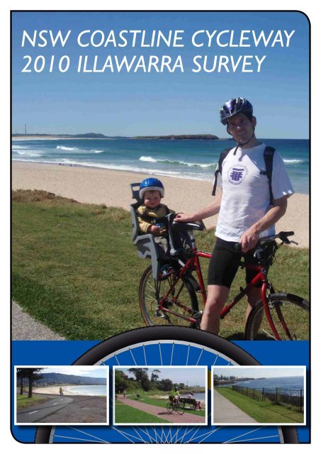
NSW Coastline Cycleway 2010 Illawarra Survey - Healthy Cities ...
NSW Coastline Cycleway 2010 Illawarra Survey - Healthy Cities ...
NSW Coastline Cycleway 2010 Illawarra Survey - Healthy Cities ...

You also want an ePaper? Increase the reach of your titles
YUMPU automatically turns print PDFs into web optimized ePapers that Google loves.
<strong>NSW</strong> COASTLINE CYCLEWAY<br />
<strong>2010</strong> ILLAWARRA SURVEY
<strong>NSW</strong> <strong>Coastline</strong> <strong>Cycleway</strong> <strong>2010</strong> <strong>Illawarra</strong> <strong>Survey</strong><br />
<strong>Illawarra</strong> Active Transport Taskforce,<br />
Wollongong, November <strong>2010</strong><br />
<strong>NSW</strong> COASTLINE CYCLEWAY<br />
Disclaimer<br />
While every<br />
<strong>NSW</strong><br />
reasonable<br />
COASTLINE<br />
effort has<br />
CYCLEWAY<br />
been made <strong>2010</strong> to <strong>Illawarra</strong> ensure that <strong>Survey</strong> this<br />
document is correct at the time of printing, <strong>Healthy</strong> <strong>Cities</strong> <strong>Illawarra</strong>, its<br />
agents and employees disclaim <strong>2010</strong> any <strong>Illawarra</strong> and all liability <strong>Survey</strong> to any person in<br />
respect of anything or the consequences of anything done or omitted<br />
to be done in reliance or upon the whole or any part of this document.<br />
Any actions HEALTHY generated CITIES from ILLAWARRA this report INC. must take into consideration all<br />
relevant standards, ACTIVE TRANSPORT guidelines TASKFORCE and RTA directives.<br />
HEALTHY CITIES ILLAWARRA INC.<br />
ACTIVE TRANSPORT TASKFORCE<br />
Copyright Notice: © <strong>Illawarra</strong> Active Transport Taskforce <strong>2010</strong><br />
You are welcome to reproduce the material that appears in the <strong>NSW</strong><br />
<strong>Coastline</strong> <strong>Cycleway</strong> <strong>2010</strong> <strong>Illawarra</strong> <strong>Survey</strong> for personal, in-house or<br />
non-commercial use without formal permission or charge. All other<br />
rights are reserved. If you wish to reproduce, alter, store or transmit<br />
material appearing in the <strong>NSW</strong> <strong>Coastline</strong> <strong>Cycleway</strong> <strong>2010</strong> <strong>Illawarra</strong><br />
<strong>Survey</strong> for any other purpose, request for formal permission should<br />
be directed to <strong>Illawarra</strong> Active Transport Taskforce, c/- <strong>Healthy</strong> <strong>Cities</strong><br />
<strong>Illawarra</strong>,cnr Victoria and Belmore Sts, Wollongong 2500.<br />
<strong>Illawarra</strong> Active Transport Taskforce<br />
in association with<br />
Affiliated with<br />
and<br />
Affiliated with<br />
A <strong>NSW</strong> Bike Week project<br />
2
<strong>NSW</strong> COASTLINE CYCLEWAY<br />
<strong>2010</strong> ILLAWARRA SURVEY<br />
Contents<br />
Foreword 2<br />
Executive Summary 5<br />
1. Introduction 7<br />
2. Detailed Observations 8<br />
2.1 Common Observation and Improvement Opportunities 8<br />
2.2 Thirroul to Wollongong 13<br />
2.3 Wollongong to Windang 19<br />
2.4 Windang to Shellharbour Village 27<br />
2.5 Shellharbour Village to Dunmore 31<br />
2.6 Dunmore to Kiama Heights 35<br />
3. Council Maintenance Issues 42<br />
3.1 Overview of Maintenance Issues 42<br />
3.2 Wollongong LGA 43<br />
3.3 Shellharbour LGA 44<br />
3.6 Kiama LGA 44<br />
4. Attachments 45<br />
“A” Billboard Conceptual Layout 46<br />
“B” Old Tramway Cycle Path DA 47<br />
“C” Windang Bridge Bicycle Crossing 48<br />
“D” KBUG Letter to Kiama Council 49<br />
1
Foreword<br />
“Reducing road congestion and introducing cycle<br />
ways encourages cycling and walking, improves<br />
pedestrian amenity, enables public spaces to be<br />
upgraded, humanising a city and adding to the<br />
quality of life’ Cr Clover Moore, 2007 Mayor of<br />
Sydney<br />
The <strong>NSW</strong> Government aims to build a complete<br />
cyclepath, the ‘<strong>NSW</strong> <strong>Coastline</strong> <strong>Cycleway</strong>’,<br />
between the borders of Queensland and Victoria.<br />
Around 300km of the 1,400km total length has<br />
so far been built, including sections of off-road<br />
shared pedestrian/cycle paths as well as onroad<br />
cycle lanes.<br />
In the <strong>Illawarra</strong>, much of the <strong>Coastline</strong> <strong>Cycleway</strong><br />
is complete, but there are a number of missing<br />
links and shortfalls such as inadequate<br />
signage, route inconsistencies or hazards. The<br />
<strong>2010</strong> <strong>Illawarra</strong> <strong>Survey</strong> of the <strong>NSW</strong> <strong>Coastline</strong><br />
<strong>Cycleway</strong>, an initiative of the <strong>Illawarra</strong> Active<br />
Transport Taskforce (IATT), aims to provide<br />
information and recommendations for a whole<br />
of government approach to cycling and walking<br />
infrastructure along the coastline of the <strong>Illawarra</strong>.<br />
The survey was conducted by members of the<br />
IATT and other interested cyclists. The 70 km<br />
route was divided into six sections and participants<br />
rode a section each week from north to south.<br />
They observed, identified, and documented<br />
detailed opportunities for improvement for each<br />
section, which are presented in this report.<br />
This report includes general recommendations<br />
which apply throughout the length of the<br />
<strong>Coastline</strong> <strong>Cycleway</strong>, detailed recommendations<br />
for improving the usability and safety of the<br />
pathway along each of the sections, and some<br />
recommendations for maintenance specific to<br />
each of the three <strong>Illawarra</strong> local government<br />
areas. Since the survey was conducted, some<br />
maintenance issues have been rectified due to<br />
the close partnership of the IATT with Councils.<br />
However, there is much work to be done and not<br />
all of the work falls under the jurisdiction of local<br />
government.<br />
2
As the necessary improvements fall under<br />
the control of a large number of government<br />
departments and agencies we hope we can<br />
enlist a whole of government approach to<br />
efficiently implement them. It is hoped that the<br />
opportunities found during the survey can be<br />
addressed by the Premier’s Council for Active<br />
Living acting as a co-ordinator for this approach.<br />
The IATT is convened by <strong>Healthy</strong> <strong>Cities</strong><br />
<strong>Illawarra</strong>, and includes representatives of the<br />
three <strong>Illawarra</strong> local governments - Wollongong,<br />
Shellharbour and Kiama Councils, the <strong>NSW</strong><br />
Roads and Traffic Authority, South-Eastern<br />
Sydney <strong>Illawarra</strong> Area Health, Heart Foundation,<br />
Cancer Council, the <strong>Illawarra</strong> and Kiama Bicycle<br />
User Groups (BUGs) and some of the major<br />
<strong>Illawarra</strong> bicycle businesses. The Taskforce<br />
aims to get more people to use cycling, walking<br />
or public transport rather than private cars for<br />
commuting, shopping and recreation.<br />
The IATT has strengthened the position of<br />
cycling and walking as a healthier, inexpensive<br />
and more sustainable transport option. We hope<br />
this report will lead towards further government<br />
action to improve, promote and maintain the<br />
<strong>Illawarra</strong> section of the <strong>NSW</strong> <strong>Coastline</strong> <strong>Cycleway</strong>.<br />
<strong>Illawarra</strong> Active Transport Taskforce,<br />
representing: <strong>Healthy</strong> <strong>Cities</strong> <strong>Illawarra</strong>,<br />
Wollongong City Council, Shellharbour City<br />
Council, Kiama Municipal Council, <strong>NSW</strong><br />
Roads and Traffic Authority, South-Eastern<br />
Sydney <strong>Illawarra</strong> Area Health, National Heart<br />
Foundation, Cancer Council, <strong>Illawarra</strong> Bicycle<br />
Users Group, Kiama Bicycle Users Group and<br />
<strong>Illawarra</strong> bicycle businesses.<br />
The benefits of cycling or walking are numerous<br />
and remain the same whether the trip is for<br />
recreation or transport to a destination. Cycling<br />
and walking are practical and fun ways to: reduce<br />
the risks of climate change and air pollution;<br />
cut traffic congestion; reduce travel costs; and<br />
importantly, reduce the risks of diseases such as<br />
cardiovascular disease, type II diabetes, colon<br />
and breast cancer, and depression. The British<br />
Medical Association reports that the health risks<br />
of inactivity are 20 times greater than the health<br />
risks posed by a potential cycling accident. In<br />
other words it is a greater risk to do no activity<br />
than it is to ride a bike.<br />
In each of the last seven years Australian bike<br />
sales have surged ahead of car purchases. The<br />
cycling industry is now worth over 1 billion dollars<br />
(Bicycle Industries Australia Ltd, 2006) and<br />
cycle tourism is an increasingly popular way for<br />
Australians to take time out. Dr Sue Beeton, La<br />
Trobe University, calculated that a cycle tourist<br />
spends an average of $258 dollars per day – a<br />
great boost to regional economic growth.<br />
3
Executive Summary<br />
The focus of this survey was on the improvements<br />
that will provide the most benefit in attracting<br />
more people to the <strong>NSW</strong> <strong>Coastline</strong> <strong>Cycleway</strong><br />
and enable them to follow the path without local<br />
knowledge. It is the start of an ongoing process<br />
of improving cycling and walking facilities in the<br />
<strong>Illawarra</strong> with the aim of increasing the use of<br />
active transport.<br />
The survey found a number of generic<br />
improvements common to the entire route. They<br />
are covered in more detail later in this report.<br />
Maintenance issues will be provided separately<br />
to each of the three local councils so as not to<br />
distract from the overall intent of the survey.<br />
The following general observations about<br />
what makes a successful pathway were made<br />
throughout the length of the survey route:<br />
Clear route markings<br />
These should include distances to the next<br />
point of interest and townships; directional signs<br />
showing direction of the <strong>Coastline</strong> <strong>Cycleway</strong><br />
route; signs to railway stations; and billboards<br />
showing an overview of the <strong>Coastline</strong> <strong>Cycleway</strong>.<br />
Directional signage should include both<br />
distances and travel times.<br />
Clear Shared Use Path marking<br />
This would confirm the path’s status as shared<br />
use, reinforce the ‘Keep Left’ message, and<br />
warn of upcoming hazards. The Shared Use<br />
Path marking should conform with the RTA’s<br />
‘Shared Path – User Advisory Signs’ technical<br />
direction TDT 2001/07a, and other relevant<br />
documents.<br />
Clear on-road stencilling<br />
These should include arrows at intersections,<br />
route marking, and advice to motorists of the<br />
possibility of cyclists on the road, in accordance<br />
with RTA AustRoads guidelines.<br />
Safe bicycle crossing points<br />
To improve safety at intersections, where the<br />
shared path crosses roads, use RTA AustRoads<br />
guidelines. This should also include adding<br />
bicycle crossing lights to signalised intersections.<br />
The sequencing of traffic signals should also be<br />
adjusted to allow the pedestrian/bicycle phase<br />
to be activated at any point in the sequence if<br />
there is time for pedestrians to cross safely<br />
Clear sightlines<br />
Clear sightlines are needed to allow for safe<br />
use of the path and avoid collisions or falls,<br />
and are described in RTA guidelines. Unbroken<br />
centrelines, ‘Keep Left’ symbols and warning<br />
signs should be considered at curves with poor<br />
sightlines. The maintenance of sightlines can be<br />
minimised by good planning and the selection of<br />
appropriate path-side plantings.<br />
Adequate path width<br />
In order to accommodate path users, clear<br />
space on path sides are required to allow for<br />
emergency ride-offs and space to move off<br />
the path safely. Congestion on our older paths<br />
clearly highlights the need to carefully consider<br />
the path usage when deciding on the path width.<br />
The effective width of paths is also reduced by<br />
trees, power poles and other obstructions even<br />
if adjacent to the path.<br />
Long term planning<br />
For the continued development and integration<br />
of the <strong>NSW</strong> <strong>Coastline</strong> <strong>Cycleway</strong>, planning needs<br />
to include a form of land title covenant to ensure<br />
the <strong>Cycleway</strong> is included in any future coastal<br />
developments. This would ensure the joining<br />
of some of the ‘missing links’ in the <strong>Cycleway</strong><br />
such as at the proposed Shell Cove Marina,<br />
Killalea State Park and other areas. There also<br />
needs to be a long term plan to identify possible<br />
future routes to the north of Thirroul and south<br />
of Kiama Heights.<br />
5
1. Introduction<br />
The <strong>NSW</strong> <strong>Coastline</strong> <strong>Cycleway</strong> within the<br />
<strong>Illawarra</strong> has the potential to become the premier<br />
cycling destination in the state. The <strong>Cycleway</strong><br />
stretches nearly 70 kilometres from Thirroul in<br />
the north to Kiama Heights in the south. With<br />
the exception of a few minor sections it is offroad<br />
and on shared use paths and quiet back<br />
streets, providing a safe cycling environment<br />
suitable for most cyclists.<br />
The <strong>NSW</strong> <strong>Coastline</strong> <strong>Cycleway</strong> can also play<br />
a pivotal role in meeting the <strong>NSW</strong> State<br />
Government’s plans to increase bicycle<br />
commuting to 5% by 2016, as well as supporting<br />
the objectives of the <strong>NSW</strong> BikePlan.<br />
The <strong>NSW</strong> <strong>Coastline</strong> <strong>Cycleway</strong>, and associated<br />
on-road bicycle lanes, play an important role in<br />
supporting and enhancing the quality of life of<br />
residents and visitors. They provide an efficient<br />
alternative transport route and recreational<br />
training corridor for a range of social, recreational<br />
and sustainable transport uses. It also provides<br />
opportunities for improving the health,<br />
environment, quality of life and well-being of<br />
residents and visitors throughout the <strong>Illawarra</strong><br />
by providing connections to key destinations.<br />
The full potential of the <strong>NSW</strong> <strong>Coastline</strong> Path is<br />
however hampered by the lack of consistent<br />
signage to guide users along the path, as well<br />
as other problems such as gaps in the route,<br />
inconsistencies in the route and a range of<br />
safety hazards.<br />
This survey, which provides observations and<br />
recommendations to improve some of these<br />
drawbacks, contributes to the aims of the <strong>2010</strong><br />
<strong>NSW</strong> BikePlan.<br />
7
OPPORTUNITIES<br />
3. 0 DETAILED OBSERVATIONS AND<br />
I MPROVEMENT OPPORTUNITIES<br />
2.<br />
3.<br />
Detailed<br />
1 COMMON<br />
Observations<br />
OBSERVATIONS Figure 3.1.1a AND I MPROVEMENT<br />
2.1 Common OPPORTUNITIES<br />
Observations and Improvement Opportunities<br />
n path signs and symbols:<br />
of on path stencilled symbols is<br />
ferable to signs attached to posts<br />
re less visually intrusive and allow<br />
ore important signage to be<br />
rominent<br />
educe the number of obstructions<br />
n paths<br />
re more effective at conveying<br />
ultiple messages, Keep Left, this<br />
a Shared Path can be displayed<br />
y the symbol PS-3 & PS-4<br />
ore cost effective<br />
ss susceptible to vandalism<br />
o not require people to stop and<br />
ead<br />
red Path symbol and centreline<br />
e stencilled on both sides of each<br />
ssing, and at regular intervals<br />
e path as recommended in the<br />
delines and RTA directive TDT<br />
3.1.1 On path signs and symbols:<br />
The 2.1.1 use On-path of on path signs stencilled and symbols symbols is<br />
often preferable to signs attached to posts<br />
as The they: use of on-path stencilled symbols is often<br />
preferable to signs attached to posts as they:<br />
• are less visually intrusive and allow<br />
• are less visually intrusive and allow more<br />
important<br />
more important<br />
signage to<br />
signage<br />
be prominent<br />
to be<br />
• reduce prominent the number of obstructions on paths<br />
• • are reduce more the effective number at of conveying obstructions multiple<br />
messages. on paths For example, ‘Keep Left, this is a<br />
• Shared more Path’ can effective be displayed at conveying by the symbol<br />
PS-3 multiple & PS-4messages, Keep Left, this<br />
• are is more a Shared cost effective Path can be displayed<br />
• are by less the susceptible symbol PS-3 to vandalism & PS-4<br />
•<br />
•<br />
do<br />
more<br />
not require<br />
cost<br />
people<br />
effective<br />
to stop and read<br />
• less susceptible to vandalism<br />
The Shared Path symbol and centreline should Figure 3.1.1b<br />
be • stencilled do not require on both people sides to of stop each and road<br />
crossing, readand at regular intervals along the path<br />
The as Shared recommended Path symbol in the and RTA centreline guidelines and<br />
should RTA directive be stencilled TDT 2002/07. on both sides of each<br />
road crossing, and at regular intervals<br />
along A stop the line path across as recommended the left side of the in path the facing<br />
RTA road guidelines crossings and could RTA also directive be considered TDT to<br />
2002/07 reinforce the ‘Stop and Look’ message.<br />
A stop line across the left side of the path<br />
facing road crossings could also be<br />
considered to reinforce the STOP AND<br />
LOOK message<br />
ne across the left side of the path<br />
ad crossings could also be<br />
ed to reinforce the STOP AND<br />
essage<br />
3.1.2 Directional Signs<br />
Directional and <strong>Coastline</strong> <strong>Cycleway</strong> signs<br />
should be provided where roads and paths<br />
intersect the <strong>NSW</strong> <strong>Coastline</strong> <strong>Cycleway</strong>.<br />
The signs should comply with the intent of<br />
the RTA’s Bicycle Guidelines also see<br />
<strong>NSW</strong> BIKEPLAN May <strong>2010</strong>.<br />
Signs need to be visible to users travelling<br />
rectional Signs<br />
al and <strong>Coastline</strong> <strong>Cycleway</strong> signs<br />
e provided where roads and paths<br />
t the <strong>NSW</strong> <strong>Coastline</strong> <strong>Cycleway</strong>.<br />
s should in both comply directions. with the intent of<br />
’s Bicycle Guidelines also see<br />
KEPLAN May <strong>2010</strong>.<br />
ed to be visible to users travelling<br />
irections.<br />
Figure 3.1.1a<br />
Figure 3.1.1b<br />
Figure 3.1.2<br />
Figure 3.1.2<br />
Stop Line used to<br />
reinforce STOP AND<br />
LOOK message<br />
Stop Line used to<br />
reinforce STOP AND<br />
LOOK message<br />
<strong>NSW</strong> COASTLINE CYCLEWAY<br />
5 WOLLONGONG 20MINS<br />
15 SHELLHARBOUR 60MINS <br />
<strong>NSW</strong> COASTLINE CYCLEWAY<br />
5 WOLLONGONG 20MINS<br />
15 SHELLHARBOUR 60MINS <br />
8
across the left side of the path<br />
crossings could also be<br />
to reinforce the STOP AND<br />
sage<br />
tional Signs 2.1.2 Directional Signs<br />
and <strong>Coastline</strong> <strong>Cycleway</strong> signs<br />
rovided where roads and paths<br />
<strong>NSW</strong> <strong>Coastline</strong> <strong>Cycleway</strong>.<br />
hould comply with the intent of<br />
icycle Guidelines also see<br />
LAN May <strong>2010</strong>.<br />
to be visible to users travelling<br />
ctions.<br />
Figure 3.1.2<br />
Directional and <strong>Coastline</strong> <strong>Cycleway</strong> signs<br />
should be provided where roads and paths<br />
intersect the <strong>NSW</strong> <strong>Coastline</strong> <strong>Cycleway</strong>. The<br />
signs should comply with the intent of the RTA’s<br />
Bicycle Guidelines, and also the <strong>NSW</strong> BikePlan<br />
(May <strong>2010</strong>).<br />
Signs need to be visible to users travelling in<br />
both directions.<br />
<strong>NSW</strong> COASTLINE CYCLEWAY<br />
5 WOLLONGONG 20MINS<br />
15 SHELLHARBOUR 60MINS <br />
f<br />
Figure 3.1.3<br />
2.1.3 Sightlines<br />
Poor sightlines can have devastating results for<br />
all path users and the design of a Shared Use<br />
Path needs to include careful consideration of<br />
sightlines.<br />
Sightlines are covered in AustRoads part 14,<br />
section 6.3.7.<br />
Where suitable sightlines cannot be provided<br />
and maintained other safety solutions such as<br />
signs and unbroken centrelines should be used.<br />
se<br />
l<br />
d<br />
AustRoads Part 14 Figure 6-5<br />
Lateral Clearance on Horizontal Curves<br />
AustRoads Part 14 Figure 6-5 Lateral Clearance on Horizontal Curves<br />
Figure 3.1.4a<br />
AustRoad Part 14 Figure 8.4: Landscaping should be<br />
planned to take into account the size of trees and shrubs<br />
when fully grown<br />
Figure 3.1.4b<br />
Vegetation creating blind spot at corner<br />
re<br />
d<br />
Figure 3.1.4c<br />
Vegetation used to define path and control speed<br />
Figure 3.1.4e<br />
Vegetation selection creating ongoing maintenance,<br />
restricting path width and providing unsafe ride-off<br />
9
full width of the path<br />
2.1.4 Vegetation<br />
s need to be trimmed<br />
Plantings should be designed to minimise<br />
maintenance. Plant species used should<br />
not impact on the path by undermining and<br />
. damaging paths, obstructing vision or creating<br />
collision hazards.<br />
e path to provide safe<br />
n needs to be<br />
o provide visibility and<br />
Foliage should be kept off the path and trimmed<br />
AustRoads Part 14 Figure 6-5 Lateral Clearance on Horizontal Curves<br />
1 metre from the path edge where possible<br />
to allow AustRoads the full width Part of the 14 path Figure to be 6-5 used. Lateral Clearance on Horizontal Curves<br />
The Overhanging branches need to be trimmed to 3<br />
re 3.1.4a <strong>NSW</strong> Bicycle<br />
Figure 3.1.4b<br />
metres above the path to provide safe headroom<br />
Figure for 3.1.4a cyclists.<br />
Vegetation Figure creating 3.1.4b blind spot at corner<br />
oads part 14<br />
oad Part 14 Figure 8.4: Landscaping should be<br />
AustRoad<br />
d to take into<br />
Part<br />
account<br />
14 Figure<br />
the<br />
8.4:<br />
size<br />
Landscaping<br />
of trees and shrubs<br />
should be<br />
Vegetation creating blind spot at corner<br />
fully and Vegetation also needs to be removed corners<br />
planned<br />
grown<br />
to information AustRoads Part 14 Figure 6-5 Lateral Clearance on Horizontal Curves<br />
take into account the size on of trees and shrubs<br />
to provide visibility and minimise blind spots The speed<br />
when Figure fully<br />
<strong>NSW</strong><br />
grown 3.1.4a Bicycle Guidelines and AustRoads Figure part 3.1.4b<br />
and sight lines<br />
AustRoad 14 Part provides 14 Figure 8.4: guidelines Landscaping and should information be<br />
Vegetation path creating blind spot at corner<br />
planned to edge take into vegetation account the and size of sightlines.<br />
trees and shrubs<br />
when fully grown<br />
Path Edges:<br />
to the side of the path<br />
the path and<br />
re d Figure to 3.1.4c reduce 3.1.4c the risk of<br />
Figure 3.1.4c<br />
an emergency ride-off<br />
th to avoid a collision.<br />
plant species and<br />
bicycle paths is an<br />
ideration. Edges of<br />
ideally be kept clear<br />
ickly vegetation or<br />
rocks. Using soft<br />
Vegetation used to define path and control speed<br />
re 3.1.5a<br />
edges make it safe to ride off the path<br />
Figure 3.1.5a<br />
Good edges make it safe to ride off the path<br />
Figure 3.1.4e<br />
Figure 3.1.4e<br />
AustRoad Part 14 Figure 8.4: Landscaping Figure 3.1.4e<br />
Vegetation<br />
should<br />
used<br />
be<br />
to<br />
planned<br />
define path<br />
to<br />
and<br />
take<br />
control<br />
into<br />
speed<br />
account the<br />
Vegetation<br />
size<br />
selection Vegetation creating ongoing creating maintenance, blind spot at corner<br />
restricting path width and providing unsafe ride-off<br />
of trees and shrubs when fully grown<br />
egetation used to define path and control speed<br />
Figure 3.1.5a<br />
Good edges make it safe to ride off the path<br />
lp prevent injury if a<br />
d leaves the path.<br />
Figure 3.1.4c<br />
Vegetation used to define path and control speed<br />
Vegetation used to define path and control<br />
Figure 3.1.5a<br />
Good edges make it safe to ride off the path<br />
Vegetation selection creating ongoing maintenance,<br />
restricting path width and providing unsafe ride-off<br />
Vegetation selection creating ongoing maintenance,<br />
restricting path width and providing unsafe ride-off<br />
Figure 3.1.5c<br />
Dangerous path edge for both cycling ride-offs and<br />
pedestrians tripping<br />
Figure 3.1.5b Plant species selection creating ongoing<br />
AustRoad Part 14 Figure maintenance, 8.6: Frangible plantings restricting beside path width and<br />
path can often provide an important safety benefit<br />
providing unsafe ride-off<br />
Figure 3.1.5b<br />
Figure 3.1.5b<br />
AustRoad Part 14 Figure 8.6: Frangible plantings beside<br />
Fig<br />
Vege<br />
restri<br />
Fig<br />
AustR<br />
path<br />
Fig<br />
Jagg<br />
the e<br />
path can often provide an important safety benefit<br />
AustRoad Part 14 Figure 8.6: Frangible plantings beside<br />
path can often provide an important safety benefit<br />
10<br />
Figure 3.1.5c<br />
Figure 3.1.5d
cyclists.<br />
ood edges make it safe to ride off the path<br />
getation Figure 3.1.4e needs to be<br />
Vegetation selection creating ongoing maintenance,<br />
restricting path width and providing unsafe ride-off<br />
rners 2.1.5 to Ride-offs provide and path visibility edges and<br />
spots The The ground adjacent <strong>NSW</strong> to Bicycle<br />
the side of the path<br />
needs to be level with the path and compacted<br />
d AustRoads or grassed to reduce part the 14 risk of injury in the<br />
event of emergency ride-off stepping off<br />
lines the path and to avoid information a collision. on<br />
etation and sight lines<br />
The use of frangible plant species and<br />
structures (those which bend or break easily)<br />
adjacent to bicycle paths is an important safety<br />
consideration. Edges of bicycle paths should<br />
ideally be kept clear of hard, woody, or prickly<br />
vegetation or hard objects such as rocks. Using<br />
s and Figure Path Edges:<br />
igure 3.1.5c<br />
soft plant 3.1.5b species can help prevent injury if a<br />
AustRoad rider Part loses 14 Figure control 8.6: Frangible and leaves plantings the beside path.<br />
angerous jacent path path can often edge to provide the for both an important side cycling safety ride-offs of benefit the and path<br />
edestrians tripping<br />
vel with the path and<br />
grassed to reduce the risk of<br />
ent of an emergency ride-off<br />
f the path to avoid a collision.<br />
ngible plant species and<br />
acent to bicycle paths is an<br />
Figure<br />
safety<br />
3.1.5d<br />
benefit<br />
Jagged ends of dead plants are a hazard to cyclists in<br />
ty consideration. Edges of<br />
the event of a ride-off<br />
should ideally be kept clear<br />
y, or prickly vegetation or<br />
uch as rocks. Using soft<br />
can help prevent injury if a<br />
trol and leaves the path.<br />
AustRoad Part 14 Figure 8.6: Frangible plantings<br />
beside path can often provide an important<br />
AustRoad Part 14 Figure 8.6: Frangible plantings beside<br />
path can often provide an important safety benefit<br />
Figure 3.1.5a<br />
Good edges make it safe to ride off the path<br />
Figure 3.1.5d<br />
Good edges make it safe to ride off the path<br />
Jagged ends of dead plants are a hazard to cyclists in<br />
the event of a ride-off<br />
Figure 3.1.5c<br />
Jagged ends of dead plants are a hazard to<br />
Dangerous cyclists in the path event edge of for a both ride-off cycling ride-offs and<br />
pedestrians tripping<br />
Dangerous path edge for both cycling ride-offs<br />
and pedestrian tripping<br />
11
tersections of Path with Roads:<br />
shared use path network to be<br />
ted and well utilised, safe access<br />
Figure 3.1.6<br />
Suggested shared path road crossing from Vic Roads Cycle Notes N<br />
2.1.6 Intersections of path with roads<br />
o 16<br />
For the shared use network to be connected<br />
provided where the path crosses<br />
and well-used, safe access must be provided<br />
ee information where the and path crosses guidelines roads. in:<br />
RTA .6 Intersections Austroads Guide of Path Part 14 with Bicycles Roads:<br />
r section the shared 6.7 See information use path and network guidelines to be in:<br />
• RTA Austroads Guide Part 14 Bicycles section<br />
6.7<br />
nnected Vic Roads and Cycle well notes utilised, No16 safe safe access road<br />
crossings st be provided for off-road<br />
• Vic Roads where paths<br />
Cycle the notes path No crosses 16 Safe Road<br />
Austroads ds. See information Guide Crossings to traffic for and Off-Road engineering guidelines Paths in:<br />
part • 6 RTA • Austroads Guide to Part Traffic 14 Engineering Bicycles part<br />
y of section the shared 66.7<br />
path road crossings<br />
minor • Vic roads Roads it may Cycle notes beNo16 safe road<br />
As many of shared path road crossings are<br />
ary to crossings include for all off-road the signs paths and<br />
on minor roads it may not be necessary to include<br />
s • recommended Austroads Guide<br />
all the signs on to<br />
and the traffic<br />
markings adjacent engineering<br />
recommended on<br />
ds sketch, part the 6 adjacent however Vic some Roads safety sketch, however some<br />
h many continuity of safety the infrastructure shared and path path continuity road should infrastructure crossings be should<br />
be provided at all intersections.<br />
d<br />
on<br />
at<br />
minor<br />
all intersections.<br />
roads it may not be<br />
cessary to include all the signs and<br />
ath rkings and recommended Road Maintenance: on the adjacent<br />
g Roads that the sketch, Path however and Roads some are safety<br />
d tely path maintained continuity is infrastructure seen an should be<br />
l vided part of at providing all intersections. a safe cycling<br />
nd the minimisation of maintenance<br />
achieved .7 Path and through Road good Maintenance: design and<br />
. suring A large that number the Path of and the problems Roads are<br />
equately tered could maintained be solved is seen by concrete as an<br />
egral and part bitumen of providing filling minor a safe defects. cycling<br />
f te the and damage the minimisation to our shared of maintenance path<br />
n is be caused achieved by through councils good and design their and<br />
tors ning. using A large equipment number of that the exceeds problems<br />
countered king limits could of the be paths. solved by concrete<br />
nding aintenance and bitumen is the filling responsibility minor defects. of<br />
uncils ch of the and damage the RTA, to our path shared users path<br />
twork<br />
be encouraged<br />
is caused by<br />
to report<br />
councils<br />
issues<br />
and their<br />
to<br />
ntractors<br />
and RTA<br />
using<br />
through<br />
equipment<br />
the development<br />
that exceeds<br />
working limits of the paths.<br />
b<br />
ile<br />
base<br />
maintenance<br />
reporting<br />
is<br />
system.<br />
the responsibility of<br />
al<br />
ance<br />
councils<br />
issues<br />
and<br />
are<br />
the<br />
covered<br />
RTA, path users<br />
tely ould as be attachments encouraged to for report each issues Local to<br />
uncil ment and Area. RTA through the development<br />
a web base reporting system.<br />
intenance issues are covered<br />
parately as attachments for each Local<br />
vernment Area.<br />
2.1.7 Path and road maintenance Figure 3.1.7<br />
The weight of tractors is concentrated at the weakest part of the path and the machine exceeds the path carrying cap<br />
edge of the path, resulting in path damage<br />
Adequate maintainance of paths and roads<br />
is integral to providing a safe cycling route.<br />
Maintenance can be minimised through good<br />
design and planning. A large number of the<br />
problems encountered could be solved by<br />
concrete grinding and filling minor defects with<br />
bitumen.<br />
Much of the damage to our shared path network<br />
is caused by councils and their contractors<br />
using equipment that exceeds the working<br />
limits of the paths.<br />
While maintenance is the responsibility of local<br />
councils and the RTA, path users should be<br />
encouraged to report issues to council and<br />
RTA through the development of a web-based<br />
reporting system.<br />
Maintenance issues are<br />
covered separately as<br />
attachments for each<br />
Local Government<br />
Area.<br />
Figure 3.1.6<br />
Suggested shared path road crossing from Vic Roads Cycle Notes N o 16<br />
Suggested shared path road crossing from Vic<br />
Roads Cycle Notes No 16<br />
Figure 3.1.7<br />
The weight of tractors is concentrated at the weakest part of the path and the machine exceeds the path carrying capa<br />
edge of the path, resulting in path damage<br />
The weight of tractors is concentrated at the weakest<br />
part of the path and the machine exceeds the path<br />
carrying capacity edge of the path, resulting in path<br />
damage<br />
12
2.2 Thirroul to Wollongong<br />
Thirroul to Wollongong is an enjoyable bike ride with spectacular ocean and escarpment views. It is<br />
around 14km of cycling pathway and back streets. It follows the beach in places, and crosses many<br />
community playgrounds and parks enjoyed by local families and tourists.<br />
2.2.1 Intersection Lawrence Hargrave Drive and The Esplanade<br />
Sign needed ‘<strong>Coastline</strong> <strong>Cycleway</strong> Wollongong<br />
15 km’, attached to existing Thirroul Beach<br />
tourism sign.<br />
The signs need to be in accordance with the<br />
relevant RTA and <strong>NSW</strong> <strong>Coastline</strong> <strong>Cycleway</strong><br />
guidelines.<br />
nsw coastline cycleway<br />
15 wollongong<br />
2.2.2 Thirroul Swimming Pool and Surf Club<br />
Improve signage and lane markings north of<br />
Thirroul Swimming Pool and Surf Club. There<br />
is a contra flow on-road cycle lane marked on<br />
one side of the road but no signage or other<br />
indication as to where people are expected to<br />
ride or walk.<br />
8 km Shared Zone<br />
Cars, pedestrians, bicycles<br />
One possible option is to make the area a shared<br />
zone for pedestrians, cyclists and motorists<br />
(see RTA guidelines). Also consideration should<br />
be given to stencilling shared path symbols near<br />
the kerb ramp.<br />
2.2.3 Tingara Park (Thirroul Surf Club)<br />
A map is needed showing the extent of the<br />
<strong>Coastline</strong> <strong>Cycleway</strong> with distances to meeting<br />
places and vantage points (see attachment “A”).<br />
The map could also be used to provide other<br />
information, such as funding details, path use<br />
protocol, tourism info, history, etc.<br />
Alternatively, the information could be<br />
incorporated into a local Tourism sign.<br />
13
2.2.4 Intersection Cliff and Harbord St<br />
A sign is needed to Thirroul Railway Station.<br />
1.5 thirroul railway station<br />
2.2.5 Interface between shared use path and Cliff Parade at southern end of park<br />
Safety improvement opportunities in this area:<br />
• add a kerb blister to stop cars obstructing<br />
cycling access onto road<br />
• on-road cycle stencil to mark beginning of on<br />
road section<br />
• on-road cycle stencil with arrow pointing to<br />
shared path for north-bound cyclists<br />
• shared path symbol on path at beginning of<br />
path Figure 2.2.5<br />
2.2.6 Intersections of Surfers Parade and Craig Street, Tasman Parade and Hamilton Road<br />
and other on-road intersections<br />
Add on-road bicycle symbol and arrow pointing<br />
around corners before the corners.<br />
2.2.7 Shared path between Hewitts Creek and Sandon Point<br />
Improve visibility at blind spots along shared<br />
path by removing vegetation from inside of<br />
bends. Visibility sightlines should be based on<br />
a design speed of 25k/hr (see AustRoads part<br />
14 for details).<br />
The frequency and extent of vegetation<br />
maintenance can be reduced by good design<br />
and plant selection<br />
Thirroul<br />
WOLLONGONG<br />
14
2.2.8 Park Road, Bulli<br />
A sign is needed at Park Road Bulli to Bulli<br />
Station.<br />
1 bulli railway station<br />
2.2.9 Intersection with Kareela and Kurraba Streets, Woonona<br />
The intersection of the path with Kareela and<br />
Kurraba Sts is hazardous due to the lack of<br />
clear visibility for both cyclists and motorists.<br />
The issue is further compounded by cars turning<br />
left from Kareela into Kurraba across the path of<br />
cyclists.<br />
Consideration should be given to relocating the<br />
path past the Swimming Pool.<br />
Proposed<br />
route<br />
2.2.10 Woonona Surf Club<br />
The bollards on the path pose a hazard to both<br />
pedestrians and cyclists. They also detract from<br />
the general ambience of the area.<br />
Consideration should be given to relocating the<br />
removable bollard in the Surf Club driveway to<br />
the road side of the path. This would allow the<br />
removal of the two bollards on the shared path<br />
and associated timber posts.<br />
The bollard at the northern end should be<br />
replaced with a barricade to stop cars driving on<br />
the path and entering the park (see page 100 of<br />
the RTA AustRoads Part 14 guidelines).<br />
2.2.11 Park Road, Woonona<br />
A sign is needed at Park Road Woonona to<br />
Woonona Station.<br />
1 woonona railway station<br />
2.2.12 Bellambi Surf Club<br />
A sign is needed to Bellambi Station at the<br />
intersection on the shared path leading to<br />
Bellambi Lane, near Bellambi Surf Club.<br />
1 bellambi railway station<br />
15
2.2.13 Bellambi Recreation area<br />
A map is needed in Bellambi Recreation area<br />
to shown the extent of the <strong>Coastline</strong> <strong>Cycleway</strong><br />
with distances to meeting places and vantage<br />
points (see Attachment “A”).<br />
2.2.14 Bellambi Boat Ramp<br />
Signs and cycle crossing needed on the road to<br />
Bellambi Boat Ramp.<br />
2.2.15 Armour Street, Bellambi<br />
Bicycle stencils are needed on Armour Street,<br />
to Bellambi Pumping station, where cyclists<br />
need to follow the street for a short section.<br />
Symbols should include arrows guiding cyclists<br />
back onto the shared path.<br />
<strong>NSW</strong> <strong>Coastline</strong> <strong>Cycleway</strong> signs should also be<br />
included.<br />
2.2.16 Cawley and Murray Streets intersection, Bellambi<br />
A sign is needed to Corrimal Station near the<br />
intersection of Cawley and Murray Streets.<br />
1 towradgi railway station<br />
2.2.17 Towradgi Park<br />
A map is needed in Towradgi Park to show<br />
the extent of the <strong>Coastline</strong> <strong>Cycleway</strong><br />
with distances to meeting places<br />
and vantage points (see<br />
Attachment “A”).<br />
Thirroul<br />
WOLLONGONG<br />
16
2.2.18 Towradgi Road, Towradgi<br />
A sign is needed to Towradgi Station at the end<br />
of Towradgi Road.<br />
0.5 corrimal railway station<br />
2.2.19 Squires Way and Elliotts Road intersection, Fairy Meadow<br />
A sign is needed to Fairy Meadow Station at the<br />
intersection of Squires Way and Elliotts Road.<br />
The sign needs to direct cyclists to the shared<br />
path through University of Wollongong Campus<br />
East, and also show as link to University of<br />
Wollongong main campus via North Wollongong<br />
Railway Station.<br />
1 fairy meadow railway station<br />
1.5 north wollongong railway station<br />
3.5 university of wollongong main campus<br />
via north wollongong railway station<br />
2.2.20 Stuart Park, North Wollongong<br />
A directional sign is needed at Stuart Park,<br />
directing cyclists onto the correct path. The<br />
poor connectivity between the new path along<br />
George Hanley Drive and the old path within<br />
Stuart Park needs to be addressed.<br />
2.2.21 North Wollongong Surf Club<br />
The car park in front of the North Wollongong<br />
Surf Club has been the site of numerous<br />
accidents and altercations and the area<br />
should be closed to parking. Access should be<br />
restricted to emergency and service vehicles<br />
only. This would not only improve safety for all<br />
path users but also provide additional space for<br />
seating which would further reduce congestion<br />
on the path.<br />
17
2.2.22 Blue Mile, Wollongong<br />
The section of the <strong>NSW</strong> <strong>Coastline</strong> <strong>Cycleway</strong><br />
from the intersection of Cliff Road and Burke<br />
Street forms part of the Blue Mile project and<br />
is covered by the council’s Old Tram Line Cycle<br />
Path submission (see Attachment “B”).<br />
The submission is only in an overview of the<br />
proposed work and the detailed design should<br />
include the <strong>NSW</strong> <strong>Coastline</strong> <strong>Cycleway</strong>, with<br />
shared path symbols and similar information<br />
embossed into the pavement in contrasting<br />
colours or textures, rather than adding the<br />
information later.<br />
2.2.23 Harbour foreshore, Wollongong<br />
The recently completed work along the harbour<br />
foreshore needs shared path symbols and<br />
line marking to encourage shared use path<br />
behaviour.<br />
To reduce the risk of collisions with car doors<br />
the line markings should also direct cyclists<br />
away from the kerbside of the path. The path<br />
markings should comply with objectives of the<br />
RTA directive TDT 2002/07.<br />
A map is needed in Wollongong Foreshore Park<br />
showing the extent of the <strong>Coastline</strong> Cycle Path<br />
with distances to meeting places and vantage<br />
points (see Attachment “A”).<br />
Thirroul<br />
WOLLONGONG<br />
18
2.3 Wollongong to Windang<br />
Wollongong to Windang is about an 8km ride which passes through the heart of the <strong>Illawarra</strong>’s industrial<br />
area. It takes in views of Bluescope Steel, Australia’s biggest steel producer, Port Kembla Harbour and<br />
the surrounding heavy industries, as well as some fantastic coastal views.<br />
2.3.1 Wollongong Foreshore Park<br />
A map is needed in Wollongong Foreshore Park<br />
near Belmore Basion and on the waterfront near<br />
the southern end of Marine Drive, to show the<br />
extent of the <strong>Coastline</strong> <strong>Cycleway</strong> with distances<br />
to meeting places and vantage points (see<br />
attachment “A”). Use existing structures to<br />
mount maps and signs.<br />
2.3.2 Lang Park, Wollongong<br />
Provide clear path markings at both ends of<br />
Lang Park defining <strong>NSW</strong> <strong>Coastline</strong> <strong>Cycleway</strong><br />
including road crossings on Marine Drive,<br />
noting that Lang Park has separated bicycle<br />
and pedestrian paths<br />
2.3.3 Shared use path symbols<br />
The shared path along Marine Drive has a<br />
number of No Cycling signs but no shared use<br />
path symbols or signs to indicate where cyclists<br />
should ride. The path should be marked in<br />
accordance with objectives of the RTA directive<br />
TDT 2002/07<br />
2.3.4 Marine Drive, Wollongong<br />
A sign is needed at the intersection of Marine<br />
Drive and Crown Street, indicating direction to<br />
Wollongong City Mall and Railway Station.<br />
0.5 crown street mall<br />
19
2.3.5 Traffic lights at Corrimal Street and Port Kembla Road, Wollongong<br />
Upgrade traffic lights at the intersection of<br />
Corrimal St and Port Kembla Rd to include cycle<br />
crossing.<br />
2.3.6 Bridge and Corrimal Streets, Coniston<br />
A sign is needed to Coniston Station at the<br />
intersection of Bridge and Corrimal Sts.<br />
0.5 coniston railway station<br />
2.3.7 Tom Thumb Road, Coniston<br />
Add ‘Keep Clear’ stencilling at crossing point<br />
on Tom Thumb Road to reduce traffic queuing<br />
across bicycle crossing. Mark crossing as<br />
shared path crossing as per RTA guidelines.<br />
2.3.8 Springhill Road and BlueScope North gate<br />
Upgrade traffic lights to include cycle lights at<br />
Springhill Road and BlueScope North gate<br />
entrance. The sequencing of the traffic lights<br />
should also be reviewed to allow the pedestrian/<br />
cycle crossing to be activated whenever there is<br />
sufficient time to cross safely rather then having<br />
to wait for a complete rotation of the sequence.<br />
WOLLONGONG<br />
WINDANG<br />
20
2.3.9 Springhill and Masters Roads, Port Kembla<br />
A sign is needed at the path crossing point at<br />
the intersection of Springhill and Masters Roads<br />
directing cyclists to the shared use path to<br />
Figtree, Mangerton and Western suburbs.<br />
2 figtree - mangerton<br />
2.3.10 Allans Creek<br />
A sign is needed at the path crossing point on<br />
Springhill Road just south of Allans Creek to<br />
guide people onto the shared path to Unanderra.<br />
2.5 unanderra<br />
2.3.11 Cringila station<br />
Signs are needed at Cringila station – ‘<strong>NSW</strong><br />
<strong>Coastline</strong> <strong>Cycleway</strong> to Wollongong, Thirroul,<br />
Port Kembla, and Windang’ with distances and<br />
travel times.<br />
A billboard here with tourism information is also<br />
recommended.<br />
2.3.12 Five Islands Road and Flinders Street, Port Kembla<br />
nsw coastline cycleway<br />
windang via port kembla<br />
A sign is needed at the intersection of Five<br />
Islands Road and Flinders Street guiding people<br />
to Windang and Shellharbour via Port Kembla<br />
and to Wollongong, with distances and travel<br />
times.<br />
A billboard here with tourism information is also<br />
recommended.<br />
2.3.13 BlueScope coke ovens gate<br />
Relocate holding rails to the left side of the<br />
path in accordance with RTA guidelines, at<br />
the driveway leading into the BlueScope Coke<br />
Ovens Gate.<br />
The Cycle Lane sign at the left of the photo<br />
should be replaced with a shared use path sign.<br />
21
2.3.14 Port Kembla station<br />
Both the Railway crossings on the shared<br />
path near Port Kembla station are in very poor<br />
condition with damaged fencing, with sharp<br />
edges protruding into the crossings, broken<br />
pavement and generally in need of maintenance.<br />
While these problems are a maintenance issue,<br />
they have been included in this section as they<br />
are outside of the Council’s control and need<br />
addressing by State Rail.<br />
2.3.15 Missing link - Foreshore Road, Port Kembla<br />
There is a short section of shared path missing<br />
on Foreshore Road at the intersection of Old<br />
Port Rd and Foreshore Rd.<br />
The section is required to remove the need for<br />
cyclists to ride on-road between the shared path<br />
crossing of the railway lines and bidirectional<br />
on-road cycle lane on Foreshore Road.<br />
2.3.16 Foreshore Road<br />
Add bicycle markings along Foreshore Road to<br />
indicate as a bidirectional On-Road Cycle Lane.<br />
The markings need to be at both ends of the<br />
road and at the curve in the road.<br />
Consideration should also be given to adding<br />
rumble strips to the edge line at the curve in the<br />
road to discourage motorists form cutting the<br />
corner and endangering cyclists.<br />
The eastern end of the cycle lane needs to have<br />
arrows leading cyclists to and from the shared<br />
path to Heritage Park<br />
2.3.17 Heritage Park, Port Kembla<br />
A map is needed in<br />
Heritage Park to show<br />
the extent of the<br />
<strong>Coastline</strong> <strong>Cycleway</strong>,<br />
with distances to<br />
meeting places<br />
and vantage<br />
points (see<br />
attachment “A”).<br />
WOLLONGONG<br />
WINDANG<br />
22
2.3.18 Gloucester Boulevard entrance to Heritage Park<br />
The pedestrian/bicycle access around the new<br />
gate at the Gloucester Boulevard entrance to the<br />
Heritage Park needs to be improved to provide<br />
safe access to both cyclists and pedestrians.<br />
Presently pedestrians and cyclists need to<br />
use the road and venture between vehicles<br />
approaching the gate opening equipment<br />
Cycle symbols and <strong>NSW</strong> <strong>Coastline</strong> <strong>Cycleway</strong><br />
signs should also be added to the on-road<br />
section along Gloucester Boulevard noting that<br />
some of the route is bidirectional and needs to<br />
be marked accordingly.<br />
Suggested<br />
safe route<br />
2.3.19 Olympic Boulevard and Military Road, Port Kembla<br />
Clearly mark cycleway from the intersection of<br />
Olympic Boulevard and Military Road, past the<br />
Port Kembla Swimming Pool car park and onto<br />
the shared path along Cowper Street.<br />
The path marking should include on-road bicycle<br />
stencilling, directional arrows and shared use<br />
path stencilling.<br />
Road crossings should also be marked in<br />
accordance with RTA guidelines.<br />
2.3.20 Port Kembla Swimming Pool Car Park<br />
A map is needed in the Port Kembla swimming<br />
pool car park or adjacent park to show the<br />
extent of the <strong>Coastline</strong> <strong>Cycleway</strong>, with distances<br />
to meeting places and vantage points (see<br />
attachment “A”).<br />
2.3.21 Bidirectional cycle lane, Shellharbour Road, Kemblawarra<br />
Improve on-road section of <strong>NSW</strong> <strong>Coastline</strong><br />
<strong>Cycleway</strong> along Shellharbour Road from its<br />
intersection with Parkes Street until it rejoins the<br />
shared use path.<br />
The section on the East side of the road should<br />
be marked as bidirectional cycle lane or replaced<br />
with a shared use path. At present north-bound<br />
cyclists have to cross the road twice in a short<br />
distance, exposing them to unacceptable<br />
danger.<br />
Erect bidirectional cycle lane<br />
signage, no stopping signs to<br />
provide a safe bidirectional cycle<br />
lane in accordance with RTA<br />
guidelines<br />
The road markings need to comply with RTA<br />
guidelines if used.<br />
23
2.3.22 Driveways – Shellharbour Road<br />
There are a large numbers of driveways into<br />
commercial properties, including some that<br />
resemble roads rather than driveways, along<br />
the Shared Path on Shellharbour Road,<br />
Kemblawarra. Some path markings are<br />
required to improve safety for both cyclists and<br />
motorists. For this to happen we first need to<br />
fully understand the status of the driveways and<br />
the associated rules.<br />
The entrance to the Kemblawarra Business<br />
Park looks more like a road than a driveway.<br />
How should users of the <strong>Coastline</strong> <strong>Cycleway</strong><br />
deal with it?<br />
2.3.23 Shellharbour Road and King Street, Warrawong<br />
The intersection of Shellharbour Road and<br />
King Street should have a <strong>Coastline</strong> <strong>Cycleway</strong><br />
billboard, directional signs to Wollongong and<br />
Shellharbour and a sign directing cyclists to<br />
cross at the traffic lights to join the lake side<br />
cycleway.<br />
The vegetation should also be reduced to<br />
improve visibility and safety at the intersection<br />
2.3.24 Boundary Road, Windang<br />
The intersection of Shellharbour and Boundary<br />
Roads is extremely hazardous to cross due to<br />
fast-moving left-turning traffic from Shellharbour<br />
Road into Boundary Road. The preferred<br />
option is to reroute the on-road cycle route<br />
down Boundary Road and Ocean Street to<br />
Fern Street, thereby avoiding the need to cross<br />
Boundary Road. This is the originally marked<br />
route and the “watch for cycles” signs still exist.<br />
With the addition of a short section of shared<br />
use path along Boundary Road<br />
the safety at the intersection<br />
could be further improved.<br />
The route down<br />
Boundary Road<br />
also removes the<br />
next intersection<br />
on Shellharbour<br />
Road and the<br />
two ‘stop’ signs<br />
in Kurrajong<br />
Street.<br />
WOLLONGONG<br />
WINDANG<br />
24<br />
The holding rail also needs to be relocated to the<br />
left side of the path as per RTA guidelines.
2.3.25 Wattle Street, Windang<br />
Turning left into Wattle Street is hazardous due<br />
to fast moving traffic also turning into Wattle<br />
Street from Shellharbour Road, and the lack<br />
of space when turning onto Wattle Street.<br />
This situation could be alleviated by providing<br />
a shared use path along Wattle Street to the<br />
Kurrajong Street intersection, or implementing<br />
the recommendations in 2.3.24.<br />
2.3.26 Windang Bridge<br />
Until a cycleway/shared use path is built across<br />
Windang Bridge the crossing of the bridge<br />
needs to be made as user-friendly as possible.<br />
The crossing needs to cater to both on-road<br />
riders, as well as people using the footpath to<br />
avoid the road traffic and associated risks.<br />
Southbound cyclists wishing to ride on-road<br />
over the bridge are given access to Shellharbour<br />
Road via a contra-flow cycleway up Fern Street,<br />
and cyclists intending to use the footpath<br />
should be guided under the bridge to join the<br />
Western footpath on the bridge. It is presumed<br />
that any shared use path would be built on<br />
the West side of the bridge due to the better<br />
access, and therefore using the West footpath<br />
is recommended.<br />
Northbound cyclists either arriving on-road or<br />
from the footpath should be guided under the<br />
bridge to join the Northbound back street cycle<br />
route.<br />
(See Attachment “C” for enlarged route markings<br />
plans).<br />
Sign A: Should guide competent road cyclists<br />
to the on-road route over the bridge and direct<br />
cyclists intending to use the footpath under the<br />
bridge to the Western footpath.<br />
Sign B: Should direct Northbound cyclists onto<br />
the shared use path under the bridge.<br />
Both signs should include distances and travel<br />
times to Wollongong, Shellharbour, etc.<br />
25
WOLLONGONG<br />
WINDANG<br />
26
2 . 4 Windang to Shellharbour Village<br />
Windang to Shellharbour Village is about 6km of cycleways and back streets. It passes the entrance to<br />
Lake <strong>Illawarra</strong>, one of the largest coastal estuarine lakes in <strong>NSW</strong>, and a popular fishing spot. The route<br />
follows some coastal and beach areas leading to the original village of Shellharbour.<br />
2.4.1 West side of Windang Bridge<br />
Shared path symbols are needed at the<br />
beginning of the shared path and at path<br />
intersections. (See Attachment “D” for detailed<br />
sign and stencilling suggestions.)<br />
Add ‘Keep Left’ stencilling and centre line from<br />
the bend in the path leading under bridge to the<br />
bend at the East side of the bridge, as visibility<br />
is poor in this area.<br />
There is a good opportunity to provide a<br />
promenade under the bridge to cater for<br />
pedestrians, fishermen and a place to stop and<br />
rest on rainy days.<br />
Remove vegetation on east side of path after<br />
passing under bridge to improve visibility<br />
Proposed promenade<br />
under bridge<br />
Could be extended to<br />
include a fishing platform<br />
and whalf<br />
2.4.2 East Side of Windang Bridge<br />
Signpost proposed <strong>NSW</strong> <strong>Coastline</strong> <strong>Cycleway</strong><br />
route as per Attachment “D”.<br />
Add stencil to direct on-road cyclists travelling<br />
South on Windang Bridge onto <strong>Coastline</strong><br />
<strong>Cycleway</strong>. A sign is needed to indicate ‘No<br />
Bicycle Access’ to Windang Bridge on the<br />
Eastern footpath due to the hazards on Fern<br />
Street.<br />
Shared path symbols are needed at the<br />
beginning of the shared path and all path<br />
intersections.<br />
nsw coastline cycleway<br />
27
2.4.3 Kiosk in Reddall Reserve<br />
A billboard is needed to advertise <strong>NSW</strong> <strong>Coastline</strong><br />
<strong>Cycleway</strong>. Add emergency contact information<br />
to billboard (see attached). Billboards could be<br />
mounted on existing structures or incorporated<br />
into other park features.<br />
2.4.4 Shared path symbols<br />
Add shared path symbols and line markings at<br />
car park crossings, and street crossings.<br />
Remove bollard type railings and replace with<br />
holding rails and/or car access barriers as per<br />
RTA Guidelines. Car exclusion railings should<br />
only be used where car access is an issue.<br />
2.4.5 Missing link – Elliott Lake, Warilla<br />
An on-road route to connect the missing Elliott<br />
Lake (Little Lake) link may not be required when<br />
the Elliott Lake Bridge is built. However, we still<br />
recommend marking this link, as it will remain<br />
a useful route to the shared use path along<br />
Shellharbour Road and Lake Entrance Road.<br />
2.4.6 Elliott Lake Billboard<br />
A billboard is needed to advertise the <strong>NSW</strong><br />
<strong>Coastline</strong> <strong>Cycleway</strong>, with directional signs and<br />
distances at the South side of the future<br />
bridge over Elliott Lake (Little Lake)<br />
in the park.<br />
Windang<br />
Shellharbour<br />
28
2.4.7 Shellharbour Surf Club – path improvements<br />
There also needs to be signage showing path<br />
users the directions, distances and travel<br />
times to Shellharbour, Windang, Kiama and<br />
Wollongong. It would also be a logical position<br />
for directions to the Blackbutt Forest Reserve.<br />
Suggested shared use path joining<br />
roads shoulder lane adjacent to<br />
Bardsley Park<br />
Provide a section of shared path from the end<br />
of the path South of the Shellharbour Surf Club,<br />
past the roundabout and onto Wollongong<br />
Street. This will aid access and safety for all<br />
path users including access to the Surf Club<br />
and car park.<br />
On-road cycle shoulder lanes are recommended<br />
along Wollongong Street, with cycle lanes<br />
carried through intersections. Access to the<br />
shared path is needed on the West side of<br />
Junction Street at the Beach Road intersection.<br />
2.4.8 Shellharbour Surf Club – sign improvements<br />
Signs are needed to direct cyclists onto<br />
Wollongong Street at both ends, and also to<br />
Shellharbour Road cycleway.<br />
Southbound cyclists should be directed onto the<br />
shoulder lane just South of the roundabout and<br />
lead onto the shared path on Towns Street via a<br />
short section of shared path along Wollongong<br />
Street.<br />
Proposed cycleway link<br />
to Wollongong Street<br />
Northbound cyclists should be guided to the<br />
road shoulder on the West side of Wollongong<br />
Street and join the shared path on the North<br />
side of Beach Road.<br />
2.4.9 Wollongong and Towns Streets link to path<br />
Add a short section of shared path at the<br />
intersection of Wollongong and Towns Streets.<br />
This would allow cyclists to join the shared use<br />
path down Towns Street without the need to ride<br />
into the traffic lane around the kerb blister.<br />
Add shared path to provide<br />
safe access to Town Street<br />
shared path<br />
29
2.4.10 Shellharbour Boat ramp access<br />
The bottom section of Town Street is the access<br />
to the boat ramp and is the beginning of the cycle<br />
path around the harbour foreshore. There needs<br />
to some investigation into how best to handle the<br />
limited space for cycling and other users in the<br />
area. The road signage and markings need to<br />
consider the needs of Coastguard, the boat ramp<br />
access, parking for boat trailers, pedestrians and<br />
cyclists. The access onto the shared use path is<br />
often obscured by boats parked on the left side<br />
of the road at the boat washing station.<br />
Windang<br />
Shellharbour<br />
30
2 . 5 Shellharbour Village to Dunmore<br />
Shellharbour Village to Dunmore is around 6km, but the pathway is not continuous. We have recommended<br />
an on-road route around Shell Cove, and an extension into Killalea State Park to take advantage of one<br />
of the <strong>Illawarra</strong>’s major coastal public recreation, camping and surfing reserves.<br />
2.5.1 Little/Grey Park, Shellharbour<br />
From Little/Grey Park cyclists need to be guided<br />
onto the shared use roadway leading to the Pool<br />
as the footpath along to foreshore to the pool is<br />
too narrow to accommodate cycling near the pool<br />
and the road is already marked as a shared zone.<br />
There is a need to add some bicycle symbols to<br />
the road.<br />
2.5.2 Shell Cove marina proposal<br />
The route South from Shellharbour Pool is<br />
hampered by the proposed Shell Cove Marina<br />
development and ongoing road works in the<br />
area.<br />
Plans for the proposed Marina Foreshore need<br />
to include the <strong>NSW</strong> <strong>Coastline</strong> <strong>Cycleway</strong>. This has<br />
been done along the Hunter River in Newcastle<br />
to accommodate cycling and the pathway<br />
complements foreshore businesses, boating<br />
marina, cafés, restaurants, accommodation and<br />
the wider public use of the foreshore.<br />
31
2.5.3 Shell Cove alternative route<br />
In the absence of the Shell Cove marina we<br />
recommend the provision of an alternative route<br />
using existing infrastructure. The preferred<br />
route going South from Shellharbour Pool is<br />
along Darly Street, left into Sophia Street and<br />
joining the path at the end of Sophia Street to<br />
join Sloop Avenue in Shell Cove. From Sloop<br />
Avenue follow back streets to Shallows Drive<br />
turning onto the shared path just before Mystics<br />
Drive. This route needs to be on-road marked<br />
and a suitable sign erected at both ends to<br />
advise cyclists of the route.<br />
nsw coastline<br />
cycleway<br />
follow marked<br />
on-road cycle<br />
route to rejoin<br />
the nsw coastline<br />
cycleway<br />
in shell cove<br />
Sign at Darley Street<br />
near swimming pool<br />
nsw coastline<br />
cycleway<br />
follow marked<br />
on-road cycle<br />
route to rejoin<br />
the nsw coastline<br />
cycleway<br />
in shellharbour<br />
Sign at Shallows<br />
Drive near shared<br />
path crossing<br />
2.5.4 Route to Kiama<br />
A <strong>NSW</strong> <strong>Coastline</strong> <strong>Cycleway</strong> billboard should<br />
be provided at the commencement of the<br />
shared path in Shell Cove showing the potential<br />
<strong>Cycleway</strong> south to Kiama through Killalea State<br />
Park, and the interim route along Shellharbour<br />
Road.<br />
2.5.5 Melville Crescent<br />
The short section of Melville Crescent and<br />
Hinchinbrook Drive should be marked with<br />
bicycle symbols to guide cyclists to the<br />
continuation of the shared path.<br />
shellharbour<br />
dunmore<br />
32
2.5.6 Route intersection<br />
The route should leave the shared path at the<br />
Killalea Drive overpass and follow Killalea Drive<br />
to Killalea State Park. The road will need cycle<br />
symbols to guide cyclists and remind motorists<br />
to expect cyclists on the road<br />
The route should then pass through Killalea<br />
State Park, taking in some of the best coastal<br />
scenery in the area, to the camping area at its<br />
southern end.<br />
2.5.7 Killalea State Park<br />
From the camping area at the southern end of<br />
the reserve there needs to be a new section<br />
of path to link to Buckley Road. There are two<br />
options for this short section of path:<br />
• the preferred option is to follow the Southern<br />
boundary of the Shellharbour Links Golf<br />
Course<br />
• the other option is to incorporate the path in<br />
the land regeneration after the completion of<br />
sand mining in the area. However, this route<br />
would be somewhat spoiled by its close location<br />
to the tip.<br />
The new path would be approximately 800<br />
metres long.<br />
2.5.8 Dunmore Station<br />
A <strong>NSW</strong> <strong>Coastline</strong> <strong>Cycleway</strong> billboard should<br />
be provided at Dunmore Station, showing the<br />
potential <strong>Cycleway</strong> and the interim routes.<br />
33
2 . 6 Dunmore to Kiama Heights<br />
Dunmore to Kiama Heights is about 15km, and enjoys the scenic Minnamurra River’s mangrove and<br />
casuarina forests, and spectacular vistas of Kiama’s Bombo Beach and Black Beach. The <strong>Illawarra</strong> leg<br />
of the <strong>Coastline</strong> <strong>Cycleway</strong> finishes at Bonaira Native Gardens Reserve in Kiama.<br />
2.6.1 Bicycle symbols<br />
All intersections should have bicycle symbols<br />
with arrows stencilled on the road. Shared path<br />
symbols with centrelines should be located at<br />
the commencement of shared path sections and<br />
at road crossings (see RTA Bicycle Guidelines).<br />
Centrelines and ‘Keep Left’ symbols should also<br />
be considered at tight corners and blind spots,<br />
eg, at Bombo Station.<br />
2.6.2 Directional signs<br />
Signs are needed at prominent intersections<br />
and where the route may not be obvious, to<br />
indicate Kiama and Shellharbour, with distances<br />
and travel times. Such signs should be located<br />
at Dunmore Station, Minnamurra Station, and<br />
Bombo Station. Where there is a risk the route<br />
may be lost it would be appropriate to have a<br />
<strong>NSW</strong> <strong>Coastline</strong> <strong>Cycleway</strong> sign with arrows<br />
nsw coastline cycleway<br />
5 kiama 20 mins<br />
15 shellharbour 15 mins<br />
nsw coastline cycleway<br />
Typical directional sign (see RTA standard for<br />
full details)<br />
35
2.6.3 <strong>Coastline</strong> <strong>Cycleway</strong> billboards<br />
A billboard is needed promoting the <strong>Coastline</strong><br />
<strong>Cycleway</strong> near Dunmore Station, Minnamurra<br />
Station, Bombo Station, Bombo Beach Reserve<br />
and Black Beach (see Attachment “A” for further<br />
suggestions).<br />
2.6.4 Bollards<br />
Bollards should be replaced with deflection<br />
rails as per RTA guidelines, and/or painted<br />
lines should be used to lead cyclists away from<br />
bollards and path edge fencing.<br />
2.6.5 Riverside Drive and The Village, Minnamurra<br />
On-road path markings at the intersection of<br />
Riverside Drive and The Village need improving<br />
to clearly guide cyclists from the cycle path over<br />
the bridge and onto the road.<br />
2.6.6 Railway Avenue<br />
Mark cycle lane along Railway<br />
Avenue as bidirectional cycle<br />
lane (see RTA guidelines<br />
for correct markings).<br />
dunmore<br />
kiama<br />
36
2.6.7 Power poles<br />
Add deflection lines, path symbols and arrows<br />
on pavement around power poles along shared<br />
path to reduce risk of accidents.<br />
2.6.8 Minnamurra Station<br />
Better markings are needed at the beginning of<br />
the shared path south of Minnamurra Station,<br />
as the entrance is obscured by cars parking on<br />
grass.<br />
The section of on-road cycle lane also needs to<br />
be marked as a bidirectional lane.<br />
Add cycle lane markings, bicycle<br />
symbols as bidirectional cycle lane<br />
2.6.9 Cliff Drive, Kiama Downs<br />
The “big dipper” on Cliff Drive is a problem<br />
because of the steep grade, and we recommend<br />
gaining advice from the RTA. While some<br />
of the footpath is marked as a shared path it<br />
is impractical and dangerous because of the<br />
steepness and the need to get back onto the<br />
road at some point.<br />
White line shows extent<br />
of shared path<br />
It may be preferable to mark the route as an<br />
on-road route thereby avoiding the risk of fast<br />
moving cyclists colliding with pedestrians.<br />
2.6.10 Bombo Beach underpasses<br />
The cycle route at Bombo Beach railway<br />
underpass needs to be clearly marked. A<br />
potential solution to safety risks is to make the<br />
section of road from the Highway underpass to<br />
the car park at the beach a shared use area,<br />
making it safer for all users.<br />
The path should lead cyclists under the Highway,<br />
North and over the railway lines to the quarry,<br />
back under the Highway and up to the shared<br />
path along the Highway.<br />
nsw coastline cycleway<br />
kiama<br />
shellharbour<br />
37
2.6.11 Spring Creek off ramp<br />
Realign the off ramp South of Spring Creek<br />
(See attachment “D” report to Council by Kiama<br />
BUG).<br />
We suggest extending the path South at an<br />
easier incline and turn cyclists at street level<br />
at the end of Hothersal Street near the power<br />
transformer enclosure.<br />
New path extended from exsisting<br />
path along highway to power<br />
transformer yard entrance on<br />
Hothersal Street<br />
2.6.12 Path onto Collins Lane, Kiama<br />
The beginning of the path leading onto Collins<br />
Lane needs to be signed and the vegetation at<br />
this point should be trimmed or replaced with<br />
low plantings that do not obstruction cyclist and<br />
pedestrian visibility.<br />
2.6.13 Route to Black Beach<br />
Add signs/stencilling to guide cyclists from the<br />
end of Collins Lane to the shared path along<br />
Black Beach.<br />
2.6.14 Kiama Station<br />
Identify the best street to use to get to Kiama<br />
Station and erect a sign.<br />
dunmore<br />
kiama<br />
38
2.6.15 Black Beach to Terralong Street<br />
Mark on-road route from Black Beach near boat<br />
ramp to Terralong Street and the shared path<br />
at the showground. This route would avoid the<br />
roundabout and traffic on Terralong Street.<br />
2.6.16 Add centrelines<br />
Add centrelines and shared use path symbols<br />
to tight curves and sections with poor visibility.<br />
2.6.17 Black Beach pathway<br />
Provide <strong>NSW</strong> <strong>Coastline</strong> <strong>Cycleway</strong> and<br />
directional sign, with distances and travel times,<br />
to Bombo, Shellharbour and Little Blowhole, on<br />
the shared use path at the end of Black Beach.<br />
2.6.18 Kiama Surf Club - Shared Zone<br />
We recommend Shared Zone signs at both<br />
ends of Kiama Surf Club due to the restricted<br />
space. Alternatively, reroute the path behind the<br />
Surf Club.<br />
2.6.19 Kiama Surf Club - path markings<br />
Add <strong>NSW</strong> <strong>Coastline</strong> <strong>Cycleway</strong> and directional<br />
sign at Kiama Surf Club.<br />
39
2.6.20 Kiama Caravan Park<br />
The path needs to be widened at the tight turn<br />
in the Caravan Park to improve cycling and<br />
pedestrian safety and the comfort of caravan<br />
park residents.<br />
2.6.21 Barney Street Car Park<br />
The narrow section of path leading into car park<br />
needs to be widened. Bicycle symbols also<br />
need to be added to the cycle route through the<br />
car park at Barney Street.<br />
2.6.22 Bonaira Native Gardens Reserve<br />
Clearly mark the shared path and on-road route<br />
to the shared path through Bonaira Native<br />
Gardens Reserve.<br />
2.6.23 End of <strong>Coastline</strong> <strong>Cycleway</strong><br />
A <strong>NSW</strong> <strong>Coastline</strong> <strong>Cycleway</strong> billboard is needed<br />
to mark the end of the <strong>Cycleway</strong> at Bonaira<br />
Native Gardens Reserve (see Attachment ”A”).<br />
A directional sign at the Southern end of the<br />
reserve or a nearby suitable location is also<br />
needed, to show the distances to Kiama,<br />
Shellharbour,<br />
Wollongong and Thirroul.<br />
2.6.24 Mark route from Princes Highway<br />
nsw coastline cycleway<br />
4 kiama<br />
20 shellharbour<br />
48 wollongong<br />
62 thirroul<br />
dunmore<br />
kiama<br />
40
While not part of the <strong>NSW</strong> <strong>Coastline</strong> <strong>Cycleway</strong>,<br />
on-road and shared path symbols and signage<br />
are needed along Reid Street, Marks Street<br />
and South Kiama Drive to guide cyclists from<br />
the Princes Highway to the <strong>NSW</strong> <strong>Coastline</strong><br />
<strong>Cycleway</strong>.<br />
2.6.25 Attract cyclists from the South to<br />
<strong>NSW</strong> <strong>Coastline</strong> <strong>Cycleway</strong><br />
A <strong>NSW</strong> <strong>Coastline</strong> <strong>Cycleway</strong> billboard and<br />
signage are needed of the Kiama exit from<br />
the Princes Highway onto South Kiama Drive<br />
to inform touring cyclists arriving from the<br />
South. The sign needs to include Wollongong,<br />
Shellharbour and Kiama.<br />
The route to Reid Street needs to be clearly<br />
marked, to cater for cyclists who are unfamiliar<br />
with the area.<br />
nsw coastline cycleway<br />
8 kiama<br />
24 shellharbour<br />
52 wollongong<br />
66 thirroul<br />
41
3. Maintenance Issues<br />
3.1 Overall Maintenance Issues<br />
Keeping our network of cycling routes, both onroad<br />
and shared use paths, in a safe and usable<br />
condition is a never ending task. It involves<br />
regular vegetation maintenance, removal of<br />
fallen trees, repairs paths and roads. The IATT<br />
extends our thanks to all <strong>Illawarra</strong> councils for<br />
their endeavours to meet the challenge.<br />
Reporting hazards is often seen as an issue<br />
and we hope that councils will work towards an<br />
on-line hazard reporting system to provide path<br />
and road users a simple and user-friendly way<br />
to report hazards and help councils in identifying<br />
maintenance needs.<br />
The maintenance issues listed below were noted<br />
during the <strong>NSW</strong> <strong>Coastline</strong> <strong>Cycleway</strong> survey and<br />
some may have been rectified since the survey<br />
and others may have appeared.<br />
We hope the following descriptions are adequate<br />
for local council staff to identify the issues. For<br />
any further information on any issue, please<br />
contact Werner Steyer at wernersteyer@yahoo.<br />
com.au or on 0413 305 379.<br />
42
3.2 Wollongong LGA<br />
a. The small red and white ‘Watch for Cyclists’<br />
sign on the power pole along Tasman<br />
Parade and Hamilton Road, Thirroul, are<br />
too small and faded to be seen by motorists<br />
and should be replaced with standard RTA<br />
‘Watch for Bicycle’ signs.<br />
b. The damaged pavement between Bellambi<br />
Surf Club and Bellambi Pool needs repair.<br />
c. The vegetation and overhanging trees<br />
between Thomas Street and Turner Street,<br />
Bellambi, need trimming.<br />
d. Repair damaged path adjacent to Turner<br />
Street, Bellambi.<br />
e. Bitumen path through Bellambi Recreation<br />
area is uneven and needs repair.<br />
f. The sharp corner in the path near Fairy<br />
Meadow Surf Club requires a warning sign.<br />
g. There was water over the path near<br />
intersection Elliotts Road and Squires Way,<br />
Fairy Meadow. It may be a damaged water<br />
main under or adjacent to the path.<br />
h. While the vegetation alongside the shared<br />
use path between Elliotts Road and Stuart<br />
Park has been trimmed the overhanging<br />
trees also need trimming.<br />
i. Some delineation is required to separate<br />
people waiting at the bus stop or alighting<br />
from buses opposite Campus East, Fairy<br />
Meadow, from cyclists on the shared use<br />
path.<br />
j. Clean fallen rock and debris from the path<br />
along the Old Tramway cutting to maximise<br />
usable path width.<br />
k. Improve visibility between the bus shelter at<br />
the intersection of Corrimal St and Bridge St,<br />
Coniston, and the intersection of Corrimal St<br />
and Tom Thumb Rd by removing weeds and<br />
trimming vegetation.<br />
l. The shared use path between Tom Thumb<br />
Road and the BuleScope Steel North Gate<br />
Entrance has a number of concrete slab<br />
offsets and exposed edges which need<br />
grinding and/or filling.<br />
m. Both the bridges over railway lines south of<br />
the BlueScope Steel North Gate Entrance<br />
need some attention to remove steps<br />
between the on-bridge and adjacent path.<br />
n. The damaged safety fence on the railway<br />
bridge needs repair and raises the question<br />
of the suitability of this type of fencing as a<br />
barrier between the road and a shared use<br />
path.<br />
o. The section of path between Stockpile Rd<br />
and Foreshore Rd, Port Kembla, has been<br />
somewhat neglected and requires cleaning,<br />
removal of obstructing vegetation, repair of<br />
potholes and repair of adjacent fencing.<br />
p. A short section of path in Heritage Park, Port<br />
Kembla, required repair.<br />
q. The section of shared path through the<br />
Kemblawarra industrial areas along<br />
Shellharbour Road is badly damaged in<br />
many places and requires repairs. The<br />
fencing adjacent to the path is also an issue<br />
in places with damaged section protruding<br />
into the path.<br />
43
3.3 Shellharbour LGA<br />
a. Remove vegetation on East side of Windang<br />
Bridge to improve visibility along the shared<br />
use path. Vegetation should be replaced with<br />
low plantings that will not obstruct vision.<br />
b. Improve kerb ramp at start of shared use<br />
path on Headland Parade, Barrack Point.<br />
The ramp is too steep and unsafe for cyclists<br />
and also poses danger to the disabled in<br />
wheelchairs. Consider relocating the disabled<br />
parking spot to the opposite end of car park,<br />
as it presently obstructs access to the shared<br />
path and would be safer at the other end of<br />
the car park.<br />
c. Add shared path symbols and line markings<br />
where the path crosses the entrance to car<br />
parks and at street crossings.<br />
d. Remove bollard type railings and replace<br />
with holding rails and/or car access barriers<br />
(as per RTA Guidelines) at all points where<br />
bollard type railings endanger cyclists. Car<br />
exclusion railings should only be used where<br />
car access is an issue.<br />
e. Remove ‘end shared use path’ sign on the<br />
shared path at Barrack Point as the path<br />
continues past that point.<br />
f. Repair shared use path along Reddall<br />
Parade, between View Street and Windang<br />
Street, or consider relocating the path as it<br />
will continue to be damaged by tree roots in<br />
its present location.<br />
g. Relocate the bollard from the side of path at<br />
the Northern entrance to the Park, opposite<br />
the Surf Rider Caravan Park, Barrack Point.<br />
The bollard is a hazard for unsuspecting<br />
cyclists. The bollard should be relocated a<br />
metre back from the edge of the path (see<br />
RTA guidelines).<br />
h. The section of path South of Dunmore Station<br />
requires regular sweeping due to runoff from<br />
road works. The hazard appears to have<br />
been caused by the RTA failing to complete<br />
the project in a safe manner. There is also a<br />
need to redirect the stormwater drain away<br />
from the path and into the existing creek and<br />
remove the remaining section of the old road.<br />
i. In addition to the path cleaning we hope<br />
council can bring the issue to the RTA’s<br />
attention.<br />
3.4 Kiama LGA<br />
a. Overhanging vegetation needs trimming at<br />
a number of locations along the <strong>Coastline</strong><br />
<strong>Cycleway</strong>. An inspection by council staff, and<br />
including local cyclists, to identify all areas<br />
that need pruning should be arranged.<br />
b. Repair hole in path just south of Bombo<br />
station.<br />
44
4. Attachments<br />
“A” Billboard Conceptual Layout<br />
“B” Old Tramway Cycle Path DA<br />
“C” Windang Bridge Bicycle Crossing<br />
“D” KBUG Letter to Kiama Council<br />
45
Billboard Conceptual Layout<br />
Attachment A<br />
Attachment “A”<br />
This billboard is an example only of a possible layout to be displayed at various locations along the <strong>NSW</strong> <strong>Coastline</strong> <strong>Cycleway</strong> within<br />
the <strong>Illawarra</strong>. The information has not been checked or approved and must not be used for any other purpose<br />
<strong>NSW</strong> COASTLINE CYCLEWAY<br />
The <strong>NSW</strong> <strong>Coastline</strong> <strong>Cycleway</strong> is funded jointly by<br />
the <strong>NSW</strong> Department of Planing and Local Councils<br />
In the <strong>Illawarra</strong> the path is a combination of Shared Use Path and On-Road cycling in back streets, with<br />
the few missing links being reduced annually. The path stretches nearly 70 kilometres from Wollongong’s<br />
northern suburbs through Shellharbour LGA and south to Kiama Heights<br />
For maps and cycling information visit the <strong>Illawarra</strong> Bicycle Users Group website<br />
WWW.ibug.org.au<br />
Add <strong>NSW</strong> <strong>Coastline</strong> <strong>Cycleway</strong> and<br />
Council Logos<br />
Table off<br />
distances<br />
Table of Distances<br />
Space for Advertising<br />
by <strong>Coastline</strong> <strong>Cycleway</strong><br />
related businesses
Attachment B Old Tramway Cycle Path DA
Windang Bridge Bicycle Crossing<br />
Attachment “C” Windang Bridge cycle route<br />
Attachment C<br />
B<br />
Judooley Pde<br />
Kurrajong St<br />
A<br />
Fern St<br />
Windang<br />
Bridge<br />
Bridge<br />
SUGGESTED SIGNAGE<br />
It may be necessary to have more then one sign to clearly convey<br />
the massages at some locations.<br />
Signs need to include distances and travel times and Include<br />
<strong>NSW</strong> <strong>Coastline</strong> <strong>Cycleway</strong> sign<br />
C<br />
Sign location “A”<br />
Sign A should indicate the way to Shellharbour, direct cyclists<br />
wishing to use the footpath under the bridge and onto the<br />
western footpath and a warning sign that the contra flow path<br />
up Fern Street is access for on-road cyclists only.<br />
Sign location“B”<br />
Sign B should guide north bound cyclists under the bridge and<br />
onto the marked route through Windang backstreets as well as<br />
showing the direction to Shellharbour<br />
D<br />
Sign location“C”<br />
Sign C should indicate the distances, travel times and directions<br />
to Wollongong, Port Kembla, Shellharbour, Kiama and Oak Flats<br />
Sign location“D”<br />
Sign D should direct on road cyclists onto the shared use path<br />
F<br />
E<br />
Sign location“E”<br />
Sign F should indicate the distances, travel times and directions<br />
to Wollongong, Port Kembla, Shellharbour, Kiama and Oak Flats<br />
Sign location“F”<br />
Sign E should indicate the distances, travel times and directions<br />
to Wollongong, Port Kembla, Shellharbour, Kiama and Oak<br />
Flats. There should also be a sign indicating there is no bicycle<br />
access over Windang Bridge on the eastern side for northbound<br />
cyclists and that they should follow the marked route.
Attachment D<br />
KBUG Letter to Kiama Council<br />
Attachment “D” Letter to Kiama Council<br />
Mr M Forsyth<br />
General Manager<br />
Kiama Municipal Council<br />
PO Box 75<br />
Kiama 2533<br />
04-05-<strong>2010</strong><br />
Dear Mr Forsyth<br />
The committee of the Kiama Bicycle User Group is seeking Councils assistance in<br />
improving a section of cycleway on the Spring Creek Bridge. We recently have had an<br />
incident at this point that caused one of our members to fall into the south bound traffic<br />
lane. Fortunately on this occasion there was no traffic passing.<br />
The incident was the result of riders slowing or sometimes stopping to negotiate the sharp<br />
left hand turn into Hothersal Street and the following riders bunching up in close<br />
formation. One of our members had difficulty releasing from his toe clips and with no<br />
where to go he fell over into the traffic lane. Luckly he only suffered minor abrasions.<br />
We have previously approached the RTA regarding this location and the hazard it<br />
presents and they claim it is not considered appropriate to erect a safety fence at this point<br />
due to width of the path. See enclosed correspondence with RTA.<br />
In our request we asked for a narrow safety fence similar to that erected along the<br />
cycleway on the Minnamurra River Bridge, to prevent cyclists overshooting the sharp<br />
turn required when leaving Hothersal Street and turning right towards Bombo. Now this<br />
further incident reinforces our concerns for cyclists negotiating the sharp left hand turn<br />
into Hothersal Street.<br />
Would it be possible for your engineers and Road Safety Officer to look at this site and<br />
possibly come up with a safer alternative to that which now exists.<br />
Yours faithfully<br />
Ross Mansell / Kiama Bicycle User Group Committee member