Download PowerPoint slides - Aspen Global Change Institute
Download PowerPoint slides - Aspen Global Change Institute
Download PowerPoint slides - Aspen Global Change Institute

Create successful ePaper yourself
Turn your PDF publications into a flip-book with our unique Google optimized e-Paper software.
Whitepaper on Improvements to<br />
Climate Models to Provide Useful<br />
Information to Water Managers<br />
Presented to:<br />
Workshop on Advanced Climate Modeling and<br />
Decision Making<br />
<strong>Aspen</strong> CO<br />
Presented by:<br />
Joe Barsugli, University of Colorado<br />
Chris Anderson, Iowa State University<br />
Joel Smith, Stratus Consulting<br />
Jason Vogel, Stratus Consulting<br />
September 21, 2009<br />
STRATUS CONSULTING
Briefing Outline<br />
Introduction: What does the water<br />
community want?<br />
Overview of key science points<br />
Options for Improving the Science to Assist<br />
Decision Making<br />
– GCMs<br />
– Downscaling<br />
Closing: what can science provide the water<br />
community?<br />
STRATUS CONSULTING
Main Purpose of the Study<br />
“This white paper is intended to provide WUCA<br />
with a detailed but non-technical overview of the<br />
current state of climate modeling, how modeling<br />
activities are evolving, and where the best<br />
investments in these predictive tools should be<br />
made in the future to assist water utilities in<br />
their long-range planning efforts.”<br />
STRATUS CONSULTING
We Identified Four Objectives Water<br />
Utilities Seem to be Asking For<br />
Help focus the analysis on specific outcomes useful to<br />
the water community<br />
1. How do we get model agreement on change in<br />
key parameters (e.g., increase in seasonal or<br />
annual precipitation)?<br />
2. How do we get a narrower range of model output?<br />
3. How do we get reliable (usable?) climate model<br />
resolution at a spatial and temporal scale that<br />
matches our current system models?<br />
4. How do we get reliable projections within our<br />
planning horizons?<br />
STRATUS CONSULTING
Spatial/Temporal Needs and Current<br />
Uses of Climate Information<br />
STRATUS CONSULTING
Spatial and Temporal Requirements<br />
for Climate Model Outputs<br />
Variables typically used:<br />
– Temperature<br />
– Precipitation<br />
– Streamflow<br />
STRATUS CONSULTING
Key Points about Utility System<br />
Models<br />
Utilities have multiple models w/ different<br />
functions<br />
Most models use streamflow as input<br />
– Need hydrology models to translate<br />
climate change projections to runoff/WQ<br />
etc.<br />
– Hydrologic modeling is another source of<br />
uncertainty<br />
STRATUS CONSULTING
Key Points about Utility System<br />
Models<br />
Seattle has and NYCDEP developing model<br />
w/ integrated hydrology that can use climate<br />
model output<br />
Others have spreadsheet correlations<br />
between climate and hydrology<br />
– Could revise spreadsheet to use climate<br />
change projections and hydrology<br />
models<br />
Water quality is challenging to model<br />
STRATUS CONSULTING
Options for Improving GCMs<br />
STRATUS CONSULTING
GCMs -- Insights from the science<br />
• Climate model simulations have generally improved<br />
• The average across all models (“multi-model<br />
average”) simulates current climatological averages<br />
better than any individual model, but the multi-model<br />
average will understate potential changes in<br />
extremes.<br />
• The range of global-mean climate projections as<br />
assessed by the IPCC has not appreciably<br />
narrowed although confidence has increased<br />
• The uncertainty of global and regional climate<br />
change is larger than the range simulated by the<br />
current generation of models<br />
STRATUS CONSULTING
GCMs -- Insights from the science<br />
• Better to use a range of individual models, rather<br />
than a single model or the multi-model average<br />
• There is no “best” model<br />
• The relationship between model performance and<br />
reliability of projections on global and regional scales<br />
is not well understood<br />
• On a regional scale, culling models based on<br />
performance in simulating current climate does not<br />
necessarily yield a narrower range of projections<br />
STRATUS CONSULTING
GCM-1. Develop and enhance GCM ensembles<br />
• Perform large (10–30 member) ensembles of<br />
projections for each GCM out to at least the year 2060<br />
at multiple modeling centers at a resolution of 50–100<br />
km in the atmosphere component, and with high<br />
resolution in the tropical oceans.<br />
• Archive sufficient GCM output data over the North<br />
American domain for use as input to dynamically<br />
downscaled runs.<br />
• Archive and disseminate a subset of GCM output<br />
variables for water resources applications over the<br />
North American domain at appropriate spatial and<br />
temporal scales<br />
• Coordinate with modeling centers worldwide to meet<br />
the above goals for as many models as possible in the<br />
CMIP5 archive.<br />
STRATUS CONSULTING
GCM-1. Develop and enhance GCM ensembles<br />
Discussion:<br />
• Discriminate the regional climate change signal from<br />
variability.<br />
• Richer set of model scenarios for use in adaptation studies.<br />
• Facilitate a coordinated effort to produce ensembles of<br />
regional climate change projections through statistical and<br />
dynamical downscaling.<br />
• Until there is clear evidence that higher resolution leads<br />
to a convergence among different models, we<br />
recommend a better sampling of the range of uncertainty<br />
through running ensembles<br />
• Data storage and dissemination requirements may be a<br />
limiting factor if higher-resolution GCMs are used.<br />
• Cost: Addl. Computing + Data archive: $3-30M over 5<br />
years.<br />
STRATUS CONSULTING
GCM-2. Improve use of observations to constrain<br />
climate models’ projections<br />
• Extend statistical detection and attribution studies<br />
that combine observed data and climate model output<br />
to improve probabilistic estimates of the magnitude of<br />
the observed anthropogenic climate change signal on<br />
both global and regional scales.<br />
• Developing advanced statistical methods to combine<br />
observations, GCMs, and RCMs to improve<br />
probabilistic projections of regional climate change out<br />
to the mid-21st century (See DS-1).<br />
STRATUS CONSULTING
GCM-2. Improve use of observations to constrain<br />
climate models’ projections<br />
Discussion<br />
• This effort builds on work on Bayesian methods (Tebaldi and<br />
Lobell, 2008), fingerprinting, and numerous other attribution<br />
and signal estimation studies.<br />
• There will be better observations over time of how global and<br />
regional climates are changing.<br />
• Data assimilation is technologically complex and<br />
computationally intensive.<br />
• Data assimilation for climate models requires better models<br />
and better observations, particularly of the oceans. Waiting for<br />
improvements in these areas may delay results. Estimation of<br />
ocean heat uptake is critical.<br />
• These methods may not significantly narrow the range of<br />
projections in a few years.<br />
• Costs: Grant program $2M; DA: $10 M/year<br />
STRATUS CONSULTING
GCM-3. Improve modeling of the tropical Pacific<br />
Focused research program combining modeling,<br />
observations, and theory with the goals of:<br />
• reducing climate model bias in the tropical Pacific<br />
• seeking convergence among the models in projections<br />
for this region on all time scales, but with an emphasis<br />
on the climate change signal.<br />
• using the observed data to constrain the ocean and<br />
atmosphere models. An innovative method would be to<br />
integrate coupled ocean/atmosphere data assimilation<br />
into the model development cycle.<br />
STRATUS CONSULTING
GCM-3. Improve modeling of the tropical Pacific<br />
Discussion<br />
• Can narrow the range of precipitation projections over North<br />
America.<br />
• Convergence of models here would have payoffs for prediction<br />
on multiple time scales<br />
• Builds on work with coupled models and data assimilation used<br />
for seasonal (ENSO) and decadal prediction<br />
The tropical Pacific Ocean is comparatively well observed on<br />
decadal scales; ARGO data (since ~2000) will allow<br />
unprecedented accuracy in data assimilation.<br />
• This option has a low certainty of success (challenging<br />
problem).<br />
• Natural multi-decadal variations in ENSO amplitude may prove<br />
too large for useful predictions of change in ENSO characteristics<br />
to be reliable.<br />
• Costs: model development, computation, research:1-10M/yr<br />
STRATUS CONSULTING
GCM-4. Evaluate decadal prediction efforts for water<br />
utilities’ planning<br />
This effort would fund:<br />
• Tracking progress of decadal prediction efforts worldwide<br />
and evaluate the potential for using decadal predictions in<br />
water utility planning.<br />
• Research to integrate predictions of climate variability on<br />
annual-to-decadal scales with projections of climate change.<br />
• Downscaling efforts only if the potential skill of these<br />
prediction can be demonstrated through “hindcast”<br />
experiments<br />
CMIP5 will include the first intercomparison of decadal<br />
predictions. Decadal prediction runs are planned to extend to<br />
2035 using GCMs with 50–100-km resolution in the atmosphere.<br />
STRATUS CONSULTING
GCM-4. Evaluate decadal prediction efforts for water<br />
utilities’ planning<br />
Discussion<br />
• May provide improved regional projections because oceans<br />
start closer to observed conditions than in free-running GCMs.<br />
• Has potential for skill in predicting Atlantic and Pacific decadal<br />
oscillations, potentially improving predictions over most of North<br />
America.<br />
• A component of CMIP5.<br />
• Will enhance the understanding of decadal variability and the<br />
ability to integrate decadal variability with climate change.<br />
• Predictive skill may be too low to be useful.<br />
• Many methodological issues need to be worked out regarding<br />
how to initialize the models to the observed ocean conditions.<br />
• This option has a low probability of success (but high potential<br />
reward).<br />
• Costs:
STRATUS CONSULTING<br />
Options for Improving Downscaling
Insights on Downscaling from<br />
Literature<br />
<br />
<br />
<br />
<br />
<br />
<br />
GCM projections are unlikely to produce output at scale<br />
of water utility planning tools within the next decade.<br />
Neither dynamical nor statistical downscaling has the<br />
capability to correct large-scale errors.<br />
Careful consideration must be given to RCM domain size:<br />
Big ones drift from large-scale climate conditions; small<br />
ones prevent development of regional circulation.<br />
Warm season precipitation RCM disparities: convective<br />
parameterization, land surface parameterization.<br />
Cold season precipitation RCM disparities: microphysics<br />
parameterization<br />
Cold season temperature RCM disparities: land surface<br />
parameterization<br />
STRATUS CONSULTING
Insights on Downscaling from<br />
Literature<br />
<br />
<br />
<br />
<br />
<br />
RCM resolution: Many regional circulations in the United<br />
States are better simulated with 10-20 km than with<br />
40-60 km grid spacing.<br />
RCMs with 2-10 km spacing are largely untested.<br />
Statistical downscaling lacks wide application of rigorous<br />
tests to examine sensitivity to stationarity assumptions.<br />
Because statistical and dynamical techniques have<br />
complementary strengths, they have been applied in<br />
tandem at least once and results were promising.<br />
Both statistical and dynamical downscaling communities<br />
have engaged climate data user communities<br />
STRATUS CONSULTING
Downscaling Option 1:<br />
Develop Regional Climate <strong>Change</strong><br />
Ensembles<br />
<br />
<br />
<br />
<br />
Develop a very large ensemble (100-200 members) of<br />
local projections out to 2050 through the combined use of<br />
RCMs with 10-20 km grid spacing and statistical<br />
downscaling.<br />
Provide a community archive containing three tiers of<br />
accessibility with a core set of variables within the most<br />
accessible tier and full RCM output in the least accessible<br />
tier.<br />
The ensemble will enable refinement of quantification of<br />
uncertainty and advancement of understanding of<br />
sources of variability in projections so that scientists will<br />
be able to be better informed when expressing<br />
confidence levels in projections.<br />
Only works if GCM-1 is pursued.<br />
STRATUS CONSULTING
Downscaling Option 1:<br />
Develop Regional Climate <strong>Change</strong><br />
Ensembles<br />
<br />
<br />
<br />
<br />
<br />
The ensemble output would be suitable for either riskbased<br />
or scenario-based decision tools.<br />
Water utility planners may have a voice in design of<br />
regional scenarios.<br />
Nearly all components needed for this option already<br />
exist. Coordination between CMIP5 and COREDEX is<br />
ongoing.<br />
The challenge is that this scale of focused community<br />
coordination (GCM, RCM, SD, and users) has not been<br />
attempted in the United States.<br />
$10M for computing; $5M-10M/yr infrastructure;<br />
$5M-10M/yr for 5-10 years of research grants<br />
STRATUS CONSULTING
Downscaling Option 2:<br />
Develop RCM Components<br />
<br />
Reduce the disparity among RCM simulations given<br />
accurate large-scale climate conditions.<br />
– Test, evaluate, and reformulate RCM component<br />
models that are known to create disparity.<br />
• Warm season priorities should be convective<br />
parameterization and land models.<br />
• Cold season priorities should be snow formation<br />
parameterization and snow pack evolution<br />
models.<br />
• Use multiple RCMs in systematic studies of<br />
domain size, boundary condition specification, and<br />
nudging.<br />
STRATUS CONSULTING
Downscaling Option 2:<br />
Develop RCM Components<br />
<br />
<br />
<br />
<br />
Substantial insights into regional processes will result in<br />
understanding so that scientists are better informed when<br />
making statements about confidence in regional<br />
projections.<br />
May build directly upon infrastructure of existing<br />
programs, like NARCCAP.<br />
Does not necessarily ensure development of probabilistic<br />
projections only the tools that may be used to make<br />
them, and model development may be hindered by lack<br />
of appropriate observations.<br />
$5M-10M/yr in research grants needed; $1M-$5M in<br />
computing infrastructure.<br />
STRATUS CONSULTING
Downscaling Option 3:<br />
Develop Statistical Downscaling<br />
Techniques<br />
<br />
Develop a wider array (20 or more) of techniques for<br />
downscaling daily data and extremes and producing<br />
probabilistic local projections.<br />
– A wide array of tools is preferred in order to<br />
understand the uncertainty in local projections due to<br />
downscaling methodological design.<br />
– The developmental methodology should ensure<br />
rigorous assessment of the error resulting from<br />
stationarity assumptions.<br />
– Probabilistic techniques should focus on estimating<br />
climate PDFs and identifying sources of uncertainty,<br />
such as the contributions to uncertainty from intermodel<br />
variability and internal climate variability.<br />
– Best applied in tandem with GCM-1.<br />
STRATUS CONSULTING
Downscaling Option 3:<br />
Develop Statistical Downscaling<br />
Techniques<br />
<br />
<br />
<br />
<br />
<br />
Large ensemble of local projections can be produced if<br />
large number GCM simulations are available.<br />
Local projections will be suitable for both risk assessment<br />
tools and scenario based tools.<br />
Community archive facility and program infrastructure<br />
may build upon programs already in existence.<br />
Absent from these local projections will be the<br />
contribution from changes in regional climate dynamics.<br />
$1M for community archive; $5M-$10M/yr for 5-10 years<br />
for research grants<br />
STRATUS CONSULTING
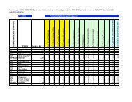
Option<br />
GCM-1<br />
Ensembles<br />
GCM-2<br />
Constraints<br />
GCM-3<br />
Tr. Pacific<br />
GCM-4<br />
Decadal<br />
DS-1<br />
Ensembles<br />
Objective<br />
DS-2<br />
RCM Component<br />
DS-3<br />
Stat. PDF/extreme<br />
Agreement<br />
Range<br />
(narrow/<br />
understand)<br />
Time and<br />
Space Scale<br />
<br />
<br />
<br />
<br />
<br />
<br />
Time<br />
Horizons<br />
<br />
<br />
<br />
STRATUS CONSULTING
STRATUS CONSULTING<br />
Concluding Thoughts
Prospects for Improving the Science to be<br />
More Useful for Water Resources<br />
Management<br />
1. Model agreement on key parameters<br />
– Need more agreement on change in<br />
circulation patterns, storm tracks, etc.<br />
– May take years for improvement<br />
– In meantime, we can better understand<br />
sources of uncertainty<br />
• Use available projections<br />
STRATUS CONSULTING
Prospects for Improving the Science to be<br />
More Useful for Water Resources<br />
Management<br />
2. Narrow Range of Model Output<br />
– Only modest progress expected<br />
– Two key sources of uncertainty unlikely<br />
to be significantly narrowed:<br />
• GHG emission projections<br />
• 2xCO 2 climate sensitivity<br />
– Enhanced use of observations may<br />
constrain projections<br />
– We can better understand the distribution<br />
within the range and confidence in the<br />
range<br />
STRATUS CONSULTING
Prospects for Improving the Science to be<br />
More Useful for Water Resources<br />
Management<br />
3. Increase GCM resolution<br />
– Desired to be at same scale as utility<br />
models<br />
– GCM resolution likely to increase from<br />
100-400km to 50-200km<br />
• More coarse than most utility models<br />
– Higher resolution does not guarantee<br />
improved accuracy<br />
STRATUS CONSULTING
Prospects for Improving the Science to be<br />
More Useful for Water Resources<br />
Management<br />
4. Improved Projections Within Utility Planning<br />
Horizons<br />
– Planning horizons often 30 years or less<br />
– Natural variability can have larger effect on<br />
climate w/in a few decades than GHGs<br />
– Need improved simulations of climate<br />
variability drivers, such as Tropical Pacific<br />
Ocean<br />
• May take years to realize such<br />
improvements<br />
STRATUS CONSULTING
Concluding Thoughts<br />
Are substantial<br />
opportunities to<br />
improve understanding<br />
of regional climate<br />
change<br />
– Should take<br />
advantage of<br />
CMIP5<br />
– Analyze outputs of<br />
GCMs and<br />
downscaling<br />
STRATUS CONSULTING
Concluding Thoughts<br />
The GCMs will improve<br />
– Science will<br />
improve<br />
– As will model<br />
resolution<br />
But…<br />
– Improving<br />
resolution is<br />
complicated<br />
Noticeable<br />
improvements can take<br />
a decade or more<br />
STRATUS CONSULTING
Concluding Thoughts<br />
Decision making<br />
– Choices have been<br />
framed as<br />
• Continue to rely<br />
on the past<br />
• Wait and see<br />
– Need to work with<br />
what we know<br />
• Improved<br />
decision<br />
analysis<br />
STRATUS CONSULTING
The “Uncertainty Prayer”<br />
Grant us…<br />
The ability to reduce the uncertainties we can;<br />
The willingness to work with the uncertainties<br />
we cannot;<br />
And the scientific knowledge to know the<br />
difference.<br />
Joe Barsugli<br />
STRATUS CONSULTING


![View Powerpoint Slides [PDF]](https://img.yumpu.com/32486693/1/190x146/view-powerpoint-slides-pdf.jpg?quality=85)

![View Powerpoint Slides [PDF]](https://img.yumpu.com/29411106/1/190x143/view-powerpoint-slides-pdf.jpg?quality=85)