Download - FRA Nepal
Download - FRA Nepal
Download - FRA Nepal

You also want an ePaper? Increase the reach of your titles
YUMPU automatically turns print PDFs into web optimized ePapers that Google loves.
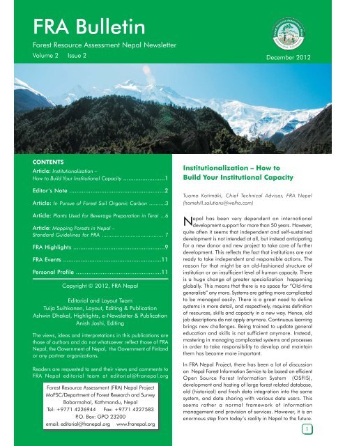
<strong>FRA</strong> Bulletin<br />
Forest Resource Assessment <strong>Nepal</strong> Newsletter<br />
Volume 2 Issue 2 December 2012<br />
CONTENTS<br />
Article: Institutionalization –<br />
How to Build Your Institutional Capacity ........................1<br />
Editor’s Note ......................................................2<br />
Article: In Pursue of Forest Soil Organic Carbon ..........3<br />
Article: Plants Used for Beverage Preparation in Terai ...6<br />
Article: Mapping Forests in <strong>Nepal</strong> –<br />
Standard Guidelines for <strong>FRA</strong> ...................................... 7<br />
<strong>FRA</strong> Highlights ....................................................9<br />
<strong>FRA</strong> Events ........................................................11<br />
Personal Profile ................................................11<br />
Copyright © 2012, <strong>FRA</strong> <strong>Nepal</strong><br />
Editorial and Layout Team<br />
Tuija Suihkonen, Layout, Editing & Publication<br />
Ashwin Dhakal, Highlights, e-Newsletter & Publication<br />
Anish Joshi, Editing<br />
The views, ideas and interpretations in this publications are<br />
those of authors and do not whatsoever reflect those of <strong>FRA</strong><br />
<strong>Nepal</strong>, the Government of <strong>Nepal</strong>, the Government of Finland<br />
or any partner organizations.<br />
Readers are requested to send their views and comments to<br />
<strong>FRA</strong> <strong>Nepal</strong> editorial team at editorial@franepal.org<br />
Forest Resource Assessment (<strong>FRA</strong>) <strong>Nepal</strong> Project<br />
MoFSC/Department of Forest Research and Survey<br />
Babarmahal, Kathmandu, <strong>Nepal</strong><br />
Tel: +9771 4226944 Fax: +9771 4227583<br />
P.O. Box: GPO 23200<br />
email: editorial@franepal.org www.franepal.org<br />
Institutionalization – How to<br />
Build Your Institutional Capacity<br />
Tuomo Kotimäki, Chief Technical Advisor, <strong>FRA</strong> <strong>Nepal</strong><br />
(homehill.solutions@welho.com)<br />
N<br />
epal has been very dependent on international<br />
development support for more than 50 years. However,<br />
quite often it seems that independent and self-sustained<br />
development is not intended at all, but instead anticipating<br />
for a new donor and new project to take care of further<br />
development. This reflects the fact that institutions are not<br />
ready to take independent and responsible actions. The<br />
reason for that might be an old-fashioned structure of<br />
institution or an insufficient level of human capacity. There<br />
is a huge change of greater specialization happening<br />
globally. This means that there is no space for “Old-time<br />
generalists” any more. Systems are getting more complicated<br />
to be managed easily. There is a great need to define<br />
systems in more detail, and respectively, requires definition<br />
of resources, skills and capacity in a new way. Hence, old<br />
job descriptions do not apply anymore. Continuous learning<br />
brings new challenges. Being trained to update general<br />
education and skills is not sufficient anymore. Instead,<br />
mastering in managing complicated systems and processes<br />
in order to take responsibility to develop and maintain<br />
them has become more important.<br />
In <strong>FRA</strong> <strong>Nepal</strong> Project, there has been a lot of discussion<br />
on <strong>Nepal</strong> Forest Information Service to be based on efficient<br />
Open Source Forest Information System (OSFIS),<br />
development and hosting of large forest related database,<br />
old (historical) and fresh data integration into the same<br />
system, and data sharing with various data users. This<br />
seems rather a normal framework of information<br />
management and provision of services. However, it is an<br />
enormous step from today’s reality in <strong>Nepal</strong> to the future.<br />
1
<strong>FRA</strong> Bulletin Vol 2 Issue2 December 2012<br />
Editor’s note<br />
<strong>FRA</strong> <strong>Nepal</strong> is glad to publish the second issue of the biannual<br />
<strong>FRA</strong> Bulletin in 2012. <strong>FRA</strong> Bulletin is published with an aim to<br />
disseminate information related to the National Forest Inventory,<br />
Forest Information, REDD+ and other relevant topics associated<br />
with the <strong>FRA</strong> <strong>Nepal</strong> project. This bulletin also presents the<br />
current activities and status of work of the <strong>FRA</strong> <strong>Nepal</strong> Project.<br />
In the first article <strong>FRA</strong> <strong>Nepal</strong> project’s CTA Mr. Tuomo Kotimäki<br />
talks about important issue of a process of institutionalization<br />
of international development support in a governmental<br />
organization in <strong>Nepal</strong>. In this edition we also bring out two<br />
technical articles of which Dr. Jukka Alm’s (Metla) and Mr.<br />
Teeka Pokhrel’s (DFRS) article presents <strong>FRA</strong>’s initiative of<br />
estimating soil organic carbon, and I and Mr. Anish Joshi’s<br />
(<strong>FRA</strong>) article briefs new stardard mapping guidelines of <strong>FRA</strong><br />
<strong>Nepal</strong> project. Mr. Bhuvan Keshar Sharma’s (<strong>FRA</strong>) short article<br />
presents his study on the plants used for beverage preparation<br />
in Terai.<br />
Again, like on the previous issues, highlights and main events<br />
of the project during past half a year are listed. This issue<br />
continues also introducing key DFRS and <strong>FRA</strong> team members<br />
with short profiles of ecologists and GIS/RS team members.<br />
Editing team likes to thank all contributors for this issue. The<br />
next bulletin (volume 3 issue 1) will be published in spring<br />
2013.<br />
Tuija Suihkonen<br />
Do <strong>Nepal</strong>ese governmental structures support this type of<br />
step<br />
I think, not too much. I find that the preparedness to such is<br />
rather poor. Old administrational regulations and present civil<br />
servant policies prevent efficiently these kinds of new approaches<br />
and intentions of capacity building in information service<br />
sector.<br />
What does institutionalization mean There are several elements<br />
to be defined and developed in a balanced way. Organisation<br />
should have a well-determined place in wider organisational<br />
structure, and clearly defined vision and mission to strive for<br />
a planned way. Strategy and strategic goals should be defined<br />
in detail, and the entire organisation should be committed to<br />
carry out all strategies efficiently and aim at targeted goals<br />
continuously. Output-orientation is needed in concrete and<br />
well-planned manner. When all these institution building<br />
elements are streamlined and developed, human capacity<br />
building could be directed to strengthen the institution, not<br />
only upgrading the individual human skills, but improving<br />
institutional capacity to cope with the targets and results at<br />
institutional level. Still, too often human capacity building<br />
means general educational improvements contributing only<br />
fairly to the organisational goals.<br />
Nowadays, institutional development means new working<br />
environments, services and tasks; and all these require new<br />
tools and applications. What does this mean Old job<br />
descriptions are not anymore valid, but they should be revised.<br />
New positions are also needed for experts having highly<br />
specialized academical background. One of such new<br />
specialized area is Information technology (IT), which cannot<br />
be taken care by “generalists”. To manage IT system<br />
requirements 3-4 years of basic IT education and plenty of<br />
practice to handle complicated information systems are needed.<br />
One part of information services is focusing on information<br />
management, but also information sharing in new working<br />
spheres, and paying attention to security issues, immaterial<br />
rights, legal matters, and all kinds of government regulations.<br />
All these require a wide understanding of newly developed<br />
information management structures.<br />
One of the ultimate targets, “Establishing <strong>Nepal</strong> Forest<br />
Information Service” as an efficiently running organisational<br />
unit within <strong>FRA</strong> <strong>Nepal</strong> Project, demands new attitude, tools<br />
and means for applying “Service Culture”. Government officers<br />
possess seldom such skills to serve a client. Poor services may<br />
ruin good ideas of new approaches in information services.<br />
Clients may have all kinds of needs and wishes, and service<br />
providers should be very flexible and rich in ideas to provide<br />
better and better services.<br />
The key words are “taking responsibility” and “being<br />
committed”. Too often we face the situation that people are<br />
interested in learning new skills and enhance their general<br />
education, but not aiming at or willing to take any responsibility<br />
to continue using the new skills in their everyday work. It is<br />
still too easy to go behind a curtain and claim having general<br />
knowledge on any subject, but usually this knowledge is not<br />
on such practical level to be able to commit taking care of<br />
new matters. Job descriptions mostly stay as they used to be,<br />
and therefore, there is no external mandate for a staff member<br />
to start taking any new responsibility. Nowadays, commitment<br />
equals too often to compensation. Unfortunately, the<br />
government has almost nothing to compensate. Projects do<br />
compensate, and this means they partly ruin the system at the<br />
same time. Commitment lasts only up to the moment the<br />
project is able to compensate. So called “national duty works”<br />
do not include developing or taking responsibility on<br />
complicated system that requires specialist’s full energy and<br />
focus, and full-time commitment to take care of the system in<br />
a responsible way without any additional compensation.<br />
The Civil Servant Policy of the Government of <strong>Nepal</strong> has<br />
created a bottleneck in establishing and implementing the<br />
envisioned “<strong>Nepal</strong> Forest Information Service”. Several talented<br />
and trained staff members seek for opportunities to get master’s<br />
or doctor’s education in <strong>Nepal</strong> or abroad. If a staff member<br />
of any government organization is successful in applying for<br />
any academic institution, they could have so called “study<br />
leave” from their government organization position for two<br />
to four years, and all this time, the government organization<br />
keeps their post vacanct without any replacement. This means<br />
2
<strong>FRA</strong> Bulletin Vol 2 Issue2 December 2012<br />
that the governmental organization will continuously have a<br />
shortage of skilled staff members. Similar is the case within<br />
DFRS where there is a lack of such staff who can manage the<br />
forest information system to share data and prepare required<br />
data processes, computations and analysis for clients. Some<br />
type of “Replacement Policy” should be created. In addition<br />
to that, some type of “Bonus System” should be established<br />
to tempt skilled workers to stay in their posts and be committed<br />
to the various demanding tasks.<br />
<strong>FRA</strong> <strong>Nepal</strong> Project has still two years for improvements together<br />
with the <strong>Nepal</strong>ese partners. In every case, institutional<br />
development demands new ideas and local commitment to<br />
revise the old systems and strive for improved institutional<br />
capacity and applying of service culture.<br />
In Pursue of Forest Soil Organic<br />
Carbon<br />
Dr. Jukka Alm, Finnish Forest Research Institute (Metla)<br />
(jukka.alm@metla.fi)<br />
Teeka Ram Pokhrel, Soil Laboratory Manager, DFRS<br />
(pokhrelteeka@gmail.com)<br />
O<br />
rganic matter in forest is found not only from the live<br />
biomass of trees, but also from soil. Actually, the largest<br />
proportion of organic carbon in a forest ecosystem may be<br />
found in soils. In broadleaved forests in the Middle Hills region<br />
Shrestha (2009) reported that from 55 to 74% of the total<br />
carbon store was in the 100 centimeter (cm) deep soil layer.<br />
In addition, live roots consisted of 6 to 10 % of carbon.<br />
fraction turned to soil organic matter may survive longer and<br />
accumulate in favorable conditions for millennia. About half<br />
of the organic matter consists of carbon.<br />
Over long term, soil carbon content is consumed by<br />
heterotrophic soil respiration, and leaching as particulate and<br />
dissolved organic substances. The balance of production and<br />
consumption dictates, whether a particular soil accumulates<br />
or gets depleted of carbon. A careless land use change can<br />
easily accelerate soil carbon losses, but good planning may<br />
also provide means to increase carbon removals from the<br />
atmosphere.<br />
Environmental conditions that support soil carbon accumulation<br />
may be high precipitation rate, low temperature, and prevailing<br />
hypoxic conditions in soil. Those factors depend on topography<br />
or soil physical properties. Therefore, large amounts of soil<br />
carbon can be expected to be found in <strong>Nepal</strong> from the Middle<br />
Mountain cloud forests (Shrestha 2009), wetland soils in Terai,<br />
or afforested former croplands, where the soil has been<br />
amended by adding organic matter. Since forest soils consist<br />
of a large proportion of the total carbon bound in forest<br />
ecosystems (Shrestha 2009, Oli & Strestha 2009), disturbance<br />
of soil may cause remarkable greenhouse gas emissions by<br />
means of oxidation. Soil carbon inventory gives imperative<br />
data for planners for preventing careless management in<br />
certain areas to liberate the major carbon reserves.<br />
Nation-wide forest carbon inventory<br />
An inventory of forest soil organic carbon (SOC) is a part of<br />
the <strong>FRA</strong> <strong>Nepal</strong> Project approach. Litter, debris and soil are<br />
sampled from soil surface down to 30 cm depth. The sampling<br />
scheme has been integrated as a part of the <strong>FRA</strong> forest<br />
inventory field work. The data will be a part of the <strong>FRA</strong><br />
Vegetation binds atmospheric<br />
carbon dioxide (CO 2<br />
) in<br />
photosynthesis, after which carbon<br />
becomes a part of biomass.<br />
Maintenance respiration of plants<br />
returns much of the CO 2<br />
immediately back to the<br />
atmosphere. Some assimilated<br />
carbon fractions have a longer life<br />
span in biomass and soil.<br />
Litter fall and debris are the above<br />
ground sources of soil carbon,<br />
while root mortality and turnover<br />
release dead organic matter below<br />
ground. Depending on the<br />
conditions in soil, part of the dead<br />
organic matter gets a longer time<br />
span as part of soil. While much<br />
of the carbon in live biomass has<br />
a limited, typically decadal or<br />
centennial residence time until it<br />
is oxidized back to CO 2<br />
, the<br />
Figure 1. Compound sampling scheme for soil organic carbon, litter (and debris) in a <strong>FRA</strong><br />
<strong>Nepal</strong> forest inventory plot. By default, soil pits are dug at the cardinal sampling points, just<br />
outside the forest stand perimeter.<br />
3
<strong>FRA</strong> Bulletin Vol 2 Issue2 December 2012<br />
database, and soil parameters can be associated with data<br />
describing tree stand characteristics, biodiversity, slope,<br />
exposition and other ancillary site and stand properties.<br />
In order to obtain a proper estimate of the forest ecosystem<br />
carbon (C) store, inventory data must be accompanied by<br />
suitable biomass conversion factors for both above ground<br />
parts of trees and shrubs and below ground root systems.<br />
However, the roots were excluded from the <strong>FRA</strong> <strong>Nepal</strong> Project<br />
soil carbon analyses, because creating biomass conversion<br />
modeling was started by ancillary Institutional Cooperation<br />
Instrument (ICI) Project and later continued by the <strong>FRA</strong> <strong>Nepal</strong><br />
Project. These models will provide better estimates for the<br />
root systems in the whole rooting zone, not only within the<br />
top 30 cm layer.<br />
The best way to produce a national baseline carbon inventory<br />
is to use a statistically sound sampling scheme. <strong>FRA</strong> <strong>Nepal</strong><br />
sampling design provides such a framework and enough<br />
large sample size for baseline estimation, and it serves as an<br />
invaluable tool e.g. for REDD+ assessment.<br />
The <strong>FRA</strong> <strong>Nepal</strong> forest inventory started in winter 2010-2011<br />
from the Terai lowlands, continued up to the Siwaliks and<br />
later to the Middle Hills. Each cluster consisted of four sample<br />
plots in the inner Terai region and six sample plots in the hilly<br />
region. Till November 2012, altogether, 1,641 separate soil<br />
samples, 503 litter and 405 debris samples have been<br />
analyzed. They represent more than 540 individual forest<br />
plots in <strong>Nepal</strong>.<br />
<strong>Nepal</strong>ese professionals involved in the development of<br />
laboratory facilities, methodology, and computation of the<br />
results are (in order of employment in DFRS) Mr. B.B. Pudasaini,<br />
Ms. P. Dongol, and the coauthor of this paper, Mr. T. R. Pokhrel,<br />
who runs the DFRS Soil Laboratory and has been responsible<br />
for the <strong>FRA</strong> <strong>Nepal</strong> related work since September 2011. Dr.<br />
Jukka Alm worked in the <strong>FRA</strong> <strong>Nepal</strong> as the International Soil<br />
Sampling and Analyzing Expert, and Mr. P. Sharma worked<br />
in <strong>FRA</strong> as Regional Soil Sampling Expert.<br />
Careful soil sampling is critical<br />
Soil, litter and debris were collected as 3-4 compound samples<br />
from each stand and soil layer (Fig. 1). The volumetric samples<br />
were characterized, fresh weighed, and analyzed<br />
calorimetrically on site, and transported to the Department<br />
of Forest Research and Survey (DFRS) Soil Laboratory in<br />
Kathmandu for further treatment and analysis. The site<br />
procedure included an estimation of soil stoniness by means<br />
of both soil pit wall visual estimate and 30 cm penetration<br />
depth measurements. The data will be used to prevent an<br />
over-estimation of the soil carbon content because the space<br />
occupied by stones in soil is void of organic carbon.<br />
The samples from the soil layers 0-10 cm, 10-20 cm, and<br />
20-30 cm are kept separate. In the final calculation, the data<br />
from the three layers will be combined. In this work we had<br />
to restrict the soil sampling to the 30 cm top soil only in order<br />
to run other <strong>FRA</strong> <strong>Nepal</strong> measurements with the same personnel<br />
and time frame. From the layers analyzed separately, we can<br />
estimate, whether the soil carbon density diminishes already<br />
within the IPCC 30 cm default topsoil, or if the soil contains<br />
a significant amount of organic<br />
matter even deeper. In addition,<br />
litter and debris are collected from<br />
each site and their C content is<br />
estimated.<br />
Figure 2. Soil pit preparation in Sindhupalchok region, where the litter and debris collection<br />
ring is installed. After that, soil pit wall is prepared down to 40 cm depth, and stoniness and<br />
soil color are estimated.<br />
If the composite samples of litter<br />
and debris (Fig. 2) from the area<br />
of 4 m 2 area became too large<br />
for transport, the total sample was<br />
fresh weighed, and a smaller<br />
subsample was extracted and sent<br />
to the laboratory. Dry mass of litter<br />
and debris were then backcalculated<br />
to match the total<br />
sample. It was assumed that the<br />
moisture content of the materials<br />
did not significantly change during<br />
the transport period. This<br />
assumption may hold rather well<br />
during the dry winter season<br />
conditions. However, in few cases<br />
the laboratory dry mass result<br />
exceeded the field fresh mass<br />
sample figures invalidating the<br />
carbon content estimation in that<br />
fraction for the site.<br />
4
<strong>FRA</strong> Bulletin Vol 2 Issue2 December 2012<br />
Our soil carbon estimate is most critically based on obtaining<br />
volumetric samples (Fig 3). This means that each time an<br />
accurately known quantity of soil has to be taken to the<br />
composite sample. Field personnel have been educated to<br />
pay a special attention to that. An error in soil volume data<br />
leads to an erratic estimate of bulk density, and accordingly,<br />
similarly erratic soil carbon value. In most of the cases, the<br />
field crews have performed very well in this critical measure.<br />
Laboratory results are reliable<br />
In the laboratory, the samples were air-dried, sieved and<br />
homogenized prior to oven-drying, bulk density determination<br />
and analysis for organic carbon. Sample management was<br />
supported by an Excel-based data input and result calculation<br />
application. Walkley-Black and titration procedures were<br />
adopted for SOC analyses, as they were familiar to the lab,<br />
and could be performed even during electricity fails. The<br />
analysis of carbon bound in litter and debris was based on<br />
dry biomass measurements and assumption of 50% of C in<br />
organic matter.<br />
Figure 4. Comparison of the soil organic carbon (%) results by<br />
two DFRS laboratory analysts with slightly different sample<br />
preparation procedures and the dry combustion HCN analysis<br />
(LECO) performed by the laboratory of Finnish Forest Research<br />
Institute, Metla. The green and red dashed lines indicate<br />
regressions that can be used to calibrate the data.<br />
Figure 3. Soil samples of precisely known volume are taken<br />
using a slightly conical corer. The corer’s inner diameter is<br />
larger at the top compared to the cutting lower edge. Thereby<br />
the sample compression during the coring is minimized.<br />
The laboratory practices were standardized as per the Standard<br />
Operating Procedures (SOP) for the Soil Analysis, 2011, was<br />
prepared for the <strong>FRA</strong> <strong>Nepal</strong> Project. Quality assessment was<br />
also planned. With that, a number of samples were first<br />
analyzed using Walkley-Black by two persons of the DFRS,<br />
and then sent to Finnish Forest Research Institute (Metla) for<br />
5
<strong>FRA</strong> Bulletin Vol 2 Issue2 December 2012<br />
dry combustion hydrogen, carbon and nitrogen analysis. Many<br />
of the soil samples contained inorganic carbonates (limestone<br />
derived soil), which was revealed by quick acid tests, and that<br />
adds the SOC result in dry combustion analysis. Therefore,<br />
the carbonate C was liberated as CO 2<br />
by means of hydrogen<br />
chloride (HCl) treatment and the chlorides were carefully<br />
washed out prior to the dry combustion. The Walkley-Black<br />
procedure applied in the <strong>FRA</strong> <strong>Nepal</strong> is not sensitive to limestone<br />
carbon. Figure 4 illustrates the generally very good comparability<br />
between the both DFRS analysts and the accredited Metla<br />
laboratory using different analysis techniques. With continuous<br />
care in following the laboratory SOP, the <strong>FRA</strong> <strong>Nepal</strong> SOC<br />
results should appear reliable.<br />
Soil carbon results in sight<br />
First views on the collected soil organic carbon data showed<br />
that much higher SOC values were found in the soil sample<br />
from Middle Hills when compared to those from the Terai.<br />
However, it seems that there is a high variability in soil carbon<br />
stores within the Terai region. A quick perusal on maps<br />
suggested that the highest SOC values could be associated<br />
with river beds flooding during the monsoon. The databases<br />
of soil analysis results and other stand characteristics from the<br />
<strong>FRA</strong> <strong>Nepal</strong> Project are still waiting to be combined. That<br />
aggregate will definitely provide an interesting view to the<br />
total ecosystem carbon stores in the different forest types and<br />
physio-geographical regions of <strong>Nepal</strong>.<br />
The data collected in the <strong>FRA</strong> <strong>Nepal</strong> Project is an invaluable<br />
commodity, and the usability of which should be ensured at<br />
the national level. Supportive workshops and methodical<br />
capacity building for the local researchers to investigate the<br />
multi-dimensional database are necessary. The data allows<br />
a great potential for academic research, as well as specific,<br />
practical outputs in thematic cartography and particularly the<br />
development of forestry planning. Capacity for independent,<br />
repeated inventories would grow from increased research<br />
skills. One of the further tasks should be enhancement of<br />
international research collaboration that would support modern<br />
local researcher education.<br />
Plants Used for Beverage Preparation<br />
in Terai<br />
Bhuvan Keshar Sharma, Biodiversity Mapping Expert, <strong>FRA</strong> <strong>Nepal</strong><br />
(bhuvan_keshars@hotmail.com)<br />
R<br />
egarded as marginal products, Non-Timber Forestry<br />
Products (NTFPs) are economically viable alternative use<br />
of tropical and sub-tropical forests. Through the holistic<br />
management of NTFPs, an attempt is made to conserve the<br />
resources to sustain their use; conserve forests and biodiversity,<br />
and to promote non-traditional enterprises to improve local<br />
economies and diversify the economic base of the rural poor.<br />
Although NTFPs are fulfilling the basic needs of the local<br />
people including additional nutrition for them, these are<br />
considered as secondary products (or minor products).<br />
NTFPs, which are used to prepare beverage, is one category<br />
of plant types. Beverages are categorized based on the alcohol<br />
content viz. alcoholic and non-alcoholic beverages. Identifying<br />
NTFPs for beverages that are palatable and refreshing, is a<br />
continuous process. Aiming to document local knowledge on<br />
NTFPs of <strong>Nepal</strong>, a study was undertaken to incorporate two<br />
specific objectives: a) document local knowledge on the plants<br />
used for beverages, and 2) verify the documented plants from<br />
the field study. Focus Group Discussion (FGD) and field<br />
verification methodologies were applied to fulfill the objectives.<br />
To collect information from local communities, 51 FGDs<br />
participated by total of 894 local people, and the events were<br />
organized in 15 districts. For the field verification, 519 plots<br />
References<br />
Oli, B.N. and Shrestha, K. 2009. Carbon Status in<br />
Forests of <strong>Nepal</strong>: An Overview. Journal of Forest<br />
and Livelihood,8(1):63-67.<br />
Shrestha, B.P. 2009. Carbon sequestration in broad leaved<br />
forests of Mid-Hills of <strong>Nepal</strong>: A case study from Palpa District.<br />
The Initiation 3:20-29.<br />
Figure 1. Plants parts used to prepare beverages in Terai region<br />
(Percentage indicate proportion of the total species)<br />
6
<strong>FRA</strong> Bulletin Vol 2 Issue2 December 2012<br />
Mapping Forests in <strong>Nepal</strong> – Standard<br />
Guidelines for <strong>FRA</strong> Maps<br />
Figure 2. The commonly used plant ingredient for beverage<br />
in Terai is Elephantopus scaber.<br />
were surveyed. The study found that 195 different plant species<br />
are used to prepare beverage in the Terai region. These plants<br />
included climbers, ferns, grass, herbs/sedge, shrub, and tree.<br />
Among the total useful plant species (n = 195) local people<br />
mostly used tree species (50%) followed by shrubs (15%),<br />
herb/sedge (15%), climber (12%), grass (6%), and ferns (2%)<br />
to prepare beverages. Leaves are the most generally used<br />
part of the plant to prepare beverage (i.e. in 33% of the total<br />
plant species). The other preferred parts to prepare beverages<br />
are fruit, stem, branch, whole plant, bark, exudates, flower,<br />
seed, root, and wood and pod (Fig 1.).<br />
Some common non-alcoholic beverages used in the Terai<br />
regions are fruit juices. Commonly used fruit juices are prepared<br />
from Aegle marmelos and Carica papaya. Wild plants are<br />
mainly used as ingredient to prepare the alcoholic beverages.<br />
The commonly used plant ingredient in the Terai is Elephantopus<br />
scaber (Fig 2.).<br />
Out of 195 identified plant species used for beverage 122<br />
species of plants were verified from the field study. In total,<br />
107 tree species were reported to be used for beverage<br />
preparation. During field verification, 63.6% (n = 68) tree<br />
species were confirmed. Similarly, 60 species of understory<br />
layer and 76 species of ground vegetation were identified to<br />
be used for beverage preparation on the basis of focus group<br />
discussions. Similarily, during field verification 76.7% (n = 46)<br />
species of understory vegetation and 55.3% (n = 42) species<br />
of ground vegetation were confirmed. Further research<br />
regarding seasonal survey and economic valuation of the<br />
plant used for beverage are recommended for the future<br />
covering better and more profound produce of information<br />
of plants used for beverages.<br />
Tuija Suihkonen, Junior Technical Advisor, <strong>FRA</strong> <strong>Nepal</strong><br />
(tuija.suihkonen@arbonaut.com)<br />
Anish Joshi, Senior GIS and Remote Sensing Advisor, <strong>FRA</strong> <strong>Nepal</strong><br />
(anish.joshi@franepal.org)<br />
F<br />
orest cover and forest type mapping is one of the four<br />
components of Forest Resource Assessment (<strong>FRA</strong>) <strong>Nepal</strong><br />
Project. The first component, namely the ‘Forest Resource<br />
Assessment’, which includes national forest inventory, gives<br />
the statistics of forest answering ‘how much area of <strong>Nepal</strong> is<br />
covered by forest’ This component is being undertaken with<br />
the technical support from the Finnish Forest Research Institute<br />
(Metla). The second component, namely the ‘forest cover<br />
mapping’, shows the spatial coverage of the forests, answering<br />
‘where are the forests in <strong>Nepal</strong>’ The forest cover mapping<br />
is done by the <strong>FRA</strong> <strong>Nepal</strong> experts in collaborations with a GIS<br />
and mapping team from the Department of Forest Research<br />
and Survey (DFRS). In order to standardize and formalize the<br />
definitions of forest and land cover types, a standard guideline<br />
for forest cover/ types and their mapping has been drafted<br />
by S.K. Gautam, A. Joshi and U. Nocker (Gautam S. K. et al<br />
2012).<br />
Mapping of forest in <strong>Nepal</strong> has always been a challenging<br />
task due to complexity of the terrain, bio-climatic regimes,<br />
diversity of vegetation in short altitudinal variations and other<br />
bio-physical attributes. Cartography, i.e. making maps is a<br />
subjective presentation of the truth, and therefore, a “correct”<br />
map cannot be presented because a singular truth does not<br />
exist. Maps are always an interpretation of the subject, and<br />
a cartographer has to make compromises in selections what<br />
to present on a map and what not. In maps both art and<br />
science meet, hence a forest cover map represents the forest<br />
coverage within a certain confidence level. For the<br />
standardization of the classification process a definitive guideline<br />
for forest coverage mapping has been prepared to minimize<br />
subjectivity. The forest cover mapping guideline specifies the<br />
definitions of the forest and other land cover classes for the<br />
purposes of representing them in standard maps in compliances<br />
with the national and international best practices. These<br />
definitions are in compliance with the FAO’s definitions and<br />
have been adopted for the <strong>Nepal</strong>’s landscape.<br />
Forest mapping before and in the future<br />
Different vegetation maps of <strong>Nepal</strong> exist from previous studies.<br />
Previous nationwide mapping of vegetation/forest cover and<br />
types and their definitions have been made by Stainton 1972,<br />
Dobremez 1976, Land Resources mapping Project (LRMP)<br />
1986, and Tree Improvement and Silviculture Component<br />
7
<strong>FRA</strong> Bulletin Vol 2 Issue2 December 2012<br />
(TISC) 2002. Besides<br />
these projects, many<br />
smaller scale vegetation<br />
coverage projects have<br />
been conducted. The<br />
existing vegetation/forest<br />
classifications and<br />
mapping initiatives,<br />
however, have lacked<br />
consistent standards. As<br />
a result, vegetation/forest<br />
descriptions and maps<br />
are not consistent and<br />
have not been<br />
comparable in the types and across unit boundaries. When<br />
developing a guideline, it is necessary to consider the land<br />
and forest cover map definitions of previous studies for<br />
comparability. This is important also when considering<br />
requirements for future needs, especially, for<br />
national/international reporting and carbon accountings.<br />
Remote sensing based forest mapping<br />
<strong>Nepal</strong> as an observer of<br />
UNFCCC’s Reducing Emissions<br />
from Deforestation and Forest<br />
Degradation (REDD), requires a<br />
high accuracy maps of forests and<br />
biomass estimations. Other<br />
national initiatives such as Multistakeholder<br />
Forestry Programme<br />
(MSFP) is planning to adopt <strong>FRA</strong>’s<br />
forest inventory methodology as a<br />
standard for their district level<br />
forest management and continue<br />
it to the management regime levels.<br />
The <strong>FRA</strong> <strong>Nepal</strong> Project acquired high resolution RapidEye (5<br />
m) five-band multispectral satellite imagery of the year 2010<br />
and 2011, which is used as the primary remote<br />
sensing material for forest cover mapping. This<br />
is supplemented by forest inventory data and<br />
ground-truthing along with other ancillary GIS<br />
and imagery datasets. RapidEye Level 3A<br />
orthorectified product was acquired in 2010-<br />
2011, but due to planimetric inaccuracy of the<br />
images, a new set of raw Level 1B image products<br />
were received in spring 2012 and the<br />
orthorectification was done by the <strong>FRA</strong> <strong>Nepal</strong><br />
Project using digital elevation model, roads and<br />
hydrology layers of the national topographical<br />
map as reference. The planimetric accuracy of<br />
the newly orthorectified images were obtained<br />
to be approximately 7 meters (approx. 1.5 pixels)<br />
RMSE. Besides RapidEye imagery, Landsat TM<br />
(30m) imagery of the year 2009-2010 was also<br />
used in forest cover mapping. It is easy to confirm<br />
some of the classification selections using Landsat<br />
TM,other than RapidEye imagery that cannot<br />
provide such information.<br />
from the field inventory is used for inventory<br />
calculations, as well as assigning sample sites –<br />
or as later on – sample segments to be used in Object-Based<br />
Image Analysis (OBIA) in eCognition software. The image<br />
object attributes that describe a segment is correlated with<br />
the land cover/forest types information from the inventory<br />
field plots. In other words, vegetation in plots reflects certain<br />
radiometric, textural, and contextual characteristics, which<br />
can be used in OBIA method to classify forest cover and types.<br />
The field inventory samples have been designed for the forest<br />
resource assessment, so those do not fulfill completely the<br />
requirements for wall-to-wall forest cover and types mapping.<br />
Therefore, the field inventory crews get maps with form to<br />
fulfill with criteria, which are relevant for the verification of<br />
mapping results (forest type, surrounding information, densit<br />
etc.). Additionally, mapping crews are sent out to verify forest<br />
cover mapping, as well as field surveys for collecting ground<br />
truth data required for forest types classification on additional<br />
locations. These verification works are executed since November<br />
2012 in the Terai and are planned to be started in 2013 in<br />
the Middle Hills and the Siwaliks. All the data acquired have<br />
their pros and cons, and combining the pros in different<br />
sources to minimize the cons is the main aim of the <strong>FRA</strong> <strong>Nepal</strong><br />
Project, and this approach will lead us to high accuracy results<br />
in mapping.<br />
Table 1. Forest type classification nomenclature<br />
based on structure cover and floristic predominance<br />
in different physiographic regions.<br />
8
<strong>FRA</strong> Bulletin Vol 2 Issue2 December 2012<br />
Forest thematic maps<br />
Under the mapping component, the <strong>FRA</strong> <strong>Nepal</strong> Project aims<br />
to produce three types of maps. First of the products will be<br />
a forest cover (forest/non-forest) map along with other land<br />
cover map as a secondary product. Secondary product will<br />
be a forest type map based on structure and floristic dominance<br />
technical groupings. Hierarchical forest type classification is<br />
done using structure to define cover types, which are evergreen,<br />
deciduous, coniferous and broadleaved at the first level. At<br />
the second level, floristic dominance is basis of the classification<br />
and is presented in the nomenclature in the table 1. And as<br />
a last product, <strong>FRA</strong> <strong>Nepal</strong> will make a map of the changes<br />
in forest stands using change detection. This will be a study<br />
for different test sites to detect forest cover changes between<br />
1990 and 2011, and that will be analyzed in January-March<br />
2013.<br />
The forest cover map is the first set of thematic maps being<br />
produced by the <strong>FRA</strong> <strong>Nepal</strong> Project. The mapping process<br />
was started in the month of July 2012, and is ongoing. At the<br />
first level, 3 classes of land cover types are mapped, which<br />
means forest, other wooded land and non-forest. The forest<br />
cover map of the Terai is at the field verification stage, and<br />
is planned to be published by the end of January 2013. Forest<br />
types mapping of the Terai and forest cover mapping of the<br />
Siwaliks are being done simultaneously, and the verified maps<br />
are planned to be published in the beginning of 2013.<br />
Mapping of the Middle Hills will be started in the fall 2013,<br />
while High Mountains and High Himal regions will be<br />
accomplished after completion of the field inventory work in<br />
these areas during the rainy season in 2013. Change detection<br />
and mapping will be done simultaneously, and the first results<br />
of the Terai area is expected by January 2013.<br />
Forest Mapping Method<br />
The <strong>FRA</strong> <strong>Nepal</strong> Project is developing the classification scheme<br />
and mapping methods that are interoperable, scalable,<br />
repeatable and replicable at the national, sub-national and<br />
management levels. The primary aim for developing such<br />
approach is to make the process adaptable and usable by<br />
the users for subsequent usage. The process will be documented<br />
with well-designed user guide. With the repeatable similar<br />
process, the subsequent forest cover/type map products can<br />
be compared to the map product of the base year.<br />
OBIA method is adopted for the forest cover and type mapping.<br />
Multi-resolution segmentation is done and the images objects<br />
are classified based on the vegetation indices, principal<br />
components, texture and contextual parameters. The classified<br />
image objects are visually checked and manually corrected<br />
to increase the accuracy level of the map up to 90%, as<br />
compared to fully automatically processed maps, which<br />
otherwise will have accuracy of 75-80%.<br />
Challenges in Satellite based Forest Mapping<br />
The topography of <strong>Nepal</strong> makes forest mapping a very difficult<br />
task. Due to the steep hills and deep gorges, shadows, shades,<br />
haze, and clouds in the imagery, image analysis becomes<br />
difficult and consequently reduce the accuracy of the map<br />
products.<br />
It is to be mentioned that the landscape has mainly two<br />
characteristics, which are relevant to the development of an<br />
adapted classification approach. These charasteristics are 1)<br />
small structured landscapes with floating transition and<br />
boundary zones between different forest units, and 2) hilly<br />
and mountainous surfaces with corresponding classification<br />
challenges (slope, shadows etc.). Therefore, some compromises<br />
are made to get a high accuracy in the classification results.<br />
Another challenging task is the creation of personal capacity<br />
for the interpretation of the data. A general problem is that<br />
people, who are capable and trained, are also occupied with<br />
other <strong>FRA</strong>-related tasks (e.g. field work), respectively, or they<br />
are leaving for scholarships abroad.<br />
Even though the <strong>FRA</strong> <strong>Nepal</strong> Project’s efforts to map <strong>Nepal</strong>’s<br />
forests are rigorous, there will be always critics towards to<br />
them. The maps will not be perfect, but they will be as accurate<br />
representation of the features as possible in given limitations<br />
of the project. <strong>Nepal</strong> is possibly the most challenging country<br />
in the World to apply remote sensing technology: it has<br />
landscapes which vary from low land plains to the highest<br />
mountains of the Earth. <strong>Nepal</strong> represents such a great diversity<br />
of forests that it might be impossible to represent in any single<br />
image. Despite many challenges in applying remote sensing,<br />
this overwhelming diversity of nature is considered as a<br />
treasure, and all efforts made by the <strong>FRA</strong> <strong>Nepal</strong> Project<br />
illustrate a grand respect to these unique landscapes.<br />
Reference<br />
Gautam, S. K., Anish Joshi & Ulrike Nocker. 2012. Standard<br />
Guidelines for Forest Cover and Types Mapping. Un-published.<br />
<strong>FRA</strong> <strong>Nepal</strong> Project, Babarmahal, Kathmandu.<br />
<strong>FRA</strong> Highlights<br />
Summary of major activities June - November 2012<br />
Field Inventory<br />
First Terai Zero-Forest Cluster (non-forest) inventory<br />
measurement left on the field on 5 June.<br />
Second Terai Zero-Forest Cluster team left for inventory<br />
7 June.<br />
The 15th Inventory Mission, consisting of 8 crews, completed<br />
the mission on 22 June.<br />
9
<strong>FRA</strong> Bulletin Vol 2 Issue2 December 2012<br />
16th Field Inventory Mission was carried out during 2-19<br />
October.<br />
17th Field Inventory Mission started on 25 November and<br />
it will end on 22 December.<br />
So far, 56 clusters out of 56 have been measured in Terai,<br />
108 clusters out of 156 have been measured in the Middle<br />
Hills and 51 clusters out of 125 have been measured in<br />
the Siwaliks by 12th December 2012. The total number<br />
of measured clusters has reached 215 (48% of the total<br />
number of clusters).<br />
Meetings and Conferences<br />
June 2012<br />
A meeting was held on 8 June with IFAD representative,<br />
Mr. David De Silva, on <strong>FRA</strong> results and potential<br />
contributions to IFAD.<br />
A meeting was held on 21 June with REDD-Cell on <strong>FRA</strong><br />
collaboration.<br />
On 22 June, a meeting was held at Survey Department<br />
on aerial photos. A technical document for recovering<br />
1994 NFl plot coordinates was drafted.<br />
A meeting was held between <strong>FRA</strong> Expert Team and Mr.<br />
Antti Rytkönen, Forest Adviser, Ministry for Foreign Affairs,<br />
Finland on 27 June;<br />
July 2012<br />
Meeting on “Feedback and Reflections from the 15th Field<br />
Inventory Mission” was held on 6 July.<br />
On 11 July 2012, the Minister for Forests and Soil<br />
Conservation, Mr. Yadu Bansh Jha together with his<br />
delegation (six members) visited the <strong>FRA</strong> <strong>Nepal</strong> Project<br />
Office to learn about the <strong>FRA</strong> <strong>Nepal</strong>’s approach,<br />
partnerships and achieved results.<br />
Meeting was held with the representatives of the World<br />
Food Programme (WFP) on 3 July on potential mapping<br />
and satellite image collaboration;<br />
August 2012<br />
A meeting was held with USAID experts on 1 August on<br />
<strong>FRA</strong> and USAID works and potential collaboration;<br />
A meeting was held with the new Secretary, Dr. KC Paudel<br />
on 23 August on Mid-Term Review (MTR) and PSC issues;<br />
September 2012<br />
A meeting was held with Mrs. Irma Ylikoski about data<br />
sharing (ICI Project of Finnish Meteorological Institute) on<br />
2 September.<br />
On 19 September, a meeting was held with the National<br />
Forest Assessment (NFA) Vietnam Team on forest<br />
assessment & RS matters. Meeting held with Forest Inventory<br />
and Planning Institute (FIPI), Vietnam, on Training Course<br />
& Exchange of Experiences;<br />
October 2012<br />
A meeting was held with RESTEC Team on 1 October on<br />
DFRS/<strong>FRA</strong> collaboration focusing on GEO-FCT<br />
preparedness and its implementation.<br />
Meetings were held with Multi-Stakeholder Forestry<br />
programme (MSFP) on 10 and 12 October baseline study<br />
of MSFP, data requirements and collaboration with <strong>FRA</strong><br />
and district level piloting initiative.<br />
Workshop entitled “Sensitization of Geo-Forest Carbon<br />
Tracking (Geo-FCT) Activities in <strong>Nepal</strong>” was organized<br />
with the support of <strong>FRA</strong> <strong>Nepal</strong> on 3rd October 2012.<br />
National and international participants presented their<br />
papers on Geo-FCT/GFOI. International participants were<br />
Mr. Jeremy Wallace from CSIRO Australia, Mr. Masatoshi<br />
Kamei and Mr. Tatsuyuki Sagawa from RESTEC Japan<br />
and Mr. Basanta Gautam from Arbonaut Finland.<br />
A meeting was held with US Forest Service (USFS) RS<br />
experts, Dr. Brian Schwind - Director, USFS Remote Sensing<br />
Applications Center – RSAC and Dr. Mark Finco - Senior<br />
Analyst, RSAC, on RS tools and methods on 18 October;<br />
November 2012<br />
Technical group meeting about Terai results was held<br />
talking about forest cover mapping, planning for inventory<br />
result tables, report writing training and district level pilot<br />
project on 27 November 2012.<br />
Human resource development<br />
DGPS post-processing training course was held on 27–28<br />
June.<br />
<strong>FRA</strong> <strong>Nepal</strong> Project organized one-day training on Quantum<br />
GIS for Ms. Puja Jha and Ms. Kaisa Niskala of the SEAM<br />
Project on 13 June.<br />
A training Course was organized on “Fundamentals of<br />
RS” during 16 July–1 August.<br />
A training course on “Basics of Programming” was<br />
organised during 6–14 August.<br />
A training course on NTFPs was organized during 8–10<br />
August.<br />
A training Course was organised on “Capacity<br />
enhancement for data collection and analysis about<br />
Biological Diversity” during 2–7 September.<br />
10
<strong>FRA</strong> Bulletin Vol 2 Issue2 December 2012<br />
JAXA/AIT training course as part of the Mini-Project training<br />
activities was organised by AIT in Bangkok during 10–28<br />
September, two from DFRS/<strong>FRA</strong> participated in the training.<br />
A training course on “eCognition 8.7 Developer Tool” was<br />
organized during 11–21 September. The last part of the<br />
training was on-the-job-training. There were five<br />
participants, all from the DFRS, of which one was female<br />
participant.<br />
An orientation training was organised for new inventory<br />
crew members on “Using Field Inventory Manual” during<br />
13–14 September 2012, altogether three participants, of<br />
which no one was female.<br />
“Dendro-cronological training” was organised in Gokarna<br />
Forest on 21 September 2012 to learn more on tree ring<br />
measurements and use of increment borer. There were<br />
12 participants, of which one was female.<br />
A “Refresher training on Field Inventory” was held on 1<br />
October 2012 for all crew leaders, assistant crew leaders<br />
and technical assistants aiming to 16th Field Inventory<br />
Mission.<br />
Applications for <strong>FRA</strong> Research Grants was opened on 2<br />
October 2012. Altogether, 40 applications had been<br />
received for further screening and evaluation.<br />
A Short-term Training Course on “Tropical Forest Inventories<br />
in Mountainous Terrain Conditions”, GROUP 1 in Vietnam<br />
was carried out in Vietnam during 27 October–4 November.<br />
A Short-term Training Course on “Tropical Forest Inventories<br />
in Mountainous Terrain Conditions”, GROUP 2 was carried<br />
out in Vietnam during 3–11 November.<br />
<strong>FRA</strong> Events<br />
Summary of major events June - November 2012<br />
The 24th PMC Meeting was held on 20 June.<br />
Forestry Adviser in MFA, Mr. Antti Rytkönen, visited <strong>Nepal</strong><br />
during 20–27 June having several meeting with <strong>FRA</strong> <strong>Nepal</strong><br />
Project and DFRS, participated in the PSC Meeting to take<br />
up the MTR Report.<br />
The 13th Project Steering Committee (PSC) meeting was<br />
held on 26 June 2012.<br />
The 25th Project Management Committee meeting was<br />
held on 7 August.<br />
The 26th Project Management Committee meeting was<br />
held on 4 September.<br />
The 14th Project Steering Committee meeting was held<br />
on 24 September.<br />
The 27th Project Management Committee meeting was<br />
held on 7 December.<br />
High-level Delegation (MFSC, EoF, DFRS, <strong>FRA</strong>) visited<br />
Bhutan to be acquainted with the newly started NFI Bhutan<br />
during 19-24 November.<br />
Pre-processing (ortorectification) of RapidEye imageries<br />
(High Mountains and High Himal) was completed in<br />
September 2012.<br />
Personal Profile<br />
Personal profile section presents a brief profiles of key<br />
DFRS and <strong>FRA</strong> team members involved in the <strong>FRA</strong><br />
<strong>Nepal</strong> Project.<br />
Ms. Ulrike Nocker<br />
Ms. Ulrike Nocker is the senior technical<br />
advisor (STA) in the <strong>FRA</strong> <strong>Nepal</strong> Project.<br />
Her task is to support the Forest Cover<br />
Mapping based on RS and GIS methods.<br />
She is responsible for the component 2 -<br />
the Forest Cover Mapping - of the <strong>FRA</strong><br />
project.<br />
experience in GIS and Remote Sensing<br />
in different Forest and Natural Resource<br />
Management projects mainly in Europe<br />
and Africa. She has a Diploma in Landscape Planning and Natural<br />
Resource Management from the Technical University of Berlin.<br />
Ms. Anu Rajbhandari Shrestha<br />
Ms. Anu Rajbhandari Shrestha is deputed<br />
to work in <strong>FRA</strong> <strong>Nepal</strong> Project from the<br />
DFRS. She works as a GIS and remote<br />
sensing technical officer in the <strong>FRA</strong> <strong>Nepal</strong><br />
Project. She holds a Master’s Degree<br />
(MSc) in Geoinformation from the<br />
University of Twenty, ITC, the Netherlands.<br />
She is involved in different mapping<br />
processes in <strong>FRA</strong>, like satellite image<br />
orthorectification, field map making and<br />
printing, segmentation and forest cover mapping.<br />
Ms. Junu Shrestha<br />
Ms. Sangita Shakya<br />
Ms. Junu Shrestha is deputed to work as<br />
a GIS and remote sensing technical officer<br />
in the <strong>FRA</strong> <strong>Nepal</strong> Project from the DRFS.<br />
She holds a Certificate-Level Degree in<br />
Architectural Engineering from <strong>Nepal</strong>.<br />
She is involved in different mapping<br />
processes in <strong>FRA</strong>, like satellite image<br />
orthorectification, segmentation and forest<br />
cover mapping.<br />
Ms. Sangita Shakya is deputed to work<br />
as a GIS and remote sensing technical<br />
officer in the <strong>FRA</strong> <strong>Nepal</strong> Project from the<br />
DRFS. She holds a Post Graduate<br />
Diploma in GIS and Remote Sensing from<br />
the Wuhan Technical University Surveying<br />
and Mapping (WTSUM), China. She is<br />
involved in different mapping processes<br />
in <strong>FRA</strong>, like satellite image<br />
orthorectification, segmentation and forest cover mapping.<br />
11
<strong>FRA</strong> Bulletin Vol 2 Issue2 December 2012<br />
Mr. Thakur Subedi<br />
Mr. Thakur Subedi is Assistant Research<br />
Officer in DFRS. He holds a BSc Degree<br />
in Forestry from IoF, Tribhuvan University,<br />
Pokhara, <strong>Nepal</strong>, 2007.<br />
He has been working in the <strong>FRA</strong> <strong>Nepal</strong><br />
Project since 2010 as a <strong>FRA</strong> field inventory<br />
crew leader. He was also involved in ICI<br />
project for biomass modeling.<br />
Mr. Teeka Ram Pokhrel<br />
Mr. Teeka Ram Pokharel is a soil laboratory<br />
manager, and he is deputed to <strong>FRA</strong> work<br />
from the DFRS. He has completed Master's<br />
Degree in Chemistry and Master's Degree<br />
in Public Administration from Tribhuvan<br />
University, <strong>Nepal</strong>. Likewise, he has<br />
completed European Masters in Quality<br />
in Analytical Laboratories (EMQAL) from<br />
Universidade do Algarve, Portugal and<br />
Gdansk University of Technology, Poland.<br />
His area of expertise is laboratory quality management, human<br />
resource development, public administration, water and<br />
environmental analysis. He is involved in the <strong>FRA</strong> <strong>Nepal</strong> Project for<br />
carrying out estimation of organic carbon and bulk density of soil<br />
samples, biomass estimation of litter and debris samples; and<br />
overall management of a soil laboratory.<br />
Ms. Gita Bista<br />
Gita Bista is studying Bachelor Business<br />
Studies for her final year in Public Youth<br />
Campus under Tribhuvan University. She<br />
is assigned as a lab assistant in the <strong>FRA</strong><br />
<strong>Nepal</strong> Project’s soil laboratory, and she<br />
is involved in assisting daily laboratory<br />
works, like helping out on carrying out<br />
results on organic carbon and bulk density<br />
of soil samples, biomass estimation of<br />
litter and debris samples.<br />
Mr. Shalik Ram Sigdel<br />
Mr. Shalik Ram Sigdel is an ecologist in<br />
the <strong>FRA</strong> <strong>Nepal</strong> Project, where he is in<br />
responsible for non-forest timber product,<br />
biodiversity and soil data collection. He<br />
holds a M.Sc. Degree in Botany / Ecology<br />
from Central Department of Botany,<br />
Tribhuvan University, Kathmandu. He has<br />
more than six years of experience in plant<br />
ecology, medicinal plants and climate<br />
change.<br />
Mr. Puspa Pandey<br />
Mr. Puspa Pandey is an ecologist at Forest<br />
Resource Assessment <strong>Nepal</strong> Project. He<br />
is responsible for inventory works like<br />
observing non-timber forest products,<br />
measuring biodiversity, collecting soil<br />
samples, and arranging social group<br />
discussion. Mr. Puspa Pandey holds B.Sc.<br />
in Forestry from Dehradun, India and<br />
M.Sc. in Natural Resource Management<br />
from Pokhara University, <strong>Nepal</strong>.<br />
Ms. Lajmina Joshi<br />
Ms. Lajmina Joshi has worked at the<br />
Department of Plant Resources as a senior<br />
scientific officer for more than three<br />
decades. She is currently working as an<br />
ecologist/taxonomist expert in the <strong>FRA</strong><br />
<strong>Nepal</strong> Project. Ms. Lajmina Joshi holds<br />
a Master’s Degree in Botany from <strong>Nepal</strong>.<br />
She has also done research in wood<br />
anatomy in Kanazawa University, Japan.<br />
She has received Dipendra Pragya<br />
Puruskar (award) from Royal <strong>Nepal</strong> Academy of Science and<br />
Technology in 1993.<br />
Mr. Shekhar Chandra Bhatt<br />
Mr. Shekhar Chandra Bhatt holds a<br />
Master of Science (MSc) Degree in<br />
Biodiversity and Environmental<br />
Management from University of Bergen,<br />
Norway / Tribhuvan University, <strong>Nepal</strong> in<br />
2010. He has also completed Master’s<br />
Degree in Botany (Ecology) with distinction<br />
standing first position (Gold Medal) from<br />
Tribhuvan University, <strong>Nepal</strong> in 2006.<br />
In <strong>FRA</strong>, he has worked as an ecologist since April 2011. He is<br />
interested in biodiversity conservation, plant community ecology,<br />
species interaction, climate change, and natural resource<br />
conservation having more than six years of professional work<br />
experience.<br />
Mr. Ramesh Gautam<br />
Mr. Ramesh Gautam is an ecologist in<br />
the <strong>FRA</strong> <strong>Nepal</strong> Project. He holds a<br />
Master’s Degree in Environmental Science<br />
from the Central Department of<br />
Environmental Science, Tribhuvan<br />
University, Kirtipur 2010.<br />
In <strong>FRA</strong> <strong>Nepal</strong> project he is in responsible<br />
for collecting biodiversity information and<br />
soil samples in inventory crew.<br />
Ms. Bhawani Shrestha<br />
Ms. Bhawani Shrestha completed her<br />
Master in Environmental Science (MSc)<br />
with Mountain Environment as a special<br />
paper from the Central Department of<br />
Environment Science (CDES), Tribhuvan<br />
University, Kirtipur, <strong>Nepal</strong>. She has worked<br />
with the <strong>FRA</strong> <strong>Nepal</strong> Project as an ecologist<br />
for one and half year. Before being a<br />
part of the <strong>FRA</strong> <strong>Nepal</strong> Project, she was<br />
a research and documentation officer in Wild Earth Pvt Ltd.<br />
Mr. Santosh Kumar Labh<br />
Mr. Santosh Kumar Labh is an ecologist<br />
inthe <strong>FRA</strong> <strong>Nepal</strong> Project. He is responsible<br />
for field inventory works especially for<br />
observing non-timber forest products,<br />
measuring biodiversity, collecting soil<br />
samples, and arranging social group<br />
discussion. Mr. Labh holds a B.Sc. Degree<br />
in Forestry from Institute of Forestry,<br />
Hetauda, <strong>Nepal</strong>.<br />
12