11ZAQGM
11ZAQGM
11ZAQGM

You also want an ePaper? Increase the reach of your titles
YUMPU automatically turns print PDFs into web optimized ePapers that Google loves.
Empowered lives.<br />
Resilient nations.<br />
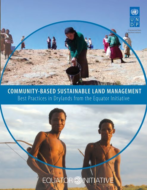
COMMUNITY-BASED SUSTAINABLE LAND MANAGEMENT<br />
Best Practices in Drylands from the Equator Initiative
Empowered lives.<br />
Resilient nations.<br />
COMMUNITY-BASED SUSTAINABLE LAND MANAGEMENT<br />
Best Practices in Drylands from the Equator Initiative
Editors<br />
Joseph Corcoran<br />
Greg Mock<br />
Contributing Writers to Equator Initiative Case Study Series<br />
Edayatu Abieodun Lamptey, Erin Atwell, Jonathan Clay, Joseph Corcoran, Sean Cox, Larissa Currado, David<br />
Godfrey, Sarah Gordon, Oliver Hughes, Wen-Juan Jiang, Sonal Kanabar, Dearbhla Keegan, Matthew Konsa,<br />
Rachael Lader, Erin Lewis, Jona Liebl, Mengning Ma, Mary McGraw, Brandon Payne, Juliana Quaresma, Peter<br />
Schecter, Martin Sommerschuh, Whitney Wilding<br />
Equator Initiative<br />
Environment and Energy Group<br />
Bureau for Development Policy<br />
United Nations Development Programme<br />
304 East 45th St. New York, NY 10017<br />
www.equatorinitiative.org<br />
Cite as:<br />
United Nations Development Programme. 2013. Community-Based Sustainable Land Management:<br />
Best Practices in Drylands from the Equator Initiative. New York, NY: UNDP.<br />
Cover photos:<br />
Top: Top: Land restoration in the High Atlas Mountains, Morocco. Photo: Association Amsing.<br />
Bottom: !Kung San game guards on patrol in Namibia: N≠a Jaqna Conservancy.<br />
Back page: Pack of Simien foxes at sunset, Ethiopia. Photo: Guassa-Menz Community Conservation Area.<br />
Published by:<br />
United Nations Development Programme, 304 East 45th Street New York, NY 10017<br />
September 2013<br />
© 2013 United Nations Development Programme<br />
All rights reserved<br />
Printed in the United States<br />
The Equator Initiative gratefully acknowledges the leadership of Eileen de Ravin, as well as the generous support<br />
of its partners.<br />
Empowered lives.<br />
Resilient nations.<br />
ii<br />
Community-Based Sustainable Land Management: Best Practices in Drylands from the Equator Initiative
TABLE OF CONTENTS<br />
Introduction....................................................................................................................................................................................................1<br />
Case Studies................................................................................................................................................................................................. 11<br />
Abrha Weatsbha Community, Ethiopia........................................................................................................................................ 11<br />
Association Amsing, Morocco......................................................................................................................................................... 21<br />
Chibememe Earth Healing Association, Zimbabwe................................................................................................................ 33<br />
Community Markets for Conservation, Zambia....................................................................................................................... 41<br />
Guassa-Menz Community Conservation Area, Ethiopia........................................................................................................ 53<br />
Il Ngwesi Group Ranch, Kenya........................................................................................................................................................ 61<br />
Itoh Community Graziers Common Initiative Group, Cameroon....................................................................................... 71<br />
Maasai Wilderness Conservation Trust, Kenya........................................................................................................................... 77<br />
Makuleke Ecotourism Project – Pafuri Camp, South Africa................................................................................................... 87<br />
N≠a Jaqna Conservancy, Namibia................................................................................................................................................. 95<br />
Pastoralist Integrated Support Programme, Kenya...............................................................................................................105<br />
Shinyanga Soil Conservation Programme (HASHI), Tanzania...........................................................................................115<br />
Shompole Community Trust, Kenya............................................................................................................................................127<br />
St. Catherine Medicinal Plants Association, Egypt.................................................................................................................135<br />
Suledo Forest Community, Tanzania..........................................................................................................................................145<br />
Swazi Indigenous Products, Swaziland......................................................................................................................................153<br />
Torra Conservancy, Namibia..........................................................................................................................................................163<br />
Ujamaa Community Resource Team, Tanzania.......................................................................................................................173<br />
Village Development Committee of Ando Kpomey, Togo..................................................................................................181<br />
Zenab for Women in Development, Sudan..............................................................................................................................189<br />
Community-Based Sustainable Land Management: Best Practices in Drylands from the Equator Initiative<br />
iii
Introduction<br />
INTRODUCTION<br />
Community-based action, initiated and carried out by local organizations, has an impressive record of<br />
successfully delivering development at the local level. Local actors are the chief stewards of the world’s<br />
ecosystems – including drylands – and they make the vast majority of daily environmental management<br />
decisions with their land use and investment choices. Over generations, they have used their traditional ecological<br />
knowledge to manage natural resources, conserve and maintain ecosystems, and adapt to environmental changes.<br />
Local civil society groups – employing community-based approaches – deliver a wide range of development benefits<br />
when empowered to manage their ecosystems and natural resources. These benefits extend well beyond poverty<br />
reduction and livelihood gains and encompass the social, economic, and environmental dividends that underpin<br />
sustainable development.<br />
Since 2002, the Equator Initiative partnership has been working to recognize and advance local and indigenous<br />
efforts that reduce poverty through the conservation and sustainable use of biodiversity. One of the primary ways<br />
this is accomplished is through the Equator Prize, awarded every two years to leading examples of local sustainable<br />
development solutions for people, nature and resilient communities. To date, the prestigious international<br />
prize has been awarded to 152 local and indigenous communities, many of which are active in sustainable land<br />
management in drylands ecosystems.<br />
This case study compendium brings together detailed case studies on twenty Equator Prize winners that<br />
have demonstrated outstanding achievement and success in sustainable land management. Each is from the<br />
African continent and each tells the story of community leadership in addressing those social, environmental<br />
and economic issues that are specific to drylands ecosystems. The intention of the compendium is to present<br />
and promote these community projects as best practices in sustainable land management, and to offer them as<br />
instructive examples of the environment and development dividends that are possible from empowering local<br />
and indigenous community management of dryland ecosystems and resources. The case material, lessons and<br />
guidance put forward in this compendium are offered as an input to the Eleventh Conference of the Parties to the<br />
UN Convention to Combat Desertification (UNCCD).<br />
1 Community-Based Sustainable Land Management: Best Practices in Drylands from the Equator Initiative
Introduction<br />
THE EQUATOR INITIATIVE: A PARTNERSHIP FOR RESILIENT COMMUNITIES<br />
The Equator Initiative brings together the United Nations, governments, civil society groups, businesses, and<br />
grassroots organizations to recognize and advance local sustainable development solutions for people, nature<br />
and resilient communities. The partnership arose from recognition that the greatest concentrations of both<br />
biodiversity and acute poverty coincide in equator belt countries, and the high potential for win-win outcomes<br />
where biological wealth could be effectively managed to create sustainable livelihoods for the world’s most<br />
vulnerable and economically marginalized populations. The high dependence of the rural poor on nature for their<br />
livelihoods means that biodiversity loss often exacerbates local poverty. But by the same token, action to sustain<br />
ecosystems and maintain or restore biodiversity can help stabilize and expand local resource-based economies<br />
and relieve poverty.<br />
The Equator Initiative aims to recognize the success of local and indigenous initiatives, create opportunities and<br />
platforms for the sharing of knowledge and good practice, inform policy to foster an enabling environment for<br />
local and indigenous community action, and develop the capacity of local and indigenous communities to scaleup<br />
their impact. The center of Equator Initiative programming is the Equator Prize, awarded biennially to recognize<br />
and advance local sustainable development solutions. As local and indigenous groups across the world chart a<br />
path towards sustainable development, the Equator Prize shines a spotlight on their efforts by honoring them on<br />
an international stage. The Equator Prize is unique for awarding group or community achievement, rather than<br />
that of individuals. Selection criteria include the following:<br />
• Impact: Initiatives that have improved community wellbeing and local livelihoods through sustainable natural<br />
resource management and/or environmental conservation of land based and/or marine resources.<br />
• Sustainability: Initiatives that can demonstrate enduring institutional, operational and financial sustainability<br />
over time.<br />
• Innovation and Transferability: Initiatives demonstrating new approaches that overcome prevailing constraints<br />
and offer knowledge, experience and lessons of potential relevance to other communities.<br />
• Leadership and Community Empowerment: Initiatives demonstrating leadership that has inspired action and<br />
change consistent with the vision of the Equator Initiative, including policy and/or institutional change, the<br />
empowerment of local people, and the community management of protected areas.<br />
• Empowerment of Women and Social Inclusion: Initiatives that promote the equality and empowerment of<br />
women and/or marginalized groups.<br />
• Resilience, Adaptability and Self-Sufficiency: Initiatives demonstrating adaptability to environmental,<br />
social and economic change, resilience in the face of external pressures, and improved capacity for local<br />
self-sufficiency.<br />
Community-Based Sustainable Land Management: Best Practices in Drylands from the Equator Initiative<br />
2
Introduction<br />
UNDP AND LOCAL CAPACITY<br />
Over the past two decades, UNDP has engaged with thousands of communities worldwide to support local<br />
development in a variety of ways, from development of pro-poor infrastructure, to expanding local government<br />
capacity, to helping communities prepare for and recover from natural disasters. A substantial portion of UNDP’s<br />
local work has involved supporting rural communities in their efforts to sustainably manage local ecosystems in<br />
a way that increases local incomes, empowers local residents, and maintains and enhances the environmental<br />
services these ecosystems render.<br />
Through this work, UNDP has accumulated a significant body of experience in local approaches to sustainable<br />
development. This emphasis on community-based action is seen as an essential counterpoint and complement to<br />
UNDP’s work at the national and international levels to mainstream environment, energy, and poverty concerns<br />
into national planning and development processes. The UNDP-implemented GEF-Small Grants Programme (SGP),<br />
the Equator Initiative, the Energy Access Programme, and the Community Water Initiative have together facilitated<br />
thousands of local interventions and provided working examples of how to effectively localize the MDGs.<br />
UNDP work at the local level is guided by four Strategic Priorities: promote rights, access, and finance mechanisms;<br />
enhance environmental management and finance capacity; facilitate learning and knowledge-sharing, and<br />
strengthen community voices in policy processes. These are all strongly correlated and interdependent, where<br />
positive outcomes in one area result in positive outcomes in the others.<br />
UNDP AND SUSTAINABLE LAND MANAGEMENT<br />
UNDP is also committed to addressing sustainable development challenges in drylands ecosystems. Many people<br />
living in drylands depend directly upon a highly variable natural resource base for their livelihoods, and about half of all<br />
dryland inhabitants - one billion people - are poor and marginalized. This accounts for close to half of the world’s poor.<br />
The Drylands Development Centre (DDC) is a thematic centre of UNDP dedicated to fighting poverty and achieving<br />
sustainable development in the drier regions of the world. UNDP-DDC works through an Integrated Drylands<br />
Development Programme to achieve three interlinked goals:<br />
1. Mainstream drylands issues, including climate change adaptation and mitigation, into national policies,<br />
planning and development frameworks, and contribute to the effective implementation of the United Nations<br />
Convention to Combat Desertification.<br />
2. Reduce the vulnerability of drylands communities to environmental, economic and socio-cultural challenges<br />
such as climate risks, drought, land degradation, poor markets, and migration, and build their capacity to<br />
adapt to climate change.<br />
3. Help drylands communities to improve local governance, management and utilization of natural resources.<br />
To achieve these goals, the centre concentrates its work on several priority topics. These include making rural<br />
markets in drylands work for the poor, managing drought risks, increasing land tenure security, and promoting the<br />
decentralized governance of natural resources.<br />
3 Community-Based Sustainable Land Management: Best Practices in Drylands from the Equator Initiative
Introduction<br />
IDENTIFYING BEST PRACTICE IN COMMUNITY-BASED SUSTAINABLE LAND<br />
MANAGEMENT IN SUB-SAHARAN AFRICA<br />
Land degradation is a serious problem in Sub-Saharan Africa, where up to two-thirds of the productive land area<br />
may be affected. Over 3% of agricultural gross domestic product (GDP) is lost annually as a direct result of soil and<br />
nutrient loss from poor land management practices, with associated economic costs estimated at US$9 billion per<br />
year. Communities suffer acutely from the resulting food and energy insecurity and foregone investments in social<br />
services and infrastructure.<br />
The drivers of unsustainable land management practices are complex, and practical policy responses require the<br />
active engagement of local communities and civil society organizations. Unfortunately, previous interventions to<br />
halt land degradation have tended to suffer from top-down planning processes, where land users are not actively<br />
involved in identifying problems and finding solutions. Many interventions have been sector-based, such as<br />
high-input approaches to increase agricultural production. These have met with limited success in addressing<br />
what is a multi-dimensional problem, and have typically minimized community participation.<br />
However, in recent years, the essential role of local and indigenous communities in sustainable land management has come<br />
to greater prominence. For example, the UN Convention to Combat Desertification explicitly recognizes the important<br />
role of community participation in sustainable land management and the fight against desertification. There is consensus<br />
now that local civil society groups and community-based organizations can provide a vehicle for local level experiences<br />
to contribute to an improved understanding of sustainable land management and to inform land management policies.<br />
What is required now is an effort to: i) identify and raise the profile of leading community-based sustainable land<br />
management solutions in Sub-Saharan Africa, ii) fill local capacity gaps, and iii) strengthen the voices of local and<br />
indigenous communities in a way that ensures that local civil society organizations contribute to the development<br />
of pro-poor, sustainable land management policies.<br />
In furtherance of this, the Equator Initiative partnership will lead a process to identify examples of local ingenuity,<br />
innovation and leadership in sustainable land management in Sub-Saharan Africa. Building on the experience of<br />
the Equator Prize, and working through its network of global partners, the Equator Initiative will recognize and<br />
raise the profile of community efforts to reduce poverty through sustainable land management. Themes of the<br />
prize are likely to include:<br />
• the integrated management of international river, lake and hydrogeological basins;<br />
• agroforestry and soil conservation;<br />
• rangelands use and fodder crops;<br />
• ecological monitoring, natural resource mapping, remote sensing, and early warning systems;<br />
• new and renewable energy sources and technologies;<br />
• sustainable agricultural farming systems.<br />
The process of selecting winners will be used to collect information to better understand how the interaction between<br />
policies, political processes and poverty reduction influences innovation and successful initiatives at the local level.<br />
Community-Based Sustainable Land Management: Best Practices in Drylands from the Equator Initiative<br />
4
Introduction<br />
OBSERVATIONS FROM EQUATOR PRIZE DRYLANDS CASES<br />
The case studies that follow—drawn from the pool of 152 Equator Prize winners since 2002—are offered as examples of<br />
the kind of ingenuity and grassroots leadership that can transform rural development in dryland environments. Each case<br />
study is an example of community-based leadership in sustainable land management, each is from the African continent,<br />
and each tells the story of community innovation in addressing those social, environmental, and economic issues that are<br />
specific to dryland ecosystems. Readers may find it useful to consider the following observations and conclusions drawn<br />
from a review of this case material.<br />
1. Community-based approaches can be highly effective. Community-based approaches to drylands management<br />
are often at the cutting edge of efforts to promote adaptation to climate change, mitigate the risks of prolonged<br />
drought and destructive floods, address persistent land degradation trends, manage fresh water, and create viable<br />
economies in drylands communities.<br />
Community-based approaches are an organic expression of the power of decentralized natural resource governance. They<br />
have much to offer as a model for drylands management that can be sustained in the face of climate change and other<br />
environmental challenges. Because they grow out of community demand and rely on community investments of time<br />
and effort, they are often low-cost interventions that are well integrated into community social structures, and therefore<br />
can be sustained over time.<br />
For example, since it began its integrated program of sustainable land management in 2004, the village of Abrha Weatsbha<br />
in northern Ethiopia has moved from a community facing imminent resettlement due to soil degradation and lack of<br />
water access to a leading example of drylands restoration and climate change adaptation. Through a comprehensive<br />
program of tree-planting, terracing, construction of check dams, wells and water catchment ponds, and the extension<br />
of irrigation systems, village residents have recharged local aquifers, checked soil loss, and greatly increased water access<br />
and agricultural incomes. Villagers drive the design and implementation of all land management projects, including the<br />
enforcement of by-laws governing the fair distribution of potable water within the recovering watershed.<br />
It is worth noting that the social benefits of community-based approaches to drylands management figure prominently<br />
in their success, making these local initiatives much more than just an environmental remedy; indeed, they are a model<br />
for delivering the complete package of Millennium Development Goals and catalyzing sustainable development in rural<br />
dryland communities.<br />
The Maasai Wilderness Conservation Trust in Kenya’s Chyuli Hills region, for example, uses revenue from a successful<br />
ecotourism lodge to fund an array of conservation, education and healthcare programs that serve the Maasai of the Kuku<br />
Group Ranch. In addition to supporting a conservation department employing more than 100 local Maasai in various<br />
wildlife management programs, the Trust also supports 20 primary schools and a secondary school serving 7,000 students,<br />
as well as a system of local health dispensaries serving around 8,000 people.<br />
Community-based initiatives are also often best positioned to arbitrate and navigate the kinds of conflicts that emerge<br />
in dryland ecosystems, whether because of resource scarcity or the different needs and land management practices of<br />
pastoralist and farming communities. Indeed, many drylands ecosystems are plagued by resource conflicts between<br />
adjacent communities or tribal groups or among different resource users within a single community. Communal resource<br />
management initiatives offer a productive forum for grappling with and defusing or resolving such conflicts.<br />
For example, on the arid rangelands of the Marsabit area of northern Kenya, a number of different ethnic groups practice<br />
mobile pastoralism, sometimes vying for access to critical water sources. Pastoralist Integrated Support Programme<br />
(PISP), a local NGO, works to increase the number of water points that can provide safe and reliable water for livestock<br />
and people. Additional work to improve grazing management and to diversify the income stream of pastoralists has also<br />
helped to reduce pressure on natural resources and thereby lessen tensions between resource user groups. PISP’s success<br />
5 Community-Based Sustainable Land Management: Best Practices in Drylands from the Equator Initiative
Introduction<br />
in encouraging conflict resolution has opened up previously disputed areas for grazing, thus increasing the available<br />
resource base and further reducing social friction.<br />
2. Drylands problems often require collective action. Addressing large-scale problems like land degradation<br />
and water scarcity requires action at a watershed and landscape level. Such an ecosystem-level approach, in<br />
turn, requires collective action—the cooperation of many individual stakeholders to achieve a common goal.<br />
Community-led approaches are particularly suited to engendering collective action, and therefore facilitating ecosystembased<br />
interventions. The ability to pursue a common goal with a clear view of the costs and benefits, and the determination<br />
to take the action required, is one of the distinguishing characteristics of Equator Prize-winning communities.<br />
For example, facing degradation of their communal grazing area as well as conflicts between pastoralists and<br />
farmers within the community, residents of the village of Itoh in Cameroon’s Bamenda Highlands came together to<br />
adopt a new approach to grazing in the community. Community members established a “living fence” around the<br />
communal grazing area to restrict livestock movement, improved the diet of livestock by planting high-nutrition<br />
grasses, instituted a rotational grazing system to allow pasture recovery, installed a permanent water source<br />
for livestock, and planted 30,000 trees in and around the grazing area to increase vegetative cover in the water<br />
catchment area. The collective endeavor resulted in greater access to livestock forage and much reduced incursions<br />
of livestock on community agricultural lands, and therefore reduced resource conflicts within the community.<br />
3. Local institutions are key agents in community-based solutions. Local organizations—groups whose<br />
activities are directed and carried out by members who live in the affected community—are key to inspiring<br />
effective collective action, and therefore central to community-led efforts to manage drylands sustainably.<br />
Supporting the success of these local efforts requires recognizing the legitimacy of community organizations,<br />
understanding their lead role in community-based initiatives, and supporting their growth and maturation.<br />
Local groups such as farmer cooperatives, resource user groups, self-help groups, local NGOs, or other CBOs, are<br />
well-positioned to appreciate both the causes and consequences of environmental degradation and to understand<br />
local threats such as the poaching of land, timber, or wildlife resources, or unsustainable agricultural practices.<br />
Because they reflect community knowledge, values, and perspectives, these groups can interpret community<br />
demand for change and channel it into effective local action. They are in a position to enable and encourage<br />
participatory processes that fit the culture and communication style of the community. And they can often exact<br />
compliance with rules adopted by the community to regulate ecosystem use and restore ecosystem health.<br />
Community-Based Sustainable Land Management: Best Practices in Drylands from the Equator Initiative<br />
6
Introduction<br />
The community forest surrounding the village of Ando Kpomey in southwestern Togo, for example, was originally<br />
planted in 1973 as a buffer against bush fires, a proposal put forward by village elders. Since then, the community<br />
has established a forest management committee whose members are elected from the community and charged with<br />
regulating all forest uses and enforcing forest rules. More recently, the committee, which has grown into a respected<br />
local institution, has expanded its activities to include promotion of alternative livelihoods activities that aim to raise<br />
local incomes and reduce pressure on the forest.<br />
Local groups often draw heavily from traditional institutions, but may reflect the purposes, values, political<br />
organization, and governance of more modern social assemblages as well. This can give them both local legitimacy<br />
and the currency to meet modern threats.<br />
In Sudan’s Gedaref State, the NGO Zenab for Women in Devel opment, for example, has targeted women farmers—a<br />
previously neglected group—with agricultural extension services, seeds, farm equipment, and training to make their<br />
farming practices more sustainable in the arid environment, and to increase and diversify their income streams. The<br />
NGO also catalyzed the creation of a women’s farmers union to empower and organize women in agriculture.<br />
4. Community-based initiatives can be commercially successful. Community-based initiatives can be effective<br />
drivers of the local economy, bringing jobs and other economic benefits to impoverished dryland communities with<br />
few economic options. As such, they can become primary agents in the creation of an inclusive local green economy.<br />
Equator Prize winners have shown that it is possible to put together viable commercial models for sustainable<br />
ecosystem-based enterprises through a combination of innovation, local knowledge, and good partnerships.<br />
As one example, using a program of farm training and economic incentives, Comaco (Community Markets for Conservation)<br />
has brought organic farming techniques to some 40,000 farming households in Zambia’s Luangwa Valley, and connected<br />
them to a distribution network for the organic products they raise. Comaco purchases farm commodities raised to its<br />
organic standards, processes them, and markets them in urban supermarkets, guaranteeing its farmer members a good<br />
return on their efforts. As another example, Swazi Indigenous Products is a member-owned company in Lubombo,<br />
Swaziland that pays its members to produce seed oils which are then used as ingredients in skin care products. The Swazi<br />
Secrets line of skin care products is now marketed in 31 countries across five continents.<br />
These initiatives also frequently contribute community infrastructure such as improvements to water systems and<br />
sanitation, schools, and health clinics—all public goods that support local economic and social development.<br />
5. Large-scale extractive industries and land grabs threaten community-based initiatives. Resource<br />
management decisions such as the granting of timber or mining concessions, or even the creation of parks or<br />
forest reserves by central authorities, often work at cross purposes to the interests of community initiatives for<br />
better drylands management.<br />
The threat of losing control over local ecosystem resources can create considerable economic and environmental<br />
stresses in nearby communities and undermine the incentive to manage these resources sustainably. Security<br />
of land and resource tenure, then, is an essential dimension of investing in community-based leadership and<br />
innovation. The certainty that comes from tenure security is the basis of good governance of local resources.<br />
For example, when the government unilaterally designated the Soledo Forest in northern Tanzania as a Central<br />
Government Forest Reserve in 1993 without local consultation, it disenfranchised more than 50,000 forestdependent<br />
peoples in the 9 villages adjacent to the forest, and provoked an organized and effective resistance<br />
to the new arrangement. In response, a process of gradual devolution of forest management authority to local<br />
7 Community-Based Sustainable Land Management: Best Practices in Drylands from the Equator Initiative
Introduction<br />
communities began, ultimately resulting in the redesignation of Soledo as a Village Land Forest Reserve in 2007,<br />
with the responsibility for designing and enforcing sustainable forest management plans in the hands of local<br />
Village Environment Committees.<br />
6. Local initiatives are scalable and influential. Many community-based initiatives have achieved significant<br />
scale, becoming models with relevance well beyond the villages where they originated. One of the most organic<br />
and effective methods of scaling is peer-to-peer demonstration, where community groups themselves act as<br />
mentors and learning resources for other communities facing a similar array of drylands management concerns.<br />
When properly empowered and enabled, local initiatives can lead to the kind of scaling that creates landscapelevel<br />
change and transforms economies. Many community-based initiatives successfully scale-up to become the<br />
predominant governing bodies for entire ecosystems, wildlife corridors, and agricultural landscapes. This scaling<br />
phenomenon refutes the common but mistaken view that local solutions invariably remain small in scope and<br />
impact. They are often the foundation on which national progress towards development goals is built. When<br />
scaled effectively, landscape-level changes become possible, and improvements in watershed conditions and<br />
ecosystem productivity can be pursued at larger scales, with increasing benefit.<br />
Torra and N≠a Jaqna Conservancies, for example, are two of Namibia’s 50 community conservancies—communal<br />
lands where wildlife management authority has been devolved to local communities—now in existence in the<br />
nation’s arid northern and eastern regions. The number of community conservancies scaled up rapidly from 4 in<br />
1998 to 50 today as word spread of the economic and social benefits associated with conservancy status. Due<br />
to this rapid growth, conservancies now cover some 14% of Namibia’s land area, allowing wildlife populations<br />
to rebound over large areas, helping to preserve or restore large-scale migration patterns, and creating new<br />
economic opportunities through ecotourism to supplement meager incomes from dryland agriculture.<br />
As another example, from 1986 to 2004, the Shinyanga Soil Conservation Programme helped restore degraded<br />
woodlands in the Shinyanga region of northern Tanzania, in part by reviving an indigenous land management<br />
practice in which forest vegetation was preserved by communities in enclosures called “ngitili” for use as livestock<br />
fodder during the dry season. While only 600 ha of documented ngitili remained at the Programme’s inception,<br />
some 350,000 ha had been restored or created in over 800 villages by the Programme’s end in 2004, turning scrub<br />
wastelands into recovering woodlands.<br />
Community-Based Sustainable Land Management: Best Practices in Drylands from the Equator Initiative<br />
8
Introduction<br />
Many successful local initiatives have also achieved significant influence at the policymaking level, helping to drive<br />
adoption of enabling policies that allow communities to become more active agents in rural development.<br />
Successful collective management of community grasslands in the Guassa area of Menz in Ethiopia’s central<br />
highlands, for example, led the government to designate the area as a Community Conserved Area in 2008—a<br />
category of protection previously unavailable to Ethiopian communities, but now legally recognized due to the<br />
Guassa experience.<br />
7. Partnerships are essential. While community groups must drive local action, they cannot act alone. Effective<br />
partnerships are essential to build local capacities, supply appropriate technologies and practices, help<br />
connect local supply-chains to national and international markets, and to help communities tap the funding<br />
and support they need to pursue their initiatives.<br />
A variety of partners with different capabilities are often needed, and Equator Prize-winning communities in<br />
drylands typically work with a range of institutions including NGOs, private companies, universities and research<br />
institutes, and government agencies. Successful partners respect the lead role and autonomy of local groups,<br />
while providing unique inputs, services, contacts, learning experiences, and grants tailored to the needs of the<br />
local group.<br />
The Shompole Community Trust, for example, which operates successful ecotourism lodges in southern Kenya<br />
to generate funds for conservation, health, and educational services, has a complement of seven partners. For<br />
example, the African Conservation Centre has helped to monitor wildlife numbers and train Trust employees in field<br />
research techniques, while the Kenya Wildlife Service has trained community game scouts. Meanwhile, two private<br />
sector partners manage the marketing and operation of the Trust’s ecotourism ventures. Grants from the European<br />
Union Community Trust Fund helped finance construction and progressive improvement of the Trust’s ecotourism<br />
infrastructure. These on-going partnerships have helped make the Trust’s ecotourism operations a profit center able<br />
to fund the Trust’s work.<br />
Governments are essential partners too, although the relationship between local groups and government requires<br />
careful tending if the focus of decision-making is to remain with the community. Many Equator Prize-winning<br />
communities have forged productive partnerships with governments by demonstrating their competency as land<br />
stewards and their ability to achieve local development goals.<br />
For example, the St. Catherine Medical Plants Association in the southern Sinai of Egypt was conceived and<br />
nurtured by Egypt’s Environmental Affairs Agency as a way to support local livelihoods, particularly among the<br />
area’s Bedouin women. Government personnel have been instrumental in helping the community to establish<br />
protocols for medicinal plant collection and to establish markets for both medicinal plants and alternative products<br />
such as honey and handicrafts. The governor of South Sinai also provides a building to house the association and<br />
its activities. In spite of this close and continuing relationship with government, all components of the initiative<br />
are owned by the community, and community members govern the association and its activities through its Board<br />
of Directors. The autonomy of the association is further enhanced by the fact that it relies on its own incomegenerating<br />
activities to fund its work.<br />
9 Community-Based Sustainable Land Management: Best Practices in Drylands from the Equator Initiative
CASE STUDIES<br />
Community-Based Sustainable Land Management: Best Practices in Drylands from the Equator Initiative<br />
10
ABRHA WEATSBHA<br />
COMMUNITY<br />
Ethiopia<br />
PROJECT SUMMARY<br />
English l Amharic l Tigrinya<br />
Once on the brink of resettlement due to desertification, soil degradation and lack<br />
of water, the Abrha Weatsbha community in northern Ethiopia has reclaimed its land<br />
through the reforestation and sustainable management of over 224,000 hectares of<br />
forest. Tree planting activities have resulted in improved soil quality, higher crop yields,<br />
increased biomass production and groundwater functioning, and flood prevention. The<br />
organization has constructed small dams, created water catchment ponds, and built<br />
trenches and bunds to restore groundwater functioning. More than 180 wells have<br />
been built to provide access to potable water.<br />
Environmental recovery and rejuvenation have led to improvements in local livelihoods<br />
through crop irrigation, fruit tree propagation and expansion into supplementary<br />
activities like apiculture. Local incomes have increased and food security and nutrition<br />
have improved through the integration of high-value fruit trees into farms.
Background and Context<br />
The Tigray region of Ethiopia is located in the northernmost territory of<br />
the country and borders Eritrea in the north, Sudan in the west, Afar in<br />
the east and Amhara in the southwest. The region is characterized by<br />
drylands and is highly vulnerable to recurrent drought. In the region,<br />
as well as across the country, land degradation is one of the most<br />
serious challenges confronting the rural population; it is exacerbated<br />
by climate change, and brings with it cross-cutting socioeconomic<br />
and environmental issues. In rural areas, where local economies and<br />
livelihoods depend on soil productivity for agriculture – teff, sorghum,<br />
wheat and maize, but also include sesame, horse bean, lentil, cotton<br />
and various spices – the implications for food security are particularly<br />
severe.<br />
magnified the vulnerability of the resident communities to climate<br />
impacts. In large sections, land had become barren, with bare rock<br />
predominating on the slopes surrounding the village. The impacts<br />
on local livelihoods and food security were devastating. By the early<br />
2000s, conditions had become so dire that the community faced<br />
resettlement.<br />
Micro-catchment ecosystem management<br />
Meanwhile, in 1996, the Ministry of Agroculture and Rural Development<br />
in Ethiopia undertook a process of decentralization, working more closely<br />
Drought, deforestation and land degradation<br />
The topography of Tigray makes it acutely vulnerable to the negative<br />
impacts of climate change and climate variability. Increasingly in<br />
recent years, northern Ethiopia has experienced serious droughts<br />
and inconsistent rainfall patterns, including rain coming much later<br />
in the season and insufficient rainfall during what has historically<br />
been the wet season. This variability, and the impacts it has had on<br />
landscape level agricultural production and local livelihoods, has<br />
been further exacerbated by deforestation. The northern regions<br />
of Ethiopia are among the most deforested in the country. Without<br />
the protection of the forest and vegetation cover, hillside soils<br />
become easily degraded. Additional drivers of land degradation<br />
have included unsustainable agricultural practices like free-range<br />
grazing, which prevents the growth of natural vegetation and allows<br />
the exposed layer of productive topsoil to be washed away during<br />
heavy rains.<br />
The village of Abrha Weatsbha, located in Tigray, is situated in a<br />
sandstone area that was particularly vulnerable to soil erosion<br />
and desertification. Land degradation had severely impacted the<br />
productivity of the village and surrounding agricultural lands.<br />
Poor, short-sighted land and water management approaches<br />
12
with community-based and grassroots initiatives to implement locally<br />
managed solutions to land, natural resource and water issues. Among<br />
the approaches promoted was a community-based ‘micro-catchment<br />
ecosystem management’ model. The strategy aimed to empower local<br />
communities to reach consensus on actions needed to stop free-range<br />
livestock grazing and mapping the options open to them, including:<br />
cutting and carrying grass to feed livestock, terracing hillsides to<br />
prevent erosion, damming gullies, and ensuring that any transgressors<br />
of established community by-laws were penalized. The approach has<br />
had its fair share of success: soil and water conservation activities have<br />
been carried out on more than 956,000 hectares of land throughout the<br />
country; vegetation enclosure management is being implemented on<br />
more than 1.2 million hectares of land; and there are more than 224,000<br />
hectares of land under sustainable forest management. The microcatchment<br />
ecosystem management model has resulted in the planting<br />
of over 40 million tree seedlings (with a 56 per cent survival rate) and the<br />
building of 180 wells that provide needed access to potable water.<br />
Though Abrha Weatsbha was not one of the four communities selected<br />
for the piloting of the ‘micro-catchment ecosystem management’<br />
model, Abrha Weatsbha Natural Resource Management Initiative was<br />
founded in this context and based its approach on lessons learned<br />
from the successes and obstacles faced in carrying out this strategy.<br />
One important transplant from the ‘micro-catchment ecosystem<br />
management’ model was enlisting the guidance and support of the<br />
Ministry of Agriculture’s extension system – one of the largest and most<br />
robust of its kind in the world, with development agents working in<br />
farmer training centres across all regions of the country. Most of these<br />
extension agents focus on knowledge management and technical<br />
capacity building for smallholder farmers and pastoralists with a view<br />
to improving the overall sustainability and productivity of small farms.<br />
Community-based adaptation to climate change<br />
In 2004, the Abrha Weatsbha Natural Resource Management<br />
Initiative was formed to address the challenges of food insecurity,<br />
land degradation, and access to fresh water. It has since emerged<br />
as a leading example of community-based adaptation to climate<br />
change. The initiative began with a community assessment of<br />
existing constraints to local health and wellbeing, with special<br />
consideration for challenges arising due to climate change and<br />
environmental decline. Despite the presence of a local aquifer, one<br />
of the top priorities identified was fresh water access.<br />
Through this grassroots enterprise, the community has initiated a<br />
range of actions to address land degradation and lack of water access,<br />
both of which have plagued local residents and threatened local<br />
livelihoods and wellbeing. Some of the most effective interventions<br />
have included a comprehensive tree-planting campaign; the<br />
construction of dams, wells and water catchments ponds, which<br />
allow the community to exercise more control and secure greater<br />
certainty over the availability of fresh water; and the establishment<br />
of temporary closed areas on communal land, where grazing is<br />
prohibited to allow for the natural regeneration of indigenous<br />
vegetation.<br />
Landscape level change<br />
The result has been nothing short of landscape level change; that<br />
is, the wholesale transformation of lands surrounding the village<br />
and rejuvenation of the catchment area. Vegetation cover has<br />
quickly returned, soil erosion has been greatly reduced, rain water<br />
infiltration into the subsoil has increased (which, by extension,<br />
improved agricultural productivity), and springs and streams have<br />
been fortified. The community is using hand-dug, shallow water<br />
wells to start small-scale irrigation schemes. Livestock management<br />
and domestic animal production has improved, with animal dung<br />
used for compost and improving soil fertility. With environmental<br />
recovery and the rejuvenation of local ecosystems has come<br />
improved livelihoods, diversified incomes and strengthened food<br />
security. To date, more than 1,000 farmers have been engaged in<br />
these new agronomic practices and diversified income generation<br />
activities, with thousands more benefiting from ecosystem<br />
restoration and improvements to local infrastructure.<br />
The village has become widely known for its pioneering work on<br />
‘community-based participatory planning’, which prioritizes the<br />
active involvement of the local population in each step of project<br />
design, development and implementation. Responsiveness to<br />
local needs, and the ability to draw from local resources, are stated<br />
strengths of the Abrha Weatsbha Natural Resource Management<br />
Initiative and key factors underpinning its success to date. A<br />
community-based management system ensures the buy-in of<br />
the local community, while specific mechanisms have also been<br />
put in place to ensure the inclusion of women in all aspects of<br />
community planning, project implementation and monitoring. Bylaws<br />
governing the fair distribution of potable water are enforced<br />
by a village committee, which also serves as a dispute resolution<br />
mechanism and actively monitors water use.<br />
13
Key Activities and Innovations<br />
The community of Abrha Weatsbha carries out a number of<br />
overlapping and complementary activities in the areas of communitybased<br />
adaptation, food security, eco-agriculture, sustainable forest<br />
management, sustainable land management, and water resource<br />
management.<br />
Improved water management<br />
Northern Ethiopia typically experiences unreliable rainfall. These<br />
patterns have only intensified with climate change, resulting in<br />
prolonged droughts, late rains, shorter rainy seasons, and extended<br />
dry spells during the growing season. This poses acute challenges<br />
for a population that is dependent on agriculture for subsistence,<br />
food security and livelihoods. Abrha Weatsbha has responded with<br />
interventions to improve the water-holding capacity of the soil by<br />
recharging groundwater and digging shallow wells to provide for<br />
supplementary irrigation.<br />
Changing local agricultural practices<br />
Abrha Weatsbha Natural Resource Management Initiative also<br />
engages local farmers to improve environmental sustainability, crop<br />
yields and agricultural productivity. This has been an exercise in<br />
behaviour change, as some traditional agricultural practices – many<br />
in use due to the need for quick, low-cost returns – have produced<br />
negative impacts on the local environment. The group promotes<br />
Improvements to the integrity and content of soil have led to<br />
subsequent improvements in water-holding capacity. Tree planting,<br />
ecosystem restoration activities, and the use of manure for compost<br />
and organic fertilizers have not only improved the integrity of the soil<br />
and land, but improved water security by facilitating groundwater<br />
recharge, or what community members refer to as “the water bank in<br />
the soil”. This reserve of water has increased community resilience to<br />
droughts. Improvements in soil quality have translated to increased<br />
absorption of water into the soil, which has also reduced incidence<br />
of flooding.<br />
The community also constructs small dams, creates water catchment<br />
ponds, and builds trenches and bunds to restore groundwater<br />
functioning. This has resulted in greater flexibility with irrigation,<br />
making year-round agricultural production possible and allowing<br />
local farmers to grow fruits and vegetables that were previously<br />
untenable during the dry season.<br />
14
the selection of crop and livestock varieties that are well matched to<br />
the carrying capacity of the land. Grazing restrictions have also been<br />
enforced to allow for the regeneration of indigenous vegetation.<br />
Additionally, the group works with private land owners to encourage<br />
agroforestry practices, which provide the community with wood<br />
and non-timber forest products and also fill important environment<br />
functions like climate control and nitrogen fixing, nutrient cycling, soil<br />
enrichment, and water percolation. At the same time, shallow wells<br />
have been dug to allow for both standard and drip irrigation, which<br />
make it possible to grow fruit and vegetables during the dry season.<br />
Tree planting and agroforestry<br />
The Abrha Weatsbha community is working to reverse the legacy of<br />
deforestation in the region. Tree-planting efforts on communal lands<br />
have been undertaken with the long-term goal of re-establishing<br />
standing forests and improving soil quality and integrity. On a<br />
shorter term basis, the community has focused on temporary<br />
closures of communal areas where the land needs time to recover<br />
and rehabilitate, soil and water conservation interventions, and<br />
community woodlots. The communal lands are dominated primarily<br />
by pioneer indigenous species, which have low production function,<br />
but high environmental rehabilitation and stabilization functions.<br />
Thus, the group has also promoted the use of farm fields and<br />
backyards for agroforestry and the planting of fruit-bearing trees,<br />
which have positive environmental and economic benefits for<br />
participating farmers.<br />
Education, local problem-solving and innovation<br />
In addition to its land restoration and conservation activities, Abrha<br />
Weatsbha has dedicated energy and resources to community<br />
education and training for the local population. The local authority<br />
in the village works to promote a multi-dimensional extension<br />
programme that is responsive to the production needs of residents<br />
in particular regions, and has made significant strides in reaching<br />
populations of economically marginalized women to offer support<br />
and skills-training in livestock production, forestry, soil conservation,<br />
agriculture and horticulture.<br />
This commitment to education and training has had positive<br />
spillover effects for the community by providing a sense of shared<br />
determination, collective problem-solving and local self-reliance.<br />
As a result, a local culture and ethos of innovation has blossomed.<br />
By encouraging learning by doing, building trust between local<br />
authorities and farmers, facilitating calculated risk-taking, and<br />
investing in interventions that respond to locally identified needs,<br />
Abrha Weatsbha Natural Resource Management Initiative has built a<br />
foundation of social capital that can be drawn from in tackling other<br />
challenges to the village and equitably managing complex social<br />
issues such as land allocation, resource sharing in grazing lands and<br />
protected forests, expansion of irrigation channels to remote subdistricts,<br />
and dealing with internal conflicts and benefit-sharing.<br />
15
Impacts<br />
BIODIVERSITY IMPACTS<br />
Abrha Weatsbha’s Natural Resource Management Initiative has had a<br />
number of positive biodiversity impacts in the land surrounding the<br />
village and in the region more broadly. Environmental rehabilitation<br />
efforts – the construction of dams, trenches and bunds, and chains of<br />
ponds for “water banking” – have had the desired effect of recharging<br />
the ground water and improving the integrity and composition of the<br />
soil, two challenges which had long been plaguing the community<br />
and crippling the health of local ecosystems.<br />
Recharging groundwater<br />
Rehabilitation efforts, along with a wide-ranging tree planting<br />
campaign, have resulted in more than 50 per cent of rainwater being<br />
trapped to recharge groundwater stores. Wells have been dug for<br />
irrigation of high-value crops, which are now able to be harvested<br />
two to three times per year, irrespective of rainfall patterns. The<br />
creation of enclosure areas and water conservation measures have<br />
resulted in water tables rising from nine meters depth to between<br />
two and four meters, making the digging of wells a reasonably lowlabour<br />
and low-cost proposition. Natural springs that had dried<br />
up have started to flow again, streams now flow longer distances,<br />
and pastured lowlands remain green throughout the year. The<br />
environmental benefits of soil conservation, water infiltration<br />
and groundwater recharge have translated to socioeconomic<br />
benefits that include higher crop yields, improvements in biomass<br />
production, and reduced incidence of flooding.<br />
example, where farmers used to purposefully remove Faidherbia<br />
albida trees – a thorny species of tree with deep-penetrating tap<br />
roots that make it highly resistant to drought – it has become<br />
common practice to sow their seeds and germinate them in their<br />
fields. Another example of positive behavior change among local<br />
farmers has been the voluntary introduction of seasonal land<br />
closures, where human and livestock incursions are restricted to<br />
allow land in certain areas to recover.<br />
A sustainable land management approach<br />
One of the main areas of focus for the initiative has been tree planting,<br />
efforts which have targeted hillside areas and degraded lands in and<br />
around the village. These investments in tree planting have paid<br />
large environment dividends. Reforestation has translated to the<br />
conservation of topsoil, greater cycling of organic material to the<br />
soil, watershed protection and reduced erosion of hillsides, which<br />
A “quiet revolution”<br />
Abrha Weatsbha Natural Resource Management Initiative has<br />
successfully ushered in a local paradigm shift – what the group<br />
has dubbed a “quiet revolution” – in how local farmers understand,<br />
appreciate and manage the environment. One aspect of this<br />
appreciation has been around indigenous species of plants. For<br />
16
was leaving large tracks of potentially productive land barren. Tree<br />
root systems have served to strengthen soil integrity and cohesion,<br />
reducing the erosion of slopes.<br />
The sustainable land management approach promoted by the<br />
group has served as a mechanism for doing away with local<br />
agricultural practices that were either not sustainable over the long<br />
term or, worse, were eroding the integrity of local ecosystems and<br />
damaging the environment. A focus on the interconnectedness of<br />
groundwater recharge, soil quality, and tree cover has provided a<br />
lens and rallying point through which the community has been able<br />
to address environmental challenges at the systemic level. The end<br />
result has been greater environmental sustainability and improved<br />
land productivity.<br />
SOCIOECONOMIC IMPACTS<br />
The initiative has had a profound impact on the livelihoods of Abrha<br />
Weatsbha community members, improving food security to such<br />
an extent that an area once plagued by low crop yields and food<br />
shortages in the dry season now produces a food surplus. Similar<br />
improvements have come about in the availability of potable water,<br />
once a serious concern which threatened local health and wellbeing<br />
as well as the irrigation options for off-season agriculture. The<br />
availability of water has combined with improvements in soil quality<br />
to boost agricultural outputs and the diversity of crops that can be<br />
grown throughout the year. Farmers have also been supported to<br />
better select and maintain livestock in their respective landscapes,<br />
which has not only improved the productivity of livestock, but<br />
reduced overgrazing and resulting land degradation.<br />
Access to water, irrigation and food security<br />
By focusing on recharging the groundwater and local aquifer,<br />
Abrha Weatsbha Natural Resource Management Initiative has made<br />
possible the use of shallow wells. Prior to the group’s interventions,<br />
the water table was too low for communities to access it. Now, with a<br />
minimal amount of technological input, the village has been able to<br />
dig more than 180 wells using treadle pumps to access potable water.<br />
Treadle pumps are now also used by the local population to access<br />
water from ponds, springs and the nearby river, all strengthening<br />
local water security.<br />
Access to water has made irrigation during the dry season and<br />
supplementary irrigation during the rainy season possible, creating<br />
reliable year-round agricultural production. In the dryland region<br />
of northern Ethiopia, where rain-fed crop production is possible<br />
only once a year, this newfound ability to produce crops, fruits and<br />
vegetables year-round has fundamentally changed the area and the<br />
lives of the local population. For the average shallow wells user, food<br />
self-sufficiency is now possible for over nine months of the year,<br />
while for 27 per cent of users food self-sufficiency is possible yearround.<br />
The new possibilities which have opened up through water<br />
17
security and irrigation have also had implications for local health<br />
and nutrition. A total of 39 per cent of shallow well users are now<br />
consuming a wider variety of vegetables at least once a week.<br />
Agricultural outputs, diversified crops and local income<br />
Between 2004 and 2007, the amount of irrigated land under<br />
cultivation for vegetable production increased from 32 to 68<br />
hectares. This has had predictably positive effects on local incomes.<br />
Between 2007 and 2010, when land under irrigation expanded<br />
further, incomes from the sale of vegetables and spices nearly<br />
tripled from USD 32,500 to USD 93,750. Farmers have also been<br />
supported to grow high-value fruit trees for apple, avocado, citron,<br />
mango, and coffee, several of which were not part of the agricultural<br />
landscape prior to when the initiative began. Cultivation of fruit<br />
trees has enhanced both incomes and nutrition. The group has also<br />
promoted apiculture as an income diversification strategy for local<br />
farmers. Training in modern beehive management and the use of<br />
apiculture equipment led to a local increase in honey production<br />
between 2007 and 2010 from 13 to 31 tons, as well as an increase in<br />
hive productivity from 10 to 35 kilograms.<br />
Incomes have also increased from the sale of surplus produce.<br />
Notably, the group has coordinated the pooling of funds to link<br />
the community into an electricity grid which is 15 kilometres away.<br />
Access to energy has been a persistent problem for the village, but<br />
now more than 60 per cent of households have access to this grid.<br />
This “common fund” approach has also been used to construct,<br />
equip and light a community centre, which has become an engine<br />
of local collective action and information exchange.<br />
Resilience<br />
One of the most significant impacts of the project has been<br />
improvements in the overall resilience of the community to withstand<br />
environmental and economic shocks and, importantly, to adapt to<br />
climate change in a region known for extreme climate variability. The<br />
sustainable land management approach employed by the initiative<br />
has improved soil quality and integrity, which has in turn reduced<br />
the susceptibility of the community to floods and further land<br />
degradation. Efforts to improve food security and diversify the base<br />
of agricultural products have created less dependence on a single or<br />
small number of crops, thereby strengthening income certainty for<br />
local farmers who regularly confront extended droughts.<br />
Empowerment of women<br />
The development of potable water sources within the village, and<br />
the establishment of enclosed woodlots in the village vicinity, have<br />
had important implications for women and girls. Where previously<br />
women would have travelled great distances to collect water, fodder<br />
and firewood, they now are able to access these basic needs in a<br />
much shorter amount of time. This has had the effect of freeing up<br />
time for women and girls to engage in other productive activities,<br />
including school and education. Women have also been given<br />
an active role in the governance of the initiative, taking a lead on<br />
decision-making and implementation of the programme.<br />
POLICY IMPACTS<br />
The organization has had an important role in shaping regional<br />
policy development and has garnered the attention of regional<br />
and national policymakers. Lessons learned from the initiative have<br />
been channelled into a regional steering committee established<br />
by the Tigray regional government, the Bureau of Water Resources<br />
Development, and the Relief Society of Tigray. Based on an<br />
innovation that came out of the Abrha Weatsbha Natural Resource<br />
Management Initiative, the committee decided to adopt the use of<br />
ponds as irrigation sources, and to make the technical and resource<br />
investments needed to implement the approach across the region.<br />
This became the first step in a process that saw many local farmers in<br />
the region adopting shallow wells and other locally adapted waterharvesting<br />
strategies.<br />
Data collected from the extension office in Abrha Weatsbha<br />
indicated that shallow wells have been the technology most widely<br />
used by farmers, accounting for 57.5 per cent of the total land under<br />
irrigation. According to the respondents of a survey taken at the<br />
regional level, the success of this approach in Abrha Weatsbha has<br />
also positively influenced regional strategies for household-level<br />
irrigation. While the main strategy promotes ponds, different waterharvesting<br />
alternatives from Abrha Weatsbha such as shallow wells,<br />
underground tanks and pump irrigation have been accepted as<br />
important components of the regional strategy.<br />
Abrha Weatsbha Natural Resource Management Initiative also<br />
serves as a training centre for farmers across the region and a<br />
model for community-based natural resource management where<br />
local practitioners can experience their techniques first-hand.<br />
Researchers from national universities and institutes often visit the<br />
group to study their sustainable land management approach and<br />
better understand what has made their initiative a success.<br />
18
Sustainability and Replication<br />
SUSTAINABILITY<br />
Although the Abrha Weatsbha Natural Resource Management<br />
Initiative has received support from the government, its ongoing<br />
work has largely been the by-product of community energy,<br />
resources and labour. As such, while the organization is not reliant on<br />
outside inputs to continue operating, its sustainability model is tied<br />
closely to its ability to foster community ownership and investment.<br />
The initiative has become deeply embedded into local life, culture<br />
and identity. All interventions have been implemented using locally<br />
available resources. The group is governed by a locally-elected<br />
administrative body and all produce is targeted to local markets.<br />
Self-sustainability and self-reliance are defining characteristics of<br />
the organization, as well as important aspects of local identity. The<br />
combination of both short and long-term benefits provides ongoing<br />
incentives to the local people, who can see visible results for the<br />
efforts they invest.<br />
REPLICATION<br />
Through a partnership with nearby Mekelle University, the recently<br />
established Abrha Weatsbha Knowledge Management Centre<br />
has been set up to facilitate the sharing of lessons learned both<br />
within the village and between Abrha Weatsbha and other villages,<br />
allowing the successes achieved in Abrha Weatsbha to be shared<br />
with and replicated by other communities in the region that face<br />
similar challenges from climate variability and land degradation. The<br />
knowledge management centre serves as a powerful instrument for<br />
facilitating the replication of Abrha Weatsbha’s successes throughout<br />
the region and beyond. There is also a demonstration site in the<br />
village for testing new methods of natural resource management.<br />
Several senior regional and federal government officials, including<br />
the Ethiopian Prime Minister, have visited Abrha Weatsbha and<br />
expressed their appreciation for the development activities taking<br />
place there. The government’s recognition of the village as a model<br />
for community adaptation and development has influenced many<br />
others to visit and participate in knowledge-sharing with the<br />
community.<br />
PARTNERS<br />
The initiative has benefitted from a diverse array of partnerships,<br />
including with Mekelle University, various government offices<br />
in the village (specifically the food security programme), credit<br />
institutions, and cooperatives. Mekelle University partnered with the<br />
initiative to establish the Abrha Weatsbha Knowledge Management<br />
Centre, which also provides skills-training and workshops on<br />
communications technology. Additionally, the Tigray Bureau of<br />
Agriculture and the Relief Society of Tigray provided technical and<br />
resource inputs to the initiative, while the Ministry of Agriculture’s<br />
extension system has provided ongoing guidance and support.<br />
19
AMSING ASSOCIATION<br />
Morocco<br />
PROJECT SUMMARY<br />
English l Arabic<br />
Amsing Association was eatsbalished by the villagers of Elmoudaa – an Amazirght<br />
(Berber) community located in the High Atlas Mountains – to address economic<br />
isolation, a lack of social services, and harsh climatic conditions. The association has<br />
successfullyreintroduced a traditional land management practice called ‘azzayn’ which<br />
bans herders from grazing their livestock on protected lands. The reintroduction of<br />
this regulatory system has allowed native grasses and shrubs to thrive, reduced soil<br />
erosion, and helped prevent flooding.<br />
The association has also led a number of infrastructure projects to promote communitybased<br />
adaptation to climate change. A ‘water chateau’ stores fresh water for use in<br />
times of drought or when floods wash away irrigation ditches, while a water tower<br />
provides local residents with access to clean drinking water. In addition to upgrading<br />
the community irrigation system, the association has expanded greenhouse farming to<br />
explore new crops and improve food security.
Background and Context<br />
Douar Elmoudaa is a traditional Amazirght (Berber) village and<br />
community, located on the southern slopes of the High Atlas<br />
Mountains in Toubkal National Park, Morocco. One of 45 douars, or<br />
villages, of the Rural Commune of Toubkal, Elmoudaa is located in<br />
the Tifnout valley, roughly 20 km south-east of Mount Toubkal, the<br />
highest mountain in North Africa. The village is located in one of the<br />
most remote areas of Morocco, within the province of Taroudant, in<br />
the Souss-Massa-Drâa region. At an altitude of 2,000 m and accessed<br />
via 30 km of unpaved road, the village is extremely isolated.<br />
Elmoudaa is the home of a Berber community, indigenous to the<br />
region, and the village’s history can be traced back over 2,000 years.<br />
The community currently consists of 350 people distributed in 28<br />
households. Adult men and women make up 35 per cent of the<br />
population (15 and 20 per cent respectively) with children younger<br />
than 13 years of age comprising the majority of the remainder.<br />
The community members traditionally rely on natural resources<br />
for their livelihoods, with forestry, cattle-breeding and small-scale<br />
or subsistence farming dominating. Wheat, barley, corn, potatoes,<br />
onions, and seasonal fruit are grown and are either consumed<br />
directly or sold for income.<br />
Men are primarily responsible for physical labor including plowing<br />
and sowing fields, irrigation, and transporting and processing crops.<br />
Many men also earn income through construction and occasional<br />
work in larger cities. Women and children are responsible for the<br />
majority of field work, including harvesting, maintenance and<br />
caring for livestock. They are also the primary caretakers of natural<br />
resources, since tasks like fetching water and collecting wood<br />
typically fall to them.<br />
Impacts of a changing climate<br />
The baseline climate of Elmoudaa is very specific to the Toubkal<br />
region, with a combination of Mediterranean and steppe climates.<br />
There are wide seasonal fluctuations in the weather, with the local<br />
climate historically characterized by a hot, dry summer lasting<br />
from April until October, and an extremely cold, humid winter<br />
lasting from November until March. However, in the recent past,<br />
the community has observed changes in weather patterns, with<br />
higher temperatures, less snowfall during winter months, and more<br />
unpredictable and violent storms. Extended drought periods are<br />
considered cyclical by most locals, coming at five-year intervals and<br />
lasting for two years. The general assumption is that two years of<br />
drought will be followed by three years of moderate precipitation.<br />
There has, however, been a noticeable disruption to this cycle, with<br />
drought periods extending beyond their two year averages while<br />
producing less rain and more heat than expected. Extreme weather<br />
events are increasingly unpredictable and more intense, and their<br />
impacts are only exacerbated by damage from intense drought<br />
years.<br />
Reduced precipitation in winter has contributed to a decrease in<br />
local water resources (snow historically provided water reserves<br />
for the spring), while storms and sudden melting of snow (due to<br />
increased temperature variability) has led to sudden, devastating<br />
water flows and flooding.<br />
Flooding is the most immediate and visible impact of this climate<br />
variability, resulting in erosion and damage to local infrastructure<br />
and agriculture. Traditionally, seasonal and consistent rains provided<br />
sufficient vegetation and soil compaction to support baselines<br />
structures such as irrigation, access roads and fields. Lengthening<br />
periods of drought followed by short yet violent storms reduce the<br />
vegetation and soil quality, further increasing the soil’s vulnerability<br />
to erosion. It is not uncommon for a two-hour storm to completely<br />
destroy infrastructure supporting agriculture and livelihoods, as<br />
irrigation channels are washed away by flash flooding, water basins<br />
are filled with stones carried by the flood, and fields, crops and roads<br />
are destroyed. The short periods of violent storms often result in weeks<br />
of structural repair work, further degrading the quality and quantity<br />
of crops as community members are forced to reallocate time,<br />
22
money and labor to repairs. Community members are also driven<br />
to strain local forest resources through the clearing of vegetation<br />
and destruction of the natural landscape for the construction of new<br />
roads, fields or irrigation canals, further degrading the land.<br />
Dependence on agriculture<br />
The agricultural practices and techniques employed by the<br />
community today are largely unchanged from those of their<br />
ancestors. Fields are terraced and water is sourced via an openair<br />
irrigation ditch that spans three kilometres across a steep<br />
mountainside. The source of water is a river shared by three<br />
communities on a rotational schedule. Historically, water rights have<br />
been a major source of conflict between neighboring villages, even<br />
leading to occasional physical confrontations between families.<br />
Currently, each community is allowed a certain, limited period each<br />
day to use the river. Clearly, even in the absence of the threats posed<br />
by climate change, water is a very limited resource in the region.<br />
As a farming community, dependent on agriculture, Douar Elmoudaa<br />
is particularly vulnerable to the impacts of unpredictable rainfall<br />
patterns and variations in temperature. Unusually hot or cold seasons<br />
drastically impact crop yields, which in turn affect both the food and<br />
economic security of community members. Community members<br />
have observed an increasingly poor quantity and quality of harvest,<br />
primarily stemming from increasing erosion and land degradation<br />
issues, which are exacerbated by an inefficient and wash-out prone<br />
irrigation line, increased weather variability, insufficient knowledge<br />
of new adaptive agricultural technologies, and poor natural resource<br />
and water conservation techniques.<br />
Poor harvests are beginning to dramatically alter the social and<br />
structural fabric of Elmoudaa, as families are forced to seek alternative<br />
means of income generation. The result is an exodus of young men to<br />
the larger cities in search of work. Adult men are already in the minority<br />
in Elmoudaa, and their social and work responsibilities are either left<br />
unoccupied or passed on to women or children. The consequences<br />
of this additional burden on women and children are threatening the<br />
quality of life of many community members. Girls and young women<br />
are frequently forced to leave school early in order to attend to family<br />
needs, further entrenching themselves in a cycle of dependence and<br />
poverty. Although it provides a valuable source of income, the exodus<br />
of young men from the village weakens the human resource base of<br />
the village and leaves the community ill-equipped to deal with the<br />
increasing incidences of infrastructural damage.<br />
The challenges faced by the village are exacerbated by its isolation<br />
which limits the community’s access to education and healthcare,<br />
further increasing its vulnerability to the effects of climate change.<br />
Amsing Association<br />
Amsing Association was originally formed in 2001 by members of<br />
Douar Elmoudaa in order to contribute to the development of the<br />
village and, in particular, to protect the natural resources critical to<br />
local livelihoods in a context of infrastructural isolation and harsh<br />
climate. It was re-established in 2010 with the mission to ‘fairly and<br />
openly govern the community of Douar Elmoudaa while promoting<br />
activities and projects that improve the lives of community<br />
members and support environmental health’. This association<br />
represents the interests of all members of the Elmoudaa community,<br />
with all the village families represented in the association, usually<br />
by an adult male representative. The association is governed by<br />
a democratically-elected president, vice-president, secretary,<br />
treasurer, and two assistants. Although the Sheikh is the local leader,<br />
Amsing Association makes its decisions as a group, with members<br />
sitting together and discussing the potential of each proposed<br />
project.<br />
Later, community members formed a separate water management<br />
committee in order to benefit from subsidies available through the<br />
Moroccan Agriculture Strategy known as the ‘Moroccan Green Plan’.<br />
The new water association is responsible for overseeing all water<br />
use and management issues in the community as well as serving<br />
as the primary leadership behind all new technologies, projects,<br />
and training related to irrigation, domestic water use and all water<br />
rights. On this committee, the community elected to give women<br />
and youth unprecedented leadership positions (a significant step<br />
in this traditional community where men traditionally dominate in<br />
the governance of the affairs of the village). Both segments of the<br />
population take active roles in project design and implementation,<br />
as well as project management. Youths have taken the majority<br />
of leadership responsibilities in the new association, with no<br />
administrator over the age of 40.<br />
In 2011, the water management committee merged with the older<br />
association to form the current Amsing Association, which oversees<br />
the community-based adaptation (CBA) programme currently being<br />
implemented in the village. The presence of a youthful leadership<br />
ensures the sustainability of new practices and knowledge while<br />
ensuring the inclusion of local youth in the initiative.<br />
“Community leaders should be confident in promoting the tools and propositions that<br />
work best for their communities. They might be recognized later by decision makers<br />
as the best solutions.”<br />
Mr Said Zirri, President, Amsing Association<br />
23
Key Activities and Innovations<br />
Amsing Association has primarily focused its attention on addressing<br />
water management and land degradation issues, initiating projects<br />
to ensure a secure supply of water and to reverse the negative<br />
effects of erosion on the soil. Recent efforts have continued to focus<br />
on these themes while also emphasizing the wider challenge of<br />
adaptation to climate change.<br />
Land management<br />
Land management activities have included the conservation and<br />
revegetation of degraded and eroded lands surrounding the village.<br />
The contribution of over-grazing to this problem was addressed<br />
by the enactment of a local regulation called an ‘azzayn’. This<br />
consists of a community-enforced fine, levied on herders who graze<br />
their animals in protected areas of land. This has allowed passive<br />
revegetation to occur, facilitating the rejuvenation of native grasses<br />
and shrubs and thus reducing erosion and flooding in many parts<br />
of the village. In this respect, the community is a pioneer in natural<br />
resource management among regional communities, being the only<br />
village out of 45 in the municipality of Toubkal to have implemented<br />
local regulations for the conservation of vegetation. In doing so,<br />
Amsing Association has demonstrated a degree of innovation in its<br />
approach to land management.<br />
The Association has planted 4,500 feet of cypress trees in the hills<br />
above the village, as well as 800 apple trees and 1,000 walnut trees<br />
to generate and diversify income. The Association has also organized<br />
the construction of rock dams and gabions to correct a ravine that<br />
threatens the community and prevent further erosion, with further<br />
works of this type also scheduled for implementation.<br />
Water management<br />
Water management activities have been institutionalized through<br />
the creation of the community’s water management committee.<br />
Formed with the help of subsidies from the Moroccan Department<br />
of Agriculture, this committee is responsible for oversight of all water<br />
use and management issues in the community. Young leaders were<br />
selected to ensure the sustainability of the initiative, and the new<br />
association has merged with Amsing to manage this project.<br />
Water storage: In order to better manage water supply and ensure<br />
reliable irrigation for crops, the Association constructed a reservoir<br />
and water tower in 2001 with the assistance of a U.S. Peace Corps<br />
volunteer. This allows water to be stored for times when the irrigation<br />
ditch is washed away by floods and for times of drought. In this<br />
endeavor, the community worked with outside organizations to build<br />
a water tower fed from a natural water source about 3,050 meters<br />
above the village. The water tower was one of the first initiatives<br />
undertaken by the Association. The tower holds days’ worth of water<br />
that is used to irrigate the community’s fields. This helps ensure that<br />
the community can protect its crops in cases where a section of the<br />
irrigation canal is washed away and may take several days to repair.<br />
The tower also provides drinking water to every household in the<br />
village, and its construction marked the first time that households in<br />
the village had secure access to clean drinking water.<br />
Piped and drip irrigation systems: In 2007, the Association extended<br />
a 550 m section of irrigation channel to 3 km. This work also involved<br />
burying the new irrigation channels in plastic pipes to reduce the<br />
water lost in transit and to reduce the vulnerability of irrigation<br />
infrastructure to flash flooding. The realization of underground<br />
irrigation channels protects access to water as the traditional openair<br />
pipes were regularly destroyed by floods, and were subject to<br />
heavy losses from clogging and evaporation during hot weather. The<br />
Association is currently planning a second tranche of the irrigation<br />
system of pipes by groundwater, which will further prevent water<br />
losses between the source and agricultural parcels (improving to<br />
95% preservation of flow instead of 25% currently). Water-delivery<br />
systems are also being strengthened through permanent enclosed<br />
irrigation. With the support of the Department of Agriculture, the<br />
Commune of Toubkal, and UNDP, 1,500 meters of piping will replace<br />
24
the existing canal water delivery system in order to ensure efficient,<br />
permanent, and wash-out proof irrigation to the community. The<br />
piping will be combined with several concrete pressure pools that<br />
ease access to repairs and routine maintenance, as well as fix the<br />
piping into the hillside. The new irrigation will follow the same<br />
course as the current water canal.<br />
In partnership with the Souss-Massa-Drâa regional office of<br />
agricultural development (Office Régional de la Mise en Valeur<br />
Agricole – ORMVA), ten hectares of drip irrigation is being installed<br />
in terraced fields, and farmers are being trained in the technology.<br />
The drip irrigation system will be attached to the current water<br />
delivery systems and provide an efficient water supply to fruit trees,<br />
vegetables, and other income-generating crops. This new system<br />
will guarantee farmers a consistent water supply for economically<br />
important crops during drought years and decreased rainfall while<br />
conserving enough water for staple crops. Farmers will no longer<br />
have to choose between income generation and staple foods.<br />
Water purification system: With the support of GIZ (the German<br />
Agency for International Cooperation) and U.S. Peace Corps<br />
volunteers, community members are constructing an enclosed wash<br />
station with an adjacent phytoremediation recharge pool in order<br />
to reduce damage to agricultural land from polluted water. Four<br />
covered wash basins will allow local women to perform domestic<br />
chores such as laundry and dish washing without the threat of<br />
introducing dangerous chemicals into the irrigation stream. A water<br />
heating system will help to protect women from exposure to the<br />
cold climate.<br />
All of these techniques contribute to the further improvement of<br />
water resource management while improving the quality of life of<br />
the local population.<br />
Community-based adaptation to climate change<br />
Under the leadership of Amsing Association, a CBA project has<br />
been in development since 2011. Vulnerability assessment sessions<br />
were carried out to identify the challenges the community faced<br />
and to prioritize the appropriate responses. The resulting program<br />
of work aims to protect critical infrastructure through ravine<br />
correction, burying of irrigation channels, and piloting a number of<br />
innovations such as simple community erosion control techniques,<br />
revegetation through tree-planting and bio-engineering. The<br />
community is experimenting with new and more adapted crops in<br />
a greenhouse, while water management work has underpinned the<br />
resilience of their main livelihood. A community-based early storm<br />
and flood warning system is under development through which<br />
the community will expand their ability to prepare for and manage<br />
climate risks. Capacity building workshops held both in and outside<br />
of the village, on a wide range of topics from erosion control to<br />
climate change understanding, including conservation agriculture<br />
and natural resources management, are further supporting the<br />
community to adapt and to be able to live with future climate<br />
changes, by developing forward-thinking capacities.<br />
25
Reforestation: The CBA activities include plans to replant 8.35 ha<br />
of overgrazed and deforested land surrounding the region with<br />
Atlas cypress and high altitude pine. Regrowth will be fostered<br />
through fenced protection of young plants and local grazing and<br />
vegetation-gathering regulations. An additional hectare of land will<br />
be planted around the Rural Commune of Toubkal headquarters, as<br />
a way to advertise and raise awareness of the project among other<br />
communities of the region.<br />
Construction of gabions and dams: To further address erosion<br />
and flood-vulnerability, a series of gabions and rock-dams will be<br />
constructed in drainage valleys. This activity is being undertaken<br />
in partnership with ORMVA and the Souss-Massa-Drâa regional<br />
watershed agency (Agence du Bassin Hydraulique de Souss Massa et<br />
de Draâ), as well as the Taroudant provincial board. Construction<br />
of gabions and rock dams inside drainage valleys will increase the<br />
resilience of the ecosystem to flooding by both slowing the flow<br />
of rainwater and preventing large debris from washing away large<br />
portions of agricultural land. Gabions and rock dams are being<br />
constructed in the two identified ravines running through Douar<br />
Elmoudaa. This adaptation solution is being undertaken with strong<br />
involvement of community members, who will be trained by a<br />
professional contractor. Community members will be hired and<br />
trained by a company for the main portion of the activity, and will be<br />
responsible for implementing the final portion of ravine correction,<br />
through community in-kind contributions.<br />
Combating soil erosion: With potential partnership and support from<br />
ORMVA and the National Institute of Agronomic Research (INRA),<br />
a pilot scheme is being initiated to introduce turf-reinforcement<br />
mats on degraded land. The mats will be tested and then installed<br />
on one hectare of eroded, steep hillside in order to re-establish<br />
vegetation and reduce erosion in highly degraded and vulnerable<br />
land. Following the results of the pilot site, this technology will be<br />
introduced in other areas within the village. The idea is to train as<br />
many people as possible in the use of this tool and try to extend its<br />
use in the neighboring villages of the valley.<br />
The greenhouse will also be used to undertake testing of the<br />
suitability and adaptability of crops that might be introduced in the<br />
village.<br />
Early warning systems: To address the vulnerability of the region<br />
to increasingly unpredictable weather events, two early warning<br />
systems are being implemented, in which Douar Elmoudaa will<br />
participate. With the support of the Department of Meteorology<br />
(DMN), two weather stations (one automatic and one manual) are to<br />
be installed in Toubkal National Park along with a program informing<br />
the regional population of weather alerts through the national<br />
meteorology center. DMN staff will also train local volunteers on<br />
weather observations for local forecasting and extreme weather<br />
preparation. Community members in up to 45 villages in the<br />
Commune of Toubkal will be educated on severe weather affecting<br />
the region through an inclusive awareness-raising program, reaching<br />
out to men, women and youth.<br />
In addition to the DMN project, a pilot community flood warning<br />
installation will be tested. A simple, sensor-based technology will be<br />
placed in a strategic location, by the main source of flooding. The<br />
sensors are connected with a siren that will alert the community<br />
when the water rises to dangerous levels. This equipment will be<br />
accompanied by technical and behavioral training to enhance risk<br />
preparedness. If the system proves successful, it will be promoted by<br />
the DMN and could also be implemented in neighboring villages in<br />
the future.<br />
Greenhouse agriculture: To increase the resilience of agriculture and<br />
diversify the community’s income, greenhouse agriculture is being<br />
developed. Two medium-sized community greenhouses will be built<br />
in a central location on land belonging to the Association. These<br />
greenhouses will house various food crops including potatoes,<br />
onions, tomatoes and legumes as well as some experimental crops.<br />
The greenhouse will employ various technologies including drip<br />
irrigation and passive-solar heating. Consistent local vegetable<br />
production will contribute to enhanced food security for<br />
community members, especially following flooding which destroys<br />
infrastructure and routinely block access to weekly food markets.<br />
Enclosed farming will also decrease the impacts of drought on crops<br />
by providing weather-proof farming plots.<br />
Local women will be the primary caretakers of the greenhouse,<br />
providing ownership and training for one of the most vulnerable<br />
portions of the community. The greenhouse would dually serve as a<br />
training location for new technologies. Through in-site training, local<br />
women will learn and cultivate new skills in adaptive technologies.<br />
26
Impacts<br />
BIODIVERSITY IMPACTS<br />
While the work of the Amsing Association has helped to change<br />
local attitudes and behaviours for more sustainable resource<br />
management, Elmoudaa still faces significant challenges to its natural<br />
environment. A 2011 UNDP/Global Environment Facility (GEF) CBA<br />
project proposal identified threats to the local environment and<br />
biodiversity in three categories: baseline climate and environmental<br />
pressures, anthropogenic factors, and additional threats resulting<br />
from climate change.<br />
As previously noted, these trends have recently been exacerbated by<br />
the effects of climate change, as increased intensity and duration of<br />
droughts and extreme weather events will further degrade already<br />
damaged soils and decrease agricultural output. It was observed<br />
that lower agricultural output may well have led to community<br />
members relying more heavily on forest resources, straining both<br />
biodiversity and land quality.<br />
The report noted that the area’s naturally steep slopes and sandy<br />
soil increase the potential for erosion and land degradation when<br />
combined with less rainfall and erratic extreme weather events.<br />
These conditions had been worsened by various agricultural and<br />
pastoralist practices, however. Excessive terracing (to create new<br />
farmland) had contributed to increased erosion along slopes and<br />
strained local natural water resources for irrigation uses. Hillsides<br />
were also commonly used for grazing of livestock, further reducing<br />
biodiversity and exacerbating these pressures. Planting of non-native<br />
crops, and particularly cash crops with high water consumption<br />
properties, had impacted on native vegetation growth and severely<br />
degraded the soil in areas.<br />
The report also describes how previous wood collection and<br />
deforestation efforts had dramatically reduced biodiversity in<br />
both native vegetation and mammals. As a result, all communities<br />
in the vicinity of Toubkal National Park are prohibited to harvest<br />
forest resources under threat of financial penalty. Finally, water use<br />
practices contributed to more widespread impacts on the local<br />
ecosystem. The creation of irrigation canals and re-routing of natural<br />
water systems impacted natural river-dependent vegetation and<br />
strained the land in areas where canals are dug. Domestic use of<br />
water, and particularly use of the irrigation stream for laundry and<br />
cleaning, resulted in an inundation of salts and chemicals into the<br />
water, eventually resulting in salinization and degradation of land.<br />
27
The main environmental impact of the Association’s endeavors<br />
has been the through the setting aside of large sections of land for<br />
conservation, reforestation and revegetation. By outlawing grazing<br />
in certain degraded areas of land through the enforcement of the<br />
azzayn system, the community have protected and sustained native<br />
shrubs and grasses, allowing them to passively regenerate in areas<br />
from which they had disappeared. As a result, Douar Elmoudaa<br />
is now home to varieties of native flora that have completely<br />
disappeared in other areas of the valley. This passive revegetation,<br />
alongside the planting of native tree species on ten hectares of land<br />
surrounding the village, as well as benefitting biological diversity,<br />
has lessened the effects of erosion in the local area and reduced the<br />
risks of flash-flooding.<br />
The construction of the wash station, meanwhile, with a filtration<br />
pool to implement natural decontamination of used wash water, will<br />
help to prevent soaps and detergents from entering the irrigation<br />
canal and local water catchment area. This will alleviate damage to<br />
crops and the local ecosystem from hazardous chemicals.<br />
Integrated land and water management techniques, along with the<br />
introduction of methods to improve agricultural output, has helped<br />
to interrupt the vicious circle of environmental degradation, poor<br />
crop yields, and increased dependence on natural resources. The<br />
community of Elmoudaa has begun to take control of the social and<br />
economic processes affecting its neighbouring ecosystems, and is<br />
turning the tide of habitat and biodiversity loss through collective<br />
action and community-led innovation.<br />
including, potentially, education. The improvements to irrigation<br />
infrastructure, strengthening their durability in the face of flooding,<br />
also free up valuable time, labor and financial resources which often<br />
had to be directed away from productive agriculture and education<br />
in the aftermath of flash flooding, when damage to water canals,<br />
roads and fields required the efforts of community members for a<br />
period to undertake necessary repairs.<br />
The establishment of early weather warning systems offers a chance<br />
to improve the safety of community members and their livestock<br />
in the face of extreme weather events, allowing them to prepare in<br />
advance and secure infrastructure against impending storms and<br />
floods, thus minimizing the human and structural damage caused<br />
by these increasingly common events.<br />
The construction of greenhouses increases the resilience of the<br />
community’s agricultural production to flooding and drought, while<br />
allowing the production of a wider range of vegetables and crops<br />
and experimentation in a wider range of crops to test their suitability<br />
for the village’s local environment. This activity provides a secure,<br />
local source of vegetables to the village, enhancing income and also<br />
nutrition, especially in times when flood damage to roads cuts off<br />
the community’s access to local markets.<br />
SOCIOECONOMIC IMPACTS<br />
By bolstering the resilience of the Elmoudaa community to<br />
increasing climate variability and future changes in climate, the<br />
actions undertaken by Amsing Association and their partners are<br />
having a profound impact on the current and, crucially, the future<br />
socioeconomic circumstances of the community members. Concrete<br />
steps are being taken to ensure the safety of community members<br />
as well as to secure their livelihoods and increase their ability to cope<br />
with future threats to their way of life.<br />
Resilience to environmental and economic shocks<br />
Much of the Association’s work has focused on increasing the<br />
community’s resilience to flooding and drought, both of which are<br />
occurring increasingly frequently in the region. The construction of<br />
gabions and rock dams is alleviating the impacts of heaving rains on<br />
infrastructure and agricultural land, while improvements to water<br />
infrastructure and irrigation systems have strengthened the ability<br />
of the community and their agricultural activities to withstand<br />
periods of drought and the effects of heavy flooding that frequently<br />
interfered with their traditional irrigation system.<br />
The construction of a water tower, providing clean water to all the<br />
households of the village, is a major contribution to public health.<br />
Alongside the construction of a wash station, this development also<br />
frees up the time of women and children to pursue other activities,<br />
“Our communities are strong when<br />
they are well organized, and informed<br />
about opportunities.”<br />
Ms Fatima Ait Ouchahboune,<br />
Member, Amsing Association<br />
28
POLICY IMPACTS<br />
Amsing Association’s pioneering work is generating precious lessons<br />
and experiences in fields that are critical at the local, national and<br />
global levels and this is reflected in the attention that has been paid<br />
to the initiative by policy-makers at various levels of governance.<br />
Regional level<br />
Capacity building and women’s empowerment<br />
Many of Amsing Association’s activities involve a high degree of<br />
local training and capacity-building, and involvement of community<br />
members in their implementation. These projects provide a<br />
valuable local source of training and employment. Construction of<br />
erosion control measures involved the training and employment of<br />
community members by professional contractors, for instance. The<br />
greenhouse project also involves training and skills development of<br />
community members, particularly women.<br />
The participation of women has been enhanced by the Association’s<br />
endeavors, especially under the CBA program of activities. Under<br />
traditional, cultural norms and practices, women and men rarely<br />
work together and men routinely take on leadership and decisionmaking<br />
roles. Women rarely leave the village or attend meetings<br />
with men. To facilitate this tradition in the design of the CBA project,<br />
while ensuring the involvement of women in the planning process,<br />
separate meetings were held for the men and the women to ensure<br />
that both groups had a chance to contribute to the process.<br />
In the design of the village’s CBA activities, the creation of specific<br />
project components for women ensures their investment and<br />
participation, while complying with local customs. The greenhouse<br />
agriculture project and the construction of a wash station are<br />
specifically focused towards women, giving women the opportunity<br />
to take leadership in particular project segments that affect them,<br />
and contribute their ideas and experiences, without challenging<br />
local social norms.<br />
As women hold the primary responsibility for harvesting and<br />
maintaining fields, the steps taken by the Association to protect<br />
agricultural production directly benefit women. Women are also<br />
key participants in the community-based early warning system that<br />
will be piloted in the community. The CBA project includes specific<br />
gender participation and empowerment indicators, gender being<br />
one of the main focuses of the adaptation initiative.<br />
Given the success of the project activities implemented in Douar<br />
Elmoudaa, the President of the Commune of Toubkal integrated<br />
similar activities into the area’s recent Communal Development Plan.<br />
This development strategy is to be implemented in all 45 villages,<br />
allowing the entire region to benefit from the experiences gained by<br />
Douar Elmoudaa in the implementation of its adaptation and riskmanagement<br />
activities.<br />
Many of the projects undertaken and planned in Douar Elmoudaa,<br />
particularly under the CBA program, are intended to act as pilot<br />
projects for the entire region. As such, emphasis is placed on<br />
communication of lessons learned, replication, and informing<br />
wider policy and practice. Through the extension of successful pilot<br />
projects, practices that have been found to be successful in Douar<br />
Elmoudaa in the fields of water management, reforestation and land<br />
management are now informing practices at the Toubkal National<br />
Park level.<br />
National and international level<br />
The Moroccan Department of the Environment, through the<br />
National Environmental Observatory (Observatoire National de<br />
l’Environnement du Maroc - ONEM) and its regional observatories,<br />
is also aware of activities being undertaken by Amsing Association,<br />
and the continued integration of climate change into their activities<br />
at national level is being informed by the success of the approach<br />
taken in Douar Elmoudaa.<br />
Concrete partnerships between the local community and nationallevel<br />
government institutions (including those responsible for<br />
Agriculture, Forestry, Environment and Meteorology) have played<br />
a key role in allowing Elmoudaa’s experiences to influence policy,<br />
giving these institutions the chance to capitalize on lessons learned<br />
for mainstreaming in national climate change adaptation strategies<br />
and policies. Support from international programs, such as UNDP-<br />
GEF’s pilot CBA program, aim for global lesson-sharing and policy<br />
influence, contributing to making CBA a priority for development,<br />
and building on experiences such as those of Amsing Association.<br />
29
Sustainability and Replication<br />
SUSTAINABILITY<br />
The efforts of Amsing Association to build the resilience of the Douar<br />
Elmoudaa community have benefitted from a long tradition of<br />
communal action. Their work has benefitted from the community’s<br />
characteristic ‘tiwiza’ ethos, which implies solidarity and support<br />
for the community’s common interests. The Association’s work<br />
capitalizes on this strength, and projects completed over the decade<br />
since Amsing Association’s foundation have proven to be successful<br />
and well-sustained. A great deal of time and effort was spent on<br />
planning the Association’s latest program of CBA activities which,<br />
alongside strong buy-in from all sectors of the community, should<br />
ensure the long-term sustainability of the endeavors.<br />
Since the activities being implemented in Elmoudaa serve the<br />
interests of all members of the community, protecting their personal<br />
safety and securing their livelihoods, there is a great incentive for<br />
community members to strive to sustain these efforts. Through<br />
capacity-building and awareness-raising, the community is an active<br />
leader in the shaping of its own future prosperity and well-being.<br />
All segments of the population maintain an active interest in the<br />
projects being implemented, and, importantly, youth have been<br />
encouraged to take on a great deal of responsibility and leadership<br />
in the design and implementation of projects. The leadership of the<br />
Association is bolstered by the participation of young members of<br />
the community who have returned after several years of education<br />
and work in the cities to actively contribute to the development of<br />
their community. This is an encouraging indicator of the potential of<br />
the Association’s work to be carried on by successive generations.<br />
The strong focus on training and capacity-building is a critical<br />
component of the sustainability of the initiative. Capacitybuilding<br />
workshops held both inside and outside of the village,<br />
on a wide range of topics from erosion control to climate change<br />
understanding, including conservation agriculture and natural<br />
resources management, are further supporting the community<br />
to adapt and to be able to live with future climate changes, by<br />
developing forward-thinking capacities. Since the initiative and its<br />
activities are now enshrined in local and regional policies, continued<br />
support for the activities and their continued implementation and<br />
maintenance are likely.<br />
REPLICATION<br />
The influence the Amsing Association’s work has had on local policies<br />
offers assurance of the activities’ likely replication in other villages in<br />
the region.<br />
Many of the projects undertaken and planned in Douar Elmoudaa,<br />
particularly under their CBA program, are intended to act as a pilot<br />
projects for the entire region. In fact, the Ministry of Environment<br />
expressed the importance of the success of the Elmoudaa project in its<br />
plans to develop an adaptation project that might mobilize funding<br />
from the Adaptation Fund, an international financing mechanism for<br />
climate change adaptation. This potential project would replicate the<br />
successful demonstrated activities of the Elmoudaa CBA project at a<br />
larger scale. As such, specific emphasis is placed on communication<br />
of lessons learned, replication, and informing wider policy and<br />
practice. Community and Association members will be expected<br />
to serve as advisers and mentors for future projects in the region,<br />
facilitating inter-community knowledge sharing and inspiration.<br />
In this respect, the strong relationships between Amsing Association’s<br />
leaders and the leaders of other associations in the region enables<br />
association leaders to learn from each other’s experiences as well<br />
as to collectively influence government policy and attract resources<br />
to this remote area. Good relationships between village leaders<br />
facilitate the dissemination of lessons learned from Douar Elmoudaa<br />
to its neighboring communities. The Association has garnered much<br />
respect from other villages in the region, and the Association is now<br />
supporting, advising and guiding its neighbors on ways to develop<br />
30
sustainable projects and secure outsider assistance. Specifically, the<br />
experience of collective forest management has been promoted<br />
and replicated in the Tifnout valley.<br />
Knowledge sharing and capacity building are cornerstones of the<br />
Amsing initiative, particularly in respect of the CBA component. At<br />
the community level, knowledge is passed along in peer-to-peer<br />
settings, in expert-led training sessions, through experimentation<br />
and by studying best practices from other projects. Monitoring and<br />
capitalization of lessons learned from the initiative is generating<br />
profound knowledge that will be shared with partners through<br />
workshops, site visits, and through the design and dissemination of<br />
a participatory knowledge product, in order to reach out from local<br />
to global levels and to share with and inspire other communities.<br />
Through sub-national partnerships, such as with Toubkal National<br />
Park, communities stretching to the far sides of the High Atlas<br />
Mountains will have the opportunity to gain from the knowledge<br />
passed on from this project. For the Ministry of Environment, as<br />
well as for international partners and aid organizations, Elmoudaa<br />
provides a remarkable example to replicate. These partners also<br />
contribute to the knowledge-sharing process by promoting the<br />
initiative at national and global levels. Nationally, the Association<br />
participates in the UNDP-GEF network of CBA program associations.<br />
As such, it has had several opportunities to present its work to other<br />
Moroccan associations, sharing lessons and best practices, especially<br />
during a national workshop organized by the CBA program (UNDP-<br />
GEF) in November 2011.<br />
Active mobilization of a diverse range of partners strengthens the<br />
project’s potential for scaling up from local to national levels. The<br />
CBA component of Amsing’s work will be a pilot nucleus for a wider<br />
approach that will encompass the entire Tifnout Valley, through the<br />
support and involvement of the Rural Commune of Toubkal and of<br />
the Toubkal National Park Water and Forest Regional Directorate.<br />
The initiative has mobilized Amsing’s partners, whose involvement<br />
will benefit the 45 communities of the Commune of Toubkal.<br />
For example, awareness workshops and training on community<br />
management of rural roads are due to be held in an approach to<br />
protect against weather damage. These workshops, organized by<br />
the rural municipality, in partnership with the U.S. Forest Service<br />
(USFS), will affect communities throughout the Tifnout Valley and the<br />
Commune of Toubkal, building on Amsing’s work and partnerships.<br />
“Communities need the assistance of<br />
policymakers, but before that we need<br />
your recognition.”<br />
Ms Fatima Ait Ouchahboune,<br />
Member, Amsing Association<br />
PARTNERS<br />
Over the years, Amsing Association has benefitted from the<br />
diverse range of strong partnerships that it has created and<br />
sustained with over fourteen local, national and international<br />
government departments, NGOs and development organizations.<br />
The contributions of these partners to the Association’s work are<br />
outlined below.<br />
UNDP-GEF CBA Morocco Team: The primary funding source for the<br />
CBA component of Amsing Association’s work; Amsing Association<br />
implements one of the pilot initiatives of UNDP-GEF’s CBA program<br />
in Morocco. The Morocco Team team will facilitate workshops, remain<br />
in permanent contact with all project partners, and participate in the<br />
implementation, monitoring and reporting of the project.<br />
UNDP-GEF Small Grants Programme: Provided a grant of USD<br />
$34,209 to Amsing Association in 2011 for the execution of its<br />
program of CBA activities.<br />
U.S. Peace Corps: Has provided the community of Elmoudaa with<br />
three volunteers who have lived and worked in the community for<br />
at least two years each. In the past, Peace Corps has partnered with<br />
the community to build a water basin, water tower, plant fruit trees,<br />
install irrigation and assist in capacity-building of local associations.<br />
For the CBA project, Peace Corps will act as project facilitators,<br />
advisers, liaisons to regional and national partners, and assist in<br />
capacity building and training. The current volunteer will also assist<br />
in new technology research, specifically on turf reinforcement mats,<br />
and will assist in any administrative or organizational work required<br />
by the local association.<br />
German Agency for International Cooperation (Deutsche Gesellschaft<br />
für Internationale Zusammenarbeit - GIZ): Is mainly providing support<br />
for construction of the washing station equipped with collective<br />
phytoremediation to prepare wash water for reuse in agriculture and<br />
toilets.<br />
United States Forest Service: Is providing technical support to the<br />
CBA program, and holding awareness workshops and training on<br />
community management of rural roads.<br />
Morocco’s High Commissariat for Water and Forests: Is the principal<br />
government agency responsible for managing the lands on which<br />
many of Amsing Association’s activities take place; their regional<br />
extension services partner with Amsing on CBA, reforestation, and<br />
water tower construction. The High Commissariat’s contribution to the<br />
initiative is in-kind but has been instrumental for the forest and native<br />
vegetation generation component. The High Commissariat’s inputs<br />
include hands-on training in tree-planting, including digging, planting<br />
and maintenance of trees; and provision of forest plant seedlings. The<br />
High Commissariat for Water and Forests provided 4,500 Atlas Cypress<br />
seedlings at the beginning of the project and 2,000 additional seedlings<br />
in 2012. A further 4,000 seedlings will be provided in 2013.<br />
31
Department of Agriculture (extension services): Is a relatively new<br />
partnership for Amsing Association and supports projects regarding<br />
agricultural methods and new technologies that improve output<br />
and sustainability of farm systems. The Department of Agriculture<br />
will assist in the construction of erosion control measures, provide<br />
materials for the installation of piped irrigation, and will support the<br />
implementation of and technical training on drip-irrigation.<br />
Office of Agricultural Development (Office Régional de la Mise en<br />
Valeur Agricole - ORMVA): Is providing technical assistance and<br />
capacity-building for the establishment of a drip-irrigation system<br />
and the construction of erosion control measures.<br />
The Ministry of Environment: Provides support to the activities of the<br />
Association, with a view to building on this pilot project to design a<br />
larger adaptation project in the region.<br />
National Department of Meteorology (DMN): Is supporting the<br />
installation of two weather stations (in Toubkal National Park)<br />
alongside a program to inform community members of weather<br />
alerts through the national meteorology center. DMN staff will also<br />
train local volunteers on weather observation for local forecasting<br />
and extreme weather preparation.<br />
Regional Watershed Management Agency (Agence du Bassin<br />
Hydraulique de Souss Massa et de Draâ): Partnering with Amsing in<br />
the construction of a series of gabions and rock dams to control<br />
erosion<br />
Rural Commune of Toubkal: Is a principal supporter and project<br />
partner. The President of the Commune ensures support of the<br />
association in implementing its activities and liaising with partners.<br />
The Commune will specifically support the irrigation canal<br />
protection, the valley-wide early warning system, and dissemination<br />
and scaling-up of successful activities through incorporation of<br />
lessons learned in the Communal Development Plan.<br />
Province of Taroudant: Is partnering with Amsing in the construction<br />
of a series of gabions and rock dams to control erosion.<br />
National Institute of Agronomic Research (Institut National de<br />
Recherche Agronomique - INRA): Is a projected future partner; the<br />
Association is discussing with INRA the possibility of a partnership<br />
under which INRA would provide technical assistance in improving<br />
the resilience of local agriculture.<br />
32
CHIBEMEME EARTH<br />
HEALING ASSOCIATION<br />
(CHIEHA)<br />
Zimbabwe<br />
PROJECT SUMMARY<br />
English l Shona l Ndebele<br />
The Chibememe Earth Healing Association (CHIEHA) is a community-based initiative<br />
centered on the small village of Chibememe, in Masvingo province, Zimbabwe. Arising<br />
in response to habitat destruction and deforestation in the Zivambava Island forest<br />
and the Chibememe mainland forest, the organization’s work has been driven by the<br />
17 households that make up Chibememe community. Its work has spread to include<br />
neighbouring communities, however, with the development of environmental outreach<br />
and sustainable livelihoods activities that aim to sustainably manage natural resources in<br />
the wider Sangwe area and the Great Limpopo Transfrontier Park Conservation Area.<br />
Key activities have included innovative efforts to raise awareness on conservation<br />
through the initiative’s Environment and Cultural Information Centre, as well as the<br />
processing of non-timber forest products, and promotion of eco- and ethno-tourism to<br />
capitalize on the area’s rich natural and cultural heritage.
Background and Context<br />
Chibememe Earth Healing Association (CHIEHA) is a communitybased<br />
conservation and development organization established<br />
in 1998 in rural South Eastern Chiredzi, Masvingo province in<br />
Zimbabwe. The organization aims to promote the conservation and<br />
sustainable use of biodiversity in the Sangwe Communal Lands and<br />
the equitable sharing of benefits for the local population.<br />
Environmental and socioeconomic threats in the lowveld<br />
Masvingo Province is located in south-eastern Zimbabwe, bordering<br />
Mozambique on its eastern border and the provinces of Matabeleland<br />
South, Midlands, and Manicaland. In the province of 56,566 km², the<br />
population of approximately 1.3 million is dominated by the Karanga<br />
people. The province is located in the ‘lowveld’ of the country, where<br />
rainfall is infrequent and uncertain. A large part of the southern part<br />
of the province is prone to drought, meaning the ecosystems are<br />
predominantly dryland.<br />
The poverty and environment challenges which catalyzed the<br />
creation of CHIEHA are common to rural Zimbabwe. Much of<br />
the population is engaged in environmentally and economically<br />
unsustainable activities, including the harvesting and sale of fodder<br />
and firewood, commercial brick molding, and wildlife poaching. The<br />
region has also experienced extensive environmental decline in the<br />
form of habitat destruction, deforestation (notably in the Zivambava<br />
Island forest and the Chibememe mainland forest), land degradation<br />
and erosion, and deteriorating numbers in flagship species due to<br />
poaching. Importantly, the initiative was also formed in response<br />
to a cultural challenge – the steady loss and decline of indigenous<br />
knowledge systems, oral history and traditional norms, all of which<br />
unpin sustainable land use strategies.<br />
A community-based initiative; partnership model<br />
Operating in the cultivated and forested semi-arid savanna ecosystem,<br />
CHIEHA works to foster a spirit of communal participation in the<br />
conservation of its cultural and natural resources. The organization<br />
encouraged the equal involvement of men, women and youth in its<br />
decision-making and programming and has established networks<br />
to share information amongst a range of relevant stakeholders<br />
(most importantly, the local population) about environmental<br />
conservation, local culture, and sustainable development strategies<br />
and activities. CHIEHA employs a participatory approach to its<br />
management and programming, working on an ongoing basis to<br />
strengthen and build the capacity of local residents to participate in<br />
development and conservation decisions.<br />
Women and youth groups were key players in the establishment of<br />
CHIEHA, as two groups squarely at the forefront of the socioeconomic<br />
and environmental challenges at the village level. Traditional<br />
leadership has been equally essential in the success of the initiative,<br />
particularly in the conservation and revitalization of indigenous<br />
knowledge systems. The initiative has also developed critical<br />
partnerships and relationships with government (relevant line<br />
ministries and departments, such as the Ministry of Environment and<br />
Tourism), multilateral and bilateral development agencies (UNDP,<br />
Canadian International Development Agency), and environmental<br />
and development NGOs (Malilangwe and Save Valley Conservancy,<br />
SAFIRE, and Assistance for Underprivileged Rural People).<br />
The most active participants in CHIEHA’s work, as well as the primary<br />
project beneficiaries, are the 17 households that make up Chibememe<br />
village. Benefits extend well beyond this group, however, to network<br />
members that include the adjoining villages of Sangwe, Ndowoyo,<br />
Matema and Musikavanhu Communal Lands. Engagement of<br />
neighboring villages and the extension of project benefits has<br />
occurred through: i) replication of the CHIEHA organizational model,<br />
and support in the formation of community-based collective action<br />
organizations (examples include the Mazivandagara project in Manjira<br />
village and the Kushinga Gully Reclamation project); extension of the<br />
CHIEHA coordinator and two field assistants to work with interested<br />
communities in other villages; engagement in environmental and<br />
34
cultural awareness-raising activities, meetings and workshops held at<br />
the CHIEHA Information Centre; and support in resource mobilization<br />
and securing funds for the implementation of village conservation<br />
activities. Outreach to local communities is also done through<br />
partnership development; making connections between community<br />
and villages needs and the capacities of network partners (including<br />
CBOs, line ministries, and others).<br />
Sustainable natural resource management<br />
One of CHIEHA’s primary objectives is the sustainable management<br />
and use of natural resources in the Sangwe area and the Great<br />
Limpopo Transfrontier Park Conservation Area (GLTPCA). The GLTPCA<br />
is a young network, still in its development stage, but which aims to<br />
link and integrate the efforts of local, community-based organizations<br />
active in sustainable development. Groups involved in the network are<br />
diverse, and include traditional leadership organizations, catchment<br />
management programs, and wildlife protection committees. While<br />
the majority of current members are from Zimbabwe, the long-term<br />
objective of the network is to attract members across the borders<br />
of Mozambique and South Africa. Many community members are<br />
related culturally, share a common language, and draw from the same<br />
common pool resources – water, wildlife and forests. CHIEHA has<br />
been a pivotal advocate in the development and coordination of the<br />
network, and has used it effectively as a knowledge sharing platform<br />
in which communities can share experiences and lessons learned,<br />
market their products, and foment partnerships.<br />
Tourism based on local natural and cultural heritage<br />
CHIEHA also promotes eco- and ethno-tourism as a means of<br />
conserving local biodiversity and preserving cultural heritage.<br />
The ecotourism initiatives of CHIEHA are based on the natural and<br />
cultural resources of the Sangwe area. The region has a great deal to<br />
recommend it for tourism, including Zivambava Island, the Ndongo<br />
Ruins, the Chibememe mainland forest, and an abundance of local<br />
technology, art, song and dance. While current levels of tourism<br />
in the southeast region of Zimbabwe are quite low, CHIEHA’s ecotourism<br />
programs have the potential to become the engine of<br />
growth. CHIEHA is located in close proximity to two key wildlife<br />
sanctuaries, which are critical corridors of the GLTPCA – the 500,000<br />
km Gonarezhou National Park (the second largest national park<br />
in Zimbabwe) and the 350,000 km Save Valley Conservancy (the<br />
largest privately owned wildlife sanctuary in Africa). These wildlife<br />
havens have a great deal of potential to support CHIEHA tourism<br />
initiatives and to attract low-impact tourism. So too, the Chibememe<br />
community and the communities of the Sangwe communal lands<br />
have a diverse and rich cultural heritage, which can be the basis of<br />
ethno-tourism projects.<br />
Other crosscutting objectives of CHIEHA include: the restoration<br />
and revival of the cultures and traditions of the Sangwe and<br />
surrounding communities for future generations; the fostering of<br />
a spirit of participation in the preservation and conservation of the<br />
region’s natural and cultural heritage; raising the standard of living<br />
of members through livelihoods diversification; empowering local<br />
participation and engagement in policy-making processes; and the<br />
effective integration of natural resource conservation, traditional<br />
knowledge and land management systems, and sustainable<br />
development planning.<br />
Organizational structure<br />
CHIEHA is governed by a number of administrative committees.<br />
As a registered community conservation trust, the organization is<br />
overseen by a Board of Trustees comprised of traditional leaders,<br />
local community members, local authorities, and representatives<br />
of women’s groups, line ministries, local NGOs and local schools.<br />
The Board of Trustees is nominated by the local population and<br />
retain responsibility for strategic guidance, policy development and<br />
assistance in resource mobilization and fundraising. An Executive<br />
Committee comprised of elected members of the local community<br />
is responsible for the day-to-day management of CHIEHA, as well<br />
as oversight of activities and programs in concert with CHIEHA’s<br />
Coordinator. The major projects of CHIEHA are also overseen by<br />
sub-committees, which work cooperatively with the Coordinator<br />
and report to the Executive Committee. Example of sub-committees<br />
include: Earth Healing and Catchment Management, Environmental<br />
and Cultural Information and Energy Project, Nutritional Garden,<br />
Sustainable Agriculture, Zivemava Island Forest Conservation, and<br />
Income Generation. Committees emerge and disassemble organically,<br />
based on project cycles and on what projects are operational at<br />
any given time. Coordination of the committees is often done on a<br />
voluntary or part-time basis. Committees are open to any member<br />
of the community. Committee members retain responsibility for<br />
organizing and coordinating all the activities associated with the<br />
respective projects. All seven Executive Committee members are<br />
from the Chibememe community, comprised of four women and<br />
three men. Eight of the twelve members of the CHIEHA Conservation<br />
and Development Trust board of trustees are from the community.<br />
“Climate change is a reality for all of us. Local communities are the custodians of forest<br />
resources which are the world’s major carbon sinks – it is therefore the responsibility of<br />
all stakeholders to respect their voices in climate change negotiations.”<br />
Gladman Chibememe, CHIEHA<br />
35
Key Activities and Innovations<br />
One of CHIEHA’s key innovations has been the establishment of the<br />
Great Limpopo Transfrontier Park Conservation Area Community<br />
Network, which oversees co-management of a wildlife area, lobbies<br />
for policies and laws that are friendly to rural farmers, promotes<br />
the inclusion of community rights, and petitions government for<br />
community benefits from biodiversity and sustainable use efforts in<br />
and around Zimbabwe’s protected areas. CHIEHA has also focused its<br />
activities on income generation and food security, and established<br />
a community-based non-timber forest product processing centre,<br />
several ethno- and eco-tourism projects, and a sustainable<br />
agriculture project. With regards to the latter, efforts have been made<br />
to rehabilitate and protect degraded lands, employ a catchment<br />
management approach, undertake resource monitoring, reduce soil<br />
erosion and reclaim gullies.<br />
and livelihood alternatives. Traditional knowledge systems are used<br />
in the conservation of agricultural biodiversity, forests, and wildlife<br />
resources in Sangwe. By building on local knowledge, culture,<br />
capacity, and institutions, CHIEHA has been able to fuse traditional<br />
and modern conservation ethics.<br />
Culturally-appropriate environmental education<br />
A crosscutting activity for CHIEHA is environmental awarenessraising<br />
with surrounding communities. The organization operates<br />
an Environment and Cultural Information Centre that serves as<br />
a nucleus for heritage festivals, outreach, the restoration of local<br />
cultural sites, and the organization of environmental bicycle rides. As<br />
one specific example of environmental awareness activities, CHIEHA<br />
organizes drama performances such as the Jengeta Zviwanikwa<br />
Reva Sangwe (Conservation Ethics of the Sangwe People), which are<br />
targeted to national conferences, schools and cultural functions. The<br />
performances, which are often combined with traditional dances,<br />
regularly communicate the need to conserve and sustainably use<br />
biodiversity. (One student involved in this performance company<br />
has gone on to receive a degree in Theatre Arts and Drama from the<br />
local university).<br />
Critically, CHIEHA’s innovation has been in the reintroduction and<br />
conservation of indigenous knowledge, as well as its application<br />
in addressing human-wildlife conflict, local capacity to manage<br />
natural resources, partnership building and network development,<br />
36
Impacts<br />
BIODIVERSITY IMPACTCS<br />
CHIEHA conservation and sustainable use activities have concentrated<br />
on the Zivambava Island Forest and Chibememe Mainland Forest, a<br />
combination of diverse riverine and savanna vegetation ecosystems.<br />
In Zivambava Island Forest alone, CHIEHA has been responsible for<br />
a doubling of the forest cover, with more than 200 hectares now<br />
protected. A further 120 hectares of forest surrounding Chibememe<br />
village have been conserved and used sustainably by the local<br />
population. The area is used for livestock rearing and the collection<br />
of non-timber forest products. The forests contain a high density<br />
of unique grass, trees, shrub and aloe species; several threatened<br />
animal species, including monkeys, pythons (three breeding sites<br />
with more than twelve snakes per site have been identified by<br />
community members), and elephants; a diverse assortment of bird<br />
species, including doves, honeycobs, qualias, eagles, and parrots; and<br />
populations of smaller mammals such as porcupines and anti bears.<br />
Human-wildlife conflict has been a priority for CHIEHA, as the<br />
farmers of Chibememe village and the Sangwe communal land<br />
come into regular contact with monkeys, wild pigs and elephants<br />
which can cause significant damage to agricultural projects and<br />
crop lands. Small game come from local forests and wood lots, while<br />
bigger game (e.g. elephants) comes from adjacent conservancies,<br />
national parks and private farms. CHIEHA has worked with the local<br />
population to employ a number of traditional land management<br />
techniques to mitigate human-wildlife conflict, notably growing<br />
crops on the boundaries of farms and fields that include sorghum,<br />
rapoko and cotton, which tend to repel these animals, and which<br />
serve as a natural buffer to facilitate co-habitation.<br />
CHIEHA does monitoring and evaluation of wildlife populations<br />
and natural resources through a participatory approach of local<br />
sampling. The group monitors the collection of firewood, timber,<br />
wild fruit and river sand, using community reporting. The same<br />
approach is employed for monitoring forest and grass cover and<br />
wildlife populations. Community members undertake sample<br />
counts, with a standard template which indicated the abundance,<br />
stability and depletion of known species in the area. Field guides<br />
monitor a range of species and combine this with feedback from<br />
the community – a combination of personal patrols and community<br />
reports. For larger game and wildlife, community monitors check for<br />
footprints and record different sounds.<br />
Additionally, CHIEHA is currently in the process of negotiating the<br />
possible co-management of a 10,000-hectare local wildlife area.<br />
There are positive signs that a Wildlife Land Reform Policy offers a<br />
window of opportunity for CHIEHA to leverage the success of the<br />
GLTPCA network and achieve success in its bid.<br />
SOCIOECONOMIC IMPACTS<br />
CHIEHA has clearly defined socioeconomic goals which include:<br />
raising the standard of living of group members by expanding<br />
sustainable livelihood options; restoring and reclaiming lost culture<br />
and traditions of the Sangwe; enhancing the participation of women<br />
and youth in conservation efforts; and strengthening the capacity<br />
of Sangwe residents to manage natural resources. The primary<br />
project beneficiaries are communities in the South Eastern Lowveld<br />
of Zimbabwe. The project’s target population is more than 150,000<br />
people, 65 percent of whom are women, all of whom live in rural areas,<br />
and over 80 percent of whom live below the national poverty line.<br />
The axes of CHIEHA’s work in sustainable livelihoods are the Non-<br />
Timber Forest Products Processing Centre and the multipurpose<br />
CHIEHA Environmental and Cultural Information Centre. The former is<br />
still under development, but currently processes a modest number of<br />
agro-biodiversity products, including peanut butter, Kigelia Africanna<br />
juice, and essential oils. The CHIEHA Environmental and Cultural<br />
Information Centre is the locus of awareness raising, environment<br />
and sustainable development workshops and meetings, information<br />
37
for eco- and ethno-tourism services, coordination of the GLTPCA and<br />
other community knowledge sharing networks, and participatory<br />
research initiatives (on both local culture and biodiversity). CHIEHA<br />
has ambitions to develop the centre into a robust training facility for<br />
community-based natural resource management practitioners in the<br />
GLTPCA.<br />
Land tenure is at the heart of CHIEHA’s work, and tenure security<br />
enables community-based land management and a diversification<br />
of income generation strategies. The target population of CHIEHA’s<br />
work lives on communal lands. The rural or district council, the most<br />
localized government administrative unit, owns the land on behalf of<br />
the state and the community. It is responsible for land administration,<br />
including the allocation of state land for commercial or business<br />
purposes, community ownership, etc. At the same time, traditional<br />
authorities such as village heads, sub-chiefs, and chiefs own and<br />
administer the land on which their people reside. In this system,<br />
traditional leaders allocate land to family units of the community, as<br />
well as individual private land in the form of agricultural fields and<br />
homesteads. Traditional leaders are responsible for the administration<br />
of common property land and access to common pool resources<br />
such as grazing land, water and sacred sites. Under these two<br />
systems of land governance, CHIEHA has been allocated both the<br />
Zivembava Island Forest and the Chibememe Mainland Forest for<br />
both conservation and sustainable natural resource management.<br />
A traditional council resolution has mandated the community to<br />
manage local resources and protect local biodiversity. At the same<br />
time, much of the land surrounding the Sangwe communal lands is<br />
protected area land, including the Gonarezhou National Park, which<br />
is classified as state land, and the Save Valley Conservancy, which is<br />
Africa’s largest privately owned wildlife sanctuary.<br />
Traditional knowledge is essential in the operation of CHIEHA<br />
programs, particularly in the areas of farming and health. Since the<br />
Sangwe and Chibememe area is drought prone, traditional droughttolerant<br />
crops such as sorghum, rapoko and sesame are grown.<br />
Traditional crop management systems including multi-cropping,<br />
water harvesting and agro-forestry are commonly practiced.<br />
Customary sustainable use is also commonly practiced in the<br />
mainland forests in the collection of fruits, edible caterpillars and<br />
insects, bull frogs, honey, and fish.<br />
Since the project started, average household incomes have increased<br />
by 20 percent. Through CHIEHA’s work, three full time jobs have been<br />
created, along with more than eight part-time positions. CHIEHA<br />
has supported community members to diversify their livelihoods,<br />
including in sustainable agriculture, household gardening, ethnoand<br />
eco-tourism, and agro-processing.<br />
38
POLICY IMPACTS<br />
CHIEHA has been actively involved since its inception in policy<br />
development processes, working with different leadership structures<br />
in various villages, wards and districts to ensure that the interests<br />
of the local population living on communal lands are incorporated<br />
into policy development processes. In particular, CHIEHA has used<br />
ward councilors as an entry point for the direct participation of local<br />
community representatives in decision-making processes.<br />
Notably, CHIEHA was instrumental in providing inputs into<br />
the National Environment Policy and Strategies in 2009-2010,<br />
which included important provisions on community conserved<br />
areas, conservancies, community partnerships, co-management<br />
arrangements for protected areas, prior informed consent, and<br />
sustainable agriculture. CHIEHA was equally active in shaping the<br />
Wildlife-Based Land Reform Policy, ensuring that the policy consider<br />
the essential role of local communities as partners in wildlife<br />
management initiatives, and the inclusion of indigenous investors as<br />
part of wildlife-based ecotourism ventures. Moreover, CHIEHA was<br />
involved in lobbying for the inclusion of environmental and local<br />
community rights in Zimbabwe’s Constitutional Reform Process.<br />
Contributions included recognition of the special relationship<br />
(and related rights) of indigenous peoples in the conservation and<br />
maintenance of the country’s cultural and natural heritage, as well as<br />
provisions on ownership rights over local natural resources, access<br />
and benefit sharing, environmental health and local wellbeing, and<br />
traditional property rights.<br />
CHIEHA has also been active in providing policy inputs at the<br />
regional level, participating in a number of African and SADC<br />
regional biodiversity policy processes on access and benefit sharing<br />
(ABS).<br />
“Local community involvement in the CBD process has been limited over the years. If<br />
there is one thing you can do for local communities, it is to walk the talk and begin to<br />
take on board the interests of local communities in a clear, concrete and practical way—<br />
they are key partners in addressing the challenges of biodiversity loss and climate change.”<br />
Gladman Chibememe, CHIEHA<br />
39
Sustainability and Replication<br />
SUSTAINABILITY<br />
CHIEHA has attained institutional sustainability through the<br />
adoption of a “cluster and network” approach and lobbying efforts<br />
to create an enabling environment for local communities to manage<br />
their natural resource and participate directly in the policymaking<br />
processes. The “cluster and network” approach involves mobilization<br />
of community-based organizations that share an ecological region,<br />
ecosystems, or catchment area to work together in addressing<br />
common conservation and development challenges. Cluster<br />
members share joint capacity building and training programs,<br />
and often coordinate resource mobilization efforts. CHIEHA has<br />
been using this approach for knowledge sharing and joint efforts<br />
among seven community-based organizations on Zimbabwe side<br />
of the Great Limpopo Transfrontier Park Conservation Area. CHIEHA<br />
has used this platform to encourage other communities to form<br />
community-based organization, which ultimately have joined the<br />
network.<br />
Also key to the project’s sustainability and resonance with the local<br />
population has been the use of traditional and indigenous knowledge<br />
systems, direct community ownership and participation in decisionmaking,<br />
and a holistic approach to conservation, livelihoods and<br />
community health and wellbeing. In addition, CHIEHA has leveraged<br />
strategic partnerships and networks to achieve substantial results<br />
with relatively modest resources. Tenure security has been equally<br />
essential as the foundation on which to build community-based<br />
natural resource management strategies, and CHIEHA’s position as<br />
a legally incorporated community-based organization has bolstered<br />
its efforts with legitimacy.<br />
REPLICATION<br />
CHIEHA has been successful at sharing lessons on both their successes<br />
and challenges with other communities. This has been accomplished<br />
primarily through the CHIEHA Environmental and Cultural Information<br />
Centre as well as the Great Limpopo Transfrontier Park Conservation<br />
Area Community Network, but also through networks such as the<br />
ABS Capacity Building for Africa and the International Indigenous<br />
Forum on Biodiversity (IIFB). Local and regional media has also been<br />
used to reach target communities and other stakeholders, as well as<br />
community bicycle rides, drama performances and heritage festivals.<br />
CHIEHA views peer-to-peer knowledge exchange as a powerful way<br />
of sharing information and enabling local communities to speak<br />
directly to one another about the challenges that confront them. It<br />
has been their experience that local communities learn and connect<br />
more with initiatives that have faced common problems of bottom-up<br />
conservation and development solutions.<br />
PARTNERS<br />
CHIEHA depends on their diverse partnership model. For example,<br />
the Zimbabwe Environment Lawyers Association helped CHIEHA<br />
incorporate as a legally registered community-based organization<br />
and often provides policy guidance, as was done on the constitutional<br />
reform process. Partners such as the Africa 2000 Network Foundation<br />
Zimbabwe have helped with capacity building and network<br />
development. The UNDP GEF-Small Grants Programme has provided<br />
essential financial support, while various national line ministries (e.g.<br />
the Ministry of Environment and Natural Resources Management)<br />
have provided policy guidance.<br />
40
COMMUNITY MARKETS FOR<br />
CONSERVATION (COMACO)<br />
Zambia<br />
PROJECT SUMMARY<br />
English l Portuguese<br />
Zambia’s Luangwa Valley is the setting for a pioneering initiative that is transforming the<br />
local economy and reducing human pressures wildlife. Led by the Wildlife Conservation<br />
Society, Community Markets for Conservation (COMACO) has brought about substantial<br />
livelihoods and conservation benefits through a producer group model of collective<br />
learning, reaching more than 40,000 farming households with training in conservation<br />
farming techniques.<br />
Farmers are invited to become COMACO members in return for adopting a package of<br />
eco-agriculture and organic farming techniques that both reduce the environmental<br />
impact of farming and drastically improve agricultural yields. COMACO purchases farm<br />
commodities through a network of depots and collection centres, alleviating transport<br />
costs and guaranteeing a premium for organic produce through the payment of an<br />
annual dividend to member farmers. The initiative has been particularly successful in<br />
converting poachers to farmers.
Background and Context<br />
Community Markets for Conservation (COMACO) promotes income<br />
generation, biodiversity conservation, and food security in Zambia’s<br />
Luangwa Valley. The organization links more than 40,000 rural<br />
households with lucrative and sustainable livelihood options,<br />
encourages methods for improving agricultural outputs through<br />
“conservation farming”, and provides access to markets.<br />
Contrasting ecological wealth and economic poverty<br />
The Luangwa Valley represents a critical destination for tourism in<br />
Zambia, attracting great international interest for its large mammal<br />
populations and sprawling wildlands. Annually, over 20,000 tourists<br />
visit its two main parks, North and South Luangwa National Parks,<br />
generating over USD 15 million in tourism revenues. These parks<br />
provide a relatively safe environment for over twenty large mammal<br />
species, including elephant, lion and wild dog. Surrounding these<br />
parks are community lands with human densities varying from three<br />
to more than fifty people per km2, stretching from the valley floor<br />
to surrounding plateau areas that constitute the valley’s watershed.<br />
Average annual household income for these communities in 2004<br />
was below USD 100 in all but one area, and a significant portion<br />
suffered from chronic food shortages.<br />
Poverty, low yields and deforestation: a vicious cycle<br />
Farming is the main livelihood activity for Luangwa Valley’s residents,<br />
concentrated in alluvial soils along tributaries of the Luangwa River.<br />
Maize is the staple crop, although a variety of grains, vegetables,<br />
and fruits are grown. Trypanosomiasis has restricted cattle rearing,<br />
while reliance on hand tillage largely restricts household plot sizes<br />
to smallholder status. Traditional agricultural practices including<br />
clearing and tree coppicing are common, with cut wood being<br />
burned for fuel. Fallowing typically occurs at four to ten-year intervals.<br />
In attempts to spur economic development in rural Zambia, largescale<br />
contract farming or “out-grower” schemes have promoted<br />
household planting of cotton and tobacco. While these schemes<br />
have been successful in brining capital to household producers, they<br />
have also contributed to Zambia’s high rate of deforestation. Without<br />
chemical fertilizers, farmers have begun changing plots every two<br />
to three years, significantly increasing the amount of cleared land.<br />
Despite its small size, Zambia is second in Africa and fifth in the<br />
world in terms of highest absolute annual loss of forest area.<br />
Deforestation and intensive farming have in turn led to decreases<br />
in agricultural productivity. Combined with periods of poor rainfall,<br />
Table 1: Average household annual incomes for residents of Luangwa valley floor and plateau<br />
Chief’s Area Year surveyed Households % food secure Average income (USD)<br />
Valley areas (six chiefdoms) 2001 1,065 34 $76.00<br />
Chief Chikomeni, plateau 2004 192 42.9 $83.50<br />
Chief Zumwanda, plateau 2004 517 63.1 $88.00<br />
Chief Mwasemphangwe, plateau 2004 460 60.4 $137.70<br />
Chief Magodi, plateau 2004 1,028 42.8 $90.00<br />
Source: COMACO.<br />
42
farmers’ overreliance on non-food crops has left household incomes<br />
susceptible to commodity market fluctuations, and has decreased<br />
household food security. Surveys have shown that when they are<br />
food insecure, more than half of farmers in the Luangwa Valley turn<br />
to poaching, setting wire snares for wildlife. A small percentage of<br />
residents are “professional poachers,” using locally made guns to hunt<br />
a variety of species. Although currently less common, elephants and<br />
rhinos were often targeted as a commercial activity by organized<br />
groups from outside the Valley. This has decimated wildlife numbers<br />
in the region. Other coping mechanisms for periods of drought<br />
include fishing and timber-felling for charcoal production.<br />
Introduction of sustainable agriculture<br />
These conditions were extensively surveyed by a team of researchers<br />
led by the Wildlife Conservation Society (WCS). They identified low<br />
household incomes and widespread food insecurity as responsible<br />
for the high level of poaching and snaring. In 2003, WCS introduced<br />
a producer group model for local farmers, using market incentives to<br />
encourage sustainable agricultural practices. Since then, COMACO’s<br />
extension officers have trained more than 40,000 farmers in<br />
conservation farming techniques, which include dry-season land<br />
preparation using no or minimal tillage; repeated use of small basins<br />
for planting and for soil amendments such as compost; using crop<br />
residues to suppress weed growth, return nutrients to the soil, and<br />
help retain moisture, rather than burning them; and rotating and<br />
inter-planting crops with nitrogen-fixing species. These practices<br />
improve agricultural yields and reduce the demand for land, thereby<br />
limiting agricultural drivers of deforestation. Farmers that apply these<br />
practices are certified by COMACO, and are typically able to move from<br />
household food deficits to food surpluses within two to three years.<br />
By complying with these practices, farmers are also assured longterm<br />
trade benefits with COMACO. To drive this partnership, farm<br />
surplus purchased by COMACO is manufactured and sold as valueadded<br />
processed products, or sold to high-paying commodity<br />
markets. COMACO generates eco-friendly products (under the brand<br />
name “It’s Wild!”) ranging from rice to peanut butter, cultivated<br />
without pesticides or fertilizers. These products are catered to<br />
ecotourism visitors to South Luangwa National Park, creating a<br />
direct link between the “one-acre” farmer and the best possible local<br />
market to reward good farming and land use practices. Incentives<br />
for compliance have been incorporated within this structure, initially<br />
in the form of a price premium for COMACO-certified farmers who<br />
sell to the organisation. This system has been changed, however, to<br />
a dividend that is paid to all producer groups that are certified as<br />
compliant, whether they sell to COMACO or another buyer.<br />
COMACO operates as a legally registered limited-by-guarantee<br />
company and functions both as an agro-food processing company<br />
and as a commodity trader. By providing this dual role, COMACO has<br />
been able to scale up its market reach to a large enough number of<br />
farmers living in Luangwa Valley to have a landscape-scale impact<br />
on both conservation and livelihoods.<br />
43
Key Activities and Innovations<br />
The individual farmer, whether man or woman, is COMACO’s starting<br />
point for influencing behaviour and affecting positive change for<br />
conservation and family well-being. The process of involvement<br />
consists of producer groups, typically made up of about 15 members,<br />
which all COMACO-registered farmers are required to join. Larger<br />
producer group cooperatives represent all of the producer groups<br />
for a given chiefdom.<br />
Peer-to-peer learning, rooted in local capacity<br />
COMACO uses a highly adaptive farmer extension model to mobilize<br />
large numbers of unskilled farmers, some of whom would otherwise<br />
depend on wildlife snaring and hunting, to learn improved farming<br />
methods with support in the form of seed supplies and on-going<br />
training and field demonstrations. The goal is to enable the farmers<br />
to produce a surplus, typically within two to three years. This process<br />
is facilitated by peer support through the producer group model.<br />
Also supporting this process is a team of salaried extension workers<br />
and a much larger force of lead farmers: local COMACO farmers<br />
selected for their skills and who volunteer their services in training<br />
others. In exchange, these lead farmers earn a commission from<br />
the commodities sold to COMACO by the farmers they help train.<br />
The model focuses on food-based commodities, including maize,<br />
soybeans, groundnuts, millet, and a wide range of bean varieties, as<br />
well as honey.<br />
COMACO relies heavily on its relations with communities and<br />
traditional rulers in the various chiefdoms of the Luangwa Valley.<br />
When entering an area, extension officers seek assistance from the<br />
village headman to identify those households in greatest need, as<br />
well as those most responsible for resource degradation, such as<br />
professional poachers or charcoal makers. These assessments are<br />
verified via survey, and then selected households are encouraged<br />
to participate. In practice, more households in a new area typically<br />
request participation than can be trained in a single season. The<br />
model’s goal is that, within a maximum of four years, participants will<br />
be able to support household food needs independently through<br />
increased yields from conservation farming and improved income<br />
through market access.<br />
Bringing market access to marginalized farmers<br />
Members of these producer groups bring their surplus to one of<br />
COMACO’s 57 local trading depots, located within the farming<br />
community, to sell directly to COMACO. The transaction is a<br />
transparent exercise: prices are posted, weighing scales verify<br />
weights, and cash is paid in full in most cases. Once the depots have<br />
enough bulk commodities, a regional conservation trading centre,<br />
operated by COMACO, dispatches a truck to the depot for collection.<br />
The commodities are then processed at the conservation trading<br />
centre and moved on to markets. The manufacturing process results<br />
44
in high-quality, organic food-processed products, packaged and<br />
branded attractively to compete with more established brands in<br />
retail stores throughout Zambia. COMACO’s marketing strengths<br />
are the quality of the product and the human stories behind<br />
these goods. It’s Wild! products are found at Mfuwe International<br />
Airport, in the region’s largest settlement, in outlying towns, and in<br />
supermarkets in Zambia’s capital, Lusaka.<br />
training, group formation, and farming results have been witnessed.<br />
While still recruiting farmers with annual family incomes of less<br />
than USD 100 and with food supplies inadequate to reach the next<br />
harvest, many of those who are members and now supported by<br />
COMACO’s trade benefits have emerged with livelihoods that offer<br />
a better future for both family members and the natural resources<br />
they live alongside.<br />
Incentivizing conservation farming<br />
The added value from this marketing approach provides a sufficient<br />
sales margin to sustain a range of incentives to keep farmers<br />
compliant to the sustainable farming practices that help build<br />
healthy soils and reduce the need to clear more trees. Incentives for<br />
compliance were initially provided through higher prices for certified<br />
farmers versus non-certified farmers. Using this pricing structure<br />
as the sole mechanism to maintain compliance was found to be<br />
inadequate, however. During its early growth, COMACO often lacked<br />
the capital needed for purchases at the higher prices at the precise<br />
time when the farmers needed to sell, resulting in farmer frustration,<br />
reduced compliance, and increased sales to alternative buyers. In<br />
2010, in place of this system, COMACO introduced a “conservation<br />
dividend” mechanism to reward all producer groups that are certified<br />
as compliant, whether they sell to COMACO or another buyer. This<br />
dividend is not a subsidy but rather a true dividend: an incentive<br />
returned to members that varies from year to year. Payment takes<br />
the form of cash, seed inputs, and farm implements. The dividend<br />
is disbursed just before the beginning of the wet season (known<br />
locally as the “hungry season”) when household food and financial<br />
reserves are typically low and new crops are about to be planted.<br />
In 2010, the dividend included one or more of the following,<br />
depending on local conditions: treadle pumps, beehives, and hoes.<br />
The dividend mechanism is designed to promote conservation<br />
farming compliance and the use of new technologies and, to a lesser<br />
extent, to smooth household food availability. From a business<br />
perspective, the dividend system allows the incentive to be given<br />
after the production and sale of value-added products as opposed<br />
to at the time of purchase of raw materials. The approach represents<br />
a major adaptive management adjustment.<br />
Organization growth and monitoring<br />
The process has developed by iterations every year, and the project<br />
has seen a continued growth of farmer members seeking access<br />
to these skills and markets. The current number of registered<br />
farmer members in the COMACO program is 32,454. The current<br />
trend suggests an annual member growth rate of about 20%. As<br />
an extreme response to non-compliance, COMACO enforces trade<br />
sanctions on communities who renege on their commitment to<br />
abandon poaching or snaring by either denying dividend payments<br />
or not bringing markets and extension services to their area.<br />
Keeping track of this organization and key livelihood indicators of its<br />
participating farmers and their families is a major task for COMACO.<br />
Extensive socioeconomic and ecological monitoring is carried out<br />
by COMACO staff and in tandem with external researchers. From<br />
its inception in 2003, enormous progress in farmer recruitment,<br />
45
Impacts<br />
BIODIVERSITY IMPACTS<br />
Positive biodiversity impacts have been observed throughout the<br />
region in which COMACO works, benefitting the flora and fauna of<br />
the Luangwa Valley. These impacts have been achieved through<br />
various channels, resulting from different aspects of COMACO’s<br />
work, and have been measured by the organisation’s staff during<br />
aerial monitoring exercises.<br />
Conserving forest cover<br />
Reducing rates of deforestation in the valley has been a primary<br />
aim for COMACO’s environmental work. This has been successfully<br />
achieved through various means. Offering farmers financial<br />
incentives for growing various food crops has resulted in a reduction<br />
in cotton growing. Cotton growing typically leads to large losses<br />
in tree cover as land is cleared for cultivation. Increased crop<br />
diversification of legumes of up to 30% and improved crop rotation<br />
has allowed for the replenishment of soil nitrogen, meanwhile,<br />
resulting in shorter fallow periods and further reducing the need for<br />
smallholder farmers to cut trees.<br />
Tree cover has also improved thanks to the reduced dependency on<br />
destructive livelihood practices, such as charcoal making, which saw<br />
trees cut for burning. In place of these high-impact income-generating<br />
activities, COMACO has encouraged the adoption of environmentallyfriendly<br />
bee hives for small-scale apiculture. To date, over 7,000 bar<br />
hives and 12,000 log hives have been made by COMACO farmers.<br />
These hive varieties reduce the practice of cutting trees for their wild<br />
honey, which in turn offers an alternative to charcoal-making.<br />
Protecting the valley’s wildlife<br />
In addition to reducing habitat loss, COMACO has attempted to<br />
conserve wildlife by reducing illegal snaring and poaching with guns.<br />
To date, more than 61,000 wire snares and 1,467 guns have been<br />
turned in by participants. Training of poachers in alternative careers<br />
began as a pilot program in 2001, preceding the implementation<br />
of COMACO’s market components, and has continued as a flagship<br />
programme for the organisation in Luangwa Valley: more than 760<br />
individuals have completed the program to date.<br />
Positive results from reduced poaching were observed through aerial<br />
surveys undertaken by COMACO staff in conjunction with outside<br />
researchers between 1999 and 2008. Comparing data from “pre-<br />
COMACO” aerial wildlife surveys in 1999 and 2002 against results<br />
from surveys performed on the same flight transects in 2006 and<br />
2008 showed that populations of most species were either stable or<br />
increasing. The degree of the positive change suggests that reduced<br />
hunting pressure likely contributed to redistribution of animals back<br />
into game management areas. Previous reports suggested that<br />
46
Figure 1: Comparison of wildlife populations from aerial surveys performed in 1999 and 2002 (pre-COMACO) versus 2006 and<br />
2008 (COMACO). Variance weighted averages are listed.<br />
Source: Lewis, D., et al. 2011.<br />
several large-bodied ungulates were in decline from 1979 to 1996.<br />
Because these species are desirable targets for poaching and are<br />
particularly sensitive to it, the stability of eland, hartebeest, kudu,<br />
roan, waterbuck, wildebeest, and zebra populations is noteworthy.<br />
Stability of the elephant population is also of special importance,<br />
given the recent local history and focus for regional tourism.<br />
The relative impacts of COMACO’s poacher transformation program,<br />
snare removal, improvements in the efficacy of the Zambia Wildlife<br />
Authority (ZAWA), and other anti-poaching efforts are unclear. (Social<br />
surveys of professional poachers indicate that multiple arrests and<br />
convictions are insufficient to deter most from returning to poaching.)<br />
However, independent evidence from ZAWA’s patrol reports shows<br />
that despite seasonal and yearly fluctuations, an overall downward<br />
trend in snares recovered from national parks and game management<br />
areas was observed by consistent patrolling efforts over time. These<br />
findings suggest that COMACO’s snare removal provided benefits to<br />
wildlife in the areas in which its participants live.<br />
SOCIOECONOMIC IMPACTS<br />
Alongside impressive ecological benefits, COMACO has had<br />
substantial measurable impacts on the social and economic welfare<br />
of the valley’s farming households. These impacts have been seen<br />
primarily through increased household incomes from selling<br />
commodities to COMACO and improved household food security<br />
due to improved access to seed supplies and agricultural practices.<br />
COMACO’s model has also acted as a vehicle for other positive social<br />
impacts, by facilitating access to health advice, and reinforcing<br />
important socio-cultural institutions.<br />
Combating hunger and income poverty<br />
The typical farmer who joins COMACO produces a net deficit of food –<br />
the household runs out of food before the next harvest – and has little or<br />
limited access to markets. A pre-COMACO household livelihood baseline<br />
47
survey for Luangwa Valley residents in 2000 revealed annual household<br />
incomes averaged USD 79 and depending on rainfall, as many as 60%<br />
of valley residents were not food secure, forcing many to rely on wildlife<br />
snaring to help meet their food shortfalls. Current household income<br />
data shows households that have transitioned out of a food deficit to<br />
a food surplus status thanks to implementing COMACO conservation<br />
farming practices now earn an annual average of approximately USD<br />
220, a sizeable increase compared to 2000 average levels. The combined<br />
value of income and increased household food production represents<br />
a net annual household income of approximately USD 300 for the<br />
average COMACO-certified farming household.<br />
COMACO undertakes data collection at each depot to record the<br />
name of the farmers selling to the organisation. Approximately<br />
52% of registered farmers are women. On average, over 10,000<br />
farmers sell their surplus commodities to COMACO each year, and<br />
over 90% are COMACO-registered farmers. The 10,585 farmers who<br />
sold to COMACO in 2010 represented about 30% of total COMACO<br />
members, however, suggesting that the remaining 70% are still in<br />
the process of moving from a net food deficit into a surplus.<br />
In 2010, farmers received approximately 3.74 billion Zambian Kwacha<br />
(ZMK), or ZMK 387,530 per individual (USD 86). This represented around<br />
40% of a family’s total annual income; the actual percentage could<br />
be considerably higher when considering both husbands and wives<br />
for individual households can sell their crops separately to COMACO.<br />
Incomes from selling commodities are also boosted thanks to COMACO’s<br />
policy of buying farm produce through collection depots. Through its<br />
57 depots and various transport assets, COMACO is in most cases able<br />
to collect farmer commodities as a service, which saves farmers from<br />
having to bear these costs. In some rural areas where COMACO does<br />
not operate, these transport costs can represent as much as 20% of the<br />
value of the commodity.<br />
Pricing incentives and dividend distribution offered by COMACO<br />
has greatly increased farmer interest in growing the selected food<br />
crops that COMACO buys and in most cases turns into value-added<br />
products, while improved agricultural productivity has allowed for<br />
increased crop yields and crop diversification, leading to greater food<br />
security and higher incomes. COMACO farmers are able to generate<br />
far higher incomes from household farms. In 2010, farmers could<br />
make ZMK 1,040,000 from growing rice on a plot measuring 50m<br />
Table 2: Numbers of households growing grain or cassava in 2000 compared to 2009 for valley areas in COMACO East<br />
cassava maize millet rice sorghum<br />
Year: 2000; 1059 sampled (random, pre-COMACO)<br />
Chifunda 0 337 50 76 11<br />
Chikwa 4 103 37 8 4<br />
Lower Lumimba 0 242 0 26 114<br />
Upper Lumimba 1 300 7 33 39<br />
Totals: 5 982 94 143 168<br />
%: 0.4% 92.7% 8.9% 13.5% 15.9%<br />
Year: 2009; 3202 sampled (COMACO farmers)<br />
Chifunda 76 443 49 319 49<br />
Chikwa 61 783 185 650 99<br />
Lower Lumimba 86 208 0 198 173<br />
Upper Lumimba 58 1428 27 1040 163<br />
Totals: 281 2862 261 2207 484<br />
%: 8.9% 89.4% 8.2% 68.9% 15.1%<br />
Source: COMACO.<br />
48
y 50m, representing a 300% increase from pre-COMACO prices. The<br />
same plot size would earn farmers ZMK 684,000 for groundnuts, a<br />
270% increase; ZMK 324,000 from soy beans, a 180% increase; and<br />
ZMK 890,000 from beans, or a 200% increase.<br />
Crop diversification for food security and resilience<br />
Production of rice has increased by 300%, groundnuts by 270% and<br />
soybeans by 180%. The number of rice growers has increased fivefold,<br />
which correlates with the three-fold increase in commodity price<br />
since 2000, while cassava growers have increased over ten-fold. Most<br />
importantly, the number of different food crops contributing to income<br />
has increased from 10 to 16. The increase in crop number is attributed<br />
to the introduction of three additional legumes – sugar beans, soybeans<br />
and cowpeas – to improve soil quality. This greater diversification<br />
of household food crops has allowed for greater food security and<br />
resilience in the face of unpredictable weather patterns. Since severe<br />
flooding in 2007, additional emphasis has been placed on crops able to<br />
withstand or mitigate effects of flooding and drought such as cassava<br />
and sweet potatoes. In this way, the model differs from out-grower<br />
schemes, which are typically highly focused on single crops.<br />
Data from various sources including interviews, independent<br />
studies, and comparison of demonstration and control plots<br />
support the positive impact COMACO is having on improving farm<br />
yields. Contributing to this success are three major factors: market<br />
incentives, seed inputs provided on a seed-recovery loan basis, and<br />
year-round extension support.<br />
Market and non-market incentives: The market incentive model has<br />
been improved by iterations. In 2010, 27,673 COMACO ID cards were<br />
issued to registered farmers. These ID cards were used to reward<br />
farmers compliant with COMACO conservation farming techniques<br />
with slightly higher commodity prices compared to non-COMACO<br />
farmers at collection depots. 2010 marked the first year in which<br />
COMACO also conducted a compliance inspection and scored<br />
farmers according to a list of criteria. The highest scoring producer<br />
groups were rewarded with a conservation dividend in place of the<br />
price premium on commodities.<br />
Another incentive for compliance currently under consideration<br />
is to provide school fee loans to families who are compliant with<br />
conservation farming and have a good track record of selling<br />
commodities to COMACO. Repayment would be in the form of crops<br />
sold to COMACO at harvest time.<br />
Improve seed availability: Seed availability and seed diversification<br />
are major constraints to achieving food security for small-scale<br />
farmers living in remote areas of Luangwa Valley. COMACO has<br />
worked to overcome these challenges. The organisation contributes<br />
an annual 150-250 tons of seeds to its farmers; approximately half of<br />
this amount comes from COMACO’s own revolving supply of seeds<br />
recovered from its loan-receiving farmers.<br />
Farmer-to-farmer extension: Complementing this support is a<br />
community-based farmer extension system that builds on the local<br />
support of over 639 lead farmers and 57 certificate or diplomaholding<br />
salaried extension staff members who live locally. With<br />
the use of 225 demonstration training sites, on-going field days,<br />
and visual aids, farmers are taught the following techniques for<br />
conservation farming:<br />
• home-based fertilizer-making with compost and bio-char,<br />
• mulching,<br />
• crop thinning,<br />
• weeding techniques,<br />
• crop rotation,<br />
• minimal or zero-tillage techniques,<br />
• pot-holing,<br />
• ploughing techniques to remove hard-pan and increase root<br />
penetration,<br />
• inter-cropping with agroforestry,<br />
• water management, and<br />
• planting densities.<br />
Use of organic fertilizers, including bio-char<br />
For the 2009-2010 farming season, based on a sample of 17,376<br />
farmers, 81.7% of COMACO farmers complied with key elements<br />
of the conservation farming approach, including the use of homemade<br />
compost or bio-char fertilizer to grow their primary food<br />
staple, maize. The increase in yields compared to plots in which<br />
conservation farming or composting was not used varies from 30%<br />
to over 200%. The approaches advocated by COMACO also decreases<br />
dependence on expensive inputs such as chemical fertilizers,<br />
herbicides, and pesticides. This represents a major household saving<br />
of between 10-20% of total annual income.<br />
Bio-char in particular has been an important conservation farming<br />
technique introduced by COMACO. Its potential for carbon<br />
sequestration and increasing agricultural yields makes it an attractive<br />
investment from an environmental and economic perspective.<br />
Comparison of COMACO and non-COMACO farmers by Cornell<br />
University (USA) showed that COMACO farmers had more carbon in<br />
their soils on average than their counterparts.<br />
Collective learning through producer groups<br />
An important strategy employed by COMACO in its work has been<br />
its producer group model. All COMACO-registered farmers are<br />
required to be members of a producer group. These groups are<br />
subsequently organized into producer group cooperatives, providing<br />
environments for collaborative learning and training. By the end of<br />
2010, all of the producer group cooperatives on the eastern side of<br />
Luangwa Valley that had received training were legally registered;<br />
during 2011, those on the western side are undergoing the same<br />
process.<br />
As well as being vehicles for sustainable agricultural extension,<br />
producer groups have been used to provide information on health<br />
to farming parents. Meetings of producer groups act as peer forums<br />
in which members discuss topics such as family planning, hygiene,<br />
and reproductive health alongside sustainable farming practices.<br />
These discussions are facilitated by the use of ‘Better Life Books’,<br />
49
consisting of 21 loose pages of illustrated lessons covering a range<br />
of livelihood skills, including farming practices, fertilizer-making,<br />
poultry rearing, and bee-keeping, as well as hygiene and family<br />
health topics. The books promote better parenting practices and<br />
encourage participation of girls in school.<br />
Empowering women and strengthening institutions<br />
An emphasis on women – 52% of registered farmers are female –<br />
is a positive aspect of the model, given cultural gender differences<br />
and the growing number of households headed by single women.<br />
In 1992, 18.7% of rural households were headed by women, versus<br />
25.4% in 2007 (Zambia Demographic Health Survey, Central<br />
Statistical Office.)<br />
As membership of COMACO has grown, producer group cooperatives<br />
have engaged a wider spectrum of Luangwa Valley communities.<br />
In particular, traditional village rulers and Community Resource<br />
Boards have been involved in supporting COMACO’s work. The<br />
latter are community-based organizations overseen by the Zambia<br />
Wildlife Authority (ZAWA) to promote participatory management of<br />
natural resources by communities. This engagement of important<br />
community institutions has underpinned sustainable resource<br />
decisions taken in many cases. For instance, community leaders<br />
have taken an active role in convincing poachers to lay down their<br />
guns. In recent years, chiefs and community leaders have assisted<br />
with the identification and persuasion of hundreds of poachers to<br />
undertake training provided by COMACO.<br />
Chief Mwasemphangwe of Chipata District, meanwhile, has banned<br />
the commercial sale of charcoal in her area because there are better<br />
livelihood alternatives now offered by COMACO. In another case,<br />
Chief Nyalugwe has resettled over 100 families from an area where<br />
charcoal making had become a major source of livelihoods to an<br />
area where these families are able to register as COMACO farmers.<br />
Several chiefs in Serenje District have rejected attempts by investors<br />
to create large tobacco farms in their areas, instead promoting<br />
COMACO’s approach for local farmers.<br />
Village institutions have also acted as mediators in cases of widespread<br />
poaching. Chief Tembwe’s area was threatened with a COMACO trade<br />
sanction due to high levels of poaching reported by the Zambia Wildlife<br />
Authority. A COMACO representative travelled to meet with local leaders<br />
to explain COMACO’s policy; these leaders were able to convene public<br />
meetings and poaching levels were subsequently dramatically reduced.<br />
POLICY IMPACTS<br />
As COMACO has become better established in the Luangwa Valley area,<br />
opportunities for collaboration with district and provincial authorities<br />
have increasingly emerged. This has led to COMACO having a<br />
substantial impact on conservation policy in Zambia’s Eastern Province.<br />
Collaboration with government authorities<br />
District and provincial authorities’ efforts to address growing<br />
environmental concerns in the province have helped to build<br />
partnerships with COMACO and the communities it works with. A<br />
steering committee headed by the Province’s Permanent Secretary<br />
is currently leading these efforts and has targeted COMACO<br />
villages as case studies where the benefits of collaboration can be<br />
demonstrated. One such example of collaboration is in Lundazi and<br />
Nyimba districts, where District Forestry officers have worked with<br />
COMACO and selected communities to support combined strategies<br />
to reduce charcoal-making.<br />
Zambia Wildlife Authority (ZAWA) routinely meets with COMACO<br />
staff to discuss their joint conservation initiatives. One area of<br />
collaboration has been in working with farming communities to<br />
reduce human-wildlife conflict, teaching methods such as blasting<br />
elephants with chilli smoke to protect crops. ZAWA also attaches<br />
officers to COMACO to help facilitate certain components of the<br />
poacher transformation program, in which poachers identified by<br />
communities learn and adopt alternative livelihoods with market<br />
support from COMACO.<br />
Collaboration with district and provincial authorities is seen as key to<br />
the sustained success of conservation efforts in the Luangwa Valley.<br />
District authorities in Chama have worked closely with COMACO<br />
to design a new “Community Park”: a protected area that would<br />
bring benefits to the surrounding communities, including access to<br />
COMACO markets. This model has also been proposed with relation<br />
to Zambia’s status as a pilot country for REDD+ activities: REDDrelated<br />
income could be used to create protected “carbon parks”<br />
managed by participating communities that have been sensitized<br />
to conservation through engagement with COMACO.<br />
Supporting the COMACO model: “scaling-up”<br />
A major challenge for COMACO is to maintain small-scale farming in<br />
game management areas, but reduce the risk of small-scale farmers<br />
becoming larger commercial farms, which would pose a greater<br />
threat to wildlife habitats. As COMACO continues to target and<br />
reward small-scale farmers with best practices and markets, ZAWA<br />
could also reward the same farmers with incentives to maintain farm<br />
plots within a limited maximum size to receive a share of wildlife<br />
revenues. This would give farmers two income streams, from farming<br />
and wildlife, both tied to conservation.<br />
There is much national attention being paid to “conservation<br />
farming” as a low-cost solution to higher farm yields and improved<br />
soil management in Zambia. COMACO is often referred to as a<br />
success story for its wide-spread adoption of “conservation farming”,<br />
compared to other areas of the country where adoption levels are<br />
relatively low. The presence of markets that reward compliance is<br />
seen as the key feature in the COMACO model.<br />
50
Sustainability and Replication<br />
SUSTAINABILITY<br />
COMACO’s business model has been widely documented as a case<br />
study for sustainable agricultural enterprises. While the project<br />
initially relied on financial and technical support from its partner<br />
organisations, and in particular Wildlife Conservation Society, its<br />
economic and social strengths have enabled the organisation to<br />
become increasingly less reliant on external support over time.<br />
Financial sustainability<br />
COMACO aims to become financially self-supporting. The tactical<br />
plan to achieve this has been to increase the scale of operations to<br />
meet required thresholds for contracts of value-added products and<br />
commodities in larger urban and export markets. Data for conservation<br />
trading centres that are generating value-added products show progress<br />
toward a break-even point, with the percentage of sales revenue to<br />
total operating expenses increasing from 31% to 79% between 2008<br />
and 2010. These data include administrative costs of expenses of the<br />
distribution centres. Contract data also show that COMACO is providing<br />
rural households with access to high-value urban and international<br />
markets. Other attempts to connect rural communities with these<br />
markets – such as the Luangwa Integrated Resource Development<br />
Project – have not achieved a great deal of success. The lack of road and<br />
rail infrastructure in the valley makes such access difficult, and no other<br />
large-scale food-processing equipment exists in the area to provide a<br />
comparable value chain. The largest contributions to total sales are<br />
made up of items requiring relatively little processing, such as rice and<br />
ground maize flour (used to make the staple dish, nshima.) Honey has<br />
the highest profit margin; bee-keeping is heavily promoted for this<br />
reason as well as for its ecosystem benefits.<br />
Key interventions underpinning long-term success<br />
Processing standards are maintained at a high level, ensuring that<br />
COMACO-produced goods can reach high quality markets. In 2005,<br />
facility improvements and intensive staff training in hygiene, safety, and<br />
quality control allowed COMACO to obtain Hazard Analysis and Critical<br />
Control Points (HACCP) certification. COMACO products consistently<br />
pass quality and safety testing at the University of Zambia’s food<br />
laboratory. These steps are essential to COMACO’s certification as a<br />
vendor for large-volume contracts of high-energy protein supplements<br />
with the World Food Program and Catholic Relief Services, as well as<br />
sales to regional hospitals, schools, and commercial markets.<br />
External support has helped in improving the quality of products.<br />
Additional research has decreased breakage of rice and improved<br />
packaging of peanut butter to improve quality and shelf life. These<br />
changes have enhanced COMACO’s ability to negotiate contracts<br />
with urban supermarkets. Retail sales are now complemented by<br />
sales on the Zambian Agriculture Commodities Exchange.<br />
Partner organisations have also helped to facilitate the development<br />
of additional products. Training of a food technologist and additional<br />
extrusion equipment donated by General Mills has enabled COMACO<br />
to process goods such as food bars and poultry feeds. Diversification<br />
has proven difficult because of limitations in water and electrical<br />
infrastructure, however.<br />
Business development; obstacles to growth<br />
COMACO has been able to expand significantly in recent years.<br />
New conservation trading centres in Serenje and Chinsali became<br />
operational in 2010. In addition to increasing scale, the growth in the<br />
number of these centres has allowed for specialization; for example,<br />
extrusion processing is performed at Lundazi. The costs associated<br />
with expansion are sizeable investments. As of March 31 2010,<br />
COMACO’s capital expenditure grants totalled ZKW 3,532,727,637<br />
(approximately USD 740,000 at then-current exchange rates), an<br />
increase of ZKW 98,271,408 (approximately $21,000 USD) over the<br />
previous year. COMACO’s expansion was made possible by support<br />
from several sources, most notably the Royal Norwegian Embassy.<br />
51
Infrastructure deficiencies remain a challenge to continued long-term<br />
business expansion as well as product diversification, however. An<br />
example of these limitations comes from a conservation trading centre<br />
established at Feira. Although this was desirable from a conservation<br />
perspective because of its proximity to the Lower Zambezi National<br />
Park, the centre shifted to another facility at Nyimba in 2009 due to<br />
high transportation costs, restricted varieties of local commodities,<br />
and lack of reliable water and electricity. Nyimba has more reliable<br />
utilities and direct access to the major paved highway running to<br />
Lusaka, although it required substantial investment in 2008–2009 to<br />
accommodate the new functions and scale.<br />
The key strength of the COMACO model is its highly adaptive<br />
nature. Beginning on a small scale in 2003 with the development of<br />
a producer group organization, COMACO is currently restructuring<br />
into a stand-alone business entity and continues to evolve through<br />
an iterative, adaptive process. For example, food relief from the<br />
World Food Program initially assisted the transition of food-insecure<br />
households to the use of conservation farming. Over time this<br />
temporary food aid was phased out, initially resulting in decreased<br />
food security for some participating households. Food aid is no longer<br />
associated with the model, yet numbers of participating households<br />
have continued to rise steadily as COMACO has expanded its farmer<br />
training and organization, demonstrating that its sustained impact<br />
was not contingent on external assistance.<br />
REPLICATION<br />
“Scaling-out”<br />
COMACO has demonstrated an impressive rate of internal replication<br />
since its inception, increasing to a total of over 30,000 registered<br />
farmers by 2010. The table below shows the rate of increase between<br />
2009 and 2010 for COMACO’s conservation trading centres and<br />
producer groups, and gives projected figures for 2011. The overall<br />
growth rate of registered farmers from 2009-2010 is over 17%.<br />
This expansion has been possible through the high level of investment<br />
in establishing new conservation trading centres and depots, and<br />
the adaptability of COMACO’s peer-to-peer learning model. In<br />
pursuit of its economic goals, the organisation continues to expand,<br />
and in 2011 has begun to offer market benefits to participants on<br />
the western plateau. Expansion is intended to provide protection to<br />
the core national parks on all sides.<br />
PARTNERS<br />
• Wildlife Conservation Society<br />
• General Mills<br />
• World Food Programme<br />
• Zambia Wildlife Authority<br />
• Zambia’s National Farmers Union<br />
• Government of the Republic of Zambia<br />
• Cornell University<br />
• CARE International<br />
• UNDP Global Environment Facility Small Grants Programme<br />
recipient, 2008<br />
• UC Berkeley Haas School of Business<br />
• Catholic Relief Services<br />
• Royal Norwegian Embassy<br />
Table 3: COMACO member growth, 2009-2010<br />
Commodity Trading Centre<br />
Year<br />
Number of registered<br />
farmers<br />
Year<br />
Number of registered<br />
farmers<br />
Producer Groups 2010/2011<br />
(projected)<br />
Lundazi 2009 6,592 2010 6,778 500 12,000<br />
Chama 2009 4,298 2010 6,178 408 8,000<br />
Mfuwe 2009 7,048 2010 7,857 511 12,500<br />
Nyimba 2009 5,763 2010 5,974 274 11,000<br />
Serenje 2009 1,889 2010 2,279 106 5,000<br />
Chinsali 2009 2,083 2010 3,388 89 5,000<br />
Total 27,637 32,454 1888 53,500<br />
Source: COMACO.<br />
52
GUASSA-MENZ COMMUNITY<br />
CONSERVATION AREA<br />
Ethiopia<br />
PROJECT SUMMARY<br />
English l Amharic<br />
For over 400 years, the grasslands in the Guassa area of Menz in Ethiopia’s central<br />
highlands were governed under a communal management system known as Qero. In<br />
this system, elected headmen determined when and for how long local people could<br />
harvest thatch grass and graze their livestock. Following the 1974 revolution and the<br />
collapse of the Qero system due to agrarian reform, the Guassa area suffered from yearround<br />
exploitation of the grasslands and subsequent degradation.<br />
The Guassa-Menz initiative has worked since 2003 to revive the Qero system as a means<br />
of sustainably managing the area’s valuable festuca grasses. Control of the grasslands<br />
was transferred to the Guassa Conservation Council, and has been complemented by<br />
modern governance elements, while community scouts have been trained in local<br />
bylaw enforcement. These successes resulted in the legal recognition of the Guassa<br />
Community Conserved Area in 2008.
Background and Context<br />
The Guassa Area of Menz, located in the central highlands of Ethiopia<br />
in Amhara National Regional State, has seen the reintroduction of an<br />
indigenous land use system to safeguard its important biodiversity<br />
and secure the long-term livelihoods of its human population. This<br />
area, covering over 110 km2 at an altitude of 3200-3700m above<br />
sea level, is an important component of the Afro-Alpine habitat<br />
of Ethiopia. The Ethiopian Highlands, the Eastern Arc Mountains<br />
and Southern Rift, and the Albertine Rift constitute the three main<br />
massifs of the Eastern Afromontane region, one of thirty-four global<br />
biodiversity hotspots. The highlands are home to high levels of<br />
species endemism and important populations of endangered and<br />
rare species such as the Ethiopian wolf, gelada baboon and Ankober<br />
Serin Seedeater. The region is also an important water catchment<br />
area for the Nile and other important rivers draining into the<br />
lowlands of Ethiopia.<br />
An important local resource, sustainably conserved<br />
The area’s ecosystem integrity is also vitally important for the<br />
livelihoods of local communities, who harvest “Guassa” grass, a<br />
subspecies of the Festuca genus of perennial tufted grasses, and<br />
graze their livestock in the Guassa area. The grass is important as a<br />
thatching material, being used for 98% of the houses in the area, and<br />
is also a cash crop for poorer members of the community. The area<br />
serves as a refuge for the entire Menz livestock herd during seasonal<br />
droughts. The Ethiopian Highlands region is home to over 80% of<br />
the country’s population, most of whom practice sedentary agrarian<br />
lifestyles. High levels of vegetation loss, soil degradation, and<br />
population growth have resulted in very low levels of agricultural<br />
productivity, however, and human development for the region’s<br />
population remains poor.<br />
For over four hundred years, the Menz area’s grassland had been<br />
sustainably conserved by a well-defined indigenous common<br />
property resource management system known as Qero. This<br />
institution entailed each of the two user communities in the area<br />
– Asbo and Gera – democratically electing an elder as a headman,<br />
called the Abba Qera. The Abba Qera was then responsible for<br />
protecting and regulating the use of the Guassa area. This Qero<br />
system would entail the closure of the Guassa area from any use<br />
by the community for between three to five years. The length of<br />
closure largely depended upon the growth and recovery of the<br />
grass, community requirements for resources, success of the local<br />
crop harvest and on the frequency of drought in the Guassa Area.<br />
When the two Abba Qeras felt that the grass was ready for harvest,<br />
they would announce the date of the opening to the community.<br />
Closure periods were strictly enforced by the users themselves.<br />
This system also had substantial benefits for the biodiversity of the<br />
region, providing a healthy ecosystem that supported endemic and<br />
endangered species.<br />
Following the 1974 revolution, however, all rural land was nationalized<br />
in a process of agrarian reform, leading to the end of the Qero<br />
indigenous resource management institution. Private and communal<br />
54
land ownership was transformed into state or public land tenure. The<br />
area was essentially treated as an open access resource as it became<br />
available to a wider number of communities, leading to unsustainable<br />
overexploitation through the 1990s: livestock grazing continued yearround,<br />
while grasses were cut until they became too short to be of<br />
use. Attempts to reintroduce community-based management of the<br />
area’s natural resources in tandem with the new local government<br />
authorities were less successful, and the land area had been<br />
substantially degraded by the late 1990s.<br />
management plan was drawn up for the period 2007-2012, outlining<br />
the aims of the community-managed Guassa Area of Menz, and the<br />
initiative has successfully sought official recognition as a Community<br />
Conserved Area (CCA). It has also hosted several international<br />
researchers who have studied its endemic and rare species, providing<br />
the scientific basis for conservation of Guassa grass, gelada baboons,<br />
and the endangered Ethiopian wolf.<br />
Reintroduction of the Qero system<br />
By 2003, support from the Ethiopian Wolf Conservation Programme,<br />
the UK-based Darwin Initiative, and the Frankfurt Zoological<br />
Society, had enabled the Guassa Committee, a body made up of<br />
representatives from local peasant organizations, to establish the<br />
Guassa Conservation Council, and reinstall the traditional resource<br />
management system. This began with a three-year moratorium on<br />
natural resource use within the Guassa area, from 2003 to 2006.<br />
In its modern form, closure periods banning harvesting within<br />
the conservation area are declared by the Guassa Conservation<br />
Council. Several workshops with local village associations were<br />
held during this initial process, during which the area was mapped,<br />
and bylaws were drawn up governing the use of its resources. The<br />
ecological health of the area is monitored by local villagers trained<br />
as community scouts and community ecological monitors, while all<br />
human incursions are punished by local courts.<br />
The daily management of the area and supervision of community<br />
scouts is conducted by the Guassa Conservation Council, which now<br />
comprises five representatives from each of the nine local Kebele,<br />
or village administration units, as well as representatives from the<br />
Woreda (district-level) administration, judiciary, police, agricultural<br />
office, environmental protection agency, and militia and security<br />
offices. The nine Kebele that make up the Guassa Committee are<br />
home to approximately 9,000 households; the average size of their<br />
land holdings is 0.7 hectares.<br />
In addition to securing the long term natural resource-based<br />
livelihoods of the local population, this community management<br />
system has created opportunities for ecotourism, currently being<br />
developed with support from international partners. A general<br />
“Guassa is found at the edge of the area that was deeply affected by the 1984 drought<br />
and famine. The existence of the Guassa area has helped the survival of livestock in the<br />
area by increasing the resilience of the community to droughts. In the last few decades<br />
the rainfall has been erratic and unpredictable in the mountain regions of Ethiopia,<br />
increasing the vulnerability of many rural communities. The Guassa area has supplied<br />
a reserve source of income and animal fodder during these difficult times.”<br />
Dr. Zelealem Tefera, Ethiopia Country Representative, Frankfurt Zoological Society<br />
55
Key Activities and Innovations<br />
Much of Guassa’s success in establishing community-based conservation<br />
has been based on its use of the Qero system, and the adaptability and<br />
resilience of this system to modern challenges. Its strength as a tool<br />
for conservation and sustainable use is rooted in over four centuries of<br />
tradition, and is closely tied to the histories of the nine Guassa Kebele<br />
themselves. These villages trace the lineage of some of their members<br />
back as far as four hundred years; the Qero system is therefore an integral<br />
part of local cultural heritage. In its modern incarnation in Guassa, it<br />
has been based on the innovatory use of local ecological monitoring<br />
strategies, partnership with the district-level government authorities, and<br />
legal recognition as one of Ethiopia’s first community conservation areas.<br />
Monitoring and enforcement<br />
Drawing on the successful Namibian example of local-level<br />
monitoring as a decision-support tool, the Guassa Conservation<br />
Council oversees twenty community scouts who have been trained<br />
in bylaw enforcement and conflict resolution, as well as eight<br />
community ecological monitors. These community members are<br />
elected from the four Kebele nearest to the conserved area. Financial<br />
support and training for these scouts and monitors has come from<br />
the Darwin Initiative, a UK Government biodiversity financing<br />
initiative, and the Frankfurt Zoological Society. They monitor<br />
various indicators of the ecological health of the conservation area<br />
including vegetation cover and animal species population numbers,<br />
as well as illegal usage during the closed season. These community<br />
monitors have also been able to raise awareness of the importance<br />
of conserving the area’s Ethiopian wolf population.<br />
Official legal recognition as a community-based organization in<br />
2008, and acceptance by the Amhara National Regional State as<br />
Ethiopia’s first Community Conserved Area (CCA) in 2010 were<br />
crucial achievements for the initiative. It has made it a model for<br />
other community-based natural resource management projects in<br />
Ethiopia, and has brought the initiative substantial national attention.<br />
Importantly, it has also enabled the Guassa community members<br />
to resist various pressures on their land in the form of proposed<br />
investments. Prior to designation as a community conserved area,<br />
the initiative was able to successfully halt two attempts to establish<br />
commercial sheep-farming in the Guassa area. These applications<br />
to the regional investment office proposed creating a 150-hectare<br />
enclosure as a commercial sheep ranch; this was opposed on the<br />
basis that it would establish a legal precedent for private land<br />
enclosures. Now, as a legally-designated protected area, the Guassa<br />
communities have a certified right to their land.<br />
Local courts are mandated to fine community members up to 1,500<br />
Br (more than USD 100) for repeated illegal cutting of festuca grass,<br />
or grazing livestock during the closed season. This punishment is<br />
also accompanied by one month’s imprisonment. The area has been<br />
closed for festuca harvesting since 2007, although allowances have<br />
been made for short periods during droughts, when farmers are able<br />
to herd cattle in the grassland area.<br />
56
Impacts<br />
BIODIVERSITY IMPACTS<br />
By regulating exploitation, the Qero system has protected the unique<br />
and diverse fauna and flora of around 9,800 hectares of grassland.<br />
Ecosystem monitoring, by providing information on the state of the<br />
exceptional resource values of the Guassa area, has been identified<br />
as a key part of the adaptive management of the area. Technical<br />
experts have identified six key ecosystem components that support<br />
the unique biodiversity of the Guassa Area; if all these components<br />
are conserved, then the long-term health of the ecosystem should<br />
remain intact. Festuca grass constitutes the largest of these six<br />
elements, and around 30% of the total area.<br />
Guassa is home to many of the species commonly associated with<br />
Afro-Alpine ecosystems. These include 22 mammal species, 27%<br />
of which are endemic to Ethiopia. The area’s flagship mammal<br />
species is the most endangered canid in the world, the Ethiopian<br />
wolf (Canis simensis), also known as the Simien fox. With fewer than<br />
500 individuals remaining in the world, the Ethiopian wolf is rated<br />
as ‘Critically Endangered’ by the IUCN Red List. The Guassa area<br />
protects one of the major groups, with a stable population of around<br />
35 wolves. The conservation of grassland has provided a habitat for<br />
high numbers of rodents on which the Ethiopian wolf preys.<br />
Other important species in the area include the gelada baboon. The<br />
gelada is the only surviving member of a once widespread genus<br />
Theropithecus. These baboons are the only grazing primates in the<br />
world. Although they have been assessed as a species of ‘Least<br />
Concern’ by IUCN, global species numbers have fallen from an<br />
estimated 440,000 in the 1970s to around 2,000 in 2008. The Guassa<br />
population of gelada has doubled, and is now the second highest<br />
population in Ethiopia behind the Simien Mountain National Park.<br />
Bird species have also benefited from the Qero system, with 114<br />
species recorded in the area. Among these, 14 species are endemic<br />
to Ethiopia, including the restricted-range Ankober seedeater and<br />
Spot-breasted Plover. The Guassa area also serves as a wintering<br />
ground for many palearctic migrant birds. A striking feature of the<br />
birdlife in the Guassa area is the abundance of birds of prey that<br />
feast, along with the wolves, on the area’s high rodent population.<br />
SOCIOECONOMIC IMPACTS<br />
The Guassa Area is a critical natural resource for the people of<br />
Menz, providing ecosystem services such as fodder for animals,<br />
fuel, building materials, farming, and household implements<br />
for subsistence purposes. The area also provides an element of<br />
livelihood stability through diversifying of income sources beyond<br />
subsistence agriculture and smallholder farming. The wide variety<br />
of local goods that are produced from Guassa grass ensure a degree<br />
57
of independence from markets and the government, allowing selfreliance<br />
through the availability of many goods and services locally.<br />
These goods can also be bartered and sold in markets, supplying<br />
cash income for poorer households.<br />
Provisioning ecosystem services of the Guassa area<br />
The main uses of the Guassa Area are the collection of Guassa grass<br />
and firewood and grazing of livestock. Two varieties of the Guassa<br />
(Festuca sp) grass are classified locally: Kuachera is used to thatch 98%<br />
of houses in the area, while Naso is used for plaster in houses, after<br />
being mixed with mud. Grass is also used to make ropes, household<br />
equipment, baskets, painting brushes, mattresses and shepherds’<br />
raincoats. Festuca grass is especially important in making mats for<br />
use in houses, as its miniscule thorns catch fleas, preventing them<br />
from spreading diseases.<br />
Guassa also provides a prime grazing area for the Menz livestock<br />
population, a key economic activity, being the largest area of<br />
communal grazing locally. It has provided an important refuge<br />
during recent drought periods, when farmers have been permitted to<br />
graze their livestock within the conserved area. Fuelwood is another<br />
key resource with Cherenfi (Europs sp), Asta (Erica arboria), Gibera,<br />
(Lobilia sp) Ameja (Hypericum rivolutum), and Abelbila (Kniphofia) all<br />
being collected. Collection usually takes place in the dry season; a<br />
large volume is required due to its low calorific value. Cattle dung is<br />
frequently burned as an alternative source of fuel.<br />
Underpinning local wellbeing<br />
Medicinal plants are widely collected from the Guassa area to treat<br />
human and livestock diseases. Wild berries such as Rubes abyssinicys<br />
and Rubes Stedneri are also collected, while thyme is used in cooking<br />
and as a medicinal plant. Stinging nettles (Urtica slimensis) are used<br />
to prepare a stew during the fasting season.<br />
In addition, the Guassa area is a key water catchment area both locally<br />
and regionally. A total of 26 rivers begin in the area, and drain into<br />
either the Blue Nile or Awash Rivers. The mountain block provides<br />
year-round water supplies for drought-prone settlements bordering<br />
the region. Downstream users in the low-lying areas of Yifat, Merhabeti<br />
and the Afar Region are dependent on this water, an ecosystem<br />
function that is well-recognized by the Guassa community groups.<br />
Diversifying incomes: ecotourism and micro-enterprises<br />
The Guassa communities’ main strategy for increasing household<br />
incomes is to develop tourism in the area, utilizing the wildlifespotting<br />
potential of the area as an ecotourism attraction for visitors.<br />
An eco-lodge has been constructed, and work is ongoing to develop<br />
related activities such as guided walks, horse-riding, and handicrafts.<br />
A tourism board has been created comprising one representative<br />
from each Kebele. Community members have been selected<br />
and given training to serve as tour guides and produce artisanal<br />
handicrafts for sale to visiting tourists. Profits from the project will<br />
be used for community development projects.<br />
58
One such project idea has been to begin a micro-finance scheme<br />
for local women. This is a model that has proved successful in<br />
the Amhara Region of Ethiopia: the Amhara Credit and Savings<br />
Institution is internationally recognized as a leading microfinance<br />
institution. Profits from ecotourism would go into a village lending<br />
scheme that allowed women to make products from grasses and<br />
establish forest nurseries, reducing the time spent collecting fuel.<br />
POLICY IMPACTS<br />
Guassa’s example has provided a model for community-based natural<br />
resource management in Ethiopia. It has successfully overcome<br />
land-tenure barriers to communal ownership of land, and in 2008<br />
was recognized as a community-based organization and as the first<br />
community conserved area in Ethiopia. This official designation is<br />
now one of five types of protected area in Ethiopia, along with parks,<br />
sanctuaries, reserves, and controlled hunting areas. In large part this<br />
change in land policy is due to the work of the Guassa communities.<br />
This aim was stated in a General Management Plan in 2007, outlining<br />
a five-year strategy for ensuring the sustained success of the Guassa<br />
initiative:<br />
“The Guassa Area is under threat from a number of directions, including<br />
development and investment initiatives, agricultural expansion and<br />
uncontrolled grazing… To date, environmental impact assessment (EIA)<br />
and lobbying by the local community have stopped any development in<br />
the area. In addition, farming has expanded at the edge of the Guassa<br />
Area, from all directions, due to human population growth, drought<br />
frequency, rural development activities and changes in rural land use<br />
policies at a national level. The community therefore believes there<br />
should be a stronger legal framework for the conservation of the Guassa<br />
Area that will provide additional protection and security to the Area<br />
and their traditional natural resource management system from both<br />
external and internal pressure.” (Guassa Area General Management<br />
Plan, 2007)<br />
This legal framework was established in 2008 and has been the<br />
primary policy achievement of the initiative to date. Cooperation<br />
with local government offices has been critical to the success of<br />
community management of the Guassa area, with their boundaries<br />
being legally demarcated and recognized in the regional parliament.<br />
59
Sustainability and Replication<br />
SUSTAINABILITY<br />
In terms of its financial sustainability, the Guassa initiative is not<br />
reliant on external funding to continue its main areas of work. The<br />
conservation of the grassland area relies on community volunteers<br />
and the local court system, and therefore doesn’t require financial<br />
input, although initial training was given to the community monitors<br />
using Darwin Initiative funding.<br />
The General Management Plan for 2007-2012 outlines three main<br />
areas of work that are fundamental to the sustained success of the<br />
Guassa Menz project. These are sustainable community natural<br />
resource management, based on the Qero system of closed periods<br />
for harvesting Festuca grass; the ecological monitoring program, using<br />
community volunteers as local monitors; and tourism, accompanied<br />
by an outreach programme with 21 primary and secondary schools<br />
adjacent to the Guassa area to raise awareness of the area’s biodiversity<br />
and the need to conserve it. The importance of this third component<br />
is to establish a solid social foundation for the continuation of the<br />
closure periods. Droughts, unpredictable rainfall patterns, continued<br />
population growth, and a lack of diversified income sources will<br />
continue to impose pressures on the Guassa grassland area; grassroots<br />
understanding of the needs for sustainable use of natural resources<br />
will safeguard against the reversal of the communities’ success.<br />
The other main strategy to improve the socioeconomic wellbeing<br />
of Guassa communities is establishing ecotourism in the area. The<br />
construction of an eco-lodge was financed with a grant from the<br />
Frankfurt Zoological Society. It is hoped that this will become selffunding,<br />
providing a source of income for local people, and that the<br />
profits can be reinvested in community development projects.<br />
REPLICATION<br />
The Guassa Community Conservation Area has inspired replication<br />
efforts in two cases, in partnership with the Ethiopian Wildlife<br />
Conservation Authority and the Frankfurt Zoological Society and using<br />
funding from the European Union. Representatives were brought to<br />
Guassa from the Abune Yoseph Community Conservation Area and<br />
Denkoro National Forest Priority Area to observe the conservation<br />
model being implemented. Peer-to-peer learning was facilitated<br />
through these learning exchange site visits. The director of the Wildlife<br />
Conservation Authority in Ethiopia has also requested a handbook to<br />
be written by the Guassa Committee for use in replicating their model.<br />
PARTNERS<br />
• Frankfurt Zoological Society (including EU financing)<br />
• Ethiopian Wolf Conservation Program - University of Oxford<br />
Wildlife Conservation Research Unit (WildCRU)<br />
• Ethiopian Wildlife Conservation Authority<br />
• U.K. Darwin Initiative<br />
• Regional and local government authorities<br />
• Addis Ababa University<br />
• Academics from Scandinavia, the UK, Addis Ababa and other<br />
countries have spent time at Guassa conducting research into<br />
local biodiversity and community conservation efforts.<br />
60
IL NGWESI GROUP RANCH<br />
Kenya<br />
PROJECT SUMMARY<br />
English l Swahili<br />
This Maasai group ranch in the central Kenyan district of Laikipia has established an<br />
8,645-hectare community-conserved area that balances the needs of local pastoralists<br />
with wildlife conservation and the operation of a lucrative eco-lodge. One of the<br />
pioneering and most successful of Kenya’s Maasai-owned ecotourism initiatives, Il<br />
Ngwesi has served as a model for replication across the country. Its sanctuary rangers<br />
ensure a high level of security for the conserved area, which has played a key role in a<br />
network of connected wildlife protected areas and corridors in central Kenya.<br />
In addition to the areas of freshwater management and education, ecotourism revenues<br />
have been invested in targeted health interventions. The group is a lead partner in a<br />
health campaign which offers awareness-raising, testing and counseling, for HIV/AIDS,<br />
malaria and tuberculosis, the campaign has targeted thirteen local group ranches for a<br />
combined population of 40,000 people.
Background and Context<br />
Il Ngwesi Group Ranch consists of 8,645 hectares of communitymanaged<br />
land located in Mukogodo Division, Laikipia District, north<br />
of Mount Kenya. It sits next to the Ngare Ndare River, on the edge<br />
of the Mukogodo Hills, and consists predominantly of semi-arid and<br />
arid savannah land. The ranch is owned and managed by the local<br />
population of almost 7,000 Laikipiak Maasai pastoralists. Key species<br />
found in the area include the white rhino (Ceratotherium simum),<br />
African elephant (Loxodonta africana), African wild dog (Lycaon<br />
pictus) and Grevy’s zebra (Equus grevyi), while the area is also a<br />
sanctuary for the critically endangered black rhino (Diceros bicornis).<br />
The Group Ranch has been able to promote conservation and<br />
generate income-generating opportunities for its members through<br />
the conservation of around 80% of the ranch area, a reduction<br />
in the Maasai’s dependence on livestock, and the promotion of<br />
conservation-friendly ecotourism.<br />
A context of environmental, social and economic threats<br />
Following the end of commercial hunting in the area during the<br />
1970s, local people used firearms purchased from Somali refugees<br />
to poach wildlife indiscriminately. By the late 1980s, elephant<br />
populations had been significantly reduced and rhinos had<br />
disappeared from the area. The Il Ngwesi land remained an important<br />
wildlife corridor between Laikipia and Samburu, but the ecosystem<br />
was simultaneously coming under threat from deforestation, with<br />
sections of the Mukogodo forest being cleared for timber, fuel wood,<br />
and for agriculture. As well as contributing to widespread land<br />
degradation, this also increased local tensions between pastoralists<br />
and farmers. Human development indicators were low, meanwhile:<br />
there were few schools in the area, contributing to low levels of<br />
educational attainment, while the entire district was served by one<br />
government-run hospital, with a doctor-to-patient ratio of 1:44,000.<br />
Over-reliance on livestock, the decline of traditional grazing<br />
management systems, and human-wildlife conflict meant that the<br />
Maasai tribes’ livelihoods were under threat. The poverty of the area<br />
in turn threatened the security of Lewa Downs, a privately-owned<br />
wildlife conservancy directly to the south of Il Ngwesi. In response,<br />
the management team at Lewa, with support from Kenya Wildlife<br />
Service, encouraged the formation of a community conserved area<br />
within Il Ngwesi, and the creation of an ecotourism attraction to<br />
generate revenue. They engaged Maasai elders and community<br />
leaders in the process, trained local people as rangers, and overcame<br />
initial skepticism within the communities to establish the Il Ngwesi<br />
Group Ranch in 1995.<br />
A community-owned conservation initiative<br />
Lewa Conservancy has been a constant partner in Il Ngwesi’s<br />
conservation work since 1995. The chief means through which the<br />
group has sought to encourage sustainable land management is the<br />
development of a community-owned ecotourism enterprise, centred<br />
on the construction of a luxury eco-lodge and conservation of the<br />
area’s flagship wildlife species. Il Ngwesi Lodge was opened in 1996,<br />
and caters to the high-end Kenyan tourism market. The lodge is run<br />
by Il Ngwesi Company Ltd. and has stimulated the development of<br />
various other conservation-based enterprises, such as cultural bomas<br />
(villages), artisanal handicraft production, and community-run camp<br />
sites. The revenues generated by these initiatives are reinvested in<br />
infrastructural projects that are prioritized by the Maasai community<br />
at annual general meetings. To date, revenues have been used for<br />
water infrastructure projects, schools, educational scholarships, and<br />
extensive health outreach services.<br />
Holistic land management is central to Il Ngwesi’s strategies for<br />
conservation and development. Management of the group ranch<br />
land area has involved its division into settlement and conservation<br />
areas. The latter is further divided into a relatively small core zone,<br />
measuring 5km2 (500 hectares) and a larger buffer zone of 6,000<br />
hectares. Within this buffer zone, pastoralists are permitted to graze<br />
livestock during dry periods, making it an important strategy for<br />
reducing the impacts of droughts. Meanwhile, various infrastructural<br />
62
projects within the ranch area help to prevent soil erosion and<br />
maintain paths, while access to water has been improved for local<br />
communities. The Maasai group ranch members play a participatory<br />
role in all land-use decisions.<br />
Governance and organizational structure<br />
The Il Ngwesi Community Trust committee (or Natural Resource<br />
Management committee) consists of fourteen representatives from<br />
the seven Maasai communities. The committee meets three times<br />
a year to hear proposals from the community representatives and<br />
debate decisions concerning the management of the group ranch<br />
or particular land-use regulations. The Community Trust committee<br />
has a legal advisor to review proposals; once agreed upon, these<br />
proposals are taken to the Group Ranch committee.<br />
Ranch Committee and every two years for the Community Trust<br />
Committee), so that newly acquired skills gained through training<br />
are retained, but a reasonable turnover of personnel is ensured.<br />
The lodge itself is run as an independent limited company with a<br />
majority shareholding owned by the Group Ranch, and is governed<br />
by a board made up of four community members, representatives<br />
from Lewa and Borana conservancies, and the local Member of<br />
Parliament. The project typically employs around 32 staff; 24 are<br />
employed full-time, with 15 working at the lodge and nine full-time<br />
guards, while casual workers are hired on a regular basis.<br />
The Group Ranch committee consists wholly of Maasai community<br />
members, although they also seek advice from government<br />
departments and other partners in specific areas of expertise,<br />
including issues such as land acquisition, updating the members’<br />
register, and financial management. The Group Ranch committee<br />
is led by a Board of Directors, comprised of six elected members of<br />
the community and three external experts. Decisions are referred<br />
to the Group Ranch committee for a vote, before being outlined<br />
at an Annual General Meeting or Special General Meeting to gain<br />
the approval of the entire community. Elections are also held at<br />
the Annual General Meetings, as well as audited accounts being<br />
presented to the members.<br />
To solidify this management structure, the Group Ranch developed a<br />
constitution to establish clear decision-making and implementation<br />
processes. This includes the objectives, duties and powers of<br />
committees, office bearers, members, and non-member residents;<br />
procedures for financial management, conflict resolution, and<br />
meetings; and a description of the areas, rules and sanctions for<br />
different activities, such as grazing, conservation, and camp sites.<br />
The Group Ranch also has provisions for a salaried secretariat,<br />
including a Programme Manager, responsible for carrying out<br />
the operations of the Group Ranch. Other innovative provisions<br />
include a commitment to retire 50% of all committee members<br />
at each election (elections are held every five years for the Group<br />
“Il Ngwesi has been very sensitive to the effects of climate change. Sources of income<br />
have shifted from pastoralism to agriculture to reduce the impact of a drought as<br />
a result of the unpredictable rain patterns. Il Ngwesi was also severely affected by<br />
the drought of 2008-9 (75% of buffaloes died as a result), and this has influenced<br />
the plan to make the area 100% conserved. Youth are also being targeted to use<br />
alternative fuel sources for fires in communities, and to acquire solar panels as a<br />
source of energy, to minimize the rate of deforestation”<br />
James Kasoo, Il Ngwesi Group Ranch<br />
63
Key Activities and Innovations<br />
Il Ngwesi’s work has focused on ensuring the ecological integrity<br />
of its conservation area while delivering tangible economic and<br />
social gains for its Maasai members. Conservation strategies have<br />
included employing armed rangers to maintain security within the<br />
conservation area and enforce its prohibitions. Alternative livelihood<br />
activities have been encouraged to decrease the Maasai’s reliance<br />
on livestock and increase household incomes. Infrastructural<br />
projects, alongside health and education programs, have improved<br />
the wellbeing of the group ranch’s communities.<br />
Conservation regulations<br />
The by-laws established to protect the ranch’s 6,500 hectares of<br />
conserved land include the outlawing of tree-felling, poaching or<br />
killing of animals, and starting of fires in the conservation area. Il<br />
Ngwesi is not fenced, so nine security personnel are employed, and<br />
have been given training and weapons by the government’s reserve<br />
police force to enforce these by-laws. The security personnel control<br />
the number of local people crossing the conservation area; they<br />
have also banned pangas (machetes), dogs, and matchboxes from<br />
being taken into the conservation area.<br />
From pastoralism to agriculture<br />
Conservation has been strengthened by the purchase of land outside<br />
the Il Ngwesi Group Ranch for agriculture: 2,000 acres were acquired<br />
for wheat planting using USD 30,000 from the UNDP Equator Prize<br />
2002. Community members have also been encouraged to diversify<br />
from livestock to agricultural activities, including the irrigation of<br />
land on the slopes of Mount Kenya. This facet of Il Ngwesi’s holistic<br />
approach to land use is complemented by the controlled use of<br />
conservation land for pastoral grazing, and the frequent relocation<br />
of the rhino sanctuary to allow the regeneration of depleted grass<br />
and bushes. Action has been taken to reduce the effects of trodden<br />
paths in the conservation area by planting Rhodesian grasses; local<br />
people have also been employed to build gabions along roadsides to<br />
reduce water run-off and topsoil erosion from hillsides. Infrastructural<br />
investments have also been made in constructing water systems,<br />
connecting group ranch communities to rivers using pipes.<br />
Investments in community wellbeing<br />
This holistic approach to land use management has been<br />
underpinned by Il Ngwesi’s extensive health and education programs.<br />
Income generated through tourism has been used in constructing<br />
new school classrooms, providing salaries for teachers, and creating<br />
bursaries for children to attend both secondary and tertiary<br />
education. In 2006, Il Ngwesi instituted an HIV/AIDS programme,<br />
using funding from the Institute of Cultural Affairs (ICA) in Canada,<br />
which provides awareness, testing, counseling, and medical support<br />
services to local communities. Training people within these villages<br />
as counsellors and community care workers has been a key part<br />
of this work. As of 2010, over 4,000 people had been tested both<br />
within Il Ngwesi and outside the group ranch. Construction is also<br />
underway on a health clinic, while mobile health services have been<br />
delivered to communities in partnership with Lewa Conservancy.<br />
National and international recognition<br />
Various strategies have helped to raise Il Ngwesi’s profile both<br />
as an ecotourism destination and as a model for community-led<br />
conservation in Kenya and East Africa. The four-star eco-lodge has<br />
been successfully marketed via a website maintained by Il Ngwesi<br />
staff based in the nearby town of Nanyuki. Il Ngwesi was awarded<br />
the British Airways Best Ecotourism Destination Award in 1997,<br />
and also won in the Best Small Lodge category at the 2006 Global<br />
Responsible Travel Awards. Its high profile has also been boosted<br />
by its rhino sanctuary. The conservation area received a single black<br />
rhino in 2002, with assistance from Lewa Wildlife Conservancy and<br />
the approval of Kenya Wildlife Service. Ongoing conservation of this<br />
species, along with two white rhino specimens, is testament to the<br />
high level of security within the group ranch area. The nine armed<br />
rangers communicate via radio, using a radio channel frequency<br />
purchased from Kenya’s Communication Commission.<br />
64
Impacts<br />
BIODIVERSITY IMPACTS<br />
Il Ngwesi was historically home to abundant populations of<br />
several species, before poaching in the 1970s and 1980s severely<br />
depleted wildlife numbers. Black rhinos in particular were heavily<br />
affected, while Il Ngwesi’s importance as an elephant corridor<br />
attracted poachers from eastern Kenya and Somalia. The land-use<br />
system implemented by the Group Ranch since 1995, however,<br />
has rehabilitated wildlife species numbers, and has made the reintroduction<br />
of numbers of black rhinos a genuine possibility.<br />
Much of the conservation work within Il Ngwesi should be seen in<br />
the context of coordinated efforts within Laikipia District as a whole,<br />
and in the network of community-conserved areas and private<br />
conservancies surrounding Lewa Downs Wildlife Conservancy. This<br />
network is now coordinated by the Northern Rangelands Trust. Il<br />
Ngwesi is a crucial partner in these efforts, and has been a pioneer in<br />
community conservation. Many of its successes are based on having<br />
diversified income sources for its pastoralist communities, as well as<br />
ensuring the security of the conservation area.<br />
Endangered wildlife species conservation<br />
One milestone was in 2002, when an orphaned black rhino was<br />
relocated from Lewa Conservancy to Il Ngwesi. Such an increase<br />
in the potential carrying capacity for black rhino in the area has<br />
made a direct contribution to the Kenya Wildlife Service’s national<br />
goal of improving the conservation of this species in Kenya. To<br />
date, however, this one specimen and two white rhinos delivered at<br />
the same time remain the only rhinos in Il Ngwesi. It is still unclear<br />
whether Kenya Wildlife Service will increase this number; ongoing<br />
security efforts have demonstrated that the conservancy has the<br />
potential to protect this species.<br />
Il Ngwesi’s efforts have also benefitted biodiversity and ecosystems<br />
in surrounding areas. The ranch provides critical security support<br />
to the “no-man’s land” directly north of Lewa Wildlife Conservancy.<br />
This security has significant implications for the survival of the<br />
endangered Grevy’s zebra, which migrate between Lewa and the<br />
government-run National Reserves of Samburu, Buffalo Springs and<br />
Shaba.<br />
Other species numbers are thriving. The conservation area is home<br />
to viable populations of large herbivores such as elephants, giraffes,<br />
impalas, gerenuks, zebras, greater kudus, waterbucks, dik-diks, and<br />
warthogs. This reflects broader improvements in ecosystem quality;<br />
in 2002, over twice as many tree and herbaceous plant species<br />
were counted in the conservancy compared to outside it. Over 300<br />
bird species are also testament to a healthier ecosystem, resulting<br />
from decreased dependence on a pastoralist lifestyle. Additional<br />
initiatives have included cutting back of acacia trees, oil from which<br />
contributes to soil acidity, and planting of grasses to rehabilitate<br />
pathways.<br />
Research has been conducted by various institutions, including<br />
Kenya Forest Research Institute, Kenya Wildlife Service, the University<br />
of Nairobi, Ministry of Tourism, and private researchers such as the<br />
International Centre of Insect Physiology and Ecology (icipe), who<br />
have looked at the effects of ticks on wildlife and livestock numbers.<br />
Il Ngwesi rangers also assist in monitoring efforts, dividing the<br />
conservation area into blocks for occasional species counting.<br />
SOCIOECONOMIC IMPACTS<br />
Il Ngwesi’s community development projects are funded by<br />
revenues from ecotourism and seek to increase the wellbeing of the<br />
group ranch’s communities. Partnerships with international donor<br />
organizations are also leveraged for this purpose. 40% of the net profit<br />
from the eco-lodge is reinvested in community development, while<br />
the remaining 60% is used to cover the lodge’s operational costs. The<br />
lodge generates approximately nine million Kenyan Shillings (USD<br />
86,500) gross income annually, with the net profit usually ranging<br />
between KSh 1.5-2 million (USD 14,400 to USD 19,200.)<br />
65
i. Job creation<br />
The group ranch has been able to create job opportunities primarily<br />
through the eco-lodge. The lodge employs fifteen full-time staff, with<br />
a further nine working as conservancy rangers. Temporary positions<br />
are created by ongoing infrastructural projects. These have included<br />
road maintenance, water systems, and construction of schools and<br />
health clinics.<br />
ii. Related sustainable livelihoods<br />
Income generation associated with ecotourism has been seen<br />
through the development of artisanal handicraft-making by a<br />
women’s group, while Il Ngwesi has also explored the possibility<br />
of purchasing and marketing locally-produced honey for tourists.<br />
In conjunction with Voluntary Service Overseas (VSO), the Group<br />
Ranch has initiated a four-year programme targeting women’s<br />
groups in craft making. The programme trains women in quality<br />
beadwork skills and enables access to micro-credit facilities to allow<br />
them to purchase raw materials for production. Training has also<br />
been given in leadership and governance, business development,<br />
and identifying markets for their products. Plans are in place to<br />
establish a rural bank in the Il Ngwesi community with assistance<br />
from K-Rep, a Kenyan bank. Small loans will be made available at<br />
low interest rates (around 5%) for future business development<br />
activities and sustainable enterprises within the community. The<br />
sustainability of both handicrafts and honey as income sources<br />
depends on successful marketing, however, for which Il Ngwesi is<br />
reliant on external assistance.<br />
iii. Benefits to livelihoods from holistic land-use<br />
The group ranch has also been able to boost household incomes<br />
through traditional sources. Improved land use management has<br />
had substantial benefits for livestock and agriculture. During the<br />
2008-9 droughts, Il Ngwesi’s livestock were able to graze within<br />
the buffer zone portion of the conservancy area. This helped to<br />
substantially mitigate the loss of cattle compared to other areas. The<br />
buffer zone supplied approximately three months’ worth of grass for<br />
the herds, with total livestock losses estimated at around 60%; the<br />
communities bordering the conservancy experienced losses around<br />
40%. This compared with livestock losses of up to 90% in other areas<br />
of Kenya. The use of grass reserves in the conservancy is a local<br />
innovation that could help to offset the effects of unpredictable<br />
weather patterns, and is therefore a valuable strategy for communitybased<br />
adaptation to climate change.<br />
The group ranch has also encouraged diversification of income<br />
through agricultural projects on the higher slopes of the group<br />
ranch. The majority of the Maasai remain pastoralists, but most now<br />
tend household plots for agriculture.<br />
iv. Investments in education<br />
One area of investment that has yielded substantial socioeconomic<br />
benefits is education. 500,000 Kenyan Shillings (almost USD 6,000)<br />
is allocated annually for an educational bursaries scheme, whereby<br />
community youth members are funded to attend secondary school<br />
and universities. This has targeted girls, aiming to reduce the rate<br />
of early marriages in Il Ngwesi communities. The Group Ranch has<br />
also benefitted local primary schools through the building of houses<br />
for teachers at Sang’a Primary School, and sinking a borehole at<br />
Enakishomi Primary School. Donor support has been sought to fund<br />
teachers’ salaries.<br />
v. Water systems infrastructure<br />
In 2008, with support from Kansas City Zoo, Reid Park Zoo (both<br />
USA) and the Northern Rangelands Trust, the Ngare Ndare pipeline<br />
was repaired after being damaged in 2006. This has ensured a water<br />
supply for the lodge and for livestock. This water system has been<br />
extended to schools and communities in 20% of the group ranch<br />
area through pipes. Communities have also benefitted from the<br />
Sang’a water project, which was rehabilitated with the support of<br />
the Lewa Education Trust. In total, seven water systems have been<br />
put in place, carrying water from river sources to villages.<br />
vi. Health facilities and outreach<br />
Investments in health have come through the building of a health<br />
clinic at Nadungoro, for which Il Ngwesi is in the process of seeking<br />
approval from the government to operate. They have also worked<br />
closely with Lewa Conservancy in a mobile health project, ensuring<br />
that seven local communities are visited once a week by health<br />
workers.<br />
The greatest impact on the health of local people has come through<br />
Il Ngwesi’s “Afya II” program, however. This project took its lead<br />
from the USAID-led, country-wide AIDS, Population, and Health<br />
Integrated Assistance (APHIA II) program, and in particular from<br />
Family Health International (FHI’s) work in Rift Valley province. In<br />
2006, in partnership with Canada’s Institute of Cultural Affairs (ICA),<br />
Il Ngwesi undertook a baseline survey to assess awareness of HIV/<br />
AIDS issues among local communities. These results led to the<br />
initiation of a campaign on awareness, testing, and counseling for<br />
the disease, as well as on Malaria and Tuberculosis, through training<br />
community volunteers and outreach events. The target population<br />
extended beyond Il Ngwesi Group Ranch to a total of thirteen local<br />
group ranches; to date, ten of these groups have been reached, with<br />
a combined population of approximately 40,000.<br />
The two group ranches initially covered by the program were Il<br />
Ngwesi and Makurian, with 5,000 targeted for counseling and<br />
testing, and 20,000 targeted for increasing prevention awareness<br />
in 2007/8. In subsequent years the scope has been expanded, with<br />
3,000 targeted for counseling and testing in both 2009 and 2010.<br />
A University of Toronto study in 2009 is indicative of the progress<br />
that has been made. They found that over 8,000 tests had been<br />
conducted (including repeat tests). The incidence rate was under<br />
5%, while those that had tested positive were receiving care.<br />
Contraception use was more prevalent, and was cited as a result<br />
of the success of outreach activities. Approximately 70% of those<br />
surveyed had attended at least one HIV/AIDS awareness session;<br />
56% had been tested in Il Ngwesi’s mobile tent; 80% had received a<br />
home visit from a program volunteer; and over 80% had volunteered<br />
with the project or knew someone who had.<br />
66
POLICY IMPACTS<br />
Il Ngwesi has had an impact on Kenya’s wildlife policies through<br />
its association with Lewa Conservancy, the Northern Rangelands<br />
Trust, and its partnership with Kenya Wildlife Service (the owner<br />
and founder of Lewa’s private conservancy, who was instrumental<br />
in encouraging community conservation in Il Ngwesi, served on the<br />
board of KWS from 2008-2011.) This relationship initially led to Il<br />
Ngwesi being granted its black rhino in 2002. The significance of this<br />
should not be understated: KWS policy had been that communal<br />
conservancies could not be given endangered rhino specimens due<br />
to security concerns. After an assessment of Il Ngwesi, however, it<br />
was deemed a sufficiently safe environment. Il Ngwesi can be seen<br />
as a test case for community conservation, therefore.<br />
Since 2002, however, the group ranch has not been awarded a second<br />
individual, as KWS remain unconvinced of the ranch’s security. The<br />
Rhino Sanctuary’s sole inhabitant is now an eight year-old male,<br />
but has not been given a mate. Il Ngwesi maintain that their armed<br />
rangers guarantee a sufficient level of security. This has caused<br />
frustration on the part of Il Ngwesi’s wardens, with bureaucracy and<br />
policy changes also cited as a reason for the ongoing situation.<br />
Despite this, Il Ngwesi is undoubtedly regarded as a model for<br />
community-based conservation and tourism within Kenya, and<br />
has been influential in advising replication efforts. In particular, its<br />
governance structure and method of benefits distribution have<br />
informed other community conservancies in Kenya and Tanzania.<br />
“Policy decisions should consider the negative and positive impacts for communities. Policy<br />
details must be defined and communities must be educated on their effects. Government donors<br />
should know that communities do not always benefit as they would hope from donations –<br />
improved monitoring of their impacts and better systems of governance are needed”<br />
James Kasoo, Il Ngwesi Group Ranch<br />
67
Sustainability and Replication<br />
SUSTAINABILITY<br />
The Group Ranch is financially sustainable, with average annual<br />
revenues from the eco-lodge of around USD 86,500. This adequately<br />
covers the lodge’s operational costs, while 40% is invested in community<br />
development projects. The lodge has operated without external<br />
funding since 2004. In addition to lodge revenue, a conservation fee<br />
is also payable for entry into the area, at USD 40 per person, per day,<br />
while groups of visitors pay USD 300 per night to stay in the lodge’s<br />
campsites. Associated ecotourism attractions also generate revenue<br />
for the Group Ranch. The cultural boma (a traditional Maasai village)<br />
promotes indigenous traditions and Maasai culture. Tourists can visit<br />
the village without staying at the lodge, with profits going directly to<br />
the villagers themselves itself. Hiring out conservancy vehicles provides<br />
an additional source of revenue, while women’s groups have<br />
developed artisanal handicraft-making to capitalize on ecotourism.<br />
Strategic partnerships and investments<br />
External funding is sought where Il Ngwesi’s own revenues cannot<br />
cover its community development projects. International partners<br />
have also contributed in the form of technical assistance, for instance<br />
in Il Ngwesi’s health and enterprise development schemes. FHI and<br />
ICA have played key roles in the “Afya II” program, which is wholly<br />
funded by external sources, while VSO volunteers have given training<br />
and marketing advice to the women producing artisanal handicrafts.<br />
Teachers’ salaries are paid by Il Ngwesi, the government, and specific<br />
donors. On the other hand, the maintenance of water systems and<br />
security in the conservancy are funded wholly by Il Ngwesi.<br />
A strategy to enhance the long-term financial autonomy of the<br />
Group Ranch is the purchase of land to build residential property in<br />
the local town of Timau, which will then be leased to generate extra<br />
income. This decision was taken by the Group Ranch Committee<br />
with the acquiescence of the Il Ngwesi Community Trust. Profits<br />
from the eco-lodge that would otherwise have been paid out to the<br />
Maasai community member shareholders in the form of dividends<br />
were instead used to purchase the land plot. A finance committee<br />
has been appointed to come up with quotations and seek external<br />
funding for the construction.<br />
Social and ecological sustainability<br />
Community participation through Il Ngwesi’s governance structure<br />
is fundamental to its long-term sustainability. By giving the group<br />
ranch inhabitants a voice and a vote, the initiative has ensured a<br />
strong degree of local ownership. Its tangible socioeconomic impacts<br />
have also gained it the support of the community. This support is<br />
not assured, however, and external land acquisitions have also been<br />
used to ease pressures within the conservation area. Population<br />
growth and unpredictable weather patterns have increased tensions<br />
over land use for wildlife conservation versus livestock grazing. The<br />
Group Ranch Committee has therefore proposed relocating the various<br />
communities to external sites. 100% of the group ranch would<br />
then be used for conservation, although there are fears that this<br />
could lead to the land being managed by Kenya Wildlife Service as a<br />
government-run conservancy.<br />
The long-term ecological sustainability within the Laikipia District is<br />
aided by Il Ngwesi’s relationship with neighbouring conservancies<br />
through the Northern Rangelands Trust. If the Maasai populations<br />
are resettled elsewhere in the next five years, the conservancy will<br />
be utilized entirely for wildlife management. Wildlife species will be<br />
translocated from Lewa Wildlife Conservancy to boost existing wildlife<br />
populations in Il Ngwesi. Increasing the black rhino conservation<br />
potential of Il Ngwesi is also a major focus of the future, while discussions<br />
are being held with Lewa Wildlife Conservancy, Lekurruki<br />
Group Ranch, and Borana Ranch to establish a large combined<br />
conservation area between the four properties.<br />
68
Challenges to Il Ngwesi’s sustainability<br />
Competition with other ecotourism ventures: marketing of Il Ngwesi<br />
will be crucial to this, as will further improving the road infrastructure.<br />
Reaching Il Ngwesi from the main road from Isiolo is currently a<br />
challenge in bad weather.<br />
Climate change: rain patterns have changed considerably in recent<br />
years, and impose hardship on pastoralists that in turn increases<br />
human pressures on the conservation area.<br />
Ownership of newly-acquired land: questions exist over the<br />
ownership structure for any potential expanded conservation areas<br />
and residential plots.<br />
Security: further strengthening security operations within the conservancy<br />
could be key to Il Ngwesi receiving more black rhino individuals or other<br />
at-risk species, which in turn would improve its ecotourism potential.<br />
REPLICATION<br />
Il Ngwesi has been used as a model for community conserved areas in<br />
Kenya, as well as in Tanzania, Uganda and Southern Sudan. Exchange<br />
visits have been hosted at Il Ngwesi, while elders from Il Ngwesi<br />
have also been invited by Kenya Wildlife Service to share lessons on<br />
governance processes with other communities. Much of the replication<br />
of Il Ngwesi’s model has taken place locally, such as the establishment<br />
and development of Naibunga Conservancy, which covers over 17,000<br />
hectares, while Shompole Community Trust, from near Magadi in<br />
southern Kenya, has also replicated Il Ngwesi’s eco-lodge model.<br />
PARTNERS<br />
• Lewa Wildlife Conservancy<br />
• Northern Rangelands Trust<br />
• Laikipia Wildlife Forum<br />
• Africa Wildlife Foundation<br />
• Kenya Wildlife Service<br />
• University of Nairobi<br />
• Kenya Forestry Research Institute<br />
• Voluntary Service Overseas (two full-time volunteers for<br />
next two years to cover range of activities)<br />
• Borana Ranch<br />
• Family Health International<br />
“Biodiversity concerns everyone; it is the responsibility of everyone to take care of their<br />
ecosystems. Everyone must contribute”<br />
James Kasoo, Il Ngwesi Group Ranch<br />
69
ITOH COMMUNITY<br />
GRAZIERS COMMON<br />
INITIATIVE GROUP<br />
Cameroon<br />
PROJECT SUMMARY<br />
English l French<br />
Through participatory planning and mapping exercises, the agro-pastoralist Itoh<br />
community conserves land around the Kilum mountain forest for grazing and agriculture.<br />
This forest fragment had previously been under threat from encroachment for timber<br />
harvesting and clearing for agriculture. It is the largest remnant of montane forest in the<br />
Bamenda Highlands of Cameroon’s Northwest Province. These forests support a high<br />
diversity of unique flora and fauna, including two endemic bird species, and provide a<br />
range of ecosystem services for the mountain’s local population.<br />
Activities have focused on an area reserved for grazing, around which the community’s<br />
two ethnic groups have collectively planted 30,000 trees to demarcate boundaries,<br />
protect local water sources, and provide fodder for livestock. Some of these multipurpose<br />
tree species have had medicinal and ethno-veterinary uses, reviving traditional<br />
approaches to treating human and animal ailments.
Background and Context<br />
The Kilum mountain forest is the largest remnant of montane forest<br />
in the Bamenda Highlands of Cameroon’s Northwest Region. It<br />
supports a high diversity of flora and fauna, including two endemic<br />
bird species, and provides a range of ecosystem services for the local<br />
population. The forest forms a critical watershed for the 100,000<br />
people who farm the mountain’s slopes, acts as a natural defence<br />
against soil erosion, and provides a wealth of forest products<br />
including fuelwood, building and thatching materials, medicines,<br />
and honey. The mountain slopes also provide land for farming and<br />
livestock-rearing, activities that for decades have sustained the local<br />
communities of the village of Oku. Increasing competition for land<br />
between tribal groups, however, has heightened pressure on the<br />
mountain forest’s borders. Overexploitation of its resources and<br />
increasing deforestation led to increased protection efforts during<br />
the late 1980s and 1990s.<br />
Communal grazing areas<br />
With restrictions on the use of resources available to the communities<br />
bordering the forest reserve, the Kilum Mountain Cooperative Union<br />
was created in 1992 to mobilize the population of Oku to explore<br />
sustainable options for balancing crop farming and the rearing of<br />
goats and cattle. This cooperative comprises six settlements spread<br />
around the forest reserve, each possessing a communal grazing area<br />
that has been demarcated by government and traditional authorities<br />
to serve as an alternative grazing pasture for livestock.<br />
Conflict resolution in Itoh<br />
One of these six communities, Itoh, is made up of 60 members<br />
belonging to two ethnic groups. The Itoh communal grazing<br />
area covers about 140 hectares of land between the rivers Ntio<br />
and Mih, which emanate from the Kilum mountain forest. The<br />
community grazing area is used by both the native community –<br />
predominantly agrarian households living around the communal<br />
grazing area in surrounding villages – and the Mbororo, who settled<br />
in the community grazing area over 30 years ago and are mostly<br />
pastoralists. This has occasionally led to confrontations between the<br />
two groups as a result of destruction of crops by cattle belonging to<br />
the Mbororo, or encroachment on grazing land by farmers in search<br />
of additional land for cultivation.<br />
The Itoh community was the setting for a creative initiative that<br />
sought to reduce this conflict and alleviate the livelihood constraints<br />
imposed by the ban on land use within the forest reserve. Central to<br />
this was improving the efficiency of the use of the limited resources<br />
available in the grazing area and in the surrounding villages through<br />
the integration of crops and livestock, maximising the productivity<br />
of both livelihood activities.<br />
Prunus africana, an Afromontane tree species used by Fulani herders for its<br />
medicinal properties, among other uses. Photo: Charles Rakotovao<br />
Rotational grazing and ‘living fences’<br />
With assistance from national and international partners, the group<br />
established a ‘living fence’ around its communal grazing area,<br />
improved the diet of livestock by planting high-nutrition grasses,<br />
and adopted a rotational grazing system to allow the recovery of the<br />
pasture area. Initiative members also planted some 30,000 trees in<br />
and around the site. These trees have served various purposes for the<br />
Itoh community: they have medicinal properties, have served as sites<br />
for bee hives, and provide vegetative cover for a water catchment<br />
area. A central feature of the initiative was the establishment of a<br />
permanent water source for livestock. The decision to install a<br />
separate water source for access by the village, providing the first<br />
clean water supply to the school, health centre and market, proved<br />
to be a crucial side-benefit that convinced community members to<br />
support the initiative.<br />
In general, strategies for improved resource management have<br />
raised livestock-related income by increasing the amount of<br />
available livestock forage, improved protection of adjacent forest<br />
and watershed areas, and greatly reduced conflicts between<br />
pastoralists and farmers.<br />
72
Key Activities and Innovations<br />
The project involved a variety of national and international experts<br />
who advised community members on improved practices, focussing<br />
on maximising effective land-use in and around the common grazing<br />
area. Researchers from the Institute of Agricultural Research for<br />
Development (IRAD), a Cameroon state research organization under<br />
the authority of the Ministry of Scientific Research and Innovation,<br />
advised on modern livestock production, tree nursery techniques,<br />
fence construction, pasture improvement, and the management<br />
and use of medicinal plants in the treatment of livestock diseases.<br />
The ‘living fence’ was planted to prevent livestock from straying onto<br />
neighbouring farms and to guard against agricultural encroachment<br />
on grazing pasture. The grazing land was subsequently divided into<br />
paddocks for cattle, goats and sheep, to enable animal grazing in<br />
rotation. Improved forage species were also introduced along with<br />
livestock production infrastructure (including a cattle dip) while<br />
water supply systems were constructed for use by human and<br />
livestock populations.<br />
Making the most of medicinal plants<br />
Among the multi-purpose tree species planted were the Afromontane<br />
hardwood pygeum (Prunus africana). This multi-faceted species is<br />
traditionally used in north-west Cameroon as fuel wood, charcoal, for<br />
poles, hoe and axe handles, in honey production, protecting water<br />
catchments, for marking boundaries, and especially for its medicinal<br />
properties for both humans and animals. It can be powdered into a<br />
tea for genito-urinary issues, allergies, inflammation, kidney disease,<br />
malaria, stomach ache, fever, chest pain, and heart burn. It also has<br />
value on international medicinal markets, and its harvest is carefully<br />
regulated within Cameroon. Its bark can be locally harvested and<br />
sold in small quantities, however, providing farming households with<br />
an additional source of potential revenue. Other tree species planted<br />
included calliandra, erythrina, gmelina, acacia, and leucaena.<br />
Capacity building in veterinary medicine & disease control<br />
International partners to the project provided further training and<br />
capacity building. Staff from the United Nations Development<br />
Programme/Africa 2000 Network in Cameroon supervised project<br />
activities and gave trainings in group and farm management. This<br />
institution was also responsible for identifying and coordinating<br />
external expertise that contributed to the project, included training<br />
in ethnoveterinary medicinal practices. These practices have proven<br />
immensely successful in the Northwest Province of Cameroon, where<br />
Fulani herders manage more than 400,000 head of cattle. In recent<br />
decades, the evolution of the Fulani from nomadic to semi-nomadic<br />
and transhumant livestock owners has created significant challenges<br />
for controlling outbreaks of livestock diseases. The introduction of<br />
orthodox veterinary medicine during the 1940s failed to reach some<br />
remote areas, while causing knowledge of ethnoveterinary practices<br />
to be lost. Since the late 1980s, Heifer International/Cameroon<br />
Ethnovet Project has helped to reintroduce many of these practices,<br />
including the use of medicinal plants to treat livestock.<br />
These activities yielded remarkable results. Among the most<br />
significant impacts was a reduction in the destruction of farms<br />
by cattle and the encroachment of crop farmers onto grazing<br />
land by almost 100 per cent. Other short-term gains included an<br />
improvement in cattle feeding through the use of improved forage<br />
species (such as Brachiaria grasses, Stylosanthes, and Tripsacum laxum,<br />
or Guatemala grass) and pastures; a reduction in land degradation<br />
and overgrazing through rotational grazing methods; the provision<br />
of potable water to the livestock and human populations in and<br />
around the grazing area, reducing the transmission of water-borne<br />
diseases from livestock to humans; the protection of the watershed<br />
within a 150-metre radius of the forest; the reduction of tick-borne<br />
diseases among livestock populations; and an improvement in the<br />
social relations between the two ethnic groups, who have been<br />
brought together in common cause.<br />
Mbingo Ridge, Bamenda Highlands. Photo: www.africanadvance.org<br />
73
Impacts<br />
BIODIVERSITY IMPACTS<br />
The 140-ha Itoh grazing area was previously devoid of trees. Planting<br />
over 30,000 multi-purpose trees changed the biophysical appearance<br />
of the land, creating a wooded ecosystem. The trees provide shade<br />
to livestock, and serve as medicinal plants and fodder. The tree belt<br />
planted within a 150-metre radius of the water catchment area has<br />
substantially improved protection of the watershed. Community<br />
members have also witnessed an increase in the number of bee hives<br />
in the area, thanks to the planting of trees like calliandra, leucaena<br />
and acacia. Strategies introduced for improved land management<br />
have also been replicated in neighbouring communities, and by Itoh<br />
group members in their own households.<br />
Improvements in the pasture options for local herders have in turn<br />
reduced pressures on the Kilum forest reserve, allowing regeneration<br />
of wooded land. The conservation of Cameroon’s montane forest<br />
is of global importance as it constitutes one of over 40 endemic<br />
bird areas in Africa identified in 2002 by Birdlife International, and<br />
represents the last hope for survival of several species unique to the<br />
ecosystem. These include the endemic Bannerman’s Turaco (Tauraco<br />
Bannermanni) and Banded Wattle-Eye (Platysteira Laticincta).<br />
SOCIOECONOMIC IMPACTS<br />
The initiative has generated a variety of sources of income for its<br />
beneficiary community, diversifying the livelihoods of households<br />
that were previously over-reliant on agriculture or pastoralism for<br />
subsistence. For instance, the sale of forage seeds from calliandra<br />
trees planted by the initiative provides the community with an<br />
average annual income of USD 500. Some of the trees used for fence<br />
construction and paddock subdivision are medicinal, providing a<br />
reserve source of income for community members. The trees also<br />
serve as forage for livestock in the dry season when most of the<br />
vegetation is dry and feed resources are scarce, while flowering<br />
tree stands planted in the grazing area have allowed farmers to<br />
supplement pastoralism incomes with the sale of honey, making<br />
this a more viable livelihood activity by bringing bee hives closer to<br />
farming households.<br />
The group has been able to increase their stock of cattle and goat<br />
with the savings from the judicious management of project resources<br />
provided by donors. The beneficiary group harvests an average of 20<br />
litres of milk from their cattle herds, which is shared among them<br />
for household consumption. Annually, an average of three cattle<br />
and five goats are culled and sold, with the income shared equally<br />
among the community members to pay for children’s education.<br />
The supply of clean drinking water has reduced water-borne diseases,<br />
while medicinal plants harvested from tree bark treat both livestock<br />
and human diseases. The improved availability of water has also had<br />
the benefit of demonstrating the value of ecosystem conservation to<br />
local residents, enabling savings in medical expenses and healthier<br />
households.<br />
Empowerment of women<br />
The project’s gender dimension is reflected by the membership of the<br />
group. One third of group members are female – these women take<br />
part in all project activities. Improved water availability and reduced<br />
distances for forage collection have particularly benefitted local<br />
women. In a pioneering initiative promoted by the project, women<br />
are also beginning to be empowered to inherit livestock, despite<br />
local customs that traditionally dictated that livestock pass to male<br />
family members. In addition, women members have benefitted from<br />
training in all aspects of the project, including modern cattle-rearing<br />
techniques, tree nurseries and tree planting, ox farming, pasture<br />
improvement, and capacity-building project management skills.<br />
POLICY IMPACTS<br />
In its range of benefits for local people, the Itoh initiative has served<br />
as a model for conflict resolution and sustainable land management<br />
for pastoralism within the Northwest Province of Cameroon. This<br />
has long been a challenge for government authorities and NGOs<br />
working for sustainable development in the region, who have often<br />
been helpless to prevent the rapid deterioration of pasture areas due<br />
to overgrazing by growing cattle populations and overexploitation<br />
by expanding human settlements.<br />
The Itoh community has demonstrated that through the pursuit<br />
of a common vision, conflicts can be overcome by shared work for<br />
mutual benefits. In the case of this initiative, water turned out to be<br />
the key resource that brought peaceful co-existence between social<br />
groups within the community.<br />
The effort to protect the water source located within the grazing reserve<br />
against encroaching farmland has changed the perception of the farmers<br />
themselves who, at the outset of the project, perceived the livestock<br />
grazing land and the project as a threat to their own survival. The supply<br />
of PVC pipes to the community by the mayor of the Oku Rural Council<br />
to extend the water supply from the project area to surrounding social<br />
structures – including primary schools, a health centre, and the village<br />
market – has helped the community to understand the importance of<br />
resource management and conservation.<br />
In return, the project has received the support of traditional village<br />
authorities, who have promised to impose sanctions on those<br />
members of the community who do not respect the protective<br />
measures put in place in the grazing area, and specifically in the<br />
water catchment area. Meanwhile the village population has<br />
continued planting trees to protect the water source and reinforce<br />
fencing around the grazing land, indicating a high level of local<br />
support for the initiative.<br />
74
Sustainability and Replication<br />
SUSTAINABILITY<br />
Capacity building and personal empowerment<br />
Targeted capacity building of the beneficiary population by the<br />
project’s national and international advisors has allowed the<br />
beneficiaries to master the various techniques necessary to sustain<br />
the initiative. Evidence of this can be seen in the implementation of<br />
acquired techniques and strategies in the households of individual<br />
group members. Training in ‘group dynamics’ has focussed on<br />
good governance, participatory approaches to local development,<br />
and the transparent management of resources. The resulting high<br />
level of accountability and transparency has helped to strengthen<br />
beneficiaries’ individual commitment to the initiative. Group members<br />
hold regular meeting to assess their activities and elaborate new work<br />
plans and strategies.<br />
Social participation and the strengthening of social bonds<br />
The initiative has led to the development of new social bonds within<br />
the community, uniting two previously antagonistic social groups in<br />
common interest. This prioritising of building the social fabric has<br />
also illustrated the crucial importance of achieving high levels of<br />
local ownership of community development initiatives.<br />
Environmental and economic sustainability<br />
Through the ongoing afforestation process, the initiative contributes<br />
to the ecological sustainability of the Kilum Mountain forest reserve<br />
and reduces degradation of the environment, while providing<br />
substantial and sustainable sources of income for its beneficiaries.<br />
The demonstration of the linkages between these benefits has been<br />
fundamental to the sustainability of both.<br />
PARTNERS<br />
The initiative has been able to successfully mobilize a diverse<br />
range of technical, financial, and material contributions from<br />
its participating institutions, demonstrating the importance of<br />
diversifying partnerships for delivering in different areas of expertise<br />
and comparative advantage.<br />
• The European Union: The EU provided USD 45,000 for the key<br />
project activities of the Itoh initiative. These funds were used to<br />
purchase materials and equipment such as barbed wire for fence<br />
construction and farming tools, as well as paying for specialized<br />
labor for capacity building trainings.<br />
• United Nations Development Programme (UNDP)/Africa 2000<br />
Network - Cameroon: This national network of development<br />
professionals supervised project activities and provided<br />
technical assistance through capacity building of the beneficiary<br />
population in project management and group dynamics. This<br />
institution was also responsible for recruiting necessary external<br />
expertise to strengthen the capacity of the beneficiaries in<br />
various technical aspects of the project, coordinating a portfolio<br />
of financial and technical assistance.<br />
• Institute of Agricultural Research for Development (IRAD):<br />
This Cameroon-based institute supplied technical assistance<br />
in modern livestock production techniques, tree nursery<br />
techniques, fence construction, pasture improvement and the<br />
management and use of medicinal plants in the treatment of<br />
livestock diseases. Thanks to the training provided by these<br />
experts, group members are currently able to implement these<br />
practices without external assistance.<br />
• The Ministry of Livestock: Staff from the zoological, technical and<br />
veterinary centre have assisted the group in controlling livestock<br />
diseases and have provided training in basic veterinary care.<br />
75
Bannerman’s Turaco (Tauraco Bannermanni), endemic to the Bamenda Highlands. Photo: Roger Fotso/BirdLife<br />
76
MAASAI WILDERNESS<br />
CONSERVATION TRUST<br />
Kenya<br />
PROJECT SUMMARY<br />
English l Swahili<br />
Maasai Wilderness Conservation Trust preserves the wilderness, wildlife and cultural<br />
heritage of the Amboseli-Tsavo ecosystem – an important migration corridor between<br />
two national parks. The organization of Maasai communities has mitigated unsustainable<br />
practices such as overgrazing and water-intensive farming and introduced alternative<br />
livelihood options, including ecotourism. The community benefits from lease payments<br />
for conservancy zones, watershed protection, and the provision of ecotourism services.<br />
Ecotourism revenue funds community health and education programmes, including<br />
scholarships, teacher salaries and clean water.<br />
An innovative programme called ‘Wildlife Pays’ compensates Maasai herders on a<br />
quarterly basis for losses due to wildlife predation in exchange for their participation in<br />
conservation activities. An innovative partnership model with the Kenya Wildlife Service<br />
has allowed for both local livelihood improvements and extensive wildlife monitoring<br />
to improve the protection of threatened species.
Background and Context<br />
Maasai Wilderness Conservation Trust (MWCT) was established<br />
in 2000 by the Maasai of Kuku Group Ranch as a grassroots<br />
conservation trust. The trust focuses on the Maasai landscape and<br />
the communities of Kenya’s Chyulu Hills, which are set within the<br />
Amboseli-Tsavo region of southern Kenya. The region is located in<br />
one of East Africa’s most iconic landscapes, an area that includes<br />
Mount Kilimanjaro and Tsavo East and Tsavo West National Parks,<br />
which together form the largest National Park in Kenya.<br />
The Greater Tsavo and Amboseli Ecosystems<br />
The Kuku Group Ranch forms an important wildlife corridor linking<br />
two of Kenya’s most ecologically significant and biologically diverse<br />
areas: the Greater Tsavo and Amboseli ecosystems. The Maasai<br />
communities of this area own all of the land between the protected<br />
Amboseli and Tsavo West National Parks, and within their 280,000<br />
acres of land lie important migration corridors and habitat reserves<br />
that serve as wildlife dispersal areas and support a significant<br />
amount of the region’s rich biodiversity. The region also includes rich<br />
cloud forests, which, in addition to serving as carbon sinks, provide<br />
habitat for a number of rare and threatened species, including<br />
sizable elephant populations. The health and integrity of these forest<br />
ecosystems are closely linked to the wellbeing of local residents: the<br />
rivers and springs that flow from the forest provide freshwater to<br />
more than seven million people in Kenya, including the inhabitants<br />
of the second largest city, Mombasa.<br />
Much of the region is classified as arid and semi-arid land, making it<br />
prone to soil erosion and degradation. The vulnerability of land and<br />
soil is heightened by growing pressure from livestock grazing and<br />
the conversion of land for agriculture. The region is also increasingly<br />
prone to climate variability, including more frequent and prolonged<br />
periods of drought. In addition to growing rates of wildlife and<br />
livestock mortality, which translate to significant economic losses<br />
for Maasai communities, these conditions have led to a destructive<br />
shift towards unsustainable land-use practices such as intensive<br />
agriculture that are not compatible with local conditions and lead to<br />
ever-greater land degradation.<br />
Maasai Wilderness Conservation Trust<br />
Although MWCT was not formally established until 2000, its story<br />
begins in 1996, when Italian conservationist Mr. Luca Belpietro<br />
and his wife Ms. Antonella Bonomi formed a partnership with the<br />
Maasai community of Kuku Group Ranch. The partnership was<br />
based around construction of an eco-lodge on Kuku Group Ranch<br />
land, with a view to creating a tourism revenue stream that would<br />
benefit the local community. The eco-lodge, Campi ya Kanzi, was<br />
completed in 1998 and opened for business the same year. Campi<br />
ya Kanzi was initially operated by Mr. Belpietro and his wife, but with<br />
the Maasai community maintaining legal ownership of the property<br />
and receiving a share of lodge revenues. An agreement was put in<br />
place that all lodge employees would be sourced from within the<br />
community. Four years later, in 2002, it became apparent that the<br />
positive impacts of the eco-lodge were not sufficient to benefit the<br />
entire community; in response, the lodge began to impose a USD<br />
100 per night ‘conservation surcharge’ which was used to raise funds<br />
to support the fledgling Maasai Wilderness Conservation Trust.<br />
The trust operates as a non-profit entity focused on the initiation<br />
and development of conservation, education and healthcare<br />
programs throughout the local Maasai communities. The trust<br />
aims to conserve the wildlife and cultural heritage of the region by<br />
focusing on initiatives that create sustainable economic benefits for<br />
the Maasai community, providing them with an alternative income<br />
source to intensive agriculture. Currently, the trust is exploring new<br />
and additional options for financing ongoing conservation efforts<br />
in an attempt to reduce reliance on philanthropic funding, which to<br />
date has supported much of the work of the trust.<br />
78
The organization has developed a number of innovative approaches<br />
to address persistent challenges that confront local Maasai,<br />
including land degradation and human-wildlife conflict. Among<br />
the notable innovations advanced by the trust are lease payments<br />
for conservancy zones, payments for watershed protection,<br />
sustainable ecotourism, wildlife monitoring and conservation,<br />
and the development of alternative employment options. All<br />
activities endeavour to strengthen the Maasai’s cultural heritage<br />
and traditional way of life while also expanding healthcare and<br />
educational services to the local community.<br />
Governance and institutional structure<br />
An innovative governance arrangement and strategic partnerships<br />
have been central to the stability of the trust since its creation in<br />
2000. MWCT is governed by a 13-member Board of Trustees, which<br />
includes ten Kenyans, including representatives of the local Maasai<br />
community, and three international members (from Italy, Spain<br />
and USA respectively). Members of the Board are appointed by the<br />
Trustees: Mr. Luca Belpietro, Ms. Antonella Bonomi and Mr. Samson<br />
Parashina, a Maasai from the Kuku Group Ranch community. The<br />
Board of Trustees plays an advisory role and guides the Trustees<br />
in setting goals and coming up with strategies to achieve them. A<br />
Development Committee, appointed by the community, consists<br />
of six Maasai men and four Maasai women. The Development<br />
Committee advises the Board on the most pressing needs of the<br />
community. Another Advisory Board is comprised of six communityelected<br />
officials along with the Trust’s President.<br />
The trust also has a US-based ‘partner’ affiliate, Maasai Wilderness<br />
Conservation Fund (MWCF), which is a registered 501c3 non-profit,<br />
tax-exempt organization. MWCF has its own Board, which consists<br />
of heads of foundations that support MWCT, academics, and heads<br />
of other NGOs. The MWCF Board raises funds from US donors which<br />
it grants to MWCT based on jointly approved budgets. MWCT and<br />
MWCF share an Advisory Group made up of close collaborators and<br />
leading thinkers in the field.<br />
79
Key Activities and Innovations<br />
Community-based ecotourism<br />
Maasai Wilderness Conservation Trust has assisted the Kuku<br />
Group Ranch to secure an advantageous agreement with its<br />
ecotourism partner, Campi ya Kanzi. The conservation surcharge<br />
(USD 100) applied at the eco-lodge is one of the highest in Kenya.<br />
The employment agreement reached with the eco-lodge is also<br />
beneficial to the Maasai population, with 95 per cent of lodge staff<br />
sourced from the local community. Campi ya Kanzi has grown into<br />
a model for the development of low-impact tourism infrastructure,<br />
using only solar energy to fulfil its electricity and hot water needs,<br />
managing waste sustainably, and recycling all black and grey water.<br />
It is the only lodge of its kind that is self-sufficient in its water use,<br />
using harvested rainwater rather than drawing on community water<br />
sources, thereby avoiding putting unnecessary pressure on scarce<br />
resources in this dry environment. Revenues to the community have<br />
been substantial, currently approaching USD 400,000 per year. This<br />
revenue is directed towards activities that conserve the wildlife of<br />
the region and improve the livelihoods of the local population. The<br />
trust organizes these activities into three programs: conservation,<br />
education and healthcare.<br />
Wildlife conservation<br />
The trust supports a number of conservation activities and<br />
maintains a conservation department that employs more than 100<br />
local Maasai people. Conservation activities are divided into four<br />
main areas: the conservancy program, the ‘Wildlife Pays’ program,<br />
predator monitoring, and community wildlife rangers. In support of<br />
these and other efforts, the trust has also constructed the Chyulu<br />
Conservation and Research Centre, where it undertakes knowledge<br />
management, research and information exchange activities. Another<br />
activity, currently in the exploratory phase, is the development of<br />
payment for ecosystem services (PES) schemes around forest and<br />
water conservation.<br />
The conservancy program: MWCT has developed a model for a<br />
network of land conservancy zones that aims to maintain ecosystem<br />
services on community-owned lands between the two national<br />
parks. This will entail the protection of standing forest, grassland,<br />
and wetlands, among other key landscape features, which entails<br />
local landholders foregoing the use of the land for livestock. The<br />
cornerstone of the trust approach is the negotiation of lease<br />
payments for conservancy zones. To date, the group has negotiated<br />
and secured two such management deals to protect a grassland<br />
habitat reserve and a critical wetland, totalling 12,000 acres, both<br />
of which lie within the migration corridor between the two national<br />
parks. These deals allow the community to be compensated for<br />
their stewardship of the local ecosystem, funding the creation of<br />
alternative livelihood options, which has been important in a cattledependent<br />
local economy that increasingly suffers from the impacts<br />
of prolonged droughts.<br />
The trust is seeking to further develop its conservation program with<br />
the intention of protecting 150,000 acres of land that would, in turn,<br />
secure meaningful, sustainable revenue for the community. As a<br />
complementary activity, the trust also works with community grazing<br />
committees to address the negative impacts of the Maasai livestock<br />
on the local environment. Specifically, the group has focused on<br />
improving grazing practices to protect grasslands, creating buffer<br />
zones around key water sources, and working to improve the overall<br />
resilience of rangelands. Training and capacity building for local<br />
leaders has been prioritized as a way of empowering the Maasai<br />
community to maintain local traditions but also to modify their<br />
activities in manner that will allow them to thrive in the long term.<br />
Wildlife Pays: The tourism surcharge levied on visitors to the area<br />
funds an innovative compensation program for Maasai herders called<br />
‘Wildlife Pays.’ The program financially compensates herders who lose<br />
livestock to wildlife predation in exchange for their full participation<br />
in wildlife protection activities. The program was started as a way of<br />
reducing retribution killing of wildlife and of bringing herders more<br />
80
fully into the fold of conservation efforts. Herders receive quarterly<br />
payments for the value of any livestock losses. In addition to financing<br />
other actions that help to mitigate human-wildlife conflicts – such as<br />
the construction of lion-proof livestock enclosures – the Wildlife Pays<br />
program is working to generate a more positive attitude among the<br />
Maasai towards wildlife conservation. The compensation fund is a<br />
valued acknowledgement of the Maasai dependence on livestock<br />
for their livelihoods, and of the trade-offs that must be taken into<br />
consideration when balancing wildlife conservation with pastoralist<br />
livelihoods. The program is self-sufficient and does not rely on<br />
philanthropic funding. Surcharges levied on tourists visiting the area<br />
to see wildlife more than cover the annual costs of compensation,<br />
establishing a pioneering and sustainable new PES model around<br />
the protection of wildlife.<br />
Predator monitoring and community wildlife rangers: A third dimension<br />
of the conservation program involves predator monitoring and the<br />
use of community wildlife rangers. Over 100 Maasai community<br />
members are employed by the trust as game guards and predator<br />
monitors, making MWCT one of the largest employers of community<br />
rangers in the region after the national Kenya Wildlife Service (KWS).<br />
The comprehensive program – carried out in partnership with KWS<br />
– aims to prevent illegal activities (and in particular poaching), to<br />
minimize human-wildlife conflict, and to monitor biodiversity in<br />
the region. A formal Memorandum of Understanding (MOU) was<br />
recently signed with the KWS supporting trust wildlife security<br />
operations and formal training of MWCT scouts. This has enabled the<br />
trust to work in much closer cooperation with national authorities.<br />
The objectives of the monitoring and wildlife ranger programs are<br />
to increase communities’ capacity to monitor and protect wildlife<br />
throughout their lands, to monitor and maintain conservancy zones<br />
in accordance with management agreements, and to improve the<br />
data available to assess the impact of resource management choices<br />
on species populations.<br />
Payment for ecosystem services<br />
In recent years, MWCT has worked to develop additional revenue<br />
streams for the Maasai community through innovative PES schemes.<br />
The trust has signed a Memorandum of Understanding (MOU)<br />
with the Kuku community to act and negotiate on their behalf in<br />
exploring these options. One of the first steps will be to assess the<br />
potential economic value of carbon and watershed services resulting<br />
from forests on community land. MWCT has secured funding from<br />
Conservation International and the JP Morgan Fund for an initial<br />
assessment of the carbon assets in the Kuku and Rombo Group<br />
Ranches, and has brokered a formal partnership between both these<br />
communities and Wildlife Works – a private sector carbon project<br />
designer and implementer that has brokered the only two revenue<br />
generating, verified carbon credit trading projects in Kenya. It is<br />
hoped that a carbon-based payment for ecosystem services scheme<br />
would further bolster community conservation efforts and provide<br />
an additional incentive for safeguarding local ecosystems.<br />
Health and education programs<br />
The trust has been able to advance a broad vision for linking<br />
ecosystem health with community social and economic well-being.<br />
Notably, the conservation focus is complemented by healthcare<br />
and education programming. Within its education program, the<br />
trust supports 20 local primary schools and one secondary school,<br />
serving a total of 7,000 students. The trust operates these schools in<br />
partnership with the Kenyan government, which provides support in<br />
the form of schoolhouse construction, employment of teachers, and<br />
the provision of stationery. More than fifty educators are employed<br />
by the trust to teach in its schools, making it the largest employer of<br />
teachers working on the ranch. MWCT also funds and operates Kanzi<br />
Academy, a school for talented students in the region. The academy<br />
has so far funded 34 secondary and post-secondary scholarships for<br />
Maasai students, of which 15 are still ongoing at various educational<br />
levels.<br />
Similarly, the trust health program operates four local dispensaries<br />
in partnership with the Kenyan government, reaching about 8,000<br />
people. It also funds outreach services – in the form of out-patient<br />
care – to isolated regions that lack access to medical facilities. A<br />
new laboratory was recently built to support early diagnosis of local<br />
health problems. MWCT was also recently awarded a three-year<br />
grant by the Susan G. Komen For The Cure Foundation, which has<br />
been used to employ a Health Program Director with responsibility<br />
for coordinating all strategic planning, government relations,<br />
measurement of clinical program data, and sourcing of grants for<br />
the health program.<br />
“Our overall goal is to develop better practices in monitoring of wildlife species, in<br />
order to create a protected environment in which wildlife, the integrity of the land,<br />
and people can flourish together.”<br />
Mr. Samson Parashina, President, Maasai Wilderness Conservation Trust<br />
81
Impacts<br />
BIODIVERSITY IMPACTS<br />
The trust’s activities have had a positive impact on ecosystem<br />
integrity and wildlife diversity and abundance in the region. The<br />
12,000 acres within conservancies established on Maasai lands have<br />
helped to mitigate unsustainable practices such as over-grazing and<br />
water-intensive farming, which has, in turn, improved ecosystem<br />
resilience and bolstered the prospects for long-term environmental<br />
health. Importantly, the wildlife migration corridors between<br />
Amboseli and Tsavo have been fortified and protected.<br />
Reduced human-wildlife conflict<br />
As a result of the Wildlife Pays program, predator mortality rates<br />
have declined dramatically in recent years. In 2005, two years<br />
before the program was implemented, the number of lions killed<br />
on Kuku Group Ranch alone averaged 9-10 a year. Since Wildlife<br />
Pays was introduced, a total of five lions have been killed by Maasai<br />
herdsmen. This positive trend is directly linked to the innovative<br />
MWCT program, which compensates herders for livestock lost to<br />
wild predators. By creating an incentive to engage in conservation<br />
efforts and abandon retribution killings, the trust has been able to<br />
effectively protect a number of charismatic predator species.<br />
Going beyond avoided human-wildlife conflict, MWCT has instigated<br />
a partnership with the Zoological Society of London (ZSL) to<br />
develop standardized species monitoring protocols in conjunction<br />
with Tsavo National Park research teams, a relationship that will<br />
facilitate ecosystem-wide data-sharing and build understanding of<br />
long-term trends in the abundance and distribution of key species.<br />
The partnership was also pursued as a means of strengthening<br />
the MWCT conservation program; that is, backing up anecdotal,<br />
qualitative successes with solid scientific data on the impacts of<br />
different conservation activities. Conversely, data collection and<br />
wildlife monitoring undertaken by MWCT also benefits ZSL and KWS,<br />
who are charged with species monitoring in Tsavo National Park.<br />
Measuring ecosystem services<br />
The organization is in the process of evaluating the value of carbon<br />
and watershed services provided by the community land. It is hoped<br />
that this will allow the community to develop a payment for ecosystem<br />
services scheme which will in turn create a new revenue stream to<br />
finance conservation efforts and the stewardship of local ecosystems.<br />
MWCT is also completing a feasibility study for the development of a<br />
reduced emissions from deforestation and forest degradation (REDD)<br />
project, which would provide protection of the region’s threatened<br />
cloud forests, as well as other forest areas on the Kuku Group Ranch.<br />
Preserving culture and nature<br />
Perhaps most importantly, the combined work of MWCT in<br />
environmental conservation and sustainable livelihoods is allowing<br />
the Maasai to maintain their traditions and culture, in which a<br />
balance and harmony with local wildlife plays an important part. In<br />
the absence of the conservation and development programming<br />
advanced by MWCT, the Maasai, out of economic necessity, would<br />
likely be forced to farm the land, transforming their culture and their<br />
landscape. This has been a trend in other Maasai group ranches in<br />
the region, which has had devastating consequences for the local<br />
environment; farming in such arid conditions often results in negative<br />
impacts on wildlife, water systems and soil quality. Crop failure in<br />
particularly dry years is also quite common. The preservation of the<br />
pastoralist lifestyle, in careful balance with local ecosystem carrying<br />
capacities, provides for both people and nature in this equation.<br />
SOCIOECONOMIC IMPACTS<br />
Maasai Wilderness Conservation Trust’s efforts to develop new<br />
sources of income – through tourism, land leases for conservancy,<br />
compensation for livestock lost to wildlife, and alternative<br />
employment options – has decreased local dependence on cattle<br />
82
for their livelihoods. Revenues coming into the community through<br />
ecotourism and conservation work are now quite substantial,<br />
and have been leveraged to both create new jobs and improve<br />
local wellbeing. In particular, new revenue streams have created<br />
livelihood opportunities for local people in the provision of essential<br />
services such as health and education, and the wider community<br />
has benefited immensely from efforts to fill these existing public<br />
service gaps.<br />
Employment and capacity building<br />
The trust is the largest employer in the Kuku Group Ranch, employing<br />
over 100 people in its conservation activities alone. Revenue from<br />
MWCT activities has already greatly softened the financial blow of<br />
drought-related cattle losses, which have been on the rise in recent<br />
years. With decreased dependence on cattle, the community is now<br />
in a better position to adapt to climate variability and to be more<br />
resilient in the face of environmental and economic shocks.<br />
The trust has also prioritized training and capacity building for a<br />
new generation of leaders within the Maasai community. Trainings<br />
provide Maasai employed by MWCT with new skills in sustainable<br />
natural resource management that complement local traditional<br />
knowledge. By expanding the knowledge base and skill-set of the<br />
local population, the trust is working to expand livelihood options,<br />
job opportunities, and overall community resilience. MWCT believes<br />
that maintaining Maasai cultural heritage is not incompatible with<br />
creating new development opportunities for the local population<br />
and preparing for the uncertainties posed by climate change.<br />
Education and health<br />
Education and healthcare programs have opened up a number<br />
of essential social services that were previously unavailable or<br />
underfunded in the region. In addition to employing the only local<br />
doctor in the area, the trust is providing a range of health services to<br />
the Maasai community through four dispensaries and an outreach<br />
program. The collective upshot is that thousands of people who<br />
previously lacked access to medical care because of geographic<br />
isolation are now being served. The MWCT health program has<br />
developed a specific focus on maternal health, including baby<br />
clinics, pre-natal health advice, and educational campaigns on family<br />
planning. As a result, a significantly higher number of local women<br />
are able to give birth at a health clinic, under medical supervision.<br />
The reach and impact of the MWCT education program has been<br />
equally impressive. The trust is the single largest employer of<br />
teachers in the area, including the government. MWCT also operates<br />
a school that serves over 700 students, while also supporting many<br />
more schools in the region. A special academy has been constructed<br />
and is now in operation which serves gifted students. Many of these<br />
students are provided with scholarships that will allow them to<br />
access higher education and open up vocational training options.<br />
Women’s empowerment<br />
Special emphasis has been placed by the trust on working to ensure<br />
the full and active engagement and participation of women in<br />
conservation and natural resource management activities. As one<br />
example, the first female community rangers were employed in<br />
2011, which has engaged local women in the monitoring of wildlife.<br />
Additionally, four of the ten Advisory Board members are women<br />
from the Kuku Group Ranch community. This may not seem overly<br />
significant, but is in fact a relatively progressive achievement in the<br />
context of Maasai traditions. Roughly 46 per cent of the teachers<br />
employed by MWCT are women, with 25 per cent of those coming<br />
from within the Maasai community.<br />
POLICY IMPACTS<br />
The Kenya Wildlife Society (KWS), the national conservation and<br />
national park management agency, has demonstrated keen interest<br />
in the ‘Wildlife Pays’ program, and is closely monitoring its potential<br />
to provide a national model for effectively compensating herders<br />
for losses to wildlife. MWCT is also increasing its outreach to key<br />
government bodies regarding PES and REDD schemes, as well as<br />
water and wildlife management.<br />
This engagement with government agencies has been aided by<br />
MWCT’s profile at the international level. Following a presentation<br />
given by MWCT Board members to UNDP and UNEP officers, the<br />
Permanent Secretary of Kenya’s Ministry of Environment and Mineral<br />
Resources, and the Acting Director of the National Environmental<br />
Management Authority (NEMA) during the UNEP Environment<br />
Ministers Summit in Nairobi in 2011, NEMA and the Ministry of<br />
Environment identified MWCT as an implementing partner in a<br />
KWS-led, Global Environment Facility-funded project focusing<br />
on Kenya’s Southern Rangelands. The project – titled ‘Enhancing<br />
the ecological integrity of the Tsavo-Chyulu-Amboseli ecosystem<br />
through sustainable management and utilization of the natural<br />
resources for improved livelihoods and poverty reduction’ – aims to<br />
maximize ecological and economic benefits from Maasai communal<br />
lands in the Tsavo-Chyulu-Amboseli ecosystem.<br />
MWCT has played a leading role in the development of the<br />
project, contributing its expertise in effective engagement of local<br />
communities in conservation issues, as well as its demonstrated<br />
ability to leverage financing for its core program activities. While GEF<br />
funding will contribute up to USD 8 million over five years, MWCT<br />
is expected to contribute co-financing. The project will also build<br />
on MWCT’s exploration of potential PES schemes for carbon and<br />
watershed services in the Chyulu Hills. The engagement of MWCT<br />
in this project is an indication of its increasing role as a case study<br />
in how to effectively engage Massai communities in conservation<br />
efforts.<br />
83
Sustainability and Replication<br />
SUSTAINABILITY<br />
The trust has experienced a great deal of success to date, and is well<br />
positioned to not only sustain its operations, but to expand them.<br />
The diversity of economic development and revenue-generating<br />
activities pursued by the trust ensures that financing of ongoing<br />
conservation efforts is secured in the short- to medium-term.<br />
Perhaps most central in terms of organizational sustainability<br />
will be continuing to ensure that benefits from the trust and from<br />
its programs reach the community and are perceived by the local<br />
population as positively impacting their lives.<br />
Financial sustainability<br />
At the moment, MWCT is primarily funded through outside donors.<br />
The trust recognizes the need to create a measure of financial<br />
independence and self-sufficiency and is taking steps to explore<br />
innovative funding options that would reduce its reliance on<br />
philanthropy. Despite this dependence, MWCT does not rely on any<br />
one source of funding, but has been able to develop an impressively<br />
diverse portfolio of donor sources. The conservation levy charged<br />
to eco-lodge visitors has been a central source of self-generated<br />
revenue, and has been used to create employment and to fund<br />
conservation activities.<br />
The trust continues to look for ways to capitalize on the economic<br />
potential of biodiversity and a healthy environment, having<br />
identified this as the cornerstone of both the local economy and<br />
of community health and wellbeing. MWCT has also started to<br />
explore innovative conservation financing measures, building on<br />
the ‘Wildlife Pays’ program, which itself is a new model of payment<br />
for ecosystem services. Discussions have been opened with leaders<br />
in the tourism industry on how best this model might be expanded<br />
in neighbouring regions. Other options include the REDD feasibility<br />
study and the development of a payment for ecosystem services<br />
scheme around the protection of the Chyulu Hills watershed.<br />
While MWCT has successfully negotiated and established two<br />
conservancies through management agreements with Kuku Group<br />
Ranch – protecting over 12,000 acres of critical migration corridor,<br />
wetlands and grassland reserves – the trust is exploring longerterm<br />
arrangements for expanding the amount of land under<br />
conservation. Currently under negotiation is its most ambitious<br />
conservancy management agreement to date, which would protect<br />
one of the most critical water sources in western Tsavo. Through<br />
this agreement, the Kuku community would be paid an annual<br />
per acre sum in exchange for a management agreement with<br />
MWCT to set aside the acreage as “no graze, no boma, no farming”<br />
– prohibiting livestock herding, settlements, or cultivation – and as<br />
an area to be managed as an ecological conservancy by the trust.<br />
These management agreements bring higher revenue to the Maasai<br />
communities than the yield from marginal farming and grazing,<br />
and are therefore an attractive proposition. To date, they have been<br />
funded with grants; MWCT is now working to raise a substantial<br />
endowment that would support the model in perpetuity. The goal<br />
of raising a USD 7-10 million conservancy trust fund was defined in<br />
2012 as part of the trust’s four-year plan, which sets out the goal of<br />
transitioning from philanthropic grants to creating market-based<br />
revenue streams (such as carbon credits) and sustainable long-term<br />
models of underwriting (such as endowments.)<br />
Community ownership<br />
In each of its programs, MWCT is demonstrating effective and<br />
creative solutions that protect local ecosystems and support a model<br />
for delivering long-term benefits for rural communities. Strong<br />
community approval for MWCT benefit-sharing arrangements<br />
represents a key social component of the initiative’s stability and<br />
long-term sustainability. The trust holds itself to a high level of<br />
accountability to the community it serves, notably including how<br />
revenues flow into the community. The vast majority of direct benefits<br />
are paid in the form of new employment, whether in the community<br />
ranger program, at the Chyulu Conservation and Research Centre, or<br />
within the education and healthcare programs.<br />
84
As well as being direct beneficiaries of the initiative, local community<br />
members are deeply involved in the governance of MWCT. While the<br />
trust benefits from having an experienced international board, local<br />
representation is never compromised or side-lined. Many of the<br />
key roles within the MWCT program areas are filled by local Maasai<br />
people. Ongoing training and education of younger community<br />
members ensures the capacity of future generations. The Director<br />
and Operations Commander of the community rangers program are<br />
both Maasai, as are the Wildlife Pays Coordinator, the Conservation<br />
Support Officer, and the Simba Scout Coordinator (Simba Scouts<br />
comprise eight Maasai warriors paid to patrol Kuku Group Ranch,<br />
recording animal – and particularly lion – sightings and locations.)<br />
In 2009, MWCT acquired and renovated a defunct safari camp,<br />
transforming it into the Chyulu Conservation and Research Centre.<br />
The Centre serves as the MWCT headquarters and is a hub for its<br />
many collaborations and partnerships. Research activities provide<br />
further alternative livelihood opportunities for the local community,<br />
providing training and work for community members as staff,<br />
security guards and research assistants.<br />
REPLICATION<br />
The trust is constantly working to expand the reach and ambition<br />
of its conservation work. It has opened discussion with leading<br />
representatives of the Kenya tourism industry on how some of<br />
its best practices might be scaled up, including the application<br />
of a ‘wildlife surcharge’ on the guests of larger hotel concessions<br />
within the national parks. Extension of this approach would allow<br />
coordinated wildlife security work to be expanded throughout the<br />
Maasai lands between Amboseli and Tsavo National Parks.<br />
Plans are also in place to scale-up the MWCT land conservancy<br />
initiative. Conservancy deals to date cover 12,000 acres, but have the<br />
potential to be expanded to 22,000 acres in the short-term. MWCT is<br />
negotiating further conservancy agreements, while simultaneously<br />
beginning to raise funds for the creation of a permanent endowment<br />
to fund the conservancy network in perpetuity. The help of<br />
potential partner funders is also being sought to assist in scaling the<br />
endowment and the conservancy network throughout the region.<br />
In March 2011, MWCT hosted the first ‘Chyulu Carbon Summit’ at<br />
85
its headquarters in the Chyulu Conservation and Research Center.<br />
The goal was to discuss the potential for developing payment<br />
for ecosystem services schemes in the region, including carbon<br />
storage and REDD credits. Representatives from Kuku and Mbirikani<br />
Group Ranches, Kenya Wildlife Service, Conservation International,<br />
Wildlife Works, African Wildlife Foundation, UNEP and Maasailand<br />
Preservation Trust all participated, along with the Chyulu Forest<br />
Maasai stakeholders, government representatives, NGOs and private<br />
sector carbon brokers. This demonstrates the extent to which MWCT<br />
is becoming a regional centre of excellence for community-based<br />
conservation and sustainable land management.<br />
Work is being undertaken with neighbouring Maasai communities<br />
to encourage the replication and uptake of the trust’s activities.<br />
MWCT maintains a long-running collaboration with Maasailand<br />
Preservation Trust, a ‘sister’ community trust in the same ecosystem,<br />
which now models its own livestock compensation strategy on the<br />
‘Wildlife Pays’ program. Given that over three-quarters of Kenya is<br />
classified as arid and semi-arid lands, MWCT work has great potential<br />
to be replicated in other parts of the country. The UNDP-implemented<br />
GEF-Small Grants Programme has held discussions with MWCT to<br />
explore potential methods for replicating its activities and sharing<br />
knowledge gained in sustainable rangeland management with<br />
other pastoralist communities in neighbouring regions.<br />
PARTNERS<br />
MWCT’s US-based partner affiliate, Maasai Wilderness Conservation<br />
Fund (MWCF) is a registered 501c3 non-profit, tax-exempt<br />
organization. MWCF raises funds from US donors which it grants to<br />
MWCT based on jointly approved budgets.<br />
MWCT has signed a Memorandum of Understanding with Kenya<br />
Wildlife Service, the government entity responsible for wildlife in<br />
Kenya. KWS supports MWCT wildlife security operations and has<br />
approved the trust training program for conservation scouts.<br />
Conservation International has been working with MWCT on developing<br />
payment for ecosystem services. Together with Wildlife Works, they are<br />
supporting the Kuku community in a REDD feasibility analysis. The trust<br />
has also secured the support of a number of other organizations in this<br />
endeavour, including: AECOM, who provide a wide range of technical<br />
services and assistance and have taken on the trust as a pro bono client;<br />
the Solar Electric Light Fund; and TEEB author Pavan Sukhdev’s GIST<br />
Advisory Group, which is providing technical expertise on calculating the<br />
economic value of biodiversity and ecosystem services. The JP Morgan<br />
Fund has also provided support for this collaboration in PES.<br />
MWCT partners with the Zoological Society of London, which has<br />
worked in Kenya for over 20 years with strong involvement in the<br />
development of national species management strategies, on speciesspecific<br />
research, monitoring, and conservation management.<br />
This partnership aims to develop standardized species monitoring<br />
protocols for the region. The trust has also engaged with USbased<br />
Texas A&M University’s Department of Ecosystem Science and<br />
Management (formerly Forest Science and Rangeland Ecology and<br />
Management) to initiate a research partnership based at the Chyulu<br />
Conservation and Research Centre to study impacts of herding<br />
practice, fire and drought on grasslands, and to develop a long-term<br />
management strategy for sustainable use.<br />
MWCT was selected by Google Earth Outreach as one of its ‘model’<br />
projects for Africa. The trust was also awarded a three-year grant by<br />
the Susan G. Komen For The Cure Foundation to fund the employment<br />
of a Health Program Director. US-based NGO Partners in Health<br />
assisted the trust in recruitment for this new role.<br />
Additional partnerships include support from Hotelplan (a Swiss tour<br />
operator), which donated USD 250,000 to build a primary school,<br />
including teachers’ accommodation, and the Le Rosey Foundation,<br />
which donates USD 25,000 a year to sustain MWCT core programs.<br />
86
MAKULEKE ECOTOURISM<br />
PROJECT - PAFURI CAMP<br />
South Africa<br />
PROJECT SUMMARY<br />
English l Afrikaans<br />
Pafuri Camp is a community-led ecotourism initiative in the northern part of the<br />
Kruger National Park that provides a wide range of activities, including game drives,<br />
night drives, walks and wildlife hides. Revenues from Pafuri Camp are used in both<br />
community development projects, as well as biodiversity conservation initiatives.<br />
Pafuri Camp takes a participatory approach to ecotourism, based on the idea that<br />
community-based action is often the most effective approach to biodiversity<br />
protection and sustainable development. Activities are designed not only to<br />
generate income for the local community, but also to raise awareness among the<br />
local population of the value of protecting biodiversity in the region. Anti-poaching<br />
teams have been established to identify and eliminate illegal poaching.
Background and Context<br />
Pafuri Camp is situated in the 24,000-hectare Makuleke concession<br />
in the northernmost section of Kruger National Park in South Africa.<br />
The ecotourism site is located on the north bank of the Luvuvhu River,<br />
which flows through the Makuleke concession and is bordered by the<br />
Limpopo River and Zimbabwe to the north and by Mozambique to<br />
the east. The main objectives of the Pafuri Camp are to protect the<br />
unique ecosystems and wildlife of the region and sustain a competitive<br />
ecotourism enterprise that provides the community with alternative<br />
livelihood opportunities and sustainable sources of income.<br />
The region of Kruger National Park where the Makuleke ecotourism<br />
project operates is part of the savannah woodland biome of South<br />
Africa. Vegetation in the area includes savannah grassland, mopane<br />
woodland, mountain and gorge vegetation, and riverine forest.<br />
Landmarks within the community concession include Lanner Gorge,<br />
one of the largest fever tree forests on the planet, and Crook’s Corner,<br />
where Zimbabwe, Mozambique and South Africa intersect. In 2007,<br />
the area was declared a Ramsar Site in acknowledgement of its<br />
importance as a wetland. The area is also significant for its palaeoanthropological<br />
history. The land surrounding Pafuri Camp contains<br />
an abundance of archaeological evidence of early human settlements<br />
– rock paintings and artefacts such as Stone Age hand axes – from<br />
approximately two million years ago through to the Iron Age.<br />
In a widely-publicized campaign, the community won back legal<br />
title over their lands in 1998 after a restitution of land rights process.<br />
The community decided to retain the conservation status and to<br />
establish a Joint Management Board comprised of members from<br />
the community and representatives from the Kruger National Park.<br />
The community devised a strategy that would provide a sustainable<br />
source of economic development and income for the community<br />
and, at the same time, ensure the ecological integrity of the land and<br />
protection of endemic wildlife species.<br />
The agreement which was eventually signed, and which returned<br />
land title back to the community, envisaged two areas where<br />
strategic partners could be involved: conservation management and<br />
commercial development. South Africa National Parks was identified<br />
in the agreement as the strategic partner for conservation activities<br />
(though Makuleke maintains autonomy in choosing strategic<br />
partners for its commercial activities) while Wilderness Safaris was<br />
awarded the contract to partner in construction of the luxury ecolodge<br />
that would become Pafuri Camp.<br />
Annexation and regaining community land title<br />
The origins of the Makuleke community, in a region formerly known<br />
as the Pafuri Triangle, can be traced to the land dispossession<br />
and forced removal of the group in the 1960s. Residents of the<br />
community were forcibly removed from their lands in 1969. The land<br />
was incorporated into Kruger National Park and a small portion was<br />
incorporated into Madimbo Corridor, a military cordon sanitaire. The<br />
Makuleke community was resettled at Ntlhaveni, a newly established<br />
reserve for Tsonga speaking people located 70 kilometers from their<br />
original territory.<br />
88
What emerged then was a unique partnership between a community,<br />
a private sector partner and the state. Ownership of the Makuleke<br />
community land was returned to the Communal Property Association<br />
(CPA), who held responsibility for the land on behalf of community<br />
members. The land itself remains part of Kruger National Park for a<br />
period of 50 years, subject to review in 25 years. A joint management<br />
board was established for the day-to-day management of conservation<br />
activities in the territory. All commercial benefits arising from the land<br />
would be accrued by the community, while South Africa National Park<br />
remains responsible for conservation matters subject to directives<br />
from the joint management board.<br />
A community ecotourism venture<br />
Today, Pafuri Camp provides visitors with access to what is considered<br />
one of Kruger National Park’s most biodiverse regions; a landscape<br />
that is home to some of the largest elephant and buffalo herds on<br />
the planet, as well as leopards, lions, and a remarkable diversity of<br />
bird species. Rhino and wildebeest have also been reintroduced<br />
into the area after being locally extinct for more than a century. The<br />
ecotourism site is comprised of 20 luxury tents, which are divided<br />
into Pafuri East and Pafuri West. A central area contains a lounge, bar<br />
and dining area, as well as two swimming pools which look out over<br />
the river. Tents and the central amenities are all on raised platforms<br />
and connected via elevated walkways so that wildlife can move<br />
undisturbed to and from the river.<br />
One of the fundamental objectives of Makuleke CPA (as stipulated<br />
in its constitution) is to manage and administer the restored land<br />
for the benefit of all community members in a participatory and<br />
non-discriminatory way. The community contains more than 15,000<br />
beneficiaries in three villages. All income-generating activities<br />
pursued by the group aim to benefit this constituency. Pafuri Camp<br />
has a preferential policy in place for its members such that only when<br />
a particular skill set is not available in the community are external<br />
consultants sought.<br />
“The community must see tangible benefits from biodiversity conservation. Without these benefits,<br />
people that are economically marginalized see little incentive to preserve large tracts of land.”<br />
Masingita Mavis Hatlane, Makuleke<br />
89
Key Activities and Innovations<br />
Kruger National Park is South Africa’s premier game destination,<br />
stretching down from the country’s northwestern border with<br />
Zimbabwe along the western border with Mozambique. In recent<br />
years, progress has been made in the opening up of national borders<br />
to allow the free movement of wildlife between Limpopo National<br />
Park in Mozambique, Gona-Re-Zhou National Park in Zimbabwe and<br />
Kruger National Park in South Africa. The three now form the Great<br />
Limpopo Transfrontier Park. Together with Kruger National Park and<br />
Wilderness Safaris, the Makuleke community is now actively involved<br />
in the environmental management of the area including prohibiting<br />
all poaching and the re-introduction of a number of species.<br />
Ecotourism<br />
The community-run enterprise offers visitors game drives, walks,<br />
cultural tours, bird watching, and hospitality services. Morning,<br />
afternoon and evening guided game drives in open 4x4 vehicles allow<br />
access to the farthest reaches of the private Makuleke concession.<br />
Guided walks also allow guests to explore the riverine forests that<br />
run along the Luvuvhu and Limpopo rivers and the more rugged<br />
kopjes (small, rocky hills) which contain hidden springs and gorges.<br />
Visitors are offered outings to the Makuleke village – where they can<br />
experience a local meal, dancing and a visit with a traditional healer<br />
– and excursions to the archaeological site of Thulamela.<br />
Pafuri Camp is operated in an environmentally friendly manner. Guest<br />
rooms are powered by solar energy, which reduces dependence on<br />
carbon-based fuels. The camp recycles all plastic, paper, glass, and<br />
aluminium – a practice which is being promoted in communities in<br />
the concession area through recycling education, marked bins, and<br />
waste removal services.<br />
Environmental education<br />
Another key activity area for the Makuleke community and Pafuri<br />
Camp is environment education. In addition to hosting seminars on<br />
wildlife management and the creation of education centres on waste<br />
management, water preservation and ecological conservation, the<br />
group runs a highly successful environmental education program<br />
targeted at youth called Children in the Wilderness (CITW). The initiative<br />
involves annual programs run out of Pafuri camp for local Makuleke<br />
school children. CITW uses environmental education, recreation, and<br />
exposure visits to foster a sense of community pride and awareness of<br />
the importance of the environment to human wellbeing. The program<br />
provides children with a chance to experience local and traditional<br />
knowledge of land management techniques. Environmental clubs<br />
have been launched in follow-up sessions at all five schools in Makuleke<br />
village. These clubs provide a platform for children to engage with the<br />
issues of environmental conservation, HIV/AIDS, water conservation,<br />
wildlife management, human-animal conflict, agriculture and local<br />
development. The clubs aim to inspire the next generation of rural<br />
decision-makers and raise their awareness of the issues confronting the<br />
region, including climate change. Club activities culminate in a children’s<br />
camp which is hosted by CITW and Pafuri Camp. The five-day camp<br />
focuses on team building, leadership development, environmental<br />
conservation activities and game drive excursions.<br />
CITW is complemented by an Elderly in the Wilderness (EITW)<br />
program that focuses on transferring indigenous knowledge about<br />
the importance of wetlands management to a new generation of<br />
leaders and thinkers in the community.<br />
Hydroponic tunnel farming<br />
Pafuri Camp now runs a Makuleke Hydroponics Tunnel Farming<br />
Project, which produces fresh vegetables – tomatoes, spinach<br />
and three kinds of lettuce – that are used for Pafuri Camp food<br />
preparation needs or sold to other ecotourism operations in the<br />
region. The group installed a ‘hydroponic tunnel’ in the community<br />
to strengthen local resilience to seasonal weather variations, reduce<br />
dependence on fluctuating water supplies, and to vary seasonal<br />
crops.<br />
90
Impacts<br />
BIODIVERSITY IMPACTS<br />
Pafuri Camp boasts the highest density of nyala in or around Kruger<br />
National Park. Other game includes impala, greater kudu, Burchell’s<br />
zebra, the chacma baboon, waterbuck, warthog and bushbuck. More<br />
elusive species that can be spotted include the Sharpe’s grysbok,<br />
the yellow spotted rock dassie, eland and sable. Herds of elephants<br />
move into the concession area during drier months. The area is<br />
home to healthy populations of lions, leopards and hyenas. The<br />
confluence of the Limpopo and Luvuvhu Rivers also supports large<br />
hippo and crocodile populations. Rhino and wildebeest have been<br />
relocated in the area after being extinct for nearly a century. Pafuri<br />
is also renowned as amongst South Africa’s top birding destinations<br />
with resident populations of Bohm’s Spinetails, Racket-tailed Rollers,<br />
the three-banded Courser, Pel’s Fishing Owl, Wattle-Eyed Flycatcher<br />
and the Tropical Boubou.<br />
Anti-poaching units and wildlife monitoring<br />
The community has mobilized an anti-poaching force to protect<br />
wildlife in the territory. The group has removed a large number of<br />
snares from the concession areas, which injure or kill endemic wildlife.<br />
The monitoring and surveillance activities of the anti-poaching units<br />
have led to the recovery of both herbivore and predator populations.<br />
These conservation efforts in turn improve game viewing, which<br />
translates to better business for the ecotourism venture. The graphs<br />
below demonstrate the drop in snares found in the Makuleke<br />
concession area between 2003 and 2007, and the rising number of<br />
predator sightings between 2005 and 2007. Wildlife populations in<br />
the territory are estimated based on sighting records kept by guides<br />
and anti-poaching units. The group has also developed ‘identity kits’<br />
that are used to identify individual predator animals, such as lions<br />
and wild dogs. Similar kits are being developed to identify migrating<br />
elephant herds.<br />
In 2005, Wilderness Safaris and Kruger National Park worked with<br />
the community on an initiative called the Makuleke Large Mammal<br />
Reintroduction Project. The initiative involved the (re)introduction of<br />
supplementary populations of zebra and impala, as well as founder<br />
populations for species that had become locally extinct like white<br />
rhino, giraffe, and blue wildebeest. The aim of the project was to<br />
create a ‘breeding nucleus’ of species that were historically present in<br />
the region but which were hunted to extinction. This project has be<br />
complemented by a number of research and monitoring efforts to<br />
ensure healthy populations and habitats for white rhino, elephant,<br />
yellow-billed oxpeckers, hippos, racket-tailed roller, Pel’s fishing owl,<br />
wild dogs, and a number of reptile species.<br />
SOCIOECONOMIC IMPACTS<br />
The Makuleke community is composed of approximately 15,000<br />
residents. The population suffers from a lack of economic opportunity<br />
and has an unemployment rate of 80%. The target beneficiaries of<br />
Pafuri Camp work and reside in three villages located on the border<br />
of Kruger National Park.<br />
Employment, income and revenue-sharing benefits<br />
Pafuri Camp is the largest single employer of residents of the<br />
Makuleke community. A central component of the partnership<br />
agreement negotiated with Wilderness Safaris on construction and<br />
operation of Pafuri Camp was the stipulation that at least 90% of<br />
those employed by the ecotourism enterprise would be drawn from<br />
the local community. There are currently 45 community members<br />
employed in operating the eco-lodge, eight employed as part of<br />
anti-poaching efforts, and more than 20 undergoing technical<br />
training, skills development and vocational training for employment<br />
elsewhere. During the construction phase of Pafuri Camp, more<br />
91
than 100 community members received temporary employment.<br />
For 74% of Pafuri Camp staff, the job represents their first permanent<br />
position of employment. Job security and a steady source of income<br />
have stimulated investments in education, housing and community<br />
infrastructure. Gender equality has also been made a priority, with<br />
roughly 58% of staff positions going to local women. To date, a<br />
total of USD 538,732 has been paid out in salaries to permanent<br />
employees of Pafuri Camp, and a further USD 461,782 to community<br />
members employed as part of anti-poaching efforts.<br />
The Makuleke community has also collectively benefited from the<br />
revenue sharing agreement negotiated as part of the Wildnerness<br />
Safaris partnership. An 8% share of lodge revenues is paid into<br />
the Makuleke CPA. These funds are made available for community<br />
works and development projects, and have helped launch bed<br />
and breakfast businesses and the hydroponic vegetable growing<br />
business, all of which employ and provide incomes for community<br />
members. To date, a total of USD 179,651 has been channeled<br />
through the Makuleke CPA into community projects.<br />
There has also been a multiplier effect of the benefits accrued<br />
through operation of the Pafuri Camp and resource channeled<br />
through the Makuleke CPA. A survey of Pafuri Camp staff shows an<br />
average 6.16 dependents per employee. These numbers suggest<br />
that a further 246 community members directly benefit from the<br />
job creation and income generation associated with the ecotourism<br />
enterprise. Wages have also been invested into social and<br />
community infrastructure in schools, businesses, bursaries, women’s<br />
self-help groups, and youth development.<br />
Fig. 1: Impacts of conservation, Makuluke Contractual Park (2003-2007)<br />
LEFT: Ntomeni Ranger Snare Recoveries (2003-2007) RIGHT: Predator trends (2005-2007) Source: Masingita Mavis Hatlane, Makuleke<br />
92
Sustainability and Replication<br />
SUSTAINABILITY<br />
A number of factors determine the long-term sustainability of Pafuri<br />
Camp. The social dimension of the work, and close ties with resident<br />
communities, has been crucial thus far. Employment, on-the-job<br />
training, bursaries for higher education and vocational training, loans<br />
for small business development, and investments into community<br />
infrastructure and social services (health clinics, schools, etc.) all help to<br />
foster social capital and community cohesion. Ensuring that benefits<br />
continue to flow directly to the community is essential to ensuring the<br />
long-term viability of the Pafuri Camp model. Institutionally, the group<br />
needs to maintain close ties and healthy working relationships with<br />
national government authorities and bodies. This support has been<br />
and will remain critical. Financially, the initiative is proving sustainable<br />
with revenues on the rise and high rates of reinvestment into the<br />
community. After a slow start in 2005, occupancy rates at Pafuri Camp<br />
have increased and allowed the business to pass the break-even point.<br />
The business has been operating at a profit since 2008.<br />
In terms of ecological sustainability, the group has supported<br />
independent environmental impact assessments for all of its<br />
development projects. Much will depend on continued collaboration<br />
between the managers of the Great Limpopo Transfrontier Park to<br />
ensure protection of important wildlife corridors. The project’s capacity<br />
to sustain, enhance, and expand environmental benefits also depends<br />
largely on the commercial viability of the ecotourism operation. As<br />
revenues increase from Pafuri Camp, the environmental protection<br />
afforded through the Makuleke concession will be more secure. Should<br />
the ecotourism business begin to struggle, the Makuleke people, as<br />
land owners, will look for alternative ways of making the land pay off.<br />
REPLICATION<br />
Pafuri Camp has shared its model with other communities. Wilderness<br />
Safaris has been an effective conduit for the sharing of best practices;<br />
it employs similar models in many of its other camps such as<br />
Damaraland Camp and Doro Nawas Camp in Namibia, Rocktail Beach<br />
Camp in South Africa, and five camps associated with the Okavango<br />
Community Trust in Botswana.<br />
The experiences of the community – both in operating Pafuri Camp<br />
and in navigating the governance and decision-making growing<br />
pains of Makuleke CPA – have been documented by the group in an<br />
attempt to engage in successful knowledge exchange.<br />
PARTNERS<br />
Pafuri Camp is a three-way partnership between community<br />
landowners (the Makuleke community), a private enterprise<br />
(Wilderness Safaris), and the state (South Africa National Parks<br />
- Kruger National Park). The organization has also worked since<br />
its inception with a number of non-governmental organization<br />
partners on community development projects.<br />
Makuleke community: The community – through the Makuleke<br />
CPA – are official owners of the land, after 30 years of government<br />
annexation. They made a decision to maintain the conservation<br />
status of the land after regaining legal title, so the partnership<br />
originates from and rests with the community.<br />
Wilderness Safaris: This independent private enterprise has a<br />
contractual agreement in place with the Makuleke community to<br />
develop a viable ecotourism lodge in a mutually beneficial 45-year<br />
lease. The group is responsible for branding, marketing and public<br />
relations.<br />
South Africa National (SAN) Parks: This government authority is in<br />
a 50-year contractual agreement with the Makuleke community. It<br />
contributes conservation management expertise and biodiversity<br />
conservation strategies.<br />
93
N≠A JAQNA CONSERVANCY<br />
Namibia<br />
PROJECT SUMMARY<br />
English l Afrikaans l German<br />
With 912,000 ha of communal land, N≠a Jaqna Conservancy combines the sustainable<br />
management of endemic wildlife and natural resources with the empowerment of<br />
Namibia’s !Kung San people. (Symbols ‘≠’ and ‘!’ represent distinct click sounds unique<br />
to Khoisan languages.) Established as a conservancy in 2003, the organization trains<br />
local !Kung San as wildlife managers, committee members and game guards. Objectives<br />
include re-establishing game populations and sustainable forest management through<br />
sound planning, management and monitoring.<br />
The governance structure for the conservancy, is prescribed by Namibian law as part<br />
of its successful Community Based Natural Resource Management Programme. In<br />
addition, the N≠a Jaqna Conservancy has evolved a highly consultative governance<br />
model that matches the unique leadership system of the !Kung San people.
Background and Context<br />
Namibian land policy allows for the creation of conservancies<br />
within existing communal areas in which traditional leaders enter<br />
into collaborative land management agreements with the state.<br />
The conservancy management structure gives members of the<br />
conservancy shared rights to that land, while the government holds<br />
the land in trust for the people, who have a say in how the land is<br />
managed and how it is used. No others can enter or occupy the<br />
land without permission from the local traditional authority and the<br />
conservancy.<br />
CBNRM legislation and the history of the N≠a Jaqna<br />
The N≠a Jaqna Conservancy in the north-east region of<br />
Otjozondjupa, one of only two San-governed Conservancies in<br />
Namibia, was gazetted in December of 2003 under the Ministry of<br />
Environment and Tourism’s Community-based Natural Resource<br />
Management (CBNRM) Programme as a result of peoples’ lack of<br />
land rights and fear of lack of ownership. Because of this, the !Kung<br />
San people have since been granted management and utilization<br />
rights to the natural resources within the Conservancy and exclusive<br />
rights to benefit from the development of tourism in the area. While<br />
the conservancy was gazetted in 2003, the process began much<br />
earlier in 1998 when 1,850 members of the largely San community<br />
first applied to the government for conservancy rights. Many of the<br />
San living in the area had been relocated during the conflict in the<br />
country, some as far as Angola. While this increased the number of<br />
San in the area (largely those of the same language group) it did not<br />
bring any benefits in terms of land security or investment.<br />
The Conservancy provides the !Kung San people with a degree of land<br />
security; it is a way for people to earn income from the land by utilizing<br />
natural resources in a sustainable manner. They can engage in trophy<br />
hunting if game is plentiful, small-scale agriculture, and other activities<br />
with minimal impact on the environment. This arrangement offers an<br />
equitable option for people to apply for formal rights to the land – a<br />
process not often available to local communities.<br />
Creating a community management plan<br />
Though the Conservancy is a government program, all decisions<br />
– from measuring and designating boundaries to the allocation of<br />
responsibility within the Conservancy – require the support of the<br />
entire community (estimates range from 2,000 to 5,000 people)<br />
many of whom are illiterate or minimally educated. The founding<br />
of the conservancy required the vast majority of the people to be in<br />
favor of the management plan, and though it took nearly five years,<br />
the necessary support was eventually procured.<br />
N≠a Jaqna is currently the largest registered conservancy in Namibia<br />
to date, with an area of more than 9,120km2. Kalahari sands cover<br />
a flat landscape of broadleaf and acacia woodland which receives<br />
a paltry 400-450mm of rainfall in an average year. The vast majority<br />
of Conservancy inhabitants rely on the land and resources of this<br />
environment for bush foods, medicines, grass and wood for building,<br />
fuel in the form of firewood, as well as grazing and cropping. The<br />
Conservancy is host to a vast amount of biodiversity as well as highvalue<br />
game species and commercially viable plants utilized for their<br />
medicinal value. The large size of the area provides ample areas<br />
well suited to wildlife habitat. The large size also means that many<br />
villages are isolated and the costs of operating the Conservancy are<br />
higher than in other conservancies due to the scattered nature of<br />
settlement and resources.<br />
For the purposes of management, the Conservancy has been<br />
divided into four districts. A comprehensive participatory planning<br />
exercise in all the settlements of the Conservancy has resulted<br />
in a resource-zoning scheme that has been agreed to by the<br />
Conservancy membership, the local !Kung Traditional Authority,<br />
as well as governmental and non-governmental stakeholders. This<br />
zoning plan is reflected in the Constitution of the Conservancy and<br />
the official Management and Utilization Plan. Business and tourism<br />
development strategies are now in place and are being implemented<br />
in concert with these guiding community-based management plans.<br />
96
Key Activities and Innovations<br />
The management and utilization plan of the conservancy, agreed<br />
to by the inhabitants of the area, provide for the following central<br />
objectives: to re-establish optimum game populations in the<br />
Conservancy through sound management and careful, responsible<br />
planning; to ensure that the benefits derived by membership<br />
through the utilization of wildlife are sustainable and that these<br />
benefits are delivered to all members of the Conservancy; to prevent<br />
conflict between segments of the Conservancy membership<br />
and between the Conservancy membership and wildlife; and to<br />
improve the livelihoods of all members of the Conservancy through<br />
the distribution of benefits from viable tourism operations in the<br />
Conservancy.<br />
Due to poaching and the over-harvesting of local flora within the<br />
surrounding areas, plant and wildlife populations had declined in<br />
the years leading up to the conservancy’s creation. Concerned by<br />
the decline in biodiversity, the conservancy, with the help of donors,<br />
has been able to reverse this trend to some degree, through the<br />
mixed use of careful conservation and sustainable tourism practices.<br />
One of the main activities has been the introduction of more wildlife<br />
into the area through partner support.<br />
Over 2,650 community members currently belong to the<br />
conservancy and hold decision-making power on how their land<br />
is developed and managed. Tourism, gaming contracts and the<br />
sustainable collection of indigenous plant species (such as the<br />
Devil’s Claw, or Harpagophytum procumbens) are sources of income<br />
for the otherwise economically marginalized !Kung San people.<br />
Conservation is bolstered by indigenous knowledge and traditional<br />
land management practices. In addition to a Community Forest<br />
Programme, the group is engaged in tour guide and game guard<br />
training, has supported two successful community-run tourism<br />
initiatives, and actively pursues partnerships with commercial tour<br />
companies and private hunting contractors.<br />
Sustainable wildlife management<br />
Once game animals were brought to the area, the conservancy was<br />
able to form an anti-poaching unit—game guards—who run patrols<br />
under the employ of the Conservancy. Working not only to secure<br />
the safety of the animals, but also to help enhance the health of the<br />
ecosystem, the game guards engage in practices such as digging<br />
out water holes to increase the volume of water available to both<br />
the animals and the human inhabitants.<br />
The increased abundance of game animals has given rise to a very<br />
successful tourism practice as well. The N≠a Jaqna Conservancy has<br />
a contract with a trophy hunting agency that in turn imports game<br />
animals each year. The acceptable quota for trophy hunters is quite<br />
specific in order to only take what can be easily recovered within<br />
the population of animals in the area, and the rules governing the<br />
quota are strict: for instance, during breeding periods it is forbidden<br />
97
to shoot near water holes, while pregnant animals may not be killed.<br />
Tourists pay high prices to hunt in the area and a good portion of that<br />
money goes back into the conservancy, enabling it to sustain itself in<br />
terms of managing the water supply and future generations of game<br />
animals. When trophy hunters make a kill, they are not allowed to take<br />
the whole animal; the hunter is allowed to remove the head or another<br />
small part of the animal (designated by law), but the main part of the<br />
animal goes to the conservancy as meat. The people receive not only<br />
money, but food from this arrangement as well, and it is also a way of<br />
reducing poaching. The !Kung San lack a great deal of food security, so<br />
the provision of a regular meat source – one that also provides monetary<br />
income – helps to stigmatize and thus reduce instances of poaching.<br />
Use of indigenous plants and traditional knowledge<br />
Another important activity to monitor is plant use. Historically, the<br />
conservancy enjoys a substantial income from harvesting Devil’s<br />
Claw, a plant used for treating arthritis and rheumatism. When the<br />
market for Devil’s Claw first emerged, there was a drive to harvest<br />
as much of the plant as possible and sell it at the highest possible<br />
price, potentially limiting or even eliminating a resource necessary<br />
to the economy of the area. Devil’s Claw takes approximately 2-4<br />
years to grow to maturity, and so the conservancy was motivated to<br />
become extremely proactive in the management of harvesting. The<br />
harvesting of Devil’s Claw is now carefully monitored: the number<br />
of harvesters certified by the Ministry of Environment and Tourism<br />
is limited and the season available for people to harvest has been<br />
reduced substantially. Additionally, the Conservancy’s crop of Devil’s<br />
Claw has been certified organic on a South African regional level, and<br />
the area is regularly surveyed to ensure appropriate re-growth and<br />
abundance. If the levels of Devil’s Claw are insufficient, the organic<br />
certification can be revoked. Having the organic certification also<br />
raises the price of the produce, giving the people of the conservancy<br />
about 15% more in profits than they would otherwise receive.<br />
Fig. 1: N≠a Jaqna Conservancy<br />
Kilometres<br />
Source: NACSO. 2010. Namibia’s communal conservancies: a review of progress and challenges in 2009. NACSO, Windhoek. p. 112.<br />
98
Impacts<br />
BIODIVERSITY IMPACTS<br />
Through the contract with the trophy hunting agency, around<br />
250 new game animals are introduced into the conservancy each<br />
year. In addition, there is evidence that the animals currently living<br />
within the conservancy are reproducing in good numbers, based on<br />
reports from the game guards. This demonstrates the Conservancy’s<br />
clear net gain in terms of wildlife population.<br />
Increases in key wildlife species<br />
The conservancy has seen resurgences in elephant, giraffe, wild<br />
dog and roan antelope populations. Commonly spotted species<br />
include eland, caracal, blackback, jackal, kudu, duiker, steenbok,<br />
warthog, porcupine, shrub hare, bat-eared fox, brown hyena (listed<br />
as vulnerable) and spotted hyena.<br />
Due to the remote location and lack of infrastructure, few large scale<br />
reviews have been done. However, the number of game introduced<br />
between 2006 and 2009 totaled 399 animals, including blue<br />
wildebeest, eland, giraffe, oryx and kudu, as well as a few ostrich.<br />
There have also been camera trap placements at one water hole<br />
which shows a very active population, including leopards, wild dogs<br />
(listed as endangered), brown hyena and elephants. (Click here to<br />
see some of the animals captured by motion-activated camera.)<br />
N≠a Jaqna recently had their community game guards, who<br />
carry out anti-poaching patrols over the Conservancy’s vast area,<br />
rated as one of the best such groups in Namibia by the Ministry<br />
of Environment and Tourism (who rewarded them with horses to<br />
increase the guards’ ranges). Alongside this approach is a focus on<br />
reducing human-wildlife conflict – for instance by investigating and<br />
promoting rangeland management techniques which allow cattlegrazing<br />
and wildlife to co-exist.<br />
Sustainable harvesting of Devil’s Claw<br />
As for the Devil’s Claw harvest, much has been done to manage<br />
and sustain this critical component of the area’s indigenous genetic<br />
diversity. Conservancy leaders go to each village and train individuals<br />
within the conservancy on how to harvest the Devil’s Claw. After<br />
training, a limited number of certified harvesters are registered for<br />
the four-month harvest period. During the harvest, the registered<br />
individuals continue to be monitored. If conservancy leaders find<br />
that they are not practising sustainable harvesting techniques,<br />
their permit is cancelled and they are no longer able to harvest. This<br />
practice is supported by the Ministry of Environment and Tourism,<br />
which issues the permit.<br />
Throughout Namibia, there is a clear set of best practices for the<br />
Devil’s Claw harvest, and N≠a Jaqna conservancy has adapted those<br />
best practices to fit the practices of individual and family-based<br />
harvesting groups. For example, there are specific measurements<br />
in terms of the size of the plants and tubers that people are taking,<br />
and as long as harvesters keep the main taproot intact, the plant<br />
will regenerate on its own. By adhering to these guidelines, it is clear<br />
which plants are damaged and which ones will regenerate, and the<br />
conservancy, by controlling the purchase and shipment of Devil’s<br />
Claw within and outside of the area, has been able to greatly increase<br />
the amount of economic and social benefits that the harvesters<br />
receive as well.<br />
Participatory land use planning and monitoring<br />
In terms of human interaction with biodiversity, the conservancy<br />
engaged in a scheme of participatory resource zoning in each of the<br />
19 villages in the conservancy. The villages were surveyed in order to<br />
learn which areas have higher concentrations of various foods (both<br />
flora and fauna) and medicines that people are utilizing –the end goal<br />
being to protect those areas where biodiversity exists and where it<br />
could potentially flourish. The conservancy has set apart areas for<br />
99
human settlement, for mixed farming, cropping, cattle keeping, and<br />
small stock rearing, as well as for undisturbed wildlife. In this way,<br />
the !Kung San have made efforts to keep these at times conflicting<br />
land uses separate so that the biowealth of the conservancy may<br />
continue to exist and expand.<br />
The Conservancy’s policies have limited destruction of the fragile<br />
ecosystem of N≠a Jaqna, much of which is still untouched wilderness.<br />
Specific risks which the Conservancy deals with include overgrazing by<br />
the few farmers within the area (and a much bigger risk of farmers from<br />
the surrounding area), associated bush clearance, illegal deforestation<br />
(especially the cutting and selling of protected hard wood trees), over<br />
harvesting and illegal trade in Devils Claw, and poaching. The projects<br />
and policies of the Conservancy, and the monitoring provided by<br />
community game guards counteract these risks.<br />
Certain plant and animal species are monitored by the Ministry<br />
of Environment and Tourism, and community game guards keep<br />
“event books” which log sightings and activities. Over time it will be<br />
possible to build up an assessment of impacts from these records,<br />
but in the nine years the Conservancy has been operating this has<br />
not yet been collated.<br />
Instead, impacts are measured from feedback by community game<br />
guards and the local population. Whilst this might be presumed to<br />
be unscientific, the vast experience of most Conservancy members<br />
in bush and wildlife knowledge – most of them having lived their<br />
lives in wildlife rich areas with very close interactions with the<br />
surrounding environment, not to mention the traditional knowledge<br />
passed down in San culture – has ensured the collation of a rich body<br />
of knowledge on ecosystem management.<br />
SOCIOECONOMIC IMPACTS<br />
The target beneficiaries are the residents of N≠a Jaqna Conservancy,<br />
the majority of whom (~85%) are indigenous San people, and nearly<br />
all of whom are poor rural dwellers with low education, surviving on<br />
subsistence farming, wild food collection and drought relief supplies.<br />
Economic benefits from sustainable harvesting<br />
After 2007, when the monitored Devil’s Claw harvest began in N≠a<br />
Jaqna under the auspices of the conservancy, the membership of the<br />
conservancy received approximately N$1.2 million in direct economic<br />
benefit from the harvest. Devils Claw harvest generated over N$200,000<br />
in revenue for the community in 2007, with this amount increasing to<br />
N$950,000 in 2009. This increase was due not only to a larger harvest,<br />
but also from increased prices from organic certification, increased<br />
quality and improved negotiations with the supplier.<br />
The conservancy as an institution is also generating some income<br />
for people who are members but are not directly involved with the<br />
harvesting, thanks to an additional premium from the buyer to the<br />
conservancy on each kilo of Devil’s Claw harvested. The conservancy<br />
is a major worldwide player in the Devil’s Claw market, particularly<br />
in the organically certified market; in 2008, N≠a Jaqna was the single<br />
largest Namibian producer of organically certified Devil’s Claw. The<br />
money generated from the Devil’s Claw harvest is substantial, and<br />
according to the Conservancy’s benefit distribution plan, the first<br />
priority for its investment is pre-schools.<br />
Improved incomes, food security, and gender equality<br />
There are other sources of jobs and income from the tourism<br />
arrangement with the trophy hunting organization, and the resulting<br />
meat brings additional food security. In addition, there are further<br />
job opportunities in terms of game guards, conservancy staff, and<br />
people involved in various projects that the conservancy runs.<br />
Though there is not much in the way of infrastructure in the<br />
conservancy area, there have been economic indicators that the<br />
jobs and additional income are having a positive effect; for example,<br />
there is an increase in cattle ownership – which requires considerable<br />
investment on the part of the individual. Trophy hunting partners<br />
provide between 20 and 30 carcasses per year from their farm as<br />
meat distributed to the community, which is an important addition<br />
in an area with low food security.<br />
Though there continues to be an educational disparity between<br />
men and women in the conservancy, many of the projects in N≠a<br />
Jaqna focus especially on gender inclusion. Women are in charge<br />
of the Devil’s Claw harvest and the training of new harvesters. Each<br />
village has a female team leader for the harvest who is responsible<br />
for making sure that the harvest is conducted in a sustainable<br />
manner, maintaining a position of authority over all harvesters.<br />
Overall, the role of women in the conservancy is very strong;<br />
N≠a Jaqna’s constitution guarantees 50/50 representation in the<br />
Conservancy’s village leadership committee structure—generally<br />
a man and a woman from each village. In some cases, there may<br />
be two women from one village and two men from another, but<br />
the leadership structure is held equal overall. In the management<br />
committee, which is comprised of 4 people, there are two women<br />
and two men.<br />
100
they have ended up with occupying some of the worst areas of land<br />
in Southern Africa. Owning a project and managing the land in which<br />
this project operates – and wanting to continue to operate that<br />
project – is part of the process of interacting with the state, which<br />
requires a confidence and a political voice that had traditionally<br />
escaped the !Kung San.<br />
Highly democratic governance processes<br />
The people of N≠a Jaqna are also extremely engaged in the<br />
management of their conservancy. Though the area is still fairly lean<br />
in terms of infrastructure, conservancy leaders actually drive from<br />
village to village to have the management plans discussed with and<br />
endorsed by the entire membership of several thousand. In this way,<br />
there is a true democracy of management.<br />
Enterprise development, education, and health<br />
Very few people had access to cash income or employment before<br />
the Conservancy was established. The Conservancy now employs<br />
12 local people full time, and members enjoy cash incomes from<br />
the sale of Devil’s Claw, various wood products, craft and increased<br />
tourism revenue. A number of conservancy-run projects also provide<br />
livelihood opportunities including: chicken and melon growing<br />
projects in two villages; vegetable gardens in nine villages; two<br />
tourism sites; and a pilot ostrich farm to provide egg shell to craft<br />
makers (San jewelry is traditionally made from ostrich eggshell).<br />
The Annual General Meeting decided in 2010 to invest a portion<br />
of profits into education, specifically early childhood development<br />
in the region. The increased frequency of transport due to the<br />
Conservancy activities means that their vehicle frequently serves as<br />
an ambulance in the area, providing much needed access to the only<br />
operational health clinic.<br />
POLICY IMPACTS<br />
There are now quite a few wildlife conservancies in Namibia, but N≠a<br />
Jaqna is one of the most well-known and well-respected, particularly<br />
with the Ministry of Environment and Tourism. After winning<br />
the Equator Prize in 2008, N≠a Jaqna’s success lent credibility to<br />
the entire conservancy scheme, and promoted environmental<br />
awareness within Namibia as a whole. It has also served to strengthen<br />
community-based natural resource management; in terms of land<br />
security and in terms of the conservancy, members of the !Kung San<br />
have earned income, causing both policymakers and the general<br />
public to see them as more productive members of Namibian<br />
society, which in turn makes it very difficult for them to challenge<br />
the legitimacy of the conservancy both in terms of its land area and<br />
as a legal body.<br />
Historically, the !Kung San are a very non-combative people, and<br />
have generally moved from the area when challenged. Because of<br />
this lack of confidence in their land rights, over the last 1,000 years,<br />
“Conservancy leaders literally travel village<br />
by village to gain the endorsement of the<br />
conservancy’s membership. They either<br />
round everybody up into one place, or work<br />
with three or four villages in a day: having<br />
one meeting, driving three or four hours,<br />
having another meeting. They just carry on -<br />
sleeping in the villages and going through the<br />
conservancy until they’re done with the full<br />
consultation.”<br />
Ben Begbie-Clench, Namibia Support Unit Manager<br />
at the Working Group of Indigenous Minorities in<br />
Southern Africa (WIMSA)<br />
Because the !Kung San do not have a hierarchically-structured<br />
leadership system, their leaders are really more akin to chairmen<br />
who oversee debate between the villagers. Each member over the<br />
age of 18 is given his or her voice in making conservancy decisions.<br />
Strengthening local rights to land<br />
In some areas of practice, N≠a Jaqna has become a role model for<br />
other conservancies, and exchange visits have resulted. However<br />
in terms of national policy there has been much less influence, and<br />
some of this should be put down the San’s marginalized social status<br />
within the country and region, which inhibits state interaction. An<br />
exception is the defense of land rights in N≠a Jaqna where planned<br />
small scale farms which would dispossess the San of land and<br />
destroy environmentally sensitive areas have been opposed through<br />
N≠a Jaqna Conservancy by the community. Whilst this is not policy<br />
change, it has promoted adherence to national law and a respect for<br />
democratic processes which was not previously the case. This action<br />
vastly strengthened the community’s knowledge of their rights and<br />
ability to interact with the state.<br />
101
Sustainability and Replication<br />
SUSTAINABILITY<br />
The sustainability of the N≠a Jaqna Conservancy depends on the<br />
people seeing the benefits of the project and wanting to be a part of<br />
it, and the highly democratic nature of its governance is a huge factor<br />
in its desirability. This degree of participation is perhaps not the most<br />
cost-effective (so much travel requires fuel and vehicle upkeep), but<br />
in the end, sacrificing the high level of democracy would prove a<br />
greater barrier to sustainability than the increased monetary costs.<br />
In addition, the Conservancy’s management has worked hard to<br />
build lasting relationships with their partners. As an example, the<br />
Conservancy does not increase their contract price annually or open<br />
a yearly bid for partnership with other trophy hunting companies;<br />
though in the short run, this may result in less of a profit for the<br />
!Kung San, the mutually beneficial agreement will, over the next ten<br />
years, provide a greater and more reliable profit in the long run.<br />
There are certainly challenges to the Conservancy’s sustainability,<br />
however. Though N≠a Jaqna is becoming more financially<br />
independent through its trophy hunting contract and the sale of<br />
Devil’s Claw, true independence from current donors would bring a<br />
level of financial responsibility as yet unseen. The !Kung San, however,<br />
are in a unique position for success, owing to the desirability of the<br />
pristine quality of their beautiful and remote area as a destination<br />
for eco-tourism.<br />
Threats to sustainability will only increase as time goes on; the need<br />
for farmland and grazing area only increases with Namibia’s growing<br />
population, and changes in behavior and migration routes of game<br />
animals could occur under the influence of global climate change –<br />
a major threat in such an arid region. Luckily, the !Kung San of N≠a<br />
Jaqna are strongly committed to success, for they understand the<br />
consequences of damaging their fragile ecosystem; they understand<br />
that there will likely be no second chance. Community participation<br />
and private partnerships have been the key components to N≠a<br />
Jaqna’s ongoing success, combining a democratic approach with<br />
economic benefits. Another contributing factor is the knowledge of<br />
the land and environment held by the participants, which has been<br />
adapted to new ends.<br />
REPLICATION<br />
There has already been replication and knowledge exchange<br />
between N≠a Jaqna and other communities and conservancies<br />
throughout Namibia, sharing best practices in tourism activities<br />
and land management techniques. N≠a Jaqna is one of the most<br />
successful and well-known conservancies in Namibia, lending weight<br />
to the conservancy approach. Additionally, there is a great deal of<br />
knowledge exchange with not only other communities, but with<br />
Namibian society as a whole. Learning about and understanding<br />
the needs of tourists and visitors to the Conservancy has enabled<br />
the !Kung San of N≠a Jaqna to adapt their methods in ways that<br />
are both beneficial to their community and appealing to visitors –<br />
further encouraging the sustainability of the project. In exchange,<br />
when tourists and non-community members visit the conservancy,<br />
they are exposed to an often unseen land of largely undisturbed<br />
ecosystem filled with native plants and animal species, rather than<br />
cattle or larger-scale agriculture. This exposure further underlines<br />
the importance and effectiveness of community land management,<br />
encouraging the growth and acceptance of the conservancy scheme<br />
on a wider level.<br />
There have been a number of exchange partners, including<br />
mutual exchanges with Nyae Nyae Conservancy, other Namibian<br />
Conservancies and a San group from Botswana. N≠a Jaqna staff have<br />
visited a number of Conservancies in northern Namibia, and even<br />
San groups in Angola.<br />
There are barriers to knowledge exchange, primarily in the realm<br />
of educational level and the steep learning curve associated with<br />
successful conservancy management. However, the !Kung San<br />
102
community members who have a greater degree of education<br />
have been indispensible in the process of adapting and training<br />
the community as a whole. They have become essential leaders<br />
who possess a cultural and traditional knowledge base lacking<br />
in outsiders and the know-how to instruct and manage the<br />
Conservancy successfully.<br />
PARTNERS<br />
The N≠a Jaqna Conservancy is a unique partnership between the<br />
Namibian government, the World Bank, international NGOs, and<br />
private business. This diverse partnership arrangement is critical for<br />
the continued success of the project, bringing stakeholders together<br />
from many different sectors around the world. In this way, global<br />
expertise melds with local on-the-ground knowledge to create a<br />
sustainable and replicable initiative.<br />
Most critical in this partnership is the support of the Namibian<br />
government, the UNDP GEF-Small Grants Program, international<br />
NGOs, and Eden Trophy Hunting (a privately-owned business). Other<br />
partners include:<br />
• Working Group of Indigenous Minorities in Southern Africa<br />
(WIMSA)<br />
• Ministry of Environment and Tourism<br />
• World Wildlife Fund<br />
• DED (German Development Service; now GIZ)<br />
• Namibian Association of Norway (NAMAS)<br />
103
104
PASTORALIST INTEGRATED<br />
SUPPORT PROGRAMME<br />
Kenya<br />
PROJECT SUMMARY<br />
English l Swahili<br />
On the arid rangelands of the Marsabit area of northern Kenya, the livelihoods of<br />
pastoralist groups are subject to threats from overgrazing, land use change, social<br />
instability, and climate change. Pastoralist Integrated Support Programme (PISP), a local<br />
NGO, has worked since 1996 to increase the number of water points that can provide<br />
safe and reliable water for livestock and people, while strengthening conservation of<br />
key wildlife species in Marsabit National Park and the wider area.<br />
Efforts to improve grazing management and to diversify the income stream of<br />
pastoralists have helped to reduce pressure on natural resources and thereby lessen<br />
tensions between resource user groups, while the group has also held community<br />
dialogues and encouraged shared maintenance of water infrastructure to effectively<br />
address the ecological and economic stresses that threaten the pastoralist way of life.
Background and Context<br />
Pastoralist Integrated Support Programme (PISP) is a nongovernmental<br />
organization based in the greater Marsabit area of<br />
northern Kenya. PISP works to reduce poverty and vulnerability to<br />
drought among the pastoralist communities in one of Kenya’s most<br />
arid and isolated areas by providing innovative water-sanitation<br />
solutions, livelihoods development activities, educational support<br />
and conflict management programs.<br />
PISP conducts its work in north-central Kenya’s Marsabit, Laismis<br />
and Chalbi districts, where 97 per cent of the land is classified<br />
as rangeland. The landscape there is mostly composed of arid<br />
and semi-arid plains dominated by bushland, shrubland, annual<br />
grasslands, and barren areas dotted with inselbergs (isolated rock<br />
hills that rise abruptly from the surrounding plain), volcanic cones,<br />
and calderas (another volcanic feature). Montane forests, mist forests<br />
and perennial grasslands dominate the peaks and slopes of region’s<br />
three extinct volcanoes: Mount Kulal (2,230m), Mount Marsabit<br />
(1,700m) and the Hurri Hills (1,310m).<br />
The majority of the region receives an average of about 300mm of<br />
rainfall annually, while highland areas often get well over twice that<br />
amount. Over the last fifty years, there has been a significant decline<br />
in the overall amount of rainfall, but precipitation is known to vary<br />
widely from year to year. Climate change has the potential to intensify<br />
this annual variability and increase the frequency of extreme weather<br />
events, including drought and flooding. Groundwater and surface<br />
water move east towards the Jubba River Basin, west towards Lake<br />
Turkana, and north towards the Chalbi Desert.<br />
The pastoralist lifestyle<br />
The Burji, Gabra and Rendille peoples engage in some limited<br />
agricultural activities in the Mount Marsabit area. However, the<br />
majority of the area’s inhabitants, notably the Gabra, Konso, Wata<br />
and Borana ethnic groups, are almost exclusively pastoralist, both<br />
by tradition and necessity. Pastoralist systems evolved as a strategy<br />
for people to adapt both socially and ecologically to the northern<br />
Kenya’s harsh landscape. Various features of pastoralist life allow<br />
people to prepare for, cope with, recover from, and adapt to both<br />
internal and external stresses and shocks. Communities manage<br />
drought reserve pastures and water sources to help minimize animal<br />
losses during drought. Traditional herega committees govern access<br />
to shallow wells. Households aim to keep diverse herds, because<br />
while cattle need water every two days, smaller animals can go four<br />
days without water, and camels can survive up to ten or even eleven<br />
days. This enables camels to graze up to 50 km away from water<br />
sources and makes them the most drought-resistant members of<br />
family herds.<br />
Though sensitive to water shortage, cattle are important to survival.<br />
Milk accounts for over 60 per cent of a pastoralist household’s food<br />
consumption. At times when milk production decreases, blood is<br />
mixed in with milk and small stock are butchered for meat or can<br />
be sold or traded for commodities such as maize meal, sugar and<br />
tea. In order to split risks, conserve pasture in inhabited areas, and<br />
attend to family needs a small subsistence milk herd generally<br />
grazes near home while the remaining animals are sent to graze afar<br />
in more abundant pastures. These patterns of mobility, flexibility<br />
and adaptation have traditionally sustained the pastoralists of the<br />
Marsabit region, which is home to approximately 144,739 people,<br />
150,000 cattle, 460,000 sheep, 360,000 goats, 100,000 camels, 20,000<br />
donkeys and 20,000 poultry.<br />
Patterns of mobility have historically allowed for pasture sites to<br />
recover for several seasons between uses. Pastoralists generally<br />
graze their animals in the highland areas at times when rain is<br />
abundant. There, perennial grasses such as dichanthium insculptum,<br />
broadleaf herbaceous plants including cammelina africana and<br />
cameliana benghalensis, and trees such as acacia tortilis and barleria<br />
proxima provide desirable forage for livestock. However, highland<br />
water access becomes a problem in the dry season, necessitating<br />
movement to arid low-lying areas where scattered permanent<br />
106
springs and reliable groundwater are more readily available.<br />
Once in the dry plains, livestock rely on annual grasses and sedges<br />
including Aristida spp., digitaria sp., D. velutina, eragrostis, and<br />
chloris virgate. Much of the area’s wildlife follows similar seasonal<br />
movements as pastoralists and their livestock. East African oryx<br />
(oryx besia), the endangered Grevy’s zebra (equus grevyi), gerenuk<br />
(litocranius walleri), ostrich (struthio camelus), Grant’s gazelle (nanger<br />
granti), reticulated giraffe (giraffa camelopardalis), lion (panthera leo),<br />
leopard (panthera pardus), cheetah (acinonyx jubatus) and elephants<br />
(loxodonta africana) are all found in the region. Of these, elephants<br />
have the most precarious relationship with their human neighbors;<br />
they are frequently reported as causing crop destruction and killing<br />
both livestock and humans.<br />
In recent years, the pastoralist lifestyle and the fragile ecosystem of<br />
northern Kenya have come under great pressure from an increase in<br />
the frequency and seriousness of both manmade and environmental<br />
shocks and stresses. Cyclical insecurity, population growth, livestock<br />
disease and theft, rainfall and pasture variability, and droughts<br />
(most recently in 1997, 1999, 2000, 2004, 2005/6, 2007/8, and 2011)<br />
have all undermined essential traditional pastoralist institutions<br />
and practices. Along with the failure of conventional development<br />
policy to consider the ecological and economic sustainability of<br />
the pastoral production system, these factors have encouraged the<br />
rapid growth of human settlements in arid lowlands for easy access<br />
to permanent water sources, food aid and some basic educational<br />
and health services. The security of settlements is also an attractive<br />
feature, as the threat of armed raids and an influx of illegal firearms<br />
have put large amounts of prime grazing lands off limits. These<br />
trends combined have put great stress on permanent water sources<br />
and the fragile pasture surrounding settlements. With the challenges<br />
that have come about from increased sedentarization, the ecological<br />
and economic sustainability of mobile pastoralism in such an arid<br />
region is increasingly clear.<br />
The operating area of PISP is one of the poorest in Kenya and has<br />
some of the lowest human development indicators in the country,<br />
with 62 children out of every 1000 dying before their fifth birthday<br />
in Marsabit. Approximately one quarter of children ages between six<br />
and five years are moderately or severely stunted, an indication of<br />
chronic undernourishment. The district’s 2005-2015 strategic plan<br />
indicates that 86 per cent of the population is classified as food poor,<br />
and that much of the population is reliant on food aid. 73 per cent of<br />
households spend an hour or more collecting water every day, and<br />
in most households, this responsibility falls to women. Only half of<br />
the population has access to improved sources of water for drinking,<br />
and even more than this have no sanitary facilities and use the bush<br />
or fields to dispose of human waste.<br />
Some challenges are exacerbated by the failure of conventional<br />
development interventions to consider the unique constraints of the<br />
pastoralist lifestyle. For example, 62 per cent of school-aged children<br />
attend school, but enrollment and retention rates at secondary<br />
schools tend to be low. These numbers can be attributed partially to<br />
an education system that is not well suited to the mobile pastoralist<br />
lifestyle. Very few companies have developed financial services to<br />
meet the needs of a highly mobile population with livestock as its<br />
primary form of collateral, with the result that most pastoralists rely<br />
on livestock not just for food, but as a form of savings and insurance.<br />
Unfortunately, geographic isolation makes it difficult and expensive<br />
for local products to gain access to markets. Pastoralists rarely get<br />
satisfactory prices for their livestock, and so selling often becomes<br />
a last resort in times of true emergency, when markets are already<br />
depressed. Greater Marsabit lacks basic infrastructure. There are<br />
no tarmac or all-weather roads, nor is there any system of public<br />
transport.<br />
Initially, PISP formed in response to community concerns about water<br />
supply and management. The urgency of these concerns came to<br />
light during a Participatory Rural Appraisal exercise conducted by<br />
community members and Gabra elders in the small town of Turbi<br />
by Intermediate Technology Development Group (ITDG) in the early<br />
1990s. Turbi’s nearest permanent and reliable water source was 32 km<br />
away, which was typical of many small towns in the area at the time.<br />
With the help of the area Member of Parliament, elders in the area<br />
banded together to establish and register PISP as a local NGO in 1996.<br />
From its initial focus on water-related activities, PISP has expanded<br />
to engage in a more comprehensive set of programs that combine<br />
innovative and indigenous strategies to help pastoralist communities<br />
adapt to climate change, reduce poverty, and protect their fragile<br />
ecosystem.<br />
107
Key Activities and Innovations<br />
The initial focus of PISP was on assessing local needs and providing<br />
water-related assistance to communities. To this end, in 1997, the<br />
elders who were heavily involved in the formation of PISP began<br />
traveling throughout Kenya, seeking knowledge about water<br />
technologies that could be useful in Marsabit. They returned home<br />
armed with new techniques for building underground rainwater<br />
harvesting tanks, sand dams and siphon pumps. Since this initial trip,<br />
the construction, improvement and rehabilitation of water facilities<br />
and provision of safe water during emergencies have been the major<br />
focus of PISP’s work.<br />
Improving access to water<br />
Beyond simply constructing water sources, PISP trains local artisans<br />
in the maintenance and upkeep of water sources and includes elders<br />
in discussions about how new water sources should be managed and<br />
shared. Oftentimes, this process includes the establishment of Water<br />
Users’ Associations modeled on traditional management systems<br />
and the education of local people on hygiene and sanitation. During<br />
droughts in 1997, 2000 and 2005/6, PISP provided tankered water to<br />
120 communities experiencing acute water stress, reducing pressure<br />
on water sources and pasture in heavily populated areas. To shield<br />
the most vulnerable from the severity of depressed markets during<br />
drought in 2006, PISP bought and slaughtered livestock that were<br />
not expected to survive the crisis. This provided at-risk families with<br />
income to better survive the drought, provided meat as a dietary<br />
supplement to the needy, and decreased the overall environmental<br />
stress on pasture and water sources by reducing overall herd size.<br />
Poverty reduction<br />
In recent years, PISP has evolved to take on a more comprehensive set<br />
of programs to reduce vulnerability and poverty amongst pastoralists.<br />
In particular, PISP has begun favoring long-term programming that<br />
builds community capacity and resilience to disasters over the isolated<br />
delivery of costly and unsustainable emergency response programs.<br />
108
The organization’s livelihood support and development programs<br />
range from livestock development and natural resource management<br />
to microcredit activities. PISP facilitates extension services to<br />
ensure the control of livestock diseases and provides pastoralists<br />
with improved market information and linkages. Community<br />
trainings address range management challenges, in particular,<br />
addressing pasture depletion and environmental degradation.<br />
PISP also encourages pastoralists to diversify their livelihoods. In<br />
communities where most people’s wealth is traditionally held in the<br />
form of livestock, this can mean diversification of the herd. Since<br />
2006, hundreds of drought- and raid-affected families have received<br />
camels from PISP to improve their family’s resistance to water stress.<br />
In other cases, PISP has helped people who do not have access to<br />
formal banking systems get credit for establishing environmentally<br />
friendly microenterprises.<br />
Conflict management and peace building<br />
Conflict management and peace building activities make up an<br />
additional programming area for PISP. This is essential in order<br />
for pastoralists to make use of productive rangeland that goes<br />
underused or unused due to insecurity or conflict. By holding<br />
community dialogues and engaging in shared programming across<br />
warring communities, PISP endeavors to address the economic and<br />
ecological stress that is caused and exacerbated by breakdowns in<br />
security that threaten human and herd mobility.<br />
Investing in education<br />
In support of its broader development objectives for the region, PISP<br />
supports educational activities in several ways. The organization<br />
has built two schools that serve students from two of the most<br />
marginalized communities in Marsabit. PISP has also supported<br />
students through the provision of educational materials, high school<br />
scholarships, and infrastructure development in schools. To extend<br />
educational opportunity to children in mobile pastoral families<br />
who cannot participate in the sedentary formal education system,<br />
PISP has also established shepherd classes and mobile schools. By<br />
investing in education, PISP is engaged in trying to build human<br />
capital in the local community for the future.<br />
a participatory strategic planning process, which recently stressed<br />
goals for developing further organizational capacity in the form of<br />
staff and board expertise, regular financial planning and reviews, and<br />
investment in technology to enhance management and outcomes.<br />
The organization regularly works in partnership with the Kenyan<br />
government’s Arid Lands Resource Management Project, District<br />
Steering Group, and Water Services Board. Recently, PISP has<br />
become a member of the World Alliance of Mobile Indigenous<br />
Peoples (WAMIP), a global alliance of nomadic people concerned<br />
with sustainable livelihoods and biodiversity.<br />
Combining traditional and modern methods<br />
PISP is unique in its successful integration of traditional resource<br />
management methods with the introduction of new water<br />
technologies such as underground rainwater tanks and sand dams<br />
in the Marsabit region. Underground rainwater harvesting tanks<br />
capture surface runoff from foothills to be used for watering wildlife<br />
and livestock. The cylindrical design PISP builds makes use of locally<br />
available masonry stones capped with a dome-shaped concrete<br />
shell. Sand dams are another low-cost, low-maintenance form of<br />
rainwater harvesting, particularly well suited to the region’s dry<br />
climate. By building a barrage across a sandy riverbed, the structure<br />
captures runoff as well as eroded sand. The sand then acts as a type<br />
of filter and slows the rate of evaporation as compared to open water<br />
surfaces. Nearby wells tend to see improve d levels of groundwater.<br />
During floods, sand dams protect downstream ecosystems by<br />
regulating overflow. Their design also protects against waterborne<br />
diseases and the breeding of disease vectors.<br />
Governance structure<br />
Since its formation in 1996, PISP has relied heavily on community<br />
involvement for the direction, staffing and leadership of the<br />
organization. Yaa Galbo, one of the five traditional councils of the<br />
Gabra ethnic group, was active in founding the organization. Early<br />
on, staff worked as unpaid volunteers for months before PISP<br />
obtained funding. Several Yaa Galbo elders initially served on the<br />
board of directors and insisted that PISP serve all pastoralists in the<br />
area, encompassing people from ten different ethnic groups. The<br />
organization’s staff and active board of directors frequently consult<br />
and deliberate with traditional institutions, taking into account clan<br />
structures and ultimately acting in partnership. Traditionally, the<br />
governance of water sources and any other decisions concerning<br />
collective resources can involve Yaa councils, well owners, group<br />
elders and meetings at all levels of nomadic camps. PISP engages in<br />
109
Impacts<br />
BIODIVERSITY IMPACTS<br />
Many development approaches have made pastoral communities<br />
more vulnerable to environmental shocks and stresses by<br />
discouraging traditional mobile approaches in favor of<br />
sedenterization. Overgrazing and land degradation only tend to<br />
happen when such policies or historical events constrain pastoral<br />
groups or result in the abandonment of traditional land management<br />
methods. Livestock contribute to the overall fertility of grazing lands,<br />
and their guts play an active role in transporting and fertilizing<br />
seeds. Systematic resource use and management techniques protect<br />
against overgrazing and allow vulnerable grassland areas adequate<br />
recovery time between uses.<br />
PISP seeks to protect dryland biodiversity through the encouragement<br />
of mobile pastoralism, which is an efficient livelihood and sustainable<br />
land management strategy in arid and semi-arid ecosystems. The<br />
provision of small and numerous reliable water sources encourages<br />
greater herd mobility, and the organization’s involvement in conflict<br />
resolution aims to open up previously-disputed territories for safe<br />
use by humans and livestock. All of this reduces the stress on natural<br />
resources near heavily populated areas.<br />
PISP also works to encourage and strengthen the traditional<br />
resource management methods of communities. For example, the<br />
Banos council of elders in the Rendille community in Marsabit makes<br />
determinations about grazing patterns and the preservation of<br />
riverine and forested sites. PISP uses its provision of water assistance<br />
as a way of working with the council to better manage resources,<br />
in particular, fragile pasture near lowland water sources, to prevent<br />
degradation.<br />
In addition to encouraging the reintroduction of traditional<br />
community-based resource management, PISP also strengthens<br />
biodiversity with some of its uses of water technologies. Some of the<br />
rain water harvesting techniques utilized by PISP raise the overall<br />
water content of the area, improving the moisture available for wild<br />
plant and animal life as well as for humans and livestock. Sand dams<br />
tend to recharge riverbanks, allowing for tree planting and reducing<br />
the erosion caused by major rainstorms.<br />
SOCIOECONOMIC IMPACTS<br />
The work of PISP on water sources has had a significant impact on<br />
the wellbeing of people served in the project area. The organization<br />
reports that by 2008, it had improved 100 existing shallow wells,<br />
and constructed 63 underground rainwater harvesting tanks, two<br />
earth pans, 25 above-ground water tanks for schools, 50 sand<br />
dams, and five rock catchments. A greater number of reliable water<br />
sources, particularly near strategic highland and other desirable<br />
pasture, enhances the mobility of herds. With secure, reliable water<br />
points available afar, the majority of the herd can move away from<br />
settled areas, providing less grazing competition for milk herds and<br />
contributing to household food security. Improved water access<br />
also leads to a decrease in the loss of small stock (goats and sheep),<br />
which are the most water-dependent of common livestock.<br />
More numerous water sources also mean that women, who tend<br />
to be responsible for household water collection, travel shorter<br />
distances and spend less time collecting water, enabling them to<br />
turn their attention and energy to other concerns. More durable<br />
water sources save time for men also, because they spend less time<br />
rehabilitating collapsed wells following each rainy season. Improved<br />
water sources reduce the likelihood of contamination and disease<br />
as well. By encouraging the reinstatement of traditional resource<br />
management methods and establishing and training Water Users’<br />
Associations, PISP has encouraged community responsibility for the<br />
sustainability of vital resources.<br />
The organization argues that taking care of resource scarcity<br />
will, in turn, enhance food security, build community resilience,<br />
110
and contribute to peace building efforts. For example, the Turbi<br />
Massacre of 2006 saw 96 people killed and the loss of over 10,000<br />
goats and sheep, 2,000 cattle and 1,200 camels to raiding. Many<br />
of the affected were among 600 families that PISP restocked with<br />
900 head of female camels, to replace losses and diversify herds.<br />
Beyond this, 800 drought- and conflict-affected households have<br />
received load camels, significantly improving water access and<br />
herd mobility. Camels have reduced the need to trucking water<br />
during emergencies and also lower the death rate of small stock.<br />
Unlike other livestock, camels’ milk production is unaffected during<br />
drought conditions, providing a nutritious and reliable source of<br />
food year-round. By increasing the percentage of camels in their<br />
herds, pastoralists improve family food security. At times, PISP gives<br />
camels to needy families, but in other cases it exchanges them for 30<br />
to 40 sheep or goats.<br />
In addition to herd diversification, PISP has extended microcredit<br />
opportunities to 13 groups of pastoralists in order to provide<br />
them with alternative sources of income and diversified livelihood<br />
opportunities. These individuals have access to a revolving credit<br />
fund that has grown to about 4 million Kenyan shillings (nearly USD<br />
40,000 US).<br />
Beyond the two schools the organization has built, PISP has supported<br />
an additional 17 primary and secondary schools by building roof<br />
catchment systems since 1998. These roof tanks benefit students<br />
throughout the year and the entire community during drought,<br />
because in true emergencies they serve as reservoirs for tankered<br />
water. PISP provides academic scholarships to 100 promising high<br />
school students, conducts five shepherd classes, and has established<br />
six mobile schools.<br />
POLICY IMPACTS<br />
PISP participates in policy-making and implementation through its<br />
working relationships with several government entities, including<br />
the Arid Lands Resource Management Project, District Steering<br />
Group, and Water Services Board. Recently, PISP has also found a<br />
voice on the international level, as a member of the World Alliance<br />
of Mobile Indigenous Peoples (WAMIP), a global alliance of nomadic<br />
people concerned with sustainable livelihood and biodiversity. The<br />
CEO of PISP serves as the elected president of WAMIP, and the former<br />
CEO is an elected Member of Parliament for the project area.<br />
111
Sustainability and Replication<br />
SUSTAINABILITY<br />
As it has from the beginning, PISP relies heavily on donor funds to<br />
carry out its activities, though its list of external supporters has grown<br />
over time to include the UK’s Department for International Aid (DFID),<br />
SNV World, the Catholic Organisation for Relief and Development<br />
Aid (CORDAID), the Intermediate Technology Development Group<br />
(ITDG – now known as Practical Action), the Japanese Embassy,<br />
Water Aid, and the Community Development Trust Fund. This<br />
expansion of support has enabled PISP to diversify its programming<br />
and avoid relying too heavily on a single donor to fund activities. The<br />
organization now has 21 paid employees, owns its permanent office<br />
block, has developed a website, and is equipped with computers,<br />
motorbikes, trucks, Land Cruisers and a satellite phone.<br />
As for the sustainability of program activities in communities, water<br />
sources constructed and improved by PISP are intended to be<br />
managed and sustained by local people. To ensure this, PISP has<br />
concentrated on construction and improvement of water sources<br />
that are more easily managed by the community than boreholes,<br />
which can stress limited ground water supplies and have wearing<br />
parts that can be prohibitively expensive to repair.<br />
The organization has trained Water Users’ Associations to manage<br />
water sources and has provided 21 local artisans with technical<br />
training in the maintenance of water sources. PISP has also ensured<br />
that the necessary supplies for construction and repairs are available<br />
at the local level. For example, since underground rainwater<br />
harvesting can be built using locally available masonry stones, the<br />
community can sustain and even replicate these water sources.<br />
Tackling sedentarization<br />
PISP takes the stance that if water sources are small, numerous and<br />
geographically dispersed, they will encourage greater mobility and<br />
reduce overgrazing. However, it will be a continuing challenge that<br />
more reliable water sources may encourage traditional pastoralists<br />
to settle into a more sedentary lifestyle. This concern, combined<br />
with population growth, strains the delicate social and ecological<br />
balance of the traditional pastoralist system and remains a constant<br />
consideration for PISP and the communities it serves.<br />
REPLICATION<br />
Since its formation in 1996, PISP has expanded its reach over the<br />
greater Marsabit area. The organization has plans to open a field<br />
office in the North-Horr division of the district in order to better reach<br />
a greater number of nomadic pastoralists. By continuing to expand<br />
its services, both geographically and thematically, PISP encourages<br />
the continuation of mobile pastoralism as a viable method of<br />
sustainable livelihood and land management.<br />
112
PARTNERS<br />
• The Government of Kenya<br />
• The European Commission Humanitarian Organization<br />
• The Food and Agriculture Organization of the United Nations<br />
(UN FAO)<br />
• The Catholic Organization for Relief and Development Aid<br />
• Community Development Trust Fund<br />
• United Nations International Children’s Education Fund (UNICEF)<br />
• The UK’s Department for International Aid (DFID)<br />
• Oxfam GB<br />
• Canadian International Development Agency<br />
• Caritas Austria<br />
• The Japanese Embassy in Kenya<br />
• The International Institute for Rural Reconstruction<br />
• United Nations Office for the Coordination of Humanitarian<br />
Affairs (UNOCHA)<br />
• United Nations Development Programme (UNDP)<br />
• Netherlands Development Organization (SNV)<br />
• HelpAge International<br />
• Africa Oil Corporation<br />
• Kenya Community Development Foundation<br />
• Maji Na Ufanisi (MNU)<br />
113
114
SHINYANGA SOIL<br />
CONSERVATION<br />
PROGRAMME (HASHI)<br />
Tanzania<br />
PROJECT SUMMARY<br />
English l Swahili<br />
The Shinyanga Soil Conservation Programme, better known by its Swahili acronym<br />
HASHI (Hifadhi Ardhi Shinyanga) ran from 1986 to 2004, with the aim of restoring the<br />
degraded Shinyanga region of northwest Tanzania. Christened the “Desert of Tanzania”<br />
in the mid-1980s by President Julius Nyerere, the region’s miombo woodland had been<br />
decimated by decades of forest clearing (partly for tsetse fly eradication) and forced<br />
resettlement under Tanzania’s “villagisation” programme.<br />
The intervention brought together an array of government and international partners,<br />
but recognized that the key to the area’s reforestation lay in putting local communities<br />
at the forefront of these efforts. A traditional system of enclosures, or ngitili, was<br />
reintroduced, and Sukuma agro-pastoralists were given responsibility for conserving<br />
forest plots. The result was that by 2004, at least 350,000 hectares of ngitili had been<br />
restored or created in 833 villages across the region.
Background and Context<br />
Lying south of Lake Victoria, the Shinyanga Region of northwest<br />
Tanzania is dominated by a semi-arid landscape, home to almost<br />
three million people, with a high population density of 42 people per<br />
square kilometre. Shinyanga is one of Tanzania’s poorest regions, its<br />
low hills and plains characterized by long dry summers with only 700<br />
mm of rainfall a year on average. The predominant tribe in the region<br />
is the Sukuma, agro-pastoralists whose major crops include maize,<br />
sorghum, millet, cassava, cotton, and rice. Over 80 percent of the<br />
population owns and manages livestock on communal rangelands.<br />
Between 1986 and 2004, the region was the setting for the Shinyanga<br />
Soil Conservation Programme, better known by its Swahili acronym<br />
HASHI (for Hifadhi Ardhi Shinyanga.) HASHI was initiated by<br />
President Julius Nyerere after he visited the region in 1984 and<br />
was shocked by the extent of deforestation. By the mid-1980s,<br />
Shinyanga had become known as the “Desert of Tanzania’. Decades<br />
of unsustainable land management practices had exacerbated the<br />
region’s environmental decline, but the roots of this degradation<br />
lay in a pre-Second World War forest clearing program. Shinyanga<br />
had previously been extensively covered in miombo and acacia<br />
woodlands, which provided fodder for livestock and fuel for Sukuma<br />
agro-pastoralists. These forests also acted as a reservoir for the tsetse<br />
fly, however, which transmitted a parasitic disease, trypanosomiasis,<br />
to both humans and cattle. In the 1920s, the colonial authorities<br />
instituted a programme through which local people were paid to<br />
cut down large areas of woodland. This was largely successful in<br />
eradicating the tsetse fly, and also opened up new grazing land for<br />
the Sukuma, but vastly impacted the ecological health of the region.<br />
As populations of human and livestock rapidly increased in the latter<br />
half of the twentieth century, demand for fuelwood and cropland<br />
also increased. This led to the overgrazing of pasture and woodland,<br />
while large areas of land were devoted to growing cash crops such<br />
as cotton and tobacco, leaving little land for growing food crops.<br />
Additionally, President Nyerere’s 1970s “villagisation” programme<br />
forced families to abandon homesteads and move into newly<br />
created settlements.<br />
Loss of an indigenous resource management system<br />
These trends led to the erosion of an ancient system of land<br />
management that the Sukuma had used to conserve livestock<br />
fodder for the dry season. This system, known as ngitili, entailed<br />
enclosures of fodder reserves for use by individual households or<br />
communities by maintaining an area of standing fodder until the<br />
next rains. Ngitili are divided into sections; each section is completely<br />
grazed before the next is opened. Family or individual reserves are<br />
established on an individual’s land; communal reserves can be made<br />
on any land suitable for dry-season grazing. Communal ngitili are<br />
often found along riverbeds and hill areas. Under the traditional<br />
land system, ownership and management of land tenure rights over<br />
ngitili and land in Shinyanga were governed by local by-laws. The<br />
introduction of the Villages and Ujamaa Villages Act in 1975 meant<br />
116
household assets – including houses, farms, and ngitili – were often<br />
abandoned by households moving to collective settlements. The<br />
new village pattern, although administratively advantageous, made<br />
traditional adaptation to local ecological conditions more difficult.<br />
These conditions were simultaneously worsening due to continued<br />
population growth and the expansion of cultivated areas. In turn,<br />
these factors resulted in two distinct challenges: rapid deterioration<br />
in soil condition, and a shortage of wood for fuel. Many households<br />
had to travel more than ten kilometres to gather firewood, a task<br />
typically carried out by women.<br />
HASHI: a lasting legacy in Shinyanga<br />
By the mid-1980s, only 600 hectares of documented ngitili remained.<br />
Beginning in 1986, Hifadhi Ardhi Shinyanga revived this system to<br />
promote the restoration of vegetation in protected enclosures. By<br />
the close of the project in 2004, at least 350,000 hectares of ngitili,<br />
including private woodlots, had been restored or created in 833<br />
villages, encompassing a population of 2.8 million rural dwellers.<br />
The programme was run and mostly funded by the Tanzanian<br />
government, along with significant long-term support from the<br />
Norwegian Agency for Development Cooperation (NORAD) and the<br />
World Agroforestry Centre (ICRAF). The striking success of the project<br />
stemmed from the rich ecological knowledge and strong traditional<br />
institutions of the region’s Sukuma agro-pastoralists, however. In<br />
2004, the programme was officially succeeded by the Natural Forest<br />
Resources Management and Agroforestry Centre (NAFRAC), but the<br />
ngitili system remains in place. Ngitili are currently thought to cover<br />
as much as 500,000 hectares of land.<br />
Benefits of ecosystem restoration resulting from the HASHI project<br />
include higher household incomes from agro-pastoralism, better<br />
diets, and greater livelihood security for families in the region.<br />
Biodiversity has benefited too, with increases in tree, shrub, grass,<br />
and herb varieties, as well as bird and mammal species. Many herb<br />
varieties have been harvested for sale locally for their medicinal uses.<br />
Farmers have also benefitted from improved agroforestry practices,<br />
such as planting nitrogen-fixing species that have helped to increase<br />
agricultural productivity. The HASHI project and its international<br />
partners also trained more than 150 teachers to help raise awareness<br />
of environmental issues in the region’s village schools.<br />
117
Key Activities and Innovations<br />
Prior to the inception of HASHI, attempts at reforestation launched<br />
by Tanzania’s government and development agencies such as<br />
the World Bank had largely failed to stem the loss of indigenous<br />
woodland in Shinyanga. The HASHI project’s approach differed to<br />
previous attempts in its emphasis on working closely with local<br />
people, first to identify areas requiring urgent land restoration, and<br />
then to restore them according to customary practice. Field officers<br />
employed by the Division of Forestry and Beekeeping in the Ministry<br />
of Natural Resources and Tourism worked closely with both district<br />
government staff and village government authorities.<br />
Combining local knowledge and international assistance<br />
The early success of the project was also boosted by external<br />
technical and financial assistance. By 1987, HASHI was operational,<br />
and by 1989 it had attracted additional long-term support from<br />
the Norwegian Agency for Development Cooperation (NORAD).<br />
Technical guidance and information was also provided by the<br />
Nairobi-based International Centre for Research in Agroforestry<br />
(ICRAF), known as the World Agroforestry Centre since 2002. ICRAF<br />
studies had documented appropriate vegetation and grazing<br />
management practices, and noted the important role played<br />
by traditional knowledge and local institutions such as ngitili in<br />
successful land management.<br />
Initial project objectives<br />
The project initially comprised reforestation activities and<br />
environmental awareness-raising. In most villages, HASHI field<br />
officers used residual natural seed and root stock to restore ngitili<br />
enclosures. In others, active tree planting (first of exotic species, later<br />
of the indigenous tree species preferred by local people) was carried<br />
out, especially around homesteads. Some of the restored ngitili<br />
dated back to pre-villagisation days, while others were newly created<br />
by farmers and villages. In addition to restoring ngitili, villagers were<br />
encouraged to plant trees around homesteads (particularly fruit<br />
and shade trees), field boundaries, and farm perimeters. This helped<br />
improve soil fertility and provide firewood, and had the benefit of<br />
helping to demarcate farmers’ land and formalize land rights within<br />
villages.<br />
Environmental awareness was increased and villagers were<br />
empowered through a variety of different tools. These included<br />
video, theatre, newsletters, and workshops to demonstrate the<br />
links between soil conservation, forest restoration, and livelihood<br />
security. Participatory rural appraisal methods helped villagers to<br />
identify local natural resource problems and agree on solutions.<br />
Farmers and villagers received training in how to best manage their<br />
ngitili. For example, HASHI and ICRAF technicians provided advice<br />
on which indigenous species were best suited to enrich farms soils<br />
or create dense boundary plantings.<br />
Organic growth and scaling of the initiative<br />
Sufficiently equipped with scientific knowledge, and actively<br />
engaged in revitalising a traditional practice, village communities<br />
across Shinyanga gradually broadened the use of ngitili from soil<br />
and fodder conservation to production of a wide range of woodland<br />
goods and services. Products such as timber, fodder, fuelwood,<br />
medicinal herbs, wild fruits, honey, and edible insects enhanced<br />
livelihoods and provided a vital safety net during dry seasons and<br />
droughts. This flexibility in the application of ngitili probably helped<br />
to widen its appeal and increase its uptake rate. While restoration<br />
efforts initially proceeded gradually, restoration efforts had begun to<br />
spread rapidly through the region by the early 1990s.<br />
Reforestation rooted in local capacity and institutions<br />
The widespread success of the HASHI approach has been put down<br />
to its high level of community empowerment, unusual among other<br />
1980s rural development programmes. The use of ngitili as the<br />
vehicle for restoration efforts, and the involvement of traditional<br />
118
Sukuma institutions and village governments to oversee the process<br />
helped to ensure this success. Elected village governments officially<br />
managed communal ngitili, and also acted as final arbiter in disputes<br />
regarding individually owned ngitili, while in practice traditional<br />
institutions played an equally important role in most villages. For<br />
example, while each village set its own rules for ngitili restoration and<br />
management, most also used traditional community guards known<br />
as Sungusungu and community assemblies known as Dagashida to<br />
enforce them. The Dagashida is led by Sukuma elders, and decides<br />
which sanctions to impose on individuals caught breaking ngitili<br />
management rules, for example by grazing livestock on land set<br />
aside for regeneration.<br />
The rules in place to ensure the management of ngitili are backed<br />
by monetary fines (mchenya). In one village, herders caught grazing<br />
cattle illegally inside an ngitili are fined 20,000 Tanzanian shillings<br />
(approximately USD 14). There is a similar penalty for illegally felling<br />
a tree inside an ngitili. For more serious crimes, such as burning<br />
vegetation in an enclosed area, pastoralists are fined a live cow,<br />
which is then slaughtered. If disputes can’t be adjudicated by the<br />
Dagashida, they can be referred to the lower judicial and district<br />
courts for resolution.<br />
While the creation of ngitili areas was not always entirely democratic<br />
in every village, the overall trend was one of increasing local<br />
responsibility and accountability of these local institutions. HASHI<br />
field officers worked to strengthen these official and traditional<br />
governance institutions using the provisions of Tanzania’s 1999<br />
Village Land Act, which allowed village governments to approve bylaws<br />
that legally enshrine the conservation of local ngitili. Such bylaws,<br />
once ratified at the district level, were recognized as legitimate<br />
by the national government.<br />
119
Impacts<br />
BIODIVERSITY IMPACTS<br />
Increasing biological diversity was not the principal objective of the<br />
Shinyanga Soil Conservation Programme, with the emphasis instead<br />
on improving agricultural productivity in the region. However,<br />
restoring the goods and services provided by woodlands through<br />
the regeneration and planting of indigenous trees has also led to the<br />
regeneration of a variety of tree species, as well as grasses and herbs.<br />
Some fauna species have also returned to the area.<br />
Extent of reforestation through enclosures<br />
In 1986, about 600 hectares of documented ngitili enclosures<br />
existed in Shinyanga. A survey of 172 sample villages in the late<br />
1990s revealed 18,607 ngitili (284 communal, the rest owned<br />
by households) covering roughly 78,122 hectares. Based on this<br />
sample, HASHI project managers estimated that more than 350,000<br />
hectares of land in Shinyanga were in use as ngitili, with nine in ten<br />
inhabitants of Shinyanga’s 833 villages enjoying access to ngitili<br />
goods and services. A more recent history of the project conducted<br />
by the World Agroforestry Centre has claimed that the extent of<br />
ngitili has been underestimated in official records, with a likely total<br />
of more than 500,000 ha of land currently in enclosures.<br />
Approximately 60% of the ngitili are privately owned, with the rest<br />
being managed by village governments or institutions such as<br />
schools, community-based organizations, churches, and mosques. It<br />
is estimated that some 90% of the farmers who keep livestock, and<br />
50% of crop growers, now have their own ngitili. They vary greatly<br />
in terms of both their size and maturity. In the eastern part of the<br />
region, an area of relatively low rainfall, ngitili of 500 ha are quite<br />
common, but in the more populous central and western areas,<br />
where there is more rainfall, they may be less than a few hectares in<br />
size. In 2003, communal enclosures averaged 164 hectares in size,<br />
while individual plots averaged 2.3 hectares.<br />
Improved diversity of flora and fauna<br />
The project has benefitted a total of 152 different species of trees<br />
and shrubs, predominantly through the restoration of young<br />
trees in ngitili where previously scrub wasteland had stood. More<br />
than 60 species of tree have been used by local people for various<br />
purposes, including medicines, fruits and vegetables, fuelwood,<br />
timber, handicrafts, fodder, fencing, thatch, and shelter. Thirteen<br />
grass genera and twenty-five herb genera are now commonly found<br />
in restored areas of vegetation. Communal ngitili help to restore<br />
degraded areas on hills and river edges, reduce soil erosion, and<br />
conserve catchment areas.<br />
Wildlife has in some cases returned to the area, especially in the case of<br />
birds, thanks to improved miombo and acacia forest cover for nesting. A<br />
total of 145 bird species are now found in Shinyanga that were previously<br />
locally rare or extinct, including seven restricted-range species. Hyenas<br />
and other mammal species such as wild pigs, deer, hare, and rabbits are<br />
now also common, which has resulted in some cases of human-wildlife<br />
conflict. In general, however, the costs of wildlife damage, estimated at<br />
an average USD 63 per family per year in 2004, are greatly outweighed<br />
by the economic gains from ngitili in most villages.<br />
SOCIOECONOMIC IMPACTS<br />
Quantitative benefits: The social and economic benefits of ngitili¬based<br />
vegetation restoration were quantified by a ten-person task<br />
force launched by the Tanzanian government and IUCN in 2004,<br />
which combined detailed field research among 240 households in<br />
12 villages with market surveys and other data analysis to measure<br />
HASHI’s positive impacts. This study estimated the cash value of<br />
benefits from ngitili in Shinyanga at USD 14 per person per month.<br />
This is significantly higher than the average monthly spending per<br />
person in rural Tanzania, which in 2004 was USD 8.50.<br />
120
Table 1: Average annual value of 16 major natural resource<br />
products harvested from ngitili in Bukombe District<br />
Per household USD 1,190<br />
Per village USD 700,00<br />
Per district USD 89.6<br />
Table 2: Reduction in time spent collecting natural resources<br />
Fuelwood<br />
Poles<br />
Thatch<br />
Water<br />
Fodder<br />
Table 3: Percentage of households in seven districts across<br />
Shinyanga using ngitili products<br />
Diversify diet 22%<br />
Provide animal fodder and forage 21%<br />
Collect medicinal plants 14%<br />
Collect fuelwood 61%<br />
Pay for children’s education 36%<br />
Source: Monela et al, IUCN, 2004.<br />
2-6 hours per day<br />
1-5 hours per harvest<br />
1-6 hours per harvest<br />
1-2 hours per day<br />
3-6 hours per harvest<br />
These cash values arise from the use of a variety of products that can<br />
be harvested from ngitili by households. Of the 16 natural products<br />
that are most commonly harvested, fuelwood, timber, and medicinal<br />
plants were found to be of greatest economic value to households.<br />
Other valuable outputs include fodder, thatch-grass for roofing, and<br />
wild foods such as bush meat, fruit, vegetables, and honey.<br />
Qualitative benefits – improved wellbeing: In surveyed villages, up<br />
to 64% of households reported that they were better off due to the<br />
benefits derived from ngitili. The task force, headed by Professor<br />
Monela of Tanzania’s Sokoine University of Agriculture, concluded<br />
that ngitili restoration demonstrates the importance of tree-based<br />
natural resources to the economies of local people and offers a<br />
significant income source to supplement agriculture, helping to<br />
diversify livelihoods across the Shinyanga region.<br />
The study also went on to document the associated social benefits of<br />
income generation. Maintaining ngitili has enabled some villagers to<br />
pay school fees, purchase new farm equipment, and hire agricultural<br />
labour, mainly thanks to sales of timber and other wood products.<br />
Income generated by communal ngitili, meanwhile, has been used<br />
by community-based organisations to build classrooms, village<br />
offices, and healthcare centres. Private ngitili can also increase a<br />
farmer’s land value. The trend of steadily increasing numbers of<br />
enclosures may reflect a shift from common property to private<br />
ownership within Shinyanga.<br />
The new abundance of fruits, vegetables, and edible insects has<br />
also improved local health, while easy access to thatched grass has<br />
improved housing. Raised water tables due to soil conservation have<br />
increased water supplies within villages. The sale of many locallyavailable<br />
medicinal plants has also proved to be a viable livelihood<br />
option. Scientists from Heidelberg University, Germany, have worked<br />
with HASHI researchers to document the uses of twenty popular<br />
herbal medicines. Traditional healers in Shinyanga represent an<br />
effective rural health care system, but the overharvesting of medicinal<br />
plants had led to significant degradation. A local association of 32<br />
herbalists has credited the HASHI project with protecting areas<br />
where its members gather medicinal plants.<br />
Villagers, particularly women, are able to save considerable time by<br />
no longer having to walk long distances for fuelwood, fodder, and<br />
thatch. This frees both men and women to concentrate on other<br />
income-generating activities, while also allowing for improved<br />
childcare. Ngitili have helped to lessen the need for agro-pastoralists<br />
to move long distances to seek grazing during the dry season. This<br />
has reduced livestock theft and disease. Private enclosures also<br />
lessen the impacts of severe dry periods and droughts, thereby<br />
enhancing the resilience of the overall system.<br />
The sustained success of the HASHI experiment has raised the profile<br />
and importance of both village government institutions and traditional<br />
Sukuma authorities. Devolution of control and responsibility to the<br />
village level has been a demonstrably important factor in the success<br />
of HASHI. Over time, this led to increasing recognition, both in policy<br />
and practice, of the importance of village and traditional institutions<br />
in the sustainable management of natural resources.<br />
121
Table 4: Value of ngitili products used by households in Bukombe District (2004)<br />
Ngitili product<br />
% households using product in<br />
surveyed villages<br />
Average annual household value<br />
(domestic use and sales) (USD)<br />
Timber 59 71.74<br />
Fuelwood 64 13.09<br />
Poles 29 2.87<br />
Withies (willow stems) 36 8.97<br />
Water 21 34.04<br />
Honey 14 2.39<br />
Bush Meat 7 0.72<br />
Edible Insects 36 0.48<br />
Mushrooms 36 2.87<br />
Medicinal plants 7 10.76<br />
Thatching materials 36 2.15<br />
Fodder 7 1.15<br />
Vegetables 29 2.15<br />
Fruits 43 2.87<br />
Carpentry 14 1,021.60<br />
Pottery 7 12.91<br />
Total economic value, per household, per year USD 1,190.77<br />
Source: Monela et al, IUCN, 2004.<br />
Wigelekeko Village: a case study<br />
Wigelekeko village in the Maswa District of Shinyanga provides a<br />
case study for the success of ngitili-based conservation efforts. By<br />
the mid-1980s, overgrazing and land clearance for cotton fields had<br />
resulted in dry-season shortages of wood products, fodder, and<br />
water for the village’s 408 households. With HASHI guidance, the<br />
village initially set aside a total of 157 hectares of degraded land<br />
in communal and individual ngitili. Grazing and tree-cutting was<br />
banned in the communal ngitili for five years, and villagers grazed<br />
their cattle only in individually owned ngitili.<br />
When the ban ended, the communal enclosure had been regenerated<br />
with trees and shrubs. The village government and HASHI field<br />
officers then drew up a simple management system that allowed for<br />
controlled collection of firewood through tree pruning and limited<br />
dry-season grazing. Farmers were allowed to grow food crops in<br />
small patches, but with strict soil conservation measures. Protection<br />
of the communal ngitili was carried out through Sungusungu and<br />
communally agreed village by-laws.<br />
In 1997, the villagers decided to expand the enclosure by 20 hectares<br />
in order to build a small reservoir to store water for domestic and<br />
livestock use. Each household contributed USD 4 to build the dam,<br />
which was completed in 1998. A year later, the reservoir was providing<br />
water continuously, with the value of its domestic water supply<br />
estimated at USD 26,500 a year. Water for livestock contributed even<br />
more value: an estimated USD 92,500 per year for sustaining about<br />
1,900 cattle. In 2000, fishing was introduced in the reservoir, further<br />
contributing to local livelihood security. A Wigelekeko water users<br />
group manages the dam and, with the village assembly’s approval,<br />
sells excess water to outsiders. In 2001, such sales raised USD 250<br />
for community development. To reduce demand on the community<br />
ngitili, two-thirds of villagers have also planted trees on their farms,<br />
averaging 100 saplings per hectare.<br />
POLICY IMPACTS<br />
As a project of the Tanzanian government, the HASHI experiment<br />
helped to offer detailed insight into the role of biodiversity conservation<br />
as a key component of livelihood security and poverty reduction, and<br />
as an important facet of Tanzania’s development efforts as a whole.<br />
HASHI acted as a precursor to policy changes in Tanzania that have<br />
facilitated community management of natural resources. In 1998,<br />
Tanzania approved its revised forest policy, which placed a strong<br />
emphasis on participatory management and decentralisation. This<br />
adopted the principle of incorporating biodiversity conservation<br />
in management plans for multiple-use forests. Local communities<br />
were encouraged to participate in the management of forests,<br />
setting aside degraded forest areas to be sustainably managed. This<br />
was subsequently reinforced in the 2002 Forest Act.<br />
Land tenure: a critical enabling factor<br />
One threat to the spread of the ngitili system was their ambiguous<br />
position in Tanzanian land tenure law. Tenure insecurity, or perceived<br />
tenure insecurity, had acted to limit expectations of private<br />
enclosures during the 1990s, and has continued to undermine the<br />
122
chances of the HASHI project being successfully replicated in other<br />
regions of the country. Although ngitili were formally recorded and<br />
registered by village governments under the HASHI project, their<br />
tenure status remains unclear under present Tanzanian law.<br />
Villages commonly hold a village title deed to all the land within<br />
village borders, while households receive a subsidiary title to their<br />
privately owned farmland with the village assembly’s approval. The<br />
remaining land is designated as communal village land, under the<br />
management of the village government. These communal lands can<br />
be used for communal ngitili, but it is not always clear what basis the<br />
designation of a village ngitili has in law, and therefore what property<br />
rights pertain. One way in which this has hampered conservation<br />
efforts is by restricting attempts to formally protect land: village<br />
governments and assemblies are wary of officially designating ngitili<br />
as protected areas due to fears that the state may appropriate these<br />
areas and manage them as public land at the district or national levels.<br />
Tenure issues can also interfere with establishing ngitili on private<br />
land. Private landowners who don’t have secure rights to their<br />
land have been reluctant to establish or expand ngitili for fear of<br />
triggering disputes within the community. In some cases, boundary<br />
surveys have helped to obtain legally watertight communal and<br />
individual land title deeds. Nevertheless, pressures on land from<br />
rising human and livestock populations have made land tenure<br />
disputes and conflicts over grazing rights more likely to occur.<br />
Tanzania’s Land Policy of 1997 and Land and Village Land Acts of<br />
1999 went some way to providing an enabling framework to help<br />
villages obtain village title deeds, and individuals obtain title deeds<br />
within village land, actively supporting the formal establishment of<br />
ngitili. These policy changes empowered village governments to<br />
enact village by-laws to protect their ngitili, using traditional rules<br />
and village guards. Designating in law the specific ownership and<br />
use-rights that pertain to communal ngitili within the overall system<br />
of village-owned land would help to further address the tenure<br />
problem. Formally recognizing individual and family-owned ngitili<br />
under Tanzanian law as a separate land management category<br />
would also help in scaling up replication of the ngitili system.<br />
123
Sustainability and Replication<br />
SUSTAINABILITY<br />
The HASHI project came to an end in 2004, to be replaced by the<br />
Natural Forest Resources Management and Agroforestry Centre<br />
(NAFRAC), based in Shinyanga. Its core activities have continued,<br />
however, demonstrating the high degree of sustainability, local<br />
ownership, and capacity that had been built during its eighteen-year<br />
lifespan.<br />
During the lifetime of the project, several efforts were made to ‘scaleup’<br />
the activities introduced by HASHI staff and researchers from<br />
the World Agroforestry Centre. As a result, the project eventually<br />
benefitted tens of thousands of farming families. Since 2004, local<br />
government staff have continued to promote agroforestry and<br />
sustainable land management. In Shinyanga District, ‘champion<br />
farmers’ have been identified in each ward and provided with<br />
technical advice and materials. Since 1998, over 150 teachers<br />
have also been trained to promote environmental issues in local<br />
schools, supported by the District Natural Resources Officer. Two<br />
other regions, Mwanza and Tabora, began adapting and replicating<br />
HASHI’s empowerment methods for natural resource conservation.<br />
One of the principal reasons for the durability of the ngitili system is<br />
that it continues to bring tangible economic rewards to the region’s<br />
agro-pastoralists. Woodlots have proved profitable; ngitili for<br />
fodder yield benefits for pastoralism; and the introduction of new<br />
agroforestry technologies such as fodder banks and grafted fruit<br />
orchards has increased family incomes.<br />
Energy, carbon and agriculture linkages<br />
New projects have also helped to enhance the continued impact of<br />
forest restoration. Local government departments have promoted<br />
the use of fuel-efficient stoves. This has helped to take pressure<br />
off the woodland resources, as well as reduce the amount of time<br />
families spend searching for firewood. Upendo Women’s Group<br />
is one of many community-based organizations promoting fuelefficient<br />
stoves, both among its own members and in neighbouring<br />
villages.<br />
A recent study has highlighted the potential of Shinyanga’s<br />
woodlands to store carbon, and a four-year project, managed by<br />
Tanzania Traditional Energy Development and Environmental<br />
Organization (TaTEDO), with technical input from Development<br />
Associates Ltd (DASS), is currently exploring how local communities<br />
could benefit from the funds that are likely to be made available for<br />
projects through Reducing Emissions from Deforestation and Forest<br />
Degradation (REDD+) schemes.<br />
Tanzania also recently launched a new initiative to transform the<br />
country’s agricultural sector, called “Kilimo Kwanza” (Agriculture<br />
First.) This aims to increase the allocation of funds for agriculture,<br />
encourage greater private sector investment, and made good use of<br />
science and technology to support the agricultural transformation<br />
of dryland areas. It has been suggested that this project will draw<br />
heavily on the lessons learned from the HASHI experiment, helping<br />
to prolong and broaden its impact in dryland agro-pastoralism in<br />
Tanzania.<br />
Environmental and social challenges<br />
There are several factors which could impede the continued success,<br />
scaling-up, and replication of the ngitili system, however. Chief<br />
among these is rapid population growth, which has threatened to<br />
undo much of work of the HASHI project. In 1988, the population<br />
of Shinyanga Region was 1.77 million. By 2002, it had reached 2.8<br />
million. Population growth is thought to have continued at around<br />
2.9% per year, making it likely that there are at least 3 million people<br />
living in the region, or 70% more human beings in Shinyanga than<br />
there were when the project began. The number of livestock has also<br />
increased at a similar rate.<br />
124
Given this context, the success of HASHI appears more significant,<br />
but the continued growth of the rural population has seen the<br />
exploitation and degradation of many areas of ngitili. This challenge<br />
is compounded by an upward trend in human-wildlife conflict,<br />
especially in the form of crop damage. One effect of population<br />
growth and the increasing demand for land is the growth in<br />
unregulated sales of individually-owned ngitili. There are also<br />
increasing numbers of cases of fathers dividing their ngitili plots<br />
between sons, reducing the size and productivity of the plots.<br />
Farmers in Maswa District, for instance, reported in 2004 that the<br />
diminishing size of their individual ngitili had forced them to graze<br />
only the neediest animals during the dry season. These trends<br />
may harm household and community resilience to unpredictable<br />
weather patterns and other climate-related challenges.<br />
PARTNERS<br />
• Government of the United Republic of Tanzania: initiated the<br />
project in 1986 under President Julius Nyerere<br />
• Norwegian Agency for Development Cooperation (NORAD):<br />
provided long-term funding support for the HASHI programme<br />
• International Centre for Research in Agroforestry (ICRAF – World<br />
Agroforestry Centre): provided technical and scientific advice<br />
and support to HASHI field officers<br />
• Village and district government authorities<br />
125
126
SHOMPOLE COMMUNITY<br />
TRUST<br />
Kenya<br />
PROJECT SUMMARY<br />
English l Swahili<br />
Shompole Group Ranch covers almost 62,700 hectares of grassland and savannah in<br />
the Magadi Division of southern Kenya. The Group Ranch, under the management<br />
of the legally-registered Shompole Community Trust, has 2,000 registered members<br />
representing around 10,000 Loodokilani Maasai dependents, and is legally registered to<br />
undertake wildlife conservation within its boundaries.<br />
Since the late 1990s, the Shompole communities have sought to generate income<br />
from ecotourism, leveraging the ranch’s unique biodiversity values for the benefit of<br />
local residents. The community has set aside 10,000 hectares for strict conservation,<br />
and in partnership with a private investor manages a luxury eco-lodge that attracts<br />
visitors from across the globe. Revenue from ecotourism has been directed through<br />
the Shompole Community Trust into protecting and restoring the environment and<br />
funding healthcare services, education, and water projects.
Background and Context<br />
Shompole Group Ranch covers almost 62,700 hectares of grassland<br />
and savannah in the Magadi Division of Kajiado District in southern<br />
Kenya. The Group Ranch is owned by the indigenous Loodokilani<br />
Maasai, with over 2,000 registered Group members representing<br />
approximately 10,000 direct dependents. Formalized in accordance<br />
with the Kenyan Land (Group Representatives) Act, the Group Ranch,<br />
under the management of Shompole Community Trust, coordinates<br />
the management and use of natural resources within its boundaries<br />
for its predominantly pastoralist members.<br />
Magadi Division of the Kajiado District lies close to the Kenyan<br />
border with Tanzania, east of the Maasai Mara. The area is home<br />
to a vast array of largely unspoiled natural resources, including<br />
forests, grassland and savannah plains, and the volcanic landscapes<br />
surrounding the alkaline Lake Magadi. Shompole Group Ranch lies<br />
on the Nguruman Escarpment, which runs north-west from the<br />
Tanzanian border and forms the western wall of the Great Rift Valley.<br />
The Ewaso Ng’iro River flows southwards through the Group Ranch<br />
from the Mau Escarpment, a major Kenyan watershed, to form<br />
an area of wetlands known locally as the Kimur Swamp, before<br />
eventually draining into Lake Natron in Tanzania. Ewaso Ng’iro River<br />
is the main source of Lake Natron, an important breeding ground for<br />
more than two million lesser flamingos, roughly 25 per cent of the<br />
world population of this species.<br />
The Shompole Group Ranch itself houses a diverse range of species,<br />
including antelopes, anteaters, baboons, monkeys, cheetahs,<br />
giraffes, leopards, lions, snakes, ostriches, zebras, and over 300 bird<br />
species. The lands of the Group Ranch form an important migratory<br />
corridor and dispersal area for wildlife species resident in the<br />
Nguruman Escarpment, the Olkiramatian Group Ranch to the north,<br />
and the Loita Hills in the greater Mara to the west.<br />
Shompole and Olkiramatian are two of four group ranches in Magadi<br />
Division, along with Ol Donyo Nyoike and Ol Keri. Each is responsible<br />
for common property management for its Maasai population.<br />
These pastoralist communities rely heavily on natural resources,<br />
and human development in the region remains low. Environmental<br />
challenges faced by the group ranches include long term loss of<br />
grazing and forest cover, loss of wildlife, and severe water shortages.<br />
Average incomes, which were already below the poverty line in<br />
1999, are estimated to have dropped by approximately 80 per cent<br />
during the severe drought of 2000-2001.<br />
Origins of ecotourism in Shompole<br />
In the late 1990s, the Shompole Group Ranch communities sought<br />
to leverage the potential value of their land as a destination for<br />
national and international tourists, to confront the twin problems<br />
of low levels of development and the vulnerability of livestock and<br />
wildlife populations to adverse weather conditions. In partnership<br />
with international NGOs and a private investor, the Shompole<br />
community set aside 10,000 ha as a conservation area for wildlife.<br />
This conservation area, called the Shompole Conservancy, now<br />
houses an ecolodge which was opened in 2000.<br />
Investment in Shompole’s ecotourism project came from The Art<br />
of Ventures, a private company founded by an experienced African<br />
safari guide who had previously constructed luxury eco-lodges on<br />
the Kenyan coast and in Tsavo Game Reserve. The Art of Ventures’<br />
partnership with the Shompole community followed three years<br />
of participatory workshops and consultation with community<br />
members.<br />
This process included site visits to successful Maasai eco-lodges<br />
projects in Kenya, such as Il Ngwesi Group Ranch in Laikipia District.<br />
USD 1.2 million was raised from investors to construct the ecolodge,<br />
and a USD 190,000 grant from the European Union was used<br />
to construct a road through the wetlands and to train community<br />
members as game rangers.<br />
128
Organizational structure<br />
The Shompole Community Trust is a legally recognized corporation<br />
owned by the Maasai people and responsible for the management<br />
of the Group Ranch. The Trust’s board is comprised of local Maasai<br />
community leaders elected from sub-locations within the Group<br />
Ranch. The Chairman and Secretary of the Group Ranch are elected<br />
by 60 per cent of the Group Ranch members and are automatically<br />
members of the Community Trust. In total there are 15 trustees, as<br />
well as expert representatives of external partners, including the<br />
Director of the African Conservation Centre, an African NGO that<br />
promotes conservation research in Kenya, and a representative from<br />
Kenya Wildlife Service.<br />
The Shompole Conservancy is wholly owned by the Shompole<br />
Community Trust, while the eco-lodge is managed by Maa O’Leng, a<br />
private, limited company formed jointly by the Community Trust and<br />
The Art of Ventures. Initially, 70 per cent of Maa O’Leng (Maasai for<br />
‘deeply of our people’) was owned by Art Of Ventures, with 30 per cent<br />
owned by the Group Ranch, but a deal is currently being negotiated<br />
to allow the community to acquire 100 per cent ownership of the<br />
eco-lodge over the next 25 years. Maa O’Leng’s management<br />
board reflects its current shareholder make-up. Revenues from the<br />
eco-lodge are used by the Shompole Community Trust to fund<br />
development projects for the Group Ranch communities.<br />
Since the initiation of the ecotourism venture, the Trust has expanded<br />
its eco-lodge facilities, constructing new accommodation suites<br />
at the original Nguruman Escarpment location. It also leased land<br />
for the construction of a new eco-lodge on the banks of the Ewaso<br />
Ng’iro River, called Loisiijo Lodge, which was opened in early 2010.<br />
This second site is managed by tourism operator, African Latitude.<br />
The partnership with African Latitude is based on a landlord-tenant<br />
relationship, with a fixed amount per month paid to the Group<br />
Ranch for the lease of the land.<br />
“Biodiversity is an integral part of communities’ sources of wealth. It can only be<br />
conserved if all partners across the board, local to global, harmonize their approaches<br />
to conservation.”<br />
Ole Petenya Yusuf Shani, Director, Maa O’leng<br />
129
Key Activities and Innovations<br />
Ecotourism and benefit-sharing mechanisms<br />
Ecotourism is Shompole Community Trust’s main focus, and has<br />
generated substantial revenues for investment in local infrastructure<br />
and development projects, while simultaneously benefitting local<br />
ecosystems and wildlife by providing strong incentive for their<br />
ongoing conservation through the maintenance of the Shompole<br />
Conservancy. Ecotourism centers on the two eco-lodges – the<br />
original lodge at Nguruman, and the newer Loisiijo Lodge.<br />
The Nguruman lodge is situated on the edge of the escarpment,<br />
overlooking the Great Rift Valley. It originally had capacity for twelve<br />
guests, in six rooms, but it has since been expanded. Solar energy<br />
provides approximately 70 per cent of all electricity needs, with the<br />
remaining 30 per cent supplied by a generator. All of the lodge’s<br />
water comes from a natural spring nearby.<br />
Activities for tourists centre on the Shompole Conservancy’s rich<br />
wildlife, which includes an abundance of mammal species, including<br />
aardwolves, civets, servals, leopards and striped hyenas. Elephants,<br />
lions and cheetahs are found in the wetlands and grassy plains, and<br />
the birdlife is diverse. Shompole’s various landscapes allow a wide<br />
range of tourist activities, including bush walks, night drives, visits to<br />
see Lake Magadi’s flamingos, and game drives with trained rangers.<br />
Both the Nguruman and Loisiijo lodges are targeted at the higher<br />
end of the tourism market, with guests paying more than USD 400<br />
per night for accommodation. A payment structure is in place to<br />
raise revenue for conservation and for local communities. Visitors to<br />
the Loisiijo Lodge pay a USD 15 per day conservation fee to support<br />
the Shompole Conservancy, and a USD 30 per day ‘community fee’.<br />
These revenues streams are directed towards conservation activities,<br />
such as maintenance and patrolling of the Conservancy, and<br />
community development projects respectively. Both eco-lodges are<br />
self-sustaining enterprises, with healthy occupancy rates during the<br />
high season.<br />
Shompole Group Ranch’s partnership with The Art of Ventures is an<br />
innovation in Kenya, as it was the first example of a joint venture<br />
between a Maasai Group Ranch and a private investor. It has resulted<br />
in substantial financial benefits for the Group Ranch. Funds from<br />
both eco-lodges are held communally through the Community<br />
Trust, although ongoing negotiations seek to change this revenuesharing<br />
model to facilitate more direct distribution to individuals.<br />
Shompole Conservancy<br />
Running alongside the ecotourism venture is the 10,000 ha<br />
Conservancy, which is designated solely for wildlife. Exceptions<br />
to this rule are made during periods of extreme drought, usually<br />
between September and December, when pastoralists are allowed<br />
to graze their livestock within the Conservancy area. The remaining<br />
52,700 ha of Group Ranch land is divided into three zones: a buffer<br />
zone, surrounding the Conservancy; a wildlife dispersal area, in<br />
which wildlife movement is not restricted by human activity; and an<br />
area for human settlements.<br />
130
Impacts<br />
BIODIVERSITY IMPACTS<br />
The development of ecotourism has been instrumental in supporting<br />
the designation of 10,000 ha as community conserved land, through<br />
the conservation fee which funds maintenance and patrolling of<br />
the Conservancy. The Conservancy has protected Shompole Group<br />
Ranch’s wide range of wildlife species and in some cases regenerated<br />
population numbers. In general, the health of livestock herds has<br />
been of paramount importance for the Maasai communities in the<br />
South Rift area, made more urgent by the droughts of 2000-1 and<br />
2008-9. It has been by emphasizing the importance of ecological<br />
integrity for the pastoralist lifestyle, rather than for biodiversity itself,<br />
that both have been strengthened throughout the southern Rift<br />
Valley.<br />
Wildlife monitoring through partnership with ACC<br />
The African Conservation Centre (ACC) has been an important<br />
partner for Shompole in monitoring species numbers. Early studies<br />
by ACC researchers of the impacts of the Shompole Conservancy<br />
indicated that wildlife numbers had tripled by 2006. The research<br />
centre has stated the benefits of the conservancies around Lake<br />
Magadi: “Rooted in the traditional coexistence between Maasai and<br />
wildlife, the conservancies have seen elephants return to the South<br />
Rift, wildlife herds double, lion numbers triple and cheetahs and<br />
wild dogs become regular visitors. The conservancies also double<br />
as traditional grass banks that cut livestock losses in drought,<br />
promote rotational grazing and ease competition between wildlife<br />
and livestock” (ACC, 2012). This grass bank function of Shompole’s<br />
conservancy was particularly important during the drought period<br />
of 2008-2009, although this nonetheless saw an estimated 65 per<br />
cent loss of wildlife and the decimation of cattle numbers. High rains<br />
since then have led to substantial grassland regeneration within the<br />
Conservancy, especially in the wetlands around Loisiijo Lodge. The<br />
current resident elephant population is between 80 and 100, while<br />
lion numbers have increased to around 50.<br />
A recent ACC study, looking at elephant population and distribution<br />
in Kenya’s South Rift Valley region between 2006 and 2010, recorded<br />
healthy elephant herd population sightings throughout the region,<br />
illustrating migration patterns and validating the Magadi area’s<br />
network of community conservancies. The study attributed the<br />
increase in elephant sightings in Magadi to the establishment of<br />
conservancies at both Shompole and Olkiramatian (ACC, 2010).<br />
The same study cited the importance of the South Rift Association<br />
of Land Owners (SORALO), with which the Shompole Community<br />
Trust is affiliated, in discouraging communities from sub-dividing<br />
their lands, reinforcing the capabilities of the fifteen member group<br />
ranches, and coordinating conservation efforts in the South Rift<br />
region, as well as opening up the southern Kenyan tourism circuit.<br />
The report also warned, however, that the increased elephant<br />
migration in the region might lead to increased human-elephant<br />
conflict. This quantitative research is supported by anecdotal<br />
evidence, with Group Ranch members reporting increased numbers<br />
of lesser kudu, hartebeests, oryx, wild dogs, and striped hyenas.<br />
Transferring monitoring responsibilities to the Maasai<br />
To strengthen the knowledge base for conservation in the Magadi<br />
area, SORALO, Shompole, and the ACC together set up the South<br />
Rift Lale’enok Resource Center. The Center is named after the<br />
traditional practice of Maasai scouts gathering information for<br />
herd management. Lale’enok brings together community scouts,<br />
local resource assessors, scientists, students and conservationists to<br />
collate information crucial to wildlife conservation and community<br />
development in the South Rift region.<br />
Run by the Women’s Group of Olkiramatian Group Ranch, the<br />
Lale’enok Resource Center has pioneered new approaches to<br />
research, conservation and rangeland development. Elephants, lions,<br />
and striped hyenas have been collared for monitoring purposes, with<br />
a research fee paid to the Group Ranch. All research data is shared<br />
131
with the Group Ranch, and made available to local people through<br />
the resource centre. This is a crucial feature of research agreements,<br />
ensuring that the Maasai benefit from the data collected, which is<br />
not commonly seen in other cases. Much of the research has focused<br />
on mitigating human-wildlife conflict.<br />
SOCIOECONOMIC IMPACTS<br />
Job creation<br />
Job creation in the construction and running of the lodges has<br />
been the chief financial benefit for Group Ranch members, with<br />
approximately 70 per cent of permanent and temporary jobs<br />
generated by the ecotourism venture awarded to local people. The<br />
construction of the lodges used local labour, with a total of USD<br />
75,000 being paid to around 1,500 Group Ranch members who<br />
assisted in the construction of the first lodge. Shompole Community<br />
Trust itself has eleven Group Ranch members on its payroll, while the<br />
expansion at the Nguruman Escarpment site and the construction of<br />
the new Loisiijo Lodge also created jobs.<br />
World Leadership School scheme. Shompole Community Trust has<br />
also helped local people pay medical bills through direct assistance<br />
where necessary. Two nurses are employed using tourism revenues,<br />
and are based in Oloika and Pakase health clinics.<br />
POLICY IMPACTS<br />
Shompole has been represented at both regional and national policy<br />
levels through its participation in the Kajiado District Wildlife Forum<br />
and the Kenya Wildlife Working Group. Much of the focus of these<br />
forums has been on mitigating conflict between local needs and<br />
Kenya Wildlife Service’s wildlife policies. As a successful example of<br />
an initiative that conserves habitat while serving community needs,<br />
Shompole has been able to share expertise and experience on this<br />
issue. Through SORALO, Shompole Community Trust has established<br />
close links with the African Conservation Centre and Kenya Wildlife<br />
Service, bringing together governmental and non-governmental<br />
bodies to monitor and conserve the area’s wildlife. Kenya Wildlife<br />
Service has opened an office in Nairobi to advise other groups based<br />
on Shompole’s successful example.<br />
Revenue sharing – an evolving mechanism<br />
Ecotourism revenues throughout the early years of operation<br />
were estimated to be USD 2,000-5,000 per month for Shompole<br />
Community Trust. This has since increased to USD 5,000-7,000 per<br />
month with the growth of tourism. Under the terms of the new<br />
contract being negotiated, total revenue to the community from<br />
ecotourism will increase to as much as USD 37,500 per month. This<br />
is based on a doubling of the conservation fee, accommodation<br />
charged per bed, per night, and a conservative estimate of 30 per<br />
cent average occupancy. During the high season, the average<br />
monthly occupancy rate is over 65 per cent. This revenue is currently<br />
held communally through Shompole Community Trust for use in<br />
community development projects. In the future, however, this may<br />
move towards a more direct disbursement of funds to individuals.<br />
Investments in education<br />
Benefits to community wellbeing from ecotourism can be seen<br />
clearly in the field of education. Eight school teachers are employed<br />
by Shompole Community Trust in local primary and nursery schools,<br />
while between USD 5,000-10,000 in bursaries are awarded annually<br />
to secondary school students. Shompole’s main school serves<br />
approximately 400 students aged between seven and 15. The Danish<br />
government recently contributed funds for the construction of a<br />
dormitory to house 80 girls who live too far away from the school to<br />
otherwise be able to attend on a regular basis.<br />
Leveraging partnerships for investment<br />
The annual Rhino Charge, an off-road motorsport competition<br />
organized by a private company, raises almost KES 1.8m (USD 20,100)<br />
for the Group Ranch through fees paid for the use of Group Ranch<br />
land. A portion of this revenue has been used to build a dining hall<br />
in a local school, using volunteers from USA schools through the<br />
132
Sustainability and Replication<br />
SUSTAINABILITY<br />
Shompole Community Trust’s ecotourism ventures are financially selfsustaining<br />
and operate independently of external funding. Although<br />
the Trust’s work has, however, benefitted from individual grants, profits<br />
generated by the lodges cover their operating costs. Challenges to<br />
Shompole’s continued sustainability relate primarily to infrastructure.<br />
Local water management systems need to be improved to lessen the<br />
impact of future droughts, and fire breaks must be established to prevent<br />
bushfires destroying grassland, especially around the Conservancy<br />
and the Kimur wetlands. The existing road network is also in need of<br />
improvement. During the rainy season, Shompole is almost inaccessible,<br />
while the seasonal road leading to Loisiijo needs improvement. Only<br />
one bridge currently crosses the Ewaso Ngíro River between Loisiijo and<br />
Oloika, making travel between the two communities difficult.<br />
REPLICATION<br />
Kenya Wildlife Service, the Ministry of Tourism, and the Ministry of<br />
Forestry and Wildlife have all used Shompole Community Trust as a<br />
model of successful community-based natural resource management.<br />
Peer-to-peer learning exchanges have been conducted between<br />
Shompole and projects in Amboseli National Park and the Maasai<br />
Mara. This has also been facilitated by the creation of the South Rift<br />
Association of Landowners (SORALO), which now covers 15 group<br />
ranches and more than one million hectares of land.<br />
SORALO’s establishment was a direct result of the success of<br />
Shompole Group Ranch, and aimed to replicate its achievements<br />
in neighbouring communities. The association is run by a Board of<br />
Trustees, with a Shompole representative serving as Secretary. The<br />
association has also appointed a Conservancy Warden and a Livestock<br />
Officer. SORALO has functioned as a platform for knowledge sharing,<br />
with the success of the Shompole and Olkiramatian ecotourism<br />
ventures and natural resource management strategies serving<br />
as examples for other groups. SORALO has achieved substantial<br />
conservation successes within the southern Rift Valley and fostered<br />
close interaction between neighbouring group ranches to help<br />
secure the ecological integrity of the Magadi region as a whole.<br />
PARTNERS<br />
These include grants from the European Union’s Community<br />
Development Trust Fund’s (CDTF) Biodiversity Conservation<br />
Programme (BCP), which supported infrastructure improvements<br />
during the initial construction phase of the Shompole lodge, and<br />
more recently through its Community Environment Facility (CEF),<br />
which gave a grant of two million Kenyan Shillings (approximately<br />
USD 22,400 at 2010 exchange rates) for improvements to the lodge.<br />
• The Art of Ventures: Partner in Maa O’Leng eco-lodge project;<br />
has trained community members and marketed the project.<br />
• African Latitude Community Camps: Owns and manages Loisiijo<br />
Lodge under lease agreement from Shompole Group Ranch.<br />
Markets the lodge as a tourist destination.<br />
• African Conservation Centre: Has provided technical advice and<br />
assistance in seeking funds from donors, linked the community<br />
with private investors, and funded community capacity building<br />
(including training workshops and in field research).<br />
• European Union Community Development Trust Fund (CDTF)<br />
Biodiversity Conservation Programme (BCP) and Community<br />
Environment Facility (CEF): Funded construction of a road<br />
through wetlands and construction and furnishing of lodges.<br />
• Magadi Soda Company: Provided water for Oloika primary<br />
school, and has assisted in providing bursaries and scholarships<br />
to colleges and universities for local people.<br />
• The government of Kenya: Has assisted through the Kenya<br />
Wildlife Service which trained community game scouts focused<br />
on combating poaching, and has helped with monitoring of<br />
wildlife.<br />
133
134
ST. CATHERINE MEDICINAL<br />
PLANTS ASSOCIATION<br />
Egypt<br />
PROJECT SUMMARY<br />
English l Arabic<br />
St. Catherine Medicinal Plants Association protects and cultivates native and endemic<br />
species of medicinal plants in the St. Catherine Reserve in Sinai, while developing<br />
alternative livelihood options for the area’s economically marginalized Bedouin population.<br />
The reserve contains several unique and endangered medicinal plant species which have<br />
been threatened by overharvesting, collection for use as fuel, and overgrazing.<br />
The association promotes home gardens, provides alternative energy solutions, gives<br />
hands-on training on sustainable harvesting techniques, and creates market supply<br />
chains for locally produced medicinal herbs, handicrafts and honey. Alternative<br />
livelihood programmes, focusing on women in particular, support farmers through the<br />
process of planting through to the marketing of products. Revenues from association<br />
activities have been invested in a rotating fund which allows community members to<br />
access small loans.
Background and Context<br />
The Sinai Peninsula, home to St. Catherine Medicinal Plants<br />
Association, is the only part of Egypt’s territory located in Asia rather<br />
than Africa, and effectively serves as a land bridge between the two<br />
continents. St. Catherine’s Reserve is located on the southern tip of<br />
the peninsula, encompassing almost the entire high mountainous<br />
area of South Sinai. The reserve spans an area of 4,250 sq. km. and is<br />
home to a population of about 6,000, primarily poor, Bedouin people.<br />
The Bedouin population of the reserve is composed of seven distinct<br />
Bedouin tribes, located in and around the town of St. Catherine.<br />
The high mountains of Sinai<br />
St. Catherine’s Reserve, an ecological and cultural heritage site, is the<br />
Sinai Peninsula’s most biologically diverse region. The plant biodiversity<br />
of the Sinai has been enriched by its geographic location and the<br />
effects of long-term changes in climate. Plants found here have their<br />
origins in several distinct floral regions. Some are relic species, which<br />
have perished in their original Asian habitats, but survive in Sinai.<br />
Hundreds of plant species have been recorded in the region,<br />
including 33 that have been identified as endemic solely to the<br />
Sinai’s high mountainous region. Notable species include the<br />
pistachio shrub, the Sinai primrose, and Rosa Arabica, of which fewer<br />
than 100 plants remain in the high mountains. A specimen of the<br />
region’s Rubus sanctus, or “holy bramble”, is revered at St. Catherine’s<br />
Monastery as the biblical burning bush of Exodus. Almost half of the<br />
recorded plant species in the area have some medicinal, aromatic,<br />
cosmetic or culinary use, and the local community uses local plants<br />
to treat a range of medical disorders.<br />
The region’s plant biodiversity is under growing pressure due to<br />
population growth and the number of tourists visiting the area. As<br />
the human population of the region has increased, plants have been<br />
over-harvested for medicinal and domestic purposes, as well as for<br />
use as fuel. Overgrazing by livestock and feral donkeys also pose<br />
significant threats to the region’s plant life.<br />
The region is a popular tourist destination, located in a hotspot<br />
for biblical tourism and as home to St. Catherine’s Monastery. The<br />
Monastery of St Catherine stands at the foot of what is believed to be<br />
the biblical Mount Horeb where, the Old Testament records, Moses<br />
received the Tablets of the Law. The mountain is known and revered<br />
by Muslims as Jebel Musa. The entire area is sacred to three world<br />
religions: Christianity, Islam, and Judaism. The Monastery, founded<br />
in the 6th century, is the oldest Christian monastery still in use. Its<br />
walls and buildings are of great significance to studies of Byzantine<br />
architecture and the Monastery houses outstanding collections of<br />
early Christian manuscripts and icons.<br />
Community-based medicinal plants management<br />
The origins of community-based work in St. Catherine’s Reserve lie<br />
within a wider regional context of action for the environment. The<br />
Medicinal Plants Conservation Project (MPCP), initiated in 2003 by<br />
the Egyptian Environmental Affairs Agency and funded by the United<br />
Nations Development Programme and the Global Environment<br />
Facility (GEF), aims to raise the living standard of the Bedouin people<br />
by creating local employment within St. Catherine’s Reserve based<br />
on the sustainable management and use of medicinal plants. In 2008,<br />
this larger, chapeau conservation project supported the launch of an<br />
initiative for social and economic development that would engage<br />
the community in natural resource management within the reserve.<br />
St. Catherine Medicinal Plants Association was created with the aim<br />
of supporting the development of sustainable livelihoods activities<br />
for the largest of the area’s Bedouin communities. With technical<br />
and financial inputs from UNDP-GEF and MPCP staff, community<br />
members are supported to acquire expertise in planting, harvesting,<br />
processing, and marketing of a range of natural products. While<br />
the prime focus of the project has been on the reserve’s relative<br />
abundance of medicinal plant species – and by extension, the<br />
conservation of much of St. Catherine’s unique biological diversity<br />
– the association has also facilitated income-generating activities<br />
136
such as the production of handicrafts and bee-keeping. Much of<br />
this work has focussed on women community members. One of the<br />
main successes of the project has been in successfully promoting<br />
and marketing community produce, establishing improved market<br />
supply chains and bringing in higher incomes for members. Beyond<br />
its initial focus, moreover, the association has evolved to meet a wide<br />
range of community needs, including providing sustainable energy<br />
and micro-credit options.<br />
In designing St. Catherine Medicinal Plants Association, a scenario<br />
planning exercise was conducted by project staff, bringing together<br />
mostly local stakeholders for a 13-day workshop to facilitate open<br />
discussion and develop a framework for how a potential community<br />
association would operate. A value-chain development workshop<br />
was held in parallel, to discuss barriers and solutions to optimizing<br />
the market supply chain of the reserve’s medicinal plants. The vision<br />
that emerged was one of full participation of all actors in the St.<br />
Catherine community at every stage of the production chain.<br />
In both the planning and implementation stages of the initiative,<br />
the focus was placed on community ownership and leadership.<br />
All components of the initiative are owned by the community<br />
(represented through membership of the association) and<br />
community members are involved in all aspects of the initiative’s<br />
activities. Approximately 50 per cent of the Bedouin community<br />
benefits from the activities of the association through generation<br />
of employment opportunities and development of sustainable<br />
income. All told, it is estimated that the medicinal plants value<br />
chain established by St. Catherine Medicinal Plants Association is<br />
supporting the livelihoods of over 500 families.<br />
Governance of the association<br />
All eleven board members, as well as the entirety of association<br />
staff, are members of the St. Catherine community. The board meets<br />
regularly to take decisions regarding the association’s activities. All<br />
technical and administrative ideas are discussed by inviting local<br />
representatives to participate in the meetings. Decisions aim to<br />
take into account the likely social, economic and environmental<br />
implications for the community. The association has done a great<br />
deal to advance the status of women by building their capacity,<br />
providing employment opportunities and involving women in the<br />
decision-making process as board members. Indeed, executive<br />
management of association activities is carried out by Bedouin<br />
women, setting a strong precedent in a community where women<br />
have not traditionally been involved in public decision-making.<br />
Although conceived through a project under the aegis of the<br />
Environmental Affairs Agency, St. Catherine Medicinal Plants<br />
Association is registered as a non-governmental organization.<br />
The association is to a great extent financially self-sustaining,<br />
with revenues coming from annual subscription fees paid by<br />
members, profits accrued from a revolving loan programme, and<br />
the commercial sale of medicinal plants, honey, handicrafts and<br />
candles. All revenue accrues directly to community members,<br />
helping to reduce management expenses and increase returns.<br />
For its contribution to community development and conservation,<br />
the Governor of South Sinai has granted St. Catherine Medicinal<br />
Plants Association a building that serves as the hub of its activities<br />
and provides space for association members to meet and sell their<br />
products.<br />
137
Key Activities and Innovations<br />
Conserving medicinal plants in the wild<br />
St. Catherine Medicinal Plants Association has undertaken a range<br />
of activities to conserve the flora of the region, both through direct<br />
conservation methods, and by developing alternative livelihood<br />
opportunities to reduce pressure on wild plants from the activities of<br />
the local population. The association’s activities follow the principles<br />
of community-based natural resource management, providing the<br />
community with the necessary skills and training to sustainably<br />
manage their own resource base and develop meaningful alternative<br />
livelihoods, rather than conserving local biodiversity at the expense<br />
of community access to their resources.<br />
To reduce the environmental impact of medicinal plant collection for<br />
local use, community members are trained in methods for sustainably<br />
collecting wild plants, resulting in an observed improvement<br />
in the health and vitality of the local ecosystem. Twelve organic<br />
cultivation sites have been established to develop techniques for<br />
the domestication of wild medicinal plants. These cultivation sites<br />
also function as demonstration sites. A seed collection programme<br />
has been established to conserve the region’s unique range of plant<br />
species. To preserve the distinctive character of the region’s plant life<br />
in situ, a project has been implemented to control invasive species<br />
that threaten endemic medicinal plants. Under this project, measures<br />
have also been taken to control the region’s feral donkeys that graze<br />
on threatened plants and to address overgrazing by livestock. To this<br />
end, fodder lots have been provided for cattle.<br />
Developing alternative livelihood options<br />
Above and beyond wild medicinal plant cultivation, St. Catherine<br />
Medicinal Plants Association is working to generate new sources of<br />
income and create new livelihood options for the local population.<br />
The aim is to diversify the local income base to reduce pressure on<br />
wild flora and to avoid the dangers of overreliance on a single sector or<br />
activity. One way this has been accomplished is through the creation<br />
of household gardens and community farms, where medicinal<br />
plants can be grown in a controlled, domesticated environment. The<br />
association has helped to establish 25 community farms: 17 operated<br />
by men and eight by women. The gardens and farms enable local<br />
people to plant and market organic food and to produce medicinal<br />
plants domestically rather than harvesting them from the wild. This<br />
initiative has been particularly empowering for women, who have<br />
generally taken responsibility for these activities in their households.<br />
The gardens and farms are generating approximately EGP 500 (USD<br />
82) per month for each household involved.<br />
Alternative livelihood options are also being created through the<br />
development of a value chain for local plant resources. Training<br />
and investment has been provided to begin manufacturing and<br />
marketing cosmetic and artisanal products derived from local<br />
plants. Examples include soaps, candles and drawings of local plants<br />
on wood, paper and cloth. Production of these and other handicrafts<br />
has involved the participation of 600 individuals, each receiving<br />
an average of EGP 150 (USD 25) per month for their work, and has<br />
created 108 year-round jobs within the community. Meanwhile, two<br />
hundred beehives have also been distributed by the association,<br />
benefitting 15 households who between them produce about<br />
1,000 kg of high quality mountain honey each year, generating EGP<br />
200,000 (approximately USD 32,790) in revenue. Twenty-five per<br />
cent of the revenue generated from honey production is returned<br />
to the association and reinvested in other activities for the benefit of<br />
the wider community.<br />
Raising environmental awareness<br />
The association works to raise local environmental awareness,<br />
communicating the importance of biodiversity to the region’s<br />
economic, environmental and social wellbeing. Environmental<br />
awareness activities have helped improve community knowledge,<br />
particularly for those working in the ecotourism sector. Greater<br />
awareness has translated to higher levels of participation in<br />
138
conservation activities. To engage the younger generation of Bedouin,<br />
the association recently held a successful campaign through the<br />
reserve’s Green School Programme, teaching 543 students at 20 local<br />
schools about the importance of the region’s plant biodiversity.<br />
Sustainable energy, savings and loan services<br />
The creation of home gardens and community farms has helped<br />
reduce dependence on wild plants for firewood; a dependence<br />
that, in combination with population growth and relative economic<br />
despair and isolation, was previously putting unsustainable pressure<br />
on local ecosystems. These interventions have been complemented<br />
by the promotion of solar energy and the provision of gas ovens<br />
to community members. It is hoped that these efforts will meet<br />
community energy needs while also protecting the environment.<br />
With the support of the Environmental Affairs Agency, eight solar<br />
cells have been placed in community public areas, including the<br />
mosque, to promote awareness of renewable energy options. Efforts<br />
to provide access to sustainable energy have been tied closely to<br />
a revolving loan programme, which has financed the purchase of<br />
many gas ovens and gas cylinders for household use. To date, more<br />
than 500 Bedouin families have benefited from the micro-credit<br />
programme, which has financed 25 gas ovens, 275 gas cylinders,<br />
and a significant number of beehives, solar heaters and domestic<br />
plant gardens.<br />
The revolving loan programme is central to the changes the association<br />
is attempting to catalyse in the region. It functions as many micro-credit<br />
programmes do, providing local households with finances to invest<br />
in small businesses ventures, sustainable energy solutions, or income<br />
diversification projects. The main project criteria for accessing the<br />
revolving loan resources is any initiative that help reduce pressure on<br />
the region’s medicinal plants, the environment and ecosystem services.<br />
Overall, the initiative has contributed to the development of a<br />
sustainable value-added chain for the marketing of medicinal<br />
plants in St. Catherine’s Reserve. From harvesting to value-added<br />
secondary processing to sales (in local, regional and global markets),<br />
the initiative has helped to transform the local economy and the<br />
local landscape.<br />
139
Impacts<br />
BIODIVERSITY IMPACTS<br />
St. Catherine’s Reserve is an ecologically unique area. It contains<br />
almost half of Egypt’s endemic plant species, including a<br />
significant number of medicinal and aromatic plants. The high<br />
degree of endemism among Sinai plant species means that – with<br />
mismanagement or continued overexploitation – local extinction<br />
would also mean global extinction. Many local species are already<br />
endangered. As one example, fewer than 100 Rosa Arabica plants<br />
remain in the high mountains.<br />
St. Catherine Medicinal Plants Association has done a great deal<br />
to increase local awareness of the unique ecology in the region, as<br />
well as appreciation for how the burden of stewardship that falls<br />
to the community can also create economic opportunity and new<br />
benefit streams. The association has been judicious and balanced<br />
in its emphasis on the social, environmental, economic and cultural<br />
value that can be found in a healthy ecosystem and in a community<br />
that protects and rejuvenates its unique concentration of medicinal<br />
plants. Job creation, new livelihoods and higher tourism revenues<br />
provide the clearest incentive for local action, and demonstrating<br />
this economic upside has been an important catalyst of conservation<br />
activities. Pressure on wild plants has been mitigated through training<br />
in sustainable management and the provision of alternative livelihood<br />
options. There has been a noticeable improvement in the condition of<br />
wild plants as a result of the association’s conservation measures.<br />
Holistic land management and environmental awareness<br />
Another biodiversity impact from the initiative has been successfully<br />
addressing the overgrazing of livestock, a ‘tragedy of the commons’<br />
situation that was leading to land degradation, the loss of<br />
threatened medicinal and aromatic plants, and resource conflicts.<br />
Dedicated areas for livestock rearing, and corresponding areas for<br />
plant cultivation, have created more thoughtful and harmonious<br />
land management practices that have also reduced pressure on wild<br />
plants. As part of a new land use planning approach, the association<br />
has also established restoration sites: demarcated ecological zones<br />
where no resource extraction is allowed, giving threatened medicinal<br />
plant species a chance to recover and thrive. Lastly, the association<br />
has made efforts to control invasive alien species, which also pose a<br />
threat to endemic plants.<br />
Environmental awareness campaigns have effectively raised local<br />
consciousness of key threats to local ecosystems and the importance<br />
of biodiversity to the local economy, not least of which to the tourism<br />
sector: St. Catherine’s Reserve receives an estimated 300,000 visitors<br />
every year. Importantly, these campaigns have been linked to the<br />
publicizing of tangible economic benefits, including the creation of<br />
jobs in the areas of honey production, soap and candle production,<br />
and farming. As a result, the community feels it has a stake in<br />
conserving the region’s flora, and that ecosystem health is directly<br />
linked to their own wellbeing.<br />
SOCIOECONOMIC IMPACTS<br />
The Medicinal Plants Association has ensured that the local<br />
community, with its traditional reliance on the region’s natural<br />
resources, has remained central to its strategy to preserve the area’s<br />
threatened medicinal plants. Rather than conserving endemic<br />
plants at the expense of the local population by restricting access<br />
to the reserve, for instance, the provision of gainful and reliable<br />
employment options has been key to the programme model, and is<br />
an important element of its success to date. By developing incomegeneration<br />
opportunities that depend on the long-term health<br />
of local ecosystems and diversity of plant species, the Bedouin<br />
community has been given a strong stake in the conservation and<br />
sustainable management of their local plant resources. Beyond<br />
creating incentives, the association has prioritized community<br />
investment in the project and ownership over decision-making and<br />
governance.<br />
140
Income generation and employment opportunities have benefited<br />
more than half of the local community. In total, the initiative has<br />
created 108 new permanent jobs. The establishment of medicinal<br />
plant farms and the development of honey production and<br />
handicrafts and plant-derived products industries have together<br />
boosted household and individual incomes significantly. The<br />
community has collectively achieved a new level of economic<br />
resilience. By diversifying incomes, the initiative has reduced<br />
community vulnerability to economic and environmental shocks,<br />
including the erratic rainfall patterns in the region which undermine<br />
traditional livelihoods such as grazing and collection of wild plants.<br />
By contrast, the activities promoted by the association are less<br />
weather-dependent and can be undertaken year-round.<br />
Empowerment of women<br />
The biggest socioeconomic impact of the association’s work is its<br />
contribution to the empowerment of Bedouin women and the<br />
provision of employment opportunities where previously few<br />
existed. Local employment opportunities for women were sparse at<br />
best, and since Bedouin tradition does not permit women to leave<br />
the community to live alone in cities where they might seek work<br />
or pursue further education, financial independence and economic<br />
opportunity were traditionally out of reach. The association has<br />
changed this by basing its programmes and activities primarily<br />
around the women of the community.<br />
POLICY IMPACTS<br />
At the national level, the association’s work has played into the<br />
development of a regulatory framework for Access and Benefit<br />
Sharing (ABS), developed by the Egyptian Ministry of Foreign Affairs<br />
in conjunction with other ministries involved in trade and intellectual<br />
property rights. The framework aims to promote the conservation<br />
and sustainable use of wild medicinal plants and their habitats as<br />
well as preserve the traditional knowledge associated with their use.<br />
The strategy adopts the mission of preserving Egypt’s wealth of<br />
medicinal plants and related traditional knowledge through rational<br />
management and sustainable use with the participation of all<br />
stakeholders. It also aims to foster in communities that have been<br />
the traditional stewards of these resources an understanding of the<br />
benefits that can accrue to them from the sustainable management<br />
and conservation of their local resource base. The framework makes<br />
possible the setting of regulations and benefit-sharing arrangements<br />
with institutions that might commercially exploit medicinal plants.<br />
The experience of St. Catherine Medicinal Plants Association has<br />
been presented to the Cabinet of Ministers in Egypt as a model for<br />
how the conservation of protected areas generate employment and<br />
income for local communities that live in these reserves.<br />
Women represent the majority of wild plants collectors. In addition,<br />
eight of the community farms in which medicinal plants and food<br />
crops are domesticated are operated by women. A programme<br />
which oversees the development and marketing of produce<br />
harvested from these farms is also managed by women, who receive<br />
a monthly income for their work and are helping to create a platform<br />
that provides other local women with a new income stream.<br />
Approximately 150 Bedouin women receive income from the sale<br />
of handicrafts through association’s sales outlets. Importantly, the<br />
association provides opportunities for women to work from their<br />
homes and fit their employment around their household schedules.<br />
Local women have also received loans from the community revolving<br />
fund to purchase gas ovens and cylinders. So too, women have been<br />
actively involved in the governance of the association. Women sit on<br />
the Board of Directors, and are taking part in community decisionmaking<br />
processes alongside men for the first time.<br />
“Local communities are the protectors of the environment and the basis of development.<br />
Community-based organizations are like children who first need help to stand up, but<br />
then, once given a little bit of support, can walk the rest of the way. Policy makers<br />
should and must work with them and for them.”<br />
Mr. Adel Abd Alla Soliman, Manager, Medicinal Plants Conservation Project<br />
141
Sustainability and Replication<br />
SUSTAINABILITY<br />
St. Catherine Medicinal Plants Association was set up with the support<br />
of the Environmental Affairs Agency’s Medicinal Plants Conservation<br />
Project, but today possesses the technical, administrative and<br />
financial capacities to function independently. Support from UNDP-<br />
GEF is in the process of being phased out and the initiative now relies<br />
on its own income-generating activities to fund its endeavours.<br />
A long-term sustainability operations plan has been established<br />
encompassing all programmes and activities. The plan lays out a<br />
timetable for proposed activities, the funding required for each, methods<br />
of procuring the resources necessary to carry these out, and proposed<br />
management arrangements. Funding for the association’s activities<br />
comes from the proceeds of the sale of artisanal products, mountain<br />
honey and plants, as well as from profits accrued from the revolving loan<br />
scheme. The provision of a headquarters building for the association by<br />
the South Sinai Governorate, meanwhile, has also contributed to financial<br />
sustainability by reducing the association’s overhead expenses.<br />
The association has received international accreditation in the<br />
form of an Environmental Compliance Certificate for the collection<br />
of plants, organic farming and trading of medicinal plants from<br />
the Mediterranean Institute of Certification in Italy. A set of official<br />
cooperation protocols with governmental agencies such as the<br />
Ministry of the Environment and the Centre for Desert Research also<br />
strengthens the association’s credibility.<br />
REPLICATION<br />
Plans are underway for the expansion of the project, including the<br />
acquisition of more land on which to cultivate medicinal plants,<br />
and tapping new and emerging markets for the sale of locally made<br />
products. A website has been created to showcase the association’s<br />
work, which has increased demand for its products and in turn<br />
encouraged the community to increase its scope and ambition.<br />
Beyond local expansion, the initiative has the potential to serve as a<br />
model for sound, community-based natural resource management<br />
across the region and beyond. The association currently works with<br />
the largest and most influential of South Sinai’s seven Bedouin<br />
tribes and as such it has the potential to be replicated through the<br />
establishment of similar initiatives with the six other tribes that<br />
inhabit the reserve.<br />
Communities from other parts of Egypt, including Al-Jimal Valley<br />
at the Red Sea and Shalateen in southern Egypt, have already<br />
expressed interest in replicating the association’s work and have<br />
begun to institute some activities inspired by the success of the St.<br />
Catherine initiative. The association organized a series of visits to<br />
representatives of these communities to explain the initiative, its<br />
objectives and the positive impacts it has had on the communities of<br />
St. Catherine’s Reserve. Partnership with the Ministry of Environment<br />
played a large role in supporting the replication of the initiative<br />
to these areas through the provision of the technical staff and<br />
equipment necessary for the propagation of medicinal plants.<br />
The association is an active participant in the UNDP-implemented<br />
GEF Small Grants Programme (SGP) Network in Egypt, another<br />
channel through which its work has been spread to other regions.<br />
Through a UNDP-GEF project on Conservation and Sustainable Use<br />
of Medicinal Plants, the association has served as an example to<br />
other communities, with UNDP-GEF arranging for representatives<br />
of communities in other protected areas of similar conditions to St.<br />
Catherine to visit the Medicinal Plants Association to learn about its<br />
work in the hope of encouraging replication.<br />
The association has generally taken a proactive approach to<br />
knowledge sharing, producing and making available through its<br />
website policy papers that provide overviews of its processes. These<br />
include papers on threat analysis, scenario planning, communitybased<br />
natural resource management, and in situ ecosystem<br />
142
ehabilitation. These papers provide a means for the project to<br />
transfer its knowledge and share examples of best practice for<br />
replication elsewhere.<br />
PARTNERS<br />
The UNDP-implemented GEF Small Grants Programme provided<br />
seed funding for the project as well as capacity building for the<br />
association’s elected board members. The grant also went towards<br />
training community members in the cultivation of medicinal plants<br />
and improving the quality and marketing of their products.<br />
The association operates under a cooperation protocol with<br />
the Ministry of the Environment (MOE) and is implemented in<br />
partnership with the ministry, as represented by the management<br />
of St. Catherine’s Reserve. The protocol defines the responsibilities<br />
and obligations of the MOE to provide the Medicinal Plants<br />
Association with the instruments and tools needed to cultivate and<br />
propagate medicinal plants as well as the operating expenses of the<br />
greenhouses. The MOE also provides the necessary technical support<br />
for the operation of these greenhouses by providing qualified<br />
engineers to follow the plant propagation processes. The protocol<br />
defines the responsibilities and obligations of the association in the<br />
use of medicinal plants seedlings, to be grown within the area of St.<br />
Catherine, both in domestic farms or farms owned by the association.<br />
It determines the types of medicinal plants allowed for marketing as<br />
well as other species which are not permitted to be commercialized<br />
due to their conservation status.<br />
The South Sinai Governorate provides the association with its<br />
headquarters building, while there is close cooperation between<br />
the association and the Desert Research Centre of Egypt. Research<br />
Centre staff members provide advanced technical training to<br />
members of the association on techniques for sustainable collection<br />
of wild plants. Finally, the association also cooperates with the Red<br />
Sea Protected Areas Development Association in implementing<br />
their biodiversity awareness activities for children.<br />
“Wealth is in the hands of communities and lies in our natural resources. We must<br />
teach our children how to preserve the environment. Do not lose hope. With hard work<br />
and determination, we will achieve success for people and the environment.”<br />
Mr. Adel Abd Alla Soliman, Manager, Medicinal Plants Conservation Project<br />
143
144
SULEDO FOREST<br />
COMMUNITY<br />
Tanzania<br />
PROJECT SUMMARY<br />
English l Swahili<br />
In 1993, the Government of Tanzania designated the Suledo Forest as a Central<br />
Government Forest Reserve, in an attempt to stem the overexploitation of forest<br />
resources in this 167,400-ha stretch of miombo woodland. This move, made without<br />
prior local consultation, resulted in the disenfranchisement of nine neighbouring forestdependent<br />
Maasai villages.<br />
These communities resisted the new arrangement, prompting the government to<br />
begin a process of devolution of forest use rights to the local level through Village<br />
Environmental Committees, where local communities were transferred responsibilities<br />
for formulating forest management plans and crafting by-laws to enforce them.<br />
Eventually, Suledo Forest was granted the legal status of a Village Land Forest Reserve,<br />
formally establishing local management authority, and allowing for the sustainable<br />
commercial harvesting of forest resources for the benefit of the Maasai.
Background and Context<br />
The Suledo Forest Community is made up of nine rural villages<br />
(Laiseri, Olkitikiti, Loltpesi, Muturu, Asamatwa, Olgira, Sunya, Lesoit<br />
and Lengatei), home to a total population of approximately 54,000<br />
people. These villages are located in the southeastern corner of Kiteto<br />
District in the Manyara Region of the United Republic of Tanzania.<br />
The nine villages that make up the Suledo Forest Community are<br />
relatively large, ranging in size from 8,700 ha to over 52,000 ha, with<br />
an average size of 30,000 ha. Each village is made up of between five<br />
and eight sub-villages.<br />
Within the official borders of these nine registered villages lies the<br />
Suledo Forest – 167,400 ha of species-rich miombo woodland,<br />
deriving its name from its location within the three wards of Sunya,<br />
Lengatei and Dongo. Miombo, the Swahili word for Brachystegia, a<br />
genus of tree comprising a large number of species, makes up the<br />
major vegetation type of the Suledo Forest, along with mixed Acacia<br />
and Combretum species, thickets, and dry montane forest. The forest<br />
also contains valuable ebony (Dalbergia melanoxylon) and African<br />
teak (Pterocarpus angolensis) species. Suledo Forest was traditionally<br />
used for grazing by indigenous, nomadic Maasai tribes, and during<br />
the colonial administration, the area was administered as a Maasai<br />
District, with no land uses other than grazing permitted, giving the<br />
Maasai almost complete control over the forest.<br />
By the early 1990s, however, the gradual immigration of other tribes<br />
to the area resulted in greater diversity of ethnicities, and led to<br />
competition for resources from other land uses. Extensive logging<br />
operations targeted and removed large timber trees and most of the<br />
valuable tree species in the forest were removed. Areas of forest were<br />
cleared for agriculture, much of it on a commercial scale, severely<br />
disrupting traditional grazing patterns, not only by reducing the<br />
area available for grazing, but also by cutting off cattle tracks and<br />
obstructing access to water sources. The impacts of these activities<br />
were compounded by corruption and a lack of transparency and<br />
accountability on the part of local forestry officials. Even when trees<br />
were removed legally, only 20 per cent of the revenue was returned<br />
to the district, and only four per cent went on to reach the village<br />
level.<br />
The situation came to a head in 1993, when concerns over the<br />
unsustainable exploitation of the forest led regional government<br />
forestry offices to declare the forest a Central Government Forest<br />
Reserve. No survey of socioeconomic conditions was carried out,<br />
however, and, despite the presence of established villages, cultivated<br />
fields, and settlements inside the planned reserve, no consultations<br />
were held with the local people. Regulations were imposed that<br />
would have made grazing illegal, cutting off the local Maasai<br />
population from their traditional livelihood. Rather than protect<br />
the forest from further degradation, this action disproportionately<br />
threatened the local Maasai community’s wellbeing. The forest<br />
administration nonetheless proceeded with the demarcation, in<br />
an attempt to meet ambitious targets set out in the 1989 Tropical<br />
Forestry Action Plan (TFAP) to increase the area of forest reserves in<br />
the country.<br />
The demarcation triggered an immediate response from the residents<br />
of the adjoining villages, who argued that sustainable management<br />
of the forest should be devolved to the villages. This was supported<br />
by a socioeconomic study carried out in 1994 that recommended<br />
community-based forest management. The government capitulated<br />
and in 1995, a process was begun to develop a framework for the<br />
devolution of forest management to the villages. Officially approved<br />
in June 1995, village-based management of the Suledo Forest was<br />
implemented in collaboration with the Kiteto District Council and<br />
District Forest Officers, who were responsible for the implementation<br />
of land use regulations. Initially implemented under the Arusha<br />
Region’s Regional Forestry Programme, the project was subsequently<br />
incorporated into Tanzania’s Land Management Programme (LAMP).<br />
By 1997, the Suledo Forest was under the management of the Suledo<br />
Forest Community – which operates as a network of autonomous<br />
community-based organizations, representing the interests of each<br />
of the nine villages. The Community receives funding and support<br />
from the Swedish International Development Agency (SIDA) via<br />
the LAMP District Advisor, which is funded by SIDA and operated<br />
through Orgut Consulting, a Swedish for-profit firm.<br />
146
Governing community-based forest management<br />
The process of initiating community-based forest management<br />
began with the formation of Village Environmental Committees in<br />
each of the nine villages, as well as lesser committees in each subvillage.<br />
Each Village Environment Committee was represented on<br />
an overarching Zonal Environmental Committee (the zone being<br />
the entirety of the Suledo Village Land Forest Reserve). Committees<br />
were both gender and ethnically balanced, representing all of the<br />
relevant village stakeholders, and were determined by regular<br />
elections. The committees met regularly and had well-defined roles<br />
and duties, including detailed terms of reference for the roles of<br />
Chairman, Secretary and Treasurer.<br />
The purpose of the committees was to improve the socioeconomic<br />
situation of the Suledo communities and to reduce poverty by<br />
improving natural resource management through the introduction<br />
of equitable and sustainable use practices, especially with regard to<br />
grazing, agriculture, and other livelihood activities such as beekeeping<br />
and the harvesting of non-timber forest products. Facilitated by a<br />
participatory land-use planning exercise, each village divided their<br />
land into management zones and established simple rules for its use.<br />
Committees established patrolling systems to ensure compliance.<br />
These forest patrols engaged many young adults of the Maasai and<br />
other tribes, during the traditional ‘warrior’ stage.<br />
Local knowledge and institutions formed the basis for these<br />
management plans and the rules gained legal status as they were<br />
formulated and passed by the respective village assemblies and<br />
incorporated into village by-laws. The forest was given the status<br />
of a Village Land Forest Reserve in 2007, a category designated by<br />
Tanzania’s 2002 Forest Act which has paved the way for villagebased<br />
forest management in Tanzania on a wider scale.<br />
The villages of the Suledo Forest Community collectively manage<br />
their forest through the overarching Zonal Environmental Committee<br />
(ZEC) which draws its membership from the Village Environmental<br />
Committees of each of the nine villages. The ZEC consists of twentyseven<br />
members (three from each Village Environmental Committee)<br />
and is led by a Secretary. The role of the ZEC is to oversee issues<br />
that are common to all of the villages, such as boundary disputes<br />
between villages or the absence of clearly marked borders with<br />
neighboring districts.<br />
After the Suledo Forest was designated as a Village Land Forest<br />
Reserve in 2007, a legal agreement between the villages and the ZEC<br />
(as the managing committee of the forest), allowed the ZEC to enter<br />
into harvesting contracts for timber and other forest products, and<br />
to defray the costs of managing the Suledo Forest by collecting part<br />
of the revenue from fees charged and licenses issued. A portion of<br />
any revenue was to be distributed equally between the nine Village<br />
Environmental Committees. In 2009, the Suledo Forest Community<br />
began a tendering process to begin selective harvesting of trees<br />
from the forest, and entered into an agreement with a company to<br />
proceed with this work. After repeated delays, selective harvesting<br />
was due to begin on a 500 ha plot of forest in 2010.<br />
147
Key Activities and Innovations<br />
Each of the nine villages in the Suledo Forest Community is<br />
demarcated into two main areas: a settlement area and a forest area.<br />
The settlement area is home to habitations and is also used for smallscale<br />
agriculture and the collection of non-timber forest products.<br />
The combined forest areas make up the legal Village Land Forest<br />
Reserve, totaling 167,416 ha. No settlements are allowed within<br />
this area, which is divided into three main zones: 80 per cent is<br />
designated for grazing, five per cent for agricultural expansion, and<br />
15 per cent as fully protected forest.<br />
Grazing is permitted in practice within both the grazing and<br />
agricultural expansion areas, and is allowed within the forest<br />
areas during times of drought if approved by the village-level<br />
environmental management committees, reflecting the fact that<br />
grazing is still the predominant livelihood activity in the Maasai<br />
villages. It should be noted, however, that most Maasai have begun<br />
to engage in some small-scale agriculture in recent years.<br />
Land use regulations<br />
The borders of the grazing, agricultural expansion and forest<br />
zones are marked on trees and stones with yellow paint to make<br />
them highly visible. They have also been mapped by the villagers.<br />
Based on the zoning of the forest and the current condition of the<br />
resources within each area, a set of simple forest use rules has been<br />
established by each village. The rules stipulate whether the zones<br />
are prohibited from use, freely available for use, available for use<br />
with a free permit issued by the Village Environmental Committee or<br />
available for use with a permit and on payment of a fee. Collection<br />
of forest products from within the Village Land Forest Reserve, for<br />
example, requires a permit, while a fee must be paid if this is done<br />
for commercial purposes.<br />
Regulations surrounding grazing are based on traditional pastoralist<br />
practices of Kiteto District, which relies on a grazing system that<br />
covers large areas of land and does not observe administrative<br />
boundaries. Grazing regulations are flexible, and change depending<br />
on the availability and location of water and grass at any time.<br />
Sharing grazing areas and allowing free movement of cattle are<br />
necessary if animals are to survive periods of severe drought. Village<br />
by-laws are structured around these customary practices, ensuring<br />
the availability of a large grazing area. Violations of grazing rules<br />
are punished with a heavy fine - usually a mature bull which is<br />
slaughtered and shared by the community members.<br />
In cases of illegal logging, the ZEC may confiscate timber as<br />
evidence, notify the police, and take the suspected loggers to court.<br />
If the community wins its case, they may sell the timber and take<br />
ownership of any vehicles or equipment confiscated from illegal<br />
operators.<br />
Forest Patrols<br />
The regulations are enforced by patrols, which typically consist of<br />
young men from the village. Patrol members are equipped with<br />
identity cards and currently operate in all nine villages. This work is<br />
unpaid, however, and reliant on volunteers who are exempted from<br />
other roles as compensation for their patrol work. Nevertheless,<br />
maintaining sufficient interest in patrolling the forest proved a<br />
challenge. Patrols focus on areas of the forest that are most frequently<br />
targeted by loggers and poachers, and also rely on observations<br />
made by pastoralist Maasai. While the project was initially effective<br />
in ensuring compliance with the newly-established by-laws, illegal<br />
settlements began to appear within the forest’s grazing areas as the<br />
necessary commitment to patrolling and regulating the forest areas<br />
waned.<br />
148
The community has sought the support of the Kiteto District Council<br />
to deal with bigger intrusions, especially in the case of extensive<br />
forest exploitation or large-scale clearance for agriculture. Similarly,<br />
the support of the District Court in Kijungu has been necessary to<br />
administer punishments for culprits. Continued support from these<br />
local institutions is necessary for the sustained success of the Suledo<br />
Forest project<br />
Selective Harvesting<br />
Although the Suledo Forest Community generates some income<br />
through the issuance of permits and fines, the most promising<br />
prospective source of income for the community is through the<br />
selective logging of valuable hardwood species from the forest. As<br />
the Suledo Forest has been under the protection of the community<br />
since the mid-1990s, it is in relatively good condition and has the<br />
potential to generate substantial income for the local communities if<br />
sustainably harvested. The sustainable harvesting of trees would also<br />
provide a strong incentive for the continued protection of the forest.<br />
Plans to produce charcoal from the remnants of harvested trees also<br />
represent a potential source of income generation and employment<br />
from the forest. However, because this trade is unregulated it has<br />
proven controversial, and an overall plan as to how to proceed has<br />
yet to be established<br />
Socioeconomic benefits from commercial harvesting of resources<br />
have been hampered by governance issues. Suledo Forest has<br />
been one of few Tanzanian community-based forest management<br />
projects to attempt to incorporate sustainable timber harvesting<br />
into its conservation work. This is due to the high economic potential<br />
of timber harvesting for the Suledo Forest Community. According to<br />
a study conducted in 2010, potential annual revenue from timber in<br />
Suledo is USD 213,000 (USD 23,700 per village). After years of careful<br />
management of forest resources, in 2007 the decision was taken to<br />
pilot timber harvesting within the area. The management plan was<br />
revised to include this project and was submitted to the Tanzanian<br />
Forest and Beekeeping Division (FBD).<br />
The Suledo forest has a generation time of 60 years, or 80 in the<br />
case of African Blackwood trees (Dalbergia melanoxylon). After<br />
much discussion between villages, Sunya village’s 10,000 ha forest<br />
was chosen as a pilot plot for timber-harvesting. With a 60-year<br />
rotational system, the size of each cut was set at 167 ha. The first<br />
plot was selected, and trees above 40 cm diameter at breast height<br />
were marked for harvesting. Several larger, healthy trees were left<br />
standing as a gene pool for future regeneration. Funding for this<br />
pilot timber harvesting was provided by the ZEC, while the Kiteto<br />
District Forest Office supported the technical work in demarcating<br />
the trees for felling. Initial estimates in 2007 of the volume of<br />
timber and income resulting from this cutting suggested that this<br />
would not be economically viable, however, making it necessary to<br />
demarcate an additional cutting from an adjacent village’s forest<br />
area. A contract with a harvesting company was eventually signed<br />
in December 2009, although delays to the process meant that by the<br />
end of 2010, harvesting had still not begun.<br />
Table 1: List of commercial timber species in Suledo forest<br />
Botanical Name Family Common Name Local Name Common Uses<br />
Pterocarpus<br />
angolensis<br />
Fabaceae Transvaal teak Mninga Timber (construction, furniture) and medicine<br />
Brachystegia<br />
spiciformis<br />
Fabaceae Zebrawood, Msasa Mkalakala<br />
Timber (furniture, railway sleepers), fodder, apiculture,<br />
firewood and charcoal, fibre (rope for roof ties, sacks, cloth,<br />
corn bins, beehives), tannin or dyestuff, medicinal (roots)<br />
Brachystegia<br />
microphylla<br />
Albizia versicolor<br />
Dalbergia<br />
melanoxylon<br />
Julbernadia<br />
globiflora<br />
Grewia bicolor<br />
Combretum<br />
molle<br />
Fabaceae Miombo (generic) Msane Timber, fodder, apiculture<br />
Fabaceae<br />
Fabac cae<br />
Fabaceae<br />
Tiliaceae<br />
Source: Walker Painemilla, K., et al. 2010.<br />
Large-leaved false<br />
thorn<br />
African blackwood,<br />
African ebony<br />
Bastard brandy<br />
bush<br />
Mkingu<br />
Mpingo<br />
Mhangala<br />
Mkole<br />
Combretaceae Velvet bush willow Mlamamweusi<br />
149<br />
Timber (furniture, cabinets, parquet floors), fodder,<br />
apiculture, tannin or dyestuff, medicine (root bark), boiled<br />
roots are a soap substitute<br />
Carving, animal fodder, apiculture, firewood, medicinal<br />
(roots and smoke)<br />
Timber (heavy construction, mining timbers, railroad<br />
crossties), firewood and charcoal<br />
Timber walking sticks and canes, tool handles, weapons,<br />
hut frames and nomadic tent posts), fruits (edible and<br />
fermentable), mucilaginous leaves (used as binding<br />
agents for sauces), fibre (cordage), fodder (favoured by<br />
sheep and goats), firewood, medicinal (leaves, root, wood<br />
and bark), leaves used as a soap substitute<br />
Timber (handles, poles, stools, construction and fence<br />
posts), cattle fodder, apiculture, firewood and charcoal,<br />
tannin or dyestuff, medicinal (roots, leaves, gum)
Impacts<br />
BIODIVERSITY IMPACTS<br />
Natural resource inventories carried out for each of the nine villages<br />
in 1999-2000 identified 80 tree and shrub species, as well as an array<br />
of large mammals and reptiles typical of the savanna woodlands<br />
of Tanzania. These include primates such as the yellow baboon (P.<br />
cynocephalus) and vervet monkey (Chlorocebus pygerythru), and other<br />
mammal species such as the scrub hare (Lepus saxatilis), bat-eared fox<br />
(Otocyon megalotis), African wild dog (Lycaon pictus), spotted hyena<br />
(Crocuta crocuta), greater and lesser kudu (Tragelaphus strepsiceros<br />
and Ammelaphus imberbis), gazelles, impala, and hartebeest, as well<br />
as leopards, lions, zebra, and many other species.<br />
Despite the inevitable challenges faced by the Suledo Forest<br />
Community, including slow progress with capacity building and<br />
empowerment training, the need to put new systems for forest<br />
governance in place, and changes in government policies and<br />
leadership, significant levels of forest recovery are visible since the<br />
community took responsibility for its management. Forest cover<br />
and regrowth within the 167,000 ha of managed forest reserve have<br />
improved, and there is now better pasture available for grazing.<br />
Populations of elephants and elands have increased since the Suledo<br />
Forest Reserve was established, thanks to a reduction in poaching<br />
within the area.<br />
This represents a substantial feat, and validates the model of<br />
community-led forest management that Suledo has helped to<br />
pioneer in Tanzania. The transition from the forest as an open access<br />
resource to the forest as an area under planned management<br />
has allowed these positive impacts to occur, primarily by limiting<br />
exploitation of the forest by outside groups for commercial purposes.<br />
While it has been argued that forest grazing can limit forest growth<br />
and harm regeneration, the results of the rotational management<br />
system employed in the Suledo Forest have had a substantially lower<br />
impact on the ecosystem than large-scale logging or clearance for<br />
agriculture that was previously occuring.<br />
Limits on harvesting forest resources have allowed endangered<br />
tree species such as sandalwood (Santalum album) and Pterocarpus<br />
to recover. Sustainable, commercial harvesting of trees for timber,<br />
firewood, and charcoal has been carefully explored in recent years<br />
and is now beginning to be undertaken.<br />
SOCIOECONOMIC IMPACTS<br />
In line with the initial aims of the Suledo Forest’s pastoralist<br />
communities, the forest management plan has allowed extensive<br />
grazing of cattle. With 80 per cent of the forest area set aside for<br />
grazing, and procedures for additional land to be made available in<br />
cases of extreme drought, the forest has supported the grazing of<br />
40,000 cattle. This is the principal livelihood activity of the Maasai<br />
people, bringing them economic gains as well as preserving their<br />
traditional culture.<br />
Under the government’s 1993 plan for the forest, the Maasai would<br />
have been entirely prohibited from grazing their livestock within the<br />
forest. The maintenance of grazing rights is therefore an important<br />
victory for the initiative. Combined with allowing areas of forest<br />
for small-scale agricultural expansion, this has brought important<br />
nutritional and financial gains to the Suledo communities. Milk<br />
production has increased from 1 liter to 1.5 liters daily per cow, while<br />
farming communities have managed to increase crop production on<br />
average from 15 to 25 bags of maize per hectare. Villagers have cited<br />
better control of cattle diseases as a result of the increased grazing<br />
area, and the management plan has also reduced conflict between<br />
pastoralist and farming communities.<br />
The forest also provides the local communities with other benefits<br />
that support basic livelihoods. The forest offers a particularly high<br />
potential for beekeeping, as it is rich in varieties of flowering plants<br />
and reliable water sources. Collection of fruits, nuts, medicinal plants<br />
and mushrooms is allowed under the Suledo Forest management<br />
plan, supporting villagers’ diets, wellbeing, and income.<br />
The forest reserve is also the venue for several traditional initiation<br />
ceremonies for the Maasai and other local tribes. The increased<br />
local availability of timber for houses and community buildings has<br />
reduced household expenditure on commercially harvested timber.<br />
Through proper protection and management, the increased supply<br />
of water from natural sources has enabled villagers to establish tree<br />
nurseries, vegetable gardens and fruit orchards that contribute<br />
directly to improved livelihoods. Easier and more reliable access to<br />
water reduces the workload of family members, in particular women.<br />
Training and capacity building activities have built the competence<br />
of the Suledo Forest Community to manage their own natural<br />
resources, and women in particular have gained from training and<br />
the opportunity to take part in the governance of the initiative.<br />
NGOs have provided training to equal quotas of men and women<br />
in financial management, legal issues, fund tracking, tender process<br />
and evaluation of bids, contracts, harvesting operations, charcoal<br />
making, monitoring and land rights.<br />
In Maasai culture, women traditionally have little say in decision<br />
making processes. Committees formed for the management<br />
of the forest have challenged this tradition by ensuring the fair<br />
representation of women both on committees and in access to<br />
employment opportunities that the forest management initiative<br />
provides. Women and men were given equal opportunities for<br />
training and women are now, together with the men, working as<br />
book-keepers, monitors, forest guards, and in various roles in the<br />
tree harvesting process, receiving the same pay as men.<br />
150
Revenue from timber<br />
Revenue from sustainable tree harvesting and charcoal making<br />
promised to provide a sustainable source of income for the forest<br />
communities but this has been hampered to a degree by delays<br />
in getting harvesting underway, and disagreements regarding the<br />
division of revenue from timber and charcoal sales. According to a<br />
study conducted in 2010, potential annual revenue from timber in<br />
Suledo is USD 213,000 (USD 23,700 per village), a figure that would<br />
represent a substantial contribution to livelihoods if profits were<br />
shared between the villages and used for the ongoing management<br />
of the forest. To date, however, efforts to sustainably harvest trees<br />
have been delayed, although the first harvest has been undertaken,<br />
with villagers finding employment during this first round.<br />
Efforts to sustainably harvest non-timber forest products, and<br />
especially firewood and charcoal, have also proved frustrating. The<br />
districts of Kiteto and Simanjirio supply charcoal to urban centers such<br />
as Moshi and Arusha. Much of the trade is unregulated and illegal,<br />
however, and has significant ecological impacts in both districts.<br />
If Suledo villages were to produce charcoal from leftover branches<br />
from timber harvesting, which can account for up to 60 per cent of<br />
the total harvested volume, this would provide a vital second source<br />
of income for the Suledo villages, and could target more vulnerable<br />
sectors of the local population or women’s groups. It was estimated<br />
that the sale of charcoal could generate up to USD 30,000 annually.<br />
Because this trade is unregulated, however, it has proven controversial,<br />
and an overall plan as to how to proceed has yet to be established. This<br />
process has also been complicated by disagreements between the<br />
local District Forest Office and the Forestry and Beekeeping Division<br />
over how the revenues from firewood and charcoal sales should be<br />
divided. The FBD has claimed that the revenues should accrue directly<br />
to the central government, which has been resisted at the local level.<br />
POLICY IMPACTS<br />
Although the Suledo Forest Community has had positive impacts<br />
on Tanzania’s national forestry policy, there has been a lack of<br />
adequate support for the project from both the local and national<br />
government levels. These have been related both to the policing<br />
of illicit activity within the forest reserve and to the distribution of<br />
revenues. Unfortunately, these governance issues have hampered<br />
the ability of the project to fully achieve its interlinked conservation<br />
and socioeconomic goals.<br />
The implementation of community-based forest management has<br />
not been without problems. Illegal activities, including pit-sawing<br />
and poaching, continue to take place in the forest. At one stage,<br />
unregulated farms were opened up in the forest to such an extent<br />
that it was impossible for patrollers to control the situation. The bylaws<br />
have at times been used successfully to send offenders, including<br />
one sub-village chairperson and one schoolteacher, to jail. In many<br />
cases, however, the Village Environmental Committees have lacked<br />
the authority to punish transgressors effectively. In addition, proper<br />
reporting and documentation of incidents have been lacking, and<br />
there is still a lack of transparency as to the use of funds collected<br />
as fines from villagers. In all villages, without exception, forests<br />
and grazing areas are being lost to agriculture, often to outsiders<br />
supported by village leaders.<br />
While these threats could be alleviated with adequate support<br />
from Kiteto District Council and the District Court in Kijungu, these<br />
local institutions have not always been able to respond effectively.<br />
Similarly, disagreements and a lack of transparency over the use of<br />
revenues from commercial sales of timber or other forest products<br />
have severely hampered attempts to develop sustainable harvesting<br />
as an alternative livelihood activity.<br />
Nonetheless, recognition of the Suledo Forest project’s positive<br />
impacts, particularly in its early stages, has allowed it to inform<br />
government policies. The management of the forest by local<br />
communities in the early 1990s was made possible by existing land<br />
and government laws that enabled Suledo’s Zonal Environmental<br />
Committee to develop by-laws and enter into partnership with<br />
Kiteto District Council. At that stage, existing forest law did not<br />
allow communities to manage and own forests. By demonstrating<br />
positive impacts on the ground, the experiences of the Suledo<br />
forest (and others in central and northern Tanzania) were used to<br />
influence and inform the development of the Forest Policy (1998)<br />
which in turn fed into the formulation of the Forest Act (2002) which<br />
clearly recognizes the role played by rural communities in forest<br />
management and provides a legal basis for much of the participatory<br />
forest management work currently being implemented in Tanzania.<br />
The Act is now one of the most progressive forest laws in Africa,<br />
providing village governments with the mandate to demarcate,<br />
register, own, manage and utilize forests on their own village lands<br />
for the purposes of sustainable forest management and local revenue<br />
generation. Over 1.8 million hectares of forests and woodlands are<br />
now under village ownership and management.<br />
The Suledo initiative also received international recognition at the<br />
Second International Workshop on Participatory Forestry in Africa,<br />
arranged by the FAO and GTZ, in Arusha, February 2002. In the same<br />
year, the initiative was awarded the inaugural UNDP Equator Prize.<br />
151
Sustainability and Replication<br />
SUSTAINABILITY<br />
Suledo Forest Community faces the challenges of financial,<br />
environmental, and social sustainability. Its continued existence as<br />
an administrative body since 1994 and its successes in conserving<br />
forest resources and benefitting local livelihoods during this time<br />
are indicators of a level of sustainability, although this is threatened<br />
by various factors. Financial sustainability has become a prescient<br />
challenge as the Swedish International Development Agency (Sida)<br />
has withdrawn its support of the project in recent years. This was<br />
planned over the long-term, with the objective of gradually making<br />
Suledo a self-sustaining initiative; however, new sources of funding<br />
have not yet been developed.<br />
One principal means of supporting the project’s operational costs<br />
would have been sustainable timber harvesting, which would have<br />
allowed profits to be reinvested in the management initiative. The<br />
slow progress of negotiations for harvesting has prevented this from<br />
being developed as a viable source of financing. One possibility<br />
explored has been to pursue Forest Stewardship Council certification<br />
for the forest’s harvested timber. This would open up high-value<br />
markets for the community, as well as entailing a source of external<br />
management support, but the process is very costly and is not likely<br />
to be embarked upon unless a partner can be identified to invest in<br />
the process.<br />
their knowledge of their legal rights. However, the situation is still<br />
precarious and the possibility remains that the villagers’ experience in<br />
harvesting operations and the handling of funds may be too limited<br />
to have securely taken root on the community level.<br />
PARTNERS<br />
Village-based management of the Suledo Forest was implemented in<br />
collaboration with the Kiteto District Council and District Forest Officers.<br />
Initially implemented under the Arusha Region’s Regional Forestry<br />
Programme, the project was subsequently incorporated into Tanzania’s<br />
Land Management Programme (LAMP). Via the LAMP District Advisor,<br />
the Suledo Forest Community receives support and funding from<br />
the Swedish International Development Agency (SIDA) which funds<br />
the LAMP programme and operates it through Orgut Consulting, a<br />
Swedish for-profit firm specializing in management support for longterm<br />
multi-disciplinary rural development programmes. The Suledo<br />
Forest Community continues to work closely with local government<br />
agencies, such as Kiteto District Council, and the Tanzanian Forestry and<br />
Beekeeping Division.<br />
An alternative strategy for boosting long-term financial sustainability<br />
is opening the area to ecotourism, or to commercial game hunting.<br />
Any agreements with tourism operators would require extensive<br />
discussions between the villages, and the community is wary of the<br />
likely problems associated with sharing revenues from ecotourism.<br />
The prospect of raising funds to maintain the forest through REDD<br />
payments for carbon sequestration has been mentioned, but since<br />
one aim of Tanzania’s national REDD strategy is to help people to<br />
diversify into income generating activities that do not include forest<br />
use, grazing would likely not be allowed in a REDD-managed forest.<br />
As mentioned previously, there continue to be many threats to the<br />
forest’s resources from ‘land grabs’ for agriculture. These ongoing<br />
environmental threats pose a challenge to the initiative’s ongoing<br />
success. Simultaneously, the improvements that have been seen in<br />
terms of biodiversity can in turn pose social problems. Where wildlife<br />
numbers have increased, this can lead to costs in the form of crop<br />
damage. Human-wildlife conflict is exacerbated by the lack of clear<br />
laws relating to management of the wildlife of Suledo Forest, and the<br />
proximity of human settlements to healthy populations of various<br />
wildlife species. This situation needs to be addressed to prevent<br />
these issues undermining social support for the project.<br />
There have certainly been some positive social outcomes that may bode<br />
well for the communities’ future prospects of successfully managing<br />
the Suledo forest. Capacity-building training has strengthened<br />
community members’ competence in forest management and<br />
152
SWAZI INDIGENOUS<br />
PRODUCTS<br />
Swaziland<br />
PROJECT SUMMARY<br />
English l German<br />
Swazi Indigenous Products is a member-owned natural seed oil enterprise that provides<br />
jobs and income to rural women, while protecting the ecosystems of the Lubombo<br />
region of Swaziland. Women are supported to sustainably cultivate and collect wild<br />
marula, trichilia, and ximenia seeds. The initiative also runs a tree-planting program and<br />
offers environmental education training for its over 2,400 seed collectors.<br />
The seeds collected by members are processed to produce seed oils, which are then<br />
used in the production of skin care products. To capture a greater share of the market<br />
supply-chain, the group created its own line of skincare products, Swazi Secrets. The<br />
enterprise has paid out more than USD 396,000 to its members over the last seven years.<br />
Additional incomes from seed collection have helped to offset healthcare and education<br />
costs, and improved the status of women in decision-making processes.
Background and Context<br />
Swazi Indigenous Products (SIP) is a member-owned natural seed oil<br />
enterprise that was founded in 2004 with the intention of developing<br />
a reliable source of income for rural women while simultaneously<br />
protecting native trees in the Lubombo region of eastern Swaziland.<br />
The enterprise supports local women in the sustainable harvesting of<br />
wild marula, trichilia and ximenia tree seeds, which are processed and<br />
their oils extracted at the initiative’s factory in Mpaka. The oils are used<br />
to produce the Swazi Secrets line of natural and ethically-produced<br />
skincare products, which are marketed in Africa and around the<br />
world. In addition to providing job opportunities and income to the<br />
cooperative’s 2,400 members, SIP provides training in environmental<br />
conservation, natural resource management and organic production<br />
to its harvesters. These trainings are complemented by activities to<br />
conserve and restore local ecosystems.<br />
Development challenges in Swaziland<br />
Swaziland is an economically poor country, with 70 per cent of the<br />
population living below the poverty line. The Lubombo district –<br />
which takes its name from the flat-topped mountains which form<br />
Swaziland’s eastern border with Mozambique – is no exception. Few<br />
livelihood options exist, with the majority of communities working<br />
in subsistence industries. Swaziland’s economic development has<br />
been further hampered by its markedly high rates of HIV/AIDS<br />
infection. The country, in fact, has the highest infection rate in the<br />
world – over one quarter of adults, and over half of adults between<br />
the age of 20 and 30, are infected. The epidemic compounds the<br />
challenges faced by Swazi women, who are granted low legal and<br />
social status in what remains a highly traditional, extremely maledominated,<br />
and often polygamous society. Women are seen as<br />
second class citizens, enjoying few rights and playing very little part<br />
in community or household decision-making. Married women are<br />
viewed as minors in the eyes of the law, and their low social status<br />
in embedded at every level of society. Lack of access to education<br />
for women and girls further perpetuates their social and economic<br />
marginalization.<br />
Ecology, climate and land use in Lubombo<br />
The lowveld region of Lubombo is a semi-arid, rural landscape.<br />
It includes the districts of Dvokodvweni, Hlane, Mpolonjeni,<br />
Siphofaneni, Sithobela and part of Tikhuba (Sibovini). The bushveld<br />
savannah ecosystem offers a wealth of natural resources that<br />
go largely untapped by local communities. Subsistence farming<br />
and livestock rearing constitute the main livelihoods of the local<br />
population. Commercial activities are virtually non-existent in<br />
the region, with the exception of some sugar plantations. In this<br />
particular region, land is allocated through hereditary tenure<br />
arrangements. According to customary laws, land use and resource<br />
access are determined by a traditional chief’s council or committee.<br />
Typically, single houses with one to two hectares of fields are scattered<br />
throughout the region, interspersed with communal grazing land<br />
and woodland characteristic of the bushveld ecosystem, namely<br />
indigenous forests and grass and thorn savannah. The region<br />
experiences low and erratic levels of rainfall which makes crop yields<br />
unreliable. Combined with a lack of financial resources, this has<br />
resulted in virtually no use of synthetic fertilizers or pesticides, and<br />
many fields have been left fallow for long periods of time. As a result,<br />
the region is ideally suited for the organic harvesting and cultivation<br />
of oil seeds.<br />
Marula trees – the cornerstone of local livelihoods<br />
The marula tree (Sclerocarya birrea) is native to southern Africa and<br />
is abundant in the Lubombo region of Swaziland. Known commonly<br />
as “the king of African trees”, marula has long been valued for its<br />
healing properties. The fruit of the tree is used to brew homemade<br />
beer (buganu). Oil from its seeds has traditionally been used to<br />
minimize stretch marks during pregnancy. The fruit of the marula<br />
falls to the ground in the month of February, where it is collected<br />
by rural women who rely on it as a source of income. Increasingly,<br />
however, the marula and other native trees have been under threat<br />
154
due to deforestation, overgrazing, and overharvesting. Seventyeight<br />
per cent of households in Lubombo are dependent on wood<br />
as a cooking fuel. Although local communities have traditionally<br />
collected firewood and forest products from communal land, this<br />
practice has not changed to take into account a rapidly growing<br />
population. As a result, anthropogenic pressure on local natural<br />
resources – the marula tree included – has become unsustainable.<br />
The genesis and evolution of Swazi Indigenous Products<br />
Women are overwhelmingly the main harvesters of marula fruit. It<br />
constitutes a primary source of income, traditionally coming from<br />
the brewing and sale of homemade beer (buganu). The harvesting<br />
and collection of fruit was widely seen as below the status of men.<br />
The architects of what would become Swazi Indigenous Products<br />
recognized that having this sector as the exclusive domain of<br />
women represented an opportunity to both raise the earning power<br />
of what was an economically isolated and marginalized segment of<br />
the population and to create a platform for women’s empowerment.<br />
Specifically, SIP saw the opportunity to develop a market for marula<br />
seed kernels, which could be easily harvested from local trees with<br />
felling them or causing any significant damage to the ecosystem.<br />
The initiative began in 2004 with a feasibility study that was funded<br />
by the WK Kellogg Foundation. Having identified a clear need and<br />
market niche, SIP was formed as a not-for-profit company. The group<br />
quickly established operations, harvesting, processing and trading<br />
bulk marula oil. By 2008, the company had generated more than<br />
USD 170,000 in sales.<br />
highest standards of fair trade and environmental sustainability”. The<br />
company has gone to great lengths to ensure organizational growth<br />
and improvements in product standards. SIP has actively sought out<br />
external verification and evaluation of its procedures, including in the<br />
area of organic production, harvesting volumes, and progress towards<br />
fair trade certification. In 2010, SIP was granted membership of the<br />
Union for Ethical Biotrade (UEBT) and achieved an exceptionally high<br />
score of 78.5 per cent when audited against UEBT’s Standard, which<br />
includes social, business and environmental management criteria.<br />
Governance and institutional structure<br />
The initiative operates through a network of member groups, each<br />
consisting of 15 to 20 harvesters. In 2009, full ownership of SIP was<br />
transferred to its suppliers through their member groups, with each<br />
harvester paying a ZAR 10 (approximately USD 1.10) membership<br />
fee in exchange for a non-transferable share in the company. This<br />
model entitles suppliers to a share in SIP profits and the right to elect<br />
the Board of Directors at the Annual General Meeting. There are nine<br />
members on the Board of Directors – five community representatives<br />
(who must be involved in the SIP supply chain) and four professional<br />
representatives chosen for their business expertise.<br />
The global recession, however, made bulk oil sales increasingly<br />
unprofitable. To exacerbate matters, SIP had become exclusively<br />
reliant on a single buyer. As a result, sales plummeted by 60 per cent.<br />
The company was faced with a decision – change the model or go<br />
out of business. SIP responded by branching into the development<br />
of a brand of cosmetic products called Swazi Secrets, manufactured<br />
entirely by the company based on local harvesting. This ambitious<br />
move required a redoubling of marketing efforts, but allowed<br />
the company to use value-adding secondary processing to bring<br />
new benefit streams to local producers. The enterprise – and the<br />
calculated risk of diversifying from bulk oil to cosmetic products –<br />
has been a wholesale success. The Swazi Secrets range of products<br />
can now be purchased in 31 countries across five continents. The<br />
enterprise provides employment or supplemental income for 2,400<br />
rural Swazi women. Swazi Secrets products have been commended<br />
by a number of health and beauty magazines, and, in 2006,<br />
Phytotrade Africa presented SIP with the Ubuntu Natural Award for<br />
outstanding achievement in the field of Fair Trade natural products.<br />
The organization successfully combines the creation of equitable<br />
market supply chains for locally harvested oil seeds with environmental<br />
conservation and tree-planting campaigns. Economic development<br />
and environmental responsibility receive equal attention in the SIP<br />
mandate. SIP has also developed a robust series of training programs<br />
in the organic cultivation and sustainable harvesting of marula. Two<br />
guiding principles of the company are “ownership by and income<br />
generation for rural Swazi women” and “[compliance with] the<br />
155
Key Activities and Innovations<br />
Swazi Indigenous Products has been able to tap the natural wealth<br />
of rural Lubombo ecosystems in a manner that does not degrade the<br />
environment and which is creating employment and much-needed<br />
incomes for a previously marginalized segment of the population.<br />
All benefits flow from the equitable market supply-chain which has<br />
been developed to link local harvesters of marula with lucrative<br />
markets. In addition to cultivating and exploring new markets for<br />
locally produced products, SIP oversees a range of educational and<br />
conservation activities. The common thread linking all of its work is<br />
an effort to build the capacity of and empower local women.<br />
Swazi Secrets – from tree to bottle<br />
Marula fruit has traditionally been used to brew homemade beer<br />
(buganu) which served as a source of income for Swazi women. SIP<br />
saw economic potential beyond brewing and has trained women<br />
in harvesting and value-adding secondary processing techniques<br />
which have unlocked immense economic value – well beyond that<br />
of the buganu industry – from marula fruit. At the centre of each<br />
fruit is a hard, smooth, oval-shaped nut, which itself contains two<br />
or three kernels. The nuts are left to dry in the sun to facilitate<br />
cracking and removal of the kernels. The kernels are collected by<br />
SIP harvesters and taken to community ‘buying points’ on a monthly<br />
basis, where members sell them to their own company. SIP staff<br />
members grade and weigh the kernels and compensate suppliers<br />
accordingly. The kernels are transported to the SIP facility in Mpaka<br />
where they are cold pressed to extract the oil. As marula kernels<br />
can only be harvested and stored for six months of the year, they<br />
are supplemented with ximenia and trichilia seeds which SIP has<br />
incorporated into its product range. The oil is then used in a range of<br />
cosmetic products sold under the Swazi Secrets brand.<br />
The product range now includes: Marula Oil, Marula and Shea Butter<br />
Body Lotion, Marula and Shea Butter Lip Balm, Hand-Made Marula<br />
Soap, Marula Exfoliator, Ximenia Oil and Hand-made Trichilia Soap.<br />
Swazi Secrets products are also marketed in gift and hotel packs. To<br />
minimize their environmental impact, products are each sold with<br />
only one layer of packaging – a bottle or tube with no outer box.<br />
Currently, labels are affixed to each container. As demand grows,<br />
however, SIP hopes to achieve sufficient volumes to warrant printing<br />
directly onto tubes and bottles to further reduce packaging material.<br />
Quality is rigorously maintained through strict quality control<br />
standards. All suppliers receive training in correct handling and<br />
storage of kernels. The kernels are graded at purchase, with only ‘Grade<br />
A’ kernels receiving full payment. Substandard kernels are purchased<br />
at a reduced price and used only for manufacturing soap. Natural oils<br />
are kept in cold storage and regularly tested for acid value to ensure<br />
freshness, while periodic testing is carried out by external laboratories<br />
to ensure that no traces of salmonella, e-coli, yeasts, moulds or<br />
pesticides are present. Since its formation, SIP has paid ZAR 3.7 million<br />
(or approximately USD 420,000) directly to rural Swazi women.<br />
Environmental conservation and tree planting<br />
Along with production and marketing, Swazi Indigenous Products<br />
is engaged in a number of conservation activities that contribute<br />
to the health of local ecosystems. As part of a move towards a 100<br />
per cent ranking in the Union for Ethical Biotrade (UEBT) standards,<br />
SIP undertook an extensive evaluation of its harvesting practices.<br />
Through this process, the company was able to identify adjustments<br />
that could be made to its harvesting techniques to have as little<br />
negative impact on the environment as possible. The group has<br />
also undertaken a tree-planting campaign which has seeded over<br />
1,500 trees. SIP implements a number of training programmes for<br />
its members focused on conservation and ensuring sustainable<br />
harvesting. These have included raising awareness of the threats<br />
posed by overgrazing, soil erosion, and invasive plant species.<br />
The organization also provides training to its suppliers on wider<br />
environmental issues, sustainable production, and organic farming.<br />
Waste management is an issue of particular importance, and sessions<br />
156
with suppliers focus on discouraging littering and the burning of<br />
plastic waste. Suppliers receive training in organic kernel harvesting,<br />
including identifying suitable areas for collection. Organic harvesting<br />
must take place in fields that have been lying fallow for a number<br />
of years, which have been treated only with organic fertilizers, or<br />
in areas of the bush where no chemicals have been used. Organic<br />
kernels must be labelled appropriately and stored in rooms that<br />
have not been sprayed with pesticides for malaria control.<br />
Self-help groups and local ownership<br />
An additional initiative of SIP has been to catalyse self-help groups<br />
within the local communities, with membership drawn in part from SIP<br />
suppliers. To date, over 40 such groups have been established, and they<br />
have helped several hundred women invest their income in individual or<br />
collaborative business ventures, with the assistance of savings and loan<br />
schemes.<br />
An innovative aspect of SIP’s operations is its emphasis on combining<br />
the governance of the enterprise with training opportunities for its<br />
members. Collective ownership of the company by its members is a<br />
radical step in rural Swaziland. Many of the company’s laboratory workers<br />
and administrative staff previously worked as marula harvesters and have<br />
benefitted from training and capacity building. The majority of board<br />
members on the Board of Directors are community representatives, while<br />
the remaining four slots are reserved for professional representatives,<br />
whose role includes providingcoaching, guidance and assistance to the<br />
community representatives.<br />
“Everyone needs to learn how to make the world more environmentally friendly because<br />
we depend on nature for our health, our jobs, the air we breathe and the water we<br />
drink…so let’s work together as one to help nature. It can’t fight for itself.”<br />
Ms. Sindile Mamba, Member Services Manager, Swazi Indigenous Products<br />
157
Impacts<br />
BIODIVERSITY IMPACTS<br />
The marula tree is a locally valued species; so much so, in fact, that<br />
it has historically been protected by customary restrictions on<br />
harvesting, which are enforced by local chiefs. Other trees endemic<br />
to the areas, however, have not been subject to the same degree of<br />
protection, so have faced growing pressure due to overharvesting,<br />
deforestation and land degradation. By increasing the economic<br />
value of the marula tree – and by bringing other native tree species<br />
such as ximenia and trichilia into the Swazi Secrets value chain –<br />
Swazi Indigenous Products has done a great deal to ensure their<br />
protection. The added income generated through the sale of seed<br />
kernels has served to enhance the enforcement of traditional<br />
protection mechanisms.<br />
Based on the number, location and productivity of local trees, SIP<br />
has calculated that the seeds used for its marula oil production<br />
represent roughly ten per cent of the seeds produced in its harvesting<br />
areas, and just one per cent of the seeds produced annually in the<br />
lowveld areas of Swaziland, representing a very low impact on the<br />
continued natural propagation of marula trees in the region. Despite<br />
this, SIP strives to go beyond a “do no harm” approach to address<br />
environmental concerns that do not result from its own activities.<br />
The company, as part of its compliance with UEBT criteria, has<br />
drafted a work plan outlining a series of activities to counteract local<br />
environmental threats. Member groups are required to carry out<br />
conservation activities in proportion to the size of their harvesting<br />
sites. These efforts have been complemented by a tree planting<br />
programme – with over 1,500 native trees planted by 2012 – and<br />
awareness-raising campaigns to educate the local population on<br />
the importance of planting and properly maintaining these trees to<br />
ensure a continued supply of marula seeds. Member groups share<br />
responsibility for nurturing planted trees, for example by erecting<br />
barriers to protect young trees from grazing livestock. Monitoring<br />
plots are being established where marula trees will be studied in<br />
different environments to give further insights into factors that<br />
promote or hinder their growth.<br />
The group’s environmental education initiatives ensure that<br />
the impacts from harvesting remain minimal. Its members are<br />
provided with training in organic harvesting, processing, and tree<br />
regeneration. Suppliers receive a premium on the kernels they<br />
sell to SIP, which provides an incentive for more collectors to use<br />
organic methods. SIP also educates its members on the dangers of<br />
over-grazing, soil erosion and invasive alien species. The company<br />
is currently planning a livelihoods diversification project that will<br />
engage livestock owners on issues pertaining to recent changes in<br />
livestock policy for communal grazing areas, undertaken to reduce<br />
the impact on native vegetation.<br />
SOCIOECONOMIC IMPACTS<br />
By empowering women, SIP has profound impacts not only on its<br />
members’ lives, but on the wider community. Women are central<br />
agents of change in key development issues in rural Swaziland,<br />
including food security, HIV/AIDS, poverty reduction and democratic<br />
governance. By empowering rural women to earn a sustainable<br />
income and operate their own enterprise, SIP is delivering multiple<br />
development dividends. Women in rural Swaziland face social<br />
and legal barriers which are further compounded by the country’s<br />
astronomical HIV/AIDS rate. Swaziland is a male-dominated society<br />
and women’s empowerment initiatives are desperately needed.<br />
Ninety-eight per cent of SIP members are women and the company<br />
has provided them with a voice, financial security and social<br />
legitimacy.<br />
Individual and collective empowerment<br />
The company has provided a once economically marginalized group<br />
of women with much higher incomes, a degree of financial autonomy,<br />
158
and a greater role in resource governance and decision-making. The<br />
opportunity to engage in training and capacity building, and to<br />
take on positions of responsibility within the company, has enabled<br />
members to raise their status within their respective communities.<br />
As a result, members have reported that their self-confidence<br />
and self-esteem have risen. Another dimension of empowerment<br />
resulting from the initiative has been the strength women members<br />
have gained from collectively forming an association. Local women<br />
have reported that meetings of suppliers and member groups have<br />
to some degree replaced the conversations that women used to<br />
have at the river while fetching water or washing clothes, providing<br />
opportunities to exchange advice and support. By uniting women,<br />
the SIP enterprise has given them a stronger negotiating position<br />
within their communities and households.<br />
Higher incomes, savings and loan services<br />
Since its establishment in 2004, SIP has paid out ZAR 3.7 million (or<br />
USD 420,000) to rural Swazi women. Women are paid directly for<br />
the marula seed kernels they harvest. Over 2,400 women benefit<br />
from this supply-chain, and while the amount of income varies from<br />
woman to woman, members report a significantly positive change in<br />
their quality of life. Married women have reported that their decisionmaking<br />
power over household spending has improved since they<br />
began earning independent income, and their dependence on their<br />
husbands has lessened as they no longer need to ask for money to<br />
purchase basic household provisions. A 2010 study of SIP members<br />
found that 95 per cent of women reported a greater sense of self<br />
sufficiency as a result of their involvement with the company. Further,<br />
several women also reported that they had progressed from being<br />
net borrowers within their communities to being net lenders, with<br />
neighbours now approaching them for financial assistance, signifying<br />
a meaningful shift in social status. SIP also assists its members to<br />
strategically invest the income they generate. Working through<br />
self-help groups, SIP has provided savings and loan schemes to<br />
support several hundred women to invest their income in small-scale<br />
enterprises (both individual and collaborative), further increasing<br />
their earning power and financial security.<br />
Health, education and food security benefits<br />
Higher incomes have translated into improvements in community<br />
health and education. A 2010 study found that participation in SIP<br />
activities contributed to improved nutrition, children’s education<br />
and access to health care for participating women and their families.<br />
Food was cited as the main item purchased with income from SIP<br />
activities, while school fees were named as the second most frequent<br />
use of this income. In a region where over a third of the population<br />
lives in extreme poverty and hunger, and only the first three years of<br />
primary education are provided free of charge, SIP income is having<br />
a profound impact on community wellbeing.<br />
Many SIP suppliers are grandmothers struggling to provide for<br />
grandchildren whose parents have fallen at the hands of the AIDS<br />
epidemic. A significant proportion of SIP members are themselves<br />
infected with the virus. Importantly, the gathering and cracking<br />
of marula fruit to procure the kernels is not overly taxing and can<br />
be carried out by those experiencing diminished energy levels as<br />
a result of infection. A number of respondents to the 2010 study<br />
reported feeling better equipped to defend themselves against HIV/<br />
AIDS as a result of their involvement in the enterprise. Access to an<br />
independent source of income puts women in a better position to<br />
negotiate condom use, thereby protecting them from HIV infection.<br />
Nutrition is also an important aspect of compliance with antiretroviral<br />
(ARV) treatment to avoid AIDS. Seventy-five per cent of respondents<br />
credited SIP income with improving their families’ nutrition.<br />
Capacity building and training<br />
The training and governance opportunities that SIP provides to its<br />
members are building the skills and capacity of local women. Training<br />
in organic harvesting and production allow harvesters to maximize<br />
their income while reducing the impact of their activities on the<br />
environment. More importantly, the involvement of harvesters in the<br />
governance of the company paves the way for harvesters (usually<br />
the poorest members of their communities) to progress towards<br />
better paid economic activities. Indeed, many SIP employees in the<br />
laboratory and administrative teams initially worked in the seed<br />
kernel supply chain as harvesters, eventually working their way up<br />
through the skills training and capacity building that SIP provides.<br />
SIP has fought to retain the entire length of its supply-chain within<br />
the community to ensure that harvesters have the opportunity to<br />
progress to positions at higher levels within the enterprise. As just<br />
one example of its commitment to community ownership and<br />
the economic mobility of its members, SIP successfully rejected a<br />
proposal form a private enterprise looking to undertake extraction<br />
of marula kernels mechanically in a factory, thereby removing the<br />
community benefit stream.<br />
“The conservation of biodiversity is central to sustainable development, human<br />
wellbeing and poverty eradication. Having a healthy ecosystem helps biodiversity to<br />
flourish. Biodiversity and ecosystem health are the cornerstones of our business.”<br />
Ms. Sindile Mamba, Member Services Manager, Swazi Indigenous Products<br />
159
Sustainability and Replication<br />
SUSTAINABILITY<br />
SIP is playing a pioneering role in the development of value-added<br />
products in rural Swaziland. In addition to providing sustainable<br />
sources of income and employment to local people, the company<br />
intends to affect a shift away from the all-too-common natural<br />
resource supply-chain model in Africa whereby local producers<br />
provide industries with raw materials and see nothing of the benefit<br />
streams resulting from value-added secondary processing.<br />
The enterprise remains dependent on the financial support of<br />
partner organizations; however, with self-generated income<br />
currently at over 50 per cent of total expenditures and growing, SIP<br />
is moving steadily towards financial independence. The long term<br />
sustainability of the enterprise is promising based on the growing<br />
demand and new markets for Swazi Secrets products, the company’s<br />
proven ability to adapt its operations to suit economic conditions,<br />
and the central focus on building local ownership and capacity by<br />
training its members to assume leading governance roles within the<br />
organization.<br />
Institutional sustainability<br />
This capacity-building aspect of the enterprise’s operations is also<br />
central to its sustainability, as it ensures community ownership of and<br />
support for the initiative, while gradually reducing the dependence<br />
of the company on outside support. In 2009, SIP handed over<br />
complete ownership of the company to its suppliers, through their<br />
member groups. In this respect, community buy-in and ownership<br />
are quite literally the case, as harvesters pay a membership fee to<br />
join SIP, and are entitled to a share in the company’s profits and input<br />
into the running of the enterprise.<br />
The Swazi Secrets range is now marketed in 31 countries across five<br />
continents, with new sales opportunities constantly being pursued.<br />
This diversity of markets and buyers provides a degree of security<br />
to SIP, which learned the risks of being contracted exclusively to a<br />
single buyer when its sales fell 60 per cent during the 2008 economic<br />
recession. The enterprise displayed adaptability and resilience in<br />
its response to this recession, by diversifying from the sale of pure<br />
marula oil to the development of the Swazi Secrets range of marula<br />
and other seed oil-based products. The enterprise continues to sell<br />
marula oil in bulk, however, and recent years have seen a resurgence<br />
in these sales. Coupled with rising Swazi Secrets sales, total annual<br />
sales in 2012 were a record ZAR 1.87m (USD 220,000).<br />
160
SIP places a great deal of emphasis on training and capacity<br />
building, in the hopes that its harvesters, often the poorest members<br />
of their communities, will advance to better-paid positions within<br />
the company. The majority of SIP full-time employees previously<br />
worked as kernel suppliers. This advancement has been enabled<br />
through a range of training and capacity building activities, as<br />
well as through the involvement of harvesters in all levels of the<br />
enterprise’s governance. Association members elect the Board<br />
of Directors at the Annual General Meeting, and also have the<br />
opportunity to serve as office holders within Member Groups or to<br />
train as Organic Representatives in their own communities, where<br />
they promote organic harvesting methods and ensure compliance<br />
with organic certification standards. SIP also supports local women’s<br />
self-help groups which assist SIP members in investing their income<br />
and developing small-scale businesses. The self-help groups provide<br />
the women with savings and loan services.<br />
In 2012, for the first time, a community representative Board member<br />
assumed the position of chairperson. The woman in question<br />
has been an active organiser for the enterprise in one of its main<br />
supply areas since its early days, demonstrating the commitment<br />
and upward mobility encouraged by organisation that underpins its<br />
social sustainability.<br />
REPLICATION<br />
The number of women collecting marula kernels for SIP has grown<br />
steadily since the company was founded. Since 2007, a portion of<br />
SIP oil production has been certified as organic, and harvesters<br />
complying with organic harvesting practices sell their kernels at a<br />
premium of twelve per cent. The percentage of SIP’s 2,400 suppliers<br />
that choose to use organic methods is increasing each year.<br />
Beyond its own communities, SIP shares its knowledge and<br />
experience by hosting visits to its facility and through membership<br />
in trade organizations. SIP has hosted visits to its factory and monthly<br />
buying meetings for a range of interested NGOs, public and private<br />
actors, including women’s producer groups from Mozambique and<br />
Kwa Zulu Natal, South Africa. The single criterion for groups hosted<br />
by SIP is that their primary purpose be to genuinely support the<br />
empowerment and advancement of rural women. As a member<br />
of Phytotrade Africa, the trade association of the natural products<br />
industry in Southern Africa, SIP has played a pioneering role as a best<br />
practice in local enterprise development. SIP also presents the Swazi<br />
Secrets range at trade fairs around the world.<br />
PARTNERS<br />
The WK Kellogg Foundation has supported the marula project since<br />
it began in 2004, initially by funding a feasibility study. In 2006, the<br />
Foundation granted USD 390,000 to SIP to continue the initiative,<br />
while a 2009 grant, also of USD 390,000, funded the handover of<br />
ownership of the company to its members. The most recent grant<br />
of USD 100,000 in 2010 was provided as bridging support to assist<br />
the company in its move towards self-sufficiency. UNDP has also<br />
provided financial support for the development and marketing of<br />
the Swazi Secrets brand.<br />
Other major partners include SIP distributors, donors and<br />
trade organizations, with which SIP endeavours to build longterm<br />
relationships. SIP is a full member of the World Fair Trade<br />
Organization (WFTO) and the Swaziland International Fair Trade<br />
Association (SWIFT), and works with both to maintain a focus on<br />
fair trade within grassroots producer organizations. The support of<br />
the Shared Interest Foundation, a UK-based ethical investment cooperative,<br />
has been critical to the work of SWIFT, facilitating business<br />
skills training for more than 130 handicraft businesses in Swaziland.<br />
SIP has been a member of Phytotrade Africa since its inception and<br />
has a representative on the organization’s board.<br />
The enterprise chooses distributors who value the company’s<br />
approach, and considers its distributors as partners. GAFPRO (Good<br />
African Products) distributes Swazi Secrets to 45 stores – mainly<br />
fair trade and natural products outlets – throughout Germany, and<br />
has helped SIP reduce the price of Swazi Secrets products on the<br />
European market by holding a central European stock in Stuttgart<br />
from which it supplies the rest of the European Union. This has<br />
reduced shipping costs and customs clearance and currency<br />
transaction fees, resulting in an average reduction of six per cent<br />
in the shelf price of Swazi Secrets products in Europe. In 2012, the<br />
Fair Trade organisation Contigo became SIP’s second major German<br />
retailer, with Swazi Secrets now being sold in all of their 18 outlets.<br />
161
162
TORRA CONSERVANCY<br />
Namibia<br />
PROJECT SUMMARY<br />
English l Afrikaans l German<br />
Torra Conservancy, located on communal lands in the Kunene region of northwest<br />
Namibia, is home to more than 1,200 residents, living in small settlements scattered<br />
across the 3,493-km2 territory. In 1995, the conservancy began a search for investors to<br />
develop an ecotourism enterprise in the territory, represented by the Ward 11 Residents’<br />
Association Trust in negotiations. An eco-lodge was constructed in partnership with<br />
Wilderness Safaris Namibia, a private tourism operator, the first joint-venture agreement<br />
of its kind in Namibia.<br />
Wilderness Safaris Namibia operates and maintains Damaraland Camp as a profitable<br />
ecotourism enterprise. Since its opening in 1996, the camp has been staffed mainly by<br />
local community members and, since 2002, managed by conservancy residents. Jobs<br />
at Damaraland Camp provide income for 23 full-time employees and managers, while<br />
Torra Conservancy also generates revenues through rent received from Wilderness<br />
Safari Namibia.
Background and Context<br />
Torra Conservancy is located in the vast arid landscape of northwest<br />
Namibia. The conservancy is responsible for the oversight and<br />
management of around 350,000 hectares of spectacular and<br />
ecologically unique terrain, and is the setting for a pioneering<br />
community-based approach to wildlife management and<br />
ecotourism that has resulted in significant increases in endemic<br />
animal populations and simultaneously improved the livelihoods of<br />
local communities.<br />
The majority of the conservancy falls in the Khorixas constituency of<br />
the Kunene region, with the northern section falling in the Sesfontein<br />
constituency. The territory under community management forms a<br />
significant percentage of land managed for conservation purposes<br />
between the Kunene and Orange rivers. The conservancy name,<br />
Torra, translates to ‘red rock’ and references the red basalt rock that<br />
covers much of the land surface. The region is extremely dry, with<br />
annual rainfalls as low as 50 millimeters along much of Namibia’s<br />
Skeleton Coast.<br />
The majority of residents in Torra originated from the Riemvasmaak<br />
community in South Africa. They were forcibly removed from their<br />
lands in 1973 and 1974 by the South African administration during<br />
apartheid. A good number of residents are also Damara people, while<br />
others still are more recent immigrants. A little more than 1,200 people<br />
live in settlements scattered across Torra Conservancy. The majority of<br />
settlements are located along the road from Khorixas to Palmwag, the<br />
largest of which is Bergsig. Even in this ‘capital’ of the territory, there<br />
are only a few small shops and community service centers.<br />
Project catalysts: poaching, drought and poverty<br />
In the early 1980s, communities in Namibia were witnessing rapid<br />
declines in wildlife populations due to poaching and droughts, the<br />
latter having intensified in frequency and length over the previous<br />
two decades. The complexion and scale of poaching also changed<br />
in the 1970s. The liberation war being waged in Namibia meant that<br />
firearms were more widely available; weapons which eventually<br />
made their way into the hands of ivory poachers. This had predictably<br />
negative consequences for many wildlife species, particularly larger<br />
game. Elephant populations in the Kunene region, for instance,<br />
dropped from an estimated 1,200 in 1970 to only 250 in 1982. Over<br />
that same period, the number of black rhinos dropped from 300 to<br />
65. Similar declines in populations of giraffe, zebra, springbok, oryx<br />
and other species were observed.<br />
From a socioeconomic perspective, the relocated Riemvasmaak<br />
population found it very difficult to make ends meet in the<br />
inhospitable landscape. There were little to no available jobs,<br />
transportation was limited, and the basis of the economy was<br />
cattle, goat and sheep livestock. Even those venturing into smallscale<br />
agriculture and the cultivation of fruit and vegetable gardens<br />
were confronted with incursions by elephants and predator species<br />
such as lions and cheetahs. Elephants would raid gardens, damage<br />
property, destroy water installations, and on occasion cause injury or<br />
death to local residents.<br />
It was against this context that a wildlife guard system was initiated<br />
by a Namibian NGO, Integrated Rural Development and Nature<br />
Conservation (IRDNC), in partnership with local communities, to<br />
reclaim wildlife populations and local livelihoods. The guard system<br />
involved traditional elders appointing community members as de<br />
facto wildlife extension officers, a form of customary ‘deputizing’<br />
which conferred authority to combat poaching and monitor<br />
populations of endemic animals. The model proved remarkably<br />
successful at reducing incidents of poaching and increasing wildlife<br />
abundance. This locally-evolved and locally-directed system became<br />
a cornerstone of Namibia’s Community-Based Natural Resource<br />
Management Program (CBNRM), today recognized around the world<br />
for its efficacy and the successful devolution of authority.<br />
In 1996, Namibia passed legislation that recognized the boundaries<br />
of approved conservancies and granted conditional rights to the<br />
164
area’s residents to enter into entrepreneurial ventures in ecotourism<br />
and sustainable hunting. Previously, tenure uncertainty meant many<br />
local residents felt susceptible to eviction from their lands by either<br />
government or outside parties. With legal protections in place,<br />
communities were able to undertake alternative livelihood plans<br />
and make long-term investments in land use planning. With greater<br />
certainty and newfound empowerment, the communities in the<br />
area which would become the Torra Conservancy became the first<br />
in Namibia to enter into a joint venture with a private enterprise. In<br />
1996, in partnership with Wilderness Safaris Namibia, the community<br />
opened Damaraland Camp: a luxury tented lodge for safaris that has<br />
quickly garnered attention as a top ecotourism destination.<br />
Governance and organizational structure<br />
The conservancy is overseen and administered by a seven-person<br />
Management Committee. The committee is elected by the 450<br />
conservancy members every five years and overseas the safari camp<br />
as well as the protection of wildlife through a team of game guards.<br />
Financial decisions on how ecotourism revenues are distributed<br />
and invested are also made by the committee after consultation<br />
with the conservancy’s forty communities. The majority of decisions<br />
are guided by information obtained through field and office staff<br />
through a monitoring system known as ‘the event book’ which<br />
covers institutional and natural resource management.<br />
165
Key Activities and Innovations<br />
Torra Conservancy is located on the communal lands of the Kunene<br />
region in northwest Namibia. More than 1,200 indigenous peoples<br />
of Damara, Riemvasmaaker, Herero and Ovambo tribal origin and<br />
identification are spread over the 350,000-hectare territory. The<br />
vast majority of Torra residents earn their living as pastoral farmers<br />
of cattle, sheep and goat. Pastoralist activities are supplemented<br />
by small-scale vegetable farming. The conservancy aims to balance<br />
the traditional livelihoods of local residents with an ecotourism<br />
venture that bases its popularity on vibrant wildlife populations. As<br />
of 2006, Torra was home to 700 elephants, more than 1,000 giraffe,<br />
roughly 75,000 springbok, 15,000 oryx and the world’s largest wild<br />
black rhino population that continues to grow. The conservancy also<br />
boasts populations of hyena, jackal, cheetah, leopard and lion.<br />
A community-private sector partnership for ecotourism<br />
In anticipation of national legislation that would create legal space<br />
for community-based conservancies, in 1995 the communities in<br />
Torra undertook a process of identifying investors interested in<br />
developing an ecotourism enterprise in the territory. The Ward 11<br />
Residents’ Association Trust was legally constituted to represent the<br />
community in negotiations. Every household in every settlement of<br />
the territory was able to register association members.<br />
After a great deal of interest from different investors, the association<br />
selected Wilderness Safaris Namibia to develop an eco-lodge. This<br />
partnership represented the first joint-venture agreement in the<br />
country between a community and a private tourism company. The<br />
contract signed between the two parties provided the community<br />
with a rental fee for the use of the land based on a percentage of<br />
total revenue, and 10% of the net daily rate on each bednight sold.<br />
The contract also stipulated that local residents be employed in the<br />
lodge and be provided with management training. Provision was<br />
also made for the community to incrementally acquire ownership<br />
of the lodge.<br />
Between 2005 and 2010, the conservancy was given 20% equity<br />
in Damaraland Camp per annum until the eco-lodge was wholly<br />
community-owned. At this point, Torra Conservancy chose to sell<br />
60% back to Wilderness Safaris, forming a joint venture equity<br />
partnership.<br />
Damaraland Camp<br />
Wilderness Safaris Namibia operates and maintains Damaraland<br />
Camp as a viable and profitable ecotourism enterprise. Since<br />
its opening in 1996, the camp has been staffed mainly by local<br />
community members and, since 2002, managed by local residents.<br />
Jobs at Damaraland Camp provide additional and direct income for<br />
30 full-time employees and managers, 23 of whom are conservancy<br />
members. Additional revenues are generated through rent received<br />
from Wilderness Safaris Namibia. This rental arrangement is a key<br />
element of the land tenure agreement which underpins the joint<br />
venture.<br />
When constructing Damaraland Camp, the partners gave careful<br />
consideration to principles of ecological integrity and sustainability.<br />
Sandbags, eucalyptus poles and reeds were used to reduce the need<br />
for cement and other synthetic materials. Structures were designed<br />
in the style of traditional indigenous architecture. Accommodations<br />
are elevated on poles to minimize impact on soils and to allow the<br />
spread of vegetation. Solar water pumps were installed and a waste<br />
water system established to reduce the amount of water used by the<br />
camp. The conservancy also cleared non-native plant species from<br />
the camp area and is working to extend this eradication throughout<br />
the conservancy.<br />
Since 2010, the lodge has been upgraded, with both Wilderness<br />
Safaris and the conservancy investing capital for the upgrade. The<br />
conservancy used funds raised from the sale of 60% equity to the tour<br />
company to settle their portion of the shareholders’ contribution,<br />
one of the first instances in Namibia of a conservancy reinvesting in<br />
166
an ecotourism project without donor funding or loans. Also in 2010,<br />
Torra Conservancy was assisted by Wilderness Safaris to raise a bank<br />
loan of NAD 500,000 based on the collateral of their shareholding<br />
in the eco-lodge. This money was used to build the Damaraland<br />
Adventurer Camp, a secondary ecotourism operation, and is the<br />
first instance of a Namibian conservancy raising their own funds for<br />
construction purposes.<br />
Hunting quotas and live game sales<br />
After three years of successful ecotourism partnership with<br />
Wilderness Safari Namibia, the conservancy branched out into<br />
sustainable hunting in 1999. Each conservancy is granted an annual<br />
hunt quota. By selling this hunt quota at competitive rates, the<br />
conservancy has been able to augment its revenue streams. After its<br />
first three years, the hunting enterprise represented more than one<br />
third of conservancy cash income, bringing in roughly USD 30,000<br />
in 2002 alone. The venture has proven extremely lucrative for the<br />
local community without impacting the long-term sustainability of<br />
wildlife populations.<br />
Torra Conservancy was also the first communal conservancy in the<br />
country to carry out live game sales to other conservation areas in<br />
need of stock to repopulate their lands. The annual trapping and sale<br />
of live animals – all in accordance with legal quotas – provides the<br />
conservancy with an additional source of profit. The practice has also<br />
played an important function in repopulating other protected areas.<br />
The conservancy has had notable success in this regard with springbok.<br />
Wildlife monitoring<br />
The conservancy employs six trained game guards. This team<br />
gathers information and data on wildlife sightings, incidents<br />
of human-wildlife conflict, incidents of poaching, and other<br />
noteworthy activities in the conservation area. Guards also collect<br />
reports from local households and pastoralists from the furthest<br />
reaches of the conservancy to effectively and accurately monitor<br />
wildlife and natural resource use in the territory. All six guards report<br />
their findings directly to the Torra Management Committee. This<br />
‘active management’ approach allows for the kind of responsiveness<br />
and flexibility that permits, for example, hunting and consumption<br />
quotas for certain families or communities that may be particularly<br />
isolated or marginalized.<br />
Benefit sharing<br />
In 2003, profits from Torra Conservancy activities were equitably<br />
distributed as a one-time cash dividend (of NAD 630, or<br />
approximately USD 75, roughly equivalent to a month’s wages) to<br />
all 300 adult members of the community. Conservancy income has<br />
since been invested in conservancy running costs and community<br />
development projects, such as building roads, constructing watering<br />
holes, and providing clean water access. Ecotourism generates direct<br />
income for residents employed by the eco-lodge, and indirectly for<br />
local service providers.<br />
167
Impacts<br />
BIODIVERSITY IMPACTS<br />
Torra Conservancy is a red-rock landscape, rich in biodiversity.<br />
Because of arid weather conditions and the scarcity of soil, vegetation<br />
is sparse and most plants are low-lying. The plains are dominated by<br />
grasses and Euphorbia bushes, while paper-bark trees grow on hill<br />
slopes. The territory is also home to some very unique biodiversity,<br />
notably including the welwitschia plant which is found nowhere else<br />
on the planet. Ana, mopane and camel thorn trees are among the<br />
more abundant species in the area.<br />
Poaching and extensive droughts were key drivers of biodiversity<br />
loss and dwindling wildlife populations throughout northwest<br />
Namibia in the 1960s and 1970s. Several populations of flagship<br />
species – such as the elephant and black rhino – were in sharp<br />
decline and on the verge of extinction. While national parks had been<br />
established, the migrating nature of many endemic species meant<br />
that herds were left vulnerable and unprotected for large periods of<br />
the year. Community-based conservancies run by groups like Torra<br />
Conservancy proved to be the vital link capable of reestablishing<br />
thriving wildlife numbers and ensuring the safe passage of migrating<br />
animals throughout the year.<br />
Species recovery in the conservancy<br />
Torra Conservancy is situated between two important national<br />
parks: the coastal Skeleton National Park to the west, and the Etosha<br />
National Park to the east. Spanning more than 352,000 hectares,<br />
the conservancy contains a number of diverse landscapes and<br />
ecosystems, from desert lowlands to mountainous highlands. The<br />
conservancy is also home to an equally diverse range of animals,<br />
birds, insects and vegetation. Among these endemic species, many<br />
were previously threatened and endangered. One example is the<br />
Hartmann’s mountain zebra, a rare sighting in the early 1980s, but<br />
a species that is now making an impressive recovery. Plains zebra<br />
too have been growing in number within the conservancy, from<br />
an estimated 450 in 1982 to 1,700 in 2006. Another species on the<br />
rebound is the south-western black rhino; once critically endangered<br />
due to demand for its horns, its status has since been elevated to<br />
endangered. The work of Torra and neighbouring conservancies has<br />
played an important role in this.<br />
Another positive result of the conservancy’s work has been recovery<br />
of the local elephant population, which had dropped from 1,200<br />
animals in 1970 to just 250 in 1982. Since the wildlife guard system has<br />
been implemented in Torra Conservancy, the elephant population<br />
has grown, stabilized, and is now estimated at 700 animals. Similar<br />
trends have been recorded with antelope species such as springbok<br />
and oryx, which had fallen to 650 and 400 animals respectively in<br />
the early 1980s. As of 2004, numbers in those populations had risen<br />
dramatically to 74,000 springbok and 15,300 oryx.<br />
Although reliable historic estimates are not available for many other<br />
species considered hard to track like lion, cheetah, leopard, hyena<br />
and jackal, their populations are considered healthy and growing<br />
throughout the conservancy and surrounding areas. For example, the<br />
cheetah population in Namibia that was once considered threatened<br />
has today grown to be the world’s largest, at an estimated 2,500. Other<br />
species now found in abundance within the conservancy include<br />
warthog, klipspringer, kudu, duiker, steenbok, and ostrich.<br />
SOCIOECONOMIC IMPACTS<br />
Torra Conservancy contains dry, arid and largely unproductive land<br />
that is not suited to conventional farming. Pastoralism practices in<br />
the region are an adaptation; a response to the need to move animals<br />
between areas where it had rained and grazing was possible. While<br />
pastoralism is still practised, there are a number of settlements that<br />
rely on pumped water and other infrastructure. The local population<br />
still relies on livestock rearing – including goats, fat-tailed sheep,<br />
cattle, donkeys and horses – though there is significant variation in<br />
168
ownership between families. The poorer of residents likely keep less<br />
than ten animals, while wealthier farmers tend to several hundred.<br />
A high percentage of households supplement their incomes with<br />
remittances from family members that have moved to urban centers<br />
and have higher earning capacity.<br />
Of all new sources of income since incorporating as a conservancy,<br />
the Damaraland Camp has been the most lucrative. Since opening<br />
in 1996, the luxury tented lodge has become one of Namibia’s most<br />
popular safari destinations. Camp revenues help cover the running<br />
costs of the conservancy through salaries and other expenses.<br />
Employment and income from ecotourism<br />
Damaraland Camp currently employs 30 individuals, 23 of whom<br />
(77%) are from the Torra Conservancy. The building of the camp<br />
required 20–30 casual labourers, some of whom went on to find<br />
permanent employment in the camp, or in other Wilderness Safaris<br />
camps in Namibia. The Conservancy itself employs approximately<br />
nine local people in administration and management, while<br />
temporary staff are also employed during the hunting season.<br />
The management committee ensures that some form of employment<br />
is offered to at least one family member from all of the small<br />
communities in the conservancy territory. This rotating system of<br />
employment and remuneration aims to equitably distribute cash<br />
income and benefits from the ecotourism enterprise. Salaries received<br />
by workers are significantly higher than average household earnings<br />
from the traditional income-generating activities of pastoralism and<br />
small-scale farming (see Table 1 for a comparison of average incomes<br />
for camp staff and non-camp staff conservancy members.)<br />
Table 1: Average income amounts (NAD), 2009<br />
Staff<br />
Community<br />
Average annual household income 26,556.84 17,044.56<br />
Average monthly household income 2,213.07 1,420.38<br />
Average daily household income 73.77 47.34<br />
Source: Snyman, 2012a.<br />
Staff costs (salaries paid to conservancy members, staff meals,<br />
housing, training, uniform, etc.) increased from NAD 537,709<br />
(around USD 61,000) in 2007-8 to a high of NAD 804,499 (USD<br />
91,000) in 2009-10 (all figures Snyman, 2012a). Combined with<br />
estimated values for local services and goods (e.g. laundry, rubbish<br />
removal, firewood), and the annual Joint Venture payments made by<br />
Wilderness Safaris, the Torra Conservancy received a total of NAD 6.5<br />
million (USD 746,000) in the period 2005-11. (A drop in payments in<br />
2010-11 is explained by a 10% fall in occupancy rates for that year,<br />
explained by the 2010 Soccer World Cup in neighbouring South<br />
Africa and general economic factors.)<br />
Employment opportunities and the prospect of better incomes has<br />
helped to reduce out-migration by youth who might otherwise be<br />
Fig. 1: Payments received by the conservancy (NAD), 2007-11<br />
1,600,000<br />
1,400,000<br />
1,200,000<br />
1,000,000<br />
800,000<br />
600,000<br />
400,000<br />
200,000<br />
0<br />
Source: Snyman, 2012a.<br />
2007-8 2008-9 2009-10 2010-11<br />
Jo int ventu re p aym en ts<br />
Staff costs (salaries paid to conservancy m em bers, etc.)<br />
Total payments (including local services and goods)<br />
169
drawn to cities in search of gainful employment. With each staff<br />
member at Damaraland Camp supporting an average of six people<br />
(Snyman, 2012a), the camp indirectly benefits around 139 members<br />
of Torra Conservancy, or 12% of the total population, excluding the<br />
outsourcing of services (such as road maintenance and laundry) that<br />
also impact on local people.<br />
Hunting quotas and the sale of live game have also bolstered local<br />
incomes. Torra Conservancy obtains annual quotas from the Ministry<br />
of Environment and Tourism for the hunting of trophy species and for<br />
more common game species that may be hunted by residents without<br />
permits. The quotas are designed to ensure that a very small percentage<br />
of mature animals are hunted. The conservancy is then able to sell the<br />
trophy species quota in part or in whole to Namibia Hunting Safaris.<br />
Torra Conservancy has also pioneered the sale of live game to<br />
communal area conservancies that are in need of transplants to<br />
repopulate a numbers of certain dwindling species. The first sale of<br />
live game in Namibia was between Torra and Nyae Nyae Conservancy<br />
in 2002. In two stages, 441 springbok were captured and sent to a<br />
freehold conservancy which in turn provided Nyae Nyae with 226<br />
red hartebeest in exchange for the springbok. A subsequent sale of<br />
763 springbok earned Torra Conservancy USD 37,000.<br />
The successful establishment and functioning of the conservancy is<br />
dependent on the commitment and support of community members<br />
within the territory. With the recovery of oryx and springbok<br />
populations, residents have benefited from ‘own-use’ hunting quotas<br />
and meat distributed after community hunts. Coolers have also<br />
been given out to reduce meat spoilage. The conservancy has also<br />
invested in local infrastructure and service provision. A community<br />
center and kindergarten have been built. In its first three years of<br />
operation, the conservancy provided USD 3,600 to local schools.<br />
POLICY IMPACTS<br />
The leadership of communities in the early 1980s to stem the<br />
widespread loss of wildlife in the Kunene region laid the foundation<br />
for several important policy changes over the following 25 years.<br />
This model of community stewardship – as expressed through the<br />
wildlife guard system – achieved regional and national recognition<br />
as a new way of organizing natural resource management. The<br />
efficacy of local community efforts to protect and preserve wildlife<br />
and natural resources quickly garnered the attention of national<br />
NGOs, USAID, World Wildlife Fund and the national government.<br />
After achieving independence in 1990, one of the most pressing<br />
challenges for Namibia was addressing the state of the environment,<br />
sustainable development, and building an inclusive economy for<br />
a population with relatively few income-generating options. The<br />
initiative of community-based initiatives like the one that would<br />
become Torra Conservancy led to the national Community-Based<br />
Natural Resource Management program. The latter was legally<br />
established with the passing of the Nature Conservation Amendment<br />
Act of 1996 which explicitly provides communities with rights to land<br />
and wildlife use for communal benefit. Torra was one of the first<br />
groups in Namibia to be granted formal recognition as a conservancy<br />
under the new law. As of 2012, there were seventy-six registered<br />
communal conservancies in Namibia.<br />
170
Sustainability and Replication<br />
SUSTAINABILITY<br />
Torra Conservancy has been self-sufficient, functioning without the<br />
assistance of external donors since 2001. This has been made possible<br />
through revenues generated by the safari camp, controlled trophy<br />
hunting, and live game sales. Damaraland Camp is a top destination<br />
for adventure ecotourism in southern Africa. The conservancy is<br />
entirely community owned and operated. All salaried conservancy<br />
staff are local community members.<br />
After nearly thirty years of safeguarding wildlife from poachers and<br />
fifteen years of managing the official conservancy, Torra has proven<br />
itself to be a reliable steward of its land by ensuring the maintenance<br />
of wildlife populations while simultaneously providing local<br />
residents with sufficient access to water resources and protection<br />
from predator losses.<br />
The partnership with Wilderness Safaris Namibia has provided<br />
the community with access to technical skills training and the<br />
commercial, financial and managerial knowledge benefits that<br />
come with a private sector partner. Technical support and capacity<br />
building are also provided by the Namibia Community-Based<br />
Tourism Organization and the Namibia Nature Foundation. Several<br />
other partners, notably including IRDNC, provide Torra with<br />
networking and knowledge-sharing support as it relates to wildlife<br />
management.<br />
Torra Conservancy has had to respond to several new challenges.<br />
One ongoing issue has been growth in predator species such as<br />
cheetahs and lions. While from a conservation perspective this is<br />
positive, from the community perspective, and notably from those<br />
farmers engaged in raising livestock, this poses a threat to sustainable<br />
livelihoods. As populations of predator species grow, so do attacks<br />
on cattle and other livestock, which translates to lost earning<br />
capacity and income for local farmers. Attacks like these often lead<br />
to what are called ‘revenge killings’ or simply create tension between<br />
conservation efforts and people-centered development priorities.<br />
This can have the effect of undermining efforts for coexistence or<br />
outweigh the economic incentives being derived from ecotourism.<br />
To address this issue, Torra Conservancy has developed a financial<br />
compensation scheme to reduce the loss on local farmers for the<br />
stock losses due to predators.<br />
Another sustainability challenge will be addressing the calls from<br />
the community for greater financial transparency. Communication<br />
channels between the management committee, staff and members of<br />
resident settlements will need to be maintained, if not strengthened<br />
in the coming years. If these channels of communication are closed, it<br />
will be difficult to advance towards shared objectives, and a common<br />
vision and trust will be eroded. To build trust in the community, the<br />
conservancy will need to continue developing new employment<br />
and income-generating opportunities and maintain economic<br />
incentives for conservation. There remains considerable scope for<br />
sustainable economic development in the territory, including the<br />
expansion of ecotourism, small-scale businesses and the provision<br />
of local support services.<br />
In terms of long-term environmental sustainability, there is a need<br />
to expand conservation and natural resource management beyond<br />
the boundaries of the conservancy. The migratory nature of wildlife<br />
in the area necessitates landscape-level and regionally-integrated<br />
conservation strategies. Beyond wildlife, there is a need for broader<br />
natural resource management strategies in water and grasslands.<br />
REPLICATION<br />
The steps taken by the leaders of the Torra Conservancy to preserve<br />
wildlife and natural landscapes led to more than 40 other communities<br />
following suit, and today form the basis for the national approach to<br />
natural resource management that both encourages and empowers<br />
local communities to be the stewards of their traditional lands. By<br />
2012, there were 76 registered communal conservancies in Namibia,<br />
covering a total of 155,205 km 2 .<br />
171
PARTNERS<br />
• Wilderness Safaris: joint venture partner in construction,<br />
marketing, and management of Damaraland Camp in<br />
1996; provides lease fees to Torra Conservancy for exclusive<br />
development rights of a lodge in a 10 hectare radius and<br />
traversing rights in the conservancy.<br />
• Save the Rhino: trains game guards in the monitoring of black<br />
rhino.<br />
• The Namibian Association of Community Based Natural Resource<br />
Management Support Organisations (NASCO): provides Torra<br />
with advice on governance and institutional issues, natural<br />
resource management and financial and business planning.<br />
• Integrated Rural Development and Nature Conservation<br />
(IRDNC): assisted in obtaining legal conservancy status; has<br />
given training in management and monitoring systems, as well<br />
as technical assistance in negotiating with private sector.<br />
• WWF’s LIFE Project: has provided applied research in the social<br />
and biological fields to develop appropriate and relevant natural<br />
resource management strategies, for program monitoring, and<br />
for monitoring the natural resource base.<br />
• Ministry of Environment and Tourism: provides technical<br />
consulting on resource management; grants annual hunting<br />
quotas, and grants concessions for business development.<br />
172
UJAMAA COMMUNITY<br />
RESOURCE TEAM<br />
Tanzania<br />
PROJECT SUMMARY<br />
English l Swahili<br />
Ujamaa Community Resource Team works across northern Tanzania to help secure land<br />
and resource rights for pastoralist, agro-pastoralist, and hunter-gatherer communities,<br />
many of whom are negatively affected by the existence of the country’s large protected<br />
areas. The group’s approach has capitalized on Tanzania’s village land legislation, which<br />
allows communities to develop by-laws and land use plans for their customary lands,<br />
and has also focused on improving the ecosystem management capacity of these<br />
communities.<br />
By guiding socially marginalized groups through the arduous process of securing<br />
official rights to land, the NGO has secured several landmark agreements, including the<br />
legal demarcation of the first village for hunter-gatherers in Tanzania. Capacity-building,<br />
conflict resolution, and sustainable livelihoods programming have underpinned the<br />
initiative’s work, helping to demonstrate the effectiveness of these rural communities<br />
as land and resource managers.
Background and Context<br />
Ujamaa Community Resource Team (UCRT) is a non-profit<br />
environmental and social justice organization that works with<br />
indigenous groups of different cultures in northern Tanzania. The<br />
target communities are those who depend on communal resource<br />
management regimes to support their livelihoods.<br />
Threats facing ethnic minorities<br />
UCRT’s work began in 1998, under what was known as TAZAMA<br />
Trust, before its official registration in 2002. The organization<br />
aims to strengthen the capacity of ethnic minorities in northern<br />
Tanzania, principally pastoralists and hunter-gatherers such as<br />
the Maasai, Barabaig, Akie, Sonjo and Hadzabe. The livelihoods of<br />
these communities are under threat by overexploitation of natural<br />
resources, political marginalization, and limited resources and access<br />
to knowledge. Marginalization has been further exacerbated by the<br />
geographical remoteness of many ethnic minority communities; the<br />
village nearest to Arusha, for example, is 85 kilometres away, while<br />
some are as far as 370 kilometres from the nearest urban centre.<br />
The organization works with 40 villages in six districts across the<br />
regions of Arusha, Manyara, and Shinyanga. Capacity building and<br />
training is offered to each village in how best to positively influence<br />
and leverage existing policies and legal processes. Local government<br />
reform in Tanzania has created opportunities for resourcedependent<br />
communities to secure collective property rights and<br />
resource entitlements. Taking advantage of these opportunities,<br />
however, requires knowledge of where and how best to advocate for<br />
rights. For this reason, UCRT has focused on education and training<br />
for community leaders – building their capacity to meaningfully<br />
engage with policymaking processes and with the legal frameworks<br />
that govern land and resource access.<br />
Making law and policy work for marginalized communities<br />
UCRT’s goal is improved welfare of villages in marginalized areas<br />
through community-based natural resource management.<br />
Participatory natural resource governance is a central tenet of<br />
the organization’s work, as is building on customary institutions,<br />
community-based land management practices, and traditional<br />
resource governance systems. UCRT views law and policy as<br />
instruments for empowering resource-dependent communities,<br />
while also acknowledging the barriers they can (and often do) pose<br />
to local empowerment. By supporting community-based natural<br />
resource management, local institutions, and community land<br />
rights, the organization aims not only to protect the rich biodiversity<br />
around the Serengeti and Tarangire ecosystems, but also to protect<br />
communities from the growing trend of illegitimate and exploitative<br />
land appropriation.<br />
174
Key Activities and Innovations<br />
UCRT works primarily with pastoralists, agro-pastoralists, and<br />
hunter-gatherers. The goal is to help these typically marginalized<br />
communities secure land and resource rights, improve their natural<br />
resource management capacity, develop the skills and tools to<br />
manage their resources more effectively, establish community<br />
conserved areas based on indigenous land management practices,<br />
and to enhance the economic benefits accruing from their lands and<br />
ecosystems (largely through ecotourism). The geographic scope of<br />
the initiative is northern Tanzania, including the biodiversity-rich<br />
areas of the Serengeti and Tarangire. UCRT work falls into four<br />
key areas: land use, natural resource management, community<br />
empowerment, and advocacy.<br />
Land use and securing tenure<br />
One central component of the UCRT work is the development of<br />
land use plans that ensure communities have secure property rights<br />
and resource access. Since the Tanzanian Land Act of 1999, official<br />
documentation is needed to support land claims. To obtain a village<br />
land or customary right-of-occupancy certificate, communities<br />
must produce land use plans stating who will be given what<br />
land, and for what purpose. UCRT then has been involved in the<br />
surveying, mapping and demarcation of community lands to ease<br />
inter-community conflicts and the process of formalizing tenure. In<br />
addition to support with drafting land use plans, UCRT also helps to<br />
facilitate the implementation of plans within the villages.<br />
Community-based natural resource management<br />
A second key area in which Ujamaa works is the management of<br />
natural resources. The intention is to ensure that villages are able<br />
to identify and document the natural resources that are available to<br />
them, and to take advantage of those that can sustainably leveraged<br />
to greatest economic and social benefit. To assist in this process,<br />
UCRT forms committees within village councils to oversee resource<br />
plans and to monitor resource use. This resource mapping exercise<br />
has also resulted in innovative partnerships between communities<br />
and cultural tourism operators, establishing ethno-tourism<br />
enterprises which provide communities with an additional source of<br />
income. In these instances, UCRT has ensured that there is a balanced<br />
relationship between the tourism enterprise and the communities,<br />
particularly in the areas of land and resource access. Other successful<br />
ventures have included a number of women’s village bomas: artisanal<br />
cooperative groups which have formed to market local products. As<br />
part of its resource management work, UCRT employs community<br />
members as game scouts, providing bicycles, GPS devices and other<br />
equipment to ensure the protection and monitoring of endemic<br />
species. The organization is also involved in the development of<br />
resource management by-laws. These laws a drawn up by UCRT with<br />
village-level input, are reviewed at the way and district levels, and<br />
are then put into practice by local government authorities.<br />
Community empowerment & building on local institutions<br />
Another dimension of UCRT work is community empowerment. The<br />
majority of work in this area has involved work with village councils<br />
– governing bodies that are created by the central government,<br />
but which have often received very little formal training on good<br />
governance standards, financial management planning (including<br />
the allocation of village revenues), and land management<br />
responsibilities. UCRT has filled this vacuum by providing workshops<br />
for village council members on some of these issues, and by making<br />
available basic narrative reports on their work. Each village council<br />
is composed of three committees: security, financial management<br />
and planning, and general development issues. UCRT provides<br />
appropriate training in each of these areas for the village members<br />
who participate in specific committees. Trainings also include<br />
information on land and resource legislation, such as that contained<br />
in local government reform programs. Through these trainings,<br />
communities are supported to better understand their land rights<br />
under Tanzanian law. In addition, information is provided on the<br />
role and functioning of village land tribunals (Mabaraza ya ardhi)<br />
175
and village assemblies, which are often the arbiters of village land<br />
by-laws.<br />
Lobbying and advocacy<br />
Another important aspect of UCRT work is educating communities<br />
on existing and emerging government policies so they are equipped<br />
with the information needed to effectively lobby for their rights and<br />
advocate for policy reform. Among the most important policies<br />
included in this orientation is Tanzania’s National Strategy for Growth<br />
and the Reduction of Poverty (MKUKUTA), a development framework<br />
which constitutes the nation’s roadmap for delivering on a ‘Vision<br />
2025’ plan. Inroads into this strategy have focused on economic<br />
growth and the reduction of poverty, improved quality of life and<br />
social wellbeing, and improved governance and accountability.<br />
Guidance is also given on other important legislation such as: the<br />
Property and Business Formalisation Programme (MKURABITA),<br />
which has aimed at facilitating the transformation of property and<br />
business entities in the informal sector into legally held and majority<br />
operated entities in the formal sector; the Local Government Reform<br />
Programme, which has aimed to empower local government<br />
authorities to improve the quality, access to and equitable delivery<br />
of public services; and the Strategic Plan for the Implementation<br />
of Land Laws, which has been an attempt to coordinate Tanzania’s<br />
various land laws – the Land Act (1999), the Village Land Act (1999),<br />
and the Land Disputes Courts Act (2002).<br />
Through on-site training, UCRT has been able to raise awareness of<br />
these different policies and how they relate to community natural<br />
resource management. Communities are advised on how they<br />
can react to new laws, and on how to argue for the amendment of<br />
contentious passages. For example, community capacity building has<br />
been particularly important in cases where communities have been<br />
dispossessed of land for commercial conservation purposes. And<br />
while UCRT has served as an ‘early warning’ system for communities<br />
on unfair land legislation, they have also evolved the function of<br />
giving local communities a direct voice in legislative processes.<br />
Communities have been empowered to contact and lobby local<br />
politicians, and have been given the floor at parliamentary hearings<br />
for the Wildlife Act (2010) and Tanzanian Rangeland Act (2010).<br />
“Policy makers should consider the needs of local people before they impose policies.<br />
By the same token, traditional means of conserving wildlife have been successful for<br />
generations and should be recognised. Conservation and the safeguarding of local<br />
livelihoods are not opposing goals and can be pursued together.”<br />
Edward Loure Parmelo, Coordinator, UCRT<br />
176
Impacts<br />
BIODIVERSITY IMPACTS<br />
Ujamaa has had a considerable impact on biodiversity in northern<br />
Tanzania, primarily through the creation of community-conserved<br />
areas in key wildlife corridors and habitats of the Serengeti<br />
ecosystem. Notable among the conservation areas have been<br />
Loliondo and Simanjiro, which contain important populations of<br />
wildebeest, African wild dogs, cheetahs, and oryx.<br />
An important facet of UCRT work has been to balance conservation<br />
priorities, community resource needs and eco-tourism enterprise<br />
ambitions. The organization has helped ecotourism ventures and<br />
other commercial interests understand the incentives of conserving<br />
vegetation for both livestock and wildlife, as opposed to converting<br />
land to agriculture. Through its “easement” program, started in<br />
2005, tour operating companies give USD 5,000 annually to villages<br />
owning land adjacent to Tarangire (in which the wildebeest come to<br />
graze) in return for community commitment to conserving the land.<br />
Contracts are drawn up between the villages and tour operators to<br />
ensure that the conservation of biodiversity and the socio-economic<br />
well-being of participating communities are legally secured.<br />
UCRT has also worked to mitigate wildlife-livestock conflict, which<br />
inevitably leads to tensions between the local population and<br />
wildlife. For example, wildebeest from Tarangire National Park<br />
migrate to Simanjiro during the wet season, carrying diseases that<br />
are fatal to cattle. This has meant that communities are unable to<br />
graze their herds on these lands. UCRT has worked with effected<br />
communities to develop alternative strategies that allow for healthy<br />
livestock feeding and protection of the wildebeest populations.<br />
Securing land and resource rights for local communities has<br />
produced biodiversity benefits in the form of more effective land<br />
management and providing the kind of certainty which makes<br />
for long-term land investments. One notable case of a community<br />
reclaiming its territory was in Hanang. In the 1970s, the stateowned<br />
corporation NAFCO appropriated 100,000 acres of land from<br />
pastoralists in Hanang to grow wheat, leaving thousands of families<br />
landless. After mismanagement of the farms and failure of the wheat<br />
project, the government decided to grant some of the land back to<br />
the Hanang pastoralists. The process was subverted, however, by<br />
local politicians who proposed awarding the land to Mount Hanang<br />
cultivators instead. With the support of Oxfam Ireland, UCRT was<br />
able to put pressure on the government to return the land to the<br />
pastoralists. Eventually, 28,000 acres of land were returned to the<br />
Ming’enyi, Mogitu, Mulbadaw, Gidika, Basotu and Gawidu villages,<br />
benefiting more than 8,000 families.<br />
Another example of UCRT advocacy for the return of community land<br />
comes from Emboreet, where pastoralists living along the eastern<br />
edge of Tarangire National Park were similarly dispossessed of 29,000<br />
hectares of land by the government. In this instance, the lands were<br />
appropriated for a large-scale, commercial bean cultivation project.<br />
When the project failed, the government assumed rights to the land<br />
rather than returning them to the pastoralists. In response, UCRT<br />
partnered with the Wildlife Conservation Society to appeal for the<br />
return of the land to its rightful occupants. After a lengthy negotiation,<br />
all 29,000 hectares of land were returned to the community.<br />
SOCIOECONOMIC IMPACTS<br />
One of the main socioeconomic impacts of UCRT work has been the<br />
fostering of private sector partnerships that have enabled villages<br />
to earn income from wildlife conservation by way of communitybased<br />
ecotourism ventures. In Ngorongoro district alone, seven<br />
Maasai villages have used ecotourism to increase their incomes from<br />
approximately USD 30,000 in 1998 to over USD 300,000 in 2007.<br />
Participating villages also created cultural bomas, where women<br />
produce artisanal goods which are sold to tourists. UCRT conducted<br />
training in each village on community-based natural resource<br />
management and the development of land-use plans.<br />
177
Rather than have ecotourism exist in isolation from other economic<br />
and social activities, UCRT emphasised balancing ecotourism<br />
priorities with other environmental and economic considerations.<br />
Participating villages were provided with access to legal aid during<br />
negotiations with prospective tourism operators, ensuring that<br />
contracts were not asymmetrically weighted towards the interests<br />
of private sector partners. For example, in the village of Engaresero,<br />
UCRT assisted in drawing up a participatory and transparent contract<br />
between the community and the tour operator which, among other<br />
things, recognized the community’s rights to their natural resources.<br />
The ecotourism enterprise generated employment for nine villagers,<br />
while annual income in 2009 alone cleared USD 30,000. Revenues<br />
have subsequently been invested into school infrastructure, school<br />
fees, a rotating loan scheme for women and youth, health service<br />
provision, and the construction of a health centre.<br />
UCRT works through the Olalaa Pastoralist Development Initiatives,<br />
Simanjiro Women Income Generating Group, and Hanang women<br />
groups to empower and support alternative livelihoods projects<br />
for local women. To date, more than 20 women’s cooperatives<br />
have been formed. Each of the groups is engaged in subsistence<br />
farming on small, two-acre plots of land. Each has been provided<br />
with an ox-plough, which has eased the manual labor burden and<br />
improved farm productivity. Local women’s cooperatives have also<br />
been provided with goats (more than 600 to date), allowing them<br />
diversify their livelihoods with livestock rearing. UCRT has also<br />
used these groups to promote genetic diversity and agricultural<br />
diversification, distributing over 300 kilograms of bean seeds and<br />
over 100 kilograms of maize seeds.<br />
Women’s empowerment programs are operated in conjunction<br />
with the Pastoral Women’s Council of Tanzania: an NGO working<br />
with pastoralist groups in northern Tanzania to advance women’s<br />
rights and the education of Masaai girls. Since its inception, UCRT<br />
has recognized the empowerment of women as an essential<br />
dimension of its work to secure community-based property rights<br />
and land tenure. They recognized that a fractured community –<br />
whether along ethnic, economic or gender lines – cannot advocate<br />
as successfully for collective rights as one in which the rights of all<br />
members of the community are given equal consideration. As such,<br />
UCRT mobilized women to become active and visible in the design<br />
and implementation of community projects. In partnership with<br />
a number of different advocacy groups and non-governmental<br />
organizations, UCRT provides trainings to women in land rights<br />
issues, economic independence and livelihoods diversification<br />
(including beadwork, soap-making and ecotourism). Local women<br />
have not only become participants in land rights advocacy, but<br />
active leaders and champions of community-based property rights.<br />
The organization has been equally active in promoting literacy and<br />
opening up access to schools and education for geographically,<br />
economically and socially marginalized youth. UCRT has a program<br />
in place which covers secondary school fees for children from poor<br />
backgrounds who have passed their primary school exams, but who<br />
are unable to attend classes because of inadequate finances. At the<br />
time this report was written, more than 150 students were being<br />
supported to attend school through this program. Scholarships<br />
have also been extended to both pastoralist families and the remote<br />
hunter-gatherer communities of Hadzabe and Akie to cover tuition,<br />
clothing and transportation expenses. In a related initiative, UCRT<br />
funded construction of a local orphanage and currently supports<br />
33 orphans to attend secondary school. An important stipulation<br />
of UCRT support for scholarships and school fees is that students<br />
that graduate are required to return to the village for a minimum of<br />
three years and act as a peer educator. Students receiving support<br />
through UCRT are brought together at an annual forum, where they<br />
share experiences and plans for future collaboration.<br />
UCRT has also mainstreamed HIV/AIDS education and awarenessraising<br />
into its programs, with a particular outreach focus on remote<br />
and marginalized villages. The organization has leveraged its peer<br />
educators to disseminate knowledge of the disease and how it<br />
is transmitted among ethnic minorities such as the Maasai and<br />
Barabaig tribes.<br />
178
POLICY IMPACTS<br />
UCRT is one of the only organizations in Tanzania to effectively bridge<br />
the gap between national government land policies and communitybased<br />
property rights regimes. In 2008, UCRT mobilized a critical<br />
mass of community representatives to travel to Dodoma in an effort<br />
to convince Tanzanian parliament to reject a proposed Wildlife Bill.<br />
Had it not been voted down, the bill would have forced pastoralist<br />
communities out of ‘Game Controlled Areas’, which were unilaterally<br />
zoned without community consultation as strict conservation<br />
areas, thereby stripping these communities of their traditional<br />
livelihoods. Most recently, the organization helped to ensure that<br />
community voices were included in hearings on the Wildlife Act<br />
(2009) and the Rangeland Act (2010). The organization serves an<br />
essential communication and advocacy function, linking pastoralist<br />
communities into dialogue with government representatives and<br />
other key stakeholders.<br />
Navigating government bureaucracy and local politics is a<br />
programmatic constant for UCRT. Even when land use plans and<br />
tenure arrangements has been agreed upon within and between<br />
communities, there are often significant delays at the local level of<br />
government where the approval process for village by-laws takes<br />
place. Addressing the barriers faced to getting by-laws approved<br />
can be both time-consuming and costly. As one example, district<br />
officials require payment to participate in by-law approval meetings;<br />
officials often charge by the USD 32 per day for a process that can<br />
run as long as three to four weeks. At one stage of the approval<br />
process, nine district officials are required.<br />
In July of 2009, the national government supported a foreign<br />
commercial hunting company to forcibly evict eight Maasai villages<br />
from land adjacent to Serengeti National Park – village infrastructure<br />
and Maasai cultural bomas where burned to the ground. This was the<br />
latest incident in a long history of dispute over an area of land that<br />
has been sustainably managed by Maasai peoples for generations.<br />
The eviction affected more than 10,000 pastoralists and displaced<br />
more than 50,000 heads of their cattle, many of which died in the<br />
following months due to insufficient grazing areas and scarce access<br />
to water. Although the people remain dispossessed, UCRT has been<br />
able to involve local, national and international media and rights<br />
groups in documenting the plight of these communities. Knowledge<br />
of the eviction within Tanzania has increased and pressure has been<br />
put on the government to launch an official inquiry into the incident.<br />
179
Sustainability and Replication<br />
SUSTAINABILITY<br />
UCRT is financially dependent on donor support. The organization<br />
has been able to sustain its work through a number of different<br />
partnership programs, ranging from one-off to continuous funding.<br />
For example, Dorobo Fund and Oxfam Ireland are annual donors,<br />
while UCRT received a GEF-Small Grants Programme grant of USD<br />
27,000 for 2009-2010. And while individual communities are engaged<br />
in eco-tourism ventures, UCRT itself does not operate profit-making<br />
enterprises. The organization is currently seeking a long-term donor<br />
to support its work and ensure the long-term financial viability of its<br />
activities.<br />
Organisational sustainability is ensured by employing staff members<br />
from within the communities where UCRT works. The majority of<br />
staff remains connected with grassroots initiatives, and many divide<br />
their time between on-site activities and the UCRT office in Arusha.<br />
‘Field facilitators’ are permanently based in participating villages to<br />
allow for easy communication between the field and headquarters.<br />
Staff are also supported to pursue degree and certificate programs,<br />
for instance at the Arusha-based Training Centre for Development<br />
Cooperation or at Kenyatta University, Nairobi.<br />
REPLICATION<br />
UCRT has been a model of peer-to-peer learning and successful<br />
replication. The organization has been able to secure land and<br />
resource tenure for more than 40 village communities. Not only<br />
have these villages benefited from improved tenure security, but<br />
communities have also been supported to improve and diversify<br />
their livelihoods. The key to UCRT’s success has been a combination<br />
of holistic land use plans and leveraging village by-laws. The<br />
organization’s model of empowering communities to advocate for<br />
security of tenure has been transferred on a demand-driven basis;<br />
several communities have approached UCRT to request support in<br />
applying the model of land use and resource management planning<br />
in their village.<br />
Peer-to-peer knowledge exchanges have been critical for UCRT in<br />
effectively mobilizing support for policy change and land reform;<br />
so too, partnerships with groups such as the Pastoralist Indigenous<br />
Non-Governmental Organisations’ Forum and Pastoral Women’s<br />
Council have created a support structure and board-based coalition<br />
on which effective lobbying efforts have been built. It is through<br />
partnerships that the responsibilities and risks associated with<br />
advocacy are shared.<br />
PARTNERS<br />
• African Initiatives (a UK-based NGO) was initially an important<br />
donor, but phased out their support in 2007<br />
• OXFAM Ireland makes annual financial contributions<br />
• Norwegian People’s Aid (NPA) makes annual financial<br />
contributions<br />
• UNDP-implemented GEF-Small Grants Programme provided a<br />
grant for 2009-2010 (USD 27,000)<br />
• Wildlife Conservation Society makes an annual financial<br />
contribution<br />
• Cordaid (Netherlands-based NGO) makes an annual financial<br />
contribution<br />
• Pastoralist Indigenous Non-Governmental Organisations’ Forum<br />
(PINGOs’ Forum) advocates at the national level for indigenous<br />
rights<br />
180
VILLAGE DEVELOPMENT<br />
COMMITTEE OF ANDO<br />
KPOMEY<br />
Togo<br />
PROJECT SUMMARY<br />
English l French<br />
After a devastating bush fire in 1973, the village of Ando Kpomey created a “green belt”<br />
buffer around its community that has grown into a 100-hectare forest. A participatory<br />
management committee has been established to monitor the forest and its resources<br />
and to regulate its use. The community authorizes limited resource extraction to meet<br />
livelihood needs and manages revenues generated from the sale of forest-based<br />
products. Local women are authorized entry to the community forest to access firewood,<br />
significantly reducing the average time needed to forage for cooking fuel. Various crops<br />
are grown in the forest, including a range of medicinal plants which have served to meet<br />
local healthcare needs.<br />
Neighbouring communities have been enlisted to protect the forest, and have benefited<br />
from knowledge sharing on natural resource management, participatory planning and<br />
forest conservation. The village hosts peer-to-peer learning exchanges to share lessons<br />
learned, and has done so with communities and organization across Togo and Burkina<br />
Faso.
Background and Context<br />
Persistent threats to forest cover and biodiversity<br />
The total forested area in Togo is around 287,000 hectares. That<br />
number, however, is rapidly shrinking. The annual deforestation<br />
rate is 5.75 per cent and rising. Decades of socio-political crises<br />
and poor resource governance have resulted in severe degradation<br />
of protected areas. Between 2005 and 2010 alone, Togo lost an<br />
average of 20,000 ha of forest cover each year. The combination of<br />
deforestation, bush fires, and hunting has resulted in the widespread<br />
loss of forests and the biodiversity they support. Deforestation has<br />
led to land degradation, which has in turn left towns and villages<br />
vulnerable to flooding, bush fires and other extreme weather events.<br />
A ‘green belt’ to buffer against bush fires<br />
The genesis of a community forest<br />
The initial creation of the green belt was based solely on local<br />
initiative and voluntary efforts. Family heads and community elders<br />
agreed on the proposal and devised a plan for how to move forward.<br />
As the rainy season drew to a close, community members came<br />
together to clear a ‘fire break’, a 14-meter strip of bush around the<br />
town. Beyond the fire break, they planted a 10-meter strip of trees.<br />
Every year since, the community has planted an additional 10-meter<br />
strip to expand the green belt. Little by little, the green belt has<br />
grown to become a community forest, which now surrounds the<br />
town to a depth of between 350 and 850 meters and is a great source<br />
of pride for Ando Kpomey’s residents. For 18 years after the project<br />
began, the community maintained and expanded the forest with no<br />
Ando Kpomey is a small town in the Maritime Region of southwestern<br />
Togo, located 70 kilometers northwest of the capital, Lomé.<br />
The community – which has a modest population of 1,000 residents<br />
– was formerly surrounded by dry shrub savannah; bush fires would<br />
often break out, devastating housing, local infrastructure, crops and<br />
food stores. On two occasions, the entire town was burned to the<br />
ground.<br />
When one particularly devastating fire occurred in 1973, a group of<br />
town elders proposed a solution: establish a ‘green belt’ of forested<br />
area around the perimeter of the community that would effectively<br />
buffer against bush fires. It was proposed that, in addition to<br />
protecting the town from bush fires – and, by extension, mitigating<br />
all of the social, economic and environmental costs associated with<br />
recovery – a green belt would allow the community to diversify the<br />
crops under cultivation and would harbour biodiversity. The proposal<br />
was accepted and since 1973 Ando Kpomey has maintained and<br />
expanded a community forest that surrounds the village and now<br />
covers an area of more than 100 hectares.<br />
182
outside help. In 1991, the community initiative came to the attention<br />
of the Togolese NGO Association Togolaise pour la Promotion<br />
Humaine (ATPH), which, in 1992, began providing support. Several<br />
years later in 2000, the community forest came to the attention of<br />
another NGO, Inades-Formation Togo, which also began providing<br />
support and technical guidance shortly thereafter. With the support<br />
of both partners, Ando Kpomey developed formal regulations for<br />
management of the community forest in 2003.<br />
Management, participation and financing<br />
While management of the forest is entirely community-based,<br />
Association Togolaise pour la Promotion Humaine provides occasional<br />
technical support and helped to establish management and<br />
watchdog committees in the hopes of ensuring accountability,<br />
transparency and good governance. The management approach<br />
taken is largely participatory in nature, and the regulations that have<br />
been put in place concerning the use of and access to the forest are<br />
widely respected by local residents. The community forest in Ando<br />
Kpomey is nothing short of a regional anomaly. The majority of<br />
surrounding towns have entirely cleared their forests. As such, Ando<br />
Kpomey has reached out to neighbouring villages in an effort to<br />
engage a larger population in the protection of its forest and local<br />
biodiversity. The community forest has become an attraction for<br />
visitors to the region and from adjacent municipalities. A visitor tax<br />
is collected for entry to the forest, which has provided a valuable<br />
source of revenue to finance local infrastructure needs and ongoing<br />
conservation and tree-planting efforts. The management committee<br />
provides the wider community with regular updates and reports on<br />
how this revenue is being spent.<br />
183
Key Activities and Innovations<br />
The primary activity of the Village Development Committee of Ando<br />
Kpomey has been the establishment and ongoing maintenance of its<br />
community forest. Thanks to the efforts of volunteers every year, the<br />
forest now covers an area of more than 100 ha. Rather than focusing on<br />
continued expansion, however, the organization is now concentrating<br />
its efforts on forest maintenance and monitoring to ensure that existing<br />
tree cover stays intact and is not deforested or degraded.<br />
To feed community tree-planting and reforestation efforts, village<br />
nurseries were established in which tree saplings were cultivated<br />
and nurtured to maturity before being planted in the annual forest<br />
expansion. With the support of its partner organizations, the Village<br />
Development Committee of Ando Kpomey has developed a simple<br />
management plan. The plan was drawn up in open consultations<br />
with community members. Both the Department of Environment<br />
and Forest Resources and the UNDP-implemented GEF Small<br />
Grants Programme (SGP) have provided the village with resources<br />
and support to help establish formal rules for community forest<br />
management. Support with this resource governance framework has<br />
been complemented by training in sustainable forest management<br />
techniques.<br />
Committee of Ando Kpomey has also made efforts to involve<br />
neighbouring communities in the protection of the forest. Residents<br />
of adjacent communities are invited to participate in traditional<br />
hunts and sustainable resource extraction events, with the intention<br />
of demonstrating the value of the forest, the ecosystem goods and<br />
services it provides, and to discourage people from degrading or<br />
setting fire to the forest.<br />
In recent years, the Village Development Committee of Ando<br />
Kpomey has expanded into alternative livelihood activities that aim<br />
to both raise local incomes and reduce pressure on forest resources.<br />
The project – again funded by the UNDP-implemented GEF Small<br />
Grants Programme – has trained 25 women in snail farming and 17<br />
men in apiculture and the marketing of honey. Project beneficiaries<br />
were provided with hives, brood snails, construction material for<br />
snaileries, and honey harvesting and storage equipment.<br />
The management committee is composed entirely of elected<br />
community members. It holds responsibility for ensuring that<br />
community forest regulations are complied with, and for regulating<br />
and authorizing the felling of trees and other forms of resource<br />
extraction within the forest. When a member of the community<br />
needs timber for a construction project, they must submit a request<br />
to the management committee which authorizes the type and<br />
quality of wood that should be used as well as the location in the<br />
forest where the tree(s) can be harvested. Through this process, the<br />
forest is able to meet the needs of the community without risking<br />
overharvesting. Women are also permitted entry to the forest<br />
to collect fallen branches for firewood. The rules governing the<br />
forest are strictly enforced. Because pressures on forest resources<br />
are not limited to inside the community, the Village Development<br />
184
Impacts<br />
BIODIVERSITY IMPACTS<br />
Bush fires and deforestation have resulted in the clearance of tree<br />
cover from the vast majority of neighbouring towns. The community<br />
of Ando Kpomey, however, has created a community forest that is<br />
locally managed and conserved in a participatory manner. Resource<br />
extraction from the 100-hectare forest is regulated by a local<br />
management committee, thereby regulating and limiting the extent<br />
of forest degradation. A forest surveillance committee has also been<br />
established and operates year-round, though it is activated more<br />
regularly during the dry season. These efforts have had positive<br />
spill-over effects for the environmental health and biodiversity of<br />
the area.<br />
Increased forest cover has improved biological diversity around<br />
the village. Many of the trees and vegetation that now thrive in<br />
the community forest are endangered or threatened in the larger<br />
region. The forest is also home to various species of vines, medicinal<br />
plants, edible mushrooms, and wildlife, including many species of<br />
birds, rodents and deer. The livelihoods projects that are now being<br />
advanced by the Village Development Committee of Ando Kpomey<br />
provide the local population with income-generating alternatives to<br />
unsustainable extraction of forest resources and illegal logging.<br />
Importantly, and in addition to its biodiversity benefits, the<br />
community forest contributes to healthy ecosystem functioning<br />
and, by extension, the provision of ecosystem goods and services.<br />
Among the more important services that have been restored<br />
through the planting and expansion of the community forest has<br />
been the regulation of water cycles. Other towns that have cleared<br />
their forests suffer from irregular rainfall and constant flooding, as<br />
the lack of tree roots compromises soil integrity and subsequent<br />
land degradation. Anecdotal reports from villagers claim that the<br />
community forest has also improved air quality in and around<br />
the village, and that the trees planted around Ando Kpomey have<br />
created a microclimate that produces regular rainfall, which has<br />
benefits for local freshwater access and agriculture.<br />
SOCIOECONOMIC IMPACTS<br />
The primary socioeconomic impact from the Village Development<br />
Committee of Ando Kpomey initiative has been fulfilment of the<br />
original motivating objective: protecting the village from bush fires.<br />
By creating a ‘fire break’ and green belt around the perimeter of the<br />
village, the community has effectively made bush fires a thing of<br />
the past. No bush fires have occurred in the town since 1973, the<br />
year the initiative began. Previously, these incidences would cause<br />
a great deal of damage to local homes and village infrastructure,<br />
which had detrimental effects on the local economy and required<br />
large investments of time and resources to rebuild.<br />
Regulating and provisioning services<br />
The role of the community forest in creating a local micro-climate,<br />
and therefore potentially increased rainfall, has benefited local<br />
agricultural production and, by extension, local food security.<br />
Water for irrigation is a precious commodity in the region, which<br />
is characterized by arid land and water shortages. These climatic<br />
and geographic realities have been exacerbated by deforestation,<br />
land degradation and climate change. In the early 1970s, when the<br />
decision was made to establish the green belt, there was sufficient<br />
tree cover in the surrounding region to maintain regular rainy<br />
seasons and sufficient rainfall. Since then, however, due to almost<br />
complete deforestation, rainfall is now rare in the surrounding area.<br />
Ando Kpomey has been somewhat protected from this, owing in<br />
large part to the community forest. Although harvesting wood from<br />
the forest is restricted and tightly regulated, community members<br />
no longer have a difficult time obtaining wood for construction<br />
projects and infrastructure needs. Another socioeconomic benefit<br />
of the community forest has been improvements in both the<br />
diversity and abundance of the natural resources that are available<br />
for community use. The forest contains edible mushrooms, animals<br />
that are sustainably hunted (during organised and regulated<br />
traditional hunts), and medicinal plants that help to meet some<br />
basic community healthcare needs.<br />
185
Associated benefits of the community forest<br />
One perhaps unanticipated benefit of the community forest has<br />
been in respect to land tenure securitization. The forest which now<br />
encircles the village is actively monitored and maintained in a way<br />
that the surrounding bush and scrubland never was previously. The<br />
tree line created by the forest boundaries provides a clear marker<br />
and delineation of Ando Kpomey land. This has been beneficial in<br />
strengthening community identity as it relates to the stewardship<br />
and ownership of communal land, as a way of grounding the village’s<br />
collective spatial sense of territory, and protecting the village from<br />
“land grabs”, which are not uncommon in the region.<br />
The Village Development Committee of Ando Kpomey collects<br />
entrance fees from visitors to the community forest. This revenue<br />
stream has been effectively directed towards village development<br />
projects. The majority of the funds have been used to construct and<br />
then operate a local school. The school has been recognized by the<br />
Togolese government and was allocated teachers, beginning in the<br />
2010-2011 school year.<br />
Notably, the community forest has given the women of Ando<br />
Kpomey a stronger voice in community life through representation<br />
in all decision-making processes and in the management of the<br />
forest. The participatory management approach employed by Ando<br />
Kpomey gives men and women equal roles and equal representation<br />
in forest governance. Community members have reported that<br />
women are increasingly inclined to voice their opinions at town<br />
meetings, especially during exchange visits when other communities<br />
come to visit the forest. Women also benefit from being given access<br />
to the forest to gather firewood, reducing the distance they would<br />
otherwise have been forced to travel to collect fuel for household<br />
consumption.<br />
POLICY IMPACTS<br />
The success of the community forest stems in large part from the<br />
choice to prioritize community leadership in resource governance<br />
planning and forest management. This success has not gone<br />
unnoticed. The Togolese Government has been influenced by the<br />
community-based stewardship and management model and,<br />
importantly, revised legislation text on forest management to be<br />
less top-heavy and more amenable to participatory, communitybased<br />
action. As one example, the Ministry of the Environment<br />
and Forest Resources adopted a more participatory approach to<br />
forest management that directly involves and integrates local town<br />
associations in the management of protected areas. The Ando<br />
Kpomey community forest provided proof of what local communities<br />
can achieve when empowered, and can be credited with influencing<br />
this change in policy. The Ando Kpomey community has opened up<br />
the community forest to workshops and events that engage local<br />
and national policymakers, giving them a first-hand experience of<br />
the community approach.<br />
186
Sustainability and Replication<br />
SUSTAINABILITY<br />
While the project benefits from partner support – and receives some<br />
international funding – it is worth noting that establishment of the<br />
community forest was initiated by the community of Ando Kpomey<br />
itself. The community maintained and expended the forest without<br />
any external support or funding for 18 years, from 1973 to 1991. The<br />
longevity of the project is testament to the determination and will of<br />
the community to confront the social, environmental and economic<br />
challenges associated with bush fires, land degradation and water<br />
shortages.<br />
The Ando Kpomey community forest remains very much a locally<br />
driven project. All segments of the local populations – men, women<br />
and youth – are represented in each of the committees that oversee<br />
the forest. The forest is managed in such a way that all community<br />
members feel involved and have a stake in its stewardship. The<br />
forest remains communally owned and management rules are well<br />
respected. The community members recognize the benefits the<br />
forest brings and are happy to continue to invest their time and<br />
energy in maintaining it. Every year, towards the end of the rainy<br />
season, residents clear the fire break and carry out any necessary<br />
planting to maintain the quality of the forest. Throughout the year,<br />
but especially during the dry season, community members monitor<br />
the forest to prevent forest fires and deforestation. All of this work<br />
is carried out voluntarily – the involvement of the entire village has<br />
helped to strengthen the solidarity and cohesion of the community.<br />
The community collects a tax from all visitors to the forest, which<br />
constitutes a source of revenue for local development projects.<br />
The majority of the money collected to date has been directed<br />
towards the construction of a local school. A grant from the UNDPimplemented<br />
Small Grants Programme (SGP) funds alternative<br />
livelihoods projects, which have subsequently reduced pressure on<br />
the forest. Additional funding for reforestation efforts is collected<br />
from local businesses: any business which extracts resources from<br />
the forest must pay a contribution to the Village Development<br />
Committee, which then goes towards maintenance of the forest and<br />
other village development activities.<br />
REPLICATION<br />
The community forest has served as a best practice model in<br />
the region and has a high level of potential for replication. The<br />
overwhelming majority of villages in the region have cleared their<br />
forests, and now suffer water shortages, irregular rainfall and land<br />
degradation as a result. The Ando Kpomey forest has to a large degree<br />
helped the village address these issues, although certain problems<br />
are endemic to the region and persist. Ando Kpomey has taken<br />
steps to ensure that other villages respect the rules and regulations<br />
of the community forest and undertaken outreach to demonstrate<br />
the benefits that come from reforestation and environmental<br />
stewardship. Residents of neighbouring communities have been<br />
invited to tradition hunts in the Ando Kpomey forest as a way of<br />
sharing benefits across villages, for instance.<br />
The Ando Kpomey forest management model has been promoted<br />
through educational visits, peer-to-peer learning and knowledge<br />
exchanges, and awareness-raising workshops. Visitors have included<br />
a range of farming organizations from the area, neighbouring<br />
prefectures, and researchers from the University of Lomé, government<br />
agencies, and NGOs. These exchanges have paid dividends, as<br />
the community forest project model has been replicated in the<br />
communities of Nyaméssiva, Kpenyuie, Zikpé, Setekpé Klégbékopé<br />
and Akpuive to date.<br />
The community has also employed awareness-raising workshops<br />
and mass media to disseminate information about the forest. In<br />
2011, representatives from Ando Kpomey held a workshop on<br />
187
forest management in the neighbouring village of Akpuive. Over<br />
500 people attended, including members of seven neighbouring<br />
villages, while the event was promoted on local radio stations. Inades-<br />
Formation Togo, an important partner to the village committee’s<br />
work, published a booklet in 2006 titled “Creating and managing a<br />
community forest: the Ando Kpomey project”.<br />
PARTNERS<br />
Association Togolaise pour la Promotion Humaine (ATPH) was the<br />
first NGO to become involved in the project. Since 1991, ATPH has<br />
provided technical assistance to help the community establish<br />
a watchdog committee and a management committee: the<br />
introduction of these bodies has helped to ensure transparency and<br />
accountability in the management of local funds.<br />
Inades (Institut Africain pour le Développement Economique et Social)<br />
- Formation Togo has worked with the Ando Kpomey community<br />
since 2000, advising on the development of forest management<br />
methods, and promoting the community forest as a model that<br />
could be replicated elsewhere. This NGO also published a booklet<br />
highlighting the Ando Kpomey model for use in replication.<br />
In 2009, Ando Kpomey successfully submitted a project to the UNDPimplemented<br />
GEF Small Grants Programme (GEF-SGP) for funding.<br />
This project involved the development of alternative livelihood<br />
activities in the village and capacity development for the Village<br />
Development Committee to improve management of the forest. To<br />
date, community members have been trained in snail farming and<br />
bee keeping, and a simple management plan for the community<br />
forest has been drafted with GEF-SGP support.<br />
188
ZENAB FOR WOMEN IN<br />
DEVELOPMENT<br />
Sudan<br />
PROJECT SUMMARY<br />
English l Arabic<br />
Zenab for Women in Development mobilize and empower women, through the<br />
organization of local cooperatives into a larger union of women farmers. Established<br />
in 2005, the union has grown from 300 women in six communities to 3,000 women in<br />
53 communities across the state of Gedaref, Sudan. The union provides a platform for<br />
women farmers to improve agricultural productivity and exchange good environmental<br />
practices. Training is provided in organic agriculture, crop rotation and the use of<br />
biological fertilizers. The organization has raised awareness of deforestation, distributed<br />
cooking gas to reduce the felling of trees for firewood, and engaged union members in<br />
reforestation and tree planting activities.<br />
In addition to strengthening the land tenure status of women, the initiative offers<br />
extensive health education programmes which raise awareness about maternal health,<br />
family planning, HIV and AIDS prevention, and female genital mutilation. Union revenues<br />
are invested in rural primary schools, sanitation services, and fresh water access projects.
Background and Context<br />
Gedaref, Sudan<br />
Gedaref State, together with Kassala and Red Sea State, comprise the<br />
region of East Sudan. The state – bordered by Kassala and Khartoum<br />
State to the North, El Gezira State to the West and Sennar State to the<br />
South – has a population of approximately 1.35 million people, with<br />
an annual growth rate of 3.87 per cent. Though more than two thirds<br />
of the state’s population live in rural areas, it is well connected to<br />
regional centres of Sudan and to some Ethiopian cities via a network<br />
of highways. A number of Sudanese tribal groups are represented<br />
in Gedaref’s population, among them Shaighiyas, Beggaras, Dinkas,<br />
Furs, Nubas and Massalits. The state is also home to a large number<br />
of foreign diasporas including Kurds, Armenians, Indians, Greeks,<br />
Egyptians, Copts, Ethiopians, Eritreans, Somalis, Nigerians and<br />
Chadians. The concentration of so many ethnicities and nationalities<br />
in Gedaref can be attributed to an agricultural boom that swept<br />
the state, transforming it into a major centre of trade and attracting<br />
people from neighbouring states and countries. In the 1980s and<br />
1990s, war and famine in Ethiopia and Eritrea flooded Gedaref with<br />
large numbers of refugees, many of whom still live in refugee camps.<br />
Environmental decline, poverty and conflict<br />
Agriculture is the main economic activity in Gedaref, with around<br />
80 per cent of the state’s population engaging in agriculture as<br />
some part of their livelihoods. The agriculture industry, however,<br />
faces a number of challenges. Unsustainable harvesting techniques<br />
and agricultural practices have degraded ecosystem functions<br />
to the point that soil and water quality are, in many places, no<br />
longer sufficient to support or sustain agriculture. Overgrazing and<br />
overharvesting have resulted in the loss of vegetation which has in<br />
turn led to land degradation, transforming much of the potentially<br />
fertile land into desert. Slash-and-burn agriculture has become so<br />
widespread that it has consumed and destroyed more than two<br />
thirds of Sudan’s forests. Soil erosion near major rivers has increased<br />
flooding, contaminating drinking water and spreading water-borne<br />
diseases like cholera, which takes a heavy toll on a population<br />
already weakened by malnutrition. So too, many farmers have<br />
become over-reliant on single crops, which has negatively affected<br />
farm productivity, particularly in light of increased climate variability<br />
and the crop loss that comes with pest and parasite infestations.<br />
Environmental challenges are further exacerbated by poverty and<br />
a lack of agricultural extension services to train farmers in modern<br />
agricultural techniques and better land management practices.<br />
Many smallholder farmers lack access to improved seeds and cannot<br />
afford the labour necessary for ploughing, seeding and weeding.<br />
Financial impediments disproportionately affect women farmers,<br />
who often require hired labour to undertake heavy manual work.<br />
As a result, soil fertility is deteriorating, farm productivity is low, and<br />
rain water is not adequately managed. Environmental degradation<br />
has also served to exacerbate long-standing political and resource<br />
conflicts within Sudan. A civil war lasting over 50 years between<br />
Sudan’s northern and southern regions ended in the signing of a<br />
peace agreement in 2005 and the secession of South Sudan in 2011,<br />
while conflict continues in Darfur, western Sudan. These conflicts<br />
have displaced millions of families, creating tensions over land and<br />
further stretching already-depleted natural resources.<br />
Women in rural Sudan<br />
Women make a sizable contribution to Sudan’s agricultural sector,<br />
and most Sudanese families depend on women’s farming for their<br />
food and income. Gedaref is no different – the state provides a large<br />
portion of Sudan’s sorghum, millet, groundnuts and vegetables<br />
through an agricultural economy driven to a large extent by the<br />
contributions of women farmers whose role is severely undervalued.<br />
While women farmers in rural areas play an active role in sustaining<br />
the region’s agricultural economy, they are routinely neglected<br />
by policy makers and excluded from accessing the services and<br />
resources they need to manage their land effectively.<br />
190
Critically, women have a difficult time securing land tenure and<br />
property rights, a significant challenge given the composition of<br />
the agricultural workforce. Women constitute more than 80 per<br />
cent of the labour force in the traditional (non-irrigated) agricultural<br />
sector yet hold only one per cent of registered land titles. Only five<br />
to six per cent of land titles are held jointly by men and women. As<br />
a consequence, the majority of women farmers are unable to use<br />
their farms as collateral and, therefore, are unable to access credit.<br />
Without access to finance, women cannot purchase the farm inputs<br />
necessary to manage their farms – never mind make balanced and<br />
informed choices that prioritize sustainable practices – or pay for<br />
hired labour to assist in land preparation and harvesting.<br />
In Gedaref, it is common for men to migrate to cities in search of<br />
employment, leaving women to provide for their families and<br />
manage their land. Women, in fact, have few economic opportunities<br />
outside of agriculture; it is the occupation of 97 per cent of women in<br />
the state. For lack of mechanized equipment, women tend to weed,<br />
sow and harvest by hand, while fertilizers, pesticides and herbicides<br />
are generally unaffordable for them. Despite these barriers, women<br />
farmers manage the majority of food crops, as well as retaining<br />
responsibility for collecting fresh water and fuel wood.<br />
Zenab for Women in Development<br />
The central role of women in both economic development and food<br />
security is undervalued in Gedaref, as it is across much of Sudan.<br />
Agricultural extension services provided by the government are also<br />
anaemic, leaving women with few options for agricultural training,<br />
technical services or access to credit and savings programmes.<br />
Zenab for Women in Development was founded in 2000 to improve<br />
the status of women in Sudan, with the stated objectives of<br />
improving the livelihoods of women, enabling women to advocate<br />
for their rights, and contributing to sustainable development in rural<br />
areas and those regions affected by complex conflicts and natural<br />
disasters. The initiative began as the work of a local academic, and<br />
was named in honour of her mother, Zenab M. Nour, a pioneering<br />
native of Gedaref who was the first woman from the state to receive<br />
a formal education. Carrying on the efforts of Zenab, the initiative’s<br />
work was initially supported by a number of small project grants<br />
from organisations such as the African Women’s Development Fund,<br />
UNIFEM (now UN Women), the international women’s rights NGO<br />
MADRE, and the Irmas Foundation, as well as private donations from<br />
within Sudan and the international Sudanese diaspora.<br />
From its outset, the initiative has taken a multidimensional<br />
approach to empowering women, identifying appropriate funding<br />
opportunities and entry points for interventions across the human<br />
development scale. In practice, this has meant a broad portfolio<br />
of programme areas, incorporating: projects to improve women’s<br />
literacy; infrastructure investments in rural primary schools;<br />
improving livelihood opportunities and food security for women in<br />
marginalised areas; enhancing access to rural health services with<br />
a focus on women (including combating harmful social practices<br />
such as FGM and violence against women, awareness-raising on<br />
HIV/AIDS, and providing information on reproductive health);<br />
providing legal aid services and logistic support for vulnerable<br />
communities, including the promotion of women’s rights; civic<br />
education encouraging women’s participation in political processes,<br />
as community leaders, and in conflict-resolution; and programmes<br />
that aim to foster values of peace and democracy.<br />
Since 2000, Zenab’s work across these programme areas has spanned<br />
a diverse range of partnerships, target beneficiaries, and geographic<br />
focuses: although the organization began its work in Gedaref, it has<br />
expanded to work in other parts of Sudan, including Darfur. As an<br />
indication of its broad range of impacts across the development<br />
spectrum, Table 1 provides an overview of the ways in which the<br />
initiative’s past programs have advanced progress towards the<br />
Millennium Development Goals.<br />
Women Farmers Unite<br />
Since 2005, Zenab’s flagship programme has been its women farmers’<br />
union, the first of its kind in Sudan. This initiative – ‘Women Farmers<br />
Unite’ – has been supported by MADRE, a US-based international<br />
women’s movement that partners with grassroots initiatives around<br />
the world in support of women’s empowerment. Zenab began by<br />
conducting a needs assessment survey of 20 rural communities in<br />
Gedaref to get a sense of the predominant challenges facing women<br />
farmers and village primary schools. This survey highlighted the<br />
interconnected challenges of climate variability, droughts, postconflict<br />
recovery, and the disempowerment of women that were<br />
acting to restrict the livelihoods and wellbeing of women farmers.<br />
Based on the findings of this survey, the organization designed an<br />
intervention with the aim of increasing and diversifying the incomes<br />
of women farmers. Participants were supplied with seeds and<br />
farming equipment, including ploughs and, in some cases, a tractor.<br />
Along with agricultural extension services on issues such as crop<br />
rotation and adapting to the effects of climate change, women have<br />
been provided with human rights trainings, medical supplies, and<br />
education targeted at improving literacy and computer skills. This<br />
holistic package of support and training has empowered women<br />
to organize in women farmer groups, which are each members<br />
within the women farmers’ union. Testament to both the success<br />
of the programme and the demand for the services and platform it<br />
provides, the union grew from 10 groups in a single network across<br />
two municipalities in 2008 to a remarkable 585 groups in 58 networks<br />
across 12 municipalities in 2012, serving around 3,000 women.<br />
Organizational and governance structure<br />
Participatory and democratic principles are central to this work.<br />
Each women farmer group elects a member to be represented in the<br />
strategic discussions of the union’s assembly. Women undertaking<br />
work on the ground are directly involved in the planning and<br />
implementation of programmes, creating a feedback loop to ensure<br />
that projects are demand-driven and responsive to local needs.<br />
Rather than passive recipients of development support, women have<br />
become drivers of positive change in their communities, leading to a<br />
sense of empowerment and collective accomplishment.<br />
191
Zenab currently oversees the work of the women farmers’ union,<br />
along with the other projects in its portfolio, from two main offices<br />
located in the cities of Khartoum and Gedaref. Its staff members<br />
include nine paid workers, including an administrative and finance<br />
manager, executive secretary, accountant, and consultants on the<br />
agricultural programme and human rights issues. The remaining<br />
ten members – including the founder and president, as well as<br />
the coordinators of the initiative’s health and women’s economic<br />
empowerment programmes – are volunteers. Ten staff positions,<br />
including most of the senior roles, are held by women.<br />
Table 1: Zenab activities to achieve the Millennium Development Goals (MDGs)<br />
Goal<br />
Activities<br />
MDG 1:<br />
Eradicate extreme poverty<br />
and hunger<br />
MDG 2:<br />
Achieve universal primary<br />
education<br />
••<br />
Worked in refugee camps and across Gedaref to distribute seed varieties and hand tools for<br />
improved agriculture<br />
••<br />
Benefited at least 1,500 women farmers via a women farmers’ union through the provision of<br />
micro-credit and training on nutrition<br />
••<br />
Supports ten pupils each year (seven girls, three boys) from poor families to attend primary school<br />
by paying registration fees; advocated for the waiving of school fees<br />
••<br />
Renovated ten classrooms in rural schools, distributing school materials for 500 students and free<br />
school meals to 200 poor students<br />
••<br />
Improved sanitation and water access in primary schools; installed gates and made infrastructure<br />
improvements to improve accessibility for disabled children<br />
MDG 3:<br />
Promote gender equality<br />
and empower women<br />
••<br />
Conducted education programmes and symposiums on gender issues in different villages,<br />
bringing together community and religious leaders;<br />
••<br />
Led training workshops and capacity building for more than 300 women leaders, and encouraged<br />
political participation via workshops (reaching a total of 250 women)<br />
••<br />
Led campaigns to raise awareness of violence against women<br />
••<br />
Conducted adult education programmes for women, and empowered women farmers through<br />
the women farmers’ union<br />
MDGs 4 & 5:<br />
Reduce child mortality and<br />
improve maternal health<br />
••<br />
Initiated programmes to combat the maternal mortality rate in Southern Sudan, one of the<br />
highest in the world<br />
••<br />
Organized 30 workshops throughout Gedaref to raise awareness on the issue of FGM, targeting<br />
midwives in particular<br />
••<br />
Held “medical weeks’ in Gedaref city and in displaced peoples’ camps, with more than 500 children<br />
and 200 pregnant women examined<br />
••<br />
Distributed free medicine<br />
MDG 6:<br />
Combat HIV/AIDS, malaria,<br />
and other diseases<br />
••<br />
Organized symposiums to mark World AIDS Day<br />
••<br />
Supported the Sudan National AIDS Programme and the Ministry of Health’s Education<br />
Department to give 3-day training courses on HIV prevention for 100 women from across Gedaref<br />
••<br />
Ran poster and brochure campaigns in schools and refugee camps to raise awareness of HIV/AIDS<br />
••<br />
Targeted specific training for hospital cleaners and midwives to help them avoid HIV/AIDS or<br />
hepatitis transmission<br />
MDG 7:<br />
Ensure environmental<br />
sustainability<br />
••<br />
Installed drinking water systems and sanitation improvements in schools in rural areas<br />
••<br />
Integrated tree-planting and environmental education in programmes in dryland areas to combat<br />
desertification<br />
MDG 8:<br />
Develop a global partnership<br />
for development<br />
••<br />
Organized events on international days for AIDS, women, and poverty eradication to raise local<br />
awareness of these issues<br />
••<br />
Established networks of NGOs in both Gedaref and Khartoum, and participated in networks active<br />
on a range of issues<br />
192
Key Activities and Innovations<br />
Zenab for Women in Development focuses its activities on four key<br />
programme areas: agriculture, education and reproductive health<br />
(including child health, female genital mutilation, and HIV/AIDS),<br />
and peace-building. The common thread unifying the organization’s<br />
work is promotion of women’s rights and activities that will empower<br />
women to raise their status in Sudanese society.<br />
Empowering women in agriculture<br />
The women farmers’ union is the chief means through which Zenab<br />
for Women in Development achieves its aim of empowering women<br />
farmers to improve and diversify their agricultural income. Activities<br />
and interventions focus on improving the productivity of land and<br />
crops, overseeing agricultural cooperatives, providing agricultural<br />
training and capacity building, and facilitating access to finance.<br />
When the initiative began in 2005, women farmers in the villages<br />
of Wad Daief, Wad Assayed, Wad Assanosi, Al Hamra, Abunnaga and<br />
Ginan were the target population. The group has since expanded to<br />
support over 3,000 women farmers in 12 municipalities of Gedaref.<br />
The organization uses support groups to mobilize local women<br />
farmers. Zenab for Women in Development oversees the management<br />
and governance of support groups, networks and the union itself.<br />
Each network is responsible for providing their members with<br />
training, access to agricultural information and advocacy services.<br />
Each women’s support group, meanwhile, maintains a bank account<br />
containing funds which are used to finance agricultural projects<br />
and other capacity building activities. Access to credit has been an<br />
important aspect of the agriculture programme. Zenab for Women<br />
in Development serves as a de facto guarantor for women farmers<br />
who would otherwise not be able to access credit or provide needed<br />
collateral. As a result, more than 60 per cent of women participating in<br />
the programme have been able to access funds which are put towards<br />
renting larger areas of arable land, planting cash crops (like sesame<br />
and cotton), purchasing livestock, and diversifying their incomes in<br />
other ways that increase their self-sufficiency.<br />
The growing network of farmer groups is also leveraged to provide<br />
network members with agricultural training in land productivity,<br />
conservation farming, livestock rearing and more. The organizational<br />
framework is a ‘train-the-trainers’ programme, through which more than<br />
40 agricultural extension officers have been trained to provide outreach<br />
and support in their respective communities. Extension officers provide<br />
both technical and follow-up support, ensuring ongoing assistance and<br />
responsiveness to local needs. Among the trainings provided are the<br />
use of improved seed varieties (those adapted to short rainy seasons),<br />
crop rotation, ploughing and organic composting.<br />
The organization has also used its agricultural extension officers to<br />
introduce new vegetables and crops like groundnut and sunflower<br />
and to disseminate seeds, hand tools, fertilizers and weed killers. Gas<br />
stoves have also been distributed to reduce reliance on firewood,<br />
with training that emphasizes forest conservation, tree-planting and<br />
responsible waste management. Workshops have been developed<br />
to help women farmers adapt to climate change by providing<br />
information on new weather patterns, instruction on how to adjust<br />
soil preparation, planting and harvesting accordingly, and training<br />
in how to harvest rainwater and dig shallow wells in villages.<br />
Education and reproductive health<br />
One of the obstacles to improving girls’ educational attainment in<br />
rural areas was clear dissatisfaction with the infrastructure, upkeep<br />
and quality of primary schools. Many schools had fallen into<br />
disrepair and were perpetually underfunded and underequipped to<br />
meet the educational needs of students. Zenab has responded by<br />
implementing maintenance programmes which have constructed<br />
additional classrooms and school houses, improved the quality of<br />
toilets and sanitation services, and facilitated access to clean drinking<br />
water. At present, the organization is overseeing the construction of<br />
a primary school for girls in a rural Gedaref community, sponsored<br />
by Zain, a leading regional mobile telecommunications operator.<br />
It is hoped that these investments will increase the willingness of<br />
193
parents to send their daughters to school in a region where social<br />
pressures already serve as a barrier.<br />
The organization has also responded to local demand for support<br />
services in reproductive health. Awareness-raising campaigns in<br />
partnership with the United Nations Population Fund (UNFPA) have<br />
helped sensitize the local population to the dangers of HIV/AIDS.<br />
The group has also campaigned aggressively against female genital<br />
mutilation, also aiming to bring the issue to the attention of young<br />
women. Other topics covered in educational campaigns include<br />
violence against women, early marriage and family planning.<br />
In one current project, Zenab is helping to provide training to 60<br />
rural midwives in Gedaref, Kassala, and Red Sea States on standard<br />
obstetric care to reduce mortality rates for mothers and children.<br />
Education has also been extended through the provision of legal aid,<br />
facilitating access to justice, and establishing a permanent legal aid<br />
centre in Gedaref city in cooperation with UNDP, all of which aim to<br />
better represent marginalized social groups in the Sudanese justice<br />
system. Zenab has also partnered with the National Endowment for<br />
Democracy to conduct workshops on basic human rights and laws<br />
that hinder gender equality and injustice.<br />
Peace-building, conflict resolution and disaster relief<br />
Sudan is currently in an interim transitional period following the<br />
2005 signing of a comprehensive peace agreement. As the country<br />
rebuilds, Zenab for Women in Development provides local women<br />
with civil education and training in how to take advantage of their<br />
full rights and play an active part in democratic processes. Through<br />
the farmer networks, the group provides in-depth training to women<br />
councillors in order to help them represent their constituencies<br />
effectively. To encourage women and young people to vote, Zenab<br />
for Women in Development distributes pamphlets explaining the<br />
role of citizens in the election process, and promotes voting and the<br />
importance of women’s participation using local mass media. The<br />
organization has also targeted human rights education to women in<br />
prison, in particular about their right to legal aid.<br />
Zenab for Women in Development has also established a women’s<br />
leadership centre where workshops and forums are held on conflict<br />
resolution and women’s empowerment. This has been a forum for<br />
training women councillors on the Sudanese constitution, law and<br />
political processes, leadership, financial management, and women’s<br />
rights. Workshops held by the organization have provided a neutral<br />
platform where women from different political parties can put aside<br />
partisanship and focus on the creation and cultivation of networks<br />
that will put women’s rights on the political agenda.<br />
Two projects that reflect this focus include working with the UNDP<br />
Sudan Disarmament, Demobilisation and Reintegration Programme<br />
(SDDRP) on social re-integration for female ex-combatants, and a<br />
recently-concluded project in South Darfur that trained 15 village<br />
midwives and supported 200 women farmers by raising awareness<br />
on HIV/AIDS and of new agricultural techniques, co-funded by<br />
UNFPA, the UN Food and Agricultural Organisation (FAO), and the<br />
Swiss Agency for Development and Cooperation (SDA).<br />
The organization has also been actively involved in the distribution<br />
of food to communities in need and the provision of humanitarian<br />
assistance to communities displaced by violence or natural disasters.<br />
The Gash River floods every rainy season, driving many people from<br />
their homes. The fighting and violence in Darfur have also led to<br />
a substantial number of refugee camps and displaced people. In<br />
some refugee camps – like that set up in Sherif – the organization<br />
distributed educational materials, gave out toys and built functioning<br />
latrines for local children. In both post-conflict and post-disaster<br />
zones, the group has conducted peace-building training.<br />
194
Impacts<br />
BIODIVERSITY IMPACTS<br />
With a focus on women farmers, as well as a balance between<br />
improved livelihoods and environmental sustainability, Zenab for<br />
Women in Development has had wide-ranging positive impacts<br />
on local biodiversity and ecosystem health. Agricultural training<br />
activities coordinated by the women farmers’ union focus on<br />
improving soil and water quality so that women farmers can improve<br />
the productivity of their land, much of which has been degraded<br />
through years of poor management and overuse. Population growth<br />
in Sudan, and in this region in particular, has put a serious strain on<br />
soil quality and water resources. Land and soil are under significant<br />
pressure to produce enough food to keep pace with local demand.<br />
Taking these development drivers into consideration, Zenab<br />
encourages the planting of a diverse range of vegetables and crops,<br />
with a particular emphasis on those that return nutrients to the soil.<br />
The group also promotes crop rotation and the use of groundnut<br />
as an organic fertilizer to ensure that the land does not become<br />
depleted. Training is provided in soil preparation and maintenance,<br />
and workshops have been given on environmental conservation and<br />
the value of trees in maintaining soil quality and water functions.<br />
Tree planting constitutes an important aspect of the organization’s<br />
overall conservation practices and environmental stewardship.<br />
Zenab for Women in Development works with women farmers to<br />
maintain ‘green belts’, planting trees in areas where deforestation is<br />
most clearly affecting soil and water quality. The growing network of<br />
women farmers also plants trees near schools, in household gardens<br />
and along main streets. In the village of Hamra, for example, a group<br />
of women have established a tree nursery, which is being developed<br />
to expand to the point where it will be capable of feeding treeplanting<br />
efforts across the state.<br />
The organization also actively distributes propane gas stoves and<br />
trains local women in their use. The stoves are promoted as an<br />
alternative to wood burning stoves, which are the most common<br />
form of cooking stove amongst the local population, but which<br />
require significant inputs of time and energy to locate fuel and<br />
which have a negative impact on health when used indoors. The use<br />
of propane gas stoves, by contrast, has reduced pressure on local<br />
forests, which were being overharvested.<br />
SOCIOECONOMIC IMPACTS<br />
The socioeconomic impacts of Zenab for Women in Development’s<br />
work are wide-ranging. Among the most successful outcomes<br />
of their programmes, training and interventions have been local<br />
improvements in food security, household incomes, school<br />
infrastructure, and the access of girls and young women to formal<br />
education. The network approach that underpins the women farmers’<br />
union has helped to build social cohesion and empower an impressive<br />
number of previously marginalized women to become active agents<br />
in positively transforming the local economy and the development<br />
trajectory of the traditional agricultural sector. The initiative is also<br />
based on democratic principles of representation and participation,<br />
which bode well for its prospects of long-term sustainability.<br />
A large percentage of the women who have benefited from<br />
engagement with Zenab for Women in Development – whether<br />
through agricultural training, tree planting or livelihoods<br />
diversification – are heads of their respective households. The<br />
evolving trend in the region has been for men to travel to cities<br />
and urban centres in search of work and improved vocational<br />
opportunities, while the women are left behind to manage the<br />
family landholdings and raise the children. A troubling number of<br />
men are also increasingly being drawn into the various facets of<br />
Sudan’s long-running civil war and armed conflicts.<br />
195
Land tenure security and access to credit<br />
Women hold primary responsibility for managing the traditional<br />
agricultural sector, as well as collecting water and firewood for<br />
household consumption. Despite these substantial contributions to<br />
domestic life, sustenance, and family health and wellbeing, women<br />
farmers continue to face important barriers to owning land and<br />
accessing the financial services that would make possible smallscale<br />
entrepreneurship or the kinds of local ingenuity that can lead<br />
to pathways out of poverty. Women contribute more than 80 per<br />
cent of traditional agricultural sector labour, yet the overwhelming<br />
majority of farms are held in the names of male family members, and<br />
a negligible five to six per cent of land titles are jointly held. With no<br />
legal claim to the land they farm, women are prohibited from using<br />
their land as collateral to access credit.<br />
Zenab for Women in Development has made land tenure securitization<br />
and access to finance priority areas of their programming. The<br />
organization provides micro-loans to women farmers so they can<br />
purchase the tools and labour that will make possible improvements<br />
in the productivity of their land and rental of additional land to expand<br />
their agricultural outputs. They have also acted as guarantors on loans<br />
for women applying for credit from banks. This advocacy and support<br />
is leading to a change in the normative orientation of lending in the<br />
state, importantly towards a credit climate that is more favourable to<br />
and inclusive of women.<br />
Agricultural extension services<br />
Exclusion from land ownership and formal credit systems are not the<br />
only barriers faced by women in rural Sudan. Equally oppressive and<br />
economically debilitating has been the inability of women to access<br />
agricultural training, technical support, and extension services.<br />
Zenab for Women in Development aims to fill this gap in service<br />
provision, primarily through the efforts of the women farmers’ union<br />
it helped to establish.<br />
Training is provided to women farmers on crop diversification,<br />
including the introduction of cash crops such as cotton and sesame,<br />
which combine with more traditional crop varieties to provide a<br />
broader income base and make the farmers less dependent on<br />
single crops. The organization also works through a train-thetrainers<br />
programme to provide agricultural extension services that<br />
enable women to access improved seed varieties and fertilizers. The<br />
result has been substantial improvements in local food security,<br />
agricultural outputs, and household incomes. These new sources of<br />
income have been invested into school fees, textbooks and uniforms<br />
for children – a noteworthy investment in a region where families<br />
often cannot send their children to school because the costs are<br />
prohibitively expensive relative to meeting sustenance needs.<br />
Improving access to education<br />
In addition to raising household incomes, which have had spill-over<br />
effects on school enrolment, Zenab for Women in Development<br />
is active in removing the obstacles and disincentives that exist<br />
for parents to send their children – especially girls – to school.<br />
Importantly, the organization has leveraged its networks to construct<br />
wells and toilets at primary schools that previously lacked these<br />
basic facilities to ensure a higher standard of potable water access<br />
and sanitation. They have also arranged for the installation of water<br />
storage tanks to ensure students have reliable access to clean drinking<br />
water. Provision of these services has been complemented by efforts<br />
to build schoolhouses and additional classrooms. With an improved<br />
educational environment and functioning sanitation facilities, parents<br />
are much more likely to send their children to school.<br />
Empowerment of women<br />
Perhaps the most significant impact of the organization’s work – and<br />
in particular the women famers’ union – has been the empowerment<br />
of women, and the creation of social cohesion that has resulted<br />
from the development and growth of the network of women<br />
farmers groups. These groups have been catalytic in changing how<br />
women are perceived and treated in their communities, serving<br />
as an instrument of positive social change and transformation.<br />
Women are now able to access micro-finance and bank loans,<br />
previously only available to men. This has had positive implications<br />
for land management and productivity, which has improved<br />
women’s livelihoods and economic security. Gains in individual<br />
earning capacity have translated to improvements in community<br />
infrastructure – many women have voluntarily invested in creating<br />
gathering spaces for women’s groups to hold meetings and plan<br />
actions to address persistent environmental, social and economic<br />
problems. The women of the Wad Deef community, as another<br />
example, invested in bringing electricity to their village. Crucially,<br />
the women in Zenab for Women in Development networks are now<br />
better informed of their rights and more aware of how to access the<br />
services and assistance they are entitled to. Beyond its agriculture<br />
networks, the organization has empowered women through its civic<br />
training – educating women on democratic processes, Sudan’s laws<br />
and constitution, women’s rights and the importance of women’s<br />
participation in elections both as voters and candidates.<br />
POLICY IMPACTS<br />
Through its engagement with women’s participation in Sudan’s<br />
electoral processes, Zenab aims to have an indirect impact on<br />
policies affecting its women farmer constituents. In the run-up to<br />
the landmark referendum in 2011 that led to the creation of South<br />
Sudan, Zenab played a leading role in fostering women’s political<br />
participation in Gedaref. Over three months, Zenab helped to raise<br />
awareness around the Southern Sudan Referendum and encourage<br />
a peaceful and effective voting process. This included conducting<br />
two three-day workshops for women leaders in the states of Kassala<br />
and Gedaref and facilitating ten forums taking place across Gedaref<br />
state encouraging women to take part in the voting process.<br />
Collectively, these gatherings produced 50 participants trained as<br />
local observers, 40 of whom were women. All observers were trained<br />
to observe polling, counting, and tabulation processes. Zenab staff<br />
members were trained as trainers, and were involved in training<br />
representatives from political parties across Gedaref, Kassala and<br />
Red Sea states.<br />
196
Sustainability and Replication<br />
SUSTAINABILITY<br />
Zenab relies on funding and other support from a number of key<br />
partners as outlined in detail below. Although not financially selfsufficient,<br />
the network model of women’s self-help groups facilitates<br />
mutually supportive programming whereby women farmers are<br />
positioned to assist each other without relying too heavily on<br />
external inputs. Zenab is in the process of working to expand its<br />
support base to include local government authorities and NGOs.<br />
A key element of Zenab’s organizational sustainability is the<br />
involvement of women farmers not only as recipients and<br />
beneficiaries of its activities, but as the principal actors and agents of<br />
positive local change. A participatory approach ensures that women<br />
are involved in all stages of planning and implementation of Zenab’s<br />
activities. The majority of activities are undertaken specifically<br />
because they have been prioritized by participating women.<br />
REPLICATION<br />
The growth of Zenab’s network, particularly since 2008, has been<br />
impressive. Beginning with an association of 10 women’s groups<br />
formed into a single network across two municipalities in Gedaref,<br />
Zenab has since expanded to include 585 women’s groups in 58<br />
networks across 12 municipalities. The rate of growth and the<br />
success with which replication has been achieved is nothing short<br />
of phenomenal. The multiplier effect can be attributed, at least<br />
partially, to Zenab’s train-the-trainer programme, which provides<br />
technical and capacity building training to women leaders from<br />
individual villages who are then enlisted to serve as extension<br />
officers and support workers in their communities and beyond. To<br />
date, the networks have been confined to Gedaref, but the model<br />
has shown potential for replication in Darfur and could be adopted<br />
in other agricultural provinces.<br />
Zenab also participates as an active member in a number of<br />
knowledge-sharing and advocacy networks in Sudan, illustrating<br />
the power of collective bargaining for bringing about change.<br />
Among these networks are the Human Rights and Legal Aid Network<br />
(HRLAN), the Sudanese Network for HIV/AIDS and the Sudanese<br />
Network for FGM Eradication, as well as national CSO networks<br />
for Darfur, poverty eradication, and civic education and election<br />
monitoring. Regionally, Zenab is a member of the Strategic Initiative<br />
for Women in the Horn of Africa (SIHA), a network of CSOs from<br />
Sudan, South Sudan, Somalia, Somaliland, Ethiopia, Eritrea, Djibouti<br />
and Uganda.<br />
PARTNERS<br />
Zenab maintains partnerships with key donor and implementing<br />
agencies, including UNFPA, UNICEF, FAO, UNDP and UNIFEM. Other<br />
supporters include the National Endowment for Democracy, the<br />
Swiss Agency for Development and Cooperation (SDA), the Canadian<br />
International Development Agency (CIDA) and the embassies of<br />
Finland, Japan and France, among others.<br />
Zenab’s agricultural programme receives support from Mama<br />
Cash, Madre, African Women’s Development Fund, the OPEC Fund<br />
for International Development (OFID) and the gender equality<br />
programme of the Association of the Netherlands Municipalities<br />
(VNG). VNG also provides support through its gender equity<br />
programme to improve the leadership skills of rural women, and<br />
encourage them to run for election on local councils.<br />
The Ministry of Agriculture and Forestry and the Province of Gedaref<br />
support the organization in the provision of technical assistance<br />
and improved seed varieties of certain cash crops. Zenab also works<br />
with UNDP Sudan on the provision of legal aid, civic education and<br />
capacity building.<br />
197
The Equator Initiative brings together the United Nations, governments,<br />
civil society, businesses and grassroots organizations to recognize and<br />
advance local sustainable development solutions for people, nature<br />
and resilient communities.<br />
Equator Initiative<br />
Environment and Energy Group<br />
Bureau for Development Policy<br />
United Nations Development Programme<br />
304 East 45th Street, 6 th Floor<br />
New York, NY 10017<br />
USA<br />
Tel: +1 646.781.4023<br />
E-mail: info@equatorinitiative.org<br />
Web: www.equatorinitiative.org