PDF slides - International DORIS Service
PDF slides - International DORIS Service
PDF slides - International DORIS Service

Create successful ePaper yourself
Turn your PDF publications into a flip-book with our unique Google optimized e-Paper software.
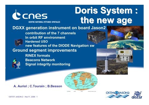
DGXX generation instrument on board Jason2<br />
contribution of the 7 channels<br />
In orbit RF environment<br />
Hardened USO<br />
new features of the DIODE Navigation sw<br />
Ground segment improvements<br />
RINEX formats<br />
Beacons Network<br />
Signal integrity monitoring<br />
Doris System :<br />
the new age<br />
A. Auriol ; C.Tourain ; B.Besson<br />
OSTST/ JASON-2 – Nov11, 2008 - 1
The <strong>DORIS</strong> DGXX Instrument<br />
■<br />
■<br />
■<br />
7 Dual frequency Channels<br />
capacity to track up to 7 beacons simultaneously<br />
• Increases data quantity<br />
• Makes available low elevation measurements<br />
• Improves passes distribution<br />
Hardened USO<br />
Better Frequency stability while crossing SAA<br />
• better quality of MOE<br />
• Jason 2 useful for beacons location<br />
New DIODE Navigation sw<br />
No more numerical limitation thanks to ERC32 processor<br />
improved accuracy (see C. Jayles presentation)<br />
• better quality of NRT products (OGDR)<br />
geodesic bulletin for altimeter tracking<br />
• Access to new zones of interest for altimetry<br />
OSTST/ JASON-2 – Nov11, 2008 - 2
Doris / Jason2 coverage<br />
6<br />
5<br />
3<br />
2<br />
30<br />
Percent. of Time<br />
20<br />
10<br />
0 0 1 2 3 4 5 6 7<br />
Visible beacons<br />
OSTST/ JASON-2 – Nov11, 2008 - 3
<strong>DORIS</strong> / Jason2 Measurement Channels designation strategy<br />
■<br />
Channels 1 to 6 : Beacons selected by DIODE Navigation sw<br />
the beacon is tracked<br />
• if its identification and coordinates have been uploaded on board (permanent<br />
stations, orbitography network)<br />
• as soon as it is visible with an elevation > 5 °<br />
■<br />
Channel 7 : Beacons selected by Spectrum Analysis<br />
the beacon is tracked as soon as it is visible over the noise floor<br />
• temporary stations (IDS)<br />
• low elevation measurements on permanent beacons (0° to 5°)<br />
– this may have an impact on phase reconstruction over the passes (see F. Mercier,<br />
L. Cerri pres.)<br />
– May be affected by masks or multi path effects (station field of view requirement<br />
limit is 5°)<br />
■<br />
May be changed depending on users recommendations<br />
OSTST/ JASON-2 – Nov11, 2008 - 4
<strong>DORIS</strong> / Jason2 Measurements quantity<br />
Data quantity<br />
comparison Jason 2 / Jason 1<br />
Jason 2 distribution / elevation<br />
35000<br />
measurements / day<br />
30000<br />
25000<br />
20000<br />
15000<br />
10000<br />
5000<br />
Jason 2<br />
Jason 1<br />
J1 UT2<br />
J1 UT1<br />
J2 UT7<br />
J2 UT6<br />
J2 UT5<br />
J2 UT4<br />
J2 UT3<br />
J2 UT2<br />
J2 UT1<br />
0<br />
Elev.< 5°<br />
Elev. >=5° et<br />
=10° total total (>= 12°)<br />
OSTST/ JASON-2 – Nov11, 2008 - 5
Passes distribution<br />
Saint-John’s Reyjavik Dionysos<br />
Jason 1<br />
(10 day cycle)<br />
c plots CLS<br />
Jason 2<br />
(10 day cycle)<br />
OSTST/ JASON-2 – Nov11, 2008 - 6
<strong>DORIS</strong> Jason 2 Jamming measurements (June 2008)<br />
400MHz<br />
2GHz<br />
High density<br />
of Jammers<br />
over Western<br />
Europe<br />
same<br />
situation<br />
since 1990<br />
(<strong>DORIS</strong>/SPOT2<br />
observation)<br />
No jammer<br />
OSTST/ JASON-2 – Nov11, 2008 - 7
USO behavior while crossing SAA<br />
5<br />
Jason 1<br />
Jason 1<br />
4<br />
3<br />
90<br />
2<br />
60<br />
FAIRBANKS<br />
YELLOWKNIFE<br />
THULE<br />
ST JOHN'S<br />
REYKJAVIK<br />
NY-ALESUND (SPITZBERG)<br />
METSAHOVI<br />
KRASNOYARSK<br />
BADARY<br />
YUZHNO-SAKHALINSK<br />
(10 E-11)<br />
1<br />
0<br />
-1<br />
30<br />
0<br />
KAUAI<br />
GOLDSTONE<br />
SOCORRO<br />
GREENBELT<br />
RICHMOND<br />
GALAPAGOS<br />
KOUROU<br />
TOULOUSE<br />
PONTA DELGADA<br />
DIONYSOS<br />
SAL<br />
LIBREVILLE<br />
ASCENSION<br />
KITAB<br />
DJIBOUTI<br />
MAHE<br />
EVEREST<br />
COLOMBO<br />
PURPLE MOUNTAIN<br />
MANILLE<br />
CIBINONG<br />
PORT MORESBY<br />
-2<br />
-3<br />
-4<br />
-5<br />
20/10/2008 00:00:00 21/10/2008 00:00:00 22/10/2008 00:00:00 23/10/2008 00:00:00 24/10/2008 00:00:00 25/10/2008 00:00:00<br />
FUTUNA<br />
PAPEETE<br />
AREQUIPA<br />
ST-HELENE<br />
-30<br />
-60<br />
CHATHAM<br />
RAPA<br />
EASTER ISLAND<br />
SANTIAGO<br />
RIO GRANDE<br />
ROTHERA<br />
CACHOEIRA<br />
BELGRANO<br />
TRISTAN DA CUNHA<br />
LA REUNION<br />
HARTEBEESTHOEK<br />
AMSTERDAM<br />
CROZET<br />
KERGUELEN<br />
MARION ISLAND<br />
SYOWA<br />
YARRAGADEE<br />
TERRE ADELIE<br />
NOUMEA<br />
MOUNT STROMLO<br />
5<br />
4<br />
3<br />
2<br />
Jason 2<br />
Jason 2<br />
-90<br />
-180 -150 -120 -90 -60 -30 0 30 60 90 120 150 180<br />
The <strong>DORIS</strong>/Jason2 USO has<br />
been successfully hardened<br />
against radiation<br />
( 10 E-11)<br />
1<br />
0<br />
-1<br />
-2<br />
-3<br />
-4<br />
-5<br />
20/10/2008 00:00:00 21/10/2008 00:00:00 22/10/2008 00:00:00 23/10/2008 00:00:00 24/10/2008 00:00:00 25/10/2008 00:00:00<br />
OSTST/ JASON-2 – Nov11, 2008 - 8
New features of the <strong>DORIS</strong>-DIODE Navigation sw<br />
■<br />
Provision of real time precise “geodesic<br />
geodesic” ephemeris helping the altimeter tracking<br />
Médiane acquisition + poursuite autonome<br />
Diode acquisition et médiane en poursuite<br />
Diode acquisition + poursuite<br />
42.5 ° N<br />
42.5 ° N<br />
42.5 ° N<br />
CORSE<br />
CORSE<br />
CORSE<br />
42.0 ° N<br />
42.0 ° N<br />
42.0 ° N<br />
41.5 ° N<br />
0 25 50 km<br />
41.5 ° N<br />
0 25 50 km<br />
41.5 ° N<br />
0 25 50 km<br />
9.0<br />
Altimeter “traditional” ° E<br />
Mode<br />
closed loop (Jason1)<br />
• Measurement on coasts<br />
lost due to acquisition delay<br />
• No Measurement on Land<br />
8.5 ° E<br />
8.5 ° E<br />
9.0 ° E<br />
Acquisition helped by<br />
DIODE; closed loop<br />
• gain in acquisition delay<br />
> 1s ( ~ 7km)<br />
• Acces to coastal zones<br />
8.5 ° E<br />
9.0 ° E<br />
Tracking driven by DIODE ;<br />
open loop<br />
• Acces to water surfaces in<br />
strong relief<br />
• Focus on zones of interest<br />
selected in the DEM<br />
• Acces to off Nadir targets<br />
(appropriate tayloring of DEM)<br />
OSTST/ JASON-2 – Nov11, 2008 - 9
Jason-2 In-Flight validation of DIODE+DEM<br />
mode<br />
Coastal zone : example in Norway<br />
(fjords)<br />
Strong relief<br />
region<br />
DIODE/DEM<br />
(cycle 3)<br />
Median tracker<br />
(cycle 2)<br />
c Lombard, Steunou, Lambin<br />
OSTST/ JASON-2 – Nov11, 2008 - 10
RINEX Formats (1/2)<br />
■<br />
■<br />
■<br />
■<br />
■<br />
<strong>DORIS</strong> Measurements now available daily in Receiver Independent “GPS like format”<br />
<br />
Documentation on RINEX files is available on IDS site<br />
Measurements are dated (event : signal arrival at antenna phase centre) in two ways :<br />
<br />
<br />
In On Board Time<br />
• Pseudo range measurements on Time Beacons may be used for all measurements redatation<br />
In <strong>International</strong> Atomic Time scale<br />
• By means of the OBT offset field<br />
• Time correspondence is currently estimated by the OBSW (DIODE) with an accuracy of few<br />
microseconds<br />
• Improvement currently under study towards an accuracy of less than 1 microsecond<br />
Available received power on both channels may be used for data weighting purpose<br />
On board clock (USO) frequency is also available as per OBSW (DIODE) estimation<br />
Two sets of phase measurements “φ0” and “φ1” are available :<br />
3 s O B T<br />
3 s O B T<br />
3 s O B T<br />
φ 0 φ 1<br />
1 0 s O B T<br />
φ 0 φ 1<br />
φ 0 φ 1 t<br />
OSTST/ JASON-2 – Nov11, 2008 - 11
RINEX Formats (1/2)<br />
φo Epoch (OBT)<br />
OBT offset<br />
Epoch (TAI) = Epoch (OBT) + OBT offset<br />
φo (L1)<br />
φ1 Epoch<br />
φ1 (L1)<br />
On Board Frequency estimation<br />
OSTST/ JASON-2 – Nov11, 2008 - 12
RINEX Formats (2/2)<br />
■ Anomalies detected :<br />
<br />
Sensitivity of pseudo range to Doppler variation not taken into account :<br />
• Pseudo Range Curves over a beacon pass are slanted<br />
but centred on zero (no impact on datation assuming<br />
passes are balanced)<br />
• update of configuration file currently in progress<br />
<br />
Bias of 51.83 microseconds in [TAI – OBT] field :<br />
• Leads in an error of 35 cm on along track position when TAI datation is used<br />
• Correction planed mid November<br />
<br />
Bad interpretation of meteo parameters<br />
• Correction planed mid November<br />
■<br />
Reprocessing planed in early December<br />
OSTST/ JASON-2 – Nov11, 2008 - 13
Beacons Network<br />
3rd generation beacons deployment<br />
93% of the <strong>DORIS</strong> stations<br />
already equipped with<br />
3rd Generation beacons<br />
OSTST/ JASON-2 – Nov11, 2008 - 14
Beacons Network<br />
Time / Master Beacons<br />
■ 4 Time Beacons currently operating :<br />
Toulouse (Master Beacon, USO + Cs)<br />
Kourou (Master Beacon, USO + Cs)<br />
Hartebeestoek (Master Beacon, USO +<br />
Cs)<br />
Yellowknife (HMaser<br />
(<br />
HMaser)<br />
• These 4 beacons all driven by an atomic<br />
clock may be used for datation purpose<br />
■ 1 more MB still planed to be installed in<br />
South Pacific<br />
OSTST/ JASON-2 – Nov11, 2008 - 15
Beacons Network<br />
stations improvement<br />
■<strong>DORIS</strong> stations are currently<br />
revisited<br />
to renew ageing beacons,<br />
To improve the Radio-Frequency<br />
environment (masks, multi path)<br />
To ensure electrical power<br />
availability<br />
To improve the antenna stability.<br />
• See detailed presentation by H.<br />
Fagard<br />
OSTST/ JASON-2 – Nov11, 2008 - 16
Signal Integrity monitoring<br />
■ <strong>DORIS</strong> Integrity Team set up end 2004-<br />
beginning 2005<br />
Network availability<br />
to monitor permanently the <strong>DORIS</strong> signal<br />
transmitted in space, control its characteristics,<br />
investigate non nominal situations and take<br />
corrective actions if needed<br />
By systematic analysis of<br />
• RF levels received by all contributing instruments<br />
in operations and comparison with theoretical<br />
expected levels<br />
• Orbit or positioning processing residuals<br />
• On board and beacons USOs frequencies<br />
• Datation performance on board Jason1 & Jason2<br />
• Navigation quality indexes on board Envisat,<br />
Jason1 & Jason2<br />
• Sw reports of Jason 2<br />
OSTST/ JASON-2 – Nov11, 2008 - 17
Signal Integrity monitoring<br />
example of action<br />
The sight was free when the station was installed<br />
Analysis of power received<br />
from Kauai station<br />
<br />
<br />
What is<br />
corrupting<br />
the <strong>DORIS</strong><br />
signal in the<br />
South East<br />
of Kauai<br />
station <br />
But a metallic tower has grown since !<br />
Corrective action taken : last floor of the tower has been removed<br />
OSTST/ JASON-2 – Nov11, 2008 - 18
Doris System :<br />
the new age<br />
Thank you for attention<br />
A. Auriol ; C.Tourain ; B.Besson<br />
OSTST/ JASON-2 – Nov11, 2008 - 19