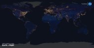
Download - NASA's Earth Observing System
Download - NASA's Earth Observing System
Download - NASA's Earth Observing System

You also want an ePaper? Increase the reach of your titles
YUMPU automatically turns print PDFs into web optimized ePapers that Google loves.
24<br />
The <strong>Earth</strong> Observer July - August 2012 Volume 24, Issue 4<br />
meeting/workshop summaries<br />
Dorothy Hall [GSFC] discussed how she used MODIS<br />
Ice-Surface Temperature (IST) data to produce a Climate<br />
Date Record (CDR) for the Greenland ice sheet. Changes<br />
in the duration of ice cover on the Greenland ice sheet<br />
are taking place, with mass loss of the Greenland ice<br />
sheet being recorded at depths below approximately 2 km<br />
(~1.2 mi). MODIS data show a consistent pattern of icesheet<br />
warming and concomitant increases in melt extent.<br />
IST can help validate models, and can be used to improve<br />
the accuracy of ice-sheet mass balance estimates.<br />
Michael King discussed the spatial and temporal distribution<br />
of clouds observed by MODIS on the Terra<br />
and Aqua satellites. He noted that cloud fraction—the<br />
amount of the sky covered by clouds—is nearly the same<br />
during nighttime and daytime. Further, the total cloud<br />
fraction is nearly the same using data from MODIS<br />
on Terra and Aqua; however, MODIS Terra data show<br />
more cloud cover over oceans, while MODIS Aqua data<br />
show more cloud cover over land. Cloud-top properties<br />
show higher clouds over land than over oceans; the coldest<br />
cloud tops are found over Antarctica; and the highest<br />
cloud tops are found over the tropics. For the first time,<br />
it is possible to separate the occurrence of clouds composed<br />
of liquid water from those composed of ice; optical<br />
properties (cloud optical thickness and effective particle<br />
size) have been derived for both phases separately.<br />
Watson Gregg [GSFC] discussed using MODIS data<br />
for ocean biology modeling and assimilation, which improves<br />
models and data representation.<br />
Luigi Boschetti [University of Maryland] discussed how<br />
the MODIS Rapid Response <strong>System</strong> (“Rapidfire”) and<br />
burned area analysis are an operational success story. He<br />
reinforced how Rapidfire is helping society better to prepare<br />
for forest fires and to evaluate and assess fire damage.<br />
Eric Wilcox [Desert Research Institute] discussed how<br />
observations from MODIS and other spaceborne instruments<br />
are being used to understand aerosol effects on the<br />
environment. He emphasized the association between<br />
dust outbreaks over the tropical Atlantic Ocean and a<br />
northward shift in precipitation. Aerosols in the atmosphere<br />
continue to be studied using remote sensing.<br />
Zia Ahmed [GSFC] described advances in correcting<br />
ocean color products using MODIS data. Eighty new<br />
models were developed to process MODIS data to help<br />
generate more-accurate ocean-color information.<br />
Forest Hall [GSFC/University of Maryland Baltimore<br />
County] discussed assimilating photosynthesis data<br />
derived from the next generation of remote sensing instruments<br />
to create and enhance vegetation models.<br />
These models are important for predicting and characterizing<br />
the effects of carbon, energy, and water cycles<br />
on vegetation.<br />
Leigh Munchak [GSFC] reflected on the use of the<br />
MODIS instruments to monitor globally distributed<br />
aerosols. Munchak and his colleagues are looking closely<br />
at the relationships between volcanology, chemistry,<br />
and aerosols, as well as other factors. The intent of their<br />
research was to collect data for the CDR, but much of<br />
their research has been used to describe air quality. They<br />
are using both Terra and Aqua MODIS sensors, which<br />
are aging and delivering some conflicting data measurements,<br />
increasing the importance of new data from the<br />
Suomi NPP VIIRS in continuing their research.<br />
Discipline Summary Reports<br />
Next, the ocean discipline group presented work designed<br />
to improve ocean color and sea surface temperature<br />
records—important data records that require both<br />
duration and continuity.<br />
Bryan Franz [GSFC] discussed approaches used to improve<br />
ocean-color data for generating CDRs. Loss of the<br />
Medium Resolution Imaging Spectrometer (MERIS)<br />
and other instruments on the European Space Agency’s<br />
now-defunct Envisat is making calibration difficult.<br />
Multimission ocean-color reprocessing is being considered<br />
to correct for MODIS sensor issues and anomalies.<br />
To address this, MODIS data were cross-calibrated with<br />
Sea-viewing Wide Field-of-view Sensor (SeaWiFS) data.<br />
This cross-calibration is becoming more important as<br />
lunar and solar calibration trends for MODIS on Aqua<br />
become more erratic, resulting in large trending errors.<br />
Both MODIS sensors are beyond their design life;<br />
maintaining quality is an ongoing challenge.<br />
Steve Running [University of Montana] summarized<br />
the MODIS land (MODland) breakout team’s meeting.<br />
The team concluded that Collection 6 reprocessing<br />
will show any detected changes in land cover for<br />
2001, 2003, 2005, and 2007; and that MODland algorithms<br />
should be prioritized for VIIRS continuity.<br />
The team encouraged NASA to begin planning a strategy<br />
for post-MODIS data continuity, focusing more<br />
on datasets, and less on missions.<br />
Steve Platnick [GSFC] presented the discipline summary<br />
report for the atmosphere breakout team. The<br />
group discussed atmospheric data, analysis, and validation<br />
investigations, focusing on the latest results and ice<br />
cloud radiative models. They also discussed the status<br />
of the Collection 6 algorithms, which are currently in<br />
various stages of testing; the team hoped that reprocessing<br />
using Collection 6 will be completed by December.<br />
Currently, the MODIS Characterization Support Team<br />
has no dedicated team to maintain calibration. Platnick<br />
noted that in the current environment, sustaining the<br />
viability of climate and <strong>Earth</strong> science data records is extremely<br />
challenging. ••