Download - NASA's Earth Observing System
Download - NASA's Earth Observing System
Download - NASA's Earth Observing System

You also want an ePaper? Increase the reach of your titles
YUMPU automatically turns print PDFs into web optimized ePapers that Google loves.
The <strong>Earth</strong> Observer July - August 2012 Volume 24, Issue 4 39<br />
Warm Snap Turned Antarctica Green Around the<br />
Edges, June 20; National Geographic News. An unexpectedly<br />
warm period about 15 million years ago temporarily<br />
thawed Antarctica, turning the continent green<br />
around its edges, a new study published in Nature Geoscience<br />
says. Antarctica developed its ice sheets about 34<br />
million years ago, but during the more recent warm period,<br />
the interior landscape would have resembled tundra<br />
found in parts of modern-day Chile and New Zealand,<br />
and the coasts would have been lined with beech<br />
trees and a type of conifer. The surprising evidence<br />
comes from “abundant” remains of leaf waxes in sediment<br />
cores taken from deep beneath Antarctica’s Ross<br />
Ice Shelf. Based upon a model originally developed to<br />
analyze hydrogen isotope ratios in atmospheric water<br />
vapor using data from NASA’s Aura spacecraft, co-author<br />
Jung-Eun Lee [NASA Jet Propulsion Laboratory]<br />
created experiments to find out just how much warmer<br />
and wetter the climate may have been. The peak of this<br />
Antarctic greening occurred during the middle Miocene<br />
period, between 16.4 and 15.7 million years ago.<br />
*See news story in this issue for more details.<br />
Interested in getting your research out to the general public,<br />
educators, and the scientific community Please contact<br />
Patrick Lynch on NASA’s <strong>Earth</strong> Science News Team at<br />
patrick.lynch@nasa.gov and let him know of your upcoming<br />
journal articles, new satellite images, or conference<br />
presentations that you think the average person would be<br />
interested in learning about. ••<br />
NASA earth science in the news<br />
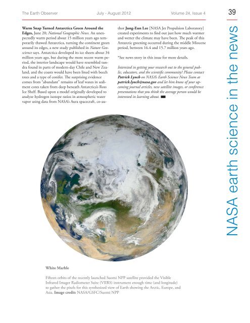
White Marble<br />
Fifteen orbits of the recently launched Suomi NPP satellite provided the Visible<br />
Infrared Imager Radiometer Suite (VIIRS) instrument enough time (and longitude)<br />
to gather the pixels for this synthesized view of <strong>Earth</strong> showing the Arctic, Europe, and<br />
Asia. Image credit: NASA/GSFC/Suomi NPP