Burpengary Creek Brochure - Moreton Bay Regional Council
Burpengary Creek Brochure - Moreton Bay Regional Council
Burpengary Creek Brochure - Moreton Bay Regional Council

You also want an ePaper? Increase the reach of your titles
YUMPU automatically turns print PDFs into web optimized ePapers that Google loves.
<strong>Burpengary</strong> <strong>Creek</strong> catchment forms part of the<br />
larger Deception <strong>Bay</strong> catchment. <strong>Burpengary</strong><br />
<strong>Creek</strong> catchment encompasses an area of<br />
7,960 hectares, which is 6.5 percent of the total<br />
Caboolture Shire area. Two distinctive creeks drain<br />
the catchment- Little <strong>Burpengary</strong> <strong>Creek</strong> (1600ha)<br />
and <strong>Burpengary</strong> <strong>Creek</strong> (6360ha). The upper<br />
sections of this catchment start in the D'Aguilar<br />
Ranges near the small communities of Ocean View<br />
and Moorina. It then flows through Morayfield,<br />
around the township of <strong>Burpengary</strong> and spills out<br />
into southern Deception <strong>Bay</strong>.<br />
COUNCIL PROGRAMS<br />
<strong>Council</strong> continues to educate the community about<br />
management of our waterways through a range of<br />
programs such as Land for Wildlife, Urban Wildlife, Cities<br />
for Climate Protection and the Catchment Education<br />
program.<br />
OTHER FACT SHEETS IN THIS SERIES:<br />
► Issues Affecting our Catchments<br />
► Caboolture Catchments: Caboolture River<br />
► Caboolture Catchments: Bribie Island<br />
Support your catchment<br />
e observant of wildlife - ensure your place is a haven, not a hazard<br />
se native plants that require less water and maintenance<br />
estore protective vegetation along watercourses and creeks<br />
rotect your soil against erosion by maintaining ground cover<br />
nsure fertilisers and pesticides are used as per directions<br />
ever dump oil, chemicals or paints - dispose of these safely<br />
et rid of declared and environmental weeds<br />
sk <strong>Council</strong> for details on water, wildlife, waste, conservation and greenhouse initiatives<br />
emember to keep cats and dogs under control at night<br />
our support for activities at CREEC is welcome<br />
ontrol feral animals, mosquitoes and other pests<br />
etain the scenic amenity of the landscape<br />
liminate litter from our roadsides and public areas<br />
nsure <strong>Burpengary</strong> <strong>Creek</strong> is a healthy catchment<br />
eep the Shire beautiful by supporting clean up campaigns<br />
CARE FOR OUR CATCHMENTS SERIES<br />
<strong>Burpengary</strong><br />
<strong>Creek</strong><br />
CABOOLTURE SHIRE COUNCIL<br />
2 Hasking Street<br />
Caboolture Qld 4510<br />
PO Box 159<br />
Caboolture Qld 4510<br />
Call Centre:<br />
Telephone: (07) 54 200 100<br />
Facsimile: (07) 54 200 200<br />
Email: csc@caboolture.qld.gov.au<br />
Website: www.caboolture.qld.gov.au<br />
Printed on Australian recycled stock using organic inks<br />
VERSION 1 OCTOBER 2006
Caboolture Catchments: <strong>Burpengary</strong> <strong>Creek</strong><br />
History of the catchment<br />
To the Aboriginal communities of the area, <strong>Burpengary</strong> is a<br />
place of deep significance, the name meaning “place of the<br />
wattle trees”. This area provided good canoe trees, camping<br />
places, fishing sites and access to the coast.<br />
By the 1900s, the upper sections of this catchment were<br />
dominated by agriculture, where large amounts of land<br />
were cleared for grazing.<br />
The middle section flowing through <strong>Burpengary</strong> was<br />
once dairy farm land. This was then replaced with pine<br />
plantations and much has recently undergone land<br />
subdivision as the population continues to grow.<br />
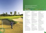
Recreational options along <strong>Burpengary</strong><br />
<strong>Creek</strong><br />
► Picnic in parks along the creek<br />
► Bird-watching at the Caboolture <strong>Regional</strong> Environmental<br />
Education Centre (CREEC) on Rowley Road, <strong>Burpengary</strong><br />
► Launch a boat at the boat ramp on O'Leary Avenue,<br />
<strong>Burpengary</strong> (UBD 69, H10) and explore the estuarine<br />
section east of the Bruce Highway<br />
CREEC at Rowley Road, <strong>Burpengary</strong><br />
Plants and wildlife<br />
Less than 7.5 percent of the original vegetation within<br />
<strong>Burpengary</strong> <strong>Creek</strong> catchment remains. Areas now deemed<br />
to be of conservation significance within this catchment<br />
include communities surrounding Mount Franz (forested<br />
hill slopes, vine forests and open Eucalypt forest) and<br />
Freshwater National Park, adjacent to Deception <strong>Bay</strong> Road,<br />
which hosts one of the largest undisturbed Tea Tree and<br />
Scribbly Gum forests in south-east Queensland.<br />
OTHER TREE SPECIES FOUND WITHIN BURPENGARY<br />
CREEK CATCHMENT INCLUDE:<br />
► Smooth Barked Gums<br />
► Stringy Barks<br />
► Iron Barks<br />
► Brush Box<br />
► Hoop Pine<br />
► Cedar<br />
► Ash<br />
► Tulip Oak<br />
FAUNA OF INTEREST FOUND WITHIN BURPENGARY<br />
CREEK CATCHMENT INCLUDE:<br />
► Platypus<br />
► 140 different species of birds<br />
► Eastern Whipbird<br />
► Australian King Parrot<br />
► Ringtail Possums<br />
► Carpet Pythons<br />
► Green Tree Frogs<br />
► Native Bees<br />
Grevillea - Honey Gem<br />
Eastern Whipbird<br />
INTERESTING PLACES: CREEC<br />
The Caboolture Region Environmental Education<br />
Centre (CREEC) opened in November 1999. It is<br />
located on Rowley Road in <strong>Burpengary</strong> and offers<br />
local environmental education, as well as an on-site<br />
community nursery. The Caboolture Sustainable Living<br />
Fair is held at CREEC in June every year.<br />
Issues affecting <strong>Burpengary</strong> <strong>Creek</strong><br />
catchments<br />
Within <strong>Burpengary</strong> <strong>Creek</strong> catchment, key environmental<br />
threats to the sustainability of waterways and natural<br />
areas include:<br />
► Urban stormwater quality, both from new developments<br />
or existing urban areas<br />
► On-site wastewater<br />
management<br />
► Channel erosion and<br />
sedimentation<br />
► Riparian zone degradation,<br />
including weed invasion and<br />
vegetation disturbance<br />
► Nutrients and other<br />
contaminants<br />
Dusky Moorhen<br />
(Gallinula tenebrosa)<br />
► Declining waterway health<br />
► Vegetation clearing and habitat fragmentation<br />
► Barriers to fish movement in waterways (e.g. culverts)<br />
CABOOLTURE SHIRE COUNCIL www.caboolture.qld.gov.au


![Kumbartcho Brochure [PDF 540KB] - Moreton Bay Regional Council](https://img.yumpu.com/47220970/1/190x101/kumbartcho-brochure-pdf-540kb-moreton-bay-regional-council.jpg?quality=85)