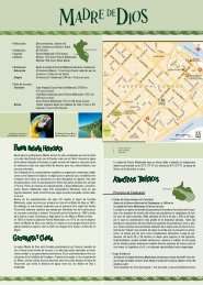
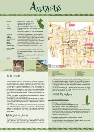
Province of Arequipa - South American Destination
Province of Arequipa - South American Destination
Province of Arequipa - South American Destination

You also want an ePaper? Increase the reach of your titles
YUMPU automatically turns print PDFs into web optimized ePapers that Google loves.
Colca Valley<br />
151 km / 94 miles north <strong>of</strong> <strong>Arequipa</strong> (3 hours by car)<br />
The extreme northeastern section <strong>of</strong> the department <strong>of</strong> <strong>Arequipa</strong> is located here.<br />
The highest point is the inactive volcano Mount Ampato (6288 masl), and the<br />
lowest at the confluence <strong>of</strong> the rivers Colca and Andamayo (970 masl). The<br />
Colca valley is 100 km in length and occupies only part <strong>of</strong> the Colca river basin,<br />
comprising the districts <strong>of</strong> Callalli and Huambo.<br />
There are sixteen villages in this zone made up <strong>of</strong> descendents <strong>of</strong> the Collaguas<br />
and Cabanas tribes, inheritors <strong>of</strong> rich cultural traditions. The towns <strong>of</strong> Chivay<br />
and Cabanaconde are the most visited by tourists.<br />
In the latter, you can watch condors soar from the Cruz de Condor (Condor<br />
Crossing) Lookout. The Colca valley forms part <strong>of</strong> the <strong>South</strong> <strong>American</strong> tectonic<br />
plate and contains the active volcano Sabancaya, located on the volcanic<br />
mountain Hualca Hualca. This valley possesses a great diversity <strong>of</strong> flora and<br />
fauna. Among the most representative species are the condor, the kestrel, the<br />
peregrine falcon, and the Andean tinamou.<br />
Colca Canyon<br />
42 km / 26 miles west <strong>of</strong> the town <strong>of</strong> Chivay (1 hour by car)<br />
This is one <strong>of</strong> the deepest places on the planet, reaching a depth <strong>of</strong> 3400 meters<br />
/ 11.155 feet at the lowest point in the location <strong>of</strong> Canco. On the right side, it<br />
is flanked by the Chila Cordillera (Bomboya, Serpregrina, Mismi, Queshihua) and<br />
on the other by Mount Hualca Hualca, Sabancaya, and Ampato. You can see<br />
Mount Ubinas and beautiful Mount Coropuna in the distance.<br />
Imata Stone Forest<br />
150 km / 93 miles northeast <strong>of</strong> <strong>Arequipa</strong> on the Puno highway (2 hours by car)<br />
It is a complex <strong>of</strong> stone structures that have the appearance <strong>of</strong> a mysterious<br />
petrified forest. Erosion has shaped the stones, giving them a peculiar aspect.<br />
The place is easily accessible since it is located near the <strong>Arequipa</strong> – Juliaca<br />
highway.<br />
Ampato volcano<br />
173 km / 108 miles north <strong>of</strong> <strong>Arequipa</strong> (5 hours by 4x4 vehicle)<br />
At 6288 masl / 20.630 fasl, it is temporarily inactive and exhibits a perpetual<br />
snowcap at the height <strong>of</strong> 5000 meters / 16.404 feet. The foothills have scarce<br />
vegetation limited to bunch grass and hawthorn. At the top, from which you can<br />
see the Colca Canyon, explorers found the “Dama de Ampato”, the mummified<br />
remains <strong>of</strong> a girl from the time <strong>of</strong> the Incas.<br />
<strong>Province</strong> <strong>of</strong> Islay<br />
Lagunas de Mejia National Sanctuary<br />
Islay<br />
146 km / 91 miles southwest <strong>of</strong> <strong>Arequipa</strong> (2 hours<br />
and 10 minutes by car); 11 km / 7 miles south from the Mejia baths and 5 km /<br />
3 miles south <strong>of</strong> Mollendo<br />
It possesses an area <strong>of</strong> 691 hectares and includes different habitats comprising<br />
swamps, salt marshes, tortora reeds, hills, riverside estuaries, fields <strong>of</strong> salt<br />
grass, and sandy beaches. It is ideal for bird-watching, and 195 species have<br />
been registered: 75 are resident species (you can find them there all year long),<br />
6 are ocean residing species, and 80 are migratory ones that travel from places<br />
so diverse and distant as the Peruvian jungle and the Antarctic.<br />
<strong>Province</strong> <strong>of</strong> Castilla<br />
Castilla<br />
Toro Muerto Petroglyphs<br />
164 km / 102 miles northwest <strong>of</strong> <strong>Arequipa</strong> (2 hours and<br />
30 minutes)<br />
Leaving the Colca valley and passing through the Sihuas pampas is one way to get<br />
there. To arrive there directly from <strong>Arequipa</strong>, take the road to Lima and turn <strong>of</strong>f at<br />
Corire (District <strong>of</strong> Uraca) and drive for 6 km / 4 miles.<br />
The site consists <strong>of</strong> a group <strong>of</strong> carvings spread out over 5 km 2 / 2 miles 2 .The majority<br />
<strong>of</strong> them are representations <strong>of</strong> human beings, animals, and plants, as well as geometric<br />
designs that seem to have been carved with sharpened stones. The techniques used<br />
varied from striking, scratching, chipping, to hammering, and their age could begin<br />
around 1100 A.D.<br />
Andagua, Valley <strong>of</strong> the Volcanoes<br />
323 km / 201 miles northeast from <strong>Arequipa</strong> (9 hours by car)<br />
The Valley <strong>of</strong> the Volcanoes was the center <strong>of</strong> strenuous convulsions in the<br />
volcanic mountain chain 200.000 years ago. We can still see today an extensive<br />
layer <strong>of</strong> lava over which around eighty-six smaller inactive volcanoes have<br />
emerged. It reaches an altitude <strong>of</strong> 3546 masl / 11.634 fasl.<br />
<strong>Province</strong> <strong>of</strong> La Union<br />
Cotahuasi Valley and Canyon (Scenic Reserve <strong>of</strong><br />
the Cotahuasi Sub-basin)<br />
375 km / 233 miles northwest <strong>of</strong> <strong>Arequipa</strong> (9 hours by car / 12<br />
hours by public bus)<br />
Different altitudinal tiers have created the conditions for a large biological<br />
diversity with high indices <strong>of</strong> endemism in both the flora and fauna. The<br />
Cotahuasi Canyon includes twelve life zones and three ecological regions. It is<br />
considered the deepest in Peru (3535 m / 11.598 feet).<br />
<strong>Province</strong> <strong>of</strong> Caravelí<br />
Waca Gorge or Puerto Inca Archeological Site<br />
417 km / 259 miles northwest <strong>of</strong> <strong>Arequipa</strong> (6 hours<br />
and 30 minutes by car);<br />
Archeological complex known for its long period <strong>of</strong> human occupation since the<br />
remnants found there date from the pre-ceramic era to the fourteenth and<br />
fifteenth centuries, indicating an Inca presence. Some archeologists and<br />
historians think that from this site, one <strong>of</strong> the most important Inca trails started<br />
which crossed into the territory <strong>of</strong> Ayacucho and later reached Cusco.<br />
<strong>Province</strong> <strong>of</strong> Camaná<br />
La Unión<br />
Caravelí<br />
173 km / 568 miles southwest <strong>of</strong> <strong>Arequipa</strong> (2 hours and 30 minutes by car)<br />
The central territory <strong>of</strong> <strong>Arequipa</strong> is located here. During the pre-Hispanic era,<br />
cultures like the Nasca, Paracas, Waris, Collaguas, Chuquibambas, and Incas<br />
lived in this pleasant valley. In 1539, the city <strong>of</strong> Camaná was founded under the<br />
name <strong>of</strong> “Villa Hermosa de Camaná” (Beautiful Villa <strong>of</strong> Camaná).<br />
Beach circuit<br />
It is located 10 - 40 km. / 6 - 25 miles from the city <strong>of</strong> Camaná (5 to 20 minutes<br />
by car)<br />
The beautiful beaches stretching to the Pacific Ocean are the best part <strong>of</strong> this<br />
area. These include la Punta, Cerrillos, el Chorro, las Cuevas, Quilca, la Miel,<br />
Arantas, Honoratos, La Playuela, etc. Some <strong>of</strong> these beaches are <strong>of</strong>ten visited<br />
by adventure sports lovers and fishing fans.<br />
José María Quimper Archeological Museum – El Cardo<br />
Located in the District <strong>of</strong> El Cardo, 20 km / 12 miles from Camaná (20 minutes by car)<br />
There, you can see 10.000 years <strong>of</strong> history through the uncountable objects<br />
among which appear vestiges <strong>of</strong> the Nasca, Paracas, Wari, Chuquibamba,<br />
Collagua, and Inca cultures.<br />
Pucchun Lakes<br />
Enjoy watching a variety <strong>of</strong> wild bird species: ducks, antshrikes, moorehens,<br />
geese, flamingos, and more.<br />
Quilca<br />
33 km / 21 miles from the city <strong>of</strong> Camaná (30 minutes by car)<br />
It is the first southern Peruvian port, known for being the place where the hero<br />
<strong>of</strong> the War <strong>of</strong> the Pacific, Admiral Miguel Grau, defied the Chilean fleet<br />
commanded by Monitor Huáscar. It is ideal for underwater hunting and<br />
ecotourism.<br />
Inca Trails<br />
Roads used in pre-Hispanic times. Today, bicyclists, walkers, and equestrians<br />
use them.<br />
Inca Observatory<br />
Located on the right bank <strong>of</strong> the Camaná River at kilometer marker 826 <strong>of</strong> the<br />
Pan-<strong>American</strong> Highway <strong>South</strong>, you can enjoy nature and watch the waters flow<br />
into the Pacific Ocean.<br />
<strong>Arequipa</strong> has a large variety <strong>of</strong> dances and musical styles complemented by<br />
multicolored dance costumes.<br />
The most characteristic dance is the <strong>Arequipa</strong>n Carnaval, mainly done during the<br />
celebrations <strong>of</strong> Carnival and the anniversary <strong>of</strong> the founding <strong>of</strong> the city (15th<br />
August). Other typical music are the Yaraví, Quechua in origin, and the Pampeña,